

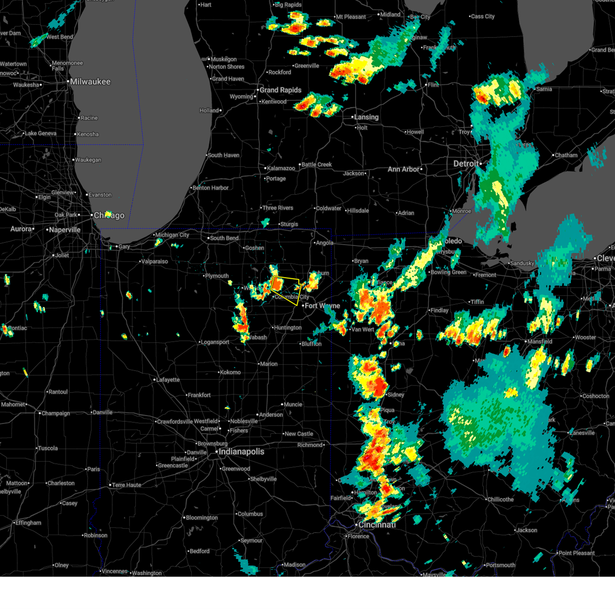
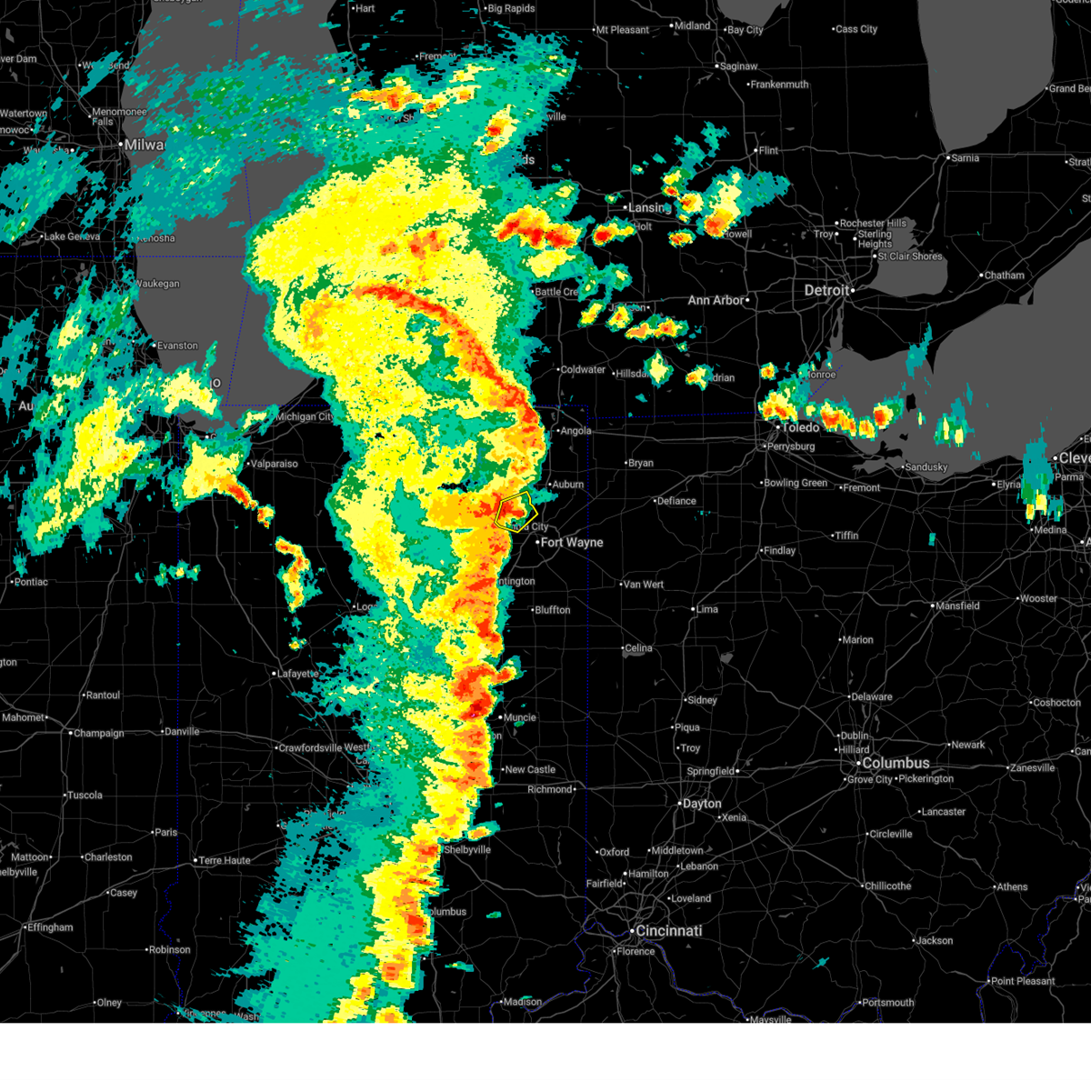
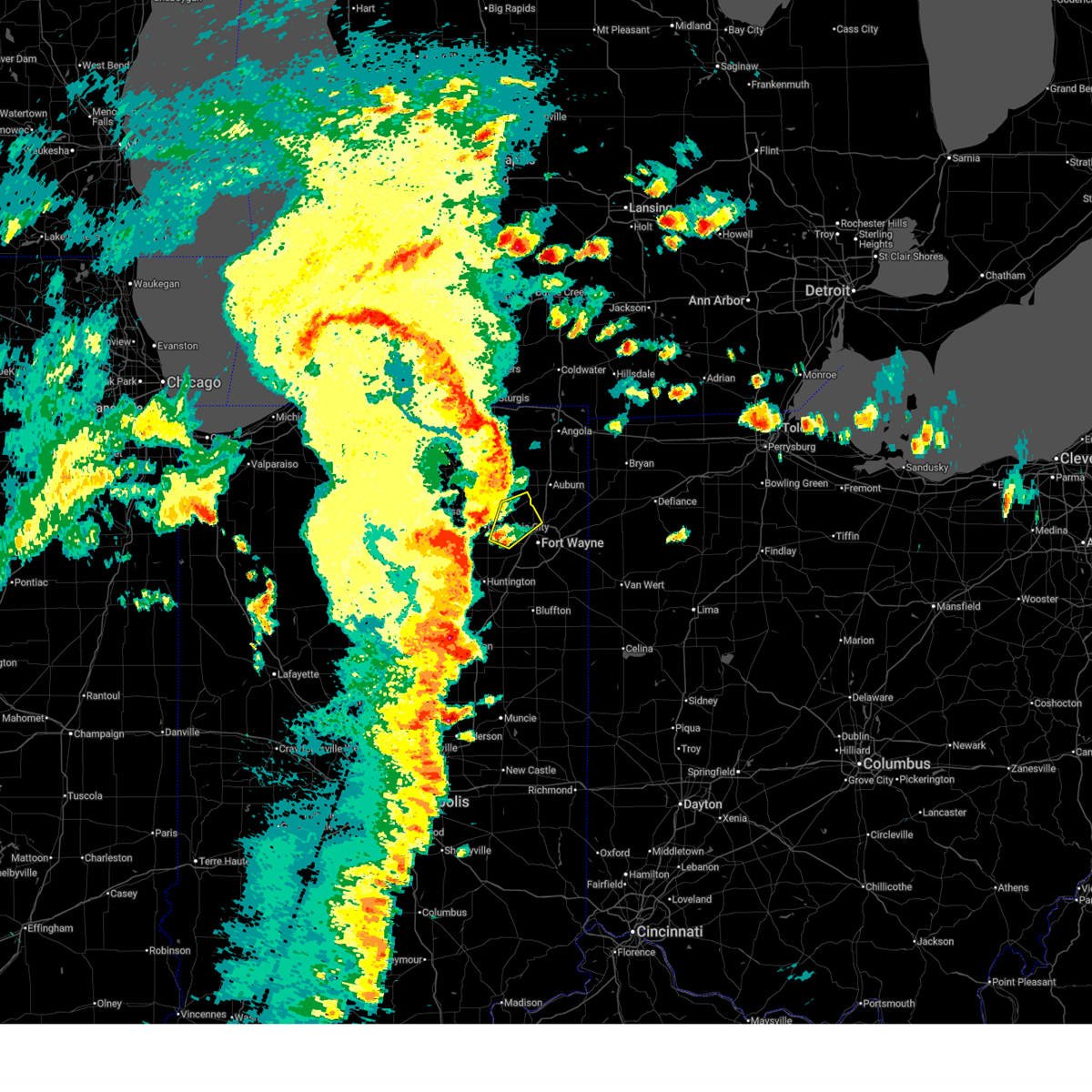
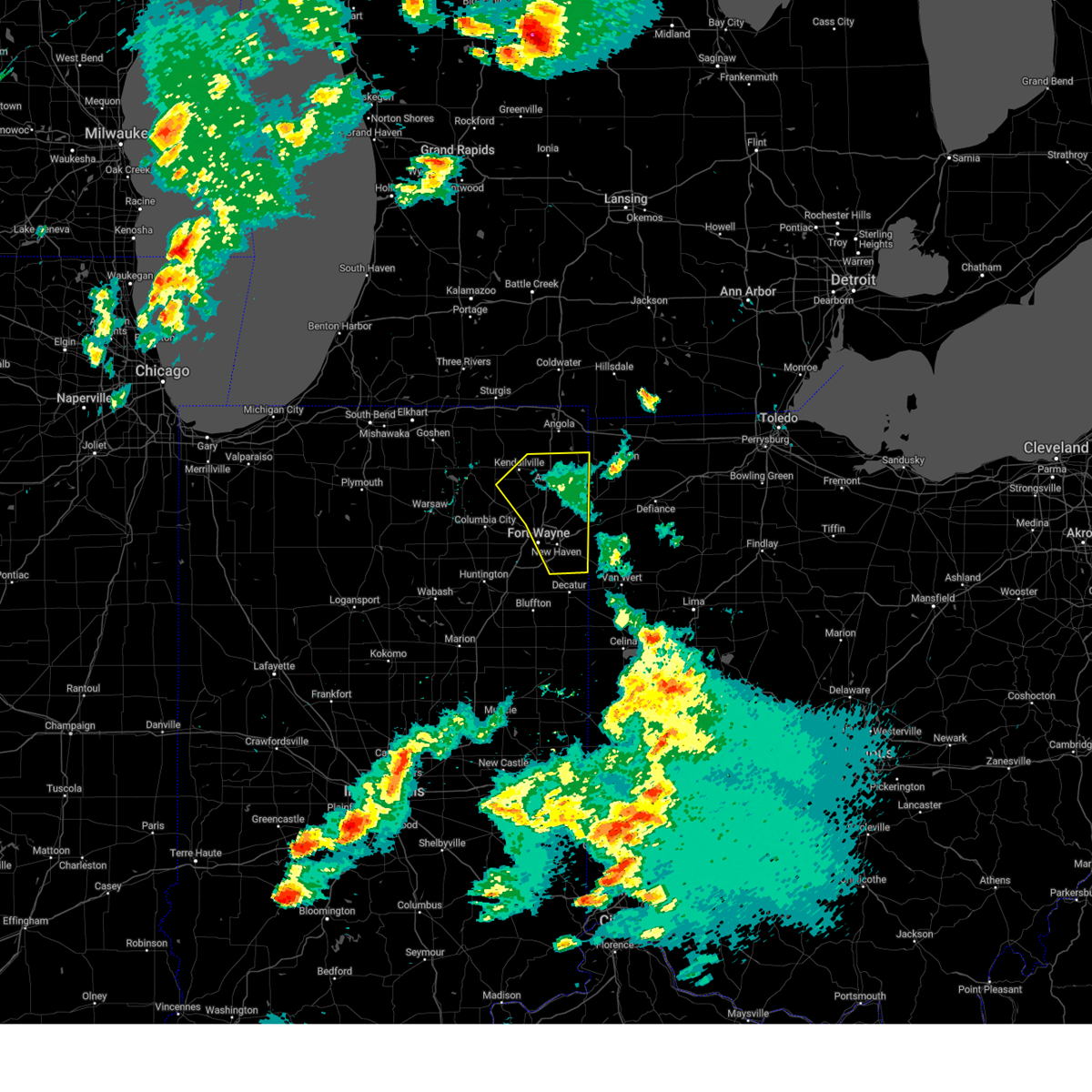
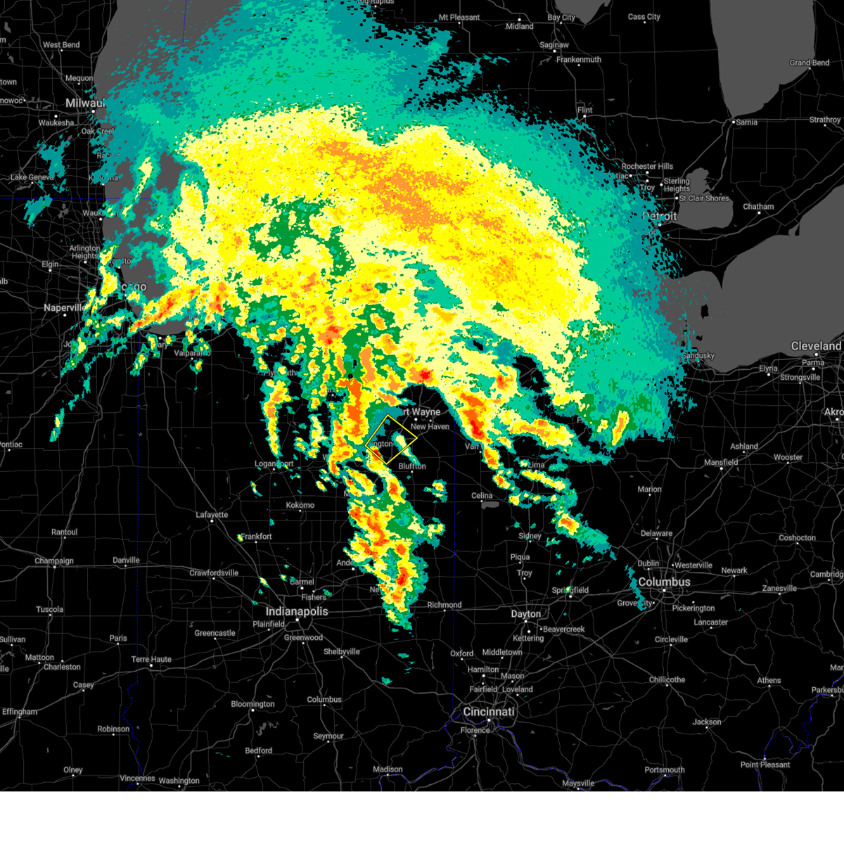
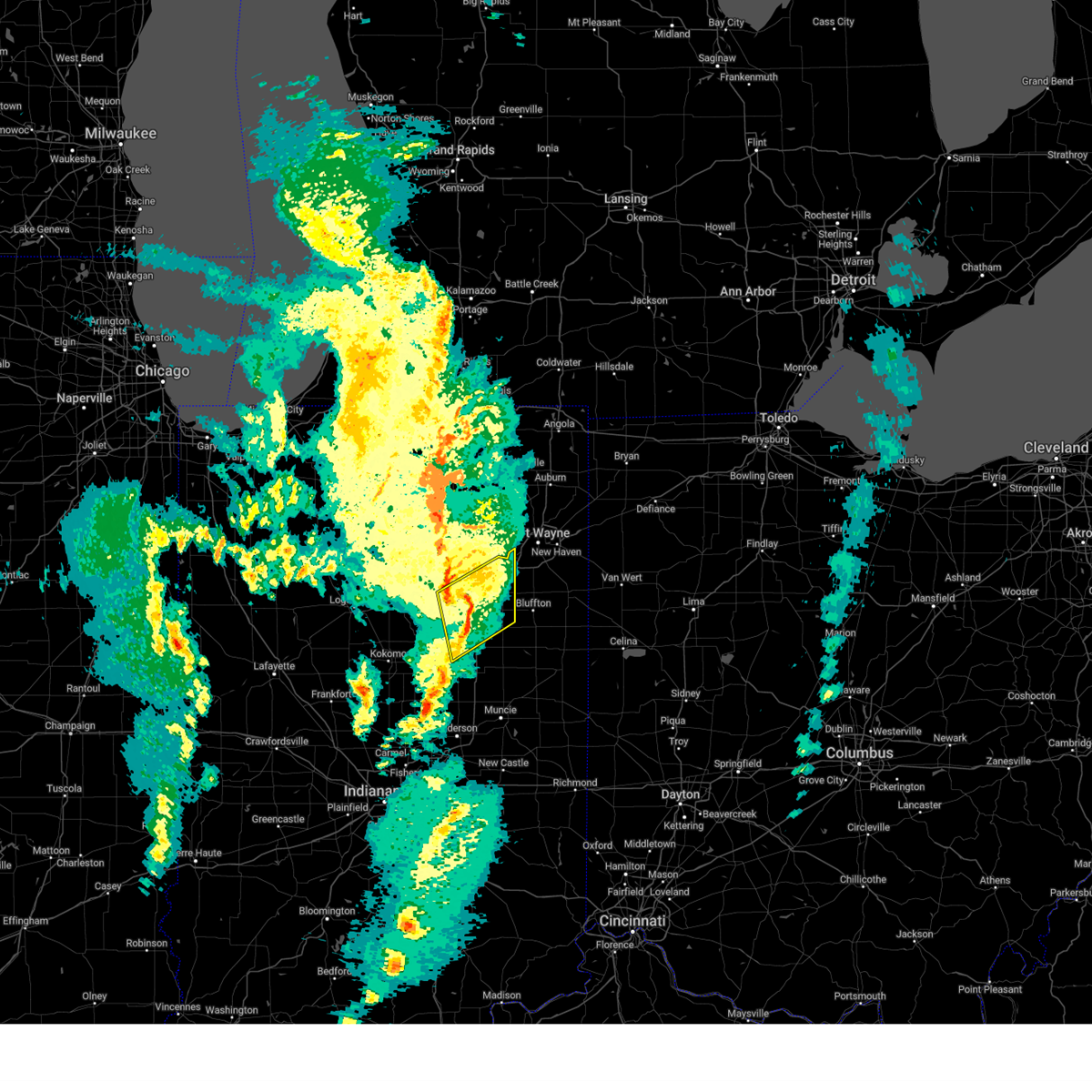
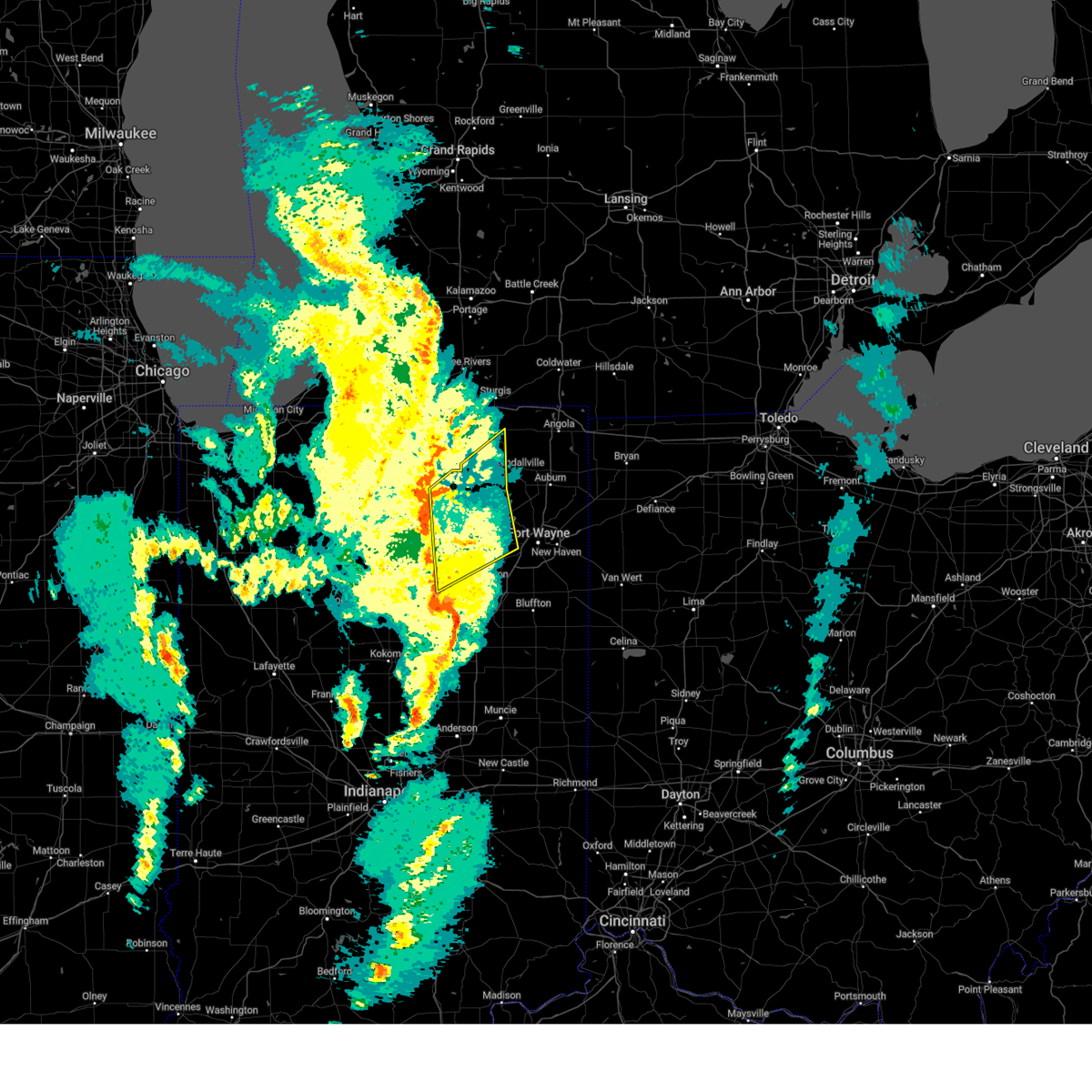
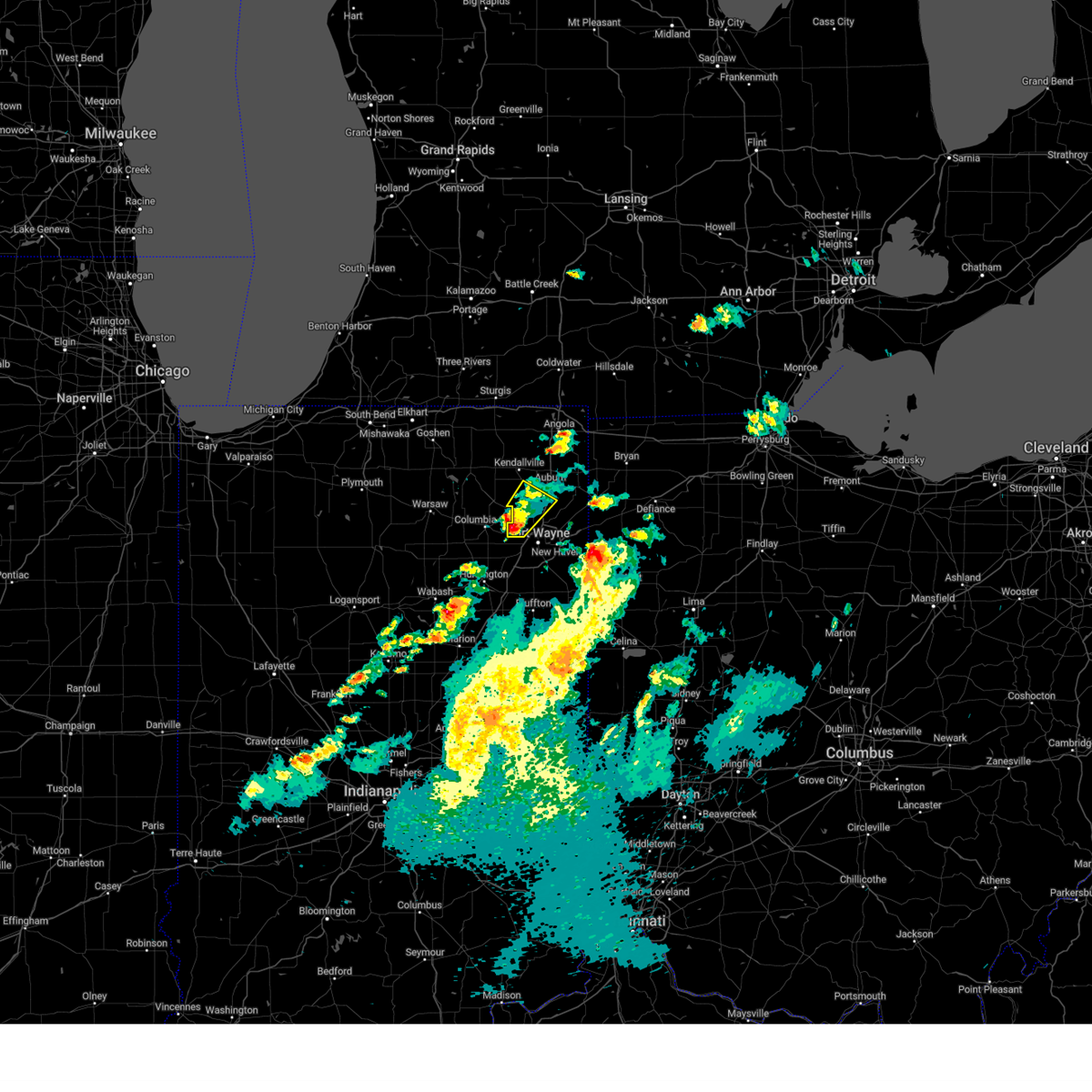
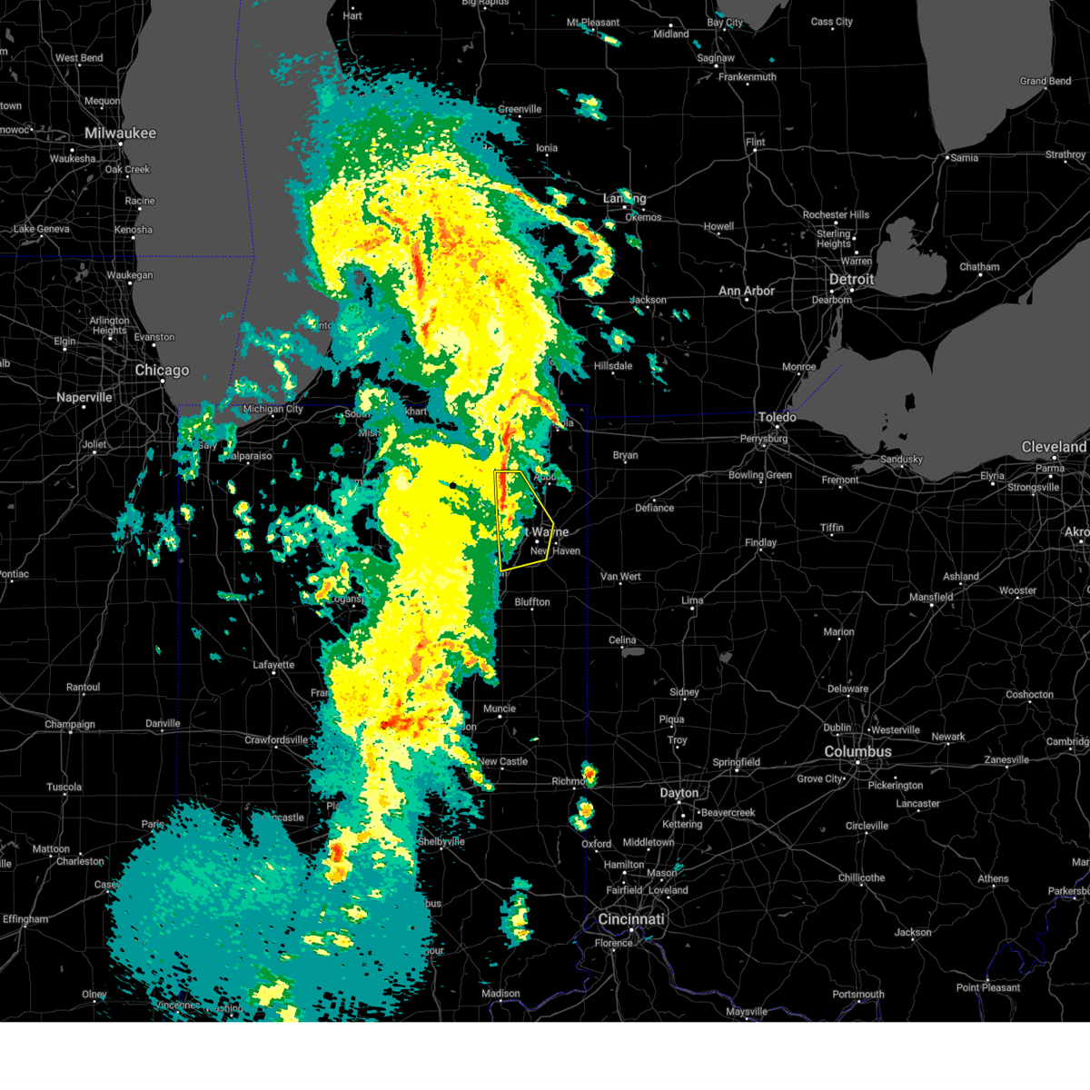
Hail Map for Fort Wayne, IN
The Fort Wayne, IN area has had 45 reports of on-the-ground hail by trained spotters, and has been under severe weather warnings 38 times during the past 12 months. Doppler radar has detected hail at or near Fort Wayne, IN on 86 occasions, including 5 occasions during the past year.
| Name: | Fort Wayne, IN |
| Where Located: | 2.3 miles W of Fort Wayne, IN |
| Map: | Google Map for Fort Wayne, IN |
| Population: | 253691 |
| Housing Units: | 113541 |
| More Info: | Search Google for Fort Wayne, IN |
2
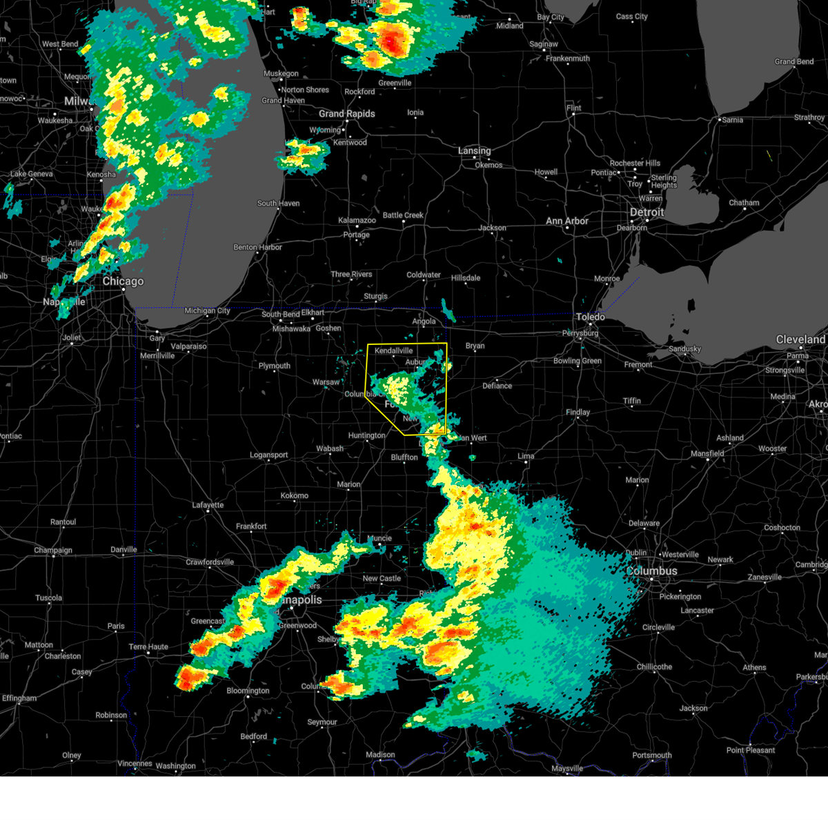
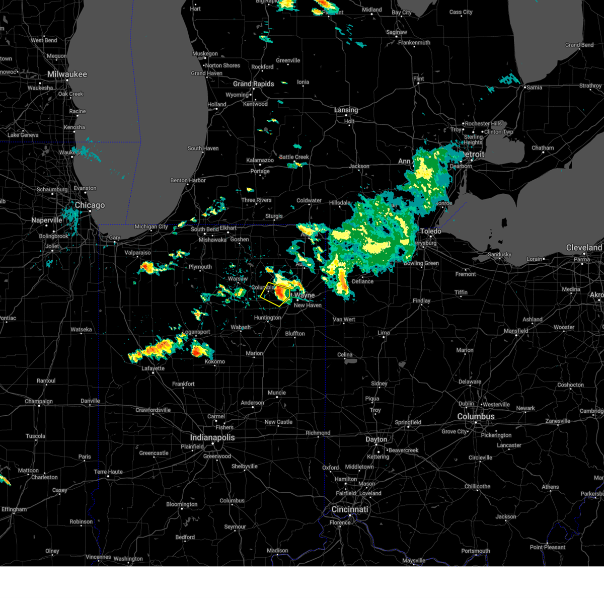
The Top Recent Hail Date for Fort Wayne, IN is Wednesday, April 2, 2025 (12th out of 86)

Hail and Wind Damage Spotted near Fort Wayne, IN
| Date / Time | Report Details |
|---|---|
| 6/26/2025 4:54 PM EDT | At 454 pm edt, a severe thunderstorm was located over churubusco, or 9 miles east of tri-lakes, moving east at 15 mph (radar indicated). Hazards include 70 mph wind gusts. Expect considerable tree damage. damage is likely to mobile homes, roofs, and outbuildings. locations impacted include, huntertown, churubusco, ege, collins, green center, blue lake, ari, lake everett, and laotto. This includes interstate 69 in indiana near mile marker 307. |
| 6/26/2025 4:43 PM EDT |
 Svriwx the national weather service in northern indiana has issued a * severe thunderstorm warning for, northwestern allen county in northeastern indiana, southeastern noble county in northeastern indiana, northeastern whitley county in northeastern indiana, * until 515 pm edt. * at 443 pm edt, a severe thunderstorm was located over churubusco, or near tri-lakes, moving east at 15 mph (radar indicated). Hazards include 60 mph wind gusts. expect damage to roofs, siding, and trees Svriwx the national weather service in northern indiana has issued a * severe thunderstorm warning for, northwestern allen county in northeastern indiana, southeastern noble county in northeastern indiana, northeastern whitley county in northeastern indiana, * until 515 pm edt. * at 443 pm edt, a severe thunderstorm was located over churubusco, or near tri-lakes, moving east at 15 mph (radar indicated). Hazards include 60 mph wind gusts. expect damage to roofs, siding, and trees
|
| 6/18/2025 5:42 PM EDT |
 Svriwx the national weather service in northern indiana has issued a * severe thunderstorm warning for, northeastern allen county in northeastern indiana, de kalb county in northeastern indiana, * until 615 pm edt. * at 542 pm edt, a severe thunderstorm was located near garrett, moving northeast at 55 mph (radar indicated). Hazards include 60 mph wind gusts and quarter size hail. Hail damage to vehicles is expected. Expect wind damage to roofs, siding, and trees. Svriwx the national weather service in northern indiana has issued a * severe thunderstorm warning for, northeastern allen county in northeastern indiana, de kalb county in northeastern indiana, * until 615 pm edt. * at 542 pm edt, a severe thunderstorm was located near garrett, moving northeast at 55 mph (radar indicated). Hazards include 60 mph wind gusts and quarter size hail. Hail damage to vehicles is expected. Expect wind damage to roofs, siding, and trees.
|
| 6/18/2025 5:21 PM EDT |
 At 521 pm edt, a severe thunderstorm was located over churubusco, or 7 miles east of tri-lakes, moving northeast at 40 mph (radar indicated). Hazards include 60 mph wind gusts and half dollar size hail. Hail damage to vehicles is expected. expect wind damage to roofs, siding, and trees. Locations impacted include, huntertown, churubusco, swan, ege, collins, blue lake, ari, lake everett, and laotto. At 521 pm edt, a severe thunderstorm was located over churubusco, or 7 miles east of tri-lakes, moving northeast at 40 mph (radar indicated). Hazards include 60 mph wind gusts and half dollar size hail. Hail damage to vehicles is expected. expect wind damage to roofs, siding, and trees. Locations impacted include, huntertown, churubusco, swan, ege, collins, blue lake, ari, lake everett, and laotto.
|
| 6/18/2025 5:08 PM EDT |
 Svriwx the national weather service in northern indiana has issued a * severe thunderstorm warning for, northwestern allen county in northeastern indiana, southeastern noble county in northeastern indiana, northeastern whitley county in northeastern indiana, * until 545 pm edt. * at 507 pm edt, a severe thunderstorm was located 7 miles east of columbia city, moving northeast at 35 mph (radar indicated). Hazards include ping pong ball size hail and 60 mph wind gusts. People and animals outdoors will be injured. expect hail damage to roofs, siding, windows, and vehicles. Expect wind damage to roofs, siding, and trees. Svriwx the national weather service in northern indiana has issued a * severe thunderstorm warning for, northwestern allen county in northeastern indiana, southeastern noble county in northeastern indiana, northeastern whitley county in northeastern indiana, * until 545 pm edt. * at 507 pm edt, a severe thunderstorm was located 7 miles east of columbia city, moving northeast at 35 mph (radar indicated). Hazards include ping pong ball size hail and 60 mph wind gusts. People and animals outdoors will be injured. expect hail damage to roofs, siding, windows, and vehicles. Expect wind damage to roofs, siding, and trees.
|
| 5/16/2025 8:43 PM EDT |
 The storms which prompted the warning have moved out of the area. therefore, the warning will be allowed to expire. however, gusty winds are still possible with these thunderstorms. a severe thunderstorm watch remains in effect until midnight edt for northeastern indiana. to report severe weather, contact your nearest law enforcement agency. they will relay your report to the national weather service northern indiana. The storms which prompted the warning have moved out of the area. therefore, the warning will be allowed to expire. however, gusty winds are still possible with these thunderstorms. a severe thunderstorm watch remains in effect until midnight edt for northeastern indiana. to report severe weather, contact your nearest law enforcement agency. they will relay your report to the national weather service northern indiana.
|
| 5/16/2025 8:33 PM EDT | At 831 pm edt, showers and embedded thunderstorms producing strong wind gusts were located along a line extending from auburn to woodburn to 6 miles east of decatur, moving northeast at 45 mph (radar indicated). Hazards include 70 mph wind gusts. these storms have a history of producing significant wind damage. Expect considerable tree damage. damage is likely to mobile homes, roofs, and outbuildings. locations impacted include, fort wayne, new haven, auburn, kendallville, garrett, butler, huntertown, avilla, waterloo, hamilton, woodburn, monroeville, grabill, st. joe, leo-cedarville, swan, middletown, concord, ashley, and newville. this includes the following highways, interstate 469 between mile markers 11 and 30. Interstate 69 in indiana between mile markers 310 and 339. |
| 5/16/2025 8:33 PM EDT | the severe thunderstorm warning has been cancelled and is no longer in effect |
| 5/16/2025 8:24 PM EDT |
 the severe thunderstorm warning has been cancelled and is no longer in effect the severe thunderstorm warning has been cancelled and is no longer in effect
|
| 5/16/2025 8:24 PM EDT |
 At 823 pm edt, showers and embedded thunderstorms with strong winds were located along a line extending from near garrett to near woodburn to near monroe, moving east at 50 mph (radar indicated). Hazards include 70 mph wind gusts. a wind gust to 66 mph was observed at the fort wayne airport as a result of these storms. Expect considerable tree damage. damage is likely to mobile homes, roofs, and outbuildings. locations impacted include, fort wayne, new haven, auburn, kendallville, columbia city, garrett, butler, tri-lakes, huntertown, avilla, albion, waterloo, churubusco, hamilton, woodburn, rome city, monroeville, grabill, st. joe, and leo-cedarville. this includes the following highways, interstate 469 near mile marker 1, between mile markers 4 and 6, and between mile markers 9 and 30. Interstate 69 in indiana between mile markers 299 and 340. At 823 pm edt, showers and embedded thunderstorms with strong winds were located along a line extending from near garrett to near woodburn to near monroe, moving east at 50 mph (radar indicated). Hazards include 70 mph wind gusts. a wind gust to 66 mph was observed at the fort wayne airport as a result of these storms. Expect considerable tree damage. damage is likely to mobile homes, roofs, and outbuildings. locations impacted include, fort wayne, new haven, auburn, kendallville, columbia city, garrett, butler, tri-lakes, huntertown, avilla, albion, waterloo, churubusco, hamilton, woodburn, rome city, monroeville, grabill, st. joe, and leo-cedarville. this includes the following highways, interstate 469 near mile marker 1, between mile markers 4 and 6, and between mile markers 9 and 30. Interstate 69 in indiana between mile markers 299 and 340.
|
| 5/16/2025 8:10 PM EDT | Storm damage reported in allen county IN, 6.2 miles WSW of Fort Wayne, IN |
| 5/16/2025 7:56 PM EDT | Wind gust at the fort wayne international airpor in allen county IN, 7.1 miles NNE of Fort Wayne, IN |
| 5/16/2025 7:56 PM EDT | Corrects previous tstm wnd dmg report from 4 e arcola. six foot diameter... rotten tree down on leesburg road... near kromer r in allen county IN, 4.1 miles ESE of Fort Wayne, IN |
| 5/16/2025 7:52 PM EDT | Svriwx the national weather service in northern indiana has issued a * severe thunderstorm warning for, allen county in northeastern indiana, noble county in northeastern indiana, whitley county in northeastern indiana, northeastern huntington county in northeastern indiana, de kalb county in northeastern indiana, * until 845 pm edt. * at 751 pm edt, showers and embedded thunderstorms with strong winds were located along a line extending from near ligonier to 6 miles southeast of columbia city to 8 miles northeast of van buren, moving northeast at 45 mph (radar indicated). Hazards include 60 mph wind gusts. expect damage to roofs, siding, and trees |
| 4/2/2025 8:49 AM EDT | Trees down and powerlines down on the road at the intersection of maplecrest rd and stellhorn r in allen county IN, 5.1 miles WSW of Fort Wayne, IN |
| 4/2/2025 8:38 AM EDT |
 The storm which prompted the warning has moved out of the area. therefore, the warning will be allowed to expire. The storm which prompted the warning has moved out of the area. therefore, the warning will be allowed to expire.
|
| 4/2/2025 8:36 AM EDT | Quarter sized hail reported 9.7 miles S of Fort Wayne, IN, report from mping: quarter (1.00 in.). |
| 4/2/2025 8:35 AM EDT | Quarter sized hail reported 5.7 miles SSW of Fort Wayne, IN |
| 4/2/2025 8:35 AM EDT | Quarter sized hail reported 8.5 miles SSW of Fort Wayne, IN, report from mping: quarter (1.00 in.). |
| 4/2/2025 8:32 AM EDT | Quarter sized hail reported 8.4 miles S of Fort Wayne, IN, report from mping: quarter (1.00 in.). |
| 4/2/2025 8:32 AM EDT | Quarter sized hail reported 9.2 miles S of Fort Wayne, IN |
| 4/2/2025 8:30 AM EDT | Quarter sized hail reported 5.7 miles SSE of Fort Wayne, IN |
| 4/2/2025 8:30 AM EDT | Quarter sized hail reported 6.4 miles SSE of Fort Wayne, IN, quarter size hail fell at lima rd and till rd. |
| 4/2/2025 8:30 AM EDT | Quarter sized hail reported 9.7 miles S of Fort Wayne, IN, cocorahs observer measured up to 1 inch hail. |
| 4/2/2025 8:30 AM EDT |
 At 830 am edt, a severe thunderstorm was located near huntertown, or near fort wayne, moving northeast at 85 mph (trained weather spotters reported nickel size hail 9 miles northwest of fort wayne). Hazards include quarter size hail. Damage to vehicles is expected. locations impacted include, leo-cedarville, grabill, huntertown, wallen, and fort wayne. this includes the following highways, interstate 469 between mile markers 26 and 30. Interstate 69 in indiana between mile markers 307 and 322. At 830 am edt, a severe thunderstorm was located near huntertown, or near fort wayne, moving northeast at 85 mph (trained weather spotters reported nickel size hail 9 miles northwest of fort wayne). Hazards include quarter size hail. Damage to vehicles is expected. locations impacted include, leo-cedarville, grabill, huntertown, wallen, and fort wayne. this includes the following highways, interstate 469 between mile markers 26 and 30. Interstate 69 in indiana between mile markers 307 and 322.
|
| 4/2/2025 8:28 AM EDT | Quarter sized hail reported 8 miles ESE of Fort Wayne, IN, nickel to quarter size hail fell for several minutes. |
| 4/2/2025 8:26 AM EDT | Quarter sized hail reported 7.2 miles ENE of Fort Wayne, IN |
| 4/2/2025 8:25 AM EDT | Ping Pong Ball sized hail reported 6.6 miles ENE of Fort Wayne, IN, photo on facebook shows ping pong ball sized hail. time estimated via radar. |
| 4/2/2025 8:24 AM EDT |
 Svriwx the national weather service in northern indiana has issued a * severe thunderstorm warning for, northwestern allen county in northeastern indiana, * until 845 am edt. * at 824 am edt, a severe thunderstorm was located near fort wayne, moving northeast at 85 mph (radar indicated). Hazards include quarter size hail. damage to vehicles is expected Svriwx the national weather service in northern indiana has issued a * severe thunderstorm warning for, northwestern allen county in northeastern indiana, * until 845 am edt. * at 824 am edt, a severe thunderstorm was located near fort wayne, moving northeast at 85 mph (radar indicated). Hazards include quarter size hail. damage to vehicles is expected
|
| 4/2/2025 8:22 AM EDT | Quarter sized hail reported 0.1 miles WSW of Fort Wayne, IN |
| 4/2/2025 8:15 AM EDT |
 Svriwx the national weather service in northern indiana has issued a * severe thunderstorm warning for, southwestern allen county in northeastern indiana, southeastern whitley county in northeastern indiana, northeastern huntington county in northeastern indiana, north central wells county in northeastern indiana, * until 830 am edt. * at 815 am edt, a severe thunderstorm was located near huntington, moving northeast at 90 mph (radar indicated). Hazards include quarter size hail. damage to vehicles is expected Svriwx the national weather service in northern indiana has issued a * severe thunderstorm warning for, southwestern allen county in northeastern indiana, southeastern whitley county in northeastern indiana, northeastern huntington county in northeastern indiana, north central wells county in northeastern indiana, * until 830 am edt. * at 815 am edt, a severe thunderstorm was located near huntington, moving northeast at 90 mph (radar indicated). Hazards include quarter size hail. damage to vehicles is expected
|
| 3/30/2025 5:57 PM EDT | At 557 pm edt, severe thunderstorms were located along a line extending from 8 miles west of pioneer to woodburn, moving northeast at 45 mph (radar indicated). Hazards include 70 mph wind gusts and nickel size hail. Expect considerable tree damage. damage is likely to mobile homes, roofs, and outbuildings. locations impacted include, paulding, grelton, ridgeville corners, gerald, liberty center, fayette, lake seneca, zulu, tedrow, antwerp, latty, okolona, mark center, kunkle, worstville, bryan, poe, hessen cassel, florida, and winameg. this includes the following highways, interstate 469 between mile markers 12 and 22. interstate 80 in indiana near mile marker 156. Interstate 80 in ohio between mile markers 0 and 48. |
| 3/30/2025 5:52 PM EDT | The storms which prompted the warning have weakened below severe limits, and have exited the warned area. therefore, the warning will be allowed to expire. however, gusty winds are still possible with these thunderstorms. a tornado watch remains in effect until 800 pm edt for central, north central and northeastern indiana. a severe thunderstorm watch remains in effect until 1000 pm edt for west central ohio. remember, a severe thunderstorm warning still remains in effect for allen, deklab, and steuben counties. |
| 3/30/2025 5:37 PM EDT | Large tree uprooted across e washington center r in allen county IN, 3.5 miles S of Fort Wayne, IN |
| 3/30/2025 5:36 PM EDT | Measured wind gust via handheld anemomete in allen county IN, 9.6 miles SW of Fort Wayne, IN |
| 3/30/2025 5:36 PM EDT |
 the severe thunderstorm warning has been cancelled and is no longer in effect the severe thunderstorm warning has been cancelled and is no longer in effect
|
| 3/30/2025 5:36 PM EDT |
 At 535 pm edt, severe thunderstorms were located along a line extending from 6 miles east of reading to near van wert, moving east at 115 mph (radar indicated). Hazards include 70 mph wind gusts and quarter size hail. Hail damage to vehicles is expected. expect considerable tree damage. wind damage is also likely to mobile homes, roofs, and outbuildings. locations impacted include, preble, yoder, angola, alvarado, fairfield center, aboite, liberty center, hamilton lake, laotto, zulu, big long lake, tocsin, salem center, helmer, kingsland, rivare, metz, sedan, bowerstown, and dunfee. this includes the following highways, interstate 469 between mile markers 0 and 30. interstate 69 in indiana between mile markers 270 and 355. Interstate 80 in indiana between mile markers 146 and 156. At 535 pm edt, severe thunderstorms were located along a line extending from 6 miles east of reading to near van wert, moving east at 115 mph (radar indicated). Hazards include 70 mph wind gusts and quarter size hail. Hail damage to vehicles is expected. expect considerable tree damage. wind damage is also likely to mobile homes, roofs, and outbuildings. locations impacted include, preble, yoder, angola, alvarado, fairfield center, aboite, liberty center, hamilton lake, laotto, zulu, big long lake, tocsin, salem center, helmer, kingsland, rivare, metz, sedan, bowerstown, and dunfee. this includes the following highways, interstate 469 between mile markers 0 and 30. interstate 69 in indiana between mile markers 270 and 355. Interstate 80 in indiana between mile markers 146 and 156.
|
| 3/30/2025 5:34 PM EDT |
 Svriwx the national weather service in northern indiana has issued a * severe thunderstorm warning for, steuben county in northeastern indiana, allen county in northeastern indiana, de kalb county in northeastern indiana, southern hillsdale county in southeastern michigan, northern putnam county in west central ohio, defiance county in northwestern ohio, paulding county in west central ohio, henry county in northwestern ohio, northwestern van wert county in west central ohio, williams county in northwestern ohio, fulton county in northwestern ohio, * until 630 pm edt. * at 533 pm edt, severe thunderstorms were located along a line extending from angola to near ossian, moving east at 70 mph (radar indicated). Hazards include 70 mph wind gusts and nickel size hail. Expect considerable tree damage. Damage is likely to mobile homes, roofs, and outbuildings. Svriwx the national weather service in northern indiana has issued a * severe thunderstorm warning for, steuben county in northeastern indiana, allen county in northeastern indiana, de kalb county in northeastern indiana, southern hillsdale county in southeastern michigan, northern putnam county in west central ohio, defiance county in northwestern ohio, paulding county in west central ohio, henry county in northwestern ohio, northwestern van wert county in west central ohio, williams county in northwestern ohio, fulton county in northwestern ohio, * until 630 pm edt. * at 533 pm edt, severe thunderstorms were located along a line extending from angola to near ossian, moving east at 70 mph (radar indicated). Hazards include 70 mph wind gusts and nickel size hail. Expect considerable tree damage. Damage is likely to mobile homes, roofs, and outbuildings.
|
| 3/30/2025 5:05 PM EDT |
 Svriwx the national weather service in northern indiana has issued a * severe thunderstorm warning for, southeastern elkhart county in north central indiana, wabash county in north central indiana, noble county in northeastern indiana, northern grant county in central indiana, whitley county in northeastern indiana, huntington county in northeastern indiana, eastern kosciusko county in north central indiana, southern lagrange county in northeastern indiana, steuben county in northeastern indiana, allen county in northeastern indiana, de kalb county in northeastern indiana, wells county in northeastern indiana, northern adams county in northeastern indiana, * until 600 pm edt. * at 504 pm edt, severe thunderstorms were located along a line extending from millersburg to 6 miles northwest of van buren, moving east at 115 mph (radar indicated). Hazards include 70 mph wind gusts and quarter size hail. Hail damage to vehicles is expected. expect considerable tree damage. Wind damage is also likely to mobile homes, roofs, and outbuildings. Svriwx the national weather service in northern indiana has issued a * severe thunderstorm warning for, southeastern elkhart county in north central indiana, wabash county in north central indiana, noble county in northeastern indiana, northern grant county in central indiana, whitley county in northeastern indiana, huntington county in northeastern indiana, eastern kosciusko county in north central indiana, southern lagrange county in northeastern indiana, steuben county in northeastern indiana, allen county in northeastern indiana, de kalb county in northeastern indiana, wells county in northeastern indiana, northern adams county in northeastern indiana, * until 600 pm edt. * at 504 pm edt, severe thunderstorms were located along a line extending from millersburg to 6 miles northwest of van buren, moving east at 115 mph (radar indicated). Hazards include 70 mph wind gusts and quarter size hail. Hail damage to vehicles is expected. expect considerable tree damage. Wind damage is also likely to mobile homes, roofs, and outbuildings.
|
| 3/19/2025 9:06 PM EDT |
 The storms which prompted the warning have weakened below severe limits, and no longer pose an immediate threat to life or property. therefore, the warning will be allowed to expire. however, gusty winds are still possible with these thunderstorms. we will continue to monitor the storms as they advance through noble county. a severe thunderstorm watch remains in effect until 100 am edt for north central and northeastern indiana. The storms which prompted the warning have weakened below severe limits, and no longer pose an immediate threat to life or property. therefore, the warning will be allowed to expire. however, gusty winds are still possible with these thunderstorms. we will continue to monitor the storms as they advance through noble county. a severe thunderstorm watch remains in effect until 100 am edt for north central and northeastern indiana.
|
| 3/19/2025 9:05 PM EDT |
 The storms which prompted the warning have weakened below severe limits, and have exited the warned area. therefore, the warning will be allowed to expire. a severe thunderstorm watch remains in effect until 100 am edt for central, north central and northeastern indiana. The storms which prompted the warning have weakened below severe limits, and have exited the warned area. therefore, the warning will be allowed to expire. a severe thunderstorm watch remains in effect until 100 am edt for central, north central and northeastern indiana.
|
| 3/19/2025 8:55 PM EDT |
 the severe thunderstorm warning has been cancelled and is no longer in effect the severe thunderstorm warning has been cancelled and is no longer in effect
|
| 3/19/2025 8:55 PM EDT |
 At 855 pm edt, severe thunderstorms were located along a line extending from ligonier to near tri-lakes to near south whitley, moving northeast at 55 mph (radar indicated). Hazards include 70 mph wind gusts and penny size hail. Expect considerable tree damage. damage is likely to mobile homes, roofs, and outbuildings. Locations impacted include, laud, churubusco, brimfield, ridinger lake, rome city, merriam, lorane, blue lake, collamer, big lake, tri-lakes, raber, larwill, arcola, bear lake, lake everett, peabody, wolcottville, columbia city, and etna. At 855 pm edt, severe thunderstorms were located along a line extending from ligonier to near tri-lakes to near south whitley, moving northeast at 55 mph (radar indicated). Hazards include 70 mph wind gusts and penny size hail. Expect considerable tree damage. damage is likely to mobile homes, roofs, and outbuildings. Locations impacted include, laud, churubusco, brimfield, ridinger lake, rome city, merriam, lorane, blue lake, collamer, big lake, tri-lakes, raber, larwill, arcola, bear lake, lake everett, peabody, wolcottville, columbia city, and etna.
|
| 3/19/2025 8:41 PM EDT |
 Svriwx the national weather service in northern indiana has issued a * severe thunderstorm warning for, southwestern allen county in northeastern indiana, southeastern wabash county in north central indiana, northeastern grant county in central indiana, huntington county in northeastern indiana, western wells county in northeastern indiana, * until 915 pm edt. * at 841 pm edt, severe thunderstorms were located along a line extending from near andrews to 6 miles south of huntington to near jonesboro, moving northeast at 60 mph (radar indicated). Hazards include 60 mph wind gusts and penny size hail. expect damage to roofs, siding, and trees Svriwx the national weather service in northern indiana has issued a * severe thunderstorm warning for, southwestern allen county in northeastern indiana, southeastern wabash county in north central indiana, northeastern grant county in central indiana, huntington county in northeastern indiana, western wells county in northeastern indiana, * until 915 pm edt. * at 841 pm edt, severe thunderstorms were located along a line extending from near andrews to 6 miles south of huntington to near jonesboro, moving northeast at 60 mph (radar indicated). Hazards include 60 mph wind gusts and penny size hail. expect damage to roofs, siding, and trees
|
| 3/19/2025 8:39 PM EDT |
 Svriwx the national weather service in northern indiana has issued a * severe thunderstorm warning for, west central allen county in northeastern indiana, northeastern wabash county in north central indiana, noble county in northeastern indiana, whitley county in northeastern indiana, northwestern huntington county in northeastern indiana, eastern kosciusko county in north central indiana, south central lagrange county in northeastern indiana, * until 915 pm edt. * at 839 pm edt, severe thunderstorms were located along a line extending from near north webster to 6 miles west of south whitley to near north manchester, moving northeast at 55 mph (radar indicated). Hazards include 60 mph wind gusts and penny size hail. expect damage to roofs, siding, and trees Svriwx the national weather service in northern indiana has issued a * severe thunderstorm warning for, west central allen county in northeastern indiana, northeastern wabash county in north central indiana, noble county in northeastern indiana, whitley county in northeastern indiana, northwestern huntington county in northeastern indiana, eastern kosciusko county in north central indiana, south central lagrange county in northeastern indiana, * until 915 pm edt. * at 839 pm edt, severe thunderstorms were located along a line extending from near north webster to 6 miles west of south whitley to near north manchester, moving northeast at 55 mph (radar indicated). Hazards include 60 mph wind gusts and penny size hail. expect damage to roofs, siding, and trees
|
| 3/15/2025 4:00 PM EDT |
 the severe thunderstorm warning has been cancelled and is no longer in effect the severe thunderstorm warning has been cancelled and is no longer in effect
|
| 3/15/2025 4:00 PM EDT |
 At 400 pm edt, a severe thunderstorm was located near churubusco, or 11 miles northwest of fort wayne, moving northeast at 45 mph (radar indicated). Hazards include quarter size hail. Damage to vehicles is expected. locations impacted include, ege, butler center, swan, avilla, saint johns, ari, altona, huntertown, lake everett, laotto, wallen, and garrett. This includes interstate 69 in indiana between mile markers 319 and 325. At 400 pm edt, a severe thunderstorm was located near churubusco, or 11 miles northwest of fort wayne, moving northeast at 45 mph (radar indicated). Hazards include quarter size hail. Damage to vehicles is expected. locations impacted include, ege, butler center, swan, avilla, saint johns, ari, altona, huntertown, lake everett, laotto, wallen, and garrett. This includes interstate 69 in indiana between mile markers 319 and 325.
|
| 3/15/2025 3:48 PM EDT | Svriwx the national weather service in northern indiana has issued a * severe thunderstorm warning for, northwestern allen county in northeastern indiana, southeastern noble county in northeastern indiana, east central whitley county in northeastern indiana, southwestern de kalb county in northeastern indiana, * until 415 pm edt. * at 348 pm edt, a severe thunderstorm was located near columbia city, moving northeast at 45 mph (radar indicated). Hazards include 60 mph wind gusts and quarter size hail. Hail damage to vehicles is expected. Expect wind damage to roofs, siding, and trees. |
| 3/15/2025 4:44 AM EDT | The storms which prompted the warning have weakened below severe limits, and no longer pose an immediate threat to life or property. therefore, the warning will be allowed to expire. however, gusty winds are still possible with these thunderstorms. a severe thunderstorm watch remains in effect until 900 am edt for northeastern indiana. to report severe weather, contact your nearest law enforcement agency. they will relay your report to the national weather service northern indiana. |
| 3/15/2025 4:39 AM EDT |
 At 439 am edt, severe thunderstorms were located along a line extending from near rome city to 6 miles south of churubusco, moving northeast at 60 mph (radar indicated). Hazards include 60 mph wind gusts. Expect damage to roofs, siding, and trees. locations impacted include, churubusco, blue lake, aboite, roanoke, laotto, arcola, swan, rolling hills, lake everett, nine mile, ege, green center, dunfee, lisbon, huntertown, coesse, wallen, collins, avilla, and ari. this includes the following highways, interstate 469 between mile markers 7 and 8, and between mile markers 28 and 30. Interstate 69 in indiana between mile markers 296 and 320. At 439 am edt, severe thunderstorms were located along a line extending from near rome city to 6 miles south of churubusco, moving northeast at 60 mph (radar indicated). Hazards include 60 mph wind gusts. Expect damage to roofs, siding, and trees. locations impacted include, churubusco, blue lake, aboite, roanoke, laotto, arcola, swan, rolling hills, lake everett, nine mile, ege, green center, dunfee, lisbon, huntertown, coesse, wallen, collins, avilla, and ari. this includes the following highways, interstate 469 between mile markers 7 and 8, and between mile markers 28 and 30. Interstate 69 in indiana between mile markers 296 and 320.
|
| 3/15/2025 4:27 AM EDT | At 426 am edt, severe thunderstorms were located along a line extending from near albion to huntington, moving northeast at 60 mph (radar indicated). Hazards include 60 mph wind gusts. Expect damage to roofs, siding, and trees. locations impacted include, laud, churubusco, yoder, merriam, lorane, blue lake, aboite, big lake, roanoke, laotto, tri-lakes, raber, arcola, swan, rolling hills, bear lake, lake everett, peabody, nine mile, and columbia city. this includes the following highways, interstate 469 between mile markers 0 and 11, and between mile markers 28 and 30. Interstate 69 in indiana between mile markers 294 and 320. |
| 3/15/2025 4:27 AM EDT | the severe thunderstorm warning has been cancelled and is no longer in effect |
| 3/15/2025 4:16 AM EDT | Svriwx the national weather service in northern indiana has issued a * severe thunderstorm warning for, western allen county in northeastern indiana, eastern wabash county in north central indiana, southern noble county in northeastern indiana, whitley county in northeastern indiana, southwestern de kalb county in northeastern indiana, huntington county in northeastern indiana, southeastern kosciusko county in north central indiana, northeastern wells county in northeastern indiana, * until 445 am edt. * at 416 am edt, severe thunderstorms were located along a line extending from near north webster to andrews to near la fontaine, moving northeast at 55 mph (radar indicated). Hazards include 60 mph wind gusts. expect damage to roofs, siding, and trees |
| 9/20/2024 4:56 PM EDT |
 The storm which prompted the warning has weakened below severe limits, but wind gusts to 50 mph and pea sized hail are possible through 515 pm edt. The storm which prompted the warning has weakened below severe limits, but wind gusts to 50 mph and pea sized hail are possible through 515 pm edt.
|
| 9/20/2024 4:50 PM EDT | A few large trees downed near slash pass road. time estimated from rada in allen county IN, 8.8 miles E of Fort Wayne, IN |
| 9/20/2024 4:44 PM EDT |
 At 443 pm edt, a severe thunderstorm was located over columbia city, moving east at 30 mph (radar indicated). Hazards include 60 mph wind gusts and penny size hail. Expect damage to roofs, siding, and trees. Locations impacted include, columbia city, tri-lakes, raber, collins, arcola, dunfee, coesse, lake everett, and peabody. At 443 pm edt, a severe thunderstorm was located over columbia city, moving east at 30 mph (radar indicated). Hazards include 60 mph wind gusts and penny size hail. Expect damage to roofs, siding, and trees. Locations impacted include, columbia city, tri-lakes, raber, collins, arcola, dunfee, coesse, lake everett, and peabody.
|
| 9/20/2024 4:34 PM EDT |
 Svriwx the national weather service in northern indiana has issued a * severe thunderstorm warning for, west central allen county in northeastern indiana, central whitley county in northeastern indiana, * until 500 pm edt. * at 434 pm edt, a severe thunderstorm was located over columbia city, moving east at 30 mph (radar indicated). Hazards include 60 mph wind gusts and penny size hail. expect damage to roofs, siding, and trees Svriwx the national weather service in northern indiana has issued a * severe thunderstorm warning for, west central allen county in northeastern indiana, central whitley county in northeastern indiana, * until 500 pm edt. * at 434 pm edt, a severe thunderstorm was located over columbia city, moving east at 30 mph (radar indicated). Hazards include 60 mph wind gusts and penny size hail. expect damage to roofs, siding, and trees
|
| 7/16/2024 1:10 AM EDT | Trained spotter reports 62 mph gust at saint joe center rd and wheelock rd on the northeast side of fort wayn in allen county IN, 7.6 miles WSW of Fort Wayne, IN |
| 7/16/2024 1:09 AM EDT | Trained spotter reports tree down at the intersection of clinton rd and washington center rd. estimated 50 mph wind gust in allen county IN, 3.7 miles SSW of Fort Wayne, IN |
| 7/16/2024 1:08 AM EDT | Broadcast media relays dispatch report of tree limbs and powerlines down on randalia & delaware in fort wayne. time estimated via rada in allen county IN, 1.8 miles WSW of Fort Wayne, IN |
| 7/16/2024 1:08 AM EDT | Broadcast media relays report from dispatch of a large tree uprooted on smith street. time estimated via rada in allen county IN, 3 miles NNW of Fort Wayne, IN |
| 7/16/2024 1:05 AM EDT | Trained spotter reports a tree down on s. calhoun and tillman roads in fort wayne... tree across the road. healthy tree 10-12 in diameter. time estimated from rada in allen county IN, 4.1 miles N of Fort Wayne, IN |
| 7/16/2024 1:03 AM EDT | Broadcast media relayed photos of tree limbs and powerlines down at the intersection of w state and sherman in fort wayne. time estimated via rada in allen county IN, 1.5 miles SSE of Fort Wayne, IN |
| 7/16/2024 12:50 AM EDT |
 Svriwx the national weather service in northern indiana has issued a * severe thunderstorm warning for, steuben county in northeastern indiana, allen county in northeastern indiana, eastern noble county in northeastern indiana, de kalb county in northeastern indiana, eastern lagrange county in northeastern indiana, southern branch county in southwestern michigan, * until 130 am edt. * at 1250 am edt, severe thunderstorms were located along a line extending from near sturgis to near kendallville to near churubusco to 9 miles south of columbia city, moving northeast at 55 mph (radar indicated). Hazards include 60 mph wind gusts. Expect damage to roofs, siding, and trees. severe thunderstorms will be near, kendallville and avilla around 1255 am edt. fort wayne, garrett, huntertown, and bronson around 100 am edt. auburn, angola, and waterloo around 105 am edt. fremont and hamilton around 110 am edt. grabill around 115 am edt. butler and st. joe around 120 am edt. other locations impacted by these severe thunderstorms include yoder, alvarado, fairfield center, saint johns, aboite, edgerton in allen county, ray, hamilton lake, laotto, and zulu. this includes the following highways, interstate 469 between mile markers 0 and 30. interstate 69 in indiana between mile markers 294 and 357. interstate 69 in michigan between mile markers 1 and 10. Interstate 80 in indiana between mile markers 133 and 156. Svriwx the national weather service in northern indiana has issued a * severe thunderstorm warning for, steuben county in northeastern indiana, allen county in northeastern indiana, eastern noble county in northeastern indiana, de kalb county in northeastern indiana, eastern lagrange county in northeastern indiana, southern branch county in southwestern michigan, * until 130 am edt. * at 1250 am edt, severe thunderstorms were located along a line extending from near sturgis to near kendallville to near churubusco to 9 miles south of columbia city, moving northeast at 55 mph (radar indicated). Hazards include 60 mph wind gusts. Expect damage to roofs, siding, and trees. severe thunderstorms will be near, kendallville and avilla around 1255 am edt. fort wayne, garrett, huntertown, and bronson around 100 am edt. auburn, angola, and waterloo around 105 am edt. fremont and hamilton around 110 am edt. grabill around 115 am edt. butler and st. joe around 120 am edt. other locations impacted by these severe thunderstorms include yoder, alvarado, fairfield center, saint johns, aboite, edgerton in allen county, ray, hamilton lake, laotto, and zulu. this includes the following highways, interstate 469 between mile markers 0 and 30. interstate 69 in indiana between mile markers 294 and 357. interstate 69 in michigan between mile markers 1 and 10. Interstate 80 in indiana between mile markers 133 and 156.
|
| 7/14/2024 12:52 PM EDT |
 Svriwx the national weather service in northern indiana has issued a * severe thunderstorm warning for, southwestern allen county in northeastern indiana, eastern huntington county in northeastern indiana, wells county in northeastern indiana, * until 115 pm edt. * at 1251 pm edt, a severe thunderstorm was located near markle, or 8 miles southeast of huntington, moving southeast at 50 mph (radar indicated). Hazards include 60 mph wind gusts. expect damage to roofs, siding, and trees Svriwx the national weather service in northern indiana has issued a * severe thunderstorm warning for, southwestern allen county in northeastern indiana, eastern huntington county in northeastern indiana, wells county in northeastern indiana, * until 115 pm edt. * at 1251 pm edt, a severe thunderstorm was located near markle, or 8 miles southeast of huntington, moving southeast at 50 mph (radar indicated). Hazards include 60 mph wind gusts. expect damage to roofs, siding, and trees
|
| 5/24/2024 7:33 PM EDT | Asos station kfwa fort wayne international a in allen county IN, 7.1 miles NNE of Fort Wayne, IN |
| 5/7/2024 7:18 PM EDT |
 At 718 pm edt, a severe thunderstorm capable of producing a tornado was located near new haven, moving northeast at 30 mph (radar indicated rotation). Hazards include tornado and quarter size hail. Flying debris will be dangerous to those caught without shelter. mobile homes will be damaged or destroyed. damage to roofs, windows, and vehicles will occur. tree damage is likely. this dangerous storm will be near, new haven around 725 pm edt. woodburn around 740 pm edt. other locations impacted by this tornadic thunderstorm include hoagland, middletown, tillman, edgerton in allen county, townley, hessen cassel, zulu, and maples. This includes interstate 469 between mile markers 10 and 20. At 718 pm edt, a severe thunderstorm capable of producing a tornado was located near new haven, moving northeast at 30 mph (radar indicated rotation). Hazards include tornado and quarter size hail. Flying debris will be dangerous to those caught without shelter. mobile homes will be damaged or destroyed. damage to roofs, windows, and vehicles will occur. tree damage is likely. this dangerous storm will be near, new haven around 725 pm edt. woodburn around 740 pm edt. other locations impacted by this tornadic thunderstorm include hoagland, middletown, tillman, edgerton in allen county, townley, hessen cassel, zulu, and maples. This includes interstate 469 between mile markers 10 and 20.
|
| 5/7/2024 7:09 PM EDT |
 Toriwx the national weather service in northern indiana has issued a * tornado warning for, southern allen county in northeastern indiana, * until 800 pm edt. * at 708 pm edt, a severe thunderstorm capable of producing a tornado was located near ossian, moving northeast at 30 mph (radar indicated rotation). Hazards include tornado and quarter size hail. Flying debris will be dangerous to those caught without shelter. mobile homes will be damaged or destroyed. damage to roofs, windows, and vehicles will occur. tree damage is likely. this dangerous storm will be near, southeast fort wayne and new haven around 715 pm edt. woodburn around 740 pm edt. other locations impacted by this tornadic thunderstorm include yoder, hoagland, poe, middletown, tillman, edgerton in allen county, townley, hessen cassel, zulu, and maples. This includes interstate 469 near mile marker 1, between mile markers 4 and 6, and between mile markers 9 and 21. Toriwx the national weather service in northern indiana has issued a * tornado warning for, southern allen county in northeastern indiana, * until 800 pm edt. * at 708 pm edt, a severe thunderstorm capable of producing a tornado was located near ossian, moving northeast at 30 mph (radar indicated rotation). Hazards include tornado and quarter size hail. Flying debris will be dangerous to those caught without shelter. mobile homes will be damaged or destroyed. damage to roofs, windows, and vehicles will occur. tree damage is likely. this dangerous storm will be near, southeast fort wayne and new haven around 715 pm edt. woodburn around 740 pm edt. other locations impacted by this tornadic thunderstorm include yoder, hoagland, poe, middletown, tillman, edgerton in allen county, townley, hessen cassel, zulu, and maples. This includes interstate 469 near mile marker 1, between mile markers 4 and 6, and between mile markers 9 and 21.
|
| 4/17/2024 1:28 PM EDT |
 Svriwx the national weather service in northern indiana has issued a * severe thunderstorm warning for, northeastern allen county in northeastern indiana, southeastern de kalb county in northeastern indiana, * until 200 pm edt. * at 128 pm edt, a severe thunderstorm was located near grabill, or 10 miles southeast of garrett, moving northeast at 50 mph (radar indicated). Hazards include 60 mph wind gusts and quarter size hail. Hail damage to vehicles is expected. Expect wind damage to roofs, siding, and trees. Svriwx the national weather service in northern indiana has issued a * severe thunderstorm warning for, northeastern allen county in northeastern indiana, southeastern de kalb county in northeastern indiana, * until 200 pm edt. * at 128 pm edt, a severe thunderstorm was located near grabill, or 10 miles southeast of garrett, moving northeast at 50 mph (radar indicated). Hazards include 60 mph wind gusts and quarter size hail. Hail damage to vehicles is expected. Expect wind damage to roofs, siding, and trees.
|
| 7/29/2023 3:12 AM EDT |
 The severe thunderstorm warning for southwestern allen, eastern huntington and northeastern wells counties will expire at 315 am edt, the storms which prompted the warning have moved out of the area. therefore, the warning will be allowed to expire. a severe thunderstorm watch remains in effect until 500 am edt for northeastern indiana. The severe thunderstorm warning for southwestern allen, eastern huntington and northeastern wells counties will expire at 315 am edt, the storms which prompted the warning have moved out of the area. therefore, the warning will be allowed to expire. a severe thunderstorm watch remains in effect until 500 am edt for northeastern indiana.
|
| 7/29/2023 2:56 AM EDT |
 At 256 am edt, severe thunderstorms were located along a line extending from near fort wayne to 8 miles north of van buren, moving east at 40 mph (radar indicated). Hazards include 60 mph wind gusts. Expect damage to roofs, siding, and trees. locations impacted include, fort wayne, new haven, bluffton, ossian, markle, aboite, roanoke, lancaster, zanesville, uniondale, mount etna, nine mile, yoder, poe, murray, hessen cassel, plum tree, north oaks, tocsin, and majenica. this includes the following highways, interstate 469 between mile markers 0 and 12. interstate 69 in indiana between mile markers 278 and 312. hail threat, radar indicated max hail size, <. 75 in wind threat, radar indicated max wind gust, 60 mph. At 256 am edt, severe thunderstorms were located along a line extending from near fort wayne to 8 miles north of van buren, moving east at 40 mph (radar indicated). Hazards include 60 mph wind gusts. Expect damage to roofs, siding, and trees. locations impacted include, fort wayne, new haven, bluffton, ossian, markle, aboite, roanoke, lancaster, zanesville, uniondale, mount etna, nine mile, yoder, poe, murray, hessen cassel, plum tree, north oaks, tocsin, and majenica. this includes the following highways, interstate 469 between mile markers 0 and 12. interstate 69 in indiana between mile markers 278 and 312. hail threat, radar indicated max hail size, <. 75 in wind threat, radar indicated max wind gust, 60 mph.
|
| 7/29/2023 2:47 AM EDT |
 At 247 am edt, severe thunderstorms were located along a line extending from near fort wayne to near ossian to 6 miles north of van buren, moving east at 50 mph (radar indicated). Hazards include 60 mph wind gusts. expect damage to roofs, siding, and trees At 247 am edt, severe thunderstorms were located along a line extending from near fort wayne to near ossian to 6 miles north of van buren, moving east at 50 mph (radar indicated). Hazards include 60 mph wind gusts. expect damage to roofs, siding, and trees
|
| 7/29/2023 2:42 AM EDT |
 The severe thunderstorm warning for southwestern steuben, northwestern allen, noble, northern whitley, western de kalb and southern lagrange counties will expire at 245 am edt, the storms which prompted the warning have moved out of the area. therefore, the warning will be allowed to expire. a severe thunderstorm watch remains in effect until 500 am edt for north central and northeastern indiana. The severe thunderstorm warning for southwestern steuben, northwestern allen, noble, northern whitley, western de kalb and southern lagrange counties will expire at 245 am edt, the storms which prompted the warning have moved out of the area. therefore, the warning will be allowed to expire. a severe thunderstorm watch remains in effect until 500 am edt for north central and northeastern indiana.
|
| 7/29/2023 2:38 AM EDT |
 At 238 am edt, severe thunderstorms were located along a line extending from angola to near fort wayne, moving east at 60 mph (radar indicated). Hazards include 60 mph wind gusts. expect damage to roofs, siding, and trees At 238 am edt, severe thunderstorms were located along a line extending from angola to near fort wayne, moving east at 60 mph (radar indicated). Hazards include 60 mph wind gusts. expect damage to roofs, siding, and trees
|
| 7/29/2023 2:09 AM EDT |
 At 208 am edt, severe thunderstorms were located along a line extending from 6 miles south of winona lake to peru, moving east at 55 mph (radar indicated). Hazards include 60 mph wind gusts. expect damage to roofs, siding, and trees At 208 am edt, severe thunderstorms were located along a line extending from 6 miles south of winona lake to peru, moving east at 55 mph (radar indicated). Hazards include 60 mph wind gusts. expect damage to roofs, siding, and trees
|
| 7/29/2023 2:03 AM EDT |
 At 203 am edt, severe thunderstorms were located along a line extending from near middlebury to near syracuse to near winona lake, moving east at 55 mph (radar indicated). Hazards include 60 mph wind gusts. expect damage to roofs, siding, and trees At 203 am edt, severe thunderstorms were located along a line extending from near middlebury to near syracuse to near winona lake, moving east at 55 mph (radar indicated). Hazards include 60 mph wind gusts. expect damage to roofs, siding, and trees
|
| 7/20/2023 6:03 PM EDT | 6 inch diameter tree limbs down on covington road and scott roa in allen county IN, 7.3 miles E of Fort Wayne, IN |
| 7/20/2023 6:01 PM EDT |
 At 600 pm edt, a severe thunderstorm was located near decatur, moving southeast at 45 mph (radar indicated). Hazards include 70 mph wind gusts and penny size hail. Expect considerable tree damage. damage is likely to mobile homes, roofs, and outbuildings. locations impacted include, fort wayne, new haven, van wert, decatur, delphos, ossian, monroeville, convoy, ohio city, middletown, middlebury, preble, middle point, dixon, willshire, scott, haviland, wren, venedocia, and elgin. this includes interstate 469 near mile marker 6, and between mile markers 9 and 19. thunderstorm damage threat, considerable hail threat, radar indicated max hail size, 0. 75 in wind threat, radar indicated max wind gust, 70 mph. At 600 pm edt, a severe thunderstorm was located near decatur, moving southeast at 45 mph (radar indicated). Hazards include 70 mph wind gusts and penny size hail. Expect considerable tree damage. damage is likely to mobile homes, roofs, and outbuildings. locations impacted include, fort wayne, new haven, van wert, decatur, delphos, ossian, monroeville, convoy, ohio city, middletown, middlebury, preble, middle point, dixon, willshire, scott, haviland, wren, venedocia, and elgin. this includes interstate 469 near mile marker 6, and between mile markers 9 and 19. thunderstorm damage threat, considerable hail threat, radar indicated max hail size, 0. 75 in wind threat, radar indicated max wind gust, 70 mph.
|
| 7/20/2023 5:49 PM EDT | Another very large tree uprooted in sycamore hills neighborhood. time estimated via rada in allen county IN, 3.4 miles NE of Fort Wayne, IN |
| 7/20/2023 5:37 PM EDT | Many trees uprooted and otherwise downed in an area between lower huntington rd and covington rd... bluffton rd and points wes in allen county IN, 4.4 miles NNE of Fort Wayne, IN |
| 7/20/2023 5:35 PM EDT |
 At 535 pm edt, a severe thunderstorm was located near fort wayne, moving southeast at 45 mph (radar indicated). Hazards include 70 mph wind gusts and penny size hail. Expect considerable tree damage. Damage is likely to mobile homes, roofs, and outbuildings. At 535 pm edt, a severe thunderstorm was located near fort wayne, moving southeast at 45 mph (radar indicated). Hazards include 70 mph wind gusts and penny size hail. Expect considerable tree damage. Damage is likely to mobile homes, roofs, and outbuildings.
|
| 7/20/2023 5:20 PM EDT |
 At 520 pm edt, a severe thunderstorm was located 8 miles west of fort wayne, moving east at 40 mph (radar indicated). Hazards include 70 mph wind gusts and penny size hail. Expect considerable tree damage. damage is likely to mobile homes, roofs, and outbuildings. locations impacted include, fort wayne, new haven, churubusco, monroeville, aboite, middletown, roanoke, zanesville, dixon, laud, yoder, edgerton in allen county, zulu, raber, arcola, rolling hills, townley, lake everett, peabody, and nine mile. this includes the following highways, interstate 469 between mile markers 0 and 30. interstate 69 in indiana between mile markers 294 and 316. thunderstorm damage threat, considerable hail threat, radar indicated max hail size, 0. 75 in wind threat, radar indicated max wind gust, 70 mph. At 520 pm edt, a severe thunderstorm was located 8 miles west of fort wayne, moving east at 40 mph (radar indicated). Hazards include 70 mph wind gusts and penny size hail. Expect considerable tree damage. damage is likely to mobile homes, roofs, and outbuildings. locations impacted include, fort wayne, new haven, churubusco, monroeville, aboite, middletown, roanoke, zanesville, dixon, laud, yoder, edgerton in allen county, zulu, raber, arcola, rolling hills, townley, lake everett, peabody, and nine mile. this includes the following highways, interstate 469 between mile markers 0 and 30. interstate 69 in indiana between mile markers 294 and 316. thunderstorm damage threat, considerable hail threat, radar indicated max hail size, 0. 75 in wind threat, radar indicated max wind gust, 70 mph.
|
| 7/20/2023 5:11 PM EDT |
 At 511 pm edt, a severe thunderstorm was located near grabill, or 7 miles southwest of hicksville, moving east at 40 mph (radar indicated). Hazards include 70 mph wind gusts and penny size hail. Expect considerable tree damage. damage is likely to mobile homes, roofs, and outbuildings. locations impacted include, fort wayne, defiance, hicksville, paulding, antwerp, woodburn, payne, grabill, st. joe, newville, grover hill, scott, melrose, haviland, latty, cecil, broughton, arthur, charloe, and edgerton in allen county. This includes interstate 469 between mile markers 22 and 26. At 511 pm edt, a severe thunderstorm was located near grabill, or 7 miles southwest of hicksville, moving east at 40 mph (radar indicated). Hazards include 70 mph wind gusts and penny size hail. Expect considerable tree damage. damage is likely to mobile homes, roofs, and outbuildings. locations impacted include, fort wayne, defiance, hicksville, paulding, antwerp, woodburn, payne, grabill, st. joe, newville, grover hill, scott, melrose, haviland, latty, cecil, broughton, arthur, charloe, and edgerton in allen county. This includes interstate 469 between mile markers 22 and 26.
|
| 7/20/2023 5:07 PM EDT |
 At 506 pm edt, a severe thunderstorm was located near columbia city, moving southeast at 50 mph (radar indicated). Hazards include 70 mph wind gusts and penny size hail. Expect considerable tree damage. Damage is likely to mobile homes, roofs, and outbuildings. At 506 pm edt, a severe thunderstorm was located near columbia city, moving southeast at 50 mph (radar indicated). Hazards include 70 mph wind gusts and penny size hail. Expect considerable tree damage. Damage is likely to mobile homes, roofs, and outbuildings.
|
| 7/20/2023 4:53 PM EDT |
 At 453 pm edt, a severe thunderstorm was located near huntertown, or near garrett, moving east at 40 mph (radar indicated). Hazards include 70 mph wind gusts and penny size hail. Expect considerable tree damage. Damage is likely to mobile homes, roofs, and outbuildings. At 453 pm edt, a severe thunderstorm was located near huntertown, or near garrett, moving east at 40 mph (radar indicated). Hazards include 70 mph wind gusts and penny size hail. Expect considerable tree damage. Damage is likely to mobile homes, roofs, and outbuildings.
|
| 7/20/2023 4:50 PM EDT |
 At 449 pm edt, a severe thunderstorm was located near huntertown, or near garrett, moving southeast at 45 mph (radar indicated). Hazards include 70 mph wind gusts and quarter size hail. Hail damage to vehicles is expected. expect considerable tree damage. wind damage is also likely to mobile homes, roofs, and outbuildings. locations impacted include, auburn, garrett, huntertown, avilla, woodburn, grabill, st. joe, leo-cedarville, swan, concord, newville, corunna, altona, butler center, saint johns, merriam, laotto, spencerville in dekalb county, moore, and saint joe. this includes the following highways, interstate 469 between mile markers 26 and 27. Interstate 69 in indiana between mile markers 316 and 333. At 449 pm edt, a severe thunderstorm was located near huntertown, or near garrett, moving southeast at 45 mph (radar indicated). Hazards include 70 mph wind gusts and quarter size hail. Hail damage to vehicles is expected. expect considerable tree damage. wind damage is also likely to mobile homes, roofs, and outbuildings. locations impacted include, auburn, garrett, huntertown, avilla, woodburn, grabill, st. joe, leo-cedarville, swan, concord, newville, corunna, altona, butler center, saint johns, merriam, laotto, spencerville in dekalb county, moore, and saint joe. this includes the following highways, interstate 469 between mile markers 26 and 27. Interstate 69 in indiana between mile markers 316 and 333.
|
| 7/20/2023 4:24 PM EDT |
 At 423 pm edt, a severe thunderstorm was located over albion, or 9 miles southeast of ligonier, moving east at 40 mph (radar indicated). Hazards include 70 mph wind gusts and quarter size hail. Hail damage to vehicles is expected. expect considerable tree damage. Wind damage is also likely to mobile homes, roofs, and outbuildings. At 423 pm edt, a severe thunderstorm was located over albion, or 9 miles southeast of ligonier, moving east at 40 mph (radar indicated). Hazards include 70 mph wind gusts and quarter size hail. Hail damage to vehicles is expected. expect considerable tree damage. Wind damage is also likely to mobile homes, roofs, and outbuildings.
|
| 6/25/2023 8:34 PM EDT | Report from mping: 1-inch tree limbs broken; shingles blown of in allen county IN, 5 miles WSW of Fort Wayne, IN |
| 6/25/2023 5:41 PM EDT |
 The severe thunderstorm warning for central allen county will expire at 545 pm edt, the storms which prompted the warning have moved out of the area. therefore, the warning will be allowed to expire. however a seperate thunderstorm will move across eastern allen county with small hail and heavy rain still possible. a tornado watch remains in effect until 800 pm edt for northeastern indiana, and west central ohio. The severe thunderstorm warning for central allen county will expire at 545 pm edt, the storms which prompted the warning have moved out of the area. therefore, the warning will be allowed to expire. however a seperate thunderstorm will move across eastern allen county with small hail and heavy rain still possible. a tornado watch remains in effect until 800 pm edt for northeastern indiana, and west central ohio.
|
| 6/25/2023 5:20 PM EDT |
 At 520 pm edt, severe thunderstorms were located along a line extending from near grabill to near woodburn to near new haven, moving east at 60 mph (radar indicated). Hazards include 60 mph wind gusts and quarter size hail. Hail damage to vehicles is expected. expect wind damage to roofs, siding, and trees. these severe storms will be near, woodburn around 525 pm edt. other locations impacted by these severe thunderstorms include cuba, tillman, harlan, edgerton in allen county, townley, wallen, zulu, maples and leo-cedarville. this includes the following highways, interstate 469 between mile markers 12 and 30. interstate 69 in indiana between mile markers 305 and 317. hail threat, radar indicated max hail size, 1. 00 in wind threat, radar indicated max wind gust, 60 mph. At 520 pm edt, severe thunderstorms were located along a line extending from near grabill to near woodburn to near new haven, moving east at 60 mph (radar indicated). Hazards include 60 mph wind gusts and quarter size hail. Hail damage to vehicles is expected. expect wind damage to roofs, siding, and trees. these severe storms will be near, woodburn around 525 pm edt. other locations impacted by these severe thunderstorms include cuba, tillman, harlan, edgerton in allen county, townley, wallen, zulu, maples and leo-cedarville. this includes the following highways, interstate 469 between mile markers 12 and 30. interstate 69 in indiana between mile markers 305 and 317. hail threat, radar indicated max hail size, 1. 00 in wind threat, radar indicated max wind gust, 60 mph.
|
| 6/25/2023 5:15 PM EDT | Quarter sized hail reported 8.2 miles E of Fort Wayne, IN, reported by trained spotter. dime to quarter sized hail for about 5 minutes. |
| 6/25/2023 5:12 PM EDT | 3 to 6 inch tree limb down on sherman blvd. time estimated from rada in allen county IN, 2.1 miles S of Fort Wayne, IN |
| 6/25/2023 5:09 PM EDT |
 At 509 pm edt, severe thunderstorms were located along a line extending from near fort wayne to near new haven to 7 miles northwest of ossian, moving east at 45 mph (radar indicated). Hazards include 60 mph wind gusts and half dollar size hail. Hail damage to vehicles is expected. expect wind damage to roofs, siding, and trees. severe thunderstorms will be near, new haven and grabill around 520 pm edt. woodburn and monroeville around 530 pm edt. other locations impacted by these severe thunderstorms include nine mile, dunfee, aboite, harlan, edgerton in allen county, hessen cassel, wallen, zulu, maples and cuba. this includes the following highways, interstate 469 between mile markers 5 and 6, and between mile markers 9 and 30. interstate 69 in indiana between mile markers 297 and 318. hail threat, radar indicated max hail size, 1. 25 in wind threat, radar indicated max wind gust, 60 mph. At 509 pm edt, severe thunderstorms were located along a line extending from near fort wayne to near new haven to 7 miles northwest of ossian, moving east at 45 mph (radar indicated). Hazards include 60 mph wind gusts and half dollar size hail. Hail damage to vehicles is expected. expect wind damage to roofs, siding, and trees. severe thunderstorms will be near, new haven and grabill around 520 pm edt. woodburn and monroeville around 530 pm edt. other locations impacted by these severe thunderstorms include nine mile, dunfee, aboite, harlan, edgerton in allen county, hessen cassel, wallen, zulu, maples and cuba. this includes the following highways, interstate 469 between mile markers 5 and 6, and between mile markers 9 and 30. interstate 69 in indiana between mile markers 297 and 318. hail threat, radar indicated max hail size, 1. 25 in wind threat, radar indicated max wind gust, 60 mph.
|
| 6/25/2023 5:01 PM EDT | Report of 3 inch tree limbs down at the intersection of newnum rd and st. joe rd. time estimated from rada in allen county IN, 7.6 miles SW of Fort Wayne, IN |
| 6/25/2023 4:31 PM EDT |
 At 431 pm edt, severe thunderstorms were located along a line extending from near churubusco to 6 miles southeast of columbia city to near south whitley, moving east at 20 mph (radar indicated). Hazards include 60 mph wind gusts and quarter size hail. Hail damage to vehicles is expected. expect wind damage to roofs, siding, and trees. severe thunderstorms will be near, fort wayne around 455 pm edt. other locations impacted by these severe thunderstorms include laud, dunfee, aboite, bracken, goblesville, roanoke, coesse, wallen, tunker and raber. this includes interstate 69 in indiana between mile markers 300 and 313, and between mile markers 315 and 317. hail threat, radar indicated max hail size, 1. 00 in wind threat, radar indicated max wind gust, 60 mph. At 431 pm edt, severe thunderstorms were located along a line extending from near churubusco to 6 miles southeast of columbia city to near south whitley, moving east at 20 mph (radar indicated). Hazards include 60 mph wind gusts and quarter size hail. Hail damage to vehicles is expected. expect wind damage to roofs, siding, and trees. severe thunderstorms will be near, fort wayne around 455 pm edt. other locations impacted by these severe thunderstorms include laud, dunfee, aboite, bracken, goblesville, roanoke, coesse, wallen, tunker and raber. this includes interstate 69 in indiana between mile markers 300 and 313, and between mile markers 315 and 317. hail threat, radar indicated max hail size, 1. 00 in wind threat, radar indicated max wind gust, 60 mph.
|
| 4/5/2023 1:36 PM EDT |
 The severe thunderstorm warning for southern allen, southeastern grant, blackford, southeastern huntington, wells, adams and jay counties will expire at 145 pm edt, the storms which prompted the warning have moved out of the area. therefore, the warning will be allowed to expire. a tornado watch remains in effect until 400 pm edt for northeastern and east central indiana, and west central ohio. The severe thunderstorm warning for southern allen, southeastern grant, blackford, southeastern huntington, wells, adams and jay counties will expire at 145 pm edt, the storms which prompted the warning have moved out of the area. therefore, the warning will be allowed to expire. a tornado watch remains in effect until 400 pm edt for northeastern and east central indiana, and west central ohio.
|
| 4/5/2023 1:13 PM EDT |
 At 113 pm edt, severe thunderstorms were located along a line extending from near new haven to near hartford city, moving northeast at 80 mph (radar indicated). Hazards include 60 mph wind gusts. Expect damage to roofs, siding, and trees. locations impacted include, fort wayne, new haven, bluffton, decatur, portland, hartford city, berne, ossian, dunkirk, montpelier, woodburn, redkey, geneva, monroeville, markle, monroe, pennville, matthews, westchester and center. this includes the following highways, interstate 469 between mile markers 0 and 7, and between mile markers 9 and 23. Interstate 69 in indiana between mile markers 299 and 302, and between mile markers 304 and 306. At 113 pm edt, severe thunderstorms were located along a line extending from near new haven to near hartford city, moving northeast at 80 mph (radar indicated). Hazards include 60 mph wind gusts. Expect damage to roofs, siding, and trees. locations impacted include, fort wayne, new haven, bluffton, decatur, portland, hartford city, berne, ossian, dunkirk, montpelier, woodburn, redkey, geneva, monroeville, markle, monroe, pennville, matthews, westchester and center. this includes the following highways, interstate 469 between mile markers 0 and 7, and between mile markers 9 and 23. Interstate 69 in indiana between mile markers 299 and 302, and between mile markers 304 and 306.
|
| 4/5/2023 1:08 PM EDT | Broadcast media reports house struck by lightning at 12310 hummingbird cove. time estimated by rada in allen county IN, 4.9 miles S of Fort Wayne, IN |
| 4/5/2023 12:54 PM EDT |
 At 1254 pm edt, severe thunderstorms were located along a line extending from near markle to alexandria, moving northeast at 80 mph (radar indicated). Hazards include 60 mph wind gusts. expect damage to roofs, siding, and trees At 1254 pm edt, severe thunderstorms were located along a line extending from near markle to alexandria, moving northeast at 80 mph (radar indicated). Hazards include 60 mph wind gusts. expect damage to roofs, siding, and trees
|
| 4/1/2023 12:00 AM EDT | Smith field airport awo in allen county IN, 4.2 miles S of Fort Wayne, IN |
| 3/31/2023 11:31 PM EDT | Storm damage reported in allen county IN, 7.1 miles NNE of Fort Wayne, IN |
| 3/31/2023 11:30 PM EDT | Storm damage reported in allen county IN, 3.3 miles SSW of Fort Wayne, IN |
| 2/27/2023 2:58 PM EST | Delayed report. a few trees downed and some roof damage to a residence. time estimated from radar. report relayed to nws by wane t in allen county IN, 8.7 miles SSW of Fort Wayne, IN |
| 2/27/2023 2:55 PM EST | Tree down in the area of us 24 and redding driv in allen county IN, 10.1 miles ENE of Fort Wayne, IN |
| 2/27/2023 2:55 PM EST | Tree down at west jefferson and homestead roa in allen county IN, 8.7 miles ENE of Fort Wayne, IN |
| 2/27/2023 2:40 PM EST | Delayed report. a few trees downed. some shingle damage and siding damage to a residence. time estimated from rada in allen county IN, 6.7 miles E of Fort Wayne, IN |
| 8/29/2022 5:07 PM EDT |
 At 506 pm edt, severe thunderstorms were located along a line extending from near hicksville to 6 miles southeast of ossian, moving east at 50 mph (radar indicated). Hazards include 70 mph wind gusts. Expect considerable tree damage. damage is likely to mobile homes, roofs, and outbuildings. locations impacted include, fort wayne, new haven, bluffton, decatur, ossian, butler, woodburn, monroeville, grabill, monroe, st. joe, leo-cedarville, middletown, concord, preble, dixon, newville, uniondale, yoder and edgerton in allen county. this includes interstate 469 between mile markers 5 and 6, and between mile markers 9 and 28. thunderstorm damage threat, considerable hail threat, radar indicated max hail size, <. 75 in wind threat, radar indicated max wind gust, 70 mph. At 506 pm edt, severe thunderstorms were located along a line extending from near hicksville to 6 miles southeast of ossian, moving east at 50 mph (radar indicated). Hazards include 70 mph wind gusts. Expect considerable tree damage. damage is likely to mobile homes, roofs, and outbuildings. locations impacted include, fort wayne, new haven, bluffton, decatur, ossian, butler, woodburn, monroeville, grabill, monroe, st. joe, leo-cedarville, middletown, concord, preble, dixon, newville, uniondale, yoder and edgerton in allen county. this includes interstate 469 between mile markers 5 and 6, and between mile markers 9 and 28. thunderstorm damage threat, considerable hail threat, radar indicated max hail size, <. 75 in wind threat, radar indicated max wind gust, 70 mph.
|
| 8/29/2022 5:00 PM EDT | Several dispatch calls regarding tree limbs on power lines... resulting in power outages... downed power lines... and and inoperable traffic lights on the northwest sid in allen county IN, 6.5 miles SSE of Fort Wayne, IN |
| 8/29/2022 4:55 PM EDT | 8-10 tree inch limb down... kirkland ave. near crescent ave. time estimated via rada in allen county IN, 2.7 miles SW of Fort Wayne, IN |
| 8/29/2022 4:55 PM EDT | Storm damage reported in allen county IN, 5.5 miles SW of Fort Wayne, IN |
| 8/29/2022 4:55 PM EDT | 4 inch tree limb down at illinois rd. at sycamore hills parkwa in allen county IN, 7.7 miles E of Fort Wayne, IN |
| 8/29/2022 4:47 PM EDT | 4 inch tree limb down... bass road near scott rd. time estimated via rada in allen county IN, 4.6 miles E of Fort Wayne, IN |
| 8/29/2022 4:47 PM EDT |
 At 447 pm edt, severe thunderstorms were located along a line extending from near auburn to 6 miles north of markle, moving east at 50 mph (radar indicated). Hazards include 70 mph wind gusts. Expect considerable tree damage. damage is likely to mobile homes, roofs, and outbuildings. locations impacted include, fort wayne, huntington, new haven, auburn, bluffton, decatur, garrett, ossian, butler, huntertown, waterloo, woodburn, monroeville, markle, grabill, monroe, st. joe, aboite, leo-cedarville and middletown. this includes the following highways, interstate 469 between mile markers 0 and 30. interstate 69 in indiana between mile markers 284 and 333. thunderstorm damage threat, considerable hail threat, radar indicated max hail size, <. 75 in wind threat, radar indicated max wind gust, 70 mph. At 447 pm edt, severe thunderstorms were located along a line extending from near auburn to 6 miles north of markle, moving east at 50 mph (radar indicated). Hazards include 70 mph wind gusts. Expect considerable tree damage. damage is likely to mobile homes, roofs, and outbuildings. locations impacted include, fort wayne, huntington, new haven, auburn, bluffton, decatur, garrett, ossian, butler, huntertown, waterloo, woodburn, monroeville, markle, grabill, monroe, st. joe, aboite, leo-cedarville and middletown. this includes the following highways, interstate 469 between mile markers 0 and 30. interstate 69 in indiana between mile markers 284 and 333. thunderstorm damage threat, considerable hail threat, radar indicated max hail size, <. 75 in wind threat, radar indicated max wind gust, 70 mph.
|
| 8/29/2022 4:34 PM EDT |
 At 433 pm edt, severe thunderstorms were located along a line extending from near avilla to 6 miles north of huntington, moving east at 50 mph (radar indicated). Hazards include 70 mph wind gusts. Expect considerable tree damage. Damage is likely to mobile homes, roofs, and outbuildings. At 433 pm edt, severe thunderstorms were located along a line extending from near avilla to 6 miles north of huntington, moving east at 50 mph (radar indicated). Hazards include 70 mph wind gusts. Expect considerable tree damage. Damage is likely to mobile homes, roofs, and outbuildings.
|
| 7/23/2022 8:58 AM EDT |
 At 858 am edt, severe thunderstorms were located along a line extending from near payne to 9 miles south of fort wayne to near ossian, moving east at 35 mph (radar indicated). Hazards include 60 mph wind gusts and penny size hail. Expect damage to roofs, siding, and trees. locations impacted include, fort wayne, defiance, new haven, van wert, decatur, ossian, paulding, monroeville, payne, convoy, middletown, middlebury, preble, zanesville, dixon, grover hill, uniondale, scott, melrose and haviland. this includes the following highways, interstate 469 between mile markers 0 and 20. interstate 69 in indiana between mile markers 296 and 300. hail threat, radar indicated max hail size, 0. 75 in wind threat, radar indicated max wind gust, 60 mph. At 858 am edt, severe thunderstorms were located along a line extending from near payne to 9 miles south of fort wayne to near ossian, moving east at 35 mph (radar indicated). Hazards include 60 mph wind gusts and penny size hail. Expect damage to roofs, siding, and trees. locations impacted include, fort wayne, defiance, new haven, van wert, decatur, ossian, paulding, monroeville, payne, convoy, middletown, middlebury, preble, zanesville, dixon, grover hill, uniondale, scott, melrose and haviland. this includes the following highways, interstate 469 between mile markers 0 and 20. interstate 69 in indiana between mile markers 296 and 300. hail threat, radar indicated max hail size, 0. 75 in wind threat, radar indicated max wind gust, 60 mph.
|
| 7/23/2022 8:39 AM EDT |
 At 837 am edt, severe thunderstorms were located along a line extending from near huntertown to near roanoke, moving southeast at 35 mph (radar indicated). Hazards include 60 mph wind gusts. Expect damage to roofs, siding, and trees. locations impacted include, fort wayne, huntington, columbia city, north manchester, huntertown, churubusco, south whitley, aboite, roanoke, zanesville, sidney, laud, liberty mills, collamer, raber, arcola, bippus, rolling hills, lake everett and luther. this includes the following highways, interstate 469 near mile marker 0, between mile markers 2 and 3, and between mile markers 7 and 8, and near mile marker 30. interstate 69 in indiana near mile marker 291, and between mile markers 294 and 321. hail threat, radar indicated max hail size, <. 75 in wind threat, radar indicated max wind gust, 60 mph. At 837 am edt, severe thunderstorms were located along a line extending from near huntertown to near roanoke, moving southeast at 35 mph (radar indicated). Hazards include 60 mph wind gusts. Expect damage to roofs, siding, and trees. locations impacted include, fort wayne, huntington, columbia city, north manchester, huntertown, churubusco, south whitley, aboite, roanoke, zanesville, sidney, laud, liberty mills, collamer, raber, arcola, bippus, rolling hills, lake everett and luther. this includes the following highways, interstate 469 near mile marker 0, between mile markers 2 and 3, and between mile markers 7 and 8, and near mile marker 30. interstate 69 in indiana near mile marker 291, and between mile markers 294 and 321. hail threat, radar indicated max hail size, <. 75 in wind threat, radar indicated max wind gust, 60 mph.
|
| 7/23/2022 8:35 AM EDT | Golf Ball sized hail reported 5.3 miles WSW of Fort Wayne, IN, report from mping: golf ball. |
| 7/23/2022 8:30 AM EDT |
 At 829 am edt, severe thunderstorms were located along a line extending from near butler to near new haven to near markle, moving east at 45 mph (radar indicated). Hazards include 60 mph wind gusts. expect damage to roofs, siding, and trees At 829 am edt, severe thunderstorms were located along a line extending from near butler to near new haven to near markle, moving east at 45 mph (radar indicated). Hazards include 60 mph wind gusts. expect damage to roofs, siding, and trees
|
| 7/23/2022 8:14 AM EDT |
 At 813 am edt, severe thunderstorms were located along a line extending from near rome city to churubusco to 6 miles northwest of huntington, moving southeast at 35 mph (radar indicated). Hazards include 70 mph wind gusts. Expect considerable tree damage. damage is likely to mobile homes, roofs, and outbuildings. locations impacted include, fort wayne, huntington, warsaw, auburn, kendallville, columbia city, garrett, north manchester, winona lake, ligonier, tri-lakes, huntertown, avilla, albion, churubusco, south whitley, rome city, north webster, pierceton and aboite. this includes the following highways, interstate 469 near mile marker 0, between mile markers 2 and 3, and between mile markers 7 and 8, and near mile marker 30. interstate 69 in indiana near mile marker 291, and between mile markers 294 and 329. thunderstorm damage threat, considerable hail threat, radar indicated max hail size, <. 75 in wind threat, radar indicated max wind gust, 70 mph. At 813 am edt, severe thunderstorms were located along a line extending from near rome city to churubusco to 6 miles northwest of huntington, moving southeast at 35 mph (radar indicated). Hazards include 70 mph wind gusts. Expect considerable tree damage. damage is likely to mobile homes, roofs, and outbuildings. locations impacted include, fort wayne, huntington, warsaw, auburn, kendallville, columbia city, garrett, north manchester, winona lake, ligonier, tri-lakes, huntertown, avilla, albion, churubusco, south whitley, rome city, north webster, pierceton and aboite. this includes the following highways, interstate 469 near mile marker 0, between mile markers 2 and 3, and between mile markers 7 and 8, and near mile marker 30. interstate 69 in indiana near mile marker 291, and between mile markers 294 and 329. thunderstorm damage threat, considerable hail threat, radar indicated max hail size, <. 75 in wind threat, radar indicated max wind gust, 70 mph.
|
| 7/23/2022 7:53 AM EDT |
 At 753 am edt, severe thunderstorms were located along a line extending from near topeka to near tri-lakes to near north manchester, moving southeast at 40 mph (radar indicated). Hazards include 70 mph wind gusts. Expect considerable tree damage. Damage is likely to mobile homes, roofs, and outbuildings. At 753 am edt, severe thunderstorms were located along a line extending from near topeka to near tri-lakes to near north manchester, moving southeast at 40 mph (radar indicated). Hazards include 70 mph wind gusts. Expect considerable tree damage. Damage is likely to mobile homes, roofs, and outbuildings.
|
| 7/5/2022 8:50 PM EDT | Tree limbs down and estimated wind gusts to 60 mp in allen county IN, 7.2 miles SSE of Fort Wayne, IN |
| 7/5/2022 8:45 PM EDT | Large tree down across monroeville rd... east of us 27. time estimated from rada in allen county IN, 7.8 miles NNW of Fort Wayne, IN |
| 7/5/2022 8:45 PM EDT | Two foot diameter tree uprooted... blocking sagimore c in allen county IN, 6.8 miles WSW of Fort Wayne, IN |
| 7/5/2022 8:40 PM EDT | Report from mping: 3-inch tree limbs broken; power poles broke in allen county IN, 9.4 miles SSW of Fort Wayne, IN |
| 7/5/2022 8:40 PM EDT | Fence blown down... flag pole bent to the groun in allen county IN, 8.5 miles SW of Fort Wayne, IN |
| 7/5/2022 8:40 PM EDT |
 At 839 pm edt, a severe thunderstorm was located over new haven, moving southeast at 50 mph (radar indicated). Hazards include 70 mph wind gusts. Expect considerable tree damage. damage is likely to mobile homes, roofs, and outbuildings. locations impacted include, fort wayne, new haven, woodburn, grabill, leo-cedarville, cuba, harlan, tillman, edgerton in allen county, zulu and maples. this includes the following highways, interstate 469 between mile markers 13 and 30. interstate 69 in indiana between mile markers 313 and 314. thunderstorm damage threat, considerable hail threat, radar indicated max hail size, <. 75 in wind threat, radar indicated max wind gust, 70 mph. At 839 pm edt, a severe thunderstorm was located over new haven, moving southeast at 50 mph (radar indicated). Hazards include 70 mph wind gusts. Expect considerable tree damage. damage is likely to mobile homes, roofs, and outbuildings. locations impacted include, fort wayne, new haven, woodburn, grabill, leo-cedarville, cuba, harlan, tillman, edgerton in allen county, zulu and maples. this includes the following highways, interstate 469 between mile markers 13 and 30. interstate 69 in indiana between mile markers 313 and 314. thunderstorm damage threat, considerable hail threat, radar indicated max hail size, <. 75 in wind threat, radar indicated max wind gust, 70 mph.
|
| 7/5/2022 8:37 PM EDT | Trained spotter south side fort wayne... estimated 70 mph gusts... wall cloud forming nort in allen county IN, 3.4 miles N of Fort Wayne, IN |
| 7/5/2022 8:35 PM EDT | Trees down on south wayne ave. time estimated from rada in allen county IN, 2.1 miles N of Fort Wayne, IN |
| 7/5/2022 8:31 PM EDT | Report from mping: trees uprooted or snapped; roof blown of in allen county IN, 8.4 miles S of Fort Wayne, IN |
| 7/5/2022 8:30 PM EDT | Multiple trees down with the largest eight to ten inches in diameter just south of smith field. time estimated from rada in allen county IN, 4.2 miles S of Fort Wayne, IN |
| 7/5/2022 8:22 PM EDT |
 At 822 pm edt, a severe thunderstorm was located near huntertown, or 10 miles northwest of fort wayne, moving southeast at 30 mph (radar indicated). Hazards include 60 mph wind gusts. expect damage to roofs, siding, and trees At 822 pm edt, a severe thunderstorm was located near huntertown, or 10 miles northwest of fort wayne, moving southeast at 30 mph (radar indicated). Hazards include 60 mph wind gusts. expect damage to roofs, siding, and trees
|
| 7/5/2022 4:15 AM EDT |
 At 415 am edt, a severe thunderstorm was located 7 miles south of churubusco, or 9 miles west of fort wayne, moving southeast at 40 mph (radar indicated). Hazards include 60 mph wind gusts. Expect damage to roofs, siding, and trees. locations impacted include, fort wayne, nine mile, rolling hills, arcola, dunfee and lake everett. this includes the following highways, interstate 469 near mile marker 2. interstate 69 in indiana between mile markers 299 and 312. hail threat, radar indicated max hail size, <. 75 in wind threat, radar indicated max wind gust, 60 mph. At 415 am edt, a severe thunderstorm was located 7 miles south of churubusco, or 9 miles west of fort wayne, moving southeast at 40 mph (radar indicated). Hazards include 60 mph wind gusts. Expect damage to roofs, siding, and trees. locations impacted include, fort wayne, nine mile, rolling hills, arcola, dunfee and lake everett. this includes the following highways, interstate 469 near mile marker 2. interstate 69 in indiana between mile markers 299 and 312. hail threat, radar indicated max hail size, <. 75 in wind threat, radar indicated max wind gust, 60 mph.
|
| 7/5/2022 4:03 AM EDT |
 At 403 am edt, a severe thunderstorm was located near columbia city, moving southeast at 40 mph (radar indicated). Hazards include 60 mph wind gusts. expect damage to roofs, siding, and trees At 403 am edt, a severe thunderstorm was located near columbia city, moving southeast at 40 mph (radar indicated). Hazards include 60 mph wind gusts. expect damage to roofs, siding, and trees
|
| 6/13/2022 10:48 PM EDT | Quarter sized hail reported 7.5 miles NW of Fort Wayne, IN, report from mping: quarter (1.00 in.). |
| 6/13/2022 10:45 PM EDT | Asos station kfwa fort wayne international a in allen county IN, 7.1 miles NNE of Fort Wayne, IN |
| 6/13/2022 10:40 PM EDT | Healthy 2 foot diameter oak tree snapped off about 20 feet above the groun in allen county IN, 7.6 miles N of Fort Wayne, IN |
| 6/13/2022 10:40 PM EDT | Trained spotter reports measured 76 mph gusts near yoder in allen county indian in allen county IN, 10.5 miles N of Fort Wayne, IN |
| 6/13/2022 10:39 PM EDT | Multiple trees down on multiple houses... 2700 block of fairbrook cour in allen county IN, 3.7 miles NNE of Fort Wayne, IN |
| 6/13/2022 10:39 PM EDT | 2 ft diameter tree snapped in half. healthy tre in allen county IN, 7.2 miles ENE of Fort Wayne, IN |
| 6/13/2022 10:39 PM EDT | Asos station kfwa fort wayne international a in allen county IN, 7.1 miles NNE of Fort Wayne, IN |
| 6/13/2022 10:39 PM EDT | Significant structural damage to the skywest airlines building at fort wayne int. ap. 98 mph wind gust reported at the airpor in allen county IN, 8 miles NNE of Fort Wayne, IN |
| 6/13/2022 10:35 PM EDT | Trained spotter reported estimated wind gusts around 80 mph and large trees broken in southwest fort wayne in allen county indiana. power was also lost at the locatio in allen county IN, 2.2 miles NNE of Fort Wayne, IN |
| 6/13/2022 10:30 PM EDT | Public reported that the local fire department had evacuated 10 structures (homes) due to wind damage in arcola in allen county indian in allen county IN, 7.8 miles E of Fort Wayne, IN |
| 6/13/2022 10:29 PM EDT | Multiple trees down. dupont and coldwate in allen county IN, 7 miles S of Fort Wayne, IN |
| 6/13/2022 10:28 PM EDT | Multiple power poles down in road. aboite center rd near homestead h in allen county IN, 7.7 miles ENE of Fort Wayne, IN |
| 6/13/2022 10:27 PM EDT |
 At 1026 pm edt, severe thunderstorms were located along a line extending from near fort wayne to 7 miles north of ossian to 6 miles north of markle, moving southeast at 55 mph. these are destructive storms! (radar indicated). Hazards include 80 mph wind gusts. Flying debris will be dangerous to those caught without shelter. mobile homes will be heavily damaged. expect considerable damage to roofs, windows, and vehicles. Extensive tree damage and power outages are likely. At 1026 pm edt, severe thunderstorms were located along a line extending from near fort wayne to 7 miles north of ossian to 6 miles north of markle, moving southeast at 55 mph. these are destructive storms! (radar indicated). Hazards include 80 mph wind gusts. Flying debris will be dangerous to those caught without shelter. mobile homes will be heavily damaged. expect considerable damage to roofs, windows, and vehicles. Extensive tree damage and power outages are likely.
|
| 6/13/2022 10:26 PM EDT | Golf Ball sized hail reported 9.9 miles SSE of Fort Wayne, IN |
| 6/13/2022 10:25 PM EDT | 2 foot tree onto house. person trapped in the bella vista neighborhoo in allen county IN, 3.7 miles NNE of Fort Wayne, IN |
| 6/13/2022 10:15 PM EDT | Social media report of large estimated 24 inch diameter tree limb snapped off near rolling hills in allen county indian in allen county IN, 7 miles ENE of Fort Wayne, IN |
| 6/13/2022 10:13 PM EDT |
 At 1012 pm edt, severe thunderstorms were located along a line extending from churubusco to 7 miles southeast of columbia city to 7 miles southeast of south whitley, moving southeast at 55 mph. these are destructive storms! (radar indicated). Hazards include 80 mph wind gusts. Flying debris will be dangerous to those caught without shelter. mobile homes will be heavily damaged. expect considerable damage to roofs, windows, and vehicles. extensive tree damage and power outages are likely. locations impacted include, fort wayne, new haven, columbia city, huntertown, churubusco, woodburn, aboite, leo-cedarville, roanoke, zanesville, laud, yoder, blue lake, raber, arcola, rolling hills, lake everett, peabody, nine mile and dunfee. this includes the following highways, interstate 469 between mile markers 0 and 30. interstate 69 in indiana between mile markers 294 and 322. thunderstorm damage threat, destructive hail threat, radar indicated max hail size, <. 75 in wind threat, radar indicated max wind gust, 80 mph. At 1012 pm edt, severe thunderstorms were located along a line extending from churubusco to 7 miles southeast of columbia city to 7 miles southeast of south whitley, moving southeast at 55 mph. these are destructive storms! (radar indicated). Hazards include 80 mph wind gusts. Flying debris will be dangerous to those caught without shelter. mobile homes will be heavily damaged. expect considerable damage to roofs, windows, and vehicles. extensive tree damage and power outages are likely. locations impacted include, fort wayne, new haven, columbia city, huntertown, churubusco, woodburn, aboite, leo-cedarville, roanoke, zanesville, laud, yoder, blue lake, raber, arcola, rolling hills, lake everett, peabody, nine mile and dunfee. this includes the following highways, interstate 469 between mile markers 0 and 30. interstate 69 in indiana between mile markers 294 and 322. thunderstorm damage threat, destructive hail threat, radar indicated max hail size, <. 75 in wind threat, radar indicated max wind gust, 80 mph.
|
| 6/13/2022 10:12 PM EDT | Tree through house... between us 30 and washington center... near the allen/ whitley county lin in allen county IN, 10.4 miles ESE of Fort Wayne, IN |
| 6/13/2022 9:57 PM EDT | Report from mping: trees uprooted or snapped; roof blown of in allen county IN, 5.3 miles WSW of Fort Wayne, IN |
| 6/13/2022 9:50 PM EDT |
 At 949 pm edt, severe thunderstorms were located along a line extending from near albion to 8 miles northwest of tri-lakes to near north webster, moving southeast at 55 mph. these are destructive storms! (radar indicated). Hazards include 80 mph wind gusts. Flying debris will be dangerous to those caught without shelter. mobile homes will be heavily damaged. expect considerable damage to roofs, windows, and vehicles. Extensive tree damage and power outages are likely. At 949 pm edt, severe thunderstorms were located along a line extending from near albion to 8 miles northwest of tri-lakes to near north webster, moving southeast at 55 mph. these are destructive storms! (radar indicated). Hazards include 80 mph wind gusts. Flying debris will be dangerous to those caught without shelter. mobile homes will be heavily damaged. expect considerable damage to roofs, windows, and vehicles. Extensive tree damage and power outages are likely.
|
| 5/25/2022 7:43 PM EDT |
 The severe thunderstorm warning for eastern allen county will expire at 745 pm edt, the storm which prompted the warning has moved out of the area. therefore, the warning will be allowed to expire. The severe thunderstorm warning for eastern allen county will expire at 745 pm edt, the storm which prompted the warning has moved out of the area. therefore, the warning will be allowed to expire.
|
| 5/25/2022 7:25 PM EDT |
 At 725 pm edt, a severe thunderstorm was located near new haven, moving north at 50 mph (radar indicated). Hazards include 60 mph wind gusts. Expect damage to roofs, siding, and trees. locations impacted include, fort wayne, new haven, woodburn, monroeville, grabill, leo-cedarville, middletown, harlan, edgerton in allen county, zulu, maples, cuba, hoagland, tillman and townley. this includes the following highways, interstate 469 between mile markers 13 and 30. interstate 69 in indiana near mile marker 320. hail threat, radar indicated max hail size, <. 75 in wind threat, observed max wind gust, 60 mph. At 725 pm edt, a severe thunderstorm was located near new haven, moving north at 50 mph (radar indicated). Hazards include 60 mph wind gusts. Expect damage to roofs, siding, and trees. locations impacted include, fort wayne, new haven, woodburn, monroeville, grabill, leo-cedarville, middletown, harlan, edgerton in allen county, zulu, maples, cuba, hoagland, tillman and townley. this includes the following highways, interstate 469 between mile markers 13 and 30. interstate 69 in indiana near mile marker 320. hail threat, radar indicated max hail size, <. 75 in wind threat, observed max wind gust, 60 mph.
|
| 5/25/2022 7:03 PM EDT |
 At 702 pm edt, a severe thunderstorm was located over decatur, moving north at 50 mph (radar indicated). Hazards include 60 mph wind gusts. expect damage to roofs, siding, and trees At 702 pm edt, a severe thunderstorm was located over decatur, moving north at 50 mph (radar indicated). Hazards include 60 mph wind gusts. expect damage to roofs, siding, and trees
|
| 3/23/2022 5:28 PM EDT | Ping Pong Ball sized hail reported 8.5 miles SW of Fort Wayne, IN, report from mping: ping pong ball (1.50 in.). |
| 3/23/2022 3:34 PM EDT | Quarter sized hail reported 5.3 miles WSW of Fort Wayne, IN, cocorahs station in-al-107 fort wayne 5.0 ene. |
| 3/23/2022 2:42 PM EDT |
 At 242 pm edt, severe thunderstorms were located along a line extending from near grabill to 6 miles south of woodburn to near monroeville, moving northeast at 40 mph (radar indicated). Hazards include 60 mph wind gusts and nickel size hail. expect damage to roofs, siding, and trees At 242 pm edt, severe thunderstorms were located along a line extending from near grabill to 6 miles south of woodburn to near monroeville, moving northeast at 40 mph (radar indicated). Hazards include 60 mph wind gusts and nickel size hail. expect damage to roofs, siding, and trees
|
| 3/23/2022 2:41 PM EDT | Quarter sized hail reported 3.8 miles W of Fort Wayne, IN, report from mping: quarter (1.00 in.). |
| 3/23/2022 2:25 PM EDT |
 At 224 pm edt, severe thunderstorms were located along a line extending from 8 miles west of fort wayne to near ossian to near markle, moving northeast at 35 mph (radar indicated). Hazards include 60 mph wind gusts and nickel size hail. Expect damage to roofs, siding, and trees. locations impacted include, fort wayne, new haven, ossian, aboite, middletown, zanesville, uniondale, nine mile, yoder, dunfee, poe, hessen cassel, wallen, arcola and rolling hills. this includes the following highways, interstate 469 between mile markers 0 and 13. Interstate 69 in indiana between mile markers 296 and 313. At 224 pm edt, severe thunderstorms were located along a line extending from 8 miles west of fort wayne to near ossian to near markle, moving northeast at 35 mph (radar indicated). Hazards include 60 mph wind gusts and nickel size hail. Expect damage to roofs, siding, and trees. locations impacted include, fort wayne, new haven, ossian, aboite, middletown, zanesville, uniondale, nine mile, yoder, dunfee, poe, hessen cassel, wallen, arcola and rolling hills. this includes the following highways, interstate 469 between mile markers 0 and 13. Interstate 69 in indiana between mile markers 296 and 313.
|
| 3/23/2022 1:57 PM EDT |
 At 157 pm edt, severe thunderstorms were located along a line extending from huntington to near markle to near van buren, moving northeast at 35 mph (radar indicated). Hazards include 60 mph wind gusts and quarter size hail. Hail damage to vehicles is expected. Expect wind damage to roofs, siding, and trees. At 157 pm edt, severe thunderstorms were located along a line extending from huntington to near markle to near van buren, moving northeast at 35 mph (radar indicated). Hazards include 60 mph wind gusts and quarter size hail. Hail damage to vehicles is expected. Expect wind damage to roofs, siding, and trees.
|
| 3/6/2022 3:35 AM EST | Report from mping: trees uprooted or snappe in allen county IN, 5 miles WSW of Fort Wayne, IN |
| 3/6/2022 3:30 AM EST | Report from mping: 3-inch tree limbs broken; power poles broke in allen county IN, 8.5 miles SW of Fort Wayne, IN |
| 3/6/2022 3:28 AM EST |
 The severe thunderstorm warning for western allen, southeastern wabash, southeastern noble, northern grant, whitley, huntington and wells counties will expire at 330 am est, the storms which prompted the warning have moved out of the area. therefore, the warning will be allowed to expire. however gusty winds up to around 45 mph are still possible. a severe thunderstorm watch remains in effect until 500 am est for central, north central and northeastern indiana. there are other warnings still in effect. visit our website for more information. The severe thunderstorm warning for western allen, southeastern wabash, southeastern noble, northern grant, whitley, huntington and wells counties will expire at 330 am est, the storms which prompted the warning have moved out of the area. therefore, the warning will be allowed to expire. however gusty winds up to around 45 mph are still possible. a severe thunderstorm watch remains in effect until 500 am est for central, north central and northeastern indiana. there are other warnings still in effect. visit our website for more information.
|
| 3/6/2022 3:21 AM EST |
 At 321 am est, severe thunderstorms were located along a line extending from near auburn to near monroeville to near matthews, moving east at 80 mph (radar indicated). Hazards include 70 mph wind gusts. Expect considerable tree damage. Damage is likely to mobile homes, roofs, and outbuildings. At 321 am est, severe thunderstorms were located along a line extending from near auburn to near monroeville to near matthews, moving east at 80 mph (radar indicated). Hazards include 70 mph wind gusts. Expect considerable tree damage. Damage is likely to mobile homes, roofs, and outbuildings.
|
| 3/6/2022 3:19 AM EST | Storm damage reported in allen county IN, 10 miles NNW of Fort Wayne, IN |
| 3/6/2022 3:16 AM EST | Storm damage reported in allen county IN, 6.5 miles NNE of Fort Wayne, IN |
| 3/6/2022 3:13 AM EST |
 At 312 am est, severe thunderstorms were located along a line extending from huntertown to near markle to van buren, moving east at 65 mph (radar indicated). Hazards include 60 mph wind gusts. Expect damage to roofs, siding, and trees. locations impacted include, fort wayne, marion, huntington, new haven, bluffton, columbia city, ossian, tri-lakes, huntertown, avilla, churubusco, south whitley, sweetser, andrews, markle, la fontaine, van buren, aboite, leo-cedarville and swan. this includes the following highways, interstate 469 between mile markers 0 and 15, and between mile markers 25 and 30. Interstate 69 in indiana between mile markers 266 and 322. At 312 am est, severe thunderstorms were located along a line extending from huntertown to near markle to van buren, moving east at 65 mph (radar indicated). Hazards include 60 mph wind gusts. Expect damage to roofs, siding, and trees. locations impacted include, fort wayne, marion, huntington, new haven, bluffton, columbia city, ossian, tri-lakes, huntertown, avilla, churubusco, south whitley, sweetser, andrews, markle, la fontaine, van buren, aboite, leo-cedarville and swan. this includes the following highways, interstate 469 between mile markers 0 and 15, and between mile markers 25 and 30. Interstate 69 in indiana between mile markers 266 and 322.
|
| 3/6/2022 3:10 AM EST | Call from fort wayne dispatch reporting power flashes and several reports of tree damage from around the count in allen county IN, 0.7 miles N of Fort Wayne, IN |
| 3/6/2022 3:07 AM EST |
 At 307 am est, severe thunderstorms were located along a line extending from near churubusco to near markle to near van buren, moving east at 65 mph (radar indicated). Hazards include 60 mph wind gusts. Expect damage to roofs, siding, and trees. locations impacted include, fort wayne, marion, huntington, new haven, bluffton, columbia city, ossian, tri-lakes, huntertown, avilla, churubusco, south whitley, sweetser, andrews, markle, la fontaine, van buren, aboite, leo-cedarville and swan. this includes the following highways, interstate 469 between mile markers 0 and 15, and between mile markers 25 and 30. interstate 69 in indiana between mile markers 266 and 322. hail threat, radar indicated max hail size, <. 75 in wind threat, observed max wind gust, 60 mph. At 307 am est, severe thunderstorms were located along a line extending from near churubusco to near markle to near van buren, moving east at 65 mph (radar indicated). Hazards include 60 mph wind gusts. Expect damage to roofs, siding, and trees. locations impacted include, fort wayne, marion, huntington, new haven, bluffton, columbia city, ossian, tri-lakes, huntertown, avilla, churubusco, south whitley, sweetser, andrews, markle, la fontaine, van buren, aboite, leo-cedarville and swan. this includes the following highways, interstate 469 between mile markers 0 and 15, and between mile markers 25 and 30. interstate 69 in indiana between mile markers 266 and 322. hail threat, radar indicated max hail size, <. 75 in wind threat, observed max wind gust, 60 mph.
|
| 3/6/2022 2:43 AM EST |
 At 243 am est, severe thunderstorms were located along a line extending from near winona lake to 6 miles northwest of wabash to 6 miles northeast of kokomo, moving east at 65 mph (radar indicated). Hazards include 60 mph wind gusts. expect damage to roofs, siding, and trees At 243 am est, severe thunderstorms were located along a line extending from near winona lake to 6 miles northwest of wabash to 6 miles northeast of kokomo, moving east at 65 mph (radar indicated). Hazards include 60 mph wind gusts. expect damage to roofs, siding, and trees
|
| 8/11/2021 2:36 PM EDT |
 At 236 pm edt, severe thunderstorms were located along a line extending from 6 miles northeast of antwerp to near ohio city to near geneva, moving southeast at 40 mph (radar indicated). Hazards include 60 mph wind gusts and penny size hail. Expect damage to roofs, siding, and trees. locations impacted include, fort wayne, defiance, new haven, van wert, bluffton, decatur, berne, hicksville, ossian, paulding, antwerp, woodburn, geneva, monroeville, payne, markle, convoy, monroe, ohio city and westchester. this includes the following highways, interstate 469 near mile marker 6, and between mile markers 9 and 23. interstate 69 in indiana between mile markers 276 and 282. hail threat, radar indicated max hail size, 0. 75 in wind threat, radar indicated max wind gust, 60 mph. At 236 pm edt, severe thunderstorms were located along a line extending from 6 miles northeast of antwerp to near ohio city to near geneva, moving southeast at 40 mph (radar indicated). Hazards include 60 mph wind gusts and penny size hail. Expect damage to roofs, siding, and trees. locations impacted include, fort wayne, defiance, new haven, van wert, bluffton, decatur, berne, hicksville, ossian, paulding, antwerp, woodburn, geneva, monroeville, payne, markle, convoy, monroe, ohio city and westchester. this includes the following highways, interstate 469 near mile marker 6, and between mile markers 9 and 23. interstate 69 in indiana between mile markers 276 and 282. hail threat, radar indicated max hail size, 0. 75 in wind threat, radar indicated max wind gust, 60 mph.
|
| 8/11/2021 2:17 PM EDT | Multiple reports of downed trees and powerlines reported by allen county dispatc in allen county IN, 0.1 miles WSW of Fort Wayne, IN |
| 8/11/2021 2:17 PM EDT | Report from mping: trees uprooted or snappe in allen county IN, 3.3 miles WNW of Fort Wayne, IN |
| 8/11/2021 2:15 PM EDT | Street light pole and light fell to the ground at this intersectio in allen county IN, 7.3 miles E of Fort Wayne, IN |
| 8/11/2021 2:14 PM EDT |
 At 214 pm edt, severe thunderstorms were located along a line extending from st. joe to near decatur to 7 miles north of montpelier, moving southeast at 40 mph (radar indicated). Hazards include 60 mph wind gusts and penny size hail. expect damage to roofs, siding, and trees At 214 pm edt, severe thunderstorms were located along a line extending from st. joe to near decatur to 7 miles north of montpelier, moving southeast at 40 mph (radar indicated). Hazards include 60 mph wind gusts and penny size hail. expect damage to roofs, siding, and trees
|
| 8/11/2021 2:10 PM EDT | Tree down on wells st. reported through faceboo in allen county IN, 2.8 miles S of Fort Wayne, IN |
| 8/11/2021 1:50 PM EDT | Delayed report. a tree limb broke through a window at a manufacturing plant. no injurie in allen county IN, 2 miles SE of Fort Wayne, IN |
| 8/11/2021 1:50 PM EDT |
 At 150 pm edt, severe thunderstorms were located along a line extending from near rome city to huntertown to near andrews, moving east at 50 mph (radar indicated). Hazards include 60 mph wind gusts and penny size hail. Expect damage to roofs, siding, and trees. locations impacted include, fort wayne, huntington, kendallville, columbia city, garrett, tri-lakes, huntertown, avilla, albion, churubusco, rome city, andrews, aboite, swan, roanoke, lagro, corunna, altona, mount etna and saint johns. this includes interstate 69 in indiana between mile markers 300 and 312, and between mile markers 315 and 326. hail threat, radar indicated max hail size, 0. 75 in wind threat, radar indicated max wind gust, 60 mph. At 150 pm edt, severe thunderstorms were located along a line extending from near rome city to huntertown to near andrews, moving east at 50 mph (radar indicated). Hazards include 60 mph wind gusts and penny size hail. Expect damage to roofs, siding, and trees. locations impacted include, fort wayne, huntington, kendallville, columbia city, garrett, tri-lakes, huntertown, avilla, albion, churubusco, rome city, andrews, aboite, swan, roanoke, lagro, corunna, altona, mount etna and saint johns. this includes interstate 69 in indiana between mile markers 300 and 312, and between mile markers 315 and 326. hail threat, radar indicated max hail size, 0. 75 in wind threat, radar indicated max wind gust, 60 mph.
|
| 8/11/2021 1:48 PM EDT |
 At 148 pm edt, severe thunderstorms were located along a line extending from near avilla to 8 miles northwest of ossian to near la fontaine, moving east at 55 mph (radar indicated). Hazards include 60 mph wind gusts and penny size hail. expect damage to roofs, siding, and trees At 148 pm edt, severe thunderstorms were located along a line extending from near avilla to 8 miles northwest of ossian to near la fontaine, moving east at 55 mph (radar indicated). Hazards include 60 mph wind gusts and penny size hail. expect damage to roofs, siding, and trees
|
| 8/11/2021 1:42 PM EDT |
 At 142 pm edt, severe thunderstorms were located along a line extending from near rome city to churubusco to near wabash, moving east at 50 mph (radar indicated). Hazards include 60 mph wind gusts and penny size hail. Expect damage to roofs, siding, and trees. locations impacted include, fort wayne, huntington, peru, wabash, kendallville, columbia city, garrett, north manchester, ligonier, tri-lakes, huntertown, avilla, albion, churubusco, south whitley, rome city, andrews, north webster, pierceton and aboite. this includes interstate 69 in indiana between mile markers 300 and 312, and between mile markers 315 and 326. hail threat, radar indicated max hail size, 0. 75 in wind threat, radar indicated max wind gust, 60 mph. At 142 pm edt, severe thunderstorms were located along a line extending from near rome city to churubusco to near wabash, moving east at 50 mph (radar indicated). Hazards include 60 mph wind gusts and penny size hail. Expect damage to roofs, siding, and trees. locations impacted include, fort wayne, huntington, peru, wabash, kendallville, columbia city, garrett, north manchester, ligonier, tri-lakes, huntertown, avilla, albion, churubusco, south whitley, rome city, andrews, north webster, pierceton and aboite. this includes interstate 69 in indiana between mile markers 300 and 312, and between mile markers 315 and 326. hail threat, radar indicated max hail size, 0. 75 in wind threat, radar indicated max wind gust, 60 mph.
|
| 8/11/2021 1:17 PM EDT |
 At 116 pm edt, severe thunderstorms were located along a line extending from near new paris to pierceton to near mexico, moving east at 50 mph (radar indicated). Hazards include 60 mph wind gusts and penny size hail. expect damage to roofs, siding, and trees At 116 pm edt, severe thunderstorms were located along a line extending from near new paris to pierceton to near mexico, moving east at 50 mph (radar indicated). Hazards include 60 mph wind gusts and penny size hail. expect damage to roofs, siding, and trees
|
| 8/11/2021 12:55 AM EDT | Report from mping: 3-inch tree limbs broken; power poles broke in allen county IN, 8.5 miles SW of Fort Wayne, IN |
| 8/7/2021 12:36 PM EDT |
 The severe thunderstorm warning for north central allen county will expire at 1245 pm edt, the storm which prompted the warning has weakened below severe limits, and no longer poses an immediate threat to life or property. therefore, the warning will be allowed to expire. however gusty winds and heavy rain are still possible with this thunderstorm. The severe thunderstorm warning for north central allen county will expire at 1245 pm edt, the storm which prompted the warning has weakened below severe limits, and no longer poses an immediate threat to life or property. therefore, the warning will be allowed to expire. however gusty winds and heavy rain are still possible with this thunderstorm.
|
| 8/7/2021 12:08 PM EDT |
 At 1208 pm edt, a severe thunderstorm was located near huntertown, or 9 miles south of garrett, moving southeast at 20 mph (radar indicated). Hazards include 60 mph wind gusts and quarter size hail. Hail damage to vehicles is expected. Expect wind damage to roofs, siding, and trees. At 1208 pm edt, a severe thunderstorm was located near huntertown, or 9 miles south of garrett, moving southeast at 20 mph (radar indicated). Hazards include 60 mph wind gusts and quarter size hail. Hail damage to vehicles is expected. Expect wind damage to roofs, siding, and trees.
|
| 7/29/2021 6:07 AM EDT |
 At 607 am edt, severe thunderstorms were located along a line extending from near butler to near grabill to near fort wayne, moving east at 50 mph (radar indicated). Hazards include 60 mph wind gusts. expect damage to roofs, siding, and trees At 607 am edt, severe thunderstorms were located along a line extending from near butler to near grabill to near fort wayne, moving east at 50 mph (radar indicated). Hazards include 60 mph wind gusts. expect damage to roofs, siding, and trees
|
| 7/29/2021 5:49 AM EDT |
 At 548 am edt, severe thunderstorms were located along a line extending from near kendallville to avilla to near tri-lakes, moving east at 55 mph (radar indicated). Hazards include 60 mph wind gusts. Expect damage to roofs, siding, and trees. locations impacted include, fort wayne, auburn, kendallville, garrett, butler, tri-lakes, huntertown, avilla, albion, waterloo, churubusco, hamilton, woodburn, rome city, grabill, st. Joe, leo-cedarville, swan, etna and concord. At 548 am edt, severe thunderstorms were located along a line extending from near kendallville to avilla to near tri-lakes, moving east at 55 mph (radar indicated). Hazards include 60 mph wind gusts. Expect damage to roofs, siding, and trees. locations impacted include, fort wayne, auburn, kendallville, garrett, butler, tri-lakes, huntertown, avilla, albion, waterloo, churubusco, hamilton, woodburn, rome city, grabill, st. Joe, leo-cedarville, swan, etna and concord.
|
| 7/29/2021 5:25 AM EDT |
 At 525 am edt, severe thunderstorms were located along a line extending from near ligonier to near syracuse to near north webster, moving east at 55 mph (radar indicated). Hazards include 60 mph wind gusts. expect damage to roofs, siding, and trees At 525 am edt, severe thunderstorms were located along a line extending from near ligonier to near syracuse to near north webster, moving east at 55 mph (radar indicated). Hazards include 60 mph wind gusts. expect damage to roofs, siding, and trees
|
| 6/20/2021 7:57 PM EDT | Large limbs downe in allen county IN, 8.5 miles SW of Fort Wayne, IN |
| 6/20/2021 7:49 PM EDT |
 At 749 pm edt, a severe thunderstorm was located over fort wayne, moving northeast at 35 mph (radar indicated). Hazards include 60 mph wind gusts and penny size hail. Expect damage to roofs, siding, and trees. this severe thunderstorm will be near, new haven around 800 pm edt. grabill around 810 pm edt. woodburn around 815 pm edt. st. joe around 825 pm edt. other locations impacted by this severe thunderstorm include concord, harlan, cuba, leo-cedarville, saint joe and spencerville in dekalb county. this includes the following highways, interstate 469 between mile markers 18 and 30. Interstate 69 in indiana between mile markers 307 and 317. At 749 pm edt, a severe thunderstorm was located over fort wayne, moving northeast at 35 mph (radar indicated). Hazards include 60 mph wind gusts and penny size hail. Expect damage to roofs, siding, and trees. this severe thunderstorm will be near, new haven around 800 pm edt. grabill around 810 pm edt. woodburn around 815 pm edt. st. joe around 825 pm edt. other locations impacted by this severe thunderstorm include concord, harlan, cuba, leo-cedarville, saint joe and spencerville in dekalb county. this includes the following highways, interstate 469 between mile markers 18 and 30. Interstate 69 in indiana between mile markers 307 and 317.
|
| 11/15/2020 11:35 AM EST | Report from mping: 3-inch tree limbs broken; power poles broke in allen county IN, 8.5 miles SW of Fort Wayne, IN |
| 11/15/2020 10:29 AM EST | Report from mping: 1-inch tree limbs broken; shingles blown of in allen county IN, 8.5 miles SW of Fort Wayne, IN |
| 9/8/2020 5:06 PM EDT |
 At 505 pm edt, a severe thunderstorm was located near markle, or 7 miles west of ossian, moving east at 20 mph. several trees and tree limbs were reported down by huntington county emergency management on the northeast side of huntington (emergency management). Hazards include 60 mph wind gusts and quarter size hail. Hail damage to vehicles is expected. expect wind damage to roofs, siding, and trees. Locations impacted include, zanesville and uniondale. At 505 pm edt, a severe thunderstorm was located near markle, or 7 miles west of ossian, moving east at 20 mph. several trees and tree limbs were reported down by huntington county emergency management on the northeast side of huntington (emergency management). Hazards include 60 mph wind gusts and quarter size hail. Hail damage to vehicles is expected. expect wind damage to roofs, siding, and trees. Locations impacted include, zanesville and uniondale.
|
| 9/8/2020 4:42 PM EDT |
 At 441 pm edt, a severe thunderstorm was located over huntington, moving east at 20 mph. at 435 pm edt hail to the size of dimes was was reported (radar indicated). Hazards include 60 mph wind gusts and quarter size hail. Hail damage to vehicles is expected. Expect wind damage to roofs, siding, and trees. At 441 pm edt, a severe thunderstorm was located over huntington, moving east at 20 mph. at 435 pm edt hail to the size of dimes was was reported (radar indicated). Hazards include 60 mph wind gusts and quarter size hail. Hail damage to vehicles is expected. Expect wind damage to roofs, siding, and trees.
|
| 8/10/2020 7:57 PM EDT |
 At 744 pm edt, severe thunderstorms were located along a line extending from auburn to 6 miles south of fort wayne, moving east at 35 mph (trained weather spotters have reported downed trees and branches). Hazards include 70 mph wind gusts. Expect considerable tree damage. damage is likely to mobile homes, roofs, and outbuildings. these severe storms will be near, butler and st. joe around 800 pm edt. monroeville around 805 pm edt. Other locations impacted by these severe thunderstorms include preble, yoder, butler center, fairfield center, saint johns, edgerton in allen county, peterson, laotto, spencerville in dekalb county and zulu. At 744 pm edt, severe thunderstorms were located along a line extending from auburn to 6 miles south of fort wayne, moving east at 35 mph (trained weather spotters have reported downed trees and branches). Hazards include 70 mph wind gusts. Expect considerable tree damage. damage is likely to mobile homes, roofs, and outbuildings. these severe storms will be near, butler and st. joe around 800 pm edt. monroeville around 805 pm edt. Other locations impacted by these severe thunderstorms include preble, yoder, butler center, fairfield center, saint johns, edgerton in allen county, peterson, laotto, spencerville in dekalb county and zulu.
|
| 8/10/2020 7:45 PM EDT | *** 1 fatal... 1 inj *** mobile home rolled over trapping two occupants... adult female died later at hospital... male child in good conditio in allen county IN, 6.8 miles SSW of Fort Wayne, IN |
| 8/10/2020 7:44 PM EDT |
 At 744 pm edt, severe thunderstorms were located along a line extending from auburn to 6 miles south of fort wayne, moving east at 35 mph (trained weather spotters have reported downed trees and branches). Hazards include 70 mph wind gusts. Expect considerable tree damage. damage is likely to mobile homes, roofs, and outbuildings. these severe storms will be near, butler and st. joe around 800 pm edt. monroeville around 805 pm edt. Other locations impacted by these severe thunderstorms include preble, yoder, butler center, fairfield center, saint johns, edgerton in allen county, peterson, laotto, spencerville in dekalb county and zulu. At 744 pm edt, severe thunderstorms were located along a line extending from auburn to 6 miles south of fort wayne, moving east at 35 mph (trained weather spotters have reported downed trees and branches). Hazards include 70 mph wind gusts. Expect considerable tree damage. damage is likely to mobile homes, roofs, and outbuildings. these severe storms will be near, butler and st. joe around 800 pm edt. monroeville around 805 pm edt. Other locations impacted by these severe thunderstorms include preble, yoder, butler center, fairfield center, saint johns, edgerton in allen county, peterson, laotto, spencerville in dekalb county and zulu.
|
| 8/10/2020 7:40 PM EDT |
 The tornado warning for southwestern allen, southeastern whitley and northeastern huntington counties will expire at 745 pm edt, the storm which prompted the warning has weakened below severe limits, and has exited the warned area. therefore, the warning will be allowed to expire. a severe thunderstorm watch remains in effect until midnight edt for northeastern indiana. The tornado warning for southwestern allen, southeastern whitley and northeastern huntington counties will expire at 745 pm edt, the storm which prompted the warning has weakened below severe limits, and has exited the warned area. therefore, the warning will be allowed to expire. a severe thunderstorm watch remains in effect until midnight edt for northeastern indiana.
|
| 8/10/2020 7:38 PM EDT | Semi blown on its sid in allen county IN, 9.4 miles NNE of Fort Wayne, IN |
| 8/10/2020 7:35 PM EDT | Top half of a 1 foot diameter tree snapped at the intersection of leo road and arapaho passove in allen county IN, 7.9 miles SSW of Fort Wayne, IN |
| 8/10/2020 7:30 PM EDT | Dispatch reports trees and power lines down in fort wayne. no specific detail in allen county IN, 0.7 miles N of Fort Wayne, IN |
| 8/10/2020 7:23 PM EDT |
 At 722 pm edt, a severe thunderstorm capable of producing a tornado was located 8 miles west of fort wayne, moving east at 55 mph (radar indicated rotation). Hazards include tornado. Flying debris will be dangerous to those caught without shelter. mobile homes will be damaged or destroyed. damage to roofs, windows, and vehicles will occur. tree damage is likely. This tornadic thunderstorm will remain over mainly rural areas of southwestern allen, southeastern whitley and northeastern huntington counties, including the following locations, nine mile, yoder, poe, aboite, middletown, rolling hills, hessen cassel and roanoke. At 722 pm edt, a severe thunderstorm capable of producing a tornado was located 8 miles west of fort wayne, moving east at 55 mph (radar indicated rotation). Hazards include tornado. Flying debris will be dangerous to those caught without shelter. mobile homes will be damaged or destroyed. damage to roofs, windows, and vehicles will occur. tree damage is likely. This tornadic thunderstorm will remain over mainly rural areas of southwestern allen, southeastern whitley and northeastern huntington counties, including the following locations, nine mile, yoder, poe, aboite, middletown, rolling hills, hessen cassel and roanoke.
|
| 8/10/2020 7:18 PM EDT |
 At 717 pm edt, severe thunderstorms were located along a line extending from near albion to 9 miles northeast of huntington, moving east at 35 mph (radar indicated). Hazards include 70 mph wind gusts. Expect considerable tree damage. damage is likely to mobile homes, roofs, and outbuildings. severe thunderstorms will be near, churubusco around 720 pm edt. kendallville around 725 pm edt. avilla around 730 pm edt. ossian around 735 pm edt. garrett around 740 pm edt. auburn and waterloo around 745 pm edt. new haven around 750 pm edt. butler and st. joe around 755 pm edt. this includes the following highways, interstate 469 between mile markers 0 and 30. Interstate 69 in indiana between mile markers 286 and 340. At 717 pm edt, severe thunderstorms were located along a line extending from near albion to 9 miles northeast of huntington, moving east at 35 mph (radar indicated). Hazards include 70 mph wind gusts. Expect considerable tree damage. damage is likely to mobile homes, roofs, and outbuildings. severe thunderstorms will be near, churubusco around 720 pm edt. kendallville around 725 pm edt. avilla around 730 pm edt. ossian around 735 pm edt. garrett around 740 pm edt. auburn and waterloo around 745 pm edt. new haven around 750 pm edt. butler and st. joe around 755 pm edt. this includes the following highways, interstate 469 between mile markers 0 and 30. Interstate 69 in indiana between mile markers 286 and 340.
|
| 8/10/2020 7:11 PM EDT |
 At 711 pm edt, a severe thunderstorm capable of producing a tornado was located 7 miles south of columbia city, moving east at 55 mph (radar indicated rotation). Hazards include tornado. Flying debris will be dangerous to those caught without shelter. mobile homes will be damaged or destroyed. damage to roofs, windows, and vehicles will occur. tree damage is likely. this dangerous storm will be near, new haven around 740 pm edt. other locations impacted by this tornadic thunderstorm include laud, nine mile, yoder, dunfee, poe, aboite, goblesville, hessen cassel, roanoke and coesse. this includes the following highways, interstate 469 between mile markers 0 and 17, and between mile markers 23 and 30. Interstate 69 in indiana between mile markers 296 and 314. At 711 pm edt, a severe thunderstorm capable of producing a tornado was located 7 miles south of columbia city, moving east at 55 mph (radar indicated rotation). Hazards include tornado. Flying debris will be dangerous to those caught without shelter. mobile homes will be damaged or destroyed. damage to roofs, windows, and vehicles will occur. tree damage is likely. this dangerous storm will be near, new haven around 740 pm edt. other locations impacted by this tornadic thunderstorm include laud, nine mile, yoder, dunfee, poe, aboite, goblesville, hessen cassel, roanoke and coesse. this includes the following highways, interstate 469 between mile markers 0 and 17, and between mile markers 23 and 30. Interstate 69 in indiana between mile markers 296 and 314.
|
| 7/19/2020 3:21 PM EDT |
 The severe thunderstorm warning for northeastern allen and southeastern de kalb counties will expire at 330 pm edt, the storm which prompted the warning has moved out of the area. therefore, the warning will be allowed to expire. a severe thunderstorm watch remains in effect until 700 pm edt for northeastern indiana, and west central ohio. to report severe weather, contact your nearest law enforcement agency. they will relay your report to the national weather service northern indiana. The severe thunderstorm warning for northeastern allen and southeastern de kalb counties will expire at 330 pm edt, the storm which prompted the warning has moved out of the area. therefore, the warning will be allowed to expire. a severe thunderstorm watch remains in effect until 700 pm edt for northeastern indiana, and west central ohio. to report severe weather, contact your nearest law enforcement agency. they will relay your report to the national weather service northern indiana.
|
| 7/19/2020 3:20 PM EDT |
 The severe thunderstorm warning for southeastern allen county will expire at 330 pm edt, the storm which prompted the warning has moved out of the area. therefore, the warning will be allowed to expire. a severe thunderstorm watch remains in effect until 700 pm edt for northeastern indiana, and west central ohio. to report severe weather, contact your nearest law enforcement agency. they will relay your report to the national weather service northern indiana. The severe thunderstorm warning for southeastern allen county will expire at 330 pm edt, the storm which prompted the warning has moved out of the area. therefore, the warning will be allowed to expire. a severe thunderstorm watch remains in effect until 700 pm edt for northeastern indiana, and west central ohio. to report severe weather, contact your nearest law enforcement agency. they will relay your report to the national weather service northern indiana.
|
| 7/19/2020 3:15 PM EDT | Fire dept responding to report of trees and wires down on kinnerk rd near winchester roa in allen county IN, 4.1 miles N of Fort Wayne, IN |
| 7/19/2020 3:11 PM EDT |
 At 311 pm edt, a severe thunderstorm was located near new haven, moving east at 40 mph (radar indicated). Hazards include 60 mph wind gusts. Expect damage to roofs, siding, and trees. Locations impacted include, fort wayne, new haven, monroeville, tillman, edgerton in allen county, townley, zulu and maples. At 311 pm edt, a severe thunderstorm was located near new haven, moving east at 40 mph (radar indicated). Hazards include 60 mph wind gusts. Expect damage to roofs, siding, and trees. Locations impacted include, fort wayne, new haven, monroeville, tillman, edgerton in allen county, townley, zulu and maples.
|
| 7/19/2020 3:10 PM EDT |
 At 310 pm edt, a severe thunderstorm was located near hicksville, moving east at 40 mph (radar indicated). Hazards include 60 mph wind gusts. Expect damage to roofs, siding, and trees. locations impacted include, fort wayne, new haven, woodburn, grabill, st. Joe, leo-cedarville, concord, newville, harlan, edgerton in allen county, spencerville in dekalb county, cuba and saint joe. At 310 pm edt, a severe thunderstorm was located near hicksville, moving east at 40 mph (radar indicated). Hazards include 60 mph wind gusts. Expect damage to roofs, siding, and trees. locations impacted include, fort wayne, new haven, woodburn, grabill, st. Joe, leo-cedarville, concord, newville, harlan, edgerton in allen county, spencerville in dekalb county, cuba and saint joe.
|
| 7/19/2020 3:02 PM EDT |
 At 302 pm edt, a severe thunderstorm was located near grabill, or 7 miles southwest of hicksville, moving east at 40 mph (radar indicated). Hazards include 60 mph wind gusts and quarter size hail. Hail damage to vehicles is expected. expect wind damage to roofs, siding, and trees. locations impacted include, fort wayne, new haven, auburn, huntertown, woodburn, grabill, st. Joe, leo-cedarville, concord, newville, butler center, saint johns, harlan, edgerton in allen county, wallen, spencerville in dekalb county, cuba and saint joe. At 302 pm edt, a severe thunderstorm was located near grabill, or 7 miles southwest of hicksville, moving east at 40 mph (radar indicated). Hazards include 60 mph wind gusts and quarter size hail. Hail damage to vehicles is expected. expect wind damage to roofs, siding, and trees. locations impacted include, fort wayne, new haven, auburn, huntertown, woodburn, grabill, st. Joe, leo-cedarville, concord, newville, butler center, saint johns, harlan, edgerton in allen county, wallen, spencerville in dekalb county, cuba and saint joe.
|
| 7/19/2020 3:00 PM EDT |
 At 259 pm edt, a severe thunderstorm was located near fort wayne, moving east at 40 mph. this storm produced a 65 mph gust at the fort wayne airport (radar indicated). Hazards include 60 mph wind gusts and penny size hail. expect damage to roofs, siding, and trees At 259 pm edt, a severe thunderstorm was located near fort wayne, moving east at 40 mph. this storm produced a 65 mph gust at the fort wayne airport (radar indicated). Hazards include 60 mph wind gusts and penny size hail. expect damage to roofs, siding, and trees
|
| 7/19/2020 2:52 PM EDT | Asos station kfwa fort wayne international a in allen county IN, 7.1 miles NNE of Fort Wayne, IN |
| 7/19/2020 2:47 PM EDT | 4-6 inch diameter tree downed along i 69 near mile marker 30 in allen county IN, 4.6 miles E of Fort Wayne, IN |
| 7/19/2020 2:43 PM EDT |
 At 242 pm edt, a severe thunderstorm was located near huntertown, or 7 miles north of fort wayne, moving east at 40 mph (radar indicated). Hazards include 60 mph wind gusts and quarter size hail. Hail damage to vehicles is expected. Expect wind damage to roofs, siding, and trees. At 242 pm edt, a severe thunderstorm was located near huntertown, or 7 miles north of fort wayne, moving east at 40 mph (radar indicated). Hazards include 60 mph wind gusts and quarter size hail. Hail damage to vehicles is expected. Expect wind damage to roofs, siding, and trees.
|
| 7/19/2020 2:31 PM EDT |
 At 230 pm edt, severe thunderstorms were located along a line extending from 8 miles north of huntington to 6 miles southwest of markle to near fairmount, moving east at 57 mph (radar indicated). Hazards include 60 mph wind gusts. Expect damage to roofs, siding, and trees. Locations impacted include, fort wayne, marion, huntington, bluffton, hartford city, gas city, upland, ossian, fairmount, montpelier, jonesboro, andrews, markle, van buren, matthews, aboite, roanoke, warren, lancaster and nottingham. At 230 pm edt, severe thunderstorms were located along a line extending from 8 miles north of huntington to 6 miles southwest of markle to near fairmount, moving east at 57 mph (radar indicated). Hazards include 60 mph wind gusts. Expect damage to roofs, siding, and trees. Locations impacted include, fort wayne, marion, huntington, bluffton, hartford city, gas city, upland, ossian, fairmount, montpelier, jonesboro, andrews, markle, van buren, matthews, aboite, roanoke, warren, lancaster and nottingham.
|
| 7/19/2020 2:22 PM EDT |
 At 222 pm edt, severe thunderstorms were located along a line extending from near south whitley to 8 miles south of huntington to 6 miles southwest of fairmount, moving east at 60 mph (radar indicated). Hazards include 60 mph wind gusts. Expect damage to roofs, siding, and trees. Locations impacted include, fort wayne, marion, huntington, new haven, bluffton, hartford city, north manchester, gas city, berne, upland, ossian, fairmount, dunkirk, montpelier, jonesboro, redkey, geneva, sweetser, andrews and markle. At 222 pm edt, severe thunderstorms were located along a line extending from near south whitley to 8 miles south of huntington to 6 miles southwest of fairmount, moving east at 60 mph (radar indicated). Hazards include 60 mph wind gusts. Expect damage to roofs, siding, and trees. Locations impacted include, fort wayne, marion, huntington, new haven, bluffton, hartford city, north manchester, gas city, berne, upland, ossian, fairmount, dunkirk, montpelier, jonesboro, redkey, geneva, sweetser, andrews and markle.
|
| 7/19/2020 2:12 PM EDT |
 At 212 pm edt, severe thunderstorms were located along a line extending from north manchester to 6 miles north of la fontaine to near windfall city, moving east at 60 mph (radar indicated). Hazards include 60 mph wind gusts. Expect damage to roofs, siding, and trees. Locations impacted include, fort wayne, marion, huntington, new haven, wabash, bluffton, hartford city, north manchester, gas city, berne, upland, ossian, fairmount, dunkirk, montpelier, jonesboro, redkey, geneva, sweetser and andrews. At 212 pm edt, severe thunderstorms were located along a line extending from north manchester to 6 miles north of la fontaine to near windfall city, moving east at 60 mph (radar indicated). Hazards include 60 mph wind gusts. Expect damage to roofs, siding, and trees. Locations impacted include, fort wayne, marion, huntington, new haven, wabash, bluffton, hartford city, north manchester, gas city, berne, upland, ossian, fairmount, dunkirk, montpelier, jonesboro, redkey, geneva, sweetser and andrews.
|
| 7/19/2020 1:58 PM EDT |
 At 158 pm edt, severe thunderstorms were located along a line extending from near akron to near wabash to 6 miles west of windfall city, moving east at 60 mph (radar indicated). Hazards include 60 mph wind gusts. expect damage to roofs, siding, and trees At 158 pm edt, severe thunderstorms were located along a line extending from near akron to near wabash to 6 miles west of windfall city, moving east at 60 mph (radar indicated). Hazards include 60 mph wind gusts. expect damage to roofs, siding, and trees
|
| 7/8/2020 4:15 PM EDT |
 At 415 pm edt, a severe thunderstorm was located near ossian, moving south at 20 mph (radar indicated). Hazards include 60 mph wind gusts. Expect damage to roofs, siding, and trees. Locations impacted include, fort wayne, ossian, aboite, zanesville, nine mile and yoder. At 415 pm edt, a severe thunderstorm was located near ossian, moving south at 20 mph (radar indicated). Hazards include 60 mph wind gusts. Expect damage to roofs, siding, and trees. Locations impacted include, fort wayne, ossian, aboite, zanesville, nine mile and yoder.
|
| 7/8/2020 4:01 PM EDT |
 The national weather service in northern indiana has issued a * severe thunderstorm warning for. southwestern allen county in northeastern indiana. northeastern huntington county in northeastern indiana. northeastern wells county in northeastern indiana. Until 445 pm edt. The national weather service in northern indiana has issued a * severe thunderstorm warning for. southwestern allen county in northeastern indiana. northeastern huntington county in northeastern indiana. northeastern wells county in northeastern indiana. Until 445 pm edt.
|
| 7/8/2020 4:01 PM EDT |
 At 400 pm edt, a severe thunderstorm was located near ossian, moving south at 20 mph (radar indicated). Hazards include 60 mph wind gusts and penny size hail. expect damage to roofs, siding, and trees At 400 pm edt, a severe thunderstorm was located near ossian, moving south at 20 mph (radar indicated). Hazards include 60 mph wind gusts and penny size hail. expect damage to roofs, siding, and trees
|
| 7/8/2020 4:01 PM EDT |
 The national weather service in northern indiana has issued a * severe thunderstorm warning for. southwestern allen county in northeastern indiana. northeastern huntington county in northeastern indiana. northeastern wells county in northeastern indiana. Until 445 pm edt. The national weather service in northern indiana has issued a * severe thunderstorm warning for. southwestern allen county in northeastern indiana. northeastern huntington county in northeastern indiana. northeastern wells county in northeastern indiana. Until 445 pm edt.
|
| 7/8/2020 3:53 PM EDT | Asos station kfwa fort wayne international a in allen county IN, 7.1 miles NNE of Fort Wayne, IN |
| 6/26/2020 11:45 PM EDT | Tree limbs and power lines down. mpin in allen county IN, 8.5 miles SW of Fort Wayne, IN |
| 6/26/2020 11:40 PM EDT |
 At 1139 pm edt, a severe thunderstorm was located near fort wayne, moving east at 65 mph (radar indicated). Hazards include 70 mph wind gusts. Expect considerable tree damage. damage is likely to mobile homes, roofs, and outbuildings. Locations impacted include, fort wayne, new haven, garrett, huntertown, woodburn, monroeville, grabill, aboite, leo-cedarville, middletown, zanesville, yoder, butler center, saint johns, edgerton in allen county, spencerville in dekalb county, zulu, arcola, rolling hills and townley. At 1139 pm edt, a severe thunderstorm was located near fort wayne, moving east at 65 mph (radar indicated). Hazards include 70 mph wind gusts. Expect considerable tree damage. damage is likely to mobile homes, roofs, and outbuildings. Locations impacted include, fort wayne, new haven, garrett, huntertown, woodburn, monroeville, grabill, aboite, leo-cedarville, middletown, zanesville, yoder, butler center, saint johns, edgerton in allen county, spencerville in dekalb county, zulu, arcola, rolling hills and townley.
|
| 6/26/2020 11:07 PM EDT |
 At 1106 pm edt, a severe thunderstorm was located near north webster, or 8 miles northeast of winona lake, moving east at 70 mph (radar indicated). Hazards include 70 mph wind gusts. Expect considerable tree damage. Damage is likely to mobile homes, roofs, and outbuildings. At 1106 pm edt, a severe thunderstorm was located near north webster, or 8 miles northeast of winona lake, moving east at 70 mph (radar indicated). Hazards include 70 mph wind gusts. Expect considerable tree damage. Damage is likely to mobile homes, roofs, and outbuildings.
|
| 6/10/2020 4:15 PM EDT | Ping Pong Ball sized hail reported 6.6 miles SSW of Fort Wayne, IN, report from mping: ping pong ball (1.50 in.). |
| 6/10/2020 4:15 PM EDT |
 At 414 pm edt, severe thunderstorms were located along a line extending from near grabill to near edon, moving northeast at 80 mph (radar indicated). Hazards include 70 mph wind gusts and half dollar size hail. Hail damage to vehicles is expected. expect considerable tree damage. wind damage is also likely to mobile homes, roofs, and outbuildings. these severe storms will be near, butler and edgerton around 430 pm edt. montpelier and holiday city around 440 pm edt. Other locations impacted by these severe thunderstorms include leo-cedarville, west jefferson, alvordton, newville, concord, williams center, harlan, melbern, edgerton in allen county and pulaski. At 414 pm edt, severe thunderstorms were located along a line extending from near grabill to near edon, moving northeast at 80 mph (radar indicated). Hazards include 70 mph wind gusts and half dollar size hail. Hail damage to vehicles is expected. expect considerable tree damage. wind damage is also likely to mobile homes, roofs, and outbuildings. these severe storms will be near, butler and edgerton around 430 pm edt. montpelier and holiday city around 440 pm edt. Other locations impacted by these severe thunderstorms include leo-cedarville, west jefferson, alvordton, newville, concord, williams center, harlan, melbern, edgerton in allen county and pulaski.
|
| 6/10/2020 4:12 PM EDT | 3 ft diameter tree snappe in allen county IN, 4.5 miles WSW of Fort Wayne, IN |
| 6/10/2020 4:12 PM EDT | Shingles torn off roo in allen county IN, 6.8 miles WSW of Fort Wayne, IN |
| 6/10/2020 4:08 PM EDT | Half Dollar sized hail reported 7.6 miles NNW of Fort Wayne, IN, report from mping: half dollar (1.25 in.). |
| 6/10/2020 3:58 PM EDT |
 At 358 pm edt, severe thunderstorms were located along a line extending from near ossian to near st. joe, moving northeast at 80 mph (radar indicated). Hazards include 70 mph wind gusts and quarter size hail. Hail damage to vehicles is expected. expect considerable tree damage. wind damage is also likely to mobile homes, roofs, and outbuildings. severe thunderstorms will be near, butler around 405 pm edt. edgerton around 410 pm edt. woodburn, grabill and edon around 415 pm edt. montpelier, st. joe and holiday city around 420 pm edt. hicksville around 425 pm edt. other locations impacted by these severe thunderstorms include alvordton, melbern, edgerton in allen county, pulaski, spencerville in dekalb county, zulu, moore, artic, saint joe and middletown. this includes the following highways, interstate 469 between mile markers 5 and 6, and between mile markers 9 and 30. interstate 69 in indiana between mile markers 312 and 324. Interstate 80 in ohio between mile markers 10 and 21. At 358 pm edt, severe thunderstorms were located along a line extending from near ossian to near st. joe, moving northeast at 80 mph (radar indicated). Hazards include 70 mph wind gusts and quarter size hail. Hail damage to vehicles is expected. expect considerable tree damage. wind damage is also likely to mobile homes, roofs, and outbuildings. severe thunderstorms will be near, butler around 405 pm edt. edgerton around 410 pm edt. woodburn, grabill and edon around 415 pm edt. montpelier, st. joe and holiday city around 420 pm edt. hicksville around 425 pm edt. other locations impacted by these severe thunderstorms include alvordton, melbern, edgerton in allen county, pulaski, spencerville in dekalb county, zulu, moore, artic, saint joe and middletown. this includes the following highways, interstate 469 between mile markers 5 and 6, and between mile markers 9 and 30. interstate 69 in indiana between mile markers 312 and 324. Interstate 80 in ohio between mile markers 10 and 21.
|
| 6/10/2020 3:53 PM EDT | Report from mping: 3-inch tree limbs broken; power poles broke in allen county IN, 8.5 miles SW of Fort Wayne, IN |
| 6/10/2020 3:41 PM EDT | Storm damage reported in allen county IN, 7.1 miles NNE of Fort Wayne, IN |
| 6/10/2020 3:40 PM EDT | 4-5 inch branches down... mobile home skirting damaged... garden sheds blown from original location in allen county IN, 5.6 miles NW of Fort Wayne, IN |
| 6/10/2020 3:29 PM EDT |
 At 329 pm edt, a severe thunderstorm was located near ossian, moving northeast at 75 mph (radar indicated). Hazards include 70 mph wind gusts and quarter size hail. Hail damage to vehicles is expected. expect considerable tree damage. wind damage is also likely to mobile homes, roofs, and outbuildings. this severe storm will be near, new haven around 340 pm edt. fort wayne around 345 pm edt. Other locations impacted by this severe thunderstorm include mcnatts, preble, yoder, poneto, aboite, wellsburg, edgerton in allen county, murray, liberty center and mount zion. At 329 pm edt, a severe thunderstorm was located near ossian, moving northeast at 75 mph (radar indicated). Hazards include 70 mph wind gusts and quarter size hail. Hail damage to vehicles is expected. expect considerable tree damage. wind damage is also likely to mobile homes, roofs, and outbuildings. this severe storm will be near, new haven around 340 pm edt. fort wayne around 345 pm edt. Other locations impacted by this severe thunderstorm include mcnatts, preble, yoder, poneto, aboite, wellsburg, edgerton in allen county, murray, liberty center and mount zion.
|
| 6/10/2020 3:09 PM EDT |
 At 309 pm edt, a severe thunderstorm was located near van buren, or 9 miles northeast of upland, moving north at 75 mph (radar indicated). Hazards include 70 mph wind gusts and quarter size hail. Hail damage to vehicles is expected. expect considerable tree damage. wind damage is also likely to mobile homes, roofs, and outbuildings. this severe thunderstorm will be near, bluffton around 320 pm edt. markle around 325 pm edt. ossian around 330 pm edt. fort wayne around 345 pm edt. other locations impacted by this severe thunderstorm include nottingham, mcnatts, preble, yoder, landess, aboite, wellsburg, edgerton in allen county, liberty center and zulu. this includes the following highways, interstate 469 between mile markers 0 and 21. Interstate 69 in indiana between mile markers 252 and 305. At 309 pm edt, a severe thunderstorm was located near van buren, or 9 miles northeast of upland, moving north at 75 mph (radar indicated). Hazards include 70 mph wind gusts and quarter size hail. Hail damage to vehicles is expected. expect considerable tree damage. wind damage is also likely to mobile homes, roofs, and outbuildings. this severe thunderstorm will be near, bluffton around 320 pm edt. markle around 325 pm edt. ossian around 330 pm edt. fort wayne around 345 pm edt. other locations impacted by this severe thunderstorm include nottingham, mcnatts, preble, yoder, landess, aboite, wellsburg, edgerton in allen county, liberty center and zulu. this includes the following highways, interstate 469 between mile markers 0 and 21. Interstate 69 in indiana between mile markers 252 and 305.
|
| 6/10/2020 3:05 PM EDT |
 At 304 pm edt, severe thunderstorms were located along a line extending from near fremont to near st. joe, moving north at 75 mph (radar indicated). Hazards include 70 mph wind gusts and quarter size hail. Hail damage to vehicles is expected. expect considerable tree damage. wind damage is also likely to mobile homes, roofs, and outbuildings. these severe storms will be near, fremont around 310 pm edt. edgerton around 315 pm edt. hamilton and edon around 320 pm edt. reading around 335 pm edt. hillsdale around 340 pm edt. Other locations impacted by these severe thunderstorms include alvarado, fairfield center, saint johns, ray, hamilton lake, laotto, lake seneca, moore, kinderhook and shadyside. At 304 pm edt, severe thunderstorms were located along a line extending from near fremont to near st. joe, moving north at 75 mph (radar indicated). Hazards include 70 mph wind gusts and quarter size hail. Hail damage to vehicles is expected. expect considerable tree damage. wind damage is also likely to mobile homes, roofs, and outbuildings. these severe storms will be near, fremont around 310 pm edt. edgerton around 315 pm edt. hamilton and edon around 320 pm edt. reading around 335 pm edt. hillsdale around 340 pm edt. Other locations impacted by these severe thunderstorms include alvarado, fairfield center, saint johns, ray, hamilton lake, laotto, lake seneca, moore, kinderhook and shadyside.
|
| 6/10/2020 3:00 PM EDT | Corrects time of previous tstm wnd dmg report from 4 s leo-cedarville. report from mping: 3-inch tree limbs broken; power poles broke in allen county IN, 8.5 miles SW of Fort Wayne, IN |
| 6/10/2020 2:58 PM EDT | Quarter sized hail reported 1.5 miles SSE of Fort Wayne, IN |
| 6/10/2020 2:45 PM EDT | At interstate 69 and state route in allen county IN, 7.3 miles SSW of Fort Wayne, IN |
| 6/10/2020 2:40 PM EDT |
 The national weather service in northern indiana has issued a * severe thunderstorm warning for. steuben county in northeastern indiana. northern allen county in northeastern indiana. eastern noble county in northeastern indiana. Northeastern whitley county in northeastern indiana. The national weather service in northern indiana has issued a * severe thunderstorm warning for. steuben county in northeastern indiana. northern allen county in northeastern indiana. eastern noble county in northeastern indiana. Northeastern whitley county in northeastern indiana.
|
| 6/10/2020 2:40 PM EDT |
 At 239 pm edt, severe thunderstorms were located along a line extending from 9 miles southwest of angola to near churubusco, moving northeast at 65 mph (radar indicated). Hazards include 70 mph wind gusts and quarter size hail. Hail damage to vehicles is expected. expect considerable tree damage. wind damage is also likely to mobile homes, roofs, and outbuildings. severe thunderstorms will be near, angola around 250 pm edt. auburn, waterloo and fremont around 255 pm edt. hamilton around 305 pm edt. reading around 325 pm edt. hillsdale around 330 pm edt. this includes the following highways, interstate 469 between mile markers 22 and 30. interstate 69 in indiana between mile markers 306 and 357. interstate 69 in michigan between mile markers 1 and 10. interstate 80 in indiana between mile markers 134 and 156. Interstate 80 in ohio between mile markers 0 and 12. At 239 pm edt, severe thunderstorms were located along a line extending from 9 miles southwest of angola to near churubusco, moving northeast at 65 mph (radar indicated). Hazards include 70 mph wind gusts and quarter size hail. Hail damage to vehicles is expected. expect considerable tree damage. wind damage is also likely to mobile homes, roofs, and outbuildings. severe thunderstorms will be near, angola around 250 pm edt. auburn, waterloo and fremont around 255 pm edt. hamilton around 305 pm edt. reading around 325 pm edt. hillsdale around 330 pm edt. this includes the following highways, interstate 469 between mile markers 22 and 30. interstate 69 in indiana between mile markers 306 and 357. interstate 69 in michigan between mile markers 1 and 10. interstate 80 in indiana between mile markers 134 and 156. Interstate 80 in ohio between mile markers 0 and 12.
|
| 6/10/2020 2:33 PM EDT |
 At 231 pm edt, a severe thunderstorm was located near columbia city, moving northeast at 70 mph. another severe thunderstorm was near salamonie lake, moving northeast at 70 mph. reports of winds in excess of 60 mph, as well as trees and power lines down have been reported with both of these storms (radar indicated). Hazards include 60 mph wind gusts and half dollar size hail. Hail damage to vehicles is expected. expect wind damage to roofs, siding, and trees. Locations impacted include, fort wayne, huntington, columbia city, tri-lakes, huntertown, churubusco, andrews, markle, aboite, leo-cedarville, roanoke, warren, lancaster, zanesville, lagro, mount etna, laud, merriam, blue lake and laotto. At 231 pm edt, a severe thunderstorm was located near columbia city, moving northeast at 70 mph. another severe thunderstorm was near salamonie lake, moving northeast at 70 mph. reports of winds in excess of 60 mph, as well as trees and power lines down have been reported with both of these storms (radar indicated). Hazards include 60 mph wind gusts and half dollar size hail. Hail damage to vehicles is expected. expect wind damage to roofs, siding, and trees. Locations impacted include, fort wayne, huntington, columbia city, tri-lakes, huntertown, churubusco, andrews, markle, aboite, leo-cedarville, roanoke, warren, lancaster, zanesville, lagro, mount etna, laud, merriam, blue lake and laotto.
|
| 6/10/2020 2:13 PM EDT |
 At 213 pm edt, a severe thunderstorm was located near andrews, or 7 miles west of huntington, moving northeast at 70 mph (radar indicated). Hazards include golf ball size hail and 70 mph wind gusts. People and animals outdoors will be injured. expect hail damage to roofs, siding, windows, and vehicles. expect considerable tree damage. Wind damage is also likely to mobile homes, roofs, and outbuildings. At 213 pm edt, a severe thunderstorm was located near andrews, or 7 miles west of huntington, moving northeast at 70 mph (radar indicated). Hazards include golf ball size hail and 70 mph wind gusts. People and animals outdoors will be injured. expect hail damage to roofs, siding, windows, and vehicles. expect considerable tree damage. Wind damage is also likely to mobile homes, roofs, and outbuildings.
|
| 5/10/2020 2:24 PM EDT |
 At 222 pm edt, a severe thunderstorm was located over fort wayne, moving northeast at 40 mph (radar indicated). Hazards include 60 mph wind gusts. Expect damage to roofs, siding, and trees. Locations impacted include, fort wayne, new haven, decatur, middletown, preble, magley, poe, hessen cassel, peterson, wallen, monmouth, maples, hoagland and rivare. At 222 pm edt, a severe thunderstorm was located over fort wayne, moving northeast at 40 mph (radar indicated). Hazards include 60 mph wind gusts. Expect damage to roofs, siding, and trees. Locations impacted include, fort wayne, new haven, decatur, middletown, preble, magley, poe, hessen cassel, peterson, wallen, monmouth, maples, hoagland and rivare.
|
| 5/10/2020 2:10 PM EDT | 15-20 foot tree downed at arcadia ct. and hoagland ave. tree partially blocking arcardia c in allen county IN, 2 miles N of Fort Wayne, IN |
| 5/10/2020 2:08 PM EDT |
 At 207 pm edt, severe thunderstorms were located along a line extending from grabill to near monroeville to near decatur, moving northeast at 40 mph (radar indicated). Hazards include 60 mph wind gusts. expect damage to roofs, siding, and trees At 207 pm edt, severe thunderstorms were located along a line extending from grabill to near monroeville to near decatur, moving northeast at 40 mph (radar indicated). Hazards include 60 mph wind gusts. expect damage to roofs, siding, and trees
|
| 5/10/2020 1:50 PM EDT | Large tree dow in allen county IN, 1.8 miles SW of Fort Wayne, IN |
| 5/10/2020 1:50 PM EDT |
 At 149 pm edt, a severe thunderstorm was located 8 miles northwest of ossian, moving northeast at 45 mph (radar indicated). Hazards include 70 mph wind gusts. Expect considerable tree damage. Damage is likely to mobile homes, roofs, and outbuildings. At 149 pm edt, a severe thunderstorm was located 8 miles northwest of ossian, moving northeast at 45 mph (radar indicated). Hazards include 70 mph wind gusts. Expect considerable tree damage. Damage is likely to mobile homes, roofs, and outbuildings.
|
| 5/10/2020 1:40 PM EDT | 2 power poles snappe in allen county IN, 5 miles WNW of Fort Wayne, IN |
| 5/10/2020 1:40 PM EDT | Wires downed... trees into hoses. primarily east side of fort wayne into new have in allen county IN, 2.3 miles WNW of Fort Wayne, IN |
| 5/10/2020 1:37 PM EDT | Corrects previous report of the asos observation at the fort wayne airpor in allen county IN, 5.7 miles NNE of Fort Wayne, IN |
| 9/13/2019 3:31 PM EDT |
 At 330 pm edt, a severe thunderstorm was located near new haven, moving northeast at 35 mph (radar indicated). Hazards include 60 mph wind gusts and penny size hail. Expect damage to roofs, siding, and trees. Locations impacted include, fort wayne, new haven, antwerp, woodburn, monroeville, payne, latty, worstville, edgerton in allen county, zulu, maples, mcgill, tillman, briceton and townley. At 330 pm edt, a severe thunderstorm was located near new haven, moving northeast at 35 mph (radar indicated). Hazards include 60 mph wind gusts and penny size hail. Expect damage to roofs, siding, and trees. Locations impacted include, fort wayne, new haven, antwerp, woodburn, monroeville, payne, latty, worstville, edgerton in allen county, zulu, maples, mcgill, tillman, briceton and townley.
|
| 9/13/2019 3:31 PM EDT |
 A severe thunderstorm warning remains in effect until 400 pm edt for southeastern allen and western paulding counties. at 330 pm edt, a severe thunderstorm was located near new haven, moving northeast at 35 mph. hazard. 60 mph wind gusts and penny size hail. source. Radar indicated. A severe thunderstorm warning remains in effect until 400 pm edt for southeastern allen and western paulding counties. at 330 pm edt, a severe thunderstorm was located near new haven, moving northeast at 35 mph. hazard. 60 mph wind gusts and penny size hail. source. Radar indicated.
|
| 9/13/2019 3:20 PM EDT |
 At 320 pm edt, a severe thunderstorm was located near new haven, moving northeast at 35 mph (radar indicated). Hazards include 60 mph wind gusts and penny size hail. expect damage to roofs, siding, and trees At 320 pm edt, a severe thunderstorm was located near new haven, moving northeast at 35 mph (radar indicated). Hazards include 60 mph wind gusts and penny size hail. expect damage to roofs, siding, and trees
|
| 8/18/2019 8:18 PM EDT |
 The national weather service in northern indiana has issued a * severe thunderstorm warning for. northeastern allen county in northeastern indiana. southeastern de kalb county in northeastern indiana. northwestern defiance county in northwestern ohio. Northwestern paulding county in west central ohio. The national weather service in northern indiana has issued a * severe thunderstorm warning for. northeastern allen county in northeastern indiana. southeastern de kalb county in northeastern indiana. northwestern defiance county in northwestern ohio. Northwestern paulding county in west central ohio.
|
| 8/18/2019 8:10 PM EDT | Sporadic tree damage north side of fort wayne. location approximate. time estimated from rada in allen county IN, 7.2 miles SSE of Fort Wayne, IN |
| 8/18/2019 8:06 PM EDT |
 At 745 pm edt, a severe thunderstorm was located over churubusco, or 9 miles east of tri-lakes, moving east at 45 mph (radar indicated). Hazards include 60 mph wind gusts and penny size hail. expect damage to roofs, siding, and trees At 745 pm edt, a severe thunderstorm was located over churubusco, or 9 miles east of tri-lakes, moving east at 45 mph (radar indicated). Hazards include 60 mph wind gusts and penny size hail. expect damage to roofs, siding, and trees
|
| 8/18/2019 7:46 PM EDT |
 At 745 pm edt, a severe thunderstorm was located over churubusco, or 9 miles east of tri-lakes, moving east at 45 mph (radar indicated). Hazards include 60 mph wind gusts and penny size hail. expect damage to roofs, siding, and trees At 745 pm edt, a severe thunderstorm was located over churubusco, or 9 miles east of tri-lakes, moving east at 45 mph (radar indicated). Hazards include 60 mph wind gusts and penny size hail. expect damage to roofs, siding, and trees
|
| 8/14/2019 4:17 PM EDT |
 At 417 pm edt, a severe thunderstorm was located over new haven, moving southeast at 25 mph (radar indicated). Hazards include 60 mph wind gusts. Expect damage to roofs, siding, and trees. Locations impacted include, fort wayne, new haven and maples. At 417 pm edt, a severe thunderstorm was located over new haven, moving southeast at 25 mph (radar indicated). Hazards include 60 mph wind gusts. Expect damage to roofs, siding, and trees. Locations impacted include, fort wayne, new haven and maples.
|
| 8/14/2019 4:04 PM EDT |
 The national weather service in northern indiana has issued a * severe thunderstorm warning for. central allen county in northeastern indiana. until 445 pm edt. At 404 pm edt, a severe thunderstorm was located near fort wayne, moving east at 20 mph. The national weather service in northern indiana has issued a * severe thunderstorm warning for. central allen county in northeastern indiana. until 445 pm edt. At 404 pm edt, a severe thunderstorm was located near fort wayne, moving east at 20 mph.
|
| 7/2/2019 11:18 PM EDT |
 At 1118 pm edt, severe thunderstorms were located along a line extending from churubusco to near south whitley, moving southeast at 25 mph (radar indicated). Hazards include 60 mph wind gusts. expect damage to roofs, siding, and trees At 1118 pm edt, severe thunderstorms were located along a line extending from churubusco to near south whitley, moving southeast at 25 mph (radar indicated). Hazards include 60 mph wind gusts. expect damage to roofs, siding, and trees
|
| 6/1/2019 10:17 PM EDT | Quarter sized hail reported 7.6 miles WSW of Fort Wayne, IN |
| 6/1/2019 10:15 PM EDT | Quarter sized hail reported 6.5 miles SW of Fort Wayne, IN |
| 6/1/2019 10:13 PM EDT | Quarter sized hail reported 3.9 miles SW of Fort Wayne, IN |
| 6/1/2019 10:12 PM EDT |
 At 1012 pm edt, a severe thunderstorm was located near new haven, moving east at 15 mph (radar indicated). Hazards include quarter size hail. Damage to vehicles is expected. Locations impacted include, fort wayne and new haven. At 1012 pm edt, a severe thunderstorm was located near new haven, moving east at 15 mph (radar indicated). Hazards include quarter size hail. Damage to vehicles is expected. Locations impacted include, fort wayne and new haven.
|
| 6/1/2019 9:58 PM EDT |
 At 958 pm edt, a severe thunderstorm was located over fort wayne, moving east at 15 mph (radar indicated). Hazards include ping pong ball size hail. People and animals outdoors will be injured. expect damage to roofs, siding, windows, and vehicles. Locations impacted include, fort wayne and new haven. At 958 pm edt, a severe thunderstorm was located over fort wayne, moving east at 15 mph (radar indicated). Hazards include ping pong ball size hail. People and animals outdoors will be injured. expect damage to roofs, siding, windows, and vehicles. Locations impacted include, fort wayne and new haven.
|
| 6/1/2019 9:52 PM EDT | Quarter sized hail reported 0.7 miles N of Fort Wayne, IN, numerous reports of dime to quarter sized hail from around fort wayne. |
| 6/1/2019 9:48 PM EDT | Hen Egg sized hail reported 2.9 miles SSW of Fort Wayne, IN |
| 6/1/2019 9:46 PM EDT | Half Dollar sized hail reported 2.4 miles SE of Fort Wayne, IN, wpta abc 21 station. quarter to half dollar sized hail. |
| 6/1/2019 9:45 PM EDT |
 At 944 pm edt, a severe thunderstorm was located near fort wayne, moving east at 15 mph (radar indicated). Hazards include golf ball size hail. People and animals outdoors will be injured. expect damage to roofs, siding, windows, and vehicles. Locations impacted include, fort wayne, new haven, rolling hills and arcola. At 944 pm edt, a severe thunderstorm was located near fort wayne, moving east at 15 mph (radar indicated). Hazards include golf ball size hail. People and animals outdoors will be injured. expect damage to roofs, siding, windows, and vehicles. Locations impacted include, fort wayne, new haven, rolling hills and arcola.
|
| 6/1/2019 9:40 PM EDT |
 At 940 pm edt, a severe thunderstorm was located near fort wayne, moving east at 20 mph (radar indicated). Hazards include quarter size hail. damage to vehicles is expected At 940 pm edt, a severe thunderstorm was located near fort wayne, moving east at 20 mph (radar indicated). Hazards include quarter size hail. damage to vehicles is expected
|
| 5/23/2019 5:32 AM EDT |
 A severe thunderstorm warning remains in effect until 600 am edt for southern allen. eastern grant. blackford. southeastern huntington. wells. adams and western jay counties. At 531 am edt, severe thunderstorms were located along a line extending from near new haven to bluffton to near hartford city, moving east at 50 mph. A severe thunderstorm warning remains in effect until 600 am edt for southern allen. eastern grant. blackford. southeastern huntington. wells. adams and western jay counties. At 531 am edt, severe thunderstorms were located along a line extending from near new haven to bluffton to near hartford city, moving east at 50 mph.
|
| 5/23/2019 5:27 AM EDT |
 A severe thunderstorm warning remains in effect until 545 am edt for eastern steuben. allen. de kalb. west central defiance and southwestern williams counties. at 526 am edt, severe thunderstorms were located along a line extending from near reading to near st. Joe to near new haven, moving east at 60 mph. A severe thunderstorm warning remains in effect until 545 am edt for eastern steuben. allen. de kalb. west central defiance and southwestern williams counties. at 526 am edt, severe thunderstorms were located along a line extending from near reading to near st. Joe to near new haven, moving east at 60 mph.
|
| 5/23/2019 5:27 AM EDT |
 At 526 am edt, severe thunderstorms were located along a line extending from near reading to near st. joe to near new haven, moving east at 60 mph (radar indicated). Hazards include 70 mph wind gusts. Expect considerable tree damage. damage is likely to mobile homes, roofs, and outbuildings. locations impacted include, fort wayne, new haven, auburn, angola, garrett, butler, huntertown, waterloo, fremont, hamilton, woodburn, grabill, st. joe, aboite, ray, leo-cedarville, concord, ashley, newville and hudson. this is a dangerous line of storms. These storms have a history of producing 60 to 70 mph wind gusts. At 526 am edt, severe thunderstorms were located along a line extending from near reading to near st. joe to near new haven, moving east at 60 mph (radar indicated). Hazards include 70 mph wind gusts. Expect considerable tree damage. damage is likely to mobile homes, roofs, and outbuildings. locations impacted include, fort wayne, new haven, auburn, angola, garrett, butler, huntertown, waterloo, fremont, hamilton, woodburn, grabill, st. joe, aboite, ray, leo-cedarville, concord, ashley, newville and hudson. this is a dangerous line of storms. These storms have a history of producing 60 to 70 mph wind gusts.
|
| 5/23/2019 5:25 AM EDT | Two trees down... one into a house and cars... the other blocking intersection. no word on injurie in allen county IN, 0.7 miles W of Fort Wayne, IN |
| 5/23/2019 5:15 AM EDT | Two six inch diameter limbs down... measured 68 mph gust home weather station. numerous reports of power outage in allen county IN, 6.5 miles ENE of Fort Wayne, IN |
| 5/23/2019 5:10 AM EDT | Time estimated by rada in allen county IN, 9.3 miles E of Fort Wayne, IN |
| 5/23/2019 5:03 AM EDT |
 At 503 am edt, severe thunderstorms were located along a line extending from 9 miles south of columbia city to 7 miles south of andrews to near windfall city, moving east at 65 mph (radar indicated). Hazards include 70 mph wind gusts and penny size hail. Expect considerable tree damage. Damage is likely to mobile homes, roofs, and outbuildings. At 503 am edt, severe thunderstorms were located along a line extending from 9 miles south of columbia city to 7 miles south of andrews to near windfall city, moving east at 65 mph (radar indicated). Hazards include 70 mph wind gusts and penny size hail. Expect considerable tree damage. Damage is likely to mobile homes, roofs, and outbuildings.
|
| 5/23/2019 4:48 AM EDT |
 At 447 am edt, severe thunderstorms were located along a line extending from 6 miles southeast of white pigeon to 6 miles west of tri-lakes to near north manchester, moving east at 65 mph (radar indicated). Hazards include 70 mph wind gusts. Expect considerable tree damage. Damage is likely to mobile homes, roofs, and outbuildings. At 447 am edt, severe thunderstorms were located along a line extending from 6 miles southeast of white pigeon to 6 miles west of tri-lakes to near north manchester, moving east at 65 mph (radar indicated). Hazards include 70 mph wind gusts. Expect considerable tree damage. Damage is likely to mobile homes, roofs, and outbuildings.
|
| 5/19/2019 6:37 PM EDT |
 At 636 pm edt, severe thunderstorms were located along a line extending from near grabill to near new haven to near markle, moving northeast at 55 mph (radar indicated). Hazards include 60 mph wind gusts and penny size hail. Expect damage to roofs, siding, and trees. Locations impacted include, fort wayne, huntington, new haven, grabill, la fontaine, leo-cedarville, zanesville, nine mile, bowerstown, yoder, lincolnville, cuba, mahon and rolling hills. At 636 pm edt, severe thunderstorms were located along a line extending from near grabill to near new haven to near markle, moving northeast at 55 mph (radar indicated). Hazards include 60 mph wind gusts and penny size hail. Expect damage to roofs, siding, and trees. Locations impacted include, fort wayne, huntington, new haven, grabill, la fontaine, leo-cedarville, zanesville, nine mile, bowerstown, yoder, lincolnville, cuba, mahon and rolling hills.
|
| 5/19/2019 6:18 PM EDT |
 At 618 pm edt, severe thunderstorms were located along a line extending from near churubusco to 8 miles southwest of fort wayne to 7 miles south of andrews, moving northeast at 55 mph (radar indicated). Hazards include 60 mph wind gusts and penny size hail. Expect damage to roofs, siding, and trees. locations impacted include, fort wayne, huntington, new haven, auburn, garrett, butler, huntertown, churubusco, andrews, grabill, la fontaine, st. Joe, aboite, leo-cedarville, roanoke, concord, zanesville, newville, yoder and butler center. At 618 pm edt, severe thunderstorms were located along a line extending from near churubusco to 8 miles southwest of fort wayne to 7 miles south of andrews, moving northeast at 55 mph (radar indicated). Hazards include 60 mph wind gusts and penny size hail. Expect damage to roofs, siding, and trees. locations impacted include, fort wayne, huntington, new haven, auburn, garrett, butler, huntertown, churubusco, andrews, grabill, la fontaine, st. Joe, aboite, leo-cedarville, roanoke, concord, zanesville, newville, yoder and butler center.
|
| 5/19/2019 5:59 PM EDT |
 The national weather service in northern indiana has issued a * severe thunderstorm warning for. allen county in northeastern indiana. southeastern wabash county in north central indiana. southeastern noble county in northeastern indiana. Whitley county in northeastern indiana. The national weather service in northern indiana has issued a * severe thunderstorm warning for. allen county in northeastern indiana. southeastern wabash county in north central indiana. southeastern noble county in northeastern indiana. Whitley county in northeastern indiana.
|
| 5/16/2019 10:54 PM EDT |
 The severe thunderstorm warning for eastern allen, southwestern putnam, southern paulding and northern van wert counties will expire at 1100 pm edt, the storm which prompted the warning has weakened below severe limits therefore, the warning will be allowed to expire. however nickel sized hail will be possible with thunderstorms through 1130 pm edt. The severe thunderstorm warning for eastern allen, southwestern putnam, southern paulding and northern van wert counties will expire at 1100 pm edt, the storm which prompted the warning has weakened below severe limits therefore, the warning will be allowed to expire. however nickel sized hail will be possible with thunderstorms through 1130 pm edt.
|
| 5/16/2019 10:45 PM EDT | Quarter sized hail reported 4.5 miles WSW of Fort Wayne, IN, hail slightly larger than quarter size. |
| 5/16/2019 10:38 PM EDT | Golf Ball sized hail reported 4.8 miles WSW of Fort Wayne, IN, time estimated from radar. |
| 5/16/2019 10:26 PM EDT |
 At 1026 pm edt, a severe thunderstorm was located near payne, or 14 miles northwest of van wert, moving southeast at 40 mph (radar indicated). Hazards include quarter size hail. Damage to vehicles is expected. Locations impacted include, fort wayne, new haven, woodburn, monroeville, payne, grabill, ottoville, leo-cedarville, dixon, grover hill, scott, haviland, edgerton in allen county, zulu, cavett, mcgill, townley, wetzel, worstville and harlan. At 1026 pm edt, a severe thunderstorm was located near payne, or 14 miles northwest of van wert, moving southeast at 40 mph (radar indicated). Hazards include quarter size hail. Damage to vehicles is expected. Locations impacted include, fort wayne, new haven, woodburn, monroeville, payne, grabill, ottoville, leo-cedarville, dixon, grover hill, scott, haviland, edgerton in allen county, zulu, cavett, mcgill, townley, wetzel, worstville and harlan.
|
| 5/16/2019 10:06 PM EDT |
 At 1003 pm edt, a severe thunderstorm was located near grabill, or near new haven, moving southeast at 40 mph (radar indicated). Hazards include 60 mph wind gusts and quarter size hail. Hail damage to vehicles is expected. Expect wind damage to roofs, siding, and trees. At 1003 pm edt, a severe thunderstorm was located near grabill, or near new haven, moving southeast at 40 mph (radar indicated). Hazards include 60 mph wind gusts and quarter size hail. Hail damage to vehicles is expected. Expect wind damage to roofs, siding, and trees.
|
| 5/16/2019 9:40 PM EDT | Quarter sized hail reported 11.4 miles WNW of Fort Wayne, IN |
| 5/16/2019 9:31 PM EDT |
 At 929 pm edt, a severe thunderstorm was located near huntington, moving east at 30 mph (radar indicated). Hazards include two inch hail and 60 mph wind gusts. People and animals outdoors will be injured. expect hail damage to roofs, siding, windows, and vehicles. expect wind damage to roofs, siding, and trees. locations impacted include, huntington, bluffton, decatur, ossian, markle, monroe, middletown, roanoke, preble, zanesville, uniondale, yoder, murray, peterson, tocsin, kingsland, nine mile, bowerstown, magley and craigville. At 925 pm edt, trained weather spotters reported golf ball sized hail 3 miles south of goblesville. At 929 pm edt, a severe thunderstorm was located near huntington, moving east at 30 mph (radar indicated). Hazards include two inch hail and 60 mph wind gusts. People and animals outdoors will be injured. expect hail damage to roofs, siding, windows, and vehicles. expect wind damage to roofs, siding, and trees. locations impacted include, huntington, bluffton, decatur, ossian, markle, monroe, middletown, roanoke, preble, zanesville, uniondale, yoder, murray, peterson, tocsin, kingsland, nine mile, bowerstown, magley and craigville. At 925 pm edt, trained weather spotters reported golf ball sized hail 3 miles south of goblesville.
|
| 5/16/2019 9:24 PM EDT |
 At 924 pm edt, a severe thunderstorm was located over avilla, or 7 miles west of garrett, moving east at 30 mph (radar indicated). Hazards include 60 mph wind gusts and half dollar size hail. Hail damage to vehicles is expected. Expect wind damage to roofs, siding, and trees. At 924 pm edt, a severe thunderstorm was located over avilla, or 7 miles west of garrett, moving east at 30 mph (radar indicated). Hazards include 60 mph wind gusts and half dollar size hail. Hail damage to vehicles is expected. Expect wind damage to roofs, siding, and trees.
|
| 5/16/2019 9:11 PM EDT |
 At 911 pm edt, a severe thunderstorm was located near huntington, moving east at 40 mph (radar indicated). Hazards include golf ball size hail and 60 mph wind gusts. People and animals outdoors will be injured. expect hail damage to roofs, siding, windows, and vehicles. Expect wind damage to roofs, siding, and trees. At 911 pm edt, a severe thunderstorm was located near huntington, moving east at 40 mph (radar indicated). Hazards include golf ball size hail and 60 mph wind gusts. People and animals outdoors will be injured. expect hail damage to roofs, siding, windows, and vehicles. Expect wind damage to roofs, siding, and trees.
|
| 10/6/2018 6:12 PM EDT | 12 inch tree snapped. report relayed via nws chat. no word on health/condition of tre in allen county IN, 4.4 miles NNE of Fort Wayne, IN |
| 8/11/2018 8:08 PM EDT |
 The severe thunderstorm warning for northern allen county will expire at 815 pm edt, the storm which prompted the warning has weakened below severe limits, and no longer poses an immediate threat to life or property. therefore, the warning will be allowed to expire. however heavy rain is still possible with this thunderstorm. The severe thunderstorm warning for northern allen county will expire at 815 pm edt, the storm which prompted the warning has weakened below severe limits, and no longer poses an immediate threat to life or property. therefore, the warning will be allowed to expire. however heavy rain is still possible with this thunderstorm.
|
| 8/11/2018 7:49 PM EDT |
 At 748 pm edt, a severe thunderstorm was located near grabill, or 8 miles south of auburn, moving southwest at 15 mph (radar indicated). Hazards include 60 mph wind gusts and quarter size hail. Hail damage to vehicles is expected. expect wind damage to roofs, siding, and trees. Locations impacted include, fort wayne, new haven, huntertown, grabill, leo-cedarville, cuba, harlan and wallen. At 748 pm edt, a severe thunderstorm was located near grabill, or 8 miles south of auburn, moving southwest at 15 mph (radar indicated). Hazards include 60 mph wind gusts and quarter size hail. Hail damage to vehicles is expected. expect wind damage to roofs, siding, and trees. Locations impacted include, fort wayne, new haven, huntertown, grabill, leo-cedarville, cuba, harlan and wallen.
|
| 8/11/2018 7:34 PM EDT |
 At 734 pm edt, a severe thunderstorm was located near grabill, or near auburn, moving southwest at 15 mph (radar indicated). Hazards include 60 mph wind gusts and quarter size hail. Hail damage to vehicles is expected. Expect wind damage to roofs, siding, and trees. At 734 pm edt, a severe thunderstorm was located near grabill, or near auburn, moving southwest at 15 mph (radar indicated). Hazards include 60 mph wind gusts and quarter size hail. Hail damage to vehicles is expected. Expect wind damage to roofs, siding, and trees.
|
| 8/8/2018 2:40 PM EDT |
 The severe thunderstorm warning for northwestern allen and northeastern whitley counties will expire at 245 pm edt, the storm which prompted the warning has weakened below severe limits, and no longer poses an immediate threat to life or property. therefore, the warning will be allowed to expire. however gusty winds in excess of 40 mph are still possible with this thunderstorm. The severe thunderstorm warning for northwestern allen and northeastern whitley counties will expire at 245 pm edt, the storm which prompted the warning has weakened below severe limits, and no longer poses an immediate threat to life or property. therefore, the warning will be allowed to expire. however gusty winds in excess of 40 mph are still possible with this thunderstorm.
|
| 8/8/2018 2:26 PM EDT |
 At 225 pm edt, a severe thunderstorm was located over churubusco, or 8 miles east of tri-lakes, moving east at 30 mph (radar indicated). Hazards include 60 mph wind gusts. Expect damage to roofs, siding, and trees. Locations impacted include, huntertown, churubusco, collins, blue lake, ari, wallen and lake everett. At 225 pm edt, a severe thunderstorm was located over churubusco, or 8 miles east of tri-lakes, moving east at 30 mph (radar indicated). Hazards include 60 mph wind gusts. Expect damage to roofs, siding, and trees. Locations impacted include, huntertown, churubusco, collins, blue lake, ari, wallen and lake everett.
|
| 8/8/2018 2:11 PM EDT |
 At 210 pm edt, a severe thunderstorm was located over tri-lakes, moving east at 30 mph (radar indicated). Hazards include 60 mph wind gusts and quarter size hail. Hail damage to vehicles is expected. Expect wind damage to roofs, siding, and trees. At 210 pm edt, a severe thunderstorm was located over tri-lakes, moving east at 30 mph (radar indicated). Hazards include 60 mph wind gusts and quarter size hail. Hail damage to vehicles is expected. Expect wind damage to roofs, siding, and trees.
|
| 8/6/2018 9:37 PM EDT |
 The severe thunderstorm warning for northern allen, southeastern noble, northeastern whitley and southern de kalb counties will expire at 945 pm edt, the storm which prompted the warning has weakened below severe limits, and no longer poses an immediate threat to life or property. therefore, the warning will be allowed to expire. however gusty winds and heavy rain are still possible with this thunderstorm. The severe thunderstorm warning for northern allen, southeastern noble, northeastern whitley and southern de kalb counties will expire at 945 pm edt, the storm which prompted the warning has weakened below severe limits, and no longer poses an immediate threat to life or property. therefore, the warning will be allowed to expire. however gusty winds and heavy rain are still possible with this thunderstorm.
|
| 8/6/2018 9:05 PM EDT |
 At 905 pm edt, a severe thunderstorm was located over churubusco, or near tri-lakes, moving east at 40 mph (radar indicated). Hazards include 60 mph wind gusts. expect damage to roofs, siding, and trees At 905 pm edt, a severe thunderstorm was located over churubusco, or near tri-lakes, moving east at 40 mph (radar indicated). Hazards include 60 mph wind gusts. expect damage to roofs, siding, and trees
|
| 7/20/2018 3:15 PM EDT |
 At 315 pm edt, severe thunderstorms were located along a line extending from near tri-lakes to 6 miles north of huntington to 8 miles northeast of la fontaine, moving east at 30 mph (radar indicated). Hazards include 60 mph wind gusts and penny size hail. Expect damage to roofs, siding, and trees. locations impacted include, huntington, columbia city, tri-lakes, churubusco, south whitley, andrews, markle, aboite, roanoke, lancaster, zanesville, lagro, mount etna, laud, raber, arcola, majenica, banquo, bippus and rolling hills. A tornado watch remains in effect until 600 pm edt for north central and northeastern indiana. At 315 pm edt, severe thunderstorms were located along a line extending from near tri-lakes to 6 miles north of huntington to 8 miles northeast of la fontaine, moving east at 30 mph (radar indicated). Hazards include 60 mph wind gusts and penny size hail. Expect damage to roofs, siding, and trees. locations impacted include, huntington, columbia city, tri-lakes, churubusco, south whitley, andrews, markle, aboite, roanoke, lancaster, zanesville, lagro, mount etna, laud, raber, arcola, majenica, banquo, bippus and rolling hills. A tornado watch remains in effect until 600 pm edt for north central and northeastern indiana.
|
| 7/20/2018 3:00 PM EDT |
 At 259 pm edt, severe thunderstorms were located along a line extending from near columbia city to 6 miles north of andrews to la fontaine, moving east at 30 mph (radar indicated). Hazards include 60 mph wind gusts and penny size hail. expect damage to roofs, siding, and trees At 259 pm edt, severe thunderstorms were located along a line extending from near columbia city to 6 miles north of andrews to la fontaine, moving east at 30 mph (radar indicated). Hazards include 60 mph wind gusts and penny size hail. expect damage to roofs, siding, and trees
|
| 6/19/2018 4:40 PM EDT |
 At 423 pm edt, a severe thunderstorm was located near huntertown, or 8 miles southwest of garrett, moving southeast at 30 mph (radar indicated). Hazards include 60 mph wind gusts. Expect damage to roofs, siding, and trees. locations impacted include, fort wayne, auburn, columbia city, garrett, tri-lakes, huntertown, avilla, churubusco, st. Joe, leo-cedarville, swan, concord, altona, butler center, saint johns, blue lake, laotto, arcola, lake everett and ege. At 423 pm edt, a severe thunderstorm was located near huntertown, or 8 miles southwest of garrett, moving southeast at 30 mph (radar indicated). Hazards include 60 mph wind gusts. Expect damage to roofs, siding, and trees. locations impacted include, fort wayne, auburn, columbia city, garrett, tri-lakes, huntertown, avilla, churubusco, st. Joe, leo-cedarville, swan, concord, altona, butler center, saint johns, blue lake, laotto, arcola, lake everett and ege.
|
| 6/19/2018 4:23 PM EDT |
 At 423 pm edt, a severe thunderstorm was located near huntertown, or 8 miles southwest of garrett, moving southeast at 30 mph (radar indicated). Hazards include 60 mph wind gusts. Expect damage to roofs, siding, and trees. locations impacted include, fort wayne, auburn, columbia city, garrett, tri-lakes, huntertown, avilla, churubusco, st. Joe, leo-cedarville, swan, concord, altona, butler center, saint johns, blue lake, laotto, arcola, lake everett and ege. At 423 pm edt, a severe thunderstorm was located near huntertown, or 8 miles southwest of garrett, moving southeast at 30 mph (radar indicated). Hazards include 60 mph wind gusts. Expect damage to roofs, siding, and trees. locations impacted include, fort wayne, auburn, columbia city, garrett, tri-lakes, huntertown, avilla, churubusco, st. Joe, leo-cedarville, swan, concord, altona, butler center, saint johns, blue lake, laotto, arcola, lake everett and ege.
|
| 6/19/2018 3:53 PM EDT |
 At 352 pm edt, a severe thunderstorm was located over albion, or 9 miles southeast of ligonier, moving southeast at 30 mph (radar indicated). Hazards include 60 mph wind gusts. expect damage to roofs, siding, and trees At 352 pm edt, a severe thunderstorm was located over albion, or 9 miles southeast of ligonier, moving southeast at 30 mph (radar indicated). Hazards include 60 mph wind gusts. expect damage to roofs, siding, and trees
|
| 5/31/2018 8:56 PM EDT |
 At 854 pm edt, a severe thunderstorm was located over huntertown, or near garrett, moving east at 25 mph (radar indicated). Hazards include 60 mph wind gusts. Expect damage to roofs, siding, and trees. Locations impacted include, auburn, garrett, huntertown, swan, altona, butler center, saint johns, ari and laotto. At 854 pm edt, a severe thunderstorm was located over huntertown, or near garrett, moving east at 25 mph (radar indicated). Hazards include 60 mph wind gusts. Expect damage to roofs, siding, and trees. Locations impacted include, auburn, garrett, huntertown, swan, altona, butler center, saint johns, ari and laotto.
|
| 5/31/2018 8:36 PM EDT |
 At 836 pm edt, a severe thunderstorm was located near churubusco, or 9 miles northeast of tri-lakes, moving east at 25 mph (radar indicated). Hazards include 60 mph wind gusts. expect damage to roofs, siding, and trees At 836 pm edt, a severe thunderstorm was located near churubusco, or 9 miles northeast of tri-lakes, moving east at 25 mph (radar indicated). Hazards include 60 mph wind gusts. expect damage to roofs, siding, and trees
|
| 5/31/2018 3:24 PM EDT |
 The severe thunderstorm warning for central allen, southeastern huntington, northern wells and northwestern adams counties will expire at 330 pm edt, the storms which prompted the warning have weakened below severe limits, and no longer pose an immediate threat to life or property. therefore, the warning will be allowed to expire. The severe thunderstorm warning for central allen, southeastern huntington, northern wells and northwestern adams counties will expire at 330 pm edt, the storms which prompted the warning have weakened below severe limits, and no longer pose an immediate threat to life or property. therefore, the warning will be allowed to expire.
|
| 5/31/2018 3:11 PM EDT |
 At 311 pm edt, severe thunderstorms were located along a line extending from near new haven to 6 miles south of markle, moving east at 30 mph (radar indicated). Hazards include 60 mph wind gusts and quarter size hail. Hail damage to vehicles is expected. expect wind damage to roofs, siding, and trees. Locations impacted include, fort wayne, new haven, bluffton, ossian, woodburn, markle, middletown, warren, zanesville, uniondale, yoder, murray, liberty center, zulu, buckeye, tocsin, kingsland, nine mile, magley and travisville. At 311 pm edt, severe thunderstorms were located along a line extending from near new haven to 6 miles south of markle, moving east at 30 mph (radar indicated). Hazards include 60 mph wind gusts and quarter size hail. Hail damage to vehicles is expected. expect wind damage to roofs, siding, and trees. Locations impacted include, fort wayne, new haven, bluffton, ossian, woodburn, markle, middletown, warren, zanesville, uniondale, yoder, murray, liberty center, zulu, buckeye, tocsin, kingsland, nine mile, magley and travisville.
|
| 5/31/2018 2:49 PM EDT |
 At 249 pm edt, a severe thunderstorm was located 8 miles southwest of fort wayne, moving east at 25 mph (radar indicated). Hazards include 60 mph wind gusts and quarter size hail. Hail damage to vehicles is expected. expect wind damage to roofs, siding, and trees. Locations impacted include, aboite, rolling hills and arcola. At 249 pm edt, a severe thunderstorm was located 8 miles southwest of fort wayne, moving east at 25 mph (radar indicated). Hazards include 60 mph wind gusts and quarter size hail. Hail damage to vehicles is expected. expect wind damage to roofs, siding, and trees. Locations impacted include, aboite, rolling hills and arcola.
|
| 5/31/2018 2:48 PM EDT |
 At 248 pm edt, severe thunderstorms were located along a line extending from near fort wayne to near van buren, moving east at 30 mph (radar indicated). Hazards include 60 mph wind gusts and quarter size hail. Hail damage to vehicles is expected. Expect wind damage to roofs, siding, and trees. At 248 pm edt, severe thunderstorms were located along a line extending from near fort wayne to near van buren, moving east at 30 mph (radar indicated). Hazards include 60 mph wind gusts and quarter size hail. Hail damage to vehicles is expected. Expect wind damage to roofs, siding, and trees.
|
| 5/31/2018 2:26 PM EDT |
 At 226 pm edt, a severe thunderstorm was located 7 miles north of huntington, moving east at 25 mph (radar indicated). Hazards include 60 mph wind gusts and quarter size hail. Hail damage to vehicles is expected. expect wind damage to roofs, siding, and trees. Locations impacted include, aboite, roanoke, laud, washington center, raber, arcola, dunfee, mahon, rolling hills and goblesville. At 226 pm edt, a severe thunderstorm was located 7 miles north of huntington, moving east at 25 mph (radar indicated). Hazards include 60 mph wind gusts and quarter size hail. Hail damage to vehicles is expected. expect wind damage to roofs, siding, and trees. Locations impacted include, aboite, roanoke, laud, washington center, raber, arcola, dunfee, mahon, rolling hills and goblesville.
|
| 5/31/2018 2:19 PM EDT |
 At 219 pm edt, a severe thunderstorm was located near huntington, moving east at 25 mph (radar indicated). Hazards include 60 mph wind gusts and quarter size hail. Hail damage to vehicles is expected. Expect wind damage to roofs, siding, and trees. At 219 pm edt, a severe thunderstorm was located near huntington, moving east at 25 mph (radar indicated). Hazards include 60 mph wind gusts and quarter size hail. Hail damage to vehicles is expected. Expect wind damage to roofs, siding, and trees.
|
| 5/30/2018 5:20 PM EDT | 1 ft diameter tree uprooted. blocking road in housing addition at litchfield rd and orchard ct. time estimated by radar. no information on health of the tre in allen county IN, 6.8 miles WSW of Fort Wayne, IN |
| 5/30/2018 4:20 PM EDT | 1-2 ft diameter limb downed on cook rd. tree partially rotte in allen county IN, 5.7 miles SSE of Fort Wayne, IN |
| 5/2/2018 9:49 PM EDT |
 At 949 pm edt, severe thunderstorms were located along a line extending from avilla to near huntertown to near churubusco, moving east at 35 mph (radar indicated). Hazards include 60 mph wind gusts. expect damage to roofs, siding, and trees At 949 pm edt, severe thunderstorms were located along a line extending from avilla to near huntertown to near churubusco, moving east at 35 mph (radar indicated). Hazards include 60 mph wind gusts. expect damage to roofs, siding, and trees
|
| 11/5/2017 1:06 PM EDT |
 The severe thunderstorm warning for southeastern steuben, northeastern allen, eastern de kalb, defiance, western paulding and williams counties will expire at 1215 pm est, the storms which prompted the warning have moved out of the area. therefore the warning will be allowed to expire. however heavy rain is still possible with these thunderstorms. The severe thunderstorm warning for southeastern steuben, northeastern allen, eastern de kalb, defiance, western paulding and williams counties will expire at 1215 pm est, the storms which prompted the warning have moved out of the area. therefore the warning will be allowed to expire. however heavy rain is still possible with these thunderstorms.
|
| 11/5/2017 12:35 PM EDT |
 At 1134 am est, severe thunderstorms were located along a line extending from near edon to near butler to near grabill, moving east at 30 mph. this line has a history of producing isolated wind damage (radar indicated). Hazards include 70 mph wind gusts and quarter size hail. Hail damage to vehicles is expected. expect considerable tree damage. Wind damage is also likely to mobile homes, roofs, and outbuildings. At 1134 am est, severe thunderstorms were located along a line extending from near edon to near butler to near grabill, moving east at 30 mph. this line has a history of producing isolated wind damage (radar indicated). Hazards include 70 mph wind gusts and quarter size hail. Hail damage to vehicles is expected. expect considerable tree damage. Wind damage is also likely to mobile homes, roofs, and outbuildings.
|
| 11/5/2017 12:28 PM EDT |
 At 1126 am est, severe thunderstorms were located along a line extending from near butler to near huntertown to near churubusco, moving east at 40 mph. at 1110 am, emergency management officials reported a tree down near lisbon as well as avilla, both onto local roadways (radar indicated). Hazards include 60 mph wind gusts. Expect damage to roofs, siding, and trees. locations impacted include, fort wayne, auburn, garrett, butler, huntertown, waterloo, grabill, st. Joe, leo-cedarville, concord, newville, altona, butler center, saint johns, wallen, spencerville in dekalb county, moore, saint joe and sedan. At 1126 am est, severe thunderstorms were located along a line extending from near butler to near huntertown to near churubusco, moving east at 40 mph. at 1110 am, emergency management officials reported a tree down near lisbon as well as avilla, both onto local roadways (radar indicated). Hazards include 60 mph wind gusts. Expect damage to roofs, siding, and trees. locations impacted include, fort wayne, auburn, garrett, butler, huntertown, waterloo, grabill, st. Joe, leo-cedarville, concord, newville, altona, butler center, saint johns, wallen, spencerville in dekalb county, moore, saint joe and sedan.
|
| 11/5/2017 12:05 PM EDT |
 At 1105 am est, severe thunderstorms were located along a line extending from kendallville to 6 miles southeast of albion to near tri-lakes, moving east at 35 mph (radar indicated). Hazards include 60 mph wind gusts. expect damage to roofs, siding, and trees At 1105 am est, severe thunderstorms were located along a line extending from kendallville to 6 miles southeast of albion to near tri-lakes, moving east at 35 mph (radar indicated). Hazards include 60 mph wind gusts. expect damage to roofs, siding, and trees
|
| 7/23/2017 5:10 PM EDT | Delayed report. two healthy trees snapped in half-a pear tree and a maple tree. estimated diameter of trees was 1-2 fee in allen county IN, 8.5 miles SSW of Fort Wayne, IN |
| 6/4/2017 4:20 PM EDT |
 At 419 pm edt, a severe thunderstorm was located near huntertown, or near garrett, moving east at 30 mph (radar indicated). Hazards include 60 mph wind gusts. Expect damage to roofs, siding, and trees. locations impacted include, garrett, huntertown, grabill, st. Joe, leo-cedarville, concord, newville, butler center, saint johns, harlan, spencerville in dekalb county, cuba and saint joe. At 419 pm edt, a severe thunderstorm was located near huntertown, or near garrett, moving east at 30 mph (radar indicated). Hazards include 60 mph wind gusts. Expect damage to roofs, siding, and trees. locations impacted include, garrett, huntertown, grabill, st. Joe, leo-cedarville, concord, newville, butler center, saint johns, harlan, spencerville in dekalb county, cuba and saint joe.
|
| 6/4/2017 4:08 PM EDT |
 At 408 pm edt, a severe thunderstorm was located near huntertown, or 8 miles southwest of garrett, moving east at 30 mph (radar indicated). Hazards include 60 mph wind gusts and penny size hail. expect damage to roofs, siding, and trees At 408 pm edt, a severe thunderstorm was located near huntertown, or 8 miles southwest of garrett, moving east at 30 mph (radar indicated). Hazards include 60 mph wind gusts and penny size hail. expect damage to roofs, siding, and trees
|
| 5/28/2017 9:02 PM EDT |
 At 901 pm edt, a severe thunderstorm was located over grabill, or 7 miles northeast of new haven, moving east at 35 mph (radar indicated). Hazards include quarter size hail. Damage to vehicles is expected. Locations impacted include, fort wayne, new haven, woodburn, grabill, leo-cedarville, cuba, harlan and edgerton in allen county. At 901 pm edt, a severe thunderstorm was located over grabill, or 7 miles northeast of new haven, moving east at 35 mph (radar indicated). Hazards include quarter size hail. Damage to vehicles is expected. Locations impacted include, fort wayne, new haven, woodburn, grabill, leo-cedarville, cuba, harlan and edgerton in allen county.
|
| 5/28/2017 8:54 PM EDT | Quarter sized hail reported 0.7 miles N of Fort Wayne, IN |
| 5/28/2017 8:36 PM EDT |
 At 836 pm edt, a severe thunderstorm was located near fort wayne, moving east at 25 mph (radar indicated). Hazards include 60 mph wind gusts and quarter size hail. Hail damage to vehicles is expected. Expect wind damage to roofs, siding, and trees. At 836 pm edt, a severe thunderstorm was located near fort wayne, moving east at 25 mph (radar indicated). Hazards include 60 mph wind gusts and quarter size hail. Hail damage to vehicles is expected. Expect wind damage to roofs, siding, and trees.
|
| 5/18/2017 7:36 PM EDT |
 At 736 pm edt, a severe thunderstorm was located 8 miles northeast of huntington, moving east at 40 mph (radar indicated). Hazards include 60 mph wind gusts and penny size hail. expect damage to roofs, siding, and trees At 736 pm edt, a severe thunderstorm was located 8 miles northeast of huntington, moving east at 40 mph (radar indicated). Hazards include 60 mph wind gusts and penny size hail. expect damage to roofs, siding, and trees
|
| 4/26/2017 9:28 PM EDT |
 The severe thunderstorm warning for southwestern allen, northeastern wells and northwestern adams counties will expire at 930 pm edt, the storms which prompted the warning have weakened below severe limits, and no longer pose an immediate threat to life or property. therefore, the warning will be allowed to expire. a severe thunderstorm watch remains in effect until midnight edt for northeastern indiana. The severe thunderstorm warning for southwestern allen, northeastern wells and northwestern adams counties will expire at 930 pm edt, the storms which prompted the warning have weakened below severe limits, and no longer pose an immediate threat to life or property. therefore, the warning will be allowed to expire. a severe thunderstorm watch remains in effect until midnight edt for northeastern indiana.
|
| 4/26/2017 9:19 PM EDT | Estimates 55 mph sustained for at least 2 minute in allen county IN, 6 miles SW of Fort Wayne, IN |
| 4/26/2017 9:17 PM EDT |
 At 916 pm edt, severe thunderstorms were located along a line extending from near fort wayne to near bluffton, moving northeast at 35 mph (radar indicated). Hazards include 60 mph wind gusts. Expect damage to roofs, siding, and trees. Locations impacted include, fort wayne, ossian, aboite, middletown, zanesville, uniondale, nine mile, yoder, poe, murray, hessen cassel, monmouth, tocsin, hoagland, kingsland, rolling hills and magley. At 916 pm edt, severe thunderstorms were located along a line extending from near fort wayne to near bluffton, moving northeast at 35 mph (radar indicated). Hazards include 60 mph wind gusts. Expect damage to roofs, siding, and trees. Locations impacted include, fort wayne, ossian, aboite, middletown, zanesville, uniondale, nine mile, yoder, poe, murray, hessen cassel, monmouth, tocsin, hoagland, kingsland, rolling hills and magley.
|
| 4/26/2017 8:42 PM EDT |
 At 842 pm edt, a severe thunderstorm was located near huntington, moving northeast at 40 mph (radar indicated). Hazards include 60 mph wind gusts and quarter size hail. Hail damage to vehicles is expected. Expect wind damage to roofs, siding, and trees. At 842 pm edt, a severe thunderstorm was located near huntington, moving northeast at 40 mph (radar indicated). Hazards include 60 mph wind gusts and quarter size hail. Hail damage to vehicles is expected. Expect wind damage to roofs, siding, and trees.
|
| 3/1/2017 3:17 AM EST |
 At 316 am est, a severe thunderstorm was located near bluffton, moving east at 90 mph (radar indicated). Hazards include 60 mph wind gusts and quarter size hail. Hail damage to vehicles is expected. expect wind damage to roofs, siding, and trees. locations impacted include, bluffton, decatur, berne, ossian, montpelier, geneva, markle, van buren, monroe, middletown, warren, preble, nottingham, uniondale, poneto, vera cruz, mcnatts, yoder, wellsburg and murray. this includes the following highways, interstate 469 near mile marker 1, and between mile markers 4 and 6. interstate 69 in indiana between mile markers 262 and 264. A tornado watch remains in effect until 700 am est for central, northeastern and east central indiana. At 316 am est, a severe thunderstorm was located near bluffton, moving east at 90 mph (radar indicated). Hazards include 60 mph wind gusts and quarter size hail. Hail damage to vehicles is expected. expect wind damage to roofs, siding, and trees. locations impacted include, bluffton, decatur, berne, ossian, montpelier, geneva, markle, van buren, monroe, middletown, warren, preble, nottingham, uniondale, poneto, vera cruz, mcnatts, yoder, wellsburg and murray. this includes the following highways, interstate 469 near mile marker 1, and between mile markers 4 and 6. interstate 69 in indiana between mile markers 262 and 264. A tornado watch remains in effect until 700 am est for central, northeastern and east central indiana.
|
| 3/1/2017 3:09 AM EST |
 At 309 am est, severe thunderstorms were located along a line extending from 6 miles southeast of morenci to 6 miles southeast of defiance to convoy, moving east at 65 mph (radar indicated). Hazards include 60 mph wind gusts. Expect damage to roofs, siding, and trees. locations impacted include, fort wayne, defiance, new haven, napoleon, bryan, wauseon, ottawa, archbold, bluffton, swanton, hicksville, paulding, delta, columbus grove, leipsic, deshler, antwerp, west unity, kalida and woodburn. this includes the following highways, interstate 469 between mile markers 10 and 22. interstate 75 between mile markers 134 and 141. interstate 80 in ohio between mile markers 17 and 48. A tornado watch remains in effect until 700 am est for northeastern indiana, and northwestern and west central ohio. At 309 am est, severe thunderstorms were located along a line extending from 6 miles southeast of morenci to 6 miles southeast of defiance to convoy, moving east at 65 mph (radar indicated). Hazards include 60 mph wind gusts. Expect damage to roofs, siding, and trees. locations impacted include, fort wayne, defiance, new haven, napoleon, bryan, wauseon, ottawa, archbold, bluffton, swanton, hicksville, paulding, delta, columbus grove, leipsic, deshler, antwerp, west unity, kalida and woodburn. this includes the following highways, interstate 469 between mile markers 10 and 22. interstate 75 between mile markers 134 and 141. interstate 80 in ohio between mile markers 17 and 48. A tornado watch remains in effect until 700 am est for northeastern indiana, and northwestern and west central ohio.
|
| 3/1/2017 2:59 AM EST |
 At 258 am est, a severe thunderstorm was located near la fontaine, or near marion, moving east at 75 mph (radar indicated). Hazards include 60 mph wind gusts and quarter size hail. Hail damage to vehicles is expected. Expect wind damage to roofs, siding, and trees. At 258 am est, a severe thunderstorm was located near la fontaine, or near marion, moving east at 75 mph (radar indicated). Hazards include 60 mph wind gusts and quarter size hail. Hail damage to vehicles is expected. Expect wind damage to roofs, siding, and trees.
|
| 3/1/2017 2:54 AM EST |
 At 253 am est, severe thunderstorms were located along a line extending from near pioneer to 7 miles north of paulding to near monroeville, moving east at 70 mph (radar indicated). Hazards include 70 mph wind gusts and penny size hail. Expect considerable tree damage. damage is likely to mobile homes, roofs, and outbuildings. locations impacted include, fort wayne, defiance, new haven, napoleon, bryan, wauseon, delphos, ottawa, archbold, bluffton, montpelier, swanton, hicksville, paulding, delta, columbus grove, leipsic, edgerton, deshler and antwerp. this includes the following highways, interstate 469 between mile markers 9 and 24. interstate 75 between mile markers 133 and 141. interstate 80 in ohio between mile markers 2 and 48. This storm has a history of producing 70 to 80 mph wind gusts! a tornado watch remains in effect until 700 am est for northeastern indiana, and northwestern and west central ohio. At 253 am est, severe thunderstorms were located along a line extending from near pioneer to 7 miles north of paulding to near monroeville, moving east at 70 mph (radar indicated). Hazards include 70 mph wind gusts and penny size hail. Expect considerable tree damage. damage is likely to mobile homes, roofs, and outbuildings. locations impacted include, fort wayne, defiance, new haven, napoleon, bryan, wauseon, delphos, ottawa, archbold, bluffton, montpelier, swanton, hicksville, paulding, delta, columbus grove, leipsic, edgerton, deshler and antwerp. this includes the following highways, interstate 469 between mile markers 9 and 24. interstate 75 between mile markers 133 and 141. interstate 80 in ohio between mile markers 2 and 48. This storm has a history of producing 70 to 80 mph wind gusts! a tornado watch remains in effect until 700 am est for northeastern indiana, and northwestern and west central ohio.
|
| 3/1/2017 2:40 AM EST | . in allen county IN, 4.2 miles S of Fort Wayne, IN |
| 3/1/2017 2:39 AM EST |
 At 239 am est, a severe squall line capable of producing both tornadoes and extensive straight line wind damage was located along a line extending from near grabill to near new haven, moving east at 70 mph (radar indicated rotation). Hazards include tornado and quarter size hail. Flying debris will be dangerous to those caught without shelter. mobile homes will be damaged or destroyed. damage to roofs, windows, and vehicles will occur. tree damage is likely. these dangerous storms will be near, woodburn around 250 am est. antwerp and payne around 255 am est. paulding around 300 am est. other locations impacted by these tornadic storms include worstville, cuba, leo-cedarville, latty, harlan, briceton, cecil, wallen and broughton. this includes the following highways, interstate 469 between mile markers 22 and 30. Interstate 69 in indiana between mile markers 309 and 321. At 239 am est, a severe squall line capable of producing both tornadoes and extensive straight line wind damage was located along a line extending from near grabill to near new haven, moving east at 70 mph (radar indicated rotation). Hazards include tornado and quarter size hail. Flying debris will be dangerous to those caught without shelter. mobile homes will be damaged or destroyed. damage to roofs, windows, and vehicles will occur. tree damage is likely. these dangerous storms will be near, woodburn around 250 am est. antwerp and payne around 255 am est. paulding around 300 am est. other locations impacted by these tornadic storms include worstville, cuba, leo-cedarville, latty, harlan, briceton, cecil, wallen and broughton. this includes the following highways, interstate 469 between mile markers 22 and 30. Interstate 69 in indiana between mile markers 309 and 321.
|
| 3/1/2017 2:37 AM EST | Pine tree downe in allen county IN, 2.9 miles SSW of Fort Wayne, IN |
| 3/1/2017 2:35 AM EST | . in allen county IN, 4.2 miles S of Fort Wayne, IN |
| 3/1/2017 2:32 AM EST | Portion of roof blown of in allen county IN, 5.7 miles SSE of Fort Wayne, IN |
| 3/1/2017 2:31 AM EST |
 At 231 am est, a severe thunderstorm capable of producing a tornado was located near huntertown, or near fort wayne, moving east at 75 mph (radar indicated rotation). Hazards include tornado and quarter size hail. Flying debris will be dangerous to those caught without shelter. mobile homes will be damaged or destroyed. damage to roofs, windows, and vehicles will occur. tree damage is likely. this dangerous storm will be near, grabill around 240 am est. woodburn around 245 am est. antwerp and payne around 250 am est. paulding around 255 am est. Other locations impacted by this tornadic thunderstorm include worstville, cuba, leo-cedarville, latty, harlan, briceton, cecil, wallen and broughton. At 231 am est, a severe thunderstorm capable of producing a tornado was located near huntertown, or near fort wayne, moving east at 75 mph (radar indicated rotation). Hazards include tornado and quarter size hail. Flying debris will be dangerous to those caught without shelter. mobile homes will be damaged or destroyed. damage to roofs, windows, and vehicles will occur. tree damage is likely. this dangerous storm will be near, grabill around 240 am est. woodburn around 245 am est. antwerp and payne around 250 am est. paulding around 255 am est. Other locations impacted by this tornadic thunderstorm include worstville, cuba, leo-cedarville, latty, harlan, briceton, cecil, wallen and broughton.
|
| 3/1/2017 2:30 AM EST | Roof of a business damaged as well as damage to the interior of the building. time estimated by radar. in allen county IN, 5.7 miles SSE of Fort Wayne, IN |
| 3/1/2017 2:29 AM EST |
 At 227 am est, severe thunderstorms were located along a line extending from fremont to near auburn to 10 miles west of fort wayne, moving east at 70 mph. these are very dangerous storms (radar indicated). Hazards include 80 mph wind gusts and nickel size hail. Flying debris will be dangerous to those caught without shelter. mobile homes will be heavily damaged. expect considerable damage to roofs, windows, and vehicles. Extensive tree damage and power outages are likely. At 227 am est, severe thunderstorms were located along a line extending from fremont to near auburn to 10 miles west of fort wayne, moving east at 70 mph. these are very dangerous storms (radar indicated). Hazards include 80 mph wind gusts and nickel size hail. Flying debris will be dangerous to those caught without shelter. mobile homes will be heavily damaged. expect considerable damage to roofs, windows, and vehicles. Extensive tree damage and power outages are likely.
|
| 3/1/2017 2:06 AM EST |
 At 206 am est, severe thunderstorms were located along a line extending from near sturgis to near north webster to near akron, moving east at 55 mph (radar indicated). Hazards include 70 mph wind gusts and nickel size hail. Expect considerable tree damage. Damage is likely to mobile homes, roofs, and outbuildings. At 206 am est, severe thunderstorms were located along a line extending from near sturgis to near north webster to near akron, moving east at 55 mph (radar indicated). Hazards include 70 mph wind gusts and nickel size hail. Expect considerable tree damage. Damage is likely to mobile homes, roofs, and outbuildings.
|
| 2/28/2017 7:08 PM EST |
 The severe thunderstorm warning for central allen county will expire at 715 pm est, the storm which prompted the warning has weakened below severe limits, and no longer pose an immediate threat to life or property. therefore, the warning will be allowed to expire. The severe thunderstorm warning for central allen county will expire at 715 pm est, the storm which prompted the warning has weakened below severe limits, and no longer pose an immediate threat to life or property. therefore, the warning will be allowed to expire.
|
| 2/28/2017 6:41 PM EST |
 At 640 pm est, a severe thunderstorm was located near fort wayne, moving east at 50 mph (radar indicated). Hazards include quarter size hail. Damage to vehicles is expected. locations impacted include, fort wayne, new haven, woodburn, grabill, nine mile, cuba, tillman, harlan, rolling hills, townley, zulu and maples. this includes the following highways, interstate 469 between mile markers 13 and 29. interstate 69 in indiana between mile markers 299 and 307. At 629 pm est, quarter sized hail was reported 2 miles northwest of huntington. At 640 pm est, a severe thunderstorm was located near fort wayne, moving east at 50 mph (radar indicated). Hazards include quarter size hail. Damage to vehicles is expected. locations impacted include, fort wayne, new haven, woodburn, grabill, nine mile, cuba, tillman, harlan, rolling hills, townley, zulu and maples. this includes the following highways, interstate 469 between mile markers 13 and 29. interstate 69 in indiana between mile markers 299 and 307. At 629 pm est, quarter sized hail was reported 2 miles northwest of huntington.
|
| 2/28/2017 6:29 PM EST |
 At 629 pm est, a severe thunderstorm was located 10 miles northeast of huntington, moving east at 50 mph (radar indicated). Hazards include quarter size hail. damage to vehicles is expected At 629 pm est, a severe thunderstorm was located 10 miles northeast of huntington, moving east at 50 mph (radar indicated). Hazards include quarter size hail. damage to vehicles is expected
|
| 11/18/2016 6:42 PM EST |
 At 642 pm est, a severe thunderstorm was located 8 miles northeast of van buren, or 11 miles southwest of bluffton, moving northeast at 70 mph (radar indicated). Hazards include 60 mph wind gusts. Expect damage to roofs. siding. and trees. this severe thunderstorm will be near, bluffton around 650 pm est. ossian around 655 pm est. decatur around 700 pm est. monroeville around 705 pm est. other locations impacted by this severe thunderstorm include vera cruz, domestic, dixon, liberty center, travisville, yoder, dillman, reiffsburg, nottingham and rockford. this includes the following highways, interstate 469 between mile markers 0 and 2, between mile markers 4 and 6, and between mile markers 9 and 15. Interstate 69 in indiana between mile markers 272 and 294. At 642 pm est, a severe thunderstorm was located 8 miles northeast of van buren, or 11 miles southwest of bluffton, moving northeast at 70 mph (radar indicated). Hazards include 60 mph wind gusts. Expect damage to roofs. siding. and trees. this severe thunderstorm will be near, bluffton around 650 pm est. ossian around 655 pm est. decatur around 700 pm est. monroeville around 705 pm est. other locations impacted by this severe thunderstorm include vera cruz, domestic, dixon, liberty center, travisville, yoder, dillman, reiffsburg, nottingham and rockford. this includes the following highways, interstate 469 between mile markers 0 and 2, between mile markers 4 and 6, and between mile markers 9 and 15. Interstate 69 in indiana between mile markers 272 and 294.
|
| 8/24/2016 7:51 PM EDT |
 The tornado warning for southwestern allen and northeastern wells counties will expire at 800 pm edt, the storm which prompted the warning has weakened below severe limits, and has exited the warned area. therefore, the warning will be allowed to expire. a tornado watch remains in effect until 900 pm edt for northeastern indiana. The tornado warning for southwestern allen and northeastern wells counties will expire at 800 pm edt, the storm which prompted the warning has weakened below severe limits, and has exited the warned area. therefore, the warning will be allowed to expire. a tornado watch remains in effect until 900 pm edt for northeastern indiana.
|
| 8/24/2016 7:38 PM EDT |
 At 737 pm edt, a confirmed tornado was located near zanesville, moving east at 25 mph (emergency management confirmed tornado). Hazards include damaging tornado. Flying debris will be dangerous to those caught without shelter. mobile homes will be damaged or destroyed. damage to roofs, windows, and vehicles will occur. tree damage is likely. this tornado will be near, yoder around 750 pm edt. other locations impacted by this tornadic thunderstorm include poe, hessen cassel, and nine mile. this includes the following highways, interstate 469 between mile markers 0 and 11. Interstate 69 in indiana between mile markers 292 and 297. At 737 pm edt, a confirmed tornado was located near zanesville, moving east at 25 mph (emergency management confirmed tornado). Hazards include damaging tornado. Flying debris will be dangerous to those caught without shelter. mobile homes will be damaged or destroyed. damage to roofs, windows, and vehicles will occur. tree damage is likely. this tornado will be near, yoder around 750 pm edt. other locations impacted by this tornadic thunderstorm include poe, hessen cassel, and nine mile. this includes the following highways, interstate 469 between mile markers 0 and 11. Interstate 69 in indiana between mile markers 292 and 297.
|
| 8/24/2016 7:25 PM EDT |
 At 725 pm edt, a severe thunderstorm capable of producing a tornado was located near markle, or near huntington, moving east at 25 mph (radar indicated rotation). Hazards include tornado. Flying debris will be dangerous to those caught without shelter. mobile homes will be damaged or destroyed. damage to roofs, windows, and vehicles will occur. tree damage is likely. this dangerous storm will be near, ossian around 755 pm edt. Other locations impacted by this tornadic thunderstorm include poe, zanesville, hessen cassel, nine mile and yoder. At 725 pm edt, a severe thunderstorm capable of producing a tornado was located near markle, or near huntington, moving east at 25 mph (radar indicated rotation). Hazards include tornado. Flying debris will be dangerous to those caught without shelter. mobile homes will be damaged or destroyed. damage to roofs, windows, and vehicles will occur. tree damage is likely. this dangerous storm will be near, ossian around 755 pm edt. Other locations impacted by this tornadic thunderstorm include poe, zanesville, hessen cassel, nine mile and yoder.
|
| 8/24/2016 7:21 PM EDT |
 At 720 pm edt, severe thunderstorms were located along a line extending from near huntertown to 6 miles west of fort wayne to 12 miles northwest of ossian, moving east at 35 mph (radar indicated). Hazards include 60 mph wind gusts. Expect damage to roofs. siding. and trees. locations impacted include, fort wayne, new haven, huntertown, aboite, leo-cedarville, roanoke, zanesville, mahon, lake everett, nine mile, rolling hills, yoder, dunfee, wallen and arcola. this includes the following highways, interstate 469 between mile markers 0 and 10, and between mile markers 25 and 30. interstate 69 in indiana between mile markers 294 and 319. A tornado watch remains in effect until 900 pm edt for northeastern indiana. At 720 pm edt, severe thunderstorms were located along a line extending from near huntertown to 6 miles west of fort wayne to 12 miles northwest of ossian, moving east at 35 mph (radar indicated). Hazards include 60 mph wind gusts. Expect damage to roofs. siding. and trees. locations impacted include, fort wayne, new haven, huntertown, aboite, leo-cedarville, roanoke, zanesville, mahon, lake everett, nine mile, rolling hills, yoder, dunfee, wallen and arcola. this includes the following highways, interstate 469 between mile markers 0 and 10, and between mile markers 25 and 30. interstate 69 in indiana between mile markers 294 and 319. A tornado watch remains in effect until 900 pm edt for northeastern indiana.
|
| 8/24/2016 6:53 PM EDT |
 At 652 pm edt, severe thunderstorms were located along a line extending from near columbia city to 8 miles south of tri-lakes to near south whitley, moving east at 25 mph (radar indicated). Hazards include 60 mph wind gusts. Expect damage to roofs. siding. And trees. At 652 pm edt, severe thunderstorms were located along a line extending from near columbia city to 8 miles south of tri-lakes to near south whitley, moving east at 25 mph (radar indicated). Hazards include 60 mph wind gusts. Expect damage to roofs. siding. And trees.
|
| 8/24/2016 5:14 PM EDT |
 At 513 pm edt, a severe thunderstorm capable of producing a tornado was located near new haven, moving northeast at 30 mph (radar indicated rotation). Hazards include tornado. Flying debris will be dangerous to those caught without shelter. mobile homes will be damaged or destroyed. damage to roofs, windows, and vehicles will occur. tree damage is likely. this dangerous storm will be near, grabill around 530 pm edt. Other locations impacted by this tornadic thunderstorm include cuba, harlan and leo-cedarville. At 513 pm edt, a severe thunderstorm capable of producing a tornado was located near new haven, moving northeast at 30 mph (radar indicated rotation). Hazards include tornado. Flying debris will be dangerous to those caught without shelter. mobile homes will be damaged or destroyed. damage to roofs, windows, and vehicles will occur. tree damage is likely. this dangerous storm will be near, grabill around 530 pm edt. Other locations impacted by this tornadic thunderstorm include cuba, harlan and leo-cedarville.
|
| 8/20/2016 5:36 PM EDT | Small tree limbs less than six inches in diameter down near evard and maplecrest roads. time estimated from radar. in allen county IN, 6 miles SW of Fort Wayne, IN |
| 8/20/2016 5:35 PM EDT | Relayed by trained spotter. report of small trees and limbs down near st. joe and st. joe center roads. time estimated from radar. in allen county IN, 4.1 miles SSW of Fort Wayne, IN |
| 6/15/2016 7:08 PM EDT |
 The severe thunderstorm warning for southern allen county will expire at 715 pm edt, the storms which prompted the warning have weakened below severe limits, and no longer pose an immediate threat to life or property. therefore the warning will be allowed to expire. The severe thunderstorm warning for southern allen county will expire at 715 pm edt, the storms which prompted the warning have weakened below severe limits, and no longer pose an immediate threat to life or property. therefore the warning will be allowed to expire.
|
| 6/15/2016 6:47 PM EDT |
 At 647 pm edt, severe thunderstorms were located along a line extending from new haven to 6 miles north of ossian, moving southeast at 25 mph (radar indicated). Hazards include 60 mph wind gusts and penny size hail. Expect damage to roofs. siding and trees. locations impacted include, fort wayne, new haven, middletown, poe, hessen cassel, hoagland and maples. this includes the following highways, interstate 469 near mile marker 6, and between mile markers 9 and 21. Interstate 69 in indiana between mile markers 302 and 311. At 647 pm edt, severe thunderstorms were located along a line extending from new haven to 6 miles north of ossian, moving southeast at 25 mph (radar indicated). Hazards include 60 mph wind gusts and penny size hail. Expect damage to roofs. siding and trees. locations impacted include, fort wayne, new haven, middletown, poe, hessen cassel, hoagland and maples. this includes the following highways, interstate 469 near mile marker 6, and between mile markers 9 and 21. Interstate 69 in indiana between mile markers 302 and 311.
|
| 6/15/2016 6:25 PM EDT |
 At 624 pm edt, a severe thunderstorm was located near fort wayne, moving southeast at 30 mph (radar indicated). Hazards include 60 mph wind gusts and nickel size hail. Expect damage to roofs. Siding and trees. At 624 pm edt, a severe thunderstorm was located near fort wayne, moving southeast at 30 mph (radar indicated). Hazards include 60 mph wind gusts and nickel size hail. Expect damage to roofs. Siding and trees.
|
| 3/27/2016 6:50 PM EDT | Ping Pong Ball sized hail reported 4.9 miles S of Fort Wayne, IN, multiple reports of quarter to ping pong sized hail. |
| 3/27/2016 6:45 PM EDT | Quarter sized hail reported 4.2 miles S of Fort Wayne, IN, multiple reports of dime-quarter sized hail. |
| 3/27/2016 6:32 PM EDT |
 At 631 pm edt, a severe thunderstorm was located near ossian, moving northeast at 50 mph (radar indicated). Hazards include ping pong ball size hail and 60 mph wind gusts. People and animals outdoors will be injured. expect hail damage to roofs, siding, windows and vehicles. expect wind damage to roofs, siding and trees. locations impacted include, fort wayne, new haven, bluffton, decatur, ossian, monroeville, markle, monroe, middletown, preble, zanesville, uniondale, vera cruz, liberty center, travisville, yoder, rockford, hessen cassel, peterson and zulu. this includes the following highways, interstate 469 between mile markers 0 and 22, and near mile marker 30. Interstate 69 in indiana between mile markers 294 and 307, and between mile markers 311 and 314. At 631 pm edt, a severe thunderstorm was located near ossian, moving northeast at 50 mph (radar indicated). Hazards include ping pong ball size hail and 60 mph wind gusts. People and animals outdoors will be injured. expect hail damage to roofs, siding, windows and vehicles. expect wind damage to roofs, siding and trees. locations impacted include, fort wayne, new haven, bluffton, decatur, ossian, monroeville, markle, monroe, middletown, preble, zanesville, uniondale, vera cruz, liberty center, travisville, yoder, rockford, hessen cassel, peterson and zulu. this includes the following highways, interstate 469 between mile markers 0 and 22, and near mile marker 30. Interstate 69 in indiana between mile markers 294 and 307, and between mile markers 311 and 314.
|
| 3/27/2016 6:17 PM EDT |
 At 617 pm edt, a severe thunderstorm was located near markle, or 10 miles west of bluffton, moving northeast at 50 mph (radar indicated). Hazards include ping pong ball size hail and 60 mph wind gusts. People and animals outdoors will be injured. expect hail damage to roofs, siding, windows and vehicles. Expect wind damage to roofs, siding and trees. At 617 pm edt, a severe thunderstorm was located near markle, or 10 miles west of bluffton, moving northeast at 50 mph (radar indicated). Hazards include ping pong ball size hail and 60 mph wind gusts. People and animals outdoors will be injured. expect hail damage to roofs, siding, windows and vehicles. Expect wind damage to roofs, siding and trees.
|
| 9/4/2015 4:47 PM EDT |
 At 446 pm edt, a severe thunderstorm was located over markle, or 8 miles east of huntington, moving east at 30 mph (trained weather spotters). Hazards include 60 mph wind gusts and quarter size hail. Hail damage to vehicles is expected. expect wind damage to roofs, siding and trees. locations impacted include, fort wayne, markle, roanoke, zanesville, uniondale, mahon, rockford, nine mile and bowerstown. this includes the following highways, interstate 469 between mile markers 0 and 4, and between mile markers 7 and 8. interstate 69 in indiana between mile markers 283 and 298. trained weather spotters have reported 60 mph winds near markle. Tree limbs have also been reported down within the warning area. At 446 pm edt, a severe thunderstorm was located over markle, or 8 miles east of huntington, moving east at 30 mph (trained weather spotters). Hazards include 60 mph wind gusts and quarter size hail. Hail damage to vehicles is expected. expect wind damage to roofs, siding and trees. locations impacted include, fort wayne, markle, roanoke, zanesville, uniondale, mahon, rockford, nine mile and bowerstown. this includes the following highways, interstate 469 between mile markers 0 and 4, and between mile markers 7 and 8. interstate 69 in indiana between mile markers 283 and 298. trained weather spotters have reported 60 mph winds near markle. Tree limbs have also been reported down within the warning area.
|
| 9/4/2015 4:31 PM EDT |
 At 431 pm edt, a severe thunderstorm was located over huntington, moving east at 30 mph (radar indicated). Hazards include 60 mph wind gusts and quarter size hail. Hail damage to vehicles is expected. Expect wind damage to roofs, siding and trees. At 431 pm edt, a severe thunderstorm was located over huntington, moving east at 30 mph (radar indicated). Hazards include 60 mph wind gusts and quarter size hail. Hail damage to vehicles is expected. Expect wind damage to roofs, siding and trees.
|
| 7/18/2015 8:53 PM EDT |
 The severe thunderstorm warning for southeastern allen county will expire at 900 pm edt, the storms which prompted the warning have weakened below severe limits, and no longer pose an immediate threat to life or property. therefore the warning will be allowed to expire. however heavy rain is still possible with these thunderstorms. an urban and small stream flood advisory remains in effect. a tornado watch remains in effect until midnight edt for northeastern indiana. The severe thunderstorm warning for southeastern allen county will expire at 900 pm edt, the storms which prompted the warning have weakened below severe limits, and no longer pose an immediate threat to life or property. therefore the warning will be allowed to expire. however heavy rain is still possible with these thunderstorms. an urban and small stream flood advisory remains in effect. a tornado watch remains in effect until midnight edt for northeastern indiana.
|
| 7/18/2015 8:42 PM EDT |
 At 841 pm edt, severe thunderstorms were located along a line extending from near new haven to near monroeville, moving east at 35 mph (radar indicated). Hazards include 60 mph wind gusts. Expect damage to roofs. siding and trees. locations impacted include, fort wayne, new haven, monroeville, tillman, townley, maples, hessen cassel, hoagland and zulu. this includes interstate 469 near mile marker 6, and between mile markers 9 and 25. A tornado watch remains in effect until midnight edt for northeastern indiana. At 841 pm edt, severe thunderstorms were located along a line extending from near new haven to near monroeville, moving east at 35 mph (radar indicated). Hazards include 60 mph wind gusts. Expect damage to roofs. siding and trees. locations impacted include, fort wayne, new haven, monroeville, tillman, townley, maples, hessen cassel, hoagland and zulu. this includes interstate 469 near mile marker 6, and between mile markers 9 and 25. A tornado watch remains in effect until midnight edt for northeastern indiana.
|
| 7/18/2015 8:36 PM EDT |
 At 836 pm edt, severe thunderstorms were located along a line extending from 6 miles northeast of ossian to near markle, moving east at 35 mph (radar indicated). Hazards include 60 mph wind gusts. Expect damage to roofs. Siding and trees. At 836 pm edt, severe thunderstorms were located along a line extending from 6 miles northeast of ossian to near markle, moving east at 35 mph (radar indicated). Hazards include 60 mph wind gusts. Expect damage to roofs. Siding and trees.
|
| 7/18/2015 8:30 PM EDT | Trees down liberty mills roa in allen county IN, 0.7 miles W of Fort Wayne, IN |
| 7/18/2015 8:25 PM EDT |
 At 824 pm edt, severe thunderstorms were located along a line extending from auburn to near new haven to 6 miles south of fort wayne, moving east at 40 mph (radar indicated). Hazards include 60 mph wind gusts. Expect damage to roofs. siding and trees. locations impacted include, fort wayne, new haven, auburn, garrett, huntertown, woodburn, monroeville, grabill, st. joe, aboite, leo-cedarville, concord, newville, altona, butler center, zulu, tillman, hessen cassel, townley and cuba. this includes the following highways, interstate 469 near mile marker 6, and between mile markers 9 and 30. interstate 69 in indiana between mile markers 298 and 330. A tornado watch remains in effect until midnight edt for northeastern indiana and northwestern ohio. At 824 pm edt, severe thunderstorms were located along a line extending from auburn to near new haven to 6 miles south of fort wayne, moving east at 40 mph (radar indicated). Hazards include 60 mph wind gusts. Expect damage to roofs. siding and trees. locations impacted include, fort wayne, new haven, auburn, garrett, huntertown, woodburn, monroeville, grabill, st. joe, aboite, leo-cedarville, concord, newville, altona, butler center, zulu, tillman, hessen cassel, townley and cuba. this includes the following highways, interstate 469 near mile marker 6, and between mile markers 9 and 30. interstate 69 in indiana between mile markers 298 and 330. A tornado watch remains in effect until midnight edt for northeastern indiana and northwestern ohio.
|
| 7/18/2015 7:57 PM EDT |
 At 756 pm edt, severe thunderstorms were located along a line extending from albion to near columbia city to 8 miles southeast of south whitley, moving east at 40 mph (radar indicated). Hazards include 60 mph wind gusts. Expect damage to roofs. Siding and trees. At 756 pm edt, severe thunderstorms were located along a line extending from albion to near columbia city to 8 miles southeast of south whitley, moving east at 40 mph (radar indicated). Hazards include 60 mph wind gusts. Expect damage to roofs. Siding and trees.
|
| 7/13/2015 10:05 PM EDT |
 At 1005 pm edt, a severe thunderstorm was located near columbia city, moving southeast at 20 mph (radar indicated). Hazards include 60 mph wind gusts and quarter size hail. Hail damage to vehicles is expected. Expect wind damage to roofs, siding and trees. At 1005 pm edt, a severe thunderstorm was located near columbia city, moving southeast at 20 mph (radar indicated). Hazards include 60 mph wind gusts and quarter size hail. Hail damage to vehicles is expected. Expect wind damage to roofs, siding and trees.
|
| 7/13/2015 9:50 PM EDT |
 At 950 pm edt, severe thunderstorms were located along a line extending from columbia city to near ossian, moving east at 50 mph (radar indicated). Hazards include 60 mph wind gusts and quarter size hail. Hail damage to vehicles is expected. expect wind damage to roofs, siding and trees. locations impacted include, fort wayne, new haven, columbia city, ossian, huntertown, woodburn, monroeville, grabill, aboite, leo-cedarville, middletown, roanoke, zanesville, dixon, lake everett, zulu, dunfee, tillman, williams and hessen cassel. this includes the following highways, interstate 469 between mile markers 0 and 30. interstate 69 in indiana between mile markers 289 and 321. A tornado watch remains in effect until 300 am edt for northeastern indiana. At 950 pm edt, severe thunderstorms were located along a line extending from columbia city to near ossian, moving east at 50 mph (radar indicated). Hazards include 60 mph wind gusts and quarter size hail. Hail damage to vehicles is expected. expect wind damage to roofs, siding and trees. locations impacted include, fort wayne, new haven, columbia city, ossian, huntertown, woodburn, monroeville, grabill, aboite, leo-cedarville, middletown, roanoke, zanesville, dixon, lake everett, zulu, dunfee, tillman, williams and hessen cassel. this includes the following highways, interstate 469 between mile markers 0 and 30. interstate 69 in indiana between mile markers 289 and 321. A tornado watch remains in effect until 300 am edt for northeastern indiana.
|
| 7/13/2015 9:18 PM EDT |
 At 917 pm edt, severe thunderstorms were located along a line extending from near columbia city to near markle, moving east at 35 mph (radar indicated). Hazards include 60 mph wind gusts and quarter size hail. Hail damage to vehicles is expected. Expect wind damage to roofs, siding and trees. At 917 pm edt, severe thunderstorms were located along a line extending from near columbia city to near markle, moving east at 35 mph (radar indicated). Hazards include 60 mph wind gusts and quarter size hail. Hail damage to vehicles is expected. Expect wind damage to roofs, siding and trees.
|
| 6/27/2015 8:07 AM EDT | Numerous large trees uprooted... approximately 1-2 ft diameter. some trees down on house in allen county IN, 4.4 miles NNE of Fort Wayne, IN |
| 6/18/2015 5:46 PM EDT | 55 to 60 mph wind gusts. also some 3 inch diamter tree limbs down about 10 feet lon in allen county IN, 2.1 miles NNW of Fort Wayne, IN |
| 6/18/2015 5:40 PM EDT | At 539 pm edt, a severe thunderstorm was located over avilla, or near garrett, moving east at 45 mph (radar indicated). Hazards include 60 mph wind gusts. Damage to roofs. Siding and trees possible. |
| 6/18/2015 5:40 PM EDT | At 539 pm edt, a severe thunderstorm was located over avilla, or near garrett, moving east at 45 mph (radar indicated). Hazards include 60 mph wind gusts. Damage to roofs. Siding and trees possible. |
| 6/18/2015 5:29 PM EDT | Possible downed utility pole in allen county IN, 2.9 miles NNE of Fort Wayne, IN |
| 6/13/2015 7:09 PM EDT |
 The severe thunderstorm warning for southeastern de kalb and northeastern allen counties will expire at 715 pm edt. the storm which prompted the warning has weakened below severe limits. and no longer pose an immediate threat to life or property. Therefore the warning will be allowed to expire. The severe thunderstorm warning for southeastern de kalb and northeastern allen counties will expire at 715 pm edt. the storm which prompted the warning has weakened below severe limits. and no longer pose an immediate threat to life or property. Therefore the warning will be allowed to expire.
|
| 6/13/2015 6:55 PM EDT |
 At 654 pm edt, a severe thunderstorm was located over grabill, or 9 miles south of auburn, moving northeast at 25 mph (radar indicated). Hazards include 60 mph wind gusts and penny size hail. Expect damage to roofs. siding and trees. locations impacted include, fort wayne, grabill, st. joe, leo-cedarville, concord, spencerville in dekalb county, cuba, saint joe and harlan. this includes the following highways, interstate 469 between mile markers 25 and 29. Interstate 69 in indiana between mile markers 317 and 318. At 654 pm edt, a severe thunderstorm was located over grabill, or 9 miles south of auburn, moving northeast at 25 mph (radar indicated). Hazards include 60 mph wind gusts and penny size hail. Expect damage to roofs. siding and trees. locations impacted include, fort wayne, grabill, st. joe, leo-cedarville, concord, spencerville in dekalb county, cuba, saint joe and harlan. this includes the following highways, interstate 469 between mile markers 25 and 29. Interstate 69 in indiana between mile markers 317 and 318.
|
| 6/13/2015 6:40 PM EDT | 2 ft diameter trees down. looks health in allen county IN, 4.2 miles NNE of Fort Wayne, IN |
| 6/13/2015 6:37 PM EDT |
 At 635 pm edt, a severe thunderstorm was located near over the far northwest side of fort wayne, moving northeast at 25 mph (radar indicated). Hazards include 60 mph wind gusts and quarter size hail. Hail damage to vehicles is expected. Expect wind damage to roofs, siding and trees. At 635 pm edt, a severe thunderstorm was located near over the far northwest side of fort wayne, moving northeast at 25 mph (radar indicated). Hazards include 60 mph wind gusts and quarter size hail. Hail damage to vehicles is expected. Expect wind damage to roofs, siding and trees.
|
| 6/13/2015 6:35 PM EDT | Report of 8" healthy tree over power line in allen county IN, 4.1 miles N of Fort Wayne, IN |
| 5/27/2015 2:31 PM EDT | At 230 pm edt, a severe thunderstorm was located near new haven, and moving northeast at 40 mph (radar indicated). Hazards include quarter size hail and 60 mph wind gusts. Hail damage to vehicles is expected. Expect wind damage to roofs, siding and trees. |
| 5/27/2015 2:31 PM EDT | At 230 pm edt, a severe thunderstorm was located near new haven, and moving northeast at 40 mph (radar indicated). Hazards include quarter size hail and 60 mph wind gusts. Hail damage to vehicles is expected. Expect wind damage to roofs, siding and trees. |
| 5/11/2015 1:41 PM EDT | At 138 pm edt, a severe thunderstorm was located 5 miles southwest of woodburn, and moving northeast at 55 mph (radar indicated). Hazards include quarter size hail and 60 mph wind gusts. Hail damage to vehicles is expected. expect wind damage to roofs, siding and trees. the severe thunderstorm will be near, antwerp around 150 pm edt. hicksville around 155 pm edt. other locations in the warning include georgetown, mark center, farmer and ney. this includes interstate 469 between mile markers 23 and 25. 1. 00in. |
| 5/11/2015 1:41 PM EDT | At 138 pm edt, a severe thunderstorm was located 5 miles southwest of woodburn, and moving northeast at 55 mph (radar indicated). Hazards include quarter size hail and 60 mph wind gusts. Hail damage to vehicles is expected. expect wind damage to roofs, siding and trees. the severe thunderstorm will be near, antwerp around 150 pm edt. hicksville around 155 pm edt. other locations in the warning include georgetown, mark center, farmer and ney. this includes interstate 469 between mile markers 23 and 25. 1. 00in. |
| 5/11/2015 1:34 PM EDT | At 133 pm edt, a severe thunderstorm capable of producing a tornado was located 5 miles southeast of new haven, and moving northeast at 35 mph (radar indicated rotation). Hazards include tornado. Mobile homes will be damaged or destroyed. damage to roofs, windows and vehicles will occur. flying debris will be deadly to people and animals. tree damage is likely. locations impacted include, new haven, tillman, zulu and townley. Radar indicated. |
| 5/11/2015 1:26 PM EDT | At 123 pm edt, a severe thunderstorm capable of producing a tornado was located 7 miles northeast of ossian, and moving northeast at 35 mph (radar indicated rotation). Hazards include tornado. Mobile homes will be damaged or destroyed. damage to roofs, windows and vehicles will occur. flying debris will be deadly to people and animals. tree damage is likely. locations impacted include, new haven, hoagland, maples, tillman, zulu and townley. Radar indicated. |
| 5/11/2015 1:14 PM EDT | At 111 pm edt, a severe thunderstorm capable of producing a tornado was located near ossian, and moving northeast at 45 mph (radar indicated rotation). Hazards include tornado. Mobile homes will be damaged or destroyed. damage to roofs, windows and vehicles will occur. flying debris will be deadly to people and animals. Tree damage is likely. |
| 7/27/2014 5:02 PM EDT | Downed tree on state road 1 and tonkel rd. other debris on the roa in allen county IN, 7.7 miles SSW of Fort Wayne, IN |
| 7/27/2014 4:31 PM EDT | Intersection of coldwater and till roads in allen county IN, 6.3 miles S of Fort Wayne, IN |
| 7/1/2014 2:00 AM EDT | Six inch limbs down across sr 37 northeast of i 469 in allen county IN, 7.7 miles WSW of Fort Wayne, IN |
| 7/1/2014 2:00 AM EDT | Tree limbs down with estimated 65 mph wind in allen county IN, 2.9 miles SSW of Fort Wayne, IN |
| 7/1/2014 1:52 AM EDT | 75 mph estimated wind gust near northcrest mall. large tree limbs down in allen county IN, 0.7 miles W of Fort Wayne, IN |
| 6/20/2014 6:11 PM EDT | Roof material removed from metal outbuilding. 2 to 3 inch diameter tree limbs dow in allen county IN, 7.5 miles SE of Fort Wayne, IN |
| 6/18/2014 4:25 PM EDT | Large tree snapped at the bas in allen county IN, 2.7 miles SW of Fort Wayne, IN |
| 6/18/2014 4:25 PM EDT | Medium size tree split with half on groun in allen county IN, 0.7 miles W of Fort Wayne, IN |
| 6/18/2014 4:20 PM EDT | Trees and utility lines down around coliseum and anthony blvd. time estimated from rada in allen county IN, 0.7 miles W of Fort Wayne, IN |
| 6/18/2014 4:15 PM EDT | Measured 60 mph just east of airport by spotter with handheld measuring devic in allen county IN, 4.6 miles NE of Fort Wayne, IN |
| 5/27/2014 8:04 PM EDT | Storm damage reported in allen county IN, 7.3 miles NNE of Fort Wayne, IN |
| 11/17/2013 4:25 PM EST | 469 w of sr1 24 ft trailer turned over ...trees down in allen county IN, 0.7 miles W of Fort Wayne, IN |
| 11/17/2013 4:17 PM EST | 3 pole barns destroyed...grain silo had top removed. possible tornado damage. intersection of ferguson rd and teely r in allen county IN, 6.3 miles N of Fort Wayne, IN |
| 11/17/2013 4:17 PM EST | 3 pole barns destroyed...grain silo had top removed. possible tornado damage. intersection of ferguson rd and thiele r in allen county IN, 6.3 miles N of Fort Wayne, IN |
| 11/17/2013 4:10 PM EST | Estimated 60 mph wind gusts with tree limbs down in allen county IN, 4.6 miles NE of Fort Wayne, IN |
| 11/17/2013 4:04 PM EST | Half of a barn roof torn of in whitley county IN, 13.1 miles E of Fort Wayne, IN |
| 8/2/2013 7:20 PM EDT | Tree down on power lines in aboite. time estimated from rada in allen county IN, 10.8 miles ENE of Fort Wayne, IN |
| 6/27/2013 8:52 PM EDT | Golf Ball sized hail reported 6.2 miles E of Fort Wayne, IN |
| 6/27/2013 8:51 PM EDT | Large tree limbs down on bass road near hamilton rd in allen county IN, 8.8 miles E of Fort Wayne, IN |
| 6/27/2013 8:51 PM EDT | Hen Egg sized hail reported 3.3 miles ESE of Fort Wayne, IN, measured by ham on butler road |
| 6/27/2013 8:50 PM EDT | Quarter sized hail reported 3.7 miles SE of Fort Wayne, IN, measured at wfft studios |
| 6/27/2013 8:48 PM EDT | Quarter sized hail reported 2.4 miles SE of Fort Wayne, IN, at wane studios |
| 6/24/2013 9:32 PM EDT | Storm damage reported in allen county IN, 7.3 miles NNE of Fort Wayne, IN |
| 8/4/2012 8:00 PM EDT | Measured at the intersection of maplecrest and interstate 469 in allen county IN, 7 miles SW of Fort Wayne, IN |
| 7/18/2012 1:53 PM EDT | Quarter sized hail reported 7.3 miles NNE of Fort Wayne, IN, observer reported hail over the last half hour. increase from pea to quarter size. |
| 7/5/2012 6:43 PM EDT | Report of tree limbs down...2 to 6 inches in diameter. flag pole also blown dow in allen county IN, 1.8 miles SW of Fort Wayne, IN |
| 7/5/2012 6:36 PM EDT | Report of large branches falling in fort wayne...up to 6 inches in diameter. hail of unknown size falling as wel in allen county IN, 0.7 miles W of Fort Wayne, IN |
| 7/5/2012 6:33 PM EDT | Trees down in johnny appleseed park. one fallen tree smashed a camper traile in allen county IN, 2.4 miles SSW of Fort Wayne, IN |
| 7/5/2012 6:33 PM EDT | Three large trees uprooted near vance ave and santa rosa dr in fort wayne. two of these trees fell into a house causing major structural damage. time estimated from rad in allen county IN, 2.6 miles WSW of Fort Wayne, IN |
| 7/5/2012 6:30 PM EDT | Tree down across roadway near reed road and st joe center road in fort wayne. time estimated from rada in allen county IN, 4.8 miles SW of Fort Wayne, IN |
| 7/1/2012 4:30 PM EDT | Along gust front. small tree limbs down in allen county IN, 5.1 miles SW of Fort Wayne, IN |
| 6/29/2012 5:16 PM EDT | Storm damage reported in allen county IN, 6.8 miles WSW of Fort Wayne, IN |
| 6/29/2012 3:05 PM EDT | 8-10 inch tree limbs down. 30 feet of wooden fence blown down. 8 foot by 12 foot shed turned ove in allen county IN, 4.3 miles SW of Fort Wayne, IN |
| 6/29/2012 3:00 PM EDT | Siding blown off houses...large oak tree limbs down...pea sized hail as well in allen county IN, 5.1 miles SW of Fort Wayne, IN |
| 6/29/2012 3:00 PM EDT | Widespread damage across the fort wayne area...including tree limbs...downed trees and power lines dow in allen county IN, 0.7 miles W of Fort Wayne, IN |
| 6/29/2012 2:54 PM EDT | Measured 91 mph gust at fort wayne international airport in allen county IN, 7.3 miles NNE of Fort Wayne, IN |
| 6/29/2012 2:50 PM EDT | 30 trees down in one park many close to 2 feet in diameter. 3 of the trees fell on car in allen county IN, 5.4 miles NNE of Fort Wayne, IN |
| 6/29/2012 2:38 PM EDT | Storm damage reported in allen county IN, 6.8 miles SW of Fort Wayne, IN |
| 1/1/0001 12:00 AM | Trees down in the indian village neighborhood. time estimated from radar in allen county IN, 1.6 miles NE of Fort Wayne, IN |
| 8/24/2011 10:00 PM EDT | Quarter sized hail reported 0.7 miles W of Fort Wayne, IN, at snider high school |
| 1/1/0001 12:00 AM | Storm damage reported in allen county IN, 5.4 miles NE of Fort Wayne, IN |
| 1/1/0001 12:00 AM | Power lines down at garden st and washington blvd from outflow boundary in allen county IN, 1.1 miles NE of Fort Wayne, IN |
| 1/1/0001 12:00 AM | Tree down on a house. time estimated from rada in allen county IN, 3.6 miles WSW of Fort Wayne, IN |
| 1/1/0001 12:00 AM | Tree and power lines reported down across fort wayn in allen county IN, 0.7 miles W of Fort Wayne, IN |
| 1/1/0001 12:00 AM | Light structural damage and several limbs and branches down across waynedal in allen county IN, 4.6 miles NNE of Fort Wayne, IN |
| 1/1/0001 12:00 AM | Telephone pole blow over with wires not on the ground. numerous 2-3 inch branches broken off trees all near ardmore ave a quarter mile south of engle road in allen county IN, 4.2 miles NE of Fort Wayne, IN |
| 1/1/0001 12:00 AM | 2 foot diameter tree uprooted in the 3400 block of indiana ave in fort wayne...time estimated from radar in allen county IN, 0.7 miles W of Fort Wayne, IN |
| 1/1/0001 12:00 AM | 62 mph wind gust measured in waynedale in allen county IN, 0.7 miles W of Fort Wayne, IN |
| 1/1/0001 12:00 AM | Quarter sized hail reported 0.7 miles W of Fort Wayne, IN, one inch hail on the north side of fort wayne...innovation blvd and cook road. lasted for two minutes. |
| 1/1/0001 12:00 AM | Quarter sized hail reported 3.8 miles ESE of Fort Wayne, IN, i-69 and leesburg rd. |
| 1/1/0001 12:00 AM | Golf Ball sized hail reported 8.3 miles E of Fort Wayne, IN, golfball size hail reported on sr 14 just east of the allen and whitley county line. |
| 1/1/0001 12:00 AM | Quarter sized hail reported 8.4 miles ESE of Fort Wayne, IN, hail to size of quarters at us 30 and leesburg rd |
| 1/1/0001 12:00 AM | Quarter sized hail reported 10.8 miles ENE of Fort Wayne, IN |
| 1/1/0001 12:00 AM | Storm damage reported in allen county IN, 5.4 miles NE of Fort Wayne, IN |
| 1/1/0001 12:00 AM | Roof flipped off a strip mall building at 6656 st joe r in allen county IN, 0.7 miles W of Fort Wayne, IN |
Hail Maps for Fort Wayne, IN


Connect with Interactive Hail Maps