

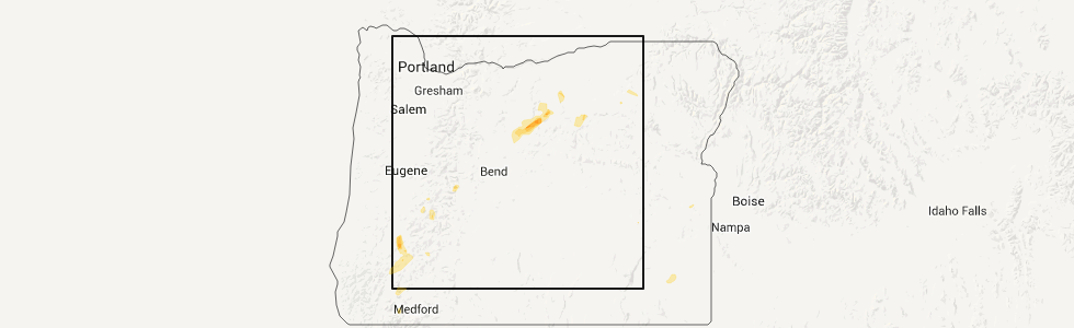
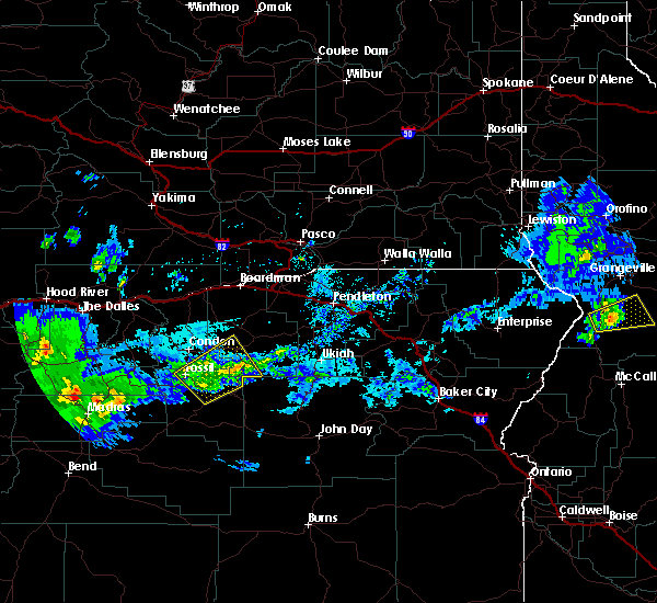
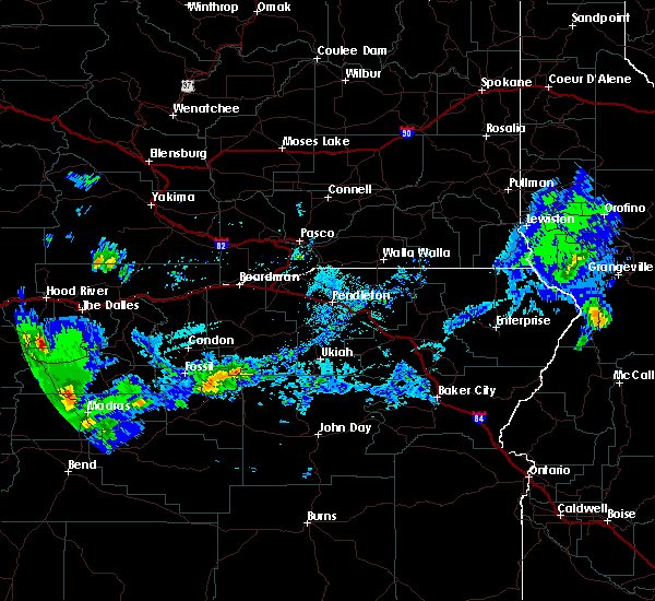
Hail Map for Fossil, OR
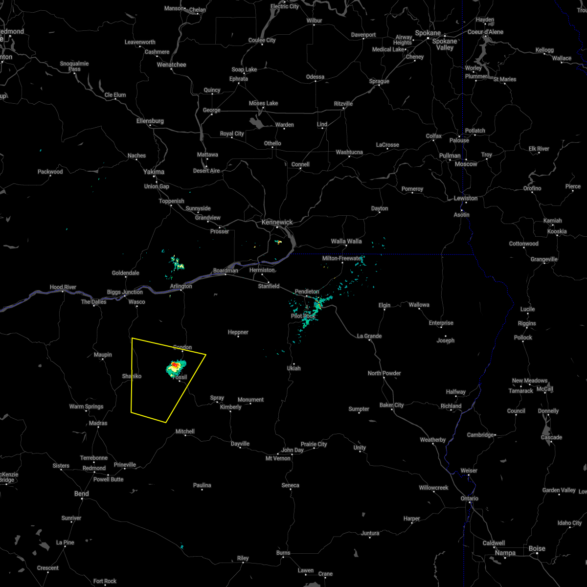
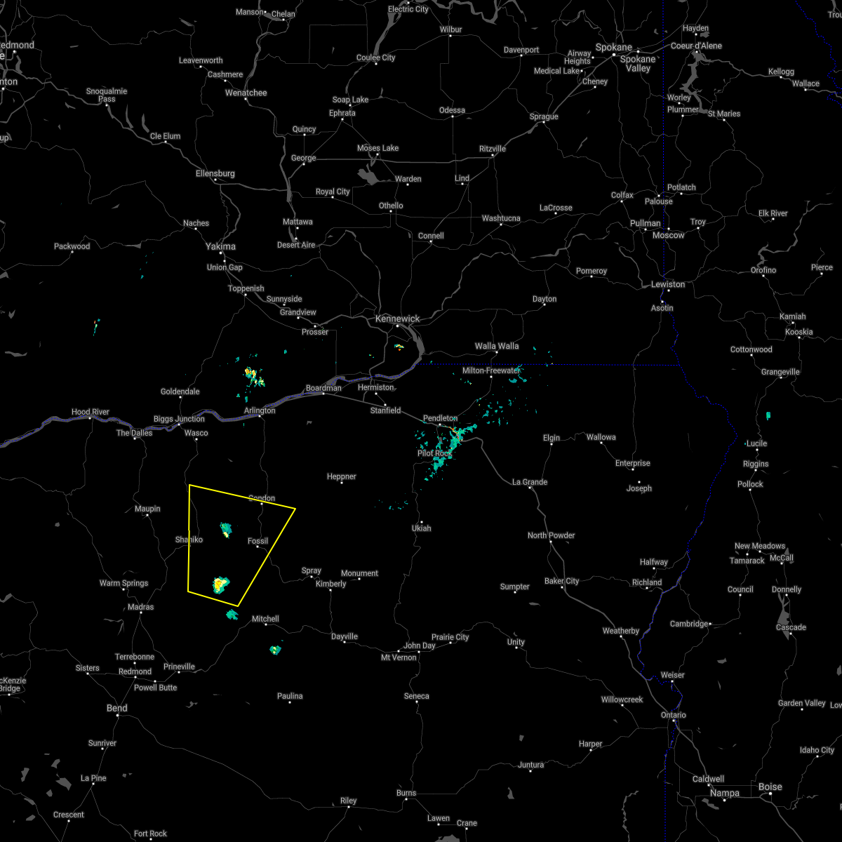
The Fossil, OR area has had 3 reports of on-the-ground hail by trained spotters, and has been under severe weather warnings 1 time during the past 12 months. Doppler radar has detected hail at or near Fossil, OR on 5 occasions.
| Name: | Fossil, OR |
| Where Located: | 57.3 miles NNE of Bend, OR |
| Map: | Google Map for Fossil, OR |
| Population: | 473 |
| Housing Units: | 265 |
| More Info: | Search Google for Fossil, OR |
5
The Top Recent Hail Date for Fossil, OR is Monday, April 23, 2012 (1st out of 5)
Hail and Wind Damage Spotted near Fossil, OR
| Date / Time | Report Details |
|---|---|
| 8/4/2024 5:59 PM PDT |
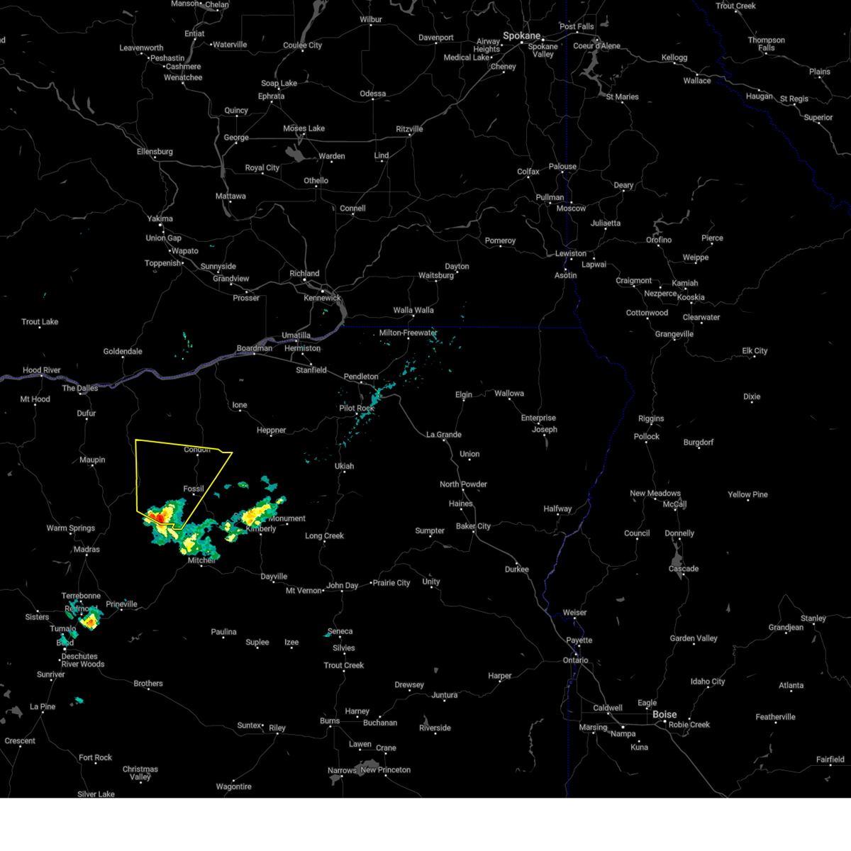 Svrpdt the national weather service in pendleton oregon has issued a * severe thunderstorm warning for, northwestern wheeler county in northeastern oregon, southern gilliam county in north central oregon, south central sherman county in north central oregon, southeastern wasco county in north central oregon, * until 645 pm pdt. * at 559 pm pdt, a severe thunderstorm was located over clarno, or 14 miles west of fossil, moving north at 35 mph (radar indicated). Hazards include quarter size hail. damage to vehicles is expected Svrpdt the national weather service in pendleton oregon has issued a * severe thunderstorm warning for, northwestern wheeler county in northeastern oregon, southern gilliam county in north central oregon, south central sherman county in north central oregon, southeastern wasco county in north central oregon, * until 645 pm pdt. * at 559 pm pdt, a severe thunderstorm was located over clarno, or 14 miles west of fossil, moving north at 35 mph (radar indicated). Hazards include quarter size hail. damage to vehicles is expected
|
| 7/2/2022 5:20 PM PDT | Quarter sized hail reported 22.3 miles WNW of Fossil, OR, time estimated from radar. |
| 8/18/2020 7:22 PM PDT |
 At 721 pm pdt, a severe thunderstorm was located 8 miles west of mayville, or 10 miles northwest of fossil, moving north at 30 mph (radar indicated). Hazards include 60 mph wind gusts and penny size hail, along with heavy rain and frequent lightning is likely. Expect damage to roofs, siding, and trees. Locations impacted include, condon, fossil, antelope, shaniko, kent, mayville and clarno. At 721 pm pdt, a severe thunderstorm was located 8 miles west of mayville, or 10 miles northwest of fossil, moving north at 30 mph (radar indicated). Hazards include 60 mph wind gusts and penny size hail, along with heavy rain and frequent lightning is likely. Expect damage to roofs, siding, and trees. Locations impacted include, condon, fossil, antelope, shaniko, kent, mayville and clarno.
|
| 8/18/2020 6:40 PM PDT |
 At 639 pm pdt, a severe thunderstorm was located 8 miles south of clarno, or 20 miles southwest of fossil, moving north at 30 mph (radar indicated). Hazards include 60 mph wind gusts and penny size hail, along with heavy rain and frequent lightning are likely. expect damage to roofs, siding, and trees At 639 pm pdt, a severe thunderstorm was located 8 miles south of clarno, or 20 miles southwest of fossil, moving north at 30 mph (radar indicated). Hazards include 60 mph wind gusts and penny size hail, along with heavy rain and frequent lightning are likely. expect damage to roofs, siding, and trees
|
| 5/30/2020 3:10 PM PDT |
 At 308 pm pdt, a severe thunderstorm was located 11 miles southeast of ashwood, or 20 miles west of mitchell, moving north at 50 mph (radar indicated and spotter verified. this storm has a history of producing wind damage). Hazards include 60 mph wind gusts and half dollar size hail. Hail damage to vehicles is expected. Expect wind damage to roofs, siding, and trees. At 308 pm pdt, a severe thunderstorm was located 11 miles southeast of ashwood, or 20 miles west of mitchell, moving north at 50 mph (radar indicated and spotter verified. this storm has a history of producing wind damage). Hazards include 60 mph wind gusts and half dollar size hail. Hail damage to vehicles is expected. Expect wind damage to roofs, siding, and trees.
|
| 8/9/2019 7:07 PM PDT |
 At 648 pm pdt, severe thunderstorms were located along a line extending from near hardman to near service creek, moving northwest at 20 mph (radar indicated). Hazards include 60 mph wind gusts and quarter size hail. Hail damage to vehicles is expected. expect wind damage to roofs, siding, and trees. Locations impacted include, fossil, lonerock, kinzua, hardman, ruggs, mayville and service creek. At 648 pm pdt, severe thunderstorms were located along a line extending from near hardman to near service creek, moving northwest at 20 mph (radar indicated). Hazards include 60 mph wind gusts and quarter size hail. Hail damage to vehicles is expected. expect wind damage to roofs, siding, and trees. Locations impacted include, fossil, lonerock, kinzua, hardman, ruggs, mayville and service creek.
|
| 8/9/2019 6:48 PM PDT |
 At 648 pm pdt, severe thunderstorms were located along a line extending from near hardman to near service creek, moving northwest at 20 mph (radar indicated). Hazards include 60 mph wind gusts and quarter size hail. Hail damage to vehicles is expected. expect wind damage to roofs, siding, and trees. Locations impacted include, fossil, lonerock, kinzua, hardman, ruggs, mayville and service creek. At 648 pm pdt, severe thunderstorms were located along a line extending from near hardman to near service creek, moving northwest at 20 mph (radar indicated). Hazards include 60 mph wind gusts and quarter size hail. Hail damage to vehicles is expected. expect wind damage to roofs, siding, and trees. Locations impacted include, fossil, lonerock, kinzua, hardman, ruggs, mayville and service creek.
|
| 8/9/2019 6:22 PM PDT |
 At 622 pm pdt, severe thunderstorms were located along a line extending from 8 miles southeast of hardman to service creek, moving northwest at 25 mph (radar indicated). Hazards include 60 mph wind gusts and quarter size hail. Hail damage to vehicles is expected. Expect wind damage to roofs, siding, and trees. At 622 pm pdt, severe thunderstorms were located along a line extending from 8 miles southeast of hardman to service creek, moving northwest at 25 mph (radar indicated). Hazards include 60 mph wind gusts and quarter size hail. Hail damage to vehicles is expected. Expect wind damage to roofs, siding, and trees.
|
| 6/26/2017 3:31 PM PDT |
 At 330 pm pdt, a severe thunderstorm was located over clarno, or 13 miles southwest of fossil, moving northeast at 15 mph (radar indicated). Hazards include 60 mph wind gusts and quarter size hail. Hail damage to vehicles is expected. Expect wind damage to roofs, siding, and trees. At 330 pm pdt, a severe thunderstorm was located over clarno, or 13 miles southwest of fossil, moving northeast at 15 mph (radar indicated). Hazards include 60 mph wind gusts and quarter size hail. Hail damage to vehicles is expected. Expect wind damage to roofs, siding, and trees.
|
| 6/26/2017 3:30 PM PDT | Quarter sized hail reported 11.7 miles ENE of Fossil, OR, hancock field station reported very heavy rain... hail about the size of cherry tomatoes or quarters... and some flooding of several buildings |
| 5/4/2016 5:48 PM PDT |
 At 547 pm pdt, doppler radar indicated a severe thunderstorm capable of producing quarter size hail and damaging winds in excess of 60 mph. this storm was located near lonerock, or 16 miles east of fossil, moving northeast at 20 mph. this severe storm will be near, lonerock around 555 pm pdt. At 547 pm pdt, doppler radar indicated a severe thunderstorm capable of producing quarter size hail and damaging winds in excess of 60 mph. this storm was located near lonerock, or 16 miles east of fossil, moving northeast at 20 mph. this severe storm will be near, lonerock around 555 pm pdt.
|
| 5/4/2016 5:31 PM PDT |
 At 530 pm pdt, doppler radar indicated a severe thunderstorm capable of producing quarter size hail and damaging winds in excess of 60 mph. this storm was located near kinzua, or 12 miles east of fossil, and moving northeast at 20 mph. * this severe thunderstorm will be near, lonerock around 600 pm pdt. At 530 pm pdt, doppler radar indicated a severe thunderstorm capable of producing quarter size hail and damaging winds in excess of 60 mph. this storm was located near kinzua, or 12 miles east of fossil, and moving northeast at 20 mph. * this severe thunderstorm will be near, lonerock around 600 pm pdt.
|
| 7/8/2012 4:00 PM PDT | Strong winds heavy rain lightning and thunder reported. power pole 8 to 10 inches in diameter knocked dow in wheeler county OR, 7.4 miles NW of Fossil, OR |
| 4/23/2012 6:30 PM PDT | Quarter sized hail reported 0.1 miles W of Fossil, OR, hail damage to recreational vehicle in fossil. |
Hail Maps for Fossil, OR


Connect with Interactive Hail Maps