

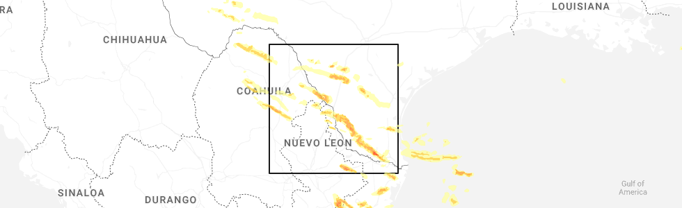
Hail Map for Freer, TX
The Freer, TX area has had 7 reports of on-the-ground hail by trained spotters, and has been under severe weather warnings 0 times during the past 12 months. Doppler radar has detected hail at or near Freer, TX on 27 occasions, including 1 occasion during the past year.
| Name: | Freer, TX |
| Where Located: | 59.2 miles ENE of Laredo, TX |
| Map: | Google Map for Freer, TX |
| Population: | 2818 |
| Housing Units: | 1241 |
| More Info: | Search Google for Freer, TX |
0
The Top Recent Hail Date for Freer, TX is Thursday, May 8, 2025 (27th out of 27)
Hail and Wind Damage Spotted near Freer, TX
| Date / Time | Report Details |
|---|---|
| 5/8/2025 8:03 PM CDT | Duval county ems reported a jack-knifed 18 wheeler n of free in duval county TX, 9.2 miles S of Freer, TX |
| 6/20/2024 12:48 AM CDT |
 At 1248 am cdt, a severe thunderstorm capable of producing a tornado was located 7 miles northwest of rosita, or 7 miles east of freer, moving west at 40 mph (radar indicated rotation). Hazards include tornado. Flying debris will be dangerous to those caught without shelter. mobile homes will be damaged or destroyed. damage to roofs, windows, and vehicles will occur. tree damage is likely. this dangerous storm will be near, freer around 1255 am cdt. This includes us highway 59 between mile markers 762 and 768. At 1248 am cdt, a severe thunderstorm capable of producing a tornado was located 7 miles northwest of rosita, or 7 miles east of freer, moving west at 40 mph (radar indicated rotation). Hazards include tornado. Flying debris will be dangerous to those caught without shelter. mobile homes will be damaged or destroyed. damage to roofs, windows, and vehicles will occur. tree damage is likely. this dangerous storm will be near, freer around 1255 am cdt. This includes us highway 59 between mile markers 762 and 768.
|
| 6/20/2024 12:40 AM CDT |
 Torcrp the national weather service in corpus christi has issued a * tornado warning for, northeastern duval county in south central texas, * until 100 am cdt. * at 1240 am cdt, a severe thunderstorm capable of producing a tornado was located near rosita, or 12 miles northwest of san diego, moving west at 40 mph (radar indicated rotation). Hazards include tornado. Flying debris will be dangerous to those caught without shelter. mobile homes will be damaged or destroyed. damage to roofs, windows, and vehicles will occur. tree damage is likely. this dangerous storm will be near, freer around 1255 am cdt. This includes us highway 59 between mile markers 762 and 768. Torcrp the national weather service in corpus christi has issued a * tornado warning for, northeastern duval county in south central texas, * until 100 am cdt. * at 1240 am cdt, a severe thunderstorm capable of producing a tornado was located near rosita, or 12 miles northwest of san diego, moving west at 40 mph (radar indicated rotation). Hazards include tornado. Flying debris will be dangerous to those caught without shelter. mobile homes will be damaged or destroyed. damage to roofs, windows, and vehicles will occur. tree damage is likely. this dangerous storm will be near, freer around 1255 am cdt. This includes us highway 59 between mile markers 762 and 768.
|
| 5/29/2024 12:10 AM CDT |
 At 1210 am cdt, a severe thunderstorm was located over seven sisters, or 10 miles north of freer, moving east at 20 mph (radar indicated). Hazards include 70 mph wind gusts and penny size hail. Expect considerable tree damage. damage is likely to mobile homes, roofs, and outbuildings. locations impacted include, freer, seven sisters, and loma alta. This includes us highway 59 between mile markers 746 and 764. At 1210 am cdt, a severe thunderstorm was located over seven sisters, or 10 miles north of freer, moving east at 20 mph (radar indicated). Hazards include 70 mph wind gusts and penny size hail. Expect considerable tree damage. damage is likely to mobile homes, roofs, and outbuildings. locations impacted include, freer, seven sisters, and loma alta. This includes us highway 59 between mile markers 746 and 764.
|
| 5/29/2024 12:01 AM CDT |
 Svrcrp the national weather service in corpus christi has issued a * severe thunderstorm warning for, northern duval county in south central texas, southeastern mcmullen county in south central texas, * until 1245 am cdt. * at 1201 am cdt, a severe thunderstorm was located near seven sisters, or 9 miles north of freer, moving east at 20 mph (radar indicated). Hazards include 60 mph wind gusts and penny size hail. expect damage to roofs, siding, and trees Svrcrp the national weather service in corpus christi has issued a * severe thunderstorm warning for, northern duval county in south central texas, southeastern mcmullen county in south central texas, * until 1245 am cdt. * at 1201 am cdt, a severe thunderstorm was located near seven sisters, or 9 miles north of freer, moving east at 20 mph (radar indicated). Hazards include 60 mph wind gusts and penny size hail. expect damage to roofs, siding, and trees
|
| 5/28/2024 10:34 PM CDT |
 At 1033 pm cdt, severe thunderstorms were located along a line extending from 9 miles south of fort ewell site to near bruni to near thompsonville, moving east at 45 mph (radar indicated). Hazards include 60 mph wind gusts. Expect damage to roofs, siding, and trees. these severe storms will be near, realitos around 1050 pm cdt. freer around 1055 pm cdt. benavides around 1100 pm cdt. seven sisters and rosita around 1110 pm cdt. This includes us highway 59 between mile markers 754 and 800. At 1033 pm cdt, severe thunderstorms were located along a line extending from 9 miles south of fort ewell site to near bruni to near thompsonville, moving east at 45 mph (radar indicated). Hazards include 60 mph wind gusts. Expect damage to roofs, siding, and trees. these severe storms will be near, realitos around 1050 pm cdt. freer around 1055 pm cdt. benavides around 1100 pm cdt. seven sisters and rosita around 1110 pm cdt. This includes us highway 59 between mile markers 754 and 800.
|
| 5/28/2024 10:23 PM CDT |
 At 1023 pm cdt, severe thunderstorms were located along a line extending from 16 miles south of fort ewell site to near oilton to near thompsonville, moving east at 45 mph (radar indicated). Hazards include 60 mph wind gusts and penny size hail. Expect damage to roofs, siding, and trees. these severe storms will be near, bruni around 1030 pm cdt. realitos around 1045 pm cdt. freer around 1055 pm cdt. benavides around 1100 pm cdt. rosita around 1105 pm cdt. This includes us highway 59 between mile markers 754 and 806. At 1023 pm cdt, severe thunderstorms were located along a line extending from 16 miles south of fort ewell site to near oilton to near thompsonville, moving east at 45 mph (radar indicated). Hazards include 60 mph wind gusts and penny size hail. Expect damage to roofs, siding, and trees. these severe storms will be near, bruni around 1030 pm cdt. realitos around 1045 pm cdt. freer around 1055 pm cdt. benavides around 1100 pm cdt. rosita around 1105 pm cdt. This includes us highway 59 between mile markers 754 and 806.
|
| 5/28/2024 10:09 PM CDT |
 Svrcrp the national weather service in corpus christi has issued a * severe thunderstorm warning for, duval county in south central texas, eastern webb county in south central texas, * until 1115 pm cdt. * at 1008 pm cdt, severe thunderstorms were located along a line extending from 10 miles east of encinal to 6 miles southeast of ranchitos las lomas to 17 miles southwest of aguilares, moving east at 45 mph (radar indicated). Hazards include 60 mph wind gusts and penny size hail. Expect damage to roofs, siding, and trees. severe thunderstorms will be near, aguilares and mirando city around 1015 pm cdt. oilton around 1020 pm cdt. bruni around 1030 pm cdt. freer around 1045 pm cdt. seven sisters around 1055 pm cdt. rosita and realitos around 1100 pm cdt. benavides around 1105 pm cdt. this includes the following highways, interstate 35 between mile markers 31 and 34. Us highway 59 between mile markers 754 and 816. Svrcrp the national weather service in corpus christi has issued a * severe thunderstorm warning for, duval county in south central texas, eastern webb county in south central texas, * until 1115 pm cdt. * at 1008 pm cdt, severe thunderstorms were located along a line extending from 10 miles east of encinal to 6 miles southeast of ranchitos las lomas to 17 miles southwest of aguilares, moving east at 45 mph (radar indicated). Hazards include 60 mph wind gusts and penny size hail. Expect damage to roofs, siding, and trees. severe thunderstorms will be near, aguilares and mirando city around 1015 pm cdt. oilton around 1020 pm cdt. bruni around 1030 pm cdt. freer around 1045 pm cdt. seven sisters around 1055 pm cdt. rosita and realitos around 1100 pm cdt. benavides around 1105 pm cdt. this includes the following highways, interstate 35 between mile markers 31 and 34. Us highway 59 between mile markers 754 and 816.
|
| 5/5/2024 5:16 PM CDT |
 the severe thunderstorm warning has been cancelled and is no longer in effect the severe thunderstorm warning has been cancelled and is no longer in effect
|
| 5/5/2024 5:16 PM CDT |
 At 515 pm cdt, severe thunderstorms were located along a line extending from near rancho de la parita to 6 miles northwest of san diego to 13 miles west of benavides, moving east at 35 mph (radar indicated). Hazards include 60 mph wind gusts and quarter size hail. Hail damage to vehicles is expected. expect wind damage to roofs, siding, and trees. locations impacted include, alice, san diego, freer, benavides, seven sisters, san jose, ben bolt, palito blanco, tecalote, realitos, annarose, rancho de la parita, alice acres, rosita, and lake alice. this includes the following highways, us highway 281 between mile markers 660 and 682. Us highway 59 between mile markers 746 and 772. At 515 pm cdt, severe thunderstorms were located along a line extending from near rancho de la parita to 6 miles northwest of san diego to 13 miles west of benavides, moving east at 35 mph (radar indicated). Hazards include 60 mph wind gusts and quarter size hail. Hail damage to vehicles is expected. expect wind damage to roofs, siding, and trees. locations impacted include, alice, san diego, freer, benavides, seven sisters, san jose, ben bolt, palito blanco, tecalote, realitos, annarose, rancho de la parita, alice acres, rosita, and lake alice. this includes the following highways, us highway 281 between mile markers 660 and 682. Us highway 59 between mile markers 746 and 772.
|
| 5/5/2024 4:58 PM CDT |
 Svrcrp the national weather service in corpus christi has issued a * severe thunderstorm warning for, duval county in south central texas, east central webb county in south central texas, southeastern mcmullen county in south central texas, northwestern jim wells county in south central texas, southwestern live oak county in south central texas, * until 545 pm cdt. * at 457 pm cdt, severe thunderstorms were located along a line extending from 8 miles southwest of clegg to near rosita to 15 miles north of bruni, moving east at 35 mph (radar indicated). Hazards include 60 mph wind gusts and quarter size hail. Hail damage to vehicles is expected. Expect wind damage to roofs, siding, and trees. Svrcrp the national weather service in corpus christi has issued a * severe thunderstorm warning for, duval county in south central texas, east central webb county in south central texas, southeastern mcmullen county in south central texas, northwestern jim wells county in south central texas, southwestern live oak county in south central texas, * until 545 pm cdt. * at 457 pm cdt, severe thunderstorms were located along a line extending from 8 miles southwest of clegg to near rosita to 15 miles north of bruni, moving east at 35 mph (radar indicated). Hazards include 60 mph wind gusts and quarter size hail. Hail damage to vehicles is expected. Expect wind damage to roofs, siding, and trees.
|
| 5/5/2024 4:23 PM CDT |
 At 423 pm cdt, a severe thunderstorm was located near freer, moving southeast at 25 mph (radar indicated). Hazards include ping pong ball size hail and 60 mph wind gusts. People and animals outdoors will be injured. expect hail damage to roofs, siding, windows, and vehicles. expect wind damage to roofs, siding, and trees. locations impacted include, freer and seven sisters. This includes us highway 59 between mile markers 752 and 786. At 423 pm cdt, a severe thunderstorm was located near freer, moving southeast at 25 mph (radar indicated). Hazards include ping pong ball size hail and 60 mph wind gusts. People and animals outdoors will be injured. expect hail damage to roofs, siding, windows, and vehicles. expect wind damage to roofs, siding, and trees. locations impacted include, freer and seven sisters. This includes us highway 59 between mile markers 752 and 786.
|
| 5/5/2024 4:20 PM CDT |
 Svrcrp the national weather service in corpus christi has issued a * severe thunderstorm warning for, northwestern duval county in south central texas, east central webb county in south central texas, * until 500 pm cdt. * at 420 pm cdt, a severe thunderstorm was located near freer, moving southeast at 25 mph (radar indicated). Hazards include 60 mph wind gusts and quarter size hail. Hail damage to vehicles is expected. Expect wind damage to roofs, siding, and trees. Svrcrp the national weather service in corpus christi has issued a * severe thunderstorm warning for, northwestern duval county in south central texas, east central webb county in south central texas, * until 500 pm cdt. * at 420 pm cdt, a severe thunderstorm was located near freer, moving southeast at 25 mph (radar indicated). Hazards include 60 mph wind gusts and quarter size hail. Hail damage to vehicles is expected. Expect wind damage to roofs, siding, and trees.
|
| 9/15/2023 10:15 PM CDT |
 At 1015 pm cdt, a severe thunderstorm was located near freer, moving south at 20 mph (radar indicated). Hazards include 60 mph wind gusts and quarter size hail. Hail damage to vehicles is expected. Expect wind damage to roofs, siding, and trees. At 1015 pm cdt, a severe thunderstorm was located near freer, moving south at 20 mph (radar indicated). Hazards include 60 mph wind gusts and quarter size hail. Hail damage to vehicles is expected. Expect wind damage to roofs, siding, and trees.
|
| 9/15/2023 7:48 PM CDT |
 At 748 pm cdt, a severe thunderstorm was located 14 miles west of freer, moving south at 20 mph (radar indicated). Hazards include 60 mph wind gusts and quarter size hail. Hail damage to vehicles is expected. expect wind damage to roofs, siding, and trees. locations impacted include, freer. this includes us highway 59 between mile markers 768 and 784. hail threat, radar indicated max hail size, 1. 00 in wind threat, radar indicated max wind gust, 60 mph. At 748 pm cdt, a severe thunderstorm was located 14 miles west of freer, moving south at 20 mph (radar indicated). Hazards include 60 mph wind gusts and quarter size hail. Hail damage to vehicles is expected. expect wind damage to roofs, siding, and trees. locations impacted include, freer. this includes us highway 59 between mile markers 768 and 784. hail threat, radar indicated max hail size, 1. 00 in wind threat, radar indicated max wind gust, 60 mph.
|
| 9/15/2023 7:29 PM CDT |
 At 728 pm cdt, a severe thunderstorm was located 14 miles east of fort ewell site, or 17 miles northwest of freer, moving south at 20 mph (radar indicated). Hazards include 60 mph wind gusts and quarter size hail. Hail damage to vehicles is expected. Expect wind damage to roofs, siding, and trees. At 728 pm cdt, a severe thunderstorm was located 14 miles east of fort ewell site, or 17 miles northwest of freer, moving south at 20 mph (radar indicated). Hazards include 60 mph wind gusts and quarter size hail. Hail damage to vehicles is expected. Expect wind damage to roofs, siding, and trees.
|
| 8/22/2023 11:15 AM CDT |
 At 1114 am cdt, a severe thunderstorm capable of producing a tornado was located near river creek acres, or near george west, moving southwest at 40 mph (radar indicated rotation). Hazards include tornado. Flying debris will be dangerous to those caught without shelter. mobile homes will be damaged or destroyed. damage to roofs, windows, and vehicles will occur. tree damage is likely. this dangerous storm will be near, clegg around 1125 am cdt. loma alta around 1135 am cdt. seven sisters around 1140 am cdt. this includes the following highways, us highway 281 between mile markers 636 and 646. Us highway 59 between mile markers 728 and 766. At 1114 am cdt, a severe thunderstorm capable of producing a tornado was located near river creek acres, or near george west, moving southwest at 40 mph (radar indicated rotation). Hazards include tornado. Flying debris will be dangerous to those caught without shelter. mobile homes will be damaged or destroyed. damage to roofs, windows, and vehicles will occur. tree damage is likely. this dangerous storm will be near, clegg around 1125 am cdt. loma alta around 1135 am cdt. seven sisters around 1140 am cdt. this includes the following highways, us highway 281 between mile markers 636 and 646. Us highway 59 between mile markers 728 and 766.
|
| 8/22/2023 11:14 AM CDT |
 At 1113 am cdt, a severe thunderstorm capable of producing a tornado was located near river creek acres, or near george west, moving west at 80 mph (radar indicated rotation). Hazards include tornado. Flying debris will be dangerous to those caught without shelter. mobile homes will be damaged or destroyed. damage to roofs, windows, and vehicles will occur. tree damage is likely. this dangerous storm will be near, clegg around 1125 am cdt. loma alta and seven sisters around 1135 am cdt. this includes the following highways, us highway 281 between mile markers 636 and 646. Us highway 59 between mile markers 728 and 766. At 1113 am cdt, a severe thunderstorm capable of producing a tornado was located near river creek acres, or near george west, moving west at 80 mph (radar indicated rotation). Hazards include tornado. Flying debris will be dangerous to those caught without shelter. mobile homes will be damaged or destroyed. damage to roofs, windows, and vehicles will occur. tree damage is likely. this dangerous storm will be near, clegg around 1125 am cdt. loma alta and seven sisters around 1135 am cdt. this includes the following highways, us highway 281 between mile markers 636 and 646. Us highway 59 between mile markers 728 and 766.
|
| 8/15/2022 10:00 AM CDT |
 At 1000 am cdt, a severe thunderstorm capable of producing a tornado was located near freer, moving north at 25 mph (radar indicated rotation). Hazards include tornado. Flying debris will be dangerous to those caught without shelter. mobile homes will be damaged or destroyed. damage to roofs, windows, and vehicles will occur. tree damage is likely. this dangerous storm will be near, freer around 1010 am cdt. This includes us highway 59 between mile markers 770 and 776. At 1000 am cdt, a severe thunderstorm capable of producing a tornado was located near freer, moving north at 25 mph (radar indicated rotation). Hazards include tornado. Flying debris will be dangerous to those caught without shelter. mobile homes will be damaged or destroyed. damage to roofs, windows, and vehicles will occur. tree damage is likely. this dangerous storm will be near, freer around 1010 am cdt. This includes us highway 59 between mile markers 770 and 776.
|
| 3/21/2022 11:15 PM CDT |
 At 1115 pm cdt, a severe thunderstorm was located near loma alta, or 14 miles northeast of freer, moving northeast at 40 mph (radar indicated). Hazards include 60 mph wind gusts and quarter size hail. Hail damage to vehicles is expected. Expect wind damage to roofs, siding, and trees. At 1115 pm cdt, a severe thunderstorm was located near loma alta, or 14 miles northeast of freer, moving northeast at 40 mph (radar indicated). Hazards include 60 mph wind gusts and quarter size hail. Hail damage to vehicles is expected. Expect wind damage to roofs, siding, and trees.
|
| 3/21/2022 11:02 PM CDT |
 At 1101 pm cdt, a severe thunderstorm was located over seven sisters, or 7 miles north of freer, moving northeast at 45 mph (radar indicated). Hazards include 60 mph wind gusts and quarter size hail. Hail damage to vehicles is expected. expect wind damage to roofs, siding, and trees. locations impacted include, freer, seven sisters, loma alta and clegg. this includes us highway 59 between mile markers 740 and 776. hail threat, radar indicated max hail size, 1. 00 in wind threat, radar indicated max wind gust, 60 mph. At 1101 pm cdt, a severe thunderstorm was located over seven sisters, or 7 miles north of freer, moving northeast at 45 mph (radar indicated). Hazards include 60 mph wind gusts and quarter size hail. Hail damage to vehicles is expected. expect wind damage to roofs, siding, and trees. locations impacted include, freer, seven sisters, loma alta and clegg. this includes us highway 59 between mile markers 740 and 776. hail threat, radar indicated max hail size, 1. 00 in wind threat, radar indicated max wind gust, 60 mph.
|
| 3/21/2022 10:51 PM CDT |
 At 1051 pm cdt, a severe thunderstorm was located near freer, moving northeast at 40 mph (radar indicated). Hazards include 60 mph wind gusts and half dollar size hail. Hail damage to vehicles is expected. expect wind damage to roofs, siding, and trees. locations impacted include, freer, seven sisters, loma alta, annarose and clegg. this includes us highway 59 between mile markers 740 and 786. hail threat, radar indicated max hail size, 1. 25 in wind threat, radar indicated max wind gust, 60 mph. At 1051 pm cdt, a severe thunderstorm was located near freer, moving northeast at 40 mph (radar indicated). Hazards include 60 mph wind gusts and half dollar size hail. Hail damage to vehicles is expected. expect wind damage to roofs, siding, and trees. locations impacted include, freer, seven sisters, loma alta, annarose and clegg. this includes us highway 59 between mile markers 740 and 786. hail threat, radar indicated max hail size, 1. 25 in wind threat, radar indicated max wind gust, 60 mph.
|
| 3/21/2022 10:41 PM CDT |
 At 1041 pm cdt, a severe thunderstorm was located near freer, moving northeast at 50 mph (radar indicated). Hazards include 60 mph wind gusts and half dollar size hail. Hail damage to vehicles is expected. expect wind damage to roofs, siding, and trees. locations impacted include, freer, seven sisters, loma alta and clegg. this includes us highway 59 between mile markers 740 and 796. hail threat, radar indicated max hail size, 1. 25 in wind threat, radar indicated max wind gust, 60 mph. At 1041 pm cdt, a severe thunderstorm was located near freer, moving northeast at 50 mph (radar indicated). Hazards include 60 mph wind gusts and half dollar size hail. Hail damage to vehicles is expected. expect wind damage to roofs, siding, and trees. locations impacted include, freer, seven sisters, loma alta and clegg. this includes us highway 59 between mile markers 740 and 796. hail threat, radar indicated max hail size, 1. 25 in wind threat, radar indicated max wind gust, 60 mph.
|
| 3/21/2022 10:32 PM CDT |
 At 1032 pm cdt, a severe thunderstorm was located 13 miles southwest of freer, moving northeast at 50 mph (radar indicated). Hazards include 60 mph wind gusts and quarter size hail. Hail damage to vehicles is expected. Expect wind damage to roofs, siding, and trees. At 1032 pm cdt, a severe thunderstorm was located 13 miles southwest of freer, moving northeast at 50 mph (radar indicated). Hazards include 60 mph wind gusts and quarter size hail. Hail damage to vehicles is expected. Expect wind damage to roofs, siding, and trees.
|
| 6/1/2021 3:52 AM CDT |
 At 352 am cdt, severe thunderstorms were located along a line extending from 7 miles west of seven sisters to near oilton to 9 miles east of rio bravo, moving southeast at 30 mph (radar indicated). Hazards include 60 mph wind gusts and penny size hail. Expect damage to roofs, siding, and trees. locations impacted include, laredo, freer, benavides, texas a&m, laredo international airport, seven sisters, loma alta, mirando city, oilton, united south high school, aguilares, realitos, ranchitos las lomas, st augustine high school south laredo, laredo country club, bruni and rosita. this includes the following highways, interstate 35 between mile markers 1 and 4. us highway 59 between mile markers 746 and 824. Us highway 83 between mile markers 718 and 720. At 352 am cdt, severe thunderstorms were located along a line extending from 7 miles west of seven sisters to near oilton to 9 miles east of rio bravo, moving southeast at 30 mph (radar indicated). Hazards include 60 mph wind gusts and penny size hail. Expect damage to roofs, siding, and trees. locations impacted include, laredo, freer, benavides, texas a&m, laredo international airport, seven sisters, loma alta, mirando city, oilton, united south high school, aguilares, realitos, ranchitos las lomas, st augustine high school south laredo, laredo country club, bruni and rosita. this includes the following highways, interstate 35 between mile markers 1 and 4. us highway 59 between mile markers 746 and 824. Us highway 83 between mile markers 718 and 720.
|
| 6/1/2021 3:09 AM CDT |
 At 309 am cdt, severe thunderstorms were located along a line extending from 13 miles south of fowlerton to 17 miles northeast of ranchitos las lomas to near unitec industrial park, moving southeast at 40 mph (radar indicated). Hazards include 60 mph wind gusts and penny size hail. expect damage to roofs, siding, and trees At 309 am cdt, severe thunderstorms were located along a line extending from 13 miles south of fowlerton to 17 miles northeast of ranchitos las lomas to near unitec industrial park, moving southeast at 40 mph (radar indicated). Hazards include 60 mph wind gusts and penny size hail. expect damage to roofs, siding, and trees
|
| 5/19/2021 12:45 AM CDT |
 At 1244 am cdt, severe thunderstorms were located along a line extending from 7 miles southeast of fowlerton to near seven sisters, moving north at 35 mph (radar indicated). Hazards include ping pong ball size hail and 60 mph wind gusts. People and animals outdoors will be injured. expect hail damage to roofs, siding, windows, and vehicles. expect wind damage to roofs, siding, and trees. locations impacted include, freer, tilden, seven sisters, loma alta and cross. This includes us highway 59 between mile markers 746 and 772. At 1244 am cdt, severe thunderstorms were located along a line extending from 7 miles southeast of fowlerton to near seven sisters, moving north at 35 mph (radar indicated). Hazards include ping pong ball size hail and 60 mph wind gusts. People and animals outdoors will be injured. expect hail damage to roofs, siding, windows, and vehicles. expect wind damage to roofs, siding, and trees. locations impacted include, freer, tilden, seven sisters, loma alta and cross. This includes us highway 59 between mile markers 746 and 772.
|
| 5/19/2021 12:29 AM CDT |
 At 1228 am cdt, severe thunderstorms were located along a line extending from 13 miles south of fowlerton to near freer, moving north at 35 mph (radar indicated). Hazards include ping pong ball size hail and 60 mph wind gusts. People and animals outdoors will be injured. expect hail damage to roofs, siding, windows, and vehicles. Expect wind damage to roofs, siding, and trees. At 1228 am cdt, severe thunderstorms were located along a line extending from 13 miles south of fowlerton to near freer, moving north at 35 mph (radar indicated). Hazards include ping pong ball size hail and 60 mph wind gusts. People and animals outdoors will be injured. expect hail damage to roofs, siding, windows, and vehicles. Expect wind damage to roofs, siding, and trees.
|
| 5/11/2021 7:00 PM CDT |
 At 659 pm cdt, a severe thunderstorm capable of producing a tornado was located over loma alta, or 18 miles northeast of freer, moving south at 15 mph (radar indicated rotation). Hazards include tornado and quarter size hail. Flying debris will be dangerous to those caught without shelter. mobile homes will be damaged or destroyed. damage to roofs, windows, and vehicles will occur. tree damage is likely. this dangerous storm will be near, seven sisters around 725 pm cdt. This includes us highway 59 between mile markers 748 and 768. At 659 pm cdt, a severe thunderstorm capable of producing a tornado was located over loma alta, or 18 miles northeast of freer, moving south at 15 mph (radar indicated rotation). Hazards include tornado and quarter size hail. Flying debris will be dangerous to those caught without shelter. mobile homes will be damaged or destroyed. damage to roofs, windows, and vehicles will occur. tree damage is likely. this dangerous storm will be near, seven sisters around 725 pm cdt. This includes us highway 59 between mile markers 748 and 768.
|
| 5/11/2021 6:52 PM CDT |
 At 652 pm cdt, a severe thunderstorm was located over loma alta, or 16 miles north of freer, moving southeast at 25 mph (radar indicated). Hazards include 60 mph wind gusts and half dollar size hail. Hail damage to vehicles is expected. expect wind damage to roofs, siding, and trees. this severe thunderstorm will be near, seven sisters around 710 pm cdt. This includes us highway 59 between mile markers 748 and 766. At 652 pm cdt, a severe thunderstorm was located over loma alta, or 16 miles north of freer, moving southeast at 25 mph (radar indicated). Hazards include 60 mph wind gusts and half dollar size hail. Hail damage to vehicles is expected. expect wind damage to roofs, siding, and trees. this severe thunderstorm will be near, seven sisters around 710 pm cdt. This includes us highway 59 between mile markers 748 and 766.
|
| 5/26/2020 12:17 AM CDT |
 At 1217 am cdt, a severe thunderstorm capable of producing a tornado was located near freer, moving southeast at 10 mph (radar indicated rotation). Hazards include tornado and quarter size hail. Flying debris will be dangerous to those caught without shelter. mobile homes will be damaged or destroyed. damage to roofs, windows, and vehicles will occur. tree damage is likely. This tornadic thunderstorm will remain over mainly rural areas of north central duval county. At 1217 am cdt, a severe thunderstorm capable of producing a tornado was located near freer, moving southeast at 10 mph (radar indicated rotation). Hazards include tornado and quarter size hail. Flying debris will be dangerous to those caught without shelter. mobile homes will be damaged or destroyed. damage to roofs, windows, and vehicles will occur. tree damage is likely. This tornadic thunderstorm will remain over mainly rural areas of north central duval county.
|
| 5/26/2020 12:08 AM CDT |
 At 1208 am cdt, severe thunderstorms were located along a line extending from near seven sisters to 14 miles southwest of freer, moving east at 30 mph (radar indicated). Hazards include quarter size hail. damage to vehicles is expected At 1208 am cdt, severe thunderstorms were located along a line extending from near seven sisters to 14 miles southwest of freer, moving east at 30 mph (radar indicated). Hazards include quarter size hail. damage to vehicles is expected
|
| 5/24/2020 10:10 PM CDT |
 At 1009 pm cdt, severe thunderstorms were located along a line extending from 19 miles north of oilton to near ranchitos las lomas to st augustine high school south laredo, moving east at 45 mph (radar indicated). Hazards include 60 mph wind gusts. expect damage to roofs, siding, and trees At 1009 pm cdt, severe thunderstorms were located along a line extending from 19 miles north of oilton to near ranchitos las lomas to st augustine high school south laredo, moving east at 45 mph (radar indicated). Hazards include 60 mph wind gusts. expect damage to roofs, siding, and trees
|
| 5/16/2020 12:36 AM CDT |
 At 1236 am cdt, a severe thunderstorm was located 12 miles west of seven sisters, or 12 miles northwest of freer, moving east at 40 mph (radar indicated). Hazards include golf ball size hail and 60 mph wind gusts. People and animals outdoors will be injured. expect hail damage to roofs, siding, windows, and vehicles. expect wind damage to roofs, siding, and trees. Locations impacted include, freer, seven sisters, loma alta and rosita. At 1236 am cdt, a severe thunderstorm was located 12 miles west of seven sisters, or 12 miles northwest of freer, moving east at 40 mph (radar indicated). Hazards include golf ball size hail and 60 mph wind gusts. People and animals outdoors will be injured. expect hail damage to roofs, siding, windows, and vehicles. expect wind damage to roofs, siding, and trees. Locations impacted include, freer, seven sisters, loma alta and rosita.
|
| 5/16/2020 12:21 AM CDT |
 At 1221 am cdt, a severe thunderstorm was located 11 miles southeast of fort ewell site, or 20 miles northwest of freer, moving east at 40 mph (radar indicated). Hazards include 60 mph wind gusts and quarter size hail. Hail damage to vehicles is expected. Expect wind damage to roofs, siding, and trees. At 1221 am cdt, a severe thunderstorm was located 11 miles southeast of fort ewell site, or 20 miles northwest of freer, moving east at 40 mph (radar indicated). Hazards include 60 mph wind gusts and quarter size hail. Hail damage to vehicles is expected. Expect wind damage to roofs, siding, and trees.
|
| 5/5/2020 7:50 PM CDT |
 At 750 pm cdt, a severe thunderstorm was located near loma alta, or 17 miles northeast of freer, moving southwest at 30 mph (radar indicated). Hazards include 60 mph wind gusts and half dollar size hail. Hail damage to vehicles is expected. Expect wind damage to roofs, siding, and trees. At 750 pm cdt, a severe thunderstorm was located near loma alta, or 17 miles northeast of freer, moving southwest at 30 mph (radar indicated). Hazards include 60 mph wind gusts and half dollar size hail. Hail damage to vehicles is expected. Expect wind damage to roofs, siding, and trees.
|
| 4/9/2020 9:22 PM CDT |
 At 922 pm cdt, severe thunderstorms were located along a line extending from simmons to 7 miles north of clegg to freer, moving east at 30 mph (radar indicated). Hazards include 60 mph wind gusts and quarter size hail. Hail damage to vehicles is expected. expect wind damage to roofs, siding, and trees. Locations impacted include, freer, seven sisters, loma alta, clegg and rosita. At 922 pm cdt, severe thunderstorms were located along a line extending from simmons to 7 miles north of clegg to freer, moving east at 30 mph (radar indicated). Hazards include 60 mph wind gusts and quarter size hail. Hail damage to vehicles is expected. expect wind damage to roofs, siding, and trees. Locations impacted include, freer, seven sisters, loma alta, clegg and rosita.
|
| 4/9/2020 8:57 PM CDT |
 At 857 pm cdt, severe thunderstorms were located along a line extending from near calliham to 8 miles north of loma alta to 9 miles west of freer, moving east at 30 mph (radar indicated). Hazards include 60 mph wind gusts and half dollar size hail. Hail damage to vehicles is expected. Expect wind damage to roofs, siding, and trees. At 857 pm cdt, severe thunderstorms were located along a line extending from near calliham to 8 miles north of loma alta to 9 miles west of freer, moving east at 30 mph (radar indicated). Hazards include 60 mph wind gusts and half dollar size hail. Hail damage to vehicles is expected. Expect wind damage to roofs, siding, and trees.
|
| 4/3/2020 8:26 PM CDT |
 At 825 pm cdt, a severe thunderstorm was located 9 miles west of freer, moving southeast at 30 mph (radar indicated). Hazards include two inch hail and 60 mph wind gusts. People and animals outdoors will be injured. expect hail damage to roofs, siding, windows, and vehicles. expect wind damage to roofs, siding, and trees. Locations impacted include, freer and seven sisters. At 825 pm cdt, a severe thunderstorm was located 9 miles west of freer, moving southeast at 30 mph (radar indicated). Hazards include two inch hail and 60 mph wind gusts. People and animals outdoors will be injured. expect hail damage to roofs, siding, windows, and vehicles. expect wind damage to roofs, siding, and trees. Locations impacted include, freer and seven sisters.
|
| 4/3/2020 7:55 PM CDT |
 At 754 pm cdt, a severe thunderstorm was located 11 miles south of fort ewell site, or 21 miles east of encinal, moving southeast at 35 mph. this is a very dangerous storm (radar indicated). Hazards include baseball size hail and 60 mph wind gusts. People and animals outdoors will be severely injured. Expect shattered windows, extensive damage to roofs, siding, and vehicles. At 754 pm cdt, a severe thunderstorm was located 11 miles south of fort ewell site, or 21 miles east of encinal, moving southeast at 35 mph. this is a very dangerous storm (radar indicated). Hazards include baseball size hail and 60 mph wind gusts. People and animals outdoors will be severely injured. Expect shattered windows, extensive damage to roofs, siding, and vehicles.
|
| 5/9/2019 8:38 PM CDT |
 At 837 pm cdt, a severe thunderstorm was located 12 miles southwest of freer, moving east at 25 mph (radar indicated). Hazards include 60 mph wind gusts and quarter size hail. Hail damage to vehicles is expected. expect wind damage to roofs, siding, and trees. Locations impacted include, freer. At 837 pm cdt, a severe thunderstorm was located 12 miles southwest of freer, moving east at 25 mph (radar indicated). Hazards include 60 mph wind gusts and quarter size hail. Hail damage to vehicles is expected. expect wind damage to roofs, siding, and trees. Locations impacted include, freer.
|
| 5/9/2019 8:04 PM CDT |
 At 803 pm cdt, a severe thunderstorm was located 15 miles northeast of ranchitos las lomas, or 24 miles southwest of freer, moving east at 20 mph. this storm is crossing highway 59 near the border patrol checkpoint (radar indicated). Hazards include 70 mph wind gusts and quarter size hail. Hail damage to vehicles is expected. expect considerable tree damage. wind damage is also likely to mobile homes, roofs, and outbuildings. Locations impacted include, freer and realitos. At 803 pm cdt, a severe thunderstorm was located 15 miles northeast of ranchitos las lomas, or 24 miles southwest of freer, moving east at 20 mph. this storm is crossing highway 59 near the border patrol checkpoint (radar indicated). Hazards include 70 mph wind gusts and quarter size hail. Hail damage to vehicles is expected. expect considerable tree damage. wind damage is also likely to mobile homes, roofs, and outbuildings. Locations impacted include, freer and realitos.
|
| 5/9/2019 7:41 PM CDT |
 At 740 pm cdt, a severe thunderstorm was located 8 miles northeast of ranchitos las lomas, or 26 miles northeast of laredo, moving east at 30 mph. this storm will cross highway 59 near the border patrol checkpoint (radar indicated). Hazards include golf ball size hail and 70 mph wind gusts. People and animals outdoors will be injured. expect hail damage to roofs, siding, windows, and vehicles. expect considerable tree damage. Wind damage is also likely to mobile homes, roofs, and outbuildings. At 740 pm cdt, a severe thunderstorm was located 8 miles northeast of ranchitos las lomas, or 26 miles northeast of laredo, moving east at 30 mph. this storm will cross highway 59 near the border patrol checkpoint (radar indicated). Hazards include golf ball size hail and 70 mph wind gusts. People and animals outdoors will be injured. expect hail damage to roofs, siding, windows, and vehicles. expect considerable tree damage. Wind damage is also likely to mobile homes, roofs, and outbuildings.
|
| 5/3/2019 10:57 PM CDT |
 At 1054 pm cdt, severe thunderstorms were located along a line extending from near george west to 8 miles east of fort ewell site, moving south at 40 mph (radar indicated). Hazards include 60 mph wind gusts and quarter size hail. Hail damage to vehicles is expected. Expect wind damage to roofs, siding, and trees. At 1054 pm cdt, severe thunderstorms were located along a line extending from near george west to 8 miles east of fort ewell site, moving south at 40 mph (radar indicated). Hazards include 60 mph wind gusts and quarter size hail. Hail damage to vehicles is expected. Expect wind damage to roofs, siding, and trees.
|
| 4/18/2019 3:25 AM CDT |
 At 324 am cdt, a severe thunderstorm was located over freer, moving east at 45 mph (radar indicated). Hazards include 60 mph wind gusts and quarter size hail. Hail damage to vehicles is expected. expect wind damage to roofs, siding, and trees. Locations impacted include, san diego, freer, seven sisters and rosita. At 324 am cdt, a severe thunderstorm was located over freer, moving east at 45 mph (radar indicated). Hazards include 60 mph wind gusts and quarter size hail. Hail damage to vehicles is expected. expect wind damage to roofs, siding, and trees. Locations impacted include, san diego, freer, seven sisters and rosita.
|
| 4/18/2019 3:05 AM CDT |
 At 304 am cdt, a severe thunderstorm was located 15 miles west of freer, moving east at 45 mph (radar indicated). Hazards include 60 mph wind gusts and quarter size hail. Hail damage to vehicles is expected. Expect wind damage to roofs, siding, and trees. At 304 am cdt, a severe thunderstorm was located 15 miles west of freer, moving east at 45 mph (radar indicated). Hazards include 60 mph wind gusts and quarter size hail. Hail damage to vehicles is expected. Expect wind damage to roofs, siding, and trees.
|
| 3/28/2018 11:42 PM CDT |
 At 1141 pm cdt, severe thunderstorms were located along a line extending from 14 miles east of fort ewell site to 15 miles southwest of freer to 9 miles northwest of thompsonville, moving east at 45 mph. an additional severe thunderstorm currently over zapata county may approach southeast webb county and southwest duval county (radar indicated). Hazards include 60 mph wind gusts and penny size hail. Expect damage to roofs, siding, and trees. Locations impacted include, freer, oilton, mirando city and bruni. At 1141 pm cdt, severe thunderstorms were located along a line extending from 14 miles east of fort ewell site to 15 miles southwest of freer to 9 miles northwest of thompsonville, moving east at 45 mph. an additional severe thunderstorm currently over zapata county may approach southeast webb county and southwest duval county (radar indicated). Hazards include 60 mph wind gusts and penny size hail. Expect damage to roofs, siding, and trees. Locations impacted include, freer, oilton, mirando city and bruni.
|
| 3/28/2018 11:16 PM CDT |
 At 1115 pm cdt, severe thunderstorms were located along a line extending from 9 miles southwest of fort ewell site to 9 miles east of ranchitos las lomas to 10 miles southeast of el cenizo, moving east at 45 mph (radar indicated). Hazards include 70 mph wind gusts and quarter size hail. Hail damage to vehicles is expected. expect considerable tree damage. Wind damage is also likely to mobile homes, roofs, and outbuildings. At 1115 pm cdt, severe thunderstorms were located along a line extending from 9 miles southwest of fort ewell site to 9 miles east of ranchitos las lomas to 10 miles southeast of el cenizo, moving east at 45 mph (radar indicated). Hazards include 70 mph wind gusts and quarter size hail. Hail damage to vehicles is expected. expect considerable tree damage. Wind damage is also likely to mobile homes, roofs, and outbuildings.
|
| 6/4/2017 9:50 PM CDT |
 At 950 pm cdt, a severe thunderstorm was located over concepcion, or 13 miles west of premont, moving south at 15 mph (radar indicated). Hazards include 60 mph wind gusts and quarter size hail. Hail damage to vehicles is expected. Expect wind damage to roofs, siding, and trees. At 950 pm cdt, a severe thunderstorm was located over concepcion, or 13 miles west of premont, moving south at 15 mph (radar indicated). Hazards include 60 mph wind gusts and quarter size hail. Hail damage to vehicles is expected. Expect wind damage to roofs, siding, and trees.
|
| 5/20/2017 7:24 PM CDT | Quarter sized hail reported 1.3 miles N of Freer, TX, social media post of quarter size hail in freer |
| 5/20/2017 7:15 PM CDT |
 At 714 pm cdt, a severe thunderstorm was located near freer, moving east at 15 mph (radar indicated). Hazards include 60 mph wind gusts and half dollar size hail. Hail damage to vehicles is expected. expect wind damage to roofs, siding, and trees. Locations impacted include, freer. At 714 pm cdt, a severe thunderstorm was located near freer, moving east at 15 mph (radar indicated). Hazards include 60 mph wind gusts and half dollar size hail. Hail damage to vehicles is expected. expect wind damage to roofs, siding, and trees. Locations impacted include, freer.
|
| 5/20/2017 6:55 PM CDT |
 At 655 pm cdt, a severe thunderstorm was located 8 miles west of freer, moving southeast at 10 mph. large hail with this storm was reported just west of freer. this is a very dangerous storm (radar indicated). Hazards include baseball size hail and 70 mph wind gusts. People and animals outdoors will be severely injured. Expect shattered windows, extensive damage to roofs, siding, and vehicles. At 655 pm cdt, a severe thunderstorm was located 8 miles west of freer, moving southeast at 10 mph. large hail with this storm was reported just west of freer. this is a very dangerous storm (radar indicated). Hazards include baseball size hail and 70 mph wind gusts. People and animals outdoors will be severely injured. Expect shattered windows, extensive damage to roofs, siding, and vehicles.
|
| 5/20/2017 6:50 PM CDT | Quarter sized hail reported 1.3 miles E of Freer, TX, storm spotters report 1 inch hail |
| 5/20/2017 6:49 PM CDT | Ping Pong Ball sized hail reported 10.5 miles ESE of Freer, TX, storm chaser reported hail slightly less than golf ball size |
| 4/17/2017 4:01 AM CDT |
 At 400 am cdt, severe thunderstorms were located along a line extending from 8 miles southeast of seven sisters to 7 miles west of ramirez, moving east at 50 mph (radar indicated). Hazards include 60 mph wind gusts and penny size hail. expect damage to roofs, siding, and trees At 400 am cdt, severe thunderstorms were located along a line extending from 8 miles southeast of seven sisters to 7 miles west of ramirez, moving east at 50 mph (radar indicated). Hazards include 60 mph wind gusts and penny size hail. expect damage to roofs, siding, and trees
|
| 4/17/2017 3:10 AM CDT |
 At 309 am cdt, severe thunderstorms were located along a line extending from 15 miles west of freer to 8 miles northwest of thompsonville, moving east at 45 mph (radar indicated). Hazards include 70 mph wind gusts and quarter size hail. Hail damage to vehicles is expected. expect considerable tree damage. Wind damage is also likely to mobile homes, roofs, and outbuildings. At 309 am cdt, severe thunderstorms were located along a line extending from 15 miles west of freer to 8 miles northwest of thompsonville, moving east at 45 mph (radar indicated). Hazards include 70 mph wind gusts and quarter size hail. Hail damage to vehicles is expected. expect considerable tree damage. Wind damage is also likely to mobile homes, roofs, and outbuildings.
|
| 2/19/2017 8:49 PM CST |
 At 848 pm cst, severe thunderstorms were located along a line extending from 9 miles north of ranchitos las lomas to near oilton to near thompsonville, moving east at 40 mph (radar indicated). Hazards include ping pong ball size hail and 60 mph wind gusts. People and animals outdoors will be injured. expect hail damage to roofs, siding, windows, and vehicles. Expect wind damage to roofs, siding, and trees. At 848 pm cst, severe thunderstorms were located along a line extending from 9 miles north of ranchitos las lomas to near oilton to near thompsonville, moving east at 40 mph (radar indicated). Hazards include ping pong ball size hail and 60 mph wind gusts. People and animals outdoors will be injured. expect hail damage to roofs, siding, windows, and vehicles. Expect wind damage to roofs, siding, and trees.
|
| 5/31/2016 6:30 PM CDT |
 At 630 pm cdt, a severe thunderstorm was located near seven sisters, or 8 miles east of freer, moving east at 30 mph (radar indicated). Hazards include 60 mph wind gusts and quarter size hail. Hail damage to vehicles is expected. Expect wind damage to roofs, siding, and trees. At 630 pm cdt, a severe thunderstorm was located near seven sisters, or 8 miles east of freer, moving east at 30 mph (radar indicated). Hazards include 60 mph wind gusts and quarter size hail. Hail damage to vehicles is expected. Expect wind damage to roofs, siding, and trees.
|
| 5/31/2016 6:01 PM CDT |
 At 601 pm cdt, a severe thunderstorm was located near freer, moving east at 20 mph (radar indicated). Hazards include 60 mph wind gusts and half dollar size hail. Hail damage to vehicles is expected. expect wind damage to roofs, siding, and trees. Locations impacted include, san diego, freer, seven sisters and rosita. At 601 pm cdt, a severe thunderstorm was located near freer, moving east at 20 mph (radar indicated). Hazards include 60 mph wind gusts and half dollar size hail. Hail damage to vehicles is expected. expect wind damage to roofs, siding, and trees. Locations impacted include, san diego, freer, seven sisters and rosita.
|
| 5/31/2016 5:50 PM CDT |
 At 550 pm cdt, a severe thunderstorm was located near freer, moving east at 20 mph (radar indicated). Hazards include 60 mph wind gusts and half dollar size hail. Hail damage to vehicles is expected. Expect wind damage to roofs, siding, and trees. At 550 pm cdt, a severe thunderstorm was located near freer, moving east at 20 mph (radar indicated). Hazards include 60 mph wind gusts and half dollar size hail. Hail damage to vehicles is expected. Expect wind damage to roofs, siding, and trees.
|
| 3/18/2016 11:47 PM CDT |
 At 1146 pm cdt, severe thunderstorms were located along a line extending from near rosita to near san jose to near concepcion, moving southeast at 25 mph. these storms will be out of the area by around midnight (radar indicated). Hazards include 60 mph wind gusts and quarter size hail. Hail damage to vehicles is expected. expect wind damage to roofs, siding, and trees. Locations impacted include, san diego, freer, benavides, concepcion, ramirez, rosita, realitos, seven sisters, rios, san jose and cruz calle. At 1146 pm cdt, severe thunderstorms were located along a line extending from near rosita to near san jose to near concepcion, moving southeast at 25 mph. these storms will be out of the area by around midnight (radar indicated). Hazards include 60 mph wind gusts and quarter size hail. Hail damage to vehicles is expected. expect wind damage to roofs, siding, and trees. Locations impacted include, san diego, freer, benavides, concepcion, ramirez, rosita, realitos, seven sisters, rios, san jose and cruz calle.
|
| 3/18/2016 11:31 PM CDT |
 At 1130 pm cdt, severe thunderstorms were located along a line extending from near rosita to near benavides to near realitos, moving east at 30 mph. these storms are capable of producing a brief tornado along the highest wind gusts (radar indicated). Hazards include 60 to 70 mph wind gusts and quarter size hail. Hail damage to vehicles is expected. expect considerable tree damage. wind damage is also likely to mobile homes, roofs, and outbuildings. Locations impacted include, san diego, freer, benavides, concepcion, ramirez, rosita, realitos, seven sisters, rios, san jose and cruz calle. At 1130 pm cdt, severe thunderstorms were located along a line extending from near rosita to near benavides to near realitos, moving east at 30 mph. these storms are capable of producing a brief tornado along the highest wind gusts (radar indicated). Hazards include 60 to 70 mph wind gusts and quarter size hail. Hail damage to vehicles is expected. expect considerable tree damage. wind damage is also likely to mobile homes, roofs, and outbuildings. Locations impacted include, san diego, freer, benavides, concepcion, ramirez, rosita, realitos, seven sisters, rios, san jose and cruz calle.
|
| 3/18/2016 10:58 PM CDT |
 At 1057 pm cdt, severe thunderstorms were located along a line extending from 14 miles south of fort ewell site to 9 miles northeast of oilton to 6 miles southeast of mirando city, moving east at 35 mph (radar indicated). Hazards include 60 mph wind gusts and quarter size hail. Hail damage to vehicles is expected. Expect wind damage to roofs, siding, and trees. At 1057 pm cdt, severe thunderstorms were located along a line extending from 14 miles south of fort ewell site to 9 miles northeast of oilton to 6 miles southeast of mirando city, moving east at 35 mph (radar indicated). Hazards include 60 mph wind gusts and quarter size hail. Hail damage to vehicles is expected. Expect wind damage to roofs, siding, and trees.
|
| 10/24/2015 12:19 PM CDT |
 At 1217 pm cdt, severe thunderstorms were located along a line extending from near tecalote to 11 miles north of ranchitos las lomas, moving south at 30 mph (law enforcement. at 1215 pm law enforcement reported trees down within the city of freer). Hazards include 60 mph wind gusts. Expect damage to roofs. Siding and trees. At 1217 pm cdt, severe thunderstorms were located along a line extending from near tecalote to 11 miles north of ranchitos las lomas, moving south at 30 mph (law enforcement. at 1215 pm law enforcement reported trees down within the city of freer). Hazards include 60 mph wind gusts. Expect damage to roofs. Siding and trees.
|
| 10/24/2015 12:15 PM CDT | Freer police reported trees and power pole lines down around the cit in duval county TX, 0.1 miles SE of Freer, TX |
| 5/29/2015 3:55 AM CDT | At 355 am cdt, doppler radar indicated a line of severe thunderstorms capable of producing damaging winds in excess of 60 mph. these storms were located along a line extending from 9 miles northwest of freer to 6 miles southeast of ranchitos las lomas to near ranchos penitas west. these storms were nearly stationary. penny size hail may also accompany the damaging winds. locations impacted include, laredo, freer, benavides, jim hogg county airport, rio bravo, botines, united south high school, bruni, ranchos penitas west, callaghan, rio bravo--el cenizo, aguilares, san jose, unitec industrial park, laredo country club, laredo international airport, ranchitos las lomas, mirando city, texas a&m international university and orvil. |
| 5/29/2015 3:21 AM CDT | At 320 am cdt, doppler radar indicated a line of severe thunderstorms capable of producing damaging winds in excess of 60 mph. these storms were located along a line extending from 9 miles northwest of freer to 6 miles east of ranchitos las lomas to near ranchos penitas west, and moving southeast at 35 mph. penny size hail may also accompany the damaging winds. |
| 5/29/2015 3:08 AM CDT | At 307 am cdt, doppler radar indicated a severe thunderstorm capable of producing damaging winds in excess of 60 mph. this storm was located 7 miles northwest of loma alta, or 20 miles south of tilden, and moving southeast at 35 mph. penny size hail may also accompany the damaging winds. |
| 5/24/2015 12:14 AM CDT | At 1213 am cdt, doppler radar indicated a line of severe thunderstorms capable of producing damaging winds in excess of 60 mph. these storms were located along a line extending from 14 miles southwest of seven sisters to near freer to near benavides to near ramirez, moving northeast at 30 mph. locations impacted include, alice, san diego, freer, premont, benavides, rancho de la parita, seven sisters, tecalote, cruz calle, la gloria, concepcion, palito blanco, rosita, rios, san jose and ben bolt. a tornado watch remains in effect until 300 am cdt for south central texas. |
| 5/23/2015 11:47 PM CDT | At 1146 pm cdt, doppler radar indicated a line of severe thunderstorms capable of producing damaging winds in excess of 60 mph. these storms were located along a line extending from 20 miles northeast of oilton to 13 miles southwest of freer to 7 miles northwest of realitos to near hebbronville high school, and moving northeast at 45 mph. |
| 5/13/2015 12:06 PM CDT | The tornado warning for north central duval county will expire at 1215 pm cdt, the storm which prompted the warning has weakened below severe limits, and no longer appears to be capable of producing a tornado. therefore the warning will be allowed to expire. |
| 5/13/2015 11:43 AM CDT | At 1143 am cdt, doppler radar indicated a severe thunderstorm capable of producing a tornado. this dangerous storm was located near freer, and moving north at 15 mph. |
| 5/13/2015 11:36 AM CDT | At 1136 am cdt, doppler radar indicated a severe thunderstorm capable of producing a tornado. this dangerous storm was located near freer, moving northeast at 25 mph. locations impacted include, freer and seven sisters. |
| 5/13/2015 11:13 AM CDT | At 1113 am cdt, doppler radar indicated a severe thunderstorm capable of producing a tornado. this dangerous storm was located near freer, and moving northeast at 20 mph. |
| 5/13/2015 11:08 AM CDT | At 1108 am cdt, doppler radar indicated a severe thunderstorm capable of producing quarter size hail and damaging winds in excess of 60 mph. this storm was located near freer, and moving northeast at 20 mph. |
| 4/22/2015 11:45 AM CDT | At 1144 am cdt, doppler radar indicated a severe thunderstorm capable of producing quarter size hail. this storm was located 9 miles southeast of seven sisters, or 13 miles east of freer, moving east at 25 mph. locations impacted include, midway, seven sisters, clegg, annarose and rancho de la parita. a tornado watch remains in effect until 500 pm cdt for south texas. |
| 4/22/2015 11:25 AM CDT | At 1124 am cdt, doppler radar indicated a severe thunderstorm capable of producing quarter size hail. this storm was located 7 miles south of seven sisters, or 7 miles east of freer, and moving northeast at 45 mph. |
| 6/13/2014 6:06 PM CDT | Law enforcement reported two power lines down around parklane st and stinson dr in free in duval county TX, 0.1 miles SE of Freer, TX |
| 3/31/2013 8:11 PM CDT | Baseball sized hail reported 0.1 miles SE of Freer, TX, baseball size hail reported in freer from fire chief. windshields broken out of fire truck. |
| 3/31/2013 8:01 PM CDT | Grapefruit sized hail reported 0.1 miles SE of Freer, TX, baseball size hail reported in freer from fire chief. windshields broken out of fire truck. update is to increase size from baseball to softball per fire chief. several |
| 2/11/2013 3:40 AM CST | Golf Ball sized hail reported 1.4 miles S of Freer, TX, quarter to golfball sized hail reported just north of freer. hail depth on the ground was 2-3 inches. |
| 2/11/2013 3:40 AM CST | Freer fire department reports roof damage to home and business in freer. several tin sheds damaged as well as powerlines down. power out in the city. additional reports in duval county TX, 0.1 miles SE of Freer, TX |
| 2/11/2013 3:40 AM CST | Freer fire department reports roof damage to home and business in freer. several tin sheds damaged as well as powerlines down. power out in the city. hail also reported in duval county TX, 0.1 miles SE of Freer, TX |
| 2/11/2013 3:40 AM CST | 60 mph straight line wind swept through freer. nws storm survey team reported a couple of structures lost their roof. large trees down. one house under construction wit in duval county TX, 1.4 miles S of Freer, TX |
| 5/10/2012 8:36 PM CDT | Quarter sized hail reported 6 miles NE of Freer, TX |
| 3/29/2012 4:07 AM CDT | The police department in freer reported estimated wind gusts in the 50 to 60 mph rang in duval county TX, 8.1 miles WSW of Freer, TX |
Hail Maps for Freer, TX


Connect with Interactive Hail Maps