

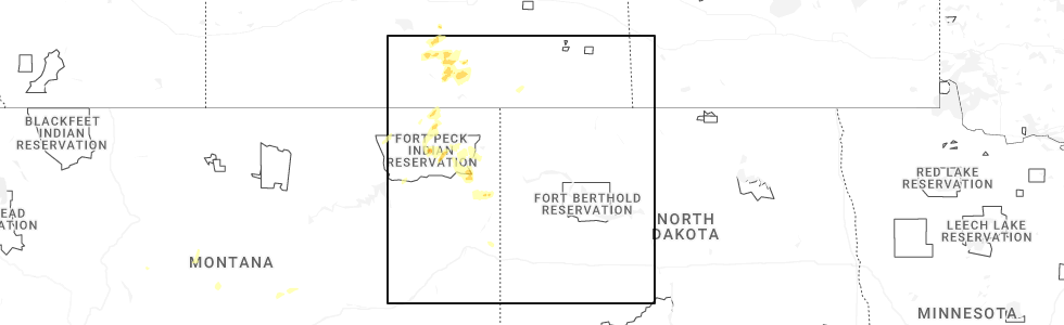
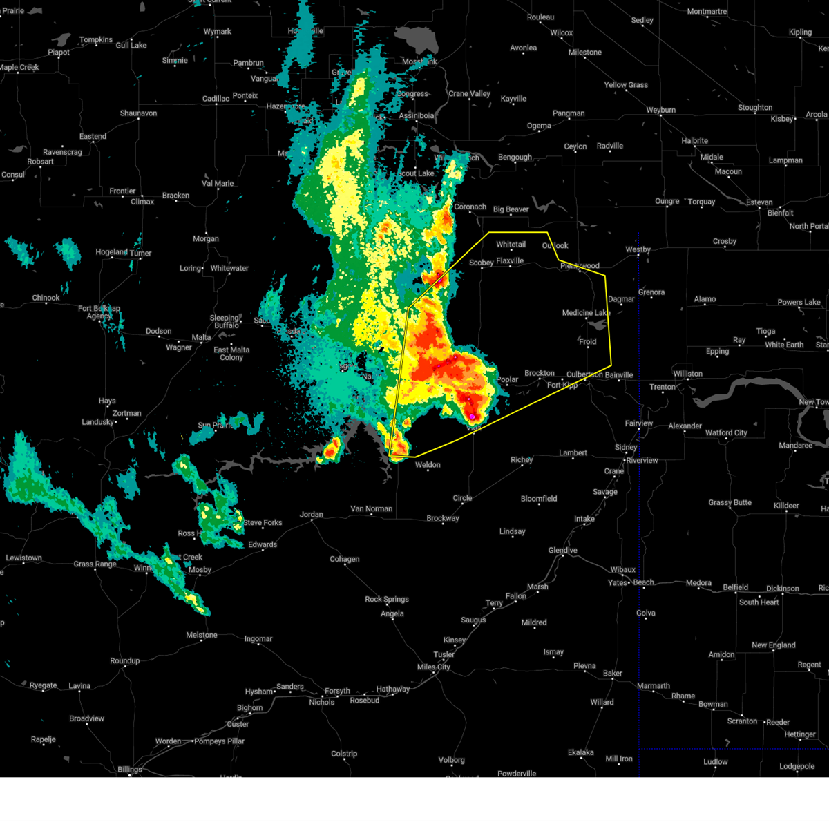
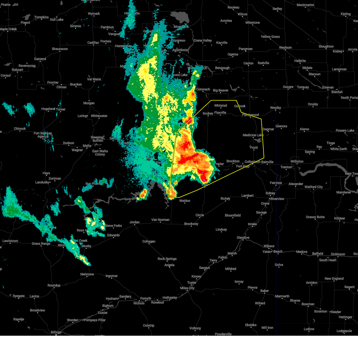
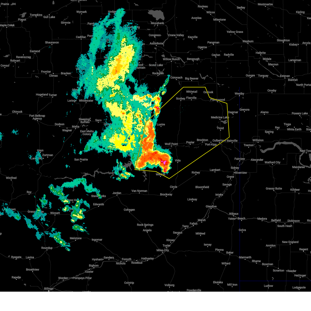
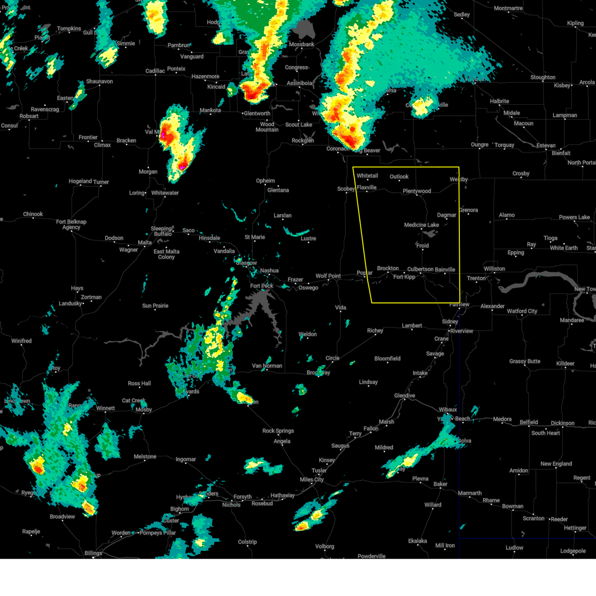
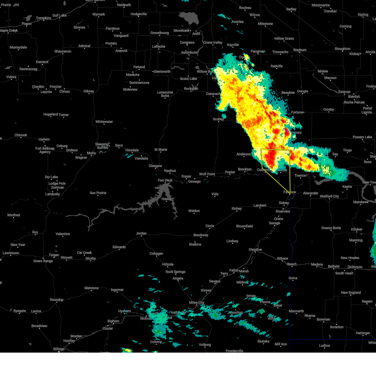
Hail Map for Froid, MT
The Froid, MT area has had 14 reports of on-the-ground hail by trained spotters, and has been under severe weather warnings 15 times during the past 12 months. Doppler radar has detected hail at or near Froid, MT on 32 occasions, including 2 occasions during the past year.
| Name: | Froid, MT |
| Where Located: | 42.2 miles WNW of Williston, ND |
| Map: | Google Map for Froid, MT |
| Population: | 185 |
| Housing Units: | 117 |
| More Info: | Search Google for Froid, MT |
1
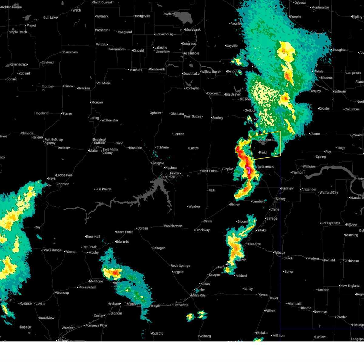
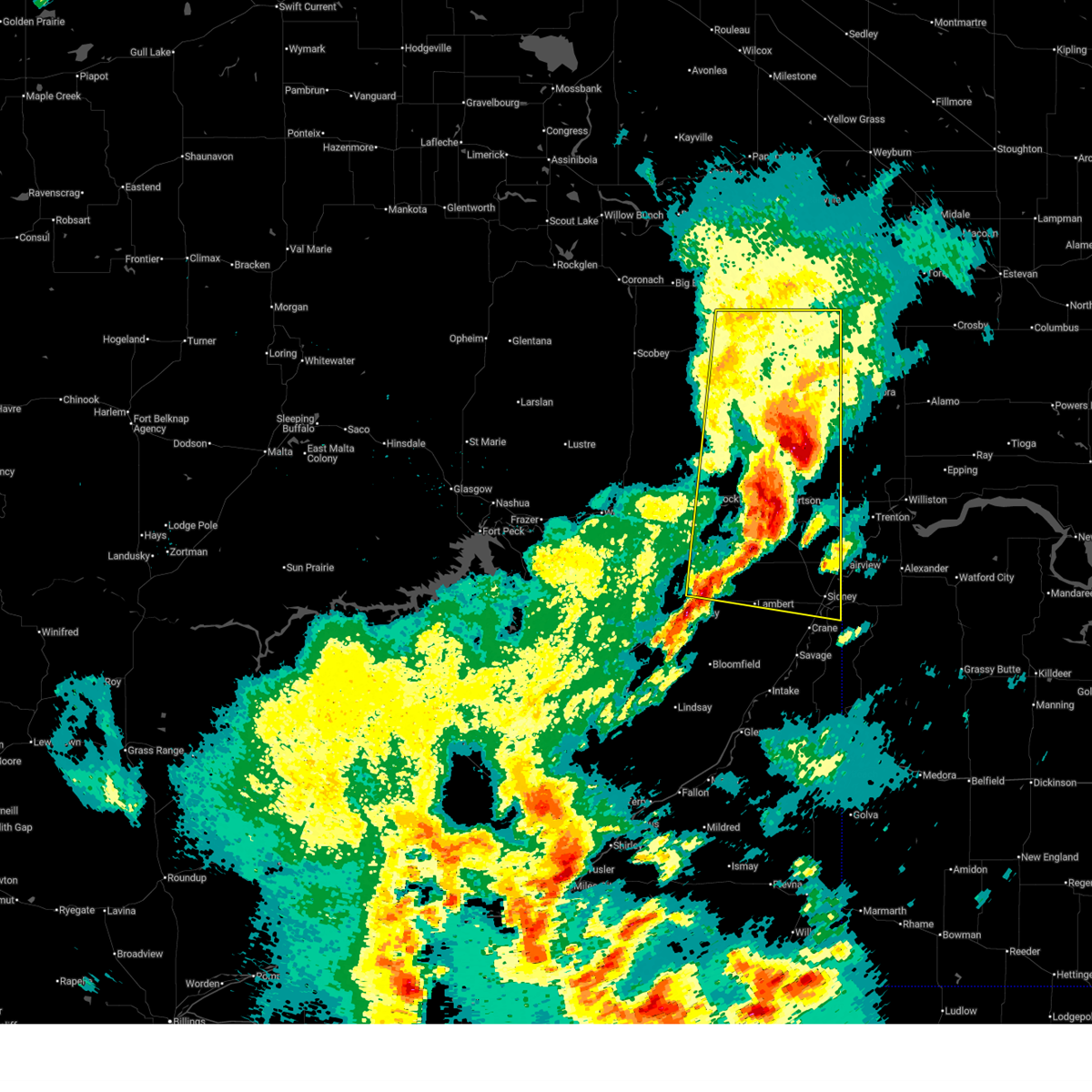
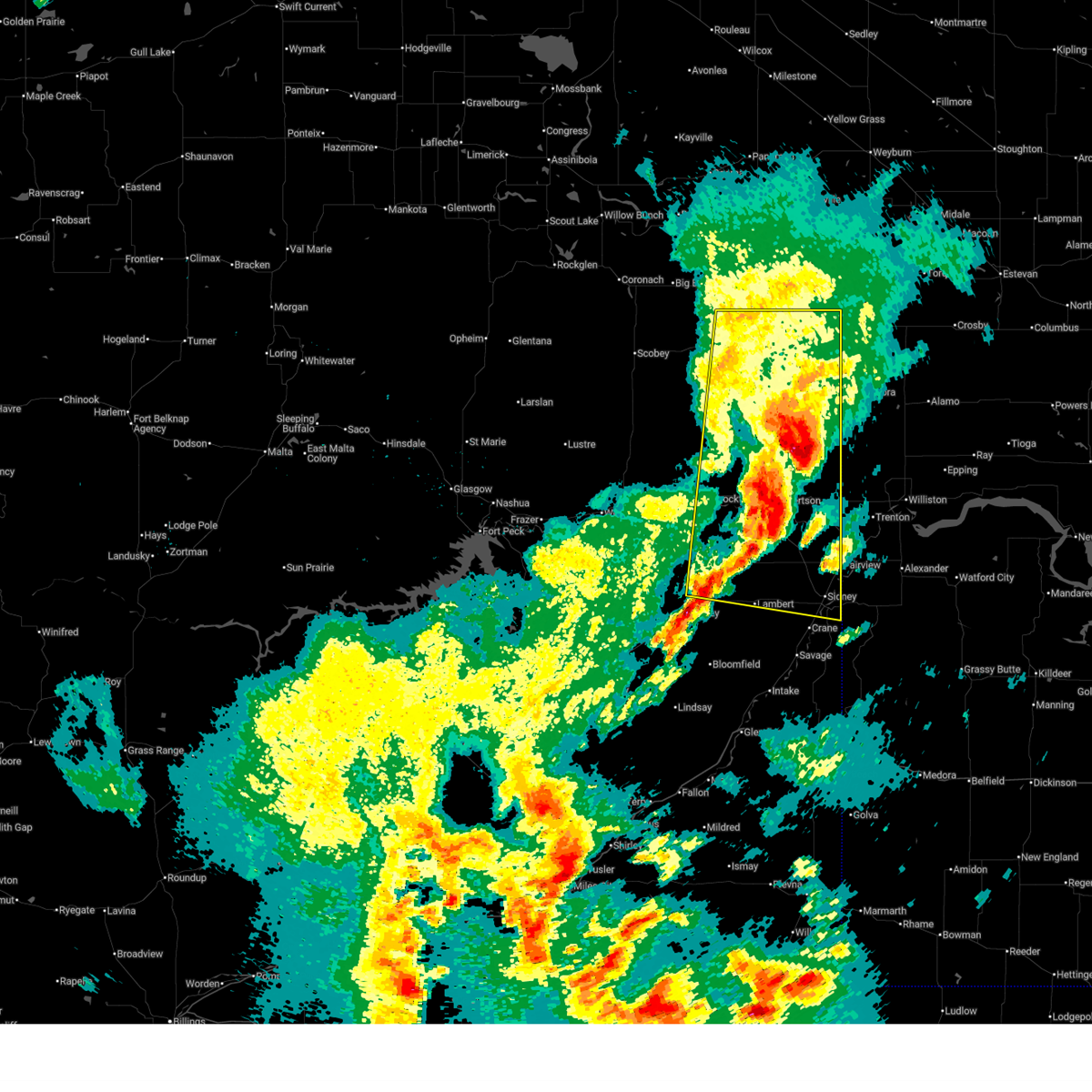
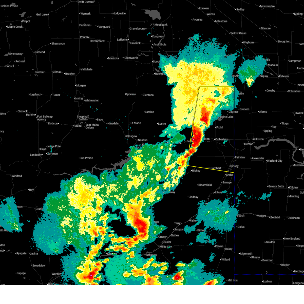
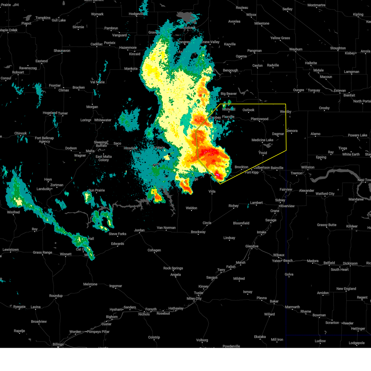
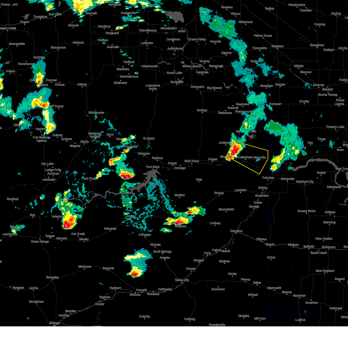
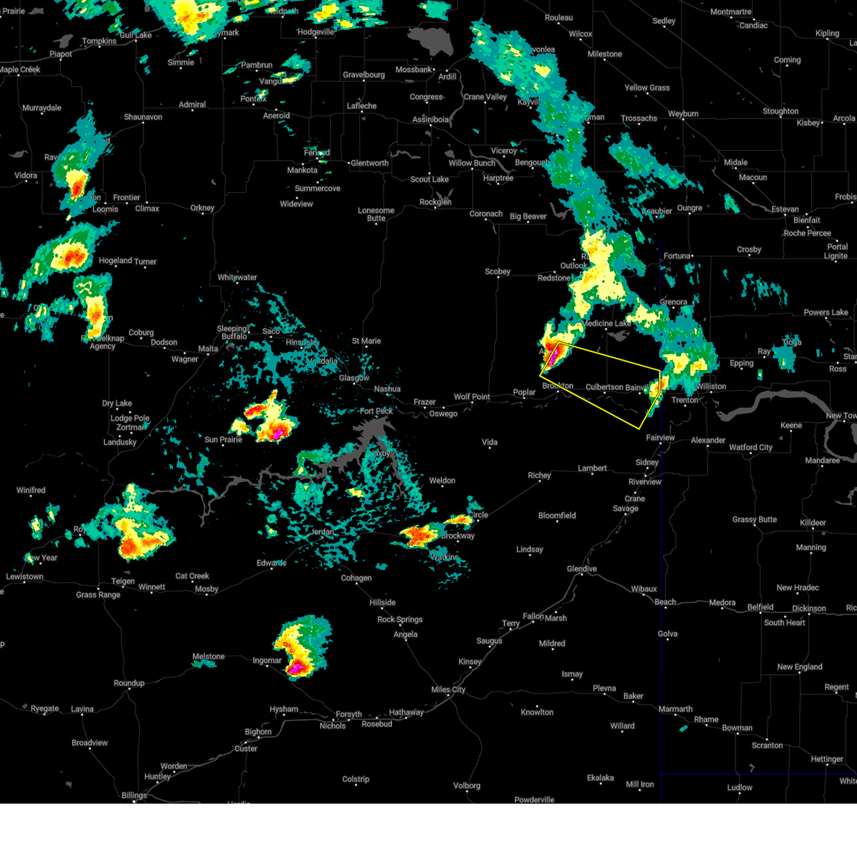
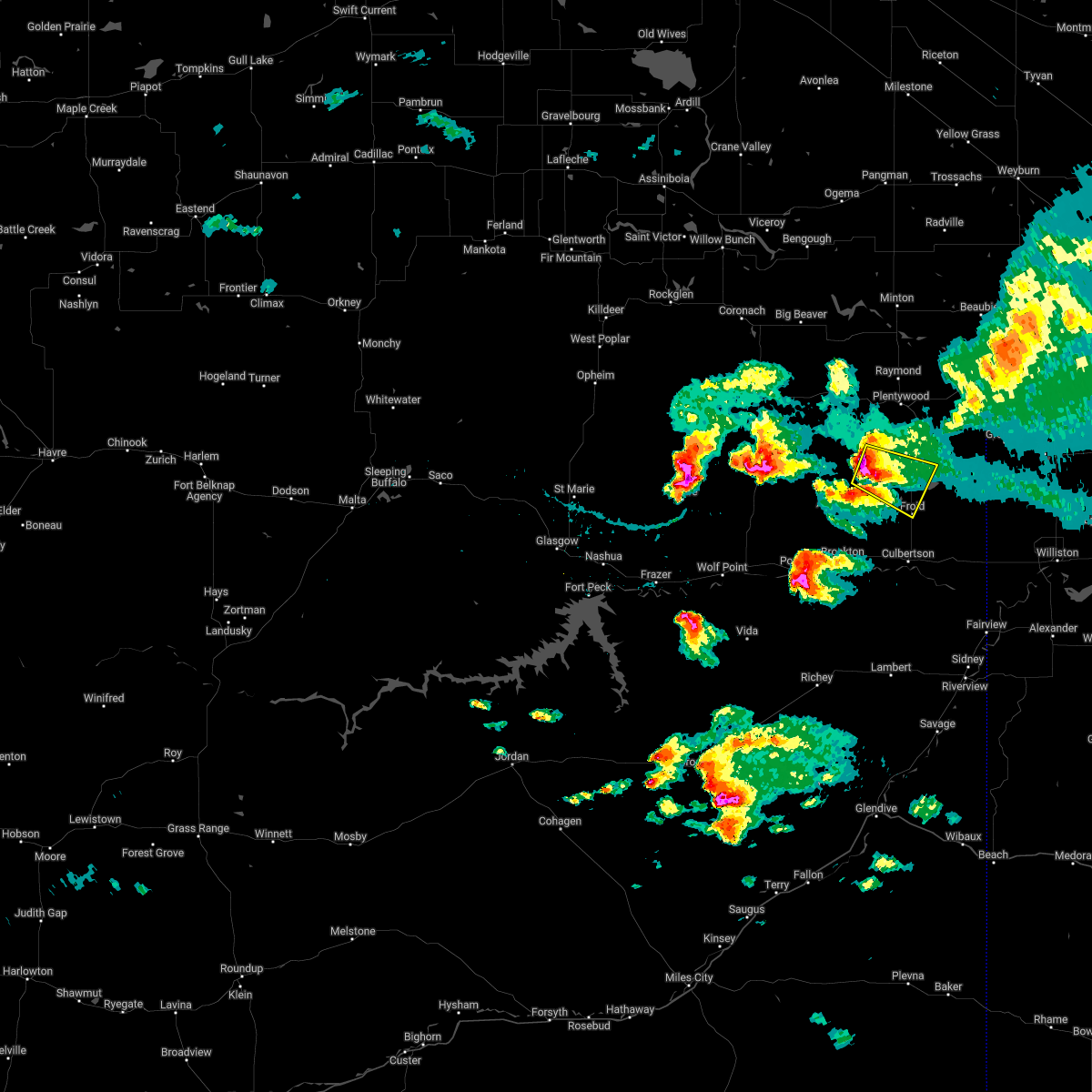
The Top Recent Hail Date for Froid, MT is Thursday, June 26, 2025 (14th out of 32)
Hail and Wind Damage Spotted near Froid, MT
| Date / Time | Report Details |
|---|---|
| 6/26/2025 6:52 PM MDT |
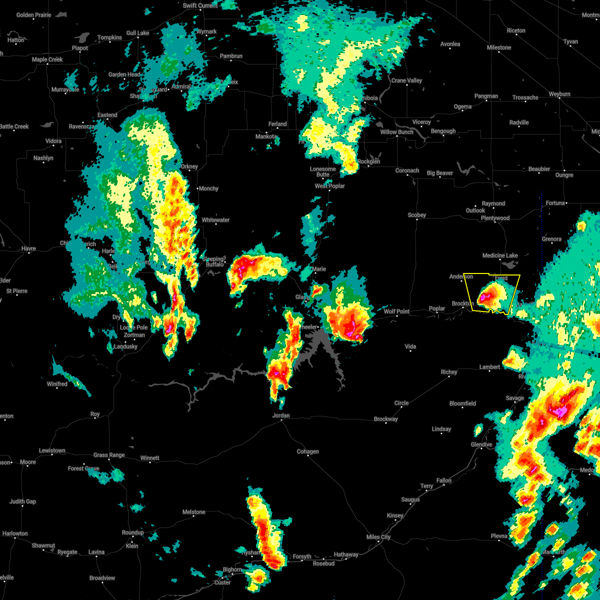
 The storm which prompted the warning has weakened below severe limits, and has exited the warned area. therefore, the warning will be allowed to expire. The storm which prompted the warning has weakened below severe limits, and has exited the warned area. therefore, the warning will be allowed to expire.
|
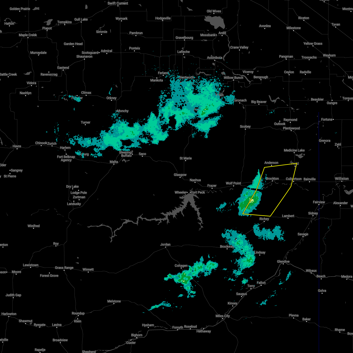
| 6/26/2025 6:10 PM MDT | Quarter sized hail reported 0.5 miles NE of Froid, MT, pea to quarter sized hail. |
| 6/26/2025 5:55 PM MDT |
 Svrggw the national weather service in glasgow has issued a * severe thunderstorm warning for, northeastern roosevelt county in northeastern montana, southeastern sheridan county in northeastern montana, * until 700 pm mdt. * at 555 pm mdt, a severe thunderstorm was located over froid, or 15 miles north of culbertson, moving east at 25 mph (radar indicated). Hazards include 60 mph wind gusts and quarter size hail. Hail damage to vehicles is expected. Expect wind damage to roofs, siding, and trees. Svrggw the national weather service in glasgow has issued a * severe thunderstorm warning for, northeastern roosevelt county in northeastern montana, southeastern sheridan county in northeastern montana, * until 700 pm mdt. * at 555 pm mdt, a severe thunderstorm was located over froid, or 15 miles north of culbertson, moving east at 25 mph (radar indicated). Hazards include 60 mph wind gusts and quarter size hail. Hail damage to vehicles is expected. Expect wind damage to roofs, siding, and trees.
|
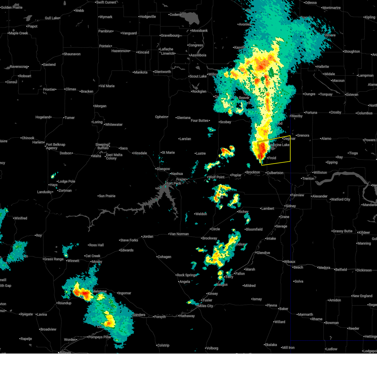
| 6/15/2025 10:41 PM MDT |
 The storms which prompted the warning have weakened below severe limits, and no longer pose an immediate threat to life or property. therefore, the warning will be allowed to expire. however, gusty winds are still possible with these thunderstorms. a severe thunderstorm watch remains in effect until 100 am mdt for northeastern montana. The storms which prompted the warning have weakened below severe limits, and no longer pose an immediate threat to life or property. therefore, the warning will be allowed to expire. however, gusty winds are still possible with these thunderstorms. a severe thunderstorm watch remains in effect until 100 am mdt for northeastern montana.
|
| 6/15/2025 10:14 PM MDT |
 the severe thunderstorm warning has been cancelled and is no longer in effect the severe thunderstorm warning has been cancelled and is no longer in effect
|
| 6/15/2025 10:14 PM MDT |
 At 1013 pm mdt, severe thunderstorms were located along a line extending from 7 miles northwest of grenora to 6 miles north of lambert, moving east at 40 mph (radar indicated). Hazards include 70 mph wind gusts and quarter size hail. Hail damage to vehicles is expected. expect considerable tree damage. wind damage is also likely to mobile homes, roofs, and outbuildings. Locations impacted include, reserve, medicine lake, archer, raymond, bainville, enid, outlook, comertown, nohly, wooley, fairview, froid, mccabe, westby, plentywood, coalridge, culbertson, snowden, fort kipp, and dagmar. At 1013 pm mdt, severe thunderstorms were located along a line extending from 7 miles northwest of grenora to 6 miles north of lambert, moving east at 40 mph (radar indicated). Hazards include 70 mph wind gusts and quarter size hail. Hail damage to vehicles is expected. expect considerable tree damage. wind damage is also likely to mobile homes, roofs, and outbuildings. Locations impacted include, reserve, medicine lake, archer, raymond, bainville, enid, outlook, comertown, nohly, wooley, fairview, froid, mccabe, westby, plentywood, coalridge, culbertson, snowden, fort kipp, and dagmar.
|
| 6/15/2025 9:40 PM MDT | Corrects previous tstm wnd gst report from 10 w homestead. public reported on facebook... and 0.5 inches of rai in roosevelt county MT, 13.7 miles ESE of Froid, MT |
| 6/15/2025 9:40 PM MDT | Public reported on faceboo in roosevelt county MT, 13.7 miles ESE of Froid, MT |
| 6/15/2025 9:40 PM MDT |
 Svrggw the national weather service in glasgow has issued a * severe thunderstorm warning for, southeastern daniels county in northeastern montana, eastern roosevelt county in northeastern montana, sheridan county in northeastern montana, richland county in northeastern montana, * until 1045 pm mdt. * at 939 pm mdt, severe thunderstorms were located along a line extending from 8 miles north of medicine lake to 6 miles north of richey, moving east at 35 mph (radar indicated). Hazards include 60 mph wind gusts and quarter size hail. Hail damage to vehicles is expected. Expect wind damage to roofs, siding, and trees. Svrggw the national weather service in glasgow has issued a * severe thunderstorm warning for, southeastern daniels county in northeastern montana, eastern roosevelt county in northeastern montana, sheridan county in northeastern montana, richland county in northeastern montana, * until 1045 pm mdt. * at 939 pm mdt, severe thunderstorms were located along a line extending from 8 miles north of medicine lake to 6 miles north of richey, moving east at 35 mph (radar indicated). Hazards include 60 mph wind gusts and quarter size hail. Hail damage to vehicles is expected. Expect wind damage to roofs, siding, and trees.
|
| 8/25/2024 12:52 AM MDT |
 Svrggw the national weather service in glasgow has issued a * severe thunderstorm warning for, eastern daniels county in northeastern montana, roosevelt county in northeastern montana, sheridan county in northeastern montana, northeastern mccone county in northeastern montana, northwestern richland county in northeastern montana, * until 145 am mdt. * at 1251 am mdt, severe thunderstorms were located along a line extending from 13 miles southwest of scobey to bredette to 16 miles north of brockton to near poplar, moving northeast at 45 mph (radar indicated). Hazards include 70 mph wind gusts and quarter size hail. Hail damage to vehicles is expected. expect considerable tree damage. Wind damage is also likely to mobile homes, roofs, and outbuildings. Svrggw the national weather service in glasgow has issued a * severe thunderstorm warning for, eastern daniels county in northeastern montana, roosevelt county in northeastern montana, sheridan county in northeastern montana, northeastern mccone county in northeastern montana, northwestern richland county in northeastern montana, * until 145 am mdt. * at 1251 am mdt, severe thunderstorms were located along a line extending from 13 miles southwest of scobey to bredette to 16 miles north of brockton to near poplar, moving northeast at 45 mph (radar indicated). Hazards include 70 mph wind gusts and quarter size hail. Hail damage to vehicles is expected. expect considerable tree damage. Wind damage is also likely to mobile homes, roofs, and outbuildings.
|
| 8/25/2024 12:33 AM MDT |
 At 1232 am mdt, severe thunderstorms were located along a line extending from near peerless to 12 miles east of lustre to 15 miles south of bredette to 10 miles south of poplar, moving northeast at 45 mph (radar indicated). Hazards include 70 mph wind gusts and ping pong ball size hail. People and animals outdoors will be injured. expect hail damage to roofs, siding, windows, and vehicles. expect considerable tree damage. wind damage is also likely to mobile homes, roofs, and outbuildings. Locations impacted include, wolf point, plentywood, scobey, poplar, culbertson, brockton, medicine lake, froid, flaxville, archer, port of whitetail, lustre, madoc, bredette, redstone, frazer, whitetail, rock creek rec area, outlook, and reserve. At 1232 am mdt, severe thunderstorms were located along a line extending from near peerless to 12 miles east of lustre to 15 miles south of bredette to 10 miles south of poplar, moving northeast at 45 mph (radar indicated). Hazards include 70 mph wind gusts and ping pong ball size hail. People and animals outdoors will be injured. expect hail damage to roofs, siding, windows, and vehicles. expect considerable tree damage. wind damage is also likely to mobile homes, roofs, and outbuildings. Locations impacted include, wolf point, plentywood, scobey, poplar, culbertson, brockton, medicine lake, froid, flaxville, archer, port of whitetail, lustre, madoc, bredette, redstone, frazer, whitetail, rock creek rec area, outlook, and reserve.
|
| 8/25/2024 12:33 AM MDT |
 the severe thunderstorm warning has been cancelled and is no longer in effect the severe thunderstorm warning has been cancelled and is no longer in effect
|
| 8/24/2024 11:51 PM MDT |
 Svrggw the national weather service in glasgow has issued a * severe thunderstorm warning for, northeastern garfield county in northeastern montana, daniels county in northeastern montana, roosevelt county in northeastern montana, east central valley county in northeastern montana, western sheridan county in northeastern montana, northern mccone county in northeastern montana, northwestern richland county in northeastern montana, northwestern dawson county in northeastern montana, * until 100 am mdt. * at 1150 pm mdt, severe thunderstorms were located along a line extending from 10 miles northwest of lustre to 7 miles northeast of frazer to near wolf point to 7 miles southeast of vida, moving northeast at 45 mph (radar indicated). Hazards include 70 mph wind gusts and quarter size hail. Hail damage to vehicles is expected. expect considerable tree damage. Wind damage is also likely to mobile homes, roofs, and outbuildings. Svrggw the national weather service in glasgow has issued a * severe thunderstorm warning for, northeastern garfield county in northeastern montana, daniels county in northeastern montana, roosevelt county in northeastern montana, east central valley county in northeastern montana, western sheridan county in northeastern montana, northern mccone county in northeastern montana, northwestern richland county in northeastern montana, northwestern dawson county in northeastern montana, * until 100 am mdt. * at 1150 pm mdt, severe thunderstorms were located along a line extending from 10 miles northwest of lustre to 7 miles northeast of frazer to near wolf point to 7 miles southeast of vida, moving northeast at 45 mph (radar indicated). Hazards include 70 mph wind gusts and quarter size hail. Hail damage to vehicles is expected. expect considerable tree damage. Wind damage is also likely to mobile homes, roofs, and outbuildings.
|
| 8/21/2024 9:44 PM MDT |
 Svrggw the national weather service in glasgow has issued a * severe thunderstorm warning for, southeastern roosevelt county in northeastern montana, southeastern sheridan county in northeastern montana, northeastern richland county in northeastern montana, * until 1015 pm mdt. * at 943 pm mdt, severe thunderstorms were located along a line extending from 11 miles east of plentywood to 6 miles west of fort union trading post, moving east at 35 mph (radar indicated). Hazards include 60 mph wind gusts and nickel size hail. expect damage to roofs, siding, and trees Svrggw the national weather service in glasgow has issued a * severe thunderstorm warning for, southeastern roosevelt county in northeastern montana, southeastern sheridan county in northeastern montana, northeastern richland county in northeastern montana, * until 1015 pm mdt. * at 943 pm mdt, severe thunderstorms were located along a line extending from 11 miles east of plentywood to 6 miles west of fort union trading post, moving east at 35 mph (radar indicated). Hazards include 60 mph wind gusts and nickel size hail. expect damage to roofs, siding, and trees
|
| 8/21/2024 9:12 PM MDT |
 At 911 pm mdt, severe thunderstorms were located along a line extending from 9 miles north of port of raymond to near bainville, moving east at 40 mph (radar indicated). Hazards include 60 mph wind gusts and quarter size hail. Hail damage to vehicles is expected. expect wind damage to roofs, siding, and trees. Locations impacted include, plentywood, culbertson, brockton, medicine lake, bainville, froid, westby, archer, redstone, fort union trading post, outlook, reserve, raymond, comertown, nohly, mccabe, coalridge, snowden, dagmar, and fort kipp. At 911 pm mdt, severe thunderstorms were located along a line extending from 9 miles north of port of raymond to near bainville, moving east at 40 mph (radar indicated). Hazards include 60 mph wind gusts and quarter size hail. Hail damage to vehicles is expected. expect wind damage to roofs, siding, and trees. Locations impacted include, plentywood, culbertson, brockton, medicine lake, bainville, froid, westby, archer, redstone, fort union trading post, outlook, reserve, raymond, comertown, nohly, mccabe, coalridge, snowden, dagmar, and fort kipp.
|
| 8/21/2024 9:12 PM MDT |
 the severe thunderstorm warning has been cancelled and is no longer in effect the severe thunderstorm warning has been cancelled and is no longer in effect
|
| 8/21/2024 8:47 PM MDT |
 At 847 pm mdt, severe thunderstorms were located along a line extending from 10 miles northeast of port of whitetail to 8 miles south of culbertson, moving northeast at 45 mph (radar indicated). Hazards include 60 mph wind gusts and quarter size hail. Hail damage to vehicles is expected. expect wind damage to roofs, siding, and trees. Locations impacted include, plentywood, culbertson, brockton, medicine lake, bainville, froid, westby, flaxville, archer, port of raymond, port of whitetail, madoc, redstone, whitetail, fort union trading post, outlook, reserve, raymond, comertown, and nohly. At 847 pm mdt, severe thunderstorms were located along a line extending from 10 miles northeast of port of whitetail to 8 miles south of culbertson, moving northeast at 45 mph (radar indicated). Hazards include 60 mph wind gusts and quarter size hail. Hail damage to vehicles is expected. expect wind damage to roofs, siding, and trees. Locations impacted include, plentywood, culbertson, brockton, medicine lake, bainville, froid, westby, flaxville, archer, port of raymond, port of whitetail, madoc, redstone, whitetail, fort union trading post, outlook, reserve, raymond, comertown, and nohly.
|
| 8/21/2024 8:34 PM MDT |
 Svrggw the national weather service in glasgow has issued a * severe thunderstorm warning for, eastern daniels county in northeastern montana, roosevelt county in northeastern montana, sheridan county in northeastern montana, northern richland county in northeastern montana, * until 945 pm mdt. * at 833 pm mdt, severe thunderstorms were located along a line extending from near port of whitetail to 13 miles southeast of brockton, moving northeast at 45 mph (radar indicated). Hazards include 60 mph wind gusts and quarter size hail. Hail damage to vehicles is expected. Expect wind damage to roofs, siding, and trees. Svrggw the national weather service in glasgow has issued a * severe thunderstorm warning for, eastern daniels county in northeastern montana, roosevelt county in northeastern montana, sheridan county in northeastern montana, northern richland county in northeastern montana, * until 945 pm mdt. * at 833 pm mdt, severe thunderstorms were located along a line extending from near port of whitetail to 13 miles southeast of brockton, moving northeast at 45 mph (radar indicated). Hazards include 60 mph wind gusts and quarter size hail. Hail damage to vehicles is expected. Expect wind damage to roofs, siding, and trees.
|
| 6/15/2024 9:12 PM MDT |
 The storms which prompted the warning have weakened below severe limits, and no longer pose an immediate threat to life or property. therefore, the warning will be allowed to expire. however, gusty winds are still possible with these thunderstorms. The storms which prompted the warning have weakened below severe limits, and no longer pose an immediate threat to life or property. therefore, the warning will be allowed to expire. however, gusty winds are still possible with these thunderstorms.
|
| 6/15/2024 8:49 PM MDT |
 At 849 pm mdt, severe thunderstorms were located along a line extending from 12 miles northeast of plentywood to 6 miles east of bainville to near skaar, moving east at 50 mph (radar indicated). Hazards include 70 mph wind gusts and quarter size hail. Hail damage to vehicles is expected. expect considerable tree damage. wind damage is also likely to mobile homes, roofs, and outbuildings. Locations impacted include, sidney, plentywood, culbertson, fairview, medicine lake, bainville, froid, westby, archer, savage, lambert, outlook, reserve, raymond, comertown, nohly, wooley, crane, mccabe, and midway. At 849 pm mdt, severe thunderstorms were located along a line extending from 12 miles northeast of plentywood to 6 miles east of bainville to near skaar, moving east at 50 mph (radar indicated). Hazards include 70 mph wind gusts and quarter size hail. Hail damage to vehicles is expected. expect considerable tree damage. wind damage is also likely to mobile homes, roofs, and outbuildings. Locations impacted include, sidney, plentywood, culbertson, fairview, medicine lake, bainville, froid, westby, archer, savage, lambert, outlook, reserve, raymond, comertown, nohly, wooley, crane, mccabe, and midway.
|
| 6/15/2024 8:49 PM MDT |
 the severe thunderstorm warning has been cancelled and is no longer in effect the severe thunderstorm warning has been cancelled and is no longer in effect
|
| 6/15/2024 8:26 PM MDT |
 Svrggw the national weather service in glasgow has issued a * severe thunderstorm warning for, eastern daniels county in northeastern montana, eastern roosevelt county in northeastern montana, sheridan county in northeastern montana, richland county in northeastern montana, northeastern dawson county in northeastern montana, * until 915 pm mdt. * at 826 pm mdt, severe thunderstorms were located along a line extending from 6 miles southwest of port of raymond to near culbertson to 7 miles north of intake, moving east at 50 mph (radar indicated). Hazards include 70 mph wind gusts and quarter size hail. Hail damage to vehicles is expected. expect considerable tree damage. Wind damage is also likely to mobile homes, roofs, and outbuildings. Svrggw the national weather service in glasgow has issued a * severe thunderstorm warning for, eastern daniels county in northeastern montana, eastern roosevelt county in northeastern montana, sheridan county in northeastern montana, richland county in northeastern montana, northeastern dawson county in northeastern montana, * until 915 pm mdt. * at 826 pm mdt, severe thunderstorms were located along a line extending from 6 miles southwest of port of raymond to near culbertson to 7 miles north of intake, moving east at 50 mph (radar indicated). Hazards include 70 mph wind gusts and quarter size hail. Hail damage to vehicles is expected. expect considerable tree damage. Wind damage is also likely to mobile homes, roofs, and outbuildings.
|
| 6/15/2024 8:13 PM MDT |
 the severe thunderstorm warning has been cancelled and is no longer in effect the severe thunderstorm warning has been cancelled and is no longer in effect
|
| 6/15/2024 8:13 PM MDT |
 At 812 pm mdt, severe thunderstorms were located along a line extending from 6 miles southwest of redstone to 7 miles northwest of culbertson to 11 miles east of bloomfield, moving east at 40 mph (radar indicated). Hazards include 70 mph wind gusts and quarter size hail. Hail damage to vehicles is expected. expect considerable tree damage. wind damage is also likely to mobile homes, roofs, and outbuildings. Locations impacted include, poplar, culbertson, brockton, medicine lake, bainville, froid, richey, archer, lambert, bredette, redstone, reserve, fort kipp, homestead, enid, navajo, sprole, and mccabe. At 812 pm mdt, severe thunderstorms were located along a line extending from 6 miles southwest of redstone to 7 miles northwest of culbertson to 11 miles east of bloomfield, moving east at 40 mph (radar indicated). Hazards include 70 mph wind gusts and quarter size hail. Hail damage to vehicles is expected. expect considerable tree damage. wind damage is also likely to mobile homes, roofs, and outbuildings. Locations impacted include, poplar, culbertson, brockton, medicine lake, bainville, froid, richey, archer, lambert, bredette, redstone, reserve, fort kipp, homestead, enid, navajo, sprole, and mccabe.
|
| 6/15/2024 7:27 PM MDT |
 Svrggw the national weather service in glasgow has issued a * severe thunderstorm warning for, southern daniels county in northeastern montana, roosevelt county in northeastern montana, east central valley county in northeastern montana, western sheridan county in northeastern montana, northeastern mccone county in northeastern montana, richland county in northeastern montana, northern dawson county in northeastern montana, * until 830 pm mdt. * at 726 pm mdt, severe thunderstorms were located along a line extending from 12 miles south of peerless to 6 miles west of poplar to 6 miles south of circle, moving east at 45 mph (radar indicated). Hazards include 70 mph wind gusts and quarter size hail. Hail damage to vehicles is expected. expect considerable tree damage. Wind damage is also likely to mobile homes, roofs, and outbuildings. Svrggw the national weather service in glasgow has issued a * severe thunderstorm warning for, southern daniels county in northeastern montana, roosevelt county in northeastern montana, east central valley county in northeastern montana, western sheridan county in northeastern montana, northeastern mccone county in northeastern montana, richland county in northeastern montana, northern dawson county in northeastern montana, * until 830 pm mdt. * at 726 pm mdt, severe thunderstorms were located along a line extending from 12 miles south of peerless to 6 miles west of poplar to 6 miles south of circle, moving east at 45 mph (radar indicated). Hazards include 70 mph wind gusts and quarter size hail. Hail damage to vehicles is expected. expect considerable tree damage. Wind damage is also likely to mobile homes, roofs, and outbuildings.
|
| 8/30/2023 8:52 PM MDT |
 At 851 pm mdt, severe thunderstorms were located along a line extending from 6 miles northwest of medicine lake to 7 miles north of skaar, moving northeast at 35 mph (radar indicated). Hazards include 60 mph wind gusts. expect damage to roofs, siding, and trees At 851 pm mdt, severe thunderstorms were located along a line extending from 6 miles northwest of medicine lake to 7 miles north of skaar, moving northeast at 35 mph (radar indicated). Hazards include 60 mph wind gusts. expect damage to roofs, siding, and trees
|
| 7/30/2023 4:48 AM MDT |
 At 447 am mdt, a severe thunderstorm was located 7 miles northwest of bainville, or 9 miles northeast of culbertson, moving southeast at 40 mph (radar indicated). Hazards include quarter size hail. Damage to vehicles is expected. locations impacted include, bainville, froid, mccabe, snowden, homestead, nohly and fort union. hail threat, radar indicated max hail size, 1. 00 in wind threat, radar indicated max wind gust, <50 mph. At 447 am mdt, a severe thunderstorm was located 7 miles northwest of bainville, or 9 miles northeast of culbertson, moving southeast at 40 mph (radar indicated). Hazards include quarter size hail. Damage to vehicles is expected. locations impacted include, bainville, froid, mccabe, snowden, homestead, nohly and fort union. hail threat, radar indicated max hail size, 1. 00 in wind threat, radar indicated max wind gust, <50 mph.
|
| 7/30/2023 4:28 AM MDT |
 At 428 am mdt, a severe thunderstorm was located near froid, or 10 miles north of culbertson, moving southeast at 40 mph (radar indicated). Hazards include quarter size hail. damage to vehicles is expected At 428 am mdt, a severe thunderstorm was located near froid, or 10 miles north of culbertson, moving southeast at 40 mph (radar indicated). Hazards include quarter size hail. damage to vehicles is expected
|
| 7/22/2023 11:43 PM MDT |
 At 1142 pm mdt, a severe thunderstorm was located near culbertson, moving southeast at 45 mph (radar indicated). Hazards include ping pong ball size hail and 60 mph wind gusts. People and animals outdoors will be injured. expect hail damage to roofs, siding, windows, and vehicles. expect wind damage to roofs, siding, and trees. locations impacted include, sidney, culbertson, fairview, bainville, froid, mccabe, snowden, fort kipp, homestead, nohly and wooley. hail threat, radar indicated max hail size, 1. 50 in wind threat, radar indicated max wind gust, 60 mph. At 1142 pm mdt, a severe thunderstorm was located near culbertson, moving southeast at 45 mph (radar indicated). Hazards include ping pong ball size hail and 60 mph wind gusts. People and animals outdoors will be injured. expect hail damage to roofs, siding, windows, and vehicles. expect wind damage to roofs, siding, and trees. locations impacted include, sidney, culbertson, fairview, bainville, froid, mccabe, snowden, fort kipp, homestead, nohly and wooley. hail threat, radar indicated max hail size, 1. 50 in wind threat, radar indicated max wind gust, 60 mph.
|
| 7/22/2023 11:24 PM MDT |
 At 1124 pm mdt, a severe thunderstorm was located 11 miles west of froid, or 14 miles northwest of culbertson, moving southeast at 45 mph (radar indicated). Hazards include ping pong ball size hail and 60 mph wind gusts. People and animals outdoors will be injured. expect hail damage to roofs, siding, windows, and vehicles. Expect wind damage to roofs, siding, and trees. At 1124 pm mdt, a severe thunderstorm was located 11 miles west of froid, or 14 miles northwest of culbertson, moving southeast at 45 mph (radar indicated). Hazards include ping pong ball size hail and 60 mph wind gusts. People and animals outdoors will be injured. expect hail damage to roofs, siding, windows, and vehicles. Expect wind damage to roofs, siding, and trees.
|
| 7/22/2023 10:58 PM MDT |
 At 1058 pm mdt, severe thunderstorms were located along a line extending from 11 miles west of medicine lake to 17 miles north of brockton to 10 miles southwest of bredette to 11 miles northwest of lustre, moving southeast at 45 mph (radar indicated). Hazards include 60 mph wind gusts and quarter size hail. Hail damage to vehicles is expected. expect wind damage to roofs, siding, and trees. locations impacted include, scobey, poplar, brockton, medicine lake, froid, flaxville, archer, lustre, madoc, bredette, redstone, fort kipp, homestead, daleview, west fork, volt, navajo and sprole. hail threat, radar indicated max hail size, 1. 00 in wind threat, radar indicated max wind gust, 60 mph. At 1058 pm mdt, severe thunderstorms were located along a line extending from 11 miles west of medicine lake to 17 miles north of brockton to 10 miles southwest of bredette to 11 miles northwest of lustre, moving southeast at 45 mph (radar indicated). Hazards include 60 mph wind gusts and quarter size hail. Hail damage to vehicles is expected. expect wind damage to roofs, siding, and trees. locations impacted include, scobey, poplar, brockton, medicine lake, froid, flaxville, archer, lustre, madoc, bredette, redstone, fort kipp, homestead, daleview, west fork, volt, navajo and sprole. hail threat, radar indicated max hail size, 1. 00 in wind threat, radar indicated max wind gust, 60 mph.
|
| 7/22/2023 10:25 PM MDT |
 At 1025 pm mdt, severe thunderstorms were located along a line extending from near redstone to 7 miles southeast of scobey to 9 miles southeast of peerless to near opheim, moving southeast at 45 mph (radar indicated). Hazards include 60 mph wind gusts and quarter size hail. Hail damage to vehicles is expected. Expect wind damage to roofs, siding, and trees. At 1025 pm mdt, severe thunderstorms were located along a line extending from near redstone to 7 miles southeast of scobey to 9 miles southeast of peerless to near opheim, moving southeast at 45 mph (radar indicated). Hazards include 60 mph wind gusts and quarter size hail. Hail damage to vehicles is expected. Expect wind damage to roofs, siding, and trees.
|
| 7/11/2023 3:25 PM MDT |
 At 325 pm mdt, a severe thunderstorm was located near culbertson, moving southeast at 40 mph (radar indicated). Hazards include 60 mph wind gusts and half dollar size hail. Hail damage to vehicles is expected. Expect wind damage to roofs, siding, and trees. At 325 pm mdt, a severe thunderstorm was located near culbertson, moving southeast at 40 mph (radar indicated). Hazards include 60 mph wind gusts and half dollar size hail. Hail damage to vehicles is expected. Expect wind damage to roofs, siding, and trees.
|
| 7/11/2023 3:03 PM MDT |
 At 302 pm mdt, a severe thunderstorm was located near froid, or 8 miles north of culbertson, moving southeast at 35 mph (radar indicated). Hazards include ping pong ball size hail and 60 mph wind gusts. People and animals outdoors will be injured. expect hail damage to roofs, siding, windows, and vehicles. expect wind damage to roofs, siding, and trees. locations impacted include, culbertson, bainville, froid, mccabe and fort kipp. hail threat, radar indicated max hail size, 1. 50 in wind threat, radar indicated max wind gust, 60 mph. At 302 pm mdt, a severe thunderstorm was located near froid, or 8 miles north of culbertson, moving southeast at 35 mph (radar indicated). Hazards include ping pong ball size hail and 60 mph wind gusts. People and animals outdoors will be injured. expect hail damage to roofs, siding, windows, and vehicles. expect wind damage to roofs, siding, and trees. locations impacted include, culbertson, bainville, froid, mccabe and fort kipp. hail threat, radar indicated max hail size, 1. 50 in wind threat, radar indicated max wind gust, 60 mph.
|
| 7/11/2023 2:37 PM MDT |
 At 237 pm mdt, a severe thunderstorm was located 12 miles north of brockton, or 19 miles northwest of culbertson, moving southeast at 35 mph (radar indicated). Hazards include 60 mph wind gusts and half dollar size hail. Hail damage to vehicles is expected. Expect wind damage to roofs, siding, and trees. At 237 pm mdt, a severe thunderstorm was located 12 miles north of brockton, or 19 miles northwest of culbertson, moving southeast at 35 mph (radar indicated). Hazards include 60 mph wind gusts and half dollar size hail. Hail damage to vehicles is expected. Expect wind damage to roofs, siding, and trees.
|
| 7/18/2022 8:18 PM MDT |
 At 818 pm mdt, severe thunderstorms were located along a line extending from near medicine lake to 10 miles east of froid to near bainville, moving northeast at 50 mph (radar indicated). Hazards include 70 mph wind gusts and quarter size hail. Hail damage to vehicles is expected. expect considerable tree damage. wind damage is also likely to mobile homes, roofs, and outbuildings. locations impacted include, medicine lake, bainville, froid, reserve, mccabe, snowden, dagmar, homestead, antelope and coalridge. thunderstorm damage threat, considerable hail threat, radar indicated max hail size, 1. 00 in wind threat, radar indicated max wind gust, 70 mph. At 818 pm mdt, severe thunderstorms were located along a line extending from near medicine lake to 10 miles east of froid to near bainville, moving northeast at 50 mph (radar indicated). Hazards include 70 mph wind gusts and quarter size hail. Hail damage to vehicles is expected. expect considerable tree damage. wind damage is also likely to mobile homes, roofs, and outbuildings. locations impacted include, medicine lake, bainville, froid, reserve, mccabe, snowden, dagmar, homestead, antelope and coalridge. thunderstorm damage threat, considerable hail threat, radar indicated max hail size, 1. 00 in wind threat, radar indicated max wind gust, 70 mph.
|
| 7/18/2022 8:15 PM MDT | Estimated 50-60 mph winds with pea-sized hai in roosevelt county MT, 0.5 miles NE of Froid, MT |
| 7/18/2022 8:07 PM MDT |
 At 807 pm mdt, severe thunderstorms were located along a line extending from 7 miles southwest of medicine lake to near froid to culbertson, moving east at 50 mph (radar indicated). Hazards include 70 mph wind gusts and quarter size hail. Hail damage to vehicles is expected. expect considerable tree damage. Wind damage is also likely to mobile homes, roofs, and outbuildings. At 807 pm mdt, severe thunderstorms were located along a line extending from 7 miles southwest of medicine lake to near froid to culbertson, moving east at 50 mph (radar indicated). Hazards include 70 mph wind gusts and quarter size hail. Hail damage to vehicles is expected. expect considerable tree damage. Wind damage is also likely to mobile homes, roofs, and outbuildings.
|
| 7/18/2022 7:42 PM MDT |
 At 742 pm mdt, a severe thunderstorm was located 8 miles north of brockton, or 18 miles northwest of culbertson, moving northeast at 40 mph (radar indicated). Hazards include 60 mph wind gusts and quarter size hail. Hail damage to vehicles is expected. Expect wind damage to roofs, siding, and trees. At 742 pm mdt, a severe thunderstorm was located 8 miles north of brockton, or 18 miles northwest of culbertson, moving northeast at 40 mph (radar indicated). Hazards include 60 mph wind gusts and quarter size hail. Hail damage to vehicles is expected. Expect wind damage to roofs, siding, and trees.
|
| 7/10/2022 12:20 AM MDT |
 At 1219 am mdt, severe thunderstorms were located along a line extending from near westby to near fort union trading post, moving east at 25 mph (radar indicated). Hazards include 60 mph wind gusts and quarter size hail. Hail damage to vehicles is expected. Expect wind damage to roofs, siding, and trees. At 1219 am mdt, severe thunderstorms were located along a line extending from near westby to near fort union trading post, moving east at 25 mph (radar indicated). Hazards include 60 mph wind gusts and quarter size hail. Hail damage to vehicles is expected. Expect wind damage to roofs, siding, and trees.
|
| 7/9/2022 11:53 PM MDT |
 At 1153 pm mdt, severe thunderstorms were located along a line extending from 9 miles west of westby to 7 miles south of bainville, moving east at 25 mph (radar indicated). Hazards include 60 mph wind gusts and nickel size hail. Expect damage to roofs, siding, and trees. locations impacted include, plentywood, scobey, poplar, culbertson, brockton, medicine lake, bainville, froid, westby, flaxville, archer, port of raymond, port of whitetail, fort union trading post, madoc, bredette, port of scobey, redstone, whitetail and outlook. hail threat, radar indicated max hail size, 0. 88 in wind threat, observed max wind gust, 60 mph. At 1153 pm mdt, severe thunderstorms were located along a line extending from 9 miles west of westby to 7 miles south of bainville, moving east at 25 mph (radar indicated). Hazards include 60 mph wind gusts and nickel size hail. Expect damage to roofs, siding, and trees. locations impacted include, plentywood, scobey, poplar, culbertson, brockton, medicine lake, bainville, froid, westby, flaxville, archer, port of raymond, port of whitetail, fort union trading post, madoc, bredette, port of scobey, redstone, whitetail and outlook. hail threat, radar indicated max hail size, 0. 88 in wind threat, observed max wind gust, 60 mph.
|
| 7/9/2022 11:23 PM MDT |
 At 1123 pm mdt, severe thunderstorms were located along a line extending from 6 miles north of redstone to 8 miles south of brockton, moving east at 85 mph (radar indicated). Hazards include 60 mph wind gusts and nickel size hail. expect damage to roofs, siding, and trees At 1123 pm mdt, severe thunderstorms were located along a line extending from 6 miles north of redstone to 8 miles south of brockton, moving east at 85 mph (radar indicated). Hazards include 60 mph wind gusts and nickel size hail. expect damage to roofs, siding, and trees
|
| 7/9/2022 10:36 PM MDT |
 At 1036 pm mdt, severe thunderstorms were located along a line extending from near richland to 6 miles east of frazer, moving east at 75 mph (radar indicated). Hazards include 70 mph wind gusts and nickel size hail. Expect considerable tree damage. Damage is likely to mobile homes, roofs, and outbuildings. At 1036 pm mdt, severe thunderstorms were located along a line extending from near richland to 6 miles east of frazer, moving east at 75 mph (radar indicated). Hazards include 70 mph wind gusts and nickel size hail. Expect considerable tree damage. Damage is likely to mobile homes, roofs, and outbuildings.
|
| 7/9/2022 1:09 AM MDT | At 108 am mdt, severe thunderstorms were located along a line extending from 8 miles north of archer to 7 miles east of richey, moving east at 70 mph (radar indicated). Hazards include 60 mph wind gusts and penny size hail. Expect damage to roofs, siding, and trees. locations impacted include, sidney, glendive, plentywood, culbertson, wibaux, fairview, medicine lake, bainville, froid, westby, port of raymond, savage, west glendive, intake, lambert, reserve, raymond, enid, comertown and nohly. hail threat, radar indicated max hail size, 0. 75 in wind threat, observed max wind gust, 60 mph. |
| 7/9/2022 12:53 AM MDT | At 1252 am mdt, severe thunderstorms were located along a line extending from 6 miles north of redstone to near richey, moving east at 60 mph (radar indicated). Hazards include 60 mph wind gusts and nickel size hail. Expect considerable tree damage. damage is likely to mobile homes, roofs, and outbuildings. locations impacted include, sidney, glendive, plentywood, poplar, culbertson, wibaux, fairview, brockton, medicine lake, bainville, froid, richey, westby, archer, port of raymond, savage, west glendive, intake, bloomfield and lambert. thunderstorm damage threat, considerable hail threat, radar indicated max hail size, 0. 88 in wind threat, observed max wind gust, 70 mph. |
| 7/9/2022 12:38 AM MDT | At 1237 am mdt, severe thunderstorms were located along a line extending from 6 miles north of redstone to richey, moving east at 70 mph (radar indicated). Hazards include 60 mph wind gusts and nickel size hail. expect damage to roofs, siding, and trees |
| 7/9/2022 12:07 AM MDT | At 1206 am mdt, severe thunderstorms were located along a line extending from 6 miles southeast of port of scobey to 11 miles southeast of vida, moving east at 60 mph (radar indicated). Hazards include 60 mph wind gusts and penny size hail. Expect damage to roofs, siding, and trees. locations impacted include, sidney, wolf point, plentywood, scobey, poplar, culbertson, fairview, brockton, medicine lake, bainville, froid, richey, westby, flaxville, archer, port of raymond, madoc, lambert, bredette and redstone. hail threat, radar indicated max hail size, 0. 75 in wind threat, observed max wind gust, 60 mph. |
| 7/8/2022 11:41 PM MDT | At 1140 pm mdt, severe thunderstorms were located along a line extending from 11 miles north of peerless to 12 miles west of vida, moving east at 60 mph (radar indicated). Hazards include 70 mph wind gusts and penny size hail. Expect considerable tree damage. Damage is likely to mobile homes, roofs, and outbuildings. |
| 7/6/2022 2:55 PM MDT |
 At 254 pm mdt, a severe thunderstorm was located 11 miles northeast of brockton, or 13 miles northwest of culbertson, moving east at 25 mph (radar indicated). Hazards include 60 mph wind gusts and quarter size hail. Hail damage to vehicles is expected. Expect wind damage to roofs, siding, and trees. At 254 pm mdt, a severe thunderstorm was located 11 miles northeast of brockton, or 13 miles northwest of culbertson, moving east at 25 mph (radar indicated). Hazards include 60 mph wind gusts and quarter size hail. Hail damage to vehicles is expected. Expect wind damage to roofs, siding, and trees.
|
| 7/5/2022 8:52 PM MDT |
 The severe thunderstorm warning for eastern roosevelt and sheridan counties will expire at 900 pm mdt, the storm which prompted the warning has moved out of the area. therefore, the warning will be allowed to expire. however heavy rain is still possible with this thunderstorm. a severe thunderstorm watch remains in effect until 1000 pm mdt for northeastern montana. The severe thunderstorm warning for eastern roosevelt and sheridan counties will expire at 900 pm mdt, the storm which prompted the warning has moved out of the area. therefore, the warning will be allowed to expire. however heavy rain is still possible with this thunderstorm. a severe thunderstorm watch remains in effect until 1000 pm mdt for northeastern montana.
|
| 7/5/2022 8:29 PM MDT |
 At 829 pm mdt, a severe thunderstorm was located 8 miles east of medicine lake, or 23 miles southeast of plentywood, moving east at 45 mph (radar indicated). Hazards include golf ball size hail and 60 mph wind gusts. People and animals outdoors will be injured. expect hail damage to roofs, siding, windows, and vehicles. expect wind damage to roofs, siding, and trees. locations impacted include, plentywood, culbertson, medicine lake, bainville, froid, westby, archer, reserve, raymond, snowden, dagmar, fort kipp, homestead, dooley, comertown, mccabe, antelope and coalridge. thunderstorm damage threat, considerable hail threat, observed max hail size, 1. 75 in wind threat, radar indicated max wind gust, 60 mph. At 829 pm mdt, a severe thunderstorm was located 8 miles east of medicine lake, or 23 miles southeast of plentywood, moving east at 45 mph (radar indicated). Hazards include golf ball size hail and 60 mph wind gusts. People and animals outdoors will be injured. expect hail damage to roofs, siding, windows, and vehicles. expect wind damage to roofs, siding, and trees. locations impacted include, plentywood, culbertson, medicine lake, bainville, froid, westby, archer, reserve, raymond, snowden, dagmar, fort kipp, homestead, dooley, comertown, mccabe, antelope and coalridge. thunderstorm damage threat, considerable hail threat, observed max hail size, 1. 75 in wind threat, radar indicated max wind gust, 60 mph.
|
| 7/5/2022 7:58 PM MDT |
 At 757 pm mdt, severe thunderstorms were located along a line extending from 12 miles south of archer to 18 miles west of medicine lake, moving east at 45 mph (radar indicated). Hazards include 60 mph wind gusts and quarter size hail. Hail damage to vehicles is expected. expect wind damage to roofs, siding, and trees. locations impacted include, plentywood, culbertson, medicine lake, bainville, froid, westby, archer, reserve, raymond, snowden, dagmar, fort kipp, homestead, dooley, comertown, mccabe, antelope and coalridge. hail threat, radar indicated max hail size, 1. 00 in wind threat, radar indicated max wind gust, 60 mph. At 757 pm mdt, severe thunderstorms were located along a line extending from 12 miles south of archer to 18 miles west of medicine lake, moving east at 45 mph (radar indicated). Hazards include 60 mph wind gusts and quarter size hail. Hail damage to vehicles is expected. expect wind damage to roofs, siding, and trees. locations impacted include, plentywood, culbertson, medicine lake, bainville, froid, westby, archer, reserve, raymond, snowden, dagmar, fort kipp, homestead, dooley, comertown, mccabe, antelope and coalridge. hail threat, radar indicated max hail size, 1. 00 in wind threat, radar indicated max wind gust, 60 mph.
|
| 7/5/2022 7:40 PM MDT |
 At 739 pm mdt, severe thunderstorms were located along a line extending from 13 miles south of redstone to 7 miles southeast of bredette, moving east at 45 mph (radar indicated). Hazards include 60 mph wind gusts and quarter size hail. Hail damage to vehicles is expected. Expect wind damage to roofs, siding, and trees. At 739 pm mdt, severe thunderstorms were located along a line extending from 13 miles south of redstone to 7 miles southeast of bredette, moving east at 45 mph (radar indicated). Hazards include 60 mph wind gusts and quarter size hail. Hail damage to vehicles is expected. Expect wind damage to roofs, siding, and trees.
|
| 7/4/2022 6:42 PM MDT |
 The severe thunderstorm warning for northeastern roosevelt and southern sheridan counties will expire at 645 pm mdt, the storm which prompted the warning has weakened below severe limits, and no longer poses an immediate threat to life or property. therefore, the warning will be allowed to expire. however heavy rain is still possible with this thunderstorm. The severe thunderstorm warning for northeastern roosevelt and southern sheridan counties will expire at 645 pm mdt, the storm which prompted the warning has weakened below severe limits, and no longer poses an immediate threat to life or property. therefore, the warning will be allowed to expire. however heavy rain is still possible with this thunderstorm.
|
| 7/4/2022 6:17 PM MDT |
 At 615 pm mdt, a severe thunderstorm was located 13 miles west of medicine lake, or 21 miles southwest of plentywood, moving southeast at 30 mph (trained weather spotters). Hazards include ping pong ball size hail and 60 mph wind gusts. People and animals outdoors will be injured. expect hail damage to roofs, siding, windows, and vehicles. expect wind damage to roofs, siding, and trees. locations impacted include, medicine lake, froid, reserve, antelope, mccabe and homestead. hail threat, radar indicated max hail size, 1. 50 in wind threat, radar indicated max wind gust, 60 mph. At 615 pm mdt, a severe thunderstorm was located 13 miles west of medicine lake, or 21 miles southwest of plentywood, moving southeast at 30 mph (trained weather spotters). Hazards include ping pong ball size hail and 60 mph wind gusts. People and animals outdoors will be injured. expect hail damage to roofs, siding, windows, and vehicles. expect wind damage to roofs, siding, and trees. locations impacted include, medicine lake, froid, reserve, antelope, mccabe and homestead. hail threat, radar indicated max hail size, 1. 50 in wind threat, radar indicated max wind gust, 60 mph.
|
| 7/4/2022 5:49 PM MDT |
 At 549 pm mdt, a severe thunderstorm was located 12 miles northeast of bredette, or 21 miles southeast of scobey, moving east at 30 mph (radar indicated). Hazards include golf ball size hail and 60 mph wind gusts. People and animals outdoors will be injured. expect hail damage to roofs, siding, windows, and vehicles. Expect wind damage to roofs, siding, and trees. At 549 pm mdt, a severe thunderstorm was located 12 miles northeast of bredette, or 21 miles southeast of scobey, moving east at 30 mph (radar indicated). Hazards include golf ball size hail and 60 mph wind gusts. People and animals outdoors will be injured. expect hail damage to roofs, siding, windows, and vehicles. Expect wind damage to roofs, siding, and trees.
|
| 7/2/2022 3:57 PM MDT |
 At 357 pm mdt, a severe thunderstorm was located 10 miles west of medicine lake, or 19 miles southwest of plentywood, moving east at 20 mph (radar indicated). Hazards include 60 mph wind gusts and quarter size hail. Hail damage to vehicles is expected. expect wind damage to roofs, siding, and trees. locations impacted include, medicine lake, froid and homestead. hail threat, radar indicated max hail size, 1. 00 in wind threat, radar indicated max wind gust, 60 mph. At 357 pm mdt, a severe thunderstorm was located 10 miles west of medicine lake, or 19 miles southwest of plentywood, moving east at 20 mph (radar indicated). Hazards include 60 mph wind gusts and quarter size hail. Hail damage to vehicles is expected. expect wind damage to roofs, siding, and trees. locations impacted include, medicine lake, froid and homestead. hail threat, radar indicated max hail size, 1. 00 in wind threat, radar indicated max wind gust, 60 mph.
|
| 7/2/2022 3:40 PM MDT |
 At 339 pm mdt, a severe thunderstorm was located 16 miles south of archer, or 20 miles southwest of plentywood, moving east at 20 mph (radar indicated). Hazards include 60 mph wind gusts and quarter size hail. Hail damage to vehicles is expected. Expect wind damage to roofs, siding, and trees. At 339 pm mdt, a severe thunderstorm was located 16 miles south of archer, or 20 miles southwest of plentywood, moving east at 20 mph (radar indicated). Hazards include 60 mph wind gusts and quarter size hail. Hail damage to vehicles is expected. Expect wind damage to roofs, siding, and trees.
|
| 2/19/2022 10:21 PM MST |
 The severe thunderstorm warning for central roosevelt, east central mccone, northwestern dawson and northwestern richland counties will expire at 1030 pm mst, the intense rainshowers with strong winds which prompted the warning have moved out of the warned area. therefore, the warning will be allowed to expire. The severe thunderstorm warning for central roosevelt, east central mccone, northwestern dawson and northwestern richland counties will expire at 1030 pm mst, the intense rainshowers with strong winds which prompted the warning have moved out of the warned area. therefore, the warning will be allowed to expire.
|
| 2/19/2022 9:58 PM MST |
 At 957 pm mst, severe thunderstorms were located along a line extending from 10 miles northwest of brockton to near poplar to near vida, moving east at 55 mph (radar indicated). Hazards include 60 mph wind gusts. Expect damage to roofs, siding, and trees. locations impacted include, brockton, froid, sprole and fort kipp. hail threat, radar indicated max hail size, <. 75 in wind threat, radar indicated max wind gust, 60 mph. At 957 pm mst, severe thunderstorms were located along a line extending from 10 miles northwest of brockton to near poplar to near vida, moving east at 55 mph (radar indicated). Hazards include 60 mph wind gusts. Expect damage to roofs, siding, and trees. locations impacted include, brockton, froid, sprole and fort kipp. hail threat, radar indicated max hail size, <. 75 in wind threat, radar indicated max wind gust, 60 mph.
|
| 2/19/2022 9:28 PM MST |
 At 928 pm mst, severe thunderstorms were located along a line extending from 15 miles southeast of lustre to near wolf point to 13 miles east of rock creek rec area, moving east at 55 mph (radar indicated). Hazards include 60 mph wind gusts. expect damage to roofs, siding, and trees At 928 pm mst, severe thunderstorms were located along a line extending from 15 miles southeast of lustre to near wolf point to 13 miles east of rock creek rec area, moving east at 55 mph (radar indicated). Hazards include 60 mph wind gusts. expect damage to roofs, siding, and trees
|
| 7/8/2021 7:23 PM MDT | Golf Ball sized hail reported 19.6 miles ESE of Froid, MT, golf ball sized hail report on social media. time estimated from radar. |
| 7/8/2021 4:14 PM MDT |
 At 413 pm mdt, severe thunderstorms were located along a line extending from 7 miles southwest of grenora to near bainville to near lambert, moving east at 40 mph (radar indicated). Hazards include 60 mph wind gusts and quarter size hail. Hail damage to vehicles is expected. Expect wind damage to roofs, siding, and trees. At 413 pm mdt, severe thunderstorms were located along a line extending from 7 miles southwest of grenora to near bainville to near lambert, moving east at 40 mph (radar indicated). Hazards include 60 mph wind gusts and quarter size hail. Hail damage to vehicles is expected. Expect wind damage to roofs, siding, and trees.
|
| 7/8/2021 3:53 PM MDT | Quarter sized hail reported 3.3 miles SE of Froid, MT, quarter sized hail reported on social media. |
| 7/8/2021 3:52 PM MDT |
 At 351 pm mdt, severe thunderstorms were located along a line extending from westby to 9 miles northwest of culbertson, moving southeast at 35 mph (radar indicated). Hazards include 60 mph wind gusts and quarter size hail. Hail damage to vehicles is expected. expect wind damage to roofs, siding, and trees. Locations impacted include, medicine lake, froid, westby, reserve, mccabe, dagmar, homestead and coalridge. At 351 pm mdt, severe thunderstorms were located along a line extending from westby to 9 miles northwest of culbertson, moving southeast at 35 mph (radar indicated). Hazards include 60 mph wind gusts and quarter size hail. Hail damage to vehicles is expected. expect wind damage to roofs, siding, and trees. Locations impacted include, medicine lake, froid, westby, reserve, mccabe, dagmar, homestead and coalridge.
|
| 7/8/2021 3:21 PM MDT |
 At 321 pm mdt, severe thunderstorms were located along a line extending from 10 miles southeast of port of raymond to 10 miles northwest of brockton, moving east at 50 mph (radar indicated). Hazards include 60 mph wind gusts and quarter size hail. Hail damage to vehicles is expected. Expect wind damage to roofs, siding, and trees. At 321 pm mdt, severe thunderstorms were located along a line extending from 10 miles southeast of port of raymond to 10 miles northwest of brockton, moving east at 50 mph (radar indicated). Hazards include 60 mph wind gusts and quarter size hail. Hail damage to vehicles is expected. Expect wind damage to roofs, siding, and trees.
|
| 6/24/2021 5:15 PM MDT |
 At 515 pm mdt, a severe thunderstorm was located 9 miles northeast of brockton, or 14 miles northwest of culbertson, moving east at 35 mph (radar indicated). Hazards include 60 mph wind gusts and quarter size hail. Hail damage to vehicles is expected. Expect wind damage to roofs, siding, and trees. At 515 pm mdt, a severe thunderstorm was located 9 miles northeast of brockton, or 14 miles northwest of culbertson, moving east at 35 mph (radar indicated). Hazards include 60 mph wind gusts and quarter size hail. Hail damage to vehicles is expected. Expect wind damage to roofs, siding, and trees.
|
| 6/10/2021 10:42 PM MDT |
 The severe thunderstorm warning for northeastern daniels, northeastern roosevelt and sheridan counties will expire at 1045 pm mdt, the storms which prompted the warning have moved out of the area. therefore, the warning will be allowed to expire. however gusty winds are still possible with these thunderstorms. a severe thunderstorm watch remains in effect until 200 am mdt for northeastern montana. The severe thunderstorm warning for northeastern daniels, northeastern roosevelt and sheridan counties will expire at 1045 pm mdt, the storms which prompted the warning have moved out of the area. therefore, the warning will be allowed to expire. however gusty winds are still possible with these thunderstorms. a severe thunderstorm watch remains in effect until 200 am mdt for northeastern montana.
|
| 6/10/2021 10:18 PM MDT |
 At 1016 pm mdt, severe thunderstorms were located along a line extending from 11 miles south of archer to 9 miles southwest of westby, moving north at 60 mph. a 78 mph wind gust occurred at the stateline on highway 2 at 10:03 pm (radar indicated). Hazards include 70 mph wind gusts. Expect considerable tree damage. damage is likely to mobile homes, roofs, and outbuildings. Locations impacted include, plentywood, medicine lake, froid, westby, flaxville, archer, madoc, redstone, whitetail, outlook, reserve, raymond, dagmar, homestead, dooley, daleview, comertown, navajo, mccabe and antelope. At 1016 pm mdt, severe thunderstorms were located along a line extending from 11 miles south of archer to 9 miles southwest of westby, moving north at 60 mph. a 78 mph wind gust occurred at the stateline on highway 2 at 10:03 pm (radar indicated). Hazards include 70 mph wind gusts. Expect considerable tree damage. damage is likely to mobile homes, roofs, and outbuildings. Locations impacted include, plentywood, medicine lake, froid, westby, flaxville, archer, madoc, redstone, whitetail, outlook, reserve, raymond, dagmar, homestead, dooley, daleview, comertown, navajo, mccabe and antelope.
|
| 6/10/2021 9:48 PM MDT |
 At 947 pm mdt, severe thunderstorms were located along a line extending from near froid to 10 miles west of bonetrail, moving north at 60 mph (radar indicated). Hazards include 60 mph wind gusts and quarter size hail. Hail damage to vehicles is expected. Expect wind damage to roofs, siding, and trees. At 947 pm mdt, severe thunderstorms were located along a line extending from near froid to 10 miles west of bonetrail, moving north at 60 mph (radar indicated). Hazards include 60 mph wind gusts and quarter size hail. Hail damage to vehicles is expected. Expect wind damage to roofs, siding, and trees.
|
| 6/10/2021 3:49 PM MDT |
 At 348 pm mdt, severe thunderstorms were located along a line extending from 8 miles west of bonetrail to 10 miles east of fort union trading post to 14 miles southwest of alexander, moving northeast at 35 mph (public). Hazards include ping pong ball size hail and 60 mph wind gusts. People and animals outdoors will be injured. expect hail damage to roofs, siding, windows, and vehicles. expect wind damage to roofs, siding, and trees. Locations impacted include, sidney, culbertson, fairview, bainville, froid, mccabe, snowden, homestead, midway, nohly, wooley and crane. At 348 pm mdt, severe thunderstorms were located along a line extending from 8 miles west of bonetrail to 10 miles east of fort union trading post to 14 miles southwest of alexander, moving northeast at 35 mph (public). Hazards include ping pong ball size hail and 60 mph wind gusts. People and animals outdoors will be injured. expect hail damage to roofs, siding, windows, and vehicles. expect wind damage to roofs, siding, and trees. Locations impacted include, sidney, culbertson, fairview, bainville, froid, mccabe, snowden, homestead, midway, nohly, wooley and crane.
|
| 6/10/2021 3:14 PM MDT |
 At 314 pm mdt, severe thunderstorms were located along a line extending from 6 miles southeast of froid to 8 miles northwest of fairview to 9 miles northeast of savage, moving northeast at 35 mph (radar indicated). Hazards include ping pong ball size hail and 60 mph wind gusts. People and animals outdoors will be injured. expect hail damage to roofs, siding, windows, and vehicles. Expect wind damage to roofs, siding, and trees. At 314 pm mdt, severe thunderstorms were located along a line extending from 6 miles southeast of froid to 8 miles northwest of fairview to 9 miles northeast of savage, moving northeast at 35 mph (radar indicated). Hazards include ping pong ball size hail and 60 mph wind gusts. People and animals outdoors will be injured. expect hail damage to roofs, siding, windows, and vehicles. Expect wind damage to roofs, siding, and trees.
|
| 6/8/2021 6:53 PM MDT |
 At 652 pm mdt, a severe thunderstorm was located near froid, or 14 miles north of culbertson, moving north at 45 mph (radar indicated). Hazards include ping pong ball size hail and 60 mph wind gusts. People and animals outdoors will be injured. expect hail damage to roofs, siding, windows, and vehicles. Expect wind damage to roofs, siding, and trees. At 652 pm mdt, a severe thunderstorm was located near froid, or 14 miles north of culbertson, moving north at 45 mph (radar indicated). Hazards include ping pong ball size hail and 60 mph wind gusts. People and animals outdoors will be injured. expect hail damage to roofs, siding, windows, and vehicles. Expect wind damage to roofs, siding, and trees.
|
| 6/8/2021 6:39 PM MDT |
 At 639 pm mdt, a severe thunderstorm was located 8 miles northwest of culbertson, moving north at 40 mph (radar indicated). Hazards include two inch hail and 60 mph wind gusts. People and animals outdoors will be injured. expect hail damage to roofs, siding, windows, and vehicles. expect wind damage to roofs, siding, and trees. Locations impacted include, culbertson, froid, mccabe and fort kipp. At 639 pm mdt, a severe thunderstorm was located 8 miles northwest of culbertson, moving north at 40 mph (radar indicated). Hazards include two inch hail and 60 mph wind gusts. People and animals outdoors will be injured. expect hail damage to roofs, siding, windows, and vehicles. expect wind damage to roofs, siding, and trees. Locations impacted include, culbertson, froid, mccabe and fort kipp.
|
| 6/8/2021 6:19 PM MDT |
 At 618 pm mdt, a severe thunderstorm was located 9 miles southwest of culbertson, moving north at 45 mph (radar indicated). Hazards include two inch hail and 60 mph wind gusts. People and animals outdoors will be injured. expect hail damage to roofs, siding, windows, and vehicles. expect wind damage to roofs, siding, and trees. Locations impacted include, culbertson, froid, mccabe and fort kipp. At 618 pm mdt, a severe thunderstorm was located 9 miles southwest of culbertson, moving north at 45 mph (radar indicated). Hazards include two inch hail and 60 mph wind gusts. People and animals outdoors will be injured. expect hail damage to roofs, siding, windows, and vehicles. expect wind damage to roofs, siding, and trees. Locations impacted include, culbertson, froid, mccabe and fort kipp.
|
| 6/8/2021 5:57 PM MDT |
 At 556 pm mdt, a severe thunderstorm was located 8 miles north of lambert, or 23 miles west of sidney, moving north at 45 mph (radar indicated). Hazards include ping pong ball size hail and 60 mph wind gusts. People and animals outdoors will be injured. expect hail damage to roofs, siding, windows, and vehicles. Expect wind damage to roofs, siding, and trees. At 556 pm mdt, a severe thunderstorm was located 8 miles north of lambert, or 23 miles west of sidney, moving north at 45 mph (radar indicated). Hazards include ping pong ball size hail and 60 mph wind gusts. People and animals outdoors will be injured. expect hail damage to roofs, siding, windows, and vehicles. Expect wind damage to roofs, siding, and trees.
|
| 10/30/2020 7:56 PM MDT |
 At 756 pm mdt, showers were located along a line extending from 7 miles southeast of port of whitetail to 11 miles southeast of bredette to 6 miles west of poplar, moving east at 45 mph. these showers have a history of mixing down wind gusts to around 60 mph (radar indicated). Hazards include 60 mph wind gusts. expect damage to roofs, siding, and trees At 756 pm mdt, showers were located along a line extending from 7 miles southeast of port of whitetail to 11 miles southeast of bredette to 6 miles west of poplar, moving east at 45 mph. these showers have a history of mixing down wind gusts to around 60 mph (radar indicated). Hazards include 60 mph wind gusts. expect damage to roofs, siding, and trees
|
| 8/20/2020 11:35 PM MDT |
 The severe thunderstorm warning for western wibaux, southeastern daniels, roosevelt, southwestern sheridan, prairie, dawson and richland counties will expire at 1145 pm mdt, the storms which prompted the warning have weakened below severe limits, and no longer pose an immediate threat to life or property. therefore, the warning will be allowed to expire. however gusty winds are still possible with these thunderstorms. The severe thunderstorm warning for western wibaux, southeastern daniels, roosevelt, southwestern sheridan, prairie, dawson and richland counties will expire at 1145 pm mdt, the storms which prompted the warning have weakened below severe limits, and no longer pose an immediate threat to life or property. therefore, the warning will be allowed to expire. however gusty winds are still possible with these thunderstorms.
|
| 8/20/2020 11:23 PM MDT |
 At 1122 pm mdt, severe thunderstorms were located along a line extending from 12 miles south of redstone to 10 miles northwest of culbertson to 9 miles south of lambert to 24 miles south of fallon, moving east at 45 mph (radar indicated). Hazards include 60 mph wind gusts. Expect damage to roofs, siding, and trees. Locations impacted include, glendive, poplar, culbertson, terry, fallon, brockton, medicine lake, froid, richey, savage, west glendive, intake, bloomfield, lambert, bredette, lindsay, enid, crane, mildred and mccabe. At 1122 pm mdt, severe thunderstorms were located along a line extending from 12 miles south of redstone to 10 miles northwest of culbertson to 9 miles south of lambert to 24 miles south of fallon, moving east at 45 mph (radar indicated). Hazards include 60 mph wind gusts. Expect damage to roofs, siding, and trees. Locations impacted include, glendive, poplar, culbertson, terry, fallon, brockton, medicine lake, froid, richey, savage, west glendive, intake, bloomfield, lambert, bredette, lindsay, enid, crane, mildred and mccabe.
|
| 8/20/2020 11:05 PM MDT |
 At 1104 pm mdt, severe thunderstorms were located along a line extending from 9 miles north of bredette to 6 miles north of brockton to 10 miles north of bloomfield to 20 miles south of terry, moving east at 45 mph (radar indicated). Hazards include 60 mph wind gusts. Expect damage to roofs, siding, and trees. Locations impacted include, glendive, wolf point, poplar, culbertson, circle, terry, fallon, brockton, medicine lake, froid, richey, savage, west glendive, brockway, intake, bloomfield, lambert, bredette, vida and lindsay. At 1104 pm mdt, severe thunderstorms were located along a line extending from 9 miles north of bredette to 6 miles north of brockton to 10 miles north of bloomfield to 20 miles south of terry, moving east at 45 mph (radar indicated). Hazards include 60 mph wind gusts. Expect damage to roofs, siding, and trees. Locations impacted include, glendive, wolf point, poplar, culbertson, circle, terry, fallon, brockton, medicine lake, froid, richey, savage, west glendive, brockway, intake, bloomfield, lambert, bredette, vida and lindsay.
|
| 8/20/2020 10:43 PM MDT |
 At 1039 pm mdt, severe thunderstorms were located along a line extending from 11 miles southeast of peerless to 11 miles northwest of poplar to 8 miles southwest of richey to 15 miles northeast of miles city, moving east at 45 mph (radar indicated). Hazards include 60 mph wind gusts. expect damage to roofs, siding, and trees At 1039 pm mdt, severe thunderstorms were located along a line extending from 11 miles southeast of peerless to 11 miles northwest of poplar to 8 miles southwest of richey to 15 miles northeast of miles city, moving east at 45 mph (radar indicated). Hazards include 60 mph wind gusts. expect damage to roofs, siding, and trees
|
| 8/12/2020 6:05 PM MDT |
 The severe thunderstorm warning for east central roosevelt and southeastern sheridan counties will expire at 615 pm mdt, the storm which prompted the warning has weakened below severe limits, and has exited the warned area. therefore, the warning will be allowed to expire. however heavy rain is still possible with this thunderstorm. The severe thunderstorm warning for east central roosevelt and southeastern sheridan counties will expire at 615 pm mdt, the storm which prompted the warning has weakened below severe limits, and has exited the warned area. therefore, the warning will be allowed to expire. however heavy rain is still possible with this thunderstorm.
|
| 8/12/2020 5:54 PM MDT |
 At 554 pm mdt, a severe thunderstorm was located near froid, or 17 miles north of culbertson, moving northeast at 35 mph (radar indicated). Hazards include 60 mph wind gusts and quarter size hail. Hail damage to vehicles is expected. expect wind damage to roofs, siding, and trees. Locations impacted include, froid and mccabe. At 554 pm mdt, a severe thunderstorm was located near froid, or 17 miles north of culbertson, moving northeast at 35 mph (radar indicated). Hazards include 60 mph wind gusts and quarter size hail. Hail damage to vehicles is expected. expect wind damage to roofs, siding, and trees. Locations impacted include, froid and mccabe.
|
| 8/12/2020 5:33 PM MDT |
 At 533 pm mdt, a severe thunderstorm was located over froid, or 12 miles north of culbertson, moving east at 30 mph (radar indicated). Hazards include 60 mph wind gusts and quarter size hail. Hail damage to vehicles is expected. Expect wind damage to roofs, siding, and trees. At 533 pm mdt, a severe thunderstorm was located over froid, or 12 miles north of culbertson, moving east at 30 mph (radar indicated). Hazards include 60 mph wind gusts and quarter size hail. Hail damage to vehicles is expected. Expect wind damage to roofs, siding, and trees.
|
| 7/7/2020 8:04 PM MDT |
 At 803 pm mdt, severe thunderstorms were located along a line extending from near bonetrail to near east fairview to west glendive, moving east at 60 mph (radar indicated). Hazards include 60 mph wind gusts. Expect damage to roofs, siding, and trees. Locations impacted include, sidney, glendive, culbertson, wibaux, fallon, fairview, bainville, froid, savage, west glendive, intake, lambert, carlyle, nohly, wooley, crane, mildred, mccabe, midway and hoyt. At 803 pm mdt, severe thunderstorms were located along a line extending from near bonetrail to near east fairview to west glendive, moving east at 60 mph (radar indicated). Hazards include 60 mph wind gusts. Expect damage to roofs, siding, and trees. Locations impacted include, sidney, glendive, culbertson, wibaux, fallon, fairview, bainville, froid, savage, west glendive, intake, lambert, carlyle, nohly, wooley, crane, mildred, mccabe, midway and hoyt.
|
| 7/7/2020 7:41 PM MDT | Reported on social media. loss of power and damage to outdoor she in roosevelt county MT, 3.2 miles S of Froid, MT |
| 7/7/2020 7:36 PM MDT |
 At 736 pm mdt, severe thunderstorms were located along a line extending from 12 miles north of port of raymond to near medicine lake, moving east at 60 mph (radar indicated). Hazards include 70 mph wind gusts. Expect considerable tree damage. damage is likely to mobile homes, roofs, and outbuildings. Locations impacted include, plentywood, medicine lake, froid, westby, flaxville, archer, port of whitetail, port of raymond, redstone, whitetail, outlook, reserve, raymond, dagmar, homestead, dooley, daleview, comertown, navajo and antelope. At 736 pm mdt, severe thunderstorms were located along a line extending from 12 miles north of port of raymond to near medicine lake, moving east at 60 mph (radar indicated). Hazards include 70 mph wind gusts. Expect considerable tree damage. damage is likely to mobile homes, roofs, and outbuildings. Locations impacted include, plentywood, medicine lake, froid, westby, flaxville, archer, port of whitetail, port of raymond, redstone, whitetail, outlook, reserve, raymond, dagmar, homestead, dooley, daleview, comertown, navajo and antelope.
|
| 7/7/2020 7:24 PM MDT |
 At 724 pm mdt, severe thunderstorms were located along a line extending from 9 miles southwest of froid to 12 miles northwest of lambert to 14 miles northwest of terry, moving east at 55 mph (radar indicated). Hazards include 70 mph wind gusts. Expect considerable tree damage. Damage is likely to mobile homes, roofs, and outbuildings. At 724 pm mdt, severe thunderstorms were located along a line extending from 9 miles southwest of froid to 12 miles northwest of lambert to 14 miles northwest of terry, moving east at 55 mph (radar indicated). Hazards include 70 mph wind gusts. Expect considerable tree damage. Damage is likely to mobile homes, roofs, and outbuildings.
|
| 7/7/2020 7:11 PM MDT |
 At 710 pm mdt, severe thunderstorms were located along a line extending from 6 miles east of froid to 10 miles northeast of lambert to 11 miles south of lindsay, moving east at 90 mph (radar indicated). Hazards include 60 mph wind gusts. Expect damage to roofs, siding, and trees. Locations impacted include, sidney, glendive, wolf point, poplar, culbertson, circle, fairview, brockton, bainville, froid, richey, savage, west glendive, brockway, skaar, intake, bloomfield, lambert, vida and lindsay. At 710 pm mdt, severe thunderstorms were located along a line extending from 6 miles east of froid to 10 miles northeast of lambert to 11 miles south of lindsay, moving east at 90 mph (radar indicated). Hazards include 60 mph wind gusts. Expect damage to roofs, siding, and trees. Locations impacted include, sidney, glendive, wolf point, poplar, culbertson, circle, fairview, brockton, bainville, froid, richey, savage, west glendive, brockway, skaar, intake, bloomfield, lambert, vida and lindsay.
|
| 7/7/2020 7:04 PM MDT |
 At 702 pm mdt, severe thunderstorms were located along a line extending from near port of whitetail to 13 miles southeast of bredette, moving east at 60 mph (radar indicated). Hazards include 70 mph wind gusts and quarter size hail. Hail damage to vehicles is expected. expect considerable tree damage. Wind damage is also likely to mobile homes, roofs, and outbuildings. At 702 pm mdt, severe thunderstorms were located along a line extending from near port of whitetail to 13 miles southeast of bredette, moving east at 60 mph (radar indicated). Hazards include 70 mph wind gusts and quarter size hail. Hail damage to vehicles is expected. expect considerable tree damage. Wind damage is also likely to mobile homes, roofs, and outbuildings.
|
| 7/7/2020 6:27 PM MDT |
 At 627 pm mdt, severe thunderstorms were located along a line extending from 12 miles north of wolf point to 14 miles southwest of vida to near hillside, moving east at 70 mph (radar indicated). Hazards include 70 mph wind gusts and quarter size hail. Hail damage to vehicles is expected. expect considerable tree damage. Wind damage is also likely to mobile homes, roofs, and outbuildings. At 627 pm mdt, severe thunderstorms were located along a line extending from 12 miles north of wolf point to 14 miles southwest of vida to near hillside, moving east at 70 mph (radar indicated). Hazards include 70 mph wind gusts and quarter size hail. Hail damage to vehicles is expected. expect considerable tree damage. Wind damage is also likely to mobile homes, roofs, and outbuildings.
|
| 7/5/2020 4:31 PM MDT |
 At 430 pm mdt, a severe thunderstorm was located near bainville, or 18 miles east of culbertson, moving east at 30 mph (radar indicated). Hazards include quarter size hail. Damage to vehicles is expected. Locations impacted include, bainville, froid and mccabe. At 430 pm mdt, a severe thunderstorm was located near bainville, or 18 miles east of culbertson, moving east at 30 mph (radar indicated). Hazards include quarter size hail. Damage to vehicles is expected. Locations impacted include, bainville, froid and mccabe.
|
| 7/5/2020 4:09 PM MDT |
 At 408 pm mdt, a severe thunderstorm was located near bainville, or 7 miles east of culbertson, moving east at 30 mph (trained weather spotters). Hazards include half dollar size hail. damage to vehicles is expected At 408 pm mdt, a severe thunderstorm was located near bainville, or 7 miles east of culbertson, moving east at 30 mph (trained weather spotters). Hazards include half dollar size hail. damage to vehicles is expected
|
| 7/4/2020 11:09 PM MDT |
 At 1109 pm mdt, a severe thunderstorm was located near culbertson, moving northeast at 40 mph (radar indicated). Hazards include 60 mph wind gusts. Expect damage to roofs, siding, and trees. Locations impacted include, culbertson, bainville, froid, mccabe, snowden, fort kipp and homestead. At 1109 pm mdt, a severe thunderstorm was located near culbertson, moving northeast at 40 mph (radar indicated). Hazards include 60 mph wind gusts. Expect damage to roofs, siding, and trees. Locations impacted include, culbertson, bainville, froid, mccabe, snowden, fort kipp and homestead.
|
| 7/4/2020 10:45 PM MDT |
 At 1045 pm mdt, a severe thunderstorm was located 10 miles southwest of culbertson, moving northeast at 40 mph (radar indicated). Hazards include 70 mph wind gusts and quarter size hail. Hail damage to vehicles is expected. expect considerable tree damage. Wind damage is also likely to mobile homes, roofs, and outbuildings. At 1045 pm mdt, a severe thunderstorm was located 10 miles southwest of culbertson, moving northeast at 40 mph (radar indicated). Hazards include 70 mph wind gusts and quarter size hail. Hail damage to vehicles is expected. expect considerable tree damage. Wind damage is also likely to mobile homes, roofs, and outbuildings.
|
| 5/20/2020 9:35 PM MDT |
 At 935 pm mdt, a severe thunderstorm was located over bredette, or 23 miles south of scobey, moving north at 80 mph (radar indicated). Hazards include 70 mph wind gusts. Expect considerable tree damage. Damage is likely to mobile homes, roofs, and outbuildings. At 935 pm mdt, a severe thunderstorm was located over bredette, or 23 miles south of scobey, moving north at 80 mph (radar indicated). Hazards include 70 mph wind gusts. Expect considerable tree damage. Damage is likely to mobile homes, roofs, and outbuildings.
|
| 9/19/2019 9:46 PM MDT |
 At 945 pm mdt, a severe thunderstorm was located near medicine lake, or 22 miles south of plentywood, moving northeast at 50 mph (radar indicated). Hazards include quarter size hail. damage to vehicles is expected At 945 pm mdt, a severe thunderstorm was located near medicine lake, or 22 miles south of plentywood, moving northeast at 50 mph (radar indicated). Hazards include quarter size hail. damage to vehicles is expected
|
| 9/19/2019 9:37 PM MDT |
 At 936 pm mdt, a severe thunderstorm was located 10 miles west of froid, or 17 miles northwest of culbertson, moving northeast at 40 mph (radar indicated). Hazards include quarter size hail. Damage to vehicles is expected. Locations impacted include, medicine lake, froid, mccabe and homestead. At 936 pm mdt, a severe thunderstorm was located 10 miles west of froid, or 17 miles northwest of culbertson, moving northeast at 40 mph (radar indicated). Hazards include quarter size hail. Damage to vehicles is expected. Locations impacted include, medicine lake, froid, mccabe and homestead.
|
| 9/19/2019 9:17 PM MDT |
 At 915 pm mdt, a severe thunderstorm was located near brockton, or 13 miles northeast of poplar, moving northeast at 40 mph (radar indicated). Hazards include quarter size hail. damage to vehicles is expected At 915 pm mdt, a severe thunderstorm was located near brockton, or 13 miles northeast of poplar, moving northeast at 40 mph (radar indicated). Hazards include quarter size hail. damage to vehicles is expected
|
| 9/2/2019 9:50 AM MDT | Quarter sized hail reported 10.1 miles WSW of Froid, MT, along with 1.13 inches of rain. report from facebook. |
| 9/2/2019 9:37 AM MDT | Quarter sized hail reported 11.4 miles WSW of Froid, MT, accompanied by heavy rain with standing water in yard. |
| 8/14/2019 10:11 PM MDT |
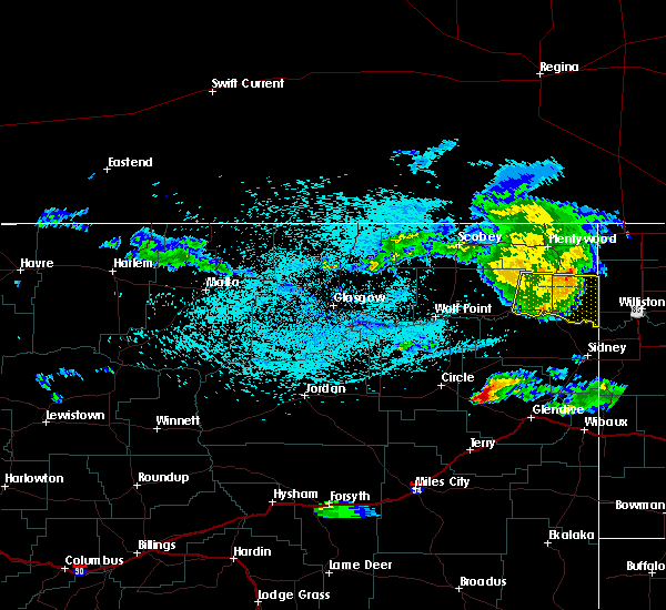 At 1011 pm mdt, a severe thunderstorm was located near froid, or 10 miles northeast of culbertson, moving east at 30 mph (radar indicated). Hazards include 60 mph wind gusts. Expect damage to roofs, siding, and trees. Locations impacted include, culbertson, medicine lake, bainville, froid, mccabe, snowden and homestead. At 1011 pm mdt, a severe thunderstorm was located near froid, or 10 miles northeast of culbertson, moving east at 30 mph (radar indicated). Hazards include 60 mph wind gusts. Expect damage to roofs, siding, and trees. Locations impacted include, culbertson, medicine lake, bainville, froid, mccabe, snowden and homestead.
|
| 8/14/2019 9:55 PM MDT | Estimated 60-65 mph. time estimated from rada in sheridan county MT, 3.9 miles S of Froid, MT |
| 8/14/2019 9:43 PM MDT |
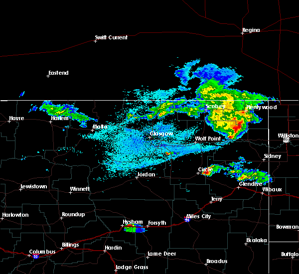 At 943 pm mdt, a severe thunderstorm was located 10 miles west of froid, or 16 miles northwest of culbertson, moving east at 30 mph (radar indicated). Hazards include 60 mph wind gusts and penny size hail. expect damage to roofs, siding, and trees At 943 pm mdt, a severe thunderstorm was located 10 miles west of froid, or 16 miles northwest of culbertson, moving east at 30 mph (radar indicated). Hazards include 60 mph wind gusts and penny size hail. expect damage to roofs, siding, and trees
|
| 7/12/2019 6:50 PM MDT | Quarter sized hail reported 11.4 miles WSW of Froid, MT, quarter-sized hail... with some slightly larger. also had 0.67 inches of rain in 15 minutes. time estimated from radar. |
| 7/12/2019 6:40 PM MDT | Golf Ball sized hail reported 7.9 miles SW of Froid, MT, wind-blown golf ball sized hail broke out windows on the north side of a house. time esitmated from radar. |
| 6/29/2019 12:18 AM MDT |
 At 1218 am mdt, a severe thunderstorm was located 9 miles northwest of froid, or 18 miles northwest of culbertson, moving northeast at 50 mph (radar indicated). Hazards include 60 mph wind gusts and quarter size hail. Hail damage to vehicles is expected. expect wind damage to roofs, siding, and trees. Locations impacted include, medicine lake, froid, reserve and homestead. At 1218 am mdt, a severe thunderstorm was located 9 miles northwest of froid, or 18 miles northwest of culbertson, moving northeast at 50 mph (radar indicated). Hazards include 60 mph wind gusts and quarter size hail. Hail damage to vehicles is expected. expect wind damage to roofs, siding, and trees. Locations impacted include, medicine lake, froid, reserve and homestead.
|
| 6/28/2019 11:55 PM MDT |
 At 1155 pm mdt, a severe thunderstorm was located 10 miles northwest of brockton, or 13 miles northeast of poplar, moving northeast at 50 mph (radar indicated). Hazards include 60 mph wind gusts and quarter size hail. Hail damage to vehicles is expected. Expect wind damage to roofs, siding, and trees. At 1155 pm mdt, a severe thunderstorm was located 10 miles northwest of brockton, or 13 miles northeast of poplar, moving northeast at 50 mph (radar indicated). Hazards include 60 mph wind gusts and quarter size hail. Hail damage to vehicles is expected. Expect wind damage to roofs, siding, and trees.
|
| 7/21/2018 4:11 PM MDT | Golf Ball sized hail reported 8.1 miles NW of Froid, MT, also had a 52 mph wind gust. reported via facebook. |
| 7/21/2018 4:00 PM MDT | Report relayed through facebook with pictures. also received quarter sized hail and damaged outdoor swingse in roosevelt county MT, 11.7 miles ENE of Froid, MT |
| 7/21/2018 3:56 PM MDT | In addition to the wind... they received one inch hai in roosevelt county MT, 0.5 miles NE of Froid, MT |
| 7/21/2018 3:55 PM MDT | Hen Egg sized hail reported 0.4 miles SSW of Froid, MT, report relayed from facebook. in addition to hail... extensive tree damage reported. |
| 7/21/2018 3:52 PM MDT |
 At 352 pm mdt, a severe thunderstorm was located near froid, or 11 miles north of culbertson, moving east at 30 mph. this is a very dangerous storm (radar indicated). Hazards include 80 mph wind gusts and tennis ball size hail. Flying debris will be dangerous to those caught without shelter. mobile homes will be heavily damaged. expect considerable damage to roofs, windows, and vehicles. extensive tree damage and power outages are likely. Locations impacted include, culbertson, medicine lake, bainville, froid, mccabe, snowden, fort kipp and homestead. At 352 pm mdt, a severe thunderstorm was located near froid, or 11 miles north of culbertson, moving east at 30 mph. this is a very dangerous storm (radar indicated). Hazards include 80 mph wind gusts and tennis ball size hail. Flying debris will be dangerous to those caught without shelter. mobile homes will be heavily damaged. expect considerable damage to roofs, windows, and vehicles. extensive tree damage and power outages are likely. Locations impacted include, culbertson, medicine lake, bainville, froid, mccabe, snowden, fort kipp and homestead.
|
| 7/21/2018 3:50 PM MDT | Report relayed from facebook. home weather station recorded wind speed. 2.8 inches of rai in roosevelt county MT, 1.1 miles S of Froid, MT |
| 7/21/2018 3:44 PM MDT | Ping Pong Ball sized hail reported 1.9 miles SSW of Froid, MT, report relayed from facebook. storm also broke windows on the north side of their house. |
| 7/21/2018 3:30 PM MDT |
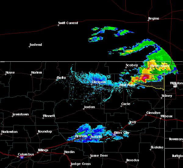 At 330 pm mdt, a severe thunderstorm was located near froid, or 14 miles northwest of culbertson, moving east at 35 mph. this is a very dangerous storm (radar indicated). Hazards include 80 mph wind gusts and tennis ball size hail. Flying debris will be dangerous to those caught without shelter. mobile homes will be heavily damaged. expect considerable damage to roofs, windows, and vehicles. extensive tree damage and power outages are likely. Locations impacted include, culbertson, medicine lake, bainville, froid, mccabe, snowden, fort kipp and homestead. At 330 pm mdt, a severe thunderstorm was located near froid, or 14 miles northwest of culbertson, moving east at 35 mph. this is a very dangerous storm (radar indicated). Hazards include 80 mph wind gusts and tennis ball size hail. Flying debris will be dangerous to those caught without shelter. mobile homes will be heavily damaged. expect considerable damage to roofs, windows, and vehicles. extensive tree damage and power outages are likely. Locations impacted include, culbertson, medicine lake, bainville, froid, mccabe, snowden, fort kipp and homestead.
|
| 7/21/2018 3:11 PM MDT |
 At 311 pm mdt, a severe thunderstorm was located 16 miles north of brockton, or 23 miles northeast of poplar, moving east at 35 mph (radar indicated). Hazards include ping pong ball size hail and 60 mph wind gusts. People and animals outdoors will be injured. expect hail damage to roofs, siding, windows, and vehicles. Expect wind damage to roofs, siding, and trees. At 311 pm mdt, a severe thunderstorm was located 16 miles north of brockton, or 23 miles northeast of poplar, moving east at 35 mph (radar indicated). Hazards include ping pong ball size hail and 60 mph wind gusts. People and animals outdoors will be injured. expect hail damage to roofs, siding, windows, and vehicles. Expect wind damage to roofs, siding, and trees.
|
| 7/10/2018 8:40 PM MDT |
 At 839 pm mdt, severe thunderstorms were located along a line extending from 9 miles northwest of fortuna to 7 miles southwest of grenora to 10 miles southeast of brockton, moving east at 60 mph (radar indicated). Hazards include 70 mph wind gusts and nickel size hail. Expect considerable tree damage. Damage is likely to mobile homes, roofs, and outbuildings. At 839 pm mdt, severe thunderstorms were located along a line extending from 9 miles northwest of fortuna to 7 miles southwest of grenora to 10 miles southeast of brockton, moving east at 60 mph (radar indicated). Hazards include 70 mph wind gusts and nickel size hail. Expect considerable tree damage. Damage is likely to mobile homes, roofs, and outbuildings.
|
| 7/10/2018 7:48 PM MDT |
 At 748 pm mdt, severe thunderstorms were located along a line extending from 11 miles east of port of whitetail to near poplar, moving east at 35 mph (radar indicated). Hazards include 60 mph wind gusts. expect damage to roofs, siding, and trees At 748 pm mdt, severe thunderstorms were located along a line extending from 11 miles east of port of whitetail to near poplar, moving east at 35 mph (radar indicated). Hazards include 60 mph wind gusts. expect damage to roofs, siding, and trees
|
| 6/28/2018 8:27 PM MDT |
 The severe thunderstorm warning for southeastern roosevelt and northeastern richland counties will expire at 830 pm mdt, the storms which prompted the warning have moved out of the area. therefore, the warning will be allowed to expire. however gusty winds and heavy rain are still possible with these thunderstorms. a tornado watch remains in effect until 1100 pm mdt for northeastern montana. The severe thunderstorm warning for southeastern roosevelt and northeastern richland counties will expire at 830 pm mdt, the storms which prompted the warning have moved out of the area. therefore, the warning will be allowed to expire. however gusty winds and heavy rain are still possible with these thunderstorms. a tornado watch remains in effect until 1100 pm mdt for northeastern montana.
|
| 6/28/2018 8:17 PM MDT |
 At 817 pm mdt, severe thunderstorms were located along a line extending from near bonetrail to 7 miles northwest of alexander, moving east at 75 mph (radar indicated). Hazards include 70 mph wind gusts. Expect considerable tree damage. damage is likely to mobile homes, roofs, and outbuildings. locations impacted include, fairview, bainville, froid, east fairview, mccabe, snowden, nohly and fort union. A tornado watch remains in effect until 1100 pm mdt for northeastern montana. At 817 pm mdt, severe thunderstorms were located along a line extending from near bonetrail to 7 miles northwest of alexander, moving east at 75 mph (radar indicated). Hazards include 70 mph wind gusts. Expect considerable tree damage. damage is likely to mobile homes, roofs, and outbuildings. locations impacted include, fairview, bainville, froid, east fairview, mccabe, snowden, nohly and fort union. A tornado watch remains in effect until 1100 pm mdt for northeastern montana.
|
| 6/28/2018 7:42 PM MDT |
 At 741 pm mdt, severe thunderstorms were located along a line extending from 6 miles southwest of froid to 6 miles north of lambert, moving east at 75 mph (radar indicated). Hazards include 70 mph wind gusts and nickel size hail. Expect considerable tree damage. Damage is likely to mobile homes, roofs, and outbuildings. At 741 pm mdt, severe thunderstorms were located along a line extending from 6 miles southwest of froid to 6 miles north of lambert, moving east at 75 mph (radar indicated). Hazards include 70 mph wind gusts and nickel size hail. Expect considerable tree damage. Damage is likely to mobile homes, roofs, and outbuildings.
|
| 6/28/2018 7:34 PM MDT |
 At 734 pm mdt, severe thunderstorms were located along a line extending from 8 miles north of poplar to 12 miles northeast of richey, moving east at 50 mph. a 64 mph wind gust was measured at the poplar airport at 725 pm (trained weather spotters). Hazards include 70 mph wind gusts and nickel size hail. Expect considerable tree damage. damage is likely to mobile homes, roofs, and outbuildings. locations impacted include, poplar, culbertson, brockton, froid, sprole and fort kipp. A tornado watch remains in effect until 1100 pm mdt for northeastern montana. At 734 pm mdt, severe thunderstorms were located along a line extending from 8 miles north of poplar to 12 miles northeast of richey, moving east at 50 mph. a 64 mph wind gust was measured at the poplar airport at 725 pm (trained weather spotters). Hazards include 70 mph wind gusts and nickel size hail. Expect considerable tree damage. damage is likely to mobile homes, roofs, and outbuildings. locations impacted include, poplar, culbertson, brockton, froid, sprole and fort kipp. A tornado watch remains in effect until 1100 pm mdt for northeastern montana.
|
| 6/28/2018 7:05 PM MDT |
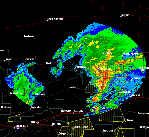 At 704 pm mdt, severe thunderstorms were located along a line extending from 12 miles north of wolf point to near vida, moving east at 50 mph (radar indicated). Hazards include 60 mph wind gusts and nickel size hail. expect damage to roofs, siding, and trees At 704 pm mdt, severe thunderstorms were located along a line extending from 12 miles north of wolf point to near vida, moving east at 50 mph (radar indicated). Hazards include 60 mph wind gusts and nickel size hail. expect damage to roofs, siding, and trees
|
| 6/7/2018 9:07 PM MDT | Half Dollar sized hail reported 13.7 miles ESE of Froid, MT |
| 6/7/2018 9:03 PM MDT |
 At 902 pm mdt, a severe thunderstorm was located 7 miles east of brockton, or 11 miles west of culbertson, moving northeast at 35 mph. this storm has a history of winds up to 90 miles per hour and silver dollar sized hail (radar indicated). Hazards include 60 mph wind gusts and quarter size hail. Hail damage to vehicles is expected. Expect wind damage to roofs, siding, and trees. At 902 pm mdt, a severe thunderstorm was located 7 miles east of brockton, or 11 miles west of culbertson, moving northeast at 35 mph. this storm has a history of winds up to 90 miles per hour and silver dollar sized hail (radar indicated). Hazards include 60 mph wind gusts and quarter size hail. Hail damage to vehicles is expected. Expect wind damage to roofs, siding, and trees.
|
| 6/7/2018 8:38 PM MDT |
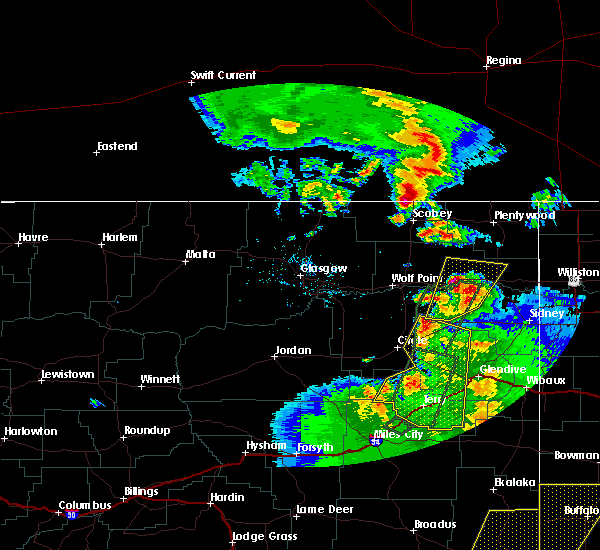 At 836 pm mdt, a severe thunderstorm was located 8 miles south of brockton, or 14 miles southeast of poplar, moving north at 25 mph. this is a very dangerous storm (trained weather spotters). Hazards include 90 mph wind gusts and half dollar size hail. You are in a life-threatening situation. flying debris may be deadly to those caught without shelter. mobile homes will be heavily damaged or destroyed. homes and businesses will have substantial roof and window damage. expect extensive tree damage and power outages. Locations impacted include, culbertson, brockton, froid, sprole and fort kipp. At 836 pm mdt, a severe thunderstorm was located 8 miles south of brockton, or 14 miles southeast of poplar, moving north at 25 mph. this is a very dangerous storm (trained weather spotters). Hazards include 90 mph wind gusts and half dollar size hail. You are in a life-threatening situation. flying debris may be deadly to those caught without shelter. mobile homes will be heavily damaged or destroyed. homes and businesses will have substantial roof and window damage. expect extensive tree damage and power outages. Locations impacted include, culbertson, brockton, froid, sprole and fort kipp.
|
| 6/7/2018 8:16 PM MDT |
 At 815 pm mdt, a severe thunderstorm was located 17 miles south of brockton, or 17 miles southeast of poplar, moving north at 25 mph. this is a very dangerous storm (trained weather spotters). Hazards include 80 mph wind gusts and half dollar size hail. Flying debris will be dangerous to those caught without shelter. mobile homes will be heavily damaged. expect considerable damage to roofs, windows, and vehicles. extensive tree damage and power outages are likely. Locations impacted include, culbertson, brockton, froid, sprole and fort kipp. At 815 pm mdt, a severe thunderstorm was located 17 miles south of brockton, or 17 miles southeast of poplar, moving north at 25 mph. this is a very dangerous storm (trained weather spotters). Hazards include 80 mph wind gusts and half dollar size hail. Flying debris will be dangerous to those caught without shelter. mobile homes will be heavily damaged. expect considerable damage to roofs, windows, and vehicles. extensive tree damage and power outages are likely. Locations impacted include, culbertson, brockton, froid, sprole and fort kipp.
|
| 6/7/2018 8:08 PM MDT |
 At 807 pm mdt, a severe thunderstorm was located 14 miles north of richey, or 20 miles southeast of poplar, moving northeast at 25 mph (trained weather spotters). Hazards include 60 mph wind gusts and half dollar size hail. Hail damage to vehicles is expected. Expect wind damage to roofs, siding, and trees. At 807 pm mdt, a severe thunderstorm was located 14 miles north of richey, or 20 miles southeast of poplar, moving northeast at 25 mph (trained weather spotters). Hazards include 60 mph wind gusts and half dollar size hail. Hail damage to vehicles is expected. Expect wind damage to roofs, siding, and trees.
|
| 6/1/2018 4:54 PM MDT |
 The severe thunderstorm warning for northeastern roosevelt and southeastern sheridan counties will expire at 500 pm mdt, the storm which prompted the warning has weakened below severe limits, and no longer poses an immediate threat to life or property. therefore the warning will be allowed to expire. however, heavy rain is still possible with this thunderstorm. The severe thunderstorm warning for northeastern roosevelt and southeastern sheridan counties will expire at 500 pm mdt, the storm which prompted the warning has weakened below severe limits, and no longer poses an immediate threat to life or property. therefore the warning will be allowed to expire. however, heavy rain is still possible with this thunderstorm.
|
| 6/1/2018 4:29 PM MDT |
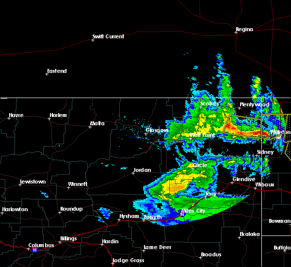 At 429 pm mdt, a severe thunderstorm was located near bainville, or 11 miles east of culbertson, moving northeast at 35 mph (radar indicated). Hazards include 60 mph wind gusts and nickel size hail. Expect damage to roofs, siding, and trees. Locations impacted include, medicine lake, bainville, froid, mccabe and homestead. At 429 pm mdt, a severe thunderstorm was located near bainville, or 11 miles east of culbertson, moving northeast at 35 mph (radar indicated). Hazards include 60 mph wind gusts and nickel size hail. Expect damage to roofs, siding, and trees. Locations impacted include, medicine lake, bainville, froid, mccabe and homestead.
|
| 6/1/2018 4:03 PM MDT |
 At 402 pm mdt, a severe thunderstorm was located 13 miles south of culbertson, moving northeast at 35 mph (trained weather spotters). Hazards include 70 mph wind gusts and quarter size hail. Hail damage to vehicles is expected. expect considerable tree damage. Wind damage is also likely to mobile homes, roofs, and outbuildings. At 402 pm mdt, a severe thunderstorm was located 13 miles south of culbertson, moving northeast at 35 mph (trained weather spotters). Hazards include 70 mph wind gusts and quarter size hail. Hail damage to vehicles is expected. expect considerable tree damage. Wind damage is also likely to mobile homes, roofs, and outbuildings.
|
| 5/23/2018 11:00 AM MDT |
 At 1059 am mdt, a severe thunderstorm was located over froid, or 11 miles north of culbertson, moving northwest at 20 mph (radar indicated). Hazards include 60 mph wind gusts and quarter size hail. Hail damage to vehicles is expected. expect wind damage to roofs, siding, and trees. Locations impacted include, froid and homestead. At 1059 am mdt, a severe thunderstorm was located over froid, or 11 miles north of culbertson, moving northwest at 20 mph (radar indicated). Hazards include 60 mph wind gusts and quarter size hail. Hail damage to vehicles is expected. expect wind damage to roofs, siding, and trees. Locations impacted include, froid and homestead.
|
| 5/23/2018 10:25 AM MDT |
 At 1023 am mdt, a severe thunderstorm was located near mccabe, or 8 miles northeast of culbertson, moving northwest at 20 mph (radar indicated). Hazards include 60 mph wind gusts and quarter size hail. Hail damage to vehicles is expected. Expect wind damage to roofs, siding, and trees. At 1023 am mdt, a severe thunderstorm was located near mccabe, or 8 miles northeast of culbertson, moving northwest at 20 mph (radar indicated). Hazards include 60 mph wind gusts and quarter size hail. Hail damage to vehicles is expected. Expect wind damage to roofs, siding, and trees.
|
| 8/31/2017 7:54 PM MDT |
 The severe thunderstorm warning for southeastern roosevelt, southeastern sheridan and northeastern richland counties will expire at 800 pm mdt, the storm which prompted the warning has weakened below severe limits, and no longer poses an immediate threat to life or property. therefore the warning will be allowed to expire. however small hail and heavy rain are still possible with this thunderstorm. The severe thunderstorm warning for southeastern roosevelt, southeastern sheridan and northeastern richland counties will expire at 800 pm mdt, the storm which prompted the warning has weakened below severe limits, and no longer poses an immediate threat to life or property. therefore the warning will be allowed to expire. however small hail and heavy rain are still possible with this thunderstorm.
|
| 8/31/2017 7:34 PM MDT |
 At 734 pm mdt, a severe thunderstorm was located 12 miles west of bonetrail, or 24 miles northeast of culbertson, moving northeast at 30 mph (radar indicated). Hazards include quarter size hail. Damage to vehicles is expected. Locations impacted include, culbertson, bainville, froid, mccabe, snowden and dagmar. At 734 pm mdt, a severe thunderstorm was located 12 miles west of bonetrail, or 24 miles northeast of culbertson, moving northeast at 30 mph (radar indicated). Hazards include quarter size hail. Damage to vehicles is expected. Locations impacted include, culbertson, bainville, froid, mccabe, snowden and dagmar.
|
| 8/31/2017 7:01 PM MDT |
 At 700 pm mdt, a cluster of severe thunderstorms were located near culbertson, moving northeast at 30 mph (radar indicated). Hazards include quarter size hail. damage to vehicles is expected At 700 pm mdt, a cluster of severe thunderstorms were located near culbertson, moving northeast at 30 mph (radar indicated). Hazards include quarter size hail. damage to vehicles is expected
|
| 7/11/2017 7:26 AM MDT |
 At 724 am mdt, a severe thunderstorm was located 13 miles north of bainville, or 20 miles northeast of culbertson, moving east at 45 mph (radar indicated). Hazards include 50-60 mph wind gusts. Expect damage to roofs, siding, and trees. Locations impacted include, medicine lake, froid, reserve, mccabe, dagmar and homestead. At 724 am mdt, a severe thunderstorm was located 13 miles north of bainville, or 20 miles northeast of culbertson, moving east at 45 mph (radar indicated). Hazards include 50-60 mph wind gusts. Expect damage to roofs, siding, and trees. Locations impacted include, medicine lake, froid, reserve, mccabe, dagmar and homestead.
|
| 7/11/2017 6:50 AM MDT |
 At 649 am mdt, a severe thunderstorm was located 12 miles northeast of brockton, or 16 miles northwest of culbertson, moving east at 45 mph (radar indicated). Hazards include 60 mph wind gusts. expect damage to roofs, siding, and trees At 649 am mdt, a severe thunderstorm was located 12 miles northeast of brockton, or 16 miles northwest of culbertson, moving east at 45 mph (radar indicated). Hazards include 60 mph wind gusts. expect damage to roofs, siding, and trees
|
| 6/24/2016 9:39 PM MDT |
 The severe thunderstorm warning for eastern sheridan and east central roosevelt counties will expire at 945 pm mdt, the storms which prompted the warning have weakened below severe limits, and no longer pose an immediate threat to life or property. therefore the warning will be allowed to expire. however gusty winds are still possible with these thunderstorms. a severe thunderstorm watch remains in effect until midnight mdt for northeastern montana. The severe thunderstorm warning for eastern sheridan and east central roosevelt counties will expire at 945 pm mdt, the storms which prompted the warning have weakened below severe limits, and no longer pose an immediate threat to life or property. therefore the warning will be allowed to expire. however gusty winds are still possible with these thunderstorms. a severe thunderstorm watch remains in effect until midnight mdt for northeastern montana.
|
| 6/24/2016 9:13 PM MDT |
 At 912 pm mdt, severe thunderstorms were located along a line extending from near plentywood to 9 miles southwest of alamo, moving northeast at 50 mph (radar indicated). Hazards include 70 mph wind gusts and quarter size hail. Hail damage to vehicles is expected. expect considerable tree damage. wind damage is also likely to mobile homes, roofs, and outbuildings. Locations impacted include, medicine lake, froid, westby, dooley, reserve, antelope, coalridge, comertown, dagmar and homestead. At 912 pm mdt, severe thunderstorms were located along a line extending from near plentywood to 9 miles southwest of alamo, moving northeast at 50 mph (radar indicated). Hazards include 70 mph wind gusts and quarter size hail. Hail damage to vehicles is expected. expect considerable tree damage. wind damage is also likely to mobile homes, roofs, and outbuildings. Locations impacted include, medicine lake, froid, westby, dooley, reserve, antelope, coalridge, comertown, dagmar and homestead.
|
| 6/24/2016 8:46 PM MDT | Storm damage reported in roosevelt county MT, 0.4 miles SSW of Froid, MT |
| 6/24/2016 8:45 PM MDT |
 At 843 pm mdt, severe thunderstorms were located along a line extending from 16 miles west of medicine lake to 12 miles northeast of bainville, moving northeast at 50 mph (radar indicated. at 818 pm, an 85 mph wind gust was observed east of poplar). Hazards include 70 mph wind gusts and quarter size hail. Hail damage to vehicles is expected. expect considerable tree damage. Wind damage is also likely to mobile homes, roofs, and outbuildings. At 843 pm mdt, severe thunderstorms were located along a line extending from 16 miles west of medicine lake to 12 miles northeast of bainville, moving northeast at 50 mph (radar indicated. at 818 pm, an 85 mph wind gust was observed east of poplar). Hazards include 70 mph wind gusts and quarter size hail. Hail damage to vehicles is expected. expect considerable tree damage. Wind damage is also likely to mobile homes, roofs, and outbuildings.
|
| 6/24/2016 8:19 PM MDT |
 At 819 pm mdt, severe thunderstorms were located along a line extending from 13 miles west of medicine lake to 11 miles northwest of sidney, moving east at 55 mph (radar indicated). Hazards include 70 mph wind gusts and nickel size hail. Expect considerable tree damage. damage is likely to mobile homes, roofs, and outbuildings. Locations impacted include, poplar, culbertson, fairview, brockton, medicine lake, bainville, froid, bredette, east fairview, mccabe, reserve, homestead, fort kipp, nohly, snowden, sprole, fort union and dagmar. At 819 pm mdt, severe thunderstorms were located along a line extending from 13 miles west of medicine lake to 11 miles northwest of sidney, moving east at 55 mph (radar indicated). Hazards include 70 mph wind gusts and nickel size hail. Expect considerable tree damage. damage is likely to mobile homes, roofs, and outbuildings. Locations impacted include, poplar, culbertson, fairview, brockton, medicine lake, bainville, froid, bredette, east fairview, mccabe, reserve, homestead, fort kipp, nohly, snowden, sprole, fort union and dagmar.
|
| 6/24/2016 7:50 PM MDT |
 At 750 pm mdt, severe thunderstorms were located along a line extending from 8 miles northwest of bredette to near richey, moving east at 65 mph (radar indicated). Hazards include 70 mph wind gusts and nickel size hail. Expect considerable tree damage. Damage is likely to mobile homes, roofs, and outbuildings. At 750 pm mdt, severe thunderstorms were located along a line extending from 8 miles northwest of bredette to near richey, moving east at 65 mph (radar indicated). Hazards include 70 mph wind gusts and nickel size hail. Expect considerable tree damage. Damage is likely to mobile homes, roofs, and outbuildings.
|
| 6/21/2016 7:13 PM MDT |
 At 711 pm mdt, a severe thunderstorm was located over poplar, moving east at 60 mph (trained weather spotters reported quarter size hail 7 ne of wolf point at 658 pm mdt). Hazards include 60 mph wind gusts and quarter size hail. Hail damage to vehicles is expected. Expect wind damage to roofs, siding, and trees. At 711 pm mdt, a severe thunderstorm was located over poplar, moving east at 60 mph (trained weather spotters reported quarter size hail 7 ne of wolf point at 658 pm mdt). Hazards include 60 mph wind gusts and quarter size hail. Hail damage to vehicles is expected. Expect wind damage to roofs, siding, and trees.
|
| 6/19/2016 12:24 AM MDT |
 At 1224 am mdt, a severe thunderstorm was located 14 miles east of medicine lake, or 24 miles northeast of culbertson, moving east at 40 mph (radar indicated). Hazards include 60 mph wind gusts and quarter size hail. Hail damage to vehicles is expected. expect wind damage to roofs, siding, and trees. Locations impacted include, medicine lake, froid, reserve, antelope, coalridge, dagmar and homestead. At 1224 am mdt, a severe thunderstorm was located 14 miles east of medicine lake, or 24 miles northeast of culbertson, moving east at 40 mph (radar indicated). Hazards include 60 mph wind gusts and quarter size hail. Hail damage to vehicles is expected. expect wind damage to roofs, siding, and trees. Locations impacted include, medicine lake, froid, reserve, antelope, coalridge, dagmar and homestead.
|
| 6/19/2016 12:03 AM MDT |
 At 1202 am mdt, a severe thunderstorm was located near medicine lake, or 21 miles north of culbertson, moving east at 50 mph (radar indicated). Hazards include 60 mph wind gusts and quarter size hail. Hail damage to vehicles is expected. Expect wind damage to roofs, siding, and trees. At 1202 am mdt, a severe thunderstorm was located near medicine lake, or 21 miles north of culbertson, moving east at 50 mph (radar indicated). Hazards include 60 mph wind gusts and quarter size hail. Hail damage to vehicles is expected. Expect wind damage to roofs, siding, and trees.
|
| 6/18/2016 10:54 PM MDT |
 The severe thunderstorm warning for sheridan, richland and eastern roosevelt counties will expire at 1100 pm mdt, the storms which prompted the warning have moved out of the area. therefore, the warning will be allowed to expire. a severe thunderstorm watch remains in effect until midnight mdt for northeastern montana. The severe thunderstorm warning for sheridan, richland and eastern roosevelt counties will expire at 1100 pm mdt, the storms which prompted the warning have moved out of the area. therefore, the warning will be allowed to expire. a severe thunderstorm watch remains in effect until midnight mdt for northeastern montana.
|
| 6/18/2016 10:19 PM MDT |
 At 1019 pm mdt, severe thunderstorms were located along a line extending from 10 miles west of westby to 14 miles northwest of sidney, moving east at 50 mph (trained weather spotters). Hazards include two inch hail and 70 mph wind gusts. People and animals outdoors will be injured. expect hail damage to roofs, siding, windows, and vehicles. expect considerable tree damage. wind damage is also likely to mobile homes, roofs, and outbuildings. Locations impacted include, sidney, plentywood, culbertson, fairview, medicine lake, bainville, froid, westby, port of raymond, lambert, mccabe, wooley, coalridge, comertown, homestead, crane, fort union, dooley, reserve and enid. At 1019 pm mdt, severe thunderstorms were located along a line extending from 10 miles west of westby to 14 miles northwest of sidney, moving east at 50 mph (trained weather spotters). Hazards include two inch hail and 70 mph wind gusts. People and animals outdoors will be injured. expect hail damage to roofs, siding, windows, and vehicles. expect considerable tree damage. wind damage is also likely to mobile homes, roofs, and outbuildings. Locations impacted include, sidney, plentywood, culbertson, fairview, medicine lake, bainville, froid, westby, port of raymond, lambert, mccabe, wooley, coalridge, comertown, homestead, crane, fort union, dooley, reserve and enid.
|
| 6/18/2016 9:54 PM MDT |
 At 952 pm mdt, severe thunderstorms were located along a line extending from 7 miles south of port of raymond to 15 miles south of brockton, moving east at 45 mph (trained weather spotters). Hazards include two inch hail and 70 mph wind gusts. People and animals outdoors will be injured. expect hail damage to roofs, siding, windows, and vehicles. expect considerable tree damage. Wind damage is also likely to mobile homes, roofs, and outbuildings. At 952 pm mdt, severe thunderstorms were located along a line extending from 7 miles south of port of raymond to 15 miles south of brockton, moving east at 45 mph (trained weather spotters). Hazards include two inch hail and 70 mph wind gusts. People and animals outdoors will be injured. expect hail damage to roofs, siding, windows, and vehicles. expect considerable tree damage. Wind damage is also likely to mobile homes, roofs, and outbuildings.
|
| 7/27/2015 9:07 PM MDT |
 At 902 pm mdt, severe thunderstorms were located along a line extending from 34 miles northeast of port of opheim to 9 miles south of redstone to 10 miles southeast of westby, and moving north at 25 mph (radar indicated). Hazards include 60 mph wind gusts and quarter size hail. Hail damage to crops and plants is expected. some damage to vehicles is possible. expect wind damage to roofs, siding and trees. Locations impacted include, plentywood, whitetail, archer, redstone, raymond port of entry, port of raymond, dooley, comertown, raymond, outlook and daleview. At 902 pm mdt, severe thunderstorms were located along a line extending from 34 miles northeast of port of opheim to 9 miles south of redstone to 10 miles southeast of westby, and moving north at 25 mph (radar indicated). Hazards include 60 mph wind gusts and quarter size hail. Hail damage to crops and plants is expected. some damage to vehicles is possible. expect wind damage to roofs, siding and trees. Locations impacted include, plentywood, whitetail, archer, redstone, raymond port of entry, port of raymond, dooley, comertown, raymond, outlook and daleview.
|
| 7/27/2015 8:43 PM MDT |
 At 833 pm mdt, severe thunderstorms were located along a line extending from 25 miles northeast of port of opheim to 15 miles east of bredette to 21 miles south of westby, and moving north at 30 mph (radar indicated. a wind gust to 63 mph was reported near froid with these storms. quarter sized hail has been reported in scobey). Hazards include 60 mph wind gusts and quarter size hail. Hail damage to crops and plants is expected. some damage to vehicles is possible. Expect wind damage to roofs, siding and trees. At 833 pm mdt, severe thunderstorms were located along a line extending from 25 miles northeast of port of opheim to 15 miles east of bredette to 21 miles south of westby, and moving north at 30 mph (radar indicated. a wind gust to 63 mph was reported near froid with these storms. quarter sized hail has been reported in scobey). Hazards include 60 mph wind gusts and quarter size hail. Hail damage to crops and plants is expected. some damage to vehicles is possible. Expect wind damage to roofs, siding and trees.
|
| 7/27/2015 8:20 PM MDT |
 At 815 pm mdt, severe thunderstorms were located along a line extending from flaxville to 12 miles south of westby, and moving north at 85 mph (radar indicated. up to 65 mph wind gusts were reported in sidney with this storm). Hazards include 60 mph wind gusts and quarter size hail. Hail damage to crops and plants is expected. some damage to vehicles is possible. expect wind damage to roofs, siding and trees. Locations impacted include, whitetail, westby, raymond, dooley, daleview, outlook and comertown. At 815 pm mdt, severe thunderstorms were located along a line extending from flaxville to 12 miles south of westby, and moving north at 85 mph (radar indicated. up to 65 mph wind gusts were reported in sidney with this storm). Hazards include 60 mph wind gusts and quarter size hail. Hail damage to crops and plants is expected. some damage to vehicles is possible. expect wind damage to roofs, siding and trees. Locations impacted include, whitetail, westby, raymond, dooley, daleview, outlook and comertown.
|
| 7/27/2015 8:15 PM MDT | Storm damage reported in roosevelt county MT, 8.1 miles NW of Froid, MT |
| 7/27/2015 7:40 PM MDT |
 At 738 pm mdt, severe thunderstorms were located along a line extending from 9 miles south of poplar to 6 miles north of fairview, and moving north at 85 mph. these are very dangerous storms (trained weather spotters). Hazards include 80 mph wind gusts and quarter size hail. Flying debris will be dangerous to those caught without shelter. mobile homes will be heavily damaged. expect considerable damage to roofs, windows and vehicles. extensive tree damage and power outages are likely. severe thunderstorms will be near, poplar and culbertson around 745 pm mdt. bainville around 750 pm mdt. froid around 755 pm mdt. bredette and medicine lake around 805 pm mdt. flaxville and plentywood around 815 pm mdt. madoc and whitetail around 820 pm mdt. Other locations in the warning include sprole, snowden, fort kipp, mccabe, homestead, reserve, dagmar, navajo, coalridge and antelope. At 738 pm mdt, severe thunderstorms were located along a line extending from 9 miles south of poplar to 6 miles north of fairview, and moving north at 85 mph. these are very dangerous storms (trained weather spotters). Hazards include 80 mph wind gusts and quarter size hail. Flying debris will be dangerous to those caught without shelter. mobile homes will be heavily damaged. expect considerable damage to roofs, windows and vehicles. extensive tree damage and power outages are likely. severe thunderstorms will be near, poplar and culbertson around 745 pm mdt. bainville around 750 pm mdt. froid around 755 pm mdt. bredette and medicine lake around 805 pm mdt. flaxville and plentywood around 815 pm mdt. madoc and whitetail around 820 pm mdt. Other locations in the warning include sprole, snowden, fort kipp, mccabe, homestead, reserve, dagmar, navajo, coalridge and antelope.
|
| 6/19/2015 2:49 PM MDT |
 At 247 pm mdt, a severe thunderstorm was located 12 miles east of bredette, and moving east at 50 mph (public). Hazards include golf ball size hail and 60 mph wind gusts. People and animals outdoors will be injured. expect hail damage to roofs, siding, windows and vehicles. expect wind damage to roofs, siding and trees. the severe thunderstorm will be near, medicine lake around 315 pm mdt. Other locations in the warning include homestead. At 247 pm mdt, a severe thunderstorm was located 12 miles east of bredette, and moving east at 50 mph (public). Hazards include golf ball size hail and 60 mph wind gusts. People and animals outdoors will be injured. expect hail damage to roofs, siding, windows and vehicles. expect wind damage to roofs, siding and trees. the severe thunderstorm will be near, medicine lake around 315 pm mdt. Other locations in the warning include homestead.
|
| 6/19/2015 2:22 PM MDT |
 At 220 pm mdt, a severe thunderstorm was located 11 miles west of bredette, and moving east at 50 mph (public). Hazards include golf ball size hail and 60 mph wind gusts. People and animals outdoors will be injured. expect hail damage to roofs, siding, windows and vehicles. expect wind damage to roofs, siding and trees. the severe thunderstorm will be near, bredette around 235 pm mdt. medicine lake around 315 pm mdt. Other locations in the warning include homestead. At 220 pm mdt, a severe thunderstorm was located 11 miles west of bredette, and moving east at 50 mph (public). Hazards include golf ball size hail and 60 mph wind gusts. People and animals outdoors will be injured. expect hail damage to roofs, siding, windows and vehicles. expect wind damage to roofs, siding and trees. the severe thunderstorm will be near, bredette around 235 pm mdt. medicine lake around 315 pm mdt. Other locations in the warning include homestead.
|
| 9/3/2014 6:45 PM MDT | Reports of a side wall of a shop blown out...garage blown apart...limbs broken off of trees as well as some trees uprooted in the town of mccabe in roosevelt county MT, 8.3 miles NW of Froid, MT |
| 6/13/2014 8:00 PM MDT | Half Dollar sized hail reported 11.4 miles WSW of Froid, MT, two storms went through and hail ranged from pea to half dollar. |
| 6/13/2014 7:45 PM MDT | Ping Pong Ball sized hail reported 6.6 miles W of Froid, MT, hail ranged from quarter sized to ping pongs. |
| 8/1/2012 4:35 PM MDT | Storm damage reported in roosevelt county MT, 0.5 miles NE of Froid, MT |
| 7/3/2012 7:45 PM MDT | 6 inch diameter limb broken off of a tree in roosevelt county MT, 6.6 miles W of Froid, MT |
| 7/3/2012 7:35 PM MDT | 6 inch diameter limb broken off of a tree in roosevelt county MT, 6.6 miles W of Froid, MT |
| 7/3/2012 6:45 PM MDT | Storm damage reported in roosevelt county MT, 2.1 miles SSW of Froid, MT |
| 1/1/0001 12:00 AM | Storm damage reported in roosevelt county MT, 2.1 miles SSW of Froid, MT |
| 1/1/0001 12:00 AM | Ping Pong Ball sized hail reported 0.5 miles NE of Froid, MT, hail lasted for around 15 minutes and covered the ground. |
Hail Maps for Froid, MT


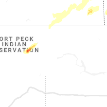


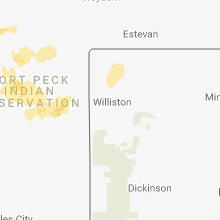

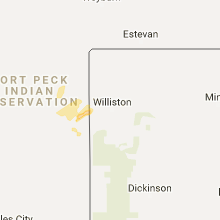


Connect with Interactive Hail Maps