

Hail Map for Fruitport, MI
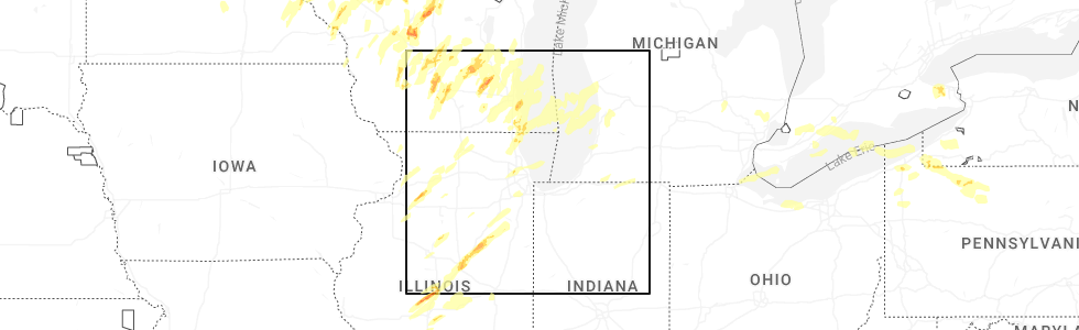
The Fruitport, MI area has had 0 reports of on-the-ground hail by trained spotters, and has been under severe weather warnings 19 times during the past 12 months. Doppler radar has detected hail at or near Fruitport, MI on 27 occasions, including 1 occasion during the past year.
| Name: | Fruitport, MI |
| Where Located: | 27 miles WNW of Grand Rapids, MI |
| Map: | Google Map for Fruitport, MI |
| Population: | 1093 |
| Housing Units: | 476 |
| More Info: | Search Google for Fruitport, MI |
0
The Top Recent Hail Date for Fruitport, MI is Thursday, May 15, 2025 (16th out of 27)
Hail and Wind Damage Spotted near Fruitport, MI
| Date / Time | Report Details |
|---|---|
| 5/15/2025 10:44 PM EDT |
 The storms which prompted the warning have weakened below severe limits, and no longer pose an immediate threat to life or property. therefore, the warning will be allowed to expire. however, gusty winds around 50 mph and frequent lightning are still possible with these thunderstorms through 1100 pm, particularly over parts of eastern ottawa county. a tornado watch remains in effect until 300 am edt for southwestern and west central michigan. The storms which prompted the warning have weakened below severe limits, and no longer pose an immediate threat to life or property. therefore, the warning will be allowed to expire. however, gusty winds around 50 mph and frequent lightning are still possible with these thunderstorms through 1100 pm, particularly over parts of eastern ottawa county. a tornado watch remains in effect until 300 am edt for southwestern and west central michigan.
|
| 5/15/2025 10:13 PM EDT |
 The tornado warning that was previously in effect has been reissued for northern kent county and is in effect until 1045 pm edt. please refer to that bulletin for the latest severe weather information. a tornado watch remains in effect until 300 am edt for southwestern and west central michigan. The tornado warning that was previously in effect has been reissued for northern kent county and is in effect until 1045 pm edt. please refer to that bulletin for the latest severe weather information. a tornado watch remains in effect until 300 am edt for southwestern and west central michigan.
|
| 5/15/2025 10:00 PM EDT |
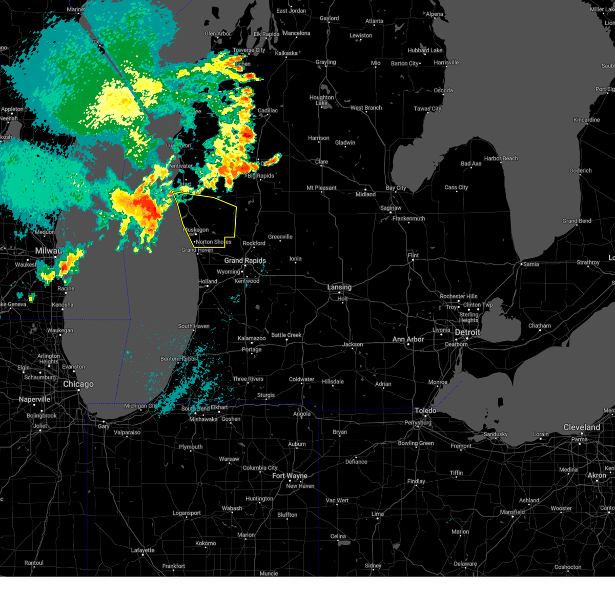
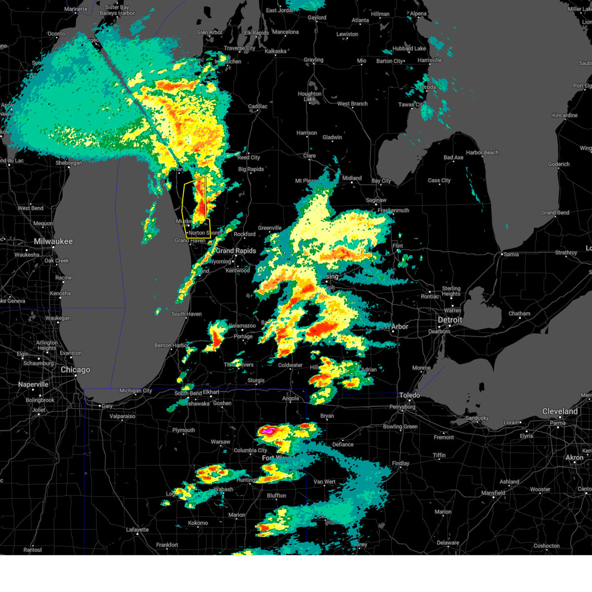
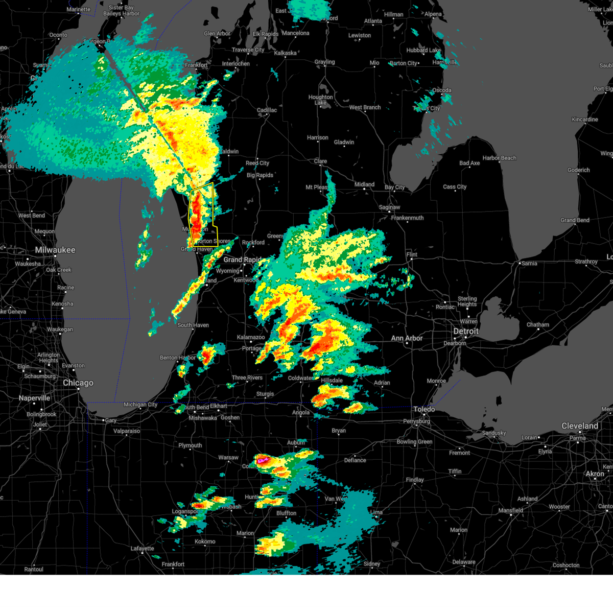
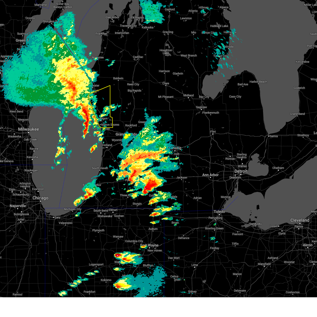
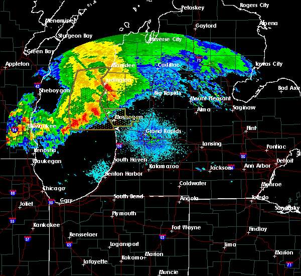
 At 958 pm edt, severe thunderstorms were located along a line extending from near hart to near coopersville to near beechwood, moving east at 60 mph. these are destructive storms for muskegon and ottawa counties! (radar indicated). Hazards include 80 mph wind gusts and penny size hail. Flying debris will be dangerous to those caught without shelter. mobile homes will be heavily damaged. expect considerable damage to roofs, windows, and vehicles. extensive tree damage and power outages are likely. Locations impacted include, muskegon, holland, grand haven, hart, walker, shelby, muskegon heights, hudsonville, zeeland, coopersville, roosevelt park, north muskegon, ferrysburg, whitehall, montague, spring lake, lakewood club, ravenna, scottville, fruitport,. At 958 pm edt, severe thunderstorms were located along a line extending from near hart to near coopersville to near beechwood, moving east at 60 mph. these are destructive storms for muskegon and ottawa counties! (radar indicated). Hazards include 80 mph wind gusts and penny size hail. Flying debris will be dangerous to those caught without shelter. mobile homes will be heavily damaged. expect considerable damage to roofs, windows, and vehicles. extensive tree damage and power outages are likely. Locations impacted include, muskegon, holland, grand haven, hart, walker, shelby, muskegon heights, hudsonville, zeeland, coopersville, roosevelt park, north muskegon, ferrysburg, whitehall, montague, spring lake, lakewood club, ravenna, scottville, fruitport,.
|
| 5/15/2025 9:58 PM EDT |
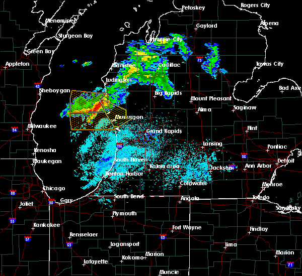
 At 957 pm edt, a severe squall line capable of producing both tornadoes and extensive straight line wind damage was located 8 miles northwest of ravenna, or 9 miles east of muskegon, moving northeast at 55 mph (radar indicated rotation). Hazards include tornado and quarter size hail. Flying debris will be dangerous to those caught without shelter. mobile homes will be damaged or destroyed. damage to roofs, windows, and vehicles will occur. tree damage is likely. Locations impacted include, grant. At 957 pm edt, a severe squall line capable of producing both tornadoes and extensive straight line wind damage was located 8 miles northwest of ravenna, or 9 miles east of muskegon, moving northeast at 55 mph (radar indicated rotation). Hazards include tornado and quarter size hail. Flying debris will be dangerous to those caught without shelter. mobile homes will be damaged or destroyed. damage to roofs, windows, and vehicles will occur. tree damage is likely. Locations impacted include, grant.
|
| 5/15/2025 9:33 PM EDT |
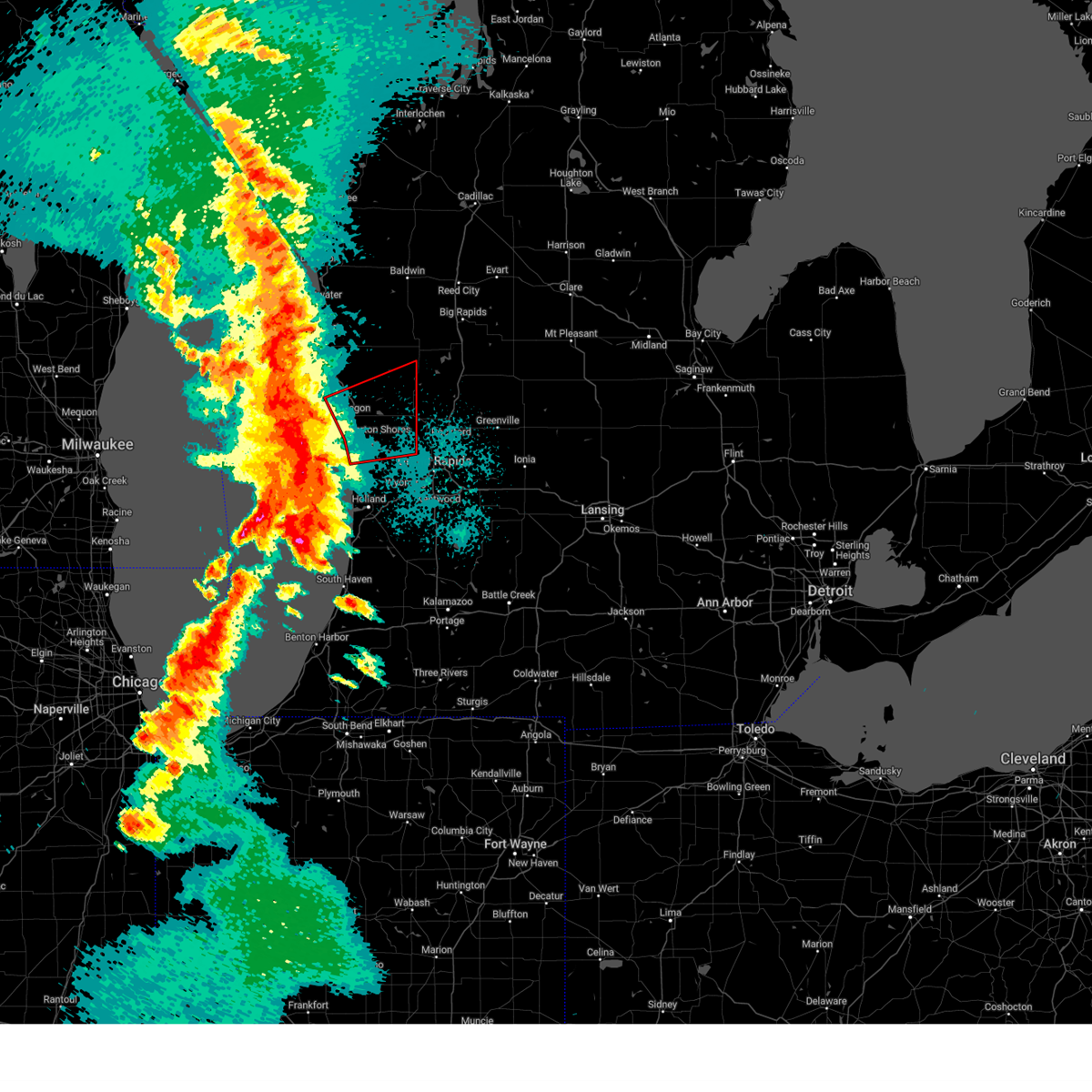 Torgrr the national weather service in grand rapids has issued a * tornado warning for, northern ottawa county in southwestern michigan, southwestern newaygo county in west central michigan, muskegon county in west central michigan, * until 1015 pm edt. * at 933 pm edt, severe thunderstorms capable of producing both tornadoes and extensive straight line wind damage were located 10 miles west of grand haven, or 14 miles southwest of muskegon, moving northeast at 55 mph (radar indicated rotation). Hazards include tornado and quarter size hail. Flying debris will be dangerous to those caught without shelter. mobile homes will be damaged or destroyed. damage to roofs, windows, and vehicles will occur. tree damage is likely. these dangerous storms will be near, muskegon and roosevelt park around 940 pm edt. muskegon heights and north muskegon around 945 pm edt. Other locations in the path of this tornadic thunderstorm include grand haven, grant, and newaygo. Torgrr the national weather service in grand rapids has issued a * tornado warning for, northern ottawa county in southwestern michigan, southwestern newaygo county in west central michigan, muskegon county in west central michigan, * until 1015 pm edt. * at 933 pm edt, severe thunderstorms capable of producing both tornadoes and extensive straight line wind damage were located 10 miles west of grand haven, or 14 miles southwest of muskegon, moving northeast at 55 mph (radar indicated rotation). Hazards include tornado and quarter size hail. Flying debris will be dangerous to those caught without shelter. mobile homes will be damaged or destroyed. damage to roofs, windows, and vehicles will occur. tree damage is likely. these dangerous storms will be near, muskegon and roosevelt park around 940 pm edt. muskegon heights and north muskegon around 945 pm edt. Other locations in the path of this tornadic thunderstorm include grand haven, grant, and newaygo.
|
| 5/15/2025 9:16 PM EDT |
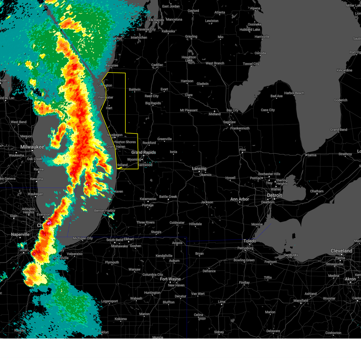 Svrgrr the national weather service in grand rapids has issued a * severe thunderstorm warning for, ottawa county in southwestern michigan, mason county in west central michigan, muskegon county in west central michigan, oceana county in west central michigan, * until 1045 pm edt. * at 915 pm edt, severe thunderstorms were located along a line extending from 19 miles northwest of ludington sp to 23 miles southwest of montague to 38 miles east of wind point, moving east at 55 mph (radar indicated). Hazards include 70 mph wind gusts and penny size hail. Expect considerable tree damage. Damage is likely to mobile homes, roofs, and outbuildings. Svrgrr the national weather service in grand rapids has issued a * severe thunderstorm warning for, ottawa county in southwestern michigan, mason county in west central michigan, muskegon county in west central michigan, oceana county in west central michigan, * until 1045 pm edt. * at 915 pm edt, severe thunderstorms were located along a line extending from 19 miles northwest of ludington sp to 23 miles southwest of montague to 38 miles east of wind point, moving east at 55 mph (radar indicated). Hazards include 70 mph wind gusts and penny size hail. Expect considerable tree damage. Damage is likely to mobile homes, roofs, and outbuildings.
|
| 4/18/2025 11:04 AM EDT |
 At 1101 am edt, strong to severe thunderstorms were located along a line extending from 6 miles southwest of greenville to near saranac to near freeport, moving east at 65 mph. this line will continue to weaken as it moves further inland (radar indicated). Hazards include 60 mph wind gusts. Expect damage to roofs, siding, and trees. Locations impacted include, port sheldon, cutlerville, wyoming, belmont, grandville, fruitport, muskegon heights, grattan, alto, marne, dutton, borculo, sparta, muskegon sp, coopersville, comstock park, walker, hudsonville, slocum, casnovia,. At 1101 am edt, strong to severe thunderstorms were located along a line extending from 6 miles southwest of greenville to near saranac to near freeport, moving east at 65 mph. this line will continue to weaken as it moves further inland (radar indicated). Hazards include 60 mph wind gusts. Expect damage to roofs, siding, and trees. Locations impacted include, port sheldon, cutlerville, wyoming, belmont, grandville, fruitport, muskegon heights, grattan, alto, marne, dutton, borculo, sparta, muskegon sp, coopersville, comstock park, walker, hudsonville, slocum, casnovia,.
|
| 4/18/2025 10:48 AM EDT |
 At 1047 am edt, severe thunderstorms were located along a line extending from near rockford to 7 miles northeast of east grand rapids to near caledonia, moving east at 65 mph. a line of strong possibly severe storms will be moving onshore along a line from muskegon to holland by 11 am moving to the east at 65 mph (radar indicated). Hazards include 60 mph wind gusts and quarter size hail. Hail damage to vehicles is expected. expect wind damage to roofs, siding, and trees. Locations impacted include, port sheldon, cutlerville, wyoming, belmont, grandville, fruitport, muskegon heights, grattan, alto, marne, dutton, borculo, sparta, muskegon sp, coopersville, comstock park, walker, hudsonville, slocum, casnovia,. At 1047 am edt, severe thunderstorms were located along a line extending from near rockford to 7 miles northeast of east grand rapids to near caledonia, moving east at 65 mph. a line of strong possibly severe storms will be moving onshore along a line from muskegon to holland by 11 am moving to the east at 65 mph (radar indicated). Hazards include 60 mph wind gusts and quarter size hail. Hail damage to vehicles is expected. expect wind damage to roofs, siding, and trees. Locations impacted include, port sheldon, cutlerville, wyoming, belmont, grandville, fruitport, muskegon heights, grattan, alto, marne, dutton, borculo, sparta, muskegon sp, coopersville, comstock park, walker, hudsonville, slocum, casnovia,.
|
| 4/18/2025 10:48 AM EDT |
 the severe thunderstorm warning has been cancelled and is no longer in effect the severe thunderstorm warning has been cancelled and is no longer in effect
|
| 4/18/2025 10:43 AM EDT |
 the severe thunderstorm warning has been cancelled and is no longer in effect the severe thunderstorm warning has been cancelled and is no longer in effect
|
| 4/18/2025 10:43 AM EDT |
 At 1037 am edt, strong thunderstorms were located along a line extending from near sparta to near grand rapids to near wyoming, moving east at 65 mph. a line of strong possibly severe storms will be moving onshore along a line from muskegon to holland by 11 am moving to the east at 65 mph (radar indicated). Hazards include 60 mph wind gusts and quarter size hail. Hail damage to vehicles is expected. expect wind damage to roofs, siding, and trees. Locations impacted include, port sheldon, cutlerville, wyoming, belmont, grandville, fruitport, muskegon heights, grattan, alto, marne, dutton, borculo, sparta, muskegon sp, coopersville, comstock park, walker, hudsonville, slocum, casnovia,. At 1037 am edt, strong thunderstorms were located along a line extending from near sparta to near grand rapids to near wyoming, moving east at 65 mph. a line of strong possibly severe storms will be moving onshore along a line from muskegon to holland by 11 am moving to the east at 65 mph (radar indicated). Hazards include 60 mph wind gusts and quarter size hail. Hail damage to vehicles is expected. expect wind damage to roofs, siding, and trees. Locations impacted include, port sheldon, cutlerville, wyoming, belmont, grandville, fruitport, muskegon heights, grattan, alto, marne, dutton, borculo, sparta, muskegon sp, coopersville, comstock park, walker, hudsonville, slocum, casnovia,.
|
| 4/18/2025 10:21 AM EDT |
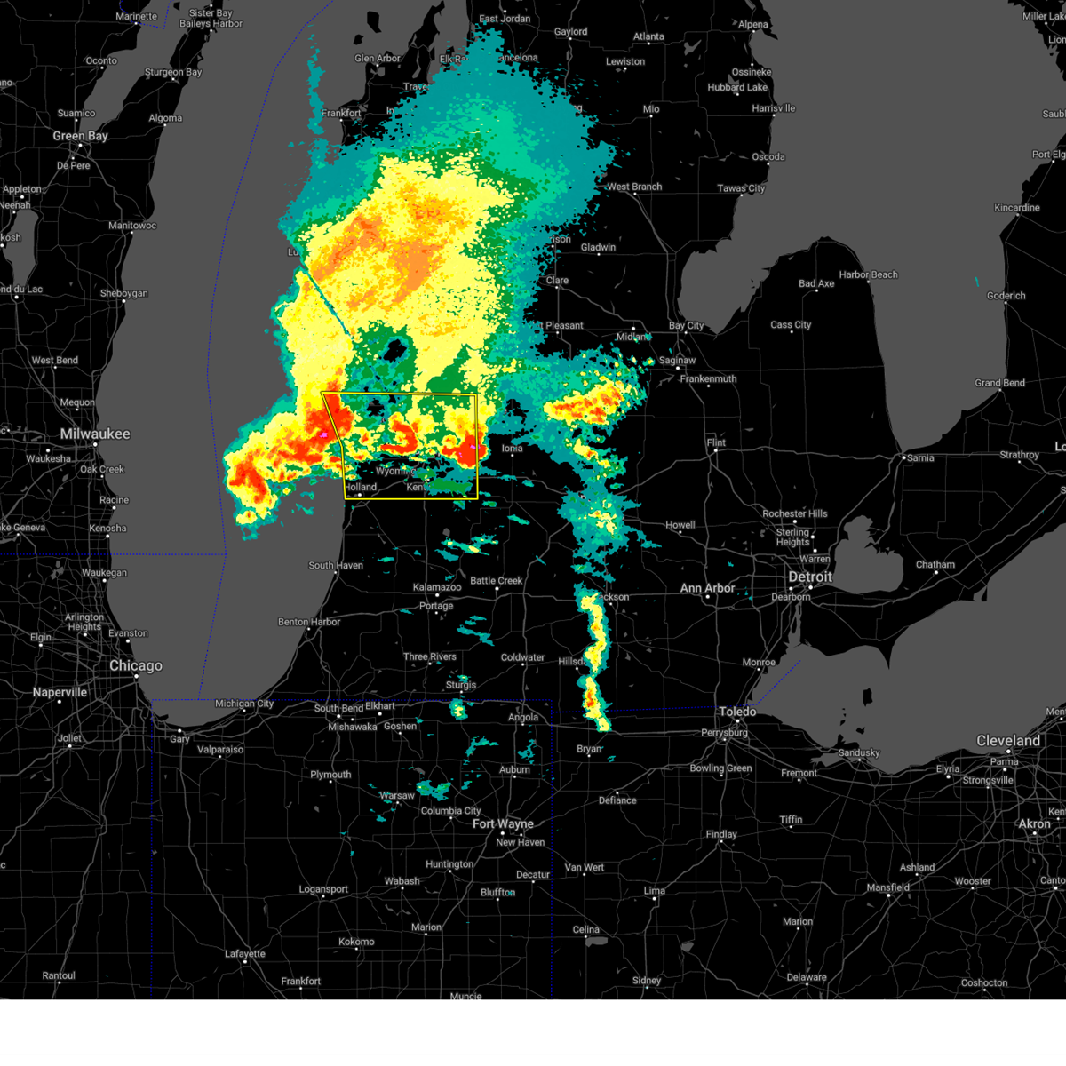
 At 1019 am edt, severe thunderstorms were located along a line extending from near fruitport to near allendale to near zeeland, moving east at 65 mph. this is a second area of thunderstorms that was following strong but non severe thunderstorms currently over the ionia area that are also moving east (radar indicated). Hazards include 60 mph wind gusts and quarter size hail. Hail damage to vehicles is expected. expect wind damage to roofs, siding, and trees. Locations impacted include, port sheldon, clarksville, belmont, muskegon heights, alto, orleans, marne, dutton, comstock park, hudsonville, sheridan, belding, sullivan, rockford, ionia, murray lake, fenwick, north muskegon, portland, conklin,. At 1019 am edt, severe thunderstorms were located along a line extending from near fruitport to near allendale to near zeeland, moving east at 65 mph. this is a second area of thunderstorms that was following strong but non severe thunderstorms currently over the ionia area that are also moving east (radar indicated). Hazards include 60 mph wind gusts and quarter size hail. Hail damage to vehicles is expected. expect wind damage to roofs, siding, and trees. Locations impacted include, port sheldon, clarksville, belmont, muskegon heights, alto, orleans, marne, dutton, comstock park, hudsonville, sheridan, belding, sullivan, rockford, ionia, murray lake, fenwick, north muskegon, portland, conklin,.
|
| 4/18/2025 10:21 AM EDT |
 the severe thunderstorm warning has been cancelled and is no longer in effect the severe thunderstorm warning has been cancelled and is no longer in effect
|
| 4/18/2025 10:08 AM EDT |
 At 1005 am edt, severe thunderstorms were located along a line extending from near fruitport to near beechwood, moving east at 55 mph. this is a second area of thunderstorms that was following strong but non severe thunderstorms currently over the grand rapids area that were also moving east (radar indicated). Hazards include 60 mph wind gusts and quarter size hail. Hail damage to vehicles is expected. expect wind damage to roofs, siding, and trees. Locations impacted include, port sheldon, clarksville, reeman, cedar lake, stanton, belmont, lakewood club, muskegon heights, dalton, alto, wyman, orleans, whitehall, marne, dutton, brunswick, holton, comstock park, hudsonville, sheridan,. At 1005 am edt, severe thunderstorms were located along a line extending from near fruitport to near beechwood, moving east at 55 mph. this is a second area of thunderstorms that was following strong but non severe thunderstorms currently over the grand rapids area that were also moving east (radar indicated). Hazards include 60 mph wind gusts and quarter size hail. Hail damage to vehicles is expected. expect wind damage to roofs, siding, and trees. Locations impacted include, port sheldon, clarksville, reeman, cedar lake, stanton, belmont, lakewood club, muskegon heights, dalton, alto, wyman, orleans, whitehall, marne, dutton, brunswick, holton, comstock park, hudsonville, sheridan,.
|
| 4/18/2025 9:48 AM EDT |
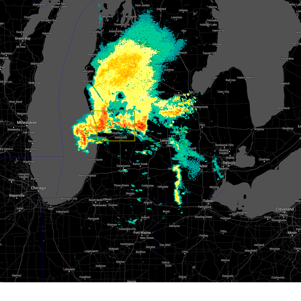
 Svrgrr the national weather service in grand rapids has issued a * severe thunderstorm warning for, kent county in southwestern michigan, ottawa county in southwestern michigan, southern newaygo county in west central michigan, ionia county in south central michigan, muskegon county in west central michigan, northwestern eaton county in south central michigan, southeastern oceana county in west central michigan, montcalm county in central michigan, * until 1115 am edt. * at 947 am edt, severe thunderstorms were located along a line extending from near fruitport to 5 miles southwest of allendale to near zeeland, moving east at 65 mph (radar indicated). Hazards include 60 mph wind gusts and quarter size hail. Hail damage to vehicles is expected. Expect wind damage to roofs, siding, and trees. Svrgrr the national weather service in grand rapids has issued a * severe thunderstorm warning for, kent county in southwestern michigan, ottawa county in southwestern michigan, southern newaygo county in west central michigan, ionia county in south central michigan, muskegon county in west central michigan, northwestern eaton county in south central michigan, southeastern oceana county in west central michigan, montcalm county in central michigan, * until 1115 am edt. * at 947 am edt, severe thunderstorms were located along a line extending from near fruitport to 5 miles southwest of allendale to near zeeland, moving east at 65 mph (radar indicated). Hazards include 60 mph wind gusts and quarter size hail. Hail damage to vehicles is expected. Expect wind damage to roofs, siding, and trees.
|
| 3/30/2025 5:29 PM EDT | At 527 pm edt, severe thunderstorms were located along a line extending from 6 miles northwest of montague to near zeeland, moving northeast at 60 mph (at 5:23 pm 65 mph winds were reported by holland asos). Hazards include 70 mph wind gusts and penny size hail. Expect considerable tree damage. damage is likely to mobile homes, roofs, and outbuildings. Locations impacted include, port sheldon, lakewood club, fruitport, muskegon heights, dalton, whitehall, marne, borculo, muskegon sp, brunswick, coopersville, holton, big blue lake, hudsonville, slocum, casnovia, jamestown, sullivan, allendale, north muskegon,. |
| 3/30/2025 5:05 PM EDT | Svrgrr the national weather service in grand rapids has issued a * severe thunderstorm warning for, ottawa county in southwestern michigan, muskegon county in west central michigan, * until 600 pm edt. * at 505 pm edt, severe thunderstorms were located along a line extending from 22 miles west of montague to 14 miles west of saugatuck, moving northeast at 80 mph (radar indicated). Hazards include 70 mph wind gusts and penny size hail. Expect considerable tree damage. Damage is likely to mobile homes, roofs, and outbuildings. |
| 8/27/2024 3:18 PM EDT |
 The storm which prompted the warning has moved out of the area. therefore, the warning has been allowed to expire. a severe thunderstorm watch remains in effect until 800 pm edt for southwestern and west central michigan. The storm which prompted the warning has moved out of the area. therefore, the warning has been allowed to expire. a severe thunderstorm watch remains in effect until 800 pm edt for southwestern and west central michigan.
|
| 8/27/2024 2:26 PM EDT |
 Svrgrr the national weather service in grand rapids has issued a * severe thunderstorm warning for, southwestern newaygo county in west central michigan, muskegon county in west central michigan, southern oceana county in west central michigan, * until 315 pm edt. * at 225 pm edt, a severe thunderstorm was located 11 miles west of montague, or 18 miles northwest of muskegon, moving east at 60 mph (radar indicated). Hazards include 60 mph wind gusts. expect damage to roofs, siding, and trees Svrgrr the national weather service in grand rapids has issued a * severe thunderstorm warning for, southwestern newaygo county in west central michigan, muskegon county in west central michigan, southern oceana county in west central michigan, * until 315 pm edt. * at 225 pm edt, a severe thunderstorm was located 11 miles west of montague, or 18 miles northwest of muskegon, moving east at 60 mph (radar indicated). Hazards include 60 mph wind gusts. expect damage to roofs, siding, and trees
|
| 5/7/2024 6:56 PM EDT |
 the severe thunderstorm warning has been cancelled and is no longer in effect the severe thunderstorm warning has been cancelled and is no longer in effect
|
| 5/7/2024 6:43 PM EDT |
 At 643 pm edt, severe thunderstorms were located along a line extending from 6 miles west of hesperia to near fruitport, moving northeast at 40 mph (radar indicated). Hazards include 60 mph wind gusts. Expect damage to roofs, siding, and trees. locations impacted include, muskegon, muskegon heights, roosevelt park, north muskegon, whitehall, lakewood club, fruitport, hesperia, norton shores, dalton, holton, sullivan, brunswick, moorland, big blue lake, wolf lake, twin lake, cloverville, st. Huberts,. At 643 pm edt, severe thunderstorms were located along a line extending from 6 miles west of hesperia to near fruitport, moving northeast at 40 mph (radar indicated). Hazards include 60 mph wind gusts. Expect damage to roofs, siding, and trees. locations impacted include, muskegon, muskegon heights, roosevelt park, north muskegon, whitehall, lakewood club, fruitport, hesperia, norton shores, dalton, holton, sullivan, brunswick, moorland, big blue lake, wolf lake, twin lake, cloverville, st. Huberts,.
|
| 5/7/2024 6:11 PM EDT |
 Svrgrr the national weather service in grand rapids has issued a * severe thunderstorm warning for, muskegon county in west central michigan, oceana county in west central michigan, * until 715 pm edt. * at 611 pm edt, severe thunderstorms were located along a line extending from 9 miles west of montague to 15 miles west of grand haven, moving east at 40 mph (radar indicated). Hazards include 60 mph wind gusts and quarter size hail. Hail damage to vehicles is expected. Expect wind damage to roofs, siding, and trees. Svrgrr the national weather service in grand rapids has issued a * severe thunderstorm warning for, muskegon county in west central michigan, oceana county in west central michigan, * until 715 pm edt. * at 611 pm edt, severe thunderstorms were located along a line extending from 9 miles west of montague to 15 miles west of grand haven, moving east at 40 mph (radar indicated). Hazards include 60 mph wind gusts and quarter size hail. Hail damage to vehicles is expected. Expect wind damage to roofs, siding, and trees.
|
| 4/20/2023 8:38 PM EDT |
 At 838 pm edt, severe thunderstorms were located along a line extending from near shelby to near grand haven to near saugatuck, moving northeast at 25 mph (radar indicated). Hazards include 60 mph wind gusts and penny size hail. expect damage to roofs, siding, and trees At 838 pm edt, severe thunderstorms were located along a line extending from near shelby to near grand haven to near saugatuck, moving northeast at 25 mph (radar indicated). Hazards include 60 mph wind gusts and penny size hail. expect damage to roofs, siding, and trees
|
| 11/5/2022 3:27 PM EDT |
 At 326 pm edt, severe thunderstorms were located along a line extending from 10 miles west of grand haven to near st. joseph, moving northeast at 45 mph (radar indicated). Hazards include 60 mph wind gusts. Expect damage to roofs, siding, and trees. locations impacted include, holland, grand haven, allegan, south haven, paw paw, hudsonville, zeeland, coopersville, wayland, otsego, plainwell, ferrysburg, hartford, spring lake, mattawan, lawton, bangor, decatur, fennville, saugatuck, hail threat, radar indicated max hail size, <. 75 in wind threat, radar indicated max wind gust, 60 mph. At 326 pm edt, severe thunderstorms were located along a line extending from 10 miles west of grand haven to near st. joseph, moving northeast at 45 mph (radar indicated). Hazards include 60 mph wind gusts. Expect damage to roofs, siding, and trees. locations impacted include, holland, grand haven, allegan, south haven, paw paw, hudsonville, zeeland, coopersville, wayland, otsego, plainwell, ferrysburg, hartford, spring lake, mattawan, lawton, bangor, decatur, fennville, saugatuck, hail threat, radar indicated max hail size, <. 75 in wind threat, radar indicated max wind gust, 60 mph.
|
| 11/5/2022 3:13 PM EDT |
 At 313 pm edt, severe thunderstorms were located along a line extending from near hamlin lake to 13 miles west of roosevelt park, moving northeast at 45 mph (radar indicated). Hazards include 60 mph wind gusts. Expect damage to roofs, siding, and trees. locations impacted include, muskegon, ludington, hart, shelby, muskegon heights, roosevelt park, north muskegon, whitehall, montague, lakewood club, ravenna, scottville, fruitport, hesperia, pentwater, fountain, free soil, hamlin lake, mears sp, ludington sp, hail threat, radar indicated max hail size, <. 75 in wind threat, radar indicated max wind gust, 60 mph. At 313 pm edt, severe thunderstorms were located along a line extending from near hamlin lake to 13 miles west of roosevelt park, moving northeast at 45 mph (radar indicated). Hazards include 60 mph wind gusts. Expect damage to roofs, siding, and trees. locations impacted include, muskegon, ludington, hart, shelby, muskegon heights, roosevelt park, north muskegon, whitehall, montague, lakewood club, ravenna, scottville, fruitport, hesperia, pentwater, fountain, free soil, hamlin lake, mears sp, ludington sp, hail threat, radar indicated max hail size, <. 75 in wind threat, radar indicated max wind gust, 60 mph.
|
| 11/5/2022 2:49 PM EDT |
 At 247 pm edt, severe thunderstorms were located along a line extending from 30 miles west of holland sp to 15 miles west of st. joseph, moving northeast at 55 mph (radar indicated). Hazards include 60 mph wind gusts. expect damage to roofs, siding, and trees At 247 pm edt, severe thunderstorms were located along a line extending from 30 miles west of holland sp to 15 miles west of st. joseph, moving northeast at 55 mph (radar indicated). Hazards include 60 mph wind gusts. expect damage to roofs, siding, and trees
|
| 11/5/2022 2:39 PM EDT |
 At 238 pm edt, severe thunderstorms were located along a line extending from 15 miles northwest of silver lake sp to 30 miles west of grand haven, moving northeast at 65 mph (radar indicated). Hazards include 60 mph wind gusts. expect damage to roofs, siding, and trees At 238 pm edt, severe thunderstorms were located along a line extending from 15 miles northwest of silver lake sp to 30 miles west of grand haven, moving northeast at 65 mph (radar indicated). Hazards include 60 mph wind gusts. expect damage to roofs, siding, and trees
|
| 9/25/2022 9:21 PM EDT |
 At 919 pm edt, severe thunderstorms were located along a line extending from near fruitport to 5 miles southwest of allendale to near saugatuck to 8 miles west of van buren sp, moving southeast at 40 mph. multiple weather stations near holland reported wind gusts around 55 mph with these storms. some power outages have also developed (automated weather stations). Hazards include 60 mph wind gusts. Expect damage to roofs, siding, and trees. locations impacted include, muskegon, holland, grand haven, allegan, walker, muskegon heights, hudsonville, zeeland, coopersville, wayland, otsego, roosevelt park, plainwell, north muskegon, ferrysburg, whitehall, montague, spring lake, fennville, lakewood club, hail threat, radar indicated max hail size, <. 75 in wind threat, observed max wind gust, 60 mph. At 919 pm edt, severe thunderstorms were located along a line extending from near fruitport to 5 miles southwest of allendale to near saugatuck to 8 miles west of van buren sp, moving southeast at 40 mph. multiple weather stations near holland reported wind gusts around 55 mph with these storms. some power outages have also developed (automated weather stations). Hazards include 60 mph wind gusts. Expect damage to roofs, siding, and trees. locations impacted include, muskegon, holland, grand haven, allegan, walker, muskegon heights, hudsonville, zeeland, coopersville, wayland, otsego, roosevelt park, plainwell, north muskegon, ferrysburg, whitehall, montague, spring lake, fennville, lakewood club, hail threat, radar indicated max hail size, <. 75 in wind threat, observed max wind gust, 60 mph.
|
| 9/25/2022 8:45 PM EDT |
 At 844 pm edt, severe thunderstorms were located along a line extending from 5 miles west of montague to 7 miles west of roosevelt park to 18 miles southwest of grand haven to 31 miles northwest of south haven, moving southeast at 40 mph (radar indicated). Hazards include 60 mph wind gusts. expect damage to roofs, siding, and trees At 844 pm edt, severe thunderstorms were located along a line extending from 5 miles west of montague to 7 miles west of roosevelt park to 18 miles southwest of grand haven to 31 miles northwest of south haven, moving southeast at 40 mph (radar indicated). Hazards include 60 mph wind gusts. expect damage to roofs, siding, and trees
|
| 8/29/2022 3:24 PM EDT | The severe thunderstorm warning for muskegon county will expire at 330 pm edt, the storm which prompted the warning has moved out of the area. therefore, the warning will be allowed to expire. a severe thunderstorm watch remains in effect until 800 pm edt for southwestern and west central michigan. |
| 8/29/2022 3:05 PM EDT | At 305 pm edt, a severe thunderstorm was located over ravenna, or 17 miles south of newaygo, moving east at 55 mph (radar indicated). Hazards include 60 mph wind gusts and quarter size hail. Hail damage to vehicles is expected. expect wind damage to roofs, siding, and trees. locations impacted include, muskegon, muskegon heights, ravenna, fruitport, norton shores, holton, sullivan, casnovia, brunswick, wolf lake, twin lake, slocum, cloverville, muskegon county airp, bailey, hail threat, radar indicated max hail size, 1. 00 in wind threat, radar indicated max wind gust, 60 mph. |
| 8/29/2022 2:56 PM EDT | At 256 pm edt, a severe thunderstorm was located near holland sp, or 8 miles west of holland, moving east at 55 mph (radar indicated). Hazards include 70 mph wind gusts and quarter size hail. Hail damage to vehicles is expected. expect considerable tree damage. Wind damage is also likely to mobile homes, roofs, and outbuildings. |
| 8/29/2022 2:32 PM EDT | At 232 pm edt, a severe thunderstorm was located 16 miles west of roosevelt park, or 17 miles west of muskegon, moving east at 45 mph (radar indicated). Hazards include 60 mph wind gusts and quarter size hail. Hail damage to vehicles is expected. Expect wind damage to roofs, siding, and trees. |
| 7/23/2022 9:44 PM EDT |
 At 943 pm edt, severe thunderstorms were located along a line extending from 9 miles southwest of fremont to ravenna to near allendale to near holland, moving southeast at 50 mph (radar indicated). Hazards include 70 mph wind gusts. Expect considerable tree damage. damage is likely to mobile homes, roofs, and outbuildings. these severe storms will be near, hudsonville, zeeland and allendale around 955 pm edt. jenison around 1000 pm edt. walker around 1005 pm edt. other locations impacted by these severe thunderstorms include port sheldon, conklin, crockery lake, lamont, wright, drenthe, cloverville, dalton, olive center and bailey. thunderstorm damage threat, considerable hail threat, radar indicated max hail size, <. 75 in wind threat, radar indicated max wind gust, 70 mph. At 943 pm edt, severe thunderstorms were located along a line extending from 9 miles southwest of fremont to ravenna to near allendale to near holland, moving southeast at 50 mph (radar indicated). Hazards include 70 mph wind gusts. Expect considerable tree damage. damage is likely to mobile homes, roofs, and outbuildings. these severe storms will be near, hudsonville, zeeland and allendale around 955 pm edt. jenison around 1000 pm edt. walker around 1005 pm edt. other locations impacted by these severe thunderstorms include port sheldon, conklin, crockery lake, lamont, wright, drenthe, cloverville, dalton, olive center and bailey. thunderstorm damage threat, considerable hail threat, radar indicated max hail size, <. 75 in wind threat, radar indicated max wind gust, 70 mph.
|
| 7/23/2022 9:07 PM EDT |
 At 906 pm edt, severe thunderstorms were located along a line extending from 9 miles west of montague to 11 miles southwest of whitehall to 15 miles west of muskegon to 23 miles west of grand haven, moving southeast at 50 mph (radar indicated). Hazards include 70 mph wind gusts and penny size hail. Expect considerable tree damage. damage is likely to mobile homes, roofs, and outbuildings. these severe storms will be near, montague around 915 pm edt. muskegon heights, roosevelt park and whitehall around 920 pm edt. grand haven and lakewood club around 925 pm edt. muskegon, north muskegon, ferrysburg, spring lake and fruitport around 930 pm edt. coopersville and holland sp around 940 pm edt. ravenna and beechwood around 945 pm edt. holland, zeeland and allendale around 950 pm edt. walker, hudsonville and jenison around 955 pm edt. other locations impacted by these severe thunderstorms include port sheldon, conklin, crockery lake, lamont, wright, drenthe, cloverville, dalton, olive center and bailey. thunderstorm damage threat, considerable hail threat, radar indicated max hail size, 0. 75 in wind threat, radar indicated max wind gust, 70 mph. At 906 pm edt, severe thunderstorms were located along a line extending from 9 miles west of montague to 11 miles southwest of whitehall to 15 miles west of muskegon to 23 miles west of grand haven, moving southeast at 50 mph (radar indicated). Hazards include 70 mph wind gusts and penny size hail. Expect considerable tree damage. damage is likely to mobile homes, roofs, and outbuildings. these severe storms will be near, montague around 915 pm edt. muskegon heights, roosevelt park and whitehall around 920 pm edt. grand haven and lakewood club around 925 pm edt. muskegon, north muskegon, ferrysburg, spring lake and fruitport around 930 pm edt. coopersville and holland sp around 940 pm edt. ravenna and beechwood around 945 pm edt. holland, zeeland and allendale around 950 pm edt. walker, hudsonville and jenison around 955 pm edt. other locations impacted by these severe thunderstorms include port sheldon, conklin, crockery lake, lamont, wright, drenthe, cloverville, dalton, olive center and bailey. thunderstorm damage threat, considerable hail threat, radar indicated max hail size, 0. 75 in wind threat, radar indicated max wind gust, 70 mph.
|
| 7/23/2022 8:43 PM EDT |
 At 843 pm edt, severe thunderstorms were located along a line extending from 22 miles west of silver lake sp to 30 miles southwest of montague to 16 miles east of cudahy, moving southeast at 40 mph (radar indicated). Hazards include 60 mph wind gusts and penny size hail. Expect damage to roofs, siding, and trees. severe thunderstorms will be near, grand haven, whitehall and montague around 930 pm edt. ferrysburg and spring lake around 935 pm edt. lakewood club around 940 pm edt. north muskegon around 945 pm edt. muskegon around 950 pm edt. holland around 955 pm edt. zeeland and allendale around 1000 pm edt. hudsonville, ravenna and jenison around 1005 pm edt. other locations impacted by these severe thunderstorms include port sheldon, conklin, crockery lake, lamont, wright, drenthe, cloverville, dalton, olive center and bailey. hail threat, radar indicated max hail size, 0. 75 in wind threat, radar indicated max wind gust, 60 mph. At 843 pm edt, severe thunderstorms were located along a line extending from 22 miles west of silver lake sp to 30 miles southwest of montague to 16 miles east of cudahy, moving southeast at 40 mph (radar indicated). Hazards include 60 mph wind gusts and penny size hail. Expect damage to roofs, siding, and trees. severe thunderstorms will be near, grand haven, whitehall and montague around 930 pm edt. ferrysburg and spring lake around 935 pm edt. lakewood club around 940 pm edt. north muskegon around 945 pm edt. muskegon around 950 pm edt. holland around 955 pm edt. zeeland and allendale around 1000 pm edt. hudsonville, ravenna and jenison around 1005 pm edt. other locations impacted by these severe thunderstorms include port sheldon, conklin, crockery lake, lamont, wright, drenthe, cloverville, dalton, olive center and bailey. hail threat, radar indicated max hail size, 0. 75 in wind threat, radar indicated max wind gust, 60 mph.
|
| 9/12/2021 6:40 PM EDT |
 At 640 pm edt, a severe thunderstorm was located near muskegon, moving east at 55 mph (radar indicated). Hazards include 60 mph wind gusts and quarter size hail. Hail damage to vehicles is expected. Expect wind damage to roofs, siding, and trees. At 640 pm edt, a severe thunderstorm was located near muskegon, moving east at 55 mph (radar indicated). Hazards include 60 mph wind gusts and quarter size hail. Hail damage to vehicles is expected. Expect wind damage to roofs, siding, and trees.
|
| 9/7/2021 2:26 PM EDT |
 At 225 pm edt, severe thunderstorms were located along a line extending from 8 miles southeast of lakewood club to near muskegon heights, moving east at 55 mph (radar indicated). Hazards include golf ball size hail and 60 mph wind gusts. People and animals outdoors will be injured. expect hail damage to roofs, siding, windows, and vehicles. expect wind damage to roofs, siding, and trees. Locations impacted include, muskegon, muskegon heights, roosevelt park, north muskegon, lakewood club, ravenna, fruitport, norton shores, holton, sullivan, casnovia, wolf lake, twin lake, slocum, cloverville, bailey,. At 225 pm edt, severe thunderstorms were located along a line extending from 8 miles southeast of lakewood club to near muskegon heights, moving east at 55 mph (radar indicated). Hazards include golf ball size hail and 60 mph wind gusts. People and animals outdoors will be injured. expect hail damage to roofs, siding, windows, and vehicles. expect wind damage to roofs, siding, and trees. Locations impacted include, muskegon, muskegon heights, roosevelt park, north muskegon, lakewood club, ravenna, fruitport, norton shores, holton, sullivan, casnovia, wolf lake, twin lake, slocum, cloverville, bailey,.
|
| 9/7/2021 2:05 PM EDT |
 At 204 pm edt, severe thunderstorms were located along a line extending from near montague to 11 miles west of north muskegon, moving east at 65 mph. these are destructive storms for muskegon (radar indicated). Hazards include baseball size hail and 70 mph wind gusts. People and animals outdoors will be severely injured. expect shattered windows, extensive damage to roofs, siding, and vehicles. Locations impacted include, muskegon, hart, shelby, muskegon heights, roosevelt park, north muskegon, whitehall, montague, lakewood club, ravenna, fruitport, hesperia, silver lake sp, norton shores, dalton, holton, sullivan, elbridge, new era, rothbury,. At 204 pm edt, severe thunderstorms were located along a line extending from near montague to 11 miles west of north muskegon, moving east at 65 mph. these are destructive storms for muskegon (radar indicated). Hazards include baseball size hail and 70 mph wind gusts. People and animals outdoors will be severely injured. expect shattered windows, extensive damage to roofs, siding, and vehicles. Locations impacted include, muskegon, hart, shelby, muskegon heights, roosevelt park, north muskegon, whitehall, montague, lakewood club, ravenna, fruitport, hesperia, silver lake sp, norton shores, dalton, holton, sullivan, elbridge, new era, rothbury,.
|
| 9/7/2021 1:51 PM EDT |
 At 150 pm edt, a severe thunderstorm was located 20 miles southwest of montague, or 23 miles west of muskegon, moving east at 65 mph (radar indicated). Hazards include 60 mph wind gusts and quarter size hail. Hail damage to vehicles is expected. Expect wind damage to roofs, siding, and trees. At 150 pm edt, a severe thunderstorm was located 20 miles southwest of montague, or 23 miles west of muskegon, moving east at 65 mph (radar indicated). Hazards include 60 mph wind gusts and quarter size hail. Hail damage to vehicles is expected. Expect wind damage to roofs, siding, and trees.
|
| 8/29/2021 3:18 PM EDT |
 At 317 pm edt, a severe thunderstorm was located 13 miles west of roosevelt park, or 14 miles west of muskegon, moving east at 45 mph (radar indicated). Hazards include 60 mph wind gusts and quarter size hail. Hail damage to vehicles is expected. Expect wind damage to roofs, siding, and trees. At 317 pm edt, a severe thunderstorm was located 13 miles west of roosevelt park, or 14 miles west of muskegon, moving east at 45 mph (radar indicated). Hazards include 60 mph wind gusts and quarter size hail. Hail damage to vehicles is expected. Expect wind damage to roofs, siding, and trees.
|
| 8/10/2021 10:13 PM EDT |
 At 1013 pm edt, severe thunderstorms were located along a line extending from near free soil to near hartford, moving east at 60 mph (radar indicated). Hazards include 60 mph wind gusts. Expect damage to roofs, siding, and trees. locations impacted include, muskegon, holland, grand haven, ludington, allegan, south haven, paw paw, hart, ludington sp, walker, shelby, muskegon heights, hudsonville, zeeland, coopersville, wayland, otsego, roosevelt park, plainwell, north muskegon, hail threat, radar indicated max hail size, <. 75 in wind threat, radar indicated max wind gust, 60 mph. At 1013 pm edt, severe thunderstorms were located along a line extending from near free soil to near hartford, moving east at 60 mph (radar indicated). Hazards include 60 mph wind gusts. Expect damage to roofs, siding, and trees. locations impacted include, muskegon, holland, grand haven, ludington, allegan, south haven, paw paw, hart, ludington sp, walker, shelby, muskegon heights, hudsonville, zeeland, coopersville, wayland, otsego, roosevelt park, plainwell, north muskegon, hail threat, radar indicated max hail size, <. 75 in wind threat, radar indicated max wind gust, 60 mph.
|
| 8/10/2021 9:40 PM EDT |
 At 939 pm edt, severe thunderstorms were located along a line extending from 20 miles west of ludington state park to 15 miles northwest of st. joseph, moving east at 50 mph (radar indicated). Hazards include 60 mph wind gusts. expect damage to roofs, siding, and trees At 939 pm edt, severe thunderstorms were located along a line extending from 20 miles west of ludington state park to 15 miles northwest of st. joseph, moving east at 50 mph (radar indicated). Hazards include 60 mph wind gusts. expect damage to roofs, siding, and trees
|
| 6/18/2021 5:45 AM EDT |
 At 545 am edt, severe thunderstorms were located along a line extending from near fruitport to near saugatuck, moving southeast at 60 mph (radar indicated). Hazards include 60 mph wind gusts and penny size hail. expect damage to roofs, siding, and trees At 545 am edt, severe thunderstorms were located along a line extending from near fruitport to near saugatuck, moving southeast at 60 mph (radar indicated). Hazards include 60 mph wind gusts and penny size hail. expect damage to roofs, siding, and trees
|
| 11/10/2020 8:06 PM EST |
 At 805 pm est, severe thunderstorms were located along a line extending from grand haven, to 10 miles west of saugatuck, to 10 miles west of new buffalo, moving northeast at 65 mph (radar indicated). Hazards include 60 mph wind gusts. Expect damage to roofs, siding, and trees. Locations impacted include, holland, grand haven, allegan, south haven, paw paw, hudsonville, zeeland, coopersville, wayland, otsego, plainwell, ferrysburg, hartford, spring lake, mattawan, lawton, bangor, decatur, fennville, saugatuck,. At 805 pm est, severe thunderstorms were located along a line extending from grand haven, to 10 miles west of saugatuck, to 10 miles west of new buffalo, moving northeast at 65 mph (radar indicated). Hazards include 60 mph wind gusts. Expect damage to roofs, siding, and trees. Locations impacted include, holland, grand haven, allegan, south haven, paw paw, hudsonville, zeeland, coopersville, wayland, otsego, plainwell, ferrysburg, hartford, spring lake, mattawan, lawton, bangor, decatur, fennville, saugatuck,.
|
| 11/10/2020 7:55 PM EST |
 At 755 pm est, severe thunderstorms were located along a line extending from 7 miles north of hesperia to near muskegon, moving east at 40 mph (radar indicated). Hazards include 60 mph wind gusts. Expect damage to roofs, siding, and trees. Locations impacted include, muskegon, muskegon heights, roosevelt park, north muskegon, whitehall, montague, lakewood club, ravenna, fruitport, hesperia, norton shores, dalton, holton, sullivan, colfax, rothbury, casnovia, walkerville, cloverville, bailey,. At 755 pm est, severe thunderstorms were located along a line extending from 7 miles north of hesperia to near muskegon, moving east at 40 mph (radar indicated). Hazards include 60 mph wind gusts. Expect damage to roofs, siding, and trees. Locations impacted include, muskegon, muskegon heights, roosevelt park, north muskegon, whitehall, montague, lakewood club, ravenna, fruitport, hesperia, norton shores, dalton, holton, sullivan, colfax, rothbury, casnovia, walkerville, cloverville, bailey,.
|
| 11/10/2020 7:42 PM EST |
 At 741 pm est, severe thunderstorms were located along a line extending from 12 miles southwest of muskegon to 20 miles northwest of st. joseph, moving northeast at 65 mph (radar indicated). Hazards include 60 mph wind gusts. expect damage to roofs, siding, and trees At 741 pm est, severe thunderstorms were located along a line extending from 12 miles southwest of muskegon to 20 miles northwest of st. joseph, moving northeast at 65 mph (radar indicated). Hazards include 60 mph wind gusts. expect damage to roofs, siding, and trees
|
| 11/10/2020 7:31 PM EST |
 At 730 pm est, severe thunderstorms were located along a line extending from 6 miles south of manistee, to near hart, to 28 miles west of grand haven, moving northeast at 65 mph (radar indicated). Hazards include 60 mph wind gusts. Expect damage to roofs, siding, and trees. Locations impacted include, muskegon, ludington, hart, ludington sp, shelby, muskegon heights, roosevelt park, north muskegon, whitehall, montague, lakewood club, ravenna, scottville, fruitport, hesperia, pentwater, fountain, free soil, hamlin lake, mears sp,. At 730 pm est, severe thunderstorms were located along a line extending from 6 miles south of manistee, to near hart, to 28 miles west of grand haven, moving northeast at 65 mph (radar indicated). Hazards include 60 mph wind gusts. Expect damage to roofs, siding, and trees. Locations impacted include, muskegon, ludington, hart, ludington sp, shelby, muskegon heights, roosevelt park, north muskegon, whitehall, montague, lakewood club, ravenna, scottville, fruitport, hesperia, pentwater, fountain, free soil, hamlin lake, mears sp,.
|
| 11/10/2020 6:52 PM EST |
 At 651 pm est, severe thunderstorms were located along a line extending from 20 miles west of silver lake sp to 40 miles west of muskegon, moving northeast at 70 mph (radar indicated). Hazards include 60 mph wind gusts. expect damage to roofs, siding, and trees At 651 pm est, severe thunderstorms were located along a line extending from 20 miles west of silver lake sp to 40 miles west of muskegon, moving northeast at 70 mph (radar indicated). Hazards include 60 mph wind gusts. expect damage to roofs, siding, and trees
|
| 8/28/2020 2:26 PM EDT |
 At 225 pm edt, a severe thunderstorm was located 16 miles southwest of montague, or 21 miles west of muskegon, moving east at 55 mph (radar indicated). Hazards include 60 mph wind gusts. expect damage to roofs, siding, and trees At 225 pm edt, a severe thunderstorm was located 16 miles southwest of montague, or 21 miles west of muskegon, moving east at 55 mph (radar indicated). Hazards include 60 mph wind gusts. expect damage to roofs, siding, and trees
|
| 8/10/2020 7:09 PM EDT |
 The severe thunderstorm warning for allegan, van buren and ottawa counties will expire at 715 pm edt, the storms which prompted the warning have weakened below severe limits, and no longer pose an immediate threat to life or property. therefore, the warning will be allowed to expire. however gusty winds and heavy rain are still possible with these thunderstorms. a severe thunderstorm watch remains in effect until midnight edt for southwestern and west central michigan. The severe thunderstorm warning for allegan, van buren and ottawa counties will expire at 715 pm edt, the storms which prompted the warning have weakened below severe limits, and no longer pose an immediate threat to life or property. therefore, the warning will be allowed to expire. however gusty winds and heavy rain are still possible with these thunderstorms. a severe thunderstorm watch remains in effect until midnight edt for southwestern and west central michigan.
|
| 8/10/2020 6:29 PM EDT |
 At 622 pm edt, severe thunderstorms were located along a line extending from 20 miles west of grand haven to near south haven moving northeast at 40 mph. these thunderstorms have slowed down somewhat, meaning they should arrive onshore around grand haven and holland at approximately 6:45 pm edt (radar indicated). Hazards include 60 mph wind gusts. Expect damage to roofs, siding, and trees. Locations impacted include, holland, grand haven, allegan, south haven, paw paw, hudsonville, zeeland, coopersville, wayland, otsego, plainwell, ferrysburg, hartford, spring lake, mattawan, lawton, bangor, decatur, fennville, saugatuck,. At 622 pm edt, severe thunderstorms were located along a line extending from 20 miles west of grand haven to near south haven moving northeast at 40 mph. these thunderstorms have slowed down somewhat, meaning they should arrive onshore around grand haven and holland at approximately 6:45 pm edt (radar indicated). Hazards include 60 mph wind gusts. Expect damage to roofs, siding, and trees. Locations impacted include, holland, grand haven, allegan, south haven, paw paw, hudsonville, zeeland, coopersville, wayland, otsego, plainwell, ferrysburg, hartford, spring lake, mattawan, lawton, bangor, decatur, fennville, saugatuck,.
|
| 8/10/2020 5:49 PM EDT |
 At 547 pm edt, severe thunderstorms were located along a line extending from 31 miles northeast of wind point to 37 miles west of van buren sp to near new buffalo, moving northeast at 50 mph (radar indicated). Hazards include 60 mph wind gusts. expect damage to roofs, siding, and trees At 547 pm edt, severe thunderstorms were located along a line extending from 31 miles northeast of wind point to 37 miles west of van buren sp to near new buffalo, moving northeast at 50 mph (radar indicated). Hazards include 60 mph wind gusts. expect damage to roofs, siding, and trees
|
| 7/28/2020 9:46 PM EDT |
 At 944 pm edt, a severe thunderstorm was located 9 miles west of roosevelt park, or 11 miles southwest of muskegon, moving east at 45 mph (radar indicated). Hazards include 60 mph wind gusts and penny size hail. expect damage to roofs, siding, and trees At 944 pm edt, a severe thunderstorm was located 9 miles west of roosevelt park, or 11 miles southwest of muskegon, moving east at 45 mph (radar indicated). Hazards include 60 mph wind gusts and penny size hail. expect damage to roofs, siding, and trees
|
| 7/28/2020 8:37 PM EDT |
 At 836 pm edt, a severe thunderstorm was located 10 miles west of roosevelt park, or 10 miles west of muskegon, moving east at 35 mph (radar indicated). Hazards include 60 mph wind gusts and penny size hail. expect damage to roofs, siding, and trees At 836 pm edt, a severe thunderstorm was located 10 miles west of roosevelt park, or 10 miles west of muskegon, moving east at 35 mph (radar indicated). Hazards include 60 mph wind gusts and penny size hail. expect damage to roofs, siding, and trees
|
| 6/10/2020 12:13 PM EDT |
 At 1212 pm edt, severe thunderstorms were located along a line extending from 5 miles east of fruitport to near coopersville to near walker to near grandville, moving northeast at 55 mph (radar indicated). Hazards include 60 mph wind gusts. Expect damage to roofs, siding, and trees. Locations impacted include, grand haven, hudsonville, coopersville, ferrysburg, spring lake, allendale, jenison, conklin, wright, crockery lake, lamont, bauer, grand valley, jamestown, vriesland, olive center, nunica, eastmanville, marne, west olive,. At 1212 pm edt, severe thunderstorms were located along a line extending from 5 miles east of fruitport to near coopersville to near walker to near grandville, moving northeast at 55 mph (radar indicated). Hazards include 60 mph wind gusts. Expect damage to roofs, siding, and trees. Locations impacted include, grand haven, hudsonville, coopersville, ferrysburg, spring lake, allendale, jenison, conklin, wright, crockery lake, lamont, bauer, grand valley, jamestown, vriesland, olive center, nunica, eastmanville, marne, west olive,.
|
| 6/10/2020 12:09 PM EDT |
 At 1209 pm edt, severe thunderstorms were located along a line extending from near fruitport to near kentwood, moving northeast at 60 mph (radar indicated). Hazards include 60 mph wind gusts. expect damage to roofs, siding, and trees At 1209 pm edt, severe thunderstorms were located along a line extending from near fruitport to near kentwood, moving northeast at 60 mph (radar indicated). Hazards include 60 mph wind gusts. expect damage to roofs, siding, and trees
|
| 6/10/2020 11:32 AM EDT |
 At 1132 am edt, severe thunderstorms were located along a line extending from 6 miles west of holland sp to near saugatuck to near fennville to 8 miles northeast of south haven, moving northeast at 65 mph. these are very dangerous storms (radar indicated). Hazards include 85 mph wind gusts. You are in a life-threatening situation. flying debris may be deadly to those caught without shelter. mobile homes will be heavily damaged or destroyed. homes and businesses will have substantial roof and window damage. expect extensive tree damage and power outages. Locations impacted include, holland, grand haven, allegan, south haven, hudsonville, zeeland, coopersville, ferrysburg, spring lake, bangor, fennville, saugatuck, beechwood, jenison, van buren sp, allendale, dorr, covert, ganges, conklin,. At 1132 am edt, severe thunderstorms were located along a line extending from 6 miles west of holland sp to near saugatuck to near fennville to 8 miles northeast of south haven, moving northeast at 65 mph. these are very dangerous storms (radar indicated). Hazards include 85 mph wind gusts. You are in a life-threatening situation. flying debris may be deadly to those caught without shelter. mobile homes will be heavily damaged or destroyed. homes and businesses will have substantial roof and window damage. expect extensive tree damage and power outages. Locations impacted include, holland, grand haven, allegan, south haven, hudsonville, zeeland, coopersville, ferrysburg, spring lake, bangor, fennville, saugatuck, beechwood, jenison, van buren sp, allendale, dorr, covert, ganges, conklin,.
|
| 6/10/2020 11:12 AM EDT |
 At 1112 am edt, a severe thunderstorm was located 12 miles northwest of south haven, moving northeast at 60 mph (radar indicated). Hazards include 60 mph wind gusts. expect damage to roofs, siding, and trees At 1112 am edt, a severe thunderstorm was located 12 miles northwest of south haven, moving northeast at 60 mph (radar indicated). Hazards include 60 mph wind gusts. expect damage to roofs, siding, and trees
|
| 6/9/2020 7:56 PM EDT |
 The severe thunderstorm warning for northwestern ottawa and muskegon counties will expire at 800 pm edt, the storms which prompted the warning have weakened below severe limits, and have exited the warned area. therefore, the warning will be allowed to expire. The severe thunderstorm warning for northwestern ottawa and muskegon counties will expire at 800 pm edt, the storms which prompted the warning have weakened below severe limits, and have exited the warned area. therefore, the warning will be allowed to expire.
|
| 6/9/2020 7:30 PM EDT |
 At 729 pm edt, severe thunderstorms were located along a line extending from near fruitport to near ravenna, moving northwest at 50 mph (radar indicated). Hazards include 60 mph wind gusts. Expect damage to roofs, siding, and trees. Locations impacted include, muskegon, grand haven, muskegon heights, roosevelt park, north muskegon, ferrysburg, whitehall, spring lake, lakewood club, ravenna, fruitport, norton shores, dalton, holton, sullivan, brunswick, muskegon sp, big blue lake, wolf lake, duck lake sp,. At 729 pm edt, severe thunderstorms were located along a line extending from near fruitport to near ravenna, moving northwest at 50 mph (radar indicated). Hazards include 60 mph wind gusts. Expect damage to roofs, siding, and trees. Locations impacted include, muskegon, grand haven, muskegon heights, roosevelt park, north muskegon, ferrysburg, whitehall, spring lake, lakewood club, ravenna, fruitport, norton shores, dalton, holton, sullivan, brunswick, muskegon sp, big blue lake, wolf lake, duck lake sp,.
|
| 6/9/2020 7:11 PM EDT |
 At 711 pm edt, a severe thunderstorm was located near walker, or 9 miles west of grand rapids, moving northwest at 60 mph (radar indicated). Hazards include 60 mph wind gusts. expect damage to roofs, siding, and trees At 711 pm edt, a severe thunderstorm was located near walker, or 9 miles west of grand rapids, moving northwest at 60 mph (radar indicated). Hazards include 60 mph wind gusts. expect damage to roofs, siding, and trees
|
| 6/3/2020 12:27 AM EDT |
 The severe thunderstorm warning for mason, muskegon and oceana counties will expire at 1230 am edt, the storms which prompted the warning have moved out of the area. therefore, the warning will be allowed to expire. however gusty winds are still possible through 100 am. a severe thunderstorm watch remains in effect until 400 am edt for southwestern and west central michigan. The severe thunderstorm warning for mason, muskegon and oceana counties will expire at 1230 am edt, the storms which prompted the warning have moved out of the area. therefore, the warning will be allowed to expire. however gusty winds are still possible through 100 am. a severe thunderstorm watch remains in effect until 400 am edt for southwestern and west central michigan.
|
| 6/3/2020 12:03 AM EDT | Tree blocking road e sternberg and brooks roa in muskegon county MI, 1.9 miles SSW of Fruitport, MI |
| 6/2/2020 11:51 PM EDT |
 At 1150 pm edt, severe thunderstorms were located along a line extending from near fountain to near ferrysburg, moving east at 45 mph (radar indicated). Hazards include 60 mph wind gusts and quarter size hail. Hail damage to vehicles is expected. expect wind damage to roofs, siding, and trees. Locations impacted include, muskegon, ludington, hart, ludington sp, shelby, muskegon heights, roosevelt park, north muskegon, whitehall, montague, lakewood club, ravenna, scottville, fruitport, hesperia, fountain, free soil, mears sp, silver lake sp, freesoil,. At 1150 pm edt, severe thunderstorms were located along a line extending from near fountain to near ferrysburg, moving east at 45 mph (radar indicated). Hazards include 60 mph wind gusts and quarter size hail. Hail damage to vehicles is expected. expect wind damage to roofs, siding, and trees. Locations impacted include, muskegon, ludington, hart, ludington sp, shelby, muskegon heights, roosevelt park, north muskegon, whitehall, montague, lakewood club, ravenna, scottville, fruitport, hesperia, fountain, free soil, mears sp, silver lake sp, freesoil,.
|
| 6/2/2020 11:07 PM EDT |
 At 1105 pm edt, severe thunderstorms were located along a line extending from 25 miles west of ludington to 40 miles west of muskegon, moving east at 45 mph (radar indicated). Hazards include 60 mph wind gusts. expect damage to roofs, siding, and trees At 1105 pm edt, severe thunderstorms were located along a line extending from 25 miles west of ludington to 40 miles west of muskegon, moving east at 45 mph (radar indicated). Hazards include 60 mph wind gusts. expect damage to roofs, siding, and trees
|
| 4/7/2020 7:44 PM EDT |
 At 743 pm edt, severe thunderstorms were located along a line extending from near norton shores and nunica to 15 miles west of port sheldon, moving east at 40 mph (radar indicated). Hazards include 60 mph wind gusts and quarter size hail. Hail damage to vehicles is expected. expect wind damage to roofs, siding, and trees. Locations impacted include, holland, grand haven, hudsonville, zeeland, coopersville, ferrysburg, fruitport, beechwood, jenison, norton shores, spring lake, wright, lamont, drenthe, grand valley, bauer, jamestown, allendale, olive center, nunica,. At 743 pm edt, severe thunderstorms were located along a line extending from near norton shores and nunica to 15 miles west of port sheldon, moving east at 40 mph (radar indicated). Hazards include 60 mph wind gusts and quarter size hail. Hail damage to vehicles is expected. expect wind damage to roofs, siding, and trees. Locations impacted include, holland, grand haven, hudsonville, zeeland, coopersville, ferrysburg, fruitport, beechwood, jenison, norton shores, spring lake, wright, lamont, drenthe, grand valley, bauer, jamestown, allendale, olive center, nunica,.
|
| 4/7/2020 7:17 PM EDT |
 At 717 pm edt, severe thunderstorms were located along a line extending from 6 miles southwest of roosevelt park to 32 miles west of grand haven, moving east at 35 mph (radar indicated). Hazards include 60 mph wind gusts and quarter size hail. Hail damage to vehicles is expected. Expect wind damage to roofs, siding, and trees. At 717 pm edt, severe thunderstorms were located along a line extending from 6 miles southwest of roosevelt park to 32 miles west of grand haven, moving east at 35 mph (radar indicated). Hazards include 60 mph wind gusts and quarter size hail. Hail damage to vehicles is expected. Expect wind damage to roofs, siding, and trees.
|
| 7/20/2019 3:56 PM EDT |
 The severe thunderstorm warning for ottawa county will expire at 400 pm edt, the storm which prompted the warning has weakened below severe limits, and no longer poses an immediate threat to life or property. therefore, the warning will be allowed to expire. however heavy rain is still possible with this thunderstorm. a severe thunderstorm watch remains in effect until 1000 pm edt for southwestern and west central michigan. The severe thunderstorm warning for ottawa county will expire at 400 pm edt, the storm which prompted the warning has weakened below severe limits, and no longer poses an immediate threat to life or property. therefore, the warning will be allowed to expire. however heavy rain is still possible with this thunderstorm. a severe thunderstorm watch remains in effect until 1000 pm edt for southwestern and west central michigan.
|
| 7/20/2019 3:11 PM EDT |
 At 310 pm edt, a severe thunderstorm was located over fruitport, or near grand haven, moving southeast at 45 mph (radar indicated). Hazards include 60 mph wind gusts and penny size hail. expect damage to roofs, siding, and trees At 310 pm edt, a severe thunderstorm was located over fruitport, or near grand haven, moving southeast at 45 mph (radar indicated). Hazards include 60 mph wind gusts and penny size hail. expect damage to roofs, siding, and trees
|
| 7/20/2019 2:33 PM EDT |
 At 233 pm edt, a severe thunderstorm was located 6 miles northwest of montague, or 16 miles south of hart, moving east at 50 mph (radar indicated). Hazards include 60 mph wind gusts and penny size hail. expect damage to roofs, siding, and trees At 233 pm edt, a severe thunderstorm was located 6 miles northwest of montague, or 16 miles south of hart, moving east at 50 mph (radar indicated). Hazards include 60 mph wind gusts and penny size hail. expect damage to roofs, siding, and trees
|
| 7/20/2019 1:39 AM EDT |
 The severe thunderstorm warning for muskegon county will expire at 145 am edt, the storms which prompted the warning have moved out of the area. therefore, the warning will be allowed to expire. however heavy rain is still possible with these thunderstorms. a severe thunderstorm watch remains in effect until 600 am edt for west central michigan. The severe thunderstorm warning for muskegon county will expire at 145 am edt, the storms which prompted the warning have moved out of the area. therefore, the warning will be allowed to expire. however heavy rain is still possible with these thunderstorms. a severe thunderstorm watch remains in effect until 600 am edt for west central michigan.
|
| 7/20/2019 1:24 AM EDT |
 At 122 am edt, severe thunderstorms were located along a line extending from 8 miles southwest of howard city to near ferrysburg, moving southeast at 55 mph. these storms produced a wind gust to 64 mph at the airport in muskegon (radar indicated). Hazards include 60 mph wind gusts and penny size hail. expect damage to roofs, siding, and trees At 122 am edt, severe thunderstorms were located along a line extending from 8 miles southwest of howard city to near ferrysburg, moving southeast at 55 mph. these storms produced a wind gust to 64 mph at the airport in muskegon (radar indicated). Hazards include 60 mph wind gusts and penny size hail. expect damage to roofs, siding, and trees
|
| 7/20/2019 1:11 AM EDT |
 At 111 am edt, severe thunderstorms were located along a line extending from near newaygo to muskegon, moving southeast at 50 mph (radar indicated. a wind gust of 52 mph was measured in montague as the line of storms moved through). Hazards include 60 mph wind gusts. Expect damage to roofs, siding, and trees. Locations impacted include, muskegon, muskegon heights, roosevelt park, north muskegon, whitehall, montague, lakewood club, ravenna, fruitport, norton shores, dalton, holton, sullivan, casnovia, brunswick, muskegon sp, vickeryville, wolf lake, twin lake, slocum,. At 111 am edt, severe thunderstorms were located along a line extending from near newaygo to muskegon, moving southeast at 50 mph (radar indicated. a wind gust of 52 mph was measured in montague as the line of storms moved through). Hazards include 60 mph wind gusts. Expect damage to roofs, siding, and trees. Locations impacted include, muskegon, muskegon heights, roosevelt park, north muskegon, whitehall, montague, lakewood club, ravenna, fruitport, norton shores, dalton, holton, sullivan, casnovia, brunswick, muskegon sp, vickeryville, wolf lake, twin lake, slocum,.
|
| 7/20/2019 12:48 AM EDT |
 At 1247 am edt, severe thunderstorms were located along a line extending from 6 miles north of hesperia to 6 miles northwest of montague, moving southeast at 50 mph (radar indicated). Hazards include 60 mph wind gusts. expect damage to roofs, siding, and trees At 1247 am edt, severe thunderstorms were located along a line extending from 6 miles north of hesperia to 6 miles northwest of montague, moving southeast at 50 mph (radar indicated). Hazards include 60 mph wind gusts. expect damage to roofs, siding, and trees
|
| 7/2/2019 6:40 PM EDT |
 At 638 pm edt, a severe thunderstorm was located over coopersville, or 11 miles east of grand haven, moving east at 40 mph (mesonets. several reports of 60-65 mph wind gusts have been measured along the lakeshore as this storm moved ashore). Hazards include 60 mph wind gusts. expect damage to roofs, siding, and trees At 638 pm edt, a severe thunderstorm was located over coopersville, or 11 miles east of grand haven, moving east at 40 mph (mesonets. several reports of 60-65 mph wind gusts have been measured along the lakeshore as this storm moved ashore). Hazards include 60 mph wind gusts. expect damage to roofs, siding, and trees
|
| 7/2/2019 6:19 PM EDT |
 At 554 pm edt, severe thunderstorms were located along a line extending from 19 miles southwest of montague to 17 miles west of roosevelt park to 29 miles west of grand haven, moving east at 55 mph (radar indicated. the strongest winds are expected to impact muskegon to grand haven). Hazards include 60 mph wind gusts. expect damage to roofs, siding, and trees At 554 pm edt, severe thunderstorms were located along a line extending from 19 miles southwest of montague to 17 miles west of roosevelt park to 29 miles west of grand haven, moving east at 55 mph (radar indicated. the strongest winds are expected to impact muskegon to grand haven). Hazards include 60 mph wind gusts. expect damage to roofs, siding, and trees
|
| 7/2/2019 5:56 PM EDT |
 At 554 pm edt, severe thunderstorms were located along a line extending from 19 miles southwest of montague to 17 miles west of roosevelt park to 29 miles west of grand haven, moving east at 55 mph (radar indicated. the strongest winds are expected to impact muskegon to grand haven). Hazards include 60 mph wind gusts. expect damage to roofs, siding, and trees At 554 pm edt, severe thunderstorms were located along a line extending from 19 miles southwest of montague to 17 miles west of roosevelt park to 29 miles west of grand haven, moving east at 55 mph (radar indicated. the strongest winds are expected to impact muskegon to grand haven). Hazards include 60 mph wind gusts. expect damage to roofs, siding, and trees
|
| 7/2/2019 8:05 AM EDT |
 At 804 am edt, a severe thunderstorm was located near coopersville, or 10 miles east of grand haven, moving east at 40 mph (radar indicated). Hazards include 60 mph wind gusts and quarter size hail. Hail damage to vehicles is expected. expect wind damage to roofs, siding, and trees. Locations impacted include, grand haven, walker, hudsonville, coopersville, ferrysburg, ravenna, fruitport, jenison, norton shores, sullivan, spring lake, wright, vickeryville, lamont, bauer, grand valley, allendale, olive center, nunica, eastmanville,. At 804 am edt, a severe thunderstorm was located near coopersville, or 10 miles east of grand haven, moving east at 40 mph (radar indicated). Hazards include 60 mph wind gusts and quarter size hail. Hail damage to vehicles is expected. expect wind damage to roofs, siding, and trees. Locations impacted include, grand haven, walker, hudsonville, coopersville, ferrysburg, ravenna, fruitport, jenison, norton shores, sullivan, spring lake, wright, vickeryville, lamont, bauer, grand valley, allendale, olive center, nunica, eastmanville,.
|
| 7/2/2019 7:47 AM EDT |
 At 747 am edt, a severe thunderstorm was located near ferrysburg, or near grand haven, moving east at 40 mph (radar indicated). Hazards include 60 mph wind gusts and quarter size hail. Hail damage to vehicles is expected. Expect wind damage to roofs, siding, and trees. At 747 am edt, a severe thunderstorm was located near ferrysburg, or near grand haven, moving east at 40 mph (radar indicated). Hazards include 60 mph wind gusts and quarter size hail. Hail damage to vehicles is expected. Expect wind damage to roofs, siding, and trees.
|
| 8/28/2018 7:06 PM EDT |
 At 706 pm edt, severe thunderstorms were located along a line extending from free soil, to near silver lake state park, to 22 miles west of montague, moving east at 55 mph (radar indicated). Hazards include 60 mph wind gusts. Expect damage to roofs, siding, and trees. Locations impacted include, muskegon, ludington, hart, ludington sp, shelby, muskegon heights, roosevelt park, north muskegon, whitehall, montague, lakewood club, scottville, fruitport, fountain, free soil, mears sp, silver lake sp, freesoil, norton shores, dalton,. At 706 pm edt, severe thunderstorms were located along a line extending from free soil, to near silver lake state park, to 22 miles west of montague, moving east at 55 mph (radar indicated). Hazards include 60 mph wind gusts. Expect damage to roofs, siding, and trees. Locations impacted include, muskegon, ludington, hart, ludington sp, shelby, muskegon heights, roosevelt park, north muskegon, whitehall, montague, lakewood club, scottville, fruitport, fountain, free soil, mears sp, silver lake sp, freesoil, norton shores, dalton,.
|
| 8/28/2018 6:42 PM EDT |
 At 641 pm edt, severe thunderstorms were located along a line extending from 22 miles west of ludington sp to 20 miles northwest of silver lake sp to 30 miles west of shelby to 30 miles east of port washington, moving east at 60 mph (radar indicated). Hazards include 60 mph wind gusts. expect damage to roofs, siding, and trees At 641 pm edt, severe thunderstorms were located along a line extending from 22 miles west of ludington sp to 20 miles northwest of silver lake sp to 30 miles west of shelby to 30 miles east of port washington, moving east at 60 mph (radar indicated). Hazards include 60 mph wind gusts. expect damage to roofs, siding, and trees
|
| 8/26/2018 10:23 PM EDT |
 The severe thunderstorm warning for southeastern muskegon county will expire at 1030 pm edt, the severe winds which prompted the warning have moved out of muskegon county. therefore, the warning will be allowed to expire. dangerous cloud to ground lightning is still occurring. The severe thunderstorm warning for southeastern muskegon county will expire at 1030 pm edt, the severe winds which prompted the warning have moved out of muskegon county. therefore, the warning will be allowed to expire. dangerous cloud to ground lightning is still occurring.
|
| 8/26/2018 10:08 PM EDT |
 At 1006 pm edt, severe thunderstorms were located along a line extending from 5 miles west of grant to near ravenna, moving east at 25 mph (law enforcement). Hazards include 60 mph wind gusts. Expect damage to roofs, siding, and trees. Locations impacted include, ravenna, fruitport, sullivan, casnovia, vickeryville, wolf lake, slocum, bailey,. At 1006 pm edt, severe thunderstorms were located along a line extending from 5 miles west of grant to near ravenna, moving east at 25 mph (law enforcement). Hazards include 60 mph wind gusts. Expect damage to roofs, siding, and trees. Locations impacted include, ravenna, fruitport, sullivan, casnovia, vickeryville, wolf lake, slocum, bailey,.
|
| 8/26/2018 9:53 PM EDT |
 At 952 pm edt, a severe thunderstorm was located over grand haven, moving east at 45 mph (radar indicated). Hazards include 60 mph wind gusts. Expect damage to roofs, siding, and trees. this severe thunderstorm will be near, nunica and olive center around 1005 pm edt. coopersville and eastmanville around 1010 pm edt. lamont, allendale, grand valley and bauer around 1015 pm edt. hudsonville, jenison, wright and marne around 1020 pm edt. Walker and grandville around 1025 pm edt. At 952 pm edt, a severe thunderstorm was located over grand haven, moving east at 45 mph (radar indicated). Hazards include 60 mph wind gusts. Expect damage to roofs, siding, and trees. this severe thunderstorm will be near, nunica and olive center around 1005 pm edt. coopersville and eastmanville around 1010 pm edt. lamont, allendale, grand valley and bauer around 1015 pm edt. hudsonville, jenison, wright and marne around 1020 pm edt. Walker and grandville around 1025 pm edt.
|
| 8/26/2018 9:41 PM EDT |
 At 940 pm edt, severe thunderstorms were located along a line extending from fremont to norton shores, moving east at 35 mph (law enforcement). Hazards include 60 mph wind gusts. Expect damage to roofs, siding, and trees. Locations impacted include, muskegon, muskegon heights, roosevelt park, north muskegon, lakewood club, ravenna, fruitport, norton shores, dalton, holton, sullivan, casnovia, brunswick, muskegon sp, vickeryville, wolf lake, twin lake, slocum, cloverville, bailey,. At 940 pm edt, severe thunderstorms were located along a line extending from fremont to norton shores, moving east at 35 mph (law enforcement). Hazards include 60 mph wind gusts. Expect damage to roofs, siding, and trees. Locations impacted include, muskegon, muskegon heights, roosevelt park, north muskegon, lakewood club, ravenna, fruitport, norton shores, dalton, holton, sullivan, casnovia, brunswick, muskegon sp, vickeryville, wolf lake, twin lake, slocum, cloverville, bailey,.
|
| 8/26/2018 9:02 PM EDT |
 At 902 pm edt, a severe thunderstorm was located 10 miles southwest of montague, or 16 miles northwest of muskegon, moving east at 45 mph (radar indicated). Hazards include 60 mph wind gusts. Expect damage to roofs, siding, and trees. this severe thunderstorm will be near, whitehall and montague around 915 pm edt. lakewood club, dalton and muskegon sp around 920 pm edt. muskegon, muskegon heights, roosevelt park, north muskegon, norton shores and twin lake around 925 pm edt. holton and cloverville around 930 pm edt. fruitport, wolf lake and brunswick around 935 pm edt. sullivan around 940 pm edt. ravenna, slocum and vickeryville around 945 pm edt. Casnovia and bailey around 955 pm edt. At 902 pm edt, a severe thunderstorm was located 10 miles southwest of montague, or 16 miles northwest of muskegon, moving east at 45 mph (radar indicated). Hazards include 60 mph wind gusts. Expect damage to roofs, siding, and trees. this severe thunderstorm will be near, whitehall and montague around 915 pm edt. lakewood club, dalton and muskegon sp around 920 pm edt. muskegon, muskegon heights, roosevelt park, north muskegon, norton shores and twin lake around 925 pm edt. holton and cloverville around 930 pm edt. fruitport, wolf lake and brunswick around 935 pm edt. sullivan around 940 pm edt. ravenna, slocum and vickeryville around 945 pm edt. Casnovia and bailey around 955 pm edt.
|
| 8/9/2018 5:28 AM EDT |
 At 528 am edt, a severe thunderstorm was located 9 miles northwest of montague, or 17 miles southwest of hart, moving southeast at 30 mph (radar indicated). Hazards include 60 mph wind gusts and quarter size hail. Hail damage to vehicles is expected. Expect wind damage to roofs, siding, and trees. At 528 am edt, a severe thunderstorm was located 9 miles northwest of montague, or 17 miles southwest of hart, moving southeast at 30 mph (radar indicated). Hazards include 60 mph wind gusts and quarter size hail. Hail damage to vehicles is expected. Expect wind damage to roofs, siding, and trees.
|
| 5/9/2018 8:18 PM EDT |
 At 817 pm edt, severe thunderstorms were located along a line extending from 5 miles west of ravenna to near beechwood, moving northeast at 35 mph (radar indicated). Hazards include 60 mph wind gusts and penny size hail. Expect damage to roofs, siding, and trees. Locations impacted include, muskegon, holland, grand haven, walker, hudsonville, zeeland, coopersville, ferrysburg, ravenna, fruitport, beechwood, jenison, norton shores, sullivan, spring lake, wright, casnovia, lamont, drenthe, cloverville,. At 817 pm edt, severe thunderstorms were located along a line extending from 5 miles west of ravenna to near beechwood, moving northeast at 35 mph (radar indicated). Hazards include 60 mph wind gusts and penny size hail. Expect damage to roofs, siding, and trees. Locations impacted include, muskegon, holland, grand haven, walker, hudsonville, zeeland, coopersville, ferrysburg, ravenna, fruitport, beechwood, jenison, norton shores, sullivan, spring lake, wright, casnovia, lamont, drenthe, cloverville,.
|
| 5/9/2018 8:06 PM EDT |
 At 805 pm edt, severe thunderstorms were located along a line extending from near fruitport to 7 miles northwest of saugatuck sp, moving northeast at 35 mph (radar indicated). Hazards include 60 mph wind gusts and quarter size hail. Hail damage to vehicles is expected. Expect wind damage to roofs, siding, and trees. At 805 pm edt, severe thunderstorms were located along a line extending from near fruitport to 7 miles northwest of saugatuck sp, moving northeast at 35 mph (radar indicated). Hazards include 60 mph wind gusts and quarter size hail. Hail damage to vehicles is expected. Expect wind damage to roofs, siding, and trees.
|
| 5/2/2018 11:14 PM EDT |
 At 1114 pm edt, severe thunderstorms were located along a line extending from 10 miles north of hesperia to 11 miles southwest of grand haven, moving east at 60 mph (radar indicated). Hazards include 60 mph wind gusts and penny size hail. Expect damage to roofs, siding, and trees. Locations impacted include, muskegon, holland, grand haven, walker, shelby, muskegon heights, hudsonville, zeeland, coopersville, roosevelt park, north muskegon, ferrysburg, whitehall, montague, lakewood club, ravenna, fruitport, hesperia, beechwood, jenison,. At 1114 pm edt, severe thunderstorms were located along a line extending from 10 miles north of hesperia to 11 miles southwest of grand haven, moving east at 60 mph (radar indicated). Hazards include 60 mph wind gusts and penny size hail. Expect damage to roofs, siding, and trees. Locations impacted include, muskegon, holland, grand haven, walker, shelby, muskegon heights, hudsonville, zeeland, coopersville, roosevelt park, north muskegon, ferrysburg, whitehall, montague, lakewood club, ravenna, fruitport, hesperia, beechwood, jenison,.
|
| 5/2/2018 10:42 PM EDT |
 At 1041 pm edt, severe thunderstorms were located along a line extending from 12 miles northwest of silver lake sp to 37 miles west of saugatuck sp, moving southeast at 65 mph. these are very dangerous storms. seek shelter in a sturdy structure now! a tornado is also possible in addition to destructive wind gusts of 85 mph (radar indicated). Hazards include 85 mph wind gusts and penny size hail. Flying debris will be dangerous to those caught without shelter. mobile homes will be heavily damaged. expect considerable damage to roofs, windows, and vehicles. extensive tree damage and power outages are likely. Locations impacted include, muskegon, holland, grand haven, walker, shelby, muskegon heights, hudsonville, zeeland, coopersville, roosevelt park, north muskegon, ferrysburg, whitehall, montague, lakewood club, ravenna, fruitport, hesperia, beechwood, jenison,. At 1041 pm edt, severe thunderstorms were located along a line extending from 12 miles northwest of silver lake sp to 37 miles west of saugatuck sp, moving southeast at 65 mph. these are very dangerous storms. seek shelter in a sturdy structure now! a tornado is also possible in addition to destructive wind gusts of 85 mph (radar indicated). Hazards include 85 mph wind gusts and penny size hail. Flying debris will be dangerous to those caught without shelter. mobile homes will be heavily damaged. expect considerable damage to roofs, windows, and vehicles. extensive tree damage and power outages are likely. Locations impacted include, muskegon, holland, grand haven, walker, shelby, muskegon heights, hudsonville, zeeland, coopersville, roosevelt park, north muskegon, ferrysburg, whitehall, montague, lakewood club, ravenna, fruitport, hesperia, beechwood, jenison,.
|
| 5/2/2018 10:37 PM EDT |
 At 1036 pm edt, severe thunderstorms were located along a line extending from 18 miles northwest of silver lake sp to 38 miles east of wind point, moving southeast at 65 mph (radar indicated). Hazards include 60 mph wind gusts and penny size hail. expect damage to roofs, siding, and trees At 1036 pm edt, severe thunderstorms were located along a line extending from 18 miles northwest of silver lake sp to 38 miles east of wind point, moving southeast at 65 mph (radar indicated). Hazards include 60 mph wind gusts and penny size hail. expect damage to roofs, siding, and trees
|
| 7/7/2017 3:03 AM EDT |
 At 302 am edt, severe thunderstorms were located along a line extending from 7 miles northeast of north muskegon to 9 miles west of beechwood, moving southeast at 45 mph. wind speeds of 60 to 70 mph have been reported with this line of storms as it moved into the grand haven area (radar indicated). Hazards include 60 mph wind gusts and penny size hail. Expect damage to roofs, siding, and trees. Locations impacted include, muskegon, holland, grand haven, hudsonville, zeeland, coopersville, ferrysburg, fennville, ravenna, fruitport, saugatuck, beechwood, saugatuck sp, norton shores, sullivan, spring lake, hamilton, wright, douglas, casnovia,. At 302 am edt, severe thunderstorms were located along a line extending from 7 miles northeast of north muskegon to 9 miles west of beechwood, moving southeast at 45 mph. wind speeds of 60 to 70 mph have been reported with this line of storms as it moved into the grand haven area (radar indicated). Hazards include 60 mph wind gusts and penny size hail. Expect damage to roofs, siding, and trees. Locations impacted include, muskegon, holland, grand haven, hudsonville, zeeland, coopersville, ferrysburg, fennville, ravenna, fruitport, saugatuck, beechwood, saugatuck sp, norton shores, sullivan, spring lake, hamilton, wright, douglas, casnovia,.
|
| 7/7/2017 2:55 AM EDT |
 At 254 am edt, severe thunderstorms were located along a line extending from near lakewood club to 16 miles southwest of grand haven, moving southeast at 45 mph. at 254 am edt, a tree was reported blown onto a house in the grand haven area. winds in excess of 70 mph will be possible in the grand haven area (radar indicated). Hazards include 60 mph wind gusts and penny size hail. Expect damage to roofs, siding, and trees. Locations impacted include, muskegon, holland, grand haven, muskegon heights, hudsonville, zeeland, coopersville, roosevelt park, north muskegon, ferrysburg, whitehall, montague, fennville, lakewood club, ravenna, fruitport, saugatuck, beechwood, saugatuck sp, norton shores,. At 254 am edt, severe thunderstorms were located along a line extending from near lakewood club to 16 miles southwest of grand haven, moving southeast at 45 mph. at 254 am edt, a tree was reported blown onto a house in the grand haven area. winds in excess of 70 mph will be possible in the grand haven area (radar indicated). Hazards include 60 mph wind gusts and penny size hail. Expect damage to roofs, siding, and trees. Locations impacted include, muskegon, holland, grand haven, muskegon heights, hudsonville, zeeland, coopersville, roosevelt park, north muskegon, ferrysburg, whitehall, montague, fennville, lakewood club, ravenna, fruitport, saugatuck, beechwood, saugatuck sp, norton shores,.
|
| 7/7/2017 2:47 AM EDT |
 At 245 am edt, severe thunderstorms were located along a line extending from whitehall to 18 miles southwest of grand haven, moving southeast at 45 mph. the strongest winds, possibly up to 70 mph, will affect the grand haven area (radar indicated). Hazards include 60 mph wind gusts and penny size hail. Expect damage to roofs, siding, and trees. Locations impacted include, muskegon, holland, grand haven, muskegon heights, hudsonville, zeeland, coopersville, roosevelt park, north muskegon, ferrysburg, whitehall, montague, fennville, lakewood club, ravenna, fruitport, saugatuck, beechwood, saugatuck sp, norton shores,. At 245 am edt, severe thunderstorms were located along a line extending from whitehall to 18 miles southwest of grand haven, moving southeast at 45 mph. the strongest winds, possibly up to 70 mph, will affect the grand haven area (radar indicated). Hazards include 60 mph wind gusts and penny size hail. Expect damage to roofs, siding, and trees. Locations impacted include, muskegon, holland, grand haven, muskegon heights, hudsonville, zeeland, coopersville, roosevelt park, north muskegon, ferrysburg, whitehall, montague, fennville, lakewood club, ravenna, fruitport, saugatuck, beechwood, saugatuck sp, norton shores,.
|
| 7/7/2017 2:35 AM EDT |
 At 234 am edt, severe thunderstorms were located along a line extending from 5 miles west of montague to 22 miles west of grand haven, moving southeast at 40 mph (radar indicated). Hazards include 60 mph wind gusts and penny size hail. expect damage to roofs, siding, and trees At 234 am edt, severe thunderstorms were located along a line extending from 5 miles west of montague to 22 miles west of grand haven, moving southeast at 40 mph (radar indicated). Hazards include 60 mph wind gusts and penny size hail. expect damage to roofs, siding, and trees
|
| 6/15/2016 10:51 PM EDT |
 At 1050 pm edt, severe thunderstorms were located along a line extending from muskegon to 9 miles west of grand haven, moving east at 45 mph. these are very dangerous storms (radar indicated). Hazards include 85 mph wind gusts and quarter size hail. Flying debris will be dangerous to those caught without shelter. mobile homes will be heavily damaged. expect considerable damage to roofs, windows and vehicles. extensive tree damage and power outages are likely. Locations impacted include, muskegon, grand haven, walker, muskegon heights, hudsonville, coopersville, roosevelt park, north muskegon, ferrysburg, ravenna, fruitport, jenison, norton shores, grandville, dalton, sullivan, spring lake, wright, casnovia, vickeryville,. At 1050 pm edt, severe thunderstorms were located along a line extending from muskegon to 9 miles west of grand haven, moving east at 45 mph. these are very dangerous storms (radar indicated). Hazards include 85 mph wind gusts and quarter size hail. Flying debris will be dangerous to those caught without shelter. mobile homes will be heavily damaged. expect considerable damage to roofs, windows and vehicles. extensive tree damage and power outages are likely. Locations impacted include, muskegon, grand haven, walker, muskegon heights, hudsonville, coopersville, roosevelt park, north muskegon, ferrysburg, ravenna, fruitport, jenison, norton shores, grandville, dalton, sullivan, spring lake, wright, casnovia, vickeryville,.
|
| 6/15/2016 10:42 PM EDT |
 At 1042 pm edt, severe thunderstorms were located along a line extending from near north muskegon to 13 miles west of grand haven, moving east at 45 mph (radar indicated). Hazards include 60 mph wind gusts. Expect damage to roofs. Siding and trees. At 1042 pm edt, severe thunderstorms were located along a line extending from near north muskegon to 13 miles west of grand haven, moving east at 45 mph (radar indicated). Hazards include 60 mph wind gusts. Expect damage to roofs. Siding and trees.
|
| 4/25/2016 8:17 PM EDT |
 At 817 pm edt, a severe thunderstorm was located near coopersville, moving east at 40 mph (radar indicated). Hazards include golf ball size hail and 60 mph wind gusts. People and animals outdoors will be injured. expect hail damage to roofs, siding, windows and vehicles. expect wind damage to roofs, siding and trees. Locations impacted include, muskegon, grand haven, walker, muskegon heights, coopersville, roosevelt park, north muskegon, ferrysburg, ravenna, fruitport, jenison, norton shores, sullivan, spring lake, wright, casnovia, vickeryville, slocum, marne, lamont,. At 817 pm edt, a severe thunderstorm was located near coopersville, moving east at 40 mph (radar indicated). Hazards include golf ball size hail and 60 mph wind gusts. People and animals outdoors will be injured. expect hail damage to roofs, siding, windows and vehicles. expect wind damage to roofs, siding and trees. Locations impacted include, muskegon, grand haven, walker, muskegon heights, coopersville, roosevelt park, north muskegon, ferrysburg, ravenna, fruitport, jenison, norton shores, sullivan, spring lake, wright, casnovia, vickeryville, slocum, marne, lamont,.
|
| 4/25/2016 7:45 PM EDT |
 At 745 pm edt, severe thunderstorms were located along a line extending from muskegon to 6 miles south of grand haven, moving east at 50 mph (radar indicated). Hazards include golf ball size hail and 60 mph wind gusts. People and animals outdoors will be injured. expect hail damage to roofs, siding, windows and vehicles. Expect wind damage to roofs, siding and trees. At 745 pm edt, severe thunderstorms were located along a line extending from muskegon to 6 miles south of grand haven, moving east at 50 mph (radar indicated). Hazards include golf ball size hail and 60 mph wind gusts. People and animals outdoors will be injured. expect hail damage to roofs, siding, windows and vehicles. Expect wind damage to roofs, siding and trees.
|
| 3/31/2016 3:56 PM EDT |
 At 356 pm edt, a severe thunderstorm was located near beechwood, moving northeast at 65 mph (radar indicated). Hazards include 60 mph wind gusts. Expect damage to roofs. siding and trees. Locations impacted include, holland, grand haven, hudsonville, zeeland, coopersville, ferrysburg, fruitport, saugatuck, jenison, beechwood, norton shores, spring lake, wright, drenthe, marne, lamont, eastmanville, allendale, macatawa, olive center,. At 356 pm edt, a severe thunderstorm was located near beechwood, moving northeast at 65 mph (radar indicated). Hazards include 60 mph wind gusts. Expect damage to roofs. siding and trees. Locations impacted include, holland, grand haven, hudsonville, zeeland, coopersville, ferrysburg, fruitport, saugatuck, jenison, beechwood, norton shores, spring lake, wright, drenthe, marne, lamont, eastmanville, allendale, macatawa, olive center,.
|
| 3/31/2016 3:39 PM EDT |
 The national weather service in grand rapids has issued a * severe thunderstorm warning for. ottawa county in southwestern michigan. northwestern allegan county in southwestern michigan. until 430 pm edt * at 339 pm edt. A severe thunderstorm was located 15 miles west of. The national weather service in grand rapids has issued a * severe thunderstorm warning for. ottawa county in southwestern michigan. northwestern allegan county in southwestern michigan. until 430 pm edt * at 339 pm edt. A severe thunderstorm was located 15 miles west of.
|
| 8/2/2015 8:52 PM EDT | Downed power lines started a house fire in muskegon county MI, 0.5 miles S of Fruitport, MI |
| 8/2/2015 8:05 PM EDT |
 At 805 pm edt, severe thunderstorms were located along a line extending from 23 miles southwest of montague to near newaygo, moving southeast at 45 mph (radar indicated). Hazards include 60 mph wind gusts. Expect damage to roofs. Siding and trees. At 805 pm edt, severe thunderstorms were located along a line extending from 23 miles southwest of montague to near newaygo, moving southeast at 45 mph (radar indicated). Hazards include 60 mph wind gusts. Expect damage to roofs. Siding and trees.
|
| 7/18/2015 9:32 AM EDT |
 At 930 am edt, severe thunderstorms were located along a line extending from fruitport to 7 miles southeast of grand haven to 11 miles northwest of beechwood, moving southeast at 40 mph (trained weather spotters). Hazards include 60 mph wind gusts. Expect wind damage to roofs. siding and trees. Locations impacted include, northern holland, grand haven, hudsonville, zeeland, coopersville, ferrysburg, fruitport, jenison, beechwood, norton shores, spring lake, wright, eastmanville, allendale, drenthe, olive center, marne, grand valley, bauer, jamestown,. At 930 am edt, severe thunderstorms were located along a line extending from fruitport to 7 miles southeast of grand haven to 11 miles northwest of beechwood, moving southeast at 40 mph (trained weather spotters). Hazards include 60 mph wind gusts. Expect wind damage to roofs. siding and trees. Locations impacted include, northern holland, grand haven, hudsonville, zeeland, coopersville, ferrysburg, fruitport, jenison, beechwood, norton shores, spring lake, wright, eastmanville, allendale, drenthe, olive center, marne, grand valley, bauer, jamestown,.
|
| 7/18/2015 9:07 AM EDT |
 At 907 am edt, severe thunderstorms were located along a line extending from 7 miles west of roosevelt park to 8 miles west of ferrysburg to 20 miles west of grand haven, moving east at 60 mph (radar indicated). Hazards include 60 mph wind gusts. Expect damage to roofs. Siding and trees. At 907 am edt, severe thunderstorms were located along a line extending from 7 miles west of roosevelt park to 8 miles west of ferrysburg to 20 miles west of grand haven, moving east at 60 mph (radar indicated). Hazards include 60 mph wind gusts. Expect damage to roofs. Siding and trees.
|
| 7/18/2015 8:31 AM EDT |
 At 831 am edt, severe thunderstorms were located along a line extending from 20 miles west of manistee to 19 miles west of pentwater to 32 miles west of montague, moving east at 45 mph (radar indicated). Hazards include 60 mph wind gusts. Expect damage to roofs. Siding and trees. At 831 am edt, severe thunderstorms were located along a line extending from 20 miles west of manistee to 19 miles west of pentwater to 32 miles west of montague, moving east at 45 mph (radar indicated). Hazards include 60 mph wind gusts. Expect damage to roofs. Siding and trees.
|
| 7/13/2015 8:57 AM EDT | The severe thunderstorm warning for ottawa, allegan and van buren counties will expire at 900 am edt, the storms which prompted the warning have weakened below severe limits, and exited the warned area. therefore the warning will be allowed to expire. however gusty winds are still possible with these thunderstorms. |
| 7/13/2015 8:20 AM EDT |
 At 820 am edt, severe thunderstorms were located along a line extending from 8 miles northwest of beechwood to 6 miles south of fennville to 10 miles west of st. joseph, moving east at 50 mph (radar indicated). Hazards include 60 mph wind gusts. Expect damage to roofs. siding and trees. Locations impacted include, holland, grand haven, allegan, south haven, plainwell, paw paw, hudsonville, zeeland, coopersville, wayland, otsego, ferrysburg, hartford, mattawan, lawton, bangor, decatur, fennville, fruitport, saugatuck,. At 820 am edt, severe thunderstorms were located along a line extending from 8 miles northwest of beechwood to 6 miles south of fennville to 10 miles west of st. joseph, moving east at 50 mph (radar indicated). Hazards include 60 mph wind gusts. Expect damage to roofs. siding and trees. Locations impacted include, holland, grand haven, allegan, south haven, plainwell, paw paw, hudsonville, zeeland, coopersville, wayland, otsego, ferrysburg, hartford, mattawan, lawton, bangor, decatur, fennville, fruitport, saugatuck,.
|
| 7/13/2015 7:58 AM EDT |
 At 757 am edt, severe thunderstorms were located along a line extending from 17 miles southwest of grand haven to 13 miles northwest of south haven to 25 miles west of st. joseph, moving east at 50 mph (radar indicated). Hazards include 60 mph wind gusts. Expect damage to roofs. Siding and trees. At 757 am edt, severe thunderstorms were located along a line extending from 17 miles southwest of grand haven to 13 miles northwest of south haven to 25 miles west of st. joseph, moving east at 50 mph (radar indicated). Hazards include 60 mph wind gusts. Expect damage to roofs. Siding and trees.
|
| 4/9/2015 11:52 PM EDT | The severe thunderstorm warning for ottawa and eastern muskegon counties will expire at midnight edt. the line of storms which prompted the warning has weakened and moved out of the warned area. additional strong thunderstorms are still possible. And a severe thunderstorm watch remains in effect until 3 am. |
| 4/9/2015 11:34 PM EDT | A severe thunderstorm warning remains in effect for ottawa and eastern muskegon counties until midnight edt. at 1131 pm edt. severe thunderstorms were located along a line extending from clear lake to dennison to borculo. and moving east at 55 mph. hazard. 60 mph wind gusts. |
| 4/9/2015 11:09 PM EDT | The national weather service in grand rapids has issued a * severe thunderstorm warning for. muskegon county in west central michigan. ottawa county in southwest michigan. until midnight edt * at 1106 pm edt. Severe thunderstorms were located along a line. |
Hail Maps for Fruitport, MI


Connect with Interactive Hail Maps