

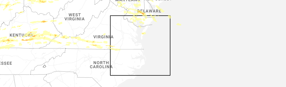
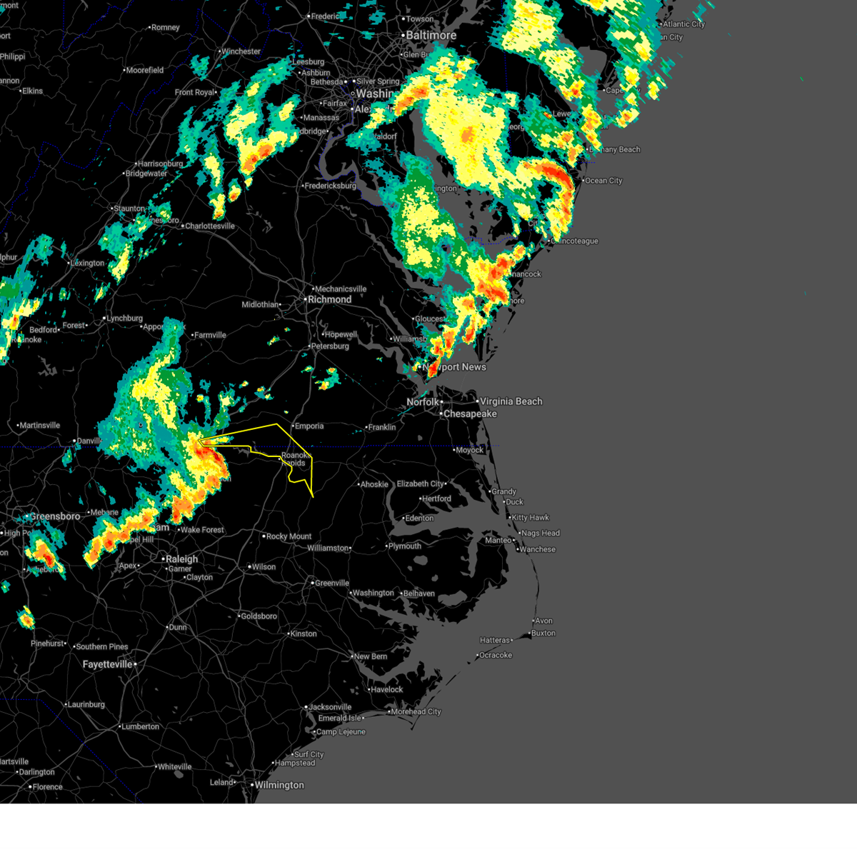
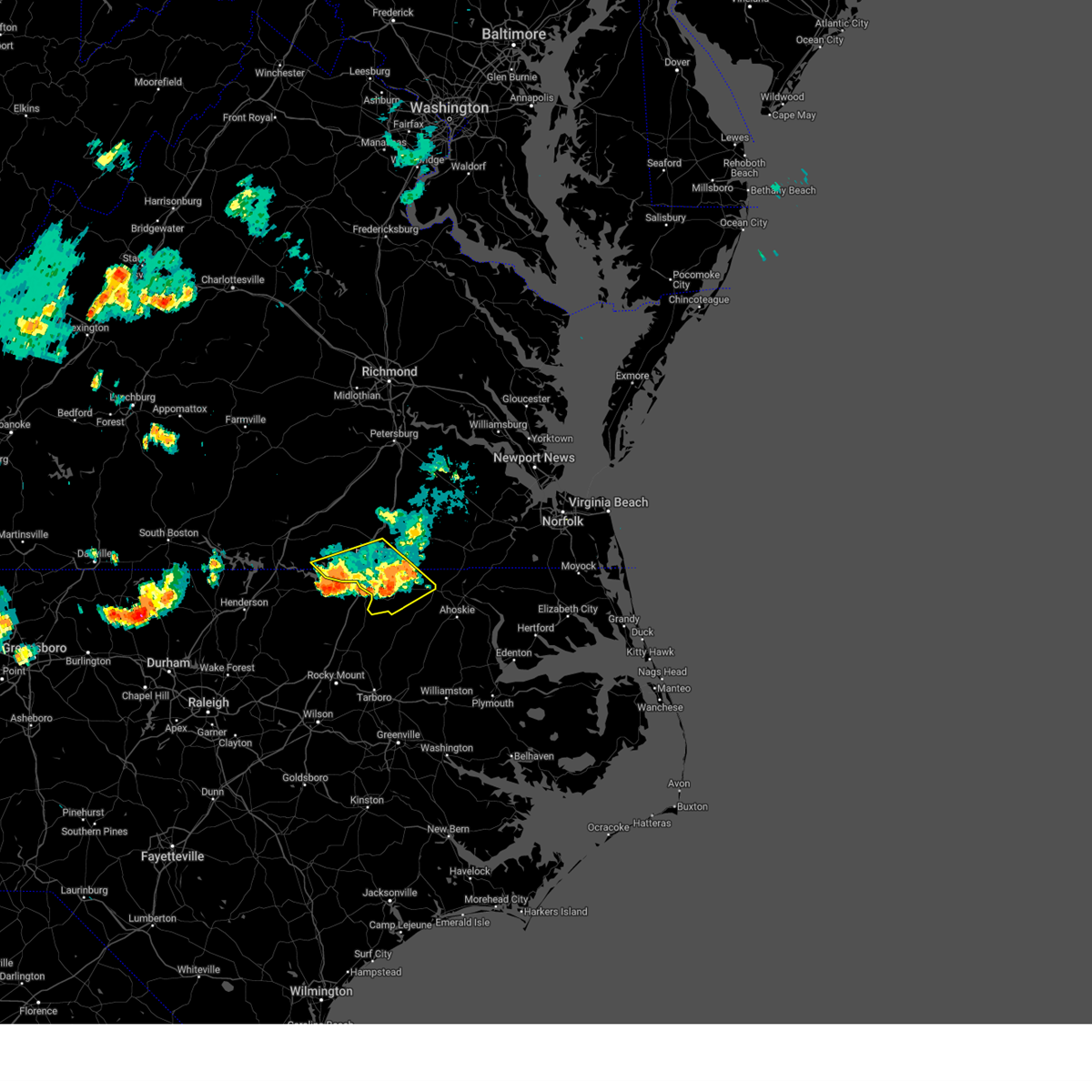
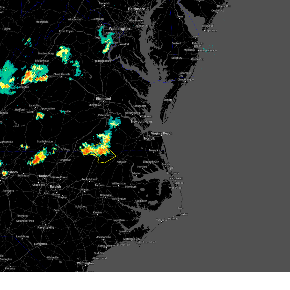
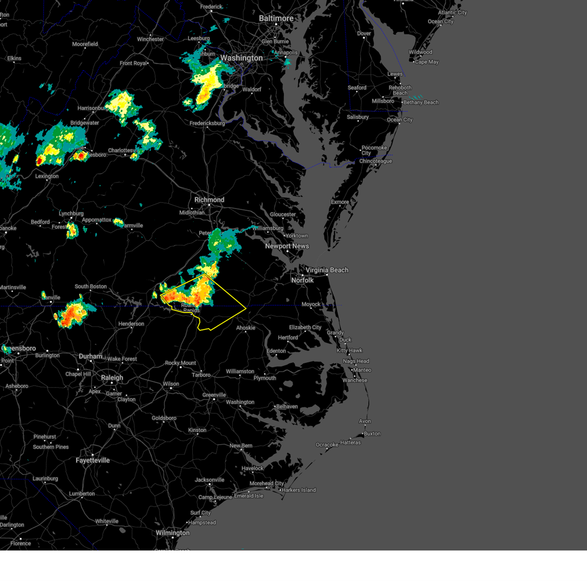
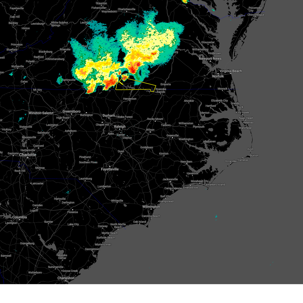
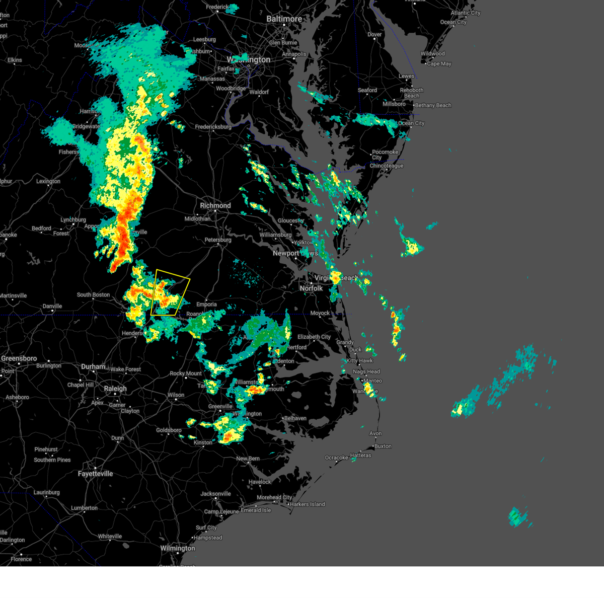
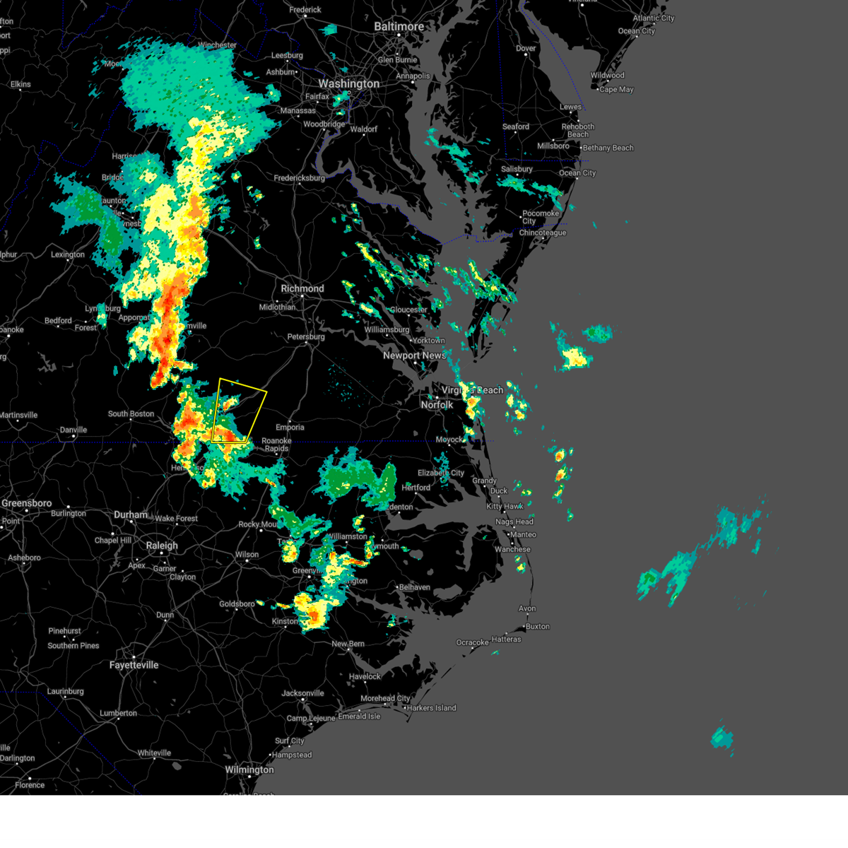
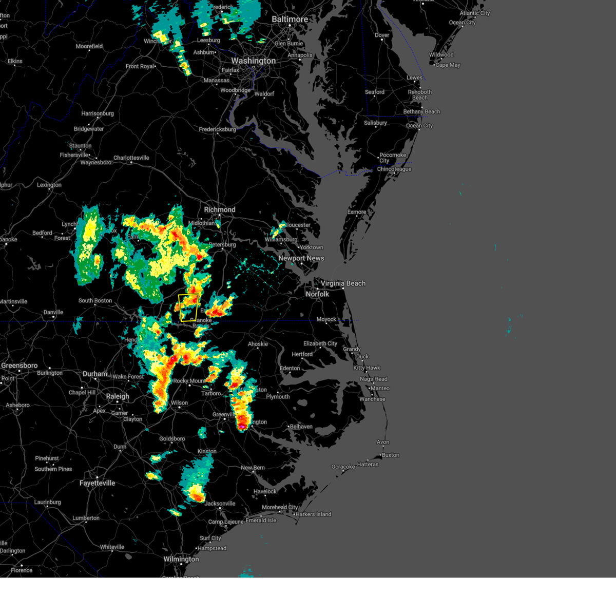
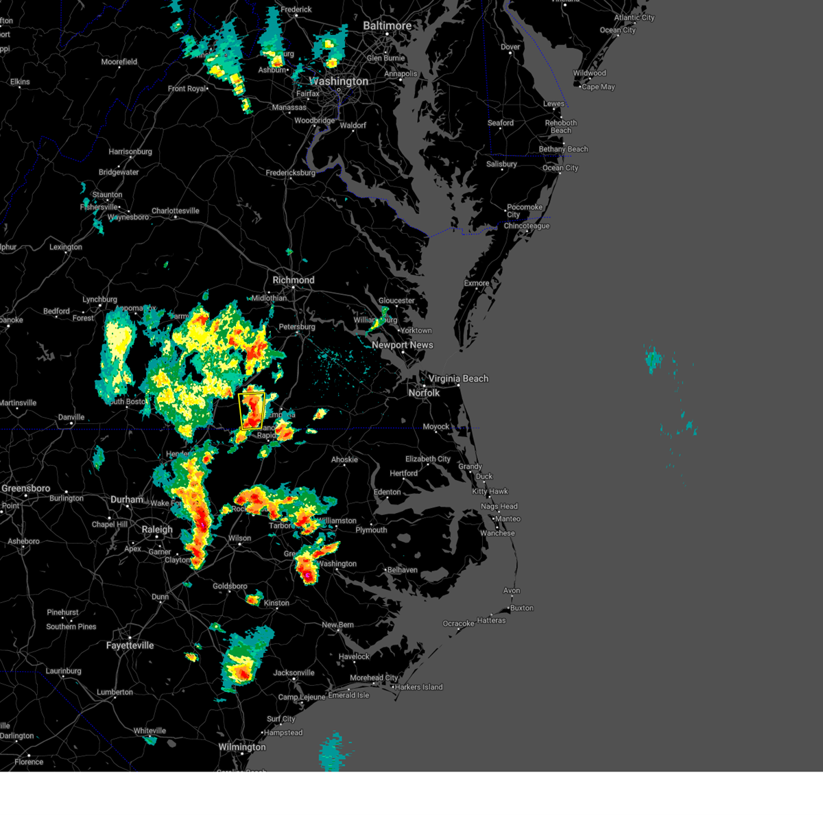
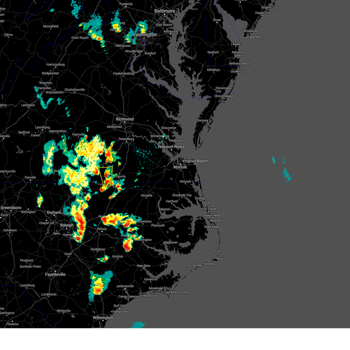
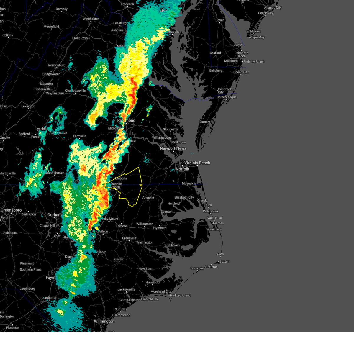
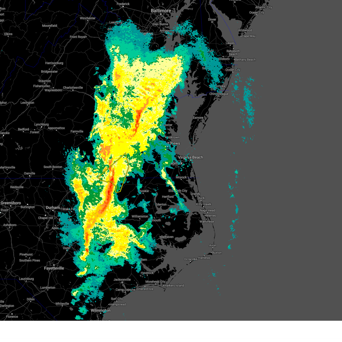
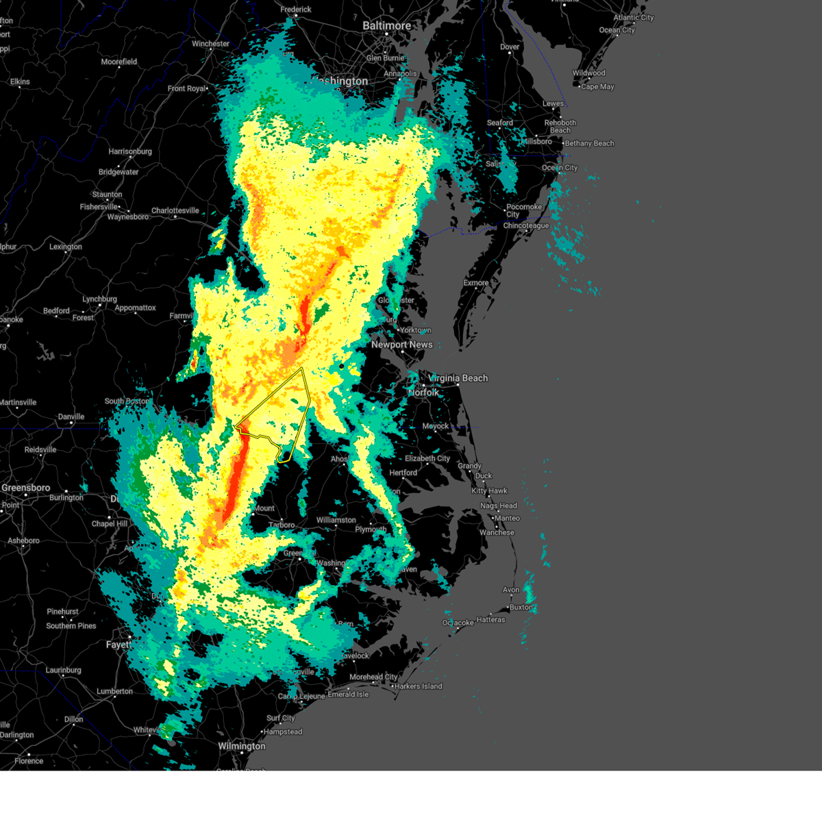
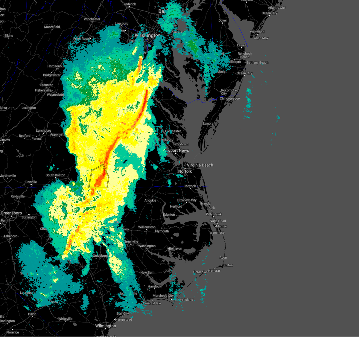
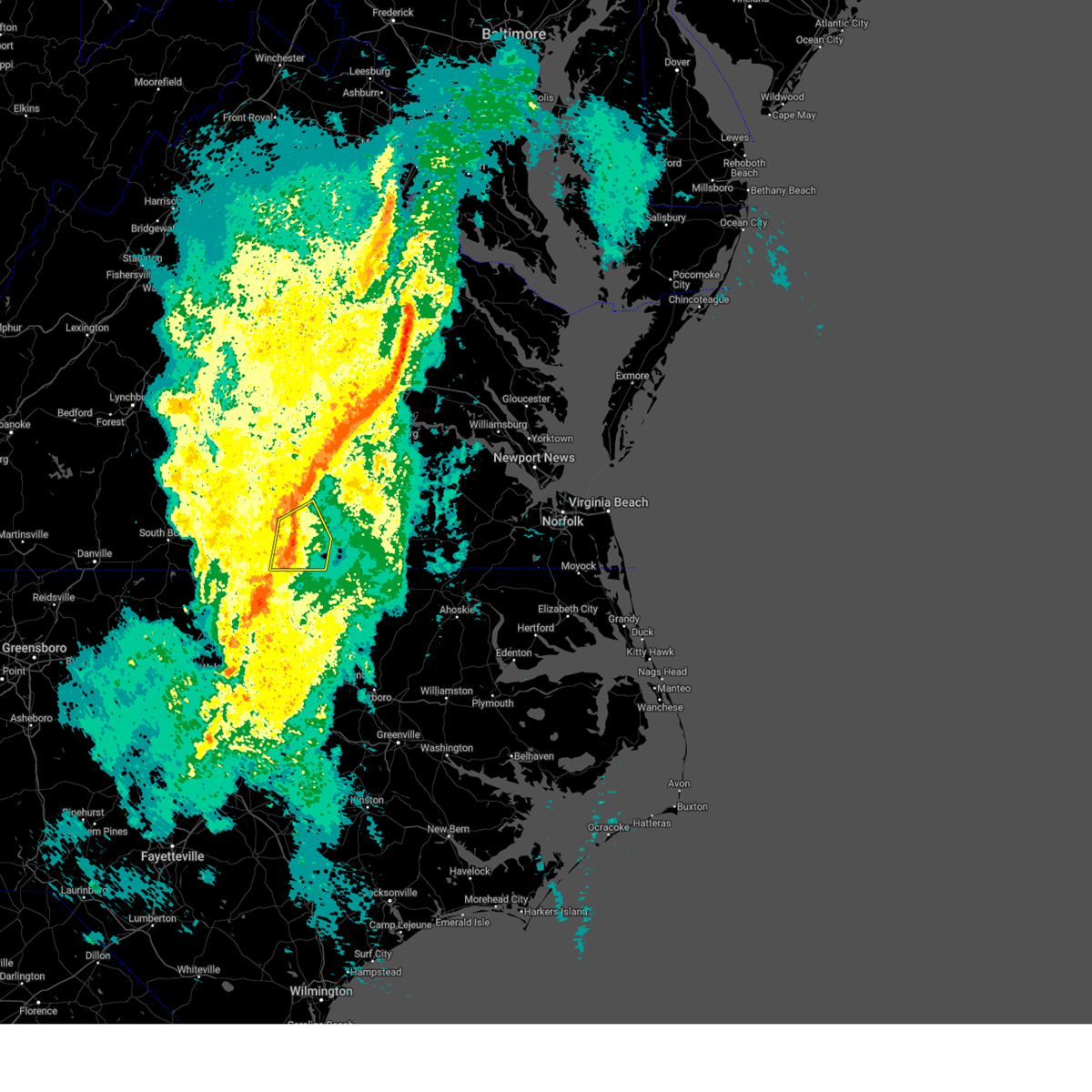
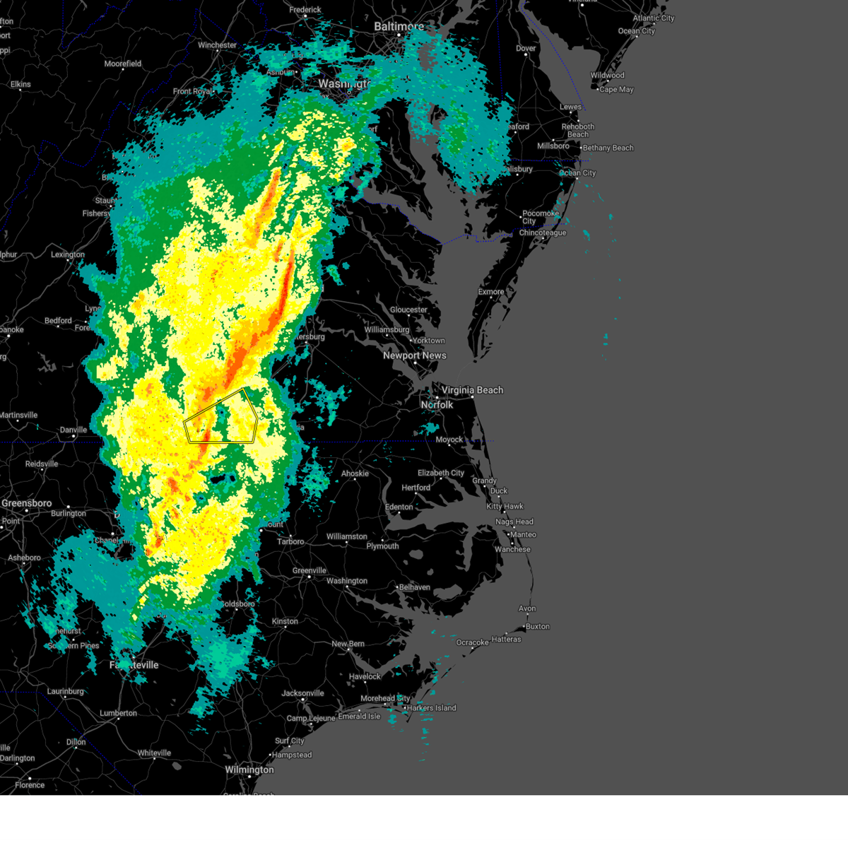
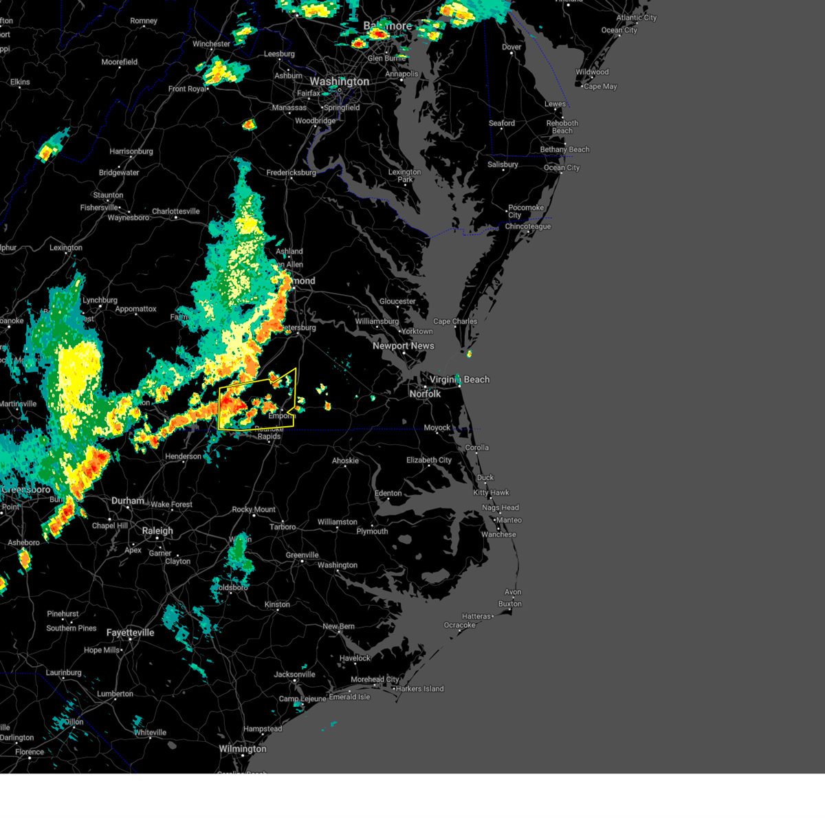
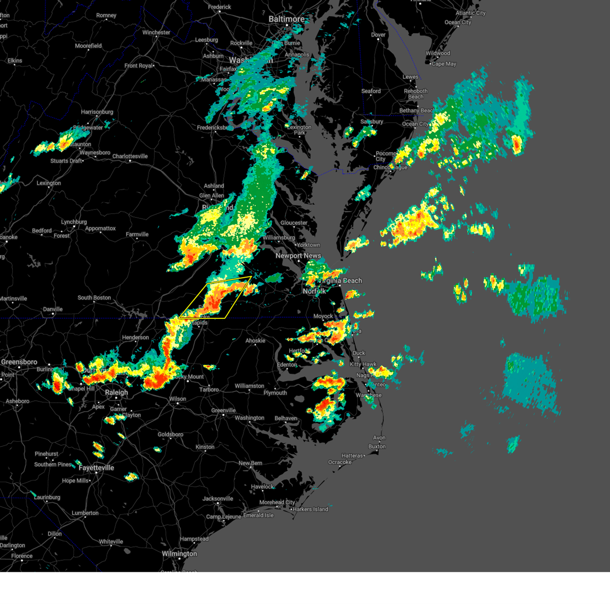
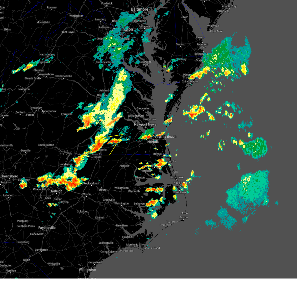
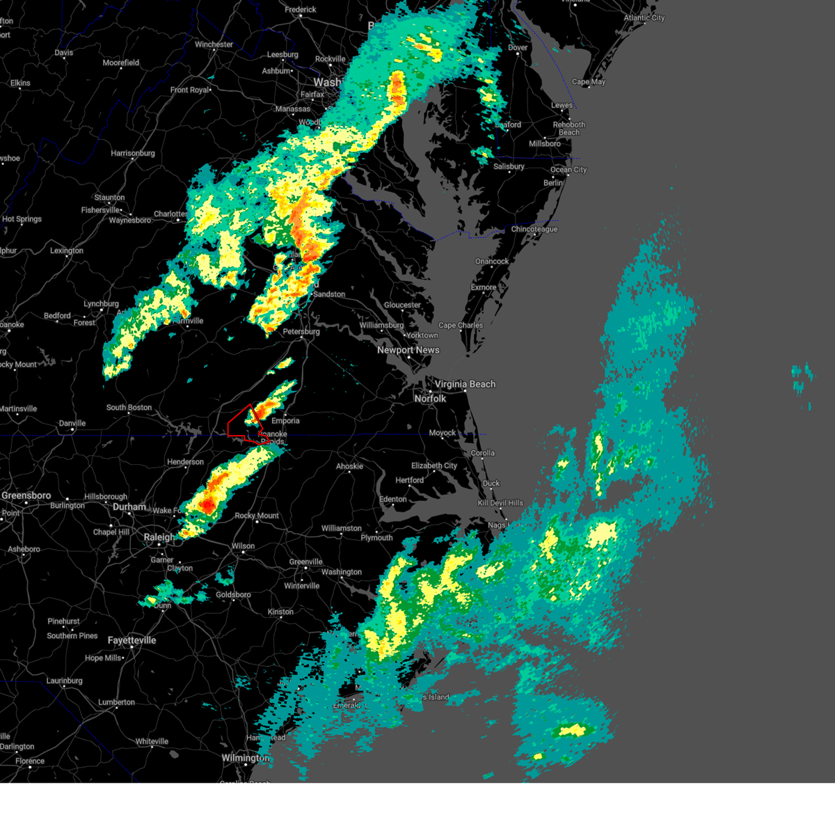
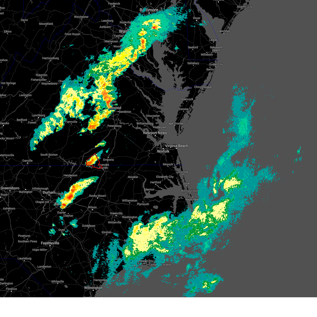
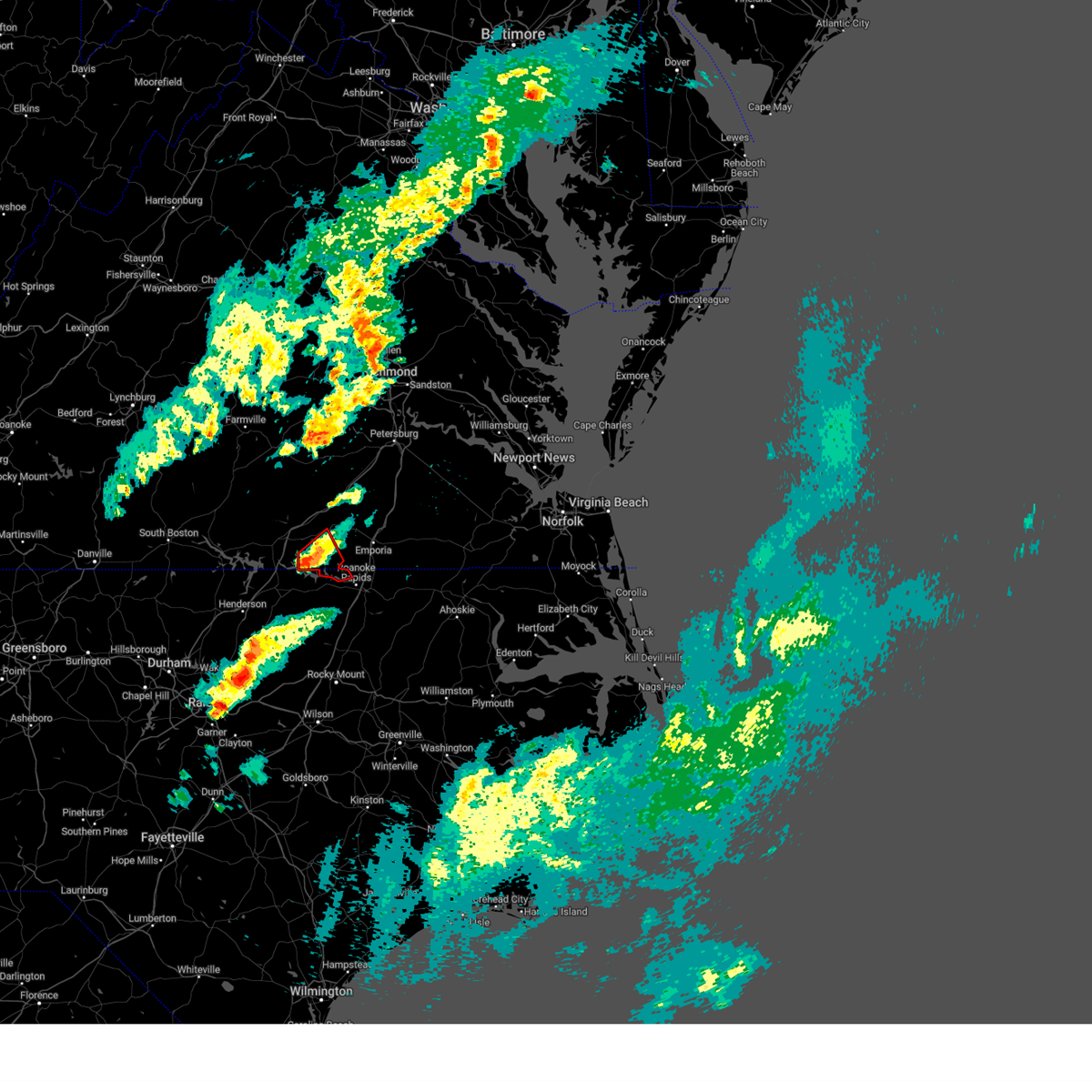
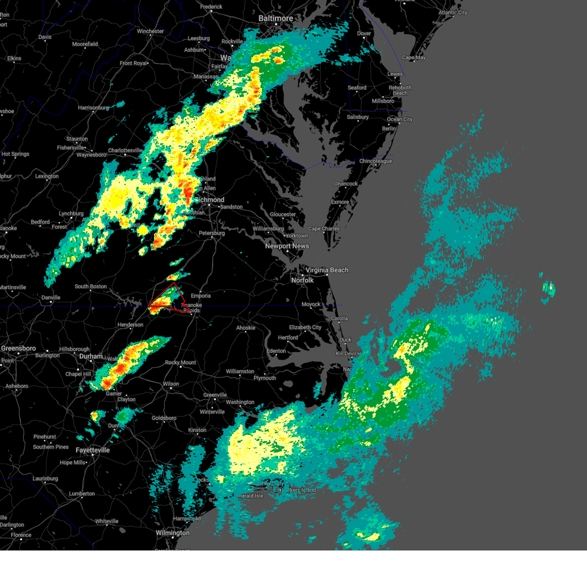
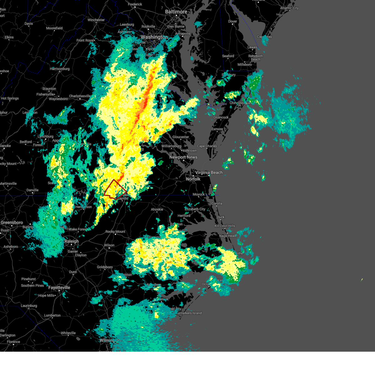
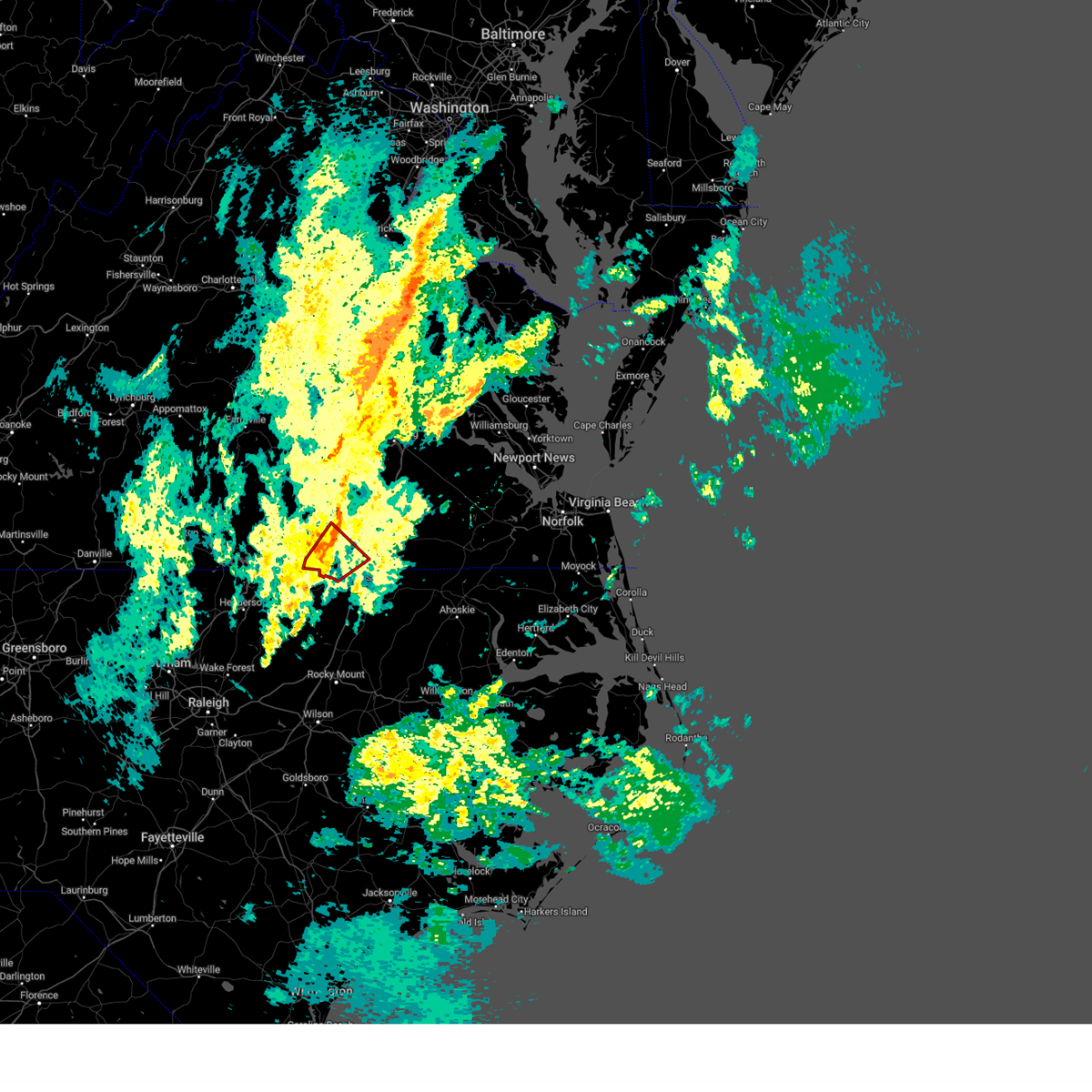
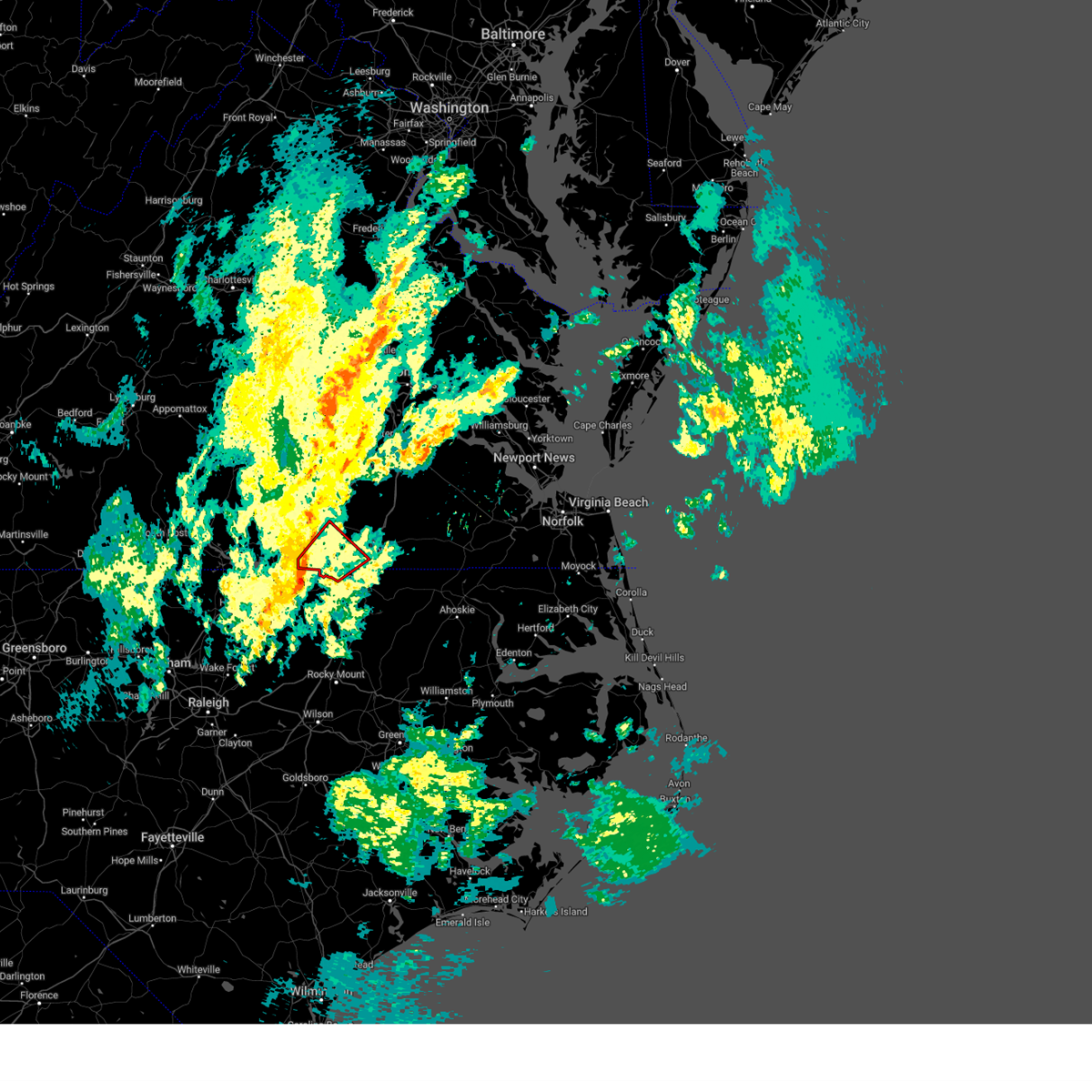
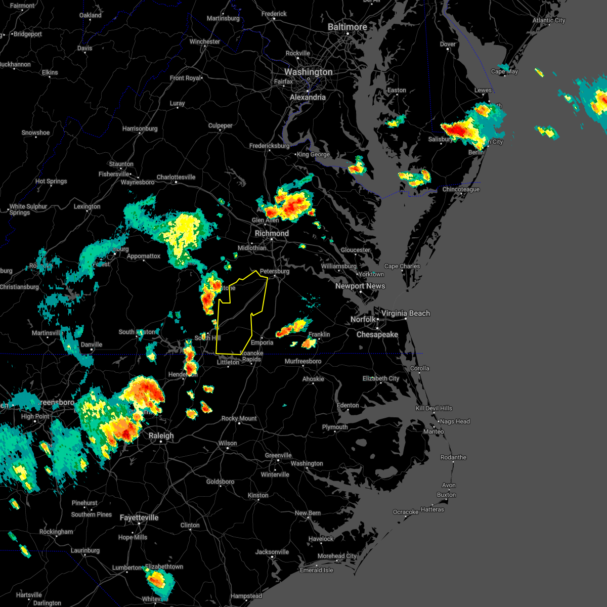
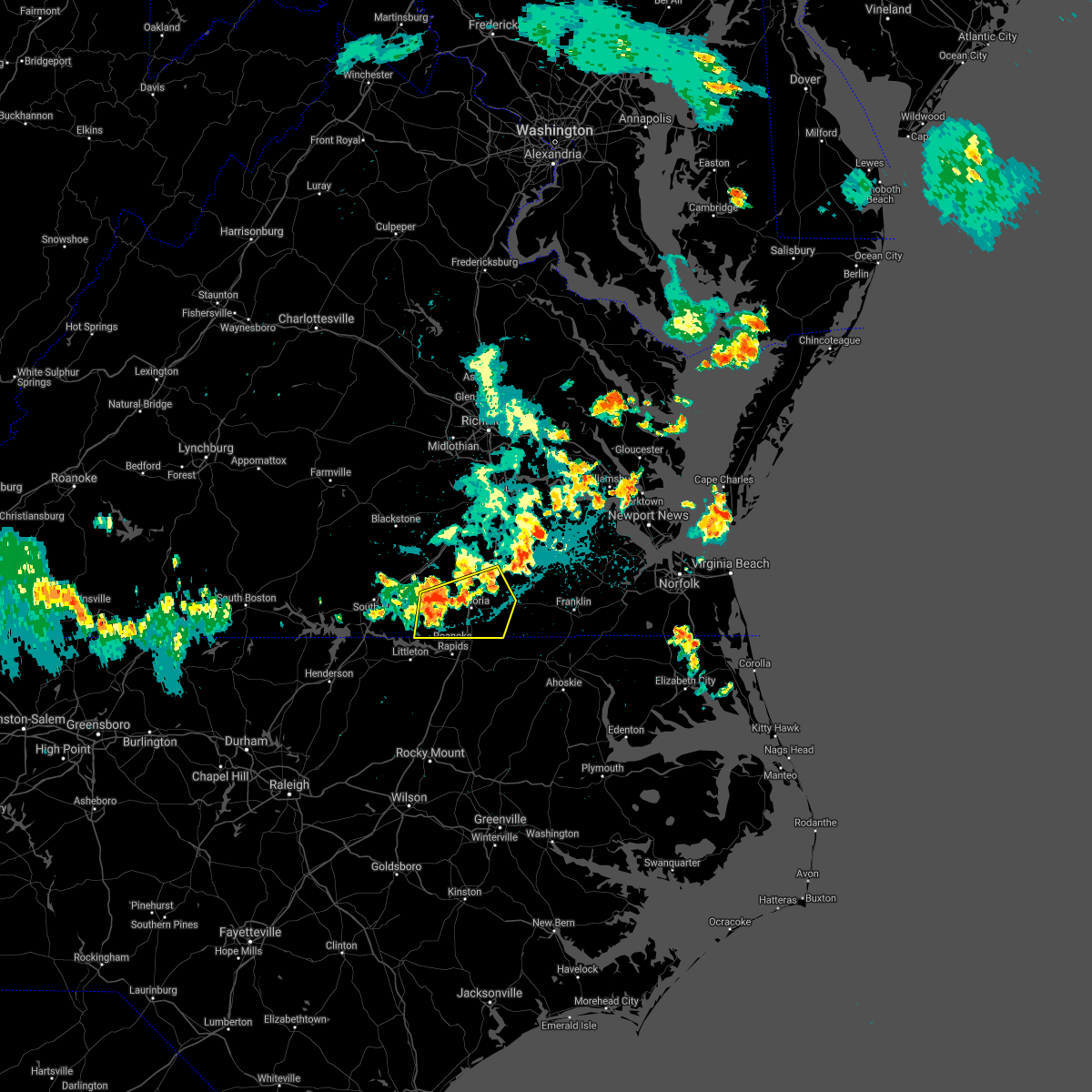
Hail Map for Gasburg, VA
The Gasburg, VA area has had 1 report of on-the-ground hail by trained spotters, and has been under severe weather warnings 30 times during the past 12 months. Doppler radar has detected hail at or near Gasburg, VA on 39 occasions, including 3 occasions during the past year.
| Name: | Gasburg, VA |
| Where Located: | 65.9 miles S of Richmond, VA |
| Map: | Google Map for Gasburg, VA |
| Population: | 481 |
| Housing Units: | 636 |
| More Info: | Search Google for Gasburg, VA |
4
The Top Recent Hail Date for Gasburg, VA is Friday, May 16, 2025 (2nd out of 39)
Hail and Wind Damage Spotted near Gasburg, VA
| Date / Time | Report Details |
|---|---|
| 6/19/2025 7:36 PM EDT |
 Svrakq the national weather service in wakefield has issued a * severe thunderstorm warning for, western northampton county in northeastern north carolina, southwestern greensville county in southeastern virginia, southeastern mecklenburg county in south central virginia, southern brunswick county in south central virginia, * until 815 pm edt. * at 736 pm edt, severe thunderstorms were located along a line extending from 7 miles northwest of norlina to near warrenton to louisburg, moving east at 55 mph (radar indicated). Hazards include 60 mph wind gusts. Expect damage to trees and powerlines. severe thunderstorms will be near, ebony around 750 pm edt. gasburg around 755 pm edt. roanoke rapids, garysburg, gaston, and barley around 805 pm edt. Other locations impacted by these severe thunderstorms include mud castle, ante, brink, gum forks, bowens corner, triplet, henrico, white plains, vultare, and valentines. Svrakq the national weather service in wakefield has issued a * severe thunderstorm warning for, western northampton county in northeastern north carolina, southwestern greensville county in southeastern virginia, southeastern mecklenburg county in south central virginia, southern brunswick county in south central virginia, * until 815 pm edt. * at 736 pm edt, severe thunderstorms were located along a line extending from 7 miles northwest of norlina to near warrenton to louisburg, moving east at 55 mph (radar indicated). Hazards include 60 mph wind gusts. Expect damage to trees and powerlines. severe thunderstorms will be near, ebony around 750 pm edt. gasburg around 755 pm edt. roanoke rapids, garysburg, gaston, and barley around 805 pm edt. Other locations impacted by these severe thunderstorms include mud castle, ante, brink, gum forks, bowens corner, triplet, henrico, white plains, vultare, and valentines.
|
| 6/6/2025 8:22 PM EDT |
 the severe thunderstorm warning has been cancelled and is no longer in effect the severe thunderstorm warning has been cancelled and is no longer in effect
|
| 6/6/2025 8:12 PM EDT |
 At 811 pm edt, severe thunderstorms were located along a line extending from 6 miles south of sussex to near seaboard to gasburg, moving southeast at 20 mph (radar indicated). Hazards include 60 mph wind gusts and penny size hail. Expect damage to trees and powerlines. these severe storms will be near, roanoke rapids, garysburg, gaston, and seaboard around 815 pm edt. conway around 840 pm edt. Other locations impacted by these severe thunderstorms include milwaukee, gum forks, lanes corner, henrico, bryants corner, jackson, slates corner, boones crossroads, pleasant grove, and creeksville. At 811 pm edt, severe thunderstorms were located along a line extending from 6 miles south of sussex to near seaboard to gasburg, moving southeast at 20 mph (radar indicated). Hazards include 60 mph wind gusts and penny size hail. Expect damage to trees and powerlines. these severe storms will be near, roanoke rapids, garysburg, gaston, and seaboard around 815 pm edt. conway around 840 pm edt. Other locations impacted by these severe thunderstorms include milwaukee, gum forks, lanes corner, henrico, bryants corner, jackson, slates corner, boones crossroads, pleasant grove, and creeksville.
|
| 6/6/2025 8:12 PM EDT |
 the severe thunderstorm warning has been cancelled and is no longer in effect the severe thunderstorm warning has been cancelled and is no longer in effect
|
| 6/6/2025 7:57 PM EDT |
 Svrakq the national weather service in wakefield has issued a * severe thunderstorm warning for, northampton county in northeastern north carolina, northwestern hertford county in northeastern north carolina, greensville county in southeastern virginia, the city of emporia in southeastern virginia, southwestern southampton county in southeastern virginia, southwestern sussex county in southeastern virginia, southern brunswick county in south central virginia, * until 845 pm edt. * at 756 pm edt, severe thunderstorms were located along a line extending from near sussex to dahlia to near gasburg, moving southeast at 20 mph (radar indicated). Hazards include 60 mph wind gusts and penny size hail. Expect damage to trees and powerlines. severe thunderstorms will be near, dahlia, gaston, claresville, green plain, barley, and gasburg around 800 pm edt. roanoke rapids and seaboard around 805 pm edt. garysburg around 810 pm edt. Other locations impacted by these severe thunderstorms include milwaukee, adams grove, grizzard, gum forks, bufford crossroads, lanes corner, bowens corner, pleasant shade, henrico, and bryants corner. Svrakq the national weather service in wakefield has issued a * severe thunderstorm warning for, northampton county in northeastern north carolina, northwestern hertford county in northeastern north carolina, greensville county in southeastern virginia, the city of emporia in southeastern virginia, southwestern southampton county in southeastern virginia, southwestern sussex county in southeastern virginia, southern brunswick county in south central virginia, * until 845 pm edt. * at 756 pm edt, severe thunderstorms were located along a line extending from near sussex to dahlia to near gasburg, moving southeast at 20 mph (radar indicated). Hazards include 60 mph wind gusts and penny size hail. Expect damage to trees and powerlines. severe thunderstorms will be near, dahlia, gaston, claresville, green plain, barley, and gasburg around 800 pm edt. roanoke rapids and seaboard around 805 pm edt. garysburg around 810 pm edt. Other locations impacted by these severe thunderstorms include milwaukee, adams grove, grizzard, gum forks, bufford crossroads, lanes corner, bowens corner, pleasant shade, henrico, and bryants corner.
|
| 5/16/2025 6:28 PM EDT | An estimated 50-75 trees down near henrico in northampton nc. powerlines also down. time estimate in northampton county NC, 3.3 miles NW of Gasburg, VA |
| 5/16/2025 6:13 PM EDT | Svrakq the national weather service in wakefield has issued a * severe thunderstorm warning for, northampton county in northeastern north carolina, northwestern hertford county in northeastern north carolina, southern greensville county in southeastern virginia, southeastern mecklenburg county in south central virginia, southwestern southampton county in southeastern virginia, southern brunswick county in south central virginia, * until 700 pm edt. * at 612 pm edt, severe thunderstorms were located along a line extending from near ebony to near gasburg to near warrenton, moving east to southeast at 60 mph (radar indicated). Hazards include 60 mph wind gusts and half dollar size hail. Minor damage to vehicles is possible. expect wind damage to trees and powerlines. severe thunderstorms will be near, brunswick and gasburg around 615 pm edt. roanoke rapids, gaston, and barley around 625 pm edt. garysburg around 630 pm edt. dahlia and seaboard around 635 pm edt. rich square, conway, and woodland around 650 pm edt. Other locations impacted by these severe thunderstorms include eagletown, milwaukee, gum forks, menola, bowens corner, henrico, bryants corner, jackson, slates corner, and bryantown. |
| 5/16/2025 5:31 PM EDT |
 Svrakq the national weather service in wakefield has issued a * severe thunderstorm warning for, northwestern northampton county in northeastern north carolina, mecklenburg county in south central virginia, southwestern brunswick county in south central virginia, * until 615 pm edt. * at 530 pm edt, a cluster of severe thunderstorms were located along a line extending from near chase city to buffalo springs to near alton, moving east at 45 mph (radar indicated). Hazards include 60 mph wind gusts and quarter size hail. Minor damage to vehicles is possible. expect wind damage to trees and powerlines. severe thunderstorms will be near, clarksville and boydton around 535 pm edt. ebony around 605 pm edt. Other locations impacted by these severe thunderstorms include nelson, beechwood, bowens corner, henrico, john h kerr dam, finchley, white plains, valentines, skipwith, and rogers corner. Svrakq the national weather service in wakefield has issued a * severe thunderstorm warning for, northwestern northampton county in northeastern north carolina, mecklenburg county in south central virginia, southwestern brunswick county in south central virginia, * until 615 pm edt. * at 530 pm edt, a cluster of severe thunderstorms were located along a line extending from near chase city to buffalo springs to near alton, moving east at 45 mph (radar indicated). Hazards include 60 mph wind gusts and quarter size hail. Minor damage to vehicles is possible. expect wind damage to trees and powerlines. severe thunderstorms will be near, clarksville and boydton around 535 pm edt. ebony around 605 pm edt. Other locations impacted by these severe thunderstorms include nelson, beechwood, bowens corner, henrico, john h kerr dam, finchley, white plains, valentines, skipwith, and rogers corner.
|
| 5/13/2025 9:10 PM EDT |
 the severe thunderstorm warning has been cancelled and is no longer in effect the severe thunderstorm warning has been cancelled and is no longer in effect
|
| 5/13/2025 8:54 PM EDT |
 Svrakq the national weather service in wakefield has issued a * severe thunderstorm warning for, southeastern mecklenburg county in south central virginia, southeastern lunenburg county in south central virginia, northwestern brunswick county in south central virginia, * until 945 pm edt. * at 853 pm edt, a severe thunderstorm was located near ebony, or near brodnax, moving north at 30 mph (radar indicated). Hazards include 60 mph wind gusts. Expect damage to trees and powerlines. this severe thunderstorm will be near, brodnax and la crosse around 900 pm edt. alberta around 925 pm edt. Other locations impacted by this severe thunderstorm include bacons fork, cochran, gills corner, dolphin, barrows store, bowens corner, white plains, meredithville, forksville, and lafoon corner. Svrakq the national weather service in wakefield has issued a * severe thunderstorm warning for, southeastern mecklenburg county in south central virginia, southeastern lunenburg county in south central virginia, northwestern brunswick county in south central virginia, * until 945 pm edt. * at 853 pm edt, a severe thunderstorm was located near ebony, or near brodnax, moving north at 30 mph (radar indicated). Hazards include 60 mph wind gusts. Expect damage to trees and powerlines. this severe thunderstorm will be near, brodnax and la crosse around 900 pm edt. alberta around 925 pm edt. Other locations impacted by this severe thunderstorm include bacons fork, cochran, gills corner, dolphin, barrows store, bowens corner, white plains, meredithville, forksville, and lafoon corner.
|
| 5/5/2025 3:51 PM EDT |
 The storm which prompted the warning has weakened below severe limits, and no longer poses an immediate threat to life or property. therefore, the warning will be allowed to expire. a severe thunderstorm watch remains in effect until 900 pm edt for northeastern north carolina, and south central and southeastern virginia. The storm which prompted the warning has weakened below severe limits, and no longer poses an immediate threat to life or property. therefore, the warning will be allowed to expire. a severe thunderstorm watch remains in effect until 900 pm edt for northeastern north carolina, and south central and southeastern virginia.
|
| 5/5/2025 3:29 PM EDT |
 the severe thunderstorm warning has been cancelled and is no longer in effect the severe thunderstorm warning has been cancelled and is no longer in effect
|
| 5/5/2025 3:29 PM EDT |
 At 329 pm edt, a severe thunderstorm was located near brunswick, or 9 miles south of lawrenceville, moving north at 20 mph (radar indicated). Hazards include 60 mph wind gusts and quarter size hail. Minor damage to vehicles is possible. expect wind damage to trees and powerlines. this severe storm will be near, brunswick around 335 pm edt. lawrenceville around 345 pm edt. Other locations impacted by this severe thunderstorm include ante, valentines, triplet, edgerton, and lake gaston. At 329 pm edt, a severe thunderstorm was located near brunswick, or 9 miles south of lawrenceville, moving north at 20 mph (radar indicated). Hazards include 60 mph wind gusts and quarter size hail. Minor damage to vehicles is possible. expect wind damage to trees and powerlines. this severe storm will be near, brunswick around 335 pm edt. lawrenceville around 345 pm edt. Other locations impacted by this severe thunderstorm include ante, valentines, triplet, edgerton, and lake gaston.
|
| 5/5/2025 3:10 PM EDT |
 Svrakq the national weather service in wakefield has issued a * severe thunderstorm warning for, northwestern northampton county in northeastern north carolina, southwestern greensville county in southeastern virginia, southern brunswick county in south central virginia, * until 400 pm edt. * at 310 pm edt, a severe thunderstorm was located near gasburg, or 9 miles northwest of roanoke rapids, moving north at 20 mph (radar indicated). Hazards include 60 mph wind gusts and quarter size hail. Minor damage to vehicles is possible. expect wind damage to trees and powerlines. this severe thunderstorm will be near, gasburg around 320 pm edt. brunswick around 330 pm edt. Other locations impacted by this severe thunderstorm include ante, triplet, edgerton, roanoke rapids lake, henrico, white plains, vultare, valentines, and lake gaston. Svrakq the national weather service in wakefield has issued a * severe thunderstorm warning for, northwestern northampton county in northeastern north carolina, southwestern greensville county in southeastern virginia, southern brunswick county in south central virginia, * until 400 pm edt. * at 310 pm edt, a severe thunderstorm was located near gasburg, or 9 miles northwest of roanoke rapids, moving north at 20 mph (radar indicated). Hazards include 60 mph wind gusts and quarter size hail. Minor damage to vehicles is possible. expect wind damage to trees and powerlines. this severe thunderstorm will be near, gasburg around 320 pm edt. brunswick around 330 pm edt. Other locations impacted by this severe thunderstorm include ante, triplet, edgerton, roanoke rapids lake, henrico, white plains, vultare, valentines, and lake gaston.
|
| 3/31/2025 8:11 PM EDT |
 Svrakq the national weather service in wakefield has issued a * severe thunderstorm warning for, northampton county in northeastern north carolina, southern greensville county in southeastern virginia, the city of emporia in southeastern virginia, southwestern southampton county in southeastern virginia, south central brunswick county in south central virginia, * until 900 pm edt. * at 811 pm edt, severe thunderstorms were located along a line extending from 6 miles east of littleton to 9 miles west of halifax to 9 miles north of dortches, moving east at 50 mph (radar indicated). Hazards include 60 mph wind gusts. Expect damage to trees and powerlines. severe thunderstorms will be near, gaston and roanoke rapids around 815 pm edt. garysburg around 820 pm edt. dahlia around 825 pm edt. seaboard around 830 pm edt. claresville around 835 pm edt. woodland, conway, boykins, and rich square around 845 pm edt. newsoms around 855 pm edt. Other locations impacted by these severe thunderstorms include eagletown, milwaukee, adams grove, gum forks, lanes corner, henrico, bryants corner, jackson, slates corner, and worrell. Svrakq the national weather service in wakefield has issued a * severe thunderstorm warning for, northampton county in northeastern north carolina, southern greensville county in southeastern virginia, the city of emporia in southeastern virginia, southwestern southampton county in southeastern virginia, south central brunswick county in south central virginia, * until 900 pm edt. * at 811 pm edt, severe thunderstorms were located along a line extending from 6 miles east of littleton to 9 miles west of halifax to 9 miles north of dortches, moving east at 50 mph (radar indicated). Hazards include 60 mph wind gusts. Expect damage to trees and powerlines. severe thunderstorms will be near, gaston and roanoke rapids around 815 pm edt. garysburg around 820 pm edt. dahlia around 825 pm edt. seaboard around 830 pm edt. claresville around 835 pm edt. woodland, conway, boykins, and rich square around 845 pm edt. newsoms around 855 pm edt. Other locations impacted by these severe thunderstorms include eagletown, milwaukee, adams grove, gum forks, lanes corner, henrico, bryants corner, jackson, slates corner, and worrell.
|
| 3/5/2025 2:21 PM EST |
 At 221 pm est, severe thunderstorms were located along a line extending from near purdy to near dahlia to near garysburg, moving east at 40 mph (radar indicated). Hazards include 60 mph wind gusts. Expect damage to trees and powerlines. these severe storms will be near, jarratt, claresville, green plain, seaboard, emporia, and garysburg around 225 pm est. Other locations impacted by these severe thunderstorms include adams grove, grizzard, gum forks, bufford crossroads, lanes corner, pleasant shade, henrico, bryants corner, slates corner, and emporia reservoir. At 221 pm est, severe thunderstorms were located along a line extending from near purdy to near dahlia to near garysburg, moving east at 40 mph (radar indicated). Hazards include 60 mph wind gusts. Expect damage to trees and powerlines. these severe storms will be near, jarratt, claresville, green plain, seaboard, emporia, and garysburg around 225 pm est. Other locations impacted by these severe thunderstorms include adams grove, grizzard, gum forks, bufford crossroads, lanes corner, pleasant shade, henrico, bryants corner, slates corner, and emporia reservoir.
|
| 3/5/2025 1:55 PM EST |
 Svrakq the national weather service in wakefield has issued a * severe thunderstorm warning for, northwestern northampton county in northeastern north carolina, greensville county in southeastern virginia, the city of emporia in southeastern virginia, southwestern southampton county in southeastern virginia, southwestern sussex county in southeastern virginia, southeastern brunswick county in south central virginia, * until 245 pm est. * at 154 pm est, severe thunderstorms were located along a line extending from near gasburg to near littleton to 12 miles north of dortches, moving northeast at 50 mph (radar indicated). Hazards include 60 mph wind gusts. Expect damage to trees and powerlines. severe thunderstorms will be near, barley around 200 pm est. gaston and roanoke rapids around 205 pm est. dahlia, radium, emporia, and garysburg around 215 pm est. jarratt, claresville, and green plain around 225 pm est. seaboard around 230 pm est. Other locations impacted by these severe thunderstorms include adams grove, grizzard, gum forks, bufford crossroads, lanes corner, pleasant shade, henrico, bryants corner, slates corner, and emporia reservoir. Svrakq the national weather service in wakefield has issued a * severe thunderstorm warning for, northwestern northampton county in northeastern north carolina, greensville county in southeastern virginia, the city of emporia in southeastern virginia, southwestern southampton county in southeastern virginia, southwestern sussex county in southeastern virginia, southeastern brunswick county in south central virginia, * until 245 pm est. * at 154 pm est, severe thunderstorms were located along a line extending from near gasburg to near littleton to 12 miles north of dortches, moving northeast at 50 mph (radar indicated). Hazards include 60 mph wind gusts. Expect damage to trees and powerlines. severe thunderstorms will be near, barley around 200 pm est. gaston and roanoke rapids around 205 pm est. dahlia, radium, emporia, and garysburg around 215 pm est. jarratt, claresville, and green plain around 225 pm est. seaboard around 230 pm est. Other locations impacted by these severe thunderstorms include adams grove, grizzard, gum forks, bufford crossroads, lanes corner, pleasant shade, henrico, bryants corner, slates corner, and emporia reservoir.
|
| 3/5/2025 12:57 PM EST |
 The storms which prompted the warning have weakened below severe limits, and no longer pose an immediate threat to life or property. therefore, the warning will be allowed to expire. however, gusty winds are still possible with these thunderstorms. a tornado watch remains in effect until 800 pm est for northeastern north carolina. a severe thunderstorm watch remains in effect until 600 pm est for south central virginia. The storms which prompted the warning have weakened below severe limits, and no longer pose an immediate threat to life or property. therefore, the warning will be allowed to expire. however, gusty winds are still possible with these thunderstorms. a tornado watch remains in effect until 800 pm est for northeastern north carolina. a severe thunderstorm watch remains in effect until 600 pm est for south central virginia.
|
| 3/5/2025 12:41 PM EST |
 At 1241 pm est, severe thunderstorms were located along a line extending from near brodnax to near ebony to norlina, moving east at 30 mph (radar indicated). Hazards include 60 mph wind gusts. Expect damage to trees and powerlines. these severe storms will be near, brodnax and ebony around 1245 pm est. brunswick, gasburg, and lawrenceville around 1255 pm est. Other locations impacted by these severe thunderstorms include bacons fork, cochran, gills corner, bracey, bowens corner, white plains, meredithville, forksville, prices mill, and beechwood. At 1241 pm est, severe thunderstorms were located along a line extending from near brodnax to near ebony to norlina, moving east at 30 mph (radar indicated). Hazards include 60 mph wind gusts. Expect damage to trees and powerlines. these severe storms will be near, brodnax and ebony around 1245 pm est. brunswick, gasburg, and lawrenceville around 1255 pm est. Other locations impacted by these severe thunderstorms include bacons fork, cochran, gills corner, bracey, bowens corner, white plains, meredithville, forksville, prices mill, and beechwood.
|
| 3/5/2025 12:17 PM EST |
 Svrakq the national weather service in wakefield has issued a * severe thunderstorm warning for, southeastern mecklenburg county in south central virginia, southeastern lunenburg county in south central virginia, southwestern brunswick county in south central virginia, * until 100 pm est. * at 1217 pm est, severe thunderstorms were located along a line extending from near boydton to 6 miles northwest of norlina to near henderson, moving northeast at 35 mph (radar indicated). Hazards include 60 mph wind gusts. Expect damage to trees and powerlines. severe thunderstorms will be near, south hill around 1225 pm est. la crosse around 1230 pm est. brodnax around 1235 pm est. ebony around 1240 pm est. brunswick and gasburg around 1250 pm est. Other locations impacted by these severe thunderstorms include bacons fork, cochran, gills corner, beechwood, bowens corner, john h kerr dam, white plains, meredithville, forksville, and bracey. Svrakq the national weather service in wakefield has issued a * severe thunderstorm warning for, southeastern mecklenburg county in south central virginia, southeastern lunenburg county in south central virginia, southwestern brunswick county in south central virginia, * until 100 pm est. * at 1217 pm est, severe thunderstorms were located along a line extending from near boydton to 6 miles northwest of norlina to near henderson, moving northeast at 35 mph (radar indicated). Hazards include 60 mph wind gusts. Expect damage to trees and powerlines. severe thunderstorms will be near, south hill around 1225 pm est. la crosse around 1230 pm est. brodnax around 1235 pm est. ebony around 1240 pm est. brunswick and gasburg around 1250 pm est. Other locations impacted by these severe thunderstorms include bacons fork, cochran, gills corner, beechwood, bowens corner, john h kerr dam, white plains, meredithville, forksville, and bracey.
|
| 8/19/2024 5:39 PM EDT |
 Svrakq the national weather service in wakefield has issued a * severe thunderstorm warning for, northwestern northampton county in northeastern north carolina, southwestern greensville county in southeastern virginia, the city of emporia in southeastern virginia, southeastern brunswick county in south central virginia, * until 630 pm edt. * at 539 pm edt, severe thunderstorms were located along a line extending from near brunswick to near gasburg to near littleton, moving east at 15 mph (radar indicated). Hazards include 60 mph wind gusts. Expect damage to trees and powerlines. severe thunderstorms will be near, barley around 545 pm edt. gaston around 605 pm edt. Other locations impacted by these severe thunderstorms include ante, brink, gum forks, triplet, lanes corner, henrico, vultare, valentines, slates corner, and emporia reservoir. Svrakq the national weather service in wakefield has issued a * severe thunderstorm warning for, northwestern northampton county in northeastern north carolina, southwestern greensville county in southeastern virginia, the city of emporia in southeastern virginia, southeastern brunswick county in south central virginia, * until 630 pm edt. * at 539 pm edt, severe thunderstorms were located along a line extending from near brunswick to near gasburg to near littleton, moving east at 15 mph (radar indicated). Hazards include 60 mph wind gusts. Expect damage to trees and powerlines. severe thunderstorms will be near, barley around 545 pm edt. gaston around 605 pm edt. Other locations impacted by these severe thunderstorms include ante, brink, gum forks, triplet, lanes corner, henrico, vultare, valentines, slates corner, and emporia reservoir.
|
| 8/3/2024 4:48 PM EDT |
 Svrakq the national weather service in wakefield has issued a * severe thunderstorm warning for, west central greensville county in southeastern virginia, southeastern mecklenburg county in south central virginia, southern brunswick county in south central virginia, * until 515 pm edt. * at 448 pm edt, a severe thunderstorm was located near brunswick, or near brodnax, moving northeast at 35 mph (radar indicated). Hazards include 60 mph wind gusts. Expect damage to trees and powerlines. this severe thunderstorm will be near, lawrenceville and brunswick around 455 pm edt. Other locations impacted by this severe thunderstorm include ante, bufford crossroads, triplet, bowens corner, pleasant shade, durand, white plains, valentines, and lake gaston. Svrakq the national weather service in wakefield has issued a * severe thunderstorm warning for, west central greensville county in southeastern virginia, southeastern mecklenburg county in south central virginia, southern brunswick county in south central virginia, * until 515 pm edt. * at 448 pm edt, a severe thunderstorm was located near brunswick, or near brodnax, moving northeast at 35 mph (radar indicated). Hazards include 60 mph wind gusts. Expect damage to trees and powerlines. this severe thunderstorm will be near, lawrenceville and brunswick around 455 pm edt. Other locations impacted by this severe thunderstorm include ante, bufford crossroads, triplet, bowens corner, pleasant shade, durand, white plains, valentines, and lake gaston.
|
| 8/3/2024 4:09 PM EDT |
 Svrakq the national weather service in wakefield has issued a * severe thunderstorm warning for, southeastern mecklenburg county in south central virginia, southeastern lunenburg county in south central virginia, southwestern dinwiddie county in south central virginia, brunswick county in south central virginia, * until 445 pm edt. * at 408 pm edt, severe thunderstorms were located along a line extending from near dundas to 7 miles north of norlina, moving east at 35 mph (radar indicated). Hazards include 60 mph wind gusts and nickel size hail. Expect damage to trees and powerlines. severe thunderstorms will be near, brodnax, la crosse, and alberta around 415 pm edt. lawrenceville and ebony around 420 pm edt. mckenney, brunswick, and gasburg around 430 pm edt. Other locations impacted by these severe thunderstorms include bacons fork, cochran, beechwood, gills corner, rawlings, triplet, dolphin, barrows store, bowens corner, and white plains. Svrakq the national weather service in wakefield has issued a * severe thunderstorm warning for, southeastern mecklenburg county in south central virginia, southeastern lunenburg county in south central virginia, southwestern dinwiddie county in south central virginia, brunswick county in south central virginia, * until 445 pm edt. * at 408 pm edt, severe thunderstorms were located along a line extending from near dundas to 7 miles north of norlina, moving east at 35 mph (radar indicated). Hazards include 60 mph wind gusts and nickel size hail. Expect damage to trees and powerlines. severe thunderstorms will be near, brodnax, la crosse, and alberta around 415 pm edt. lawrenceville and ebony around 420 pm edt. mckenney, brunswick, and gasburg around 430 pm edt. Other locations impacted by these severe thunderstorms include bacons fork, cochran, beechwood, gills corner, rawlings, triplet, dolphin, barrows store, bowens corner, and white plains.
|
| 8/2/2024 6:51 PM EDT |
 Svrakq the national weather service in wakefield has issued a * severe thunderstorm warning for, greensville county in southeastern virginia, southeastern mecklenburg county in south central virginia, southeastern lunenburg county in south central virginia, the city of emporia in southeastern virginia, southwestern sussex county in southeastern virginia, brunswick county in south central virginia, * until 730 pm edt. * at 651 pm edt, a severe thunderstorm was located near brodnax, moving east at 35 mph (radar indicated). Hazards include 60 mph wind gusts and penny size hail. Expect damage to trees and powerlines. this severe thunderstorm will be near, lawrenceville around 655 pm edt. purdy around 720 pm edt. Other locations impacted by this severe thunderstorm include cochran, grizzard, bufford crossroads, lanes corner, dolphin, bowens corner, pleasant shade, slates corner, emporia reservoir, and meredithville. Svrakq the national weather service in wakefield has issued a * severe thunderstorm warning for, greensville county in southeastern virginia, southeastern mecklenburg county in south central virginia, southeastern lunenburg county in south central virginia, the city of emporia in southeastern virginia, southwestern sussex county in southeastern virginia, brunswick county in south central virginia, * until 730 pm edt. * at 651 pm edt, a severe thunderstorm was located near brodnax, moving east at 35 mph (radar indicated). Hazards include 60 mph wind gusts and penny size hail. Expect damage to trees and powerlines. this severe thunderstorm will be near, lawrenceville around 655 pm edt. purdy around 720 pm edt. Other locations impacted by this severe thunderstorm include cochran, grizzard, bufford crossroads, lanes corner, dolphin, bowens corner, pleasant shade, slates corner, emporia reservoir, and meredithville.
|
| 7/24/2024 8:43 PM EDT |
 The storm which prompted the warning has weakened below severe limits, and no longer poses an immediate threat to life or property. therefore, the warning will be allowed to expire. The storm which prompted the warning has weakened below severe limits, and no longer poses an immediate threat to life or property. therefore, the warning will be allowed to expire.
|
| 7/24/2024 8:28 PM EDT |
 the severe thunderstorm warning has been cancelled and is no longer in effect the severe thunderstorm warning has been cancelled and is no longer in effect
|
| 7/24/2024 8:28 PM EDT |
 At 828 pm edt, a severe thunderstorm was located near lawrenceville, moving east at 25 mph (radar indicated). Hazards include 60 mph wind gusts. Expect damage to trees and powerlines. this severe storm will be near, lawrenceville around 835 pm edt. Other locations impacted by this severe thunderstorm include cochran, beechwood, rawlings, dolphin, bowens corner, henrico, white plains, valentines, warfield, and meredithville. At 828 pm edt, a severe thunderstorm was located near lawrenceville, moving east at 25 mph (radar indicated). Hazards include 60 mph wind gusts. Expect damage to trees and powerlines. this severe storm will be near, lawrenceville around 835 pm edt. Other locations impacted by this severe thunderstorm include cochran, beechwood, rawlings, dolphin, bowens corner, henrico, white plains, valentines, warfield, and meredithville.
|
| 7/24/2024 8:11 PM EDT |
 At 810 pm edt, a severe thunderstorm was located near brodnax, moving east at 25 mph (radar indicated). Hazards include 60 mph wind gusts. Expect damage to trees and powerlines. this severe storm will be near, brodnax around 815 pm edt. lawrenceville around 830 pm edt. Other locations impacted by this severe thunderstorm include bacons fork, cochran, beechwood, gills corner, rawlings, dolphin, barrows store, bowens corner, henrico, and white plains. At 810 pm edt, a severe thunderstorm was located near brodnax, moving east at 25 mph (radar indicated). Hazards include 60 mph wind gusts. Expect damage to trees and powerlines. this severe storm will be near, brodnax around 815 pm edt. lawrenceville around 830 pm edt. Other locations impacted by this severe thunderstorm include bacons fork, cochran, beechwood, gills corner, rawlings, dolphin, barrows store, bowens corner, henrico, and white plains.
|
| 7/24/2024 7:44 PM EDT |
 Svrakq the national weather service in wakefield has issued a * severe thunderstorm warning for, northwestern northampton county in northeastern north carolina, eastern mecklenburg county in south central virginia, southeastern lunenburg county in south central virginia, brunswick county in south central virginia, * until 845 pm edt. * at 744 pm edt, a severe thunderstorm was located near south hill, moving east at 25 mph (radar indicated). Hazards include 60 mph wind gusts. Expect damage to trees and powerlines. this severe thunderstorm will be near, south hill around 750 pm edt. la crosse around 800 pm edt. brodnax around 805 pm edt. lawrenceville around 830 pm edt. Other locations impacted by this severe thunderstorm include bacons fork, cochran, wilburn, beechwood, gills corner, dolphin, bowens corner, henrico, meredithville, and forksville. Svrakq the national weather service in wakefield has issued a * severe thunderstorm warning for, northwestern northampton county in northeastern north carolina, eastern mecklenburg county in south central virginia, southeastern lunenburg county in south central virginia, brunswick county in south central virginia, * until 845 pm edt. * at 744 pm edt, a severe thunderstorm was located near south hill, moving east at 25 mph (radar indicated). Hazards include 60 mph wind gusts. Expect damage to trees and powerlines. this severe thunderstorm will be near, south hill around 750 pm edt. la crosse around 800 pm edt. brodnax around 805 pm edt. lawrenceville around 830 pm edt. Other locations impacted by this severe thunderstorm include bacons fork, cochran, wilburn, beechwood, gills corner, dolphin, bowens corner, henrico, meredithville, and forksville.
|
| 7/18/2024 3:29 PM EDT |
 At 327 pm edt, severe thunderstorms were located along a line extending from 6 miles east of jarratt to dahlia, moving east at 25 mph (public). Hazards include 70 mph wind gusts and ping pong ball size hail. at 316 pm, the public reported ping pong size hail just west of emporia with this storm. People and animals outdoors will be injured. expect hail damage to roofs, siding, windows, and vehicles. expect considerable tree damage. wind damage is also likely to mobile homes, roofs, and outbuildings. these severe storms will be near, dahlia, green plain, and claresville around 330 pm edt. Other locations impacted by these severe thunderstorms include adams grove, grizzard, bufford crossroads, lanes corner, yale, pleasant shade, lumberton, bryants corner, slates corner, and emporia reservoir. At 327 pm edt, severe thunderstorms were located along a line extending from 6 miles east of jarratt to dahlia, moving east at 25 mph (public). Hazards include 70 mph wind gusts and ping pong ball size hail. at 316 pm, the public reported ping pong size hail just west of emporia with this storm. People and animals outdoors will be injured. expect hail damage to roofs, siding, windows, and vehicles. expect considerable tree damage. wind damage is also likely to mobile homes, roofs, and outbuildings. these severe storms will be near, dahlia, green plain, and claresville around 330 pm edt. Other locations impacted by these severe thunderstorms include adams grove, grizzard, bufford crossroads, lanes corner, yale, pleasant shade, lumberton, bryants corner, slates corner, and emporia reservoir.
|
| 7/18/2024 3:09 PM EDT |
 Svrakq the national weather service in wakefield has issued a * severe thunderstorm warning for, greensville county in southeastern virginia, the city of emporia in southeastern virginia, southwestern southampton county in southeastern virginia, southern sussex county in southeastern virginia, southeastern brunswick county in south central virginia, * until 400 pm edt. * at 309 pm edt, severe thunderstorms were located along a line extending from near purdy to near barley, moving east at 25 mph (radar indicated). Hazards include 70 mph wind gusts and ping pong ball size hail. People and animals outdoors will be injured. expect hail damage to roofs, siding, windows, and vehicles. expect considerable tree damage. wind damage is also likely to mobile homes, roofs, and outbuildings. severe thunderstorms will be near, emporia and jarratt around 315 pm edt. green plain around 325 pm edt. dahlia around 330 pm edt. claresville around 335 pm edt. Other locations impacted by these severe thunderstorms include adams grove, grizzard, bufford crossroads, lanes corner, yale, pleasant shade, lumberton, bryants corner, slates corner, and emporia reservoir. Svrakq the national weather service in wakefield has issued a * severe thunderstorm warning for, greensville county in southeastern virginia, the city of emporia in southeastern virginia, southwestern southampton county in southeastern virginia, southern sussex county in southeastern virginia, southeastern brunswick county in south central virginia, * until 400 pm edt. * at 309 pm edt, severe thunderstorms were located along a line extending from near purdy to near barley, moving east at 25 mph (radar indicated). Hazards include 70 mph wind gusts and ping pong ball size hail. People and animals outdoors will be injured. expect hail damage to roofs, siding, windows, and vehicles. expect considerable tree damage. wind damage is also likely to mobile homes, roofs, and outbuildings. severe thunderstorms will be near, emporia and jarratt around 315 pm edt. green plain around 325 pm edt. dahlia around 330 pm edt. claresville around 335 pm edt. Other locations impacted by these severe thunderstorms include adams grove, grizzard, bufford crossroads, lanes corner, yale, pleasant shade, lumberton, bryants corner, slates corner, and emporia reservoir.
|
| 6/6/2024 6:29 PM EDT |
 The storms which prompted the warning have weakened below severe limits, and no longer pose an immediate threat to life or property. therefore, the warning will be allowed to expire. however, gusty winds are still possible with these thunderstorms. a severe thunderstorm watch remains in effect until 900 pm edt for south central and southeastern virginia. The storms which prompted the warning have weakened below severe limits, and no longer pose an immediate threat to life or property. therefore, the warning will be allowed to expire. however, gusty winds are still possible with these thunderstorms. a severe thunderstorm watch remains in effect until 900 pm edt for south central and southeastern virginia.
|
| 6/6/2024 6:05 PM EDT |
 the severe thunderstorm warning has been cancelled and is no longer in effect the severe thunderstorm warning has been cancelled and is no longer in effect
|
| 6/6/2024 6:05 PM EDT |
 At 605 pm edt, severe thunderstorms were located along a line extending from near lawrenceville to near brunswick to near ebony, moving east at 40 mph (radar indicated). Hazards include 60 mph wind gusts. Expect damage to trees and powerlines. these severe storms will be near, gasburg around 610 pm edt. purdy, barley, and radium around 615 pm edt. emporia around 620 pm edt. jarratt around 625 pm edt. dahlia, gaston, green plain, and claresville around 630 pm edt. Other locations impacted by these severe thunderstorms include cochran, adams grove, grizzard, gum forks, bufford crossroads, lanes corner, dolphin, bowens corner, yale, and pleasant shade. At 605 pm edt, severe thunderstorms were located along a line extending from near lawrenceville to near brunswick to near ebony, moving east at 40 mph (radar indicated). Hazards include 60 mph wind gusts. Expect damage to trees and powerlines. these severe storms will be near, gasburg around 610 pm edt. purdy, barley, and radium around 615 pm edt. emporia around 620 pm edt. jarratt around 625 pm edt. dahlia, gaston, green plain, and claresville around 630 pm edt. Other locations impacted by these severe thunderstorms include cochran, adams grove, grizzard, gum forks, bufford crossroads, lanes corner, dolphin, bowens corner, yale, and pleasant shade.
|
| 6/6/2024 5:42 PM EDT |
 Svrakq the national weather service in wakefield has issued a * severe thunderstorm warning for, northwestern northampton county in northeastern north carolina, greensville county in southeastern virginia, southeastern mecklenburg county in south central virginia, southeastern lunenburg county in south central virginia, the city of emporia in southeastern virginia, west central southampton county in southeastern virginia, southwestern sussex county in southeastern virginia, brunswick county in south central virginia, * until 630 pm edt. * at 542 pm edt, severe thunderstorms were located along a line extending from 7 miles northeast of south hill to brodnax to 6 miles north of norlina, moving east at 40 mph (radar indicated). Hazards include 60 mph wind gusts. Expect damage to trees and powerlines. severe thunderstorms will be near, brodnax and ebony around 545 pm edt. lawrenceville and brunswick around 550 pm edt. gasburg around 555 pm edt. barley and radium around 610 pm edt. emporia and purdy around 615 pm edt. roanoke rapids, dahlia, gaston, jarratt, and green plain around 620 pm edt. claresville around 625 pm edt. Other locations impacted by these severe thunderstorms include cochran, adams grove, grizzard, gum forks, beechwood, bufford crossroads, lanes corner, dolphin, bowens corner, and yale. Svrakq the national weather service in wakefield has issued a * severe thunderstorm warning for, northwestern northampton county in northeastern north carolina, greensville county in southeastern virginia, southeastern mecklenburg county in south central virginia, southeastern lunenburg county in south central virginia, the city of emporia in southeastern virginia, west central southampton county in southeastern virginia, southwestern sussex county in southeastern virginia, brunswick county in south central virginia, * until 630 pm edt. * at 542 pm edt, severe thunderstorms were located along a line extending from 7 miles northeast of south hill to brodnax to 6 miles north of norlina, moving east at 40 mph (radar indicated). Hazards include 60 mph wind gusts. Expect damage to trees and powerlines. severe thunderstorms will be near, brodnax and ebony around 545 pm edt. lawrenceville and brunswick around 550 pm edt. gasburg around 555 pm edt. barley and radium around 610 pm edt. emporia and purdy around 615 pm edt. roanoke rapids, dahlia, gaston, jarratt, and green plain around 620 pm edt. claresville around 625 pm edt. Other locations impacted by these severe thunderstorms include cochran, adams grove, grizzard, gum forks, beechwood, bufford crossroads, lanes corner, dolphin, bowens corner, and yale.
|
| 4/3/2024 3:14 PM EDT |
 The tornado threat has diminished and the tornado warning has been cancelled. however, damaging winds remain likely and a severe thunderstorm warning remains in effect for the area. a tornado watch remains in effect until 700 pm edt for northeastern north carolina, and south central and southeastern virginia. to report severe weather, contact your nearest law enforcement agency. they will relay your report to the national weather service wakefield. The tornado threat has diminished and the tornado warning has been cancelled. however, damaging winds remain likely and a severe thunderstorm warning remains in effect for the area. a tornado watch remains in effect until 700 pm edt for northeastern north carolina, and south central and southeastern virginia. to report severe weather, contact your nearest law enforcement agency. they will relay your report to the national weather service wakefield.
|
| 4/3/2024 3:00 PM EDT |
 At 259 pm edt, a severe thunderstorm capable of producing a tornado was located over ebony, or 9 miles southeast of brodnax, moving northeast at 50 mph (radar indicated rotation). Hazards include tornado. Flying debris will be dangerous to those caught without shelter. mobile homes will be damaged or destroyed. damage to roofs, windows, and vehicles will occur. tree damage is likely. this dangerous storm will be near, brunswick and gasburg around 305 pm edt. Other locations impacted by this tornadic thunderstorm include triplet, bowens corner, roanoke rapids lake, henrico, white plains, vultare, valentines, and lake gaston. At 259 pm edt, a severe thunderstorm capable of producing a tornado was located over ebony, or 9 miles southeast of brodnax, moving northeast at 50 mph (radar indicated rotation). Hazards include tornado. Flying debris will be dangerous to those caught without shelter. mobile homes will be damaged or destroyed. damage to roofs, windows, and vehicles will occur. tree damage is likely. this dangerous storm will be near, brunswick and gasburg around 305 pm edt. Other locations impacted by this tornadic thunderstorm include triplet, bowens corner, roanoke rapids lake, henrico, white plains, vultare, valentines, and lake gaston.
|
| 4/3/2024 3:00 PM EDT |
 the tornado warning has been cancelled and is no longer in effect the tornado warning has been cancelled and is no longer in effect
|
| 4/3/2024 2:47 PM EDT |
 Torakq the national weather service in wakefield has issued a * tornado warning for, northwestern northampton county in northeastern north carolina, southeastern mecklenburg county in south central virginia, southwestern brunswick county in south central virginia, * until 315 pm edt. * at 247 pm edt, a severe thunderstorm capable of producing a tornado was located near norlina, or 8 miles northeast of warrenton, moving northeast at 55 mph (radar indicated rotation). Hazards include tornado. Flying debris will be dangerous to those caught without shelter. mobile homes will be damaged or destroyed. damage to roofs, windows, and vehicles will occur. tree damage is likely. this dangerous storm will be near, ebony around 255 pm edt. brunswick and gasburg around 300 pm edt. Other locations impacted by this tornadic thunderstorm include triplet, bowens corner, roanoke rapids lake, henrico, white plains, vultare, valentines, and lake gaston. Torakq the national weather service in wakefield has issued a * tornado warning for, northwestern northampton county in northeastern north carolina, southeastern mecklenburg county in south central virginia, southwestern brunswick county in south central virginia, * until 315 pm edt. * at 247 pm edt, a severe thunderstorm capable of producing a tornado was located near norlina, or 8 miles northeast of warrenton, moving northeast at 55 mph (radar indicated rotation). Hazards include tornado. Flying debris will be dangerous to those caught without shelter. mobile homes will be damaged or destroyed. damage to roofs, windows, and vehicles will occur. tree damage is likely. this dangerous storm will be near, ebony around 255 pm edt. brunswick and gasburg around 300 pm edt. Other locations impacted by this tornadic thunderstorm include triplet, bowens corner, roanoke rapids lake, henrico, white plains, vultare, valentines, and lake gaston.
|
| 1/9/2024 7:30 PM EST |
 At 730 pm est, a severe thunderstorm was located near barley, or 7 miles west of roanoke rapids, moving northeast at 65 mph (radar indicated). Hazards include 60 mph wind gusts. Expect damage to trees and powerlines. this severe storm will be near, barley around 735 pm est. emporia and radium around 745 pm est. jarratt around 750 pm est. sussex and stony creek around 805 pm est. Other locations impacted by this severe thunderstorm include adams grove, grizzard, gum forks, bufford crossroads, lanes corner, booker, yale, pleasant shade, henrico, and bryants corner. At 730 pm est, a severe thunderstorm was located near barley, or 7 miles west of roanoke rapids, moving northeast at 65 mph (radar indicated). Hazards include 60 mph wind gusts. Expect damage to trees and powerlines. this severe storm will be near, barley around 735 pm est. emporia and radium around 745 pm est. jarratt around 750 pm est. sussex and stony creek around 805 pm est. Other locations impacted by this severe thunderstorm include adams grove, grizzard, gum forks, bufford crossroads, lanes corner, booker, yale, pleasant shade, henrico, and bryants corner.
|
| 1/9/2024 6:59 PM EST |
 At 658 pm est, a severe thunderstorm was located near brunswick, or 10 miles south of lawrenceville, moving northeast at 55 mph (radar indicated). Hazards include 60 mph wind gusts. Expect damage to trees and powerlines. this severe thunderstorm will be near, radium around 710 pm est. purdy around 720 pm est. jarratt around 725 pm est. stony creek around 735 pm est. sussex around 740 pm est. Other locations impacted by this severe thunderstorm include adams grove, grizzard, gum forks, bufford crossroads, lanes corner, booker, yale, pleasant shade, henrico, and bryants corner. At 658 pm est, a severe thunderstorm was located near brunswick, or 10 miles south of lawrenceville, moving northeast at 55 mph (radar indicated). Hazards include 60 mph wind gusts. Expect damage to trees and powerlines. this severe thunderstorm will be near, radium around 710 pm est. purdy around 720 pm est. jarratt around 725 pm est. stony creek around 735 pm est. sussex around 740 pm est. Other locations impacted by this severe thunderstorm include adams grove, grizzard, gum forks, bufford crossroads, lanes corner, booker, yale, pleasant shade, henrico, and bryants corner.
|
| 12/10/2023 4:40 PM EST |
 The tornado warning for northwestern northampton, southwestern greensville and southeastern brunswick counties will expire at 445 pm est, the storm which prompted the warning has weakened below severe limits, and no longer appears capable of producing a tornado. therefore, the warning will be allowed to expire. however, gusty winds are still possible with this thunderstorm. a tornado watch remains in effect until 800 pm est for northeastern north carolina, and south central and southeastern virginia. The tornado warning for northwestern northampton, southwestern greensville and southeastern brunswick counties will expire at 445 pm est, the storm which prompted the warning has weakened below severe limits, and no longer appears capable of producing a tornado. therefore, the warning will be allowed to expire. however, gusty winds are still possible with this thunderstorm. a tornado watch remains in effect until 800 pm est for northeastern north carolina, and south central and southeastern virginia.
|
| 12/10/2023 4:28 PM EST |
 At 428 pm est, a severe thunderstorm capable of producing a tornado was located over gasburg, or 11 miles south of lawrenceville, moving northeast at 35 mph (radar indicated rotation). Hazards include tornado. Flying debris will be dangerous to those caught without shelter. mobile homes will be damaged or destroyed. damage to roofs, windows, and vehicles will occur. tree damage is likely. This tornadic thunderstorm will remain over mainly rural areas of northwestern northampton, southwestern greensville and southeastern brunswick counties, including the following locations, ante, brink, triplet, henrico, white plains, vultare, valentines, slates corner, roanoke rapids lake, and lake gaston. At 428 pm est, a severe thunderstorm capable of producing a tornado was located over gasburg, or 11 miles south of lawrenceville, moving northeast at 35 mph (radar indicated rotation). Hazards include tornado. Flying debris will be dangerous to those caught without shelter. mobile homes will be damaged or destroyed. damage to roofs, windows, and vehicles will occur. tree damage is likely. This tornadic thunderstorm will remain over mainly rural areas of northwestern northampton, southwestern greensville and southeastern brunswick counties, including the following locations, ante, brink, triplet, henrico, white plains, vultare, valentines, slates corner, roanoke rapids lake, and lake gaston.
|
| 12/10/2023 4:17 PM EST |
 At 416 pm est, a severe thunderstorm capable of producing a tornado was located over gasburg, or 12 miles southeast of brodnax, moving northeast at 45 mph (radar indicated rotation). Hazards include tornado. Flying debris will be dangerous to those caught without shelter. mobile homes will be damaged or destroyed. damage to roofs, windows, and vehicles will occur. tree damage is likely. this dangerous storm will be near, brunswick and gasburg around 420 pm est. Other locations impacted by this tornadic thunderstorm include ante, brink, triplet, bowens corner, henrico, white plains, vultare, valentines, slates corner, and roanoke rapids lake. At 416 pm est, a severe thunderstorm capable of producing a tornado was located over gasburg, or 12 miles southeast of brodnax, moving northeast at 45 mph (radar indicated rotation). Hazards include tornado. Flying debris will be dangerous to those caught without shelter. mobile homes will be damaged or destroyed. damage to roofs, windows, and vehicles will occur. tree damage is likely. this dangerous storm will be near, brunswick and gasburg around 420 pm est. Other locations impacted by this tornadic thunderstorm include ante, brink, triplet, bowens corner, henrico, white plains, vultare, valentines, slates corner, and roanoke rapids lake.
|
| 12/10/2023 4:08 PM EST |
 At 407 pm est, a severe thunderstorm capable of producing a tornado was located near littleton, or 9 miles northeast of warrenton, moving northeast at 45 mph (radar indicated rotation). Hazards include tornado. Flying debris will be dangerous to those caught without shelter. mobile homes will be damaged or destroyed. damage to roofs, windows, and vehicles will occur. tree damage is likely. this dangerous storm will be near, gasburg around 415 pm est. brunswick around 425 pm est. Other locations impacted by this tornadic thunderstorm include ante, brink, triplet, bowens corner, henrico, white plains, vultare, valentines, slates corner, and roanoke rapids lake. At 407 pm est, a severe thunderstorm capable of producing a tornado was located near littleton, or 9 miles northeast of warrenton, moving northeast at 45 mph (radar indicated rotation). Hazards include tornado. Flying debris will be dangerous to those caught without shelter. mobile homes will be damaged or destroyed. damage to roofs, windows, and vehicles will occur. tree damage is likely. this dangerous storm will be near, gasburg around 415 pm est. brunswick around 425 pm est. Other locations impacted by this tornadic thunderstorm include ante, brink, triplet, bowens corner, henrico, white plains, vultare, valentines, slates corner, and roanoke rapids lake.
|
| 5/16/2023 6:35 PM EDT |
 At 634 pm edt, a severe thunderstorm was located near ebony, or 10 miles south of brodnax, moving southeast at 35 mph (radar indicated). Hazards include 60 mph wind gusts and quarter size hail. Minor damage to vehicles is possible. expect wind damage to trees and powerlines. this severe storm will be near, gasburg around 650 pm edt. other locations impacted by this severe thunderstorm include valentines, bowens corner and lake gaston. hail threat, radar indicated max hail size, 1. 00 in wind threat, radar indicated max wind gust, 60 mph. At 634 pm edt, a severe thunderstorm was located near ebony, or 10 miles south of brodnax, moving southeast at 35 mph (radar indicated). Hazards include 60 mph wind gusts and quarter size hail. Minor damage to vehicles is possible. expect wind damage to trees and powerlines. this severe storm will be near, gasburg around 650 pm edt. other locations impacted by this severe thunderstorm include valentines, bowens corner and lake gaston. hail threat, radar indicated max hail size, 1. 00 in wind threat, radar indicated max wind gust, 60 mph.
|
| 5/16/2023 6:27 PM EDT |
 At 627 pm edt, a severe thunderstorm was located 7 miles west of ebony, or 9 miles southwest of brodnax, moving southeast at 30 mph (radar indicated). Hazards include 70 mph wind gusts and half dollar size hail. Minor damage to vehicles is possible. expect considerable tree damage. wind damage is also likely to mobile homes, roofs, and outbuildings. this severe storm will be near, ebony around 640 pm edt. gasburg around 650 pm edt. Other locations impacted by this severe thunderstorm include valentines, beechwood, bracey, bowens corner, palmer springs and lake gaston. At 627 pm edt, a severe thunderstorm was located 7 miles west of ebony, or 9 miles southwest of brodnax, moving southeast at 30 mph (radar indicated). Hazards include 70 mph wind gusts and half dollar size hail. Minor damage to vehicles is possible. expect considerable tree damage. wind damage is also likely to mobile homes, roofs, and outbuildings. this severe storm will be near, ebony around 640 pm edt. gasburg around 650 pm edt. Other locations impacted by this severe thunderstorm include valentines, beechwood, bracey, bowens corner, palmer springs and lake gaston.
|
| 5/16/2023 6:04 PM EDT |
 At 603 pm edt, a severe thunderstorm was located near boydton, or 11 miles southwest of south hill, moving southeast at 35 mph (radar indicated). Hazards include 70 mph wind gusts and half dollar size hail. Minor damage to vehicles is possible. expect considerable tree damage. wind damage is also likely to mobile homes, roofs, and outbuildings. this severe thunderstorm will be near, ebony around 635 pm edt. gasburg around 645 pm edt. Other locations impacted by this severe thunderstorm include beechwood, bracey, keats, bowens corner, john h kerr dam, eppes fork, valentines, baskerville, palmer springs and lake gaston. At 603 pm edt, a severe thunderstorm was located near boydton, or 11 miles southwest of south hill, moving southeast at 35 mph (radar indicated). Hazards include 70 mph wind gusts and half dollar size hail. Minor damage to vehicles is possible. expect considerable tree damage. wind damage is also likely to mobile homes, roofs, and outbuildings. this severe thunderstorm will be near, ebony around 635 pm edt. gasburg around 645 pm edt. Other locations impacted by this severe thunderstorm include beechwood, bracey, keats, bowens corner, john h kerr dam, eppes fork, valentines, baskerville, palmer springs and lake gaston.
|
| 5/9/2023 5:47 PM EDT |
 At 546 pm edt, severe thunderstorms were located along a line extending from near ebony to 7 miles north of norlina to 7 miles south of boydton, moving southeast at 30 mph (radar indicated). Hazards include 60 mph wind gusts and quarter size hail. Minor damage to vehicles is possible. expect wind damage to trees and powerlines. these severe storms will be near, ebony around 550 pm edt. gasburg around 600 pm edt. other locations impacted by these severe thunderstorms include beechwood, bowens corner, henrico, john h kerr dam, white plains, bracey, keats, eppes fork, baskerville and palmer springs. hail threat, radar indicated max hail size, 1. 00 in wind threat, radar indicated max wind gust, 60 mph. At 546 pm edt, severe thunderstorms were located along a line extending from near ebony to 7 miles north of norlina to 7 miles south of boydton, moving southeast at 30 mph (radar indicated). Hazards include 60 mph wind gusts and quarter size hail. Minor damage to vehicles is possible. expect wind damage to trees and powerlines. these severe storms will be near, ebony around 550 pm edt. gasburg around 600 pm edt. other locations impacted by these severe thunderstorms include beechwood, bowens corner, henrico, john h kerr dam, white plains, bracey, keats, eppes fork, baskerville and palmer springs. hail threat, radar indicated max hail size, 1. 00 in wind threat, radar indicated max wind gust, 60 mph.
|
| 5/9/2023 5:31 PM EDT |
 At 531 pm edt, severe thunderstorms were located along a line extending from brodnax to 7 miles southwest of south hill to near clarksville, moving southeast at 30 mph (radar indicated). Hazards include 60 mph wind gusts and quarter size hail. Minor damage to vehicles is possible. expect wind damage to trees and powerlines. severe thunderstorms will be near, brodnax and la crosse around 535 pm edt. ebony around 550 pm edt. gasburg around 555 pm edt. other locations impacted by these severe thunderstorms include beechwood, bowens corner, henrico, john h kerr dam, finchley, white plains, skipwith, forksville, richardson and bracey. hail threat, radar indicated max hail size, 1. 00 in wind threat, radar indicated max wind gust, 60 mph. At 531 pm edt, severe thunderstorms were located along a line extending from brodnax to 7 miles southwest of south hill to near clarksville, moving southeast at 30 mph (radar indicated). Hazards include 60 mph wind gusts and quarter size hail. Minor damage to vehicles is possible. expect wind damage to trees and powerlines. severe thunderstorms will be near, brodnax and la crosse around 535 pm edt. ebony around 550 pm edt. gasburg around 555 pm edt. other locations impacted by these severe thunderstorms include beechwood, bowens corner, henrico, john h kerr dam, finchley, white plains, skipwith, forksville, richardson and bracey. hail threat, radar indicated max hail size, 1. 00 in wind threat, radar indicated max wind gust, 60 mph.
|
| 11/11/2022 11:46 AM EST |
 At 1146 am est, a severe thunderstorm capable of producing a tornado was located near ebony, or 9 miles northeast of warrenton, moving north at 30 mph (radar indicated rotation). Hazards include tornado. Flying debris will be dangerous to those caught without shelter. mobile homes will be damaged or destroyed. damage to roofs, windows, and vehicles will occur. tree damage is likely. this dangerous storm will be near, ebony and gasburg around 1200 pm est. brodnax and brunswick around 1210 pm est. Other locations impacted by this tornadic thunderstorm include white plains, bowens corner and lake gaston. At 1146 am est, a severe thunderstorm capable of producing a tornado was located near ebony, or 9 miles northeast of warrenton, moving north at 30 mph (radar indicated rotation). Hazards include tornado. Flying debris will be dangerous to those caught without shelter. mobile homes will be damaged or destroyed. damage to roofs, windows, and vehicles will occur. tree damage is likely. this dangerous storm will be near, ebony and gasburg around 1200 pm est. brodnax and brunswick around 1210 pm est. Other locations impacted by this tornadic thunderstorm include white plains, bowens corner and lake gaston.
|
| 6/17/2022 6:55 PM EDT |
 The severe thunderstorm warning for dinwiddie and brunswick counties will expire at 700 pm edt, the storms which prompted the warning have moved out of the area. therefore, the warning will be allowed to expire. however heavy rain is still possible with these thunderstorms. a severe thunderstorm watch remains in effect until 800 pm edt for northeastern north carolina, and south central, central and southeastern virginia. to report severe weather, contact your nearest law enforcement agency. they will relay your report to the national weather service wakefield. The severe thunderstorm warning for dinwiddie and brunswick counties will expire at 700 pm edt, the storms which prompted the warning have moved out of the area. therefore, the warning will be allowed to expire. however heavy rain is still possible with these thunderstorms. a severe thunderstorm watch remains in effect until 800 pm edt for northeastern north carolina, and south central, central and southeastern virginia. to report severe weather, contact your nearest law enforcement agency. they will relay your report to the national weather service wakefield.
|
| 6/17/2022 6:19 PM EDT |
 At 619 pm edt, severe thunderstorms were located along a line extending from spainville to near dundas to near norlina, moving east at 50 mph (radar indicated). Hazards include 60 mph wind gusts. Expect damage to trees and powerlines. severe thunderstorms will be near, wilsons around 625 pm edt. alberta around 630 pm edt. mckenney around 635 pm edt. sutherland and dewitt around 640 pm edt. dinwiddie around 645 pm edt. other locations impacted by these severe thunderstorms include cochran, addison, dolphin, bowens corner, wharfs store, meredithville, darvills, church road, hebron and edgerton. hail threat, radar indicated max hail size, <. 75 in wind threat, radar indicated max wind gust, 60 mph. At 619 pm edt, severe thunderstorms were located along a line extending from spainville to near dundas to near norlina, moving east at 50 mph (radar indicated). Hazards include 60 mph wind gusts. Expect damage to trees and powerlines. severe thunderstorms will be near, wilsons around 625 pm edt. alberta around 630 pm edt. mckenney around 635 pm edt. sutherland and dewitt around 640 pm edt. dinwiddie around 645 pm edt. other locations impacted by these severe thunderstorms include cochran, addison, dolphin, bowens corner, wharfs store, meredithville, darvills, church road, hebron and edgerton. hail threat, radar indicated max hail size, <. 75 in wind threat, radar indicated max wind gust, 60 mph.
|
| 8/30/2021 8:37 PM EDT |
 At 836 pm edt, severe thunderstorms were located along a line extending from near jarratt to near radium to near barley, moving east at 20 mph (radar indicated). Hazards include 60 mph wind gusts. expect damage to trees and powerlines At 836 pm edt, severe thunderstorms were located along a line extending from near jarratt to near radium to near barley, moving east at 20 mph (radar indicated). Hazards include 60 mph wind gusts. expect damage to trees and powerlines
|
| 4/14/2021 7:32 PM EDT |
 At 731 pm edt, a severe thunderstorm was located near barley, or near dahlia, moving east at 40 mph (radar indicated). Hazards include 60 mph wind gusts and quarter size hail. Minor damage to vehicles is possible. expect wind damage to trees and powerlines. This severe thunderstorm will remain over mainly rural areas of north central northampton, southwestern greensville and southeastern brunswick counties, including the following locations, ante, brink, gum forks, triplet, henrico, turners crossroads, vultare, valentines, slates corner and emporia reservoir. At 731 pm edt, a severe thunderstorm was located near barley, or near dahlia, moving east at 40 mph (radar indicated). Hazards include 60 mph wind gusts and quarter size hail. Minor damage to vehicles is possible. expect wind damage to trees and powerlines. This severe thunderstorm will remain over mainly rural areas of north central northampton, southwestern greensville and southeastern brunswick counties, including the following locations, ante, brink, gum forks, triplet, henrico, turners crossroads, vultare, valentines, slates corner and emporia reservoir.
|
| 4/14/2021 7:23 PM EDT |
 At 723 pm edt, a severe thunderstorm was located over barley, or 10 miles northwest of roanoke rapids, moving east at 35 mph (radar indicated). Hazards include 60 mph wind gusts and quarter size hail. Minor damage to vehicles is possible. expect wind damage to trees and powerlines. this severe storm will be near, gaston around 735 pm edt. Other locations impacted by this severe thunderstorm include ante, brink, gum forks, bufford crossroads, triplet, bowens corner, pleasant shade, henrico, white plains and vultare. At 723 pm edt, a severe thunderstorm was located over barley, or 10 miles northwest of roanoke rapids, moving east at 35 mph (radar indicated). Hazards include 60 mph wind gusts and quarter size hail. Minor damage to vehicles is possible. expect wind damage to trees and powerlines. this severe storm will be near, gaston around 735 pm edt. Other locations impacted by this severe thunderstorm include ante, brink, gum forks, bufford crossroads, triplet, bowens corner, pleasant shade, henrico, white plains and vultare.
|
| 4/14/2021 7:04 PM EDT |
 At 703 pm edt, a severe thunderstorm was located near ebony, or near brodnax, moving east at 40 mph (radar indicated). Hazards include 60 mph wind gusts and quarter size hail. Minor damage to vehicles is possible. expect wind damage to trees and powerlines. this severe thunderstorm will be near, brunswick and gasburg around 710 pm edt. barley around 725 pm edt. gaston around 735 pm edt. Other locations impacted by this severe thunderstorm include ante, brink, gum forks, bufford crossroads, triplet, bowens corner, pleasant shade, henrico, white plains and vultare. At 703 pm edt, a severe thunderstorm was located near ebony, or near brodnax, moving east at 40 mph (radar indicated). Hazards include 60 mph wind gusts and quarter size hail. Minor damage to vehicles is possible. expect wind damage to trees and powerlines. this severe thunderstorm will be near, brunswick and gasburg around 710 pm edt. barley around 725 pm edt. gaston around 735 pm edt. Other locations impacted by this severe thunderstorm include ante, brink, gum forks, bufford crossroads, triplet, bowens corner, pleasant shade, henrico, white plains and vultare.
|
| 4/9/2021 6:17 PM EDT |
 At 617 pm edt, a severe thunderstorm was located over gasburg, or 12 miles south of lawrenceville, moving east at 15 mph (radar indicated). Hazards include 60 mph wind gusts and quarter size hail. Minor damage to vehicles is possible. expect wind damage to trees and powerlines. This severe thunderstorm will remain over mainly rural areas of northwestern northampton and southwestern brunswick counties, including the following locations, triplet, bowens corner, henrico, white plains, vultare, valentines, roanoke rapids lake and lake gaston. At 617 pm edt, a severe thunderstorm was located over gasburg, or 12 miles south of lawrenceville, moving east at 15 mph (radar indicated). Hazards include 60 mph wind gusts and quarter size hail. Minor damage to vehicles is possible. expect wind damage to trees and powerlines. This severe thunderstorm will remain over mainly rural areas of northwestern northampton and southwestern brunswick counties, including the following locations, triplet, bowens corner, henrico, white plains, vultare, valentines, roanoke rapids lake and lake gaston.
|
| 4/9/2021 6:17 PM EDT |
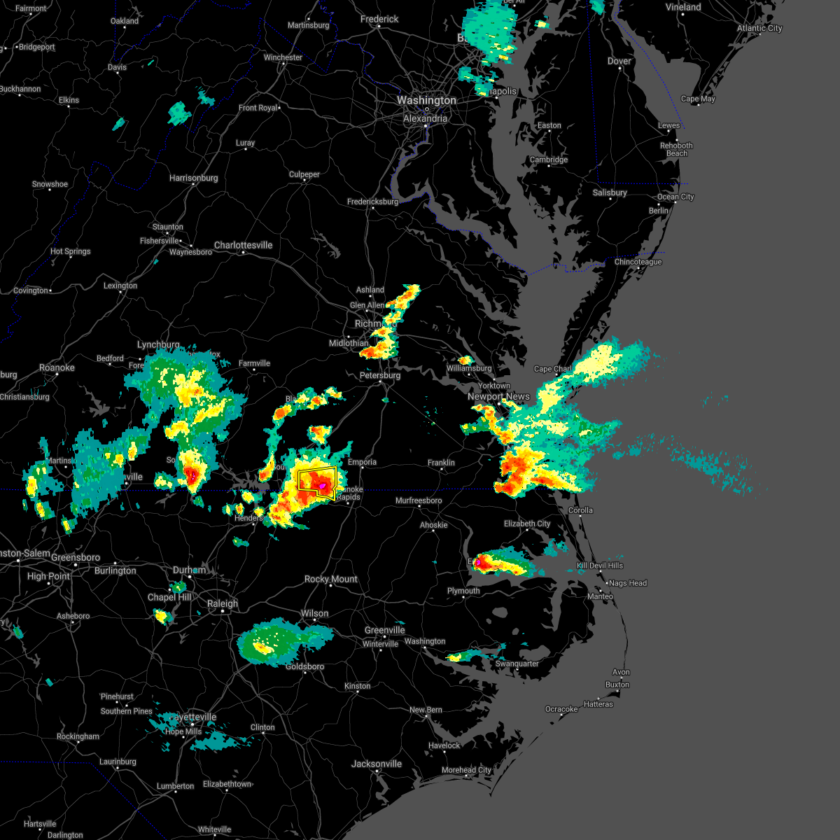 At 617 pm edt, a severe thunderstorm was located over gasburg, or 12 miles south of lawrenceville, moving east at 15 mph (radar indicated). Hazards include 60 mph wind gusts and quarter size hail. Minor damage to vehicles is possible. expect wind damage to trees and powerlines. This severe thunderstorm will remain over mainly rural areas of northwestern northampton and southwestern brunswick counties, including the following locations, triplet, bowens corner, henrico, white plains, vultare, valentines, roanoke rapids lake and lake gaston. At 617 pm edt, a severe thunderstorm was located over gasburg, or 12 miles south of lawrenceville, moving east at 15 mph (radar indicated). Hazards include 60 mph wind gusts and quarter size hail. Minor damage to vehicles is possible. expect wind damage to trees and powerlines. This severe thunderstorm will remain over mainly rural areas of northwestern northampton and southwestern brunswick counties, including the following locations, triplet, bowens corner, henrico, white plains, vultare, valentines, roanoke rapids lake and lake gaston.
|
| 4/9/2021 5:57 PM EDT |
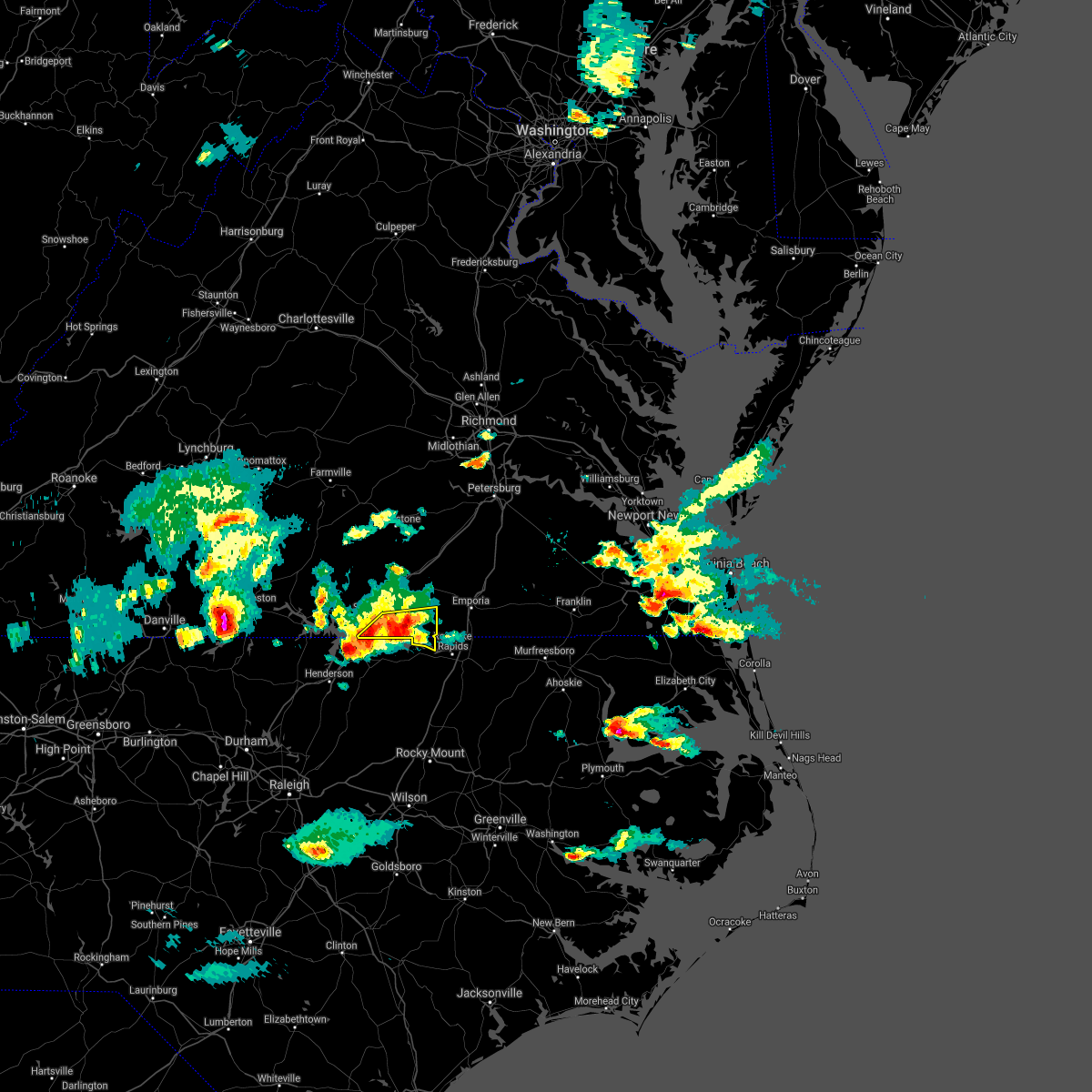 At 556 pm edt, a severe thunderstorm was located over gasburg, or 10 miles southeast of brodnax, moving east at 15 mph (radar indicated). Hazards include 60 mph wind gusts and quarter size hail. Minor damage to vehicles is possible. expect wind damage to trees and powerlines. this severe thunderstorm will be near, gasburg around 605 pm edt. brunswick around 610 pm edt. Other locations impacted by this severe thunderstorm include bracey, triplet, bowens corner, henrico, white plains, vultare, valentines, lake gaston and roanoke rapids lake. At 556 pm edt, a severe thunderstorm was located over gasburg, or 10 miles southeast of brodnax, moving east at 15 mph (radar indicated). Hazards include 60 mph wind gusts and quarter size hail. Minor damage to vehicles is possible. expect wind damage to trees and powerlines. this severe thunderstorm will be near, gasburg around 605 pm edt. brunswick around 610 pm edt. Other locations impacted by this severe thunderstorm include bracey, triplet, bowens corner, henrico, white plains, vultare, valentines, lake gaston and roanoke rapids lake.
|
| 4/9/2021 5:57 PM EDT |
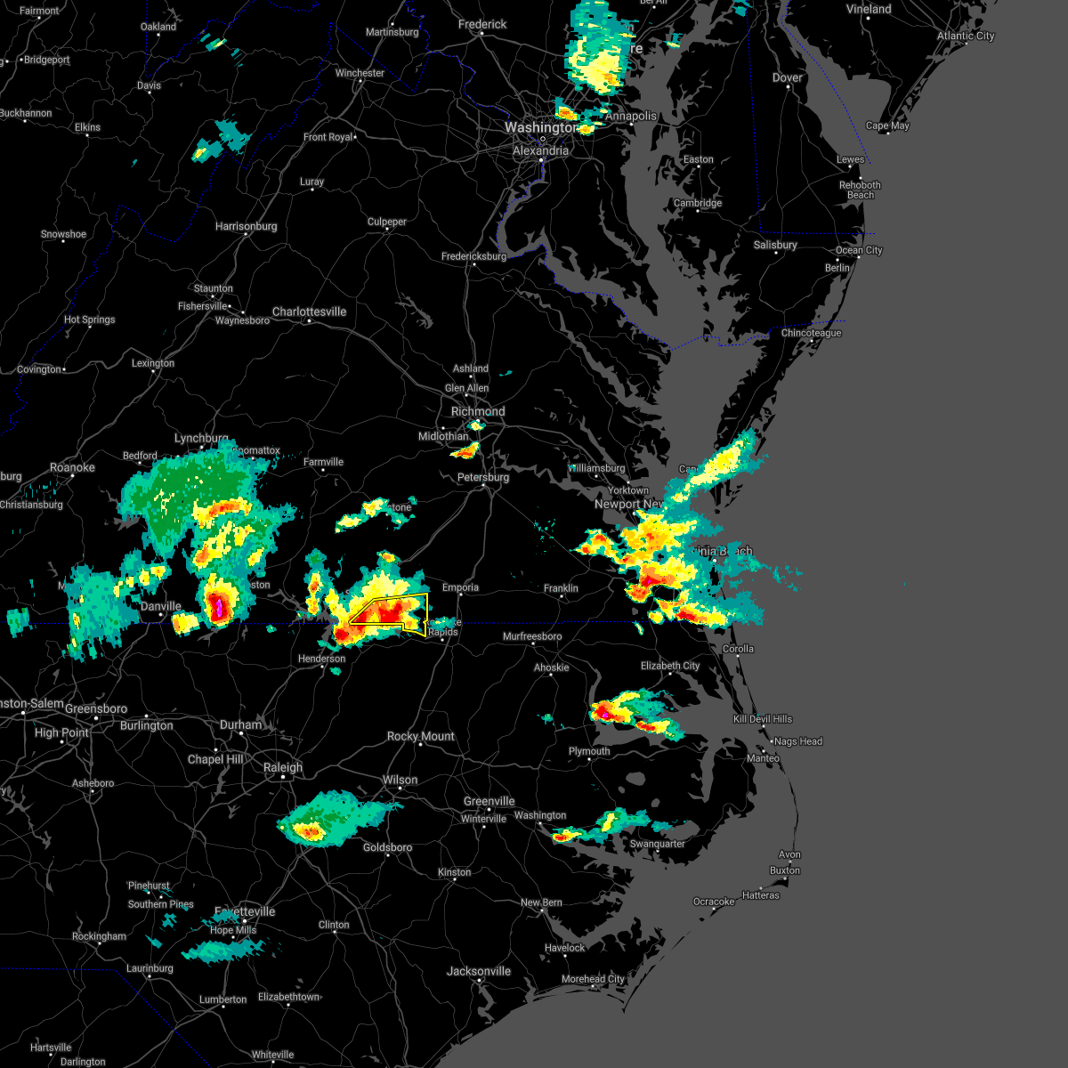 At 556 pm edt, a severe thunderstorm was located over gasburg, or 10 miles southeast of brodnax, moving east at 15 mph (radar indicated). Hazards include 60 mph wind gusts and quarter size hail. Minor damage to vehicles is possible. expect wind damage to trees and powerlines. this severe thunderstorm will be near, gasburg around 605 pm edt. brunswick around 610 pm edt. Other locations impacted by this severe thunderstorm include bracey, triplet, bowens corner, henrico, white plains, vultare, valentines, lake gaston and roanoke rapids lake. At 556 pm edt, a severe thunderstorm was located over gasburg, or 10 miles southeast of brodnax, moving east at 15 mph (radar indicated). Hazards include 60 mph wind gusts and quarter size hail. Minor damage to vehicles is possible. expect wind damage to trees and powerlines. this severe thunderstorm will be near, gasburg around 605 pm edt. brunswick around 610 pm edt. Other locations impacted by this severe thunderstorm include bracey, triplet, bowens corner, henrico, white plains, vultare, valentines, lake gaston and roanoke rapids lake.
|
| 4/9/2021 5:38 PM EDT |
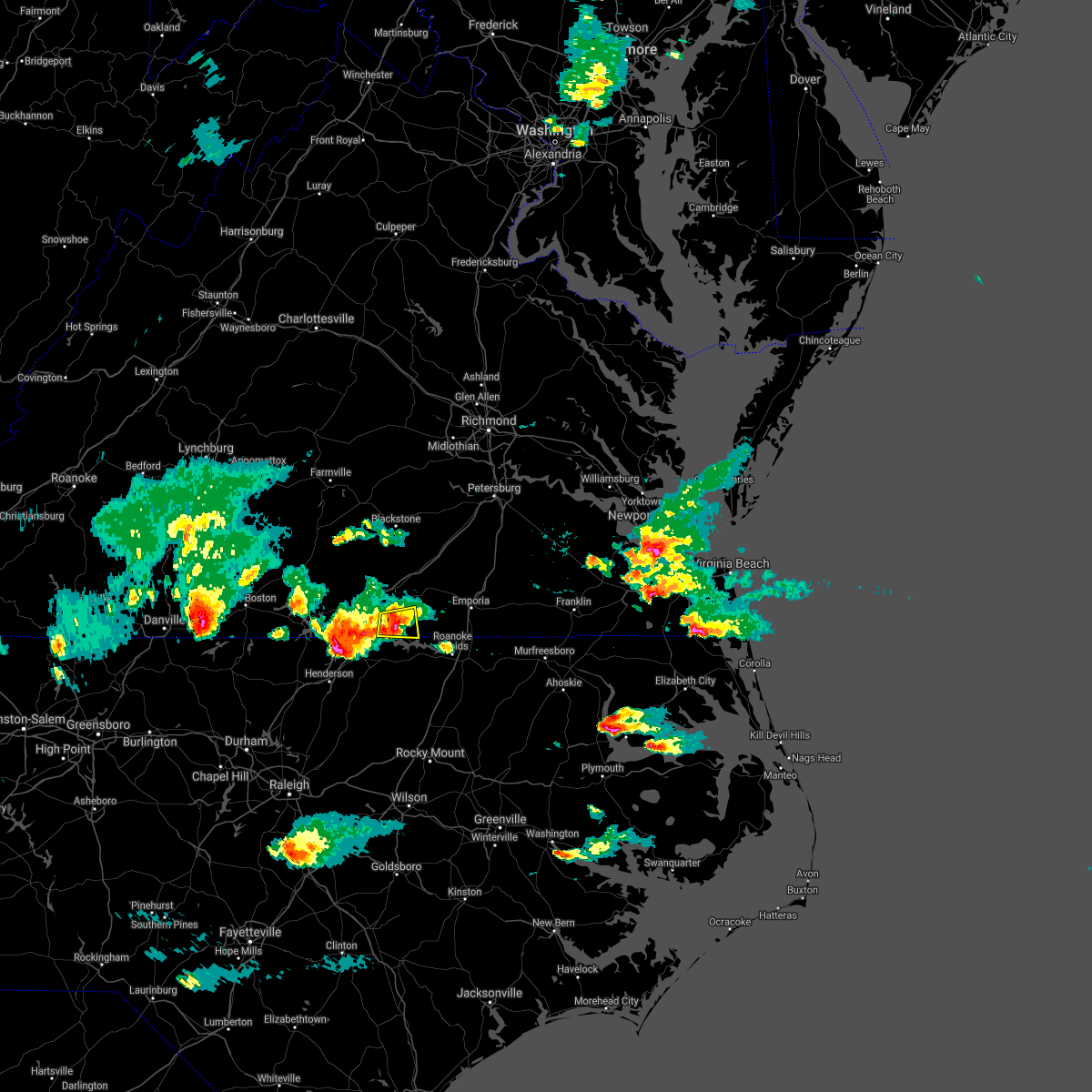 At 537 pm edt, a severe thunderstorm was located over ebony, or 7 miles south of brodnax, moving east at 15 mph (radar indicated). Hazards include 60 mph wind gusts and quarter size hail. Minor damage to vehicles is possible. expect wind damage to trees and powerlines. this severe storm will be near, gasburg around 555 pm edt. Other locations impacted by this severe thunderstorm include white plains, bowens corner and lake gaston. At 537 pm edt, a severe thunderstorm was located over ebony, or 7 miles south of brodnax, moving east at 15 mph (radar indicated). Hazards include 60 mph wind gusts and quarter size hail. Minor damage to vehicles is possible. expect wind damage to trees and powerlines. this severe storm will be near, gasburg around 555 pm edt. Other locations impacted by this severe thunderstorm include white plains, bowens corner and lake gaston.
|
| 4/9/2021 5:13 PM EDT |
 At 513 pm edt, a severe thunderstorm was located near ebony, or 8 miles southwest of brodnax, moving east at 15 mph (radar indicated). Hazards include 60 mph wind gusts and quarter size hail. Minor damage to vehicles is possible. expect wind damage to trees and powerlines. this severe thunderstorm will be near, ebony around 535 pm edt. gasburg around 550 pm edt. Other locations impacted by this severe thunderstorm include white plains, bracey, bowens corner and lake gaston. At 513 pm edt, a severe thunderstorm was located near ebony, or 8 miles southwest of brodnax, moving east at 15 mph (radar indicated). Hazards include 60 mph wind gusts and quarter size hail. Minor damage to vehicles is possible. expect wind damage to trees and powerlines. this severe thunderstorm will be near, ebony around 535 pm edt. gasburg around 550 pm edt. Other locations impacted by this severe thunderstorm include white plains, bracey, bowens corner and lake gaston.
|
| 3/18/2021 8:09 PM EDT |
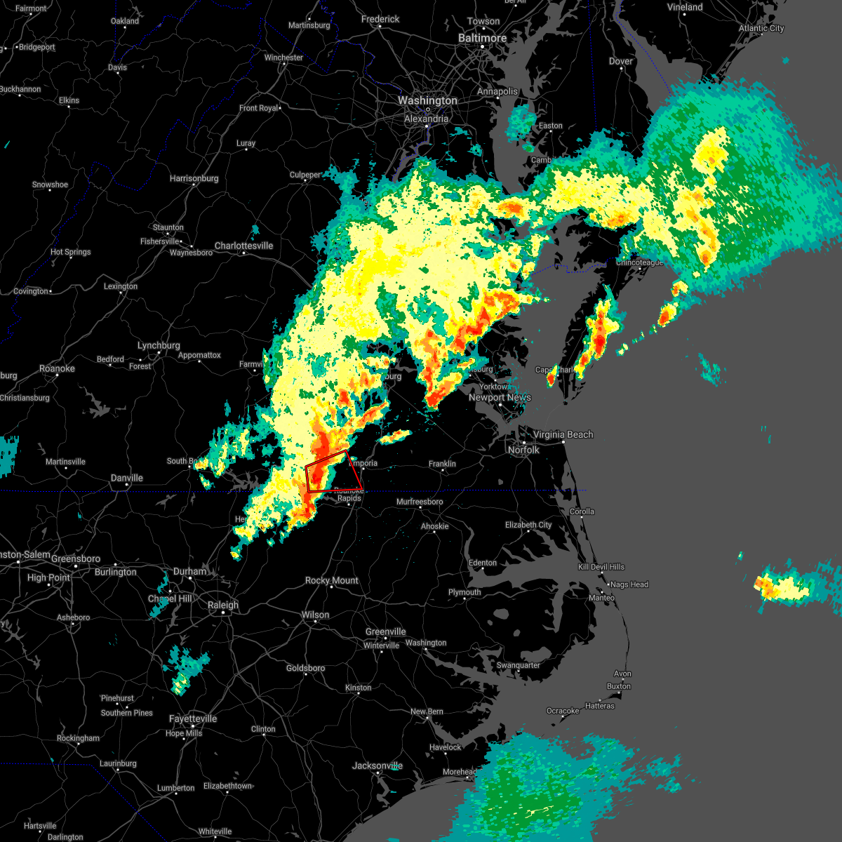 At 809 pm edt, a severe thunderstorm capable of producing a tornado was located over brunswick, or 8 miles south of lawrenceville, moving east at 50 mph (radar indicated rotation). Hazards include tornado and quarter size hail. Flying debris will be dangerous to those caught without shelter. mobile homes will be damaged or destroyed. damage to roofs, windows, and vehicles will occur. tree damage is likely. This tornadic thunderstorm will remain over mainly rural areas of southwestern greensville and southern brunswick counties, including the following locations, ante, brink, triplet, bowens corner, white plains, valentines, slates corner and lake gaston. At 809 pm edt, a severe thunderstorm capable of producing a tornado was located over brunswick, or 8 miles south of lawrenceville, moving east at 50 mph (radar indicated rotation). Hazards include tornado and quarter size hail. Flying debris will be dangerous to those caught without shelter. mobile homes will be damaged or destroyed. damage to roofs, windows, and vehicles will occur. tree damage is likely. This tornadic thunderstorm will remain over mainly rural areas of southwestern greensville and southern brunswick counties, including the following locations, ante, brink, triplet, bowens corner, white plains, valentines, slates corner and lake gaston.
|
| 3/18/2021 7:59 PM EDT |
 At 758 pm edt, a severe thunderstorm capable of producing a tornado was located over ebony, or 8 miles southeast of brodnax, moving east at 50 mph (radar indicated rotation). Hazards include tornado and half dollar size hail. Flying debris will be dangerous to those caught without shelter. mobile homes will be damaged or destroyed. damage to roofs, windows, and vehicles will occur. tree damage is likely. this dangerous storm will be near, brunswick around 805 pm edt. barley around 815 pm edt. Other locations impacted by this tornadic thunderstorm include ante, brink, triplet, bowens corner, white plains, valentines, slates corner and lake gaston. At 758 pm edt, a severe thunderstorm capable of producing a tornado was located over ebony, or 8 miles southeast of brodnax, moving east at 50 mph (radar indicated rotation). Hazards include tornado and half dollar size hail. Flying debris will be dangerous to those caught without shelter. mobile homes will be damaged or destroyed. damage to roofs, windows, and vehicles will occur. tree damage is likely. this dangerous storm will be near, brunswick around 805 pm edt. barley around 815 pm edt. Other locations impacted by this tornadic thunderstorm include ante, brink, triplet, bowens corner, white plains, valentines, slates corner and lake gaston.
|
| 3/18/2021 7:55 PM EDT |
 At 754 pm edt, severe thunderstorms were located along a line extending from near dundas to near brodnax to near ebony, moving east at 50 mph (radar indicated). Hazards include 60 mph wind gusts and quarter size hail. Minor damage to vehicles is possible. expect wind damage to trees and powerlines. these severe storms will be near, lawrenceville and brunswick around 800 pm edt. alberta around 805 pm edt. barley and radium around 815 pm edt. mckenney and purdy around 820 pm edt. emporia and dahlia around 825 pm edt. Other locations impacted by these severe thunderstorms include bacons fork, cochran, beechwood, gills corner, bufford crossroads, lanes corner, dolphin, bowens corner, pleasant shade and slates corner. At 754 pm edt, severe thunderstorms were located along a line extending from near dundas to near brodnax to near ebony, moving east at 50 mph (radar indicated). Hazards include 60 mph wind gusts and quarter size hail. Minor damage to vehicles is possible. expect wind damage to trees and powerlines. these severe storms will be near, lawrenceville and brunswick around 800 pm edt. alberta around 805 pm edt. barley and radium around 815 pm edt. mckenney and purdy around 820 pm edt. emporia and dahlia around 825 pm edt. Other locations impacted by these severe thunderstorms include bacons fork, cochran, beechwood, gills corner, bufford crossroads, lanes corner, dolphin, bowens corner, pleasant shade and slates corner.
|
| 3/18/2021 7:45 PM EDT |
 At 745 pm edt, severe thunderstorms were located along a line extending from 7 miles south of kenbridge to near la crosse to 6 miles west of ebony, moving northeast at 55 mph (radar indicated). Hazards include 60 mph wind gusts and quarter size hail. Minor damage to vehicles is possible. expect wind damage to trees and powerlines. severe thunderstorms will be near, lawrenceville, dundas and gasburg around 755 pm edt. brunswick and alberta around 800 pm edt. mckenney around 810 pm edt. emporia, purdy, radium and dewitt around 815 pm edt. other locations impacted by these severe thunderstorms include bacons fork, cochran, beechwood, gills corner, bufford crossroads, lanes corner, dolphin, bowens corner, pleasant shade and slates corner. A tornado watch remains in effect until 900 pm edt for northeastern north carolina, and south central and southeastern virginia. At 745 pm edt, severe thunderstorms were located along a line extending from 7 miles south of kenbridge to near la crosse to 6 miles west of ebony, moving northeast at 55 mph (radar indicated). Hazards include 60 mph wind gusts and quarter size hail. Minor damage to vehicles is possible. expect wind damage to trees and powerlines. severe thunderstorms will be near, lawrenceville, dundas and gasburg around 755 pm edt. brunswick and alberta around 800 pm edt. mckenney around 810 pm edt. emporia, purdy, radium and dewitt around 815 pm edt. other locations impacted by these severe thunderstorms include bacons fork, cochran, beechwood, gills corner, bufford crossroads, lanes corner, dolphin, bowens corner, pleasant shade and slates corner. A tornado watch remains in effect until 900 pm edt for northeastern north carolina, and south central and southeastern virginia.
|
| 8/31/2020 6:38 PM EDT |
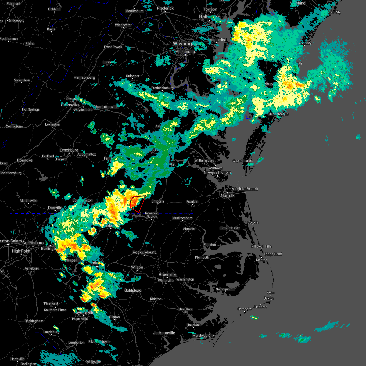 At 637 pm edt, a severe thunderstorm capable of producing a tornado was located near brodnax, moving east at 20 mph (radar indicated rotation). Hazards include tornado. Flying debris will be dangerous to those caught without shelter. mobile homes will be damaged or destroyed. damage to roofs, windows, and vehicles will occur. tree damage is likely. this dangerous storm will be near, lawrenceville around 650 pm edt. brunswick around 655 pm edt. Other locations impacted by this tornadic thunderstorm include white plains, bowens corner and edgerton. At 637 pm edt, a severe thunderstorm capable of producing a tornado was located near brodnax, moving east at 20 mph (radar indicated rotation). Hazards include tornado. Flying debris will be dangerous to those caught without shelter. mobile homes will be damaged or destroyed. damage to roofs, windows, and vehicles will occur. tree damage is likely. this dangerous storm will be near, lawrenceville around 650 pm edt. brunswick around 655 pm edt. Other locations impacted by this tornadic thunderstorm include white plains, bowens corner and edgerton.
|
| 8/31/2020 6:11 PM EDT |
 At 610 pm edt, a severe thunderstorm capable of producing a tornado was located just northeast of south hill, moving east at 15 mph (radar indicated rotation). Hazards include tornado. Flying debris will be dangerous to those caught without shelter. mobile homes will be damaged or destroyed. damage to roofs, windows, and vehicles will occur. tree damage is likely. this dangerous storm will be near, brodnax around 625 pm edt. lawrenceville and brunswick around 700 pm edt. Other locations impacted by this tornadic thunderstorm include white plains, meredithville, forksville, bowens corner and edgerton. At 610 pm edt, a severe thunderstorm capable of producing a tornado was located just northeast of south hill, moving east at 15 mph (radar indicated rotation). Hazards include tornado. Flying debris will be dangerous to those caught without shelter. mobile homes will be damaged or destroyed. damage to roofs, windows, and vehicles will occur. tree damage is likely. this dangerous storm will be near, brodnax around 625 pm edt. lawrenceville and brunswick around 700 pm edt. Other locations impacted by this tornadic thunderstorm include white plains, meredithville, forksville, bowens corner and edgerton.
|
| 4/13/2020 8:33 AM EDT |
 At 833 am edt, a severe thunderstorm was located over lawrenceville, moving northeast at 55 mph (radar indicated). Hazards include 60 mph wind gusts. Expect damage to trees and powerlines. This severe thunderstorm will remain over mainly rural areas of southeastern mecklenburg and brunswick counties, including the following locations, ante, cochran, rawlings, triplet, dolphin, bowens corner, white plains, valentines, warfield and meredithville. At 833 am edt, a severe thunderstorm was located over lawrenceville, moving northeast at 55 mph (radar indicated). Hazards include 60 mph wind gusts. Expect damage to trees and powerlines. This severe thunderstorm will remain over mainly rural areas of southeastern mecklenburg and brunswick counties, including the following locations, ante, cochran, rawlings, triplet, dolphin, bowens corner, white plains, valentines, warfield and meredithville.
|
| 4/13/2020 8:09 AM EDT |
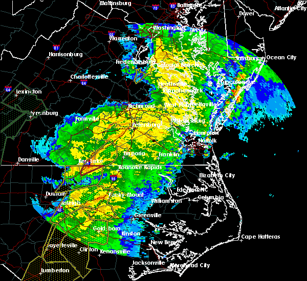 At 808 am edt, a severe thunderstorm was located near norlina, or 7 miles north of warrenton, moving northeast at 60 mph (radar indicated). Hazards include 60 mph wind gusts and penny size hail. Expect damage to trees and powerlines. this severe thunderstorm will be near, brodnax, ebony and gasburg around 820 am edt. brunswick around 825 am edt. lawrenceville around 835 am edt. other locations impacted by this severe thunderstorm include ante, cochran, rawlings, triplet, dolphin, bowens corner, white plains, valentines, warfield and meredithville. A tornado watch remains in effect until noon edt for northeastern north carolina, and south central and southeastern virginia. At 808 am edt, a severe thunderstorm was located near norlina, or 7 miles north of warrenton, moving northeast at 60 mph (radar indicated). Hazards include 60 mph wind gusts and penny size hail. Expect damage to trees and powerlines. this severe thunderstorm will be near, brodnax, ebony and gasburg around 820 am edt. brunswick around 825 am edt. lawrenceville around 835 am edt. other locations impacted by this severe thunderstorm include ante, cochran, rawlings, triplet, dolphin, bowens corner, white plains, valentines, warfield and meredithville. A tornado watch remains in effect until noon edt for northeastern north carolina, and south central and southeastern virginia.
|
| 4/7/2020 2:40 PM EDT |
 At 240 pm edt, a severe thunderstorm was located over lawrenceville, moving southeast at 25 mph (radar indicated). Hazards include 60 mph wind gusts and quarter size hail. Minor damage to vehicles is possible. expect wind damage to trees and powerlines. this severe storm will be near, lawrenceville around 245 pm edt. brunswick around 255 pm edt. Other locations impacted by this severe thunderstorm include ante, cochran, valentines, triplet, edgerton and prices mill. At 240 pm edt, a severe thunderstorm was located over lawrenceville, moving southeast at 25 mph (radar indicated). Hazards include 60 mph wind gusts and quarter size hail. Minor damage to vehicles is possible. expect wind damage to trees and powerlines. this severe storm will be near, lawrenceville around 245 pm edt. brunswick around 255 pm edt. Other locations impacted by this severe thunderstorm include ante, cochran, valentines, triplet, edgerton and prices mill.
|
| 4/7/2020 2:27 PM EDT |
 At 226 pm edt, a severe thunderstorm was located near alberta, or 7 miles northwest of lawrenceville, moving southeast at 25 mph (radar indicated). Hazards include 60 mph wind gusts and quarter size hail. Minor damage to vehicles is possible. expect wind damage to trees and powerlines. this severe thunderstorm will be near, alberta around 230 pm edt. lawrenceville around 245 pm edt. brunswick around 255 pm edt. Other locations impacted by this severe thunderstorm include danieltown, ante, cochran, triplet, edgerton, dolphin, white plains, valentines, meredithville and prices mill. At 226 pm edt, a severe thunderstorm was located near alberta, or 7 miles northwest of lawrenceville, moving southeast at 25 mph (radar indicated). Hazards include 60 mph wind gusts and quarter size hail. Minor damage to vehicles is possible. expect wind damage to trees and powerlines. this severe thunderstorm will be near, alberta around 230 pm edt. lawrenceville around 245 pm edt. brunswick around 255 pm edt. Other locations impacted by this severe thunderstorm include danieltown, ante, cochran, triplet, edgerton, dolphin, white plains, valentines, meredithville and prices mill.
|
| 10/31/2019 9:06 PM EDT |
 At 906 pm edt, severe thunderstorms were located along a line extending from 8 miles northwest of sutherland to 7 miles northwest of dewitt to near la crosse, moving northeast at 55 mph (radar indicated). Hazards include 60 mph wind gusts. Expect damage to trees and powerlines. Locations impacted include, south hill, lawrenceville, mckenney, brodnax, mannboro, brunswick, la crosse, alberta, dewitt, dundas, wilsons, fort pickett, gasburg, ebony, bacons fork, north wellville, dolphin, bowens corner, ammon and forksville. At 906 pm edt, severe thunderstorms were located along a line extending from 8 miles northwest of sutherland to 7 miles northwest of dewitt to near la crosse, moving northeast at 55 mph (radar indicated). Hazards include 60 mph wind gusts. Expect damage to trees and powerlines. Locations impacted include, south hill, lawrenceville, mckenney, brodnax, mannboro, brunswick, la crosse, alberta, dewitt, dundas, wilsons, fort pickett, gasburg, ebony, bacons fork, north wellville, dolphin, bowens corner, ammon and forksville.
|
| 10/31/2019 8:43 PM EDT |
 At 842 pm edt, severe thunderstorms were located along a line extending from near chula to near dundas to 7 miles southeast of boydton, moving east at 50 mph (radar indicated). Hazards include 60 mph wind gusts. Expect damage to trees and powerlines. these severe storms will be near, chula, fort pickett and scotts fork around 850 pm edt. moseley around 855 pm edt. mckenney and la crosse around 900 pm edt. brodnax, dewitt and ebony around 905 pm edt. gasburg around 910 pm edt. lawrenceville and brunswick around 915 pm edt. Other locations impacted by these severe thunderstorms include bacons fork, north wellville, wilburn, dolphin, bowens corner, ammon, murdocks, forksville, skinquarter and wellville. At 842 pm edt, severe thunderstorms were located along a line extending from near chula to near dundas to 7 miles southeast of boydton, moving east at 50 mph (radar indicated). Hazards include 60 mph wind gusts. Expect damage to trees and powerlines. these severe storms will be near, chula, fort pickett and scotts fork around 850 pm edt. moseley around 855 pm edt. mckenney and la crosse around 900 pm edt. brodnax, dewitt and ebony around 905 pm edt. gasburg around 910 pm edt. lawrenceville and brunswick around 915 pm edt. Other locations impacted by these severe thunderstorms include bacons fork, north wellville, wilburn, dolphin, bowens corner, ammon, murdocks, forksville, skinquarter and wellville.
|
| 10/31/2019 8:13 PM EDT |
 At 812 pm edt, severe thunderstorms were located along a line extending from near rice to near kells corner to near clarksville, moving east at 55 mph (radar indicated). Hazards include 60 mph wind gusts. Expect damage to trees and powerlines. severe thunderstorms will be near, rice around 820 pm edt. lunenburg and jetersville around 825 pm edt. kenbridge around 830 pm edt. amelia courthouse and dundas around 835 pm edt. alberta and chula around 840 pm edt. south hill, moseley, la crosse and fort pickett around 845 pm edt. brodnax around 850 pm edt. mckenney around 855 pm edt. other locations impacted by these severe thunderstorms include bacons fork, north wellville, wilburn, arvins store, dolphin, bowens corner, ammon, murdocks, nutbush and finneywood. A tornado watch remains in effect until 1100 pm edt for northeastern north carolina, and central and south central virginia. At 812 pm edt, severe thunderstorms were located along a line extending from near rice to near kells corner to near clarksville, moving east at 55 mph (radar indicated). Hazards include 60 mph wind gusts. Expect damage to trees and powerlines. severe thunderstorms will be near, rice around 820 pm edt. lunenburg and jetersville around 825 pm edt. kenbridge around 830 pm edt. amelia courthouse and dundas around 835 pm edt. alberta and chula around 840 pm edt. south hill, moseley, la crosse and fort pickett around 845 pm edt. brodnax around 850 pm edt. mckenney around 855 pm edt. other locations impacted by these severe thunderstorms include bacons fork, north wellville, wilburn, arvins store, dolphin, bowens corner, ammon, murdocks, nutbush and finneywood. A tornado watch remains in effect until 1100 pm edt for northeastern north carolina, and central and south central virginia.
|
| 8/7/2019 2:12 PM EDT |
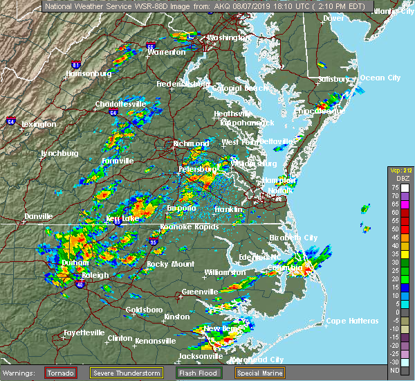 At 212 pm edt, a severe thunderstorm was located near lawrenceville, moving northeast at 20 mph. additional strong to severe storms were located throughout the warning area. all of these storms were also moving northeast at 20 mph (radar indicated). Hazards include 60 mph wind gusts and quarter size hail. Minor damage to vehicles is possible. expect wind damage to trees and powerlines. Locations impacted include, lawrenceville, brodnax, brunswick, gasburg, ante, callaville, edgerton, dolphin, bowens corner, white plains and warfield. At 212 pm edt, a severe thunderstorm was located near lawrenceville, moving northeast at 20 mph. additional strong to severe storms were located throughout the warning area. all of these storms were also moving northeast at 20 mph (radar indicated). Hazards include 60 mph wind gusts and quarter size hail. Minor damage to vehicles is possible. expect wind damage to trees and powerlines. Locations impacted include, lawrenceville, brodnax, brunswick, gasburg, ante, callaville, edgerton, dolphin, bowens corner, white plains and warfield.
|
| 8/7/2019 2:05 PM EDT | Trees down south of lawrencevill in brunswick county VA, 5.9 miles S of Gasburg, VA |
| 8/7/2019 1:51 PM EDT |
 At 151 pm edt, a severe thunderstorm was located over brunswick, moving northeast at 15 mph (radar indicated). Hazards include 60 mph wind gusts and quarter size hail. Minor damage to vehicles is possible. expect wind damage to trees and powerlines. this severe storm will be near, lawrenceville around 210 pm edt. Other locations impacted by this severe thunderstorm include ante, callaville, edgerton, dolphin, bowens corner, white plains and warfield. At 151 pm edt, a severe thunderstorm was located over brunswick, moving northeast at 15 mph (radar indicated). Hazards include 60 mph wind gusts and quarter size hail. Minor damage to vehicles is possible. expect wind damage to trees and powerlines. this severe storm will be near, lawrenceville around 210 pm edt. Other locations impacted by this severe thunderstorm include ante, callaville, edgerton, dolphin, bowens corner, white plains and warfield.
|
| 8/7/2019 1:40 PM EDT |
 At 140 pm edt, a severe thunderstorm was located over brunswick moving northeast at 25 mph (radar indicated). Hazards include 60 mph wind gusts and quarter size hail. Minor damage to vehicles is possible. expect wind damage to trees and powerlines. this severe thunderstorm will be near, lawrenceville around 155 pm edt. Other locations impacted by this severe thunderstorm include ante, callaville, edgerton, dolphin, bowens corner, white plains and warfield. At 140 pm edt, a severe thunderstorm was located over brunswick moving northeast at 25 mph (radar indicated). Hazards include 60 mph wind gusts and quarter size hail. Minor damage to vehicles is possible. expect wind damage to trees and powerlines. this severe thunderstorm will be near, lawrenceville around 155 pm edt. Other locations impacted by this severe thunderstorm include ante, callaville, edgerton, dolphin, bowens corner, white plains and warfield.
|
| 6/20/2019 4:04 PM EDT |
 At 403 pm edt, severe thunderstorms were located along a line extending from near lawrenceville to near barley, moving east at 45 mph (radar indicated). Hazards include 70 mph wind gusts. Expect considerable tree damage. damage is likely to mobile homes, roofs, and outbuildings. these severe storms will be near, roanoke rapids and gaston around 410 pm edt. garysburg around 415 pm edt. dahlia and radium around 420 pm edt. purdy and seaboard around 425 pm edt. Other locations impacted by these severe thunderstorms include cochran, gum forks, bufford crossroads, lanes corner, dolphin, bowens corner, pleasant shade, henrico, slates corner and emporia reservoir. At 403 pm edt, severe thunderstorms were located along a line extending from near lawrenceville to near barley, moving east at 45 mph (radar indicated). Hazards include 70 mph wind gusts. Expect considerable tree damage. damage is likely to mobile homes, roofs, and outbuildings. these severe storms will be near, roanoke rapids and gaston around 410 pm edt. garysburg around 415 pm edt. dahlia and radium around 420 pm edt. purdy and seaboard around 425 pm edt. Other locations impacted by these severe thunderstorms include cochran, gum forks, bufford crossroads, lanes corner, dolphin, bowens corner, pleasant shade, henrico, slates corner and emporia reservoir.
|
| 6/20/2019 4:04 PM EDT |
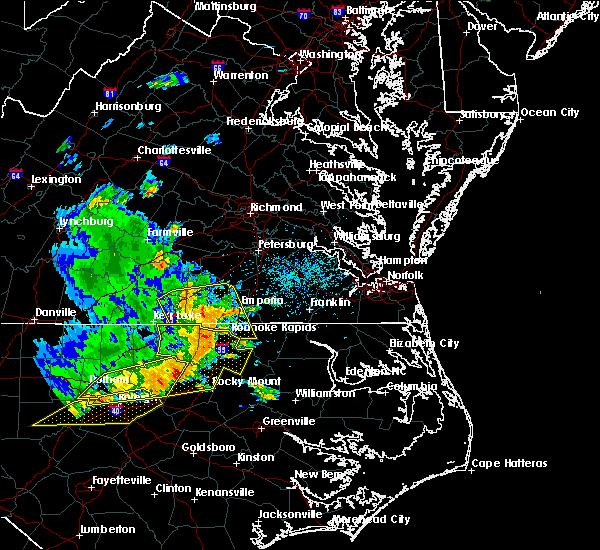 At 403 pm edt, severe thunderstorms were located along a line extending from near lawrenceville to near barley, moving east at 45 mph (radar indicated). Hazards include 70 mph wind gusts. Expect considerable tree damage. damage is likely to mobile homes, roofs, and outbuildings. these severe storms will be near, roanoke rapids and gaston around 410 pm edt. garysburg around 415 pm edt. dahlia and radium around 420 pm edt. purdy and seaboard around 425 pm edt. Other locations impacted by these severe thunderstorms include cochran, gum forks, bufford crossroads, lanes corner, dolphin, bowens corner, pleasant shade, henrico, slates corner and emporia reservoir. At 403 pm edt, severe thunderstorms were located along a line extending from near lawrenceville to near barley, moving east at 45 mph (radar indicated). Hazards include 70 mph wind gusts. Expect considerable tree damage. damage is likely to mobile homes, roofs, and outbuildings. these severe storms will be near, roanoke rapids and gaston around 410 pm edt. garysburg around 415 pm edt. dahlia and radium around 420 pm edt. purdy and seaboard around 425 pm edt. Other locations impacted by these severe thunderstorms include cochran, gum forks, bufford crossroads, lanes corner, dolphin, bowens corner, pleasant shade, henrico, slates corner and emporia reservoir.
|
| 6/20/2019 3:40 PM EDT |
 At 339 pm edt, severe thunderstorms were located along a line extending from near south hill to 7 miles northeast of warrenton, moving east at 45 mph (radar indicated). Hazards include 70 mph wind gusts. Expect considerable tree damage. damage is likely to mobile homes, roofs, and outbuildings. severe thunderstorms will be near, ebony around 345 pm edt. brodnax around 350 pm edt. gasburg around 355 pm edt. lawrenceville, alberta and barley around 405 pm edt. roanoke rapids and gaston around 410 pm edt. garysburg around 415 pm edt. dahlia and radium around 420 pm edt. purdy and seaboard around 425 pm edt. Other locations impacted by these severe thunderstorms include bacons fork, cochran, gum forks, bufford crossroads, lanes corner, dolphin, bowens corner, pleasant shade, henrico and slates corner. At 339 pm edt, severe thunderstorms were located along a line extending from near south hill to 7 miles northeast of warrenton, moving east at 45 mph (radar indicated). Hazards include 70 mph wind gusts. Expect considerable tree damage. damage is likely to mobile homes, roofs, and outbuildings. severe thunderstorms will be near, ebony around 345 pm edt. brodnax around 350 pm edt. gasburg around 355 pm edt. lawrenceville, alberta and barley around 405 pm edt. roanoke rapids and gaston around 410 pm edt. garysburg around 415 pm edt. dahlia and radium around 420 pm edt. purdy and seaboard around 425 pm edt. Other locations impacted by these severe thunderstorms include bacons fork, cochran, gum forks, bufford crossroads, lanes corner, dolphin, bowens corner, pleasant shade, henrico and slates corner.
|
| 4/19/2019 7:06 PM EDT |
 The tornado warning for northwestern northampton, greensville and southeastern brunswick counties and the city of emporia will expire at 715 pm edt, the storm which prompted the warning has moved out of the area. therefore, the warning will be allowed to expire. another tornado warning remains in effect for far northeast greensville county. a tornado watch remains in effect until midnight edt for northeastern north carolina, and south central and southeastern virginia. The tornado warning for northwestern northampton, greensville and southeastern brunswick counties and the city of emporia will expire at 715 pm edt, the storm which prompted the warning has moved out of the area. therefore, the warning will be allowed to expire. another tornado warning remains in effect for far northeast greensville county. a tornado watch remains in effect until midnight edt for northeastern north carolina, and south central and southeastern virginia.
|
| 4/19/2019 6:52 PM EDT |
 At 652 pm edt, a severe squall line capable of producing both tornadoes and extensive straight line wind damage was located near emporia, moving northeast at 50 mph (radar indicated rotation). Hazards include tornado. Flying debris will be dangerous to those caught without shelter. mobile homes will be damaged or destroyed. damage to roofs, windows, and vehicles will occur. tree damage is likely. these dangerous storms will be near, claresville around 655 pm edt. emporia and green plain around 700 pm edt. Other locations impacted by this tornadic thunderstorm include ante, brink, gum forks, bufford crossroads, triplet, lanes corner, pleasant shade, henrico, vultare and valentines. At 652 pm edt, a severe squall line capable of producing both tornadoes and extensive straight line wind damage was located near emporia, moving northeast at 50 mph (radar indicated rotation). Hazards include tornado. Flying debris will be dangerous to those caught without shelter. mobile homes will be damaged or destroyed. damage to roofs, windows, and vehicles will occur. tree damage is likely. these dangerous storms will be near, claresville around 655 pm edt. emporia and green plain around 700 pm edt. Other locations impacted by this tornadic thunderstorm include ante, brink, gum forks, bufford crossroads, triplet, lanes corner, pleasant shade, henrico, vultare and valentines.
|
| 4/19/2019 6:41 PM EDT |
 At 640 pm edt, severe thunderstorms capable of producing both tornadoes and extensive straight line wind damage were located over barley, or 7 miles northwest of roanoke rapids, moving northeast at 65 mph (radar indicated rotation). Hazards include tornado. Flying debris will be dangerous to those caught without shelter. mobile homes will be damaged or destroyed. damage to roofs, windows, and vehicles will occur. tree damage is likely. these dangerous storms will be near, dahlia and radium around 650 pm edt. emporia, green plain and claresville around 655 pm edt. purdy around 700 pm edt. Other locations impacted by this tornadic thunderstorm include ante, brink, gum forks, bufford crossroads, triplet, lanes corner, pleasant shade, henrico, vultare and valentines. At 640 pm edt, severe thunderstorms capable of producing both tornadoes and extensive straight line wind damage were located over barley, or 7 miles northwest of roanoke rapids, moving northeast at 65 mph (radar indicated rotation). Hazards include tornado. Flying debris will be dangerous to those caught without shelter. mobile homes will be damaged or destroyed. damage to roofs, windows, and vehicles will occur. tree damage is likely. these dangerous storms will be near, dahlia and radium around 650 pm edt. emporia, green plain and claresville around 655 pm edt. purdy around 700 pm edt. Other locations impacted by this tornadic thunderstorm include ante, brink, gum forks, bufford crossroads, triplet, lanes corner, pleasant shade, henrico, vultare and valentines.
|
| 4/19/2019 6:25 PM EDT |
 At 625 pm edt, severe thunderstorms were located along a line extending from gasburg to near scotland neck, moving northeast at 60 mph (radar indicated). Hazards include 60 mph wind gusts and penny size hail. Expect damage to trees and powerlines. severe thunderstorms will be near, barley around 630 pm edt. roxobel around 635 pm edt. rich square around 640 pm edt. woodland and radium around 645 pm edt. purdy and conway around 650 pm edt. murfreesboro and chowan university around 655 pm edt. other locations impacted by these severe thunderstorms include eagletown, milwaukee, adams grove, kelford, grizzard, gum forks, bufford crossroads, lanes corner, menola and chowan beach. A tornado watch remains in effect until midnight edt for northeastern north carolina, and south central and southeastern virginia. At 625 pm edt, severe thunderstorms were located along a line extending from gasburg to near scotland neck, moving northeast at 60 mph (radar indicated). Hazards include 60 mph wind gusts and penny size hail. Expect damage to trees and powerlines. severe thunderstorms will be near, barley around 630 pm edt. roxobel around 635 pm edt. rich square around 640 pm edt. woodland and radium around 645 pm edt. purdy and conway around 650 pm edt. murfreesboro and chowan university around 655 pm edt. other locations impacted by these severe thunderstorms include eagletown, milwaukee, adams grove, kelford, grizzard, gum forks, bufford crossroads, lanes corner, menola and chowan beach. A tornado watch remains in effect until midnight edt for northeastern north carolina, and south central and southeastern virginia.
|
| 4/15/2019 2:02 AM EDT |
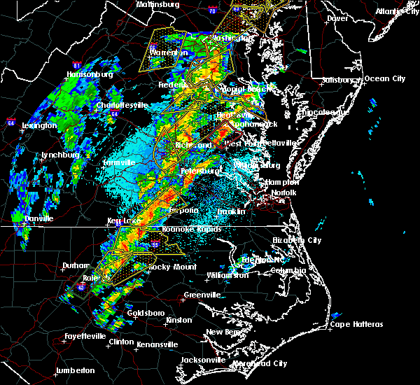 At 201 am edt, a severe thunderstorm was located over purdy, moving northeast at 50 mph (radar indicated). Hazards include 60 mph wind gusts and quarter size hail. Minor damage to vehicles is possible. expect wind damage to trees and powerlines. this severe storm will be near, jarratt around 210 am edt. stony creek around 220 am edt. other locations impacted by this severe thunderstorm include ante, bufford crossroads, triplet, bowens corner, pleasant shade, fields crossroads, white plains, valentines, wharfs store and emporia reservoir. A tornado watch remains in effect until 700 am edt for northeastern north carolina, and south central and southeastern virginia. At 201 am edt, a severe thunderstorm was located over purdy, moving northeast at 50 mph (radar indicated). Hazards include 60 mph wind gusts and quarter size hail. Minor damage to vehicles is possible. expect wind damage to trees and powerlines. this severe storm will be near, jarratt around 210 am edt. stony creek around 220 am edt. other locations impacted by this severe thunderstorm include ante, bufford crossroads, triplet, bowens corner, pleasant shade, fields crossroads, white plains, valentines, wharfs store and emporia reservoir. A tornado watch remains in effect until 700 am edt for northeastern north carolina, and south central and southeastern virginia.
|
| 4/15/2019 1:38 AM EDT |
 At 138 am edt, a severe thunderstorm was located over brunswick, or 9 miles southeast of brodnax, moving northeast at 50 mph (radar indicated). Hazards include 60 mph wind gusts and penny size hail. Expect damage to trees and powerlines. this severe thunderstorm will be near, lawrenceville around 150 am edt. radium around 200 am edt. purdy around 205 am edt. jarratt around 210 am edt. stony creek around 220 am edt. other locations impacted by this severe thunderstorm include ante, bufford crossroads, triplet, bowens corner, pleasant shade, fields crossroads, white plains, valentines, wharfs store and emporia reservoir. A tornado watch remains in effect until 700 am edt for northeastern north carolina, and south central and southeastern virginia. At 138 am edt, a severe thunderstorm was located over brunswick, or 9 miles southeast of brodnax, moving northeast at 50 mph (radar indicated). Hazards include 60 mph wind gusts and penny size hail. Expect damage to trees and powerlines. this severe thunderstorm will be near, lawrenceville around 150 am edt. radium around 200 am edt. purdy around 205 am edt. jarratt around 210 am edt. stony creek around 220 am edt. other locations impacted by this severe thunderstorm include ante, bufford crossroads, triplet, bowens corner, pleasant shade, fields crossroads, white plains, valentines, wharfs store and emporia reservoir. A tornado watch remains in effect until 700 am edt for northeastern north carolina, and south central and southeastern virginia.
|
| 6/22/2018 6:14 PM EDT |
 At 614 pm edt, severe thunderstorms were located along a line extending from near alberta to near barley, moving northeast at 35 mph (radar indicated). Hazards include 60 mph wind gusts and quarter size hail. Minor damage to vehicles is possible. expect wind damage to trees and powerlines. Locations impacted include, lawrenceville, ante, callaville, triplet, edgerton, dolphin, valentines and warfield. At 614 pm edt, severe thunderstorms were located along a line extending from near alberta to near barley, moving northeast at 35 mph (radar indicated). Hazards include 60 mph wind gusts and quarter size hail. Minor damage to vehicles is possible. expect wind damage to trees and powerlines. Locations impacted include, lawrenceville, ante, callaville, triplet, edgerton, dolphin, valentines and warfield.
|
| 6/22/2018 5:57 PM EDT | Quarter sized hail reported 2.5 miles ESE of Gasburg, VA |
| 6/22/2018 5:39 PM EDT |
 At 537 pm edt, a severe thunderstorm was located near ebony, or 8 miles southwest of brodnax, moving northeast at 30 mph (radar indicated). Hazards include 60 mph wind gusts and quarter size hail. Minor damage to vehicles is possible. expect wind damage to trees and powerlines. this severe thunderstorm will be near, brodnax and ebony around 550 pm edt. gasburg around 600 pm edt. brunswick around 605 pm edt. lawrenceville around 615 pm edt. Other locations impacted by this severe thunderstorm include ante, cochran, triplet, dolphin, bowens corner, white plains, valentines, warfield, meredithville and callaville. At 537 pm edt, a severe thunderstorm was located near ebony, or 8 miles southwest of brodnax, moving northeast at 30 mph (radar indicated). Hazards include 60 mph wind gusts and quarter size hail. Minor damage to vehicles is possible. expect wind damage to trees and powerlines. this severe thunderstorm will be near, brodnax and ebony around 550 pm edt. gasburg around 600 pm edt. brunswick around 605 pm edt. lawrenceville around 615 pm edt. Other locations impacted by this severe thunderstorm include ante, cochran, triplet, dolphin, bowens corner, white plains, valentines, warfield, meredithville and callaville.
|
| 5/10/2018 5:59 PM EDT |
 At 559 pm edt, a severe thunderstorm was located over ebony, or near brodnax, moving east at 50 mph (radar indicated). Hazards include 60 mph wind gusts and penny size hail. Expect damage to trees and powerlines. this severe storm will be near, gasburg around 605 pm edt. brunswick around 610 pm edt. Other locations impacted by this severe thunderstorm include beechwood, bracey, bowens corner, john h kerr dam, white plains, meredithville, baskerville, forksville, prices mill and palmer springs. At 559 pm edt, a severe thunderstorm was located over ebony, or near brodnax, moving east at 50 mph (radar indicated). Hazards include 60 mph wind gusts and penny size hail. Expect damage to trees and powerlines. this severe storm will be near, gasburg around 605 pm edt. brunswick around 610 pm edt. Other locations impacted by this severe thunderstorm include beechwood, bracey, bowens corner, john h kerr dam, white plains, meredithville, baskerville, forksville, prices mill and palmer springs.
|
| 5/10/2018 5:35 PM EDT |
 At 535 pm edt, a severe thunderstorm was located near boydton, or 16 miles south of chase city, moving east at 40 mph (radar indicated). Hazards include 60 mph wind gusts and quarter size hail. Minor damage to vehicles is possible. expect wind damage to trees and powerlines. this severe thunderstorm will be near, la crosse around 600 pm edt. brodnax around 605 pm edt. ebony around 610 pm edt. brunswick and gasburg around 615 pm edt. Other locations impacted by this severe thunderstorm include beechwood, bowens corner, finchley, john h kerr dam, white plains, meredithville, skipwith, forksville, rogers corner and richardson. At 535 pm edt, a severe thunderstorm was located near boydton, or 16 miles south of chase city, moving east at 40 mph (radar indicated). Hazards include 60 mph wind gusts and quarter size hail. Minor damage to vehicles is possible. expect wind damage to trees and powerlines. this severe thunderstorm will be near, la crosse around 600 pm edt. brodnax around 605 pm edt. ebony around 610 pm edt. brunswick and gasburg around 615 pm edt. Other locations impacted by this severe thunderstorm include beechwood, bowens corner, finchley, john h kerr dam, white plains, meredithville, skipwith, forksville, rogers corner and richardson.
|
| 5/6/2018 8:31 PM EDT |
 At 831 pm edt, severe thunderstorms were located along a line extending from near dundas to 7 miles southeast of boydton, moving east at 25 mph (radar indicated). Hazards include 60 mph wind gusts and quarter size hail. Minor damage to vehicles is possible. expect wind damage to trees and powerlines. Locations impacted include, south hill, lawrenceville, brodnax, la crosse, alberta, gasburg, ebony, bacons fork, cochran, beechwood, gills corner, bowens corner, john h kerr dam, white plains, meredithville, forksville, bracey, keats, eppes fork and baskerville. At 831 pm edt, severe thunderstorms were located along a line extending from near dundas to 7 miles southeast of boydton, moving east at 25 mph (radar indicated). Hazards include 60 mph wind gusts and quarter size hail. Minor damage to vehicles is possible. expect wind damage to trees and powerlines. Locations impacted include, south hill, lawrenceville, brodnax, la crosse, alberta, gasburg, ebony, bacons fork, cochran, beechwood, gills corner, bowens corner, john h kerr dam, white plains, meredithville, forksville, bracey, keats, eppes fork and baskerville.
|
| 5/6/2018 8:18 PM EDT |
 At 817 pm edt, severe thunderstorms were located along a line extending from 6 miles south of kenbridge to near boydton, moving east at 25 mph (radar indicated). Hazards include 60 mph wind gusts and quarter size hail. Minor damage to vehicles is possible. expect wind damage to trees and powerlines. Locations impacted include, south hill, lawrenceville, brodnax, la crosse, boydton, alberta, gasburg, ebony, bacons fork, cochran, beechwood, gills corner, bowens corner, finchley, meredithville, forksville, rogers corner, bracey, eppes fork and baskerville. At 817 pm edt, severe thunderstorms were located along a line extending from 6 miles south of kenbridge to near boydton, moving east at 25 mph (radar indicated). Hazards include 60 mph wind gusts and quarter size hail. Minor damage to vehicles is possible. expect wind damage to trees and powerlines. Locations impacted include, south hill, lawrenceville, brodnax, la crosse, boydton, alberta, gasburg, ebony, bacons fork, cochran, beechwood, gills corner, bowens corner, finchley, meredithville, forksville, rogers corner, bracey, eppes fork and baskerville.
|
| 5/6/2018 8:05 PM EDT |
 The national weather service in wakefield has issued a * severe thunderstorm warning for. mecklenburg county in south central virginia. southeastern lunenburg county in south central virginia. southwestern brunswick county in south central virginia. Until 845 pm edt. The national weather service in wakefield has issued a * severe thunderstorm warning for. mecklenburg county in south central virginia. southeastern lunenburg county in south central virginia. southwestern brunswick county in south central virginia. Until 845 pm edt.
|
| 4/15/2018 11:46 PM EDT |
 At 1145 pm edt, a severe thunderstorm was located 9 miles south of littleton, or 14 miles west of halifax, moving north at 60 mph (radar indicated). Hazards include 60 mph wind gusts. Expect damage to roofs, siding, and trees. locations impacted include, rocky mount, roanoke rapids, nashville, halifax, dortches, littleton, red oak, enfield, weldon and whitakers. A tornado watch remains in effect until 300 am edt for central north carolina. At 1145 pm edt, a severe thunderstorm was located 9 miles south of littleton, or 14 miles west of halifax, moving north at 60 mph (radar indicated). Hazards include 60 mph wind gusts. Expect damage to roofs, siding, and trees. locations impacted include, rocky mount, roanoke rapids, nashville, halifax, dortches, littleton, red oak, enfield, weldon and whitakers. A tornado watch remains in effect until 300 am edt for central north carolina.
|
| 4/15/2018 11:23 PM EDT |
 The national weather service in raleigh has issued a * severe thunderstorm warning for. northeastern nash county in central north carolina. warren county in central north carolina. northwestern edgecombe county in central north carolina. Halifax county in central north carolina. The national weather service in raleigh has issued a * severe thunderstorm warning for. northeastern nash county in central north carolina. warren county in central north carolina. northwestern edgecombe county in central north carolina. Halifax county in central north carolina.
|
| 1/12/2018 9:49 PM EST |
 At 949 pm est, severe thunderstorms were located along a line extending from near spainville to near alberta to brunswick, moving northeast at 45 mph (radar indicated). Hazards include 60 mph wind gusts. Expect damage to trees and powerlines. these severe storms will be near, spainville and wilsons around 955 pm est. scotts fork around 1000 pm est. mckenney, mannboro and radium around 1005 pm est. dewitt around 1010 pm est. dinwiddie, emporia, purdy, jarratt and green plain around 1015 pm est. Other locations impacted by these severe thunderstorms include north wellville, grizzard, dolphin, bowens corner, ammon, murdocks, pleasant shade, wharfs store, wellville and blackstone airport. At 949 pm est, severe thunderstorms were located along a line extending from near spainville to near alberta to brunswick, moving northeast at 45 mph (radar indicated). Hazards include 60 mph wind gusts. Expect damage to trees and powerlines. these severe storms will be near, spainville and wilsons around 955 pm est. scotts fork around 1000 pm est. mckenney, mannboro and radium around 1005 pm est. dewitt around 1010 pm est. dinwiddie, emporia, purdy, jarratt and green plain around 1015 pm est. Other locations impacted by these severe thunderstorms include north wellville, grizzard, dolphin, bowens corner, ammon, murdocks, pleasant shade, wharfs store, wellville and blackstone airport.
|
| 1/12/2018 9:35 PM EST |
 At 933 pm est, severe thunderstorms were located along a line extending from near nottoway to alberta to near ebony, moving northeast at 55 mph (radar indicated). Hazards include 60 mph wind gusts. Expect damage to trees and powerlines. severe thunderstorms will be near, nottoway around 940 pm est. blackstone, brunswick and alberta around 945 pm est. lawrenceville and spainville around 950 pm est. mckenney, wilsons and scotts fork around 955 pm est. mannboro and radium around 1000 pm est. emporia, purdy and dewitt around 1005 pm est. dinwiddie, green plain and sutherland around 1010 pm est. jarratt and stony creek around 1015 pm est. Other locations impacted by these severe thunderstorms include bacons fork, north wellville, grizzard, dolphin, bowens corner, ammon, murdocks, pleasant shade, wharfs store and forksville. At 933 pm est, severe thunderstorms were located along a line extending from near nottoway to alberta to near ebony, moving northeast at 55 mph (radar indicated). Hazards include 60 mph wind gusts. Expect damage to trees and powerlines. severe thunderstorms will be near, nottoway around 940 pm est. blackstone, brunswick and alberta around 945 pm est. lawrenceville and spainville around 950 pm est. mckenney, wilsons and scotts fork around 955 pm est. mannboro and radium around 1000 pm est. emporia, purdy and dewitt around 1005 pm est. dinwiddie, green plain and sutherland around 1010 pm est. jarratt and stony creek around 1015 pm est. Other locations impacted by these severe thunderstorms include bacons fork, north wellville, grizzard, dolphin, bowens corner, ammon, murdocks, pleasant shade, wharfs store and forksville.
|
| 5/5/2017 6:38 AM EDT |
 At 638 am edt, severe thunderstorms were located along a line extending from 6 miles northeast of dundas to alberta to near lawrenceville to near gasburg, moving northeast at 40 mph (radar indicated). Hazards include 60 mph wind gusts. Expect damage to roofs, siding, and trees. severe thunderstorms will be near, alberta around 645 am edt. mckenney and barley around 700 am edt. dewitt around 710 am edt. dinwiddie and radium around 720 am edt. emporia, purdy, jarratt and stony creek around 730 am edt. other locations impacted by these severe thunderstorms include cochran, gum forks, bufford crossroads, lanes corner, addison, dolphin, bowens corner, pleasant shade, henrico and slates corner. A tornado watch remains in effect until 100 pm edt for northeastern north carolina, and southeastern virginia. At 638 am edt, severe thunderstorms were located along a line extending from 6 miles northeast of dundas to alberta to near lawrenceville to near gasburg, moving northeast at 40 mph (radar indicated). Hazards include 60 mph wind gusts. Expect damage to roofs, siding, and trees. severe thunderstorms will be near, alberta around 645 am edt. mckenney and barley around 700 am edt. dewitt around 710 am edt. dinwiddie and radium around 720 am edt. emporia, purdy, jarratt and stony creek around 730 am edt. other locations impacted by these severe thunderstorms include cochran, gum forks, bufford crossroads, lanes corner, addison, dolphin, bowens corner, pleasant shade, henrico and slates corner. A tornado watch remains in effect until 100 pm edt for northeastern north carolina, and southeastern virginia.
|
| 3/31/2017 5:48 PM EDT |
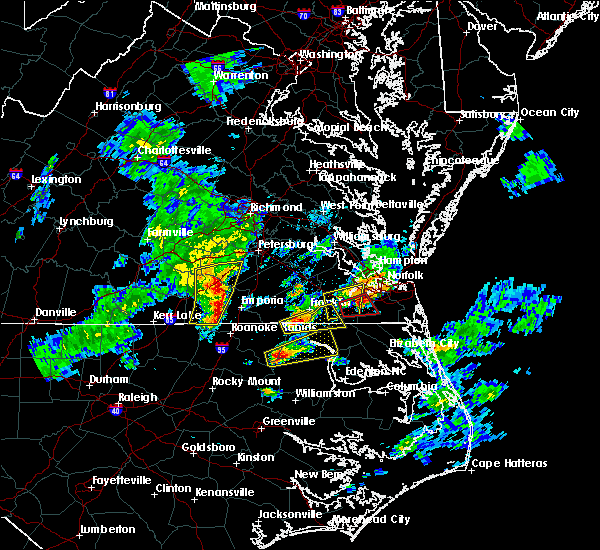 At 547 pm edt, severe thunderstorms were located along a line extending from near dinwiddie to near purdy to near gasburg, moving east at 40 mph (radar indicated). Hazards include 60 mph wind gusts and quarter size hail. Hail damage to vehicles is expected. expect wind damage to roofs, siding, and trees. locations impacted include, lawrenceville, mckenney, brunswick, alberta, gasburg, dewitt, ante, rawlings, triplet, dolphin, valentines, warfield, wharfs store, ordsburg, callaville, cherry hill, edgerton, butterworth and lake gaston. precautionary/preparedness actions, a tornado watch remains in effect for the warned area. tornadoes can develop quickly from severe thunderstorms. although a tornado is not immediately likely, if one is spotted act quickly and move to a place of safety inside a sturdy structure, such as a basement or small interior room. for your protection move to an interior room on the lowest floor of a building. please send your reports of hail and or wind damage, including trees or large limbs downed, by calling noaa`s national weather service in wakefield at , 7 5 7, 8 9 9, 2 4 1 5. A tornado watch remains in effect until 1000 pm edt for northeastern north carolina, and south central and southeastern virginia. At 547 pm edt, severe thunderstorms were located along a line extending from near dinwiddie to near purdy to near gasburg, moving east at 40 mph (radar indicated). Hazards include 60 mph wind gusts and quarter size hail. Hail damage to vehicles is expected. expect wind damage to roofs, siding, and trees. locations impacted include, lawrenceville, mckenney, brunswick, alberta, gasburg, dewitt, ante, rawlings, triplet, dolphin, valentines, warfield, wharfs store, ordsburg, callaville, cherry hill, edgerton, butterworth and lake gaston. precautionary/preparedness actions, a tornado watch remains in effect for the warned area. tornadoes can develop quickly from severe thunderstorms. although a tornado is not immediately likely, if one is spotted act quickly and move to a place of safety inside a sturdy structure, such as a basement or small interior room. for your protection move to an interior room on the lowest floor of a building. please send your reports of hail and or wind damage, including trees or large limbs downed, by calling noaa`s national weather service in wakefield at , 7 5 7, 8 9 9, 2 4 1 5. A tornado watch remains in effect until 1000 pm edt for northeastern north carolina, and south central and southeastern virginia.
|
| 3/31/2017 5:45 PM EDT |
 At 545 pm edt, severe thunderstorms were located along a line extending from near dewitt to 6 miles west of purdy to near gasburg, moving east at 40 mph (radar indicated). Hazards include 60 mph wind gusts and quarter size hail. Hail damage to vehicles is expected. Expect wind damage to roofs, siding, and trees. At 545 pm edt, severe thunderstorms were located along a line extending from near dewitt to 6 miles west of purdy to near gasburg, moving east at 40 mph (radar indicated). Hazards include 60 mph wind gusts and quarter size hail. Hail damage to vehicles is expected. Expect wind damage to roofs, siding, and trees.
|
| 3/31/2017 5:39 PM EDT |
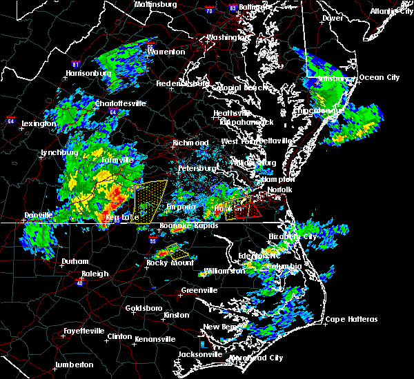 At 539 pm edt, severe thunderstorms were located along a line extending from near dinwiddie to 7 miles northeast of lawrenceville to near ebony, moving east at 40 mph (radar indicated). Hazards include 60 mph wind gusts and quarter size hail. Hail damage to vehicles is expected. expect wind damage to roofs, siding, and trees. locations impacted include, dinwiddie, lawrenceville, mckenney, brunswick, alberta, gasburg, dewitt, ebony, cochran, dolphin, bowens corner, wharfs store, darvills, edgerton, butterworth, ante, rawlings, triplet, white plains and valentines. precautionary/preparedness actions, remain alert for a possible tornado! tornadoes can develop quickly from severe thunderstorms. if you spot a tornado go at once into the basement or small central room in a sturdy structure. for your protection move to an interior room on the lowest floor of a building. please send your reports of hail and or wind damage, including trees or large limbs downed, by calling noaa`s national weather service in wakefield at , 7 5 7, 8 9 9, 2 4 1 5. A tornado watch remains in effect until 1000 pm edt for northeastern north carolina, and south central and southeastern virginia. At 539 pm edt, severe thunderstorms were located along a line extending from near dinwiddie to 7 miles northeast of lawrenceville to near ebony, moving east at 40 mph (radar indicated). Hazards include 60 mph wind gusts and quarter size hail. Hail damage to vehicles is expected. expect wind damage to roofs, siding, and trees. locations impacted include, dinwiddie, lawrenceville, mckenney, brunswick, alberta, gasburg, dewitt, ebony, cochran, dolphin, bowens corner, wharfs store, darvills, edgerton, butterworth, ante, rawlings, triplet, white plains and valentines. precautionary/preparedness actions, remain alert for a possible tornado! tornadoes can develop quickly from severe thunderstorms. if you spot a tornado go at once into the basement or small central room in a sturdy structure. for your protection move to an interior room on the lowest floor of a building. please send your reports of hail and or wind damage, including trees or large limbs downed, by calling noaa`s national weather service in wakefield at , 7 5 7, 8 9 9, 2 4 1 5. A tornado watch remains in effect until 1000 pm edt for northeastern north carolina, and south central and southeastern virginia.
|
| 3/31/2017 5:33 PM EDT |
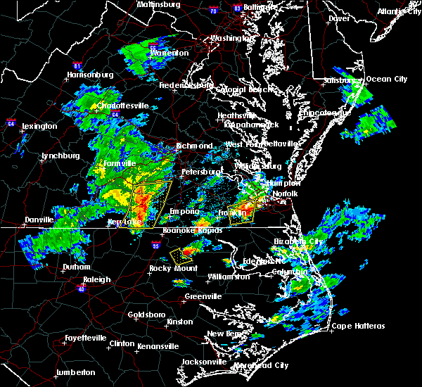 At 532 pm edt, severe thunderstorms were located along a line extending from near dewitt to near lawrenceville to near ebony, moving east at 40 mph (radar indicated). Hazards include 60 mph wind gusts and quarter size hail. Hail damage to vehicles is expected. expect wind damage to roofs, siding, and trees. locations impacted include, dinwiddie, blackstone, lawrenceville, mckenney, brodnax, brunswick, la crosse, alberta, fort pickett, gasburg, dewitt, ebony, dundas, cochran, gills corner, dolphin, bowens corner, forkland, wharfs store and meredithville. precautionary/preparedness actions, remain alert for a possible tornado! tornadoes can develop quickly from severe thunderstorms. if you spot a tornado go at once into the basement or small central room in a sturdy structure. for your protection move to an interior room on the lowest floor of a building. please send your reports of hail and or wind damage, including trees or large limbs downed, by calling noaa`s national weather service in wakefield at , 7 5 7, 8 9 9, 2 4 1 5. A tornado watch remains in effect until 1000 pm edt for northeastern north carolina, and south central and southeastern virginia. At 532 pm edt, severe thunderstorms were located along a line extending from near dewitt to near lawrenceville to near ebony, moving east at 40 mph (radar indicated). Hazards include 60 mph wind gusts and quarter size hail. Hail damage to vehicles is expected. expect wind damage to roofs, siding, and trees. locations impacted include, dinwiddie, blackstone, lawrenceville, mckenney, brodnax, brunswick, la crosse, alberta, fort pickett, gasburg, dewitt, ebony, dundas, cochran, gills corner, dolphin, bowens corner, forkland, wharfs store and meredithville. precautionary/preparedness actions, remain alert for a possible tornado! tornadoes can develop quickly from severe thunderstorms. if you spot a tornado go at once into the basement or small central room in a sturdy structure. for your protection move to an interior room on the lowest floor of a building. please send your reports of hail and or wind damage, including trees or large limbs downed, by calling noaa`s national weather service in wakefield at , 7 5 7, 8 9 9, 2 4 1 5. A tornado watch remains in effect until 1000 pm edt for northeastern north carolina, and south central and southeastern virginia.
|
| 3/31/2017 5:09 PM EDT |
 At 508 pm edt, severe thunderstorms were located along a line extending from blackstone to near south hill to 7 miles west of norlina, moving east at 40 mph (radar indicated). Hazards include 60 mph wind gusts and quarter size hail. Hail damage to vehicles is expected. Expect wind damage to roofs, siding, and trees. At 508 pm edt, severe thunderstorms were located along a line extending from blackstone to near south hill to 7 miles west of norlina, moving east at 40 mph (radar indicated). Hazards include 60 mph wind gusts and quarter size hail. Hail damage to vehicles is expected. Expect wind damage to roofs, siding, and trees.
|
| 7/30/2016 7:11 PM EDT |
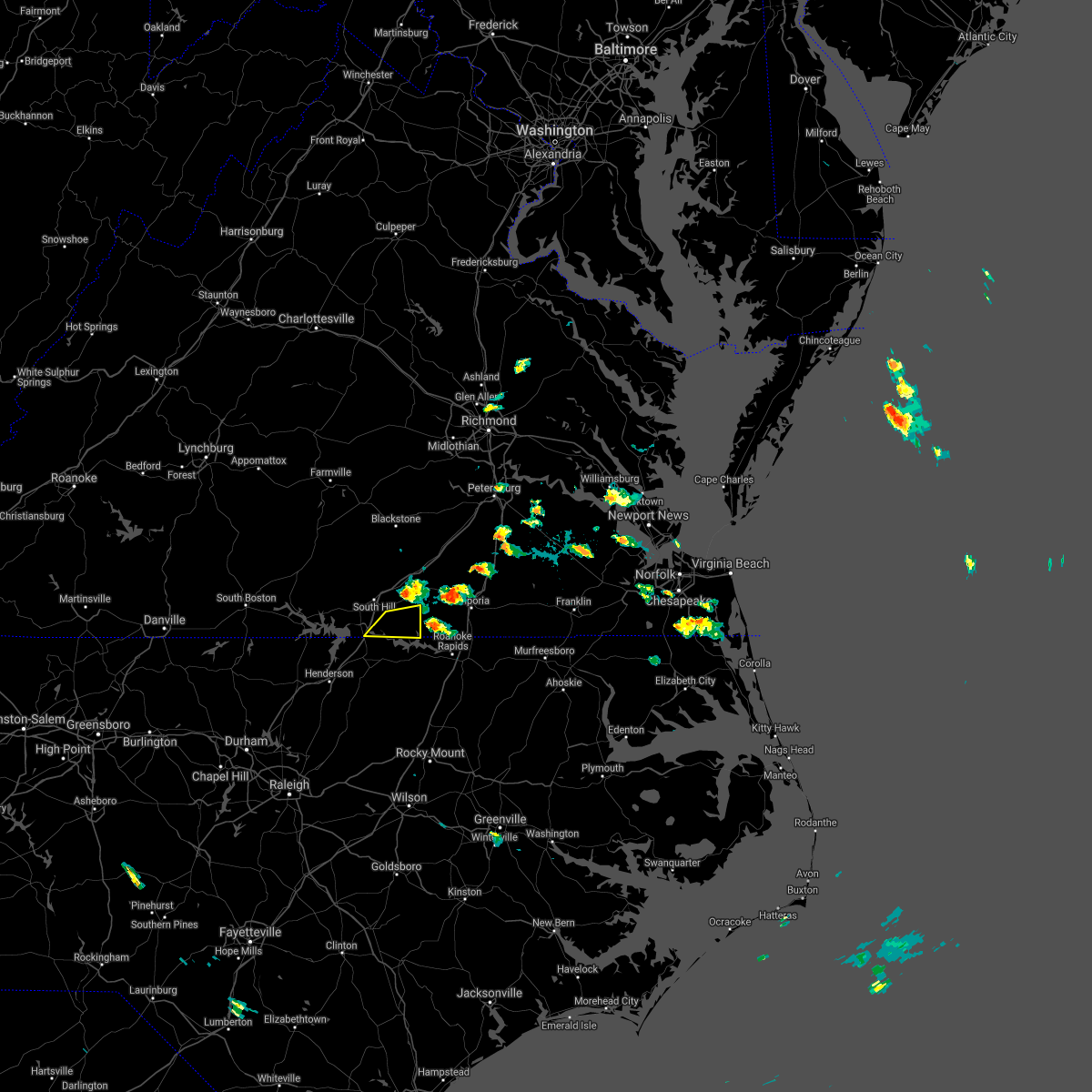 The severe thunderstorm warning for southeastern mecklenburg and southwestern brunswick counties will expire at 715 pm edt, the severe thunderstorm which prompted the warning has weakened below severe limits, therefore the warning will be allowed to expire. The severe thunderstorm warning for southeastern mecklenburg and southwestern brunswick counties will expire at 715 pm edt, the severe thunderstorm which prompted the warning has weakened below severe limits, therefore the warning will be allowed to expire.
|
| 7/30/2016 6:56 PM EDT |
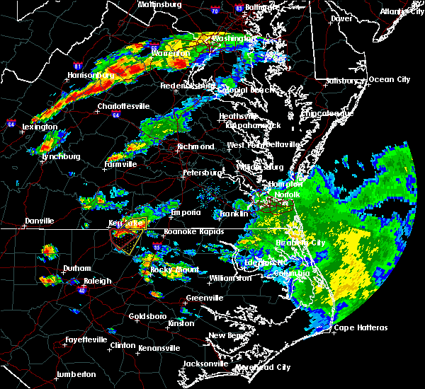 At 656 pm edt, a severe thunderstorm was located near gasburg, or 12 miles northwest of roanoke rapids, moving east at 40 mph (radar indicated). Hazards include 60 mph wind gusts and quarter size hail. Hail damage to vehicles is expected. expect wind damage to roofs, siding, and trees. this severe thunderstorm will remain over mainly rural areas of southeastern mecklenburg and southwestern brunswick counties, including the following locations: bowens corner, white plains and lake gaston. precautionary/preparedness actions, for your protection move to an interior room on the lowest floor of a building. please send your reports of hail and or wind damage, including trees or large limbs downed, by calling noaa`s national weather service in wakefield at , 7 5 7, 8 9 9, 2 4 1 5. At 656 pm edt, a severe thunderstorm was located near gasburg, or 12 miles northwest of roanoke rapids, moving east at 40 mph (radar indicated). Hazards include 60 mph wind gusts and quarter size hail. Hail damage to vehicles is expected. expect wind damage to roofs, siding, and trees. this severe thunderstorm will remain over mainly rural areas of southeastern mecklenburg and southwestern brunswick counties, including the following locations: bowens corner, white plains and lake gaston. precautionary/preparedness actions, for your protection move to an interior room on the lowest floor of a building. please send your reports of hail and or wind damage, including trees or large limbs downed, by calling noaa`s national weather service in wakefield at , 7 5 7, 8 9 9, 2 4 1 5.
|
| 7/30/2016 6:37 PM EDT |
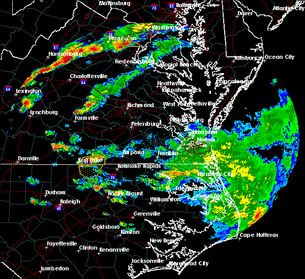 At 637 pm edt, a severe thunderstorm was located near ebony, or 10 miles southwest of brodnax, moving east at 35 mph (radar indicated). Hazards include 60 mph wind gusts and quarter size hail. Hail damage to vehicles is expected. expect wind damage to roofs, siding, and trees. this severe thunderstorm will be near, ebony around 645 pm edt. gasburg around 650 pm edt. brunswick around 655 pm edt. Other locations impacted by this severe thunderstorm include palmer springs, bowens corner, bracey, white plains, beechwood and lake gaston. At 637 pm edt, a severe thunderstorm was located near ebony, or 10 miles southwest of brodnax, moving east at 35 mph (radar indicated). Hazards include 60 mph wind gusts and quarter size hail. Hail damage to vehicles is expected. expect wind damage to roofs, siding, and trees. this severe thunderstorm will be near, ebony around 645 pm edt. gasburg around 650 pm edt. brunswick around 655 pm edt. Other locations impacted by this severe thunderstorm include palmer springs, bowens corner, bracey, white plains, beechwood and lake gaston.
|
| 5/3/2016 7:14 PM EDT |
 At 714 pm edt, a severe thunderstorm was located near barley, or 8 miles northwest of roanoke rapids, moving east at 30 mph (radar indicated). Hazards include 60 mph wind gusts and quarter size hail. Hail damage to vehicles is expected. expect wind damage to roofs, siding, and trees. this severe thunderstorm will be near, roanoke rapids and gaston around 730 pm edt. garysburg around 740 pm edt. seaboard around 750 pm edt. Other locations impacted by this severe thunderstorm include turners crossroads, valentines, pleasant hill, slates corner, jackson, triplet, gumberry, mud castle, vultare and pleasant grove. At 714 pm edt, a severe thunderstorm was located near barley, or 8 miles northwest of roanoke rapids, moving east at 30 mph (radar indicated). Hazards include 60 mph wind gusts and quarter size hail. Hail damage to vehicles is expected. expect wind damage to roofs, siding, and trees. this severe thunderstorm will be near, roanoke rapids and gaston around 730 pm edt. garysburg around 740 pm edt. seaboard around 750 pm edt. Other locations impacted by this severe thunderstorm include turners crossroads, valentines, pleasant hill, slates corner, jackson, triplet, gumberry, mud castle, vultare and pleasant grove.
|
| 5/3/2016 6:47 PM EDT |
 At 646 pm edt, a severe thunderstorm was located over ebony, or 8 miles southeast of brodnax, moving east at 30 mph (radar indicated). Hazards include 60 mph wind gusts and quarter size hail. Hail damage to vehicles is expected. expect wind damage to roofs, siding, and trees. this severe storm will be near, brunswick and gasburg around 655 pm edt. other locations impacted by this severe thunderstorm include triplet, valentines, white plains, ante, bowens corner, henrico, lake gaston and roanoke rapids lake. precautionary/preparedness actions, for your protection move to an interior room on the lowest floor of a building. please send your reports of hail and or wind damage, including trees or large limbs downed, by calling noaa`s national weather service in wakefield at , 7 5 7, 8 9 9, 2 4 1 5. At 646 pm edt, a severe thunderstorm was located over ebony, or 8 miles southeast of brodnax, moving east at 30 mph (radar indicated). Hazards include 60 mph wind gusts and quarter size hail. Hail damage to vehicles is expected. expect wind damage to roofs, siding, and trees. this severe storm will be near, brunswick and gasburg around 655 pm edt. other locations impacted by this severe thunderstorm include triplet, valentines, white plains, ante, bowens corner, henrico, lake gaston and roanoke rapids lake. precautionary/preparedness actions, for your protection move to an interior room on the lowest floor of a building. please send your reports of hail and or wind damage, including trees or large limbs downed, by calling noaa`s national weather service in wakefield at , 7 5 7, 8 9 9, 2 4 1 5.
|
| 5/3/2016 6:47 PM EDT |
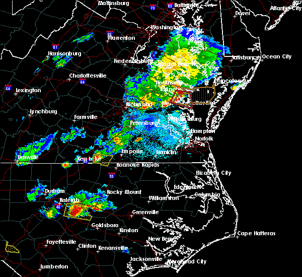 At 646 pm edt, a severe thunderstorm was located over ebony, or 8 miles southeast of brodnax, moving east at 30 mph (radar indicated). Hazards include 60 mph wind gusts and quarter size hail. Hail damage to vehicles is expected. expect wind damage to roofs, siding, and trees. this severe storm will be near, brunswick and gasburg around 655 pm edt. other locations impacted by this severe thunderstorm include triplet, valentines, white plains, ante, bowens corner, henrico, lake gaston and roanoke rapids lake. precautionary/preparedness actions, for your protection move to an interior room on the lowest floor of a building. please send your reports of hail and or wind damage, including trees or large limbs downed, by calling noaa`s national weather service in wakefield at , 7 5 7, 8 9 9, 2 4 1 5. At 646 pm edt, a severe thunderstorm was located over ebony, or 8 miles southeast of brodnax, moving east at 30 mph (radar indicated). Hazards include 60 mph wind gusts and quarter size hail. Hail damage to vehicles is expected. expect wind damage to roofs, siding, and trees. this severe storm will be near, brunswick and gasburg around 655 pm edt. other locations impacted by this severe thunderstorm include triplet, valentines, white plains, ante, bowens corner, henrico, lake gaston and roanoke rapids lake. precautionary/preparedness actions, for your protection move to an interior room on the lowest floor of a building. please send your reports of hail and or wind damage, including trees or large limbs downed, by calling noaa`s national weather service in wakefield at , 7 5 7, 8 9 9, 2 4 1 5.
|
| 5/3/2016 6:29 PM EDT |
 At 629 pm edt, a severe thunderstorm was located near la crosse, or 7 miles southwest of brodnax, moving east at 25 mph (radar indicated). Hazards include 60 mph wind gusts and quarter size hail. Hail damage to vehicles is expected. expect wind damage to roofs, siding, and trees. this severe thunderstorm will be near, brodnax around 635 pm edt. ebony around 645 pm edt. brunswick and gasburg around 655 pm edt. Other locations impacted by this severe thunderstorm include triplet, valentines, white plains, ante, bowens corner, bracey, henrico, lake gaston and roanoke rapids lake. At 629 pm edt, a severe thunderstorm was located near la crosse, or 7 miles southwest of brodnax, moving east at 25 mph (radar indicated). Hazards include 60 mph wind gusts and quarter size hail. Hail damage to vehicles is expected. expect wind damage to roofs, siding, and trees. this severe thunderstorm will be near, brodnax around 635 pm edt. ebony around 645 pm edt. brunswick and gasburg around 655 pm edt. Other locations impacted by this severe thunderstorm include triplet, valentines, white plains, ante, bowens corner, bracey, henrico, lake gaston and roanoke rapids lake.
|
| 2/24/2016 6:51 PM EST |
 At 651 pm est, doppler radar indicated a line of severe thunderstorms capable of producing damaging winds in excess of 60 mph. these storms were located along a line extending from near brunswick to near warrenton, and moving northeast at 85 mph. * severe thunderstorms will be near, purdy around 700 pm est. ebony and gasburg around 705 pm est. brunswick around 710 pm est. lawrenceville around 715 pm est. other locations impacted by these severe thunderstorms include valentines, edgerton, warfield, fields crossroads, dolphin, ante, bowens corner, triplet, callaville and cowie corner. a tornado watch remains in effect until 900 pm est for northeastern north carolina, and southeastern virginia. a tornado watch also remains in effect until 1100 pm est for northeastern north carolina. At 651 pm est, doppler radar indicated a line of severe thunderstorms capable of producing damaging winds in excess of 60 mph. these storms were located along a line extending from near brunswick to near warrenton, and moving northeast at 85 mph. * severe thunderstorms will be near, purdy around 700 pm est. ebony and gasburg around 705 pm est. brunswick around 710 pm est. lawrenceville around 715 pm est. other locations impacted by these severe thunderstorms include valentines, edgerton, warfield, fields crossroads, dolphin, ante, bowens corner, triplet, callaville and cowie corner. a tornado watch remains in effect until 900 pm est for northeastern north carolina, and southeastern virginia. a tornado watch also remains in effect until 1100 pm est for northeastern north carolina.
|
| 2/24/2016 6:51 PM EST |
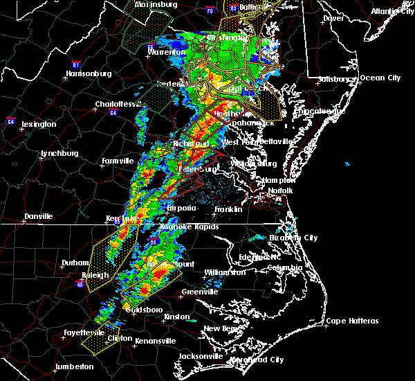 At 651 pm est, doppler radar indicated a line of severe thunderstorms capable of producing damaging winds in excess of 60 mph. these storms were located along a line extending from near brunswick to near warrenton, and moving northeast at 85 mph. * severe thunderstorms will be near, purdy around 700 pm est. ebony and gasburg around 705 pm est. brunswick around 710 pm est. lawrenceville around 715 pm est. other locations impacted by these severe thunderstorms include valentines, edgerton, warfield, fields crossroads, dolphin, ante, bowens corner, triplet, callaville and cowie corner. a tornado watch remains in effect until 900 pm est for northeastern north carolina, and southeastern virginia. a tornado watch also remains in effect until 1100 pm est for northeastern north carolina. At 651 pm est, doppler radar indicated a line of severe thunderstorms capable of producing damaging winds in excess of 60 mph. these storms were located along a line extending from near brunswick to near warrenton, and moving northeast at 85 mph. * severe thunderstorms will be near, purdy around 700 pm est. ebony and gasburg around 705 pm est. brunswick around 710 pm est. lawrenceville around 715 pm est. other locations impacted by these severe thunderstorms include valentines, edgerton, warfield, fields crossroads, dolphin, ante, bowens corner, triplet, callaville and cowie corner. a tornado watch remains in effect until 900 pm est for northeastern north carolina, and southeastern virginia. a tornado watch also remains in effect until 1100 pm est for northeastern north carolina.
|
| 2/24/2016 6:11 PM EST |
 At 610 pm est, doppler radar indicated a possible tornado. this dangerous storm was located near gasburg, or 13 miles northeast of warrenton, and moving northeast at 50 mph. * this dangerous storm will be near, gasburg around 615 pm est. brunswick around 620 pm est. barley around 625 pm est. radium around 635 pm est. emporia around 640 pm est. purdy and jarratt around 645 pm est. other locations impacted by this tornadic thunderstorm include valentines, lanes corner, edgerton, grizzard, fields crossroads, durand, emporia reservoir, ante, mason and triplet. At 610 pm est, doppler radar indicated a possible tornado. this dangerous storm was located near gasburg, or 13 miles northeast of warrenton, and moving northeast at 50 mph. * this dangerous storm will be near, gasburg around 615 pm est. brunswick around 620 pm est. barley around 625 pm est. radium around 635 pm est. emporia around 640 pm est. purdy and jarratt around 645 pm est. other locations impacted by this tornadic thunderstorm include valentines, lanes corner, edgerton, grizzard, fields crossroads, durand, emporia reservoir, ante, mason and triplet.
|
| 2/24/2016 6:11 PM EST |
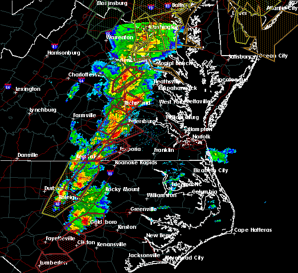 At 610 pm est, doppler radar indicated a possible tornado. this dangerous storm was located near gasburg, or 13 miles northeast of warrenton, and moving northeast at 50 mph. * this dangerous storm will be near, gasburg around 615 pm est. brunswick around 620 pm est. barley around 625 pm est. radium around 635 pm est. emporia around 640 pm est. purdy and jarratt around 645 pm est. other locations impacted by this tornadic thunderstorm include valentines, lanes corner, edgerton, grizzard, fields crossroads, durand, emporia reservoir, ante, mason and triplet. At 610 pm est, doppler radar indicated a possible tornado. this dangerous storm was located near gasburg, or 13 miles northeast of warrenton, and moving northeast at 50 mph. * this dangerous storm will be near, gasburg around 615 pm est. brunswick around 620 pm est. barley around 625 pm est. radium around 635 pm est. emporia around 640 pm est. purdy and jarratt around 645 pm est. other locations impacted by this tornadic thunderstorm include valentines, lanes corner, edgerton, grizzard, fields crossroads, durand, emporia reservoir, ante, mason and triplet.
|
| 2/24/2016 5:32 PM EST |
 At 531 pm est, doppler radar indicated a possible tornado. this dangerous storm was located near norlina, or 7 miles north of warrenton, and moving northeast at 60 mph. * this dangerous storm will be near, ebony around 540 pm est. brodnax and gasburg around 545 pm est. brunswick around 550 pm est. lawrenceville around 555 pm est. alberta around 600 pm est. other locations impacted by this tornadic thunderstorm include edgerton, warfield, prices mill, fields crossroads, durand, dolphin, ante, bowens corner, cochran and callaville. At 531 pm est, doppler radar indicated a possible tornado. this dangerous storm was located near norlina, or 7 miles north of warrenton, and moving northeast at 60 mph. * this dangerous storm will be near, ebony around 540 pm est. brodnax and gasburg around 545 pm est. brunswick around 550 pm est. lawrenceville around 555 pm est. alberta around 600 pm est. other locations impacted by this tornadic thunderstorm include edgerton, warfield, prices mill, fields crossroads, durand, dolphin, ante, bowens corner, cochran and callaville.
|
| 2/21/2014 12:08 PM EST | Tree blown down on power line starting fire in halifax county NC, 5.2 miles NNW of Gasburg, VA |
| 4/19/2013 7:50 PM EDT | Trees down. power outages due to trees on powerline in northampton county NC, 3.3 miles NW of Gasburg, VA |
| 6/1/2012 6:25 PM EDT | Trees down across central brunswick county in brunswick county VA, 5.9 miles S of Gasburg, VA |
| 5/1/2012 5:37 PM EDT | Trees down on timberline d in northampton county NC, 1.7 miles N of Gasburg, VA |
| 5/1/2012 5:33 PM EDT | Trees down on oak grove rd in brunswick county VA, 1.7 miles E of Gasburg, VA |
| 5/1/2012 5:27 PM EDT | Numerous trees reported down... some on homes... along hickory farm roa in warren county NC, 3.8 miles NE of Gasburg, VA |
| 1/1/0001 12:00 AM | Downed utility line in brunswick county VA, 6.1 miles SSE of Gasburg, VA |
| 1/1/0001 12:00 AM | Trees down at cross cut subdivision on the eastern shore of lake gaston near the da in halifax county NC, 5.8 miles NNW of Gasburg, VA |
Hail Maps for Gasburg, VA


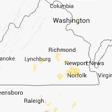


Connect with Interactive Hail Maps