

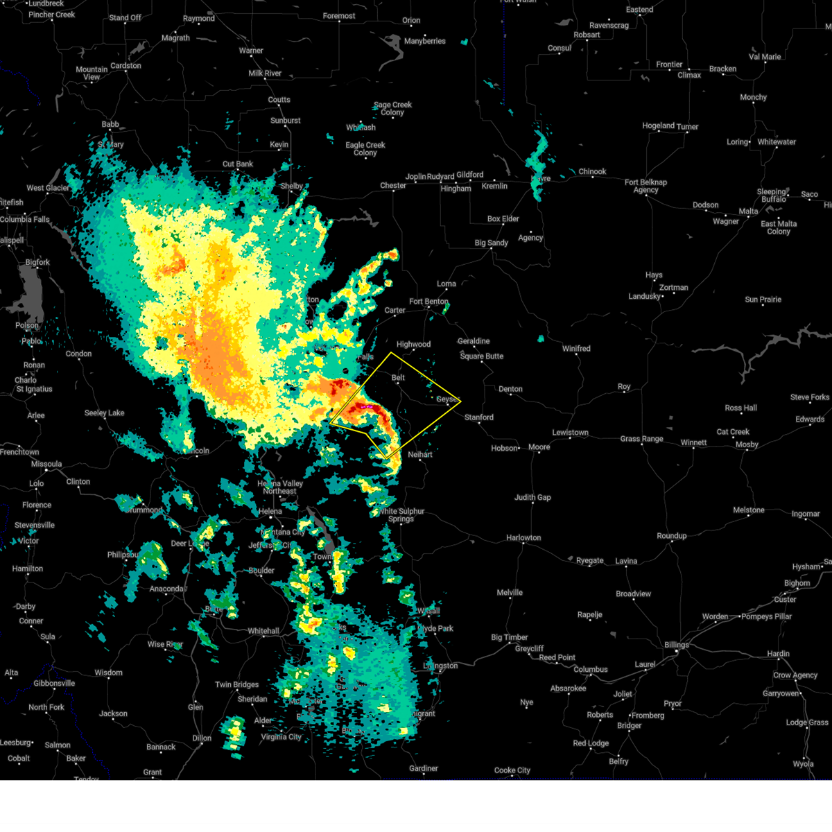
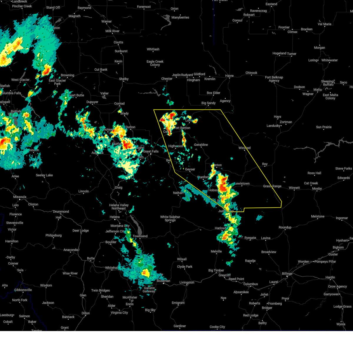
Hail Map for Geyser, MT
The Geyser, MT area has had 8 reports of on-the-ground hail by trained spotters, and has been under severe weather warnings 8 times during the past 12 months. Doppler radar has detected hail at or near Geyser, MT on 34 occasions, including 3 occasions during the past year.
| Name: | Geyser, MT |
| Where Located: | 41.6 miles ESE of Great Falls, MT |
| Map: | Google Map for Geyser, MT |
| Population: | 87 |
| Housing Units: | 57 |
| More Info: | Search Google for Geyser, MT |
2
The Top Recent Hail Date for Geyser, MT is Sunday, August 18, 2024 (5th out of 34)

Hail and Wind Damage Spotted near Geyser, MT
| Date / Time | Report Details |
|---|---|
| 6/19/2025 7:45 PM MDT | Mesonet station mtgys geyser (mt dot in judith basin county MT, 1.2 miles NW of Geyser, MT |
| 9/11/2024 7:15 PM MDT |
 The storms which prompted the warning have weakened below severe limits, and no longer pose an immediate threat to life or property. therefore, the warning has been allowed to expire. however, gusty winds are still possible with these thunderstorms. The storms which prompted the warning have weakened below severe limits, and no longer pose an immediate threat to life or property. therefore, the warning has been allowed to expire. however, gusty winds are still possible with these thunderstorms.
|
| 9/11/2024 7:07 PM MDT |
 At 707 pm mdt, severe thunderstorms were located along a line extending from 17 miles south of great falls to 10 miles southwest of belt to 18 miles southwest of geyser, moving east at 45 mph (radar indicated). Hazards include 60 mph wind gusts and penny size hail. Expect damage to roofs, siding, and trees. Locations impacted include, belt, geyser, raynesford, armington, monarch, sluice boxes state park, eden, sand coulee, stockett, tracy, and centerville. At 707 pm mdt, severe thunderstorms were located along a line extending from 17 miles south of great falls to 10 miles southwest of belt to 18 miles southwest of geyser, moving east at 45 mph (radar indicated). Hazards include 60 mph wind gusts and penny size hail. Expect damage to roofs, siding, and trees. Locations impacted include, belt, geyser, raynesford, armington, monarch, sluice boxes state park, eden, sand coulee, stockett, tracy, and centerville.
|
| 9/11/2024 6:57 PM MDT |
 At 657 pm mdt, severe thunderstorms were located along a line extending from 14 miles southeast of cascade to 16 miles southwest of belt to 25 miles southwest of geyser, moving northeast at 35 mph (radar indicated). Hazards include 70 mph wind gusts and penny size hail. Expect considerable tree damage. damage is likely to mobile homes, roofs, and outbuildings. Locations impacted include, belt, geyser, raynesford, armington, monarch, sluice boxes state park, eden, sand coulee, stockett, tracy, and centerville. At 657 pm mdt, severe thunderstorms were located along a line extending from 14 miles southeast of cascade to 16 miles southwest of belt to 25 miles southwest of geyser, moving northeast at 35 mph (radar indicated). Hazards include 70 mph wind gusts and penny size hail. Expect considerable tree damage. damage is likely to mobile homes, roofs, and outbuildings. Locations impacted include, belt, geyser, raynesford, armington, monarch, sluice boxes state park, eden, sand coulee, stockett, tracy, and centerville.
|
| 9/11/2024 6:45 PM MDT |
 Svrtfx the national weather service in great falls has issued a * severe thunderstorm warning for, northwestern meagher county in central montana, northwestern judith basin county in central montana, southwestern chouteau county in north central montana, eastern cascade county in central montana, * until 715 pm mdt. * at 645 pm mdt, severe thunderstorms were located along a line extending from 15 miles southeast of cascade to 21 miles southwest of belt to 29 miles southwest of geyser, moving northeast at 45 mph (radar indicated). Hazards include 70 mph wind gusts and penny size hail. Expect considerable tree damage. Damage is likely to mobile homes, roofs, and outbuildings. Svrtfx the national weather service in great falls has issued a * severe thunderstorm warning for, northwestern meagher county in central montana, northwestern judith basin county in central montana, southwestern chouteau county in north central montana, eastern cascade county in central montana, * until 715 pm mdt. * at 645 pm mdt, severe thunderstorms were located along a line extending from 15 miles southeast of cascade to 21 miles southwest of belt to 29 miles southwest of geyser, moving northeast at 45 mph (radar indicated). Hazards include 70 mph wind gusts and penny size hail. Expect considerable tree damage. Damage is likely to mobile homes, roofs, and outbuildings.
|
| 8/23/2024 5:23 PM MDT |
 Svrtfx the national weather service in great falls has issued a * severe thunderstorm warning for, judith basin county in central montana, fergus county in central montana, southwestern blaine county in north central montana, chouteau county in north central montana, northeastern cascade county in central montana, * until 630 pm mdt. * at 523 pm mdt, severe thunderstorms were located along a line extending from 15 miles southeast of the knees to 8 miles east of geyser to 16 miles south of moore, moving east at 30 mph (radar indicated). Hazards include 70 mph wind gusts. Expect considerable tree damage. Damage is likely to mobile homes, roofs, and outbuildings. Svrtfx the national weather service in great falls has issued a * severe thunderstorm warning for, judith basin county in central montana, fergus county in central montana, southwestern blaine county in north central montana, chouteau county in north central montana, northeastern cascade county in central montana, * until 630 pm mdt. * at 523 pm mdt, severe thunderstorms were located along a line extending from 15 miles southeast of the knees to 8 miles east of geyser to 16 miles south of moore, moving east at 30 mph (radar indicated). Hazards include 70 mph wind gusts. Expect considerable tree damage. Damage is likely to mobile homes, roofs, and outbuildings.
|
| 8/23/2024 5:16 PM MDT | 63 mph thunderstorm wind gus in judith basin county MT, 6.9 miles W of Geyser, MT |
| 8/23/2024 5:15 PM MDT | Corrects previous non-tstm wnd gst report from 2 sse geyser. mesonet station mtgys geyser (mt dot in judith basin county MT, 1.2 miles NW of Geyser, MT |
| 8/21/2024 5:46 PM MDT | 60 mph thunderstorm wind gust at geyser awo in judith basin county MT, 6.9 miles W of Geyser, MT |
| 8/18/2024 7:58 PM MDT |
 the severe thunderstorm warning has been cancelled and is no longer in effect the severe thunderstorm warning has been cancelled and is no longer in effect
|
| 8/18/2024 7:45 PM MDT |
 At 745 pm mdt, a severe thunderstorm was located over geyser, or 16 miles northwest of stanford, moving north at 15 mph (radar indicated). Hazards include 60 mph wind gusts and penny size hail. Expect damage to roofs, siding, and trees. Locations impacted include, geyser. At 745 pm mdt, a severe thunderstorm was located over geyser, or 16 miles northwest of stanford, moving north at 15 mph (radar indicated). Hazards include 60 mph wind gusts and penny size hail. Expect damage to roofs, siding, and trees. Locations impacted include, geyser.
|
| 8/18/2024 7:30 PM MDT | Svrtfx the national weather service in great falls has issued a * severe thunderstorm warning for, northwestern judith basin county in central montana, * until 815 pm mdt. * at 729 pm mdt, a severe thunderstorm was located over geyser, or 14 miles northwest of stanford, moving north at 10 mph (radar indicated). Hazards include 60 mph wind gusts and quarter size hail. Hail damage to vehicles is expected. Expect wind damage to roofs, siding, and trees. |
| 8/18/2023 4:47 PM MDT |
 At 447 pm mdt, severe thunderstorms were located along a line extending from 10 miles north of geyser to near stanford to 12 miles south of hobson, moving northeast at 45 mph (radar indicated). Hazards include 60 mph wind gusts. expect damage to roofs, siding, and trees At 447 pm mdt, severe thunderstorms were located along a line extending from 10 miles north of geyser to near stanford to 12 miles south of hobson, moving northeast at 45 mph (radar indicated). Hazards include 60 mph wind gusts. expect damage to roofs, siding, and trees
|
| 6/8/2023 8:20 PM MDT | Mesonet station mtgys geyser (mt dot in judith basin county MT, 1.2 miles NW of Geyser, MT |
| 9/7/2022 6:53 PM MDT |
 At 652 pm mdt, severe thunderstorms were located along a line extending from 12 miles west of fort benton to 7 miles southwest of geyser to 14 miles east of white sulphur springs, moving east at 40 mph (radar indicated). Hazards include 60 mph wind gusts, with widespread blowing dust and smoke. Expect damage to roofs, siding, and trees. visibility will be reduced to less than 2 miles at times in blowing dust and smoke. locations impacted include, fort benton, stanford, geraldine, geyser, highwood, carter, floweree, raynesford, windham, sapphire village, utica, shonkin, loma, square butte, checkerboard, benchland and armington. hail threat, radar indicated max hail size, <. 75 in wind threat, radar indicated max wind gust, 60 mph. At 652 pm mdt, severe thunderstorms were located along a line extending from 12 miles west of fort benton to 7 miles southwest of geyser to 14 miles east of white sulphur springs, moving east at 40 mph (radar indicated). Hazards include 60 mph wind gusts, with widespread blowing dust and smoke. Expect damage to roofs, siding, and trees. visibility will be reduced to less than 2 miles at times in blowing dust and smoke. locations impacted include, fort benton, stanford, geraldine, geyser, highwood, carter, floweree, raynesford, windham, sapphire village, utica, shonkin, loma, square butte, checkerboard, benchland and armington. hail threat, radar indicated max hail size, <. 75 in wind threat, radar indicated max wind gust, 60 mph.
|
| 9/7/2022 6:32 PM MDT |
 At 630 pm mdt, severe thunderstorms were located along a line extending from 16 miles north of black eagle to 19 miles southwest of geyser to near white sulphur springs, moving east at 40 mph (radar indicated). Hazards include 70 mph wind gusts, and widespread blowing dust. Expect considerable tree damage. damage is likely to mobile homes, roofs, and outbuildings. Visibility will be reduced to less than 2 miles at times in blowing dust. At 630 pm mdt, severe thunderstorms were located along a line extending from 16 miles north of black eagle to 19 miles southwest of geyser to near white sulphur springs, moving east at 40 mph (radar indicated). Hazards include 70 mph wind gusts, and widespread blowing dust. Expect considerable tree damage. damage is likely to mobile homes, roofs, and outbuildings. Visibility will be reduced to less than 2 miles at times in blowing dust.
|
| 9/7/2022 6:13 PM MDT |
 At 611 pm mdt, severe thunderstorms were located along a line extending from 9 miles east of dutton to 19 miles south of belt to near townsend, moving east at 50 mph (radar indicated). Hazards include 70 mph wind gusts, and blowing dust. Expect considerable tree damage. damage is likely to mobile homes, roofs, and outbuildings. visibility will be reduced to less than 2 miles at times in blowing dust. locations impacted include, great falls, townsend, fort benton, white sulphur springs, stanford, belt, dutton, highwood, black eagle, geyser, power, carter, neihart, fort logan on the smith river, floweree, eden, sapphire village, fort logan, stockett and first peoples buffalo jump state park. thunderstorm damage threat, considerable hail threat, radar indicated max hail size, <. 75 in wind threat, radar indicated max wind gust, 70 mph. At 611 pm mdt, severe thunderstorms were located along a line extending from 9 miles east of dutton to 19 miles south of belt to near townsend, moving east at 50 mph (radar indicated). Hazards include 70 mph wind gusts, and blowing dust. Expect considerable tree damage. damage is likely to mobile homes, roofs, and outbuildings. visibility will be reduced to less than 2 miles at times in blowing dust. locations impacted include, great falls, townsend, fort benton, white sulphur springs, stanford, belt, dutton, highwood, black eagle, geyser, power, carter, neihart, fort logan on the smith river, floweree, eden, sapphire village, fort logan, stockett and first peoples buffalo jump state park. thunderstorm damage threat, considerable hail threat, radar indicated max hail size, <. 75 in wind threat, radar indicated max wind gust, 70 mph.
|
| 9/7/2022 5:57 PM MDT |
 At 556 pm mdt, severe thunderstorms were located along a line extending from near dutton to 23 miles southeast of cascade to 10 miles southwest of townsend, moving east at 50 mph (radar indicated). Hazards include 70 mph wind gusts. Expect considerable tree damage. Damage is likely to mobile homes, roofs, and outbuildings. At 556 pm mdt, severe thunderstorms were located along a line extending from near dutton to 23 miles southeast of cascade to 10 miles southwest of townsend, moving east at 50 mph (radar indicated). Hazards include 70 mph wind gusts. Expect considerable tree damage. Damage is likely to mobile homes, roofs, and outbuildings.
|
| 7/15/2022 1:12 PM MDT |
 At 111 pm mdt, severe thunderstorms were located along a line extending from 6 miles northeast of highwood to near geyser, moving northeast at 45 mph (radar indicated). Hazards include 60 mph wind gusts and penny size hail. expect damage to roofs, siding, and trees At 111 pm mdt, severe thunderstorms were located along a line extending from 6 miles northeast of highwood to near geyser, moving northeast at 45 mph (radar indicated). Hazards include 60 mph wind gusts and penny size hail. expect damage to roofs, siding, and trees
|
| 7/15/2022 1:12 PM MDT |
 The severe thunderstorm warning for north central meagher, northwestern judith basin, chouteau and cascade counties will expire at 115 pm mdt, the storms which prompted the warning have moved out of the area. therefore, the warning will be allowed to expire. however gusty winds are still possible with these thunderstorms. a severe thunderstorm watch remains in effect until 700 pm mdt for central and north central montana. The severe thunderstorm warning for north central meagher, northwestern judith basin, chouteau and cascade counties will expire at 115 pm mdt, the storms which prompted the warning have moved out of the area. therefore, the warning will be allowed to expire. however gusty winds are still possible with these thunderstorms. a severe thunderstorm watch remains in effect until 700 pm mdt for central and north central montana.
|
| 7/15/2022 12:48 PM MDT |
 At 1247 pm mdt, severe thunderstorms were located along a line extending from 6 miles west of brady to 22 miles south of geyser, moving northeast at 35 mph (radar indicated. at 1229 pm 66 mph wind gust was reported near ulm). Hazards include 60 mph wind gusts. Expect damage to roofs, siding, and trees. locations impacted include, great falls, fort benton, stanford, belt, geraldine, fort shaw, the knees, highwood, black eagle, geyser, fort shaw, carter, neihart, floweree, eden, stockett, first peoples buffalo jump state park, shonkin, loma and ulm. hail threat, radar indicated max hail size, <. 75 in wind threat, observed max wind gust, 60 mph. At 1247 pm mdt, severe thunderstorms were located along a line extending from 6 miles west of brady to 22 miles south of geyser, moving northeast at 35 mph (radar indicated. at 1229 pm 66 mph wind gust was reported near ulm). Hazards include 60 mph wind gusts. Expect damage to roofs, siding, and trees. locations impacted include, great falls, fort benton, stanford, belt, geraldine, fort shaw, the knees, highwood, black eagle, geyser, fort shaw, carter, neihart, floweree, eden, stockett, first peoples buffalo jump state park, shonkin, loma and ulm. hail threat, radar indicated max hail size, <. 75 in wind threat, observed max wind gust, 60 mph.
|
| 7/15/2022 12:13 PM MDT |
 At 1213 pm mdt, severe thunderstorms were located along a line extending from near choteau to 14 miles north of white sulphur springs, moving northeast at 35 mph (radar indicated). Hazards include 60 mph wind gusts. expect damage to roofs, siding, and trees At 1213 pm mdt, severe thunderstorms were located along a line extending from near choteau to 14 miles north of white sulphur springs, moving northeast at 35 mph (radar indicated). Hazards include 60 mph wind gusts. expect damage to roofs, siding, and trees
|
| 7/8/2022 6:37 PM MDT | Mesonet station mtgys geyser (mt dot in judith basin county MT, 1.2 miles NW of Geyser, MT |
| 7/7/2022 9:13 PM MDT |
 The severe thunderstorm warning for northwestern judith basin and western fergus counties will expire at 915 pm mdt, the storms which prompted the warning have weakened below severe limits, and no longer pose an immediate threat to life or property. therefore, the warning will be allowed to expire. a severe thunderstorm watch remains in effect until midnight mdt for central montana. remember, a severe thunderstorm warning still remains in effect for parts of northern judith basin county until 10 pm mdt!. The severe thunderstorm warning for northwestern judith basin and western fergus counties will expire at 915 pm mdt, the storms which prompted the warning have weakened below severe limits, and no longer pose an immediate threat to life or property. therefore, the warning will be allowed to expire. a severe thunderstorm watch remains in effect until midnight mdt for central montana. remember, a severe thunderstorm warning still remains in effect for parts of northern judith basin county until 10 pm mdt!.
|
| 7/7/2022 9:09 PM MDT |
 At 908 pm mdt, severe thunderstorms were located along a line extending from 10 miles north of belt to near highwood to 16 miles west of geraldine to near geyser, moving northeast at 30 mph (radar indicated). Hazards include quarter size hail. damage to vehicles is expected At 908 pm mdt, severe thunderstorms were located along a line extending from 10 miles north of belt to near highwood to 16 miles west of geraldine to near geyser, moving northeast at 30 mph (radar indicated). Hazards include quarter size hail. damage to vehicles is expected
|
| 7/7/2022 8:24 PM MDT |
 At 823 pm mdt, severe thunderstorms were located along a line extending from 17 miles southeast of belt to 8 miles south of geyser to near stanford, moving northeast at 20 mph (radar indicated). Hazards include quarter size hail. damage to vehicles is expected At 823 pm mdt, severe thunderstorms were located along a line extending from 17 miles southeast of belt to 8 miles south of geyser to near stanford, moving northeast at 20 mph (radar indicated). Hazards include quarter size hail. damage to vehicles is expected
|
| 5/5/2022 8:49 PM MDT |
 At 847 pm mdt, a line of thunderstorms with severe wind gusts was located along a line extending from 10 miles northeast of black eagle to near belt to 23 miles west of geyser, moving east at 50 mph (radar indicated and observed gusts in excess of 60 mph near great falls). Hazards include 60 mph wind gusts. expect damage to roofs, siding, and trees At 847 pm mdt, a line of thunderstorms with severe wind gusts was located along a line extending from 10 miles northeast of black eagle to near belt to 23 miles west of geyser, moving east at 50 mph (radar indicated and observed gusts in excess of 60 mph near great falls). Hazards include 60 mph wind gusts. expect damage to roofs, siding, and trees
|
| 12/23/2021 6:50 PM MST |
 At 648 pm mst, severe thunderstorms were located along a line extending from near big sandy to 9 miles southwest of fort benton to 9 miles south of belt, moving east at 60 mph (radar indicated). Hazards include 60 mph wind gusts. expect damage to roofs, siding, and trees At 648 pm mst, severe thunderstorms were located along a line extending from near big sandy to 9 miles southwest of fort benton to 9 miles south of belt, moving east at 60 mph (radar indicated). Hazards include 60 mph wind gusts. expect damage to roofs, siding, and trees
|
| 8/20/2020 5:37 PM MDT |
 At 537 pm mdt, a severe thunderstorm was located near geyser, or 11 miles northwest of stanford, moving east at 25 mph (radar indicated). Hazards include ping pong ball size hail and 60 mph wind gusts. People and animals outdoors will be injured. expect hail damage to roofs, siding, windows, and vehicles. Expect wind damage to roofs, siding, and trees. At 537 pm mdt, a severe thunderstorm was located near geyser, or 11 miles northwest of stanford, moving east at 25 mph (radar indicated). Hazards include ping pong ball size hail and 60 mph wind gusts. People and animals outdoors will be injured. expect hail damage to roofs, siding, windows, and vehicles. Expect wind damage to roofs, siding, and trees.
|
| 8/20/2020 5:26 PM MDT | Quarter sized hail reported 0.5 miles SSW of Geyser, MT, quarter-size hail pounds geyser for 10 min. |
| 8/20/2020 5:14 PM MDT |
 At 514 pm mdt, a severe thunderstorm was located over geyser, or 14 miles northwest of stanford, moving east at 25 mph (radar indicated). Hazards include 60 mph wind gusts and half dollar size hail. Hail damage to vehicles is expected. Expect wind damage to roofs, siding, and trees. At 514 pm mdt, a severe thunderstorm was located over geyser, or 14 miles northwest of stanford, moving east at 25 mph (radar indicated). Hazards include 60 mph wind gusts and half dollar size hail. Hail damage to vehicles is expected. Expect wind damage to roofs, siding, and trees.
|
| 8/20/2020 5:00 PM MDT | Quarter sized hail reported 11.1 miles E of Geyser, MT, during a period of time from 450 pm to 500 pm dime to quarter-size hail fell... along with a torrential downpour of large rain drops. spotter reports the ground partial |
| 7/3/2020 6:54 PM MDT |
 At 654 pm mdt, a severe thunderstorm was located 7 miles northwest of geyser, or 22 miles northwest of stanford, moving north at 20 mph (radar indicated). Hazards include 60 mph wind gusts and quarter size hail. Hail damage to vehicles is expected. Expect wind damage to roofs, siding, and trees. At 654 pm mdt, a severe thunderstorm was located 7 miles northwest of geyser, or 22 miles northwest of stanford, moving north at 20 mph (radar indicated). Hazards include 60 mph wind gusts and quarter size hail. Hail damage to vehicles is expected. Expect wind damage to roofs, siding, and trees.
|
| 5/19/2020 5:15 PM MDT |
 At 515 pm mdt, a severe thunderstorm was located 13 miles southwest of stanford, moving northeast at 25 mph (radar indicated). Hazards include 60 mph wind gusts and quarter size hail. Hail damage to vehicles is expected. Expect wind damage to roofs, siding, and trees. At 515 pm mdt, a severe thunderstorm was located 13 miles southwest of stanford, moving northeast at 25 mph (radar indicated). Hazards include 60 mph wind gusts and quarter size hail. Hail damage to vehicles is expected. Expect wind damage to roofs, siding, and trees.
|
| 5/18/2020 11:35 PM MDT | Mesonet station mtgys geyser (mt dot in judith basin county MT, 1.2 miles NW of Geyser, MT |
| 7/14/2019 5:27 PM MDT |
 The severe thunderstorm warning for north central judith basin county will expire at 530 pm mdt, the storm which prompted the warning has weakened below severe limits, and no longer poses an immediate threat to life or property. therefore, the warning will be allowed to expire. however small hail and gusty winds are still possible with this thunderstorm. The severe thunderstorm warning for north central judith basin county will expire at 530 pm mdt, the storm which prompted the warning has weakened below severe limits, and no longer poses an immediate threat to life or property. therefore, the warning will be allowed to expire. however small hail and gusty winds are still possible with this thunderstorm.
|
| 7/14/2019 5:24 PM MDT |
 At 524 pm mdt, a severe thunderstorm was located near geyser, or 9 miles west of stanford, moving east at 40 mph (radar indicated). Hazards include 60 mph wind gusts and quarter size hail. Hail damage to vehicles is expected. expect wind damage to roofs, siding, and trees. Locations impacted include, stanford, geyser and windham. At 524 pm mdt, a severe thunderstorm was located near geyser, or 9 miles west of stanford, moving east at 40 mph (radar indicated). Hazards include 60 mph wind gusts and quarter size hail. Hail damage to vehicles is expected. expect wind damage to roofs, siding, and trees. Locations impacted include, stanford, geyser and windham.
|
| 7/14/2019 5:04 PM MDT |
 At 503 pm mdt, a severe thunderstorm was located 12 miles southwest of geyser, or 22 miles west of stanford, moving east at 40 mph (radar indicated). Hazards include 60 mph wind gusts and quarter size hail. Hail damage to vehicles is expected. Expect wind damage to roofs, siding, and trees. At 503 pm mdt, a severe thunderstorm was located 12 miles southwest of geyser, or 22 miles west of stanford, moving east at 40 mph (radar indicated). Hazards include 60 mph wind gusts and quarter size hail. Hail damage to vehicles is expected. Expect wind damage to roofs, siding, and trees.
|
| 6/27/2019 4:58 PM MDT |
 At 457 pm mdt, severe thunderstorms were located along a line extending from near highwood to 12 miles south of stanford, moving northeast at 35 mph (radar indicated. at 415 pm tree damage, power outages and winds estimated to 70 mph were reported in belt). Hazards include 70 mph wind gusts and quarter size hail. Hail damage to vehicles is expected. expect considerable tree damage. wind damage is also likely to mobile homes, roofs, and outbuildings. Locations impacted include, fort benton, stanford, geraldine, hobson, geyser, highwood, windham, moccasin, utica, shonkin, coffee creek, square butte and benchland. At 457 pm mdt, severe thunderstorms were located along a line extending from near highwood to 12 miles south of stanford, moving northeast at 35 mph (radar indicated. at 415 pm tree damage, power outages and winds estimated to 70 mph were reported in belt). Hazards include 70 mph wind gusts and quarter size hail. Hail damage to vehicles is expected. expect considerable tree damage. wind damage is also likely to mobile homes, roofs, and outbuildings. Locations impacted include, fort benton, stanford, geraldine, hobson, geyser, highwood, windham, moccasin, utica, shonkin, coffee creek, square butte and benchland.
|
| 6/27/2019 4:49 PM MDT |
 The national weather service in great falls has issued a * severe thunderstorm warning for. northeastern judith basin county in central montana. west central fergus county in central montana. south central chouteau county in north central montana. Until 515 pm mdt. The national weather service in great falls has issued a * severe thunderstorm warning for. northeastern judith basin county in central montana. west central fergus county in central montana. south central chouteau county in north central montana. Until 515 pm mdt.
|
| 6/27/2019 4:45 PM MDT | Awos station k1bm brav in judith basin county MT, 5.9 miles W of Geyser, MT |
| 6/27/2019 4:28 PM MDT |
 At 428 pm mdt, severe thunderstorms were located along a line extending from belt to 14 miles southwest of stanford, moving northeast at 40 mph (radar indicated). Hazards include 60 mph wind gusts and quarter size hail. Hail damage to vehicles is expected. expect wind damage to roofs, siding, and trees. Locations impacted include, stanford, belt, highwood, geyser, raynesford and armington. At 428 pm mdt, severe thunderstorms were located along a line extending from belt to 14 miles southwest of stanford, moving northeast at 40 mph (radar indicated). Hazards include 60 mph wind gusts and quarter size hail. Hail damage to vehicles is expected. expect wind damage to roofs, siding, and trees. Locations impacted include, stanford, belt, highwood, geyser, raynesford and armington.
|
| 6/27/2019 4:10 PM MDT |
 At 409 pm mdt, severe thunderstorms were located along a line extending from 11 miles west of belt to 23 miles southwest of stanford, moving northeast at 40 mph (radar indicated). Hazards include 60 mph wind gusts and quarter size hail. Hail damage to vehicles is expected. Expect wind damage to roofs, siding, and trees. At 409 pm mdt, severe thunderstorms were located along a line extending from 11 miles west of belt to 23 miles southwest of stanford, moving northeast at 40 mph (radar indicated). Hazards include 60 mph wind gusts and quarter size hail. Hail damage to vehicles is expected. Expect wind damage to roofs, siding, and trees.
|
| 6/18/2019 5:27 PM MDT |
 The severe thunderstorm warning for northwestern judith basin and northeastern cascade counties will expire at 530 pm mdt, the storm which prompted the warning has weakened below severe limits, and no longer poses an immediate threat to life or property. therefore, the warning will be allowed to expire. however small hail, gusty winds and heavy rain are still possible with this thunderstorm as it moves southeast across judith basin county. The severe thunderstorm warning for northwestern judith basin and northeastern cascade counties will expire at 530 pm mdt, the storm which prompted the warning has weakened below severe limits, and no longer poses an immediate threat to life or property. therefore, the warning will be allowed to expire. however small hail, gusty winds and heavy rain are still possible with this thunderstorm as it moves southeast across judith basin county.
|
| 6/18/2019 4:44 PM MDT |
 At 443 pm mdt, a severe thunderstorm was located near belt, or 16 miles southeast of great falls, moving southeast at 25 mph (hail up to one inch in diameter has been reported with this storm near malmstrom air force base). Hazards include 60 mph wind gusts and quarter size hail. Hail damage to vehicles is expected. expect wind damage to roofs, siding, and trees. This severe thunderstorm will remain over mainly rural areas of northwestern judith basin and northeastern cascade counties, including the following locations, sluice boxes state park, raynesford, armington, monarch and centerville. At 443 pm mdt, a severe thunderstorm was located near belt, or 16 miles southeast of great falls, moving southeast at 25 mph (hail up to one inch in diameter has been reported with this storm near malmstrom air force base). Hazards include 60 mph wind gusts and quarter size hail. Hail damage to vehicles is expected. expect wind damage to roofs, siding, and trees. This severe thunderstorm will remain over mainly rural areas of northwestern judith basin and northeastern cascade counties, including the following locations, sluice boxes state park, raynesford, armington, monarch and centerville.
|
| 7/10/2018 2:36 PM MDT |
 At 235 pm mdt, a severe thunderstorm was located 9 miles south of geraldine, or 22 miles north of stanford, moving northeast at 40 mph (radar indicated). Hazards include ping pong ball size hail and 60 mph wind gusts. People and animals outdoors will be injured. expect hail damage to roofs, siding, windows, and vehicles. expect wind damage to roofs, siding, and trees. Locations impacted include, geraldine, denton, geyser, coffee creek and square butte. At 235 pm mdt, a severe thunderstorm was located 9 miles south of geraldine, or 22 miles north of stanford, moving northeast at 40 mph (radar indicated). Hazards include ping pong ball size hail and 60 mph wind gusts. People and animals outdoors will be injured. expect hail damage to roofs, siding, windows, and vehicles. expect wind damage to roofs, siding, and trees. Locations impacted include, geraldine, denton, geyser, coffee creek and square butte.
|
| 7/10/2018 2:12 PM MDT |
 At 212 pm mdt, a severe thunderstorm was located near geyser, or 19 miles northwest of stanford, moving northeast at 40 mph (radar indicated). Hazards include 60 mph wind gusts and quarter size hail. Hail damage to vehicles is expected. Expect wind damage to roofs, siding, and trees. At 212 pm mdt, a severe thunderstorm was located near geyser, or 19 miles northwest of stanford, moving northeast at 40 mph (radar indicated). Hazards include 60 mph wind gusts and quarter size hail. Hail damage to vehicles is expected. Expect wind damage to roofs, siding, and trees.
|
| 6/9/2018 6:35 PM MDT |
 At 634 pm mdt, severe thunderstorms were located along a line extending from 8 miles south of highwood to 18 miles southwest of hobson, moving north at 40 mph (radar indicated). Hazards include 70 mph wind gusts. Expect considerable tree damage. Damage is likely to mobile homes, roofs, and outbuildings. At 634 pm mdt, severe thunderstorms were located along a line extending from 8 miles south of highwood to 18 miles southwest of hobson, moving north at 40 mph (radar indicated). Hazards include 70 mph wind gusts. Expect considerable tree damage. Damage is likely to mobile homes, roofs, and outbuildings.
|
| 6/4/2018 7:56 PM MDT |
 At 756 pm mdt, a severe thunderstorm was located near geyser, or 14 miles west of stanford, moving east at 55 mph (radar indicated). Hazards include 60 mph wind gusts and quarter size hail. Hail damage to vehicles is expected. Expect wind damage to roofs, siding, and trees. At 756 pm mdt, a severe thunderstorm was located near geyser, or 14 miles west of stanford, moving east at 55 mph (radar indicated). Hazards include 60 mph wind gusts and quarter size hail. Hail damage to vehicles is expected. Expect wind damage to roofs, siding, and trees.
|
| 6/4/2018 4:42 PM MDT |
 At 442 pm mdt, a severe thunderstorm was located near geyser, or 12 miles northwest of stanford, moving east at 45 mph (spotter reported quarter-size hail in geyser). Hazards include 60 mph wind gusts and quarter size hail. Hail damage to vehicles is expected. Expect wind damage to roofs, siding, and trees. At 442 pm mdt, a severe thunderstorm was located near geyser, or 12 miles northwest of stanford, moving east at 45 mph (spotter reported quarter-size hail in geyser). Hazards include 60 mph wind gusts and quarter size hail. Hail damage to vehicles is expected. Expect wind damage to roofs, siding, and trees.
|
| 6/4/2018 4:40 PM MDT | Quarter sized hail reported 1.1 miles S of Geyser, MT, chaser/spotter reported quarter-size hail in geyser. size was estimated. |
| 8/10/2016 12:32 AM MDT |
 At 1231 am mdt, a severe thunderstorm was located near geyser, or 19 miles northwest of stanford, moving northeast at 40 mph (radar indicated). Hazards include 60 mph wind gusts and quarter size hail. Hail damage to vehicles is expected. Expect wind damage to roofs, siding, and trees. At 1231 am mdt, a severe thunderstorm was located near geyser, or 19 miles northwest of stanford, moving northeast at 40 mph (radar indicated). Hazards include 60 mph wind gusts and quarter size hail. Hail damage to vehicles is expected. Expect wind damage to roofs, siding, and trees.
|
| 8/9/2016 7:07 PM MDT |
 The severe thunderstorm warning for south central chouteau, east central cascade, northwestern judith basin and western fergus counties will expire at 715 pm mdt, the storm which prompted the warning has moved out of the area. therefore, the warning will be allowed to expire. a severe thunderstorm watch remains in effect until midnight mdt for north central and central montana. The severe thunderstorm warning for south central chouteau, east central cascade, northwestern judith basin and western fergus counties will expire at 715 pm mdt, the storm which prompted the warning has moved out of the area. therefore, the warning will be allowed to expire. a severe thunderstorm watch remains in effect until midnight mdt for north central and central montana.
|
| 8/9/2016 6:54 PM MDT | Quarter sized hail reported 2.3 miles NW of Geyser, MT |
| 8/9/2016 6:24 PM MDT |
 At 624 pm mdt, a severe thunderstorm was located near geyser, or 18 miles northwest of stanford, moving northeast at 20 mph (radar indicated). Hazards include ping pong ball size hail and 60 mph wind gusts. People and animals outdoors will be injured. expect hail damage to roofs, siding, windows, and vehicles. Expect wind damage to roofs, siding, and trees. At 624 pm mdt, a severe thunderstorm was located near geyser, or 18 miles northwest of stanford, moving northeast at 20 mph (radar indicated). Hazards include ping pong ball size hail and 60 mph wind gusts. People and animals outdoors will be injured. expect hail damage to roofs, siding, windows, and vehicles. Expect wind damage to roofs, siding, and trees.
|
| 8/9/2016 6:16 PM MDT |
 At 616 pm mdt, a severe thunderstorm was located 16 miles southwest of geyser, or 22 miles west of stanford, moving northeast at 30 mph (radar indicated). Hazards include 60 mph wind gusts and half dollar size hail. Hail damage to vehicles is expected. Expect wind damage to roofs, siding, and trees. At 616 pm mdt, a severe thunderstorm was located 16 miles southwest of geyser, or 22 miles west of stanford, moving northeast at 30 mph (radar indicated). Hazards include 60 mph wind gusts and half dollar size hail. Hail damage to vehicles is expected. Expect wind damage to roofs, siding, and trees.
|
| 8/9/2016 5:52 PM MDT |
 At 552 pm mdt, a severe thunderstorm was located 12 miles southwest of geyser, or 22 miles west of stanford, moving northeast at 20 mph (radar indicated). Hazards include ping pong ball size hail and 60 mph wind gusts. People and animals outdoors will be injured. expect hail damage to roofs, siding, windows, and vehicles. Expect wind damage to roofs, siding, and trees. At 552 pm mdt, a severe thunderstorm was located 12 miles southwest of geyser, or 22 miles west of stanford, moving northeast at 20 mph (radar indicated). Hazards include ping pong ball size hail and 60 mph wind gusts. People and animals outdoors will be injured. expect hail damage to roofs, siding, windows, and vehicles. Expect wind damage to roofs, siding, and trees.
|
| 8/7/2016 5:46 PM MDT |
 At 546 pm mdt, severe thunderstorms were located along a line extending from 8 miles south of geyser to 14 miles southwest of stanford, moving northeast at 25 mph (radar indicated). Hazards include 60 mph wind gusts and quarter size hail. Hail damage to vehicles is expected. Expect wind damage to roofs, siding, and trees. At 546 pm mdt, severe thunderstorms were located along a line extending from 8 miles south of geyser to 14 miles southwest of stanford, moving northeast at 25 mph (radar indicated). Hazards include 60 mph wind gusts and quarter size hail. Hail damage to vehicles is expected. Expect wind damage to roofs, siding, and trees.
|
| 8/7/2016 5:24 PM MDT |
 At 523 pm mdt, a severe thunderstorm was located 22 miles southwest of stanford, moving northeast at 35 mph (radar indicated). Hazards include 60 mph wind gusts and quarter size hail. Hail damage to vehicles is expected. expect wind damage to roofs, siding, and trees. Locations impacted include, neihart and monarch. At 523 pm mdt, a severe thunderstorm was located 22 miles southwest of stanford, moving northeast at 35 mph (radar indicated). Hazards include 60 mph wind gusts and quarter size hail. Hail damage to vehicles is expected. expect wind damage to roofs, siding, and trees. Locations impacted include, neihart and monarch.
|
| 8/7/2016 4:45 PM MDT |
 At 444 pm mdt, a severe thunderstorm was located 25 miles north of white sulphur springs, moving northeast at 35 mph (radar indicated). Hazards include 60 mph wind gusts and quarter size hail. Hail damage to vehicles is expected. Expect wind damage to roofs, siding, and trees. At 444 pm mdt, a severe thunderstorm was located 25 miles north of white sulphur springs, moving northeast at 35 mph (radar indicated). Hazards include 60 mph wind gusts and quarter size hail. Hail damage to vehicles is expected. Expect wind damage to roofs, siding, and trees.
|
| 7/18/2016 7:30 PM MDT |
 At 730 pm mdt, a severe thunderstorm capable of producing a tornado was located near geyser, or 13 miles west of stanford, moving northeast at 10 mph (radar indicated rotation). Hazards include tornado and golf ball size hail. Flying debris will be dangerous to those caught without shelter. mobile homes will be damaged or destroyed. damage to roofs, windows, and vehicles will occur. tree damage is likely. This dangerous storm will be near, geyser around 745 pm mdt. At 730 pm mdt, a severe thunderstorm capable of producing a tornado was located near geyser, or 13 miles west of stanford, moving northeast at 10 mph (radar indicated rotation). Hazards include tornado and golf ball size hail. Flying debris will be dangerous to those caught without shelter. mobile homes will be damaged or destroyed. damage to roofs, windows, and vehicles will occur. tree damage is likely. This dangerous storm will be near, geyser around 745 pm mdt.
|
| 7/18/2016 7:23 PM MDT |
 At 723 pm mdt, a severe thunderstorm capable of producing a tornado was located near geyser, or 13 miles west of stanford, moving northeast at 15 mph (radar indicated rotation). Hazards include tornado and golf ball size hail. Flying debris will be dangerous to those caught without shelter. mobile homes will be damaged or destroyed. damage to roofs, windows, and vehicles will occur. tree damage is likely. Locations impacted include, geyser. At 723 pm mdt, a severe thunderstorm capable of producing a tornado was located near geyser, or 13 miles west of stanford, moving northeast at 15 mph (radar indicated rotation). Hazards include tornado and golf ball size hail. Flying debris will be dangerous to those caught without shelter. mobile homes will be damaged or destroyed. damage to roofs, windows, and vehicles will occur. tree damage is likely. Locations impacted include, geyser.
|
| 7/18/2016 7:21 PM MDT |
 At 720 pm mdt, a severe thunderstorm was located near geyser, or 15 miles west of stanford, moving east at 20 mph (radar indicated). Hazards include golf ball size hail and 70 mph wind gusts. People and animals outdoors will be injured. expect hail damage to roofs, siding, windows, and vehicles. expect considerable tree damage. wind damage is also likely to mobile homes, roofs, and outbuildings. Locations impacted include, geyser and raynesford. At 720 pm mdt, a severe thunderstorm was located near geyser, or 15 miles west of stanford, moving east at 20 mph (radar indicated). Hazards include golf ball size hail and 70 mph wind gusts. People and animals outdoors will be injured. expect hail damage to roofs, siding, windows, and vehicles. expect considerable tree damage. wind damage is also likely to mobile homes, roofs, and outbuildings. Locations impacted include, geyser and raynesford.
|
| 7/18/2016 7:13 PM MDT |
 At 713 pm mdt, a severe thunderstorm capable of producing a tornado was located near geyser, or 14 miles west of stanford, moving northeast at 20 mph. spotters have reported a rotating wall cloud with this storm, and a tornado may form at any time (radar indicated rotation). Hazards include tornado and golf ball size hail. Flying debris will be dangerous to those caught without shelter. mobile homes will be damaged or destroyed. damage to roofs, windows, and vehicles will occur. tree damage is likely. This dangerous storm will be near, geyser around 725 pm mdt. At 713 pm mdt, a severe thunderstorm capable of producing a tornado was located near geyser, or 14 miles west of stanford, moving northeast at 20 mph. spotters have reported a rotating wall cloud with this storm, and a tornado may form at any time (radar indicated rotation). Hazards include tornado and golf ball size hail. Flying debris will be dangerous to those caught without shelter. mobile homes will be damaged or destroyed. damage to roofs, windows, and vehicles will occur. tree damage is likely. This dangerous storm will be near, geyser around 725 pm mdt.
|
| 7/18/2016 7:00 PM MDT |
 At 659 pm mdt, a severe thunderstorm was located 11 miles southwest of geyser, or 20 miles west of stanford, moving east at 35 mph (radar indicated). Hazards include 70 mph wind gusts and ping pong ball size hail. People and animals outdoors will be injured. expect hail damage to roofs, siding, windows, and vehicles. expect considerable tree damage. wind damage is also likely to mobile homes, roofs, and outbuildings. Locations impacted include, geyser, raynesford and monarch. At 659 pm mdt, a severe thunderstorm was located 11 miles southwest of geyser, or 20 miles west of stanford, moving east at 35 mph (radar indicated). Hazards include 70 mph wind gusts and ping pong ball size hail. People and animals outdoors will be injured. expect hail damage to roofs, siding, windows, and vehicles. expect considerable tree damage. wind damage is also likely to mobile homes, roofs, and outbuildings. Locations impacted include, geyser, raynesford and monarch.
|
| 7/18/2016 6:43 PM MDT |
 At 642 pm mdt, a severe thunderstorm was located 18 miles south of belt, or 29 miles west of stanford, moving east at 35 mph (radar indicated). Hazards include ping pong ball size hail and 60 mph wind gusts. People and animals outdoors will be injured. expect hail damage to roofs, siding, windows, and vehicles. Expect wind damage to roofs, siding, and trees. At 642 pm mdt, a severe thunderstorm was located 18 miles south of belt, or 29 miles west of stanford, moving east at 35 mph (radar indicated). Hazards include ping pong ball size hail and 60 mph wind gusts. People and animals outdoors will be injured. expect hail damage to roofs, siding, windows, and vehicles. Expect wind damage to roofs, siding, and trees.
|
| 6/10/2016 6:35 PM MDT |
 At 635 pm mdt, a severe thunderstorm was located near geyser, or 11 miles west of stanford, moving east at 55 mph (radar indicated). Hazards include 60 mph wind gusts and quarter size hail. Hail damage to vehicles is expected. expect wind damage to roofs, siding, and trees. Locations impacted include, geyser. At 635 pm mdt, a severe thunderstorm was located near geyser, or 11 miles west of stanford, moving east at 55 mph (radar indicated). Hazards include 60 mph wind gusts and quarter size hail. Hail damage to vehicles is expected. expect wind damage to roofs, siding, and trees. Locations impacted include, geyser.
|
| 6/10/2016 6:24 PM MDT |
 At 624 pm mdt, a severe thunderstorm was located 11 miles southwest of geyser, or 20 miles west of stanford, moving northeast at 50 mph (radar indicated). Hazards include 60 mph wind gusts and quarter size hail. Hail damage to vehicles is expected. Expect wind damage to roofs, siding, and trees. At 624 pm mdt, a severe thunderstorm was located 11 miles southwest of geyser, or 20 miles west of stanford, moving northeast at 50 mph (radar indicated). Hazards include 60 mph wind gusts and quarter size hail. Hail damage to vehicles is expected. Expect wind damage to roofs, siding, and trees.
|
| 6/10/2016 5:14 PM MDT |
 At 512 pm mdt, a severe thunderstorm was located near stanford, moving northeast at 40 mph. there was an additional severe thunderstorm northeast of geyser. these storms have a history of producing quarter size hail in cascade county (trained weather spotters). Hazards include 60 mph wind gusts and quarter size hail. Hail damage to vehicles is expected. Expect wind damage to roofs, siding, and trees. At 512 pm mdt, a severe thunderstorm was located near stanford, moving northeast at 40 mph. there was an additional severe thunderstorm northeast of geyser. these storms have a history of producing quarter size hail in cascade county (trained weather spotters). Hazards include 60 mph wind gusts and quarter size hail. Hail damage to vehicles is expected. Expect wind damage to roofs, siding, and trees.
|
| 6/10/2016 4:57 PM MDT |
 At 456 pm mdt, a severe thunderstorm was located 10 miles south of geyser, or 14 miles west of stanford, moving east at 45 mph (trained weather spotters. at 435pm...trained spotters reported quarter size hail near monarch). Hazards include 60 mph wind gusts and quarter size hail. Hail damage to vehicles is expected. expect wind damage to roofs, siding, and trees. Locations impacted include, geyser. At 456 pm mdt, a severe thunderstorm was located 10 miles south of geyser, or 14 miles west of stanford, moving east at 45 mph (trained weather spotters. at 435pm...trained spotters reported quarter size hail near monarch). Hazards include 60 mph wind gusts and quarter size hail. Hail damage to vehicles is expected. expect wind damage to roofs, siding, and trees. Locations impacted include, geyser.
|
| 6/10/2016 4:37 PM MDT |
 At 437 pm mdt, a severe thunderstorm was located 19 miles south of belt, or 30 miles west of stanford, moving east at 30 mph (radar indicated). Hazards include 60 mph wind gusts and quarter size hail. Hail damage to vehicles is expected. Expect wind damage to roofs, siding, and trees. At 437 pm mdt, a severe thunderstorm was located 19 miles south of belt, or 30 miles west of stanford, moving east at 30 mph (radar indicated). Hazards include 60 mph wind gusts and quarter size hail. Hail damage to vehicles is expected. Expect wind damage to roofs, siding, and trees.
|
| 6/9/2016 3:55 PM MDT |
 At 351 pm mdt, a severe thunderstorm was located near geyser, or about 17 miles northwest of stanford, moving northeast at 25 mph. a stronger storm was located about 20 miles south of raynesford, also moving northeast at 25 mph (radar indicated). Hazards include golf ball size hail and 60 mph wind gusts. People and animals outdoors will be injured. expect hail damage to roofs, siding, windows, and vehicles. expect wind damage to roofs, siding, and trees. Locations impacted include, geyser, raynesford, square butte and coffee creek. At 351 pm mdt, a severe thunderstorm was located near geyser, or about 17 miles northwest of stanford, moving northeast at 25 mph. a stronger storm was located about 20 miles south of raynesford, also moving northeast at 25 mph (radar indicated). Hazards include golf ball size hail and 60 mph wind gusts. People and animals outdoors will be injured. expect hail damage to roofs, siding, windows, and vehicles. expect wind damage to roofs, siding, and trees. Locations impacted include, geyser, raynesford, square butte and coffee creek.
|
| 6/9/2016 3:21 PM MDT |
 At 321 pm mdt, a severe thunderstorm was located 24 miles south of belt, or 32 miles south of great falls, moving northeast at 25 mph (radar indicated). Hazards include 60 mph wind gusts and half dollar size hail. Hail damage to vehicles is expected. Expect wind damage to roofs, siding, and trees. At 321 pm mdt, a severe thunderstorm was located 24 miles south of belt, or 32 miles south of great falls, moving northeast at 25 mph (radar indicated). Hazards include 60 mph wind gusts and half dollar size hail. Hail damage to vehicles is expected. Expect wind damage to roofs, siding, and trees.
|
| 6/9/2016 3:18 PM MDT |
 At 317 pm mdt, severe thunderstorms were located near geyser, or 19 miles west of stanford, moving northeast at 25 mph (radar indicated). Hazards include ping pong ball size hail and 60 mph wind gusts. People and animals outdoors will be injured. expect hail damage to roofs, siding, windows, and vehicles. Expect wind damage to roofs, siding, and trees. At 317 pm mdt, severe thunderstorms were located near geyser, or 19 miles west of stanford, moving northeast at 25 mph (radar indicated). Hazards include ping pong ball size hail and 60 mph wind gusts. People and animals outdoors will be injured. expect hail damage to roofs, siding, windows, and vehicles. Expect wind damage to roofs, siding, and trees.
|
| 6/9/2016 2:04 PM MDT |
 At 203 pm mdt, a severe thunderstorm was located over geyser, or 13 miles northwest of stanford, moving northeast at 30 mph (radar indicated). Hazards include ping pong ball size hail and 60 mph wind gusts. People and animals outdoors will be injured. expect hail damage to roofs, siding, windows, and vehicles. expect wind damage to roofs, siding, and trees. Locations impacted include, geyser and raynesford. At 203 pm mdt, a severe thunderstorm was located over geyser, or 13 miles northwest of stanford, moving northeast at 30 mph (radar indicated). Hazards include ping pong ball size hail and 60 mph wind gusts. People and animals outdoors will be injured. expect hail damage to roofs, siding, windows, and vehicles. expect wind damage to roofs, siding, and trees. Locations impacted include, geyser and raynesford.
|
| 6/9/2016 1:45 PM MDT | Half Dollar sized hail reported 3.1 miles E of Geyser, MT, half-dollar size hail with 0.48 inches rainfall. smaller hail covered ground |
| 6/9/2016 1:43 PM MDT |
 At 142 pm mdt, a severe thunderstorm was located 10 miles southwest of geyser, or 20 miles west of stanford, moving northeast at 30 mph (radar indicated). Hazards include ping pong ball size hail and 60 mph wind gusts. People and animals outdoors will be injured. expect hail damage to roofs, siding, windows, and vehicles. Expect wind damage to roofs, siding, and trees. At 142 pm mdt, a severe thunderstorm was located 10 miles southwest of geyser, or 20 miles west of stanford, moving northeast at 30 mph (radar indicated). Hazards include ping pong ball size hail and 60 mph wind gusts. People and animals outdoors will be injured. expect hail damage to roofs, siding, windows, and vehicles. Expect wind damage to roofs, siding, and trees.
|
| 6/19/2013 5:15 PM MDT | Golf Ball sized hail reported 6.9 miles E of Geyser, MT, second hand report of significant hail damage to a truck on hwy 87. proximity report would suggest 1.75 inch hail. |
| 6/19/2013 4:59 PM MDT | Golf Ball sized hail reported 10.4 miles ENE of Geyser, MT, golf-ball sized hail measured. hail duration 7 minutes. |
| 9/1/2012 4:06 PM MDT | 60 mph wind gust at the dot sensor just east of geyse in judith basin county MT, 1.2 miles NW of Geyser, MT |
| 7/22/2012 8:24 PM MDT | Geyser dot in judith basin county MT, 1.2 miles NW of Geyser, MT |
| 5/29/2012 2:19 PM MDT | 59 mph wind gust measured at geyse in judith basin county MT, 0.5 miles SSW of Geyser, MT |
| 3/28/2012 6:22 PM MDT | Geyser dot measures 63 mph thunderstorm wind gus in judith basin county MT, 1.2 miles NW of Geyser, MT |
| 1/1/0001 12:00 AM | Geyser dot in judith basin county MT, 0.5 miles SSW of Geyser, MT |
| 1/1/0001 12:00 AM | Storm damage reported in judith basin county MT, 2.1 miles W of Geyser, MT |
| 1/1/0001 12:00 AM | Quarter sized hail reported 11.1 miles E of Geyser, MT, one inch diameter hail reported between 430 pm and 445 pm mdt in the town of raynesford. |
Hail Maps for Geyser, MT


Connect with Interactive Hail Maps