

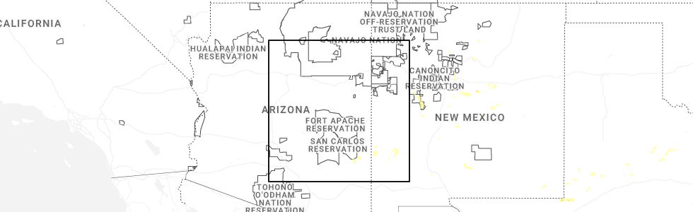
Hail Map for Gila, NM
The Gila, NM area has had 0 reports of on-the-ground hail by trained spotters, and has been under severe weather warnings 0 times during the past 12 months. Doppler radar has detected hail at or near Gila, NM on 18 occasions, including 3 occasions during the past year.
| Name: | Gila, NM |
| Where Located: | 21.4 miles NW of Silver City, NM |
| Map: | Google Map for Gila, NM |
| Population: | 314 |
| Housing Units: | 194 |
| More Info: | Search Google for Gila, NM |
0
The Top Recent Hail Date for Gila, NM is Monday, June 30, 2025 (18th out of 18)
Hail and Wind Damage Spotted near Gila, NM
| Date / Time | Report Details |
|---|---|
| 10/16/2022 9:51 AM MDT |
 The severe thunderstorm warning for north central grant county will expire at 1000 am mdt, the storm which prompted the warning has weakened below severe limits, and has exited the warned area. therefore, the warning will be allowed to expire. The severe thunderstorm warning for north central grant county will expire at 1000 am mdt, the storm which prompted the warning has weakened below severe limits, and has exited the warned area. therefore, the warning will be allowed to expire.
|
| 10/16/2022 9:08 AM MDT |
 At 908 am mdt, a severe thunderstorm was located near buckhorn, moving northeast at 40 mph (radar indicated). Hazards include quarter size hail. damage to vehicles is expected At 908 am mdt, a severe thunderstorm was located near buckhorn, moving northeast at 40 mph (radar indicated). Hazards include quarter size hail. damage to vehicles is expected
|
| 7/24/2022 12:00 AM MDT | Storm damage reported in grant county NM, 3.7 miles SSW of Gila, NM |
| 7/20/2022 5:25 PM MDT |
 At 525 pm mdt, a severe thunderstorm was located 7 miles northwest of silver city, moving southwest at 15 mph (radar indicated). Hazards include 60 mph wind gusts and quarter size hail. Hail damage to vehicles is expected. expect wind damage to roofs, siding, and trees. locations impacted include, cliff, mangas springs, oak grove, riverside, gila, mangas valley, bill evans lake, gila middle box and tyrone mine. hail threat, radar indicated max hail size, 1. 00 in wind threat, radar indicated max wind gust, 60 mph. At 525 pm mdt, a severe thunderstorm was located 7 miles northwest of silver city, moving southwest at 15 mph (radar indicated). Hazards include 60 mph wind gusts and quarter size hail. Hail damage to vehicles is expected. expect wind damage to roofs, siding, and trees. locations impacted include, cliff, mangas springs, oak grove, riverside, gila, mangas valley, bill evans lake, gila middle box and tyrone mine. hail threat, radar indicated max hail size, 1. 00 in wind threat, radar indicated max wind gust, 60 mph.
|
| 7/20/2022 4:56 PM MDT |
 At 456 pm mdt, a severe thunderstorm was located over riverside, moving east at 20 mph (radar indicated). Hazards include 60 mph wind gusts and quarter size hail. Hail damage to vehicles is expected. Expect wind damage to roofs, siding, and trees. At 456 pm mdt, a severe thunderstorm was located over riverside, moving east at 20 mph (radar indicated). Hazards include 60 mph wind gusts and quarter size hail. Hail damage to vehicles is expected. Expect wind damage to roofs, siding, and trees.
|
| 9/5/2021 2:04 PM MDT |
 At 204 pm mdt, a severe thunderstorm was located 6 miles south of buckhorn, moving east at 10 mph (radar indicated). Hazards include 60 mph wind gusts and quarter size hail. Hail damage to vehicles is expected. Expect wind damage to roofs, siding, and trees. At 204 pm mdt, a severe thunderstorm was located 6 miles south of buckhorn, moving east at 10 mph (radar indicated). Hazards include 60 mph wind gusts and quarter size hail. Hail damage to vehicles is expected. Expect wind damage to roofs, siding, and trees.
|
| 7/16/2021 5:22 PM MDT | Storm damage reported in grant county NM, 4.3 miles SSW of Gila, NM |
| 7/16/2021 5:20 PM MDT |
 At 520 pm mdt, a severe thunderstorm was located 5 miles north of cliff, moving northeast at 20 mph. this is a very dangerous storm (trained weather spotters). Hazards include 80 mph wind gusts. Flying debris will be dangerous to those caught without shelter. mobile homes will be heavily damaged. expect considerable damage to roofs, windows, and vehicles. extensive tree damage and power outages are likely. Locations impacted include, cliff and gila. At 520 pm mdt, a severe thunderstorm was located 5 miles north of cliff, moving northeast at 20 mph. this is a very dangerous storm (trained weather spotters). Hazards include 80 mph wind gusts. Flying debris will be dangerous to those caught without shelter. mobile homes will be heavily damaged. expect considerable damage to roofs, windows, and vehicles. extensive tree damage and power outages are likely. Locations impacted include, cliff and gila.
|
| 7/16/2021 4:55 PM MDT |
 At 454 pm mdt, a severe thunderstorm was located 5 miles south of buckhorn, moving northeast at 20 mph (radar indicated). Hazards include 60 mph wind gusts and quarter size hail. Hail damage to vehicles is expected. Expect wind damage to roofs, siding, and trees. At 454 pm mdt, a severe thunderstorm was located 5 miles south of buckhorn, moving northeast at 20 mph (radar indicated). Hazards include 60 mph wind gusts and quarter size hail. Hail damage to vehicles is expected. Expect wind damage to roofs, siding, and trees.
|
| 7/11/2021 4:31 PM MDT |
 At 431 pm mdt, a severe thunderstorm was located 6 miles northeast of buckhorn, moving south at 25 mph (radar indicated). Hazards include ping pong ball size hail and 60 mph wind gusts. People and animals outdoors will be injured. expect hail damage to roofs, siding, windows, and vehicles. Expect wind damage to roofs, siding, and trees. At 431 pm mdt, a severe thunderstorm was located 6 miles northeast of buckhorn, moving south at 25 mph (radar indicated). Hazards include ping pong ball size hail and 60 mph wind gusts. People and animals outdoors will be injured. expect hail damage to roofs, siding, windows, and vehicles. Expect wind damage to roofs, siding, and trees.
|
| 7/31/2020 6:49 PM MDT |
 At 649 pm mdt, a severe thunderstorm was located 13 miles north of redrock, moving south at 15 mph (radar indicated). Hazards include 60 mph wind gusts and quarter size hail. Hail damage to vehicles is expected. Expect wind damage to roofs, siding, and trees. At 649 pm mdt, a severe thunderstorm was located 13 miles north of redrock, moving south at 15 mph (radar indicated). Hazards include 60 mph wind gusts and quarter size hail. Hail damage to vehicles is expected. Expect wind damage to roofs, siding, and trees.
|
| 9/2/2018 1:36 AM MDT |
 The severe thunderstorm warning for northwestern grant county will expire at 145 am mdt, the storm which prompted the warning has weakened below severe limits, and no longer poses an immediate threat to life or property. therefore, the warning will be allowed to expire. however heavy rain is still possible with this thunderstorm. The severe thunderstorm warning for northwestern grant county will expire at 145 am mdt, the storm which prompted the warning has weakened below severe limits, and no longer poses an immediate threat to life or property. therefore, the warning will be allowed to expire. however heavy rain is still possible with this thunderstorm.
|
| 9/2/2018 1:01 AM MDT |
 At 100 am mdt, a severe thunderstorm was located over buckhorn, moving east at 25 mph (radar indicated). Hazards include 60 mph wind gusts and quarter size hail. Hail damage to vehicles is expected. Expect wind damage to roofs, siding, and trees. At 100 am mdt, a severe thunderstorm was located over buckhorn, moving east at 25 mph (radar indicated). Hazards include 60 mph wind gusts and quarter size hail. Hail damage to vehicles is expected. Expect wind damage to roofs, siding, and trees.
|
| 9/1/2018 6:04 PM MDT |
 At 604 pm mdt, a severe thunderstorm was located over gila, or near cliff, moving northeast at 10 mph (radar indicated). Hazards include 60 mph wind gusts and quarter size hail. Hail damage to vehicles is expected. Expect wind damage to roofs, siding, and trees. At 604 pm mdt, a severe thunderstorm was located over gila, or near cliff, moving northeast at 10 mph (radar indicated). Hazards include 60 mph wind gusts and quarter size hail. Hail damage to vehicles is expected. Expect wind damage to roofs, siding, and trees.
|
| 10/20/2015 1:54 PM MDT |
 At 154 pm mdt, a severe thunderstorm was located 5 miles west of redrock, moving north at 20 mph (radar indicated). Hazards include 60 mph wind gusts and quarter size hail. Hail damage to vehicles is expected. Expect wind damage to roofs, siding and trees. At 154 pm mdt, a severe thunderstorm was located 5 miles west of redrock, moving north at 20 mph (radar indicated). Hazards include 60 mph wind gusts and quarter size hail. Hail damage to vehicles is expected. Expect wind damage to roofs, siding and trees.
|
| 10/18/2015 9:37 PM MDT |
 At 935 pm mdt, a severe thunderstorm was located near riverside moving northeast at 40 mph (radar indicated). Hazards include 60 mph wind gusts and quarter size hail. Hail damage to vehicles is expected. Expect wind damage to roofs, siding and trees. At 935 pm mdt, a severe thunderstorm was located near riverside moving northeast at 40 mph (radar indicated). Hazards include 60 mph wind gusts and quarter size hail. Hail damage to vehicles is expected. Expect wind damage to roofs, siding and trees.
|
| 10/18/2015 9:03 PM MDT |
 At 902 pm mdt, a severe thunderstorm was located 8 miles west of riverside, or 10 miles south of buckhorn, moving northeast at 55 mph (radar indicated). Hazards include 60 mph wind gusts and quarter size hail. Hail damage to vehicles is expected. Expect wind damage to roofs, siding and trees. At 902 pm mdt, a severe thunderstorm was located 8 miles west of riverside, or 10 miles south of buckhorn, moving northeast at 55 mph (radar indicated). Hazards include 60 mph wind gusts and quarter size hail. Hail damage to vehicles is expected. Expect wind damage to roofs, siding and trees.
|
| 10/5/2015 3:15 PM MDT |
 At 315 pm mdt, a severe thunderstorm was located 8 miles northeast of redrock, moving north at 40 mph (radar indicated). Hazards include ping pong ball size hail and 60 mph wind gusts. People and animals outdoors will be injured. expect hail damage to roofs, siding, windows and vehicles. expect wind damage to roofs, siding and trees. Locations impacted include, lordsburg, redrock, mangas springs, shakespeare, bill evans lake. At 315 pm mdt, a severe thunderstorm was located 8 miles northeast of redrock, moving north at 40 mph (radar indicated). Hazards include ping pong ball size hail and 60 mph wind gusts. People and animals outdoors will be injured. expect hail damage to roofs, siding, windows and vehicles. expect wind damage to roofs, siding and trees. Locations impacted include, lordsburg, redrock, mangas springs, shakespeare, bill evans lake.
|
| 10/5/2015 2:40 PM MDT |
 At 240 pm mdt, a severe thunderstorm was located 7 miles north of lordsburg, moving north at 40 mph (radar indicated). Hazards include ping pong ball size hail and 60 mph wind gusts. People and animals outdoors will be injured. expect hail damage to roofs, siding, windows and vehicles. Expect wind damage to roofs, siding and trees. At 240 pm mdt, a severe thunderstorm was located 7 miles north of lordsburg, moving north at 40 mph (radar indicated). Hazards include ping pong ball size hail and 60 mph wind gusts. People and animals outdoors will be injured. expect hail damage to roofs, siding, windows and vehicles. Expect wind damage to roofs, siding and trees.
|
| 6/26/2015 7:53 PM MDT | At 753 pm mdt, doppler radar indicated a severe thunderstorm capable of producing quarter size hail and damaging winds in excess of 60 mph. this storm was located 11 miles west of lake roberts, and moving southwest at 25 mph. |
| 7/3/2013 5:33 PM MDT | Storm damage reported in grant county NM, 1.8 miles S of Gila, NM |
Hail Maps for Gila, NM


Connect with Interactive Hail Maps