

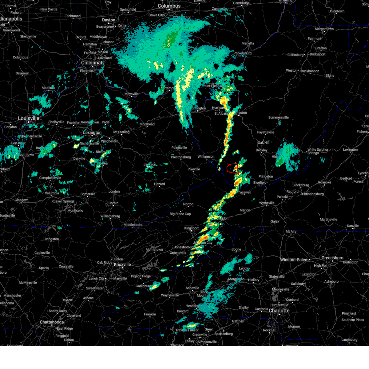
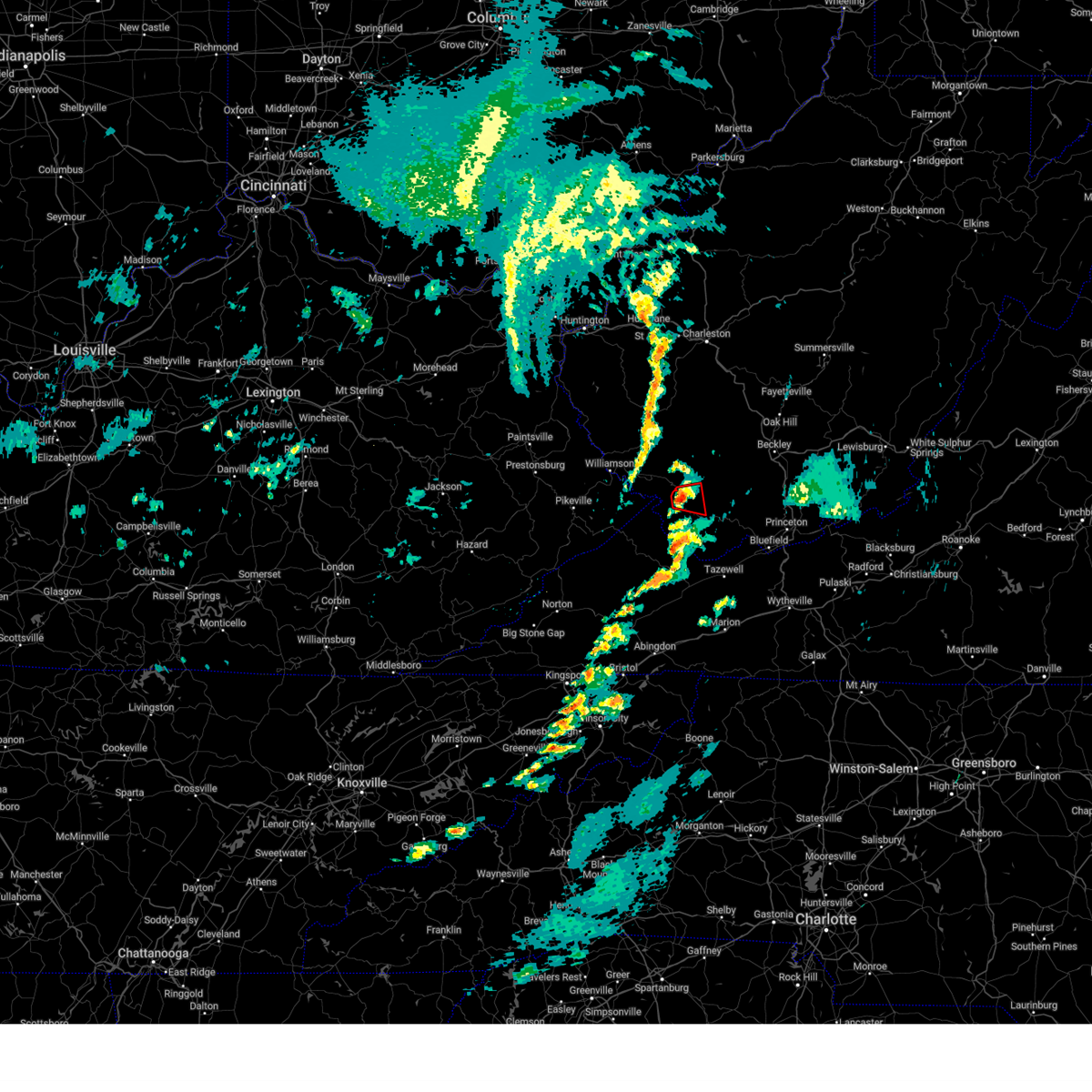
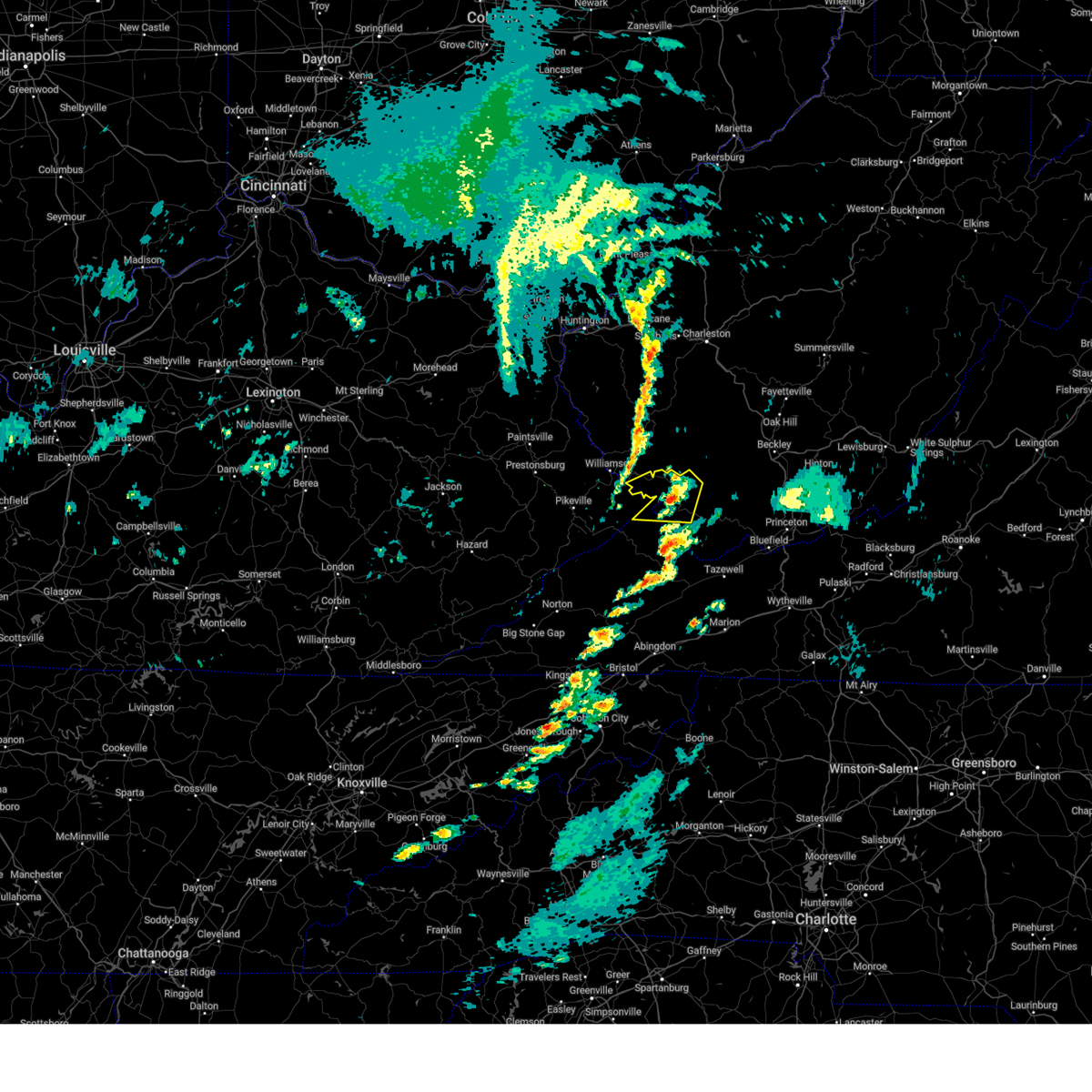
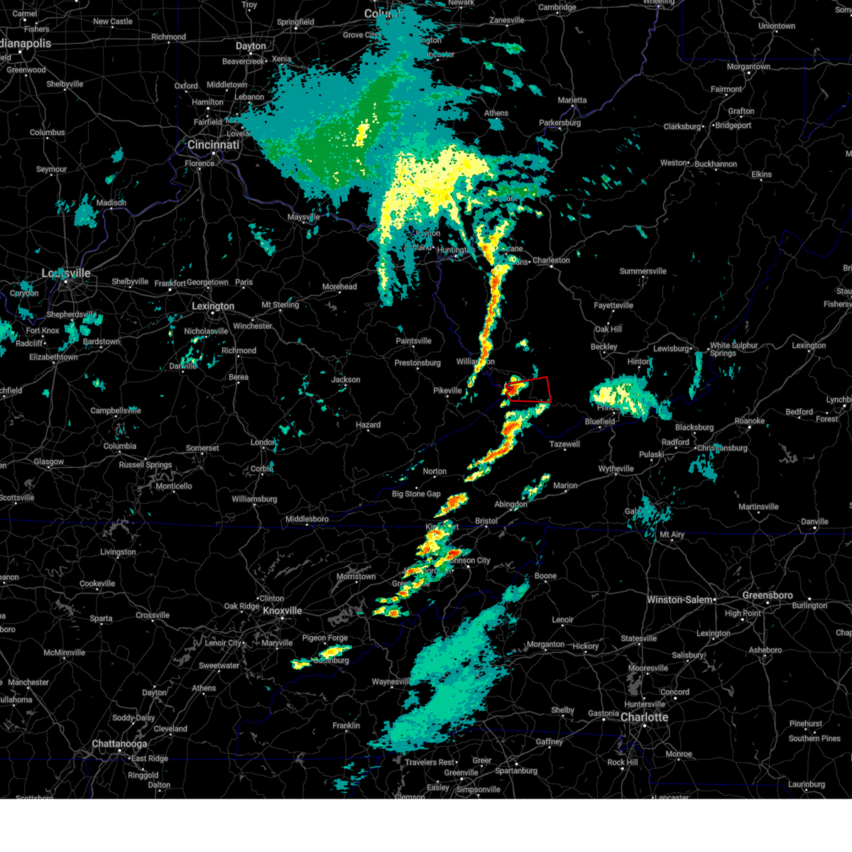
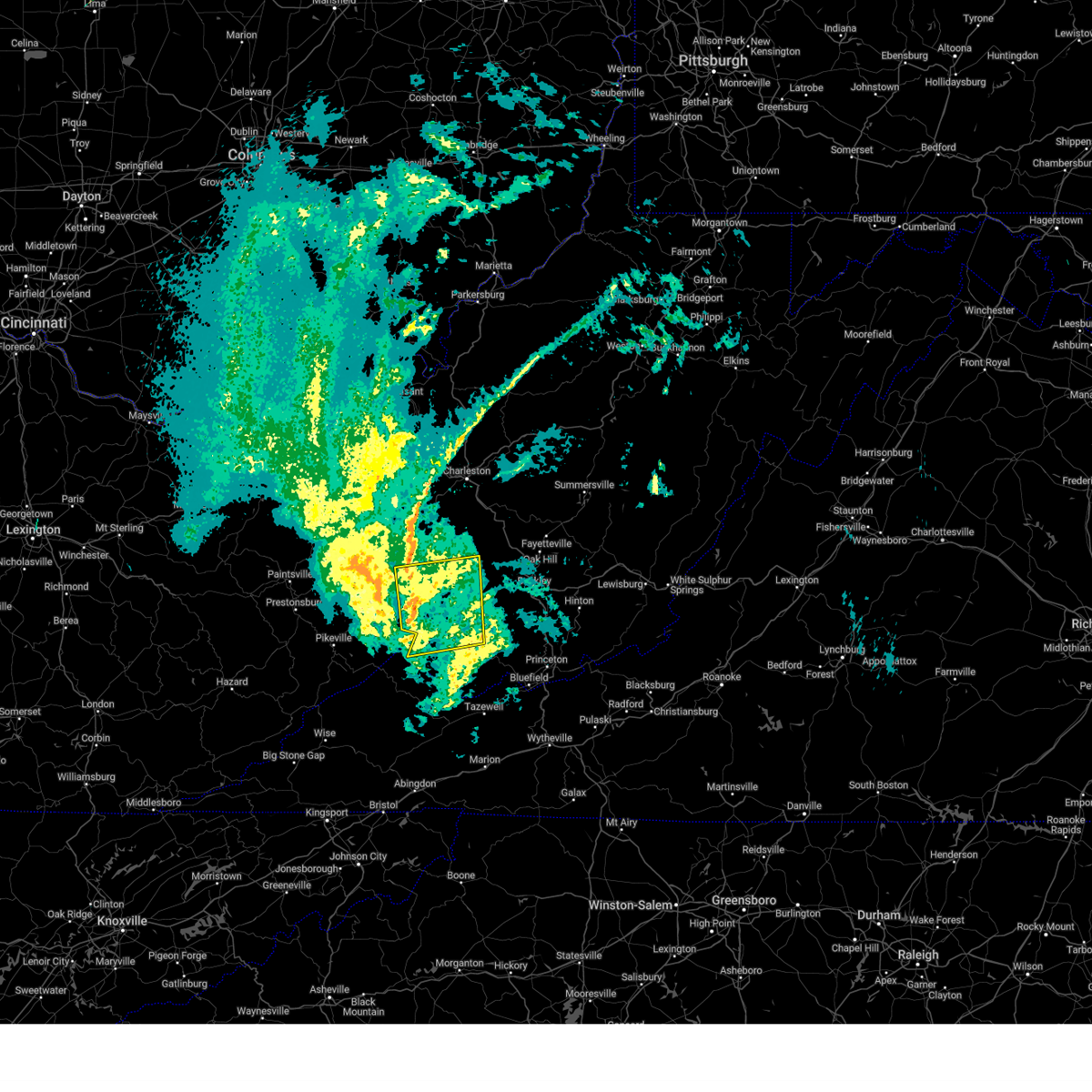
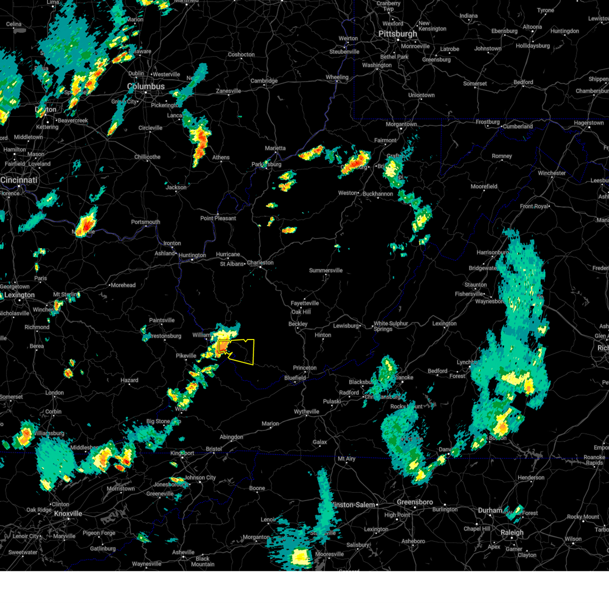
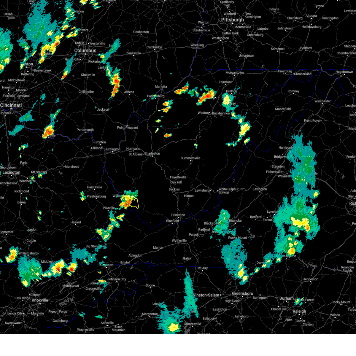
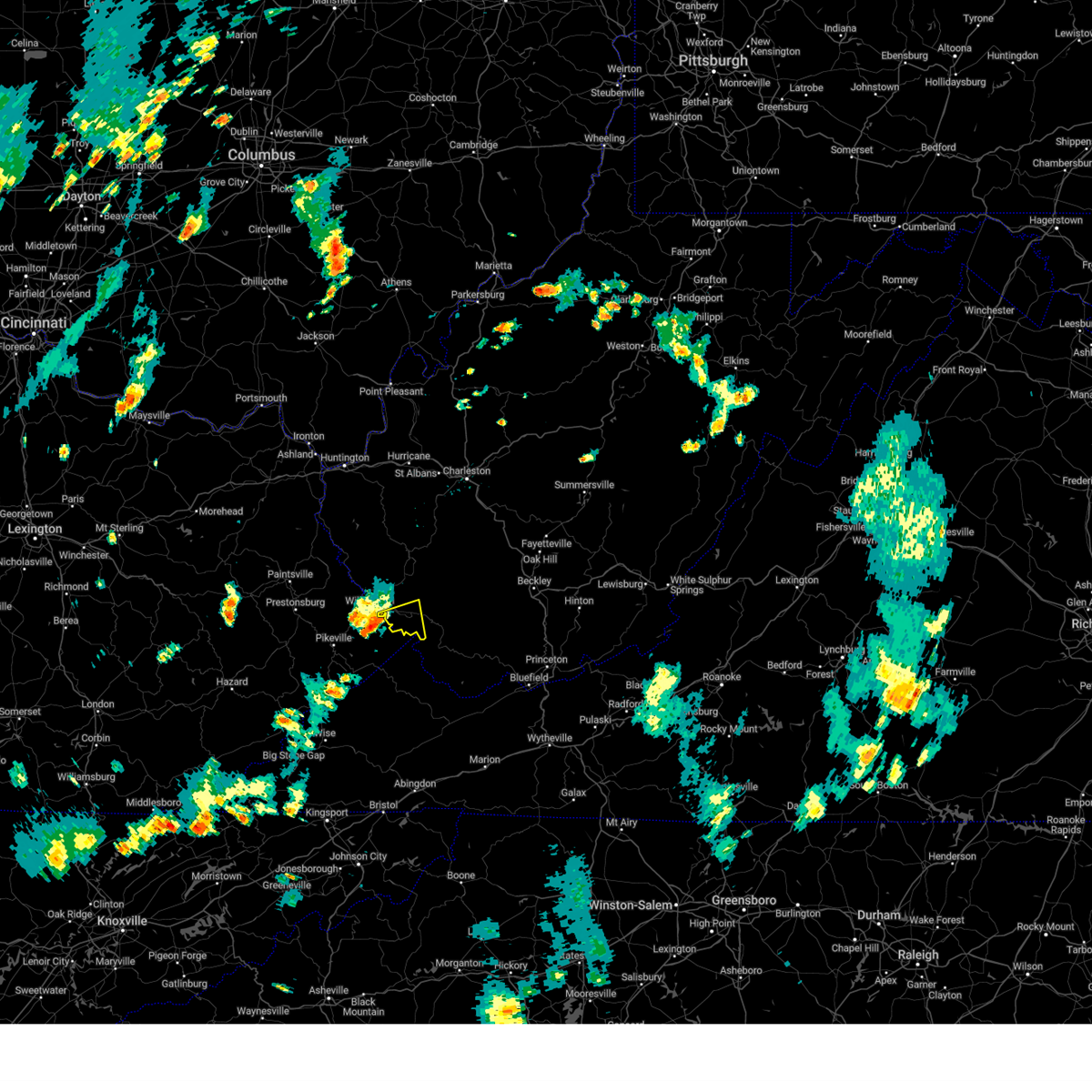
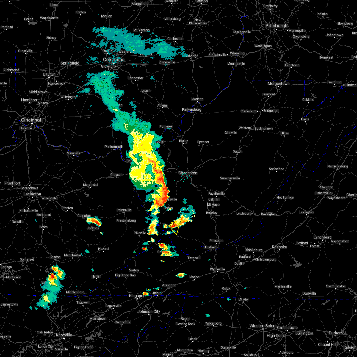
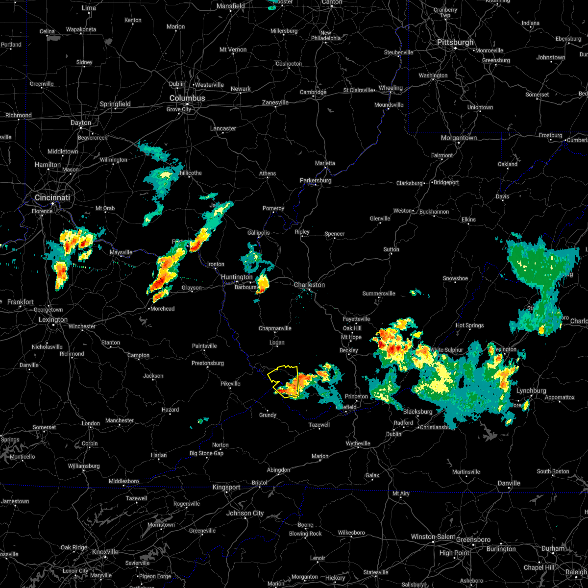
Hail Map for Gilbert Creek, WV
The Gilbert Creek, WV area has had 6 reports of on-the-ground hail by trained spotters, and has been under severe weather warnings 22 times during the past 12 months. Doppler radar has detected hail at or near Gilbert Creek, WV on 48 occasions, including 1 occasion during the past year.
| Name: | Gilbert Creek, WV |
| Where Located: | 55.8 miles SSW of Charleston, WV |
| Map: | Google Map for Gilbert Creek, WV |
| Population: | 1090 |
| Housing Units: | 522 |
| More Info: | Search Google for Gilbert Creek, WV |
0
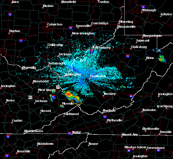
The Top Recent Hail Date for Gilbert Creek, WV is Friday, August 2, 2024 (48th out of 48)

Hail and Wind Damage Spotted near Gilbert Creek, WV
| Date / Time | Report Details |
|---|---|
| 5/30/2025 1:10 PM EDT |
 The storm which prompted the warning has weakened below severe limits, and no longer appears capable of producing a tornado. therefore, the warning will be allowed to expire. however, gusty winds and heavy rain are still possible with this thunderstorm. to report severe weather, contact your nearest law enforcement agency. they will relay your report to the national weather service charleston west virginia. The storm which prompted the warning has weakened below severe limits, and no longer appears capable of producing a tornado. therefore, the warning will be allowed to expire. however, gusty winds and heavy rain are still possible with this thunderstorm. to report severe weather, contact your nearest law enforcement agency. they will relay your report to the national weather service charleston west virginia.
|
| 5/30/2025 12:55 PM EDT |
 the tornado warning has been cancelled and is no longer in effect the tornado warning has been cancelled and is no longer in effect
|
| 5/30/2025 12:55 PM EDT |
 At 1254 pm edt, a severe thunderstorm capable of producing a tornado was located near hanover, or 13 miles northwest of welch, moving east at 30 mph (radar indicated rotation). Hazards include tornado. Flying debris will be dangerous to those caught without shelter. mobile homes will be damaged or destroyed. damage to roofs, windows, and vehicles will occur. tree damage is likely. This tornadic thunderstorm will remain over mainly rural areas of northwestern mcdowell and southwestern wyoming counties, including the following locations, davy, baileysville, and iaeger. At 1254 pm edt, a severe thunderstorm capable of producing a tornado was located near hanover, or 13 miles northwest of welch, moving east at 30 mph (radar indicated rotation). Hazards include tornado. Flying debris will be dangerous to those caught without shelter. mobile homes will be damaged or destroyed. damage to roofs, windows, and vehicles will occur. tree damage is likely. This tornadic thunderstorm will remain over mainly rural areas of northwestern mcdowell and southwestern wyoming counties, including the following locations, davy, baileysville, and iaeger.
|
| 5/30/2025 12:53 PM EDT |
 The storm which prompted the warning has moved out of the area. therefore, the warning will be allowed to expire. however, gusty winds are still possible with this thunderstorm. to report severe weather, contact your nearest law enforcement agency. they will relay your report to the national weather service charleston west virginia. remember, a tornado warning still remains in effect for the eastern portion of mcdowell until 115 pm. The storm which prompted the warning has moved out of the area. therefore, the warning will be allowed to expire. however, gusty winds are still possible with this thunderstorm. to report severe weather, contact your nearest law enforcement agency. they will relay your report to the national weather service charleston west virginia. remember, a tornado warning still remains in effect for the eastern portion of mcdowell until 115 pm.
|
| 5/30/2025 12:43 PM EDT |
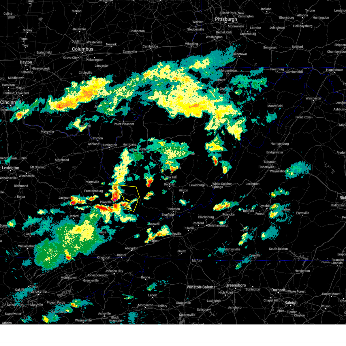
 Torrlx the national weather service in charleston west virginia has issued a * tornado warning for, northern buchanan county in southwestern virginia, northwestern mcdowell county in southern west virginia, southeastern mingo county in southern west virginia, southwestern wyoming county in southern west virginia, * until 115 pm edt. * at 1242 pm edt, a severe thunderstorm capable of producing a tornado was located near gilbert creek, or 18 miles northeast of grundy, moving east at 35 mph (radar indicated rotation). Hazards include tornado. Flying debris will be dangerous to those caught without shelter. mobile homes will be damaged or destroyed. damage to roofs, windows, and vehicles will occur. tree damage is likely. this dangerous storm will be near, hanover and gilbert creek around 1250 pm edt. Other locations impacted by this tornadic thunderstorm include davy, panther, baileysville, and iaeger. Torrlx the national weather service in charleston west virginia has issued a * tornado warning for, northern buchanan county in southwestern virginia, northwestern mcdowell county in southern west virginia, southeastern mingo county in southern west virginia, southwestern wyoming county in southern west virginia, * until 115 pm edt. * at 1242 pm edt, a severe thunderstorm capable of producing a tornado was located near gilbert creek, or 18 miles northeast of grundy, moving east at 35 mph (radar indicated rotation). Hazards include tornado. Flying debris will be dangerous to those caught without shelter. mobile homes will be damaged or destroyed. damage to roofs, windows, and vehicles will occur. tree damage is likely. this dangerous storm will be near, hanover and gilbert creek around 1250 pm edt. Other locations impacted by this tornadic thunderstorm include davy, panther, baileysville, and iaeger.
|
| 5/30/2025 12:12 PM EDT |
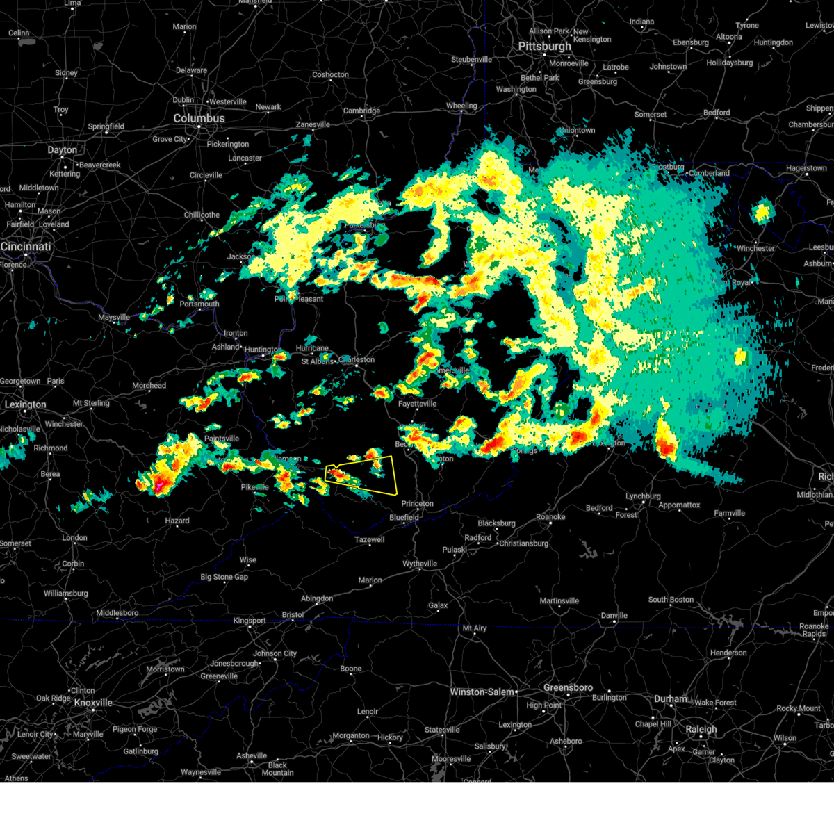
 Svrrlx the national weather service in charleston west virginia has issued a * severe thunderstorm warning for, north central buchanan county in southwestern virginia, northwestern mcdowell county in southern west virginia, southeastern mingo county in southern west virginia, southwestern wyoming county in southern west virginia, * until 100 pm edt. * at 1211 pm edt, a severe thunderstorm was located over board tree, or 10 miles southeast of williamson, moving east at 35 mph (radar indicated). Hazards include 60 mph wind gusts and quarter size hail. Hail damage to vehicles is expected. Expect wind damage to roofs, siding, and trees. Svrrlx the national weather service in charleston west virginia has issued a * severe thunderstorm warning for, north central buchanan county in southwestern virginia, northwestern mcdowell county in southern west virginia, southeastern mingo county in southern west virginia, southwestern wyoming county in southern west virginia, * until 100 pm edt. * at 1211 pm edt, a severe thunderstorm was located over board tree, or 10 miles southeast of williamson, moving east at 35 mph (radar indicated). Hazards include 60 mph wind gusts and quarter size hail. Hail damage to vehicles is expected. Expect wind damage to roofs, siding, and trees.
|
| 5/8/2025 8:04 PM EDT |
 Svrrlx the national weather service in charleston west virginia has issued a * severe thunderstorm warning for, north central buchanan county in southwestern virginia, northwestern mcdowell county in southern west virginia, mingo county in southern west virginia, southwestern logan county in southern west virginia, * until 830 pm edt. * at 803 pm edt, severe thunderstorms were located along a line extending from near chattaroy to near delbarton to near mcandrews, moving east at 30 mph (radar indicated). Hazards include 60 mph wind gusts and quarter size hail. Hail damage to vehicles is expected. Expect wind damage to roofs, siding, and trees. Svrrlx the national weather service in charleston west virginia has issued a * severe thunderstorm warning for, north central buchanan county in southwestern virginia, northwestern mcdowell county in southern west virginia, mingo county in southern west virginia, southwestern logan county in southern west virginia, * until 830 pm edt. * at 803 pm edt, severe thunderstorms were located along a line extending from near chattaroy to near delbarton to near mcandrews, moving east at 30 mph (radar indicated). Hazards include 60 mph wind gusts and quarter size hail. Hail damage to vehicles is expected. Expect wind damage to roofs, siding, and trees.
|
| 4/14/2025 8:29 PM EDT |
 Svrrlx the national weather service in charleston west virginia has issued a * severe thunderstorm warning for, southeastern mingo county in southern west virginia, south central raleigh county in southeastern west virginia, wyoming county in southern west virginia, * until 900 pm edt. * at 829 pm edt, a severe thunderstorm was located over r.d. bailey lake, or 15 miles west of pineville, moving east at 55 mph (radar indicated). Hazards include 60 mph wind gusts and half dollar size hail. Hail damage to vehicles is expected. Expect wind damage to roofs, siding, and trees. Svrrlx the national weather service in charleston west virginia has issued a * severe thunderstorm warning for, southeastern mingo county in southern west virginia, south central raleigh county in southeastern west virginia, wyoming county in southern west virginia, * until 900 pm edt. * at 829 pm edt, a severe thunderstorm was located over r.d. bailey lake, or 15 miles west of pineville, moving east at 55 mph (radar indicated). Hazards include 60 mph wind gusts and half dollar size hail. Hail damage to vehicles is expected. Expect wind damage to roofs, siding, and trees.
|
| 3/31/2025 3:16 AM EDT | At 316 am edt, severe thunderstorms were located along a line extending from near amherstdale-robinette to near welch to near davenport, moving east at 55 mph (radar indicated). Hazards include 60 mph wind gusts and penny size hail. Expect damage to roofs, siding, and trees. locations impacted include, davy, hanover, r. d. Bailey lake, gilbert, war, coal mountain, jolo, oakwood, gilbert creek, bradshaw, bruno, elbert, keystone, coalwood, avondale, wolf pen, welch, jenkinjones, herndon, and iaeger. |
| 3/31/2025 3:16 AM EDT | the severe thunderstorm warning has been cancelled and is no longer in effect |
| 1/1/0001 12:00 AM | Tree on power lin in mingo county WV, 2.3 miles ENE of Gilbert Creek, WV |
| 3/31/2025 2:58 AM EDT |
 Svrrlx the national weather service in charleston west virginia has issued a * severe thunderstorm warning for, southeastern dickenson county in southwestern virginia, buchanan county in southwestern virginia, mcdowell county in southern west virginia, southeastern mingo county in southern west virginia, wyoming county in southern west virginia, southern logan county in southern west virginia, * until 330 am edt. * at 257 am edt, severe thunderstorms were located along a line extending from near holden to 6 miles southeast of argo to near trammel, moving east at 55 mph (radar indicated). Hazards include 60 mph wind gusts and penny size hail. expect damage to roofs, siding, and trees Svrrlx the national weather service in charleston west virginia has issued a * severe thunderstorm warning for, southeastern dickenson county in southwestern virginia, buchanan county in southwestern virginia, mcdowell county in southern west virginia, southeastern mingo county in southern west virginia, wyoming county in southern west virginia, southern logan county in southern west virginia, * until 330 am edt. * at 257 am edt, severe thunderstorms were located along a line extending from near holden to 6 miles southeast of argo to near trammel, moving east at 55 mph (radar indicated). Hazards include 60 mph wind gusts and penny size hail. expect damage to roofs, siding, and trees
|
| 2/16/2025 11:14 AM EST |
 The storms which prompted the warning have moved out of the area. therefore, the warning will be allowed to expire. however, gusty winds are still possible with lingering showers. to report severe weather, contact your nearest law enforcement agency. they will relay your report to the national weather service charleston west virginia. The storms which prompted the warning have moved out of the area. therefore, the warning will be allowed to expire. however, gusty winds are still possible with lingering showers. to report severe weather, contact your nearest law enforcement agency. they will relay your report to the national weather service charleston west virginia.
|
| 2/16/2025 10:44 AM EST |
 At 1042 am est, severe thunderstorms were located along a line extending from chief logan state to near hurley, moving east at 45 mph (radar indicated). Hazards include 60 mph wind gusts. Expect damage to roofs, siding, and trees. locations impacted include, davy, hanover, mount gay, chauncey, r. d. Bailey lake, gilbert, coal mountain, gilbert creek, bruno, mount gay-shamrock, hurley, wolf pen, sarah ann, meador, bald knob, iaeger, chief logan state, clear fork, verdunville, and holden. At 1042 am est, severe thunderstorms were located along a line extending from chief logan state to near hurley, moving east at 45 mph (radar indicated). Hazards include 60 mph wind gusts. Expect damage to roofs, siding, and trees. locations impacted include, davy, hanover, mount gay, chauncey, r. d. Bailey lake, gilbert, coal mountain, gilbert creek, bruno, mount gay-shamrock, hurley, wolf pen, sarah ann, meador, bald knob, iaeger, chief logan state, clear fork, verdunville, and holden.
|
| 2/16/2025 10:24 AM EST |
 Svrrlx the national weather service in charleston west virginia has issued a * severe thunderstorm warning for, northern buchanan county in southwestern virginia, northwestern mcdowell county in southern west virginia, mingo county in southern west virginia, western raleigh county in southeastern west virginia, western wyoming county in southern west virginia, logan county in southern west virginia, southeastern boone county in central west virginia, * until 1115 am est. * at 1022 am est, severe thunderstorms were located along a line extending from near hode to belcher, moving east at 55 mph (radar indicated). Hazards include 60 mph wind gusts. expect damage to roofs, siding, and trees Svrrlx the national weather service in charleston west virginia has issued a * severe thunderstorm warning for, northern buchanan county in southwestern virginia, northwestern mcdowell county in southern west virginia, mingo county in southern west virginia, western raleigh county in southeastern west virginia, western wyoming county in southern west virginia, logan county in southern west virginia, southeastern boone county in central west virginia, * until 1115 am est. * at 1022 am est, severe thunderstorms were located along a line extending from near hode to belcher, moving east at 55 mph (radar indicated). Hazards include 60 mph wind gusts. expect damage to roofs, siding, and trees
|
| 8/17/2024 6:50 PM EDT |
 The storm which prompted the warning has weakened below severe limits, and no longer poses an immediate threat to life or property. therefore, the warning will be allowed to expire. however, gusty winds and heavy rain are still possible with this thunderstorm. The storm which prompted the warning has weakened below severe limits, and no longer poses an immediate threat to life or property. therefore, the warning will be allowed to expire. however, gusty winds and heavy rain are still possible with this thunderstorm.
|
| 8/17/2024 6:30 PM EDT | Svrrlx the national weather service in charleston west virginia has issued a * severe thunderstorm warning for, southeastern mingo county in southern west virginia, southern logan county in southern west virginia, * until 700 pm edt. * at 630 pm edt, a severe thunderstorm was located near red jacket, or 10 miles east of williamson, moving southeast at 15 mph (radar indicated). Hazards include 60 mph wind gusts and quarter size hail. Hail damage to vehicles is expected. Expect wind damage to roofs, siding, and trees. |
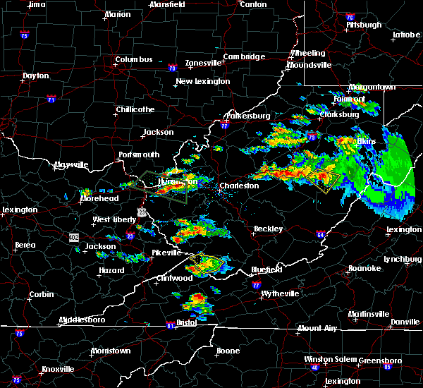
| 8/2/2024 5:57 PM EDT |
 The storm which prompted the warning has weakened below severe limits, and no longer poses an immediate threat to life or property. therefore, the warning will be allowed to expire. however, small hail, gusty winds and heavy rain are still possible with this thunderstorm. to report severe weather, contact your nearest law enforcement agency. they will relay your report to the national weather service charleston west virginia. The storm which prompted the warning has weakened below severe limits, and no longer poses an immediate threat to life or property. therefore, the warning will be allowed to expire. however, small hail, gusty winds and heavy rain are still possible with this thunderstorm. to report severe weather, contact your nearest law enforcement agency. they will relay your report to the national weather service charleston west virginia.
|
| 8/2/2024 5:45 PM EDT | At 544 pm edt, a severe thunderstorm was located over gilbert creek, or 19 miles south of logan, moving east at 20 mph (radar indicated). Hazards include 60 mph wind gusts and nickel size hail. Expect damage to roofs, siding, and trees. locations impacted include, hanover, r. d. Bailey lake, gilbert creek, gilbert, iaeger, panther, coal mountain, and hampden. |
| 8/2/2024 5:27 PM EDT |
 Svrrlx the national weather service in charleston west virginia has issued a * severe thunderstorm warning for, northern buchanan county in southwestern virginia, northwestern mcdowell county in southern west virginia, southeastern mingo county in southern west virginia, southwestern wyoming county in southern west virginia, * until 600 pm edt. * at 527 pm edt, a severe thunderstorm was located near hinch, or 14 miles southeast of williamson, moving east at 20 mph (radar indicated). Hazards include 60 mph wind gusts and quarter size hail. Hail damage to vehicles is expected. Expect wind damage to roofs, siding, and trees. Svrrlx the national weather service in charleston west virginia has issued a * severe thunderstorm warning for, northern buchanan county in southwestern virginia, northwestern mcdowell county in southern west virginia, southeastern mingo county in southern west virginia, southwestern wyoming county in southern west virginia, * until 600 pm edt. * at 527 pm edt, a severe thunderstorm was located near hinch, or 14 miles southeast of williamson, moving east at 20 mph (radar indicated). Hazards include 60 mph wind gusts and quarter size hail. Hail damage to vehicles is expected. Expect wind damage to roofs, siding, and trees.
|
| 8/2/2024 5:19 PM EDT |
 the severe thunderstorm warning has been cancelled and is no longer in effect the severe thunderstorm warning has been cancelled and is no longer in effect
|
| 8/2/2024 5:19 PM EDT |
 At 516 pm edt, a severe thunderstorm was located over majestic, or 11 miles southeast of williamson, moving east at 25 mph (radar indicated). Hazards include 60 mph wind gusts and half dollar size hail. Hail damage to vehicles is expected. expect wind damage to roofs, siding, and trees. Locations impacted include, hinch, red jacket, gilbert creek, matewan, edgarton, hampden, meador, and pie. At 516 pm edt, a severe thunderstorm was located over majestic, or 11 miles southeast of williamson, moving east at 25 mph (radar indicated). Hazards include 60 mph wind gusts and half dollar size hail. Hail damage to vehicles is expected. expect wind damage to roofs, siding, and trees. Locations impacted include, hinch, red jacket, gilbert creek, matewan, edgarton, hampden, meador, and pie.
|
| 8/2/2024 5:00 PM EDT |
 Svrrlx the national weather service in charleston west virginia has issued a * severe thunderstorm warning for, southeastern mingo county in southern west virginia, south central logan county in southern west virginia, * until 530 pm edt. * at 459 pm edt, a severe thunderstorm was located over hardy, or near williamson, moving east at 20 mph (radar indicated). Hazards include 60 mph wind gusts and quarter size hail. Hail damage to vehicles is expected. Expect wind damage to roofs, siding, and trees. Svrrlx the national weather service in charleston west virginia has issued a * severe thunderstorm warning for, southeastern mingo county in southern west virginia, south central logan county in southern west virginia, * until 530 pm edt. * at 459 pm edt, a severe thunderstorm was located over hardy, or near williamson, moving east at 20 mph (radar indicated). Hazards include 60 mph wind gusts and quarter size hail. Hail damage to vehicles is expected. Expect wind damage to roofs, siding, and trees.
|
| 5/26/2024 4:37 PM EDT |
 The storms which prompted the warning have moved out of the warned area. therefore, the warning will be allowed to expire. a severe thunderstorm watch remains in effect until 900 pm edt for southwestern virginia, and southern west virginia. The storms which prompted the warning have moved out of the warned area. therefore, the warning will be allowed to expire. a severe thunderstorm watch remains in effect until 900 pm edt for southwestern virginia, and southern west virginia.
|
| 5/26/2024 4:36 PM EDT |
 The storms which prompted the warning have moved out of the area. therefore, the warning will be allowed to expire. a severe thunderstorm watch remains in effect until 800 pm edt for central and western west virginia. a severe thunderstorm watch also remains in effect until 900 pm edt for central and southern west virginia. The storms which prompted the warning have moved out of the area. therefore, the warning will be allowed to expire. a severe thunderstorm watch remains in effect until 800 pm edt for central and western west virginia. a severe thunderstorm watch also remains in effect until 900 pm edt for central and southern west virginia.
|
| 5/26/2024 4:31 PM EDT |
 the severe thunderstorm warning has been cancelled and is no longer in effect the severe thunderstorm warning has been cancelled and is no longer in effect
|
| 5/26/2024 4:31 PM EDT |
 At 430 pm edt, severe thunderstorms were located along a line extending from near hamlin to near hanover, moving east at 50 mph (radar indicated). Hazards include 60 mph wind gusts and quarter size hail. Hail damage to vehicles is expected. expect wind damage to roofs, siding, and trees. locations impacted include, logan, chapmanville, man, chief logan state, ranger, holden, gill, mallory, amherstdale-robinette, mount gay-shamrock, harts, r. d. Bailey lake, gilbert creek, gilbert, west logan, mitchell heights, mount gay, verdunville, chauncey, and switzer. At 430 pm edt, severe thunderstorms were located along a line extending from near hamlin to near hanover, moving east at 50 mph (radar indicated). Hazards include 60 mph wind gusts and quarter size hail. Hail damage to vehicles is expected. expect wind damage to roofs, siding, and trees. locations impacted include, logan, chapmanville, man, chief logan state, ranger, holden, gill, mallory, amherstdale-robinette, mount gay-shamrock, harts, r. d. Bailey lake, gilbert creek, gilbert, west logan, mitchell heights, mount gay, verdunville, chauncey, and switzer.
|
| 5/26/2024 4:16 PM EDT |
 At 415 pm edt, severe thunderstorms were located along a line extending from gilbert creek to 9 miles northwest of jewell ridge to 6 miles east of davenport, moving east at 55 mph (radar indicated). Hazards include 60 mph wind gusts and penny size hail. Expect damage to roofs, siding, and trees. locations impacted include, welch, davenport, gary, war, northfork, hanover, r. d. Bailey lake, gilbert creek, gilbert, davy, bradshaw, iaeger, keystone, anawalt, kimball, coal mountain, jolo, oakwood, elbert, and coalwood. At 415 pm edt, severe thunderstorms were located along a line extending from gilbert creek to 9 miles northwest of jewell ridge to 6 miles east of davenport, moving east at 55 mph (radar indicated). Hazards include 60 mph wind gusts and penny size hail. Expect damage to roofs, siding, and trees. locations impacted include, welch, davenport, gary, war, northfork, hanover, r. d. Bailey lake, gilbert creek, gilbert, davy, bradshaw, iaeger, keystone, anawalt, kimball, coal mountain, jolo, oakwood, elbert, and coalwood.
|
| 5/26/2024 4:16 PM EDT |
 the severe thunderstorm warning has been cancelled and is no longer in effect the severe thunderstorm warning has been cancelled and is no longer in effect
|
| 5/26/2024 3:56 PM EDT |
 Svrrlx the national weather service in charleston west virginia has issued a * severe thunderstorm warning for, eastern dickenson county in southwestern virginia, buchanan county in southwestern virginia, mcdowell county in southern west virginia, southeastern mingo county in southern west virginia, southwestern wyoming county in southern west virginia, south central logan county in southern west virginia, * until 445 pm edt. * at 355 pm edt, a severe thunderstorm was located near grundy, moving east at 45 mph (radar indicated). Hazards include 60 mph wind gusts and penny size hail. expect damage to roofs, siding, and trees Svrrlx the national weather service in charleston west virginia has issued a * severe thunderstorm warning for, eastern dickenson county in southwestern virginia, buchanan county in southwestern virginia, mcdowell county in southern west virginia, southeastern mingo county in southern west virginia, southwestern wyoming county in southern west virginia, south central logan county in southern west virginia, * until 445 pm edt. * at 355 pm edt, a severe thunderstorm was located near grundy, moving east at 45 mph (radar indicated). Hazards include 60 mph wind gusts and penny size hail. expect damage to roofs, siding, and trees
|
| 5/26/2024 3:25 PM EDT |
 Svrrlx the national weather service in charleston west virginia has issued a * severe thunderstorm warning for, southeastern lawrence county in northeastern kentucky, mingo county in southern west virginia, southwestern lincoln county in central west virginia, logan county in southern west virginia, southeastern wayne county in western west virginia, * until 445 pm edt. * at 325 pm edt, a severe thunderstorm was located over dotson, or near prestonsburg, moving northeast at 45 mph (radar indicated). Hazards include 60 mph wind gusts and quarter size hail. Hail damage to vehicles is expected. Expect wind damage to roofs, siding, and trees. Svrrlx the national weather service in charleston west virginia has issued a * severe thunderstorm warning for, southeastern lawrence county in northeastern kentucky, mingo county in southern west virginia, southwestern lincoln county in central west virginia, logan county in southern west virginia, southeastern wayne county in western west virginia, * until 445 pm edt. * at 325 pm edt, a severe thunderstorm was located over dotson, or near prestonsburg, moving northeast at 45 mph (radar indicated). Hazards include 60 mph wind gusts and quarter size hail. Hail damage to vehicles is expected. Expect wind damage to roofs, siding, and trees.
|
| 4/11/2024 4:16 PM EDT |
 The storm which prompted the warning has moved out of the area. therefore, the warning has been allowed to expire. a tornado watch remains in effect until 900 pm edt for southern west virginia. The storm which prompted the warning has moved out of the area. therefore, the warning has been allowed to expire. a tornado watch remains in effect until 900 pm edt for southern west virginia.
|
| 4/11/2024 4:02 PM EDT |
 At 402 pm edt, a severe thunderstorm was located near hinch, or 12 miles east of williamson, moving northeast at 40 mph (radar indicated). Hazards include 60 mph wind gusts and quarter size hail. Hail damage to vehicles is expected. expect wind damage to roofs, siding, and trees. Locations impacted include, man, holden, mallory, red jacket, hinch, mount gay-shamrock, amherstdale-robinette, gilbert creek, chauncey, hampden, switzer, pie, bruno, edgarton, varney, sarah ann, meador, and verdunville. At 402 pm edt, a severe thunderstorm was located near hinch, or 12 miles east of williamson, moving northeast at 40 mph (radar indicated). Hazards include 60 mph wind gusts and quarter size hail. Hail damage to vehicles is expected. expect wind damage to roofs, siding, and trees. Locations impacted include, man, holden, mallory, red jacket, hinch, mount gay-shamrock, amherstdale-robinette, gilbert creek, chauncey, hampden, switzer, pie, bruno, edgarton, varney, sarah ann, meador, and verdunville.
|
| 4/11/2024 3:48 PM EDT |
 Svrrlx the national weather service in charleston west virginia has issued a * severe thunderstorm warning for, southeastern mingo county in southern west virginia, southwestern logan county in southern west virginia, * until 415 pm edt. * at 348 pm edt, a severe thunderstorm was located over majestic, or 11 miles southeast of williamson, moving northeast at 40 mph (radar indicated). Hazards include 60 mph wind gusts and quarter size hail. Hail damage to vehicles is expected. Expect wind damage to roofs, siding, and trees. Svrrlx the national weather service in charleston west virginia has issued a * severe thunderstorm warning for, southeastern mingo county in southern west virginia, southwestern logan county in southern west virginia, * until 415 pm edt. * at 348 pm edt, a severe thunderstorm was located over majestic, or 11 miles southeast of williamson, moving northeast at 40 mph (radar indicated). Hazards include 60 mph wind gusts and quarter size hail. Hail damage to vehicles is expected. Expect wind damage to roofs, siding, and trees.
|
| 4/2/2024 12:22 PM EDT |
 The storms which prompted the warning have weakened below severe limits, and no longer pose an immediate threat to life or property. therefore, the warning will be allowed to expire. a tornado watch remains in effect until 100 pm edt for central, southern and southeastern west virginia. The storms which prompted the warning have weakened below severe limits, and no longer pose an immediate threat to life or property. therefore, the warning will be allowed to expire. a tornado watch remains in effect until 100 pm edt for central, southern and southeastern west virginia.
|
| 4/2/2024 11:55 AM EDT |
 At 1154 am edt, severe thunderstorms were located along a line extending from 6 miles southeast of bald knob to near gilbert creek, moving east at 50 mph (radar indicated). Hazards include 60 mph wind gusts. Expect damage to roofs, siding, and trees. Locations impacted include, beckley, pineville, mabscott, oceana, sophia, crab orchard, macarthur, twin falls state park, beaver, gilbert, lester, clear fork, cyclone, bolt, coal mountain, hampden, bruno, kopperston, glen daniel, and baileysville. At 1154 am edt, severe thunderstorms were located along a line extending from 6 miles southeast of bald knob to near gilbert creek, moving east at 50 mph (radar indicated). Hazards include 60 mph wind gusts. Expect damage to roofs, siding, and trees. Locations impacted include, beckley, pineville, mabscott, oceana, sophia, crab orchard, macarthur, twin falls state park, beaver, gilbert, lester, clear fork, cyclone, bolt, coal mountain, hampden, bruno, kopperston, glen daniel, and baileysville.
|
| 4/2/2024 11:46 AM EDT |
 Svrrlx the national weather service in charleston west virginia has issued a * severe thunderstorm warning for, northeastern mcdowell county in southern west virginia, southeastern mingo county in southern west virginia, raleigh county in southeastern west virginia, wyoming county in southern west virginia, southeastern logan county in southern west virginia, southern fayette county in southeastern west virginia, southern boone county in central west virginia, * until 1230 pm edt. * at 1146 am edt, severe thunderstorms were located along a line extending from mount hope to 7 miles west of dry creek to near r.d. bailey lake, moving southeast at 55 mph (radar indicated). Hazards include 60 mph wind gusts. expect damage to roofs, siding, and trees Svrrlx the national weather service in charleston west virginia has issued a * severe thunderstorm warning for, northeastern mcdowell county in southern west virginia, southeastern mingo county in southern west virginia, raleigh county in southeastern west virginia, wyoming county in southern west virginia, southeastern logan county in southern west virginia, southern fayette county in southeastern west virginia, southern boone county in central west virginia, * until 1230 pm edt. * at 1146 am edt, severe thunderstorms were located along a line extending from mount hope to 7 miles west of dry creek to near r.d. bailey lake, moving southeast at 55 mph (radar indicated). Hazards include 60 mph wind gusts. expect damage to roofs, siding, and trees
|
| 4/2/2024 11:25 AM EDT |
 Svrrlx the national weather service in charleston west virginia has issued a * severe thunderstorm warning for, central mingo county in southern west virginia, west central raleigh county in southeastern west virginia, northern wyoming county in southern west virginia, southern logan county in southern west virginia, south central boone county in central west virginia, * until 1215 pm edt. * at 1125 am edt, severe thunderstorms were located along a line extending from near logan to chattaroy, moving east at 55 mph (radar indicated). Hazards include 60 mph wind gusts. expect damage to roofs, siding, and trees Svrrlx the national weather service in charleston west virginia has issued a * severe thunderstorm warning for, central mingo county in southern west virginia, west central raleigh county in southeastern west virginia, northern wyoming county in southern west virginia, southern logan county in southern west virginia, south central boone county in central west virginia, * until 1215 pm edt. * at 1125 am edt, severe thunderstorms were located along a line extending from near logan to chattaroy, moving east at 55 mph (radar indicated). Hazards include 60 mph wind gusts. expect damage to roofs, siding, and trees
|
| 5/16/2023 5:41 PM EDT |
 At 540 pm edt, a severe thunderstorm was located over argo, or 15 miles north of grundy, moving east at 30 mph (radar indicated). Hazards include 70 mph wind gusts. Expect considerable tree damage. damage is likely to mobile homes, roofs, and outbuildings. Locations impacted include, war, hanover, gilbert creek, davy, bradshaw, iaeger, panther, edgarton, coalwood, hurley and avondale. At 540 pm edt, a severe thunderstorm was located over argo, or 15 miles north of grundy, moving east at 30 mph (radar indicated). Hazards include 70 mph wind gusts. Expect considerable tree damage. damage is likely to mobile homes, roofs, and outbuildings. Locations impacted include, war, hanover, gilbert creek, davy, bradshaw, iaeger, panther, edgarton, coalwood, hurley and avondale.
|
| 5/16/2023 5:17 PM EDT |
 At 516 pm edt, a severe thunderstorm was located near mcandrews, or 10 miles south of williamson, moving east at 30 mph (radar indicated). Hazards include 70 mph wind gusts. Expect considerable tree damage. Damage is likely to mobile homes, roofs, and outbuildings. At 516 pm edt, a severe thunderstorm was located near mcandrews, or 10 miles south of williamson, moving east at 30 mph (radar indicated). Hazards include 70 mph wind gusts. Expect considerable tree damage. Damage is likely to mobile homes, roofs, and outbuildings.
|
| 6/17/2022 2:30 PM EDT |
 At 230 pm edt, severe thunderstorms were located along a line extending from jenkins to near bald knob, moving southeast at 45 mph (radar indicated). Hazards include 60 mph wind gusts. expect damage to roofs, siding, and trees At 230 pm edt, severe thunderstorms were located along a line extending from jenkins to near bald knob, moving southeast at 45 mph (radar indicated). Hazards include 60 mph wind gusts. expect damage to roofs, siding, and trees
|
| 6/17/2022 1:59 PM EDT |
 At 158 pm edt, severe thunderstorms were located along a line extending from near madison to 8 miles northwest of holden to threeforks, moving east at 45 mph (radar indicated). Hazards include 60 mph wind gusts. expect damage to roofs, siding, and trees At 158 pm edt, severe thunderstorms were located along a line extending from near madison to 8 miles northwest of holden to threeforks, moving east at 45 mph (radar indicated). Hazards include 60 mph wind gusts. expect damage to roofs, siding, and trees
|
| 6/13/2022 10:25 PM EDT | Tree dow in wyoming county WV, 5.7 miles WNW of Gilbert Creek, WV |
| 6/13/2022 9:25 PM EDT | Tree dow in wyoming county WV, 5.7 miles WNW of Gilbert Creek, WV |
| 4/7/2022 12:17 AM EDT | Quarter sized hail reported 11.6 miles NNE of Gilbert Creek, WV, time estimated from radar. |
| 1/1/2022 7:34 AM EST |
 At 732 am est, a severe thunderstorm was located over gilbert creek, or 18 miles west of pineville, and is nearly stationary (radar indicated). Hazards include 60 mph wind gusts. Expect damage to roofs, siding, and trees. locations impacted include, welch, pineville, oceana, hanover, r. d. bailey lake, gilbert creek, red jacket, hinch, matewan, gilbert, davy, iaeger, coal mountain, bruno, edgarton, coalwood, hurley, avondale, wolf pen and meador. hail threat, radar indicated max hail size, <. 75 in wind threat, radar indicated max wind gust, 60 mph. At 732 am est, a severe thunderstorm was located over gilbert creek, or 18 miles west of pineville, and is nearly stationary (radar indicated). Hazards include 60 mph wind gusts. Expect damage to roofs, siding, and trees. locations impacted include, welch, pineville, oceana, hanover, r. d. bailey lake, gilbert creek, red jacket, hinch, matewan, gilbert, davy, iaeger, coal mountain, bruno, edgarton, coalwood, hurley, avondale, wolf pen and meador. hail threat, radar indicated max hail size, <. 75 in wind threat, radar indicated max wind gust, 60 mph.
|
| 1/1/2022 6:58 AM EST |
 At 658 am est, a severe thunderstorm was located over mcandrews, or 9 miles south of williamson, moving east at 45 mph (radar indicated). Hazards include 60 mph wind gusts. expect damage to roofs, siding, and trees At 658 am est, a severe thunderstorm was located over mcandrews, or 9 miles south of williamson, moving east at 45 mph (radar indicated). Hazards include 60 mph wind gusts. expect damage to roofs, siding, and trees
|
| 7/10/2021 1:55 PM EDT |
 The severe thunderstorm warning for northern mcdowell, southeastern mingo and west central wyoming counties will expire at 200 pm edt, the storm which prompted the warning has weakened below severe limits, and no longer poses an immediate threat to life or property. therefore, the warning will be allowed to expire. however gusty winds are still possible with this thunderstorm, and weakened or damaged trees may still be susceptible to falling. The severe thunderstorm warning for northern mcdowell, southeastern mingo and west central wyoming counties will expire at 200 pm edt, the storm which prompted the warning has weakened below severe limits, and no longer poses an immediate threat to life or property. therefore, the warning will be allowed to expire. however gusty winds are still possible with this thunderstorm, and weakened or damaged trees may still be susceptible to falling.
|
| 7/10/2021 1:45 PM EDT | Mingo county emergency manager reports trees down in the area of baisden. time estimated from radar in mingo county WV, 1 miles SE of Gilbert Creek, WV |
| 7/10/2021 1:43 PM EDT |
 At 142 pm edt, a severe thunderstorm was located over r.d. bailey lake, or 17 miles south of logan, moving east at 15 mph (radar indicated). Hazards include 60 mph wind gusts. Expect damage to roofs, siding, and trees. locations impacted include, r. d. Bailey lake, gilbert creek, gilbert and hampden. At 142 pm edt, a severe thunderstorm was located over r.d. bailey lake, or 17 miles south of logan, moving east at 15 mph (radar indicated). Hazards include 60 mph wind gusts. Expect damage to roofs, siding, and trees. locations impacted include, r. d. Bailey lake, gilbert creek, gilbert and hampden.
|
| 7/10/2021 1:42 PM EDT | Mingo county emergency manager reports numerous trees down in area of ben creek. time estimated from radar in mingo county WV, 2.3 miles SE of Gilbert Creek, WV |
| 7/10/2021 1:23 PM EDT |
 At 123 pm edt, a severe thunderstorm was located near hinch, or 15 miles south of logan, moving east at 20 mph (radar indicated). Hazards include 60 mph wind gusts. expect damage to roofs, siding, and trees At 123 pm edt, a severe thunderstorm was located near hinch, or 15 miles south of logan, moving east at 20 mph (radar indicated). Hazards include 60 mph wind gusts. expect damage to roofs, siding, and trees
|
| 6/13/2021 7:36 PM EDT |
 The severe thunderstorm warning for southeastern mingo and south central logan counties will expire at 745 pm edt, the storm which prompted the warning has weakened below severe limits, and has exited the warned area. therefore, the warning will be allowed to expire. a severe thunderstorm watch remains in effect until 1000 pm edt for southwestern virginia, and southern west virginia. The severe thunderstorm warning for southeastern mingo and south central logan counties will expire at 745 pm edt, the storm which prompted the warning has weakened below severe limits, and has exited the warned area. therefore, the warning will be allowed to expire. a severe thunderstorm watch remains in effect until 1000 pm edt for southwestern virginia, and southern west virginia.
|
| 6/13/2021 7:28 PM EDT |
 At 728 pm edt, a severe thunderstorm was located near gilbert creek, or 14 miles south of logan, moving southeast at 35 mph (radar indicated). Hazards include 60 mph wind gusts and penny size hail. Expect damage to roofs, siding, and trees. Locations impacted include, hinch, gilbert creek, gilbert, bruno, hampden, sarah ann, meador and pie. At 728 pm edt, a severe thunderstorm was located near gilbert creek, or 14 miles south of logan, moving southeast at 35 mph (radar indicated). Hazards include 60 mph wind gusts and penny size hail. Expect damage to roofs, siding, and trees. Locations impacted include, hinch, gilbert creek, gilbert, bruno, hampden, sarah ann, meador and pie.
|
| 6/13/2021 7:01 PM EDT |
 At 701 pm edt, severe thunderstorms were located along a line extending from chief logan state to near holden to near chattaroy, moving southeast at 30 mph (radar indicated). Hazards include 60 mph wind gusts and quarter size hail. Hail damage to vehicles is expected. Expect wind damage to roofs, siding, and trees. At 701 pm edt, severe thunderstorms were located along a line extending from chief logan state to near holden to near chattaroy, moving southeast at 30 mph (radar indicated). Hazards include 60 mph wind gusts and quarter size hail. Hail damage to vehicles is expected. Expect wind damage to roofs, siding, and trees.
|
| 6/6/2020 11:22 PM EDT |
 At 1121 pm edt, a severe thunderstorm was located near oppy, or 11 miles north of williamson, moving southeast at 25 mph (radar indicated). Hazards include 60 mph wind gusts and quarter size hail. Hail damage to vehicles is expected. expect wind damage to roofs, siding, and trees. Locations impacted include, williamson, delbarton, red jacket, chattaroy, hinch, gilbert creek, myrtle, varney, meador, pie, lenore and naugatuck. At 1121 pm edt, a severe thunderstorm was located near oppy, or 11 miles north of williamson, moving southeast at 25 mph (radar indicated). Hazards include 60 mph wind gusts and quarter size hail. Hail damage to vehicles is expected. expect wind damage to roofs, siding, and trees. Locations impacted include, williamson, delbarton, red jacket, chattaroy, hinch, gilbert creek, myrtle, varney, meador, pie, lenore and naugatuck.
|
| 6/6/2020 11:15 PM EDT |
 At 1114 pm edt, a severe thunderstorm was located near oppy, or 12 miles east of inez, moving southeast at 25 mph (radar indicated). Hazards include 60 mph wind gusts and penny size hail. expect damage to roofs, siding, and trees At 1114 pm edt, a severe thunderstorm was located near oppy, or 12 miles east of inez, moving southeast at 25 mph (radar indicated). Hazards include 60 mph wind gusts and penny size hail. expect damage to roofs, siding, and trees
|
| 10/31/2019 1:42 PM EDT |
 The severe thunderstorm warning for southeastern mingo and south central logan counties will expire at 145 pm edt, the storms which prompted the warning have moved out of the area. therefore, the warning will be allowed to expire. however gusty winds are still possible behind the cold front. The severe thunderstorm warning for southeastern mingo and south central logan counties will expire at 145 pm edt, the storms which prompted the warning have moved out of the area. therefore, the warning will be allowed to expire. however gusty winds are still possible behind the cold front.
|
| 10/31/2019 1:24 PM EDT |
 At 123 pm edt, severe thunderstorms were located along a line extending from 6 miles west of van to 7 miles east of grundy, moving northeast at 60 mph (radar indicated). Hazards include 60 mph wind gusts. expect damage to roofs, siding, and trees At 123 pm edt, severe thunderstorms were located along a line extending from 6 miles west of van to 7 miles east of grundy, moving northeast at 60 mph (radar indicated). Hazards include 60 mph wind gusts. expect damage to roofs, siding, and trees
|
| 10/31/2019 1:23 PM EDT |
 At 122 pm edt, severe thunderstorms were located along a line extending from 6 miles east of logan to 8 miles northwest of glen burke, moving east at 55 mph (radar indicated). Hazards include 60 mph wind gusts. Expect damage to roofs, siding, and trees. Locations impacted include, logan, man, mallory, gilbert creek, amherstdale-robinette, gilbert, bruno, hampden, sarah ann, chauncey and switzer. At 122 pm edt, severe thunderstorms were located along a line extending from 6 miles east of logan to 8 miles northwest of glen burke, moving east at 55 mph (radar indicated). Hazards include 60 mph wind gusts. Expect damage to roofs, siding, and trees. Locations impacted include, logan, man, mallory, gilbert creek, amherstdale-robinette, gilbert, bruno, hampden, sarah ann, chauncey and switzer.
|
| 8/9/2019 3:53 PM EDT |
 The severe thunderstorm warning for northern buchanan, northwestern mcdowell, southeastern mingo, southeastern logan and northwestern wyoming counties will expire at 400 pm edt, the storm which prompted the warning has weakened below severe limits, and no longer poses an immediate threat to life or property. therefore, the warning will be allowed to expire. however small hail, gusty winds and heavy rain are still possible with this thunderstorm. The severe thunderstorm warning for northern buchanan, northwestern mcdowell, southeastern mingo, southeastern logan and northwestern wyoming counties will expire at 400 pm edt, the storm which prompted the warning has weakened below severe limits, and no longer poses an immediate threat to life or property. therefore, the warning will be allowed to expire. however small hail, gusty winds and heavy rain are still possible with this thunderstorm.
|
| 8/9/2019 3:34 PM EDT |
 At 333 pm edt, a severe thunderstorm was located near hinch, or 13 miles south of logan, moving south at 30 mph. golf ball size hail has been observed with this storm (radar indicated). Hazards include golf ball size hail and 60 mph wind gusts. People and animals outdoors will be injured. expect hail damage to roofs, siding, windows, and vehicles. expect wind damage to roofs, siding, and trees. locations impacted include, oceana, man, hanover, r. d. Bailey lake, mallory, gilbert creek, hinch, amherstdale-robinette, gilbert, coal mountain, hampden, pie, bruno and sarah ann. At 333 pm edt, a severe thunderstorm was located near hinch, or 13 miles south of logan, moving south at 30 mph. golf ball size hail has been observed with this storm (radar indicated). Hazards include golf ball size hail and 60 mph wind gusts. People and animals outdoors will be injured. expect hail damage to roofs, siding, windows, and vehicles. expect wind damage to roofs, siding, and trees. locations impacted include, oceana, man, hanover, r. d. Bailey lake, mallory, gilbert creek, hinch, amherstdale-robinette, gilbert, coal mountain, hampden, pie, bruno and sarah ann.
|
| 8/9/2019 3:18 PM EDT |
 At 318 pm edt, a severe thunderstorm was located near holden, or near logan, moving south at 30 mph (radar indicated). Hazards include 60 mph wind gusts and half dollar size hail. Hail damage to vehicles is expected. Expect wind damage to roofs, siding, and trees. At 318 pm edt, a severe thunderstorm was located near holden, or near logan, moving south at 30 mph (radar indicated). Hazards include 60 mph wind gusts and half dollar size hail. Hail damage to vehicles is expected. Expect wind damage to roofs, siding, and trees.
|
| 6/16/2019 4:32 PM EDT | Golf Ball sized hail reported 9.9 miles NNE of Gilbert Creek, WV, grocery store reported golfball size hail falling at store |
| 6/16/2019 4:31 PM EDT | Ping Pong Ball sized hail reported 10.8 miles NNE of Gilbert Creek, WV, broadcast media relayed pictures of ping pong size hail near hurley |
| 6/2/2019 4:40 PM EDT |
 The severe thunderstorm warning for northwestern mcdowell county will expire at 445 pm edt, the storm which prompted the warning has weakened below severe limits, and no longer poses an immediate threat to life or property. therefore, the warning will be allowed to expire. however gusty winds and heavy rain are still possible with this thunderstorm. a severe thunderstorm watch remains in effect until 800 pm edt for southern west virginia. The severe thunderstorm warning for northwestern mcdowell county will expire at 445 pm edt, the storm which prompted the warning has weakened below severe limits, and no longer poses an immediate threat to life or property. therefore, the warning will be allowed to expire. however gusty winds and heavy rain are still possible with this thunderstorm. a severe thunderstorm watch remains in effect until 800 pm edt for southern west virginia.
|
| 6/2/2019 4:30 PM EDT |
 At 429 pm edt, a severe thunderstorm was located 10 miles south of gilbert creek, or 13 miles west of welch, moving southeast at 30 mph (radar indicated). Hazards include 60 mph wind gusts and quarter size hail. Hail damage to vehicles is expected. expect wind damage to roofs, siding, and trees. Locations impacted include, welch, war, davy, bradshaw, iaeger, panther, coalwood, avondale and jolo. At 429 pm edt, a severe thunderstorm was located 10 miles south of gilbert creek, or 13 miles west of welch, moving southeast at 30 mph (radar indicated). Hazards include 60 mph wind gusts and quarter size hail. Hail damage to vehicles is expected. expect wind damage to roofs, siding, and trees. Locations impacted include, welch, war, davy, bradshaw, iaeger, panther, coalwood, avondale and jolo.
|
| 6/2/2019 4:11 PM EDT |
 At 411 pm edt, a severe thunderstorm was located near woodman, or 16 miles northeast of grundy, moving southeast at 30 mph (radar indicated). Hazards include 60 mph wind gusts and quarter size hail. Hail damage to vehicles is expected. Expect wind damage to roofs, siding, and trees. At 411 pm edt, a severe thunderstorm was located near woodman, or 16 miles northeast of grundy, moving southeast at 30 mph (radar indicated). Hazards include 60 mph wind gusts and quarter size hail. Hail damage to vehicles is expected. Expect wind damage to roofs, siding, and trees.
|
| 5/29/2019 3:34 PM EDT |
 At 334 pm edt, a severe thunderstorm was located over oceana, or 10 miles northwest of pineville, moving east at 45 mph (radar indicated). Hazards include 70 mph wind gusts and nickel size hail. Expect considerable tree damage. damage is likely to mobile homes, roofs, and outbuildings. locations impacted include, pineville, oceana, hanover, r. d. Bailey lake, amherstdale-robinette, twin falls state park, gilbert creek, mallory, clear fork, cyclone, coal mountain, kopperston, amherstdale-robine, wolf pen and baileysville. At 334 pm edt, a severe thunderstorm was located over oceana, or 10 miles northwest of pineville, moving east at 45 mph (radar indicated). Hazards include 70 mph wind gusts and nickel size hail. Expect considerable tree damage. damage is likely to mobile homes, roofs, and outbuildings. locations impacted include, pineville, oceana, hanover, r. d. Bailey lake, amherstdale-robinette, twin falls state park, gilbert creek, mallory, clear fork, cyclone, coal mountain, kopperston, amherstdale-robine, wolf pen and baileysville.
|
| 5/29/2019 3:13 PM EDT |
 At 312 pm edt, a severe thunderstorm was located near hinch, or 11 miles south of logan, moving east at 45 mph (radar indicated). Hazards include 60 mph wind gusts and quarter size hail. Hail damage to vehicles is expected. Expect wind damage to roofs, siding, and trees. At 312 pm edt, a severe thunderstorm was located near hinch, or 11 miles south of logan, moving east at 45 mph (radar indicated). Hazards include 60 mph wind gusts and quarter size hail. Hail damage to vehicles is expected. Expect wind damage to roofs, siding, and trees.
|
| 5/19/2019 5:48 PM EDT |
 At 548 pm edt, a severe thunderstorm was located 7 miles south of hanover, or 9 miles west of welch, moving northeast at 45 mph (radar indicated). Hazards include 60 mph wind gusts. expect damage to roofs, siding, and trees At 548 pm edt, a severe thunderstorm was located 7 miles south of hanover, or 9 miles west of welch, moving northeast at 45 mph (radar indicated). Hazards include 60 mph wind gusts. expect damage to roofs, siding, and trees
|
| 5/17/2019 9:22 PM EDT |
 The severe thunderstorm warning for mingo and western logan counties will expire at 930 pm edt, the storm which prompted the warning has weakened below severe limits, and no longer poses an immediate threat to life or property. therefore, the warning will be allowed to expire. however small hail is still possible with this thunderstorm. a severe thunderstorm watch remains in effect until 1100 pm edt for southern west virginia. The severe thunderstorm warning for mingo and western logan counties will expire at 930 pm edt, the storm which prompted the warning has weakened below severe limits, and no longer poses an immediate threat to life or property. therefore, the warning will be allowed to expire. however small hail is still possible with this thunderstorm. a severe thunderstorm watch remains in effect until 1100 pm edt for southern west virginia.
|
| 5/17/2019 9:15 PM EDT |
 At 915 pm edt, a severe thunderstorm was located near holden, or 8 miles southwest of logan, moving southeast at 30 mph (radar indicated). Hazards include 60 mph wind gusts and quarter size hail. Hail damage to vehicles is expected. expect wind damage to roofs, siding, and trees. Locations impacted include, logan, chapmanville, man, delbarton, mount gay-shamrock, chief logan state, holden, red jacket, hinch, mallory, gilbert creek, gilbert, west logan, mitchell heights, mount gay, chauncey, myrtle, bruno, sarah ann and meador. At 915 pm edt, a severe thunderstorm was located near holden, or 8 miles southwest of logan, moving southeast at 30 mph (radar indicated). Hazards include 60 mph wind gusts and quarter size hail. Hail damage to vehicles is expected. expect wind damage to roofs, siding, and trees. Locations impacted include, logan, chapmanville, man, delbarton, mount gay-shamrock, chief logan state, holden, red jacket, hinch, mallory, gilbert creek, gilbert, west logan, mitchell heights, mount gay, chauncey, myrtle, bruno, sarah ann and meador.
|
| 5/17/2019 8:53 PM EDT |
 At 853 pm edt, a severe thunderstorm was located near mount gay-shamrock, or 9 miles northeast of williamson, moving southeast at 30 mph (radar indicated). Hazards include 60 mph wind gusts and quarter size hail. Hail damage to vehicles is expected. Expect wind damage to roofs, siding, and trees. At 853 pm edt, a severe thunderstorm was located near mount gay-shamrock, or 9 miles northeast of williamson, moving southeast at 30 mph (radar indicated). Hazards include 60 mph wind gusts and quarter size hail. Hail damage to vehicles is expected. Expect wind damage to roofs, siding, and trees.
|
| 4/14/2019 7:36 PM EDT |
 The severe thunderstorm warning for southeastern mingo, southeastern logan and northwestern wyoming counties will expire at 745 pm edt, the storm which prompted the warning has weakened below severe limits, and no longer poses an immediate threat to life or property. therefore, the warning will be allowed to expire. a tornado watch remains in effect until 900 pm edt for central and southern west virginia. a severe thunderstorm watch remains in effect until 200 am edt for southwestern virginia, and southern west virginia. The severe thunderstorm warning for southeastern mingo, southeastern logan and northwestern wyoming counties will expire at 745 pm edt, the storm which prompted the warning has weakened below severe limits, and no longer poses an immediate threat to life or property. therefore, the warning will be allowed to expire. a tornado watch remains in effect until 900 pm edt for central and southern west virginia. a severe thunderstorm watch remains in effect until 200 am edt for southwestern virginia, and southern west virginia.
|
| 4/14/2019 7:14 PM EDT |
 At 713 pm edt, a severe thunderstorm was located near gilbert creek, or 13 miles south of logan, moving northeast at 45 mph (radar indicated). Hazards include 60 mph wind gusts. Expect damage to roofs, siding, and trees. locations impacted include, oceana, man, hanover, r. d. Bailey lake, mallory, amherstdale-robinette, gilbert creek, hinch, red jacket, gilbert, clear fork, cyclone, coal mountain, hampden, pie, bruno, kopperston, amherstdale-robine, sarah ann and meador. At 713 pm edt, a severe thunderstorm was located near gilbert creek, or 13 miles south of logan, moving northeast at 45 mph (radar indicated). Hazards include 60 mph wind gusts. Expect damage to roofs, siding, and trees. locations impacted include, oceana, man, hanover, r. d. Bailey lake, mallory, amherstdale-robinette, gilbert creek, hinch, red jacket, gilbert, clear fork, cyclone, coal mountain, hampden, pie, bruno, kopperston, amherstdale-robine, sarah ann and meador.
|
| 4/14/2019 6:51 PM EDT |
 At 650 pm edt, a severe thunderstorm was located over jamboree, or 13 miles southeast of williamson, moving northeast at 50 mph (radar indicated). Hazards include 60 mph wind gusts and penny size hail. expect damage to roofs, siding, and trees At 650 pm edt, a severe thunderstorm was located over jamboree, or 13 miles southeast of williamson, moving northeast at 50 mph (radar indicated). Hazards include 60 mph wind gusts and penny size hail. expect damage to roofs, siding, and trees
|
| 5/5/2018 5:42 PM EDT |
 At 542 pm edt, a severe thunderstorm was located over hanover, or 14 miles west of pineville, moving northeast at 25 mph (trained weather spotters). Hazards include ping pong ball size hail and 60 mph wind gusts. People and animals outdoors will be injured. expect hail damage to roofs, siding, windows, and vehicles. Expect wind damage to roofs, siding, and trees. At 542 pm edt, a severe thunderstorm was located over hanover, or 14 miles west of pineville, moving northeast at 25 mph (trained weather spotters). Hazards include ping pong ball size hail and 60 mph wind gusts. People and animals outdoors will be injured. expect hail damage to roofs, siding, windows, and vehicles. Expect wind damage to roofs, siding, and trees.
|
| 5/5/2018 5:30 PM EDT |
 At 530 pm edt, a severe thunderstorm was located near r.d. bailey lake, or 13 miles west of pineville, moving northeast at 30 mph (trained weather spotters). Hazards include golf ball size hail and 60 mph wind gusts. People and animals outdoors will be injured. expect hail damage to roofs, siding, windows, and vehicles. expect wind damage to roofs, siding, and trees. locations impacted include, pineville, oceana, hanover, r. d. bailey lake, gilbert creek, mallory, amherstdale-robinette, gilbert, iaeger, clear fork, panther, cyclone, coal mountain, wolf pen and baileysville. At 530 pm edt, a severe thunderstorm was located near r.d. bailey lake, or 13 miles west of pineville, moving northeast at 30 mph (trained weather spotters). Hazards include golf ball size hail and 60 mph wind gusts. People and animals outdoors will be injured. expect hail damage to roofs, siding, windows, and vehicles. expect wind damage to roofs, siding, and trees. locations impacted include, pineville, oceana, hanover, r. d. bailey lake, gilbert creek, mallory, amherstdale-robinette, gilbert, iaeger, clear fork, panther, cyclone, coal mountain, wolf pen and baileysville.
|
| 5/5/2018 5:11 PM EDT |
 At 511 pm edt, a severe thunderstorm was located over gilbert creek, or 19 miles northwest of welch, moving northeast at 30 mph (trained weather spotters). Hazards include golf ball size hail and 60 mph wind gusts. People and animals outdoors will be injured. expect hail damage to roofs, siding, windows, and vehicles. expect wind damage to roofs, siding, and trees. locations impacted include, pineville, oceana, hanover, r. d. bailey lake, mallory, gilbert creek, hinch, amherstdale-robinette, gilbert, davy, iaeger, clear fork, panther, cyclone, coal mountain, hampden, bruno, wolf pen and baileysville. At 511 pm edt, a severe thunderstorm was located over gilbert creek, or 19 miles northwest of welch, moving northeast at 30 mph (trained weather spotters). Hazards include golf ball size hail and 60 mph wind gusts. People and animals outdoors will be injured. expect hail damage to roofs, siding, windows, and vehicles. expect wind damage to roofs, siding, and trees. locations impacted include, pineville, oceana, hanover, r. d. bailey lake, mallory, gilbert creek, hinch, amherstdale-robinette, gilbert, davy, iaeger, clear fork, panther, cyclone, coal mountain, hampden, bruno, wolf pen and baileysville.
|
| 5/5/2018 4:50 PM EDT |
 At 450 pm edt, a severe thunderstorm was located over argo, or 14 miles north of grundy, moving northeast at 30 mph (radar indicated). Hazards include 70 mph wind gusts and half dollar size hail. Hail damage to vehicles is expected. expect considerable tree damage. Wind damage is also likely to mobile homes, roofs, and outbuildings. At 450 pm edt, a severe thunderstorm was located over argo, or 14 miles north of grundy, moving northeast at 30 mph (radar indicated). Hazards include 70 mph wind gusts and half dollar size hail. Hail damage to vehicles is expected. expect considerable tree damage. Wind damage is also likely to mobile homes, roofs, and outbuildings.
|
| 4/4/2018 2:16 AM EDT |
 At 215 am edt, a severe thunderstorm was located over argo, or 14 miles north of grundy, moving northeast at 65 mph (radar indicated). Hazards include 60 mph wind gusts. expect damage to roofs, siding, and trees At 215 am edt, a severe thunderstorm was located over argo, or 14 miles north of grundy, moving northeast at 65 mph (radar indicated). Hazards include 60 mph wind gusts. expect damage to roofs, siding, and trees
|
| 3/17/2018 7:10 PM EDT |
 At 644 pm edt, a severe thunderstorm was located over meta, or 9 miles southwest of williamson, moving east at 50 mph (radar indicated). Hazards include 60 mph wind gusts and quarter size hail. Hail damage to vehicles is expected. Expect wind damage to roofs, siding, and trees. At 644 pm edt, a severe thunderstorm was located over meta, or 9 miles southwest of williamson, moving east at 50 mph (radar indicated). Hazards include 60 mph wind gusts and quarter size hail. Hail damage to vehicles is expected. Expect wind damage to roofs, siding, and trees.
|
| 3/17/2018 7:10 PM EDT |
 At 709 pm edt, a severe thunderstorm was located near hinch, or 13 miles southeast of williamson, moving east at 45 mph (radar indicated). Hazards include 60 mph wind gusts and quarter size hail. Hail damage to vehicles is expected. expect wind damage to roofs, siding, and trees. locations impacted include, hanover, hinch, r. d. bailey lake, gilbert creek, gilbert and meador. At 709 pm edt, a severe thunderstorm was located near hinch, or 13 miles southeast of williamson, moving east at 45 mph (radar indicated). Hazards include 60 mph wind gusts and quarter size hail. Hail damage to vehicles is expected. expect wind damage to roofs, siding, and trees. locations impacted include, hanover, hinch, r. d. bailey lake, gilbert creek, gilbert and meador.
|
| 3/17/2018 6:44 PM EDT |
 At 644 pm edt, a severe thunderstorm was located over meta, or 9 miles southwest of williamson, moving east at 50 mph (radar indicated). Hazards include 60 mph wind gusts and quarter size hail. Hail damage to vehicles is expected. Expect wind damage to roofs, siding, and trees. At 644 pm edt, a severe thunderstorm was located over meta, or 9 miles southwest of williamson, moving east at 50 mph (radar indicated). Hazards include 60 mph wind gusts and quarter size hail. Hail damage to vehicles is expected. Expect wind damage to roofs, siding, and trees.
|
| 5/20/2017 5:58 PM EDT |
 The severe thunderstorm warning for north central buchanan. northwestern mcdowell. southeastern mingo and west central wyoming counties will expire at 600 pm edt. the storm which prompted the warning has weakened below severe limits, and no longer poses an immediate threat to life or property. therefore the warning will be allowed to expire. However small hail,. The severe thunderstorm warning for north central buchanan. northwestern mcdowell. southeastern mingo and west central wyoming counties will expire at 600 pm edt. the storm which prompted the warning has weakened below severe limits, and no longer poses an immediate threat to life or property. therefore the warning will be allowed to expire. However small hail,.
|
| 5/20/2017 5:50 PM EDT |
 At 549 pm edt, a severe thunderstorm was located near gilbert creek, or 17 miles west of welch, moving north at 15 mph (radar indicated). Hazards include 60 mph wind gusts and quarter size hail. Hail damage to vehicles is expected. expect wind damage to roofs, siding, and trees. locations impacted include, hanover, r. d. bailey lake, hinch, gilbert creek, gilbert, iaeger, panther, hampden and meador. At 549 pm edt, a severe thunderstorm was located near gilbert creek, or 17 miles west of welch, moving north at 15 mph (radar indicated). Hazards include 60 mph wind gusts and quarter size hail. Hail damage to vehicles is expected. expect wind damage to roofs, siding, and trees. locations impacted include, hanover, r. d. bailey lake, hinch, gilbert creek, gilbert, iaeger, panther, hampden and meador.
|
| 5/20/2017 5:28 PM EDT |
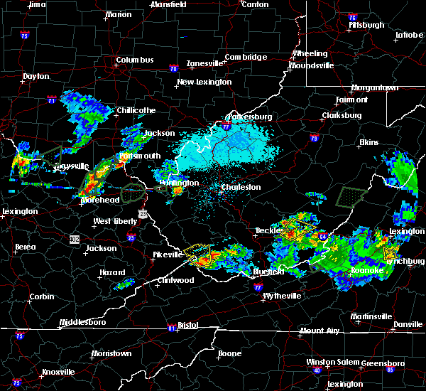 At 527 pm edt, a severe thunderstorm was located 10 miles south of gilbert creek, or 15 miles west of welch, moving north at 15 mph (radar indicated). Hazards include 60 mph wind gusts and half dollar size hail. Hail damage to vehicles is expected. Expect wind damage to roofs, siding, and trees. At 527 pm edt, a severe thunderstorm was located 10 miles south of gilbert creek, or 15 miles west of welch, moving north at 15 mph (radar indicated). Hazards include 60 mph wind gusts and half dollar size hail. Hail damage to vehicles is expected. Expect wind damage to roofs, siding, and trees.
|
| 3/1/2017 10:28 AM EST |
 At 1028 am est, a severe thunderstorm was located near gilbert creek, or 16 miles west of welch, moving east at 60 mph (radar indicated). Hazards include 60 mph wind gusts. expect damage to roofs, siding, and trees At 1028 am est, a severe thunderstorm was located near gilbert creek, or 16 miles west of welch, moving east at 60 mph (radar indicated). Hazards include 60 mph wind gusts. expect damage to roofs, siding, and trees
|
| 3/1/2017 10:07 AM EST |
 At 1007 am est, a severe thunderstorm was located over mcandrews, or 8 miles south of williamson, moving east at 60 mph (radar indicated). Hazards include 70 mph wind gusts. Expect considerable tree damage. Damage is likely to mobile homes, roofs, and outbuildings. At 1007 am est, a severe thunderstorm was located over mcandrews, or 8 miles south of williamson, moving east at 60 mph (radar indicated). Hazards include 70 mph wind gusts. Expect considerable tree damage. Damage is likely to mobile homes, roofs, and outbuildings.
|
| 7/8/2016 3:05 PM EDT | Trees down in wharncliffe in mingo county WV, 4 miles E of Gilbert Creek, WV |
| 7/8/2016 2:40 PM EDT |
 At 239 pm edt, severe thunderstorms were located along a line extending from near mount gay-shamrock to belfry, moving east at 40 mph (radar indicated). Hazards include 60 mph wind gusts. Expect damage to roofs. siding. And trees. At 239 pm edt, severe thunderstorms were located along a line extending from near mount gay-shamrock to belfry, moving east at 40 mph (radar indicated). Hazards include 60 mph wind gusts. Expect damage to roofs. siding. And trees.
|
| 7/4/2016 7:44 PM EDT |
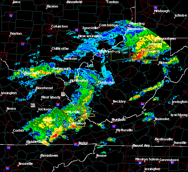 At 744 pm edt, a severe thunderstorm was located over hanover, or 12 miles west of pineville, moving east at 45 mph (radar indicated). Hazards include 60 mph wind gusts. Expect damage to roofs. siding. and trees. locations impacted include, hinch, gilbert creek, r. d. Bailey lake, gilbert, iaeger, hampden, panther and hurley. At 744 pm edt, a severe thunderstorm was located over hanover, or 12 miles west of pineville, moving east at 45 mph (radar indicated). Hazards include 60 mph wind gusts. Expect damage to roofs. siding. and trees. locations impacted include, hinch, gilbert creek, r. d. Bailey lake, gilbert, iaeger, hampden, panther and hurley.
|
| 7/4/2016 7:36 PM EDT | Reports of numerous trees down and roads blocked in the hurley area. time estimated from radar in buchanan county VA, 11.6 miles NNE of Gilbert Creek, WV |
| 7/4/2016 7:02 PM EDT |
 At 702 pm edt, a severe thunderstorm was located over kimper, or 9 miles east of pikeville, moving east at 45 mph (radar indicated). Hazards include 60 mph wind gusts. Expect damage to roofs. siding. And trees. At 702 pm edt, a severe thunderstorm was located over kimper, or 9 miles east of pikeville, moving east at 45 mph (radar indicated). Hazards include 60 mph wind gusts. Expect damage to roofs. siding. And trees.
|
| 6/23/2016 7:00 PM EDT |
 At 700 pm edt, a severe thunderstorm was located near hanover, or 14 miles northwest of welch, moving southeast at 30 mph (radar indicated). Hazards include 60 mph wind gusts. Expect damage to roofs. siding. And trees. At 700 pm edt, a severe thunderstorm was located near hanover, or 14 miles northwest of welch, moving southeast at 30 mph (radar indicated). Hazards include 60 mph wind gusts. Expect damage to roofs. siding. And trees.
|
| 6/23/2016 8:57 AM EDT | The severe thunderstorm warning for northeastern buchanan, raleigh, mingo, mcdowell, southwestern fayette, southeastern boone, logan, wyoming and south central kanawha counties will expire at 900 am edt, the storms which prompted the warning weakened below severe limits and exited the warned area. therefore, the warning will be allowed to expire. |
| 6/23/2016 8:57 AM EDT | The severe thunderstorm warning for northeastern buchanan, raleigh, mingo, mcdowell, southwestern fayette, southeastern boone, logan, wyoming and south central kanawha counties will expire at 900 am edt, the storms which prompted the warning weakened below severe limits and exited the warned area. therefore, the warning will be allowed to expire. |
| 6/23/2016 8:27 AM EDT |
 At 827 am edt, severe thunderstorms were located along a line extending from near hinton to mallory, moving south at 45 mph (radar indicated). Hazards include 60 mph wind gusts. Expect damage to roofs. siding. And trees. At 827 am edt, severe thunderstorms were located along a line extending from near hinton to mallory, moving south at 45 mph (radar indicated). Hazards include 60 mph wind gusts. Expect damage to roofs. siding. And trees.
|
| 6/23/2016 8:10 AM EDT |
 At 809 am edt, severe thunderstorms were located along a line extending from near burnwell to oppy, moving southeast at 50 mph (radar indicated). Hazards include 60 mph wind gusts. Expect damage to roofs. siding. and trees. locations impacted include, beckley, welch, logan, pineville, oak hill, mullens, mount hope, mabscott, oceana, sophia, gary, war, man, delbarton, northfork, shady spring, r. d. Bailey lake, wharton, holden and daniels. At 809 am edt, severe thunderstorms were located along a line extending from near burnwell to oppy, moving southeast at 50 mph (radar indicated). Hazards include 60 mph wind gusts. Expect damage to roofs. siding. and trees. locations impacted include, beckley, welch, logan, pineville, oak hill, mullens, mount hope, mabscott, oceana, sophia, gary, war, man, delbarton, northfork, shady spring, r. d. Bailey lake, wharton, holden and daniels.
|
| 6/23/2016 7:47 AM EDT |
 At 746 am edt, severe thunderstorms were located along a line extending from 8 miles south of chesapeake to coalpoint, moving southeast at 45 mph (radar indicated). Hazards include 60 mph wind gusts. Expect damage to roofs. siding. And trees. At 746 am edt, severe thunderstorms were located along a line extending from 8 miles south of chesapeake to coalpoint, moving southeast at 45 mph (radar indicated). Hazards include 60 mph wind gusts. Expect damage to roofs. siding. And trees.
|
| 6/16/2016 8:35 PM EDT |
 At 835 pm edt, a severe thunderstorm was located over gilbert creek, or 19 miles west of welch, moving east at 30 mph (radar indicated). Hazards include 60 mph wind gusts and quarter size hail. Hail damage to vehicles is expected. expect wind damage to roofs, siding, and trees. Locations impacted include, hanover, gilbert creek, bradshaw, iaeger, panther and avondale. At 835 pm edt, a severe thunderstorm was located over gilbert creek, or 19 miles west of welch, moving east at 30 mph (radar indicated). Hazards include 60 mph wind gusts and quarter size hail. Hail damage to vehicles is expected. expect wind damage to roofs, siding, and trees. Locations impacted include, hanover, gilbert creek, bradshaw, iaeger, panther and avondale.
|
| 6/16/2016 8:35 PM EDT |
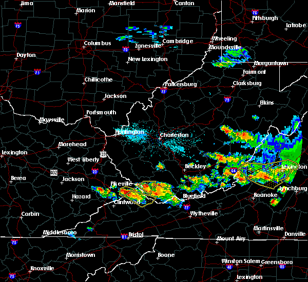 At 835 pm edt, a severe thunderstorm was located over gilbert creek, or 19 miles west of welch, moving east at 30 mph (radar indicated). Hazards include 60 mph wind gusts and quarter size hail. Hail damage to vehicles is expected. expect wind damage to roofs, siding, and trees. Locations impacted include, hanover, gilbert creek, bradshaw, iaeger, panther and avondale. At 835 pm edt, a severe thunderstorm was located over gilbert creek, or 19 miles west of welch, moving east at 30 mph (radar indicated). Hazards include 60 mph wind gusts and quarter size hail. Hail damage to vehicles is expected. expect wind damage to roofs, siding, and trees. Locations impacted include, hanover, gilbert creek, bradshaw, iaeger, panther and avondale.
|
| 6/16/2016 8:05 PM EDT |
 At 804 pm edt, a severe thunderstorm was located over buskirk, or near williamson, moving east at 30 mph (radar indicated). Hazards include 60 mph wind gusts and quarter size hail. Hail damage to vehicles is expected. Expect wind damage to roofs, siding, and trees. At 804 pm edt, a severe thunderstorm was located over buskirk, or near williamson, moving east at 30 mph (radar indicated). Hazards include 60 mph wind gusts and quarter size hail. Hail damage to vehicles is expected. Expect wind damage to roofs, siding, and trees.
|
| 5/1/2016 7:42 PM EDT |
 At 742 pm edt, a severe thunderstorm was located 11 miles northwest of war, or 13 miles northeast of grundy, moving southeast at 50 mph (radar indicated). Hazards include 60 mph wind gusts and half dollar size hail. Hail damage to vehicles is expected. expect wind damage to roofs, siding, and trees. Locations impacted include, welch, gary, war, paw paw, bradshaw, iaeger, anawalt, jolo, panther, avondale, elbert, coalwood, cucumber and hurley. At 742 pm edt, a severe thunderstorm was located 11 miles northwest of war, or 13 miles northeast of grundy, moving southeast at 50 mph (radar indicated). Hazards include 60 mph wind gusts and half dollar size hail. Hail damage to vehicles is expected. expect wind damage to roofs, siding, and trees. Locations impacted include, welch, gary, war, paw paw, bradshaw, iaeger, anawalt, jolo, panther, avondale, elbert, coalwood, cucumber and hurley.
|
| 5/1/2016 7:42 PM EDT |
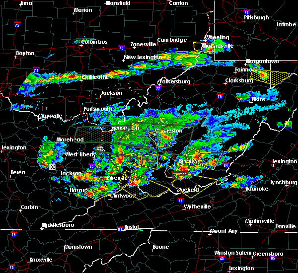 At 742 pm edt, a severe thunderstorm was located 11 miles northwest of war, or 13 miles northeast of grundy, moving southeast at 50 mph (radar indicated). Hazards include 60 mph wind gusts and half dollar size hail. Hail damage to vehicles is expected. expect wind damage to roofs, siding, and trees. Locations impacted include, welch, gary, war, paw paw, bradshaw, iaeger, anawalt, jolo, panther, avondale, elbert, coalwood, cucumber and hurley. At 742 pm edt, a severe thunderstorm was located 11 miles northwest of war, or 13 miles northeast of grundy, moving southeast at 50 mph (radar indicated). Hazards include 60 mph wind gusts and half dollar size hail. Hail damage to vehicles is expected. expect wind damage to roofs, siding, and trees. Locations impacted include, welch, gary, war, paw paw, bradshaw, iaeger, anawalt, jolo, panther, avondale, elbert, coalwood, cucumber and hurley.
|
| 5/1/2016 7:23 PM EDT |
 At 723 pm edt, a severe thunderstorm was located over paw paw, or 12 miles north of grundy, moving southeast at 50 mph (radar indicated). Hazards include 60 mph wind gusts and quarter size hail. Hail damage to vehicles is expected. Expect wind damage to roofs, siding, and trees. At 723 pm edt, a severe thunderstorm was located over paw paw, or 12 miles north of grundy, moving southeast at 50 mph (radar indicated). Hazards include 60 mph wind gusts and quarter size hail. Hail damage to vehicles is expected. Expect wind damage to roofs, siding, and trees.
|
| 7/14/2015 7:41 PM EDT |
 At 739 pm edt, doppler radar indicated a line of severe thunderstorms capable of producing damaging winds in excess of 60 mph. these storms were located along a line extending from near sandstone to near oceana to near buskirk, moving west at 15 mph. locations impacted include, beckley, welch, pineville, mullens, mabscott, oceana, sophia, gary, northfork, shady spring, r.d. bailey lake, twin falls state park, daniels, gilbert creek, buskirk, macarthur, crab orchard, paw paw, beaver and coal city. At 739 pm edt, doppler radar indicated a line of severe thunderstorms capable of producing damaging winds in excess of 60 mph. these storms were located along a line extending from near sandstone to near oceana to near buskirk, moving west at 15 mph. locations impacted include, beckley, welch, pineville, mullens, mabscott, oceana, sophia, gary, northfork, shady spring, r.d. bailey lake, twin falls state park, daniels, gilbert creek, buskirk, macarthur, crab orchard, paw paw, beaver and coal city.
|
| 7/14/2015 6:59 PM EDT |
 At 659 pm edt, doppler radar indicated a line of severe thunderstorms capable of producing damaging winds in excess of 60 mph. these storms were located along a line extending from babcock state park to 7 miles east of bald knob to davella, and moving south at 35 mph. At 659 pm edt, doppler radar indicated a line of severe thunderstorms capable of producing damaging winds in excess of 60 mph. these storms were located along a line extending from babcock state park to 7 miles east of bald knob to davella, and moving south at 35 mph.
|
| 7/13/2015 5:05 PM EDT |
 At 505 pm edt, doppler radar indicated a line of severe thunderstorms capable of producing damaging winds in excess of 60 mph. these storms were located along a line extending from 9 miles south of chesapeake to near amherstdale-robinette to majestic, and moving southeast at 40 mph. At 505 pm edt, doppler radar indicated a line of severe thunderstorms capable of producing damaging winds in excess of 60 mph. these storms were located along a line extending from 9 miles south of chesapeake to near amherstdale-robinette to majestic, and moving southeast at 40 mph.
|
| 7/13/2015 4:48 PM EDT |
 At 447 pm edt, doppler radar indicated a line of severe thunderstorms capable of producing damaging winds in excess of 60 mph. these storms were located along a line extending from near madison to red jacket, moving southeast at 40 mph. locations impacted include, williamson, madison, logan, chapmanville, man, delbarton, wharton, holden, south williamson, aflex, mallory, mount gay-shamrock, chief logan state, red jacket, chattaroy, hinch, van, buskirk, amherstdale-robinette and gilbert creek. At 447 pm edt, doppler radar indicated a line of severe thunderstorms capable of producing damaging winds in excess of 60 mph. these storms were located along a line extending from near madison to red jacket, moving southeast at 40 mph. locations impacted include, williamson, madison, logan, chapmanville, man, delbarton, wharton, holden, south williamson, aflex, mallory, mount gay-shamrock, chief logan state, red jacket, chattaroy, hinch, van, buskirk, amherstdale-robinette and gilbert creek.
|
| 7/13/2015 4:22 PM EDT |
 At 421 pm edt, doppler radar indicated a severe thunderstorm capable of producing damaging winds in excess of 60 mph. this storm was located over kiahsville, or 12 miles southeast of wayne, and moving southeast at 40 mph. At 421 pm edt, doppler radar indicated a severe thunderstorm capable of producing damaging winds in excess of 60 mph. this storm was located over kiahsville, or 12 miles southeast of wayne, and moving southeast at 40 mph.
|
| 7/9/2015 5:11 PM EDT | The severe thunderstorm warning for mingo, southwestern lincoln and western logan counties will expire at 515 pm edt, the storms which prompted the warning have moved off to the east. therefore the warning will be allowed to expire. to report severe weather, contact your nearest law enforcement agency. they will relay your report to the national weather service charleston west virginia. |
| 7/9/2015 4:52 PM EDT |
 At 452 pm edt, doppler radar indicated a line of severe thunderstorms capable of producing damaging winds in excess of 60 mph. these storms were located along a line extending from near calf creek to near coleman, moving east at 45 mph. locations impacted include, logan, chapmanville, man, delbarton, holden, mallory, mount gay-shamrock, gilbert creek, chief logan state, harts, red jacket, hinch, amherstdale-robinette, gilbert, west logan, mitchell heights, bruno, mount gay, dingess and myrtle. At 452 pm edt, doppler radar indicated a line of severe thunderstorms capable of producing damaging winds in excess of 60 mph. these storms were located along a line extending from near calf creek to near coleman, moving east at 45 mph. locations impacted include, logan, chapmanville, man, delbarton, holden, mallory, mount gay-shamrock, gilbert creek, chief logan state, harts, red jacket, hinch, amherstdale-robinette, gilbert, west logan, mitchell heights, bruno, mount gay, dingess and myrtle.
|
| 7/9/2015 4:22 PM EDT | At 422 pm edt, doppler radar indicated a line of severe thunderstorms capable of producing damaging winds in excess of 60 mph. these storms were located along a line extending from wells to kimper, and moving east at 50 mph. |
| 7/9/2015 4:22 PM EDT |
 At 422 pm edt, doppler radar indicated a line of severe thunderstorms capable of producing damaging winds in excess of 60 mph. these storms were located along a line extending from wells to kimper, and moving east at 50 mph. At 422 pm edt, doppler radar indicated a line of severe thunderstorms capable of producing damaging winds in excess of 60 mph. these storms were located along a line extending from wells to kimper, and moving east at 50 mph.
|
| 7/9/2015 2:07 PM EDT |
 At 206 pm edt, doppler radar indicated a severe thunderstorm capable of producing damaging winds in excess of 60 mph. this storm was located near logan, moving east at 40 mph. locations impacted include, williamson, logan, chapmanville, man, delbarton, r.d. bailey lake, wharton, bald knob, holden, south williamson, mallory, mount gay-shamrock, gilbert creek, chief logan state, red jacket, chattaroy, hanover, hinch, van and amherstdale-robinette. At 206 pm edt, doppler radar indicated a severe thunderstorm capable of producing damaging winds in excess of 60 mph. this storm was located near logan, moving east at 40 mph. locations impacted include, williamson, logan, chapmanville, man, delbarton, r.d. bailey lake, wharton, bald knob, holden, south williamson, mallory, mount gay-shamrock, gilbert creek, chief logan state, red jacket, chattaroy, hanover, hinch, van and amherstdale-robinette.
|
| 7/9/2015 1:47 PM EDT |
 At 146 pm edt, doppler radar indicated a severe thunderstorm capable of producing damaging winds in excess of 60 mph. this storm was located near mount gay-shamrock, or 9 miles west of logan, and moving east at 40 mph. At 146 pm edt, doppler radar indicated a severe thunderstorm capable of producing damaging winds in excess of 60 mph. this storm was located near mount gay-shamrock, or 9 miles west of logan, and moving east at 40 mph.
|
| 6/26/2015 4:14 AM EDT |
 At 414 am edt, doppler radar indicated a severe thunderstorm capable of producing quarter size hail and damaging winds in excess of 60 mph. this storm was located 10 miles south of gilbert creek, or 16 miles west of welch, moving east at 60 mph. locations impacted include, welch, war, big rock, paw paw, davy, bradshaw, iaeger, jolo, roseann, panther, avondale, coalwood, stacy and hurley. At 414 am edt, doppler radar indicated a severe thunderstorm capable of producing quarter size hail and damaging winds in excess of 60 mph. this storm was located 10 miles south of gilbert creek, or 16 miles west of welch, moving east at 60 mph. locations impacted include, welch, war, big rock, paw paw, davy, bradshaw, iaeger, jolo, roseann, panther, avondale, coalwood, stacy and hurley.
|
| 6/26/2015 4:14 AM EDT |
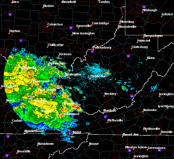 At 414 am edt, doppler radar indicated a severe thunderstorm capable of producing quarter size hail and damaging winds in excess of 60 mph. this storm was located 10 miles south of gilbert creek, or 16 miles west of welch, moving east at 60 mph. locations impacted include, welch, war, big rock, paw paw, davy, bradshaw, iaeger, jolo, roseann, panther, avondale, coalwood, stacy and hurley. At 414 am edt, doppler radar indicated a severe thunderstorm capable of producing quarter size hail and damaging winds in excess of 60 mph. this storm was located 10 miles south of gilbert creek, or 16 miles west of welch, moving east at 60 mph. locations impacted include, welch, war, big rock, paw paw, davy, bradshaw, iaeger, jolo, roseann, panther, avondale, coalwood, stacy and hurley.
|
| 6/26/2015 4:00 AM EDT |
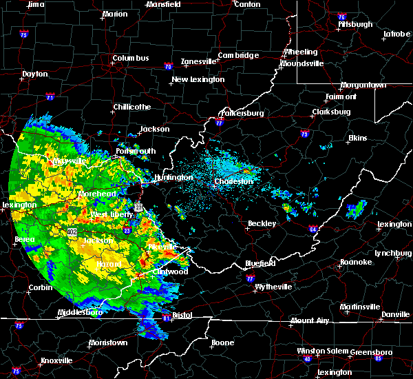 At 359 am edt, doppler radar indicated a severe thunderstorm capable of producing quarter size hail. this storm was located over paw paw, or 12 miles north of grundy, and moving east at 60 mph. At 359 am edt, doppler radar indicated a severe thunderstorm capable of producing quarter size hail. this storm was located over paw paw, or 12 miles north of grundy, and moving east at 60 mph.
|
| 6/25/2015 7:57 PM EDT |
 At 755 pm edt, trained weather spotters reported a severe thunderstorm producing half dollar size hail 4 miles northeast of crum in wayne county. this storm is also capable of producing damaging winds in excess of 60 mph. this storm was located 7 miles east of hode, or 13 miles east of inez, and moving southeast at 35 mph. At 755 pm edt, trained weather spotters reported a severe thunderstorm producing half dollar size hail 4 miles northeast of crum in wayne county. this storm is also capable of producing damaging winds in excess of 60 mph. this storm was located 7 miles east of hode, or 13 miles east of inez, and moving southeast at 35 mph.
|
| 6/21/2015 3:53 PM EDT |
 At 352 pm edt, doppler radar indicated a severe thunderstorm capable of producing half dollar size hail and damaging winds in excess of 60 mph. this storm was located near red jacket, or 10 miles southeast of williamson, moving southeast at 15 mph. locations impacted include, hinch, gilbert creek, gilbert, hampden, meador, pie and hurley. At 352 pm edt, doppler radar indicated a severe thunderstorm capable of producing half dollar size hail and damaging winds in excess of 60 mph. this storm was located near red jacket, or 10 miles southeast of williamson, moving southeast at 15 mph. locations impacted include, hinch, gilbert creek, gilbert, hampden, meador, pie and hurley.
|
| 6/21/2015 3:53 PM EDT |
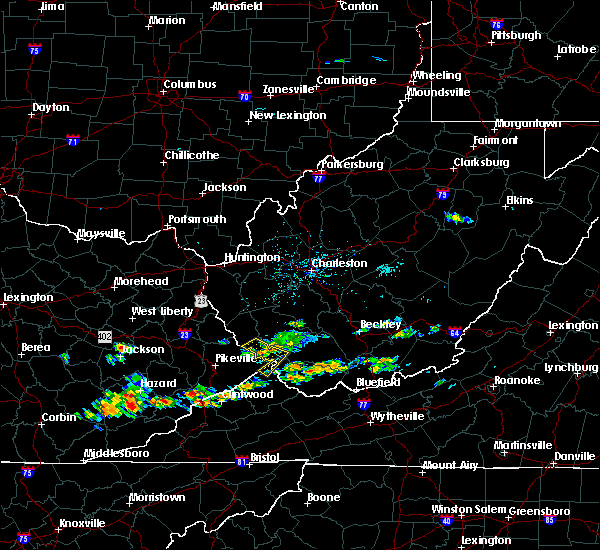 At 352 pm edt, doppler radar indicated a severe thunderstorm capable of producing half dollar size hail and damaging winds in excess of 60 mph. this storm was located near red jacket, or 10 miles southeast of williamson, moving southeast at 15 mph. locations impacted include, hinch, gilbert creek, gilbert, hampden, meador, pie and hurley. At 352 pm edt, doppler radar indicated a severe thunderstorm capable of producing half dollar size hail and damaging winds in excess of 60 mph. this storm was located near red jacket, or 10 miles southeast of williamson, moving southeast at 15 mph. locations impacted include, hinch, gilbert creek, gilbert, hampden, meador, pie and hurley.
|
| 6/21/2015 3:31 PM EDT |
 At 331 pm edt, doppler radar indicated a severe thunderstorm capable of producing half dollar size hail and damaging winds in excess of 60 mph. this storm was located near buskirk, or near williamson, and moving southeast at 15 mph. At 331 pm edt, doppler radar indicated a severe thunderstorm capable of producing half dollar size hail and damaging winds in excess of 60 mph. this storm was located near buskirk, or near williamson, and moving southeast at 15 mph.
|
| 6/18/2015 6:30 PM EDT | At 630 pm edt, doppler radar indicated a severe thunderstorm capable of producing quarter size hail and damaging winds in excess of 60 mph. this storm was located near grundy, moving east at 30 mph. locations impacted include, grundy, breaks interstate, big rock, paw paw, bradshaw, iaeger, jolo, oakwood, roseann, panther, avondale, vansant, stacy and hurley. |
| 6/18/2015 6:30 PM EDT | At 630 pm edt, doppler radar indicated a severe thunderstorm capable of producing quarter size hail and damaging winds in excess of 60 mph. this storm was located near grundy, moving east at 30 mph. locations impacted include, grundy, breaks interstate, big rock, paw paw, bradshaw, iaeger, jolo, oakwood, roseann, panther, avondale, vansant, stacy and hurley. |
| 6/18/2015 6:08 PM EDT | At 607 pm edt, doppler radar indicated a severe thunderstorm capable of producing quarter size hail and damaging winds in excess of 60 mph. this storm was located over fedscreek, or 9 miles northeast of breaks interstate, and moving east at 30 mph. |
| 6/18/2015 6:08 PM EDT | At 607 pm edt, doppler radar indicated a severe thunderstorm capable of producing quarter size hail and damaging winds in excess of 60 mph. this storm was located over fedscreek, or 9 miles northeast of breaks interstate, and moving east at 30 mph. |
| 6/18/2015 3:26 PM EDT | The severe thunderstorm warning for east central mingo, north central mcdowell, south central logan and southwestern wyoming counties will expire at 330 pm edt, the storm which prompted the warning has weakened below severe limits, and no longer poses an immediate threat to life or property. therefore the warning will be allowed to expire. however small hail and heavy rain are still possible with this thunderstorm. |
| 6/18/2015 2:46 PM EDT | At 245 pm edt, doppler radar indicated a severe thunderstorm capable of producing quarter size hail and damaging winds in excess of 60 mph. this storm was located near r.d. bailey lake, or 16 miles southeast of logan, and moving southeast at 30 mph. |
| 6/1/2015 5:10 PM EDT | At 510 pm edt, doppler radar indicated a severe thunderstorm capable of producing half dollar size hail and destructive winds in excess of 70 mph. this storm was located over mallory, or 12 miles southeast of logan. this storm was nearly stationary. locations impacted include, man, mallory, amherstdale-robinette, gilbert creek, gilbert, clear fork, amherstdale-robine, bruno, switzer, coal mountain and blair. |
| 6/1/2015 4:54 PM EDT | At 453 pm edt, doppler radar indicated a severe thunderstorm capable of producing quarter size hail and damaging winds in excess of 60 mph. this storm was located near hinch, or 10 miles south of logan, and moving northeast at 30 mph. |
| 5/11/2015 6:36 PM EDT | At 634 pm edt, national weather service doppler radar indicated a severe thunderstorm capable of producing quarter size hail, and damaging winds in excess of 60 mph. this storm was located near r.d. bailey lake, or 17 miles southeast of logan, moving east at 15 mph. * other locations in the warning include but are not limited to hanover, oceana, man and mallory. very heavy rain will also fall from this severe thunderstorm, and will cause water to pond on roads and quickly fill roadside ditches and small streams. a severe thunderstorm watch remains in effect until 1000 pm edt monday evening for central kentucky and southeast ohio and central west virginia. a severe thunderstorm watch also remains in effect until 100 am edt tuesday morning for central west virginia. please report hail or strong wind to the national weather service by calling toll free, 800-401-9535, when you can do so safely. you may also report severe weather by posting your report to the charleston west virginia national weather service facebook page, or by using the twitter hashtag, nwsrlx. |
| 4/25/2015 9:20 PM EDT | At 918 pm edt, national weather service doppler radar indicated a severe thunderstorm capable of producing quarter size hail. this storm was located near gilbert creek, or 19 miles northwest of welch, moving east at 35 mph. * other locations in the warning include but are not limited to hanover, r.d. bailey lake, twin falls state park and mullens. please report hail or strong wind to the national weather service by calling toll free, 800-401-9535, when you can do so safely. you may also report severe weather by posting your report to the charleston west virginia national weather service facebook page, or by using the twitter hashtag, nwsrlx. |
| 4/8/2015 5:01 PM EDT | The national weather service in charleston has issued a * severe thunderstorm warning for. mcdowell county in west virginia. this includes the city of welch. until 545 pm edt * at 454 pm edt. National weather service doppler radar indicated a. |
| 4/8/2015 5:00 PM EDT | Quarter sized hail reported 6.1 miles N of Gilbert Creek, WV |
| 4/8/2015 4:43 PM EDT | Ping Pong Ball sized hail reported 7.6 miles N of Gilbert Creek, WV |
| 4/8/2015 4:40 PM EDT | Half Dollar sized hail reported 4.1 miles ENE of Gilbert Creek, WV, fell in town of wharncliff. |
| 4/8/2015 4:28 PM EDT | A severe thunderstorm warning remains in effect until 500 pm edt for wyoming. southeastern logan. mcdowell. southeastern mingo and northeastern buchanan counties. at 417 pm edt. national weather service doppler radar continued to indicate a severe thunderstorm capable of producing golf ball size hail. and damaging winds in excess of 60 mph. This storm was. |
| 4/8/2015 4:28 PM EDT | A severe thunderstorm warning remains in effect until 500 pm edt for wyoming. southeastern logan. mcdowell. southeastern mingo and northeastern buchanan counties. at 417 pm edt. national weather service doppler radar continued to indicate a severe thunderstorm capable of producing golf ball size hail. and damaging winds in excess of 60 mph. This storm was. |
| 4/8/2015 4:05 PM EDT | The national weather service in charleston has issued a * severe thunderstorm warning for. northeastern buchanan county in virginia. southeastern logan county in west virginia. mcdowell county in west virginia. This includes the city of welch. |
| 4/8/2015 4:05 PM EDT | The national weather service in charleston has issued a * severe thunderstorm warning for. northeastern buchanan county in virginia. southeastern logan county in west virginia. mcdowell county in west virginia. This includes the city of welch. |
| 1/1/0001 12:00 AM | Power is out at the panther post office in mcdowell county WV, 6.1 miles N of Gilbert Creek, WV |
Hail Maps for Gilbert Creek, WV


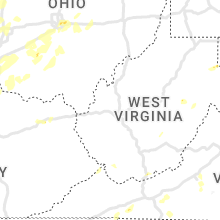

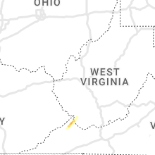


Connect with Interactive Hail Maps