

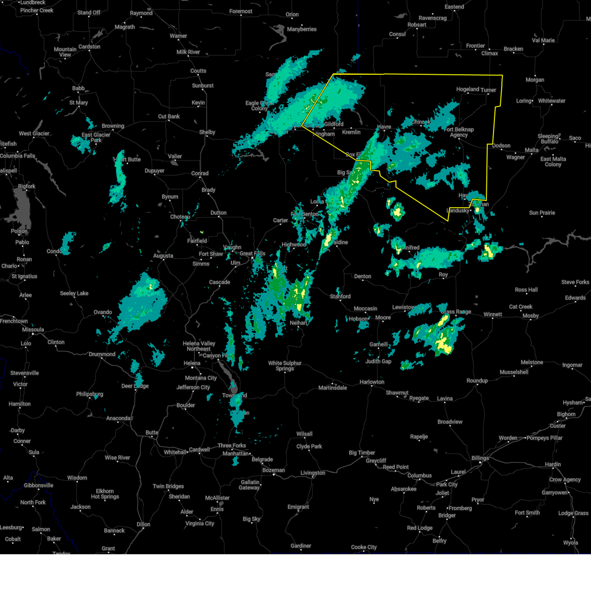
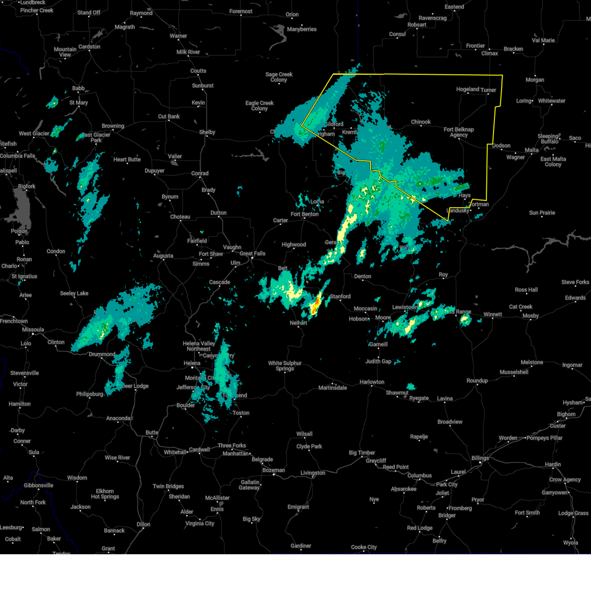
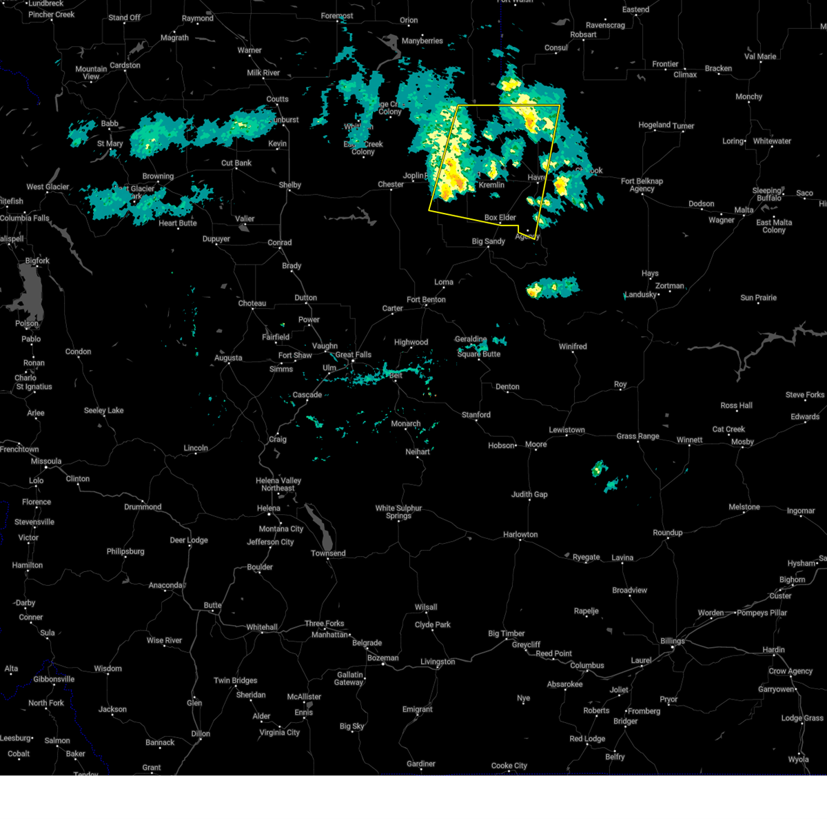
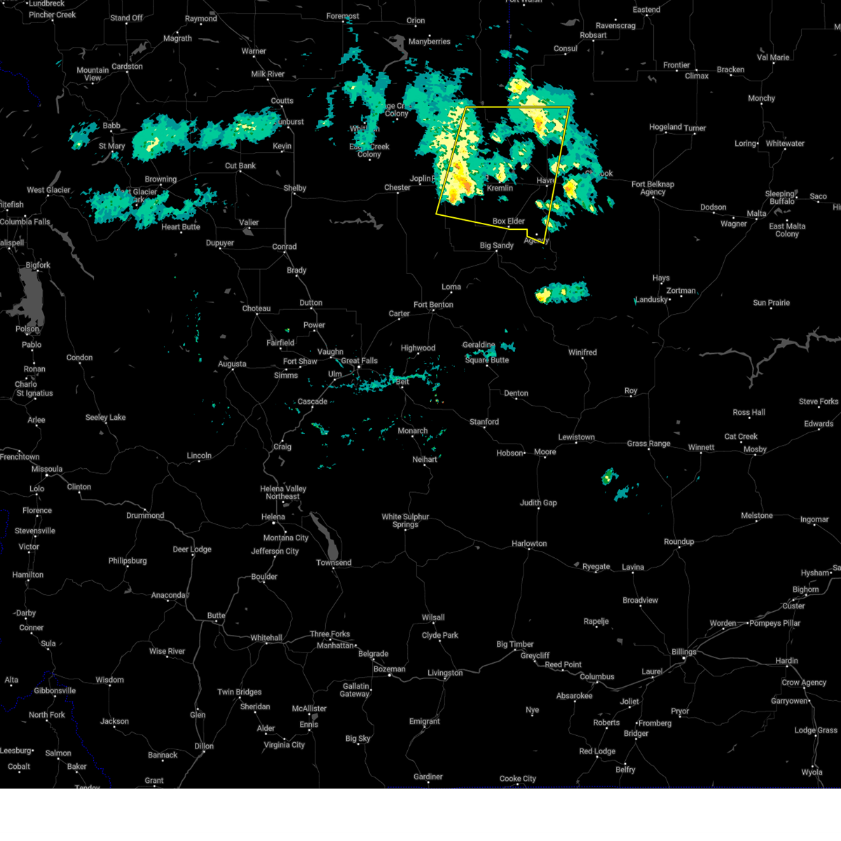
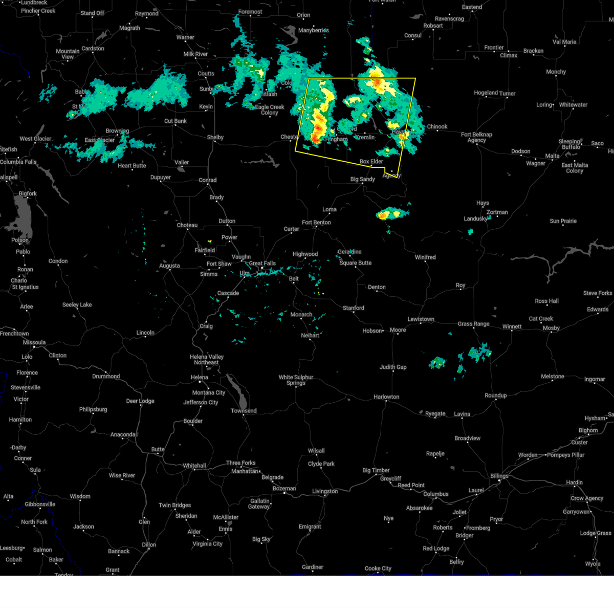
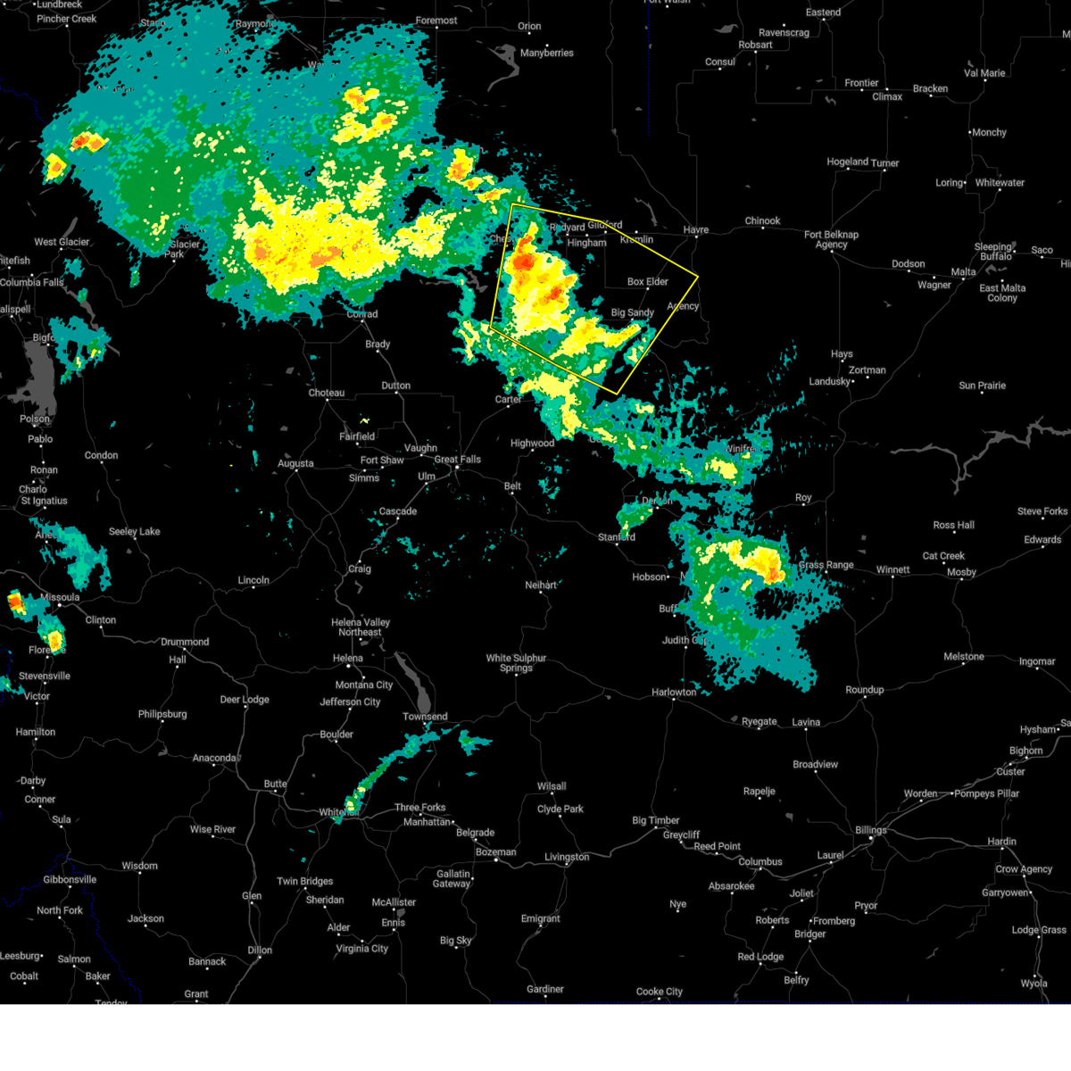
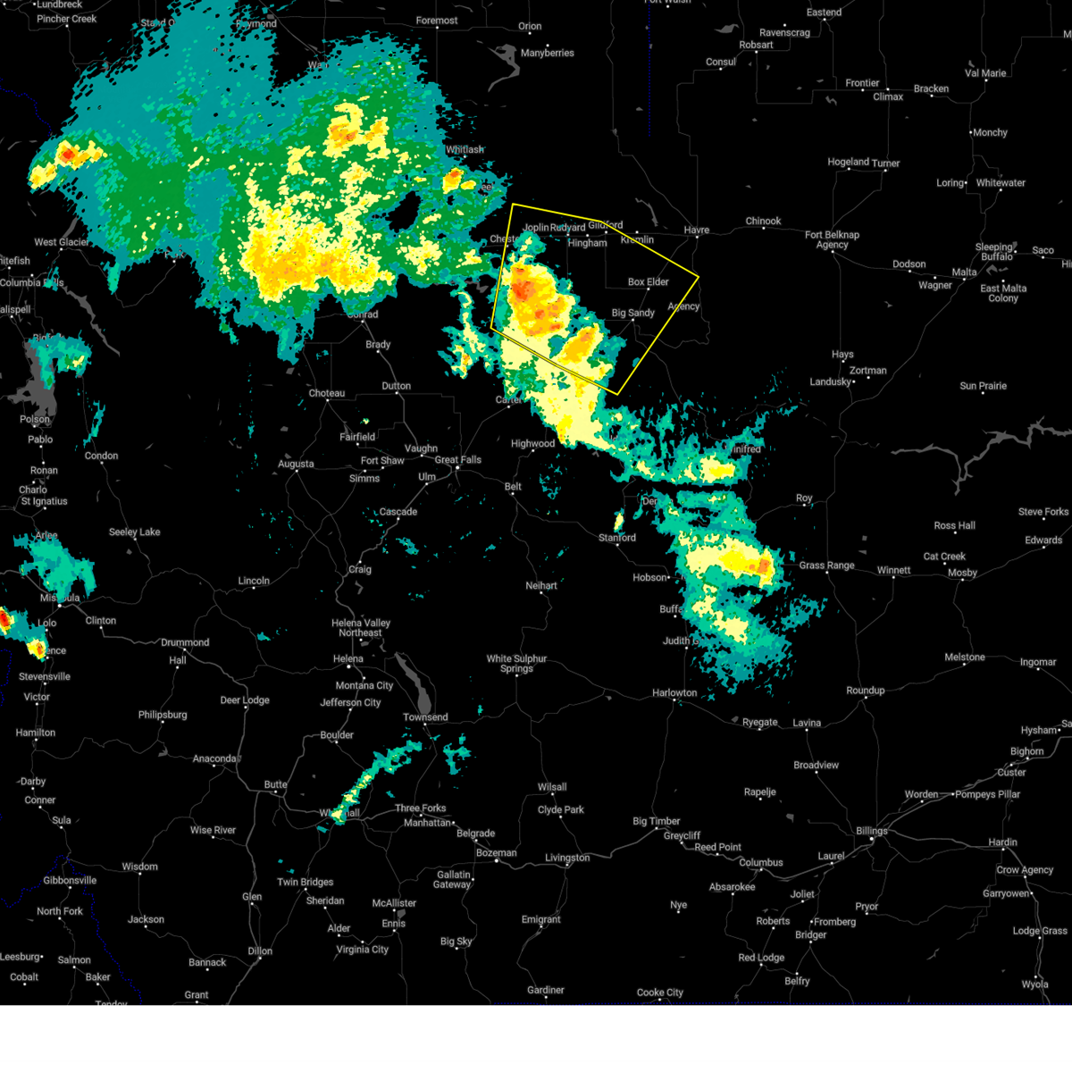
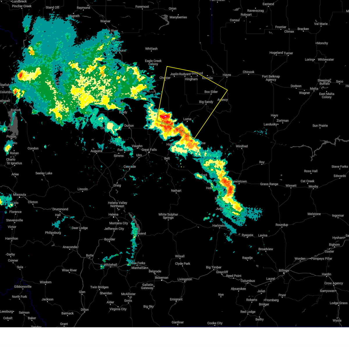
Hail Map for Gildford, MT
The Gildford, MT area has had 0 reports of on-the-ground hail by trained spotters, and has been under severe weather warnings 22 times during the past 12 months. Doppler radar has detected hail at or near Gildford, MT on 16 occasions.
| Name: | Gildford, MT |
| Where Located: | 28.9 miles W of Havre, MT |
| Map: | Google Map for Gildford, MT |
| Population: | 179 |
| Housing Units: | 87 |
| More Info: | Search Google for Gildford, MT |
2
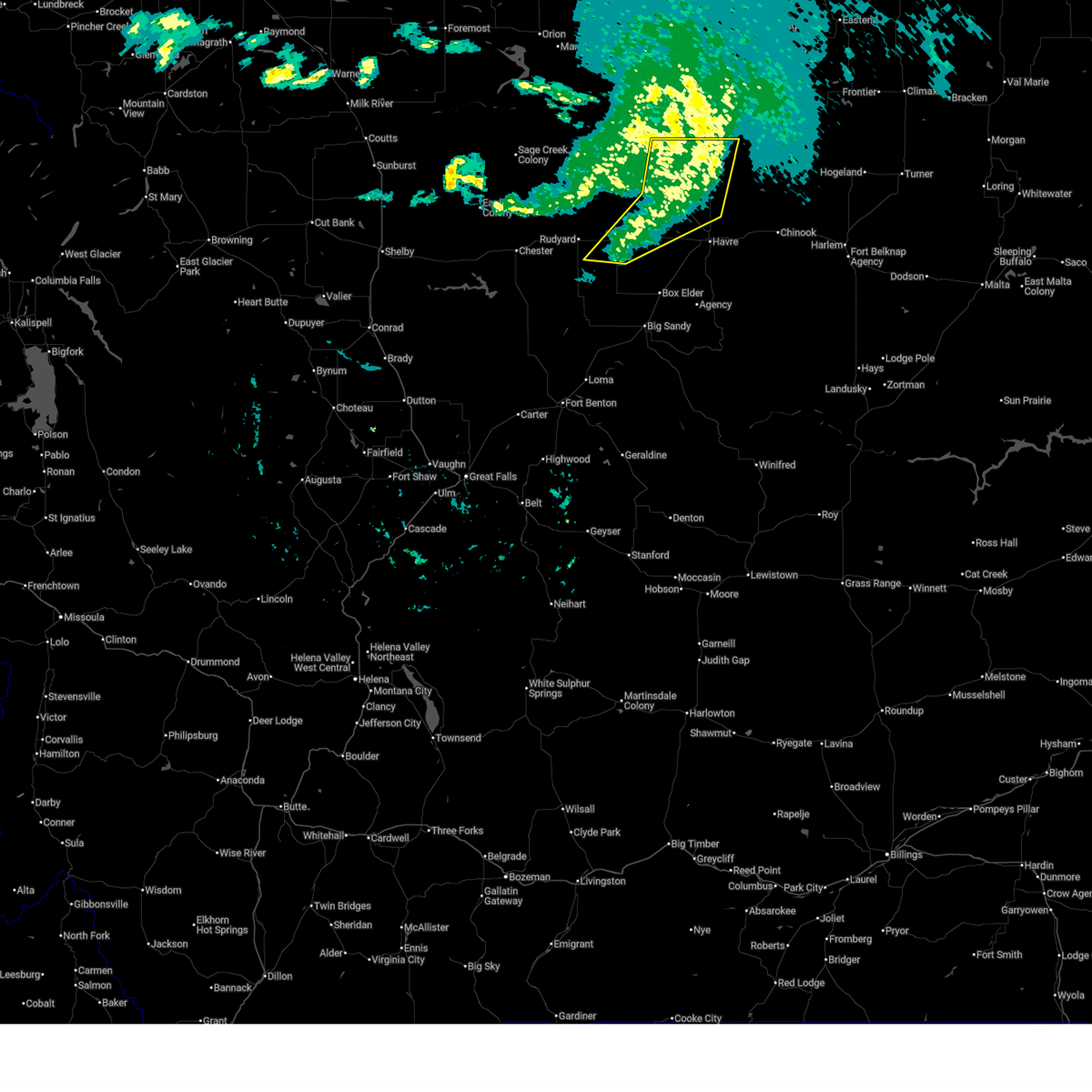
The Top Recent Hail Date for Gildford, MT is Tuesday, July 2, 2024 (5th out of 16)

Hail and Wind Damage Spotted near Gildford, MT
| Date / Time | Report Details |
|---|---|
| 7/13/2025 11:57 PM MDT |
 The storms which prompted the warning have moved out of the area. therefore, the warning will be allowed to expire. a new warning has been issued in areas where gusty winds remain a threat. The storms which prompted the warning have moved out of the area. therefore, the warning will be allowed to expire. a new warning has been issued in areas where gusty winds remain a threat.
|
| 7/13/2025 11:49 PM MDT |
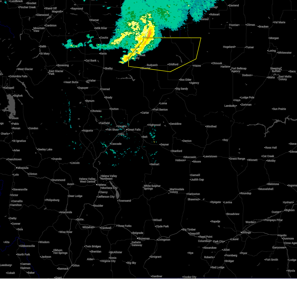
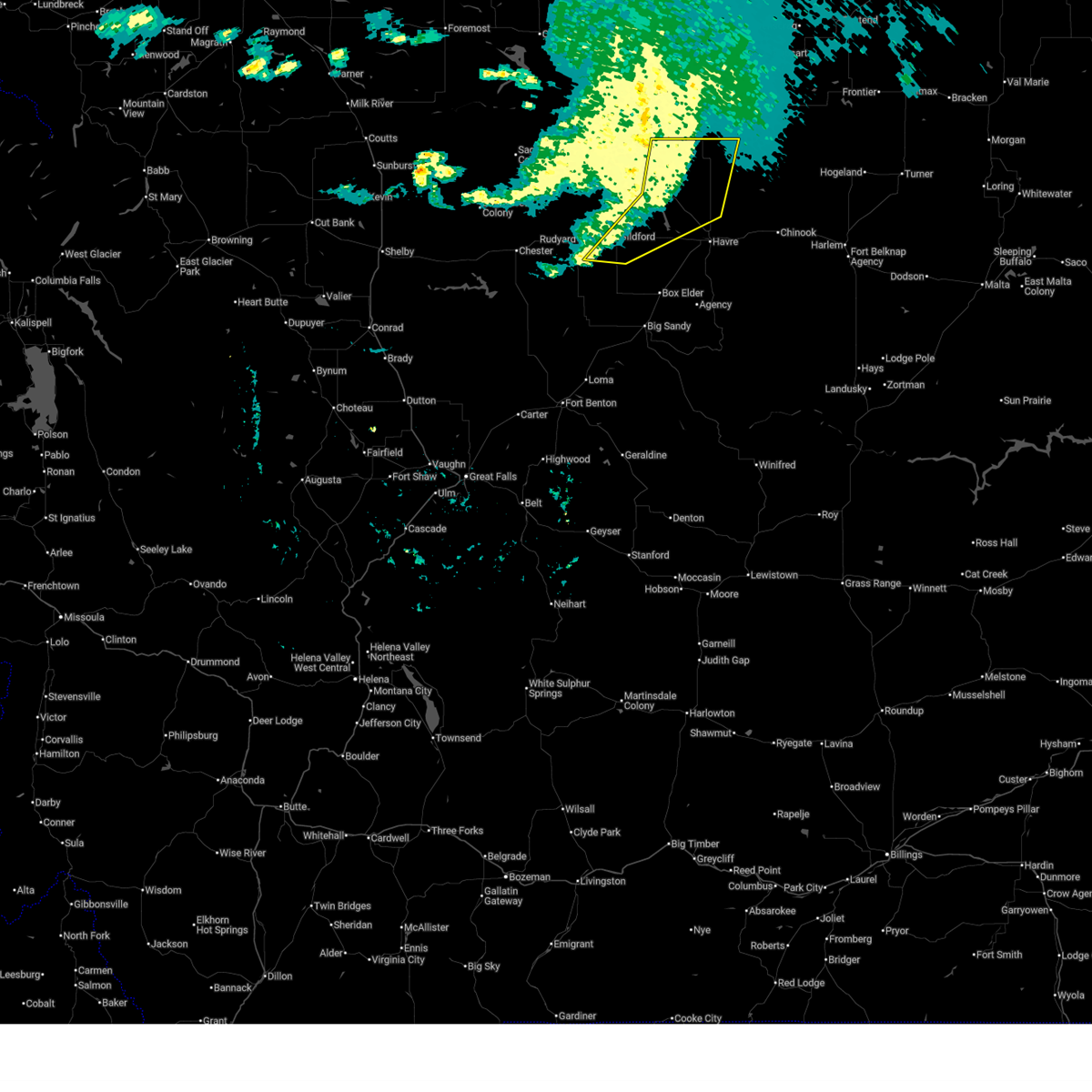 At 1149 pm mdt, severe thunderstorms were located along a line extending from 34 miles north of havre to 10 miles north of beaver creek to near gildford, moving east at 45 mph (radar indicated). Hazards include 60 mph wind gusts. Expect damage to roofs, siding, and trees. Locations impacted include, gildford and kremlin. At 1149 pm mdt, severe thunderstorms were located along a line extending from 34 miles north of havre to 10 miles north of beaver creek to near gildford, moving east at 45 mph (radar indicated). Hazards include 60 mph wind gusts. Expect damage to roofs, siding, and trees. Locations impacted include, gildford and kremlin.
|
| 7/13/2025 11:49 PM MDT |
 the severe thunderstorm warning has been cancelled and is no longer in effect the severe thunderstorm warning has been cancelled and is no longer in effect
|
| 7/13/2025 11:40 PM MDT | Mesonet station gw6392 gildford 15 in hill county MT, 14.2 miles S of Gildford, MT |
| 7/13/2025 11:30 PM MDT |
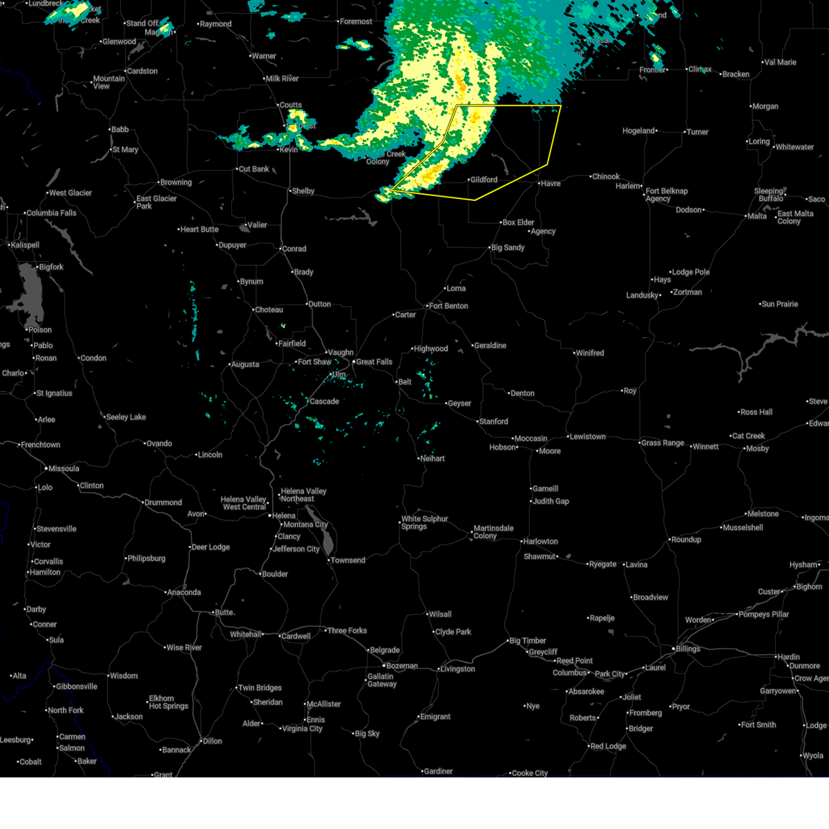 At 1130 pm mdt, severe thunderstorms were located along a line extending from 37 miles north of beaver creek to 13 miles northeast of gildford to near inverness, moving east at 50 mph (radar indicated). Hazards include 60 mph wind gusts. Expect damage to roofs, siding, and trees. Locations impacted include, chester, joplin, inverness, gildford, hingham, rudyard, kremlin, and simpson. At 1130 pm mdt, severe thunderstorms were located along a line extending from 37 miles north of beaver creek to 13 miles northeast of gildford to near inverness, moving east at 50 mph (radar indicated). Hazards include 60 mph wind gusts. Expect damage to roofs, siding, and trees. Locations impacted include, chester, joplin, inverness, gildford, hingham, rudyard, kremlin, and simpson.
|
| 7/13/2025 10:58 PM MDT |
 Svrtfx the national weather service in great falls has issued a * severe thunderstorm warning for, northeastern liberty county in north central montana, hill county in north central montana, * until midnight mdt. * at 1058 pm mdt, severe thunderstorms were located along a line extending from 43 miles north of joplin to 18 miles north of inverness to 14 miles north of chester, moving east at 45 mph (radar indicated). Hazards include 60 mph wind gusts. expect damage to roofs, siding, and trees Svrtfx the national weather service in great falls has issued a * severe thunderstorm warning for, northeastern liberty county in north central montana, hill county in north central montana, * until midnight mdt. * at 1058 pm mdt, severe thunderstorms were located along a line extending from 43 miles north of joplin to 18 miles north of inverness to 14 miles north of chester, moving east at 45 mph (radar indicated). Hazards include 60 mph wind gusts. expect damage to roofs, siding, and trees
|
| 5/12/2025 4:40 PM MDT |
 the severe thunderstorm warning has been cancelled and is no longer in effect the severe thunderstorm warning has been cancelled and is no longer in effect
|
| 5/12/2025 4:06 PM MDT |
 Svrtfx the national weather service in great falls has issued a * severe thunderstorm warning for, blaine county in north central montana, hill county in north central montana, * until 500 pm mdt. * at 403 pm mdt, severe thunderstorm winds were moving through portions of hill and blaine county (radar indicated). Hazards include 60 mph wind gusts. expect damage to roofs, siding, and trees Svrtfx the national weather service in great falls has issued a * severe thunderstorm warning for, blaine county in north central montana, hill county in north central montana, * until 500 pm mdt. * at 403 pm mdt, severe thunderstorm winds were moving through portions of hill and blaine county (radar indicated). Hazards include 60 mph wind gusts. expect damage to roofs, siding, and trees
|
| 9/20/2024 4:01 PM MDT |
 Svrtfx the national weather service in great falls has issued a * severe thunderstorm warning for, hill county in north central montana, * until 430 pm mdt. * at 401 pm mdt, severe thunderstorms were located along a line extending from 13 miles northwest of beaver creek to 9 miles north of box elder, moving east at 40 mph (havre airport reported a 70 mph wind gust). Hazards include 70 mph wind gusts. Expect considerable tree damage. Damage is likely to mobile homes, roofs, and outbuildings. Svrtfx the national weather service in great falls has issued a * severe thunderstorm warning for, hill county in north central montana, * until 430 pm mdt. * at 401 pm mdt, severe thunderstorms were located along a line extending from 13 miles northwest of beaver creek to 9 miles north of box elder, moving east at 40 mph (havre airport reported a 70 mph wind gust). Hazards include 70 mph wind gusts. Expect considerable tree damage. Damage is likely to mobile homes, roofs, and outbuildings.
|
| 9/20/2024 3:58 PM MDT |
 The storms which prompted the warning have weakened below severe limits, and no longer pose an immediate threat to life or property. therefore, the warning will be allowed to expire. however, gusty winds are still possible with these thunderstorms. The storms which prompted the warning have weakened below severe limits, and no longer pose an immediate threat to life or property. therefore, the warning will be allowed to expire. however, gusty winds are still possible with these thunderstorms.
|
| 9/20/2024 3:24 PM MDT |
 the severe thunderstorm warning has been cancelled and is no longer in effect the severe thunderstorm warning has been cancelled and is no longer in effect
|
| 9/20/2024 3:24 PM MDT |
 At 324 pm mdt, severe thunderstorms were located along a line extending from 18 miles north of gildford to 7 miles east of inverness, moving east at 40 mph (radar indicated). Hazards include 60 mph wind gusts. Expect damage to roofs, siding, and trees. locations impacted include, havre, azure, parker school, beaver creek, agency, gildford, sangrey, box elder, st. Pierre, boneau, hingham, rudyard, rocky boy, laredo, kremlin, and simpson. At 324 pm mdt, severe thunderstorms were located along a line extending from 18 miles north of gildford to 7 miles east of inverness, moving east at 40 mph (radar indicated). Hazards include 60 mph wind gusts. Expect damage to roofs, siding, and trees. locations impacted include, havre, azure, parker school, beaver creek, agency, gildford, sangrey, box elder, st. Pierre, boneau, hingham, rudyard, rocky boy, laredo, kremlin, and simpson.
|
| 9/20/2024 3:07 PM MDT |
 Svrtfx the national weather service in great falls has issued a * severe thunderstorm warning for, east central liberty county in north central montana, hill county in north central montana, * until 400 pm mdt. * at 306 pm mdt, severe thunderstorms were located along a line extending from 21 miles north of inverness to near joplin, moving east at 40 mph (radar and automated wind sensor reports of 60 mph wind gusts). Hazards include 60 mph wind gusts. expect damage to roofs, siding, and trees Svrtfx the national weather service in great falls has issued a * severe thunderstorm warning for, east central liberty county in north central montana, hill county in north central montana, * until 400 pm mdt. * at 306 pm mdt, severe thunderstorms were located along a line extending from 21 miles north of inverness to near joplin, moving east at 40 mph (radar and automated wind sensor reports of 60 mph wind gusts). Hazards include 60 mph wind gusts. expect damage to roofs, siding, and trees
|
| 8/23/2024 7:09 PM MDT |
 The storms which prompted the warning have weakened below severe limits, and no longer pose an immediate threat to life or property. therefore, the warning will be allowed to expire. however, gusty winds around 55 mph are still possible with these thunderstorms. a severe thunderstorm watch remains in effect until 900 pm mdt for north central montana. The storms which prompted the warning have weakened below severe limits, and no longer pose an immediate threat to life or property. therefore, the warning will be allowed to expire. however, gusty winds around 55 mph are still possible with these thunderstorms. a severe thunderstorm watch remains in effect until 900 pm mdt for north central montana.
|
| 8/23/2024 6:47 PM MDT |
 At 647 pm mdt, severe thunderstorms were located along a line extending from 36 miles north of kiowa to 23 miles east of sunburst to 9 miles northwest of beaver creek, moving north at 85 mph (radar indicated). Hazards include 70 mph wind gusts. Expect considerable tree damage. damage is likely to mobile homes, roofs, and outbuildings. locations impacted include, havre, shelby, cut bank, chinook, chester, sunburst, kevin, parker school, beaver creek, lothair, joplin, azure, inverness, agency, st. Pierre, gildford, sangrey, boneau, box elder, and north browning. At 647 pm mdt, severe thunderstorms were located along a line extending from 36 miles north of kiowa to 23 miles east of sunburst to 9 miles northwest of beaver creek, moving north at 85 mph (radar indicated). Hazards include 70 mph wind gusts. Expect considerable tree damage. damage is likely to mobile homes, roofs, and outbuildings. locations impacted include, havre, shelby, cut bank, chinook, chester, sunburst, kevin, parker school, beaver creek, lothair, joplin, azure, inverness, agency, st. Pierre, gildford, sangrey, boneau, box elder, and north browning.
|
| 8/23/2024 6:47 PM MDT |
 the severe thunderstorm warning has been cancelled and is no longer in effect the severe thunderstorm warning has been cancelled and is no longer in effect
|
| 8/23/2024 6:13 PM MDT |
 Svrtfx the national weather service in great falls has issued a * severe thunderstorm warning for, northeastern pondera county in north central montana, liberty county in north central montana, glacier county in north central montana, toole county in north central montana, northwestern blaine county in north central montana, hill county in north central montana, northern chouteau county in north central montana, * until 715 pm mdt. * at 612 pm mdt, severe thunderstorms were located along a line extending from 11 miles southwest of east glacier park village to 10 miles north of the knees to 17 miles southeast of big sandy, moving north at 85 mph. these are destructive storms for browning, box elder, and havre (radar indicated). Hazards include 80 mph wind gusts. Flying debris will be dangerous to those caught without shelter. mobile homes will be heavily damaged. expect considerable damage to roofs, windows, and vehicles. Extensive tree damage and power outages are likely. Svrtfx the national weather service in great falls has issued a * severe thunderstorm warning for, northeastern pondera county in north central montana, liberty county in north central montana, glacier county in north central montana, toole county in north central montana, northwestern blaine county in north central montana, hill county in north central montana, northern chouteau county in north central montana, * until 715 pm mdt. * at 612 pm mdt, severe thunderstorms were located along a line extending from 11 miles southwest of east glacier park village to 10 miles north of the knees to 17 miles southeast of big sandy, moving north at 85 mph. these are destructive storms for browning, box elder, and havre (radar indicated). Hazards include 80 mph wind gusts. Flying debris will be dangerous to those caught without shelter. mobile homes will be heavily damaged. expect considerable damage to roofs, windows, and vehicles. Extensive tree damage and power outages are likely.
|
| 8/23/2024 6:11 PM MDT |
 Svrtfx the national weather service in great falls has issued a * severe thunderstorm warning for, northeastern pondera county in north central montana, liberty county in north central montana, glacier county in north central montana, toole county in north central montana, northwestern blaine county in north central montana, hill county in north central montana, northern chouteau county in north central montana, * until 715 pm mdt. * at 610 pm mdt, severe thunderstorms were located along a line extending from 11 miles southwest of east glacier park village to 9 miles north of the knees to 19 miles southeast of big sandy, moving north at 85 mph. these are destructive storms for browning, box elder, and havre (radar indicated). Hazards include 80 mph wind gusts. Flying debris will be dangerous to those caught without shelter. mobile homes will be heavily damaged. expect considerable damage to roofs, windows, and vehicles. Extensive tree damage and power outages are likely. Svrtfx the national weather service in great falls has issued a * severe thunderstorm warning for, northeastern pondera county in north central montana, liberty county in north central montana, glacier county in north central montana, toole county in north central montana, northwestern blaine county in north central montana, hill county in north central montana, northern chouteau county in north central montana, * until 715 pm mdt. * at 610 pm mdt, severe thunderstorms were located along a line extending from 11 miles southwest of east glacier park village to 9 miles north of the knees to 19 miles southeast of big sandy, moving north at 85 mph. these are destructive storms for browning, box elder, and havre (radar indicated). Hazards include 80 mph wind gusts. Flying debris will be dangerous to those caught without shelter. mobile homes will be heavily damaged. expect considerable damage to roofs, windows, and vehicles. Extensive tree damage and power outages are likely.
|
| 8/19/2024 9:10 PM MDT |
 At 909 pm mdt, severe thunderstorms were located along a line extending from 34 miles east of sunburst to near gildford to 6 miles north of azure to 25 miles southeast of parker school, moving east at 65 mph (automated weather observation system). Hazards include 70 mph wind gusts. Expect considerable tree damage. damage is likely to mobile homes, roofs, and outbuildings. locations impacted include, havre, chinook, chester, big sandy, harlem, parker school, beaver creek, hays, joplin, azure, inverness, agency, st. Pierre, gildford, sangrey, boneau, fort belknap, box elder, hingham, and rudyard. At 909 pm mdt, severe thunderstorms were located along a line extending from 34 miles east of sunburst to near gildford to 6 miles north of azure to 25 miles southeast of parker school, moving east at 65 mph (automated weather observation system). Hazards include 70 mph wind gusts. Expect considerable tree damage. damage is likely to mobile homes, roofs, and outbuildings. locations impacted include, havre, chinook, chester, big sandy, harlem, parker school, beaver creek, hays, joplin, azure, inverness, agency, st. Pierre, gildford, sangrey, boneau, fort belknap, box elder, hingham, and rudyard.
|
| 8/19/2024 9:00 PM MDT |
 The storms which prompted the warning have moved out of the area. therefore, the warning has been allowed to expire. however, gusty winds are still possible with these thunderstorms. a severe thunderstorm watch remains in effect until 1000 pm mdt for north central montana. remember, a severe thunderstorm warning still remains in effect for northern liberty county, northeastern toole county, blaine county, hill county, and northeastern chouteau county until 10pm. The storms which prompted the warning have moved out of the area. therefore, the warning has been allowed to expire. however, gusty winds are still possible with these thunderstorms. a severe thunderstorm watch remains in effect until 1000 pm mdt for north central montana. remember, a severe thunderstorm warning still remains in effect for northern liberty county, northeastern toole county, blaine county, hill county, and northeastern chouteau county until 10pm.
|
| 8/19/2024 8:56 PM MDT |
 Svrtfx the national weather service in great falls has issued a * severe thunderstorm warning for, northern liberty county in north central montana, northeastern toole county in north central montana, blaine county in north central montana, hill county in north central montana, northeastern chouteau county in north central montana, * until 1000 pm mdt. * at 855 pm mdt, severe thunderstorms were located along a line extending from 25 miles east of sunburst to near inverness to near box elder to 19 miles southeast of parker school, moving east at 65 mph (radar indicated). Hazards include 60 mph wind gusts. expect damage to roofs, siding, and trees Svrtfx the national weather service in great falls has issued a * severe thunderstorm warning for, northern liberty county in north central montana, northeastern toole county in north central montana, blaine county in north central montana, hill county in north central montana, northeastern chouteau county in north central montana, * until 1000 pm mdt. * at 855 pm mdt, severe thunderstorms were located along a line extending from 25 miles east of sunburst to near inverness to near box elder to 19 miles southeast of parker school, moving east at 65 mph (radar indicated). Hazards include 60 mph wind gusts. expect damage to roofs, siding, and trees
|
| 8/19/2024 8:45 PM MDT |
 At 844 pm mdt, severe thunderstorms were located along a line extending from 6 miles southeast of chester to 14 miles southwest of gildford to near box elder, moving north at 45 mph (radar indicated). Hazards include 60 mph wind gusts. Expect damage to roofs, siding, and trees. locations impacted include, chester, big sandy, azure, inverness, st. Pierre, gildford, joplin, sangrey, boneau, box elder, agency, hingham, rudyard, laredo, loma, kenilworth, virgelle, and rocky boy. At 844 pm mdt, severe thunderstorms were located along a line extending from 6 miles southeast of chester to 14 miles southwest of gildford to near box elder, moving north at 45 mph (radar indicated). Hazards include 60 mph wind gusts. Expect damage to roofs, siding, and trees. locations impacted include, chester, big sandy, azure, inverness, st. Pierre, gildford, joplin, sangrey, boneau, box elder, agency, hingham, rudyard, laredo, loma, kenilworth, virgelle, and rocky boy.
|
| 8/19/2024 8:09 PM MDT |
 Svrtfx the national weather service in great falls has issued a * severe thunderstorm warning for, southeastern liberty county in north central montana, southern hill county in north central montana, northern chouteau county in north central montana, * until 900 pm mdt. * at 808 pm mdt, severe thunderstorms were located along a line extending from 12 miles east of the knees to 14 miles north of fort benton to 20 miles north of geraldine, moving north at 45 mph (radar indicated). Hazards include 60 mph wind gusts. expect damage to roofs, siding, and trees Svrtfx the national weather service in great falls has issued a * severe thunderstorm warning for, southeastern liberty county in north central montana, southern hill county in north central montana, northern chouteau county in north central montana, * until 900 pm mdt. * at 808 pm mdt, severe thunderstorms were located along a line extending from 12 miles east of the knees to 14 miles north of fort benton to 20 miles north of geraldine, moving north at 45 mph (radar indicated). Hazards include 60 mph wind gusts. expect damage to roofs, siding, and trees
|
| 7/2/2024 6:35 PM MDT |
 The storm which prompted the warning has weakened below severe limits, and no longer poses an immediate threat to life or property. therefore, the warning will be allowed to expire. however, gusty winds and heavy rain are still possible with this thunderstorm. The storm which prompted the warning has weakened below severe limits, and no longer poses an immediate threat to life or property. therefore, the warning will be allowed to expire. however, gusty winds and heavy rain are still possible with this thunderstorm.
|
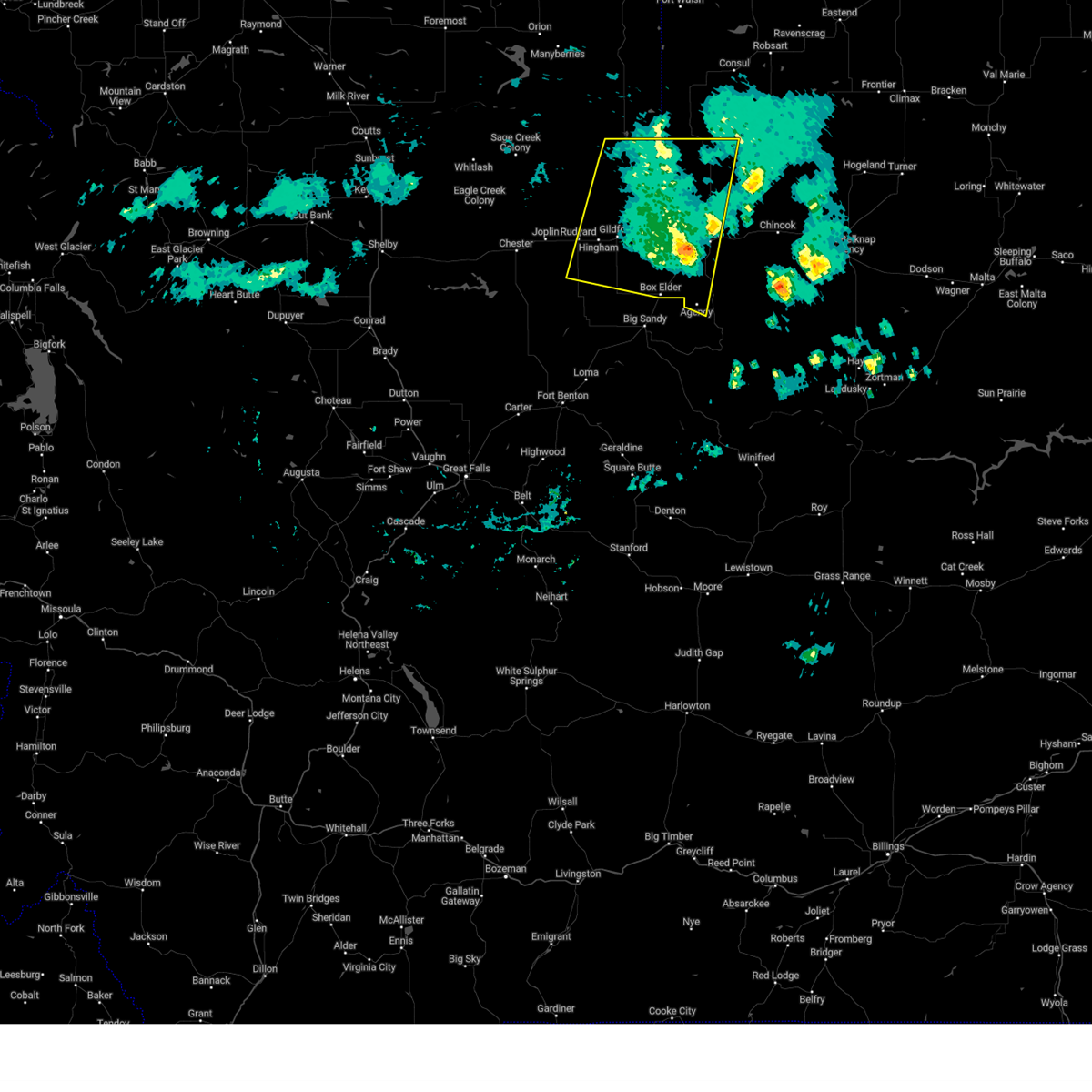
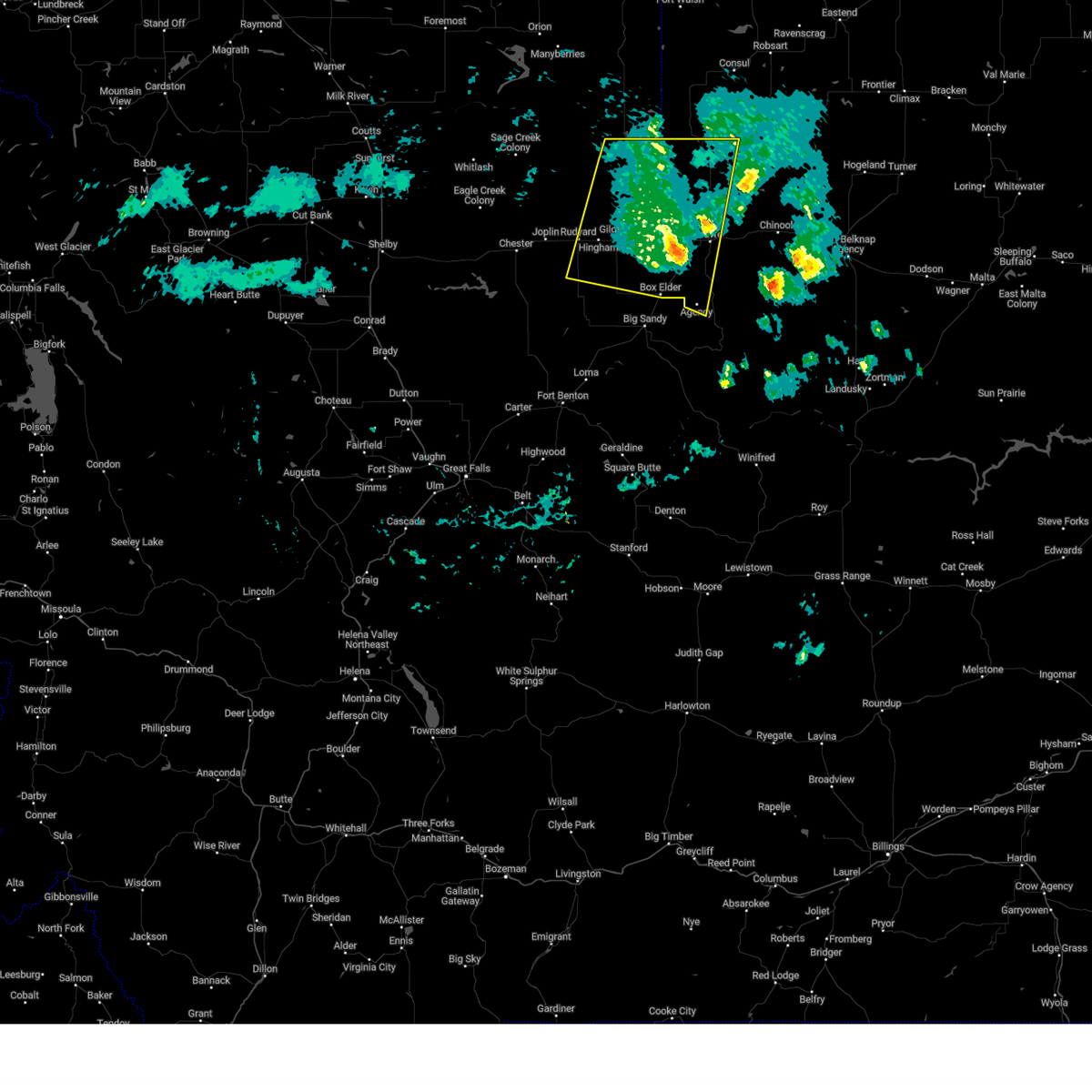
| 7/2/2024 6:27 PM MDT |
 At 626 pm mdt, a severe thunderstorm was located near gildford, or 25 miles north of big sandy, moving east at 20 mph (radar indicated). Hazards include 60 mph wind gusts and quarter size hail. Hail damage to vehicles is expected. expect wind damage to roofs, siding, and trees. Locations impacted include, gildford and kremlin. At 626 pm mdt, a severe thunderstorm was located near gildford, or 25 miles north of big sandy, moving east at 20 mph (radar indicated). Hazards include 60 mph wind gusts and quarter size hail. Hail damage to vehicles is expected. expect wind damage to roofs, siding, and trees. Locations impacted include, gildford and kremlin.
|
| 7/2/2024 6:15 PM MDT |
 Svrtfx the national weather service in great falls has issued a * severe thunderstorm warning for, central hill county in north central montana, * until 645 pm mdt. * at 614 pm mdt, a severe thunderstorm was located near gildford, or 25 miles east of chester, moving east at 20 mph (radar indicated). Hazards include 60 mph wind gusts and half dollar size hail. Hail damage to vehicles is expected. Expect wind damage to roofs, siding, and trees. Svrtfx the national weather service in great falls has issued a * severe thunderstorm warning for, central hill county in north central montana, * until 645 pm mdt. * at 614 pm mdt, a severe thunderstorm was located near gildford, or 25 miles east of chester, moving east at 20 mph (radar indicated). Hazards include 60 mph wind gusts and half dollar size hail. Hail damage to vehicles is expected. Expect wind damage to roofs, siding, and trees.
|
| 8/22/2023 5:57 PM MDT |
 The severe thunderstorm warning for west central hill county will expire at 600 pm mdt, the storm which prompted the warning has weakened below severe limits, and no longer poses an immediate threat to life or property. therefore, the warning will be allowed to expire. wind gusts of 50 to 55 mph and nickel size hail continue to be possible. The severe thunderstorm warning for west central hill county will expire at 600 pm mdt, the storm which prompted the warning has weakened below severe limits, and no longer poses an immediate threat to life or property. therefore, the warning will be allowed to expire. wind gusts of 50 to 55 mph and nickel size hail continue to be possible.
|
| 8/22/2023 5:47 PM MDT |
 At 546 pm mdt, a severe thunderstorm was located near gildford, or 24 miles east of chester, moving northeast at 35 mph (radar indicated). Hazards include 70 mph wind gusts and quarter size hail. Hail damage to vehicles is expected. expect considerable tree damage. wind damage is also likely to mobile homes, roofs, and outbuildings. locations impacted include, gildford, hingham and kremlin. thunderstorm damage threat, considerable hail threat, radar indicated max hail size, 1. 00 in wind threat, radar indicated max wind gust, 70 mph. At 546 pm mdt, a severe thunderstorm was located near gildford, or 24 miles east of chester, moving northeast at 35 mph (radar indicated). Hazards include 70 mph wind gusts and quarter size hail. Hail damage to vehicles is expected. expect considerable tree damage. wind damage is also likely to mobile homes, roofs, and outbuildings. locations impacted include, gildford, hingham and kremlin. thunderstorm damage threat, considerable hail threat, radar indicated max hail size, 1. 00 in wind threat, radar indicated max wind gust, 70 mph.
|
| 8/22/2023 5:27 PM MDT |
 At 527 pm mdt, a severe thunderstorm was located 11 miles southeast of inverness, or 20 miles east of chester, moving northeast at 35 mph (radar indicated). Hazards include 60 mph wind gusts and quarter size hail. Hail damage to vehicles is expected. Expect wind damage to roofs, siding, and trees. At 527 pm mdt, a severe thunderstorm was located 11 miles southeast of inverness, or 20 miles east of chester, moving northeast at 35 mph (radar indicated). Hazards include 60 mph wind gusts and quarter size hail. Hail damage to vehicles is expected. Expect wind damage to roofs, siding, and trees.
|
| 7/30/2023 7:24 PM MDT |
 At 723 pm mdt, a severe thunderstorm was located 20 miles north of gildford, or 30 miles northwest of havre, moving northeast at 45 mph (radar indicated). Hazards include 70 mph wind gusts and quarter size hail. Hail damage to vehicles is expected. expect considerable tree damage. wind damage is also likely to mobile homes, roofs, and outbuildings. locations impacted include, kremlin and simpson. thunderstorm damage threat, considerable hail threat, radar indicated max hail size, 1. 00 in wind threat, radar indicated max wind gust, 70 mph. At 723 pm mdt, a severe thunderstorm was located 20 miles north of gildford, or 30 miles northwest of havre, moving northeast at 45 mph (radar indicated). Hazards include 70 mph wind gusts and quarter size hail. Hail damage to vehicles is expected. expect considerable tree damage. wind damage is also likely to mobile homes, roofs, and outbuildings. locations impacted include, kremlin and simpson. thunderstorm damage threat, considerable hail threat, radar indicated max hail size, 1. 00 in wind threat, radar indicated max wind gust, 70 mph.
|
| 7/30/2023 7:04 PM MDT |
 At 702 pm mdt, a severe thunderstorm was located 10 miles northwest of gildford, or 29 miles northeast of chester, moving northeast at 45 mph (radar indicated). Hazards include 70 mph wind gusts and quarter size hail. Hail damage to vehicles is expected. expect considerable tree damage. Wind damage is also likely to mobile homes, roofs, and outbuildings. At 702 pm mdt, a severe thunderstorm was located 10 miles northwest of gildford, or 29 miles northeast of chester, moving northeast at 45 mph (radar indicated). Hazards include 70 mph wind gusts and quarter size hail. Hail damage to vehicles is expected. expect considerable tree damage. Wind damage is also likely to mobile homes, roofs, and outbuildings.
|
| 9/4/2022 3:13 AM MDT |
 At 312 am mdt, severe thunderstorms were located along a line extending from 27 miles north of gildford to near box elder to 16 miles southeast of big sandy, moving east at 35 mph (radar indicated). Hazards include 60 mph wind gusts. Expect damage to roofs, siding, and trees. locations impacted include, havre, chinook, big sandy, azure, parker school, beaver creek, agency, st. pierre, gildford, sangrey, boneau, box elder, hingham, rocky boy, lohman, cleveland, laredo, lloyd, kremlin and simpson. hail threat, radar indicated max hail size, <. 75 in wind threat, radar indicated max wind gust, 60 mph. At 312 am mdt, severe thunderstorms were located along a line extending from 27 miles north of gildford to near box elder to 16 miles southeast of big sandy, moving east at 35 mph (radar indicated). Hazards include 60 mph wind gusts. Expect damage to roofs, siding, and trees. locations impacted include, havre, chinook, big sandy, azure, parker school, beaver creek, agency, st. pierre, gildford, sangrey, boneau, box elder, hingham, rocky boy, lohman, cleveland, laredo, lloyd, kremlin and simpson. hail threat, radar indicated max hail size, <. 75 in wind threat, radar indicated max wind gust, 60 mph.
|
| 9/4/2022 2:55 AM MDT |
 The severe thunderstorm warning for hill and northeastern chouteau counties will expire at 300 am mdt, this warning will be allowed to expire and will be replaced. with another warning. gusty winds are still expected with these thunderstorms. The severe thunderstorm warning for hill and northeastern chouteau counties will expire at 300 am mdt, this warning will be allowed to expire and will be replaced. with another warning. gusty winds are still expected with these thunderstorms.
|
| 9/4/2022 2:53 AM MDT |
 At 253 am mdt, severe thunderstorms were located along a line extending from 29 miles north of inverness to 11 miles west of box elder to 14 miles south of big sandy, moving east at 35 mph (radar indicated). Hazards include 60 mph wind gusts. expect damage to roofs, siding, and trees At 253 am mdt, severe thunderstorms were located along a line extending from 29 miles north of inverness to 11 miles west of box elder to 14 miles south of big sandy, moving east at 35 mph (radar indicated). Hazards include 60 mph wind gusts. expect damage to roofs, siding, and trees
|
| 9/4/2022 2:45 AM MDT |
 At 244 am mdt, severe thunderstorms were located along a line extending from 28 miles north of inverness to 13 miles south of gildford to near big sandy, moving east at 35 mph (radar indicated). Hazards include 60 mph wind gusts. Expect damage to roofs, siding, and trees. locations impacted include, big sandy, azure, beaver creek, inverness, st. pierre, gildford, sangrey, boneau, box elder, agency, hingham, rudyard, rocky boy, laredo, kenilworth, kremlin and simpson. hail threat, radar indicated max hail size, <. 75 in wind threat, radar indicated max wind gust, 60 mph. At 244 am mdt, severe thunderstorms were located along a line extending from 28 miles north of inverness to 13 miles south of gildford to near big sandy, moving east at 35 mph (radar indicated). Hazards include 60 mph wind gusts. Expect damage to roofs, siding, and trees. locations impacted include, big sandy, azure, beaver creek, inverness, st. pierre, gildford, sangrey, boneau, box elder, agency, hingham, rudyard, rocky boy, laredo, kenilworth, kremlin and simpson. hail threat, radar indicated max hail size, <. 75 in wind threat, radar indicated max wind gust, 60 mph.
|
| 9/4/2022 2:38 AM MDT |
 At 238 am mdt, severe thunderstorms were located along a line extending from 28 miles north of inverness to 13 miles south of gildford to 7 miles west of big sandy, moving east at 30 mph (radar indicated). Hazards include 60 mph wind gusts. Expect damage to roofs, siding, and trees. locations impacted include, big sandy, azure, beaver creek, inverness, st. pierre, gildford, joplin, sangrey, boneau, box elder, agency, hingham, rudyard, rocky boy, laredo, kenilworth, kremlin and simpson. hail threat, radar indicated max hail size, <. 75 in wind threat, radar indicated max wind gust, 60 mph. At 238 am mdt, severe thunderstorms were located along a line extending from 28 miles north of inverness to 13 miles south of gildford to 7 miles west of big sandy, moving east at 30 mph (radar indicated). Hazards include 60 mph wind gusts. Expect damage to roofs, siding, and trees. locations impacted include, big sandy, azure, beaver creek, inverness, st. pierre, gildford, joplin, sangrey, boneau, box elder, agency, hingham, rudyard, rocky boy, laredo, kenilworth, kremlin and simpson. hail threat, radar indicated max hail size, <. 75 in wind threat, radar indicated max wind gust, 60 mph.
|
| 9/4/2022 2:26 AM MDT |
 At 226 am mdt, severe thunderstorms were located along a line extending from 29 miles north of joplin to 13 miles southeast of inverness to 15 miles west of big sandy, moving east at 35 mph (radar indicated). Hazards include 70 mph wind gusts. Expect considerable tree damage. damage is likely to mobile homes, roofs, and outbuildings. locations impacted include, big sandy, azure, beaver creek, inverness, st. pierre, gildford, joplin, sangrey, boneau, box elder, agency, hingham, rudyard, rocky boy, laredo, kenilworth, kremlin and simpson. thunderstorm damage threat, considerable hail threat, radar indicated max hail size, <. 75 in wind threat, radar indicated max wind gust, 70 mph. At 226 am mdt, severe thunderstorms were located along a line extending from 29 miles north of joplin to 13 miles southeast of inverness to 15 miles west of big sandy, moving east at 35 mph (radar indicated). Hazards include 70 mph wind gusts. Expect considerable tree damage. damage is likely to mobile homes, roofs, and outbuildings. locations impacted include, big sandy, azure, beaver creek, inverness, st. pierre, gildford, joplin, sangrey, boneau, box elder, agency, hingham, rudyard, rocky boy, laredo, kenilworth, kremlin and simpson. thunderstorm damage threat, considerable hail threat, radar indicated max hail size, <. 75 in wind threat, radar indicated max wind gust, 70 mph.
|
| 9/4/2022 2:14 AM MDT |
 At 214 am mdt, severe thunderstorms were located along a line extending from 31 miles north of joplin to 11 miles south of inverness to 7 miles southeast of fort benton, moving east at 25 mph. these are destructive storms for inverness (radar indicated). Hazards include 80 mph wind gusts. Flying debris will be dangerous to those caught without shelter. mobile homes will be heavily damaged. expect considerable damage to roofs, windows, and vehicles. extensive tree damage and power outages are likely. locations impacted include, chester, big sandy, azure, beaver creek, inverness, st. pierre, gildford, joplin, sangrey, boneau, box elder, agency, hingham, rudyard, rocky boy, laredo, kenilworth, kremlin and simpson. thunderstorm damage threat, destructive hail threat, radar indicated max hail size, <. 75 in wind threat, radar indicated max wind gust, 80 mph. At 214 am mdt, severe thunderstorms were located along a line extending from 31 miles north of joplin to 11 miles south of inverness to 7 miles southeast of fort benton, moving east at 25 mph. these are destructive storms for inverness (radar indicated). Hazards include 80 mph wind gusts. Flying debris will be dangerous to those caught without shelter. mobile homes will be heavily damaged. expect considerable damage to roofs, windows, and vehicles. extensive tree damage and power outages are likely. locations impacted include, chester, big sandy, azure, beaver creek, inverness, st. pierre, gildford, joplin, sangrey, boneau, box elder, agency, hingham, rudyard, rocky boy, laredo, kenilworth, kremlin and simpson. thunderstorm damage threat, destructive hail threat, radar indicated max hail size, <. 75 in wind threat, radar indicated max wind gust, 80 mph.
|
| 9/4/2022 2:02 AM MDT |
 At 201 am mdt, severe thunderstorms were located along a line extending from 33 miles northwest of joplin to 10 miles southeast of chester to near fort benton, moving east at 25 mph (radar indicated). Hazards include 60 mph wind gusts. expect damage to roofs, siding, and trees At 201 am mdt, severe thunderstorms were located along a line extending from 33 miles northwest of joplin to 10 miles southeast of chester to near fort benton, moving east at 25 mph (radar indicated). Hazards include 60 mph wind gusts. expect damage to roofs, siding, and trees
|
| 8/12/2022 8:18 PM MDT |
 At 817 pm mdt, severe thunderstorms were located along a line extending from 23 miles northwest of beaver creek to 9 miles east of gildford, moving southeast at 40 mph (radar indicated). Hazards include 70 mph wind gusts. Expect considerable tree damage. damage is likely to mobile homes, roofs, and outbuildings. locations impacted include, havre, azure, beaver creek, gildford, sangrey, agency, boneau, parker school, kremlin, laredo and simpson. thunderstorm damage threat, considerable hail threat, radar indicated max hail size, <. 75 in wind threat, radar indicated max wind gust, 70 mph. At 817 pm mdt, severe thunderstorms were located along a line extending from 23 miles northwest of beaver creek to 9 miles east of gildford, moving southeast at 40 mph (radar indicated). Hazards include 70 mph wind gusts. Expect considerable tree damage. damage is likely to mobile homes, roofs, and outbuildings. locations impacted include, havre, azure, beaver creek, gildford, sangrey, agency, boneau, parker school, kremlin, laredo and simpson. thunderstorm damage threat, considerable hail threat, radar indicated max hail size, <. 75 in wind threat, radar indicated max wind gust, 70 mph.
|
| 8/12/2022 8:05 PM MDT |
 At 804 pm mdt, severe thunderstorms were located along a line extending from 31 miles northwest of beaver creek to 6 miles north of gildford, moving southeast at 35 mph (radar indicated). Hazards include 70 mph wind gusts. Expect considerable tree damage. damage is likely to mobile homes, roofs, and outbuildings. locations impacted include, havre, azure, beaver creek, gildford, sangrey, agency, boneau, parker school, hingham, kremlin, laredo and simpson. thunderstorm damage threat, considerable hail threat, radar indicated max hail size, <. 75 in wind threat, radar indicated max wind gust, 70 mph. At 804 pm mdt, severe thunderstorms were located along a line extending from 31 miles northwest of beaver creek to 6 miles north of gildford, moving southeast at 35 mph (radar indicated). Hazards include 70 mph wind gusts. Expect considerable tree damage. damage is likely to mobile homes, roofs, and outbuildings. locations impacted include, havre, azure, beaver creek, gildford, sangrey, agency, boneau, parker school, hingham, kremlin, laredo and simpson. thunderstorm damage threat, considerable hail threat, radar indicated max hail size, <. 75 in wind threat, radar indicated max wind gust, 70 mph.
|
| 8/12/2022 7:45 PM MDT |
 At 744 pm mdt, severe thunderstorms were located along a line extending from 33 miles north of inverness to 15 miles northwest of gildford, moving southeast at 40 mph (radar indicated). Hazards include 70 mph wind gusts. Expect considerable tree damage. damage is likely to mobile homes, roofs, and outbuildings. locations impacted include, havre, azure, beaver creek, gildford, sangrey, boneau, agency, parker school, hingham, rudyard, laredo, kremlin and simpson. thunderstorm damage threat, considerable hail threat, radar indicated max hail size, <. 75 in wind threat, radar indicated max wind gust, 70 mph. At 744 pm mdt, severe thunderstorms were located along a line extending from 33 miles north of inverness to 15 miles northwest of gildford, moving southeast at 40 mph (radar indicated). Hazards include 70 mph wind gusts. Expect considerable tree damage. damage is likely to mobile homes, roofs, and outbuildings. locations impacted include, havre, azure, beaver creek, gildford, sangrey, boneau, agency, parker school, hingham, rudyard, laredo, kremlin and simpson. thunderstorm damage threat, considerable hail threat, radar indicated max hail size, <. 75 in wind threat, radar indicated max wind gust, 70 mph.
|
| 8/12/2022 7:36 PM MDT |
 At 736 pm mdt, severe thunderstorms were located along a line extending from 34 miles north of gildford to 16 miles north of inverness, moving east southeast at 35 mph (radar indicated). Hazards include 60 mph wind gusts. expect damage to roofs, siding, and trees At 736 pm mdt, severe thunderstorms were located along a line extending from 34 miles north of gildford to 16 miles north of inverness, moving east southeast at 35 mph (radar indicated). Hazards include 60 mph wind gusts. expect damage to roofs, siding, and trees
|
| 8/12/2022 7:33 PM MDT | An ambient weather station measured a 70 mph gus in hill county MT, 23.9 miles SSE of Gildford, MT |
| 8/12/2022 7:30 PM MDT | Mesonet station fw1664 hingha in hill county MT, 17 miles SSE of Gildford, MT |
| 7/9/2022 6:55 PM MDT |
 At 654 pm mdt, severe thunderstorms were located along a line extending from 18 miles northeast of gildford to 9 miles west of beaver creek to near box elder, moving east at 45 mph (radar indicated). Hazards include 60 mph wind gusts and penny size hail. Expect damage to roofs, siding, and trees. locations impacted include, havre, azure, parker school, beaver creek, agency, st. pierre, gildford, sangrey, boneau, box elder, rocky boy, laredo and kremlin. hail threat, radar indicated max hail size, 0. 75 in wind threat, radar indicated max wind gust, 60 mph. At 654 pm mdt, severe thunderstorms were located along a line extending from 18 miles northeast of gildford to 9 miles west of beaver creek to near box elder, moving east at 45 mph (radar indicated). Hazards include 60 mph wind gusts and penny size hail. Expect damage to roofs, siding, and trees. locations impacted include, havre, azure, parker school, beaver creek, agency, st. pierre, gildford, sangrey, boneau, box elder, rocky boy, laredo and kremlin. hail threat, radar indicated max hail size, 0. 75 in wind threat, radar indicated max wind gust, 60 mph.
|
| 7/9/2022 6:46 PM MDT |
 At 645 pm mdt, severe thunderstorms were located along a line extending from 20 miles northwest of beaver creek to 11 miles southeast of gildford to 8 miles west of box elder, moving east at 40 mph (radar indicated). Hazards include 70 mph wind gusts and penny size hail. Expect considerable tree damage. damage is likely to mobile homes, roofs, and outbuildings. locations impacted include, havre, azure, parker school, beaver creek, agency, st. pierre, gildford, sangrey, boneau, box elder, hingham, rocky boy, laredo and kremlin. thunderstorm damage threat, considerable hail threat, radar indicated max hail size, 0. 75 in wind threat, radar indicated max wind gust, 70 mph. At 645 pm mdt, severe thunderstorms were located along a line extending from 20 miles northwest of beaver creek to 11 miles southeast of gildford to 8 miles west of box elder, moving east at 40 mph (radar indicated). Hazards include 70 mph wind gusts and penny size hail. Expect considerable tree damage. damage is likely to mobile homes, roofs, and outbuildings. locations impacted include, havre, azure, parker school, beaver creek, agency, st. pierre, gildford, sangrey, boneau, box elder, hingham, rocky boy, laredo and kremlin. thunderstorm damage threat, considerable hail threat, radar indicated max hail size, 0. 75 in wind threat, radar indicated max wind gust, 70 mph.
|
| 7/9/2022 6:38 PM MDT |
 The severe thunderstorm warning for western hill and north central chouteau counties will expire at 645 pm mdt, this will be replaced by another severe thunderstorms warning. The severe thunderstorm warning for western hill and north central chouteau counties will expire at 645 pm mdt, this will be replaced by another severe thunderstorms warning.
|
| 7/9/2022 6:35 PM MDT |
 At 635 pm mdt, severe thunderstorms were located along a line extending from 23 miles northwest of beaver creek to 8 miles southeast of gildford to 12 miles northwest of big sandy, moving east at 40 mph (radar indicated). Hazards include 70 mph wind gusts and penny size hail. Expect considerable tree damage. Damage is likely to mobile homes, roofs, and outbuildings. At 635 pm mdt, severe thunderstorms were located along a line extending from 23 miles northwest of beaver creek to 8 miles southeast of gildford to 12 miles northwest of big sandy, moving east at 40 mph (radar indicated). Hazards include 70 mph wind gusts and penny size hail. Expect considerable tree damage. Damage is likely to mobile homes, roofs, and outbuildings.
|
| 7/9/2022 6:34 PM MDT |
 At 633 pm mdt, severe thunderstorms were located along a line extending from 9 miles north of gildford to 11 miles northwest of box elder to 9 miles northwest of big sandy, moving east at 40 mph (radar indicated). Hazards include 70 mph wind gusts and penny size hail. Expect considerable tree damage. damage is likely to mobile homes, roofs, and outbuildings. locations impacted include, gildford, hingham and rudyard. thunderstorm damage threat, considerable hail threat, radar indicated max hail size, 0. 75 in wind threat, radar indicated max wind gust, 70 mph. At 633 pm mdt, severe thunderstorms were located along a line extending from 9 miles north of gildford to 11 miles northwest of box elder to 9 miles northwest of big sandy, moving east at 40 mph (radar indicated). Hazards include 70 mph wind gusts and penny size hail. Expect considerable tree damage. damage is likely to mobile homes, roofs, and outbuildings. locations impacted include, gildford, hingham and rudyard. thunderstorm damage threat, considerable hail threat, radar indicated max hail size, 0. 75 in wind threat, radar indicated max wind gust, 70 mph.
|
| 7/9/2022 6:25 PM MDT |
 At 625 pm mdt, severe thunderstorms were located along a line extending from 9 miles northwest of gildford to 17 miles southeast of inverness to 14 miles northwest of big sandy, moving east at 35 mph (radar indicated). Hazards include 70 mph wind gusts and penny size hail. Expect considerable tree damage. damage is likely to mobile homes, roofs, and outbuildings. locations impacted include, inverness, gildford, hingham and rudyard. thunderstorm damage threat, considerable hail threat, radar indicated max hail size, 0. 75 in wind threat, radar indicated max wind gust, 70 mph. At 625 pm mdt, severe thunderstorms were located along a line extending from 9 miles northwest of gildford to 17 miles southeast of inverness to 14 miles northwest of big sandy, moving east at 35 mph (radar indicated). Hazards include 70 mph wind gusts and penny size hail. Expect considerable tree damage. damage is likely to mobile homes, roofs, and outbuildings. locations impacted include, inverness, gildford, hingham and rudyard. thunderstorm damage threat, considerable hail threat, radar indicated max hail size, 0. 75 in wind threat, radar indicated max wind gust, 70 mph.
|
| 7/9/2022 6:20 PM MDT |
 At 620 pm mdt, severe thunderstorms were located along a line extending from 8 miles southeast of inverness to 14 miles south of gildford to 15 miles west of big sandy, moving east at 35 mph (radar indicated). Hazards include 70 mph wind gusts and quarter size hail. Hail damage to vehicles is expected. expect considerable tree damage. wind damage is also likely to mobile homes, roofs, and outbuildings. locations impacted include, inverness, gildford, hingham and rudyard. thunderstorm damage threat, considerable hail threat, radar indicated max hail size, 1. 00 in wind threat, radar indicated max wind gust, 70 mph. At 620 pm mdt, severe thunderstorms were located along a line extending from 8 miles southeast of inverness to 14 miles south of gildford to 15 miles west of big sandy, moving east at 35 mph (radar indicated). Hazards include 70 mph wind gusts and quarter size hail. Hail damage to vehicles is expected. expect considerable tree damage. wind damage is also likely to mobile homes, roofs, and outbuildings. locations impacted include, inverness, gildford, hingham and rudyard. thunderstorm damage threat, considerable hail threat, radar indicated max hail size, 1. 00 in wind threat, radar indicated max wind gust, 70 mph.
|
| 7/9/2022 6:14 PM MDT | At 614 pm mdt, severe thunderstorms were located along a line extending from 7 miles south of inverness to 17 miles southwest of gildford to 18 miles west of big sandy, moving east at 35 mph (radar indicated). Hazards include 70 mph wind gusts and quarter size hail. Hail damage to vehicles is expected. expect considerable tree damage. wind damage is also likely to mobile homes, roofs, and outbuildings. Locations impacted include, joplin, inverness, gildford, hingham and rudyard. |
| 7/9/2022 6:09 PM MDT |
 At 609 pm mdt, severe thunderstorms were located along a line extending from 7 miles south of inverness to 16 miles southeast of joplin to 21 miles west of big sandy, moving east at 35 mph (radar indicated). Hazards include 70 mph wind gusts and ping pong ball size hail. People and animals outdoors will be injured. expect hail damage to roofs, siding, windows, and vehicles. expect considerable tree damage. wind damage is also likely to mobile homes, roofs, and outbuildings. Locations impacted include, joplin, inverness, gildford, hingham and rudyard. At 609 pm mdt, severe thunderstorms were located along a line extending from 7 miles south of inverness to 16 miles southeast of joplin to 21 miles west of big sandy, moving east at 35 mph (radar indicated). Hazards include 70 mph wind gusts and ping pong ball size hail. People and animals outdoors will be injured. expect hail damage to roofs, siding, windows, and vehicles. expect considerable tree damage. wind damage is also likely to mobile homes, roofs, and outbuildings. Locations impacted include, joplin, inverness, gildford, hingham and rudyard.
|
| 7/9/2022 6:05 PM MDT |
 At 605 pm mdt, severe thunderstorms were located along a line extending from 7 miles southeast of chester to 13 miles south of inverness, moving east at 35 mph (radar indicated). Hazards include golf ball size hail and 70 mph wind gusts. People and animals outdoors will be injured. expect hail damage to roofs, siding, windows, and vehicles. expect considerable tree damage. wind damage is also likely to mobile homes, roofs, and outbuildings. Locations impacted include, chester, joplin, inverness, gildford, hingham and rudyard. At 605 pm mdt, severe thunderstorms were located along a line extending from 7 miles southeast of chester to 13 miles south of inverness, moving east at 35 mph (radar indicated). Hazards include golf ball size hail and 70 mph wind gusts. People and animals outdoors will be injured. expect hail damage to roofs, siding, windows, and vehicles. expect considerable tree damage. wind damage is also likely to mobile homes, roofs, and outbuildings. Locations impacted include, chester, joplin, inverness, gildford, hingham and rudyard.
|
| 7/9/2022 6:02 PM MDT |
 At 602 pm mdt, severe thunderstorms were located along a line extending from near chester to 22 miles south of joplin, moving east at 30 mph (radar indicated). Hazards include golf ball size hail and 70 mph wind gusts. People and animals outdoors will be injured. expect hail damage to roofs, siding, windows, and vehicles. expect considerable tree damage. wind damage is also likely to mobile homes, roofs, and outbuildings. Locations impacted include, chester, joplin, inverness, gildford, hingham and rudyard. At 602 pm mdt, severe thunderstorms were located along a line extending from near chester to 22 miles south of joplin, moving east at 30 mph (radar indicated). Hazards include golf ball size hail and 70 mph wind gusts. People and animals outdoors will be injured. expect hail damage to roofs, siding, windows, and vehicles. expect considerable tree damage. wind damage is also likely to mobile homes, roofs, and outbuildings. Locations impacted include, chester, joplin, inverness, gildford, hingham and rudyard.
|
| 7/9/2022 5:55 PM MDT |
 At 554 pm mdt, severe thunderstorms were located along a line extending from near chester to 20 miles south of joplin, moving east at 30 mph (radar indicated). Hazards include 70 mph wind gusts and ping pong ball size hail. People and animals outdoors will be injured. expect hail damage to roofs, siding, windows, and vehicles. expect considerable tree damage. wind damage is also likely to mobile homes, roofs, and outbuildings. Locations impacted include, chester, joplin, inverness, gildford, hingham, rudyard and tiber dam. At 554 pm mdt, severe thunderstorms were located along a line extending from near chester to 20 miles south of joplin, moving east at 30 mph (radar indicated). Hazards include 70 mph wind gusts and ping pong ball size hail. People and animals outdoors will be injured. expect hail damage to roofs, siding, windows, and vehicles. expect considerable tree damage. wind damage is also likely to mobile homes, roofs, and outbuildings. Locations impacted include, chester, joplin, inverness, gildford, hingham, rudyard and tiber dam.
|
| 7/9/2022 5:46 PM MDT |
 At 546 pm mdt, severe thunderstorms were located along a line extending from near chester to 21 miles southeast of lothair, moving east at 35 mph (radar indicated). Hazards include 60 mph wind gusts and quarter size hail. Hail damage to vehicles is expected. Expect wind damage to roofs, siding, and trees. At 546 pm mdt, severe thunderstorms were located along a line extending from near chester to 21 miles southeast of lothair, moving east at 35 mph (radar indicated). Hazards include 60 mph wind gusts and quarter size hail. Hail damage to vehicles is expected. Expect wind damage to roofs, siding, and trees.
|
| 7/8/2022 7:59 PM MDT |
 At 758 pm mdt, severe thunderstorms were located along a line extending from 9 miles southwest of gildford to 6 miles southwest of big sandy, moving east at 45 mph. these are destructive storms for big sandy, rocky boy, and box elder (radar indicated). Hazards include 80 mph wind gusts and two inch hail. Flying debris will be dangerous to those caught without shelter. mobile homes will be heavily damaged. expect considerable damage to roofs, windows, and vehicles. extensive tree damage and power outages are likely. locations impacted include, havre, big sandy, azure, parker school, beaver creek, agency, st. Pierre, gildford, sangrey, boneau, box elder, hingham, rocky boy, laredo, lloyd, kremlin and virgelle. At 758 pm mdt, severe thunderstorms were located along a line extending from 9 miles southwest of gildford to 6 miles southwest of big sandy, moving east at 45 mph. these are destructive storms for big sandy, rocky boy, and box elder (radar indicated). Hazards include 80 mph wind gusts and two inch hail. Flying debris will be dangerous to those caught without shelter. mobile homes will be heavily damaged. expect considerable damage to roofs, windows, and vehicles. extensive tree damage and power outages are likely. locations impacted include, havre, big sandy, azure, parker school, beaver creek, agency, st. Pierre, gildford, sangrey, boneau, box elder, hingham, rocky boy, laredo, lloyd, kremlin and virgelle.
|
| 7/8/2022 7:54 PM MDT |
 At 753 pm mdt, severe thunderstorms were located along a line extending from 10 miles southwest of gildford to 6 miles southwest of big sandy, moving northeast at 45 mph (radar indicated). Hazards include two inch hail and 70 mph wind gusts. People and animals outdoors will be injured. expect hail damage to roofs, siding, windows, and vehicles. expect considerable tree damage. Wind damage is also likely to mobile homes, roofs, and outbuildings. At 753 pm mdt, severe thunderstorms were located along a line extending from 10 miles southwest of gildford to 6 miles southwest of big sandy, moving northeast at 45 mph (radar indicated). Hazards include two inch hail and 70 mph wind gusts. People and animals outdoors will be injured. expect hail damage to roofs, siding, windows, and vehicles. expect considerable tree damage. Wind damage is also likely to mobile homes, roofs, and outbuildings.
|
| 7/8/2022 7:37 PM MDT |
 At 735 pm mdt, severe thunderstorms were located along a line extending from near inverness to 22 miles south of chester, moving east at 35 mph (radar indicated). Hazards include golf ball size hail and 60 mph wind gusts. People and animals outdoors will be injured. expect hail damage to roofs, siding, windows, and vehicles. expect wind damage to roofs, siding, and trees. Locations impacted include, gildford, hingham, rudyard and kenilworth. At 735 pm mdt, severe thunderstorms were located along a line extending from near inverness to 22 miles south of chester, moving east at 35 mph (radar indicated). Hazards include golf ball size hail and 60 mph wind gusts. People and animals outdoors will be injured. expect hail damage to roofs, siding, windows, and vehicles. expect wind damage to roofs, siding, and trees. Locations impacted include, gildford, hingham, rudyard and kenilworth.
|
| 7/8/2022 7:23 PM MDT |
 At 723 pm mdt, severe thunderstorms were located along a line extending from near joplin to 21 miles northeast of the knees, moving east at 35 mph (radar indicated). Hazards include golf ball size hail and 60 mph wind gusts. People and animals outdoors will be injured. expect hail damage to roofs, siding, windows, and vehicles. Expect wind damage to roofs, siding, and trees. At 723 pm mdt, severe thunderstorms were located along a line extending from near joplin to 21 miles northeast of the knees, moving east at 35 mph (radar indicated). Hazards include golf ball size hail and 60 mph wind gusts. People and animals outdoors will be injured. expect hail damage to roofs, siding, windows, and vehicles. Expect wind damage to roofs, siding, and trees.
|
| 7/8/2022 6:32 PM MDT |
 At 632 pm mdt, a severe thunderstorm was located 12 miles south of joplin, or 13 miles southeast of chester, moving east at 40 mph (radar indicated). Hazards include 60 mph wind gusts and quarter size hail. Hail damage to vehicles is expected. expect wind damage to roofs, siding, and trees. locations impacted include, gildford and kremlin. hail threat, radar indicated max hail size, 1. 00 in wind threat, radar indicated max wind gust, 60 mph. At 632 pm mdt, a severe thunderstorm was located 12 miles south of joplin, or 13 miles southeast of chester, moving east at 40 mph (radar indicated). Hazards include 60 mph wind gusts and quarter size hail. Hail damage to vehicles is expected. expect wind damage to roofs, siding, and trees. locations impacted include, gildford and kremlin. hail threat, radar indicated max hail size, 1. 00 in wind threat, radar indicated max wind gust, 60 mph.
|
| 7/8/2022 6:13 PM MDT |
 At 613 pm mdt, a severe thunderstorm was located 9 miles south of chester, moving east at 50 mph (radar indicated). Hazards include 60 mph wind gusts and quarter size hail. Hail damage to vehicles is expected. Expect wind damage to roofs, siding, and trees. At 613 pm mdt, a severe thunderstorm was located 9 miles south of chester, moving east at 50 mph (radar indicated). Hazards include 60 mph wind gusts and quarter size hail. Hail damage to vehicles is expected. Expect wind damage to roofs, siding, and trees.
|
| 6/28/2022 11:50 PM MDT |
 At 1148 pm mdt, a severe thunderstorm was located 17 miles northwest of chinook, moving east at 50 mph (radar indicated). Hazards include 60 mph wind gusts. Expect damage to roofs, siding, and trees. locations impacted include, havre, chinook, beaver creek, lohman, kremlin, laredo and simpson. this storm has had a history of producing wind gusts between 60 and 65 mph. hail threat, radar indicated max hail size, <. 75 in wind threat, observed max wind gust, 60 mph. At 1148 pm mdt, a severe thunderstorm was located 17 miles northwest of chinook, moving east at 50 mph (radar indicated). Hazards include 60 mph wind gusts. Expect damage to roofs, siding, and trees. locations impacted include, havre, chinook, beaver creek, lohman, kremlin, laredo and simpson. this storm has had a history of producing wind gusts between 60 and 65 mph. hail threat, radar indicated max hail size, <. 75 in wind threat, observed max wind gust, 60 mph.
|
| 6/28/2022 11:15 PM MDT | 60 mph wind gust. mesonet station fw1664 hingha in hill county MT, 17 miles SSE of Gildford, MT |
| 6/28/2022 11:13 PM MDT |
 At 1112 pm mdt, a severe thunderstorm was located near gildford, or 27 miles west of havre, moving northeast at 45 mph (radar indicated). Hazards include 60 mph wind gusts and penny size hail. expect damage to roofs, siding, and trees At 1112 pm mdt, a severe thunderstorm was located near gildford, or 27 miles west of havre, moving northeast at 45 mph (radar indicated). Hazards include 60 mph wind gusts and penny size hail. expect damage to roofs, siding, and trees
|
| 6/28/2022 10:51 PM MDT |
 At 1050 pm mdt, a severe thunderstorm was located near joplin, or 12 miles northeast of chester, moving northeast at 45 mph (radar indicated). Hazards include 60 mph wind gusts and penny size hail. Expect damage to roofs, siding, and trees. locations impacted include, chester, joplin, inverness, gildford, hingham, rudyard and whitlash. this storm has had a history of producing wind gusts near 60 mph. hail threat, radar indicated max hail size, 0. 75 in wind threat, observed max wind gust, 60 mph. At 1050 pm mdt, a severe thunderstorm was located near joplin, or 12 miles northeast of chester, moving northeast at 45 mph (radar indicated). Hazards include 60 mph wind gusts and penny size hail. Expect damage to roofs, siding, and trees. locations impacted include, chester, joplin, inverness, gildford, hingham, rudyard and whitlash. this storm has had a history of producing wind gusts near 60 mph. hail threat, radar indicated max hail size, 0. 75 in wind threat, observed max wind gust, 60 mph.
|
| 6/28/2022 10:31 PM MDT |
 At 1029 pm mdt, a severe thunderstorm was located near chester, moving northeast at 65 mph (radar indicated). Hazards include 60 mph wind gusts and nickel size hail. Expect damage to roofs, siding, and trees. locations impacted include, chester, sunburst, inverness, lothair, gildford, joplin, rudyard, and whitlash. this storm is capable of producing widespread wind gusts of 50 to 60 mph. take shelter if you are in the path of this storm. this storm will also affect locations along highway 2 from galata to inverness. hail threat, radar indicated max hail size, 0. 88 in wind threat, radar indicated max wind gust, 60 mph. At 1029 pm mdt, a severe thunderstorm was located near chester, moving northeast at 65 mph (radar indicated). Hazards include 60 mph wind gusts and nickel size hail. Expect damage to roofs, siding, and trees. locations impacted include, chester, sunburst, inverness, lothair, gildford, joplin, rudyard, and whitlash. this storm is capable of producing widespread wind gusts of 50 to 60 mph. take shelter if you are in the path of this storm. this storm will also affect locations along highway 2 from galata to inverness. hail threat, radar indicated max hail size, 0. 88 in wind threat, radar indicated max wind gust, 60 mph.
|
| 6/28/2022 10:20 PM MDT |
 At 1019 pm mdt, a severe thunderstorm was located near lothair, or 16 miles west of chester, moving northeast at 45 mph (radar indicated). Hazards include 60 mph wind gusts and nickel size hail. expect damage to roofs, siding, and trees At 1019 pm mdt, a severe thunderstorm was located near lothair, or 16 miles west of chester, moving northeast at 45 mph (radar indicated). Hazards include 60 mph wind gusts and nickel size hail. expect damage to roofs, siding, and trees
|
| 7/7/2020 2:13 PM MDT |
 At 213 pm mdt, severe thunderstorms were located along a line extending from 20 miles north of chester to 7 miles east of gildford, moving north at 60 mph (radar indicated). Hazards include 60 mph wind gusts and quarter size hail. Hail damage to vehicles is expected. Expect wind damage to roofs, siding, and trees. At 213 pm mdt, severe thunderstorms were located along a line extending from 20 miles north of chester to 7 miles east of gildford, moving north at 60 mph (radar indicated). Hazards include 60 mph wind gusts and quarter size hail. Hail damage to vehicles is expected. Expect wind damage to roofs, siding, and trees.
|
| 7/14/2019 5:39 PM MDT |
 The severe thunderstorm warning for southwestern hill and north central chouteau counties will expire at 545 pm mdt, the storm which prompted the warning has moved out of the original warned area, however, a new severe thunderstorm warning has been issued for much of southern hill county and portions of northern chouteau county. The severe thunderstorm warning for southwestern hill and north central chouteau counties will expire at 545 pm mdt, the storm which prompted the warning has moved out of the original warned area, however, a new severe thunderstorm warning has been issued for much of southern hill county and portions of northern chouteau county.
|
| 7/14/2019 5:30 PM MDT |
 At 529 pm mdt, a severe thunderstorm was located 14 miles south of gildford, or 19 miles northwest of big sandy, moving east at 40 mph (radar indicated). Hazards include 60 mph wind gusts and quarter size hail. Hail damage to vehicles is expected. expect wind damage to roofs, siding, and trees. Locations impacted include, gildford. At 529 pm mdt, a severe thunderstorm was located 14 miles south of gildford, or 19 miles northwest of big sandy, moving east at 40 mph (radar indicated). Hazards include 60 mph wind gusts and quarter size hail. Hail damage to vehicles is expected. expect wind damage to roofs, siding, and trees. Locations impacted include, gildford.
|
| 7/14/2019 5:12 PM MDT |
 At 512 pm mdt, a severe thunderstorm was located 16 miles south of inverness, or 18 miles southeast of chester, moving east at 40 mph (radar indicated). Hazards include 60 mph wind gusts and half dollar size hail. Hail damage to vehicles is expected. expect wind damage to roofs, siding, and trees. Locations impacted include, gildford. At 512 pm mdt, a severe thunderstorm was located 16 miles south of inverness, or 18 miles southeast of chester, moving east at 40 mph (radar indicated). Hazards include 60 mph wind gusts and half dollar size hail. Hail damage to vehicles is expected. expect wind damage to roofs, siding, and trees. Locations impacted include, gildford.
|
| 7/14/2019 4:56 PM MDT |
 At 456 pm mdt, a severe thunderstorm was located 16 miles south of chester, moving east at 40 mph (radar indicated). Hazards include 60 mph wind gusts and quarter size hail. Hail damage to vehicles is expected. Expect wind damage to roofs, siding, and trees. At 456 pm mdt, a severe thunderstorm was located 16 miles south of chester, moving east at 40 mph (radar indicated). Hazards include 60 mph wind gusts and quarter size hail. Hail damage to vehicles is expected. Expect wind damage to roofs, siding, and trees.
|
| 6/8/2017 10:30 PM MDT |
 At 1030 pm mdt, severe thunderstorms were located along a line extending from 26 miles north of gildford to 7 miles northeast of box elder, moving northeast at 45 mph (radar indicated). Hazards include 60 mph wind gusts and quarter size hail. Hail damage to vehicles is expected. Expect wind damage to roofs, siding, and trees. At 1030 pm mdt, severe thunderstorms were located along a line extending from 26 miles north of gildford to 7 miles northeast of box elder, moving northeast at 45 mph (radar indicated). Hazards include 60 mph wind gusts and quarter size hail. Hail damage to vehicles is expected. Expect wind damage to roofs, siding, and trees.
|
| 6/8/2017 10:03 PM MDT |
 At 1002 pm mdt, severe thunderstorms were located along a line extending from 19 miles north of joplin to 8 miles west of big sandy, moving northeast at 30 mph (radar indicated). Hazards include 70 mph wind gusts and quarter size hail. Hail damage to vehicles is expected. expect considerable tree damage. wind damage is also likely to mobile homes, roofs, and outbuildings. Locations impacted include, havre, big sandy, joplin, beaver creek, inverness, box elder, gildford, hingham, rudyard, kremlin, laredo and simpson. At 1002 pm mdt, severe thunderstorms were located along a line extending from 19 miles north of joplin to 8 miles west of big sandy, moving northeast at 30 mph (radar indicated). Hazards include 70 mph wind gusts and quarter size hail. Hail damage to vehicles is expected. expect considerable tree damage. wind damage is also likely to mobile homes, roofs, and outbuildings. Locations impacted include, havre, big sandy, joplin, beaver creek, inverness, box elder, gildford, hingham, rudyard, kremlin, laredo and simpson.
|
| 6/8/2017 9:45 PM MDT |
 At 944 pm mdt, severe thunderstorms were located along a line extending from 12 miles north of joplin to 13 miles west of big sandy, moving northeast at 30 mph (radar indicated). Hazards include 70 mph wind gusts and penny size hail. Expect considerable tree damage. Damage is likely to mobile homes, roofs, and outbuildings. At 944 pm mdt, severe thunderstorms were located along a line extending from 12 miles north of joplin to 13 miles west of big sandy, moving northeast at 30 mph (radar indicated). Hazards include 70 mph wind gusts and penny size hail. Expect considerable tree damage. Damage is likely to mobile homes, roofs, and outbuildings.
|
| 6/8/2017 8:59 PM MDT |
 At 859 pm mdt, severe thunderstorms were located along a line extending from 35 miles north of joplin to 14 miles north of inverness to near gildford, moving northeast at 50 mph (trained weather spotters). Hazards include 70 mph wind gusts and penny size hail. this storm has a history of wind damage in toole county. Expect considerable tree damage. Damage is likely to mobile homes, roofs, and outbuildings. At 859 pm mdt, severe thunderstorms were located along a line extending from 35 miles north of joplin to 14 miles north of inverness to near gildford, moving northeast at 50 mph (trained weather spotters). Hazards include 70 mph wind gusts and penny size hail. this storm has a history of wind damage in toole county. Expect considerable tree damage. Damage is likely to mobile homes, roofs, and outbuildings.
|
| 6/1/2017 7:43 PM MDT |
 The severe thunderstorm warning for central hill and northeastern chouteau counties will expire at 745 pm mdt. the storm which prompted the warning has weakened below severe limits, and no longer poses an immediate threat to life or property. therefore the warning will be allowed to expire. However gusty winds up to 50 mph and heavy rain are still possible with this. The severe thunderstorm warning for central hill and northeastern chouteau counties will expire at 745 pm mdt. the storm which prompted the warning has weakened below severe limits, and no longer poses an immediate threat to life or property. therefore the warning will be allowed to expire. However gusty winds up to 50 mph and heavy rain are still possible with this.
|
| 6/1/2017 6:58 PM MDT |
 At 656 pm mdt, a severe thunderstorm was located near big sandy, moving northeast at 40 mph (this storm has a history of producing winds in excess of 60 mph). Hazards include 60 mph wind gusts and quarter size hail. Hail damage to vehicles is expected. expect wind damage to roofs, siding, and trees. this severe thunderstorm will be near, box elder around 705 pm mdt. beaver creek around 730 pm mdt. havre around 735 pm mdt. Other locations impacted by this severe thunderstorm include kremlin, hingham, rocky boy, kenilworth and laredo. At 656 pm mdt, a severe thunderstorm was located near big sandy, moving northeast at 40 mph (this storm has a history of producing winds in excess of 60 mph). Hazards include 60 mph wind gusts and quarter size hail. Hail damage to vehicles is expected. expect wind damage to roofs, siding, and trees. this severe thunderstorm will be near, box elder around 705 pm mdt. beaver creek around 730 pm mdt. havre around 735 pm mdt. Other locations impacted by this severe thunderstorm include kremlin, hingham, rocky boy, kenilworth and laredo.
|
| 5/12/2017 4:03 PM MDT |
 At 403 pm mdt, severe thunderstorms were located along a line extending from 9 miles north of joplin to 8 miles southwest of gildford, moving northeast at 50 mph (trained weather spotters). Hazards include 60 mph wind gusts and quarter size hail. Hail damage to vehicles is expected. Expect wind damage to roofs, siding, and trees. At 403 pm mdt, severe thunderstorms were located along a line extending from 9 miles north of joplin to 8 miles southwest of gildford, moving northeast at 50 mph (trained weather spotters). Hazards include 60 mph wind gusts and quarter size hail. Hail damage to vehicles is expected. Expect wind damage to roofs, siding, and trees.
|
| 5/12/2017 3:49 PM MDT |
 At 348 pm mdt, a severe thunderstorm was located near joplin, or 10 miles east of chester, moving northeast at 45 mph (trained weather spotters). Hazards include 60 mph wind gusts and quarter size hail. Hail damage to vehicles is expected. Expect wind damage to roofs, siding, and trees. At 348 pm mdt, a severe thunderstorm was located near joplin, or 10 miles east of chester, moving northeast at 45 mph (trained weather spotters). Hazards include 60 mph wind gusts and quarter size hail. Hail damage to vehicles is expected. Expect wind damage to roofs, siding, and trees.
|
| 6/30/2016 5:29 PM MDT |
 At 529 pm mdt, a severe thunderstorm was located 8 miles south of gildford, or 19 miles north of big sandy, moving northeast at 25 mph (radar indicated). Hazards include 60 mph wind gusts and half dollar size hail. Hail damage to vehicles is expected. Expect wind damage to roofs, siding, and trees. At 529 pm mdt, a severe thunderstorm was located 8 miles south of gildford, or 19 miles north of big sandy, moving northeast at 25 mph (radar indicated). Hazards include 60 mph wind gusts and half dollar size hail. Hail damage to vehicles is expected. Expect wind damage to roofs, siding, and trees.
|
| 6/30/2016 5:20 PM MDT |
 At 520 pm mdt, severe thunderstorms were located along a line extending from 9 miles southwest of gildford to near big sandy, moving northeast at 25 mph (radar indicated). Hazards include 60 mph wind gusts and quarter size hail. Hail damage to vehicles is expected. expect wind damage to roofs, siding, and trees. Locations impacted include, box elder and hingham. At 520 pm mdt, severe thunderstorms were located along a line extending from 9 miles southwest of gildford to near big sandy, moving northeast at 25 mph (radar indicated). Hazards include 60 mph wind gusts and quarter size hail. Hail damage to vehicles is expected. expect wind damage to roofs, siding, and trees. Locations impacted include, box elder and hingham.
|
| 6/30/2016 4:54 PM MDT |
 At 453 pm mdt, severe thunderstorms were located along a line extending from 17 miles south of inverness to 11 miles southwest of big sandy, moving northeast at 25 mph (radar indicated). Hazards include 70 mph wind gusts and quarter size hail. Hail damage to vehicles is expected. expect considerable tree damage. Wind damage is also likely to mobile homes, roofs, and outbuildings. At 453 pm mdt, severe thunderstorms were located along a line extending from 17 miles south of inverness to 11 miles southwest of big sandy, moving northeast at 25 mph (radar indicated). Hazards include 70 mph wind gusts and quarter size hail. Hail damage to vehicles is expected. expect considerable tree damage. Wind damage is also likely to mobile homes, roofs, and outbuildings.
|
| 6/11/2016 5:45 AM MDT |
 At 544 am mdt, severe thunderstorms were located along a line extending from near inverness to 15 miles southwest of gildford to 15 miles west of big sandy, moving northeast at 45 mph (radar indicated). Hazards include 60 mph wind gusts and half dollar size hail. Hail damage to vehicles is expected. expect wind damage to roofs, siding, and trees. Locations impacted include, gildford, boneau, inverness, box elder, hingham, kenilworth, rudyard and kremlin. At 544 am mdt, severe thunderstorms were located along a line extending from near inverness to 15 miles southwest of gildford to 15 miles west of big sandy, moving northeast at 45 mph (radar indicated). Hazards include 60 mph wind gusts and half dollar size hail. Hail damage to vehicles is expected. expect wind damage to roofs, siding, and trees. Locations impacted include, gildford, boneau, inverness, box elder, hingham, kenilworth, rudyard and kremlin.
|
| 6/11/2016 5:18 AM MDT |
 At 517 am mdt, severe thunderstorms were located along a line extending from near lothair to 20 miles south of chester to 13 miles northwest of fort benton, moving east at 70 mph (radar indicated). Hazards include 60 mph wind gusts and quarter size hail. Hail damage to vehicles is expected. Expect wind damage to roofs, siding, and trees. At 517 am mdt, severe thunderstorms were located along a line extending from near lothair to 20 miles south of chester to 13 miles northwest of fort benton, moving east at 70 mph (radar indicated). Hazards include 60 mph wind gusts and quarter size hail. Hail damage to vehicles is expected. Expect wind damage to roofs, siding, and trees.
|
| 7/4/2015 11:12 PM MDT |
 At 1112 pm mdt, a severe thunderstorm was located near box elder, or 14 miles northeast of big sandy, moving east at 50 mph (radar indicated). Hazards include golf ball size hail and 70 mph wind gusts. People and animals outdoors will be injured. expect hail damage to roofs, siding, windows and vehicles. expect considerable tree damage. wind damage is also likely to mobile homes, roofs and outbuildings. locations impacted include, havre, boneau, west havre, saddle butte, havre north, box elder, gildford, azure, beaver creek, st. Pierre, parker school, herron, sangrey, agency, hingham, rocky boy and kremlin. At 1112 pm mdt, a severe thunderstorm was located near box elder, or 14 miles northeast of big sandy, moving east at 50 mph (radar indicated). Hazards include golf ball size hail and 70 mph wind gusts. People and animals outdoors will be injured. expect hail damage to roofs, siding, windows and vehicles. expect considerable tree damage. wind damage is also likely to mobile homes, roofs and outbuildings. locations impacted include, havre, boneau, west havre, saddle butte, havre north, box elder, gildford, azure, beaver creek, st. Pierre, parker school, herron, sangrey, agency, hingham, rocky boy and kremlin.
|
| 7/4/2015 11:01 PM MDT |
 At 1101 pm mdt, a severe thunderstorm was located 11 miles south of gildford, or 17 miles north of big sandy, moving east at 50 mph (radar indicated). Hazards include golf ball size hail and 70 mph wind gusts. People and animals outdoors will be injured. expect hail damage to roofs, siding, windows and vehicles. expect considerable tree damage. Wind damage is also likely to mobile homes, roofs and outbuildings. At 1101 pm mdt, a severe thunderstorm was located 11 miles south of gildford, or 17 miles north of big sandy, moving east at 50 mph (radar indicated). Hazards include golf ball size hail and 70 mph wind gusts. People and animals outdoors will be injured. expect hail damage to roofs, siding, windows and vehicles. expect considerable tree damage. Wind damage is also likely to mobile homes, roofs and outbuildings.
|
| 7/4/2015 9:51 PM MDT |
 The severe thunderstorm warning for northern hill and northwestern blaine counties will expire at 1000 pm mdt, the storms which prompted the warning have moved out of the area. therefore the warning will be allowed to expire. remember, a severe thunderstorm warning still remains in effect for eastern hill county and southern blaine county until 1030 pm mdt. The severe thunderstorm warning for northern hill and northwestern blaine counties will expire at 1000 pm mdt, the storms which prompted the warning have moved out of the area. therefore the warning will be allowed to expire. remember, a severe thunderstorm warning still remains in effect for eastern hill county and southern blaine county until 1030 pm mdt.
|
| 7/4/2015 9:37 PM MDT |
 At 936 pm mdt, severe thunderstorms were located along a line extending from 26 miles northwest of turner to 7 miles southeast of gildford, moving east at 55 mph (radar indicated. at 905 pm wind gust of 60 mph was reported 20 miles north of rudyard). Hazards include 65 mph wind gusts and quarter size hail. Hail damage to vehicles is expected. expect wind damage to roofs, siding and trees. locations impacted include, havre, gildford, west havre, beaver creek, saddle butte, havre north, herron, hingham, kremlin and rudyard. those attending 4th of july festivities in the havre area are in the path of these storms and should prepare for imminent dangerous weather conditions. Seek shelter now!. At 936 pm mdt, severe thunderstorms were located along a line extending from 26 miles northwest of turner to 7 miles southeast of gildford, moving east at 55 mph (radar indicated. at 905 pm wind gust of 60 mph was reported 20 miles north of rudyard). Hazards include 65 mph wind gusts and quarter size hail. Hail damage to vehicles is expected. expect wind damage to roofs, siding and trees. locations impacted include, havre, gildford, west havre, beaver creek, saddle butte, havre north, herron, hingham, kremlin and rudyard. those attending 4th of july festivities in the havre area are in the path of these storms and should prepare for imminent dangerous weather conditions. Seek shelter now!.
|
| 7/4/2015 9:16 PM MDT |
 At 912 pm mdt, severe thunderstorms were located along a line extending from 38 miles north of chinook to near inverness, moving east at 45 mph (radar indicated. at 910 pm a wind gust of 62 mph was reported at onefour alberta). Hazards include 65 mph wind gusts and nickel size hail. Expect damage to roofs. Siding and trees. At 912 pm mdt, severe thunderstorms were located along a line extending from 38 miles north of chinook to near inverness, moving east at 45 mph (radar indicated. at 910 pm a wind gust of 62 mph was reported at onefour alberta). Hazards include 65 mph wind gusts and nickel size hail. Expect damage to roofs. Siding and trees.
|
| 9/5/2013 7:15 PM MDT | Estimated wind gusts of 60 mp in hill county MT, 6.7 miles SW of Gildford, MT |
| 6/19/2013 8:37 PM MDT | Spotter estimates winds of 60 mp in hill county MT, 1 miles N of Gildford, MT |
| 6/26/2012 2:27 PM MDT | Storm damage reported in hill county MT, 12.9 miles SE of Gildford, MT |
| 6/26/2012 8:15 AM MDT | Holes in siding and window broken out of house due to wind driven hail. power went out during the stor in hill county MT, 16.8 miles SSE of Gildford, MT |
Hail Maps for Gildford, MT


Connect with Interactive Hail Maps