| 6/9/2025 1:30 AM CDT |
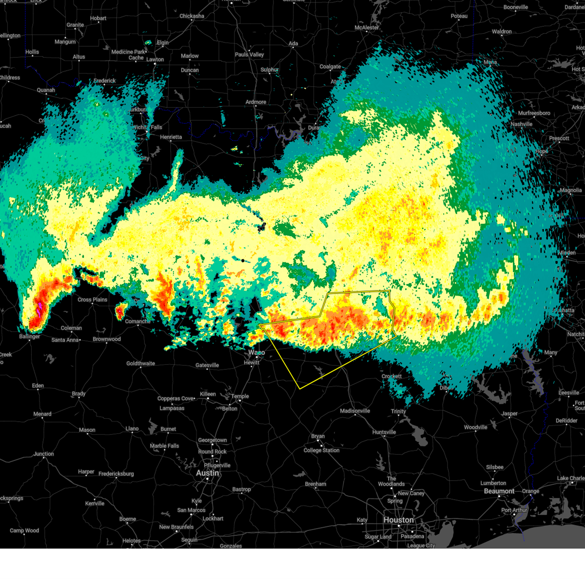 the severe thunderstorm warning has been cancelled and is no longer in effect the severe thunderstorm warning has been cancelled and is no longer in effect
|
| 6/9/2025 1:17 AM CDT |
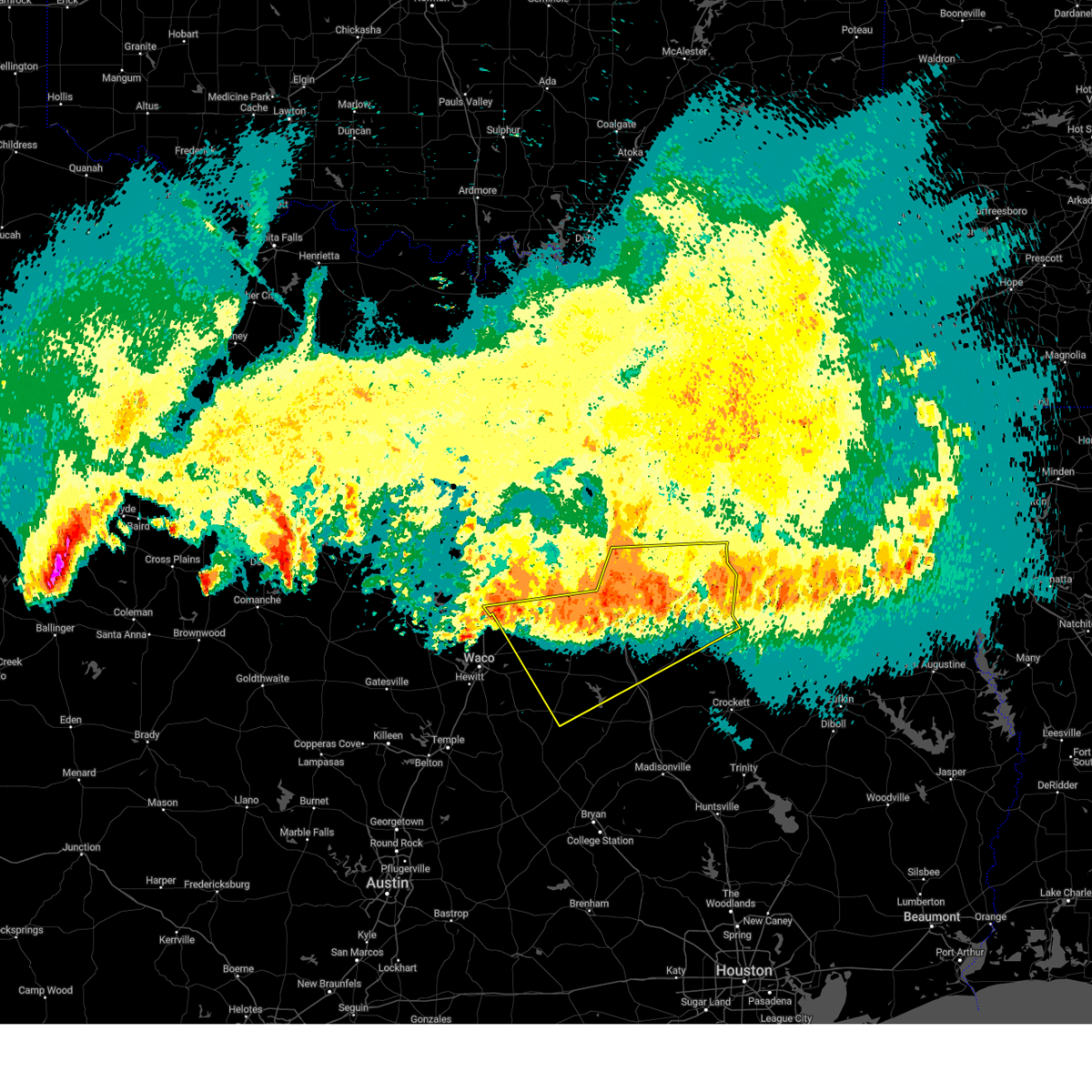 the severe thunderstorm warning has been cancelled and is no longer in effect the severe thunderstorm warning has been cancelled and is no longer in effect
|
| 6/9/2025 1:17 AM CDT |
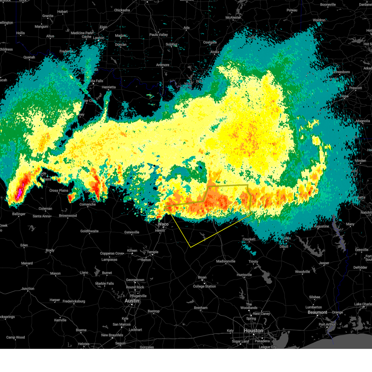 At 116 am cdt, severe thunderstorms were located along a line extending from near lake palestine to near trinidad lake to 8 miles south of richland-chambers reservoir to near west, moving southeast at 30 mph (radar indicated). Hazards include 60 mph wind gusts and nickel size hail. Expect damage to roofs, siding, and trees. Locations impacted include, bradford, malakoff, streetman, donie, richland, poynor, fairfield lake, cayuga, lake mexia, cross roads, trinidad, oletha, bethel, kirvin, purdon, lanely, brushy creek, richland-chambers reservoir, fort parker state park, and mount calm. At 116 am cdt, severe thunderstorms were located along a line extending from near lake palestine to near trinidad lake to 8 miles south of richland-chambers reservoir to near west, moving southeast at 30 mph (radar indicated). Hazards include 60 mph wind gusts and nickel size hail. Expect damage to roofs, siding, and trees. Locations impacted include, bradford, malakoff, streetman, donie, richland, poynor, fairfield lake, cayuga, lake mexia, cross roads, trinidad, oletha, bethel, kirvin, purdon, lanely, brushy creek, richland-chambers reservoir, fort parker state park, and mount calm.
|
| 6/9/2025 1:02 AM CDT |
 Svrfwd the national weather service in fort worth has issued a * severe thunderstorm warning for, freestone county in central texas, southern kaufman county in north central texas, southern van zandt county in north central texas, northwestern leon county in central texas, henderson county in central texas, limestone county in central texas, southeastern hill county in central texas, anderson county in central texas, navarro county in north central texas, * until 215 am cdt. * at 102 am cdt, severe thunderstorms were located along a line extending from near kemp to near kerens to 8 miles northeast of wortham to 7 miles west of west, moving southeast at 45 mph (radar indicated). Hazards include 70 mph wind gusts and nickel size hail. Expect considerable tree damage. Damage is likely to mobile homes, roofs, and outbuildings. Svrfwd the national weather service in fort worth has issued a * severe thunderstorm warning for, freestone county in central texas, southern kaufman county in north central texas, southern van zandt county in north central texas, northwestern leon county in central texas, henderson county in central texas, limestone county in central texas, southeastern hill county in central texas, anderson county in central texas, navarro county in north central texas, * until 215 am cdt. * at 102 am cdt, severe thunderstorms were located along a line extending from near kemp to near kerens to 8 miles northeast of wortham to 7 miles west of west, moving southeast at 45 mph (radar indicated). Hazards include 70 mph wind gusts and nickel size hail. Expect considerable tree damage. Damage is likely to mobile homes, roofs, and outbuildings.
|
| 6/9/2025 12:55 AM CDT |
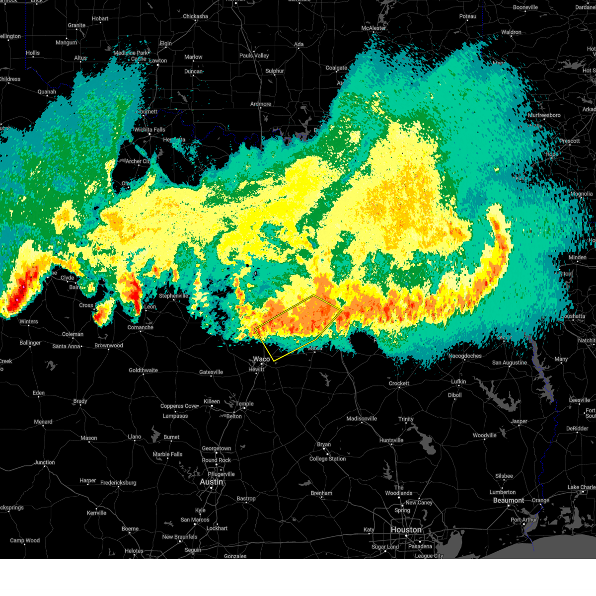 At 1255 am cdt, severe thunderstorms were located along a line extending from 6 miles east of alma to near corsicana to 6 miles east of west, moving east at 40 mph (radar indicated). Hazards include 70 mph wind gusts and nickel size hail. Expect considerable tree damage. damage is likely to mobile homes, roofs, and outbuildings. Locations impacted include, dawson, malone, oak valley, watt, dresden, corsicana, irene, richland, corbet, aquilla lake, mildred, navarro mills lake, retreat, goodlow, navarro mills, angus, rice, purdon, mustang, and birome. At 1255 am cdt, severe thunderstorms were located along a line extending from 6 miles east of alma to near corsicana to 6 miles east of west, moving east at 40 mph (radar indicated). Hazards include 70 mph wind gusts and nickel size hail. Expect considerable tree damage. damage is likely to mobile homes, roofs, and outbuildings. Locations impacted include, dawson, malone, oak valley, watt, dresden, corsicana, irene, richland, corbet, aquilla lake, mildred, navarro mills lake, retreat, goodlow, navarro mills, angus, rice, purdon, mustang, and birome.
|
| 6/9/2025 12:55 AM CDT |
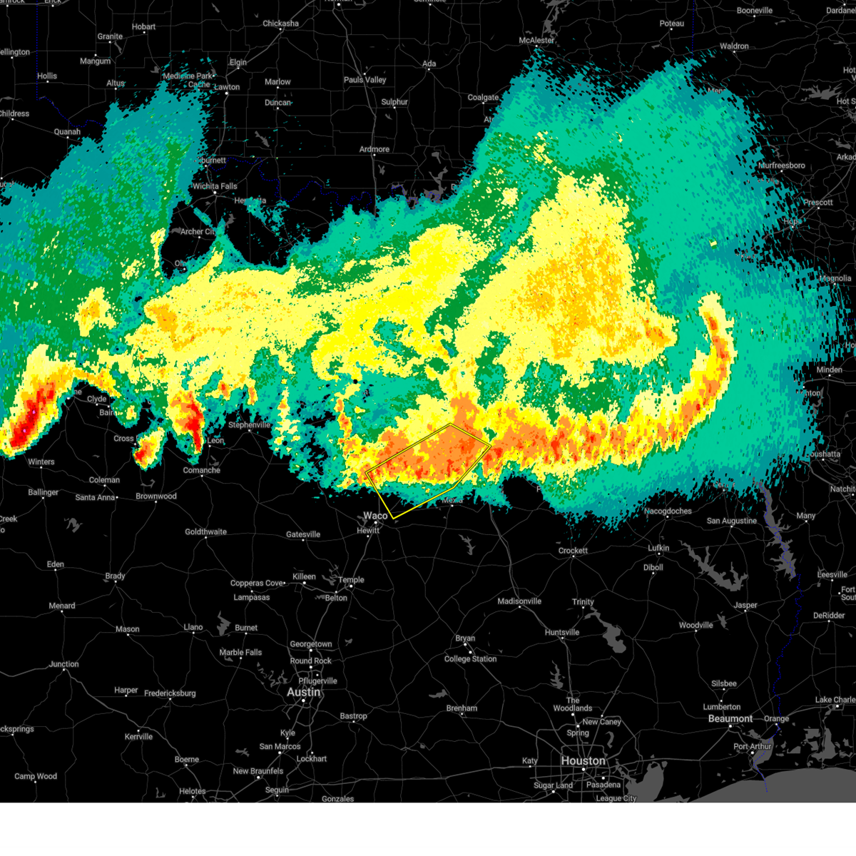 the severe thunderstorm warning has been cancelled and is no longer in effect the severe thunderstorm warning has been cancelled and is no longer in effect
|
| 6/9/2025 12:29 AM CDT |
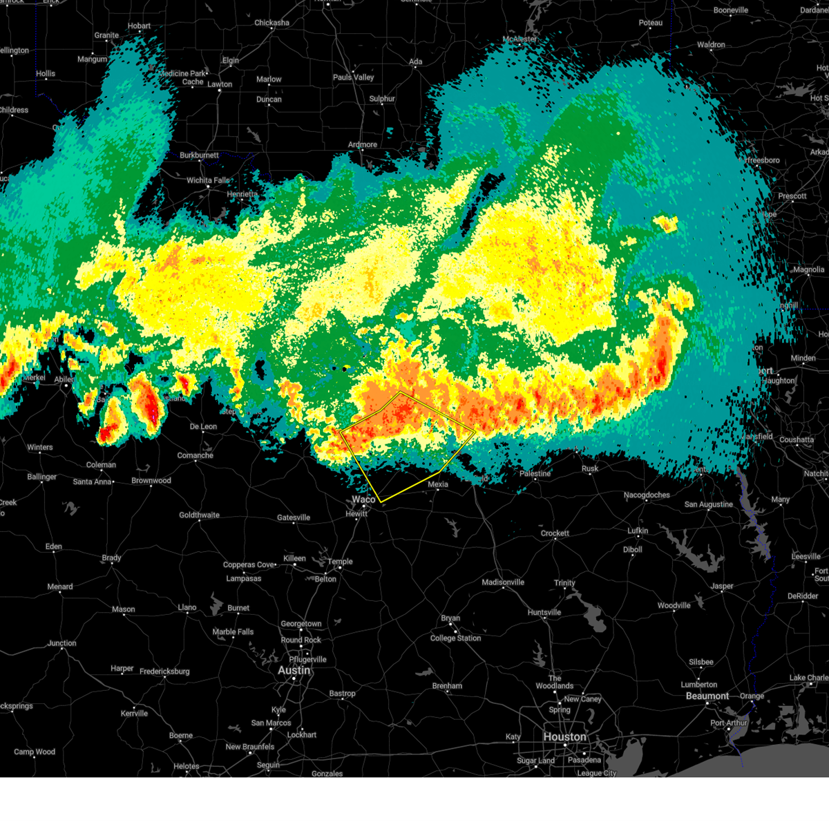 Svrfwd the national weather service in fort worth has issued a * severe thunderstorm warning for, northeastern mclennan county in central texas, northwestern limestone county in central texas, hill county in central texas, southern ellis county in north central texas, navarro county in north central texas, * until 115 am cdt. * at 1229 am cdt, severe thunderstorms were located along a line extending from near palmer to near italy to near aquilla lake, moving east at 40 mph (radar indicated). Hazards include 70 mph wind gusts and quarter size hail. Hail damage to vehicles is expected. expect considerable tree damage. Wind damage is also likely to mobile homes, roofs, and outbuildings. Svrfwd the national weather service in fort worth has issued a * severe thunderstorm warning for, northeastern mclennan county in central texas, northwestern limestone county in central texas, hill county in central texas, southern ellis county in north central texas, navarro county in north central texas, * until 115 am cdt. * at 1229 am cdt, severe thunderstorms were located along a line extending from near palmer to near italy to near aquilla lake, moving east at 40 mph (radar indicated). Hazards include 70 mph wind gusts and quarter size hail. Hail damage to vehicles is expected. expect considerable tree damage. Wind damage is also likely to mobile homes, roofs, and outbuildings.
|
| 6/8/2025 11:17 PM CDT |
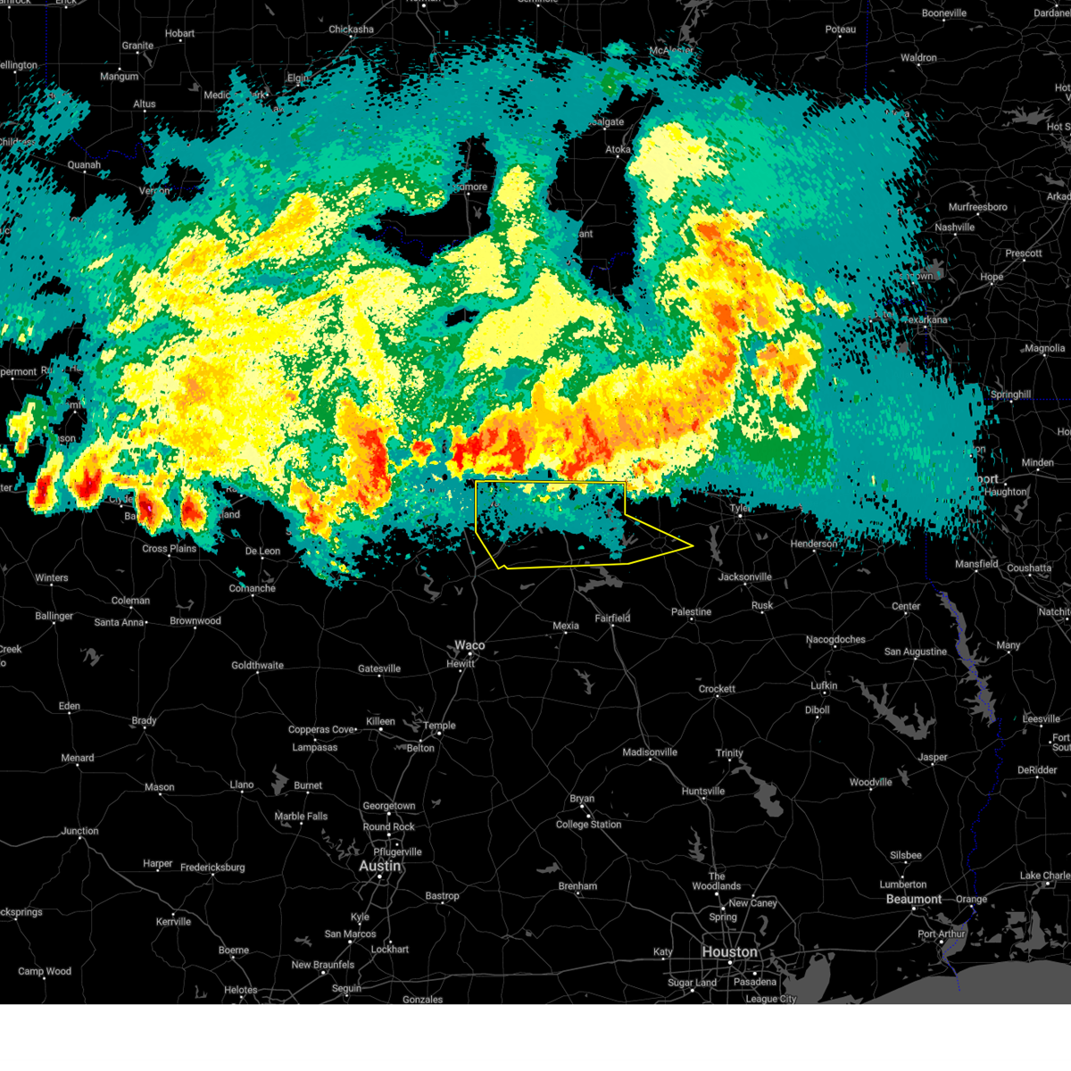 Svrfwd the national weather service in fort worth has issued a * severe thunderstorm warning for, southern kaufman county in north central texas, central henderson county in central texas, ellis county in north central texas, northern navarro county in north central texas, * until 1230 am cdt. * at 1116 pm cdt, severe thunderstorms were located along a line extending from near terrell to near arlington, moving south at 35 mph (radar indicated). Hazards include 65 mph wind gusts. Expect damage to roofs, siding, and trees. severe thunderstorms will be near, cedar hill, grand prairie, and mansfield around 1120 pm cdt. ferris, red oak, glenn heights, ovilla, oak leaf, and midlothian around 1125 pm cdt. waxahachie around 1130 pm cdt. cottonwood, palmer, venus, and grays prairie around 1135 pm cdt. ennis and kemp around 1140 pm cdt. mabank and cedar creek reservoir around 1145 pm cdt. maypearl, seven points, and gun barrel city around 1150 pm cdt. Tool, alma, and bardwell lake around 1155 pm cdt. Svrfwd the national weather service in fort worth has issued a * severe thunderstorm warning for, southern kaufman county in north central texas, central henderson county in central texas, ellis county in north central texas, northern navarro county in north central texas, * until 1230 am cdt. * at 1116 pm cdt, severe thunderstorms were located along a line extending from near terrell to near arlington, moving south at 35 mph (radar indicated). Hazards include 65 mph wind gusts. Expect damage to roofs, siding, and trees. severe thunderstorms will be near, cedar hill, grand prairie, and mansfield around 1120 pm cdt. ferris, red oak, glenn heights, ovilla, oak leaf, and midlothian around 1125 pm cdt. waxahachie around 1130 pm cdt. cottonwood, palmer, venus, and grays prairie around 1135 pm cdt. ennis and kemp around 1140 pm cdt. mabank and cedar creek reservoir around 1145 pm cdt. maypearl, seven points, and gun barrel city around 1150 pm cdt. Tool, alma, and bardwell lake around 1155 pm cdt.
|
| 5/16/2025 9:25 PM CDT |
At 925 pm cdt, a severe thunderstorm was located over trinidad, or 12 miles west of athens, moving southeast at 30 mph (radar indicated). Hazards include golf ball size hail and 60 mph wind gusts. People and animals outdoors will be injured. expect hail damage to roofs, siding, windows, and vehicles. expect wind damage to roofs, siding, and trees. Locations impacted include, log cabin, bradford, malakoff, bois d'arc, star harbor, poynor, cross roads, trinidad, forest grove reservoir, caney city, montalba, new york, crescent heights, coon creek lake, trinidad lake, athens, blackfoot, larue, springfield, and enchanted oaks.
|
| 5/16/2025 9:15 PM CDT |
Svrfwd the national weather service in fort worth has issued a * severe thunderstorm warning for, central henderson county in central texas, northwestern anderson county in central texas, northeastern navarro county in north central texas, * until 1015 pm cdt. * at 915 pm cdt, a severe thunderstorm was located near trinidad, or 10 miles south of gun barrel city, moving east at 30 mph (radar indicated). Hazards include two inch hail and 60 mph wind gusts. People and animals outdoors will be injured. expect hail damage to roofs, siding, windows, and vehicles. Expect wind damage to roofs, siding, and trees.
|
| 5/16/2025 9:00 PM CDT |
At 900 pm cdt, a severe thunderstorm was located near flag lake, or 8 miles southwest of gun barrel city, moving southeast at 30 mph (radar indicated). Hazards include golf ball size hail and 60 mph wind gusts. People and animals outdoors will be injured. expect hail damage to roofs, siding, windows, and vehicles. expect wind damage to roofs, siding, and trees. Locations impacted include, gun barrel city, log cabin, cedar creek reservoir, malakoff, trinidad lake, star harbor, roane, eustace, payne springs, seven points, kerens, trinidad, enchanted oaks, goodlow, flag lake, mankin, powell, caney city, tool, and forest grove reservoir.
|
| 5/16/2025 8:51 PM CDT |
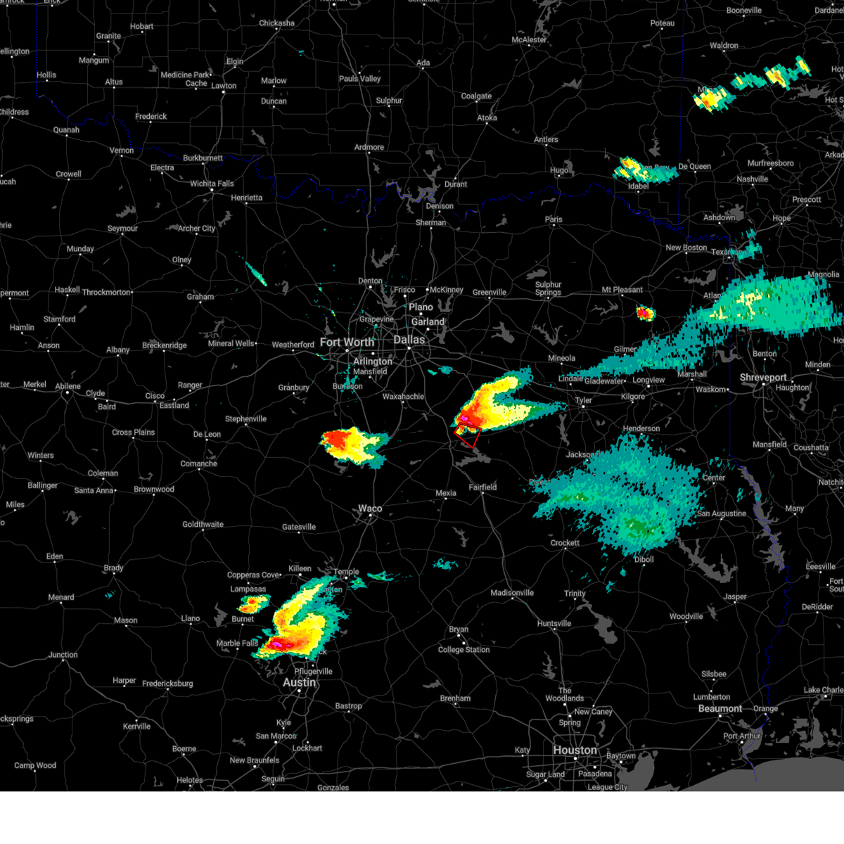 At 851 pm cdt, a severe thunderstorm capable of producing a tornado was located 7 miles northwest of kerens, or 10 miles northeast of corsicana, moving southeast at 25 mph (radar indicated rotation). Hazards include tornado and golf ball size hail. Flying debris will be dangerous to those caught without shelter. mobile homes will be damaged or destroyed. damage to roofs, windows, and vehicles will occur. tree damage is likely. Locations impacted include, kerens, powell, roane, goodlow, and richland-chambers reservoir. At 851 pm cdt, a severe thunderstorm capable of producing a tornado was located 7 miles northwest of kerens, or 10 miles northeast of corsicana, moving southeast at 25 mph (radar indicated rotation). Hazards include tornado and golf ball size hail. Flying debris will be dangerous to those caught without shelter. mobile homes will be damaged or destroyed. damage to roofs, windows, and vehicles will occur. tree damage is likely. Locations impacted include, kerens, powell, roane, goodlow, and richland-chambers reservoir.
|
| 5/16/2025 8:47 PM CDT |
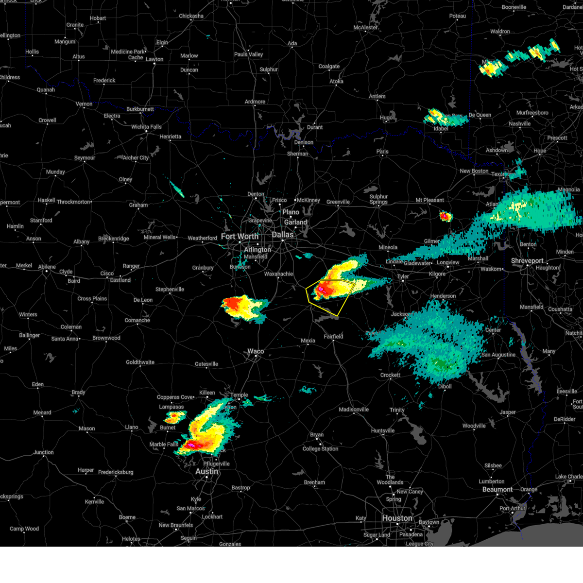 the severe thunderstorm warning has been cancelled and is no longer in effect the severe thunderstorm warning has been cancelled and is no longer in effect
|
| 5/16/2025 8:47 PM CDT |
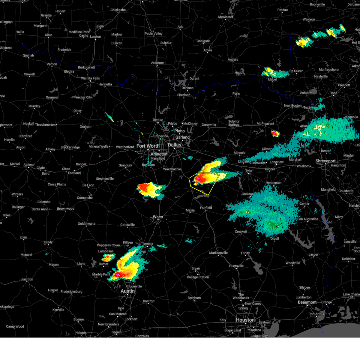 At 846 pm cdt, a severe thunderstorm was located near flag lake, or 12 miles west of gun barrel city, moving southeast at 25 mph (radar indicated). Hazards include golf ball size hail and 60 mph wind gusts. People and animals outdoors will be injured. expect hail damage to roofs, siding, windows, and vehicles. expect wind damage to roofs, siding, and trees. Locations impacted include, log cabin, malakoff, star harbor, eustace, payne springs, seven points, trinidad, goodlow, flag lake, caney city, tool, rice, chatfield, gun barrel city, cedar creek reservoir, trinidad lake, roane, kerens, enchanted oaks, and mankin. At 846 pm cdt, a severe thunderstorm was located near flag lake, or 12 miles west of gun barrel city, moving southeast at 25 mph (radar indicated). Hazards include golf ball size hail and 60 mph wind gusts. People and animals outdoors will be injured. expect hail damage to roofs, siding, windows, and vehicles. expect wind damage to roofs, siding, and trees. Locations impacted include, log cabin, malakoff, star harbor, eustace, payne springs, seven points, trinidad, goodlow, flag lake, caney city, tool, rice, chatfield, gun barrel city, cedar creek reservoir, trinidad lake, roane, kerens, enchanted oaks, and mankin.
|
| 5/16/2025 8:43 PM CDT |
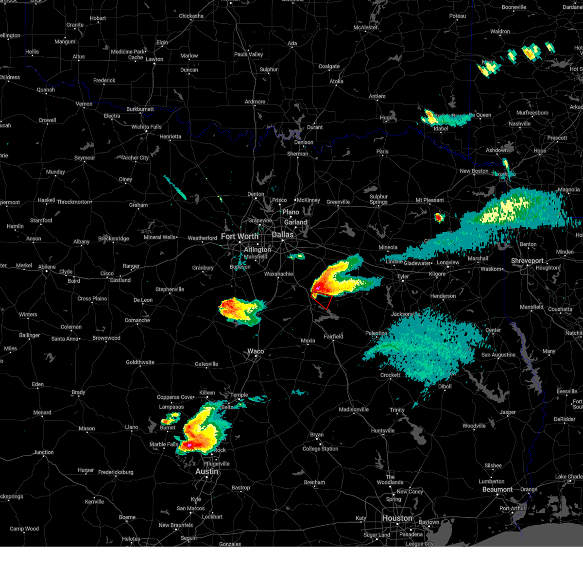 At 842 pm cdt, a severe thunderstorm capable of producing a tornado was located 8 miles northeast of corsicana, moving southeast at 30 mph (radar indicated rotation). Hazards include tornado and golf ball size hail. Flying debris will be dangerous to those caught without shelter. mobile homes will be damaged or destroyed. damage to roofs, windows, and vehicles will occur. tree damage is likely. Locations impacted include, kerens, powell, roane, goodlow, chatfield, and richland-chambers reservoir. At 842 pm cdt, a severe thunderstorm capable of producing a tornado was located 8 miles northeast of corsicana, moving southeast at 30 mph (radar indicated rotation). Hazards include tornado and golf ball size hail. Flying debris will be dangerous to those caught without shelter. mobile homes will be damaged or destroyed. damage to roofs, windows, and vehicles will occur. tree damage is likely. Locations impacted include, kerens, powell, roane, goodlow, chatfield, and richland-chambers reservoir.
|
| 5/16/2025 8:29 PM CDT |
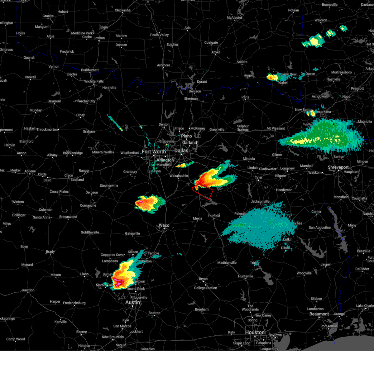 Torfwd the national weather service in fort worth has issued a * tornado warning for, northeastern navarro county in north central texas, * until 900 pm cdt. * at 829 pm cdt, a severe thunderstorm capable of producing a tornado was located near alma, or 10 miles north of corsicana, moving southeast at 25 mph (radar indicated rotation). Hazards include tornado and hail up to two inches in diameter. Flying debris will be dangerous to those caught without shelter. mobile homes will be damaged or destroyed. damage to roofs, windows, and vehicles will occur. Tree damage is likely. Torfwd the national weather service in fort worth has issued a * tornado warning for, northeastern navarro county in north central texas, * until 900 pm cdt. * at 829 pm cdt, a severe thunderstorm capable of producing a tornado was located near alma, or 10 miles north of corsicana, moving southeast at 25 mph (radar indicated rotation). Hazards include tornado and hail up to two inches in diameter. Flying debris will be dangerous to those caught without shelter. mobile homes will be damaged or destroyed. damage to roofs, windows, and vehicles will occur. Tree damage is likely.
|
| 5/16/2025 8:22 PM CDT |
Svrfwd the national weather service in fort worth has issued a * severe thunderstorm warning for, southwestern kaufman county in north central texas, western henderson county in central texas, northeastern ellis county in north central texas, northeastern navarro county in north central texas, * until 915 pm cdt. * at 822 pm cdt, a severe thunderstorm was located over alma, or 8 miles southeast of ennis, moving southeast at 30 mph (radar indicated). Hazards include two inch hail and 60 mph wind gusts. People and animals outdoors will be injured. expect hail damage to roofs, siding, windows, and vehicles. Expect wind damage to roofs, siding, and trees.
|
| 5/6/2025 11:13 AM CDT |
The storm which prompted the warning has weakened below severe limits. therefore the warning will be allowed to expire. however gusty winds and heavy rain are still possible with this thunderstorm. a severe thunderstorm watch remains in effect until noon cdt for north central texas. a severe thunderstorm watch also remains in effect until 400 pm cdt for central and north central texas.
|
| 5/6/2025 11:02 AM CDT |
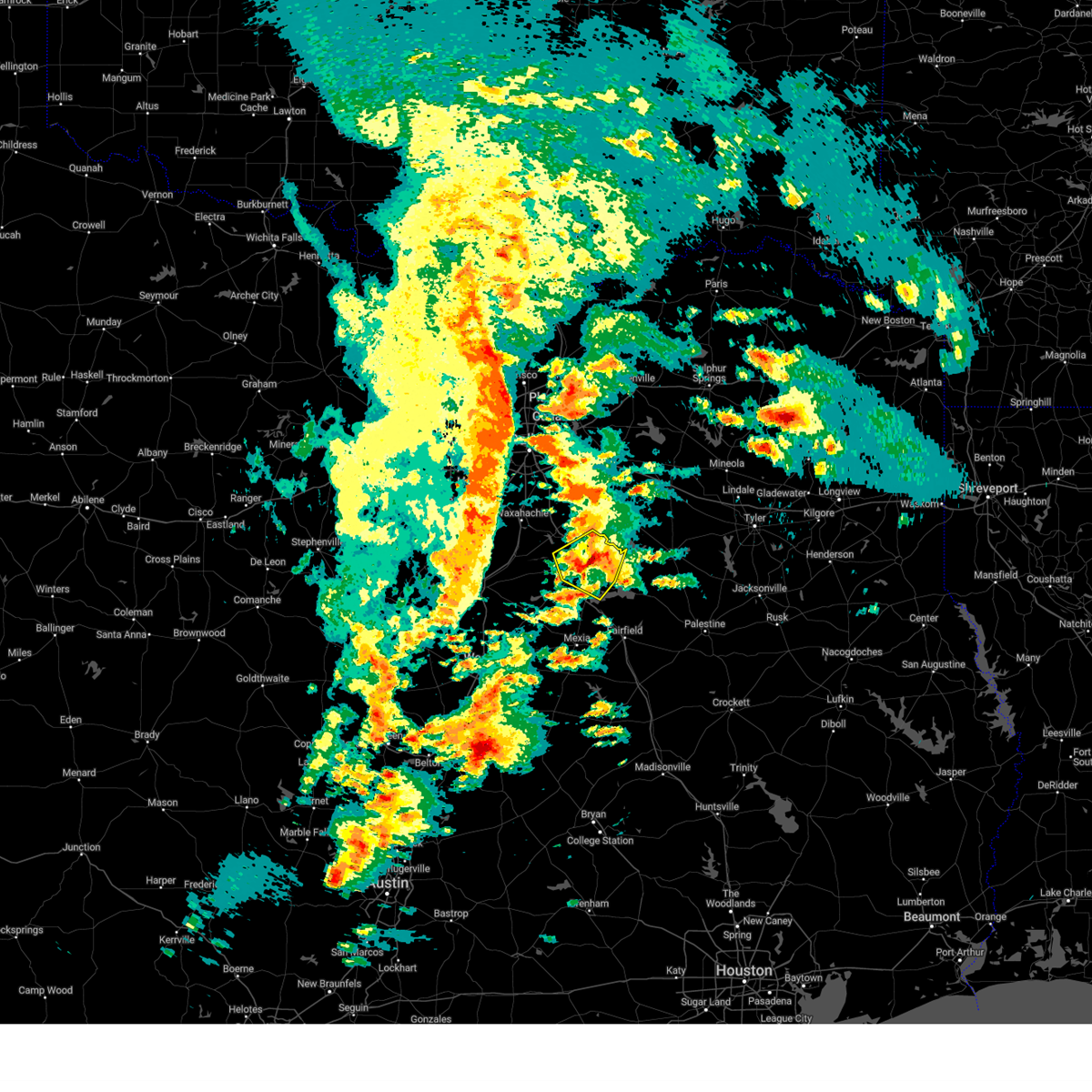 At 1102 am cdt, a severe thunderstorm was located 9 miles southwest of flag lake, or 10 miles northeast of corsicana, moving northeast at 30 mph (radar indicated). Hazards include quarter size hail. Damage to vehicles is possible. This severe thunderstorm will remain over mainly rural areas of central navarro county, including the following locations, mildred, mustang, oak valley, chatfield, emhouse, retreat, goodlow, powell, roane, and eureka. At 1102 am cdt, a severe thunderstorm was located 9 miles southwest of flag lake, or 10 miles northeast of corsicana, moving northeast at 30 mph (radar indicated). Hazards include quarter size hail. Damage to vehicles is possible. This severe thunderstorm will remain over mainly rural areas of central navarro county, including the following locations, mildred, mustang, oak valley, chatfield, emhouse, retreat, goodlow, powell, roane, and eureka.
|
| 5/6/2025 10:44 AM CDT |
At 1044 am cdt, a severe thunderstorm was located over lake halbert, or over corsicana, moving north at 35 mph (radar indicated). Hazards include 60 mph wind gusts and quarter size hail. Hail damage to vehicles is expected. expect wind damage to roofs, siding, and trees. this severe storm will be near, corsicana around 1050 am cdt. Other locations impacted by this severe thunderstorm include mustang, oak valley, chatfield, emhouse, dresden, roane, richland, corbet, mildred, and retreat.
|
| 5/6/2025 10:30 AM CDT |
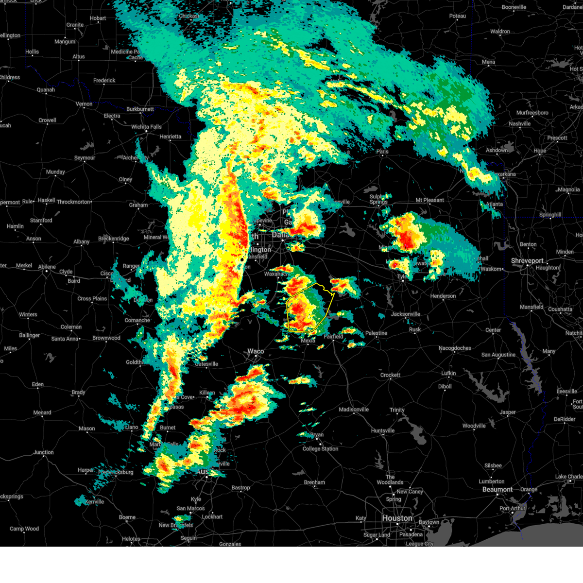 Svrfwd the national weather service in fort worth has issued a * severe thunderstorm warning for, navarro county in north central texas, * until 1115 am cdt. * at 1030 am cdt, a severe thunderstorm was located near angus, or 11 miles south of corsicana, moving northeast at 30 mph (radar indicated). Hazards include quarter size hail. Damage to vehicles is possible. this severe thunderstorm will be near, richland-chambers reservoir, corsicana, and angus around 1035 am cdt. navarro and lake halbert around 1040 am cdt. other locations impacted by this severe thunderstorm include mustang, oak valley, chatfield, emhouse, dresden, roane, richland, corbet, mildred, and silver city. This includes interstate 45 between mile markers 214 and 243. Svrfwd the national weather service in fort worth has issued a * severe thunderstorm warning for, navarro county in north central texas, * until 1115 am cdt. * at 1030 am cdt, a severe thunderstorm was located near angus, or 11 miles south of corsicana, moving northeast at 30 mph (radar indicated). Hazards include quarter size hail. Damage to vehicles is possible. this severe thunderstorm will be near, richland-chambers reservoir, corsicana, and angus around 1035 am cdt. navarro and lake halbert around 1040 am cdt. other locations impacted by this severe thunderstorm include mustang, oak valley, chatfield, emhouse, dresden, roane, richland, corbet, mildred, and silver city. This includes interstate 45 between mile markers 214 and 243.
|
| 5/2/2025 3:26 PM CDT |
Svrfwd the national weather service in fort worth has issued a * severe thunderstorm warning for, freestone county in central texas, limestone county in central texas, navarro county in north central texas, * until 430 pm cdt. * at 325 pm cdt, a line of severe thunderstorms was located from near corsicana to thornton, moving east at 40 mph (radar indicated). Hazards include 60 mph wind gusts and quarter size hail. Hail damage to vehicles is expected. expect wind damage to roofs, siding, and trees. this severe thunderstorm will be near, lake mexia, fort parker state park, and mexia around 330 pm cdt. teague around 350 pm cdt. other locations impacted by this severe thunderstorm include oak valley, watt, dresden, fallon, streetman, donie, richland, corbet, prairie hill, and mildred. This includes interstate 45 between mile markers 180 and 231.
|
| 4/4/2025 3:10 PM CDT |
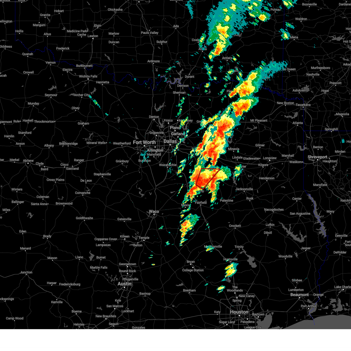 the tornado warning has been cancelled and is no longer in effect the tornado warning has been cancelled and is no longer in effect
|
| 4/4/2025 2:55 PM CDT |
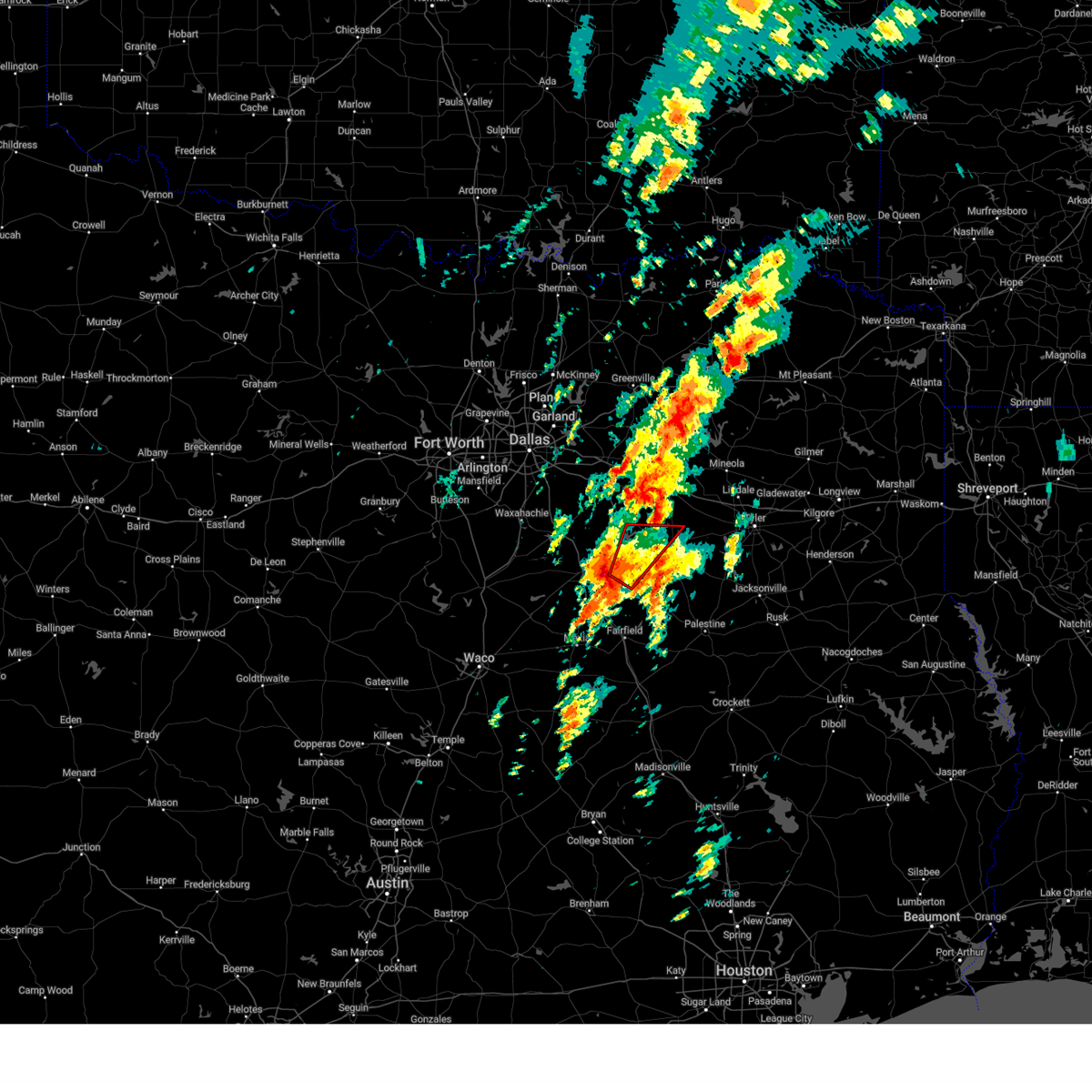 At 255 pm cdt, a severe thunderstorm capable of producing a tornado was located near trinidad lake, or 16 miles south of gun barrel city, moving northeast at 40 mph (radar indicated rotation). Hazards include tornado and quarter size hail. Flying debris will be dangerous to those caught without shelter. mobile homes will be damaged or destroyed. damage to roofs, windows, and vehicles will occur. tree damage is likely. this dangerous storm will be near, !** trinidad, malakoff, trinidad lake, and cedar creek reservoir around 300 pm cdt. caney city around 305 pm cdt. forest grove reservoir and eustace around 315 pm cdt. purtis creek state park around 325 pm cdt. Other locations impacted by this tornadic thunderstorm include goodlow, mankin, log cabin, star harbor, crescent heights, and payne springs. At 255 pm cdt, a severe thunderstorm capable of producing a tornado was located near trinidad lake, or 16 miles south of gun barrel city, moving northeast at 40 mph (radar indicated rotation). Hazards include tornado and quarter size hail. Flying debris will be dangerous to those caught without shelter. mobile homes will be damaged or destroyed. damage to roofs, windows, and vehicles will occur. tree damage is likely. this dangerous storm will be near, !** trinidad, malakoff, trinidad lake, and cedar creek reservoir around 300 pm cdt. caney city around 305 pm cdt. forest grove reservoir and eustace around 315 pm cdt. purtis creek state park around 325 pm cdt. Other locations impacted by this tornadic thunderstorm include goodlow, mankin, log cabin, star harbor, crescent heights, and payne springs.
|
| 4/4/2025 2:40 PM CDT |
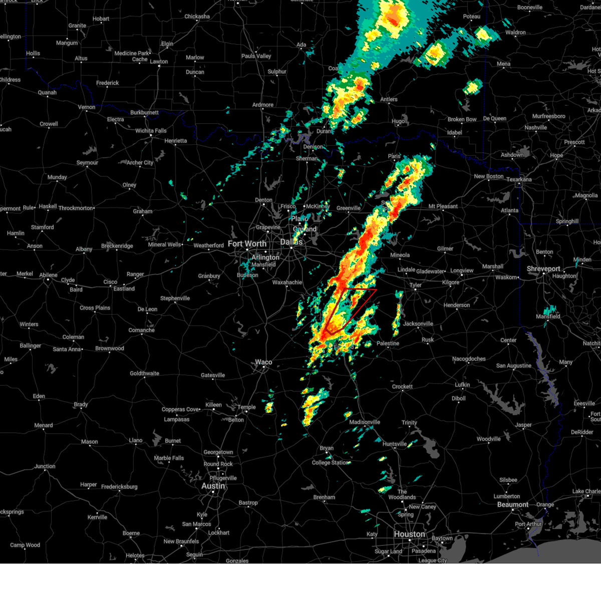 Torfwd the national weather service in fort worth has issued a * tornado warning for, central henderson county in central texas, eastern navarro county in north central texas, * until 330 pm cdt. * at 240 pm cdt, a severe thunderstorm capable of producing a tornado was located over richland-chambers reservoir, or 13 miles southeast of corsicana, moving northeast at 40 mph (radar indicated rotation). Hazards include tornado and quarter size hail. Flying debris will be dangerous to those caught without shelter. mobile homes will be damaged or destroyed. damage to roofs, windows, and vehicles will occur. tree damage is likely. this dangerous storm will be near, richland-chambers reservoir around 245 pm cdt. kerens around 250 pm cdt. trinidad and trinidad lake around 255 pm cdt. malakoff and cedar creek reservoir around 300 pm cdt. caney city around 305 pm cdt. forest grove reservoir, enchanted oaks, and eustace around 315 pm cdt. gun barrel city around 320 pm cdt. purtis creek state park around 325 pm cdt. Other locations impacted by this tornadic thunderstorm include log cabin, crescent heights, goodlow, mankin, star harbor, eureka, payne springs, and mildred. Torfwd the national weather service in fort worth has issued a * tornado warning for, central henderson county in central texas, eastern navarro county in north central texas, * until 330 pm cdt. * at 240 pm cdt, a severe thunderstorm capable of producing a tornado was located over richland-chambers reservoir, or 13 miles southeast of corsicana, moving northeast at 40 mph (radar indicated rotation). Hazards include tornado and quarter size hail. Flying debris will be dangerous to those caught without shelter. mobile homes will be damaged or destroyed. damage to roofs, windows, and vehicles will occur. tree damage is likely. this dangerous storm will be near, richland-chambers reservoir around 245 pm cdt. kerens around 250 pm cdt. trinidad and trinidad lake around 255 pm cdt. malakoff and cedar creek reservoir around 300 pm cdt. caney city around 305 pm cdt. forest grove reservoir, enchanted oaks, and eustace around 315 pm cdt. gun barrel city around 320 pm cdt. purtis creek state park around 325 pm cdt. Other locations impacted by this tornadic thunderstorm include log cabin, crescent heights, goodlow, mankin, star harbor, eureka, payne springs, and mildred.
|
|
|
| 4/4/2025 2:37 PM CDT |
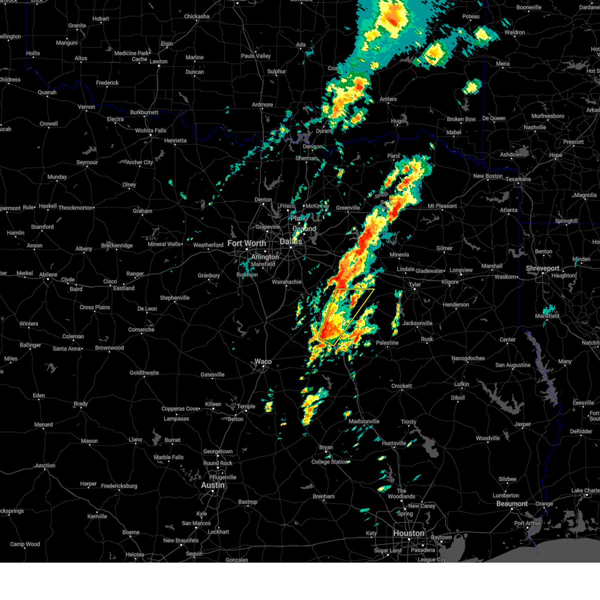 Svrfwd the national weather service in fort worth has issued a * severe thunderstorm warning for, northwestern freestone county in central texas, western henderson county in central texas, eastern navarro county in north central texas, * until 315 pm cdt. * at 236 pm cdt, a severe thunderstorm was located 7 miles southwest of richland-chambers reservoir, or 14 miles northwest of fairfield, moving northeast at 45 mph (radar indicated). Hazards include 60 mph wind gusts and quarter size hail. Hail damage to vehicles is expected. expect wind damage to roofs, siding, and trees. this severe thunderstorm will be near, richland-chambers reservoir around 240 pm cdt. kerens around 255 pm cdt. trinidad and trinidad lake around 300 pm cdt. malakoff and cedar creek reservoir around 305 pm cdt. enchanted oaks and caney city around 310 pm cdt. other locations impacted by this severe thunderstorm include mildred, log cabin, crescent heights, goodlow, mankin, streetman, powell, star harbor, eureka, and richland. This includes interstate 45 between mile markers 206 and 219. Svrfwd the national weather service in fort worth has issued a * severe thunderstorm warning for, northwestern freestone county in central texas, western henderson county in central texas, eastern navarro county in north central texas, * until 315 pm cdt. * at 236 pm cdt, a severe thunderstorm was located 7 miles southwest of richland-chambers reservoir, or 14 miles northwest of fairfield, moving northeast at 45 mph (radar indicated). Hazards include 60 mph wind gusts and quarter size hail. Hail damage to vehicles is expected. expect wind damage to roofs, siding, and trees. this severe thunderstorm will be near, richland-chambers reservoir around 240 pm cdt. kerens around 255 pm cdt. trinidad and trinidad lake around 300 pm cdt. malakoff and cedar creek reservoir around 305 pm cdt. enchanted oaks and caney city around 310 pm cdt. other locations impacted by this severe thunderstorm include mildred, log cabin, crescent heights, goodlow, mankin, streetman, powell, star harbor, eureka, and richland. This includes interstate 45 between mile markers 206 and 219.
|
| 3/30/2025 1:08 AM CDT |
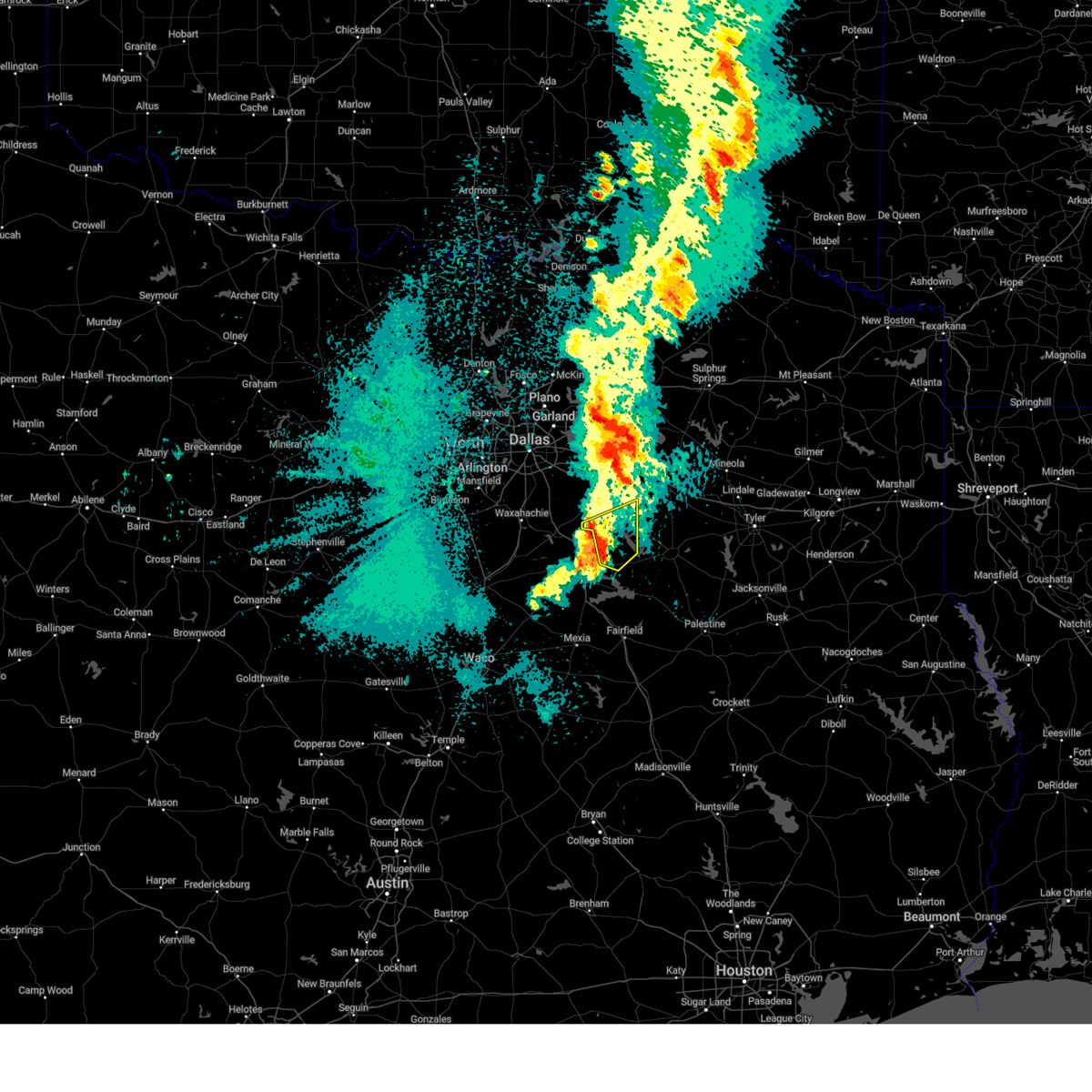 the severe thunderstorm warning has been cancelled and is no longer in effect the severe thunderstorm warning has been cancelled and is no longer in effect
|
| 3/30/2025 1:08 AM CDT |
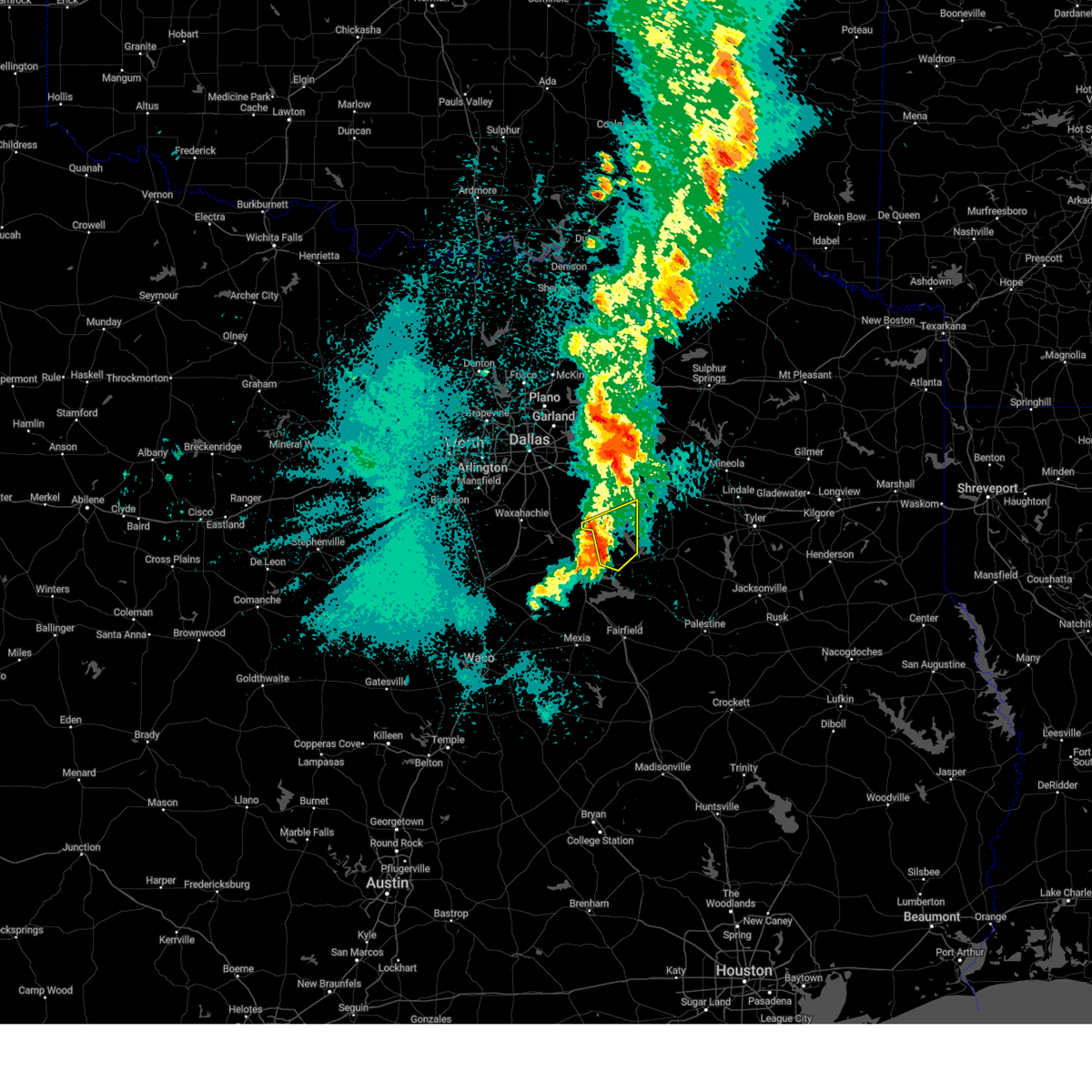 At 108 am cdt, severe thunderstorms were located along a line extending from 6 miles northwest of seven points to near flag lake to near kerens, moving east at 55 mph (radar indicated). Hazards include 60 mph wind gusts and quarter size hail. Hail damage to vehicles is expected. expect wind damage to roofs, siding, and trees. these severe storms will be near, tool, seven points, enchanted oaks, trinidad, gun barrel city, kerens, kemp, mabank, and cedar creek reservoir around 115 am cdt. Other locations impacted by these severe thunderstorms include prairieville, stubbs, lively, goodlow, mankin, tolosa, and payne springs. At 108 am cdt, severe thunderstorms were located along a line extending from 6 miles northwest of seven points to near flag lake to near kerens, moving east at 55 mph (radar indicated). Hazards include 60 mph wind gusts and quarter size hail. Hail damage to vehicles is expected. expect wind damage to roofs, siding, and trees. these severe storms will be near, tool, seven points, enchanted oaks, trinidad, gun barrel city, kerens, kemp, mabank, and cedar creek reservoir around 115 am cdt. Other locations impacted by these severe thunderstorms include prairieville, stubbs, lively, goodlow, mankin, tolosa, and payne springs.
|
| 3/30/2025 12:52 AM CDT |
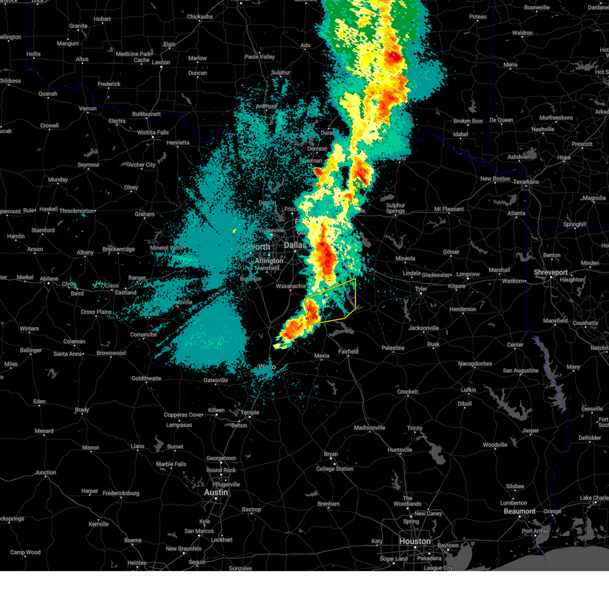 the severe thunderstorm warning has been cancelled and is no longer in effect the severe thunderstorm warning has been cancelled and is no longer in effect
|
| 3/30/2025 12:52 AM CDT |
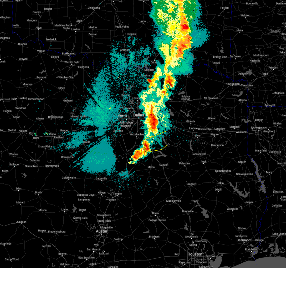 At 1252 am cdt, severe thunderstorms were located along a line extending from alma to near corsicana to near angus, moving northeast at 50 mph (radar indicated). Hazards include 60 mph wind gusts and quarter size hail. Hail damage to vehicles is expected. expect wind damage to roofs, siding, and trees. these severe storms will be near, richland-chambers reservoir, corsicana, alma, and lake halbert around 1255 am cdt. seven points, kerens, and flag lake around 105 am cdt. tool, enchanted oaks, trinidad, gun barrel city, kemp, and cedar creek reservoir around 110 am cdt. mabank around 115 am cdt. Other locations impacted by these severe thunderstorms include chatfield, emhouse, stubbs, tolosa, roane, payne springs, prairieville, lively, goodlow, and mankin. At 1252 am cdt, severe thunderstorms were located along a line extending from alma to near corsicana to near angus, moving northeast at 50 mph (radar indicated). Hazards include 60 mph wind gusts and quarter size hail. Hail damage to vehicles is expected. expect wind damage to roofs, siding, and trees. these severe storms will be near, richland-chambers reservoir, corsicana, alma, and lake halbert around 1255 am cdt. seven points, kerens, and flag lake around 105 am cdt. tool, enchanted oaks, trinidad, gun barrel city, kemp, and cedar creek reservoir around 110 am cdt. mabank around 115 am cdt. Other locations impacted by these severe thunderstorms include chatfield, emhouse, stubbs, tolosa, roane, payne springs, prairieville, lively, goodlow, and mankin.
|
| 3/30/2025 12:43 AM CDT |
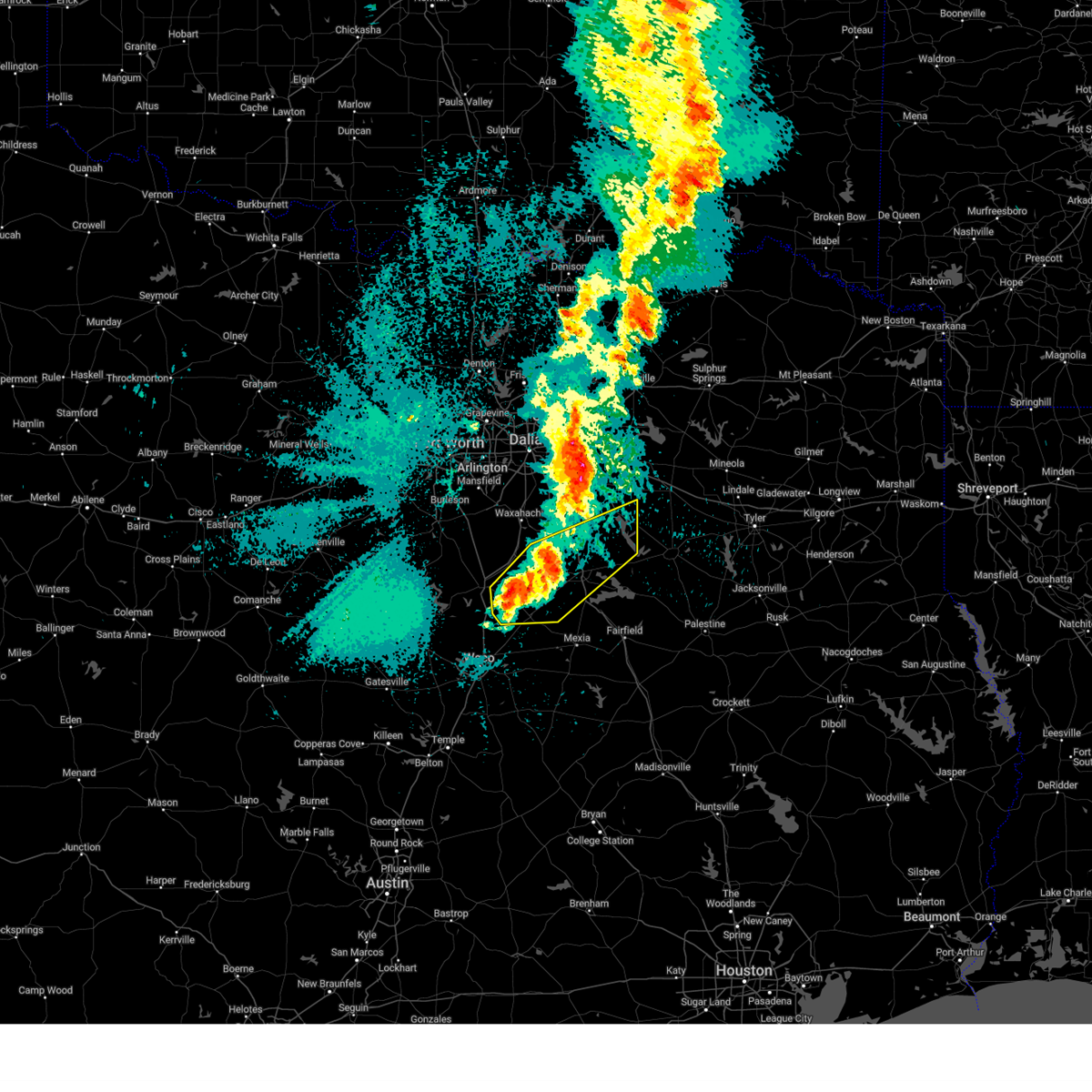 Svrfwd the national weather service in fort worth has issued a * severe thunderstorm warning for, southeastern kaufman county in north central texas, northwestern henderson county in central texas, southeastern hill county in central texas, southeastern ellis county in north central texas, navarro county in north central texas, * until 145 am cdt. * at 1243 am cdt, severe thunderstorms were located along a line extending from near bardwell lake to near corsicana to near hubbard, moving northeast at 50 mph (radar indicated). Hazards include 60 mph wind gusts and quarter size hail. Hail damage to vehicles is expected. expect wind damage to roofs, siding, and trees. severe thunderstorms will be near, navarro mills lake, ennis, corsicana, dawson, alma, hubbard, and lake halbert around 1250 am cdt. richland-chambers reservoir and angus around 1255 am cdt. navarro, tool, seven points, kerens, and flag lake around 105 am cdt. enchanted oaks, trinidad, gun barrel city, kemp, and cedar creek reservoir around 110 am cdt. mabank around 115 am cdt. other locations impacted by these severe thunderstorms include malone, oak valley, dresden, avalon, irene, tolosa, corbet, payne springs, mildred, and retreat. This includes interstate 45 between mile markers 221 and 249. Svrfwd the national weather service in fort worth has issued a * severe thunderstorm warning for, southeastern kaufman county in north central texas, northwestern henderson county in central texas, southeastern hill county in central texas, southeastern ellis county in north central texas, navarro county in north central texas, * until 145 am cdt. * at 1243 am cdt, severe thunderstorms were located along a line extending from near bardwell lake to near corsicana to near hubbard, moving northeast at 50 mph (radar indicated). Hazards include 60 mph wind gusts and quarter size hail. Hail damage to vehicles is expected. expect wind damage to roofs, siding, and trees. severe thunderstorms will be near, navarro mills lake, ennis, corsicana, dawson, alma, hubbard, and lake halbert around 1250 am cdt. richland-chambers reservoir and angus around 1255 am cdt. navarro, tool, seven points, kerens, and flag lake around 105 am cdt. enchanted oaks, trinidad, gun barrel city, kemp, and cedar creek reservoir around 110 am cdt. mabank around 115 am cdt. other locations impacted by these severe thunderstorms include malone, oak valley, dresden, avalon, irene, tolosa, corbet, payne springs, mildred, and retreat. This includes interstate 45 between mile markers 221 and 249.
|
| 3/23/2025 7:45 PM CDT |
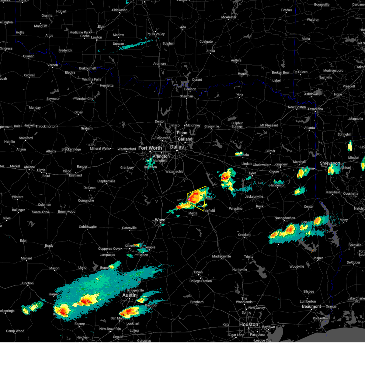 At 745 pm cdt, a severe thunderstorm was located near angus, or 9 miles southwest of corsicana, moving east at 20 mph (radar indicated). Hazards include golf ball size hail and 60 mph wind gusts. People and animals outdoors will be injured. expect hail damage to roofs, siding, windows, and vehicles. expect wind damage to roofs, siding, and trees. this severe storm will be near, richland-chambers reservoir and angus around 755 pm cdt. navarro around 800 pm cdt. Other locations impacted by this severe thunderstorm include mildred, mustang, oak valley, retreat, streetman, powell, eureka, richland, corbet, and goodlow. At 745 pm cdt, a severe thunderstorm was located near angus, or 9 miles southwest of corsicana, moving east at 20 mph (radar indicated). Hazards include golf ball size hail and 60 mph wind gusts. People and animals outdoors will be injured. expect hail damage to roofs, siding, windows, and vehicles. expect wind damage to roofs, siding, and trees. this severe storm will be near, richland-chambers reservoir and angus around 755 pm cdt. navarro around 800 pm cdt. Other locations impacted by this severe thunderstorm include mildred, mustang, oak valley, retreat, streetman, powell, eureka, richland, corbet, and goodlow.
|
| 3/23/2025 7:24 PM CDT |
Svrfwd the national weather service in fort worth has issued a * severe thunderstorm warning for, northwestern freestone county in central texas, southern navarro county in north central texas, * until 830 pm cdt. * at 724 pm cdt, a severe thunderstorm was located near navarro mills lake, or 12 miles southwest of corsicana, moving east at 20 mph (radar indicated). Hazards include golf ball size hail and 60 mph wind gusts. People and animals outdoors will be injured. expect hail damage to roofs, siding, windows, and vehicles. expect wind damage to roofs, siding, and trees. this severe thunderstorm will be near, angus around 750 pm cdt. richland-chambers reservoir around 755 pm cdt. navarro around 800 pm cdt. other locations impacted by this severe thunderstorm include mustang, oak valley, dresden, streetman, richland, corbet, mildred, silver city, retreat, and powell. This includes interstate 45 between mile markers 206 and 232.
|
| 3/23/2025 7:01 PM CDT |
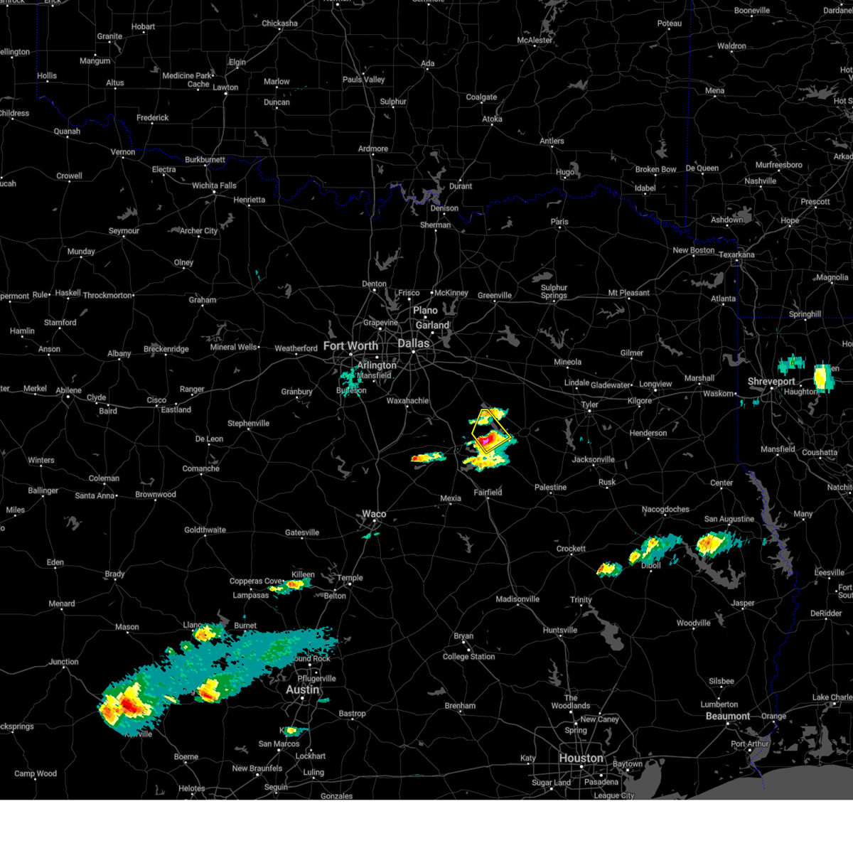 At 700 pm cdt, a severe thunderstorm was located near trinidad, or 10 miles south of gun barrel city, moving northeast at 30 mph (observed hail). Hazards include 60 mph wind gusts and quarter size hail. Hail damage to vehicles is expected. expect wind damage to roofs, siding, and trees. this severe storm will be near, tool, trinidad, malakoff, caney city, and cedar creek reservoir around 705 pm cdt. enchanted oaks around 710 pm cdt. Other locations impacted by this severe thunderstorm include goodlow, mankin, star harbor, payne springs, and log cabin. At 700 pm cdt, a severe thunderstorm was located near trinidad, or 10 miles south of gun barrel city, moving northeast at 30 mph (observed hail). Hazards include 60 mph wind gusts and quarter size hail. Hail damage to vehicles is expected. expect wind damage to roofs, siding, and trees. this severe storm will be near, tool, trinidad, malakoff, caney city, and cedar creek reservoir around 705 pm cdt. enchanted oaks around 710 pm cdt. Other locations impacted by this severe thunderstorm include goodlow, mankin, star harbor, payne springs, and log cabin.
|
| 3/23/2025 6:43 PM CDT |
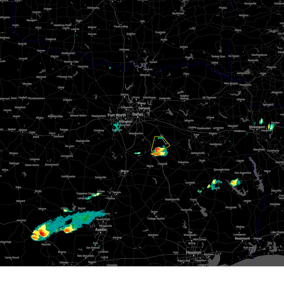 At 643 pm cdt, a severe thunderstorm was located near kerens, or 9 miles east of corsicana, moving northeast at 20 mph (radar indicated). Hazards include ping pong ball size hail and 60 mph wind gusts. People and animals outdoors will be injured. expect hail damage to roofs, siding, windows, and vehicles. expect wind damage to roofs, siding, and trees. this severe storm will be near, kerens around 650 pm cdt. trinidad around 700 pm cdt. tool, flag lake, and cedar creek reservoir around 710 pm cdt. enchanted oaks around 715 pm cdt. gun barrel city around 720 pm cdt. Other locations impacted by this severe thunderstorm include mildred, goodlow, mankin, powell, star harbor, roane, eureka, payne springs, and log cabin. At 643 pm cdt, a severe thunderstorm was located near kerens, or 9 miles east of corsicana, moving northeast at 20 mph (radar indicated). Hazards include ping pong ball size hail and 60 mph wind gusts. People and animals outdoors will be injured. expect hail damage to roofs, siding, windows, and vehicles. expect wind damage to roofs, siding, and trees. this severe storm will be near, kerens around 650 pm cdt. trinidad around 700 pm cdt. tool, flag lake, and cedar creek reservoir around 710 pm cdt. enchanted oaks around 715 pm cdt. gun barrel city around 720 pm cdt. Other locations impacted by this severe thunderstorm include mildred, goodlow, mankin, powell, star harbor, roane, eureka, payne springs, and log cabin.
|
| 3/23/2025 6:32 PM CDT |
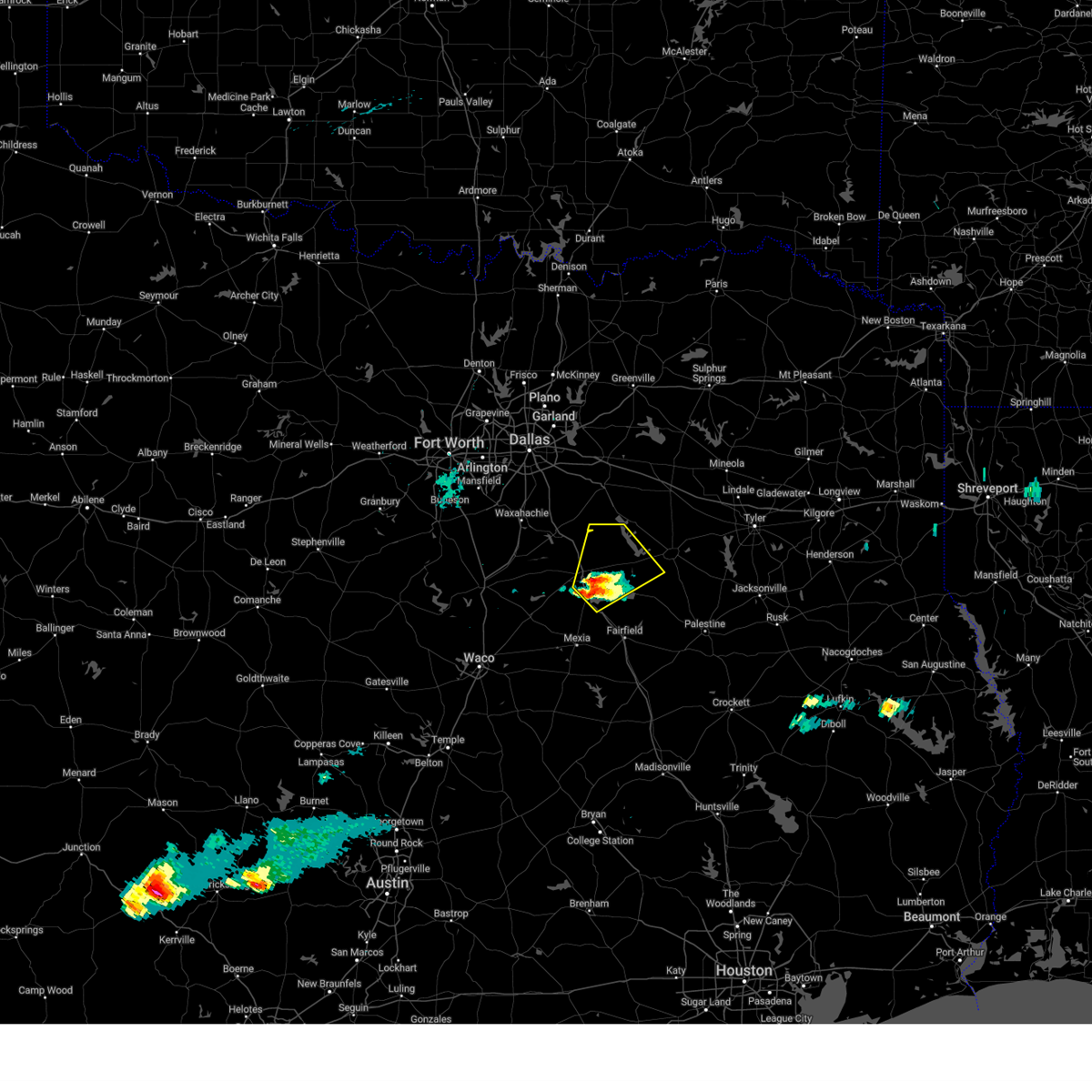 Svrfwd the national weather service in fort worth has issued a * severe thunderstorm warning for, western henderson county in central texas, eastern navarro county in north central texas, * until 730 pm cdt. * at 632 pm cdt, a severe thunderstorm was located over lake halbert, or near corsicana, moving northeast at 20 mph (radar indicated). Hazards include 60 mph wind gusts and quarter size hail. Hail damage to vehicles is expected. expect wind damage to roofs, siding, and trees. this severe thunderstorm will be near, richland-chambers reservoir around 640 pm cdt. kerens around 645 pm cdt. trinidad around 705 pm cdt. tool around 715 pm cdt. other locations impacted by this severe thunderstorm include mustang, chatfield, star harbor, roane, mildred, retreat, goodlow, mankin, powell, and eureka. This includes interstate 45 between mile markers 213 and 217, and between mile markers 220 and 234. Svrfwd the national weather service in fort worth has issued a * severe thunderstorm warning for, western henderson county in central texas, eastern navarro county in north central texas, * until 730 pm cdt. * at 632 pm cdt, a severe thunderstorm was located over lake halbert, or near corsicana, moving northeast at 20 mph (radar indicated). Hazards include 60 mph wind gusts and quarter size hail. Hail damage to vehicles is expected. expect wind damage to roofs, siding, and trees. this severe thunderstorm will be near, richland-chambers reservoir around 640 pm cdt. kerens around 645 pm cdt. trinidad around 705 pm cdt. tool around 715 pm cdt. other locations impacted by this severe thunderstorm include mustang, chatfield, star harbor, roane, mildred, retreat, goodlow, mankin, powell, and eureka. This includes interstate 45 between mile markers 213 and 217, and between mile markers 220 and 234.
|
| 3/12/2025 5:43 PM CDT |
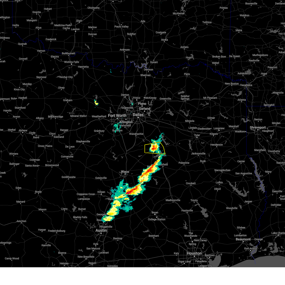 the severe thunderstorm warning has been cancelled and is no longer in effect the severe thunderstorm warning has been cancelled and is no longer in effect
|
| 3/12/2025 5:30 PM CDT |
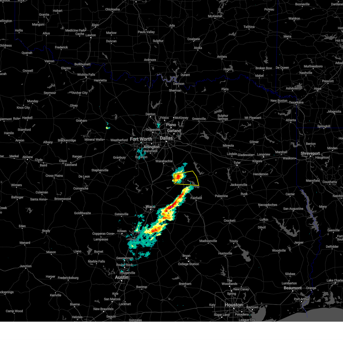 Svrfwd the national weather service in fort worth has issued a * severe thunderstorm warning for, central navarro county in north central texas, * until 600 pm cdt. * at 530 pm cdt, a severe thunderstorm was located over corsicana, moving east at 45 mph (radar indicated). Hazards include 60 mph wind gusts and quarter size hail. Hail damage to vehicles is expected. expect wind damage to roofs, siding, and trees. this severe thunderstorm will be near, richland-chambers reservoir, corsicana, and lake halbert around 535 pm cdt. kerens around 545 pm cdt. other locations impacted by this severe thunderstorm include mildred, mustang, oak valley, emhouse, retreat, goodlow, powell, roane, eureka, and rice. This includes interstate 45 between mile markers 225 and 239. Svrfwd the national weather service in fort worth has issued a * severe thunderstorm warning for, central navarro county in north central texas, * until 600 pm cdt. * at 530 pm cdt, a severe thunderstorm was located over corsicana, moving east at 45 mph (radar indicated). Hazards include 60 mph wind gusts and quarter size hail. Hail damage to vehicles is expected. expect wind damage to roofs, siding, and trees. this severe thunderstorm will be near, richland-chambers reservoir, corsicana, and lake halbert around 535 pm cdt. kerens around 545 pm cdt. other locations impacted by this severe thunderstorm include mildred, mustang, oak valley, emhouse, retreat, goodlow, powell, roane, eureka, and rice. This includes interstate 45 between mile markers 225 and 239.
|
| 3/4/2025 6:48 AM CST |
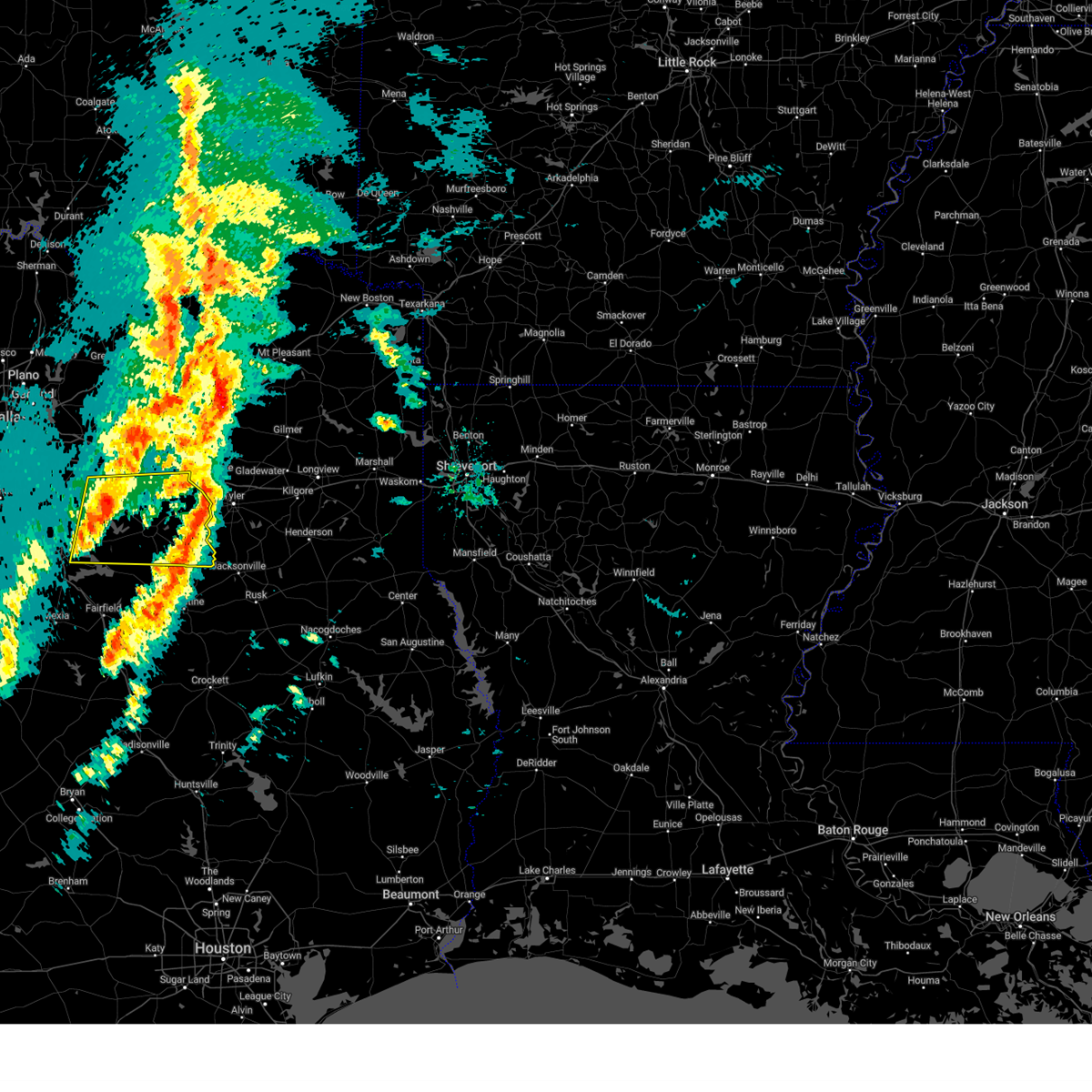 Svrfwd the national weather service in fort worth has issued a * severe thunderstorm warning for, southeastern kaufman county in north central texas, southern van zandt county in north central texas, henderson county in central texas, northwestern anderson county in central texas, northeastern navarro county in north central texas, * until 745 am cst. * at 648 am cst, severe thunderstorms were located along a line extending from near mabank to enchanted oaks to near trinidad lake, moving east at 50 mph (radar indicated). Hazards include 65 mph wind gusts and quarter size hail. Hail damage to vehicles is expected. expect wind damage to roofs, siding, and trees. severe thunderstorms will be near, forest grove reservoir, athens, trinidad, purtis creek state park, eustace, malakoff, caney city, trinidad lake, and cedar creek reservoir around 655 am cst. coon creek lake around 705 am cst. brownsboro and edom around 715 am cst. lake palestine around 720 am cst. frankston and chandler around 725 am cst. berryville around 730 am cst. other locations impacted by these severe thunderstorms include ben wheeler, whitton, moore station, log cabin, tolosa, star harbor, roddy, jackson, payne springs, and poynor. This includes interstate 20 between mile markers 536 and 542. Svrfwd the national weather service in fort worth has issued a * severe thunderstorm warning for, southeastern kaufman county in north central texas, southern van zandt county in north central texas, henderson county in central texas, northwestern anderson county in central texas, northeastern navarro county in north central texas, * until 745 am cst. * at 648 am cst, severe thunderstorms were located along a line extending from near mabank to enchanted oaks to near trinidad lake, moving east at 50 mph (radar indicated). Hazards include 65 mph wind gusts and quarter size hail. Hail damage to vehicles is expected. expect wind damage to roofs, siding, and trees. severe thunderstorms will be near, forest grove reservoir, athens, trinidad, purtis creek state park, eustace, malakoff, caney city, trinidad lake, and cedar creek reservoir around 655 am cst. coon creek lake around 705 am cst. brownsboro and edom around 715 am cst. lake palestine around 720 am cst. frankston and chandler around 725 am cst. berryville around 730 am cst. other locations impacted by these severe thunderstorms include ben wheeler, whitton, moore station, log cabin, tolosa, star harbor, roddy, jackson, payne springs, and poynor. This includes interstate 20 between mile markers 536 and 542.
|
| 6/2/2024 6:33 PM CDT |
 At 633 pm cdt, a severe thunderstorm was located near flag lake, or 7 miles southwest of gun barrel city, moving east at 20 mph (radar indicated). Hazards include 60 mph wind gusts and quarter size hail. Hail damage to vehicles is expected. expect wind damage to roofs, siding, and trees. this severe storm will be near, tool around 640 pm cdt. Other locations impacted by this severe thunderstorm include goodlow and mankin. At 633 pm cdt, a severe thunderstorm was located near flag lake, or 7 miles southwest of gun barrel city, moving east at 20 mph (radar indicated). Hazards include 60 mph wind gusts and quarter size hail. Hail damage to vehicles is expected. expect wind damage to roofs, siding, and trees. this severe storm will be near, tool around 640 pm cdt. Other locations impacted by this severe thunderstorm include goodlow and mankin.
|
| 6/2/2024 6:23 PM CDT |
 At 622 pm cdt, a severe thunderstorm was located near flag lake, or 11 miles southwest of gun barrel city, moving northeast at 15 mph (radar indicated). Hazards include ping pong ball size hail and 60 mph wind gusts. People and animals outdoors will be injured. expect hail damage to roofs, siding, windows, and vehicles. expect wind damage to roofs, siding, and trees. this severe storm will be near, flag lake around 630 pm cdt. tool around 635 pm cdt. cedar creek reservoir around 640 pm cdt. seven points around 645 pm cdt. Other locations impacted by this severe thunderstorm include goodlow, mankin, powell, chatfield, and roane. At 622 pm cdt, a severe thunderstorm was located near flag lake, or 11 miles southwest of gun barrel city, moving northeast at 15 mph (radar indicated). Hazards include ping pong ball size hail and 60 mph wind gusts. People and animals outdoors will be injured. expect hail damage to roofs, siding, windows, and vehicles. expect wind damage to roofs, siding, and trees. this severe storm will be near, flag lake around 630 pm cdt. tool around 635 pm cdt. cedar creek reservoir around 640 pm cdt. seven points around 645 pm cdt. Other locations impacted by this severe thunderstorm include goodlow, mankin, powell, chatfield, and roane.
|
| 6/2/2024 6:15 PM CDT |
 At 615 pm cdt, a severe thunderstorm was located 7 miles southwest of flag lake, or 12 miles northeast of corsicana, moving east at 20 mph (radar indicated). Hazards include 60 mph wind gusts and half dollar size hail. Hail damage to vehicles is expected. expect wind damage to roofs, siding, and trees. this severe storm will be near, flag lake around 630 pm cdt. tool around 635 pm cdt. Other locations impacted by this severe thunderstorm include goodlow, mankin, powell, chatfield, and roane. At 615 pm cdt, a severe thunderstorm was located 7 miles southwest of flag lake, or 12 miles northeast of corsicana, moving east at 20 mph (radar indicated). Hazards include 60 mph wind gusts and half dollar size hail. Hail damage to vehicles is expected. expect wind damage to roofs, siding, and trees. this severe storm will be near, flag lake around 630 pm cdt. tool around 635 pm cdt. Other locations impacted by this severe thunderstorm include goodlow, mankin, powell, chatfield, and roane.
|
| 6/2/2024 5:55 PM CDT |
 At 555 pm cdt, a severe thunderstorm was located 8 miles north of corsicana, moving east at 15 mph (radar indicated). Hazards include ping pong ball size hail and 60 mph wind gusts. People and animals outdoors will be injured. expect hail damage to roofs, siding, windows, and vehicles. expect wind damage to roofs, siding, and trees. this severe storm will be near, flag lake around 635 pm cdt. tool around 640 pm cdt. seven points around 650 pm cdt. Other locations impacted by this severe thunderstorm include goodlow, mankin, powell, chatfield, roane, and rice. At 555 pm cdt, a severe thunderstorm was located 8 miles north of corsicana, moving east at 15 mph (radar indicated). Hazards include ping pong ball size hail and 60 mph wind gusts. People and animals outdoors will be injured. expect hail damage to roofs, siding, windows, and vehicles. expect wind damage to roofs, siding, and trees. this severe storm will be near, flag lake around 635 pm cdt. tool around 640 pm cdt. seven points around 650 pm cdt. Other locations impacted by this severe thunderstorm include goodlow, mankin, powell, chatfield, roane, and rice.
|
| 6/2/2024 5:42 PM CDT |
 Svrfwd the national weather service in fort worth has issued a * severe thunderstorm warning for, northwestern henderson county in central texas, northeastern navarro county in north central texas, * until 645 pm cdt. * at 542 pm cdt, a severe thunderstorm was located 7 miles north of corsicana, moving northeast at 15 mph (radar indicated). Hazards include 60 mph wind gusts and quarter size hail. Hail damage to vehicles is expected. expect wind damage to roofs, siding, and trees. this severe thunderstorm will be near, seven points around 635 pm cdt. other locations impacted by this severe thunderstorm include goodlow, mankin, powell, chatfield, roane, and rice. This includes interstate 45 between mile markers 233 and 243. Svrfwd the national weather service in fort worth has issued a * severe thunderstorm warning for, northwestern henderson county in central texas, northeastern navarro county in north central texas, * until 645 pm cdt. * at 542 pm cdt, a severe thunderstorm was located 7 miles north of corsicana, moving northeast at 15 mph (radar indicated). Hazards include 60 mph wind gusts and quarter size hail. Hail damage to vehicles is expected. expect wind damage to roofs, siding, and trees. this severe thunderstorm will be near, seven points around 635 pm cdt. other locations impacted by this severe thunderstorm include goodlow, mankin, powell, chatfield, roane, and rice. This includes interstate 45 between mile markers 233 and 243.
|
| 5/28/2024 7:26 AM CDT |
 Svrfwd the national weather service in fort worth has issued a * severe thunderstorm warning for, south central hunt county in north central texas, eastern kaufman county in north central texas, van zandt county in north central texas, henderson county in central texas, rains county in north central texas, northern anderson county in central texas, northeastern navarro county in north central texas, * until 830 am cdt. * at 725 am cdt, a severe thunderstorm was located 8 miles west of canton, moving southeast at 45 mph (radar indicated). Hazards include golf ball size hail and 70 mph wind gusts. People and animals outdoors will be injured. expect hail damage to roofs, siding, windows, and vehicles. expect considerable tree damage. wind damage is also likely to mobile homes, roofs, and outbuildings. this severe thunderstorm will be near, canton around 730 am cdt. edom around 750 am cdt. chandler and lake palestine around 805 am cdt. other locations impacted by this severe thunderstorm include ben wheeler, bradford, ola, elmo, tolosa, jackson, oakland, poynor, redland, and cross roads. This includes interstate 20 between mile markers 502 and 542. Svrfwd the national weather service in fort worth has issued a * severe thunderstorm warning for, south central hunt county in north central texas, eastern kaufman county in north central texas, van zandt county in north central texas, henderson county in central texas, rains county in north central texas, northern anderson county in central texas, northeastern navarro county in north central texas, * until 830 am cdt. * at 725 am cdt, a severe thunderstorm was located 8 miles west of canton, moving southeast at 45 mph (radar indicated). Hazards include golf ball size hail and 70 mph wind gusts. People and animals outdoors will be injured. expect hail damage to roofs, siding, windows, and vehicles. expect considerable tree damage. wind damage is also likely to mobile homes, roofs, and outbuildings. this severe thunderstorm will be near, canton around 730 am cdt. edom around 750 am cdt. chandler and lake palestine around 805 am cdt. other locations impacted by this severe thunderstorm include ben wheeler, bradford, ola, elmo, tolosa, jackson, oakland, poynor, redland, and cross roads. This includes interstate 20 between mile markers 502 and 542.
|
| 5/24/2024 5:07 PM CDT |
 the severe thunderstorm warning has been cancelled and is no longer in effect the severe thunderstorm warning has been cancelled and is no longer in effect
|
| 5/24/2024 4:41 PM CDT |
 At 440 pm cdt, a severe thunderstorm was located near kerens, or 13 miles northeast of corsicana, moving east at 20 mph (radar indicated). Hazards include golf ball size hail and 60 mph wind gusts. People and animals outdoors will be injured. expect hail damage to roofs, siding, windows, and vehicles. expect wind damage to roofs, siding, and trees. this severe storm will be near, kerens and trinidad around 445 pm cdt. trinidad lake and cedar creek reservoir around 455 pm cdt. malakoff around 500 pm cdt. caney city around 510 pm cdt. athens around 530 pm cdt. Other locations impacted by this severe thunderstorm include cross roads, log cabin, crescent heights, goodlow, mankin, powell, star harbor, and roane. At 440 pm cdt, a severe thunderstorm was located near kerens, or 13 miles northeast of corsicana, moving east at 20 mph (radar indicated). Hazards include golf ball size hail and 60 mph wind gusts. People and animals outdoors will be injured. expect hail damage to roofs, siding, windows, and vehicles. expect wind damage to roofs, siding, and trees. this severe storm will be near, kerens and trinidad around 445 pm cdt. trinidad lake and cedar creek reservoir around 455 pm cdt. malakoff around 500 pm cdt. caney city around 510 pm cdt. athens around 530 pm cdt. Other locations impacted by this severe thunderstorm include cross roads, log cabin, crescent heights, goodlow, mankin, powell, star harbor, and roane.
|
| 5/24/2024 4:29 PM CDT |
 Svrfwd the national weather service in fort worth has issued a * severe thunderstorm warning for, southwestern henderson county in central texas, northeastern navarro county in north central texas, * until 530 pm cdt. * at 429 pm cdt, a severe thunderstorm was located near kerens, or 9 miles northeast of corsicana, moving east at 25 mph (radar indicated). Hazards include ping pong ball size hail and 60 mph wind gusts. People and animals outdoors will be injured. expect hail damage to roofs, siding, windows, and vehicles. expect wind damage to roofs, siding, and trees. this severe thunderstorm will be near, kerens around 435 pm cdt. trinidad around 445 pm cdt. trinidad lake around 455 pm cdt. malakoff around 505 pm cdt. Other locations impacted by this severe thunderstorm include cross roads, log cabin, crescent heights, goodlow, mankin, powell, star harbor, roane, eureka, and chatfield. Svrfwd the national weather service in fort worth has issued a * severe thunderstorm warning for, southwestern henderson county in central texas, northeastern navarro county in north central texas, * until 530 pm cdt. * at 429 pm cdt, a severe thunderstorm was located near kerens, or 9 miles northeast of corsicana, moving east at 25 mph (radar indicated). Hazards include ping pong ball size hail and 60 mph wind gusts. People and animals outdoors will be injured. expect hail damage to roofs, siding, windows, and vehicles. expect wind damage to roofs, siding, and trees. this severe thunderstorm will be near, kerens around 435 pm cdt. trinidad around 445 pm cdt. trinidad lake around 455 pm cdt. malakoff around 505 pm cdt. Other locations impacted by this severe thunderstorm include cross roads, log cabin, crescent heights, goodlow, mankin, powell, star harbor, roane, eureka, and chatfield.
|
| 5/24/2024 4:17 PM CDT |
 At 417 pm cdt, a severe thunderstorm was located 8 miles northeast of corsicana, moving east at 25 mph (radar indicated). Hazards include 60 mph wind gusts and quarter size hail. Hail damage to vehicles is expected. expect wind damage to roofs, siding, and trees. this severe storm will be near, kerens and trinidad around 440 pm cdt. Other locations impacted by this severe thunderstorm include mildred, goodlow, powell, roane, eureka, and rice. At 417 pm cdt, a severe thunderstorm was located 8 miles northeast of corsicana, moving east at 25 mph (radar indicated). Hazards include 60 mph wind gusts and quarter size hail. Hail damage to vehicles is expected. expect wind damage to roofs, siding, and trees. this severe storm will be near, kerens and trinidad around 440 pm cdt. Other locations impacted by this severe thunderstorm include mildred, goodlow, powell, roane, eureka, and rice.
|
| 5/24/2024 3:52 PM CDT |
 At 351 pm cdt, a severe thunderstorm was located near corsicana, moving east at 30 mph (radar indicated). Hazards include half dollar size hail. Damage to vehicles is possible. this severe storm will be near, corsicana around 355 pm cdt. richland-chambers reservoir around 405 pm cdt. kerens around 415 pm cdt. trinidad around 425 pm cdt. Other locations impacted by this severe thunderstorm include mildred, mustang, oak valley, emhouse, retreat, goodlow, powell, roane, eureka, and rice. At 351 pm cdt, a severe thunderstorm was located near corsicana, moving east at 30 mph (radar indicated). Hazards include half dollar size hail. Damage to vehicles is possible. this severe storm will be near, corsicana around 355 pm cdt. richland-chambers reservoir around 405 pm cdt. kerens around 415 pm cdt. trinidad around 425 pm cdt. Other locations impacted by this severe thunderstorm include mildred, mustang, oak valley, emhouse, retreat, goodlow, powell, roane, eureka, and rice.
|
|
|
| 5/24/2024 3:30 PM CDT |
 Svrfwd the national weather service in fort worth has issued a * severe thunderstorm warning for, navarro county in north central texas, * until 430 pm cdt. * at 330 pm cdt, a severe thunderstorm was located over blooming grove, or 15 miles west of corsicana, moving east at 30 mph (radar indicated). Hazards include half dollar size hail. Damage to vehicles is possible. this severe thunderstorm will be near, blooming grove and barry around 335 pm cdt. corsicana around 345 pm cdt. lake halbert around 400 pm cdt. richland-chambers reservoir around 405 pm cdt. kerens around 425 pm cdt. other locations impacted by this severe thunderstorm include mustang, oak valley, emhouse, dresden, frost, roane, richland, corbet, mildred, and retreat. This includes interstate 45 between mile markers 214 and 239. Svrfwd the national weather service in fort worth has issued a * severe thunderstorm warning for, navarro county in north central texas, * until 430 pm cdt. * at 330 pm cdt, a severe thunderstorm was located over blooming grove, or 15 miles west of corsicana, moving east at 30 mph (radar indicated). Hazards include half dollar size hail. Damage to vehicles is possible. this severe thunderstorm will be near, blooming grove and barry around 335 pm cdt. corsicana around 345 pm cdt. lake halbert around 400 pm cdt. richland-chambers reservoir around 405 pm cdt. kerens around 425 pm cdt. other locations impacted by this severe thunderstorm include mustang, oak valley, emhouse, dresden, frost, roane, richland, corbet, mildred, and retreat. This includes interstate 45 between mile markers 214 and 239.
|
| 5/22/2024 10:38 PM CDT |
 the severe thunderstorm warning has been cancelled and is no longer in effect the severe thunderstorm warning has been cancelled and is no longer in effect
|
| 5/22/2024 10:29 PM CDT |
 At 1029 pm cdt, a severe thunderstorm was located near angus, or 9 miles south of corsicana, moving east at 30 mph (radar indicated). Hazards include half dollar size hail. Damage to vehicles is possible. Locations impacted include, corsicana, kerens, angus, navarro, lake halbert, richland-chambers reservoir, navarro mills lake, retreat, oak valley, mildred, eureka, richland, goodlow, powell, mustang, corbet, silver city, navarro mills, and purdon. At 1029 pm cdt, a severe thunderstorm was located near angus, or 9 miles south of corsicana, moving east at 30 mph (radar indicated). Hazards include half dollar size hail. Damage to vehicles is possible. Locations impacted include, corsicana, kerens, angus, navarro, lake halbert, richland-chambers reservoir, navarro mills lake, retreat, oak valley, mildred, eureka, richland, goodlow, powell, mustang, corbet, silver city, navarro mills, and purdon.
|
| 5/22/2024 10:18 PM CDT |
 At 1018 pm cdt, a severe thunderstorm was located near corsicana, moving northeast at 35 mph (radar indicated). Hazards include half dollar size hail. Damage to vehicles is possible. Locations impacted include, corsicana, kerens, trinidad, dawson, angus, barry, navarro, navarro mills lake, lake halbert, richland-chambers reservoir, rice, retreat, oak valley, mildred, eureka, richland, goodlow, powell, emhouse, and mustang. At 1018 pm cdt, a severe thunderstorm was located near corsicana, moving northeast at 35 mph (radar indicated). Hazards include half dollar size hail. Damage to vehicles is possible. Locations impacted include, corsicana, kerens, trinidad, dawson, angus, barry, navarro, navarro mills lake, lake halbert, richland-chambers reservoir, rice, retreat, oak valley, mildred, eureka, richland, goodlow, powell, emhouse, and mustang.
|
| 5/22/2024 10:04 PM CDT |
 Svrfwd the national weather service in fort worth has issued a * severe thunderstorm warning for, navarro county in north central texas, * until 1100 pm cdt. * at 1004 pm cdt, a severe thunderstorm was located near navarro mills lake, or 15 miles southwest of corsicana, moving northeast at 35 mph (radar indicated). Hazards include half dollar size hail. Damage to vehicles is possible. this severe thunderstorm will be near, corsicana around 1015 pm cdt. angus around 1020 pm cdt. lake halbert around 1025 pm cdt. richland-chambers reservoir around 1030 pm cdt. kerens around 1045 pm cdt. other locations impacted by this severe thunderstorm include mustang, oak valley, chatfield, emhouse, dresden, roane, richland, corbet, mildred, and silver city. This includes interstate 45 between mile markers 216 and 243. Svrfwd the national weather service in fort worth has issued a * severe thunderstorm warning for, navarro county in north central texas, * until 1100 pm cdt. * at 1004 pm cdt, a severe thunderstorm was located near navarro mills lake, or 15 miles southwest of corsicana, moving northeast at 35 mph (radar indicated). Hazards include half dollar size hail. Damage to vehicles is possible. this severe thunderstorm will be near, corsicana around 1015 pm cdt. angus around 1020 pm cdt. lake halbert around 1025 pm cdt. richland-chambers reservoir around 1030 pm cdt. kerens around 1045 pm cdt. other locations impacted by this severe thunderstorm include mustang, oak valley, chatfield, emhouse, dresden, roane, richland, corbet, mildred, and silver city. This includes interstate 45 between mile markers 216 and 243.
|
| 3/5/2024 2:59 AM CST |
 Svrfwd the national weather service in fort worth has issued a * severe thunderstorm warning for, central henderson county in central texas, northeastern navarro county in north central texas, * until 330 am cst. * at 258 am cst, a cluster of severe thunderstorms was located near trinidad to malakoff, or 9 miles west of athens, moving east at 10 mph (radar indicated). Hazards include quarter size hail. Damage to vehicles is possible. this severe thunderstorm will be near, malakoff, cedar creek reservoir, and forest grove reservoir around 305 am cst. Other locations impacted by this severe thunderstorm include larue, cross roads, log cabin, crescent heights, murchison, goodlow, mankin, star harbor, and payne springs. Svrfwd the national weather service in fort worth has issued a * severe thunderstorm warning for, central henderson county in central texas, northeastern navarro county in north central texas, * until 330 am cst. * at 258 am cst, a cluster of severe thunderstorms was located near trinidad to malakoff, or 9 miles west of athens, moving east at 10 mph (radar indicated). Hazards include quarter size hail. Damage to vehicles is possible. this severe thunderstorm will be near, malakoff, cedar creek reservoir, and forest grove reservoir around 305 am cst. Other locations impacted by this severe thunderstorm include larue, cross roads, log cabin, crescent heights, murchison, goodlow, mankin, star harbor, and payne springs.
|
| 3/5/2024 2:24 AM CST |
 Svrfwd the national weather service in fort worth has issued a * severe thunderstorm warning for, central henderson county in central texas, northeastern navarro county in north central texas, * until 300 am cst. * at 224 am cst, a cluster of severe thunderstorms were located from lake halbert, or 8 miles northeast of corsicana, to trinidad moving east at 10 mph (radar indicated). Hazards include quarter size hail. Damage to vehicles is possible. This severe thunderstorm will remain over mainly rural areas of central henderson and northeastern navarro counties, including the following locations, mildred, cross roads, chatfield, log cabin, crescent heights, goodlow, mankin, powell, star harbor, and roane. Svrfwd the national weather service in fort worth has issued a * severe thunderstorm warning for, central henderson county in central texas, northeastern navarro county in north central texas, * until 300 am cst. * at 224 am cst, a cluster of severe thunderstorms were located from lake halbert, or 8 miles northeast of corsicana, to trinidad moving east at 10 mph (radar indicated). Hazards include quarter size hail. Damage to vehicles is possible. This severe thunderstorm will remain over mainly rural areas of central henderson and northeastern navarro counties, including the following locations, mildred, cross roads, chatfield, log cabin, crescent heights, goodlow, mankin, powell, star harbor, and roane.
|
| 2/11/2024 5:56 AM CST |
 The severe thunderstorm warning for northwestern freestone and eastern navarro counties will expire at 600 am cst, the severe thunderstorm which prompted the warning has moved out of the warned area. therefore, the warning will be allowed to expire. a severe thunderstorm watch remains in effect until 1100 am cst for central and north central texas. The severe thunderstorm warning for northwestern freestone and eastern navarro counties will expire at 600 am cst, the severe thunderstorm which prompted the warning has moved out of the warned area. therefore, the warning will be allowed to expire. a severe thunderstorm watch remains in effect until 1100 am cst for central and north central texas.
|
| 2/11/2024 5:42 AM CST |
 At 541 am cst, a severe thunderstorm was located near kerens, moving east at 45 mph. golf ball size hail is being reported with this storm (emergency management). Hazards include golf ball size hail. People and animals outdoors will be injured. expect damage to roofs, siding, windows, and vehicles. this severe storm will be near, kerens and trinidad around 545 am cst. other locations impacted by this severe thunderstorm include mildred, goodlow, streetman, powell, roane, and eureka. thunderstorm damage threat, considerable hail threat, observed max hail size, 1. 75 in wind threat, radar indicated max wind gust, <50 mph. At 541 am cst, a severe thunderstorm was located near kerens, moving east at 45 mph. golf ball size hail is being reported with this storm (emergency management). Hazards include golf ball size hail. People and animals outdoors will be injured. expect damage to roofs, siding, windows, and vehicles. this severe storm will be near, kerens and trinidad around 545 am cst. other locations impacted by this severe thunderstorm include mildred, goodlow, streetman, powell, roane, and eureka. thunderstorm damage threat, considerable hail threat, observed max hail size, 1. 75 in wind threat, radar indicated max wind gust, <50 mph.
|
| 2/11/2024 5:40 AM CST |
 At 539 am cst, a severe thunderstorm was located near kerens,, moving east at 50 mph. this storm has a history of producing ping pong ball size hail (emergency management). Hazards include ping pong ball size hail. People and animals outdoors will be injured. expect damage to roofs, siding, windows, and vehicles. this severe storm will be near, kerens and trinidad around 545 am cst. other locations impacted by this severe thunderstorm include mildred, goodlow, streetman, powell, roane, and eureka. hail threat, radar indicated max hail size, 1. 50 in wind threat, radar indicated max wind gust, <50 mph. At 539 am cst, a severe thunderstorm was located near kerens,, moving east at 50 mph. this storm has a history of producing ping pong ball size hail (emergency management). Hazards include ping pong ball size hail. People and animals outdoors will be injured. expect damage to roofs, siding, windows, and vehicles. this severe storm will be near, kerens and trinidad around 545 am cst. other locations impacted by this severe thunderstorm include mildred, goodlow, streetman, powell, roane, and eureka. hail threat, radar indicated max hail size, 1. 50 in wind threat, radar indicated max wind gust, <50 mph.
|
| 2/11/2024 5:23 AM CST |
 At 522 am cst, a severe thunderstorm was located over angus, or 7 miles south of corsicana, moving east at 50 mph. ping pong ball size hail was reported with this storm (emergency management). Hazards include ping pong ball size hail. People and animals outdoors will be injured. expect damage to roofs, siding, windows, and vehicles. this severe storm will be near, navarro and richland-chambers reservoir around 530 am cst. other locations impacted by this severe thunderstorm include mustang, oak valley, emhouse, streetman, roane, richland, corbet, mildred, silver city, and retreat. hail threat, observed max hail size, 1. 50 in wind threat, radar indicated max wind gust, <50 mph. At 522 am cst, a severe thunderstorm was located over angus, or 7 miles south of corsicana, moving east at 50 mph. ping pong ball size hail was reported with this storm (emergency management). Hazards include ping pong ball size hail. People and animals outdoors will be injured. expect damage to roofs, siding, windows, and vehicles. this severe storm will be near, navarro and richland-chambers reservoir around 530 am cst. other locations impacted by this severe thunderstorm include mustang, oak valley, emhouse, streetman, roane, richland, corbet, mildred, silver city, and retreat. hail threat, observed max hail size, 1. 50 in wind threat, radar indicated max wind gust, <50 mph.
|
| 2/11/2024 5:19 AM CST |
 At 518 am cst, a severe thunderstorm was located near angus, or 8 miles south of corsicana, moving east at 50 mph (radar indicated). Hazards include ping pong ball size hail. People and animals outdoors will be injured. expect damage to roofs, siding, windows, and vehicles. this severe storm will be near, corsicana, angus, navarro, and richland-chambers reservoir around 525 am cst. other locations impacted by this severe thunderstorm include mustang, oak valley, emhouse, streetman, roane, richland, corbet, mildred, silver city, and retreat. hail threat, radar indicated max hail size, 1. 50 in wind threat, radar indicated max wind gust, <50 mph. At 518 am cst, a severe thunderstorm was located near angus, or 8 miles south of corsicana, moving east at 50 mph (radar indicated). Hazards include ping pong ball size hail. People and animals outdoors will be injured. expect damage to roofs, siding, windows, and vehicles. this severe storm will be near, corsicana, angus, navarro, and richland-chambers reservoir around 525 am cst. other locations impacted by this severe thunderstorm include mustang, oak valley, emhouse, streetman, roane, richland, corbet, mildred, silver city, and retreat. hail threat, radar indicated max hail size, 1. 50 in wind threat, radar indicated max wind gust, <50 mph.
|
| 2/11/2024 4:56 AM CST |
 At 456 am cst, a severe thunderstorm was located near navarro mills lake, moving east at 50 mph (radar indicated). Hazards include quarter size hail. Damage to vehicles is possible. this severe thunderstorm will be near, dawson and navarro mills lake around 500 am cst. angus, navarro, and richland-chambers reservoir around 520 am cst. other locations impacted by this severe thunderstorm include mustang, oak valley, emhouse, dresden, streetman, frost, roane, richland, corbet, and mildred. this includes interstate 45 between mile markers 209 and 238. hail threat, radar indicated max hail size, 1. 00 in wind threat, radar indicated max wind gust, <50 mph. At 456 am cst, a severe thunderstorm was located near navarro mills lake, moving east at 50 mph (radar indicated). Hazards include quarter size hail. Damage to vehicles is possible. this severe thunderstorm will be near, dawson and navarro mills lake around 500 am cst. angus, navarro, and richland-chambers reservoir around 520 am cst. other locations impacted by this severe thunderstorm include mustang, oak valley, emhouse, dresden, streetman, frost, roane, richland, corbet, and mildred. this includes interstate 45 between mile markers 209 and 238. hail threat, radar indicated max hail size, 1. 00 in wind threat, radar indicated max wind gust, <50 mph.
|
| 10/4/2023 11:56 PM CDT |
 At 1156 pm cdt, severe thunderstorms were located along a line extending from eustace to near trinidad lake, moving east at 30 mph (radar indicated). Hazards include 60 mph wind gusts and nickel size hail. Expect damage to roofs, siding, and trees. locations impacted include, athens, gun barrel city, mabank, malakoff, tool, kerens, seven points, eustace, trinidad, enchanted oaks, caney city, forest grove reservoir, purtis creek state park, flag lake, cedar creek reservoir, coon creek lake, trinidad lake, richland-chambers reservoir, cross roads and payne springs. hail threat, radar indicated max hail size, 0. 88 in wind threat, radar indicated max wind gust, 60 mph. At 1156 pm cdt, severe thunderstorms were located along a line extending from eustace to near trinidad lake, moving east at 30 mph (radar indicated). Hazards include 60 mph wind gusts and nickel size hail. Expect damage to roofs, siding, and trees. locations impacted include, athens, gun barrel city, mabank, malakoff, tool, kerens, seven points, eustace, trinidad, enchanted oaks, caney city, forest grove reservoir, purtis creek state park, flag lake, cedar creek reservoir, coon creek lake, trinidad lake, richland-chambers reservoir, cross roads and payne springs. hail threat, radar indicated max hail size, 0. 88 in wind threat, radar indicated max wind gust, 60 mph.
|
| 10/4/2023 11:52 PM CDT |
 At 1151 pm cdt, severe thunderstorms were located along a line extending from near kerens to streetman, moving east at 35 mph (radar indicated). Hazards include 60 mph wind gusts. expect damage to roofs, siding, and trees At 1151 pm cdt, severe thunderstorms were located along a line extending from near kerens to streetman, moving east at 35 mph (radar indicated). Hazards include 60 mph wind gusts. expect damage to roofs, siding, and trees
|
| 10/4/2023 11:30 PM CDT |
 At 1130 pm cdt, severe thunderstorms were located along a line extending from near seven points to near lake halbert, moving east at 30 mph (radar indicated). Hazards include 60 mph wind gusts and nickel size hail. expect damage to roofs, siding, and trees At 1130 pm cdt, severe thunderstorms were located along a line extending from near seven points to near lake halbert, moving east at 30 mph (radar indicated). Hazards include 60 mph wind gusts and nickel size hail. expect damage to roofs, siding, and trees
|
| 10/4/2023 11:09 PM CDT |
 At 1109 pm cdt, a severe thunderstorm was located 8 miles south of cottonwood, or 12 miles east of ennis, moving east at 35 mph (radar indicated). Hazards include 60 mph wind gusts and quarter size hail. Hail damage to vehicles is expected. expect wind damage to roofs, siding, and trees. locations impacted include, ennis, gun barrel city, mabank, malakoff, tool, kerens, seven points, kemp, trinidad, grays prairie, alma, enchanted oaks, cottonwood, flag lake, cedar creek reservoir, trinidad lake, bardwell lake, rice, payne springs and scurry. hail threat, radar indicated max hail size, 1. 00 in wind threat, radar indicated max wind gust, 60 mph. At 1109 pm cdt, a severe thunderstorm was located 8 miles south of cottonwood, or 12 miles east of ennis, moving east at 35 mph (radar indicated). Hazards include 60 mph wind gusts and quarter size hail. Hail damage to vehicles is expected. expect wind damage to roofs, siding, and trees. locations impacted include, ennis, gun barrel city, mabank, malakoff, tool, kerens, seven points, kemp, trinidad, grays prairie, alma, enchanted oaks, cottonwood, flag lake, cedar creek reservoir, trinidad lake, bardwell lake, rice, payne springs and scurry. hail threat, radar indicated max hail size, 1. 00 in wind threat, radar indicated max wind gust, 60 mph.
|
| 10/4/2023 10:47 PM CDT |
 At 1047 pm cdt, a severe thunderstorm was located near ennis, moving east at 35 mph (radar indicated). Hazards include 60 mph wind gusts and quarter size hail. Hail damage to vehicles is expected. expect wind damage to roofs, siding, and trees. locations impacted include, waxahachie, ennis, gun barrel city, mabank, ferris, malakoff, tool, palmer, kerens, seven points, kemp, trinidad, bardwell, grays prairie, alma, enchanted oaks, cottonwood, bardwell lake, flag lake and cedar creek reservoir. hail threat, radar indicated max hail size, 1. 00 in wind threat, radar indicated max wind gust, 60 mph. At 1047 pm cdt, a severe thunderstorm was located near ennis, moving east at 35 mph (radar indicated). Hazards include 60 mph wind gusts and quarter size hail. Hail damage to vehicles is expected. expect wind damage to roofs, siding, and trees. locations impacted include, waxahachie, ennis, gun barrel city, mabank, ferris, malakoff, tool, palmer, kerens, seven points, kemp, trinidad, bardwell, grays prairie, alma, enchanted oaks, cottonwood, bardwell lake, flag lake and cedar creek reservoir. hail threat, radar indicated max hail size, 1. 00 in wind threat, radar indicated max wind gust, 60 mph.
|
| 10/4/2023 10:29 PM CDT |
 At 1028 pm cdt, a severe thunderstorm was located near palmer and forreston, moving east at 40 mph (radar indicated). Hazards include 60 mph wind gusts and quarter size hail. Hail damage to vehicles is expected. Expect wind damage to roofs, siding, and trees. At 1028 pm cdt, a severe thunderstorm was located near palmer and forreston, moving east at 40 mph (radar indicated). Hazards include 60 mph wind gusts and quarter size hail. Hail damage to vehicles is expected. Expect wind damage to roofs, siding, and trees.
|
| 6/21/2023 5:29 PM CDT |
 At 529 pm cdt, severe thunderstorms were located along a line extending from near malakoff to near richland-chambers reservoir to angus, moving southeast at 35 mph (radar indicated). Hazards include 70 mph wind gusts and quarter size hail. Hail damage to vehicles is expected. expect considerable tree damage. Wind damage is also likely to mobile homes, roofs, and outbuildings. At 529 pm cdt, severe thunderstorms were located along a line extending from near malakoff to near richland-chambers reservoir to angus, moving southeast at 35 mph (radar indicated). Hazards include 70 mph wind gusts and quarter size hail. Hail damage to vehicles is expected. expect considerable tree damage. Wind damage is also likely to mobile homes, roofs, and outbuildings.
|
| 6/14/2023 6:48 PM CDT |
 At 647 pm cdt, a severe thunderstorm was located 8 miles northwest of kerens, or 10 miles northeast of corsicana, moving southeast at 25 mph (trained weather spotters). Hazards include golf ball size hail and 60 mph wind gusts. People and animals outdoors will be injured. expect hail damage to roofs, siding, windows, and vehicles. expect wind damage to roofs, siding, and trees. locations impacted include, gun barrel city, tool, kerens, seven points, trinidad, enchanted oaks, cedar creek reservoir, trinidad lake, flag lake, richland-chambers reservoir, payne springs, mildred, eureka, goodlow, powell, chatfield, roane and mankin. thunderstorm damage threat, considerable hail threat, observed max hail size, 1. 75 in wind threat, radar indicated max wind gust, 60 mph. At 647 pm cdt, a severe thunderstorm was located 8 miles northwest of kerens, or 10 miles northeast of corsicana, moving southeast at 25 mph (trained weather spotters). Hazards include golf ball size hail and 60 mph wind gusts. People and animals outdoors will be injured. expect hail damage to roofs, siding, windows, and vehicles. expect wind damage to roofs, siding, and trees. locations impacted include, gun barrel city, tool, kerens, seven points, trinidad, enchanted oaks, cedar creek reservoir, trinidad lake, flag lake, richland-chambers reservoir, payne springs, mildred, eureka, goodlow, powell, chatfield, roane and mankin. thunderstorm damage threat, considerable hail threat, observed max hail size, 1. 75 in wind threat, radar indicated max wind gust, 60 mph.
|
| 6/14/2023 6:38 PM CDT |
 At 637 pm cdt, a severe thunderstorm was located 8 miles southeast of alma, or 10 miles north of corsicana, moving southeast at 25 mph. this is a destructive storm (trained weather spotters). Hazards include baseball size hail and 60 mph wind gusts. People and animals outdoors will be severely injured. expect shattered windows, extensive damage to roofs, siding, and vehicles. locations impacted include, corsicana, gun barrel city, mabank, tool, kerens, seven points, trinidad, enchanted oaks, lake halbert, cedar creek reservoir, richland-chambers reservoir, trinidad lake, flag lake, rice, payne springs, mildred, eureka, goodlow, powell and chatfield. thunderstorm damage threat, destructive hail threat, observed max hail size, 2. 75 in wind threat, radar indicated max wind gust, 60 mph. At 637 pm cdt, a severe thunderstorm was located 8 miles southeast of alma, or 10 miles north of corsicana, moving southeast at 25 mph. this is a destructive storm (trained weather spotters). Hazards include baseball size hail and 60 mph wind gusts. People and animals outdoors will be severely injured. expect shattered windows, extensive damage to roofs, siding, and vehicles. locations impacted include, corsicana, gun barrel city, mabank, tool, kerens, seven points, trinidad, enchanted oaks, lake halbert, cedar creek reservoir, richland-chambers reservoir, trinidad lake, flag lake, rice, payne springs, mildred, eureka, goodlow, powell and chatfield. thunderstorm damage threat, destructive hail threat, observed max hail size, 2. 75 in wind threat, radar indicated max wind gust, 60 mph.
|
| 6/14/2023 6:23 PM CDT |
 At 622 pm cdt, a severe thunderstorm was located near alma, or 9 miles southeast of ennis, moving southeast at 25 mph. this is a destructive storm (trained weather spotters). Hazards include baseball size hail and 60 mph wind gusts. People and animals outdoors will be severely injured. expect shattered windows, extensive damage to roofs, siding, and vehicles. locations impacted include, corsicana, ennis, gun barrel city, mabank, tool, kerens, seven points, kemp, trinidad, bardwell, angus, alma, enchanted oaks, navarro, bardwell lake, flag lake, lake halbert, cedar creek reservoir, richland-chambers reservoir and trinidad lake. thunderstorm damage threat, destructive hail threat, observed max hail size, 2. 75 in wind threat, radar indicated max wind gust, 60 mph. At 622 pm cdt, a severe thunderstorm was located near alma, or 9 miles southeast of ennis, moving southeast at 25 mph. this is a destructive storm (trained weather spotters). Hazards include baseball size hail and 60 mph wind gusts. People and animals outdoors will be severely injured. expect shattered windows, extensive damage to roofs, siding, and vehicles. locations impacted include, corsicana, ennis, gun barrel city, mabank, tool, kerens, seven points, kemp, trinidad, bardwell, angus, alma, enchanted oaks, navarro, bardwell lake, flag lake, lake halbert, cedar creek reservoir, richland-chambers reservoir and trinidad lake. thunderstorm damage threat, destructive hail threat, observed max hail size, 2. 75 in wind threat, radar indicated max wind gust, 60 mph.
|
| 6/14/2023 6:11 PM CDT |
 At 611 pm cdt, a severe thunderstorm was located over alma, or near ennis, moving southeast at 25 mph (trained weather spotters). Hazards include golf ball size hail and 60 mph wind gusts. People and animals outdoors will be injured. expect hail damage to roofs, siding, windows, and vehicles. Expect wind damage to roofs, siding, and trees. At 611 pm cdt, a severe thunderstorm was located over alma, or near ennis, moving southeast at 25 mph (trained weather spotters). Hazards include golf ball size hail and 60 mph wind gusts. People and animals outdoors will be injured. expect hail damage to roofs, siding, windows, and vehicles. Expect wind damage to roofs, siding, and trees.
|
| 6/11/2023 9:53 PM CDT |
 At 953 pm cdt, a severe thunderstorm was located near angus, or 9 miles south of corsicana, moving southeast at 25 mph (radar indicated). Hazards include 60 mph wind gusts and quarter size hail. Hail damage to vehicles is expected. expect wind damage to roofs, siding, and trees. locations impacted include, corsicana, kerens, trinidad, blooming grove, dawson, angus, barry, navarro, navarro mills lake, lake halbert, richland-chambers reservoir, rice, frost, retreat, oak valley, mildred, eureka, richland, goodlow and powell. hail threat, radar indicated max hail size, 1. 00 in wind threat, radar indicated max wind gust, 60 mph. At 953 pm cdt, a severe thunderstorm was located near angus, or 9 miles south of corsicana, moving southeast at 25 mph (radar indicated). Hazards include 60 mph wind gusts and quarter size hail. Hail damage to vehicles is expected. expect wind damage to roofs, siding, and trees. locations impacted include, corsicana, kerens, trinidad, blooming grove, dawson, angus, barry, navarro, navarro mills lake, lake halbert, richland-chambers reservoir, rice, frost, retreat, oak valley, mildred, eureka, richland, goodlow and powell. hail threat, radar indicated max hail size, 1. 00 in wind threat, radar indicated max wind gust, 60 mph.
|
|
|
| 6/11/2023 9:39 PM CDT |
 At 939 pm cdt, a severe thunderstorm was located near angus, or near corsicana, moving southeast at 30 mph (radar indicated). Hazards include 70 mph wind gusts and quarter size hail. Hail damage to vehicles is expected. expect considerable tree damage. wind damage is also likely to mobile homes, roofs, and outbuildings. locations impacted include, corsicana, kerens, trinidad, blooming grove, dawson, angus, barry, navarro, navarro mills lake, lake halbert, richland-chambers reservoir, rice, frost, retreat, oak valley, mildred, eureka, richland, goodlow and powell. thunderstorm damage threat, considerable hail threat, radar indicated max hail size, 1. 00 in wind threat, radar indicated max wind gust, 70 mph. At 939 pm cdt, a severe thunderstorm was located near angus, or near corsicana, moving southeast at 30 mph (radar indicated). Hazards include 70 mph wind gusts and quarter size hail. Hail damage to vehicles is expected. expect considerable tree damage. wind damage is also likely to mobile homes, roofs, and outbuildings. locations impacted include, corsicana, kerens, trinidad, blooming grove, dawson, angus, barry, navarro, navarro mills lake, lake halbert, richland-chambers reservoir, rice, frost, retreat, oak valley, mildred, eureka, richland, goodlow and powell. thunderstorm damage threat, considerable hail threat, radar indicated max hail size, 1. 00 in wind threat, radar indicated max wind gust, 70 mph.
|
| 6/11/2023 9:08 PM CDT |
 At 908 pm cdt, a severe thunderstorm was located near bardwell, or 9 miles southwest of ennis, moving southeast at 45 mph (radar indicated). Hazards include 70 mph wind gusts and half dollar size hail. Hail damage to vehicles is expected. expect considerable tree damage. Wind damage is also likely to mobile homes, roofs, and outbuildings. At 908 pm cdt, a severe thunderstorm was located near bardwell, or 9 miles southwest of ennis, moving southeast at 45 mph (radar indicated). Hazards include 70 mph wind gusts and half dollar size hail. Hail damage to vehicles is expected. expect considerable tree damage. Wind damage is also likely to mobile homes, roofs, and outbuildings.
|
| 6/10/2023 5:14 PM CDT |
 At 513 pm cdt, a severe thunderstorm was located near richland-chambers reservoir, or 14 miles east of corsicana, moving southeast at 15 mph (radar indicated). Hazards include 60 mph wind gusts and quarter size hail. Hail damage to vehicles is expected. Expect wind damage to roofs, siding, and trees. At 513 pm cdt, a severe thunderstorm was located near richland-chambers reservoir, or 14 miles east of corsicana, moving southeast at 15 mph (radar indicated). Hazards include 60 mph wind gusts and quarter size hail. Hail damage to vehicles is expected. Expect wind damage to roofs, siding, and trees.
|
| 6/10/2023 4:48 PM CDT |
 At 448 pm cdt, a severe thunderstorm was located near lake halbert, or near corsicana, moving southeast at 15 mph (radar indicated). Hazards include golf ball size hail and 65 mph wind gusts. People and animals outdoors will be injured. expect hail damage to roofs, siding, windows, and vehicles. expect wind damage to roofs, siding, and trees. locations impacted include, corsicana, kerens, trinidad, angus, navarro, lake halbert, richland-chambers reservoir, rice, retreat, mildred, eureka, richland, streetman, goodlow, powell, mustang, chatfield and roane. thunderstorm damage threat, considerable hail threat, radar indicated max hail size, 1. 75 in wind threat, radar indicated max wind gust, 65 mph. At 448 pm cdt, a severe thunderstorm was located near lake halbert, or near corsicana, moving southeast at 15 mph (radar indicated). Hazards include golf ball size hail and 65 mph wind gusts. People and animals outdoors will be injured. expect hail damage to roofs, siding, windows, and vehicles. expect wind damage to roofs, siding, and trees. locations impacted include, corsicana, kerens, trinidad, angus, navarro, lake halbert, richland-chambers reservoir, rice, retreat, mildred, eureka, richland, streetman, goodlow, powell, mustang, chatfield and roane. thunderstorm damage threat, considerable hail threat, radar indicated max hail size, 1. 75 in wind threat, radar indicated max wind gust, 65 mph.
|
| 6/10/2023 4:24 PM CDT |
 At 424 pm cdt, a severe thunderstorm was located over corsicana, moving southeast at 15 mph (radar indicated). Hazards include tennis ball size hail and 65 mph wind gusts. People and animals outdoors will be injured. expect hail damage to roofs, siding, windows, and vehicles. expect wind damage to roofs, siding, and trees. locations impacted include, corsicana, kerens, trinidad, angus, barry, navarro, lake halbert, richland-chambers reservoir, rice, retreat, oak valley, mildred, eureka, richland, streetman, goodlow, powell, emhouse, mustang and chatfield. thunderstorm damage threat, considerable hail threat, radar indicated max hail size, 2. 50 in wind threat, radar indicated max wind gust, 65 mph. At 424 pm cdt, a severe thunderstorm was located over corsicana, moving southeast at 15 mph (radar indicated). Hazards include tennis ball size hail and 65 mph wind gusts. People and animals outdoors will be injured. expect hail damage to roofs, siding, windows, and vehicles. expect wind damage to roofs, siding, and trees. locations impacted include, corsicana, kerens, trinidad, angus, barry, navarro, lake halbert, richland-chambers reservoir, rice, retreat, oak valley, mildred, eureka, richland, streetman, goodlow, powell, emhouse, mustang and chatfield. thunderstorm damage threat, considerable hail threat, radar indicated max hail size, 2. 50 in wind threat, radar indicated max wind gust, 65 mph.
|
| 6/10/2023 4:08 PM CDT |
 At 407 pm cdt, a severe thunderstorm was located near corsicana, moving southeast at 20 mph (radar indicated). Hazards include 65 mph wind gusts and half dollar size hail. Hail damage to vehicles is expected. Expect wind damage to roofs, siding, and trees. At 407 pm cdt, a severe thunderstorm was located near corsicana, moving southeast at 20 mph (radar indicated). Hazards include 65 mph wind gusts and half dollar size hail. Hail damage to vehicles is expected. Expect wind damage to roofs, siding, and trees.
|
| 5/7/2023 2:04 AM CDT |
 At 204 am cdt, a severe thunderstorm was located near kerens, or 10 miles east of corsicana, moving east at 30 mph (radar indicated). Hazards include quarter size hail. Damage to vehicles is possible. Locations impacted include, corsicana, kerens, trinidad, angus, navarro, richland-chambers reservoir, lake halbert, mildred, eureka, goodlow, powell and roane. At 204 am cdt, a severe thunderstorm was located near kerens, or 10 miles east of corsicana, moving east at 30 mph (radar indicated). Hazards include quarter size hail. Damage to vehicles is possible. Locations impacted include, corsicana, kerens, trinidad, angus, navarro, richland-chambers reservoir, lake halbert, mildred, eureka, goodlow, powell and roane.
|
| 5/7/2023 1:46 AM CDT |
 At 144 am cdt, a severe thunderstorm was located near corsicana, moving east at 35 mph (radar indicated). Hazards include up to half dollar size hail. wind gusts to 45 mph. damage to vehicles is possible At 144 am cdt, a severe thunderstorm was located near corsicana, moving east at 35 mph (radar indicated). Hazards include up to half dollar size hail. wind gusts to 45 mph. damage to vehicles is possible
|
| 5/7/2023 1:01 AM CDT |
 At 101 am cdt, a severe thunderstorm was located near richland-chambers reservoir, or 11 miles east of corsicana, moving east at 25 mph (radar indicated). Hazards include 60 mph wind gusts. Expect damage to roofs, siding, and trees. locations impacted include, corsicana, kerens, angus, navarro, lake halbert, richland-chambers reservoir, retreat, mildred, eureka, goodlow, powell and mustang. hail threat, radar indicated max hail size, <. 75 in wind threat, radar indicated max wind gust, 60 mph. At 101 am cdt, a severe thunderstorm was located near richland-chambers reservoir, or 11 miles east of corsicana, moving east at 25 mph (radar indicated). Hazards include 60 mph wind gusts. Expect damage to roofs, siding, and trees. locations impacted include, corsicana, kerens, angus, navarro, lake halbert, richland-chambers reservoir, retreat, mildred, eureka, goodlow, powell and mustang. hail threat, radar indicated max hail size, <. 75 in wind threat, radar indicated max wind gust, 60 mph.
|
| 5/7/2023 12:42 AM CDT |
 At 1241 am cdt, a severe thunderstorm was located over angus, or near corsicana, moving east at 25 mph (radar indicated). Hazards include 60 mph wind gusts and nickel size hail. Expect damage to roofs, siding, and trees. locations impacted include, corsicana, kerens, angus, navarro, lake halbert, richland-chambers reservoir, fairfield lake, fairfield lake state park, retreat, oak valley, mildred, eureka, richland, streetman, goodlow, powell, mustang, stewards mill, corbet and yard. hail threat, radar indicated max hail size, 0. 88 in wind threat, radar indicated max wind gust, 60 mph. At 1241 am cdt, a severe thunderstorm was located over angus, or near corsicana, moving east at 25 mph (radar indicated). Hazards include 60 mph wind gusts and nickel size hail. Expect damage to roofs, siding, and trees. locations impacted include, corsicana, kerens, angus, navarro, lake halbert, richland-chambers reservoir, fairfield lake, fairfield lake state park, retreat, oak valley, mildred, eureka, richland, streetman, goodlow, powell, mustang, stewards mill, corbet and yard. hail threat, radar indicated max hail size, 0. 88 in wind threat, radar indicated max wind gust, 60 mph.
|
| 5/7/2023 12:26 AM CDT |
 At 1226 am cdt, a severe thunderstorm was located near angus, or 7 miles southwest of corsicana, moving east at 35 mph (radar indicated). Hazards include 60 mph wind gusts and nickel size hail. expect damage to roofs, siding, and trees At 1226 am cdt, a severe thunderstorm was located near angus, or 7 miles southwest of corsicana, moving east at 35 mph (radar indicated). Hazards include 60 mph wind gusts and nickel size hail. expect damage to roofs, siding, and trees
|
| 5/7/2023 12:13 AM CDT |
 At 1212 am cdt, a severe thunderstorm was located over kemp, or 9 miles northwest of gun barrel city, moving east at 35 mph (radar indicated). Hazards include 60 mph wind gusts. Expect damage to roofs, siding, and trees. locations impacted include, corsicana, ennis, terrell, seagoville, kaufman, gun barrel city, mabank, crandall, tool, combine, kerens, talty, seven points, kemp, trinidad, blooming grove, bardwell, angus, grays prairie and alma. hail threat, radar indicated max hail size, <. 75 in wind threat, radar indicated max wind gust, 60 mph. At 1212 am cdt, a severe thunderstorm was located over kemp, or 9 miles northwest of gun barrel city, moving east at 35 mph (radar indicated). Hazards include 60 mph wind gusts. Expect damage to roofs, siding, and trees. locations impacted include, corsicana, ennis, terrell, seagoville, kaufman, gun barrel city, mabank, crandall, tool, combine, kerens, talty, seven points, kemp, trinidad, blooming grove, bardwell, angus, grays prairie and alma. hail threat, radar indicated max hail size, <. 75 in wind threat, radar indicated max wind gust, 60 mph.
|
| 5/6/2023 11:55 PM CDT |
 At 1154 pm cdt, a severe thunderstorm was located over cottonwood, or 8 miles southwest of kaufman, moving east at 35 mph (radar indicated). Hazards include 60 mph wind gusts. Expect damage to roofs, siding, and trees. locations impacted include, dallas, mesquite, lancaster, waxahachie, corsicana, balch springs, ennis, terrell, seagoville, glenn heights, red oak, kaufman, gun barrel city, hutchins, wilmer, mabank, crandall, ferris, tool and palmer. hail threat, radar indicated max hail size, <. 75 in wind threat, radar indicated max wind gust, 60 mph. At 1154 pm cdt, a severe thunderstorm was located over cottonwood, or 8 miles southwest of kaufman, moving east at 35 mph (radar indicated). Hazards include 60 mph wind gusts. Expect damage to roofs, siding, and trees. locations impacted include, dallas, mesquite, lancaster, waxahachie, corsicana, balch springs, ennis, terrell, seagoville, glenn heights, red oak, kaufman, gun barrel city, hutchins, wilmer, mabank, crandall, ferris, tool and palmer. hail threat, radar indicated max hail size, <. 75 in wind threat, radar indicated max wind gust, 60 mph.
|
| 5/6/2023 11:35 PM CDT |
 At 1134 pm cdt, a severe thunderstorm was located near palmer, or near ennis, moving east at 35 mph (radar indicated). Hazards include 70 mph wind gusts. Expect considerable tree damage. Damage is likely to mobile homes, roofs, and outbuildings. At 1134 pm cdt, a severe thunderstorm was located near palmer, or near ennis, moving east at 35 mph (radar indicated). Hazards include 70 mph wind gusts. Expect considerable tree damage. Damage is likely to mobile homes, roofs, and outbuildings.
|
| 5/5/2023 9:54 PM CDT |
 At 953 pm cdt, a severe thunderstorm was located 7 miles southwest of flag lake, or 12 miles northeast of corsicana, moving east at 30 mph (radar indicated). Hazards include 60 mph wind gusts and penny size hail. Expect damage to roofs, siding, and trees. locations impacted include, corsicana, gun barrel city, mabank, tool, kerens, seven points, trinidad, enchanted oaks, flag lake, cedar creek reservoir, trinidad lake, lake halbert, richland-chambers reservoir, rice, payne springs, goodlow, powell, emhouse, tolosa and chatfield. hail threat, radar indicated max hail size, 0. 75 in wind threat, radar indicated max wind gust, 60 mph. At 953 pm cdt, a severe thunderstorm was located 7 miles southwest of flag lake, or 12 miles northeast of corsicana, moving east at 30 mph (radar indicated). Hazards include 60 mph wind gusts and penny size hail. Expect damage to roofs, siding, and trees. locations impacted include, corsicana, gun barrel city, mabank, tool, kerens, seven points, trinidad, enchanted oaks, flag lake, cedar creek reservoir, trinidad lake, lake halbert, richland-chambers reservoir, rice, payne springs, goodlow, powell, emhouse, tolosa and chatfield. hail threat, radar indicated max hail size, 0. 75 in wind threat, radar indicated max wind gust, 60 mph.
|
| 5/5/2023 9:37 PM CDT |
 At 937 pm cdt, a severe thunderstorm was located near alma, or 8 miles southeast of ennis, moving east at 30 mph (radar indicated). Hazards include 60 mph wind gusts and quarter size hail. Hail damage to vehicles is expected. Expect wind damage to roofs, siding, and trees. At 937 pm cdt, a severe thunderstorm was located near alma, or 8 miles southeast of ennis, moving east at 30 mph (radar indicated). Hazards include 60 mph wind gusts and quarter size hail. Hail damage to vehicles is expected. Expect wind damage to roofs, siding, and trees.
|
| 5/4/2023 10:58 PM CDT |
 At 1058 pm cdt, severe thunderstorms were located along a line extending from near forest grove reservoir to near angus, moving east at 30 mph (radar indicated). Hazards include 60 mph wind gusts and quarter size hail. Hail damage to vehicles is expected. expect wind damage to roofs, siding, and trees. locations impacted include, corsicana, gun barrel city, mabank, malakoff, tool, kerens, seven points, eustace, trinidad, angus, enchanted oaks, caney city, navarro, forest grove reservoir, flag lake, cedar creek reservoir, richland-chambers reservoir, trinidad lake, payne springs and log cabin. hail threat, radar indicated max hail size, 1. 00 in wind threat, radar indicated max wind gust, 60 mph. At 1058 pm cdt, severe thunderstorms were located along a line extending from near forest grove reservoir to near angus, moving east at 30 mph (radar indicated). Hazards include 60 mph wind gusts and quarter size hail. Hail damage to vehicles is expected. expect wind damage to roofs, siding, and trees. locations impacted include, corsicana, gun barrel city, mabank, malakoff, tool, kerens, seven points, eustace, trinidad, angus, enchanted oaks, caney city, navarro, forest grove reservoir, flag lake, cedar creek reservoir, richland-chambers reservoir, trinidad lake, payne springs and log cabin. hail threat, radar indicated max hail size, 1. 00 in wind threat, radar indicated max wind gust, 60 mph.
|
| 5/4/2023 10:47 PM CDT |
 At 1047 pm cdt, severe thunderstorms were located along a line extending from caney city to near angus, moving east at 30 mph (radar indicated). Hazards include 60 mph wind gusts and quarter size hail. Hail damage to vehicles is expected. expect wind damage to roofs, siding, and trees. locations impacted include, corsicana, gun barrel city, mabank, malakoff, tool, kerens, seven points, wortham, eustace, trinidad, angus, enchanted oaks, caney city, navarro, forest grove reservoir, flag lake, lake halbert, cedar creek reservoir, richland-chambers reservoir and trinidad lake. hail threat, radar indicated max hail size, 1. 00 in wind threat, radar indicated max wind gust, 60 mph. At 1047 pm cdt, severe thunderstorms were located along a line extending from caney city to near angus, moving east at 30 mph (radar indicated). Hazards include 60 mph wind gusts and quarter size hail. Hail damage to vehicles is expected. expect wind damage to roofs, siding, and trees. locations impacted include, corsicana, gun barrel city, mabank, malakoff, tool, kerens, seven points, wortham, eustace, trinidad, angus, enchanted oaks, caney city, navarro, forest grove reservoir, flag lake, lake halbert, cedar creek reservoir, richland-chambers reservoir and trinidad lake. hail threat, radar indicated max hail size, 1. 00 in wind threat, radar indicated max wind gust, 60 mph.
|
| 5/4/2023 10:17 PM CDT |
 At 1017 pm cdt, severe thunderstorms were located along a line extending from near flag lake to near navarro mills lake, moving east at 30 mph (radar indicated). Hazards include 60 mph wind gusts and quarter size hail. Hail damage to vehicles is expected. Expect wind damage to roofs, siding, and trees. At 1017 pm cdt, severe thunderstorms were located along a line extending from near flag lake to near navarro mills lake, moving east at 30 mph (radar indicated). Hazards include 60 mph wind gusts and quarter size hail. Hail damage to vehicles is expected. Expect wind damage to roofs, siding, and trees.
|
| 3/16/2023 8:27 PM CDT |
 At 827 pm cdt, a severe thunderstorm was located over kerens, or 12 miles south of gun barrel city, moving southeast at 40 mph (radar indicated). Hazards include 65 mph wind gusts and half dollar size hail. Hail damage to vehicles is expected. Expect wind damage to roofs, siding, and trees. At 827 pm cdt, a severe thunderstorm was located over kerens, or 12 miles south of gun barrel city, moving southeast at 40 mph (radar indicated). Hazards include 65 mph wind gusts and half dollar size hail. Hail damage to vehicles is expected. Expect wind damage to roofs, siding, and trees.
|
| 3/16/2023 8:06 PM CDT |
 At 806 pm cdt, a severe thunderstorm was located near corsicana, moving east at 40 mph (radar indicated). Hazards include 60 mph wind gusts and quarter size hail. Hail damage to vehicles is expected. Expect wind damage to roofs, siding, and trees. At 806 pm cdt, a severe thunderstorm was located near corsicana, moving east at 40 mph (radar indicated). Hazards include 60 mph wind gusts and quarter size hail. Hail damage to vehicles is expected. Expect wind damage to roofs, siding, and trees.
|
| 3/2/2023 8:44 PM CST |
 At 844 pm cst, severe thunderstorms were located along a line extending from athens to fairfield to teague, moving east at 55 mph (radar indicated). Hazards include 70 mph wind gusts. Expect considerable tree damage. damage is likely to mobile homes, roofs, and outbuildings. locations impacted include, palestine, athens, mexia, gun barrel city, groesbeck, teague, fairfield, mabank, malakoff, tool, wortham, eustace, trinidad, edom, enchanted oaks, caney city, fairfield lake, lake mexia, purtis creek state park and fort parker state park. thunderstorm damage threat, considerable hail threat, radar indicated max hail size, <. 75 in wind threat, radar indicated max wind gust, 70 mph. At 844 pm cst, severe thunderstorms were located along a line extending from athens to fairfield to teague, moving east at 55 mph (radar indicated). Hazards include 70 mph wind gusts. Expect considerable tree damage. damage is likely to mobile homes, roofs, and outbuildings. locations impacted include, palestine, athens, mexia, gun barrel city, groesbeck, teague, fairfield, mabank, malakoff, tool, wortham, eustace, trinidad, edom, enchanted oaks, caney city, fairfield lake, lake mexia, purtis creek state park and fort parker state park. thunderstorm damage threat, considerable hail threat, radar indicated max hail size, <. 75 in wind threat, radar indicated max wind gust, 70 mph.
|
| 3/2/2023 8:08 PM CST |
 At 808 pm cst, severe thunderstorms were located along a line extending from near kemp to fort parker state park, moving east at 30 mph (radar indicated). Hazards include 70 mph wind gusts and penny size hail. Expect considerable tree damage. Damage is likely to mobile homes, roofs, and outbuildings. At 808 pm cst, severe thunderstorms were located along a line extending from near kemp to fort parker state park, moving east at 30 mph (radar indicated). Hazards include 70 mph wind gusts and penny size hail. Expect considerable tree damage. Damage is likely to mobile homes, roofs, and outbuildings.
|
| 3/2/2023 7:17 PM CST |
 At 716 pm cst, severe thunderstorms were located along a line extending from 6 miles south of combine to near lacy-lakeview, moving east at 50 mph (radar indicated). Hazards include 60 mph wind gusts and penny size hail. expect damage to roofs, siding, and trees At 716 pm cst, severe thunderstorms were located along a line extending from 6 miles south of combine to near lacy-lakeview, moving east at 50 mph (radar indicated). Hazards include 60 mph wind gusts and penny size hail. expect damage to roofs, siding, and trees
|
| 11/4/2022 5:29 PM CDT |
 At 529 pm cdt, a severe thunderstorm capable of producing a tornado was located near trinidad lake, or 17 miles southwest of athens, moving northeast at 50 mph (radar indicated rotation). Hazards include tornado and quarter size hail. Flying debris will be dangerous to those caught without shelter. mobile homes will be damaged or destroyed. damage to roofs, windows, and vehicles will occur. tree damage is likely. this dangerous storm will be near, malakoff, caney city, forest grove reservoir and cedar creek reservoir around 545 pm cdt. athens around 555 pm cdt. Other locations impacted by this tornadic thunderstorm include cross roads, log cabin, crescent heights, murchison, goodlow, mankin, star harbor and payne springs. At 529 pm cdt, a severe thunderstorm capable of producing a tornado was located near trinidad lake, or 17 miles southwest of athens, moving northeast at 50 mph (radar indicated rotation). Hazards include tornado and quarter size hail. Flying debris will be dangerous to those caught without shelter. mobile homes will be damaged or destroyed. damage to roofs, windows, and vehicles will occur. tree damage is likely. this dangerous storm will be near, malakoff, caney city, forest grove reservoir and cedar creek reservoir around 545 pm cdt. athens around 555 pm cdt. Other locations impacted by this tornadic thunderstorm include cross roads, log cabin, crescent heights, murchison, goodlow, mankin, star harbor and payne springs.
|
|
|
| 11/4/2022 4:16 PM CDT |
 At 415 pm cdt, a severe thunderstorm capable of producing a tornado was located 7 miles west of angus, or 9 miles southwest of corsicana, moving northeast at 40 mph (radar indicated rotation). Hazards include tornado and quarter size hail. Flying debris will be dangerous to those caught without shelter. mobile homes will be damaged or destroyed. damage to roofs, windows, and vehicles will occur. tree damage is likely. this dangerous storm will be near, richland-chambers reservoir around 420 pm cdt. angus and navarro around 425 pm cdt. lake halbert around 430 pm cdt. corsicana around 435 pm cdt. other locations impacted by this tornadic thunderstorm include mustang, oak valley, chatfield, roane, richland, corbet, mildred, silver city, retreat and powell. This includes interstate 45 between mile markers 219 and 242. At 415 pm cdt, a severe thunderstorm capable of producing a tornado was located 7 miles west of angus, or 9 miles southwest of corsicana, moving northeast at 40 mph (radar indicated rotation). Hazards include tornado and quarter size hail. Flying debris will be dangerous to those caught without shelter. mobile homes will be damaged or destroyed. damage to roofs, windows, and vehicles will occur. tree damage is likely. this dangerous storm will be near, richland-chambers reservoir around 420 pm cdt. angus and navarro around 425 pm cdt. lake halbert around 430 pm cdt. corsicana around 435 pm cdt. other locations impacted by this tornadic thunderstorm include mustang, oak valley, chatfield, roane, richland, corbet, mildred, silver city, retreat and powell. This includes interstate 45 between mile markers 219 and 242.
|
| 5/21/2022 9:05 PM CDT |
 At 904 pm cdt, severe thunderstorms were located along a line extending from near eureka to fairfield to buffalo, moving east at 35 mph (radar indicated). Hazards include 60 mph wind gusts and quarter size hail. Hail damage to vehicles is expected. expect wind damage to roofs, siding, and trees. locations impacted include, corsicana, teague, fairfield, kerens, trinidad, angus, navarro, fairfield lake state park, retreat, mildred, oak valley, eureka, richland, streetman, goodlow, powell, kirvin and mustang. hail threat, radar indicated max hail size, 1. 00 in wind threat, radar indicated max wind gust, 60 mph. At 904 pm cdt, severe thunderstorms were located along a line extending from near eureka to fairfield to buffalo, moving east at 35 mph (radar indicated). Hazards include 60 mph wind gusts and quarter size hail. Hail damage to vehicles is expected. expect wind damage to roofs, siding, and trees. locations impacted include, corsicana, teague, fairfield, kerens, trinidad, angus, navarro, fairfield lake state park, retreat, mildred, oak valley, eureka, richland, streetman, goodlow, powell, kirvin and mustang. hail threat, radar indicated max hail size, 1. 00 in wind threat, radar indicated max wind gust, 60 mph.
|
| 5/21/2022 8:41 PM CDT |
 At 840 pm cdt, severe thunderstorms were located along a line extending from near angus to near wortham to near teague, moving east at 40 mph. at 822pm, 71 mph winds were reported near mexia with this storm (radar indicated). Hazards include 70 mph wind gusts and nickel size hail. Expect considerable tree damage. damage is likely to mobile homes, roofs, and outbuildings. locations impacted include, corsicana, mexia, groesbeck, teague, fairfield, kerens, wortham, trinidad, angus, navarro, fairfield lake state park, retreat, oak valley, mildred, eureka, richland, streetman, goodlow, powell and kirvin. thunderstorm damage threat, considerable hail threat, radar indicated max hail size, 0. 88 in wind threat, observed max wind gust, 70 mph. At 840 pm cdt, severe thunderstorms were located along a line extending from near angus to near wortham to near teague, moving east at 40 mph. at 822pm, 71 mph winds were reported near mexia with this storm (radar indicated). Hazards include 70 mph wind gusts and nickel size hail. Expect considerable tree damage. damage is likely to mobile homes, roofs, and outbuildings. locations impacted include, corsicana, mexia, groesbeck, teague, fairfield, kerens, wortham, trinidad, angus, navarro, fairfield lake state park, retreat, oak valley, mildred, eureka, richland, streetman, goodlow, powell and kirvin. thunderstorm damage threat, considerable hail threat, radar indicated max hail size, 0. 88 in wind threat, observed max wind gust, 70 mph.
|
| 5/21/2022 8:23 PM CDT |
 At 822 pm cdt, severe thunderstorms were located along a line extending from near blooming grove to near coolidge to near groesbeck, moving northeast at 35 mph. at 821 pm, 61 mph winds were observed at the mexia airport (radar indicated). Hazards include 65 mph wind gusts and nickel size hail. expect damage to roofs, siding, and trees At 822 pm cdt, severe thunderstorms were located along a line extending from near blooming grove to near coolidge to near groesbeck, moving northeast at 35 mph. at 821 pm, 61 mph winds were observed at the mexia airport (radar indicated). Hazards include 65 mph wind gusts and nickel size hail. expect damage to roofs, siding, and trees
|
| 5/5/2022 2:07 PM CDT |
 At 206 pm cdt, a severe thunderstorm was located 10 miles northwest of fairfield lake state park, or 11 miles north of fairfield, moving northeast at 45 mph (radar indicated). Hazards include 60 mph wind gusts and quarter size hail. Hail damage to vehicles is expected. expect wind damage to roofs, siding, and trees. locations impacted include, teague, fairfield, wortham, trinidad, fairfield lake state park, eureka, streetman, goodlow and kirvin. hail threat, radar indicated max hail size, 1. 00 in wind threat, radar indicated max wind gust, 60 mph. At 206 pm cdt, a severe thunderstorm was located 10 miles northwest of fairfield lake state park, or 11 miles north of fairfield, moving northeast at 45 mph (radar indicated). Hazards include 60 mph wind gusts and quarter size hail. Hail damage to vehicles is expected. expect wind damage to roofs, siding, and trees. locations impacted include, teague, fairfield, wortham, trinidad, fairfield lake state park, eureka, streetman, goodlow and kirvin. hail threat, radar indicated max hail size, 1. 00 in wind threat, radar indicated max wind gust, 60 mph.
|
| 5/5/2022 1:43 PM CDT |
 At 142 pm cdt, a severe thunderstorm was located over wortham, or near mexia, moving northeast at 45 mph (radar indicated). Hazards include 60 mph wind gusts and quarter size hail. Hail damage to vehicles is expected. Expect wind damage to roofs, siding, and trees. At 142 pm cdt, a severe thunderstorm was located over wortham, or near mexia, moving northeast at 45 mph (radar indicated). Hazards include 60 mph wind gusts and quarter size hail. Hail damage to vehicles is expected. Expect wind damage to roofs, siding, and trees.
|
| 5/5/2022 1:26 PM CDT |
 The severe thunderstorm warning for eastern navarro county will expire at 130 pm cdt, the storm which prompted the warning has moved out of the area. therefore the warning will be allowed to expire. a tornado watch remains in effect until 600 pm cdt for central and north central texas. The severe thunderstorm warning for eastern navarro county will expire at 130 pm cdt, the storm which prompted the warning has moved out of the area. therefore the warning will be allowed to expire. a tornado watch remains in effect until 600 pm cdt for central and north central texas.
|
| 5/5/2022 1:01 PM CDT |
 At 101 pm cdt, a severe thunderstorm was located over navarro, or 8 miles southeast of corsicana, moving northeast at 55 mph (radar indicated). Hazards include 60 mph wind gusts. expect damage to roofs, siding, and trees At 101 pm cdt, a severe thunderstorm was located over navarro, or 8 miles southeast of corsicana, moving northeast at 55 mph (radar indicated). Hazards include 60 mph wind gusts. expect damage to roofs, siding, and trees
|
| 5/5/2022 9:59 AM CDT |
 At 959 am cdt, a severe thunderstorm was located near corsicana, moving northeast at 55 mph (radar indicated). Hazards include 60 mph wind gusts and quarter size hail. Hail damage to vehicles is expected. expect wind damage to roofs, siding, and trees. locations impacted include, corsicana, kerens, trinidad, blooming grove, angus, barry, navarro, rice, retreat, oak valley, mildred, eureka, goodlow, powell, emhouse and mustang. hail threat, radar indicated max hail size, 1. 00 in wind threat, radar indicated max wind gust, 60 mph. At 959 am cdt, a severe thunderstorm was located near corsicana, moving northeast at 55 mph (radar indicated). Hazards include 60 mph wind gusts and quarter size hail. Hail damage to vehicles is expected. expect wind damage to roofs, siding, and trees. locations impacted include, corsicana, kerens, trinidad, blooming grove, angus, barry, navarro, rice, retreat, oak valley, mildred, eureka, goodlow, powell, emhouse and mustang. hail threat, radar indicated max hail size, 1. 00 in wind threat, radar indicated max wind gust, 60 mph.
|
| 5/5/2022 9:27 AM CDT |
 At 927 am cdt, a severe thunderstorm was located over hubbard, or 19 miles southeast of hillsboro, moving northeast at 55 mph (radar indicated). Hazards include 60 mph wind gusts and quarter size hail. Hail damage to vehicles is expected. Expect wind damage to roofs, siding, and trees. At 927 am cdt, a severe thunderstorm was located over hubbard, or 19 miles southeast of hillsboro, moving northeast at 55 mph (radar indicated). Hazards include 60 mph wind gusts and quarter size hail. Hail damage to vehicles is expected. Expect wind damage to roofs, siding, and trees.
|
| 4/13/2022 1:11 PM CDT |
 At 110 pm cdt, severe thunderstorms were located along a line extending from grand saline to trinidad, moving east at 50 mph (trained weather spotters). Hazards include 60 mph wind gusts and quarter size hail. Hail damage to vehicles is expected. expect wind damage to roofs, siding, and trees. locations impacted include, athens, gun barrel city, canton, grand saline, mabank, chandler, van, malakoff, tool, kerens, edgewood, brownsboro, eustace, trinidad, fruitvale, edom, enchanted oaks, coffee city, caney city and purtis creek state park. hail threat, observed max hail size, 1. 00 in wind threat, radar indicated max wind gust, 60 mph. At 110 pm cdt, severe thunderstorms were located along a line extending from grand saline to trinidad, moving east at 50 mph (trained weather spotters). Hazards include 60 mph wind gusts and quarter size hail. Hail damage to vehicles is expected. expect wind damage to roofs, siding, and trees. locations impacted include, athens, gun barrel city, canton, grand saline, mabank, chandler, van, malakoff, tool, kerens, edgewood, brownsboro, eustace, trinidad, fruitvale, edom, enchanted oaks, coffee city, caney city and purtis creek state park. hail threat, observed max hail size, 1. 00 in wind threat, radar indicated max wind gust, 60 mph.
|
| 4/13/2022 12:47 PM CDT |
 At 1246 pm cdt, severe thunderstorms were located along a line extending from near wills point to near corsicana, moving east at 35 mph (radar indicated). Hazards include 60 mph wind gusts and quarter size hail. Hail damage to vehicles is expected. Expect wind damage to roofs, siding, and trees. At 1246 pm cdt, severe thunderstorms were located along a line extending from near wills point to near corsicana, moving east at 35 mph (radar indicated). Hazards include 60 mph wind gusts and quarter size hail. Hail damage to vehicles is expected. Expect wind damage to roofs, siding, and trees.
|
| 4/12/2022 7:24 PM CDT |
 At 724 pm cdt, severe thunderstorms were located along a line extending from trinidad to fairfield moving east at 50 mph. another storm is located near groesbeck, moving east at 30 mph (radar indicated). Hazards include 60 mph wind gusts. Expect damage to roofs, siding, and trees. locations impacted include, mexia, groesbeck, teague, fairfield, kerens, fairfield lake state park, fort parker state park and goodlow. hail threat, radar indicated max hail size, <. 75 in wind threat, radar indicated max wind gust, 60 mph. At 724 pm cdt, severe thunderstorms were located along a line extending from trinidad to fairfield moving east at 50 mph. another storm is located near groesbeck, moving east at 30 mph (radar indicated). Hazards include 60 mph wind gusts. Expect damage to roofs, siding, and trees. locations impacted include, mexia, groesbeck, teague, fairfield, kerens, fairfield lake state park, fort parker state park and goodlow. hail threat, radar indicated max hail size, <. 75 in wind threat, radar indicated max wind gust, 60 mph.
|
| 4/12/2022 6:59 PM CDT |
 At 659 pm cdt, severe thunderstorms were located along a line extending from corsicana to streetman to near mart, moving east at 55 mph (radar indicated). Hazards include 60 mph wind gusts and quarter size hail. Hail damage to vehicles is expected. expect wind damage to roofs, siding, and trees. locations impacted include, corsicana, mexia, groesbeck, teague, fairfield, mart, kerens, wortham, angus, navarro, fort parker state park, fairfield lake state park, rice, retreat, oak valley, mildred, eureka, tehuacana, richland and streetman. hail threat, radar indicated max hail size, 1. 00 in wind threat, radar indicated max wind gust, 60 mph. At 659 pm cdt, severe thunderstorms were located along a line extending from corsicana to streetman to near mart, moving east at 55 mph (radar indicated). Hazards include 60 mph wind gusts and quarter size hail. Hail damage to vehicles is expected. expect wind damage to roofs, siding, and trees. locations impacted include, corsicana, mexia, groesbeck, teague, fairfield, mart, kerens, wortham, angus, navarro, fort parker state park, fairfield lake state park, rice, retreat, oak valley, mildred, eureka, tehuacana, richland and streetman. hail threat, radar indicated max hail size, 1. 00 in wind threat, radar indicated max wind gust, 60 mph.
|
| 4/12/2022 6:41 PM CDT |
 At 640 pm cdt, severe thunderstorms were located along a line extending from near dawson to near mart, moving east at 35 mph (radar indicated). Hazards include 60 mph wind gusts and quarter size hail. Hail damage to vehicles is expected. Expect wind damage to roofs, siding, and trees. At 640 pm cdt, severe thunderstorms were located along a line extending from near dawson to near mart, moving east at 35 mph (radar indicated). Hazards include 60 mph wind gusts and quarter size hail. Hail damage to vehicles is expected. Expect wind damage to roofs, siding, and trees.
|
| 4/5/2022 12:51 AM CDT |
 At 1251 am cdt, a severe thunderstorm was located near caney city, or 7 miles west of athens, moving east at 45 mph (radar indicated). Hazards include 60 mph wind gusts and quarter size hail. Hail damage to vehicles is expected. Expect wind damage to roofs, siding, and trees. At 1251 am cdt, a severe thunderstorm was located near caney city, or 7 miles west of athens, moving east at 45 mph (radar indicated). Hazards include 60 mph wind gusts and quarter size hail. Hail damage to vehicles is expected. Expect wind damage to roofs, siding, and trees.
|
| 4/5/2022 12:30 AM CDT |
 At 1230 am cdt, severe thunderstorms were located along a line extending from near seven points to blooming grove, moving east at 35 mph (radar indicated). Hazards include 60 mph wind gusts and quarter size hail. Hail damage to vehicles is expected. expect wind damage to roofs, siding, and trees. locations impacted include, corsicana, gun barrel city, malakoff, tool, kerens, seven points, trinidad, blooming grove, dawson, angus, enchanted oaks, barry, caney city, navarro, rice, payne springs, log cabin, frost, star harbor and retreat. hail threat, radar indicated max hail size, 1. 00 in wind threat, radar indicated max wind gust, 60 mph. At 1230 am cdt, severe thunderstorms were located along a line extending from near seven points to blooming grove, moving east at 35 mph (radar indicated). Hazards include 60 mph wind gusts and quarter size hail. Hail damage to vehicles is expected. expect wind damage to roofs, siding, and trees. locations impacted include, corsicana, gun barrel city, malakoff, tool, kerens, seven points, trinidad, blooming grove, dawson, angus, enchanted oaks, barry, caney city, navarro, rice, payne springs, log cabin, frost, star harbor and retreat. hail threat, radar indicated max hail size, 1. 00 in wind threat, radar indicated max wind gust, 60 mph.
|
| 4/5/2022 12:06 AM CDT |
 At 1206 am cdt, severe thunderstorms were located along a line extending from 7 miles northeast of alma to near italy, moving east at 35 mph (radar indicated). Hazards include 60 mph wind gusts and quarter size hail. Hail damage to vehicles is expected. Expect wind damage to roofs, siding, and trees. At 1206 am cdt, severe thunderstorms were located along a line extending from 7 miles northeast of alma to near italy, moving east at 35 mph (radar indicated). Hazards include 60 mph wind gusts and quarter size hail. Hail damage to vehicles is expected. Expect wind damage to roofs, siding, and trees.
|
| 3/14/2022 7:03 PM CDT |
 At 702 pm cdt, a line of severe thunderstorms was located from near eustace to angus to coolidge , moving northeast at 45 mph (radar indicated). Hazards include quarter size hail. Damage to vehicles is possible. locations impacted include, corsicana, mexia, gun barrel city, fairfield, malakoff, tool, kerens, wortham, eustace, coolidge, trinidad, angus, enchanted oaks, caney city, navarro, fairfield lake state park, payne springs, log cabin, star harbor and retreat. hail threat, radar indicated max hail size, 1. 00 in wind threat, radar indicated max wind gust, <50 mph. At 702 pm cdt, a line of severe thunderstorms was located from near eustace to angus to coolidge , moving northeast at 45 mph (radar indicated). Hazards include quarter size hail. Damage to vehicles is possible. locations impacted include, corsicana, mexia, gun barrel city, fairfield, malakoff, tool, kerens, wortham, eustace, coolidge, trinidad, angus, enchanted oaks, caney city, navarro, fairfield lake state park, payne springs, log cabin, star harbor and retreat. hail threat, radar indicated max hail size, 1. 00 in wind threat, radar indicated max wind gust, <50 mph.
|
| 3/14/2022 6:44 PM CDT |
 At 643 pm cdt, a cluster of severe thunderstorms was located from coolidge to powell, moving northeast at 45 mph (radar indicated). Hazards include 60 mph wind gusts and quarter size hail. Hail damage to vehicles is expected. Expect wind damage to roofs, siding, and trees. At 643 pm cdt, a cluster of severe thunderstorms was located from coolidge to powell, moving northeast at 45 mph (radar indicated). Hazards include 60 mph wind gusts and quarter size hail. Hail damage to vehicles is expected. Expect wind damage to roofs, siding, and trees.
|
| 10/10/2021 11:44 PM CDT |
 At 1143 pm cdt, severe thunderstorms were located along a line extending from canton to malakoff to mexia, moving east at 45 mph (radar indicated). Hazards include 60 mph wind gusts. Expect damage to roofs, siding, and trees. locations impacted include, athens, mexia, gun barrel city, canton, teague, fairfield, mabank, chandler, van, malakoff, tool, kerens, wortham, brownsboro, eustace, coolidge, trinidad, angus, edom and enchanted oaks. hail threat, radar indicated max hail size, <. 75 in wind threat, radar indicated max wind gust, 60 mph. At 1143 pm cdt, severe thunderstorms were located along a line extending from canton to malakoff to mexia, moving east at 45 mph (radar indicated). Hazards include 60 mph wind gusts. Expect damage to roofs, siding, and trees. locations impacted include, athens, mexia, gun barrel city, canton, teague, fairfield, mabank, chandler, van, malakoff, tool, kerens, wortham, brownsboro, eustace, coolidge, trinidad, angus, edom and enchanted oaks. hail threat, radar indicated max hail size, <. 75 in wind threat, radar indicated max wind gust, 60 mph.
|
| 10/10/2021 11:04 PM CDT |
 At 1103 pm cdt, severe thunderstorms were located along a line extending from near kaufman to 8 miles southwest of seven points to 8 miles north of mart, moving east at 45 mph (radar indicated). Hazards include 60 mph wind gusts and penny size hail. expect damage to roofs, siding, and trees At 1103 pm cdt, severe thunderstorms were located along a line extending from near kaufman to 8 miles southwest of seven points to 8 miles north of mart, moving east at 45 mph (radar indicated). Hazards include 60 mph wind gusts and penny size hail. expect damage to roofs, siding, and trees
|
| 10/10/2021 11:03 PM CDT |
 At 1102 pm cdt, severe thunderstorms were located along a line extending from near kaufman to near corsicana to coolidge, moving east at 45 mph (radar indicated). Hazards include 60 mph wind gusts and penny size hail. Expect damage to roofs, siding, and trees. locations impacted include, corsicana, gun barrel city, mabank, tool, kerens, seven points, hubbard, kemp, wortham, coolidge, trinidad, blooming grove, dawson, angus, grays prairie, enchanted oaks, barry, navarro, cottonwood and rice. hail threat, radar indicated max hail size, 0. 75 in wind threat, radar indicated max wind gust, 60 mph. At 1102 pm cdt, severe thunderstorms were located along a line extending from near kaufman to near corsicana to coolidge, moving east at 45 mph (radar indicated). Hazards include 60 mph wind gusts and penny size hail. Expect damage to roofs, siding, and trees. locations impacted include, corsicana, gun barrel city, mabank, tool, kerens, seven points, hubbard, kemp, wortham, coolidge, trinidad, blooming grove, dawson, angus, grays prairie, enchanted oaks, barry, navarro, cottonwood and rice. hail threat, radar indicated max hail size, 0. 75 in wind threat, radar indicated max wind gust, 60 mph.
|
| 10/10/2021 10:10 PM CDT |
 At 1009 pm cdt, severe thunderstorms were located along a line extending from near midlothian to carl`s corner to 10 miles east of valley mills, moving east at 45 mph (radar indicated). Hazards include 60 mph wind gusts and penny size hail. expect damage to roofs, siding, and trees At 1009 pm cdt, severe thunderstorms were located along a line extending from near midlothian to carl`s corner to 10 miles east of valley mills, moving east at 45 mph (radar indicated). Hazards include 60 mph wind gusts and penny size hail. expect damage to roofs, siding, and trees
|
| 5/4/2021 12:18 AM CDT |
 At 1217 am cdt, a cluster of severe thunderstorms was located from near kemp to kerens, moving east at 50 mph (radar indicated). Hazards include 60 mph wind gusts and penny size hail. expect damage to roofs, siding, and trees At 1217 am cdt, a cluster of severe thunderstorms was located from near kemp to kerens, moving east at 50 mph (radar indicated). Hazards include 60 mph wind gusts and penny size hail. expect damage to roofs, siding, and trees
|
|
|
| 5/3/2021 10:47 PM CDT |
 At 1011 pm cdt, severe thunderstorms were located along a line extending from near terrell to near kemp to mertens, moving east at 35 mph. extensive straight line wind damage is likely across eastern kaufman and western van zandt counties with these storms (radar indicated). Hazards include 65 mph wind gusts and quarter size hail. Hail damage to vehicles is expected. expect wind damage to roofs, siding, and trees. locations impacted include, corsicana, ennis, terrell, seagoville, forney, kaufman, gun barrel city, canton, wills point, mabank, crandall, malakoff, tool, combine, italy, kerens, talty, seven points, edgewood and kemp. A tornado watch remains in effect until 1100 pm cdt for central and north central texas. At 1011 pm cdt, severe thunderstorms were located along a line extending from near terrell to near kemp to mertens, moving east at 35 mph. extensive straight line wind damage is likely across eastern kaufman and western van zandt counties with these storms (radar indicated). Hazards include 65 mph wind gusts and quarter size hail. Hail damage to vehicles is expected. expect wind damage to roofs, siding, and trees. locations impacted include, corsicana, ennis, terrell, seagoville, forney, kaufman, gun barrel city, canton, wills point, mabank, crandall, malakoff, tool, combine, italy, kerens, talty, seven points, edgewood and kemp. A tornado watch remains in effect until 1100 pm cdt for central and north central texas.
|
| 5/3/2021 10:13 PM CDT |
 At 1011 pm cdt, severe thunderstorms were located along a line extending from near terrell to near kemp to mertens, moving east at 35 mph. extensive straight line wind damage is likely across eastern kaufman and western van zandt counties with these storms (radar indicated). Hazards include 65 mph wind gusts and quarter size hail. Hail damage to vehicles is expected. expect wind damage to roofs, siding, and trees. locations impacted include, corsicana, ennis, terrell, seagoville, forney, kaufman, gun barrel city, canton, wills point, mabank, crandall, malakoff, tool, combine, italy, kerens, talty, seven points, edgewood and kemp. A tornado watch remains in effect until 1100 pm cdt for central and north central texas. At 1011 pm cdt, severe thunderstorms were located along a line extending from near terrell to near kemp to mertens, moving east at 35 mph. extensive straight line wind damage is likely across eastern kaufman and western van zandt counties with these storms (radar indicated). Hazards include 65 mph wind gusts and quarter size hail. Hail damage to vehicles is expected. expect wind damage to roofs, siding, and trees. locations impacted include, corsicana, ennis, terrell, seagoville, forney, kaufman, gun barrel city, canton, wills point, mabank, crandall, malakoff, tool, combine, italy, kerens, talty, seven points, edgewood and kemp. A tornado watch remains in effect until 1100 pm cdt for central and north central texas.
|
| 5/3/2021 9:49 PM CDT |
 At 947 pm cdt, severe thunderstorms were located along a line extending from near forney to alma to hillsboro, moving east at 30 mph (radar indicated). Hazards include 65 mph wind gusts and quarter size hail. Hail damage to vehicles is expected. Expect wind damage to roofs, siding, and trees. At 947 pm cdt, severe thunderstorms were located along a line extending from near forney to alma to hillsboro, moving east at 30 mph (radar indicated). Hazards include 65 mph wind gusts and quarter size hail. Hail damage to vehicles is expected. Expect wind damage to roofs, siding, and trees.
|
| 5/3/2021 9:29 PM CDT |
 At 929 pm cdt, severe thunderstorms were located along a line extending from near ennis to near italy to near hillsboro, moving east at 35 mph (radar indicated). Hazards include 65 mph wind gusts and quarter size hail. Hail damage to vehicles is expected. Expect wind damage to roofs, siding, and trees. At 929 pm cdt, severe thunderstorms were located along a line extending from near ennis to near italy to near hillsboro, moving east at 35 mph (radar indicated). Hazards include 65 mph wind gusts and quarter size hail. Hail damage to vehicles is expected. Expect wind damage to roofs, siding, and trees.
|
| 3/22/2021 11:26 PM CDT |
 At 1125 pm cdt, severe thunderstorms were located along a line extending from near kerens to the area north of fairfield, moving east at 40 mph (radar indicated). Hazards include 60 mph wind gusts and quarter size hail. Hail damage to vehicles is expected. expect wind damage to roofs, siding, and trees. Locations impacted include, palestine, athens, gun barrel city, fairfield, mabank, chandler, malakoff, tool, kerens, seven points, frankston, brownsboro, eustace, berryville, trinidad, enchanted oaks, coffee city, caney city, fairfield lake state park and payne springs. At 1125 pm cdt, severe thunderstorms were located along a line extending from near kerens to the area north of fairfield, moving east at 40 mph (radar indicated). Hazards include 60 mph wind gusts and quarter size hail. Hail damage to vehicles is expected. expect wind damage to roofs, siding, and trees. Locations impacted include, palestine, athens, gun barrel city, fairfield, mabank, chandler, malakoff, tool, kerens, seven points, frankston, brownsboro, eustace, berryville, trinidad, enchanted oaks, coffee city, caney city, fairfield lake state park and payne springs.
|
| 3/22/2021 11:05 PM CDT |
 At 1104 pm cdt, severe thunderstorms were located along a line extending from rice to near navarro to near wortham, moving east at 45 mph (radar indicated). Hazards include 65 mph wind gusts and quarter size hail. Hail damage to vehicles is expected. Expect wind damage to roofs, siding, and trees. At 1104 pm cdt, severe thunderstorms were located along a line extending from rice to near navarro to near wortham, moving east at 45 mph (radar indicated). Hazards include 65 mph wind gusts and quarter size hail. Hail damage to vehicles is expected. Expect wind damage to roofs, siding, and trees.
|
| 3/17/2021 5:38 AM CDT |
 The severe thunderstorm warning for western freestone, eastern mclennan, southeastern hill, limestone, northeastern falls and navarro counties will expire at 545 am cdt, the storms which prompted the warning have weakened below severe limits. therefore the warning will be allowed to expire. however gusty winds are still possible with these thunderstorms. a severe thunderstorm watch remains in effect until 1000 am cdt for central and north central texas. The severe thunderstorm warning for western freestone, eastern mclennan, southeastern hill, limestone, northeastern falls and navarro counties will expire at 545 am cdt, the storms which prompted the warning have weakened below severe limits. therefore the warning will be allowed to expire. however gusty winds are still possible with these thunderstorms. a severe thunderstorm watch remains in effect until 1000 am cdt for central and north central texas.
|
| 3/17/2021 4:57 AM CDT |
 At 456 am cdt, severe thunderstorms were located along a line extending from near bynum to troy, moving east at 55 mph (radar indicated). Hazards include 65 mph wind gusts. expect damage to roofs, siding, and trees At 456 am cdt, severe thunderstorms were located along a line extending from near bynum to troy, moving east at 55 mph (radar indicated). Hazards include 65 mph wind gusts. expect damage to roofs, siding, and trees
|
| 5/5/2020 7:26 AM CDT |
 The severe thunderstorm warning for western henderson and northeastern navarro counties will expire at 730 am cdt, the severe thunderstorm which prompted the warning has weakened. therefore, the warning will be allowed to expire. however small hail is still possible with this thunderstorm. The severe thunderstorm warning for western henderson and northeastern navarro counties will expire at 730 am cdt, the severe thunderstorm which prompted the warning has weakened. therefore, the warning will be allowed to expire. however small hail is still possible with this thunderstorm.
|
| 5/5/2020 7:17 AM CDT |
 At 717 am cdt, a severe thunderstorm was located near trinidad, or 9 miles south of gun barrel city, moving southeast at 15 mph (radar indicated). Hazards include 60 mph wind gusts and quarter size hail. Hail damage to vehicles is expected. expect wind damage to roofs, siding, and trees. Locations impacted include, malakoff, tool, kerens, seven points, trinidad, enchanted oaks, caney city, log cabin, star harbor and goodlow. At 717 am cdt, a severe thunderstorm was located near trinidad, or 9 miles south of gun barrel city, moving southeast at 15 mph (radar indicated). Hazards include 60 mph wind gusts and quarter size hail. Hail damage to vehicles is expected. expect wind damage to roofs, siding, and trees. Locations impacted include, malakoff, tool, kerens, seven points, trinidad, enchanted oaks, caney city, log cabin, star harbor and goodlow.
|
| 5/5/2020 6:50 AM CDT |
 At 650 am cdt, a severe thunderstorm was located near tool, or 8 miles southwest of gun barrel city, moving southeast at 15 mph (radar indicated). Hazards include 60 mph wind gusts and half dollar size hail. Hail damage to vehicles is expected. expect wind damage to roofs, siding, and trees. Locations impacted include, malakoff, tool, kerens, seven points, trinidad, enchanted oaks, caney city, log cabin, star harbor and goodlow. At 650 am cdt, a severe thunderstorm was located near tool, or 8 miles southwest of gun barrel city, moving southeast at 15 mph (radar indicated). Hazards include 60 mph wind gusts and half dollar size hail. Hail damage to vehicles is expected. expect wind damage to roofs, siding, and trees. Locations impacted include, malakoff, tool, kerens, seven points, trinidad, enchanted oaks, caney city, log cabin, star harbor and goodlow.
|
| 5/5/2020 6:31 AM CDT |
 At 631 am cdt, a severe thunderstorm was located near seven points, or 8 miles southwest of gun barrel city, moving southeast at 20 mph (radar indicated). Hazards include 60 mph wind gusts and half dollar size hail. Hail damage to vehicles is expected. Expect wind damage to roofs, siding, and trees. At 631 am cdt, a severe thunderstorm was located near seven points, or 8 miles southwest of gun barrel city, moving southeast at 20 mph (radar indicated). Hazards include 60 mph wind gusts and half dollar size hail. Hail damage to vehicles is expected. Expect wind damage to roofs, siding, and trees.
|
| 4/29/2020 1:35 AM CDT |
 At 133 am cdt, severe thunderstorms were located along a line extending from near dawson to palestine, moving southeast at 50 mph. strong winds to 70 mph will be possible in the wortham and kirvin areas in the next few minutes (radar indicated). Hazards include 70 mph wind gusts and quarter size hail. Hail damage to vehicles is expected. expect considerable tree damage. wind damage is also likely to mobile homes, roofs, and outbuildings. Locations impacted include, corsicana, palestine, athens, hillsboro, mexia, groesbeck, teague, fairfield, malakoff, mart, kerens, hubbard, elkhart, frankston, wortham, berryville, coolidge, trinidad, blooming grove and dawson. At 133 am cdt, severe thunderstorms were located along a line extending from near dawson to palestine, moving southeast at 50 mph. strong winds to 70 mph will be possible in the wortham and kirvin areas in the next few minutes (radar indicated). Hazards include 70 mph wind gusts and quarter size hail. Hail damage to vehicles is expected. expect considerable tree damage. wind damage is also likely to mobile homes, roofs, and outbuildings. Locations impacted include, corsicana, palestine, athens, hillsboro, mexia, groesbeck, teague, fairfield, malakoff, mart, kerens, hubbard, elkhart, frankston, wortham, berryville, coolidge, trinidad, blooming grove and dawson.
|
| 4/29/2020 1:12 AM CDT |
 At 111 am cdt, severe thunderstorms were located along a line extending from bynum to oak valley to kerens to athens, moving southeast at 50 mph (radar indicated). Hazards include 70 mph wind gusts and quarter size hail. Hail damage to vehicles is expected. expect considerable tree damage. Wind damage is also likely to mobile homes, roofs, and outbuildings. At 111 am cdt, severe thunderstorms were located along a line extending from bynum to oak valley to kerens to athens, moving southeast at 50 mph (radar indicated). Hazards include 70 mph wind gusts and quarter size hail. Hail damage to vehicles is expected. expect considerable tree damage. Wind damage is also likely to mobile homes, roofs, and outbuildings.
|
| 4/29/2020 12:55 AM CDT |
 At 1255 am cdt, severe thunderstorms were located along a line extending from near kerens to near corsicana to near barry, moving southeast at 50 mph (radar indicated). Hazards include 65 mph wind gusts and quarter size hail. Hail damage to vehicles is expected. expect wind damage to roofs, siding, and trees. Locations impacted include, grand prairie, mansfield, cedar hill, waxahachie, corsicana, ennis, midlothian, glenn heights, red oak, ovilla, venus, ferris, palmer, italy, kerens, oak leaf, maypearl, trinidad, blooming grove and dawson. At 1255 am cdt, severe thunderstorms were located along a line extending from near kerens to near corsicana to near barry, moving southeast at 50 mph (radar indicated). Hazards include 65 mph wind gusts and quarter size hail. Hail damage to vehicles is expected. expect wind damage to roofs, siding, and trees. Locations impacted include, grand prairie, mansfield, cedar hill, waxahachie, corsicana, ennis, midlothian, glenn heights, red oak, ovilla, venus, ferris, palmer, italy, kerens, oak leaf, maypearl, trinidad, blooming grove and dawson.
|
| 4/29/2020 12:50 AM CDT |
 At 1250 am cdt, severe thunderstorms were located along a line extending from near kemp to near seven points to 10 miles northwest of kerens, moving southeast at 50 mph (radar indicated). Hazards include 65 mph wind gusts and quarter size hail. Hail damage to vehicles is expected. Expect wind damage to roofs, siding, and trees. At 1250 am cdt, severe thunderstorms were located along a line extending from near kemp to near seven points to 10 miles northwest of kerens, moving southeast at 50 mph (radar indicated). Hazards include 65 mph wind gusts and quarter size hail. Hail damage to vehicles is expected. Expect wind damage to roofs, siding, and trees.
|
| 4/29/2020 12:28 AM CDT |
 At 1227 am cdt, severe thunderstorms were located along a line extending from near palmer to near bardwell to near italy, moving southeast at 35 mph (radar indicated). Hazards include 60 mph wind gusts and quarter size hail. Hail damage to vehicles is expected. Expect wind damage to roofs, siding, and trees. At 1227 am cdt, severe thunderstorms were located along a line extending from near palmer to near bardwell to near italy, moving southeast at 35 mph (radar indicated). Hazards include 60 mph wind gusts and quarter size hail. Hail damage to vehicles is expected. Expect wind damage to roofs, siding, and trees.
|
| 10/21/2019 2:58 AM CDT |
 The severe thunderstorm warning for central henderson, north central limestone and navarro counties will expire at 300 am cdt, the storm which prompted the warning has weakened below severe limits. therefore the warning will be allowed to expire. however gusty winds are still possible with this thunderstorm. a tornado watch remains in effect until 1000 am cdt for central and north central texas. The severe thunderstorm warning for central henderson, north central limestone and navarro counties will expire at 300 am cdt, the storm which prompted the warning has weakened below severe limits. therefore the warning will be allowed to expire. however gusty winds are still possible with this thunderstorm. a tornado watch remains in effect until 1000 am cdt for central and north central texas.
|
| 10/21/2019 2:27 AM CDT |
 At 227 am cdt, a severe thunderstorm was located over kerens, or 10 miles southwest of gun barrel city, moving east at 55 mph (radar indicated). Hazards include 60 mph wind gusts. Expect damage to roofs, siding, and trees. locations impacted include, corsicana, athens, gun barrel city, mabank, malakoff, tool, kerens, seven points, eustace, coolidge, trinidad, blooming grove, dawson, angus, enchanted oaks, barry, caney city, navarro, rice and payne springs. A tornado watch remains in effect until 1000 am cdt for central and north central texas. At 227 am cdt, a severe thunderstorm was located over kerens, or 10 miles southwest of gun barrel city, moving east at 55 mph (radar indicated). Hazards include 60 mph wind gusts. Expect damage to roofs, siding, and trees. locations impacted include, corsicana, athens, gun barrel city, mabank, malakoff, tool, kerens, seven points, eustace, coolidge, trinidad, blooming grove, dawson, angus, enchanted oaks, barry, caney city, navarro, rice and payne springs. A tornado watch remains in effect until 1000 am cdt for central and north central texas.
|
| 10/21/2019 2:04 AM CDT |
 At 203 am cdt, a line of severe thunderstorms extends from near rosser to blooming grove, moving east at 55 mph (radar indicated). Hazards include 65 mph wind gusts. expect damage to roofs, siding, and trees At 203 am cdt, a line of severe thunderstorms extends from near rosser to blooming grove, moving east at 55 mph (radar indicated). Hazards include 65 mph wind gusts. expect damage to roofs, siding, and trees
|
| 6/16/2019 4:38 PM CDT |
 At 438 pm cdt, severe thunderstorms were located along a line extending from near cottonwood to near alma to near bynum, moving east at 40 mph (radar indicated). Hazards include 60 mph wind gusts and penny size hail. expect damage to roofs, siding, and trees At 438 pm cdt, severe thunderstorms were located along a line extending from near cottonwood to near alma to near bynum, moving east at 40 mph (radar indicated). Hazards include 60 mph wind gusts and penny size hail. expect damage to roofs, siding, and trees
|
| 6/9/2019 3:25 PM CDT |
 At 324 pm cdt, a severe thunderstorm was located 11 miles east of navarro, or 16 miles north of fairfield, moving south at 40 mph (radar indicated). Hazards include 60 mph wind gusts and half dollar size hail. Hail damage to vehicles is expected. Expect wind damage to roofs, siding, and trees. At 324 pm cdt, a severe thunderstorm was located 11 miles east of navarro, or 16 miles north of fairfield, moving south at 40 mph (radar indicated). Hazards include 60 mph wind gusts and half dollar size hail. Hail damage to vehicles is expected. Expect wind damage to roofs, siding, and trees.
|
| 6/9/2019 3:12 PM CDT |
 At 311 pm cdt, a severe thunderstorm was located near kerens, or 11 miles east of corsicana, moving southeast at 40 mph (radar indicated). Hazards include 70 mph wind gusts and ping pong ball size hail. People and animals outdoors will be injured. expect hail damage to roofs, siding, windows, and vehicles. expect considerable tree damage. wind damage is also likely to mobile homes, roofs, and outbuildings. Locations impacted include, corsicana, athens, gun barrel city, mabank, malakoff, tool, kerens, seven points, eustace, trinidad, angus, enchanted oaks, caney city, navarro, rice, payne springs, log cabin, star harbor, retreat and mildred. At 311 pm cdt, a severe thunderstorm was located near kerens, or 11 miles east of corsicana, moving southeast at 40 mph (radar indicated). Hazards include 70 mph wind gusts and ping pong ball size hail. People and animals outdoors will be injured. expect hail damage to roofs, siding, windows, and vehicles. expect considerable tree damage. wind damage is also likely to mobile homes, roofs, and outbuildings. Locations impacted include, corsicana, athens, gun barrel city, mabank, malakoff, tool, kerens, seven points, eustace, trinidad, angus, enchanted oaks, caney city, navarro, rice, payne springs, log cabin, star harbor, retreat and mildred.
|
| 6/9/2019 2:57 PM CDT |
 At 255 pm cdt, a severe thunderstorm was located 8 miles east of alma, or 11 miles north of corsicana, moving southeast at 35 mph (radar indicated). Hazards include 70 mph wind gusts and ping pong ball size hail. People and animals outdoors will be injured. expect hail damage to roofs, siding, windows, and vehicles. expect considerable tree damage. wind damage is also likely to mobile homes, roofs, and outbuildings. Locations impacted include, corsicana, ennis, athens, gun barrel city, mabank, malakoff, tool, kerens, seven points, kemp, eustace, trinidad, angus, alma, enchanted oaks, caney city, navarro, rice, payne springs and log cabin. At 255 pm cdt, a severe thunderstorm was located 8 miles east of alma, or 11 miles north of corsicana, moving southeast at 35 mph (radar indicated). Hazards include 70 mph wind gusts and ping pong ball size hail. People and animals outdoors will be injured. expect hail damage to roofs, siding, windows, and vehicles. expect considerable tree damage. wind damage is also likely to mobile homes, roofs, and outbuildings. Locations impacted include, corsicana, ennis, athens, gun barrel city, mabank, malakoff, tool, kerens, seven points, kemp, eustace, trinidad, angus, alma, enchanted oaks, caney city, navarro, rice, payne springs and log cabin.
|
| 6/9/2019 2:27 PM CDT |
 At 224 pm cdt, a severe thunderstorm was located near ferris, or 11 miles north of ennis, moving southeast at 35 mph (radar indicated. at 209 pm, a wind gust to 68 mph was reported in mesquite). Hazards include 70 mph wind gusts and quarter size hail. Hail damage to vehicles is expected. expect considerable tree damage. Wind damage is also likely to mobile homes, roofs, and outbuildings. At 224 pm cdt, a severe thunderstorm was located near ferris, or 11 miles north of ennis, moving southeast at 35 mph (radar indicated. at 209 pm, a wind gust to 68 mph was reported in mesquite). Hazards include 70 mph wind gusts and quarter size hail. Hail damage to vehicles is expected. expect considerable tree damage. Wind damage is also likely to mobile homes, roofs, and outbuildings.
|
|
|
| 6/1/2019 9:37 PM CDT |
 At 937 pm cdt, a severe thunderstorm was located over navarro, or 8 miles southeast of corsicana, moving southeast at 25 mph (radar indicated). Hazards include 60 mph wind gusts and penny size hail. Expect damage to roofs, siding, and trees. Locations impacted include, corsicana, teague, fairfield, kerens, trinidad, angus, navarro, fairfield lake state park, mildred, eureka, richland, streetman, goodlow, kirvin and mustang. At 937 pm cdt, a severe thunderstorm was located over navarro, or 8 miles southeast of corsicana, moving southeast at 25 mph (radar indicated). Hazards include 60 mph wind gusts and penny size hail. Expect damage to roofs, siding, and trees. Locations impacted include, corsicana, teague, fairfield, kerens, trinidad, angus, navarro, fairfield lake state park, mildred, eureka, richland, streetman, goodlow, kirvin and mustang.
|
| 6/1/2019 9:17 PM CDT |
 At 917 pm cdt, a severe thunderstorm was located near corsicana, moving southeast at 30 mph (radar indicated). Hazards include 60 mph wind gusts and quarter size hail. Hail damage to vehicles is expected. Expect wind damage to roofs, siding, and trees. At 917 pm cdt, a severe thunderstorm was located near corsicana, moving southeast at 30 mph (radar indicated). Hazards include 60 mph wind gusts and quarter size hail. Hail damage to vehicles is expected. Expect wind damage to roofs, siding, and trees.
|
| 3/14/2019 1:28 AM CDT |
 At 128 am cdt, a severe thunderstorm was located near kerens, or 10 miles east of corsicana, moving east at 45 mph (radar indicated). Hazards include 60 mph wind gusts and penny size hail. expect damage to roofs, siding, and trees At 128 am cdt, a severe thunderstorm was located near kerens, or 10 miles east of corsicana, moving east at 45 mph (radar indicated). Hazards include 60 mph wind gusts and penny size hail. expect damage to roofs, siding, and trees
|
| 3/13/2019 6:27 AM CDT |
 The severe thunderstorm warning for northeastern navarro county will expire at 630 am cdt, the storm which prompted the warning has weakened below severe limits. therefore the warning will be allowed to expire. however gusty winds are still possible with this thunderstorm. a severe thunderstorm watch remains in effect until 900 am cdt for central and north central texas. The severe thunderstorm warning for northeastern navarro county will expire at 630 am cdt, the storm which prompted the warning has weakened below severe limits. therefore the warning will be allowed to expire. however gusty winds are still possible with this thunderstorm. a severe thunderstorm watch remains in effect until 900 am cdt for central and north central texas.
|
| 3/13/2019 6:08 AM CDT |
 At 607 am cdt, a severe thunderstorm was located near kerens, or 8 miles east of corsicana, moving east at 45 mph (radar indicated). Hazards include 60 mph wind gusts. Expect damage to roofs, siding, and trees. Locations impacted include, corsicana, kerens, trinidad, angus, navarro, retreat, mildred, oak valley, eureka, goodlow, powell and mustang. At 607 am cdt, a severe thunderstorm was located near kerens, or 8 miles east of corsicana, moving east at 45 mph (radar indicated). Hazards include 60 mph wind gusts. Expect damage to roofs, siding, and trees. Locations impacted include, corsicana, kerens, trinidad, angus, navarro, retreat, mildred, oak valley, eureka, goodlow, powell and mustang.
|
| 3/13/2019 5:21 AM CDT |
 At 520 am cdt, a severe thunderstorm was located near bynum, or 10 miles east of hillsboro, moving east at 45 mph. a 61 mph wind gust was reported at hillsboro airport (radar indicated). Hazards include 60 mph wind gusts. expect damage to roofs, siding, and trees At 520 am cdt, a severe thunderstorm was located near bynum, or 10 miles east of hillsboro, moving east at 45 mph. a 61 mph wind gust was reported at hillsboro airport (radar indicated). Hazards include 60 mph wind gusts. expect damage to roofs, siding, and trees
|
| 12/26/2018 9:18 PM CST |
 At 918 pm cst, a severe thunderstorm was located 7 miles southwest of seven points, or 10 miles west of gun barrel city, moving northeast at 50 mph (radar indicated). Hazards include 60 mph wind gusts. expect damage to roofs, siding, and trees At 918 pm cst, a severe thunderstorm was located 7 miles southwest of seven points, or 10 miles west of gun barrel city, moving northeast at 50 mph (radar indicated). Hazards include 60 mph wind gusts. expect damage to roofs, siding, and trees
|
| 10/13/2018 2:32 PM CDT |
 At 231 pm cdt, a severe thunderstorm capable of producing a tornado was located near trinidad, or 15 miles south of gun barrel city, moving east at 45 mph (radar indicated rotation). Hazards include tornado. Flying debris will be dangerous to those caught without shelter. mobile homes will be damaged or destroyed. damage to roofs, windows, and vehicles will occur. tree damage is likely. this dangerous storm will be near, trinidad around 235 pm cdt. malakoff and caney city around 245 pm cdt. athens around 300 pm cdt. Other locations impacted by this tornadic thunderstorm include goodlow, log cabin and star harbor. At 231 pm cdt, a severe thunderstorm capable of producing a tornado was located near trinidad, or 15 miles south of gun barrel city, moving east at 45 mph (radar indicated rotation). Hazards include tornado. Flying debris will be dangerous to those caught without shelter. mobile homes will be damaged or destroyed. damage to roofs, windows, and vehicles will occur. tree damage is likely. this dangerous storm will be near, trinidad around 235 pm cdt. malakoff and caney city around 245 pm cdt. athens around 300 pm cdt. Other locations impacted by this tornadic thunderstorm include goodlow, log cabin and star harbor.
|
| 10/13/2018 2:12 PM CDT |
 At 211 pm cdt, a confirmed tornado was located near navarro, or near corsicana, moving east at 40 mph (emergency management confirmed tornado). Hazards include damaging tornado. Flying debris will be dangerous to those caught without shelter. mobile homes will be damaged or destroyed. damage to roofs, windows, and vehicles will occur. tree damage is likely. the tornado will be near, kerens around 225 pm cdt. trinidad around 240 pm cdt. malakoff and caney city around 245 pm cdt. athens around 300 pm cdt. other locations impacted by this tornadic thunderstorm include mildred, mustang, log cabin, goodlow, powell, star harbor, eureka and retreat. This includes interstate 45 between mile markers 220 and 232. At 211 pm cdt, a confirmed tornado was located near navarro, or near corsicana, moving east at 40 mph (emergency management confirmed tornado). Hazards include damaging tornado. Flying debris will be dangerous to those caught without shelter. mobile homes will be damaged or destroyed. damage to roofs, windows, and vehicles will occur. tree damage is likely. the tornado will be near, kerens around 225 pm cdt. trinidad around 240 pm cdt. malakoff and caney city around 245 pm cdt. athens around 300 pm cdt. other locations impacted by this tornadic thunderstorm include mildred, mustang, log cabin, goodlow, powell, star harbor, eureka and retreat. This includes interstate 45 between mile markers 220 and 232.
|
| 10/13/2018 2:04 PM CDT |
 At 204 pm cdt, a severe thunderstorm capable of producing a tornado was located over angus, or near corsicana, moving east at 40 mph (radar indicated rotation). Hazards include tornado. Flying debris will be dangerous to those caught without shelter. mobile homes will be damaged or destroyed. damage to roofs, windows, and vehicles will occur. tree damage is likely. this dangerous storm will be near, kerens around 215 pm cdt. Other locations impacted by this tornadic thunderstorm include mildred, mustang, oak valley, retreat, goodlow, powell and eureka. At 204 pm cdt, a severe thunderstorm capable of producing a tornado was located over angus, or near corsicana, moving east at 40 mph (radar indicated rotation). Hazards include tornado. Flying debris will be dangerous to those caught without shelter. mobile homes will be damaged or destroyed. damage to roofs, windows, and vehicles will occur. tree damage is likely. this dangerous storm will be near, kerens around 215 pm cdt. Other locations impacted by this tornadic thunderstorm include mildred, mustang, oak valley, retreat, goodlow, powell and eureka.
|
| 10/13/2018 1:47 PM CDT |
 At 146 pm cdt, a severe thunderstorm capable of producing a tornado was located near barry, or 9 miles southwest of corsicana, moving east at 50 mph (radar indicated rotation). Hazards include tornado. Flying debris will be dangerous to those caught without shelter. mobile homes will be damaged or destroyed. damage to roofs, windows, and vehicles will occur. tree damage is likely. this dangerous storm will be near, corsicana around 155 pm cdt. angus and navarro around 200 pm cdt. kerens and trinidad around 215 pm cdt. other locations impacted by this tornadic thunderstorm include mildred, mustang, oak valley, retreat, goodlow, powell, eureka and richland. This includes interstate 45 between mile markers 216 and 235. At 146 pm cdt, a severe thunderstorm capable of producing a tornado was located near barry, or 9 miles southwest of corsicana, moving east at 50 mph (radar indicated rotation). Hazards include tornado. Flying debris will be dangerous to those caught without shelter. mobile homes will be damaged or destroyed. damage to roofs, windows, and vehicles will occur. tree damage is likely. this dangerous storm will be near, corsicana around 155 pm cdt. angus and navarro around 200 pm cdt. kerens and trinidad around 215 pm cdt. other locations impacted by this tornadic thunderstorm include mildred, mustang, oak valley, retreat, goodlow, powell, eureka and richland. This includes interstate 45 between mile markers 216 and 235.
|
| 4/13/2018 9:24 PM CDT |
 At 923 pm cdt, severe thunderstorms were located along a line extending from enchanted oaks to 10 miles south of trinidad to near teague, moving east at 35 mph (radar indicated). Hazards include 65 mph wind gusts and quarter size hail. Hail damage to vehicles is expected. expect wind damage to roofs, siding, and trees. locations impacted include, groesbeck, teague, fairfield, kerens, trinidad, fairfield lake state park, eureka, streetman, goodlow and kirvin. A tornado watch remains in effect until 1000 pm cdt for central and north central texas. At 923 pm cdt, severe thunderstorms were located along a line extending from enchanted oaks to 10 miles south of trinidad to near teague, moving east at 35 mph (radar indicated). Hazards include 65 mph wind gusts and quarter size hail. Hail damage to vehicles is expected. expect wind damage to roofs, siding, and trees. locations impacted include, groesbeck, teague, fairfield, kerens, trinidad, fairfield lake state park, eureka, streetman, goodlow and kirvin. A tornado watch remains in effect until 1000 pm cdt for central and north central texas.
|
| 4/13/2018 9:10 PM CDT |
 At 839 pm cdt, severe thunderstorms were located along a line extending from 7 miles northeast of barry to 6 miles north of wortham to 7 miles east of mart, moving east at 35 mph (radar indicated). Hazards include 60 mph wind gusts and quarter size hail. Hail damage to vehicles is expected. Expect wind damage to roofs, siding, and trees. At 839 pm cdt, severe thunderstorms were located along a line extending from 7 miles northeast of barry to 6 miles north of wortham to 7 miles east of mart, moving east at 35 mph (radar indicated). Hazards include 60 mph wind gusts and quarter size hail. Hail damage to vehicles is expected. Expect wind damage to roofs, siding, and trees.
|
| 4/13/2018 8:42 PM CDT |
 At 839 pm cdt, severe thunderstorms were located along a line extending from 7 miles northeast of barry to 6 miles north of wortham to 7 miles east of mart, moving east at 35 mph (radar indicated). Hazards include 60 mph wind gusts and quarter size hail. Hail damage to vehicles is expected. Expect wind damage to roofs, siding, and trees. At 839 pm cdt, severe thunderstorms were located along a line extending from 7 miles northeast of barry to 6 miles north of wortham to 7 miles east of mart, moving east at 35 mph (radar indicated). Hazards include 60 mph wind gusts and quarter size hail. Hail damage to vehicles is expected. Expect wind damage to roofs, siding, and trees.
|
| 4/6/2018 9:11 PM CDT |
 The severe thunderstorm warning for central navarro county will expire at 915 pm cdt, the storm which prompted the warning has weakened below severe limits. therefore the warning will be allowed to expire. however gusty winds and heavy rain are still possible with this thunderstorm. a severe thunderstorm watch remains in effect until midnight cdt for central and north central texas. The severe thunderstorm warning for central navarro county will expire at 915 pm cdt, the storm which prompted the warning has weakened below severe limits. therefore the warning will be allowed to expire. however gusty winds and heavy rain are still possible with this thunderstorm. a severe thunderstorm watch remains in effect until midnight cdt for central and north central texas.
|
| 4/6/2018 9:03 PM CDT |
 At 902 pm cdt, a severe thunderstorm was located near seven points, or 10 miles west of gun barrel city, moving southeast at 20 mph (radar indicated). Hazards include quarter size hail. Damage to vehicles is possible. Locations impacted include, corsicana, kerens, trinidad, angus, navarro, rice, retreat, mildred, oak valley, eureka, goodlow, powell, emhouse and mustang. At 902 pm cdt, a severe thunderstorm was located near seven points, or 10 miles west of gun barrel city, moving southeast at 20 mph (radar indicated). Hazards include quarter size hail. Damage to vehicles is possible. Locations impacted include, corsicana, kerens, trinidad, angus, navarro, rice, retreat, mildred, oak valley, eureka, goodlow, powell, emhouse and mustang.
|
| 4/6/2018 8:43 PM CDT |
 At 843 pm cdt, a severe thunderstorm was located 7 miles south of cottonwood, or 13 miles east of ennis, moving southeast at 20 mph (radar indicated). Hazards include quarter size hail. Damage to vehicles is possible. Locations impacted include, corsicana, ennis, kerens, trinidad, bardwell, angus, alma, navarro, rice, garrett, retreat, mildred, oak valley, eureka, goodlow, powell, emhouse and mustang. At 843 pm cdt, a severe thunderstorm was located 7 miles south of cottonwood, or 13 miles east of ennis, moving southeast at 20 mph (radar indicated). Hazards include quarter size hail. Damage to vehicles is possible. Locations impacted include, corsicana, ennis, kerens, trinidad, bardwell, angus, alma, navarro, rice, garrett, retreat, mildred, oak valley, eureka, goodlow, powell, emhouse and mustang.
|
| 4/6/2018 8:24 PM CDT |
 At 824 pm cdt, a severe thunderstorm was located near cottonwood, or 10 miles northeast of ennis, moving southeast at 20 mph (radar indicated). Hazards include quarter size hail. damage to vehicles is possible At 824 pm cdt, a severe thunderstorm was located near cottonwood, or 10 miles northeast of ennis, moving southeast at 20 mph (radar indicated). Hazards include quarter size hail. damage to vehicles is possible
|
| 1/21/2018 6:33 PM CST |
 At 632 pm cst, a severe thunderstorm capable of producing a tornado was located near kerens, or 11 miles east of corsicana, moving northeast at 40 mph (radar indicated rotation). Hazards include tornado. Flying debris will be dangerous to those caught without shelter. mobile homes will be damaged or destroyed. damage to roofs, windows, and vehicles will occur. tree damage is likely. this dangerous storm will be near, tool and trinidad around 645 pm cst. Other locations impacted by this tornadic thunderstorm include goodlow and powell. At 632 pm cst, a severe thunderstorm capable of producing a tornado was located near kerens, or 11 miles east of corsicana, moving northeast at 40 mph (radar indicated rotation). Hazards include tornado. Flying debris will be dangerous to those caught without shelter. mobile homes will be damaged or destroyed. damage to roofs, windows, and vehicles will occur. tree damage is likely. this dangerous storm will be near, tool and trinidad around 645 pm cst. Other locations impacted by this tornadic thunderstorm include goodlow and powell.
|
| 1/21/2018 6:22 PM CST |
 At 621 pm cst, a severe thunderstorm capable of producing a tornado was located near navarro, or just east of corsicana, moving northeast at 35 mph (radar indicated rotation). Hazards include tornado. Flying debris will be dangerous to those caught without shelter. mobile homes will be damaged or destroyed. damage to roofs, windows, and vehicles will occur. tree damage is likely. this dangerous storm will be near, kerens around 635 pm cst. tool and trinidad around 645 pm cst. Other locations impacted by this tornadic thunderstorm include mildred, mustang, retreat, goodlow, powell, eureka and star harbor. At 621 pm cst, a severe thunderstorm capable of producing a tornado was located near navarro, or just east of corsicana, moving northeast at 35 mph (radar indicated rotation). Hazards include tornado. Flying debris will be dangerous to those caught without shelter. mobile homes will be damaged or destroyed. damage to roofs, windows, and vehicles will occur. tree damage is likely. this dangerous storm will be near, kerens around 635 pm cst. tool and trinidad around 645 pm cst. Other locations impacted by this tornadic thunderstorm include mildred, mustang, retreat, goodlow, powell, eureka and star harbor.
|
| 1/21/2018 6:10 PM CST |
 At 609 pm cst, a severe thunderstorm capable of producing a tornado was located over angus, or 7 miles southeast of corsicana, moving northeast at 35 mph (radar indicated rotation). Hazards include tornado. Flying debris will be dangerous to those caught without shelter. mobile homes will be damaged or destroyed. damage to roofs, windows, and vehicles will occur. tree damage is likely. this dangerous storm will be near, kerens around 635 pm cst. tool and trinidad around 645 pm cst. other locations impacted by this tornadic thunderstorm include mildred, mustang, retreat, goodlow, powell, star harbor, eureka, richland and oak valley. This includes interstate 45 between mile markers 216 and 233. At 609 pm cst, a severe thunderstorm capable of producing a tornado was located over angus, or 7 miles southeast of corsicana, moving northeast at 35 mph (radar indicated rotation). Hazards include tornado. Flying debris will be dangerous to those caught without shelter. mobile homes will be damaged or destroyed. damage to roofs, windows, and vehicles will occur. tree damage is likely. this dangerous storm will be near, kerens around 635 pm cst. tool and trinidad around 645 pm cst. other locations impacted by this tornadic thunderstorm include mildred, mustang, retreat, goodlow, powell, star harbor, eureka, richland and oak valley. This includes interstate 45 between mile markers 216 and 233.
|
| 4/29/2017 4:44 PM CDT |
 At 443 pm cdt, a severe thunderstorm was located over trinidad, or 12 miles south of gun barrel city, moving northeast at 15 mph (radar indicated). Hazards include 65 mph wind gusts and half dollar size hail. Hail damage to vehicles is expected. expect wind damage to roofs, siding, and trees. Locations impacted include, athens, gun barrel city, canton, mabank, van, malakoff, tool, kerens, seven points, eustace, trinidad, enchanted oaks, caney city, purtis creek state park, payne springs, log cabin, star harbor, mildred, eureka and goodlow. At 443 pm cdt, a severe thunderstorm was located over trinidad, or 12 miles south of gun barrel city, moving northeast at 15 mph (radar indicated). Hazards include 65 mph wind gusts and half dollar size hail. Hail damage to vehicles is expected. expect wind damage to roofs, siding, and trees. Locations impacted include, athens, gun barrel city, canton, mabank, van, malakoff, tool, kerens, seven points, eustace, trinidad, enchanted oaks, caney city, purtis creek state park, payne springs, log cabin, star harbor, mildred, eureka and goodlow.
|
| 4/29/2017 4:38 PM CDT |
 At 438 pm cdt, a severe thunderstorm was located near purtis creek state park, or 10 miles northeast of gun barrel city, moving north at 25 mph (trained weather spotters). Hazards include 60 mph wind gusts and half dollar size hail. Hail damage to vehicles is expected. Expect wind damage to roofs, siding, and trees. At 438 pm cdt, a severe thunderstorm was located near purtis creek state park, or 10 miles northeast of gun barrel city, moving north at 25 mph (trained weather spotters). Hazards include 60 mph wind gusts and half dollar size hail. Hail damage to vehicles is expected. Expect wind damage to roofs, siding, and trees.
|
| 4/29/2017 3:57 PM CDT |
 At 356 pm cdt, a severe thunderstorm was located near kerens, or 10 miles south of gun barrel city, moving northeast at 25 mph (radar indicated). Hazards include 60 mph wind gusts and quarter size hail. Hail damage to vehicles is expected. expect wind damage to roofs, siding, and trees. this severe thunderstorm will be near, trinidad around 405 pm cdt. gun barrel city, malakoff, tool, enchanted oaks and caney city around 415 pm cdt. Eustace around 425 pm cdt. At 356 pm cdt, a severe thunderstorm was located near kerens, or 10 miles south of gun barrel city, moving northeast at 25 mph (radar indicated). Hazards include 60 mph wind gusts and quarter size hail. Hail damage to vehicles is expected. expect wind damage to roofs, siding, and trees. this severe thunderstorm will be near, trinidad around 405 pm cdt. gun barrel city, malakoff, tool, enchanted oaks and caney city around 415 pm cdt. Eustace around 425 pm cdt.
|
| 4/26/2017 1:07 PM CDT |
 The severe thunderstorm warning for central henderson and northeastern navarro counties will expire at 115 pm cdt, the storm which prompted the warning has weakened below severe limits. therefore the warning will be allowed to expire. however small hail is still possible with this thunderstorm. The severe thunderstorm warning for central henderson and northeastern navarro counties will expire at 115 pm cdt, the storm which prompted the warning has weakened below severe limits. therefore the warning will be allowed to expire. however small hail is still possible with this thunderstorm.
|
|
|
| 4/26/2017 12:35 PM CDT |
 At 1234 pm cdt, a severe thunderstorm was located near kerens, or 11 miles south of gun barrel city, moving east at 40 mph (trained weather spotters). Hazards include golf ball size hail. People and animals outdoors will be injured. expect damage to roofs, siding, windows, and vehicles. Locations impacted include, athens, gun barrel city, mabank, malakoff, tool, kerens, seven points, eustace, trinidad, enchanted oaks, caney city, payne springs, log cabin, star harbor, mildred, and eureka. At 1234 pm cdt, a severe thunderstorm was located near kerens, or 11 miles south of gun barrel city, moving east at 40 mph (trained weather spotters). Hazards include golf ball size hail. People and animals outdoors will be injured. expect damage to roofs, siding, windows, and vehicles. Locations impacted include, athens, gun barrel city, mabank, malakoff, tool, kerens, seven points, eustace, trinidad, enchanted oaks, caney city, payne springs, log cabin, star harbor, mildred, and eureka.
|
| 4/26/2017 12:14 PM CDT |
 At 1213 pm cdt, a severe thunderstorm was located over corsicana, moving east at 30 mph (radar indicated). Hazards include quarter size hail. damage to vehicles is possible At 1213 pm cdt, a severe thunderstorm was located over corsicana, moving east at 30 mph (radar indicated). Hazards include quarter size hail. damage to vehicles is possible
|
| 4/2/2017 11:30 AM CDT |
At 1129 am cdt, a severe thunderstorm was located near fairfield, moving north at 40 mph (radar indicated). Hazards include golf ball size hail and 60 mph wind gusts. People and animals outdoors will be injured. expect hail damage to roofs, siding, windows, and vehicles. Expect wind damage to roofs, siding, and trees.
|
| 4/2/2017 9:01 AM CDT |
At 900 am cdt, a severe thunderstorm was located near trinidad, or 13 miles south of gun barrel city, moving north at 45 mph (trained weather spotters). Hazards include golf ball size hail. People and animals outdoors will be injured. expect damage to roofs, siding, windows, and vehicles. locations impacted include, gun barrel city, mabank, malakoff, tool, kerens, seven points, eustace, trinidad, enchanted oaks, caney city, payne springs, log cabin, star harbor, mildred, eureka, goodlow and powell. A tornado watch remains in effect until 100 pm cdt for central and north central texas.
|
| 4/2/2017 8:37 AM CDT |
 At 836 am cdt, a severe thunderstorm was located near fairfield lake state park, or 10 miles north of fairfield, moving north at 45 mph (radar indicated). Hazards include half dollar size hail. damage to vehicles is possible At 836 am cdt, a severe thunderstorm was located near fairfield lake state park, or 10 miles north of fairfield, moving north at 45 mph (radar indicated). Hazards include half dollar size hail. damage to vehicles is possible
|
| 1/2/2017 5:49 AM CST |
 At 548 am cst, severe thunderstorms were located along a line extending from near crandall to 7 miles east of navarro, moving east at 60 mph (radar indicated). Hazards include 60 mph wind gusts. Expect damage to roofs, siding, and trees. Locations impacted include, kerens, powell and eureka. At 548 am cst, severe thunderstorms were located along a line extending from near crandall to 7 miles east of navarro, moving east at 60 mph (radar indicated). Hazards include 60 mph wind gusts. Expect damage to roofs, siding, and trees. Locations impacted include, kerens, powell and eureka.
|
| 1/2/2017 4:56 AM CST |
 At 455 am cst, severe thunderstorms were located along a line extending from near mansfield to bynum, moving northeast at 50 mph (radar indicated). Hazards include 60 mph wind gusts. Expect damage to roofs, siding, and trees. severe thunderstorms will be near, mansfield around 500 am cst. cedar hill, midlothian and ovilla around 510 am cst. blooming grove around 520 am cst. barry around 525 am cst. corsicana and alma around 535 am cst. Other locations impacted by these severe thunderstorms include rice, richland, retreat, oak valley, frost, milford, eureka, garrett, pecan hill and goodlow. At 455 am cst, severe thunderstorms were located along a line extending from near mansfield to bynum, moving northeast at 50 mph (radar indicated). Hazards include 60 mph wind gusts. Expect damage to roofs, siding, and trees. severe thunderstorms will be near, mansfield around 500 am cst. cedar hill, midlothian and ovilla around 510 am cst. blooming grove around 520 am cst. barry around 525 am cst. corsicana and alma around 535 am cst. Other locations impacted by these severe thunderstorms include rice, richland, retreat, oak valley, frost, milford, eureka, garrett, pecan hill and goodlow.
|
| 4/29/2016 10:34 PM CDT |
 At 1034 pm cdt, a severe thunderstorm was located near trinidad, or 10 miles south of gun barrel city, moving east at 45 mph (radar indicated). Hazards include 60 mph wind gusts and penny size hail. Expect damage to roofs. siding. and trees. this severe storm will be near, malakoff and caney city around 1045 pm cdt. eustace around 1050 pm cdt. athens around 1105 pm cdt. Other locations impacted by this severe thunderstorm include log cabin, payne springs, goodlow, star harbor, mildred, powell, eureka and streetman. At 1034 pm cdt, a severe thunderstorm was located near trinidad, or 10 miles south of gun barrel city, moving east at 45 mph (radar indicated). Hazards include 60 mph wind gusts and penny size hail. Expect damage to roofs. siding. and trees. this severe storm will be near, malakoff and caney city around 1045 pm cdt. eustace around 1050 pm cdt. athens around 1105 pm cdt. Other locations impacted by this severe thunderstorm include log cabin, payne springs, goodlow, star harbor, mildred, powell, eureka and streetman.
|
| 4/29/2016 10:18 PM CDT |
 At 1017 pm cdt, a cluster of severe thunderstorms was located from south of corsicana to rice, moving east at 40 mph (radar indicated). Hazards include 60 mph wind gusts and penny size hail. Expect damage to roofs. siding. and trees. this severe thunderstorm will be near, kerens around 1025 pm cdt. trinidad and enchanted oaks around 1040 pm cdt. malakoff and caney city around 1045 pm cdt. eustace around 1050 pm cdt. athens around 1105 pm cdt. This includes interstate 45 between mile markers 213 and 242. At 1017 pm cdt, a cluster of severe thunderstorms was located from south of corsicana to rice, moving east at 40 mph (radar indicated). Hazards include 60 mph wind gusts and penny size hail. Expect damage to roofs. siding. and trees. this severe thunderstorm will be near, kerens around 1025 pm cdt. trinidad and enchanted oaks around 1040 pm cdt. malakoff and caney city around 1045 pm cdt. eustace around 1050 pm cdt. athens around 1105 pm cdt. This includes interstate 45 between mile markers 213 and 242.
|
| 4/29/2016 3:55 PM CDT |
 At 354 pm cdt, a severe thunderstorm was located near seven points, or 7 miles southwest of gun barrel city, moving northeast at 40 mph (radar indicated). Hazards include 60 mph wind gusts and quarter size hail. Hail damage to vehicles is expected. expect wind damage to roofs, siding, and trees. this severe thunderstorm will be near, tool around 400 pm cdt. gun barrel city, seven points and enchanted oaks around 405 pm cdt. mabank around 410 pm cdt. kemp around 415 pm cdt. canton around 440 pm cdt. wills point around 450 pm cdt. other locations impacted by this severe thunderstorm include log cabin, murchison, payne springs, goodlow, star harbor, oak ridge, oak grove and powell. this includes interstate 20 between mile markers 502 and 534. A tornado watch remains in effect until 1000 pm cdt for north central texas. At 354 pm cdt, a severe thunderstorm was located near seven points, or 7 miles southwest of gun barrel city, moving northeast at 40 mph (radar indicated). Hazards include 60 mph wind gusts and quarter size hail. Hail damage to vehicles is expected. expect wind damage to roofs, siding, and trees. this severe thunderstorm will be near, tool around 400 pm cdt. gun barrel city, seven points and enchanted oaks around 405 pm cdt. mabank around 410 pm cdt. kemp around 415 pm cdt. canton around 440 pm cdt. wills point around 450 pm cdt. other locations impacted by this severe thunderstorm include log cabin, murchison, payne springs, goodlow, star harbor, oak ridge, oak grove and powell. this includes interstate 20 between mile markers 502 and 534. A tornado watch remains in effect until 1000 pm cdt for north central texas.
|
| 3/8/2016 12:26 PM CST |
 At 1225 pm cst, a severe thunderstorm was located near malakoff, or 10 miles southwest of athens, moving northeast at 55 mph. this storm has a history of producing wind damage near goodlow (radar indicated). Hazards include 70 mph wind gusts. Expect considerable tree damage. damage is likely to mobile homes, roofs, and outbuildings. locations impacted include, athens, gun barrel city, mabank, chandler, malakoff, tool, kerens, seven points, brownsboro, eustace, berryville, trinidad, enchanted oaks, coffee city, caney city, payne springs, log cabin, murchison, star harbor and eureka. A tornado watch remains in effect until 100 pm cst for north central texas. At 1225 pm cst, a severe thunderstorm was located near malakoff, or 10 miles southwest of athens, moving northeast at 55 mph. this storm has a history of producing wind damage near goodlow (radar indicated). Hazards include 70 mph wind gusts. Expect considerable tree damage. damage is likely to mobile homes, roofs, and outbuildings. locations impacted include, athens, gun barrel city, mabank, chandler, malakoff, tool, kerens, seven points, brownsboro, eustace, berryville, trinidad, enchanted oaks, coffee city, caney city, payne springs, log cabin, murchison, star harbor and eureka. A tornado watch remains in effect until 100 pm cst for north central texas.
|
| 3/8/2016 12:19 PM CST |
 At 1218 pm cst, a severe thunderstorm was located near trinidad, or 15 miles southwest of athens, moving northeast at 50 mph (radar indicated). Hazards include 60 mph wind gusts. Expect damage to roofs. siding. And trees. At 1218 pm cst, a severe thunderstorm was located near trinidad, or 15 miles southwest of athens, moving northeast at 50 mph (radar indicated). Hazards include 60 mph wind gusts. Expect damage to roofs. siding. And trees.
|
| 5/25/2015 4:59 PM CDT |
At 457 pm cdt, a severe thunderstorm capable of producing a tornado was located 7 miles southeast of kerens, or 17 miles east of corsicana, moving north at 20 mph (radar indicated rotation). Hazards include tornado. Flying debris will be dangerous to those caught without shelter. mobile homes will be damaged or destroyed. damage to roofs, windows and vehicles will occur. tree damage is likely. this dangerous storm will be near, kerens around 515 pm cdt. trinidad around 530 pm cdt. caney city around 540 pm cdt. gun barrel city, tool, eustace and enchanted oaks around 545 pm cdt. Other locations impacted by this tornadic thunderstorm include star harbor, log cabin, payne springs, eureka and goodlow.
|
| 5/25/2015 4:51 PM CDT |
At 450 pm cdt, a severe thunderstorm capable of producing a tornado was located over richland chambers lake or 7 miles south of kerens, or 14 miles east of corsicana, moving north at 30 mph (radar indicated rotation). Hazards include tornado. Flying debris will be dangerous to those caught without shelter. mobile homes will be damaged or destroyed. damage to roofs, windows and vehicles will occur. tree damage is likely. this dangerous storm will be near, kerens around 500 pm cdt. Other locations impacted by this tornadic thunderstorm include eureka, goodlow, streetman and mildred.
|
| 5/25/2015 4:47 PM CDT |
At 446 pm cdt, severe thunderstorms were located along a line extending from near athens to near fairfield, moving southeast at 45 mph (radar indicated). Hazards include 60 mph wind gusts and nickel size hail. Expect damage to roofs. siding and trees. locations impacted include, corsicana, athens, gun barrel city, mabank, malakoff, tool, kerens, seven points, eustace, trinidad, blooming grove, dawson, angus, enchanted oaks, barry, caney city, navarro, rice, payne springs and log cabin. this includes interstate 45 between mile markers 213 and 243. a tornado watch remains in effect until 600 pm cdt for north central texas. A tornado watch also remains in effect until 1000 pm cdt for central texas.
|
| 5/25/2015 4:32 PM CDT |
At 431 pm cdt, a severe thunderstorm capable of producing a tornado was located 11 miles northwest of fairfield lake state park, or 12 miles north of fairfield, moving north at 35 mph (radar indicated rotation). Hazards include tornado. Flying debris will be dangerous to those caught without shelter. mobile homes will be damaged or destroyed. damage to roofs, windows and vehicles will occur. tree damage is likely. this dangerous storm will be near, eureka around 445 pm cdt. goodlow, kerens and trinidad around 500 pm cdt. other locations impacted by this tornadic thunderstorm include streetman, eureka, goodlow and mildred. This includes interstate 45 between mile markers 207 and 212.
|
| 5/25/2015 4:20 PM CDT |
At 419 pm cdt, severe thunderstorms were located along a line extending from near seven points to near wortham, moving northeast at 45 mph (radar indicated). Hazards include 60 mph wind gusts and nickel size hail. Expect damage to roofs. siding and trees. locations impacted include, corsicana, ennis, athens, gun barrel city, mabank, malakoff, tool, kerens, seven points, eustace, trinidad, blooming grove, dawson, angus, enchanted oaks, barry, caney city, navarro, rice and payne springs. this includes interstate 45 between mile markers 213 and 243. a tornado watch remains in effect until 600 pm cdt for north central texas. A tornado watch also remains in effect until 1000 pm cdt for central texas.
|
| 5/25/2015 3:56 PM CDT |
At 356 pm cdt, severe thunderstorms were located along a line extending from near cottonwood to 6 miles south of barry, moving southeast at 45 mph (radar indicated). Hazards include 60 mph wind gusts and nickel size hail. Expect damage to roofs. Siding and trees.
|
| 5/10/2015 11:39 PM CDT |
The severe thunderstorm warning for navarro county will expire at 1145 pm cdt, the storm which prompted the warning has weakened below severe limits, and no longer pose an immediate threat to life or property. therefore the warning will be allowed to expire. however gusty winds and heavy rain are still likely with this thunderstorm.
|
| 5/10/2015 10:41 PM CDT |
At 1041 pm cdt, a severe thunderstorm was located 7 miles southwest of angus, or 10 miles southwest of corsicana, moving northeast at 35 mph (radar indicated). Hazards include 60 mph wind gusts and quarter size hail. Hail damage to vehicles is expected. Expect wind damage to roofs, siding and trees.
|
| 5/10/2015 9:14 PM CDT |
At 912 pm cdt, severe thunderstorms were located along a line extending from near purtis creek state park to near dawson, moving east at 45 mph (radar indicated). Hazards include golf ball size hail and 60 mph wind gusts. People and animals outdoors will be injured. expect hail damage to roofs, siding, windows and vehicles. expect wind damage to roofs, siding and trees. this includes interstate 45 between mile markers 213 and 247. a tornado watch remains in effect until 1100 pm cdt for north central texas. 1. 75in.
|
| 5/10/2015 8:59 PM CDT |
At 859 pm cdt, severe thunderstorms were located along a line extending from near mabank to navarro to near dawson, moving east at 40 mph (radar indicated). Hazards include golf ball size hail and 60 mph wind gusts. People and animals outdoors will be injured. expect hail damage to roofs, siding, windows and vehicles. expect wind damage to roofs, siding and trees. this includes the following interstates, interstate 20 between mile markers 510 and 511. interstate 45 between mile markers 213 and 240. a tornado watch remains in effect until 1100 pm cdt for north central texas. Possible.
|
| 5/10/2015 8:22 PM CDT |
The national weather service in fort worth has issued a * severe thunderstorm warning for. eastern ellis county in north central texas. western henderson county in central texas. navarro county in north central texas. Southern kaufman county in north central texas.
|
| 5/10/2015 7:23 PM CDT |
At 723 pm cdt, a severe thunderstorm was located near italy, or 16 miles southwest of ennis, moving northeast at 20 mph (radar indicated). Hazards include ping pong ball size hail and 60 mph wind gusts. People and animals outdoors will be injured. expect hail damage to roofs, siding, windows and vehicles. Expect wind damage to roofs, siding and trees.
|
| 4/27/2015 12:50 AM CDT |
At 1249 am cdt, severe thunderstorms were located along a line extending from 6 miles north of alma to near corsicana to near dawson, moving east at 40 mph (radar indicated). Hazards include 60 mph wind gusts and half dollar size hail. Hail damage to vehicles is expected. expect wind damage to roofs, siding and trees. locations impacted include, waxahachie, corsicana, ennis, navarro. a tornado watch remains in effect until 500 am cdt for north central texas. 1. 25in.
|
|
|
| 4/27/2015 12:25 AM CDT |
At 1224 am cdt, severe thunderstorms were located along a line extending from near bardwell to blooming grove to 7 miles west of hubbard, moving east at 35 mph (radar indicated). Hazards include 70 mph wind gusts and ping pong ball size hail. People and animals outdoors will be injured. expect hail damage to roofs, siding, windows and vehicles. expect considerable tree damage. wind damage is also likely to mobile homes, roofs and outbuildings. locations impacted include, waxahachie, corsicana, ennis, italy, kerens, hubbard, maypearl, blooming grove, dawson, bardwell, angus, alma, barry, navarro, bynum, rice, garrett, milford, frost and retreat. a tornado watch remains in effect until 500 am cdt for north central texas. 1. 50in.
|
| 4/26/2015 11:57 PM CDT |
At 1155 pm cdt, severe thunderstorms were located along a line extending from 6 miles northeast of itasca to near carl`s corner to 7 miles north of west, moving east at 45 mph. these are very dangerous storms (radar indicated). Hazards include 80 mph wind gusts and ping pong ball size hail. Flying debris will be dangerous to those caught without shelter. mobile homes will be heavily damaged. expect considerable damage to roofs, windows and vehicles. Extensive tree damage and power outages are likely.
|
| 4/24/2015 9:25 PM CDT |
At 925 pm cdt, a severe thunderstorm was located 11 miles southeast of navarro, or 11 miles northwest of fairfield, moving east at 50 mph (radar indicated). Hazards include 65 mph wind gusts and quarter size hail. Hail damage to vehicles is expected. expect wind damage to roofs, siding and trees. locations impacted include, corsicana, mexia, fairfield, kerens, wortham, angus, navarro, fairfield lake state park, retreat, oak valley, mildred, eureka, tehuacana, richland, streetman, goodlow, powell, kirvin and mustang. this includes interstate 45 between mile markers 197 and 231. a tornado watch remains in effect until 1000 pm cdt for north central texas. 1. 00in.
|
| 4/24/2015 8:57 PM CDT |
At 857 pm cdt, a severe thunderstorm was located near coolidge, or 15 miles northwest of mexia, moving east at 45 mph (radar indicated). Hazards include 60 mph wind gusts and quarter size hail. Hail damage to vehicles is expected. Expect wind damage to roofs, siding and trees.
|
| 4/18/2015 9:04 PM CDT |
At 902 pm cdt, a severe thunderstorm was located near corsicana, moving east at 30 mph (measured wind gust of 57 mph in corsicana). Hazards include 60 mph wind gusts and penny size hail. Expect damage to roofs. siding and trees. locations impacted include, corsicana, kerens, trinidad, angus, navarro, rice, retreat, oak valley, mildred, eureka, richland, goodlow, powell, emhouse and mustang. this includes interstate 45 between mile markers 213 and 243. 0. 75in.
|
| 4/18/2015 8:19 PM CDT |
this alert has expired
|


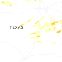
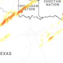
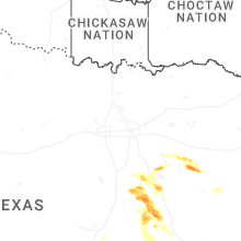
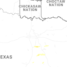


Connect with Interactive Hail Maps