

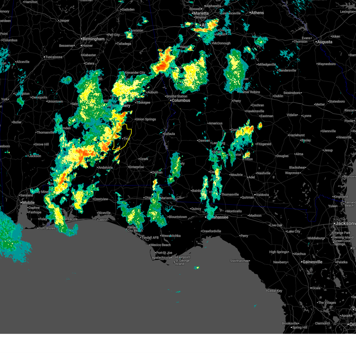
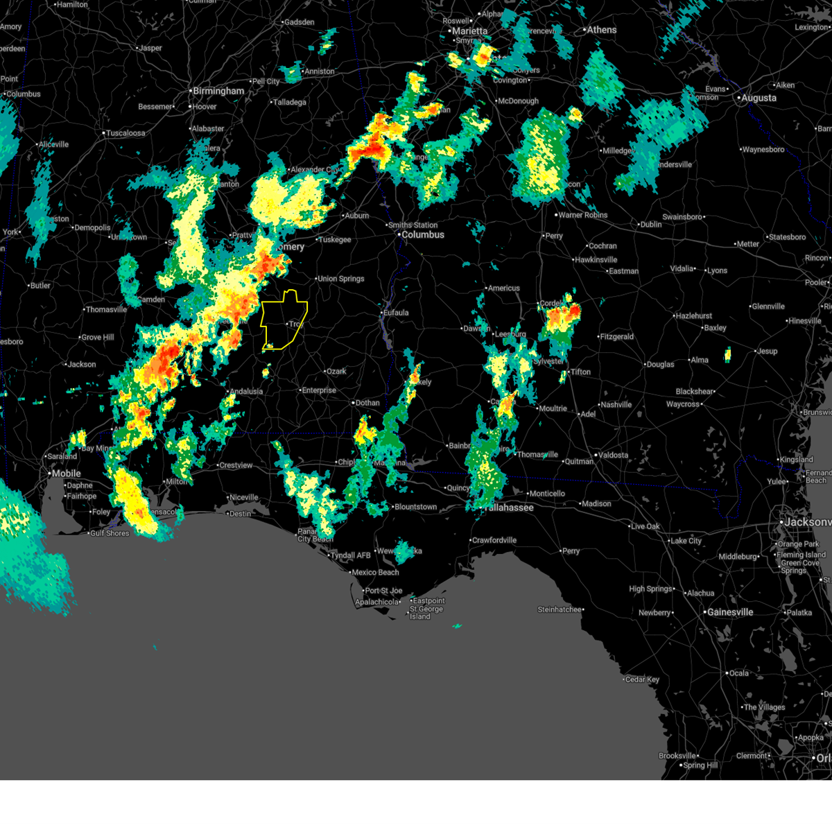
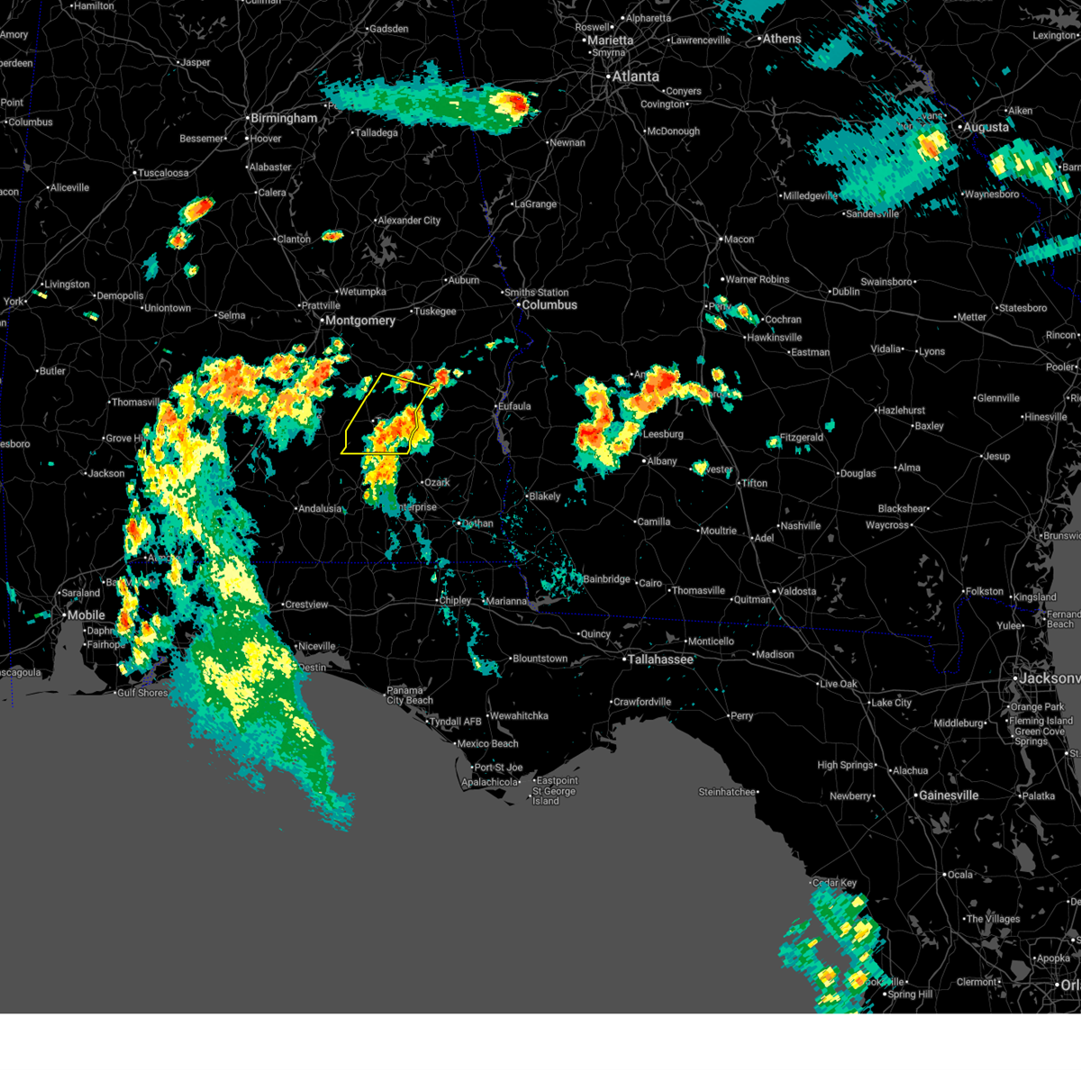
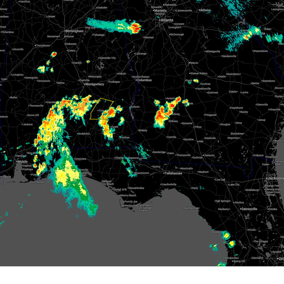
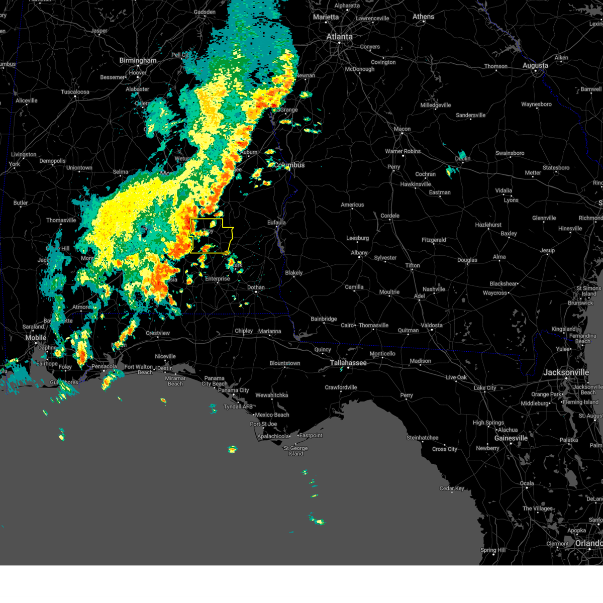
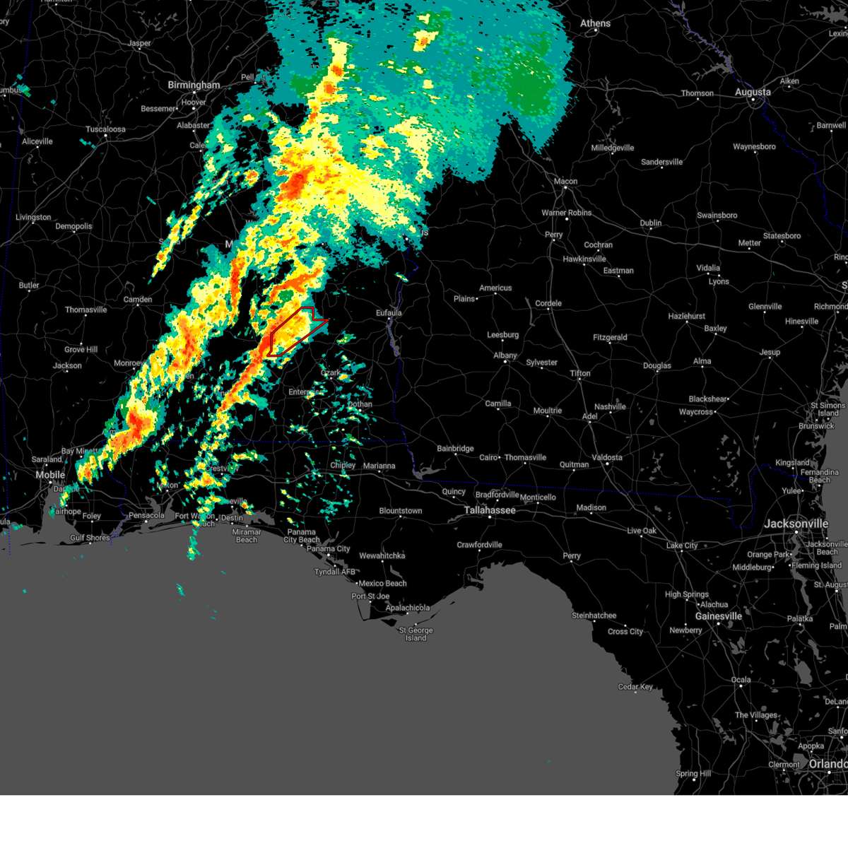
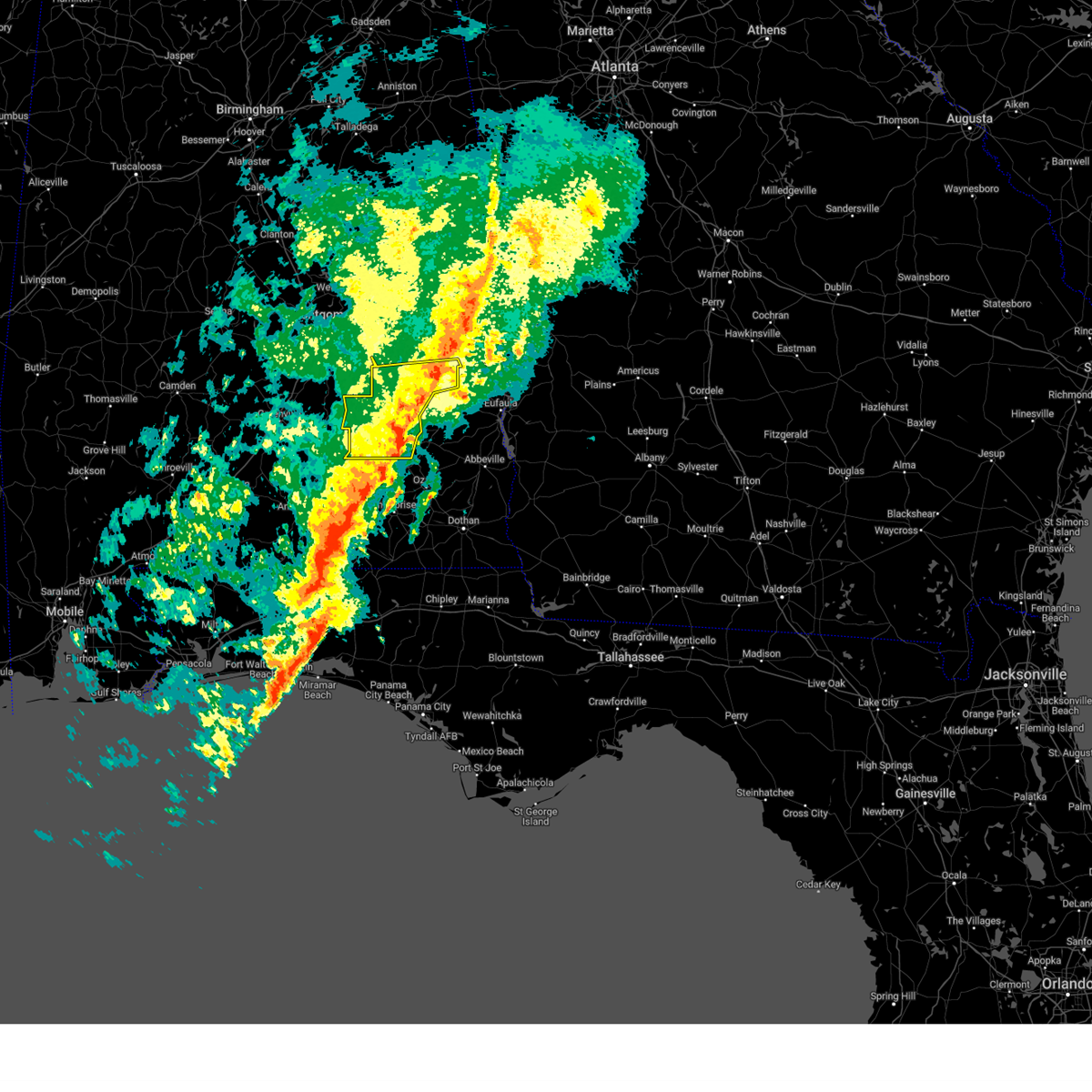
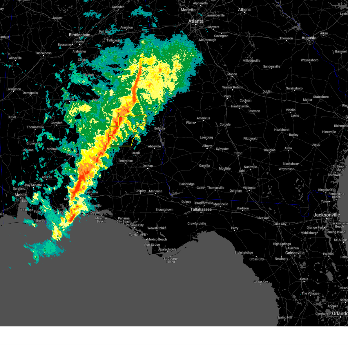
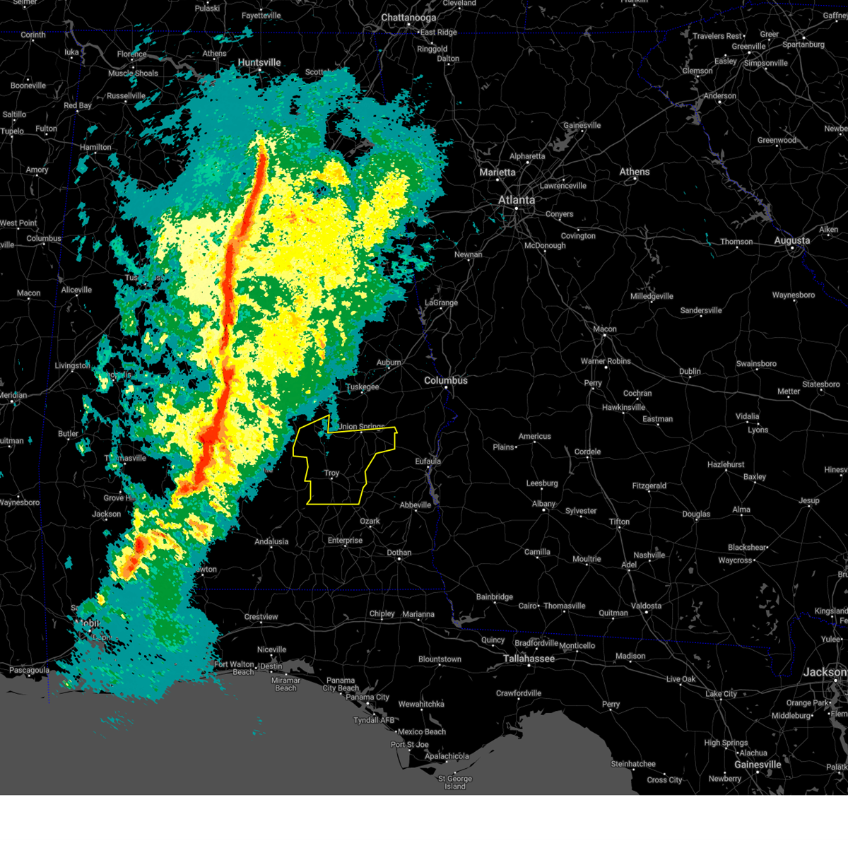
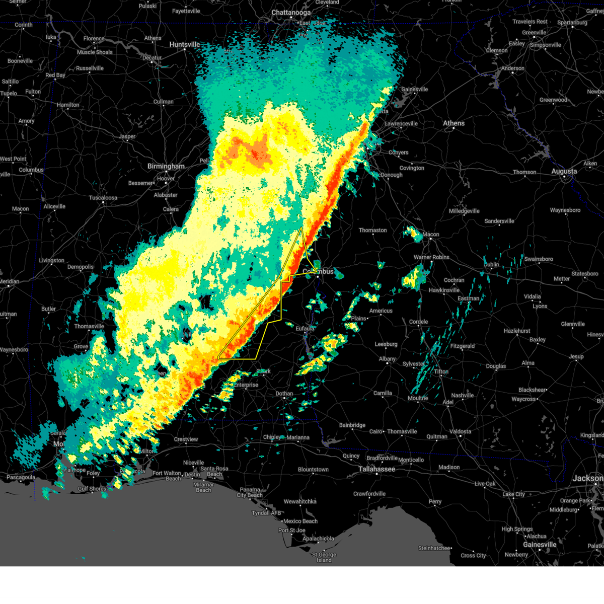
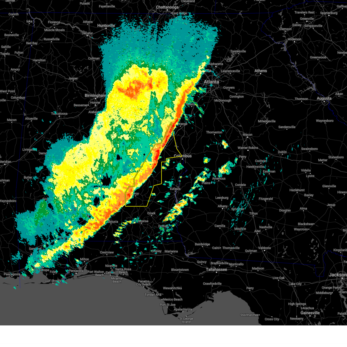
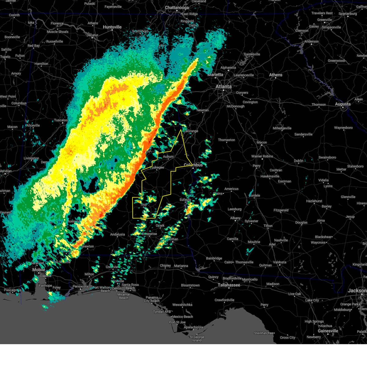
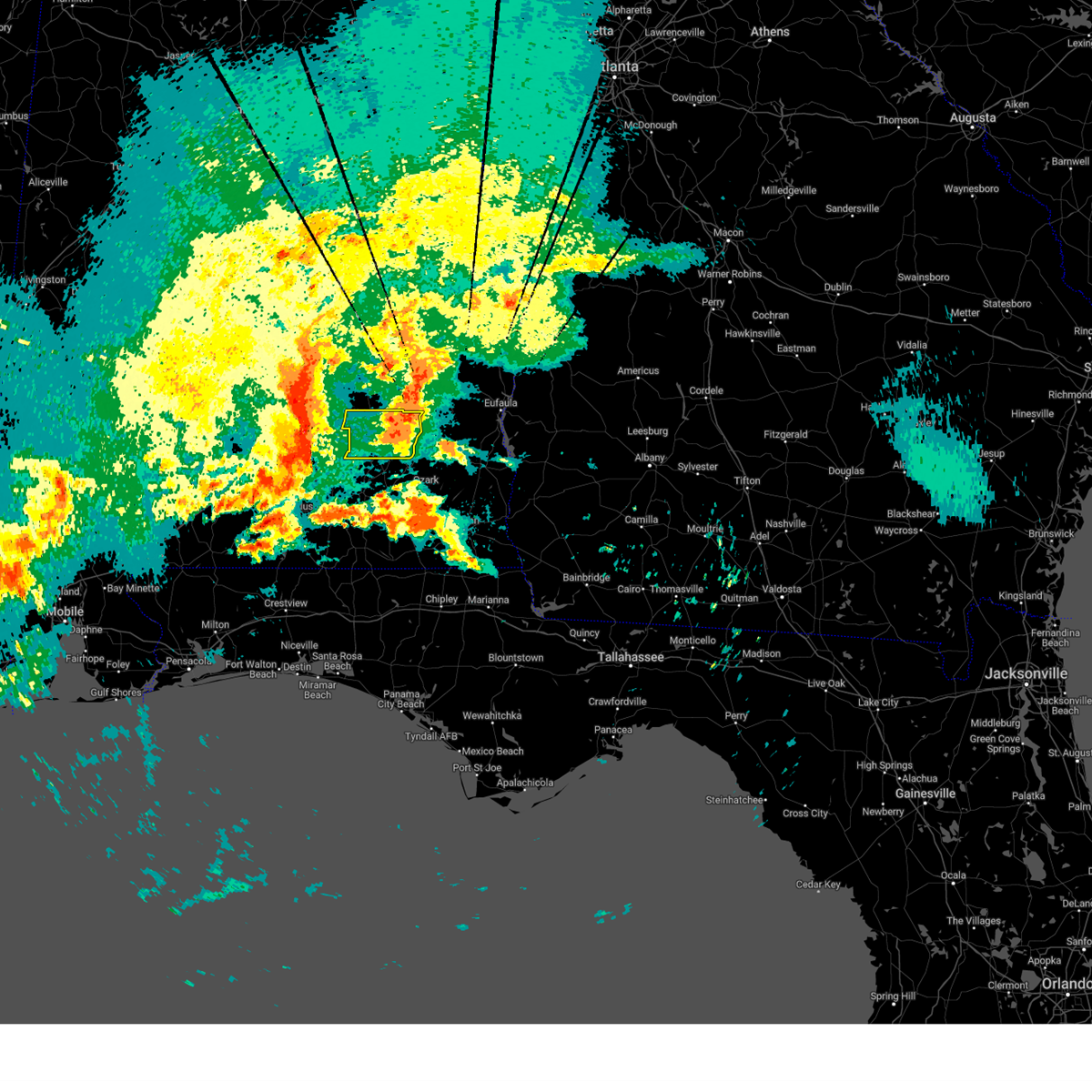
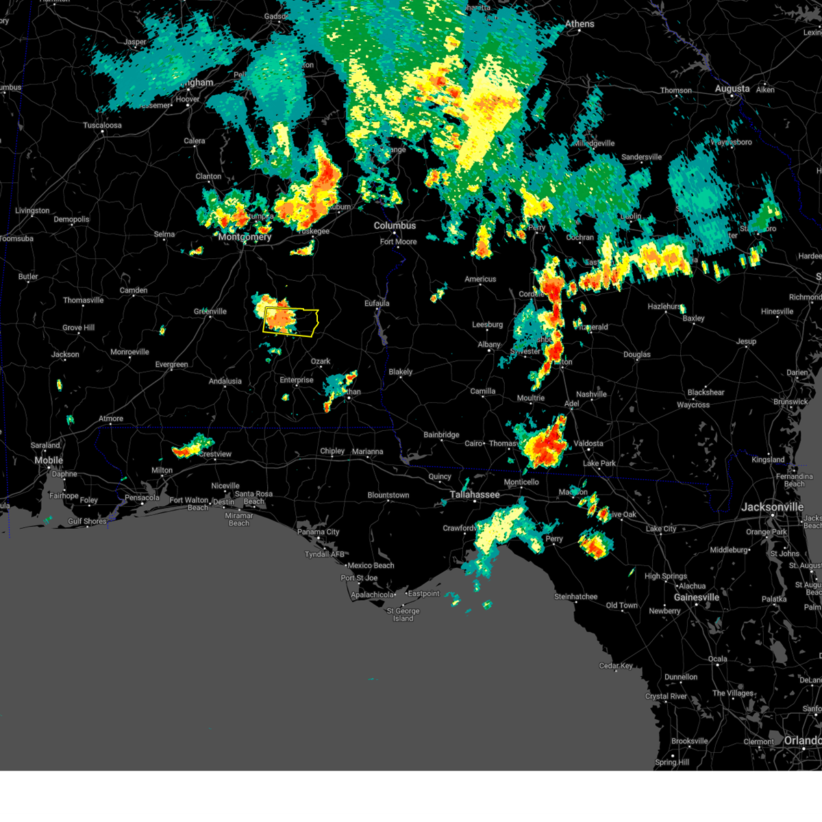
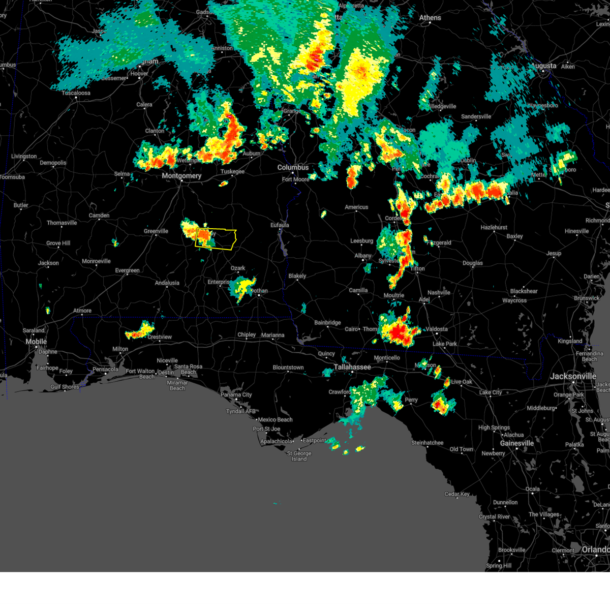
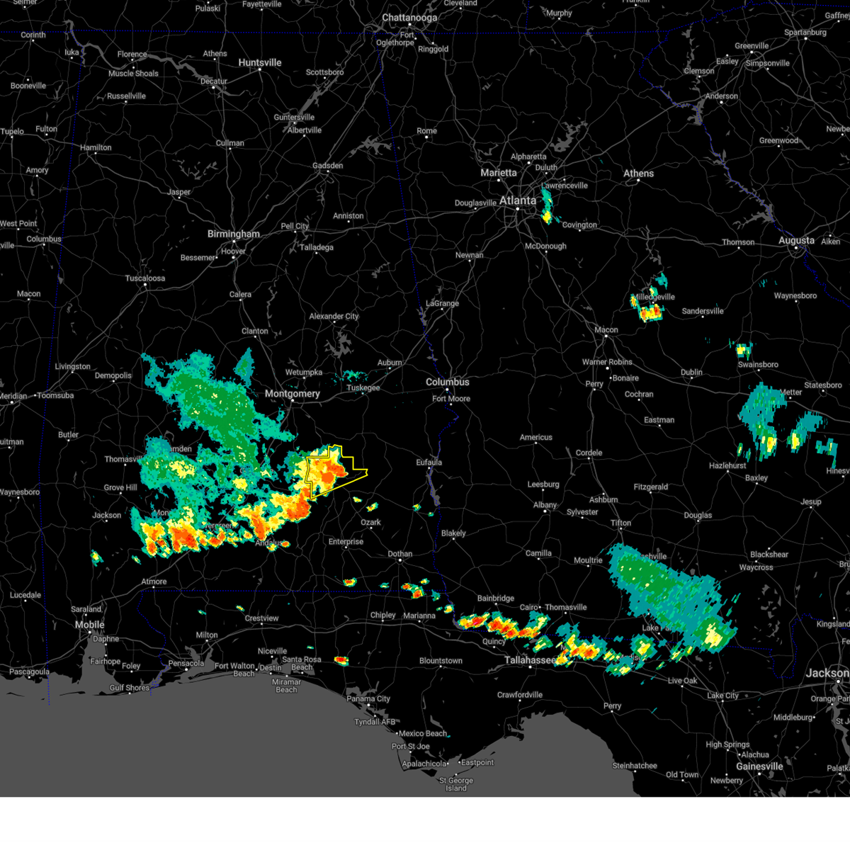
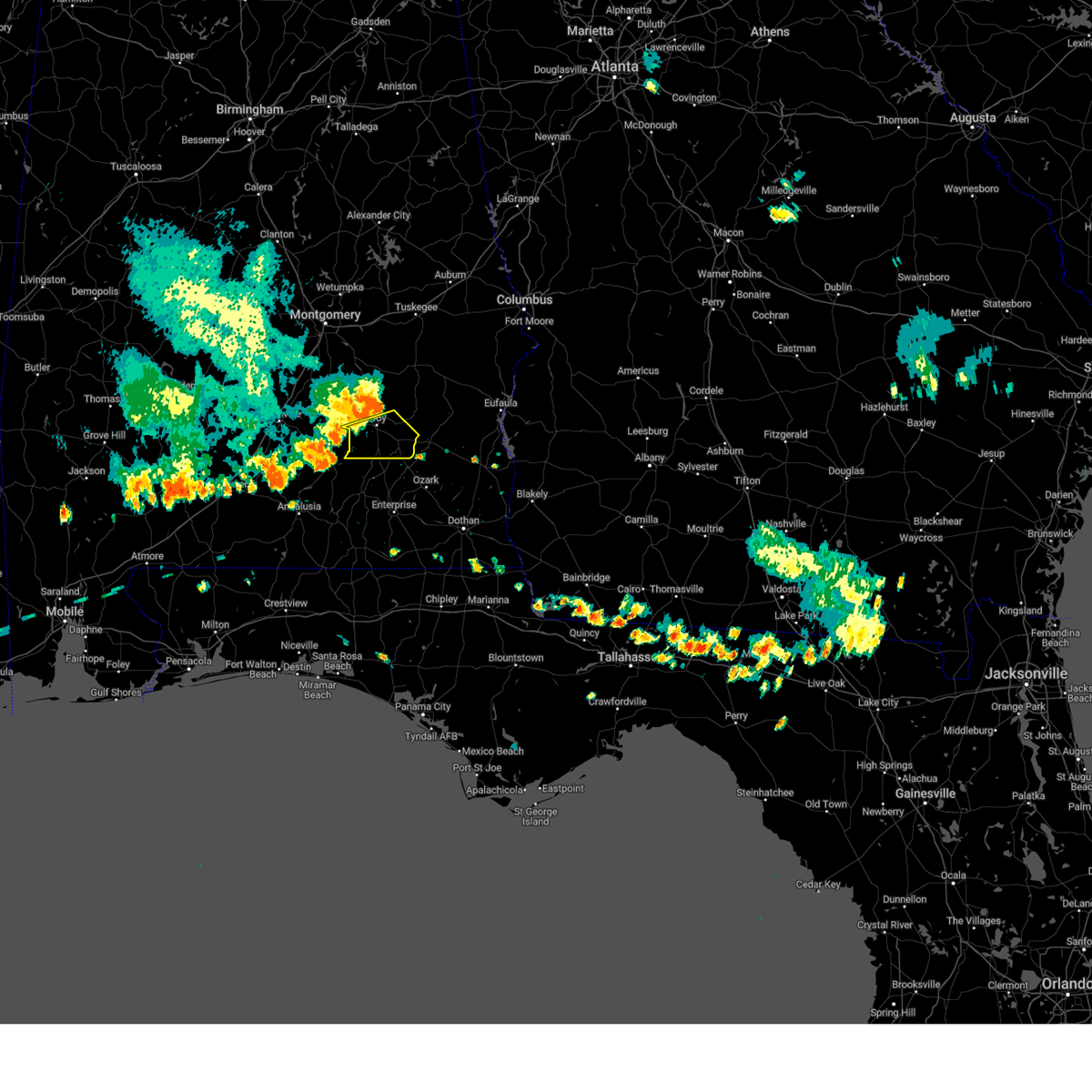
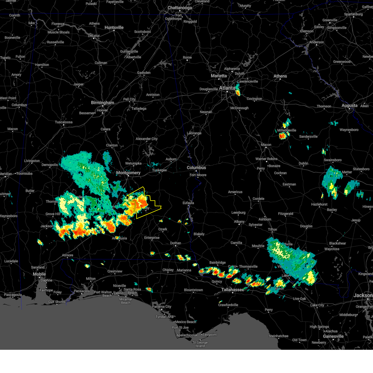
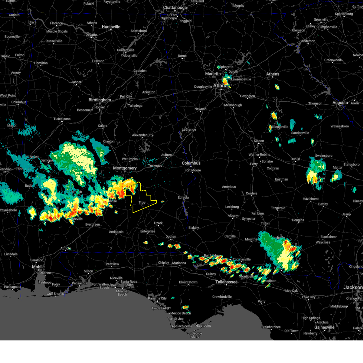
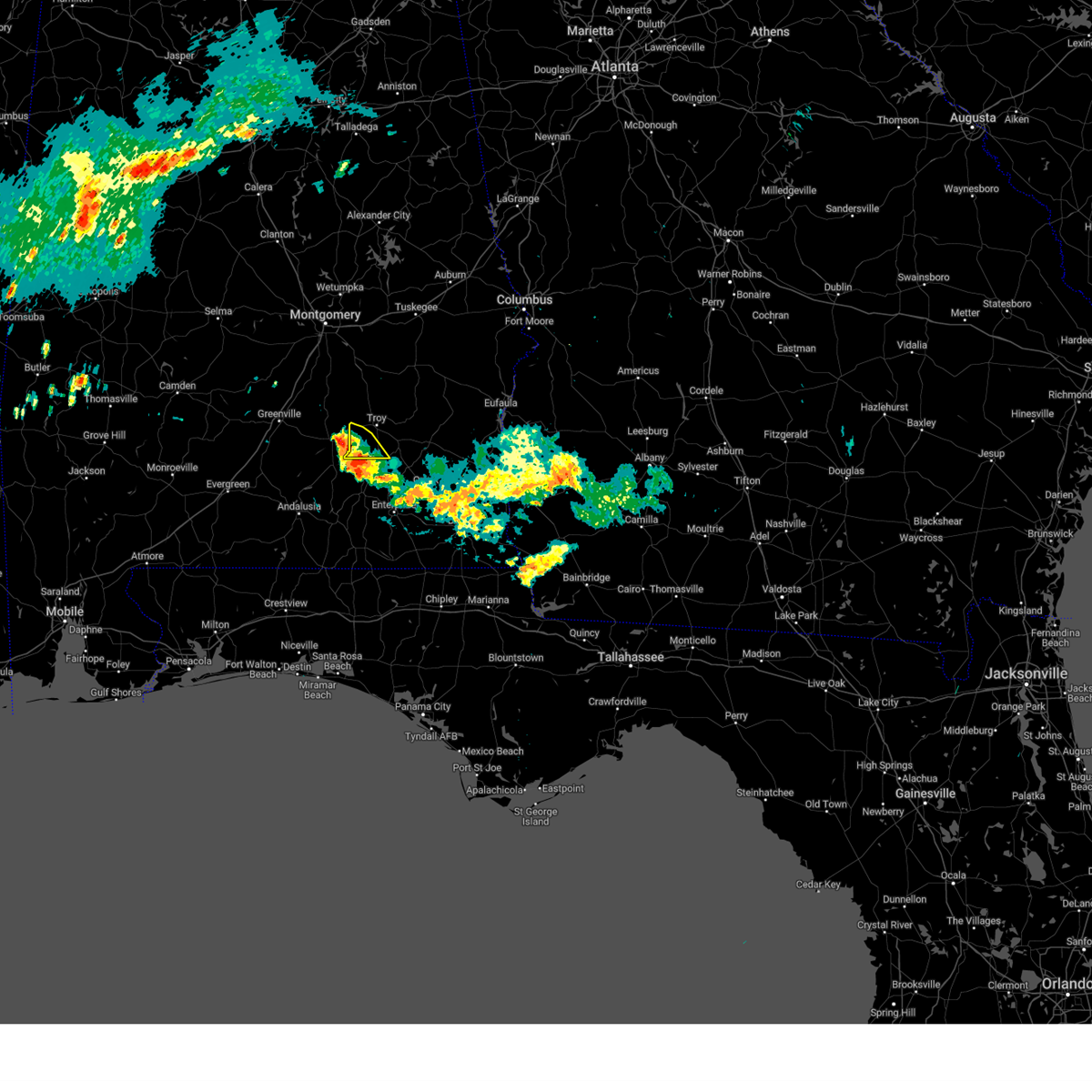
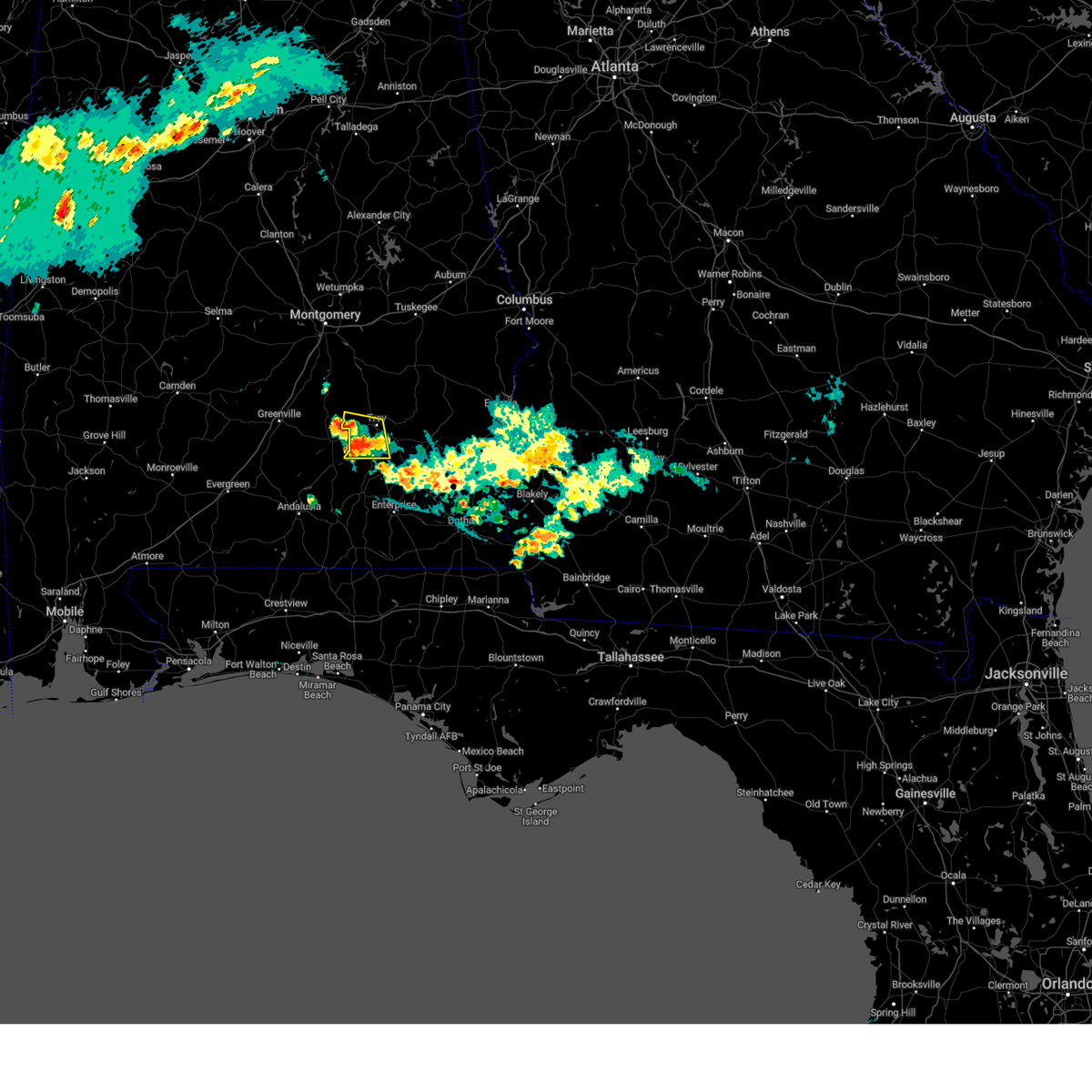
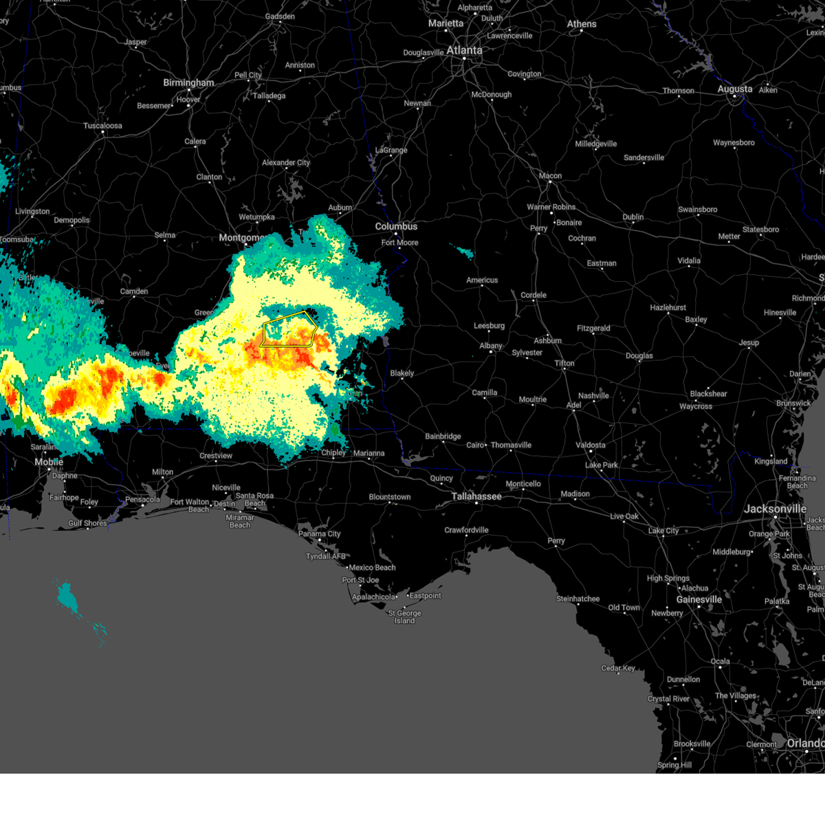
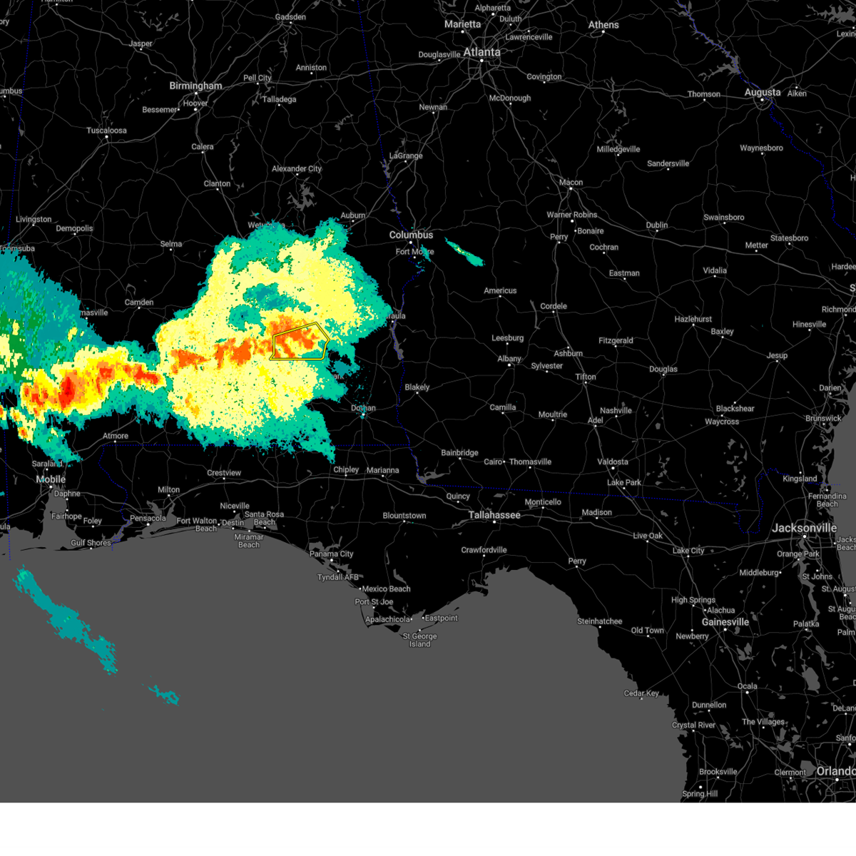
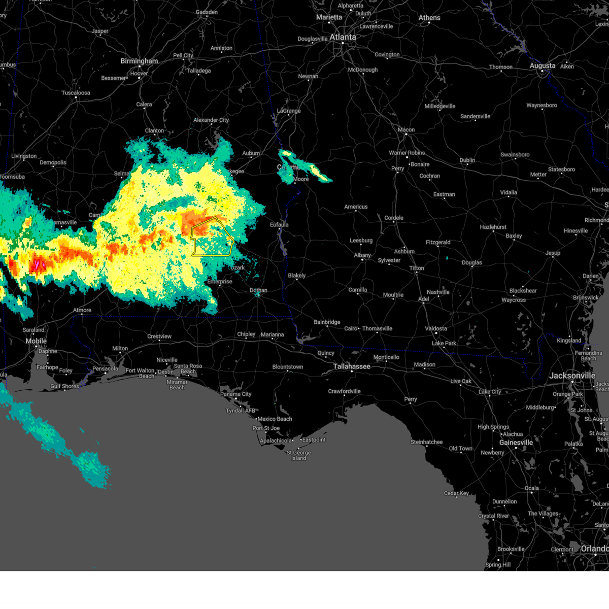
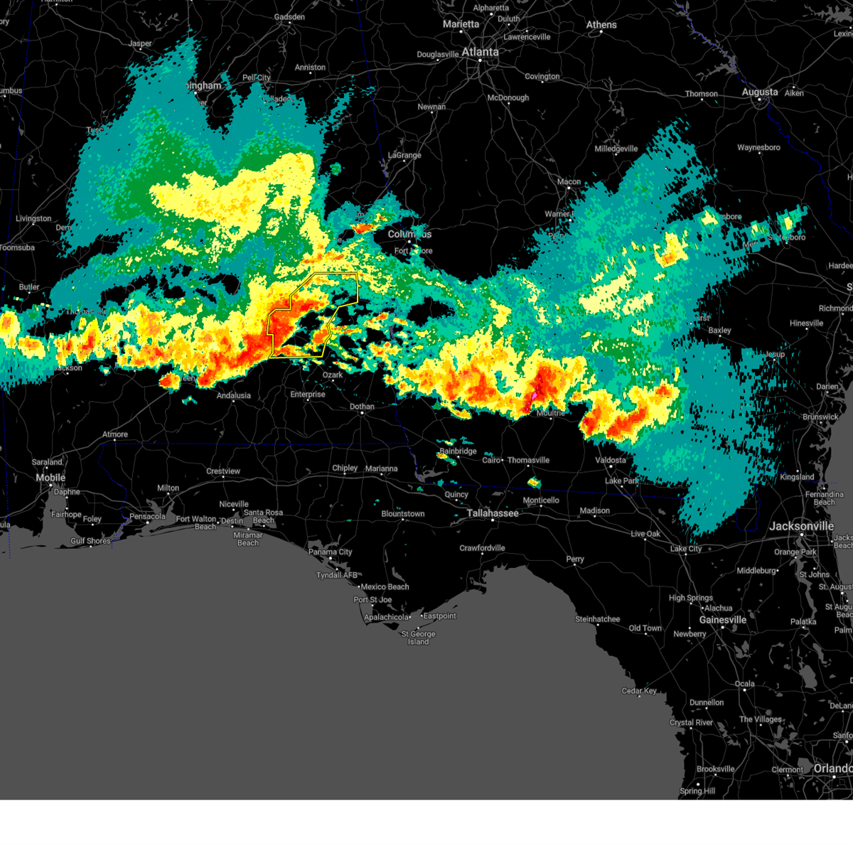
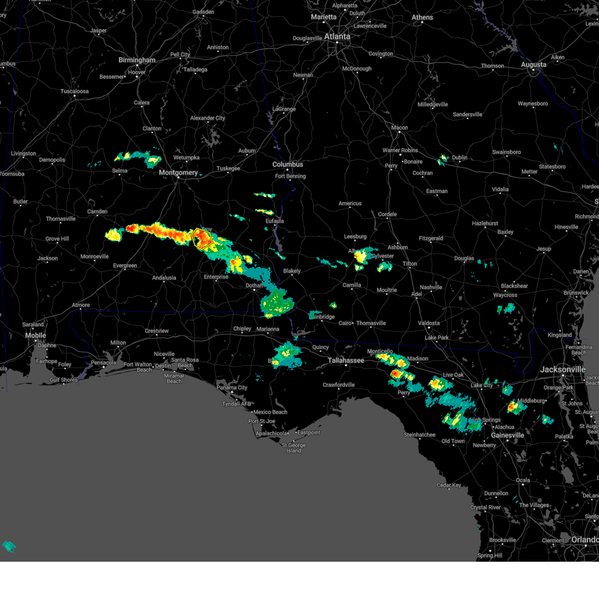
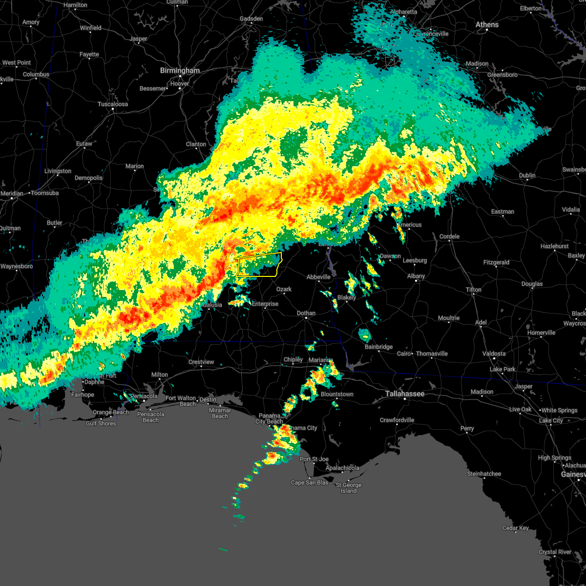
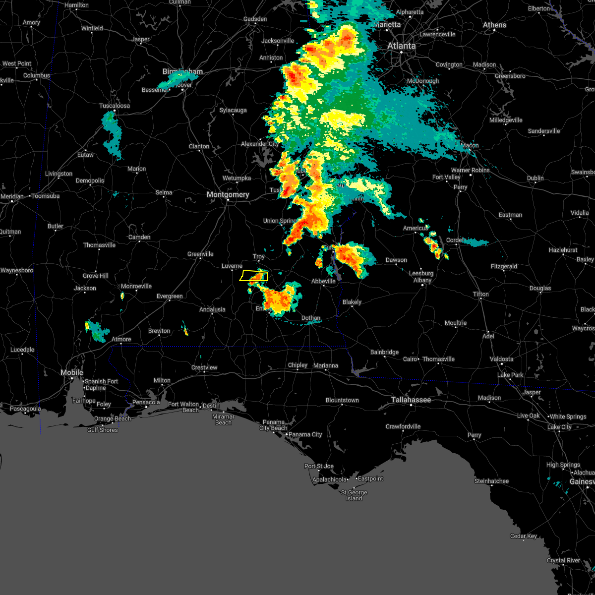
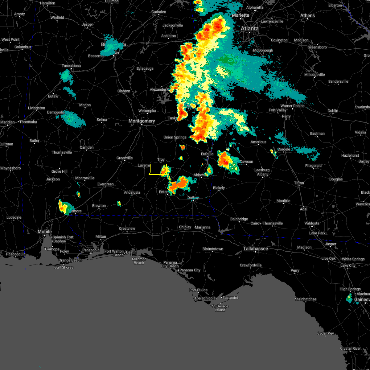
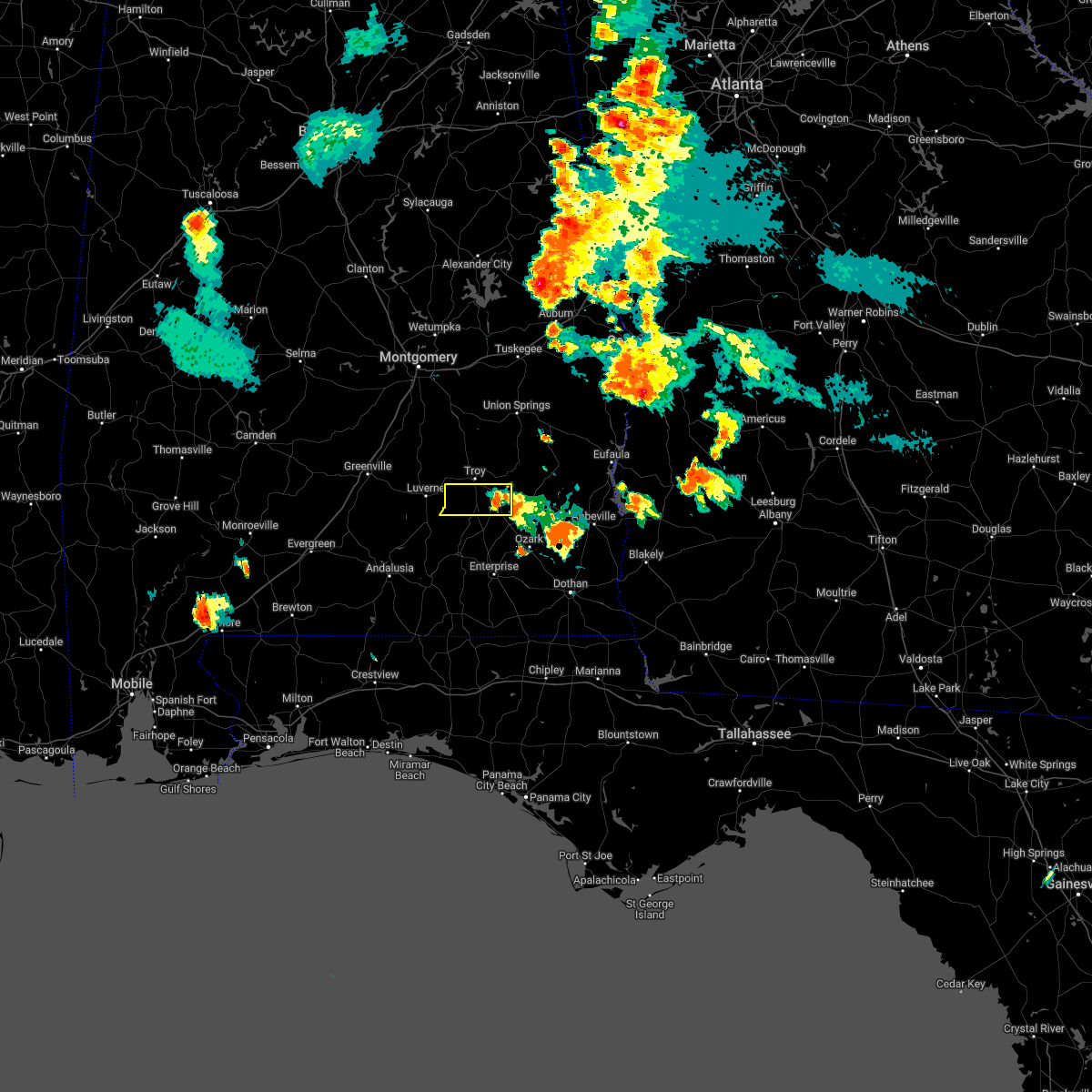
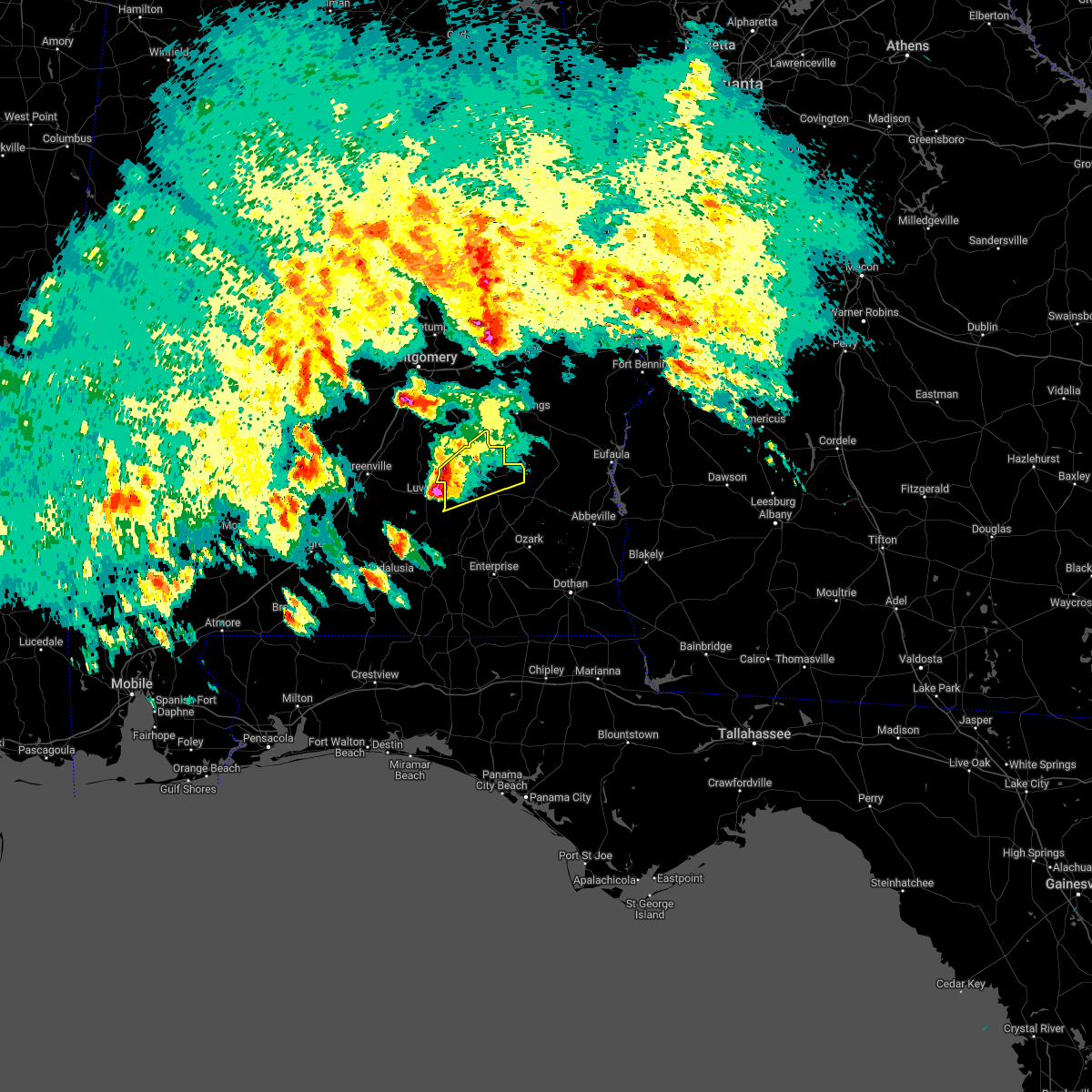
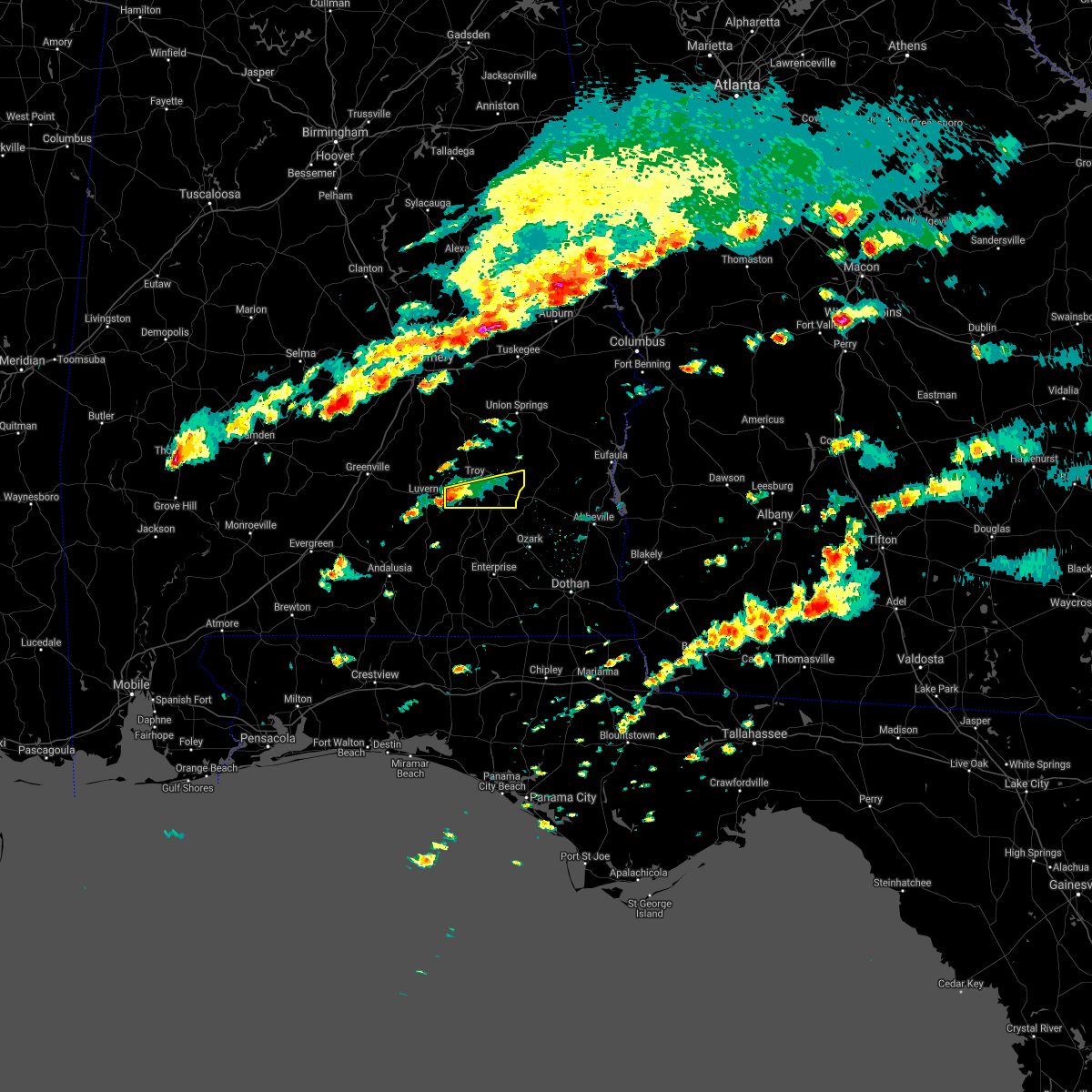
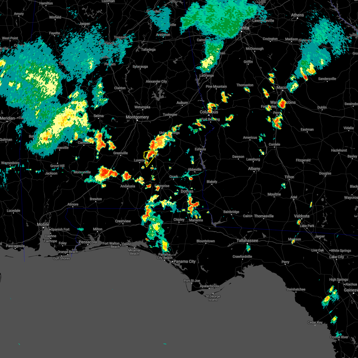
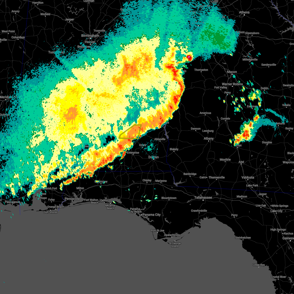
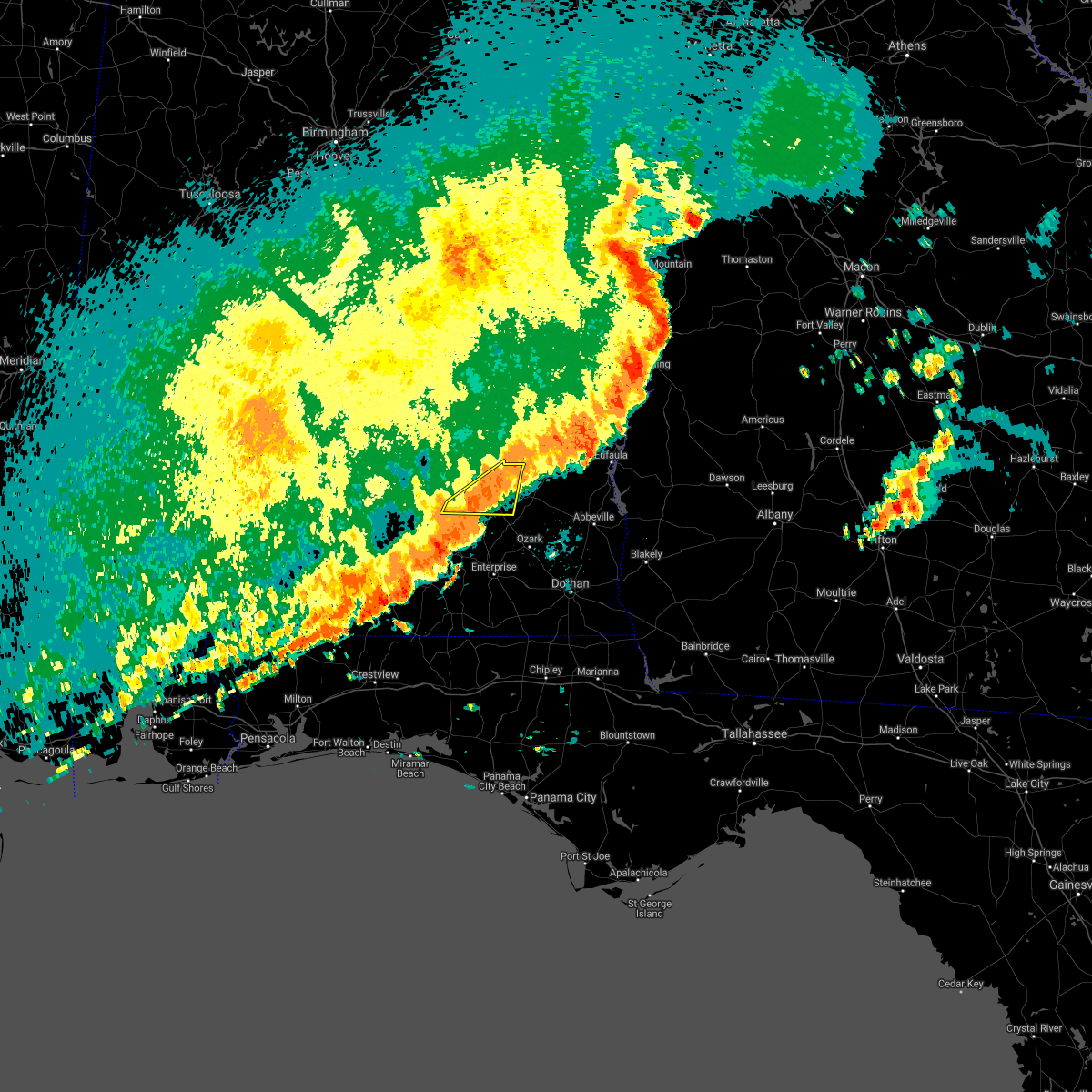
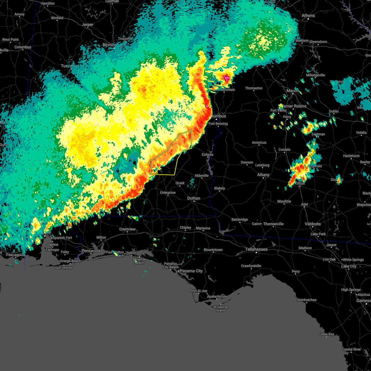
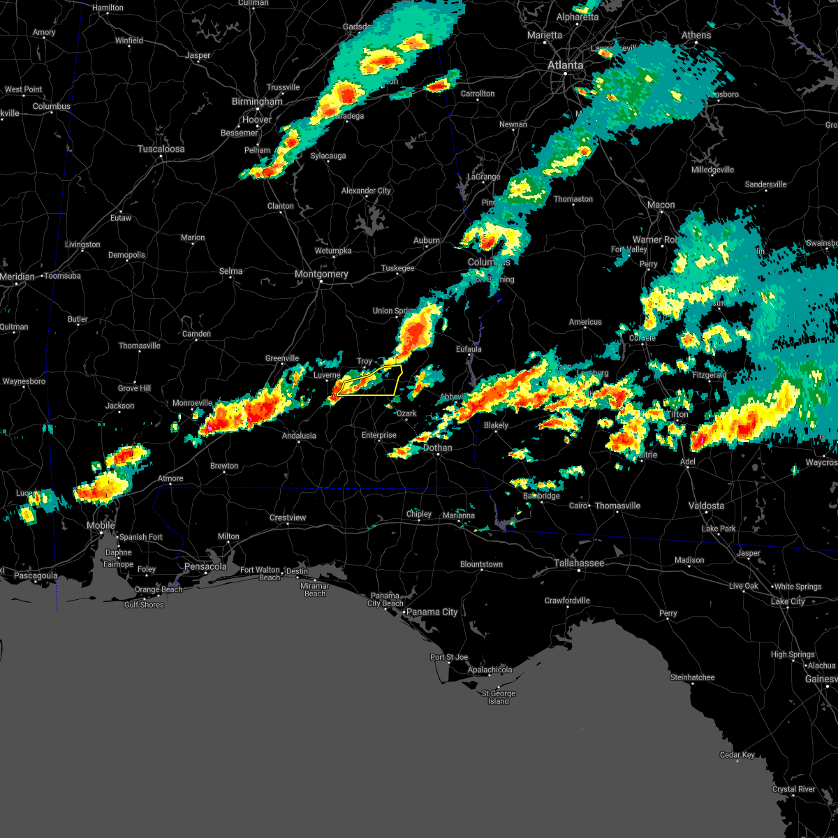
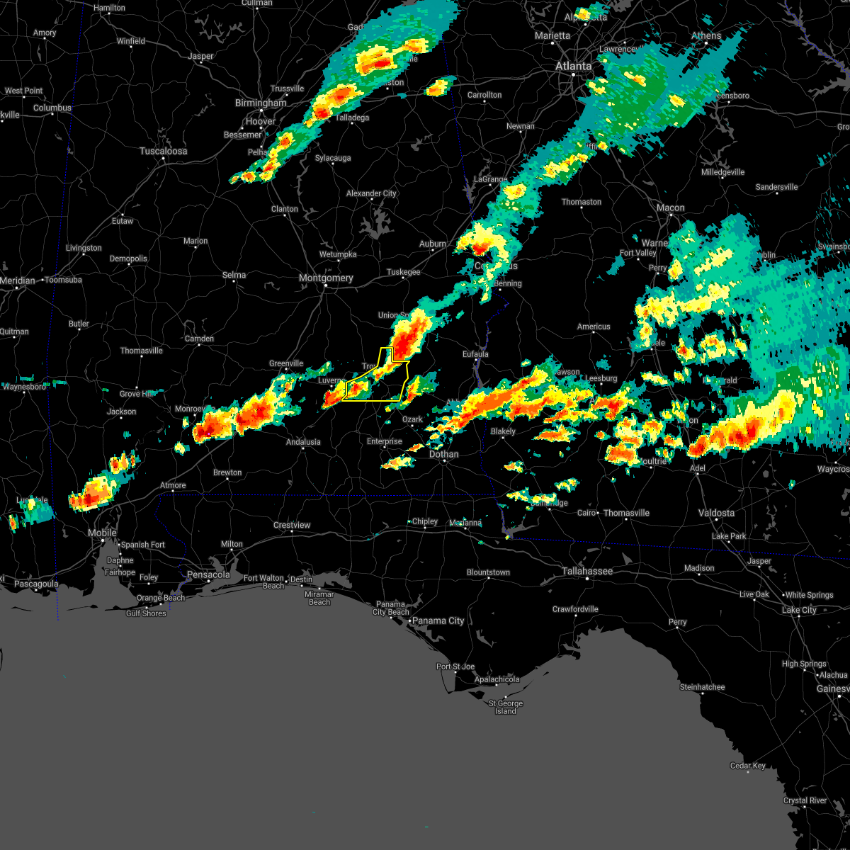
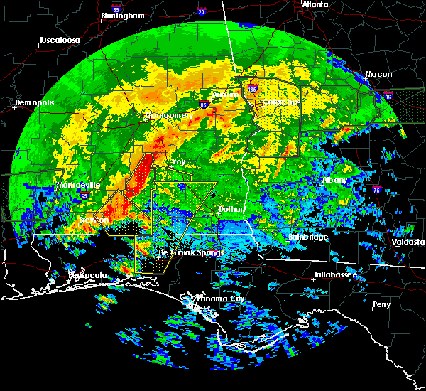
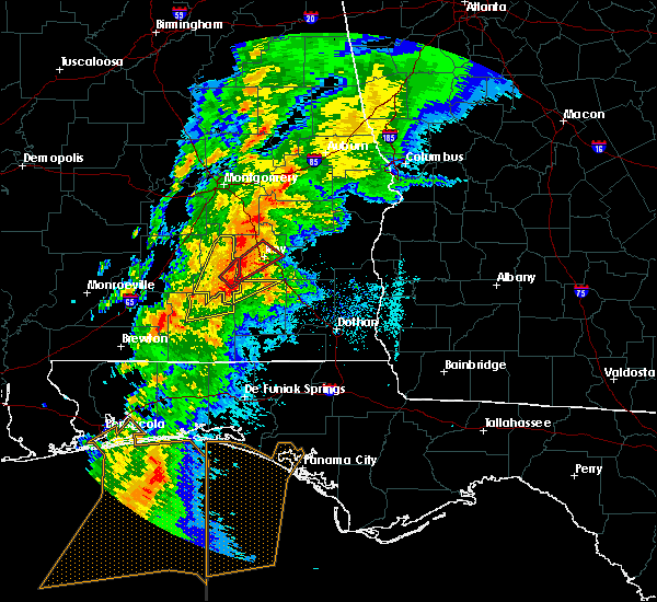
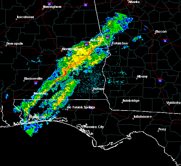
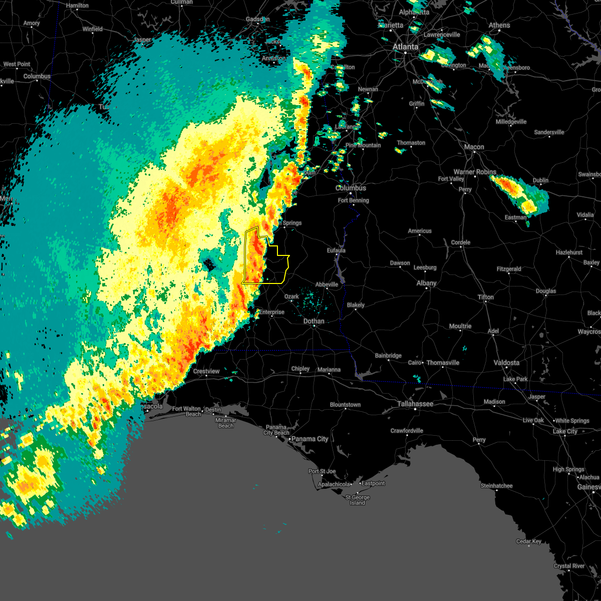
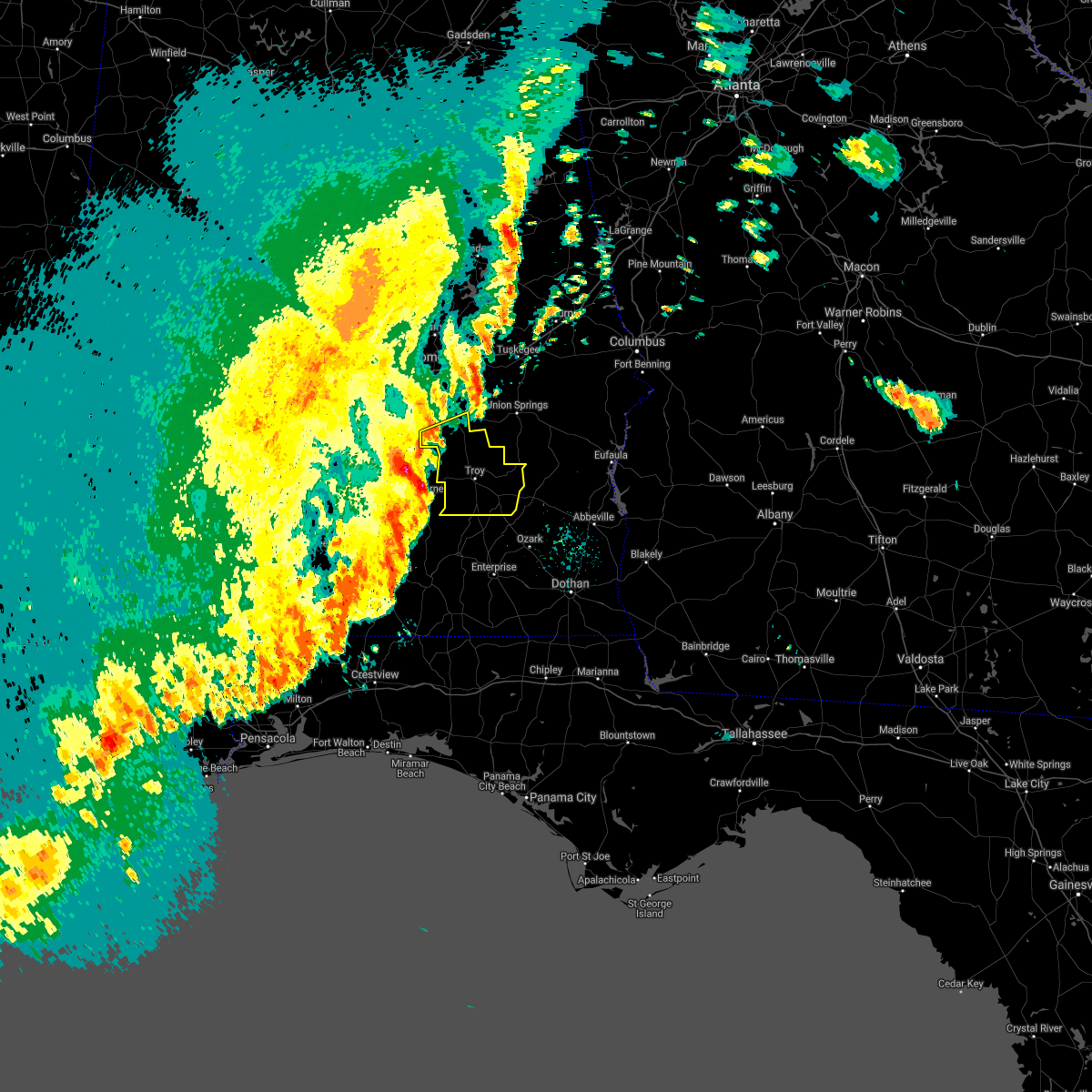
Hail Map for Goshen, AL
The Goshen, AL area has had 3 reports of on-the-ground hail by trained spotters, and has been under severe weather warnings 13 times during the past 12 months. Doppler radar has detected hail at or near Goshen, AL on 44 occasions.
| Name: | Goshen, AL |
| Where Located: | 71.2 miles ESE of Camden, AL |
| Map: | Google Map for Goshen, AL |
| Population: | 266 |
| Housing Units: | 141 |
| More Info: | Search Google for Goshen, AL |
0
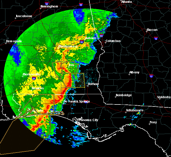
The Top Recent Hail Date for Goshen, AL is Friday, March 15, 2024 (44th out of 44)

Hail and Wind Damage Spotted near Goshen, AL
| Date / Time | Report Details |
|---|---|
| 7/1/2025 7:12 PM CDT |
 At 712 pm cdt, severe thunderstorms were located along a line extending from near beans crossroads to near troy municipal airport to near glenwood, moving east at 30 mph (radar indicated). Hazards include 60 mph wind gusts. Expect damage to roofs, siding, and trees. Locations impacted include, troy, goshen, banks, antioch, linwood, ansley, troy municipal airport, troy university, orion, springhill, china grove, sandfield, mossy grove, and henderson. At 712 pm cdt, severe thunderstorms were located along a line extending from near beans crossroads to near troy municipal airport to near glenwood, moving east at 30 mph (radar indicated). Hazards include 60 mph wind gusts. Expect damage to roofs, siding, and trees. Locations impacted include, troy, goshen, banks, antioch, linwood, ansley, troy municipal airport, troy university, orion, springhill, china grove, sandfield, mossy grove, and henderson.
|
| 7/1/2025 6:44 PM CDT |
 Svrbmx the national weather service in birmingham has issued a * severe thunderstorm warning for, pike county in southeastern alabama, * until 745 pm cdt. * at 643 pm cdt, severe thunderstorms were located along a line extending from near ramer to near lapine to 9 miles east of greenville, moving southeast at 25 mph (radar indicated). Hazards include 60 mph wind gusts. expect damage to roofs, siding, and trees Svrbmx the national weather service in birmingham has issued a * severe thunderstorm warning for, pike county in southeastern alabama, * until 745 pm cdt. * at 643 pm cdt, severe thunderstorms were located along a line extending from near ramer to near lapine to 9 miles east of greenville, moving southeast at 25 mph (radar indicated). Hazards include 60 mph wind gusts. expect damage to roofs, siding, and trees
|
| 6/25/2025 9:22 PM CDT |
 At 922 pm cdt, severe thunderstorms were located along a line extending from near aberfoil to near goshen, moving northwest at 25 mph (radar indicated). Hazards include 60 mph wind gusts. Expect damage to roofs, siding, and trees. Locations impacted include, troy, brundidge, goshen, banks, pickett, antioch, beans crossroads, linwood, troy municipal airport, troy university, tennille, tanyard, high ridge, hamilton crossroads, monticello, springhill, perote, josie, china grove, and sandfield. At 922 pm cdt, severe thunderstorms were located along a line extending from near aberfoil to near goshen, moving northwest at 25 mph (radar indicated). Hazards include 60 mph wind gusts. Expect damage to roofs, siding, and trees. Locations impacted include, troy, brundidge, goshen, banks, pickett, antioch, beans crossroads, linwood, troy municipal airport, troy university, tennille, tanyard, high ridge, hamilton crossroads, monticello, springhill, perote, josie, china grove, and sandfield.
|
| 6/25/2025 9:08 PM CDT |
 Svrbmx the national weather service in birmingham has issued a * severe thunderstorm warning for, pike county in southeastern alabama, southwestern bullock county in southeastern alabama, * until 1000 pm cdt. * at 908 pm cdt, severe thunderstorms were located along a line extending from boot hill to 9 miles southwest of antioch, moving west at 25 mph (radar indicated). Hazards include 60 mph wind gusts. expect damage to roofs, siding, and trees Svrbmx the national weather service in birmingham has issued a * severe thunderstorm warning for, pike county in southeastern alabama, southwestern bullock county in southeastern alabama, * until 1000 pm cdt. * at 908 pm cdt, severe thunderstorms were located along a line extending from boot hill to 9 miles southwest of antioch, moving west at 25 mph (radar indicated). Hazards include 60 mph wind gusts. expect damage to roofs, siding, and trees
|
| 5/27/2025 1:52 PM CDT |
 Svrbmx the national weather service in birmingham has issued a * severe thunderstorm warning for, pike county in southeastern alabama, * until 300 pm cdt. * at 152 pm cdt, severe thunderstorms were located along a line extending from 6 miles north of troy municipal airport to near brantley, moving east at 40 mph (radar indicated). Hazards include 60 mph wind gusts and penny size hail. expect damage to roofs, siding, and trees Svrbmx the national weather service in birmingham has issued a * severe thunderstorm warning for, pike county in southeastern alabama, * until 300 pm cdt. * at 152 pm cdt, severe thunderstorms were located along a line extending from 6 miles north of troy municipal airport to near brantley, moving east at 40 mph (radar indicated). Hazards include 60 mph wind gusts and penny size hail. expect damage to roofs, siding, and trees
|
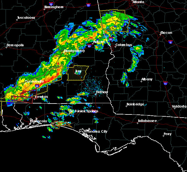
| 3/15/2025 10:47 PM CDT |
 Torbmx the national weather service in birmingham has issued a * tornado warning for, central pike county in southeastern alabama, * until 1145 pm cdt. * at 1047 pm cdt, a severe thunderstorm capable of producing a tornado was located over glenwood, or near goshen, moving northeast at 55 mph (radar indicated rotation). Hazards include tornado. Flying debris will be dangerous to those caught without shelter. mobile homes will be damaged or destroyed. damage to roofs, windows, and vehicles will occur. Tree damage is likely. Torbmx the national weather service in birmingham has issued a * tornado warning for, central pike county in southeastern alabama, * until 1145 pm cdt. * at 1047 pm cdt, a severe thunderstorm capable of producing a tornado was located over glenwood, or near goshen, moving northeast at 55 mph (radar indicated rotation). Hazards include tornado. Flying debris will be dangerous to those caught without shelter. mobile homes will be damaged or destroyed. damage to roofs, windows, and vehicles will occur. Tree damage is likely.
|
| 3/4/2025 11:51 PM CST |
 The storms which prompted the warning have weakened below severe limits, and no longer pose an immediate threat to life or property. therefore, the warning will be allowed to expire. however, gusty winds are still possible with these thunderstorms. a severe thunderstorm watch remains in effect until 300 am cst for southeastern alabama. The storms which prompted the warning have weakened below severe limits, and no longer pose an immediate threat to life or property. therefore, the warning will be allowed to expire. however, gusty winds are still possible with these thunderstorms. a severe thunderstorm watch remains in effect until 300 am cst for southeastern alabama.
|
| 3/4/2025 11:12 PM CST |
 the severe thunderstorm warning has been cancelled and is no longer in effect the severe thunderstorm warning has been cancelled and is no longer in effect
|
| 3/4/2025 11:12 PM CST |
 At 1112 pm cst, severe thunderstorms were located along a line extending from franklin field to near glenwood, moving east at 40 mph (radar indicated). Hazards include 60 mph wind gusts. Expect damage to roofs, siding, and trees. Locations impacted include, pickett, tennille, aberfoil, high ridge, perote, josie, beans crossroads, linwood, shopton, three notch, banks, midway, kent, tanyard, hamilton crossroads, monticello, orion, springhill, antioch, and troy. At 1112 pm cst, severe thunderstorms were located along a line extending from franklin field to near glenwood, moving east at 40 mph (radar indicated). Hazards include 60 mph wind gusts. Expect damage to roofs, siding, and trees. Locations impacted include, pickett, tennille, aberfoil, high ridge, perote, josie, beans crossroads, linwood, shopton, three notch, banks, midway, kent, tanyard, hamilton crossroads, monticello, orion, springhill, antioch, and troy.
|
| 3/4/2025 10:43 PM CST |
 Svrbmx the national weather service in birmingham has issued a * severe thunderstorm warning for, pike county in southeastern alabama, bullock county in southeastern alabama, southeastern montgomery county in south central alabama, * until midnight cst. * at 1043 pm cst, severe thunderstorms were located along a line extending from near meadville to 8 miles north of dozier, moving east at 40 mph (radar indicated). Hazards include 60 mph wind gusts. expect damage to roofs, siding, and trees Svrbmx the national weather service in birmingham has issued a * severe thunderstorm warning for, pike county in southeastern alabama, bullock county in southeastern alabama, southeastern montgomery county in south central alabama, * until midnight cst. * at 1043 pm cst, severe thunderstorms were located along a line extending from near meadville to 8 miles north of dozier, moving east at 40 mph (radar indicated). Hazards include 60 mph wind gusts. expect damage to roofs, siding, and trees
|
| 2/16/2025 3:26 AM CST |
 At 326 am cst, severe thunderstorms were located along a line extending from near west point to near uchee to 8 miles southeast of goshen, moving east at 60 mph (radar indicated). Hazards include 70 mph wind gusts. Expect considerable tree damage. damage is likely to mobile homes, roofs, and outbuildings. Locations impacted include, opelika, troy, valley, lanett, union springs, brundidge, midway, goshen, smiths, smiths station, west point, banks, lakeview, pickett, beulah, aberfoil, beans mill, beans crossroads, guerryton, and linwood. At 326 am cst, severe thunderstorms were located along a line extending from near west point to near uchee to 8 miles southeast of goshen, moving east at 60 mph (radar indicated). Hazards include 70 mph wind gusts. Expect considerable tree damage. damage is likely to mobile homes, roofs, and outbuildings. Locations impacted include, opelika, troy, valley, lanett, union springs, brundidge, midway, goshen, smiths, smiths station, west point, banks, lakeview, pickett, beulah, aberfoil, beans mill, beans crossroads, guerryton, and linwood.
|
| 2/16/2025 3:10 AM CST |
 At 309 am cst, severe thunderstorms were located along a line extending from fredonia to 6 miles north of troy municipal airport, moving east at 65 mph (radar indicated). Hazards include 70 mph wind gusts. Expect considerable tree damage. damage is likely to mobile homes, roofs, and outbuildings. Locations impacted include, auburn, opelika, troy, tuskegee, valley, lanett, union springs, brundidge, notasulga, midway, goshen, smiths, smiths station, west point, glenwood, banks, lakeview, cusseta, pickett, and beulah. At 309 am cst, severe thunderstorms were located along a line extending from fredonia to 6 miles north of troy municipal airport, moving east at 65 mph (radar indicated). Hazards include 70 mph wind gusts. Expect considerable tree damage. damage is likely to mobile homes, roofs, and outbuildings. Locations impacted include, auburn, opelika, troy, tuskegee, valley, lanett, union springs, brundidge, notasulga, midway, goshen, smiths, smiths station, west point, glenwood, banks, lakeview, cusseta, pickett, and beulah.
|
| 2/16/2025 2:35 AM CST |
 Svrbmx the national weather service in birmingham has issued a * severe thunderstorm warning for, pike county in southeastern alabama, lee county in east central alabama, bullock county in southeastern alabama, macon county in southeastern alabama, eastern chambers county in east central alabama, * until 400 am cst. * at 234 am cst, severe thunderstorms were located along a line extending from near new site to near logan, moving east at 65 mph (radar indicated). Hazards include 70 mph wind gusts. Expect considerable tree damage. Damage is likely to mobile homes, roofs, and outbuildings. Svrbmx the national weather service in birmingham has issued a * severe thunderstorm warning for, pike county in southeastern alabama, lee county in east central alabama, bullock county in southeastern alabama, macon county in southeastern alabama, eastern chambers county in east central alabama, * until 400 am cst. * at 234 am cst, severe thunderstorms were located along a line extending from near new site to near logan, moving east at 65 mph (radar indicated). Hazards include 70 mph wind gusts. Expect considerable tree damage. Damage is likely to mobile homes, roofs, and outbuildings.
|
| 5/10/2024 2:46 AM CDT |
 Svrbmx the national weather service in birmingham has issued a * severe thunderstorm warning for, pike county in southeastern alabama, * until 330 am cdt. * at 246 am cdt, severe thunderstorms were located along a line extending from near rutledge to near brantley to near dozier, moving east at 65 mph (radar indicated). Hazards include 60 mph wind gusts and penny size hail. expect damage to roofs, siding, and trees Svrbmx the national weather service in birmingham has issued a * severe thunderstorm warning for, pike county in southeastern alabama, * until 330 am cdt. * at 246 am cdt, severe thunderstorms were located along a line extending from near rutledge to near brantley to near dozier, moving east at 65 mph (radar indicated). Hazards include 60 mph wind gusts and penny size hail. expect damage to roofs, siding, and trees
|
| 8/8/2023 2:59 PM CDT |
 At 258 pm cdt, severe thunderstorms were located along a line extending from near spring hill to near brundidge, moving east at 40 mph (radar indicated). Hazards include 60 mph wind gusts. Expect damage to roofs, siding, and trees. locations impacted include, troy, eufaula, brundidge, clio, goshen, clayton, louisville, banks, blue springs, tyler crossroads, pickett, hawkinsville, spring hill, linwood, osco, richards crossroads, white oak, boot hill, gaino and comer. hail threat, radar indicated max hail size, <. 75 in wind threat, radar indicated max wind gust, 60 mph. At 258 pm cdt, severe thunderstorms were located along a line extending from near spring hill to near brundidge, moving east at 40 mph (radar indicated). Hazards include 60 mph wind gusts. Expect damage to roofs, siding, and trees. locations impacted include, troy, eufaula, brundidge, clio, goshen, clayton, louisville, banks, blue springs, tyler crossroads, pickett, hawkinsville, spring hill, linwood, osco, richards crossroads, white oak, boot hill, gaino and comer. hail threat, radar indicated max hail size, <. 75 in wind threat, radar indicated max wind gust, 60 mph.
|
| 8/8/2023 2:37 PM CDT |
 At 237 pm cdt, severe thunderstorms were located along a line extending from near aberfoil to 8 miles southeast of goshen, moving east at 40 mph (radar indicated). Hazards include 60 mph wind gusts. expect damage to roofs, siding, and trees At 237 pm cdt, severe thunderstorms were located along a line extending from near aberfoil to 8 miles southeast of goshen, moving east at 40 mph (radar indicated). Hazards include 60 mph wind gusts. expect damage to roofs, siding, and trees
|
| 8/6/2023 5:55 PM CDT |
 At 554 pm cdt, a severe thunderstorm was located over troy university, or over troy, moving east at 25 mph (radar indicated). Hazards include 60 mph wind gusts. Expect damage to roofs, siding, and trees. locations impacted include, troy, brundidge, goshen, banks, ansley, troy municipal airport, antioch, troy university, brundidge municipal airport, monticello, mossy grove and josie. hail threat, radar indicated max hail size, <. 75 in wind threat, radar indicated max wind gust, 60 mph. At 554 pm cdt, a severe thunderstorm was located over troy university, or over troy, moving east at 25 mph (radar indicated). Hazards include 60 mph wind gusts. Expect damage to roofs, siding, and trees. locations impacted include, troy, brundidge, goshen, banks, ansley, troy municipal airport, antioch, troy university, brundidge municipal airport, monticello, mossy grove and josie. hail threat, radar indicated max hail size, <. 75 in wind threat, radar indicated max wind gust, 60 mph.
|
| 8/6/2023 5:43 PM CDT |
 At 543 pm cdt, a severe thunderstorm was located over troy municipal airport, or near troy, moving east at 25 mph (radar indicated). Hazards include 60 mph wind gusts. expect damage to roofs, siding, and trees At 543 pm cdt, a severe thunderstorm was located over troy municipal airport, or near troy, moving east at 25 mph (radar indicated). Hazards include 60 mph wind gusts. expect damage to roofs, siding, and trees
|
| 8/4/2023 5:08 PM CDT |
 At 507 pm cdt, a severe thunderstorm was located over banks, or near troy, moving southeast at 30 mph (radar indicated). Hazards include 60 mph wind gusts and nickel size hail. Expect damage to roofs, siding, and trees. locations impacted include, troy, goshen, banks, kent, linwood, ansley, troy municipal airport, troy university, monticello, orion, josie, china grove, sandfield and mossy grove. hail threat, radar indicated max hail size, 0. 88 in wind threat, radar indicated max wind gust, 60 mph. At 507 pm cdt, a severe thunderstorm was located over banks, or near troy, moving southeast at 30 mph (radar indicated). Hazards include 60 mph wind gusts and nickel size hail. Expect damage to roofs, siding, and trees. locations impacted include, troy, goshen, banks, kent, linwood, ansley, troy municipal airport, troy university, monticello, orion, josie, china grove, sandfield and mossy grove. hail threat, radar indicated max hail size, 0. 88 in wind threat, radar indicated max wind gust, 60 mph.
|
| 8/4/2023 5:07 PM CDT |
 At 506 pm cdt, a severe thunderstorm was located near troy municipal airport, or 8 miles north of troy, moving southeast at 35 mph (radar indicated). Hazards include 60 mph wind gusts. expect damage to roofs, siding, and trees At 506 pm cdt, a severe thunderstorm was located near troy municipal airport, or 8 miles north of troy, moving southeast at 35 mph (radar indicated). Hazards include 60 mph wind gusts. expect damage to roofs, siding, and trees
|
| 8/4/2023 4:54 PM CDT |
 At 454 pm cdt, a severe thunderstorm was located near troy municipal airport, or 7 miles north of troy, moving southeast at 30 mph (radar indicated). Hazards include 60 mph wind gusts and nickel size hail. Expect damage to roofs, siding, and trees. locations impacted include, troy, goshen, meadville, banks, pine level, kent, strata, dublin, naftel, linwood, ansley, grady, sellers, troy municipal airport, ramer, troy university, lapine, monticello, orion and josie. hail threat, radar indicated max hail size, 0. 88 in wind threat, radar indicated max wind gust, 60 mph. At 454 pm cdt, a severe thunderstorm was located near troy municipal airport, or 7 miles north of troy, moving southeast at 30 mph (radar indicated). Hazards include 60 mph wind gusts and nickel size hail. Expect damage to roofs, siding, and trees. locations impacted include, troy, goshen, meadville, banks, pine level, kent, strata, dublin, naftel, linwood, ansley, grady, sellers, troy municipal airport, ramer, troy university, lapine, monticello, orion and josie. hail threat, radar indicated max hail size, 0. 88 in wind threat, radar indicated max wind gust, 60 mph.
|
| 8/4/2023 4:27 PM CDT |
 At 427 pm cdt, a severe thunderstorm was located over dublin, or over meadville, moving southeast at 30 mph (radar indicated). Hazards include 60 mph wind gusts and nickel size hail. expect damage to roofs, siding, and trees At 427 pm cdt, a severe thunderstorm was located over dublin, or over meadville, moving southeast at 30 mph (radar indicated). Hazards include 60 mph wind gusts and nickel size hail. expect damage to roofs, siding, and trees
|
| 6/25/2023 11:36 PM CDT |
 At 1135 pm cdt, a severe thunderstorm was located near glenwood, or 9 miles south of goshen, moving south at 15 mph (radar indicated). Hazards include 60 mph wind gusts and quarter size hail. Hail damage to vehicles is expected. expect wind damage to roofs, siding, and trees. locations impacted include, troy, goshen, springhill and henderson. hail threat, radar indicated max hail size, 1. 00 in wind threat, radar indicated max wind gust, 60 mph. At 1135 pm cdt, a severe thunderstorm was located near glenwood, or 9 miles south of goshen, moving south at 15 mph (radar indicated). Hazards include 60 mph wind gusts and quarter size hail. Hail damage to vehicles is expected. expect wind damage to roofs, siding, and trees. locations impacted include, troy, goshen, springhill and henderson. hail threat, radar indicated max hail size, 1. 00 in wind threat, radar indicated max wind gust, 60 mph.
|
| 6/25/2023 11:14 PM CDT |
 At 1114 pm cdt, a severe thunderstorm was located near glenwood, or near goshen, moving south at 15 mph (radar indicated). Hazards include 60 mph wind gusts and quarter size hail. Hail damage to vehicles is expected. Expect wind damage to roofs, siding, and trees. At 1114 pm cdt, a severe thunderstorm was located near glenwood, or near goshen, moving south at 15 mph (radar indicated). Hazards include 60 mph wind gusts and quarter size hail. Hail damage to vehicles is expected. Expect wind damage to roofs, siding, and trees.
|
| 6/19/2023 5:26 AM CDT |
 At 526 am cdt, severe thunderstorms were located along a line extending from near linwood to near brundidge to 11 miles south of antioch, moving east at 65 mph (radar indicated). Hazards include 70 mph wind gusts and penny size hail. Expect considerable tree damage. damage is likely to mobile homes, roofs, and outbuildings. locations impacted include, troy, brundidge, goshen, banks, kent, antioch, linwood, ansley, troy municipal airport, troy university, hamilton crossroads, monticello, orion, springhill, josie, sandfield, tarentum, brundidge municipal airport, mossy grove and henderson. thunderstorm damage threat, considerable hail threat, radar indicated max hail size, 0. 75 in wind threat, radar indicated max wind gust, 70 mph. At 526 am cdt, severe thunderstorms were located along a line extending from near linwood to near brundidge to 11 miles south of antioch, moving east at 65 mph (radar indicated). Hazards include 70 mph wind gusts and penny size hail. Expect considerable tree damage. damage is likely to mobile homes, roofs, and outbuildings. locations impacted include, troy, brundidge, goshen, banks, kent, antioch, linwood, ansley, troy municipal airport, troy university, hamilton crossroads, monticello, orion, springhill, josie, sandfield, tarentum, brundidge municipal airport, mossy grove and henderson. thunderstorm damage threat, considerable hail threat, radar indicated max hail size, 0. 75 in wind threat, radar indicated max wind gust, 70 mph.
|
| 6/19/2023 5:11 AM CDT | Several trees down in goshe in pike county AL, 0.9 miles WSW of Goshen, AL |
| 6/19/2023 5:11 AM CDT |
 At 511 am cdt, severe thunderstorms were located along a line extending from ramer to near ansley to near glenwood, moving east at 65 mph (radar indicated). Hazards include 70 mph wind gusts and penny size hail. Expect considerable tree damage. damage is likely to mobile homes, roofs, and outbuildings. locations impacted include, troy, brundidge, goshen, meadville, banks, pine level, dublin, linwood, grady, sellers, davenport, ramer, kent, strata, naftel, antioch, ansley, troy municipal airport, troy university and josie. thunderstorm damage threat, considerable hail threat, radar indicated max hail size, 0. 75 in wind threat, radar indicated max wind gust, 70 mph. At 511 am cdt, severe thunderstorms were located along a line extending from ramer to near ansley to near glenwood, moving east at 65 mph (radar indicated). Hazards include 70 mph wind gusts and penny size hail. Expect considerable tree damage. damage is likely to mobile homes, roofs, and outbuildings. locations impacted include, troy, brundidge, goshen, meadville, banks, pine level, dublin, linwood, grady, sellers, davenport, ramer, kent, strata, naftel, antioch, ansley, troy municipal airport, troy university and josie. thunderstorm damage threat, considerable hail threat, radar indicated max hail size, 0. 75 in wind threat, radar indicated max wind gust, 70 mph.
|
| 6/19/2023 4:58 AM CDT |
 At 458 am cdt, severe thunderstorms were located along a line extending from near davenport to near highland home to 7 miles west of rutledge, moving east at 60 mph (radar indicated). Hazards include 60 mph wind gusts and penny size hail. expect damage to roofs, siding, and trees At 458 am cdt, severe thunderstorms were located along a line extending from near davenport to near highland home to 7 miles west of rutledge, moving east at 60 mph (radar indicated). Hazards include 60 mph wind gusts and penny size hail. expect damage to roofs, siding, and trees
|
| 6/16/2023 10:42 PM CDT |
 The severe thunderstorm warning for southern pike county will expire at 1045 pm cdt, the storm which prompted the warning has moved out of the area. therefore, the warning will be allowed to expire. to report severe weather, contact your nearest law enforcement agency. they will relay your report to the national weather service birmingham. The severe thunderstorm warning for southern pike county will expire at 1045 pm cdt, the storm which prompted the warning has moved out of the area. therefore, the warning will be allowed to expire. to report severe weather, contact your nearest law enforcement agency. they will relay your report to the national weather service birmingham.
|
| 6/16/2023 10:20 PM CDT |
 At 1020 pm cdt, a severe thunderstorm was located near brundidge, moving southeast at 50 mph (radar indicated). Hazards include 60 mph wind gusts and penny size hail. Expect damage to roofs, siding, and trees. locations impacted include, troy, brundidge, goshen, banks, antioch, troy university, tennille, hamilton crossroads, monticello, springhill, tarentum, brundidge municipal airport, mossy grove and henderson. hail threat, radar indicated max hail size, 0. 75 in wind threat, radar indicated max wind gust, 60 mph. At 1020 pm cdt, a severe thunderstorm was located near brundidge, moving southeast at 50 mph (radar indicated). Hazards include 60 mph wind gusts and penny size hail. Expect damage to roofs, siding, and trees. locations impacted include, troy, brundidge, goshen, banks, antioch, troy university, tennille, hamilton crossroads, monticello, springhill, tarentum, brundidge municipal airport, mossy grove and henderson. hail threat, radar indicated max hail size, 0. 75 in wind threat, radar indicated max wind gust, 60 mph.
|
| 6/16/2023 10:01 PM CDT |
 At 1000 pm cdt, a severe thunderstorm was located over troy municipal airport, or near troy, moving southeast at 40 mph (radar indicated). Hazards include 60 mph wind gusts and penny size hail. expect damage to roofs, siding, and trees At 1000 pm cdt, a severe thunderstorm was located over troy municipal airport, or near troy, moving southeast at 40 mph (radar indicated). Hazards include 60 mph wind gusts and penny size hail. expect damage to roofs, siding, and trees
|
| 6/14/2023 5:58 PM CDT |
 At 557 pm cdt, severe thunderstorms were located along a line extending from 6 miles north of union springs to linwood to near goshen, moving east at 60 mph. these are destructive storms for bullock county and pike county (radar indicated). Hazards include 80 mph wind gusts. Flying debris will be dangerous to those caught without shelter. mobile homes will be heavily damaged. expect considerable damage to roofs, windows, and vehicles. extensive tree damage and power outages are likely. locations impacted include, troy, union springs, brundidge, midway, goshen, banks, pickett, aberfoil, franklin field, beans crossroads, guerryton, linwood, antioch, ansley, troy municipal airport, troy university, high ridge, perote, josie and three notch. thunderstorm damage threat, destructive hail threat, radar indicated max hail size, <. 75 in wind threat, radar indicated max wind gust, 80 mph. At 557 pm cdt, severe thunderstorms were located along a line extending from 6 miles north of union springs to linwood to near goshen, moving east at 60 mph. these are destructive storms for bullock county and pike county (radar indicated). Hazards include 80 mph wind gusts. Flying debris will be dangerous to those caught without shelter. mobile homes will be heavily damaged. expect considerable damage to roofs, windows, and vehicles. extensive tree damage and power outages are likely. locations impacted include, troy, union springs, brundidge, midway, goshen, banks, pickett, aberfoil, franklin field, beans crossroads, guerryton, linwood, antioch, ansley, troy municipal airport, troy university, high ridge, perote, josie and three notch. thunderstorm damage threat, destructive hail threat, radar indicated max hail size, <. 75 in wind threat, radar indicated max wind gust, 80 mph.
|
| 6/14/2023 5:50 PM CDT | Algo reports storm debris on al 10 @ n goshen rd blocking traffic in all direction in crenshaw county AL, 4 miles ESE of Goshen, AL |
| 6/14/2023 5:44 PM CDT |
 At 543 pm cdt, severe thunderstorms were located along a line extending from near shorter to near pine level to near rutledge, moving east at 70 mph. these are destructive storms for bullock countyn and pike county (radar indicated). Hazards include 80 mph wind gusts. Flying debris will be dangerous to those caught without shelter. mobile homes will be heavily damaged. expect considerable damage to roofs, windows, and vehicles. extensive tree damage and power outages are likely. locations impacted include, troy, tuskegee, union springs, brundidge, hurtsboro, midway, goshen, milstead, shorter, banks, franklin, pickett, lake tuskegee, beans crossroads, guerryton, shopton, liverpool, hardaway, ansley and troy municipal airport. thunderstorm damage threat, destructive hail threat, radar indicated max hail size, <. 75 in wind threat, radar indicated max wind gust, 80 mph. At 543 pm cdt, severe thunderstorms were located along a line extending from near shorter to near pine level to near rutledge, moving east at 70 mph. these are destructive storms for bullock countyn and pike county (radar indicated). Hazards include 80 mph wind gusts. Flying debris will be dangerous to those caught without shelter. mobile homes will be heavily damaged. expect considerable damage to roofs, windows, and vehicles. extensive tree damage and power outages are likely. locations impacted include, troy, tuskegee, union springs, brundidge, hurtsboro, midway, goshen, milstead, shorter, banks, franklin, pickett, lake tuskegee, beans crossroads, guerryton, shopton, liverpool, hardaway, ansley and troy municipal airport. thunderstorm damage threat, destructive hail threat, radar indicated max hail size, <. 75 in wind threat, radar indicated max wind gust, 80 mph.
|
| 6/14/2023 5:40 PM CDT |
 At 539 pm cdt, severe thunderstorms were located along a line extending from victoryland to near pine level to 8 miles west of rutledge, moving east at 65 mph (radar indicated). Hazards include 70 mph wind gusts. Expect considerable tree damage. damage is likely to mobile homes, roofs, and outbuildings. locations impacted include, troy, tuskegee, union springs, brundidge, hurtsboro, midway, goshen, milstead, shorter, banks, franklin, pickett, lake tuskegee, beans crossroads, guerryton, shopton, liverpool, hardaway, ansley and troy municipal airport. thunderstorm damage threat, considerable hail threat, radar indicated max hail size, <. 75 in wind threat, radar indicated max wind gust, 70 mph. At 539 pm cdt, severe thunderstorms were located along a line extending from victoryland to near pine level to 8 miles west of rutledge, moving east at 65 mph (radar indicated). Hazards include 70 mph wind gusts. Expect considerable tree damage. damage is likely to mobile homes, roofs, and outbuildings. locations impacted include, troy, tuskegee, union springs, brundidge, hurtsboro, midway, goshen, milstead, shorter, banks, franklin, pickett, lake tuskegee, beans crossroads, guerryton, shopton, liverpool, hardaway, ansley and troy municipal airport. thunderstorm damage threat, considerable hail threat, radar indicated max hail size, <. 75 in wind threat, radar indicated max wind gust, 70 mph.
|
| 6/14/2023 5:33 PM CDT |
 At 533 pm cdt, severe thunderstorms were located along a line extending from near emerald mountain to 9 miles southeast of greenville, moving east at 70 mph (radar indicated). Hazards include 70 mph wind gusts. Expect considerable tree damage. Damage is likely to mobile homes, roofs, and outbuildings. At 533 pm cdt, severe thunderstorms were located along a line extending from near emerald mountain to 9 miles southeast of greenville, moving east at 70 mph (radar indicated). Hazards include 70 mph wind gusts. Expect considerable tree damage. Damage is likely to mobile homes, roofs, and outbuildings.
|
| 4/26/2023 5:38 PM CDT |
 The severe thunderstorm warning for southwestern pike county will expire at 545 pm cdt, the storm which prompted the warning has weakened below severe limits, and no longer poses an immediate threat to life or property. therefore, the warning will be allowed to expire. however gusty winds and heavy rain are still possible with this thunderstorm. The severe thunderstorm warning for southwestern pike county will expire at 545 pm cdt, the storm which prompted the warning has weakened below severe limits, and no longer poses an immediate threat to life or property. therefore, the warning will be allowed to expire. however gusty winds and heavy rain are still possible with this thunderstorm.
|
| 4/26/2023 5:24 PM CDT |
 At 524 pm cdt, a severe thunderstorm was located near troy, moving northeast at 25 mph (radar indicated). Hazards include 60 mph wind gusts and quarter size hail. Hail damage to vehicles is expected. expect wind damage to roofs, siding, and trees. locations impacted include, troy, goshen, troy university, springhill, mossy grove and henderson. hail threat, radar indicated max hail size, 1. 00 in wind threat, radar indicated max wind gust, 60 mph. At 524 pm cdt, a severe thunderstorm was located near troy, moving northeast at 25 mph (radar indicated). Hazards include 60 mph wind gusts and quarter size hail. Hail damage to vehicles is expected. expect wind damage to roofs, siding, and trees. locations impacted include, troy, goshen, troy university, springhill, mossy grove and henderson. hail threat, radar indicated max hail size, 1. 00 in wind threat, radar indicated max wind gust, 60 mph.
|
| 4/26/2023 5:05 PM CDT |
 At 504 pm cdt, a severe thunderstorm was located over goshen, moving northeast at 25 mph (radar indicated). Hazards include 60 mph wind gusts and quarter size hail. a couple trees were blown down in crenshaw county with this storm. Hail damage to vehicles is expected. expect wind damage to roofs, siding, and trees. locations impacted include, troy, goshen, troy university, springhill, mossy grove and henderson. hail threat, radar indicated max hail size, 1. 00 in wind threat, radar indicated max wind gust, 60 mph. At 504 pm cdt, a severe thunderstorm was located over goshen, moving northeast at 25 mph (radar indicated). Hazards include 60 mph wind gusts and quarter size hail. a couple trees were blown down in crenshaw county with this storm. Hail damage to vehicles is expected. expect wind damage to roofs, siding, and trees. locations impacted include, troy, goshen, troy university, springhill, mossy grove and henderson. hail threat, radar indicated max hail size, 1. 00 in wind threat, radar indicated max wind gust, 60 mph.
|
| 4/26/2023 4:52 PM CDT |
 At 452 pm cdt, a severe thunderstorm was located over glenwood, or near goshen, moving northeast at 25 mph (radar indicated). Hazards include 60 mph wind gusts and quarter size hail. Hail damage to vehicles is expected. Expect wind damage to roofs, siding, and trees. At 452 pm cdt, a severe thunderstorm was located over glenwood, or near goshen, moving northeast at 25 mph (radar indicated). Hazards include 60 mph wind gusts and quarter size hail. Hail damage to vehicles is expected. Expect wind damage to roofs, siding, and trees.
|
| 11/30/2022 5:10 AM CST |
 At 510 am cst, severe thunderstorms were located along a line extending from near petrey to brantley, moving east at 55 mph (radar indicated). Hazards include 60 mph wind gusts. expect damage to roofs, siding, and trees At 510 am cst, severe thunderstorms were located along a line extending from near petrey to brantley, moving east at 55 mph (radar indicated). Hazards include 60 mph wind gusts. expect damage to roofs, siding, and trees
|
| 6/15/2022 8:36 PM CDT |
 At 835 pm cdt, a severe thunderstorm was located near goshen, moving west at 15 mph (radar indicated). Hazards include 60 mph wind gusts. Expect damage to roofs, siding, and trees. locations impacted include, goshen, springhill, tarentum and henderson. hail threat, radar indicated max hail size, <. 75 in wind threat, radar indicated max wind gust, 60 mph. At 835 pm cdt, a severe thunderstorm was located near goshen, moving west at 15 mph (radar indicated). Hazards include 60 mph wind gusts. Expect damage to roofs, siding, and trees. locations impacted include, goshen, springhill, tarentum and henderson. hail threat, radar indicated max hail size, <. 75 in wind threat, radar indicated max wind gust, 60 mph.
|
| 6/15/2022 8:17 PM CDT |
 At 817 pm cdt, a severe thunderstorm was located 7 miles southwest of antioch, or 7 miles south of troy, moving west at 15 mph (radar indicated). Hazards include 60 mph wind gusts. Expect damage to roofs, siding, and trees. locations impacted include, troy, goshen, antioch, tarentum, springhill, mossy grove and henderson. hail threat, radar indicated max hail size, <. 75 in wind threat, radar indicated max wind gust, 60 mph. At 817 pm cdt, a severe thunderstorm was located 7 miles southwest of antioch, or 7 miles south of troy, moving west at 15 mph (radar indicated). Hazards include 60 mph wind gusts. Expect damage to roofs, siding, and trees. locations impacted include, troy, goshen, antioch, tarentum, springhill, mossy grove and henderson. hail threat, radar indicated max hail size, <. 75 in wind threat, radar indicated max wind gust, 60 mph.
|
| 6/15/2022 7:51 PM CDT |
 At 750 pm cdt, a severe thunderstorm was located over brundidge, moving west at 15 mph (radar indicated). Hazards include 60 mph wind gusts and quarter size hail. Hail damage to vehicles is expected. Expect wind damage to roofs, siding, and trees. At 750 pm cdt, a severe thunderstorm was located over brundidge, moving west at 15 mph (radar indicated). Hazards include 60 mph wind gusts and quarter size hail. Hail damage to vehicles is expected. Expect wind damage to roofs, siding, and trees.
|
| 4/5/2022 11:21 AM CDT | At 1120 am cdt, severe thunderstorms were located along a line extending from near waugh to 8 miles southeast of glenwood, moving east at 60 mph (radar indicated). Hazards include 60 mph wind gusts and penny size hail. expect damage to roofs, siding, and trees |
| 4/5/2022 7:56 AM CDT |
 At 755 am cdt, a severe thunderstorm was located near goshen, moving northeast at 40 mph (radar indicated). Hazards include 60 mph wind gusts and quarter size hail. Hail damage to vehicles is expected. Expect wind damage to roofs, siding, and trees. At 755 am cdt, a severe thunderstorm was located near goshen, moving northeast at 40 mph (radar indicated). Hazards include 60 mph wind gusts and quarter size hail. Hail damage to vehicles is expected. Expect wind damage to roofs, siding, and trees.
|
| 12/30/2021 1:51 PM CST |
 At 150 pm cst, a severe thunderstorm was located over goshen, moving east at 40 mph (radar indicated). Hazards include 60 mph wind gusts and quarter size hail. Hail damage to vehicles is expected. Expect wind damage to roofs, siding, and trees. At 150 pm cst, a severe thunderstorm was located over goshen, moving east at 40 mph (radar indicated). Hazards include 60 mph wind gusts and quarter size hail. Hail damage to vehicles is expected. Expect wind damage to roofs, siding, and trees.
|
| 8/11/2021 6:40 PM CDT | A few trees blown down on county road 220 in pike county AL, 5.2 miles S of Goshen, AL |
| 8/11/2021 6:25 PM CDT |
 At 625 pm cdt, a severe thunderstorm was located near troy municipal airport, or near troy, moving southwest at 15 mph (radar indicated). Hazards include 60 mph wind gusts and penny size hail. expect damage to roofs, siding, and trees At 625 pm cdt, a severe thunderstorm was located near troy municipal airport, or near troy, moving southwest at 15 mph (radar indicated). Hazards include 60 mph wind gusts and penny size hail. expect damage to roofs, siding, and trees
|
| 5/4/2021 7:58 PM CDT |
 The severe thunderstorm warning for southern pike county will expire at 800 pm cdt, the storms which prompted the warning have moved out of the area. therefore, the warning will be allowed to expire. however gusty winds and heavy rain are still possible with these thunderstorms. a severe thunderstorm watch remains in effect until midnight cdt for southeastern alabama. to report severe weather, contact your nearest law enforcement agency. they will relay your report to the national weather service birmingham. The severe thunderstorm warning for southern pike county will expire at 800 pm cdt, the storms which prompted the warning have moved out of the area. therefore, the warning will be allowed to expire. however gusty winds and heavy rain are still possible with these thunderstorms. a severe thunderstorm watch remains in effect until midnight cdt for southeastern alabama. to report severe weather, contact your nearest law enforcement agency. they will relay your report to the national weather service birmingham.
|
| 5/4/2021 7:45 PM CDT |
 At 745 pm cdt, severe thunderstorms were located along a line extending from 11 miles southeast of goshen to near boot hill, moving southeast at 30 mph (radar indicated). Hazards include 60 mph wind gusts. Expect damage to roofs, siding, and trees. Locations impacted include, troy, brundidge, banks, antioch, troy university, tennille, hamilton crossroads, monticello, josie, tarentum, brundidge municipal airport, mossy grove and henderson. At 745 pm cdt, severe thunderstorms were located along a line extending from 11 miles southeast of goshen to near boot hill, moving southeast at 30 mph (radar indicated). Hazards include 60 mph wind gusts. Expect damage to roofs, siding, and trees. Locations impacted include, troy, brundidge, banks, antioch, troy university, tennille, hamilton crossroads, monticello, josie, tarentum, brundidge municipal airport, mossy grove and henderson.
|
| 5/4/2021 7:31 PM CDT |
 A severe thunderstorm warning remains in effect until 800 pm cdt for pike. bullock and southeastern macon counties. at 730 pm cdt, severe thunderstorms were located along a line extending from near griffen mill to near midway to 7 miles southwest of antioch, moving east at 55 mph. hazard. 60 mph wind gusts. A wind gust to 53 mph was recently. A severe thunderstorm warning remains in effect until 800 pm cdt for pike. bullock and southeastern macon counties. at 730 pm cdt, severe thunderstorms were located along a line extending from near griffen mill to near midway to 7 miles southwest of antioch, moving east at 55 mph. hazard. 60 mph wind gusts. A wind gust to 53 mph was recently.
|
| 5/4/2021 7:22 PM CDT | Trees down on cr 2201 and cr 2219... near goshe in pike county AL, 5.9 miles S of Goshen, AL |
| 5/4/2021 7:15 PM CDT |
 At 714 pm cdt, severe thunderstorms were located along a line extending from near society hill to aberfoil to near goshen, moving east at 50 mph (radar indicated). Hazards include 60 mph wind gusts. Expect damage to roofs, siding, and trees. Locations impacted include, troy, tuskegee, union springs, brundidge, midway, goshen, banks, pickett, aberfoil, franklin field, lake tuskegee, beans crossroads, guerryton, linwood, shopton, tuskegee national forest, davisville, antioch, ansley and troy municipal airport. At 714 pm cdt, severe thunderstorms were located along a line extending from near society hill to aberfoil to near goshen, moving east at 50 mph (radar indicated). Hazards include 60 mph wind gusts. Expect damage to roofs, siding, and trees. Locations impacted include, troy, tuskegee, union springs, brundidge, midway, goshen, banks, pickett, aberfoil, franklin field, lake tuskegee, beans crossroads, guerryton, linwood, shopton, tuskegee national forest, davisville, antioch, ansley and troy municipal airport.
|
| 5/4/2021 6:37 PM CDT |
 At 636 pm cdt, severe thunderstorms were located along a line extending from near southern lake martin to greenville, moving east at 40 mph (radar indicated). Hazards include 60 mph wind gusts. a wind gust to 58 mph was recently recorded at the montgomery airport. wind damage has also been reported with this line of storms. expect damage to roofs, siding, and trees At 636 pm cdt, severe thunderstorms were located along a line extending from near southern lake martin to greenville, moving east at 40 mph (radar indicated). Hazards include 60 mph wind gusts. a wind gust to 58 mph was recently recorded at the montgomery airport. wind damage has also been reported with this line of storms. expect damage to roofs, siding, and trees
|
| 4/24/2021 6:05 PM CDT |
 At 605 pm cdt, severe thunderstorms were located along a line extending from near brundidge to near pickett, moving east at 55 mph (radar indicated). Hazards include 60 mph wind gusts and nickel size hail. Expect damage to roofs, siding, and trees. Locations impacted include, brundidge, goshen, banks, antioch, tennille, tarentum, brundidge municipal airport, hamilton crossroads and henderson. At 605 pm cdt, severe thunderstorms were located along a line extending from near brundidge to near pickett, moving east at 55 mph (radar indicated). Hazards include 60 mph wind gusts and nickel size hail. Expect damage to roofs, siding, and trees. Locations impacted include, brundidge, goshen, banks, antioch, tennille, tarentum, brundidge municipal airport, hamilton crossroads and henderson.
|
| 4/24/2021 5:49 PM CDT |
 At 549 pm cdt, severe thunderstorms were located along a line extending from 7 miles east of goshen to near beans crossroads, moving east at 55 mph (radar indicated). Hazards include 60 mph wind gusts and nickel size hail. Expect damage to roofs, siding, and trees. Locations impacted include, troy, brundidge, goshen, banks, antioch, linwood, troy university, tennille, hamilton crossroads, monticello, josie, sandfield, tarentum, brundidge municipal airport, mossy grove and henderson. At 549 pm cdt, severe thunderstorms were located along a line extending from 7 miles east of goshen to near beans crossroads, moving east at 55 mph (radar indicated). Hazards include 60 mph wind gusts and nickel size hail. Expect damage to roofs, siding, and trees. Locations impacted include, troy, brundidge, goshen, banks, antioch, linwood, troy university, tennille, hamilton crossroads, monticello, josie, sandfield, tarentum, brundidge municipal airport, mossy grove and henderson.
|
| 4/24/2021 5:23 PM CDT |
 At 522 pm cdt, severe thunderstorms were located along a line extending from 7 miles southwest of rutledge to near grady, moving east at 55 mph (radar indicated). Hazards include 60 mph wind gusts and quarter size hail. Hail damage to vehicles is expected. Expect wind damage to roofs, siding, and trees. At 522 pm cdt, severe thunderstorms were located along a line extending from 7 miles southwest of rutledge to near grady, moving east at 55 mph (radar indicated). Hazards include 60 mph wind gusts and quarter size hail. Hail damage to vehicles is expected. Expect wind damage to roofs, siding, and trees.
|
| 9/16/2020 1:10 PM CDT | The severe thunderstorm warning for pike county will expire at 115 pm cdt, the cluster of storm which prompted the warning has weakened below severe limits, and no longer poses an immediate threat to life or property. therefore, the warning will be allowed to expire. however gusty winds are still possible across pike county through the next several hours. |
| 9/16/2020 12:26 PM CDT |
 At 1225 pm cdt, a cluster of severe thunderstorms was located 9 miles southeast of goshen, moving north at 45 mph (radar indicated). Hazards include 60 mph wind gusts. expect damage to roofs, siding, and trees At 1225 pm cdt, a cluster of severe thunderstorms was located 9 miles southeast of goshen, moving north at 45 mph (radar indicated). Hazards include 60 mph wind gusts. expect damage to roofs, siding, and trees
|
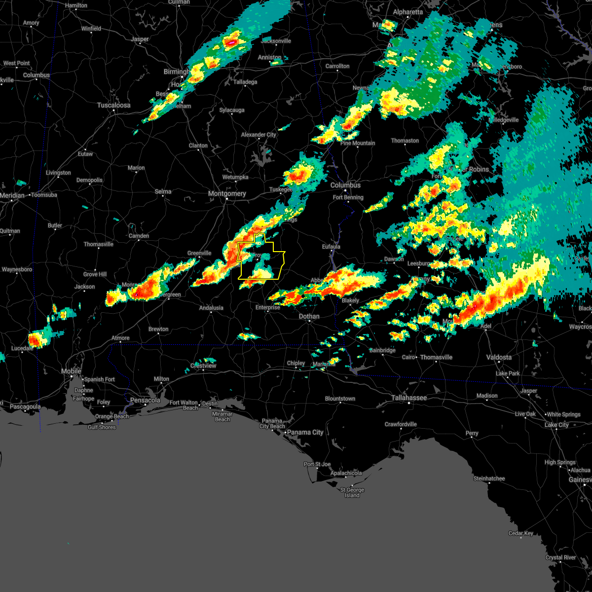
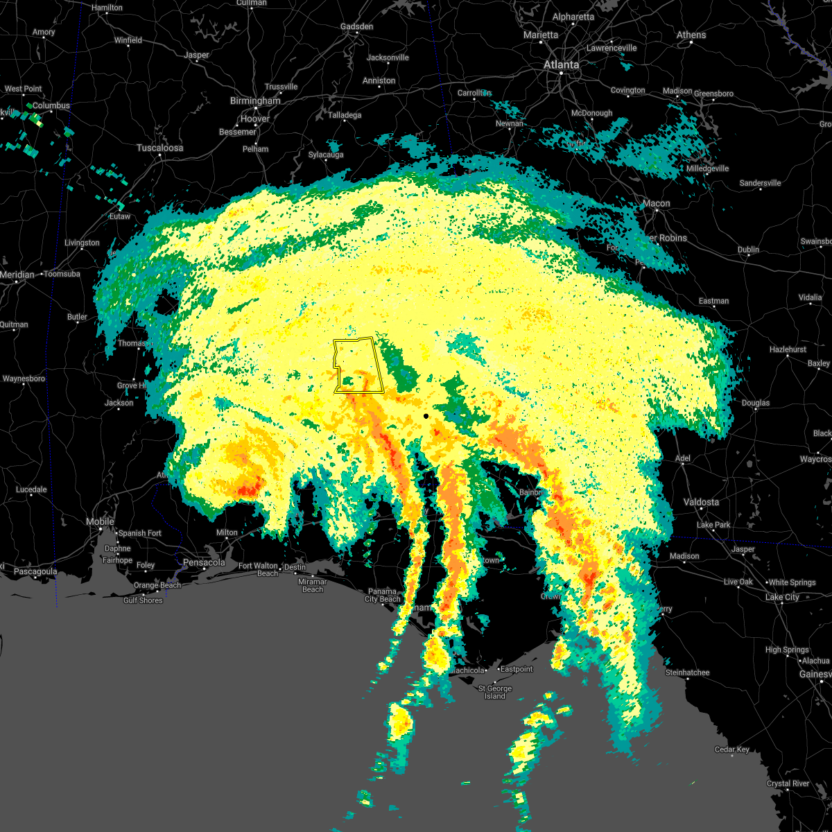
| 8/11/2020 3:19 PM CDT |
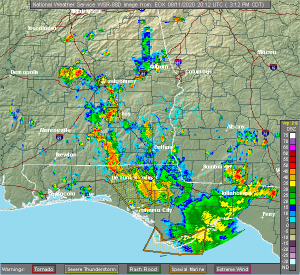 At 319 pm cdt, a severe thunderstorm was located over ansley, or 10 miles northwest of troy, and is nearly stationary (radar indicated). Hazards include 60 mph wind gusts and penny size hail. Expect damage to roofs, siding, and trees. Locations impacted include, troy, goshen, troy municipal airport and ansley. At 319 pm cdt, a severe thunderstorm was located over ansley, or 10 miles northwest of troy, and is nearly stationary (radar indicated). Hazards include 60 mph wind gusts and penny size hail. Expect damage to roofs, siding, and trees. Locations impacted include, troy, goshen, troy municipal airport and ansley.
|
| 8/11/2020 3:14 PM CDT |
 At 314 pm cdt, a severe thunderstorm was located over ansley, or 10 miles northwest of troy, and is nearly stationary (radar indicated). Hazards include 60 mph wind gusts and quarter size hail. Hail damage to vehicles is expected. expect wind damage to roofs, siding, and trees. Locations impacted include, troy, goshen, troy municipal airport and ansley. At 314 pm cdt, a severe thunderstorm was located over ansley, or 10 miles northwest of troy, and is nearly stationary (radar indicated). Hazards include 60 mph wind gusts and quarter size hail. Hail damage to vehicles is expected. expect wind damage to roofs, siding, and trees. Locations impacted include, troy, goshen, troy municipal airport and ansley.
|
| 8/11/2020 3:12 PM CDT | Trees down near highway 2 in pike county AL, 6.5 miles S of Goshen, AL |
| 8/11/2020 3:05 PM CDT |
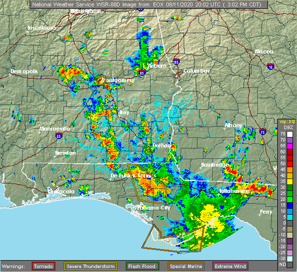 At 304 pm cdt, a severe thunderstorm was located over ansley, or 10 miles north of goshen, and is nearly stationary (radar indicated). Hazards include 60 mph wind gusts and quarter size hail. Hail damage to vehicles is expected. Expect wind damage to roofs, siding, and trees. At 304 pm cdt, a severe thunderstorm was located over ansley, or 10 miles north of goshen, and is nearly stationary (radar indicated). Hazards include 60 mph wind gusts and quarter size hail. Hail damage to vehicles is expected. Expect wind damage to roofs, siding, and trees.
|
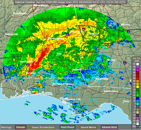
| 4/19/2020 10:55 PM CDT | Numerous trees down in the area with some roads blocke in pike county AL, 0.4 miles SW of Goshen, AL |
| 4/19/2020 10:51 PM CDT |
 At 1051 pm cdt, severe thunderstorms were located along a line extending from near petrey to brantley, moving east at 55 mph. these are very dangerous storms (radar indicated). Hazards include 80 mph wind gusts. Flying debris will be dangerous to those caught without shelter. mobile homes will be heavily damaged. expect considerable damage to roofs, windows, and vehicles. extensive tree damage and power outages are likely. Locations impacted include, troy, brundidge, goshen, tennille, tarentum, brundidge municipal airport, hamilton crossroads, mossy grove and henderson. At 1051 pm cdt, severe thunderstorms were located along a line extending from near petrey to brantley, moving east at 55 mph. these are very dangerous storms (radar indicated). Hazards include 80 mph wind gusts. Flying debris will be dangerous to those caught without shelter. mobile homes will be heavily damaged. expect considerable damage to roofs, windows, and vehicles. extensive tree damage and power outages are likely. Locations impacted include, troy, brundidge, goshen, tennille, tarentum, brundidge municipal airport, hamilton crossroads, mossy grove and henderson.
|
| 4/19/2020 10:42 PM CDT |
 At 1042 pm cdt, severe thunderstorms were located along a line extending from near petrey to near brantley, moving east at 55 mph (radar indicated). Hazards include 70 mph wind gusts. Expect considerable tree damage. Damage is likely to mobile homes, roofs, and outbuildings. At 1042 pm cdt, severe thunderstorms were located along a line extending from near petrey to near brantley, moving east at 55 mph (radar indicated). Hazards include 70 mph wind gusts. Expect considerable tree damage. Damage is likely to mobile homes, roofs, and outbuildings.
|
| 4/13/2020 12:28 AM CDT |
 At 1228 am cdt, severe thunderstorms were located along a line extending from beans crossroads to glenwood, moving east at 60 mph (radar indicated). Hazards include 60 mph wind gusts. Expect damage to roofs, siding, and trees. Locations impacted include, troy, brundidge, goshen, banks, antioch, linwood, troy municipal airport, troy university, monticello, orion, josie, china grove, sandfield, brundidge municipal airport, mossy grove and henderson. At 1228 am cdt, severe thunderstorms were located along a line extending from beans crossroads to glenwood, moving east at 60 mph (radar indicated). Hazards include 60 mph wind gusts. Expect damage to roofs, siding, and trees. Locations impacted include, troy, brundidge, goshen, banks, antioch, linwood, troy municipal airport, troy university, monticello, orion, josie, china grove, sandfield, brundidge municipal airport, mossy grove and henderson.
|
| 4/13/2020 12:11 AM CDT |
 At 1211 am cdt, severe thunderstorms were located along a line extending from near ansley to 7 miles north of dozier, moving east at 60 mph (radar indicated). Hazards include 60 mph wind gusts. expect damage to roofs, siding, and trees At 1211 am cdt, severe thunderstorms were located along a line extending from near ansley to 7 miles north of dozier, moving east at 60 mph (radar indicated). Hazards include 60 mph wind gusts. expect damage to roofs, siding, and trees
|
| 3/31/2020 10:03 AM CDT |
 At 1003 am cdt, severe thunderstorms were located along a line extending from highland home to near rutledge to 10 miles east of mckenzie, moving east at 60 mph (radar indicated). Hazards include 60 mph wind gusts. expect damage to roofs, siding, and trees At 1003 am cdt, severe thunderstorms were located along a line extending from highland home to near rutledge to 10 miles east of mckenzie, moving east at 60 mph (radar indicated). Hazards include 60 mph wind gusts. expect damage to roofs, siding, and trees
|
| 3/4/2020 6:52 AM CST |
 At 652 am cst, a severe thunderstorm was located over banks, or 8 miles north of brundidge, moving east at 40 mph (radar indicated). Hazards include 60 mph wind gusts. expect damage to roofs, siding, and trees At 652 am cst, a severe thunderstorm was located over banks, or 8 miles north of brundidge, moving east at 40 mph (radar indicated). Hazards include 60 mph wind gusts. expect damage to roofs, siding, and trees
|
| 1/11/2020 3:26 PM CST |
 At 326 pm cst, severe thunderstorms were located along a line extending from near auburn university to guerryton to 9 miles southwest of antioch, moving northeast at 55 mph (radar indicated). Hazards include 70 mph wind gusts. Expect considerable tree damage. damage is likely to mobile homes, roofs, and outbuildings. Locations impacted include, troy, tuskegee, union springs, brundidge, notasulga, midway, goshen, banks, pickett, aberfoil, lake tuskegee, beans crossroads, guerryton, linwood, tuskegee national forest, davisville, antioch, troy municipal airport, society hill and troy university. At 326 pm cst, severe thunderstorms were located along a line extending from near auburn university to guerryton to 9 miles southwest of antioch, moving northeast at 55 mph (radar indicated). Hazards include 70 mph wind gusts. Expect considerable tree damage. damage is likely to mobile homes, roofs, and outbuildings. Locations impacted include, troy, tuskegee, union springs, brundidge, notasulga, midway, goshen, banks, pickett, aberfoil, lake tuskegee, beans crossroads, guerryton, linwood, tuskegee national forest, davisville, antioch, troy municipal airport, society hill and troy university.
|
| 1/11/2020 3:10 PM CST |
 At 310 pm cst, severe thunderstorms were located along a line extending from near liberty city to union springs to near goshen, moving east at 55 mph (radar indicated). Hazards include 60 mph wind gusts. Expect damage to roofs, siding, and trees. Locations impacted include, troy, tuskegee, union springs, brundidge, notasulga, midway, goshen, milstead, shorter, banks, franklin, pickett, lake tuskegee, beans crossroads, guerryton, tuskegee national forest, liverpool, liberty city, hardaway and troy municipal airport. At 310 pm cst, severe thunderstorms were located along a line extending from near liberty city to union springs to near goshen, moving east at 55 mph (radar indicated). Hazards include 60 mph wind gusts. Expect damage to roofs, siding, and trees. Locations impacted include, troy, tuskegee, union springs, brundidge, notasulga, midway, goshen, milstead, shorter, banks, franklin, pickett, lake tuskegee, beans crossroads, guerryton, tuskegee national forest, liverpool, liberty city, hardaway and troy municipal airport.
|
| 1/11/2020 2:40 PM CST |
 At 240 pm cst, severe thunderstorms were located along a line extending from near mount meigs to brantley, moving northeast at 55 mph (radar indicated). Hazards include 60 mph wind gusts. expect damage to roofs, siding, and trees At 240 pm cst, severe thunderstorms were located along a line extending from near mount meigs to brantley, moving northeast at 55 mph (radar indicated). Hazards include 60 mph wind gusts. expect damage to roofs, siding, and trees
|
| 8/4/2019 1:41 PM CDT | Emergency manager reports trees and power lines down near and along north goshen rd. time estimated by rada in crenshaw county AL, 2.7 miles E of Goshen, AL |
| 4/14/2019 6:43 AM CDT |
 At 643 am cdt, a severe thunderstorm capable of producing a tornado was located over glenwood, or near luverne, moving northeast at 40 mph (radar indicated rotation). Hazards include tornado. Flying debris will be dangerous to those caught without shelter. mobile homes will be damaged or destroyed. damage to roofs, windows, and vehicles will occur. Tree damage is likely. At 643 am cdt, a severe thunderstorm capable of producing a tornado was located over glenwood, or near luverne, moving northeast at 40 mph (radar indicated rotation). Hazards include tornado. Flying debris will be dangerous to those caught without shelter. mobile homes will be damaged or destroyed. damage to roofs, windows, and vehicles will occur. Tree damage is likely.
|
| 3/3/2019 3:25 PM CST |
 At 325 pm cst, severe thunderstorms were located along a line extending from 6 miles southeast of hurtsboro to 7 miles southeast of brantley, moving east at 55 mph (radar indicated). Hazards include 60 mph wind gusts and nickel size hail. Expect damage to roofs, siding, and trees. locations impacted include, troy, eufaula, brundidge, clio, midway, goshen, clayton, louisville, banks, tyler crossroads, pickett, hawkinsville, aberfoil, spring hill, blue springs state park, guerryton, linwood, osco, richards crossroads and white oak. A tornado watch remains in effect until 600 pm cst for southeastern alabama. At 325 pm cst, severe thunderstorms were located along a line extending from 6 miles southeast of hurtsboro to 7 miles southeast of brantley, moving east at 55 mph (radar indicated). Hazards include 60 mph wind gusts and nickel size hail. Expect damage to roofs, siding, and trees. locations impacted include, troy, eufaula, brundidge, clio, midway, goshen, clayton, louisville, banks, tyler crossroads, pickett, hawkinsville, aberfoil, spring hill, blue springs state park, guerryton, linwood, osco, richards crossroads and white oak. A tornado watch remains in effect until 600 pm cst for southeastern alabama.
|
| 3/3/2019 3:12 PM CST |
 At 312 pm cst, severe thunderstorms were located along a line extending from near guerryton to near brantley, moving east at 40 mph (radar indicated). Hazards include 60 mph wind gusts and nickel size hail. expect damage to roofs, siding, and trees At 312 pm cst, severe thunderstorms were located along a line extending from near guerryton to near brantley, moving east at 40 mph (radar indicated). Hazards include 60 mph wind gusts and nickel size hail. expect damage to roofs, siding, and trees
|
| 2/24/2019 3:31 AM CST |
 At 330 am cst, a severe thunderstorm was located over goshen, moving east at 50 mph (radar indicated). Hazards include 60 mph wind gusts. expect damage to roofs, siding, and trees At 330 am cst, a severe thunderstorm was located over goshen, moving east at 50 mph (radar indicated). Hazards include 60 mph wind gusts. expect damage to roofs, siding, and trees
|
| 6/28/2018 5:13 PM CDT |
 At 512 pm cdt, severe thunderstorms were located along a line extending from near lakepoint resort state park to near louisville to ansley, moving south at 30 mph (radar indicated). Hazards include 60 mph wind gusts. expect damage to roofs, siding, and trees At 512 pm cdt, severe thunderstorms were located along a line extending from near lakepoint resort state park to near louisville to ansley, moving south at 30 mph (radar indicated). Hazards include 60 mph wind gusts. expect damage to roofs, siding, and trees
|
| 6/28/2018 4:50 PM CDT |
 At 450 pm cdt, severe thunderstorms were located along a line extending from 8 miles southeast of seale to near lapine, moving southeast at 25 mph (radar indicated). Hazards include 60 mph wind gusts. expect damage to roofs, siding, and trees At 450 pm cdt, severe thunderstorms were located along a line extending from 8 miles southeast of seale to near lapine, moving southeast at 25 mph (radar indicated). Hazards include 60 mph wind gusts. expect damage to roofs, siding, and trees
|
| 4/3/2017 9:20 AM CDT |
 At 920 am cdt, severe thunderstorms were located along a line extending from pine level to near troy municipal airport to 9 miles southeast of goshen, moving northeast at 45 mph (radar indicated). Hazards include 70 mph wind gusts. Expect considerable tree damage. damage is likely to mobile homes, roofs, and outbuildings. Locations impacted include, troy, brundidge, goshen, banks, pine level, antioch, linwood, ansley, troy municipal airport, troy university, tennille, monticello, hamilton crossroads, orion, josie, china grove, sandfield, tarentum, brundidge municipal airport and currys. At 920 am cdt, severe thunderstorms were located along a line extending from pine level to near troy municipal airport to 9 miles southeast of goshen, moving northeast at 45 mph (radar indicated). Hazards include 70 mph wind gusts. Expect considerable tree damage. damage is likely to mobile homes, roofs, and outbuildings. Locations impacted include, troy, brundidge, goshen, banks, pine level, antioch, linwood, ansley, troy municipal airport, troy university, tennille, monticello, hamilton crossroads, orion, josie, china grove, sandfield, tarentum, brundidge municipal airport and currys.
|
| 4/3/2017 9:05 AM CDT | Trees down on power lines along highway 29 near county road 2293. time estimated by rada in pike county AL, 6.5 miles S of Goshen, AL |
| 4/3/2017 8:58 AM CDT |
 At 858 am cdt, severe thunderstorms were located along a line extending from near lapine to near petrey to glenwood, moving northeast at 45 mph (radar indicated). Hazards include 70 mph wind gusts and penny size hail. Expect considerable tree damage. Damage is likely to mobile homes, roofs, and outbuildings. At 858 am cdt, severe thunderstorms were located along a line extending from near lapine to near petrey to glenwood, moving northeast at 45 mph (radar indicated). Hazards include 70 mph wind gusts and penny size hail. Expect considerable tree damage. Damage is likely to mobile homes, roofs, and outbuildings.
|
| 1/22/2017 12:56 PM CST |
 At 1255 pm cst, severe thunderstorms were located along a line extending from emerald mountain to near pine level to near brantley, moving northeast at 70 mph (radar indicated). Hazards include 60 mph wind gusts. expect damage to roofs, siding, and trees At 1255 pm cst, severe thunderstorms were located along a line extending from emerald mountain to near pine level to near brantley, moving northeast at 70 mph (radar indicated). Hazards include 60 mph wind gusts. expect damage to roofs, siding, and trees
|
| 1/21/2017 8:58 AM CST |
 At 858 am cst, severe thunderstorms capable of producing both tornadoes and extensive straight line wind damage were located along a line extending from 6 miles northeast of ansley to near glenwood, moving east at 60 mph (radar indicated rotation). Hazards include tornado. Flying debris will be dangerous to those caught without shelter. mobile homes will be damaged or destroyed. damage to roofs, windows, and vehicles will occur. Tree damage is likely. At 858 am cst, severe thunderstorms capable of producing both tornadoes and extensive straight line wind damage were located along a line extending from 6 miles northeast of ansley to near glenwood, moving east at 60 mph (radar indicated rotation). Hazards include tornado. Flying debris will be dangerous to those caught without shelter. mobile homes will be damaged or destroyed. damage to roofs, windows, and vehicles will occur. Tree damage is likely.
|
| 1/21/2017 8:47 AM CST |
 At 847 am cst, severe thunderstorms were located along a line extending from near grady to near brantley, moving east at 60 mph (radar indicated). Hazards include 60 mph wind gusts. expect damage to roofs, siding, and trees At 847 am cst, severe thunderstorms were located along a line extending from near grady to near brantley, moving east at 60 mph (radar indicated). Hazards include 60 mph wind gusts. expect damage to roofs, siding, and trees
|
| 6/17/2016 6:37 PM CDT |
 At 637 pm cdt, severe thunderstorms were located along a line extending from barbour county public lake dam to 6 miles southwest of antioch, moving southeast at 30 mph (radar indicated). Hazards include 60 mph wind gusts. Expect damage to roofs. siding. and trees. Locations impacted include, troy, brundidge, goshen, banks, pickett, troy university, antioch, brundidge municipal airport, mossy grove, josie, tennille, tanyard, henderson, tarentum, monticello and hamilton crossroads. At 637 pm cdt, severe thunderstorms were located along a line extending from barbour county public lake dam to 6 miles southwest of antioch, moving southeast at 30 mph (radar indicated). Hazards include 60 mph wind gusts. Expect damage to roofs. siding. and trees. Locations impacted include, troy, brundidge, goshen, banks, pickett, troy university, antioch, brundidge municipal airport, mossy grove, josie, tennille, tanyard, henderson, tarentum, monticello and hamilton crossroads.
|
| 6/17/2016 6:28 PM CDT |
 At 627 pm cdt, severe thunderstorms were located along a line extending from near midway to 6 miles southwest of troy, moving southeast at 35 mph (radar indicated). Hazards include 60 mph wind gusts. Expect damage to roofs. siding. and trees. Locations impacted include, troy, brundidge, midway, goshen, banks, pickett, troy municipal airport, aberfoil, troy university, linwood, antioch, beans crossroads, brundidge municipal airport, mossy grove, josie, tennille, three notch, tanyard, henderson and tarentum. At 627 pm cdt, severe thunderstorms were located along a line extending from near midway to 6 miles southwest of troy, moving southeast at 35 mph (radar indicated). Hazards include 60 mph wind gusts. Expect damage to roofs. siding. and trees. Locations impacted include, troy, brundidge, midway, goshen, banks, pickett, troy municipal airport, aberfoil, troy university, linwood, antioch, beans crossroads, brundidge municipal airport, mossy grove, josie, tennille, three notch, tanyard, henderson and tarentum.
|
| 6/17/2016 6:18 PM CDT |
 At 618 pm cdt, severe thunderstorms were located along a line extending from midway to near goshen, moving southeast at 40 mph (radar indicated). Hazards include 60 mph wind gusts. Expect damage to roofs. siding. and trees. Locations impacted include, troy, union springs, brundidge, midway, goshen, banks, beans crossroads, pickett, troy municipal airport, troy university, antioch, guerryton, ansley, aberfoil, linwood, josie, tennille, henderson, tarentum and monticello. At 618 pm cdt, severe thunderstorms were located along a line extending from midway to near goshen, moving southeast at 40 mph (radar indicated). Hazards include 60 mph wind gusts. Expect damage to roofs. siding. and trees. Locations impacted include, troy, union springs, brundidge, midway, goshen, banks, beans crossroads, pickett, troy municipal airport, troy university, antioch, guerryton, ansley, aberfoil, linwood, josie, tennille, henderson, tarentum and monticello.
|
| 6/17/2016 6:09 PM CDT |
 At 609 pm cdt, severe thunderstorms were located along a line extending from near davisville to near goshen, moving southeast at 40 mph (radar indicated). Hazards include 60 mph wind gusts. Expect damage to roofs. siding. and trees. Locations impacted include, troy, union springs, brundidge, midway, goshen, banks, beans crossroads, pickett, troy municipal airport, troy university, antioch, shopton, franklin field, guerryton, ansley, aberfoil, linwood, josie, tennille and simsville. At 609 pm cdt, severe thunderstorms were located along a line extending from near davisville to near goshen, moving southeast at 40 mph (radar indicated). Hazards include 60 mph wind gusts. Expect damage to roofs. siding. and trees. Locations impacted include, troy, union springs, brundidge, midway, goshen, banks, beans crossroads, pickett, troy municipal airport, troy university, antioch, shopton, franklin field, guerryton, ansley, aberfoil, linwood, josie, tennille and simsville.
|
| 6/17/2016 5:46 PM CDT |
 At 546 pm cdt, severe thunderstorms were located along a line extending from near shorter to 6 miles south of logan, moving southeast at 35 mph (radar indicated). Hazards include 60 mph wind gusts. Expect damage to roofs. siding. And trees. At 546 pm cdt, severe thunderstorms were located along a line extending from near shorter to 6 miles south of logan, moving southeast at 35 mph (radar indicated). Hazards include 60 mph wind gusts. Expect damage to roofs. siding. And trees.
|
| 3/24/2016 3:31 PM CDT |
 At 331 pm cdt, severe thunderstorms were located along a line extending from near troy to 6 miles south of brundidge to near new brockton, moving northeast at 50 mph (radar indicated). Hazards include 60 mph wind gusts. Expect damage to roofs. siding. and trees. Locations impacted include, troy, brundidge, banks, troy university, linwood, antioch, troy municipal airport, brundidge municipal airport, mossy grove, josie, tennille, tarentum, monticello, sandfield and hamilton crossroads. At 331 pm cdt, severe thunderstorms were located along a line extending from near troy to 6 miles south of brundidge to near new brockton, moving northeast at 50 mph (radar indicated). Hazards include 60 mph wind gusts. Expect damage to roofs. siding. and trees. Locations impacted include, troy, brundidge, banks, troy university, linwood, antioch, troy municipal airport, brundidge municipal airport, mossy grove, josie, tennille, tarentum, monticello, sandfield and hamilton crossroads.
|
| 3/24/2016 3:23 PM CDT | Quarter sized hail reported 4.9 miles NW of Goshen, AL, quarter sized hail reported at scotts farm supply store. |
| 3/24/2016 3:16 PM CDT |
 At 316 pm cdt, severe thunderstorms were located along a line extending from near petrey to 8 miles southeast of glenwood to near elba, moving northeast at 45 mph (radar indicated). Hazards include 70 mph wind gusts. Expect considerable tree damage. damage is likely to mobile homes, roofs, and outbuildings. Locations impacted include, troy, brundidge, goshen, banks, ansley, troy municipal airport, troy university, linwood, antioch, brundidge municipal airport, mossy grove, josie, tennille, henderson, tarentum, monticello, sandfield and hamilton crossroads. At 316 pm cdt, severe thunderstorms were located along a line extending from near petrey to 8 miles southeast of glenwood to near elba, moving northeast at 45 mph (radar indicated). Hazards include 70 mph wind gusts. Expect considerable tree damage. damage is likely to mobile homes, roofs, and outbuildings. Locations impacted include, troy, brundidge, goshen, banks, ansley, troy municipal airport, troy university, linwood, antioch, brundidge municipal airport, mossy grove, josie, tennille, henderson, tarentum, monticello, sandfield and hamilton crossroads.
|
| 3/24/2016 3:01 PM CDT |
 At 300 pm cdt, severe thunderstorms were located along a line extending from 9 miles west of rutledge to near brantley to opp, moving east at 45 mph (radar indicated). Hazards include 70 mph wind gusts. Expect considerable tree damage. Damage is likely to mobile homes, roofs, and outbuildings. At 300 pm cdt, severe thunderstorms were located along a line extending from 9 miles west of rutledge to near brantley to opp, moving east at 45 mph (radar indicated). Hazards include 70 mph wind gusts. Expect considerable tree damage. Damage is likely to mobile homes, roofs, and outbuildings.
|
| 3/3/2016 5:30 PM CST | Golf Ball sized hail reported 1.8 miles NW of Goshen, AL, golf ball size hail in reported in the town of goshen inside pike... county |
| 3/3/2016 5:25 PM CST |
 At 525 pm cst, a severe thunderstorm was located near luverne, moving east at 70 mph (radar indicated). Hazards include 60 mph wind gusts and quarter size hail. Hail damage to vehicles is expected. Expect wind damage to roofs, siding and trees. At 525 pm cst, a severe thunderstorm was located near luverne, moving east at 70 mph (radar indicated). Hazards include 60 mph wind gusts and quarter size hail. Hail damage to vehicles is expected. Expect wind damage to roofs, siding and trees.
|
| 2/15/2016 6:04 PM CST | Large trees down near goshen high school. time estimated by rada in pike county AL, 0.4 miles SW of Goshen, AL |
| 2/15/2016 5:59 PM CST |
 At 559 pm cst, severe thunderstorms were located along a line extending from tuskegee to near pine level to near brantley, moving east at 50 mph (radar indicated). Hazards include 60 mph wind gusts. Expect damage to roofs. siding and trees. locations impacted include, troy, tuskegee, union springs, brundidge, notasulga, midway, goshen, meadville, banks, franklin, troy university, liverpool, antioch, shopton, guerryton, linwood, pine level, beans crossroads, pickett and lake tuskegee. this includes interstate 85 between mile markers 32 and 42. A tornado watch remains in effect until 900 pm cst for southeastern alabama. At 559 pm cst, severe thunderstorms were located along a line extending from tuskegee to near pine level to near brantley, moving east at 50 mph (radar indicated). Hazards include 60 mph wind gusts. Expect damage to roofs. siding and trees. locations impacted include, troy, tuskegee, union springs, brundidge, notasulga, midway, goshen, meadville, banks, franklin, troy university, liverpool, antioch, shopton, guerryton, linwood, pine level, beans crossroads, pickett and lake tuskegee. this includes interstate 85 between mile markers 32 and 42. A tornado watch remains in effect until 900 pm cst for southeastern alabama.
|
| 2/15/2016 5:50 PM CST |
 At 550 pm cst, severe thunderstorms were located along a line extending from near pike road to near brantley, moving northeast at 60 mph (radar indicated). Hazards include 60 mph wind gusts. Expect damage to roofs. Siding and trees. At 550 pm cst, severe thunderstorms were located along a line extending from near pike road to near brantley, moving northeast at 60 mph (radar indicated). Hazards include 60 mph wind gusts. Expect damage to roofs. Siding and trees.
|
| 8/7/2015 2:40 PM CDT | Tree down along county road 315 in coffee county AL, 10.4 miles NW of Goshen, AL |
| 12/25/2012 10:28 PM CST | Multiple mobile homes turned over. possible tornad in pike county AL, 4.9 miles SSW of Goshen, AL |
| 5/6/2012 1:02 PM CDT | Quarter sized hail reported 0.5 miles SE of Goshen, AL |
| 1/1/0001 12:00 AM | A few trees were blown down in goshe in pike county AL, 0.5 miles SE of Goshen, AL |
Hail Maps for Goshen, AL


Connect with Interactive Hail Maps