

Hail Map for Gouldsboro, PA
The Gouldsboro, PA area has had 1 report of on-the-ground hail by trained spotters, and has been under severe weather warnings 22 times during the past 12 months. Doppler radar has detected hail at or near Gouldsboro, PA on 21 occasions.
| Name: | Gouldsboro, PA |
| Where Located: | 15.9 miles SE of Scranton, PA |
| Map: | Google Map for Gouldsboro, PA |
| Population: | 890 |
| Housing Units: | 546 |
| More Info: | Search Google for Gouldsboro, PA |
0
The Top Recent Hail Date for Gouldsboro, PA is Tuesday, April 30, 2024 (21st out of 21)

Hail and Wind Damage Spotted near Gouldsboro, PA
| Date / Time | Report Details |
|---|---|
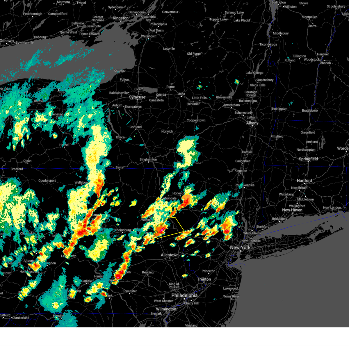
| 6/26/2025 4:20 PM EDT |
 Svrphi the national weather service in mount holly nj has issued a * severe thunderstorm warning for, northwestern warren county in northwestern new jersey, northwestern lehigh county in eastern pennsylvania, carbon county in northeastern pennsylvania, monroe county in northeastern pennsylvania, northern northampton county in eastern pennsylvania, * until 500 pm edt. * at 420 pm edt, severe thunderstorms were located along a line extending from near tobyhanna to blakeslee to near freeland, moving southeast at 25 mph (radar indicated). Hazards include 60 mph wind gusts and quarter size hail. Minor damage to vehicles is possible. Wind damage to roofs, siding, trees, and power lines is possible. Svrphi the national weather service in mount holly nj has issued a * severe thunderstorm warning for, northwestern warren county in northwestern new jersey, northwestern lehigh county in eastern pennsylvania, carbon county in northeastern pennsylvania, monroe county in northeastern pennsylvania, northern northampton county in eastern pennsylvania, * until 500 pm edt. * at 420 pm edt, severe thunderstorms were located along a line extending from near tobyhanna to blakeslee to near freeland, moving southeast at 25 mph (radar indicated). Hazards include 60 mph wind gusts and quarter size hail. Minor damage to vehicles is possible. Wind damage to roofs, siding, trees, and power lines is possible.
|
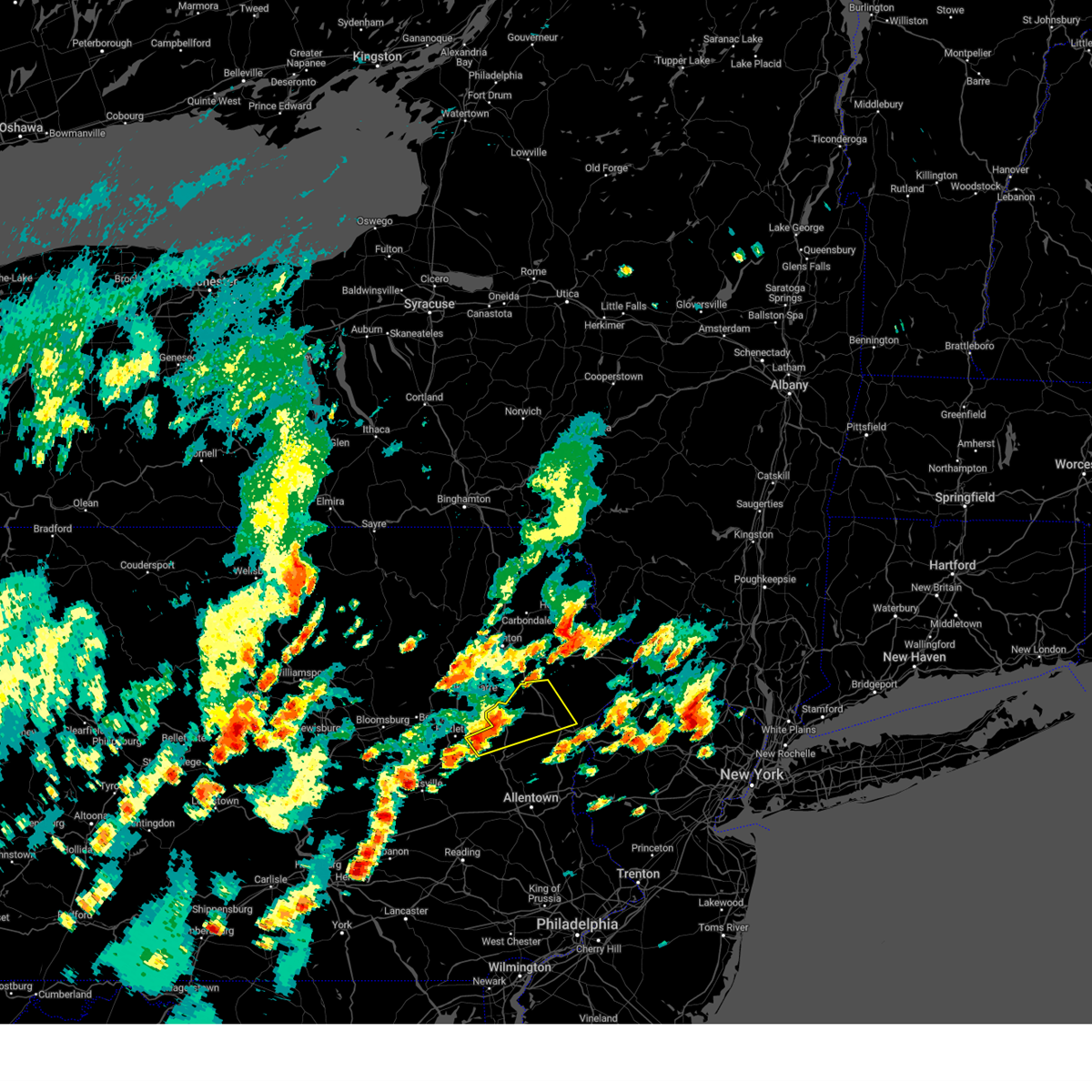
| 6/26/2025 2:41 PM EDT |
 The storm which prompted the warning has weakened below severe limits, and has exited the warned area. therefore, the warning will be allowed to expire. however, heavy rain is still possible with this thunderstorm. to report severe weather, contact your nearest law enforcement agency. they will relay your report to the national weather service binghamton. The storm which prompted the warning has weakened below severe limits, and has exited the warned area. therefore, the warning will be allowed to expire. however, heavy rain is still possible with this thunderstorm. to report severe weather, contact your nearest law enforcement agency. they will relay your report to the national weather service binghamton.
|
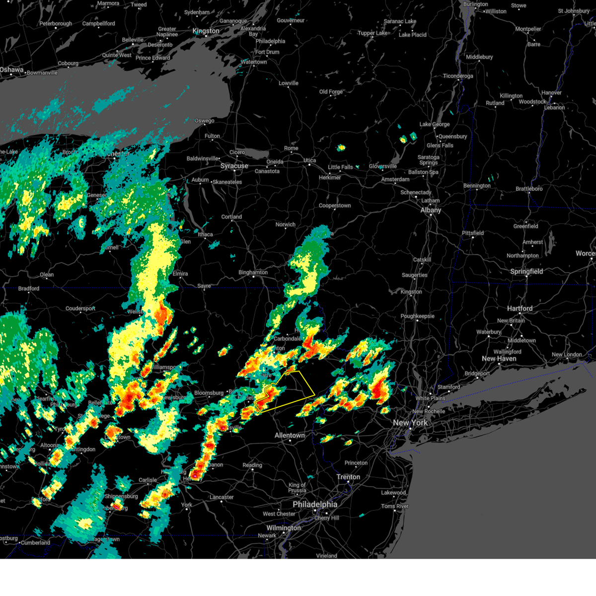
| 6/26/2025 2:16 PM EDT |
 Svrbgm the national weather service in binghamton has issued a * severe thunderstorm warning for, east central lackawanna county in northeastern pennsylvania, west central pike county in northeastern pennsylvania, southwestern wayne county in northeastern pennsylvania, * until 245 pm edt. * at 215 pm edt, a severe thunderstorm was located over lehigh, or 11 miles southeast of scranton, moving southeast at 30 mph (radar indicated). Hazards include 60 mph wind gusts and penny size hail. expect damage to roofs, siding, and trees Svrbgm the national weather service in binghamton has issued a * severe thunderstorm warning for, east central lackawanna county in northeastern pennsylvania, west central pike county in northeastern pennsylvania, southwestern wayne county in northeastern pennsylvania, * until 245 pm edt. * at 215 pm edt, a severe thunderstorm was located over lehigh, or 11 miles southeast of scranton, moving southeast at 30 mph (radar indicated). Hazards include 60 mph wind gusts and penny size hail. expect damage to roofs, siding, and trees
|
| 4/29/2025 8:50 PM EDT | The storms which prompted the warning have weakened below severe limits, and no longer pose an immediate threat to life or property. therefore, the warning will be allowed to expire. |
| 4/29/2025 8:15 PM EDT | Svrphi the national weather service in mount holly nj has issued a * severe thunderstorm warning for, northern berks county in eastern pennsylvania, lehigh county in eastern pennsylvania, carbon county in northeastern pennsylvania, monroe county in northeastern pennsylvania, northwestern northampton county in eastern pennsylvania, * until 900 pm edt. * at 814 pm edt, severe thunderstorms were located along a line extending from sweet valley to near nuremburg to near pine grove, moving east at 70 mph (radar indicated). Hazards include 60 mph wind gusts. damage to roofs, siding, trees, and power lines is possible |
| 4/15/2025 4:07 PM EDT |
 Svrphi the national weather service in mount holly nj has issued a * severe thunderstorm warning for, sussex county in northwestern new jersey, northeastern warren county in northwestern new jersey, northern monroe county in northeastern pennsylvania, * until 500 pm edt. * at 407 pm edt, a severe thunderstorm was located over lehigh, or 10 miles northwest of mount pocono, moving east at 45 mph (radar indicated). Hazards include 60 mph wind gusts and quarter size hail. Minor damage to vehicles is possible. Wind damage to roofs, siding, trees, and power lines is possible. Svrphi the national weather service in mount holly nj has issued a * severe thunderstorm warning for, sussex county in northwestern new jersey, northeastern warren county in northwestern new jersey, northern monroe county in northeastern pennsylvania, * until 500 pm edt. * at 407 pm edt, a severe thunderstorm was located over lehigh, or 10 miles northwest of mount pocono, moving east at 45 mph (radar indicated). Hazards include 60 mph wind gusts and quarter size hail. Minor damage to vehicles is possible. Wind damage to roofs, siding, trees, and power lines is possible.
|
| 3/16/2025 9:46 PM EDT |
 the severe thunderstorm warning has been cancelled and is no longer in effect the severe thunderstorm warning has been cancelled and is no longer in effect
|
| 3/16/2025 9:34 PM EDT |
 At 934 pm edt, a severe thunderstorm was located over arrowhead lake, or 10 miles west of mount pocono, moving northeast at 55 mph (radar indicated). Hazards include 60 mph wind gusts and quarter size hail. Minor damage to vehicles is possible. wind damage to roofs, siding, trees, and power lines is possible. locations impacted include, cresco, pocono pines, pocono raceway, skytop, mountainhome, canadensis, tobyhanna, blakeslee, long pond, paradise valley, gouldsboro state park, arrowhead lake, and mount pocono. this includes the following highways, interstate 80 in pennsylvania between mile markers 287 and 297. Interstate 380 in pennsylvania between mile markers 1 and 13. At 934 pm edt, a severe thunderstorm was located over arrowhead lake, or 10 miles west of mount pocono, moving northeast at 55 mph (radar indicated). Hazards include 60 mph wind gusts and quarter size hail. Minor damage to vehicles is possible. wind damage to roofs, siding, trees, and power lines is possible. locations impacted include, cresco, pocono pines, pocono raceway, skytop, mountainhome, canadensis, tobyhanna, blakeslee, long pond, paradise valley, gouldsboro state park, arrowhead lake, and mount pocono. this includes the following highways, interstate 80 in pennsylvania between mile markers 287 and 297. Interstate 380 in pennsylvania between mile markers 1 and 13.
|
| 3/16/2025 9:34 PM EDT |
 the severe thunderstorm warning has been cancelled and is no longer in effect the severe thunderstorm warning has been cancelled and is no longer in effect
|
| 3/16/2025 9:21 PM EDT |
 At 921 pm edt, a severe thunderstorm was located near christmans, or 10 miles north of lehighton, moving northeast at 55 mph (radar indicated). Hazards include 60 mph wind gusts and quarter size hail. Minor damage to vehicles is possible. wind damage to roofs, siding, trees, and power lines is possible. locations impacted include, henryville, pocono pines, pocono raceway, lake harmony, skytop, tannersville, mountainhome, tobyhanna, alpine mountain, weatherly, long pond, albrightsville, merwinsburg, sun valley, arrowhead lake, jonas, meckesville, reeders, cresco, and jim thorpe. this includes the following highways, northeast extension between mile markers 80 and 97. interstate 80 in pennsylvania between mile markers 277 and 304. Interstate 380 in pennsylvania between mile markers 0 and 13. At 921 pm edt, a severe thunderstorm was located near christmans, or 10 miles north of lehighton, moving northeast at 55 mph (radar indicated). Hazards include 60 mph wind gusts and quarter size hail. Minor damage to vehicles is possible. wind damage to roofs, siding, trees, and power lines is possible. locations impacted include, henryville, pocono pines, pocono raceway, lake harmony, skytop, tannersville, mountainhome, tobyhanna, alpine mountain, weatherly, long pond, albrightsville, merwinsburg, sun valley, arrowhead lake, jonas, meckesville, reeders, cresco, and jim thorpe. this includes the following highways, northeast extension between mile markers 80 and 97. interstate 80 in pennsylvania between mile markers 277 and 304. Interstate 380 in pennsylvania between mile markers 0 and 13.
|
| 3/16/2025 9:02 PM EDT |
 Svrphi the national weather service in mount holly nj has issued a * severe thunderstorm warning for, carbon county in northeastern pennsylvania, monroe county in northeastern pennsylvania, * until 1000 pm edt. * at 902 pm edt, a severe thunderstorm was located over hometown, or over tamaqua, moving northeast at 65 mph (radar indicated). Hazards include 60 mph wind gusts and quarter size hail. Minor damage to vehicles is possible. Wind damage to roofs, siding, trees, and power lines is possible. Svrphi the national weather service in mount holly nj has issued a * severe thunderstorm warning for, carbon county in northeastern pennsylvania, monroe county in northeastern pennsylvania, * until 1000 pm edt. * at 902 pm edt, a severe thunderstorm was located over hometown, or over tamaqua, moving northeast at 65 mph (radar indicated). Hazards include 60 mph wind gusts and quarter size hail. Minor damage to vehicles is possible. Wind damage to roofs, siding, trees, and power lines is possible.
|
| 8/3/2024 2:56 PM EDT |
 At 256 pm edt, a severe thunderstorm was located over lake harmony, or 13 miles west of mount pocono, moving northeast at 20 mph (radar indicated). Hazards include 70 mph wind gusts and quarter size hail. Minor damage to vehicles is possible. expect considerable tree damage. wind damage is also likely to mobile homes, roofs, and outbuildings. locations impacted include, mount pocono, east stroudsburg, tobyhanna, henryville, pocono pines, pocono raceway, lake harmony, tannersville, long pond, albrightsville, sun valley, arrowhead lake, jonas, meckesville, reeders, analomink, mcmichael, scotrun, blakeslee, and paradise valley. this includes the following highways, northeast extension between mile markers 84 and 97. interstate 80 in pennsylvania between mile markers 277 and 306. Interstate 380 in pennsylvania between mile markers 0 and 13. At 256 pm edt, a severe thunderstorm was located over lake harmony, or 13 miles west of mount pocono, moving northeast at 20 mph (radar indicated). Hazards include 70 mph wind gusts and quarter size hail. Minor damage to vehicles is possible. expect considerable tree damage. wind damage is also likely to mobile homes, roofs, and outbuildings. locations impacted include, mount pocono, east stroudsburg, tobyhanna, henryville, pocono pines, pocono raceway, lake harmony, tannersville, long pond, albrightsville, sun valley, arrowhead lake, jonas, meckesville, reeders, analomink, mcmichael, scotrun, blakeslee, and paradise valley. this includes the following highways, northeast extension between mile markers 84 and 97. interstate 80 in pennsylvania between mile markers 277 and 306. Interstate 380 in pennsylvania between mile markers 0 and 13.
|
| 8/3/2024 2:43 PM EDT |
 At 243 pm edt, a severe thunderstorm was located over albrightsville, or 12 miles north of lehighton, moving northeast at 20 mph (radar indicated). Hazards include 70 mph wind gusts and quarter size hail. Minor damage to vehicles is possible. expect considerable tree damage. wind damage is also likely to mobile homes, roofs, and outbuildings. locations impacted include, mount pocono, east stroudsburg, tobyhanna, jim thorpe, weatherly, henryville, pocono pines, pocono raceway, lake harmony, tannersville, long pond, albrightsville, sun valley, arrowhead lake, jonas, meckesville, reeders, analomink, mcmichael, and scotrun. this includes the following highways, northeast extension between mile markers 82 and 97. interstate 80 in pennsylvania between mile markers 277 and 306. Interstate 380 in pennsylvania between mile markers 0 and 13. At 243 pm edt, a severe thunderstorm was located over albrightsville, or 12 miles north of lehighton, moving northeast at 20 mph (radar indicated). Hazards include 70 mph wind gusts and quarter size hail. Minor damage to vehicles is possible. expect considerable tree damage. wind damage is also likely to mobile homes, roofs, and outbuildings. locations impacted include, mount pocono, east stroudsburg, tobyhanna, jim thorpe, weatherly, henryville, pocono pines, pocono raceway, lake harmony, tannersville, long pond, albrightsville, sun valley, arrowhead lake, jonas, meckesville, reeders, analomink, mcmichael, and scotrun. this includes the following highways, northeast extension between mile markers 82 and 97. interstate 80 in pennsylvania between mile markers 277 and 306. Interstate 380 in pennsylvania between mile markers 0 and 13.
|
| 8/3/2024 2:40 PM EDT |
 Svrphi the national weather service in mount holly nj has issued a * severe thunderstorm warning for, central carbon county in northeastern pennsylvania, northwestern monroe county in northeastern pennsylvania, * until 345 pm edt. * at 240 pm edt, a severe thunderstorm was located near christmans, or 12 miles north of lehighton, moving northeast at 20 mph (radar indicated). Hazards include 60 mph wind gusts and quarter size hail. Minor damage to vehicles is possible. Wind damage to roofs, siding, trees, and power lines is possible. Svrphi the national weather service in mount holly nj has issued a * severe thunderstorm warning for, central carbon county in northeastern pennsylvania, northwestern monroe county in northeastern pennsylvania, * until 345 pm edt. * at 240 pm edt, a severe thunderstorm was located near christmans, or 12 miles north of lehighton, moving northeast at 20 mph (radar indicated). Hazards include 60 mph wind gusts and quarter size hail. Minor damage to vehicles is possible. Wind damage to roofs, siding, trees, and power lines is possible.
|
| 7/17/2024 6:24 PM EDT | At 623 pm edt, a severe thunderstorm was located near mount pocono, moving east at 35 mph (radar indicated). Hazards include 60 mph wind gusts and quarter size hail. Minor damage to vehicles is possible. wind damage to roofs, siding, trees, and power lines is possible. locations impacted include, mount pocono, east stroudsburg, tobyhanna, reeders, henryville, pocono pines, analomink, skytop, tannersville, mountainhome, canadensis, alpine mountain, scotrun, echo lake, paradise valley, gouldsboro state park, stroudsburg, cresco, arlington heights, and shawnee. this includes the following highways, interstate 80 in pennsylvania between mile markers 295 and 306, and between mile markers 313 and 314. Interstate 380 in pennsylvania between mile markers 0 and 12. |
| 7/17/2024 6:24 PM EDT | the severe thunderstorm warning has been cancelled and is no longer in effect |
| 7/17/2024 6:20 PM EDT |
 The storm which prompted the warning has moved out of the area. therefore, the warning will be allowed to expire. a severe thunderstorm watch remains in effect until 800 pm edt for northeastern pennsylvania. The storm which prompted the warning has moved out of the area. therefore, the warning will be allowed to expire. a severe thunderstorm watch remains in effect until 800 pm edt for northeastern pennsylvania.
|
| 7/17/2024 6:12 PM EDT |
 At 611 pm edt, a severe thunderstorm was located over gouldsboro, or 9 miles north of mount pocono, moving east at 45 mph (radar indicated). Hazards include 60 mph wind gusts and quarter size hail. Hail damage to vehicles is expected. expect wind damage to roofs, siding, and trees. Locations impacted include, scranton, moscow, sterling, lehigh, gouldsboro, angels, yostville, newfoundland, springbrook corners, and daleville. At 611 pm edt, a severe thunderstorm was located over gouldsboro, or 9 miles north of mount pocono, moving east at 45 mph (radar indicated). Hazards include 60 mph wind gusts and quarter size hail. Hail damage to vehicles is expected. expect wind damage to roofs, siding, and trees. Locations impacted include, scranton, moscow, sterling, lehigh, gouldsboro, angels, yostville, newfoundland, springbrook corners, and daleville.
|
| 7/17/2024 6:12 PM EDT |
 the severe thunderstorm warning has been cancelled and is no longer in effect the severe thunderstorm warning has been cancelled and is no longer in effect
|
| 7/17/2024 6:07 PM EDT |
 At 606 pm edt, a severe thunderstorm was located over arrowhead lake, or 9 miles west of mount pocono, moving east at 35 mph (radar indicated). Hazards include 60 mph wind gusts and quarter size hail. Minor damage to vehicles is possible. wind damage to roofs, siding, trees, and power lines is possible. locations impacted include, mount pocono, east stroudsburg, tobyhanna, henryville, pocono pines, pocono raceway, lake harmony, skytop, tannersville, mountainhome, alpine mountain, long pond, arrowhead lake, reeders, analomink, canadensis, scotrun, blakeslee, echo lake, and paradise valley. this includes the following highways, interstate 80 in pennsylvania between mile markers 283 and 306, and between mile markers 313 and 314. Interstate 380 in pennsylvania between mile markers 0 and 12. At 606 pm edt, a severe thunderstorm was located over arrowhead lake, or 9 miles west of mount pocono, moving east at 35 mph (radar indicated). Hazards include 60 mph wind gusts and quarter size hail. Minor damage to vehicles is possible. wind damage to roofs, siding, trees, and power lines is possible. locations impacted include, mount pocono, east stroudsburg, tobyhanna, henryville, pocono pines, pocono raceway, lake harmony, skytop, tannersville, mountainhome, alpine mountain, long pond, arrowhead lake, reeders, analomink, canadensis, scotrun, blakeslee, echo lake, and paradise valley. this includes the following highways, interstate 80 in pennsylvania between mile markers 283 and 306, and between mile markers 313 and 314. Interstate 380 in pennsylvania between mile markers 0 and 12.
|
| 7/17/2024 5:51 PM EDT |
 Svrphi the national weather service in mount holly nj has issued a * severe thunderstorm warning for, northeastern carbon county in northeastern pennsylvania, monroe county in northeastern pennsylvania, * until 645 pm edt. * at 551 pm edt, a severe thunderstorm was located over bear creek village, or 9 miles southeast of wilkes-barre, moving east at 35 mph (radar indicated). Hazards include 60 mph wind gusts and quarter size hail. Minor damage to vehicles is possible. Wind damage to roofs, siding, trees, and power lines is possible. Svrphi the national weather service in mount holly nj has issued a * severe thunderstorm warning for, northeastern carbon county in northeastern pennsylvania, monroe county in northeastern pennsylvania, * until 645 pm edt. * at 551 pm edt, a severe thunderstorm was located over bear creek village, or 9 miles southeast of wilkes-barre, moving east at 35 mph (radar indicated). Hazards include 60 mph wind gusts and quarter size hail. Minor damage to vehicles is possible. Wind damage to roofs, siding, trees, and power lines is possible.
|
| 7/17/2024 5:41 PM EDT | Svrbgm the national weather service in binghamton has issued a * severe thunderstorm warning for, southeastern lackawanna county in northeastern pennsylvania, southwestern wayne county in northeastern pennsylvania, northeastern luzerne county in northeastern pennsylvania, * until 630 pm edt. * at 541 pm edt, a severe thunderstorm was located near wilkes-barre, moving east at 45 mph (radar indicated). Hazards include 60 mph wind gusts and quarter size hail. Hail damage to vehicles is expected. Expect wind damage to roofs, siding, and trees. |
| 7/15/2024 7:58 PM EDT | At 758 pm edt, severe thunderstorms were located along a line extending from fishs eddy to damascus to near lake ariel to near sterling, moving east at 35 mph (radar indicated). Hazards include 70 mph wind gusts and penny size hail. Expect considerable tree damage. damage is likely to mobile homes, roofs, and outbuildings. Locations impacted include, rockland, dunmore, fallsburg, carbondale, archbald, monticello, blakely, olyphant, lackawaxen, and blooming grove. |
| 7/15/2024 7:58 PM EDT | the severe thunderstorm warning has been cancelled and is no longer in effect |
| 7/15/2024 7:45 PM EDT |
 Svrbgm the national weather service in binghamton has issued a * severe thunderstorm warning for, southwestern delaware county in central new york, sullivan county in central new york, southeastern susquehanna county in northeastern pennsylvania, lackawanna county in northeastern pennsylvania, wayne county in northeastern pennsylvania, northeastern luzerne county in northeastern pennsylvania, pike county in northeastern pennsylvania, * until 845 pm edt. * at 745 pm edt, severe thunderstorms were located along a line extending from hancock to near rutledgedale to near tresslarville to near moscow, moving east at 35 mph (radar indicated). Hazards include 70 mph wind gusts and penny size hail. Expect considerable tree damage. Damage is likely to mobile homes, roofs, and outbuildings. Svrbgm the national weather service in binghamton has issued a * severe thunderstorm warning for, southwestern delaware county in central new york, sullivan county in central new york, southeastern susquehanna county in northeastern pennsylvania, lackawanna county in northeastern pennsylvania, wayne county in northeastern pennsylvania, northeastern luzerne county in northeastern pennsylvania, pike county in northeastern pennsylvania, * until 845 pm edt. * at 745 pm edt, severe thunderstorms were located along a line extending from hancock to near rutledgedale to near tresslarville to near moscow, moving east at 35 mph (radar indicated). Hazards include 70 mph wind gusts and penny size hail. Expect considerable tree damage. Damage is likely to mobile homes, roofs, and outbuildings.
|
| 7/15/2024 7:30 PM EDT |
 the severe thunderstorm warning has been cancelled and is no longer in effect the severe thunderstorm warning has been cancelled and is no longer in effect
|
| 7/15/2024 7:30 PM EDT |
 At 730 pm edt, severe thunderstorms were located along a line extending from lanesboro to waymart to near pittston, moving east at 45 mph (radar indicated). Hazards include 70 mph wind gusts and penny size hail. Expect considerable tree damage. damage is likely to mobile homes, roofs, and outbuildings. Locations impacted include, scranton, wilkes-barre, falls, dunmore, kingston, plains, carbondale, old forge, pittston, and archbald. At 730 pm edt, severe thunderstorms were located along a line extending from lanesboro to waymart to near pittston, moving east at 45 mph (radar indicated). Hazards include 70 mph wind gusts and penny size hail. Expect considerable tree damage. damage is likely to mobile homes, roofs, and outbuildings. Locations impacted include, scranton, wilkes-barre, falls, dunmore, kingston, plains, carbondale, old forge, pittston, and archbald.
|
| 7/15/2024 7:11 PM EDT |
 At 711 pm edt, severe thunderstorms were located along a line extending from near hallstead to east benton to near edwardsville, moving east at 50 mph (radar indicated). Hazards include 70 mph wind gusts and penny size hail. Expect considerable tree damage. damage is likely to mobile homes, roofs, and outbuildings. Locations impacted include, scranton, wilkes-barre, falls, muhlenberg, dunmore, kingston, nanticoke, plains, carbondale, and old forge. At 711 pm edt, severe thunderstorms were located along a line extending from near hallstead to east benton to near edwardsville, moving east at 50 mph (radar indicated). Hazards include 70 mph wind gusts and penny size hail. Expect considerable tree damage. damage is likely to mobile homes, roofs, and outbuildings. Locations impacted include, scranton, wilkes-barre, falls, muhlenberg, dunmore, kingston, nanticoke, plains, carbondale, and old forge.
|
| 7/15/2024 6:44 PM EDT | Svrbgm the national weather service in binghamton has issued a * severe thunderstorm warning for, southwestern delaware county in central new york, southwestern sullivan county in central new york, susquehanna county in northeastern pennsylvania, lackawanna county in northeastern pennsylvania, wayne county in northeastern pennsylvania, luzerne county in northeastern pennsylvania, eastern bradford county in northeastern pennsylvania, northwestern pike county in northeastern pennsylvania, wyoming county in northeastern pennsylvania, * until 745 pm edt. * at 644 pm edt, severe thunderstorms were located along a line extending from near windham to mehoopany to near rohrsburg, moving east at 50 mph (radar indicated). Hazards include 70 mph wind gusts and penny size hail. Expect considerable tree damage. Damage is likely to mobile homes, roofs, and outbuildings. |
| 6/30/2024 1:40 PM EDT |
 the severe thunderstorm warning has been cancelled and is no longer in effect the severe thunderstorm warning has been cancelled and is no longer in effect
|
| 6/30/2024 1:39 PM EDT |
 the severe thunderstorm warning has been cancelled and is no longer in effect the severe thunderstorm warning has been cancelled and is no longer in effect
|
| 6/30/2024 1:39 PM EDT |
 At 139 pm edt, a severe thunderstorm was located over gouldsboro state park, or near mount pocono, moving east at 45 mph (radar indicated). Hazards include 60 mph wind gusts. Damage to roofs, siding, trees, and power lines is possible. locations impacted include, mount pocono, tobyhanna, henryville, pocono pines, analomink, skytop, mountainhome, canadensis, alpine mountain, scotrun, paradise valley, gouldsboro state park, arrowhead lake, cresco, and marshalls creek. this includes the following highways, interstate 80 in pennsylvania between mile markers 296 and 301. Interstate 380 in pennsylvania between mile markers 0 and 13. At 139 pm edt, a severe thunderstorm was located over gouldsboro state park, or near mount pocono, moving east at 45 mph (radar indicated). Hazards include 60 mph wind gusts. Damage to roofs, siding, trees, and power lines is possible. locations impacted include, mount pocono, tobyhanna, henryville, pocono pines, analomink, skytop, mountainhome, canadensis, alpine mountain, scotrun, paradise valley, gouldsboro state park, arrowhead lake, cresco, and marshalls creek. this includes the following highways, interstate 80 in pennsylvania between mile markers 296 and 301. Interstate 380 in pennsylvania between mile markers 0 and 13.
|
| 6/30/2024 1:30 PM EDT | Multiple trees and wires down near intersection of bear lake road and pine grove road. time estimated from rada in lackawanna county PA, 8.6 miles ENE of Gouldsboro, PA |
| 6/30/2024 1:30 PM EDT | Trees and wires down on old river road. time estimated from rada in lackawanna county PA, 8.3 miles ENE of Gouldsboro, PA |
| 6/30/2024 1:18 PM EDT |
 Svrphi the national weather service in mount holly nj has issued a * severe thunderstorm warning for, north central carbon county in northeastern pennsylvania, northern monroe county in northeastern pennsylvania, * until 200 pm edt. * at 117 pm edt, a severe thunderstorm was located over bear creek village, or near wilkes-barre, moving east at 40 mph (radar indicated). Hazards include 60 mph wind gusts and penny size hail. damage to roofs, siding, trees, and power lines is possible Svrphi the national weather service in mount holly nj has issued a * severe thunderstorm warning for, north central carbon county in northeastern pennsylvania, northern monroe county in northeastern pennsylvania, * until 200 pm edt. * at 117 pm edt, a severe thunderstorm was located over bear creek village, or near wilkes-barre, moving east at 40 mph (radar indicated). Hazards include 60 mph wind gusts and penny size hail. damage to roofs, siding, trees, and power lines is possible
|
| 6/30/2024 1:06 PM EDT |
 Svrbgm the national weather service in binghamton has issued a * severe thunderstorm warning for, southeastern lackawanna county in northeastern pennsylvania, northeastern luzerne county in northeastern pennsylvania, * until 200 pm edt. * at 106 pm edt, a severe thunderstorm was located over sugar notch, or near wilkes-barre, moving east at 35 mph (radar indicated). Hazards include 60 mph wind gusts. expect damage to roofs, siding, and trees Svrbgm the national weather service in binghamton has issued a * severe thunderstorm warning for, southeastern lackawanna county in northeastern pennsylvania, northeastern luzerne county in northeastern pennsylvania, * until 200 pm edt. * at 106 pm edt, a severe thunderstorm was located over sugar notch, or near wilkes-barre, moving east at 35 mph (radar indicated). Hazards include 60 mph wind gusts. expect damage to roofs, siding, and trees
|
| 6/26/2024 7:25 PM EDT |
 the severe thunderstorm warning has been cancelled and is no longer in effect the severe thunderstorm warning has been cancelled and is no longer in effect
|
| 6/26/2024 7:25 PM EDT |
 At 724 pm edt, severe thunderstorms were located along a line extending from carbondale to near skytop, moving northeast at 50 mph (law enforcement reported numerous trees and wires down in luzerne county). Hazards include 60 mph wind gusts. Expect damage to roofs, siding, and trees. Locations impacted include, dunmore, carbondale, bushkill, archbald, blakely, dickson city, olyphant, lackawaxen, blooming grove, and jessup. At 724 pm edt, severe thunderstorms were located along a line extending from carbondale to near skytop, moving northeast at 50 mph (law enforcement reported numerous trees and wires down in luzerne county). Hazards include 60 mph wind gusts. Expect damage to roofs, siding, and trees. Locations impacted include, dunmore, carbondale, bushkill, archbald, blakely, dickson city, olyphant, lackawaxen, blooming grove, and jessup.
|
| 6/26/2024 7:14 PM EDT |
 the severe thunderstorm warning has been cancelled and is no longer in effect the severe thunderstorm warning has been cancelled and is no longer in effect
|
| 6/26/2024 7:14 PM EDT |
 At 714 pm edt, severe thunderstorms were located along a line extending from tobyhanna to analomink, moving northeast at 60 mph (trained weather spotters). Hazards include 60 mph wind gusts. Damage to roofs, siding, trees, and power lines is possible. locations impacted include, newton, montague, mount pocono, east stroudsburg, tobyhanna, franklin, hamburg, sussex, branchville, stormville, high point, henryville, werry lake, millbrook, delaware water gap, vernon valley, skytop, tannersville, mountainhome, and alpine mountain. this includes the following highways, interstate 80 in pennsylvania between mile markers 301 and 314. interstate 80 in new jersey between mile markers 0 and 2. Interstate 380 in pennsylvania between mile markers 5 and 13. At 714 pm edt, severe thunderstorms were located along a line extending from tobyhanna to analomink, moving northeast at 60 mph (trained weather spotters). Hazards include 60 mph wind gusts. Damage to roofs, siding, trees, and power lines is possible. locations impacted include, newton, montague, mount pocono, east stroudsburg, tobyhanna, franklin, hamburg, sussex, branchville, stormville, high point, henryville, werry lake, millbrook, delaware water gap, vernon valley, skytop, tannersville, mountainhome, and alpine mountain. this includes the following highways, interstate 80 in pennsylvania between mile markers 301 and 314. interstate 80 in new jersey between mile markers 0 and 2. Interstate 380 in pennsylvania between mile markers 5 and 13.
|
| 6/26/2024 7:10 PM EDT |
 At 710 pm edt, severe thunderstorms were located along a line extending from clarks summit to mount pocono, moving northeast at 45 mph (law enforcement has reported numerous downed trees and wires in luzerne county). Hazards include 60 mph wind gusts. Expect damage to roofs, siding, and trees. Locations impacted include, scranton, falls, dunmore, carbondale, old forge, bushkill, pittston, archbald, blakely, and taylor. At 710 pm edt, severe thunderstorms were located along a line extending from clarks summit to mount pocono, moving northeast at 45 mph (law enforcement has reported numerous downed trees and wires in luzerne county). Hazards include 60 mph wind gusts. Expect damage to roofs, siding, and trees. Locations impacted include, scranton, falls, dunmore, carbondale, old forge, bushkill, pittston, archbald, blakely, and taylor.
|
| 6/26/2024 6:59 PM EDT |
 Svrphi the national weather service in mount holly nj has issued a * severe thunderstorm warning for, sussex county in northwestern new jersey, northwestern warren county in northwestern new jersey, northeastern carbon county in northeastern pennsylvania, monroe county in northeastern pennsylvania, * until 745 pm edt. * at 659 pm edt, severe thunderstorms were located along a line extending from stoddartsville to gilbert, moving northeast at 60 mph (radar indicated). Hazards include 60 mph wind gusts. damage to roofs, siding, trees, and power lines is possible Svrphi the national weather service in mount holly nj has issued a * severe thunderstorm warning for, sussex county in northwestern new jersey, northwestern warren county in northwestern new jersey, northeastern carbon county in northeastern pennsylvania, monroe county in northeastern pennsylvania, * until 745 pm edt. * at 659 pm edt, severe thunderstorms were located along a line extending from stoddartsville to gilbert, moving northeast at 60 mph (radar indicated). Hazards include 60 mph wind gusts. damage to roofs, siding, trees, and power lines is possible
|
| 6/26/2024 6:54 PM EDT |
 Svrbgm the national weather service in binghamton has issued a * severe thunderstorm warning for, southeastern susquehanna county in northeastern pennsylvania, lackawanna county in northeastern pennsylvania, wayne county in northeastern pennsylvania, northeastern luzerne county in northeastern pennsylvania, pike county in northeastern pennsylvania, southeastern wyoming county in northeastern pennsylvania, * until 800 pm edt. * at 654 pm edt, severe thunderstorms were located along a line extending from near west wyoming to meckesville, moving northeast at 45 mph (law enforcement has reported numerous trees and wires down in luzerne county). Hazards include 60 mph wind gusts. expect damage to roofs, siding, and trees Svrbgm the national weather service in binghamton has issued a * severe thunderstorm warning for, southeastern susquehanna county in northeastern pennsylvania, lackawanna county in northeastern pennsylvania, wayne county in northeastern pennsylvania, northeastern luzerne county in northeastern pennsylvania, pike county in northeastern pennsylvania, southeastern wyoming county in northeastern pennsylvania, * until 800 pm edt. * at 654 pm edt, severe thunderstorms were located along a line extending from near west wyoming to meckesville, moving northeast at 45 mph (law enforcement has reported numerous trees and wires down in luzerne county). Hazards include 60 mph wind gusts. expect damage to roofs, siding, and trees
|
| 6/26/2024 6:49 PM EDT |
 At 649 pm edt, severe thunderstorms were located along a line extending from west wyoming to beltzville state park to near fleetwood, moving northeast at 50 mph (emergency management). Hazards include 60 mph wind gusts. Damage to roofs, siding, trees, and power lines is possible. locations impacted include, allentown, lehighton, bethlehem, emmaus, northampton, tobyhanna, palmerton, kutztown, jim thorpe, slatington, fleetwood, bath, walnutport, topton, bally, lyons, neffs, pocono pines, coffeetown, and lake harmony. this includes the following highways, northeast extension between mile markers 49 and 97. interstate 78 in pennsylvania between mile markers 41 and 60. interstate 80 in pennsylvania between mile markers 278 and 299. Interstate 380 in pennsylvania between mile markers 0 and 13. At 649 pm edt, severe thunderstorms were located along a line extending from west wyoming to beltzville state park to near fleetwood, moving northeast at 50 mph (emergency management). Hazards include 60 mph wind gusts. Damage to roofs, siding, trees, and power lines is possible. locations impacted include, allentown, lehighton, bethlehem, emmaus, northampton, tobyhanna, palmerton, kutztown, jim thorpe, slatington, fleetwood, bath, walnutport, topton, bally, lyons, neffs, pocono pines, coffeetown, and lake harmony. this includes the following highways, northeast extension between mile markers 49 and 97. interstate 78 in pennsylvania between mile markers 41 and 60. interstate 80 in pennsylvania between mile markers 278 and 299. Interstate 380 in pennsylvania between mile markers 0 and 13.
|
| 6/26/2024 6:45 PM EDT |
 At 644 pm edt, a severe thunderstorm was located over bear creek village, or 9 miles southeast of wilkes-barre, moving east at 35 mph (law enforcement has received numerous reports of downed trees and wires in luzerne county). Hazards include 70 mph wind gusts and quarter size hail. Hail damage to vehicles is expected. expect considerable tree damage. wind damage is also likely to mobile homes, roofs, and outbuildings. Locations impacted include, ashley, bear creek, preston, sugar notch, nuangola, warrior run, laurel run, lehigh, penn lake park, and bear creek village. At 644 pm edt, a severe thunderstorm was located over bear creek village, or 9 miles southeast of wilkes-barre, moving east at 35 mph (law enforcement has received numerous reports of downed trees and wires in luzerne county). Hazards include 70 mph wind gusts and quarter size hail. Hail damage to vehicles is expected. expect considerable tree damage. wind damage is also likely to mobile homes, roofs, and outbuildings. Locations impacted include, ashley, bear creek, preston, sugar notch, nuangola, warrior run, laurel run, lehigh, penn lake park, and bear creek village.
|
| 6/26/2024 6:35 PM EDT |
 At 634 pm edt, severe thunderstorms were located along a line extending from near muhlenberg to new mahoning to spring ridge, moving northeast at 50 mph (emergency management). Hazards include 60 mph wind gusts. Damage to roofs, siding, trees, and power lines is possible. locations impacted include, allentown, reading, lehighton, bethlehem, emmaus, wyomissing, northampton, tobyhanna, palmerton, kutztown, jim thorpe, hamburg, slatington, fleetwood, sinking spring, laureldale, nesquehoning, bath, weatherly, and walnutport. this includes the following highways, northeast extension between mile markers 49 and 97. interstate 78 in pennsylvania between mile markers 28 and 60. interstate 80 in pennsylvania between mile markers 278 and 299. interstate 380 in pennsylvania between mile markers 0 and 13. Interstate 176 in pennsylvania near mile marker 11. At 634 pm edt, severe thunderstorms were located along a line extending from near muhlenberg to new mahoning to spring ridge, moving northeast at 50 mph (emergency management). Hazards include 60 mph wind gusts. Damage to roofs, siding, trees, and power lines is possible. locations impacted include, allentown, reading, lehighton, bethlehem, emmaus, wyomissing, northampton, tobyhanna, palmerton, kutztown, jim thorpe, hamburg, slatington, fleetwood, sinking spring, laureldale, nesquehoning, bath, weatherly, and walnutport. this includes the following highways, northeast extension between mile markers 49 and 97. interstate 78 in pennsylvania between mile markers 28 and 60. interstate 80 in pennsylvania between mile markers 278 and 299. interstate 380 in pennsylvania between mile markers 0 and 13. Interstate 176 in pennsylvania near mile marker 11.
|
| 6/26/2024 6:21 PM EDT |
 Svrphi the national weather service in mount holly nj has issued a * severe thunderstorm warning for, northeastern carbon county in northeastern pennsylvania, northwestern monroe county in northeastern pennsylvania, * until 700 pm edt. * at 621 pm edt, a severe thunderstorm was located over mountain top, or 9 miles southwest of wilkes-barre, moving east at 35 mph (emergency management). Hazards include 70 mph wind gusts and quarter size hail. Minor damage to vehicles is possible. expect considerable tree damage. Wind damage is also likely to mobile homes, roofs, and outbuildings. Svrphi the national weather service in mount holly nj has issued a * severe thunderstorm warning for, northeastern carbon county in northeastern pennsylvania, northwestern monroe county in northeastern pennsylvania, * until 700 pm edt. * at 621 pm edt, a severe thunderstorm was located over mountain top, or 9 miles southwest of wilkes-barre, moving east at 35 mph (emergency management). Hazards include 70 mph wind gusts and quarter size hail. Minor damage to vehicles is possible. expect considerable tree damage. Wind damage is also likely to mobile homes, roofs, and outbuildings.
|
| 6/26/2024 6:17 PM EDT |
 Svrbgm the national weather service in binghamton has issued a * severe thunderstorm warning for, southeastern lackawanna county in northeastern pennsylvania, central luzerne county in northeastern pennsylvania, * until 700 pm edt. * at 617 pm edt, a severe thunderstorm was located over mountain top, or 11 miles north of hazleton, moving east at 35 mph (radar indicated). Hazards include 70 mph wind gusts and quarter size hail. Hail damage to vehicles is expected. expect considerable tree damage. Wind damage is also likely to mobile homes, roofs, and outbuildings. Svrbgm the national weather service in binghamton has issued a * severe thunderstorm warning for, southeastern lackawanna county in northeastern pennsylvania, central luzerne county in northeastern pennsylvania, * until 700 pm edt. * at 617 pm edt, a severe thunderstorm was located over mountain top, or 11 miles north of hazleton, moving east at 35 mph (radar indicated). Hazards include 70 mph wind gusts and quarter size hail. Hail damage to vehicles is expected. expect considerable tree damage. Wind damage is also likely to mobile homes, roofs, and outbuildings.
|
| 6/26/2024 6:14 PM EDT |
 Svrphi the national weather service in mount holly nj has issued a * severe thunderstorm warning for, berks county in eastern pennsylvania, lehigh county in eastern pennsylvania, carbon county in northeastern pennsylvania, western monroe county in northeastern pennsylvania, west central northampton county in eastern pennsylvania, * until 700 pm edt. * at 613 pm edt, severe thunderstorms were located along a line extending from near rohrsburg to renningers to brickerville, moving northeast at 50 mph (radar indicated). Hazards include 60 mph wind gusts. damage to roofs, siding, trees, and power lines is possible Svrphi the national weather service in mount holly nj has issued a * severe thunderstorm warning for, berks county in eastern pennsylvania, lehigh county in eastern pennsylvania, carbon county in northeastern pennsylvania, western monroe county in northeastern pennsylvania, west central northampton county in eastern pennsylvania, * until 700 pm edt. * at 613 pm edt, severe thunderstorms were located along a line extending from near rohrsburg to renningers to brickerville, moving northeast at 50 mph (radar indicated). Hazards include 60 mph wind gusts. damage to roofs, siding, trees, and power lines is possible
|
| 6/22/2024 10:19 PM EDT |
 the severe thunderstorm warning has been cancelled and is no longer in effect the severe thunderstorm warning has been cancelled and is no longer in effect
|
| 6/22/2024 10:19 PM EDT |
 At 1018 pm edt, a severe thunderstorm was located over arlington, or 11 miles south of honesdale, moving east at 35 mph (radar indicated). Hazards include 60 mph wind gusts and penny size hail. Expect damage to roofs, siding, and trees. Locations impacted include, lackawaxen, blooming grove, honesdale, paupack, south canaan, sterling, hawley, greentown, gouldsboro, and ledgerdale. At 1018 pm edt, a severe thunderstorm was located over arlington, or 11 miles south of honesdale, moving east at 35 mph (radar indicated). Hazards include 60 mph wind gusts and penny size hail. Expect damage to roofs, siding, and trees. Locations impacted include, lackawaxen, blooming grove, honesdale, paupack, south canaan, sterling, hawley, greentown, gouldsboro, and ledgerdale.
|
| 6/22/2024 10:07 PM EDT | Wires down. time estimated by rada in wayne county PA, 3 miles SW of Gouldsboro, PA |
| 6/22/2024 9:57 PM EDT |
 Svrbgm the national weather service in binghamton has issued a * severe thunderstorm warning for, southeastern lackawanna county in northeastern pennsylvania, southern wayne county in northeastern pennsylvania, northwestern pike county in northeastern pennsylvania, * until 1045 pm edt. * at 957 pm edt, a severe thunderstorm was located over elmhurst, or near scranton, moving east at 30 mph (radar indicated). Hazards include 60 mph wind gusts and penny size hail. expect damage to roofs, siding, and trees Svrbgm the national weather service in binghamton has issued a * severe thunderstorm warning for, southeastern lackawanna county in northeastern pennsylvania, southern wayne county in northeastern pennsylvania, northwestern pike county in northeastern pennsylvania, * until 1045 pm edt. * at 957 pm edt, a severe thunderstorm was located over elmhurst, or near scranton, moving east at 30 mph (radar indicated). Hazards include 60 mph wind gusts and penny size hail. expect damage to roofs, siding, and trees
|
| 6/22/2024 2:35 PM EDT |
 At 235 pm edt, a severe thunderstorm was located over elmhurst, or near scranton, moving east at 25 mph (radar indicated). Hazards include 60 mph wind gusts and penny size hail. Expect damage to roofs, siding, and trees. Locations impacted include, scranton, dunmore, old forge, pittston, blakely, taylor, dickson city, moosic, olyphant, and duryea. At 235 pm edt, a severe thunderstorm was located over elmhurst, or near scranton, moving east at 25 mph (radar indicated). Hazards include 60 mph wind gusts and penny size hail. Expect damage to roofs, siding, and trees. Locations impacted include, scranton, dunmore, old forge, pittston, blakely, taylor, dickson city, moosic, olyphant, and duryea.
|
| 6/22/2024 2:16 PM EDT |
 Svrbgm the national weather service in binghamton has issued a * severe thunderstorm warning for, central lackawanna county in northeastern pennsylvania, southwestern wayne county in northeastern pennsylvania, northeastern luzerne county in northeastern pennsylvania, * until 300 pm edt. * at 215 pm edt, a severe thunderstorm was located over old forge, or near scranton, moving east at 25 mph (radar indicated). Hazards include 60 mph wind gusts and nickel size hail. expect damage to roofs, siding, and trees Svrbgm the national weather service in binghamton has issued a * severe thunderstorm warning for, central lackawanna county in northeastern pennsylvania, southwestern wayne county in northeastern pennsylvania, northeastern luzerne county in northeastern pennsylvania, * until 300 pm edt. * at 215 pm edt, a severe thunderstorm was located over old forge, or near scranton, moving east at 25 mph (radar indicated). Hazards include 60 mph wind gusts and nickel size hail. expect damage to roofs, siding, and trees
|
| 6/21/2024 8:07 PM EDT |
 the severe thunderstorm warning has been cancelled and is no longer in effect the severe thunderstorm warning has been cancelled and is no longer in effect
|
| 6/21/2024 8:07 PM EDT |
 At 806 pm edt, a severe thunderstorm was located near glendale, or 9 miles southeast of pittston, moving southeast at 20 mph (radar indicated). Hazards include 60 mph wind gusts and penny size hail. Expect damage to roofs, siding, and trees. Locations impacted include, scranton, wilkes-barre, dunmore, kingston, plains, old forge, pittston, taylor, moosic, and exeter. At 806 pm edt, a severe thunderstorm was located near glendale, or 9 miles southeast of pittston, moving southeast at 20 mph (radar indicated). Hazards include 60 mph wind gusts and penny size hail. Expect damage to roofs, siding, and trees. Locations impacted include, scranton, wilkes-barre, dunmore, kingston, plains, old forge, pittston, taylor, moosic, and exeter.
|
| 6/21/2024 7:48 PM EDT |
 Svrbgm the national weather service in binghamton has issued a * severe thunderstorm warning for, southern lackawanna county in northeastern pennsylvania, southwestern wayne county in northeastern pennsylvania, northeastern luzerne county in northeastern pennsylvania, southeastern wyoming county in northeastern pennsylvania, * until 830 pm edt. * at 748 pm edt, a severe thunderstorm was located over pittston, moving southeast at 20 mph (radar indicated). Hazards include 60 mph wind gusts and penny size hail. expect damage to roofs, siding, and trees Svrbgm the national weather service in binghamton has issued a * severe thunderstorm warning for, southern lackawanna county in northeastern pennsylvania, southwestern wayne county in northeastern pennsylvania, northeastern luzerne county in northeastern pennsylvania, southeastern wyoming county in northeastern pennsylvania, * until 830 pm edt. * at 748 pm edt, a severe thunderstorm was located over pittston, moving southeast at 20 mph (radar indicated). Hazards include 60 mph wind gusts and penny size hail. expect damage to roofs, siding, and trees
|
| 4/14/2024 7:00 PM EDT |
 At 700 pm edt, a severe thunderstorm was located over wilkes-barre, moving east at 55 mph (radar indicated). Hazards include 60 mph wind gusts and half dollar size hail. Hail damage to vehicles is expected. expect wind damage to roofs, siding, and trees. Locations impacted include, wilkes-barre, muhlenberg, kingston, nanticoke, plains, plymouth, swoyersville, edwardsville, larksville, and forty fort. At 700 pm edt, a severe thunderstorm was located over wilkes-barre, moving east at 55 mph (radar indicated). Hazards include 60 mph wind gusts and half dollar size hail. Hail damage to vehicles is expected. expect wind damage to roofs, siding, and trees. Locations impacted include, wilkes-barre, muhlenberg, kingston, nanticoke, plains, plymouth, swoyersville, edwardsville, larksville, and forty fort.
|
| 4/14/2024 6:48 PM EDT |
 At 647 pm edt, a severe thunderstorm was located near sweet valley, or 10 miles west of wilkes-barre, moving east at 55 mph (radar indicated). Hazards include ping pong ball size hail and 60 mph wind gusts. People and animals outdoors will be injured. expect hail damage to roofs, siding, windows, and vehicles. expect wind damage to roofs, siding, and trees. Locations impacted include, wilkes-barre, muhlenberg, kingston, nanticoke, plains, pittston, plymouth, exeter, swoyersville, and west pittston. At 647 pm edt, a severe thunderstorm was located near sweet valley, or 10 miles west of wilkes-barre, moving east at 55 mph (radar indicated). Hazards include ping pong ball size hail and 60 mph wind gusts. People and animals outdoors will be injured. expect hail damage to roofs, siding, windows, and vehicles. expect wind damage to roofs, siding, and trees. Locations impacted include, wilkes-barre, muhlenberg, kingston, nanticoke, plains, pittston, plymouth, exeter, swoyersville, and west pittston.
|
| 4/14/2024 6:48 PM EDT |
 the severe thunderstorm warning has been cancelled and is no longer in effect the severe thunderstorm warning has been cancelled and is no longer in effect
|
| 4/14/2024 6:40 PM EDT |
 Svrbgm the national weather service in binghamton has issued a * severe thunderstorm warning for, southern lackawanna county in northeastern pennsylvania, southwestern wayne county in northeastern pennsylvania, luzerne county in northeastern pennsylvania, west central pike county in northeastern pennsylvania, southwestern wyoming county in northeastern pennsylvania, * until 730 pm edt. * at 640 pm edt, a severe thunderstorm was located near sweet valley, or 17 miles west of wilkes-barre, moving east at 55 mph (radar indicated). Hazards include 60 mph wind gusts and quarter size hail. Hail damage to vehicles is expected. Expect wind damage to roofs, siding, and trees. Svrbgm the national weather service in binghamton has issued a * severe thunderstorm warning for, southern lackawanna county in northeastern pennsylvania, southwestern wayne county in northeastern pennsylvania, luzerne county in northeastern pennsylvania, west central pike county in northeastern pennsylvania, southwestern wyoming county in northeastern pennsylvania, * until 730 pm edt. * at 640 pm edt, a severe thunderstorm was located near sweet valley, or 17 miles west of wilkes-barre, moving east at 55 mph (radar indicated). Hazards include 60 mph wind gusts and quarter size hail. Hail damage to vehicles is expected. Expect wind damage to roofs, siding, and trees.
|
| 9/9/2023 12:15 AM EDT |
 At 1214 am edt, a severe thunderstorm was located near moscow, or 10 miles southeast of scranton, moving northeast at 25 mph (radar indicated). Hazards include 60 mph wind gusts and quarter size hail. Hail damage to vehicles is expected. expect wind damage to roofs, siding, and trees. locations impacted include, scranton, dunmore, archbald, blakely, olyphant, jessup, throop, moscow, sterling, and elmhurst. hail threat, radar indicated max hail size, 1. 00 in wind threat, radar indicated max wind gust, 60 mph. At 1214 am edt, a severe thunderstorm was located near moscow, or 10 miles southeast of scranton, moving northeast at 25 mph (radar indicated). Hazards include 60 mph wind gusts and quarter size hail. Hail damage to vehicles is expected. expect wind damage to roofs, siding, and trees. locations impacted include, scranton, dunmore, archbald, blakely, olyphant, jessup, throop, moscow, sterling, and elmhurst. hail threat, radar indicated max hail size, 1. 00 in wind threat, radar indicated max wind gust, 60 mph.
|
| 9/9/2023 12:01 AM EDT |
 At 1200 am edt, a severe thunderstorm was located near stoddartsville, or 12 miles southeast of pittston, moving northeast at 25 mph (radar indicated). Hazards include 60 mph wind gusts and quarter size hail. Hail damage to vehicles is expected. Expect wind damage to roofs, siding, and trees. At 1200 am edt, a severe thunderstorm was located near stoddartsville, or 12 miles southeast of pittston, moving northeast at 25 mph (radar indicated). Hazards include 60 mph wind gusts and quarter size hail. Hail damage to vehicles is expected. Expect wind damage to roofs, siding, and trees.
|
| 9/7/2023 6:07 PM EDT |
 The severe thunderstorm warning for north central lehigh, southeastern carbon, monroe and central northampton counties will expire at 615 pm edt, the storms which prompted the warning have moved out of the area. therefore, the warning will be allowed to expire. a severe thunderstorm watch remains in effect until 900 pm edt for eastern and northeastern pennsylvania. to report severe weather, contact your nearest law enforcement agency. they will relay your report to the national weather service mount holly nj. The severe thunderstorm warning for north central lehigh, southeastern carbon, monroe and central northampton counties will expire at 615 pm edt, the storms which prompted the warning have moved out of the area. therefore, the warning will be allowed to expire. a severe thunderstorm watch remains in effect until 900 pm edt for eastern and northeastern pennsylvania. to report severe weather, contact your nearest law enforcement agency. they will relay your report to the national weather service mount holly nj.
|
| 9/7/2023 5:57 PM EDT |
 At 557 pm edt, severe thunderstorms were located along a line extending from tobyhanna to near mcmichael to near northampton, moving northeast at 35 mph (radar indicated). Hazards include 60 mph wind gusts and quarter size hail. Minor damage to vehicles is possible. Wind damage to roofs, siding, trees, and power lines is possible. At 557 pm edt, severe thunderstorms were located along a line extending from tobyhanna to near mcmichael to near northampton, moving northeast at 35 mph (radar indicated). Hazards include 60 mph wind gusts and quarter size hail. Minor damage to vehicles is possible. Wind damage to roofs, siding, trees, and power lines is possible.
|
| 9/7/2023 5:55 PM EDT |
 At 555 pm edt, severe thunderstorms were located along a line extending from gouldsboro state park to mcmichael to near northampton, moving northeast at 25 mph (radar indicated). Hazards include 60 mph wind gusts and quarter size hail. Minor damage to vehicles is possible. wind damage to roofs, siding, trees, and power lines is possible. locations impacted include, mount pocono, tobyhanna, nazareth, bangor, pen argyl, wind gap, bath, belfast, tatamy, stormville, henryville, brodheadsville, kunkletown, pocono pines, gilbert, pocono raceway, skytop, tannersville, mountainhome and alpine mountain. this includes the following highways, interstate 80 in pennsylvania between mile markers 291 and 310. interstate 380 in pennsylvania between mile markers 0 and 13. hail threat, radar indicated max hail size, 1. 00 in wind threat, radar indicated max wind gust, 60 mph. At 555 pm edt, severe thunderstorms were located along a line extending from gouldsboro state park to mcmichael to near northampton, moving northeast at 25 mph (radar indicated). Hazards include 60 mph wind gusts and quarter size hail. Minor damage to vehicles is possible. wind damage to roofs, siding, trees, and power lines is possible. locations impacted include, mount pocono, tobyhanna, nazareth, bangor, pen argyl, wind gap, bath, belfast, tatamy, stormville, henryville, brodheadsville, kunkletown, pocono pines, gilbert, pocono raceway, skytop, tannersville, mountainhome and alpine mountain. this includes the following highways, interstate 80 in pennsylvania between mile markers 291 and 310. interstate 380 in pennsylvania between mile markers 0 and 13. hail threat, radar indicated max hail size, 1. 00 in wind threat, radar indicated max wind gust, 60 mph.
|
| 9/7/2023 5:34 PM EDT |
 At 534 pm edt, severe thunderstorms were located along a line extending from near stoddartsville to christmans to near emerald, moving northeast at 35 mph (radar indicated). Hazards include 60 mph wind gusts and quarter size hail. Minor damage to vehicles is possible. Wind damage to roofs, siding, trees, and power lines is possible. At 534 pm edt, severe thunderstorms were located along a line extending from near stoddartsville to christmans to near emerald, moving northeast at 35 mph (radar indicated). Hazards include 60 mph wind gusts and quarter size hail. Minor damage to vehicles is possible. Wind damage to roofs, siding, trees, and power lines is possible.
|
| 9/7/2023 3:17 PM EDT |
 At 317 pm edt, a severe thunderstorm was located near lehigh, or 11 miles southeast of scranton, moving north at 10 mph (radar indicated). Hazards include 60 mph wind gusts and quarter size hail. Hail damage to vehicles is expected. Expect wind damage to roofs, siding, and trees. At 317 pm edt, a severe thunderstorm was located near lehigh, or 11 miles southeast of scranton, moving north at 10 mph (radar indicated). Hazards include 60 mph wind gusts and quarter size hail. Hail damage to vehicles is expected. Expect wind damage to roofs, siding, and trees.
|
| 7/27/2023 6:05 PM EDT |
 At 605 pm edt, severe thunderstorms were located along a line extending from near arrowhead lake to near bear creek village to near slocum, moving southeast at 25 mph (radar indicated). Hazards include 60 mph wind gusts and quarter size hail. Minor damage to vehicles is possible. wind damage to roofs, siding, trees, and power lines is possible. locations impacted include, mount pocono, tobyhanna, henryville, pocono pines, pocono raceway, lake harmony, skytop, mountainhome, canadensis, alpine mountain, scotrun, blakeslee, long pond, albrightsville, paradise valley, gouldsboro state park, arrowhead lake, meckesville and cresco. this includes the following highways, northeast extension between mile markers 88 and 97. interstate 80 in pennsylvania between mile markers 277 and 302. interstate 380 in pennsylvania between mile markers 0 and 13. hail threat, radar indicated max hail size, 1. 00 in wind threat, radar indicated max wind gust, 60 mph. At 605 pm edt, severe thunderstorms were located along a line extending from near arrowhead lake to near bear creek village to near slocum, moving southeast at 25 mph (radar indicated). Hazards include 60 mph wind gusts and quarter size hail. Minor damage to vehicles is possible. wind damage to roofs, siding, trees, and power lines is possible. locations impacted include, mount pocono, tobyhanna, henryville, pocono pines, pocono raceway, lake harmony, skytop, mountainhome, canadensis, alpine mountain, scotrun, blakeslee, long pond, albrightsville, paradise valley, gouldsboro state park, arrowhead lake, meckesville and cresco. this includes the following highways, northeast extension between mile markers 88 and 97. interstate 80 in pennsylvania between mile markers 277 and 302. interstate 380 in pennsylvania between mile markers 0 and 13. hail threat, radar indicated max hail size, 1. 00 in wind threat, radar indicated max wind gust, 60 mph.
|
| 7/27/2023 6:02 PM EDT |
 At 602 pm edt, severe thunderstorms were located along a line extending from beach haven to near arrowhead lake to near pecks pond, moving east at 30 mph (radar indicated). Hazards include 60 mph wind gusts and penny size hail. Expect damage to roofs, siding, and trees. locations impacted include, wilkes-barre, kingston, berwick, nanticoke, plymouth, edwardsville, larksville, ashley, bear creek and dorrance. hail threat, radar indicated max hail size, 0. 75 in wind threat, radar indicated max wind gust, 60 mph. At 602 pm edt, severe thunderstorms were located along a line extending from beach haven to near arrowhead lake to near pecks pond, moving east at 30 mph (radar indicated). Hazards include 60 mph wind gusts and penny size hail. Expect damage to roofs, siding, and trees. locations impacted include, wilkes-barre, kingston, berwick, nanticoke, plymouth, edwardsville, larksville, ashley, bear creek and dorrance. hail threat, radar indicated max hail size, 0. 75 in wind threat, radar indicated max wind gust, 60 mph.
|
| 7/27/2023 5:40 PM EDT |
 At 540 pm edt, severe thunderstorms were located along a line extending from near pecks pond to near lehigh to near sugar notch, moving east at 25 mph (radar indicated). Hazards include 60 mph wind gusts and quarter size hail. Minor damage to vehicles is possible. Wind damage to roofs, siding, trees, and power lines is possible. At 540 pm edt, severe thunderstorms were located along a line extending from near pecks pond to near lehigh to near sugar notch, moving east at 25 mph (radar indicated). Hazards include 60 mph wind gusts and quarter size hail. Minor damage to vehicles is possible. Wind damage to roofs, siding, trees, and power lines is possible.
|
| 7/27/2023 5:38 PM EDT |
 At 536 pm edt, severe thunderstorms were located along a line extending from huntington mills to near bear creek village to near pecks pond, moving east at 60 mph (radar indicated). Hazards include 60 mph wind gusts and penny size hail. expect damage to roofs, siding, and trees At 536 pm edt, severe thunderstorms were located along a line extending from huntington mills to near bear creek village to near pecks pond, moving east at 60 mph (radar indicated). Hazards include 60 mph wind gusts and penny size hail. expect damage to roofs, siding, and trees
|
| 7/27/2023 5:36 PM EDT | Trees down via county dispatch. time estimated from rada in wayne county PA, 1.8 miles E of Gouldsboro, PA |
| 7/27/2023 5:22 PM EDT |
 At 521 pm edt, severe thunderstorms were located along a line extending from near unionville to near pecks pond to near moscow to near fairmount spgs, moving southeast at 25 mph (radar indicated). Hazards include 60 mph wind gusts and penny size hail. Expect damage to roofs, siding, and trees. locations impacted include, scranton, wilkes-barre, muhlenberg, dunmore, kingston, nanticoke, plains, old forge, pittston and taylor. hail threat, radar indicated max hail size, 0. 75 in wind threat, radar indicated max wind gust, 60 mph. At 521 pm edt, severe thunderstorms were located along a line extending from near unionville to near pecks pond to near moscow to near fairmount spgs, moving southeast at 25 mph (radar indicated). Hazards include 60 mph wind gusts and penny size hail. Expect damage to roofs, siding, and trees. locations impacted include, scranton, wilkes-barre, muhlenberg, dunmore, kingston, nanticoke, plains, old forge, pittston and taylor. hail threat, radar indicated max hail size, 0. 75 in wind threat, radar indicated max wind gust, 60 mph.
|
| 7/27/2023 4:56 PM EDT |
 At 456 pm edt, severe thunderstorms were located along a line extending from near millrift to near hawley to near scranton to ricketts glen state park, moving east at 35 mph (radar indicated). Hazards include 60 mph wind gusts and penny size hail. expect damage to roofs, siding, and trees At 456 pm edt, severe thunderstorms were located along a line extending from near millrift to near hawley to near scranton to ricketts glen state park, moving east at 35 mph (radar indicated). Hazards include 60 mph wind gusts and penny size hail. expect damage to roofs, siding, and trees
|
| 7/21/2023 12:51 AM EDT |
 The severe thunderstorm warning for lackawanna, luzerne and wyoming counties will expire at 100 am edt, the storms which prompted the warning have weakened below severe limits, and no longer pose an immediate threat to life or property. therefore, the warning will be allowed to expire. a severe thunderstorm watch remains in effect until 300 am edt for northeastern pennsylvania. The severe thunderstorm warning for lackawanna, luzerne and wyoming counties will expire at 100 am edt, the storms which prompted the warning have weakened below severe limits, and no longer pose an immediate threat to life or property. therefore, the warning will be allowed to expire. a severe thunderstorm watch remains in effect until 300 am edt for northeastern pennsylvania.
|
| 7/21/2023 12:25 AM EDT |
 At 1224 am edt, severe thunderstorms were located along a line extending from near evans falls to mount carmel, moving east at 40 mph (radar indicated). Hazards include 60 mph wind gusts. Expect damage to roofs, siding, and trees. locations impacted include, scranton, wilkes-barre, falls, hazleton, muhlenberg, dunmore, kingston, nanticoke, plains and carbondale. hail threat, radar indicated max hail size, <. 75 in wind threat, radar indicated max wind gust, 60 mph. At 1224 am edt, severe thunderstorms were located along a line extending from near evans falls to mount carmel, moving east at 40 mph (radar indicated). Hazards include 60 mph wind gusts. Expect damage to roofs, siding, and trees. locations impacted include, scranton, wilkes-barre, falls, hazleton, muhlenberg, dunmore, kingston, nanticoke, plains and carbondale. hail threat, radar indicated max hail size, <. 75 in wind threat, radar indicated max wind gust, 60 mph.
|
| 7/20/2023 11:53 PM EDT |
 At 1152 pm edt, severe thunderstorms were located along a line extending from 7 miles southeast of new albany to near hummels wharf, moving east at 40 mph (radar indicated). Hazards include 60 mph wind gusts. expect damage to roofs, siding, and trees At 1152 pm edt, severe thunderstorms were located along a line extending from 7 miles southeast of new albany to near hummels wharf, moving east at 40 mph (radar indicated). Hazards include 60 mph wind gusts. expect damage to roofs, siding, and trees
|
| 7/14/2023 6:38 PM EDT |
 The severe thunderstorm warning for northeastern carbon and northwestern monroe counties will expire at 645 pm edt, the storm which prompted the warning has weakened below severe limits, and no longer poses an immediate threat to life or property. therefore, the warning will be allowed to expire. however small hail, gusty winds, and heavy rain are still possible with this thunderstorm. to report severe weather, contact your nearest law enforcement agency. they will relay your report to the national weather service mount holly nj. The severe thunderstorm warning for northeastern carbon and northwestern monroe counties will expire at 645 pm edt, the storm which prompted the warning has weakened below severe limits, and no longer poses an immediate threat to life or property. therefore, the warning will be allowed to expire. however small hail, gusty winds, and heavy rain are still possible with this thunderstorm. to report severe weather, contact your nearest law enforcement agency. they will relay your report to the national weather service mount holly nj.
|
| 7/14/2023 6:27 PM EDT |
 At 627 pm edt, a severe thunderstorm was located over blakeslee, or 11 miles west of mount pocono, moving east at 10 mph (radar indicated). Hazards include 60 mph wind gusts and quarter size hail. Minor damage to vehicles is possible. wind damage to roofs, siding, trees, and power lines is possible. locations impacted include, mount pocono, tobyhanna, blakeslee, long pond, albrightsville, pocono pines, pocono raceway, lake harmony, gouldsboro state park and arrowhead lake. this includes the following highways, northeast extension between mile markers 89 and 97. interstate 80 in pennsylvania between mile markers 277 and 299. interstate 380 in pennsylvania between mile markers 0 and 13. hail threat, radar indicated max hail size, 1. 00 in wind threat, radar indicated max wind gust, 60 mph. At 627 pm edt, a severe thunderstorm was located over blakeslee, or 11 miles west of mount pocono, moving east at 10 mph (radar indicated). Hazards include 60 mph wind gusts and quarter size hail. Minor damage to vehicles is possible. wind damage to roofs, siding, trees, and power lines is possible. locations impacted include, mount pocono, tobyhanna, blakeslee, long pond, albrightsville, pocono pines, pocono raceway, lake harmony, gouldsboro state park and arrowhead lake. this includes the following highways, northeast extension between mile markers 89 and 97. interstate 80 in pennsylvania between mile markers 277 and 299. interstate 380 in pennsylvania between mile markers 0 and 13. hail threat, radar indicated max hail size, 1. 00 in wind threat, radar indicated max wind gust, 60 mph.
|
| 7/14/2023 6:20 PM EDT | River road closed due to downed trees. time estimated from rada in monroe county PA, 3.5 miles ENE of Gouldsboro, PA |
| 7/14/2023 5:54 PM EDT |
 At 553 pm edt, a severe thunderstorm was located over stoddartsville, or 12 miles west of mount pocono, moving east at 10 mph (radar indicated). Hazards include 60 mph wind gusts and half dollar size hail. Minor damage to vehicles is possible. Wind damage to roofs, siding, trees, and power lines is possible. At 553 pm edt, a severe thunderstorm was located over stoddartsville, or 12 miles west of mount pocono, moving east at 10 mph (radar indicated). Hazards include 60 mph wind gusts and half dollar size hail. Minor damage to vehicles is possible. Wind damage to roofs, siding, trees, and power lines is possible.
|
| 7/13/2023 8:27 PM EDT |
 At 827 pm edt, a severe thunderstorm was located over canadensis, or 8 miles northeast of mount pocono, moving east at 30 mph (radar indicated). Hazards include 60 mph wind gusts and quarter size hail. Minor damage to vehicles is possible. wind damage to roofs, siding, trees, and power lines is possible. locations impacted include, mount pocono, tobyhanna, gouldsboro state park, skytop, mountainhome, canadensis, paradise valley, pocono pines and cresco. This includes interstate 380 in pennsylvania between mile markers 3 and 11. At 827 pm edt, a severe thunderstorm was located over canadensis, or 8 miles northeast of mount pocono, moving east at 30 mph (radar indicated). Hazards include 60 mph wind gusts and quarter size hail. Minor damage to vehicles is possible. wind damage to roofs, siding, trees, and power lines is possible. locations impacted include, mount pocono, tobyhanna, gouldsboro state park, skytop, mountainhome, canadensis, paradise valley, pocono pines and cresco. This includes interstate 380 in pennsylvania between mile markers 3 and 11.
|
| 7/13/2023 8:20 PM EDT |
 At 820 pm edt, a severe thunderstorm was located over canadensis, or 7 miles northeast of mount pocono, moving east at 35 mph (radar indicated). Hazards include 60 mph wind gusts and quarter size hail. Minor damage to vehicles is possible. Wind damage to roofs, siding, trees, and power lines is possible. At 820 pm edt, a severe thunderstorm was located over canadensis, or 7 miles northeast of mount pocono, moving east at 35 mph (radar indicated). Hazards include 60 mph wind gusts and quarter size hail. Minor damage to vehicles is possible. Wind damage to roofs, siding, trees, and power lines is possible.
|
| 7/9/2023 11:52 AM EDT |
 The severe thunderstorm warning for lackawanna, southwestern wayne and northeastern luzerne counties will expire at noon edt, the storms which prompted the warning have weakened below severe limits, and no longer pose an immediate threat to life or property. therefore, the warning will be allowed to expire. however gusty winds and heavy rain are still possible with these thunderstorms. a severe thunderstorm watch remains in effect until 600 pm edt for northeastern pennsylvania. The severe thunderstorm warning for lackawanna, southwestern wayne and northeastern luzerne counties will expire at noon edt, the storms which prompted the warning have weakened below severe limits, and no longer pose an immediate threat to life or property. therefore, the warning will be allowed to expire. however gusty winds and heavy rain are still possible with these thunderstorms. a severe thunderstorm watch remains in effect until 600 pm edt for northeastern pennsylvania.
|
| 7/9/2023 11:14 AM EDT |
 At 1114 am edt, severe thunderstorms were located along a line extending from near falls to stoddartsville, moving northeast at 10 mph (radar indicated). Hazards include 60 mph wind gusts and penny size hail. expect damage to roofs, siding, and trees At 1114 am edt, severe thunderstorms were located along a line extending from near falls to stoddartsville, moving northeast at 10 mph (radar indicated). Hazards include 60 mph wind gusts and penny size hail. expect damage to roofs, siding, and trees
|
| 6/26/2023 2:58 PM EDT |
 At 258 pm edt, a severe thunderstorm was located over reeders, or 8 miles south of mount pocono, moving north at 30 mph (radar indicated). Hazards include 60 mph wind gusts and quarter size hail. Minor damage to vehicles is possible. wind damage to roofs, siding, trees, and power lines is possible. locations impacted include, mount pocono, east stroudsburg, tobyhanna, pen argyl, wind gap, stormville, henryville, brodheadsville, kunkletown, werry lake, pocono pines, gilbert, pocono raceway, delaware water gap, skytop, tannersville, mountainhome, alpine mountain, rossland and long pond. this includes the following highways, interstate 80 in pennsylvania between mile markers 293 and 314. interstate 380 in pennsylvania between mile markers 0 and 8. hail threat, radar indicated max hail size, 1. 00 in wind threat, radar indicated max wind gust, 60 mph. At 258 pm edt, a severe thunderstorm was located over reeders, or 8 miles south of mount pocono, moving north at 30 mph (radar indicated). Hazards include 60 mph wind gusts and quarter size hail. Minor damage to vehicles is possible. wind damage to roofs, siding, trees, and power lines is possible. locations impacted include, mount pocono, east stroudsburg, tobyhanna, pen argyl, wind gap, stormville, henryville, brodheadsville, kunkletown, werry lake, pocono pines, gilbert, pocono raceway, delaware water gap, skytop, tannersville, mountainhome, alpine mountain, rossland and long pond. this includes the following highways, interstate 80 in pennsylvania between mile markers 293 and 314. interstate 380 in pennsylvania between mile markers 0 and 8. hail threat, radar indicated max hail size, 1. 00 in wind threat, radar indicated max wind gust, 60 mph.
|
| 6/26/2023 2:31 PM EDT |
 At 231 pm edt, a severe thunderstorm was located over saylorsburg, or 15 miles south of mount pocono, moving north at 35 mph (radar indicated). Hazards include 60 mph wind gusts and quarter size hail. Minor damage to vehicles is possible. Wind damage to roofs, siding, trees, and power lines is possible. At 231 pm edt, a severe thunderstorm was located over saylorsburg, or 15 miles south of mount pocono, moving north at 35 mph (radar indicated). Hazards include 60 mph wind gusts and quarter size hail. Minor damage to vehicles is possible. Wind damage to roofs, siding, trees, and power lines is possible.
|
| 6/26/2023 9:52 AM EDT |
 The severe thunderstorm warning for northwestern warren, east central carbon, monroe and northeastern northampton counties will expire at 1000 am edt, the storm which prompted the warning has moved out of the area. therefore, the warning will be allowed to expire. however heavy rain is still possible with this thunderstorm. remember, a severe thunderstorm warning still remains in effect for northeastern northampton, southeast monroe, and northwest warren counties until 1030 am edt. The severe thunderstorm warning for northwestern warren, east central carbon, monroe and northeastern northampton counties will expire at 1000 am edt, the storm which prompted the warning has moved out of the area. therefore, the warning will be allowed to expire. however heavy rain is still possible with this thunderstorm. remember, a severe thunderstorm warning still remains in effect for northeastern northampton, southeast monroe, and northwest warren counties until 1030 am edt.
|
| 6/26/2023 9:18 AM EDT |
 At 917 am edt, a severe thunderstorm was located over gilbert, or 14 miles east of lehighton, moving northeast at 30 mph (radar indicated). Hazards include 60 mph wind gusts and quarter size hail. Minor damage to vehicles is possible. Wind damage to roofs, siding, trees, and power lines is possible. At 917 am edt, a severe thunderstorm was located over gilbert, or 14 miles east of lehighton, moving northeast at 30 mph (radar indicated). Hazards include 60 mph wind gusts and quarter size hail. Minor damage to vehicles is possible. Wind damage to roofs, siding, trees, and power lines is possible.
|
| 6/3/2023 3:37 PM EDT |
 At 336 pm edt, a severe thunderstorm was located over tobyhanna, or near mount pocono, moving south at 20 mph (radar indicated). Hazards include 60 mph wind gusts and quarter size hail. Minor damage to vehicles is possible. wind damage to roofs, siding, trees, and power lines is possible. locations impacted include, mount pocono, tobyhanna, gouldsboro state park and pocono pines. this includes interstate 380 in pennsylvania between mile markers 1 and 12. hail threat, radar indicated max hail size, 1. 00 in wind threat, radar indicated max wind gust, 60 mph. At 336 pm edt, a severe thunderstorm was located over tobyhanna, or near mount pocono, moving south at 20 mph (radar indicated). Hazards include 60 mph wind gusts and quarter size hail. Minor damage to vehicles is possible. wind damage to roofs, siding, trees, and power lines is possible. locations impacted include, mount pocono, tobyhanna, gouldsboro state park and pocono pines. this includes interstate 380 in pennsylvania between mile markers 1 and 12. hail threat, radar indicated max hail size, 1. 00 in wind threat, radar indicated max wind gust, 60 mph.
|
| 6/3/2023 3:26 PM EDT |
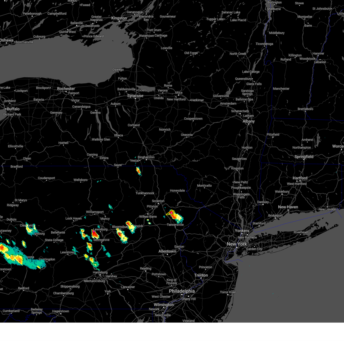 At 325 pm edt, a severe thunderstorm was located over gouldsboro state park, or 7 miles north of mount pocono, moving southwest at 20 mph (public observed quarter size hail). Hazards include 60 mph wind gusts and quarter size hail. Hail damage to vehicles is expected. expect wind damage to roofs, siding, and trees. locations impacted include, gouldsboro, angels and la anna. hail threat, observed max hail size, 1. 00 in wind threat, radar indicated max wind gust, 60 mph. At 325 pm edt, a severe thunderstorm was located over gouldsboro state park, or 7 miles north of mount pocono, moving southwest at 20 mph (public observed quarter size hail). Hazards include 60 mph wind gusts and quarter size hail. Hail damage to vehicles is expected. expect wind damage to roofs, siding, and trees. locations impacted include, gouldsboro, angels and la anna. hail threat, observed max hail size, 1. 00 in wind threat, radar indicated max wind gust, 60 mph.
|
| 6/3/2023 3:24 PM EDT |
 At 323 pm edt, a severe thunderstorm was located near gouldsboro state park, or 7 miles north of mount pocono, moving south at 25 mph (radar indicated). Hazards include 60 mph wind gusts and quarter size hail. Minor damage to vehicles is possible. wind damage to roofs, siding, trees, and power lines is possible. locations impacted include, mount pocono, tobyhanna, gouldsboro state park, arrowhead lake and pocono pines. this includes interstate 380 in pennsylvania between mile markers 1 and 12. hail threat, radar indicated max hail size, 1. 00 in wind threat, radar indicated max wind gust, 60 mph. At 323 pm edt, a severe thunderstorm was located near gouldsboro state park, or 7 miles north of mount pocono, moving south at 25 mph (radar indicated). Hazards include 60 mph wind gusts and quarter size hail. Minor damage to vehicles is possible. wind damage to roofs, siding, trees, and power lines is possible. locations impacted include, mount pocono, tobyhanna, gouldsboro state park, arrowhead lake and pocono pines. this includes interstate 380 in pennsylvania between mile markers 1 and 12. hail threat, radar indicated max hail size, 1. 00 in wind threat, radar indicated max wind gust, 60 mph.
|
| 6/3/2023 3:14 PM EDT |
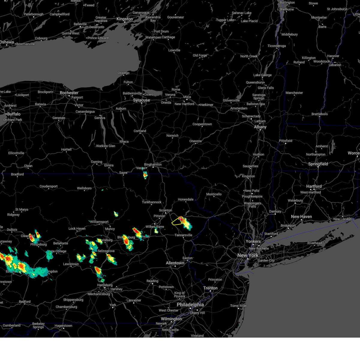 At 314 pm edt, a severe thunderstorm was located over sterling, or 12 miles north of mount pocono, moving southwest at 15 mph (radar indicated). Hazards include 60 mph wind gusts and quarter size hail. Hail damage to vehicles is expected. expect wind damage to roofs, siding, and trees. locations impacted include, sterling, lehigh, greentown, gouldsboro, angels, newfoundland and la anna. hail threat, radar indicated max hail size, 1. 00 in wind threat, radar indicated max wind gust, 60 mph. At 314 pm edt, a severe thunderstorm was located over sterling, or 12 miles north of mount pocono, moving southwest at 15 mph (radar indicated). Hazards include 60 mph wind gusts and quarter size hail. Hail damage to vehicles is expected. expect wind damage to roofs, siding, and trees. locations impacted include, sterling, lehigh, greentown, gouldsboro, angels, newfoundland and la anna. hail threat, radar indicated max hail size, 1. 00 in wind threat, radar indicated max wind gust, 60 mph.
|
| 6/3/2023 3:10 PM EDT |
 At 309 pm edt, a severe thunderstorm was located over angels, or 12 miles north of mount pocono, moving south at 25 mph (radar indicated). Hazards include 60 mph wind gusts and quarter size hail. Minor damage to vehicles is possible. Wind damage to roofs, siding, trees, and power lines is possible. At 309 pm edt, a severe thunderstorm was located over angels, or 12 miles north of mount pocono, moving south at 25 mph (radar indicated). Hazards include 60 mph wind gusts and quarter size hail. Minor damage to vehicles is possible. Wind damage to roofs, siding, trees, and power lines is possible.
|
| 6/3/2023 2:59 PM EDT |
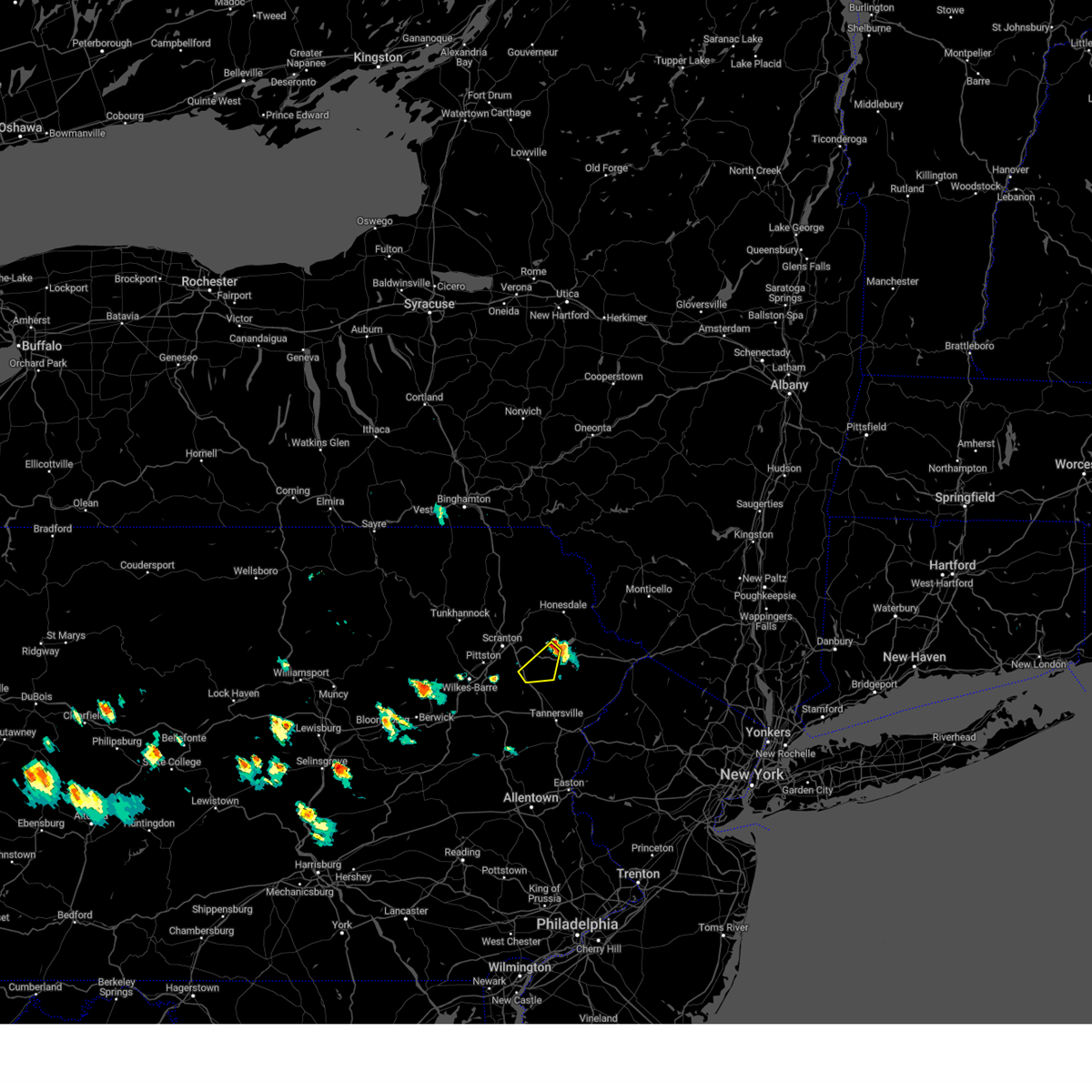 At 259 pm edt, a severe thunderstorm was located over ledgerdale, or 15 miles south of honesdale, moving southwest at 20 mph (radar indicated). Hazards include 60 mph wind gusts and quarter size hail. Hail damage to vehicles is expected. Expect wind damage to roofs, siding, and trees. At 259 pm edt, a severe thunderstorm was located over ledgerdale, or 15 miles south of honesdale, moving southwest at 20 mph (radar indicated). Hazards include 60 mph wind gusts and quarter size hail. Hail damage to vehicles is expected. Expect wind damage to roofs, siding, and trees.
|
| 6/2/2023 4:02 PM EDT |
 At 401 pm edt, a severe thunderstorm was located over mountainhome, or near mount pocono, moving southwest at 30 mph (radar indicated). Hazards include 60 mph wind gusts and quarter size hail. Minor damage to vehicles is possible. Wind damage to roofs, siding, trees, and power lines is possible. At 401 pm edt, a severe thunderstorm was located over mountainhome, or near mount pocono, moving southwest at 30 mph (radar indicated). Hazards include 60 mph wind gusts and quarter size hail. Minor damage to vehicles is possible. Wind damage to roofs, siding, trees, and power lines is possible.
|
| 4/22/2023 6:08 PM EDT |
 At 607 pm edt, a severe thunderstorm was located over tresslarville, or 7 miles southeast of carbondale, moving northeast at 50 mph. another severe thunderstorm was located over pike county near lackawaxen (radar indicated). Hazards include 60 mph wind gusts and quarter size hail. Hail damage to vehicles is expected. expect wind damage to roofs, siding, and trees. locations impacted include, scranton, dunmore, carbondale, bushkill, archbald, blakely, dickson city, olyphant, lackawaxen and blooming grove. hail threat, radar indicated max hail size, 1. 00 in wind threat, radar indicated max wind gust, 60 mph. At 607 pm edt, a severe thunderstorm was located over tresslarville, or 7 miles southeast of carbondale, moving northeast at 50 mph. another severe thunderstorm was located over pike county near lackawaxen (radar indicated). Hazards include 60 mph wind gusts and quarter size hail. Hail damage to vehicles is expected. expect wind damage to roofs, siding, and trees. locations impacted include, scranton, dunmore, carbondale, bushkill, archbald, blakely, dickson city, olyphant, lackawaxen and blooming grove. hail threat, radar indicated max hail size, 1. 00 in wind threat, radar indicated max wind gust, 60 mph.
|
| 4/22/2023 5:59 PM EDT |
 At 558 pm edt, a severe thunderstorm was located near elmhurst, or 9 miles east of scranton, moving northeast at 50 mph. a cluster of severe thunderstorms was also over pike county (radar indicated). Hazards include 60 mph wind gusts. expect damage to roofs, siding, and trees At 558 pm edt, a severe thunderstorm was located near elmhurst, or 9 miles east of scranton, moving northeast at 50 mph. a cluster of severe thunderstorms was also over pike county (radar indicated). Hazards include 60 mph wind gusts. expect damage to roofs, siding, and trees
|
| 4/22/2023 5:50 PM EDT |
 At 550 pm edt, severe thunderstorms were located along a line extending from near gouldsboro to bethlehem, moving northeast at 45 mph (radar indicated). Hazards include 60 mph wind gusts. Damage to roofs, siding, trees, and power lines is possible. locations impacted include, allentown, easton, mount pocono, bethlehem, forks, emmaus, east stroudsburg, tobyhanna, wilson, hellertown, nazareth, bangor, pen argyl, wind gap, bath, belfast, west easton, tatamy, east bangor and steuben. this includes the following highways, northeast extension between mile markers 46 and 50. interstate 78 in pennsylvania between mile markers 59 and 69. interstate 80 in pennsylvania between mile markers 291 and 314. interstate 80 in new jersey near mile marker 0. interstate 380 in pennsylvania between mile markers 0 and 13. hail threat, radar indicated max hail size, <. 75 in wind threat, radar indicated max wind gust, 60 mph. At 550 pm edt, severe thunderstorms were located along a line extending from near gouldsboro to bethlehem, moving northeast at 45 mph (radar indicated). Hazards include 60 mph wind gusts. Damage to roofs, siding, trees, and power lines is possible. locations impacted include, allentown, easton, mount pocono, bethlehem, forks, emmaus, east stroudsburg, tobyhanna, wilson, hellertown, nazareth, bangor, pen argyl, wind gap, bath, belfast, west easton, tatamy, east bangor and steuben. this includes the following highways, northeast extension between mile markers 46 and 50. interstate 78 in pennsylvania between mile markers 59 and 69. interstate 80 in pennsylvania between mile markers 291 and 314. interstate 80 in new jersey near mile marker 0. interstate 380 in pennsylvania between mile markers 0 and 13. hail threat, radar indicated max hail size, <. 75 in wind threat, radar indicated max wind gust, 60 mph.
|
| 4/22/2023 5:30 PM EDT |
 At 530 pm edt, severe thunderstorms were located along a line extending from near stoddartsville to zionsville, moving northeast at 45 mph (radar indicated). Hazards include 60 mph wind gusts. damage to roofs, siding, trees, and power lines is possible At 530 pm edt, severe thunderstorms were located along a line extending from near stoddartsville to zionsville, moving northeast at 45 mph (radar indicated). Hazards include 60 mph wind gusts. damage to roofs, siding, trees, and power lines is possible
|
| 7/24/2022 6:49 PM EDT |
 At 648 pm edt, severe thunderstorms were located along a line extending from peabrook to honesdale to white haven, moving east at 35 mph (radar indicated). Hazards include 60 mph wind gusts. Expect damage to roofs, siding, and trees. these severe storms will be near, honesdale, hawley and bethany around 655 pm edt. narrowsburg around 700 pm edt. jeffersonville, lava and roscoe around 705 pm edt. lackawaxen and hazel around 710 pm edt. eldred, livingston manor and white sulphur springs around 715 pm edt. hail threat, radar indicated max hail size, <. 75 in wind threat, radar indicated max wind gust, 60 mph. At 648 pm edt, severe thunderstorms were located along a line extending from peabrook to honesdale to white haven, moving east at 35 mph (radar indicated). Hazards include 60 mph wind gusts. Expect damage to roofs, siding, and trees. these severe storms will be near, honesdale, hawley and bethany around 655 pm edt. narrowsburg around 700 pm edt. jeffersonville, lava and roscoe around 705 pm edt. lackawaxen and hazel around 710 pm edt. eldred, livingston manor and white sulphur springs around 715 pm edt. hail threat, radar indicated max hail size, <. 75 in wind threat, radar indicated max wind gust, 60 mph.
|
| 7/24/2022 6:49 PM EDT |
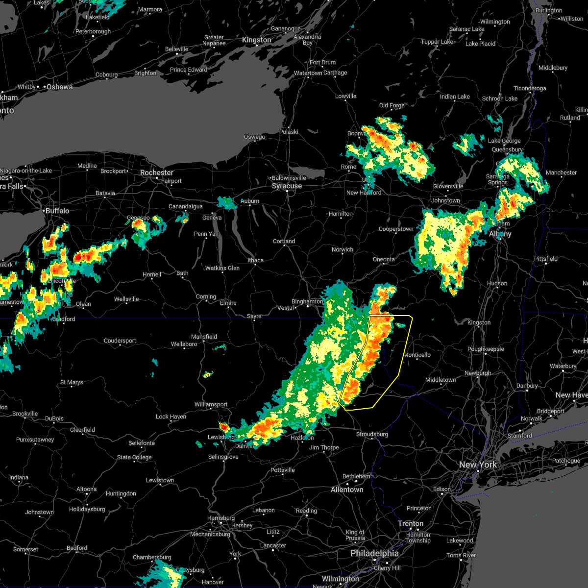 At 648 pm edt, severe thunderstorms were located along a line extending from peabrook to honesdale to white haven, moving east at 35 mph (radar indicated). Hazards include 60 mph wind gusts. Expect damage to roofs, siding, and trees. these severe storms will be near, honesdale, hawley and bethany around 655 pm edt. narrowsburg around 700 pm edt. jeffersonville, lava and roscoe around 705 pm edt. lackawaxen and hazel around 710 pm edt. eldred, livingston manor and white sulphur springs around 715 pm edt. hail threat, radar indicated max hail size, <. 75 in wind threat, radar indicated max wind gust, 60 mph. At 648 pm edt, severe thunderstorms were located along a line extending from peabrook to honesdale to white haven, moving east at 35 mph (radar indicated). Hazards include 60 mph wind gusts. Expect damage to roofs, siding, and trees. these severe storms will be near, honesdale, hawley and bethany around 655 pm edt. narrowsburg around 700 pm edt. jeffersonville, lava and roscoe around 705 pm edt. lackawaxen and hazel around 710 pm edt. eldred, livingston manor and white sulphur springs around 715 pm edt. hail threat, radar indicated max hail size, <. 75 in wind threat, radar indicated max wind gust, 60 mph.
|
| 7/24/2022 6:17 PM EDT |
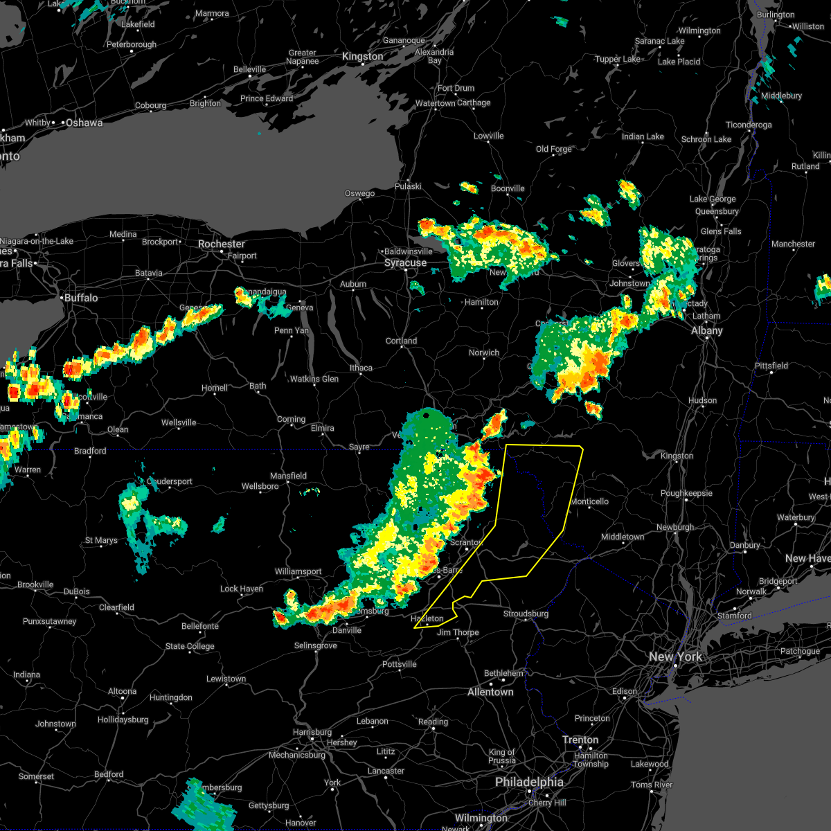 At 616 pm edt, severe thunderstorms were located along a line extending from near starruca to near tompkinsville to near beach haven, moving east at 35 mph (radar indicated). Hazards include 60 mph wind gusts. Expect damage to roofs, siding, and trees. severe thunderstorms will be near, west hazleton, hiawatha and starlight around 630 pm edt. hazleton, waymart and hancock around 635 pm edt. freeland, prompton and bethany around 640 pm edt. honesdale, fishs eddy and east branch around 645 pm edt. white haven, peabrook and stalker around 650 pm edt. hawley around 655 pm edt. narrowsburg and stoddartsville around 700 pm edt. jeffersonville, lava and roscoe around 705 pm edt. hail threat, radar indicated max hail size, <. 75 in wind threat, radar indicated max wind gust, 60 mph. At 616 pm edt, severe thunderstorms were located along a line extending from near starruca to near tompkinsville to near beach haven, moving east at 35 mph (radar indicated). Hazards include 60 mph wind gusts. Expect damage to roofs, siding, and trees. severe thunderstorms will be near, west hazleton, hiawatha and starlight around 630 pm edt. hazleton, waymart and hancock around 635 pm edt. freeland, prompton and bethany around 640 pm edt. honesdale, fishs eddy and east branch around 645 pm edt. white haven, peabrook and stalker around 650 pm edt. hawley around 655 pm edt. narrowsburg and stoddartsville around 700 pm edt. jeffersonville, lava and roscoe around 705 pm edt. hail threat, radar indicated max hail size, <. 75 in wind threat, radar indicated max wind gust, 60 mph.
|
| 6/1/2022 6:06 PM EDT |
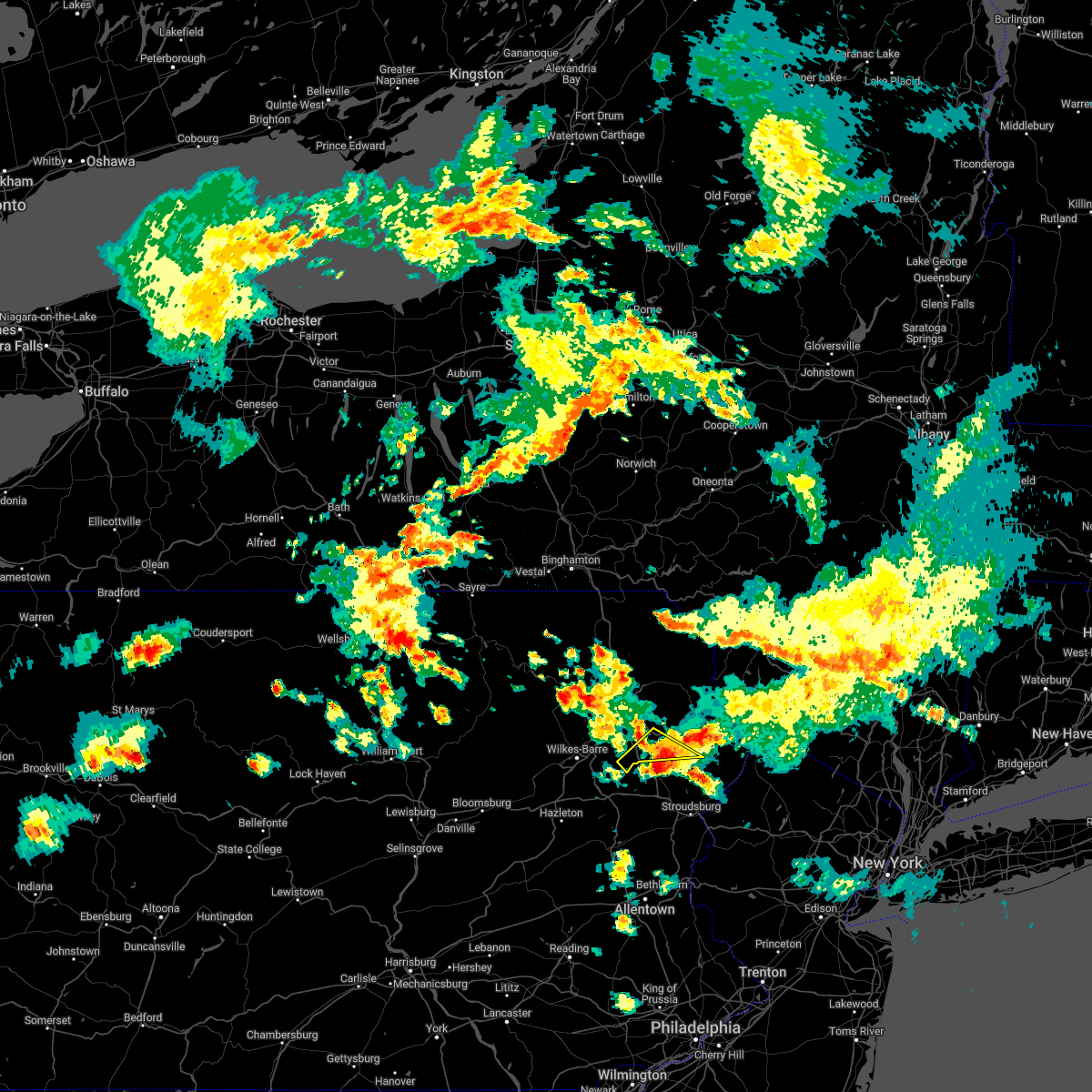 The severe thunderstorm warning for southeastern lackawanna, southwestern wayne and west central pike counties will expire at 615 pm edt, the storm which prompted the warning has weakened below severe limits, and has exited the warned area. therefore, the warning will be allowed to expire. a severe thunderstorm watch remains in effect until 1000 pm edt for northeastern pennsylvania. The severe thunderstorm warning for southeastern lackawanna, southwestern wayne and west central pike counties will expire at 615 pm edt, the storm which prompted the warning has weakened below severe limits, and has exited the warned area. therefore, the warning will be allowed to expire. a severe thunderstorm watch remains in effect until 1000 pm edt for northeastern pennsylvania.
|
| 6/1/2022 6:00 PM EDT |
 At 559 pm edt, a severe thunderstorm was located over gouldsboro state park, or 7 miles northwest of mount pocono, moving southeast at 25 mph (radar indicated). Hazards include 60 mph wind gusts and nickel size hail. Damage to roofs, siding, trees, and power lines is possible. locations impacted include, mount pocono, tobyhanna, reeders, henryville, pocono pines, analomink, skytop, tannersville, mountainhome, canadensis, alpine mountain, scotrun, paradise valley, gouldsboro state park, cresco and bartonsville. this includes the following highways, interstate 80 in pennsylvania between mile markers 296 and 306. interstate 380 in pennsylvania between mile markers 0 and 12. hail threat, radar indicated max hail size, 0. 88 in wind threat, radar indicated max wind gust, 60 mph. At 559 pm edt, a severe thunderstorm was located over gouldsboro state park, or 7 miles northwest of mount pocono, moving southeast at 25 mph (radar indicated). Hazards include 60 mph wind gusts and nickel size hail. Damage to roofs, siding, trees, and power lines is possible. locations impacted include, mount pocono, tobyhanna, reeders, henryville, pocono pines, analomink, skytop, tannersville, mountainhome, canadensis, alpine mountain, scotrun, paradise valley, gouldsboro state park, cresco and bartonsville. this includes the following highways, interstate 80 in pennsylvania between mile markers 296 and 306. interstate 380 in pennsylvania between mile markers 0 and 12. hail threat, radar indicated max hail size, 0. 88 in wind threat, radar indicated max wind gust, 60 mph.
|
| 6/1/2022 5:57 PM EDT |
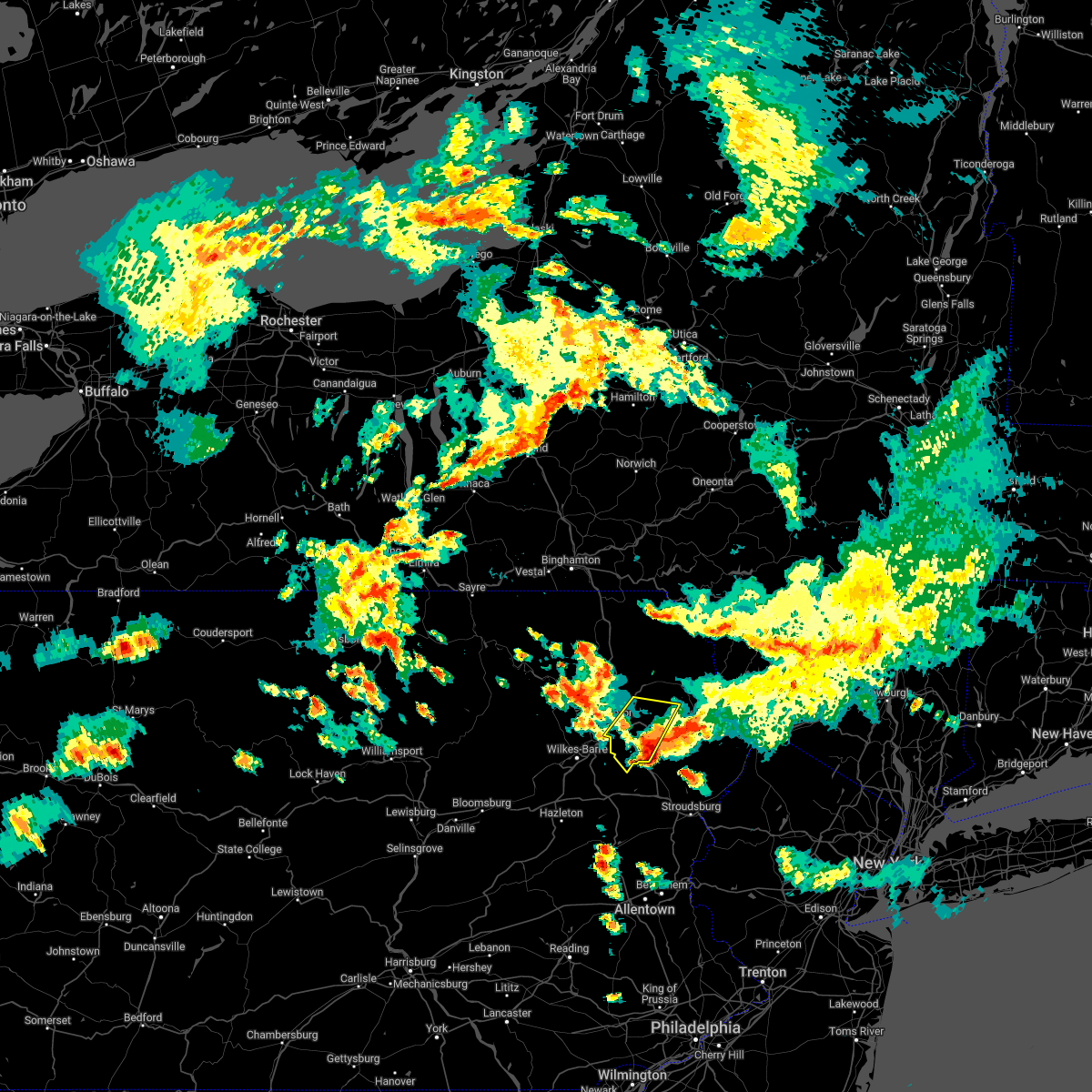 The severe thunderstorm warning for southeastern lackawanna and southwestern wayne counties will expire at 600 pm edt, the storm which prompted the warning has moved out of the area. therefore, the warning will be allowed to expire. however small hail and gusty winds are still possible with this thunderstorm. a severe thunderstorm watch remains in effect until 1000 pm edt for northeastern pennsylvania. remember, a severe thunderstorm warning still remains in effect for southern portions of lackawanna and wayne counties. The severe thunderstorm warning for southeastern lackawanna and southwestern wayne counties will expire at 600 pm edt, the storm which prompted the warning has moved out of the area. therefore, the warning will be allowed to expire. however small hail and gusty winds are still possible with this thunderstorm. a severe thunderstorm watch remains in effect until 1000 pm edt for northeastern pennsylvania. remember, a severe thunderstorm warning still remains in effect for southern portions of lackawanna and wayne counties.
|
| 6/1/2022 5:52 PM EDT |
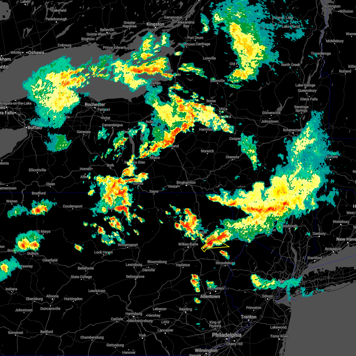 At 551 pm edt, a severe thunderstorm was located over angels, or 10 miles north of mount pocono, moving southeast at 35 mph (radar indicated). Hazards include 60 mph wind gusts and penny size hail. expect damage to roofs, siding, and trees At 551 pm edt, a severe thunderstorm was located over angels, or 10 miles north of mount pocono, moving southeast at 35 mph (radar indicated). Hazards include 60 mph wind gusts and penny size hail. expect damage to roofs, siding, and trees
|
| 6/1/2022 5:47 PM EDT |
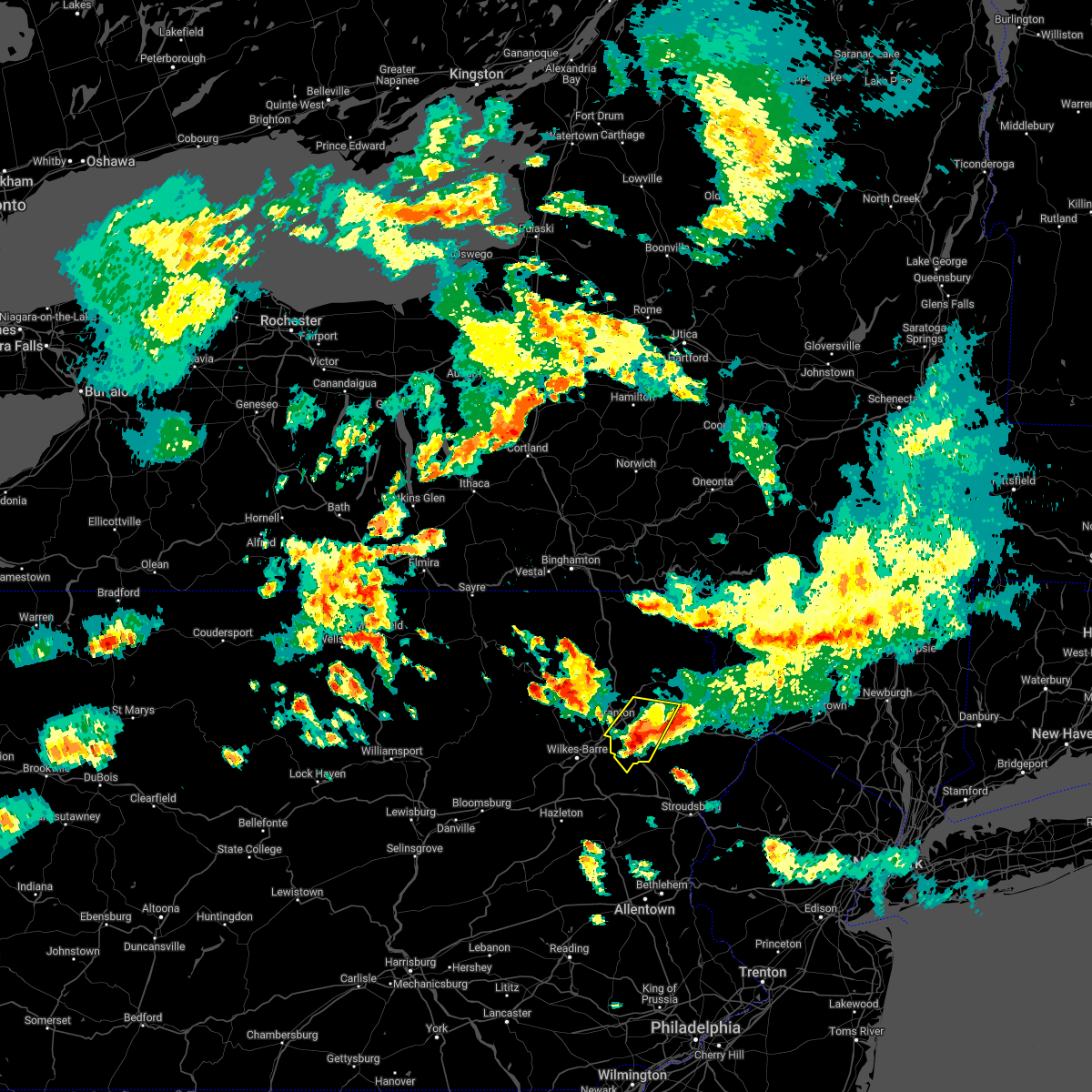 At 547 pm edt, a severe thunderstorm was located near lehigh, or 10 miles southeast of scranton, moving southeast at 20 mph (radar indicated). Hazards include 70 mph wind gusts and quarter size hail. Hail damage to vehicles is expected. expect considerable tree damage. wind damage is also likely to mobile homes, roofs, and outbuildings. locations impacted include, scranton, dunmore, archbald, blakely, moosic, olyphant, jessup, throop, moscow and south canaan. thunderstorm damage threat, considerable hail threat, radar indicated max hail size, 1. 00 in wind threat, radar indicated max wind gust, 70 mph. At 547 pm edt, a severe thunderstorm was located near lehigh, or 10 miles southeast of scranton, moving southeast at 20 mph (radar indicated). Hazards include 70 mph wind gusts and quarter size hail. Hail damage to vehicles is expected. expect considerable tree damage. wind damage is also likely to mobile homes, roofs, and outbuildings. locations impacted include, scranton, dunmore, archbald, blakely, moosic, olyphant, jessup, throop, moscow and south canaan. thunderstorm damage threat, considerable hail threat, radar indicated max hail size, 1. 00 in wind threat, radar indicated max wind gust, 70 mph.
|
| 6/1/2022 5:28 PM EDT |
 At 527 pm edt, a severe thunderstorm was located over elmhurst, or 7 miles east of scranton, moving southeast at 35 mph (radar indicated). Hazards include 70 mph wind gusts and ping pong ball size hail. People and animals outdoors will be injured. expect hail damage to roofs, siding, windows, and vehicles. expect considerable tree damage. Wind damage is also likely to mobile homes, roofs, and outbuildings. At 527 pm edt, a severe thunderstorm was located over elmhurst, or 7 miles east of scranton, moving southeast at 35 mph (radar indicated). Hazards include 70 mph wind gusts and ping pong ball size hail. People and animals outdoors will be injured. expect hail damage to roofs, siding, windows, and vehicles. expect considerable tree damage. Wind damage is also likely to mobile homes, roofs, and outbuildings.
|
| 6/1/2022 5:24 PM EDT |
 At 523 pm edt, a severe thunderstorm was located over dunmore, or near scranton, moving southeast at 25 mph (radar indicated). Hazards include 70 mph wind gusts and quarter size hail. Hail damage to vehicles is expected. expect considerable tree damage. Wind damage is also likely to mobile homes, roofs, and outbuildings. At 523 pm edt, a severe thunderstorm was located over dunmore, or near scranton, moving southeast at 25 mph (radar indicated). Hazards include 70 mph wind gusts and quarter size hail. Hail damage to vehicles is expected. expect considerable tree damage. Wind damage is also likely to mobile homes, roofs, and outbuildings.
|
| 5/16/2022 2:42 PM EDT |
 At 242 pm edt, a severe thunderstorm was located over henryville, or near mount pocono, moving northeast at 40 mph (radar indicated). Hazards include 60 mph wind gusts and quarter size hail. Hail damage to vehicles is expected. Expect wind damage to roofs, siding, and trees. At 242 pm edt, a severe thunderstorm was located over henryville, or near mount pocono, moving northeast at 40 mph (radar indicated). Hazards include 60 mph wind gusts and quarter size hail. Hail damage to vehicles is expected. Expect wind damage to roofs, siding, and trees.
|
| 5/16/2022 2:42 PM EDT |
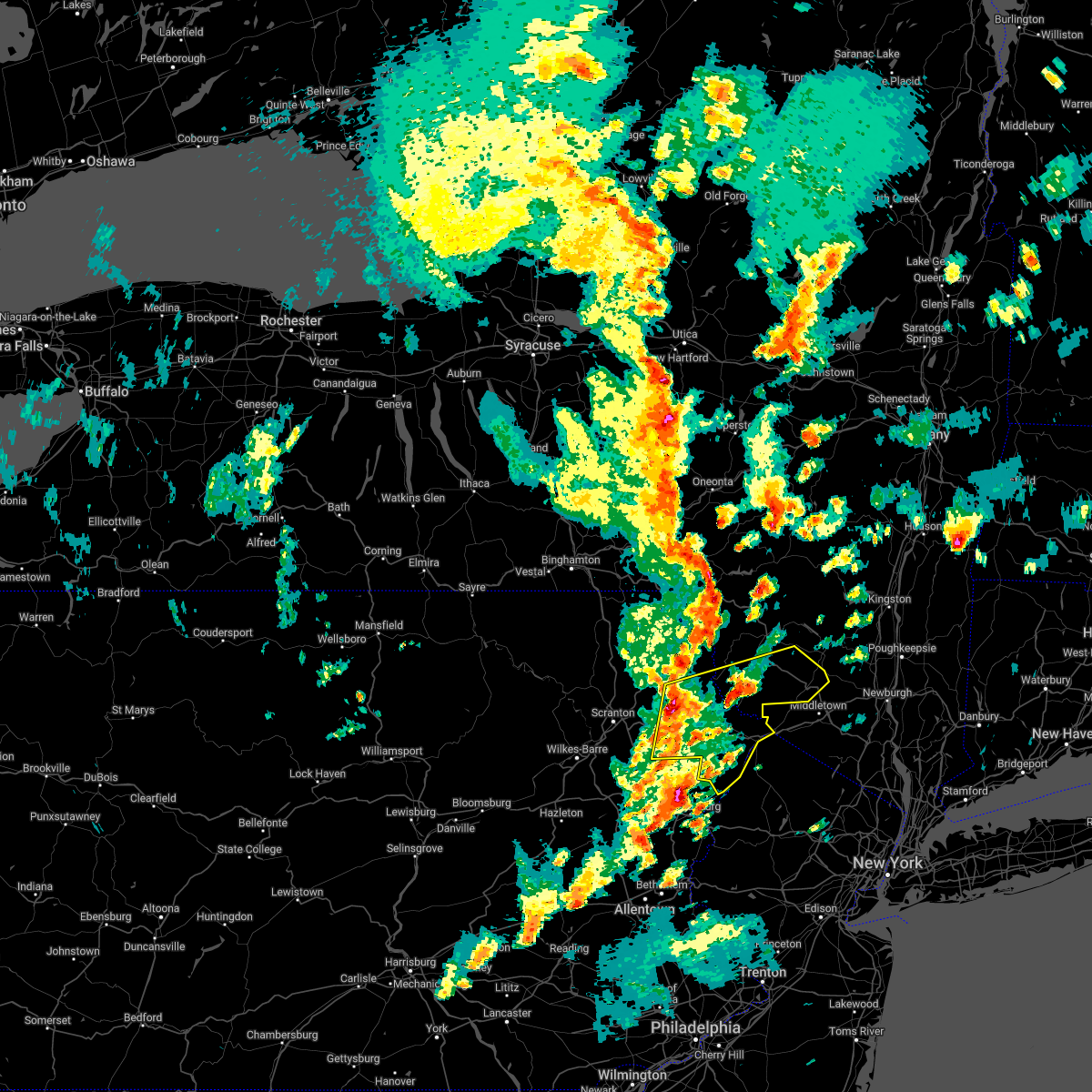 At 242 pm edt, a severe thunderstorm was located over henryville, or near mount pocono, moving northeast at 40 mph (radar indicated). Hazards include 60 mph wind gusts and quarter size hail. Hail damage to vehicles is expected. Expect wind damage to roofs, siding, and trees. At 242 pm edt, a severe thunderstorm was located over henryville, or near mount pocono, moving northeast at 40 mph (radar indicated). Hazards include 60 mph wind gusts and quarter size hail. Hail damage to vehicles is expected. Expect wind damage to roofs, siding, and trees.
|
| 3/19/2022 6:55 PM EDT |
 The severe thunderstorm warning for western monroe county will expire at 700 pm edt, the storms which prompted the warning have weakened below severe limits, and are exiting the warned area. therefore, the warning will be allowed to expire. however small hail and gusty winds are still possible with these thunderstorms. to report severe weather, contact your nearest law enforcement agency. they will relay your report to the national weather service mount holly nj. The severe thunderstorm warning for western monroe county will expire at 700 pm edt, the storms which prompted the warning have weakened below severe limits, and are exiting the warned area. therefore, the warning will be allowed to expire. however small hail and gusty winds are still possible with these thunderstorms. to report severe weather, contact your nearest law enforcement agency. they will relay your report to the national weather service mount holly nj.
|
| 3/19/2022 6:50 PM EDT |
 At 650 pm edt, severe thunderstorms were located along a line extending from gouldsboro state park to near scotrun to rossland, moving east at 40 mph (radar indicated). Hazards include 60 mph wind gusts and penny size hail. Damage to roofs, siding, trees, and power lines is possible. locations impacted include, mount pocono, tobyhanna, reeders, brodheadsville, kunkletown, pocono pines, gilbert, mcmichael, tannersville, rossland, scotrun, gouldsboro state park, arrowhead lake, effort and fiddletown. this includes the following highways, interstate 80 in pennsylvania between mile markers 298 and 302. interstate 380 in pennsylvania between mile markers 0 and 13. hail threat, radar indicated max hail size, 0. 75 in wind threat, radar indicated max wind gust, 60 mph. At 650 pm edt, severe thunderstorms were located along a line extending from gouldsboro state park to near scotrun to rossland, moving east at 40 mph (radar indicated). Hazards include 60 mph wind gusts and penny size hail. Damage to roofs, siding, trees, and power lines is possible. locations impacted include, mount pocono, tobyhanna, reeders, brodheadsville, kunkletown, pocono pines, gilbert, mcmichael, tannersville, rossland, scotrun, gouldsboro state park, arrowhead lake, effort and fiddletown. this includes the following highways, interstate 80 in pennsylvania between mile markers 298 and 302. interstate 380 in pennsylvania between mile markers 0 and 13. hail threat, radar indicated max hail size, 0. 75 in wind threat, radar indicated max wind gust, 60 mph.
|
| 3/19/2022 6:43 PM EDT |
 At 643 pm edt, severe thunderstorms were located along a line extending from near arrowhead lake to near mount pocono to kunkletown, moving northeast at 40 mph (radar indicated). Hazards include 60 mph wind gusts and penny size hail. Damage to roofs, siding, trees, and power lines is possible. locations impacted include, mount pocono, tobyhanna, palmerton, slatington, walnutport, brodheadsville, kunkletown, pocono pines, gilbert, tannersville, rossland, berlinsville, long pond, emerald, kresgeville, sun valley, arrowhead lake, jonas, reeders and danielsville. this includes the following highways, northeast extension between mile markers 68 and 77. interstate 80 in pennsylvania between mile markers 291 and 302. interstate 380 in pennsylvania between mile markers 0 and 13. hail threat, radar indicated max hail size, 0. 75 in wind threat, radar indicated max wind gust, 60 mph. At 643 pm edt, severe thunderstorms were located along a line extending from near arrowhead lake to near mount pocono to kunkletown, moving northeast at 40 mph (radar indicated). Hazards include 60 mph wind gusts and penny size hail. Damage to roofs, siding, trees, and power lines is possible. locations impacted include, mount pocono, tobyhanna, palmerton, slatington, walnutport, brodheadsville, kunkletown, pocono pines, gilbert, tannersville, rossland, berlinsville, long pond, emerald, kresgeville, sun valley, arrowhead lake, jonas, reeders and danielsville. this includes the following highways, northeast extension between mile markers 68 and 77. interstate 80 in pennsylvania between mile markers 291 and 302. interstate 380 in pennsylvania between mile markers 0 and 13. hail threat, radar indicated max hail size, 0. 75 in wind threat, radar indicated max wind gust, 60 mph.
|
| 3/19/2022 6:36 PM EDT |
 At 635 pm edt, severe thunderstorms were located along a line extending from blakeslee to pocono raceway to lehighton, moving east at 40 mph (radar indicated). Hazards include 60 mph wind gusts and quarter size hail. Minor damage to vehicles is possible. wind damage to roofs, siding, trees, and power lines is possible. locations impacted include, lehighton, mount pocono, tobyhanna, palmerton, jim thorpe, slatington, walnutport, brodheadsville, kunkletown, pocono pines, gilbert, pocono raceway, lake harmony, tannersville, rossland, berlinsville, long pond, emerald, kresgeville and sun valley. this includes the following highways, northeast extension between mile markers 68 and 85. interstate 80 in pennsylvania between mile markers 283 and 302. interstate 380 in pennsylvania between mile markers 0 and 13. hail threat, radar indicated max hail size, 1. 00 in wind threat, radar indicated max wind gust, 60 mph. At 635 pm edt, severe thunderstorms were located along a line extending from blakeslee to pocono raceway to lehighton, moving east at 40 mph (radar indicated). Hazards include 60 mph wind gusts and quarter size hail. Minor damage to vehicles is possible. wind damage to roofs, siding, trees, and power lines is possible. locations impacted include, lehighton, mount pocono, tobyhanna, palmerton, jim thorpe, slatington, walnutport, brodheadsville, kunkletown, pocono pines, gilbert, pocono raceway, lake harmony, tannersville, rossland, berlinsville, long pond, emerald, kresgeville and sun valley. this includes the following highways, northeast extension between mile markers 68 and 85. interstate 80 in pennsylvania between mile markers 283 and 302. interstate 380 in pennsylvania between mile markers 0 and 13. hail threat, radar indicated max hail size, 1. 00 in wind threat, radar indicated max wind gust, 60 mph.
|
| 3/19/2022 6:20 PM EDT |
 At 620 pm edt, severe thunderstorms were located along a line extending from white haven to christmans to near new mahoning, moving east at 45 mph. this storm has a history of producing wind damage in schuylkill county near kulpmont (radar indicated). Hazards include 60 mph wind gusts and quarter size hail. Minor damage to vehicles is possible. wind damage to roofs, siding, trees, and power lines is possible. locations impacted include, lehighton, mount pocono, tobyhanna, palmerton, jim thorpe, slatington, nesquehoning, weatherly, walnutport, neffs, pocono pines, lake harmony, new tripoli, tannersville, long pond, kresgeville, sun valley, reeders, beltzville state park and mcmichael. this includes the following highways, northeast extension between mile markers 63 and 97. interstate 80 in pennsylvania between mile markers 277 and 302. Interstate 380 in pennsylvania between mile markers 0 and 13. At 620 pm edt, severe thunderstorms were located along a line extending from white haven to christmans to near new mahoning, moving east at 45 mph. this storm has a history of producing wind damage in schuylkill county near kulpmont (radar indicated). Hazards include 60 mph wind gusts and quarter size hail. Minor damage to vehicles is possible. wind damage to roofs, siding, trees, and power lines is possible. locations impacted include, lehighton, mount pocono, tobyhanna, palmerton, jim thorpe, slatington, nesquehoning, weatherly, walnutport, neffs, pocono pines, lake harmony, new tripoli, tannersville, long pond, kresgeville, sun valley, reeders, beltzville state park and mcmichael. this includes the following highways, northeast extension between mile markers 63 and 97. interstate 80 in pennsylvania between mile markers 277 and 302. Interstate 380 in pennsylvania between mile markers 0 and 13.
|
| 3/19/2022 6:13 PM EDT |
 At 611 pm edt, severe thunderstorms were located along a line extending from near freeland to near weatherly to near tamaqua, moving east at 40 mph. this storm has a history of producing wind damage in schuylkill county near kulpmont (radar indicated). Hazards include 60 mph wind gusts and quarter size hail. Minor damage to vehicles is possible. wind damage to roofs, siding, trees, and power lines is possible. locations impacted include, lehighton, mount pocono, tobyhanna, palmerton, jim thorpe, slatington, nesquehoning, weatherly, walnutport, neffs, pocono pines, lake harmony, new tripoli, tannersville, long pond, kresgeville, sun valley, reeders, beltzville state park and mcmichael. this includes the following highways, northeast extension between mile markers 63 and 97. interstate 80 in pennsylvania between mile markers 277 and 302. interstate 380 in pennsylvania between mile markers 0 and 13. hail threat, radar indicated max hail size, 1. 00 in wind threat, radar indicated max wind gust, 60 mph. At 611 pm edt, severe thunderstorms were located along a line extending from near freeland to near weatherly to near tamaqua, moving east at 40 mph. this storm has a history of producing wind damage in schuylkill county near kulpmont (radar indicated). Hazards include 60 mph wind gusts and quarter size hail. Minor damage to vehicles is possible. wind damage to roofs, siding, trees, and power lines is possible. locations impacted include, lehighton, mount pocono, tobyhanna, palmerton, jim thorpe, slatington, nesquehoning, weatherly, walnutport, neffs, pocono pines, lake harmony, new tripoli, tannersville, long pond, kresgeville, sun valley, reeders, beltzville state park and mcmichael. this includes the following highways, northeast extension between mile markers 63 and 97. interstate 80 in pennsylvania between mile markers 277 and 302. interstate 380 in pennsylvania between mile markers 0 and 13. hail threat, radar indicated max hail size, 1. 00 in wind threat, radar indicated max wind gust, 60 mph.
|
| 3/19/2022 6:08 PM EDT |
 At 608 pm edt, a severe thunderstorm was located near gouldsboro, or 12 miles southeast of scranton, moving east at 50 mph (radar indicated). Hazards include 60 mph wind gusts. Expect damage to roofs, siding, and trees. locations impacted include, scranton, wilkes-barre, dunmore, kingston, plains, old forge, pittston, taylor, moosic and exeter. hail threat, radar indicated max hail size, <. 75 in wind threat, radar indicated max wind gust, 60 mph. At 608 pm edt, a severe thunderstorm was located near gouldsboro, or 12 miles southeast of scranton, moving east at 50 mph (radar indicated). Hazards include 60 mph wind gusts. Expect damage to roofs, siding, and trees. locations impacted include, scranton, wilkes-barre, dunmore, kingston, plains, old forge, pittston, taylor, moosic and exeter. hail threat, radar indicated max hail size, <. 75 in wind threat, radar indicated max wind gust, 60 mph.
|
| 3/19/2022 5:52 PM EDT |
 At 551 pm edt, severe thunderstorms were located along a line extending from near conyngham to near sheppton to seltzer, moving east at 40 mph (radar indicated). Hazards include 60 mph wind gusts and quarter size hail. Minor damage to vehicles is possible. Wind damage to roofs, siding, trees, and power lines is possible. At 551 pm edt, severe thunderstorms were located along a line extending from near conyngham to near sheppton to seltzer, moving east at 40 mph (radar indicated). Hazards include 60 mph wind gusts and quarter size hail. Minor damage to vehicles is possible. Wind damage to roofs, siding, trees, and power lines is possible.
|
| 3/19/2022 5:44 PM EDT |
 At 543 pm edt, a severe thunderstorm was located over sugar notch, or near wilkes-barre, moving east at 40 mph (radar indicated). Hazards include 60 mph wind gusts. expect damage to roofs, siding, and trees At 543 pm edt, a severe thunderstorm was located over sugar notch, or near wilkes-barre, moving east at 40 mph (radar indicated). Hazards include 60 mph wind gusts. expect damage to roofs, siding, and trees
|
| 3/7/2022 7:52 PM EST |
 At 750 pm est, severe showers and embedded thunderstorms were located along a line extending from near prompton to near lehighton to near mount joy, moving east at 60 mph. this line has had a history of producing areas of wind damage (radar indicated). Hazards include 60 mph wind gusts. Damage to roofs, siding, trees, and power lines is possible. locations impacted include, allentown, reading, easton, lehighton, mount pocono, bethlehem, forks, emmaus, wyomissing, northampton, east stroudsburg, tobyhanna, wilson, hellertown, nazareth, palmerton, bangor, kutztown, jim thorpe and hamburg. this includes the following highways, northeast extension between mile markers 46 and 97. interstate 78 in pennsylvania near mile marker 8, and between mile markers 10 and 75. interstate 80 in pennsylvania between mile markers 278 and 314. interstate 380 in pennsylvania between mile markers 0 and 13. hail threat, radar indicated max hail size, <. 75 in wind threat, radar indicated max wind gust, 60 mph. At 750 pm est, severe showers and embedded thunderstorms were located along a line extending from near prompton to near lehighton to near mount joy, moving east at 60 mph. this line has had a history of producing areas of wind damage (radar indicated). Hazards include 60 mph wind gusts. Damage to roofs, siding, trees, and power lines is possible. locations impacted include, allentown, reading, easton, lehighton, mount pocono, bethlehem, forks, emmaus, wyomissing, northampton, east stroudsburg, tobyhanna, wilson, hellertown, nazareth, palmerton, bangor, kutztown, jim thorpe and hamburg. this includes the following highways, northeast extension between mile markers 46 and 97. interstate 78 in pennsylvania near mile marker 8, and between mile markers 10 and 75. interstate 80 in pennsylvania between mile markers 278 and 314. interstate 380 in pennsylvania between mile markers 0 and 13. hail threat, radar indicated max hail size, <. 75 in wind threat, radar indicated max wind gust, 60 mph.
|
| 3/7/2022 7:31 PM EST |
 At 731 pm est, severe thunderstorms were located along a line extending from franklin to conyngham, moving east at 60 mph (radar indicated). Hazards include 60 mph wind gusts. expect damage to roofs, siding, and trees At 731 pm est, severe thunderstorms were located along a line extending from franklin to conyngham, moving east at 60 mph (radar indicated). Hazards include 60 mph wind gusts. expect damage to roofs, siding, and trees
|
| 3/7/2022 7:29 PM EST |
 At 727 pm est, severe showers and embedded thunderstorms were located along a line extending from near hop bottom to shenandoah to shiremanstown, moving east at 60 mph. this line has had a history of producing wind damage to the west (radar indicated). Hazards include 60 mph wind gusts. damage to roofs, siding, trees, and power lines is possible At 727 pm est, severe showers and embedded thunderstorms were located along a line extending from near hop bottom to shenandoah to shiremanstown, moving east at 60 mph. this line has had a history of producing wind damage to the west (radar indicated). Hazards include 60 mph wind gusts. damage to roofs, siding, trees, and power lines is possible
|
| 9/8/2021 7:59 PM EDT |
 At 759 pm edt, severe thunderstorms were located along a line extending from near pocono pines to near mckeansburg, moving east at 35 mph (radar indicated). Hazards include 60 mph wind gusts and quarter size hail. Minor damage to vehicles is possible. Wind damage to roofs, siding, trees, and power lines is possible. At 759 pm edt, severe thunderstorms were located along a line extending from near pocono pines to near mckeansburg, moving east at 35 mph (radar indicated). Hazards include 60 mph wind gusts and quarter size hail. Minor damage to vehicles is possible. Wind damage to roofs, siding, trees, and power lines is possible.
|
| 9/8/2021 7:44 PM EDT |
 At 743 pm edt, severe thunderstorms were located along a line extending from blakeslee to nesquehoning, moving east at 25 mph (radar indicated). Hazards include 60 mph wind gusts and quarter size hail. Minor damage to vehicles is possible. wind damage to roofs, siding, trees, and power lines is possible. locations impacted include, lehighton, mount pocono, northampton, tobyhanna, palmerton, jim thorpe, slatington, nesquehoning, weatherly, walnutport, neffs, pocono pines, lake harmony, new tripoli, skytop, tannersville, long pond, kresgeville, sun valley and reeders. this includes the following highways, northeast extension between mile markers 62 and 97. interstate 80 in pennsylvania between mile markers 277 and 306. interstate 380 in pennsylvania between mile markers 0 and 13. hail threat, radar indicated max hail size, 1. 00 in wind threat, radar indicated max wind gust, 60 mph. At 743 pm edt, severe thunderstorms were located along a line extending from blakeslee to nesquehoning, moving east at 25 mph (radar indicated). Hazards include 60 mph wind gusts and quarter size hail. Minor damage to vehicles is possible. wind damage to roofs, siding, trees, and power lines is possible. locations impacted include, lehighton, mount pocono, northampton, tobyhanna, palmerton, jim thorpe, slatington, nesquehoning, weatherly, walnutport, neffs, pocono pines, lake harmony, new tripoli, skytop, tannersville, long pond, kresgeville, sun valley and reeders. this includes the following highways, northeast extension between mile markers 62 and 97. interstate 80 in pennsylvania between mile markers 277 and 306. interstate 380 in pennsylvania between mile markers 0 and 13. hail threat, radar indicated max hail size, 1. 00 in wind threat, radar indicated max wind gust, 60 mph.
|
| 9/8/2021 7:17 PM EDT |
 At 717 pm edt, severe thunderstorms were located along a line extending from white haven to tamaqua, moving east at 35 mph (radar indicated). Hazards include 60 mph wind gusts and quarter size hail. Minor damage to vehicles is possible. Wind damage to roofs, siding, trees, and power lines is possible. At 717 pm edt, severe thunderstorms were located along a line extending from white haven to tamaqua, moving east at 35 mph (radar indicated). Hazards include 60 mph wind gusts and quarter size hail. Minor damage to vehicles is possible. Wind damage to roofs, siding, trees, and power lines is possible.
|
| 8/27/2021 12:33 PM EDT | Downed tree limbs and wires near country place drive. time estimated from radar and outage report in monroe county PA, 4.3 miles NW of Gouldsboro, PA |
| 8/22/2021 7:32 PM EDT |
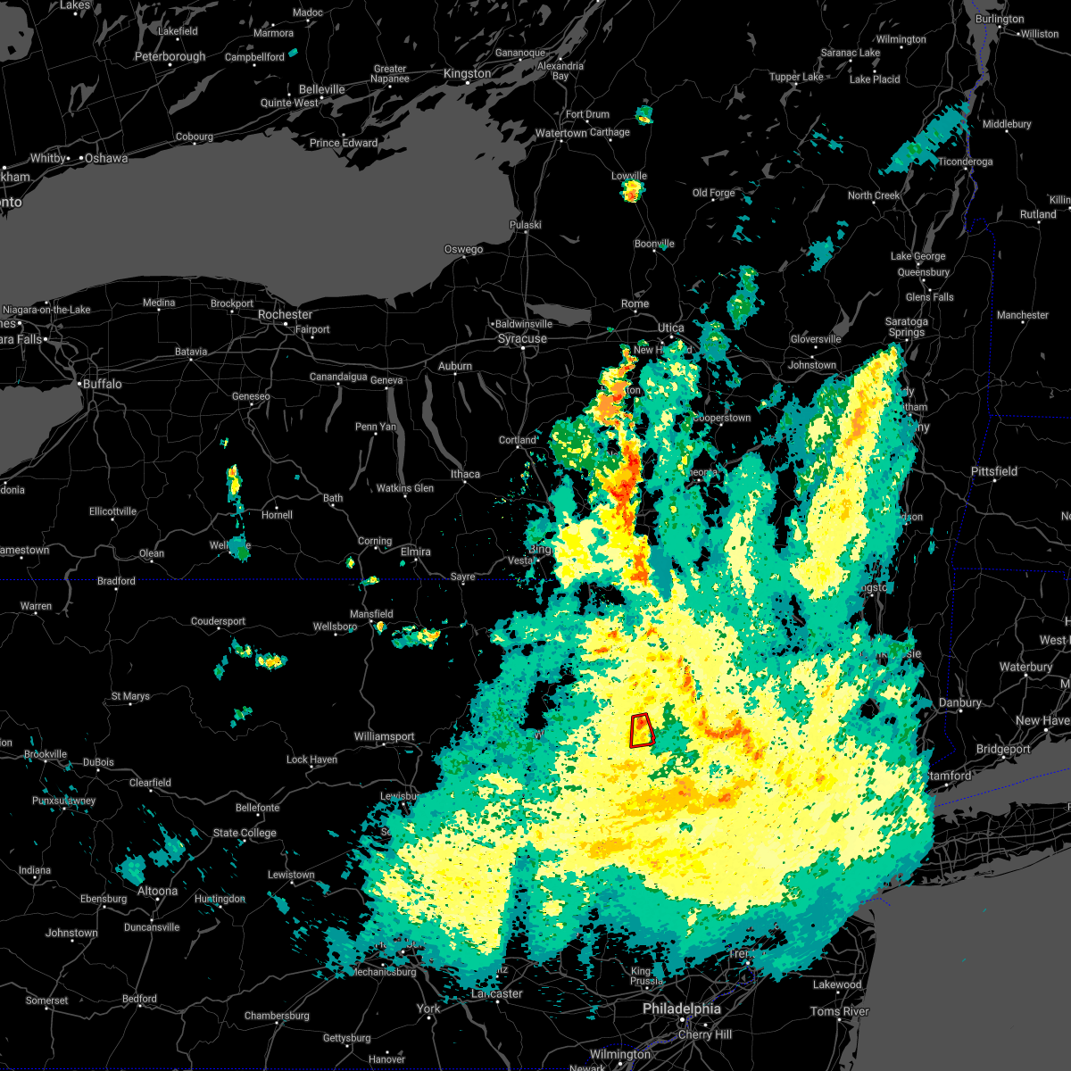 At 732 pm edt, a severe thunderstorm capable of producing a tornado was located over sterling, or 12 miles east of scranton, moving south at 20 mph (radar indicated rotation). Hazards include tornado. Flying debris will be dangerous to those caught without shelter. mobile homes will be damaged or destroyed. damage to roofs, windows, and vehicles will occur. tree damage is likely. This dangerous storm will be near, lehigh, angels and gouldsboro around 745 pm edt. At 732 pm edt, a severe thunderstorm capable of producing a tornado was located over sterling, or 12 miles east of scranton, moving south at 20 mph (radar indicated rotation). Hazards include tornado. Flying debris will be dangerous to those caught without shelter. mobile homes will be damaged or destroyed. damage to roofs, windows, and vehicles will occur. tree damage is likely. This dangerous storm will be near, lehigh, angels and gouldsboro around 745 pm edt.
|
| 8/12/2021 3:42 PM EDT |
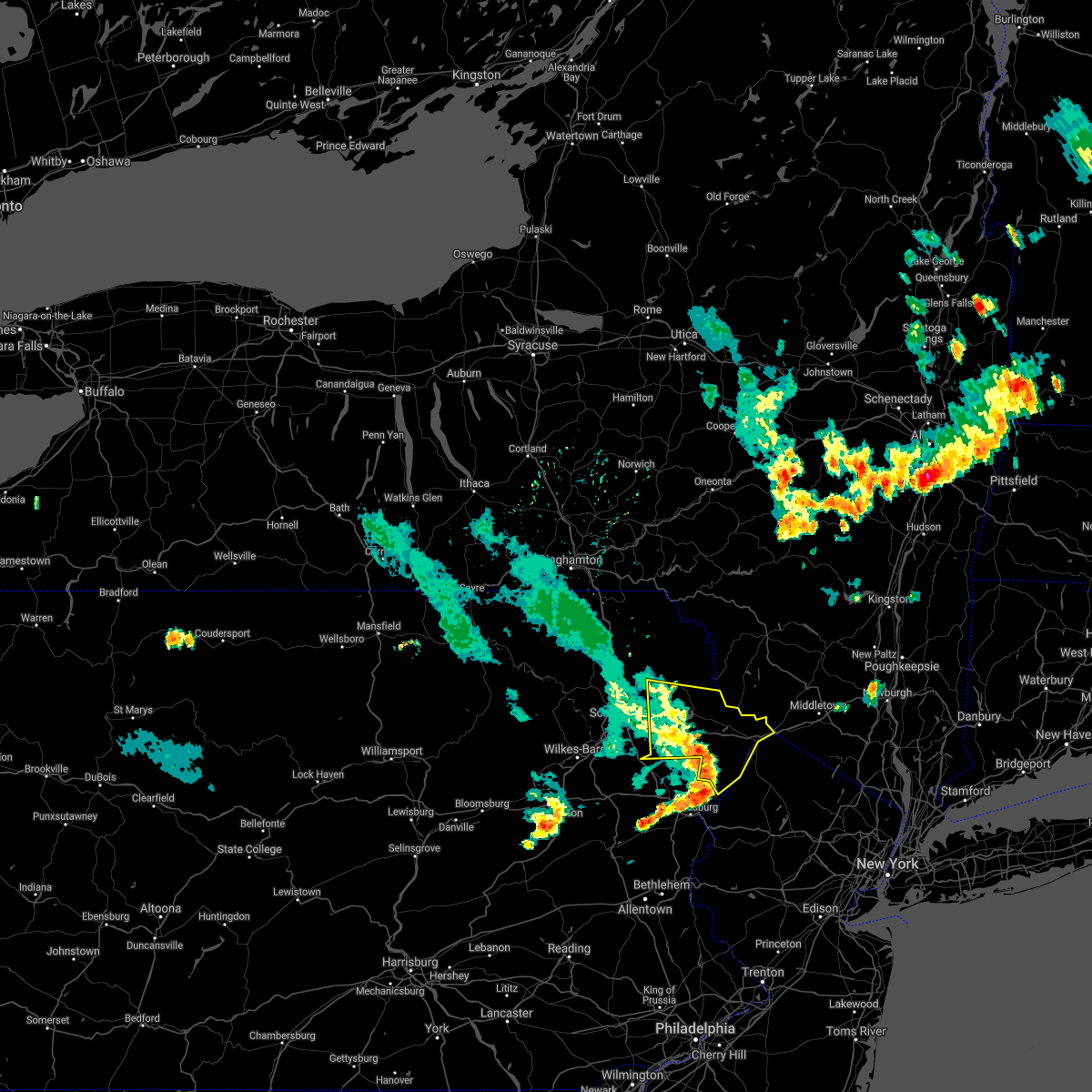 At 341 pm edt, severe thunderstorms were located along a line extending from near prompton to near pecks pond to scotrun, moving east at 55 mph (radar indicated). Hazards include 60 mph wind gusts and penny size hail. Expect damage to roofs, siding, and trees. locations impacted include, bushkill, lackawaxen, blooming grove, honesdale, paupack, shohola, matamoras, south canaan, sterling and waymart. hail threat, radar indicated max hail size, 0. 75 in wind threat, radar indicated max wind gust, 60 mph. At 341 pm edt, severe thunderstorms were located along a line extending from near prompton to near pecks pond to scotrun, moving east at 55 mph (radar indicated). Hazards include 60 mph wind gusts and penny size hail. Expect damage to roofs, siding, and trees. locations impacted include, bushkill, lackawaxen, blooming grove, honesdale, paupack, shohola, matamoras, south canaan, sterling and waymart. hail threat, radar indicated max hail size, 0. 75 in wind threat, radar indicated max wind gust, 60 mph.
|
| 8/12/2021 3:42 PM EDT |
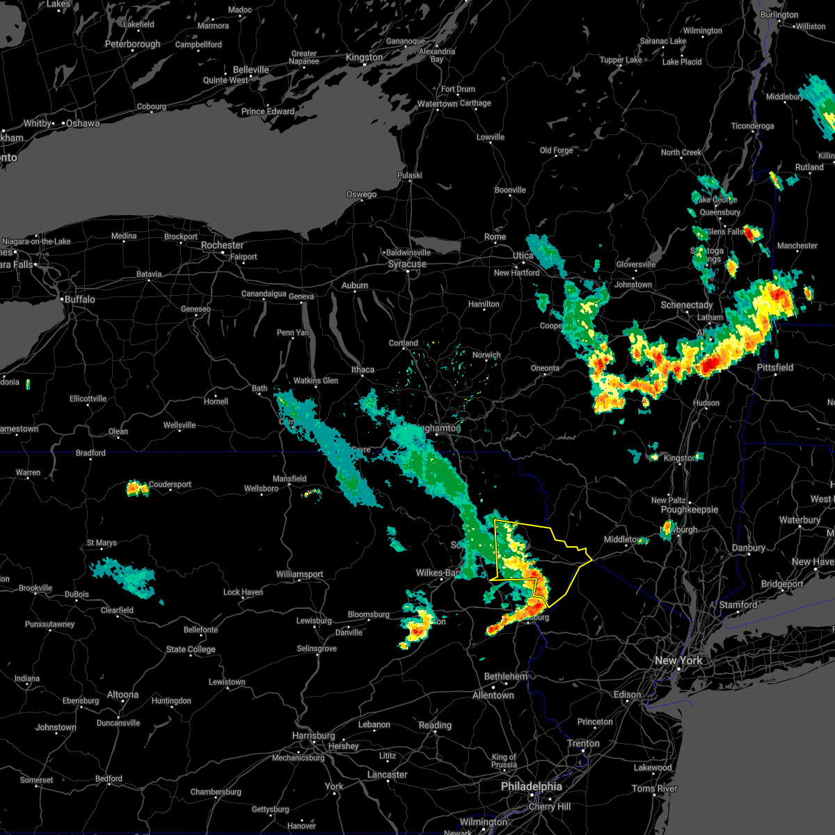 At 341 pm edt, severe thunderstorms were located along a line extending from near prompton to near pecks pond to scotrun, moving east at 55 mph (radar indicated). Hazards include 60 mph wind gusts and penny size hail. Expect damage to roofs, siding, and trees. locations impacted include, bushkill, lackawaxen, blooming grove, honesdale, paupack, shohola, matamoras, south canaan, sterling and waymart. hail threat, radar indicated max hail size, 0. 75 in wind threat, radar indicated max wind gust, 60 mph. At 341 pm edt, severe thunderstorms were located along a line extending from near prompton to near pecks pond to scotrun, moving east at 55 mph (radar indicated). Hazards include 60 mph wind gusts and penny size hail. Expect damage to roofs, siding, and trees. locations impacted include, bushkill, lackawaxen, blooming grove, honesdale, paupack, shohola, matamoras, south canaan, sterling and waymart. hail threat, radar indicated max hail size, 0. 75 in wind threat, radar indicated max wind gust, 60 mph.
|
| 8/12/2021 3:40 PM EDT |
 The severe thunderstorm warning for northeastern carbon and monroe counties will expire at 345 pm edt, the storms which prompted the warning have moved out of the area. therefore, the warning will be allowed to expire. The severe thunderstorm warning for northeastern carbon and monroe counties will expire at 345 pm edt, the storms which prompted the warning have moved out of the area. therefore, the warning will be allowed to expire.
|
| 8/12/2021 3:28 PM EDT |
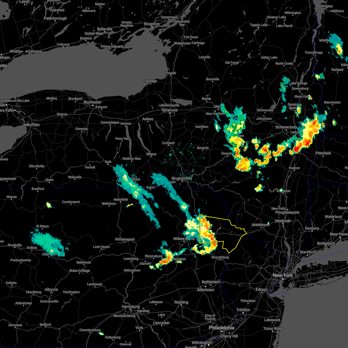 At 328 pm edt, severe thunderstorms were located along a line extending from carbondale to near skytop to pocono raceway, moving east at 55 mph (radar indicated). Hazards include 60 mph wind gusts and penny size hail. expect damage to roofs, siding, and trees At 328 pm edt, severe thunderstorms were located along a line extending from carbondale to near skytop to pocono raceway, moving east at 55 mph (radar indicated). Hazards include 60 mph wind gusts and penny size hail. expect damage to roofs, siding, and trees
|
| 8/12/2021 3:28 PM EDT |
 At 328 pm edt, severe thunderstorms were located along a line extending from near sterling to near gouldsboro state park to near pocono pines, moving east at 30 mph (radar indicated). Hazards include 60 mph wind gusts. Damage to roofs, siding, trees, and power lines is possible. locations impacted include, mount pocono, east stroudsburg, tobyhanna, stormville, henryville, pocono pines, pocono raceway, lake harmony, skytop, tannersville, mountainhome, alpine mountain, long pond, albrightsville, sun valley, arrowhead lake, meckesville, reeders, analomink and mcmichael. this includes the following highways, northeast extension between mile markers 88 and 93. interstate 80 in pennsylvania between mile markers 283 and 310. interstate 380 in pennsylvania between mile markers 0 and 13. hail threat, radar indicated max hail size, <. 75 in wind threat, observed max wind gust, 60 mph. At 328 pm edt, severe thunderstorms were located along a line extending from near sterling to near gouldsboro state park to near pocono pines, moving east at 30 mph (radar indicated). Hazards include 60 mph wind gusts. Damage to roofs, siding, trees, and power lines is possible. locations impacted include, mount pocono, east stroudsburg, tobyhanna, stormville, henryville, pocono pines, pocono raceway, lake harmony, skytop, tannersville, mountainhome, alpine mountain, long pond, albrightsville, sun valley, arrowhead lake, meckesville, reeders, analomink and mcmichael. this includes the following highways, northeast extension between mile markers 88 and 93. interstate 80 in pennsylvania between mile markers 283 and 310. interstate 380 in pennsylvania between mile markers 0 and 13. hail threat, radar indicated max hail size, <. 75 in wind threat, observed max wind gust, 60 mph.
|
| 8/12/2021 3:17 PM EDT |
 At 315 pm edt, severe thunderstorms were located along a line extending from near mayfield to angels to tobyhanna to near white haven, moving southeast at 60 mph (radar indicated). Hazards include 60 mph wind gusts and penny size hail. Expect damage to roofs, siding, and trees. locations impacted include, scranton, dunmore, old forge, archbald, blakely, taylor, dickson city, moosic, olyphant and clarks summit. hail threat, radar indicated max hail size, 0. 75 in wind threat, radar indicated max wind gust, 60 mph. At 315 pm edt, severe thunderstorms were located along a line extending from near mayfield to angels to tobyhanna to near white haven, moving southeast at 60 mph (radar indicated). Hazards include 60 mph wind gusts and penny size hail. Expect damage to roofs, siding, and trees. locations impacted include, scranton, dunmore, old forge, archbald, blakely, taylor, dickson city, moosic, olyphant and clarks summit. hail threat, radar indicated max hail size, 0. 75 in wind threat, radar indicated max wind gust, 60 mph.
|
| 8/12/2021 3:15 PM EDT | Tree down across route 43 in lackawanna county PA, 2.8 miles E of Gouldsboro, PA |
| 8/12/2021 2:59 PM EDT |
 At 258 pm edt, severe thunderstorms were located along a line extending from la plume to near scranton to near bear creek village to near mountain top, moving southeast at 60 mph (radar indicated). Hazards include 60 mph wind gusts and penny size hail. expect damage to roofs, siding, and trees At 258 pm edt, severe thunderstorms were located along a line extending from la plume to near scranton to near bear creek village to near mountain top, moving southeast at 60 mph (radar indicated). Hazards include 60 mph wind gusts and penny size hail. expect damage to roofs, siding, and trees
|
| 8/12/2021 2:56 PM EDT |
 The national weather service in mount holly nj has issued a * severe thunderstorm warning for. northeastern carbon county in northeastern pennsylvania. monroe county in northeastern pennsylvania. until 345 pm edt. At 255 pm edt, severe thunderstorms were located along a line. The national weather service in mount holly nj has issued a * severe thunderstorm warning for. northeastern carbon county in northeastern pennsylvania. monroe county in northeastern pennsylvania. until 345 pm edt. At 255 pm edt, severe thunderstorms were located along a line.
|
| 8/1/2021 6:45 PM EDT |
 At 644 pm edt, a severe thunderstorm was located over gouldsboro state park, or 8 miles northwest of mount pocono, moving east at 35 mph (radar indicated). Hazards include 60 mph wind gusts. Damage to roofs, siding, trees, and power lines is possible. locations impacted include, mount pocono, tobyhanna, henryville, pocono pines, analomink, skytop, tannersville, mountainhome, canadensis, alpine mountain, scotrun, blakeslee, long pond, paradise valley, gouldsboro state park, arrowhead lake, cresco and arlington heights. this includes the following highways, interstate 80 in pennsylvania between mile markers 288 and 304. Interstate 380 in pennsylvania between mile markers 0 and 12. At 644 pm edt, a severe thunderstorm was located over gouldsboro state park, or 8 miles northwest of mount pocono, moving east at 35 mph (radar indicated). Hazards include 60 mph wind gusts. Damage to roofs, siding, trees, and power lines is possible. locations impacted include, mount pocono, tobyhanna, henryville, pocono pines, analomink, skytop, tannersville, mountainhome, canadensis, alpine mountain, scotrun, blakeslee, long pond, paradise valley, gouldsboro state park, arrowhead lake, cresco and arlington heights. this includes the following highways, interstate 80 in pennsylvania between mile markers 288 and 304. Interstate 380 in pennsylvania between mile markers 0 and 12.
|
| 8/1/2021 6:19 PM EDT |
 At 618 pm edt, a severe thunderstorm was located over bear creek village, or 7 miles southeast of wilkes-barre, moving east at 40 mph (radar indicated). Hazards include 60 mph wind gusts and quarter size hail. Minor damage to vehicles is possible. Wind damage to roofs, siding, trees, and power lines is possible. At 618 pm edt, a severe thunderstorm was located over bear creek village, or 7 miles southeast of wilkes-barre, moving east at 40 mph (radar indicated). Hazards include 60 mph wind gusts and quarter size hail. Minor damage to vehicles is possible. Wind damage to roofs, siding, trees, and power lines is possible.
|
| 7/27/2021 7:22 PM EDT |
 At 722 pm edt, a severe thunderstorm was located over bear creek, or near wilkes-barre, moving southeast at 35 mph (radar indicated). Hazards include 60 mph wind gusts. damage to roofs, siding, trees, and power lines is possible At 722 pm edt, a severe thunderstorm was located over bear creek, or near wilkes-barre, moving southeast at 35 mph (radar indicated). Hazards include 60 mph wind gusts. damage to roofs, siding, trees, and power lines is possible
|
| 7/27/2021 5:38 PM EDT |
 At 537 pm edt, a severe thunderstorm was located over sterling, or 14 miles north of mount pocono, moving southeast at 40 mph (radar indicated). Hazards include 60 mph wind gusts and penny size hail. damage to roofs, siding, trees, and power lines is possible At 537 pm edt, a severe thunderstorm was located over sterling, or 14 miles north of mount pocono, moving southeast at 40 mph (radar indicated). Hazards include 60 mph wind gusts and penny size hail. damage to roofs, siding, trees, and power lines is possible
|
| 7/27/2021 5:32 PM EDT | A few trees down in gouldsboro area... near borders of lehigh township and clifton township. radar estimated tim in wayne county PA, 0.8 miles ESE of Gouldsboro, PA |
| 7/27/2021 5:32 PM EDT |
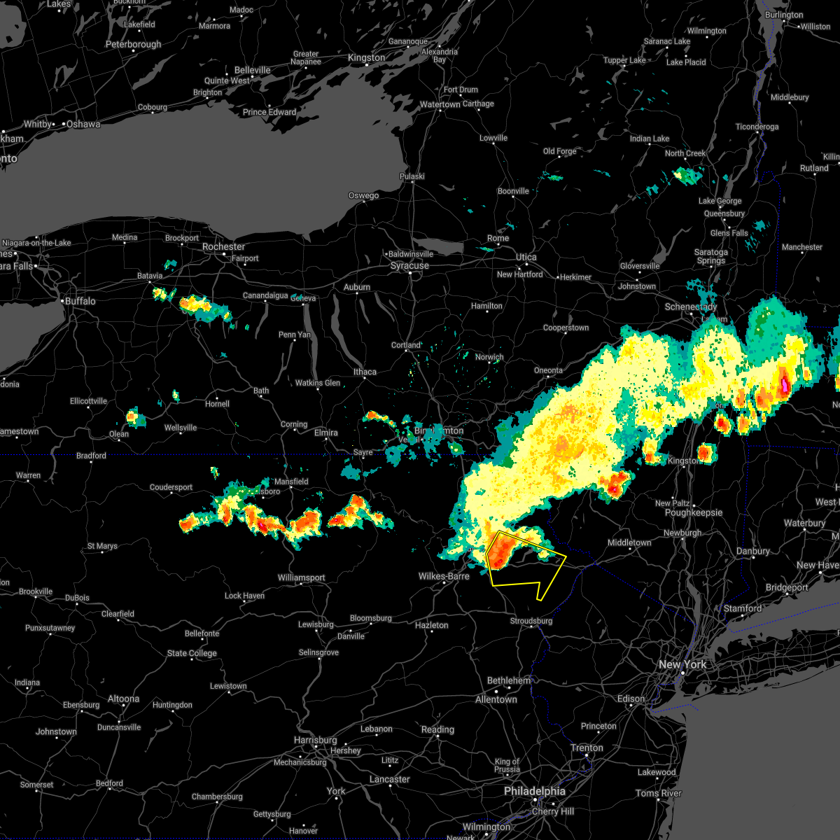 At 531 pm edt, a severe thunderstorm was located near arlington, or 14 miles southeast of carbondale, moving southeast at 45 mph. in addition to strong winds, nws radar now suggests some hail is also likely occurring (radar indicated). Hazards include 60 mph wind gusts and quarter size hail. Hail damage to vehicles is expected. expect wind damage to roofs, siding, and trees. Locations impacted include, olyphant, blooming grove, jessup, paupack, moscow, south canaan, sterling, hawley, lehigh and greentown. At 531 pm edt, a severe thunderstorm was located near arlington, or 14 miles southeast of carbondale, moving southeast at 45 mph. in addition to strong winds, nws radar now suggests some hail is also likely occurring (radar indicated). Hazards include 60 mph wind gusts and quarter size hail. Hail damage to vehicles is expected. expect wind damage to roofs, siding, and trees. Locations impacted include, olyphant, blooming grove, jessup, paupack, moscow, south canaan, sterling, hawley, lehigh and greentown.
|
| 7/27/2021 5:14 PM EDT |
 At 513 pm edt, a severe thunderstorm was located over clarks green, or over waverly, moving east at 45 mph. however, gusts from the storm were pushing out well out in front of it (radar indicated. this storm also has a history of downed trees). Hazards include 60 mph wind gusts. expect damage to roofs, siding, and trees At 513 pm edt, a severe thunderstorm was located over clarks green, or over waverly, moving east at 45 mph. however, gusts from the storm were pushing out well out in front of it (radar indicated. this storm also has a history of downed trees). Hazards include 60 mph wind gusts. expect damage to roofs, siding, and trees
|
| 7/11/2021 10:58 PM EDT |
 The severe thunderstorm warning for north central lehigh, eastern carbon, western monroe and west central northampton counties will expire at 1100 pm edt, the storms which prompted the warning have weakened below severe limits, and no longer pose an immediate threat to life or property. therefore, the warning will be allowed to expire. however heavy rain is still possible with these thunderstorms. The severe thunderstorm warning for north central lehigh, eastern carbon, western monroe and west central northampton counties will expire at 1100 pm edt, the storms which prompted the warning have weakened below severe limits, and no longer pose an immediate threat to life or property. therefore, the warning will be allowed to expire. however heavy rain is still possible with these thunderstorms.
|
| 7/11/2021 10:51 PM EDT |
 The severe thunderstorm warning for southern lackawanna and northeastern luzerne counties will expire at 1100 pm edt, the storms which prompted the warning have weakened below severe limits, and no longer pose an immediate threat to life or property. therefore, the warning will be allowed to expire. The severe thunderstorm warning for southern lackawanna and northeastern luzerne counties will expire at 1100 pm edt, the storms which prompted the warning have weakened below severe limits, and no longer pose an immediate threat to life or property. therefore, the warning will be allowed to expire.
|
| 7/11/2021 10:51 PM EDT |
 At 1050 pm edt, severe thunderstorms were located along a line extending from gouldsboro to near neffs, moving east at 30 mph (radar indicated). Hazards include 60 mph wind gusts. Damage to roofs, siding, trees, and power lines is possible. locations impacted include, mount pocono, northampton, tobyhanna, palmerton, slatington, walnutport, brodheadsville, kunkletown, neffs, pocono pines, gilbert, pocono raceway, lake harmony, rossland, berlinsville, long pond, albrightsville, emerald, kresgeville and sun valley. this includes the following highways, northeast extension between mile markers 62 and 74, and between mile markers 76 and 82, and near mile marker 85. interstate 80 in pennsylvania between mile markers 287 and 300. Interstate 380 in pennsylvania between mile markers 0 and 13. At 1050 pm edt, severe thunderstorms were located along a line extending from gouldsboro to near neffs, moving east at 30 mph (radar indicated). Hazards include 60 mph wind gusts. Damage to roofs, siding, trees, and power lines is possible. locations impacted include, mount pocono, northampton, tobyhanna, palmerton, slatington, walnutport, brodheadsville, kunkletown, neffs, pocono pines, gilbert, pocono raceway, lake harmony, rossland, berlinsville, long pond, albrightsville, emerald, kresgeville and sun valley. this includes the following highways, northeast extension between mile markers 62 and 74, and between mile markers 76 and 82, and near mile marker 85. interstate 80 in pennsylvania between mile markers 287 and 300. Interstate 380 in pennsylvania between mile markers 0 and 13.
|
| 7/11/2021 10:43 PM EDT |
 At 1043 pm edt, severe thunderstorms were located along a line extending from near albrightsville to lehighton to wanamakers, moving east at 30 mph (radar indicated). Hazards include 60 mph wind gusts. Damage to roofs, siding, trees, and power lines is possible. locations impacted include, allentown, lehighton, mount pocono, northampton, tobyhanna, palmerton, jim thorpe, hamburg, slatington, weatherly, walnutport, lenhartsville, neffs, pocono pines, coffeetown, lake harmony, new tripoli, long pond, kresgeville and sun valley. this includes the following highways, northeast extension between mile markers 57 and 97. interstate 78 in pennsylvania between mile markers 33 and 53. interstate 80 in pennsylvania between mile markers 277 and 300. Interstate 380 in pennsylvania between mile markers 0 and 13. At 1043 pm edt, severe thunderstorms were located along a line extending from near albrightsville to lehighton to wanamakers, moving east at 30 mph (radar indicated). Hazards include 60 mph wind gusts. Damage to roofs, siding, trees, and power lines is possible. locations impacted include, allentown, lehighton, mount pocono, northampton, tobyhanna, palmerton, jim thorpe, hamburg, slatington, weatherly, walnutport, lenhartsville, neffs, pocono pines, coffeetown, lake harmony, new tripoli, long pond, kresgeville and sun valley. this includes the following highways, northeast extension between mile markers 57 and 97. interstate 78 in pennsylvania between mile markers 33 and 53. interstate 80 in pennsylvania between mile markers 277 and 300. Interstate 380 in pennsylvania between mile markers 0 and 13.
|
| 7/11/2021 10:22 PM EDT |
 At 1021 pm edt, severe thunderstorms were located along a line extending from near weatherly to near snyders to near hamburg, moving east at 30 mph (radar indicated). Hazards include 60 mph wind gusts. damage to roofs, siding, trees, and power lines is possible At 1021 pm edt, severe thunderstorms were located along a line extending from near weatherly to near snyders to near hamburg, moving east at 30 mph (radar indicated). Hazards include 60 mph wind gusts. damage to roofs, siding, trees, and power lines is possible
|
| 7/11/2021 10:13 PM EDT |
 At 1013 pm edt, severe thunderstorms were located along a line extending from west wyoming to near white haven, moving east at 30 mph (radar indicated). Hazards include 60 mph wind gusts. expect damage to roofs, siding, and trees At 1013 pm edt, severe thunderstorms were located along a line extending from west wyoming to near white haven, moving east at 30 mph (radar indicated). Hazards include 60 mph wind gusts. expect damage to roofs, siding, and trees
|
| 7/7/2021 10:59 PM EDT |
 At 1058 pm edt, severe thunderstorms were located along a line extending from willowemoc to near gouldsboro, moving southeast at 25 mph (radar indicated). Hazards include 60 mph wind gusts and quarter size hail. Hail damage to vehicles is expected. expect wind damage to roofs, siding, and trees. Locations impacted include, rockland, fallsburg, bushkill, monticello, lackawaxen, blooming grove, honesdale, liberty, bethel and paupack. At 1058 pm edt, severe thunderstorms were located along a line extending from willowemoc to near gouldsboro, moving southeast at 25 mph (radar indicated). Hazards include 60 mph wind gusts and quarter size hail. Hail damage to vehicles is expected. expect wind damage to roofs, siding, and trees. Locations impacted include, rockland, fallsburg, bushkill, monticello, lackawaxen, blooming grove, honesdale, liberty, bethel and paupack.
|
| 7/7/2021 10:59 PM EDT |
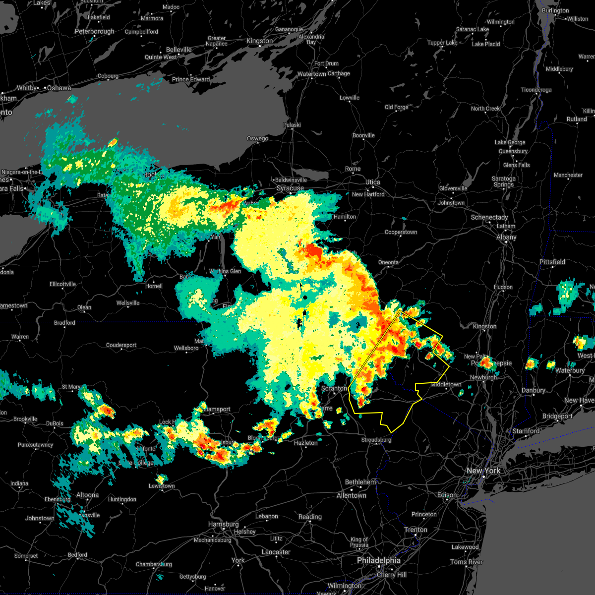 At 1058 pm edt, severe thunderstorms were located along a line extending from willowemoc to near gouldsboro, moving southeast at 25 mph (radar indicated). Hazards include 60 mph wind gusts and quarter size hail. Hail damage to vehicles is expected. expect wind damage to roofs, siding, and trees. Locations impacted include, rockland, fallsburg, bushkill, monticello, lackawaxen, blooming grove, honesdale, liberty, bethel and paupack. At 1058 pm edt, severe thunderstorms were located along a line extending from willowemoc to near gouldsboro, moving southeast at 25 mph (radar indicated). Hazards include 60 mph wind gusts and quarter size hail. Hail damage to vehicles is expected. expect wind damage to roofs, siding, and trees. Locations impacted include, rockland, fallsburg, bushkill, monticello, lackawaxen, blooming grove, honesdale, liberty, bethel and paupack.
|
| 7/7/2021 10:29 PM EDT |
 At 1028 pm edt, severe thunderstorms were located along a line extending from near roscoe to glendale, moving southeast at 25 mph (radar indicated). Hazards include 60 mph wind gusts and quarter size hail. Hail damage to vehicles is expected. Expect wind damage to roofs, siding, and trees. At 1028 pm edt, severe thunderstorms were located along a line extending from near roscoe to glendale, moving southeast at 25 mph (radar indicated). Hazards include 60 mph wind gusts and quarter size hail. Hail damage to vehicles is expected. Expect wind damage to roofs, siding, and trees.
|
| 7/6/2021 5:21 PM EDT |
 The severe thunderstorm warning for sullivan, central wayne and pike counties will expire at 530 pm edt, the storms which prompted the warning have moved out of the area. therefore, the warning will be allowed to expire. a severe thunderstorm watch remains in effect until 800 pm edt for central new york, and northeastern pennsylvania. The severe thunderstorm warning for sullivan, central wayne and pike counties will expire at 530 pm edt, the storms which prompted the warning have moved out of the area. therefore, the warning will be allowed to expire. a severe thunderstorm watch remains in effect until 800 pm edt for central new york, and northeastern pennsylvania.
|
| 7/6/2021 5:21 PM EDT |
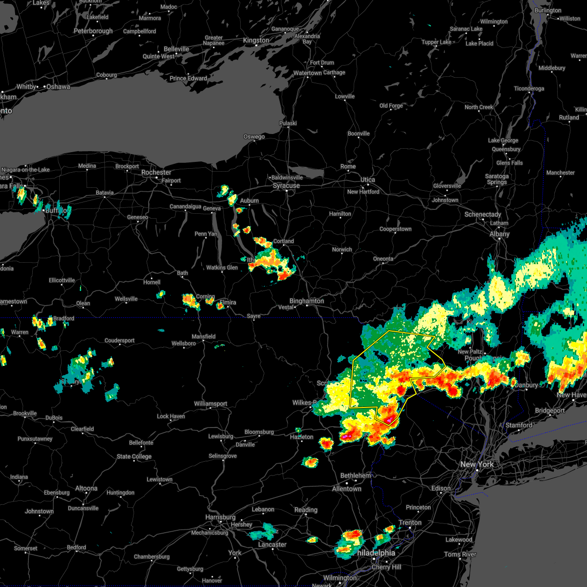 The severe thunderstorm warning for sullivan, central wayne and pike counties will expire at 530 pm edt, the storms which prompted the warning have moved out of the area. therefore, the warning will be allowed to expire. a severe thunderstorm watch remains in effect until 800 pm edt for central new york, and northeastern pennsylvania. The severe thunderstorm warning for sullivan, central wayne and pike counties will expire at 530 pm edt, the storms which prompted the warning have moved out of the area. therefore, the warning will be allowed to expire. a severe thunderstorm watch remains in effect until 800 pm edt for central new york, and northeastern pennsylvania.
|
| 7/6/2021 5:06 PM EDT |
 At 506 pm edt, severe thunderstorms were located along a line extending from near ellenville to matamoras to delaware water gap, moving east at 70 mph (radar indicated). Hazards include 60 mph wind gusts. Expect damage to roofs, siding, and trees. Locations impacted include, fallsburg, bushkill, monticello, lackawaxen, blooming grove, honesdale, liberty, bethel, paupack and damascus. At 506 pm edt, severe thunderstorms were located along a line extending from near ellenville to matamoras to delaware water gap, moving east at 70 mph (radar indicated). Hazards include 60 mph wind gusts. Expect damage to roofs, siding, and trees. Locations impacted include, fallsburg, bushkill, monticello, lackawaxen, blooming grove, honesdale, liberty, bethel, paupack and damascus.
|
| 7/6/2021 5:06 PM EDT |
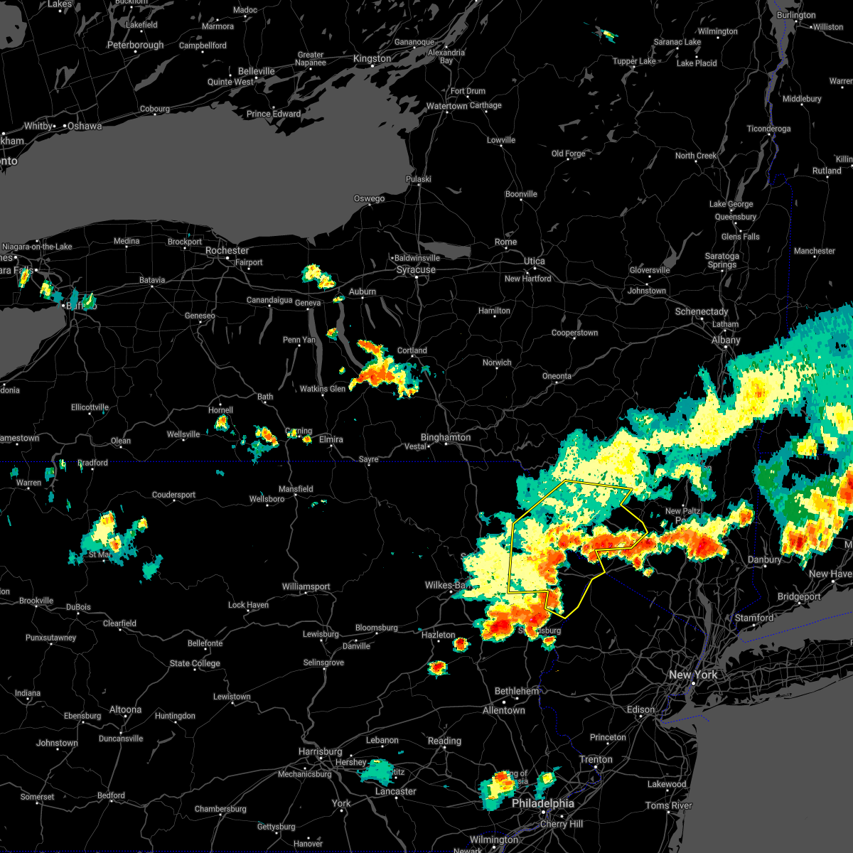 At 506 pm edt, severe thunderstorms were located along a line extending from near ellenville to matamoras to delaware water gap, moving east at 70 mph (radar indicated). Hazards include 60 mph wind gusts. Expect damage to roofs, siding, and trees. Locations impacted include, fallsburg, bushkill, monticello, lackawaxen, blooming grove, honesdale, liberty, bethel, paupack and damascus. At 506 pm edt, severe thunderstorms were located along a line extending from near ellenville to matamoras to delaware water gap, moving east at 70 mph (radar indicated). Hazards include 60 mph wind gusts. Expect damage to roofs, siding, and trees. Locations impacted include, fallsburg, bushkill, monticello, lackawaxen, blooming grove, honesdale, liberty, bethel, paupack and damascus.
|
| 7/6/2021 4:41 PM EDT |
 At 441 pm edt, severe thunderstorms were located along a line extending from near white sulphur springs to near hawley to stoddartsville, moving east at 70 mph (radar indicated). Hazards include 60 mph wind gusts. expect damage to roofs, siding, and trees At 441 pm edt, severe thunderstorms were located along a line extending from near white sulphur springs to near hawley to stoddartsville, moving east at 70 mph (radar indicated). Hazards include 60 mph wind gusts. expect damage to roofs, siding, and trees
|
| 7/6/2021 4:29 PM EDT |
 At 429 pm edt, severe thunderstorms were located along a line extending from near union dale to elmhurst to near sugar notch, moving east at 40 mph (radar indicated). Hazards include 60 mph wind gusts and quarter size hail. Hail damage to vehicles is expected. expect wind damage to roofs, siding, and trees. Locations impacted include, scranton, wilkes-barre, dunmore, kingston, nanticoke, plains, carbondale, old forge, pittston and archbald. At 429 pm edt, severe thunderstorms were located along a line extending from near union dale to elmhurst to near sugar notch, moving east at 40 mph (radar indicated). Hazards include 60 mph wind gusts and quarter size hail. Hail damage to vehicles is expected. expect wind damage to roofs, siding, and trees. Locations impacted include, scranton, wilkes-barre, dunmore, kingston, nanticoke, plains, carbondale, old forge, pittston and archbald.
|
| 7/6/2021 4:06 PM EDT |
 At 406 pm edt, severe thunderstorms were located along a line extending from near harford to near falls to near huntington mills, moving east at 40 mph (radar indicated). Hazards include 60 mph wind gusts and quarter size hail. Hail damage to vehicles is expected. Expect wind damage to roofs, siding, and trees. At 406 pm edt, severe thunderstorms were located along a line extending from near harford to near falls to near huntington mills, moving east at 40 mph (radar indicated). Hazards include 60 mph wind gusts and quarter size hail. Hail damage to vehicles is expected. Expect wind damage to roofs, siding, and trees.
|
| 6/21/2021 7:57 PM EDT |
 At 756 pm edt, severe thunderstorms were located along a line extending from near pocono raceway to near bath, moving northeast at 35 mph (law enforcement. numerous reports of power lines down and tree damage have been reported in carbon and northwestern lehigh counties). Hazards include 60 mph wind gusts and penny size hail. Damage to roofs, siding, trees, and power lines is possible. locations impacted include, allentown, easton, mount pocono, bethlehem, forks, emmaus, northampton, east stroudsburg, tobyhanna, wilson, nazareth, palmerton, bangor, slatington, pen argyl, wind gap, bath, belvidere, harmony and oxford. this includes the following highways, northeast extension between mile markers 53 and 70, and between mile markers 77 and 93. interstate 78 in pennsylvania between mile markers 52 and 60. interstate 80 in pennsylvania between mile markers 282 and 314. interstate 80 in new jersey between mile markers 0 and 10. Interstate 380 in pennsylvania between mile markers 0 and 13. At 756 pm edt, severe thunderstorms were located along a line extending from near pocono raceway to near bath, moving northeast at 35 mph (law enforcement. numerous reports of power lines down and tree damage have been reported in carbon and northwestern lehigh counties). Hazards include 60 mph wind gusts and penny size hail. Damage to roofs, siding, trees, and power lines is possible. locations impacted include, allentown, easton, mount pocono, bethlehem, forks, emmaus, northampton, east stroudsburg, tobyhanna, wilson, nazareth, palmerton, bangor, slatington, pen argyl, wind gap, bath, belvidere, harmony and oxford. this includes the following highways, northeast extension between mile markers 53 and 70, and between mile markers 77 and 93. interstate 78 in pennsylvania between mile markers 52 and 60. interstate 80 in pennsylvania between mile markers 282 and 314. interstate 80 in new jersey between mile markers 0 and 10. Interstate 380 in pennsylvania between mile markers 0 and 13.
|
| 6/21/2021 7:56 PM EDT |
 At 756 pm edt, severe thunderstorms were located along a line extending from corbett to near bear creek, moving northeast at 50 mph (radar indicated). Hazards include 60 mph wind gusts and quarter size hail. Hail damage to vehicles is expected. Expect wind damage to roofs, siding, and trees. At 756 pm edt, severe thunderstorms were located along a line extending from corbett to near bear creek, moving northeast at 50 mph (radar indicated). Hazards include 60 mph wind gusts and quarter size hail. Hail damage to vehicles is expected. Expect wind damage to roofs, siding, and trees.
|
| 6/21/2021 7:56 PM EDT |
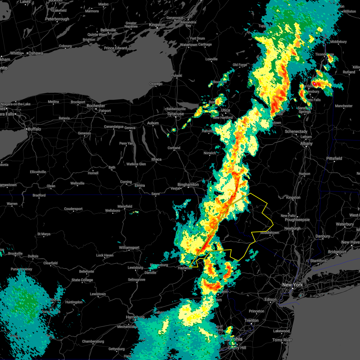 At 756 pm edt, severe thunderstorms were located along a line extending from corbett to near bear creek, moving northeast at 50 mph (radar indicated). Hazards include 60 mph wind gusts and quarter size hail. Hail damage to vehicles is expected. Expect wind damage to roofs, siding, and trees. At 756 pm edt, severe thunderstorms were located along a line extending from corbett to near bear creek, moving northeast at 50 mph (radar indicated). Hazards include 60 mph wind gusts and quarter size hail. Hail damage to vehicles is expected. Expect wind damage to roofs, siding, and trees.
|
| 6/21/2021 7:38 PM EDT |
 At 738 pm edt, severe thunderstorms were located along a line extending from near white haven to coffeetown, moving northeast at 35 mph (law enforcement. several reports of trees and wires down have been received from this line of storms). Hazards include 60 mph wind gusts and penny size hail. damage to roofs, siding, trees, and power lines is possible At 738 pm edt, severe thunderstorms were located along a line extending from near white haven to coffeetown, moving northeast at 35 mph (law enforcement. several reports of trees and wires down have been received from this line of storms). Hazards include 60 mph wind gusts and penny size hail. damage to roofs, siding, trees, and power lines is possible
|
| 6/21/2021 7:37 PM EDT |
 At 737 pm edt, severe thunderstorms were located along a line extending from near equinunk to mount cobb to near conyngham, moving east at 30 mph (radar indicated). Hazards include 60 mph wind gusts and quarter size hail. Hail damage to vehicles is expected. expect wind damage to roofs, siding, and trees. Locations impacted include, scranton, wilkes-barre, hazleton, dunmore, kingston, nanticoke, plains, carbondale, old forge and pittston. At 737 pm edt, severe thunderstorms were located along a line extending from near equinunk to mount cobb to near conyngham, moving east at 30 mph (radar indicated). Hazards include 60 mph wind gusts and quarter size hail. Hail damage to vehicles is expected. expect wind damage to roofs, siding, and trees. Locations impacted include, scranton, wilkes-barre, hazleton, dunmore, kingston, nanticoke, plains, carbondale, old forge and pittston.
|
| 6/21/2021 7:09 PM EDT |
 At 709 pm edt, severe thunderstorms were located along a line extending from near pleasant mount to near old forge to mifflinville, moving east at 30 mph (radar indicated). Hazards include 60 mph wind gusts and quarter size hail. Hail damage to vehicles is expected. Expect wind damage to roofs, siding, and trees. At 709 pm edt, severe thunderstorms were located along a line extending from near pleasant mount to near old forge to mifflinville, moving east at 30 mph (radar indicated). Hazards include 60 mph wind gusts and quarter size hail. Hail damage to vehicles is expected. Expect wind damage to roofs, siding, and trees.
|
| 4/28/2021 7:04 PM EDT |
 At 703 pm edt, severe thunderstorms were located along a line extending from nicholson to near la plume to falls, moving east at 50 mph (law enforcement. at 648 pm, trees were reported blown down on power lines in meshoppen). Hazards include 60 mph wind gusts and quarter size hail. Hail damage to vehicles is expected. Expect wind damage to roofs, siding, and trees. At 703 pm edt, severe thunderstorms were located along a line extending from nicholson to near la plume to falls, moving east at 50 mph (law enforcement. at 648 pm, trees were reported blown down on power lines in meshoppen). Hazards include 60 mph wind gusts and quarter size hail. Hail damage to vehicles is expected. Expect wind damage to roofs, siding, and trees.
|
| 11/15/2020 6:29 PM EST |
 At 627 pm est, intense showers and some embedded severe thunderstorms were located along a line extending from near stoddartsville to near weatherly to near shoemakersville to reamstown to near shrewsbury, moving east at 50 mph. this line may contain little or no lightning. do not wait until you hear thunder before taking cover (radar indicated). Hazards include 60 mph wind gusts. Damage to roofs, siding, trees, and power lines is possible. locations impacted include, allentown, reading, easton, lehighton, mount pocono, bethlehem, forks, emmaus, wyomissing, northampton, east stroudsburg, tobyhanna, wilson, hellertown, nazareth, palmerton, bangor, birdsboro, kutztown and jim thorpe. this includes the following highways, pennsylvania turnpike between mile markers 296 and 299. northeast extension between mile markers 46 and 97. interstate 78 in pennsylvania between mile markers 10 and 72. interstate 80 in pennsylvania between mile markers 278 and 314. interstate 380 in pennsylvania between mile markers 0 and 13. Interstate 176 in pennsylvania between mile markers 1 and 11. At 627 pm est, intense showers and some embedded severe thunderstorms were located along a line extending from near stoddartsville to near weatherly to near shoemakersville to reamstown to near shrewsbury, moving east at 50 mph. this line may contain little or no lightning. do not wait until you hear thunder before taking cover (radar indicated). Hazards include 60 mph wind gusts. Damage to roofs, siding, trees, and power lines is possible. locations impacted include, allentown, reading, easton, lehighton, mount pocono, bethlehem, forks, emmaus, wyomissing, northampton, east stroudsburg, tobyhanna, wilson, hellertown, nazareth, palmerton, bangor, birdsboro, kutztown and jim thorpe. this includes the following highways, pennsylvania turnpike between mile markers 296 and 299. northeast extension between mile markers 46 and 97. interstate 78 in pennsylvania between mile markers 10 and 72. interstate 80 in pennsylvania between mile markers 278 and 314. interstate 380 in pennsylvania between mile markers 0 and 13. Interstate 176 in pennsylvania between mile markers 1 and 11.
|
| 11/15/2020 5:57 PM EST |
 At 555 pm est, intense showers and embedded severe thunderstorms were located along a line extending from pond hill to near lickdale to near lawn to near parkville, moving east at 45 mph. this line may contain little or no lightning. do not wait until you hear thunder before taking cover (radar indicated). Hazards include 60 mph wind gusts. damage to roofs, siding, trees, and power lines is possible At 555 pm est, intense showers and embedded severe thunderstorms were located along a line extending from pond hill to near lickdale to near lawn to near parkville, moving east at 45 mph. this line may contain little or no lightning. do not wait until you hear thunder before taking cover (radar indicated). Hazards include 60 mph wind gusts. damage to roofs, siding, trees, and power lines is possible
|
| 8/18/2020 12:22 AM EDT |
 At 1222 am edt, a severe thunderstorm was located over long pond, or near mount pocono, moving east at 25 mph (radar indicated). Hazards include 60 mph wind gusts and penny size hail. Damage to roofs, siding, trees, and power lines is possible. locations impacted include, mount pocono, tobyhanna, brodheadsville, pocono pines, gilbert, pocono raceway, lake harmony, skytop, tannersville, mountainhome, long pond, albrightsville, sun valley, arrowhead lake, jonas, meckesville, reeders, mcmichael, canadensis and scotrun. this includes the following highways, northeast extension between mile markers 87 and 90. interstate 80 in pennsylvania between mile markers 285 and 304. Interstate 380 in pennsylvania between mile markers 0 and 13. At 1222 am edt, a severe thunderstorm was located over long pond, or near mount pocono, moving east at 25 mph (radar indicated). Hazards include 60 mph wind gusts and penny size hail. Damage to roofs, siding, trees, and power lines is possible. locations impacted include, mount pocono, tobyhanna, brodheadsville, pocono pines, gilbert, pocono raceway, lake harmony, skytop, tannersville, mountainhome, long pond, albrightsville, sun valley, arrowhead lake, jonas, meckesville, reeders, mcmichael, canadensis and scotrun. this includes the following highways, northeast extension between mile markers 87 and 90. interstate 80 in pennsylvania between mile markers 285 and 304. Interstate 380 in pennsylvania between mile markers 0 and 13.
|
| 8/17/2020 11:59 PM EDT |
 At 1159 pm edt, a severe thunderstorm was located over blakeslee, or 13 miles west of mount pocono, moving east at 25 mph (radar indicated). Hazards include 60 mph wind gusts and quarter size hail. Minor damage to vehicles is possible. Wind damage to roofs, siding, trees, and power lines is possible. At 1159 pm edt, a severe thunderstorm was located over blakeslee, or 13 miles west of mount pocono, moving east at 25 mph (radar indicated). Hazards include 60 mph wind gusts and quarter size hail. Minor damage to vehicles is possible. Wind damage to roofs, siding, trees, and power lines is possible.
|
| 7/19/2020 7:47 PM EDT |
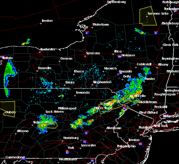 At 746 pm edt, severe thunderstorms were located along a line extending from near honesdale to near lake ariel, moving east at 35 mph (radar indicated). Hazards include 60 mph wind gusts and penny size hail. Expect damage to roofs, siding, and trees. Locations impacted include, lackawaxen, blooming grove, honesdale, paupack, shohola, south canaan, tusten, sterling, hawley and prompton. At 746 pm edt, severe thunderstorms were located along a line extending from near honesdale to near lake ariel, moving east at 35 mph (radar indicated). Hazards include 60 mph wind gusts and penny size hail. Expect damage to roofs, siding, and trees. Locations impacted include, lackawaxen, blooming grove, honesdale, paupack, shohola, south canaan, tusten, sterling, hawley and prompton.
|
| 7/19/2020 7:35 PM EDT |
 At 734 pm edt, severe thunderstorms were located along a line extending from prompton to near waymart to dunmore, moving east at 30 mph (radar indicated). Hazards include 60 mph wind gusts and penny size hail. Expect damage to roofs, siding, and trees. Locations impacted include, scranton, dunmore, carbondale, archbald, blakely, dickson city, moosic, olyphant, lackawaxen and blooming grove. At 734 pm edt, severe thunderstorms were located along a line extending from prompton to near waymart to dunmore, moving east at 30 mph (radar indicated). Hazards include 60 mph wind gusts and penny size hail. Expect damage to roofs, siding, and trees. Locations impacted include, scranton, dunmore, carbondale, archbald, blakely, dickson city, moosic, olyphant, lackawaxen and blooming grove.
|
| 7/19/2020 7:14 PM EDT |
 At 713 pm edt, severe thunderstorms were located along a line extending from near waymart to clarks summit to near falls to sweet valley, moving east at 35 mph (radar indicated). Hazards include 60 mph wind gusts and penny size hail. expect damage to roofs, siding, and trees At 713 pm edt, severe thunderstorms were located along a line extending from near waymart to clarks summit to near falls to sweet valley, moving east at 35 mph (radar indicated). Hazards include 60 mph wind gusts and penny size hail. expect damage to roofs, siding, and trees
|
| 7/6/2020 3:56 PM EDT |
 At 355 pm edt, severe thunderstorms were located along a line extending from near gouldsboro state park to near jim thorpe to near tamaqua, moving southeast at 10 mph (radar indicated). Hazards include 60 mph wind gusts and quarter size hail. Minor damage to vehicles is possible. Wind damage to roofs, siding, trees, and power lines is possible. At 355 pm edt, severe thunderstorms were located along a line extending from near gouldsboro state park to near jim thorpe to near tamaqua, moving southeast at 10 mph (radar indicated). Hazards include 60 mph wind gusts and quarter size hail. Minor damage to vehicles is possible. Wind damage to roofs, siding, trees, and power lines is possible.
|
| 7/6/2020 2:28 PM EDT |
 At 228 pm edt, severe thunderstorms were located along a line extending from near mountainhome to analomink, moving southeast at 5 mph (radar indicated). Hazards include 60 mph wind gusts and quarter size hail. Minor damage to vehicles is possible. Wind damage to roofs, siding, trees, and power lines is possible. At 228 pm edt, severe thunderstorms were located along a line extending from near mountainhome to analomink, moving southeast at 5 mph (radar indicated). Hazards include 60 mph wind gusts and quarter size hail. Minor damage to vehicles is possible. Wind damage to roofs, siding, trees, and power lines is possible.
|
| 6/28/2020 3:44 PM EDT |
 At 344 pm edt, a severe thunderstorm was located over angels, or 9 miles north of mount pocono, moving southeast at 20 mph (radar indicated). Hazards include 60 mph wind gusts and quarter size hail. Minor damage to vehicles is possible. wind damage to roofs, siding, trees, and power lines is possible. locations impacted include, mount pocono, east stroudsburg, tobyhanna, blairstown, bangor, pen argyl, wind gap, east bangor, stormville, werry lake, pocono pines, millbrook, lake harmony, skytop, tannersville, long pond, kresgeville, sun valley, reeders and saylorsburg. people attending races at pocono raceway should seek safe shelter immediately! this includes the following highways, northeast extension between mile markers 85 and 97. interstate 80 in pennsylvania between mile markers 280 and 314. interstate 80 in new jersey between mile markers 0 and 10. Interstate 380 in pennsylvania between mile markers 0 and 13. At 344 pm edt, a severe thunderstorm was located over angels, or 9 miles north of mount pocono, moving southeast at 20 mph (radar indicated). Hazards include 60 mph wind gusts and quarter size hail. Minor damage to vehicles is possible. wind damage to roofs, siding, trees, and power lines is possible. locations impacted include, mount pocono, east stroudsburg, tobyhanna, blairstown, bangor, pen argyl, wind gap, east bangor, stormville, werry lake, pocono pines, millbrook, lake harmony, skytop, tannersville, long pond, kresgeville, sun valley, reeders and saylorsburg. people attending races at pocono raceway should seek safe shelter immediately! this includes the following highways, northeast extension between mile markers 85 and 97. interstate 80 in pennsylvania between mile markers 280 and 314. interstate 80 in new jersey between mile markers 0 and 10. Interstate 380 in pennsylvania between mile markers 0 and 13.
|
| 6/28/2020 3:30 PM EDT |
 At 330 pm edt, severe thunderstorms were located along a line extending from near pittston to greentown, moving southeast at 25 mph (radar indicated). Hazards include 60 mph wind gusts and quarter size hail. Hail damage to vehicles is expected. Expect wind damage to roofs, siding, and trees. At 330 pm edt, severe thunderstorms were located along a line extending from near pittston to greentown, moving southeast at 25 mph (radar indicated). Hazards include 60 mph wind gusts and quarter size hail. Hail damage to vehicles is expected. Expect wind damage to roofs, siding, and trees.
|
| 6/28/2020 3:20 PM EDT |
 At 320 pm edt, severe thunderstorms were located along a line extending from near arrowhead lake to ledgerdale to near narrowsburg, moving southeast at 30 mph (radar indicated). Hazards include 60 mph wind gusts and quarter size hail. Minor damage to vehicles is possible. Wind damage to roofs, siding, trees, and power lines is possible. At 320 pm edt, severe thunderstorms were located along a line extending from near arrowhead lake to ledgerdale to near narrowsburg, moving southeast at 30 mph (radar indicated). Hazards include 60 mph wind gusts and quarter size hail. Minor damage to vehicles is possible. Wind damage to roofs, siding, trees, and power lines is possible.
|
| 6/3/2020 7:15 PM EDT |
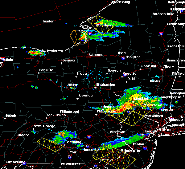 At 714 pm edt, severe thunderstorms were located along a line extending from near hartwood to blooming grove to moscow, moving southeast at 40 mph (radar indicated). Hazards include 60 mph wind gusts. Expect damage to roofs, siding, and trees. Locations impacted include, scranton, port jervis, bushkill, moosic, lackawaxen, blooming grove, paupack, shohola, matamoras and moscow. At 714 pm edt, severe thunderstorms were located along a line extending from near hartwood to blooming grove to moscow, moving southeast at 40 mph (radar indicated). Hazards include 60 mph wind gusts. Expect damage to roofs, siding, and trees. Locations impacted include, scranton, port jervis, bushkill, moosic, lackawaxen, blooming grove, paupack, shohola, matamoras and moscow.
|
| 6/3/2020 6:53 PM EDT |
 At 653 pm edt, severe thunderstorms were located along a line extending from near fosterdale to near lake ariel to near clarks summit, moving southeast at 50 mph (radar indicated). Hazards include 60 mph wind gusts. expect damage to roofs, siding, and trees At 653 pm edt, severe thunderstorms were located along a line extending from near fosterdale to near lake ariel to near clarks summit, moving southeast at 50 mph (radar indicated). Hazards include 60 mph wind gusts. expect damage to roofs, siding, and trees
|
| 10/31/2019 9:26 PM EDT |
 At 926 pm edt, severe thunderstorms were located along a line extending from near skytop to akron, moving northeast at 50 mph (radar indicated). Hazards include 60 mph wind gusts. Damage to roofs, siding, trees, and power lines is possible. locations impacted include, reading, lehighton, mount pocono, wyomissing, northampton, east stroudsburg, tobyhanna, palmerton, kutztown, jim thorpe, hamburg, slatington, fleetwood, sinking spring, laureldale, nesquehoning, womelsdorf, weatherly, wernersville and newmanstown. this includes the following highways, interstate 80 in pennsylvania between mile markers 277 and 310. Interstate 78 in pennsylvania between mile markers 10 and 53. At 926 pm edt, severe thunderstorms were located along a line extending from near skytop to akron, moving northeast at 50 mph (radar indicated). Hazards include 60 mph wind gusts. Damage to roofs, siding, trees, and power lines is possible. locations impacted include, reading, lehighton, mount pocono, wyomissing, northampton, east stroudsburg, tobyhanna, palmerton, kutztown, jim thorpe, hamburg, slatington, fleetwood, sinking spring, laureldale, nesquehoning, womelsdorf, weatherly, wernersville and newmanstown. this includes the following highways, interstate 80 in pennsylvania between mile markers 277 and 310. Interstate 78 in pennsylvania between mile markers 10 and 53.
|
| 10/31/2019 9:20 PM EDT |
 At 920 pm edt, a severe thunderstorm was located over mountainhome, or near mount pocono, moving northeast at 60 mph (radar indicated). Hazards include 60 mph wind gusts. expect damage to roofs, siding, and trees At 920 pm edt, a severe thunderstorm was located over mountainhome, or near mount pocono, moving northeast at 60 mph (radar indicated). Hazards include 60 mph wind gusts. expect damage to roofs, siding, and trees
|
| 10/31/2019 9:20 PM EDT |
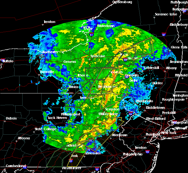 At 920 pm edt, a severe thunderstorm was located over mountainhome, or near mount pocono, moving northeast at 60 mph (radar indicated). Hazards include 60 mph wind gusts. expect damage to roofs, siding, and trees At 920 pm edt, a severe thunderstorm was located over mountainhome, or near mount pocono, moving northeast at 60 mph (radar indicated). Hazards include 60 mph wind gusts. expect damage to roofs, siding, and trees
|
| 10/31/2019 8:58 PM EDT |
 At 857 pm edt, severe thunderstorms were located along a line extending from albrightsville to windsor, moving northeast at 50 mph (radar indicated). Hazards include 60 mph wind gusts. damage to roofs, siding, trees, and power lines is possible At 857 pm edt, severe thunderstorms were located along a line extending from albrightsville to windsor, moving northeast at 50 mph (radar indicated). Hazards include 60 mph wind gusts. damage to roofs, siding, trees, and power lines is possible
|
| 8/8/2019 6:11 PM EDT |
 The severe thunderstorm warning for southern sullivan, southeastern lackawanna, southern wayne, east central luzerne and pike counties will expire at 615 pm edt, the storms which prompted the warning have weakened below severe limits, and are exiting the warned area. therefore, the warning will be allowed to expire. however gusty winds are still possible with these thunderstorms. The severe thunderstorm warning for southern sullivan, southeastern lackawanna, southern wayne, east central luzerne and pike counties will expire at 615 pm edt, the storms which prompted the warning have weakened below severe limits, and are exiting the warned area. therefore, the warning will be allowed to expire. however gusty winds are still possible with these thunderstorms.
|
| 8/8/2019 6:11 PM EDT |
 The severe thunderstorm warning for northern monroe county will expire at 615 pm edt, the storm which prompted the warning has weakened below severe limits, and no longer poses an immediate threat to life or property. therefore, the warning will be allowed to expire. however gusty winds are still possible with this thunderstorm. a severe thunderstorm watch remains in effect until midnight edt for northeastern pennsylvania. The severe thunderstorm warning for northern monroe county will expire at 615 pm edt, the storm which prompted the warning has weakened below severe limits, and no longer poses an immediate threat to life or property. therefore, the warning will be allowed to expire. however gusty winds are still possible with this thunderstorm. a severe thunderstorm watch remains in effect until midnight edt for northeastern pennsylvania.
|
| 8/8/2019 6:11 PM EDT |
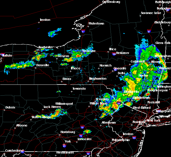 The severe thunderstorm warning for southern sullivan, southeastern lackawanna, southern wayne, east central luzerne and pike counties will expire at 615 pm edt, the storms which prompted the warning have weakened below severe limits, and are exiting the warned area. therefore, the warning will be allowed to expire. however gusty winds are still possible with these thunderstorms. The severe thunderstorm warning for southern sullivan, southeastern lackawanna, southern wayne, east central luzerne and pike counties will expire at 615 pm edt, the storms which prompted the warning have weakened below severe limits, and are exiting the warned area. therefore, the warning will be allowed to expire. however gusty winds are still possible with these thunderstorms.
|
| 8/8/2019 5:53 PM EDT |
 At 553 pm edt, a severe thunderstorm was located over gouldsboro state park, or 7 miles north of mount pocono, moving east at 30 mph (radar indicated). Hazards include 60 mph wind gusts and penny size hail. Damage to roofs, siding, trees, and power lines is possible. Locations impacted include, mount pocono, tobyhanna, henryville, echo lake, paradise valley, werry lake, gouldsboro state park, skytop, mountainhome, canadensis, alpine mountain and cresco. At 553 pm edt, a severe thunderstorm was located over gouldsboro state park, or 7 miles north of mount pocono, moving east at 30 mph (radar indicated). Hazards include 60 mph wind gusts and penny size hail. Damage to roofs, siding, trees, and power lines is possible. Locations impacted include, mount pocono, tobyhanna, henryville, echo lake, paradise valley, werry lake, gouldsboro state park, skytop, mountainhome, canadensis, alpine mountain and cresco.
|
| 8/8/2019 5:47 PM EDT |
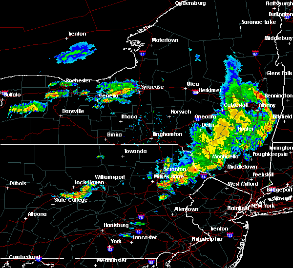 At 545 pm edt, severe thunderstorms were located along a line extending from near bear creek to near hawley to near rock hill, moving east at 40 mph (radar indicated). Hazards include 60 mph wind gusts and penny size hail. Expect damage to roofs, siding, and trees. Locations impacted include, scranton, fallsburg, port jervis, bushkill, monticello, lackawaxen, blooming grove, paupack, south fallsburg and shohola. At 545 pm edt, severe thunderstorms were located along a line extending from near bear creek to near hawley to near rock hill, moving east at 40 mph (radar indicated). Hazards include 60 mph wind gusts and penny size hail. Expect damage to roofs, siding, and trees. Locations impacted include, scranton, fallsburg, port jervis, bushkill, monticello, lackawaxen, blooming grove, paupack, south fallsburg and shohola.
|
| 8/8/2019 5:31 PM EDT |
 The national weather service in mount holly nj has issued a * severe thunderstorm warning for. northern monroe county in northeastern pennsylvania. until 615 pm edt. At 530 pm edt, a severe thunderstorm was located over lehigh, or 10 miles north of mount pocono, moving east at 35 mph. The national weather service in mount holly nj has issued a * severe thunderstorm warning for. northern monroe county in northeastern pennsylvania. until 615 pm edt. At 530 pm edt, a severe thunderstorm was located over lehigh, or 10 miles north of mount pocono, moving east at 35 mph.
|
| 8/8/2019 5:11 PM EDT |
 At 511 pm edt, severe thunderstorms were located along a line extending from livingston manor to near honesdale to near bear creek village, moving east at 50 mph (radar indicated). Hazards include 60 mph wind gusts and penny size hail. expect damage to roofs, siding, and trees At 511 pm edt, severe thunderstorms were located along a line extending from livingston manor to near honesdale to near bear creek village, moving east at 50 mph (radar indicated). Hazards include 60 mph wind gusts and penny size hail. expect damage to roofs, siding, and trees
|
| 7/22/2019 4:08 PM EDT |
 The severe thunderstorm warning for northern monroe county will expire at 415 pm edt, the storm which prompted the warning has weakened below severe limits, and no longer poses an immediate threat to life or property. therefore, the warning will be allowed to expire. however gusty winds and heavy rain are still possible with this thunderstorm. a severe thunderstorm watch remains in effect until 1000 pm edt for northwestern new jersey, and northeastern pennsylvania. The severe thunderstorm warning for northern monroe county will expire at 415 pm edt, the storm which prompted the warning has weakened below severe limits, and no longer poses an immediate threat to life or property. therefore, the warning will be allowed to expire. however gusty winds and heavy rain are still possible with this thunderstorm. a severe thunderstorm watch remains in effect until 1000 pm edt for northwestern new jersey, and northeastern pennsylvania.
|
| 7/22/2019 3:46 PM EDT |
 At 346 pm edt, a severe thunderstorm was located over paradise valley, or near mount pocono, moving east at 25 mph (radar indicated). Hazards include 60 mph wind gusts. Damage to roofs, siding, trees, and power lines is possible. Locations impacted include, mount pocono, tobyhanna, henryville, werry lake, pocono pines, analomink, skytop, mountainhome, canadensis, alpine mountain, scotrun, blakeslee, echo lake, paradise valley, gouldsboro state park, arrowhead lake, long pond, cresco, marshalls creek and hidden lake. At 346 pm edt, a severe thunderstorm was located over paradise valley, or near mount pocono, moving east at 25 mph (radar indicated). Hazards include 60 mph wind gusts. Damage to roofs, siding, trees, and power lines is possible. Locations impacted include, mount pocono, tobyhanna, henryville, werry lake, pocono pines, analomink, skytop, mountainhome, canadensis, alpine mountain, scotrun, blakeslee, echo lake, paradise valley, gouldsboro state park, arrowhead lake, long pond, cresco, marshalls creek and hidden lake.
|
| 7/22/2019 3:27 PM EDT |
 At 327 pm edt, severe thunderstorms were located along a line extending from pocono pines to echo lake, moving east at 40 mph (radar indicated). Hazards include 60 mph wind gusts and penny size hail. damage to roofs, siding, trees, and power lines is possible At 327 pm edt, severe thunderstorms were located along a line extending from pocono pines to echo lake, moving east at 40 mph (radar indicated). Hazards include 60 mph wind gusts and penny size hail. damage to roofs, siding, trees, and power lines is possible
|
| 7/21/2019 5:05 PM EDT |
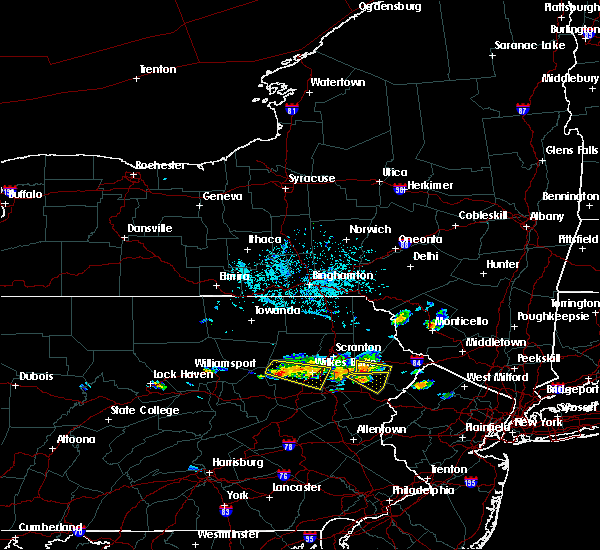 At 505 pm edt, a severe thunderstorm was located over angels, or 11 miles north of mount pocono, moving east at 20 mph (radar indicated). Hazards include 60 mph wind gusts and quarter size hail. Hail damage to vehicles is expected. expect wind damage to roofs, siding, and trees. Locations impacted include, sterling, greentown, gouldsboro, angels, panther, newfoundland, la anna and promised land state park. At 505 pm edt, a severe thunderstorm was located over angels, or 11 miles north of mount pocono, moving east at 20 mph (radar indicated). Hazards include 60 mph wind gusts and quarter size hail. Hail damage to vehicles is expected. expect wind damage to roofs, siding, and trees. Locations impacted include, sterling, greentown, gouldsboro, angels, panther, newfoundland, la anna and promised land state park.
|
| 7/21/2019 4:56 PM EDT |
 At 455 pm edt, a severe thunderstorm was located over lehigh, or 10 miles northwest of mount pocono, moving southeast at 25 mph (radar indicated). Hazards include 60 mph wind gusts and quarter size hail. Minor damage to vehicles is possible. Wind damage to roofs, siding, trees, and power lines is possible. At 455 pm edt, a severe thunderstorm was located over lehigh, or 10 miles northwest of mount pocono, moving southeast at 25 mph (radar indicated). Hazards include 60 mph wind gusts and quarter size hail. Minor damage to vehicles is possible. Wind damage to roofs, siding, trees, and power lines is possible.
|
| 7/21/2019 4:46 PM EDT |
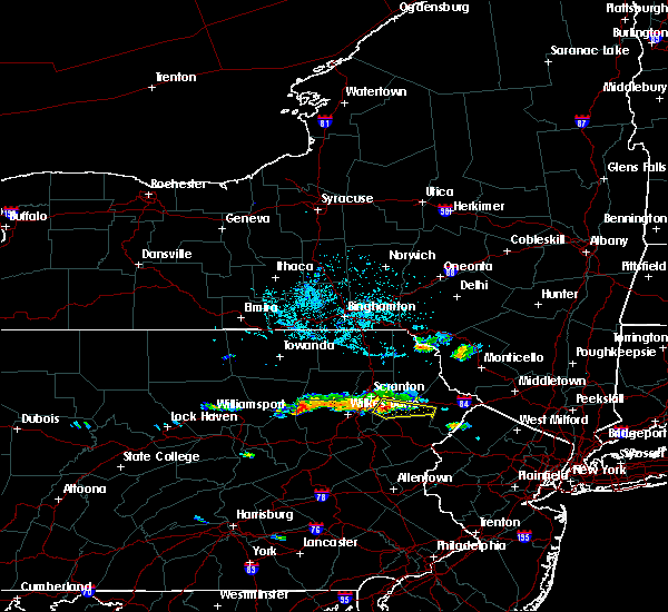 At 446 pm edt, a severe thunderstorm was located over moscow, or 10 miles southeast of scranton, moving east at 20 mph (radar indicated). Hazards include 60 mph wind gusts and quarter size hail. Hail damage to vehicles is expected. Expect wind damage to roofs, siding, and trees. At 446 pm edt, a severe thunderstorm was located over moscow, or 10 miles southeast of scranton, moving east at 20 mph (radar indicated). Hazards include 60 mph wind gusts and quarter size hail. Hail damage to vehicles is expected. Expect wind damage to roofs, siding, and trees.
|
| 6/29/2019 5:02 PM EDT |
 At 502 pm edt, a severe thunderstorm was located over moscow, or 8 miles southeast of scranton, moving southeast at 20 mph (radar indicated). Hazards include quarter size hail. Damage to vehicles is expected. Locations impacted include, scranton, dunmore, old forge, taylor, moosic, moscow, lehigh, gouldsboro, yostville and springbrook corners. At 502 pm edt, a severe thunderstorm was located over moscow, or 8 miles southeast of scranton, moving southeast at 20 mph (radar indicated). Hazards include quarter size hail. Damage to vehicles is expected. Locations impacted include, scranton, dunmore, old forge, taylor, moosic, moscow, lehigh, gouldsboro, yostville and springbrook corners.
|
| 6/29/2019 4:36 PM EDT |
 At 436 pm edt, a severe thunderstorm was located over scranton, moving southeast at 15 mph (radar indicated). Hazards include quarter size hail. damage to vehicles is expected At 436 pm edt, a severe thunderstorm was located over scranton, moving southeast at 15 mph (radar indicated). Hazards include quarter size hail. damage to vehicles is expected
|
| 5/29/2019 4:43 PM EDT |
 At 442 pm edt, severe thunderstorms were located along a line extending from glendale to near white haven to hazleton, moving east at 55 mph (radar indicated). Hazards include 60 mph wind gusts and quarter size hail. Hail damage to vehicles is expected. expect wind damage to roofs, siding, and trees. Locations impacted include, scranton, wilkes-barre, hazleton, dunmore, kingston, plains, old forge, pittston, taylor and moosic. At 442 pm edt, severe thunderstorms were located along a line extending from glendale to near white haven to hazleton, moving east at 55 mph (radar indicated). Hazards include 60 mph wind gusts and quarter size hail. Hail damage to vehicles is expected. expect wind damage to roofs, siding, and trees. Locations impacted include, scranton, wilkes-barre, hazleton, dunmore, kingston, plains, old forge, pittston, taylor and moosic.
|
| 5/29/2019 4:18 PM EDT |
 At 418 pm edt, severe thunderstorms were located along a line extending from near sweet valley to near beach haven to near mainville, moving east at 55 mph (radar indicated). Hazards include 60 mph wind gusts and quarter size hail. Hail damage to vehicles is expected. Expect wind damage to roofs, siding, and trees. At 418 pm edt, severe thunderstorms were located along a line extending from near sweet valley to near beach haven to near mainville, moving east at 55 mph (radar indicated). Hazards include 60 mph wind gusts and quarter size hail. Hail damage to vehicles is expected. Expect wind damage to roofs, siding, and trees.
|
| 5/29/2019 3:21 PM EDT |
 At 320 pm edt, a severe thunderstorm was located over gouldsboro state park, or 9 miles northwest of mount pocono, moving east at 45 mph (radar indicated). Hazards include 60 mph wind gusts and quarter size hail. Minor damage to vehicles is possible. wind damage to roofs, siding, trees, and power lines is possible. Locations impacted include, mount pocono, tobyhanna, pocono pines, lake harmony, skytop, mountainhome, canadensis, alpine mountain, blakeslee, paradise valley, gouldsboro state park, arrowhead lake and cresco. At 320 pm edt, a severe thunderstorm was located over gouldsboro state park, or 9 miles northwest of mount pocono, moving east at 45 mph (radar indicated). Hazards include 60 mph wind gusts and quarter size hail. Minor damage to vehicles is possible. wind damage to roofs, siding, trees, and power lines is possible. Locations impacted include, mount pocono, tobyhanna, pocono pines, lake harmony, skytop, mountainhome, canadensis, alpine mountain, blakeslee, paradise valley, gouldsboro state park, arrowhead lake and cresco.
|
| 5/29/2019 2:59 PM EDT |
 At 258 pm edt, a severe thunderstorm was located over bear creek, or near wilkes-barre, moving east at 40 mph (radar indicated). Hazards include 60 mph wind gusts and quarter size hail. Minor damage to vehicles is possible. Wind damage to roofs, siding, trees, and power lines is possible. At 258 pm edt, a severe thunderstorm was located over bear creek, or near wilkes-barre, moving east at 40 mph (radar indicated). Hazards include 60 mph wind gusts and quarter size hail. Minor damage to vehicles is possible. Wind damage to roofs, siding, trees, and power lines is possible.
|
| 5/28/2019 8:27 PM EDT |
 At 827 pm edt, a severe thunderstorm was located near east stroudsburg, or 13 miles southeast of mount pocono, moving southeast at 35 mph (radar indicated). Hazards include 60 mph wind gusts and half dollar size hail. Minor damage to vehicles is possible. wind damage to roofs, siding, trees, and power lines is possible. Locations impacted include, mount pocono, east stroudsburg, tobyhanna, henryville, werry lake, analomink, delaware water gap, skytop, tannersville, mountainhome, canadensis, alpine mountain, scotrun, echo lake, paradise valley, gouldsboro state park, stormville, stroudsburg, cresco and arlington heights. At 827 pm edt, a severe thunderstorm was located near east stroudsburg, or 13 miles southeast of mount pocono, moving southeast at 35 mph (radar indicated). Hazards include 60 mph wind gusts and half dollar size hail. Minor damage to vehicles is possible. wind damage to roofs, siding, trees, and power lines is possible. Locations impacted include, mount pocono, east stroudsburg, tobyhanna, henryville, werry lake, analomink, delaware water gap, skytop, tannersville, mountainhome, canadensis, alpine mountain, scotrun, echo lake, paradise valley, gouldsboro state park, stormville, stroudsburg, cresco and arlington heights.
|
| 5/28/2019 7:47 PM EDT |
 At 747 pm edt, a severe thunderstorm capable of producing a tornado was located over lehigh, or 12 miles northwest of mount pocono, moving southeast at 30 mph (radar indicated rotation). Hazards include tornado. Flying debris will be dangerous to those caught without shelter. mobile homes will be damaged or destroyed. damage to roofs, windows, and vehicles will occur. tree damage is likely. this dangerous storm will be near, lehigh and gouldsboro around 750 pm edt. Angels around 800 pm edt. At 747 pm edt, a severe thunderstorm capable of producing a tornado was located over lehigh, or 12 miles northwest of mount pocono, moving southeast at 30 mph (radar indicated rotation). Hazards include tornado. Flying debris will be dangerous to those caught without shelter. mobile homes will be damaged or destroyed. damage to roofs, windows, and vehicles will occur. tree damage is likely. this dangerous storm will be near, lehigh and gouldsboro around 750 pm edt. Angels around 800 pm edt.
|
| 5/28/2019 7:42 PM EDT |
 At 741 pm edt, a severe thunderstorm was located near lehigh, or 11 miles southeast of scranton, moving southeast at 35 mph (radar indicated). Hazards include 60 mph wind gusts and quarter size hail. Minor damage to vehicles is possible. Wind damage to roofs, siding, trees, and power lines is possible. At 741 pm edt, a severe thunderstorm was located near lehigh, or 11 miles southeast of scranton, moving southeast at 35 mph (radar indicated). Hazards include 60 mph wind gusts and quarter size hail. Minor damage to vehicles is possible. Wind damage to roofs, siding, trees, and power lines is possible.
|
| 5/28/2019 7:33 PM EDT |
 At 733 pm edt, a severe thunderstorm capable of producing a tornado was located near moosic, or near scranton, moving southeast at 35 mph (radar indicated rotation). Hazards include tornado. Flying debris will be dangerous to those caught without shelter. mobile homes will be damaged or destroyed. damage to roofs, windows, and vehicles will occur. tree damage is likely. this dangerous storm will be near, moscow around 740 pm edt. lehigh and gouldsboro around 750 pm edt. Angels around 800 pm edt. At 733 pm edt, a severe thunderstorm capable of producing a tornado was located near moosic, or near scranton, moving southeast at 35 mph (radar indicated rotation). Hazards include tornado. Flying debris will be dangerous to those caught without shelter. mobile homes will be damaged or destroyed. damage to roofs, windows, and vehicles will occur. tree damage is likely. this dangerous storm will be near, moscow around 740 pm edt. lehigh and gouldsboro around 750 pm edt. Angels around 800 pm edt.
|
| 5/28/2019 7:16 PM EDT |
 At 716 pm edt, a severe thunderstorm was located near skytop, or 12 miles northeast of mount pocono, moving southeast at 35 mph (radar indicated). Hazards include 60 mph wind gusts and quarter size hail. Minor damage to vehicles is possible. wind damage to roofs, siding, trees, and power lines is possible. Locations impacted include, henryville, echo lake, paradise valley, werry lake, skytop, mountainhome, canadensis, alpine mountain, cresco, marshalls creek, hidden lake and shawnee. At 716 pm edt, a severe thunderstorm was located near skytop, or 12 miles northeast of mount pocono, moving southeast at 35 mph (radar indicated). Hazards include 60 mph wind gusts and quarter size hail. Minor damage to vehicles is possible. wind damage to roofs, siding, trees, and power lines is possible. Locations impacted include, henryville, echo lake, paradise valley, werry lake, skytop, mountainhome, canadensis, alpine mountain, cresco, marshalls creek, hidden lake and shawnee.
|
| 5/28/2019 7:12 PM EDT |
 The severe thunderstorm warning for lackawanna, southwestern wayne, northeastern luzerne and eastern wyoming counties will expire at 715 pm edt, the storm which prompted the warning has moved out of the area. therefore, the warning will be allowed to expire. a tornado watch remains in effect until 1000 pm edt for northeastern pennsylvania. The severe thunderstorm warning for lackawanna, southwestern wayne, northeastern luzerne and eastern wyoming counties will expire at 715 pm edt, the storm which prompted the warning has moved out of the area. therefore, the warning will be allowed to expire. a tornado watch remains in effect until 1000 pm edt for northeastern pennsylvania.
|
| 5/28/2019 7:09 PM EDT |
 The tornado warning for east central lackawanna, southwestern wayne and west central pike counties will expire at 715 pm edt, the storm which prompted the warning no longer appears to be capable of producing a tornado and has exited the warned area. therefore, the warning will be allowed to expire. however, gusty winds and heavy rain are still possible with this thunderstorm. a tornado watch remains in effect until 1000 pm edt for northeastern pennsylvania. to report severe weather, contact your nearest law enforcement agency. they will relay your report to the national weather service binghamton. additional statements will be issued as conditions warrant. The tornado warning for east central lackawanna, southwestern wayne and west central pike counties will expire at 715 pm edt, the storm which prompted the warning no longer appears to be capable of producing a tornado and has exited the warned area. therefore, the warning will be allowed to expire. however, gusty winds and heavy rain are still possible with this thunderstorm. a tornado watch remains in effect until 1000 pm edt for northeastern pennsylvania. to report severe weather, contact your nearest law enforcement agency. they will relay your report to the national weather service binghamton. additional statements will be issued as conditions warrant.
|
| 5/28/2019 6:54 PM EDT |
 At 653 pm edt, a severe thunderstorm capable of producing a tornado was located over sterling, or 13 miles east of scranton, moving southeast at 30 mph (radar indicated rotation. numerous reports of damage and large hail have been associated with this severe thunderstorm). Hazards include tornado and ping pong ball size hail. Flying debris will be dangerous to those caught without shelter. mobile homes will be damaged or destroyed. damage to roofs, windows, and vehicles will occur. tree damage is likely. this dangerous storm will be near, angels and ledgerdale around 700 pm edt. Greentown around 705 pm edt. At 653 pm edt, a severe thunderstorm capable of producing a tornado was located over sterling, or 13 miles east of scranton, moving southeast at 30 mph (radar indicated rotation. numerous reports of damage and large hail have been associated with this severe thunderstorm). Hazards include tornado and ping pong ball size hail. Flying debris will be dangerous to those caught without shelter. mobile homes will be damaged or destroyed. damage to roofs, windows, and vehicles will occur. tree damage is likely. this dangerous storm will be near, angels and ledgerdale around 700 pm edt. Greentown around 705 pm edt.
|
| 5/28/2019 6:46 PM EDT |
 At 644 pm edt, a severe thunderstorm capable of producing a tornado was located over elmhurst, or 7 miles east of scranton, moving southeast at 30 mph (radar indicated rotation. numerous reports of damage and large hail have been associated with this severe thunderstorm). Hazards include tornado and ping pong ball size hail. Flying debris will be dangerous to those caught without shelter. mobile homes will be damaged or destroyed. damage to roofs, windows, and vehicles will occur. tree damage is likely. this dangerous storm will be near, tresslarville around 650 pm edt. sterling, lehigh and gouldsboro around 700 pm edt. angels and ledgerdale around 705 pm edt. Greentown around 710 pm edt. At 644 pm edt, a severe thunderstorm capable of producing a tornado was located over elmhurst, or 7 miles east of scranton, moving southeast at 30 mph (radar indicated rotation. numerous reports of damage and large hail have been associated with this severe thunderstorm). Hazards include tornado and ping pong ball size hail. Flying debris will be dangerous to those caught without shelter. mobile homes will be damaged or destroyed. damage to roofs, windows, and vehicles will occur. tree damage is likely. this dangerous storm will be near, tresslarville around 650 pm edt. sterling, lehigh and gouldsboro around 700 pm edt. angels and ledgerdale around 705 pm edt. Greentown around 710 pm edt.
|
| 5/28/2019 6:41 PM EDT |
 At 641 pm edt, a severe thunderstorm was located near moscow, or 9 miles east of scranton, moving southeast at 35 mph (radar indicated). Hazards include 60 mph wind gusts and quarter size hail. Minor damage to vehicles is possible. Wind damage to roofs, siding, trees, and power lines is possible. At 641 pm edt, a severe thunderstorm was located near moscow, or 9 miles east of scranton, moving southeast at 35 mph (radar indicated). Hazards include 60 mph wind gusts and quarter size hail. Minor damage to vehicles is possible. Wind damage to roofs, siding, trees, and power lines is possible.
|
| 5/28/2019 6:38 PM EDT |
 At 638 pm edt, a severe thunderstorm was located over elmhurst, or 7 miles east of scranton, moving southeast at 40 mph (emergency management). Hazards include 70 mph wind gusts and ping pong ball size hail. People and animals outdoors will be injured. expect hail damage to roofs, siding, windows, and vehicles. expect considerable tree damage. wind damage is also likely to mobile homes, roofs, and outbuildings. Locations impacted include, scranton, falls, dunmore, old forge, pittston, archbald, blakely, taylor, dickson city and moosic. At 638 pm edt, a severe thunderstorm was located over elmhurst, or 7 miles east of scranton, moving southeast at 40 mph (emergency management). Hazards include 70 mph wind gusts and ping pong ball size hail. People and animals outdoors will be injured. expect hail damage to roofs, siding, windows, and vehicles. expect considerable tree damage. wind damage is also likely to mobile homes, roofs, and outbuildings. Locations impacted include, scranton, falls, dunmore, old forge, pittston, archbald, blakely, taylor, dickson city and moosic.
|
| 5/28/2019 6:35 PM EDT |
 At 633 pm edt, a severe thunderstorm capable of producing a tornado was located over scranton, moving southeast at 30 mph (radar indicated rotation. at 632 pm, half dollar sized hail was reported in dickson city. numerous reports of damage and large hail have been associated with this thunderstorm). Hazards include tornado and ping pong ball size hail. Flying debris will be dangerous to those caught without shelter. mobile homes will be damaged or destroyed. damage to roofs, windows, and vehicles will occur. tree damage is likely. this dangerous storm will be near, elmhurst and mount cobb around 645 pm edt. moscow around 650 pm edt. tresslarville and lake ariel around 655 pm edt. sterling, lehigh and gouldsboro around 700 pm edt. ledgerdale, angels and arlington around 705 pm edt. Greentown around 710 pm edt. At 633 pm edt, a severe thunderstorm capable of producing a tornado was located over scranton, moving southeast at 30 mph (radar indicated rotation. at 632 pm, half dollar sized hail was reported in dickson city. numerous reports of damage and large hail have been associated with this thunderstorm). Hazards include tornado and ping pong ball size hail. Flying debris will be dangerous to those caught without shelter. mobile homes will be damaged or destroyed. damage to roofs, windows, and vehicles will occur. tree damage is likely. this dangerous storm will be near, elmhurst and mount cobb around 645 pm edt. moscow around 650 pm edt. tresslarville and lake ariel around 655 pm edt. sterling, lehigh and gouldsboro around 700 pm edt. ledgerdale, angels and arlington around 705 pm edt. Greentown around 710 pm edt.
|
| 5/28/2019 6:25 PM EDT |
 At 624 pm edt, a confirmed large and extremely dangerous tornado was located near clarks summit, or near waverly, moving southeast at 25 mph. this is a particularly dangerous situation. take cover now! (radar confirmed tornado. numerous reports of damage and golfball sized hail have been associated with this severe thunderstorm). Hazards include damaging tornado. You are in a life-threatening situation. flying debris may be deadly to those caught without shelter. mobile homes will be destroyed. considerable damage to homes, businesses, and vehicles is likely and complete destruction is possible. the tornado will be near, scranton, dickson city and moosic around 635 pm edt. dunmore and olyphant around 640 pm edt. elmhurst and mount cobb around 650 pm edt. moscow around 655 pm edt. tresslarville around 705 pm edt. sterling, lehigh and gouldsboro around 710 pm edt. Angels, greentown and ledgerdale around 715 pm edt. At 624 pm edt, a confirmed large and extremely dangerous tornado was located near clarks summit, or near waverly, moving southeast at 25 mph. this is a particularly dangerous situation. take cover now! (radar confirmed tornado. numerous reports of damage and golfball sized hail have been associated with this severe thunderstorm). Hazards include damaging tornado. You are in a life-threatening situation. flying debris may be deadly to those caught without shelter. mobile homes will be destroyed. considerable damage to homes, businesses, and vehicles is likely and complete destruction is possible. the tornado will be near, scranton, dickson city and moosic around 635 pm edt. dunmore and olyphant around 640 pm edt. elmhurst and mount cobb around 650 pm edt. moscow around 655 pm edt. tresslarville around 705 pm edt. sterling, lehigh and gouldsboro around 710 pm edt. Angels, greentown and ledgerdale around 715 pm edt.
|
| 5/28/2019 6:18 PM EDT |
 At 616 pm edt, clusters of severe thunderstorms extended from meshoppen to elmhurst. the strongest thunderstorm was located near falls, or near waverly, moving southeast at 35 mph (emergency management. numerous reports of wind damage and golfball sized hail have been associated with these thunderstorms). Hazards include two inch hail and 70 mph wind gusts. People and animals outdoors will be injured. expect hail damage to roofs, siding, windows, and vehicles. expect considerable tree damage. Wind damage is also likely to mobile homes, roofs, and outbuildings. At 616 pm edt, clusters of severe thunderstorms extended from meshoppen to elmhurst. the strongest thunderstorm was located near falls, or near waverly, moving southeast at 35 mph (emergency management. numerous reports of wind damage and golfball sized hail have been associated with these thunderstorms). Hazards include two inch hail and 70 mph wind gusts. People and animals outdoors will be injured. expect hail damage to roofs, siding, windows, and vehicles. expect considerable tree damage. Wind damage is also likely to mobile homes, roofs, and outbuildings.
|
| 5/19/2019 7:08 PM EDT |
 At 707 pm edt, severe thunderstorms were located along a line extending from near clarks summit to scranton to near moscow to near pocono pines, moving northeast at 45 mph. damage has previously been reported with this line of severe thunderstorms (trained weather spotters). Hazards include 60 mph wind gusts and quarter size hail. Hail damage to vehicles is expected. expect wind damage to roofs, siding, and trees. Locations impacted include, scranton, wilkes-barre, dunmore, kingston, plains, carbondale, old forge, pittston, archbald and blakely. At 707 pm edt, severe thunderstorms were located along a line extending from near clarks summit to scranton to near moscow to near pocono pines, moving northeast at 45 mph. damage has previously been reported with this line of severe thunderstorms (trained weather spotters). Hazards include 60 mph wind gusts and quarter size hail. Hail damage to vehicles is expected. expect wind damage to roofs, siding, and trees. Locations impacted include, scranton, wilkes-barre, dunmore, kingston, plains, carbondale, old forge, pittston, archbald and blakely.
|
| 5/19/2019 6:55 PM EDT |
 At 655 pm edt, a severe thunderstorm was located over meckesville, or 13 miles southwest of mount pocono, moving northeast at 45 mph (radar indicated). Hazards include 60 mph wind gusts and quarter size hail. Minor damage to vehicles is possible. Wind damage to roofs, siding, trees, and power lines is possible. At 655 pm edt, a severe thunderstorm was located over meckesville, or 13 miles southwest of mount pocono, moving northeast at 45 mph (radar indicated). Hazards include 60 mph wind gusts and quarter size hail. Minor damage to vehicles is possible. Wind damage to roofs, siding, trees, and power lines is possible.
|
| 5/19/2019 6:53 PM EDT |
 At 651 pm edt, severe thunderstorms were located along a line extending from near beaumont to near west wyoming to bear creek village to near christmans, moving northeast at 40 mph. damage has previously been reported with this line of severe thunderstorms (trained weather spotters). Hazards include 70 mph wind gusts and quarter size hail. Hail damage to vehicles is expected. expect considerable tree damage. wind damage is also likely to mobile homes, roofs, and outbuildings. locations impacted include, scranton, wilkes-barre, falls, hazleton, dunmore, kingston, nanticoke, plains, carbondale and old forge. This line of storms will impact motorists on the pennsylvania turnpike, as well as interstate 81 between the junction of interstates 81 and 80, northward through the wilkes-barre and scranton areas. At 651 pm edt, severe thunderstorms were located along a line extending from near beaumont to near west wyoming to bear creek village to near christmans, moving northeast at 40 mph. damage has previously been reported with this line of severe thunderstorms (trained weather spotters). Hazards include 70 mph wind gusts and quarter size hail. Hail damage to vehicles is expected. expect considerable tree damage. wind damage is also likely to mobile homes, roofs, and outbuildings. locations impacted include, scranton, wilkes-barre, falls, hazleton, dunmore, kingston, nanticoke, plains, carbondale and old forge. This line of storms will impact motorists on the pennsylvania turnpike, as well as interstate 81 between the junction of interstates 81 and 80, northward through the wilkes-barre and scranton areas.
|
| 5/19/2019 6:38 PM EDT |
 At 636 pm edt, severe thunderstorms were located along a line extending from near sweet valley to sugar notch to near white haven to near weatherly, moving northeast at 45 mph. damage has previously been reported with this line of severe thunderstorms (trained weather spotters). Hazards include 70 mph wind gusts and quarter size hail. Hail damage to vehicles is expected. expect considerable tree damage. wind damage is also likely to mobile homes, roofs, and outbuildings. locations impacted include, scranton, wilkes-barre, falls, hazleton, muhlenberg, dunmore, kingston, nanticoke, plains and carbondale. This storm will impact motorists on interstate 81 between hazleton and the wilkes-barre/scranton area. At 636 pm edt, severe thunderstorms were located along a line extending from near sweet valley to sugar notch to near white haven to near weatherly, moving northeast at 45 mph. damage has previously been reported with this line of severe thunderstorms (trained weather spotters). Hazards include 70 mph wind gusts and quarter size hail. Hail damage to vehicles is expected. expect considerable tree damage. wind damage is also likely to mobile homes, roofs, and outbuildings. locations impacted include, scranton, wilkes-barre, falls, hazleton, muhlenberg, dunmore, kingston, nanticoke, plains and carbondale. This storm will impact motorists on interstate 81 between hazleton and the wilkes-barre/scranton area.
|
| 5/19/2019 6:28 PM EDT |
 At 627 pm edt, severe thunderstorms were located along a line extending from near muhlenberg to slocum to drifton to nesquehoning, moving east at 35 mph (trained weather spotters. at 625 pm, trees were reported blown down in hollenback and salem townships). Hazards include 70 mph wind gusts and quarter size hail. Hail damage to vehicles is expected. expect considerable tree damage. wind damage is also likely to mobile homes, roofs, and outbuildings. Locations impacted include, scranton, wilkes-barre, falls, hazleton, muhlenberg, dunmore, kingston, nanticoke, plains and carbondale. At 627 pm edt, severe thunderstorms were located along a line extending from near muhlenberg to slocum to drifton to nesquehoning, moving east at 35 mph (trained weather spotters. at 625 pm, trees were reported blown down in hollenback and salem townships). Hazards include 70 mph wind gusts and quarter size hail. Hail damage to vehicles is expected. expect considerable tree damage. wind damage is also likely to mobile homes, roofs, and outbuildings. Locations impacted include, scranton, wilkes-barre, falls, hazleton, muhlenberg, dunmore, kingston, nanticoke, plains and carbondale.
|
| 5/19/2019 6:09 PM EDT |
 At 608 pm edt, severe thunderstorms were located along a line extending from near rohrsburg to near nescopeck to grier city-park crest to near friedensburg, moving northeast at 45 mph (radar indicated). Hazards include 60 mph wind gusts and quarter size hail. Hail damage to vehicles is expected. Expect wind damage to roofs, siding, and trees. At 608 pm edt, severe thunderstorms were located along a line extending from near rohrsburg to near nescopeck to grier city-park crest to near friedensburg, moving northeast at 45 mph (radar indicated). Hazards include 60 mph wind gusts and quarter size hail. Hail damage to vehicles is expected. Expect wind damage to roofs, siding, and trees.
|
| 4/15/2019 2:20 AM EDT |
 At 220 am edt, severe thunderstorms were located along a line extending from near east branch to narrowsburg to near skytop, moving northeast at 70 mph (radar indicated). Hazards include 70 mph wind gusts and quarter size hail. Hail damage to vehicles is expected. expect considerable tree damage. wind damage is also likely to mobile homes, roofs, and outbuildings. Locations impacted include, blooming grove, honesdale, paupack, damascus, forest city, south canaan, sterling, waymart, hawley and vandling. At 220 am edt, severe thunderstorms were located along a line extending from near east branch to narrowsburg to near skytop, moving northeast at 70 mph (radar indicated). Hazards include 70 mph wind gusts and quarter size hail. Hail damage to vehicles is expected. expect considerable tree damage. wind damage is also likely to mobile homes, roofs, and outbuildings. Locations impacted include, blooming grove, honesdale, paupack, damascus, forest city, south canaan, sterling, waymart, hawley and vandling.
|
| 4/15/2019 1:48 AM EDT |
 At 148 am edt, severe thunderstorms were located along a line extending from near glenwood to near moosic to near drifton, moving northeast at 70 mph (radar indicated). Hazards include 70 mph wind gusts and nickel size hail. Expect considerable tree damage. Damage is likely to mobile homes, roofs, and outbuildings. At 148 am edt, severe thunderstorms were located along a line extending from near glenwood to near moosic to near drifton, moving northeast at 70 mph (radar indicated). Hazards include 70 mph wind gusts and nickel size hail. Expect considerable tree damage. Damage is likely to mobile homes, roofs, and outbuildings.
|
| 4/15/2019 1:28 AM EDT |
 At 127 am edt, severe thunderstorms were located along a line extending from near sweet valley to near slocum to near shenandoah, moving northeast at 65 mph (radar indicated). Hazards include 60 mph wind gusts. damage to roofs, siding, trees, and power lines is possible At 127 am edt, severe thunderstorms were located along a line extending from near sweet valley to near slocum to near shenandoah, moving northeast at 65 mph (radar indicated). Hazards include 60 mph wind gusts. damage to roofs, siding, trees, and power lines is possible
|
| 10/2/2018 6:43 PM EDT |
 At 642 pm edt, a severe thunderstorm was located over greentown, or 12 miles north of mount pocono, moving east at 25 mph (radar indicated). Hazards include 70 mph wind gusts and nickel size hail. Expect considerable tree damage. Damage is likely to mobile homes, roofs, and outbuildings. At 642 pm edt, a severe thunderstorm was located over greentown, or 12 miles north of mount pocono, moving east at 25 mph (radar indicated). Hazards include 70 mph wind gusts and nickel size hail. Expect considerable tree damage. Damage is likely to mobile homes, roofs, and outbuildings.
|
| 10/2/2018 6:18 PM EDT |
 At 617 pm edt, a severe thunderstorm was located near moscow, or 7 miles southeast of scranton, moving east at 20 mph (radar indicated). Hazards include 70 mph wind gusts and nickel size hail. Expect considerable tree damage. damage is likely to mobile homes, roofs, and outbuildings. locations impacted include, dunmore, blooming grove, moscow, sterling, elmhurst, lehigh, greentown, gouldsboro, ledgerdale and pecks pond. A tornado watch remains in effect until 1100 pm edt for northeastern pennsylvania. At 617 pm edt, a severe thunderstorm was located near moscow, or 7 miles southeast of scranton, moving east at 20 mph (radar indicated). Hazards include 70 mph wind gusts and nickel size hail. Expect considerable tree damage. damage is likely to mobile homes, roofs, and outbuildings. locations impacted include, dunmore, blooming grove, moscow, sterling, elmhurst, lehigh, greentown, gouldsboro, ledgerdale and pecks pond. A tornado watch remains in effect until 1100 pm edt for northeastern pennsylvania.
|
| 10/2/2018 5:52 PM EDT |
 At 552 pm edt, a severe thunderstorm was located over glendale, or over pittston, moving east at 25 mph (radar indicated). Hazards include 70 mph wind gusts and nickel size hail. Expect considerable tree damage. Damage is likely to mobile homes, roofs, and outbuildings. At 552 pm edt, a severe thunderstorm was located over glendale, or over pittston, moving east at 25 mph (radar indicated). Hazards include 70 mph wind gusts and nickel size hail. Expect considerable tree damage. Damage is likely to mobile homes, roofs, and outbuildings.
|
| 9/6/2018 1:40 PM EDT |
 At 139 pm edt, a severe thunderstorm was located over pittston, moving east at 15 mph (radar indicated). Hazards include 60 mph wind gusts and quarter size hail. Hail damage to vehicles is expected. expect wind damage to roofs, siding, and trees. this severe thunderstorm will be near, moosic and glendale around 155 pm edt. dunmore around 210 pm edt. elmhurst around 225 pm edt. Moscow, lehigh and gouldsboro around 230 pm edt. At 139 pm edt, a severe thunderstorm was located over pittston, moving east at 15 mph (radar indicated). Hazards include 60 mph wind gusts and quarter size hail. Hail damage to vehicles is expected. expect wind damage to roofs, siding, and trees. this severe thunderstorm will be near, moosic and glendale around 155 pm edt. dunmore around 210 pm edt. elmhurst around 225 pm edt. Moscow, lehigh and gouldsboro around 230 pm edt.
|
| 8/17/2018 6:50 PM EDT |
 The severe thunderstorm warning for northeastern carbon and northwestern monroe counties will expire at 700 pm edt, the storm which prompted the warning has weakened below severe limits, and no longer poses an immediate threat to life or property. therefore, the warning will be allowed to expire. however gusty winds and heavy rain are still possible with this thunderstorm. a severe thunderstorm watch remains in effect until 1100 pm edt for northeastern pennsylvania. to report severe weather, contact your nearest law enforcement agency. they will relay your report to the national weather service in mount holly nj. The severe thunderstorm warning for northeastern carbon and northwestern monroe counties will expire at 700 pm edt, the storm which prompted the warning has weakened below severe limits, and no longer poses an immediate threat to life or property. therefore, the warning will be allowed to expire. however gusty winds and heavy rain are still possible with this thunderstorm. a severe thunderstorm watch remains in effect until 1100 pm edt for northeastern pennsylvania. to report severe weather, contact your nearest law enforcement agency. they will relay your report to the national weather service in mount holly nj.
|
| 8/17/2018 6:37 PM EDT |
 At 636 pm edt, a severe thunderstorm was located over lake harmony, or 11 miles west of mount pocono, moving northeast at 35 mph (radar indicated). Hazards include 60 mph wind gusts. Damage to roofs, siding, trees, and power lines is possible. Locations impacted include, mount pocono, tobyhanna, henryville, pocono pines, pocono raceway, lake harmony, tannersville, mountainhome, alpine mountain, long pond, albrightsville, sun valley, arrowhead lake, jonas, meckesville, reeders, analomink, mcmichael, canadensis and scotrun. At 636 pm edt, a severe thunderstorm was located over lake harmony, or 11 miles west of mount pocono, moving northeast at 35 mph (radar indicated). Hazards include 60 mph wind gusts. Damage to roofs, siding, trees, and power lines is possible. Locations impacted include, mount pocono, tobyhanna, henryville, pocono pines, pocono raceway, lake harmony, tannersville, mountainhome, alpine mountain, long pond, albrightsville, sun valley, arrowhead lake, jonas, meckesville, reeders, analomink, mcmichael, canadensis and scotrun.
|
| 8/17/2018 6:19 PM EDT |
 At 619 pm edt, a severe thunderstorm was located near christmans, or 11 miles north of lehighton, moving northeast at 40 mph (radar indicated). Hazards include 60 mph wind gusts. damage to roofs, siding, trees, and power lines is possible At 619 pm edt, a severe thunderstorm was located near christmans, or 11 miles north of lehighton, moving northeast at 40 mph (radar indicated). Hazards include 60 mph wind gusts. damage to roofs, siding, trees, and power lines is possible
|
| 6/18/2018 6:10 PM EDT |
 At 609 pm edt, severe thunderstorms were located along a line extending from gouldsboro state park to near hometown, moving east at 35 mph (radar indicated). Hazards include 60 mph wind gusts. damage to roofs, siding, trees, and power lines is possible At 609 pm edt, severe thunderstorms were located along a line extending from gouldsboro state park to near hometown, moving east at 35 mph (radar indicated). Hazards include 60 mph wind gusts. damage to roofs, siding, trees, and power lines is possible
|
| 6/18/2018 5:27 PM EDT |
 At 527 pm edt, severe thunderstorms were located along a line extending from near bethany to near mount cobb to near bear creek village to near shickshinny, moving east southeast at 40 mph (radar indicated). Hazards include 60 mph wind gusts. Expect damage to roofs, siding, and trees. severe thunderstorms will be near, honesdale, prompton and bethany around 530 pm edt. moscow, arlington and ledgerdale around 535 pm edt. blooming grove, paupack and sterling around 540 pm edt. white haven, greeley and angels around 545 pm edt. stoddartsville around 550 pm edt. montague, milford and pecks pond around 555 pm edt. port jervis around 600 pm edt. Dingmans ferry around 605 pm edt. At 527 pm edt, severe thunderstorms were located along a line extending from near bethany to near mount cobb to near bear creek village to near shickshinny, moving east southeast at 40 mph (radar indicated). Hazards include 60 mph wind gusts. Expect damage to roofs, siding, and trees. severe thunderstorms will be near, honesdale, prompton and bethany around 530 pm edt. moscow, arlington and ledgerdale around 535 pm edt. blooming grove, paupack and sterling around 540 pm edt. white haven, greeley and angels around 545 pm edt. stoddartsville around 550 pm edt. montague, milford and pecks pond around 555 pm edt. port jervis around 600 pm edt. Dingmans ferry around 605 pm edt.
|
| 6/18/2018 5:16 PM EDT |
 At 515 pm edt, severe thunderstorms were located along a line extending from equinunk to prompton to near tresslarville to west wyoming, moving southeast at 40 mph (radar indicated). Hazards include 60 mph wind gusts. Expect damage to roofs, siding, and trees. these severe storms will be near, honesdale, prompton and bethany around 520 pm edt. damascus and narrowsburg around 525 pm edt. Lehigh and gouldsboro around 530 pm edt. At 515 pm edt, severe thunderstorms were located along a line extending from equinunk to prompton to near tresslarville to west wyoming, moving southeast at 40 mph (radar indicated). Hazards include 60 mph wind gusts. Expect damage to roofs, siding, and trees. these severe storms will be near, honesdale, prompton and bethany around 520 pm edt. damascus and narrowsburg around 525 pm edt. Lehigh and gouldsboro around 530 pm edt.
|
| 6/18/2018 4:44 PM EDT |
 At 444 pm edt, severe thunderstorms were located along a line extending from near susquehanna depot to near lenoxville to near factoryville to evans falls, moving southeast at 35 mph (radar indicated). Hazards include 60 mph wind gusts. Expect damage to roofs, siding, and trees. severe thunderstorms will be near, dalton, royal and lenoxville around 450 pm edt. waverly, clarks summit and clarks green around 455 pm edt. scranton, wilkes-barre and carbondale around 500 pm edt. moosic, waymart and union dale around 505 pm edt. moscow, elmhurst and prompton around 510 pm edt. honesdale, lake ariel and arlington around 515 pm edt. sterling, lehigh and rutledgedale around 520 pm edt. Damascus and greentown around 525 pm edt. At 444 pm edt, severe thunderstorms were located along a line extending from near susquehanna depot to near lenoxville to near factoryville to evans falls, moving southeast at 35 mph (radar indicated). Hazards include 60 mph wind gusts. Expect damage to roofs, siding, and trees. severe thunderstorms will be near, dalton, royal and lenoxville around 450 pm edt. waverly, clarks summit and clarks green around 455 pm edt. scranton, wilkes-barre and carbondale around 500 pm edt. moosic, waymart and union dale around 505 pm edt. moscow, elmhurst and prompton around 510 pm edt. honesdale, lake ariel and arlington around 515 pm edt. sterling, lehigh and rutledgedale around 520 pm edt. Damascus and greentown around 525 pm edt.
|
| 6/13/2018 10:27 PM EDT |
 The severe thunderstorm warning for southeastern lackawanna and central luzerne counties will expire at 1030 pm edt, the storms which prompted the warning are moving out of the area. therefore, the warning will be allowed to expire. however gusty winds are still possible with these thunderstorms. a severe thunderstorm watch remains in effect until 1100 pm edt for northeastern pennsylvania. to report severe weather, contact your nearest law enforcement agency. they will relay your report to the national weather service binghamton. The severe thunderstorm warning for southeastern lackawanna and central luzerne counties will expire at 1030 pm edt, the storms which prompted the warning are moving out of the area. therefore, the warning will be allowed to expire. however gusty winds are still possible with these thunderstorms. a severe thunderstorm watch remains in effect until 1100 pm edt for northeastern pennsylvania. to report severe weather, contact your nearest law enforcement agency. they will relay your report to the national weather service binghamton.
|
| 6/13/2018 9:40 PM EDT |
 At 940 pm edt, severe thunderstorms were located along a line extending from central to near sweet valley to near west wyoming, moving east at 45 mph (radar indicated). Hazards include 60 mph wind gusts. Expect damage to roofs, siding, and trees. severe thunderstorms will be near, west wyoming around 945 pm edt. edwardsville and luzerne around 955 pm edt. wilkes-barre, shickshinny and pond hill around 1000 pm edt. bear creek, slocum and bear creek village around 1005 pm edt. mountain top around 1010 pm edt. sugar notch, fairview heights and penobscot around 1015 pm edt. Stoddartsville around 1030 pm edt. At 940 pm edt, severe thunderstorms were located along a line extending from central to near sweet valley to near west wyoming, moving east at 45 mph (radar indicated). Hazards include 60 mph wind gusts. Expect damage to roofs, siding, and trees. severe thunderstorms will be near, west wyoming around 945 pm edt. edwardsville and luzerne around 955 pm edt. wilkes-barre, shickshinny and pond hill around 1000 pm edt. bear creek, slocum and bear creek village around 1005 pm edt. mountain top around 1010 pm edt. sugar notch, fairview heights and penobscot around 1015 pm edt. Stoddartsville around 1030 pm edt.
|
| 5/15/2018 3:37 PM EDT |
 At 334 pm edt, severe thunderstorms were located along a line extending from white sulphur springs to near bethel to near sterling to mcadoo, moving east at 55 mph. several damage reports, associated with this line of thunderstorms, have been received at the national weather service in binghamton. a wind gust between 60 and 65 miles per hour was reported as the line passed over the wilkes- barre/scranton airport (trained weather spotters). Hazards include 70 mph wind gusts and quarter size hail. Hail damage to vehicles is expected. expect considerable tree damage. wind damage is also likely to mobile homes, roofs, and outbuildings. locations impacted include, scranton, wilkes-barre, hazleton, dunmore, kingston, fallsburg, nanticoke, plains, carbondale and port jervis. A tornado watch remains in effect until 800 pm edt for central new york, and northeastern pennsylvania. At 334 pm edt, severe thunderstorms were located along a line extending from white sulphur springs to near bethel to near sterling to mcadoo, moving east at 55 mph. several damage reports, associated with this line of thunderstorms, have been received at the national weather service in binghamton. a wind gust between 60 and 65 miles per hour was reported as the line passed over the wilkes- barre/scranton airport (trained weather spotters). Hazards include 70 mph wind gusts and quarter size hail. Hail damage to vehicles is expected. expect considerable tree damage. wind damage is also likely to mobile homes, roofs, and outbuildings. locations impacted include, scranton, wilkes-barre, hazleton, dunmore, kingston, fallsburg, nanticoke, plains, carbondale and port jervis. A tornado watch remains in effect until 800 pm edt for central new york, and northeastern pennsylvania.
|
| 5/15/2018 3:33 PM EDT |
 At 332 pm edt, severe thunderstorms were located along a line extending from white sulphur springs to near bethel to near sterling to mcadoo, moving east at 55 mph (radar indicated). Hazards include 70 mph wind gusts and quarter size hail. Hail damage to vehicles is expected. expect considerable tree damage. wind damage is also likely to mobile homes, roofs, and outbuildings. locations impacted include, scranton, wilkes-barre, hazleton, dunmore, kingston, fallsburg, nanticoke, plains, carbondale and port jervis. A tornado watch remains in effect until 800 pm edt for central new york, and northeastern pennsylvania. At 332 pm edt, severe thunderstorms were located along a line extending from white sulphur springs to near bethel to near sterling to mcadoo, moving east at 55 mph (radar indicated). Hazards include 70 mph wind gusts and quarter size hail. Hail damage to vehicles is expected. expect considerable tree damage. wind damage is also likely to mobile homes, roofs, and outbuildings. locations impacted include, scranton, wilkes-barre, hazleton, dunmore, kingston, fallsburg, nanticoke, plains, carbondale and port jervis. A tornado watch remains in effect until 800 pm edt for central new york, and northeastern pennsylvania.
|
| 5/15/2018 3:20 PM EDT |
 At 320 pm edt, severe thunderstorms were located along a line extending from near old forge to near shumans, moving east at 65 mph (radar indicated). Hazards include 70 mph wind gusts and quarter size hail. Minor damage to vehicles is possible. expect considerable tree damage. Wind damage is also likely to mobile homes, roofs, and outbuildings. At 320 pm edt, severe thunderstorms were located along a line extending from near old forge to near shumans, moving east at 65 mph (radar indicated). Hazards include 70 mph wind gusts and quarter size hail. Minor damage to vehicles is possible. expect considerable tree damage. Wind damage is also likely to mobile homes, roofs, and outbuildings.
|
| 5/15/2018 3:05 PM EDT |
 At 304 pm edt, severe thunderstorms were located along a line extending from stalker to near falls to rupert, moving east at 55 mph (radar indicated). Hazards include 70 mph wind gusts and quarter size hail. Hail damage to vehicles is expected. expect considerable tree damage. wind damage is also likely to mobile homes, roofs, and outbuildings. severe thunderstorms will be near, callicoon, hankins and stalker around 310 pm edt. scranton, dickson city and moosic around 315 pm edt. dunmore, olyphant and white sulphur springs around 320 pm edt. liberty, moscow and conyngham around 325 pm edt. hazleton, west hazleton and south fallsburg around 330 pm edt. fallsburg, sterling and woodridge around 335 pm edt. greentown around 340 pm edt. blooming grove and paupack around 345 pm edt. A tornado watch remains in effect until 800 pm edt for central new york, and northeastern pennsylvania. At 304 pm edt, severe thunderstorms were located along a line extending from stalker to near falls to rupert, moving east at 55 mph (radar indicated). Hazards include 70 mph wind gusts and quarter size hail. Hail damage to vehicles is expected. expect considerable tree damage. wind damage is also likely to mobile homes, roofs, and outbuildings. severe thunderstorms will be near, callicoon, hankins and stalker around 310 pm edt. scranton, dickson city and moosic around 315 pm edt. dunmore, olyphant and white sulphur springs around 320 pm edt. liberty, moscow and conyngham around 325 pm edt. hazleton, west hazleton and south fallsburg around 330 pm edt. fallsburg, sterling and woodridge around 335 pm edt. greentown around 340 pm edt. blooming grove and paupack around 345 pm edt. A tornado watch remains in effect until 800 pm edt for central new york, and northeastern pennsylvania.
|
| 5/10/2018 6:41 PM EDT |
 The severe thunderstorm warning for southeastern lackawanna, southwestern wayne and southeastern luzerne counties will expire at 645 pm edt, the storms which prompted the warning have moved out of the area or will so shortly. therefore, the warning will be allowed to expire. to report severe weather, contact your nearest law enforcement agency. they will relay your report to the national weather service binghamton. The severe thunderstorm warning for southeastern lackawanna, southwestern wayne and southeastern luzerne counties will expire at 645 pm edt, the storms which prompted the warning have moved out of the area or will so shortly. therefore, the warning will be allowed to expire. to report severe weather, contact your nearest law enforcement agency. they will relay your report to the national weather service binghamton.
|
| 5/10/2018 6:36 PM EDT |
 At 634 pm edt, severe thunderstorms were located along a line extending from gouldsboro state park to lake harmony to weatherly, moving east at 35 mph (radar indicated. storms have had a history of producing hail up to nickel size so far). Hazards include 60 mph wind gusts and quarter size hail. Minor damage to vehicles is possible. wind damage to roofs, siding, trees, and power lines is possible. Locations impacted include, mount pocono, east stroudsburg, tobyhanna, jim thorpe, wind gap, weatherly, stormville, werry lake, pocono pines, lake harmony, skytop, tannersville, long pond, kresgeville, sun valley, reeders, saylorsburg, mcmichael, canadensis and blakeslee. At 634 pm edt, severe thunderstorms were located along a line extending from gouldsboro state park to lake harmony to weatherly, moving east at 35 mph (radar indicated. storms have had a history of producing hail up to nickel size so far). Hazards include 60 mph wind gusts and quarter size hail. Minor damage to vehicles is possible. wind damage to roofs, siding, trees, and power lines is possible. Locations impacted include, mount pocono, east stroudsburg, tobyhanna, jim thorpe, wind gap, weatherly, stormville, werry lake, pocono pines, lake harmony, skytop, tannersville, long pond, kresgeville, sun valley, reeders, saylorsburg, mcmichael, canadensis and blakeslee.
|
| 5/10/2018 6:29 PM EDT |
 At 628 pm edt, severe thunderstorms were located along a line extending from near alpine mountain to near jim thorpe, moving southeast at 45 mph (radar indicated. at 5:50 pm nickel size hail was reported in lackawanna). Hazards include 60 mph wind gusts and quarter size hail. Hail damage to vehicles is expected. expect wind damage to roofs, siding, and trees. These severe thunderstorms will remain over mainly rural areas of southeastern lackawanna, southwestern wayne and southeastern luzerne counties. At 628 pm edt, severe thunderstorms were located along a line extending from near alpine mountain to near jim thorpe, moving southeast at 45 mph (radar indicated. at 5:50 pm nickel size hail was reported in lackawanna). Hazards include 60 mph wind gusts and quarter size hail. Hail damage to vehicles is expected. expect wind damage to roofs, siding, and trees. These severe thunderstorms will remain over mainly rural areas of southeastern lackawanna, southwestern wayne and southeastern luzerne counties.
|
| 5/10/2018 6:17 PM EDT |
 At 617 pm edt, severe thunderstorms were located along a line extending from bear creek village to near white haven to near hazleton, moving east at 35 mph (radar indicated). Hazards include 60 mph wind gusts and quarter size hail. Minor damage to vehicles is possible. Wind damage to roofs, siding, trees, and power lines is possible. At 617 pm edt, severe thunderstorms were located along a line extending from bear creek village to near white haven to near hazleton, moving east at 35 mph (radar indicated). Hazards include 60 mph wind gusts and quarter size hail. Minor damage to vehicles is possible. Wind damage to roofs, siding, trees, and power lines is possible.
|
| 5/10/2018 6:06 PM EDT |
 At 605 pm edt, severe thunderstorms were located along a line extending from lehigh to near drums, moving southeast at 45 mph (radar indicated. at 5:44 pm dime size hail was reported in duryea). Hazards include 60 mph wind gusts and quarter size hail. Hail damage to vehicles is expected. expect wind damage to roofs, siding, and trees. these severe storms will be near, sterling, lehigh and angels around 610 pm edt. White haven around 620 pm edt. At 605 pm edt, severe thunderstorms were located along a line extending from lehigh to near drums, moving southeast at 45 mph (radar indicated. at 5:44 pm dime size hail was reported in duryea). Hazards include 60 mph wind gusts and quarter size hail. Hail damage to vehicles is expected. expect wind damage to roofs, siding, and trees. these severe storms will be near, sterling, lehigh and angels around 610 pm edt. White haven around 620 pm edt.
|
| 5/10/2018 5:45 PM EDT |
 At 544 pm edt, severe thunderstorms were located along a line extending from scranton to near huntington mills, moving southeast at 45 mph (radar indicated). Hazards include 60 mph wind gusts and quarter size hail. Hail damage to vehicles is expected. expect wind damage to roofs, siding, and trees. severe thunderstorms will be near, scranton, dunmore and old forge around 550 pm edt. moscow around 555 pm edt. conyngham, sterling and lehigh around 605 pm edt. hazleton, west hazleton and angels around 610 pm edt. Freeland, drifton and woodside-drifton around 615 pm edt. At 544 pm edt, severe thunderstorms were located along a line extending from scranton to near huntington mills, moving southeast at 45 mph (radar indicated). Hazards include 60 mph wind gusts and quarter size hail. Hail damage to vehicles is expected. expect wind damage to roofs, siding, and trees. severe thunderstorms will be near, scranton, dunmore and old forge around 550 pm edt. moscow around 555 pm edt. conyngham, sterling and lehigh around 605 pm edt. hazleton, west hazleton and angels around 610 pm edt. Freeland, drifton and woodside-drifton around 615 pm edt.
|
| 8/22/2017 9:04 PM EDT |
 At 904 pm edt, a severe thunderstorm was located near blooming grove, or 17 miles northeast of mount pocono, moving east at 40 mph (radar indicated). Hazards include 60 mph wind gusts and quarter size hail. Minor hail damage to vehicles is possible. expect wind to cause damage to trees, and power lines. This severe thunderstorm will remain over mainly rural areas of southeastern lackawanna, southwestern wayne and west central pike counties. At 904 pm edt, a severe thunderstorm was located near blooming grove, or 17 miles northeast of mount pocono, moving east at 40 mph (radar indicated). Hazards include 60 mph wind gusts and quarter size hail. Minor hail damage to vehicles is possible. expect wind to cause damage to trees, and power lines. This severe thunderstorm will remain over mainly rural areas of southeastern lackawanna, southwestern wayne and west central pike counties.
|
| 8/22/2017 8:28 PM EDT |
 At 827 pm edt, a severe thunderstorm was located near arrowhead lake, or 10 miles southeast of pittston, moving east at 40 mph (radar indicated). Hazards include 60 mph wind gusts and quarter size hail. Minor hail damage to vehicles is possible. expect wind to cause damage to trees, and power lines. this severe thunderstorm will be near, lehigh and gouldsboro around 840 pm edt. sterling around 845 pm edt. angels around 850 pm edt. greentown around 855 pm edt. Blooming grove around 905 pm edt. At 827 pm edt, a severe thunderstorm was located near arrowhead lake, or 10 miles southeast of pittston, moving east at 40 mph (radar indicated). Hazards include 60 mph wind gusts and quarter size hail. Minor hail damage to vehicles is possible. expect wind to cause damage to trees, and power lines. this severe thunderstorm will be near, lehigh and gouldsboro around 840 pm edt. sterling around 845 pm edt. angels around 850 pm edt. greentown around 855 pm edt. Blooming grove around 905 pm edt.
|
| 7/24/2017 4:35 PM EDT |
 At 435 pm edt, severe thunderstorms were located along a line extending from bethany to near waymart to dunmore, moving southeast at 35 mph (radar indicated). Hazards include 60 mph wind gusts and quarter size hail. Minor hail damage to vehicles is possible. expect wind to cause damage to trees, and power lines. severe thunderstorms will be near, honesdale, prompton and bethany around 440 pm edt. lake ariel around 445 pm edt. arlington around 450 pm edt. lehigh and gouldsboro around 455 pm edt. Lackawaxen, blooming grove and paupack around 500 pm edt. At 435 pm edt, severe thunderstorms were located along a line extending from bethany to near waymart to dunmore, moving southeast at 35 mph (radar indicated). Hazards include 60 mph wind gusts and quarter size hail. Minor hail damage to vehicles is possible. expect wind to cause damage to trees, and power lines. severe thunderstorms will be near, honesdale, prompton and bethany around 440 pm edt. lake ariel around 445 pm edt. arlington around 450 pm edt. lehigh and gouldsboro around 455 pm edt. Lackawaxen, blooming grove and paupack around 500 pm edt.
|
| 7/20/2017 6:07 PM EDT |
 At 607 pm edt, severe thunderstorms were located along a line extending from near narrowsburg to near greentown to near arrowhead lake, moving southeast at 35 mph (radar indicated). Hazards include 60 mph wind gusts. Expect damage to trees and power lines. these severe storms will be near, skytop, mountainhome and canadensis around 615 pm edt. gouldsboro state park around 620 pm edt. tobyhanna around 625 pm edt. mount pocono, pocono pines, long pond, pocono raceway, scotrun, mcmichael, tannersville, reeders and paradise valley around 630 pm edt. Other locations impacted by these severe thunderstorms include cresco, marshalls creek, arlington heights, hidden lake, merwinsburg, stroudsburg, effort, bartonsville and shawnee. At 607 pm edt, severe thunderstorms were located along a line extending from near narrowsburg to near greentown to near arrowhead lake, moving southeast at 35 mph (radar indicated). Hazards include 60 mph wind gusts. Expect damage to trees and power lines. these severe storms will be near, skytop, mountainhome and canadensis around 615 pm edt. gouldsboro state park around 620 pm edt. tobyhanna around 625 pm edt. mount pocono, pocono pines, long pond, pocono raceway, scotrun, mcmichael, tannersville, reeders and paradise valley around 630 pm edt. Other locations impacted by these severe thunderstorms include cresco, marshalls creek, arlington heights, hidden lake, merwinsburg, stroudsburg, effort, bartonsville and shawnee.
|
| 7/20/2017 5:44 PM EDT |
 At 544 pm edt, a severe thunderstorm was located over ledgerdale, or 14 miles south of honesdale, moving southeast at 55 mph (radar indicated). Hazards include 60 mph wind gusts. Expect damage to trees, and power lines. this severe thunderstorm will be near, blooming grove around 550 pm edt. pecks pond around 555 pm edt. Bushkill around 610 pm edt. At 544 pm edt, a severe thunderstorm was located over ledgerdale, or 14 miles south of honesdale, moving southeast at 55 mph (radar indicated). Hazards include 60 mph wind gusts. Expect damage to trees, and power lines. this severe thunderstorm will be near, blooming grove around 550 pm edt. pecks pond around 555 pm edt. Bushkill around 610 pm edt.
|
| 7/20/2017 5:37 PM EDT |
 At 537 pm edt, a severe thunderstorm was located over mount cobb, or 9 miles east of scranton, moving southeast at 40 mph (radar indicated). Hazards include 60 mph wind gusts. Expect damage to trees and power lines. this severe thunderstorm will be near, skytop around 605 pm edt. mountainhome and canadensis around 610 pm edt. werry lake and echo lake around 630 pm edt. Other locations impacted by this severe thunderstorm include cresco, marshalls creek, arlington heights, hidden lake, merwinsburg, stroudsburg, effort, bartonsville and shawnee. At 537 pm edt, a severe thunderstorm was located over mount cobb, or 9 miles east of scranton, moving southeast at 40 mph (radar indicated). Hazards include 60 mph wind gusts. Expect damage to trees and power lines. this severe thunderstorm will be near, skytop around 605 pm edt. mountainhome and canadensis around 610 pm edt. werry lake and echo lake around 630 pm edt. Other locations impacted by this severe thunderstorm include cresco, marshalls creek, arlington heights, hidden lake, merwinsburg, stroudsburg, effort, bartonsville and shawnee.
|
| 7/17/2017 3:07 PM EDT |
 At 306 pm edt, a severe thunderstorm was located near arrowhead lake, or 11 miles southeast of pittston, moving east at 15 mph (radar indicated). Hazards include quarter size hail. Minor damage to vehicles is possible. This severe storm will be near, moscow, lehigh and gouldsboro around 330 pm edt. At 306 pm edt, a severe thunderstorm was located near arrowhead lake, or 11 miles southeast of pittston, moving east at 15 mph (radar indicated). Hazards include quarter size hail. Minor damage to vehicles is possible. This severe storm will be near, moscow, lehigh and gouldsboro around 330 pm edt.
|
| 7/17/2017 2:26 PM EDT |
 At 226 pm edt, a severe thunderstorm was located over bear creek village, or near wilkes-barre, moving northeast at 10 mph (radar indicated). Hazards include half dollar size hail. Minor damage to vehicles is possible. this severe thunderstorm will be near, pittston around 255 pm edt. glendale around 305 pm edt. moosic around 320 pm edt. Dunmore, moscow and elmhurst around 330 pm edt. At 226 pm edt, a severe thunderstorm was located over bear creek village, or near wilkes-barre, moving northeast at 10 mph (radar indicated). Hazards include half dollar size hail. Minor damage to vehicles is possible. this severe thunderstorm will be near, pittston around 255 pm edt. glendale around 305 pm edt. moosic around 320 pm edt. Dunmore, moscow and elmhurst around 330 pm edt.
|
| 6/30/2017 11:52 AM EDT |
 At 352 pm edt, a severe thunderstorm was located near back mountain, or 7 miles northwest of wilkes-barre, moving east at 40 mph (radar indicated). Hazards include 60 mph wind gusts and quarter size hail. Minor hail damage to vehicles is possible. expect wind to cause damage to trees, and power lines. this severe thunderstorm will be near, pittston around 405 pm edt. old forge, moosic and glendale around 410 pm edt. scranton around 415 pm edt. dunmore around 420 pm edt. moscow and elmhurst around 425 pm edt. Lehigh and gouldsboro around 430 pm edt. At 352 pm edt, a severe thunderstorm was located near back mountain, or 7 miles northwest of wilkes-barre, moving east at 40 mph (radar indicated). Hazards include 60 mph wind gusts and quarter size hail. Minor hail damage to vehicles is possible. expect wind to cause damage to trees, and power lines. this severe thunderstorm will be near, pittston around 405 pm edt. old forge, moosic and glendale around 410 pm edt. scranton around 415 pm edt. dunmore around 420 pm edt. moscow and elmhurst around 425 pm edt. Lehigh and gouldsboro around 430 pm edt.
|
| 5/1/2017 8:51 PM EDT |
 At 850 pm edt, severe thunderstorms were located along a line extending from jamison city to near rohrsburg to lightstreet, moving northeast at 45 to 55 mph (radar indicated). Hazards include 70 mph wind gusts and quarter size hail. Hail damage to vehicles is expected. expect considerable tree damage. wind damage is also likely to mobile homes, roofs, and outbuildings. severe thunderstorms will be near, huntington mills around 855 pm edt. muhlenberg, nescopeck and east berwick around 900 pm edt. shickshinny, sweet valley and kasson brook around 905 pm edt. harveys lake, slocum and noxen around 910 pm edt. tunkhannock, falls and osterhout around 915 pm edt. edwardsville, luzerne and sugar notch around 920 pm edt. wilkes-barre, pittston and waverly around 925 pm edt. scranton, dunmore and archbald around 930 pm edt. A tornado watch remains in effect until 1000 pm edt for northeastern pennsylvania. At 850 pm edt, severe thunderstorms were located along a line extending from jamison city to near rohrsburg to lightstreet, moving northeast at 45 to 55 mph (radar indicated). Hazards include 70 mph wind gusts and quarter size hail. Hail damage to vehicles is expected. expect considerable tree damage. wind damage is also likely to mobile homes, roofs, and outbuildings. severe thunderstorms will be near, huntington mills around 855 pm edt. muhlenberg, nescopeck and east berwick around 900 pm edt. shickshinny, sweet valley and kasson brook around 905 pm edt. harveys lake, slocum and noxen around 910 pm edt. tunkhannock, falls and osterhout around 915 pm edt. edwardsville, luzerne and sugar notch around 920 pm edt. wilkes-barre, pittston and waverly around 925 pm edt. scranton, dunmore and archbald around 930 pm edt. A tornado watch remains in effect until 1000 pm edt for northeastern pennsylvania.
|
| 5/1/2017 8:29 PM EDT |
 At 828 pm edt, severe thunderstorms were located along a line extending from near deposit to near union dale to near berwick, moving east at 40 mph (radar indicated). Hazards include 60 mph wind gusts and penny size hail. Expect damage to roofs, siding, and trees. severe thunderstorms will be near, forest city, union dale and pleasant mount around 835 pm edt. walton, conyngham and waymart around 845 pm edt. west hazleton, prompton and bethany around 850 pm edt. hazleton, honesdale and rutledgedale around 855 pm edt. freeland, corbett and woodside-drifton around 900 pm edt. damascus, callicoon and hortonville around 905 pm edt. cochecton, white haven and lava around 910 pm edt. fosterdale, hazel and livingston manor around 915 pm edt. A tornado watch remains in effect until 1000 pm edt for central new york, and northeastern pennsylvania. At 828 pm edt, severe thunderstorms were located along a line extending from near deposit to near union dale to near berwick, moving east at 40 mph (radar indicated). Hazards include 60 mph wind gusts and penny size hail. Expect damage to roofs, siding, and trees. severe thunderstorms will be near, forest city, union dale and pleasant mount around 835 pm edt. walton, conyngham and waymart around 845 pm edt. west hazleton, prompton and bethany around 850 pm edt. hazleton, honesdale and rutledgedale around 855 pm edt. freeland, corbett and woodside-drifton around 900 pm edt. damascus, callicoon and hortonville around 905 pm edt. cochecton, white haven and lava around 910 pm edt. fosterdale, hazel and livingston manor around 915 pm edt. A tornado watch remains in effect until 1000 pm edt for central new york, and northeastern pennsylvania.
|
| 5/1/2017 7:49 PM EDT |
 At 748 pm edt, severe thunderstorms were located along a line extending from near vestal center to near rushville to lovelton to iola, moving east at 40 to 50 mph (radar indicated). Hazards include 60 mph wind gusts and penny size hail. Expect damage to roofs, siding, and trees. severe thunderstorms will be near, rush, noxen and mehoopany around 755 pm edt. springville, meshoppen and evans falls around 800 pm edt. tunkhannock, montrose and osterhout around 805 pm edt. falls, nescopeck and hallstead around 810 pm edt. muhlenberg, factoryville and shickshinny around 815 pm edt. waverly, clarks summit and susquehanna around 820 pm edt. scranton, dunmore and dickson city around 825 pm edt. carbondale, archbald and olyphant around 830 pm edt. A tornado watch remains in effect until 1000 pm edt for central new york, and northeastern pennsylvania. At 748 pm edt, severe thunderstorms were located along a line extending from near vestal center to near rushville to lovelton to iola, moving east at 40 to 50 mph (radar indicated). Hazards include 60 mph wind gusts and penny size hail. Expect damage to roofs, siding, and trees. severe thunderstorms will be near, rush, noxen and mehoopany around 755 pm edt. springville, meshoppen and evans falls around 800 pm edt. tunkhannock, montrose and osterhout around 805 pm edt. falls, nescopeck and hallstead around 810 pm edt. muhlenberg, factoryville and shickshinny around 815 pm edt. waverly, clarks summit and susquehanna around 820 pm edt. scranton, dunmore and dickson city around 825 pm edt. carbondale, archbald and olyphant around 830 pm edt. A tornado watch remains in effect until 1000 pm edt for central new york, and northeastern pennsylvania.
|
| 2/25/2017 4:38 PM EST |
 The severe thunderstorm warning for southeastern carbon and western monroe counties will expire at 445 pm est, the storms which prompted the warning have weakened below severe limits, and no longer pose an immediate threat to life or property. therefore the warning will be allowed to expire. a severe thunderstorm watch remains in effect until 900 pm est for eastern and northeastern pennsylvania. The severe thunderstorm warning for southeastern carbon and western monroe counties will expire at 445 pm est, the storms which prompted the warning have weakened below severe limits, and no longer pose an immediate threat to life or property. therefore the warning will be allowed to expire. a severe thunderstorm watch remains in effect until 900 pm est for eastern and northeastern pennsylvania.
|
| 2/25/2017 4:23 PM EST |
 At 421 pm est, severe thunderstorms were located along a line extending from palmerton to near beltzville state park to near penn forest reservoir, moving northeast at 45 mph (radar indicated). Hazards include 60 mph wind gusts. Expect damage to roofs, siding, and trees. these severe storms will be near, kresgeville and penn forest reservoir around 425 pm est. jonas and meckesville around 430 pm est. gilbert, sun valley and mcmichael around 435 pm est. brodheadsville, reeders, long pond and pocono raceway around 440 pm est. mount pocono, tannersville, scotrun and pocono pines around 445 pm est. Other locations impacted by these severe thunderstorms include trachsville, merwinsburg and effort. At 421 pm est, severe thunderstorms were located along a line extending from palmerton to near beltzville state park to near penn forest reservoir, moving northeast at 45 mph (radar indicated). Hazards include 60 mph wind gusts. Expect damage to roofs, siding, and trees. these severe storms will be near, kresgeville and penn forest reservoir around 425 pm est. jonas and meckesville around 430 pm est. gilbert, sun valley and mcmichael around 435 pm est. brodheadsville, reeders, long pond and pocono raceway around 440 pm est. mount pocono, tannersville, scotrun and pocono pines around 445 pm est. Other locations impacted by these severe thunderstorms include trachsville, merwinsburg and effort.
|
| 2/25/2017 4:19 PM EST |
 At 418 pm est, severe thunderstorms were located along a line extending from waymart to reeders, moving east at 25 mph (radar indicated). Hazards include 60 mph wind gusts and quarter size hail. Hail damage to vehicles is expected. expect wind damage to roofs, siding, and trees. severe thunderstorms will be near, waymart around 425 pm est. prompton around 430 pm est. honesdale and bethany around 435 pm est. narrowsburg around 500 pm est. bushkill and lava around 505 pm est. Dingmans ferry around 515 pm est. At 418 pm est, severe thunderstorms were located along a line extending from waymart to reeders, moving east at 25 mph (radar indicated). Hazards include 60 mph wind gusts and quarter size hail. Hail damage to vehicles is expected. expect wind damage to roofs, siding, and trees. severe thunderstorms will be near, waymart around 425 pm est. prompton around 430 pm est. honesdale and bethany around 435 pm est. narrowsburg around 500 pm est. bushkill and lava around 505 pm est. Dingmans ferry around 515 pm est.
|
| 2/25/2017 4:05 PM EST |
 At 405 pm est, severe thunderstorms were located along a line extending from near jordan valley to near lehighton to new mahoning, moving northeast at 35 mph (radar indicated). Hazards include 60 mph wind gusts. Expect damage to roofs, siding, and trees. severe thunderstorms will be near, lehighton and jim thorpe around 410 pm est. palmerton and beltzville state park around 420 pm est. christmans around 425 pm est. penn forest reservoir around 430 pm est. kresgeville, meckesville, jonas and albrightsville around 435 pm est. gilbert, sun valley, lake harmony and blakeslee around 440 pm est. brodheadsville, long pond, mcmichael, pocono raceway, reeders, tannersville, scotrun and pocono pines around 445 pm est. Other locations impacted by these severe thunderstorms include trachsville, weissport, parryville, weissport east, merwinsburg, effort, summit hill and bowmanstown. At 405 pm est, severe thunderstorms were located along a line extending from near jordan valley to near lehighton to new mahoning, moving northeast at 35 mph (radar indicated). Hazards include 60 mph wind gusts. Expect damage to roofs, siding, and trees. severe thunderstorms will be near, lehighton and jim thorpe around 410 pm est. palmerton and beltzville state park around 420 pm est. christmans around 425 pm est. penn forest reservoir around 430 pm est. kresgeville, meckesville, jonas and albrightsville around 435 pm est. gilbert, sun valley, lake harmony and blakeslee around 440 pm est. brodheadsville, long pond, mcmichael, pocono raceway, reeders, tannersville, scotrun and pocono pines around 445 pm est. Other locations impacted by these severe thunderstorms include trachsville, weissport, parryville, weissport east, merwinsburg, effort, summit hill and bowmanstown.
|
| 2/25/2017 4:03 PM EST |
 At 403 pm est, severe thunderstorms were located along a line extending from near carbondale to moscow to albrightsville, moving northeast at 50 mph (radar indicated). Hazards include 60 mph wind gusts and quarter size hail. Hail damage to vehicles is expected. expect wind damage to roofs, siding, and trees. these severe storms will be near, carbondale and waymart around 410 pm est. mount cobb around 415 pm est. lake ariel and tresslarville around 420 pm est. gouldsboro around 425 pm est. honesdale, prompton and angels around 430 pm est. sterling and bethany around 435 pm est. arlington around 440 pm est. Rutledgedale around 445 pm est. At 403 pm est, severe thunderstorms were located along a line extending from near carbondale to moscow to albrightsville, moving northeast at 50 mph (radar indicated). Hazards include 60 mph wind gusts and quarter size hail. Hail damage to vehicles is expected. expect wind damage to roofs, siding, and trees. these severe storms will be near, carbondale and waymart around 410 pm est. mount cobb around 415 pm est. lake ariel and tresslarville around 420 pm est. gouldsboro around 425 pm est. honesdale, prompton and angels around 430 pm est. sterling and bethany around 435 pm est. arlington around 440 pm est. Rutledgedale around 445 pm est.
|
| 2/25/2017 3:45 PM EST |
 At 345 pm est, severe thunderstorms were located along a line extending from near dunmore to near stoddartsville to nesquehoning, moving northeast at 30 mph (radar indicated). Hazards include 60 mph wind gusts and quarter size hail. Hail damage to vehicles is expected. expect wind damage to roofs, siding, and trees. severe thunderstorms will be near, scranton, dunmore and moosic around 350 pm est. dickson city and olyphant around 355 pm est. archbald, mayfield and mount cobb around 405 pm est. gouldsboro, tresslarville and lake ariel around 410 pm est. carbondale and lehigh around 415 pm est. sterling, waymart and angels around 425 pm est. honesdale and prompton around 430 pm est. Bethany around 435 pm est. At 345 pm est, severe thunderstorms were located along a line extending from near dunmore to near stoddartsville to nesquehoning, moving northeast at 30 mph (radar indicated). Hazards include 60 mph wind gusts and quarter size hail. Hail damage to vehicles is expected. expect wind damage to roofs, siding, and trees. severe thunderstorms will be near, scranton, dunmore and moosic around 350 pm est. dickson city and olyphant around 355 pm est. archbald, mayfield and mount cobb around 405 pm est. gouldsboro, tresslarville and lake ariel around 410 pm est. carbondale and lehigh around 415 pm est. sterling, waymart and angels around 425 pm est. honesdale and prompton around 430 pm est. Bethany around 435 pm est.
|
| 8/13/2016 9:55 PM EDT |
 At 955 pm edt, severe thunderstorms were located along a line extending from near greentown to near tamaqua, moving southeast at 25 mph (radar indicated). Hazards include 60 mph wind gusts and penny size hail. Expect damage to roofs. siding. And trees. At 955 pm edt, severe thunderstorms were located along a line extending from near greentown to near tamaqua, moving southeast at 25 mph (radar indicated). Hazards include 60 mph wind gusts and penny size hail. Expect damage to roofs. siding. And trees.
|
| 7/25/2016 4:21 PM EDT |
 At 421 pm edt, a severe thunderstorm was located over scranton, moving east at 35 mph (radar indicated). Hazards include 60 mph wind gusts and nickel size hail. Expect damage to roofs. siding. and trees. this severe storm will be near, dunmore and olyphant around 425 pm edt. mount cobb around 430 pm edt. moscow and elmhurst around 435 pm edt. tresslarville around 440 pm edt. Sterling, lehigh and arlington around 445 pm edt. At 421 pm edt, a severe thunderstorm was located over scranton, moving east at 35 mph (radar indicated). Hazards include 60 mph wind gusts and nickel size hail. Expect damage to roofs. siding. and trees. this severe storm will be near, dunmore and olyphant around 425 pm edt. mount cobb around 430 pm edt. moscow and elmhurst around 435 pm edt. tresslarville around 440 pm edt. Sterling, lehigh and arlington around 445 pm edt.
|
| 7/25/2016 4:03 PM EDT |
 At 402 pm edt, a severe thunderstorm was located near factoryville, or near waverly, moving east at 40 mph (radar indicated). Hazards include 60 mph wind gusts and quarter size hail. Hail damage to vehicles is expected. expect wind damage to roofs, siding, and trees. this severe thunderstorm will be near, waverly, clarks summit and clarks green around 410 pm edt. scranton, old forge and moosic around 415 pm edt. dunmore, archbald and dickson city around 420 pm edt. mayfield, elmhurst and mount cobb around 425 pm edt. moscow around 430 pm edt. tresslarville and lake ariel around 435 pm edt. Sterling and arlington around 440 pm edt. At 402 pm edt, a severe thunderstorm was located near factoryville, or near waverly, moving east at 40 mph (radar indicated). Hazards include 60 mph wind gusts and quarter size hail. Hail damage to vehicles is expected. expect wind damage to roofs, siding, and trees. this severe thunderstorm will be near, waverly, clarks summit and clarks green around 410 pm edt. scranton, old forge and moosic around 415 pm edt. dunmore, archbald and dickson city around 420 pm edt. mayfield, elmhurst and mount cobb around 425 pm edt. moscow around 430 pm edt. tresslarville and lake ariel around 435 pm edt. Sterling and arlington around 440 pm edt.
|
| 7/18/2016 2:18 PM EDT |
 At 217 pm edt, a severe thunderstorm was located over mount pocono, moving east at 35 mph (radar indicated). Hazards include 60 mph wind gusts and penny size hail. Expect damage to roofs. siding. and trees. Locations impacted include, mount pocono, tobyhanna, skytop, scotrun, canadensis, analomink, sun valley, gouldsboro state park, tannersville, mountainhome, paradise valley, reeders, pocono pines, long pond, hernyville, echo lake, werry lake, pocono raceway, alpine mountain and mcmichael. At 217 pm edt, a severe thunderstorm was located over mount pocono, moving east at 35 mph (radar indicated). Hazards include 60 mph wind gusts and penny size hail. Expect damage to roofs. siding. and trees. Locations impacted include, mount pocono, tobyhanna, skytop, scotrun, canadensis, analomink, sun valley, gouldsboro state park, tannersville, mountainhome, paradise valley, reeders, pocono pines, long pond, hernyville, echo lake, werry lake, pocono raceway, alpine mountain and mcmichael.
|
| 7/18/2016 1:48 PM EDT |
 At 148 pm edt, a severe thunderstorm was located over white haven, or 14 miles southeast of wilkes-barre, moving east at 30 mph (radar indicated). Hazards include 60 mph wind gusts and penny size hail. Expect damage to roofs. siding. And trees. At 148 pm edt, a severe thunderstorm was located over white haven, or 14 miles southeast of wilkes-barre, moving east at 30 mph (radar indicated). Hazards include 60 mph wind gusts and penny size hail. Expect damage to roofs. siding. And trees.
|
| 3/16/2016 9:24 PM EDT |
 The national weather service in binghamton has issued a * severe thunderstorm warning for. northeastern luzerne county in northeastern pennsylvania. southern lackawanna county in northeastern pennsylvania. southwestern wayne county in northeastern pennsylvania. West central pike county in northeastern pennsylvania. The national weather service in binghamton has issued a * severe thunderstorm warning for. northeastern luzerne county in northeastern pennsylvania. southern lackawanna county in northeastern pennsylvania. southwestern wayne county in northeastern pennsylvania. West central pike county in northeastern pennsylvania.
|
| 8/19/2011 2:45 PM EDT | Golf Ball sized hail reported 4.7 miles NNW of Gouldsboro, PA, hail covering ground |
| 1/1/0001 12:00 AM | Thunderstorm wind gust estimated to be between 60 and 70 mph... knocking down tree limb in monroe county PA, 4.7 miles NNW of Gouldsboro, PA |
Hail Maps for Gouldsboro, PA


Connect with Interactive Hail Maps