

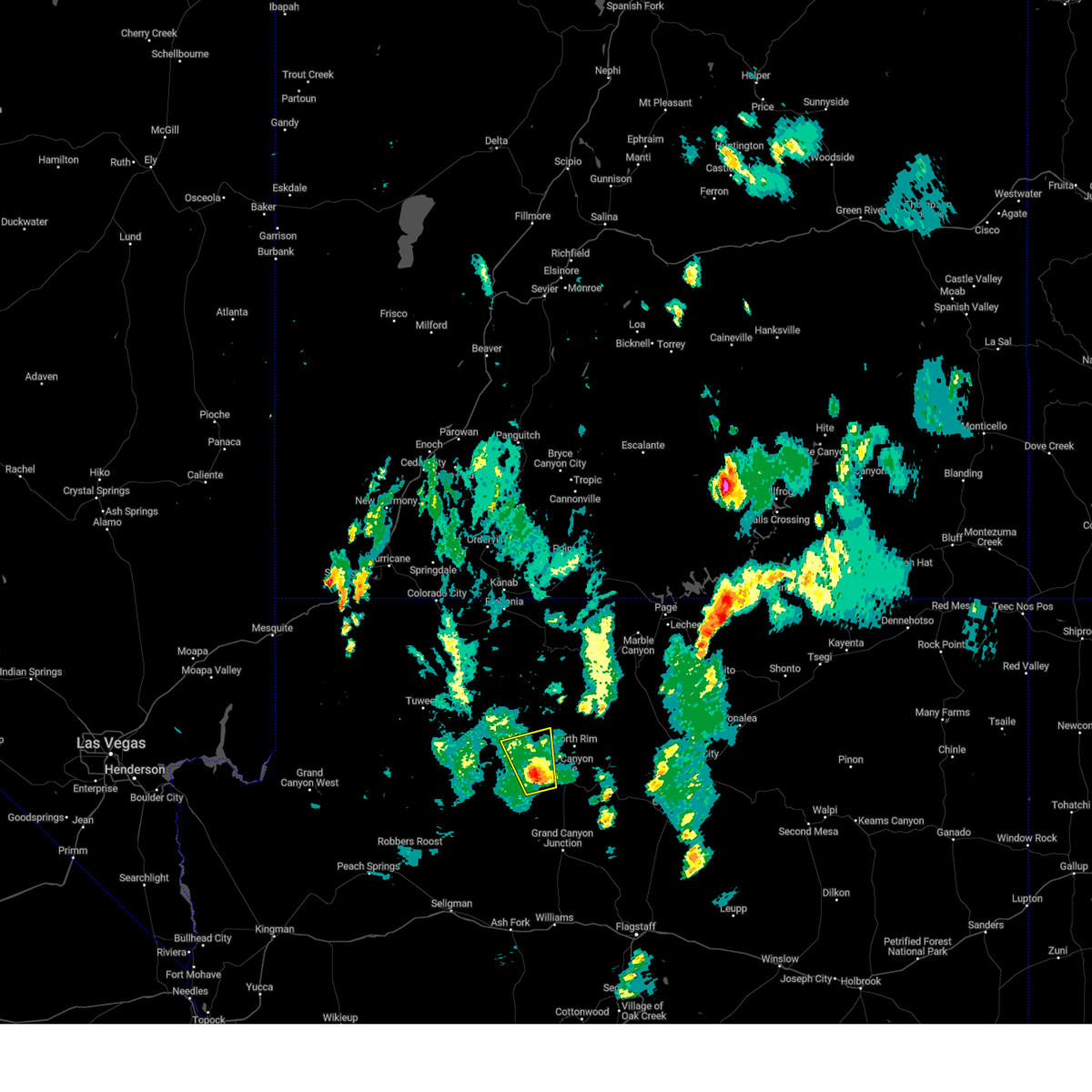
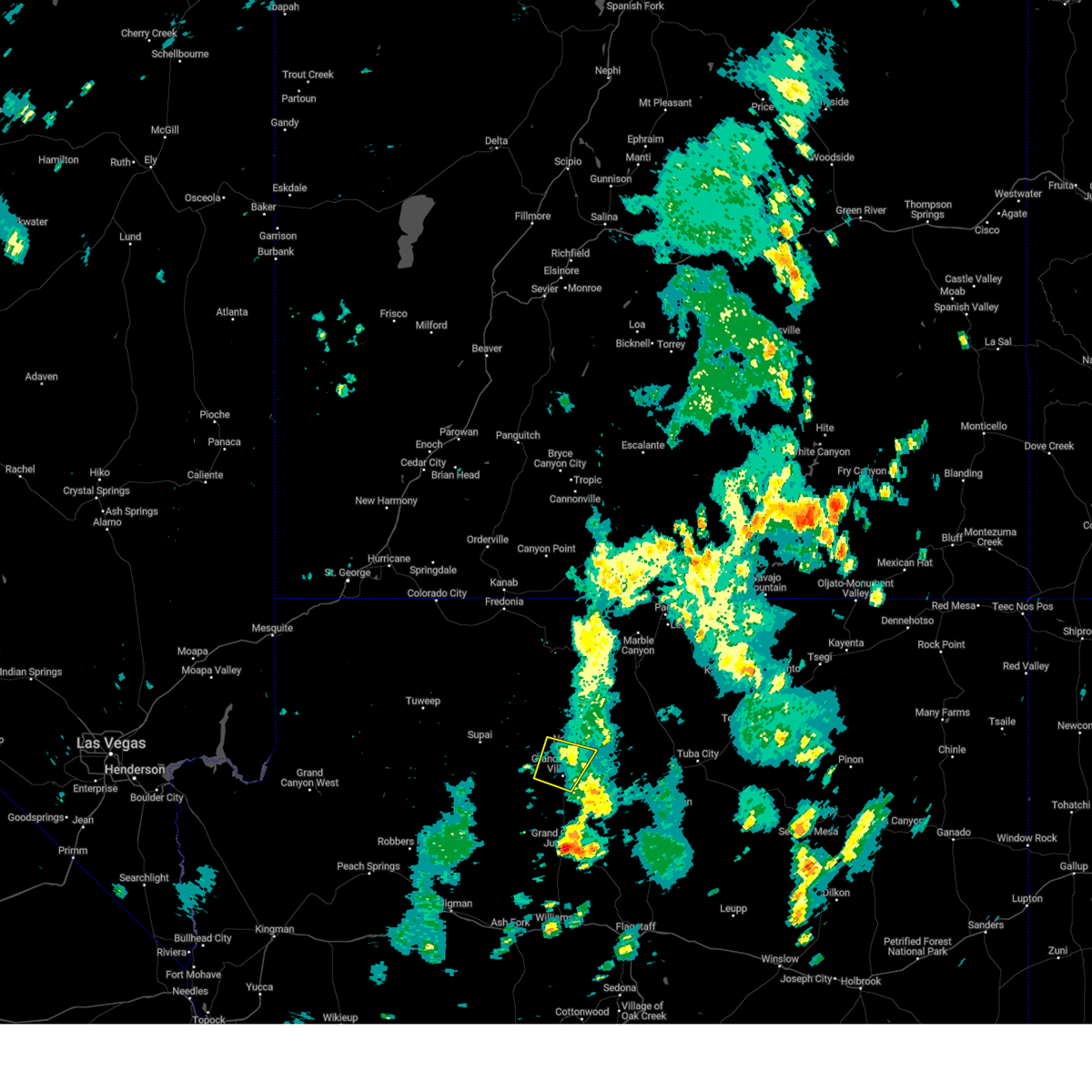
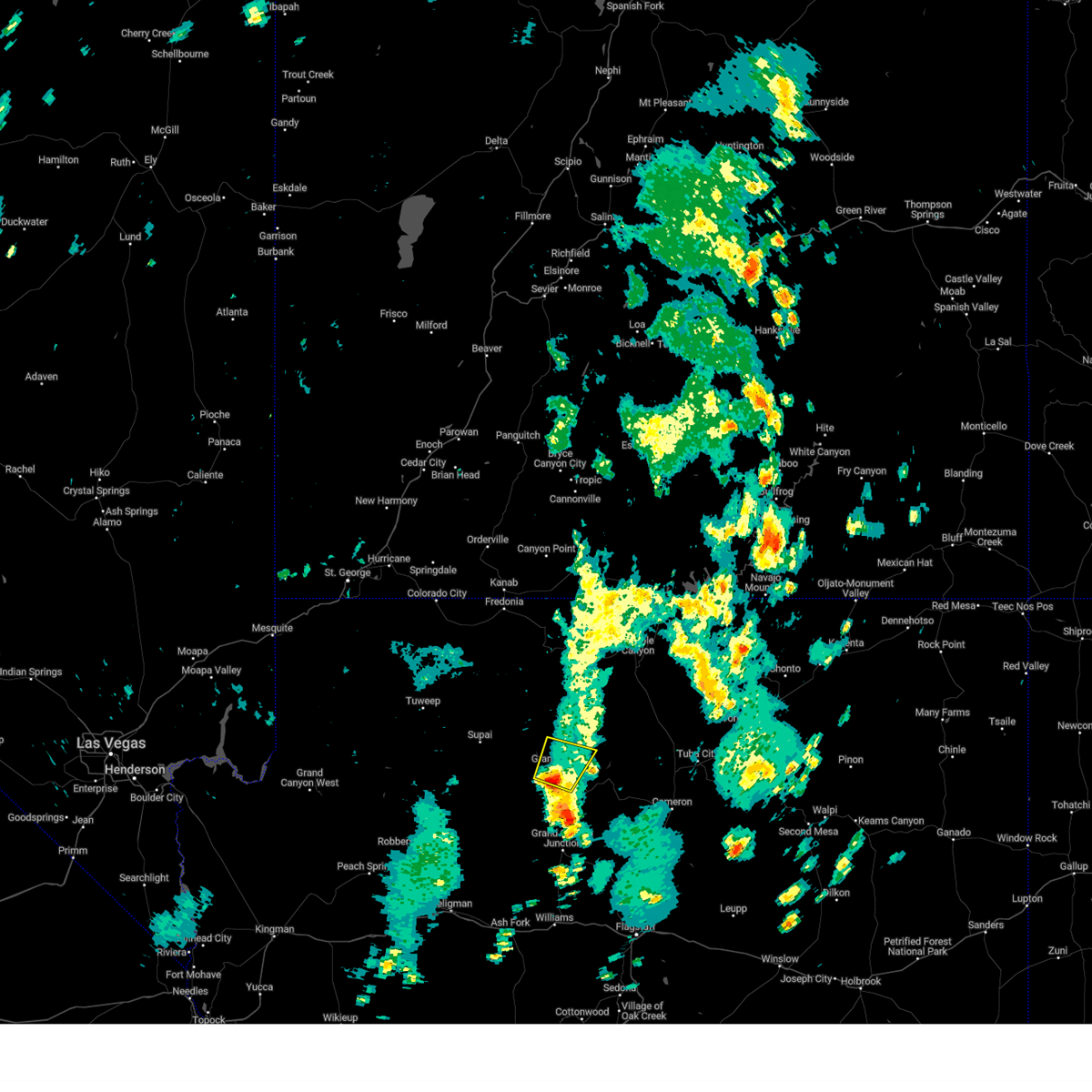
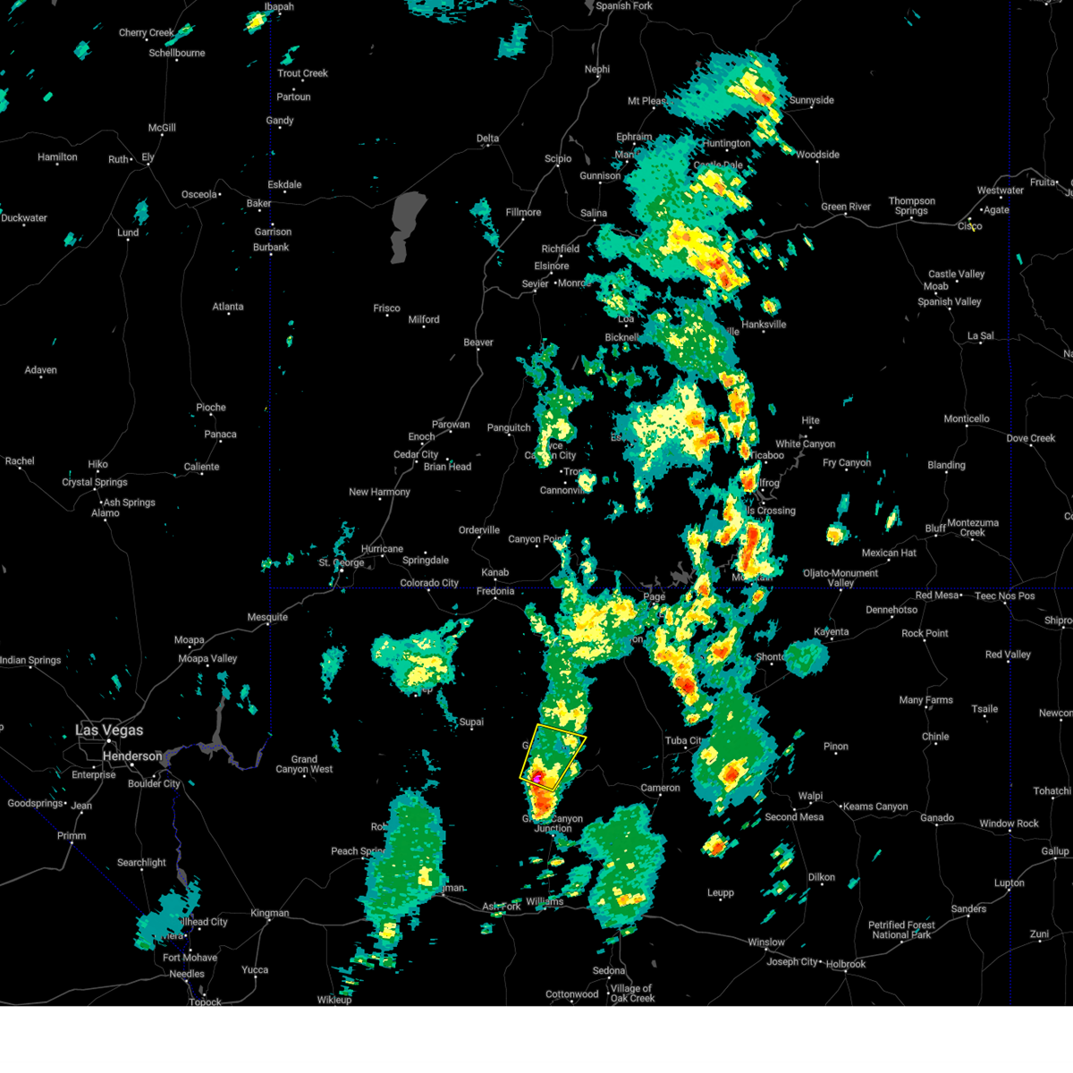
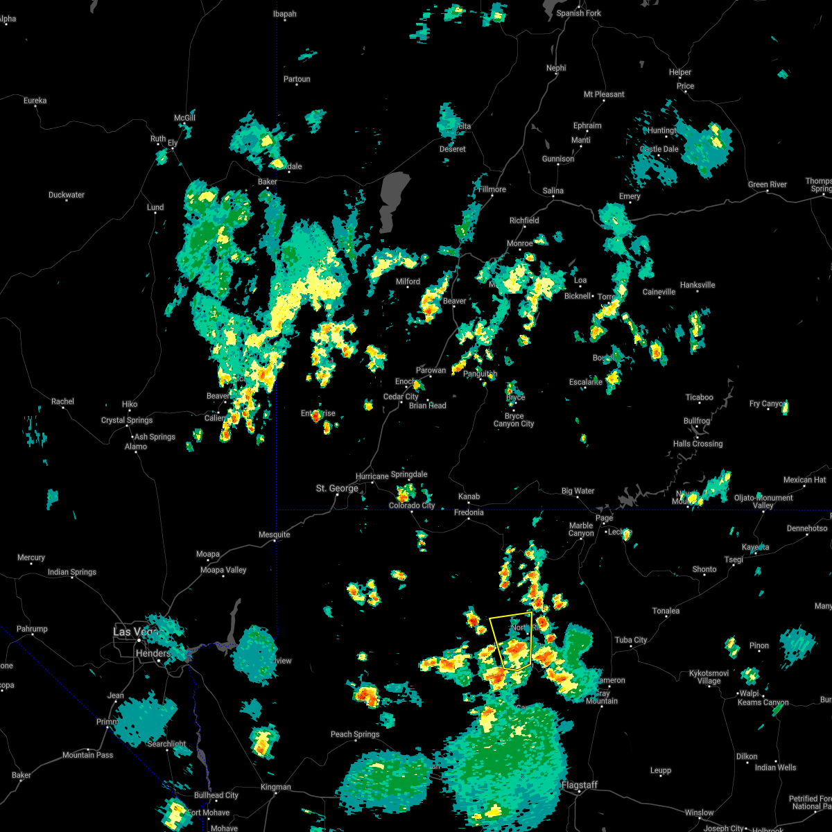
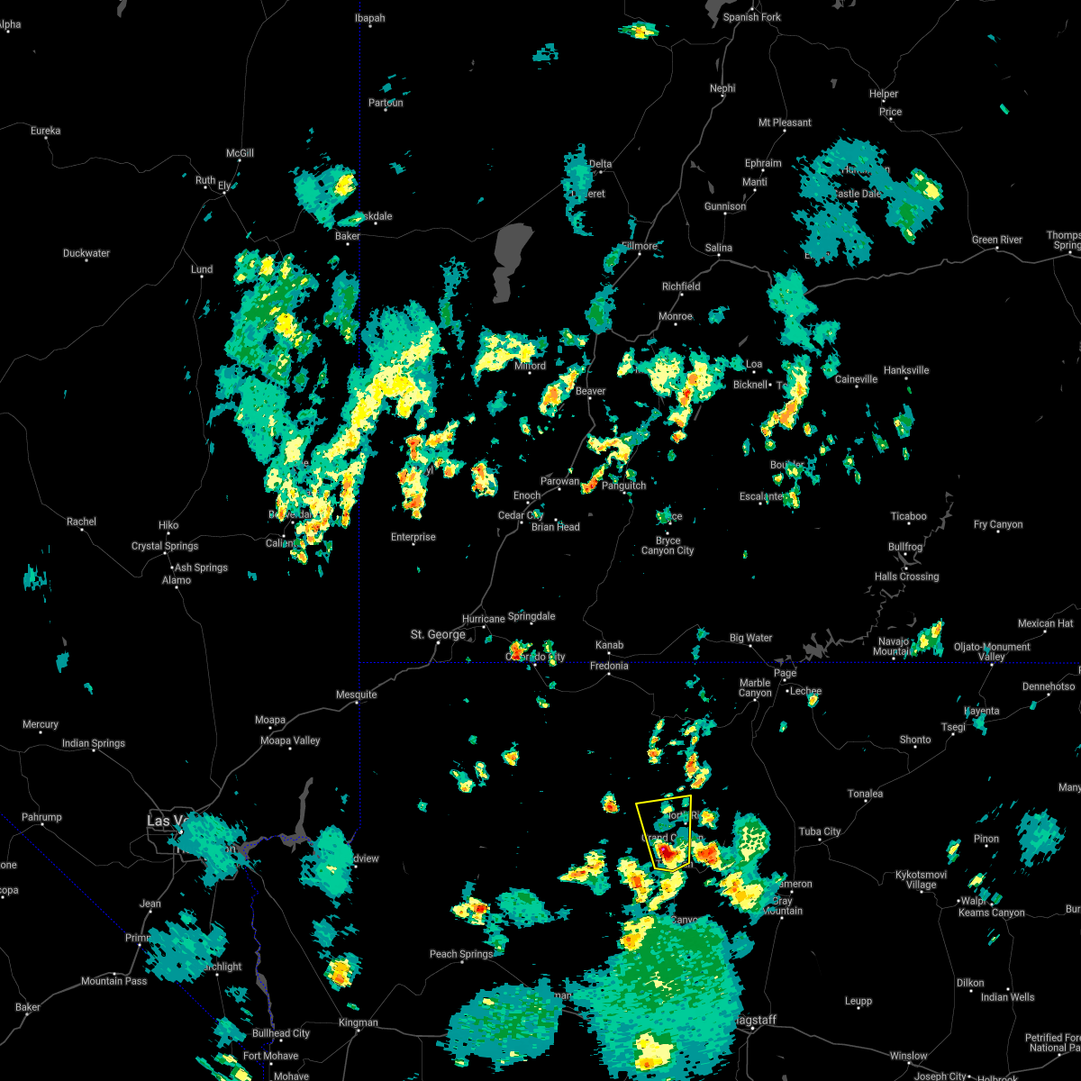
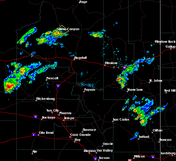
Hail Map for Grand Canyon Village, AZ
The Grand Canyon Village, AZ area has had 0 reports of on-the-ground hail by trained spotters, and has been under severe weather warnings 0 times during the past 12 months. Doppler radar has detected hail at or near Grand Canyon Village, AZ on 11 occasions, including 2 occasions during the past year.
| Name: | Grand Canyon Village, AZ |
| Where Located: | 64.9 miles NNW of Flagstaff, AZ |
| Map: | Google Map for Grand Canyon Village, AZ |
| Population: | 2004 |
| Housing Units: | 858 |
| More Info: | Search Google for Grand Canyon Village, AZ |
1
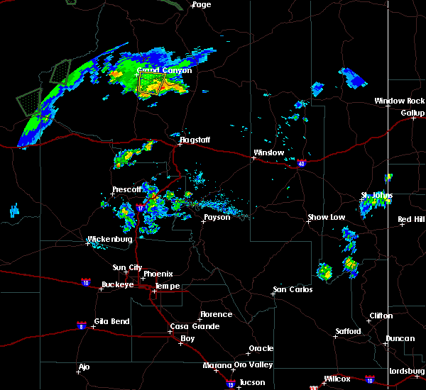
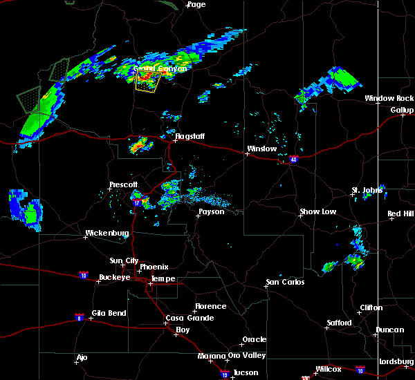
The Top Recent Hail Date for Grand Canyon Village, AZ is Sunday, August 11, 2024 (2nd out of 11)

Hail and Wind Damage Spotted near Grand Canyon Village, AZ
| Date / Time | Report Details |
|---|---|
| 8/22/2023 4:34 PM MST |
 At 433 pm mst, a severe thunderstorm was located near hermit`s rest at grand canyon, or 27 miles west of desert view at grand canyon, moving north at 25 mph (radar indicated). Hazards include 60 mph wind gusts and quarter size hail. Hail damage to vehicles is expected. Expect wind damage to roofs, siding, and trees. At 433 pm mst, a severe thunderstorm was located near hermit`s rest at grand canyon, or 27 miles west of desert view at grand canyon, moving north at 25 mph (radar indicated). Hazards include 60 mph wind gusts and quarter size hail. Hail damage to vehicles is expected. Expect wind damage to roofs, siding, and trees.
|
| 8/2/2023 3:09 PM MST |
 The severe thunderstorm warning for grand canyon south rim in coconino county will expire at 315 pm mst, the storm which prompted the warning has weakened below severe limits, and no longer poses an immediate threat to life or property. therefore, the warning will be allowed to expire. however, gusty winds are still possible with this thunderstorm. The severe thunderstorm warning for grand canyon south rim in coconino county will expire at 315 pm mst, the storm which prompted the warning has weakened below severe limits, and no longer poses an immediate threat to life or property. therefore, the warning will be allowed to expire. however, gusty winds are still possible with this thunderstorm.
|
| 8/2/2023 2:55 PM MST |
 At 254 pm mst, a severe thunderstorm was located over hopi point at grand canyon, or 18 miles west of desert view at grand canyon, moving northeast at 30 mph (radar indicated). Hazards include 60 mph wind gusts and penny size hail. Expect damage to roofs, siding, and trees. locations impacted include, yaqui point at grand canyon, hermit`s rest, shoshone point, pima point, bright angel point, south rim visitors center, hopi point, and grand canyon village. this includes state route 64 near mile marker 237. hail threat, radar indicated max hail size, 0. 75 in wind threat, radar indicated max wind gust, 60 mph. At 254 pm mst, a severe thunderstorm was located over hopi point at grand canyon, or 18 miles west of desert view at grand canyon, moving northeast at 30 mph (radar indicated). Hazards include 60 mph wind gusts and penny size hail. Expect damage to roofs, siding, and trees. locations impacted include, yaqui point at grand canyon, hermit`s rest, shoshone point, pima point, bright angel point, south rim visitors center, hopi point, and grand canyon village. this includes state route 64 near mile marker 237. hail threat, radar indicated max hail size, 0. 75 in wind threat, radar indicated max wind gust, 60 mph.
|
| 8/2/2023 2:41 PM MST |
 At 239 pm mst, a severe thunderstorm was located over hermit`s rest at grand canyon, or 21 miles west of desert view at grand canyon, moving northeast at 30 mph (radar indicated). Hazards include 60 mph wind gusts and quarter size hail. Hail damage to vehicles is expected. Expect wind damage to roofs, siding, and trees. At 239 pm mst, a severe thunderstorm was located over hermit`s rest at grand canyon, or 21 miles west of desert view at grand canyon, moving northeast at 30 mph (radar indicated). Hazards include 60 mph wind gusts and quarter size hail. Hail damage to vehicles is expected. Expect wind damage to roofs, siding, and trees.
|
| 7/21/2021 3:37 PM MST |
 At 335 pm mst, a severe thunderstorm was located near pima point at grand canyon, or 21 miles west of desert view at grand canyon, moving north at 15 mph (radar indicated). Hazards include 60 mph wind gusts and penny size hail. Expect damage to roofs, siding, and trees. Locations impacted include, maricopa point at grand canyon, yaqui point at grand canyon, hermit`s rest at grand canyon, shoshone point at grand canyon, pima point at grand canyon, bright angel point, south rim visitors center, hopi point at grand canyon, north rim entrance station and grand canyon village. At 335 pm mst, a severe thunderstorm was located near pima point at grand canyon, or 21 miles west of desert view at grand canyon, moving north at 15 mph (radar indicated). Hazards include 60 mph wind gusts and penny size hail. Expect damage to roofs, siding, and trees. Locations impacted include, maricopa point at grand canyon, yaqui point at grand canyon, hermit`s rest at grand canyon, shoshone point at grand canyon, pima point at grand canyon, bright angel point, south rim visitors center, hopi point at grand canyon, north rim entrance station and grand canyon village.
|
| 7/21/2021 3:21 PM MST |
 At 320 pm mst, a severe thunderstorm was located over pima point at grand canyon, or 20 miles west of desert view at grand canyon, moving north at 15 mph (radar indicated). Hazards include 60 mph wind gusts and quarter size hail. Hail damage to vehicles is expected. Expect wind damage to roofs, siding, and trees. At 320 pm mst, a severe thunderstorm was located over pima point at grand canyon, or 20 miles west of desert view at grand canyon, moving north at 15 mph (radar indicated). Hazards include 60 mph wind gusts and quarter size hail. Hail damage to vehicles is expected. Expect wind damage to roofs, siding, and trees.
|
| 8/26/2018 2:45 PM MST |
 At 245 pm mst, a severe thunderstorm was located 8 miles south of tusayan, or 22 miles southwest of desert view at grand canyon, moving northeast at 10 mph (radar indicated). Hazards include 60 mph wind gusts and quarter size hail. Hail damage to vehicles is expected. expect wind damage to roofs, siding, and trees. locations impacted include, moran point at grand canyon, tusayan, shoshone point at grand canyon, grandview point at grand canyon and ten-x campground. This includes state route 64 between mile markers 220 and 237. At 245 pm mst, a severe thunderstorm was located 8 miles south of tusayan, or 22 miles southwest of desert view at grand canyon, moving northeast at 10 mph (radar indicated). Hazards include 60 mph wind gusts and quarter size hail. Hail damage to vehicles is expected. expect wind damage to roofs, siding, and trees. locations impacted include, moran point at grand canyon, tusayan, shoshone point at grand canyon, grandview point at grand canyon and ten-x campground. This includes state route 64 between mile markers 220 and 237.
|
| 8/26/2018 2:31 PM MST |
 At 231 pm mst, a severe thunderstorm was located 7 miles south of tusayan, or 18 miles southwest of desert view at grand canyon, moving northeast at 15 mph (radar indicated). Hazards include 60 mph wind gusts and quarter size hail. Hail damage to vehicles is expected. Expect wind damage to roofs, siding, and trees. At 231 pm mst, a severe thunderstorm was located 7 miles south of tusayan, or 18 miles southwest of desert view at grand canyon, moving northeast at 15 mph (radar indicated). Hazards include 60 mph wind gusts and quarter size hail. Hail damage to vehicles is expected. Expect wind damage to roofs, siding, and trees.
|
| 8/21/2018 11:23 AM MST |
 At 1121 am mst, a severe thunderstorm was located over cape royal at grand canyon, or 9 miles west of desert view, moving northeast at 45 mph (radar indicated). Hazards include quarter size hail. Damage to vehicles is expected. Locations impacted include, yaqui point, shoshone point, cape royal, hopi point. At 1121 am mst, a severe thunderstorm was located over cape royal at grand canyon, or 9 miles west of desert view, moving northeast at 45 mph (radar indicated). Hazards include quarter size hail. Damage to vehicles is expected. Locations impacted include, yaqui point, shoshone point, cape royal, hopi point.
|
| 8/21/2018 11:13 AM MST |
 At 1111 am mst, a severe thunderstorm was located over tusayan, moving north at 15 mph (radar indicated). Hazards include 60 mph wind gusts and quarter size hail. Hail damage to vehicles is expected. Expect wind damage to roofs, siding, and trees. At 1111 am mst, a severe thunderstorm was located over tusayan, moving north at 15 mph (radar indicated). Hazards include 60 mph wind gusts and quarter size hail. Hail damage to vehicles is expected. Expect wind damage to roofs, siding, and trees.
|
| 7/17/2018 8:06 PM MST |
 The severe thunderstorm warning for coconino county will expire at 815 pm mst, the storm over the south rim of the grand canyon which prompted the warning has weakened below severe limits, and no longer pose an immediate threat to life or property. therefore the warning will be allowed to expire. however, heavy rain, frequent lightning, and small hail are still possible with this thunderstorm. The severe thunderstorm warning for coconino county will expire at 815 pm mst, the storm over the south rim of the grand canyon which prompted the warning has weakened below severe limits, and no longer pose an immediate threat to life or property. therefore the warning will be allowed to expire. however, heavy rain, frequent lightning, and small hail are still possible with this thunderstorm.
|
| 7/17/2018 7:26 PM MST |
 At 726 pm mst, a severe thunderstorm was located over moran point at grand canyon, or 7 miles west of desert view at grand canyon, moving south at 15 mph (radar indicated). Hazards include 60 mph wind gusts and quarter size hail. Hail damage to vehicles is expected. Expect wind damage to roofs, siding, and trees. At 726 pm mst, a severe thunderstorm was located over moran point at grand canyon, or 7 miles west of desert view at grand canyon, moving south at 15 mph (radar indicated). Hazards include 60 mph wind gusts and quarter size hail. Hail damage to vehicles is expected. Expect wind damage to roofs, siding, and trees.
|
| 8/9/2016 6:11 PM MST |
 The severe thunderstorm warning for coconino county will expire at 615 pm mst, the storm which prompted the warning has weakened below severe limits, and no longer poses an immediate threat to life or property. therefore the warning will be allowed to expire. however heavy rain is still possible with this thunderstorm. The severe thunderstorm warning for coconino county will expire at 615 pm mst, the storm which prompted the warning has weakened below severe limits, and no longer poses an immediate threat to life or property. therefore the warning will be allowed to expire. however heavy rain is still possible with this thunderstorm.
|
| 8/9/2016 6:02 PM MST |
 At 601 pm mst, doppler radar indicated a severe thunderstorm capable of producing quarter size hail and damaging winds in excess of 60 mph. this storm was located over tusayan, or 16 miles west of desert view at grand canyon, moving northeast at 30 mph. locations impacted include, desert view at grand canyon, grandview point at grand canyon, shoshone point at grand canyon, moran point at grand canyon, maricopa point at grand canyon, yaqui point at grand canyon, south rim visitors center, cape royal at grand canyon, tusayan, hopi point at grand canyon, grand canyon village and ten-x campground. At 601 pm mst, doppler radar indicated a severe thunderstorm capable of producing quarter size hail and damaging winds in excess of 60 mph. this storm was located over tusayan, or 16 miles west of desert view at grand canyon, moving northeast at 30 mph. locations impacted include, desert view at grand canyon, grandview point at grand canyon, shoshone point at grand canyon, moran point at grand canyon, maricopa point at grand canyon, yaqui point at grand canyon, south rim visitors center, cape royal at grand canyon, tusayan, hopi point at grand canyon, grand canyon village and ten-x campground.
|
| 8/9/2016 5:52 PM MST |
 At 551 pm mst, doppler radar indicated a severe thunderstorm capable of producing half dollar size hail and damaging winds in excess of 60 mph. this storm was located over tusayan, or 19 miles west of desert view at grand canyon, and moving northeast at 30 mph. At 551 pm mst, doppler radar indicated a severe thunderstorm capable of producing half dollar size hail and damaging winds in excess of 60 mph. this storm was located over tusayan, or 19 miles west of desert view at grand canyon, and moving northeast at 30 mph.
|
Hail Maps for Grand Canyon Village, AZ


Connect with Interactive Hail Maps