

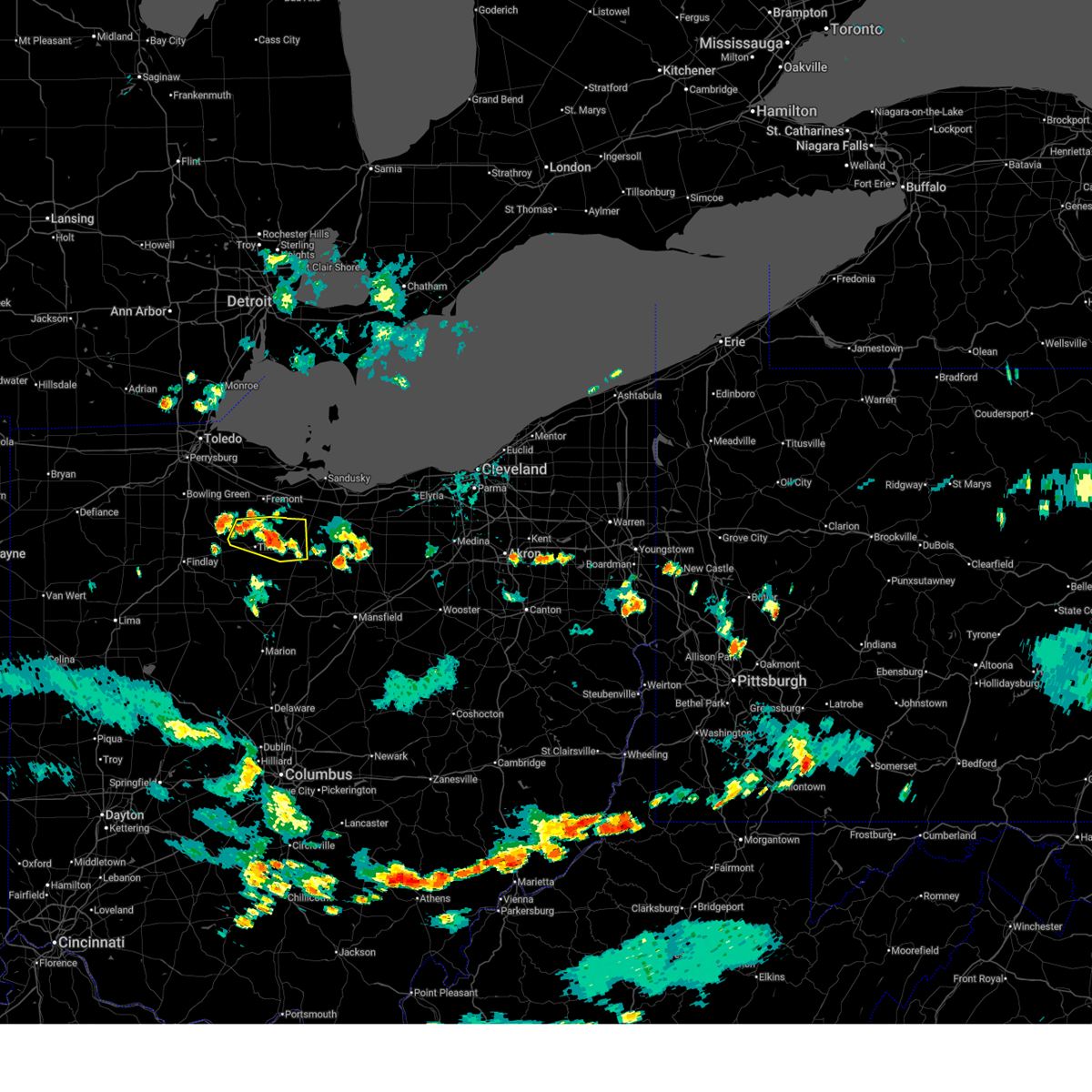
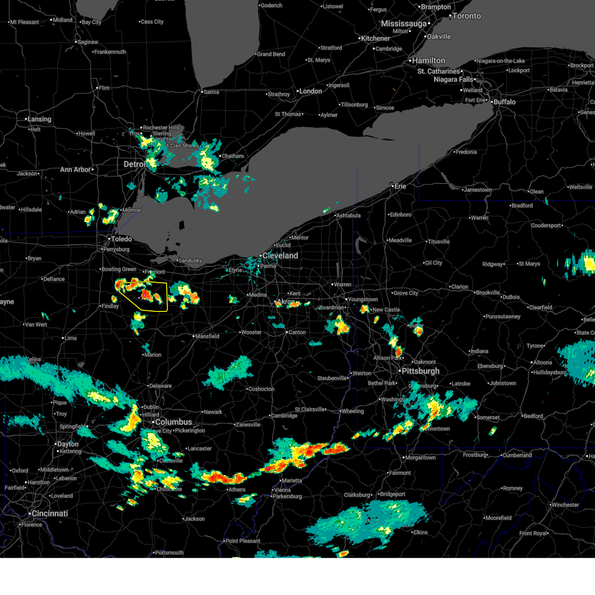
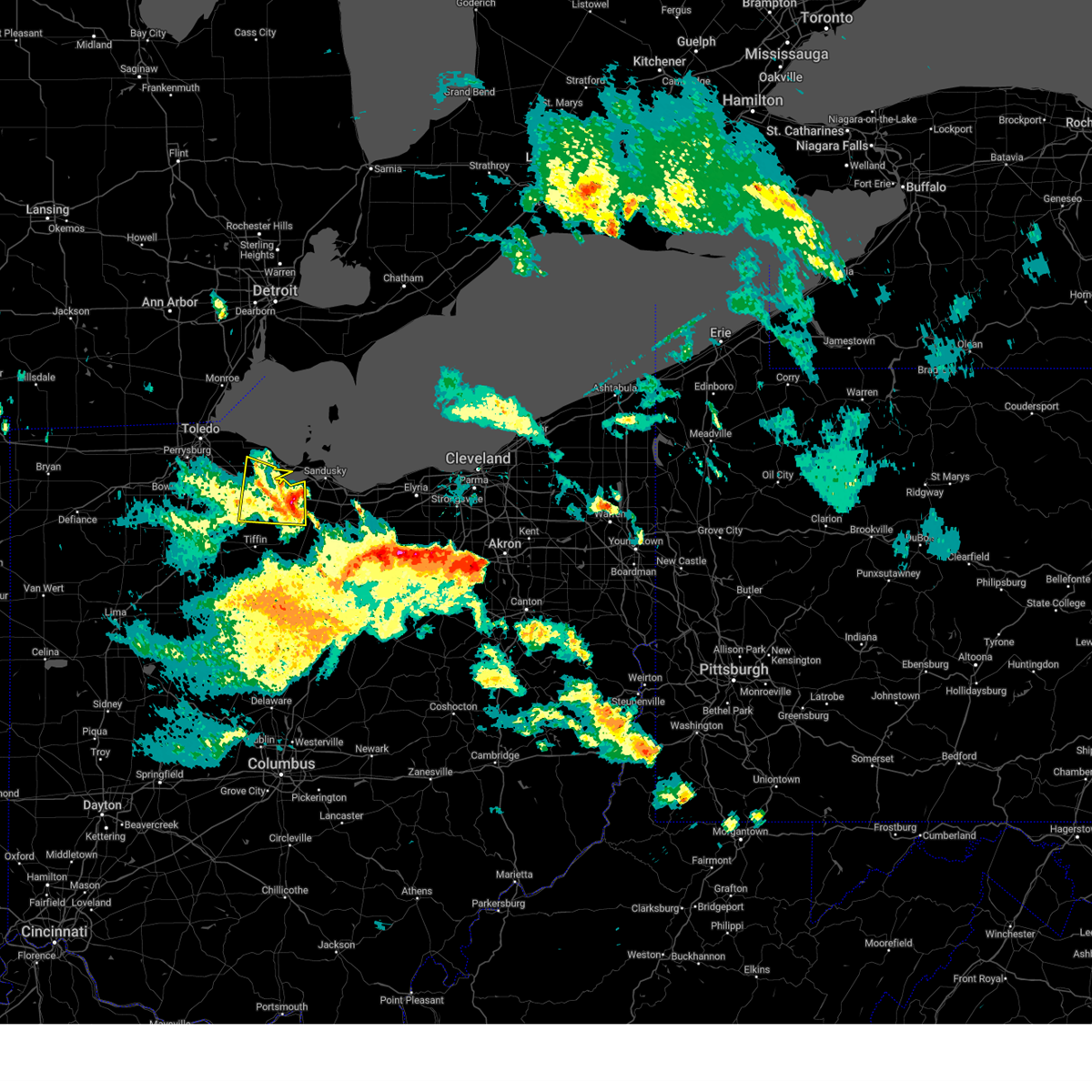
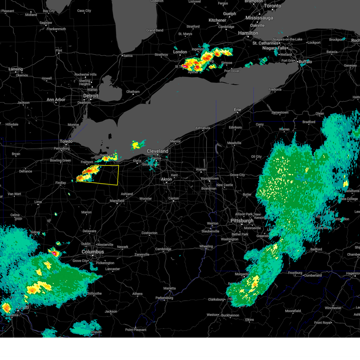
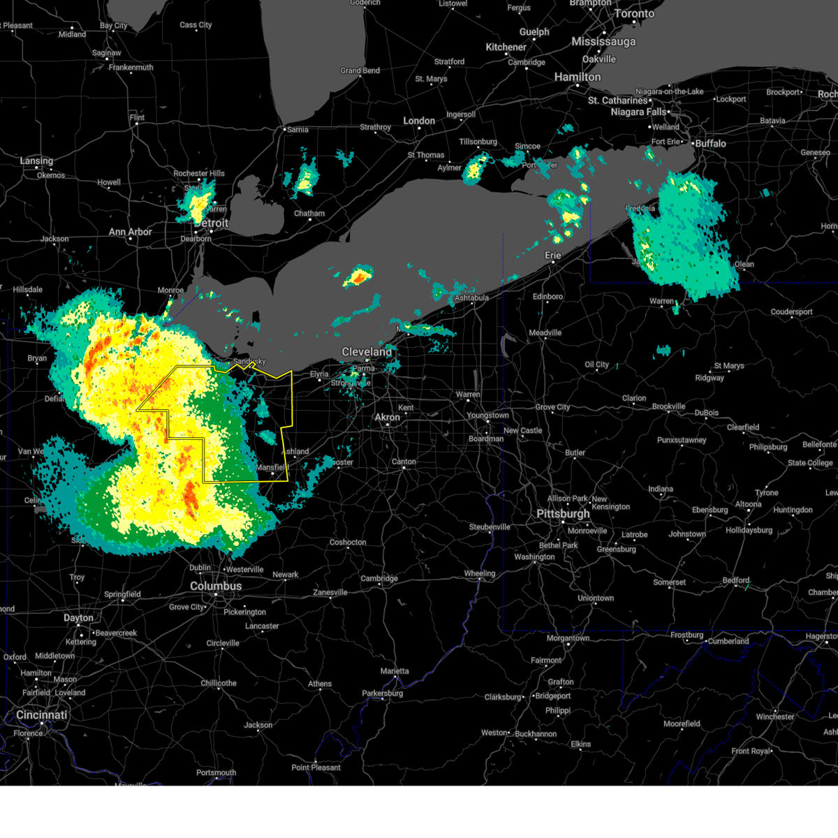
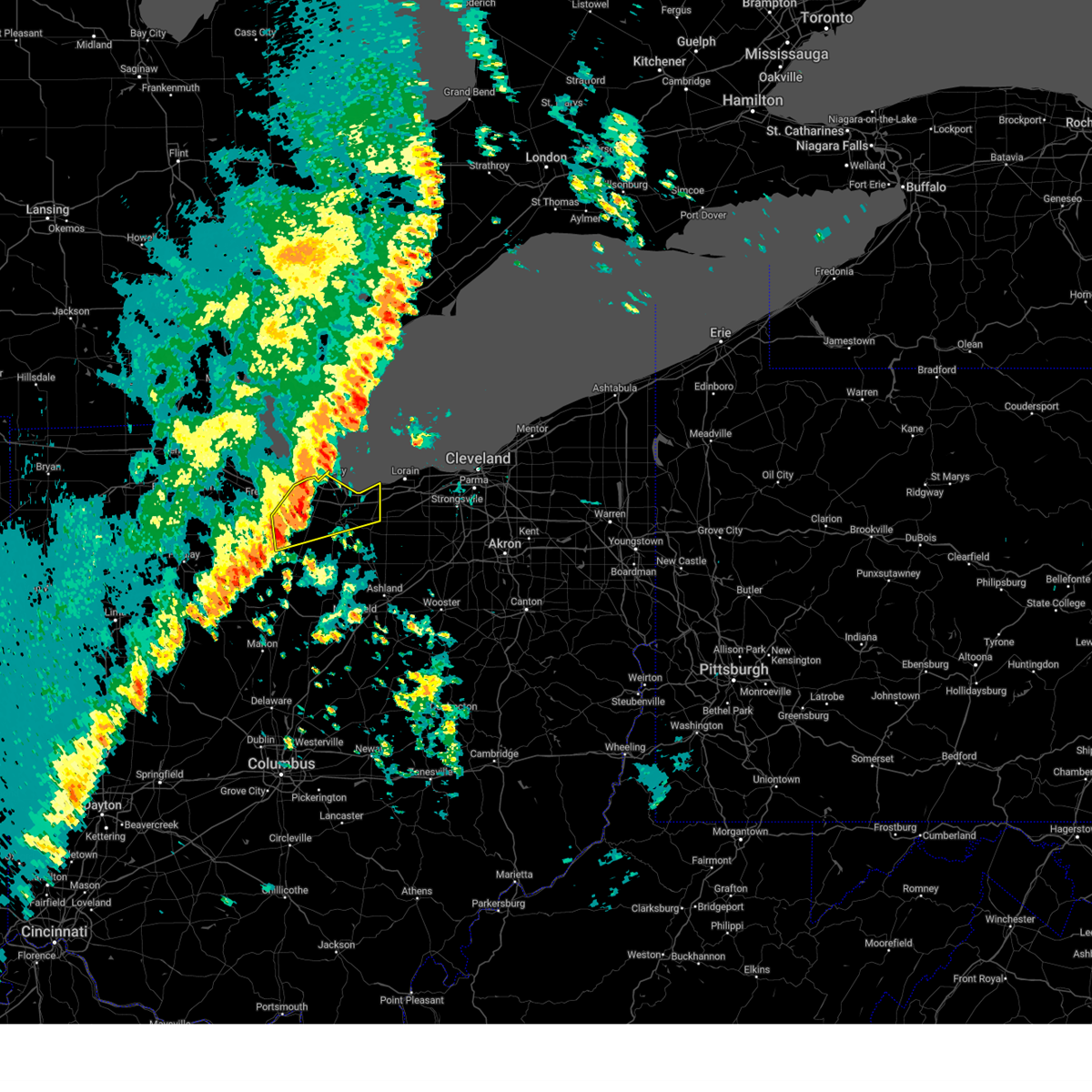
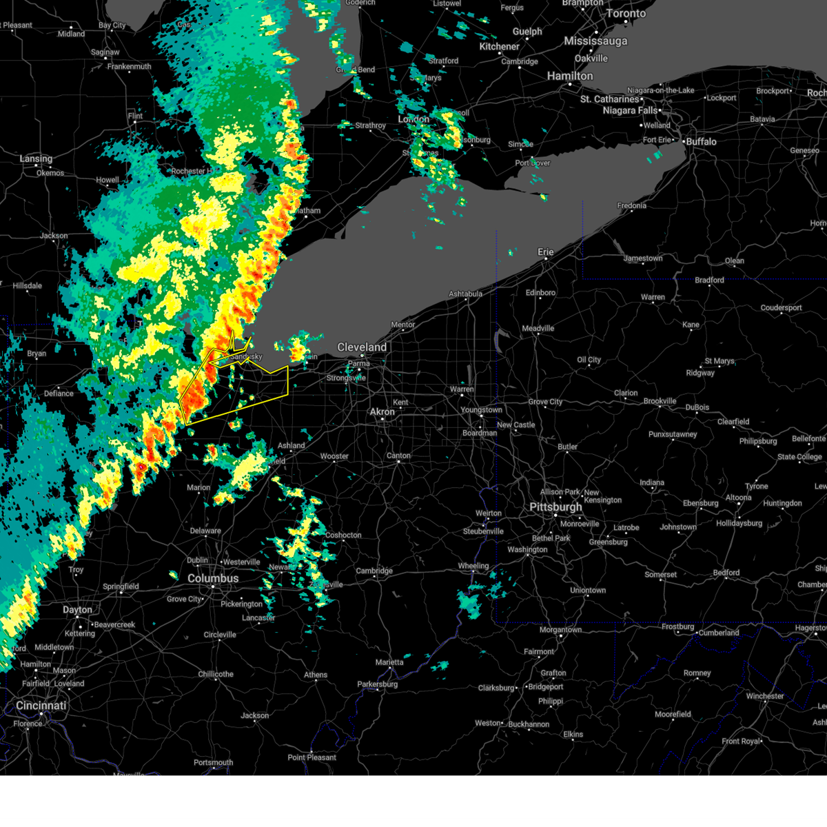
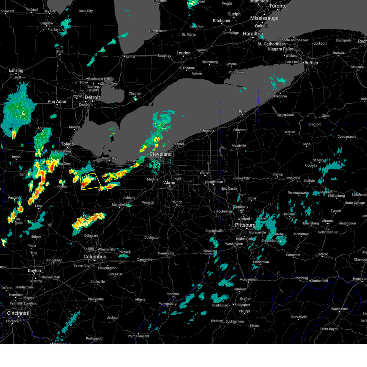
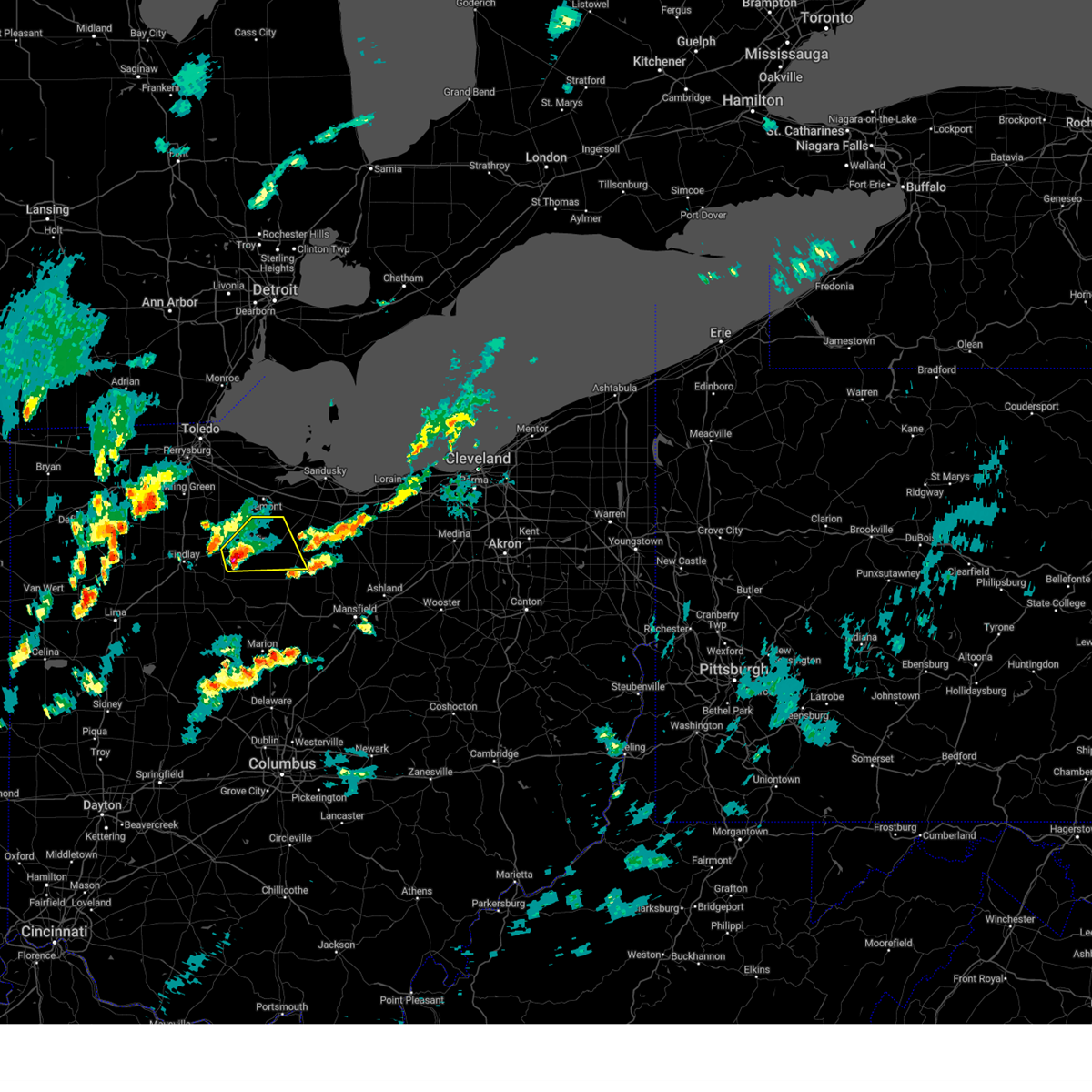
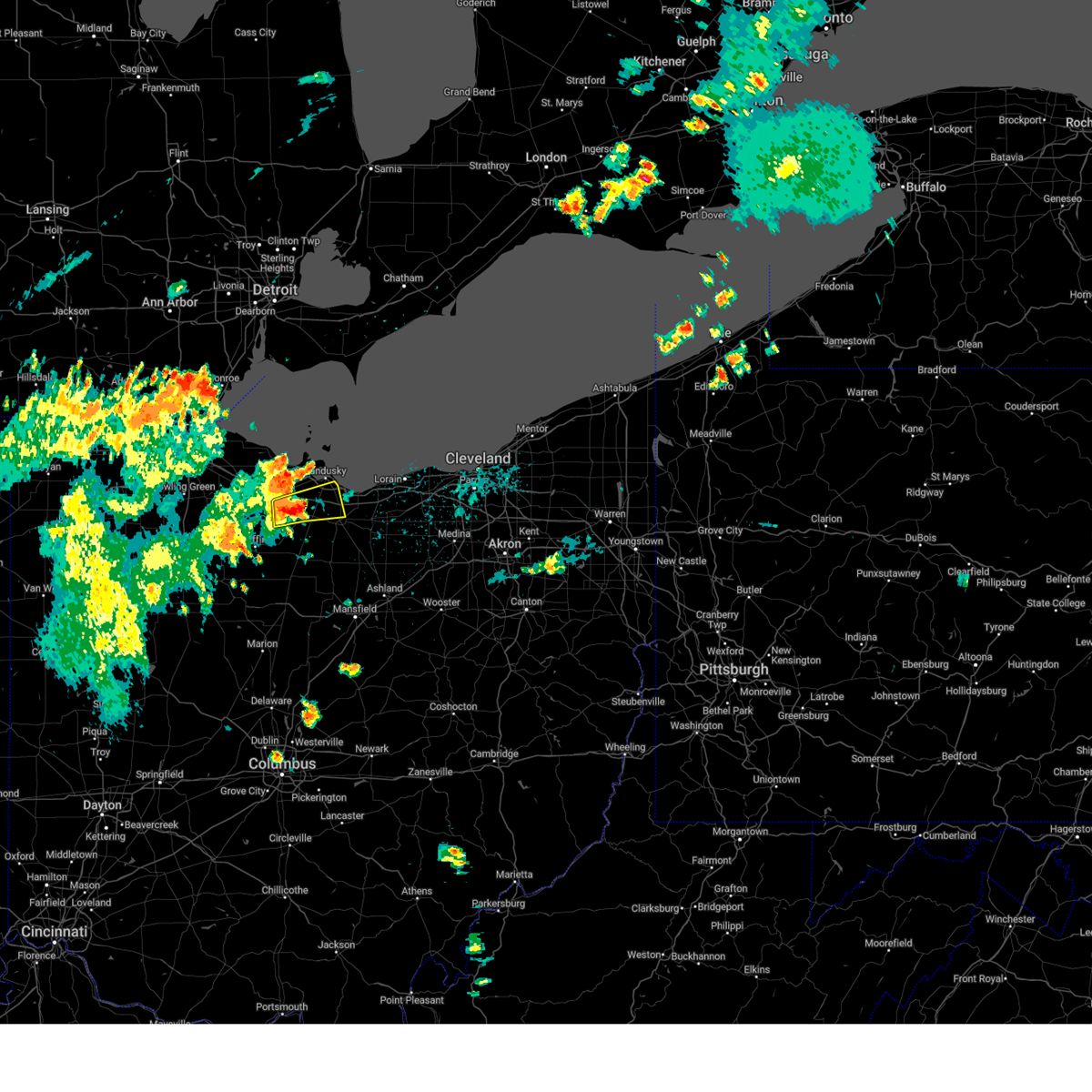
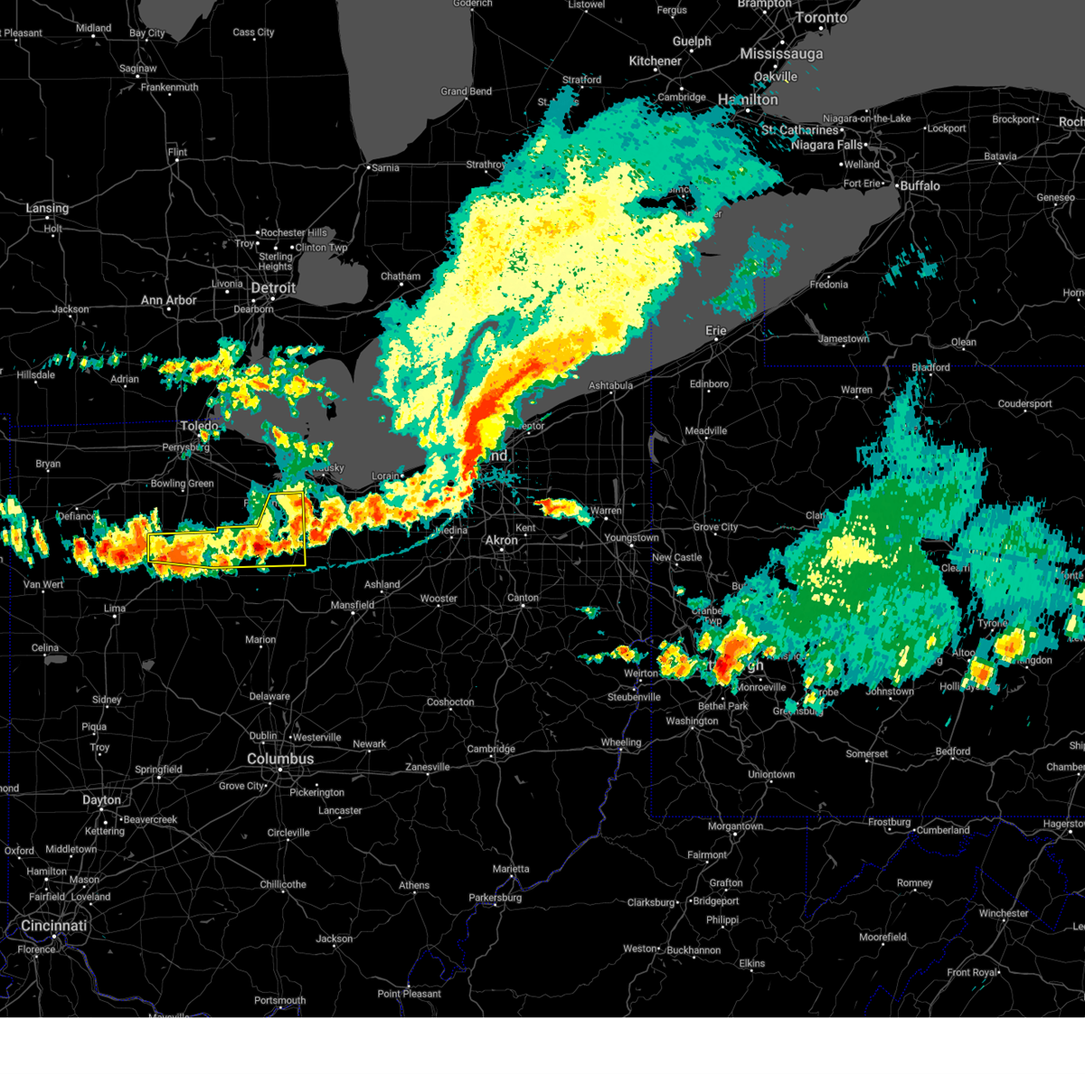
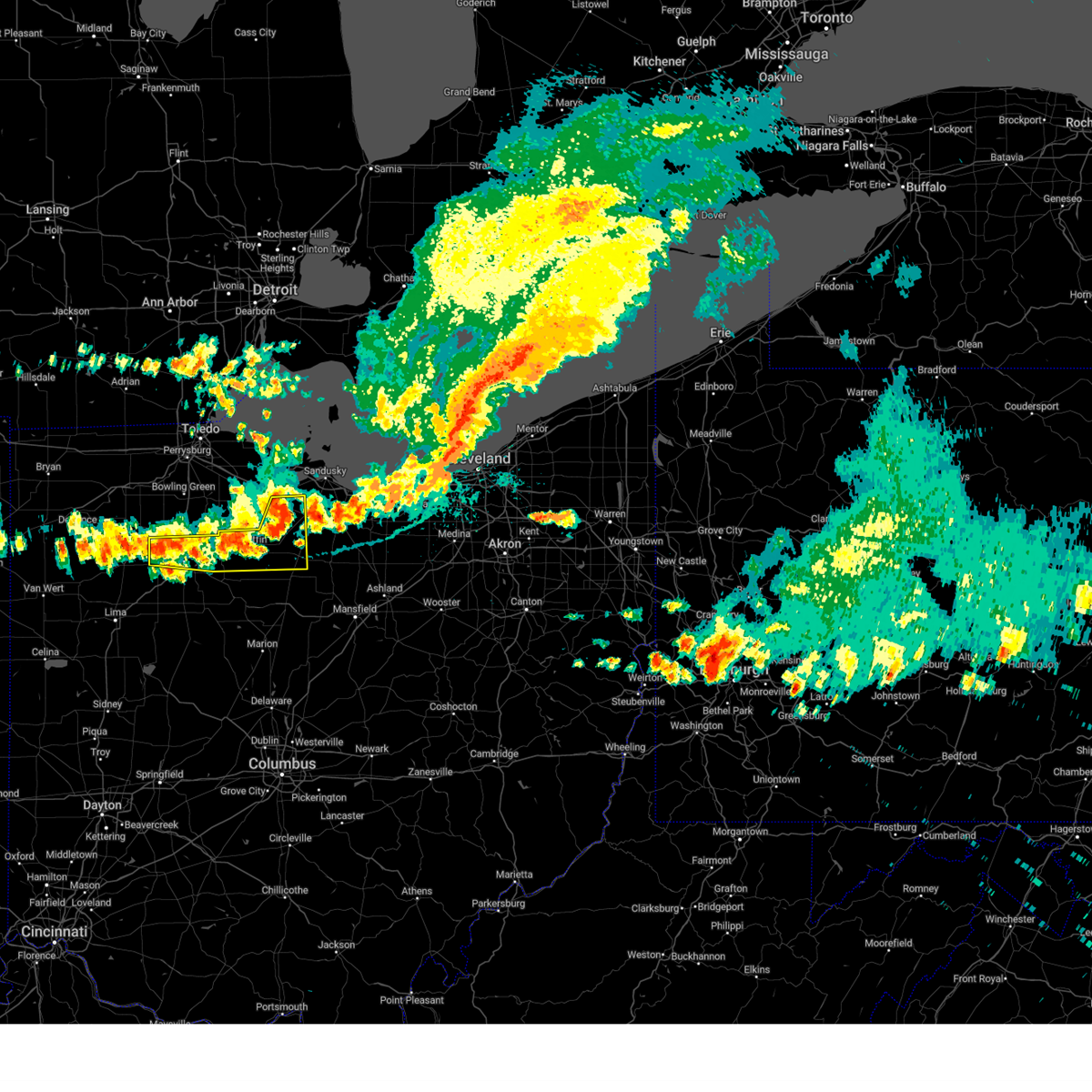
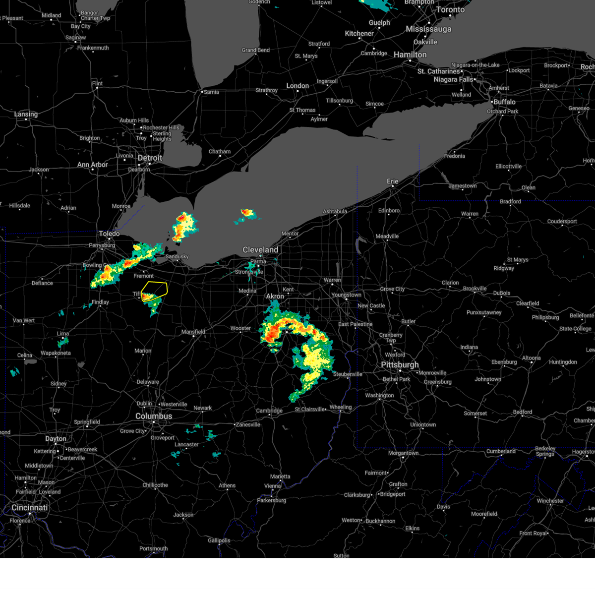
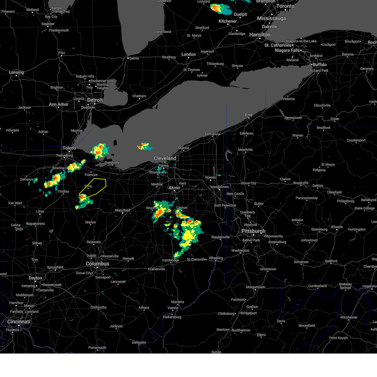
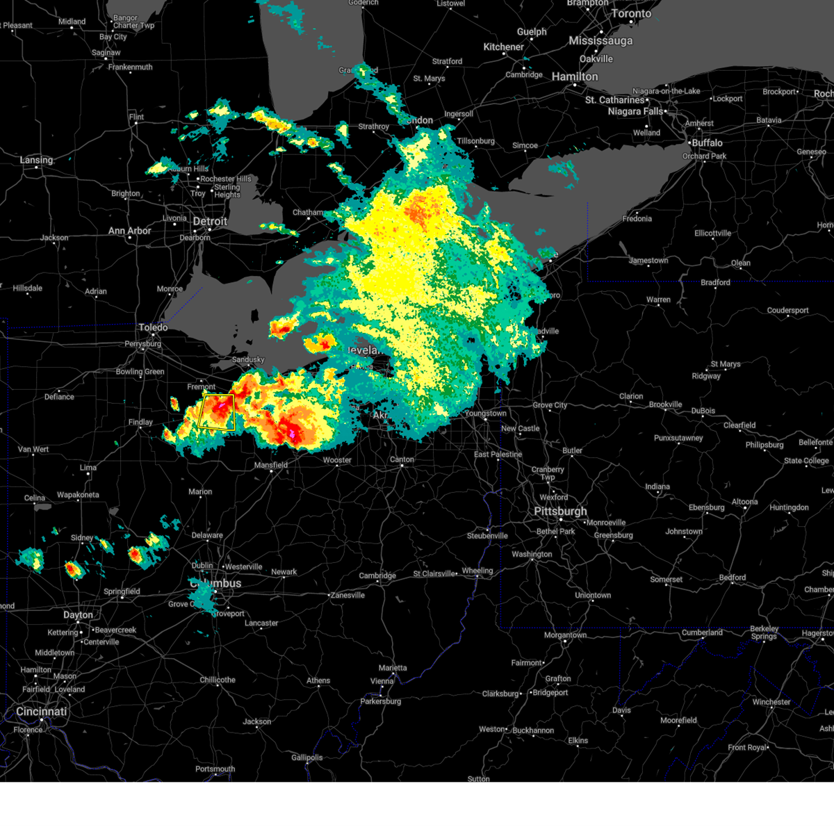
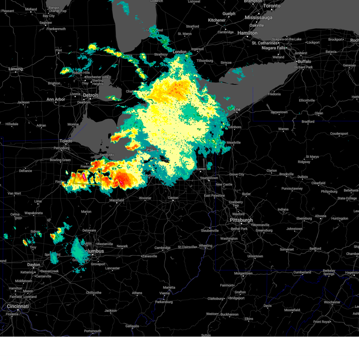
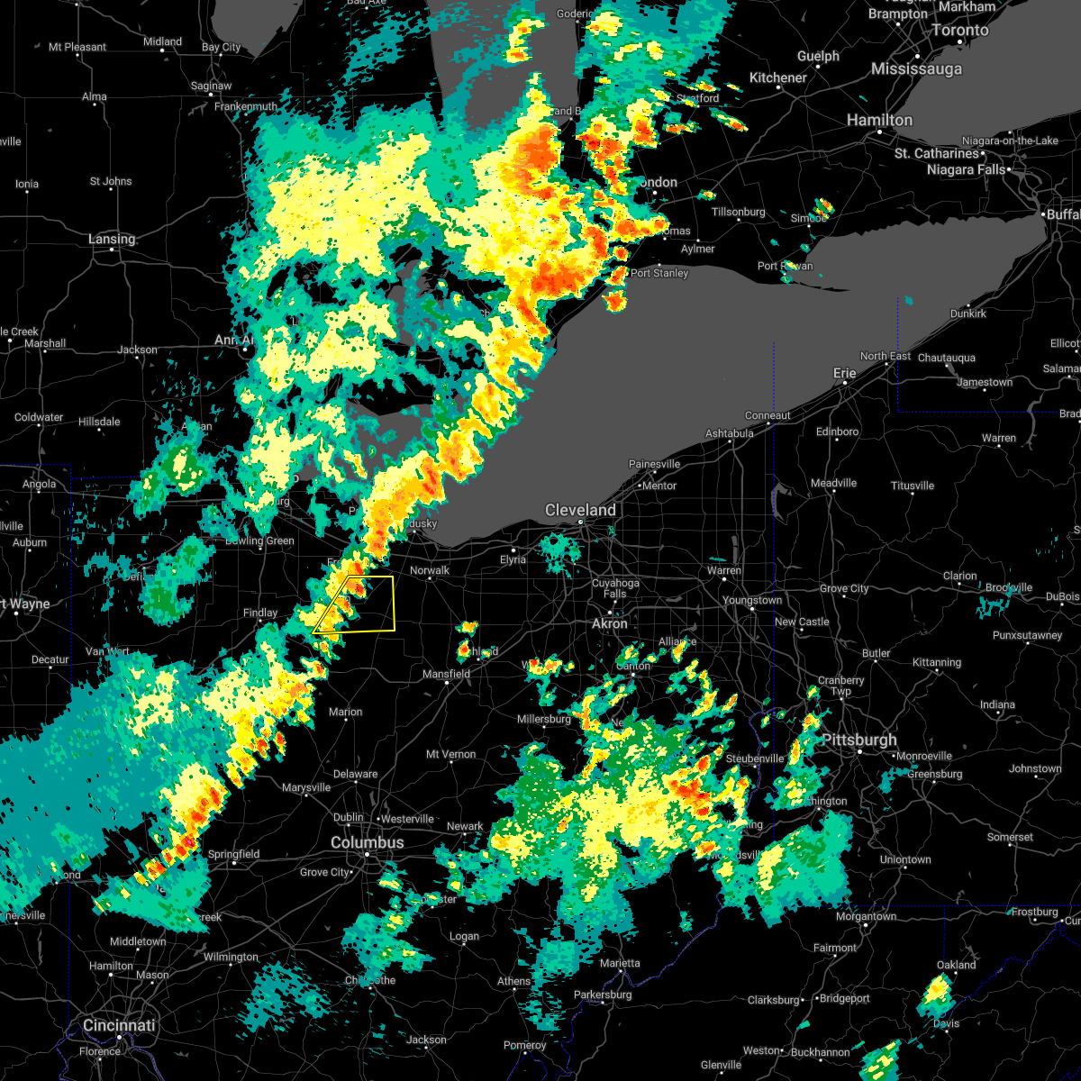
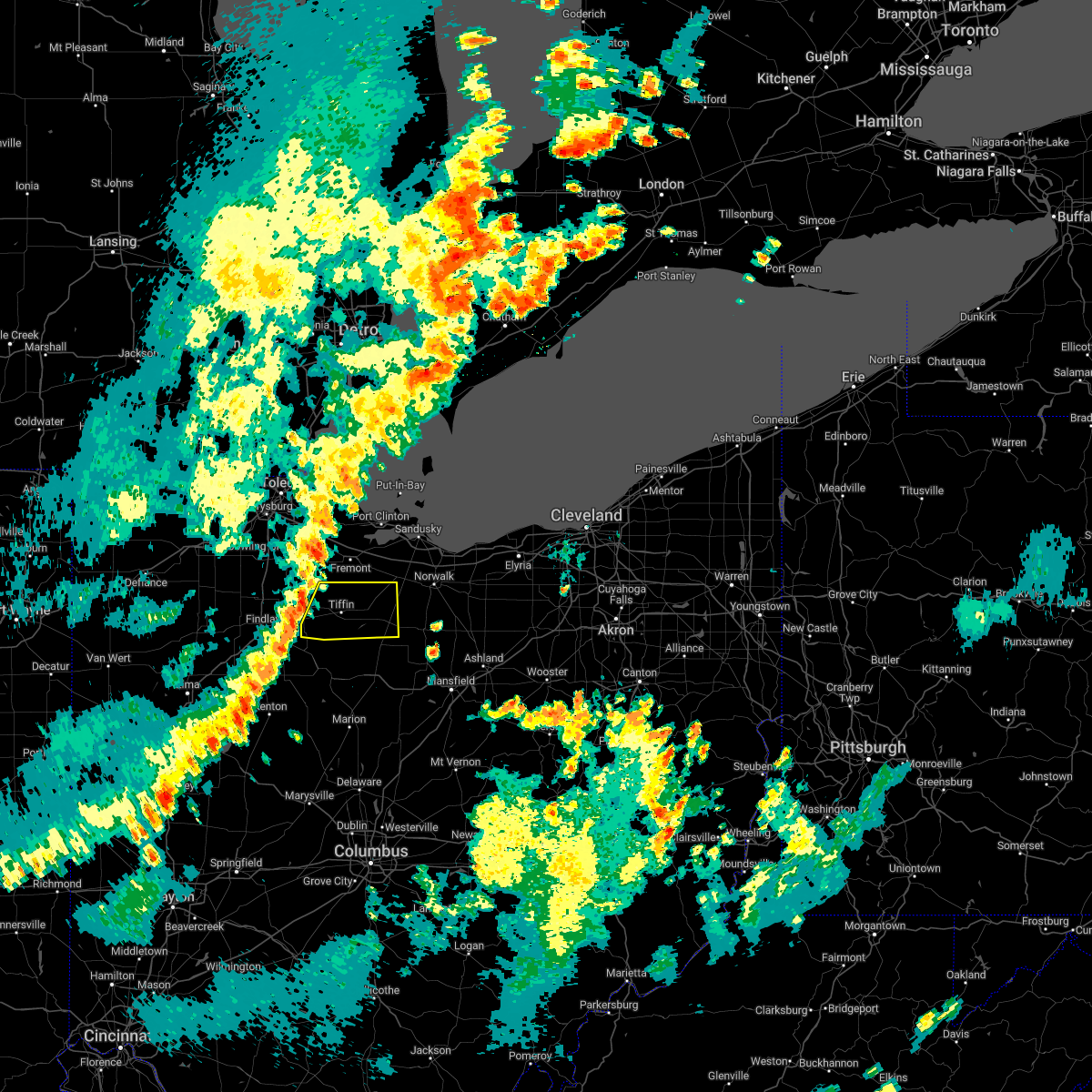
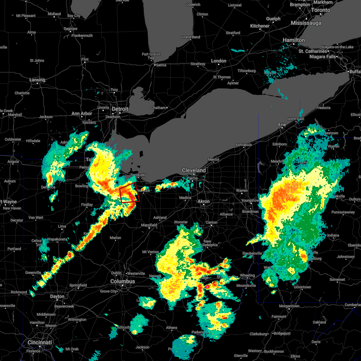
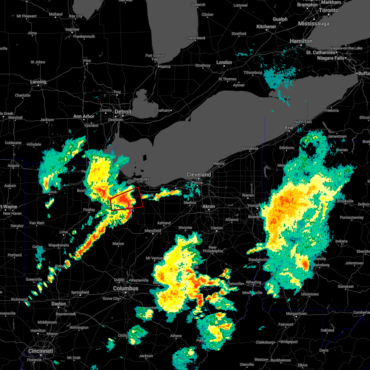
Hail Map for Green Springs, OH
The Green Springs, OH area has had 3 reports of on-the-ground hail by trained spotters, and has been under severe weather warnings 32 times during the past 12 months. Doppler radar has detected hail at or near Green Springs, OH on 27 occasions.
| Name: | Green Springs, OH |
| Where Located: | 72.8 miles WSW of Cleveland, OH |
| Map: | Google Map for Green Springs, OH |
| Population: | 1368 |
| Housing Units: | 520 |
| More Info: | Search Google for Green Springs, OH |
0
The Top Recent Hail Date for Green Springs, OH is Saturday, August 12, 2023 (15th out of 27)

Hail and Wind Damage Spotted near Green Springs, OH
| Date / Time | Report Details |
|---|---|
| 6/25/2025 6:35 PM EDT | The storm which prompted the warning has weakened below severe limits, and no longer poses an immediate threat to life or property. therefore, the warning will be allowed to expire. however, heavy rain is still possible with this thunderstorm. |
| 6/25/2025 6:16 PM EDT |
 At 616 pm edt, a severe thunderstorm was located near bloomville, or 9 miles east of tiffin, moving east at 20 mph (radar indicated). Hazards include 60 mph wind gusts. Expect damage to trees and power lines. Locations impacted include, tiffin, green springs, bloomville, attica, bettsville, republic, flat rock, bascom, and kansas. At 616 pm edt, a severe thunderstorm was located near bloomville, or 9 miles east of tiffin, moving east at 20 mph (radar indicated). Hazards include 60 mph wind gusts. Expect damage to trees and power lines. Locations impacted include, tiffin, green springs, bloomville, attica, bettsville, republic, flat rock, bascom, and kansas.
|
| 6/25/2025 6:06 PM EDT |
 Svrcle the national weather service in cleveland has issued a * severe thunderstorm warning for, seneca county in northwestern ohio, * until 645 pm edt. * at 605 pm edt, a severe thunderstorm was located near bloomville, or near tiffin, moving east at 20 mph (radar indicated). Hazards include 60 mph wind gusts. expect damage to trees and power lines Svrcle the national weather service in cleveland has issued a * severe thunderstorm warning for, seneca county in northwestern ohio, * until 645 pm edt. * at 605 pm edt, a severe thunderstorm was located near bloomville, or near tiffin, moving east at 20 mph (radar indicated). Hazards include 60 mph wind gusts. expect damage to trees and power lines
|
| 6/18/2025 7:52 PM EDT | At 752 pm edt, severe thunderstorms were located along a line extending from near gibsonburg to near tiffin to upper sandusky, moving northeast at 55 mph (radar indicated). Hazards include 70 mph wind gusts. Expect considerable tree damage. damage is likely to mobile homes, roofs, and outbuildings. Locations impacted include, marion, tiffin, fostoria, bucyrus, upper sandusky, cardington, green springs, ashley, prospect, new washington, bloomville, sycamore, morral, waldo, new riegel, chatfield, attica, benton, nevada, and bettsville. |
| 6/18/2025 7:20 PM EDT | At 719 pm edt, severe thunderstorms were located along a line extending from near deshler to near arlington to 7 miles west of kenton, moving northeast at 55 mph (radar indicated). Hazards include 70 mph wind gusts. Expect considerable tree damage. damage is likely to mobile homes, roofs, and outbuildings. Locations impacted include, marion, tiffin, fostoria, bucyrus, upper sandusky, cardington, forest, green springs, ashley, prospect, new washington, bloomville, sycamore, la rue, morral, waldo, new riegel, chatfield, marseilles, and carey. |
| 6/18/2025 7:14 PM EDT | Svrcle the national weather service in cleveland has issued a * severe thunderstorm warning for, ottawa county in northwestern ohio, erie county in north central ohio, sandusky county in northwestern ohio, northeastern lucas county in northwestern ohio, * until 830 pm edt. * at 714 pm edt, severe thunderstorms were located along a line extending from near delta to near rawson, moving northeast at 55 mph (radar indicated). Hazards include 60 mph wind gusts. expect damage to trees and power lines |
| 6/18/2025 7:11 PM EDT | Svrcle the national weather service in cleveland has issued a * severe thunderstorm warning for, seneca county in northwestern ohio, marion county in north central ohio, wyandot county in northwestern ohio, western morrow county in north central ohio, crawford county in north central ohio, * until 815 pm edt. * at 711 pm edt, severe thunderstorms were located along a line extending from leipsic to near arlington to near chippewa park, moving northeast at 55 mph (radar indicated). Hazards include 60 mph wind gusts. expect damage to trees and power lines |
| 5/5/2025 7:42 PM EDT |
 Svrcle the national weather service in cleveland has issued a * severe thunderstorm warning for, ottawa county in northwestern ohio, northeastern seneca county in northwestern ohio, sandusky county in northwestern ohio, * until 830 pm edt. * at 742 pm edt, a severe thunderstorm was located over clyde, or 9 miles east of fremont, moving west at 20 mph (radar indicated). Hazards include 60 mph wind gusts and quarter size hail. Minor damage to vehicles is possible. Expect damage to trees and power lines. Svrcle the national weather service in cleveland has issued a * severe thunderstorm warning for, ottawa county in northwestern ohio, northeastern seneca county in northwestern ohio, sandusky county in northwestern ohio, * until 830 pm edt. * at 742 pm edt, a severe thunderstorm was located over clyde, or 9 miles east of fremont, moving west at 20 mph (radar indicated). Hazards include 60 mph wind gusts and quarter size hail. Minor damage to vehicles is possible. Expect damage to trees and power lines.
|
| 4/29/2025 7:00 PM EDT |
 Svrcle the national weather service in cleveland has issued a * severe thunderstorm warning for, western huron county in north central ohio, northern seneca county in northwestern ohio, erie county in north central ohio, southeastern sandusky county in northwestern ohio, * until 745 pm edt. * at 700 pm edt, severe thunderstorms were located along a line extending from green springs to tiffin, moving east at 35 mph (radar indicated). Hazards include 60 mph wind gusts and quarter size hail. Minor damage to vehicles is possible. Expect damage to trees and power lines. Svrcle the national weather service in cleveland has issued a * severe thunderstorm warning for, western huron county in north central ohio, northern seneca county in northwestern ohio, erie county in north central ohio, southeastern sandusky county in northwestern ohio, * until 745 pm edt. * at 700 pm edt, severe thunderstorms were located along a line extending from green springs to tiffin, moving east at 35 mph (radar indicated). Hazards include 60 mph wind gusts and quarter size hail. Minor damage to vehicles is possible. Expect damage to trees and power lines.
|
| 4/19/2025 7:52 AM EDT |
 Svrcle the national weather service in cleveland has issued a * severe thunderstorm warning for, huron county in north central ohio, richland county in north central ohio, seneca county in northwestern ohio, erie county in north central ohio, sandusky county in northwestern ohio, crawford county in north central ohio, southeastern wood county in northwestern ohio, * until 845 am edt. * at 751 am edt, severe thunderstorms were located along a line extending from fostoria to near upper sandusky to marion, moving northeast at 70 mph (radar indicated). Hazards include 60 mph wind gusts. expect damage to trees and power lines Svrcle the national weather service in cleveland has issued a * severe thunderstorm warning for, huron county in north central ohio, richland county in north central ohio, seneca county in northwestern ohio, erie county in north central ohio, sandusky county in northwestern ohio, crawford county in north central ohio, southeastern wood county in northwestern ohio, * until 845 am edt. * at 751 am edt, severe thunderstorms were located along a line extending from fostoria to near upper sandusky to marion, moving northeast at 70 mph (radar indicated). Hazards include 60 mph wind gusts. expect damage to trees and power lines
|
| 4/3/2025 12:19 AM EDT | Svrcle the national weather service in cleveland has issued a * severe thunderstorm warning for, huron county in north central ohio, northwestern richland county in north central ohio, ottawa county in northwestern ohio, eastern seneca county in northwestern ohio, erie county in north central ohio, western medina county in northeastern ohio, northern ashland county in north central ohio, eastern sandusky county in northwestern ohio, northern crawford county in north central ohio, lorain county in north central ohio, * until 115 am edt. * at 1219 am edt, severe thunderstorms were located along a line extending from near green springs to near bloomville to near bucyrus, moving east at 55 mph (radar indicated). Hazards include 70 mph wind gusts. Expect considerable tree damage. Damage is likely to mobile homes, roofs, and outbuildings. |
| 4/2/2025 11:54 PM EDT | At 1154 pm edt, severe thunderstorms were located along a line extending from near bowling green to near fostoria to near forest, moving northeast at 65 mph (radar indicated). Hazards include 70 mph wind gusts. Expect considerable tree damage. damage is likely to mobile homes, roofs, and outbuildings. Locations impacted include, bowling green, tiffin, fremont, fostoria, perrysburg, oregon, bellevue, clyde, rossford, waterville, northwood, whitehouse, north baltimore, oak harbor, gibsonburg, genoa, woodville, weston, elmore, and green springs. |
| 4/2/2025 11:43 PM EDT | Svrcle the national weather service in cleveland has issued a * severe thunderstorm warning for, ottawa county in northwestern ohio, northwestern seneca county in northwestern ohio, northwestern wyandot county in northwestern ohio, sandusky county in northwestern ohio, wood county in northwestern ohio, hancock county in northwestern ohio, central lucas county in northwestern ohio, * until 1230 am edt. * at 1143 pm edt, severe thunderstorms were located along a line extending from near weston to near van buren to dunkirk, moving northeast at 90 mph (radar indicated). Hazards include 60 mph wind gusts. expect damage to trees and power lines |
| 3/30/2025 8:48 PM EDT |
 the severe thunderstorm warning has been cancelled and is no longer in effect the severe thunderstorm warning has been cancelled and is no longer in effect
|
| 3/30/2025 8:48 PM EDT |
 At 847 pm edt, severe thunderstorms were located along a line extending from near put-in-bay to sandusky to 6 miles southwest of bellevue, moving east at 50 mph (radar indicated). Hazards include 60 mph wind gusts. Expect damage to trees and power lines. Locations impacted include, sandusky, norwalk, western vermilion, bellevue, clyde, green springs, northern milan, milan, wakeman, castalia, monroeville, berlin heights, republic, flat rock, bloomingville, sandusky south, birmingham, fairview lanes, and vickery. At 847 pm edt, severe thunderstorms were located along a line extending from near put-in-bay to sandusky to 6 miles southwest of bellevue, moving east at 50 mph (radar indicated). Hazards include 60 mph wind gusts. Expect damage to trees and power lines. Locations impacted include, sandusky, norwalk, western vermilion, bellevue, clyde, green springs, northern milan, milan, wakeman, castalia, monroeville, berlin heights, republic, flat rock, bloomingville, sandusky south, birmingham, fairview lanes, and vickery.
|
| 3/30/2025 8:29 PM EDT |
 Svrcle the national weather service in cleveland has issued a * severe thunderstorm warning for, northern huron county in north central ohio, ottawa county in northwestern ohio, eastern seneca county in northwestern ohio, erie county in north central ohio, eastern sandusky county in northwestern ohio, * until 915 pm edt. * at 829 pm edt, severe thunderstorms were located along a line extending from near port clinton to near clyde to tiffin, moving northeast at 50 mph (radar indicated). Hazards include 60 mph wind gusts. expect damage to trees and power lines Svrcle the national weather service in cleveland has issued a * severe thunderstorm warning for, northern huron county in north central ohio, ottawa county in northwestern ohio, eastern seneca county in northwestern ohio, erie county in north central ohio, eastern sandusky county in northwestern ohio, * until 915 pm edt. * at 829 pm edt, severe thunderstorms were located along a line extending from near port clinton to near clyde to tiffin, moving northeast at 50 mph (radar indicated). Hazards include 60 mph wind gusts. expect damage to trees and power lines
|
| 9/24/2024 6:48 PM EDT |
 At 647 pm edt, a severe thunderstorm was located over tiffin, moving northeast at 30 mph (radar indicated. public reported quarter-size hail in tiffin at 6:47 pm). Hazards include 60 mph wind gusts and quarter size hail. Minor damage to vehicles is possible. expect damage to trees and power lines. Locations impacted include, tiffin, green springs, bloomville, attica, and republic. At 647 pm edt, a severe thunderstorm was located over tiffin, moving northeast at 30 mph (radar indicated. public reported quarter-size hail in tiffin at 6:47 pm). Hazards include 60 mph wind gusts and quarter size hail. Minor damage to vehicles is possible. expect damage to trees and power lines. Locations impacted include, tiffin, green springs, bloomville, attica, and republic.
|
| 9/24/2024 6:34 PM EDT |
 the severe thunderstorm warning has been cancelled and is no longer in effect the severe thunderstorm warning has been cancelled and is no longer in effect
|
| 9/24/2024 6:34 PM EDT |
 At 633 pm edt, a severe thunderstorm was located over new riegel, or 8 miles southwest of tiffin, moving northeast at 25 mph (radar indicated). Hazards include 60 mph wind gusts and half dollar size hail. People and animals outdoors will be injured. expect hail damage to roofs, siding, windows, and vehicles. expect damage to trees and power lines. Locations impacted include, tiffin, green springs, bloomville, new riegel, attica, republic, and bascom. At 633 pm edt, a severe thunderstorm was located over new riegel, or 8 miles southwest of tiffin, moving northeast at 25 mph (radar indicated). Hazards include 60 mph wind gusts and half dollar size hail. People and animals outdoors will be injured. expect hail damage to roofs, siding, windows, and vehicles. expect damage to trees and power lines. Locations impacted include, tiffin, green springs, bloomville, new riegel, attica, republic, and bascom.
|
| 9/24/2024 6:14 PM EDT | Svrcle the national weather service in cleveland has issued a * severe thunderstorm warning for, seneca county in northwestern ohio, northern wyandot county in northwestern ohio, northwestern crawford county in north central ohio, east central hancock county in northwestern ohio, * until 700 pm edt. * at 614 pm edt, a severe thunderstorm was located near new riegel, or 10 miles south of fostoria, moving northeast at 35 mph (radar indicated). Hazards include 60 mph wind gusts and quarter size hail. Minor damage to vehicles is possible. Expect damage to trees and power lines. |
| 9/24/2024 3:58 PM EDT |
 At 358 pm edt, a severe thunderstorm was located near woodville, or 13 miles east of bowling green, moving northeast at 30 mph (radar indicated). Hazards include 60 mph wind gusts and penny size hail. Expect damage to trees and power lines. Locations impacted include, bowling green, fremont, perrysburg, oregon, clyde, rossford, northwood, oak harbor, gibsonburg, genoa, woodville, elmore, green springs, ballville, walbridge, pemberville, millbury, luckey, bradner, and wayne. At 358 pm edt, a severe thunderstorm was located near woodville, or 13 miles east of bowling green, moving northeast at 30 mph (radar indicated). Hazards include 60 mph wind gusts and penny size hail. Expect damage to trees and power lines. Locations impacted include, bowling green, fremont, perrysburg, oregon, clyde, rossford, northwood, oak harbor, gibsonburg, genoa, woodville, elmore, green springs, ballville, walbridge, pemberville, millbury, luckey, bradner, and wayne.
|
| 9/24/2024 3:41 PM EDT |
 Svrcle the national weather service in cleveland has issued a * severe thunderstorm warning for, ottawa county in northwestern ohio, northern seneca county in northwestern ohio, sandusky county in northwestern ohio, wood county in northwestern ohio, northeastern lucas county in northwestern ohio, * until 430 pm edt. * at 340 pm edt, a severe thunderstorm was located near bowling green, moving northeast at 40 mph (radar indicated). Hazards include 60 mph wind gusts and penny size hail. expect damage to trees and power lines Svrcle the national weather service in cleveland has issued a * severe thunderstorm warning for, ottawa county in northwestern ohio, northern seneca county in northwestern ohio, sandusky county in northwestern ohio, wood county in northwestern ohio, northeastern lucas county in northwestern ohio, * until 430 pm edt. * at 340 pm edt, a severe thunderstorm was located near bowling green, moving northeast at 40 mph (radar indicated). Hazards include 60 mph wind gusts and penny size hail. expect damage to trees and power lines
|
| 8/31/2024 2:28 AM EDT |
 At 227 am edt, a severe thunderstorm was located near bellevue, or 12 miles east of fremont, moving east at 30 mph (radar indicated). Hazards include 60 mph wind gusts and quarter size hail. Minor damage to vehicles is possible. expect damage to trees and power lines. Locations impacted include, sandusky, norwalk, bellevue, clyde, green springs, milan, northern milan, castalia, monroeville, bloomingville, sandusky south, and fairview lanes. At 227 am edt, a severe thunderstorm was located near bellevue, or 12 miles east of fremont, moving east at 30 mph (radar indicated). Hazards include 60 mph wind gusts and quarter size hail. Minor damage to vehicles is possible. expect damage to trees and power lines. Locations impacted include, sandusky, norwalk, bellevue, clyde, green springs, milan, northern milan, castalia, monroeville, bloomingville, sandusky south, and fairview lanes.
|
| 8/31/2024 2:15 AM EDT |
 Svrcle the national weather service in cleveland has issued a * severe thunderstorm warning for, northwestern huron county in north central ohio, northeastern seneca county in northwestern ohio, erie county in north central ohio, southeastern sandusky county in northwestern ohio, * until 300 am edt. * at 215 am edt, a severe thunderstorm was located over clyde, or 8 miles southeast of fremont, moving east at 30 mph (radar indicated). Hazards include 60 mph wind gusts and quarter size hail. Minor damage to vehicles is possible. Expect damage to trees and power lines. Svrcle the national weather service in cleveland has issued a * severe thunderstorm warning for, northwestern huron county in north central ohio, northeastern seneca county in northwestern ohio, erie county in north central ohio, southeastern sandusky county in northwestern ohio, * until 300 am edt. * at 215 am edt, a severe thunderstorm was located over clyde, or 8 miles southeast of fremont, moving east at 30 mph (radar indicated). Hazards include 60 mph wind gusts and quarter size hail. Minor damage to vehicles is possible. Expect damage to trees and power lines.
|
| 8/27/2024 7:34 PM EDT |
 Svrcle the national weather service in cleveland has issued a * severe thunderstorm warning for, huron county in north central ohio, seneca county in northwestern ohio, erie county in north central ohio, southwestern cuyahoga county in northeastern ohio, southern sandusky county in northwestern ohio, southern wood county in northwestern ohio, hancock county in northwestern ohio, lorain county in north central ohio, * until 815 pm edt. * at 733 pm edt, severe thunderstorm outflow winds were located along a line extending from near western vermilion to near green springs to mccomb, moving southeast at 45 mph (radar indicated). Hazards include 60 mph wind gusts. expect damage to trees and power lines Svrcle the national weather service in cleveland has issued a * severe thunderstorm warning for, huron county in north central ohio, seneca county in northwestern ohio, erie county in north central ohio, southwestern cuyahoga county in northeastern ohio, southern sandusky county in northwestern ohio, southern wood county in northwestern ohio, hancock county in northwestern ohio, lorain county in north central ohio, * until 815 pm edt. * at 733 pm edt, severe thunderstorm outflow winds were located along a line extending from near western vermilion to near green springs to mccomb, moving southeast at 45 mph (radar indicated). Hazards include 60 mph wind gusts. expect damage to trees and power lines
|
| 8/27/2024 6:51 PM EDT |
 Svrcle the national weather service in cleveland has issued a * severe thunderstorm warning for, ottawa county in northwestern ohio, erie county in north central ohio, sandusky county in northwestern ohio, * until 730 pm edt. * at 650 pm edt, severe thunderstorm outflow winds were located along a line extending from 8 miles north of put-in-bay to genoa, moving southeast at 45 mph (radar indicated). Hazards include 60 mph wind gusts. expect damage to trees and power lines Svrcle the national weather service in cleveland has issued a * severe thunderstorm warning for, ottawa county in northwestern ohio, erie county in north central ohio, sandusky county in northwestern ohio, * until 730 pm edt. * at 650 pm edt, severe thunderstorm outflow winds were located along a line extending from 8 miles north of put-in-bay to genoa, moving southeast at 45 mph (radar indicated). Hazards include 60 mph wind gusts. expect damage to trees and power lines
|
| 8/6/2024 4:12 PM EDT |
 A new severe thunderstorm warning has been issued for much of the area. please see that bulletin for additional details. a tornado watch remains in effect until 500 pm edt for northwestern ohio. a severe thunderstorm watch remains in effect until 700 pm edt for northwestern ohio. A new severe thunderstorm warning has been issued for much of the area. please see that bulletin for additional details. a tornado watch remains in effect until 500 pm edt for northwestern ohio. a severe thunderstorm watch remains in effect until 700 pm edt for northwestern ohio.
|
| 8/6/2024 4:02 PM EDT |
 At 402 pm edt, severe thunderstorms were located along a line extending from near clyde to tiffin to near mccomb, moving southeast at 50 mph (radar indicated). Hazards include 70 mph wind gusts and quarter size hail. Minor damage to vehicles is possible. expect considerable tree damage. wind damage is also likely to mobile homes, roofs, and outbuildings. Locations impacted include, findlay, tiffin, fostoria, bellevue, clyde, mccomb, green springs, bloomville, arcadia, van buren, new riegel, attica, bloomdale, republic, flat rock, and bascom. At 402 pm edt, severe thunderstorms were located along a line extending from near clyde to tiffin to near mccomb, moving southeast at 50 mph (radar indicated). Hazards include 70 mph wind gusts and quarter size hail. Minor damage to vehicles is possible. expect considerable tree damage. wind damage is also likely to mobile homes, roofs, and outbuildings. Locations impacted include, findlay, tiffin, fostoria, bellevue, clyde, mccomb, green springs, bloomville, arcadia, van buren, new riegel, attica, bloomdale, republic, flat rock, and bascom.
|
| 8/6/2024 4:02 PM EDT |
 the severe thunderstorm warning has been cancelled and is no longer in effect the severe thunderstorm warning has been cancelled and is no longer in effect
|
| 8/6/2024 3:59 PM EDT |
 Svrcle the national weather service in cleveland has issued a * severe thunderstorm warning for, seneca county in northwestern ohio, northern wyandot county in northwestern ohio, southeastern sandusky county in northwestern ohio, northern crawford county in north central ohio, hancock county in northwestern ohio, * until 500 pm edt. * at 359 pm edt, severe thunderstorms were located along a line extending from near bellevue to near new riegel to near glandorf, moving southeast at 35 mph (radar indicated). Hazards include 60 mph wind gusts and quarter size hail. Minor damage to vehicles is possible. Expect damage to trees and power lines. Svrcle the national weather service in cleveland has issued a * severe thunderstorm warning for, seneca county in northwestern ohio, northern wyandot county in northwestern ohio, southeastern sandusky county in northwestern ohio, northern crawford county in north central ohio, hancock county in northwestern ohio, * until 500 pm edt. * at 359 pm edt, severe thunderstorms were located along a line extending from near bellevue to near new riegel to near glandorf, moving southeast at 35 mph (radar indicated). Hazards include 60 mph wind gusts and quarter size hail. Minor damage to vehicles is possible. Expect damage to trees and power lines.
|
| 8/6/2024 3:48 PM EDT |
 At 348 pm edt, severe thunderstorms were located along a line extending from bellevue to 6 miles east of fostoria to near van buren, moving southeast at 50 mph (radar indicated). Hazards include 70 mph wind gusts and quarter size hail. Minor damage to vehicles is possible. expect considerable tree damage. wind damage is also likely to mobile homes, roofs, and outbuildings. Locations impacted include, findlay, tiffin, fremont, fostoria, bellevue, clyde, north baltimore, mccomb, green springs, bloomville, arcadia, van buren, new riegel, ballville, attica, bloomdale, bettsville, republic, hoytville, and burgoon. At 348 pm edt, severe thunderstorms were located along a line extending from bellevue to 6 miles east of fostoria to near van buren, moving southeast at 50 mph (radar indicated). Hazards include 70 mph wind gusts and quarter size hail. Minor damage to vehicles is possible. expect considerable tree damage. wind damage is also likely to mobile homes, roofs, and outbuildings. Locations impacted include, findlay, tiffin, fremont, fostoria, bellevue, clyde, north baltimore, mccomb, green springs, bloomville, arcadia, van buren, new riegel, ballville, attica, bloomdale, bettsville, republic, hoytville, and burgoon.
|
| 8/6/2024 3:21 PM EDT |
 Svrcle the national weather service in cleveland has issued a * severe thunderstorm warning for, seneca county in northwestern ohio, sandusky county in northwestern ohio, southern wood county in northwestern ohio, northern hancock county in northwestern ohio, * until 415 pm edt. * at 320 pm edt, severe thunderstorms were located along a line extending from near gibsonburg to 6 miles southeast of bowling green to near deshler, moving east at 40 mph (radar indicated). Hazards include 70 mph wind gusts and quarter size hail. Minor damage to vehicles is possible. expect considerable tree damage. Wind damage is also likely to mobile homes, roofs, and outbuildings. Svrcle the national weather service in cleveland has issued a * severe thunderstorm warning for, seneca county in northwestern ohio, sandusky county in northwestern ohio, southern wood county in northwestern ohio, northern hancock county in northwestern ohio, * until 415 pm edt. * at 320 pm edt, severe thunderstorms were located along a line extending from near gibsonburg to 6 miles southeast of bowling green to near deshler, moving east at 40 mph (radar indicated). Hazards include 70 mph wind gusts and quarter size hail. Minor damage to vehicles is possible. expect considerable tree damage. Wind damage is also likely to mobile homes, roofs, and outbuildings.
|
| 4/9/2024 6:31 PM EDT |
 the severe thunderstorm warning has been cancelled and is no longer in effect the severe thunderstorm warning has been cancelled and is no longer in effect
|
| 4/9/2024 6:30 PM EDT |
 the severe thunderstorm warning has been cancelled and is no longer in effect the severe thunderstorm warning has been cancelled and is no longer in effect
|
| 4/9/2024 6:21 PM EDT |
 Svrcle the national weather service in cleveland has issued a * severe thunderstorm warning for, northeastern seneca county in northwestern ohio, * until 700 pm edt. * at 621 pm edt, a severe thunderstorm was located near tiffin, moving northeast at 30 mph (radar indicated). Hazards include quarter size hail. minor damage to vehicles is possible Svrcle the national weather service in cleveland has issued a * severe thunderstorm warning for, northeastern seneca county in northwestern ohio, * until 700 pm edt. * at 621 pm edt, a severe thunderstorm was located near tiffin, moving northeast at 30 mph (radar indicated). Hazards include quarter size hail. minor damage to vehicles is possible
|
| 4/9/2024 5:59 PM EDT |
 Svrcle the national weather service in cleveland has issued a * severe thunderstorm warning for, central seneca county in northwestern ohio, * until 645 pm edt. * at 558 pm edt, a severe thunderstorm was located near new riegel, or 8 miles southwest of tiffin, moving northeast at 30 mph (radar indicated). Hazards include 60 mph wind gusts and quarter size hail. Minor damage to vehicles is possible. Expect damage to trees and power lines. Svrcle the national weather service in cleveland has issued a * severe thunderstorm warning for, central seneca county in northwestern ohio, * until 645 pm edt. * at 558 pm edt, a severe thunderstorm was located near new riegel, or 8 miles southwest of tiffin, moving northeast at 30 mph (radar indicated). Hazards include 60 mph wind gusts and quarter size hail. Minor damage to vehicles is possible. Expect damage to trees and power lines.
|
| 8/25/2023 2:12 AM EDT |
 The severe thunderstorm warning for seneca, southwestern sandusky, southeastern wood and northeastern hancock counties will expire at 215 am edt, the storms which prompted the warning have moved out of the area. therefore, the warning will be allowed to expire. a severe thunderstorm watch remains in effect until 300 am edt for northwestern ohio. The severe thunderstorm warning for seneca, southwestern sandusky, southeastern wood and northeastern hancock counties will expire at 215 am edt, the storms which prompted the warning have moved out of the area. therefore, the warning will be allowed to expire. a severe thunderstorm watch remains in effect until 300 am edt for northwestern ohio.
|
| 8/25/2023 1:43 AM EDT |
 At 143 am edt, severe thunderstorms were located along a line extending from near green springs to near arcadia, moving southeast at 50 mph (radar indicated). Hazards include 60 mph wind gusts. Expect damage to trees and power lines. locations impacted include, findlay, tiffin, fremont, fostoria, clyde, north baltimore, green springs, arcadia, van buren, new riegel, ballville, bloomdale, bettsville, risingsun, republic, west millgrove, burgoon, bairdstown, flat rock and bascom. hail threat, radar indicated max hail size, <. 75 in wind threat, radar indicated max wind gust, 60 mph. At 143 am edt, severe thunderstorms were located along a line extending from near green springs to near arcadia, moving southeast at 50 mph (radar indicated). Hazards include 60 mph wind gusts. Expect damage to trees and power lines. locations impacted include, findlay, tiffin, fremont, fostoria, clyde, north baltimore, green springs, arcadia, van buren, new riegel, ballville, bloomdale, bettsville, risingsun, republic, west millgrove, burgoon, bairdstown, flat rock and bascom. hail threat, radar indicated max hail size, <. 75 in wind threat, radar indicated max wind gust, 60 mph.
|
| 8/25/2023 1:30 AM EDT |
 At 129 am edt, severe thunderstorms were located along a line extending from near gibsonburg to 6 miles northwest of north baltimore, moving southeast at 35 mph (radar indicated). Hazards include 60 mph wind gusts. expect damage to trees and power lines At 129 am edt, severe thunderstorms were located along a line extending from near gibsonburg to 6 miles northwest of north baltimore, moving southeast at 35 mph (radar indicated). Hazards include 60 mph wind gusts. expect damage to trees and power lines
|
| 8/24/2023 11:25 PM EDT |
 At 1124 pm edt, a severe thunderstorm capable of producing a tornado was located near clyde, or near fremont, moving southeast at 55 mph (radar indicated rotation). Hazards include tornado. Flying debris will be dangerous to those caught without shelter. mobile homes will be damaged or destroyed. damage to roofs, windows, and vehicles will occur. tree damage is likely. this dangerous storm will be near, bellevue around 1135 pm edt. Other locations impacted by this tornadic thunderstorm include whites landing, ballville, bloomingville, vickery and stony prairie. At 1124 pm edt, a severe thunderstorm capable of producing a tornado was located near clyde, or near fremont, moving southeast at 55 mph (radar indicated rotation). Hazards include tornado. Flying debris will be dangerous to those caught without shelter. mobile homes will be damaged or destroyed. damage to roofs, windows, and vehicles will occur. tree damage is likely. this dangerous storm will be near, bellevue around 1135 pm edt. Other locations impacted by this tornadic thunderstorm include whites landing, ballville, bloomingville, vickery and stony prairie.
|
| 8/24/2023 11:15 PM EDT |
 At 1114 pm edt, a severe thunderstorm capable of producing a tornado was located near oak harbor, or 7 miles north of fremont, moving southeast at 55 mph (radar indicated rotation). Hazards include tornado. Flying debris will be dangerous to those caught without shelter. mobile homes will be damaged or destroyed. damage to roofs, windows, and vehicles will occur. tree damage is likely. this dangerous storm will be near, fremont around 1120 pm edt. clyde and green springs around 1130 pm edt. bellevue around 1135 pm edt. Other locations impacted by this tornadic thunderstorm include whites landing, ballville, bloomingville, vickery, stony prairie and lindsey. At 1114 pm edt, a severe thunderstorm capable of producing a tornado was located near oak harbor, or 7 miles north of fremont, moving southeast at 55 mph (radar indicated rotation). Hazards include tornado. Flying debris will be dangerous to those caught without shelter. mobile homes will be damaged or destroyed. damage to roofs, windows, and vehicles will occur. tree damage is likely. this dangerous storm will be near, fremont around 1120 pm edt. clyde and green springs around 1130 pm edt. bellevue around 1135 pm edt. Other locations impacted by this tornadic thunderstorm include whites landing, ballville, bloomingville, vickery, stony prairie and lindsey.
|
| 8/24/2023 11:12 PM EDT |
 At 1112 pm edt, severe thunderstorms were located along a line extending from 7 miles northeast of put-in-bay to near gibsonburg, moving southeast at 60 mph (radar indicated). Hazards include 70 mph wind gusts. Expect considerable tree damage. damage is likely to mobile homes, roofs, and outbuildings. Locations impacted include, sandusky, tiffin, norwalk, fremont, western vermilion, bellevue, clyde, willard, gibsonburg, green springs, northern milan, milan, wakeman, bloomville, castalia, ballville, monroeville, marblehead, attica and berlin heights. At 1112 pm edt, severe thunderstorms were located along a line extending from 7 miles northeast of put-in-bay to near gibsonburg, moving southeast at 60 mph (radar indicated). Hazards include 70 mph wind gusts. Expect considerable tree damage. damage is likely to mobile homes, roofs, and outbuildings. Locations impacted include, sandusky, tiffin, norwalk, fremont, western vermilion, bellevue, clyde, willard, gibsonburg, green springs, northern milan, milan, wakeman, bloomville, castalia, ballville, monroeville, marblehead, attica and berlin heights.
|
| 8/24/2023 11:07 PM EDT |
 At 1106 pm edt, a severe thunderstorm capable of producing a tornado was located near genoa, or 15 miles northwest of fremont, moving southeast at 55 mph (radar indicated rotation). Hazards include tornado. Flying debris will be dangerous to those caught without shelter. mobile homes will be damaged or destroyed. damage to roofs, windows, and vehicles will occur. tree damage is likely. this dangerous storm will be near, oak harbor around 1115 pm edt. fremont around 1120 pm edt. clyde and green springs around 1130 pm edt. bellevue around 1135 pm edt. Other locations impacted by this tornadic thunderstorm include whites landing, rocky ridge, ballville, lindsey, bloomingville, vickery and stony prairie. At 1106 pm edt, a severe thunderstorm capable of producing a tornado was located near genoa, or 15 miles northwest of fremont, moving southeast at 55 mph (radar indicated rotation). Hazards include tornado. Flying debris will be dangerous to those caught without shelter. mobile homes will be damaged or destroyed. damage to roofs, windows, and vehicles will occur. tree damage is likely. this dangerous storm will be near, oak harbor around 1115 pm edt. fremont around 1120 pm edt. clyde and green springs around 1130 pm edt. bellevue around 1135 pm edt. Other locations impacted by this tornadic thunderstorm include whites landing, rocky ridge, ballville, lindsey, bloomingville, vickery and stony prairie.
|
| 8/24/2023 11:03 PM EDT |
 At 1102 pm edt, severe thunderstorms were located along a line extending from 12 miles north of put-in-bay to 7 miles west of woodville, moving southeast at 60 mph (radar indicated). Hazards include 70 mph wind gusts. Expect considerable tree damage. Damage is likely to mobile homes, roofs, and outbuildings. At 1102 pm edt, severe thunderstorms were located along a line extending from 12 miles north of put-in-bay to 7 miles west of woodville, moving southeast at 60 mph (radar indicated). Hazards include 70 mph wind gusts. Expect considerable tree damage. Damage is likely to mobile homes, roofs, and outbuildings.
|
| 8/24/2023 1:10 AM EDT |
 The severe thunderstorm warning for western huron, eastern seneca, erie and eastern sandusky counties will expire at 115 am edt, the storms which prompted the warning have weakened below severe limits, and no longer pose an immediate threat to life or property. therefore, the warning will be allowed to expire. however heavy rain is still possible with these thunderstorms. The severe thunderstorm warning for western huron, eastern seneca, erie and eastern sandusky counties will expire at 115 am edt, the storms which prompted the warning have weakened below severe limits, and no longer pose an immediate threat to life or property. therefore, the warning will be allowed to expire. however heavy rain is still possible with these thunderstorms.
|
| 8/24/2023 12:55 AM EDT |
 At 1255 am edt, severe thunderstorms were located along a line extending from near clyde to 6 miles west of willard, moving southwest at 25 mph (radar indicated). Hazards include 60 mph wind gusts. Expect damage to trees and power lines. locations impacted include, bellevue, clyde, willard, plymouth, green springs, bloomville, castalia, monroeville, attica, north fairfield, republic, flat rock, whites landing and vickery. hail threat, radar indicated max hail size, <. 75 in wind threat, radar indicated max wind gust, 60 mph. At 1255 am edt, severe thunderstorms were located along a line extending from near clyde to 6 miles west of willard, moving southwest at 25 mph (radar indicated). Hazards include 60 mph wind gusts. Expect damage to trees and power lines. locations impacted include, bellevue, clyde, willard, plymouth, green springs, bloomville, castalia, monroeville, attica, north fairfield, republic, flat rock, whites landing and vickery. hail threat, radar indicated max hail size, <. 75 in wind threat, radar indicated max wind gust, 60 mph.
|
| 8/24/2023 12:13 AM EDT |
 At 1213 am edt, a severe thunderstorm was located near castalia, or near sandusky, moving south at 20 mph. a second severe thunderstorm was located near norwalk (radar indicated). Hazards include 60 mph wind gusts. expect damage to trees and power lines At 1213 am edt, a severe thunderstorm was located near castalia, or near sandusky, moving south at 20 mph. a second severe thunderstorm was located near norwalk (radar indicated). Hazards include 60 mph wind gusts. expect damage to trees and power lines
|
| 8/12/2023 1:31 PM EDT |
 At 131 pm edt, severe thunderstorms were located along a line extending from near fremont to 7 miles northeast of bloomville to near new washington, moving east at 40 mph (radar indicated). Hazards include 60 mph wind gusts and quarter size hail. Minor damage to vehicles is possible. expect damage to trees and power lines. locations impacted include, sandusky, norwalk, fremont, bellevue, clyde, willard, plymouth, green springs, new washington, bloomville, castalia, chatfield, ballville, monroeville, attica, bettsville, bay view, republic, tiro and burgoon. hail threat, radar indicated max hail size, 1. 00 in wind threat, radar indicated max wind gust, 60 mph. At 131 pm edt, severe thunderstorms were located along a line extending from near fremont to 7 miles northeast of bloomville to near new washington, moving east at 40 mph (radar indicated). Hazards include 60 mph wind gusts and quarter size hail. Minor damage to vehicles is possible. expect damage to trees and power lines. locations impacted include, sandusky, norwalk, fremont, bellevue, clyde, willard, plymouth, green springs, new washington, bloomville, castalia, chatfield, ballville, monroeville, attica, bettsville, bay view, republic, tiro and burgoon. hail threat, radar indicated max hail size, 1. 00 in wind threat, radar indicated max wind gust, 60 mph.
|
| 8/12/2023 1:02 PM EDT |
 At 102 pm edt, severe thunderstorms were located along a line extending from near fostoria to tiffin to near sycamore, moving northeast at 45 mph (radar indicated). Hazards include 60 mph wind gusts and quarter size hail. Minor damage to vehicles is possible. Expect damage to trees and power lines. At 102 pm edt, severe thunderstorms were located along a line extending from near fostoria to tiffin to near sycamore, moving northeast at 45 mph (radar indicated). Hazards include 60 mph wind gusts and quarter size hail. Minor damage to vehicles is possible. Expect damage to trees and power lines.
|
| 7/29/2023 4:30 AM EDT |
 At 429 am edt, severe thunderstorms were located along a line extending from near oak harbor to near green springs, moving east at 60 mph (radar indicated). Hazards include 60 mph wind gusts. Expect damage to trees and power lines. locations impacted include, tiffin, fremont, fostoria, oak harbor, elmore, green springs, bloomville, ballville, bettsville, republic, lindsey, rocky ridge, helena, burgoon, bascom, kansas and stony prairie. hail threat, radar indicated max hail size, <. 75 in wind threat, radar indicated max wind gust, 60 mph. At 429 am edt, severe thunderstorms were located along a line extending from near oak harbor to near green springs, moving east at 60 mph (radar indicated). Hazards include 60 mph wind gusts. Expect damage to trees and power lines. locations impacted include, tiffin, fremont, fostoria, oak harbor, elmore, green springs, bloomville, ballville, bettsville, republic, lindsey, rocky ridge, helena, burgoon, bascom, kansas and stony prairie. hail threat, radar indicated max hail size, <. 75 in wind threat, radar indicated max wind gust, 60 mph.
|
| 7/29/2023 4:17 AM EDT |
 At 416 am edt, severe thunderstorms were located along a line extending from woodville to near fostoria, moving east at 55 mph (radar indicated). Hazards include 60 mph wind gusts. Expect damage to trees and power lines. locations impacted include, findlay, tiffin, fremont, fostoria, oak harbor, gibsonburg, genoa, woodville, elmore, green springs, bloomville, arcadia, van buren, ballville, pemberville, luckey, bradner, wayne, bloomdale and bettsville. hail threat, radar indicated max hail size, <. 75 in wind threat, radar indicated max wind gust, 60 mph. At 416 am edt, severe thunderstorms were located along a line extending from woodville to near fostoria, moving east at 55 mph (radar indicated). Hazards include 60 mph wind gusts. Expect damage to trees and power lines. locations impacted include, findlay, tiffin, fremont, fostoria, oak harbor, gibsonburg, genoa, woodville, elmore, green springs, bloomville, arcadia, van buren, ballville, pemberville, luckey, bradner, wayne, bloomdale and bettsville. hail threat, radar indicated max hail size, <. 75 in wind threat, radar indicated max wind gust, 60 mph.
|
| 7/29/2023 3:26 AM EDT |
 At 325 am edt, severe thunderstorms were located along a line extending from near archbold to near defiance, moving east at 60 mph (radar indicated). Hazards include 60 mph wind gusts. expect damage to trees and power lines At 325 am edt, severe thunderstorms were located along a line extending from near archbold to near defiance, moving east at 60 mph (radar indicated). Hazards include 60 mph wind gusts. expect damage to trees and power lines
|
| 7/26/2023 4:23 PM EDT |
 At 422 pm edt, severe thunderstorms were located along a line extending from 15 miles northeast of put-in-bay to near port clinton to near tiffin, moving east at 35 mph (radar indicated). Hazards include 60 mph wind gusts and nickel size hail. expect damage to trees and power lines At 422 pm edt, severe thunderstorms were located along a line extending from 15 miles northeast of put-in-bay to near port clinton to near tiffin, moving east at 35 mph (radar indicated). Hazards include 60 mph wind gusts and nickel size hail. expect damage to trees and power lines
|
| 7/26/2023 4:13 PM EDT |
 At 413 pm edt, severe thunderstorms were located along a line extending from 11 miles west of put-in-bay to near fremont to near tiffin, moving east at 40 mph (radar indicated). Hazards include 60 mph wind gusts and quarter size hail. Minor damage to vehicles is possible. expect damage to trees and power lines. locations impacted include, tiffin, fremont, bellevue, clyde, green springs, ballville, bettsville, republic, lindsey, helena, burgoon, flat rock, bascom, kansas, stony prairie, whites landing and vickery. hail threat, radar indicated max hail size, 1. 00 in wind threat, radar indicated max wind gust, 60 mph. At 413 pm edt, severe thunderstorms were located along a line extending from 11 miles west of put-in-bay to near fremont to near tiffin, moving east at 40 mph (radar indicated). Hazards include 60 mph wind gusts and quarter size hail. Minor damage to vehicles is possible. expect damage to trees and power lines. locations impacted include, tiffin, fremont, bellevue, clyde, green springs, ballville, bettsville, republic, lindsey, helena, burgoon, flat rock, bascom, kansas, stony prairie, whites landing and vickery. hail threat, radar indicated max hail size, 1. 00 in wind threat, radar indicated max wind gust, 60 mph.
|
| 7/26/2023 3:39 PM EDT |
 At 339 pm edt, severe thunderstorms were located along a line extending from 6 miles northeast of oregon to near woodville to near arcadia, moving east at 35 mph (radar indicated). Hazards include 60 mph wind gusts and quarter size hail. Minor damage to vehicles is possible. Expect damage to trees and power lines. At 339 pm edt, severe thunderstorms were located along a line extending from 6 miles northeast of oregon to near woodville to near arcadia, moving east at 35 mph (radar indicated). Hazards include 60 mph wind gusts and quarter size hail. Minor damage to vehicles is possible. Expect damage to trees and power lines.
|
| 7/20/2023 6:42 PM EDT |
 At 641 pm edt, a severe thunderstorm was located near gibsonburg, or 7 miles northwest of fremont, moving east at 40 mph (radar indicated). Hazards include 60 mph wind gusts. Expect damage to trees and power lines. locations impacted include, bowling green, fremont, port clinton, bellevue, clyde, oak harbor, gibsonburg, genoa, woodville, elmore, ballville, catawba island, pemberville, luckey, bradner, marblehead, wayne, bay view, lindsey and rocky ridge. hail threat, radar indicated max hail size, <. 75 in wind threat, radar indicated max wind gust, 60 mph. At 641 pm edt, a severe thunderstorm was located near gibsonburg, or 7 miles northwest of fremont, moving east at 40 mph (radar indicated). Hazards include 60 mph wind gusts. Expect damage to trees and power lines. locations impacted include, bowling green, fremont, port clinton, bellevue, clyde, oak harbor, gibsonburg, genoa, woodville, elmore, ballville, catawba island, pemberville, luckey, bradner, marblehead, wayne, bay view, lindsey and rocky ridge. hail threat, radar indicated max hail size, <. 75 in wind threat, radar indicated max wind gust, 60 mph.
|
| 7/20/2023 6:26 PM EDT |
 At 625 pm edt, a severe thunderstorm was located over genoa, or 13 miles southeast of toledo, moving east at 45 mph (at 618 pm, a 59 mph wind gust was measured at toledo executive airport). Hazards include 60 mph wind gusts and quarter size hail. Minor damage to vehicles is possible. Expect damage to trees and power lines. At 625 pm edt, a severe thunderstorm was located over genoa, or 13 miles southeast of toledo, moving east at 45 mph (at 618 pm, a 59 mph wind gust was measured at toledo executive airport). Hazards include 60 mph wind gusts and quarter size hail. Minor damage to vehicles is possible. Expect damage to trees and power lines.
|
| 6/15/2023 8:30 PM EDT |
 At 830 pm edt, a severe thunderstorm was located 7 miles northeast of bloomville, or 12 miles east of tiffin, moving east at 60 mph (radar indicated). Hazards include 60 mph wind gusts and quarter size hail. Minor damage to vehicles is possible. expect damage to trees and power lines. Locations impacted include, bellevue, green springs, bloomville, attica, republic and flat rock. At 830 pm edt, a severe thunderstorm was located 7 miles northeast of bloomville, or 12 miles east of tiffin, moving east at 60 mph (radar indicated). Hazards include 60 mph wind gusts and quarter size hail. Minor damage to vehicles is possible. expect damage to trees and power lines. Locations impacted include, bellevue, green springs, bloomville, attica, republic and flat rock.
|
| 6/15/2023 8:18 PM EDT |
 At 818 pm edt, a severe thunderstorm was located over tiffin, moving east at 45 mph (radar indicated). Hazards include 60 mph wind gusts and quarter size hail. Minor damage to vehicles is possible. expect damage to trees and power lines. locations impacted include, tiffin, bellevue, green springs, bloomville, attica, bettsville, republic, flat rock, bascom and kansas. hail threat, radar indicated max hail size, 1. 00 in wind threat, radar indicated max wind gust, 60 mph. At 818 pm edt, a severe thunderstorm was located over tiffin, moving east at 45 mph (radar indicated). Hazards include 60 mph wind gusts and quarter size hail. Minor damage to vehicles is possible. expect damage to trees and power lines. locations impacted include, tiffin, bellevue, green springs, bloomville, attica, bettsville, republic, flat rock, bascom and kansas. hail threat, radar indicated max hail size, 1. 00 in wind threat, radar indicated max wind gust, 60 mph.
|
| 6/15/2023 8:02 PM EDT |
 At 802 pm edt, a severe thunderstorm was located over fostoria, moving east at 65 mph (radar indicated). Hazards include 60 mph wind gusts and quarter size hail. Minor damage to vehicles is possible. Expect damage to trees and power lines. At 802 pm edt, a severe thunderstorm was located over fostoria, moving east at 65 mph (radar indicated). Hazards include 60 mph wind gusts and quarter size hail. Minor damage to vehicles is possible. Expect damage to trees and power lines.
|
| 6/15/2023 7:43 PM EDT |
 At 743 pm edt, a severe thunderstorm was located near northern milan, or near norwalk, moving east at 35 mph (radar indicated). Hazards include ping pong ball size hail and 60 mph wind gusts. People and animals outdoors will be injured. expect hail damage to roofs, siding, windows, and vehicles. expect damage to trees and power lines. Locations impacted include, sandusky, norwalk, fremont, western vermilion, vermilion, port clinton, bellevue, clyde, oak harbor, elmore, green springs, northern milan, milan, wakeman, castalia, ballville, monroeville, marblehead, berlin heights and bay view. At 743 pm edt, a severe thunderstorm was located near northern milan, or near norwalk, moving east at 35 mph (radar indicated). Hazards include ping pong ball size hail and 60 mph wind gusts. People and animals outdoors will be injured. expect hail damage to roofs, siding, windows, and vehicles. expect damage to trees and power lines. Locations impacted include, sandusky, norwalk, fremont, western vermilion, vermilion, port clinton, bellevue, clyde, oak harbor, elmore, green springs, northern milan, milan, wakeman, castalia, ballville, monroeville, marblehead, berlin heights and bay view.
|
| 6/15/2023 7:24 PM EDT |
 At 722 pm edt, a severe thunderstorm was located over castalia, or near sandusky, moving east at 40 mph. additional storms are developing near freemont and bellevue (trained weather spotters. there have been numerous reports of large hail and wind damage with this thunderstorms over parts of ottawa and sandusky counties). Hazards include golf ball size hail and 60 mph wind gusts. People and animals outdoors will be injured. expect hail damage to roofs, siding, windows, and vehicles. Expect damage to trees and power lines. At 722 pm edt, a severe thunderstorm was located over castalia, or near sandusky, moving east at 40 mph. additional storms are developing near freemont and bellevue (trained weather spotters. there have been numerous reports of large hail and wind damage with this thunderstorms over parts of ottawa and sandusky counties). Hazards include golf ball size hail and 60 mph wind gusts. People and animals outdoors will be injured. expect hail damage to roofs, siding, windows, and vehicles. Expect damage to trees and power lines.
|
| 4/1/2023 11:42 AM EDT |
 The severe thunderstorm warning for ottawa, seneca, wyandot, sandusky, crawford, wood, eastern hancock and lucas counties will expire at 1145 am edt, the storms which prompted the warning have moved out of the area. therefore, the warning will be allowed to expire. even behind the thunderstorms, gusty winds in excess of 50 mph remain possible early this afternoon. The severe thunderstorm warning for ottawa, seneca, wyandot, sandusky, crawford, wood, eastern hancock and lucas counties will expire at 1145 am edt, the storms which prompted the warning have moved out of the area. therefore, the warning will be allowed to expire. even behind the thunderstorms, gusty winds in excess of 50 mph remain possible early this afternoon.
|
| 4/1/2023 11:25 AM EDT |
 At 1124 am edt, severe thunderstorms were located along a line extending from 7 miles north of oak harbor to near bloomville to near morral, moving east at 70 mph. wind gusts in excess of 50 mph are continuing even after the thunderstorms exit (radar indicated). Hazards include 60 mph wind gusts and penny size hail. Expect damage to trees and power lines. locations impacted include, toledo, findlay, bowling green, tiffin, fremont, fostoria, bucyrus, upper sandusky, port clinton, kelleys island, put-in-bay, perrysburg, oregon, sylvania, galion, bellevue, clyde, rossford, waterville and northwood. hail threat, radar indicated max hail size, 0. 75 in wind threat, radar indicated max wind gust, 60 mph. At 1124 am edt, severe thunderstorms were located along a line extending from 7 miles north of oak harbor to near bloomville to near morral, moving east at 70 mph. wind gusts in excess of 50 mph are continuing even after the thunderstorms exit (radar indicated). Hazards include 60 mph wind gusts and penny size hail. Expect damage to trees and power lines. locations impacted include, toledo, findlay, bowling green, tiffin, fremont, fostoria, bucyrus, upper sandusky, port clinton, kelleys island, put-in-bay, perrysburg, oregon, sylvania, galion, bellevue, clyde, rossford, waterville and northwood. hail threat, radar indicated max hail size, 0. 75 in wind threat, radar indicated max wind gust, 60 mph.
|
| 4/1/2023 11:00 AM EDT |
 At 1059 am edt, severe thunderstorms were located along a line extending from lambertville to 6 miles northeast of forest, moving east at 65 mph. toledo express airport and allen county airport gusted to 56 mph with these storms (radar indicated). Hazards include 60 mph wind gusts. expect damage to trees and power lines At 1059 am edt, severe thunderstorms were located along a line extending from lambertville to 6 miles northeast of forest, moving east at 65 mph. toledo express airport and allen county airport gusted to 56 mph with these storms (radar indicated). Hazards include 60 mph wind gusts. expect damage to trees and power lines
|
| 1/19/2023 5:26 PM EST |
 At 526 pm est, a severe thunderstorm was located near green springs, or 10 miles northeast of tiffin, moving northeast at 50 mph (radar indicated). Hazards include 60 mph wind gusts and penny size hail. expect damage to trees and power lines At 526 pm est, a severe thunderstorm was located near green springs, or 10 miles northeast of tiffin, moving northeast at 50 mph (radar indicated). Hazards include 60 mph wind gusts and penny size hail. expect damage to trees and power lines
|
| 8/29/2022 7:29 PM EDT |
 At 728 pm edt, severe thunderstorms were located along a line extending from near bellevue to near bloomville, moving east at 45 mph (radar indicated). Hazards include 60 mph wind gusts. Expect damage to trees and power lines. locations impacted include, tiffin, green springs, bloomville, attica, republic and flat rock. hail threat, radar indicated max hail size, <. 75 in wind threat, radar indicated max wind gust, 60 mph. At 728 pm edt, severe thunderstorms were located along a line extending from near bellevue to near bloomville, moving east at 45 mph (radar indicated). Hazards include 60 mph wind gusts. Expect damage to trees and power lines. locations impacted include, tiffin, green springs, bloomville, attica, republic and flat rock. hail threat, radar indicated max hail size, <. 75 in wind threat, radar indicated max wind gust, 60 mph.
|
| 8/29/2022 7:27 PM EDT |
 The severe thunderstorm warning for ottawa and sandusky counties will expire at 730 pm edt, the storms which prompted the warning are moving out of the area. therefore, the warning will be allowed to expire. gusty winds remain possible in eastern portions of these counties as the storms exit. The severe thunderstorm warning for ottawa and sandusky counties will expire at 730 pm edt, the storms which prompted the warning are moving out of the area. therefore, the warning will be allowed to expire. gusty winds remain possible in eastern portions of these counties as the storms exit.
|
| 8/29/2022 7:14 PM EDT |
 At 713 pm edt, severe thunderstorms were located along a line extending from near put-in-bay to green springs, moving east at 40 mph (trained weather spotters. these thunderstorms have a history of producing wind damage in western sandusky county). Hazards include 60 mph wind gusts. Expect damage to trees and power lines. locations impacted include, fremont, port clinton, kelleys island, put-in-bay, bellevue, clyde, oak harbor, green springs, ballville, catawba island, marblehead, bay view, burgoon, stony prairie, whites landing and vickery. hail threat, radar indicated max hail size, <. 75 in wind threat, observed max wind gust, 60 mph. At 713 pm edt, severe thunderstorms were located along a line extending from near put-in-bay to green springs, moving east at 40 mph (trained weather spotters. these thunderstorms have a history of producing wind damage in western sandusky county). Hazards include 60 mph wind gusts. Expect damage to trees and power lines. locations impacted include, fremont, port clinton, kelleys island, put-in-bay, bellevue, clyde, oak harbor, green springs, ballville, catawba island, marblehead, bay view, burgoon, stony prairie, whites landing and vickery. hail threat, radar indicated max hail size, <. 75 in wind threat, observed max wind gust, 60 mph.
|
| 8/29/2022 7:02 PM EDT |
 At 701 pm edt, severe thunderstorms were located along a line extending from 9 miles northwest of tiffin to near vanlue, moving east at 45 mph (radar indicated). Hazards include 60 mph wind gusts. expect damage to trees and power lines At 701 pm edt, severe thunderstorms were located along a line extending from 9 miles northwest of tiffin to near vanlue, moving east at 45 mph (radar indicated). Hazards include 60 mph wind gusts. expect damage to trees and power lines
|
| 8/29/2022 6:56 PM EDT |
 At 654 pm edt, severe thunderstorms were located along a line extending from 12 miles north of oak harbor to 8 miles northeast of fostoria, moving east at 40 mph (trained weather spotters. multiple large tree limbs were recently reported down in western sandusky county. these storms have a history of producing widespread wind damage in northwestern ohio). Hazards include 60 mph wind gusts. Expect damage to trees and power lines. locations impacted include, fremont, port clinton, kelleys island, put-in-bay, bellevue, clyde, oak harbor, gibsonburg, woodville, elmore, green springs, ballville, catawba island, marblehead, bay view, lindsey, rocky ridge, helena, burgoon and stony prairie. hail threat, radar indicated max hail size, <. 75 in wind threat, observed max wind gust, 60 mph. At 654 pm edt, severe thunderstorms were located along a line extending from 12 miles north of oak harbor to 8 miles northeast of fostoria, moving east at 40 mph (trained weather spotters. multiple large tree limbs were recently reported down in western sandusky county. these storms have a history of producing widespread wind damage in northwestern ohio). Hazards include 60 mph wind gusts. Expect damage to trees and power lines. locations impacted include, fremont, port clinton, kelleys island, put-in-bay, bellevue, clyde, oak harbor, gibsonburg, woodville, elmore, green springs, ballville, catawba island, marblehead, bay view, lindsey, rocky ridge, helena, burgoon and stony prairie. hail threat, radar indicated max hail size, <. 75 in wind threat, observed max wind gust, 60 mph.
|
| 8/29/2022 6:24 PM EDT |
 At 623 pm edt, severe thunderstorms were located along a line extending from near oregon to near north baltimore, moving east at 40 mph (trained weather spotters. numerous reports of tree and power-line damage have been received in lucas county). Hazards include 60 mph wind gusts. expect damage to trees and power lines At 623 pm edt, severe thunderstorms were located along a line extending from near oregon to near north baltimore, moving east at 40 mph (trained weather spotters. numerous reports of tree and power-line damage have been received in lucas county). Hazards include 60 mph wind gusts. expect damage to trees and power lines
|
| 7/20/2022 5:58 PM EDT |
 At 558 pm edt, a severe thunderstorm was located near green springs, or 11 miles southeast of fremont, moving east at 20 mph (radar indicated). Hazards include 60 mph wind gusts and penny size hail. expect damage to trees and power lines At 558 pm edt, a severe thunderstorm was located near green springs, or 11 miles southeast of fremont, moving east at 20 mph (radar indicated). Hazards include 60 mph wind gusts and penny size hail. expect damage to trees and power lines
|
| 7/1/2022 6:00 PM EDT |
 At 559 pm edt, severe thunderstorms were located along a line extending from 6 miles northeast of genoa to near gibsonburg to near fremont, moving east at 35 mph (radar indicated). Hazards include 60 mph wind gusts. expect damage to trees and power lines At 559 pm edt, severe thunderstorms were located along a line extending from 6 miles northeast of genoa to near gibsonburg to near fremont, moving east at 35 mph (radar indicated). Hazards include 60 mph wind gusts. expect damage to trees and power lines
|
| 6/14/2022 2:55 AM EDT |
 The severe thunderstorm warning for northwestern huron, seneca, erie, southeastern sandusky, southeastern wood and northeastern hancock counties will expire at 300 am edt, the storm which prompted the warning has weakened below severe limits, and no longer poses an immediate threat to life or property. therefore, the warning will be allowed to expire. however gusty winds are still possible with this thunderstorm. a severe thunderstorm watch remains in effect until 700 am edt for north central and northwestern ohio. The severe thunderstorm warning for northwestern huron, seneca, erie, southeastern sandusky, southeastern wood and northeastern hancock counties will expire at 300 am edt, the storm which prompted the warning has weakened below severe limits, and no longer poses an immediate threat to life or property. therefore, the warning will be allowed to expire. however gusty winds are still possible with this thunderstorm. a severe thunderstorm watch remains in effect until 700 am edt for north central and northwestern ohio.
|
| 6/14/2022 2:40 AM EDT |
 At 239 am edt, a severe thunderstorm was located over green springs, or 8 miles southeast of fremont, moving southeast at 40 mph (radar indicated). Hazards include 60 mph wind gusts and quarter size hail. Minor damage to vehicles is possible. expect damage to trees and power lines. locations impacted include, tiffin, fremont, fostoria, bellevue, clyde, green springs, new riegel, ballville, bloomdale, bettsville, republic, burgoon, flat rock, bascom, kansas, vickery and stony prairie. hail threat, radar indicated max hail size, 1. 00 in wind threat, radar indicated max wind gust, 60 mph. At 239 am edt, a severe thunderstorm was located over green springs, or 8 miles southeast of fremont, moving southeast at 40 mph (radar indicated). Hazards include 60 mph wind gusts and quarter size hail. Minor damage to vehicles is possible. expect damage to trees and power lines. locations impacted include, tiffin, fremont, fostoria, bellevue, clyde, green springs, new riegel, ballville, bloomdale, bettsville, republic, burgoon, flat rock, bascom, kansas, vickery and stony prairie. hail threat, radar indicated max hail size, 1. 00 in wind threat, radar indicated max wind gust, 60 mph.
|
| 6/14/2022 2:08 AM EDT |
 At 207 am edt, a severe thunderstorm was located near gibsonburg, or 10 miles east of bowling green, moving southeast at 40 mph (radar indicated). Hazards include 60 mph wind gusts and quarter size hail. Minor damage to vehicles is possible. Expect damage to trees and power lines. At 207 am edt, a severe thunderstorm was located near gibsonburg, or 10 miles east of bowling green, moving southeast at 40 mph (radar indicated). Hazards include 60 mph wind gusts and quarter size hail. Minor damage to vehicles is possible. Expect damage to trees and power lines.
|
| 6/13/2022 10:37 PM EDT |
 At 1037 pm edt, severe thunderstorms were located along a line extending from near fremont to near tiffin to near fostoria, moving southeast at 40 mph (radar indicated). Hazards include 70 mph wind gusts and penny size hail. Expect considerable tree damage. damage is likely to mobile homes, roofs, and outbuildings. locations impacted include, sandusky, tiffin, norwalk, fremont, fostoria, port clinton, bellevue, clyde, green springs, northern milan, milan, castalia, ballville, monroeville, marblehead, attica, bettsville, bay view, risingsun and republic. thunderstorm damage threat, considerable hail threat, radar indicated max hail size, 0. 75 in wind threat, radar indicated max wind gust, 70 mph. At 1037 pm edt, severe thunderstorms were located along a line extending from near fremont to near tiffin to near fostoria, moving southeast at 40 mph (radar indicated). Hazards include 70 mph wind gusts and penny size hail. Expect considerable tree damage. damage is likely to mobile homes, roofs, and outbuildings. locations impacted include, sandusky, tiffin, norwalk, fremont, fostoria, port clinton, bellevue, clyde, green springs, northern milan, milan, castalia, ballville, monroeville, marblehead, attica, bettsville, bay view, risingsun and republic. thunderstorm damage threat, considerable hail threat, radar indicated max hail size, 0. 75 in wind threat, radar indicated max wind gust, 70 mph.
|
| 6/13/2022 10:21 PM EDT |
 At 1021 pm edt, severe thunderstorms were located along a line extending from near elmore to 7 miles south of gibsonburg to near north baltimore, moving southeast at 40 mph (radar indicated). Hazards include 70 mph wind gusts and penny size hail. Expect considerable tree damage. damage is likely to mobile homes, roofs, and outbuildings. locations impacted include, sandusky, tiffin, norwalk, fremont, fostoria, port clinton, bellevue, clyde, oak harbor, green springs, northern milan, milan, castalia, ballville, monroeville, marblehead, attica, bettsville, bay view and risingsun. thunderstorm damage threat, considerable hail threat, radar indicated max hail size, 0. 75 in wind threat, radar indicated max wind gust, 70 mph. At 1021 pm edt, severe thunderstorms were located along a line extending from near elmore to 7 miles south of gibsonburg to near north baltimore, moving southeast at 40 mph (radar indicated). Hazards include 70 mph wind gusts and penny size hail. Expect considerable tree damage. damage is likely to mobile homes, roofs, and outbuildings. locations impacted include, sandusky, tiffin, norwalk, fremont, fostoria, port clinton, bellevue, clyde, oak harbor, green springs, northern milan, milan, castalia, ballville, monroeville, marblehead, attica, bettsville, bay view and risingsun. thunderstorm damage threat, considerable hail threat, radar indicated max hail size, 0. 75 in wind threat, radar indicated max wind gust, 70 mph.
|
| 6/13/2022 10:16 PM EDT |
 At 1016 pm edt, severe thunderstorms were located along a line extending from near elmore to 6 miles south of gibsonburg to near north baltimore, moving southeast at 40 mph (radar indicated). Hazards include 60 mph wind gusts and penny size hail. expect damage to trees and power lines At 1016 pm edt, severe thunderstorms were located along a line extending from near elmore to 6 miles south of gibsonburg to near north baltimore, moving southeast at 40 mph (radar indicated). Hazards include 60 mph wind gusts and penny size hail. expect damage to trees and power lines
|
| 6/6/2022 5:59 PM EDT |
 At 559 pm edt, a severe thunderstorm was located near gibsonburg, or 11 miles north of fostoria, moving northeast at 40 mph (radar indicated). Hazards include 60 mph wind gusts. Expect damage to trees and power lines. locations impacted include, fremont, gibsonburg, green springs, ballville, bettsville, risingsun, lindsey, helena, burgoon, kansas and stony prairie. hail threat, radar indicated max hail size, <. 75 in wind threat, radar indicated max wind gust, 60 mph. At 559 pm edt, a severe thunderstorm was located near gibsonburg, or 11 miles north of fostoria, moving northeast at 40 mph (radar indicated). Hazards include 60 mph wind gusts. Expect damage to trees and power lines. locations impacted include, fremont, gibsonburg, green springs, ballville, bettsville, risingsun, lindsey, helena, burgoon, kansas and stony prairie. hail threat, radar indicated max hail size, <. 75 in wind threat, radar indicated max wind gust, 60 mph.
|
| 6/6/2022 5:42 PM EDT |
 At 542 pm edt, a severe thunderstorm was located 7 miles northwest of fostoria, moving northeast at 40 mph (radar indicated). Hazards include 60 mph wind gusts. expect damage to trees and power lines At 542 pm edt, a severe thunderstorm was located 7 miles northwest of fostoria, moving northeast at 40 mph (radar indicated). Hazards include 60 mph wind gusts. expect damage to trees and power lines
|
| 6/1/2022 3:57 PM EDT |
 The severe thunderstorm warning for northern seneca and southwestern sandusky counties will expire at 400 pm edt, the storm which prompted the warning has weakened below severe limits, and no longer poses an immediate threat to life or property. therefore, the warning will be allowed to expire. however small hail, gusty winds and heavy rain are still possible with this thunderstorm. a severe thunderstorm watch remains in effect until 1000 pm edt for northwestern ohio. The severe thunderstorm warning for northern seneca and southwestern sandusky counties will expire at 400 pm edt, the storm which prompted the warning has weakened below severe limits, and no longer poses an immediate threat to life or property. therefore, the warning will be allowed to expire. however small hail, gusty winds and heavy rain are still possible with this thunderstorm. a severe thunderstorm watch remains in effect until 1000 pm edt for northwestern ohio.
|
| 6/1/2022 3:28 PM EDT |
 At 328 pm edt, a severe thunderstorm was located near fostoria, moving east at 25 mph (radar indicated). Hazards include 60 mph wind gusts and quarter size hail. Minor damage to vehicles is possible. expect damage to trees and power lines. locations impacted include, tiffin, fremont, fostoria, clyde, green springs, ballville, bettsville, risingsun, republic, burgoon, kansas and stony prairie. hail threat, radar indicated max hail size, 1. 00 in wind threat, radar indicated max wind gust, 60 mph. At 328 pm edt, a severe thunderstorm was located near fostoria, moving east at 25 mph (radar indicated). Hazards include 60 mph wind gusts and quarter size hail. Minor damage to vehicles is possible. expect damage to trees and power lines. locations impacted include, tiffin, fremont, fostoria, clyde, green springs, ballville, bettsville, risingsun, republic, burgoon, kansas and stony prairie. hail threat, radar indicated max hail size, 1. 00 in wind threat, radar indicated max wind gust, 60 mph.
|
| 6/1/2022 3:17 PM EDT |
 At 317 pm edt, a severe thunderstorm was located near fostoria, moving east at 25 mph (radar indicated). Hazards include 60 mph wind gusts and quarter size hail. Minor damage to vehicles is possible. Expect damage to trees and power lines. At 317 pm edt, a severe thunderstorm was located near fostoria, moving east at 25 mph (radar indicated). Hazards include 60 mph wind gusts and quarter size hail. Minor damage to vehicles is possible. Expect damage to trees and power lines.
|
| 5/3/2022 6:49 PM EDT |
 At 649 pm edt, a severe thunderstorm was located near fremont, moving northeast at 40 mph (radar indicated). Hazards include 60 mph wind gusts. expect damage to trees and power lines At 649 pm edt, a severe thunderstorm was located near fremont, moving northeast at 40 mph (radar indicated). Hazards include 60 mph wind gusts. expect damage to trees and power lines
|
| 5/3/2022 6:34 PM EDT |
 At 634 pm edt, a severe thunderstorm capable of producing a tornado was located near bellevue, or 8 miles west of norwalk, moving east at 50 mph (radar indicated rotation). Hazards include tornado and quarter size hail. Flying debris will be dangerous to those caught without shelter. mobile homes will be damaged or destroyed. damage to roofs, windows, and vehicles will occur. tree damage is likely. Locations impacted include, bellevue, clyde, green springs, republic and flat rock. At 634 pm edt, a severe thunderstorm capable of producing a tornado was located near bellevue, or 8 miles west of norwalk, moving east at 50 mph (radar indicated rotation). Hazards include tornado and quarter size hail. Flying debris will be dangerous to those caught without shelter. mobile homes will be damaged or destroyed. damage to roofs, windows, and vehicles will occur. tree damage is likely. Locations impacted include, bellevue, clyde, green springs, republic and flat rock.
|
| 5/3/2022 6:32 PM EDT |
 At 632 pm edt, severe thunderstorms were located along a line extending from green springs to 6 miles northeast of bloomville to near sycamore, moving east at 50 mph (radar indicated). Hazards include 70 mph wind gusts and quarter size hail. Minor damage to vehicles is possible. expect considerable tree damage. wind damage is also likely to mobile homes, roofs, and outbuildings. locations impacted include, green springs, new washington, bloomville, chatfield, attica, benton, republic, flat rock, oceola and sulpher springs. thunderstorm damage threat, considerable hail threat, radar indicated max hail size, 1. 00 in wind threat, radar indicated max wind gust, 70 mph. At 632 pm edt, severe thunderstorms were located along a line extending from green springs to 6 miles northeast of bloomville to near sycamore, moving east at 50 mph (radar indicated). Hazards include 70 mph wind gusts and quarter size hail. Minor damage to vehicles is possible. expect considerable tree damage. wind damage is also likely to mobile homes, roofs, and outbuildings. locations impacted include, green springs, new washington, bloomville, chatfield, attica, benton, republic, flat rock, oceola and sulpher springs. thunderstorm damage threat, considerable hail threat, radar indicated max hail size, 1. 00 in wind threat, radar indicated max wind gust, 70 mph.
|
| 5/3/2022 6:28 PM EDT |
 At 628 pm edt, a severe thunderstorm capable of producing a tornado was located near green springs, or 12 miles northeast of tiffin, moving east at 45 mph (radar indicated rotation). Hazards include tornado and ping pong ball size hail. Flying debris will be dangerous to those caught without shelter. mobile homes will be damaged or destroyed. damage to roofs, windows, and vehicles will occur. tree damage is likely. Locations impacted include, tiffin, bellevue, clyde, green springs, bettsville, republic and flat rock. At 628 pm edt, a severe thunderstorm capable of producing a tornado was located near green springs, or 12 miles northeast of tiffin, moving east at 45 mph (radar indicated rotation). Hazards include tornado and ping pong ball size hail. Flying debris will be dangerous to those caught without shelter. mobile homes will be damaged or destroyed. damage to roofs, windows, and vehicles will occur. tree damage is likely. Locations impacted include, tiffin, bellevue, clyde, green springs, bettsville, republic and flat rock.
|
| 5/3/2022 6:27 PM EDT |
 At 627 pm edt, severe thunderstorms were located along a line extending from near clyde to chatfield, moving east at 55 mph (trained weather spotters). Hazards include 70 mph wind gusts and ping pong ball size hail. People and animals outdoors will be injured. expect hail damage to roofs, siding, windows, and vehicles. expect considerable tree damage. wind damage is also likely to mobile homes, roofs, and outbuildings. locations impacted include, sandusky, norwalk, bucyrus, shelby, bellevue, clyde, willard, plymouth, northern milan, milan, new washington, bloomville, castalia, chatfield, greenwich, monroeville, attica, berlin heights, north fairfield and republic. thunderstorm damage threat, considerable hail threat, radar indicated max hail size, 1. 50 in wind threat, radar indicated max wind gust, 70 mph. At 627 pm edt, severe thunderstorms were located along a line extending from near clyde to chatfield, moving east at 55 mph (trained weather spotters). Hazards include 70 mph wind gusts and ping pong ball size hail. People and animals outdoors will be injured. expect hail damage to roofs, siding, windows, and vehicles. expect considerable tree damage. wind damage is also likely to mobile homes, roofs, and outbuildings. locations impacted include, sandusky, norwalk, bucyrus, shelby, bellevue, clyde, willard, plymouth, northern milan, milan, new washington, bloomville, castalia, chatfield, greenwich, monroeville, attica, berlin heights, north fairfield and republic. thunderstorm damage threat, considerable hail threat, radar indicated max hail size, 1. 50 in wind threat, radar indicated max wind gust, 70 mph.
|
| 5/3/2022 6:22 PM EDT |
 At 621 pm edt, severe thunderstorms were located along a line extending from clyde to near chatfield, moving east at 55 mph (radar indicated). Hazards include 70 mph wind gusts and quarter size hail. Minor damage to vehicles is possible. expect considerable tree damage. Wind damage is also likely to mobile homes, roofs, and outbuildings. At 621 pm edt, severe thunderstorms were located along a line extending from clyde to near chatfield, moving east at 55 mph (radar indicated). Hazards include 70 mph wind gusts and quarter size hail. Minor damage to vehicles is possible. expect considerable tree damage. Wind damage is also likely to mobile homes, roofs, and outbuildings.
|
| 5/3/2022 6:19 PM EDT |
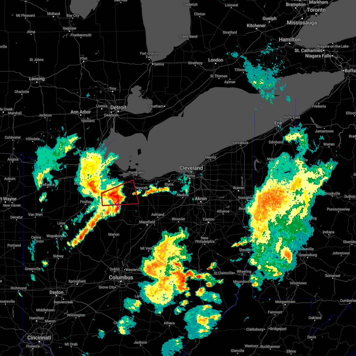 At 617 pm edt, a severe thunderstorm capable of producing a tornado was located near tiffin, moving east at 45 mph (radar indicated rotation). Hazards include tornado and quarter size hail. Flying debris will be dangerous to those caught without shelter. mobile homes will be damaged or destroyed. damage to roofs, windows, and vehicles will occur. Tree damage is likely. At 617 pm edt, a severe thunderstorm capable of producing a tornado was located near tiffin, moving east at 45 mph (radar indicated rotation). Hazards include tornado and quarter size hail. Flying debris will be dangerous to those caught without shelter. mobile homes will be damaged or destroyed. damage to roofs, windows, and vehicles will occur. Tree damage is likely.
|
| 5/3/2022 6:11 PM EDT |
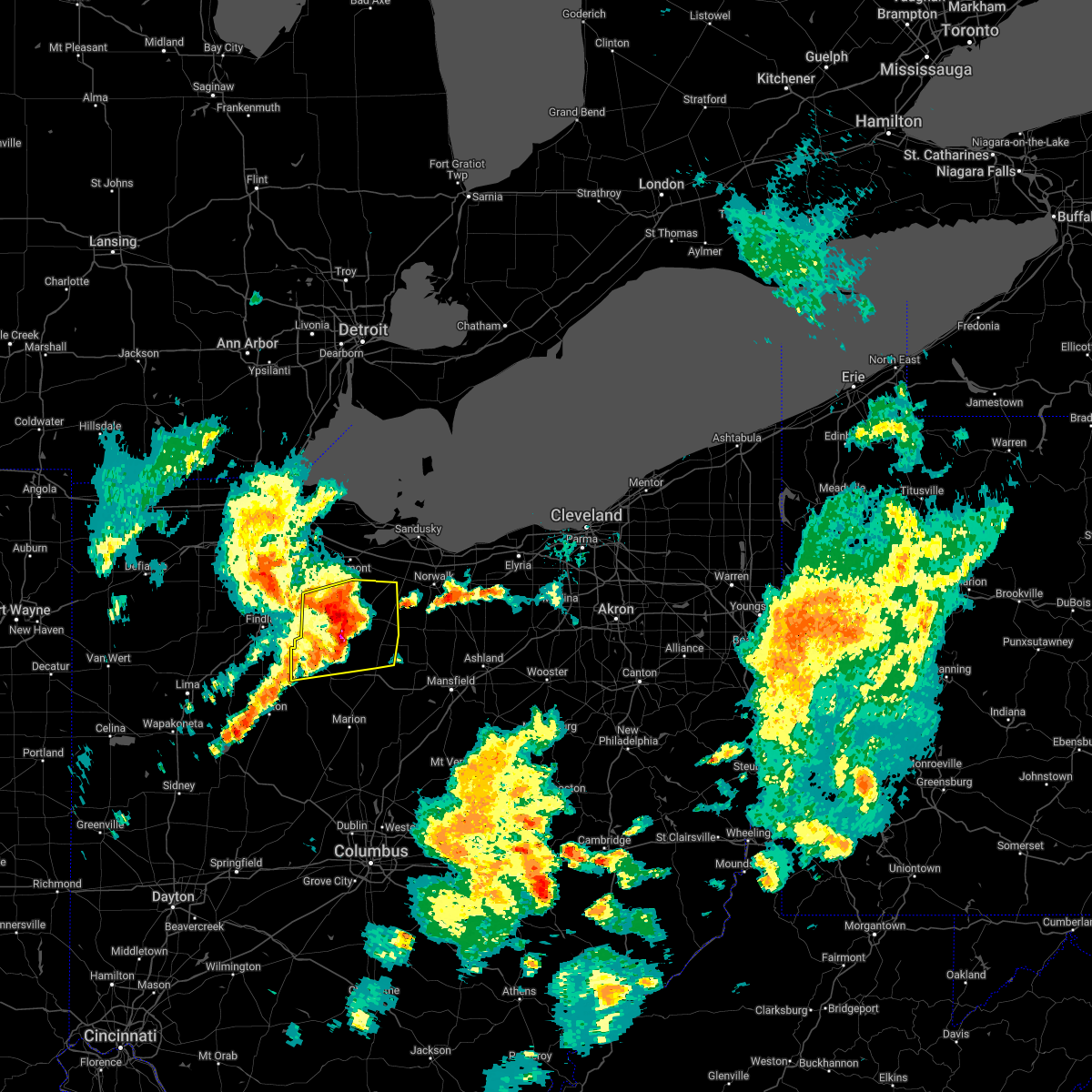 At 610 pm edt, severe thunderstorms were located along a line extending from near fostoria to near tiffin to near forest, moving northeast at 45 mph (radar indicated). Hazards include 70 mph wind gusts and quarter size hail. Minor damage to vehicles is possible. expect considerable tree damage. wind damage is also likely to mobile homes, roofs, and outbuildings. locations impacted include, tiffin, fostoria, upper sandusky, green springs, new washington, bloomville, sycamore, new riegel, chatfield, carey, attica, benton, republic, wharton, kirby, bascom, flat rock, oceola and sulpher springs. thunderstorm damage threat, considerable hail threat, radar indicated max hail size, 1. 00 in wind threat, radar indicated max wind gust, 70 mph. At 610 pm edt, severe thunderstorms were located along a line extending from near fostoria to near tiffin to near forest, moving northeast at 45 mph (radar indicated). Hazards include 70 mph wind gusts and quarter size hail. Minor damage to vehicles is possible. expect considerable tree damage. wind damage is also likely to mobile homes, roofs, and outbuildings. locations impacted include, tiffin, fostoria, upper sandusky, green springs, new washington, bloomville, sycamore, new riegel, chatfield, carey, attica, benton, republic, wharton, kirby, bascom, flat rock, oceola and sulpher springs. thunderstorm damage threat, considerable hail threat, radar indicated max hail size, 1. 00 in wind threat, radar indicated max wind gust, 70 mph.
|
| 5/3/2022 5:48 PM EDT |
 At 547 pm edt, severe thunderstorms were located along a line extending from near rawson to near arlington to near ada, moving east at 50 mph (radar indicated). Hazards include 70 mph wind gusts and quarter size hail. Minor damage to vehicles is possible. expect considerable tree damage. Wind damage is also likely to mobile homes, roofs, and outbuildings. At 547 pm edt, severe thunderstorms were located along a line extending from near rawson to near arlington to near ada, moving east at 50 mph (radar indicated). Hazards include 70 mph wind gusts and quarter size hail. Minor damage to vehicles is possible. expect considerable tree damage. Wind damage is also likely to mobile homes, roofs, and outbuildings.
|
| 9/14/2021 10:43 PM EDT |
 The severe thunderstorm warning for ottawa, erie, sandusky and southeastern wood counties will expire at 1045 pm edt, the storms which prompted the warning have weakened. therefore, the warning will be allowed to expire. however small hail and gusty winds are still possible with these thunderstorms. to report severe weather, contact your nearest law enforcement agency. they will relay your report to the national weather service cleveland. The severe thunderstorm warning for ottawa, erie, sandusky and southeastern wood counties will expire at 1045 pm edt, the storms which prompted the warning have weakened. therefore, the warning will be allowed to expire. however small hail and gusty winds are still possible with these thunderstorms. to report severe weather, contact your nearest law enforcement agency. they will relay your report to the national weather service cleveland.
|
| 9/14/2021 10:25 PM EDT |
 At 1024 pm edt, severe thunderstorms were located along a line extending from near put-in-bay to elmore, moving east at 30 mph (radar indicated). Hazards include 60 mph wind gusts and penny size hail. Expect damage to trees and power lines. locations impacted include, sandusky, fremont, port clinton, kelleys island, put-in-bay, clyde, oak harbor, gibsonburg, genoa, woodville, elmore, green springs, castalia, ballville, catawba island, pemberville, luckey, bradner, marblehead and wayne. hail threat, radar indicated max hail size, 0. 75 in wind threat, observed max wind gust, 60 mph. At 1024 pm edt, severe thunderstorms were located along a line extending from near put-in-bay to elmore, moving east at 30 mph (radar indicated). Hazards include 60 mph wind gusts and penny size hail. Expect damage to trees and power lines. locations impacted include, sandusky, fremont, port clinton, kelleys island, put-in-bay, clyde, oak harbor, gibsonburg, genoa, woodville, elmore, green springs, castalia, ballville, catawba island, pemberville, luckey, bradner, marblehead and wayne. hail threat, radar indicated max hail size, 0. 75 in wind threat, observed max wind gust, 60 mph.
|
| 9/14/2021 10:15 PM EDT |
 At 1014 pm edt, severe thunderstorms were located along a line extending from 7 miles west of put-in-bay to woodville, moving east at 30 mph (radar indicated). Hazards include 60 mph wind gusts and nickel size hail. Expect damage to trees and power lines. locations impacted include, bowling green, sandusky, fremont, port clinton, kelleys island, put-in-bay, clyde, oak harbor, gibsonburg, genoa, woodville, elmore, green springs, castalia, ballville, catawba island, walbridge, pemberville, millbury and luckey. hail threat, radar indicated max hail size, 0. 88 in wind threat, observed max wind gust, 60 mph. At 1014 pm edt, severe thunderstorms were located along a line extending from 7 miles west of put-in-bay to woodville, moving east at 30 mph (radar indicated). Hazards include 60 mph wind gusts and nickel size hail. Expect damage to trees and power lines. locations impacted include, bowling green, sandusky, fremont, port clinton, kelleys island, put-in-bay, clyde, oak harbor, gibsonburg, genoa, woodville, elmore, green springs, castalia, ballville, catawba island, walbridge, pemberville, millbury and luckey. hail threat, radar indicated max hail size, 0. 88 in wind threat, observed max wind gust, 60 mph.
|
| 9/14/2021 10:01 PM EDT |
 At 1000 pm edt, severe thunderstorms were located along a line extending from 9 miles northeast of oak harbor to near woodville, moving east at 30 mph (radar indicated. at 952 pm edt, a 68 mph wind gust was measured at the toledo executive airport). Hazards include 60 mph wind gusts and nickel size hail. Expect damage to trees and power lines. locations impacted include, bowling green, sandusky, fremont, port clinton, kelleys island, put-in-bay, perrysburg, oregon, clyde, rossford, waterville, northwood, oak harbor, gibsonburg, genoa, woodville, weston, elmore, green springs and castalia. hail threat, radar indicated max hail size, 0. 88 in wind threat, observed max wind gust, 60 mph. At 1000 pm edt, severe thunderstorms were located along a line extending from 9 miles northeast of oak harbor to near woodville, moving east at 30 mph (radar indicated. at 952 pm edt, a 68 mph wind gust was measured at the toledo executive airport). Hazards include 60 mph wind gusts and nickel size hail. Expect damage to trees and power lines. locations impacted include, bowling green, sandusky, fremont, port clinton, kelleys island, put-in-bay, perrysburg, oregon, clyde, rossford, waterville, northwood, oak harbor, gibsonburg, genoa, woodville, weston, elmore, green springs and castalia. hail threat, radar indicated max hail size, 0. 88 in wind threat, observed max wind gust, 60 mph.
|
| 9/14/2021 9:38 PM EDT |
 At 938 pm edt, severe thunderstorms were located along a line extending from 9 miles east of oregon to near perrysburg, moving east at 30 mph (radar indicated). Hazards include 60 mph wind gusts and nickel size hail. expect damage to trees and power lines At 938 pm edt, severe thunderstorms were located along a line extending from 9 miles east of oregon to near perrysburg, moving east at 30 mph (radar indicated). Hazards include 60 mph wind gusts and nickel size hail. expect damage to trees and power lines
|
| 8/11/2021 4:10 PM EDT |
 At 410 pm edt, a severe thunderstorm was located near port clinton, moving east at 45 mph (radar indicated). Hazards include 70 mph wind gusts. Expect considerable tree damage. damage is likely to mobile homes, roofs, and outbuildings. locations impacted include, fremont, port clinton, oregon, bellevue, clyde, oak harbor, gibsonburg, genoa, woodville, elmore, green springs, ballville, lindsey, rocky ridge, clay center, helena, burgoon, stony prairie, reno beach and williston. thunderstorm damage threat, considerable hail threat, radar indicated max hail size, <. 75 in wind threat, radar indicated max wind gust, 70 mph. At 410 pm edt, a severe thunderstorm was located near port clinton, moving east at 45 mph (radar indicated). Hazards include 70 mph wind gusts. Expect considerable tree damage. damage is likely to mobile homes, roofs, and outbuildings. locations impacted include, fremont, port clinton, oregon, bellevue, clyde, oak harbor, gibsonburg, genoa, woodville, elmore, green springs, ballville, lindsey, rocky ridge, clay center, helena, burgoon, stony prairie, reno beach and williston. thunderstorm damage threat, considerable hail threat, radar indicated max hail size, <. 75 in wind threat, radar indicated max wind gust, 70 mph.
|
| 8/11/2021 4:02 PM EDT |
 At 402 pm edt, severe thunderstorms were located along a line extending from 7 miles northwest of tiffin to near new riegel to near la rue, moving east at 55 mph (radar indicated). Hazards include 70 mph wind gusts and quarter size hail. Minor damage to vehicles is possible. expect considerable tree damage. wind damage is also likely to mobile homes, roofs, and outbuildings. locations impacted include, marion, tiffin, fostoria, bucyrus, upper sandusky, forest, green springs, new washington, bloomville, sycamore, la rue, morral, new riegel, chatfield, marseilles, carey, attica, benton, nevada and bettsville. thunderstorm damage threat, considerable hail threat, radar indicated max hail size, 1. 00 in wind threat, radar indicated max wind gust, 70 mph. At 402 pm edt, severe thunderstorms were located along a line extending from 7 miles northwest of tiffin to near new riegel to near la rue, moving east at 55 mph (radar indicated). Hazards include 70 mph wind gusts and quarter size hail. Minor damage to vehicles is possible. expect considerable tree damage. wind damage is also likely to mobile homes, roofs, and outbuildings. locations impacted include, marion, tiffin, fostoria, bucyrus, upper sandusky, forest, green springs, new washington, bloomville, sycamore, la rue, morral, new riegel, chatfield, marseilles, carey, attica, benton, nevada and bettsville. thunderstorm damage threat, considerable hail threat, radar indicated max hail size, 1. 00 in wind threat, radar indicated max wind gust, 70 mph.
|
| 8/11/2021 4:00 PM EDT |
 At 400 pm edt, a severe thunderstorm was located near oak harbor, or 8 miles north of fremont, moving east at 45 mph (radar indicated). Hazards include 70 mph wind gusts. Expect considerable tree damage. damage is likely to mobile homes, roofs, and outbuildings. locations impacted include, toledo, fremont, fostoria, port clinton, oregon, bellevue, clyde, rossford, northwood, oak harbor, gibsonburg, genoa, woodville, elmore, green springs, ballville, walbridge, pemberville, millbury and luckey. thunderstorm damage threat, considerable hail threat, radar indicated max hail size, <. 75 in wind threat, radar indicated max wind gust, 70 mph. At 400 pm edt, a severe thunderstorm was located near oak harbor, or 8 miles north of fremont, moving east at 45 mph (radar indicated). Hazards include 70 mph wind gusts. Expect considerable tree damage. damage is likely to mobile homes, roofs, and outbuildings. locations impacted include, toledo, fremont, fostoria, port clinton, oregon, bellevue, clyde, rossford, northwood, oak harbor, gibsonburg, genoa, woodville, elmore, green springs, ballville, walbridge, pemberville, millbury and luckey. thunderstorm damage threat, considerable hail threat, radar indicated max hail size, <. 75 in wind threat, radar indicated max wind gust, 70 mph.
|
| 8/11/2021 3:37 PM EDT |
 At 337 pm edt, a severe thunderstorm was located near genoa, or 11 miles northeast of bowling green, moving east at 45 mph (radar indicated). Hazards include 60 mph wind gusts. expect damage to trees and power lines At 337 pm edt, a severe thunderstorm was located near genoa, or 11 miles northeast of bowling green, moving east at 45 mph (radar indicated). Hazards include 60 mph wind gusts. expect damage to trees and power lines
|
| 8/11/2021 3:35 PM EDT |
 At 334 pm edt, severe thunderstorms were located along a line extending from north baltimore to near findlay to near chippewa park, moving east at 45 mph (radar indicated). Hazards include 70 mph wind gusts. Expect considerable tree damage. Damage is likely to mobile homes, roofs, and outbuildings. At 334 pm edt, severe thunderstorms were located along a line extending from north baltimore to near findlay to near chippewa park, moving east at 45 mph (radar indicated). Hazards include 70 mph wind gusts. Expect considerable tree damage. Damage is likely to mobile homes, roofs, and outbuildings.
|
| 8/11/2021 2:50 AM EDT |
 At 249 am edt, a severe thunderstorm was located near gibsonburg, or 9 miles west of fremont, moving northeast at 40 mph (radar indicated). Hazards include 60 mph wind gusts. expect damage to trees and power lines At 249 am edt, a severe thunderstorm was located near gibsonburg, or 9 miles west of fremont, moving northeast at 40 mph (radar indicated). Hazards include 60 mph wind gusts. expect damage to trees and power lines
|
| 7/24/2021 11:36 PM EDT |
 At 1135 pm edt, a severe thunderstorm was located near clyde, or 7 miles east of fremont, moving east at 60 mph (radar indicated). Hazards include 60 mph wind gusts. Expect damage to trees and power lines. this severe thunderstorm will be near, bellevue around 1140 pm edt. castalia around 1145 pm edt. sandusky, northern milan and milan around 1155 pm edt. norwalk around 1200 am edt. wakeman around 1205 am edt. Other locations impacted by this severe thunderstorm include whites landing, ballville, bloomingville, monroeville, sandusky south, vickery, berlin heights, birmingham and fairview lanes. At 1135 pm edt, a severe thunderstorm was located near clyde, or 7 miles east of fremont, moving east at 60 mph (radar indicated). Hazards include 60 mph wind gusts. Expect damage to trees and power lines. this severe thunderstorm will be near, bellevue around 1140 pm edt. castalia around 1145 pm edt. sandusky, northern milan and milan around 1155 pm edt. norwalk around 1200 am edt. wakeman around 1205 am edt. Other locations impacted by this severe thunderstorm include whites landing, ballville, bloomingville, monroeville, sandusky south, vickery, berlin heights, birmingham and fairview lanes.
|
| 7/7/2021 3:25 PM EDT |
 At 325 pm edt, a severe thunderstorm was located 7 miles south of gibsonburg, or 8 miles southwest of fremont, moving northeast at 20 mph (radar indicated). Hazards include 70 mph wind gusts and quarter size hail. Minor damage to vehicles is possible. expect considerable tree damage. wind damage is also likely to mobile homes, roofs, and outbuildings. Locations impacted include, fremont, clyde, gibsonburg, woodville, elmore, green springs, ballville, bettsville, risingsun, lindsey, helena, burgoon, kansas, stony prairie and vickery. At 325 pm edt, a severe thunderstorm was located 7 miles south of gibsonburg, or 8 miles southwest of fremont, moving northeast at 20 mph (radar indicated). Hazards include 70 mph wind gusts and quarter size hail. Minor damage to vehicles is possible. expect considerable tree damage. wind damage is also likely to mobile homes, roofs, and outbuildings. Locations impacted include, fremont, clyde, gibsonburg, woodville, elmore, green springs, ballville, bettsville, risingsun, lindsey, helena, burgoon, kansas, stony prairie and vickery.
|
| 7/7/2021 3:15 PM EDT |
 At 315 pm edt, a severe thunderstorm was located 7 miles northeast of fostoria, moving northeast at 20 mph (radar indicated). Hazards include 70 mph wind gusts and quarter size hail. Minor damage to vehicles is possible. expect considerable tree damage. Wind damage is also likely to mobile homes, roofs, and outbuildings. At 315 pm edt, a severe thunderstorm was located 7 miles northeast of fostoria, moving northeast at 20 mph (radar indicated). Hazards include 70 mph wind gusts and quarter size hail. Minor damage to vehicles is possible. expect considerable tree damage. Wind damage is also likely to mobile homes, roofs, and outbuildings.
|
| 6/21/2021 5:17 AM EDT |
 At 517 am edt, severe thunderstorms were located along a line extending from 6 miles southeast of kelleys island to bellevue to near bloomville, moving east at 50 mph (radar indicated). Hazards include 60 mph wind gusts. expect damage to trees and power lines At 517 am edt, severe thunderstorms were located along a line extending from 6 miles southeast of kelleys island to bellevue to near bloomville, moving east at 50 mph (radar indicated). Hazards include 60 mph wind gusts. expect damage to trees and power lines
|
| 11/15/2020 11:38 AM EST |
 At 1138 am est, severe thunderstorms were located along a line extending from near tiffin to near la rue, moving northeast at 55 mph (radar indicated). Hazards include 70 mph wind gusts. Expect considerable tree damage. Damage is likely to mobile homes, roofs, and outbuildings. At 1138 am est, severe thunderstorms were located along a line extending from near tiffin to near la rue, moving northeast at 55 mph (radar indicated). Hazards include 70 mph wind gusts. Expect considerable tree damage. Damage is likely to mobile homes, roofs, and outbuildings.
|
| 10/23/2020 6:14 PM EDT |
 At 613 pm edt, severe thunderstorms were located along a line extending from 7 miles north of clyde to near bellevue to near bloomville, moving east at 50 mph. another severe storm was located over kelleys island and moving east-northeast at 50 mph (radar indicated). Hazards include 70 mph wind gusts and penny size hail. Expect considerable tree damage. damage is likely to mobile homes, roofs, and outbuildings. Locations impacted include, sandusky, norwalk, fremont, western vermilion, port clinton, kelleys island, bellevue, clyde, willard, new london, plymouth, green springs, northern milan, milan, wakeman, bloomville, castalia, greenwich, monroeville and marblehead. At 613 pm edt, severe thunderstorms were located along a line extending from 7 miles north of clyde to near bellevue to near bloomville, moving east at 50 mph. another severe storm was located over kelleys island and moving east-northeast at 50 mph (radar indicated). Hazards include 70 mph wind gusts and penny size hail. Expect considerable tree damage. damage is likely to mobile homes, roofs, and outbuildings. Locations impacted include, sandusky, norwalk, fremont, western vermilion, port clinton, kelleys island, bellevue, clyde, willard, new london, plymouth, green springs, northern milan, milan, wakeman, bloomville, castalia, greenwich, monroeville and marblehead.
|
| 10/23/2020 6:00 PM EDT | Tree down in roadway on sr 101 near sr 19. time estimated via rada in seneca county OH, 2.5 miles NW of Green Springs, OH |
| 10/23/2020 5:52 PM EDT |
 At 552 pm edt, severe thunderstorms were located along a line extending from near oak harbor to new riegel, moving east at 50 mph (radar indicated). Hazards include 70 mph wind gusts and penny size hail. Expect considerable tree damage. Damage is likely to mobile homes, roofs, and outbuildings. At 552 pm edt, severe thunderstorms were located along a line extending from near oak harbor to new riegel, moving east at 50 mph (radar indicated). Hazards include 70 mph wind gusts and penny size hail. Expect considerable tree damage. Damage is likely to mobile homes, roofs, and outbuildings.
|
| 10/23/2020 5:47 PM EDT |
 At 546 pm edt, severe thunderstorms were located along a line extending from oak harbor to near vanlue, moving east at 60 mph (radar indicated). Hazards include 70 mph wind gusts and penny size hail. Expect considerable tree damage. damage is likely to mobile homes, roofs, and outbuildings. Locations impacted include, tiffin, fremont, fostoria, upper sandusky, oak harbor, gibsonburg, woodville, forest, elmore, green springs, sycamore, arcadia, vanlue, new riegel, ballville, carey, bradner, wayne, nevada and bettsville. At 546 pm edt, severe thunderstorms were located along a line extending from oak harbor to near vanlue, moving east at 60 mph (radar indicated). Hazards include 70 mph wind gusts and penny size hail. Expect considerable tree damage. damage is likely to mobile homes, roofs, and outbuildings. Locations impacted include, tiffin, fremont, fostoria, upper sandusky, oak harbor, gibsonburg, woodville, forest, elmore, green springs, sycamore, arcadia, vanlue, new riegel, ballville, carey, bradner, wayne, nevada and bettsville.
|
| 10/23/2020 5:28 PM EDT |
 At 527 pm edt, severe thunderstorms were located along a line extending from near woodville to 6 miles east of bluffton, moving east at 45 mph (radar indicated). Hazards include 70 mph wind gusts and penny size hail. these storms have already produced damaging wind gusts in wood and hancock counties. Expect considerable tree damage. damage is likely to mobile homes, roofs, and outbuildings. Locations impacted include, findlay, bowling green, tiffin, fremont, fostoria, upper sandusky, north baltimore, oak harbor, gibsonburg, woodville, mccomb, forest, arlington, elmore, green springs, sycamore, arcadia, rawson, vanlue and van buren. At 527 pm edt, severe thunderstorms were located along a line extending from near woodville to 6 miles east of bluffton, moving east at 45 mph (radar indicated). Hazards include 70 mph wind gusts and penny size hail. these storms have already produced damaging wind gusts in wood and hancock counties. Expect considerable tree damage. damage is likely to mobile homes, roofs, and outbuildings. Locations impacted include, findlay, bowling green, tiffin, fremont, fostoria, upper sandusky, north baltimore, oak harbor, gibsonburg, woodville, mccomb, forest, arlington, elmore, green springs, sycamore, arcadia, rawson, vanlue and van buren.
|
| 10/23/2020 5:10 PM EDT |
 At 510 pm edt, severe thunderstorms were located along a line extending from near bowling green to near columbus grove, moving east at 45 mph (radar indicated). Hazards include 60 mph wind gusts and penny size hail. expect damage to trees and power lines At 510 pm edt, severe thunderstorms were located along a line extending from near bowling green to near columbus grove, moving east at 45 mph (radar indicated). Hazards include 60 mph wind gusts and penny size hail. expect damage to trees and power lines
|
| 7/10/2020 2:05 PM EDT | Wires down. time estimated via rada in seneca county OH, 2.2 miles WNW of Green Springs, OH |
| 7/10/2020 2:02 PM EDT |
 At 202 pm edt, severe thunderstorms were located along a line extending from green springs to 6 miles northeast of bloomville to near chatfield, moving northeast at 30 mph (radar indicated). Hazards include 60 mph wind gusts and penny size hail. expect damage to trees and power lines At 202 pm edt, severe thunderstorms were located along a line extending from green springs to 6 miles northeast of bloomville to near chatfield, moving northeast at 30 mph (radar indicated). Hazards include 60 mph wind gusts and penny size hail. expect damage to trees and power lines
|
| 7/10/2020 1:53 PM EDT |
 At 153 pm edt, severe thunderstorms were located along a line extending from 7 miles east of oregon to 7 miles southwest of fremont, moving northeast at 35 mph (radar indicated). Hazards include 60 mph wind gusts and penny size hail. expect damage to trees and power lines At 153 pm edt, severe thunderstorms were located along a line extending from 7 miles east of oregon to 7 miles southwest of fremont, moving northeast at 35 mph (radar indicated). Hazards include 60 mph wind gusts and penny size hail. expect damage to trees and power lines
|
| 6/10/2020 6:03 PM EDT |
 At 603 pm edt, severe thunderstorms were located along a line extending from 6 miles south of gibsonburg to near green springs to near bloomville, moving northeast at 65 mph (radar indicated). Hazards include 70 mph wind gusts and quarter size hail. Minor damage to vehicles is possible. expect considerable tree damage. wind damage is also likely to mobile homes, roofs, and outbuildings. Locations impacted include, sandusky, tiffin, fremont, fostoria, port clinton, bellevue, clyde, oak harbor, gibsonburg, elmore, green springs, bloomville, new riegel, ballville, catawba island, marblehead, bettsville, bay view, risingsun and republic. At 603 pm edt, severe thunderstorms were located along a line extending from 6 miles south of gibsonburg to near green springs to near bloomville, moving northeast at 65 mph (radar indicated). Hazards include 70 mph wind gusts and quarter size hail. Minor damage to vehicles is possible. expect considerable tree damage. wind damage is also likely to mobile homes, roofs, and outbuildings. Locations impacted include, sandusky, tiffin, fremont, fostoria, port clinton, bellevue, clyde, oak harbor, gibsonburg, elmore, green springs, bloomville, new riegel, ballville, catawba island, marblehead, bettsville, bay view, risingsun and republic.
|
| 6/10/2020 5:37 PM EDT |
 At 535 pm edt, a severe thunderstorm was located near vanlue, or 9 miles northwest of upper sandusky, moving northeast at 45 mph (radar indicated). Hazards include 60 mph wind gusts and quarter size hail. Minor damage to vehicles is possible. Expect damage to trees and power lines. At 535 pm edt, a severe thunderstorm was located near vanlue, or 9 miles northwest of upper sandusky, moving northeast at 45 mph (radar indicated). Hazards include 60 mph wind gusts and quarter size hail. Minor damage to vehicles is possible. Expect damage to trees and power lines.
|
| 5/14/2020 5:00 PM EDT |
 At 459 pm edt, severe thunderstorms were located along a line extending from 6 miles southwest of green springs to near forest, moving east at 60 mph (trained weather spotters report several trees down on houses in arcadia). Hazards include 60 mph wind gusts. Expect damage to trees and power lines. Locations impacted include, tiffin, fostoria, upper sandusky, green springs, new washington, bloomville, sycamore, new riegel, chatfield, carey, attica, benton, bettsville, republic, wharton, flat rock, bascom, oceola, sulpher springs and kansas. At 459 pm edt, severe thunderstorms were located along a line extending from 6 miles southwest of green springs to near forest, moving east at 60 mph (trained weather spotters report several trees down on houses in arcadia). Hazards include 60 mph wind gusts. Expect damage to trees and power lines. Locations impacted include, tiffin, fostoria, upper sandusky, green springs, new washington, bloomville, sycamore, new riegel, chatfield, carey, attica, benton, bettsville, republic, wharton, flat rock, bascom, oceola, sulpher springs and kansas.
|
| 5/14/2020 4:40 PM EDT |
 At 439 pm edt, severe thunderstorms were located along a line extending from near arcadia to near ada, moving east at 60 mph. a 63 mph wind gust was reported at findlay airport (radar indicated). Hazards include 60 mph wind gusts. expect damage to trees and power lines At 439 pm edt, severe thunderstorms were located along a line extending from near arcadia to near ada, moving east at 60 mph. a 63 mph wind gust was reported at findlay airport (radar indicated). Hazards include 60 mph wind gusts. expect damage to trees and power lines
|
| 5/10/2020 4:14 PM EDT |
 At 413 pm edt, severe thunderstorms were located along a line extending from near oak harbor to near bloomville, moving east at 40 mph (radar indicated). Hazards include 60 mph wind gusts. expect damage to trees and power lines At 413 pm edt, severe thunderstorms were located along a line extending from near oak harbor to near bloomville, moving east at 40 mph (radar indicated). Hazards include 60 mph wind gusts. expect damage to trees and power lines
|
| 9/13/2019 5:56 PM EDT |
 At 555 pm edt, severe thunderstorms were located along a line extending from near fostoria to near findlay, moving northeast at 50 mph (radar indicated). Hazards include 60 mph wind gusts. Expect damage to trees and power lines. Locations impacted include, findlay, bowling green, tiffin, fostoria, bluffton, north baltimore, arlington, green springs, arcadia, rawson, vanlue, van buren, new riegel, pemberville, bradner, wayne, bloomdale, bettsville, risingsun and cygnet. At 555 pm edt, severe thunderstorms were located along a line extending from near fostoria to near findlay, moving northeast at 50 mph (radar indicated). Hazards include 60 mph wind gusts. Expect damage to trees and power lines. Locations impacted include, findlay, bowling green, tiffin, fostoria, bluffton, north baltimore, arlington, green springs, arcadia, rawson, vanlue, van buren, new riegel, pemberville, bradner, wayne, bloomdale, bettsville, risingsun and cygnet.
|
| 9/13/2019 5:49 PM EDT |
 At 548 pm edt, severe thunderstorms were located along a line extending from near port clinton to near fremont to 7 miles south of gibsonburg, moving east at 25 mph (radar indicated). Hazards include 60 mph wind gusts and penny size hail. Expect damage to trees and power lines. Locations impacted include, sandusky, fremont, port clinton, kelleys island, put-in-bay, clyde, oak harbor, gibsonburg, genoa, woodville, elmore, green springs, ballville, catawba island, marblehead, bay view, risingsun, lindsey, rocky ridge and helena. At 548 pm edt, severe thunderstorms were located along a line extending from near port clinton to near fremont to 7 miles south of gibsonburg, moving east at 25 mph (radar indicated). Hazards include 60 mph wind gusts and penny size hail. Expect damage to trees and power lines. Locations impacted include, sandusky, fremont, port clinton, kelleys island, put-in-bay, clyde, oak harbor, gibsonburg, genoa, woodville, elmore, green springs, ballville, catawba island, marblehead, bay view, risingsun, lindsey, rocky ridge and helena.
|
| 9/13/2019 5:41 PM EDT |
 The national weather service in cleveland has issued a * severe thunderstorm warning for. western seneca county in northwestern ohio. southeastern wood county in northwestern ohio. hancock county in northwestern ohio. Until 630 pm edt. The national weather service in cleveland has issued a * severe thunderstorm warning for. western seneca county in northwestern ohio. southeastern wood county in northwestern ohio. hancock county in northwestern ohio. Until 630 pm edt.
|
| 9/13/2019 5:27 PM EDT |
 At 527 pm edt, severe thunderstorms were located along a line extending from 12 miles northwest of port clinton to near oak harbor to near gibsonburg, moving east at 30 mph (radar indicated). Hazards include 60 mph wind gusts and penny size hail. Expect damage to trees and power lines. Locations impacted include, sandusky, fremont, port clinton, kelleys island, put-in-bay, clyde, oak harbor, gibsonburg, genoa, woodville, elmore, green springs, ballville, catawba island, marblehead, bay view, risingsun, lindsey, rocky ridge and clay center. At 527 pm edt, severe thunderstorms were located along a line extending from 12 miles northwest of port clinton to near oak harbor to near gibsonburg, moving east at 30 mph (radar indicated). Hazards include 60 mph wind gusts and penny size hail. Expect damage to trees and power lines. Locations impacted include, sandusky, fremont, port clinton, kelleys island, put-in-bay, clyde, oak harbor, gibsonburg, genoa, woodville, elmore, green springs, ballville, catawba island, marblehead, bay view, risingsun, lindsey, rocky ridge and clay center.
|
| 9/13/2019 5:03 PM EDT |
 At 503 pm edt, severe thunderstorms were located along a line extending from 7 miles northeast of oregon to near genoa to near bowling green, moving east at 30 mph (radar indicated). Hazards include 60 mph wind gusts and quarter size hail. Minor damage to vehicles is possible. Expect damage to trees and power lines. At 503 pm edt, severe thunderstorms were located along a line extending from 7 miles northeast of oregon to near genoa to near bowling green, moving east at 30 mph (radar indicated). Hazards include 60 mph wind gusts and quarter size hail. Minor damage to vehicles is possible. Expect damage to trees and power lines.
|
| 8/20/2019 6:12 PM EDT |
 At 611 pm edt, severe thunderstorms were located along a line extending from 6 miles northwest of port clinton to near castalia, moving northeast at 40 mph (radar indicated). Hazards include 60 mph wind gusts and penny size hail. Expect damage to trees and power lines. Locations impacted include, bowling green, fremont, port clinton, perrysburg, bellevue, clyde, oak harbor, gibsonburg, genoa, woodville, weston, elmore, green springs, ballville, pemberville, haskins, luckey, bradner, wayne and cygnet. At 611 pm edt, severe thunderstorms were located along a line extending from 6 miles northwest of port clinton to near castalia, moving northeast at 40 mph (radar indicated). Hazards include 60 mph wind gusts and penny size hail. Expect damage to trees and power lines. Locations impacted include, bowling green, fremont, port clinton, perrysburg, bellevue, clyde, oak harbor, gibsonburg, genoa, woodville, weston, elmore, green springs, ballville, pemberville, haskins, luckey, bradner, wayne and cygnet.
|
| 8/20/2019 5:31 PM EDT |
 The national weather service in cleveland has issued a * severe thunderstorm warning for. ottawa county in northwestern ohio. northern seneca county in northwestern ohio. sandusky county in northwestern ohio. Wood county in northwestern ohio. The national weather service in cleveland has issued a * severe thunderstorm warning for. ottawa county in northwestern ohio. northern seneca county in northwestern ohio. sandusky county in northwestern ohio. Wood county in northwestern ohio.
|
| 8/18/2019 10:40 AM EDT |
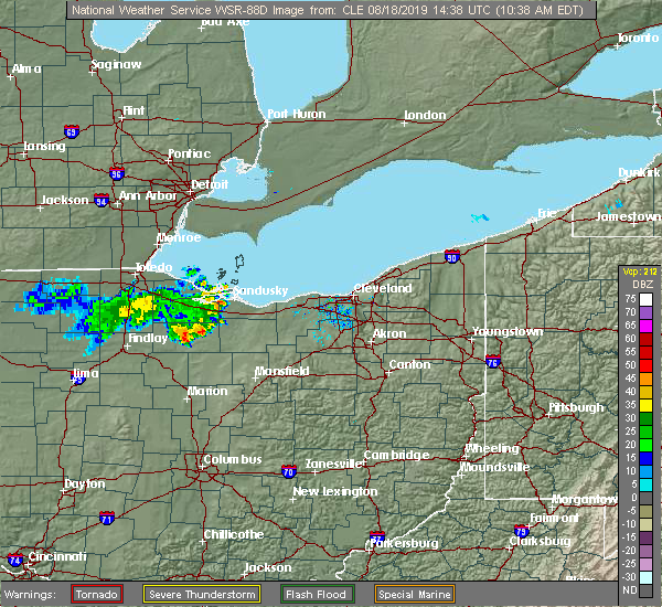 At 1039 am edt, severe thunderstorms were located along a line extending from near bellevue to near tiffin, moving east at 40 mph (radar indicated). Hazards include 60 mph wind gusts. Expect damage to trees and power lines. Locations impacted include, tiffin, bellevue, clyde, green springs, bloomville, attica, republic and flat rock. At 1039 am edt, severe thunderstorms were located along a line extending from near bellevue to near tiffin, moving east at 40 mph (radar indicated). Hazards include 60 mph wind gusts. Expect damage to trees and power lines. Locations impacted include, tiffin, bellevue, clyde, green springs, bloomville, attica, republic and flat rock.
|
| 8/18/2019 10:17 AM EDT |
 At 1017 am edt, severe thunderstorms were located along a line extending from near fremont to near new riegel, moving east at 35 mph (radar indicated). Hazards include 60 mph wind gusts and quarter size hail. Minor damage to vehicles is possible. Expect damage to trees and power lines. At 1017 am edt, severe thunderstorms were located along a line extending from near fremont to near new riegel, moving east at 35 mph (radar indicated). Hazards include 60 mph wind gusts and quarter size hail. Minor damage to vehicles is possible. Expect damage to trees and power lines.
|
| 8/18/2019 4:37 AM EDT |
 At 435 am edt, severe thunderstorms were located along a line extending from fremont to 7 miles northeast of bloomville, moving northeast at 50 mph (radar indicated). Hazards include 60 mph wind gusts. expect damage to trees and power lines At 435 am edt, severe thunderstorms were located along a line extending from fremont to 7 miles northeast of bloomville, moving northeast at 50 mph (radar indicated). Hazards include 60 mph wind gusts. expect damage to trees and power lines
|
| 8/6/2019 11:48 AM EDT |
 At 1148 am edt, severe thunderstorms were located along a line extending from 7 miles northeast of oak harbor to near fremont, moving northeast at 30 mph (radar indicated). Hazards include 60 mph wind gusts. expect damage to trees and power lines At 1148 am edt, severe thunderstorms were located along a line extending from 7 miles northeast of oak harbor to near fremont, moving northeast at 30 mph (radar indicated). Hazards include 60 mph wind gusts. expect damage to trees and power lines
|
| 7/16/2019 5:48 PM EDT |
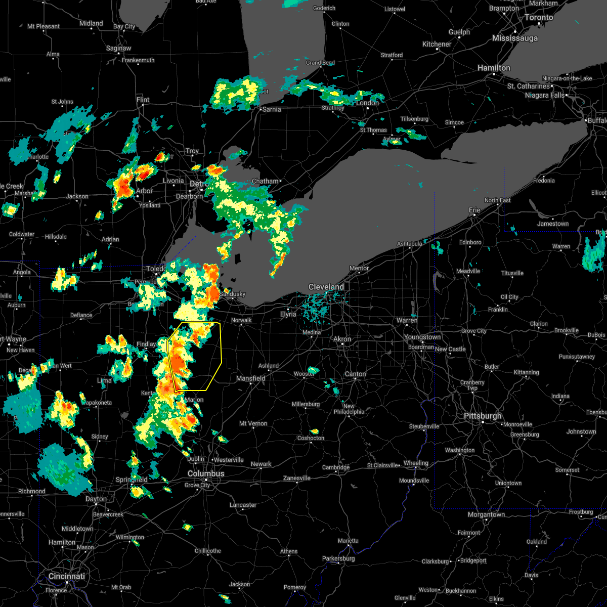 At 547 pm edt, severe thunderstorms were located along a line extending from near new riegel to near upper sandusky, moving northeast at 50 mph (radar indicated). Hazards include 60 mph wind gusts. expect damage to trees and power lines At 547 pm edt, severe thunderstorms were located along a line extending from near new riegel to near upper sandusky, moving northeast at 50 mph (radar indicated). Hazards include 60 mph wind gusts. expect damage to trees and power lines
|
| 7/10/2019 7:43 PM EDT |
 The severe thunderstorm warning for ottawa, north central seneca, sandusky and east central wood counties will expire at 745 pm edt, the storm which prompted the warning has weakened below severe limits, and no longer poses an immediate threat to life or property. therefore, the warning will be allowed to expire. however heavy rain is still possible with this thunderstorm. The severe thunderstorm warning for ottawa, north central seneca, sandusky and east central wood counties will expire at 745 pm edt, the storm which prompted the warning has weakened below severe limits, and no longer poses an immediate threat to life or property. therefore, the warning will be allowed to expire. however heavy rain is still possible with this thunderstorm.
|
| 7/10/2019 7:35 PM EDT |
 At 735 pm edt, a severe thunderstorm was located over gibsonburg, or 8 miles west of fremont, moving east at 25 mph (radar indicated). Hazards include 60 mph wind gusts. Expect damage to trees and power lines. Locations impacted include, fremont, oak harbor, gibsonburg, woodville, elmore, green springs, ballville, pemberville, bradner, wayne, bettsville, risingsun, lindsey, helena, burgoon, kansas and stony prairie. At 735 pm edt, a severe thunderstorm was located over gibsonburg, or 8 miles west of fremont, moving east at 25 mph (radar indicated). Hazards include 60 mph wind gusts. Expect damage to trees and power lines. Locations impacted include, fremont, oak harbor, gibsonburg, woodville, elmore, green springs, ballville, pemberville, bradner, wayne, bettsville, risingsun, lindsey, helena, burgoon, kansas and stony prairie.
|
| 7/10/2019 7:04 PM EDT |
 The national weather service in cleveland has issued a * severe thunderstorm warning for. ottawa county in northwestern ohio. north central seneca county in northwestern ohio. sandusky county in northwestern ohio. East central wood county in northwestern ohio. The national weather service in cleveland has issued a * severe thunderstorm warning for. ottawa county in northwestern ohio. north central seneca county in northwestern ohio. sandusky county in northwestern ohio. East central wood county in northwestern ohio.
|
| 7/2/2019 7:05 PM EDT |
 The severe thunderstorm warning for northern seneca and sandusky counties will expire at 715 pm edt, the storm which prompted the warning has weakened below severe limits, and no longer poses an immediate threat to life or property. therefore, the warning will be allowed to expire. however gusty winds are still possible with this thunderstorm. The severe thunderstorm warning for northern seneca and sandusky counties will expire at 715 pm edt, the storm which prompted the warning has weakened below severe limits, and no longer poses an immediate threat to life or property. therefore, the warning will be allowed to expire. however gusty winds are still possible with this thunderstorm.
|
| 7/2/2019 6:27 PM EDT |
 At 627 pm edt, a severe thunderstorm was located near fostoria, moving east at 35 mph (radar indicated). Hazards include 60 mph wind gusts and nickel size hail. expect damage to trees and power lines At 627 pm edt, a severe thunderstorm was located near fostoria, moving east at 35 mph (radar indicated). Hazards include 60 mph wind gusts and nickel size hail. expect damage to trees and power lines
|
| 7/2/2019 3:20 PM EDT |
 At 320 pm edt, severe thunderstorms were located along a line extending from 7 miles north of port clinton to near tiffin, moving east at 35 mph (radar indicated). Hazards include 60 mph wind gusts and quarter size hail. Minor damage to vehicles is possible. Expect damage to trees and power lines. At 320 pm edt, severe thunderstorms were located along a line extending from 7 miles north of port clinton to near tiffin, moving east at 35 mph (radar indicated). Hazards include 60 mph wind gusts and quarter size hail. Minor damage to vehicles is possible. Expect damage to trees and power lines.
|
| 6/5/2019 4:07 PM EDT |
 At 407 pm edt, a severe thunderstorm was located near green springs, or 7 miles northeast of tiffin, moving east at 30 mph (radar indicated). Hazards include 60 mph wind gusts. Expect damage to trees and power lines. Locations impacted include, tiffin, green springs, bloomville, attica, republic and flat rock. At 407 pm edt, a severe thunderstorm was located near green springs, or 7 miles northeast of tiffin, moving east at 30 mph (radar indicated). Hazards include 60 mph wind gusts. Expect damage to trees and power lines. Locations impacted include, tiffin, green springs, bloomville, attica, republic and flat rock.
|
| 6/5/2019 3:49 PM EDT |
 At 349 pm edt, a severe thunderstorm was located 7 miles northwest of tiffin, moving east at 25 mph (radar indicated). Hazards include 60 mph wind gusts. expect damage to trees and power lines At 349 pm edt, a severe thunderstorm was located 7 miles northwest of tiffin, moving east at 25 mph (radar indicated). Hazards include 60 mph wind gusts. expect damage to trees and power lines
|
| 6/1/2019 6:27 PM EDT |
 The severe thunderstorm warning for seneca, southern sandusky, wood, northern hancock and southwestern lucas counties will expire at 630 pm edt, the storms which prompted the warning have weakened below severe limits, and no longer pose an immediate threat to life or property. therefore, the warning will be allowed to expire. however small hail, gusty winds and heavy rain are still possible with these thunderstorms. a severe thunderstorm watch remains in effect until 1000 pm edt for northwestern ohio. The severe thunderstorm warning for seneca, southern sandusky, wood, northern hancock and southwestern lucas counties will expire at 630 pm edt, the storms which prompted the warning have weakened below severe limits, and no longer pose an immediate threat to life or property. therefore, the warning will be allowed to expire. however small hail, gusty winds and heavy rain are still possible with these thunderstorms. a severe thunderstorm watch remains in effect until 1000 pm edt for northwestern ohio.
|
| 6/1/2019 6:23 PM EDT |
 The severe thunderstorm warning for seneca, southern sandusky, wood, northern hancock and southwestern lucas counties will expire at 630 pm edt, the storms which prompted the warning have weakened below severe limits, and no longer pose an immediate threat to life or property. therefore, the warning will be allowed to expire. however small hail, gusty winds and heavy rain are still possible with these thunderstorms. a severe thunderstorm watch remains in effect until 1000 pm edt for northwestern ohio. The severe thunderstorm warning for seneca, southern sandusky, wood, northern hancock and southwestern lucas counties will expire at 630 pm edt, the storms which prompted the warning have weakened below severe limits, and no longer pose an immediate threat to life or property. therefore, the warning will be allowed to expire. however small hail, gusty winds and heavy rain are still possible with these thunderstorms. a severe thunderstorm watch remains in effect until 1000 pm edt for northwestern ohio.
|
| 6/1/2019 6:05 PM EDT |
 At 604 pm edt, severe thunderstorms were located along a line extending from near green springs to near waterville, moving east at 25 mph (radar indicated). Hazards include 60 mph wind gusts and quarter size hail. Minor damage to vehicles is possible. expect damage to trees and power lines. Locations impacted include, bowling green, tiffin, fremont, fostoria, bellevue, clyde, waterville, whitehouse, north baltimore, gibsonburg, weston, green springs, bloomville, arcadia, van buren, new riegel, ballville, pemberville, haskins and luckey. At 604 pm edt, severe thunderstorms were located along a line extending from near green springs to near waterville, moving east at 25 mph (radar indicated). Hazards include 60 mph wind gusts and quarter size hail. Minor damage to vehicles is possible. expect damage to trees and power lines. Locations impacted include, bowling green, tiffin, fremont, fostoria, bellevue, clyde, waterville, whitehouse, north baltimore, gibsonburg, weston, green springs, bloomville, arcadia, van buren, new riegel, ballville, pemberville, haskins and luckey.
|
| 6/1/2019 5:33 PM EDT |
 At 532 pm edt, severe thunderstorms were located along a line extending from near fostoria to near weston, moving east at 40 mph (radar indicated). Hazards include 60 mph wind gusts and quarter size hail. Minor damage to vehicles is possible. Expect damage to trees and power lines. At 532 pm edt, severe thunderstorms were located along a line extending from near fostoria to near weston, moving east at 40 mph (radar indicated). Hazards include 60 mph wind gusts and quarter size hail. Minor damage to vehicles is possible. Expect damage to trees and power lines.
|
| 6/1/2019 5:28 PM EDT |
 The severe thunderstorm warning for northern seneca, southern sandusky, southern wood and northeastern hancock counties will expire at 530 pm edt, the storms which prompted the warning have moved out of the warned area. therefore, the warning will be allowed to expire. a severe thunderstorm watch remains in effect until 1000 pm edt for north central and northwestern ohio. a new severe thunderstorm warning will be issued for portions of this area. The severe thunderstorm warning for northern seneca, southern sandusky, southern wood and northeastern hancock counties will expire at 530 pm edt, the storms which prompted the warning have moved out of the warned area. therefore, the warning will be allowed to expire. a severe thunderstorm watch remains in effect until 1000 pm edt for north central and northwestern ohio. a new severe thunderstorm warning will be issued for portions of this area.
|
| 6/1/2019 5:11 PM EDT |
 At 510 pm edt, severe thunderstorms were located along a line extending from 7 miles southeast of bowling green to near deshler, moving east at 40 mph (trained weather spotters). Hazards include 60 mph wind gusts and half dollar size hail. People and animals outdoors will be injured. expect hail damage to roofs, siding, windows, and vehicles. expect damage to trees and power lines. Locations impacted include, bowling green, tiffin, fremont, fostoria, bellevue, clyde, north baltimore, weston, green springs, ballville, bradner, wayne, bloomdale, bettsville, risingsun, cygnet, portage, jerry city, hoytville and helena. At 510 pm edt, severe thunderstorms were located along a line extending from 7 miles southeast of bowling green to near deshler, moving east at 40 mph (trained weather spotters). Hazards include 60 mph wind gusts and half dollar size hail. People and animals outdoors will be injured. expect hail damage to roofs, siding, windows, and vehicles. expect damage to trees and power lines. Locations impacted include, bowling green, tiffin, fremont, fostoria, bellevue, clyde, north baltimore, weston, green springs, ballville, bradner, wayne, bloomdale, bettsville, risingsun, cygnet, portage, jerry city, hoytville and helena.
|
| 6/1/2019 4:46 PM EDT |
 At 446 pm edt, severe thunderstorms were located along a line extending from 6 miles southwest of gibsonburg to near north baltimore, moving east at 40 mph (radar indicated). Hazards include 60 mph wind gusts and quarter size hail. Minor damage to vehicles is possible. expect damage to trees and power lines. Locations impacted include, bowling green, tiffin, fremont, fostoria, bellevue, clyde, north baltimore, weston, green springs, ballville, bradner, wayne, bloomdale, bettsville, risingsun, cygnet, portage, jerry city, hoytville and helena. At 446 pm edt, severe thunderstorms were located along a line extending from 6 miles southwest of gibsonburg to near north baltimore, moving east at 40 mph (radar indicated). Hazards include 60 mph wind gusts and quarter size hail. Minor damage to vehicles is possible. expect damage to trees and power lines. Locations impacted include, bowling green, tiffin, fremont, fostoria, bellevue, clyde, north baltimore, weston, green springs, ballville, bradner, wayne, bloomdale, bettsville, risingsun, cygnet, portage, jerry city, hoytville and helena.
|
| 6/1/2019 4:43 PM EDT |
 The severe thunderstorm warning for ottawa. sandusky and east central wood counties will expire at 445 pm edt. the storms which prompted the warning have weakened below severe limits, and no longer pose an immediate threat to life or property. therefore, the warning will be allowed to expire. A severe thunderstorm watch remains in effect until 1000 pm edt for. The severe thunderstorm warning for ottawa. sandusky and east central wood counties will expire at 445 pm edt. the storms which prompted the warning have weakened below severe limits, and no longer pose an immediate threat to life or property. therefore, the warning will be allowed to expire. A severe thunderstorm watch remains in effect until 1000 pm edt for.
|
| 6/1/2019 4:27 PM EDT |
 At 426 pm edt, severe thunderstorms were located along a line extending from near gibsonburg to 9 miles southwest of woodville, moving east at 45 mph (radar indicated). Hazards include ping pong ball size hail and 60 mph wind gusts. People and animals outdoors will be injured. expect hail damage to roofs, siding, windows, and vehicles. expect damage to trees and power lines. Locations impacted include, bowling green, fremont, port clinton, bellevue, clyde, oak harbor, gibsonburg, genoa, woodville, elmore, green springs, ballville, catawba island, pemberville, luckey, bradner, marblehead, wayne, risingsun and lindsey. At 426 pm edt, severe thunderstorms were located along a line extending from near gibsonburg to 9 miles southwest of woodville, moving east at 45 mph (radar indicated). Hazards include ping pong ball size hail and 60 mph wind gusts. People and animals outdoors will be injured. expect hail damage to roofs, siding, windows, and vehicles. expect damage to trees and power lines. Locations impacted include, bowling green, fremont, port clinton, bellevue, clyde, oak harbor, gibsonburg, genoa, woodville, elmore, green springs, ballville, catawba island, pemberville, luckey, bradner, marblehead, wayne, risingsun and lindsey.
|
| 6/1/2019 4:23 PM EDT |
 At 422 pm edt, severe thunderstorms were located along a line extending from 8 miles east of bowling green to near north baltimore, moving east at 30 mph (radar indicated). Hazards include 60 mph wind gusts and quarter size hail. Minor damage to vehicles is possible. Expect damage to trees and power lines. At 422 pm edt, severe thunderstorms were located along a line extending from 8 miles east of bowling green to near north baltimore, moving east at 30 mph (radar indicated). Hazards include 60 mph wind gusts and quarter size hail. Minor damage to vehicles is possible. Expect damage to trees and power lines.
|
| 6/1/2019 3:50 PM EDT |
 At 349 pm edt, severe thunderstorms were located along a line extending from near genoa to 7 miles northeast of bowling green, moving east at 35 mph (radar indicated). Hazards include 60 mph wind gusts and quarter size hail. Minor damage to vehicles is possible. Expect damage to trees and power lines. At 349 pm edt, severe thunderstorms were located along a line extending from near genoa to 7 miles northeast of bowling green, moving east at 35 mph (radar indicated). Hazards include 60 mph wind gusts and quarter size hail. Minor damage to vehicles is possible. Expect damage to trees and power lines.
|
| 5/25/2019 2:15 PM EDT |
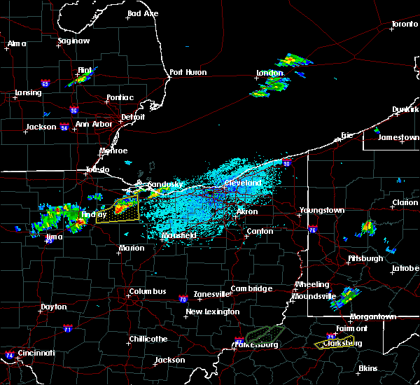 At 214 pm edt, a severe thunderstorm was located near tiffin, moving east at 45 mph (radar indicated). Hazards include 60 mph wind gusts and quarter size hail. Minor damage to vehicles is possible. expect damage to trees and power lines. Locations impacted include, tiffin, fostoria, bellevue, clyde, green springs, bloomville, new riegel, attica, republic, flat rock and bascom. At 214 pm edt, a severe thunderstorm was located near tiffin, moving east at 45 mph (radar indicated). Hazards include 60 mph wind gusts and quarter size hail. Minor damage to vehicles is possible. expect damage to trees and power lines. Locations impacted include, tiffin, fostoria, bellevue, clyde, green springs, bloomville, new riegel, attica, republic, flat rock and bascom.
|
| 5/25/2019 1:59 PM EDT |
 At 159 pm edt, a severe thunderstorm was located near tiffin, moving east at 50 mph (radar indicated). Hazards include 60 mph wind gusts and quarter size hail. Minor damage to vehicles is possible. Expect damage to trees and power lines. At 159 pm edt, a severe thunderstorm was located near tiffin, moving east at 50 mph (radar indicated). Hazards include 60 mph wind gusts and quarter size hail. Minor damage to vehicles is possible. Expect damage to trees and power lines.
|
| 1/8/2019 2:48 PM EST |
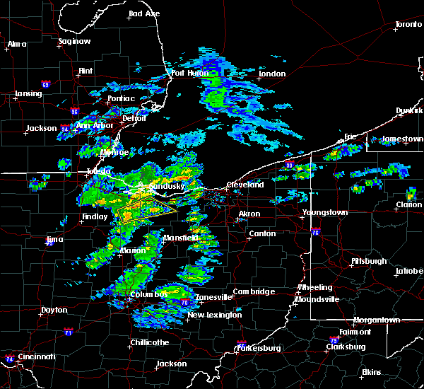 At 247 pm est, a severe thunderstorm was located 7 miles south of green springs, or 8 miles east of tiffin, moving east at 45 mph (radar indicated). Hazards include 60 mph wind gusts and penny size hail. expect damage to trees and power lines At 247 pm est, a severe thunderstorm was located 7 miles south of green springs, or 8 miles east of tiffin, moving east at 45 mph (radar indicated). Hazards include 60 mph wind gusts and penny size hail. expect damage to trees and power lines
|
| 11/5/2017 5:43 PM EDT |
 At 443 pm est, a severe thunderstorm was located near fremont, moving east at 50 mph (radar indicated). Hazards include 60 mph wind gusts and penny size hail. expect damage to trees and power lines At 443 pm est, a severe thunderstorm was located near fremont, moving east at 50 mph (radar indicated). Hazards include 60 mph wind gusts and penny size hail. expect damage to trees and power lines
|
| 8/21/2017 3:55 PM EDT |
 At 354 pm edt, a severe thunderstorm was located near clyde, or 9 miles southeast of fremont, moving northeast at 30 mph (trained weather spotters). Hazards include 60 mph wind gusts and quarter size hail. Minor damage to vehicles is possible. expect damage to trees and power lines. Locations impacted include, sandusky, tiffin, norwalk, bellevue, clyde, green springs, northern milan, milan, bloomville, castalia, monroeville, republic, flat rock, bloomingville, sandusky south and fairview lanes. At 354 pm edt, a severe thunderstorm was located near clyde, or 9 miles southeast of fremont, moving northeast at 30 mph (trained weather spotters). Hazards include 60 mph wind gusts and quarter size hail. Minor damage to vehicles is possible. expect damage to trees and power lines. Locations impacted include, sandusky, tiffin, norwalk, bellevue, clyde, green springs, northern milan, milan, bloomville, castalia, monroeville, republic, flat rock, bloomingville, sandusky south and fairview lanes.
|
| 8/21/2017 3:39 PM EDT | Quarter sized hail reported 0.2 miles SW of Green Springs, OH |
| 8/21/2017 3:35 PM EDT |
 At 335 pm edt, a cluster of severe thunderstorms were located near green springs, or 7 miles north of tiffin, moving northeast at 30 mph (radar indicated). Hazards include 60 mph wind gusts and quarter size hail. Minor damage to vehicles is possible. Expect damage to trees and power lines. At 335 pm edt, a cluster of severe thunderstorms were located near green springs, or 7 miles north of tiffin, moving northeast at 30 mph (radar indicated). Hazards include 60 mph wind gusts and quarter size hail. Minor damage to vehicles is possible. Expect damage to trees and power lines.
|
| 7/10/2017 10:28 AM EDT |
 At 1026 am edt, a severe thunderstorm was located near gibsonburg, or 10 miles west of fremont, moving east at 30 mph (radar indicated). Hazards include 60 mph wind gusts and quarter size hail. Minor damage to vehicles is possible. expect damage to trees and power lines. Locations impacted include, fremont, bellevue, clyde, gibsonburg, green springs, ballville, bettsville, lindsey, helena, burgoon, flat rock, kansas, stony prairie, whites landing and vickery. At 1026 am edt, a severe thunderstorm was located near gibsonburg, or 10 miles west of fremont, moving east at 30 mph (radar indicated). Hazards include 60 mph wind gusts and quarter size hail. Minor damage to vehicles is possible. expect damage to trees and power lines. Locations impacted include, fremont, bellevue, clyde, gibsonburg, green springs, ballville, bettsville, lindsey, helena, burgoon, flat rock, kansas, stony prairie, whites landing and vickery.
|
| 7/10/2017 10:11 AM EDT |
 At 1010 am edt, a severe thunderstorm was located 9 miles north of fostoria, moving east at 30 mph (radar indicated). Hazards include 60 mph wind gusts and quarter size hail. Minor damage to vehicles is possible. Expect damage to trees and power lines. At 1010 am edt, a severe thunderstorm was located 9 miles north of fostoria, moving east at 30 mph (radar indicated). Hazards include 60 mph wind gusts and quarter size hail. Minor damage to vehicles is possible. Expect damage to trees and power lines.
|
| 6/13/2017 6:09 PM EDT |
 At 609 pm edt, a severe thunderstorm was located 8 miles northwest of fostoria, moving southeast at 20 mph (radar indicated). Hazards include 60 mph wind gusts and quarter size hail. Minor damage to vehicles is possible. expect damage to trees and power lines. Locations impacted include, bowling green, fremont, fostoria, clyde, north baltimore, gibsonburg, green springs, ballville, pemberville, bradner, wayne, bloomdale, risingsun, cygnet, lindsey, portage, jerry city, helena, west millgrove and burgoon. At 609 pm edt, a severe thunderstorm was located 8 miles northwest of fostoria, moving southeast at 20 mph (radar indicated). Hazards include 60 mph wind gusts and quarter size hail. Minor damage to vehicles is possible. expect damage to trees and power lines. Locations impacted include, bowling green, fremont, fostoria, clyde, north baltimore, gibsonburg, green springs, ballville, pemberville, bradner, wayne, bloomdale, risingsun, cygnet, lindsey, portage, jerry city, helena, west millgrove and burgoon.
|
| 6/13/2017 5:47 PM EDT |
 At 547 pm edt, a severe thunderstorm was located 7 miles east of bowling green, moving east at 15 mph (radar indicated). Hazards include 60 mph wind gusts and quarter size hail. Minor damage to vehicles is possible. Expect damage to trees and power lines. At 547 pm edt, a severe thunderstorm was located 7 miles east of bowling green, moving east at 15 mph (radar indicated). Hazards include 60 mph wind gusts and quarter size hail. Minor damage to vehicles is possible. Expect damage to trees and power lines.
|
| 5/28/2017 3:50 PM EDT |
 At 348 pm edt, while the initial storm that prompted the warning has weakened, additional strong to severe storms were moving into the warned area from the south. movement was to the northeast at 25 mph (radar indicated). Hazards include 60 mph wind gusts and quarter size hail. Minor damage to vehicles is possible. expect damage to trees and power lines. Locations impacted include, tiffin, green springs, bloomville, attica, republic and flat rock. At 348 pm edt, while the initial storm that prompted the warning has weakened, additional strong to severe storms were moving into the warned area from the south. movement was to the northeast at 25 mph (radar indicated). Hazards include 60 mph wind gusts and quarter size hail. Minor damage to vehicles is possible. expect damage to trees and power lines. Locations impacted include, tiffin, green springs, bloomville, attica, republic and flat rock.
|
| 5/28/2017 3:27 PM EDT |
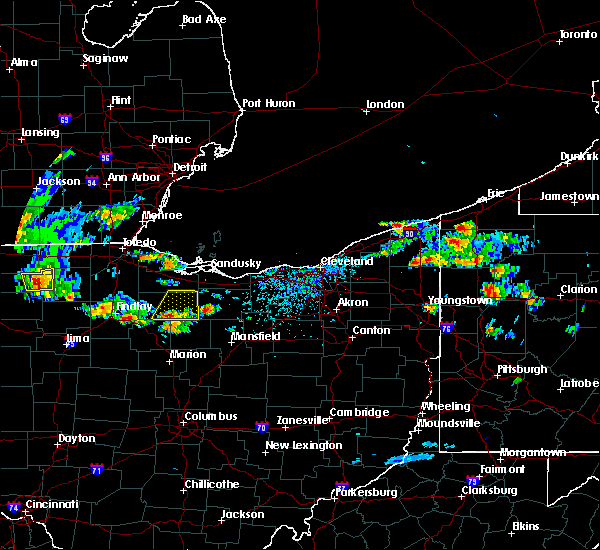 At 327 pm edt, a severe thunderstorm was located near sycamore, or near tiffin, moving northeast at 25 mph (radar indicated). Hazards include 60 mph wind gusts and quarter size hail. Minor damage to vehicles is possible. Expect damage to trees and power lines. At 327 pm edt, a severe thunderstorm was located near sycamore, or near tiffin, moving northeast at 25 mph (radar indicated). Hazards include 60 mph wind gusts and quarter size hail. Minor damage to vehicles is possible. Expect damage to trees and power lines.
|
| 3/1/2017 4:33 AM EST |
 At 433 am est, severe thunderstorms were located along a line extending from near kelleys island to near chatfield to 7 miles south of sycamore, moving east at 65 mph (radar indicated). Hazards include 60 mph wind gusts and quarter size hail. Hail damage to vehicles is expected. expect wind damage to roofs, siding, and trees. Locations impacted include, bucyrus, upper sandusky, port clinton, kelleys island, put-in-bay, bellevue, clyde, green springs, new washington, bloomville, sycamore, morral, chatfield, marseilles, catawba island, attica, benton, nevada, republic and north robinson. At 433 am est, severe thunderstorms were located along a line extending from near kelleys island to near chatfield to 7 miles south of sycamore, moving east at 65 mph (radar indicated). Hazards include 60 mph wind gusts and quarter size hail. Hail damage to vehicles is expected. expect wind damage to roofs, siding, and trees. Locations impacted include, bucyrus, upper sandusky, port clinton, kelleys island, put-in-bay, bellevue, clyde, green springs, new washington, bloomville, sycamore, morral, chatfield, marseilles, catawba island, attica, benton, nevada, republic and north robinson.
|
| 3/1/2017 4:16 AM EST |
 At 415 am est, severe thunderstorms were located along a line extending from near oak harbor to new riegel to near vanlue, moving east at 55 mph (radar indicated. at 401 am, a 58 mph wind gust was reported at findlay airport). Hazards include 60 mph wind gusts and quarter size hail. Hail damage to vehicles is expected. expect wind damage to roofs, siding, and trees. Locations impacted include, tiffin, fremont, fostoria, bucyrus, upper sandusky, port clinton, kelleys island, put-in-bay, bellevue, clyde, oak harbor, gibsonburg, green springs, new washington, bloomville, sycamore, morral, new riegel, chatfield and marseilles. At 415 am est, severe thunderstorms were located along a line extending from near oak harbor to new riegel to near vanlue, moving east at 55 mph (radar indicated. at 401 am, a 58 mph wind gust was reported at findlay airport). Hazards include 60 mph wind gusts and quarter size hail. Hail damage to vehicles is expected. expect wind damage to roofs, siding, and trees. Locations impacted include, tiffin, fremont, fostoria, bucyrus, upper sandusky, port clinton, kelleys island, put-in-bay, bellevue, clyde, oak harbor, gibsonburg, green springs, new washington, bloomville, sycamore, morral, new riegel, chatfield and marseilles.
|
| 3/1/2017 3:59 AM EST |
 At 359 am est, severe thunderstorms were located along a line extending from 14 miles northwest of put-in-bay to 9 miles north of fostoria to near findlay, moving east at 65 mph (radar indicated). Hazards include 60 mph wind gusts and quarter size hail. Hail damage to vehicles is expected. Expect wind damage to roofs, siding, and trees. At 359 am est, severe thunderstorms were located along a line extending from 14 miles northwest of put-in-bay to 9 miles north of fostoria to near findlay, moving east at 65 mph (radar indicated). Hazards include 60 mph wind gusts and quarter size hail. Hail damage to vehicles is expected. Expect wind damage to roofs, siding, and trees.
|
| 8/27/2016 3:55 PM EDT |
 The severe thunderstorm warning for sandusky and ottawa counties will expire at 400 pm edt, the storms which prompted the warning have weakened below severe limits, and no longer pose an immediate threat to life or property. therefore the warning will be allowed to expire. The severe thunderstorm warning for sandusky and ottawa counties will expire at 400 pm edt, the storms which prompted the warning have weakened below severe limits, and no longer pose an immediate threat to life or property. therefore the warning will be allowed to expire.
|
| 8/27/2016 3:33 PM EDT |
 At 332 pm edt, severe thunderstorms were located along a line extending from 6 miles northeast of oak harbor to 8 miles south of gibsonburg, moving northeast at 35 mph (radar indicated). Hazards include 60 mph wind gusts. Expect damage to roofs. siding and trees. Locations impacted include, fremont, port clinton, bellevue, clyde, oak harbor, gibsonburg, elmore, ballville, lindsey, rocky ridge, helena, burgoon, vickery, stony prairie, whites landing and bono. At 332 pm edt, severe thunderstorms were located along a line extending from 6 miles northeast of oak harbor to 8 miles south of gibsonburg, moving northeast at 35 mph (radar indicated). Hazards include 60 mph wind gusts. Expect damage to roofs. siding and trees. Locations impacted include, fremont, port clinton, bellevue, clyde, oak harbor, gibsonburg, elmore, ballville, lindsey, rocky ridge, helena, burgoon, vickery, stony prairie, whites landing and bono.
|
| 8/27/2016 2:56 PM EDT |
 At 255 pm edt, severe thunderstorms were located along a line extending from near northwood to 7 miles southwest of gibsonburg, moving northeast at 25 mph (radar indicated). Hazards include 60 mph wind gusts and quarter size hail. Hail damage to vehicles is expected. Expect wind damage to roofs, siding and trees. At 255 pm edt, severe thunderstorms were located along a line extending from near northwood to 7 miles southwest of gibsonburg, moving northeast at 25 mph (radar indicated). Hazards include 60 mph wind gusts and quarter size hail. Hail damage to vehicles is expected. Expect wind damage to roofs, siding and trees.
|
| 7/18/2016 5:11 AM EDT |
 The severe thunderstorm warning for eastern sandusky county will expire at 515 am edt, the storm which prompted the warning has moved out of the area. therefore the warning will be allowed to expire. The severe thunderstorm warning for eastern sandusky county will expire at 515 am edt, the storm which prompted the warning has moved out of the area. therefore the warning will be allowed to expire.
|
| 7/18/2016 4:33 AM EDT |
 At 433 am edt, a severe thunderstorm was located near gibsonburg, or near fremont, moving east at 40 mph (radar indicated). Hazards include 60 mph wind gusts. Expect damage to roofs. Siding and trees. At 433 am edt, a severe thunderstorm was located near gibsonburg, or near fremont, moving east at 40 mph (radar indicated). Hazards include 60 mph wind gusts. Expect damage to roofs. Siding and trees.
|
| 6/5/2016 2:32 PM EDT |
 At 232 pm edt, severe thunderstorms were located along a line extending from near kelleys island to near green springs, moving east at 50 mph (radar indicated). Hazards include 60 mph wind gusts and quarter size hail. Hail damage to vehicles is expected. expect wind damage to roofs, siding and trees. Locations impacted include, sandusky, western vermilion, vermilion, port clinton, kelleys island, bellevue, clyde, northern milan, castalia, catawba island, marblehead, berlin heights, bay view, vickery, bloomingville, sandusky south, whites landing, fairview lanes and birmingham. At 232 pm edt, severe thunderstorms were located along a line extending from near kelleys island to near green springs, moving east at 50 mph (radar indicated). Hazards include 60 mph wind gusts and quarter size hail. Hail damage to vehicles is expected. expect wind damage to roofs, siding and trees. Locations impacted include, sandusky, western vermilion, vermilion, port clinton, kelleys island, bellevue, clyde, northern milan, castalia, catawba island, marblehead, berlin heights, bay view, vickery, bloomingville, sandusky south, whites landing, fairview lanes and birmingham.
|
| 6/5/2016 2:20 PM EDT |
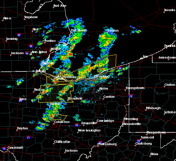 At 218 pm edt, a severe thunderstorm was located over new riegel, or 9 miles southwest of tiffin, moving east at 30 mph. other storms were over seneca crawford and huron counties (radar indicated). Hazards include 60 mph wind gusts and quarter size hail. Hail damage to vehicles is expected. Expect wind damage to roofs, siding and trees. At 218 pm edt, a severe thunderstorm was located over new riegel, or 9 miles southwest of tiffin, moving east at 30 mph. other storms were over seneca crawford and huron counties (radar indicated). Hazards include 60 mph wind gusts and quarter size hail. Hail damage to vehicles is expected. Expect wind damage to roofs, siding and trees.
|
| 6/5/2016 2:11 PM EDT |
 At 211 pm edt, a severe thunderstorm was located near clyde, or near fremont, moving east at 60 mph (radar indicated). Hazards include 60 mph wind gusts and quarter size hail. Hail damage to vehicles is expected. Expect wind damage to roofs, siding and trees. At 211 pm edt, a severe thunderstorm was located near clyde, or near fremont, moving east at 60 mph (radar indicated). Hazards include 60 mph wind gusts and quarter size hail. Hail damage to vehicles is expected. Expect wind damage to roofs, siding and trees.
|
| 9/4/2015 4:10 PM EDT |
 At 409 pm edt, a severe thunderstorm was located near clyde, or near fremont, moving east at 15 mph (radar indicated). Hazards include 60 mph wind gusts and quarter size hail. Hail damage to vehicles is expected. expect wind damage to roofs, siding and trees. Locations impacted include, fremont, bellevue, clyde, gibsonburg, woodville, elmore, green springs, ballville, lindsey, helena, burgoon, vickery, stony prairie and whites landing. At 409 pm edt, a severe thunderstorm was located near clyde, or near fremont, moving east at 15 mph (radar indicated). Hazards include 60 mph wind gusts and quarter size hail. Hail damage to vehicles is expected. expect wind damage to roofs, siding and trees. Locations impacted include, fremont, bellevue, clyde, gibsonburg, woodville, elmore, green springs, ballville, lindsey, helena, burgoon, vickery, stony prairie and whites landing.
|
| 9/4/2015 3:57 PM EDT |
 At 357 pm edt, a severe thunderstorm was located near fremont, moving east at 15 mph (radar indicated). Hazards include 60 mph wind gusts and quarter size hail. Hail damage to vehicles is expected. expect wind damage to roofs, siding and trees. Locations impacted include, fremont, bellevue, clyde, gibsonburg, woodville, elmore, green springs, ballville, lindsey, helena, burgoon, vickery, stony prairie and whites landing. At 357 pm edt, a severe thunderstorm was located near fremont, moving east at 15 mph (radar indicated). Hazards include 60 mph wind gusts and quarter size hail. Hail damage to vehicles is expected. expect wind damage to roofs, siding and trees. Locations impacted include, fremont, bellevue, clyde, gibsonburg, woodville, elmore, green springs, ballville, lindsey, helena, burgoon, vickery, stony prairie and whites landing.
|
| 9/4/2015 3:51 PM EDT |
 At 351 pm edt, a severe thunderstorm was located near gibsonburg, or 7 miles northwest of fremont, moving east at 15 mph (radar indicated). Hazards include 60 mph wind gusts and quarter size hail. Hail damage to vehicles is expected. Expect wind damage to roofs, siding and trees. At 351 pm edt, a severe thunderstorm was located near gibsonburg, or 7 miles northwest of fremont, moving east at 15 mph (radar indicated). Hazards include 60 mph wind gusts and quarter size hail. Hail damage to vehicles is expected. Expect wind damage to roofs, siding and trees.
|
| 9/3/2015 2:21 PM EDT |
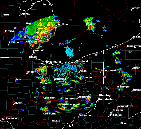 At 220 pm edt, a severe thunderstorm was located near tiffin, moving southeast at 20 mph (radar indicated). Hazards include 60 mph wind gusts. Expect damage to roofs. siding and trees. Locations impacted include, tiffin, green springs, bloomville, attica, bettsville, republic and flat rock. At 220 pm edt, a severe thunderstorm was located near tiffin, moving southeast at 20 mph (radar indicated). Hazards include 60 mph wind gusts. Expect damage to roofs. siding and trees. Locations impacted include, tiffin, green springs, bloomville, attica, bettsville, republic and flat rock.
|
| 9/3/2015 1:50 PM EDT |
 At 150 pm edt, a severe thunderstorm was located over green springs, or near fremont, moving east at 10 mph (radar indicated). Hazards include 60 mph wind gusts. Expect damage to roofs. Siding and trees. At 150 pm edt, a severe thunderstorm was located over green springs, or near fremont, moving east at 10 mph (radar indicated). Hazards include 60 mph wind gusts. Expect damage to roofs. Siding and trees.
|
| 7/14/2015 12:57 PM EDT |
 At 1256 pm edt, a severe thunderstorm was located near tiffin, moving east at 25 mph (radar indicated). Hazards include 60 mph wind gusts and quarter size hail. Hail damage to vehicles is expected. expect wind damage to roofs, siding and trees. heavy rains could cause local flooding. Locations impacted include, tiffin, fremont, fostoria, bellevue, clyde, green springs, bloomville, new riegel, ballville, attica, bettsville, risingsun, republic, west millgrove, burgoon, flat rock, kansas, bascom and stony prairie. At 1256 pm edt, a severe thunderstorm was located near tiffin, moving east at 25 mph (radar indicated). Hazards include 60 mph wind gusts and quarter size hail. Hail damage to vehicles is expected. expect wind damage to roofs, siding and trees. heavy rains could cause local flooding. Locations impacted include, tiffin, fremont, fostoria, bellevue, clyde, green springs, bloomville, new riegel, ballville, attica, bettsville, risingsun, republic, west millgrove, burgoon, flat rock, kansas, bascom and stony prairie.
|
| 7/14/2015 12:23 PM EDT |
 At 1223 pm edt, a severe thunderstorm was located 9 miles northeast of north baltimore, or 9 miles southeast of bowling green, moving east at 15 mph (radar indicated). Hazards include 60 mph wind gusts and quarter size hail. Hail damage to vehicles is expected. Expect wind damage to roofs, siding and trees. At 1223 pm edt, a severe thunderstorm was located 9 miles northeast of north baltimore, or 9 miles southeast of bowling green, moving east at 15 mph (radar indicated). Hazards include 60 mph wind gusts and quarter size hail. Hail damage to vehicles is expected. Expect wind damage to roofs, siding and trees.
|
| 6/30/2015 10:27 PM EDT | The severe thunderstorm warning for southeastern sandusky county will expire at 1030 pm edt, the storm which prompted the warning has weakened below severe limits, and no longer pose an immediate threat to life or property. therefore the warning will be allowed to expire. |
| 6/30/2015 10:15 PM EDT |
 At 1014 pm edt, a severe thunderstorm was located near clyde, or 11 miles east of fremont, moving southeast at 25 mph (radar indicated). Hazards include 60 mph wind gusts and quarter size hail. Hail damage to vehicles is possible. expect wind damage to roofs, siding and trees. Locations impacted include, bellevue, clyde, green springs and vickery. At 1014 pm edt, a severe thunderstorm was located near clyde, or 11 miles east of fremont, moving southeast at 25 mph (radar indicated). Hazards include 60 mph wind gusts and quarter size hail. Hail damage to vehicles is possible. expect wind damage to roofs, siding and trees. Locations impacted include, bellevue, clyde, green springs and vickery.
|
| 6/30/2015 9:44 PM EDT |
 At 943 pm edt, a severe thunderstorm was located near fremont, moving east at 15 mph (radar indicated). Hazards include 60 mph wind gusts and quarter size hail. Hail damage to vehicles is expected. Expect wind damage to roofs, siding and trees. At 943 pm edt, a severe thunderstorm was located near fremont, moving east at 15 mph (radar indicated). Hazards include 60 mph wind gusts and quarter size hail. Hail damage to vehicles is expected. Expect wind damage to roofs, siding and trees.
|
| 6/22/2015 4:43 PM EDT |
 At 443 pm edt, a severe thunderstorm was located over gibsonburg, or 13 miles west of fremont, moving east at 40 mph (radar indicated). Hazards include 60 mph wind gusts and quarter size hail. Hail damage to vehicles is expected. Expect wind damage to roofs, siding and trees. At 443 pm edt, a severe thunderstorm was located over gibsonburg, or 13 miles west of fremont, moving east at 40 mph (radar indicated). Hazards include 60 mph wind gusts and quarter size hail. Hail damage to vehicles is expected. Expect wind damage to roofs, siding and trees.
|
| 6/12/2015 2:55 PM EDT |
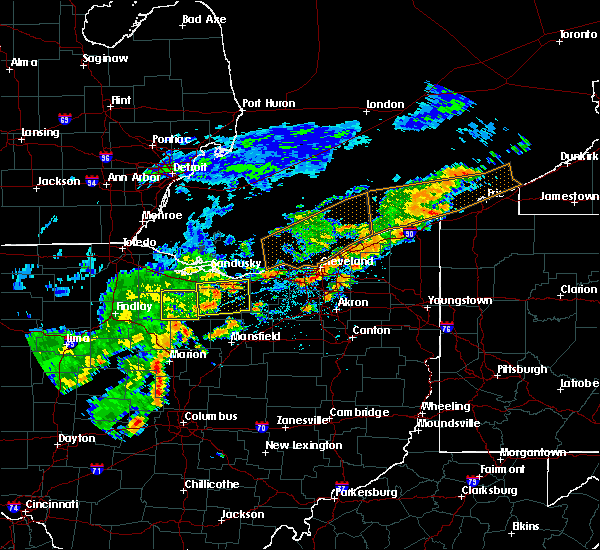 The severe thunderstorm warning for seneca county will expire at 300 pm edt, the storm which prompted the warning has moved out of the area. therefore the warning will be allowed to expire. a severe thunderstorm watch remains in effect until 900 pm edt for northwestern ohio. The severe thunderstorm warning for seneca county will expire at 300 pm edt, the storm which prompted the warning has moved out of the area. therefore the warning will be allowed to expire. a severe thunderstorm watch remains in effect until 900 pm edt for northwestern ohio.
|
| 6/12/2015 2:25 PM EDT |
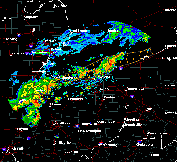 At 225 pm edt, a severe thunderstorm was located near tiffin, moving east at 40 mph (radar indicated). Hazards include 60 mph wind gusts. Expect damage to roofs. Siding and trees. At 225 pm edt, a severe thunderstorm was located near tiffin, moving east at 40 mph (radar indicated). Hazards include 60 mph wind gusts. Expect damage to roofs. Siding and trees.
|
| 5/27/2015 4:40 PM EDT | At 439 pm edt, a severe thunderstorm was located near fremont, and is nearly stationary (radar indicated). Hazards include 60 mph wind gusts and quarter size hail. Hail damage to vehicles is expected. expect wind damage to roofs, siding and trees. Locations impacted include, fremont, port clinton, bellevue, clyde, oak harbor, green springs, lindsey, burgoon, whites landing and vickery. |
| 5/27/2015 4:17 PM EDT | At 417 pm edt, a severe thunderstorm was located near gibsonburg, or 12 miles north of fostoria, moving east at 55 mph (radar indicated). Hazards include 60 mph wind gusts and quarter size hail. Hail damage to vehicles is expected. Expect wind damage to roofs, siding and trees. |
| 5/26/2015 6:42 PM EDT | The severe thunderstorm warning for east central wood, sandusky, northeastern lucas and ottawa counties will expire at 645 pm edt, the storm which prompted the warning has moved out of the area. therefore the warning will be allowed to expire. a severe thunderstorm watch remains in effect until 1100 pm edt for northwestern ohio. |
| 5/26/2015 6:16 PM EDT | At 616 pm edt, a severe thunderstorm was located near fremont, moving northeast at 55 mph (radar indicated). Hazards include 60 mph wind gusts. Expect damage to roofs. Siding and trees. |
| 4/9/2015 5:02 PM EDT | The national weather service in cleveland has issued a * tornado warning for. northeastern hancock county in northwest ohio. southern sandusky county in northwest ohio. northern seneca county in northwest ohio. Southeastern wood county in northwest ohio. |
| 4/9/2015 4:46 PM EDT | The national weather service in cleveland has issued a * severe thunderstorm warning for. northeastern hancock county in northwest ohio. sandusky county in northwest ohio. northern seneca county in northwest ohio. Southern wood county in northwest ohio. |
| 11/24/2014 9:52 AM EST | Multiple utility lines down in sandusky county OH, 0.2 miles SW of Green Springs, OH |
| 7/1/2012 6:41 PM EDT | A few large limbs were reported in sandusky county OH, 0.2 miles SW of Green Springs, OH |
| 1/1/0001 12:00 AM | Tree down onto house in thompso in seneca county OH, 2.5 miles WNW of Green Springs, OH |
| 1/1/0001 12:00 AM | Quarter sized hail reported 0.2 miles SW of Green Springs, OH, trained spotter reported quarter size hail. |
| 1/1/0001 12:00 AM | Golf Ball sized hail reported 0.2 miles SW of Green Springs, OH |
Hail Maps for Green Springs, OH


Connect with Interactive Hail Maps