

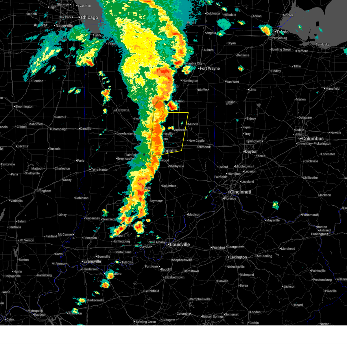
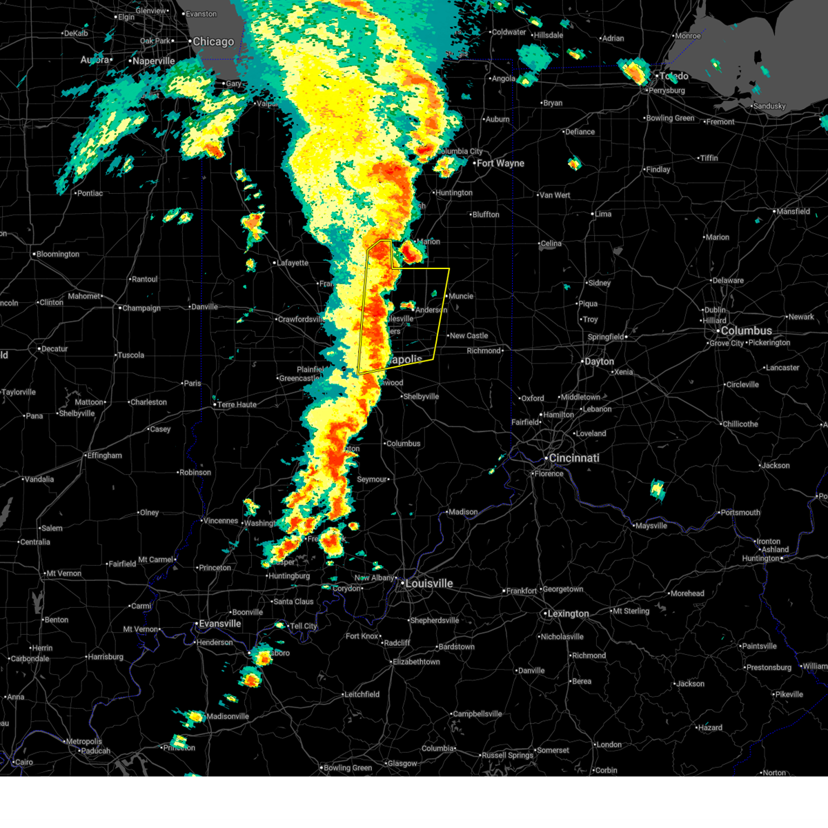
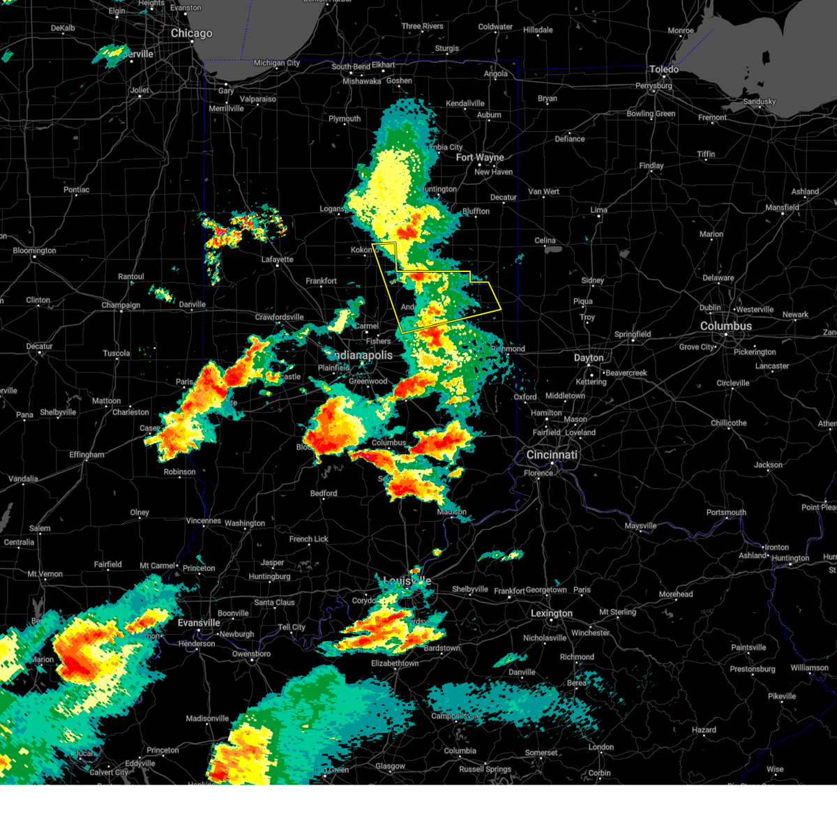
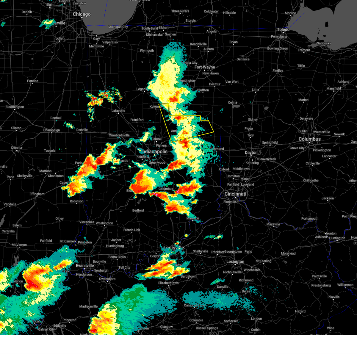
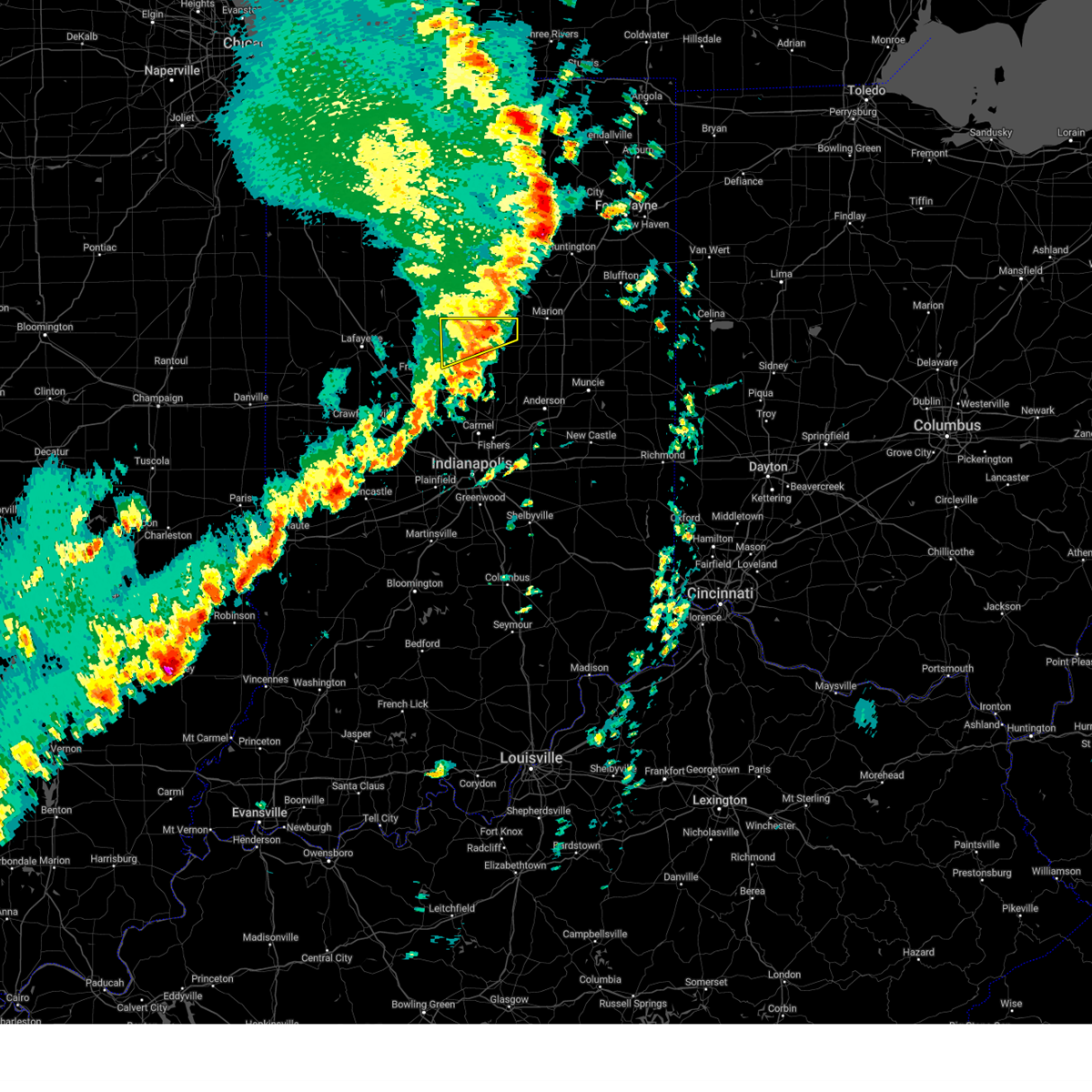
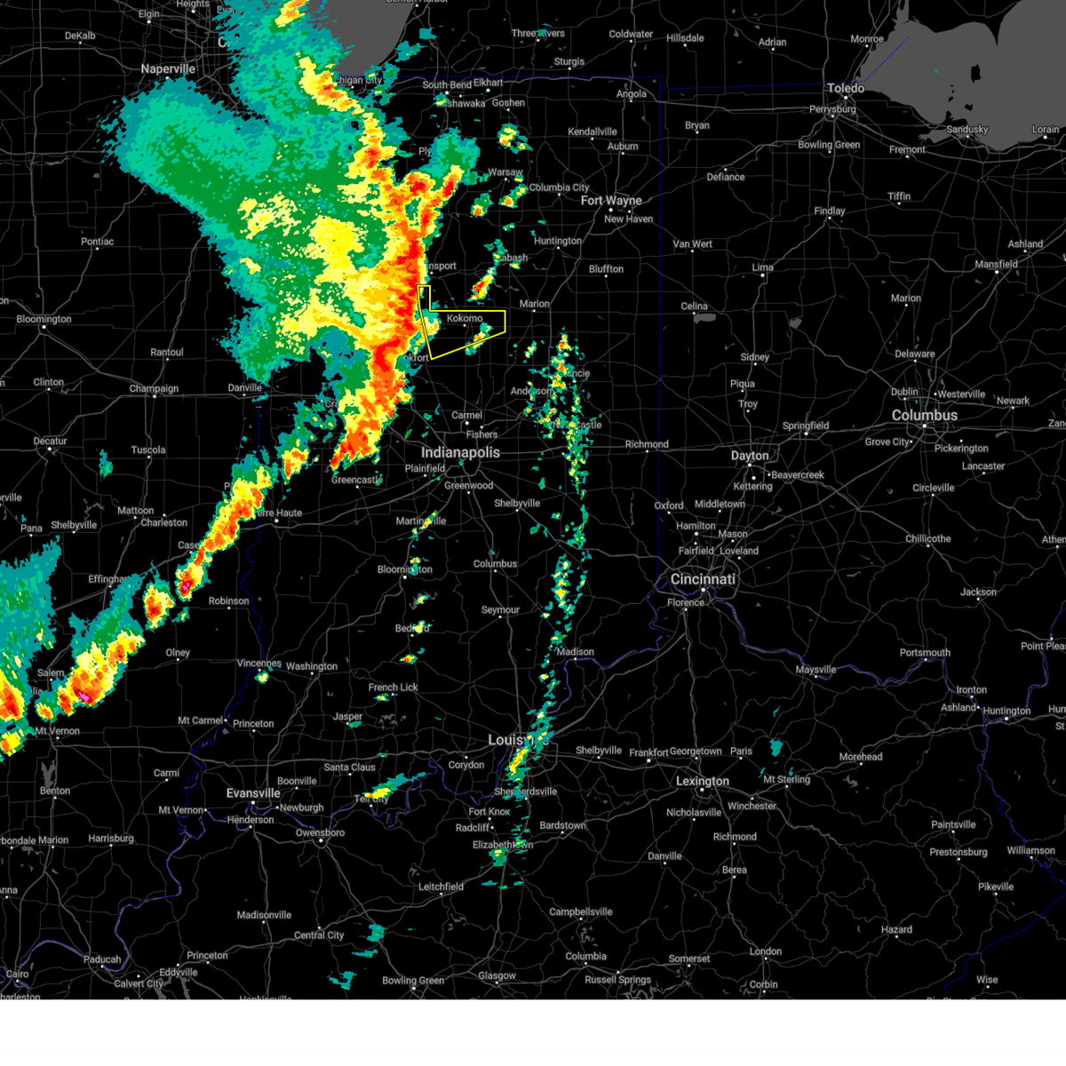
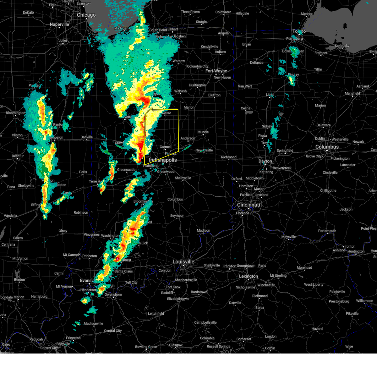
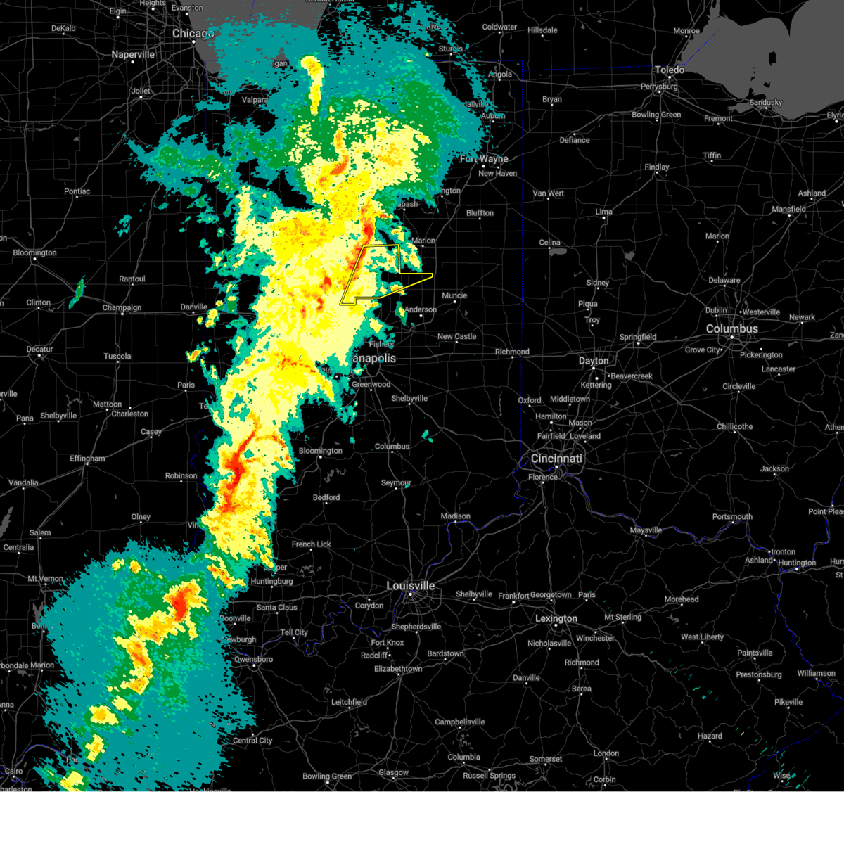
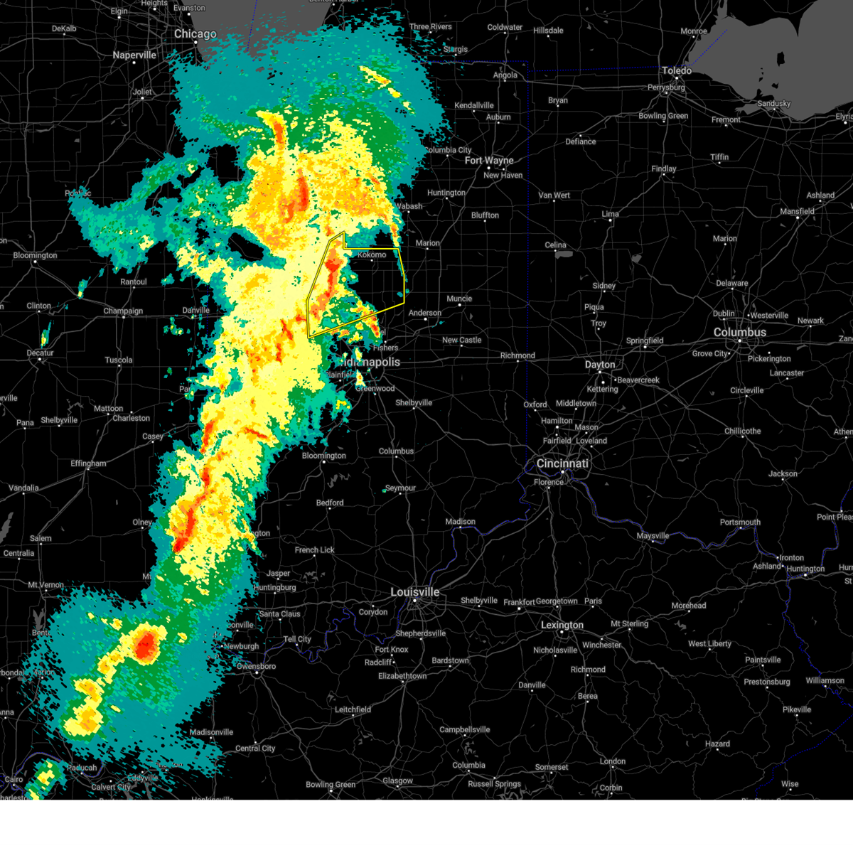
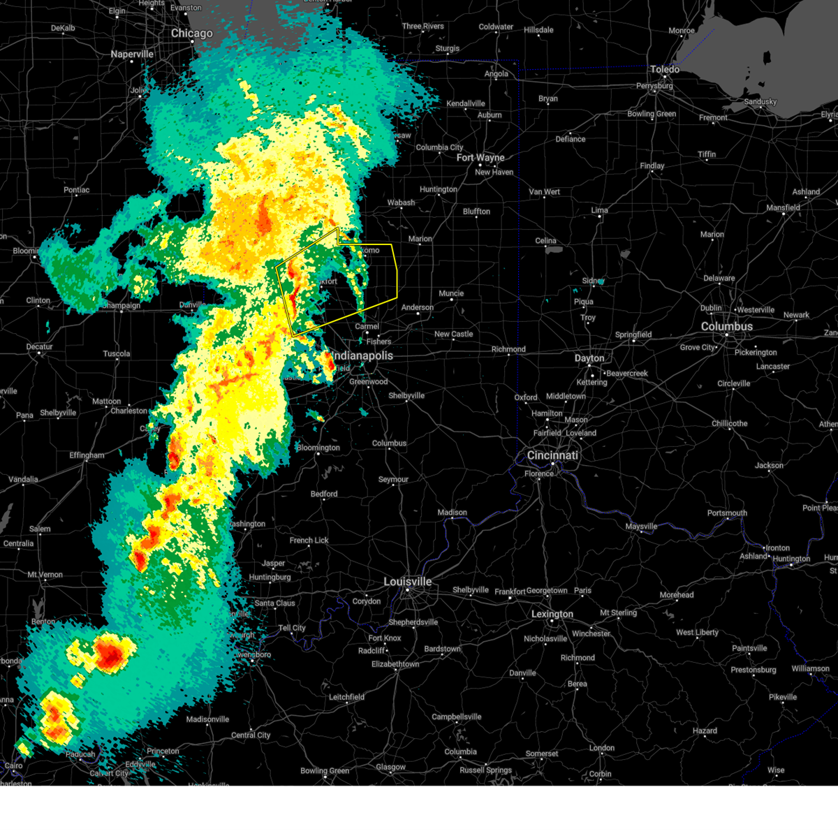
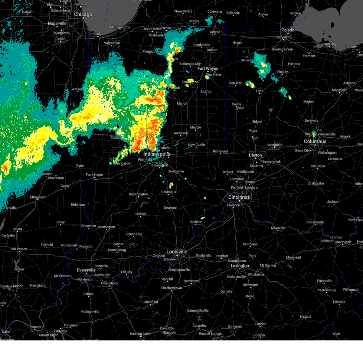
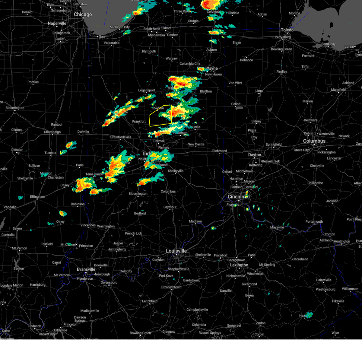
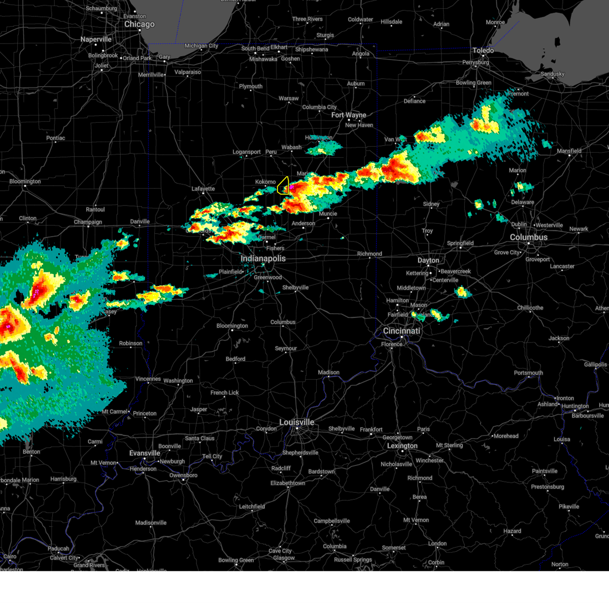
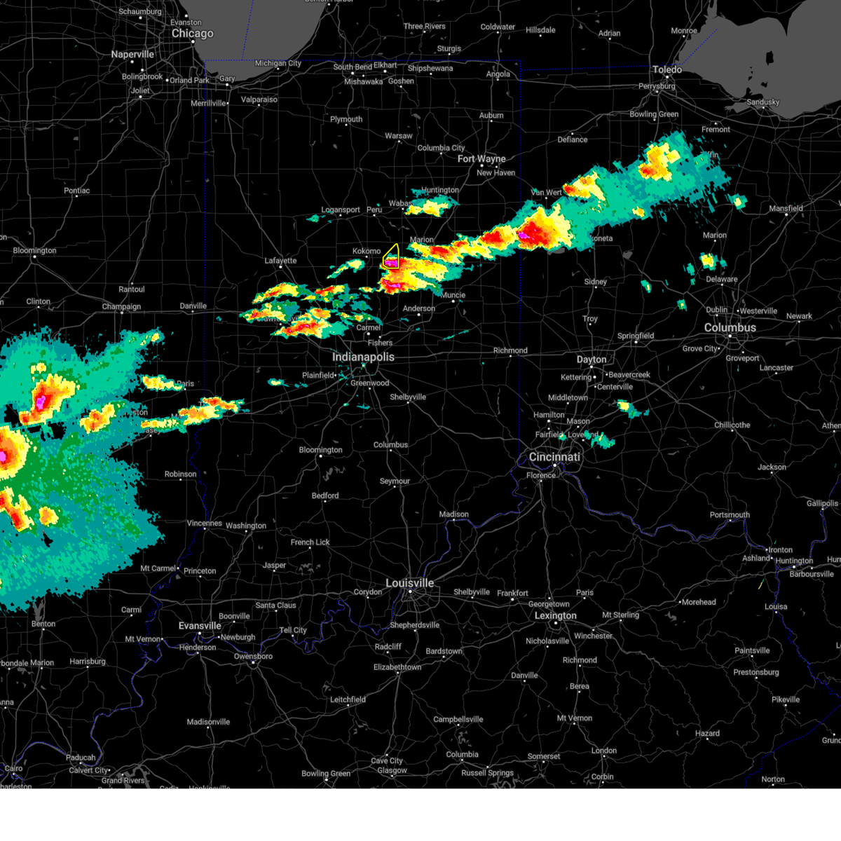
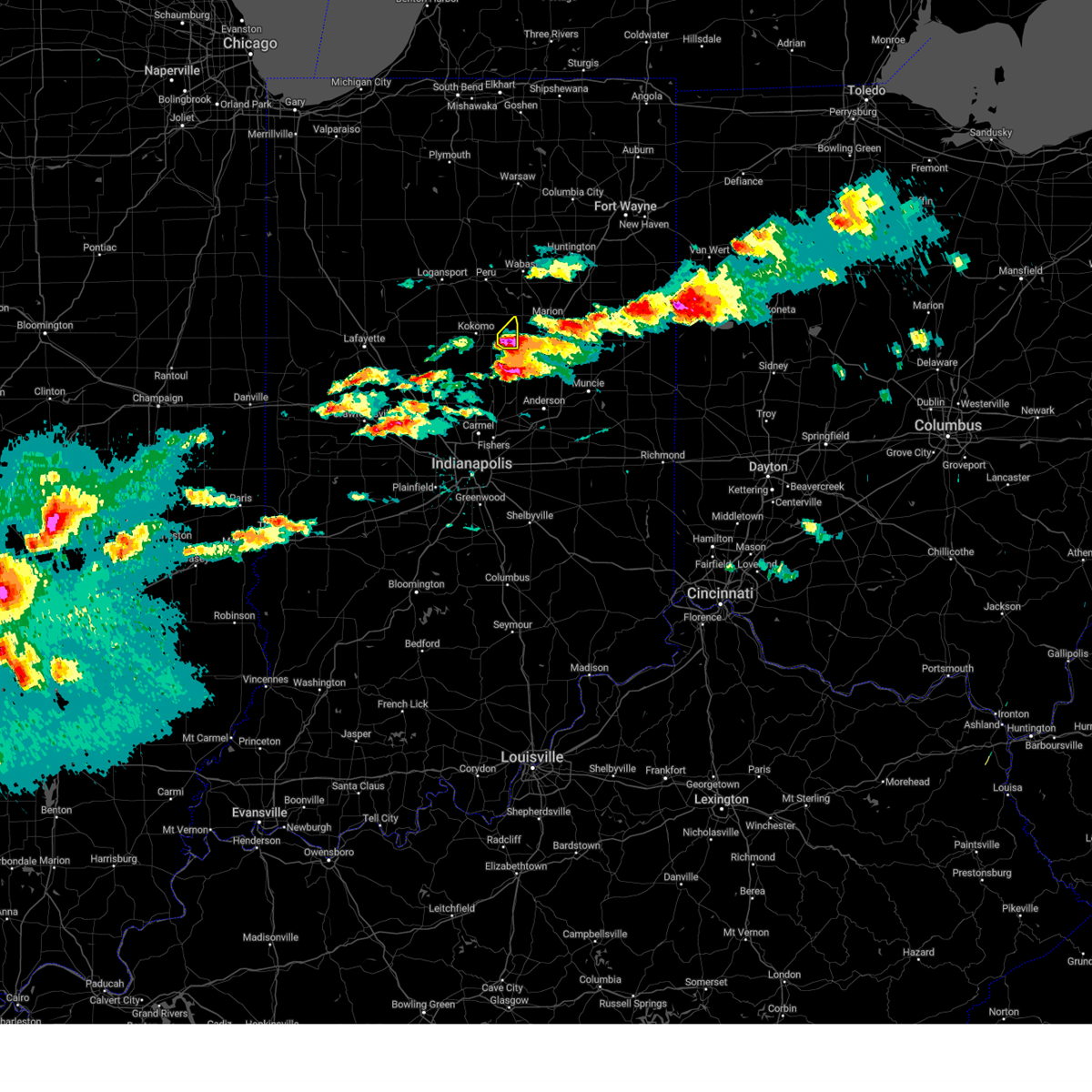
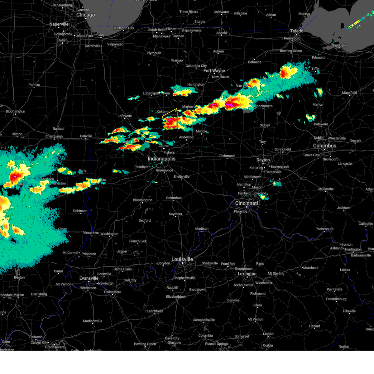
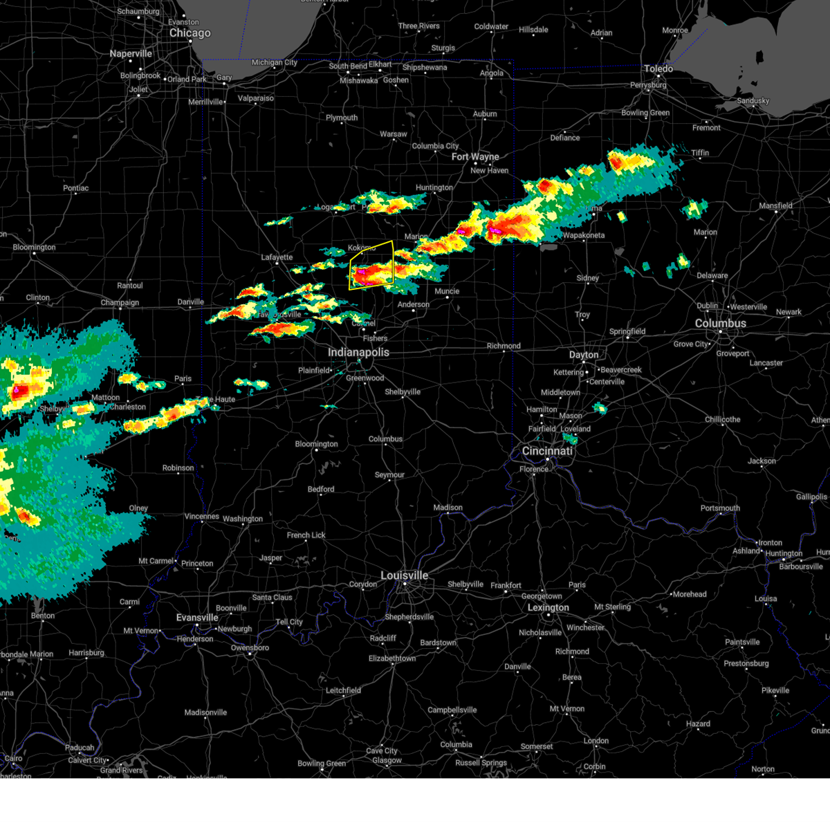
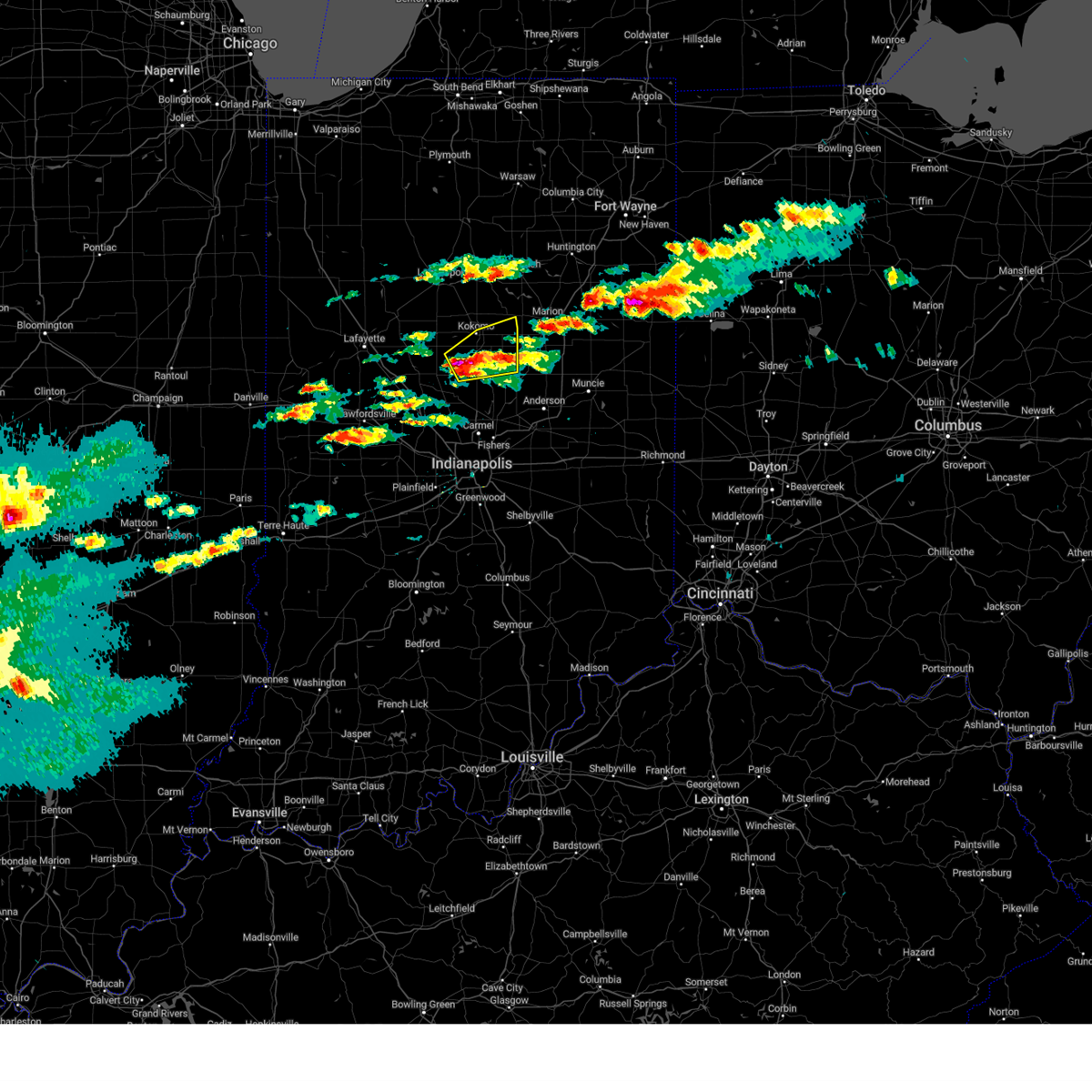
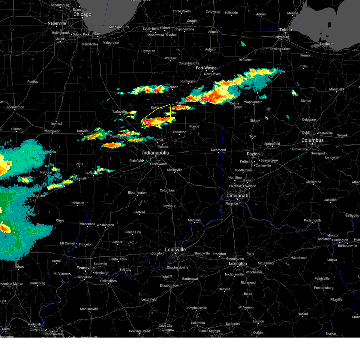
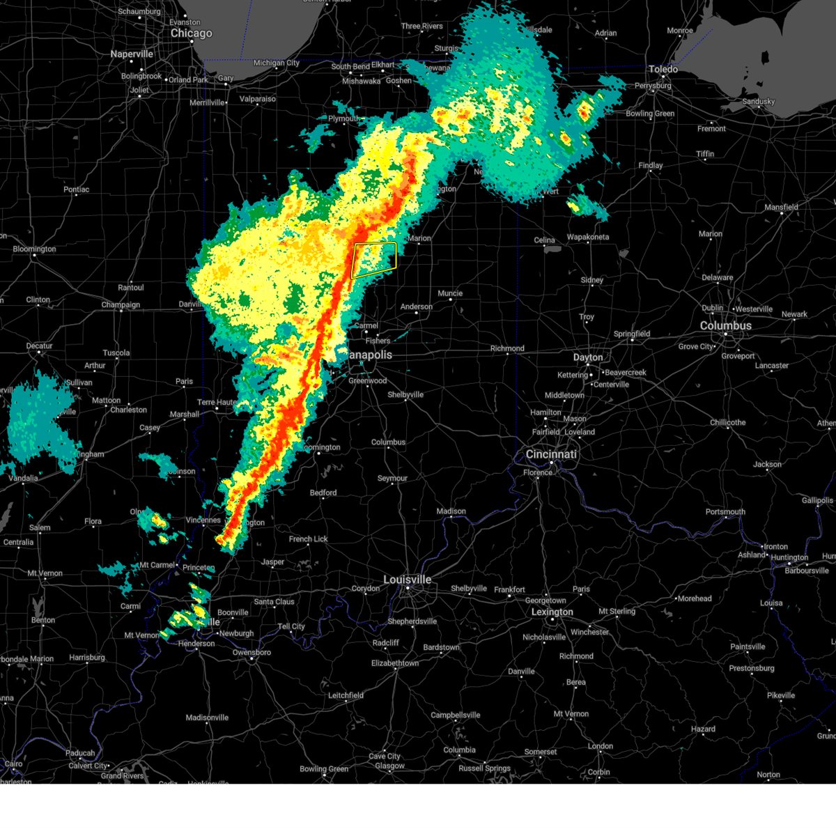
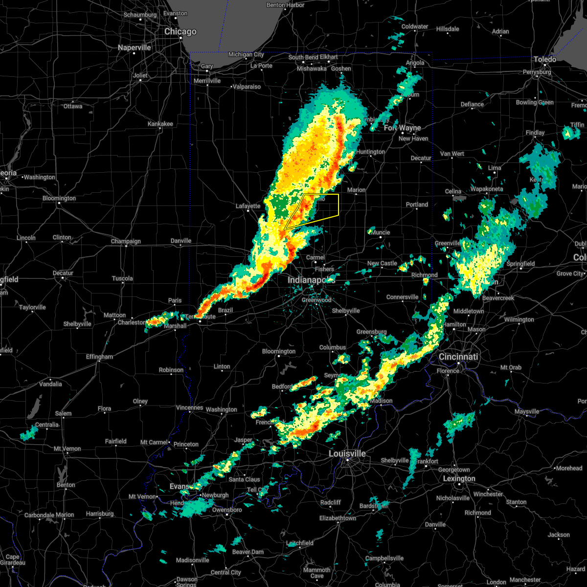
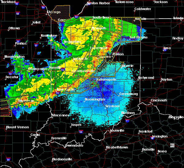
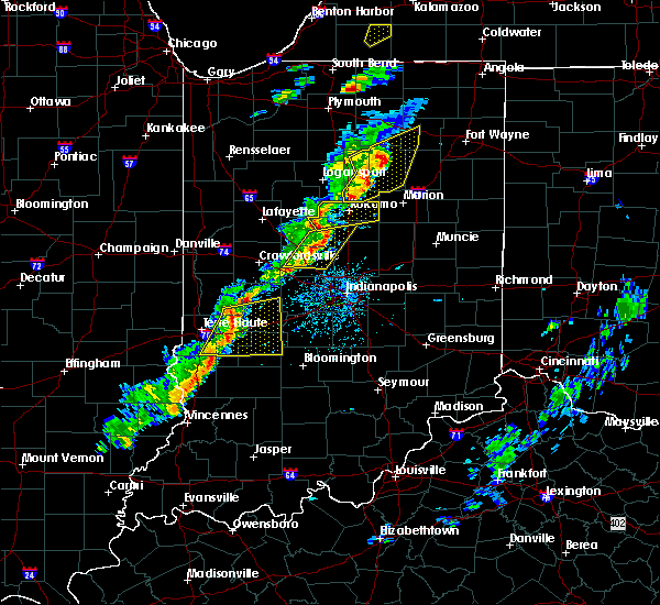
Hail Map for Greentown, IN
The Greentown, IN area has had 5 reports of on-the-ground hail by trained spotters, and has been under severe weather warnings 31 times during the past 12 months. Doppler radar has detected hail at or near Greentown, IN on 34 occasions, including 1 occasion during the past year.
| Name: | Greentown, IN |
| Where Located: | 49.9 miles NNE of Indianapolis, IN |
| Map: | Google Map for Greentown, IN |
| Population: | 2415 |
| Housing Units: | 1069 |
| More Info: | Search Google for Greentown, IN |
0
The Top Recent Hail Date for Greentown, IN is Friday, August 2, 2024 (28th out of 34)

Hail and Wind Damage Spotted near Greentown, IN
| Date / Time | Report Details |
|---|---|
| 6/18/2025 5:12 PM EDT |
 At 511 pm edt, severe thunderstorms were located along a line extending from near sweetser to near greenfield, moving northeast at 40 mph (radar indicated). Hazards include 70 mph wind gusts and quarter size hail. Hail damage to vehicles is expected. expect considerable tree damage. wind damage is also likely to mobile homes, roofs, and outbuildings. locations impacted include, indianapolis, muncie, anderson, carmel, fishers, noblesville, lawrence, greenfield, beech grove, elwood, alexandria, tipton, windfall, westfield, yorktown, cumberland, cicero, mccordsville, pendleton, and fortville. this includes the following highways, interstate 65 between mile markers 105 and 112. interstate 69 between mile markers 200 and 252. interstate 70 between mile markers 83 and 119. Interstate 74 between mile markers 93 and 97. At 511 pm edt, severe thunderstorms were located along a line extending from near sweetser to near greenfield, moving northeast at 40 mph (radar indicated). Hazards include 70 mph wind gusts and quarter size hail. Hail damage to vehicles is expected. expect considerable tree damage. wind damage is also likely to mobile homes, roofs, and outbuildings. locations impacted include, indianapolis, muncie, anderson, carmel, fishers, noblesville, lawrence, greenfield, beech grove, elwood, alexandria, tipton, windfall, westfield, yorktown, cumberland, cicero, mccordsville, pendleton, and fortville. this includes the following highways, interstate 65 between mile markers 105 and 112. interstate 69 between mile markers 200 and 252. interstate 70 between mile markers 83 and 119. Interstate 74 between mile markers 93 and 97.
|
| 6/18/2025 4:58 PM EDT |
 Svrind the national weather service in indianapolis has issued a * severe thunderstorm warning for, madison county in central indiana, hancock county in central indiana, northwestern rush county in central indiana, western delaware county in east central indiana, eastern howard county in central indiana, western henry county in east central indiana, eastern marion county in central indiana, hamilton county in central indiana, tipton county in central indiana, * until 545 pm edt. * at 458 pm edt, severe thunderstorms were located along a line extending from near swayzee to 7 miles southeast of lawrence, moving northeast at 40 mph (radar indicated). Hazards include 70 mph wind gusts and penny size hail. Expect considerable tree damage. Damage is likely to mobile homes, roofs, and outbuildings. Svrind the national weather service in indianapolis has issued a * severe thunderstorm warning for, madison county in central indiana, hancock county in central indiana, northwestern rush county in central indiana, western delaware county in east central indiana, eastern howard county in central indiana, western henry county in east central indiana, eastern marion county in central indiana, hamilton county in central indiana, tipton county in central indiana, * until 545 pm edt. * at 458 pm edt, severe thunderstorms were located along a line extending from near swayzee to 7 miles southeast of lawrence, moving northeast at 40 mph (radar indicated). Hazards include 70 mph wind gusts and penny size hail. Expect considerable tree damage. Damage is likely to mobile homes, roofs, and outbuildings.
|
| 6/18/2025 4:47 PM EDT | At 446 pm edt, severe thunderstorms were located along a line extending from tipton to near lawrence, moving northeast at 65 mph (radar indicated). Hazards include 70 mph wind gusts and nickel size hail. Expect considerable tree damage. damage is likely to mobile homes, roofs, and outbuildings. locations impacted include, indianapolis, anderson, kokomo, carmel, fishers, noblesville, lawrence, greenfield, beech grove, zionsville, speedway, elwood, alexandria, tipton, southport, windfall, westfield, cumberland, cicero, and mccordsville. this includes the following highways, interstate 65 between mile markers 103 and 130. interstate 69 between mile markers 200 and 228. interstate 70 between mile markers 71 and 110. Interstate 74 between mile markers 70 and 98. |
| 6/18/2025 4:47 PM EDT | the severe thunderstorm warning has been cancelled and is no longer in effect |
| 6/18/2025 4:22 PM EDT | Svrind the national weather service in indianapolis has issued a * severe thunderstorm warning for, madison county in central indiana, hancock county in central indiana, northeastern morgan county in central indiana, southeastern clinton county in central indiana, eastern howard county in central indiana, eastern hendricks county in central indiana, marion county in central indiana, boone county in central indiana, hamilton county in central indiana, tipton county in central indiana, * until 500 pm edt. * at 421 pm edt, severe thunderstorms were located along a line extending from near lebanon to near mooresville, moving northeast at 65 mph (radar indicated). Hazards include 70 mph wind gusts and nickel size hail. Expect considerable tree damage. Damage is likely to mobile homes, roofs, and outbuildings. |
| 5/16/2025 7:40 PM EDT |
 the severe thunderstorm warning has been cancelled and is no longer in effect the severe thunderstorm warning has been cancelled and is no longer in effect
|
| 5/16/2025 7:40 PM EDT |
 At 739 pm edt, severe thunderstorms were located along a line extending from 6 miles west of swayzee to 6 miles west of new castle, moving east at 75 mph (public). Hazards include 60 mph wind gusts. Expect damage to roofs, siding, and trees. locations impacted include, muncie, anderson, elwood, alexandria, winchester, windfall, yorktown, pendleton, chesterfield, greentown, albany, lapel, edgewood, frankton, eaton, daleville, parker city, farmland, summitville, and gaston. This includes interstate 69 between mile markers 216 and 252. At 739 pm edt, severe thunderstorms were located along a line extending from 6 miles west of swayzee to 6 miles west of new castle, moving east at 75 mph (public). Hazards include 60 mph wind gusts. Expect damage to roofs, siding, and trees. locations impacted include, muncie, anderson, elwood, alexandria, winchester, windfall, yorktown, pendleton, chesterfield, greentown, albany, lapel, edgewood, frankton, eaton, daleville, parker city, farmland, summitville, and gaston. This includes interstate 69 between mile markers 216 and 252.
|
| 5/16/2025 7:23 PM EDT | Svrind the national weather service in indianapolis has issued a * severe thunderstorm warning for, madison county in central indiana, southeastern carroll county in north central indiana, delaware county in east central indiana, northwestern randolph county in east central indiana, northeastern clinton county in central indiana, howard county in central indiana, northwestern henry county in east central indiana, hamilton county in central indiana, tipton county in central indiana, * until 815 pm edt. * at 722 pm edt, severe thunderstorms were located along a line extending from 10 miles southwest of walton to 6 miles east of fishers, moving east at 75 mph (public report of 60 mph winds). Hazards include 60 mph wind gusts. expect damage to roofs, siding, and trees |
| 3/30/2025 5:10 PM EDT | The storm which prompted the warning has weakened below severe limits, and no longer poses an immediate threat to life or property. therefore, the warning will be allowed to expire. a tornado watch remains in effect until 800 pm edt for central indiana. |
| 3/30/2025 4:57 PM EDT |
 The storm which prompted the warning has weakened below severe limits, and has exited the warned area. therefore, the warning will be allowed to expire. a tornado watch remains in effect until 800 pm edt for central indiana. The storm which prompted the warning has weakened below severe limits, and has exited the warned area. therefore, the warning will be allowed to expire. a tornado watch remains in effect until 800 pm edt for central indiana.
|
| 3/30/2025 4:48 PM EDT |
 the severe thunderstorm warning has been cancelled and is no longer in effect the severe thunderstorm warning has been cancelled and is no longer in effect
|
| 3/30/2025 4:48 PM EDT |
 At 448 pm edt, a severe thunderstorm was located near kokomo, moving east at 40 mph (radar indicated). Hazards include 60 mph wind gusts and penny size hail. Expect damage to roofs, siding, and trees. Locations impacted include, greentown, indian heights, kokomo, and russiaville. At 448 pm edt, a severe thunderstorm was located near kokomo, moving east at 40 mph (radar indicated). Hazards include 60 mph wind gusts and penny size hail. Expect damage to roofs, siding, and trees. Locations impacted include, greentown, indian heights, kokomo, and russiaville.
|
| 3/30/2025 4:47 PM EDT |
 At 446 pm edt, a severe thunderstorm was located near tipton, or 11 miles north of georgetown, moving east at 45 mph (radar indicated). Hazards include 60 mph wind gusts and penny size hail. Expect damage to roofs, siding, and trees. Locations impacted include, windfall, kirklin, tipton, atlanta, sharpsville, and kempton. At 446 pm edt, a severe thunderstorm was located near tipton, or 11 miles north of georgetown, moving east at 45 mph (radar indicated). Hazards include 60 mph wind gusts and penny size hail. Expect damage to roofs, siding, and trees. Locations impacted include, windfall, kirklin, tipton, atlanta, sharpsville, and kempton.
|
| 3/30/2025 4:31 PM EDT |
 Svrind the national weather service in indianapolis has issued a * severe thunderstorm warning for, southeastern clinton county in central indiana, southeastern howard county in central indiana, northeastern boone county in central indiana, northern hamilton county in central indiana, tipton county in central indiana, * until 515 pm edt. * at 431 pm edt, severe thunderstorms were located along a line extending from 11 miles southwest of kokomo to 6 miles northeast of lebanon, moving northeast at 50 mph (radar indicated). Hazards include 60 mph wind gusts and penny size hail. expect damage to roofs, siding, and trees Svrind the national weather service in indianapolis has issued a * severe thunderstorm warning for, southeastern clinton county in central indiana, southeastern howard county in central indiana, northeastern boone county in central indiana, northern hamilton county in central indiana, tipton county in central indiana, * until 515 pm edt. * at 431 pm edt, severe thunderstorms were located along a line extending from 11 miles southwest of kokomo to 6 miles northeast of lebanon, moving northeast at 50 mph (radar indicated). Hazards include 60 mph wind gusts and penny size hail. expect damage to roofs, siding, and trees
|
| 3/30/2025 4:18 PM EDT |
 Svrind the national weather service in indianapolis has issued a * severe thunderstorm warning for, eastern carroll county in north central indiana, northeastern clinton county in central indiana, howard county in central indiana, northwestern tipton county in central indiana, * until 500 pm edt. * at 418 pm edt, severe thunderstorms were located along a line extending from near logansport to 11 miles southwest of walton to 9 miles north of frankfort, moving northeast at 60 mph (radar indicated). Hazards include 60 mph wind gusts and penny size hail. expect damage to roofs, siding, and trees Svrind the national weather service in indianapolis has issued a * severe thunderstorm warning for, eastern carroll county in north central indiana, northeastern clinton county in central indiana, howard county in central indiana, northwestern tipton county in central indiana, * until 500 pm edt. * at 418 pm edt, severe thunderstorms were located along a line extending from near logansport to 11 miles southwest of walton to 9 miles north of frankfort, moving northeast at 60 mph (radar indicated). Hazards include 60 mph wind gusts and penny size hail. expect damage to roofs, siding, and trees
|
| 3/19/2025 8:26 PM EDT |
 The storms which prompted the warning have weakened below severe limits, and no longer pose an immediate threat to life or property. therefore, the warning will be allowed to expire. however, gusty winds are still possible with these thunderstorms. a severe thunderstorm watch remains in effect until 100 am edt for central indiana. The storms which prompted the warning have weakened below severe limits, and no longer pose an immediate threat to life or property. therefore, the warning will be allowed to expire. however, gusty winds are still possible with these thunderstorms. a severe thunderstorm watch remains in effect until 100 am edt for central indiana.
|
| 3/19/2025 8:18 PM EDT | Thunderstorm winds downed 3 power poles across roadway on howard-miami county line. time estimated by rada in howard county IN, 5.8 miles S of Greentown, IN |
| 3/19/2025 8:18 PM EDT |
 At 818 pm edt, severe thunderstorms were located along a line extending from near peru to near georgetown, moving northeast at 70 mph (radar indicated). Hazards include 60 mph wind gusts and quarter size hail. Hail damage to vehicles is expected. expect wind damage to roofs, siding, and trees. Locations impacted include, greentown, noblesville, kokomo, tipton, westfield, morse reservoir, cicero, sheridan, indian heights, arcadia, atlanta, kempton, windfall, sharpsville, zionsville, and carmel. At 818 pm edt, severe thunderstorms were located along a line extending from near peru to near georgetown, moving northeast at 70 mph (radar indicated). Hazards include 60 mph wind gusts and quarter size hail. Hail damage to vehicles is expected. expect wind damage to roofs, siding, and trees. Locations impacted include, greentown, noblesville, kokomo, tipton, westfield, morse reservoir, cicero, sheridan, indian heights, arcadia, atlanta, kempton, windfall, sharpsville, zionsville, and carmel.
|
| 3/19/2025 8:08 PM EDT |
 At 808 pm edt, severe thunderstorms were located along a line extending from grissom afb to near zionsville, moving east at 70 mph (radar indicated). Hazards include 60 mph wind gusts and quarter size hail. Hail damage to vehicles is expected. expect wind damage to roofs, siding, and trees. locations impacted include, greentown, carmel, kirklin, noblesville, kokomo, whitestown, tipton, russiaville, zionsville, westfield, morse reservoir, cicero, sheridan, indian heights, arcadia, atlanta, kempton, windfall, sharpsville, and fishers. this includes the following highways, interstate 65 between mile markers 129 and 132. Interstate 69 between mile markers 206 and 213. At 808 pm edt, severe thunderstorms were located along a line extending from grissom afb to near zionsville, moving east at 70 mph (radar indicated). Hazards include 60 mph wind gusts and quarter size hail. Hail damage to vehicles is expected. expect wind damage to roofs, siding, and trees. locations impacted include, greentown, carmel, kirklin, noblesville, kokomo, whitestown, tipton, russiaville, zionsville, westfield, morse reservoir, cicero, sheridan, indian heights, arcadia, atlanta, kempton, windfall, sharpsville, and fishers. this includes the following highways, interstate 65 between mile markers 129 and 132. Interstate 69 between mile markers 206 and 213.
|
| 3/19/2025 8:08 PM EDT |
 the severe thunderstorm warning has been cancelled and is no longer in effect the severe thunderstorm warning has been cancelled and is no longer in effect
|
| 3/19/2025 8:00 PM EDT |
 At 759 pm edt, severe thunderstorms were located along a line extending from near walton to near brownsburg, moving east at 70 mph (radar indicated). Hazards include 70 mph wind gusts and quarter size hail. Hail damage to vehicles is expected. expect considerable tree damage. wind damage is also likely to mobile homes, roofs, and outbuildings. locations impacted include, pittsboro, greentown, carmel, kokomo, ulen, fishers, michigantown, whitestown, russiaville, zionsville, westfield, morse reservoir, indian heights, atlanta, burlington, kempton, sharpsville, kirklin, noblesville, and tipton. this includes the following highways, interstate 65 between mile markers 125 and 138. interstate 69 between mile markers 203 and 213. Interstate 74 between mile markers 62 and 66. At 759 pm edt, severe thunderstorms were located along a line extending from near walton to near brownsburg, moving east at 70 mph (radar indicated). Hazards include 70 mph wind gusts and quarter size hail. Hail damage to vehicles is expected. expect considerable tree damage. wind damage is also likely to mobile homes, roofs, and outbuildings. locations impacted include, pittsboro, greentown, carmel, kokomo, ulen, fishers, michigantown, whitestown, russiaville, zionsville, westfield, morse reservoir, indian heights, atlanta, burlington, kempton, sharpsville, kirklin, noblesville, and tipton. this includes the following highways, interstate 65 between mile markers 125 and 138. interstate 69 between mile markers 203 and 213. Interstate 74 between mile markers 62 and 66.
|
| 3/19/2025 7:47 PM EDT |
 Svrind the national weather service in indianapolis has issued a * severe thunderstorm warning for, southeastern carroll county in north central indiana, eastern clinton county in central indiana, howard county in central indiana, northeastern hendricks county in central indiana, northern marion county in central indiana, eastern boone county in central indiana, hamilton county in central indiana, tipton county in central indiana, * until 830 pm edt. * at 747 pm edt, severe thunderstorms were located along a line extending from 11 miles southeast of delphi to near danville, moving northeast at 70 mph (radar indicated). Hazards include 70 mph wind gusts and quarter size hail. Hail damage to vehicles is expected. expect considerable tree damage. Wind damage is also likely to mobile homes, roofs, and outbuildings. Svrind the national weather service in indianapolis has issued a * severe thunderstorm warning for, southeastern carroll county in north central indiana, eastern clinton county in central indiana, howard county in central indiana, northeastern hendricks county in central indiana, northern marion county in central indiana, eastern boone county in central indiana, hamilton county in central indiana, tipton county in central indiana, * until 830 pm edt. * at 747 pm edt, severe thunderstorms were located along a line extending from 11 miles southeast of delphi to near danville, moving northeast at 70 mph (radar indicated). Hazards include 70 mph wind gusts and quarter size hail. Hail damage to vehicles is expected. expect considerable tree damage. Wind damage is also likely to mobile homes, roofs, and outbuildings.
|
| 3/15/2025 4:01 AM EDT | At 401 am edt, severe thunderstorms were located along a line extending from near la fontaine to near tipton, moving northeast at 55 mph (radar indicated). Hazards include 60 mph wind gusts. Expect damage to roofs, siding, and trees. Locations impacted include, greentown, indian heights, kokomo, and sharpsville. |
| 3/15/2025 4:01 AM EDT | the severe thunderstorm warning has been cancelled and is no longer in effect |
| 3/15/2025 3:41 AM EDT |
 Svrind the national weather service in indianapolis has issued a * severe thunderstorm warning for, northern madison county in central indiana, southeastern clinton county in central indiana, howard county in central indiana, tipton county in central indiana, * until 430 am edt. * at 340 am edt, severe thunderstorms were located along a line extending from near bunker hill to 12 miles northwest of georgetown, moving northeast at 55 mph. this line has a history of damaging wind gusts (radar indicated). Hazards include 60 mph wind gusts. expect damage to roofs, siding, and trees Svrind the national weather service in indianapolis has issued a * severe thunderstorm warning for, northern madison county in central indiana, southeastern clinton county in central indiana, howard county in central indiana, tipton county in central indiana, * until 430 am edt. * at 340 am edt, severe thunderstorms were located along a line extending from near bunker hill to 12 miles northwest of georgetown, moving northeast at 55 mph. this line has a history of damaging wind gusts (radar indicated). Hazards include 60 mph wind gusts. expect damage to roofs, siding, and trees
|
| 3/15/2025 3:37 AM EDT | At 336 am edt, severe thunderstorms were located along a line extending from near walton to 7 miles west of tipton, moving northeast at 55 mph (radar indicated). Hazards include 70 mph wind gusts. Expect considerable tree damage. damage is likely to mobile homes, roofs, and outbuildings. locations impacted include, greentown, kirklin, kokomo, thorntown, ulen, michigantown, tipton, russiaville, lebanon, sheridan, indian heights, arcadia, atlanta, kempton, windfall, frankfort, sharpsville, and advance. This includes interstate 65 between mile markers 140 and 153. |
| 3/15/2025 3:37 AM EDT | the severe thunderstorm warning has been cancelled and is no longer in effect |
| 3/15/2025 3:17 AM EDT |
 the severe thunderstorm warning has been cancelled and is no longer in effect the severe thunderstorm warning has been cancelled and is no longer in effect
|
| 3/15/2025 3:17 AM EDT |
 At 317 am edt, severe thunderstorms were located along a line extending from 9 miles southeast of delphi to 6 miles north of lebanon, moving northeast at 55 mph (radar indicated). Hazards include 70 mph wind gusts. Expect considerable tree damage. damage is likely to mobile homes, roofs, and outbuildings. locations impacted include, greentown, kirklin, kokomo, advance, thorntown, ulen, michigantown, tipton, russiaville, lebanon, sheridan, indian heights, arcadia, atlanta, burlington, kempton, windfall, frankfort, colfax, and sharpsville. This includes interstate 65 between mile markers 140 and 158. At 317 am edt, severe thunderstorms were located along a line extending from 9 miles southeast of delphi to 6 miles north of lebanon, moving northeast at 55 mph (radar indicated). Hazards include 70 mph wind gusts. Expect considerable tree damage. damage is likely to mobile homes, roofs, and outbuildings. locations impacted include, greentown, kirklin, kokomo, advance, thorntown, ulen, michigantown, tipton, russiaville, lebanon, sheridan, indian heights, arcadia, atlanta, burlington, kempton, windfall, frankfort, colfax, and sharpsville. This includes interstate 65 between mile markers 140 and 158.
|
| 3/15/2025 3:04 AM EDT |
 At 304 am edt, severe thunderstorms were located along a line extending from 7 miles east of lafayette to 7 miles west of lebanon, moving northeast at 55 mph (radar indicated). Hazards include 70 mph wind gusts. Expect considerable tree damage. damage is likely to mobile homes, roofs, and outbuildings. locations impacted include, greentown, kokomo, ulen, michigantown, darlington, russiaville, dayton, indian heights, atlanta, burlington, kempton, rossville, colfax, sharpsville, mulberry, kirklin, advance, thorntown, tipton, and lebanon. this includes the following highways, interstate 65 between mile markers 139 and 174. Interstate 74 between mile markers 42 and 48. At 304 am edt, severe thunderstorms were located along a line extending from 7 miles east of lafayette to 7 miles west of lebanon, moving northeast at 55 mph (radar indicated). Hazards include 70 mph wind gusts. Expect considerable tree damage. damage is likely to mobile homes, roofs, and outbuildings. locations impacted include, greentown, kokomo, ulen, michigantown, darlington, russiaville, dayton, indian heights, atlanta, burlington, kempton, rossville, colfax, sharpsville, mulberry, kirklin, advance, thorntown, tipton, and lebanon. this includes the following highways, interstate 65 between mile markers 139 and 174. Interstate 74 between mile markers 42 and 48.
|
| 3/15/2025 2:57 AM EDT |
 Svrind the national weather service in indianapolis has issued a * severe thunderstorm warning for, southern carroll county in north central indiana, southeastern tippecanoe county in west central indiana, clinton county in central indiana, howard county in central indiana, northern boone county in central indiana, northern hamilton county in central indiana, tipton county in central indiana, northeastern montgomery county in west central indiana, * until 345 am edt. * at 256 am edt, severe thunderstorms were located along a line extending from near lafayette to 8 miles east of crawfordsville, moving northeast at 55 mph (radar indicated). Hazards include 60 mph wind gusts. expect damage to roofs, siding, and trees Svrind the national weather service in indianapolis has issued a * severe thunderstorm warning for, southern carroll county in north central indiana, southeastern tippecanoe county in west central indiana, clinton county in central indiana, howard county in central indiana, northern boone county in central indiana, northern hamilton county in central indiana, tipton county in central indiana, northeastern montgomery county in west central indiana, * until 345 am edt. * at 256 am edt, severe thunderstorms were located along a line extending from near lafayette to 8 miles east of crawfordsville, moving northeast at 55 mph (radar indicated). Hazards include 60 mph wind gusts. expect damage to roofs, siding, and trees
|
| 7/16/2024 12:16 AM EDT |
 Svrind the national weather service in indianapolis has issued a * severe thunderstorm warning for, northwestern madison county in central indiana, carroll county in north central indiana, eastern tippecanoe county in west central indiana, clinton county in central indiana, howard county in central indiana, northern boone county in central indiana, northern hamilton county in central indiana, tipton county in central indiana, northern montgomery county in west central indiana, * until 1245 am edt. * at 1216 am edt, severe thunderstorms were located along a line extending from near logansport to 11 miles northeast of frankfort to 12 miles northwest of lebanon, moving east at 60 mph (radar indicated). Hazards include 70 mph wind gusts. Expect considerable tree damage. Damage is likely to mobile homes, roofs, and outbuildings. Svrind the national weather service in indianapolis has issued a * severe thunderstorm warning for, northwestern madison county in central indiana, carroll county in north central indiana, eastern tippecanoe county in west central indiana, clinton county in central indiana, howard county in central indiana, northern boone county in central indiana, northern hamilton county in central indiana, tipton county in central indiana, northern montgomery county in west central indiana, * until 1245 am edt. * at 1216 am edt, severe thunderstorms were located along a line extending from near logansport to 11 miles northeast of frankfort to 12 miles northwest of lebanon, moving east at 60 mph (radar indicated). Hazards include 70 mph wind gusts. Expect considerable tree damage. Damage is likely to mobile homes, roofs, and outbuildings.
|
| 5/24/2024 6:25 PM EDT |
 The storm which prompted the warning has weakened below severe limits, and no longer poses an immediate threat to life or property. therefore, the warning will be allowed to expire. The storm which prompted the warning has weakened below severe limits, and no longer poses an immediate threat to life or property. therefore, the warning will be allowed to expire.
|
| 5/24/2024 6:15 PM EDT |
 the severe thunderstorm warning has been cancelled and is no longer in effect the severe thunderstorm warning has been cancelled and is no longer in effect
|
| 5/24/2024 6:15 PM EDT |
 At 615 pm edt, a severe thunderstorm was located near kokomo, moving east at 30 mph (radar indicated). Hazards include 60 mph wind gusts. Expect damage to roofs, siding, and trees. Locations impacted include, kokomo, sheridan, russiaville, kirklin, sharpsville, kempton, and indian heights. At 615 pm edt, a severe thunderstorm was located near kokomo, moving east at 30 mph (radar indicated). Hazards include 60 mph wind gusts. Expect damage to roofs, siding, and trees. Locations impacted include, kokomo, sheridan, russiaville, kirklin, sharpsville, kempton, and indian heights.
|
| 5/24/2024 5:56 PM EDT |
 Svrind the national weather service in indianapolis has issued a * severe thunderstorm warning for, southeastern carroll county in north central indiana, eastern clinton county in central indiana, howard county in central indiana, northeastern boone county in central indiana, northwestern hamilton county in central indiana, western tipton county in central indiana, * until 630 pm edt. * at 556 pm edt, a severe thunderstorm was located 11 miles west of kokomo, moving northeast at 30 mph (radar indicated). Hazards include 60 mph wind gusts. expect damage to roofs, siding, and trees Svrind the national weather service in indianapolis has issued a * severe thunderstorm warning for, southeastern carroll county in north central indiana, eastern clinton county in central indiana, howard county in central indiana, northeastern boone county in central indiana, northwestern hamilton county in central indiana, western tipton county in central indiana, * until 630 pm edt. * at 556 pm edt, a severe thunderstorm was located 11 miles west of kokomo, moving northeast at 30 mph (radar indicated). Hazards include 60 mph wind gusts. expect damage to roofs, siding, and trees
|
| 5/7/2024 6:12 PM EDT |
 the severe thunderstorm warning has been cancelled and is no longer in effect the severe thunderstorm warning has been cancelled and is no longer in effect
|
| 5/7/2024 5:29 PM EDT |
 Svrind the national weather service in indianapolis has issued a * severe thunderstorm warning for, east central clinton county in central indiana, howard county in central indiana, tipton county in central indiana, * until 630 pm edt. * at 529 pm edt, a severe thunderstorm was located 11 miles east of frankfort, moving east at 40 mph (radar indicated). Hazards include golf ball size hail and 60 mph wind gusts. People and animals outdoors will be injured. expect hail damage to roofs, siding, windows, and vehicles. Expect wind damage to roofs, siding, and trees. Svrind the national weather service in indianapolis has issued a * severe thunderstorm warning for, east central clinton county in central indiana, howard county in central indiana, tipton county in central indiana, * until 630 pm edt. * at 529 pm edt, a severe thunderstorm was located 11 miles east of frankfort, moving east at 40 mph (radar indicated). Hazards include golf ball size hail and 60 mph wind gusts. People and animals outdoors will be injured. expect hail damage to roofs, siding, windows, and vehicles. Expect wind damage to roofs, siding, and trees.
|
| 3/14/2024 6:54 PM EDT |
 The storm which prompted the warning has moved out of the area. therefore, the warning will be allowed to expire. a tornado watch remains in effect until midnight edt for central indiana. to report severe weather, contact your nearest law enforcement agency. they will relay your report to the national weather service indianapolis. The storm which prompted the warning has moved out of the area. therefore, the warning will be allowed to expire. a tornado watch remains in effect until midnight edt for central indiana. to report severe weather, contact your nearest law enforcement agency. they will relay your report to the national weather service indianapolis.
|
| 3/14/2024 6:50 PM EDT |
 At 649 pm edt, a severe thunderstorm was located near swayzee, or 11 miles west of fairmount, moving east at 50 mph. this is a destructive storm for areas southeast of greentown (radar indicated). Hazards include baseball size hail. People and animals outdoors will be severely injured. expect shattered windows, extensive damage to roofs, siding, and vehicles. Locations impacted include, greentown. At 649 pm edt, a severe thunderstorm was located near swayzee, or 11 miles west of fairmount, moving east at 50 mph. this is a destructive storm for areas southeast of greentown (radar indicated). Hazards include baseball size hail. People and animals outdoors will be severely injured. expect shattered windows, extensive damage to roofs, siding, and vehicles. Locations impacted include, greentown.
|
| 3/14/2024 6:50 PM EDT |
 the severe thunderstorm warning has been cancelled and is no longer in effect the severe thunderstorm warning has been cancelled and is no longer in effect
|
| 3/14/2024 6:48 PM EDT | Ping Pong Ball sized hail reported 4 miles W of Greentown, IN, home damage from hail. time estimated from radar. |
| 3/14/2024 6:47 PM EDT | Baseball sized hail reported 2.6 miles NW of Greentown, IN, photo of 2.85 inch hail in jerome. time estimated from radar. |
| 3/14/2024 6:42 PM EDT |
 At 641 pm edt, a severe thunderstorm was located near windfall, or 8 miles southeast of kokomo, moving northeast at 55 mph. this is a destructive storm for areas between indian heights, sharpsville, windfall, and greentown (radar indicated). Hazards include baseball size hail. People and animals outdoors will be severely injured. expect shattered windows, extensive damage to roofs, siding, and vehicles. Locations impacted include, kokomo, tipton, windfall, greentown, sharpsville, and indian heights. At 641 pm edt, a severe thunderstorm was located near windfall, or 8 miles southeast of kokomo, moving northeast at 55 mph. this is a destructive storm for areas between indian heights, sharpsville, windfall, and greentown (radar indicated). Hazards include baseball size hail. People and animals outdoors will be severely injured. expect shattered windows, extensive damage to roofs, siding, and vehicles. Locations impacted include, kokomo, tipton, windfall, greentown, sharpsville, and indian heights.
|
| 3/14/2024 6:35 PM EDT |
 At 633 pm edt, a severe thunderstorm was located 7 miles northwest of tipton, or 7 miles south of kokomo, moving east at 50 mph. this is a destructive storm for sharpsville, indian heights, and north of tipton (radar indicated). Hazards include baseball size hail. People and animals outdoors will be severely injured. expect shattered windows, extensive damage to roofs, siding, and vehicles. Locations impacted include, kokomo, tipton, windfall, greentown, sharpsville, kempton, and indian heights. At 633 pm edt, a severe thunderstorm was located 7 miles northwest of tipton, or 7 miles south of kokomo, moving east at 50 mph. this is a destructive storm for sharpsville, indian heights, and north of tipton (radar indicated). Hazards include baseball size hail. People and animals outdoors will be severely injured. expect shattered windows, extensive damage to roofs, siding, and vehicles. Locations impacted include, kokomo, tipton, windfall, greentown, sharpsville, kempton, and indian heights.
|
| 3/14/2024 6:35 PM EDT |
 the severe thunderstorm warning has been cancelled and is no longer in effect the severe thunderstorm warning has been cancelled and is no longer in effect
|
| 3/14/2024 6:30 PM EDT |
 At 629 pm edt, a severe thunderstorm was located 8 miles south of kokomo, moving east at 50 mph. this is a destructive storm for sharpsville, kempton, indian heights and surrounding areas (radar indicated). Hazards include baseball size hail. People and animals outdoors will be severely injured. expect shattered windows, extensive damage to roofs, siding, and vehicles. Locations impacted include, kokomo, tipton, windfall, greentown, russiaville, sharpsville, kempton, and indian heights. At 629 pm edt, a severe thunderstorm was located 8 miles south of kokomo, moving east at 50 mph. this is a destructive storm for sharpsville, kempton, indian heights and surrounding areas (radar indicated). Hazards include baseball size hail. People and animals outdoors will be severely injured. expect shattered windows, extensive damage to roofs, siding, and vehicles. Locations impacted include, kokomo, tipton, windfall, greentown, russiaville, sharpsville, kempton, and indian heights.
|
| 3/14/2024 6:21 PM EDT |
 Svrind the national weather service in indianapolis has issued a * severe thunderstorm warning for, eastern clinton county in central indiana, southeastern howard county in central indiana, tipton county in central indiana, * until 700 pm edt. * at 620 pm edt, a severe thunderstorm was located 10 miles east of frankfort, moving east at 50 mph. this is a destructive storm for michigantown, sharpsville, indian heights and surrounding areas (radar indicated). Hazards include baseball size hail. People and animals outdoors will be severely injured. Expect shattered windows, extensive damage to roofs, siding, and vehicles. Svrind the national weather service in indianapolis has issued a * severe thunderstorm warning for, eastern clinton county in central indiana, southeastern howard county in central indiana, tipton county in central indiana, * until 700 pm edt. * at 620 pm edt, a severe thunderstorm was located 10 miles east of frankfort, moving east at 50 mph. this is a destructive storm for michigantown, sharpsville, indian heights and surrounding areas (radar indicated). Hazards include baseball size hail. People and animals outdoors will be severely injured. Expect shattered windows, extensive damage to roofs, siding, and vehicles.
|
| 3/14/2024 6:14 PM EDT |
 At 614 pm edt, a severe thunderstorm was located near tipton, or 10 miles south of kokomo, moving east at 45 mph (radar indicated). Hazards include 60 mph wind gusts and half dollar size hail. Hail damage to vehicles is expected. expect wind damage to roofs, siding, and trees. Locations impacted include, tipton, windfall, sharpsville, and kempton. At 614 pm edt, a severe thunderstorm was located near tipton, or 10 miles south of kokomo, moving east at 45 mph (radar indicated). Hazards include 60 mph wind gusts and half dollar size hail. Hail damage to vehicles is expected. expect wind damage to roofs, siding, and trees. Locations impacted include, tipton, windfall, sharpsville, and kempton.
|
| 3/14/2024 6:06 PM EDT |
 Svrind the national weather service in indianapolis has issued a * severe thunderstorm warning for, southeastern howard county in central indiana, tipton county in central indiana, * until 645 pm edt. * at 606 pm edt, a severe thunderstorm was located 8 miles west of tipton, or 12 miles south of kokomo, moving east at 45 mph (radar indicated). Hazards include 60 mph wind gusts and half dollar size hail. Hail damage to vehicles is expected. Expect wind damage to roofs, siding, and trees. Svrind the national weather service in indianapolis has issued a * severe thunderstorm warning for, southeastern howard county in central indiana, tipton county in central indiana, * until 645 pm edt. * at 606 pm edt, a severe thunderstorm was located 8 miles west of tipton, or 12 miles south of kokomo, moving east at 45 mph (radar indicated). Hazards include 60 mph wind gusts and half dollar size hail. Hail damage to vehicles is expected. Expect wind damage to roofs, siding, and trees.
|
| 3/14/2024 11:52 AM EDT |
 Svrind the national weather service in indianapolis has issued a * severe thunderstorm warning for, howard county in central indiana, northern tipton county in central indiana, * until 1215 pm edt. * at 1151 am edt, severe thunderstorms were located along a line extending from near kokomo to 10 miles northwest of tipton, moving east at 55 mph (radar indicated). Hazards include 70 mph wind gusts and quarter size hail. Hail damage to vehicles is expected. expect considerable tree damage. Wind damage is also likely to mobile homes, roofs, and outbuildings. Svrind the national weather service in indianapolis has issued a * severe thunderstorm warning for, howard county in central indiana, northern tipton county in central indiana, * until 1215 pm edt. * at 1151 am edt, severe thunderstorms were located along a line extending from near kokomo to 10 miles northwest of tipton, moving east at 55 mph (radar indicated). Hazards include 70 mph wind gusts and quarter size hail. Hail damage to vehicles is expected. expect considerable tree damage. Wind damage is also likely to mobile homes, roofs, and outbuildings.
|
| 6/29/2023 3:55 PM EDT |
 At 355 pm edt, severe thunderstorms were located along a line extending from near walton to noblesville, moving east at 70 mph (radar indicated). Hazards include 60 mph wind gusts. Expect damage to roofs, siding, and trees. severe thunderstorms will be near, fishers around 400 pm edt. lapel around 405 pm edt. pendleton, edgewood, woodlawn heights, country club heights and river forest around 410 pm edt. anderson, chesterfield and markleville around 415 pm edt. other locations in the path of these severe thunderstorms include daleville, sulphur springs, mount summit, springport, selma, mooreland, blountsville, prairie creek reservoir and summit lake state park. this includes interstate 69 between mile markers 210 and 252. hail threat, radar indicated max hail size, <. 75 in wind threat, radar indicated max wind gust, 60 mph. At 355 pm edt, severe thunderstorms were located along a line extending from near walton to noblesville, moving east at 70 mph (radar indicated). Hazards include 60 mph wind gusts. Expect damage to roofs, siding, and trees. severe thunderstorms will be near, fishers around 400 pm edt. lapel around 405 pm edt. pendleton, edgewood, woodlawn heights, country club heights and river forest around 410 pm edt. anderson, chesterfield and markleville around 415 pm edt. other locations in the path of these severe thunderstorms include daleville, sulphur springs, mount summit, springport, selma, mooreland, blountsville, prairie creek reservoir and summit lake state park. this includes interstate 69 between mile markers 210 and 252. hail threat, radar indicated max hail size, <. 75 in wind threat, radar indicated max wind gust, 60 mph.
|
| 4/5/2023 12:28 PM EDT |
 At 1228 pm edt, severe thunderstorms were located along a line extending from near swayzee to 6 miles north of georgetown, moving east at 50 mph (radar indicated). Hazards include 60 mph wind gusts. Expect damage to roofs, siding, and trees. severe thunderstorms will be near, elwood around 1245 pm edt. other locations in the path of these severe thunderstorms include frankton, alexandria, orestes and summitville. This includes interstate 69 between mile markers 245 and 252. At 1228 pm edt, severe thunderstorms were located along a line extending from near swayzee to 6 miles north of georgetown, moving east at 50 mph (radar indicated). Hazards include 60 mph wind gusts. Expect damage to roofs, siding, and trees. severe thunderstorms will be near, elwood around 1245 pm edt. other locations in the path of these severe thunderstorms include frankton, alexandria, orestes and summitville. This includes interstate 69 between mile markers 245 and 252.
|
| 4/5/2023 12:14 PM EDT |
 At 1214 pm edt, severe thunderstorms were located along a line extending from near bunker hill to 7 miles southeast of grissom afb to kokomo, moving northeast at 55 mph (radar indicated). Hazards include 60 mph wind gusts. Expect damage to roofs, siding, and trees. Locations impacted include, kokomo, greentown and indian heights. At 1214 pm edt, severe thunderstorms were located along a line extending from near bunker hill to 7 miles southeast of grissom afb to kokomo, moving northeast at 55 mph (radar indicated). Hazards include 60 mph wind gusts. Expect damage to roofs, siding, and trees. Locations impacted include, kokomo, greentown and indian heights.
|
| 4/5/2023 12:03 PM EDT |
 At 1203 pm edt, severe thunderstorms were located along a line extending from near walton to near kokomo to 13 miles northeast of frankfort, moving northeast at 55 mph (radar indicated). Hazards include 60 mph wind gusts. Expect damage to roofs, siding, and trees. Locations impacted include, greentown. At 1203 pm edt, severe thunderstorms were located along a line extending from near walton to near kokomo to 13 miles northeast of frankfort, moving northeast at 55 mph (radar indicated). Hazards include 60 mph wind gusts. Expect damage to roofs, siding, and trees. Locations impacted include, greentown.
|
| 4/5/2023 11:43 AM EDT |
 At 1143 am edt, severe thunderstorms were located along a line extending from 11 miles southeast of delphi to near frankfort, moving northeast at 55 mph (radar indicated). Hazards include 60 mph wind gusts. Expect damage to roofs, siding, and trees. severe thunderstorms will be near, burlington around 1150 am edt. other locations in the path of these severe thunderstorms include kokomo, russiaville, indian heights and greentown. This includes interstate 65 between mile markers 155 and 156. At 1143 am edt, severe thunderstorms were located along a line extending from 11 miles southeast of delphi to near frankfort, moving northeast at 55 mph (radar indicated). Hazards include 60 mph wind gusts. Expect damage to roofs, siding, and trees. severe thunderstorms will be near, burlington around 1150 am edt. other locations in the path of these severe thunderstorms include kokomo, russiaville, indian heights and greentown. This includes interstate 65 between mile markers 155 and 156.
|
| 2/27/2023 2:02 PM EST | Report from mping: 1-inch tree limbs broken; shingles blown of in howard county IN, 0.5 miles NNE of Greentown, IN |
| 2/27/2023 1:25 PM EST |
 At 125 pm est, a severe thunderstorm capable of producing a tornado was located near windfall, or 10 miles southeast of kokomo, moving northeast at 40 mph (radar indicated rotation). Hazards include tornado. Flying debris will be dangerous to those caught without shelter. mobile homes will be damaged or destroyed. damage to roofs, windows, and vehicles will occur. tree damage is likely. This tornadic thunderstorm will remain over mainly rural areas of eastern howard and northeastern tipton counties. At 125 pm est, a severe thunderstorm capable of producing a tornado was located near windfall, or 10 miles southeast of kokomo, moving northeast at 40 mph (radar indicated rotation). Hazards include tornado. Flying debris will be dangerous to those caught without shelter. mobile homes will be damaged or destroyed. damage to roofs, windows, and vehicles will occur. tree damage is likely. This tornadic thunderstorm will remain over mainly rural areas of eastern howard and northeastern tipton counties.
|
| 2/27/2023 1:18 PM EST |
 At 118 pm est, a severe thunderstorm capable of producing a tornado was located near windfall, or 9 miles southeast of kokomo, moving northeast at 40 mph (radar indicated rotation). Hazards include tornado and quarter size hail. Flying debris will be dangerous to those caught without shelter. mobile homes will be damaged or destroyed. damage to roofs, windows, and vehicles will occur. tree damage is likely. This dangerous storm will be near, greentown around 130 pm est. At 118 pm est, a severe thunderstorm capable of producing a tornado was located near windfall, or 9 miles southeast of kokomo, moving northeast at 40 mph (radar indicated rotation). Hazards include tornado and quarter size hail. Flying debris will be dangerous to those caught without shelter. mobile homes will be damaged or destroyed. damage to roofs, windows, and vehicles will occur. tree damage is likely. This dangerous storm will be near, greentown around 130 pm est.
|
| 7/23/2022 10:11 AM EDT | Report from mping: 3-inch tree limbs broken; power poles broke in howard county IN, 0.4 miles SE of Greentown, IN |
| 7/23/2022 9:54 AM EDT |
 The severe thunderstorm warning for northern madison, clinton, southern howard and tipton counties will expire at 1000 am edt, the storm which prompted the warning has weakened below severe limits, and no longer poses an immediate threat to life or property. therefore, the warning will be allowed to expire. however gusty winds to near 45 mph are still possible with this thunderstorm. a severe thunderstorm watch remains in effect until 200 pm edt for central and north central indiana. The severe thunderstorm warning for northern madison, clinton, southern howard and tipton counties will expire at 1000 am edt, the storm which prompted the warning has weakened below severe limits, and no longer poses an immediate threat to life or property. therefore, the warning will be allowed to expire. however gusty winds to near 45 mph are still possible with this thunderstorm. a severe thunderstorm watch remains in effect until 200 pm edt for central and north central indiana.
|
| 7/23/2022 9:38 AM EDT |
 At 938 am edt, a severe thunderstorm was located over elwood, or 14 miles northwest of anderson, moving southeast at 30 mph (radar indicated). Hazards include 60 mph wind gusts. Expect damage to roofs, siding, and trees. locations impacted include, frankton, orestes and alexandria. hail threat, radar indicated max hail size, <. 75 in wind threat, radar indicated max wind gust, 60 mph. At 938 am edt, a severe thunderstorm was located over elwood, or 14 miles northwest of anderson, moving southeast at 30 mph (radar indicated). Hazards include 60 mph wind gusts. Expect damage to roofs, siding, and trees. locations impacted include, frankton, orestes and alexandria. hail threat, radar indicated max hail size, <. 75 in wind threat, radar indicated max wind gust, 60 mph.
|
| 7/23/2022 9:12 AM EDT |
 At 912 am edt, a severe thunderstorm was located near kokomo, moving southeast at 55 mph (radar indicated). Hazards include 60 mph wind gusts. Expect damage to roofs, siding, and trees. this severe thunderstorm will be near, tipton and windfall around 920 am edt. elwood around 930 am edt. other locations in the path of this severe thunderstorm include orestes, alexandria and frankton. hail threat, radar indicated max hail size, <. 75 in wind threat, radar indicated max wind gust, 60 mph. At 912 am edt, a severe thunderstorm was located near kokomo, moving southeast at 55 mph (radar indicated). Hazards include 60 mph wind gusts. Expect damage to roofs, siding, and trees. this severe thunderstorm will be near, tipton and windfall around 920 am edt. elwood around 930 am edt. other locations in the path of this severe thunderstorm include orestes, alexandria and frankton. hail threat, radar indicated max hail size, <. 75 in wind threat, radar indicated max wind gust, 60 mph.
|
| 3/6/2022 2:49 AM EST |
 At 248 am est, a severe thunderstorm was located 7 miles southeast of bunker hill, or 10 miles east of grissom afb, moving northeast at 75 mph (radar indicated). Hazards include 60 mph wind gusts. Expect damage to roofs, siding, and trees. this severe thunderstorm will remain over mainly rural areas of northeastern clinton, howard and northern tipton counties. hail threat, radar indicated max hail size, <. 75 in wind threat, radar indicated max wind gust, 60 mph. At 248 am est, a severe thunderstorm was located 7 miles southeast of bunker hill, or 10 miles east of grissom afb, moving northeast at 75 mph (radar indicated). Hazards include 60 mph wind gusts. Expect damage to roofs, siding, and trees. this severe thunderstorm will remain over mainly rural areas of northeastern clinton, howard and northern tipton counties. hail threat, radar indicated max hail size, <. 75 in wind threat, radar indicated max wind gust, 60 mph.
|
| 3/6/2022 2:36 AM EST |
 At 236 am est, a severe thunderstorm was located near kokomo, moving northeast at 75 mph (radar indicated). Hazards include 60 mph wind gusts. Expect damage to roofs, siding, and trees. this severe storm will be near, kokomo around 240 am est. this includes interstate 65 between mile markers 154 and 160. hail threat, radar indicated max hail size, <. 75 in wind threat, radar indicated max wind gust, 60 mph. At 236 am est, a severe thunderstorm was located near kokomo, moving northeast at 75 mph (radar indicated). Hazards include 60 mph wind gusts. Expect damage to roofs, siding, and trees. this severe storm will be near, kokomo around 240 am est. this includes interstate 65 between mile markers 154 and 160. hail threat, radar indicated max hail size, <. 75 in wind threat, radar indicated max wind gust, 60 mph.
|
| 3/6/2022 2:27 AM EST |
 At 226 am est, a severe thunderstorm was located 11 miles north of frankfort, moving northeast at 75 mph (radar indicated). Hazards include 60 mph wind gusts. Expect damage to roofs, siding, and trees. this severe thunderstorm will be near, russiaville around 235 am est. kokomo and indian heights around 240 am est. this includes interstate 65 between mile markers 154 and 170. hail threat, radar indicated max hail size, <. 75 in wind threat, radar indicated max wind gust, 60 mph. At 226 am est, a severe thunderstorm was located 11 miles north of frankfort, moving northeast at 75 mph (radar indicated). Hazards include 60 mph wind gusts. Expect damage to roofs, siding, and trees. this severe thunderstorm will be near, russiaville around 235 am est. kokomo and indian heights around 240 am est. this includes interstate 65 between mile markers 154 and 170. hail threat, radar indicated max hail size, <. 75 in wind threat, radar indicated max wind gust, 60 mph.
|
| 8/10/2020 7:28 PM EDT |
 The severe thunderstorm warning for southeastern carroll, clinton, howard and tipton counties will expire at 730 pm edt, the storm which prompted the warning has moved out of the area. therefore, the warning will be allowed to expire. a severe thunderstorm watch remains in effect until midnight edt for central, north central and west central indiana. The severe thunderstorm warning for southeastern carroll, clinton, howard and tipton counties will expire at 730 pm edt, the storm which prompted the warning has moved out of the area. therefore, the warning will be allowed to expire. a severe thunderstorm watch remains in effect until midnight edt for central, north central and west central indiana.
|
| 8/10/2020 6:54 PM EDT |
 At 654 pm edt, a severe thunderstorm was located 7 miles south of kokomo, moving east at 55 mph (radar indicated). Hazards include 60 mph wind gusts. Expect damage to roofs, siding, and trees. locations impacted include, kokomo, frankfort, tipton, windfall, greentown, mulberry, russiaville, kirklin, colfax, sharpsville, burlington, michigantown, kempton and indian heights. This includes interstate 65 between mile markers 151 and 160. At 654 pm edt, a severe thunderstorm was located 7 miles south of kokomo, moving east at 55 mph (radar indicated). Hazards include 60 mph wind gusts. Expect damage to roofs, siding, and trees. locations impacted include, kokomo, frankfort, tipton, windfall, greentown, mulberry, russiaville, kirklin, colfax, sharpsville, burlington, michigantown, kempton and indian heights. This includes interstate 65 between mile markers 151 and 160.
|
| 8/10/2020 6:42 PM EDT |
 At 641 pm edt, a severe thunderstorm was located 8 miles northwest of frankfort, moving east at 50 mph (radar indicated). Hazards include 60 mph wind gusts. expect damage to roofs, siding, and trees At 641 pm edt, a severe thunderstorm was located 8 miles northwest of frankfort, moving east at 50 mph (radar indicated). Hazards include 60 mph wind gusts. expect damage to roofs, siding, and trees
|
| 6/10/2020 2:01 PM EDT |
 At 201 pm edt, a severe thunderstorm was located near windfall, or 11 miles east of kokomo, moving north at 70 mph (radar indicated). Hazards include 60 mph wind gusts. Expect damage to roofs, siding, and trees. Locations impacted include, windfall and greentown. At 201 pm edt, a severe thunderstorm was located near windfall, or 11 miles east of kokomo, moving north at 70 mph (radar indicated). Hazards include 60 mph wind gusts. Expect damage to roofs, siding, and trees. Locations impacted include, windfall and greentown.
|
| 6/10/2020 2:00 PM EDT | Healthy 10 inch diameter tree down blocking the roa in howard county IN, 2.6 miles WNW of Greentown, IN |
| 6/10/2020 1:56 PM EDT | 4 inch tree limbs dow in howard county IN, 4.3 miles NNW of Greentown, IN |
| 6/10/2020 1:53 PM EDT |
 The national weather service in indianapolis has issued a * severe thunderstorm warning for. eastern howard county in central indiana. eastern tipton county in central indiana. until 230 pm edt. At 153 pm edt, a severe thunderstorm was located over windfall, or. The national weather service in indianapolis has issued a * severe thunderstorm warning for. eastern howard county in central indiana. eastern tipton county in central indiana. until 230 pm edt. At 153 pm edt, a severe thunderstorm was located over windfall, or.
|
| 6/10/2020 1:52 PM EDT |
 At 151 pm edt, a severe thunderstorm was located 7 miles west of sweetser, or 12 miles west of marion, moving northeast at 65 mph (radar indicated). Hazards include 60 mph wind gusts. Expect damage to roofs, siding, and trees. Locations impacted include, greentown and sharpsville. At 151 pm edt, a severe thunderstorm was located 7 miles west of sweetser, or 12 miles west of marion, moving northeast at 65 mph (radar indicated). Hazards include 60 mph wind gusts. Expect damage to roofs, siding, and trees. Locations impacted include, greentown and sharpsville.
|
| 6/10/2020 1:46 PM EDT | 8 inch diameter tree dow in howard county IN, 2.4 miles W of Greentown, IN |
| 6/10/2020 1:42 PM EDT | Quarter sized hail reported 0.4 miles SE of Greentown, IN, cracked wind shield. |
| 6/10/2020 1:42 PM EDT | Measured 70 mph wind gus in howard county IN, 0.4 miles SE of Greentown, IN |
| 6/10/2020 1:40 PM EDT | 2 inch diameter tree limbs are down. 1/2 inch hail was also reported at this tim in howard county IN, 0.4 miles SW of Greentown, IN |
| 6/10/2020 1:39 PM EDT |
 At 139 pm edt, a severe thunderstorm was located near windfall, or near kokomo, moving northeast at 60 mph (radar indicated). Hazards include 60 mph wind gusts. Expect damage to roofs, siding, and trees. Locations impacted include, kokomo, greentown, sharpsville and indian heights. At 139 pm edt, a severe thunderstorm was located near windfall, or near kokomo, moving northeast at 60 mph (radar indicated). Hazards include 60 mph wind gusts. Expect damage to roofs, siding, and trees. Locations impacted include, kokomo, greentown, sharpsville and indian heights.
|
| 6/10/2020 1:34 PM EDT |
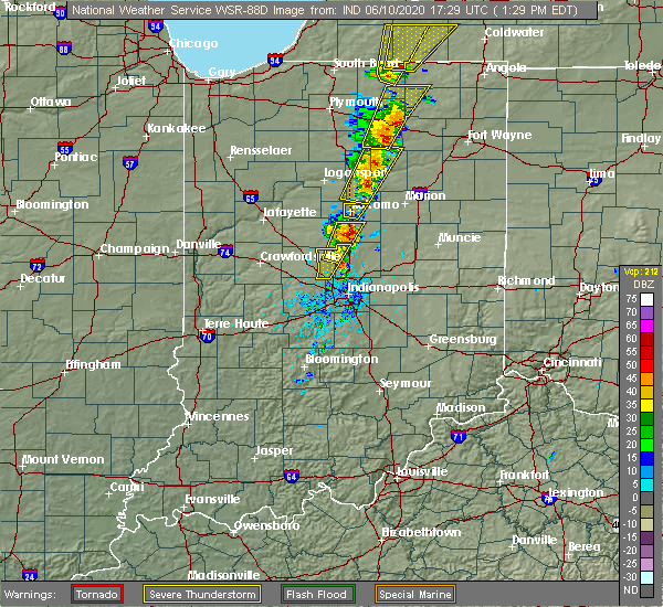 At 134 pm edt, a severe thunderstorm was located near windfall, or 7 miles south of kokomo, moving northeast at 65 mph (radar indicated). Hazards include 60 mph wind gusts. expect damage to roofs, siding, and trees At 134 pm edt, a severe thunderstorm was located near windfall, or 7 miles south of kokomo, moving northeast at 65 mph (radar indicated). Hazards include 60 mph wind gusts. expect damage to roofs, siding, and trees
|
| 6/19/2019 5:15 PM EDT |
 At 515 pm edt, a severe thunderstorm was located near windfall, or 12 miles west of fairmount, moving northeast at 15 mph (radar indicated). Hazards include 60 mph wind gusts. Expect damage to roofs, siding, and trees. Locations impacted include, elwood, tipton, windfall, greentown and sharpsville. At 515 pm edt, a severe thunderstorm was located near windfall, or 12 miles west of fairmount, moving northeast at 15 mph (radar indicated). Hazards include 60 mph wind gusts. Expect damage to roofs, siding, and trees. Locations impacted include, elwood, tipton, windfall, greentown and sharpsville.
|
| 6/19/2019 5:02 PM EDT |
 At 501 pm edt, a severe thunderstorm was located over windfall, or 11 miles southeast of kokomo, moving northeast at 20 mph (radar indicated). Hazards include 60 mph wind gusts. Expect damage to roofs, siding, and trees. Locations impacted include, elwood, tipton, windfall, greentown and sharpsville. At 501 pm edt, a severe thunderstorm was located over windfall, or 11 miles southeast of kokomo, moving northeast at 20 mph (radar indicated). Hazards include 60 mph wind gusts. Expect damage to roofs, siding, and trees. Locations impacted include, elwood, tipton, windfall, greentown and sharpsville.
|
| 6/19/2019 4:45 PM EDT |
 At 444 pm edt, a severe thunderstorm was located over tipton, or 14 miles south of kokomo, moving northeast at 20 mph (radar indicated). Hazards include 60 mph wind gusts. expect damage to roofs, siding, and trees At 444 pm edt, a severe thunderstorm was located over tipton, or 14 miles south of kokomo, moving northeast at 20 mph (radar indicated). Hazards include 60 mph wind gusts. expect damage to roofs, siding, and trees
|
| 6/5/2019 2:45 PM EDT |
 At 245 pm edt, severe thunderstorms were located along a line extending from 10 miles southwest of kokomo to near lafayette, moving southeast at 20 mph (radar indicated). Hazards include 60 mph wind gusts and quarter size hail. Hail damage to vehicles is expected. expect wind damage to roofs, siding, and trees. locations impacted include, lafayette, kokomo, frankfort, west lafayette, windfall, greentown, rossville, shadeland, dayton, mulberry, russiaville, sharpsville, burlington, michigantown, purdue university and indian heights. This includes interstate 65 between mile markers 159 and 174. At 245 pm edt, severe thunderstorms were located along a line extending from 10 miles southwest of kokomo to near lafayette, moving southeast at 20 mph (radar indicated). Hazards include 60 mph wind gusts and quarter size hail. Hail damage to vehicles is expected. expect wind damage to roofs, siding, and trees. locations impacted include, lafayette, kokomo, frankfort, west lafayette, windfall, greentown, rossville, shadeland, dayton, mulberry, russiaville, sharpsville, burlington, michigantown, purdue university and indian heights. This includes interstate 65 between mile markers 159 and 174.
|
| 6/5/2019 2:28 PM EDT |
 At 228 pm edt, severe thunderstorms were located along a line extending from 11 miles west of kokomo to 8 miles south of otterbein, moving east at 45 mph (radar indicated). Hazards include 60 mph wind gusts and quarter size hail. Hail damage to vehicles is expected. Expect wind damage to roofs, siding, and trees. At 228 pm edt, severe thunderstorms were located along a line extending from 11 miles west of kokomo to 8 miles south of otterbein, moving east at 45 mph (radar indicated). Hazards include 60 mph wind gusts and quarter size hail. Hail damage to vehicles is expected. Expect wind damage to roofs, siding, and trees.
|
| 5/28/2019 6:34 PM EDT |
 At 634 pm edt, a severe thunderstorm was located near windfall, or 10 miles southeast of kokomo, moving northeast at 45 mph (radar indicated). Hazards include 60 mph wind gusts and quarter size hail. Hail damage to vehicles is expected. Expect wind damage to roofs, siding, and trees. At 634 pm edt, a severe thunderstorm was located near windfall, or 10 miles southeast of kokomo, moving northeast at 45 mph (radar indicated). Hazards include 60 mph wind gusts and quarter size hail. Hail damage to vehicles is expected. Expect wind damage to roofs, siding, and trees.
|
| 5/28/2019 5:53 PM EDT |
 At 552 pm edt, a severe thunderstorm was located near swayzee, or 10 miles east of kokomo, moving east at 30 mph (radar indicated). Hazards include 60 mph wind gusts and quarter size hail. Hail damage to vehicles is expected. expect wind damage to roofs, siding, and trees. Locations impacted include, kokomo, greentown and indian heights. At 552 pm edt, a severe thunderstorm was located near swayzee, or 10 miles east of kokomo, moving east at 30 mph (radar indicated). Hazards include 60 mph wind gusts and quarter size hail. Hail damage to vehicles is expected. expect wind damage to roofs, siding, and trees. Locations impacted include, kokomo, greentown and indian heights.
|
| 5/28/2019 5:31 PM EDT |
 At 530 pm edt, a severe thunderstorm was located over kokomo, moving east at 30 mph (radar indicated). Hazards include 60 mph wind gusts and quarter size hail. Hail damage to vehicles is expected. Expect wind damage to roofs, siding, and trees. At 530 pm edt, a severe thunderstorm was located over kokomo, moving east at 30 mph (radar indicated). Hazards include 60 mph wind gusts and quarter size hail. Hail damage to vehicles is expected. Expect wind damage to roofs, siding, and trees.
|
| 5/28/2019 2:37 PM EDT |
 At 228 pm edt, a severe thunderstorm was located near windfall, or 8 miles east of kokomo, moving east at 30 mph (radar indicated). Hazards include 60 mph wind gusts and penny size hail. Expect damage to roofs, siding, and trees. Locations impacted include, greentown. At 228 pm edt, a severe thunderstorm was located near windfall, or 8 miles east of kokomo, moving east at 30 mph (radar indicated). Hazards include 60 mph wind gusts and penny size hail. Expect damage to roofs, siding, and trees. Locations impacted include, greentown.
|
| 5/28/2019 2:29 PM EDT |
 At 228 pm edt, a severe thunderstorm was located near windfall, or 8 miles east of kokomo, moving east at 30 mph (radar indicated). Hazards include 60 mph wind gusts and penny size hail. Expect damage to roofs, siding, and trees. Locations impacted include, greentown. At 228 pm edt, a severe thunderstorm was located near windfall, or 8 miles east of kokomo, moving east at 30 mph (radar indicated). Hazards include 60 mph wind gusts and penny size hail. Expect damage to roofs, siding, and trees. Locations impacted include, greentown.
|
| 5/28/2019 2:18 PM EDT |
 At 217 pm edt, a severe thunderstorm was located near kokomo, moving east at 30 mph (radar indicated). Hazards include 60 mph wind gusts and quarter size hail. Hail damage to vehicles is expected. Expect wind damage to roofs, siding, and trees. At 217 pm edt, a severe thunderstorm was located near kokomo, moving east at 30 mph (radar indicated). Hazards include 60 mph wind gusts and quarter size hail. Hail damage to vehicles is expected. Expect wind damage to roofs, siding, and trees.
|
| 5/26/2019 4:28 AM EDT |
 At 428 am edt, severe thunderstorms were located along a line extending from 7 miles south of walton to 11 miles west of tipton to 9 miles north of greencastle, moving east at 45 mph (radar indicated). Hazards include 60 mph wind gusts and nickel size hail. Expect damage to roofs, siding, and trees. locations impacted include, kokomo, frankfort, brownsburg, lebanon, zionsville, danville, tipton, windfall, westfield, pittsboro, whitestown, sheridan, greentown, flora, rossville, thorntown, russiaville, ladoga, jamestown and roachdale. this includes the following highways, interstate 65 between mile markers 128 and 155. Interstate 74 between mile markers 41 and 67. At 428 am edt, severe thunderstorms were located along a line extending from 7 miles south of walton to 11 miles west of tipton to 9 miles north of greencastle, moving east at 45 mph (radar indicated). Hazards include 60 mph wind gusts and nickel size hail. Expect damage to roofs, siding, and trees. locations impacted include, kokomo, frankfort, brownsburg, lebanon, zionsville, danville, tipton, windfall, westfield, pittsboro, whitestown, sheridan, greentown, flora, rossville, thorntown, russiaville, ladoga, jamestown and roachdale. this includes the following highways, interstate 65 between mile markers 128 and 155. Interstate 74 between mile markers 41 and 67.
|
| 5/26/2019 4:09 AM EDT |
 At 406 am edt, severe thunderstorms were located along a line extending from 8 miles southeast of delphi to near frankfort to 8 miles east of rockville, moving east at 45 mph (radar indicated). Hazards include 60 mph wind gusts and nickel size hail. expect damage to roofs, siding, and trees At 406 am edt, severe thunderstorms were located along a line extending from 8 miles southeast of delphi to near frankfort to 8 miles east of rockville, moving east at 45 mph (radar indicated). Hazards include 60 mph wind gusts and nickel size hail. expect damage to roofs, siding, and trees
|
| 5/23/2019 5:12 AM EDT |
 The severe thunderstorm warning for southeastern clinton, central howard, eastern boone, northwestern hamilton and tipton counties will expire at 515 am edt, the storms which prompted the warning have moved out of the area. therefore, the warning will be allowed to expire. however gusty winds and heavy rain are still possible with these thunderstorms. a severe thunderstorm watch remains in effect until 1000 am edt for central indiana. to report severe weather, contact your nearest law enforcement agency. they will relay your report to the national weather service indianapolis. The severe thunderstorm warning for southeastern clinton, central howard, eastern boone, northwestern hamilton and tipton counties will expire at 515 am edt, the storms which prompted the warning have moved out of the area. therefore, the warning will be allowed to expire. however gusty winds and heavy rain are still possible with these thunderstorms. a severe thunderstorm watch remains in effect until 1000 am edt for central indiana. to report severe weather, contact your nearest law enforcement agency. they will relay your report to the national weather service indianapolis.
|
| 5/23/2019 5:11 AM EDT |
 The severe thunderstorm warning for northeastern howard county will expire at 515 am edt, the storms which prompted the warning have moved out of the area. therefore, the warning will be allowed to expire. however gusty winds and heavy rain are still possible with these thunderstorms. a severe thunderstorm watch remains in effect until 1000 am edt for central indiana. to report severe weather, contact your nearest law enforcement agency. they will relay your report to the national weather service indianapolis. The severe thunderstorm warning for northeastern howard county will expire at 515 am edt, the storms which prompted the warning have moved out of the area. therefore, the warning will be allowed to expire. however gusty winds and heavy rain are still possible with these thunderstorms. a severe thunderstorm watch remains in effect until 1000 am edt for central indiana. to report severe weather, contact your nearest law enforcement agency. they will relay your report to the national weather service indianapolis.
|
| 5/23/2019 5:05 AM EDT |
 At 504 am edt, severe thunderstorms were located along a line extending from 7 miles east of kokomo to near brownsburg, moving east at 50 mph (radar indicated). Hazards include 60 mph wind gusts and penny size hail. Expect damage to roofs, siding, and trees. locations impacted include, kokomo, zionsville, tipton, windfall, whitestown, sheridan, sharpsville, kempton and indian heights. This includes interstate 65 between mile markers 128 and 137. At 504 am edt, severe thunderstorms were located along a line extending from 7 miles east of kokomo to near brownsburg, moving east at 50 mph (radar indicated). Hazards include 60 mph wind gusts and penny size hail. Expect damage to roofs, siding, and trees. locations impacted include, kokomo, zionsville, tipton, windfall, whitestown, sheridan, sharpsville, kempton and indian heights. This includes interstate 65 between mile markers 128 and 137.
|
| 5/23/2019 4:56 AM EDT |
 At 456 am edt, severe thunderstorms were located along a line extending from 8 miles southeast of bunker hill to 6 miles east of kokomo, moving east at 55 mph (radar indicated). Hazards include 60 mph wind gusts and penny size hail. Expect damage to roofs, siding, and trees. Locations impacted include, greentown. At 456 am edt, severe thunderstorms were located along a line extending from 8 miles southeast of bunker hill to 6 miles east of kokomo, moving east at 55 mph (radar indicated). Hazards include 60 mph wind gusts and penny size hail. Expect damage to roofs, siding, and trees. Locations impacted include, greentown.
|
| 5/23/2019 4:42 AM EDT |
 At 441 am edt, severe thunderstorms were located along a line extending from near grissom afb to 11 miles southwest of kokomo to 10 miles southwest of lebanon, moving northeast at 60 mph (radar indicated). Hazards include 70 mph wind gusts and penny size hail. Expect considerable tree damage. damage is likely to mobile homes, roofs, and outbuildings. locations impacted include, kokomo, frankfort, lebanon, zionsville, tipton, windfall, whitestown, sheridan, greentown, thorntown, russiaville, ladoga, jamestown, kirklin, colfax, sharpsville, burlington, advance, michigantown and new ross. this includes the following highways, interstate 65 between mile markers 128 and 158. Interstate 74 between mile markers 40 and 54. At 441 am edt, severe thunderstorms were located along a line extending from near grissom afb to 11 miles southwest of kokomo to 10 miles southwest of lebanon, moving northeast at 60 mph (radar indicated). Hazards include 70 mph wind gusts and penny size hail. Expect considerable tree damage. damage is likely to mobile homes, roofs, and outbuildings. locations impacted include, kokomo, frankfort, lebanon, zionsville, tipton, windfall, whitestown, sheridan, greentown, thorntown, russiaville, ladoga, jamestown, kirklin, colfax, sharpsville, burlington, advance, michigantown and new ross. this includes the following highways, interstate 65 between mile markers 128 and 158. Interstate 74 between mile markers 40 and 54.
|
| 5/23/2019 4:32 AM EDT |
 At 431 am edt, severe thunderstorms were located along a line extending from near walton to 6 miles southwest of frankfort, moving northeast at 60 mph (radar indicated). Hazards include 70 mph wind gusts and penny size hail. Expect considerable tree damage. Damage is likely to mobile homes, roofs, and outbuildings. At 431 am edt, severe thunderstorms were located along a line extending from near walton to 6 miles southwest of frankfort, moving northeast at 60 mph (radar indicated). Hazards include 70 mph wind gusts and penny size hail. Expect considerable tree damage. Damage is likely to mobile homes, roofs, and outbuildings.
|
| 5/23/2019 4:13 AM EDT |
 The national weather service in indianapolis has issued a * severe thunderstorm warning for. carroll county in north central indiana. southeastern tippecanoe county in west central indiana. clinton county in central indiana. Howard county in central indiana. The national weather service in indianapolis has issued a * severe thunderstorm warning for. carroll county in north central indiana. southeastern tippecanoe county in west central indiana. clinton county in central indiana. Howard county in central indiana.
|
| 5/19/2019 6:07 PM EDT |
 At 607 pm edt, severe thunderstorms were located along a line extending from near kokomo to near windfall to near tipton, moving east at 45 mph (radar indicated). Hazards include 60 mph wind gusts and quarter size hail. Hail damage to vehicles is expected. expect wind damage to roofs, siding, and trees. Locations impacted include, kokomo, elwood, alexandria, tipton, windfall, greentown, summitville, atlanta and orestes. At 607 pm edt, severe thunderstorms were located along a line extending from near kokomo to near windfall to near tipton, moving east at 45 mph (radar indicated). Hazards include 60 mph wind gusts and quarter size hail. Hail damage to vehicles is expected. expect wind damage to roofs, siding, and trees. Locations impacted include, kokomo, elwood, alexandria, tipton, windfall, greentown, summitville, atlanta and orestes.
|
| 5/19/2019 5:53 PM EDT |
 At 552 pm edt, severe thunderstorms were located along a line extending from 11 miles northeast of frankfort to 9 miles northwest of tipton, moving east at 45 mph. this storm has weak rotation in southwest howard county (radar indicated). Hazards include 60 mph wind gusts and quarter size hail. Hail damage to vehicles is expected. Expect wind damage to roofs, siding, and trees. At 552 pm edt, severe thunderstorms were located along a line extending from 11 miles northeast of frankfort to 9 miles northwest of tipton, moving east at 45 mph. this storm has weak rotation in southwest howard county (radar indicated). Hazards include 60 mph wind gusts and quarter size hail. Hail damage to vehicles is expected. Expect wind damage to roofs, siding, and trees.
|
| 5/19/2019 5:47 PM EDT |
 At 546 pm edt, severe thunderstorms were located along a line extending from near bunker hill to 9 miles east of frankfort, moving east at 40 mph. this storm is showing weak rotation in northeastern clinton county (public). Hazards include 60 mph wind gusts and quarter size hail. Hail damage to vehicles is expected. expect wind damage to roofs, siding, and trees. Locations impacted include, kokomo, greentown, russiaville, sharpsville, michigantown and indian heights. At 546 pm edt, severe thunderstorms were located along a line extending from near bunker hill to 9 miles east of frankfort, moving east at 40 mph. this storm is showing weak rotation in northeastern clinton county (public). Hazards include 60 mph wind gusts and quarter size hail. Hail damage to vehicles is expected. expect wind damage to roofs, siding, and trees. Locations impacted include, kokomo, greentown, russiaville, sharpsville, michigantown and indian heights.
|
| 5/19/2019 5:41 PM EDT |
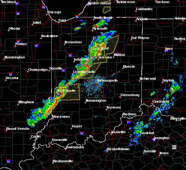 At 540 pm edt, severe thunderstorms were located along a line extending from near grissom afb to near frankfort, moving east at 40 mph. this storm has a history of producing 60 mph winds (public). Hazards include 60 mph wind gusts and quarter size hail. Hail damage to vehicles is expected. expect wind damage to roofs, siding, and trees. Locations impacted include, kokomo, frankfort, greentown, russiaville, sharpsville, michigantown and indian heights. At 540 pm edt, severe thunderstorms were located along a line extending from near grissom afb to near frankfort, moving east at 40 mph. this storm has a history of producing 60 mph winds (public). Hazards include 60 mph wind gusts and quarter size hail. Hail damage to vehicles is expected. expect wind damage to roofs, siding, and trees. Locations impacted include, kokomo, frankfort, greentown, russiaville, sharpsville, michigantown and indian heights.
|
| 5/19/2019 5:22 PM EDT |
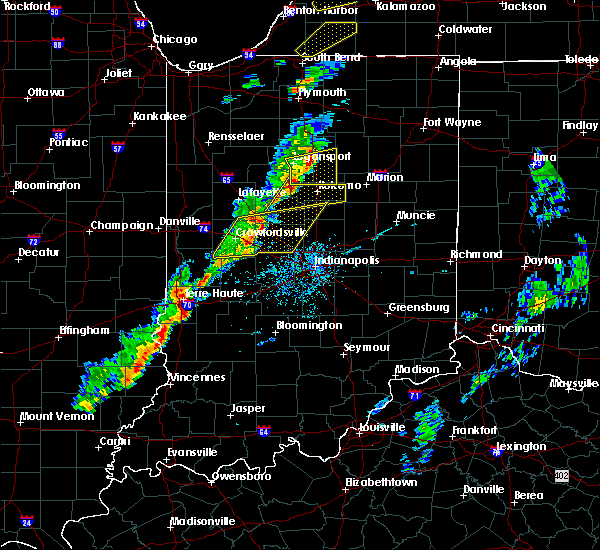 The national weather service in indianapolis has issued a * severe thunderstorm warning for. southeastern carroll county in north central indiana. northern clinton county in central indiana. howard county in central indiana. Northern tipton county in central indiana. The national weather service in indianapolis has issued a * severe thunderstorm warning for. southeastern carroll county in north central indiana. northern clinton county in central indiana. howard county in central indiana. Northern tipton county in central indiana.
|
| 4/7/2019 11:05 PM EDT |
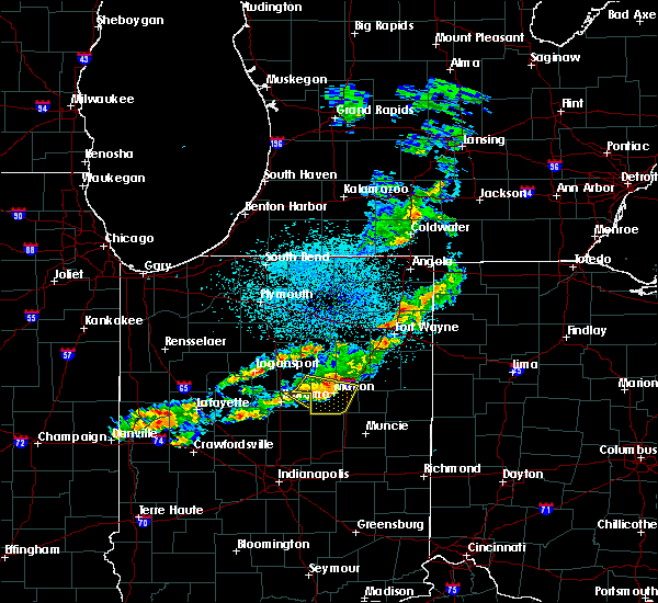 The severe thunderstorm warning for northeastern howard county will expire at 1115 pm edt, the storm which prompted the warning has moved out of the area. therefore, the warning will be allowed to expire. The severe thunderstorm warning for northeastern howard county will expire at 1115 pm edt, the storm which prompted the warning has moved out of the area. therefore, the warning will be allowed to expire.
|
| 4/7/2019 10:52 PM EDT |
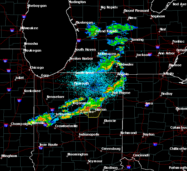 At 1052 pm edt, a severe thunderstorm was located near swayzee, or 11 miles northeast of kokomo, moving east at 50 mph (radar indicated). Hazards include 60 mph wind gusts. expect damage to roofs, siding, and trees At 1052 pm edt, a severe thunderstorm was located near swayzee, or 11 miles northeast of kokomo, moving east at 50 mph (radar indicated). Hazards include 60 mph wind gusts. expect damage to roofs, siding, and trees
|
| 7/23/2017 5:12 PM EDT |
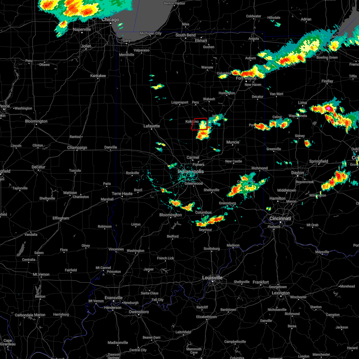 The tornado warning for eastern howard county will expire at 515 pm edt, the storm which prompted the warning has weakened below severe limits, and no longer appears capable of producing a tornado. therefore the warning will be allowed to expire. The tornado warning for eastern howard county will expire at 515 pm edt, the storm which prompted the warning has weakened below severe limits, and no longer appears capable of producing a tornado. therefore the warning will be allowed to expire.
|
| 7/23/2017 5:02 PM EDT |
 At 502 pm edt, a severe thunderstorm capable of producing a tornado was located near kokomo, moving east at 40 mph (radar indicated rotation). Hazards include tornado. Flying debris will be dangerous to those caught without shelter. mobile homes will be damaged or destroyed. damage to roofs, windows, and vehicles will occur. tree damage is likely. Locations impacted include, kokomo, greentown and indian heights. At 502 pm edt, a severe thunderstorm capable of producing a tornado was located near kokomo, moving east at 40 mph (radar indicated rotation). Hazards include tornado. Flying debris will be dangerous to those caught without shelter. mobile homes will be damaged or destroyed. damage to roofs, windows, and vehicles will occur. tree damage is likely. Locations impacted include, kokomo, greentown and indian heights.
|
| 7/23/2017 4:46 PM EDT |
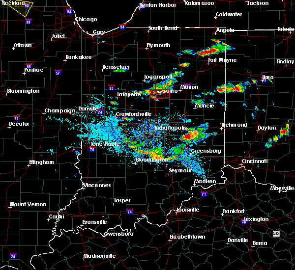 At 446 pm edt, a severe thunderstorm capable of producing a tornado was located over kokomo, moving east at 50 mph (radar indicated rotation). Hazards include tornado. Flying debris will be dangerous to those caught without shelter. mobile homes will be damaged or destroyed. damage to roofs, windows, and vehicles will occur. tree damage is likely. This dangerous storm will be near, greentown around 455 pm edt. At 446 pm edt, a severe thunderstorm capable of producing a tornado was located over kokomo, moving east at 50 mph (radar indicated rotation). Hazards include tornado. Flying debris will be dangerous to those caught without shelter. mobile homes will be damaged or destroyed. damage to roofs, windows, and vehicles will occur. tree damage is likely. This dangerous storm will be near, greentown around 455 pm edt.
|
| 7/10/2017 9:38 PM EDT |
 The tornado warning for southeastern howard county will expire at 945 pm edt, the storm which prompted the warning has weakened below severe limits, and no longer appears capable of producing a tornado. therefore the warning will be allowed to expire. however heavy rain is still possible with this thunderstorm. a severe thunderstorm watch remains in effect until midnight edt for central indiana. The tornado warning for southeastern howard county will expire at 945 pm edt, the storm which prompted the warning has weakened below severe limits, and no longer appears capable of producing a tornado. therefore the warning will be allowed to expire. however heavy rain is still possible with this thunderstorm. a severe thunderstorm watch remains in effect until midnight edt for central indiana.
|
| 7/10/2017 9:30 PM EDT |
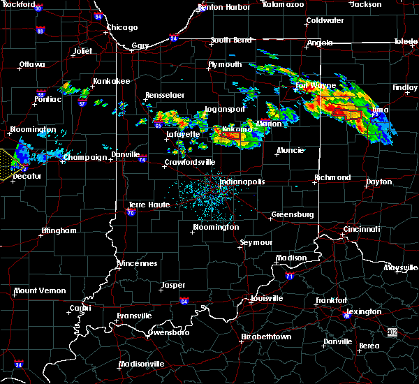 At 929 pm edt, a severe thunderstorm capable of producing a tornado was located near kokomo, moving east at 30 mph (weather spotters reported a funnel cloud). Hazards include tornado and quarter size hail. Flying debris will be dangerous to those caught without shelter. mobile homes will be damaged or destroyed. damage to roofs, windows, and vehicles will occur. tree damage is likely. This dangerous storm will be near, greentown around 940 pm edt. At 929 pm edt, a severe thunderstorm capable of producing a tornado was located near kokomo, moving east at 30 mph (weather spotters reported a funnel cloud). Hazards include tornado and quarter size hail. Flying debris will be dangerous to those caught without shelter. mobile homes will be damaged or destroyed. damage to roofs, windows, and vehicles will occur. tree damage is likely. This dangerous storm will be near, greentown around 940 pm edt.
|
| 7/10/2017 9:19 PM EDT |
 At 919 pm edt, a severe thunderstorm capable of producing a tornado was located over kokomo, moving east at 20 mph (weather spotters reported a funnel cloud). Hazards include tornado and quarter size hail. Flying debris will be dangerous to those caught without shelter. mobile homes will be damaged or destroyed. damage to roofs, windows, and vehicles will occur. tree damage is likely. This dangerous storm will be near, greentown around 945 pm edt. At 919 pm edt, a severe thunderstorm capable of producing a tornado was located over kokomo, moving east at 20 mph (weather spotters reported a funnel cloud). Hazards include tornado and quarter size hail. Flying debris will be dangerous to those caught without shelter. mobile homes will be damaged or destroyed. damage to roofs, windows, and vehicles will occur. tree damage is likely. This dangerous storm will be near, greentown around 945 pm edt.
|
| 7/10/2017 9:14 PM EDT |
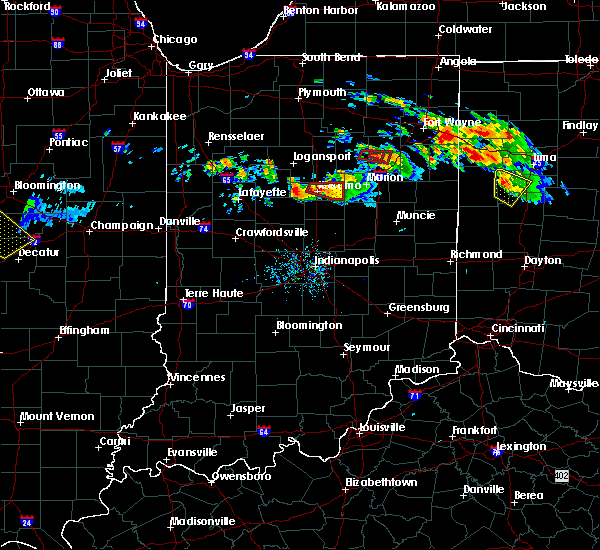 At 914 pm edt, a severe thunderstorm capable of producing a tornado was located over kokomo, moving east at 20 mph (weather spotters reported a funnel cloud). Hazards include tornado and quarter size hail. Flying debris will be dangerous to those caught without shelter. mobile homes will be damaged or destroyed. damage to roofs, windows, and vehicles will occur. tree damage is likely. This dangerous storm will be near, greentown around 945 pm edt. At 914 pm edt, a severe thunderstorm capable of producing a tornado was located over kokomo, moving east at 20 mph (weather spotters reported a funnel cloud). Hazards include tornado and quarter size hail. Flying debris will be dangerous to those caught without shelter. mobile homes will be damaged or destroyed. damage to roofs, windows, and vehicles will occur. tree damage is likely. This dangerous storm will be near, greentown around 945 pm edt.
|
| 7/10/2017 9:09 PM EDT |
 At 909 pm edt, a severe thunderstorm capable of producing a tornado was located over kokomo, moving east at 20 mph (radar indicated rotation). Hazards include tornado and quarter size hail. Flying debris will be dangerous to those caught without shelter. mobile homes will be damaged or destroyed. damage to roofs, windows, and vehicles will occur. tree damage is likely. this dangerous storm will be near, kokomo around 915 pm edt. Greentown around 945 pm edt. At 909 pm edt, a severe thunderstorm capable of producing a tornado was located over kokomo, moving east at 20 mph (radar indicated rotation). Hazards include tornado and quarter size hail. Flying debris will be dangerous to those caught without shelter. mobile homes will be damaged or destroyed. damage to roofs, windows, and vehicles will occur. tree damage is likely. this dangerous storm will be near, kokomo around 915 pm edt. Greentown around 945 pm edt.
|
| 7/10/2017 9:05 PM EDT |
 At 905 pm edt, a severe thunderstorm capable of producing a tornado was located near kokomo, moving east at 30 mph (radar indicated rotation). Hazards include tornado and quarter size hail. Flying debris will be dangerous to those caught without shelter. mobile homes will be damaged or destroyed. damage to roofs, windows, and vehicles will occur. tree damage is likely. this dangerous storm will be near, kokomo around 910 pm edt. Greentown around 930 pm edt. At 905 pm edt, a severe thunderstorm capable of producing a tornado was located near kokomo, moving east at 30 mph (radar indicated rotation). Hazards include tornado and quarter size hail. Flying debris will be dangerous to those caught without shelter. mobile homes will be damaged or destroyed. damage to roofs, windows, and vehicles will occur. tree damage is likely. this dangerous storm will be near, kokomo around 910 pm edt. Greentown around 930 pm edt.
|
| 7/10/2017 8:59 PM EDT |
 At 859 pm edt, a severe thunderstorm capable of producing a tornado was located near kokomo, moving east at 35 mph (radar indicated rotation). Hazards include tornado and quarter size hail. Flying debris will be dangerous to those caught without shelter. mobile homes will be damaged or destroyed. damage to roofs, windows, and vehicles will occur. tree damage is likely. this dangerous storm will be near, kokomo around 910 pm edt. greentown around 925 pm edt. Converse around 930 pm edt. At 859 pm edt, a severe thunderstorm capable of producing a tornado was located near kokomo, moving east at 35 mph (radar indicated rotation). Hazards include tornado and quarter size hail. Flying debris will be dangerous to those caught without shelter. mobile homes will be damaged or destroyed. damage to roofs, windows, and vehicles will occur. tree damage is likely. this dangerous storm will be near, kokomo around 910 pm edt. greentown around 925 pm edt. Converse around 930 pm edt.
|
| 7/7/2017 3:59 PM EDT |
 The national weather service in indianapolis has issued a * severe thunderstorm warning for. northern madison county in central indiana. southern clinton county in central indiana. southeastern howard county in central indiana. Northeastern boone county in central indiana. The national weather service in indianapolis has issued a * severe thunderstorm warning for. northern madison county in central indiana. southern clinton county in central indiana. southeastern howard county in central indiana. Northeastern boone county in central indiana.
|
| 7/7/2017 3:19 PM EDT |
 At 319 pm edt, a severe thunderstorm was located 7 miles west of swayzee, or 8 miles east of kokomo, moving east at 35 mph (radar indicated). Hazards include 60 mph wind gusts and quarter size hail. Hail damage to vehicles is expected. expect wind damage to roofs, siding, and trees. Locations impacted include, kokomo, greentown, russiaville and indian heights. At 319 pm edt, a severe thunderstorm was located 7 miles west of swayzee, or 8 miles east of kokomo, moving east at 35 mph (radar indicated). Hazards include 60 mph wind gusts and quarter size hail. Hail damage to vehicles is expected. expect wind damage to roofs, siding, and trees. Locations impacted include, kokomo, greentown, russiaville and indian heights.
|
| 7/7/2017 3:01 PM EDT |
 At 300 pm edt, a severe thunderstorm was located near kokomo, moving east at 35 mph (radar indicated). Hazards include ping pong ball size hail and 60 mph wind gusts. People and animals outdoors will be injured. expect hail damage to roofs, siding, windows, and vehicles. Expect wind damage to roofs, siding, and trees. At 300 pm edt, a severe thunderstorm was located near kokomo, moving east at 35 mph (radar indicated). Hazards include ping pong ball size hail and 60 mph wind gusts. People and animals outdoors will be injured. expect hail damage to roofs, siding, windows, and vehicles. Expect wind damage to roofs, siding, and trees.
|
| 4/26/2017 8:10 PM EDT |
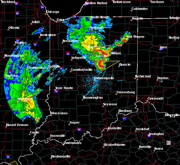 The severe thunderstorm warning for howard and north central tipton counties will expire at 815 pm edt, the storm which prompted the warning has moved out of the area. therefore the warning will be allowed to expire. a severe thunderstorm watch remains in effect until midnight edt for central indiana. The severe thunderstorm warning for howard and north central tipton counties will expire at 815 pm edt, the storm which prompted the warning has moved out of the area. therefore the warning will be allowed to expire. a severe thunderstorm watch remains in effect until midnight edt for central indiana.
|
| 4/26/2017 8:07 PM EDT |
 At 806 pm edt, a severe thunderstorm was located 7 miles southeast of tipton, or 15 miles northwest of anderson, moving northeast at 55 mph (radar indicated). Hazards include 60 mph wind gusts and quarter size hail. Hail damage to vehicles is expected. Expect wind damage to roofs, siding, and trees. At 806 pm edt, a severe thunderstorm was located 7 miles southeast of tipton, or 15 miles northwest of anderson, moving northeast at 55 mph (radar indicated). Hazards include 60 mph wind gusts and quarter size hail. Hail damage to vehicles is expected. Expect wind damage to roofs, siding, and trees.
|
| 4/26/2017 8:01 PM EDT | Old barn blown into road - clean up in process as of 8:32 p in howard county IN, 5.1 miles W of Greentown, IN |
| 4/26/2017 7:56 PM EDT | Numerous trees down across greentow in howard county IN, 0.4 miles SW of Greentown, IN |
| 4/26/2017 7:49 PM EDT |
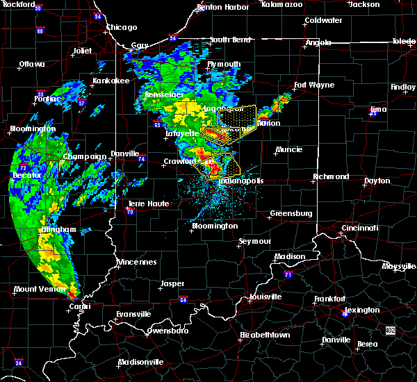 At 749 pm edt, a severe thunderstorm was located over kokomo, moving northeast at 50 mph (trained weather spotters). Hazards include golf ball size hail and 70 mph wind gusts. People and animals outdoors will be injured. expect hail damage to roofs, siding, windows, and vehicles. expect considerable tree damage. Wind damage is also likely to mobile homes, roofs, and outbuildings. At 749 pm edt, a severe thunderstorm was located over kokomo, moving northeast at 50 mph (trained weather spotters). Hazards include golf ball size hail and 70 mph wind gusts. People and animals outdoors will be injured. expect hail damage to roofs, siding, windows, and vehicles. expect considerable tree damage. Wind damage is also likely to mobile homes, roofs, and outbuildings.
|
| 3/30/2017 4:24 PM EDT |
 The severe thunderstorm warning for northeastern clinton and howard counties will expire at 430 pm edt, the storm which prompted the warning has weakened below severe limits, and no longer poses an immediate threat to life or property. therefore, the warning will be allowed to expire. however small hail and heavy rain are still possible with this thunderstorm. a tornado watch remains in effect until 1000 pm edt for central and north central indiana. The severe thunderstorm warning for northeastern clinton and howard counties will expire at 430 pm edt, the storm which prompted the warning has weakened below severe limits, and no longer poses an immediate threat to life or property. therefore, the warning will be allowed to expire. however small hail and heavy rain are still possible with this thunderstorm. a tornado watch remains in effect until 1000 pm edt for central and north central indiana.
|
| 3/30/2017 3:58 PM EDT |
 At 357 pm edt, a severe thunderstorm was located 11 miles northeast of frankfort, moving northeast at 35 mph (radar indicated). Hazards include 60 mph wind gusts and quarter size hail. Hail damage to vehicles is expected. Expect wind damage to roofs, siding, and trees. At 357 pm edt, a severe thunderstorm was located 11 miles northeast of frankfort, moving northeast at 35 mph (radar indicated). Hazards include 60 mph wind gusts and quarter size hail. Hail damage to vehicles is expected. Expect wind damage to roofs, siding, and trees.
|
| 3/7/2017 4:46 AM EST |
 At 445 am est, a severe thunderstorm was located over kokomo, moving east at 55 mph (radar indicated). Hazards include 60 mph wind gusts and penny size hail. expect damage to roofs, siding, and trees At 445 am est, a severe thunderstorm was located over kokomo, moving east at 55 mph (radar indicated). Hazards include 60 mph wind gusts and penny size hail. expect damage to roofs, siding, and trees
|
| 8/24/2016 7:43 PM EDT |
 The tornado warning for southeastern howard county will expire at 745 pm edt, the storm which prompted the warning has weakened below severe limits, and no longer appears capable of producing a tornado. therefore, the warning will be allowed to expire. a tornado watch remains in effect until 900 pm edt for central indiana. to report severe weather, contact your nearest law enforcement agency. they will relay your report to the national weather service indianapolis. The tornado warning for southeastern howard county will expire at 745 pm edt, the storm which prompted the warning has weakened below severe limits, and no longer appears capable of producing a tornado. therefore, the warning will be allowed to expire. a tornado watch remains in effect until 900 pm edt for central indiana. to report severe weather, contact your nearest law enforcement agency. they will relay your report to the national weather service indianapolis.
|
| 8/24/2016 7:35 PM EDT |
 At 735 pm edt, a severe thunderstorm capable of producing a tornado was located near windfall city, or 7 miles east of kokomo, moving northeast at 30 mph (radar indicated rotation). Hazards include tornado. Flying debris will be dangerous to those caught without shelter. mobile homes will be damaged or destroyed. damage to roofs, windows, and vehicles will occur. tree damage is likely. Locations impacted include, greentown. At 735 pm edt, a severe thunderstorm capable of producing a tornado was located near windfall city, or 7 miles east of kokomo, moving northeast at 30 mph (radar indicated rotation). Hazards include tornado. Flying debris will be dangerous to those caught without shelter. mobile homes will be damaged or destroyed. damage to roofs, windows, and vehicles will occur. tree damage is likely. Locations impacted include, greentown.
|
| 8/24/2016 7:27 PM EDT |
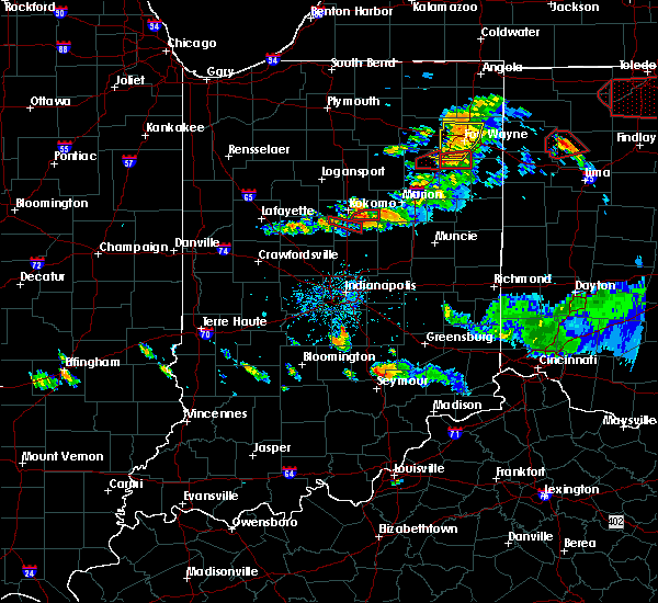 At 726 pm edt, a confirmed large and extremely dangerous tornado was located near kokomo, moving east at 25 mph. this is a particularly dangerous situation. take cover now! (law enforcement confirmed tornado). Hazards include damaging tornado. You are in a life-threatening situation. flying debris may be deadly to those caught without shelter. mobile homes will be destroyed. considerable damage to homes, businesses, and vehicles is likely and complete destruction is possible. Locations impacted include, greentown. At 726 pm edt, a confirmed large and extremely dangerous tornado was located near kokomo, moving east at 25 mph. this is a particularly dangerous situation. take cover now! (law enforcement confirmed tornado). Hazards include damaging tornado. You are in a life-threatening situation. flying debris may be deadly to those caught without shelter. mobile homes will be destroyed. considerable damage to homes, businesses, and vehicles is likely and complete destruction is possible. Locations impacted include, greentown.
|
| 8/24/2016 7:21 PM EDT |
 At 721 pm edt, a confirmed large and extremely dangerous tornado was located near kokomo, moving east at 25 mph. this is a particularly dangerous situation. take cover now! (law enforcement confirmed tornado). Hazards include damaging tornado. You are in a life-threatening situation. flying debris may be deadly to those caught without shelter. mobile homes will be destroyed. considerable damage to homes, businesses, and vehicles is likely and complete destruction is possible. Locations impacted include, kokomo, windfall city, greentown, sharpsville and indian heights. At 721 pm edt, a confirmed large and extremely dangerous tornado was located near kokomo, moving east at 25 mph. this is a particularly dangerous situation. take cover now! (law enforcement confirmed tornado). Hazards include damaging tornado. You are in a life-threatening situation. flying debris may be deadly to those caught without shelter. mobile homes will be destroyed. considerable damage to homes, businesses, and vehicles is likely and complete destruction is possible. Locations impacted include, kokomo, windfall city, greentown, sharpsville and indian heights.
|
| 8/24/2016 7:18 PM EDT |
 At 718 pm edt, a severe thunderstorm capable of producing a tornado was located near windfall city, or 8 miles east of kokomo, moving east at 20 mph (radar indicated rotation). Hazards include tornado. Flying debris will be dangerous to those caught without shelter. mobile homes will be damaged or destroyed. damage to roofs, windows, and vehicles will occur. tree damage is likely. This tornadic thunderstorm will remain over mainly rural areas of northeastern tipton and southeastern howard counties. At 718 pm edt, a severe thunderstorm capable of producing a tornado was located near windfall city, or 8 miles east of kokomo, moving east at 20 mph (radar indicated rotation). Hazards include tornado. Flying debris will be dangerous to those caught without shelter. mobile homes will be damaged or destroyed. damage to roofs, windows, and vehicles will occur. tree damage is likely. This tornadic thunderstorm will remain over mainly rural areas of northeastern tipton and southeastern howard counties.
|
| 8/24/2016 7:08 PM EDT |
 At 652 pm edt, a severe thunderstorm capable of producing a tornado was located over kokomo, moving east at 25 mph (weather spotters reported funnel cloud). Hazards include tornado. Flying debris will be dangerous to those caught without shelter. mobile homes will be damaged or destroyed. damage to roofs, windows, and vehicles will occur. tree damage is likely. this dangerous storm will be near, sharpsville around 705 pm edt. greentown around 715 pm edt. windfall city and windfall around 720 pm edt. Rigdon around 745 pm edt. At 652 pm edt, a severe thunderstorm capable of producing a tornado was located over kokomo, moving east at 25 mph (weather spotters reported funnel cloud). Hazards include tornado. Flying debris will be dangerous to those caught without shelter. mobile homes will be damaged or destroyed. damage to roofs, windows, and vehicles will occur. tree damage is likely. this dangerous storm will be near, sharpsville around 705 pm edt. greentown around 715 pm edt. windfall city and windfall around 720 pm edt. Rigdon around 745 pm edt.
|
| 8/24/2016 6:53 PM EDT |
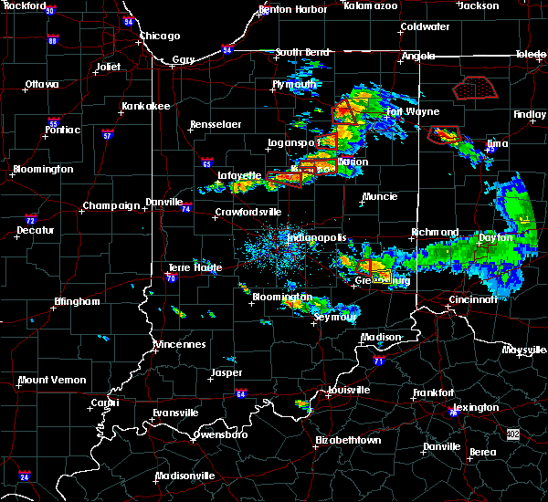 At 652 pm edt, a severe thunderstorm capable of producing a tornado was located over kokomo, moving east at 25 mph (weather spotters reported funnel cloud). Hazards include tornado. Flying debris will be dangerous to those caught without shelter. mobile homes will be damaged or destroyed. damage to roofs, windows, and vehicles will occur. tree damage is likely. this dangerous storm will be near, sharpsville around 705 pm edt. greentown around 715 pm edt. windfall city and windfall around 720 pm edt. Rigdon around 745 pm edt. At 652 pm edt, a severe thunderstorm capable of producing a tornado was located over kokomo, moving east at 25 mph (weather spotters reported funnel cloud). Hazards include tornado. Flying debris will be dangerous to those caught without shelter. mobile homes will be damaged or destroyed. damage to roofs, windows, and vehicles will occur. tree damage is likely. this dangerous storm will be near, sharpsville around 705 pm edt. greentown around 715 pm edt. windfall city and windfall around 720 pm edt. Rigdon around 745 pm edt.
|
| 8/24/2016 6:31 PM EDT | Trees down and corn field damage. largest tree was approximately 1.5 to 2 feet in diameter. located near county roads 700 east and 200 north. time estimate in howard county IN, 2.1 miles SE of Greentown, IN |
| 8/24/2016 6:00 PM EDT |
 At 600 pm edt, a confirmed large and extremely dangerous tornado was located 8 miles south of walton, or 8 miles northwest of kokomo, moving east at 30 mph. this is a particularly dangerous situation. take cover now! (law enforcement confirmed tornado). Hazards include damaging tornado. You are in a life-threatening situation. flying debris may be deadly to those caught without shelter. mobile homes will be destroyed. considerable damage to homes, businesses, and vehicles is likely and complete destruction is possible. the tornado will be near, kokomo around 615 pm edt. Greentown around 630 pm edt. At 600 pm edt, a confirmed large and extremely dangerous tornado was located 8 miles south of walton, or 8 miles northwest of kokomo, moving east at 30 mph. this is a particularly dangerous situation. take cover now! (law enforcement confirmed tornado). Hazards include damaging tornado. You are in a life-threatening situation. flying debris may be deadly to those caught without shelter. mobile homes will be destroyed. considerable damage to homes, businesses, and vehicles is likely and complete destruction is possible. the tornado will be near, kokomo around 615 pm edt. Greentown around 630 pm edt.
|
| 8/24/2016 3:45 PM EDT |
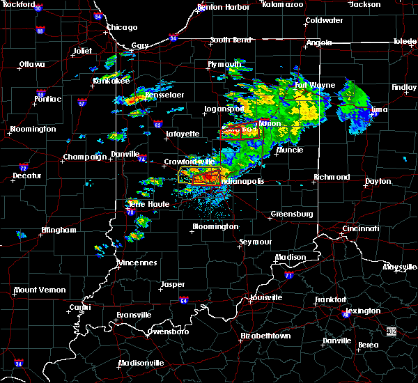 At 342 pm edt, a confirmed large and destructive tornado was located over northeast howard county, or 12 miles east of kokomo, moving east at 25 mph. a new circulation had formed just north of greentown as well. tornado emergency for northeast howard county. this is a particularly dangerous situation. take cover now! (law enforcement confirmed tornado). Hazards include deadly tornado. You are in a life-threatening situation. flying debris may be deadly to those caught without shelter. mobile homes will be destroyed. considerable damage to homes, businesses, and vehicles is likely and complete destruction is possible. Locations impacted include, greentown, plevna and sycamore. At 342 pm edt, a confirmed large and destructive tornado was located over northeast howard county, or 12 miles east of kokomo, moving east at 25 mph. a new circulation had formed just north of greentown as well. tornado emergency for northeast howard county. this is a particularly dangerous situation. take cover now! (law enforcement confirmed tornado). Hazards include deadly tornado. You are in a life-threatening situation. flying debris may be deadly to those caught without shelter. mobile homes will be destroyed. considerable damage to homes, businesses, and vehicles is likely and complete destruction is possible. Locations impacted include, greentown, plevna and sycamore.
|
| 8/24/2016 3:37 PM EDT |
 At 335 pm edt, a confirmed large and destructive tornado was located 7 miles west of swayzee, or 9 miles east of kokomo, moving east at 30 mph. the tornado had lifted briefly at 335 pm near the kokomo reservoir. tornado emergency for northeast howard county. this is a particularly dangerous situation. take cover now! (law enforcement confirmed tornado). Hazards include deadly tornado. You are in a life-threatening situation. flying debris may be deadly to those caught without shelter. mobile homes will be destroyed. considerable damage to homes, businesses, and vehicles is likely and complete destruction is possible. this tornadic thunderstorm will remain over mainly rural areas of eastern howard county, including the towns of sycamore and plevna. The tornado should remain north of greentown. At 335 pm edt, a confirmed large and destructive tornado was located 7 miles west of swayzee, or 9 miles east of kokomo, moving east at 30 mph. the tornado had lifted briefly at 335 pm near the kokomo reservoir. tornado emergency for northeast howard county. this is a particularly dangerous situation. take cover now! (law enforcement confirmed tornado). Hazards include deadly tornado. You are in a life-threatening situation. flying debris may be deadly to those caught without shelter. mobile homes will be destroyed. considerable damage to homes, businesses, and vehicles is likely and complete destruction is possible. this tornadic thunderstorm will remain over mainly rural areas of eastern howard county, including the towns of sycamore and plevna. The tornado should remain north of greentown.
|
| 8/24/2016 3:32 PM EDT |
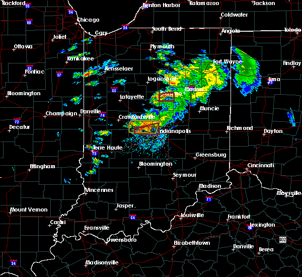 At 331 pm edt, a confirmed large and destructive tornado was located on the east side of kokomo, moving east at 30 mph. the tornado was spotted at 330 pm near the intersection of county road 300e and us route 35 on the east side of kokomo. tornado emergency for kokomo. this is a particularly dangerous situation. take cover now! (law enforcement confirmed tornado). Hazards include deadly tornado. You are in a life-threatening situation. flying debris may be deadly to those caught without shelter. mobile homes will be destroyed. considerable damage to homes, businesses, and vehicles is likely and complete destruction is possible. The tornado will be near, greentown around 335 pm edt. At 331 pm edt, a confirmed large and destructive tornado was located on the east side of kokomo, moving east at 30 mph. the tornado was spotted at 330 pm near the intersection of county road 300e and us route 35 on the east side of kokomo. tornado emergency for kokomo. this is a particularly dangerous situation. take cover now! (law enforcement confirmed tornado). Hazards include deadly tornado. You are in a life-threatening situation. flying debris may be deadly to those caught without shelter. mobile homes will be destroyed. considerable damage to homes, businesses, and vehicles is likely and complete destruction is possible. The tornado will be near, greentown around 335 pm edt.
|
| 8/24/2016 3:29 PM EDT |
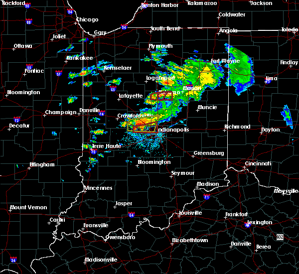 At 328 pm edt, a confirmed large and destructive tornado was located near kokomo, moving east at 30 mph. tornado emergency for kokomo. this is a particularly dangerous situation. take cover now! (law enforcement confirmed tornado). Hazards include deadly tornado. You are in a life-threatening situation. flying debris may be deadly to those caught without shelter. mobile homes will be destroyed. considerable damage to homes, businesses, and vehicles is likely and complete destruction is possible. The tornado will be near, greentown around 335 pm edt. At 328 pm edt, a confirmed large and destructive tornado was located near kokomo, moving east at 30 mph. tornado emergency for kokomo. this is a particularly dangerous situation. take cover now! (law enforcement confirmed tornado). Hazards include deadly tornado. You are in a life-threatening situation. flying debris may be deadly to those caught without shelter. mobile homes will be destroyed. considerable damage to homes, businesses, and vehicles is likely and complete destruction is possible. The tornado will be near, greentown around 335 pm edt.
|
| 8/24/2016 3:25 PM EDT |
 At 324 pm edt, a confirmed large and destructive tornado was located over kokomo, moving east at 30 mph. tornado emergency for kokomo. this is a particularly dangerous situation. take cover now! (law enforcement confirmed tornado). Hazards include deadly tornado. You are in a life-threatening situation. flying debris may be deadly to those caught without shelter. mobile homes will be destroyed. considerable damage to homes, businesses, and vehicles is likely and complete destruction is possible. The tornado will be near, greentown around 340 pm edt. At 324 pm edt, a confirmed large and destructive tornado was located over kokomo, moving east at 30 mph. tornado emergency for kokomo. this is a particularly dangerous situation. take cover now! (law enforcement confirmed tornado). Hazards include deadly tornado. You are in a life-threatening situation. flying debris may be deadly to those caught without shelter. mobile homes will be destroyed. considerable damage to homes, businesses, and vehicles is likely and complete destruction is possible. The tornado will be near, greentown around 340 pm edt.
|
| 8/24/2016 3:22 PM EDT |
 At 322 pm edt, a confirmed large and extremely dangerous tornado was located over kokomo, moving east at 30 mph. this is a particularly dangerous situation. take cover now! (law enforcement confirmed tornado). Hazards include damaging tornado. You are in a life-threatening situation. flying debris may be deadly to those caught without shelter. mobile homes will be destroyed. considerable damage to homes, businesses, and vehicles is likely and complete destruction is possible. the tornado will be near, greentown around 345 pm edt. Converse around 350 pm edt. At 322 pm edt, a confirmed large and extremely dangerous tornado was located over kokomo, moving east at 30 mph. this is a particularly dangerous situation. take cover now! (law enforcement confirmed tornado). Hazards include damaging tornado. You are in a life-threatening situation. flying debris may be deadly to those caught without shelter. mobile homes will be destroyed. considerable damage to homes, businesses, and vehicles is likely and complete destruction is possible. the tornado will be near, greentown around 345 pm edt. Converse around 350 pm edt.
|
| 8/15/2016 8:09 PM EDT |
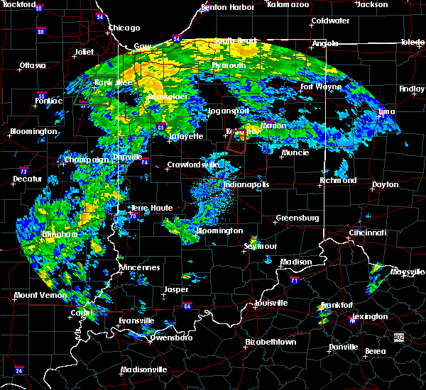 At 809 pm edt, a severe thunderstorm capable of producing a tornado was located near swayzee, or 12 miles east of kokomo, moving northeast at 25 mph (radar indicated rotation). Hazards include tornado. Flying debris will be dangerous to those caught without shelter. mobile homes will be damaged or destroyed. damage to roofs, windows, and vehicles will occur. tree damage is likely. This tornadic thunderstorm will remain over mainly rural areas of northeastern howard county. At 809 pm edt, a severe thunderstorm capable of producing a tornado was located near swayzee, or 12 miles east of kokomo, moving northeast at 25 mph (radar indicated rotation). Hazards include tornado. Flying debris will be dangerous to those caught without shelter. mobile homes will be damaged or destroyed. damage to roofs, windows, and vehicles will occur. tree damage is likely. This tornadic thunderstorm will remain over mainly rural areas of northeastern howard county.
|
| 8/15/2016 8:00 PM EDT | Barn and crop damage near 1350n and 100e. video of tornado touching down. time is approximate and may need to be adjusted in howard county IN, 3.9 miles W of Greentown, IN |
| 8/15/2016 7:45 PM EDT |
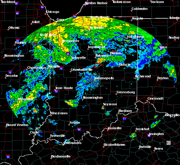 At 745 pm edt, a severe thunderstorm capable of producing a tornado was located over windfall city, or 11 miles southeast of kokomo, moving northeast at 25 mph (radar indicated rotation). Hazards include tornado. Flying debris will be dangerous to those caught without shelter. mobile homes will be damaged or destroyed. damage to roofs, windows, and vehicles will occur. tree damage is likely. This dangerous storm will be near, greentown around 800 pm edt. At 745 pm edt, a severe thunderstorm capable of producing a tornado was located over windfall city, or 11 miles southeast of kokomo, moving northeast at 25 mph (radar indicated rotation). Hazards include tornado. Flying debris will be dangerous to those caught without shelter. mobile homes will be damaged or destroyed. damage to roofs, windows, and vehicles will occur. tree damage is likely. This dangerous storm will be near, greentown around 800 pm edt.
|
| 6/12/2015 6:21 PM EDT |
 The severe thunderstorm warning for clinton, southern carroll, northwestern boone, northern hamilton, howard, northwestern madison and tipton counties will expire at 630 pm edt, the line of storms which prompted the warning has weakened and moved out of the warned area. The severe thunderstorm warning for clinton, southern carroll, northwestern boone, northern hamilton, howard, northwestern madison and tipton counties will expire at 630 pm edt, the line of storms which prompted the warning has weakened and moved out of the warned area.
|
| 6/12/2015 6:11 PM EDT |
 At 607 pm edt, severe thunderstorms were located along a line extending from 9 miles northwest of elwood to 6 miles southwest of crawfordsville, and moving south at 30 mph (radar indicated). Hazards include 60 mph wind gusts and quarter size hail. Hail damage to vehicles is expected. expect wind damage to roofs, siding and trees. locations impacted include, tipton, elwood, atlanta and frankton. This includes interstate 65 between mile markers 149 and 160. At 607 pm edt, severe thunderstorms were located along a line extending from 9 miles northwest of elwood to 6 miles southwest of crawfordsville, and moving south at 30 mph (radar indicated). Hazards include 60 mph wind gusts and quarter size hail. Hail damage to vehicles is expected. expect wind damage to roofs, siding and trees. locations impacted include, tipton, elwood, atlanta and frankton. This includes interstate 65 between mile markers 149 and 160.
|
| 6/12/2015 6:00 PM EDT |
 At 559 pm edt, severe thunderstorms were located along a line extending from 8 miles southwest of swayzee to 6 miles west of crawfordsville, and moving south at 30 mph (radar indicated). Hazards include 60 mph wind gusts and quarter size hail. Hail damage to vehicles is expected. expect wind damage to roofs, siding and trees. locations impacted include, tipton, elwood, kempton, windfall, kirklin, atlanta and frankton. This includes interstate 65 between mile markers 149 and 176. At 559 pm edt, severe thunderstorms were located along a line extending from 8 miles southwest of swayzee to 6 miles west of crawfordsville, and moving south at 30 mph (radar indicated). Hazards include 60 mph wind gusts and quarter size hail. Hail damage to vehicles is expected. expect wind damage to roofs, siding and trees. locations impacted include, tipton, elwood, kempton, windfall, kirklin, atlanta and frankton. This includes interstate 65 between mile markers 149 and 176.
|
| 6/12/2015 5:42 PM EDT |
 At 540 pm edt, severe thunderstorms were located along a line extending from 9 miles northwest of swayzee to 11 miles east of veedersburg, and moving southeast at 30 mph (radar indicated). Hazards include 60 mph wind gusts. Expect damage to roofs. Siding and trees. At 540 pm edt, severe thunderstorms were located along a line extending from 9 miles northwest of swayzee to 11 miles east of veedersburg, and moving southeast at 30 mph (radar indicated). Hazards include 60 mph wind gusts. Expect damage to roofs. Siding and trees.
|
| 6/7/2015 9:24 PM EDT | The severe thunderstorm warning for southern clinton, northern boone, northern hamilton, southeastern howard, northwestern madison, northeastern montgomery and tipton counties will expire at 930 pm edt/830 pm cdt/, the storm which prompted the warning has weakened below severe limits, and no longer poses an immediate threat to life or property. however, gusty winds are still possible with this thunderstorm. |
| 6/7/2015 9:03 PM EDT | At 902 pm edt, a severe thunderstorm was located 6 miles south of tipton, and moving east at 55 mph (radar indicated). Hazards include 60 mph wind gusts. Expect damage to roofs. siding and trees. locations impacted include, noblesville, elwood, windfall, arcadia and cicero. This includes interstate 65 between mile markers 141 and 158. |
| 6/7/2015 8:53 PM EDT | At 851 pm edt, a severe thunderstorm was located 13 miles southwest of tipton, and moving east at 50 mph (radar indicated). Hazards include 60 mph wind gusts. Expect damage to roofs. siding and trees. locations impacted include, tipton, noblesville, elwood, sheridan, indian heights, sharpsville, westfield, greentown, morse reservoir, atlanta, windfall, arcadia and cicero. this includes interstate 65 between mile markers 141 and 160. This includes interstate 74 between mile markers 32 and 39. |
| 6/7/2015 8:40 PM EDT | At 837 pm edt, a severe thunderstorm was located near frankfort, and moving east at 40 mph (radar indicated). Hazards include 60 mph wind gusts. Expect damage to roofs. Siding and trees. |
| 6/7/2015 8:24 PM EDT | At 822 pm edt, a severe thunderstorm was located 11 miles southwest of walton, and moving east at 60 mph (radar indicated). Hazards include 60 mph wind gusts and nickel size hail. Expect damage to roofs. Siding and trees. |
| 9/7/2012 12:12 PM EDT | Trees and power lines downe in howard county IN, 0.4 miles SW of Greentown, IN |
| 7/24/2012 9:55 AM EDT | Two foot diameter limb downed by thunderstorm wind in town of sycamor in howard county IN, 2.1 miles SW of Greentown, IN |
| 1/1/0001 12:00 AM | Trees down in howard county IN, 1.8 miles W of Greentown, IN |
| 1/1/0001 12:00 AM | Quarter sized hail reported 0.4 miles SW of Greentown, IN |
| 1/1/0001 12:00 AM | Quarter sized hail reported 0.4 miles SW of Greentown, IN, varying sized hail up to quarter size. |
Hail Maps for Greentown, IN


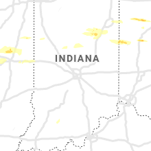


Connect with Interactive Hail Maps