

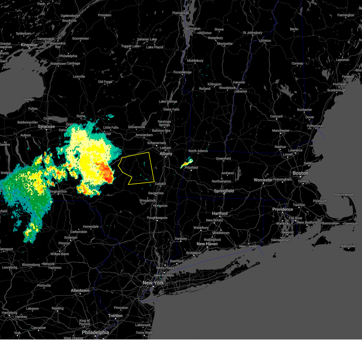
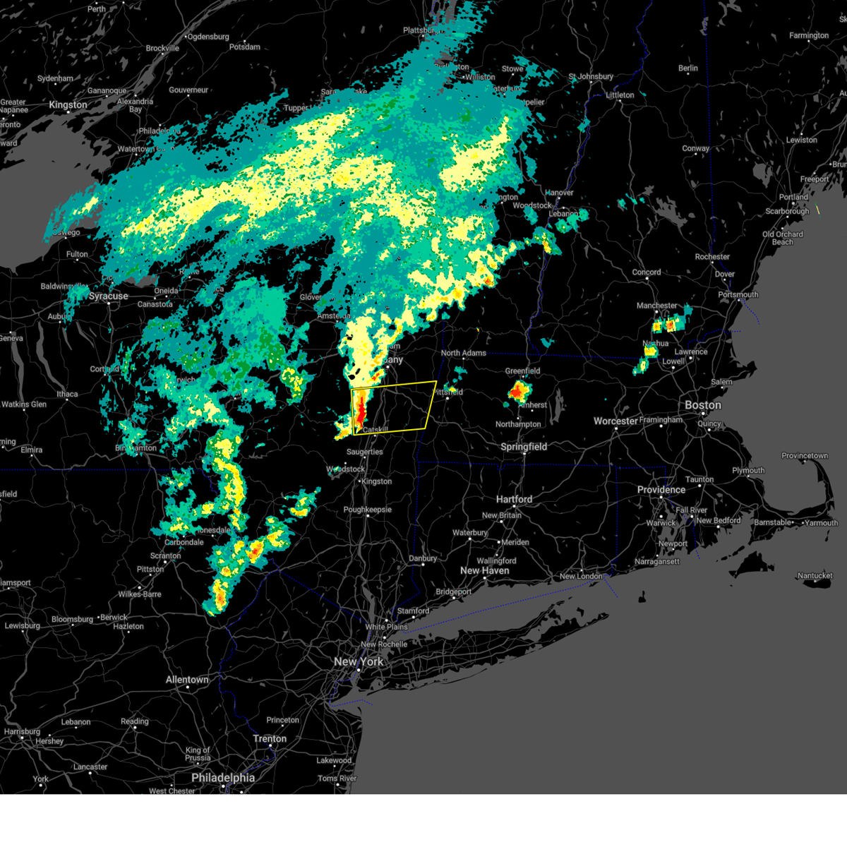
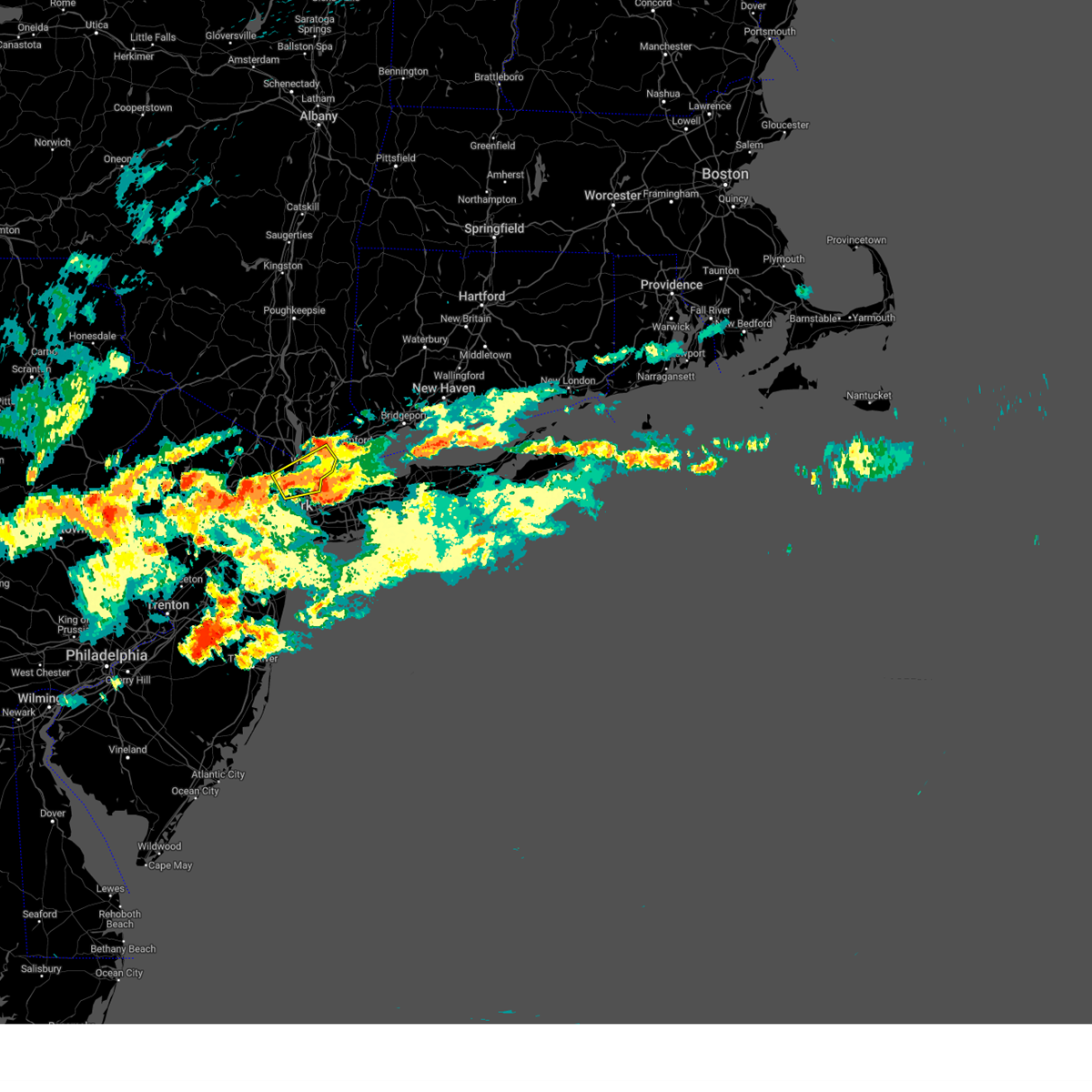
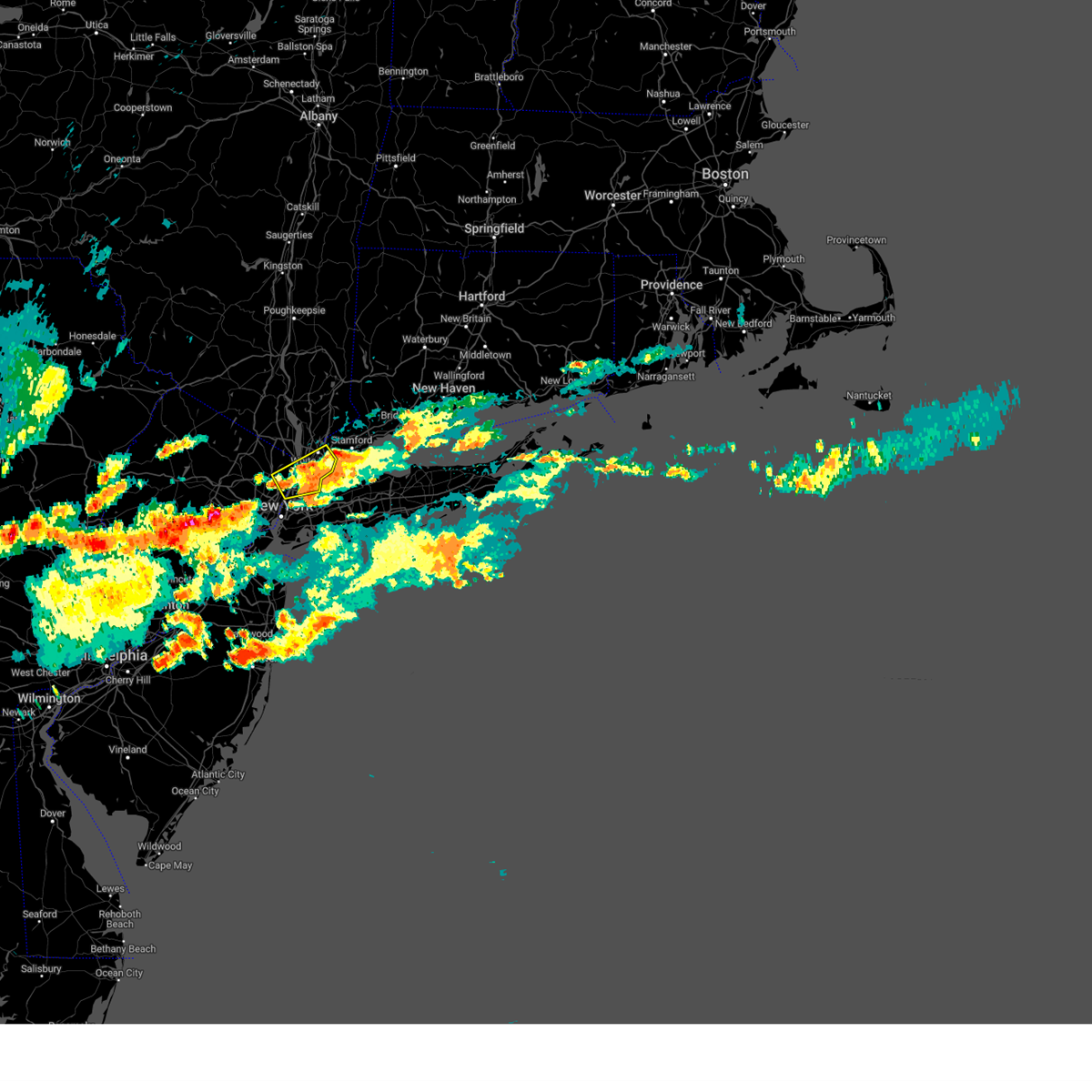
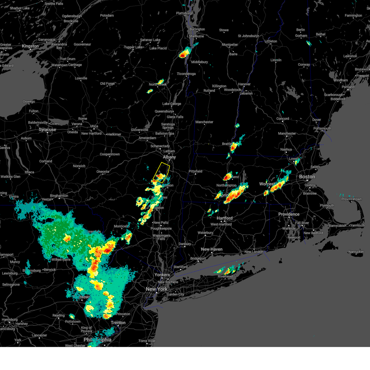
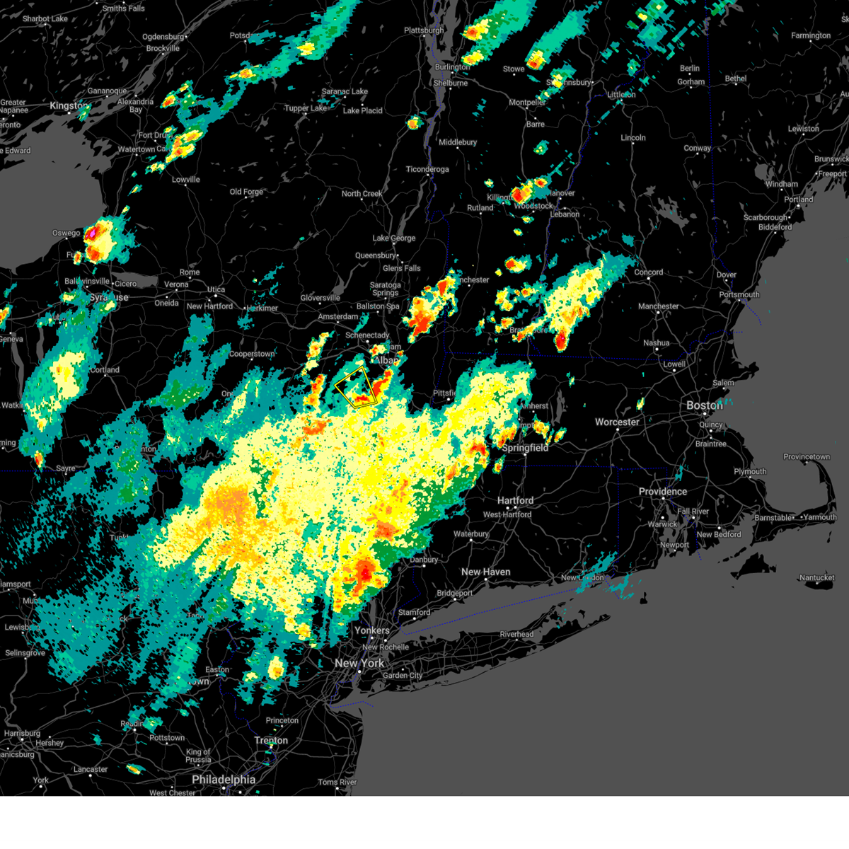
Hail Map for Greenville, NY
The Greenville, NY area has had 1 report of on-the-ground hail by trained spotters, and has been under severe weather warnings 16 times during the past 12 months. Doppler radar has detected hail at or near Greenville, NY on 44 occasions, including 4 occasions during the past year.
| Name: | Greenville, NY |
| Where Located: | 23.2 miles NNE of Brooklyn, NY |
| Map: | Google Map for Greenville, NY |
| Population: | 7116 |
| Housing Units: | 2533 |
| More Info: | Search Google for Greenville, NY |
0
The Top Recent Hail Date for Greenville, NY is Thursday, July 3, 2025 (14th out of 44)

Hail and Wind Damage Spotted near Greenville, NY
| Date / Time | Report Details |
|---|---|
| 6/5/2025 9:44 PM EDT |
 Svraly the national weather service in albany has issued a * severe thunderstorm warning for, southwestern albany county in east central new york, central greene county in east central new york, schoharie county in east central new york, * until 1100 pm edt. * at 942 pm edt, a severe thunderstorm was located near east meredith, or 10 miles northeast of delhi, moving east at 35 mph (radar indicated). Hazards include 60 mph wind gusts and quarter size hail. Hail damage to vehicles is expected. Expect wind damage to roofs, siding, and trees. Svraly the national weather service in albany has issued a * severe thunderstorm warning for, southwestern albany county in east central new york, central greene county in east central new york, schoharie county in east central new york, * until 1100 pm edt. * at 942 pm edt, a severe thunderstorm was located near east meredith, or 10 miles northeast of delhi, moving east at 35 mph (radar indicated). Hazards include 60 mph wind gusts and quarter size hail. Hail damage to vehicles is expected. Expect wind damage to roofs, siding, and trees.
|
| 5/3/2025 12:57 PM EDT |
 Svraly the national weather service in albany has issued a * severe thunderstorm warning for, northern columbia county in east central new york, southeastern albany county in east central new york, northeastern greene county in east central new york, southern rensselaer county in east central new york, * until 130 pm edt. * at 1257 pm edt, a severe thunderstorm was located near coxsackie, or 10 miles north of catskill, moving east at 35 mph (radar indicated). Hazards include 60 mph wind gusts and quarter size hail. Hail damage to vehicles is expected. Expect wind damage to roofs, siding, and trees. Svraly the national weather service in albany has issued a * severe thunderstorm warning for, northern columbia county in east central new york, southeastern albany county in east central new york, northeastern greene county in east central new york, southern rensselaer county in east central new york, * until 130 pm edt. * at 1257 pm edt, a severe thunderstorm was located near coxsackie, or 10 miles north of catskill, moving east at 35 mph (radar indicated). Hazards include 60 mph wind gusts and quarter size hail. Hail damage to vehicles is expected. Expect wind damage to roofs, siding, and trees.
|
| 8/6/2024 6:02 PM EDT |
 The storm which prompted the warning has weakened below severe limits, and no longer poses an immediate threat to life or property. therefore, the warning has been allowed to expire. however, heavy rain is still possible with this thunderstorm. a severe thunderstorm watch remains in effect until 1100 pm edt for northeastern new jersey. to report severe weather, contact your nearest law enforcement agency. they will relay your report to the national weather service upton ny. The storm which prompted the warning has weakened below severe limits, and no longer poses an immediate threat to life or property. therefore, the warning has been allowed to expire. however, heavy rain is still possible with this thunderstorm. a severe thunderstorm watch remains in effect until 1100 pm edt for northeastern new jersey. to report severe weather, contact your nearest law enforcement agency. they will relay your report to the national weather service upton ny.
|
| 8/6/2024 5:27 PM EDT |
 At 527 pm edt, a severe thunderstorm was located over riverdale, or near east tremont, and is nearly stationary (radar indicated). Hazards include 60 mph wind gusts and quarter size hail. Minor hail damage to vehicles is possible. expect wind damage to trees and power lines. this severe storm will be near, east tremont and riverdale around 530 pm edt. co-op city around 540 pm edt. Yonkers around 545 pm edt. At 527 pm edt, a severe thunderstorm was located over riverdale, or near east tremont, and is nearly stationary (radar indicated). Hazards include 60 mph wind gusts and quarter size hail. Minor hail damage to vehicles is possible. expect wind damage to trees and power lines. this severe storm will be near, east tremont and riverdale around 530 pm edt. co-op city around 540 pm edt. Yonkers around 545 pm edt.
|
| 8/6/2024 4:53 PM EDT |
 Svrokx the national weather service in upton ny has issued a * severe thunderstorm warning for, southeastern bergen county in northeastern new jersey, southern westchester county in southeastern new york, bronx county in southeastern new york, new york (manhattan) county in southeastern new york, * until 600 pm edt. * at 453 pm edt, a severe thunderstorm was located over englewood, or near bergenfield, and is nearly stationary (radar indicated). Hazards include 60 mph wind gusts and quarter size hail. Minor hail damage to vehicles is possible. expect wind damage to trees and power lines. this severe thunderstorm will be near, riverdale around 500 pm edt. East tremont around 510 pm edt. Svrokx the national weather service in upton ny has issued a * severe thunderstorm warning for, southeastern bergen county in northeastern new jersey, southern westchester county in southeastern new york, bronx county in southeastern new york, new york (manhattan) county in southeastern new york, * until 600 pm edt. * at 453 pm edt, a severe thunderstorm was located over englewood, or near bergenfield, and is nearly stationary (radar indicated). Hazards include 60 mph wind gusts and quarter size hail. Minor hail damage to vehicles is possible. expect wind damage to trees and power lines. this severe thunderstorm will be near, riverdale around 500 pm edt. East tremont around 510 pm edt.
|
| 8/3/2024 5:22 PM EDT | Svrokx the national weather service in upton ny has issued a * severe thunderstorm warning for, southern fairfield county in southern connecticut, southeastern bergen county in northeastern new jersey, southern westchester county in southeastern new york, queens county in southeastern new york, bronx county in southeastern new york, west central suffolk county in southeastern new york, new york (manhattan) county in southeastern new york, northern nassau county in southeastern new york, * until 615 pm edt. * at 521 pm edt, a severe thunderstorm was located over harlem, or over mott haven, moving northeast at 20 mph (radar indicated). Hazards include 60 mph wind gusts and quarter size hail. Minor hail damage to vehicles is possible. expect wind damage to trees and power lines. this severe thunderstorm will be near, east tremont and riverdale around 525 pm edt. city island around 535 pm edt. new rochelle and bronxville around 540 pm edt. Rye around 555 pm edt. |
| 7/17/2024 9:49 PM EDT |
 the severe thunderstorm warning has been cancelled and is no longer in effect the severe thunderstorm warning has been cancelled and is no longer in effect
|
| 7/17/2024 9:49 PM EDT |
 At 948 pm edt, severe thunderstorms were located along a line extending from greenwich to glen cove to forest hills, moving east at 35 mph (radar indicated). Hazards include 60 mph wind gusts. Expect damage to trees and power lines. These severe storms will be near, glen cove and great neck around 955 pm edt. At 948 pm edt, severe thunderstorms were located along a line extending from greenwich to glen cove to forest hills, moving east at 35 mph (radar indicated). Hazards include 60 mph wind gusts. Expect damage to trees and power lines. These severe storms will be near, glen cove and great neck around 955 pm edt.
|
| 7/17/2024 9:08 PM EDT |
 Svrokx the national weather service in upton ny has issued a * severe thunderstorm warning for, hudson county in northeastern new jersey, eastern passaic county in northeastern new jersey, eastern union county in northeastern new jersey, bergen county in northeastern new jersey, eastern essex county in northeastern new jersey, southern westchester county in southeastern new york, queens county in southeastern new york, bronx county in southeastern new york, richmond county in southeastern new york, kings county in southeastern new york, new york (manhattan) county in southeastern new york, western nassau county in southeastern new york, * until 1000 pm edt. * at 908 pm edt, severe thunderstorms were located along a line extending from near ridgewood to secaucus to linden, moving east at 35 mph (radar indicated). Hazards include 60 mph wind gusts. Expect damage to trees and power lines. severe thunderstorms will be near, jersey city and elizabeth around 915 pm edt. yonkers and east tremont around 920 pm edt. new rochelle and flushing around 925 pm edt. flatbush and white plains around 930 pm edt. port chester and great neck around 935 pm edt. Jamaica and glen cove around 940 pm edt. Svrokx the national weather service in upton ny has issued a * severe thunderstorm warning for, hudson county in northeastern new jersey, eastern passaic county in northeastern new jersey, eastern union county in northeastern new jersey, bergen county in northeastern new jersey, eastern essex county in northeastern new jersey, southern westchester county in southeastern new york, queens county in southeastern new york, bronx county in southeastern new york, richmond county in southeastern new york, kings county in southeastern new york, new york (manhattan) county in southeastern new york, western nassau county in southeastern new york, * until 1000 pm edt. * at 908 pm edt, severe thunderstorms were located along a line extending from near ridgewood to secaucus to linden, moving east at 35 mph (radar indicated). Hazards include 60 mph wind gusts. Expect damage to trees and power lines. severe thunderstorms will be near, jersey city and elizabeth around 915 pm edt. yonkers and east tremont around 920 pm edt. new rochelle and flushing around 925 pm edt. flatbush and white plains around 930 pm edt. port chester and great neck around 935 pm edt. Jamaica and glen cove around 940 pm edt.
|
| 7/17/2024 5:06 PM EDT |
 The storms which prompted the warning have moved out of the area. therefore, the warning will be allowed to expire. a new severe thunderstorm warning has been issued. a severe thunderstorm watch remains in effect until 800 pm edt for southern connecticut, northeastern new jersey, and southeastern new york. The storms which prompted the warning have moved out of the area. therefore, the warning will be allowed to expire. a new severe thunderstorm warning has been issued. a severe thunderstorm watch remains in effect until 800 pm edt for southern connecticut, northeastern new jersey, and southeastern new york.
|
| 7/17/2024 4:53 PM EDT |
 At 452 pm edt, severe thunderstorms were located along a line extending from near danbury to near greenwich to bronxville, moving east at 25 mph (radar indicated). Hazards include 60 mph wind gusts. Expect damage to trees and power lines. these severe storms will be near, stamford and norwalk around 500 pm edt. monroe around 505 pm edt. southbury and westport around 510 pm edt. Fairfield and trumbull around 515 pm edt. At 452 pm edt, severe thunderstorms were located along a line extending from near danbury to near greenwich to bronxville, moving east at 25 mph (radar indicated). Hazards include 60 mph wind gusts. Expect damage to trees and power lines. these severe storms will be near, stamford and norwalk around 500 pm edt. monroe around 505 pm edt. southbury and westport around 510 pm edt. Fairfield and trumbull around 515 pm edt.
|
| 7/17/2024 4:53 PM EDT |
 the severe thunderstorm warning has been cancelled and is no longer in effect the severe thunderstorm warning has been cancelled and is no longer in effect
|
| 7/17/2024 4:33 PM EDT | Svrokx the national weather service in upton ny has issued a * severe thunderstorm warning for, fairfield county in southern connecticut, western new haven county in southern connecticut, east central bergen county in northeastern new jersey, westchester county in southeastern new york, eastern putnam county in southeastern new york, bronx county in southeastern new york, rockland county in southeastern new york, * until 515 pm edt. * at 432 pm edt, severe thunderstorms were located along a line extending from near brewster to near hawthorne to englewood, moving east at 25 mph (radar indicated). Hazards include 60 mph wind gusts. Expect damage to trees and power lines. severe thunderstorms will be near, yonkers and stamford around 435 pm edt. harrison and redding around 440 pm edt. new rochelle and new canaan around 445 pm edt. port chester around 450 pm edt. rye and newtown around 455 pm edt. Norwalk around 500 pm edt. |
| 7/16/2024 5:46 PM EDT |
 At 546 pm edt, severe thunderstorms were located along a line extending from wyantskill to near castleton-on-hudson to 8 miles west of coxsackie, moving east at 70 mph (radar indicated). Hazards include 70 mph wind gusts. Expect considerable tree damage. damage is likely to mobile homes, roofs, and outbuildings. Locations impacted include, albany, troy, east greenbush, cohoes, watervliet, rensselaer, colonie, nassau, delmar, latham, menands, new baltimore, ravena, stephentown, green island, grafton, berlin, castleton-on-hudson, loudonville, and west sand lake. At 546 pm edt, severe thunderstorms were located along a line extending from wyantskill to near castleton-on-hudson to 8 miles west of coxsackie, moving east at 70 mph (radar indicated). Hazards include 70 mph wind gusts. Expect considerable tree damage. damage is likely to mobile homes, roofs, and outbuildings. Locations impacted include, albany, troy, east greenbush, cohoes, watervliet, rensselaer, colonie, nassau, delmar, latham, menands, new baltimore, ravena, stephentown, green island, grafton, berlin, castleton-on-hudson, loudonville, and west sand lake.
|
| 7/16/2024 5:46 PM EDT |
 the severe thunderstorm warning has been cancelled and is no longer in effect the severe thunderstorm warning has been cancelled and is no longer in effect
|
| 7/16/2024 5:26 PM EDT | Svraly the national weather service in albany has issued a * severe thunderstorm warning for, north central columbia county in east central new york, albany county in east central new york, northern greene county in east central new york, southeastern schoharie county in east central new york, southern rensselaer county in east central new york, * until 615 pm edt. * at 526 pm edt, severe thunderstorms were located along a line extending from berne to near preston hollow to near gilboa, moving east at 55 mph (radar indicated). Hazards include 60 mph wind gusts. expect damage to roofs, siding, and trees |
| 6/30/2024 3:54 PM EDT |
 the severe thunderstorm warning has been cancelled and is no longer in effect the severe thunderstorm warning has been cancelled and is no longer in effect
|
| 6/30/2024 3:22 PM EDT |
 Svrokx the national weather service in upton ny has issued a * severe thunderstorm warning for, hudson county in northeastern new jersey, eastern passaic county in northeastern new jersey, bergen county in northeastern new jersey, northern essex county in northeastern new jersey, southern westchester county in southeastern new york, queens county in southeastern new york, bronx county in southeastern new york, west central suffolk county in southeastern new york, new york (manhattan) county in southeastern new york, northern nassau county in southeastern new york, * until 415 pm edt. * at 321 pm edt, a severe thunderstorm was located near fairfield, or near wayne, moving east at 35 mph (radar indicated). Hazards include 60 mph wind gusts and quarter size hail. Minor hail damage to vehicles is possible. expect wind damage to trees and power lines. this severe thunderstorm will be near, paterson and passaic around 325 pm edt. hackensack and teterboro around 330 pm edt. bergenfield and paramus around 335 pm edt. fort lee around 340 pm edt. riverdale around 345 pm edt. yonkers and east tremont around 350 pm edt. new rochelle and city island around 355 pm edt. sands point around 400 pm edt. Glen cove and rye around 405 pm edt. Svrokx the national weather service in upton ny has issued a * severe thunderstorm warning for, hudson county in northeastern new jersey, eastern passaic county in northeastern new jersey, bergen county in northeastern new jersey, northern essex county in northeastern new jersey, southern westchester county in southeastern new york, queens county in southeastern new york, bronx county in southeastern new york, west central suffolk county in southeastern new york, new york (manhattan) county in southeastern new york, northern nassau county in southeastern new york, * until 415 pm edt. * at 321 pm edt, a severe thunderstorm was located near fairfield, or near wayne, moving east at 35 mph (radar indicated). Hazards include 60 mph wind gusts and quarter size hail. Minor hail damage to vehicles is possible. expect wind damage to trees and power lines. this severe thunderstorm will be near, paterson and passaic around 325 pm edt. hackensack and teterboro around 330 pm edt. bergenfield and paramus around 335 pm edt. fort lee around 340 pm edt. riverdale around 345 pm edt. yonkers and east tremont around 350 pm edt. new rochelle and city island around 355 pm edt. sands point around 400 pm edt. Glen cove and rye around 405 pm edt.
|
| 6/26/2024 9:11 PM EDT |
 The storms which prompted the warning have moved out of the area. therefore, the warning will be allowed to expire. a severe thunderstorm watch remains in effect until midnight edt for northeastern new jersey, and southeastern new york. The storms which prompted the warning have moved out of the area. therefore, the warning will be allowed to expire. a severe thunderstorm watch remains in effect until midnight edt for northeastern new jersey, and southeastern new york.
|
| 6/26/2024 8:17 PM EDT |
 Svrokx the national weather service in upton ny has issued a * severe thunderstorm warning for, southern westchester county in southeastern new york, queens county in southeastern new york, bronx county in southeastern new york, kings county in southeastern new york, new york (manhattan) county in southeastern new york, * until 915 pm edt. * at 816 pm edt, severe thunderstorms were located along a line extending from near greenwood lake to near east hanover to edison, moving east at 30 mph (radar indicated). Hazards include 60 mph wind gusts. Expect damage to trees and power lines. severe thunderstorms will be near, the verrazano narrows bridge and bay ridge around 840 pm edt. coney island and midtown manhattan around 845 pm edt. flatbush and mott haven around 850 pm edt. yonkers and east tremont around 855 pm edt. flushing and throgs neck bridge around 900 pm edt. Jamaica and new rochelle around 905 pm edt. Svrokx the national weather service in upton ny has issued a * severe thunderstorm warning for, southern westchester county in southeastern new york, queens county in southeastern new york, bronx county in southeastern new york, kings county in southeastern new york, new york (manhattan) county in southeastern new york, * until 915 pm edt. * at 816 pm edt, severe thunderstorms were located along a line extending from near greenwood lake to near east hanover to edison, moving east at 30 mph (radar indicated). Hazards include 60 mph wind gusts. Expect damage to trees and power lines. severe thunderstorms will be near, the verrazano narrows bridge and bay ridge around 840 pm edt. coney island and midtown manhattan around 845 pm edt. flatbush and mott haven around 850 pm edt. yonkers and east tremont around 855 pm edt. flushing and throgs neck bridge around 900 pm edt. Jamaica and new rochelle around 905 pm edt.
|
| 6/14/2024 6:38 PM EDT |
 Svrokx the national weather service in upton ny has issued a * severe thunderstorm warning for, southern fairfield county in southern connecticut, southern westchester county in southeastern new york, rockland county in southeastern new york, * until 730 pm edt. * at 638 pm edt, a severe thunderstorm was located over dobbs ferry, moving east at 30 mph (radar indicated). Hazards include 60 mph wind gusts and quarter size hail. Minor hail damage to vehicles is possible. expect wind damage to trees and power lines. this severe thunderstorm will be near, white plains and harrison around 645 pm edt. port chester and greenwich around 650 pm edt. stamford around 700 pm edt. darien around 710 pm edt. Norwalk around 715 pm edt. Svrokx the national weather service in upton ny has issued a * severe thunderstorm warning for, southern fairfield county in southern connecticut, southern westchester county in southeastern new york, rockland county in southeastern new york, * until 730 pm edt. * at 638 pm edt, a severe thunderstorm was located over dobbs ferry, moving east at 30 mph (radar indicated). Hazards include 60 mph wind gusts and quarter size hail. Minor hail damage to vehicles is possible. expect wind damage to trees and power lines. this severe thunderstorm will be near, white plains and harrison around 645 pm edt. port chester and greenwich around 650 pm edt. stamford around 700 pm edt. darien around 710 pm edt. Norwalk around 715 pm edt.
|
| 5/23/2024 10:40 AM EDT |
 The storms which prompted the warning have exited and weakened below severe limits. therefore, the warning will be allowed to expire. The storms which prompted the warning have exited and weakened below severe limits. therefore, the warning will be allowed to expire.
|
| 5/23/2024 9:54 AM EDT |
 Svrokx the national weather service in upton ny has issued a * severe thunderstorm warning for, fairfield county in southern connecticut, west central new haven county in southern connecticut, hudson county in northeastern new jersey, eastern bergen county in northeastern new jersey, eastern putnam county in southeastern new york, queens county in southeastern new york, bronx county in southeastern new york, richmond county in southeastern new york, kings county in southeastern new york, rockland county in southeastern new york, westchester county in southeastern new york, west central suffolk county in southeastern new york, new york (manhattan) county in southeastern new york, nassau county in southeastern new york, * until 1045 am edt. * at 954 am edt, severe thunderstorms were located along a line extending from yorktown heights to yonkers to park slope, moving east at 55 mph (radar indicated). Hazards include 60 mph wind gusts. Expect damage to trees and power lines. severe thunderstorms will be near, jamaica and new rochelle around 1000 am edt. stamford and danbury around 1005 am edt. garden city and mineola around 1010 am edt. norwalk and syosset around 1015 am edt. levittown and huntington station around 1020 am edt. bridgeport and shelton around 1025 am edt. commack and deer park around 1030 am edt. Naugatuck and middlebury around 1035 am edt. Svrokx the national weather service in upton ny has issued a * severe thunderstorm warning for, fairfield county in southern connecticut, west central new haven county in southern connecticut, hudson county in northeastern new jersey, eastern bergen county in northeastern new jersey, eastern putnam county in southeastern new york, queens county in southeastern new york, bronx county in southeastern new york, richmond county in southeastern new york, kings county in southeastern new york, rockland county in southeastern new york, westchester county in southeastern new york, west central suffolk county in southeastern new york, new york (manhattan) county in southeastern new york, nassau county in southeastern new york, * until 1045 am edt. * at 954 am edt, severe thunderstorms were located along a line extending from yorktown heights to yonkers to park slope, moving east at 55 mph (radar indicated). Hazards include 60 mph wind gusts. Expect damage to trees and power lines. severe thunderstorms will be near, jamaica and new rochelle around 1000 am edt. stamford and danbury around 1005 am edt. garden city and mineola around 1010 am edt. norwalk and syosset around 1015 am edt. levittown and huntington station around 1020 am edt. bridgeport and shelton around 1025 am edt. commack and deer park around 1030 am edt. Naugatuck and middlebury around 1035 am edt.
|
| 4/29/2024 6:27 PM EDT |
 The storm which prompted the warning has moved out of the area. therefore, the warning will be allowed to expire. however, gusty winds are still possible with this thunderstorm. The storm which prompted the warning has moved out of the area. therefore, the warning will be allowed to expire. however, gusty winds are still possible with this thunderstorm.
|
| 4/29/2024 6:14 PM EDT |
 At 612 pm edt, a severe thunderstorm was located over scarsdale, or over new rochelle, moving southeast at 20 mph (radar indicated). Hazards include 60 mph wind gusts and penny size hail. Expect damage to trees and power lines. This severe thunderstorm will remain over mainly rural areas of southern westchester and bronx counties. At 612 pm edt, a severe thunderstorm was located over scarsdale, or over new rochelle, moving southeast at 20 mph (radar indicated). Hazards include 60 mph wind gusts and penny size hail. Expect damage to trees and power lines. This severe thunderstorm will remain over mainly rural areas of southern westchester and bronx counties.
|
| 4/29/2024 6:14 PM EDT |
 the severe thunderstorm warning has been cancelled and is no longer in effect the severe thunderstorm warning has been cancelled and is no longer in effect
|
| 4/29/2024 5:52 PM EDT |
 Svrokx the national weather service in upton ny has issued a * severe thunderstorm warning for, east central bergen county in northeastern new jersey, southern westchester county in southeastern new york, bronx county in southeastern new york, rockland county in southeastern new york, * until 630 pm edt. * at 552 pm edt, a severe thunderstorm was located over dobbs ferry, moving southeast at 20 mph (radar indicated). Hazards include 60 mph wind gusts and quarter size hail. Minor hail damage to vehicles is possible. expect wind damage to trees and power lines. this severe thunderstorm will be near, white plains and scarsdale around 600 pm edt. New rochelle and bronxville around 605 pm edt. Svrokx the national weather service in upton ny has issued a * severe thunderstorm warning for, east central bergen county in northeastern new jersey, southern westchester county in southeastern new york, bronx county in southeastern new york, rockland county in southeastern new york, * until 630 pm edt. * at 552 pm edt, a severe thunderstorm was located over dobbs ferry, moving southeast at 20 mph (radar indicated). Hazards include 60 mph wind gusts and quarter size hail. Minor hail damage to vehicles is possible. expect wind damage to trees and power lines. this severe thunderstorm will be near, white plains and scarsdale around 600 pm edt. New rochelle and bronxville around 605 pm edt.
|
| 4/29/2024 5:44 PM EDT |
 The severe thunderstorm which prompted the warning has weakened. therefore, the warning will be allowed to expire. The severe thunderstorm which prompted the warning has weakened. therefore, the warning will be allowed to expire.
|
| 4/29/2024 5:32 PM EDT |
 At 531 pm edt, a severe thunderstorm was located over haverstraw, moving southeast at 10 mph (radar indicated). Hazards include 60 mph wind gusts and quarter size hail and lightning strikes. Minor hail damage to vehicles is possible. expect wind damage to trees and power lines. this severe storm will be near, ossining and upper nyack around 535 pm edt. Nyack around 540 pm edt. At 531 pm edt, a severe thunderstorm was located over haverstraw, moving southeast at 10 mph (radar indicated). Hazards include 60 mph wind gusts and quarter size hail and lightning strikes. Minor hail damage to vehicles is possible. expect wind damage to trees and power lines. this severe storm will be near, ossining and upper nyack around 535 pm edt. Nyack around 540 pm edt.
|
| 4/29/2024 5:20 PM EDT |
 Svrokx the national weather service in upton ny has issued a * severe thunderstorm warning for, southern westchester county in southeastern new york, rockland county in southeastern new york, * until 545 pm edt. * at 520 pm edt, a severe thunderstorm was located over new city, moving southeast at 10 mph (radar indicated). Hazards include 60 mph wind gusts and quarter size hail. Minor hail damage to vehicles is possible. This severe thunderstorm will be near, haverstraw around 525 pm edt. Svrokx the national weather service in upton ny has issued a * severe thunderstorm warning for, southern westchester county in southeastern new york, rockland county in southeastern new york, * until 545 pm edt. * at 520 pm edt, a severe thunderstorm was located over new city, moving southeast at 10 mph (radar indicated). Hazards include 60 mph wind gusts and quarter size hail. Minor hail damage to vehicles is possible. This severe thunderstorm will be near, haverstraw around 525 pm edt.
|
| 9/9/2023 2:34 PM EDT |
 At 233 pm edt, a severe thunderstorm was located over east tremont, moving northeast at 10 mph (radar indicated). Hazards include 60 mph wind gusts. Expect damage to trees and power lines. locations impacted include, yonkers, new rochelle, mott haven, east tremont, dobbs ferry, harlem, riverdale, scarsdale, bronxville, mount vernon, eastchester, hastings-on-hudson, greenville, pelham, and woodlawn. hail threat, radar indicated max hail size, <. 75 in wind threat, radar indicated max wind gust, 60 mph. At 233 pm edt, a severe thunderstorm was located over east tremont, moving northeast at 10 mph (radar indicated). Hazards include 60 mph wind gusts. Expect damage to trees and power lines. locations impacted include, yonkers, new rochelle, mott haven, east tremont, dobbs ferry, harlem, riverdale, scarsdale, bronxville, mount vernon, eastchester, hastings-on-hudson, greenville, pelham, and woodlawn. hail threat, radar indicated max hail size, <. 75 in wind threat, radar indicated max wind gust, 60 mph.
|
| 9/9/2023 2:04 PM EDT |
 At 203 pm edt, a severe thunderstorm was located over riverdale, or over east tremont, moving northeast at 5 mph (radar indicated). Hazards include 60 mph wind gusts and penny size hail. expect damage to trees and power lines At 203 pm edt, a severe thunderstorm was located over riverdale, or over east tremont, moving northeast at 5 mph (radar indicated). Hazards include 60 mph wind gusts and penny size hail. expect damage to trees and power lines
|
| 9/8/2023 4:15 PM EDT | Tree down on road on honey hallow road in greene county NY, 5 miles W of Greenville, NY |
| 9/8/2023 4:11 PM EDT |
 The severe thunderstorm warning for northeastern bergen, southern westchester and rockland counties will expire at 415 pm edt, the storm which prompted the warning has weakened below severe limits, and has exited the warned area. therefore, the warning will be allowed to expire. a severe thunderstorm watch remains in effect until 1100 pm edt for northeastern new jersey, and southeastern new york. The severe thunderstorm warning for northeastern bergen, southern westchester and rockland counties will expire at 415 pm edt, the storm which prompted the warning has weakened below severe limits, and has exited the warned area. therefore, the warning will be allowed to expire. a severe thunderstorm watch remains in effect until 1100 pm edt for northeastern new jersey, and southeastern new york.
|
| 9/8/2023 3:31 PM EDT |
 At 331 pm edt, a severe thunderstorm was located near tappan, moving northeast at 10 mph (radar indicated). Hazards include 60 mph wind gusts and quarter size hail. Minor hail damage to vehicles is possible. expect wind damage to trees and power lines. this severe thunderstorm will be near, tappan and pearl river around 335 pm edt. nanuet around 345 pm edt. nyack around 355 pm edt. hail threat, radar indicated max hail size, 1. 00 in wind threat, radar indicated max wind gust, 60 mph. At 331 pm edt, a severe thunderstorm was located near tappan, moving northeast at 10 mph (radar indicated). Hazards include 60 mph wind gusts and quarter size hail. Minor hail damage to vehicles is possible. expect wind damage to trees and power lines. this severe thunderstorm will be near, tappan and pearl river around 335 pm edt. nanuet around 345 pm edt. nyack around 355 pm edt. hail threat, radar indicated max hail size, 1. 00 in wind threat, radar indicated max wind gust, 60 mph.
|
| 9/7/2023 8:38 PM EDT |
 At 838 pm edt, a severe thunderstorm was located over latham, moving northeast at 55 mph (radar indicated). Hazards include 60 mph wind gusts and quarter size hail. Hail damage to vehicles is expected. Expect wind damage to roofs, siding, and trees. At 838 pm edt, a severe thunderstorm was located over latham, moving northeast at 55 mph (radar indicated). Hazards include 60 mph wind gusts and quarter size hail. Hail damage to vehicles is expected. Expect wind damage to roofs, siding, and trees.
|
| 9/7/2023 7:41 PM EDT |
 At 741 pm edt, severe thunderstorms were located along a line extending from near walden to near hawthorne, moving east at 20 mph (radar indicated). Hazards include 60 mph wind gusts. Expect damage to trees and power lines. severe thunderstorms will be near, ridgewood and ramsey around 745 pm edt. newburgh and monsey around 750 pm edt. nanuet and cold spring around 800 pm edt. new city and pearl river around 805 pm edt. peekskill and haverstraw around 810 pm edt. tappan and orangeburg around 815 pm edt. nyack and upper nyack around 820 pm edt. ossining and fahnestock state park around 825 pm edt. tarrytown around 830 pm edt. hail threat, radar indicated max hail size, <. 75 in wind threat, observed max wind gust, 60 mph. At 741 pm edt, severe thunderstorms were located along a line extending from near walden to near hawthorne, moving east at 20 mph (radar indicated). Hazards include 60 mph wind gusts. Expect damage to trees and power lines. severe thunderstorms will be near, ridgewood and ramsey around 745 pm edt. newburgh and monsey around 750 pm edt. nanuet and cold spring around 800 pm edt. new city and pearl river around 805 pm edt. peekskill and haverstraw around 810 pm edt. tappan and orangeburg around 815 pm edt. nyack and upper nyack around 820 pm edt. ossining and fahnestock state park around 825 pm edt. tarrytown around 830 pm edt. hail threat, radar indicated max hail size, <. 75 in wind threat, observed max wind gust, 60 mph.
|
| 9/7/2023 7:21 PM EDT |
 At 721 pm edt, a severe thunderstorm was located near kerhonkson, or 7 miles northeast of ellenville, moving northeast at 50 mph (radar indicated). Hazards include 60 mph wind gusts and quarter size hail. Hail damage to vehicles is expected. Expect wind damage to roofs, siding, and trees. At 721 pm edt, a severe thunderstorm was located near kerhonkson, or 7 miles northeast of ellenville, moving northeast at 50 mph (radar indicated). Hazards include 60 mph wind gusts and quarter size hail. Hail damage to vehicles is expected. Expect wind damage to roofs, siding, and trees.
|
| 8/13/2023 2:15 AM EDT |
 At 215 am edt, severe thunderstorms were located along a line extending from mountain lakes to elizabeth to east freehold, moving northeast at 50 mph (radar indicated). Hazards include 60 mph wind gusts. Expect damage to trees and power lines. severe thunderstorms will be near, flatbush and ridgefield around 225 am edt. mott haven and hackensack around 230 am edt. flushing and east tremont around 235 am edt. jamaica and yonkers around 240 am edt. new rochelle and valley stream around 245 am edt. white plains and long beach around 250 am edt. freeport and port chester around 255 am edt. stamford and levittown around 300 am edt. huntington station and huntington around 305 am edt. hail threat, radar indicated max hail size, <. 75 in wind threat, radar indicated max wind gust, 60 mph. At 215 am edt, severe thunderstorms were located along a line extending from mountain lakes to elizabeth to east freehold, moving northeast at 50 mph (radar indicated). Hazards include 60 mph wind gusts. Expect damage to trees and power lines. severe thunderstorms will be near, flatbush and ridgefield around 225 am edt. mott haven and hackensack around 230 am edt. flushing and east tremont around 235 am edt. jamaica and yonkers around 240 am edt. new rochelle and valley stream around 245 am edt. white plains and long beach around 250 am edt. freeport and port chester around 255 am edt. stamford and levittown around 300 am edt. huntington station and huntington around 305 am edt. hail threat, radar indicated max hail size, <. 75 in wind threat, radar indicated max wind gust, 60 mph.
|
| 8/4/2023 4:54 PM EDT |
 At 454 pm edt, severe thunderstorms were located along a line extending from westerlo to 6 miles southeast of preston hollow to near windham, moving east at 35 mph (radar indicated). Hazards include 60 mph wind gusts and quarter size hail. Hail damage to vehicles is expected. Expect wind damage to roofs, siding, and trees. At 454 pm edt, severe thunderstorms were located along a line extending from westerlo to 6 miles southeast of preston hollow to near windham, moving east at 35 mph (radar indicated). Hazards include 60 mph wind gusts and quarter size hail. Hail damage to vehicles is expected. Expect wind damage to roofs, siding, and trees.
|
| 8/4/2023 4:43 PM EDT |
 At 442 pm edt, a severe thunderstorm was located over preston-potter hollow, or 14 miles north of hunter, moving southeast at 30 mph (radar indicated). Hazards include 60 mph wind gusts and quarter size hail. Hail damage to vehicles is expected. expect wind damage to roofs, siding, and trees. locations impacted include, windham, gilboa, livingstonville, north blenheim, breakabeen, preston-potter hollow, preston hollow, durham, rensselaerville, ashland, conesville, west settlement, maplecrest, broome center, west fulton, eminence, housons corners, hervey street, south gilboa and cooksburg. hail threat, radar indicated max hail size, 1. 00 in wind threat, radar indicated max wind gust, 60 mph. At 442 pm edt, a severe thunderstorm was located over preston-potter hollow, or 14 miles north of hunter, moving southeast at 30 mph (radar indicated). Hazards include 60 mph wind gusts and quarter size hail. Hail damage to vehicles is expected. expect wind damage to roofs, siding, and trees. locations impacted include, windham, gilboa, livingstonville, north blenheim, breakabeen, preston-potter hollow, preston hollow, durham, rensselaerville, ashland, conesville, west settlement, maplecrest, broome center, west fulton, eminence, housons corners, hervey street, south gilboa and cooksburg. hail threat, radar indicated max hail size, 1. 00 in wind threat, radar indicated max wind gust, 60 mph.
|
| 8/4/2023 3:57 PM EDT |
 At 357 pm edt, a severe thunderstorm was located over summit, or 10 miles southwest of cobleskill, moving southeast at 35 mph (radar indicated). Hazards include 60 mph wind gusts and quarter size hail. Hail damage to vehicles is expected. Expect wind damage to roofs, siding, and trees. At 357 pm edt, a severe thunderstorm was located over summit, or 10 miles southwest of cobleskill, moving southeast at 35 mph (radar indicated). Hazards include 60 mph wind gusts and quarter size hail. Hail damage to vehicles is expected. Expect wind damage to roofs, siding, and trees.
|
| 7/25/2023 2:00 PM EDT |
 At 200 pm edt, a severe thunderstorm was located near westerlo, or 12 miles southwest of delmar, moving north at 10 mph (radar indicated). Hazards include 60 mph wind gusts and half dollar size hail. Hail damage to vehicles is expected. expect wind damage to roofs, siding, and trees. locations impacted include, ravena, feura bush, selkirk, coeymans hollow, south albany, greenville center, selkirk yards, spawn hollow, south westerlo, dormansville, callanans corners, beckers corners, result, keefers corners, sanfords corners, bethlehem heights, meyers corners, cedar hill, houcks corners and mallorys corners. hail threat, radar indicated max hail size, 1. 25 in wind threat, radar indicated max wind gust, 60 mph. At 200 pm edt, a severe thunderstorm was located near westerlo, or 12 miles southwest of delmar, moving north at 10 mph (radar indicated). Hazards include 60 mph wind gusts and half dollar size hail. Hail damage to vehicles is expected. expect wind damage to roofs, siding, and trees. locations impacted include, ravena, feura bush, selkirk, coeymans hollow, south albany, greenville center, selkirk yards, spawn hollow, south westerlo, dormansville, callanans corners, beckers corners, result, keefers corners, sanfords corners, bethlehem heights, meyers corners, cedar hill, houcks corners and mallorys corners. hail threat, radar indicated max hail size, 1. 25 in wind threat, radar indicated max wind gust, 60 mph.
|
| 7/25/2023 1:43 PM EDT |
 At 143 pm edt, a severe thunderstorm was located 7 miles southeast of westerlo, or 14 miles southwest of delmar, moving northeast at 10 mph (radar indicated). Hazards include 60 mph wind gusts and quarter size hail. Hail damage to vehicles is expected. Expect wind damage to roofs, siding, and trees. At 143 pm edt, a severe thunderstorm was located 7 miles southeast of westerlo, or 14 miles southwest of delmar, moving northeast at 10 mph (radar indicated). Hazards include 60 mph wind gusts and quarter size hail. Hail damage to vehicles is expected. Expect wind damage to roofs, siding, and trees.
|
| 7/13/2023 6:54 PM EDT |
 At 654 pm edt, severe thunderstorms were located along a line extending from near ira to mechanicville to near gilboa, moving east at 40 mph (radar indicated). Hazards include 70 mph wind gusts and quarter size hail. Hail damage to vehicles is expected. expect considerable tree damage. Wind damage is also likely to mobile homes, roofs, and outbuildings. At 654 pm edt, severe thunderstorms were located along a line extending from near ira to mechanicville to near gilboa, moving east at 40 mph (radar indicated). Hazards include 70 mph wind gusts and quarter size hail. Hail damage to vehicles is expected. expect considerable tree damage. Wind damage is also likely to mobile homes, roofs, and outbuildings.
|
| 7/9/2023 3:09 PM EDT |
 At 309 pm edt, a severe thunderstorm was located near westerlo, or 14 miles southwest of delmar, moving northwest at 20 mph (radar indicated). Hazards include 60 mph wind gusts and penny size hail. expect damage to roofs, siding, and trees At 309 pm edt, a severe thunderstorm was located near westerlo, or 14 miles southwest of delmar, moving northwest at 20 mph (radar indicated). Hazards include 60 mph wind gusts and penny size hail. expect damage to roofs, siding, and trees
|
| 6/14/2023 1:37 PM EDT |
 At 137 pm edt, a severe thunderstorm was located over white plains, moving northeast at 30 mph (radar indicated). Hazards include 60 mph wind gusts. Expect damage to roofs, siding, trees, and power lines. this severe storm will be near, port chester and harrison around 140 pm edt. greenwich around 155 pm edt. other locations impacted by this severe thunderstorm include hartsdale, eastchester, greenville, rye brook, tuckahoe, mamaroneck and larchmont. hail threat, radar indicated max hail size, <. 75 in wind threat, radar indicated max wind gust, 60 mph. At 137 pm edt, a severe thunderstorm was located over white plains, moving northeast at 30 mph (radar indicated). Hazards include 60 mph wind gusts. Expect damage to roofs, siding, trees, and power lines. this severe storm will be near, port chester and harrison around 140 pm edt. greenwich around 155 pm edt. other locations impacted by this severe thunderstorm include hartsdale, eastchester, greenville, rye brook, tuckahoe, mamaroneck and larchmont. hail threat, radar indicated max hail size, <. 75 in wind threat, radar indicated max wind gust, 60 mph.
|
| 6/14/2023 1:22 PM EDT |
 At 122 pm edt, a severe thunderstorm was located over riverdale, or near yonkers, moving northeast at 35 mph (radar indicated). Hazards include quarter size hail. Minor damage to vehicles is possible. this severe thunderstorm will be near, yonkers around 125 pm edt. new rochelle and bronxville around 130 pm edt. scarsdale around 135 pm edt. white plains and rye around 140 pm edt. port chester and harrison around 145 pm edt. other locations impacted by this severe thunderstorm include hartsdale, greenville, fordham, woodlawn, larchmont, mount vernon, eastchester, pelham, rye brook and tuckahoe. hail threat, radar indicated max hail size, 1. 00 in wind threat, radar indicated max wind gust, <50 mph. At 122 pm edt, a severe thunderstorm was located over riverdale, or near yonkers, moving northeast at 35 mph (radar indicated). Hazards include quarter size hail. Minor damage to vehicles is possible. this severe thunderstorm will be near, yonkers around 125 pm edt. new rochelle and bronxville around 130 pm edt. scarsdale around 135 pm edt. white plains and rye around 140 pm edt. port chester and harrison around 145 pm edt. other locations impacted by this severe thunderstorm include hartsdale, greenville, fordham, woodlawn, larchmont, mount vernon, eastchester, pelham, rye brook and tuckahoe. hail threat, radar indicated max hail size, 1. 00 in wind threat, radar indicated max wind gust, <50 mph.
|
| 6/6/2023 3:23 PM EDT |
 At 323 pm edt, a severe thunderstorm was located near cold spring harbor, or near huntington, moving southeast at 35 mph (trained weather spotters). Hazards include 60 mph wind gusts and quarter size hail. Minor hail damage to vehicles is possible. expect wind damage to trees and power lines. locations impacted include, stamford, white plains, port chester, rye, greenwich, harrison, scarsdale, mamaroneck, rye brook, hartsdale and elmsford. hail threat, radar indicated max hail size, 1. 00 in wind threat, radar indicated max wind gust, 60 mph. At 323 pm edt, a severe thunderstorm was located near cold spring harbor, or near huntington, moving southeast at 35 mph (trained weather spotters). Hazards include 60 mph wind gusts and quarter size hail. Minor hail damage to vehicles is possible. expect wind damage to trees and power lines. locations impacted include, stamford, white plains, port chester, rye, greenwich, harrison, scarsdale, mamaroneck, rye brook, hartsdale and elmsford. hail threat, radar indicated max hail size, 1. 00 in wind threat, radar indicated max wind gust, 60 mph.
|
| 6/6/2023 3:04 PM EDT |
 At 304 pm edt, a severe thunderstorm was located over greenwich, or over port chester, moving southeast at 35 mph (radar indicated). Hazards include 60 mph wind gusts and quarter size hail. Minor hail damage to vehicles is possible. expect wind damage to trees and power lines. this severe thunderstorm will remain over mainly rural areas of southern fairfield and southern westchester counties. hail threat, radar indicated max hail size, 1. 00 in wind threat, radar indicated max wind gust, 60 mph. At 304 pm edt, a severe thunderstorm was located over greenwich, or over port chester, moving southeast at 35 mph (radar indicated). Hazards include 60 mph wind gusts and quarter size hail. Minor hail damage to vehicles is possible. expect wind damage to trees and power lines. this severe thunderstorm will remain over mainly rural areas of southern fairfield and southern westchester counties. hail threat, radar indicated max hail size, 1. 00 in wind threat, radar indicated max wind gust, 60 mph.
|
| 6/6/2023 2:53 PM EDT |
 At 252 pm edt, a severe thunderstorm was located near hawthorne, or near white plains, moving southeast at 35 mph (radar indicated). Hazards include 60 mph wind gusts and quarter size hail. Minor hail damage to vehicles is possible. expect wind damage to trees and power lines. this severe thunderstorm will be near, greenwich around 300 pm edt. port chester around 305 pm edt. rye around 310 pm edt. hail threat, radar indicated max hail size, 1. 00 in wind threat, radar indicated max wind gust, 60 mph. At 252 pm edt, a severe thunderstorm was located near hawthorne, or near white plains, moving southeast at 35 mph (radar indicated). Hazards include 60 mph wind gusts and quarter size hail. Minor hail damage to vehicles is possible. expect wind damage to trees and power lines. this severe thunderstorm will be near, greenwich around 300 pm edt. port chester around 305 pm edt. rye around 310 pm edt. hail threat, radar indicated max hail size, 1. 00 in wind threat, radar indicated max wind gust, 60 mph.
|
| 6/2/2023 6:09 PM EDT |
 At 608 pm edt, a severe thunderstorm was located over hawthorne, or over tarrytown, moving south at 25 mph (radar indicated). Hazards include ping pong ball size hail and 60 mph wind gusts. People and animals outdoors will be injured. expect hail damage to roofs, siding, windows, and vehicles. expect wind damage to trees and power lines. this severe storm will be near, tappan around 615 pm edt. white plains and port chester around 620 pm edt. scarsdale around 625 pm edt. yonkers and rye around 630 pm edt. new rochelle around 635 pm edt. riverdale around 640 pm edt. east tremont and co-op city around 645 pm edt. mott haven and throgs neck bridge around 650 pm edt. great neck and laguardia airport around 655 pm edt. jamaica and flushing around 700 pm edt. hail threat, radar indicated max hail size, 1. 50 in wind threat, radar indicated max wind gust, 60 mph. At 608 pm edt, a severe thunderstorm was located over hawthorne, or over tarrytown, moving south at 25 mph (radar indicated). Hazards include ping pong ball size hail and 60 mph wind gusts. People and animals outdoors will be injured. expect hail damage to roofs, siding, windows, and vehicles. expect wind damage to trees and power lines. this severe storm will be near, tappan around 615 pm edt. white plains and port chester around 620 pm edt. scarsdale around 625 pm edt. yonkers and rye around 630 pm edt. new rochelle around 635 pm edt. riverdale around 640 pm edt. east tremont and co-op city around 645 pm edt. mott haven and throgs neck bridge around 650 pm edt. great neck and laguardia airport around 655 pm edt. jamaica and flushing around 700 pm edt. hail threat, radar indicated max hail size, 1. 50 in wind threat, radar indicated max wind gust, 60 mph.
|
| 6/2/2023 6:02 PM EDT |
 At 602 pm edt, a severe thunderstorm was located over hawthorne, or near tarrytown, moving south at 25 mph (radar indicated). Hazards include 60 mph wind gusts and quarter size hail. Minor hail damage to vehicles is possible. expect wind damage to trees and power lines. this severe thunderstorm will be near, nyack around 605 pm edt. tarrytown and orangeburg around 610 pm edt. tappan around 615 pm edt. white plains and port chester around 620 pm edt. scarsdale around 625 pm edt. yonkers and rye around 630 pm edt. new rochelle and riverdale around 635 pm edt. co-op city and city island around 640 pm edt. east tremont and sands point around 645 pm edt. mott haven and throgs neck bridge around 650 pm edt. great neck and laguardia airport around 655 pm edt. jamaica and flushing around 700 pm edt. hail threat, radar indicated max hail size, 1. 00 in wind threat, radar indicated max wind gust, 60 mph. At 602 pm edt, a severe thunderstorm was located over hawthorne, or near tarrytown, moving south at 25 mph (radar indicated). Hazards include 60 mph wind gusts and quarter size hail. Minor hail damage to vehicles is possible. expect wind damage to trees and power lines. this severe thunderstorm will be near, nyack around 605 pm edt. tarrytown and orangeburg around 610 pm edt. tappan around 615 pm edt. white plains and port chester around 620 pm edt. scarsdale around 625 pm edt. yonkers and rye around 630 pm edt. new rochelle and riverdale around 635 pm edt. co-op city and city island around 640 pm edt. east tremont and sands point around 645 pm edt. mott haven and throgs neck bridge around 650 pm edt. great neck and laguardia airport around 655 pm edt. jamaica and flushing around 700 pm edt. hail threat, radar indicated max hail size, 1. 00 in wind threat, radar indicated max wind gust, 60 mph.
|
| 8/26/2022 1:02 PM EDT | The national weather service in albany has issued a * severe thunderstorm warning for. northwestern berkshire county in western massachusetts. northeastern columbia county in east central new york. southeastern albany county in east central new york. Northeastern greene county in east central new york. |
| 8/26/2022 1:02 PM EDT | At 102 pm edt, a severe thunderstorm was located over selkirk, or 7 miles south of delmar, moving east at 40 mph (radar indicated). Hazards include 60 mph wind gusts and nickel size hail. expect damage to roofs, siding, and trees |
| 8/20/2022 5:36 PM EDT |
 At 536 pm edt, a severe thunderstorm was located over preston hollow, or 14 miles north of hunter, moving northeast at 10 mph (radar indicated). Hazards include 60 mph wind gusts. expect damage to roofs, siding, and trees At 536 pm edt, a severe thunderstorm was located over preston hollow, or 14 miles north of hunter, moving northeast at 10 mph (radar indicated). Hazards include 60 mph wind gusts. expect damage to roofs, siding, and trees
|
| 8/4/2022 5:24 PM EDT |
 At 523 pm edt, a severe thunderstorm was located over ravena, or 10 miles south of delmar, moving east at 20 mph (radar indicated). Hazards include 60 mph wind gusts and penny size hail. expect damage to roofs, siding, and trees At 523 pm edt, a severe thunderstorm was located over ravena, or 10 miles south of delmar, moving east at 20 mph (radar indicated). Hazards include 60 mph wind gusts and penny size hail. expect damage to roofs, siding, and trees
|
| 7/24/2022 8:22 PM EDT |
 At 821 pm edt, severe thunderstorms were located along a line extending from near athens to near red hook to near newburgh, moving east at 40 mph (radar indicated. at 8:15 pm the red hook mesonet site reported a wind gust of 45 mph). Hazards include 60 mph wind gusts. Expect damage to roofs, siding, and trees. locations impacted include, poughkeepsie, kingston, beacon, new paltz, hudson, catskill, saugerties, rhinebeck, pawling, chatham, wallkill, hyde park, milton, plattekill, pleasant valley, hurley, claverack, wappingers falls, amenia and livingston. hail threat, radar indicated max hail size, <. 75 in wind threat, observed max wind gust, 60 mph. At 821 pm edt, severe thunderstorms were located along a line extending from near athens to near red hook to near newburgh, moving east at 40 mph (radar indicated. at 8:15 pm the red hook mesonet site reported a wind gust of 45 mph). Hazards include 60 mph wind gusts. Expect damage to roofs, siding, and trees. locations impacted include, poughkeepsie, kingston, beacon, new paltz, hudson, catskill, saugerties, rhinebeck, pawling, chatham, wallkill, hyde park, milton, plattekill, pleasant valley, hurley, claverack, wappingers falls, amenia and livingston. hail threat, radar indicated max hail size, <. 75 in wind threat, observed max wind gust, 60 mph.
|
| 7/24/2022 8:11 PM EDT |
 At 810 pm edt, severe thunderstorms were located along a line extending from 7 miles north of north-south lake campground to rhinebeck to near gardnertown, moving east at 40 mph (between 7:45 and 7:50 pm, the high falls mesonet camera showed large downed tree limbs as a result of this storm). Hazards include 60 mph wind gusts. Expect damage to roofs, siding, and trees. locations impacted include, poughkeepsie, kingston, beacon, new paltz, hudson, ellenville, catskill, saugerties, rhinebeck, pawling, chatham, hunter, wallkill, hyde park, milton, plattekill, pleasant valley, hurley, claverack and woodstock. hail threat, radar indicated max hail size, <. 75 in wind threat, observed max wind gust, 60 mph. At 810 pm edt, severe thunderstorms were located along a line extending from 7 miles north of north-south lake campground to rhinebeck to near gardnertown, moving east at 40 mph (between 7:45 and 7:50 pm, the high falls mesonet camera showed large downed tree limbs as a result of this storm). Hazards include 60 mph wind gusts. Expect damage to roofs, siding, and trees. locations impacted include, poughkeepsie, kingston, beacon, new paltz, hudson, ellenville, catskill, saugerties, rhinebeck, pawling, chatham, hunter, wallkill, hyde park, milton, plattekill, pleasant valley, hurley, claverack and woodstock. hail threat, radar indicated max hail size, <. 75 in wind threat, observed max wind gust, 60 mph.
|
| 7/24/2022 7:51 PM EDT |
 At 749 pm edt, severe thunderstorms were located along a line extending from near windham to near olivebridge to near bloomingburg, moving east at 40 mph (emergency management reported trees and wires down in the towns of kerhonkson with this line of storms). Hazards include 60 mph wind gusts. expect damage to roofs, siding, and trees At 749 pm edt, severe thunderstorms were located along a line extending from near windham to near olivebridge to near bloomingburg, moving east at 40 mph (emergency management reported trees and wires down in the towns of kerhonkson with this line of storms). Hazards include 60 mph wind gusts. expect damage to roofs, siding, and trees
|
| 7/24/2022 7:21 PM EDT | Tree down blocking road on flood rd town of westerl in albany county NY, 7.7 miles S of Greenville, NY |
| 7/24/2022 7:06 PM EDT |
 At 705 pm edt, severe thunderstorms were located along a line extending from rotterdam to 6 miles southwest of voorheesville to near westerlo, moving east at 40 mph (radar indicated. at 7:00 pm, the voorheesville mesonet site reported a wind gust to 40 mph). Hazards include 60 mph wind gusts. Expect damage to roofs, siding, and trees. locations impacted include, albany, schenectady, troy, rotterdam, east greenbush, cohoes, watervliet, rensselaer, colonie, nassau, delmar, latham, guilderland, duanesburg, menands, new baltimore, westerlo, ravena, berne and voorheesville. hail threat, radar indicated max hail size, <. 75 in wind threat, observed max wind gust, 60 mph. At 705 pm edt, severe thunderstorms were located along a line extending from rotterdam to 6 miles southwest of voorheesville to near westerlo, moving east at 40 mph (radar indicated. at 7:00 pm, the voorheesville mesonet site reported a wind gust to 40 mph). Hazards include 60 mph wind gusts. Expect damage to roofs, siding, and trees. locations impacted include, albany, schenectady, troy, rotterdam, east greenbush, cohoes, watervliet, rensselaer, colonie, nassau, delmar, latham, guilderland, duanesburg, menands, new baltimore, westerlo, ravena, berne and voorheesville. hail threat, radar indicated max hail size, <. 75 in wind threat, observed max wind gust, 60 mph.
|
| 7/24/2022 6:48 PM EDT |
 At 647 pm edt, severe thunderstorms were located along a line extending from near altamont to near berne to near preston hollow, moving east at 40 mph (radar indicated. at 6:45 pm, a 40 mph wind gust was reported at the mesonet site in medusa, new york). Hazards include 60 mph wind gusts. Expect damage to roofs, siding, and trees. locations impacted include, albany, schenectady, troy, rotterdam, east greenbush, cohoes, watervliet, rensselaer, colonie, nassau, delmar, latham, guilderland, duanesburg, menands, new baltimore, westerlo, ravena, berne and voorheesville. hail threat, radar indicated max hail size, <. 75 in wind threat, observed max wind gust, 60 mph. At 647 pm edt, severe thunderstorms were located along a line extending from near altamont to near berne to near preston hollow, moving east at 40 mph (radar indicated. at 6:45 pm, a 40 mph wind gust was reported at the mesonet site in medusa, new york). Hazards include 60 mph wind gusts. Expect damage to roofs, siding, and trees. locations impacted include, albany, schenectady, troy, rotterdam, east greenbush, cohoes, watervliet, rensselaer, colonie, nassau, delmar, latham, guilderland, duanesburg, menands, new baltimore, westerlo, ravena, berne and voorheesville. hail threat, radar indicated max hail size, <. 75 in wind threat, observed max wind gust, 60 mph.
|
| 7/24/2022 6:38 PM EDT |
 At 638 pm edt, severe thunderstorms were located along a line extending from duanesburg to near berne to near preston hollow, moving east at 40 mph (radar indicated). Hazards include 60 mph wind gusts. expect damage to roofs, siding, and trees At 638 pm edt, severe thunderstorms were located along a line extending from duanesburg to near berne to near preston hollow, moving east at 40 mph (radar indicated). Hazards include 60 mph wind gusts. expect damage to roofs, siding, and trees
|
| 7/21/2022 1:14 PM EDT |
 At 114 pm edt, a severe thunderstorm was located over nyack, moving northeast at 30 mph (radar indicated). Hazards include 60 mph wind gusts and quarter size hail. Minor hail damage to vehicles is possible. expect wind damage to trees and power lines. this severe thunderstorm will be near, ossining and hawthorne around 120 pm edt. mount kisco and bedford around 130 pm edt. yorktown heights around 135 pm edt. mahopac around 140 pm edt. hail threat, radar indicated max hail size, 1. 00 in wind threat, radar indicated max wind gust, 60 mph. At 114 pm edt, a severe thunderstorm was located over nyack, moving northeast at 30 mph (radar indicated). Hazards include 60 mph wind gusts and quarter size hail. Minor hail damage to vehicles is possible. expect wind damage to trees and power lines. this severe thunderstorm will be near, ossining and hawthorne around 120 pm edt. mount kisco and bedford around 130 pm edt. yorktown heights around 135 pm edt. mahopac around 140 pm edt. hail threat, radar indicated max hail size, 1. 00 in wind threat, radar indicated max wind gust, 60 mph.
|
| 7/18/2022 3:36 PM EDT |
 The severe thunderstorm warning for southern fairfield and south central westchester counties will expire at 345 pm edt, the storm which prompted the warning has weakened below severe limits, and is exiting the warned area. therefore, the warning will be allowed to expire. a severe thunderstorm watch remains in effect until 1000 pm edt for southern connecticut, and southeastern new york. The severe thunderstorm warning for southern fairfield and south central westchester counties will expire at 345 pm edt, the storm which prompted the warning has weakened below severe limits, and is exiting the warned area. therefore, the warning will be allowed to expire. a severe thunderstorm watch remains in effect until 1000 pm edt for southern connecticut, and southeastern new york.
|
| 7/18/2022 3:19 PM EDT |
 At 319 pm edt, a severe thunderstorm was located over stamford, moving east at 30 mph (radar indicated). Hazards include 60 mph wind gusts and penny size hail. Expect damage to trees and power lines. this severe storm will be near, darien around 330 pm edt. hail threat, radar indicated max hail size, 0. 75 in wind threat, radar indicated max wind gust, 60 mph. At 319 pm edt, a severe thunderstorm was located over stamford, moving east at 30 mph (radar indicated). Hazards include 60 mph wind gusts and penny size hail. Expect damage to trees and power lines. this severe storm will be near, darien around 330 pm edt. hail threat, radar indicated max hail size, 0. 75 in wind threat, radar indicated max wind gust, 60 mph.
|
| 7/18/2022 2:59 PM EDT |
 At 259 pm edt, a severe thunderstorm was located over scarsdale, or near rye, moving east at 30 mph (radar indicated). Hazards include 60 mph wind gusts and penny size hail. Expect damage to trees and power lines. this severe thunderstorm will be near, rye around 305 pm edt. port chester around 310 pm edt. darien around 330 pm edt. hail threat, radar indicated max hail size, 0. 75 in wind threat, radar indicated max wind gust, 60 mph. At 259 pm edt, a severe thunderstorm was located over scarsdale, or near rye, moving east at 30 mph (radar indicated). Hazards include 60 mph wind gusts and penny size hail. Expect damage to trees and power lines. this severe thunderstorm will be near, rye around 305 pm edt. port chester around 310 pm edt. darien around 330 pm edt. hail threat, radar indicated max hail size, 0. 75 in wind threat, radar indicated max wind gust, 60 mph.
|
| 7/18/2022 2:55 PM EDT |
 The severe thunderstorm warning for northeastern bergen, southern westchester, bronx and rockland counties will expire at 300 pm edt, the storm which prompted the warning is moving out of the area. therefore, the warning will be allowed to expire. however heavy rain is still possible with this thunderstorm. a severe thunderstorm watch remains in effect until 1000 pm edt for northeastern new jersey, and southeastern new york. The severe thunderstorm warning for northeastern bergen, southern westchester, bronx and rockland counties will expire at 300 pm edt, the storm which prompted the warning is moving out of the area. therefore, the warning will be allowed to expire. however heavy rain is still possible with this thunderstorm. a severe thunderstorm watch remains in effect until 1000 pm edt for northeastern new jersey, and southeastern new york.
|
| 7/18/2022 2:36 PM EDT |
 At 236 pm edt, a severe thunderstorm was located over oradell, or over paramus, moving east at 30 mph (radar indicated). Hazards include 60 mph wind gusts and penny size hail. Expect damage to trees and power lines. this severe storm will be near, englewood around 240 pm edt. tappan and riverdale around 245 pm edt. orangeburg around 250 pm edt. yonkers and dobbs ferry around 255 pm edt. new rochelle and tarrytown around 300 pm edt. white plains and scarsdale around 305 pm edt. hail threat, radar indicated max hail size, 0. 75 in wind threat, radar indicated max wind gust, 60 mph. At 236 pm edt, a severe thunderstorm was located over oradell, or over paramus, moving east at 30 mph (radar indicated). Hazards include 60 mph wind gusts and penny size hail. Expect damage to trees and power lines. this severe storm will be near, englewood around 240 pm edt. tappan and riverdale around 245 pm edt. orangeburg around 250 pm edt. yonkers and dobbs ferry around 255 pm edt. new rochelle and tarrytown around 300 pm edt. white plains and scarsdale around 305 pm edt. hail threat, radar indicated max hail size, 0. 75 in wind threat, radar indicated max wind gust, 60 mph.
|
| 7/18/2022 2:16 PM EDT |
 At 216 pm edt, a severe thunderstorm was located over hawthorne, or over paterson, moving east at 30 mph (radar indicated). Hazards include 60 mph wind gusts and penny size hail. Expect damage to trees and power lines. this severe thunderstorm will be near, ridgewood around 220 pm edt. hackensack and paramus around 225 pm edt. oradell around 230 pm edt. bergenfield and englewood around 235 pm edt. tappan and riverdale around 240 pm edt. nyack and orangeburg around 245 pm edt. yonkers and dobbs ferry around 250 pm edt. new rochelle and tarrytown around 255 pm edt. white plains and scarsdale around 300 pm edt. hail threat, radar indicated max hail size, 0. 75 in wind threat, radar indicated max wind gust, 60 mph. At 216 pm edt, a severe thunderstorm was located over hawthorne, or over paterson, moving east at 30 mph (radar indicated). Hazards include 60 mph wind gusts and penny size hail. Expect damage to trees and power lines. this severe thunderstorm will be near, ridgewood around 220 pm edt. hackensack and paramus around 225 pm edt. oradell around 230 pm edt. bergenfield and englewood around 235 pm edt. tappan and riverdale around 240 pm edt. nyack and orangeburg around 245 pm edt. yonkers and dobbs ferry around 250 pm edt. new rochelle and tarrytown around 255 pm edt. white plains and scarsdale around 300 pm edt. hail threat, radar indicated max hail size, 0. 75 in wind threat, radar indicated max wind gust, 60 mph.
|
| 7/12/2022 3:53 PM EDT |
 At 353 pm edt, a severe thunderstorm was located near prattsville, or 11 miles west of hunter, moving east at 40 mph (radar indicated). Hazards include 60 mph wind gusts. expect damage to roofs, siding, and trees At 353 pm edt, a severe thunderstorm was located near prattsville, or 11 miles west of hunter, moving east at 40 mph (radar indicated). Hazards include 60 mph wind gusts. expect damage to roofs, siding, and trees
|
| 5/28/2022 1:12 PM EDT |
 The severe thunderstorm warning for bergen, southern westchester and rockland counties will expire at 115 pm edt, the storm which prompted the warning has moved out of the area. therefore, the warning will be allowed to expire. however heavy rain is still possible with this thunderstorm. The severe thunderstorm warning for bergen, southern westchester and rockland counties will expire at 115 pm edt, the storm which prompted the warning has moved out of the area. therefore, the warning will be allowed to expire. however heavy rain is still possible with this thunderstorm.
|
| 5/28/2022 12:40 PM EDT |
 At 1240 pm edt, a severe thunderstorm was located over ridgewood, moving northeast at 15 mph (radar indicated). Hazards include 60 mph wind gusts and quarter size hail. Minor hail damage to vehicles is possible. expect wind damage to trees and power lines. this severe storm will be near, bergenfield and oradell around 1250 pm edt. monsey around 100 pm edt. nanuet and pearl river around 105 pm edt. tappan around 110 pm edt. new city and orangeburg around 115 pm edt. dobbs ferry and nyack around 125 pm edt. tarrytown around 130 pm edt. hail threat, observed max hail size, 1. 00 in wind threat, radar indicated max wind gust, 60 mph. At 1240 pm edt, a severe thunderstorm was located over ridgewood, moving northeast at 15 mph (radar indicated). Hazards include 60 mph wind gusts and quarter size hail. Minor hail damage to vehicles is possible. expect wind damage to trees and power lines. this severe storm will be near, bergenfield and oradell around 1250 pm edt. monsey around 100 pm edt. nanuet and pearl river around 105 pm edt. tappan around 110 pm edt. new city and orangeburg around 115 pm edt. dobbs ferry and nyack around 125 pm edt. tarrytown around 130 pm edt. hail threat, observed max hail size, 1. 00 in wind threat, radar indicated max wind gust, 60 mph.
|
| 5/28/2022 12:23 PM EDT |
 At 1223 pm edt, a severe thunderstorm was located over hawthorne, or over wayne, moving northeast at 20 mph (radar indicated). Hazards include 60 mph wind gusts and quarter size hail. Minor hail damage to vehicles is possible. expect wind damage to trees and power lines. this severe thunderstorm will be near, hackensack and paramus around 1240 pm edt. bergenfield and oradell around 1250 pm edt. monsey around 100 pm edt. nanuet and pearl river around 105 pm edt. tappan and orangeburg around 110 pm edt. yonkers and new city around 115 pm edt. hail threat, radar indicated max hail size, 1. 00 in wind threat, radar indicated max wind gust, 60 mph. At 1223 pm edt, a severe thunderstorm was located over hawthorne, or over wayne, moving northeast at 20 mph (radar indicated). Hazards include 60 mph wind gusts and quarter size hail. Minor hail damage to vehicles is possible. expect wind damage to trees and power lines. this severe thunderstorm will be near, hackensack and paramus around 1240 pm edt. bergenfield and oradell around 1250 pm edt. monsey around 100 pm edt. nanuet and pearl river around 105 pm edt. tappan and orangeburg around 110 pm edt. yonkers and new city around 115 pm edt. hail threat, radar indicated max hail size, 1. 00 in wind threat, radar indicated max wind gust, 60 mph.
|
| 5/22/2022 8:38 PM EDT |
 The severe thunderstorm warning for southern fairfield, hudson, eastern passaic, northwestern union, bergen, essex, southern westchester, bronx, rockland and new york (manhattan) counties will expire at 845 pm edt, the storms which prompted the warning have moved out of the area. therefore, the warning will be allowed to expire. The severe thunderstorm warning for southern fairfield, hudson, eastern passaic, northwestern union, bergen, essex, southern westchester, bronx, rockland and new york (manhattan) counties will expire at 845 pm edt, the storms which prompted the warning have moved out of the area. therefore, the warning will be allowed to expire.
|
| 5/22/2022 8:17 PM EDT |
 At 817 pm edt, severe thunderstorms were located along a line extending from near greenwich to harrison to upper west side, moving northeast at 25 mph (radar indicated). Hazards include 60 mph wind gusts and quarter size hail. Minor hail damage to vehicles is possible. expect wind damage to trees and power lines. these severe storms will be near, white plains and harrison around 820 pm edt. port chester around 825 pm edt. greenwich and bedford around 830 pm edt. throgs neck bridge around 835 pm edt. yonkers and stamford around 840 pm edt. new rochelle around 845 pm edt. rye around 900 pm edt. hail threat, radar indicated max hail size, 1. 00 in wind threat, radar indicated max wind gust, 60 mph. At 817 pm edt, severe thunderstorms were located along a line extending from near greenwich to harrison to upper west side, moving northeast at 25 mph (radar indicated). Hazards include 60 mph wind gusts and quarter size hail. Minor hail damage to vehicles is possible. expect wind damage to trees and power lines. these severe storms will be near, white plains and harrison around 820 pm edt. port chester around 825 pm edt. greenwich and bedford around 830 pm edt. throgs neck bridge around 835 pm edt. yonkers and stamford around 840 pm edt. new rochelle around 845 pm edt. rye around 900 pm edt. hail threat, radar indicated max hail size, 1. 00 in wind threat, radar indicated max wind gust, 60 mph.
|
| 5/22/2022 7:40 PM EDT |
 At 739 pm edt, severe thunderstorms were located along a line extending from paterson to near caldwell to near east hanover, moving northeast at 25 mph (radar indicated). Hazards include 60 mph wind gusts and quarter size hail. Minor hail damage to vehicles is possible. expect wind damage to trees and power lines. severe thunderstorms will be near, paterson and wayne around 745 pm edt. paramus and ridgewood around 755 pm edt. kearny and oradell around 800 pm edt. passaic and lyndhurst around 805 pm edt. union city around 810 pm edt. bergenfield and ridgefield around 815 pm edt. hackensack and orangeburg around 820 pm edt. dobbs ferry and nyack around 825 pm edt. mott haven and tarrytown around 830 pm edt. east tremont and riverdale around 835 pm edt. hawthorne around 840 pm edt. yonkers and new rochelle around 845 pm edt. hail threat, radar indicated max hail size, 1. 00 in wind threat, radar indicated max wind gust, 60 mph. At 739 pm edt, severe thunderstorms were located along a line extending from paterson to near caldwell to near east hanover, moving northeast at 25 mph (radar indicated). Hazards include 60 mph wind gusts and quarter size hail. Minor hail damage to vehicles is possible. expect wind damage to trees and power lines. severe thunderstorms will be near, paterson and wayne around 745 pm edt. paramus and ridgewood around 755 pm edt. kearny and oradell around 800 pm edt. passaic and lyndhurst around 805 pm edt. union city around 810 pm edt. bergenfield and ridgefield around 815 pm edt. hackensack and orangeburg around 820 pm edt. dobbs ferry and nyack around 825 pm edt. mott haven and tarrytown around 830 pm edt. east tremont and riverdale around 835 pm edt. hawthorne around 840 pm edt. yonkers and new rochelle around 845 pm edt. hail threat, radar indicated max hail size, 1. 00 in wind threat, radar indicated max wind gust, 60 mph.
|
| 5/16/2022 4:12 PM EDT |
 At 412 pm edt, severe thunderstorms were located along a line extending from near duanesburg to near feura bush to milton to near sheffield, moving northeast at 50 mph (radar indicated). Hazards include 60 mph wind gusts and quarter size hail. Hail damage to vehicles is expected. Expect wind damage to roofs, siding, and trees. At 412 pm edt, severe thunderstorms were located along a line extending from near duanesburg to near feura bush to milton to near sheffield, moving northeast at 50 mph (radar indicated). Hazards include 60 mph wind gusts and quarter size hail. Hail damage to vehicles is expected. Expect wind damage to roofs, siding, and trees.
|
| 5/16/2022 4:10 PM EDT | Trees and wires down in albany county NY, 6.4 miles SSE of Greenville, NY |
| 5/16/2022 4:01 PM EDT | Multiple trees and wires dow in albany county NY, 7.4 miles SSE of Greenville, NY |
| 4/14/2022 5:36 PM EDT |
 At 535 pm edt, a severe thunderstorm was located over rye, moving east at 35 mph (radar indicated). Hazards include 60 mph wind gusts and penny size hail. Expect damage to trees and power lines. this severe storm will be near, darien around 600 pm edt. norwalk around 605 pm edt. westport around 615 pm edt. hail threat, radar indicated max hail size, 0. 75 in wind threat, radar indicated max wind gust, 60 mph. At 535 pm edt, a severe thunderstorm was located over rye, moving east at 35 mph (radar indicated). Hazards include 60 mph wind gusts and penny size hail. Expect damage to trees and power lines. this severe storm will be near, darien around 600 pm edt. norwalk around 605 pm edt. westport around 615 pm edt. hail threat, radar indicated max hail size, 0. 75 in wind threat, radar indicated max wind gust, 60 mph.
|
| 4/14/2022 5:24 PM EDT |
 At 524 pm edt, a severe thunderstorm was located over bronxville, or over yonkers, moving east at 35 mph (radar indicated). Hazards include 60 mph wind gusts and penny size hail. Expect damage to trees and power lines. this severe thunderstorm will be near, scarsdale around 530 pm edt. white plains and rye around 535 pm edt. port chester around 540 pm edt. darien around 600 pm edt. norwalk around 605 pm edt. westport around 615 pm edt. hail threat, radar indicated max hail size, 0. 75 in wind threat, radar indicated max wind gust, 60 mph. At 524 pm edt, a severe thunderstorm was located over bronxville, or over yonkers, moving east at 35 mph (radar indicated). Hazards include 60 mph wind gusts and penny size hail. Expect damage to trees and power lines. this severe thunderstorm will be near, scarsdale around 530 pm edt. white plains and rye around 535 pm edt. port chester around 540 pm edt. darien around 600 pm edt. norwalk around 605 pm edt. westport around 615 pm edt. hail threat, radar indicated max hail size, 0. 75 in wind threat, radar indicated max wind gust, 60 mph.
|
| 3/7/2022 9:26 PM EST |
 At 925 pm est, severe thunderstorms were located along a line extending from near ossining to near bayonne to elizabeth to princeton, moving east at 60 mph (radar indicated). Hazards include 60 mph wind gusts. Expect damage to trees and power lines. these severe storms will be near, jersey city and bayonne around 930 pm est. coney island and crown heights around 935 pm est. stamford and flatbush around 940 pm est. jamaica and norwalk around 945 pm est. valley stream and lynbrook around 950 pm est. long beach and garden city around 955 pm est. hail threat, radar indicated max hail size, <. 75 in wind threat, radar indicated max wind gust, 60 mph. At 925 pm est, severe thunderstorms were located along a line extending from near ossining to near bayonne to elizabeth to princeton, moving east at 60 mph (radar indicated). Hazards include 60 mph wind gusts. Expect damage to trees and power lines. these severe storms will be near, jersey city and bayonne around 930 pm est. coney island and crown heights around 935 pm est. stamford and flatbush around 940 pm est. jamaica and norwalk around 945 pm est. valley stream and lynbrook around 950 pm est. long beach and garden city around 955 pm est. hail threat, radar indicated max hail size, <. 75 in wind threat, radar indicated max wind gust, 60 mph.
|
| 3/7/2022 8:52 PM EST |
 At 852 pm est, severe thunderstorms were located along a line extending from near warwick to near peapack and gladstone to near white house station to dublin, moving east at 60 mph (radar indicated). Hazards include 70 mph wind gusts. Expect considerable tree damage. damage is likely to mobile homes, roofs, and outbuildings. severe thunderstorms will be near, warwick and greenwood lake around 855 pm est. ringwood and sloatsburg around 900 pm est. suffern around 905 pm est. plainfield and summit around 910 pm est. new city and millburn around 915 pm est. newark and elizabeth around 920 pm est. jersey city and bayonne around 925 pm est. hoboken and the verrazano narrows bridge around 930 pm est. stamford and flatbush around 935 pm est. jamaica and new canaan around 940 pm est. norwalk and valley stream around 945 pm est. thunderstorm damage threat, considerable hail threat, radar indicated max hail size, <. 75 in wind threat, radar indicated max wind gust, 70 mph. At 852 pm est, severe thunderstorms were located along a line extending from near warwick to near peapack and gladstone to near white house station to dublin, moving east at 60 mph (radar indicated). Hazards include 70 mph wind gusts. Expect considerable tree damage. damage is likely to mobile homes, roofs, and outbuildings. severe thunderstorms will be near, warwick and greenwood lake around 855 pm est. ringwood and sloatsburg around 900 pm est. suffern around 905 pm est. plainfield and summit around 910 pm est. new city and millburn around 915 pm est. newark and elizabeth around 920 pm est. jersey city and bayonne around 925 pm est. hoboken and the verrazano narrows bridge around 930 pm est. stamford and flatbush around 935 pm est. jamaica and new canaan around 940 pm est. norwalk and valley stream around 945 pm est. thunderstorm damage threat, considerable hail threat, radar indicated max hail size, <. 75 in wind threat, radar indicated max wind gust, 70 mph.
|
| 3/7/2022 8:50 PM EST |
 The severe thunderstorm warning for eastern albany and greene counties will expire at 900 pm est, the storms which prompted the warning have moved out of the area. therefore, the warning will be allowed to expire. however gusty winds are still expected for the next few hours. a severe thunderstorm watch remains in effect until 1100 pm est for east central new york. The severe thunderstorm warning for eastern albany and greene counties will expire at 900 pm est, the storms which prompted the warning have moved out of the area. therefore, the warning will be allowed to expire. however gusty winds are still expected for the next few hours. a severe thunderstorm watch remains in effect until 1100 pm est for east central new york.
|
| 3/7/2022 8:32 PM EST |
 At 832 pm est, severe thunderstorms were located along a line extending from near east greenbush to near ravena to near hunter, moving east at 65 mph (radar indicated). Hazards include 60 mph wind gusts. Expect damage to roofs, siding, and trees. these severe storms will be near, delmar, menands, new baltimore, ravena, coxsackie, selkirk and loudonville around 835 pm est. catskill and athens around 850 pm est. other locations impacted by these severe thunderstorms include coeymans hollow, shakers, bleecker stadium, maplecrest, spawn hollow, tannersville, beckers corners, round top, result and earlton. hail threat, radar indicated max hail size, <. 75 in wind threat, radar indicated max wind gust, 60 mph. At 832 pm est, severe thunderstorms were located along a line extending from near east greenbush to near ravena to near hunter, moving east at 65 mph (radar indicated). Hazards include 60 mph wind gusts. Expect damage to roofs, siding, and trees. these severe storms will be near, delmar, menands, new baltimore, ravena, coxsackie, selkirk and loudonville around 835 pm est. catskill and athens around 850 pm est. other locations impacted by these severe thunderstorms include coeymans hollow, shakers, bleecker stadium, maplecrest, spawn hollow, tannersville, beckers corners, round top, result and earlton. hail threat, radar indicated max hail size, <. 75 in wind threat, radar indicated max wind gust, 60 mph.
|
| 3/7/2022 8:15 PM EST | Tree down at miller lane and route 143 in albany county NY, 9.1 miles S of Greenville, NY |
| 3/7/2022 8:07 PM EST |
 At 807 pm est, severe thunderstorms were located along a line extending from near altamont to near livingstonville to near margaretville, moving east at 65 mph (radar indicated). Hazards include 60 mph wind gusts. Expect damage to roofs, siding, and trees. severe thunderstorms will be near, duanesburg, altamont, windham, delanson and livingstonville around 810 pm est. schenectady, rotterdam, guilderland, voorheesville, preston hollow and preston-potter hollow around 815 pm est. albany, colonie, delmar and westerlo around 820 pm est. cohoes, watervliet, latham, menands, green island, loudonville and lanesville around 825 pm est. hunter, ravena and coxsackie around 830 pm est. new baltimore, north-south lake campground and selkirk around 835 pm est. catskill around 845 pm est. athens around 850 pm est. other locations impacted by these severe thunderstorms include shakers, west settlement, bleecker stadium, clarksville, east berne, shoefelt corners, north lexington, west berne, huntersland and dormansville. please report hail size, damaging winds and reports of trees down to the national weather service by email at alb. stormreport@noaa. gov, on facebook at www. facebook. com/nwsalbany or twitter @nwsalbany hail threat, radar indicated max hail size, <. 75 in wind threat, radar indicated max wind gust, 60 mph. At 807 pm est, severe thunderstorms were located along a line extending from near altamont to near livingstonville to near margaretville, moving east at 65 mph (radar indicated). Hazards include 60 mph wind gusts. Expect damage to roofs, siding, and trees. severe thunderstorms will be near, duanesburg, altamont, windham, delanson and livingstonville around 810 pm est. schenectady, rotterdam, guilderland, voorheesville, preston hollow and preston-potter hollow around 815 pm est. albany, colonie, delmar and westerlo around 820 pm est. cohoes, watervliet, latham, menands, green island, loudonville and lanesville around 825 pm est. hunter, ravena and coxsackie around 830 pm est. new baltimore, north-south lake campground and selkirk around 835 pm est. catskill around 845 pm est. athens around 850 pm est. other locations impacted by these severe thunderstorms include shakers, west settlement, bleecker stadium, clarksville, east berne, shoefelt corners, north lexington, west berne, huntersland and dormansville. please report hail size, damaging winds and reports of trees down to the national weather service by email at alb. stormreport@noaa. gov, on facebook at www. facebook. com/nwsalbany or twitter @nwsalbany hail threat, radar indicated max hail size, <. 75 in wind threat, radar indicated max wind gust, 60 mph.
|
| 10/16/2021 5:44 PM EDT |
 At 544 pm edt, severe thunderstorms were located along a line extending from dobbs ferry to riverdale, moving northeast at 55 mph (radar indicated). Hazards include 60 mph wind gusts. Expect damage to trees and power lines. locations impacted include, yonkers, white plains, dobbs ferry, riverdale, harrison, scarsdale, bronxville, mount vernon, eastchester, rye brook, hastings-on-hudson, greenville, woodlawn, tuckahoe and irvington. hail threat, radar indicated max hail size, <. 75 in wind threat, radar indicated max wind gust, 60 mph. At 544 pm edt, severe thunderstorms were located along a line extending from dobbs ferry to riverdale, moving northeast at 55 mph (radar indicated). Hazards include 60 mph wind gusts. Expect damage to trees and power lines. locations impacted include, yonkers, white plains, dobbs ferry, riverdale, harrison, scarsdale, bronxville, mount vernon, eastchester, rye brook, hastings-on-hudson, greenville, woodlawn, tuckahoe and irvington. hail threat, radar indicated max hail size, <. 75 in wind threat, radar indicated max wind gust, 60 mph.
|
| 10/16/2021 5:20 PM EDT |
 At 520 pm edt, severe thunderstorms were located along a line extending from paramus to todt hill, moving northeast at 35 mph (radar indicated). Hazards include 60 mph wind gusts. expect damage to trees and power lines At 520 pm edt, severe thunderstorms were located along a line extending from paramus to todt hill, moving northeast at 35 mph (radar indicated). Hazards include 60 mph wind gusts. expect damage to trees and power lines
|
| 10/16/2021 4:11 PM EDT |
 At 410 pm edt, severe thunderstorms were located along a line extending from 7 miles northeast of north-south lake campground to near woodstock to near high falls, moving east at 45 mph (radar indicated). Hazards include 60 mph wind gusts. Expect damage to roofs, siding, and trees. Locations impacted include, kingston, ellenville, catskill, saugerties, hunter, hurley, woodstock, coxsackie, athens, kerhonkson, west hurley, napanoch, saugerties south, north-south lake campground, west shokan, kenneth l wilson campground, lake katrine, phoenicia, mount tremper and lanesville. At 410 pm edt, severe thunderstorms were located along a line extending from 7 miles northeast of north-south lake campground to near woodstock to near high falls, moving east at 45 mph (radar indicated). Hazards include 60 mph wind gusts. Expect damage to roofs, siding, and trees. Locations impacted include, kingston, ellenville, catskill, saugerties, hunter, hurley, woodstock, coxsackie, athens, kerhonkson, west hurley, napanoch, saugerties south, north-south lake campground, west shokan, kenneth l wilson campground, lake katrine, phoenicia, mount tremper and lanesville.
|
| 10/16/2021 3:41 PM EDT |
 At 340 pm edt, severe thunderstorms were located along a line extending from near fleischmanns to 7 miles northeast of grahamsville to near phillipsport, moving northeast at 55 mph (radar indicated). Hazards include 60 mph wind gusts. expect damage to roofs, siding, and trees At 340 pm edt, severe thunderstorms were located along a line extending from near fleischmanns to 7 miles northeast of grahamsville to near phillipsport, moving northeast at 55 mph (radar indicated). Hazards include 60 mph wind gusts. expect damage to roofs, siding, and trees
|
| 9/15/2021 3:39 PM EDT |
 At 339 pm edt, severe thunderstorms were located along a line extending from west sand lake to new baltimore to near hunter, moving northeast at 25 mph (radar indicated). Hazards include 60 mph wind gusts and quarter size hail. Hail damage to vehicles is expected. Expect wind damage to roofs, siding, and trees. At 339 pm edt, severe thunderstorms were located along a line extending from west sand lake to new baltimore to near hunter, moving northeast at 25 mph (radar indicated). Hazards include 60 mph wind gusts and quarter size hail. Hail damage to vehicles is expected. Expect wind damage to roofs, siding, and trees.
|
| 9/8/2021 7:37 PM EDT |
 At 736 pm edt, a severe thunderstorm was located near coxsackie, or 11 miles northwest of hudson, moving northeast at 25 mph (radar indicated). Hazards include 60 mph wind gusts and quarter size hail. Hail damage to vehicles is expected. Expect wind damage to roofs, siding, and trees. At 736 pm edt, a severe thunderstorm was located near coxsackie, or 11 miles northwest of hudson, moving northeast at 25 mph (radar indicated). Hazards include 60 mph wind gusts and quarter size hail. Hail damage to vehicles is expected. Expect wind damage to roofs, siding, and trees.
|
| 9/1/2021 9:25 PM EDT |
 At 925 pm edt, severe thunderstorms were located along a line extending from norwood to sands point, moving northeast at 30 mph (radar indicated). Hazards include 60 mph wind gusts. Expect damage to trees and power lines. severe thunderstorms will be near, glen cove around 930 pm edt. rye and nyack around 935 pm edt. white plains and tarrytown around 940 pm edt. port chester and harrison around 945 pm edt. ossining and hawthorne around 950 pm edt. mount kisco and greenwich around 1005 pm edt. darien around 1010 pm edt. stamford and norwalk around 1015 pm edt. new canaan around 1020 pm edt. Fairfield and westport around 1030 pm edt. At 925 pm edt, severe thunderstorms were located along a line extending from norwood to sands point, moving northeast at 30 mph (radar indicated). Hazards include 60 mph wind gusts. Expect damage to trees and power lines. severe thunderstorms will be near, glen cove around 930 pm edt. rye and nyack around 935 pm edt. white plains and tarrytown around 940 pm edt. port chester and harrison around 945 pm edt. ossining and hawthorne around 950 pm edt. mount kisco and greenwich around 1005 pm edt. darien around 1010 pm edt. stamford and norwalk around 1015 pm edt. new canaan around 1020 pm edt. Fairfield and westport around 1030 pm edt.
|
| 9/1/2021 9:03 PM EDT |
 At 903 pm edt, severe thunderstorms were located along a line extending from ridgefield to near crown heights, moving northeast at 15 mph (radar indicated). Hazards include 60 mph wind gusts. Expect damage to trees and power lines. severe thunderstorms will be near, astoria around 910 pm edt. rfk bridge and harlem around 915 pm edt. mott haven and laguardia airport around 920 pm edt. flushing around 925 pm edt. riverdale around 930 pm edt. east tremont and whitestone around 935 pm edt. throgs neck bridge and bayside around 940 pm edt. yonkers and new rochelle around 945 pm edt. hail threat, radar indicated max hail size, <. 75 in wind threat, radar indicated max wind gust, 60 mph. At 903 pm edt, severe thunderstorms were located along a line extending from ridgefield to near crown heights, moving northeast at 15 mph (radar indicated). Hazards include 60 mph wind gusts. Expect damage to trees and power lines. severe thunderstorms will be near, astoria around 910 pm edt. rfk bridge and harlem around 915 pm edt. mott haven and laguardia airport around 920 pm edt. flushing around 925 pm edt. riverdale around 930 pm edt. east tremont and whitestone around 935 pm edt. throgs neck bridge and bayside around 940 pm edt. yonkers and new rochelle around 945 pm edt. hail threat, radar indicated max hail size, <. 75 in wind threat, radar indicated max wind gust, 60 mph.
|
| 7/27/2021 4:34 PM EDT |
 At 433 pm edt, a severe thunderstorm was located over livingstonville, or 16 miles southeast of cobleskill, moving east at 50 mph (radar indicated). Hazards include 60 mph wind gusts. expect damage to roofs, siding, and trees At 433 pm edt, a severe thunderstorm was located over livingstonville, or 16 miles southeast of cobleskill, moving east at 50 mph (radar indicated). Hazards include 60 mph wind gusts. expect damage to roofs, siding, and trees
|
| 7/25/2021 10:58 PM EDT |
 At 1058 pm edt, a severe thunderstorm was located over orangeburg, or over tappan, moving southeast at 30 mph (radar indicated). Hazards include 60 mph wind gusts and quarter size hail. Minor hail damage to vehicles is possible. expect wind damage to trees and power lines. this severe thunderstorm will be near, hawthorne around 1105 pm edt. dobbs ferry around 1110 pm edt. yonkers and white plains around 1115 pm edt. new rochelle and harrison around 1120 pm edt. port chester and rye around 1125 pm edt. throgs neck bridge and sands point around 1130 pm edt. glen cove and great neck around 1135 pm edt. manhasset and bayville around 1140 pm edt. mineola and oyster bay around 1145 pm edt. garden city and syosset around 1150 pm edt. Huntington station and plainview around 1155 pm edt. At 1058 pm edt, a severe thunderstorm was located over orangeburg, or over tappan, moving southeast at 30 mph (radar indicated). Hazards include 60 mph wind gusts and quarter size hail. Minor hail damage to vehicles is possible. expect wind damage to trees and power lines. this severe thunderstorm will be near, hawthorne around 1105 pm edt. dobbs ferry around 1110 pm edt. yonkers and white plains around 1115 pm edt. new rochelle and harrison around 1120 pm edt. port chester and rye around 1125 pm edt. throgs neck bridge and sands point around 1130 pm edt. glen cove and great neck around 1135 pm edt. manhasset and bayville around 1140 pm edt. mineola and oyster bay around 1145 pm edt. garden city and syosset around 1150 pm edt. Huntington station and plainview around 1155 pm edt.
|
| 7/8/2021 2:36 PM EDT |
 At 235 pm edt, a cluster of strong to severe thunderstorms was located over the warned area. the strongest of these storms was located near dobbs ferry, moving northeast at 20 mph (radar indicated). Hazards include 60 mph wind gusts and quarter size hail. Minor hail damage to vehicles is possible. expect wind damage to trees and power lines. Locations impacted include, yonkers, white plains, tarrytown, dobbs ferry, nyack, tappan, harrison, scarsdale, pearl river, bronxville, norwood, hawthorne, orangeburg, mount vernon and eastchester. At 235 pm edt, a cluster of strong to severe thunderstorms was located over the warned area. the strongest of these storms was located near dobbs ferry, moving northeast at 20 mph (radar indicated). Hazards include 60 mph wind gusts and quarter size hail. Minor hail damage to vehicles is possible. expect wind damage to trees and power lines. Locations impacted include, yonkers, white plains, tarrytown, dobbs ferry, nyack, tappan, harrison, scarsdale, pearl river, bronxville, norwood, hawthorne, orangeburg, mount vernon and eastchester.
|
| 7/8/2021 2:11 PM EDT |
 At 209 pm edt, a cluster of severe thunderstorms was located over over northeast new jersey and southern rockland county. the strongest of these cells was located over norwood, or over tappan, moving east at 15 mph (this storm has a history of producing large hail). Hazards include 60 mph wind gusts and quarter size hail. Minor hail damage to vehicles is possible. Expect wind damage to trees and power lines. At 209 pm edt, a cluster of severe thunderstorms was located over over northeast new jersey and southern rockland county. the strongest of these cells was located over norwood, or over tappan, moving east at 15 mph (this storm has a history of producing large hail). Hazards include 60 mph wind gusts and quarter size hail. Minor hail damage to vehicles is possible. Expect wind damage to trees and power lines.
|
| 7/8/2021 12:22 AM EDT |
 At 1221 am edt, severe thunderstorms were located along a line extending from near westerlo to near milton to near rhinebeck, moving northeast at 45 mph (radar indicated). Hazards include 60 mph wind gusts and penny size hail. Expect damage to roofs, siding, and trees. locations impacted include, kingston, east greenbush, hudson, catskill, saugerties, rhinebeck, chatham, hunter, delmar, hurley, claverack, woodstock, livingston, new baltimore, westerlo, ravena, coxsackie, berne, voorheesville and pine plains. These storms have a history of producing tree damage in ulster county. At 1221 am edt, severe thunderstorms were located along a line extending from near westerlo to near milton to near rhinebeck, moving northeast at 45 mph (radar indicated). Hazards include 60 mph wind gusts and penny size hail. Expect damage to roofs, siding, and trees. locations impacted include, kingston, east greenbush, hudson, catskill, saugerties, rhinebeck, chatham, hunter, delmar, hurley, claverack, woodstock, livingston, new baltimore, westerlo, ravena, coxsackie, berne, voorheesville and pine plains. These storms have a history of producing tree damage in ulster county.
|
| 7/8/2021 12:00 AM EDT |
 At 1159 pm edt, severe thunderstorms were located along a line extending from gilboa to west hurley to near new paltz, moving northeast at 50 mph (radar indicated). Hazards include 60 mph wind gusts and penny size hail. expect damage to roofs, siding, and trees At 1159 pm edt, severe thunderstorms were located along a line extending from gilboa to west hurley to near new paltz, moving northeast at 50 mph (radar indicated). Hazards include 60 mph wind gusts and penny size hail. expect damage to roofs, siding, and trees
|
| 7/7/2021 2:42 PM EDT |
 At 241 pm edt, a severe thunderstorm was located near westerlo, or 10 miles southwest of delmar, moving east at 35 mph (radar indicated). Hazards include 60 mph wind gusts and penny size hail. Expect damage to roofs, siding, and trees. Locations impacted include, delmar, new baltimore, westerlo, ravena, coxsackie, feura bush, selkirk, coeymans, clarksville, coeymans hollow, spawn hollow, dormansville, beckers corners, otter hook, climax, bramans corners, houcks corners, mallorys corners, helderberg and south bethlehem. At 241 pm edt, a severe thunderstorm was located near westerlo, or 10 miles southwest of delmar, moving east at 35 mph (radar indicated). Hazards include 60 mph wind gusts and penny size hail. Expect damage to roofs, siding, and trees. Locations impacted include, delmar, new baltimore, westerlo, ravena, coxsackie, feura bush, selkirk, coeymans, clarksville, coeymans hollow, spawn hollow, dormansville, beckers corners, otter hook, climax, bramans corners, houcks corners, mallorys corners, helderberg and south bethlehem.
|
| 7/7/2021 2:25 PM EDT |
 At 225 pm edt, a severe thunderstorm was located near berne, or 17 miles west of delmar, moving east at 35 mph (radar indicated). Hazards include 60 mph wind gusts and penny size hail. expect damage to roofs, siding, and trees At 225 pm edt, a severe thunderstorm was located near berne, or 17 miles west of delmar, moving east at 35 mph (radar indicated). Hazards include 60 mph wind gusts and penny size hail. expect damage to roofs, siding, and trees
|
| 7/6/2021 7:12 PM EDT |
 The severe thunderstorm warning for southern fairfield, hudson, southeastern union, southeastern bergen, southern westchester, queens, richmond, bronx, western suffolk, kings, new york (manhattan) and nassau counties will expire at 715 pm edt, the storms which prompted the warning are exiting the warned area. therefore, the warning will be allowed to expire. a severe thunderstorm watch remains in effect until 1000 pm edt for southern connecticut, northeastern new jersey, and southeastern new york. to report severe weather, contact your nearest law enforcement agency. they will relay your report to the national weather service upton ny. The severe thunderstorm warning for southern fairfield, hudson, southeastern union, southeastern bergen, southern westchester, queens, richmond, bronx, western suffolk, kings, new york (manhattan) and nassau counties will expire at 715 pm edt, the storms which prompted the warning are exiting the warned area. therefore, the warning will be allowed to expire. a severe thunderstorm watch remains in effect until 1000 pm edt for southern connecticut, northeastern new jersey, and southeastern new york. to report severe weather, contact your nearest law enforcement agency. they will relay your report to the national weather service upton ny.
|
| 7/6/2021 6:28 PM EDT |
 At 626 pm edt, severe thunderstorms were located along a line extending from near dobbs ferry to flushing to huguenot, moving southeast at 60 mph (radar indicated). Hazards include 70 mph wind gusts. Expect damage to trees and power lines. severe thunderstorms will be near, jamaica and new rochelle around 630 pm edt. valley stream and port chester around 635 pm edt. long beach and glen cove around 640 pm edt. levittown and freeport around 645 pm edt. plainview and massapequa around 650 pm edt. huntington station and lindenhurst around 655 pm edt. brentwood and commack around 700 pm edt. islip and hauppauge around 705 pm edt. Centereach and ronkonkoma around 710 pm edt. At 626 pm edt, severe thunderstorms were located along a line extending from near dobbs ferry to flushing to huguenot, moving southeast at 60 mph (radar indicated). Hazards include 70 mph wind gusts. Expect damage to trees and power lines. severe thunderstorms will be near, jamaica and new rochelle around 630 pm edt. valley stream and port chester around 635 pm edt. long beach and glen cove around 640 pm edt. levittown and freeport around 645 pm edt. plainview and massapequa around 650 pm edt. huntington station and lindenhurst around 655 pm edt. brentwood and commack around 700 pm edt. islip and hauppauge around 705 pm edt. Centereach and ronkonkoma around 710 pm edt.
|
| 7/6/2021 5:53 PM EDT |
 At 549 pm edt, severe thunderstorms were located along a line extending from near vernon valley to near lake telemark to near chester, moving east at 55 mph (radar indicated). Hazards include 70 mph wind gusts. Expect considerable tree damage. damage is likely to mobile homes, outbuildings. severe thunderstorms will be near, bloomingdale around 555 pm edt. wayne, ringwood, pompton lakes, fairfield and greenwood lake around 600 pm edt. sloatsburg and hawthorne around 605 pm edt. paterson, paramus, summit, and caldwell around 610 pm edt. bloomfield and hackensack around 615 pm edt. newark, ridgefield, harlem and riverdale around 620 pm edt. jersey city, yonkers, bayonne, and secaucus around 625 pm edt. Flatbush, flushing, hoboken, coney island, crown heights, the throgs neck bridge and midtown manhattan around 630 pm edt. At 549 pm edt, severe thunderstorms were located along a line extending from near vernon valley to near lake telemark to near chester, moving east at 55 mph (radar indicated). Hazards include 70 mph wind gusts. Expect considerable tree damage. damage is likely to mobile homes, outbuildings. severe thunderstorms will be near, bloomingdale around 555 pm edt. wayne, ringwood, pompton lakes, fairfield and greenwood lake around 600 pm edt. sloatsburg and hawthorne around 605 pm edt. paterson, paramus, summit, and caldwell around 610 pm edt. bloomfield and hackensack around 615 pm edt. newark, ridgefield, harlem and riverdale around 620 pm edt. jersey city, yonkers, bayonne, and secaucus around 625 pm edt. Flatbush, flushing, hoboken, coney island, crown heights, the throgs neck bridge and midtown manhattan around 630 pm edt.
|
| 6/29/2021 8:12 PM EDT |
 At 812 pm edt, severe thunderstorms were located along a line extending from near stephentown to chatham to 10 miles north of north-south lake campground, moving southeast at 25 mph (radar indicated). Hazards include 60 mph wind gusts. Expect damage to roofs, siding, and trees. Locations impacted include, chatham, nassau, stephentown, coxsackie, new lebanon, valatie, kinderhook, cairo, ghent, stockport, stuyvesant, canaan, east nassau, jacks corners, rossman, rayville, result, earlton, otter hook and riders mills. At 812 pm edt, severe thunderstorms were located along a line extending from near stephentown to chatham to 10 miles north of north-south lake campground, moving southeast at 25 mph (radar indicated). Hazards include 60 mph wind gusts. Expect damage to roofs, siding, and trees. Locations impacted include, chatham, nassau, stephentown, coxsackie, new lebanon, valatie, kinderhook, cairo, ghent, stockport, stuyvesant, canaan, east nassau, jacks corners, rossman, rayville, result, earlton, otter hook and riders mills.
|
| 6/29/2021 7:45 PM EDT |
 At 745 pm edt, severe thunderstorms were located along a line extending from east greenbush to near new baltimore to 7 miles east of preston hollow, moving east at 15 mph (radar indicated). Hazards include 60 mph wind gusts and penny size hail. expect damage to roofs, siding, and trees At 745 pm edt, severe thunderstorms were located along a line extending from east greenbush to near new baltimore to 7 miles east of preston hollow, moving east at 15 mph (radar indicated). Hazards include 60 mph wind gusts and penny size hail. expect damage to roofs, siding, and trees
|
| 6/14/2021 5:52 PM EDT |
 The severe thunderstorm warning for southern albany, northern greene and southeastern schoharie counties will expire at 600 pm edt, the storm which prompted the warning has weakened below severe limits, and no longer poses an immediate threat to life or property. therefore, the warning will be allowed to expire. The severe thunderstorm warning for southern albany, northern greene and southeastern schoharie counties will expire at 600 pm edt, the storm which prompted the warning has weakened below severe limits, and no longer poses an immediate threat to life or property. therefore, the warning will be allowed to expire.
|
| 6/14/2021 5:02 PM EDT |
 At 501 pm edt, a severe thunderstorm was located over roxbury, or 17 miles west of hunter, moving east at 35 mph (radar indicated). Hazards include 60 mph wind gusts and quarter size hail. Hail damage to vehicles is expected. Expect wind damage to roofs, siding, and trees. At 501 pm edt, a severe thunderstorm was located over roxbury, or 17 miles west of hunter, moving east at 35 mph (radar indicated). Hazards include 60 mph wind gusts and quarter size hail. Hail damage to vehicles is expected. Expect wind damage to roofs, siding, and trees.
|
| 6/8/2021 3:58 PM EDT |
 The severe thunderstorm warning for northeastern bergen, southern westchester, bronx and rockland counties will expire at 400 pm edt, the storms which prompted the warning have weakened below severe limits, and no longer pose an immediate threat to life or property. therefore, the warning will be allowed to expire. The severe thunderstorm warning for northeastern bergen, southern westchester, bronx and rockland counties will expire at 400 pm edt, the storms which prompted the warning have weakened below severe limits, and no longer pose an immediate threat to life or property. therefore, the warning will be allowed to expire.
|
| 6/8/2021 3:10 PM EDT |
 At 310 pm edt, severe thunderstorms were located along a line extending from pearl river to bergenfield, moving east at 15 mph (radar indicated). Hazards include 60 mph wind gusts and quarter size hail. Minor hail damage to vehicles is possible. expect wind damage to trees and power lines. severe thunderstorms will be near, tappan and orangeburg around 315 pm edt. norwood around 320 pm edt. nyack and riverdale around 325 pm edt. dobbs ferry around 330 pm edt. yonkers and tarrytown around 335 pm edt. bronxville around 340 pm edt. hawthorne around 345 pm edt. new rochelle and white plains around 350 pm edt. harrison around 355 pm edt. Port chester and rye around 400 pm edt. At 310 pm edt, severe thunderstorms were located along a line extending from pearl river to bergenfield, moving east at 15 mph (radar indicated). Hazards include 60 mph wind gusts and quarter size hail. Minor hail damage to vehicles is possible. expect wind damage to trees and power lines. severe thunderstorms will be near, tappan and orangeburg around 315 pm edt. norwood around 320 pm edt. nyack and riverdale around 325 pm edt. dobbs ferry around 330 pm edt. yonkers and tarrytown around 335 pm edt. bronxville around 340 pm edt. hawthorne around 345 pm edt. new rochelle and white plains around 350 pm edt. harrison around 355 pm edt. Port chester and rye around 400 pm edt.
|
| 4/21/2021 2:28 PM EDT |
 At 228 pm edt, a severe thunderstorm was located over dobbs ferry, moving northeast at 30 mph (radar indicated). Hazards include 60 mph wind gusts and quarter size hail. Minor hail damage to vehicles is possible. expect wind damage to trees and power lines. this severe thunderstorm will be near, scarsdale around 235 pm edt. white plains and tarrytown around 240 pm edt. harrison and hawthorne around 245 pm edt. mount kisco around 300 pm edt. greenwich and bedford around 305 pm edt. darien around 310 pm edt. Stamford and new canaan around 315 pm edt. At 228 pm edt, a severe thunderstorm was located over dobbs ferry, moving northeast at 30 mph (radar indicated). Hazards include 60 mph wind gusts and quarter size hail. Minor hail damage to vehicles is possible. expect wind damage to trees and power lines. this severe thunderstorm will be near, scarsdale around 235 pm edt. white plains and tarrytown around 240 pm edt. harrison and hawthorne around 245 pm edt. mount kisco around 300 pm edt. greenwich and bedford around 305 pm edt. darien around 310 pm edt. Stamford and new canaan around 315 pm edt.
|
| 4/21/2021 2:12 PM EDT |
 At 211 pm edt, a severe thunderstorm was located over passaic, moving east at 40 mph (radar indicated). Hazards include 60 mph wind gusts. Expect damage to trees and power lines. this severe thunderstorm will be near, lyndhurst and rutherford around 215 pm edt. hoboken and hackensack around 220 pm edt. bergenfield and ridgefield around 225 pm edt. mott haven and rfk bridge around 230 pm edt. yonkers and flushing around 235 pm edt. new rochelle and throgs neck bridge around 240 pm edt. great neck and sands point around 245 pm edt. Garden city and mineola around 250 pm edt. At 211 pm edt, a severe thunderstorm was located over passaic, moving east at 40 mph (radar indicated). Hazards include 60 mph wind gusts. Expect damage to trees and power lines. this severe thunderstorm will be near, lyndhurst and rutherford around 215 pm edt. hoboken and hackensack around 220 pm edt. bergenfield and ridgefield around 225 pm edt. mott haven and rfk bridge around 230 pm edt. yonkers and flushing around 235 pm edt. new rochelle and throgs neck bridge around 240 pm edt. great neck and sands point around 245 pm edt. Garden city and mineola around 250 pm edt.
|
| 11/15/2020 8:41 PM EST |
 At 840 pm est, severe thunderstorms were located along a line extending from lake carmel to near sandy hook, moving east at 70 mph (radar indicated). Hazards include 60 mph wind gusts. Expect damage to trees and power lines. severe thunderstorms will be near, brewster around 845 pm est. danbury and bethel around 850 pm est. long beach and newtown around 855 pm est. freeport and jones beach around 900 pm est. massapequa and southbury around 905 pm est. waterbury and lindenhurst around 910 pm est. islip and brentwood around 915 pm est. ronkonkoma and sayville around 920 pm est. patchogue and holbrook around 925 pm est. shirley and medford around 930 pm est. manorville and center moriches around 935 pm est. Calverton around 940 pm est. At 840 pm est, severe thunderstorms were located along a line extending from lake carmel to near sandy hook, moving east at 70 mph (radar indicated). Hazards include 60 mph wind gusts. Expect damage to trees and power lines. severe thunderstorms will be near, brewster around 845 pm est. danbury and bethel around 850 pm est. long beach and newtown around 855 pm est. freeport and jones beach around 900 pm est. massapequa and southbury around 905 pm est. waterbury and lindenhurst around 910 pm est. islip and brentwood around 915 pm est. ronkonkoma and sayville around 920 pm est. patchogue and holbrook around 925 pm est. shirley and medford around 930 pm est. manorville and center moriches around 935 pm est. Calverton around 940 pm est.
|
| 11/15/2020 8:36 PM EST |
 At 835 pm est, a severe thunderstorm capable of producing a tornado was located over fort lee, or over ridgefield, moving northeast at 65 mph (radar indicated rotation). Hazards include tornado. Flying debris will be dangerous to those caught without shelter. mobile homes will be damaged or destroyed. damage to roofs, windows, and vehicles will occur. tree damage is likely. this dangerous storm will be near, east tremont and riverdale around 840 pm est. yonkers and new rochelle around 845 pm est. white plains and rye around 850 pm est. port chester around 855 pm est. Greenwich around 900 pm est. At 835 pm est, a severe thunderstorm capable of producing a tornado was located over fort lee, or over ridgefield, moving northeast at 65 mph (radar indicated rotation). Hazards include tornado. Flying debris will be dangerous to those caught without shelter. mobile homes will be damaged or destroyed. damage to roofs, windows, and vehicles will occur. tree damage is likely. this dangerous storm will be near, east tremont and riverdale around 840 pm est. yonkers and new rochelle around 845 pm est. white plains and rye around 850 pm est. port chester around 855 pm est. Greenwich around 900 pm est.
|
| 11/15/2020 8:31 PM EST |
 At 830 pm est, severe thunderstorms were located along a line extending from near myers corner to peekskill to near hackensack to union city to near east brunswick, moving east at 55 mph (radar indicated). Hazards include 60 mph wind gusts. Expect damage to trees and power lines. these severe storms will be near, peekskill and harlem around 835 pm est. flushing and mott haven around 840 pm est. jamaica and yonkers around 845 pm est. new rochelle and white plains around 850 pm est. ridgefield around 855 pm est. Rockaway beach around 905 pm est. At 830 pm est, severe thunderstorms were located along a line extending from near myers corner to peekskill to near hackensack to union city to near east brunswick, moving east at 55 mph (radar indicated). Hazards include 60 mph wind gusts. Expect damage to trees and power lines. these severe storms will be near, peekskill and harlem around 835 pm est. flushing and mott haven around 840 pm est. jamaica and yonkers around 845 pm est. new rochelle and white plains around 850 pm est. ridgefield around 855 pm est. Rockaway beach around 905 pm est.
|
| 11/15/2020 7:57 PM EST |
 At 757 pm est, severe thunderstorms were located along a line extending from 6 miles northwest of wallkill to near franklin to chester to near bridgewater to near doylestown, moving east at 55 mph (radar indicated). Hazards include 60 mph wind gusts. Expect damage to trees and power lines. severe thunderstorms will be near, west milford around 800 pm est. upper greenwood lake around 805 pm est. plainfield and ringwood around 810 pm est. summit and millburn around 815 pm est. orange and monsey around 820 pm est. newark and paterson around 825 pm est. jersey city and passaic around 830 pm est. hoboken and hackensack around 835 pm est. mott haven and nanuet around 840 pm est. yonkers and east tremont around 845 pm est. new rochelle and white plains around 850 pm est. Todt hill and port richmond around 855 pm est. At 757 pm est, severe thunderstorms were located along a line extending from 6 miles northwest of wallkill to near franklin to chester to near bridgewater to near doylestown, moving east at 55 mph (radar indicated). Hazards include 60 mph wind gusts. Expect damage to trees and power lines. severe thunderstorms will be near, west milford around 800 pm est. upper greenwood lake around 805 pm est. plainfield and ringwood around 810 pm est. summit and millburn around 815 pm est. orange and monsey around 820 pm est. newark and paterson around 825 pm est. jersey city and passaic around 830 pm est. hoboken and hackensack around 835 pm est. mott haven and nanuet around 840 pm est. yonkers and east tremont around 845 pm est. new rochelle and white plains around 850 pm est. Todt hill and port richmond around 855 pm est.
|
| 10/7/2020 4:09 PM EDT |
 At 408 pm edt, a severe thunderstorm was located near pownal, or near bennington, moving east at 70 mph. this is a very dangerous storm (radar indicated). Hazards include 80 mph wind gusts and nickel size hail. Flying debris will be dangerous to those caught without shelter. mobile homes will be heavily damaged. expect considerable damage to roofs, windows, and vehicles. extensive tree damage and power outages are likely. Locations impacted include, albany, troy, pittsfield, bennington, kingston, east greenbush, cohoes, north adams, brattleboro, watervliet, rensselaer, colonie, great barrington, new paltz, hudson, ellenville, catskill, saugerties, hoosick falls and bellows falls. At 408 pm edt, a severe thunderstorm was located near pownal, or near bennington, moving east at 70 mph. this is a very dangerous storm (radar indicated). Hazards include 80 mph wind gusts and nickel size hail. Flying debris will be dangerous to those caught without shelter. mobile homes will be heavily damaged. expect considerable damage to roofs, windows, and vehicles. extensive tree damage and power outages are likely. Locations impacted include, albany, troy, pittsfield, bennington, kingston, east greenbush, cohoes, north adams, brattleboro, watervliet, rensselaer, colonie, great barrington, new paltz, hudson, ellenville, catskill, saugerties, hoosick falls and bellows falls.
|
| 10/7/2020 4:06 PM EDT | Tree down on car in albany county NY, 7.7 miles S of Greenville, NY |
| 10/7/2020 3:56 PM EDT |
 At 356 pm edt, severe thunderstorms were located along a line extending from near pawlet to center brunswick to near davenport, moving southeast at 80 mph (radar indicated). Hazards include 70 mph wind gusts. Expect considerable tree damage. Damage is likely to mobile homes, roofs, and outbuildings. At 356 pm edt, severe thunderstorms were located along a line extending from near pawlet to center brunswick to near davenport, moving southeast at 80 mph (radar indicated). Hazards include 70 mph wind gusts. Expect considerable tree damage. Damage is likely to mobile homes, roofs, and outbuildings.
|
| 10/7/2020 3:40 PM EDT |
 At 340 pm edt, severe thunderstorms were located along a line extending from richmondville to near milford, moving southeast at 50 mph (radar indicated). Hazards include 60 mph wind gusts. expect damage to roofs, siding, and trees At 340 pm edt, severe thunderstorms were located along a line extending from richmondville to near milford, moving southeast at 50 mph (radar indicated). Hazards include 60 mph wind gusts. expect damage to roofs, siding, and trees
|
| 8/29/2020 7:01 PM EDT |
 At 701 pm edt, a severe thunderstorm was located near fleischmanns, or 13 miles west of hunter, moving east at 40 mph (radar indicated). Hazards include 60 mph wind gusts. expect damage to roofs, siding, and trees At 701 pm edt, a severe thunderstorm was located near fleischmanns, or 13 miles west of hunter, moving east at 40 mph (radar indicated). Hazards include 60 mph wind gusts. expect damage to roofs, siding, and trees
|
| 8/27/2020 7:34 PM EDT |
 At 734 pm edt, a severe thunderstorm was located over wayne, moving east at 45 mph (radar indicated). Hazards include 60 mph wind gusts and penny size hail. Expect damage to trees and power lines. this severe thunderstorm will be near, paterson and bloomfield around 740 pm edt. passaic and paramus around 745 pm edt. hackensack and bergenfield around 750 pm edt. ridgefield and union city around 755 pm edt. new york and yonkers around 800 pm edt. new rochelle and laguardia airport around 805 pm edt. throgs neck bridge and jamaica around 810 pm edt. Little neck around 815 pm edt. At 734 pm edt, a severe thunderstorm was located over wayne, moving east at 45 mph (radar indicated). Hazards include 60 mph wind gusts and penny size hail. Expect damage to trees and power lines. this severe thunderstorm will be near, paterson and bloomfield around 740 pm edt. passaic and paramus around 745 pm edt. hackensack and bergenfield around 750 pm edt. ridgefield and union city around 755 pm edt. new york and yonkers around 800 pm edt. new rochelle and laguardia airport around 805 pm edt. throgs neck bridge and jamaica around 810 pm edt. Little neck around 815 pm edt.
|
| 8/25/2020 6:00 PM EDT |
 At 559 pm edt, severe thunderstorms were located along a line extending from bronxville to caldwell, moving south at 20 mph (radar indicated). Hazards include 60 mph wind gusts and penny size hail. Expect damage to trees and power lines. severe thunderstorms will be near, new rochelle and riverdale around 605 pm edt. bloomfield and cardinal spellman hs around 610 pm edt. millburn and orange around 615 pm edt. summit and mott haven around 620 pm edt. newark and harrison around 625 pm edt. great neck and flushing around 630 pm edt. elizabeth and little neck around 635 pm edt. Bayonne and clark around 640 pm edt. At 559 pm edt, severe thunderstorms were located along a line extending from bronxville to caldwell, moving south at 20 mph (radar indicated). Hazards include 60 mph wind gusts and penny size hail. Expect damage to trees and power lines. severe thunderstorms will be near, new rochelle and riverdale around 605 pm edt. bloomfield and cardinal spellman hs around 610 pm edt. millburn and orange around 615 pm edt. summit and mott haven around 620 pm edt. newark and harrison around 625 pm edt. great neck and flushing around 630 pm edt. elizabeth and little neck around 635 pm edt. Bayonne and clark around 640 pm edt.
|
| 8/25/2020 5:51 PM EDT |
 At 550 pm edt, a severe thunderstorm was located over oradell, or over bergenfield, moving southeast at 40 mph (radar indicated). Hazards include 60 mph wind gusts and quarter size hail. Minor hail damage to vehicles is possible. expect wind damage to trees and power lines. this severe storm will be near, ridgefield and englewood around 555 pm edt. Yonkers and fort lee around 600 pm edt. At 550 pm edt, a severe thunderstorm was located over oradell, or over bergenfield, moving southeast at 40 mph (radar indicated). Hazards include 60 mph wind gusts and quarter size hail. Minor hail damage to vehicles is possible. expect wind damage to trees and power lines. this severe storm will be near, ridgefield and englewood around 555 pm edt. Yonkers and fort lee around 600 pm edt.
|
| 8/25/2020 5:25 PM EDT |
 At 524 pm edt, a severe thunderstorm was located over ringwood, moving southeast at 40 mph (radar indicated). Hazards include 60 mph wind gusts and quarter size hail. Minor hail damage to vehicles is possible. expect wind damage to trees and power lines. this severe thunderstorm will be near, suffern around 530 pm edt. ramsey around 535 pm edt. ridgewood and hawthorne around 540 pm edt. paterson and paramus around 545 pm edt. hackensack and tappan around 550 pm edt. bergenfield and englewood around 555 pm edt. Yonkers and ridgefield around 600 pm edt. At 524 pm edt, a severe thunderstorm was located over ringwood, moving southeast at 40 mph (radar indicated). Hazards include 60 mph wind gusts and quarter size hail. Minor hail damage to vehicles is possible. expect wind damage to trees and power lines. this severe thunderstorm will be near, suffern around 530 pm edt. ramsey around 535 pm edt. ridgewood and hawthorne around 540 pm edt. paterson and paramus around 545 pm edt. hackensack and tappan around 550 pm edt. bergenfield and englewood around 555 pm edt. Yonkers and ridgefield around 600 pm edt.
|
| 8/3/2020 10:39 PM EDT |
 The severe thunderstorm warning for fairfield, new haven, central middlesex, central westchester and eastern putnam counties will expire at 1045 pm edt, the storms which prompted the warning have weakened below severe limits, and no longer pose an immediate threat to life or property. therefore, the warning will be allowed to expire. however gusty winds over 40 mph are still possible with these thunderstorms. The severe thunderstorm warning for fairfield, new haven, central middlesex, central westchester and eastern putnam counties will expire at 1045 pm edt, the storms which prompted the warning have weakened below severe limits, and no longer pose an immediate threat to life or property. therefore, the warning will be allowed to expire. however gusty winds over 40 mph are still possible with these thunderstorms.
|
| 8/3/2020 10:22 PM EDT |
 At 1022 pm edt, severe thunderstorms were located along a line extending from near yorktown heights to near bridgeport--stamford to near branford, moving northeast at 60 mph (radar indicated). Hazards include 60 mph wind gusts. Expect damage to trees and power lines. these severe storms will be near, new haven and milford around 1025 pm edt. branford and north brandford around 1030 pm edt. newtown and lake carmel around 1035 pm edt. wallingford and guilford around 1040 pm edt. Naugatuck and durham around 1045 pm edt. At 1022 pm edt, severe thunderstorms were located along a line extending from near yorktown heights to near bridgeport--stamford to near branford, moving northeast at 60 mph (radar indicated). Hazards include 60 mph wind gusts. Expect damage to trees and power lines. these severe storms will be near, new haven and milford around 1025 pm edt. branford and north brandford around 1030 pm edt. newtown and lake carmel around 1035 pm edt. wallingford and guilford around 1040 pm edt. Naugatuck and durham around 1045 pm edt.
|
| 8/3/2020 9:45 PM EDT |
 At 945 pm edt, severe thunderstorms were located along a line extending from tappan to near stony brook, moving northeast at 30 mph (radar indicated). Hazards include 60 mph wind gusts. Expect damage to trees and power lines. severe thunderstorms will be near, white plains around 955 pm edt. mount kisco around 1020 pm edt. milford and bedford around 1030 pm edt. Brewster and lake carmel around 1045 pm edt. At 945 pm edt, severe thunderstorms were located along a line extending from tappan to near stony brook, moving northeast at 30 mph (radar indicated). Hazards include 60 mph wind gusts. Expect damage to trees and power lines. severe thunderstorms will be near, white plains around 955 pm edt. mount kisco around 1020 pm edt. milford and bedford around 1030 pm edt. Brewster and lake carmel around 1045 pm edt.
|
| 7/27/2020 10:22 PM EDT |
 At 1022 pm edt, a severe thunderstorm was located near preston hollow, or 19 miles north of hunter, moving east at 35 mph (radar indicated). Hazards include 60 mph wind gusts. Expect damage to roofs, siding, and trees. Locations impacted include, new baltimore, westerlo, ravena, coxsackie, voorheesville, preston-potter hollow, feura bush, preston hollow, selkirk, new scotland, coeymans, durham, rensselaerville, clarksville, coeymans hollow, east berne, shoefelt corners, spawn hollow, dormansville and beckers corners. At 1022 pm edt, a severe thunderstorm was located near preston hollow, or 19 miles north of hunter, moving east at 35 mph (radar indicated). Hazards include 60 mph wind gusts. Expect damage to roofs, siding, and trees. Locations impacted include, new baltimore, westerlo, ravena, coxsackie, voorheesville, preston-potter hollow, feura bush, preston hollow, selkirk, new scotland, coeymans, durham, rensselaerville, clarksville, coeymans hollow, east berne, shoefelt corners, spawn hollow, dormansville and beckers corners.
|
| 7/27/2020 10:12 PM EDT |
 At 1011 pm edt, a severe thunderstorm was located over preston-potter hollow, or 16 miles north of hunter, moving east at 35 mph (radar indicated). Hazards include 60 mph wind gusts. expect damage to roofs, siding, and trees At 1011 pm edt, a severe thunderstorm was located over preston-potter hollow, or 16 miles north of hunter, moving east at 35 mph (radar indicated). Hazards include 60 mph wind gusts. expect damage to roofs, siding, and trees
|
| 7/6/2020 4:39 PM EDT |
 At 439 pm edt, a severe thunderstorm was located over riverdale, or near bergenfield, moving east at 5 mph (radar indicated). Hazards include ping pong ball size hail and 60 mph wind gusts. People and animals outdoors will be injured. expect hail damage to roofs, siding, windows, and vehicles. Expect wind damage to trees and power lines. At 439 pm edt, a severe thunderstorm was located over riverdale, or near bergenfield, moving east at 5 mph (radar indicated). Hazards include ping pong ball size hail and 60 mph wind gusts. People and animals outdoors will be injured. expect hail damage to roofs, siding, windows, and vehicles. Expect wind damage to trees and power lines.
|
| 7/2/2020 6:20 PM EDT |
 At 620 pm edt, a severe thunderstorm was located near north-south lake campground, or 8 miles northwest of catskill, moving south at 15 mph (radar indicated). Hazards include 60 mph wind gusts. Expect damage to roofs, siding, and trees. Locations impacted include, hudson, catskill, livingston, coxsackie, athens, north-south lake campground, cairo, germantown, burden dock, burden, round top, result, earlton, kiskatom, sunside, climax, cairo junction, oak hill landing, leeds and gayhead. At 620 pm edt, a severe thunderstorm was located near north-south lake campground, or 8 miles northwest of catskill, moving south at 15 mph (radar indicated). Hazards include 60 mph wind gusts. Expect damage to roofs, siding, and trees. Locations impacted include, hudson, catskill, livingston, coxsackie, athens, north-south lake campground, cairo, germantown, burden dock, burden, round top, result, earlton, kiskatom, sunside, climax, cairo junction, oak hill landing, leeds and gayhead.
|
| 7/2/2020 6:07 PM EDT |
 At 607 pm edt, a severe thunderstorm was located 10 miles north of north-south lake campground, or 11 miles northwest of catskill, moving south at 15 mph (radar indicated). Hazards include 60 mph wind gusts. expect damage to roofs, siding, and trees At 607 pm edt, a severe thunderstorm was located 10 miles north of north-south lake campground, or 11 miles northwest of catskill, moving south at 15 mph (radar indicated). Hazards include 60 mph wind gusts. expect damage to roofs, siding, and trees
|
| 6/29/2020 5:37 PM EDT |
 At 536 pm edt, a severe thunderstorm was located over nanuet, moving south at 25 mph (radar indicated). Hazards include quarter size hail. Minor damage to vehicles is possible. this severe storm will be near, ramsey around 540 pm edt. nyack and sleepy hollow around 545 pm edt. tarrytown and orangeburg around 550 pm edt. ridgewood and tappan around 555 pm edt. dobbs ferry and norwood around 600 pm edt. paramus and oradell around 605 pm edt. Yonkers around 610 pm edt. At 536 pm edt, a severe thunderstorm was located over nanuet, moving south at 25 mph (radar indicated). Hazards include quarter size hail. Minor damage to vehicles is possible. this severe storm will be near, ramsey around 540 pm edt. nyack and sleepy hollow around 545 pm edt. tarrytown and orangeburg around 550 pm edt. ridgewood and tappan around 555 pm edt. dobbs ferry and norwood around 600 pm edt. paramus and oradell around 605 pm edt. Yonkers around 610 pm edt.
|
| 6/29/2020 5:21 PM EDT |
 At 521 pm edt, a severe thunderstorm was located over pomona, or near new city, moving south at 25 mph (radar indicated). Hazards include quarter size hail. Minor damage to vehicles is possible. this severe thunderstorm will be near, haverstraw around 525 pm edt. new city around 530 pm edt. suffern and monsey around 535 pm edt. ramsey and nanuet around 540 pm edt. nyack and pearl river around 545 pm edt. tarrytown and orangeburg around 550 pm edt. ridgewood and tappan around 555 pm edt. Yonkers and paramus around 600 pm edt. At 521 pm edt, a severe thunderstorm was located over pomona, or near new city, moving south at 25 mph (radar indicated). Hazards include quarter size hail. Minor damage to vehicles is possible. this severe thunderstorm will be near, haverstraw around 525 pm edt. new city around 530 pm edt. suffern and monsey around 535 pm edt. ramsey and nanuet around 540 pm edt. nyack and pearl river around 545 pm edt. tarrytown and orangeburg around 550 pm edt. ridgewood and tappan around 555 pm edt. Yonkers and paramus around 600 pm edt.
|
| 6/28/2020 4:22 PM EDT |
 At 421 pm edt, a severe thunderstorm was located over white plains, moving east at 25 mph (radar indicated). Hazards include 60 mph wind gusts and hail up to one inch in diameter. Expect damage to trees and power lines. this severe thunderstorm will be near, white plains and scarsdale around 425 pm edt. harrison around 430 pm edt. rye around 435 pm edt. port chester around 440 pm edt. greenwich around 450 pm edt. Norwalk and darien around 500 pm edt. At 421 pm edt, a severe thunderstorm was located over white plains, moving east at 25 mph (radar indicated). Hazards include 60 mph wind gusts and hail up to one inch in diameter. Expect damage to trees and power lines. this severe thunderstorm will be near, white plains and scarsdale around 425 pm edt. harrison around 430 pm edt. rye around 435 pm edt. port chester around 440 pm edt. greenwich around 450 pm edt. Norwalk and darien around 500 pm edt.
|
| 5/15/2020 6:42 PM EDT |
 At 642 pm edt, severe thunderstorms were located along a line extending from near ravena to kenneth l wilson campground, moving east at 50 mph (radar indicated). Hazards include 60 mph wind gusts and penny size hail. expect damage to roofs, siding, and trees At 642 pm edt, severe thunderstorms were located along a line extending from near ravena to kenneth l wilson campground, moving east at 50 mph (radar indicated). Hazards include 60 mph wind gusts and penny size hail. expect damage to roofs, siding, and trees
|
| 5/15/2020 6:22 PM EDT |
 At 622 pm edt, severe thunderstorms were located along a line extending from near mechanicville to near westerlo, moving east at 60 mph (radar indicated). Hazards include 60 mph wind gusts and penny size hail. expect damage to roofs, siding, and trees At 622 pm edt, severe thunderstorms were located along a line extending from near mechanicville to near westerlo, moving east at 60 mph (radar indicated). Hazards include 60 mph wind gusts and penny size hail. expect damage to roofs, siding, and trees
|
| 5/15/2020 6:20 PM EDT |
 At 619 pm edt, severe thunderstorms were located along a line extending from near north blenheim to near fleischmanns to 7 miles southwest of margaretville, moving east at 55 mph (radar indicated). Hazards include 60 mph wind gusts and penny size hail. expect damage to roofs, siding, and trees At 619 pm edt, severe thunderstorms were located along a line extending from near north blenheim to near fleischmanns to 7 miles southwest of margaretville, moving east at 55 mph (radar indicated). Hazards include 60 mph wind gusts and penny size hail. expect damage to roofs, siding, and trees
|
| 4/21/2020 2:40 PM EDT |
 At 239 pm edt, severe thunderstorms were located along a line extending from 6 miles east of yorktown heights to cardinal spellman hs, moving east at 45 mph (radar indicated). Hazards include 60 mph wind gusts. Expect damage to trees and power lines. severe thunderstorms will be near, bedford around 245 pm edt. port chester and rye around 250 pm edt. new canaan and georgetown around 255 pm edt. wilton and redding around 300 pm edt. westport and weston around 305 pm edt. Fairfield and trumbull around 310 pm edt. At 239 pm edt, severe thunderstorms were located along a line extending from 6 miles east of yorktown heights to cardinal spellman hs, moving east at 45 mph (radar indicated). Hazards include 60 mph wind gusts. Expect damage to trees and power lines. severe thunderstorms will be near, bedford around 245 pm edt. port chester and rye around 250 pm edt. new canaan and georgetown around 255 pm edt. wilton and redding around 300 pm edt. westport and weston around 305 pm edt. Fairfield and trumbull around 310 pm edt.
|
| 4/13/2020 5:27 PM EDT |
 The severe thunderstorm warning for southwestern schenectady, western albany, central greene, eastern schoharie and southeastern montgomery counties will expire at 530 pm edt, the storms which prompted the warning have weakened below severe limits, and no longer pose an immediate threat to life or property. therefore, the warning will be allowed to expire. The severe thunderstorm warning for southwestern schenectady, western albany, central greene, eastern schoharie and southeastern montgomery counties will expire at 530 pm edt, the storms which prompted the warning have weakened below severe limits, and no longer pose an immediate threat to life or property. therefore, the warning will be allowed to expire.
|
| 4/13/2020 5:25 PM EDT | Tree down across county route 67 in greene county NY, 3.6 miles NNE of Greenville, NY |
| 4/13/2020 5:15 PM EDT |
 At 515 pm edt, severe thunderstorms were located along a line extending from 7 miles northwest of delanson to 6 miles west of hunter, moving east at 50 mph (radar indicated). Hazards include 60 mph wind gusts. Expect damage to roofs, siding, and trees. Locations impacted include, schenectady, rotterdam, scotia, hunter, duanesburg, westerlo, berne, altamont, windham, middleburgh, schoharie, delanson, north-south lake campground, livingstonville, preston-potter hollow, central bridge, preston hollow, lanesville, cairo and durham. At 515 pm edt, severe thunderstorms were located along a line extending from 7 miles northwest of delanson to 6 miles west of hunter, moving east at 50 mph (radar indicated). Hazards include 60 mph wind gusts. Expect damage to roofs, siding, and trees. Locations impacted include, schenectady, rotterdam, scotia, hunter, duanesburg, westerlo, berne, altamont, windham, middleburgh, schoharie, delanson, north-south lake campground, livingstonville, preston-potter hollow, central bridge, preston hollow, lanesville, cairo and durham.
|
| 4/13/2020 4:45 PM EDT |
 At 445 pm edt, severe thunderstorms were located along a line extending from near springfield to near andes, moving east at 45 mph (radar indicated). Hazards include 60 mph wind gusts. expect damage to roofs, siding, and trees At 445 pm edt, severe thunderstorms were located along a line extending from near springfield to near andes, moving east at 45 mph (radar indicated). Hazards include 60 mph wind gusts. expect damage to roofs, siding, and trees
|
| 11/1/2019 12:50 AM EDT |
 At 1249 am edt, showers and thunderstorms were located along a line extending from newburgh to near oradell to port richmond, moving east at 55 mph (radar indicated). Hazards include 60 mph wind gusts. Expect damage to trees and power lines. these severe storms will be near, newburgh and nyack around 1255 am edt. new york and yonkers around 100 am edt. new rochelle and white plains around 105 am edt. port chester and rye around 110 am edt. Valley stream and lynbrook around 115 am edt. At 1249 am edt, showers and thunderstorms were located along a line extending from newburgh to near oradell to port richmond, moving east at 55 mph (radar indicated). Hazards include 60 mph wind gusts. Expect damage to trees and power lines. these severe storms will be near, newburgh and nyack around 1255 am edt. new york and yonkers around 100 am edt. new rochelle and white plains around 105 am edt. port chester and rye around 110 am edt. Valley stream and lynbrook around 115 am edt.
|
| 11/1/2019 12:28 AM EDT |
 At 1226 am edt, showers and possible thunderstorms were located along a line extending from near goshen to near boonton to society hill, moving northeast at 50 mph (radar indicated). Hazards include 60 mph wind gusts. Expect damage to trees and power lines. severe thunderstorms will be near, goshen and chester around 1230 am edt. wayne and pompton lakes around 1235 am edt. paterson and linden around 1240 am edt. elizabeth and newburgh around 1245 am edt. newark and bayonne around 1250 am edt. jersey city and secaucus around 1255 am edt. hoboken and tarrytown around 100 am edt. new york and white plains around 105 am edt. flushing and laguardia airport around 110 am edt. mount kisco and great neck around 115 am edt. sherman and bedford around 120 am edt. Stamford and glen cove around 125 am edt. At 1226 am edt, showers and possible thunderstorms were located along a line extending from near goshen to near boonton to society hill, moving northeast at 50 mph (radar indicated). Hazards include 60 mph wind gusts. Expect damage to trees and power lines. severe thunderstorms will be near, goshen and chester around 1230 am edt. wayne and pompton lakes around 1235 am edt. paterson and linden around 1240 am edt. elizabeth and newburgh around 1245 am edt. newark and bayonne around 1250 am edt. jersey city and secaucus around 1255 am edt. hoboken and tarrytown around 100 am edt. new york and white plains around 105 am edt. flushing and laguardia airport around 110 am edt. mount kisco and great neck around 115 am edt. sherman and bedford around 120 am edt. Stamford and glen cove around 125 am edt.
|
| 8/21/2019 5:05 PM EDT |
 The national weather service in albany has issued a * severe thunderstorm warning for. northeastern columbia county in east central new york. southern albany county in east central new york. northeastern greene county in east central new york. Southwestern rensselaer county in east central new york. The national weather service in albany has issued a * severe thunderstorm warning for. northeastern columbia county in east central new york. southern albany county in east central new york. northeastern greene county in east central new york. Southwestern rensselaer county in east central new york.
|
| 8/18/2019 7:30 PM EDT | Tree down in westerl in albany county NY, 7.7 miles S of Greenville, NY |
| 8/18/2019 7:19 PM EDT |
 At 718 pm edt, severe thunderstorms were located along a line extending from near westerlo to near north-south lake campground to hurley, moving northeast at 25 mph (radar indicated). Hazards include 60 mph wind gusts. expect damage to roofs, siding, and trees At 718 pm edt, severe thunderstorms were located along a line extending from near westerlo to near north-south lake campground to hurley, moving northeast at 25 mph (radar indicated). Hazards include 60 mph wind gusts. expect damage to roofs, siding, and trees
|
| 8/18/2019 7:05 PM EDT |
 The national weather service in albany has issued a * severe thunderstorm warning for. southeastern schenectady county in east central new york. albany county in east central new york. northern greene county in east central new york. Southeastern saratoga county in east central new york. The national weather service in albany has issued a * severe thunderstorm warning for. southeastern schenectady county in east central new york. albany county in east central new york. northern greene county in east central new york. Southeastern saratoga county in east central new york.
|
| 8/8/2019 5:40 PM EDT |
 The severe thunderstorm warning for ulster and eastern greene counties will expire at 545 pm edt, the storms which prompted the warning have weakened below severe limits, and no longer pose an immediate threat to life or property. therefore, the warning will be allowed to expire. however gusty winds are still possible with these thunderstorms. a severe thunderstorm watch remains in effect until 800 pm edt for east central new york. The severe thunderstorm warning for ulster and eastern greene counties will expire at 545 pm edt, the storms which prompted the warning have weakened below severe limits, and no longer pose an immediate threat to life or property. therefore, the warning will be allowed to expire. however gusty winds are still possible with these thunderstorms. a severe thunderstorm watch remains in effect until 800 pm edt for east central new york.
|
| 8/8/2019 5:23 PM EDT |
 At 523 pm edt, severe thunderstorms were located along a line extending from near new baltimore to near saugerties to 6 miles north of napanoch, moving east at 45 mph (radar indicated). Hazards include 60 mph wind gusts. Expect damage to roofs, siding, and trees. these severe storms will be near, saugerties, new baltimore, coxsackie and saugerties south around 530 pm edt. new paltz, high falls and tillson around 545 pm edt. Other locations impacted by these severe thunderstorms include cherrytown, rolling meadows, maple hill, glenford, atwood, manorville, katsbaan, shultis corners, sweet meadows and pacama. At 523 pm edt, severe thunderstorms were located along a line extending from near new baltimore to near saugerties to 6 miles north of napanoch, moving east at 45 mph (radar indicated). Hazards include 60 mph wind gusts. Expect damage to roofs, siding, and trees. these severe storms will be near, saugerties, new baltimore, coxsackie and saugerties south around 530 pm edt. new paltz, high falls and tillson around 545 pm edt. Other locations impacted by these severe thunderstorms include cherrytown, rolling meadows, maple hill, glenford, atwood, manorville, katsbaan, shultis corners, sweet meadows and pacama.
|
| 8/8/2019 5:02 PM EDT | Multiple reports of trees and wires down along county route 1... route 143 and state route 32 in the town of westerl in albany county NY, 7 miles S of Greenville, NY |
| 8/8/2019 4:39 PM EDT |
 The national weather service in albany has issued a * severe thunderstorm warning for. ulster county in east central new york. greene county in east central new york. until 545 pm edt. At 438 pm edt, severe thunderstorms were located along a line. The national weather service in albany has issued a * severe thunderstorm warning for. ulster county in east central new york. greene county in east central new york. until 545 pm edt. At 438 pm edt, severe thunderstorms were located along a line.
|
| 8/3/2019 4:17 PM EDT |
 At 416 pm edt, a severe thunderstorm was located near north-south lake campground, or 10 miles northwest of catskill, moving southeast at 30 mph (radar indicated). Hazards include 60 mph wind gusts and quarter size hail. Hail damage to vehicles is expected. Expect wind damage to roofs, siding, and trees. At 416 pm edt, a severe thunderstorm was located near north-south lake campground, or 10 miles northwest of catskill, moving southeast at 30 mph (radar indicated). Hazards include 60 mph wind gusts and quarter size hail. Hail damage to vehicles is expected. Expect wind damage to roofs, siding, and trees.
|
| 8/3/2019 3:56 PM EDT |
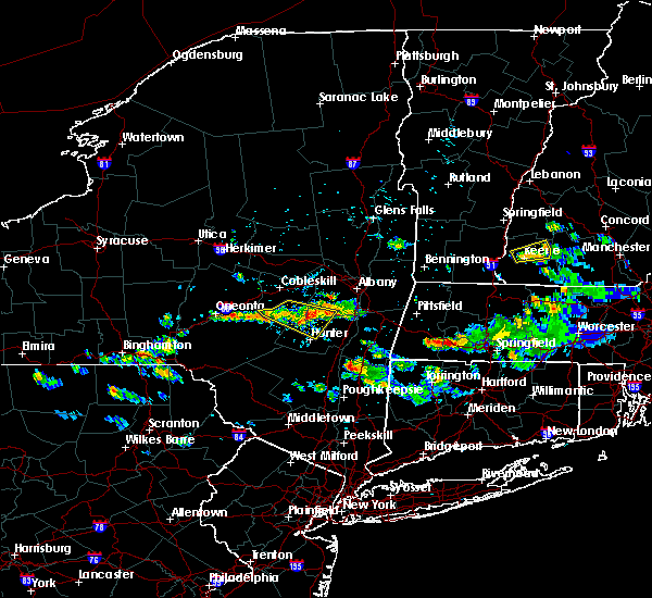 At 356 pm edt, a severe thunderstorm was located near preston hollow, or 12 miles north of hunter, moving southeast at 20 mph (radar indicated). Hazards include 60 mph wind gusts and penny size hail. Expect damage to roofs, siding, and trees. Locations impacted include, jefferson, windham, gilboa, livingstonville, north blenheim, breakabeen, preston-potter hollow, preston hollow, durham, conesville, west settlement, maplecrest, broome center, sunside, housons corners, hervey street, south durham, south gilboa, cooksburg and bates. At 356 pm edt, a severe thunderstorm was located near preston hollow, or 12 miles north of hunter, moving southeast at 20 mph (radar indicated). Hazards include 60 mph wind gusts and penny size hail. Expect damage to roofs, siding, and trees. Locations impacted include, jefferson, windham, gilboa, livingstonville, north blenheim, breakabeen, preston-potter hollow, preston hollow, durham, conesville, west settlement, maplecrest, broome center, sunside, housons corners, hervey street, south durham, south gilboa, cooksburg and bates.
|
| 8/3/2019 3:17 PM EDT |
 At 317 pm edt, a severe thunderstorm was located near livingstonville, or 15 miles southeast of cobleskill, moving east at 45 mph (radar indicated). Hazards include 60 mph wind gusts. expect damage to roofs, siding, and trees At 317 pm edt, a severe thunderstorm was located near livingstonville, or 15 miles southeast of cobleskill, moving east at 45 mph (radar indicated). Hazards include 60 mph wind gusts. expect damage to roofs, siding, and trees
|
| 8/3/2019 3:00 PM EDT |
 At 300 pm edt, a severe thunderstorm was located 7 miles northwest of coxsackie, or 13 miles northwest of hudson, moving southeast at 10 mph (radar indicated). Hazards include 60 mph wind gusts and quarter size hail. Hail damage to vehicles is expected. Expect wind damage to roofs, siding, and trees. At 300 pm edt, a severe thunderstorm was located 7 miles northwest of coxsackie, or 13 miles northwest of hudson, moving southeast at 10 mph (radar indicated). Hazards include 60 mph wind gusts and quarter size hail. Hail damage to vehicles is expected. Expect wind damage to roofs, siding, and trees.
|
| 7/29/2019 10:03 PM EDT | Downed tree blocking roadway in albany county NY, 7 miles SSE of Greenville, NY |
| 7/29/2019 8:03 PM EDT | Downed tree blocking roadway in albany county NY, 7 miles SSE of Greenville, NY |
| 7/22/2019 5:58 PM EDT |
 The severe thunderstorm warning for hudson, eastern passaic, bergen, northeastern essex, westchester, bronx, rockland and new york (manhattan) counties will expire at 600 pm edt, the storms which prompted the warning have weakened below severe limits, and no longer pose an immediate threat to life or property. therefore, the warning will be allowed to expire. however flash flooding is still expected from the training thunderstorm activity. a severe thunderstorm watch remains in effect until 1000 pm edt for southern connecticut, northeastern new jersey, and southeastern new york. The severe thunderstorm warning for hudson, eastern passaic, bergen, northeastern essex, westchester, bronx, rockland and new york (manhattan) counties will expire at 600 pm edt, the storms which prompted the warning have weakened below severe limits, and no longer pose an immediate threat to life or property. therefore, the warning will be allowed to expire. however flash flooding is still expected from the training thunderstorm activity. a severe thunderstorm watch remains in effect until 1000 pm edt for southern connecticut, northeastern new jersey, and southeastern new york.
|
| 7/22/2019 5:16 PM EDT |
 At 516 pm edt, severe thunderstorms were located along a line extending from wayne to lyndhurst, moving northeast at 30 mph (radar indicated). Hazards include 60 mph wind gusts and quarter size hail. Minor hail damage to vehicles is possible. expect wind damage to trees and power lines. severe thunderstorms will be near, paterson and secaucus around 520 pm edt. ridgefield and hawthorne around 525 pm edt. hackensack and paramus around 530 pm edt. bergenfield and harlem around 535 pm edt. east tremont and riverdale around 540 pm edt. monsey and co-op city around 545 pm edt. yonkers and nanuet around 550 pm edt. new rochelle and new city around 555 pm edt. White plains and port chester around 600 pm edt. At 516 pm edt, severe thunderstorms were located along a line extending from wayne to lyndhurst, moving northeast at 30 mph (radar indicated). Hazards include 60 mph wind gusts and quarter size hail. Minor hail damage to vehicles is possible. expect wind damage to trees and power lines. severe thunderstorms will be near, paterson and secaucus around 520 pm edt. ridgefield and hawthorne around 525 pm edt. hackensack and paramus around 530 pm edt. bergenfield and harlem around 535 pm edt. east tremont and riverdale around 540 pm edt. monsey and co-op city around 545 pm edt. yonkers and nanuet around 550 pm edt. new rochelle and new city around 555 pm edt. White plains and port chester around 600 pm edt.
|
| 7/22/2019 4:26 PM EDT |
 The severe thunderstorm warning for central passaic, bergen, southern westchester and rockland counties will expire at 430 pm edt, the storm which prompted the warning has weakened below severe limits, and is exiting the warned area. therefore, the warning will be allowed to expire. a severe thunderstorm watch remains in effect until 1000 pm edt for southern connecticut, northeastern new jersey, and southeastern new york. The severe thunderstorm warning for central passaic, bergen, southern westchester and rockland counties will expire at 430 pm edt, the storm which prompted the warning has weakened below severe limits, and is exiting the warned area. therefore, the warning will be allowed to expire. a severe thunderstorm watch remains in effect until 1000 pm edt for southern connecticut, northeastern new jersey, and southeastern new york.
|
| 7/22/2019 4:00 PM EDT |
 At 359 pm edt, a severe thunderstorm was located near yorktown heights, or near mahopac, and is nearly stationary (radar indicated). Hazards include ping pong to possibly golf ball size hail and 60 mph wind gusts. People and animals outdoors will be injured. expect hail damage to roofs, siding, windows, and vehicles. expect wind damage to trees and power lines. This severe thunderstorm will remain over mainly rural areas of central passaic, bergen, southern westchester and rockland counties. At 359 pm edt, a severe thunderstorm was located near yorktown heights, or near mahopac, and is nearly stationary (radar indicated). Hazards include ping pong to possibly golf ball size hail and 60 mph wind gusts. People and animals outdoors will be injured. expect hail damage to roofs, siding, windows, and vehicles. expect wind damage to trees and power lines. This severe thunderstorm will remain over mainly rural areas of central passaic, bergen, southern westchester and rockland counties.
|
| 7/22/2019 3:38 PM EDT |
 At 338 pm edt, a severe thunderstorm was located over kinnelon, or near pompton lakes, moving east at 40 mph (radar indicated). Hazards include 60 mph wind gusts and quarter size hail. Minor hail damage to vehicles is possible. expect wind damage to trees and power lines. this severe thunderstorm will be near, pompton lakes around 345 pm edt. wayne around 350 pm edt. paterson and hawthorne around 355 pm edt. paramus and ridgewood around 400 pm edt. monsey and oradell around 405 pm edt. bergenfield and nanuet around 410 pm edt. tappan and norwood around 415 pm edt. yonkers and tarrytown around 420 pm edt. ossining and scarsdale around 425 pm edt. White plains and harrison around 430 pm edt. At 338 pm edt, a severe thunderstorm was located over kinnelon, or near pompton lakes, moving east at 40 mph (radar indicated). Hazards include 60 mph wind gusts and quarter size hail. Minor hail damage to vehicles is possible. expect wind damage to trees and power lines. this severe thunderstorm will be near, pompton lakes around 345 pm edt. wayne around 350 pm edt. paterson and hawthorne around 355 pm edt. paramus and ridgewood around 400 pm edt. monsey and oradell around 405 pm edt. bergenfield and nanuet around 410 pm edt. tappan and norwood around 415 pm edt. yonkers and tarrytown around 420 pm edt. ossining and scarsdale around 425 pm edt. White plains and harrison around 430 pm edt.
|
| 7/20/2019 8:58 PM EDT | Downed tre in albany county NY, 7.4 miles SSW of Greenville, NY |
| 7/17/2019 8:31 PM EDT |
 At 831 pm edt, severe thunderstorms were located along a line extending from near bedford to harrison to near scarsdale, moving east at 35 mph (radar indicated). Hazards include 60 mph wind gusts. Expect damage to trees and power lines. these severe storms will be near, greenwich around 835 pm edt. Stamford around 845 pm edt. At 831 pm edt, severe thunderstorms were located along a line extending from near bedford to harrison to near scarsdale, moving east at 35 mph (radar indicated). Hazards include 60 mph wind gusts. Expect damage to trees and power lines. these severe storms will be near, greenwich around 835 pm edt. Stamford around 845 pm edt.
|
| 7/17/2019 8:18 PM EDT |
 At 818 pm edt, severe thunderstorms were located along a line extending from near hawthorne to near dobbs ferry to yonkers, moving east at 35 mph (radar indicated). Hazards include 60 mph wind gusts. Expect damage to trees and power lines. these severe storms will be near, harrison around 830 pm edt. port chester and rye around 835 pm edt. Stamford around 840 pm edt. At 818 pm edt, severe thunderstorms were located along a line extending from near hawthorne to near dobbs ferry to yonkers, moving east at 35 mph (radar indicated). Hazards include 60 mph wind gusts. Expect damage to trees and power lines. these severe storms will be near, harrison around 830 pm edt. port chester and rye around 835 pm edt. Stamford around 840 pm edt.
|
| 7/17/2019 8:00 PM EDT |
 The national weather service in upton ny has issued a * severe thunderstorm warning for. southern fairfield county in southern connecticut. northeastern bergen county in northeastern new jersey. southern westchester county in southeastern new york. Rockland county in southeastern new york. The national weather service in upton ny has issued a * severe thunderstorm warning for. southern fairfield county in southern connecticut. northeastern bergen county in northeastern new jersey. southern westchester county in southeastern new york. Rockland county in southeastern new york.
|
| 7/17/2019 8:00 PM EDT |
 At 759 pm edt, severe thunderstorms were located along a line extending from near new city to near pearl river to paramus, moving east at 35 mph (radar indicated). Hazards include 60 mph wind gusts. Expect damage to trees and power lines. severe thunderstorms will be near, nyack and tappan around 805 pm edt. orangeburg and upper nyack around 810 pm edt. yonkers and tarrytown around 815 pm edt. bronxville and hawthorne around 820 pm edt. new rochelle and white plains around 825 pm edt. harrison around 830 pm edt. port chester and rye around 835 pm edt. Stamford around 840 pm edt. At 759 pm edt, severe thunderstorms were located along a line extending from near new city to near pearl river to paramus, moving east at 35 mph (radar indicated). Hazards include 60 mph wind gusts. Expect damage to trees and power lines. severe thunderstorms will be near, nyack and tappan around 805 pm edt. orangeburg and upper nyack around 810 pm edt. yonkers and tarrytown around 815 pm edt. bronxville and hawthorne around 820 pm edt. new rochelle and white plains around 825 pm edt. harrison around 830 pm edt. port chester and rye around 835 pm edt. Stamford around 840 pm edt.
|
| 7/17/2019 8:00 PM EDT |
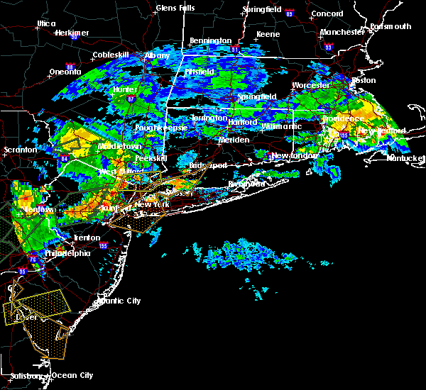 At 759 pm edt, severe thunderstorms were located along a line extending from near new city to near pearl river to paramus, moving east at 35 mph (radar indicated). Hazards include 60 mph wind gusts. Expect damage to trees and power lines. severe thunderstorms will be near, nyack and tappan around 805 pm edt. orangeburg and upper nyack around 810 pm edt. yonkers and tarrytown around 815 pm edt. bronxville and hawthorne around 820 pm edt. new rochelle and white plains around 825 pm edt. harrison around 830 pm edt. port chester and rye around 835 pm edt. Stamford around 840 pm edt. At 759 pm edt, severe thunderstorms were located along a line extending from near new city to near pearl river to paramus, moving east at 35 mph (radar indicated). Hazards include 60 mph wind gusts. Expect damage to trees and power lines. severe thunderstorms will be near, nyack and tappan around 805 pm edt. orangeburg and upper nyack around 810 pm edt. yonkers and tarrytown around 815 pm edt. bronxville and hawthorne around 820 pm edt. new rochelle and white plains around 825 pm edt. harrison around 830 pm edt. port chester and rye around 835 pm edt. Stamford around 840 pm edt.
|
| 7/17/2019 7:33 PM EDT |
 At 733 pm edt, severe thunderstorms were located along a line extending from florida to lake telemark to near clinton, moving east at 50 mph (radar indicated). Hazards include 60 mph wind gusts. Expect damage to trees and power lines. these severe storms will be near, pompton lakes and caldwell around 745 pm edt. wayne around 750 pm edt. paterson and passaic around 755 pm edt. Plainfield and hackensack around 800 pm edt. At 733 pm edt, severe thunderstorms were located along a line extending from florida to lake telemark to near clinton, moving east at 50 mph (radar indicated). Hazards include 60 mph wind gusts. Expect damage to trees and power lines. these severe storms will be near, pompton lakes and caldwell around 745 pm edt. wayne around 750 pm edt. paterson and passaic around 755 pm edt. Plainfield and hackensack around 800 pm edt.
|
| 7/17/2019 7:19 PM EDT |
 At 718 pm edt, severe thunderstorms were located along a line extending from near unionville to near stanhope to ferndale, moving east at 50 mph (radar indicated). Hazards include 60 mph wind gusts. Expect damage to trees and power lines. severe thunderstorms will be near, pompton lakes and caldwell around 745 pm edt. wayne around 750 pm edt. paterson and passaic around 755 pm edt. Plainfield and hackensack around 800 pm edt. At 718 pm edt, severe thunderstorms were located along a line extending from near unionville to near stanhope to ferndale, moving east at 50 mph (radar indicated). Hazards include 60 mph wind gusts. Expect damage to trees and power lines. severe thunderstorms will be near, pompton lakes and caldwell around 745 pm edt. wayne around 750 pm edt. paterson and passaic around 755 pm edt. Plainfield and hackensack around 800 pm edt.
|
| 7/17/2019 7:19 PM EDT |
 The national weather service in upton ny has issued a * severe thunderstorm warning for. southern fairfield county in southern connecticut. hudson county in northeastern new jersey. passaic county in northeastern new jersey. Union county in northeastern new jersey. The national weather service in upton ny has issued a * severe thunderstorm warning for. southern fairfield county in southern connecticut. hudson county in northeastern new jersey. passaic county in northeastern new jersey. Union county in northeastern new jersey.
|
| 7/17/2019 7:19 PM EDT |
 At 718 pm edt, severe thunderstorms were located along a line extending from near unionville to near stanhope to ferndale, moving east at 50 mph (radar indicated). Hazards include 60 mph wind gusts. Expect damage to trees and power lines. severe thunderstorms will be near, pompton lakes and caldwell around 745 pm edt. wayne around 750 pm edt. paterson and passaic around 755 pm edt. Plainfield and hackensack around 800 pm edt. At 718 pm edt, severe thunderstorms were located along a line extending from near unionville to near stanhope to ferndale, moving east at 50 mph (radar indicated). Hazards include 60 mph wind gusts. Expect damage to trees and power lines. severe thunderstorms will be near, pompton lakes and caldwell around 745 pm edt. wayne around 750 pm edt. paterson and passaic around 755 pm edt. Plainfield and hackensack around 800 pm edt.
|
| 5/19/2019 6:20 PM EDT |
 At 619 pm edt, a severe thunderstorm was located over windham, or 8 miles northwest of hunter, moving northeast at 25 mph (radar indicated). Hazards include 60 mph wind gusts and quarter size hail. Hail damage to vehicles is expected. Expect wind damage to roofs, siding, and trees. At 619 pm edt, a severe thunderstorm was located over windham, or 8 miles northwest of hunter, moving northeast at 25 mph (radar indicated). Hazards include 60 mph wind gusts and quarter size hail. Hail damage to vehicles is expected. Expect wind damage to roofs, siding, and trees.
|
| 4/15/2019 4:55 AM EDT |
 The severe thunderstorm warning for southern fairfield, southern westchester, queens, bronx, kings, new york (manhattan) and western nassau counties will expire at 500 am edt, the storms which prompted the warning have weakened below severe limits, and no longer pose an immediate threat to life or property. therefore, the warning will be allowed to expire. a tornado watch remains in effect until 700 am edt for southern connecticut, and southeastern new york. The severe thunderstorm warning for southern fairfield, southern westchester, queens, bronx, kings, new york (manhattan) and western nassau counties will expire at 500 am edt, the storms which prompted the warning have weakened below severe limits, and no longer pose an immediate threat to life or property. therefore, the warning will be allowed to expire. a tornado watch remains in effect until 700 am edt for southern connecticut, and southeastern new york.
|
| 4/15/2019 4:48 AM EDT |
 At 448 am edt, severe thunderstorms were located along a line extending from mount kisco to co- op city to near coney island, moving east at 50 mph (radar indicated). Hazards include 60 mph wind gusts. Expect damage to trees and power lines. these severe storms will be near, mount kisco and greenwich around 455 am edt. Stamford and glen cove around 500 am edt. At 448 am edt, severe thunderstorms were located along a line extending from mount kisco to co- op city to near coney island, moving east at 50 mph (radar indicated). Hazards include 60 mph wind gusts. Expect damage to trees and power lines. these severe storms will be near, mount kisco and greenwich around 455 am edt. Stamford and glen cove around 500 am edt.
|
| 4/15/2019 4:37 AM EDT |
 At 437 am edt, severe thunderstorms were located along a line extending from ossining to harlem to near keansburg, moving east at 50 mph (radar indicated). Hazards include 60 mph wind gusts. Expect damage to trees and power lines. severe thunderstorms will be near, mott haven and ossining around 440 am edt. yonkers and flushing around 445 am edt. flatbush and new rochelle around 450 am edt. canarsie and howard beach around 455 am edt. Stamford and valley stream around 500 am edt. At 437 am edt, severe thunderstorms were located along a line extending from ossining to harlem to near keansburg, moving east at 50 mph (radar indicated). Hazards include 60 mph wind gusts. Expect damage to trees and power lines. severe thunderstorms will be near, mott haven and ossining around 440 am edt. yonkers and flushing around 445 am edt. flatbush and new rochelle around 450 am edt. canarsie and howard beach around 455 am edt. Stamford and valley stream around 500 am edt.
|
| 4/15/2019 2:39 AM EDT |
 At 238 am edt, a severe thunderstorm was located 8 miles west of coxsackie, or 10 miles northwest of catskill, moving northeast at 60 mph (radar indicated). Hazards include 60 mph wind gusts and quarter size hail. Hail damage to vehicles is expected. Expect wind damage to roofs, siding, and trees. At 238 am edt, a severe thunderstorm was located 8 miles west of coxsackie, or 10 miles northwest of catskill, moving northeast at 60 mph (radar indicated). Hazards include 60 mph wind gusts and quarter size hail. Hail damage to vehicles is expected. Expect wind damage to roofs, siding, and trees.
|
| 3/15/2019 8:41 PM EDT |
 The severe thunderstorm warning for southern fairfield, eastern passaic, central bergen, central westchester and rockland counties will expire at 845 pm edt, the severe thunderstorm which prompted the warning has moved out of the warned area. therefore, the warning will be allowed to expire. The severe thunderstorm warning for southern fairfield, eastern passaic, central bergen, central westchester and rockland counties will expire at 845 pm edt, the severe thunderstorm which prompted the warning has moved out of the warned area. therefore, the warning will be allowed to expire.
|
| 3/15/2019 8:08 PM EDT |
 At 807 pm edt, a severe thunderstorm was located over hawthorne, or over paterson, moving northeast at 45 mph (radar indicated). Hazards include 60 mph wind gusts and penny size hail. Expect damage to trees and power lines. this severe thunderstorm will be near, ridgewood around 810 pm edt. paramus and oradell around 815 pm edt. pearl river and norwood around 820 pm edt. tappan and orangeburg around 825 pm edt. tarrytown and dobbs ferry around 830 pm edt. white plains and harrison around 835 pm edt. Stamford and mount kisco around 845 pm edt. At 807 pm edt, a severe thunderstorm was located over hawthorne, or over paterson, moving northeast at 45 mph (radar indicated). Hazards include 60 mph wind gusts and penny size hail. Expect damage to trees and power lines. this severe thunderstorm will be near, ridgewood around 810 pm edt. paramus and oradell around 815 pm edt. pearl river and norwood around 820 pm edt. tappan and orangeburg around 825 pm edt. tarrytown and dobbs ferry around 830 pm edt. white plains and harrison around 835 pm edt. Stamford and mount kisco around 845 pm edt.
|
| 8/17/2018 7:46 PM EDT |
 At 745 pm edt, severe thunderstorms were located along a line extending from near brewster to near new canaan, moving northeast at 25 mph (radar indicated). Hazards include 60 mph wind gusts and quarter size hail. Minor hail damage to vehicles is possible. expect wind damage to trees and power lines. these severe storms will be near, georgetown around 805 pm edt. fairfield and weston around 810 pm edt. Danbury and ridgefield around 815 pm edt. At 745 pm edt, severe thunderstorms were located along a line extending from near brewster to near new canaan, moving northeast at 25 mph (radar indicated). Hazards include 60 mph wind gusts and quarter size hail. Minor hail damage to vehicles is possible. expect wind damage to trees and power lines. these severe storms will be near, georgetown around 805 pm edt. fairfield and weston around 810 pm edt. Danbury and ridgefield around 815 pm edt.
|
| 8/17/2018 7:29 PM EDT |
 At 729 pm edt, severe thunderstorms were located along a line extending from near yorktown heights to greenwich, moving northeast at 40 mph (radar indicated). Hazards include 60 mph wind gusts and quarter size hail. Minor hail damage to vehicles is possible. expect wind damage to trees and power lines. severe thunderstorms will be near, norwalk and new canaan around 745 pm edt. westport and wilton around 755 pm edt. ridgefield and weston around 800 pm edt. danbury and redding around 805 pm edt. Bethel around 810 pm edt. At 729 pm edt, severe thunderstorms were located along a line extending from near yorktown heights to greenwich, moving northeast at 40 mph (radar indicated). Hazards include 60 mph wind gusts and quarter size hail. Minor hail damage to vehicles is possible. expect wind damage to trees and power lines. severe thunderstorms will be near, norwalk and new canaan around 745 pm edt. westport and wilton around 755 pm edt. ridgefield and weston around 800 pm edt. danbury and redding around 805 pm edt. Bethel around 810 pm edt.
|
| 8/17/2018 7:13 PM EDT |
 At 712 pm edt, severe thunderstorms were located along a line extending from near mount kisco to scarsdale, moving northeast at 35 mph (radar indicated). Hazards include 60 mph wind gusts and quarter size hail. Minor hail damage to vehicles is possible. expect wind damage to trees and power lines. these severe storms will be near, mount kisco and bedford around 720 pm edt. Stamford and greenwich around 730 pm edt. At 712 pm edt, severe thunderstorms were located along a line extending from near mount kisco to scarsdale, moving northeast at 35 mph (radar indicated). Hazards include 60 mph wind gusts and quarter size hail. Minor hail damage to vehicles is possible. expect wind damage to trees and power lines. these severe storms will be near, mount kisco and bedford around 720 pm edt. Stamford and greenwich around 730 pm edt.
|
| 8/17/2018 7:03 PM EDT |
 At 702 pm edt, severe thunderstorms were located along a line extending from upper nyack to near yonkers, moving northeast at 40 mph (radar indicated). Hazards include 60 mph wind gusts and quarter size hail. Minor hail damage to vehicles is possible. expect wind damage to trees and power lines. severe thunderstorms will be near, ossining and tarrytown around 705 pm edt. white plains around 710 pm edt. harrison and hawthorne around 715 pm edt. mount kisco around 720 pm edt. Stamford and greenwich around 730 pm edt. At 702 pm edt, severe thunderstorms were located along a line extending from upper nyack to near yonkers, moving northeast at 40 mph (radar indicated). Hazards include 60 mph wind gusts and quarter size hail. Minor hail damage to vehicles is possible. expect wind damage to trees and power lines. severe thunderstorms will be near, ossining and tarrytown around 705 pm edt. white plains around 710 pm edt. harrison and hawthorne around 715 pm edt. mount kisco around 720 pm edt. Stamford and greenwich around 730 pm edt.
|
| 8/17/2018 6:59 PM EDT |
 At 659 pm edt, severe thunderstorms were located along a line extending from near pearl river to near norwood, moving northeast at 25 mph (radar indicated). Hazards include 60 mph wind gusts and quarter size hail. Minor hail damage to vehicles is possible. expect wind damage to trees and power lines. Locations impacted include, hackensack, bergenfield, paramus, nanuet, dobbs ferry, nyack, tappan, englewood, pearl river, oradell, norwood, orangeburg, teterboro, teaneck and spring valley. At 659 pm edt, severe thunderstorms were located along a line extending from near pearl river to near norwood, moving northeast at 25 mph (radar indicated). Hazards include 60 mph wind gusts and quarter size hail. Minor hail damage to vehicles is possible. expect wind damage to trees and power lines. Locations impacted include, hackensack, bergenfield, paramus, nanuet, dobbs ferry, nyack, tappan, englewood, pearl river, oradell, norwood, orangeburg, teterboro, teaneck and spring valley.
|
| 8/17/2018 6:52 PM EDT |
 At 650 pm edt, severe thunderstorms were located along a line extending from ballston spa to near country knolls to near guilderland to 6 miles southeast of westerlo to near windham, moving east at 40 mph (radar indicated). Hazards include 60 mph wind gusts and quarter size hail. Hail damage to vehicles is expected. expect wind damage to roofs, siding, and trees. these severe storms will be near, albany, clifton park, colonie, delmar, guilderland, milton, ballston spa, round lake, north ballston spa and country knolls around 655 pm edt. saratoga springs, rensselaer, mechanicville, latham, menands, new baltimore, ravena, loudonville and selkirk around 700 pm edt. cohoes, watervliet, green island, waterford, castleton-on-hudson and wyantskill around 705 pm edt. troy, center brunswick, west sand lake and averill park around 710 pm edt. East greenbush, nassau, coxsackie, grafton, cambridge and greenwich around 715 pm edt. At 650 pm edt, severe thunderstorms were located along a line extending from ballston spa to near country knolls to near guilderland to 6 miles southeast of westerlo to near windham, moving east at 40 mph (radar indicated). Hazards include 60 mph wind gusts and quarter size hail. Hail damage to vehicles is expected. expect wind damage to roofs, siding, and trees. these severe storms will be near, albany, clifton park, colonie, delmar, guilderland, milton, ballston spa, round lake, north ballston spa and country knolls around 655 pm edt. saratoga springs, rensselaer, mechanicville, latham, menands, new baltimore, ravena, loudonville and selkirk around 700 pm edt. cohoes, watervliet, green island, waterford, castleton-on-hudson and wyantskill around 705 pm edt. troy, center brunswick, west sand lake and averill park around 710 pm edt. East greenbush, nassau, coxsackie, grafton, cambridge and greenwich around 715 pm edt.
|
| 8/17/2018 6:36 PM EDT |
 At 636 pm edt, severe thunderstorms were located along a line extending from hawthorne to teterboro, moving northeast at 25 mph (radar indicated). Hazards include 60 mph wind gusts and quarter size hail. Minor hail damage to vehicles is possible. expect wind damage to trees and power lines. severe thunderstorms will be near, hackensack around 640 pm edt. paramus and ridgewood around 645 pm edt. bergenfield and oradell around 650 pm edt. norwood around 700 pm edt. monsey and nanuet around 705 pm edt. dobbs ferry and orangeburg around 710 pm edt. Nyack around 715 pm edt. At 636 pm edt, severe thunderstorms were located along a line extending from hawthorne to teterboro, moving northeast at 25 mph (radar indicated). Hazards include 60 mph wind gusts and quarter size hail. Minor hail damage to vehicles is possible. expect wind damage to trees and power lines. severe thunderstorms will be near, hackensack around 640 pm edt. paramus and ridgewood around 645 pm edt. bergenfield and oradell around 650 pm edt. norwood around 700 pm edt. monsey and nanuet around 705 pm edt. dobbs ferry and orangeburg around 710 pm edt. Nyack around 715 pm edt.
|
| 8/17/2018 6:22 PM EDT |
 At 621 pm edt, severe thunderstorms were located along a line extending from near amsterdam to near duanesburg to near berne to near preston-potter hollow to near fleischmanns, moving east at 40 mph (radar indicated). Hazards include 60 mph wind gusts and quarter size hail. Hail damage to vehicles is expected. expect wind damage to roofs, siding, and trees. severe thunderstorms will be near, amsterdam, duanesburg, berne, delanson and pattersonville-rotterdam junction around 625 pm edt. rotterdam, glenville and rotterdam junction around 630 pm edt. schenectady, scotia, niskayuna, altamont, alplaus and east glenville around 635 pm edt. westerlo, voorheesville, burnt hills and feura bush around 640 pm edt. clifton park, guilderland, ballston spa, north ballston spa and country knolls around 645 pm edt. albany, colonie, delmar, milton and round lake around 650 pm edt. saratoga springs, rensselaer, mechanicville, latham, new baltimore, ravena and loudonville around 655 pm edt. Cohoes, watervliet, menands, green island, selkirk and wyantskill around 700 pm edt. At 621 pm edt, severe thunderstorms were located along a line extending from near amsterdam to near duanesburg to near berne to near preston-potter hollow to near fleischmanns, moving east at 40 mph (radar indicated). Hazards include 60 mph wind gusts and quarter size hail. Hail damage to vehicles is expected. expect wind damage to roofs, siding, and trees. severe thunderstorms will be near, amsterdam, duanesburg, berne, delanson and pattersonville-rotterdam junction around 625 pm edt. rotterdam, glenville and rotterdam junction around 630 pm edt. schenectady, scotia, niskayuna, altamont, alplaus and east glenville around 635 pm edt. westerlo, voorheesville, burnt hills and feura bush around 640 pm edt. clifton park, guilderland, ballston spa, north ballston spa and country knolls around 645 pm edt. albany, colonie, delmar, milton and round lake around 650 pm edt. saratoga springs, rensselaer, mechanicville, latham, new baltimore, ravena and loudonville around 655 pm edt. Cohoes, watervliet, menands, green island, selkirk and wyantskill around 700 pm edt.
|
| 8/11/2018 8:53 AM EDT |
 A severe thunderstorm warning remains in effect until 915 am edt for south central westchester. queens. bronx and northern nassau counties. At 851 am edt, a severe thunderstorm was located along a line from northern nassau county into southern westchester county, moving northeast at 20 mph. A severe thunderstorm warning remains in effect until 915 am edt for south central westchester. queens. bronx and northern nassau counties. At 851 am edt, a severe thunderstorm was located along a line from northern nassau county into southern westchester county, moving northeast at 20 mph.
|
| 8/11/2018 8:23 AM EDT |
 At 823 am edt, a severe thunderstorm was located over astoria, or over rfk bridge, moving northeast at 20 mph (radar indicated). Hazards include 60 mph wind gusts. Expect damage to trees and power lines. this severe thunderstorm will be near, east tremont and riverdale around 835 am edt. throgs neck bridge and bayside around 840 am edt. great neck and city island around 845 am edt. new rochelle and manhasset around 850 am edt. port washington and sands point around 855 am edt. scarsdale around 900 am edt. glen cove and rye around 905 am edt. Port chester and oyster bay around 915 am edt. At 823 am edt, a severe thunderstorm was located over astoria, or over rfk bridge, moving northeast at 20 mph (radar indicated). Hazards include 60 mph wind gusts. Expect damage to trees and power lines. this severe thunderstorm will be near, east tremont and riverdale around 835 am edt. throgs neck bridge and bayside around 840 am edt. great neck and city island around 845 am edt. new rochelle and manhasset around 850 am edt. port washington and sands point around 855 am edt. scarsdale around 900 am edt. glen cove and rye around 905 am edt. Port chester and oyster bay around 915 am edt.
|
| 8/3/2018 1:32 PM EDT |
 At 132 pm edt, a severe thunderstorm was located near westerlo, or 14 miles southwest of delmar, moving northeast at 25 mph (radar indicated). Hazards include 60 mph wind gusts and quarter size hail. Hail damage to vehicles is expected. expect wind damage to roofs, siding, and trees. this severe thunderstorm will be near, new baltimore and feura bush around 150 pm edt. ravena and selkirk around 155 pm edt. valatie around 200 pm edt. castleton-on-hudson around 205 pm edt. east greenbush and nassau around 215 pm edt. stephentown, averill park and west sand lake around 230 pm edt. Other locations impacted by this severe thunderstorm include brookview, van hoesen station, dormansville, beckers corners, millers corners, rayville, otter hook, riders mills, climax and south schodack. At 132 pm edt, a severe thunderstorm was located near westerlo, or 14 miles southwest of delmar, moving northeast at 25 mph (radar indicated). Hazards include 60 mph wind gusts and quarter size hail. Hail damage to vehicles is expected. expect wind damage to roofs, siding, and trees. this severe thunderstorm will be near, new baltimore and feura bush around 150 pm edt. ravena and selkirk around 155 pm edt. valatie around 200 pm edt. castleton-on-hudson around 205 pm edt. east greenbush and nassau around 215 pm edt. stephentown, averill park and west sand lake around 230 pm edt. Other locations impacted by this severe thunderstorm include brookview, van hoesen station, dormansville, beckers corners, millers corners, rayville, otter hook, riders mills, climax and south schodack.
|
| 7/3/2018 2:36 PM EDT |
 At 235 pm edt, a severe thunderstorm was located over tappan, moving northeast at 10 mph (radar indicated). Hazards include 60 mph wind gusts. Expect damage to trees and power lines. this severe storm will be near, tappan around 240 pm edt. pearl river around 245 pm edt. nanuet and dobbs ferry around 255 pm edt. Nyack around 300 pm edt. At 235 pm edt, a severe thunderstorm was located over tappan, moving northeast at 10 mph (radar indicated). Hazards include 60 mph wind gusts. Expect damage to trees and power lines. this severe storm will be near, tappan around 240 pm edt. pearl river around 245 pm edt. nanuet and dobbs ferry around 255 pm edt. Nyack around 300 pm edt.
|
| 7/3/2018 2:18 PM EDT |
 At 218 pm edt, a severe thunderstorm was located near norwood, or near tappan, moving northeast at 10 mph (radar indicated). Hazards include 60 mph wind gusts. Expect damage to trees and power lines. this severe thunderstorm will be near, norwood around 225 pm edt. tappan around 240 pm edt. pearl river around 245 pm edt. orangeburg around 250 pm edt. nanuet and dobbs ferry around 255 pm edt. Nyack around 300 pm edt. At 218 pm edt, a severe thunderstorm was located near norwood, or near tappan, moving northeast at 10 mph (radar indicated). Hazards include 60 mph wind gusts. Expect damage to trees and power lines. this severe thunderstorm will be near, norwood around 225 pm edt. tappan around 240 pm edt. pearl river around 245 pm edt. orangeburg around 250 pm edt. nanuet and dobbs ferry around 255 pm edt. Nyack around 300 pm edt.
|
| 5/15/2018 5:19 PM EDT |
 At 516 pm edt, severe thunderstorms were located along a line extending from near tolland to plainville to near hamden to stamford to kearny to near white house station, moving east at 50 mph (trained weather spotters and automated surface observations, with numerous reports of wind damage). Hazards include 70 mph wind gusts and nickel size hail. Expect considerable tree damage. damage is likely to mobile homes, roofs, and outbuildings. Locations impacted include, newark, jersey city, jamaica, yonkers, paterson, bridgeport, new haven, elizabeth, stamford, flatbush, waterbury, norwalk, danbury, new rochelle and flushing. At 516 pm edt, severe thunderstorms were located along a line extending from near tolland to plainville to near hamden to stamford to kearny to near white house station, moving east at 50 mph (trained weather spotters and automated surface observations, with numerous reports of wind damage). Hazards include 70 mph wind gusts and nickel size hail. Expect considerable tree damage. damage is likely to mobile homes, roofs, and outbuildings. Locations impacted include, newark, jersey city, jamaica, yonkers, paterson, bridgeport, new haven, elizabeth, stamford, flatbush, waterbury, norwalk, danbury, new rochelle and flushing.
|
| 5/15/2018 4:51 PM EDT |
 At 448 pm edt, severe thunderstorms were located along a line extending from near windsor locks to sherman to danbury to near pomona to boonton to near bloomsbury, moving east at 45 mph (mesonet observations and trained weather spotters. the new york state mesonet site at beacon reported winds of 78 mph at 420 pm). Hazards include 70 mph wind gusts and quarter size hail. Minor hail damage to vehicles is possible. expect considerable tree damage. Wind damage is also likely to mobile homes, roofs, and outbuildings. At 448 pm edt, severe thunderstorms were located along a line extending from near windsor locks to sherman to danbury to near pomona to boonton to near bloomsbury, moving east at 45 mph (mesonet observations and trained weather spotters. the new york state mesonet site at beacon reported winds of 78 mph at 420 pm). Hazards include 70 mph wind gusts and quarter size hail. Minor hail damage to vehicles is possible. expect considerable tree damage. Wind damage is also likely to mobile homes, roofs, and outbuildings.
|
| 5/15/2018 4:38 PM EDT |
 At 437 pm edt, severe thunderstorms were located along a line extending from lake carmel to near west point to victory gardens to washington to near coffeetown, moving east at 45 mph. these are very dangerous storms (the new york state mesonet site at beacon reported winds of 78 mph at 420 pm). Hazards include 80 mph wind gusts and penny size hail. Flying debris will be dangerous to those caught without shelter. mobile homes will be heavily damaged. expect considerable damage to roofs, windows, and vehicles. extensive tree damage and power outages are likely. Locations impacted include, yonkers, paterson, stamford, waterbury, danbury, passaic, white plains, wayne, bloomfield, hackensack, shelton, new city, naugatuck, orange and newburgh. At 437 pm edt, severe thunderstorms were located along a line extending from lake carmel to near west point to victory gardens to washington to near coffeetown, moving east at 45 mph. these are very dangerous storms (the new york state mesonet site at beacon reported winds of 78 mph at 420 pm). Hazards include 80 mph wind gusts and penny size hail. Flying debris will be dangerous to those caught without shelter. mobile homes will be heavily damaged. expect considerable damage to roofs, windows, and vehicles. extensive tree damage and power outages are likely. Locations impacted include, yonkers, paterson, stamford, waterbury, danbury, passaic, white plains, wayne, bloomfield, hackensack, shelton, new city, naugatuck, orange and newburgh.
|
| 5/15/2018 4:06 PM EDT |
 At 405 pm edt, severe thunderstorms were located along a line extending from near wallkill to near high point to near dingmans ferry to stormville to near tamaqua, moving east at 110 mph (radar indicated). Hazards include 70 mph wind gusts and quarter size hail. Minor hail damage to vehicles is possible. expect considerable tree damage. wind damage is also likely to mobile homes, roofs, and outbuildings. Locations that could be impacted include, yonkers, paterson, stamford, waterbury, danbury, passaic, white plains, wayne, bloomfield, hackensack, shelton, new city, naugatuck, orange and newburgh. At 405 pm edt, severe thunderstorms were located along a line extending from near wallkill to near high point to near dingmans ferry to stormville to near tamaqua, moving east at 110 mph (radar indicated). Hazards include 70 mph wind gusts and quarter size hail. Minor hail damage to vehicles is possible. expect considerable tree damage. wind damage is also likely to mobile homes, roofs, and outbuildings. Locations that could be impacted include, yonkers, paterson, stamford, waterbury, danbury, passaic, white plains, wayne, bloomfield, hackensack, shelton, new city, naugatuck, orange and newburgh.
|
| 5/15/2018 3:34 PM EDT |
 At 331 pm edt, severe thunderstorms were located along a line extending from hazel to near lava to new boston-morea, moving east at 70 mph (radar indicated). Hazards include 70 mph wind gusts and quarter size hail. Minor hail damage to vehicles is possible. expect considerable tree damage. wind damage is also likely to mobile homes, roofs, and outbuildings. severe thunderstorms will be near, howells around 350 pm edt. montgomery around 400 pm edt. walden around 405 pm edt. newburgh and new windsor around 410 pm edt. fahnestock state park around 420 pm edt. lake carmel around 425 pm edt. brookfield and new fairfield around 435 pm edt. danbury and newtown around 440 pm edt. summit and southbury around 450 pm edt. waterbury and naugatuck around 455 pm edt. Bloomfield and rutherford around 500 pm edt. At 331 pm edt, severe thunderstorms were located along a line extending from hazel to near lava to new boston-morea, moving east at 70 mph (radar indicated). Hazards include 70 mph wind gusts and quarter size hail. Minor hail damage to vehicles is possible. expect considerable tree damage. wind damage is also likely to mobile homes, roofs, and outbuildings. severe thunderstorms will be near, howells around 350 pm edt. montgomery around 400 pm edt. walden around 405 pm edt. newburgh and new windsor around 410 pm edt. fahnestock state park around 420 pm edt. lake carmel around 425 pm edt. brookfield and new fairfield around 435 pm edt. danbury and newtown around 440 pm edt. summit and southbury around 450 pm edt. waterbury and naugatuck around 455 pm edt. Bloomfield and rutherford around 500 pm edt.
|
| 5/4/2018 8:37 PM EDT |
 At 835 pm edt, severe thunderstorms were located along a line extending from near guilderland to near feura bush to near windham, moving east at 45 mph (radar indicated). Hazards include 60 mph wind gusts. Expect damage to roofs, siding, and trees. these storms have a history of producing wind damage. trees and wires are reported down in clifton park, guilderland, rotterdam and schenectady. these severe storms will be near, albany, delmar and feura bush around 840 pm edt. east greenbush, rensselaer, menands, new baltimore, ravena, castleton-on-hudson and selkirk around 845 pm edt. kinderhook and wynantskill around 850 pm edt. nassau, valatie, west sand lake and averill park around 855 pm edt. chatham and coxsackie around 900 pm edt. stephentown around 905 pm edt. Other locations impacted by these severe thunderstorms include bleecker stadium, clarksville, east berne, brookview, shoefelt corners, van hoesen station, west berne, dormansville, beckers corners and millers corners. At 835 pm edt, severe thunderstorms were located along a line extending from near guilderland to near feura bush to near windham, moving east at 45 mph (radar indicated). Hazards include 60 mph wind gusts. Expect damage to roofs, siding, and trees. these storms have a history of producing wind damage. trees and wires are reported down in clifton park, guilderland, rotterdam and schenectady. these severe storms will be near, albany, delmar and feura bush around 840 pm edt. east greenbush, rensselaer, menands, new baltimore, ravena, castleton-on-hudson and selkirk around 845 pm edt. kinderhook and wynantskill around 850 pm edt. nassau, valatie, west sand lake and averill park around 855 pm edt. chatham and coxsackie around 900 pm edt. stephentown around 905 pm edt. Other locations impacted by these severe thunderstorms include bleecker stadium, clarksville, east berne, brookview, shoefelt corners, van hoesen station, west berne, dormansville, beckers corners and millers corners.
|
| 5/4/2018 8:19 PM EDT |
 At 818 pm edt, severe thunderstorms were located along a line extending from near altamont to near berne to near gilboa, moving east at 50 mph (radar indicated). Hazards include 60 mph wind gusts. Expect damage to roofs, siding, and trees. severe thunderstorms will be near, westerlo and voorheesville around 830 pm edt. albany, delmar, feura bush, preston hollow and preston-potter hollow around 835 pm edt. rensselaer, ravena and selkirk around 840 pm edt. east greenbush, menands, new baltimore, castleton-on-hudson and wynantskill around 845 pm edt. valatie, kinderhook and west sand lake around 850 pm edt. nassau and averill park around 855 pm edt. chatham, stephentown and coxsackie around 900 pm edt. Other locations impacted by these severe thunderstorms include bleecker stadium, clarksville, east berne, brookview, shoefelt corners, van hoesen station, west berne, dormansville, beckers corners and millers corners. At 818 pm edt, severe thunderstorms were located along a line extending from near altamont to near berne to near gilboa, moving east at 50 mph (radar indicated). Hazards include 60 mph wind gusts. Expect damage to roofs, siding, and trees. severe thunderstorms will be near, westerlo and voorheesville around 830 pm edt. albany, delmar, feura bush, preston hollow and preston-potter hollow around 835 pm edt. rensselaer, ravena and selkirk around 840 pm edt. east greenbush, menands, new baltimore, castleton-on-hudson and wynantskill around 845 pm edt. valatie, kinderhook and west sand lake around 850 pm edt. nassau and averill park around 855 pm edt. chatham, stephentown and coxsackie around 900 pm edt. Other locations impacted by these severe thunderstorms include bleecker stadium, clarksville, east berne, brookview, shoefelt corners, van hoesen station, west berne, dormansville, beckers corners and millers corners.
|
| 5/3/2018 7:07 PM EDT |
 At 706 pm edt, showers and thunderstorms capable of producing damaging winds and small hail were located along a line extending from weston to near new canaan to bronxville, moving east at 60 mph (radar indicated). Hazards include 60 mph wind gusts. Expect damage to trees and power lines. these severe storms will be near, norwalk and westport around 710 pm edt. bridgeport and fairfield around 715 pm edt. Stratford around 720 pm edt. At 706 pm edt, showers and thunderstorms capable of producing damaging winds and small hail were located along a line extending from weston to near new canaan to bronxville, moving east at 60 mph (radar indicated). Hazards include 60 mph wind gusts. Expect damage to trees and power lines. these severe storms will be near, norwalk and westport around 710 pm edt. bridgeport and fairfield around 715 pm edt. Stratford around 720 pm edt.
|
| 5/3/2018 6:45 PM EDT |
 At 644 pm edt, showers and thunderstorms capable of producing damaging winds were located along a line extending from near yorktown heights to near upper nyack to near nanuet, moving east at 50 mph (radar indicated). Hazards include 60 mph wind gusts. Expect damage to trees and power lines. severe thunderstorms will be near, tarrytown and mount kisco around 650 pm edt. dobbs ferry and hawthorne around 655 pm edt. yonkers and stamford around 700 pm edt. new rochelle and white plains around 705 pm edt. norwalk and port chester around 710 pm edt. Westport around 715 pm edt. At 644 pm edt, showers and thunderstorms capable of producing damaging winds were located along a line extending from near yorktown heights to near upper nyack to near nanuet, moving east at 50 mph (radar indicated). Hazards include 60 mph wind gusts. Expect damage to trees and power lines. severe thunderstorms will be near, tarrytown and mount kisco around 650 pm edt. dobbs ferry and hawthorne around 655 pm edt. yonkers and stamford around 700 pm edt. new rochelle and white plains around 705 pm edt. norwalk and port chester around 710 pm edt. Westport around 715 pm edt.
|
| 10/24/2017 2:16 PM EDT |
 At 216 pm edt, a severe thunderstorm was located 8 miles northwest of catskill, moving northeast at 45 mph (radar indicated). Hazards include 60 mph wind gusts. Expect damage to trees, and power lines. this severe thunderstorm will be near, coxsackie around 225 pm edt. new baltimore and ravena around 235 pm edt. selkirk and feura bush around 240 pm edt. castleton-on-hudson around 245 pm edt. east greenbush and delmar around 250 pm edt. albany, rensselaer and west sand lake around 255 pm edt. Other locations impacted by this severe thunderstorm include bleecker stadium, clarksville, brookview, van hoesen station, dormansville, beckers corners, millers corners, otter hook, kiskatom and climax. At 216 pm edt, a severe thunderstorm was located 8 miles northwest of catskill, moving northeast at 45 mph (radar indicated). Hazards include 60 mph wind gusts. Expect damage to trees, and power lines. this severe thunderstorm will be near, coxsackie around 225 pm edt. new baltimore and ravena around 235 pm edt. selkirk and feura bush around 240 pm edt. castleton-on-hudson around 245 pm edt. east greenbush and delmar around 250 pm edt. albany, rensselaer and west sand lake around 255 pm edt. Other locations impacted by this severe thunderstorm include bleecker stadium, clarksville, brookview, van hoesen station, dormansville, beckers corners, millers corners, otter hook, kiskatom and climax.
|
| 8/2/2017 1:23 PM EDT |
 At 123 pm edt, a severe thunderstorm was located over white plains, moving northeast at 5 mph (radar indicated). Hazards include 60 mph wind gusts and quarter size hail. Hail damage to vehicles is expected. Expect wind damage to roofs, siding, and trees. At 123 pm edt, a severe thunderstorm was located over white plains, moving northeast at 5 mph (radar indicated). Hazards include 60 mph wind gusts and quarter size hail. Hail damage to vehicles is expected. Expect wind damage to roofs, siding, and trees.
|
| 8/2/2017 1:06 PM EDT |
 The severe thunderstorm warning for southern westchester and bronx counties will expire at 115 pm edt, the severe thunderstorm which prompted the warning has weakened. therefore, the warning will be allowed to expire. additional thunderstorm development is possible this afternoon. The severe thunderstorm warning for southern westchester and bronx counties will expire at 115 pm edt, the severe thunderstorm which prompted the warning has weakened. therefore, the warning will be allowed to expire. additional thunderstorm development is possible this afternoon.
|
| 8/2/2017 12:35 PM EDT |
 At 1234 pm edt, a severe thunderstorm was located over co-op city, or near east tremont, moving north at 10 mph (radar indicated). Hazards include 60 mph wind gusts and penny size hail. expect damage to roofs, siding, and trees At 1234 pm edt, a severe thunderstorm was located over co-op city, or near east tremont, moving north at 10 mph (radar indicated). Hazards include 60 mph wind gusts and penny size hail. expect damage to roofs, siding, and trees
|
| 7/8/2017 3:31 PM EDT |
 At 331 pm edt, a severe thunderstorm was located near ravena, or 13 miles south of delmar, moving east at 35 mph (radar indicated). Hazards include 60 mph wind gusts and penny size hail. Expect damage to trees, and power lines. this severe thunderstorm will be near, ravena and coxsackie around 340 pm edt. new baltimore around 345 pm edt. valatie and kinderhook around 355 pm edt. nassau around 400 pm edt. chatham around 405 pm edt. Other locations impacted by this severe thunderstorm include coeymans hollow, van hoesen station, jacks corners, dormansville, round top, rossman, rayville, result, earlton and otter hook. At 331 pm edt, a severe thunderstorm was located near ravena, or 13 miles south of delmar, moving east at 35 mph (radar indicated). Hazards include 60 mph wind gusts and penny size hail. Expect damage to trees, and power lines. this severe thunderstorm will be near, ravena and coxsackie around 340 pm edt. new baltimore around 345 pm edt. valatie and kinderhook around 355 pm edt. nassau around 400 pm edt. chatham around 405 pm edt. Other locations impacted by this severe thunderstorm include coeymans hollow, van hoesen station, jacks corners, dormansville, round top, rossman, rayville, result, earlton and otter hook.
|
| 6/30/2017 4:09 PM EDT | Route 81 closed between lo see rd and eagle nest rd due to downed wires in the town of greenville in greene county NY, 4.7 miles WNW of Greenville, NY |
| 6/19/2017 5:36 PM EDT |
 The severe thunderstorm warning for hudson, eastern passaic, union, bergen, essex, southern westchester, richmond, bronx, new york and rockland counties will expire at 545 pm edt, the storms which prompted the warning have moved out of the warned area. therefore, the warning will be allowed to expire. a severe thunderstorm watch remains in effect until 800 pm edt for northeastern new jersey, and southeastern new york. The severe thunderstorm warning for hudson, eastern passaic, union, bergen, essex, southern westchester, richmond, bronx, new york and rockland counties will expire at 545 pm edt, the storms which prompted the warning have moved out of the warned area. therefore, the warning will be allowed to expire. a severe thunderstorm watch remains in effect until 800 pm edt for northeastern new jersey, and southeastern new york.
|
| 6/19/2017 5:01 PM EDT |
 At 500 pm edt, severe thunderstorms were located along a line extending from millstone to bound brook to society hill to near edison to near new brunswick, moving northeast at 45 mph (radar indicated). Hazards include 60 mph wind gusts. Expect damage to roofs, siding, and trees. severe thunderstorms will be near, plainfield around 505 pm edt. clark around 510 pm edt. elizabeth and linden around 515 pm edt. newark and jersey city around 520 pm edt. passaic and hoboken around 525 pm edt. paterson and hackensack around 530 pm edt. wayne and bergenfield around 535 pm edt. yonkers and tappan around 540 pm edt. White plains and new city around 545 pm edt. At 500 pm edt, severe thunderstorms were located along a line extending from millstone to bound brook to society hill to near edison to near new brunswick, moving northeast at 45 mph (radar indicated). Hazards include 60 mph wind gusts. Expect damage to roofs, siding, and trees. severe thunderstorms will be near, plainfield around 505 pm edt. clark around 510 pm edt. elizabeth and linden around 515 pm edt. newark and jersey city around 520 pm edt. passaic and hoboken around 525 pm edt. paterson and hackensack around 530 pm edt. wayne and bergenfield around 535 pm edt. yonkers and tappan around 540 pm edt. White plains and new city around 545 pm edt.
|
| 6/19/2017 4:35 PM EDT |
 At 435 pm edt, a severe thunderstorm was located over newark, moving northeast at 45 mph (radar indicated). Hazards include 60 mph wind gusts and penny size hail. Expect damage to roofs, siding, and trees. this severe thunderstorm will be near, jersey city around 440 pm edt. hoboken and lyndhurst around 445 pm edt. hackensack and ridgefield around 450 pm edt. flushing and mott haven around 455 pm edt. east tremont and throgs neck bridge around 500 pm edt. yonkers and co-op city around 505 pm edt. new rochelle and dobbs ferry around 510 pm edt. white plains and glen cove around 515 pm edt. Bayville around 520 pm edt. At 435 pm edt, a severe thunderstorm was located over newark, moving northeast at 45 mph (radar indicated). Hazards include 60 mph wind gusts and penny size hail. Expect damage to roofs, siding, and trees. this severe thunderstorm will be near, jersey city around 440 pm edt. hoboken and lyndhurst around 445 pm edt. hackensack and ridgefield around 450 pm edt. flushing and mott haven around 455 pm edt. east tremont and throgs neck bridge around 500 pm edt. yonkers and co-op city around 505 pm edt. new rochelle and dobbs ferry around 510 pm edt. white plains and glen cove around 515 pm edt. Bayville around 520 pm edt.
|
| 5/31/2017 4:43 PM EDT |
 At 442 pm edt, a severe thunderstorm was located near ravena, or 13 miles south of delmar, moving east at 30 mph (radar indicated). Hazards include ping pong ball size hail and 60 mph wind gusts. People and animals outdoors will be injured. expect hail damage to roofs, siding, windows, and vehicles. expect wind damage to roofs, siding, and trees. this severe storm will be near, new baltimore, ravena and selkirk around 455 pm edt. valatie, castleton-on-hudson and kinderhook around 505 pm edt. nassau around 515 pm edt. Stephentown and new lebanon around 530 pm edt. At 442 pm edt, a severe thunderstorm was located near ravena, or 13 miles south of delmar, moving east at 30 mph (radar indicated). Hazards include ping pong ball size hail and 60 mph wind gusts. People and animals outdoors will be injured. expect hail damage to roofs, siding, windows, and vehicles. expect wind damage to roofs, siding, and trees. this severe storm will be near, new baltimore, ravena and selkirk around 455 pm edt. valatie, castleton-on-hudson and kinderhook around 505 pm edt. nassau around 515 pm edt. Stephentown and new lebanon around 530 pm edt.
|
| 5/31/2017 4:25 PM EDT |
 At 424 pm edt, a severe thunderstorm was located near westerlo, or 16 miles southwest of delmar, moving east at 35 mph (radar indicated). Hazards include 60 mph wind gusts and quarter size hail. Hail damage to vehicles is expected. expect wind damage to roofs, siding, and trees. this severe thunderstorm will be near, new baltimore, ravena and feura bush around 445 pm edt. delmar and selkirk around 450 pm edt. castleton-on-hudson around 455 pm edt. east greenbush around 500 pm edt. nassau around 505 pm edt. west sand lake around 510 pm edt. averill park around 515 pm edt. Stephentown around 520 pm edt. At 424 pm edt, a severe thunderstorm was located near westerlo, or 16 miles southwest of delmar, moving east at 35 mph (radar indicated). Hazards include 60 mph wind gusts and quarter size hail. Hail damage to vehicles is expected. expect wind damage to roofs, siding, and trees. this severe thunderstorm will be near, new baltimore, ravena and feura bush around 445 pm edt. delmar and selkirk around 450 pm edt. castleton-on-hudson around 455 pm edt. east greenbush around 500 pm edt. nassau around 505 pm edt. west sand lake around 510 pm edt. averill park around 515 pm edt. Stephentown around 520 pm edt.
|
| 5/18/2017 8:33 PM EDT |
 At 833 pm edt, severe thunderstorms were located along a line extending from near westerlo to 6 miles southeast of preston hollow to near windham, moving east at 50 mph (radar indicated). Hazards include 60 mph wind gusts and quarter size hail. Hail damage to vehicles is expected. expect wind damage to roofs, siding, and trees. severe thunderstorms will be near, new baltimore, ravena and selkirk around 845 pm edt. coxsackie and castleton-on-hudson around 850 pm edt. catskill and nassau around 855 pm edt. hudson, valatie, athens, kinderhook and lorenz park around 900 pm edt. chatham, claverack and claverack-red mills around 905 pm edt. new lebanon and philmont around 910 pm edt. pittsfield and austerlitz around 915 pm edt. Other locations impacted by these severe thunderstorms include van hoesen station, burden, dormansville, rossman, rayville, otter hook, riders mills, north hillsdale, kiskatom and sunside. At 833 pm edt, severe thunderstorms were located along a line extending from near westerlo to 6 miles southeast of preston hollow to near windham, moving east at 50 mph (radar indicated). Hazards include 60 mph wind gusts and quarter size hail. Hail damage to vehicles is expected. expect wind damage to roofs, siding, and trees. severe thunderstorms will be near, new baltimore, ravena and selkirk around 845 pm edt. coxsackie and castleton-on-hudson around 850 pm edt. catskill and nassau around 855 pm edt. hudson, valatie, athens, kinderhook and lorenz park around 900 pm edt. chatham, claverack and claverack-red mills around 905 pm edt. new lebanon and philmont around 910 pm edt. pittsfield and austerlitz around 915 pm edt. Other locations impacted by these severe thunderstorms include van hoesen station, burden, dormansville, rossman, rayville, otter hook, riders mills, north hillsdale, kiskatom and sunside.
|
| 5/1/2017 9:25 PM EDT |
 At 925 pm edt, severe thunderstorms were located along a line extending from near galway to duanesburg to near windham to hortonville, moving east at 65 mph (radar indicated). Hazards include 70 mph wind gusts. Expect considerable tree damage. Damage is likely to mobile homes, roofs, and outbuildings. At 925 pm edt, severe thunderstorms were located along a line extending from near galway to duanesburg to near windham to hortonville, moving east at 65 mph (radar indicated). Hazards include 70 mph wind gusts. Expect considerable tree damage. Damage is likely to mobile homes, roofs, and outbuildings.
|
| 3/8/2017 2:41 PM EST |
 The severe thunderstorm warning for eastern schenectady. columbia. albany. eastern greene. saratoga. southern washington and rensselaer counties will expire at 245 pm est. the storms which prompted the warning have moved out of the warned area. Therefore, the warning will be allowed to expire. The severe thunderstorm warning for eastern schenectady. columbia. albany. eastern greene. saratoga. southern washington and rensselaer counties will expire at 245 pm est. the storms which prompted the warning have moved out of the warned area. Therefore, the warning will be allowed to expire.
|
| 3/8/2017 2:11 PM EST |
 At 211 pm est, severe thunderstorms were located along a line extending from near fort edward to catskill, moving east at 50 mph (radar indicated). Hazards include 60 mph wind gusts. Expect damage to roofs, siding, and trees. these severe storms will be near, fort edward around 215 pm est. philmont around 225 pm est. chatham and salem around 230 pm est. Austerlitz around 235 pm est. At 211 pm est, severe thunderstorms were located along a line extending from near fort edward to catskill, moving east at 50 mph (radar indicated). Hazards include 60 mph wind gusts. Expect damage to roofs, siding, and trees. these severe storms will be near, fort edward around 215 pm est. philmont around 225 pm est. chatham and salem around 230 pm est. Austerlitz around 235 pm est.
|
| 3/8/2017 1:45 PM EST |
 At 145 pm est, severe thunderstorms were located along a line extending from edinburg to near hunter, moving east at 55 mph (radar indicated). Hazards include 60 mph wind gusts. Expect damage to roofs, siding, and trees. severe thunderstorms will be near, corinth around 200 pm est. saratoga springs and catskill around 205 pm est. hudson, claverack, livingston, athens, claverack-red mills and lorenz park around 210 pm est. fort edward and philmont around 215 pm est. austerlitz around 225 pm est. salem around 230 pm est. Other locations impacted by these severe thunderstorms include deans corners, charleston, bleecker stadium, glenridge, hoffmans, west berne, huntersland, wayville, broome center and wiley corners. At 145 pm est, severe thunderstorms were located along a line extending from edinburg to near hunter, moving east at 55 mph (radar indicated). Hazards include 60 mph wind gusts. Expect damage to roofs, siding, and trees. severe thunderstorms will be near, corinth around 200 pm est. saratoga springs and catskill around 205 pm est. hudson, claverack, livingston, athens, claverack-red mills and lorenz park around 210 pm est. fort edward and philmont around 215 pm est. austerlitz around 225 pm est. salem around 230 pm est. Other locations impacted by these severe thunderstorms include deans corners, charleston, bleecker stadium, glenridge, hoffmans, west berne, huntersland, wayville, broome center and wiley corners.
|
| 8/13/2016 8:24 PM EDT |
 At 822 pm edt, severe thunderstorms were located near scarsdale and demarest, moving east at 25 mph (radar indicated). Hazards include 60 mph wind gusts. Expect damage to roofs. siding. And trees. At 822 pm edt, severe thunderstorms were located near scarsdale and demarest, moving east at 25 mph (radar indicated). Hazards include 60 mph wind gusts. Expect damage to roofs. siding. And trees.
|
| 8/13/2016 8:20 PM EDT |
 At 819 pm edt, a severe thunderstorm was located over new baltimore, or 10 miles northwest of chatham, moving east at 50 mph (radar indicated). Hazards include 60 mph wind gusts and quarter size hail. Hail damage to vehicles is expected. expect wind damage to roofs, siding, and trees. this severe thunderstorm will be near, valatie around 825 pm edt. chatham and nassau around 830 pm edt. stephentown around 840 pm edt. new lebanon around 845 pm edt. Other locations impacted by this severe thunderstorm include east chatham, riders, denault corners, lenox house country shops, braeside, roberts hill, new lebanon center, dunham hollow, queechy and coeymans hollow. At 819 pm edt, a severe thunderstorm was located over new baltimore, or 10 miles northwest of chatham, moving east at 50 mph (radar indicated). Hazards include 60 mph wind gusts and quarter size hail. Hail damage to vehicles is expected. expect wind damage to roofs, siding, and trees. this severe thunderstorm will be near, valatie around 825 pm edt. chatham and nassau around 830 pm edt. stephentown around 840 pm edt. new lebanon around 845 pm edt. Other locations impacted by this severe thunderstorm include east chatham, riders, denault corners, lenox house country shops, braeside, roberts hill, new lebanon center, dunham hollow, queechy and coeymans hollow.
|
| 8/12/2016 4:07 PM EDT |
 At 405 pm edt, severe thunderstorms were located along a line extending from delmar to near westerlo, moving southeast at 35 mph (radar indicated). Hazards include 60 mph wind gusts. Expect damage to roofs. siding. and trees. Locations impacted include, albany, east greenbush, rensselaer, colonie, hudson, nassau, delmar, guilderland, menands, new baltimore, westerlo, ravena, stephentown, coxsackie, voorheesville, valatie, altamont, athens, castleton-on-hudson and kinderhook. At 405 pm edt, severe thunderstorms were located along a line extending from delmar to near westerlo, moving southeast at 35 mph (radar indicated). Hazards include 60 mph wind gusts. Expect damage to roofs. siding. and trees. Locations impacted include, albany, east greenbush, rensselaer, colonie, hudson, nassau, delmar, guilderland, menands, new baltimore, westerlo, ravena, stephentown, coxsackie, voorheesville, valatie, altamont, athens, castleton-on-hudson and kinderhook.
|
| 8/12/2016 3:26 PM EDT |
 At 325 pm edt, severe thunderstorms were located along a line extending from 6 miles northwest of delanson to near cobleskill, moving southeast at 35 mph (radar indicated). Hazards include 60 mph wind gusts. Expect damage to roofs. siding. And trees. At 325 pm edt, severe thunderstorms were located along a line extending from 6 miles northwest of delanson to near cobleskill, moving southeast at 35 mph (radar indicated). Hazards include 60 mph wind gusts. Expect damage to roofs. siding. And trees.
|
| 7/25/2016 7:00 PM EDT |
 At 658 pm edt, severe thunderstorms were located along a line extending from near redding to near hawthorne to harrison to yonkers, moving east at 40 mph (radar indicated). Hazards include wind gusts up to 60 mph. Expect damage to roofs. siding. and trees. these severe storms will be near, bridgeport, fairfield, trumbull, westport, weston and redding around 705 pm edt. stamford and shelton around 710 pm edt. norwalk, stratford, darien and derby around 715 pm edt. Other locations impacted by these severe thunderstorms include pleasantville, easton, hastings-on- hudson, greenville, tuckahoe, rye brook, mount vernon, thornwood, elmsford and armonk. At 658 pm edt, severe thunderstorms were located along a line extending from near redding to near hawthorne to harrison to yonkers, moving east at 40 mph (radar indicated). Hazards include wind gusts up to 60 mph. Expect damage to roofs. siding. and trees. these severe storms will be near, bridgeport, fairfield, trumbull, westport, weston and redding around 705 pm edt. stamford and shelton around 710 pm edt. norwalk, stratford, darien and derby around 715 pm edt. Other locations impacted by these severe thunderstorms include pleasantville, easton, hastings-on- hudson, greenville, tuckahoe, rye brook, mount vernon, thornwood, elmsford and armonk.
|
| 7/25/2016 6:32 PM EDT |
 At 631 pm edt, severe thunderstorms were located along a line extending from near peekskill to new city to hawthorne, moving east at 40 mph (radar indicated). Hazards include 60 mph wind gusts. Expect damage to roofs. siding. and trees. severe thunderstorms will be near, peekskill, haverstraw, nyack, upper nyack and orangeburg around 635 pm edt. englewood and hawthorne around 645 pm edt. yonkers, dobbs ferry and bedford around 655 pm edt. stamford, white plains, new canaan, harrison and ridgefield around 705 pm edt. Port chester, rye, darien, wilton and georgetown around 710 pm edt. At 631 pm edt, severe thunderstorms were located along a line extending from near peekskill to new city to hawthorne, moving east at 40 mph (radar indicated). Hazards include 60 mph wind gusts. Expect damage to roofs. siding. and trees. severe thunderstorms will be near, peekskill, haverstraw, nyack, upper nyack and orangeburg around 635 pm edt. englewood and hawthorne around 645 pm edt. yonkers, dobbs ferry and bedford around 655 pm edt. stamford, white plains, new canaan, harrison and ridgefield around 705 pm edt. Port chester, rye, darien, wilton and georgetown around 710 pm edt.
|
| 7/18/2016 12:36 PM EDT | Tree down at intersection of route 402 and route 40 in albany county NY, 7.7 miles S of Greenville, NY |
| 7/1/2016 6:06 PM EDT |
 At 606 pm edt, a severe thunderstorm was located over hawthorne, or near mount kisco, moving east at 25 mph (radar indicated). Hazards include 60 mph wind gusts. Expect damage to roofs. siding. and trees. this severe thunderstorm will be near, mount kisco around 610 pm edt. greenwich around 620 pm edt. bedford around 630 pm edt. stamford and darien around 635 pm edt. new canaan around 640 pm edt. norwalk, westport, wilton and georgetown around 645 pm edt. other locations impacted by this severe thunderstorm include armonk, pleasantville, golden`s bridge, rye brook, briarcliff manor, thornwood, hartsdale, elmsford, greenville and easton. A tornado watch remains in effect until 1000 pm edt for southern connecticut, and southeastern new york. At 606 pm edt, a severe thunderstorm was located over hawthorne, or near mount kisco, moving east at 25 mph (radar indicated). Hazards include 60 mph wind gusts. Expect damage to roofs. siding. and trees. this severe thunderstorm will be near, mount kisco around 610 pm edt. greenwich around 620 pm edt. bedford around 630 pm edt. stamford and darien around 635 pm edt. new canaan around 640 pm edt. norwalk, westport, wilton and georgetown around 645 pm edt. other locations impacted by this severe thunderstorm include armonk, pleasantville, golden`s bridge, rye brook, briarcliff manor, thornwood, hartsdale, elmsford, greenville and easton. A tornado watch remains in effect until 1000 pm edt for southern connecticut, and southeastern new york.
|
| 7/1/2016 5:12 PM EDT |
 At 512 pm edt, severe thunderstorms were located along a line extending from near wappingers falls to near upper greenwood lake, moving east at 35 mph (radar indicated). Hazards include 60 mph wind gusts. Expect damage to roofs. siding. and trees. severe thunderstorms will be near, newburgh and gardnertown around 515 pm edt. ramsey and suffern around 530 pm edt. monsey and new york--newark around 535 pm edt. nanuet, pomona and pearl river around 540 pm edt. new city around 545 pm edt. peekskill, haverstraw, nyack, new fairfield and upper nyack around 550 pm edt. ossining, tarrytown, sherman and north tarrytown around 555 pm edt. mount kisco, brookfield, hawthorne and yorktown heights around 600 pm edt. other locations impacted by these severe thunderstorms include west haverstraw, pleasantville, upper saddle river, west nyack, balmville, highland mills, spring valley, montvale, brewster hill and thiells. A tornado watch remains in effect until 1000 pm edt for southern connecticut, northeastern new jersey, and southeastern new york. At 512 pm edt, severe thunderstorms were located along a line extending from near wappingers falls to near upper greenwood lake, moving east at 35 mph (radar indicated). Hazards include 60 mph wind gusts. Expect damage to roofs. siding. and trees. severe thunderstorms will be near, newburgh and gardnertown around 515 pm edt. ramsey and suffern around 530 pm edt. monsey and new york--newark around 535 pm edt. nanuet, pomona and pearl river around 540 pm edt. new city around 545 pm edt. peekskill, haverstraw, nyack, new fairfield and upper nyack around 550 pm edt. ossining, tarrytown, sherman and north tarrytown around 555 pm edt. mount kisco, brookfield, hawthorne and yorktown heights around 600 pm edt. other locations impacted by these severe thunderstorms include west haverstraw, pleasantville, upper saddle river, west nyack, balmville, highland mills, spring valley, montvale, brewster hill and thiells. A tornado watch remains in effect until 1000 pm edt for southern connecticut, northeastern new jersey, and southeastern new york.
|
| 7/1/2016 4:15 PM EDT |
 At 414 pm edt, severe thunderstorms were located along a line extending from ramsey to bergenfield, moving northeast at 30 mph (radar indicated). Hazards include 60 mph wind gusts. Expect damage to roofs. siding. and trees. severe thunderstorms will be near, norwood around 420 pm edt. yonkers, monsey, tappan and pearl river around 425 pm edt. dobbs ferry, nanuet and orangeburg around 430 pm edt. tarrytown, nyack, new city, north tarrytown, scarsdale, pomona and upper nyack around 435 pm edt. white plains, haverstraw and harrison around 440 pm edt. ossining and hawthorne around 445 pm edt. peekskill around 450 pm edt. mount kisco around 455 pm edt. other locations impacted by these severe thunderstorms include west haverstraw, rockleigh, pleasantville, upper saddle river, west nyack, haworth, wyckoff, spring valley, montvale and bogota. A tornado watch remains in effect until 1000 pm edt for southern connecticut, northeastern new jersey, and southeastern new york. At 414 pm edt, severe thunderstorms were located along a line extending from ramsey to bergenfield, moving northeast at 30 mph (radar indicated). Hazards include 60 mph wind gusts. Expect damage to roofs. siding. and trees. severe thunderstorms will be near, norwood around 420 pm edt. yonkers, monsey, tappan and pearl river around 425 pm edt. dobbs ferry, nanuet and orangeburg around 430 pm edt. tarrytown, nyack, new city, north tarrytown, scarsdale, pomona and upper nyack around 435 pm edt. white plains, haverstraw and harrison around 440 pm edt. ossining and hawthorne around 445 pm edt. peekskill around 450 pm edt. mount kisco around 455 pm edt. other locations impacted by these severe thunderstorms include west haverstraw, rockleigh, pleasantville, upper saddle river, west nyack, haworth, wyckoff, spring valley, montvale and bogota. A tornado watch remains in effect until 1000 pm edt for southern connecticut, northeastern new jersey, and southeastern new york.
|
| 6/21/2016 2:45 AM EDT |
 At 244 am edt, a severe thunderstorm was located near westerlo, or 11 miles southwest of delmar, moving east at 50 mph (radar indicated). Hazards include 60 mph wind gusts and quarter size hail. Hail damage to vehicles is expected. expect wind damage to roofs, siding, and trees. Locations impacted include, westerlo, ravena, coxsackie, preston hollow, preston-potter hollow, coeymans, durham, rensselaerville, south westerlo, lambs corner, freehold, east durham, oak hill, alcove, smith corner, roberts hill, dormansville, norton hill, coeymans hollow and cooksburg. At 244 am edt, a severe thunderstorm was located near westerlo, or 11 miles southwest of delmar, moving east at 50 mph (radar indicated). Hazards include 60 mph wind gusts and quarter size hail. Hail damage to vehicles is expected. expect wind damage to roofs, siding, and trees. Locations impacted include, westerlo, ravena, coxsackie, preston hollow, preston-potter hollow, coeymans, durham, rensselaerville, south westerlo, lambs corner, freehold, east durham, oak hill, alcove, smith corner, roberts hill, dormansville, norton hill, coeymans hollow and cooksburg.
|
| 6/21/2016 2:22 AM EDT |
 At 221 am edt, a severe thunderstorm was located near north blenheim, or 14 miles south of cobleskill, moving east at 45 mph (radar indicated). Hazards include 60 mph wind gusts and quarter size hail. Hail damage to vehicles is expected. Expect wind damage to roofs, siding, and trees. At 221 am edt, a severe thunderstorm was located near north blenheim, or 14 miles south of cobleskill, moving east at 45 mph (radar indicated). Hazards include 60 mph wind gusts and quarter size hail. Hail damage to vehicles is expected. Expect wind damage to roofs, siding, and trees.
|
| 6/5/2016 6:27 PM EDT |
 At 626 pm edt, severe thunderstorms were located along a line extending from haverstraw to hackensack to colonia, moving east at 45 mph (radar indicated). Hazards include 60 mph wind gusts. Expect damage to roofs. siding. and trees. severe thunderstorms will be near, new york, ossining, tarrytown, north tarrytown, midtown manhattan, morningside heights and upper west side around 630 pm edt. mott haven, rfk bridge, riverdale, harlem, hawthorne, central park, astoria and long island city around 635 pm edt. yonkers, mount kisco, east tremont, todt hill, laguardia airport, flushing, bronxville, cardinal spellman hs, co-op city and port richmond around 640 pm edt. new rochelle, bayonne, verrazano- narrows bridge, throgs neck bridge, city island, oakwood, tompkinsville and whitestone around 645 pm edt. coney island, bedford, arturo toscanini ps, bay ridge, bensonhurst and park slope around 650 pm edt. flatbush, crown heights and sheepshead bay around 655 pm edt. canarsie around 700 pm edt. Other locations impacted by these severe thunderstorms include pleasantville, hastings-on-hudson, tuckahoe, rye brook, mount vernon, thornwood, washington heights, elmsford, armonk and greenwich village. At 626 pm edt, severe thunderstorms were located along a line extending from haverstraw to hackensack to colonia, moving east at 45 mph (radar indicated). Hazards include 60 mph wind gusts. Expect damage to roofs. siding. and trees. severe thunderstorms will be near, new york, ossining, tarrytown, north tarrytown, midtown manhattan, morningside heights and upper west side around 630 pm edt. mott haven, rfk bridge, riverdale, harlem, hawthorne, central park, astoria and long island city around 635 pm edt. yonkers, mount kisco, east tremont, todt hill, laguardia airport, flushing, bronxville, cardinal spellman hs, co-op city and port richmond around 640 pm edt. new rochelle, bayonne, verrazano- narrows bridge, throgs neck bridge, city island, oakwood, tompkinsville and whitestone around 645 pm edt. coney island, bedford, arturo toscanini ps, bay ridge, bensonhurst and park slope around 650 pm edt. flatbush, crown heights and sheepshead bay around 655 pm edt. canarsie around 700 pm edt. Other locations impacted by these severe thunderstorms include pleasantville, hastings-on-hudson, tuckahoe, rye brook, mount vernon, thornwood, washington heights, elmsford, armonk and greenwich village.
|
| 2/25/2016 12:27 AM EST | The severe thunderstorm warning for western new haven, fairfield, union, essex, hudson, eastern passaic, bergen, eastern orange, kings, queens, richmond, rockland, westchester, new york, bronx, central nassau and putnam counties will expire at 1230 am est, the storms which prompted the warning have moved out of the warned area. therefore the warning will be allowed to expire. |
| 2/25/2016 12:27 AM EST | The severe thunderstorm warning for western new haven, fairfield, union, essex, hudson, eastern passaic, bergen, eastern orange, kings, queens, richmond, rockland, westchester, new york, bronx, central nassau and putnam counties will expire at 1230 am est, the storms which prompted the warning have moved out of the warned area. therefore the warning will be allowed to expire. |
| 2/25/2016 12:27 AM EST | The severe thunderstorm warning for western new haven, fairfield, union, essex, hudson, eastern passaic, bergen, eastern orange, kings, queens, richmond, rockland, westchester, new york, bronx, central nassau and putnam counties will expire at 1230 am est, the storms which prompted the warning have moved out of the warned area. therefore the warning will be allowed to expire. |
| 2/25/2016 12:00 AM EST |
 At 1159 pm est, doppler radar indicated a line of severe thunderstorms capable of producing damaging winds in excess of 60 mph. these storms were located along a line extending from near myers corner to near new city to lyndhurst, moving northeast at 50 mph. these severe storms will be near, peekskill around 1205 am est. ridgewood, yorktown heights and riverdale around 1210 am est. yonkers, dobbs ferry, tappan, mahopac, bronxville, norwood and pearl river around 1215 am est. white plains, tarrytown, nyack, brewster, north tarrytown, lake carmel, nanuet, carmel, upper nyack and orangeburg around 1220 am est. new york--newark and hawthorne around 1225 am est. mount kisco, pawling and new fairfield around 1230 am est. other locations impacted by these severe thunderstorms include west hempstead, thomaston, west haverstraw, pleasantville, springfield, mount vernon, montclair, spring valley, hillside and washington heights. At 1159 pm est, doppler radar indicated a line of severe thunderstorms capable of producing damaging winds in excess of 60 mph. these storms were located along a line extending from near myers corner to near new city to lyndhurst, moving northeast at 50 mph. these severe storms will be near, peekskill around 1205 am est. ridgewood, yorktown heights and riverdale around 1210 am est. yonkers, dobbs ferry, tappan, mahopac, bronxville, norwood and pearl river around 1215 am est. white plains, tarrytown, nyack, brewster, north tarrytown, lake carmel, nanuet, carmel, upper nyack and orangeburg around 1220 am est. new york--newark and hawthorne around 1225 am est. mount kisco, pawling and new fairfield around 1230 am est. other locations impacted by these severe thunderstorms include west hempstead, thomaston, west haverstraw, pleasantville, springfield, mount vernon, montclair, spring valley, hillside and washington heights.
|
| 2/24/2016 11:26 PM EST |
 At 1122 pm est, doppler radar indicated a line of severe thunderstorms capable of producing damaging winds in excess of 60 mph. this line extending across the lower hudson valley of new york through portions of new york city and portions of northeast new jersey. it was moving northeast at 40 mph. * severe thunderstorms will be near, bergenfield, and riverdale around 1130 pm est. yonkers, tappan, norwood and orangeburg around 1135 pm est. new rochelle, tarrytown, dobbs ferry, nyack, bronxville and upper nyack around 1140 pm est. north tarrytown and scarsdale around 1145 pm est. white plains, perth amboy, harrison, hawthorne and colonia around 1150 pm est. port chester around 1155 pm est. linden, greenwich and carteret around 1200 am est. bedford and port richmond around 1205 am est. other locations impacted by these severe thunderstorms include west hempstead, thomaston, west haverstraw, pleasantville, springfield, mount vernon, montclair, spring valley, hillside and washington heights. At 1122 pm est, doppler radar indicated a line of severe thunderstorms capable of producing damaging winds in excess of 60 mph. this line extending across the lower hudson valley of new york through portions of new york city and portions of northeast new jersey. it was moving northeast at 40 mph. * severe thunderstorms will be near, bergenfield, and riverdale around 1130 pm est. yonkers, tappan, norwood and orangeburg around 1135 pm est. new rochelle, tarrytown, dobbs ferry, nyack, bronxville and upper nyack around 1140 pm est. north tarrytown and scarsdale around 1145 pm est. white plains, perth amboy, harrison, hawthorne and colonia around 1150 pm est. port chester around 1155 pm est. linden, greenwich and carteret around 1200 am est. bedford and port richmond around 1205 am est. other locations impacted by these severe thunderstorms include west hempstead, thomaston, west haverstraw, pleasantville, springfield, mount vernon, montclair, spring valley, hillside and washington heights.
|
| 2/24/2016 11:00 PM EST |
 At 1058 pm est, doppler radar indicated a severe thunderstorms moving across the warning area capable of producing damaging winds in excess of 60 mph. these storms were moving northeast at 0 to 50 mph. locations impacted include, white plains, newburgh, middletown, ossining, peekskill, haverstraw, tarrytown, mount kisco, dobbs ferry, port jervis, monroe, walden, nyack, warwick, goshen, sloatsburg, cold spring, nanuet, new city and north tarrytown. At 1058 pm est, doppler radar indicated a severe thunderstorms moving across the warning area capable of producing damaging winds in excess of 60 mph. these storms were moving northeast at 0 to 50 mph. locations impacted include, white plains, newburgh, middletown, ossining, peekskill, haverstraw, tarrytown, mount kisco, dobbs ferry, port jervis, monroe, walden, nyack, warwick, goshen, sloatsburg, cold spring, nanuet, new city and north tarrytown.
|
| 2/24/2016 10:57 PM EST |
 At 1055 pm est, doppler radar indicated thunderstorms capable of producing damaging winds in excess of 60 mph. the storms were moving northeast and will continue to impact the warning area. At 1055 pm est, doppler radar indicated thunderstorms capable of producing damaging winds in excess of 60 mph. the storms were moving northeast and will continue to impact the warning area.
|
| 2/24/2016 10:35 PM EST |
 At 1032 pm est, doppler radar indicated an area of thunderstorms capable of producing damaging winds in excess of 60 mph. this activity will move across much of the lower hudson valley of new york. other locations impacted by this severe thunderstorm include west haverstraw, pleasantville, west nyack, balmville, highland mills, spring valley, thiells, irvington, grand view-on-huds and new hempstead. expect strong winds and heavy downpours with this activity. At 1032 pm est, doppler radar indicated an area of thunderstorms capable of producing damaging winds in excess of 60 mph. this activity will move across much of the lower hudson valley of new york. other locations impacted by this severe thunderstorm include west haverstraw, pleasantville, west nyack, balmville, highland mills, spring valley, thiells, irvington, grand view-on-huds and new hempstead. expect strong winds and heavy downpours with this activity.
|
| 2/24/2016 10:28 PM EST |
 At 1024 pm est, doppler radar indicated a line of thunderstorms, with additional thunderstorms developing in central new jersey capable of producing damaging winds in excess of 60 mph. this activity is moving northeast at 40 to 50 mph and will impact much of northeast new jersey and the new york city metropolitan area. other locations impacted by this severe thunderstorm include upper saddle river, wyckoff, springfield, mount vernon, montclair, hillside, washington heights, clifton, montvale and bogota. expect strong winds and heavy downpours. At 1024 pm est, doppler radar indicated a line of thunderstorms, with additional thunderstorms developing in central new jersey capable of producing damaging winds in excess of 60 mph. this activity is moving northeast at 40 to 50 mph and will impact much of northeast new jersey and the new york city metropolitan area. other locations impacted by this severe thunderstorm include upper saddle river, wyckoff, springfield, mount vernon, montclair, hillside, washington heights, clifton, montvale and bogota. expect strong winds and heavy downpours.
|
| 8/15/2015 5:01 PM EDT |
 At 501 pm edt, a severe thunderstorm was located 9 miles west of coxsackie, or 12 miles northwest of catskill, moving east at 25 mph (radar indicated). Hazards include 60 mph wind gusts and quarter size hail. Hail damage to vehicles is expected. expect wind damage to roofs, siding and trees. this severe thunderstorm will be near, coxsackie around 525 pm edt. hudson, athens and lorenz park around 530 pm edt. claverack-red mills around 535 pm edt. valatie and kinderhook around 540 pm edt. philmont around 545 pm edt. chatham around 550 pm edt. Other locations impacted by this severe thunderstorm include east chatham, lakes mills bridge, stockport, roberts hill, fitchs wharf, mellenville, rossman, south cairo, east greenville and niverville. At 501 pm edt, a severe thunderstorm was located 9 miles west of coxsackie, or 12 miles northwest of catskill, moving east at 25 mph (radar indicated). Hazards include 60 mph wind gusts and quarter size hail. Hail damage to vehicles is expected. expect wind damage to roofs, siding and trees. this severe thunderstorm will be near, coxsackie around 525 pm edt. hudson, athens and lorenz park around 530 pm edt. claverack-red mills around 535 pm edt. valatie and kinderhook around 540 pm edt. philmont around 545 pm edt. chatham around 550 pm edt. Other locations impacted by this severe thunderstorm include east chatham, lakes mills bridge, stockport, roberts hill, fitchs wharf, mellenville, rossman, south cairo, east greenville and niverville.
|
| 7/21/2015 6:37 PM EDT |
 At 636 pm edt, doppler radar indicated a severe thunderstorm capable of producing quarter size hail and damaging winds in excess of 60 mph. this storm was located over monsey, and moving east at 20 mph. * this severe thunderstorm will be near, monsey around 640 pm edt. haverstraw, nanuet and new city around 650 pm edt. pearl river around 655 pm edt. ossining, tarrytown, dobbs ferry, nyack, north tarrytown, tappan, norwood, upper nyack, orangeburg and hawthorne around 700 pm edt. other locations impacted by this severe thunderstorm include airmont, west haverstraw, rockleigh, pleasantville, upper saddle river, west nyack, blauvelt, hastings-on-hudson, valley cottage and tuckahoe. At 636 pm edt, doppler radar indicated a severe thunderstorm capable of producing quarter size hail and damaging winds in excess of 60 mph. this storm was located over monsey, and moving east at 20 mph. * this severe thunderstorm will be near, monsey around 640 pm edt. haverstraw, nanuet and new city around 650 pm edt. pearl river around 655 pm edt. ossining, tarrytown, dobbs ferry, nyack, north tarrytown, tappan, norwood, upper nyack, orangeburg and hawthorne around 700 pm edt. other locations impacted by this severe thunderstorm include airmont, west haverstraw, rockleigh, pleasantville, upper saddle river, west nyack, blauvelt, hastings-on-hudson, valley cottage and tuckahoe.
|
| 7/1/2015 4:34 AM EDT |
 At 434 am edt, doppler radar indicated a line of severe thunderstorms capable of producing damaging winds in excess of 60 mph. these storms were located along a line extending from near oradell to bergenfield to upper west side, and moving northeast at 40 mph. * severe thunderstorms will be near, tappan, norwood, pearl river and riverdale around 440 am edt. yonkers, dobbs ferry, east tremont, bronxville and orangeburg around 445 am edt. tarrytown, nyack, north tarrytown, throgs neck bridge, scarsdale, upper nyack, co-op city and cardinal spellman hs around 450 am edt. new rochelle, white plains, ossining and city island around 455 am edt. port chester, harrison, sands point and hawthorne around 500 am edt. glen cove and rye around 505 am edt. mount kisco, greenwich and bayville around 510 am edt. stamford, new canaan, darien and bedford around 515 am edt. At 434 am edt, doppler radar indicated a line of severe thunderstorms capable of producing damaging winds in excess of 60 mph. these storms were located along a line extending from near oradell to bergenfield to upper west side, and moving northeast at 40 mph. * severe thunderstorms will be near, tappan, norwood, pearl river and riverdale around 440 am edt. yonkers, dobbs ferry, east tremont, bronxville and orangeburg around 445 am edt. tarrytown, nyack, north tarrytown, throgs neck bridge, scarsdale, upper nyack, co-op city and cardinal spellman hs around 450 am edt. new rochelle, white plains, ossining and city island around 455 am edt. port chester, harrison, sands point and hawthorne around 500 am edt. glen cove and rye around 505 am edt. mount kisco, greenwich and bayville around 510 am edt. stamford, new canaan, darien and bedford around 515 am edt.
|
| 6/23/2015 3:44 PM EDT |
 At 343 pm edt, doppler radar indicated an area of severe thunderstorms capable of producing destructive winds in excess of 60 mph. these storms are located near yorktown heights, or near mount kisco, and moving east at 60 mph. penny size hail may also accompany the damaging winds. At 343 pm edt, doppler radar indicated an area of severe thunderstorms capable of producing destructive winds in excess of 60 mph. these storms are located near yorktown heights, or near mount kisco, and moving east at 60 mph. penny size hail may also accompany the damaging winds.
|
| 6/23/2015 9:39 AM EDT |
 At 938 am edt, severe thunderstorms were located along a line extending from near westerlo to near west hurley, moving east at 40 mph (radar indicated). Hazards include 60 mph wind gusts. Expect damage to roofs. siding and trees. these severe storms will be near, saugerties, lake katrine, saugerties south and feura bush around 945 am edt. Other locations impacted by these severe thunderstorms include maplecrest, south westerlo, edgewood, lambs corner, lakes mills bridge, halihan hill, oak hill, blue mountain, hensonville and fitchs wharf. At 938 am edt, severe thunderstorms were located along a line extending from near westerlo to near west hurley, moving east at 40 mph (radar indicated). Hazards include 60 mph wind gusts. Expect damage to roofs. siding and trees. these severe storms will be near, saugerties, lake katrine, saugerties south and feura bush around 945 am edt. Other locations impacted by these severe thunderstorms include maplecrest, south westerlo, edgewood, lambs corner, lakes mills bridge, halihan hill, oak hill, blue mountain, hensonville and fitchs wharf.
|
| 6/23/2015 9:22 AM EDT |
 At 920 am edt, severe thunderstorms were located along a line extending from near breakabeen to near west shokan, moving east at 40 mph (radar indicated). Hazards include 60 mph wind gusts. Expect damage to roofs. siding and trees. severe thunderstorms will be near, livingstonville around 925 am edt. kenneth l wilson campground, olivebridge, preston-potter hollow and preston hollow around 930 am edt. woodstock, berne and west hurley around 935 am edt. saugerties, westerlo, lake katrine, saugerties south and feura bush around 945 am edt. Other locations impacted by these severe thunderstorms include maplecrest, south westerlo, edgewood, lakes mills bridge, oak hill, shandaken, huntersland, fitchs wharf, brooksburg and hawversville. At 920 am edt, severe thunderstorms were located along a line extending from near breakabeen to near west shokan, moving east at 40 mph (radar indicated). Hazards include 60 mph wind gusts. Expect damage to roofs. siding and trees. severe thunderstorms will be near, livingstonville around 925 am edt. kenneth l wilson campground, olivebridge, preston-potter hollow and preston hollow around 930 am edt. woodstock, berne and west hurley around 935 am edt. saugerties, westerlo, lake katrine, saugerties south and feura bush around 945 am edt. Other locations impacted by these severe thunderstorms include maplecrest, south westerlo, edgewood, lakes mills bridge, oak hill, shandaken, huntersland, fitchs wharf, brooksburg and hawversville.
|
| 6/12/2015 9:26 PM EDT | Trees and wires down. time estimated by rada in greene county NY, 1.9 miles NW of Greenville, NY |
| 6/12/2015 8:56 PM EDT |
 At 856 pm edt, severe thunderstorms were located along a line extending from schoharie to near gilboa to near arkville, moving east at 40 mph (radar indicated). Hazards include 60 mph wind gusts and penny size hail. Expect damage to roofs. siding and trees. severe thunderstorms will be near, middleburgh around 900 pm edt. berne, windham, preston hollow and preston-potter hollow around 910 pm edt. westerlo around 920 pm edt. voorheesville and lanesville around 925 pm edt. hunter and feura bush around 930 pm edt. delmar, ravena and selkirk around 935 pm edt. rensselaer, woodstock, coxsackie, castleton-on-hudson and north-south lake campground around 940 pm edt. east greenbush, hudson, catskill and athens around 945 pm edt. other locations impacted by these severe thunderstorms include maplecrest, south westerlo, edgewood, cheviot, denault corners, lakes mills bridge, oak hill, shandaken, huntersland and fitchs wharf. A tornado watch remains in effect until 1100 pm edt for east central new york. At 856 pm edt, severe thunderstorms were located along a line extending from schoharie to near gilboa to near arkville, moving east at 40 mph (radar indicated). Hazards include 60 mph wind gusts and penny size hail. Expect damage to roofs. siding and trees. severe thunderstorms will be near, middleburgh around 900 pm edt. berne, windham, preston hollow and preston-potter hollow around 910 pm edt. westerlo around 920 pm edt. voorheesville and lanesville around 925 pm edt. hunter and feura bush around 930 pm edt. delmar, ravena and selkirk around 935 pm edt. rensselaer, woodstock, coxsackie, castleton-on-hudson and north-south lake campground around 940 pm edt. east greenbush, hudson, catskill and athens around 945 pm edt. other locations impacted by these severe thunderstorms include maplecrest, south westerlo, edgewood, cheviot, denault corners, lakes mills bridge, oak hill, shandaken, huntersland and fitchs wharf. A tornado watch remains in effect until 1100 pm edt for east central new york.
|
| 5/27/2015 7:09 PM EDT | The severe thunderstorm warning for central westchester county will expire at 715 pm edt, the storms which prompted the warning have weakened and are moving out of the warned area. therefore the warning will be allowed to expire. |
| 5/27/2015 7:00 PM EDT | At 700 pm edt, doppler radar indicated a line of severe thunderstorms capable of producing quarter size hail and damaging winds in excess of 60 mph. these storms were located along a line extending from mount kisco to near scarsdale, moving northeast at 45 mph. locations impacted include, yonkers, white plains, tarrytown, mount kisco, dobbs ferry, north tarrytown, harrison, scarsdale, sleepy hollow, valhalla, chappaqua, hawthorne, eastchester, rye brook, briarcliff manor, hastings-on-hudson, pleasantville, irvington, elmsford and ardsley. |
| 5/27/2015 6:37 PM EDT | At 637 pm edt, doppler radar indicated a line of severe thunderstorms capable of producing quarter size hail and damaging winds in excess of 60 mph. these storms were located along a line extending from pearl river to hackensack, and moving northeast at 45 mph. |
| 5/27/2015 6:37 PM EDT | At 637 pm edt, doppler radar indicated a line of severe thunderstorms capable of producing quarter size hail and damaging winds in excess of 60 mph. these storms were located along a line extending from pearl river to hackensack, and moving northeast at 45 mph. |
| 9/8/2012 4:30 PM EDT | Trees down in greene county NY, 1.9 miles NW of Greenville, NY |
| 7/23/2012 4:13 PM EDT | Multiple trees down in greene county NY, 1.9 miles NW of Greenville, NY |
| 1/1/0001 12:00 AM | Hvac unit blown off roof...with roof material blown off at sunny hill resor in greene county NY, 1.9 miles NW of Greenville, NY |
| 1/1/0001 12:00 AM | Golf Ball sized hail reported 0.2 miles NE of Greenville, NY, golf ball size hail along i-87 |
| 1/1/0001 12:00 AM | Trees and wires down in greene county NY, 3.6 miles NNE of Greenville, NY |
Hail Maps for Greenville, NY


Connect with Interactive Hail Maps