

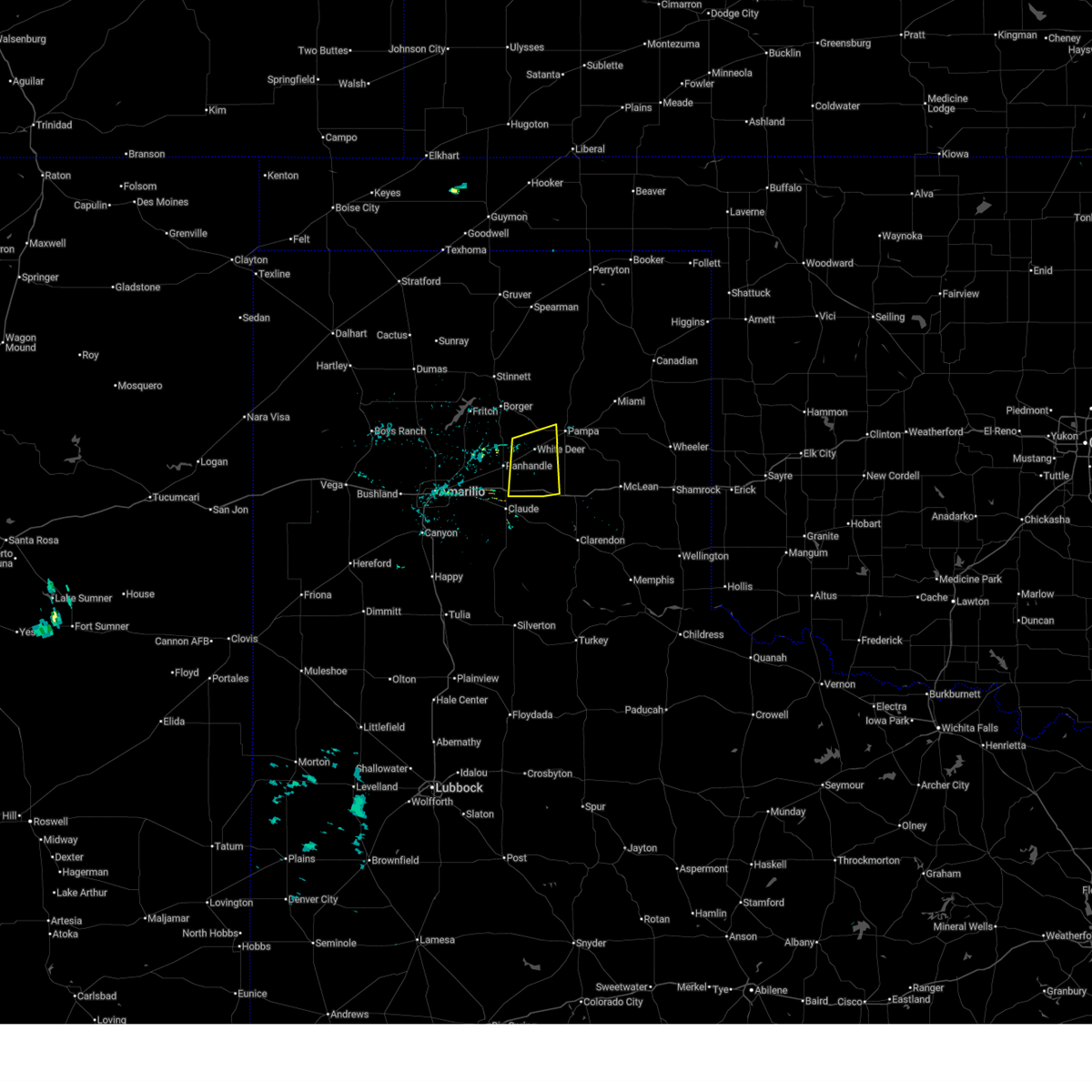
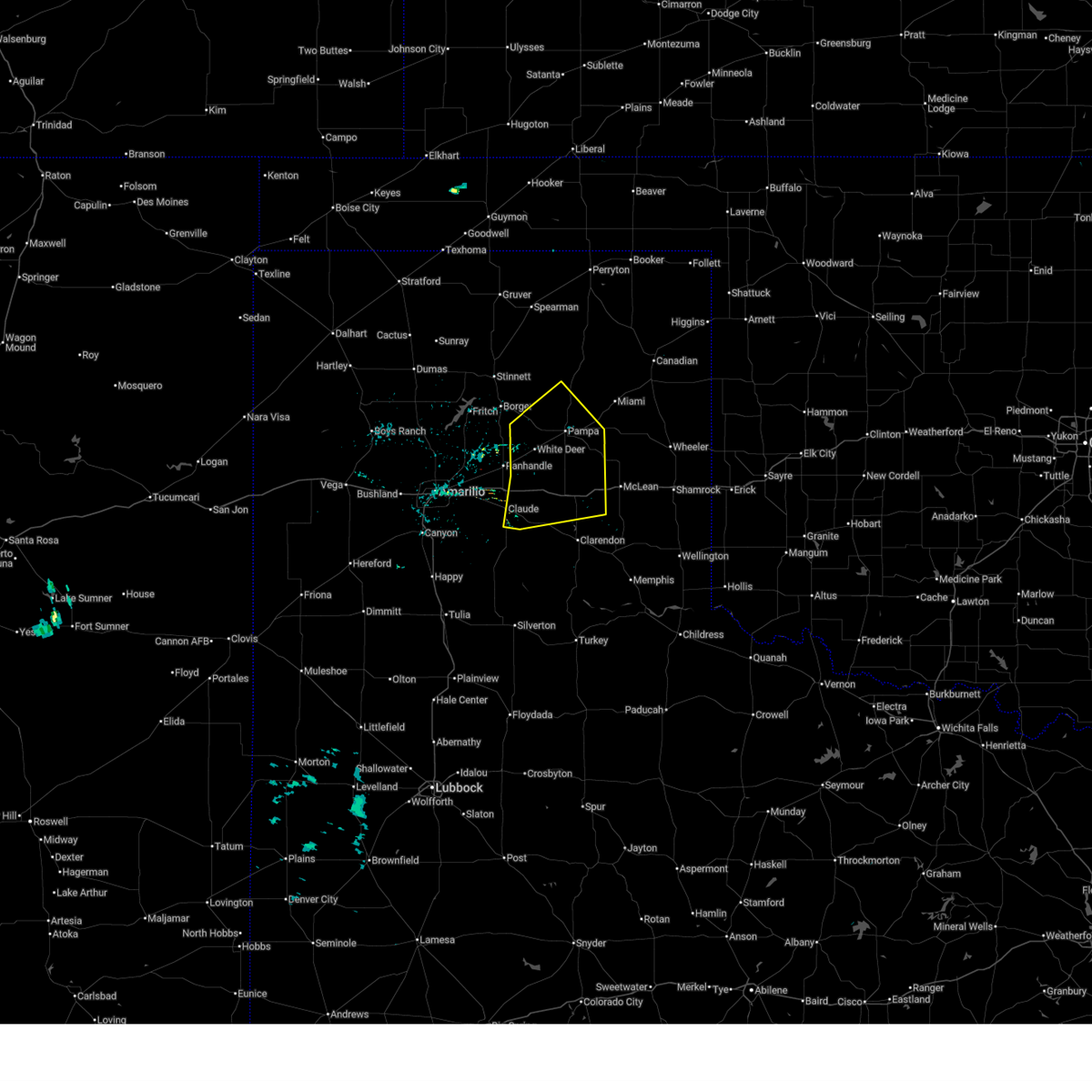
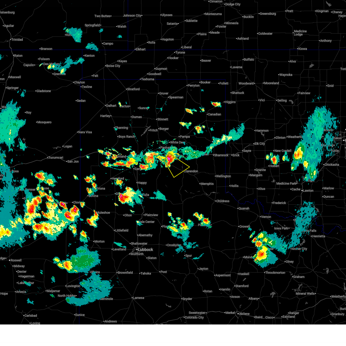
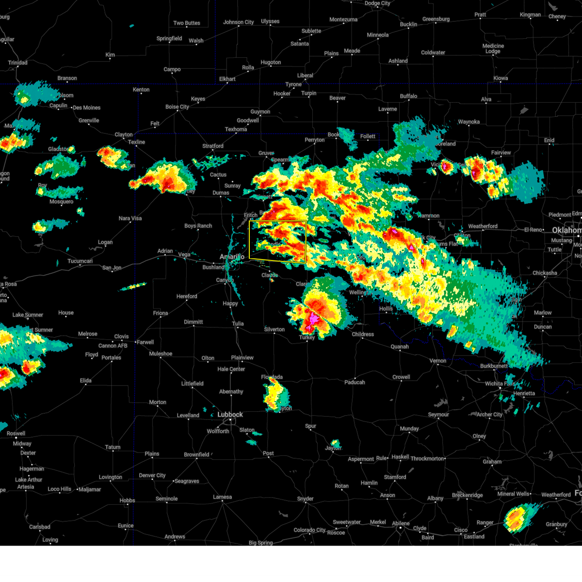
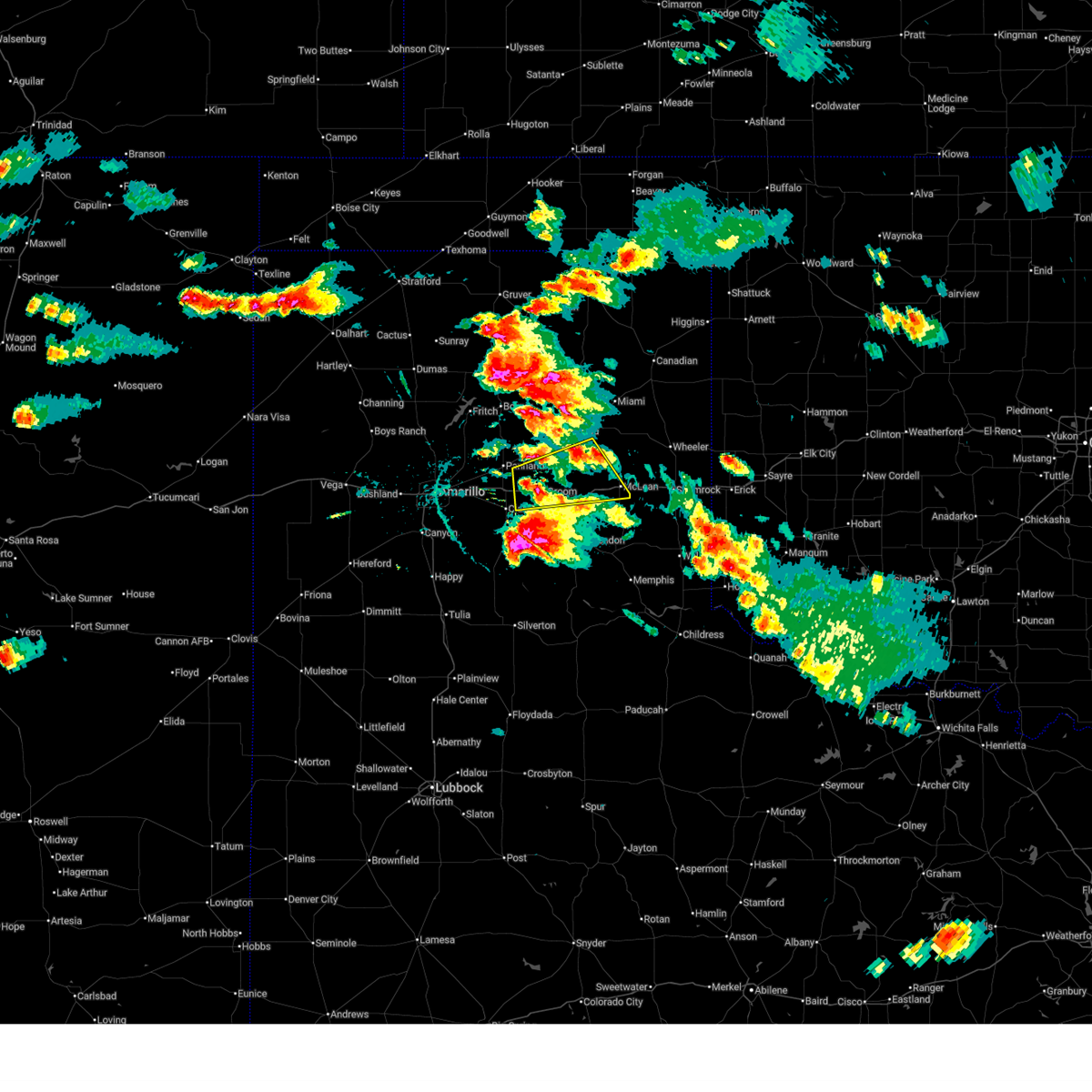
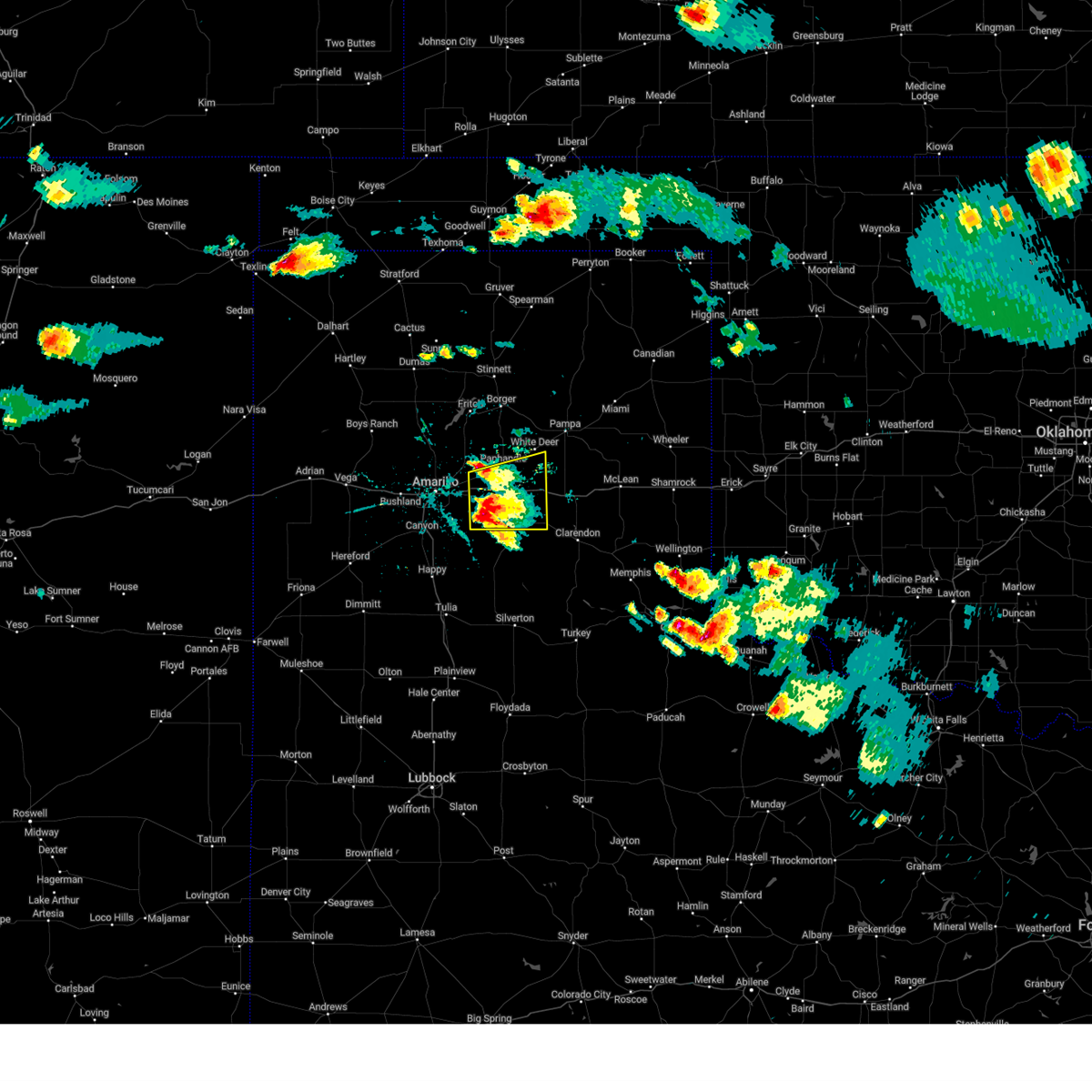
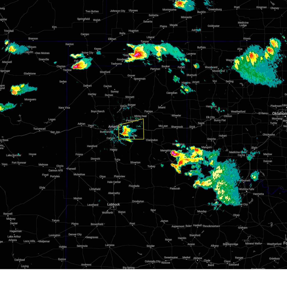
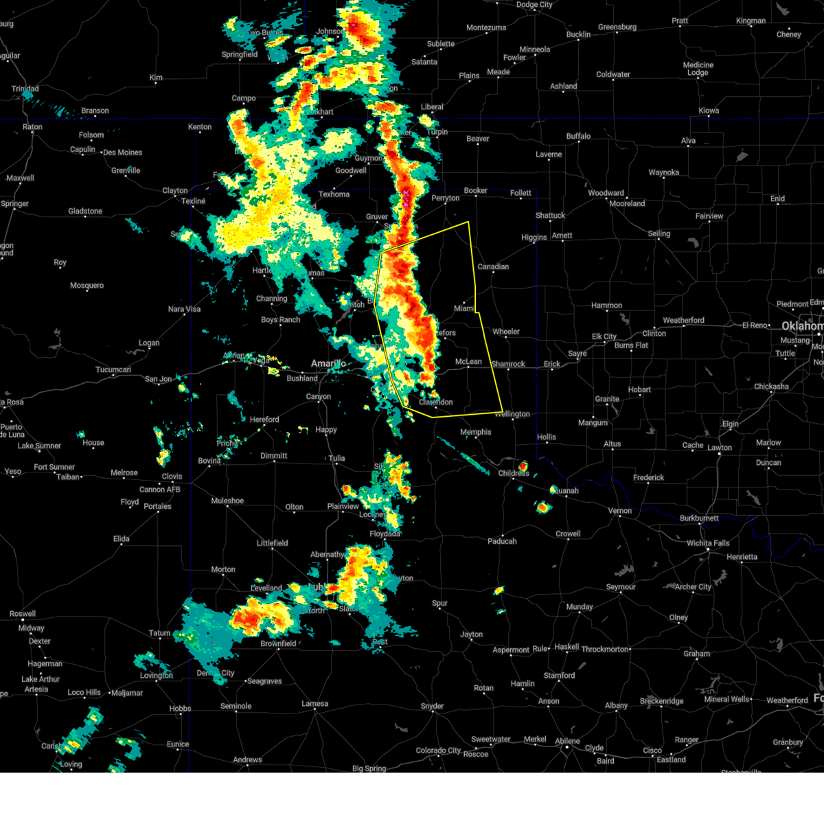
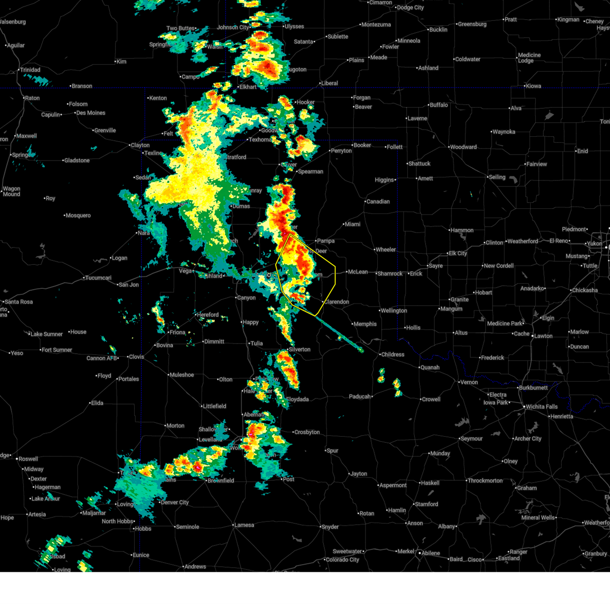
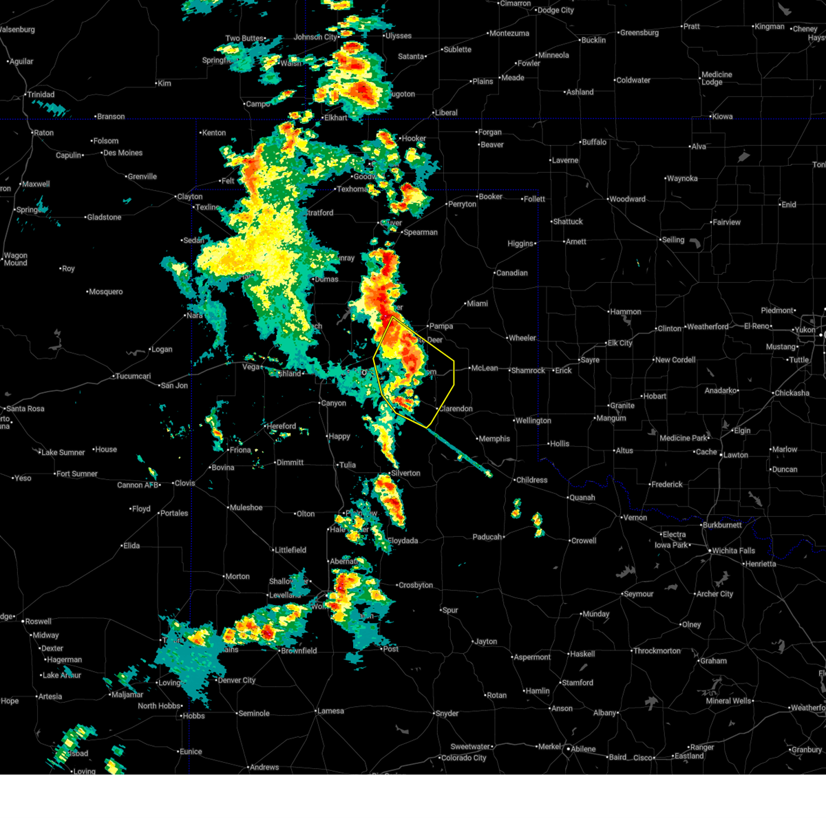
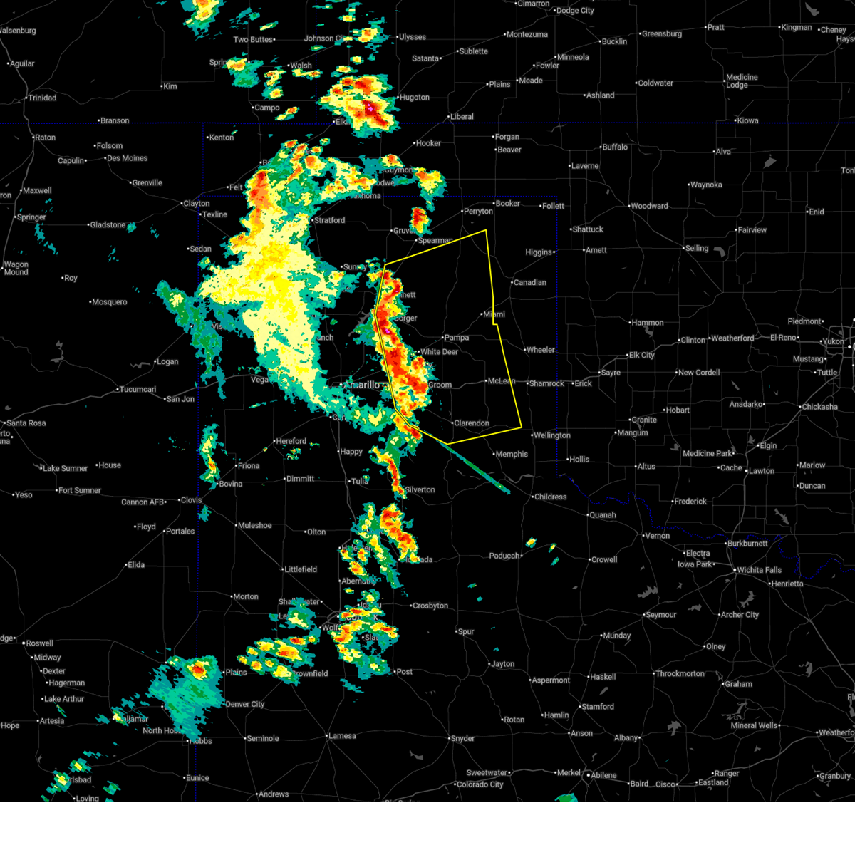
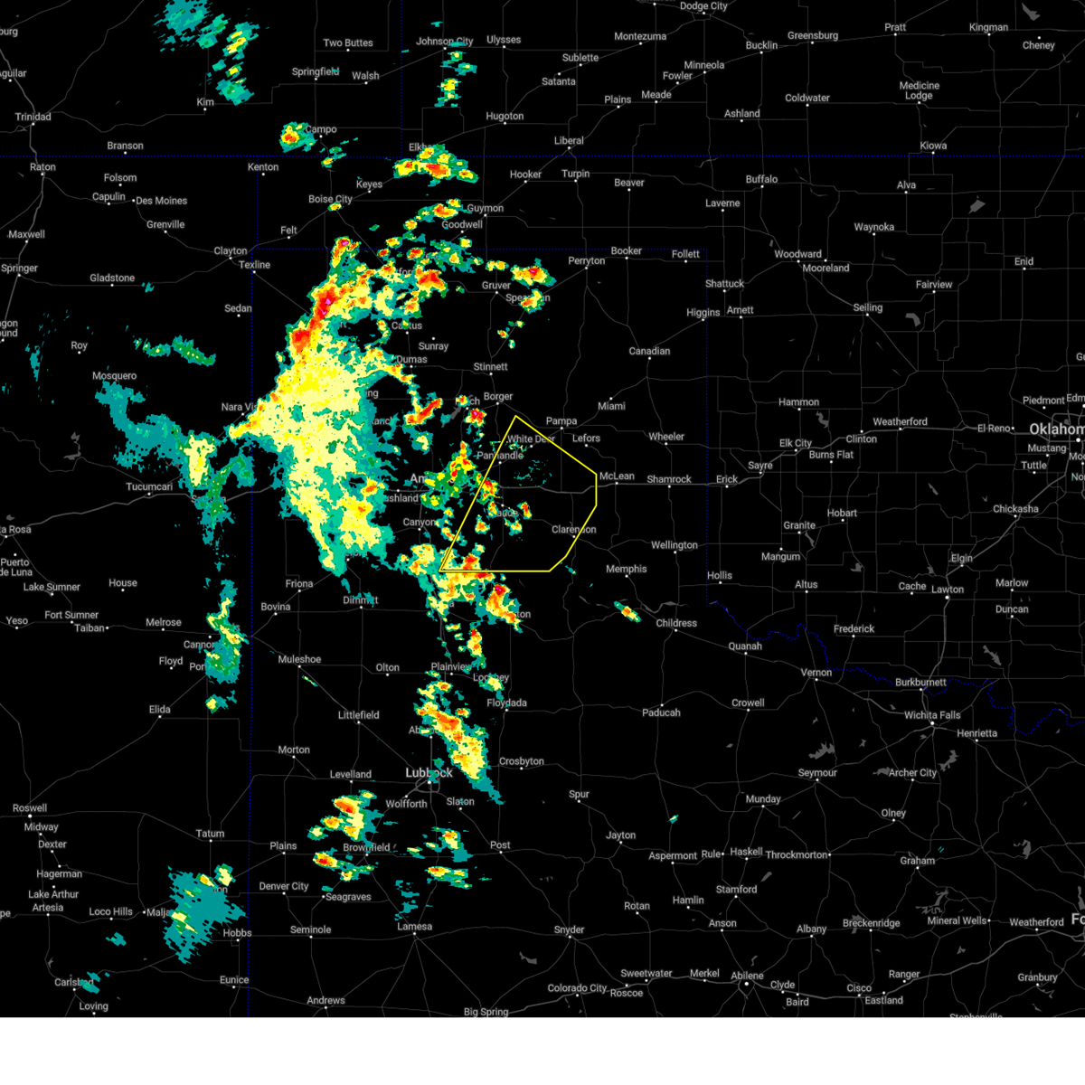
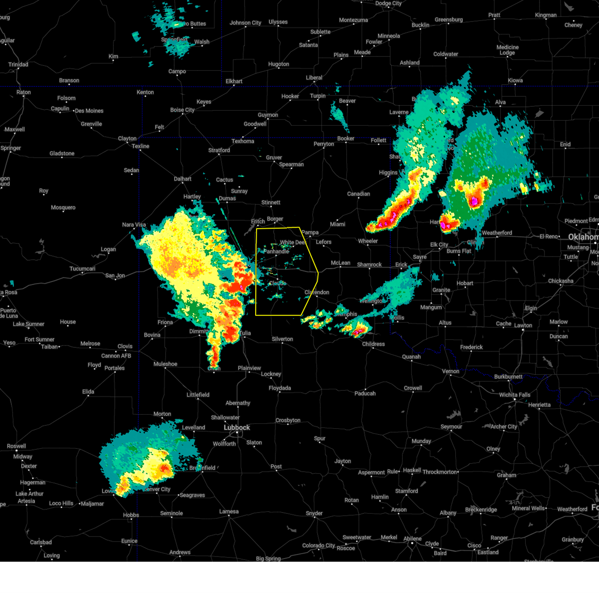
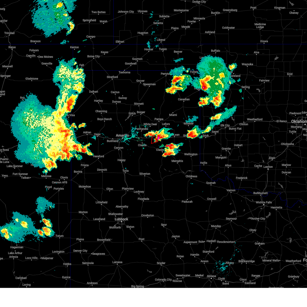
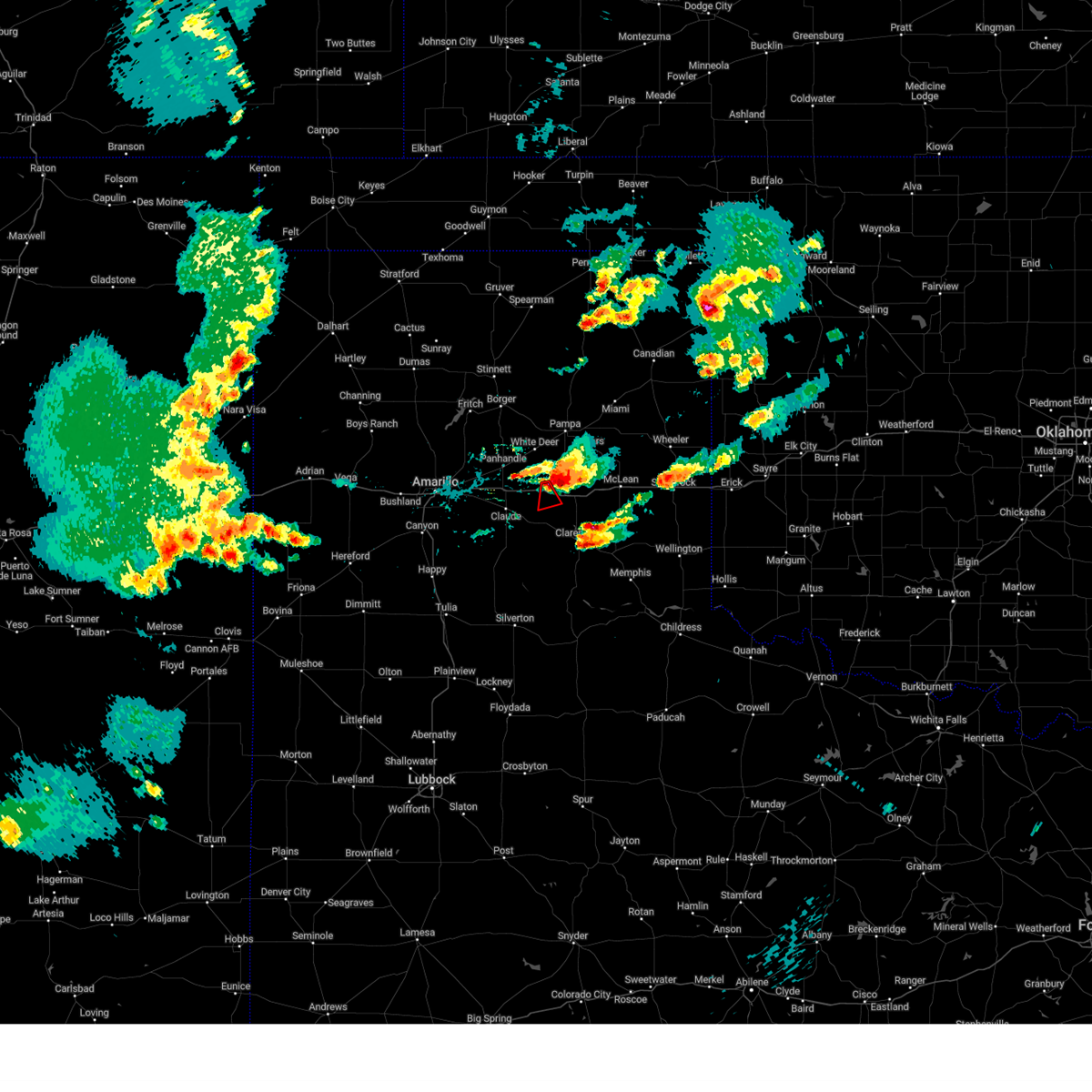
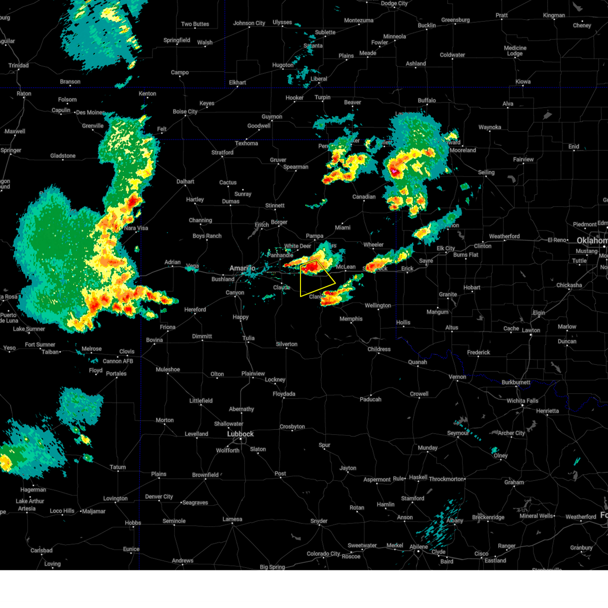
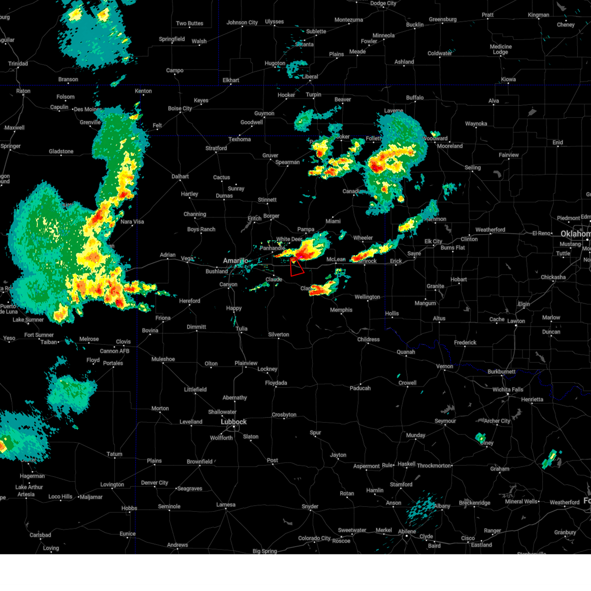
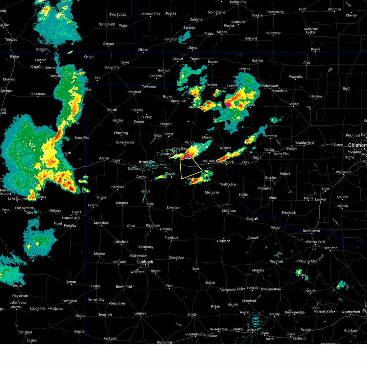
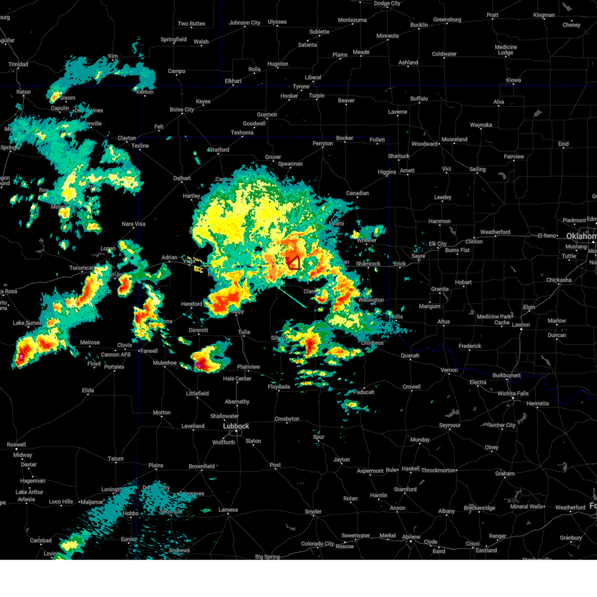
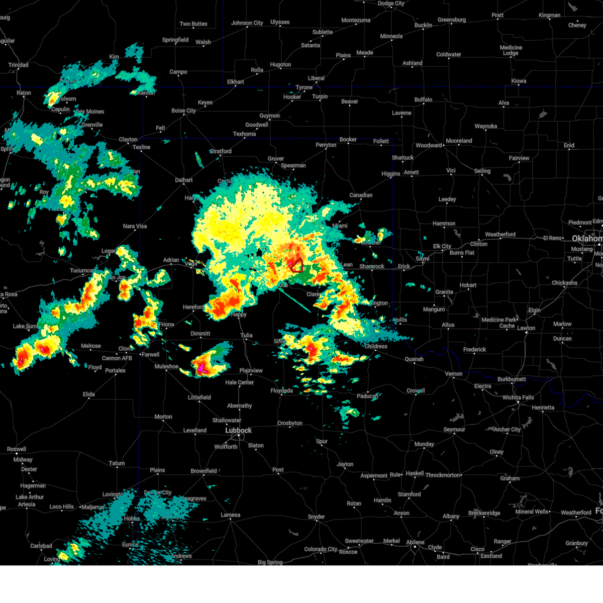
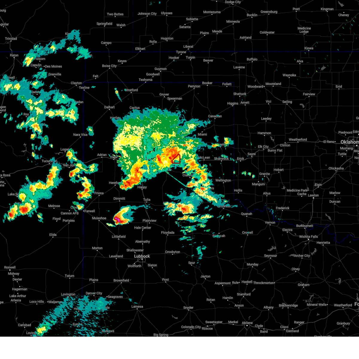
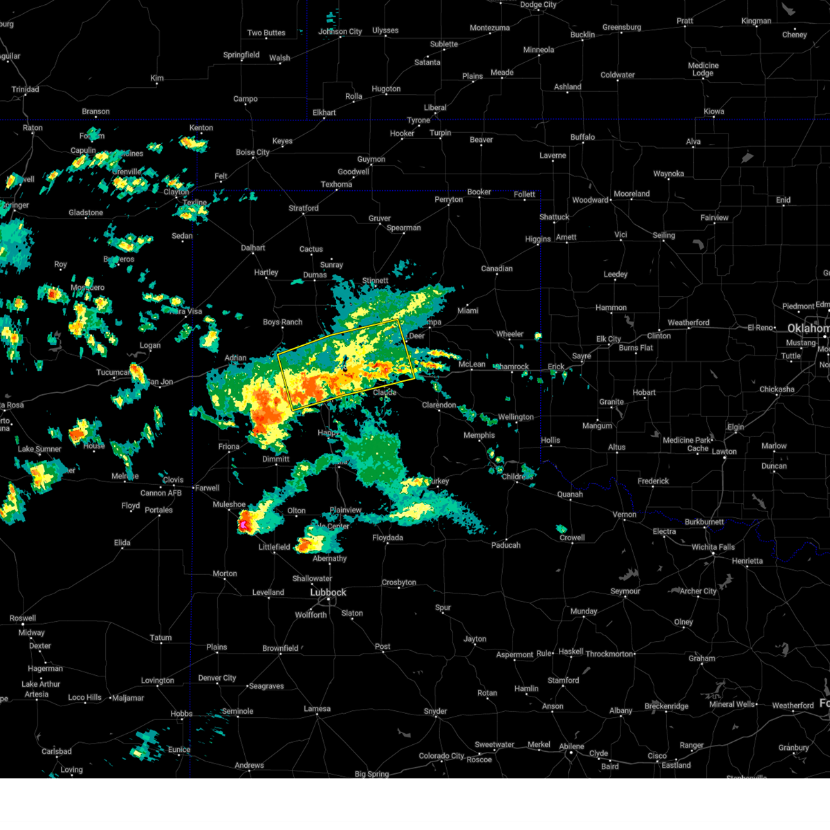
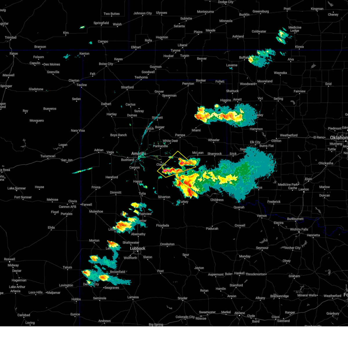
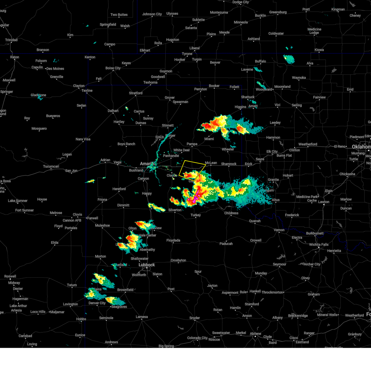
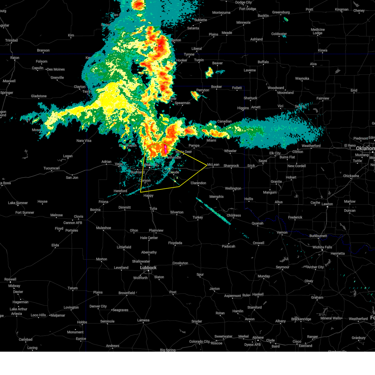
Hail Map for Groom, TX
The Groom, TX area has had 36 reports of on-the-ground hail by trained spotters, and has been under severe weather warnings 26 times during the past 12 months. Doppler radar has detected hail at or near Groom, TX on 110 occasions, including 6 occasions during the past year.
| Name: | Groom, TX |
| Where Located: | 41.3 miles E of Amarillo, TX |
| Map: | Google Map for Groom, TX |
| Population: | 574 |
| Housing Units: | 286 |
| More Info: | Search Google for Groom, TX |
1
The Top Recent Hail Date for Groom, TX is Monday, August 11, 2025 (41st out of 110)
Hail and Wind Damage Spotted near Groom, TX
| Date / Time | Report Details |
|---|---|
| 5/23/2026 9:01 PM CDT |
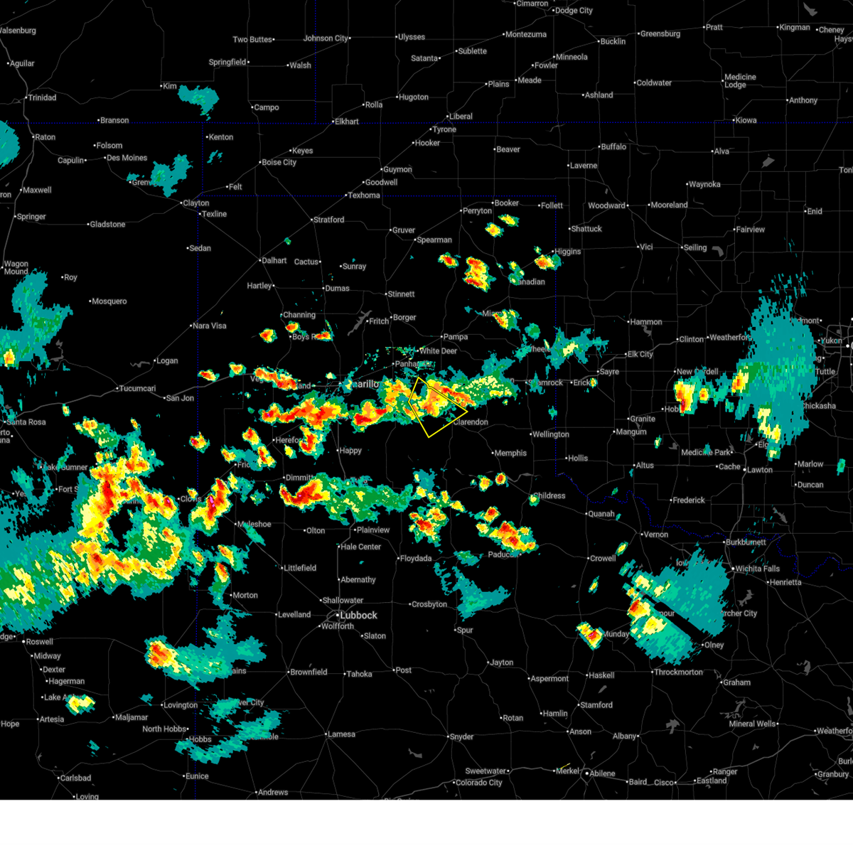
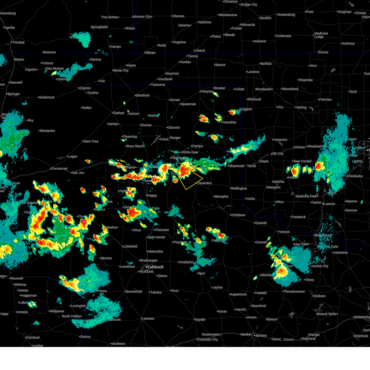
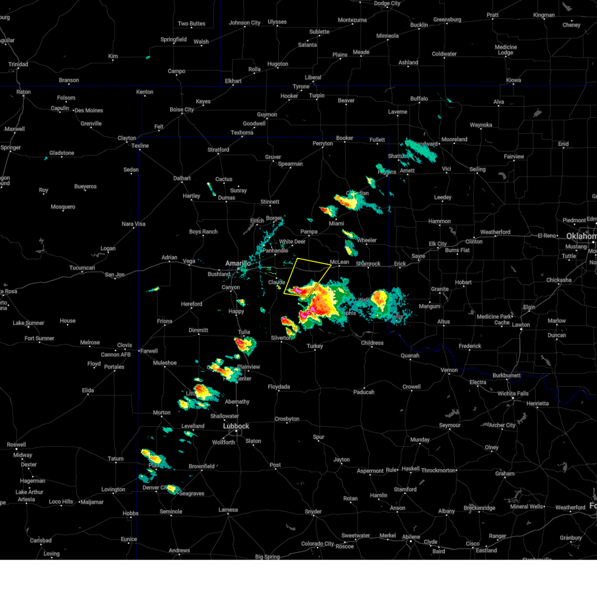
 Svrama the national weather service in amarillo has issued a * severe thunderstorm warning for, armstrong county in the panhandle of texas, east central randall county in the panhandle of texas, western wheeler county in the panhandle of texas, southeastern carson county in the panhandle of texas, gray county in the panhandle of texas, northwestern collingsworth county in the panhandle of texas, donley county in the panhandle of texas, * until 1000 pm cdt. * at 901 pm cdt, severe thunderstorms were located along a line extending from 6 miles north of lefors to near groom to 5 miles east of palo duro canyon, moving southeast at 40 mph (radar indicated). Hazards include 70 mph wind gusts and penny size hail. Expect some tree damage. Damage is likely to mobile homes, roofs, and outbuildings. Svrama the national weather service in amarillo has issued a * severe thunderstorm warning for, armstrong county in the panhandle of texas, east central randall county in the panhandle of texas, western wheeler county in the panhandle of texas, southeastern carson county in the panhandle of texas, gray county in the panhandle of texas, northwestern collingsworth county in the panhandle of texas, donley county in the panhandle of texas, * until 1000 pm cdt. * at 901 pm cdt, severe thunderstorms were located along a line extending from 6 miles north of lefors to near groom to 5 miles east of palo duro canyon, moving southeast at 40 mph (radar indicated). Hazards include 70 mph wind gusts and penny size hail. Expect some tree damage. Damage is likely to mobile homes, roofs, and outbuildings.
|
| 5/23/2026 8:45 PM CDT |
 At 845 pm cdt, severe thunderstorms were located along a line extending from 13 miles northeast of skellytown to 7 miles southeast of white deer to 3 miles northeast of lake tanglewood, moving east at 35 mph (radar indicated). Hazards include 70 mph wind gusts and nickel size hail. Expect some tree damage. damage is likely to mobile homes, roofs, and outbuildings. Locations impacted include, amarillo, pampa, panhandle, claude, white deer, lake tanglewood, groom, lefors, skellytown, howardwick, bushland, lake mcclellan, washburn, goodnight, kingsmill, greenbelt lake, mescalero park, timbercreek canyon, and pantex. At 845 pm cdt, severe thunderstorms were located along a line extending from 13 miles northeast of skellytown to 7 miles southeast of white deer to 3 miles northeast of lake tanglewood, moving east at 35 mph (radar indicated). Hazards include 70 mph wind gusts and nickel size hail. Expect some tree damage. damage is likely to mobile homes, roofs, and outbuildings. Locations impacted include, amarillo, pampa, panhandle, claude, white deer, lake tanglewood, groom, lefors, skellytown, howardwick, bushland, lake mcclellan, washburn, goodnight, kingsmill, greenbelt lake, mescalero park, timbercreek canyon, and pantex.
|
| 5/23/2026 8:11 PM CDT |
 Svrama the national weather service in amarillo has issued a * severe thunderstorm warning for, armstrong county in the panhandle of texas, northeastern randall county in the panhandle of texas, carson county in the panhandle of texas, southern hutchinson county in the panhandle of texas, gray county in the panhandle of texas, potter county in the panhandle of texas, southwestern roberts county in the panhandle of texas, northwestern donley county in the panhandle of texas, * until 915 pm cdt. * at 811 pm cdt, severe thunderstorms were located along a line extending from 7 miles southeast of stinnett to 3 miles north of panhandle to 5 miles southeast of amarillo, moving southeast at 35 mph (radar indicated). Hazards include 70 mph wind gusts and quarter size hail. Expect some tree damage. damage is likely to mobile homes, roofs, and outbuildings. Hail damage to vehicles is expected. Svrama the national weather service in amarillo has issued a * severe thunderstorm warning for, armstrong county in the panhandle of texas, northeastern randall county in the panhandle of texas, carson county in the panhandle of texas, southern hutchinson county in the panhandle of texas, gray county in the panhandle of texas, potter county in the panhandle of texas, southwestern roberts county in the panhandle of texas, northwestern donley county in the panhandle of texas, * until 915 pm cdt. * at 811 pm cdt, severe thunderstorms were located along a line extending from 7 miles southeast of stinnett to 3 miles north of panhandle to 5 miles southeast of amarillo, moving southeast at 35 mph (radar indicated). Hazards include 70 mph wind gusts and quarter size hail. Expect some tree damage. damage is likely to mobile homes, roofs, and outbuildings. Hail damage to vehicles is expected.
|
| 5/14/2026 6:10 PM CDT |
 The storms which prompted the warning have moved out of the area. therefore, the warning will be allowed to expire. a severe thunderstorm watch remains in effect until 1000 pm cdt for the panhandle of texas. The storms which prompted the warning have moved out of the area. therefore, the warning will be allowed to expire. a severe thunderstorm watch remains in effect until 1000 pm cdt for the panhandle of texas.
|
| 5/14/2026 5:47 PM CDT |
 At 547 pm cdt, severe thunderstorms were located along a line extending from 7 miles east of skellytown to 5 miles southeast of pampa to near lake mcclellan, moving northeast at 20 mph (radar indicated). Hazards include 70 mph wind gusts. Expect some tree damage. damage is likely to mobile homes, roofs, and outbuildings. Locations impacted include, pampa, groom, lefors, lake mcclellan, kingsmill, alanreed, and goodnight. At 547 pm cdt, severe thunderstorms were located along a line extending from 7 miles east of skellytown to 5 miles southeast of pampa to near lake mcclellan, moving northeast at 20 mph (radar indicated). Hazards include 70 mph wind gusts. Expect some tree damage. damage is likely to mobile homes, roofs, and outbuildings. Locations impacted include, pampa, groom, lefors, lake mcclellan, kingsmill, alanreed, and goodnight.
|
| 5/14/2026 5:36 PM CDT |
 The storms which prompted the warning continue. therefore, the warning was updated with a new warning.gusty winds are still possible with these thunderstorms. a severe thunderstorm watch remains in effect until 1000 pm cdt for the panhandle of texas. The storms which prompted the warning continue. therefore, the warning was updated with a new warning.gusty winds are still possible with these thunderstorms. a severe thunderstorm watch remains in effect until 1000 pm cdt for the panhandle of texas.
|
| 5/14/2026 5:31 PM CDT | Wind gust of 69 mph measured at the wt mesonet site 2 miles wnw of lake mcclellan. severe gusts lasted from 5:31 to 5:33 p in gray county TX, 11.6 miles W of Groom, TX |
| 5/14/2026 5:18 PM CDT |
 At 517 pm cdt, severe thunderstorms were located along a line extending from white deer to near groom, moving east at 25 mph (radar indicated). Hazards include 60 mph wind gusts. Minor damage to roofs, siding, and trees is possible. Locations impacted include, white deer, groom, and kingsmill. At 517 pm cdt, severe thunderstorms were located along a line extending from white deer to near groom, moving east at 25 mph (radar indicated). Hazards include 60 mph wind gusts. Minor damage to roofs, siding, and trees is possible. Locations impacted include, white deer, groom, and kingsmill.
|
| 5/14/2026 5:14 PM CDT |
 Svrama the national weather service in amarillo has issued a * severe thunderstorm warning for, northeastern armstrong county in the panhandle of texas, eastern carson county in the panhandle of texas, southeastern hutchinson county in the panhandle of texas, gray county in the panhandle of texas, southwestern roberts county in the panhandle of texas, northwestern donley county in the panhandle of texas, * until 615 pm cdt. * at 514 pm cdt, severe thunderstorms were located along a line extending from 3 miles southwest of skellytown to 5 miles south of kingsmill to 7 miles southeast of groom, moving northeast at 20 mph (radar indicated). Hazards include 70 mph wind gusts. Expect some tree damage. Damage is likely to mobile homes, roofs, and outbuildings. Svrama the national weather service in amarillo has issued a * severe thunderstorm warning for, northeastern armstrong county in the panhandle of texas, eastern carson county in the panhandle of texas, southeastern hutchinson county in the panhandle of texas, gray county in the panhandle of texas, southwestern roberts county in the panhandle of texas, northwestern donley county in the panhandle of texas, * until 615 pm cdt. * at 514 pm cdt, severe thunderstorms were located along a line extending from 3 miles southwest of skellytown to 5 miles south of kingsmill to 7 miles southeast of groom, moving northeast at 20 mph (radar indicated). Hazards include 70 mph wind gusts. Expect some tree damage. Damage is likely to mobile homes, roofs, and outbuildings.
|
| 5/14/2026 4:43 PM CDT |
 Svrama the national weather service in amarillo has issued a * severe thunderstorm warning for, north central armstrong county in the panhandle of texas, carson county in the panhandle of texas, southwestern gray county in the panhandle of texas, * until 545 pm cdt. * at 442 pm cdt, severe thunderstorms were located along a line extending from 5 miles northwest of panhandle to 3 miles northwest of claude, moving east at 25 mph (radar indicated). Hazards include 60 mph wind gusts. minor damage to roofs, siding, and trees is possible Svrama the national weather service in amarillo has issued a * severe thunderstorm warning for, north central armstrong county in the panhandle of texas, carson county in the panhandle of texas, southwestern gray county in the panhandle of texas, * until 545 pm cdt. * at 442 pm cdt, severe thunderstorms were located along a line extending from 5 miles northwest of panhandle to 3 miles northwest of claude, moving east at 25 mph (radar indicated). Hazards include 60 mph wind gusts. minor damage to roofs, siding, and trees is possible
|
| 9/21/2025 12:28 AM CDT | The storm which prompted the warning has weakened below severe limits, and no longer poses an immediate threat to life or property. therefore, the warning will be allowed to expire. however, gusty winds are still possible with this thunderstorm. |
| 9/21/2025 12:10 AM CDT | At 1210 am cdt, a severe thunderstorm was located 6 miles east of groom, or 17 miles north of clarendon, moving southeast at 15 mph (radar indicated). Hazards include 60 mph wind gusts and quarter size hail. Minor damage to roofs, siding, and trees is possible. hail damage to vehicles is expected. Locations impacted include, groom and lake mcclellan. |
| 9/20/2025 11:56 PM CDT | At 1155 pm cdt, a severe thunderstorm was located 4 miles northeast of groom, or 20 miles northeast of claude, moving east at 15 mph (radar indicated). Hazards include 60 mph wind gusts and nickel size hail. Minor damage to roofs, siding, and trees is possible. Locations impacted include, groom and lake mcclellan. |
| 9/20/2025 11:43 PM CDT | Svrama the national weather service in amarillo has issued a * severe thunderstorm warning for, northeastern armstrong county in the panhandle of texas, southeastern carson county in the panhandle of texas, southwestern gray county in the panhandle of texas, northwestern donley county in the panhandle of texas, * until 1230 am cdt. * at 1143 pm cdt, a severe thunderstorm was located over groom, or 16 miles northeast of claude, moving southeast at 15 mph (radar indicated). Hazards include 60 mph wind gusts and quarter size hail. Minor damage to roofs, siding, and trees is possible. Hail damage to vehicles is expected. |
| 9/9/2025 7:42 PM CDT | The storm which prompted the warning has weakened below severe limits, and no longer poses an immediate threat to life or property. therefore, the warning will be allowed to expire. |
| 9/9/2025 7:05 PM CDT | At 705 pm cdt, a severe thunderstorm was located over claude, and is nearly stationary (radar indicated). Hazards include 60 mph wind gusts and nickel size hail. Minor damage to roofs, siding, and trees is possible. Locations impacted include, claude, groom, and goodnight. |
| 9/9/2025 6:44 PM CDT | Svrama the national weather service in amarillo has issued a * severe thunderstorm warning for, northeastern armstrong county in the panhandle of texas, southeastern carson county in the panhandle of texas, * until 745 pm cdt. * at 644 pm cdt, a severe thunderstorm was located over claude, and is nearly stationary (radar indicated). Hazards include 60 mph wind gusts and nickel size hail. minor damage to roofs, siding, and trees is possible |
| 9/9/2025 6:27 PM CDT | At 627 pm cdt, a severe thunderstorm was located over claude, moving east at 10 mph (radar indicated). Hazards include 60 mph wind gusts and half dollar size hail. Minor damage to roofs, siding, and trees is possible. hail damage to vehicles is expected. Locations impacted include, groom. |
| 9/9/2025 6:13 PM CDT | At 613 pm cdt, a severe thunderstorm was located 6 miles northeast of claude, moving east at 5 mph (radar indicated). Hazards include 60 mph wind gusts and nickel size hail. Minor damage to roofs, siding, and trees is possible. Locations impacted include, groom. |
| 9/9/2025 5:53 PM CDT | Svrama the national weather service in amarillo has issued a * severe thunderstorm warning for, northeastern armstrong county in the panhandle of texas, southeastern carson county in the panhandle of texas, * until 645 pm cdt. * at 553 pm cdt, a severe thunderstorm was located 6 miles northeast of claude, moving east at 15 mph (radar indicated). Hazards include 60 mph wind gusts and half dollar size hail. Minor damage to roofs, siding, and trees is possible. Hail damage to vehicles is expected. |
| 8/24/2025 9:23 PM CDT | A few intermittent wind gusts occurred at around 60 mph in the 15 minutes before the 82 mph wind gust occurre in gray county TX, 11.6 miles W of Groom, TX |
| 8/11/2025 8:28 PM CDT |
 the severe thunderstorm warning has been cancelled and is no longer in effect the severe thunderstorm warning has been cancelled and is no longer in effect
|
| 8/11/2025 8:06 PM CDT |
 At 806 pm cdt, a severe thunderstorm was located 5 miles north of goodnight, or 11 miles east of claude, moving southeast at 15 mph (radar indicated). Hazards include 60 mph wind gusts and quarter size hail. Minor damage to roofs, siding, and trees is possible. hail damage to vehicles is expected. Locations impacted include, clarendon, groom, howardwick, greenbelt lake, and goodnight. At 806 pm cdt, a severe thunderstorm was located 5 miles north of goodnight, or 11 miles east of claude, moving southeast at 15 mph (radar indicated). Hazards include 60 mph wind gusts and quarter size hail. Minor damage to roofs, siding, and trees is possible. hail damage to vehicles is expected. Locations impacted include, clarendon, groom, howardwick, greenbelt lake, and goodnight.
|
| 8/11/2025 7:57 PM CDT |
 Svrama the national weather service in amarillo has issued a * severe thunderstorm warning for, northeastern armstrong county in the panhandle of texas, southeastern carson county in the panhandle of texas, northwestern donley county in the panhandle of texas, * until 900 pm cdt. * at 756 pm cdt, a severe thunderstorm was located 6 miles southwest of groom, or 10 miles east of claude, moving southeast at 15 mph (radar indicated). Hazards include golf ball size hail and 60 mph wind gusts. Minor damage to roofs, siding, and trees is possible. people and animals outdoors will be injured. Expect hail damage to roofs, siding, windows, and vehicles. Svrama the national weather service in amarillo has issued a * severe thunderstorm warning for, northeastern armstrong county in the panhandle of texas, southeastern carson county in the panhandle of texas, northwestern donley county in the panhandle of texas, * until 900 pm cdt. * at 756 pm cdt, a severe thunderstorm was located 6 miles southwest of groom, or 10 miles east of claude, moving southeast at 15 mph (radar indicated). Hazards include golf ball size hail and 60 mph wind gusts. Minor damage to roofs, siding, and trees is possible. people and animals outdoors will be injured. Expect hail damage to roofs, siding, windows, and vehicles.
|
| 8/11/2025 7:37 PM CDT |
 At 736 pm cdt, a severe thunderstorm was located 7 miles northeast of claude, moving southeast at 15 mph (radar indicated). Hazards include tennis ball size hail and 70 mph wind gusts. Expect some tree damage. damage is likely to mobile homes, roofs, and outbuildings. people and animals outdoors will be injured. expect hail damage to roofs, siding, windows, and vehicles. Locations impacted include, groom. At 736 pm cdt, a severe thunderstorm was located 7 miles northeast of claude, moving southeast at 15 mph (radar indicated). Hazards include tennis ball size hail and 70 mph wind gusts. Expect some tree damage. damage is likely to mobile homes, roofs, and outbuildings. people and animals outdoors will be injured. expect hail damage to roofs, siding, windows, and vehicles. Locations impacted include, groom.
|
| 8/11/2025 7:29 PM CDT |
 At 728 pm cdt, a severe thunderstorm was located 7 miles north of claude, moving southeast at 20 mph (radar indicated). Hazards include tennis ball size hail and 70 mph wind gusts. Expect some tree damage. damage is likely to mobile homes, roofs, and outbuildings. people and animals outdoors will be injured. expect hail damage to roofs, siding, windows, and vehicles. Locations impacted include, claude and groom. At 728 pm cdt, a severe thunderstorm was located 7 miles north of claude, moving southeast at 20 mph (radar indicated). Hazards include tennis ball size hail and 70 mph wind gusts. Expect some tree damage. damage is likely to mobile homes, roofs, and outbuildings. people and animals outdoors will be injured. expect hail damage to roofs, siding, windows, and vehicles. Locations impacted include, claude and groom.
|
| 8/11/2025 7:16 PM CDT |
 Svrama the national weather service in amarillo has issued a * severe thunderstorm warning for, northeastern armstrong county in the panhandle of texas, southeastern carson county in the panhandle of texas, northwestern donley county in the panhandle of texas, * until 815 pm cdt. * at 716 pm cdt, a severe thunderstorm was located 4 miles south of panhandle, moving southeast at 15 mph (radar indicated). Hazards include golf ball size hail and 60 mph wind gusts. Minor damage to roofs, siding, and trees is possible. people and animals outdoors will be injured. Expect hail damage to roofs, siding, windows, and vehicles. Svrama the national weather service in amarillo has issued a * severe thunderstorm warning for, northeastern armstrong county in the panhandle of texas, southeastern carson county in the panhandle of texas, northwestern donley county in the panhandle of texas, * until 815 pm cdt. * at 716 pm cdt, a severe thunderstorm was located 4 miles south of panhandle, moving southeast at 15 mph (radar indicated). Hazards include golf ball size hail and 60 mph wind gusts. Minor damage to roofs, siding, and trees is possible. people and animals outdoors will be injured. Expect hail damage to roofs, siding, windows, and vehicles.
|
| 7/12/2025 12:53 AM CDT |
 Svrama the national weather service in amarillo has issued a * severe thunderstorm warning for, armstrong county in the panhandle of texas, eastern randall county in the panhandle of texas, carson county in the panhandle of texas, southwestern gray county in the panhandle of texas, southeastern potter county in the panhandle of texas, western donley county in the panhandle of texas, * until 200 am cdt. * at 1253 am cdt, a severe thunderstorm was located 5 miles southwest of washburn, or 12 miles southeast of amarillo, moving south at 30 mph (radar indicated). Hazards include 70 mph wind gusts. Expect some tree damage. Damage is likely to mobile homes, roofs, and outbuildings. Svrama the national weather service in amarillo has issued a * severe thunderstorm warning for, armstrong county in the panhandle of texas, eastern randall county in the panhandle of texas, carson county in the panhandle of texas, southwestern gray county in the panhandle of texas, southeastern potter county in the panhandle of texas, western donley county in the panhandle of texas, * until 200 am cdt. * at 1253 am cdt, a severe thunderstorm was located 5 miles southwest of washburn, or 12 miles southeast of amarillo, moving south at 30 mph (radar indicated). Hazards include 70 mph wind gusts. Expect some tree damage. Damage is likely to mobile homes, roofs, and outbuildings.
|
| 6/8/2025 5:23 PM CDT |
 Svrama the national weather service in amarillo has issued a * severe thunderstorm warning for, carson county in the panhandle of texas, western gray county in the panhandle of texas, * until 630 pm cdt. * at 523 pm cdt, a severe thunderstorm was located 6 miles northwest of white deer, or 11 miles northeast of panhandle, moving east at 30 mph (radar indicated). Hazards include ping pong ball size hail and 60 mph wind gusts. Minor damage to roofs, siding, and trees is possible. people and animals outdoors will be injured. Expect hail damage to roofs, siding, windows, and vehicles. Svrama the national weather service in amarillo has issued a * severe thunderstorm warning for, carson county in the panhandle of texas, western gray county in the panhandle of texas, * until 630 pm cdt. * at 523 pm cdt, a severe thunderstorm was located 6 miles northwest of white deer, or 11 miles northeast of panhandle, moving east at 30 mph (radar indicated). Hazards include ping pong ball size hail and 60 mph wind gusts. Minor damage to roofs, siding, and trees is possible. people and animals outdoors will be injured. Expect hail damage to roofs, siding, windows, and vehicles.
|
| 6/8/2025 4:25 PM CDT |
 Svrama the national weather service in amarillo has issued a * severe thunderstorm warning for, northeastern armstrong county in the panhandle of texas, southeastern carson county in the panhandle of texas, southern gray county in the panhandle of texas, northern donley county in the panhandle of texas, * until 530 pm cdt. * at 425 pm cdt, a severe thunderstorm was located over groom, or 14 miles northeast of claude, moving east at 35 mph (radar indicated). Hazards include ping pong ball size hail and 60 mph wind gusts. Minor damage to roofs, siding, and trees is possible. people and animals outdoors will be injured. Expect hail damage to roofs, siding, windows, and vehicles. Svrama the national weather service in amarillo has issued a * severe thunderstorm warning for, northeastern armstrong county in the panhandle of texas, southeastern carson county in the panhandle of texas, southern gray county in the panhandle of texas, northern donley county in the panhandle of texas, * until 530 pm cdt. * at 425 pm cdt, a severe thunderstorm was located over groom, or 14 miles northeast of claude, moving east at 35 mph (radar indicated). Hazards include ping pong ball size hail and 60 mph wind gusts. Minor damage to roofs, siding, and trees is possible. people and animals outdoors will be injured. Expect hail damage to roofs, siding, windows, and vehicles.
|
| 6/8/2025 3:25 PM CDT |
 the severe thunderstorm warning has been cancelled and is no longer in effect the severe thunderstorm warning has been cancelled and is no longer in effect
|
| 6/8/2025 3:25 PM CDT |
 At 325 pm cdt, a severe thunderstorm was located 6 miles west of claude, moving east at 25 mph (radar indicated). Hazards include golf ball size hail and 70 mph wind gusts. Expect some tree damage. damage is likely to mobile homes, roofs, and outbuildings. people and animals outdoors will be injured. expect hail damage to roofs, siding, windows, and vehicles. Locations impacted include, panhandle, washburn, claude, groom, and goodnight. At 325 pm cdt, a severe thunderstorm was located 6 miles west of claude, moving east at 25 mph (radar indicated). Hazards include golf ball size hail and 70 mph wind gusts. Expect some tree damage. damage is likely to mobile homes, roofs, and outbuildings. people and animals outdoors will be injured. expect hail damage to roofs, siding, windows, and vehicles. Locations impacted include, panhandle, washburn, claude, groom, and goodnight.
|
| 6/8/2025 3:05 PM CDT |
 Svrama the national weather service in amarillo has issued a * severe thunderstorm warning for, northern armstrong county in the panhandle of texas, northeastern randall county in the panhandle of texas, southern carson county in the panhandle of texas, southeastern potter county in the panhandle of texas, * until 400 pm cdt. * at 305 pm cdt, a severe thunderstorm was located over washburn, or 14 miles east of amarillo, moving east at 20 mph (radar indicated). Hazards include 60 mph wind gusts and half dollar size hail. Minor damage to roofs, siding, and trees is possible. Hail damage to vehicles is expected. Svrama the national weather service in amarillo has issued a * severe thunderstorm warning for, northern armstrong county in the panhandle of texas, northeastern randall county in the panhandle of texas, southern carson county in the panhandle of texas, southeastern potter county in the panhandle of texas, * until 400 pm cdt. * at 305 pm cdt, a severe thunderstorm was located over washburn, or 14 miles east of amarillo, moving east at 20 mph (radar indicated). Hazards include 60 mph wind gusts and half dollar size hail. Minor damage to roofs, siding, and trees is possible. Hail damage to vehicles is expected.
|
| 6/2/2025 5:09 PM CDT |
 At 509 pm cdt, severe thunderstorms were located along a line extending from 13 miles southeast of waka to 6 miles east of pampa to 9 miles northeast of hedley, moving east at 45 mph (radar indicated). Hazards include 60 mph wind gusts and quarter size hail. Minor damage to roofs, siding, and trees is possible. hail damage to vehicles is expected. Locations impacted include, howardwick, wolf creek park, lelia lake, lake mcclellan, white deer, lefors, quail, kellerville, miami, clarendon, goodnight, skellytown, lora, mclean, pampa, kingsmill, alanreed, groom, codman, and borger. At 509 pm cdt, severe thunderstorms were located along a line extending from 13 miles southeast of waka to 6 miles east of pampa to 9 miles northeast of hedley, moving east at 45 mph (radar indicated). Hazards include 60 mph wind gusts and quarter size hail. Minor damage to roofs, siding, and trees is possible. hail damage to vehicles is expected. Locations impacted include, howardwick, wolf creek park, lelia lake, lake mcclellan, white deer, lefors, quail, kellerville, miami, clarendon, goodnight, skellytown, lora, mclean, pampa, kingsmill, alanreed, groom, codman, and borger.
|
| 6/2/2025 4:50 PM CDT |
 At 450 pm cdt, severe thunderstorms were located along a line extending from 4 miles northwest of claude to 6 miles southeast of goodnight, moving northeast at 40 mph (radar indicated). Hazards include 60 mph wind gusts and quarter size hail. Minor damage to roofs, siding, and trees is possible. hail damage to vehicles is expected. Locations impacted include, howardwick, panhandle, lake mcclellan, white deer, claude, groom, clarendon, greenbelt lake, and goodnight. At 450 pm cdt, severe thunderstorms were located along a line extending from 4 miles northwest of claude to 6 miles southeast of goodnight, moving northeast at 40 mph (radar indicated). Hazards include 60 mph wind gusts and quarter size hail. Minor damage to roofs, siding, and trees is possible. hail damage to vehicles is expected. Locations impacted include, howardwick, panhandle, lake mcclellan, white deer, claude, groom, clarendon, greenbelt lake, and goodnight.
|
| 6/2/2025 4:50 PM CDT |
 the severe thunderstorm warning has been cancelled and is no longer in effect the severe thunderstorm warning has been cancelled and is no longer in effect
|
| 6/2/2025 4:40 PM CDT |
 Svrama the national weather service in amarillo has issued a * severe thunderstorm warning for, northeastern armstrong county in the panhandle of texas, western wheeler county in the panhandle of texas, carson county in the panhandle of texas, hutchinson county in the panhandle of texas, gray county in the panhandle of texas, southeastern hansford county in the panhandle of texas, northwestern collingsworth county in the panhandle of texas, roberts county in the panhandle of texas, southern ochiltree county in the panhandle of texas, donley county in the panhandle of texas, * until 545 pm cdt. * at 439 pm cdt, severe thunderstorms were located along a line extending from 10 miles south of spearman to 3 miles west of kingsmill to 3 miles west of lelia lake, moving east at 45 mph (radar indicated). Hazards include 60 mph wind gusts and quarter size hail. Minor damage to roofs, siding, and trees is possible. Hail damage to vehicles is expected. Svrama the national weather service in amarillo has issued a * severe thunderstorm warning for, northeastern armstrong county in the panhandle of texas, western wheeler county in the panhandle of texas, carson county in the panhandle of texas, hutchinson county in the panhandle of texas, gray county in the panhandle of texas, southeastern hansford county in the panhandle of texas, northwestern collingsworth county in the panhandle of texas, roberts county in the panhandle of texas, southern ochiltree county in the panhandle of texas, donley county in the panhandle of texas, * until 545 pm cdt. * at 439 pm cdt, severe thunderstorms were located along a line extending from 10 miles south of spearman to 3 miles west of kingsmill to 3 miles west of lelia lake, moving east at 45 mph (radar indicated). Hazards include 60 mph wind gusts and quarter size hail. Minor damage to roofs, siding, and trees is possible. Hail damage to vehicles is expected.
|
| 6/2/2025 4:07 PM CDT |
 At 407 pm cdt, severe thunderstorms were located along a line extending from 4 miles northwest of wayside to 13 miles east of vigo park, moving northeast at 40 mph (radar indicated). Hazards include 70 mph wind gusts and quarter size hail. Expect some tree damage. damage is likely to mobile homes, roofs, and outbuildings. hail damage to vehicles is expected. Locations impacted include, howardwick, panhandle, lake mcclellan, wayside, white deer, claude, groom, clarendon, greenbelt lake, goodnight, and palo duro canyon. At 407 pm cdt, severe thunderstorms were located along a line extending from 4 miles northwest of wayside to 13 miles east of vigo park, moving northeast at 40 mph (radar indicated). Hazards include 70 mph wind gusts and quarter size hail. Expect some tree damage. damage is likely to mobile homes, roofs, and outbuildings. hail damage to vehicles is expected. Locations impacted include, howardwick, panhandle, lake mcclellan, wayside, white deer, claude, groom, clarendon, greenbelt lake, goodnight, and palo duro canyon.
|
| 6/2/2025 4:03 PM CDT |
 Svrama the national weather service in amarillo has issued a * severe thunderstorm warning for, armstrong county in the panhandle of texas, southeastern randall county in the panhandle of texas, eastern carson county in the panhandle of texas, southwestern gray county in the panhandle of texas, western donley county in the panhandle of texas, * until 500 pm cdt. * at 403 pm cdt, severe thunderstorms were located along a line extending from 6 miles north of wayside to 14 miles east of vigo park, moving northeast at 40 mph (radar indicated). Hazards include 60 mph wind gusts and quarter size hail. Minor damage to roofs, siding, and trees is possible. Hail damage to vehicles is expected. Svrama the national weather service in amarillo has issued a * severe thunderstorm warning for, armstrong county in the panhandle of texas, southeastern randall county in the panhandle of texas, eastern carson county in the panhandle of texas, southwestern gray county in the panhandle of texas, western donley county in the panhandle of texas, * until 500 pm cdt. * at 403 pm cdt, severe thunderstorms were located along a line extending from 6 miles north of wayside to 14 miles east of vigo park, moving northeast at 40 mph (radar indicated). Hazards include 60 mph wind gusts and quarter size hail. Minor damage to roofs, siding, and trees is possible. Hail damage to vehicles is expected.
|
| 5/26/2025 10:38 PM CDT |
 The storms which prompted the warning have weakened below severe limits, and no longer pose an immediate threat to life or property. therefore, the warning will be allowed to expire. a severe thunderstorm watch remains in effect until midnight cdt for the panhandle of texas. The storms which prompted the warning have weakened below severe limits, and no longer pose an immediate threat to life or property. therefore, the warning will be allowed to expire. a severe thunderstorm watch remains in effect until midnight cdt for the panhandle of texas.
|
| 5/26/2025 10:11 PM CDT |
 At 1011 pm cdt, severe thunderstorms were located along a line extending from 12 miles southeast of fritch to 4 miles south of panhandle to 7 miles northeast of claude to 5 miles northwest of goodnight to 9 miles northeast of wayside to near vigo park, moving east at 40 mph (radar indicated). Hazards include 60 mph wind gusts and penny size hail. Minor damage to roofs, siding, and trees is possible. Locations impacted include, panhandle, skellytown, pantex, wayside, white deer, kingsmill, washburn, claude, groom, and goodnight. At 1011 pm cdt, severe thunderstorms were located along a line extending from 12 miles southeast of fritch to 4 miles south of panhandle to 7 miles northeast of claude to 5 miles northwest of goodnight to 9 miles northeast of wayside to near vigo park, moving east at 40 mph (radar indicated). Hazards include 60 mph wind gusts and penny size hail. Minor damage to roofs, siding, and trees is possible. Locations impacted include, panhandle, skellytown, pantex, wayside, white deer, kingsmill, washburn, claude, groom, and goodnight.
|
| 5/26/2025 9:39 PM CDT |
 Svrama the national weather service in amarillo has issued a * severe thunderstorm warning for, armstrong county in the panhandle of texas, carson county in the panhandle of texas, southwestern gray county in the panhandle of texas, western donley county in the panhandle of texas, * until 1045 pm cdt. * at 938 pm cdt, severe thunderstorms were located along a line extending from 14 miles southeast of masterson to 10 miles northeast of amarillo to near washburn to 11 miles east of lake tanglewood to 8 miles south of palo duro canyon to 5 miles south of happy, moving east at 40 mph (radar indicated). Hazards include 70 mph wind gusts and penny size hail. Expect some tree damage. Damage is likely to mobile homes, roofs, and outbuildings. Svrama the national weather service in amarillo has issued a * severe thunderstorm warning for, armstrong county in the panhandle of texas, carson county in the panhandle of texas, southwestern gray county in the panhandle of texas, western donley county in the panhandle of texas, * until 1045 pm cdt. * at 938 pm cdt, severe thunderstorms were located along a line extending from 14 miles southeast of masterson to 10 miles northeast of amarillo to near washburn to 11 miles east of lake tanglewood to 8 miles south of palo duro canyon to 5 miles south of happy, moving east at 40 mph (radar indicated). Hazards include 70 mph wind gusts and penny size hail. Expect some tree damage. Damage is likely to mobile homes, roofs, and outbuildings.
|
| 5/26/2025 7:35 PM CDT |
 The tornado threat has diminished and the tornado warning has been cancelled. however, large hail and damaging winds remain likely and a severe thunderstorm warning remains in effect for the area. a severe thunderstorm watch remains in effect until midnight cdt for the panhandle of texas. The tornado threat has diminished and the tornado warning has been cancelled. however, large hail and damaging winds remain likely and a severe thunderstorm warning remains in effect for the area. a severe thunderstorm watch remains in effect until midnight cdt for the panhandle of texas.
|
| 5/26/2025 7:27 PM CDT |
 At 726 pm cdt, a severe thunderstorm capable of producing a tornado was located over groom, or 16 miles northeast of claude, moving south at 15 mph (radar indicated rotation). Hazards include tornado and half dollar size hail. Flying debris will be dangerous to those caught without shelter. mobile homes will be damaged or destroyed. damage to roofs, windows, and vehicles will occur. tree damage is likely. Locations impacted include, groom. At 726 pm cdt, a severe thunderstorm capable of producing a tornado was located over groom, or 16 miles northeast of claude, moving south at 15 mph (radar indicated rotation). Hazards include tornado and half dollar size hail. Flying debris will be dangerous to those caught without shelter. mobile homes will be damaged or destroyed. damage to roofs, windows, and vehicles will occur. tree damage is likely. Locations impacted include, groom.
|
| 5/26/2025 7:24 PM CDT |
 At 724 pm cdt, a severe thunderstorm was located over groom, or 18 miles northeast of claude, moving southeast at 20 mph (radar indicated). Hazards include 60 mph wind gusts and half dollar size hail. Minor damage to roofs, siding, and trees is possible. hail damage to vehicles is expected. Locations impacted include, lake mcclellan and groom. At 724 pm cdt, a severe thunderstorm was located over groom, or 18 miles northeast of claude, moving southeast at 20 mph (radar indicated). Hazards include 60 mph wind gusts and half dollar size hail. Minor damage to roofs, siding, and trees is possible. hail damage to vehicles is expected. Locations impacted include, lake mcclellan and groom.
|
| 5/26/2025 7:08 PM CDT |
 Torama the national weather service in amarillo has issued a * tornado warning for, northeastern armstrong county in the panhandle of texas, southeastern carson county in the panhandle of texas, southwestern gray county in the panhandle of texas, northwestern donley county in the panhandle of texas, * until 745 pm cdt. * at 708 pm cdt, a severe thunderstorm capable of producing a tornado was located 5 miles north of groom, or 15 miles east of panhandle, moving south at 20 mph (radar indicated rotation). Hazards include tornado and golf ball size hail. Flying debris will be dangerous to those caught without shelter. mobile homes will be damaged or destroyed. damage to roofs, windows, and vehicles will occur. Tree damage is likely. Torama the national weather service in amarillo has issued a * tornado warning for, northeastern armstrong county in the panhandle of texas, southeastern carson county in the panhandle of texas, southwestern gray county in the panhandle of texas, northwestern donley county in the panhandle of texas, * until 745 pm cdt. * at 708 pm cdt, a severe thunderstorm capable of producing a tornado was located 5 miles north of groom, or 15 miles east of panhandle, moving south at 20 mph (radar indicated rotation). Hazards include tornado and golf ball size hail. Flying debris will be dangerous to those caught without shelter. mobile homes will be damaged or destroyed. damage to roofs, windows, and vehicles will occur. Tree damage is likely.
|
| 5/26/2025 7:04 PM CDT |
 Svrama the national weather service in amarillo has issued a * severe thunderstorm warning for, northeastern armstrong county in the panhandle of texas, southeastern carson county in the panhandle of texas, southwestern gray county in the panhandle of texas, northwestern donley county in the panhandle of texas, * until 800 pm cdt. * at 704 pm cdt, a severe thunderstorm was located 7 miles north of groom, or 15 miles east of panhandle, moving southeast at 20 mph (radar indicated). Hazards include golf ball size hail and 60 mph wind gusts. Minor damage to roofs, siding, and trees is possible. people and animals outdoors will be injured. Expect hail damage to roofs, siding, windows, and vehicles. Svrama the national weather service in amarillo has issued a * severe thunderstorm warning for, northeastern armstrong county in the panhandle of texas, southeastern carson county in the panhandle of texas, southwestern gray county in the panhandle of texas, northwestern donley county in the panhandle of texas, * until 800 pm cdt. * at 704 pm cdt, a severe thunderstorm was located 7 miles north of groom, or 15 miles east of panhandle, moving southeast at 20 mph (radar indicated). Hazards include golf ball size hail and 60 mph wind gusts. Minor damage to roofs, siding, and trees is possible. people and animals outdoors will be injured. Expect hail damage to roofs, siding, windows, and vehicles.
|
| 5/26/2025 6:50 PM CDT | Tennis Ball sized hail reported 0.3 miles SW of Groom, TX |
| 4/26/2025 1:37 AM CDT |
 The storm which prompted the warning has weakened below severe limits, and no longer appears capable of producing a tornado. therefore, the warning will be allowed to expire. however, gusty winds are still possible with this thunderstorm. The storm which prompted the warning has weakened below severe limits, and no longer appears capable of producing a tornado. therefore, the warning will be allowed to expire. however, gusty winds are still possible with this thunderstorm.
|
| 4/26/2025 1:32 AM CDT |
 At 131 am cdt, a severe thunderstorm capable of producing a tornado was located near groom, or 14 miles northeast of claude, moving east at 20 mph (radar indicated rotation). Hazards include tornado. Flying debris will be dangerous to those caught without shelter. mobile homes will be damaged or destroyed. damage to roofs, windows, and vehicles will occur. tree damage is likely. Locations impacted include, groom. At 131 am cdt, a severe thunderstorm capable of producing a tornado was located near groom, or 14 miles northeast of claude, moving east at 20 mph (radar indicated rotation). Hazards include tornado. Flying debris will be dangerous to those caught without shelter. mobile homes will be damaged or destroyed. damage to roofs, windows, and vehicles will occur. tree damage is likely. Locations impacted include, groom.
|
| 4/26/2025 1:20 AM CDT |
 Torama the national weather service in amarillo has issued a * tornado warning for, southeastern carson county in the panhandle of texas, * until 145 am cdt. * at 120 am cdt, a severe thunderstorm capable of producing a tornado was located 4 miles west of groom, or 11 miles northeast of claude, moving east at 10 mph (radar indicated rotation). Hazards include tornado. Flying debris will be dangerous to those caught without shelter. mobile homes will be damaged or destroyed. damage to roofs, windows, and vehicles will occur. Tree damage is likely. Torama the national weather service in amarillo has issued a * tornado warning for, southeastern carson county in the panhandle of texas, * until 145 am cdt. * at 120 am cdt, a severe thunderstorm capable of producing a tornado was located 4 miles west of groom, or 11 miles northeast of claude, moving east at 10 mph (radar indicated rotation). Hazards include tornado. Flying debris will be dangerous to those caught without shelter. mobile homes will be damaged or destroyed. damage to roofs, windows, and vehicles will occur. Tree damage is likely.
|
| 4/25/2025 11:51 PM CDT |
 Svrama the national weather service in amarillo has issued a * severe thunderstorm warning for, northern armstrong county in the panhandle of texas, northern randall county in the panhandle of texas, southeastern oldham county in the panhandle of texas, carson county in the panhandle of texas, northeastern deaf smith county in the panhandle of texas, potter county in the panhandle of texas, * until 1245 am cdt. * at 1151 pm cdt, severe thunderstorms were located along a line extending from 5 miles west of groom to 5 miles north of lake tanglewood to 5 miles north of umbarger, moving north at 25 mph (radar indicated). Hazards include 60 mph wind gusts and quarter size hail. Minor damage to roofs, siding, and trees is possible. Hail damage to vehicles is expected. Svrama the national weather service in amarillo has issued a * severe thunderstorm warning for, northern armstrong county in the panhandle of texas, northern randall county in the panhandle of texas, southeastern oldham county in the panhandle of texas, carson county in the panhandle of texas, northeastern deaf smith county in the panhandle of texas, potter county in the panhandle of texas, * until 1245 am cdt. * at 1151 pm cdt, severe thunderstorms were located along a line extending from 5 miles west of groom to 5 miles north of lake tanglewood to 5 miles north of umbarger, moving north at 25 mph (radar indicated). Hazards include 60 mph wind gusts and quarter size hail. Minor damage to roofs, siding, and trees is possible. Hail damage to vehicles is expected.
|
| 4/22/2025 6:27 PM CDT |
 Svrama the national weather service in amarillo has issued a * severe thunderstorm warning for, northeastern armstrong county in the panhandle of texas, southeastern carson county in the panhandle of texas, southwestern gray county in the panhandle of texas, northern donley county in the panhandle of texas, * until 715 pm cdt. * at 627 pm cdt, a severe thunderstorm was located 5 miles southwest of goodnight, or 10 miles southeast of claude, moving northeast at 30 mph (radar indicated). Hazards include 60 mph wind gusts and half dollar size hail. Minor damage to roofs, siding, and trees is possible. Hail damage to vehicles is expected. Svrama the national weather service in amarillo has issued a * severe thunderstorm warning for, northeastern armstrong county in the panhandle of texas, southeastern carson county in the panhandle of texas, southwestern gray county in the panhandle of texas, northern donley county in the panhandle of texas, * until 715 pm cdt. * at 627 pm cdt, a severe thunderstorm was located 5 miles southwest of goodnight, or 10 miles southeast of claude, moving northeast at 30 mph (radar indicated). Hazards include 60 mph wind gusts and half dollar size hail. Minor damage to roofs, siding, and trees is possible. Hail damage to vehicles is expected.
|
| 4/22/2025 5:54 PM CDT |
 At 554 pm cdt, a severe thunderstorm was located 6 miles west of howardwick, or 12 miles northwest of clarendon, moving northeast at 15 mph (radar indicated). Hazards include 60 mph wind gusts and quarter size hail. Minor damage to roofs, siding, and trees is possible. hail damage to vehicles is expected. Locations impacted include, howardwick, lake mcclellan, alanreed, groom, and greenbelt lake. At 554 pm cdt, a severe thunderstorm was located 6 miles west of howardwick, or 12 miles northwest of clarendon, moving northeast at 15 mph (radar indicated). Hazards include 60 mph wind gusts and quarter size hail. Minor damage to roofs, siding, and trees is possible. hail damage to vehicles is expected. Locations impacted include, howardwick, lake mcclellan, alanreed, groom, and greenbelt lake.
|
| 4/22/2025 5:21 PM CDT |
 Svrama the national weather service in amarillo has issued a * severe thunderstorm warning for, northeastern armstrong county in the panhandle of texas, southeastern carson county in the panhandle of texas, southwestern gray county in the panhandle of texas, northwestern donley county in the panhandle of texas, * until 615 pm cdt. * at 521 pm cdt, a severe thunderstorm was located 4 miles southeast of goodnight, or 13 miles west of clarendon, moving northeast at 20 mph (radar indicated). Hazards include 60 mph wind gusts and half dollar size hail. Minor damage to roofs, siding, and trees is possible. Hail damage to vehicles is expected. Svrama the national weather service in amarillo has issued a * severe thunderstorm warning for, northeastern armstrong county in the panhandle of texas, southeastern carson county in the panhandle of texas, southwestern gray county in the panhandle of texas, northwestern donley county in the panhandle of texas, * until 615 pm cdt. * at 521 pm cdt, a severe thunderstorm was located 4 miles southeast of goodnight, or 13 miles west of clarendon, moving northeast at 20 mph (radar indicated). Hazards include 60 mph wind gusts and half dollar size hail. Minor damage to roofs, siding, and trees is possible. Hail damage to vehicles is expected.
|
| 4/2/2025 12:50 AM CDT | Storm damage reported in gray county TX, 11.6 miles W of Groom, TX |
| 8/16/2024 5:37 PM CDT |
 Svrama the national weather service in amarillo has issued a * severe thunderstorm warning for, armstrong county in the panhandle of texas, southeastern randall county in the panhandle of texas, southeastern carson county in the panhandle of texas, southwestern gray county in the panhandle of texas, northwestern donley county in the panhandle of texas, * until 630 pm cdt. * at 536 pm cdt, severe thunderstorms were located along a line extending from 7 miles northeast of claude to 12 miles south of washburn to 8 miles southwest of palo duro canyon, moving southeast at 15 mph (radar indicated). Hazards include 60 mph wind gusts. minor damage to roofs, siding, and trees is possible Svrama the national weather service in amarillo has issued a * severe thunderstorm warning for, armstrong county in the panhandle of texas, southeastern randall county in the panhandle of texas, southeastern carson county in the panhandle of texas, southwestern gray county in the panhandle of texas, northwestern donley county in the panhandle of texas, * until 630 pm cdt. * at 536 pm cdt, severe thunderstorms were located along a line extending from 7 miles northeast of claude to 12 miles south of washburn to 8 miles southwest of palo duro canyon, moving southeast at 15 mph (radar indicated). Hazards include 60 mph wind gusts. minor damage to roofs, siding, and trees is possible
|
| 8/1/2024 10:16 PM CDT |
 the severe thunderstorm warning has been cancelled and is no longer in effect the severe thunderstorm warning has been cancelled and is no longer in effect
|
| 8/1/2024 9:57 PM CDT |
 At 956 pm cdt, a severe thunderstorm was located 7 miles south of panhandle, moving southeast at 15 mph (radar indicated). Hazards include 60 mph wind gusts. Minor damage to roofs, siding, and trees is possible. Locations impacted include, amarillo, panhandle, claude, fritch, white deer, lake tanglewood, groom, lake mcclellan, washburn, palo duro canyon, goodnight, timbercreek canyon, and pantex. At 956 pm cdt, a severe thunderstorm was located 7 miles south of panhandle, moving southeast at 15 mph (radar indicated). Hazards include 60 mph wind gusts. Minor damage to roofs, siding, and trees is possible. Locations impacted include, amarillo, panhandle, claude, fritch, white deer, lake tanglewood, groom, lake mcclellan, washburn, palo duro canyon, goodnight, timbercreek canyon, and pantex.
|
| 8/1/2024 9:43 PM CDT |
 At 942 pm cdt, a severe thunderstorm was located 6 miles southwest of panhandle, moving southeast at 20 mph (radar indicated). Hazards include 60 mph wind gusts. Minor damage to roofs, siding, and trees is possible. Locations impacted include, amarillo, canyon, panhandle, claude, fritch, white deer, lake tanglewood, groom, lake mcclellan, washburn, palo duro canyon, goodnight, mescalero park, timbercreek canyon, and pantex. At 942 pm cdt, a severe thunderstorm was located 6 miles southwest of panhandle, moving southeast at 20 mph (radar indicated). Hazards include 60 mph wind gusts. Minor damage to roofs, siding, and trees is possible. Locations impacted include, amarillo, canyon, panhandle, claude, fritch, white deer, lake tanglewood, groom, lake mcclellan, washburn, palo duro canyon, goodnight, mescalero park, timbercreek canyon, and pantex.
|
| 8/1/2024 9:15 PM CDT |
 Svrama the national weather service in amarillo has issued a * severe thunderstorm warning for, northern armstrong county in the panhandle of texas, eastern randall county in the panhandle of texas, carson county in the panhandle of texas, southwestern gray county in the panhandle of texas, eastern potter county in the panhandle of texas, northwestern donley county in the panhandle of texas, * until 1045 pm cdt. * at 915 pm cdt, a severe thunderstorm was located 10 miles northwest of panhandle, moving south at 20 mph (radar indicated). Hazards include 70 mph wind gusts. Expect some tree damage. Damage is likely to mobile homes, roofs, and outbuildings. Svrama the national weather service in amarillo has issued a * severe thunderstorm warning for, northern armstrong county in the panhandle of texas, eastern randall county in the panhandle of texas, carson county in the panhandle of texas, southwestern gray county in the panhandle of texas, eastern potter county in the panhandle of texas, northwestern donley county in the panhandle of texas, * until 1045 pm cdt. * at 915 pm cdt, a severe thunderstorm was located 10 miles northwest of panhandle, moving south at 20 mph (radar indicated). Hazards include 70 mph wind gusts. Expect some tree damage. Damage is likely to mobile homes, roofs, and outbuildings.
|
| 6/6/2024 4:27 PM CDT |
 At 427 pm cdt, a severe thunderstorm was located 6 miles north of groom, or 17 miles east of panhandle, moving southeast at 15 mph (radar indicated). Hazards include 70 mph wind gusts and quarter size hail. Expect some tree damage. damage is likely to mobile homes, roofs, and outbuildings. hail damage to vehicles is expected. Locations impacted include, white deer, mclean, groom, howardwick, lake mcclellan, kingsmill, and alanreed. At 427 pm cdt, a severe thunderstorm was located 6 miles north of groom, or 17 miles east of panhandle, moving southeast at 15 mph (radar indicated). Hazards include 70 mph wind gusts and quarter size hail. Expect some tree damage. damage is likely to mobile homes, roofs, and outbuildings. hail damage to vehicles is expected. Locations impacted include, white deer, mclean, groom, howardwick, lake mcclellan, kingsmill, and alanreed.
|
| 6/6/2024 4:10 PM CDT |
 At 410 pm cdt, a severe thunderstorm was located 7 miles southeast of white deer, or 14 miles southwest of pampa, moving southeast at 15 mph (radar indicated). Hazards include 70 mph wind gusts and half dollar size hail. Expect some tree damage. damage is likely to mobile homes, roofs, and outbuildings. hail damage to vehicles is expected. Locations impacted include, white deer, mclean, groom, howardwick, lake mcclellan, kingsmill, and alanreed. At 410 pm cdt, a severe thunderstorm was located 7 miles southeast of white deer, or 14 miles southwest of pampa, moving southeast at 15 mph (radar indicated). Hazards include 70 mph wind gusts and half dollar size hail. Expect some tree damage. damage is likely to mobile homes, roofs, and outbuildings. hail damage to vehicles is expected. Locations impacted include, white deer, mclean, groom, howardwick, lake mcclellan, kingsmill, and alanreed.
|
| 6/6/2024 3:54 PM CDT |
 At 354 pm cdt, a severe thunderstorm was located 4 miles southeast of white deer, or 14 miles east of panhandle, moving southeast at 20 mph (radar indicated). Hazards include golf ball size hail and 70 mph wind gusts. Expect some tree damage. damage is likely to mobile homes, roofs, and outbuildings. people and animals outdoors will be injured. expect hail damage to roofs, siding, windows, and vehicles. Locations impacted include, white deer, mclean, groom, howardwick, lake mcclellan, kingsmill, and alanreed. At 354 pm cdt, a severe thunderstorm was located 4 miles southeast of white deer, or 14 miles east of panhandle, moving southeast at 20 mph (radar indicated). Hazards include golf ball size hail and 70 mph wind gusts. Expect some tree damage. damage is likely to mobile homes, roofs, and outbuildings. people and animals outdoors will be injured. expect hail damage to roofs, siding, windows, and vehicles. Locations impacted include, white deer, mclean, groom, howardwick, lake mcclellan, kingsmill, and alanreed.
|
| 6/6/2024 3:40 PM CDT |
 Svrama the national weather service in amarillo has issued a * severe thunderstorm warning for, northeastern armstrong county in the panhandle of texas, southwestern wheeler county in the panhandle of texas, southeastern carson county in the panhandle of texas, southern gray county in the panhandle of texas, northern donley county in the panhandle of texas, * until 515 pm cdt. * at 340 pm cdt, a severe thunderstorm was located 6 miles south of kingsmill, or 10 miles south of pampa, moving southeast at 25 mph (radar indicated). Hazards include golf ball size hail and 70 mph wind gusts. Expect some tree damage. damage is likely to mobile homes, roofs, and outbuildings. people and animals outdoors will be injured. Expect hail damage to roofs, siding, windows, and vehicles. Svrama the national weather service in amarillo has issued a * severe thunderstorm warning for, northeastern armstrong county in the panhandle of texas, southwestern wheeler county in the panhandle of texas, southeastern carson county in the panhandle of texas, southern gray county in the panhandle of texas, northern donley county in the panhandle of texas, * until 515 pm cdt. * at 340 pm cdt, a severe thunderstorm was located 6 miles south of kingsmill, or 10 miles south of pampa, moving southeast at 25 mph (radar indicated). Hazards include golf ball size hail and 70 mph wind gusts. Expect some tree damage. damage is likely to mobile homes, roofs, and outbuildings. people and animals outdoors will be injured. Expect hail damage to roofs, siding, windows, and vehicles.
|
| 6/2/2024 7:35 PM CDT |
 the severe thunderstorm warning has been cancelled and is no longer in effect the severe thunderstorm warning has been cancelled and is no longer in effect
|
| 6/2/2024 7:35 PM CDT |
 At 734 pm cdt, a severe thunderstorm was located 8 miles south of panhandle, moving east at 40 mph (radar indicated). Hazards include 60 mph wind gusts. Minor damage to roofs, siding, and trees is possible. Locations impacted include, claude and goodnight. At 734 pm cdt, a severe thunderstorm was located 8 miles south of panhandle, moving east at 40 mph (radar indicated). Hazards include 60 mph wind gusts. Minor damage to roofs, siding, and trees is possible. Locations impacted include, claude and goodnight.
|
| 6/2/2024 7:24 PM CDT |
 Svrama the national weather service in amarillo has issued a * severe thunderstorm warning for, northern armstrong county in the panhandle of texas, southern carson county in the panhandle of texas, southeastern potter county in the panhandle of texas, * until 830 pm cdt. * at 723 pm cdt, a severe thunderstorm was located over washburn, or 13 miles northwest of claude, moving east at 25 mph (radar indicated). Hazards include 60 mph wind gusts and half dollar size hail. Minor damage to roofs, siding, and trees is possible. Hail damage to vehicles is expected. Svrama the national weather service in amarillo has issued a * severe thunderstorm warning for, northern armstrong county in the panhandle of texas, southern carson county in the panhandle of texas, southeastern potter county in the panhandle of texas, * until 830 pm cdt. * at 723 pm cdt, a severe thunderstorm was located over washburn, or 13 miles northwest of claude, moving east at 25 mph (radar indicated). Hazards include 60 mph wind gusts and half dollar size hail. Minor damage to roofs, siding, and trees is possible. Hail damage to vehicles is expected.
|
| 5/30/2024 7:06 PM CDT |
 At 706 pm cdt, severe thunderstorms were located along a line extending from 18 miles southwest of wolf creek park to 6 miles southwest of codman to 7 miles south of white deer to 4 miles southwest of washburn, moving east at 40 mph (radar indicated). Hazards include 70 mph wind gusts and nickel size hail. Expect some tree damage. damage is likely to mobile homes, roofs, and outbuildings. Locations impacted include, amarillo, pampa, canyon, canadian, panhandle, clarendon, claude, miami, briscoe, white deer, lake tanglewood, mclean, groom, lefors, skellytown, howardwick, bushland, lake mcclellan, wayside, and goodnight. At 706 pm cdt, severe thunderstorms were located along a line extending from 18 miles southwest of wolf creek park to 6 miles southwest of codman to 7 miles south of white deer to 4 miles southwest of washburn, moving east at 40 mph (radar indicated). Hazards include 70 mph wind gusts and nickel size hail. Expect some tree damage. damage is likely to mobile homes, roofs, and outbuildings. Locations impacted include, amarillo, pampa, canyon, canadian, panhandle, clarendon, claude, miami, briscoe, white deer, lake tanglewood, mclean, groom, lefors, skellytown, howardwick, bushland, lake mcclellan, wayside, and goodnight.
|
| 5/30/2024 6:44 PM CDT |
 Svrama the national weather service in amarillo has issued a * severe thunderstorm warning for, armstrong county in the panhandle of texas, randall county in the panhandle of texas, western wheeler county in the panhandle of texas, carson county in the panhandle of texas, eastern hutchinson county in the panhandle of texas, gray county in the panhandle of texas, southern potter county in the panhandle of texas, roberts county in the panhandle of texas, western hemphill county in the panhandle of texas, northwestern donley county in the panhandle of texas, * until 800 pm cdt. * at 643 pm cdt, severe thunderstorms were located along a line extending from 14 miles southeast of spearman to 6 miles northeast of skellytown to near panhandle to 4 miles north of amarillo, moving east at 40 mph (radar indicated). Hazards include 70 mph wind gusts and penny size hail. Expect some tree damage. Damage is likely to mobile homes, roofs, and outbuildings. Svrama the national weather service in amarillo has issued a * severe thunderstorm warning for, armstrong county in the panhandle of texas, randall county in the panhandle of texas, western wheeler county in the panhandle of texas, carson county in the panhandle of texas, eastern hutchinson county in the panhandle of texas, gray county in the panhandle of texas, southern potter county in the panhandle of texas, roberts county in the panhandle of texas, western hemphill county in the panhandle of texas, northwestern donley county in the panhandle of texas, * until 800 pm cdt. * at 643 pm cdt, severe thunderstorms were located along a line extending from 14 miles southeast of spearman to 6 miles northeast of skellytown to near panhandle to 4 miles north of amarillo, moving east at 40 mph (radar indicated). Hazards include 70 mph wind gusts and penny size hail. Expect some tree damage. Damage is likely to mobile homes, roofs, and outbuildings.
|
| 5/30/2024 5:49 PM CDT |
 Svrama the national weather service in amarillo has issued a * severe thunderstorm warning for, northern armstrong county in the panhandle of texas, northern randall county in the panhandle of texas, southeastern oldham county in the panhandle of texas, carson county in the panhandle of texas, hutchinson county in the panhandle of texas, western gray county in the panhandle of texas, potter county in the panhandle of texas, roberts county in the panhandle of texas, southeastern moore county in the panhandle of texas, * until 645 pm cdt. * at 546 pm cdt, severe thunderstorms were located along a line extending from 9 miles east of morse to near sanford to 9 miles southwest of lake meredith to 4 miles east of valley de oro to 7 miles southwest of boys ranch, moving southeast at 40 mph (automated weather equipment). Hazards include 70 mph wind gusts. Expect some tree damage. Damage is likely to mobile homes, roofs, and outbuildings. Svrama the national weather service in amarillo has issued a * severe thunderstorm warning for, northern armstrong county in the panhandle of texas, northern randall county in the panhandle of texas, southeastern oldham county in the panhandle of texas, carson county in the panhandle of texas, hutchinson county in the panhandle of texas, western gray county in the panhandle of texas, potter county in the panhandle of texas, roberts county in the panhandle of texas, southeastern moore county in the panhandle of texas, * until 645 pm cdt. * at 546 pm cdt, severe thunderstorms were located along a line extending from 9 miles east of morse to near sanford to 9 miles southwest of lake meredith to 4 miles east of valley de oro to 7 miles southwest of boys ranch, moving southeast at 40 mph (automated weather equipment). Hazards include 70 mph wind gusts. Expect some tree damage. Damage is likely to mobile homes, roofs, and outbuildings.
|
| 5/1/2024 9:33 PM CDT | West texas mesonet wind gus in gray county TX, 11.7 miles W of Groom, TX |
| 3/24/2024 2:40 PM CDT | Mesonet station 121 lake mcclellan 2n in gray county TX, 11.6 miles W of Groom, TX |
| 9/18/2023 6:30 PM CDT |
 At 629 pm cdt, a severe thunderstorm was located 7 miles north of groom, or 15 miles east of panhandle, moving east at 20 mph (radar indicated). Hazards include golf ball size hail and 60 mph wind gusts. Minor damage to roofs, siding, and trees is possible. people and animals outdoors will be injured. Expect hail damage to roofs, siding, windows, and vehicles. At 629 pm cdt, a severe thunderstorm was located 7 miles north of groom, or 15 miles east of panhandle, moving east at 20 mph (radar indicated). Hazards include golf ball size hail and 60 mph wind gusts. Minor damage to roofs, siding, and trees is possible. people and animals outdoors will be injured. Expect hail damage to roofs, siding, windows, and vehicles.
|
| 9/10/2023 11:35 PM CDT |
 At 1135 pm cdt, severe thunderstorms were located along a line extending from 6 miles southeast of codman to 4 miles east of kingsmill to 3 miles northeast of groom, moving east at 35 mph (radar indicated). Hazards include 60 mph wind gusts and quarter size hail. Minor damage to roofs, siding, and trees is possible. hail damage to vehicles is expected. locations impacted include, pampa, white deer, mclean, groom, lefors, skellytown, lake mcclellan, kingsmill, and alanreed. hail threat, radar indicated max hail size, 1. 00in wind threat, radar indicated max wind gust, 60 mph. At 1135 pm cdt, severe thunderstorms were located along a line extending from 6 miles southeast of codman to 4 miles east of kingsmill to 3 miles northeast of groom, moving east at 35 mph (radar indicated). Hazards include 60 mph wind gusts and quarter size hail. Minor damage to roofs, siding, and trees is possible. hail damage to vehicles is expected. locations impacted include, pampa, white deer, mclean, groom, lefors, skellytown, lake mcclellan, kingsmill, and alanreed. hail threat, radar indicated max hail size, 1. 00in wind threat, radar indicated max wind gust, 60 mph.
|
| 9/10/2023 10:55 PM CDT |
 At 1054 pm cdt, severe thunderstorms were located along a line extending from 10 miles east of pringle to 6 miles south of panhandle, moving east at 30 mph (automated weather equipment. at 1043 pm cdt, automated weather equipment recorded a 59 mph wind gust 4 miles west northwest of pantex). Hazards include 60 mph wind gusts and quarter size hail. Minor damage to roofs, siding, and trees is possible. Hail damage to vehicles is expected. At 1054 pm cdt, severe thunderstorms were located along a line extending from 10 miles east of pringle to 6 miles south of panhandle, moving east at 30 mph (automated weather equipment. at 1043 pm cdt, automated weather equipment recorded a 59 mph wind gust 4 miles west northwest of pantex). Hazards include 60 mph wind gusts and quarter size hail. Minor damage to roofs, siding, and trees is possible. Hail damage to vehicles is expected.
|
| 7/7/2023 7:20 PM CDT |
 At 719 pm cdt, a severe thunderstorm was located 5 miles east of mclean, or 14 miles west of shamrock, moving east at 65 mph (radar indicated. a mesonet recorded 60 mph wind gusts at lake mcclellan). Hazards include 70 mph wind gusts and penny size hail. Expect some tree damage. damage is likely to mobile homes, roofs, and outbuildings. Locations impacted include, shamrock, wheeler, mclean, groom, lefors, howardwick, lake mcclellan, twitty, lela, samnorwood, kellerville, goodnight, dozier and alanreed. At 719 pm cdt, a severe thunderstorm was located 5 miles east of mclean, or 14 miles west of shamrock, moving east at 65 mph (radar indicated. a mesonet recorded 60 mph wind gusts at lake mcclellan). Hazards include 70 mph wind gusts and penny size hail. Expect some tree damage. damage is likely to mobile homes, roofs, and outbuildings. Locations impacted include, shamrock, wheeler, mclean, groom, lefors, howardwick, lake mcclellan, twitty, lela, samnorwood, kellerville, goodnight, dozier and alanreed.
|
| 7/7/2023 7:12 PM CDT |
 At 711 pm cdt, a severe thunderstorm was located near mclean, or 23 miles west of shamrock, moving east at 75 mph (radar indicated). Hazards include 70 mph wind gusts and penny size hail. Expect some tree damage. damage is likely to mobile homes, roofs, and outbuildings. Locations impacted include, shamrock, wheeler, mclean, groom, lefors, howardwick, lutie, lake mcclellan, twitty, lela, samnorwood, kellerville, goodnight, dozier, alanreed and greenbelt lake. At 711 pm cdt, a severe thunderstorm was located near mclean, or 23 miles west of shamrock, moving east at 75 mph (radar indicated). Hazards include 70 mph wind gusts and penny size hail. Expect some tree damage. damage is likely to mobile homes, roofs, and outbuildings. Locations impacted include, shamrock, wheeler, mclean, groom, lefors, howardwick, lutie, lake mcclellan, twitty, lela, samnorwood, kellerville, goodnight, dozier, alanreed and greenbelt lake.
|
| 7/7/2023 7:10 PM CDT | Storm damage reported in gray county TX, 11.6 miles W of Groom, TX |
| 7/7/2023 7:05 PM CDT |
 At 704 pm cdt, a severe thunderstorm was located over alanreed, or 22 miles north of clarendon, moving east at 65 mph (radar indicated). Hazards include 70 mph wind gusts and penny size hail. Expect some tree damage. Damage is likely to mobile homes, roofs, and outbuildings. At 704 pm cdt, a severe thunderstorm was located over alanreed, or 22 miles north of clarendon, moving east at 65 mph (radar indicated). Hazards include 70 mph wind gusts and penny size hail. Expect some tree damage. Damage is likely to mobile homes, roofs, and outbuildings.
|
| 7/7/2023 6:59 PM CDT |
 At 658 pm cdt, automated weather equipment reported severe thunderstorms were located along a line extending from skellytown to 5 miles northwest of groom to 5 miles east of claude, moving east at 55 mph (automated weather equipment reported 65 mph wind gusts in pantex). Hazards include 70 mph wind gusts and penny size hail. Expect some tree damage. damage is likely to mobile homes, roofs, and outbuildings. Locations impacted include, pampa, panhandle, white deer, groom and kingsmill. At 658 pm cdt, automated weather equipment reported severe thunderstorms were located along a line extending from skellytown to 5 miles northwest of groom to 5 miles east of claude, moving east at 55 mph (automated weather equipment reported 65 mph wind gusts in pantex). Hazards include 70 mph wind gusts and penny size hail. Expect some tree damage. damage is likely to mobile homes, roofs, and outbuildings. Locations impacted include, pampa, panhandle, white deer, groom and kingsmill.
|
| 7/7/2023 6:45 PM CDT |
 At 644 pm cdt, automated weather equipment reported severe thunderstorms were located along a line extending from 6 miles south of borger to 4 miles southeast of panhandle to 5 miles east of washburn, moving east at 55 mph. these are destructive storms! (automated weather equipment reported 82 mph wind gust on the east side of pantex). Hazards include 80 mph wind gusts and half dollar size hail. Flying debris will be dangerous to those caught without shelter. mobile homes will be heavily damaged. expect considerable damage to roofs, windows, and vehicles. tree damage and power outages are likely. hail damage to vehicles is expected. Locations impacted include, pampa, panhandle, white deer, groom and kingsmill. At 644 pm cdt, automated weather equipment reported severe thunderstorms were located along a line extending from 6 miles south of borger to 4 miles southeast of panhandle to 5 miles east of washburn, moving east at 55 mph. these are destructive storms! (automated weather equipment reported 82 mph wind gust on the east side of pantex). Hazards include 80 mph wind gusts and half dollar size hail. Flying debris will be dangerous to those caught without shelter. mobile homes will be heavily damaged. expect considerable damage to roofs, windows, and vehicles. tree damage and power outages are likely. hail damage to vehicles is expected. Locations impacted include, pampa, panhandle, white deer, groom and kingsmill.
|
| 7/7/2023 6:19 PM CDT |
 At 618 pm cdt, severe thunderstorms were located along a line extending from 7 miles west of lake meredith to 14 miles northwest of washburn to amarillo, moving east at 55 mph. these are destructive storms! (radar indicated). Hazards include 80 mph wind gusts and half dollar size hail. Flying debris will be dangerous to those caught without shelter. mobile homes will be heavily damaged. expect considerable damage to roofs, windows, and vehicles. tree damage and power outages are likely. Hail damage to vehicles is expected. At 618 pm cdt, severe thunderstorms were located along a line extending from 7 miles west of lake meredith to 14 miles northwest of washburn to amarillo, moving east at 55 mph. these are destructive storms! (radar indicated). Hazards include 80 mph wind gusts and half dollar size hail. Flying debris will be dangerous to those caught without shelter. mobile homes will be heavily damaged. expect considerable damage to roofs, windows, and vehicles. tree damage and power outages are likely. Hail damage to vehicles is expected.
|
| 7/2/2023 8:47 PM CDT |
 At 847 pm cdt, severe thunderstorms were located along a line extending from kingsmill to 5 miles north of goodnight to 10 miles northeast of wayside, moving east at 35 mph (radar indicated). Hazards include 60 mph wind gusts. Minor damage to roofs, siding, and trees is possible. locations impacted include, pampa, clarendon, groom, lefors, howardwick, lake mcclellan, kingsmill, alanreed, greenbelt lake and goodnight. hail threat, radar indicated max hail size, <. 75 in wind threat, radar indicated max wind gust, 60 mph. At 847 pm cdt, severe thunderstorms were located along a line extending from kingsmill to 5 miles north of goodnight to 10 miles northeast of wayside, moving east at 35 mph (radar indicated). Hazards include 60 mph wind gusts. Minor damage to roofs, siding, and trees is possible. locations impacted include, pampa, clarendon, groom, lefors, howardwick, lake mcclellan, kingsmill, alanreed, greenbelt lake and goodnight. hail threat, radar indicated max hail size, <. 75 in wind threat, radar indicated max wind gust, 60 mph.
|
| 7/2/2023 8:27 PM CDT |
 At 827 pm cdt, severe thunderstorms were located along a line extending from 6 miles northwest of white deer to near claude to 3 miles northwest of palo duro canyon, moving east at 25 mph (radar indicated). Hazards include 60 mph wind gusts. Minor damage to roofs, siding, and trees is possible. locations impacted include, pampa, panhandle, clarendon, claude, white deer, groom, lefors, skellytown, howardwick, lake mcclellan, goodnight, kingsmill, alanreed and greenbelt lake. hail threat, radar indicated max hail size, <. 75 in wind threat, radar indicated max wind gust, 60 mph. At 827 pm cdt, severe thunderstorms were located along a line extending from 6 miles northwest of white deer to near claude to 3 miles northwest of palo duro canyon, moving east at 25 mph (radar indicated). Hazards include 60 mph wind gusts. Minor damage to roofs, siding, and trees is possible. locations impacted include, pampa, panhandle, clarendon, claude, white deer, groom, lefors, skellytown, howardwick, lake mcclellan, goodnight, kingsmill, alanreed and greenbelt lake. hail threat, radar indicated max hail size, <. 75 in wind threat, radar indicated max wind gust, 60 mph.
|
| 7/2/2023 7:53 PM CDT |
 At 752 pm cdt, severe thunderstorms were located along a line extending from 9 miles southeast of fritch to near washburn to near mescalero park, moving east at 25 mph (radar indicated). Hazards include 60 mph wind gusts. minor damage to roofs, siding, and trees is possible At 752 pm cdt, severe thunderstorms were located along a line extending from 9 miles southeast of fritch to near washburn to near mescalero park, moving east at 25 mph (radar indicated). Hazards include 60 mph wind gusts. minor damage to roofs, siding, and trees is possible
|
| 7/1/2023 2:35 AM CDT |
 At 234 am cdt, a severe thunderstorm was located over panhandle, moving east at 35 mph (radar indicated). Hazards include 60 mph wind gusts. Minor damage to roofs, siding, and trees is possible. locations impacted include, panhandle, white deer, groom and pantex. hail threat, radar indicated max hail size, <. 75 in wind threat, radar indicated max wind gust, 60 mph. At 234 am cdt, a severe thunderstorm was located over panhandle, moving east at 35 mph (radar indicated). Hazards include 60 mph wind gusts. Minor damage to roofs, siding, and trees is possible. locations impacted include, panhandle, white deer, groom and pantex. hail threat, radar indicated max hail size, <. 75 in wind threat, radar indicated max wind gust, 60 mph.
|
| 7/1/2023 2:08 AM CDT |
 At 208 am cdt, a severe thunderstorm was located 12 miles northwest of washburn, or 13 miles northeast of amarillo, moving east at 30 mph (radar indicated). Hazards include 60 mph wind gusts. minor damage to roofs, siding, and trees is possible At 208 am cdt, a severe thunderstorm was located 12 miles northwest of washburn, or 13 miles northeast of amarillo, moving east at 30 mph (radar indicated). Hazards include 60 mph wind gusts. minor damage to roofs, siding, and trees is possible
|
| 6/23/2023 6:45 PM CDT |
 At 645 pm cdt, a severe thunderstorm was located over panhandle, moving northeast at 45 mph (radar indicated). Hazards include 60 mph wind gusts and quarter size hail. Minor damage to roofs, siding, and trees is possible. Hail damage to vehicles is expected. At 645 pm cdt, a severe thunderstorm was located over panhandle, moving northeast at 45 mph (radar indicated). Hazards include 60 mph wind gusts and quarter size hail. Minor damage to roofs, siding, and trees is possible. Hail damage to vehicles is expected.
|
| 6/21/2023 6:11 PM CDT |
 At 610 pm cdt, a severe thunderstorm was located over goodnight, or 10 miles southeast of claude, moving southeast at 25 mph. this is a destructive storm for claude and goodnight (broadcast media. at 606 pm cdt, broadcast media reported baseball size hail 4 miles south of claude). Hazards include baseball size hail and 60 mph wind gusts. People and animals outdoors will be severely injured. expect shattered windows, extensive damage to roofs, siding, and vehicles. locations impacted include, clarendon, claude, groom, howardwick, greenbelt lake and goodnight. thunderstorm damage threat, destructive hail threat, observed max hail size, 2. 75 in wind threat, radar indicated max wind gust, 60 mph. At 610 pm cdt, a severe thunderstorm was located over goodnight, or 10 miles southeast of claude, moving southeast at 25 mph. this is a destructive storm for claude and goodnight (broadcast media. at 606 pm cdt, broadcast media reported baseball size hail 4 miles south of claude). Hazards include baseball size hail and 60 mph wind gusts. People and animals outdoors will be severely injured. expect shattered windows, extensive damage to roofs, siding, and vehicles. locations impacted include, clarendon, claude, groom, howardwick, greenbelt lake and goodnight. thunderstorm damage threat, destructive hail threat, observed max hail size, 2. 75 in wind threat, radar indicated max wind gust, 60 mph.
|
| 6/21/2023 5:58 PM CDT |
 At 558 pm cdt, a severe thunderstorm was located 5 miles northwest of goodnight, or 6 miles east of claude, moving southeast at 25 mph (radar indicated). Hazards include tennis ball size hail and 60 mph wind gusts. Minor damage to roofs, siding, and trees is possible. people and animals outdoors will be injured. Expect hail damage to roofs, siding, windows, and vehicles. At 558 pm cdt, a severe thunderstorm was located 5 miles northwest of goodnight, or 6 miles east of claude, moving southeast at 25 mph (radar indicated). Hazards include tennis ball size hail and 60 mph wind gusts. Minor damage to roofs, siding, and trees is possible. people and animals outdoors will be injured. Expect hail damage to roofs, siding, windows, and vehicles.
|
| 6/21/2023 5:41 PM CDT |
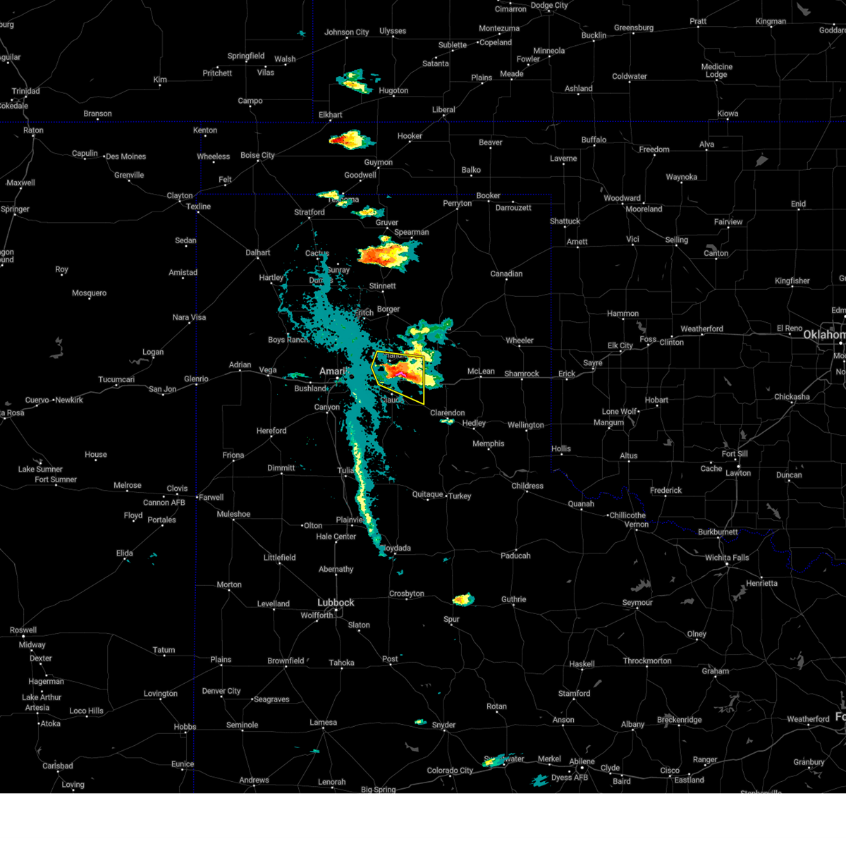 At 541 pm cdt, a severe thunderstorm was located 8 miles southeast of panhandle, moving east at 15 mph (trained weather spotters. at 532 pm cdt, trained spotters reported ping pong ball size hail south of panhandle). Hazards include tennis ball size hail and 60 mph wind gusts. Minor damage to roofs, siding, and trees is possible. people and animals outdoors will be injured. expect hail damage to roofs, siding, windows, and vehicles. locations impacted include, panhandle and groom. thunderstorm damage threat, considerable hail threat, observed max hail size, 2. 50 in wind threat, radar indicated max wind gust, 60 mph. At 541 pm cdt, a severe thunderstorm was located 8 miles southeast of panhandle, moving east at 15 mph (trained weather spotters. at 532 pm cdt, trained spotters reported ping pong ball size hail south of panhandle). Hazards include tennis ball size hail and 60 mph wind gusts. Minor damage to roofs, siding, and trees is possible. people and animals outdoors will be injured. expect hail damage to roofs, siding, windows, and vehicles. locations impacted include, panhandle and groom. thunderstorm damage threat, considerable hail threat, observed max hail size, 2. 50 in wind threat, radar indicated max wind gust, 60 mph.
|
| 6/21/2023 5:36 PM CDT |
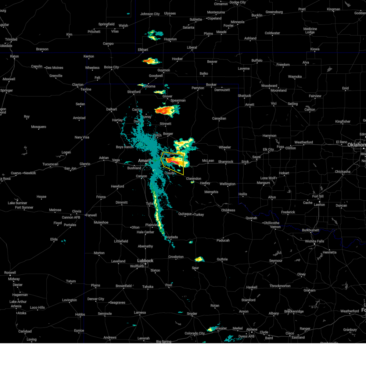 At 536 pm cdt, a severe thunderstorm was located 7 miles southeast of panhandle, moving east at 15 mph (trained weather spotters. at 532 pm cdt, trained spotters reported ping pong ball size hail south of panhandle). Hazards include ping pong ball size hail and 60 mph wind gusts. Minor damage to roofs, siding, and trees is possible. people and animals outdoors will be injured. expect hail damage to roofs, siding, windows, and vehicles. locations impacted include, panhandle and groom. hail threat, observed max hail size, 1. 50 in wind threat, radar indicated max wind gust, 60 mph. At 536 pm cdt, a severe thunderstorm was located 7 miles southeast of panhandle, moving east at 15 mph (trained weather spotters. at 532 pm cdt, trained spotters reported ping pong ball size hail south of panhandle). Hazards include ping pong ball size hail and 60 mph wind gusts. Minor damage to roofs, siding, and trees is possible. people and animals outdoors will be injured. expect hail damage to roofs, siding, windows, and vehicles. locations impacted include, panhandle and groom. hail threat, observed max hail size, 1. 50 in wind threat, radar indicated max wind gust, 60 mph.
|
| 6/21/2023 5:23 PM CDT |
 At 523 pm cdt, severe thunderstorms were located along a line extending from 6 miles southwest of skellytown to 5 miles south of panhandle, moving north at 5 mph (radar indicated). Hazards include 60 mph wind gusts and half dollar size hail. Minor damage to roofs, siding, and trees is possible. Hail damage to vehicles is expected. At 523 pm cdt, severe thunderstorms were located along a line extending from 6 miles southwest of skellytown to 5 miles south of panhandle, moving north at 5 mph (radar indicated). Hazards include 60 mph wind gusts and half dollar size hail. Minor damage to roofs, siding, and trees is possible. Hail damage to vehicles is expected.
|
| 6/17/2023 8:56 PM CDT |
 At 856 pm cdt, severe thunderstorms were located along a line extending from 4 miles southwest of lipscomb to 4 miles northwest of kingsmill, moving east at 45 mph (radar indicated). Hazards include 60 mph wind gusts and quarter size hail. Minor damage to roofs, siding, and trees is possible. hail damage to vehicles is expected. locations impacted include, pampa, lipscomb, canadian, shamrock, miami, briscoe, wheeler, white deer, mclean, groom, lefors, skellytown, higgins, wolf creek park, lake mcclellan, twitty, lake marvin, kingsmill, alanreed and codman. hail threat, radar indicated max hail size, 1. 00in wind threat, radar indicated max wind gust, 60 mph. At 856 pm cdt, severe thunderstorms were located along a line extending from 4 miles southwest of lipscomb to 4 miles northwest of kingsmill, moving east at 45 mph (radar indicated). Hazards include 60 mph wind gusts and quarter size hail. Minor damage to roofs, siding, and trees is possible. hail damage to vehicles is expected. locations impacted include, pampa, lipscomb, canadian, shamrock, miami, briscoe, wheeler, white deer, mclean, groom, lefors, skellytown, higgins, wolf creek park, lake mcclellan, twitty, lake marvin, kingsmill, alanreed and codman. hail threat, radar indicated max hail size, 1. 00in wind threat, radar indicated max wind gust, 60 mph.
|
| 6/17/2023 8:40 PM CDT |
 At 840 pm cdt, severe thunderstorms were located along a line extending from 6 miles east of wolf creek park to 7 miles west of skellytown, moving east at 50 mph (radar indicated). Hazards include 70 mph wind gusts and quarter size hail. Expect some tree damage. damage is likely to mobile homes, roofs, and outbuildings. Hail damage to vehicles is expected. At 840 pm cdt, severe thunderstorms were located along a line extending from 6 miles east of wolf creek park to 7 miles west of skellytown, moving east at 50 mph (radar indicated). Hazards include 70 mph wind gusts and quarter size hail. Expect some tree damage. damage is likely to mobile homes, roofs, and outbuildings. Hail damage to vehicles is expected.
|
| 6/12/2023 5:54 AM CDT |
 At 554 am cdt, severe thunderstorms were located along a line extending from 5 miles southeast of pampa to 6 miles south of white deer, moving east at 40 mph (broadcast media. at 540 am cdt, golf ball hail was reported in panhandle). Hazards include two inch hail and 60 mph wind gusts. Minor damage to roofs, siding, and trees is possible. people and animals outdoors will be injured. Expect hail damage to roofs, siding, windows, and vehicles. At 554 am cdt, severe thunderstorms were located along a line extending from 5 miles southeast of pampa to 6 miles south of white deer, moving east at 40 mph (broadcast media. at 540 am cdt, golf ball hail was reported in panhandle). Hazards include two inch hail and 60 mph wind gusts. Minor damage to roofs, siding, and trees is possible. people and animals outdoors will be injured. Expect hail damage to roofs, siding, windows, and vehicles.
|
| 6/3/2023 9:15 PM CDT |
 At 914 pm cdt, severe thunderstorms were located along a line extending from 7 miles southwest of lefors to 6 miles northeast of palo duro canyon, moving east at 15 mph (radar indicated). Hazards include 60 mph wind gusts and half dollar size hail. Minor damage to roofs, siding, and trees is possible. hail damage to vehicles is expected. locations impacted include, amarillo, pampa, panhandle, clarendon, claude, white deer, groom, howardwick, hedley, lelia lake, lake mcclellan, washburn, goodnight, kingsmill, alanreed, greenbelt lake and pantex. hail threat, radar indicated max hail size, 1. 25 in wind threat, radar indicated max wind gust, 60 mph. At 914 pm cdt, severe thunderstorms were located along a line extending from 7 miles southwest of lefors to 6 miles northeast of palo duro canyon, moving east at 15 mph (radar indicated). Hazards include 60 mph wind gusts and half dollar size hail. Minor damage to roofs, siding, and trees is possible. hail damage to vehicles is expected. locations impacted include, amarillo, pampa, panhandle, clarendon, claude, white deer, groom, howardwick, hedley, lelia lake, lake mcclellan, washburn, goodnight, kingsmill, alanreed, greenbelt lake and pantex. hail threat, radar indicated max hail size, 1. 25 in wind threat, radar indicated max wind gust, 60 mph.
|
| 6/3/2023 8:53 PM CDT |
 At 853 pm cdt, severe thunderstorms were located along a line extending from 9 miles southeast of kingsmill to 5 miles east of lake tanglewood, moving south at 10 mph (radar indicated). Hazards include 60 mph wind gusts and half dollar size hail. Minor damage to roofs, siding, and trees is possible. hail damage to vehicles is expected. locations impacted include, amarillo, pampa, panhandle, clarendon, claude, white deer, groom, howardwick, hedley, lelia lake, lake mcclellan, washburn, quail, goodnight, kingsmill, alanreed, greenbelt lake and pantex. hail threat, radar indicated max hail size, 1. 25 in wind threat, radar indicated max wind gust, 60 mph. At 853 pm cdt, severe thunderstorms were located along a line extending from 9 miles southeast of kingsmill to 5 miles east of lake tanglewood, moving south at 10 mph (radar indicated). Hazards include 60 mph wind gusts and half dollar size hail. Minor damage to roofs, siding, and trees is possible. hail damage to vehicles is expected. locations impacted include, amarillo, pampa, panhandle, clarendon, claude, white deer, groom, howardwick, hedley, lelia lake, lake mcclellan, washburn, quail, goodnight, kingsmill, alanreed, greenbelt lake and pantex. hail threat, radar indicated max hail size, 1. 25 in wind threat, radar indicated max wind gust, 60 mph.
|
| 6/3/2023 8:38 PM CDT |
 At 838 pm cdt, severe thunderstorms were located along a line extending from 3 miles south of pampa to amarillo, moving east at 15 mph (radar indicated). Hazards include 60 mph wind gusts and half dollar size hail. Minor damage to roofs, siding, and trees is possible. Hail damage to vehicles is expected. At 838 pm cdt, severe thunderstorms were located along a line extending from 3 miles south of pampa to amarillo, moving east at 15 mph (radar indicated). Hazards include 60 mph wind gusts and half dollar size hail. Minor damage to roofs, siding, and trees is possible. Hail damage to vehicles is expected.
|
| 6/3/2023 8:29 PM CDT |
 At 829 pm cdt, a severe thunderstorm was located 6 miles west of panhandle, moving south at 20 mph (radar indicated). Hazards include ping pong ball size hail and 60 mph wind gusts. Minor damage to roofs, siding, and trees is possible. people and animals outdoors will be injured. expect hail damage to roofs, siding, windows, and vehicles. locations impacted include, amarillo, canyon, panhandle, claude, white deer, lake tanglewood, groom, skellytown, wayside, washburn, palo duro canyon, goodnight, mescalero park, timbercreek canyon and pantex. hail threat, radar indicated max hail size, 1. 50 in wind threat, radar indicated max wind gust, 60 mph. At 829 pm cdt, a severe thunderstorm was located 6 miles west of panhandle, moving south at 20 mph (radar indicated). Hazards include ping pong ball size hail and 60 mph wind gusts. Minor damage to roofs, siding, and trees is possible. people and animals outdoors will be injured. expect hail damage to roofs, siding, windows, and vehicles. locations impacted include, amarillo, canyon, panhandle, claude, white deer, lake tanglewood, groom, skellytown, wayside, washburn, palo duro canyon, goodnight, mescalero park, timbercreek canyon and pantex. hail threat, radar indicated max hail size, 1. 50 in wind threat, radar indicated max wind gust, 60 mph.
|
| 6/3/2023 8:00 PM CDT |
 At 800 pm cdt, a severe thunderstorm was located 7 miles south of panhandle, moving south at 5 mph (radar indicated). Hazards include 60 mph wind gusts and half dollar size hail. Minor damage to roofs, siding, and trees is possible. hail damage to vehicles is expected. locations impacted include, amarillo, canyon, panhandle, claude, white deer, lake tanglewood, groom, skellytown, wayside, washburn, palo duro canyon, goodnight, mescalero park, timbercreek canyon and pantex. hail threat, radar indicated max hail size, 1. 25 in wind threat, radar indicated max wind gust, 60 mph. At 800 pm cdt, a severe thunderstorm was located 7 miles south of panhandle, moving south at 5 mph (radar indicated). Hazards include 60 mph wind gusts and half dollar size hail. Minor damage to roofs, siding, and trees is possible. hail damage to vehicles is expected. locations impacted include, amarillo, canyon, panhandle, claude, white deer, lake tanglewood, groom, skellytown, wayside, washburn, palo duro canyon, goodnight, mescalero park, timbercreek canyon and pantex. hail threat, radar indicated max hail size, 1. 25 in wind threat, radar indicated max wind gust, 60 mph.
|
| 6/3/2023 7:39 PM CDT |
 At 738 pm cdt, a severe thunderstorm was located 5 miles southwest of panhandle, moving south at 5 mph (radar indicated). Hazards include 60 mph wind gusts and half dollar size hail. Minor damage to roofs, siding, and trees is possible. hail damage to vehicles is expected. locations impacted include, amarillo, canyon, panhandle, claude, white deer, lake tanglewood, groom, skellytown, wayside, washburn, palo duro canyon, goodnight, mescalero park, timbercreek canyon and pantex. hail threat, radar indicated max hail size, 1. 25 in wind threat, radar indicated max wind gust, 60 mph. At 738 pm cdt, a severe thunderstorm was located 5 miles southwest of panhandle, moving south at 5 mph (radar indicated). Hazards include 60 mph wind gusts and half dollar size hail. Minor damage to roofs, siding, and trees is possible. hail damage to vehicles is expected. locations impacted include, amarillo, canyon, panhandle, claude, white deer, lake tanglewood, groom, skellytown, wayside, washburn, palo duro canyon, goodnight, mescalero park, timbercreek canyon and pantex. hail threat, radar indicated max hail size, 1. 25 in wind threat, radar indicated max wind gust, 60 mph.
|
| 6/3/2023 7:33 PM CDT |
 At 732 pm cdt, a severe thunderstorm was located 4 miles south of panhandle, moving southeast at 5 mph (radar indicated). Hazards include 60 mph wind gusts and half dollar size hail. Minor damage to roofs, siding, and trees is possible. hail damage to vehicles is expected. locations impacted include, amarillo, canyon, panhandle, claude, white deer, lake tanglewood, groom, skellytown, wayside, washburn, palo duro canyon, goodnight, mescalero park, timbercreek canyon and pantex. hail threat, radar indicated max hail size, 1. 25 in wind threat, radar indicated max wind gust, 60 mph. At 732 pm cdt, a severe thunderstorm was located 4 miles south of panhandle, moving southeast at 5 mph (radar indicated). Hazards include 60 mph wind gusts and half dollar size hail. Minor damage to roofs, siding, and trees is possible. hail damage to vehicles is expected. locations impacted include, amarillo, canyon, panhandle, claude, white deer, lake tanglewood, groom, skellytown, wayside, washburn, palo duro canyon, goodnight, mescalero park, timbercreek canyon and pantex. hail threat, radar indicated max hail size, 1. 25 in wind threat, radar indicated max wind gust, 60 mph.
|
| 6/3/2023 7:21 PM CDT |
 At 721 pm cdt, a severe thunderstorm was located 7 miles west of panhandle, moving south at 10 mph (radar indicated). Hazards include 60 mph wind gusts and half dollar size hail. Minor damage to roofs, siding, and trees is possible. Hail damage to vehicles is expected. At 721 pm cdt, a severe thunderstorm was located 7 miles west of panhandle, moving south at 10 mph (radar indicated). Hazards include 60 mph wind gusts and half dollar size hail. Minor damage to roofs, siding, and trees is possible. Hail damage to vehicles is expected.
|
| 6/2/2023 4:25 PM CDT |
 The severe thunderstorm warning for northeastern armstrong, eastern carson, gray, southeastern roberts and donley counties will expire at 430 pm cdt, the storm which prompted the warning has moved out of the area. therefore, the warning will be allowed to expire. however gusty winds are still possible with this thunderstorm. a tornado watch remains in effect until 800 pm cdt for the panhandle of texas. remember, a severe thunderstorm warning still remains in effect for gray and donley counties until 530 pm. The severe thunderstorm warning for northeastern armstrong, eastern carson, gray, southeastern roberts and donley counties will expire at 430 pm cdt, the storm which prompted the warning has moved out of the area. therefore, the warning will be allowed to expire. however gusty winds are still possible with this thunderstorm. a tornado watch remains in effect until 800 pm cdt for the panhandle of texas. remember, a severe thunderstorm warning still remains in effect for gray and donley counties until 530 pm.
|
| 6/2/2023 4:08 PM CDT |
 At 407 pm cdt, a severe thunderstorm was located 7 miles northeast of groom, or 18 miles south of pampa, moving east at 25 mph (radar indicated). Hazards include 60 mph wind gusts. Minor damage to roofs, siding, and trees is possible. locations impacted include, pampa, clarendon, white deer, mclean, groom, lefors, skellytown, howardwick, hedley, lelia lake, lake mcclellan, goodnight, kingsmill, alanreed and greenbelt lake. hail threat, radar indicated max hail size, <. 75 in wind threat, radar indicated max wind gust, 60 mph. At 407 pm cdt, a severe thunderstorm was located 7 miles northeast of groom, or 18 miles south of pampa, moving east at 25 mph (radar indicated). Hazards include 60 mph wind gusts. Minor damage to roofs, siding, and trees is possible. locations impacted include, pampa, clarendon, white deer, mclean, groom, lefors, skellytown, howardwick, hedley, lelia lake, lake mcclellan, goodnight, kingsmill, alanreed and greenbelt lake. hail threat, radar indicated max hail size, <. 75 in wind threat, radar indicated max wind gust, 60 mph.
|
| 6/2/2023 3:54 PM CDT |
 At 353 pm cdt, a severe thunderstorm was located 5 miles northeast of groom, or 18 miles east of panhandle, moving east at 30 mph (radar indicated). Hazards include 60 mph wind gusts. Minor damage to roofs, siding, and trees is possible. locations impacted include, pampa, panhandle, clarendon, claude, white deer, mclean, groom, lefors, skellytown, howardwick, hedley, lelia lake, lake mcclellan, goodnight, kingsmill, alanreed and greenbelt lake. hail threat, radar indicated max hail size, <. 75 in wind threat, radar indicated max wind gust, 60 mph. At 353 pm cdt, a severe thunderstorm was located 5 miles northeast of groom, or 18 miles east of panhandle, moving east at 30 mph (radar indicated). Hazards include 60 mph wind gusts. Minor damage to roofs, siding, and trees is possible. locations impacted include, pampa, panhandle, clarendon, claude, white deer, mclean, groom, lefors, skellytown, howardwick, hedley, lelia lake, lake mcclellan, goodnight, kingsmill, alanreed and greenbelt lake. hail threat, radar indicated max hail size, <. 75 in wind threat, radar indicated max wind gust, 60 mph.
|
| 6/2/2023 3:37 PM CDT |
 At 337 pm cdt, a severe thunderstorm was located 6 miles northwest of groom, or 11 miles southeast of panhandle, moving east at 30 mph (radar indicated). Hazards include 60 mph wind gusts. Minor damage to roofs, siding, and trees is possible. locations impacted include, pampa, panhandle, clarendon, claude, white deer, mclean, groom, lefors, skellytown, howardwick, hedley, lelia lake, lake mcclellan, goodnight, kingsmill, alanreed and greenbelt lake. hail threat, radar indicated max hail size, <. 75 in wind threat, radar indicated max wind gust, 60 mph. At 337 pm cdt, a severe thunderstorm was located 6 miles northwest of groom, or 11 miles southeast of panhandle, moving east at 30 mph (radar indicated). Hazards include 60 mph wind gusts. Minor damage to roofs, siding, and trees is possible. locations impacted include, pampa, panhandle, clarendon, claude, white deer, mclean, groom, lefors, skellytown, howardwick, hedley, lelia lake, lake mcclellan, goodnight, kingsmill, alanreed and greenbelt lake. hail threat, radar indicated max hail size, <. 75 in wind threat, radar indicated max wind gust, 60 mph.
|
| 6/2/2023 3:29 PM CDT |
 At 329 pm cdt, a severe thunderstorm was located 8 miles southeast of panhandle, moving east at 30 mph (radar indicated). Hazards include 60 mph wind gusts. Minor damage to roofs, siding, and trees is possible. locations impacted include, pampa, panhandle, clarendon, claude, white deer, mclean, groom, lefors, skellytown, howardwick, hedley, lelia lake, lake mcclellan, washburn, goodnight, kingsmill, alanreed, greenbelt lake and pantex. hail threat, radar indicated max hail size, <. 75 in wind threat, radar indicated max wind gust, 60 mph. At 329 pm cdt, a severe thunderstorm was located 8 miles southeast of panhandle, moving east at 30 mph (radar indicated). Hazards include 60 mph wind gusts. Minor damage to roofs, siding, and trees is possible. locations impacted include, pampa, panhandle, clarendon, claude, white deer, mclean, groom, lefors, skellytown, howardwick, hedley, lelia lake, lake mcclellan, washburn, goodnight, kingsmill, alanreed, greenbelt lake and pantex. hail threat, radar indicated max hail size, <. 75 in wind threat, radar indicated max wind gust, 60 mph.
|
| 6/2/2023 3:04 PM CDT |
 At 304 pm cdt, a severe thunderstorm was located 5 miles northeast of washburn, or 10 miles southwest of panhandle, moving east at 30 mph (radar indicated). Hazards include 60 mph wind gusts. minor damage to roofs, siding, and trees is possible At 304 pm cdt, a severe thunderstorm was located 5 miles northeast of washburn, or 10 miles southwest of panhandle, moving east at 30 mph (radar indicated). Hazards include 60 mph wind gusts. minor damage to roofs, siding, and trees is possible
|
| 5/18/2023 10:57 PM CDT |
 At 1057 pm cdt, severe thunderstorms were located along a line extending from near kingsmill to 9 miles east of white deer to 7 miles west of lake mcclellan to 7 miles east of goodnight to 7 miles east of wayside, moving east at 25 mph (radar indicated). Hazards include 70 mph wind gusts. Expect some tree damage. damage is likely to mobile homes, roofs, and outbuildings. Locations impacted include, pampa, panhandle, clarendon, claude, white deer, mclean, groom, lefors, howardwick, hedley, lelia lake, lake mcclellan, wayside, goodnight, kingsmill, alanreed and greenbelt lake. At 1057 pm cdt, severe thunderstorms were located along a line extending from near kingsmill to 9 miles east of white deer to 7 miles west of lake mcclellan to 7 miles east of goodnight to 7 miles east of wayside, moving east at 25 mph (radar indicated). Hazards include 70 mph wind gusts. Expect some tree damage. damage is likely to mobile homes, roofs, and outbuildings. Locations impacted include, pampa, panhandle, clarendon, claude, white deer, mclean, groom, lefors, howardwick, hedley, lelia lake, lake mcclellan, wayside, goodnight, kingsmill, alanreed and greenbelt lake.
|
| 5/18/2023 10:28 PM CDT |
 At 1028 pm cdt, severe thunderstorms were located along a line extending from 4 miles north of panhandle to 9 miles southwest of white deer to 8 miles west of groom to 6 miles south of claude to 7 miles west of wayside, moving east at 30 mph (automated weather equipment. at 1017 pm cdt, automated weather equipment recorded a 59 mph wind gust 1 mile east of happy). Hazards include 60 mph wind gusts. minor damage to roofs, siding, and trees is possible At 1028 pm cdt, severe thunderstorms were located along a line extending from 4 miles north of panhandle to 9 miles southwest of white deer to 8 miles west of groom to 6 miles south of claude to 7 miles west of wayside, moving east at 30 mph (automated weather equipment. at 1017 pm cdt, automated weather equipment recorded a 59 mph wind gust 1 mile east of happy). Hazards include 60 mph wind gusts. minor damage to roofs, siding, and trees is possible
|
| 5/18/2023 10:27 PM CDT |
 At 1027 pm cdt, severe thunderstorms were located along a line extending from 5 miles northeast of panhandle to 8 miles southwest of white deer to 6 miles west of groom to 6 miles west of goodnight to 6 miles west of wayside, moving east at 30 mph (automated weather equipment. at 1017 pm cdt, automated weather equipment recorded a 59 mph wind gust 1 mile east of happy). Hazards include 60 mph wind gusts. minor damage to roofs, siding, and trees is possible At 1027 pm cdt, severe thunderstorms were located along a line extending from 5 miles northeast of panhandle to 8 miles southwest of white deer to 6 miles west of groom to 6 miles west of goodnight to 6 miles west of wayside, moving east at 30 mph (automated weather equipment. at 1017 pm cdt, automated weather equipment recorded a 59 mph wind gust 1 mile east of happy). Hazards include 60 mph wind gusts. minor damage to roofs, siding, and trees is possible
|
| 5/18/2023 8:44 PM CDT |
 At 844 pm cdt, a severe thunderstorm was located 8 miles west of panhandle, moving east at 20 mph (trained weather spotters. at 842 pm cdt, trained spotters reported two inch diameter hail 2 miles west southwest of pantex). Hazards include two inch hail and 60 mph wind gusts. Minor damage to roofs, siding, and trees is possible. people and animals outdoors will be injured. expect hail damage to roofs, siding, windows, and vehicles. Locations impacted include, panhandle, white deer, groom and pantex. At 844 pm cdt, a severe thunderstorm was located 8 miles west of panhandle, moving east at 20 mph (trained weather spotters. at 842 pm cdt, trained spotters reported two inch diameter hail 2 miles west southwest of pantex). Hazards include two inch hail and 60 mph wind gusts. Minor damage to roofs, siding, and trees is possible. people and animals outdoors will be injured. expect hail damage to roofs, siding, windows, and vehicles. Locations impacted include, panhandle, white deer, groom and pantex.
|
| 5/18/2023 8:28 PM CDT |
 At 826 pm cdt, a severe thunderstorm was located 8 miles west of panhandle, moving east at 25 mph (trained weather spotters. at 759 pm cdt, trained spotters reported golf ball size hail 7 miles north northwest of pantex. additionally, at 810 pm cdt, trained spotters reported quarter size hail 4 miles west northwest of pantex). Hazards include golf ball size hail and 60 mph wind gusts. Minor damage to roofs, siding, and trees is possible. people and animals outdoors will be injured. expect hail damage to roofs, siding, windows, and vehicles. Locations impacted include, panhandle, white deer, groom and pantex. At 826 pm cdt, a severe thunderstorm was located 8 miles west of panhandle, moving east at 25 mph (trained weather spotters. at 759 pm cdt, trained spotters reported golf ball size hail 7 miles north northwest of pantex. additionally, at 810 pm cdt, trained spotters reported quarter size hail 4 miles west northwest of pantex). Hazards include golf ball size hail and 60 mph wind gusts. Minor damage to roofs, siding, and trees is possible. people and animals outdoors will be injured. expect hail damage to roofs, siding, windows, and vehicles. Locations impacted include, panhandle, white deer, groom and pantex.
|
| 5/18/2023 8:15 PM CDT |
 At 814 pm cdt, a severe thunderstorm was located 13 miles west of panhandle, moving east at 20 mph (trained weather spotters. at 759 pm cdt, trained spotters reported golf ball size hail 7 miles north northwest of pantex. additionally, at 810 pm cdt, trained spotters reported quarter size hail 4 miles west northwest of pantex). Hazards include golf ball size hail and 60 mph wind gusts. Minor damage to roofs, siding, and trees is possible. people and animals outdoors will be injured. expect hail damage to roofs, siding, windows, and vehicles. Locations impacted include, panhandle, white deer, groom and pantex. At 814 pm cdt, a severe thunderstorm was located 13 miles west of panhandle, moving east at 20 mph (trained weather spotters. at 759 pm cdt, trained spotters reported golf ball size hail 7 miles north northwest of pantex. additionally, at 810 pm cdt, trained spotters reported quarter size hail 4 miles west northwest of pantex). Hazards include golf ball size hail and 60 mph wind gusts. Minor damage to roofs, siding, and trees is possible. people and animals outdoors will be injured. expect hail damage to roofs, siding, windows, and vehicles. Locations impacted include, panhandle, white deer, groom and pantex.
|
| 5/18/2023 7:55 PM CDT |
 At 754 pm cdt, two severe thunderstorms, the first 16 miles south of fritch and the second 10 miles northeast of amarillo, were moving east at 20 mph (radar indicated). Hazards include 60 mph wind gusts and half dollar size hail. Minor damage to roofs, siding, and trees is possible. Hail damage to vehicles is expected. At 754 pm cdt, two severe thunderstorms, the first 16 miles south of fritch and the second 10 miles northeast of amarillo, were moving east at 20 mph (radar indicated). Hazards include 60 mph wind gusts and half dollar size hail. Minor damage to roofs, siding, and trees is possible. Hail damage to vehicles is expected.
|
| 2/26/2023 6:15 PM CST | Storm damage reported in gray county TX, 11.7 miles W of Groom, TX |
| 2/26/2023 5:55 PM CST |
 At 554 pm cst, severe thunderstorms were located along a line extending from 4 miles north of skellytown to 5 miles south of white deer to 15 miles northeast of vigo park, moving east at 60 mph (radar indicated). Hazards include 70 mph wind gusts and penny size hail. Expect some tree damage. Damage is likely to mobile homes, roofs, and outbuildings. At 554 pm cst, severe thunderstorms were located along a line extending from 4 miles north of skellytown to 5 miles south of white deer to 15 miles northeast of vigo park, moving east at 60 mph (radar indicated). Hazards include 70 mph wind gusts and penny size hail. Expect some tree damage. Damage is likely to mobile homes, roofs, and outbuildings.
|
| 2/26/2023 5:31 PM CST |
 At 531 pm cst, a severe thunderstorm capable of producing a tornado was located over lake mcclellan, or 20 miles north of clarendon, moving northeast at 55 mph (radar indicated rotation). Hazards include tornado and golf ball size hail. Flying debris will be dangerous to those caught without shelter. mobile homes will be damaged or destroyed. damage to roofs, windows, and vehicles will occur. tree damage is likely. Locations impacted include, briscoe, wheeler, mclean, groom, lefors, new mobeetie, lake mcclellan, twitty, alanreed, kellerville and mobeetie. At 531 pm cst, a severe thunderstorm capable of producing a tornado was located over lake mcclellan, or 20 miles north of clarendon, moving northeast at 55 mph (radar indicated rotation). Hazards include tornado and golf ball size hail. Flying debris will be dangerous to those caught without shelter. mobile homes will be damaged or destroyed. damage to roofs, windows, and vehicles will occur. tree damage is likely. Locations impacted include, briscoe, wheeler, mclean, groom, lefors, new mobeetie, lake mcclellan, twitty, alanreed, kellerville and mobeetie.
|
| 2/26/2023 5:24 PM CST |
 At 524 pm cst, severe thunderstorms were located along a line extending from 3 miles west of skellytown to 11 miles northeast of wayside, moving northeast at 70 mph (radar indicated). Hazards include 70 mph wind gusts and quarter size hail. Expect some tree damage. damage is likely to mobile homes, roofs, and outbuildings. hail damage to vehicles is expected. locations impacted include, pampa, panhandle, claude, miami, briscoe, wheeler, white deer, mclean, groom, lefors, skellytown, howardwick, new mobeetie, lake mcclellan, twitty, kellerville, goodnight, kingsmill, alanreed and codman. thunderstorm damage threat, considerable hail threat, radar indicated max hail size, 1. 00in wind threat, radar indicated max wind gust, 70 mph. At 524 pm cst, severe thunderstorms were located along a line extending from 3 miles west of skellytown to 11 miles northeast of wayside, moving northeast at 70 mph (radar indicated). Hazards include 70 mph wind gusts and quarter size hail. Expect some tree damage. damage is likely to mobile homes, roofs, and outbuildings. hail damage to vehicles is expected. locations impacted include, pampa, panhandle, claude, miami, briscoe, wheeler, white deer, mclean, groom, lefors, skellytown, howardwick, new mobeetie, lake mcclellan, twitty, kellerville, goodnight, kingsmill, alanreed and codman. thunderstorm damage threat, considerable hail threat, radar indicated max hail size, 1. 00in wind threat, radar indicated max wind gust, 70 mph.
|
| 2/26/2023 5:15 PM CST |
 At 515 pm cst, a severe thunderstorm capable of producing a tornado was located 6 miles north of goodnight, or 10 miles east of claude, moving northeast at 55 mph (radar indicated rotation). Hazards include tornado and quarter size hail. Flying debris will be dangerous to those caught without shelter. mobile homes will be damaged or destroyed. damage to roofs, windows, and vehicles will occur. Tree damage is likely. At 515 pm cst, a severe thunderstorm capable of producing a tornado was located 6 miles north of goodnight, or 10 miles east of claude, moving northeast at 55 mph (radar indicated rotation). Hazards include tornado and quarter size hail. Flying debris will be dangerous to those caught without shelter. mobile homes will be damaged or destroyed. damage to roofs, windows, and vehicles will occur. Tree damage is likely.
|
| 2/26/2023 4:55 PM CST |
 At 455 pm cst, severe thunderstorms were located along a line extending from 9 miles northwest of panhandle to claude to 10 miles northeast of wayside, moving northeast at 75 mph (radar indicated). Hazards include 70 mph wind gusts and quarter size hail. Expect some tree damage. damage is likely to mobile homes, roofs, and outbuildings. Hail damage to vehicles is expected. At 455 pm cst, severe thunderstorms were located along a line extending from 9 miles northwest of panhandle to claude to 10 miles northeast of wayside, moving northeast at 75 mph (radar indicated). Hazards include 70 mph wind gusts and quarter size hail. Expect some tree damage. damage is likely to mobile homes, roofs, and outbuildings. Hail damage to vehicles is expected.
|
| 12/12/2022 9:50 PM CST |
 At 949 pm cst, a severe thunderstorm was located 6 miles west of groom, or 9 miles northeast of claude, moving northeast at 55 mph (radar indicated). Hazards include 60 mph wind gusts and quarter size hail. Minor damage to roofs, siding, and trees is possible. Hail damage to vehicles is expected. At 949 pm cst, a severe thunderstorm was located 6 miles west of groom, or 9 miles northeast of claude, moving northeast at 55 mph (radar indicated). Hazards include 60 mph wind gusts and quarter size hail. Minor damage to roofs, siding, and trees is possible. Hail damage to vehicles is expected.
|
| 8/4/2022 6:32 PM CDT |
 At 632 pm cdt, severe thunderstorms were located along a line extending from 17 miles north of skellytown to 5 miles southeast of pampa to clarendon, moving east at 10 mph (radar indicated). Hazards include 60 mph wind gusts. Minor damage to roofs, siding, and trees is possible. locations impacted include, pampa, clarendon, miami, white deer, mclean, groom, lefors, skellytown, howardwick, hedley, lelia lake, lake mcclellan, goodnight, lora, kingsmill, alanreed, codman and greenbelt lake. hail threat, radar indicated max hail size, <. 75 in wind threat, radar indicated max wind gust, 60 mph. At 632 pm cdt, severe thunderstorms were located along a line extending from 17 miles north of skellytown to 5 miles southeast of pampa to clarendon, moving east at 10 mph (radar indicated). Hazards include 60 mph wind gusts. Minor damage to roofs, siding, and trees is possible. locations impacted include, pampa, clarendon, miami, white deer, mclean, groom, lefors, skellytown, howardwick, hedley, lelia lake, lake mcclellan, goodnight, lora, kingsmill, alanreed, codman and greenbelt lake. hail threat, radar indicated max hail size, <. 75 in wind threat, radar indicated max wind gust, 60 mph.
|
| 8/4/2022 5:57 PM CDT |
 At 557 pm cdt, severe thunderstorms were located along a line extending from 10 miles north of pampa to 4 miles south of kingsmill to 11 miles south of goodnight, moving east at 40 mph (radar indicated). Hazards include 70 mph wind gusts and penny size hail. Expect some tree damage. Damage is likely to mobile homes, roofs, and outbuildings. At 557 pm cdt, severe thunderstorms were located along a line extending from 10 miles north of pampa to 4 miles south of kingsmill to 11 miles south of goodnight, moving east at 40 mph (radar indicated). Hazards include 70 mph wind gusts and penny size hail. Expect some tree damage. Damage is likely to mobile homes, roofs, and outbuildings.
|
| 8/4/2022 5:26 PM CDT |
 At 526 pm cdt, severe thunderstorms were located along a line extending from 4 miles south of kingsmill to 4 miles southeast of goodnight to 6 miles east of happy, moving east at 25 mph (radar indicated). Hazards include 70 mph wind gusts and quarter size hail. Expect some tree damage. damage is likely to mobile homes, roofs, and outbuildings. hail damage to vehicles is expected. locations impacted include, clarendon, claude, groom, lefors, howardwick, hedley, lelia lake, lake mcclellan, wayside, palo duro canyon, goodnight, alanreed and greenbelt lake. thunderstorm damage threat, considerable hail threat, radar indicated max hail size, 1. 00in wind threat, radar indicated max wind gust, 70 mph. At 526 pm cdt, severe thunderstorms were located along a line extending from 4 miles south of kingsmill to 4 miles southeast of goodnight to 6 miles east of happy, moving east at 25 mph (radar indicated). Hazards include 70 mph wind gusts and quarter size hail. Expect some tree damage. damage is likely to mobile homes, roofs, and outbuildings. hail damage to vehicles is expected. locations impacted include, clarendon, claude, groom, lefors, howardwick, hedley, lelia lake, lake mcclellan, wayside, palo duro canyon, goodnight, alanreed and greenbelt lake. thunderstorm damage threat, considerable hail threat, radar indicated max hail size, 1. 00in wind threat, radar indicated max wind gust, 70 mph.
|
| 8/4/2022 4:56 PM CDT |
 At 455 pm cdt, severe thunderstorms were located along a line extending from 7 miles north of groom to 4 miles southwest of goodnight to vigo park, moving east at 30 mph (radar indicated). Hazards include 60 mph wind gusts and quarter size hail. Minor damage to roofs, siding, and trees is possible. Hail damage to vehicles is expected. At 455 pm cdt, severe thunderstorms were located along a line extending from 7 miles north of groom to 4 miles southwest of goodnight to vigo park, moving east at 30 mph (radar indicated). Hazards include 60 mph wind gusts and quarter size hail. Minor damage to roofs, siding, and trees is possible. Hail damage to vehicles is expected.
|
| 6/9/2022 10:15 PM CDT |
 At 1014 pm cdt, severe thunderstorms were located along a line extending from 8 miles south of allison to 4 miles southwest of mclean to 9 miles west of clarendon, moving east at 35 mph (radar indicated). Hazards include 60 mph wind gusts and quarter size hail. Minor damage to roofs, siding, and trees is possible. hail damage to vehicles is expected. locations impacted include, clarendon, shamrock, briscoe, wheeler, mclean, groom, lefors, howardwick, hedley, lutie, lelia lake, new mobeetie, lake mcclellan, twitty, allison, lela, samnorwood, quail, kellerville and goodnight. hail threat, radar indicated max hail size, 1. 00in wind threat, radar indicated max wind gust, 60 mph. At 1014 pm cdt, severe thunderstorms were located along a line extending from 8 miles south of allison to 4 miles southwest of mclean to 9 miles west of clarendon, moving east at 35 mph (radar indicated). Hazards include 60 mph wind gusts and quarter size hail. Minor damage to roofs, siding, and trees is possible. hail damage to vehicles is expected. locations impacted include, clarendon, shamrock, briscoe, wheeler, mclean, groom, lefors, howardwick, hedley, lutie, lelia lake, new mobeetie, lake mcclellan, twitty, allison, lela, samnorwood, quail, kellerville and goodnight. hail threat, radar indicated max hail size, 1. 00in wind threat, radar indicated max wind gust, 60 mph.
|
| 6/9/2022 9:43 PM CDT |
 At 942 pm cdt, severe thunderstorms were located along a line extending from 7 miles east of lefors to 7 miles northeast of groom to 5 miles northwest of goodnight, moving southeast at 30 mph (radar indicated). Hazards include 70 mph wind gusts and quarter size hail. Expect some tree damage. damage is likely to mobile homes, roofs, and outbuildings. Hail damage to vehicles is expected. At 942 pm cdt, severe thunderstorms were located along a line extending from 7 miles east of lefors to 7 miles northeast of groom to 5 miles northwest of goodnight, moving southeast at 30 mph (radar indicated). Hazards include 70 mph wind gusts and quarter size hail. Expect some tree damage. damage is likely to mobile homes, roofs, and outbuildings. Hail damage to vehicles is expected.
|
| 6/9/2022 9:26 PM CDT |
 At 925 pm cdt, automated weather equipment reported a 77 mph wind gust 2 miles east of pampa. severe thunderstorms were located along a line extending from 5 miles north of lefors to 10 miles south of kingsmill to 5 miles west of groom, moving southeast at 35 mph (automated weather equipment). Hazards include 70 mph wind gusts and quarter size hail. Expect some tree damage. damage is likely to mobile homes, roofs, and outbuildings. hail damage to vehicles is expected. locations impacted include, pampa, panhandle, white deer, groom, lefors, skellytown, lake mcclellan and kingsmill. thunderstorm damage threat, considerable hail threat, radar indicated max hail size, 1. 00in wind threat, observed max wind gust, 70 mph. At 925 pm cdt, automated weather equipment reported a 77 mph wind gust 2 miles east of pampa. severe thunderstorms were located along a line extending from 5 miles north of lefors to 10 miles south of kingsmill to 5 miles west of groom, moving southeast at 35 mph (automated weather equipment). Hazards include 70 mph wind gusts and quarter size hail. Expect some tree damage. damage is likely to mobile homes, roofs, and outbuildings. hail damage to vehicles is expected. locations impacted include, pampa, panhandle, white deer, groom, lefors, skellytown, lake mcclellan and kingsmill. thunderstorm damage threat, considerable hail threat, radar indicated max hail size, 1. 00in wind threat, observed max wind gust, 70 mph.
|
| 6/9/2022 9:20 PM CDT |
 At 919 pm cdt, severe thunderstorms were located along a line extending from 4 miles east of pampa to 5 miles east of white deer to 8 miles northwest of groom, moving east at 35 mph (radar indicated). Hazards include 60 mph wind gusts and quarter size hail. Minor damage to roofs, siding, and trees is possible. hail damage to vehicles is expected. locations impacted include, pampa, panhandle, white deer, groom, lefors, skellytown, lake mcclellan and kingsmill. hail threat, radar indicated max hail size, 1. 00in wind threat, radar indicated max wind gust, 60 mph. At 919 pm cdt, severe thunderstorms were located along a line extending from 4 miles east of pampa to 5 miles east of white deer to 8 miles northwest of groom, moving east at 35 mph (radar indicated). Hazards include 60 mph wind gusts and quarter size hail. Minor damage to roofs, siding, and trees is possible. hail damage to vehicles is expected. locations impacted include, pampa, panhandle, white deer, groom, lefors, skellytown, lake mcclellan and kingsmill. hail threat, radar indicated max hail size, 1. 00in wind threat, radar indicated max wind gust, 60 mph.
|
| 6/9/2022 9:03 PM CDT |
 At 903 pm cdt, severe thunderstorms were located along a line extending from 5 miles north of pampa to 4 miles south of skellytown to 5 miles east of panhandle, moving southeast at 30 mph (radar indicated). Hazards include 60 mph wind gusts and quarter size hail. Minor damage to roofs, siding, and trees is possible. hail damage to vehicles is expected. locations impacted include, pampa, borger, panhandle, white deer, groom, lefors, skellytown, lake mcclellan and kingsmill. hail threat, radar indicated max hail size, 1. 00in wind threat, radar indicated max wind gust, 60 mph. At 903 pm cdt, severe thunderstorms were located along a line extending from 5 miles north of pampa to 4 miles south of skellytown to 5 miles east of panhandle, moving southeast at 30 mph (radar indicated). Hazards include 60 mph wind gusts and quarter size hail. Minor damage to roofs, siding, and trees is possible. hail damage to vehicles is expected. locations impacted include, pampa, borger, panhandle, white deer, groom, lefors, skellytown, lake mcclellan and kingsmill. hail threat, radar indicated max hail size, 1. 00in wind threat, radar indicated max wind gust, 60 mph.
|
| 6/9/2022 8:41 PM CDT |
 At 840 pm cdt, severe thunderstorms were located along a line extending from 12 miles northeast of skellytown to 4 miles east of borger to 7 miles north of panhandle, moving southeast at 35 mph (radar indicated). Hazards include 60 mph wind gusts and half dollar size hail. Minor damage to roofs, siding, and trees is possible. Hail damage to vehicles is expected. At 840 pm cdt, severe thunderstorms were located along a line extending from 12 miles northeast of skellytown to 4 miles east of borger to 7 miles north of panhandle, moving southeast at 35 mph (radar indicated). Hazards include 60 mph wind gusts and half dollar size hail. Minor damage to roofs, siding, and trees is possible. Hail damage to vehicles is expected.
|
| 6/8/2022 7:16 AM CDT | West texas mesonet station lake mcclellan 2nw. gusts to 58 mph or greater occurred from 713 to 716 am cd in gray county TX, 11.6 miles W of Groom, TX |
| 6/8/2022 6:36 AM CDT |
 At 636 am cdt, severe thunderstorms were located along a line extending from 7 miles north of sweetwater to 5 miles north of lefors to 7 miles west of panhandle to 8 miles northeast of bushland, moving southeast at 55 mph (radar indicated). Hazards include 70 mph wind gusts and quarter size hail. Expect some tree damage. damage is likely to mobile homes, roofs, and outbuildings. Hail damage to vehicles is expected. At 636 am cdt, severe thunderstorms were located along a line extending from 7 miles north of sweetwater to 5 miles north of lefors to 7 miles west of panhandle to 8 miles northeast of bushland, moving southeast at 55 mph (radar indicated). Hazards include 70 mph wind gusts and quarter size hail. Expect some tree damage. damage is likely to mobile homes, roofs, and outbuildings. Hail damage to vehicles is expected.
|
| 6/8/2022 6:02 AM CDT |
 At 602 am cdt, severe thunderstorms were located along a line extending from near lake marvin to 11 miles northeast of borger to 6 miles west of four way, moving south at 30 mph (radar indicated). Hazards include 70 mph wind gusts and half dollar size hail. Expect some tree damage. damage is likely to mobile homes, roofs, and outbuildings. Hail damage to vehicles is expected. At 602 am cdt, severe thunderstorms were located along a line extending from near lake marvin to 11 miles northeast of borger to 6 miles west of four way, moving south at 30 mph (radar indicated). Hazards include 70 mph wind gusts and half dollar size hail. Expect some tree damage. damage is likely to mobile homes, roofs, and outbuildings. Hail damage to vehicles is expected.
|
| 5/16/2022 10:45 PM CDT |
 At 1044 pm cdt, severe thunderstorms were located along a line extending from 3 miles southwest of borger to 11 miles south of fritch to 9 miles north of washburn, moving east at 35 mph (radar indicated). Hazards include 60 mph wind gusts. minor damage to roofs, siding, and trees is possible At 1044 pm cdt, severe thunderstorms were located along a line extending from 3 miles southwest of borger to 11 miles south of fritch to 9 miles north of washburn, moving east at 35 mph (radar indicated). Hazards include 60 mph wind gusts. minor damage to roofs, siding, and trees is possible
|
| 5/10/2022 7:40 PM CDT |
 At 740 pm cdt, severe thunderstorms were located along a line extending from near pringle to 7 miles east of borger to 3 miles southeast of white deer to 7 miles east of goodnight, moving northeast at 55 mph (radar indicated). Hazards include 70 mph wind gusts and quarter size hail. Expect some tree damage. damage is likely to mobile homes, roofs, and outbuildings. Hail damage to vehicles is expected. At 740 pm cdt, severe thunderstorms were located along a line extending from near pringle to 7 miles east of borger to 3 miles southeast of white deer to 7 miles east of goodnight, moving northeast at 55 mph (radar indicated). Hazards include 70 mph wind gusts and quarter size hail. Expect some tree damage. damage is likely to mobile homes, roofs, and outbuildings. Hail damage to vehicles is expected.
|
| 5/10/2022 6:55 PM CDT |
 At 655 pm cdt, a severe thunderstorm was located 6 miles north of goodnight, or 9 miles east of claude, moving north at 35 mph (radar indicated). Hazards include golf ball size hail and 60 mph wind gusts. Minor damage to roofs, siding, and trees is possible. people and animals outdoors will be injured. Expect hail damage to roofs, siding, windows, and vehicles. At 655 pm cdt, a severe thunderstorm was located 6 miles north of goodnight, or 9 miles east of claude, moving north at 35 mph (radar indicated). Hazards include golf ball size hail and 60 mph wind gusts. Minor damage to roofs, siding, and trees is possible. people and animals outdoors will be injured. Expect hail damage to roofs, siding, windows, and vehicles.
|
| 5/10/2022 6:49 PM CDT | West texas mesonet 2 nw lake mcclella in gray county TX, 11.6 miles W of Groom, TX |
| 5/10/2022 6:39 PM CDT |
 At 639 pm cdt, severe thunderstorms were located along a line extending from 3 miles southeast of goodnight to 7 miles northwest of howardwick, moving north at 15 mph (radar indicated). Hazards include tennis ball size hail and 70 mph wind gusts. Expect some tree damage. damage is likely to mobile homes, roofs, and outbuildings. people and animals outdoors will be injured. expect hail damage to roofs, siding, windows, and vehicles. locations impacted include, clarendon, groom, howardwick, lake mcclellan, alanreed, greenbelt lake and goodnight. thunderstorm damage threat, considerable hail threat, radar indicated max hail size, 2. 50 in wind threat, radar indicated max wind gust, 70 mph. At 639 pm cdt, severe thunderstorms were located along a line extending from 3 miles southeast of goodnight to 7 miles northwest of howardwick, moving north at 15 mph (radar indicated). Hazards include tennis ball size hail and 70 mph wind gusts. Expect some tree damage. damage is likely to mobile homes, roofs, and outbuildings. people and animals outdoors will be injured. expect hail damage to roofs, siding, windows, and vehicles. locations impacted include, clarendon, groom, howardwick, lake mcclellan, alanreed, greenbelt lake and goodnight. thunderstorm damage threat, considerable hail threat, radar indicated max hail size, 2. 50 in wind threat, radar indicated max wind gust, 70 mph.
|
| 5/10/2022 6:16 PM CDT |
 At 616 pm cdt, severe thunderstorms were located along a line extending from near goodnight to near clarendon, moving north at 25 mph (radar indicated). Hazards include golf ball size hail and 60 mph wind gusts. Minor damage to roofs, siding, and trees is possible. people and animals outdoors will be injured. expect hail damage to roofs, siding, windows, and vehicles. locations impacted include, clarendon, mclean, groom, howardwick, lelia lake, lake mcclellan, alanreed, greenbelt lake and goodnight. thunderstorm damage threat, considerable hail threat, radar indicated max hail size, 1. 75 in wind threat, radar indicated max wind gust, 60 mph. At 616 pm cdt, severe thunderstorms were located along a line extending from near goodnight to near clarendon, moving north at 25 mph (radar indicated). Hazards include golf ball size hail and 60 mph wind gusts. Minor damage to roofs, siding, and trees is possible. people and animals outdoors will be injured. expect hail damage to roofs, siding, windows, and vehicles. locations impacted include, clarendon, mclean, groom, howardwick, lelia lake, lake mcclellan, alanreed, greenbelt lake and goodnight. thunderstorm damage threat, considerable hail threat, radar indicated max hail size, 1. 75 in wind threat, radar indicated max wind gust, 60 mph.
|
| 5/10/2022 6:10 PM CDT |
 At 609 pm cdt, severe thunderstorms were located along a line extending from near goodnight to clarendon, moving north at 25 mph (radar indicated). Hazards include 60 mph wind gusts and quarter size hail. Minor damage to roofs, siding, and trees is possible. Hail damage to vehicles is expected. At 609 pm cdt, severe thunderstorms were located along a line extending from near goodnight to clarendon, moving north at 25 mph (radar indicated). Hazards include 60 mph wind gusts and quarter size hail. Minor damage to roofs, siding, and trees is possible. Hail damage to vehicles is expected.
|
| 5/10/2022 5:04 PM CDT |
 At 503 pm cdt, a severe thunderstorm was located 4 miles south of kingsmill, or 9 miles southwest of pampa, moving north at 30 mph (trained weather spotters reported quarter size hail 8 miles north of groom). Hazards include 60 mph wind gusts and quarter size hail. Minor damage to roofs, siding, and trees is possible. hail damage to vehicles is expected. locations impacted include, pampa, white deer, groom, lefors, skellytown, lake mcclellan and kingsmill. hail threat, radar indicated max hail size, 1. 00in wind threat, radar indicated max wind gust, 60 mph. At 503 pm cdt, a severe thunderstorm was located 4 miles south of kingsmill, or 9 miles southwest of pampa, moving north at 30 mph (trained weather spotters reported quarter size hail 8 miles north of groom). Hazards include 60 mph wind gusts and quarter size hail. Minor damage to roofs, siding, and trees is possible. hail damage to vehicles is expected. locations impacted include, pampa, white deer, groom, lefors, skellytown, lake mcclellan and kingsmill. hail threat, radar indicated max hail size, 1. 00in wind threat, radar indicated max wind gust, 60 mph.
|
| 5/10/2022 4:57 PM CDT |
 At 456 pm cdt, a severe thunderstorm was located 6 miles southeast of white deer, or 14 miles southwest of pampa, moving north at 35 mph (public reported one inch halstones in groom). Hazards include 60 mph wind gusts and quarter size hail. Minor damage to roofs, siding, and trees is possible. hail damage to vehicles is expected. locations impacted include, pampa, white deer, groom, lefors, skellytown, lake mcclellan and kingsmill. hail threat, radar indicated max hail size, 1. 00in wind threat, radar indicated max wind gust, 60 mph. At 456 pm cdt, a severe thunderstorm was located 6 miles southeast of white deer, or 14 miles southwest of pampa, moving north at 35 mph (public reported one inch halstones in groom). Hazards include 60 mph wind gusts and quarter size hail. Minor damage to roofs, siding, and trees is possible. hail damage to vehicles is expected. locations impacted include, pampa, white deer, groom, lefors, skellytown, lake mcclellan and kingsmill. hail threat, radar indicated max hail size, 1. 00in wind threat, radar indicated max wind gust, 60 mph.
|
| 5/10/2022 4:55 PM CDT | Quarter sized hail reported 8.5 miles S of Groom, TX, discovered quarter size hail on the ground 5 to 6 minutes prior to his arrival around 501 pm. |
| 5/10/2022 4:40 PM CDT | Half Dollar sized hail reported 0.4 miles ESE of Groom, TX, corrects previous hail report from groom. |
| 5/10/2022 4:40 PM CDT | Quarter sized hail reported 0.4 miles ESE of Groom, TX, hail size at least an inch in diameter. |
| 5/10/2022 4:38 PM CDT |
 At 438 pm cdt, a severe thunderstorm was located over groom, or 16 miles east of claude, moving north at 30 mph (radar indicated). Hazards include 60 mph wind gusts and half dollar size hail. Minor damage to roofs, siding, and trees is possible. hail damage to vehicles is expected. locations impacted include, pampa, white deer, groom, lefors, skellytown, howardwick, lake mcclellan, kingsmill, greenbelt lake and goodnight. hail threat, radar indicated max hail size, 1. 25 in wind threat, radar indicated max wind gust, 60 mph. At 438 pm cdt, a severe thunderstorm was located over groom, or 16 miles east of claude, moving north at 30 mph (radar indicated). Hazards include 60 mph wind gusts and half dollar size hail. Minor damage to roofs, siding, and trees is possible. hail damage to vehicles is expected. locations impacted include, pampa, white deer, groom, lefors, skellytown, howardwick, lake mcclellan, kingsmill, greenbelt lake and goodnight. hail threat, radar indicated max hail size, 1. 25 in wind threat, radar indicated max wind gust, 60 mph.
|
| 5/10/2022 4:30 PM CDT |
 At 430 pm cdt, a severe thunderstorm was located near groom, or 15 miles east of claude, moving north at 30 mph (radar indicated). Hazards include 60 mph wind gusts and quarter size hail. Minor damage to roofs, siding, and trees is possible. Hail damage to vehicles is expected. At 430 pm cdt, a severe thunderstorm was located near groom, or 15 miles east of claude, moving north at 30 mph (radar indicated). Hazards include 60 mph wind gusts and quarter size hail. Minor damage to roofs, siding, and trees is possible. Hail damage to vehicles is expected.
|
| 5/4/2022 5:44 PM CDT |
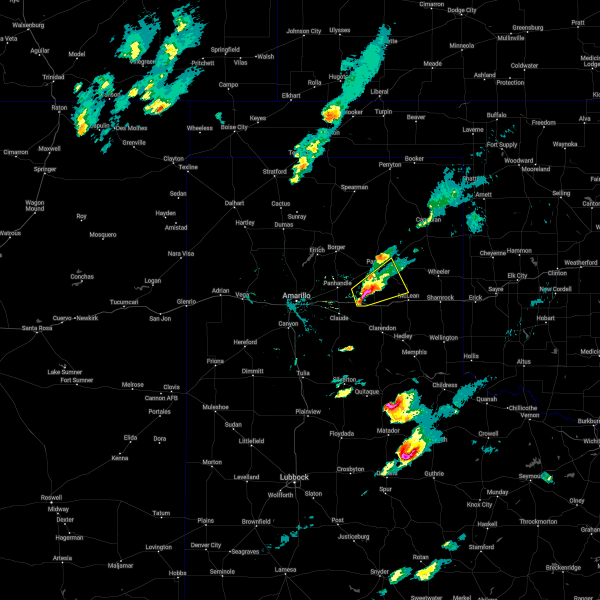 At 544 pm cdt, a severe thunderstorm was located near groom, or 19 miles east of panhandle, moving east at 30 mph (radar indicated). Hazards include tennis ball size hail and 60 mph wind gusts. Minor damage to roofs, siding, and trees is possible. people and animals outdoors will be injured. expect hail damage to roofs, siding, windows, and vehicles. locations impacted include, groom and lefors. thunderstorm damage threat, considerable hail threat, radar indicated max hail size, 2. 50 in wind threat, radar indicated max wind gust, 60 mph. At 544 pm cdt, a severe thunderstorm was located near groom, or 19 miles east of panhandle, moving east at 30 mph (radar indicated). Hazards include tennis ball size hail and 60 mph wind gusts. Minor damage to roofs, siding, and trees is possible. people and animals outdoors will be injured. expect hail damage to roofs, siding, windows, and vehicles. locations impacted include, groom and lefors. thunderstorm damage threat, considerable hail threat, radar indicated max hail size, 2. 50 in wind threat, radar indicated max wind gust, 60 mph.
|
| 5/4/2022 5:39 PM CDT |
 At 539 pm cdt, a severe thunderstorm was located over groom, or 15 miles southeast of panhandle, moving northeast at 25 mph (radar indicated). Hazards include golf ball size hail and 60 mph wind gusts. Minor damage to roofs, siding, and trees is possible. people and animals outdoors will be injured. expect hail damage to roofs, siding, windows, and vehicles. locations impacted include, groom, lefors and lake mcclellan. thunderstorm damage threat, considerable hail threat, radar indicated max hail size, 1. 75 in wind threat, radar indicated max wind gust, 60 mph. At 539 pm cdt, a severe thunderstorm was located over groom, or 15 miles southeast of panhandle, moving northeast at 25 mph (radar indicated). Hazards include golf ball size hail and 60 mph wind gusts. Minor damage to roofs, siding, and trees is possible. people and animals outdoors will be injured. expect hail damage to roofs, siding, windows, and vehicles. locations impacted include, groom, lefors and lake mcclellan. thunderstorm damage threat, considerable hail threat, radar indicated max hail size, 1. 75 in wind threat, radar indicated max wind gust, 60 mph.
|
| 5/4/2022 5:32 PM CDT |
 At 532 pm cdt, a severe thunderstorm was located 4 miles west of groom, or 12 miles northeast of claude, moving northeast at 25 mph (radar indicated). Hazards include 60 mph wind gusts and half dollar size hail. Minor damage to roofs, siding, and trees is possible. Hail damage to vehicles is expected. At 532 pm cdt, a severe thunderstorm was located 4 miles west of groom, or 12 miles northeast of claude, moving northeast at 25 mph (radar indicated). Hazards include 60 mph wind gusts and half dollar size hail. Minor damage to roofs, siding, and trees is possible. Hail damage to vehicles is expected.
|
| 5/4/2022 4:00 PM CDT |
 At 400 pm cdt, a severe thunderstorm was located 7 miles southwest of panhandle, moving northeast at 35 mph (trained weather spotters. at 356 pm cdt, quarter size hail was reported at pantex, southwest of panhandle). Hazards include 60 mph wind gusts and half dollar size hail. Minor damage to roofs, siding, and trees is possible. hail damage to vehicles is expected. locations impacted include, panhandle, white deer, groom and skellytown. hail threat, observed max hail size, 1. 25 in wind threat, radar indicated max wind gust, 60 mph. At 400 pm cdt, a severe thunderstorm was located 7 miles southwest of panhandle, moving northeast at 35 mph (trained weather spotters. at 356 pm cdt, quarter size hail was reported at pantex, southwest of panhandle). Hazards include 60 mph wind gusts and half dollar size hail. Minor damage to roofs, siding, and trees is possible. hail damage to vehicles is expected. locations impacted include, panhandle, white deer, groom and skellytown. hail threat, observed max hail size, 1. 25 in wind threat, radar indicated max wind gust, 60 mph.
|
| 5/4/2022 3:52 PM CDT |
 At 352 pm cdt, a severe thunderstorm was located 4 miles north of washburn, or 11 miles southwest of panhandle, moving northeast at 35 mph (radar indicated). Hazards include two inch hail and 60 mph wind gusts. Minor damage to roofs, siding, and trees is possible. people and animals outdoors will be injured. expect hail damage to roofs, siding, windows, and vehicles. locations impacted include, panhandle, white deer, groom, skellytown and washburn. thunderstorm damage threat, considerable hail threat, radar indicated max hail size, 2. 00 in wind threat, radar indicated max wind gust, 60 mph. At 352 pm cdt, a severe thunderstorm was located 4 miles north of washburn, or 11 miles southwest of panhandle, moving northeast at 35 mph (radar indicated). Hazards include two inch hail and 60 mph wind gusts. Minor damage to roofs, siding, and trees is possible. people and animals outdoors will be injured. expect hail damage to roofs, siding, windows, and vehicles. locations impacted include, panhandle, white deer, groom, skellytown and washburn. thunderstorm damage threat, considerable hail threat, radar indicated max hail size, 2. 00 in wind threat, radar indicated max wind gust, 60 mph.
|
| 5/4/2022 3:44 PM CDT |
 At 344 pm cdt, a severe thunderstorm was located over washburn, or 13 miles east of amarillo, moving northeast at 35 mph (radar indicated). Hazards include 60 mph wind gusts and half dollar size hail. Minor damage to roofs, siding, and trees is possible. Hail damage to vehicles is expected. At 344 pm cdt, a severe thunderstorm was located over washburn, or 13 miles east of amarillo, moving northeast at 35 mph (radar indicated). Hazards include 60 mph wind gusts and half dollar size hail. Minor damage to roofs, siding, and trees is possible. Hail damage to vehicles is expected.
|
| 5/4/2022 2:51 PM CDT |
 At 250 pm cdt, a severe thunderstorm was located 4 miles northeast of washburn, or 11 miles southwest of panhandle, moving northeast at 30 mph (trained weather spotters. at 243 pm cdt, trained spotters reported ping pong ball size hail near washburn). Hazards include ping pong ball size hail and 60 mph wind gusts. Minor damage to roofs, siding, and trees is possible. people and animals outdoors will be injured. expect hail damage to roofs, siding, windows, and vehicles. locations impacted include, panhandle, white deer, groom and washburn. hail threat, observed max hail size, 1. 50 in wind threat, radar indicated max wind gust, 60 mph. At 250 pm cdt, a severe thunderstorm was located 4 miles northeast of washburn, or 11 miles southwest of panhandle, moving northeast at 30 mph (trained weather spotters. at 243 pm cdt, trained spotters reported ping pong ball size hail near washburn). Hazards include ping pong ball size hail and 60 mph wind gusts. Minor damage to roofs, siding, and trees is possible. people and animals outdoors will be injured. expect hail damage to roofs, siding, windows, and vehicles. locations impacted include, panhandle, white deer, groom and washburn. hail threat, observed max hail size, 1. 50 in wind threat, radar indicated max wind gust, 60 mph.
|
| 5/4/2022 2:33 PM CDT |
 At 232 pm cdt, a severe thunderstorm was located 5 miles west of washburn, or 10 miles east of amarillo, moving east at 30 mph (trained weather spotters. at 225 pm cdt, trained spotters reported half dollar to ping pong ball size hail southeast of amarillo). Hazards include ping pong ball size hail and 60 mph wind gusts. Minor damage to roofs, siding, and trees is possible. people and animals outdoors will be injured. expect hail damage to roofs, siding, windows, and vehicles. locations impacted include, amarillo, panhandle, white deer, groom and washburn. hail threat, observed max hail size, 1. 50 in wind threat, radar indicated max wind gust, 60 mph. At 232 pm cdt, a severe thunderstorm was located 5 miles west of washburn, or 10 miles east of amarillo, moving east at 30 mph (trained weather spotters. at 225 pm cdt, trained spotters reported half dollar to ping pong ball size hail southeast of amarillo). Hazards include ping pong ball size hail and 60 mph wind gusts. Minor damage to roofs, siding, and trees is possible. people and animals outdoors will be injured. expect hail damage to roofs, siding, windows, and vehicles. locations impacted include, amarillo, panhandle, white deer, groom and washburn. hail threat, observed max hail size, 1. 50 in wind threat, radar indicated max wind gust, 60 mph.
|
| 5/4/2022 2:31 PM CDT |
 At 231 pm cdt, a severe thunderstorm was located 6 miles west of washburn, or 9 miles east of amarillo, moving east at 30 mph (radar indicated). Hazards include 60 mph wind gusts and half dollar size hail. Minor damage to roofs, siding, and trees is possible. Hail damage to vehicles is expected. At 231 pm cdt, a severe thunderstorm was located 6 miles west of washburn, or 9 miles east of amarillo, moving east at 30 mph (radar indicated). Hazards include 60 mph wind gusts and half dollar size hail. Minor damage to roofs, siding, and trees is possible. Hail damage to vehicles is expected.
|
| 5/1/2022 11:15 PM CDT |
 At 1115 pm cdt, a severe thunderstorm was located 8 miles southeast of panhandle, moving east at 35 mph (radar indicated). Hazards include 60 mph wind gusts and quarter size hail. Minor damage to roofs, siding, and trees is possible. Hail damage to vehicles is expected. At 1115 pm cdt, a severe thunderstorm was located 8 miles southeast of panhandle, moving east at 35 mph (radar indicated). Hazards include 60 mph wind gusts and quarter size hail. Minor damage to roofs, siding, and trees is possible. Hail damage to vehicles is expected.
|
| 5/1/2022 10:16 PM CDT |
 At 1016 pm cdt, a severe thunderstorm was located 7 miles south of panhandle, moving east at 30 mph (radar indicated). Hazards include 60 mph wind gusts and half dollar size hail. Minor damage to roofs, siding, and trees is possible. Hail damage to vehicles is expected. At 1016 pm cdt, a severe thunderstorm was located 7 miles south of panhandle, moving east at 30 mph (radar indicated). Hazards include 60 mph wind gusts and half dollar size hail. Minor damage to roofs, siding, and trees is possible. Hail damage to vehicles is expected.
|
| 4/22/2022 9:14 PM CDT |
 At 913 pm cdt, a severe thunderstorm capable of producing a tornado was located near groom, or 15 miles southeast of panhandle, moving northeast at 30 mph (weather spotters reported funnel cloud). Hazards include tornado and golf ball size hail. Flying debris will be dangerous to those caught without shelter. mobile homes will be damaged or destroyed. damage to roofs, windows, and vehicles will occur. Tree damage is likely. At 913 pm cdt, a severe thunderstorm capable of producing a tornado was located near groom, or 15 miles southeast of panhandle, moving northeast at 30 mph (weather spotters reported funnel cloud). Hazards include tornado and golf ball size hail. Flying debris will be dangerous to those caught without shelter. mobile homes will be damaged or destroyed. damage to roofs, windows, and vehicles will occur. Tree damage is likely.
|
| 4/22/2022 9:08 PM CDT | Hen Egg sized hail reported 7.7 miles E of Groom, TX |
| 4/22/2022 8:48 PM CDT |
 At 848 pm cdt, a severe thunderstorm was located over claude, moving north at 45 mph (trained weather spotters). Hazards include ping pong ball size hail and 60 mph wind gusts. Minor damage to roofs, siding, and trees is possible. people and animals outdoors will be injured. expect hail damage to roofs, siding, windows, and vehicles. locations impacted include, panhandle, claude, groom and goodnight. hail threat, observed max hail size, 1. 50 in wind threat, radar indicated max wind gust, 60 mph. At 848 pm cdt, a severe thunderstorm was located over claude, moving north at 45 mph (trained weather spotters). Hazards include ping pong ball size hail and 60 mph wind gusts. Minor damage to roofs, siding, and trees is possible. people and animals outdoors will be injured. expect hail damage to roofs, siding, windows, and vehicles. locations impacted include, panhandle, claude, groom and goodnight. hail threat, observed max hail size, 1. 50 in wind threat, radar indicated max wind gust, 60 mph.
|
| 4/22/2022 8:36 PM CDT |
 At 835 pm cdt, a severe thunderstorm was located 6 miles south of claude, moving northeast at 40 mph (trained weather spotters). Hazards include 60 mph wind gusts and quarter size hail. Minor damage to roofs, siding, and trees is possible. hail damage to vehicles is expected. locations impacted include, panhandle, claude, groom, washburn, goodnight and pantex. hail threat, observed max hail size, 1. 00in wind threat, radar indicated max wind gust, 60 mph. At 835 pm cdt, a severe thunderstorm was located 6 miles south of claude, moving northeast at 40 mph (trained weather spotters). Hazards include 60 mph wind gusts and quarter size hail. Minor damage to roofs, siding, and trees is possible. hail damage to vehicles is expected. locations impacted include, panhandle, claude, groom, washburn, goodnight and pantex. hail threat, observed max hail size, 1. 00in wind threat, radar indicated max wind gust, 60 mph.
|
| 4/22/2022 8:13 PM CDT |
 At 812 pm cdt, a severe thunderstorm was located 5 miles southeast of palo duro canyon, or 18 miles east of canyon, moving northeast at 45 mph (radar indicated). Hazards include ping pong ball size hail and 60 mph wind gusts. Minor damage to roofs, siding, and trees is possible. people and animals outdoors will be injured. Expect hail damage to roofs, siding, windows, and vehicles. At 812 pm cdt, a severe thunderstorm was located 5 miles southeast of palo duro canyon, or 18 miles east of canyon, moving northeast at 45 mph (radar indicated). Hazards include ping pong ball size hail and 60 mph wind gusts. Minor damage to roofs, siding, and trees is possible. people and animals outdoors will be injured. Expect hail damage to roofs, siding, windows, and vehicles.
|
| 4/22/2022 8:02 PM CDT |
 At 802 pm cdt, a severe thunderstorm was located 5 miles southwest of panhandle, moving northeast at 75 mph (radar indicated). Hazards include 60 mph wind gusts and quarter size hail. Minor damage to roofs, siding, and trees is possible. Hail damage to vehicles is expected. At 802 pm cdt, a severe thunderstorm was located 5 miles southwest of panhandle, moving northeast at 75 mph (radar indicated). Hazards include 60 mph wind gusts and quarter size hail. Minor damage to roofs, siding, and trees is possible. Hail damage to vehicles is expected.
|
| 8/16/2021 3:14 PM CDT |
 At 314 pm cdt, a severe thunderstorm was located 6 miles northeast of groom, or 18 miles south of pampa, moving south at 15 mph (radar indicated). Hazards include 70 mph wind gusts and quarter size hail. Expect some tree damage. damage is likely to mobile homes, roofs, and outbuildings. hail damage to vehicles is expected. locations impacted include, groom and lake mcclellan. thunderstorm damage threat, considerable hail threat, radar indicated max hail size, 1. 00in wind threat, radar indicated max wind gust, 70 mph. At 314 pm cdt, a severe thunderstorm was located 6 miles northeast of groom, or 18 miles south of pampa, moving south at 15 mph (radar indicated). Hazards include 70 mph wind gusts and quarter size hail. Expect some tree damage. damage is likely to mobile homes, roofs, and outbuildings. hail damage to vehicles is expected. locations impacted include, groom and lake mcclellan. thunderstorm damage threat, considerable hail threat, radar indicated max hail size, 1. 00in wind threat, radar indicated max wind gust, 70 mph.
|
| 8/16/2021 2:54 PM CDT |
 At 253 pm cdt, a severe thunderstorm was located 8 miles southeast of white deer, or 14 miles south of pampa, moving south at 15 mph (radar indicated). Hazards include 70 mph wind gusts and ping pong ball size hail. Expect some tree damage. damage is likely to mobile homes, roofs, and outbuildings. people and animals outdoors will be injured. Expect hail damage to roofs, siding, windows, and vehicles. At 253 pm cdt, a severe thunderstorm was located 8 miles southeast of white deer, or 14 miles south of pampa, moving south at 15 mph (radar indicated). Hazards include 70 mph wind gusts and ping pong ball size hail. Expect some tree damage. damage is likely to mobile homes, roofs, and outbuildings. people and animals outdoors will be injured. Expect hail damage to roofs, siding, windows, and vehicles.
|
| 8/7/2021 7:31 PM CDT |
 At 730 pm cdt, a severe thunderstorm was located 6 miles northwest of washburn, or 11 miles east of amarillo, moving east at 20 mph (automated weather equipment). Hazards include 60 mph wind gusts. minor damage to roofs, siding, and trees is possible At 730 pm cdt, a severe thunderstorm was located 6 miles northwest of washburn, or 11 miles east of amarillo, moving east at 20 mph (automated weather equipment). Hazards include 60 mph wind gusts. minor damage to roofs, siding, and trees is possible
|
| 7/25/2021 4:09 PM CDT | West texas mesonet site measured 59 mph wind gus in gray county TX, 11.7 miles W of Groom, TX |
| 7/5/2021 1:06 AM CDT |
 At 106 am cdt, a severe thunderstorm was located 4 miles northeast of claude, moving southwest at 20 mph (radar indicated). Hazards include ping pong ball size hail and 60 mph wind gusts. Minor damage to roofs, siding, and trees is possible. people and animals outdoors will be injured. expect hail damage to roofs, siding, windows, and vehicles. Locations impacted include, claude and washburn. At 106 am cdt, a severe thunderstorm was located 4 miles northeast of claude, moving southwest at 20 mph (radar indicated). Hazards include ping pong ball size hail and 60 mph wind gusts. Minor damage to roofs, siding, and trees is possible. people and animals outdoors will be injured. expect hail damage to roofs, siding, windows, and vehicles. Locations impacted include, claude and washburn.
|
| 7/5/2021 12:59 AM CDT |
 At 1259 am cdt, a severe thunderstorm was located 7 miles northeast of claude, moving southwest at 20 mph (radar indicated). Hazards include 60 mph wind gusts and nickel size hail. minor damage to roofs, siding, and trees is possible At 1259 am cdt, a severe thunderstorm was located 7 miles northeast of claude, moving southwest at 20 mph (radar indicated). Hazards include 60 mph wind gusts and nickel size hail. minor damage to roofs, siding, and trees is possible
|
| 7/5/2021 12:42 AM CDT |
 At 1242 am cdt, a severe thunderstorm was located 6 miles west of groom, or 9 miles northeast of claude, moving southwest at 20 mph (radar indicated). Hazards include 60 mph wind gusts and quarter size hail. Minor damage to roofs, siding, and trees is possible. hail damage to vehicles is expected. Locations impacted include, groom. At 1242 am cdt, a severe thunderstorm was located 6 miles west of groom, or 9 miles northeast of claude, moving southwest at 20 mph (radar indicated). Hazards include 60 mph wind gusts and quarter size hail. Minor damage to roofs, siding, and trees is possible. hail damage to vehicles is expected. Locations impacted include, groom.
|
| 7/5/2021 12:27 AM CDT |
 At 1227 am cdt, a severe thunderstorm was located near groom, or 14 miles northeast of claude, moving southwest at 20 mph (radar indicated). Hazards include 60 mph wind gusts and quarter size hail. Minor damage to roofs, siding, and trees is possible. hail damage to vehicles is expected. Locations impacted include, pampa, groom and kingsmill. At 1227 am cdt, a severe thunderstorm was located near groom, or 14 miles northeast of claude, moving southwest at 20 mph (radar indicated). Hazards include 60 mph wind gusts and quarter size hail. Minor damage to roofs, siding, and trees is possible. hail damage to vehicles is expected. Locations impacted include, pampa, groom and kingsmill.
|
| 7/5/2021 12:12 AM CDT |
 At 1211 am cdt, a severe thunderstorm was located 5 miles north of groom, or 16 miles east of panhandle, moving southwest at 20 mph (radar indicated). Hazards include ping pong ball size hail and 60 mph wind gusts. Minor damage to roofs, siding, and trees is possible. people and animals outdoors will be injured. expect hail damage to roofs, siding, windows, and vehicles. Locations impacted include, pampa, groom, lefors and kingsmill. At 1211 am cdt, a severe thunderstorm was located 5 miles north of groom, or 16 miles east of panhandle, moving southwest at 20 mph (radar indicated). Hazards include ping pong ball size hail and 60 mph wind gusts. Minor damage to roofs, siding, and trees is possible. people and animals outdoors will be injured. expect hail damage to roofs, siding, windows, and vehicles. Locations impacted include, pampa, groom, lefors and kingsmill.
|
| 7/5/2021 12:01 AM CDT |
 At 1201 am cdt, a severe thunderstorm was located 8 miles north of groom, or 16 miles south of pampa, moving southwest at 20 mph (radar indicated). Hazards include 60 mph wind gusts and half dollar size hail. Minor damage to roofs, siding, and trees is possible. Hail damage to vehicles is expected. At 1201 am cdt, a severe thunderstorm was located 8 miles north of groom, or 16 miles south of pampa, moving southwest at 20 mph (radar indicated). Hazards include 60 mph wind gusts and half dollar size hail. Minor damage to roofs, siding, and trees is possible. Hail damage to vehicles is expected.
|
| 6/25/2021 11:49 PM CDT | Storm damage reported in gray county TX, 11.7 miles W of Groom, TX |
| 6/25/2021 11:45 PM CDT |
 At 1145 pm cdt, severe thunderstorms were located along a line extending from 4 miles south of lefors to 3 miles northwest of lake mcclellan to 5 miles northeast of goodnight, moving east at 30 mph (radar indicated). Hazards include 60 mph wind gusts and quarter size hail. Minor damage to roofs, siding, and trees is possible. Hail damage to vehicles is expected. At 1145 pm cdt, severe thunderstorms were located along a line extending from 4 miles south of lefors to 3 miles northwest of lake mcclellan to 5 miles northeast of goodnight, moving east at 30 mph (radar indicated). Hazards include 60 mph wind gusts and quarter size hail. Minor damage to roofs, siding, and trees is possible. Hail damage to vehicles is expected.
|
| 6/25/2021 6:39 PM CDT | 73 mph measured gust at the west texas mesonet site at lake mcclella in gray county TX, 11.6 miles W of Groom, TX |
| 6/25/2021 6:09 PM CDT |
 At 609 pm cdt, severe thunderstorms were located along a line extending from 22 miles northwest of codman to 3 miles northwest of pampa to 6 miles west of groom, moving east at 40 mph (radar indicated). Hazards include 60 mph wind gusts and quarter size hail. Minor damage to roofs, siding, and trees is possible. hail damage to vehicles is expected. Locations impacted include, pampa, panhandle, miami, white deer, groom, lefors, skellytown, lake mcclellan, kingsmill and codman. At 609 pm cdt, severe thunderstorms were located along a line extending from 22 miles northwest of codman to 3 miles northwest of pampa to 6 miles west of groom, moving east at 40 mph (radar indicated). Hazards include 60 mph wind gusts and quarter size hail. Minor damage to roofs, siding, and trees is possible. hail damage to vehicles is expected. Locations impacted include, pampa, panhandle, miami, white deer, groom, lefors, skellytown, lake mcclellan, kingsmill and codman.
|
| 6/25/2021 5:50 PM CDT |
 At 550 pm cdt, severe thunderstorms were located along a line extending from 8 miles east of stinnett to 8 miles northeast of skellytown to 3 miles south of panhandle, moving east at 25 mph (radar indicated). Hazards include two inch hail and 70 mph wind gusts. Expect some tree damage. damage is likely to mobile homes, roofs, and outbuildings. people and animals outdoors will be injured. expect hail damage to roofs, siding, windows, and vehicles. Locations impacted include, pampa, panhandle, miami, white deer, groom, lefors, skellytown, lake mcclellan, kingsmill and codman. At 550 pm cdt, severe thunderstorms were located along a line extending from 8 miles east of stinnett to 8 miles northeast of skellytown to 3 miles south of panhandle, moving east at 25 mph (radar indicated). Hazards include two inch hail and 70 mph wind gusts. Expect some tree damage. damage is likely to mobile homes, roofs, and outbuildings. people and animals outdoors will be injured. expect hail damage to roofs, siding, windows, and vehicles. Locations impacted include, pampa, panhandle, miami, white deer, groom, lefors, skellytown, lake mcclellan, kingsmill and codman.
|
| 6/25/2021 5:33 PM CDT |
 At 533 pm cdt, severe thunderstorms were located along a line extending from stinnett to 7 miles north of skellytown to 7 miles southwest of panhandle, moving east at 30 mph (automated weather equipment. at 525 pm cdt, automated weather equipment recorded a 69 mph gust at the borger airport). Hazards include 70 mph wind gusts and quarter size hail. Expect some tree damage. damage is likely to mobile homes, roofs, and outbuildings. Hail damage to vehicles is expected. At 533 pm cdt, severe thunderstorms were located along a line extending from stinnett to 7 miles north of skellytown to 7 miles southwest of panhandle, moving east at 30 mph (automated weather equipment. at 525 pm cdt, automated weather equipment recorded a 69 mph gust at the borger airport). Hazards include 70 mph wind gusts and quarter size hail. Expect some tree damage. damage is likely to mobile homes, roofs, and outbuildings. Hail damage to vehicles is expected.
|
| 6/13/2021 2:54 AM CDT |
 The severe thunderstorm warning for northwestern wheeler, northeastern armstrong, southeastern carson, gray, southern roberts, southwestern hemphill and donley counties will expire at 300 am cdt, the storms which prompted the warning have weakened below severe limits, and no longer pose an immediate threat to life or property. therefore, the warning will be allowed to expire. a severe thunderstorm watch remains in effect until 400 am cdt for the panhandle of texas. The severe thunderstorm warning for northwestern wheeler, northeastern armstrong, southeastern carson, gray, southern roberts, southwestern hemphill and donley counties will expire at 300 am cdt, the storms which prompted the warning have weakened below severe limits, and no longer pose an immediate threat to life or property. therefore, the warning will be allowed to expire. a severe thunderstorm watch remains in effect until 400 am cdt for the panhandle of texas.
|
| 6/13/2021 2:26 AM CDT |
 At 226 am cdt, severe thunderstorms were located along a line extending from 5 miles southeast of codman to goodnight, moving east at 35 mph (radar indicated). Hazards include 60 mph wind gusts and quarter size hail. Minor damage to roofs, siding, and trees is possible. hail damage to vehicles is expected. Locations impacted include, pampa, clarendon, claude, miami, white deer, mclean, groom, lefors, howardwick, new mobeetie, lake mcclellan, kellerville, goodnight, kingsmill, alanreed, codman, greenbelt lake and mobeetie. At 226 am cdt, severe thunderstorms were located along a line extending from 5 miles southeast of codman to goodnight, moving east at 35 mph (radar indicated). Hazards include 60 mph wind gusts and quarter size hail. Minor damage to roofs, siding, and trees is possible. hail damage to vehicles is expected. Locations impacted include, pampa, clarendon, claude, miami, white deer, mclean, groom, lefors, howardwick, new mobeetie, lake mcclellan, kellerville, goodnight, kingsmill, alanreed, codman, greenbelt lake and mobeetie.
|
| 6/13/2021 1:56 AM CDT |
 At 155 am cdt, severe thunderstorms were located along a line extending from 5 miles northwest of pampa to 5 miles west of claude, moving east at 40 mph (radar indicated). Hazards include 60 mph wind gusts and quarter size hail. Minor damage to roofs, siding, and trees is possible. Hail damage to vehicles is expected. At 155 am cdt, severe thunderstorms were located along a line extending from 5 miles northwest of pampa to 5 miles west of claude, moving east at 40 mph (radar indicated). Hazards include 60 mph wind gusts and quarter size hail. Minor damage to roofs, siding, and trees is possible. Hail damage to vehicles is expected.
|
| 6/13/2021 1:48 AM CDT |
 At 148 am cdt, automated weather equipment reported a severe thunderstorm was located 6 miles south of washburn, or 9 miles west of claude, moving east at 15 mph (automated weather equipment). Hazards include ping pong ball size hail and 60 mph wind gusts. Minor damage to roofs, siding, and trees is possible. people and animals outdoors will be injured. expect hail damage to roofs, siding, windows, and vehicles. Locations impacted include, amarillo, pampa, borger, panhandle, claude, fritch, white deer, groom, lefors, skellytown, washburn, palo duro canyon, kingsmill, codman and pantex. At 148 am cdt, automated weather equipment reported a severe thunderstorm was located 6 miles south of washburn, or 9 miles west of claude, moving east at 15 mph (automated weather equipment). Hazards include ping pong ball size hail and 60 mph wind gusts. Minor damage to roofs, siding, and trees is possible. people and animals outdoors will be injured. expect hail damage to roofs, siding, windows, and vehicles. Locations impacted include, amarillo, pampa, borger, panhandle, claude, fritch, white deer, groom, lefors, skellytown, washburn, palo duro canyon, kingsmill, codman and pantex.
|
| 6/13/2021 1:17 AM CDT |
 At 116 am cdt, a severe thunderstorm was located 7 miles north of panhandle, moving southeast at 50 mph (automated weather equipment measured a 67 mile per hour wind gust at the borger airport). Hazards include 70 mph wind gusts and nickel size hail. Expect some tree damage. damage is likely to mobile homes, roofs, and outbuildings. Locations impacted include, amarillo, pampa, borger, panhandle, claude, fritch, white deer, groom, lefors, skellytown, washburn, palo duro canyon, kingsmill, codman and pantex. At 116 am cdt, a severe thunderstorm was located 7 miles north of panhandle, moving southeast at 50 mph (automated weather equipment measured a 67 mile per hour wind gust at the borger airport). Hazards include 70 mph wind gusts and nickel size hail. Expect some tree damage. damage is likely to mobile homes, roofs, and outbuildings. Locations impacted include, amarillo, pampa, borger, panhandle, claude, fritch, white deer, groom, lefors, skellytown, washburn, palo duro canyon, kingsmill, codman and pantex.
|
| 6/13/2021 1:15 AM CDT |
 At 115 am cdt, a severe thunderstorm was located 8 miles north of panhandle, moving southeast at 50 mph (radar indicated). Hazards include 60 mph wind gusts and nickel size hail. minor damage to roofs, siding, and trees is possible At 115 am cdt, a severe thunderstorm was located 8 miles north of panhandle, moving southeast at 50 mph (radar indicated). Hazards include 60 mph wind gusts and nickel size hail. minor damage to roofs, siding, and trees is possible
|
| 5/30/2021 10:38 PM CDT |
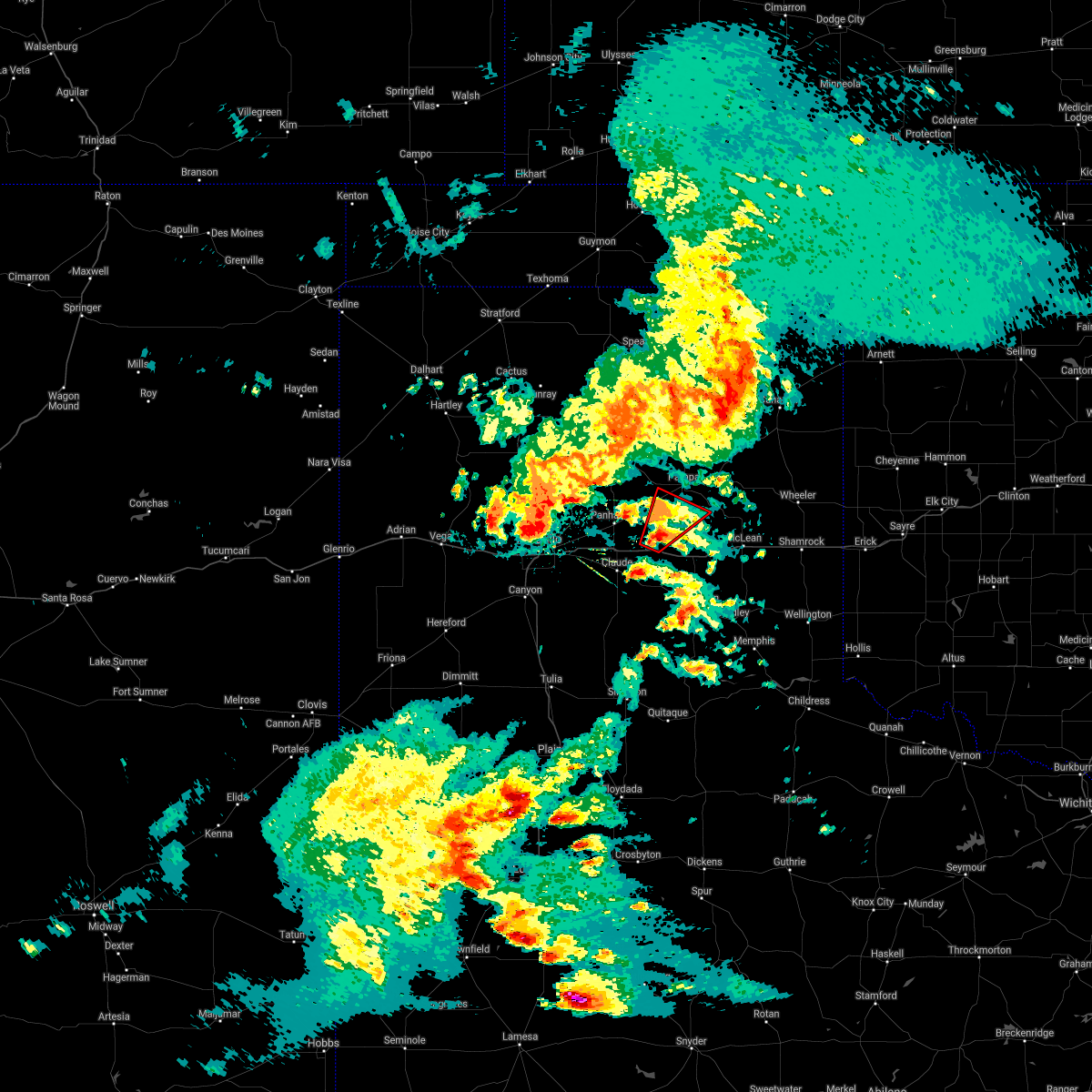 At 1038 pm cdt, a severe thunderstorm capable of producing a tornado was located 4 miles north of groom, or 15 miles east of panhandle, moving northeast at 25 mph (radar indicated rotation). Hazards include tornado and quarter size hail. Flying debris will be dangerous to those caught without shelter. mobile homes will be damaged or destroyed. damage to roofs, windows, and vehicles will occur. Tree damage is likely. At 1038 pm cdt, a severe thunderstorm capable of producing a tornado was located 4 miles north of groom, or 15 miles east of panhandle, moving northeast at 25 mph (radar indicated rotation). Hazards include tornado and quarter size hail. Flying debris will be dangerous to those caught without shelter. mobile homes will be damaged or destroyed. damage to roofs, windows, and vehicles will occur. Tree damage is likely.
|
| 5/26/2021 7:15 PM CDT |
 At 714 pm cdt, severe thunderstorms were located along a line extending from 6 miles northeast of washburn to 11 miles southwest of claude, moving northeast at 40 mph (radar indicated). Hazards include 60 mph wind gusts. Minor damage to roofs, siding, and trees is possible. locations impacted include, claude, groom, washburn and goodnight. A tornado watch remains in effect until midnight cdt for the panhandle of texas. At 714 pm cdt, severe thunderstorms were located along a line extending from 6 miles northeast of washburn to 11 miles southwest of claude, moving northeast at 40 mph (radar indicated). Hazards include 60 mph wind gusts. Minor damage to roofs, siding, and trees is possible. locations impacted include, claude, groom, washburn and goodnight. A tornado watch remains in effect until midnight cdt for the panhandle of texas.
|
| 5/26/2021 6:47 PM CDT |
 At 646 pm cdt, two severe thunderstorms, the first over lake tanglewood and the second 3 miles south of palo duro canyon, were moving northeast at 40 mph (radar indicated). Hazards include ping pong ball size hail and 60 mph wind gusts. Minor damage to roofs, siding, and trees is possible. people and animals outdoors will be injured. Expect hail damage to roofs, siding, windows, and vehicles. At 646 pm cdt, two severe thunderstorms, the first over lake tanglewood and the second 3 miles south of palo duro canyon, were moving northeast at 40 mph (radar indicated). Hazards include ping pong ball size hail and 60 mph wind gusts. Minor damage to roofs, siding, and trees is possible. people and animals outdoors will be injured. Expect hail damage to roofs, siding, windows, and vehicles.
|
| 5/26/2021 6:32 PM CDT |
 At 631 pm cdt, a severe thunderstorm was located over panhandle, moving northeast at 15 mph (trained weather spotters. at 629 pm cdt, trained spotters reported ping pong ball size hail in panhandle). Hazards include two inch hail and 60 mph wind gusts. Minor damage to roofs, siding, and trees is possible. people and animals outdoors will be injured. expect hail damage to roofs, siding, windows, and vehicles. locations impacted include, panhandle and groom. A tornado watch remains in effect until midnight cdt for the panhandle of texas. At 631 pm cdt, a severe thunderstorm was located over panhandle, moving northeast at 15 mph (trained weather spotters. at 629 pm cdt, trained spotters reported ping pong ball size hail in panhandle). Hazards include two inch hail and 60 mph wind gusts. Minor damage to roofs, siding, and trees is possible. people and animals outdoors will be injured. expect hail damage to roofs, siding, windows, and vehicles. locations impacted include, panhandle and groom. A tornado watch remains in effect until midnight cdt for the panhandle of texas.
|
| 5/26/2021 6:28 PM CDT |
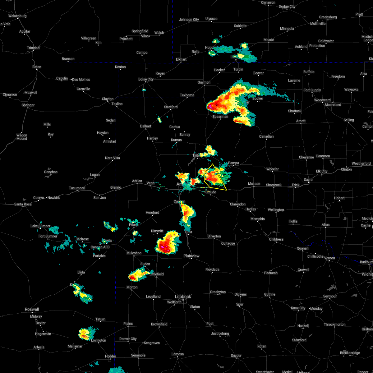 At 628 pm cdt, a severe thunderstorm was located over panhandle, moving east at 15 mph (radar indicated). Hazards include two inch hail and 60 mph wind gusts. Minor damage to roofs, siding, and trees is possible. people and animals outdoors will be injured. expect hail damage to roofs, siding, windows, and vehicles. locations impacted include, panhandle and groom. A tornado watch remains in effect until midnight cdt for the panhandle of texas. At 628 pm cdt, a severe thunderstorm was located over panhandle, moving east at 15 mph (radar indicated). Hazards include two inch hail and 60 mph wind gusts. Minor damage to roofs, siding, and trees is possible. people and animals outdoors will be injured. expect hail damage to roofs, siding, windows, and vehicles. locations impacted include, panhandle and groom. A tornado watch remains in effect until midnight cdt for the panhandle of texas.
|
| 5/26/2021 6:15 PM CDT |
 At 614 pm cdt, a severe thunderstorm was located near panhandle, moving east at 20 mph (radar indicated). Hazards include 60 mph wind gusts and quarter size hail. Minor damage to roofs, siding, and trees is possible. hail damage to vehicles is expected. locations impacted include, borger, panhandle, fritch and groom. A tornado watch remains in effect until midnight cdt for the panhandle of texas. At 614 pm cdt, a severe thunderstorm was located near panhandle, moving east at 20 mph (radar indicated). Hazards include 60 mph wind gusts and quarter size hail. Minor damage to roofs, siding, and trees is possible. hail damage to vehicles is expected. locations impacted include, borger, panhandle, fritch and groom. A tornado watch remains in effect until midnight cdt for the panhandle of texas.
|
| 5/26/2021 5:43 PM CDT |
 At 543 pm cdt, a severe thunderstorm was located 8 miles west of panhandle, moving northeast at 15 mph (radar indicated). Hazards include 60 mph wind gusts and quarter size hail. Minor damage to roofs, siding, and trees is possible. Hail damage to vehicles is expected. At 543 pm cdt, a severe thunderstorm was located 8 miles west of panhandle, moving northeast at 15 mph (radar indicated). Hazards include 60 mph wind gusts and quarter size hail. Minor damage to roofs, siding, and trees is possible. Hail damage to vehicles is expected.
|
| 5/17/2021 8:59 PM CDT |
 A severe thunderstorm warning remains in effect until 915 pm cdt for eastern armstrong. carson. southwestern hutchinson and eastern moore counties. At 858 pm cdt, severe thunderstorms were located along a line extending from near sunray to 6 miles west of skellytown to 7 miles south of goodnight, moving northeast at 40 mph. A severe thunderstorm warning remains in effect until 915 pm cdt for eastern armstrong. carson. southwestern hutchinson and eastern moore counties. At 858 pm cdt, severe thunderstorms were located along a line extending from near sunray to 6 miles west of skellytown to 7 miles south of goodnight, moving northeast at 40 mph.
|
| 5/17/2021 8:43 PM CDT |
 At 842 pm cdt, severe thunderstorms were located along a line extending from 4 miles east of cactus to 10 miles south of borger to 9 miles southwest of goodnight, moving northeast at 20 mph (radar indicated). Hazards include 60 mph wind gusts and quarter size hail. Minor damage to roofs, siding, and trees is possible. hail damage to vehicles is expected. locations impacted include, dumas, borger, panhandle, claude, cactus, fritch, sunray, stinnett, white deer, groom, skellytown, sanford, wayside, washburn, goodnight, pringle, four way, masterson, lake meredith and pantex. A tornado watch remains in effect until 1100 pm cdt for the panhandle of texas. At 842 pm cdt, severe thunderstorms were located along a line extending from 4 miles east of cactus to 10 miles south of borger to 9 miles southwest of goodnight, moving northeast at 20 mph (radar indicated). Hazards include 60 mph wind gusts and quarter size hail. Minor damage to roofs, siding, and trees is possible. hail damage to vehicles is expected. locations impacted include, dumas, borger, panhandle, claude, cactus, fritch, sunray, stinnett, white deer, groom, skellytown, sanford, wayside, washburn, goodnight, pringle, four way, masterson, lake meredith and pantex. A tornado watch remains in effect until 1100 pm cdt for the panhandle of texas.
|
| 5/17/2021 7:59 PM CDT |
 The national weather service in amarillo has issued a * severe thunderstorm warning for. armstrong county in the panhandle of texas. randall county in the panhandle of texas. carson county in the panhandle of texas. Southwestern hutchinson county in the panhandle of texas. The national weather service in amarillo has issued a * severe thunderstorm warning for. armstrong county in the panhandle of texas. randall county in the panhandle of texas. carson county in the panhandle of texas. Southwestern hutchinson county in the panhandle of texas.
|
| 5/14/2021 8:14 PM CDT |
 At 814 pm cdt, a severe thunderstorm was located near panhandle, moving northeast at 30 mph (radar indicated). Hazards include 60 mph wind gusts. Minor damage to roofs, siding, and trees is possible. Locations impacted include, panhandle, claude, white deer, groom and goodnight. At 814 pm cdt, a severe thunderstorm was located near panhandle, moving northeast at 30 mph (radar indicated). Hazards include 60 mph wind gusts. Minor damage to roofs, siding, and trees is possible. Locations impacted include, panhandle, claude, white deer, groom and goodnight.
|
| 5/14/2021 7:55 PM CDT |
 The national weather service in amarillo has issued a * severe thunderstorm warning for. northern armstrong county in the panhandle of texas. northeastern randall county in the panhandle of texas. southern carson county in the panhandle of texas. Southeastern potter county in the panhandle of texas. The national weather service in amarillo has issued a * severe thunderstorm warning for. northern armstrong county in the panhandle of texas. northeastern randall county in the panhandle of texas. southern carson county in the panhandle of texas. Southeastern potter county in the panhandle of texas.
|
| 5/7/2021 7:30 PM CDT |
 At 730 pm cdt, severe thunderstorms were located along a line extending from 7 miles northwest of kellerville to lake mcclellan to near goodnight, moving east at 35 mph (radar indicated). Hazards include 60 mph wind gusts and quarter size hail. Minor damage to roofs, siding, and trees is possible. hail damage to vehicles is expected. Locations impacted include, clarendon, claude, mclean, groom, lefors, howardwick, lelia lake, lake mcclellan, wayside, alanreed, greenbelt lake and goodnight. At 730 pm cdt, severe thunderstorms were located along a line extending from 7 miles northwest of kellerville to lake mcclellan to near goodnight, moving east at 35 mph (radar indicated). Hazards include 60 mph wind gusts and quarter size hail. Minor damage to roofs, siding, and trees is possible. hail damage to vehicles is expected. Locations impacted include, clarendon, claude, mclean, groom, lefors, howardwick, lelia lake, lake mcclellan, wayside, alanreed, greenbelt lake and goodnight.
|
| 5/7/2021 6:50 PM CDT |
 At 649 pm cdt, severe thunderstorms were located along a line extending from 10 miles south of kingsmill to 5 miles east of claude to 7 miles east of palo duro canyon, moving east at 35 mph (radar indicated). Hazards include 60 mph wind gusts and quarter size hail. Minor damage to roofs, siding, and trees is possible. Hail damage to vehicles is expected. At 649 pm cdt, severe thunderstorms were located along a line extending from 10 miles south of kingsmill to 5 miles east of claude to 7 miles east of palo duro canyon, moving east at 35 mph (radar indicated). Hazards include 60 mph wind gusts and quarter size hail. Minor damage to roofs, siding, and trees is possible. Hail damage to vehicles is expected.
|
| 3/13/2021 8:23 PM CDT |
 At 723 pm cst, severe thunderstorms were located along a line extending from 3 miles north of kingsmill to 10 miles northwest of lake mcclellan to 14 miles south of goodnight, moving east at 30 mph. these are very dangerous storms (radar indicated). Hazards include 80 mph wind gusts and ping pong ball size hail. Flying debris will be dangerous to those caught without shelter. mobile homes will be heavily damaged. expect considerable damage to roofs, windows, and vehicles. tree damage and power outages are likely. people and animals outdoors will be injured. expect hail damage to roofs, siding, windows, and vehicles. locations impacted include, pampa, clarendon, miami, white deer, groom, lefors, skellytown, howardwick, lelia lake, lake mcclellan, goodnight, lora, kingsmill, alanreed, codman and greenbelt lake. A tornado watch remains in effect until 900 pm cst for the panhandle of texas. At 723 pm cst, severe thunderstorms were located along a line extending from 3 miles north of kingsmill to 10 miles northwest of lake mcclellan to 14 miles south of goodnight, moving east at 30 mph. these are very dangerous storms (radar indicated). Hazards include 80 mph wind gusts and ping pong ball size hail. Flying debris will be dangerous to those caught without shelter. mobile homes will be heavily damaged. expect considerable damage to roofs, windows, and vehicles. tree damage and power outages are likely. people and animals outdoors will be injured. expect hail damage to roofs, siding, windows, and vehicles. locations impacted include, pampa, clarendon, miami, white deer, groom, lefors, skellytown, howardwick, lelia lake, lake mcclellan, goodnight, lora, kingsmill, alanreed, codman and greenbelt lake. A tornado watch remains in effect until 900 pm cst for the panhandle of texas.
|
| 3/13/2021 8:17 PM CDT |
 At 717 pm cst, severe thunderstorms were located along a line extending from 3 miles north of kingsmill to 10 miles northeast of groom to 15 miles east of wayside, moving northeast at 35 mph (radar indicated). Hazards include 70 mph wind gusts and ping pong ball size hail. Expect some tree damage. damage is likely to mobile homes, roofs, and outbuildings. people and animals outdoors will be injured. expect hail damage to roofs, siding, windows, and vehicles. locations impacted include, pampa, clarendon, miami, white deer, groom, lefors, skellytown, howardwick, lelia lake, lake mcclellan, goodnight, lora, kingsmill, alanreed, codman and greenbelt lake. A tornado watch remains in effect until 900 pm cst for the panhandle of texas. At 717 pm cst, severe thunderstorms were located along a line extending from 3 miles north of kingsmill to 10 miles northeast of groom to 15 miles east of wayside, moving northeast at 35 mph (radar indicated). Hazards include 70 mph wind gusts and ping pong ball size hail. Expect some tree damage. damage is likely to mobile homes, roofs, and outbuildings. people and animals outdoors will be injured. expect hail damage to roofs, siding, windows, and vehicles. locations impacted include, pampa, clarendon, miami, white deer, groom, lefors, skellytown, howardwick, lelia lake, lake mcclellan, goodnight, lora, kingsmill, alanreed, codman and greenbelt lake. A tornado watch remains in effect until 900 pm cst for the panhandle of texas.
|
| 3/13/2021 8:03 PM CDT |
 At 703 pm cst, severe thunderstorms were located along a line extending from 4 miles north of white deer to 5 miles northwest of groom to 8 miles east of wayside, moving east at 30 mph (radar indicated). Hazards include 70 mph wind gusts and ping pong ball size hail. Expect some tree damage. damage is likely to mobile homes, roofs, and outbuildings. people and animals outdoors will be injured. Expect hail damage to roofs, siding, windows, and vehicles. At 703 pm cst, severe thunderstorms were located along a line extending from 4 miles north of white deer to 5 miles northwest of groom to 8 miles east of wayside, moving east at 30 mph (radar indicated). Hazards include 70 mph wind gusts and ping pong ball size hail. Expect some tree damage. damage is likely to mobile homes, roofs, and outbuildings. people and animals outdoors will be injured. Expect hail damage to roofs, siding, windows, and vehicles.
|
| 3/13/2021 5:04 PM CST |
 At 504 pm cst, a severe thunderstorm capable of producing a tornado was located 7 miles southwest of groom, or 8 miles east of claude, moving northeast at 40 mph (radar indicated rotation). Hazards include tornado and baseball size hail. Flying debris will be dangerous to those caught without shelter. mobile homes will be damaged or destroyed. damage to roofs, windows, and vehicles will occur. tree damage is likely. Locations impacted include, claude, groom and goodnight. At 504 pm cst, a severe thunderstorm capable of producing a tornado was located 7 miles southwest of groom, or 8 miles east of claude, moving northeast at 40 mph (radar indicated rotation). Hazards include tornado and baseball size hail. Flying debris will be dangerous to those caught without shelter. mobile homes will be damaged or destroyed. damage to roofs, windows, and vehicles will occur. tree damage is likely. Locations impacted include, claude, groom and goodnight.
|
| 3/13/2021 4:42 PM CST |
 At 442 pm cst, a confirmed tornado was located 5 miles southwest of claude, moving northeast at 50 mph (weather spotters confirmed tornado). Hazards include damaging tornado and baseball size hail. Flying debris will be dangerous to those caught without shelter. mobile homes will be damaged or destroyed. damage to roofs, windows, and vehicles will occur. Tree damage is likely. At 442 pm cst, a confirmed tornado was located 5 miles southwest of claude, moving northeast at 50 mph (weather spotters confirmed tornado). Hazards include damaging tornado and baseball size hail. Flying debris will be dangerous to those caught without shelter. mobile homes will be damaged or destroyed. damage to roofs, windows, and vehicles will occur. Tree damage is likely.
|
| 8/29/2020 9:48 PM CDT |
 At 947 pm cdt, automated weather equipment reported a severe thunderstorm was located near alanreed, or 17 miles northeast of clarendon, moving east at 40 mph (automated weather equipment. at 938 pm cdt, automated weather equipment recorded a 63 mph wind gust 2 miles northwest of lake mcclellan). Hazards include 60 mph wind gusts and quarter size hail. Minor damage to roofs, siding, and trees is possible. hail damage to vehicles is expected. Locations impacted include, clarendon, mclean, groom, lefors, howardwick, hedley, lelia lake, lake mcclellan, wayside, quail, kellerville, goodnight, alanreed and greenbelt lake. At 947 pm cdt, automated weather equipment reported a severe thunderstorm was located near alanreed, or 17 miles northeast of clarendon, moving east at 40 mph (automated weather equipment. at 938 pm cdt, automated weather equipment recorded a 63 mph wind gust 2 miles northwest of lake mcclellan). Hazards include 60 mph wind gusts and quarter size hail. Minor damage to roofs, siding, and trees is possible. hail damage to vehicles is expected. Locations impacted include, clarendon, mclean, groom, lefors, howardwick, hedley, lelia lake, lake mcclellan, wayside, quail, kellerville, goodnight, alanreed and greenbelt lake.
|
| 8/29/2020 9:38 PM CDT | West texas mesonet in gray county TX, 11.6 miles W of Groom, TX |
| 8/29/2020 9:15 PM CDT | Large portions of a roof blown off home several trees were downed. time estimated from rada in carson county TX, 0.6 miles NE of Groom, TX |
| 8/29/2020 9:10 PM CDT |
 At 909 pm cdt, a severe thunderstorm was located 4 miles northwest of groom, or 13 miles northeast of claude, moving east at 40 mph (radar indicated). Hazards include 70 mph wind gusts and quarter size hail. Expect some tree damage. damage is likely to mobile homes, roofs, and outbuildings. Hail damage to vehicles is expected. At 909 pm cdt, a severe thunderstorm was located 4 miles northwest of groom, or 13 miles northeast of claude, moving east at 40 mph (radar indicated). Hazards include 70 mph wind gusts and quarter size hail. Expect some tree damage. damage is likely to mobile homes, roofs, and outbuildings. Hail damage to vehicles is expected.
|
| 8/29/2020 8:37 PM CDT |
 At 836 pm cdt, automated weather equipment reported a severe thunderstorm was located over washburn, or 12 miles east of amarillo, moving east at 35 mph (automated weather equipment. at 822 pm cdt, automated weather equipment recorded a 68 mph wind gust at amarillo rick husband international airport). Hazards include 70 mph wind gusts and quarter size hail. accumulating hail is also possible with this storm. Expect some tree damage. damage is likely to mobile homes, roofs, and outbuildings. hail damage to vehicles is expected. hail may accumulate on roadways causing hazardous travel. Locations impacted include, amarillo, panhandle, claude, groom, washburn, goodnight and pantex. At 836 pm cdt, automated weather equipment reported a severe thunderstorm was located over washburn, or 12 miles east of amarillo, moving east at 35 mph (automated weather equipment. at 822 pm cdt, automated weather equipment recorded a 68 mph wind gust at amarillo rick husband international airport). Hazards include 70 mph wind gusts and quarter size hail. accumulating hail is also possible with this storm. Expect some tree damage. damage is likely to mobile homes, roofs, and outbuildings. hail damage to vehicles is expected. hail may accumulate on roadways causing hazardous travel. Locations impacted include, amarillo, panhandle, claude, groom, washburn, goodnight and pantex.
|
| 8/29/2020 8:18 PM CDT |
 At 818 pm cdt, a severe thunderstorm was located 4 miles northeast of amarillo, moving east at 35 mph (trained weather spotters). Hazards include two inch hail and 70 mph wind gusts. Expect some tree damage. damage is likely to mobile homes, roofs, and outbuildings. people and animals outdoors will be injured. expect hail damage to roofs, siding, windows, and vehicles. Hail may accumulate on roadways causing hazardous travel. At 818 pm cdt, a severe thunderstorm was located 4 miles northeast of amarillo, moving east at 35 mph (trained weather spotters). Hazards include two inch hail and 70 mph wind gusts. Expect some tree damage. damage is likely to mobile homes, roofs, and outbuildings. people and animals outdoors will be injured. expect hail damage to roofs, siding, windows, and vehicles. Hail may accumulate on roadways causing hazardous travel.
|
| 8/14/2020 4:54 PM CDT |
 At 453 pm cdt, a severe thunderstorm was located over groom, or 15 miles east of claude, moving northeast at 10 mph (radar indicated). Hazards include 60 mph wind gusts and quarter size hail. Minor damage to roofs, siding, and trees is possible. hail damage to vehicles is expected. Locations impacted include, claude, groom and goodnight. At 453 pm cdt, a severe thunderstorm was located over groom, or 15 miles east of claude, moving northeast at 10 mph (radar indicated). Hazards include 60 mph wind gusts and quarter size hail. Minor damage to roofs, siding, and trees is possible. hail damage to vehicles is expected. Locations impacted include, claude, groom and goodnight.
|
| 8/14/2020 4:43 PM CDT |
 At 443 pm cdt, a severe thunderstorm was located near groom, or 13 miles east of claude, moving northeast at 20 mph (radar indicated). Hazards include 70 mph wind gusts and ping pong ball size hail. Expect some tree damage. damage is likely to mobile homes, roofs, and outbuildings. people and animals outdoors will be injured. expect hail damage to roofs, siding, windows, and vehicles. Locations impacted include, claude, groom and goodnight. At 443 pm cdt, a severe thunderstorm was located near groom, or 13 miles east of claude, moving northeast at 20 mph (radar indicated). Hazards include 70 mph wind gusts and ping pong ball size hail. Expect some tree damage. damage is likely to mobile homes, roofs, and outbuildings. people and animals outdoors will be injured. expect hail damage to roofs, siding, windows, and vehicles. Locations impacted include, claude, groom and goodnight.
|
| 8/14/2020 4:36 PM CDT |
 At 436 pm cdt, a severe thunderstorm was located 4 miles southwest of groom, or 12 miles east of claude, moving northeast at 20 mph (radar indicated). Hazards include 70 mph wind gusts and ping pong ball size hail. Expect some tree damage. damage is likely to mobile homes, roofs, and outbuildings. people and animals outdoors will be injured. expect hail damage to roofs, siding, windows, and vehicles. Locations impacted include, panhandle, claude, groom and goodnight. At 436 pm cdt, a severe thunderstorm was located 4 miles southwest of groom, or 12 miles east of claude, moving northeast at 20 mph (radar indicated). Hazards include 70 mph wind gusts and ping pong ball size hail. Expect some tree damage. damage is likely to mobile homes, roofs, and outbuildings. people and animals outdoors will be injured. expect hail damage to roofs, siding, windows, and vehicles. Locations impacted include, panhandle, claude, groom and goodnight.
|
| 8/14/2020 4:23 PM CDT |
 At 423 pm cdt, a severe thunderstorm was located 6 miles north of goodnight, or 7 miles east of claude, moving northeast at 30 mph (radar indicated). Hazards include 70 mph wind gusts and ping pong ball size hail. Expect some tree damage. damage is likely to mobile homes, roofs, and outbuildings. people and animals outdoors will be injured. expect hail damage to roofs, siding, windows, and vehicles. Locations impacted include, panhandle, claude, groom and goodnight. At 423 pm cdt, a severe thunderstorm was located 6 miles north of goodnight, or 7 miles east of claude, moving northeast at 30 mph (radar indicated). Hazards include 70 mph wind gusts and ping pong ball size hail. Expect some tree damage. damage is likely to mobile homes, roofs, and outbuildings. people and animals outdoors will be injured. expect hail damage to roofs, siding, windows, and vehicles. Locations impacted include, panhandle, claude, groom and goodnight.
|
| 8/14/2020 4:07 PM CDT |
 At 407 pm cdt, a severe thunderstorm was located 4 miles south of claude, moving northeast at 10 mph (radar indicated). Hazards include ping pong ball size hail and 60 mph wind gusts. Minor damage to roofs, siding, and trees is possible. people and animals outdoors will be injured. expect hail damage to roofs, siding, windows, and vehicles. Locations impacted include, panhandle, claude, groom and goodnight. At 407 pm cdt, a severe thunderstorm was located 4 miles south of claude, moving northeast at 10 mph (radar indicated). Hazards include ping pong ball size hail and 60 mph wind gusts. Minor damage to roofs, siding, and trees is possible. people and animals outdoors will be injured. expect hail damage to roofs, siding, windows, and vehicles. Locations impacted include, panhandle, claude, groom and goodnight.
|
| 8/14/2020 3:59 PM CDT |
 The national weather service in amarillo has issued a * severe thunderstorm warning for. northeastern armstrong county in the panhandle of texas. southern carson county in the panhandle of texas. northwestern donley county in the panhandle of texas. Until 530 pm cdt. The national weather service in amarillo has issued a * severe thunderstorm warning for. northeastern armstrong county in the panhandle of texas. southern carson county in the panhandle of texas. northwestern donley county in the panhandle of texas. Until 530 pm cdt.
|
| 8/10/2020 8:25 PM CDT | Mesonet measured 65 mph wind gus in gray county TX, 11.6 miles W of Groom, TX |
| 8/10/2020 8:05 PM CDT |
 At 805 pm cdt, severe thunderstorms were located along a line extending from near codman to near kingsmill to 8 miles north of panhandle, moving southeast at 30 mph (radar indicated). Hazards include 70 mph wind gusts and nickel size hail. Expect some tree damage. damage is likely to mobile homes, roofs, and outbuildings. Locations impacted include, pampa, panhandle, miami, white deer, groom, lefors, skellytown, new mobeetie, kingsmill, codman and mobeetie. At 805 pm cdt, severe thunderstorms were located along a line extending from near codman to near kingsmill to 8 miles north of panhandle, moving southeast at 30 mph (radar indicated). Hazards include 70 mph wind gusts and nickel size hail. Expect some tree damage. damage is likely to mobile homes, roofs, and outbuildings. Locations impacted include, pampa, panhandle, miami, white deer, groom, lefors, skellytown, new mobeetie, kingsmill, codman and mobeetie.
|
| 8/10/2020 7:45 PM CDT |
 At 744 pm cdt, severe thunderstorms were located along a line extending from 10 miles northwest of codman to near skellytown to 7 miles southwest of fritch, moving southeast at 25 mph (radar indicated). Hazards include 70 mph wind gusts and nickel size hail. Expect some tree damage. Damage is likely to mobile homes, roofs, and outbuildings. At 744 pm cdt, severe thunderstorms were located along a line extending from 10 miles northwest of codman to near skellytown to 7 miles southwest of fritch, moving southeast at 25 mph (radar indicated). Hazards include 70 mph wind gusts and nickel size hail. Expect some tree damage. Damage is likely to mobile homes, roofs, and outbuildings.
|
| 7/11/2020 11:47 PM CDT | Storm damage reported in gray county TX, 11.6 miles W of Groom, TX |
| 7/11/2020 9:06 PM CDT | Storm damage reported in gray county TX, 11.6 miles W of Groom, TX |
| 7/11/2020 8:35 PM CDT |
 At 835 pm cdt, a severe thunderstorm was located over groom, or 17 miles southeast of panhandle, moving southeast at 25 mph (radar indicated). Hazards include 60 mph wind gusts and quarter size hail. Minor damage to roofs, siding, and trees is possible. Hail damage to vehicles is expected. At 835 pm cdt, a severe thunderstorm was located over groom, or 17 miles southeast of panhandle, moving southeast at 25 mph (radar indicated). Hazards include 60 mph wind gusts and quarter size hail. Minor damage to roofs, siding, and trees is possible. Hail damage to vehicles is expected.
|
| 6/19/2020 6:27 PM CDT |
 At 627 pm cdt, severe thunderstorms were located along a line extending from 3 miles southeast of lefors to 9 miles west of brice, moving east at 25 mph (radar indicated). Hazards include ping pong ball size hail and 60 mph wind gusts. Minor damage to roofs, siding, and trees is possible. people and animals outdoors will be injured. Expect hail damage to roofs, siding, windows, and vehicles. At 627 pm cdt, severe thunderstorms were located along a line extending from 3 miles southeast of lefors to 9 miles west of brice, moving east at 25 mph (radar indicated). Hazards include ping pong ball size hail and 60 mph wind gusts. Minor damage to roofs, siding, and trees is possible. people and animals outdoors will be injured. Expect hail damage to roofs, siding, windows, and vehicles.
|
| 6/19/2020 5:55 PM CDT | Golf Ball sized hail reported 2.1 miles E of Groom, TX, quarter to golf ball size hail... with several inches of accumulation alongside ih-40. |
| 6/19/2020 5:44 PM CDT |
 At 543 pm cdt, a severe thunderstorm was located 6 miles west of groom, or 10 miles northeast of claude, moving east at 25 mph (radar indicated). Hazards include ping pong ball size hail and 60 mph wind gusts. Minor damage to roofs, siding, and trees is possible. people and animals outdoors will be injured. Expect hail damage to roofs, siding, windows, and vehicles. At 543 pm cdt, a severe thunderstorm was located 6 miles west of groom, or 10 miles northeast of claude, moving east at 25 mph (radar indicated). Hazards include ping pong ball size hail and 60 mph wind gusts. Minor damage to roofs, siding, and trees is possible. people and animals outdoors will be injured. Expect hail damage to roofs, siding, windows, and vehicles.
|
| 6/4/2020 4:17 PM CDT |
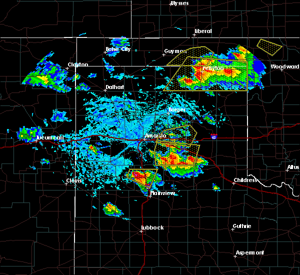 At 417 pm cdt, a severe thunderstorm was located over claude, moving east at 20 mph (radar indicated). Hazards include 60 mph wind gusts and quarter size hail. Minor damage to roofs, siding, and trees is possible. hail damage to vehicles is expected. Locations impacted include, groom and washburn. At 417 pm cdt, a severe thunderstorm was located over claude, moving east at 20 mph (radar indicated). Hazards include 60 mph wind gusts and quarter size hail. Minor damage to roofs, siding, and trees is possible. hail damage to vehicles is expected. Locations impacted include, groom and washburn.
|
| 6/4/2020 4:09 PM CDT |
 At 409 pm cdt, a severe thunderstorm was located 5 miles northwest of claude, moving east at 20 mph (radar indicated). Hazards include 60 mph wind gusts and quarter size hail. Minor damage to roofs, siding, and trees is possible. hail damage to vehicles is expected. Locations impacted include, panhandle, groom and washburn. At 409 pm cdt, a severe thunderstorm was located 5 miles northwest of claude, moving east at 20 mph (radar indicated). Hazards include 60 mph wind gusts and quarter size hail. Minor damage to roofs, siding, and trees is possible. hail damage to vehicles is expected. Locations impacted include, panhandle, groom and washburn.
|
| 6/4/2020 3:51 PM CDT |
 At 351 pm cdt, a severe thunderstorm was located 5 miles east of washburn, or 7 miles northwest of claude, moving southeast at 25 mph (radar indicated). Hazards include 60 mph wind gusts and quarter size hail. Minor damage to roofs, siding, and trees is possible. hail damage to vehicles is expected. hail may accumulate on roadways causing hazardous travel. Locations impacted include, pampa, panhandle, white deer, groom, kingsmill and washburn. At 351 pm cdt, a severe thunderstorm was located 5 miles east of washburn, or 7 miles northwest of claude, moving southeast at 25 mph (radar indicated). Hazards include 60 mph wind gusts and quarter size hail. Minor damage to roofs, siding, and trees is possible. hail damage to vehicles is expected. hail may accumulate on roadways causing hazardous travel. Locations impacted include, pampa, panhandle, white deer, groom, kingsmill and washburn.
|
| 6/4/2020 3:38 PM CDT |
 At 337 pm cdt, a severe thunderstorm was located over washburn, or 13 miles northwest of claude, moving east at 10 mph (radar indicated). Hazards include 60 mph wind gusts and quarter size hail. Minor damage to roofs, siding, and trees is possible. hail damage to vehicles is expected. hail may accumulate on roadways causing hazardous travel. Locations impacted include, pampa, panhandle, white deer, groom, kingsmill, washburn and pantex. At 337 pm cdt, a severe thunderstorm was located over washburn, or 13 miles northwest of claude, moving east at 10 mph (radar indicated). Hazards include 60 mph wind gusts and quarter size hail. Minor damage to roofs, siding, and trees is possible. hail damage to vehicles is expected. hail may accumulate on roadways causing hazardous travel. Locations impacted include, pampa, panhandle, white deer, groom, kingsmill, washburn and pantex.
|
| 6/4/2020 3:27 PM CDT |
 At 327 pm cdt, a severe thunderstorm was located over washburn, or 13 miles east of amarillo, moving east at 10 mph (radar indicated). Hazards include 60 mph wind gusts and quarter size hail. Minor damage to roofs, siding, and trees is possible. hail damage to vehicles is expected. Locations impacted include, pampa, panhandle, white deer, groom, kingsmill, washburn and pantex. At 327 pm cdt, a severe thunderstorm was located over washburn, or 13 miles east of amarillo, moving east at 10 mph (radar indicated). Hazards include 60 mph wind gusts and quarter size hail. Minor damage to roofs, siding, and trees is possible. hail damage to vehicles is expected. Locations impacted include, pampa, panhandle, white deer, groom, kingsmill, washburn and pantex.
|
| 6/4/2020 3:18 PM CDT |
 At 318 pm cdt, a severe thunderstorm was located 6 miles west of panhandle, moving east at 20 mph (radar indicated). Hazards include 60 mph wind gusts and quarter size hail. Minor damage to roofs, siding, and trees is possible. Hail damage to vehicles is expected. At 318 pm cdt, a severe thunderstorm was located 6 miles west of panhandle, moving east at 20 mph (radar indicated). Hazards include 60 mph wind gusts and quarter size hail. Minor damage to roofs, siding, and trees is possible. Hail damage to vehicles is expected.
|
| 6/3/2020 11:41 PM CDT | Storm damage reported in gray county TX, 11.6 miles W of Groom, TX |
| 5/24/2020 7:28 PM CDT |
 At 728 pm cdt, severe thunderstorms were located along a line extending from near lake mcclellan to 3 miles northeast of clarendon to 7 miles northwest of brice, moving northeast at 30 mph (radar indicated). Hazards include 60 mph wind gusts and half dollar size hail. Minor damage to roofs, siding, and trees is possible. Hail damage to vehicles is expected. At 728 pm cdt, severe thunderstorms were located along a line extending from near lake mcclellan to 3 miles northeast of clarendon to 7 miles northwest of brice, moving northeast at 30 mph (radar indicated). Hazards include 60 mph wind gusts and half dollar size hail. Minor damage to roofs, siding, and trees is possible. Hail damage to vehicles is expected.
|
| 5/24/2020 6:39 PM CDT |
 At 638 pm cdt, a severe thunderstorm was located 5 miles west of howardwick, or 9 miles northwest of clarendon, moving east at 25 mph (radar indicated). Hazards include 60 mph wind gusts and half dollar size hail. Minor damage to roofs, siding, and trees is possible. hail damage to vehicles is expected. Locations impacted include, clarendon, groom, howardwick, lelia lake, lake mcclellan, alanreed, greenbelt lake and goodnight. At 638 pm cdt, a severe thunderstorm was located 5 miles west of howardwick, or 9 miles northwest of clarendon, moving east at 25 mph (radar indicated). Hazards include 60 mph wind gusts and half dollar size hail. Minor damage to roofs, siding, and trees is possible. hail damage to vehicles is expected. Locations impacted include, clarendon, groom, howardwick, lelia lake, lake mcclellan, alanreed, greenbelt lake and goodnight.
|
| 5/24/2020 6:24 PM CDT |
 At 624 pm cdt, a severe thunderstorm was located 4 miles east of goodnight, or 14 miles east of claude, moving east at 25 mph (radar indicated). Hazards include 60 mph wind gusts and half dollar size hail. Minor damage to roofs, siding, and trees is possible. Hail damage to vehicles is expected. At 624 pm cdt, a severe thunderstorm was located 4 miles east of goodnight, or 14 miles east of claude, moving east at 25 mph (radar indicated). Hazards include 60 mph wind gusts and half dollar size hail. Minor damage to roofs, siding, and trees is possible. Hail damage to vehicles is expected.
|
| 5/23/2020 8:05 PM CDT |
 The severe thunderstorm warning for northeastern armstrong, southeastern carson, southwestern gray and western donley counties will expire at 815 pm cdt, the storm which prompted the warning has weakened below severe limits, and has exited the warned area. therefore, the warning will be allowed to expire. however small hail is still possible with this thunderstorm. a severe thunderstorm watch remains in effect until 1000 pm cdt for the panhandle of texas. The severe thunderstorm warning for northeastern armstrong, southeastern carson, southwestern gray and western donley counties will expire at 815 pm cdt, the storm which prompted the warning has weakened below severe limits, and has exited the warned area. therefore, the warning will be allowed to expire. however small hail is still possible with this thunderstorm. a severe thunderstorm watch remains in effect until 1000 pm cdt for the panhandle of texas.
|
| 5/23/2020 7:47 PM CDT | Storm damage reported in gray county TX, 11.6 miles W of Groom, TX |
| 5/23/2020 7:46 PM CDT | Ping Pong Ball sized hail reported 4.4 miles E of Groom, TX |
| 5/23/2020 7:46 PM CDT |
 At 745 pm cdt, a severe thunderstorm was located 6 miles west of groom, or 11 miles northeast of claude, moving north at 30 mph (radar indicated). Hazards include 60 mph wind gusts and half dollar size hail. Minor damage to roofs, siding, and trees is possible. hail damage to vehicles is expected. Locations impacted include, clarendon, groom, howardwick, lake mcclellan and greenbelt lake. At 745 pm cdt, a severe thunderstorm was located 6 miles west of groom, or 11 miles northeast of claude, moving north at 30 mph (radar indicated). Hazards include 60 mph wind gusts and half dollar size hail. Minor damage to roofs, siding, and trees is possible. hail damage to vehicles is expected. Locations impacted include, clarendon, groom, howardwick, lake mcclellan and greenbelt lake.
|
| 5/23/2020 7:41 PM CDT | Half Dollar sized hail reported 8.3 miles E of Groom, TX |
| 5/23/2020 7:28 PM CDT |
 At 728 pm cdt, a severe thunderstorm was located near howardwick, or 9 miles northwest of clarendon, moving north at 20 mph (radar indicated). Hazards include two inch hail and 60 mph wind gusts. Minor damage to roofs, siding, and trees is possible. people and animals outdoors will be injured. Expect hail damage to roofs, siding, windows, and vehicles. At 728 pm cdt, a severe thunderstorm was located near howardwick, or 9 miles northwest of clarendon, moving north at 20 mph (radar indicated). Hazards include two inch hail and 60 mph wind gusts. Minor damage to roofs, siding, and trees is possible. people and animals outdoors will be injured. Expect hail damage to roofs, siding, windows, and vehicles.
|
| 5/23/2020 5:58 PM CDT |
 At 558 pm cdt, a severe thunderstorm was located 8 miles west of lefors, or 9 miles south of pampa, moving northeast at 35 mph (radar indicated). Hazards include 60 mph wind gusts and half dollar size hail. Minor damage to roofs, siding, and trees is possible. Hail damage to vehicles is expected. At 558 pm cdt, a severe thunderstorm was located 8 miles west of lefors, or 9 miles south of pampa, moving northeast at 35 mph (radar indicated). Hazards include 60 mph wind gusts and half dollar size hail. Minor damage to roofs, siding, and trees is possible. Hail damage to vehicles is expected.
|
| 5/23/2020 5:22 PM CDT |
 The severe thunderstorm warning for southeastern carson and west central gray counties will expire at 530 pm cdt, the storm which prompted the warning has moved out of the area. therefore, the warning will be allowed to expire. however small hail is still possible with this thunderstorm. a severe thunderstorm watch remains in effect until 1000 pm cdt for the panhandle of texas. The severe thunderstorm warning for southeastern carson and west central gray counties will expire at 530 pm cdt, the storm which prompted the warning has moved out of the area. therefore, the warning will be allowed to expire. however small hail is still possible with this thunderstorm. a severe thunderstorm watch remains in effect until 1000 pm cdt for the panhandle of texas.
|
| 5/23/2020 4:46 PM CDT |
 At 446 pm cdt, a severe thunderstorm was located 7 miles northwest of groom, or 11 miles east of panhandle, moving northeast at 40 mph (radar indicated). Hazards include ping pong ball size hail and 60 mph wind gusts. Minor damage to roofs, siding, and trees is possible. people and animals outdoors will be injured. Expect hail damage to roofs, siding, windows, and vehicles. At 446 pm cdt, a severe thunderstorm was located 7 miles northwest of groom, or 11 miles east of panhandle, moving northeast at 40 mph (radar indicated). Hazards include ping pong ball size hail and 60 mph wind gusts. Minor damage to roofs, siding, and trees is possible. people and animals outdoors will be injured. Expect hail damage to roofs, siding, windows, and vehicles.
|
| 2/23/2020 3:54 PM CST | Storm damage reported in gray county TX, 11.6 miles W of Groom, TX |
| 9/1/2019 1:24 AM CDT |
 At 124 am cdt, a severe thunderstorm was located 8 miles southeast of white deer, or 15 miles east of panhandle, moving southeast at 10 mph (radar indicated). Hazards include 60 mph wind gusts and quarter size hail. Minor damage to roofs, siding, and trees is possible. hail damage to vehicles is expected. Locations impacted include, groom. At 124 am cdt, a severe thunderstorm was located 8 miles southeast of white deer, or 15 miles east of panhandle, moving southeast at 10 mph (radar indicated). Hazards include 60 mph wind gusts and quarter size hail. Minor damage to roofs, siding, and trees is possible. hail damage to vehicles is expected. Locations impacted include, groom.
|
| 9/1/2019 1:17 AM CDT |
 At 116 am cdt, a severe thunderstorm was located 6 miles southeast of white deer, or 14 miles east of panhandle, moving southeast at 10 mph (radar indicated). Hazards include 60 mph wind gusts and quarter size hail. Minor damage to roofs, siding, and trees is possible. hail damage to vehicles is expected. Locations impacted include, groom. At 116 am cdt, a severe thunderstorm was located 6 miles southeast of white deer, or 14 miles east of panhandle, moving southeast at 10 mph (radar indicated). Hazards include 60 mph wind gusts and quarter size hail. Minor damage to roofs, siding, and trees is possible. hail damage to vehicles is expected. Locations impacted include, groom.
|
| 9/1/2019 1:08 AM CDT |
 At 108 am cdt, a severe thunderstorm was located 5 miles south of white deer, or 13 miles east of panhandle, moving southeast at 10 mph (radar indicated). Hazards include 60 mph wind gusts and half dollar size hail. Minor damage to roofs, siding, and trees is possible. hail damage to vehicles is expected. Locations impacted include, white deer and groom. At 108 am cdt, a severe thunderstorm was located 5 miles south of white deer, or 13 miles east of panhandle, moving southeast at 10 mph (radar indicated). Hazards include 60 mph wind gusts and half dollar size hail. Minor damage to roofs, siding, and trees is possible. hail damage to vehicles is expected. Locations impacted include, white deer and groom.
|
| 9/1/2019 12:55 AM CDT |
 At 1255 am cdt, a severe thunderstorm was located 4 miles south of white deer, or 11 miles east of panhandle, moving southeast at 10 mph (radar indicated). Hazards include ping pong ball size hail and 60 mph wind gusts. Minor damage to roofs, siding, and trees is possible. people and animals outdoors will be injured. expect hail damage to roofs, siding, windows, and vehicles. Locations impacted include, white deer and groom. At 1255 am cdt, a severe thunderstorm was located 4 miles south of white deer, or 11 miles east of panhandle, moving southeast at 10 mph (radar indicated). Hazards include ping pong ball size hail and 60 mph wind gusts. Minor damage to roofs, siding, and trees is possible. people and animals outdoors will be injured. expect hail damage to roofs, siding, windows, and vehicles. Locations impacted include, white deer and groom.
|
| 9/1/2019 12:47 AM CDT |
 At 1246 am cdt, a severe thunderstorm was located near white deer, or 10 miles east of panhandle, moving southeast at 10 mph (radar indicated). Hazards include ping pong ball size hail and 60 mph wind gusts. Minor damage to roofs, siding, and trees is possible. people and animals outdoors will be injured. expect hail damage to roofs, siding, windows, and vehicles. Locations impacted include, white deer and groom. At 1246 am cdt, a severe thunderstorm was located near white deer, or 10 miles east of panhandle, moving southeast at 10 mph (radar indicated). Hazards include ping pong ball size hail and 60 mph wind gusts. Minor damage to roofs, siding, and trees is possible. people and animals outdoors will be injured. expect hail damage to roofs, siding, windows, and vehicles. Locations impacted include, white deer and groom.
|
| 9/1/2019 12:36 AM CDT |
 At 1236 am cdt, a severe thunderstorm was located 4 miles southwest of white deer, or 9 miles east of panhandle, moving southeast at 10 mph (radar indicated). Hazards include 60 mph wind gusts and half dollar size hail. Minor damage to roofs, siding, and trees is possible. Hail damage to vehicles is expected. At 1236 am cdt, a severe thunderstorm was located 4 miles southwest of white deer, or 9 miles east of panhandle, moving southeast at 10 mph (radar indicated). Hazards include 60 mph wind gusts and half dollar size hail. Minor damage to roofs, siding, and trees is possible. Hail damage to vehicles is expected.
|
| 6/25/2019 5:07 PM CDT |
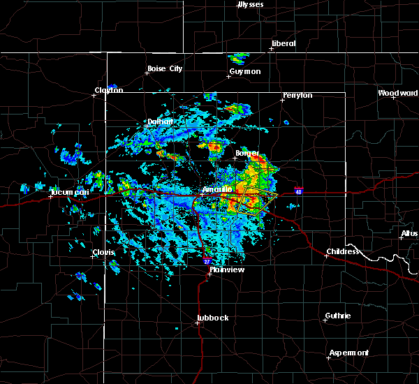 At 457 pm cdt, a severe thunderstorm was located near goodnight, or 10 miles east of claude, moving northeast at 20 mph (radar indicated). Hazards include 60 mph wind gusts and half dollar size hail. Minor damage to roofs, siding, and trees is possible. Hail damage to vehicles is expected. At 457 pm cdt, a severe thunderstorm was located near goodnight, or 10 miles east of claude, moving northeast at 20 mph (radar indicated). Hazards include 60 mph wind gusts and half dollar size hail. Minor damage to roofs, siding, and trees is possible. Hail damage to vehicles is expected.
|
| 6/25/2019 4:57 PM CDT |
 At 457 pm cdt, a severe thunderstorm was located near goodnight, or 10 miles east of claude, moving northeast at 20 mph (radar indicated). Hazards include 60 mph wind gusts and half dollar size hail. Minor damage to roofs, siding, and trees is possible. Hail damage to vehicles is expected. At 457 pm cdt, a severe thunderstorm was located near goodnight, or 10 miles east of claude, moving northeast at 20 mph (radar indicated). Hazards include 60 mph wind gusts and half dollar size hail. Minor damage to roofs, siding, and trees is possible. Hail damage to vehicles is expected.
|
| 6/25/2019 4:41 PM CDT |
 At 416 pm cdt, a severe thunderstorm was located near panhandle, moving east at 15 mph (trained weather spotters reported hail up to the size of quarters around 415 pm in panhandle). Hazards include 60 mph wind gusts and quarter size hail. Minor damage to roofs, siding, and trees is possible. hail damage to vehicles is expected. Locations impacted include, panhandle, white deer, groom and kingsmill. At 416 pm cdt, a severe thunderstorm was located near panhandle, moving east at 15 mph (trained weather spotters reported hail up to the size of quarters around 415 pm in panhandle). Hazards include 60 mph wind gusts and quarter size hail. Minor damage to roofs, siding, and trees is possible. hail damage to vehicles is expected. Locations impacted include, panhandle, white deer, groom and kingsmill.
|
| 6/25/2019 4:18 PM CDT |
 At 416 pm cdt, a severe thunderstorm was located near panhandle, moving east at 15 mph (trained weather spotters reported hail up to the size of quarters around 415 pm in panhandle). Hazards include 60 mph wind gusts and quarter size hail. Minor damage to roofs, siding, and trees is possible. hail damage to vehicles is expected. Locations impacted include, panhandle, white deer, groom and kingsmill. At 416 pm cdt, a severe thunderstorm was located near panhandle, moving east at 15 mph (trained weather spotters reported hail up to the size of quarters around 415 pm in panhandle). Hazards include 60 mph wind gusts and quarter size hail. Minor damage to roofs, siding, and trees is possible. hail damage to vehicles is expected. Locations impacted include, panhandle, white deer, groom and kingsmill.
|
| 6/25/2019 4:05 PM CDT |
 At 405 pm cdt, a severe thunderstorm was located over panhandle, moving east at 15 mph (trained weather spotters. at 400 pm cdt, trained spotters reported quarter size hail 2 miles southwest of panhandle). Hazards include ping pong ball size hail and 60 mph wind gusts. Minor damage to roofs, siding, and trees is possible. people and animals outdoors will be injured. expect hail damage to roofs, siding, windows, and vehicles. Locations impacted include, panhandle, white deer, groom and kingsmill. At 405 pm cdt, a severe thunderstorm was located over panhandle, moving east at 15 mph (trained weather spotters. at 400 pm cdt, trained spotters reported quarter size hail 2 miles southwest of panhandle). Hazards include ping pong ball size hail and 60 mph wind gusts. Minor damage to roofs, siding, and trees is possible. people and animals outdoors will be injured. expect hail damage to roofs, siding, windows, and vehicles. Locations impacted include, panhandle, white deer, groom and kingsmill.
|
| 6/25/2019 4:02 PM CDT |
 At 401 pm cdt, a severe thunderstorm was located over panhandle, moving east at 5 mph (trained weather spotters. at 400 pm, trained spotters reported quarter size hail 2 miles southwest of panhandle). Hazards include 60 mph wind gusts and quarter size hail. Minor damage to roofs, siding, and trees is possible. hail damage to vehicles is expected. Locations impacted include, panhandle, white deer, groom and kingsmill. At 401 pm cdt, a severe thunderstorm was located over panhandle, moving east at 5 mph (trained weather spotters. at 400 pm, trained spotters reported quarter size hail 2 miles southwest of panhandle). Hazards include 60 mph wind gusts and quarter size hail. Minor damage to roofs, siding, and trees is possible. hail damage to vehicles is expected. Locations impacted include, panhandle, white deer, groom and kingsmill.
|
| 6/25/2019 3:57 PM CDT |
 At 357 pm cdt, a severe thunderstorm was located 5 miles southeast of panhandle, moving east at 10 mph (radar indicated). Hazards include 60 mph wind gusts and quarter size hail. Minor damage to roofs, siding, and trees is possible. Hail damage to vehicles is expected. At 357 pm cdt, a severe thunderstorm was located 5 miles southeast of panhandle, moving east at 10 mph (radar indicated). Hazards include 60 mph wind gusts and quarter size hail. Minor damage to roofs, siding, and trees is possible. Hail damage to vehicles is expected.
|
| 6/22/2019 11:32 PM CDT |
 At 1132 pm cdt, a severe thunderstorm was located 6 miles southwest of lake mcclellan, or 17 miles north of clarendon, moving northeast at 20 mph (radar indicated). Hazards include golf ball size hail and 70 mph wind gusts. Expect some tree damage. damage is likely to mobile homes, roofs, and outbuildings. people and animals outdoors will be injured. expect hail damage to roofs, siding, windows, and vehicles. Locations impacted include, mclean, groom, lefors, alanreed and lake mcclellan. At 1132 pm cdt, a severe thunderstorm was located 6 miles southwest of lake mcclellan, or 17 miles north of clarendon, moving northeast at 20 mph (radar indicated). Hazards include golf ball size hail and 70 mph wind gusts. Expect some tree damage. damage is likely to mobile homes, roofs, and outbuildings. people and animals outdoors will be injured. expect hail damage to roofs, siding, windows, and vehicles. Locations impacted include, mclean, groom, lefors, alanreed and lake mcclellan.
|
| 6/22/2019 11:15 PM CDT |
 At 1114 pm cdt, a severe thunderstorm capable of producing a tornado was located 6 miles south of groom, or 15 miles east of claude, moving north at 15 mph (radar indicated rotation). Hazards include tornado and golf ball size hail. Flying debris will be dangerous to those caught without shelter. mobile homes will be damaged or destroyed. damage to roofs, windows, and vehicles will occur. tree damage is likely. Locations impacted include, groom. At 1114 pm cdt, a severe thunderstorm capable of producing a tornado was located 6 miles south of groom, or 15 miles east of claude, moving north at 15 mph (radar indicated rotation). Hazards include tornado and golf ball size hail. Flying debris will be dangerous to those caught without shelter. mobile homes will be damaged or destroyed. damage to roofs, windows, and vehicles will occur. tree damage is likely. Locations impacted include, groom.
|
| 6/22/2019 11:05 PM CDT |
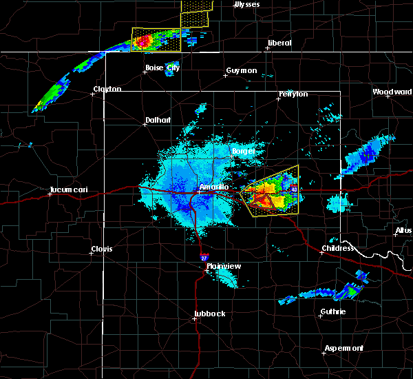 At 1105 pm cdt, a confirmed tornado was located 5 miles northeast of goodnight, or 14 miles east of claude, moving north at 15 mph (weather spotters confirmed tornado). Hazards include damaging tornado and golf ball size hail. Flying debris will be dangerous to those caught without shelter. mobile homes will be damaged or destroyed. damage to roofs, windows, and vehicles will occur. Tree damage is likely. At 1105 pm cdt, a confirmed tornado was located 5 miles northeast of goodnight, or 14 miles east of claude, moving north at 15 mph (weather spotters confirmed tornado). Hazards include damaging tornado and golf ball size hail. Flying debris will be dangerous to those caught without shelter. mobile homes will be damaged or destroyed. damage to roofs, windows, and vehicles will occur. Tree damage is likely.
|
| 6/22/2019 10:56 PM CDT |
 At 1056 pm cdt, a severe thunderstorm was located 6 miles east of goodnight, or 11 miles northwest of clarendon, moving northeast at 15 mph (radar indicated). Hazards include golf ball size hail and 70 mph wind gusts. Expect some tree damage. damage is likely to mobile homes, roofs, and outbuildings. people and animals outdoors will be injured. Expect hail damage to roofs, siding, windows, and vehicles. At 1056 pm cdt, a severe thunderstorm was located 6 miles east of goodnight, or 11 miles northwest of clarendon, moving northeast at 15 mph (radar indicated). Hazards include golf ball size hail and 70 mph wind gusts. Expect some tree damage. damage is likely to mobile homes, roofs, and outbuildings. people and animals outdoors will be injured. Expect hail damage to roofs, siding, windows, and vehicles.
|
| 6/22/2019 10:09 PM CDT |
 At 1009 pm cdt, a severe thunderstorm was located 5 miles southeast of groom, or 16 miles northwest of clarendon, moving north at 40 mph (radar indicated). Hazards include 60 mph wind gusts and quarter size hail. Minor damage to roofs, siding, and trees is possible. hail damage to vehicles is expected. Locations impacted include, pampa, white deer, groom, lefors, skellytown, lake mcclellan and kingsmill. At 1009 pm cdt, a severe thunderstorm was located 5 miles southeast of groom, or 16 miles northwest of clarendon, moving north at 40 mph (radar indicated). Hazards include 60 mph wind gusts and quarter size hail. Minor damage to roofs, siding, and trees is possible. hail damage to vehicles is expected. Locations impacted include, pampa, white deer, groom, lefors, skellytown, lake mcclellan and kingsmill.
|
| 6/22/2019 9:45 PM CDT |
 At 944 pm cdt, a severe thunderstorm was located near groom, or 17 miles east of claude, moving north at 35 mph (radar indicated). Hazards include 60 mph wind gusts and quarter size hail. Minor damage to roofs, siding, and trees is possible. hail damage to vehicles is expected. Locations impacted include, pampa, white deer, groom, lefors, skellytown, lake mcclellan and kingsmill. At 944 pm cdt, a severe thunderstorm was located near groom, or 17 miles east of claude, moving north at 35 mph (radar indicated). Hazards include 60 mph wind gusts and quarter size hail. Minor damage to roofs, siding, and trees is possible. hail damage to vehicles is expected. Locations impacted include, pampa, white deer, groom, lefors, skellytown, lake mcclellan and kingsmill.
|
| 6/22/2019 9:36 PM CDT |
 At 936 pm cdt, a severe thunderstorm was located 6 miles south of groom, or 15 miles northwest of clarendon, moving northeast at 35 mph (radar indicated). Hazards include ping pong ball size hail and 60 mph wind gusts. Minor damage to roofs, siding, and trees is possible. people and animals outdoors will be injured. Expect hail damage to roofs, siding, windows, and vehicles. At 936 pm cdt, a severe thunderstorm was located 6 miles south of groom, or 15 miles northwest of clarendon, moving northeast at 35 mph (radar indicated). Hazards include ping pong ball size hail and 60 mph wind gusts. Minor damage to roofs, siding, and trees is possible. people and animals outdoors will be injured. Expect hail damage to roofs, siding, windows, and vehicles.
|
| 6/18/2019 9:44 PM CDT | Storm damage reported in gray county TX, 11.7 miles W of Groom, TX |
| 6/18/2019 9:24 PM CDT | Grandview-hopkins abc7 schoolnet site in gray county TX, 8.8 miles SW of Groom, TX |
| 6/15/2019 7:38 PM CDT | Storm damage reported in gray county TX, 11.7 miles W of Groom, TX |
| 6/15/2019 7:38 PM CDT |
 At 737 pm cdt, severe thunderstorms were located along a line extending from 3 miles northeast of kingsmill to 5 miles southeast of lefors to 4 miles southwest of mclean, moving northeast at 45 mph (radar indicated). Hazards include 60 mph wind gusts and quarter size hail. Minor damage to roofs, siding, and trees is possible. hail damage to vehicles is expected. Locations impacted include, pampa, panhandle, white deer, mclean, groom, lefors, howardwick, new mobeetie, lake mcclellan, lela, kellerville, kingsmill, alanreed, greenbelt lake and mobeetie. At 737 pm cdt, severe thunderstorms were located along a line extending from 3 miles northeast of kingsmill to 5 miles southeast of lefors to 4 miles southwest of mclean, moving northeast at 45 mph (radar indicated). Hazards include 60 mph wind gusts and quarter size hail. Minor damage to roofs, siding, and trees is possible. hail damage to vehicles is expected. Locations impacted include, pampa, panhandle, white deer, mclean, groom, lefors, howardwick, new mobeetie, lake mcclellan, lela, kellerville, kingsmill, alanreed, greenbelt lake and mobeetie.
|
| 6/15/2019 7:04 PM CDT |
 The national weather service in amarillo has issued a * severe thunderstorm warning for. western wheeler county in the panhandle of texas. northeastern armstrong county in the panhandle of texas. southeastern carson county in the panhandle of texas. Gray county in the panhandle of texas. The national weather service in amarillo has issued a * severe thunderstorm warning for. western wheeler county in the panhandle of texas. northeastern armstrong county in the panhandle of texas. southeastern carson county in the panhandle of texas. Gray county in the panhandle of texas.
|
| 6/15/2019 6:50 PM CDT |
 At 650 pm cdt, severe thunderstorms were located along a line extending from washburn to 10 miles southwest of claude, moving northeast at 20 mph (radar indicated). Hazards include 60 mph wind gusts and quarter size hail. Minor damage to roofs, siding, and trees is possible. hail damage to vehicles is expected. Locations impacted include, panhandle, claude, white deer, groom, wayside, washburn and goodnight. At 650 pm cdt, severe thunderstorms were located along a line extending from washburn to 10 miles southwest of claude, moving northeast at 20 mph (radar indicated). Hazards include 60 mph wind gusts and quarter size hail. Minor damage to roofs, siding, and trees is possible. hail damage to vehicles is expected. Locations impacted include, panhandle, claude, white deer, groom, wayside, washburn and goodnight.
|
| 6/15/2019 6:23 PM CDT |
 The national weather service in amarillo has issued a * severe thunderstorm warning for. eastern randall county in the panhandle of texas. armstrong county in the panhandle of texas. southern carson county in the panhandle of texas. Southwestern gray county in the panhandle of texas. The national weather service in amarillo has issued a * severe thunderstorm warning for. eastern randall county in the panhandle of texas. armstrong county in the panhandle of texas. southern carson county in the panhandle of texas. Southwestern gray county in the panhandle of texas.
|
| 6/1/2019 8:57 PM CDT |
 At 856 pm cdt, severe thunderstorms were located along a line extending from 5 miles northwest of claude to 9 miles south of washburn to 5 miles east of palo duro canyon, moving southeast at 25 mph (automated weather equipment. at 849 pm cdt, automated weather equipment recorded a 67 mph wind gust 12 miles southwest of claude). Hazards include 70 mph wind gusts and quarter size hail. Expect some tree damage. damage is likely to mobile homes, roofs, and outbuildings. Hail damage to vehicles is expected. At 856 pm cdt, severe thunderstorms were located along a line extending from 5 miles northwest of claude to 9 miles south of washburn to 5 miles east of palo duro canyon, moving southeast at 25 mph (automated weather equipment. at 849 pm cdt, automated weather equipment recorded a 67 mph wind gust 12 miles southwest of claude). Hazards include 70 mph wind gusts and quarter size hail. Expect some tree damage. damage is likely to mobile homes, roofs, and outbuildings. Hail damage to vehicles is expected.
|
| 6/1/2019 8:05 PM CDT |
 At 805 pm cdt, a severe thunderstorm was located 4 miles west of groom, or 12 miles northeast of claude, moving east at 10 mph (radar indicated). Hazards include ping pong ball size hail and 60 mph wind gusts. Minor damage to roofs, siding, and trees is possible. people and animals outdoors will be injured. Expect hail damage to roofs, siding, windows, and vehicles. At 805 pm cdt, a severe thunderstorm was located 4 miles west of groom, or 12 miles northeast of claude, moving east at 10 mph (radar indicated). Hazards include ping pong ball size hail and 60 mph wind gusts. Minor damage to roofs, siding, and trees is possible. people and animals outdoors will be injured. Expect hail damage to roofs, siding, windows, and vehicles.
|
| 6/1/2019 8:01 PM CDT | Golf Ball sized hail reported 8.3 miles E of Groom, TX |
| 6/1/2019 8:00 PM CDT | Golf Ball sized hail reported 11.7 miles E of Groom, TX |
| 6/1/2019 7:45 PM CDT |
 At 745 pm cdt, a severe thunderstorm was located 7 miles west of groom, or 10 miles southeast of panhandle, moving east at 20 mph (trained weather spotters). Hazards include golf ball size hail and 60 mph wind gusts. Minor damage to roofs, siding, and trees is possible. people and animals outdoors will be injured. expect hail damage to roofs, siding, windows, and vehicles. Locations impacted include, groom. At 745 pm cdt, a severe thunderstorm was located 7 miles west of groom, or 10 miles southeast of panhandle, moving east at 20 mph (trained weather spotters). Hazards include golf ball size hail and 60 mph wind gusts. Minor damage to roofs, siding, and trees is possible. people and animals outdoors will be injured. expect hail damage to roofs, siding, windows, and vehicles. Locations impacted include, groom.
|
| 6/1/2019 7:42 PM CDT | Hen Egg sized hail reported 10 miles E of Groom, TX |
| 6/1/2019 7:38 PM CDT | Golf Ball sized hail reported 10.5 miles E of Groom, TX, hail currently falling on i-40 at mile marker 102. |
| 6/1/2019 7:16 PM CDT |
 At 715 pm cdt, a severe thunderstorm was located 4 miles south of panhandle, moving east at 10 mph (radar indicated). Hazards include two inch hail and 60 mph wind gusts. one inch hail was reported 3 miles west of panhandle around 7:10 pm cdt. Minor damage to roofs, siding, and trees is possible. people and animals outdoors will be injured. expect hail damage to roofs, siding, windows, and vehicles. Locations impacted include, panhandle, white deer and groom. At 715 pm cdt, a severe thunderstorm was located 4 miles south of panhandle, moving east at 10 mph (radar indicated). Hazards include two inch hail and 60 mph wind gusts. one inch hail was reported 3 miles west of panhandle around 7:10 pm cdt. Minor damage to roofs, siding, and trees is possible. people and animals outdoors will be injured. expect hail damage to roofs, siding, windows, and vehicles. Locations impacted include, panhandle, white deer and groom.
|
| 6/1/2019 6:57 PM CDT |
 At 657 pm cdt, a severe thunderstorm was located 5 miles southwest of panhandle, moving east at 10 mph (radar indicated). Hazards include golf ball size hail. People and animals outdoors will be injured. Expect damage to roofs, siding, windows, and vehicles. At 657 pm cdt, a severe thunderstorm was located 5 miles southwest of panhandle, moving east at 10 mph (radar indicated). Hazards include golf ball size hail. People and animals outdoors will be injured. Expect damage to roofs, siding, windows, and vehicles.
|
| 5/26/2019 11:13 PM CDT |
 At 1113 pm cdt, severe thunderstorms were located along a line extending from 7 miles southwest of lefors to 5 miles south of goodnight, moving northeast at 60 mph (radar indicated). Hazards include 70 mph wind gusts. Expect some tree damage. Damage is likely to mobile homes, roofs, and outbuildings. At 1113 pm cdt, severe thunderstorms were located along a line extending from 7 miles southwest of lefors to 5 miles south of goodnight, moving northeast at 60 mph (radar indicated). Hazards include 70 mph wind gusts. Expect some tree damage. Damage is likely to mobile homes, roofs, and outbuildings.
|
| 5/23/2019 10:50 PM CDT |
 At 1050 pm cdt, automated weather equipment reported a severe thunderstorm was located 6 miles east of washburn, or 6 miles northwest of claude, moving northeast at 45 mph (automated weather equipment). Hazards include 70 mph wind gusts. Expect some tree damage. damage is likely to mobile homes, roofs, and outbuildings. Locations impacted include, panhandle, claude, white deer, groom, skellytown, kingsmill and washburn. At 1050 pm cdt, automated weather equipment reported a severe thunderstorm was located 6 miles east of washburn, or 6 miles northwest of claude, moving northeast at 45 mph (automated weather equipment). Hazards include 70 mph wind gusts. Expect some tree damage. damage is likely to mobile homes, roofs, and outbuildings. Locations impacted include, panhandle, claude, white deer, groom, skellytown, kingsmill and washburn.
|
| 5/23/2019 10:36 PM CDT |
 At 1036 pm cdt, a severe thunderstorm was located 7 miles northeast of palo duro canyon, or 13 miles west of claude, moving northeast at 45 mph (automated weather equipment). Hazards include 70 mph wind gusts. Expect some tree damage. Damage is likely to mobile homes, roofs, and outbuildings. At 1036 pm cdt, a severe thunderstorm was located 7 miles northeast of palo duro canyon, or 13 miles west of claude, moving northeast at 45 mph (automated weather equipment). Hazards include 70 mph wind gusts. Expect some tree damage. Damage is likely to mobile homes, roofs, and outbuildings.
|
| 5/5/2019 6:55 PM CDT |
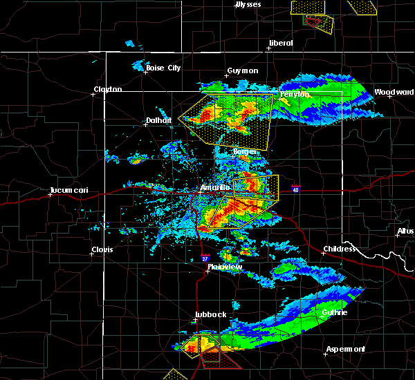 At 655 pm cdt, a severe thunderstorm was located near groom, or 16 miles east of panhandle, moving east at 45 mph (radar indicated). Hazards include 60 mph wind gusts and quarter size hail. Minor damage to roofs, siding, and trees is possible. hail damage to vehicles is expected. Locations impacted include, groom and lake mcclellan. At 655 pm cdt, a severe thunderstorm was located near groom, or 16 miles east of panhandle, moving east at 45 mph (radar indicated). Hazards include 60 mph wind gusts and quarter size hail. Minor damage to roofs, siding, and trees is possible. hail damage to vehicles is expected. Locations impacted include, groom and lake mcclellan.
|
| 5/5/2019 6:45 PM CDT |
 At 644 pm cdt, a severe thunderstorm was located 8 miles northwest of groom, or 9 miles southeast of panhandle, moving east at 45 mph (radar indicated). Hazards include 60 mph wind gusts and half dollar size hail. Minor damage to roofs, siding, and trees is possible. hail damage to vehicles is expected. Locations impacted include, panhandle, groom and lake mcclellan. At 644 pm cdt, a severe thunderstorm was located 8 miles northwest of groom, or 9 miles southeast of panhandle, moving east at 45 mph (radar indicated). Hazards include 60 mph wind gusts and half dollar size hail. Minor damage to roofs, siding, and trees is possible. hail damage to vehicles is expected. Locations impacted include, panhandle, groom and lake mcclellan.
|
| 5/5/2019 6:26 PM CDT |
 At 626 pm cdt, a severe thunderstorm was located 7 miles northeast of washburn, or 8 miles southwest of panhandle, moving east at 45 mph (radar indicated). Hazards include 60 mph wind gusts and half dollar size hail. Minor damage to roofs, siding, and trees is possible. Hail damage to vehicles is expected. At 626 pm cdt, a severe thunderstorm was located 7 miles northeast of washburn, or 8 miles southwest of panhandle, moving east at 45 mph (radar indicated). Hazards include 60 mph wind gusts and half dollar size hail. Minor damage to roofs, siding, and trees is possible. Hail damage to vehicles is expected.
|
| 4/17/2019 6:13 PM CDT |
 At 613 pm cdt, a severe thunderstorm was located near groom, or 16 miles southeast of panhandle, moving northeast at 20 mph (radar indicated). Hazards include quarter size hail. Damage to vehicles is expected. hail may accumulate on roadways causing hazardous travel. Locations impacted include, groom. At 613 pm cdt, a severe thunderstorm was located near groom, or 16 miles southeast of panhandle, moving northeast at 20 mph (radar indicated). Hazards include quarter size hail. Damage to vehicles is expected. hail may accumulate on roadways causing hazardous travel. Locations impacted include, groom.
|
| 4/17/2019 5:49 PM CDT |
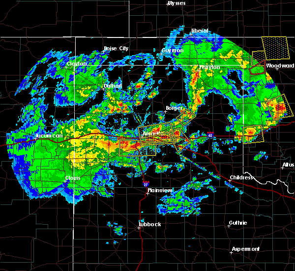 At 548 pm cdt, a severe thunderstorm was located 7 miles northwest of groom, or 10 miles southeast of panhandle, moving southeast at 10 mph (radar indicated). Hazards include ping pong ball size hail. People and animals outdoors will be injured. expect damage to roofs, siding, windows, and vehicles. Hail may accumulate on roadways causing hazardous travel. At 548 pm cdt, a severe thunderstorm was located 7 miles northwest of groom, or 10 miles southeast of panhandle, moving southeast at 10 mph (radar indicated). Hazards include ping pong ball size hail. People and animals outdoors will be injured. expect damage to roofs, siding, windows, and vehicles. Hail may accumulate on roadways causing hazardous travel.
|
| 3/22/2019 9:50 PM CDT |
 At 950 pm cdt, severe thunderstorms were located along a line extending from 3 miles north of groom to 8 miles southwest of lake mcclellan to 8 miles west of greenbelt lake, moving east at 40 mph (radar indicated). Hazards include tennis ball size hail. People and animals outdoors will be injured. expect damage to roofs, siding, windows, and vehicles. Locations impacted include, clarendon, groom, lefors, howardwick, lake mcclellan, alanreed and greenbelt lake. At 950 pm cdt, severe thunderstorms were located along a line extending from 3 miles north of groom to 8 miles southwest of lake mcclellan to 8 miles west of greenbelt lake, moving east at 40 mph (radar indicated). Hazards include tennis ball size hail. People and animals outdoors will be injured. expect damage to roofs, siding, windows, and vehicles. Locations impacted include, clarendon, groom, lefors, howardwick, lake mcclellan, alanreed and greenbelt lake.
|
| 3/22/2019 9:40 PM CDT |
 At 939 pm cdt, severe thunderstorms were located along a line extending from 5 miles northeast of groom to 4 miles south of goodnight, moving east at 40 mph (radar indicated). Hazards include golf ball size hail. People and animals outdoors will be injured. expect damage to roofs, siding, windows, and vehicles. Locations impacted include, clarendon, groom, lefors, howardwick, lake mcclellan, alanreed, greenbelt lake and goodnight. At 939 pm cdt, severe thunderstorms were located along a line extending from 5 miles northeast of groom to 4 miles south of goodnight, moving east at 40 mph (radar indicated). Hazards include golf ball size hail. People and animals outdoors will be injured. expect damage to roofs, siding, windows, and vehicles. Locations impacted include, clarendon, groom, lefors, howardwick, lake mcclellan, alanreed, greenbelt lake and goodnight.
|
| 3/22/2019 9:17 PM CDT |
 At 916 pm cdt, severe thunderstorms were located along a line extending from 5 miles north of claude to 11 miles northeast of wayside, moving northeast at 45 mph (radar indicated). Hazards include quarter size hail. damage to vehicles is expected At 916 pm cdt, severe thunderstorms were located along a line extending from 5 miles north of claude to 11 miles northeast of wayside, moving northeast at 45 mph (radar indicated). Hazards include quarter size hail. damage to vehicles is expected
|
| 8/16/2018 9:05 PM CDT |
 The national weather service in amarillo has issued a * severe thunderstorm warning for. southeastern carson county in the panhandle of texas. southwestern gray county in the panhandle of texas. until 1000 pm cdt. At 905 pm cdt, a severe thunderstorm was located 5 miles north of. The national weather service in amarillo has issued a * severe thunderstorm warning for. southeastern carson county in the panhandle of texas. southwestern gray county in the panhandle of texas. until 1000 pm cdt. At 905 pm cdt, a severe thunderstorm was located 5 miles north of.
|
| 8/14/2018 6:51 PM CDT |
 At 650 pm cdt, a severe thunderstorm was located 5 miles northwest of howardwick, or 11 miles north of clarendon, moving southeast at 10 mph (radar indicated). Hazards include 60 mph wind gusts and quarter size hail. Minor damage to roofs, siding, and trees is possible. hail damage to vehicles is expected. Locations impacted include, panhandle, claude, white deer, groom, howardwick, lake mcclellan, alanreed, greenbelt lake and goodnight. At 650 pm cdt, a severe thunderstorm was located 5 miles northwest of howardwick, or 11 miles north of clarendon, moving southeast at 10 mph (radar indicated). Hazards include 60 mph wind gusts and quarter size hail. Minor damage to roofs, siding, and trees is possible. hail damage to vehicles is expected. Locations impacted include, panhandle, claude, white deer, groom, howardwick, lake mcclellan, alanreed, greenbelt lake and goodnight.
|
| 8/14/2018 6:42 PM CDT |
 At 642 pm cdt, a severe thunderstorm was located 7 miles northwest of howardwick, or 13 miles northwest of clarendon, moving southeast at 10 mph (radar indicated). Hazards include 60 mph wind gusts and quarter size hail. Minor damage to roofs, siding, and trees is possible. hail damage to vehicles is expected. Locations impacted include, panhandle, claude, white deer, groom, howardwick, lake mcclellan, alanreed, greenbelt lake and goodnight. At 642 pm cdt, a severe thunderstorm was located 7 miles northwest of howardwick, or 13 miles northwest of clarendon, moving southeast at 10 mph (radar indicated). Hazards include 60 mph wind gusts and quarter size hail. Minor damage to roofs, siding, and trees is possible. hail damage to vehicles is expected. Locations impacted include, panhandle, claude, white deer, groom, howardwick, lake mcclellan, alanreed, greenbelt lake and goodnight.
|
| 8/14/2018 6:34 PM CDT |
 At 634 pm cdt, a severe thunderstorm was located 7 miles southeast of groom, or 15 miles northwest of clarendon, moving southeast at 20 mph (radar indicated). Hazards include 60 mph wind gusts and quarter size hail. Minor damage to roofs, siding, and trees is possible. hail damage to vehicles is expected. Locations impacted include, panhandle, claude, white deer, mclean, groom, howardwick, lake mcclellan, kingsmill, alanreed, greenbelt lake and goodnight. At 634 pm cdt, a severe thunderstorm was located 7 miles southeast of groom, or 15 miles northwest of clarendon, moving southeast at 20 mph (radar indicated). Hazards include 60 mph wind gusts and quarter size hail. Minor damage to roofs, siding, and trees is possible. hail damage to vehicles is expected. Locations impacted include, panhandle, claude, white deer, mclean, groom, howardwick, lake mcclellan, kingsmill, alanreed, greenbelt lake and goodnight.
|
| 8/14/2018 6:25 PM CDT |
 At 625 pm cdt, a severe thunderstorm was located 5 miles southeast of groom, or 16 miles northwest of clarendon, moving southeast at 20 mph (radar indicated). Hazards include 70 mph wind gusts and ping pong ball size hail. Expect some tree damage. damage is likely to mobile homes, roofs, and outbuildings. people and animals outdoors will be injured. expect hail damage to roofs, siding, windows, and vehicles. Locations impacted include, panhandle, claude, white deer, mclean, groom, howardwick, lake mcclellan, kingsmill, alanreed, greenbelt lake and goodnight. At 625 pm cdt, a severe thunderstorm was located 5 miles southeast of groom, or 16 miles northwest of clarendon, moving southeast at 20 mph (radar indicated). Hazards include 70 mph wind gusts and ping pong ball size hail. Expect some tree damage. damage is likely to mobile homes, roofs, and outbuildings. people and animals outdoors will be injured. expect hail damage to roofs, siding, windows, and vehicles. Locations impacted include, panhandle, claude, white deer, mclean, groom, howardwick, lake mcclellan, kingsmill, alanreed, greenbelt lake and goodnight.
|
| 8/14/2018 6:11 PM CDT |
 At 611 pm cdt, a severe thunderstorm was located over groom, or 17 miles northeast of claude, moving southeast at 15 mph (radar indicated). Hazards include tennis ball size hail and 70 mph wind gusts. Expect some tree damage. damage is likely to mobile homes, roofs, and outbuildings. people and animals outdoors will be injured. expect hail damage to roofs, siding, windows, and vehicles. Locations impacted include, panhandle, claude, white deer, mclean, groom, howardwick, lake mcclellan, kingsmill, alanreed, greenbelt lake and goodnight. At 611 pm cdt, a severe thunderstorm was located over groom, or 17 miles northeast of claude, moving southeast at 15 mph (radar indicated). Hazards include tennis ball size hail and 70 mph wind gusts. Expect some tree damage. damage is likely to mobile homes, roofs, and outbuildings. people and animals outdoors will be injured. expect hail damage to roofs, siding, windows, and vehicles. Locations impacted include, panhandle, claude, white deer, mclean, groom, howardwick, lake mcclellan, kingsmill, alanreed, greenbelt lake and goodnight.
|
| 8/14/2018 6:08 PM CDT |
 At 608 pm cdt, a severe thunderstorm was located over groom, or 17 miles northeast of claude, moving southeast at 15 mph (radar indicated). Hazards include golf ball size hail and 70 mph wind gusts. Expect some tree damage. damage is likely to mobile homes, roofs, and outbuildings. people and animals outdoors will be injured. expect hail damage to roofs, siding, windows, and vehicles. Locations impacted include, panhandle, claude, white deer, mclean, groom, howardwick, lake mcclellan, kingsmill, alanreed, greenbelt lake and goodnight. At 608 pm cdt, a severe thunderstorm was located over groom, or 17 miles northeast of claude, moving southeast at 15 mph (radar indicated). Hazards include golf ball size hail and 70 mph wind gusts. Expect some tree damage. damage is likely to mobile homes, roofs, and outbuildings. people and animals outdoors will be injured. expect hail damage to roofs, siding, windows, and vehicles. Locations impacted include, panhandle, claude, white deer, mclean, groom, howardwick, lake mcclellan, kingsmill, alanreed, greenbelt lake and goodnight.
|
| 8/14/2018 6:03 PM CDT | Power outages reported in and around groom. tree limbs down across town. schoolnet site in groom reported a 58 mph wind gus in carson county TX, 0.6 miles NE of Groom, TX |
| 8/14/2018 6:01 PM CDT |
 At 601 pm cdt, a severe thunderstorm was located 7 miles south of white deer, or 13 miles east of panhandle, moving southeast at 25 mph (radar indicated). Hazards include golf ball size hail and 70 mph wind gusts. Expect some tree damage. damage is likely to mobile homes, roofs, and outbuildings. people and animals outdoors will be injured. expect hail damage to roofs, siding, windows, and vehicles. Locations impacted include, panhandle, claude, white deer, mclean, groom, howardwick, lake mcclellan, kingsmill, alanreed, greenbelt lake and goodnight. At 601 pm cdt, a severe thunderstorm was located 7 miles south of white deer, or 13 miles east of panhandle, moving southeast at 25 mph (radar indicated). Hazards include golf ball size hail and 70 mph wind gusts. Expect some tree damage. damage is likely to mobile homes, roofs, and outbuildings. people and animals outdoors will be injured. expect hail damage to roofs, siding, windows, and vehicles. Locations impacted include, panhandle, claude, white deer, mclean, groom, howardwick, lake mcclellan, kingsmill, alanreed, greenbelt lake and goodnight.
|
| 8/14/2018 5:53 PM CDT |
 At 552 pm cdt, a severe thunderstorm was located 7 miles south of white deer, or 13 miles east of panhandle, moving southeast at 15 mph (radar indicated). Hazards include 70 mph wind gusts and ping pong ball size hail. Expect some tree damage. damage is likely to mobile homes, roofs, and outbuildings. people and animals outdoors will be injured. expect hail damage to roofs, siding, windows, and vehicles. Locations impacted include, panhandle, claude, white deer, mclean, groom, howardwick, lake mcclellan, kingsmill, alanreed, greenbelt lake and goodnight. At 552 pm cdt, a severe thunderstorm was located 7 miles south of white deer, or 13 miles east of panhandle, moving southeast at 15 mph (radar indicated). Hazards include 70 mph wind gusts and ping pong ball size hail. Expect some tree damage. damage is likely to mobile homes, roofs, and outbuildings. people and animals outdoors will be injured. expect hail damage to roofs, siding, windows, and vehicles. Locations impacted include, panhandle, claude, white deer, mclean, groom, howardwick, lake mcclellan, kingsmill, alanreed, greenbelt lake and goodnight.
|
| 8/14/2018 5:37 PM CDT |
 At 536 pm cdt, a severe thunderstorm was located 5 miles west of white deer, or 9 miles northeast of panhandle, moving southeast at 10 mph (radar indicated). Hazards include 60 mph wind gusts and half dollar size hail. Minor damage to roofs, siding, and trees is possible. Hail damage to vehicles is expected. At 536 pm cdt, a severe thunderstorm was located 5 miles west of white deer, or 9 miles northeast of panhandle, moving southeast at 10 mph (radar indicated). Hazards include 60 mph wind gusts and half dollar size hail. Minor damage to roofs, siding, and trees is possible. Hail damage to vehicles is expected.
|
| 6/29/2018 9:18 PM CDT |
 At 918 pm cdt, a severe thunderstorm was located over lake mcclellan, or 18 miles north of clarendon, moving east at 35 mph (radar indicated). Hazards include 70 mph wind gusts. Expect some tree damage. damage is likely to mobile homes, roofs, and outbuildings. Locations impacted include, pampa, mclean, groom, lefors, howardwick, lake mcclellan, kingsmill, alanreed and greenbelt lake. At 918 pm cdt, a severe thunderstorm was located over lake mcclellan, or 18 miles north of clarendon, moving east at 35 mph (radar indicated). Hazards include 70 mph wind gusts. Expect some tree damage. damage is likely to mobile homes, roofs, and outbuildings. Locations impacted include, pampa, mclean, groom, lefors, howardwick, lake mcclellan, kingsmill, alanreed and greenbelt lake.
|
| 6/29/2018 9:05 PM CDT |
 At 857 pm cdt, automated weather equipment reported a 68 mile an hour wind gust in groom. a severe thunderstorm was located over groom, or 17 miles east of claude, moving northeast at 20 mph (automated weather equipment). Hazards include 70 mph wind gusts. Expect some tree damage. damage is likely to mobile homes, roofs, and outbuildings. Locations impacted include, pampa, mclean, groom, lefors, howardwick, lake mcclellan, kingsmill, alanreed and greenbelt lake. At 857 pm cdt, automated weather equipment reported a 68 mile an hour wind gust in groom. a severe thunderstorm was located over groom, or 17 miles east of claude, moving northeast at 20 mph (automated weather equipment). Hazards include 70 mph wind gusts. Expect some tree damage. damage is likely to mobile homes, roofs, and outbuildings. Locations impacted include, pampa, mclean, groom, lefors, howardwick, lake mcclellan, kingsmill, alanreed and greenbelt lake.
|
| 6/29/2018 8:58 PM CDT |
 At 858 pm cdt, a severe thunderstorm was located near groom, or 15 miles east of claude, moving northeast at 25 mph (radar indicated). Hazards include 60 mph wind gusts. Minor damage to roofs, siding, and trees is possible. Locations impacted include, pampa, mclean, groom, lefors, howardwick, lake mcclellan, kingsmill, alanreed and greenbelt lake. At 858 pm cdt, a severe thunderstorm was located near groom, or 15 miles east of claude, moving northeast at 25 mph (radar indicated). Hazards include 60 mph wind gusts. Minor damage to roofs, siding, and trees is possible. Locations impacted include, pampa, mclean, groom, lefors, howardwick, lake mcclellan, kingsmill, alanreed and greenbelt lake.
|
| 6/29/2018 8:57 PM CDT | Storm damage reported in carson county TX, 0.6 miles NE of Groom, TX |
| 6/29/2018 8:42 PM CDT |
 At 823 pm cdt, a severe thunderstorm was located 7 miles southeast of groom, or 14 miles northwest of clarendon, moving northeast at 25 mph (radar indicated). Hazards include 60 mph wind gusts. minor damage to roofs, siding, and trees is possible At 823 pm cdt, a severe thunderstorm was located 7 miles southeast of groom, or 14 miles northwest of clarendon, moving northeast at 25 mph (radar indicated). Hazards include 60 mph wind gusts. minor damage to roofs, siding, and trees is possible
|
| 6/29/2018 8:24 PM CDT |
 At 823 pm cdt, a severe thunderstorm was located 7 miles southeast of groom, or 14 miles northwest of clarendon, moving northeast at 25 mph (radar indicated). Hazards include 60 mph wind gusts. minor damage to roofs, siding, and trees is possible At 823 pm cdt, a severe thunderstorm was located 7 miles southeast of groom, or 14 miles northwest of clarendon, moving northeast at 25 mph (radar indicated). Hazards include 60 mph wind gusts. minor damage to roofs, siding, and trees is possible
|
| 6/22/2018 8:19 PM CDT |
 At 819 pm cdt, a severe thunderstorm was located 8 miles south of kingsmill, or 12 miles south of pampa, moving east at 35 mph (radar indicated). Hazards include golf ball size hail and 60 mph wind gusts. Minor damage to roofs, siding, and trees is possible. people and animals outdoors will be injured. expect hail damage to roofs, siding, windows, and vehicles. Locations impacted include, pampa, white deer, groom, lefors, kingsmill and lake mcclellan. At 819 pm cdt, a severe thunderstorm was located 8 miles south of kingsmill, or 12 miles south of pampa, moving east at 35 mph (radar indicated). Hazards include golf ball size hail and 60 mph wind gusts. Minor damage to roofs, siding, and trees is possible. people and animals outdoors will be injured. expect hail damage to roofs, siding, windows, and vehicles. Locations impacted include, pampa, white deer, groom, lefors, kingsmill and lake mcclellan.
|
| 6/22/2018 7:48 PM CDT |
 At 747 pm cdt, a severe thunderstorm was located over panhandle, moving east at 35 mph (radar indicated). Hazards include golf ball size hail and 60 mph wind gusts. Minor damage to roofs, siding, and trees is possible. people and animals outdoors will be injured. Expect hail damage to roofs, siding, windows, and vehicles. At 747 pm cdt, a severe thunderstorm was located over panhandle, moving east at 35 mph (radar indicated). Hazards include golf ball size hail and 60 mph wind gusts. Minor damage to roofs, siding, and trees is possible. people and animals outdoors will be injured. Expect hail damage to roofs, siding, windows, and vehicles.
|
| 6/12/2018 5:34 PM CDT |
 At 533 pm cdt, severe thunderstorms were located along a line extending from 3 miles southwest of white deer to 3 miles northwest of groom, moving northeast at 15 mph (radar indicated). Hazards include golf ball size hail and 60 mph wind gusts. Minor damage to roofs, siding, and trees is possible. people and animals outdoors will be injured. expect hail damage to roofs, siding, windows, and vehicles. Locations impacted include, panhandle, white deer, groom and kingsmill. At 533 pm cdt, severe thunderstorms were located along a line extending from 3 miles southwest of white deer to 3 miles northwest of groom, moving northeast at 15 mph (radar indicated). Hazards include golf ball size hail and 60 mph wind gusts. Minor damage to roofs, siding, and trees is possible. people and animals outdoors will be injured. expect hail damage to roofs, siding, windows, and vehicles. Locations impacted include, panhandle, white deer, groom and kingsmill.
|
| 6/12/2018 5:06 PM CDT |
 At 505 pm cdt, severe thunderstorms were located along a line extending from 3 miles east of panhandle to 7 miles west of groom, moving northeast at 15 mph (radar indicated). Hazards include 60 mph wind gusts and quarter size hail. Minor damage to roofs, siding, and trees is possible. Hail damage to vehicles is expected. At 505 pm cdt, severe thunderstorms were located along a line extending from 3 miles east of panhandle to 7 miles west of groom, moving northeast at 15 mph (radar indicated). Hazards include 60 mph wind gusts and quarter size hail. Minor damage to roofs, siding, and trees is possible. Hail damage to vehicles is expected.
|
| 4/30/2018 9:21 PM CDT |
 At 921 pm cdt, a severe thunderstorm was located 5 miles north of groom, or 16 miles east of panhandle, moving northeast at 30 mph (radar indicated). Hazards include ping pong ball size hail and 60 mph wind gusts. Minor damage to roofs, siding, and trees is possible. people and animals outdoors will be injured. expect hail damage to roofs, siding, windows, and vehicles. Locations impacted include, pampa, mclean, groom, lefors, alanreed and lake mcclellan. At 921 pm cdt, a severe thunderstorm was located 5 miles north of groom, or 16 miles east of panhandle, moving northeast at 30 mph (radar indicated). Hazards include ping pong ball size hail and 60 mph wind gusts. Minor damage to roofs, siding, and trees is possible. people and animals outdoors will be injured. expect hail damage to roofs, siding, windows, and vehicles. Locations impacted include, pampa, mclean, groom, lefors, alanreed and lake mcclellan.
|
| 4/30/2018 9:19 PM CDT |
 At 918 pm cdt, a severe thunderstorm was located near groom, or 15 miles southeast of panhandle, moving northeast at 30 mph. additional development was noted southeast of groom (radar indicated). Hazards include 60 mph wind gusts and quarter size hail. Minor damage to roofs, siding, and trees is possible. Hail damage to vehicles is expected. At 918 pm cdt, a severe thunderstorm was located near groom, or 15 miles southeast of panhandle, moving northeast at 30 mph. additional development was noted southeast of groom (radar indicated). Hazards include 60 mph wind gusts and quarter size hail. Minor damage to roofs, siding, and trees is possible. Hail damage to vehicles is expected.
|
| 10/6/2017 10:03 PM CDT |
 At 1002 pm cdt, a severe thunderstorm was located 9 miles northeast of groom, or 16 miles south of pampa, moving east at 60 mph (radar indicated). Hazards include 70 mph wind gusts and quarter size hail. Expect some tree damage. damage is likely to mobile homes, roofs, and outbuildings. Hail damage to vehicles is expected. At 1002 pm cdt, a severe thunderstorm was located 9 miles northeast of groom, or 16 miles south of pampa, moving east at 60 mph (radar indicated). Hazards include 70 mph wind gusts and quarter size hail. Expect some tree damage. damage is likely to mobile homes, roofs, and outbuildings. Hail damage to vehicles is expected.
|
| 10/6/2017 9:44 PM CDT |
 At 943 pm cdt, a severe thunderstorm was located 6 miles west of panhandle, moving east at 40 mph (radar indicated). Hazards include 70 mph wind gusts and quarter size hail. Expect some tree damage. damage is likely to mobile homes, roofs, and outbuildings. hail damage to vehicles is expected. Locations impacted include, panhandle, white deer, groom and pantex. At 943 pm cdt, a severe thunderstorm was located 6 miles west of panhandle, moving east at 40 mph (radar indicated). Hazards include 70 mph wind gusts and quarter size hail. Expect some tree damage. damage is likely to mobile homes, roofs, and outbuildings. hail damage to vehicles is expected. Locations impacted include, panhandle, white deer, groom and pantex.
|
| 10/6/2017 9:38 PM CDT |
 At 937 pm cdt, a severe thunderstorm was located 8 miles north of washburn, or 11 miles west of panhandle, moving east at 40 mph (radar indicated). Hazards include 60 mph wind gusts and quarter size hail. Minor damage to roofs, siding, and trees is possible. hail damage to vehicles is expected. Locations impacted include, panhandle, claude, white deer, groom, washburn and pantex. At 937 pm cdt, a severe thunderstorm was located 8 miles north of washburn, or 11 miles west of panhandle, moving east at 40 mph (radar indicated). Hazards include 60 mph wind gusts and quarter size hail. Minor damage to roofs, siding, and trees is possible. hail damage to vehicles is expected. Locations impacted include, panhandle, claude, white deer, groom, washburn and pantex.
|
| 10/6/2017 9:13 PM CDT |
 At 912 pm cdt, a severe thunderstorm was located 4 miles northwest of amarillo, moving east at 40 mph (radar indicated). Hazards include 60 mph wind gusts and quarter size hail. Minor damage to roofs, siding, and trees is possible. Hail damage to vehicles is expected. At 912 pm cdt, a severe thunderstorm was located 4 miles northwest of amarillo, moving east at 40 mph (radar indicated). Hazards include 60 mph wind gusts and quarter size hail. Minor damage to roofs, siding, and trees is possible. Hail damage to vehicles is expected.
|
| 9/16/2017 5:26 PM CDT |
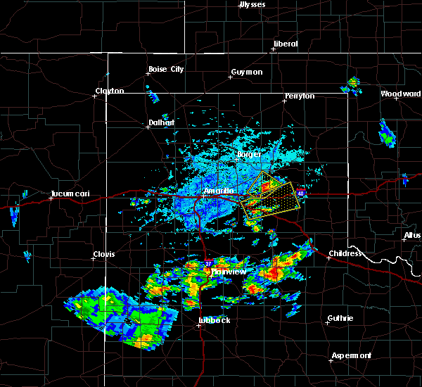 At 524 pm cdt, a severe thunderstorm was located 6 miles north of groom, or 16 miles east of panhandle, moving northeast at 15 mph (public. at 510 pm tree limbs 3 inches in diameter had fallen from this storms winds, and was reported 3 miles west northwest of groom). Hazards include 60 mph wind gusts and half dollar size hail. Minor damage to roofs, siding, and trees is possible. hail damage to vehicles is expected. Locations impacted include, groom and kingsmill. At 524 pm cdt, a severe thunderstorm was located 6 miles north of groom, or 16 miles east of panhandle, moving northeast at 15 mph (public. at 510 pm tree limbs 3 inches in diameter had fallen from this storms winds, and was reported 3 miles west northwest of groom). Hazards include 60 mph wind gusts and half dollar size hail. Minor damage to roofs, siding, and trees is possible. hail damage to vehicles is expected. Locations impacted include, groom and kingsmill.
|
| 9/16/2017 5:10 PM CDT | Three inch in diameter tree limbs knocked down from healthy tre in carson county TX, 3.3 miles ESE of Groom, TX |
| 9/16/2017 5:07 PM CDT |
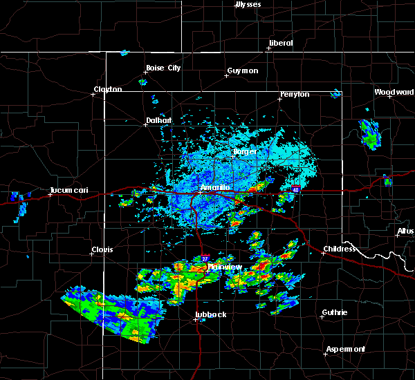 At 507 pm cdt, a severe thunderstorm was located near groom, or 15 miles southeast of panhandle, moving northeast at 10 mph (radar indicated). Hazards include 60 mph wind gusts and half dollar size hail. Minor damage to roofs, siding, and trees is possible. Hail damage to vehicles is expected. At 507 pm cdt, a severe thunderstorm was located near groom, or 15 miles southeast of panhandle, moving northeast at 10 mph (radar indicated). Hazards include 60 mph wind gusts and half dollar size hail. Minor damage to roofs, siding, and trees is possible. Hail damage to vehicles is expected.
|
| 9/15/2017 9:34 PM CDT |
 At 934 pm cdt, a severe thunderstorm was located 8 miles south of white deer, or 10 miles east of panhandle, moving northeast at 25 mph (radar indicated). Hazards include 60 mph wind gusts and penny size hail. Minor damage to roofs, siding, and trees is possible. Locations impacted include, claude, white deer, groom and goodnight. At 934 pm cdt, a severe thunderstorm was located 8 miles south of white deer, or 10 miles east of panhandle, moving northeast at 25 mph (radar indicated). Hazards include 60 mph wind gusts and penny size hail. Minor damage to roofs, siding, and trees is possible. Locations impacted include, claude, white deer, groom and goodnight.
|
| 9/15/2017 9:14 PM CDT |
 At 914 pm cdt, a severe thunderstorm was located 7 miles south of panhandle, moving northeast at 25 mph (radar indicated). Hazards include 60 mph wind gusts and penny size hail. minor damage to roofs, siding, and trees is possible At 914 pm cdt, a severe thunderstorm was located 7 miles south of panhandle, moving northeast at 25 mph (radar indicated). Hazards include 60 mph wind gusts and penny size hail. minor damage to roofs, siding, and trees is possible
|
| 8/14/2017 11:40 PM CDT |
 At 1139 pm cdt, severe thunderstorms were located along a line extending from 3 miles northwest of claude to 7 miles west of wayside to 11 miles south of buffalo lake, moving southeast at 35 mph (radar indicated). Hazards include 60 mph wind gusts. Minor damage to roofs, siding, and trees is possible. Locations impacted include, hereford, canyon, clarendon, claude, mclean, groom, howardwick, buffalo lake, lake mcclellan, wayside, washburn, palo duro canyon, goodnight, dawn, alanreed and greenbelt lake. At 1139 pm cdt, severe thunderstorms were located along a line extending from 3 miles northwest of claude to 7 miles west of wayside to 11 miles south of buffalo lake, moving southeast at 35 mph (radar indicated). Hazards include 60 mph wind gusts. Minor damage to roofs, siding, and trees is possible. Locations impacted include, hereford, canyon, clarendon, claude, mclean, groom, howardwick, buffalo lake, lake mcclellan, wayside, washburn, palo duro canyon, goodnight, dawn, alanreed and greenbelt lake.
|
| 8/14/2017 11:21 PM CDT |
 At 1121 pm cdt, severe thunderstorms were located along a line extending from 7 miles northwest of claude to 12 miles south of buffalo lake, moving southeast at 30 mph (radar indicated). Hazards include 60 mph wind gusts. Minor damage to roofs, siding, and trees is possible. Locations impacted include, amarillo, hereford, canyon, panhandle, clarendon, claude, lake tanglewood, mclean, groom, howardwick, buffalo lake, lake mcclellan, wayside, washburn, umbarger, palo duro canyon, goodnight, mescalero park, dawn and alanreed. At 1121 pm cdt, severe thunderstorms were located along a line extending from 7 miles northwest of claude to 12 miles south of buffalo lake, moving southeast at 30 mph (radar indicated). Hazards include 60 mph wind gusts. Minor damage to roofs, siding, and trees is possible. Locations impacted include, amarillo, hereford, canyon, panhandle, clarendon, claude, lake tanglewood, mclean, groom, howardwick, buffalo lake, lake mcclellan, wayside, washburn, umbarger, palo duro canyon, goodnight, mescalero park, dawn and alanreed.
|
| 8/14/2017 10:40 PM CDT |
 At 1038 pm cdt, severe thunderstorms were located along a line extending from 15 miles north of amarillo to 6 miles north of hereford, moving southeast at 40 mph (radar indicated). Hazards include 60 mph wind gusts. minor damage to roofs, siding, and trees is possible At 1038 pm cdt, severe thunderstorms were located along a line extending from 15 miles north of amarillo to 6 miles north of hereford, moving southeast at 40 mph (radar indicated). Hazards include 60 mph wind gusts. minor damage to roofs, siding, and trees is possible
|
| 8/13/2017 8:51 PM CDT |
 At 850 pm cdt, severe thunderstorms were located along a line extending from 9 miles northwest of groom to 8 miles south of canyon, moving southeast at 25 mph (radar indicated with reports of accumulating pea size hail). Hazards include 60 mph wind gusts. Minor damage to roofs, siding, and trees is possible. Locations impacted include, panhandle, claude, lake tanglewood, groom, wayside, washburn and palo duro canyon. At 850 pm cdt, severe thunderstorms were located along a line extending from 9 miles northwest of groom to 8 miles south of canyon, moving southeast at 25 mph (radar indicated with reports of accumulating pea size hail). Hazards include 60 mph wind gusts. Minor damage to roofs, siding, and trees is possible. Locations impacted include, panhandle, claude, lake tanglewood, groom, wayside, washburn and palo duro canyon.
|
| 8/13/2017 8:27 PM CDT |
 At 827 pm cdt, severe thunderstorms were located along a line extending from 6 miles south of panhandle to 5 miles northeast of umbarger, moving southeast at 25 mph (radar indicated). Hazards include 60 mph wind gusts and penny size hail. Minor damage to roofs, siding, and trees is possible. Locations impacted include, amarillo, canyon, panhandle, claude, lake tanglewood, groom, buffalo lake, wayside, washburn, umbarger, palo duro canyon, mescalero park, timbercreek canyon and pantex. At 827 pm cdt, severe thunderstorms were located along a line extending from 6 miles south of panhandle to 5 miles northeast of umbarger, moving southeast at 25 mph (radar indicated). Hazards include 60 mph wind gusts and penny size hail. Minor damage to roofs, siding, and trees is possible. Locations impacted include, amarillo, canyon, panhandle, claude, lake tanglewood, groom, buffalo lake, wayside, washburn, umbarger, palo duro canyon, mescalero park, timbercreek canyon and pantex.
|
| 8/13/2017 7:50 PM CDT |
 At 749 pm cdt, severe thunderstorms were located along a line extending from 10 miles south of fritch to 3 miles southwest of bushland, moving southeast at 35 mph. these are very dangerous storms (radar indicated). Hazards include 80 mph wind gusts and penny size hail. Flying debris will be dangerous to those caught without shelter. mobile homes will be heavily damaged. expect considerable damage to roofs, windows, and vehicles. Tree damage and power outages are likely. At 749 pm cdt, severe thunderstorms were located along a line extending from 10 miles south of fritch to 3 miles southwest of bushland, moving southeast at 35 mph. these are very dangerous storms (radar indicated). Hazards include 80 mph wind gusts and penny size hail. Flying debris will be dangerous to those caught without shelter. mobile homes will be heavily damaged. expect considerable damage to roofs, windows, and vehicles. Tree damage and power outages are likely.
|
| 8/5/2017 9:16 PM CDT |
 At 915 pm cdt, severe thunderstorms were located along a line extending from 8 miles northwest of lake mcclellan to 5 miles northeast of howardwick to 9 miles west of clarendon, moving east at 40 mph (radar indicated). Hazards include 60 mph wind gusts. Minor damage to roofs, siding, and trees is possible. Locations impacted include, clarendon, mclean, groom, howardwick, lake mcclellan, alanreed, greenbelt lake and goodnight. At 915 pm cdt, severe thunderstorms were located along a line extending from 8 miles northwest of lake mcclellan to 5 miles northeast of howardwick to 9 miles west of clarendon, moving east at 40 mph (radar indicated). Hazards include 60 mph wind gusts. Minor damage to roofs, siding, and trees is possible. Locations impacted include, clarendon, mclean, groom, howardwick, lake mcclellan, alanreed, greenbelt lake and goodnight.
|
| 8/5/2017 9:03 PM CDT |
 At 901 pm cdt, severe thunderstorms were located along a line extending from 7 miles southeast of white deer to 6 miles southeast of groom to 8 miles south of goodnight, moving east at 40 mph (radar indicated). Hazards include 60 mph wind gusts. Minor damage to roofs, siding, and trees is possible. Locations impacted include, clarendon, claude, mclean, groom, howardwick, lake mcclellan, alanreed, greenbelt lake and goodnight. At 901 pm cdt, severe thunderstorms were located along a line extending from 7 miles southeast of white deer to 6 miles southeast of groom to 8 miles south of goodnight, moving east at 40 mph (radar indicated). Hazards include 60 mph wind gusts. Minor damage to roofs, siding, and trees is possible. Locations impacted include, clarendon, claude, mclean, groom, howardwick, lake mcclellan, alanreed, greenbelt lake and goodnight.
|
| 8/5/2017 8:43 PM CDT |
 At 825 pm cdt, a severe thunderstorm was located 6 miles northeast of washburn, or 9 miles northwest of claude, moving east at 35 mph (radar indicated). Hazards include 70 mph wind gusts and penny size hail. Expect some tree damage. Damage is likely to mobile homes, roofs, and outbuildings. At 825 pm cdt, a severe thunderstorm was located 6 miles northeast of washburn, or 9 miles northwest of claude, moving east at 35 mph (radar indicated). Hazards include 70 mph wind gusts and penny size hail. Expect some tree damage. Damage is likely to mobile homes, roofs, and outbuildings.
|
| 8/5/2017 8:25 PM CDT |
 At 825 pm cdt, a severe thunderstorm was located 6 miles northeast of washburn, or 9 miles northwest of claude, moving east at 35 mph (radar indicated). Hazards include 70 mph wind gusts and penny size hail. Expect some tree damage. Damage is likely to mobile homes, roofs, and outbuildings. At 825 pm cdt, a severe thunderstorm was located 6 miles northeast of washburn, or 9 miles northwest of claude, moving east at 35 mph (radar indicated). Hazards include 70 mph wind gusts and penny size hail. Expect some tree damage. Damage is likely to mobile homes, roofs, and outbuildings.
|
| 6/13/2017 5:10 PM CDT | Quarter sized hail reported 0.6 miles NE of Groom, TX |
| 6/13/2017 5:10 PM CDT |
 At 510 pm cdt, severe thunderstorms were located along a line extending from 12 miles south of goodnight to groom, moving northeast at 40 mph (radar indicated). Hazards include 60 mph wind gusts and quarter size hail. Minor damage to roofs, siding, and trees is possible. hail damage to vehicles is expected. Locations impacted include, groom, lefors, howardwick, lake mcclellan, alanreed, greenbelt lake and goodnight. At 510 pm cdt, severe thunderstorms were located along a line extending from 12 miles south of goodnight to groom, moving northeast at 40 mph (radar indicated). Hazards include 60 mph wind gusts and quarter size hail. Minor damage to roofs, siding, and trees is possible. hail damage to vehicles is expected. Locations impacted include, groom, lefors, howardwick, lake mcclellan, alanreed, greenbelt lake and goodnight.
|
| 6/13/2017 4:56 PM CDT |
 At 455 pm cdt, a severe thunderstorm was located 4 miles north of goodnight, or 10 miles east of claude, moving northeast at 40 mph (radar indicated). Hazards include 60 mph wind gusts and quarter size hail. Minor damage to roofs, siding, and trees is possible. Hail damage to vehicles is expected. At 455 pm cdt, a severe thunderstorm was located 4 miles north of goodnight, or 10 miles east of claude, moving northeast at 40 mph (radar indicated). Hazards include 60 mph wind gusts and quarter size hail. Minor damage to roofs, siding, and trees is possible. Hail damage to vehicles is expected.
|
| 5/16/2017 3:17 PM CDT |
 At 316 pm cdt, a severe thunderstorm was located 7 miles east of goodnight, or 11 miles northwest of clarendon, moving northeast at 45 mph (radar indicated). Hazards include 60 mph wind gusts and quarter size hail. Minor damage to roofs, siding, and trees is possible. Hail damage to vehicles is expected. At 316 pm cdt, a severe thunderstorm was located 7 miles east of goodnight, or 11 miles northwest of clarendon, moving northeast at 45 mph (radar indicated). Hazards include 60 mph wind gusts and quarter size hail. Minor damage to roofs, siding, and trees is possible. Hail damage to vehicles is expected.
|
| 5/14/2017 7:40 PM CDT |
 The severe thunderstorm warning for eastern armstrong, southeastern carson, western gray and western donley counties will expire at 745 pm cdt, the storms which prompted the warning have weakened. therefore the warning will be allowed to expire. however gusty winds and heavy rain are still possible with these thunderstorms. to report severe weather, contact your nearest law enforcement agency. they will relay your report to the national weather service amarillo. The severe thunderstorm warning for eastern armstrong, southeastern carson, western gray and western donley counties will expire at 745 pm cdt, the storms which prompted the warning have weakened. therefore the warning will be allowed to expire. however gusty winds and heavy rain are still possible with these thunderstorms. to report severe weather, contact your nearest law enforcement agency. they will relay your report to the national weather service amarillo.
|
| 5/14/2017 7:26 PM CDT |
 At 725 pm cdt, severe thunderstorms were located along a line extending from 8 miles northeast of groom to 11 miles northwest of brice, moving east at 30 mph (radar indicated). Hazards include 60 mph wind gusts and quarter size hail. Minor damage to roofs, siding, and trees is possible. hail damage to vehicles is expected. Locations impacted include, pampa, clarendon, groom, lefors, howardwick, lake mcclellan, greenbelt lake and goodnight. At 725 pm cdt, severe thunderstorms were located along a line extending from 8 miles northeast of groom to 11 miles northwest of brice, moving east at 30 mph (radar indicated). Hazards include 60 mph wind gusts and quarter size hail. Minor damage to roofs, siding, and trees is possible. hail damage to vehicles is expected. Locations impacted include, pampa, clarendon, groom, lefors, howardwick, lake mcclellan, greenbelt lake and goodnight.
|
| 5/14/2017 7:04 PM CDT |
 At 703 pm cdt, severe thunderstorms were located along a line extending from 7 miles northwest of groom to 15 miles east of wayside, moving northeast at 25 mph (radar indicated). Hazards include 60 mph wind gusts and quarter size hail. Minor damage to roofs, siding, and trees is possible. hail damage to vehicles is expected. Locations impacted include, pampa, clarendon, white deer, groom, lefors, howardwick, lake mcclellan, kingsmill, greenbelt lake and goodnight. At 703 pm cdt, severe thunderstorms were located along a line extending from 7 miles northwest of groom to 15 miles east of wayside, moving northeast at 25 mph (radar indicated). Hazards include 60 mph wind gusts and quarter size hail. Minor damage to roofs, siding, and trees is possible. hail damage to vehicles is expected. Locations impacted include, pampa, clarendon, white deer, groom, lefors, howardwick, lake mcclellan, kingsmill, greenbelt lake and goodnight.
|
| 5/14/2017 6:50 PM CDT |
 At 650 pm cdt, severe thunderstorms were located along a line extending from 8 miles west of groom to 12 miles east of wayside, moving northeast at 30 mph (radar indicated). Hazards include 60 mph wind gusts and quarter size hail. Minor damage to roofs, siding, and trees is possible. Hail damage to vehicles is expected. At 650 pm cdt, severe thunderstorms were located along a line extending from 8 miles west of groom to 12 miles east of wayside, moving northeast at 30 mph (radar indicated). Hazards include 60 mph wind gusts and quarter size hail. Minor damage to roofs, siding, and trees is possible. Hail damage to vehicles is expected.
|
| 5/10/2017 3:29 AM CDT |
 At 329 am cdt, a severe thunderstorm was located 4 miles northeast of goodnight, or 12 miles east of claude, moving northeast at 35 mph (radar indicated). Hazards include tennis ball size hail and 60 mph wind gusts. Minor damage to roofs, siding, and trees is possible. people and animals outdoors will be injured. Expect hail damage to roofs, siding, windows, and vehicles. At 329 am cdt, a severe thunderstorm was located 4 miles northeast of goodnight, or 12 miles east of claude, moving northeast at 35 mph (radar indicated). Hazards include tennis ball size hail and 60 mph wind gusts. Minor damage to roofs, siding, and trees is possible. people and animals outdoors will be injured. Expect hail damage to roofs, siding, windows, and vehicles.
|
| 5/10/2017 3:02 AM CDT |
 At 248 am cdt, a severe thunderstorm was located 10 miles northeast of wayside, or 13 miles southwest of claude, moving northeast at 40 mph (radar indicated). Hazards include ping pong ball size hail and 60 mph wind gusts. Minor damage to roofs, siding, and trees is possible. people and animals outdoors will be injured. Expect hail damage to roofs, siding, windows, and vehicles. At 248 am cdt, a severe thunderstorm was located 10 miles northeast of wayside, or 13 miles southwest of claude, moving northeast at 40 mph (radar indicated). Hazards include ping pong ball size hail and 60 mph wind gusts. Minor damage to roofs, siding, and trees is possible. people and animals outdoors will be injured. Expect hail damage to roofs, siding, windows, and vehicles.
|
| 5/10/2017 2:49 AM CDT |
 At 248 am cdt, a severe thunderstorm was located 10 miles northeast of wayside, or 13 miles southwest of claude, moving northeast at 40 mph (radar indicated). Hazards include ping pong ball size hail and 60 mph wind gusts. Minor damage to roofs, siding, and trees is possible. people and animals outdoors will be injured. Expect hail damage to roofs, siding, windows, and vehicles. At 248 am cdt, a severe thunderstorm was located 10 miles northeast of wayside, or 13 miles southwest of claude, moving northeast at 40 mph (radar indicated). Hazards include ping pong ball size hail and 60 mph wind gusts. Minor damage to roofs, siding, and trees is possible. people and animals outdoors will be injured. Expect hail damage to roofs, siding, windows, and vehicles.
|
| 4/21/2017 6:09 AM CDT |
 At 609 am cdt, severe thunderstorms were located along a line extending from 20 miles south of spearman to 4 miles north of skellytown to 5 miles north of panhandle, moving east at 35 mph (radar indicated). Hazards include quarter size hail. Damage to vehicles is expected. Locations impacted include, pampa, panhandle, miami, white deer, groom, lefors, skellytown, lora, kingsmill and codman. At 609 am cdt, severe thunderstorms were located along a line extending from 20 miles south of spearman to 4 miles north of skellytown to 5 miles north of panhandle, moving east at 35 mph (radar indicated). Hazards include quarter size hail. Damage to vehicles is expected. Locations impacted include, pampa, panhandle, miami, white deer, groom, lefors, skellytown, lora, kingsmill and codman.
|
| 4/21/2017 5:53 AM CDT |
 At 553 am cdt, severe thunderstorms were located along a line extending from 13 miles east of pringle to 6 miles east of borger to 8 miles northwest of panhandle, moving east at 35 mph (radar indicated). Hazards include half dollar size hail. damage to vehicles is expected At 553 am cdt, severe thunderstorms were located along a line extending from 13 miles east of pringle to 6 miles east of borger to 8 miles northwest of panhandle, moving east at 35 mph (radar indicated). Hazards include half dollar size hail. damage to vehicles is expected
|
| 4/16/2017 8:31 PM CDT |
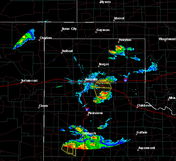 At 831 pm cdt, severe thunderstorms were located along a line extending from 9 miles northeast of claude to 4 miles east of groom, and are nearly stationary. these are very dangerous storms (trained weather spotters). Hazards include baseball size hail. People and animals outdoors will be severely injured. expect shattered windows, extensive damage to roofs, siding, and vehicles. hail may accumulate on roadways causing hazardous travel. Locations impacted include, groom. At 831 pm cdt, severe thunderstorms were located along a line extending from 9 miles northeast of claude to 4 miles east of groom, and are nearly stationary. these are very dangerous storms (trained weather spotters). Hazards include baseball size hail. People and animals outdoors will be severely injured. expect shattered windows, extensive damage to roofs, siding, and vehicles. hail may accumulate on roadways causing hazardous travel. Locations impacted include, groom.
|
| 4/16/2017 8:23 PM CDT |
 At 823 pm cdt, severe thunderstorms were located along a line extending from 9 miles northeast of claude to 4 miles east of groom, and are nearly stationary. these are very dangerous storms (trained weather spotters). Hazards include three inch hail. People and animals outdoors will be severely injured. expect shattered windows, extensive damage to roofs, siding, and vehicles. hail may accumulate on roadways causing hazardous travel. Locations impacted include, groom. At 823 pm cdt, severe thunderstorms were located along a line extending from 9 miles northeast of claude to 4 miles east of groom, and are nearly stationary. these are very dangerous storms (trained weather spotters). Hazards include three inch hail. People and animals outdoors will be severely injured. expect shattered windows, extensive damage to roofs, siding, and vehicles. hail may accumulate on roadways causing hazardous travel. Locations impacted include, groom.
|
| 4/16/2017 8:15 PM CDT | Quarter sized hail reported 0.6 miles NE of Groom, TX |
| 4/16/2017 8:14 PM CDT | Tea Cup sized hail reported 8.3 miles E of Groom, TX |
| 4/16/2017 8:09 PM CDT |
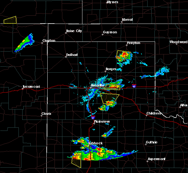 At 809 pm cdt, severe thunderstorms were located along a line extending from 9 miles southeast of panhandle to 4 miles east of groom, and are nearly stationary (trained weather spotters). Hazards include tennis ball size hail. People and animals outdoors will be injured. expect damage to roofs, siding, windows, and vehicles. hail may accumulate on roadways causing hazardous travel. Locations impacted include, groom. At 809 pm cdt, severe thunderstorms were located along a line extending from 9 miles southeast of panhandle to 4 miles east of groom, and are nearly stationary (trained weather spotters). Hazards include tennis ball size hail. People and animals outdoors will be injured. expect damage to roofs, siding, windows, and vehicles. hail may accumulate on roadways causing hazardous travel. Locations impacted include, groom.
|
| 4/16/2017 8:07 PM CDT | Quarter sized hail reported 0.9 miles ESE of Groom, TX |
| 4/16/2017 8:07 PM CDT | Hen Egg sized hail reported 4.4 miles E of Groom, TX |
| 4/16/2017 8:06 PM CDT | Hen Egg sized hail reported 8.3 miles E of Groom, TX |
| 4/16/2017 8:06 PM CDT | Baseball sized hail reported 8.3 miles ESE of Groom, TX |
| 4/16/2017 7:59 PM CDT | Tennis Ball sized hail reported 3.5 miles SE of Groom, TX |
| 4/16/2017 7:56 PM CDT | Hen Egg sized hail reported 4.3 miles SE of Groom, TX |
| 4/16/2017 7:52 PM CDT | Hen Egg sized hail reported 4.3 miles SE of Groom, TX |
| 4/16/2017 7:41 PM CDT |
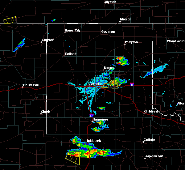 At 741 pm cdt, severe thunderstorms were located along a line extending from 8 miles southeast of panhandle to 5 miles northeast of groom, moving south at 5 mph (trained weather spotters. at 7:32 pm tennis ball size hail was reported north-northwest of groom). Hazards include two inch hail. People and animals outdoors will be injured. expect damage to roofs, siding, windows, and vehicles. Hail may accumulate on roadways causing hazardous travel. At 741 pm cdt, severe thunderstorms were located along a line extending from 8 miles southeast of panhandle to 5 miles northeast of groom, moving south at 5 mph (trained weather spotters. at 7:32 pm tennis ball size hail was reported north-northwest of groom). Hazards include two inch hail. People and animals outdoors will be injured. expect damage to roofs, siding, windows, and vehicles. Hail may accumulate on roadways causing hazardous travel.
|
| 4/16/2017 7:35 PM CDT | Ping Pong Ball sized hail reported 5 miles S of Groom, TX |
| 4/16/2017 7:34 PM CDT |
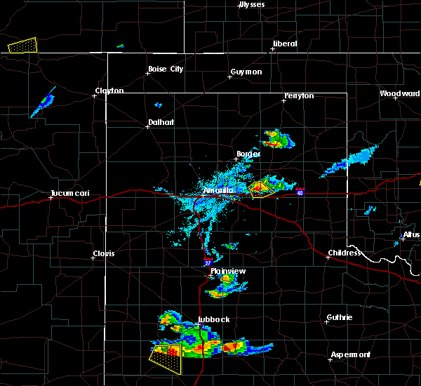 At 734 pm cdt, a severe thunderstorm was located 6 miles northeast of groom, or 19 miles south of pampa, moving southeast at 5 mph (trained weather spotters). Hazards include two inch hail and 60 mph wind gusts. Minor damage to roofs, siding, and trees is possible. people and animals outdoors will be injured. expect hail damage to roofs, siding, windows, and vehicles. hail may accumulate on roadways causing hazardous travel. Locations impacted include, groom. At 734 pm cdt, a severe thunderstorm was located 6 miles northeast of groom, or 19 miles south of pampa, moving southeast at 5 mph (trained weather spotters). Hazards include two inch hail and 60 mph wind gusts. Minor damage to roofs, siding, and trees is possible. people and animals outdoors will be injured. expect hail damage to roofs, siding, windows, and vehicles. hail may accumulate on roadways causing hazardous travel. Locations impacted include, groom.
|
| 4/16/2017 7:32 PM CDT | Golf Ball sized hail reported 6.1 miles SE of Groom, TX |
| 4/16/2017 7:14 PM CDT |
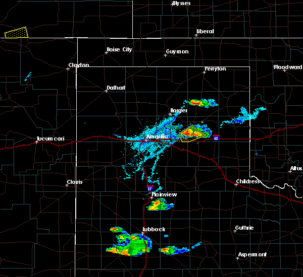 At 713 pm cdt, a severe thunderstorm was located 7 miles northeast of groom, or 17 miles south of pampa, moving southeast at 5 mph (trained weather spotters). Hazards include golf ball size hail and 60 mph wind gusts. Minor damage to roofs, siding, and trees is possible. people and animals outdoors will be injured. expect hail damage to roofs, siding, windows, and vehicles. Locations impacted include, groom. At 713 pm cdt, a severe thunderstorm was located 7 miles northeast of groom, or 17 miles south of pampa, moving southeast at 5 mph (trained weather spotters). Hazards include golf ball size hail and 60 mph wind gusts. Minor damage to roofs, siding, and trees is possible. people and animals outdoors will be injured. expect hail damage to roofs, siding, windows, and vehicles. Locations impacted include, groom.
|
| 4/16/2017 7:12 PM CDT | Golf Ball sized hail reported 6.9 miles SSE of Groom, TX |
| 4/16/2017 7:04 PM CDT | Hen Egg sized hail reported 5.1 miles SW of Groom, TX |
| 4/16/2017 7:03 PM CDT | Golf Ball sized hail reported 7.8 miles SW of Groom, TX |
| 4/16/2017 6:47 PM CDT |
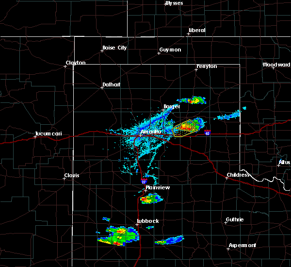 At 647 pm cdt, a severe thunderstorm was located 8 miles southeast of white deer, or 15 miles southwest of pampa, moving southeast at 5 mph (radar indicated). Hazards include golf ball size hail and 60 mph wind gusts. Minor damage to roofs, siding, and trees is possible. people and animals outdoors will be injured. Expect hail damage to roofs, siding, windows, and vehicles. At 647 pm cdt, a severe thunderstorm was located 8 miles southeast of white deer, or 15 miles southwest of pampa, moving southeast at 5 mph (radar indicated). Hazards include golf ball size hail and 60 mph wind gusts. Minor damage to roofs, siding, and trees is possible. people and animals outdoors will be injured. Expect hail damage to roofs, siding, windows, and vehicles.
|
| 9/18/2016 12:09 AM CDT | 59 mph wind gust from the kvii schoolnet at friemel farms west-northwest of groo in carson county TX, 3.9 miles ESE of Groom, TX |
| 9/17/2016 11:43 PM CDT |
 At 1142 pm cdt, severe thunderstorms were located along a line extending from 7 miles north of pampa to 7 miles southeast of panhandle, moving southeast at 30 mph (radar indicated). Hazards include 70 mph wind gusts and quarter size hail. Expect some tree damage. damage is likely to mobile homes, roofs, and outbuildings. Hail damage to vehicles is expected. At 1142 pm cdt, severe thunderstorms were located along a line extending from 7 miles north of pampa to 7 miles southeast of panhandle, moving southeast at 30 mph (radar indicated). Hazards include 70 mph wind gusts and quarter size hail. Expect some tree damage. damage is likely to mobile homes, roofs, and outbuildings. Hail damage to vehicles is expected.
|
| 9/17/2016 12:57 PM CDT |
 At 1257 pm cdt, a severe thunderstorm was located near groom, or 16 miles east of panhandle, moving east at 45 mph (radar indicated). Hazards include 60 mph wind gusts and quarter size hail. Minor damage to roofs. siding. and trees is possible. hail damage to vehicles is expected. locations impacted include, pampa, white deer, mclean, groom, lefors, howardwick, lake mcclellan, kingsmill and alanreed. This includes interstate 40 between mile markers 101 and 146. At 1257 pm cdt, a severe thunderstorm was located near groom, or 16 miles east of panhandle, moving east at 45 mph (radar indicated). Hazards include 60 mph wind gusts and quarter size hail. Minor damage to roofs. siding. and trees is possible. hail damage to vehicles is expected. locations impacted include, pampa, white deer, mclean, groom, lefors, howardwick, lake mcclellan, kingsmill and alanreed. This includes interstate 40 between mile markers 101 and 146.
|
| 9/17/2016 12:38 PM CDT |
 At 1238 pm cdt, a severe thunderstorm was located over panhandle, moving east at 35 mph (radar indicated). Hazards include 60 mph wind gusts and quarter size hail. Minor damage to roofs. siding. and trees is possible. Hail damage to vehicles is expected. At 1238 pm cdt, a severe thunderstorm was located over panhandle, moving east at 35 mph (radar indicated). Hazards include 60 mph wind gusts and quarter size hail. Minor damage to roofs. siding. and trees is possible. Hail damage to vehicles is expected.
|
| 7/15/2016 8:55 PM CDT |
 At 854 pm cdt, severe thunderstorms were located along a line extending from 4 miles northwest of pampa to 6 miles northeast of claude, moving east at 35 mph (radar indicated). Hazards include 60 mph wind gusts. Minor damage to roofs. siding. and trees is possible. Locations impacted include, panhandle, white deer and groom. At 854 pm cdt, severe thunderstorms were located along a line extending from 4 miles northwest of pampa to 6 miles northeast of claude, moving east at 35 mph (radar indicated). Hazards include 60 mph wind gusts. Minor damage to roofs. siding. and trees is possible. Locations impacted include, panhandle, white deer and groom.
|
| 7/15/2016 8:34 PM CDT |
 At 833 pm cdt, severe thunderstorms were located along a line extending from 4 miles northwest of skellytown to 5 miles east of washburn, moving east at 30 mph (radar indicated). Hazards include 60 mph wind gusts. Minor damage to roofs. siding. and trees is possible. locations impacted include, panhandle, white deer, groom, skellytown and pantex. This includes interstate 40 between mile markers 84 and 113. At 833 pm cdt, severe thunderstorms were located along a line extending from 4 miles northwest of skellytown to 5 miles east of washburn, moving east at 30 mph (radar indicated). Hazards include 60 mph wind gusts. Minor damage to roofs. siding. and trees is possible. locations impacted include, panhandle, white deer, groom, skellytown and pantex. This includes interstate 40 between mile markers 84 and 113.
|
| 7/15/2016 7:56 PM CDT |
 At 756 pm cdt, severe thunderstorms were located along a line extending from fritch to near amarillo, moving east at 35 mph (radar indicated). Hazards include 60 mph wind gusts and quarter size hail. Minor damage to roofs. siding. and trees is possible. Hail damage to vehicles is expected. At 756 pm cdt, severe thunderstorms were located along a line extending from fritch to near amarillo, moving east at 35 mph (radar indicated). Hazards include 60 mph wind gusts and quarter size hail. Minor damage to roofs. siding. and trees is possible. Hail damage to vehicles is expected.
|
| 7/14/2016 8:09 PM CDT |
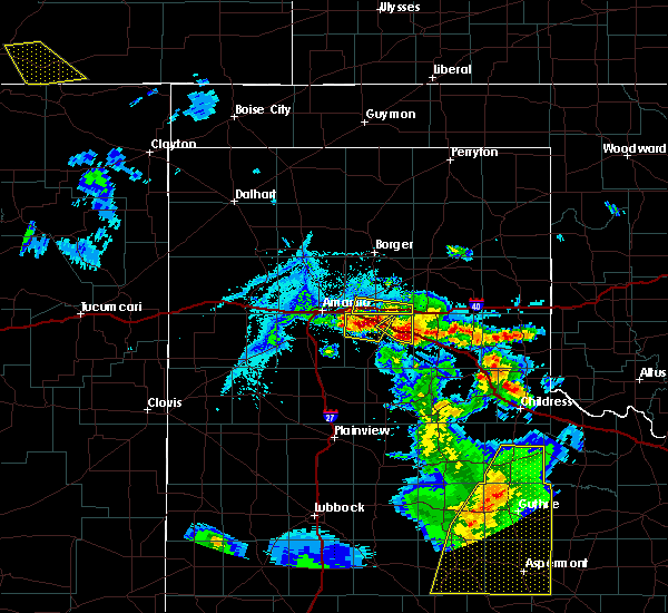 The severe thunderstorm warning for southern carson county will expire at 815 pm cdt, the storms which prompted the warning have moved out of the area. therefore the warning will be allowed to expire. a severe thunderstorm watch remains in effect until 100 am cdt for the panhandle of texas. The severe thunderstorm warning for southern carson county will expire at 815 pm cdt, the storms which prompted the warning have moved out of the area. therefore the warning will be allowed to expire. a severe thunderstorm watch remains in effect until 100 am cdt for the panhandle of texas.
|
| 7/14/2016 7:44 PM CDT |
 At 744 pm cdt, severe thunderstorms were located along a line extending from groom to 7 miles northeast of washburn, and are nearly stationary (radar indicated). Hazards include two inch hail and 60 mph wind gusts. Minor damage to roofs. siding. and trees is possible. people and animals outdoors will be injured. Expect hail damage to roofs, siding, windows, and vehicles. At 744 pm cdt, severe thunderstorms were located along a line extending from groom to 7 miles northeast of washburn, and are nearly stationary (radar indicated). Hazards include two inch hail and 60 mph wind gusts. Minor damage to roofs. siding. and trees is possible. people and animals outdoors will be injured. Expect hail damage to roofs, siding, windows, and vehicles.
|
| 7/14/2016 7:35 PM CDT | Storm damage reported in carson county TX, 8.3 miles E of Groom, TX |
| 7/14/2016 7:35 PM CDT | Quarter sized hail reported 8.3 miles E of Groom, TX |
| 7/14/2016 7:31 PM CDT | Quarter sized hail reported 1.1 miles ENE of Groom, TX |
| 7/14/2016 7:29 PM CDT | Storm damage reported in carson county TX, 4.4 miles E of Groom, TX |
| 7/14/2016 7:25 PM CDT | Golf Ball sized hail reported 1.1 miles ENE of Groom, TX |
| 7/14/2016 7:02 PM CDT |
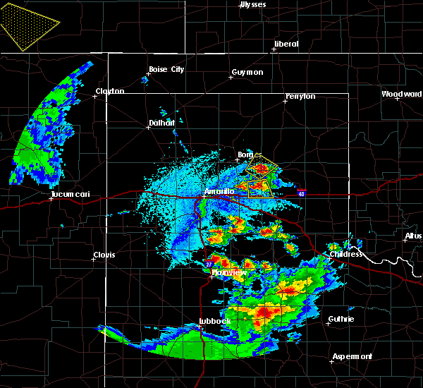 At 701 pm cdt, a severe thunderstorm was located 7 miles north of groom, or 13 miles east of panhandle, moving south at 10 mph (radar indicated). Hazards include 60 mph wind gusts and half dollar size hail. Minor damage to roofs. siding. and trees is possible. Hail damage to vehicles is expected. At 701 pm cdt, a severe thunderstorm was located 7 miles north of groom, or 13 miles east of panhandle, moving south at 10 mph (radar indicated). Hazards include 60 mph wind gusts and half dollar size hail. Minor damage to roofs. siding. and trees is possible. Hail damage to vehicles is expected.
|
| 7/12/2016 9:07 PM CDT | Storm damage reported in gray county TX, 7.7 miles W of Groom, TX |
| 7/12/2016 8:57 PM CDT | Ping Pong Ball sized hail reported 6.2 miles WNW of Groom, TX, reported between groom and highway 70 going north. quarter size increased to ping pong ball size. |
| 7/12/2016 8:41 PM CDT |
 At 841 pm cdt, a severe thunderstorm was located 4 miles south of groom, or 14 miles east of claude, moving east at 30 mph (radar indicated). Hazards include 70 mph wind gusts and half dollar size hail. Expect some tree damage. damage is likely to mobile homes, roofs, and outbuildings. Hail damage to vehicles is expected. At 841 pm cdt, a severe thunderstorm was located 4 miles south of groom, or 14 miles east of claude, moving east at 30 mph (radar indicated). Hazards include 70 mph wind gusts and half dollar size hail. Expect some tree damage. damage is likely to mobile homes, roofs, and outbuildings. Hail damage to vehicles is expected.
|
| 6/30/2016 5:06 PM CDT |
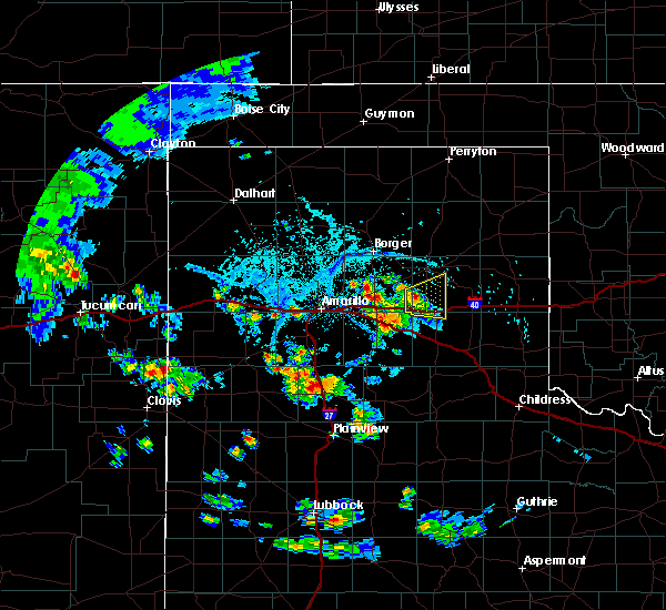 At 505 pm cdt, a severe thunderstorm was located 5 miles northeast of groom, or 19 miles east of panhandle, moving east at 10 mph (radar indicated). Hazards include 60 mph wind gusts and quarter size hail. Minor damage to roofs. siding. and trees is possible. hail damage to vehicles is expected. hail may accumulate on roadways causing hazardous travel. locations impacted include, groom and lake mcclellan. This includes interstate 40 between mile markers 111 and 129. At 505 pm cdt, a severe thunderstorm was located 5 miles northeast of groom, or 19 miles east of panhandle, moving east at 10 mph (radar indicated). Hazards include 60 mph wind gusts and quarter size hail. Minor damage to roofs. siding. and trees is possible. hail damage to vehicles is expected. hail may accumulate on roadways causing hazardous travel. locations impacted include, groom and lake mcclellan. This includes interstate 40 between mile markers 111 and 129.
|
| 6/30/2016 4:44 PM CDT | Wind gusts up to 60 mph reported with thunderstor in carson county TX, 0.6 miles NE of Groom, TX |
| 6/30/2016 4:36 PM CDT |
 At 435 pm cdt, a severe thunderstorm was located over groom, or 16 miles northeast of claude, moving east at 10 mph (radar indicated). Hazards include 60 mph wind gusts and half dollar size hail. Minor damage to roofs. siding. and trees is possible. hail damage to vehicles is expected. Hail may accumulate on roadways causing hazardous travel. At 435 pm cdt, a severe thunderstorm was located over groom, or 16 miles northeast of claude, moving east at 10 mph (radar indicated). Hazards include 60 mph wind gusts and half dollar size hail. Minor damage to roofs. siding. and trees is possible. hail damage to vehicles is expected. Hail may accumulate on roadways causing hazardous travel.
|
| 6/13/2016 10:03 PM CDT |
 At 1003 pm cdt, severe thunderstorms were located along a line extending from pampa to 5 miles north of claude, moving east at 15 mph (radar indicated). Hazards include 60 mph wind gusts and nickel size hail. Minor damage to roofs. siding. and trees is possible. locations impacted include, white deer and groom. A tornado watch remains in effect until 200 am cdt for the panhandle of texas. At 1003 pm cdt, severe thunderstorms were located along a line extending from pampa to 5 miles north of claude, moving east at 15 mph (radar indicated). Hazards include 60 mph wind gusts and nickel size hail. Minor damage to roofs. siding. and trees is possible. locations impacted include, white deer and groom. A tornado watch remains in effect until 200 am cdt for the panhandle of texas.
|
| 6/13/2016 9:53 PM CDT |
 At 952 pm cdt, severe thunderstorms were located along a line extending from 4 miles northwest of pampa to 5 miles west of groom, moving east at 40 mph (radar indicated). Hazards include 60 mph wind gusts and nickel size hail. Minor damage to roofs. siding. and trees is possible. locations impacted include, panhandle, white deer, groom and skellytown. A tornado watch remains in effect until 200 am cdt for the panhandle of texas. At 952 pm cdt, severe thunderstorms were located along a line extending from 4 miles northwest of pampa to 5 miles west of groom, moving east at 40 mph (radar indicated). Hazards include 60 mph wind gusts and nickel size hail. Minor damage to roofs. siding. and trees is possible. locations impacted include, panhandle, white deer, groom and skellytown. A tornado watch remains in effect until 200 am cdt for the panhandle of texas.
|
| 6/13/2016 9:24 PM CDT |
 At 922 pm cdt, severe thunderstorms were located along a line extending from near skellytown to 4 miles east of panhandle to 4 miles east of washburn, moving east at 25 mph (radar indicated). Hazards include 60 mph wind gusts and nickel size hail. Minor damage to roofs. siding. and trees is possible. locations impacted include, panhandle, white deer, groom and skellytown. A tornado watch remains in effect until 200 am cdt for the panhandle of texas. At 922 pm cdt, severe thunderstorms were located along a line extending from near skellytown to 4 miles east of panhandle to 4 miles east of washburn, moving east at 25 mph (radar indicated). Hazards include 60 mph wind gusts and nickel size hail. Minor damage to roofs. siding. and trees is possible. locations impacted include, panhandle, white deer, groom and skellytown. A tornado watch remains in effect until 200 am cdt for the panhandle of texas.
|
| 6/13/2016 9:12 PM CDT |
 At 912 pm cdt, severe thunderstorms were located along a line extending from 5 miles west of skellytown to panhandle to washburn, moving east at 20 mph (radar indicated). Hazards include 60 mph wind gusts and half dollar size hail. Minor damage to roofs. siding. and trees is possible. hail damage to vehicles is expected. locations impacted include, panhandle, white deer, groom, skellytown and pantex. A tornado watch remains in effect until 200 am cdt for the panhandle of texas. At 912 pm cdt, severe thunderstorms were located along a line extending from 5 miles west of skellytown to panhandle to washburn, moving east at 20 mph (radar indicated). Hazards include 60 mph wind gusts and half dollar size hail. Minor damage to roofs. siding. and trees is possible. hail damage to vehicles is expected. locations impacted include, panhandle, white deer, groom, skellytown and pantex. A tornado watch remains in effect until 200 am cdt for the panhandle of texas.
|
| 6/13/2016 9:00 PM CDT |
 At 900 pm cdt, a severe thunderstorm was located 4 miles north of panhandle, moving east at 25 mph (radar indicated). Hazards include ping pong ball size hail and 60 mph wind gusts. Minor damage to roofs. siding. and trees is possible. people and animals outdoors will be injured. expect hail damage to roofs, siding, windows, and vehicles. locations impacted include, panhandle, white deer, groom, skellytown and pantex. A tornado watch remains in effect until 200 am cdt for the panhandle of texas. At 900 pm cdt, a severe thunderstorm was located 4 miles north of panhandle, moving east at 25 mph (radar indicated). Hazards include ping pong ball size hail and 60 mph wind gusts. Minor damage to roofs. siding. and trees is possible. people and animals outdoors will be injured. expect hail damage to roofs, siding, windows, and vehicles. locations impacted include, panhandle, white deer, groom, skellytown and pantex. A tornado watch remains in effect until 200 am cdt for the panhandle of texas.
|
| 6/13/2016 8:53 PM CDT |
 At 853 pm cdt, a severe thunderstorm was located 7 miles northwest of panhandle, moving east at 25 mph (radar indicated). Hazards include ping pong ball size hail and 60 mph wind gusts. Minor damage to roofs. siding. and trees is possible. people and animals outdoors will be injured. Expect hail damage to roofs, siding, windows, and vehicles. At 853 pm cdt, a severe thunderstorm was located 7 miles northwest of panhandle, moving east at 25 mph (radar indicated). Hazards include ping pong ball size hail and 60 mph wind gusts. Minor damage to roofs. siding. and trees is possible. people and animals outdoors will be injured. Expect hail damage to roofs, siding, windows, and vehicles.
|
| 5/29/2016 4:55 PM CDT | The severe thunderstorm warning for collingsworth, armstrong, carson, southern wheeler, southern gray and donley counties will expire at 500 pm cdt, the storms which prompted the warning have weakened below severe limits, and no longer pose an immediate threat to life or property. therefore the warning will be allowed to expire. however heavy rain is still possible with these thunderstorms. a severe thunderstorm watch remains in effect until 1000 pm cdt for central texas. remember, a severe thunderstorm warning still remains in effect for the texas panhandle until 10 pm. |
| 5/29/2016 4:42 PM CDT |
 At 442 pm cdt, severe thunderstorms were located along a line extending from 6 miles northeast of twitty to 6 miles north of wayside, moving east at 15 mph (radar indicated). Hazards include golf ball size hail and 60 mph wind gusts. Minor damage to roofs. siding. and trees is possible. people and animals outdoors will be injured. expect hail damage to roofs, siding, windows, and vehicles. locations impacted include, panhandle, wellington, clarendon, shamrock, claude, white deer, mclean, groom, howardwick, hedley, dodson, lutie, lake mcclellan, lela, lelia lake, twitty, goodnight, samnorwood, quail and wayside. This includes interstate 40 between mile markers 84 and 176. At 442 pm cdt, severe thunderstorms were located along a line extending from 6 miles northeast of twitty to 6 miles north of wayside, moving east at 15 mph (radar indicated). Hazards include golf ball size hail and 60 mph wind gusts. Minor damage to roofs. siding. and trees is possible. people and animals outdoors will be injured. expect hail damage to roofs, siding, windows, and vehicles. locations impacted include, panhandle, wellington, clarendon, shamrock, claude, white deer, mclean, groom, howardwick, hedley, dodson, lutie, lake mcclellan, lela, lelia lake, twitty, goodnight, samnorwood, quail and wayside. This includes interstate 40 between mile markers 84 and 176.
|
| 5/29/2016 3:56 PM CDT |
 At 356 pm cdt, severe thunderstorms were located along a line extending from 8 miles southeast of allison to 4 miles southwest of groom, moving east at 20 mph (radar indicated). Hazards include golf ball size hail and 60 mph wind gusts. Minor damage to roofs. siding. and trees is possible. people and animals outdoors will be injured. Expect hail damage to roofs, siding, windows, and vehicles. At 356 pm cdt, severe thunderstorms were located along a line extending from 8 miles southeast of allison to 4 miles southwest of groom, moving east at 20 mph (radar indicated). Hazards include golf ball size hail and 60 mph wind gusts. Minor damage to roofs. siding. and trees is possible. people and animals outdoors will be injured. Expect hail damage to roofs, siding, windows, and vehicles.
|
| 5/29/2016 3:04 PM CDT |
 At 304 pm cdt, severe thunderstorms were located along a line extending from 5 miles northeast of pringle to 4 miles south of panhandle, moving east at 15 mph (radar indicated). Hazards include golf ball size hail and 60 mph wind gusts. Minor damage to roofs. siding. and trees is possible. people and animals outdoors will be injured. Expect hail damage to roofs, siding, windows, and vehicles. At 304 pm cdt, severe thunderstorms were located along a line extending from 5 miles northeast of pringle to 4 miles south of panhandle, moving east at 15 mph (radar indicated). Hazards include golf ball size hail and 60 mph wind gusts. Minor damage to roofs. siding. and trees is possible. people and animals outdoors will be injured. Expect hail damage to roofs, siding, windows, and vehicles.
|
| 5/24/2016 7:24 PM CDT | The severe thunderstorm warning for southeastern carson and southwestern gray counties will expire at 730 pm cdt. the storm which prompted the warning has weakened below severe limits. and no longer poses an immediate threat to life or property. therefore the warning will be allowed to expire. A tornado watch remains in effect until midnight cdt. |
| 5/22/2016 4:06 PM CDT |
 At 424 pm cdt, a severe thunderstorm was located 6 miles southeast of white deer, or 13 miles southwest of pampa, moving north at 30 mph (radar indicated). Hazards include golf ball size hail. People and animals outdoors will be injured. expect damage to roofs, siding, windows, and vehicles. this storm has a history of producing hail up to golf ball size near groom. locations impacted include, pampa, white deer, lefors and kingsmill. A tornado watch remains in effect until 1000 pm cdt. At 424 pm cdt, a severe thunderstorm was located 6 miles southeast of white deer, or 13 miles southwest of pampa, moving north at 30 mph (radar indicated). Hazards include golf ball size hail. People and animals outdoors will be injured. expect damage to roofs, siding, windows, and vehicles. this storm has a history of producing hail up to golf ball size near groom. locations impacted include, pampa, white deer, lefors and kingsmill. A tornado watch remains in effect until 1000 pm cdt.
|
| 5/22/2016 4:01 PM CDT | Quarter sized hail reported 0.6 miles NE of Groom, TX, quarter-sized hail fell in groom. |
| 5/16/2016 10:31 PM CDT |
 At 1030 pm cdt, severe thunderstorms were located along a line extending from 4 miles east of washburn to 5 miles west of groom to 9 miles southeast of white deer, moving east at 25 mph (trained weather spotters). Hazards include golf ball size hail and 60 mph wind gusts. Minor damage to roofs. siding. and trees is possible. people and animals outdoors will be injured. expect hail damage to roofs, siding, windows, and vehicles. hail may accumulate on roadways. accumulating hail has been reported on interstate 40 which has impacted travel. Locations impacted include, clarendon, claude, groom, howardwick, lake mcclellan, greenbelt lake, goodnight and alanreed. At 1030 pm cdt, severe thunderstorms were located along a line extending from 4 miles east of washburn to 5 miles west of groom to 9 miles southeast of white deer, moving east at 25 mph (trained weather spotters). Hazards include golf ball size hail and 60 mph wind gusts. Minor damage to roofs. siding. and trees is possible. people and animals outdoors will be injured. expect hail damage to roofs, siding, windows, and vehicles. hail may accumulate on roadways. accumulating hail has been reported on interstate 40 which has impacted travel. Locations impacted include, clarendon, claude, groom, howardwick, lake mcclellan, greenbelt lake, goodnight and alanreed.
|
| 5/16/2016 10:22 PM CDT |
 At 1020 pm cdt, severe thunderstorms were located along a line extending from 5 miles northeast of claude to 6 miles southeast of white deer, moving east at 30 mph (trained weather spotters). Hazards include golf ball size hail. People and animals outdoors will be injured. expect damage to roofs, siding, windows, and vehicles. hail may accumulate on roadways causing hazardous travel. trained weather spotters reported accumulation of hail on interstate 40 impacting travel just east of conway. Locations impacted include, clarendon, claude, white deer, groom, howardwick, lake mcclellan, greenbelt lake, goodnight, alanreed and kingsmill. At 1020 pm cdt, severe thunderstorms were located along a line extending from 5 miles northeast of claude to 6 miles southeast of white deer, moving east at 30 mph (trained weather spotters). Hazards include golf ball size hail. People and animals outdoors will be injured. expect damage to roofs, siding, windows, and vehicles. hail may accumulate on roadways causing hazardous travel. trained weather spotters reported accumulation of hail on interstate 40 impacting travel just east of conway. Locations impacted include, clarendon, claude, white deer, groom, howardwick, lake mcclellan, greenbelt lake, goodnight, alanreed and kingsmill.
|
| 5/16/2016 10:17 PM CDT | Half Dollar sized hail reported 11.1 miles E of Groom, TX, hail to the size of half dollars was accumulating on roadways along with standing water 6 miles e of conway near interstate 40. |
| 5/16/2016 10:15 PM CDT |
 At 1015 pm cdt, severe thunderstorms were located along a line extending from 5 miles north of claude to 4 miles south of white deer, moving east at 30 mph (radar indicated). Hazards include two inch hail and 60 mph wind gusts. Minor damage to roofs. siding. and trees is possible. people and animals outdoors will be injured. expect hail damage to roofs, siding, windows, and vehicles. Locations impacted include, clarendon, claude, white deer, groom, howardwick, lake mcclellan, greenbelt lake, goodnight, alanreed and kingsmill. At 1015 pm cdt, severe thunderstorms were located along a line extending from 5 miles north of claude to 4 miles south of white deer, moving east at 30 mph (radar indicated). Hazards include two inch hail and 60 mph wind gusts. Minor damage to roofs. siding. and trees is possible. people and animals outdoors will be injured. expect hail damage to roofs, siding, windows, and vehicles. Locations impacted include, clarendon, claude, white deer, groom, howardwick, lake mcclellan, greenbelt lake, goodnight, alanreed and kingsmill.
|
| 5/16/2016 10:04 PM CDT |
 At 1003 pm cdt, severe thunderstorms were located along a line extending from 5 miles east of washburn to near white deer, moving southeast at 25 mph (radar indicated). Hazards include two inch hail and 60 mph wind gusts. Minor damage to roofs. siding. and trees is possible. people and animals outdoors will be injured. expect hail damage to roofs, siding, windows, and vehicles. this storm produced golf ball size hail as it passed over pantex and tennis ball size hail just east of panhandle. Locations impacted include, panhandle, clarendon, claude, white deer, groom, howardwick, lake mcclellan, greenbelt lake, goodnight, alanreed and kingsmill. At 1003 pm cdt, severe thunderstorms were located along a line extending from 5 miles east of washburn to near white deer, moving southeast at 25 mph (radar indicated). Hazards include two inch hail and 60 mph wind gusts. Minor damage to roofs. siding. and trees is possible. people and animals outdoors will be injured. expect hail damage to roofs, siding, windows, and vehicles. this storm produced golf ball size hail as it passed over pantex and tennis ball size hail just east of panhandle. Locations impacted include, panhandle, clarendon, claude, white deer, groom, howardwick, lake mcclellan, greenbelt lake, goodnight, alanreed and kingsmill.
|
| 5/16/2016 9:53 PM CDT |
 At 951 pm cdt, a severe thunderstorm was located near panhandle, moving east at 30 mph (trained weather spotters reported tennis ball size hail one mile east of panhandle. golf ball size hail fell at pantex). Hazards include tennis ball size hail and 60 mph wind gusts. Minor damage to roofs. siding. and trees is possible. people and animals outdoors will be injured. expect hail damage to roofs, siding, windows, and vehicles. Locations impacted include, panhandle, clarendon, claude, white deer, groom, howardwick, washburn, lake mcclellan, greenbelt lake, goodnight, alanreed, kingsmill and pantex. At 951 pm cdt, a severe thunderstorm was located near panhandle, moving east at 30 mph (trained weather spotters reported tennis ball size hail one mile east of panhandle. golf ball size hail fell at pantex). Hazards include tennis ball size hail and 60 mph wind gusts. Minor damage to roofs. siding. and trees is possible. people and animals outdoors will be injured. expect hail damage to roofs, siding, windows, and vehicles. Locations impacted include, panhandle, clarendon, claude, white deer, groom, howardwick, washburn, lake mcclellan, greenbelt lake, goodnight, alanreed, kingsmill and pantex.
|
| 5/16/2016 9:44 PM CDT |
 At 944 pm cdt, severe thunderstorms were located along a line extending from near panhandle to 7 miles north of washburn, moving east at 35 mph (trained weather spotters). Hazards include 60 mph wind gusts and quarter size hail. Minor damage to roofs. siding. and trees is possible. Hail damage to vehicles is expected. At 944 pm cdt, severe thunderstorms were located along a line extending from near panhandle to 7 miles north of washburn, moving east at 35 mph (trained weather spotters). Hazards include 60 mph wind gusts and quarter size hail. Minor damage to roofs. siding. and trees is possible. Hail damage to vehicles is expected.
|
| 5/11/2016 10:52 PM CDT |
 At 1051 pm cdt, severe thunderstorms were located along a line extending from 7 miles south of panhandle to near claude, moving southeast at 40 mph (trained weather spotters). Hazards include 70 mph wind gusts and nickel size hail. Expect some tree damage. damage is likely to mobile homes. roofs, and outbuildings. hail may accumulate on roadways causing hazardous travel. Locations impacted include, claude and groom. At 1051 pm cdt, severe thunderstorms were located along a line extending from 7 miles south of panhandle to near claude, moving southeast at 40 mph (trained weather spotters). Hazards include 70 mph wind gusts and nickel size hail. Expect some tree damage. damage is likely to mobile homes. roofs, and outbuildings. hail may accumulate on roadways causing hazardous travel. Locations impacted include, claude and groom.
|
| 5/11/2016 10:35 PM CDT |
 At 1035 pm cdt, severe thunderstorms were located along a line extending from 15 miles northeast of amarillo to near washburn, moving east at 40 mph (radar indicated). Hazards include 60 mph wind gusts and quarter size hail. Minor damage to roofs. siding. and trees is possible. Hail damage to vehicles is expected. At 1035 pm cdt, severe thunderstorms were located along a line extending from 15 miles northeast of amarillo to near washburn, moving east at 40 mph (radar indicated). Hazards include 60 mph wind gusts and quarter size hail. Minor damage to roofs. siding. and trees is possible. Hail damage to vehicles is expected.
|
| 5/11/2016 9:40 PM CDT |
 At 940 pm cdt, a severe thunderstorm was located 6 miles north of panhandle, moving southeast at 35 mph (radar indicated). Hazards include 60 mph wind gusts and quarter size hail. Minor damage to roofs. siding. and trees is possible. Hail damage to vehicles is expected. At 940 pm cdt, a severe thunderstorm was located 6 miles north of panhandle, moving southeast at 35 mph (radar indicated). Hazards include 60 mph wind gusts and quarter size hail. Minor damage to roofs. siding. and trees is possible. Hail damage to vehicles is expected.
|
| 4/26/2016 3:55 PM CDT | Storm damage reported in gray county TX, 10.8 miles SSW of Groom, TX |
| 4/20/2016 8:29 PM CDT |
 At 829 pm cdt, a severe thunderstorm was located 6 miles northwest of howardwick, or 12 miles northwest of clarendon, moving southeast at 35 mph (radar indicated). Hazards include 60 mph wind gusts and quarter size hail. Minor damage to roofs. siding. and trees is possible. hail damage to vehicles is expected. Locations impacted include, groom, howardwick, lake mcclellan and greenbelt lake. At 829 pm cdt, a severe thunderstorm was located 6 miles northwest of howardwick, or 12 miles northwest of clarendon, moving southeast at 35 mph (radar indicated). Hazards include 60 mph wind gusts and quarter size hail. Minor damage to roofs. siding. and trees is possible. hail damage to vehicles is expected. Locations impacted include, groom, howardwick, lake mcclellan and greenbelt lake.
|
| 4/20/2016 8:12 PM CDT |
 At 811 pm cdt, a severe thunderstorm was located 4 miles southwest of groom, or 11 miles east of claude, moving east at 25 mph (radar indicated). Hazards include 60 mph wind gusts and half dollar size hail. Minor damage to roofs. siding. and trees is possible. hail damage to vehicles is expected. Locations impacted include, groom, howardwick, lake mcclellan and greenbelt lake. At 811 pm cdt, a severe thunderstorm was located 4 miles southwest of groom, or 11 miles east of claude, moving east at 25 mph (radar indicated). Hazards include 60 mph wind gusts and half dollar size hail. Minor damage to roofs. siding. and trees is possible. hail damage to vehicles is expected. Locations impacted include, groom, howardwick, lake mcclellan and greenbelt lake.
|
| 4/20/2016 7:45 PM CDT |
 At 744 pm cdt, severe thunderstorms were located along a line extending from 5 miles southeast of white deer to 5 miles south of panhandle, moving southeast at 35 mph (radar indicated. similar storms today have produced an inch to an inch and a quarter sized hail). Hazards include half dollar size hail. damage to vehicles is expected At 744 pm cdt, severe thunderstorms were located along a line extending from 5 miles southeast of white deer to 5 miles south of panhandle, moving southeast at 35 mph (radar indicated. similar storms today have produced an inch to an inch and a quarter sized hail). Hazards include half dollar size hail. damage to vehicles is expected
|
| 11/16/2015 8:57 PM CST |
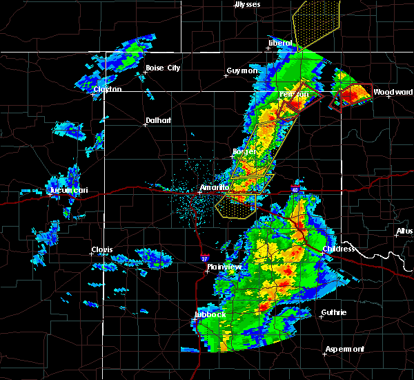 At 857 pm cst, a severe thunderstorm was located near claude, moving northeast at 40 mph (radar indicated). Hazards include 70 mph wind gusts and nickel size hail. Expect some tree damage. Damage is likely to mobile homes, roofs and outbuildings. At 857 pm cst, a severe thunderstorm was located near claude, moving northeast at 40 mph (radar indicated). Hazards include 70 mph wind gusts and nickel size hail. Expect some tree damage. Damage is likely to mobile homes, roofs and outbuildings.
|
| 11/16/2015 6:12 PM CST |
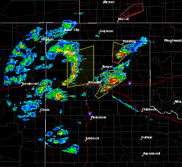 At 611 pm cst, a confirmed tornado was located over groom, or 16 miles northeast of claude, moving northeast at 35 mph (weather spotters confirmed tornado). Hazards include damaging tornado and quarter size hail. Flying debris will be dangerous to those caught without shelter. mobile homes will be damaged or destroyed. damage to roofs, windows and vehicles will occur. tree damage is likely. Locations impacted include, groom. At 611 pm cst, a confirmed tornado was located over groom, or 16 miles northeast of claude, moving northeast at 35 mph (weather spotters confirmed tornado). Hazards include damaging tornado and quarter size hail. Flying debris will be dangerous to those caught without shelter. mobile homes will be damaged or destroyed. damage to roofs, windows and vehicles will occur. tree damage is likely. Locations impacted include, groom.
|
| 11/16/2015 6:06 PM CST |
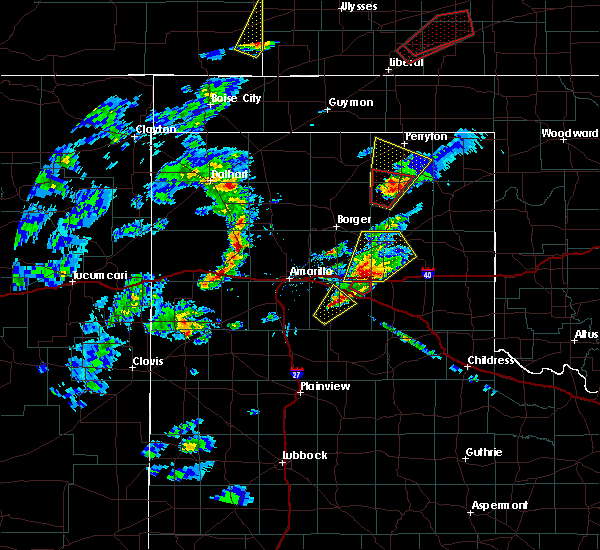 At 606 pm cst, a severe thunderstorm capable of producing a tornado was located near groom, or 12 miles east of claude, moving northeast at 35 mph (radar indicated rotation). Hazards include tornado and quarter size hail. Flying debris will be dangerous to those caught without shelter. mobile homes will be damaged or destroyed. damage to roofs, windows and vehicles will occur. Tree damage is likely. At 606 pm cst, a severe thunderstorm capable of producing a tornado was located near groom, or 12 miles east of claude, moving northeast at 35 mph (radar indicated rotation). Hazards include tornado and quarter size hail. Flying debris will be dangerous to those caught without shelter. mobile homes will be damaged or destroyed. damage to roofs, windows and vehicles will occur. Tree damage is likely.
|
| 11/16/2015 5:58 PM CST |
 At 558 pm cst, a severe thunderstorm was located near groom, or 9 miles east of claude, moving northeast at 35 mph (radar indicated). Hazards include ping pong ball size hail and 60 mph wind gusts. People and animals outdoors will be injured. expect hail damage to roofs, siding, windows and vehicles. Minor wind damage to roofs, siding and trees is possible. At 558 pm cst, a severe thunderstorm was located near groom, or 9 miles east of claude, moving northeast at 35 mph (radar indicated). Hazards include ping pong ball size hail and 60 mph wind gusts. People and animals outdoors will be injured. expect hail damage to roofs, siding, windows and vehicles. Minor wind damage to roofs, siding and trees is possible.
|
| 8/19/2015 2:41 AM CDT |
 At 241 am cdt, severe thunderstorms were located along a line extending from 6 miles southwest of panhandle to 10 miles south of claude to 10 miles southeast of wayside, moving east at 40 mph (radar indicated). Hazards include 60 mph wind gusts and half dollar size hail. Hail damage to vehicles is expected. minor wind damage to roofs, siding and trees is possible. Locations impacted include, amarillo, clarendon, claude, groom, howardwick, wayside, washburn, palo duro canyon, greenbelt lake and goodnight. At 241 am cdt, severe thunderstorms were located along a line extending from 6 miles southwest of panhandle to 10 miles south of claude to 10 miles southeast of wayside, moving east at 40 mph (radar indicated). Hazards include 60 mph wind gusts and half dollar size hail. Hail damage to vehicles is expected. minor wind damage to roofs, siding and trees is possible. Locations impacted include, amarillo, clarendon, claude, groom, howardwick, wayside, washburn, palo duro canyon, greenbelt lake and goodnight.
|
| 8/19/2015 2:24 AM CDT |
 At 224 am cdt, severe thunderstorms were located along a line extending from 8 miles northwest of washburn to near palo duro canyon to near wayside, moving east at 40 mph (radar indicated). Hazards include 65 mph wind gusts and half dollar size hail. Hail damage to vehicles is expected. Minor wind damage to roofs, siding and trees is possible. At 224 am cdt, severe thunderstorms were located along a line extending from 8 miles northwest of washburn to near palo duro canyon to near wayside, moving east at 40 mph (radar indicated). Hazards include 65 mph wind gusts and half dollar size hail. Hail damage to vehicles is expected. Minor wind damage to roofs, siding and trees is possible.
|
| 7/3/2015 8:05 PM CDT |
 At 801 pm cdt, a severe thunderstorm was located near borger, and moving south at 30 mph (radar indicated). Hazards include 70 mph wind gusts and quarter size hail. Hail damage to vehicles is expected. expect some tree damage. Wind damage is also likely to mobile homes, roofs and outbuildings. At 801 pm cdt, a severe thunderstorm was located near borger, and moving south at 30 mph (radar indicated). Hazards include 70 mph wind gusts and quarter size hail. Hail damage to vehicles is expected. expect some tree damage. Wind damage is also likely to mobile homes, roofs and outbuildings.
|
| 7/3/2015 7:54 PM CDT |
 At 754 pm cdt, a severe thunderstorm was located near borger, and moving south at 30 mph (radar indicated). Hazards include 70 mph wind gusts and quarter size hail. Hail damage to vehicles is expected. expect some tree damage. Wind damage is also likely to mobile homes, roofs and outbuildings. At 754 pm cdt, a severe thunderstorm was located near borger, and moving south at 30 mph (radar indicated). Hazards include 70 mph wind gusts and quarter size hail. Hail damage to vehicles is expected. expect some tree damage. Wind damage is also likely to mobile homes, roofs and outbuildings.
|
| 7/3/2015 7:26 PM CDT |
 At 722 pm cdt, a severe thunderstorm was located 7 miles east of stinnett, and moving south at 45 mph (radar indicated). Hazards include 70 mph wind gusts and quarter size hail. Hail damage to vehicles is expected. expect some tree damage. Wind damage is also likely to mobile homes, roofs and outbuildings. At 722 pm cdt, a severe thunderstorm was located 7 miles east of stinnett, and moving south at 45 mph (radar indicated). Hazards include 70 mph wind gusts and quarter size hail. Hail damage to vehicles is expected. expect some tree damage. Wind damage is also likely to mobile homes, roofs and outbuildings.
|
| 5/27/2015 4:47 PM CDT | At 443 pm cdt, a severe thunderstorm was located 6 miles northeast of claude, and moving northeast at 35 mph (radar indicated). Hazards include up to tennis ball size hail and 60 mph wind gusts. People and animals outdoors will be injured. expect hail damage to roofs, siding, windows and vehicles. Minor wind damage to roofs, siding and trees is possible. |
| 5/19/2015 5:58 PM CDT | Quarter sized hail reported 5.9 miles WNW of Groom, TX |
| 5/19/2015 5:50 PM CDT | Quarter sized hail reported 0.6 miles NE of Groom, TX, lasted 10 minutes from start time at 1650cst. |
| 5/19/2015 5:43 PM CDT | At 541 pm cdt, a severe thunderstorm was located near groom, and moving east at 30 mph (radar indicated). Hazards include hen egg size hail and 60 mph wind gusts. People and animals outdoors will be injured. expect hail damage to roofs, siding, windows and vehicles. Minor wind damage to roofs, siding and trees is possible. |
| 5/19/2015 5:31 PM CDT | At 528 pm cdt, a severe thunderstorm was located 8 miles northeast of claude, and moving east at 30 mph (radar indicated). Hazards include hail up to golf ball size and 60 mph wind gusts. People and animals outdoors will be injured. expect hail damage to roofs, siding, windows and vehicles. Minor wind damage to roofs, siding and trees is possible. |
| 5/19/2015 5:22 PM CDT | At 520 pm cdt, a severe thunderstorm was located 6 miles northeast of claude, and moving east at 25 mph (radar indicated). Hazards include 60 mph wind gusts and half dollar size hail. Hail damage to vehicles is expected. Minor wind damage to roofs, siding and trees is possible. |
| 5/16/2015 3:23 PM CDT | At 316 pm cdt, a severe thunderstorm was located 7 miles north of claude, and moving northeast at 45 mph (radar indicated). Hazards include golf ball size hail and 60 mph wind gusts. People and animals outdoors will be injured. expect hail damage to roofs, siding, windows and vehicles. minor wind damage to roofs, siding and trees is possible. the severe thunderstorm will be near, white deer around 340 pm cdt. kingsmill around 350 pm cdt. skellytown around 355 pm cdt. pampa around 400 pm cdt. 1. 75in. |
| 5/3/2015 7:49 PM CDT | At 746 pm cdt, severe thunderstorms were located along a line extending from 7 miles southeast of borger to 10 miles north of claude, and moving northeast at 20 mph (radar indicated). Hazards include 60 mph wind gusts and quarter size hail. Hail damage to vehicles is expected. Minor wind damage to roofs, siding and trees is possible. |
| 5/3/2015 7:31 PM CDT | At 730 pm cdt, severe thunderstorms were located along a line extending from 8 miles south of borger to claude, and moving northeast at 25 mph (radar indicated). Hazards include 60 mph wind gusts and quarter size hail. Hail damage to vehicles is expected. Minor wind damage to roofs, siding and trees is possible. |
| 4/26/2015 4:47 PM CDT | At 443 pm cdt, a severe thunderstorm was located near greenbelt lake, and moving northwest at 25 mph (spotter indicated. quarter size hail was reported 4 miles south of lelia lake at 422 pm cdt). Hazards include 60 mph wind gusts and quarter size hail. Hail damage to vehicles is expected. Minor wind damage to roofs, siding and trees is possible. |
| 4/26/2015 4:11 PM CDT | At 409 pm cdt, a severe thunderstorm was located 9 miles southwest of hedley, and moving north at 50 mph (radar indicated). Hazards include golf ball size hail and 60 mph wind gusts. People and animals outdoors will be injured. expect hail damage to roofs, siding, windows and vehicles. Minor wind damage to roofs, siding and trees is possible. |
| 4/16/2015 4:53 PM CDT | At 451 pm cdt, severe thunderstorms were located along a line extending from 18 miles northwest of codman to groom, and moving east at 30 mph (radar indicated). Hazards include 60 mph wind gusts and half dollar size hail. Hail damage to vehicles is expected. Minor wind damage to roofs, siding and trees is possible. |
| 4/16/2015 4:33 PM CDT | At 429 pm cdt, severe thunderstorms were located along a line extending from 16 miles northeast of skellytown to 9 miles northeast of claude, and moving northeast at 30 mph (radar indicated). Hazards include hail up to tennis ball size and 60 mph wind gusts. People and animals outdoors will be injured. expect hail damage to roofs, siding, windows and vehicles. Minor wind damage to roofs, siding and trees is possible. |
| 4/16/2015 4:12 PM CDT | At 411 pm cdt, severe thunderstorms were located along a line extending from 10 miles north of skellytown to panhandle, and moving northeast at 30 mph (radar indicated). Hazards include ping pong ball size hail and 60 mph wind gusts. People and animals outdoors will be injured. expect hail damage to roofs, siding, windows and vehicles. Minor wind damage to roofs, siding and trees is possible. |
| 5/29/2013 3:55 PM CDT | 2 semi trucks tipped by wind at i-40 and hwy 7 in gray county TX, 7.7 miles W of Groom, TX |
| 4/29/2012 3:18 AM CDT | Penny to quarter size hail with wind gusts around 60 mph near groo in carson county TX, 1.6 miles SSE of Groom, TX |
| 4/29/2012 3:18 AM CDT | Quarter sized hail reported 1.6 miles SSE of Groom, TX, penny to quarter size hail with wind gusts around 60 mph near groom. |
| 4/29/2012 2:50 AM CDT | Three 18 wheelers were either rolled over or blown into a ditch while on interstate 40 between amarillo and groom. no injuries have been reported at this tim in carson county TX, 11.7 miles E of Groom, TX |
| 1/1/0001 12:00 AM | Truck blown off the road at mile marker 113 on interstate 40 in carson county TX, 4.9 miles E of Groom, TX |
| 1/1/0001 12:00 AM | Truck blown off the road at mile marker 113 on interstate 40 in carson county TX, 4.9 miles E of Groom, TX |
Hail Maps for Groom, TX
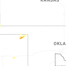
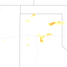
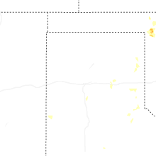
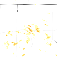
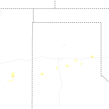
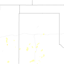

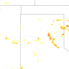


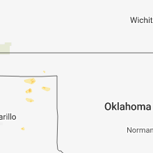


Connect with Interactive Hail Maps