

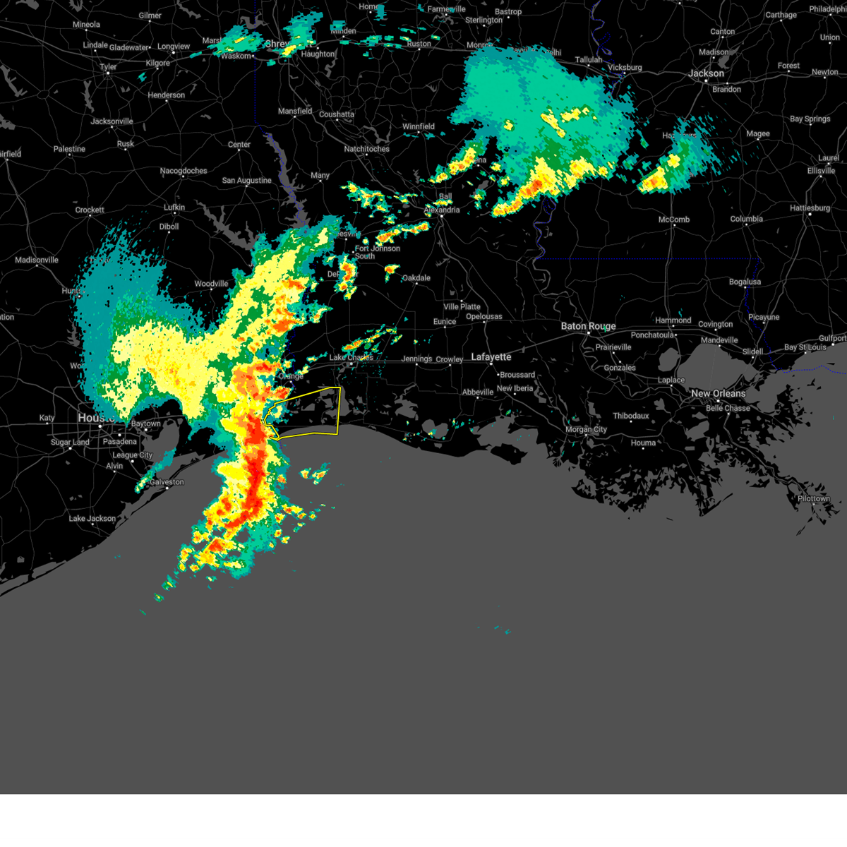
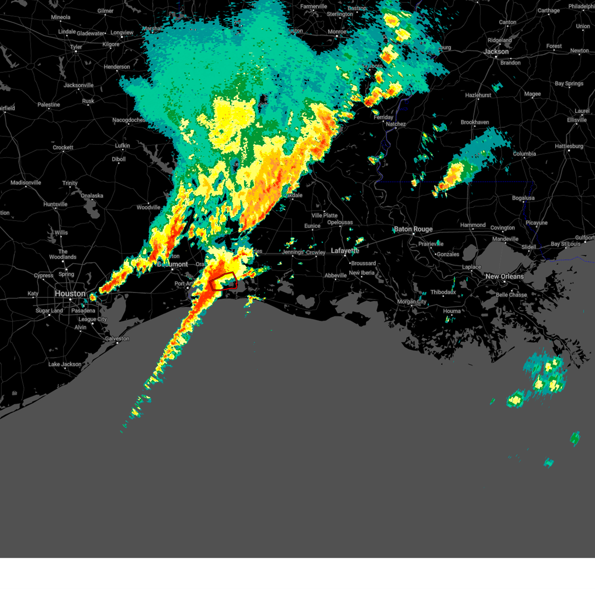
Hail Map for Hackberry, LA
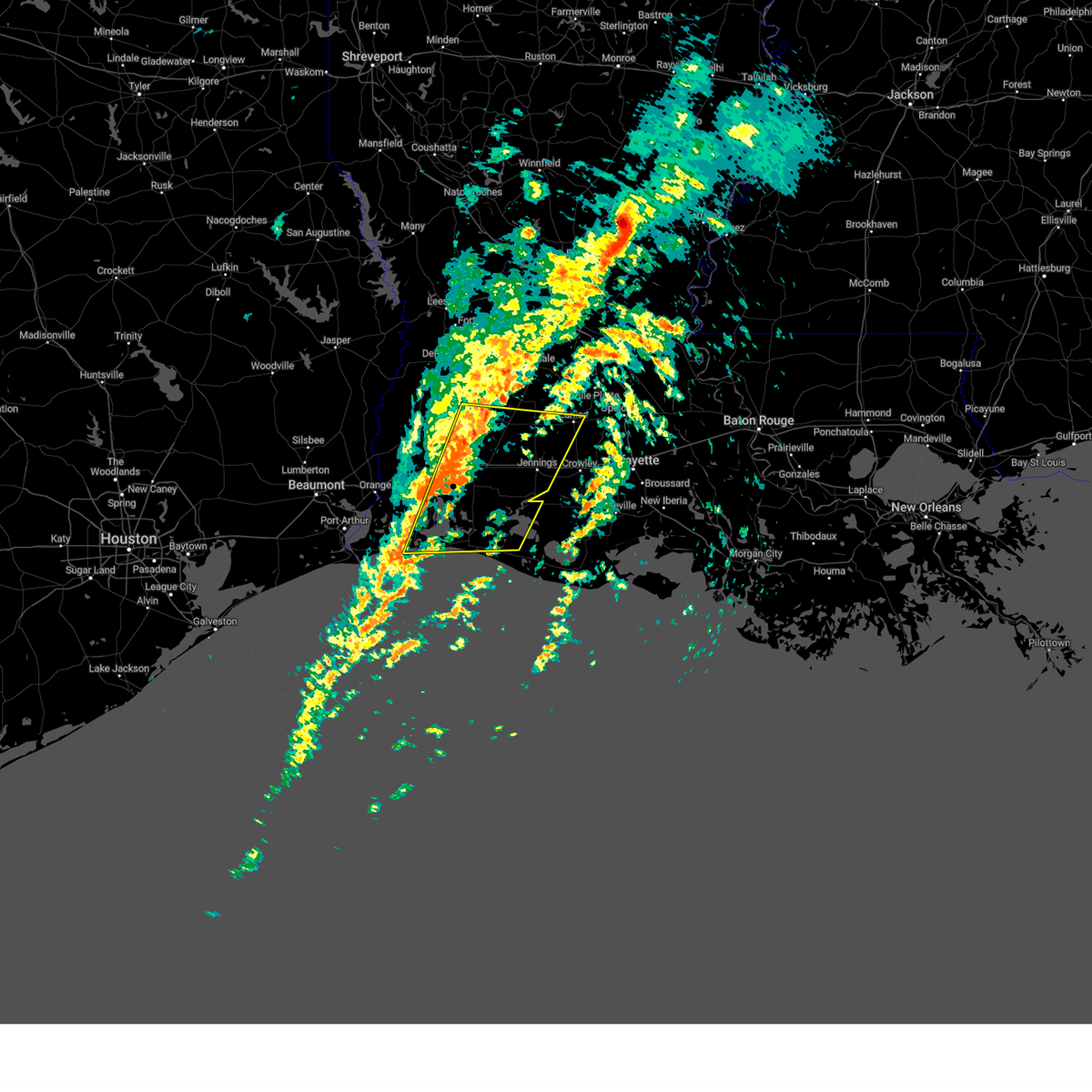
The Hackberry, LA area has had 0 reports of on-the-ground hail by trained spotters, and has been under severe weather warnings 10 times during the past 12 months. Doppler radar has detected hail at or near Hackberry, LA on 62 occasions.
| Name: | Hackberry, LA |
| Where Located: | 23.3 miles ESE of Beaumont, TX |
| Map: | Google Map for Hackberry, LA |
| Population: | 1261 |
| Housing Units: | 709 |
| More Info: | Search Google for Hackberry, LA |
2
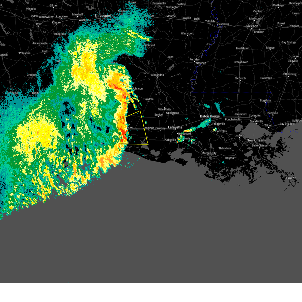
The Top Recent Hail Date for Hackberry, LA is Sunday, May 12, 2024 (5th out of 62)

Hail and Wind Damage Spotted near Hackberry, LA
| Date / Time | Report Details |
|---|---|
| 5/27/2025 3:08 AM CDT |
 Svrlch the national weather service in lake charles has issued a * severe thunderstorm warning for, northeastern cameron parish in southwestern louisiana, jefferson davis parish in southwestern louisiana, southeastern beauregard parish in southwestern louisiana, eastern calcasieu parish in southwestern louisiana, southwestern allen parish in southwestern louisiana, * until 345 am cdt. * at 308 am cdt, severe thunderstorms were located along a line extending from near ragley to near heberts marina, moving northeast at 50 mph (radar indicated). Hazards include 60 mph wind gusts and penny size hail. expect damage to roofs, siding, and trees Svrlch the national weather service in lake charles has issued a * severe thunderstorm warning for, northeastern cameron parish in southwestern louisiana, jefferson davis parish in southwestern louisiana, southeastern beauregard parish in southwestern louisiana, eastern calcasieu parish in southwestern louisiana, southwestern allen parish in southwestern louisiana, * until 345 am cdt. * at 308 am cdt, severe thunderstorms were located along a line extending from near ragley to near heberts marina, moving northeast at 50 mph (radar indicated). Hazards include 60 mph wind gusts and penny size hail. expect damage to roofs, siding, and trees
|
| 3/24/2025 5:03 AM CDT |
 At 503 am cdt, severe thunderstorms were located along a line extending from near hackberry to 6 miles south of holly beach, moving east at 45 mph (radar indicated). Hazards include 70 mph wind gusts and penny size hail. Expect considerable tree damage. damage is likely to mobile homes, roofs, and outbuildings. Locations impacted include, grand lake, lacassine national wildlife refuge, hacketts corner, heberts marina, cameron, sabine national wildlife, hackberry, constance beach, grand chenier, holly beach, creole, sweet lake, rutherford beach, and gibbstown. At 503 am cdt, severe thunderstorms were located along a line extending from near hackberry to 6 miles south of holly beach, moving east at 45 mph (radar indicated). Hazards include 70 mph wind gusts and penny size hail. Expect considerable tree damage. damage is likely to mobile homes, roofs, and outbuildings. Locations impacted include, grand lake, lacassine national wildlife refuge, hacketts corner, heberts marina, cameron, sabine national wildlife, hackberry, constance beach, grand chenier, holly beach, creole, sweet lake, rutherford beach, and gibbstown.
|
| 3/24/2025 4:53 AM CDT |
 Svrlch the national weather service in lake charles has issued a * severe thunderstorm warning for, central cameron parish in southwestern louisiana, * until 545 am cdt. * at 452 am cdt, severe thunderstorms were located along a line extending from sabine national wildlife to 9 miles southwest of holly beach, moving east at 45 mph (radar indicated). Hazards include 60 mph wind gusts and penny size hail. expect damage to roofs, siding, and trees Svrlch the national weather service in lake charles has issued a * severe thunderstorm warning for, central cameron parish in southwestern louisiana, * until 545 am cdt. * at 452 am cdt, severe thunderstorms were located along a line extending from sabine national wildlife to 9 miles southwest of holly beach, moving east at 45 mph (radar indicated). Hazards include 60 mph wind gusts and penny size hail. expect damage to roofs, siding, and trees
|
| 3/24/2025 4:37 AM CDT |
 At 437 am cdt, severe thunderstorms were located along a line extending from 8 miles east of port arthur to 13 miles southeast of sabine pass, moving east at 50 mph (radar indicated). Hazards include 70 mph wind gusts and penny size hail. Expect considerable tree damage. damage is likely to mobile homes, roofs, and outbuildings. Locations impacted include, hackberry, port arthur, constance beach, johnsons bayou, holly beach, sabine national wildlife, and cameron. At 437 am cdt, severe thunderstorms were located along a line extending from 8 miles east of port arthur to 13 miles southeast of sabine pass, moving east at 50 mph (radar indicated). Hazards include 70 mph wind gusts and penny size hail. Expect considerable tree damage. damage is likely to mobile homes, roofs, and outbuildings. Locations impacted include, hackberry, port arthur, constance beach, johnsons bayou, holly beach, sabine national wildlife, and cameron.
|
| 3/24/2025 4:22 AM CDT |
 Svrlch the national weather service in lake charles has issued a * severe thunderstorm warning for, northwestern cameron parish in southwestern louisiana, * until 500 am cdt. * at 422 am cdt, severe thunderstorms were located along a line extending from near port arthur to 15 miles south of sabine pass, moving northeast at 50 mph (radar indicated). Hazards include 60 mph wind gusts and penny size hail. expect damage to roofs, siding, and trees Svrlch the national weather service in lake charles has issued a * severe thunderstorm warning for, northwestern cameron parish in southwestern louisiana, * until 500 am cdt. * at 422 am cdt, severe thunderstorms were located along a line extending from near port arthur to 15 miles south of sabine pass, moving northeast at 50 mph (radar indicated). Hazards include 60 mph wind gusts and penny size hail. expect damage to roofs, siding, and trees
|
| 3/4/2025 12:47 PM CST |
 Svrlch the national weather service in lake charles has issued a * severe thunderstorm warning for, northeastern cameron parish in southwestern louisiana, jefferson davis parish in southwestern louisiana, southwestern evangeline parish in central louisiana, southeastern beauregard parish in southwestern louisiana, northwestern acadia parish in southwestern louisiana, eastern calcasieu parish in southwestern louisiana, west central st. landry parish in central louisiana, southern allen parish in southwestern louisiana, * until 130 pm cst. * at 1247 pm cst, severe thunderstorms were located along a line extending from near oberlin to near holly beach, moving southeast at 35 mph (radar indicated). Hazards include 60 mph wind gusts. expect damage to roofs, siding, and trees Svrlch the national weather service in lake charles has issued a * severe thunderstorm warning for, northeastern cameron parish in southwestern louisiana, jefferson davis parish in southwestern louisiana, southwestern evangeline parish in central louisiana, southeastern beauregard parish in southwestern louisiana, northwestern acadia parish in southwestern louisiana, eastern calcasieu parish in southwestern louisiana, west central st. landry parish in central louisiana, southern allen parish in southwestern louisiana, * until 130 pm cst. * at 1247 pm cst, severe thunderstorms were located along a line extending from near oberlin to near holly beach, moving southeast at 35 mph (radar indicated). Hazards include 60 mph wind gusts. expect damage to roofs, siding, and trees
|
| 12/28/2024 5:03 PM CST |
 the tornado warning has been cancelled and is no longer in effect the tornado warning has been cancelled and is no longer in effect
|
| 12/28/2024 4:50 PM CST |
 At 448 pm cst, tornado located over sabine national wildlife, moving east at 30 mph (radar indicated rotation). Hazards include tornado and quarter size hail. Flying debris will be dangerous to those caught without shelter. mobile homes will be damaged or destroyed. damage to roofs, windows, and vehicles will occur. tree damage is likely. This tornado will be near, hackberry around 455 pm cst. At 448 pm cst, tornado located over sabine national wildlife, moving east at 30 mph (radar indicated rotation). Hazards include tornado and quarter size hail. Flying debris will be dangerous to those caught without shelter. mobile homes will be damaged or destroyed. damage to roofs, windows, and vehicles will occur. tree damage is likely. This tornado will be near, hackberry around 455 pm cst.
|
| 12/28/2024 4:37 PM CST |
 At 437 pm cst, a confirmed large and extremely dangerous tornado was located over sabine national wildlife, moving east at 30 mph. this is a particularly dangerous situation. take cover now! (radar confirmed tornado). Hazards include damaging tornado. You are in a life-threatening situation. flying debris may be deadly to those caught without shelter. mobile homes will be destroyed. considerable damage to homes, businesses, and vehicles is likely and complete destruction is possible. The tornado will be near, sabine national wildlife and hackberry around 440 pm cst. At 437 pm cst, a confirmed large and extremely dangerous tornado was located over sabine national wildlife, moving east at 30 mph. this is a particularly dangerous situation. take cover now! (radar confirmed tornado). Hazards include damaging tornado. You are in a life-threatening situation. flying debris may be deadly to those caught without shelter. mobile homes will be destroyed. considerable damage to homes, businesses, and vehicles is likely and complete destruction is possible. The tornado will be near, sabine national wildlife and hackberry around 440 pm cst.
|
| 12/28/2024 4:23 PM CST |
 Torlch the national weather service in lake charles has issued a * tornado warning for, northwestern cameron parish in southwestern louisiana, * until 515 pm cst. * at 423 pm cst, a confirmed large and extremely dangerous tornado was located 7 miles west of sabine national wildlife, moving east at 30 mph. this is a particularly dangerous situation. take cover now! (radar confirmed tornado). Hazards include damaging tornado. You are in a life-threatening situation. flying debris may be deadly to those caught without shelter. mobile homes will be destroyed. considerable damage to homes, businesses, and vehicles is likely and complete destruction is possible. The tornado will be near, sabine national wildlife and hackberry around 430 pm cst. Torlch the national weather service in lake charles has issued a * tornado warning for, northwestern cameron parish in southwestern louisiana, * until 515 pm cst. * at 423 pm cst, a confirmed large and extremely dangerous tornado was located 7 miles west of sabine national wildlife, moving east at 30 mph. this is a particularly dangerous situation. take cover now! (radar confirmed tornado). Hazards include damaging tornado. You are in a life-threatening situation. flying debris may be deadly to those caught without shelter. mobile homes will be destroyed. considerable damage to homes, businesses, and vehicles is likely and complete destruction is possible. The tornado will be near, sabine national wildlife and hackberry around 430 pm cst.
|
| 6/26/2024 5:19 PM CDT |
 At 519 pm cdt, a severe thunderstorm was located near carlyss, or 7 miles northwest of grand lake, moving southeast at 30 mph (radar indicated). Hazards include 60 mph wind gusts and penny size hail. Expect damage to roofs, siding, and trees. Locations impacted include, hackberry and carlyss. At 519 pm cdt, a severe thunderstorm was located near carlyss, or 7 miles northwest of grand lake, moving southeast at 30 mph (radar indicated). Hazards include 60 mph wind gusts and penny size hail. Expect damage to roofs, siding, and trees. Locations impacted include, hackberry and carlyss.
|
| 6/26/2024 5:01 PM CDT |
 Svrlch the national weather service in lake charles has issued a * severe thunderstorm warning for, north central cameron parish in southwestern louisiana, southwestern calcasieu parish in southwestern louisiana, * until 530 pm cdt. * at 501 pm cdt, a severe thunderstorm was located near vinton, moving southeast at 30 mph (radar indicated). Hazards include 60 mph wind gusts and penny size hail. expect damage to roofs, siding, and trees Svrlch the national weather service in lake charles has issued a * severe thunderstorm warning for, north central cameron parish in southwestern louisiana, southwestern calcasieu parish in southwestern louisiana, * until 530 pm cdt. * at 501 pm cdt, a severe thunderstorm was located near vinton, moving southeast at 30 mph (radar indicated). Hazards include 60 mph wind gusts and penny size hail. expect damage to roofs, siding, and trees
|
| 5/28/2024 2:36 PM CDT |
 the severe thunderstorm warning has been cancelled and is no longer in effect the severe thunderstorm warning has been cancelled and is no longer in effect
|
| 5/28/2024 2:36 PM CDT |
 At 235 pm cdt, severe thunderstorms were located along a line extending from near starks to 9 miles southeast of lacassine national wildlife refuge, and are nearly stationary (radar indicated). Hazards include 60 mph wind gusts and quarter size hail. Hail damage to vehicles is expected. expect wind damage to roofs, siding, and trees. Locations impacted include, lake charles, sulphur, orange, cameron, westlake, vinton, grand lake, lacassine national wildlife refuge, lake charles regional airport, rockefeller wildlife range, grand chenier, carlyss, hacketts corner, toomey, edgerly, hackberry, creole, sweet lake, gibbstown, and holmwood. At 235 pm cdt, severe thunderstorms were located along a line extending from near starks to 9 miles southeast of lacassine national wildlife refuge, and are nearly stationary (radar indicated). Hazards include 60 mph wind gusts and quarter size hail. Hail damage to vehicles is expected. expect wind damage to roofs, siding, and trees. Locations impacted include, lake charles, sulphur, orange, cameron, westlake, vinton, grand lake, lacassine national wildlife refuge, lake charles regional airport, rockefeller wildlife range, grand chenier, carlyss, hacketts corner, toomey, edgerly, hackberry, creole, sweet lake, gibbstown, and holmwood.
|
| 5/28/2024 2:03 PM CDT |
 Svrlch the national weather service in lake charles has issued a * severe thunderstorm warning for, eastern cameron parish in southwestern louisiana, southwestern beauregard parish in southwestern louisiana, calcasieu parish in southwestern louisiana, * until 300 pm cdt. * at 202 pm cdt, severe thunderstorms were located along a line extending from near starks to 9 miles southeast of lacassine national wildlife refuge, and are nearly stationary (radar indicated). Hazards include 60 mph wind gusts and quarter size hail. Hail damage to vehicles is expected. Expect wind damage to roofs, siding, and trees. Svrlch the national weather service in lake charles has issued a * severe thunderstorm warning for, eastern cameron parish in southwestern louisiana, southwestern beauregard parish in southwestern louisiana, calcasieu parish in southwestern louisiana, * until 300 pm cdt. * at 202 pm cdt, severe thunderstorms were located along a line extending from near starks to 9 miles southeast of lacassine national wildlife refuge, and are nearly stationary (radar indicated). Hazards include 60 mph wind gusts and quarter size hail. Hail damage to vehicles is expected. Expect wind damage to roofs, siding, and trees.
|
| 5/13/2024 4:41 PM CDT |
 At 441 pm cdt, severe thunderstorms were located along a line extending from near grand lake to 6 miles southeast of johnsons bayou, moving east at 55 mph (radar indicated). Hazards include 60 mph wind gusts. Expect damage to roofs, siding, and trees. Locations impacted include, cameron, gueydan, grand lake, lacassine national wildlife refuge, rockefeller wildlife range, sabine national wildlife, grand chenier, johnsons bayou, klondike, hacketts corner, wright, heberts marina, hackberry, holly beach, lowry, creole, sweet lake, gibbstown, florence landing, and constance beach. At 441 pm cdt, severe thunderstorms were located along a line extending from near grand lake to 6 miles southeast of johnsons bayou, moving east at 55 mph (radar indicated). Hazards include 60 mph wind gusts. Expect damage to roofs, siding, and trees. Locations impacted include, cameron, gueydan, grand lake, lacassine national wildlife refuge, rockefeller wildlife range, sabine national wildlife, grand chenier, johnsons bayou, klondike, hacketts corner, wright, heberts marina, hackberry, holly beach, lowry, creole, sweet lake, gibbstown, florence landing, and constance beach.
|
| 5/13/2024 4:36 PM CDT |
 Svrlch the national weather service in lake charles has issued a * severe thunderstorm warning for, cameron parish in southwestern louisiana, western vermilion parish in southwestern louisiana, * until 530 pm cdt. * at 435 pm cdt, severe thunderstorms were located along a line extending from 7 miles north of hackberry to 6 miles south of johnsons bayou, moving east at 55 mph (radar indicated). Hazards include 60 mph wind gusts. expect damage to roofs, siding, and trees Svrlch the national weather service in lake charles has issued a * severe thunderstorm warning for, cameron parish in southwestern louisiana, western vermilion parish in southwestern louisiana, * until 530 pm cdt. * at 435 pm cdt, severe thunderstorms were located along a line extending from 7 miles north of hackberry to 6 miles south of johnsons bayou, moving east at 55 mph (radar indicated). Hazards include 60 mph wind gusts. expect damage to roofs, siding, and trees
|
| 5/13/2024 4:21 PM CDT |
 At 421 pm cdt, severe thunderstorms were located along a line extending from 6 miles south of toomey to 13 miles south of sabine pass, moving east at 50 mph (radar indicated). Hazards include 60 mph wind gusts. Expect damage to roofs, siding, and trees. Locations impacted include, port arthur, orange, groves, bridge city, sabine pass, johnsons bayou, sabine national wildlife, and hackberry. At 421 pm cdt, severe thunderstorms were located along a line extending from 6 miles south of toomey to 13 miles south of sabine pass, moving east at 50 mph (radar indicated). Hazards include 60 mph wind gusts. Expect damage to roofs, siding, and trees. Locations impacted include, port arthur, orange, groves, bridge city, sabine pass, johnsons bayou, sabine national wildlife, and hackberry.
|
| 5/13/2024 3:51 PM CDT |
 Svrlch the national weather service in lake charles has issued a * severe thunderstorm warning for, northwestern cameron parish in southwestern louisiana, jefferson county in southeastern texas, southern orange county in southeastern texas, * until 445 pm cdt. * at 351 pm cdt, severe thunderstorms were located along a line extending from near vidor to 6 miles northwest of high island, moving east at 35 mph (radar indicated). Hazards include 60 mph wind gusts. expect damage to roofs, siding, and trees Svrlch the national weather service in lake charles has issued a * severe thunderstorm warning for, northwestern cameron parish in southwestern louisiana, jefferson county in southeastern texas, southern orange county in southeastern texas, * until 445 pm cdt. * at 351 pm cdt, severe thunderstorms were located along a line extending from near vidor to 6 miles northwest of high island, moving east at 35 mph (radar indicated). Hazards include 60 mph wind gusts. expect damage to roofs, siding, and trees
|
| 5/12/2024 2:38 PM CDT |
 At 238 pm cdt, a severe thunderstorm was located over grand lake, moving east at 35 mph (radar indicated). Hazards include golf ball size hail and 60 mph wind gusts. People and animals outdoors will be injured. expect hail damage to roofs, siding, windows, and vehicles. expect wind damage to roofs, siding, and trees. Locations impacted include, lake charles, welsh, iowa, grand lake, lacassine national wildlife refuge, lake charles regional airport, hayes, hacketts corner, heberts marina, thornwell, sweet lake, holmwood, hackberry, carlyss, bell city, and lacassine. At 238 pm cdt, a severe thunderstorm was located over grand lake, moving east at 35 mph (radar indicated). Hazards include golf ball size hail and 60 mph wind gusts. People and animals outdoors will be injured. expect hail damage to roofs, siding, windows, and vehicles. expect wind damage to roofs, siding, and trees. Locations impacted include, lake charles, welsh, iowa, grand lake, lacassine national wildlife refuge, lake charles regional airport, hayes, hacketts corner, heberts marina, thornwell, sweet lake, holmwood, hackberry, carlyss, bell city, and lacassine.
|
| 5/12/2024 2:29 PM CDT |
 The severe thunderstorm which prompted the warning continues and has been replaced by severe thunderstorm warning 121. see severe thunderstorm warning number 121 for more information. therefore, the warning will be allowed to expire. a tornado watch remains in effect until 700 pm cdt for southwestern louisiana. The severe thunderstorm which prompted the warning continues and has been replaced by severe thunderstorm warning 121. see severe thunderstorm warning number 121 for more information. therefore, the warning will be allowed to expire. a tornado watch remains in effect until 700 pm cdt for southwestern louisiana.
|
| 5/12/2024 2:27 PM CDT |
 Svrlch the national weather service in lake charles has issued a * severe thunderstorm warning for, northeastern cameron parish in southwestern louisiana, south central jefferson davis parish in southwestern louisiana, southeastern calcasieu parish in southwestern louisiana, * until 330 pm cdt. * at 227 pm cdt, a severe thunderstorm was located near grand lake, moving east at 35 mph (radar indicated). Hazards include 60 mph wind gusts and quarter size hail. Hail damage to vehicles is expected. Expect wind damage to roofs, siding, and trees. Svrlch the national weather service in lake charles has issued a * severe thunderstorm warning for, northeastern cameron parish in southwestern louisiana, south central jefferson davis parish in southwestern louisiana, southeastern calcasieu parish in southwestern louisiana, * until 330 pm cdt. * at 227 pm cdt, a severe thunderstorm was located near grand lake, moving east at 35 mph (radar indicated). Hazards include 60 mph wind gusts and quarter size hail. Hail damage to vehicles is expected. Expect wind damage to roofs, siding, and trees.
|
| 5/12/2024 2:17 PM CDT |
 the severe thunderstorm warning has been cancelled and is no longer in effect the severe thunderstorm warning has been cancelled and is no longer in effect
|
| 5/12/2024 2:17 PM CDT |
 At 217 pm cdt, a severe thunderstorm was located near cameron, moving east at 45 mph (radar indicated). Hazards include 60 mph wind gusts and quarter size hail. Hail damage to vehicles is expected. expect wind damage to roofs, siding, and trees. Locations impacted include, lake charles, grand lake, lake charles regional airport, hackberry, heberts marina, sweet lake, and carlyss. At 217 pm cdt, a severe thunderstorm was located near cameron, moving east at 45 mph (radar indicated). Hazards include 60 mph wind gusts and quarter size hail. Hail damage to vehicles is expected. expect wind damage to roofs, siding, and trees. Locations impacted include, lake charles, grand lake, lake charles regional airport, hackberry, heberts marina, sweet lake, and carlyss.
|
| 5/12/2024 1:53 PM CDT |
 At 153 pm cdt, a severe thunderstorm was located near sabine national wildlife, moving east at 45 mph (radar indicated). Hazards include 60 mph wind gusts and quarter size hail. Hail damage to vehicles is expected. expect wind damage to roofs, siding, and trees. Locations impacted include, lake charles, orange, cameron, west orange, grand lake, lake charles regional airport, sabine national wildlife, heberts marina, hackberry, creole, sweet lake, toomey, carlyss, pinehurst, and rutherford beach. At 153 pm cdt, a severe thunderstorm was located near sabine national wildlife, moving east at 45 mph (radar indicated). Hazards include 60 mph wind gusts and quarter size hail. Hail damage to vehicles is expected. expect wind damage to roofs, siding, and trees. Locations impacted include, lake charles, orange, cameron, west orange, grand lake, lake charles regional airport, sabine national wildlife, heberts marina, hackberry, creole, sweet lake, toomey, carlyss, pinehurst, and rutherford beach.
|
| 5/12/2024 1:53 PM CDT |
 the severe thunderstorm warning has been cancelled and is no longer in effect the severe thunderstorm warning has been cancelled and is no longer in effect
|
| 5/12/2024 1:28 PM CDT |
 Svrlch the national weather service in lake charles has issued a * severe thunderstorm warning for, northwestern cameron parish in southwestern louisiana, southwestern calcasieu parish in southwestern louisiana, east central jefferson county in southeastern texas, southeastern orange county in southeastern texas, * until 230 pm cdt. * at 128 pm cdt, a severe thunderstorm was located 7 miles southeast of groves, moving east at 45 mph (radar indicated). Hazards include two inch hail and 60 mph wind gusts. People and animals outdoors will be injured. expect hail damage to roofs, siding, windows, and vehicles. Expect wind damage to roofs, siding, and trees. Svrlch the national weather service in lake charles has issued a * severe thunderstorm warning for, northwestern cameron parish in southwestern louisiana, southwestern calcasieu parish in southwestern louisiana, east central jefferson county in southeastern texas, southeastern orange county in southeastern texas, * until 230 pm cdt. * at 128 pm cdt, a severe thunderstorm was located 7 miles southeast of groves, moving east at 45 mph (radar indicated). Hazards include two inch hail and 60 mph wind gusts. People and animals outdoors will be injured. expect hail damage to roofs, siding, windows, and vehicles. Expect wind damage to roofs, siding, and trees.
|
| 4/29/2024 5:37 AM CDT |
 The storm which prompted the warning has weakened below severe limits, and no longer poses an immediate threat to life or property. therefore, the warning will be allowed to expire. however heavy rain is still possible with this thunderstorm. a severe thunderstorm watch remains in effect until 900 am cdt for southwestern louisiana. The storm which prompted the warning has weakened below severe limits, and no longer poses an immediate threat to life or property. therefore, the warning will be allowed to expire. however heavy rain is still possible with this thunderstorm. a severe thunderstorm watch remains in effect until 900 am cdt for southwestern louisiana.
|
| 4/29/2024 5:03 AM CDT |
 At 503 am cdt, a severe thunderstorm was located near lake charles regional airport, moving east at 35 mph (radar indicated). Hazards include 60 mph wind gusts and quarter size hail. Hail damage to vehicles is expected. expect wind damage to roofs, siding, and trees. Locations impacted include, lake charles, sulphur, westlake, welsh, iowa, grand lake, lacassine national wildlife refuge, lake charles regional airport, hayes, moss bluff, carlyss, hacketts corner, buhler, lebleu settlement, holmwood, sweet lake, hackberry, bell city, and lacassine. At 503 am cdt, a severe thunderstorm was located near lake charles regional airport, moving east at 35 mph (radar indicated). Hazards include 60 mph wind gusts and quarter size hail. Hail damage to vehicles is expected. expect wind damage to roofs, siding, and trees. Locations impacted include, lake charles, sulphur, westlake, welsh, iowa, grand lake, lacassine national wildlife refuge, lake charles regional airport, hayes, moss bluff, carlyss, hacketts corner, buhler, lebleu settlement, holmwood, sweet lake, hackberry, bell city, and lacassine.
|
| 4/29/2024 4:44 AM CDT |
 Svrlch the national weather service in lake charles has issued a * severe thunderstorm warning for, northeastern cameron parish in southwestern louisiana, central jefferson davis parish in southwestern louisiana, southeastern calcasieu parish in southwestern louisiana, * until 545 am cdt. * at 444 am cdt, a severe thunderstorm was located near edgerly, or 7 miles southwest of sulphur, moving east at 35 mph (radar indicated). Hazards include 60 mph wind gusts and penny size hail. expect damage to roofs, siding, and trees Svrlch the national weather service in lake charles has issued a * severe thunderstorm warning for, northeastern cameron parish in southwestern louisiana, central jefferson davis parish in southwestern louisiana, southeastern calcasieu parish in southwestern louisiana, * until 545 am cdt. * at 444 am cdt, a severe thunderstorm was located near edgerly, or 7 miles southwest of sulphur, moving east at 35 mph (radar indicated). Hazards include 60 mph wind gusts and penny size hail. expect damage to roofs, siding, and trees
|
| 4/10/2024 7:49 AM CDT | Mesonet station hakl1 sabin in cameron county LA, 6.2 miles NNE of Hackberry, LA |
| 4/10/2024 6:51 AM CDT |
 The storms which prompted the warning have moved out of the area. therefore, the warning has been allowed to expire. a tornado watch remains in effect until 900 am cdt for southwestern louisiana, and southeastern texas. The storms which prompted the warning have moved out of the area. therefore, the warning has been allowed to expire. a tornado watch remains in effect until 900 am cdt for southwestern louisiana, and southeastern texas.
|
| 4/10/2024 6:41 AM CDT |
 The storm which prompted the warning has moved out of the area. therefore, the warning will be allowed to expire. a tornado watch remains in effect until 900 am cdt for southwestern louisiana. The storm which prompted the warning has moved out of the area. therefore, the warning will be allowed to expire. a tornado watch remains in effect until 900 am cdt for southwestern louisiana.
|
| 4/10/2024 6:29 AM CDT |
 Torlch the national weather service in lake charles has issued a * tornado warning for, north central cameron parish in southwestern louisiana, south central jefferson davis parish in southwestern louisiana, southeastern calcasieu parish in southwestern louisiana, * until 700 am cdt. * at 629 am cdt, a severe thunderstorm capable of producing a tornado was located over heberts marina, or near grand lake, moving northeast at 70 mph (radar indicated rotation). Hazards include tornado. Flying debris will be dangerous to those caught without shelter. mobile homes will be damaged or destroyed. damage to roofs, windows, and vehicles will occur. tree damage is likely. this dangerous storm will be near, sweet lake, holmwood, and hacketts corner around 635 am cdt. hayes around 645 am cdt. Other locations impacted by this tornadic thunderstorm include bell city. Torlch the national weather service in lake charles has issued a * tornado warning for, north central cameron parish in southwestern louisiana, south central jefferson davis parish in southwestern louisiana, southeastern calcasieu parish in southwestern louisiana, * until 700 am cdt. * at 629 am cdt, a severe thunderstorm capable of producing a tornado was located over heberts marina, or near grand lake, moving northeast at 70 mph (radar indicated rotation). Hazards include tornado. Flying debris will be dangerous to those caught without shelter. mobile homes will be damaged or destroyed. damage to roofs, windows, and vehicles will occur. tree damage is likely. this dangerous storm will be near, sweet lake, holmwood, and hacketts corner around 635 am cdt. hayes around 645 am cdt. Other locations impacted by this tornadic thunderstorm include bell city.
|
| 4/10/2024 6:28 AM CDT |
 Svrlch the national weather service in lake charles has issued a * severe thunderstorm warning for, eastern cameron parish in southwestern louisiana, jefferson davis parish in southwestern louisiana, southwestern acadia parish in southwestern louisiana, southeastern calcasieu parish in southwestern louisiana, northwestern vermilion parish in southwestern louisiana, * until 715 am cdt. * at 628 am cdt, severe thunderstorms were located along a line extending from near carlyss to near grand lake to cameron, moving east at 65 mph. these are destructive storms for west lake and lake charles (radar indicated). Hazards include 80 mph wind gusts. Flying debris will be dangerous to those caught without shelter. mobile homes will be heavily damaged. expect considerable damage to roofs, windows, and vehicles. Extensive tree damage and power outages are likely. Svrlch the national weather service in lake charles has issued a * severe thunderstorm warning for, eastern cameron parish in southwestern louisiana, jefferson davis parish in southwestern louisiana, southwestern acadia parish in southwestern louisiana, southeastern calcasieu parish in southwestern louisiana, northwestern vermilion parish in southwestern louisiana, * until 715 am cdt. * at 628 am cdt, severe thunderstorms were located along a line extending from near carlyss to near grand lake to cameron, moving east at 65 mph. these are destructive storms for west lake and lake charles (radar indicated). Hazards include 80 mph wind gusts. Flying debris will be dangerous to those caught without shelter. mobile homes will be heavily damaged. expect considerable damage to roofs, windows, and vehicles. Extensive tree damage and power outages are likely.
|
| 4/10/2024 6:19 AM CDT |
 the tornado warning has been cancelled and is no longer in effect the tornado warning has been cancelled and is no longer in effect
|
| 4/10/2024 6:19 AM CDT |
 At 619 am cdt, a severe thunderstorm capable of producing a tornado was located 8 miles southeast of toomey, or 10 miles south of vinton, moving east at 65 mph (radar indicated rotation). Hazards include tornado. Flying debris will be dangerous to those caught without shelter. mobile homes will be damaged or destroyed. damage to roofs, windows, and vehicles will occur. tree damage is likely. this dangerous storm will be near, carlyss and hackberry around 625 am cdt. Lake charles, grand lake, and lake charles regional airport around 630 am cdt. At 619 am cdt, a severe thunderstorm capable of producing a tornado was located 8 miles southeast of toomey, or 10 miles south of vinton, moving east at 65 mph (radar indicated rotation). Hazards include tornado. Flying debris will be dangerous to those caught without shelter. mobile homes will be damaged or destroyed. damage to roofs, windows, and vehicles will occur. tree damage is likely. this dangerous storm will be near, carlyss and hackberry around 625 am cdt. Lake charles, grand lake, and lake charles regional airport around 630 am cdt.
|
| 4/10/2024 6:12 AM CDT |
 Torlch the national weather service in lake charles has issued a * tornado warning for, northwestern cameron parish in southwestern louisiana, southwestern calcasieu parish in southwestern louisiana, east central orange county in southeastern texas, * until 645 am cdt. * at 612 am cdt, a severe thunderstorm capable of producing a tornado was located 8 miles southeast of west orange, moving east at 65 mph (radar indicated rotation). Hazards include tornado. Flying debris will be dangerous to those caught without shelter. mobile homes will be damaged or destroyed. damage to roofs, windows, and vehicles will occur. tree damage is likely. this dangerous storm will be near, hackberry around 620 am cdt. carlyss around 625 am cdt. grand lake and heberts marina around 630 am cdt. lake charles and lake charles regional airport around 635 am cdt. sweet lake around 640 am cdt. this includes the following highways, interstate 10 in louisiana between mile markers 29 and 31. Interstate 210 between mile markers 1 and 8. Torlch the national weather service in lake charles has issued a * tornado warning for, northwestern cameron parish in southwestern louisiana, southwestern calcasieu parish in southwestern louisiana, east central orange county in southeastern texas, * until 645 am cdt. * at 612 am cdt, a severe thunderstorm capable of producing a tornado was located 8 miles southeast of west orange, moving east at 65 mph (radar indicated rotation). Hazards include tornado. Flying debris will be dangerous to those caught without shelter. mobile homes will be damaged or destroyed. damage to roofs, windows, and vehicles will occur. tree damage is likely. this dangerous storm will be near, hackberry around 620 am cdt. carlyss around 625 am cdt. grand lake and heberts marina around 630 am cdt. lake charles and lake charles regional airport around 635 am cdt. sweet lake around 640 am cdt. this includes the following highways, interstate 10 in louisiana between mile markers 29 and 31. Interstate 210 between mile markers 1 and 8.
|
| 4/10/2024 6:11 AM CDT |
 At 610 am cdt, severe thunderstorms were located along a line extending from near pinehurst to 8 miles west of sabine national wildlife to 6 miles south of johnsons bayou, moving east at 45 mph. these are destructive storms for northern cameron parish (radar indicated). Hazards include 80 mph wind gusts and nickel size hail. Flying debris will be dangerous to those caught without shelter. mobile homes will be heavily damaged. expect considerable damage to roofs, windows, and vehicles. extensive tree damage and power outages are likely. Locations impacted include, port arthur, orange, nederland, groves, port neches, vidor, bridge city, cameron, west orange, vinton, central gardens, sabine national wildlife, sabine pass, johnsons bayou, pinehurst, toomey, orangefield, edgerly, hackberry, and holly beach. At 610 am cdt, severe thunderstorms were located along a line extending from near pinehurst to 8 miles west of sabine national wildlife to 6 miles south of johnsons bayou, moving east at 45 mph. these are destructive storms for northern cameron parish (radar indicated). Hazards include 80 mph wind gusts and nickel size hail. Flying debris will be dangerous to those caught without shelter. mobile homes will be heavily damaged. expect considerable damage to roofs, windows, and vehicles. extensive tree damage and power outages are likely. Locations impacted include, port arthur, orange, nederland, groves, port neches, vidor, bridge city, cameron, west orange, vinton, central gardens, sabine national wildlife, sabine pass, johnsons bayou, pinehurst, toomey, orangefield, edgerly, hackberry, and holly beach.
|
| 4/10/2024 5:53 AM CDT |
 Svrlch the national weather service in lake charles has issued a * severe thunderstorm warning for, northwestern cameron parish in southwestern louisiana, southwestern calcasieu parish in southwestern louisiana, northeastern jefferson county in southeastern texas, central orange county in southeastern texas, * until 645 am cdt. * at 552 am cdt, severe thunderstorms were located along a line extending from near vidor to near groves to 7 miles south of sabine pass, moving east at 45 mph (radar indicated). Hazards include 60 mph wind gusts and nickel size hail. expect damage to roofs, siding, and trees Svrlch the national weather service in lake charles has issued a * severe thunderstorm warning for, northwestern cameron parish in southwestern louisiana, southwestern calcasieu parish in southwestern louisiana, northeastern jefferson county in southeastern texas, central orange county in southeastern texas, * until 645 am cdt. * at 552 am cdt, severe thunderstorms were located along a line extending from near vidor to near groves to 7 miles south of sabine pass, moving east at 45 mph (radar indicated). Hazards include 60 mph wind gusts and nickel size hail. expect damage to roofs, siding, and trees
|
| 3/22/2024 12:41 AM CDT |
 the severe thunderstorm warning has been cancelled and is no longer in effect the severe thunderstorm warning has been cancelled and is no longer in effect
|
| 3/22/2024 12:41 AM CDT |
 At 1240 am cdt, a severe thunderstorm was located over carlyss, or near sulphur, moving east at 45 mph (radar indicated). Hazards include 60 mph wind gusts and quarter size hail. Hail damage to vehicles is expected. expect wind damage to roofs, siding, and trees. Locations impacted include, lake charles, sulphur, cameron, westlake, grand lake, lake charles regional airport, sabine national wildlife, carlyss, buhler, heberts marina, edgerly, hackberry, and sweet lake. At 1240 am cdt, a severe thunderstorm was located over carlyss, or near sulphur, moving east at 45 mph (radar indicated). Hazards include 60 mph wind gusts and quarter size hail. Hail damage to vehicles is expected. expect wind damage to roofs, siding, and trees. Locations impacted include, lake charles, sulphur, cameron, westlake, grand lake, lake charles regional airport, sabine national wildlife, carlyss, buhler, heberts marina, edgerly, hackberry, and sweet lake.
|
| 3/22/2024 12:12 AM CDT |
 Svrlch the national weather service in lake charles has issued a * severe thunderstorm warning for, north central cameron parish in southwestern louisiana, southwestern beauregard parish in southwestern louisiana, calcasieu parish in southwestern louisiana, * until 100 am cdt. * at 1212 am cdt, a severe thunderstorm was located near west orange, moving east at 45 mph (radar indicated). Hazards include quarter size hail. damage to vehicles is expected Svrlch the national weather service in lake charles has issued a * severe thunderstorm warning for, north central cameron parish in southwestern louisiana, southwestern beauregard parish in southwestern louisiana, calcasieu parish in southwestern louisiana, * until 100 am cdt. * at 1212 am cdt, a severe thunderstorm was located near west orange, moving east at 45 mph (radar indicated). Hazards include quarter size hail. damage to vehicles is expected
|
| 1/8/2024 12:30 PM CST | Thunderstorm wind damage occurred near hackberry. an rv was flipped over along with outbuilding and powerline damag in cameron county LA, 0.7 miles WSW of Hackberry, LA |
| 11/30/2023 8:44 PM CST |
 At 843 pm cst, a severe thunderstorm was located over hackberry, or 8 miles southwest of grand lake, moving east at 35 mph (radar indicated). Hazards include 60 mph wind gusts. expect damage to roofs, siding, and trees At 843 pm cst, a severe thunderstorm was located over hackberry, or 8 miles southwest of grand lake, moving east at 35 mph (radar indicated). Hazards include 60 mph wind gusts. expect damage to roofs, siding, and trees
|
| 11/30/2023 8:25 PM CST |
 At 825 pm cst, a severe thunderstorm was located over sabine national wildlife, moving east at 25 mph (radar indicated). Hazards include 60 mph wind gusts. Expect damage to roofs, siding, and trees. Locations impacted include, sabine national wildlife and hackberry. At 825 pm cst, a severe thunderstorm was located over sabine national wildlife, moving east at 25 mph (radar indicated). Hazards include 60 mph wind gusts. Expect damage to roofs, siding, and trees. Locations impacted include, sabine national wildlife and hackberry.
|
| 11/30/2023 8:03 PM CST |
 At 802 pm cst, a severe thunderstorm was located 7 miles west of sabine national wildlife, moving east at 25 mph (radar indicated). Hazards include 60 mph wind gusts. expect damage to roofs, siding, and trees At 802 pm cst, a severe thunderstorm was located 7 miles west of sabine national wildlife, moving east at 25 mph (radar indicated). Hazards include 60 mph wind gusts. expect damage to roofs, siding, and trees
|
| 9/8/2023 1:54 PM CDT |
 At 153 pm cdt, severe thunderstorms were located along a line extending from lunita to near westlake to near welsh to near maurice, moving south at 35 mph (radar indicated). Hazards include 60 mph wind gusts and penny size hail. expect damage to roofs, siding, and trees At 153 pm cdt, severe thunderstorms were located along a line extending from lunita to near westlake to near welsh to near maurice, moving south at 35 mph (radar indicated). Hazards include 60 mph wind gusts and penny size hail. expect damage to roofs, siding, and trees
|
| 7/22/2023 7:01 PM CDT |
 At 701 pm cdt, a severe thunderstorm was located over carlyss, or near sulphur, moving southeast at 15 mph (radar indicated). Hazards include 60 mph wind gusts and penny size hail. Expect damage to roofs, siding, and trees. locations impacted include, lake charles, sulphur, grand lake, lake charles regional airport, carlyss, heberts marina, sweet lake and hackberry. hail threat, radar indicated max hail size, 0. 75 in wind threat, radar indicated max wind gust, 60 mph. At 701 pm cdt, a severe thunderstorm was located over carlyss, or near sulphur, moving southeast at 15 mph (radar indicated). Hazards include 60 mph wind gusts and penny size hail. Expect damage to roofs, siding, and trees. locations impacted include, lake charles, sulphur, grand lake, lake charles regional airport, carlyss, heberts marina, sweet lake and hackberry. hail threat, radar indicated max hail size, 0. 75 in wind threat, radar indicated max wind gust, 60 mph.
|
| 7/22/2023 6:11 PM CDT |
 At 611 pm cdt, severe thunderstorms were located along a line extending from klondike to lake charles, moving south at 15 mph (radar indicated). Hazards include 60 mph wind gusts and quarter size hail. Hail damage to vehicles is expected. Expect wind damage to roofs, siding, and trees. At 611 pm cdt, severe thunderstorms were located along a line extending from klondike to lake charles, moving south at 15 mph (radar indicated). Hazards include 60 mph wind gusts and quarter size hail. Hail damage to vehicles is expected. Expect wind damage to roofs, siding, and trees.
|
| 6/21/2023 10:15 PM CDT |
 At 1015 pm cdt, a severe thunderstorm was located over hackberry, or 7 miles northeast of sabine national wildlife, moving east at 15 mph (radar indicated). Hazards include 60 mph wind gusts and quarter size hail. Hail damage to vehicles is expected. Expect wind damage to roofs, siding, and trees. At 1015 pm cdt, a severe thunderstorm was located over hackberry, or 7 miles northeast of sabine national wildlife, moving east at 15 mph (radar indicated). Hazards include 60 mph wind gusts and quarter size hail. Hail damage to vehicles is expected. Expect wind damage to roofs, siding, and trees.
|
| 6/21/2023 10:05 PM CDT |
 At 1005 pm cdt, a severe thunderstorm was located near hackberry, or 7 miles northeast of sabine national wildlife, moving east at 20 mph (radar indicated). Hazards include 60 mph wind gusts and quarter size hail. Hail damage to vehicles is expected. expect wind damage to roofs, siding, and trees. locations impacted include, sabine national wildlife, hackberry and carlyss. hail threat, radar indicated max hail size, 1. 00 in wind threat, radar indicated max wind gust, 60 mph. At 1005 pm cdt, a severe thunderstorm was located near hackberry, or 7 miles northeast of sabine national wildlife, moving east at 20 mph (radar indicated). Hazards include 60 mph wind gusts and quarter size hail. Hail damage to vehicles is expected. expect wind damage to roofs, siding, and trees. locations impacted include, sabine national wildlife, hackberry and carlyss. hail threat, radar indicated max hail size, 1. 00 in wind threat, radar indicated max wind gust, 60 mph.
|
| 6/21/2023 9:48 PM CDT |
 At 948 pm cdt, a severe thunderstorm was located 8 miles south of toomey, or 9 miles north of sabine national wildlife, moving east at 15 mph (radar indicated). Hazards include 60 mph wind gusts and quarter size hail. Hail damage to vehicles is expected. Expect wind damage to roofs, siding, and trees. At 948 pm cdt, a severe thunderstorm was located 8 miles south of toomey, or 9 miles north of sabine national wildlife, moving east at 15 mph (radar indicated). Hazards include 60 mph wind gusts and quarter size hail. Hail damage to vehicles is expected. Expect wind damage to roofs, siding, and trees.
|
| 5/24/2023 6:10 PM CDT |
 At 609 pm cdt, a severe thunderstorm was located near sabine national wildlife, moving south at 15 mph (radar indicated). Hazards include quarter size hail. Damage to vehicles is expected. locations impacted include, johnsons bayou, sabine national wildlife, hackberry and constance beach. hail threat, radar indicated max hail size, 1. 00 in wind threat, radar indicated max wind gust, <50 mph. At 609 pm cdt, a severe thunderstorm was located near sabine national wildlife, moving south at 15 mph (radar indicated). Hazards include quarter size hail. Damage to vehicles is expected. locations impacted include, johnsons bayou, sabine national wildlife, hackberry and constance beach. hail threat, radar indicated max hail size, 1. 00 in wind threat, radar indicated max wind gust, <50 mph.
|
| 5/24/2023 6:02 PM CDT |
 At 601 pm cdt, a severe thunderstorm was located 9 miles north of sabine national wildlife, moving south at 15 mph (radar indicated). Hazards include quarter size hail. damage to vehicles is expected At 601 pm cdt, a severe thunderstorm was located 9 miles north of sabine national wildlife, moving south at 15 mph (radar indicated). Hazards include quarter size hail. damage to vehicles is expected
|
| 5/10/2023 5:42 PM CDT |
 The severe thunderstorm warning for northwestern cameron and southwestern calcasieu parishes, east central jefferson and southeastern orange counties will expire at 545 pm cdt, the storm which prompted the warning has weakened below severe limits, and has exited the warned area. therefore, the warning will be allowed to expire. however gusty winds and heavy rain are still possible with this thunderstorm. The severe thunderstorm warning for northwestern cameron and southwestern calcasieu parishes, east central jefferson and southeastern orange counties will expire at 545 pm cdt, the storm which prompted the warning has weakened below severe limits, and has exited the warned area. therefore, the warning will be allowed to expire. however gusty winds and heavy rain are still possible with this thunderstorm.
|
| 5/10/2023 5:26 PM CDT |
 At 526 pm cdt, a severe thunderstorm was located over bridge city, moving northeast at 25 mph (radar indicated). Hazards include 60 mph wind gusts and penny size hail. Expect damage to roofs, siding, and trees. locations impacted include, port arthur, orange, nederland, groves, port neches, bridge city, west orange, pinehurst, orangefield and hackberry. hail threat, radar indicated max hail size, 0. 75 in wind threat, radar indicated max wind gust, 60 mph. At 526 pm cdt, a severe thunderstorm was located over bridge city, moving northeast at 25 mph (radar indicated). Hazards include 60 mph wind gusts and penny size hail. Expect damage to roofs, siding, and trees. locations impacted include, port arthur, orange, nederland, groves, port neches, bridge city, west orange, pinehurst, orangefield and hackberry. hail threat, radar indicated max hail size, 0. 75 in wind threat, radar indicated max wind gust, 60 mph.
|
| 5/10/2023 5:12 PM CDT |
 At 512 pm cdt, a severe thunderstorm was located over groves, moving northeast at 35 mph (radar indicated). Hazards include 60 mph wind gusts and penny size hail. expect damage to roofs, siding, and trees At 512 pm cdt, a severe thunderstorm was located over groves, moving northeast at 35 mph (radar indicated). Hazards include 60 mph wind gusts and penny size hail. expect damage to roofs, siding, and trees
|
| 5/8/2023 5:35 PM CDT |
 At 535 pm cdt, a severe thunderstorm was located near grand lake, moving east at 25 mph (radar indicated). Hazards include 60 mph wind gusts. Expect damage to roofs, siding, and trees. locations impacted include, lake charles, sulphur, westlake, iowa, grand lake, lacassine national wildlife refuge, lake charles regional airport, moss bluff, carlyss, hacketts corner, heberts marina, lebleu settlement, edgerly, hackberry, sweet lake, holmwood and bell city. hail threat, radar indicated max hail size, <. 75 in wind threat, radar indicated max wind gust, 60 mph. At 535 pm cdt, a severe thunderstorm was located near grand lake, moving east at 25 mph (radar indicated). Hazards include 60 mph wind gusts. Expect damage to roofs, siding, and trees. locations impacted include, lake charles, sulphur, westlake, iowa, grand lake, lacassine national wildlife refuge, lake charles regional airport, moss bluff, carlyss, hacketts corner, heberts marina, lebleu settlement, edgerly, hackberry, sweet lake, holmwood and bell city. hail threat, radar indicated max hail size, <. 75 in wind threat, radar indicated max wind gust, 60 mph.
|
| 5/8/2023 5:12 PM CDT |
 At 511 pm cdt, a severe thunderstorm was located 7 miles southwest of carlyss, or 10 miles southeast of vinton, moving east at 25 mph (radar indicated). Hazards include 70 mph wind gusts and quarter size hail. Hail damage to vehicles is expected. expect considerable tree damage. Wind damage is also likely to mobile homes, roofs, and outbuildings. At 511 pm cdt, a severe thunderstorm was located 7 miles southwest of carlyss, or 10 miles southeast of vinton, moving east at 25 mph (radar indicated). Hazards include 70 mph wind gusts and quarter size hail. Hail damage to vehicles is expected. expect considerable tree damage. Wind damage is also likely to mobile homes, roofs, and outbuildings.
|
| 5/8/2023 4:54 PM CDT |
 At 453 pm cdt, severe thunderstorms were located along a line extending from vinton to 9 miles south of toomey to 8 miles northwest of sabine national wildlife, moving east at 25 mph (radar indicated). Hazards include 70 mph wind gusts and half dollar size hail. Hail damage to vehicles is expected. expect considerable tree damage. wind damage is also likely to mobile homes, roofs, and outbuildings. Locations impacted include, orange, bridge city, west orange, vinton, sabine national wildlife, toomey and hackberry. At 453 pm cdt, severe thunderstorms were located along a line extending from vinton to 9 miles south of toomey to 8 miles northwest of sabine national wildlife, moving east at 25 mph (radar indicated). Hazards include 70 mph wind gusts and half dollar size hail. Hail damage to vehicles is expected. expect considerable tree damage. wind damage is also likely to mobile homes, roofs, and outbuildings. Locations impacted include, orange, bridge city, west orange, vinton, sabine national wildlife, toomey and hackberry.
|
| 5/8/2023 4:34 PM CDT |
 At 433 pm cdt, severe thunderstorms were located along a line extending from near forest heights to west orange to near bridge city, moving east at 25 mph (radar indicated). Hazards include 70 mph wind gusts and quarter size hail. Hail damage to vehicles is expected. expect considerable tree damage. wind damage is also likely to mobile homes, roofs, and outbuildings. Locations impacted include, orange, bridge city, west orange, vinton, sabine national wildlife, pinehurst, toomey, orangefield and hackberry. At 433 pm cdt, severe thunderstorms were located along a line extending from near forest heights to west orange to near bridge city, moving east at 25 mph (radar indicated). Hazards include 70 mph wind gusts and quarter size hail. Hail damage to vehicles is expected. expect considerable tree damage. wind damage is also likely to mobile homes, roofs, and outbuildings. Locations impacted include, orange, bridge city, west orange, vinton, sabine national wildlife, pinehurst, toomey, orangefield and hackberry.
|
| 5/8/2023 4:29 PM CDT |
 At 429 pm cdt, severe thunderstorms were located along a line extending from near forest heights to west orange to near bridge city, moving southeast at 25 mph (radar indicated). Hazards include 60 mph wind gusts and quarter size hail. Hail damage to vehicles is expected. Expect wind damage to roofs, siding, and trees. At 429 pm cdt, severe thunderstorms were located along a line extending from near forest heights to west orange to near bridge city, moving southeast at 25 mph (radar indicated). Hazards include 60 mph wind gusts and quarter size hail. Hail damage to vehicles is expected. Expect wind damage to roofs, siding, and trees.
|
| 4/6/2023 3:34 PM CDT |
 At 334 pm cdt, a severe thunderstorm was located near holly beach, or near johnsons bayou, moving north at 15 mph (radar indicated). Hazards include 60 mph wind gusts and quarter size hail. Hail damage to vehicles is expected. expect wind damage to roofs, siding, and trees. locations impacted include, holly beach, hackberry and constance beach. hail threat, radar indicated max hail size, 1. 00 in wind threat, radar indicated max wind gust, 60 mph. At 334 pm cdt, a severe thunderstorm was located near holly beach, or near johnsons bayou, moving north at 15 mph (radar indicated). Hazards include 60 mph wind gusts and quarter size hail. Hail damage to vehicles is expected. expect wind damage to roofs, siding, and trees. locations impacted include, holly beach, hackberry and constance beach. hail threat, radar indicated max hail size, 1. 00 in wind threat, radar indicated max wind gust, 60 mph.
|
| 4/6/2023 3:08 PM CDT |
 At 308 pm cdt, a severe thunderstorm was located near johnsons bayou, moving north at 15 mph (radar indicated). Hazards include 60 mph wind gusts and quarter size hail. Hail damage to vehicles is expected. Expect wind damage to roofs, siding, and trees. At 308 pm cdt, a severe thunderstorm was located near johnsons bayou, moving north at 15 mph (radar indicated). Hazards include 60 mph wind gusts and quarter size hail. Hail damage to vehicles is expected. Expect wind damage to roofs, siding, and trees.
|
| 1/24/2023 4:38 PM CST |
 At 438 pm cst, severe thunderstorms were located along a line extending from near bancroft to near toomey to 8 miles southwest of sabine pass, moving east at 40 mph (radar indicated). Hazards include 60 mph wind gusts and nickel size hail. expect damage to roofs, siding, and trees At 438 pm cst, severe thunderstorms were located along a line extending from near bancroft to near toomey to 8 miles southwest of sabine pass, moving east at 40 mph (radar indicated). Hazards include 60 mph wind gusts and nickel size hail. expect damage to roofs, siding, and trees
|
| 12/30/2022 4:07 AM CST |
 The severe thunderstorm warning for northwestern cameron and southwestern calcasieu parishes will expire at 415 am cst, the storm which prompted the warning has weakened below severe limits, and no longer poses an immediate threat to life or property. therefore, the warning will be allowed to expire. however gusty winds and heavy rain are still possible with this thunderstorm. The severe thunderstorm warning for northwestern cameron and southwestern calcasieu parishes will expire at 415 am cst, the storm which prompted the warning has weakened below severe limits, and no longer poses an immediate threat to life or property. therefore, the warning will be allowed to expire. however gusty winds and heavy rain are still possible with this thunderstorm.
|
| 12/30/2022 3:37 AM CST |
 At 337 am cst, a severe thunderstorm was located 8 miles south of west orange, moving northeast at 40 mph (radar indicated). Hazards include 60 mph wind gusts and nickel size hail. expect damage to roofs, siding, and trees At 337 am cst, a severe thunderstorm was located 8 miles south of west orange, moving northeast at 40 mph (radar indicated). Hazards include 60 mph wind gusts and nickel size hail. expect damage to roofs, siding, and trees
|
| 9/7/2022 5:37 PM CDT |
 At 536 pm cdt, severe thunderstorms were located near hackberry to south of grand lake eastward over mainly rural areas of cameron parish, moving south at 15 mph (radar indicated). Hazards include 60 mph wind gusts and quarter size hail. Hail damage to vehicles is expected. expect wind damage to roofs, siding, and trees. locations impacted include, cameron, grand lake, grand chenier, hackberry, holly beach, hacketts corner, creole, sweet lake, gibbstown and rutherford beach. hail threat, radar indicated max hail size, 1. 00 in wind threat, radar indicated max wind gust, 60 mph. At 536 pm cdt, severe thunderstorms were located near hackberry to south of grand lake eastward over mainly rural areas of cameron parish, moving south at 15 mph (radar indicated). Hazards include 60 mph wind gusts and quarter size hail. Hail damage to vehicles is expected. expect wind damage to roofs, siding, and trees. locations impacted include, cameron, grand lake, grand chenier, hackberry, holly beach, hacketts corner, creole, sweet lake, gibbstown and rutherford beach. hail threat, radar indicated max hail size, 1. 00 in wind threat, radar indicated max wind gust, 60 mph.
|
| 9/7/2022 5:12 PM CDT |
 At 512 pm cdt, severe thunderstorms were located near grand lake, moving south at 15 mph (radar indicated). Hazards include 60 mph wind gusts and quarter size hail. Hail damage to vehicles is expected. Expect wind damage to roofs, siding, and trees. At 512 pm cdt, severe thunderstorms were located near grand lake, moving south at 15 mph (radar indicated). Hazards include 60 mph wind gusts and quarter size hail. Hail damage to vehicles is expected. Expect wind damage to roofs, siding, and trees.
|
| 5/24/2022 5:55 PM CDT |
 At 553 pm cdt, severe thunderstorms were located along a line extending from near hayes to heberts marina to near sabine national wildlife, moving north at 55 mph. a wind gust to 66 mph was recently reported at calcasieu pass as this line passed (radar indicated). Hazards include 70 mph wind gusts and quarter size hail. Hail damage to vehicles is expected. expect considerable tree damage. Wind damage is also likely to mobile homes, roofs, and outbuildings. At 553 pm cdt, severe thunderstorms were located along a line extending from near hayes to heberts marina to near sabine national wildlife, moving north at 55 mph. a wind gust to 66 mph was recently reported at calcasieu pass as this line passed (radar indicated). Hazards include 70 mph wind gusts and quarter size hail. Hail damage to vehicles is expected. expect considerable tree damage. Wind damage is also likely to mobile homes, roofs, and outbuildings.
|
| 12/18/2021 2:24 PM CST |
 At 223 pm cst, severe thunderstorms were located along a line extending from near holmwood to near holly beach, moving east at 45 mph (radar indicated). Hazards include 60 mph wind gusts and penny size hail. Expect damage to roofs, siding, and trees. Locations impacted include, cameron, grand lake, and holly beach. At 223 pm cst, severe thunderstorms were located along a line extending from near holmwood to near holly beach, moving east at 45 mph (radar indicated). Hazards include 60 mph wind gusts and penny size hail. Expect damage to roofs, siding, and trees. Locations impacted include, cameron, grand lake, and holly beach.
|
| 12/18/2021 2:00 PM CST |
 At 159 pm cst, severe thunderstorms were located along a line extending from near grand lake to 7 miles southwest of johnsons bayou, moving southeast at 30 mph (radar indicated). Hazards include 60 mph wind gusts and penny size hail. Expect damage to roofs, siding, and trees. Locations impacted include, cameron, vinton, grand lake, johnsons bayou, sabine national wildlife, hackberry, holly beach, toomey, carlyss and constance beach. At 159 pm cst, severe thunderstorms were located along a line extending from near grand lake to 7 miles southwest of johnsons bayou, moving southeast at 30 mph (radar indicated). Hazards include 60 mph wind gusts and penny size hail. Expect damage to roofs, siding, and trees. Locations impacted include, cameron, vinton, grand lake, johnsons bayou, sabine national wildlife, hackberry, holly beach, toomey, carlyss and constance beach.
|
| 12/18/2021 1:32 PM CST |
 At 131 pm cst, severe thunderstorms were located along a line extending from near edgerly to near port arthur, moving east at 30 mph (radar indicated). Hazards include 60 mph wind gusts and penny size hail. expect damage to roofs, siding, and trees At 131 pm cst, severe thunderstorms were located along a line extending from near edgerly to near port arthur, moving east at 30 mph (radar indicated). Hazards include 60 mph wind gusts and penny size hail. expect damage to roofs, siding, and trees
|
| 10/27/2021 12:12 PM CDT |
 At 1212 pm cdt, severe thunderstorms were located along a line extending from 6 miles southeast of rosepine to near cameron, moving east at 45 mph (radar indicated). Hazards include 60 mph wind gusts. Expect damage to roofs, siding, and trees. Locations impacted include, lake charles, sulphur, crowley, eunice, jennings, ville platte, cameron, westlake, mamou, welsh, iowa, lake arthur, kinder, basile, oberlin, iota, gueydan, elton, mermentau and fenton. At 1212 pm cdt, severe thunderstorms were located along a line extending from 6 miles southeast of rosepine to near cameron, moving east at 45 mph (radar indicated). Hazards include 60 mph wind gusts. Expect damage to roofs, siding, and trees. Locations impacted include, lake charles, sulphur, crowley, eunice, jennings, ville platte, cameron, westlake, mamou, welsh, iowa, lake arthur, kinder, basile, oberlin, iota, gueydan, elton, mermentau and fenton.
|
| 10/27/2021 12:00 PM CDT |
 At 1200 pm cdt, severe thunderstorms were located along a line extending from near de ridder to 6 miles southeast of holly beach, moving east at 65 mph (radar indicated). Hazards include 60 mph wind gusts. Expect damage to roofs, siding, and trees. Locations impacted include, lake charles, sulphur, crowley, eunice, jennings, ville platte, cameron, westlake, mamou, welsh, iowa, lake arthur, kinder, basile, oberlin, iota, gueydan, elton, mermentau and fenton. At 1200 pm cdt, severe thunderstorms were located along a line extending from near de ridder to 6 miles southeast of holly beach, moving east at 65 mph (radar indicated). Hazards include 60 mph wind gusts. Expect damage to roofs, siding, and trees. Locations impacted include, lake charles, sulphur, crowley, eunice, jennings, ville platte, cameron, westlake, mamou, welsh, iowa, lake arthur, kinder, basile, oberlin, iota, gueydan, elton, mermentau and fenton.
|
| 10/27/2021 11:56 AM CDT |
 At 1156 am cdt, a confirmed tornado was located near hackberry, or 7 miles northeast of sabine national wildlife, moving northeast at 40 mph (radar confirmed tornado). Hazards include damaging tornado. Flying debris will be dangerous to those caught without shelter. mobile homes will be damaged or destroyed. damage to roofs, windows, and vehicles will occur. tree damage is likely. Locations impacted include, lake charles regional airport and hackberry. At 1156 am cdt, a confirmed tornado was located near hackberry, or 7 miles northeast of sabine national wildlife, moving northeast at 40 mph (radar confirmed tornado). Hazards include damaging tornado. Flying debris will be dangerous to those caught without shelter. mobile homes will be damaged or destroyed. damage to roofs, windows, and vehicles will occur. tree damage is likely. Locations impacted include, lake charles regional airport and hackberry.
|
| 10/27/2021 11:55 AM CDT |
 At 1154 am cdt, a severe thunderstorm capable of producing a tornado was located near hackberry, or 7 miles northeast of sabine national wildlife, moving northeast at 40 mph (radar indicated rotation). Hazards include tornado. Flying debris will be dangerous to those caught without shelter. mobile homes will be damaged or destroyed. damage to roofs, windows, and vehicles will occur. tree damage is likely. This tornadic thunderstorm will remain over mainly rural areas of north central cameron and south central calcasieu parishes. At 1154 am cdt, a severe thunderstorm capable of producing a tornado was located near hackberry, or 7 miles northeast of sabine national wildlife, moving northeast at 40 mph (radar indicated rotation). Hazards include tornado. Flying debris will be dangerous to those caught without shelter. mobile homes will be damaged or destroyed. damage to roofs, windows, and vehicles will occur. tree damage is likely. This tornadic thunderstorm will remain over mainly rural areas of north central cameron and south central calcasieu parishes.
|
| 10/27/2021 11:51 AM CDT |
 At 1150 am cdt, severe thunderstorms were located along a line extending from 7 miles southeast of junction to 9 miles southeast of johnsons bayou, moving northeast at 45 mph (radar indicated). Hazards include 60 mph wind gusts. Expect damage to roofs, siding, and trees. locations impacted include, lake charles, sulphur, crowley, eunice, jennings, ville platte, cameron, westlake, mamou, welsh, vinton, iowa, lake arthur, kinder, basile, oberlin, iota, gueydan, elton and mermentau. hail threat, radar indicated max hail size, <. 75 in wind threat, radar indicated max wind gust, 60 mph. At 1150 am cdt, severe thunderstorms were located along a line extending from 7 miles southeast of junction to 9 miles southeast of johnsons bayou, moving northeast at 45 mph (radar indicated). Hazards include 60 mph wind gusts. Expect damage to roofs, siding, and trees. locations impacted include, lake charles, sulphur, crowley, eunice, jennings, ville platte, cameron, westlake, mamou, welsh, vinton, iowa, lake arthur, kinder, basile, oberlin, iota, gueydan, elton and mermentau. hail threat, radar indicated max hail size, <. 75 in wind threat, radar indicated max wind gust, 60 mph.
|
| 10/27/2021 11:39 AM CDT |
 At 1138 am cdt, severe thunderstorms were located along a line extending from merryville to 11 miles south of johnsons bayou, moving northeast at 50 mph (radar indicated). Hazards include 70 mph wind gusts. Expect considerable tree damage. damage is likely to mobile homes, roofs, and outbuildings. locations impacted include, lake charles, sulphur, orange, crowley, eunice, jennings, ville platte, cameron, westlake, west orange, mamou, welsh, vinton, iowa, lake arthur, kinder, basile, oberlin, iota and gueydan. thunderstorm damage threat, considerable hail threat, radar indicated max hail size, <. 75 in wind threat, radar indicated max wind gust, 70 mph. At 1138 am cdt, severe thunderstorms were located along a line extending from merryville to 11 miles south of johnsons bayou, moving northeast at 50 mph (radar indicated). Hazards include 70 mph wind gusts. Expect considerable tree damage. damage is likely to mobile homes, roofs, and outbuildings. locations impacted include, lake charles, sulphur, orange, crowley, eunice, jennings, ville platte, cameron, westlake, west orange, mamou, welsh, vinton, iowa, lake arthur, kinder, basile, oberlin, iota and gueydan. thunderstorm damage threat, considerable hail threat, radar indicated max hail size, <. 75 in wind threat, radar indicated max wind gust, 70 mph.
|
| 10/27/2021 11:30 AM CDT |
 At 1129 am cdt, severe thunderstorms were located along a line extending from near bivens to 15 miles south of johnsons bayou, moving east at 75 mph (radar indicated). Hazards include 70 mph wind gusts. Expect considerable tree damage. Damage is likely to mobile homes, roofs, and outbuildings. At 1129 am cdt, severe thunderstorms were located along a line extending from near bivens to 15 miles south of johnsons bayou, moving east at 75 mph (radar indicated). Hazards include 70 mph wind gusts. Expect considerable tree damage. Damage is likely to mobile homes, roofs, and outbuildings.
|
| 6/15/2021 4:29 PM CDT |
 At 428 pm cdt, a severe thunderstorm was located near sabine national wildlife, moving southwest at 20 mph (radar indicated). Hazards include 60 mph wind gusts and penny size hail. expect damage to roofs, siding, and trees At 428 pm cdt, a severe thunderstorm was located near sabine national wildlife, moving southwest at 20 mph (radar indicated). Hazards include 60 mph wind gusts and penny size hail. expect damage to roofs, siding, and trees
|
| 6/4/2021 7:05 PM CDT |
 The tornado warning for north central cameron parish will expire at 715 pm cdt, the storm which prompted the warning has moved out of the area. therefore, the warning will be allowed to expire. The tornado warning for north central cameron parish will expire at 715 pm cdt, the storm which prompted the warning has moved out of the area. therefore, the warning will be allowed to expire.
|
| 6/4/2021 6:49 PM CDT |
 At 649 pm cdt, a severe thunderstorm capable of producing a tornado was located near heberts marina, or 7 miles southwest of grand lake, moving northeast at 5 mph (radar indicated rotation). Hazards include tornado. Flying debris will be dangerous to those caught without shelter. mobile homes will be damaged or destroyed. damage to roofs, windows, and vehicles will occur. tree damage is likely. This tornadic thunderstorm will remain over mainly rural areas of north central cameron parish. At 649 pm cdt, a severe thunderstorm capable of producing a tornado was located near heberts marina, or 7 miles southwest of grand lake, moving northeast at 5 mph (radar indicated rotation). Hazards include tornado. Flying debris will be dangerous to those caught without shelter. mobile homes will be damaged or destroyed. damage to roofs, windows, and vehicles will occur. tree damage is likely. This tornadic thunderstorm will remain over mainly rural areas of north central cameron parish.
|
| 5/17/2021 11:16 AM CDT |
 At 1116 am cdt, a severe thunderstorm capable of producing a tornado was located near holly beach, or 9 miles northwest of cameron, moving northeast at 15 mph (radar indicated rotation). Hazards include tornado. Flying debris will be dangerous to those caught without shelter. mobile homes will be damaged or destroyed. damage to roofs, windows, and vehicles will occur. tree damage is likely. This tornadic thunderstorm will remain over mainly rural areas of north central cameron parish. At 1116 am cdt, a severe thunderstorm capable of producing a tornado was located near holly beach, or 9 miles northwest of cameron, moving northeast at 15 mph (radar indicated rotation). Hazards include tornado. Flying debris will be dangerous to those caught without shelter. mobile homes will be damaged or destroyed. damage to roofs, windows, and vehicles will occur. tree damage is likely. This tornadic thunderstorm will remain over mainly rural areas of north central cameron parish.
|
| 4/14/2021 8:20 AM CDT |
 At 820 am cdt, a severe thunderstorm was located over westlake, moving east at 40 mph (radar indicated). Hazards include 60 mph wind gusts and half dollar size hail. Hail damage to vehicles is expected. expect wind damage to roofs, siding, and trees. locations impacted include, lake charles, sulphur, westlake, iowa, reeves, grand lake, lake charles regional airport, hayes, moss bluff, carlyss, buller, buhler, topsy, lebleu settlement, gillis, edgerly, holmwood, hackberry, bell city and lacassine. this includes the following highways, interstate 10 in louisiana between mile markers 11 and 48. Interstate 210 between mile markers 1 and 12. At 820 am cdt, a severe thunderstorm was located over westlake, moving east at 40 mph (radar indicated). Hazards include 60 mph wind gusts and half dollar size hail. Hail damage to vehicles is expected. expect wind damage to roofs, siding, and trees. locations impacted include, lake charles, sulphur, westlake, iowa, reeves, grand lake, lake charles regional airport, hayes, moss bluff, carlyss, buller, buhler, topsy, lebleu settlement, gillis, edgerly, holmwood, hackberry, bell city and lacassine. this includes the following highways, interstate 10 in louisiana between mile markers 11 and 48. Interstate 210 between mile markers 1 and 12.
|
| 4/14/2021 7:57 AM CDT |
 At 756 am cdt, a severe thunderstorm was located over edgerly, or near vinton, moving east at 40 mph (radar indicated). Hazards include 60 mph wind gusts and half dollar size hail. Hail damage to vehicles is expected. Expect wind damage to roofs, siding, and trees. At 756 am cdt, a severe thunderstorm was located over edgerly, or near vinton, moving east at 40 mph (radar indicated). Hazards include 60 mph wind gusts and half dollar size hail. Hail damage to vehicles is expected. Expect wind damage to roofs, siding, and trees.
|
| 3/23/2021 7:19 AM CDT |
 At 719 am cdt, a severe thunderstorm was located over holly beach, or 7 miles west of cameron, moving east at 50 mph (radar indicated). Hazards include 60 mph wind gusts and penny size hail. expect damage to roofs, siding, and trees At 719 am cdt, a severe thunderstorm was located over holly beach, or 7 miles west of cameron, moving east at 50 mph (radar indicated). Hazards include 60 mph wind gusts and penny size hail. expect damage to roofs, siding, and trees
|
| 1/6/2021 8:14 PM CST |
 At 814 pm cst, severe thunderstorms were located along a line extending from near westlake to near heberts marina to 6 miles southeast of johnsons bayou, moving east at 40 mph (radar indicated). Hazards include 60 mph wind gusts and nickel size hail. Expect damage to roofs, siding, and trees. locations impacted include, lake charles, sulphur, westlake, iowa, grand lake, lake charles regional airport, moss bluff, carlyss, hacketts corner, heberts marina, lebleu settlement, hackberry, sweet lake, gibbstown and holmwood. this includes the following highways, interstate 10 in louisiana between mile markers 20 and 42. Interstate 210 between mile markers 1 and 12. At 814 pm cst, severe thunderstorms were located along a line extending from near westlake to near heberts marina to 6 miles southeast of johnsons bayou, moving east at 40 mph (radar indicated). Hazards include 60 mph wind gusts and nickel size hail. Expect damage to roofs, siding, and trees. locations impacted include, lake charles, sulphur, westlake, iowa, grand lake, lake charles regional airport, moss bluff, carlyss, hacketts corner, heberts marina, lebleu settlement, hackberry, sweet lake, gibbstown and holmwood. this includes the following highways, interstate 10 in louisiana between mile markers 20 and 42. Interstate 210 between mile markers 1 and 12.
|
| 1/6/2021 8:01 PM CST |
 At 801 pm cst, severe thunderstorms were located along a line extending from near edgerly to near hackberry to 6 miles southwest of johnsons bayou, moving east at 40 mph (radar indicated). Hazards include 60 mph wind gusts and nickel size hail. expect damage to roofs, siding, and trees At 801 pm cst, severe thunderstorms were located along a line extending from near edgerly to near hackberry to 6 miles southwest of johnsons bayou, moving east at 40 mph (radar indicated). Hazards include 60 mph wind gusts and nickel size hail. expect damage to roofs, siding, and trees
|
| 12/19/2020 2:29 PM CST |
 At 229 pm cst, a severe thunderstorm was located near carlyss, or 7 miles south of sulphur, moving east at 40 mph (radar indicated). Hazards include 60 mph wind gusts. expect damage to roofs, siding, and trees At 229 pm cst, a severe thunderstorm was located near carlyss, or 7 miles south of sulphur, moving east at 40 mph (radar indicated). Hazards include 60 mph wind gusts. expect damage to roofs, siding, and trees
|
| 12/19/2020 2:10 PM CST |
 The severe thunderstorm warning for northwestern cameron and southwestern calcasieu parishes, south central newton and eastern orange counties will expire at 215 pm cst, the thunderstorm which prompted the warning has weakened. therefore, the warning will be allowed to expire. The severe thunderstorm warning for northwestern cameron and southwestern calcasieu parishes, south central newton and eastern orange counties will expire at 215 pm cst, the thunderstorm which prompted the warning has weakened. therefore, the warning will be allowed to expire.
|
| 12/19/2020 2:05 PM CST |
 At 205 pm cst, a severe thunderstorm was located near vinton, moving east at 50 mph (radar indicated). Hazards include 60 mph wind gusts. Expect damage to roofs, siding, and trees. locations impacted include, orange, west orange, vinton, hackberry, pinehurst, hartburg, forest heights, toomey and edgerly. this includes the following highways, interstate 10 in texas between mile markers 880 and 875. Interstate 10 in louisiana between mile markers 1 and 14. At 205 pm cst, a severe thunderstorm was located near vinton, moving east at 50 mph (radar indicated). Hazards include 60 mph wind gusts. Expect damage to roofs, siding, and trees. locations impacted include, orange, west orange, vinton, hackberry, pinehurst, hartburg, forest heights, toomey and edgerly. this includes the following highways, interstate 10 in texas between mile markers 880 and 875. Interstate 10 in louisiana between mile markers 1 and 14.
|
| 12/19/2020 1:47 PM CST |
 At 146 pm cst, a severe thunderstorm was located near pinehurst, or near orange, moving east at 50 mph (radar indicated). Hazards include 60 mph wind gusts. expect damage to roofs, siding, and trees At 146 pm cst, a severe thunderstorm was located near pinehurst, or near orange, moving east at 50 mph (radar indicated). Hazards include 60 mph wind gusts. expect damage to roofs, siding, and trees
|
| 8/26/2020 10:45 PM CDT |
 At 1044 pm cdt, a band of severe thunderstorms capable of producing tornadoes was located over klondike, moving northwest at 50 mph (radar indicated rotation). Hazards include tornado. Flying debris will be dangerous to those caught without shelter. mobile homes will be damaged or destroyed. damage to roofs, windows, and vehicles will occur. tree damage is likely. these dangerous storms will be near, lowry around 1050 pm cdt. thornwell around 1055 pm cdt. welsh and hayes around 1105 pm cdt. other locations impacted by these tornadic thunderstorms include lacassine and bell city. This includes interstate 10 in louisiana between mile markers 48 and 53. At 1044 pm cdt, a band of severe thunderstorms capable of producing tornadoes was located over klondike, moving northwest at 50 mph (radar indicated rotation). Hazards include tornado. Flying debris will be dangerous to those caught without shelter. mobile homes will be damaged or destroyed. damage to roofs, windows, and vehicles will occur. tree damage is likely. these dangerous storms will be near, lowry around 1050 pm cdt. thornwell around 1055 pm cdt. welsh and hayes around 1105 pm cdt. other locations impacted by these tornadic thunderstorms include lacassine and bell city. This includes interstate 10 in louisiana between mile markers 48 and 53.
|
| 8/26/2020 10:39 PM CDT |
 At 1038 pm cdt, a band of severe thunderstorms capable of producing tornadoes was located 8 miles south of creole, or 9 miles southwest of grand chenier, moving northwest at 65 mph (radar indicated rotation). Hazards include tornado. Flying debris will be dangerous to those caught without shelter. mobile homes will be damaged or destroyed. damage to roofs, windows, and vehicles will occur. tree damage is likely. this dangerous storm will be near, holly beach around 1100 pm cdt. sabine national wildlife around 1110 pm cdt. Other locations impacted by these tornadic thunderstorms include constance beach and rutherford beach. At 1038 pm cdt, a band of severe thunderstorms capable of producing tornadoes was located 8 miles south of creole, or 9 miles southwest of grand chenier, moving northwest at 65 mph (radar indicated rotation). Hazards include tornado. Flying debris will be dangerous to those caught without shelter. mobile homes will be damaged or destroyed. damage to roofs, windows, and vehicles will occur. tree damage is likely. this dangerous storm will be near, holly beach around 1100 pm cdt. sabine national wildlife around 1110 pm cdt. Other locations impacted by these tornadic thunderstorms include constance beach and rutherford beach.
|
| 8/26/2020 12:30 PM CDT |
 At 1229 pm cdt, severe thunderstorms were located along a line extending from lebleu settlement to near sabine national wildlife, moving west at 45 mph (radar indicated). Hazards include 60 mph wind gusts. expect damage to roofs, siding, and trees At 1229 pm cdt, severe thunderstorms were located along a line extending from lebleu settlement to near sabine national wildlife, moving west at 45 mph (radar indicated). Hazards include 60 mph wind gusts. expect damage to roofs, siding, and trees
|
| 8/5/2020 5:48 PM CDT | Roof ripped of a bar in cameron county LA, 3.5 miles E of Hackberry, LA |
| 5/27/2020 5:48 PM CDT |
 At 548 pm cdt, a severe thunderstorm was located near grand lake, moving east at 25 mph (radar indicated). Hazards include 60 mph wind gusts and quarter size hail. Hail damage to vehicles is expected. expect wind damage to roofs, siding, and trees. Locations impacted include, grand lake, heberts marina and hackberry. At 548 pm cdt, a severe thunderstorm was located near grand lake, moving east at 25 mph (radar indicated). Hazards include 60 mph wind gusts and quarter size hail. Hail damage to vehicles is expected. expect wind damage to roofs, siding, and trees. Locations impacted include, grand lake, heberts marina and hackberry.
|
| 5/27/2020 5:45 PM CDT | Media relayed report of marble size hail and winds estimated between 50 and 60 mph near hackberr in cameron county LA, 4.1 miles E of Hackberry, LA |
| 5/27/2020 5:33 PM CDT |
 At 533 pm cdt, a severe thunderstorm was located near hackberry, or 11 miles west of grand lake, moving east at 25 mph (radar indicated). Hazards include quarter size hail. damage to vehicles is expected At 533 pm cdt, a severe thunderstorm was located near hackberry, or 11 miles west of grand lake, moving east at 25 mph (radar indicated). Hazards include quarter size hail. damage to vehicles is expected
|
| 5/27/2020 4:37 PM CDT |
 At 437 pm cdt, a severe thunderstorm was located 9 miles west of sabine national wildlife, moving east at 25 mph (radar indicated). Hazards include quarter size hail. damage to vehicles is expected At 437 pm cdt, a severe thunderstorm was located 9 miles west of sabine national wildlife, moving east at 25 mph (radar indicated). Hazards include quarter size hail. damage to vehicles is expected
|
| 5/26/2020 8:54 PM CDT |
 At 854 pm cdt, a severe thunderstorm was located 7 miles southeast of bridge city, moving east at 30 mph (radar indicated). Hazards include quarter size hail. damage to vehicles is expected At 854 pm cdt, a severe thunderstorm was located 7 miles southeast of bridge city, moving east at 30 mph (radar indicated). Hazards include quarter size hail. damage to vehicles is expected
|
| 5/17/2020 5:58 PM CDT |
 At 557 pm cdt, a severe thunderstorm capable of producing a tornado was located near holly beach, or near sabine national wildlife, moving southeast at 20 mph (radar indicated rotation). Hazards include tornado. Flying debris will be dangerous to those caught without shelter. mobile homes will be damaged or destroyed. damage to roofs, windows, and vehicles will occur. tree damage is likely. This dangerous storm will be near, holly beach around 615 pm cdt. At 557 pm cdt, a severe thunderstorm capable of producing a tornado was located near holly beach, or near sabine national wildlife, moving southeast at 20 mph (radar indicated rotation). Hazards include tornado. Flying debris will be dangerous to those caught without shelter. mobile homes will be damaged or destroyed. damage to roofs, windows, and vehicles will occur. tree damage is likely. This dangerous storm will be near, holly beach around 615 pm cdt.
|
| 5/8/2020 4:16 PM CDT |
 At 416 pm cdt, severe thunderstorms were located along a line extending from near hayes to near hacketts corner to near sweet lake to 7 miles north of cameron, moving southeast at 30 mph (radar indicated). Hazards include 70 mph wind gusts. Expect considerable tree damage. damage is likely to mobile homes, roofs, and outbuildings. Locations impacted include, cameron, grand lake, lacassine national wildlife refuge, hayes, grand chenier, hacketts corner, thornwell, lowry, creole, sweet lake, gibbstown, hackberry, bell city and rutherford beach. At 416 pm cdt, severe thunderstorms were located along a line extending from near hayes to near hacketts corner to near sweet lake to 7 miles north of cameron, moving southeast at 30 mph (radar indicated). Hazards include 70 mph wind gusts. Expect considerable tree damage. damage is likely to mobile homes, roofs, and outbuildings. Locations impacted include, cameron, grand lake, lacassine national wildlife refuge, hayes, grand chenier, hacketts corner, thornwell, lowry, creole, sweet lake, gibbstown, hackberry, bell city and rutherford beach.
|
| 5/8/2020 3:58 PM CDT |
 At 358 pm cdt, severe thunderstorms were located along a line extending from near iowa to near lake charles regional airport to near hackberry, moving southeast at 20 mph (radar indicated). Hazards include 70 mph wind gusts. Expect considerable tree damage. damage is likely to mobile homes, roofs, and outbuildings. locations impacted include, cameron, iowa, grand lake, lake charles regional airport, lacassine national wildlife refuge, hayes, grand chenier, hacketts corner, hackberry, thornwell, lowry, creole, sweet lake, gibbstown, holmwood, bell city, lacassine and rutherford beach. This includes interstate 10 in louisiana between mile markers 47 and 50. At 358 pm cdt, severe thunderstorms were located along a line extending from near iowa to near lake charles regional airport to near hackberry, moving southeast at 20 mph (radar indicated). Hazards include 70 mph wind gusts. Expect considerable tree damage. damage is likely to mobile homes, roofs, and outbuildings. locations impacted include, cameron, iowa, grand lake, lake charles regional airport, lacassine national wildlife refuge, hayes, grand chenier, hacketts corner, hackberry, thornwell, lowry, creole, sweet lake, gibbstown, holmwood, bell city, lacassine and rutherford beach. This includes interstate 10 in louisiana between mile markers 47 and 50.
|
| 5/8/2020 3:49 PM CDT |
 At 349 pm cdt, severe thunderstorms were located along a line extending from iowa to near lake charles regional airport to near hackberry, moving southeast at 25 mph (radar indicated). Hazards include 70 mph wind gusts. Expect considerable tree damage. Damage is likely to mobile homes, roofs, and outbuildings. At 349 pm cdt, severe thunderstorms were located along a line extending from iowa to near lake charles regional airport to near hackberry, moving southeast at 25 mph (radar indicated). Hazards include 70 mph wind gusts. Expect considerable tree damage. Damage is likely to mobile homes, roofs, and outbuildings.
|
| 5/5/2020 8:10 PM CDT |
 At 810 pm cdt, a severe thunderstorm was located near toomey, or near orange, moving east at 15 mph (radar indicated). Hazards include 60 mph wind gusts and quarter size hail. Hail damage to vehicles is expected. Expect wind damage to roofs, siding, and trees. At 810 pm cdt, a severe thunderstorm was located near toomey, or near orange, moving east at 15 mph (radar indicated). Hazards include 60 mph wind gusts and quarter size hail. Hail damage to vehicles is expected. Expect wind damage to roofs, siding, and trees.
|
| 4/29/2020 4:38 AM CDT |
 At 437 am cdt, severe thunderstorms were located along a line extending from near hayes to 6 miles southeast of west orange, moving southeast at 50 mph (radar indicated). Hazards include 60 mph wind gusts and quarter size hail. Hail damage to vehicles is expected. Expect wind damage to roofs, siding, and trees. At 437 am cdt, severe thunderstorms were located along a line extending from near hayes to 6 miles southeast of west orange, moving southeast at 50 mph (radar indicated). Hazards include 60 mph wind gusts and quarter size hail. Hail damage to vehicles is expected. Expect wind damage to roofs, siding, and trees.
|
| 1/11/2020 3:14 AM CST |
 At 313 am cst, severe thunderstorms were located along a line extending from near kurthwood to near johnsons bayou, moving east at 30 mph (radar indicated). Hazards include 60 mph wind gusts. expect damage to roofs, siding, and trees At 313 am cst, severe thunderstorms were located along a line extending from near kurthwood to near johnsons bayou, moving east at 30 mph (radar indicated). Hazards include 60 mph wind gusts. expect damage to roofs, siding, and trees
|
| 1/11/2020 2:40 AM CST |
 At 238 am cst, severe thunderstorms were located along a line extending from near hornbeck to near bivens to 22 miles southeast of high island, moving east at 40 mph (radar indicated. at 2:22 am cst jack brooks airport in beaumont reported a wind gust to 69 mph). Hazards include 70 mph wind gusts. Expect considerable tree damage. damage is likely to mobile homes, roofs, and outbuildings. locations impacted include, beaumont, lake charles, port arthur, sulphur, orange, nederland, groves, port neches, vidor, bridge city, leesville, west orange, vinton, newton, rosepine, merryville, anacoco, singer, sabine pass and johnsons bayou. this includes the following highways, interstate 10 in texas between mile markers 880 and 860. interstate 10 in louisiana between mile markers 1 and 26. Interstate 210 near mile marker 1. At 238 am cst, severe thunderstorms were located along a line extending from near hornbeck to near bivens to 22 miles southeast of high island, moving east at 40 mph (radar indicated. at 2:22 am cst jack brooks airport in beaumont reported a wind gust to 69 mph). Hazards include 70 mph wind gusts. Expect considerable tree damage. damage is likely to mobile homes, roofs, and outbuildings. locations impacted include, beaumont, lake charles, port arthur, sulphur, orange, nederland, groves, port neches, vidor, bridge city, leesville, west orange, vinton, newton, rosepine, merryville, anacoco, singer, sabine pass and johnsons bayou. this includes the following highways, interstate 10 in texas between mile markers 880 and 860. interstate 10 in louisiana between mile markers 1 and 26. Interstate 210 near mile marker 1.
|
| 1/11/2020 2:16 AM CST |
 At 216 am cst, severe thunderstorms were located along a line extending from 7 miles north of toledo bend dam to call to 16 miles south of high island, moving east at 40 mph (radar indicated). Hazards include 60 mph wind gusts. expect damage to roofs, siding, and trees At 216 am cst, severe thunderstorms were located along a line extending from 7 miles north of toledo bend dam to call to 16 miles south of high island, moving east at 40 mph (radar indicated). Hazards include 60 mph wind gusts. expect damage to roofs, siding, and trees
|
| 9/19/2019 10:59 AM CDT |
 At 1059 am cdt, a severe thunderstorm capable of producing a tornado was located over hackberry, or 9 miles northeast of sabine national wildlife, moving northeast at 15 mph (radar indicated rotation). Hazards include tornado. Flying debris will be dangerous to those caught without shelter. mobile homes will be damaged or destroyed. damage to roofs, windows, and vehicles will occur. tree damage is likely. This tornadic thunderstorm will remain over mainly rural areas of north central cameron parish. At 1059 am cdt, a severe thunderstorm capable of producing a tornado was located over hackberry, or 9 miles northeast of sabine national wildlife, moving northeast at 15 mph (radar indicated rotation). Hazards include tornado. Flying debris will be dangerous to those caught without shelter. mobile homes will be damaged or destroyed. damage to roofs, windows, and vehicles will occur. tree damage is likely. This tornadic thunderstorm will remain over mainly rural areas of north central cameron parish.
|
| 9/19/2019 10:51 AM CDT |
 At 1051 am cdt, a severe thunderstorm capable of producing a tornado was located near hackberry, or 7 miles northeast of sabine national wildlife, moving northeast at 20 mph (radar indicated rotation). Hazards include tornado. Flying debris will be dangerous to those caught without shelter. mobile homes will be damaged or destroyed. damage to roofs, windows, and vehicles will occur. tree damage is likely. This tornadic thunderstorm will remain over mainly rural areas of north central cameron and southwestern calcasieu parishes. At 1051 am cdt, a severe thunderstorm capable of producing a tornado was located near hackberry, or 7 miles northeast of sabine national wildlife, moving northeast at 20 mph (radar indicated rotation). Hazards include tornado. Flying debris will be dangerous to those caught without shelter. mobile homes will be damaged or destroyed. damage to roofs, windows, and vehicles will occur. tree damage is likely. This tornadic thunderstorm will remain over mainly rural areas of north central cameron and southwestern calcasieu parishes.
|
| 6/5/2019 9:04 PM CDT |
 At 903 pm cdt, a severe thunderstorm was located near holly beach, or 9 miles southeast of sabine national wildlife, moving northeast at 20 mph (radar indicated). Hazards include 60 mph wind gusts. expect damage to roofs, siding, and trees At 903 pm cdt, a severe thunderstorm was located near holly beach, or 9 miles southeast of sabine national wildlife, moving northeast at 20 mph (radar indicated). Hazards include 60 mph wind gusts. expect damage to roofs, siding, and trees
|
| 5/10/2019 2:01 AM CDT |
 At 201 am cdt, severe thunderstorms were located along a line extending from near de quincy to near lake charles to heberts marina to near cameron to 14 miles south of holly beach, moving east at 35 mph (radar indicated). Hazards include 60 mph wind gusts. expect damage to roofs, siding, and trees At 201 am cdt, severe thunderstorms were located along a line extending from near de quincy to near lake charles to heberts marina to near cameron to 14 miles south of holly beach, moving east at 35 mph (radar indicated). Hazards include 60 mph wind gusts. expect damage to roofs, siding, and trees
|
| 5/10/2019 12:54 AM CDT |
 At 1254 am cdt, severe thunderstorms were located along a line extending from near orange to near port arthur to near sabine pass, moving east at 30 mph (radar indicated). Hazards include 60 mph wind gusts and quarter size hail. Hail damage to vehicles is expected. Expect wind damage to roofs, siding, and trees. At 1254 am cdt, severe thunderstorms were located along a line extending from near orange to near port arthur to near sabine pass, moving east at 30 mph (radar indicated). Hazards include 60 mph wind gusts and quarter size hail. Hail damage to vehicles is expected. Expect wind damage to roofs, siding, and trees.
|
| 5/9/2019 11:20 PM CDT |
 At 1120 pm cdt, a severe thunderstorm was located near hackberry, or 11 miles southeast of vinton, moving northeast at 15 mph (radar indicated). Hazards include 60 mph wind gusts and quarter size hail. Hail damage to vehicles is expected. expect wind damage to roofs, siding, and trees. Locations impacted include, lake charles and carlyss. At 1120 pm cdt, a severe thunderstorm was located near hackberry, or 11 miles southeast of vinton, moving northeast at 15 mph (radar indicated). Hazards include 60 mph wind gusts and quarter size hail. Hail damage to vehicles is expected. expect wind damage to roofs, siding, and trees. Locations impacted include, lake charles and carlyss.
|
| 5/9/2019 10:56 PM CDT |
 At 1056 pm cdt, a severe thunderstorm was located 7 miles north of sabine national wildlife, moving northeast at 15 mph (radar indicated). Hazards include golf ball size hail and 60 mph wind gusts. People and animals outdoors will be injured. expect hail damage to roofs, siding, windows, and vehicles. Expect wind damage to roofs, siding, and trees. At 1056 pm cdt, a severe thunderstorm was located 7 miles north of sabine national wildlife, moving northeast at 15 mph (radar indicated). Hazards include golf ball size hail and 60 mph wind gusts. People and animals outdoors will be injured. expect hail damage to roofs, siding, windows, and vehicles. Expect wind damage to roofs, siding, and trees.
|
| 4/7/2019 2:53 PM CDT |
 At 253 pm cdt, severe thunderstorms were located along a line extending from near jasper to near bancroft to 6 miles south of holly beach, moving northeast at 50 mph (radar indicated). Hazards include 60 mph wind gusts and quarter size hail. Hail damage to vehicles is expected. expect wind damage to roofs, siding, and trees. Locations impacted include, lake charles, sulphur, cameron, westlake, vinton, kirbyville, colmesneil, grand lake, singer, johnsons bayou, town bluff, de quincy, call, lake charles regional airport, starks, sabine national wildlife, fields, bon weir, dequincy and trout creek. At 253 pm cdt, severe thunderstorms were located along a line extending from near jasper to near bancroft to 6 miles south of holly beach, moving northeast at 50 mph (radar indicated). Hazards include 60 mph wind gusts and quarter size hail. Hail damage to vehicles is expected. expect wind damage to roofs, siding, and trees. Locations impacted include, lake charles, sulphur, cameron, westlake, vinton, kirbyville, colmesneil, grand lake, singer, johnsons bayou, town bluff, de quincy, call, lake charles regional airport, starks, sabine national wildlife, fields, bon weir, dequincy and trout creek.
|
| 4/7/2019 2:36 PM CDT |
 At 236 pm cdt, severe thunderstorms were located along a line extending from near town bluff to wrights settlement to 11 miles south of johnsons bayou, moving northeast at 50 mph (radar indicated). Hazards include 60 mph wind gusts and quarter size hail. Hail damage to vehicles is expected. expect wind damage to roofs, siding, and trees. Locations impacted include, beaumont, lake charles, port arthur, sulphur, orange, nederland, groves, port neches, vidor, bridge city, cameron, westlake, west orange, vinton, woodville, kirbyville, colmesneil, chester, singer and johnsons bayou. At 236 pm cdt, severe thunderstorms were located along a line extending from near town bluff to wrights settlement to 11 miles south of johnsons bayou, moving northeast at 50 mph (radar indicated). Hazards include 60 mph wind gusts and quarter size hail. Hail damage to vehicles is expected. expect wind damage to roofs, siding, and trees. Locations impacted include, beaumont, lake charles, port arthur, sulphur, orange, nederland, groves, port neches, vidor, bridge city, cameron, westlake, west orange, vinton, woodville, kirbyville, colmesneil, chester, singer and johnsons bayou.
|
| 4/7/2019 2:10 PM CDT |
 At 210 pm cdt, severe thunderstorms were located along a line extending from near wildwood to near lumberton to 19 miles south of sabine pass, moving northeast at 50 mph (radar indicated). Hazards include 60 mph wind gusts and quarter size hail. Hail damage to vehicles is expected. Expect wind damage to roofs, siding, and trees. At 210 pm cdt, severe thunderstorms were located along a line extending from near wildwood to near lumberton to 19 miles south of sabine pass, moving northeast at 50 mph (radar indicated). Hazards include 60 mph wind gusts and quarter size hail. Hail damage to vehicles is expected. Expect wind damage to roofs, siding, and trees.
|
| 3/25/2019 3:59 PM CDT |
 At 359 pm cdt, a severe thunderstorm was located near hackberry, or 7 miles west of grand lake, moving southeast at 35 mph (radar indicated). Hazards include 60 mph wind gusts and half dollar size hail. Hail damage to vehicles is expected. Expect wind damage to roofs, siding, and trees. At 359 pm cdt, a severe thunderstorm was located near hackberry, or 7 miles west of grand lake, moving southeast at 35 mph (radar indicated). Hazards include 60 mph wind gusts and half dollar size hail. Hail damage to vehicles is expected. Expect wind damage to roofs, siding, and trees.
|
| 3/25/2019 3:46 PM CDT |
 At 346 pm cdt, a severe thunderstorm was located 7 miles southwest of carlyss, or 10 miles southwest of sulphur, moving southeast at 35 mph (radar indicated). Hazards include 60 mph wind gusts and half dollar size hail. Hail damage to vehicles is expected. expect wind damage to roofs, siding, and trees. Locations impacted include, lake charles, vinton, grand lake, lake charles regional airport, hackberry, carlyss and heberts marina. At 346 pm cdt, a severe thunderstorm was located 7 miles southwest of carlyss, or 10 miles southwest of sulphur, moving southeast at 35 mph (radar indicated). Hazards include 60 mph wind gusts and half dollar size hail. Hail damage to vehicles is expected. expect wind damage to roofs, siding, and trees. Locations impacted include, lake charles, vinton, grand lake, lake charles regional airport, hackberry, carlyss and heberts marina.
|
| 3/25/2019 3:27 PM CDT |
 At 327 pm cdt, a severe thunderstorm was located over edgerly, or near vinton, moving southeast at 45 mph (radar indicated). Hazards include 60 mph wind gusts and half dollar size hail. Hail damage to vehicles is expected. Expect wind damage to roofs, siding, and trees. At 327 pm cdt, a severe thunderstorm was located over edgerly, or near vinton, moving southeast at 45 mph (radar indicated). Hazards include 60 mph wind gusts and half dollar size hail. Hail damage to vehicles is expected. Expect wind damage to roofs, siding, and trees.
|
| 10/31/2018 11:57 PM CDT |
 At 1156 pm cdt, a severe thunderstorm capable of producing a tornado was located near hackberry, or 10 miles northeast of sabine national wildlife, moving east at 30 mph (radar indicated rotation). Hazards include tornado. Flying debris will be dangerous to those caught without shelter. mobile homes will be damaged or destroyed. damage to roofs, windows, and vehicles will occur. tree damage is likely. this dangerous storm will be near, grand lake around 1220 am cdt. lake charles regional airport around 1225 am cdt. Holmwood around 1245 am cdt. At 1156 pm cdt, a severe thunderstorm capable of producing a tornado was located near hackberry, or 10 miles northeast of sabine national wildlife, moving east at 30 mph (radar indicated rotation). Hazards include tornado. Flying debris will be dangerous to those caught without shelter. mobile homes will be damaged or destroyed. damage to roofs, windows, and vehicles will occur. tree damage is likely. this dangerous storm will be near, grand lake around 1220 am cdt. lake charles regional airport around 1225 am cdt. Holmwood around 1245 am cdt.
|
| 6/3/2018 6:15 PM CDT |
 At 615 pm cdt, a severe thunderstorm was located near carlyss, or near sulphur, moving southwest at 30 mph (radar indicated). Hazards include 70 mph wind gusts and quarter size hail. Hail damage to vehicles is expected. expect considerable tree damage. wind damage is also likely to mobile homes, roofs, and outbuildings. Locations impacted include, lake charles, sulphur, westlake, vinton, grand lake, lake charles regional airport, hackberry, carlyss, buhler and edgerly. At 615 pm cdt, a severe thunderstorm was located near carlyss, or near sulphur, moving southwest at 30 mph (radar indicated). Hazards include 70 mph wind gusts and quarter size hail. Hail damage to vehicles is expected. expect considerable tree damage. wind damage is also likely to mobile homes, roofs, and outbuildings. Locations impacted include, lake charles, sulphur, westlake, vinton, grand lake, lake charles regional airport, hackberry, carlyss, buhler and edgerly.
|
| 6/3/2018 5:49 PM CDT |
 At 548 pm cdt, a severe thunderstorm was located near buhler, or near moss bluff, moving southwest at 30 mph (radar indicated). Hazards include 60 mph wind gusts and quarter size hail. Hail damage to vehicles is expected. Expect wind damage to roofs, siding, and trees. At 548 pm cdt, a severe thunderstorm was located near buhler, or near moss bluff, moving southwest at 30 mph (radar indicated). Hazards include 60 mph wind gusts and quarter size hail. Hail damage to vehicles is expected. Expect wind damage to roofs, siding, and trees.
|
| 4/14/2018 4:55 AM CDT |
 At 455 am cdt, a severe thunderstorm was located near hackberry, or 7 miles west of grand lake, moving northeast at 50 mph (radar indicated). Hazards include 60 mph wind gusts and quarter size hail. Hail damage to vehicles is expected. expect wind damage to roofs, siding, and trees. Locations impacted include, lake charles, sulphur, westlake, grand lake, lake charles regional airport, moss bluff, sabine national wildlife, johnsons bayou, carlyss, hacketts corner, heberts marina, hackberry, sweet lake, gibbstown and holmwood. At 455 am cdt, a severe thunderstorm was located near hackberry, or 7 miles west of grand lake, moving northeast at 50 mph (radar indicated). Hazards include 60 mph wind gusts and quarter size hail. Hail damage to vehicles is expected. expect wind damage to roofs, siding, and trees. Locations impacted include, lake charles, sulphur, westlake, grand lake, lake charles regional airport, moss bluff, sabine national wildlife, johnsons bayou, carlyss, hacketts corner, heberts marina, hackberry, sweet lake, gibbstown and holmwood.
|
| 4/14/2018 4:46 AM CDT |
 At 446 am cdt, a severe thunderstorm was located near hackberry, or 7 miles northeast of sabine national wildlife, moving northeast at 50 mph (radar indicated). Hazards include 60 mph wind gusts and quarter size hail. Hail damage to vehicles is expected. Expect wind damage to roofs, siding, and trees. At 446 am cdt, a severe thunderstorm was located near hackberry, or 7 miles northeast of sabine national wildlife, moving northeast at 50 mph (radar indicated). Hazards include 60 mph wind gusts and quarter size hail. Hail damage to vehicles is expected. Expect wind damage to roofs, siding, and trees.
|
| 2/10/2018 11:01 AM CST |
 At 1100 am cst, a severe thunderstorm was located near west orange, moving east at 25 mph (radar indicated). Hazards include 60 mph wind gusts. Expect damage to roofs, siding, and trees. Locations impacted include, sabine national wildlife. At 1100 am cst, a severe thunderstorm was located near west orange, moving east at 25 mph (radar indicated). Hazards include 60 mph wind gusts. Expect damage to roofs, siding, and trees. Locations impacted include, sabine national wildlife.
|
| 2/10/2018 10:43 AM CST |
 At 1042 am cst, a severe thunderstorm was located near bridge city, moving east at 25 mph (radar indicated). Hazards include 60 mph wind gusts. expect damage to roofs, siding, and trees At 1042 am cst, a severe thunderstorm was located near bridge city, moving east at 25 mph (radar indicated). Hazards include 60 mph wind gusts. expect damage to roofs, siding, and trees
|
| 8/26/2017 7:43 PM CDT |
 At 743 pm cdt, a severe thunderstorm capable of producing a tornado was located near johnsons bayou, moving north at 15 mph (radar indicated rotation). Hazards include tornado. Flying debris will be dangerous to those caught without shelter. mobile homes will be damaged or destroyed. damage to roofs, windows, and vehicles will occur. Tree damage is likely. At 743 pm cdt, a severe thunderstorm capable of producing a tornado was located near johnsons bayou, moving north at 15 mph (radar indicated rotation). Hazards include tornado. Flying debris will be dangerous to those caught without shelter. mobile homes will be damaged or destroyed. damage to roofs, windows, and vehicles will occur. Tree damage is likely.
|
| 5/3/2017 10:44 AM CDT |
 At 1043 am cdt, severe thunderstorms were located along a line extending from topsy to near lake charles to 7 miles north of hackberry, and are nearly stationary (radar indicated). Hazards include 60 mph wind gusts and quarter size hail. Hail damage to vehicles is expected. expect wind damage to roofs, siding, and trees. locations impacted include, lake charles, iowa, fenton, grand lake, lake charles regional airport, buller, sweet lake, lebleu settlement and holmwood. A tornado watch remains in effect until 500 pm cdt for southwestern louisiana. At 1043 am cdt, severe thunderstorms were located along a line extending from topsy to near lake charles to 7 miles north of hackberry, and are nearly stationary (radar indicated). Hazards include 60 mph wind gusts and quarter size hail. Hail damage to vehicles is expected. expect wind damage to roofs, siding, and trees. locations impacted include, lake charles, iowa, fenton, grand lake, lake charles regional airport, buller, sweet lake, lebleu settlement and holmwood. A tornado watch remains in effect until 500 pm cdt for southwestern louisiana.
|
| 5/3/2017 10:27 AM CDT |
 At 1027 am cdt, severe thunderstorms were located along a line extending from topsy to near lake charles to 7 miles south of carlyss, and are nearly stationary (radar indicated). Hazards include 60 mph wind gusts and quarter size hail. Hail damage to vehicles is expected. Expect wind damage to roofs, siding, and trees. At 1027 am cdt, severe thunderstorms were located along a line extending from topsy to near lake charles to 7 miles south of carlyss, and are nearly stationary (radar indicated). Hazards include 60 mph wind gusts and quarter size hail. Hail damage to vehicles is expected. Expect wind damage to roofs, siding, and trees.
|
| 5/3/2017 9:01 AM CDT |
 At 900 am cdt, severe thunderstorms were located along a line extending from 6 miles east of lunita to gibbstown, and are nearly stationary (radar indicated). Hazards include 60 mph wind gusts and penny size hail. Expect damage to roofs, siding, and trees. locations impacted include, lake charles, sulphur, westlake, vinton, iowa, grand lake, lake charles regional airport, moss bluff, carlyss, lunita, hacketts corner, buhler, lebleu settlement, gillis, edgerly, hackberry, creole, sweet lake, gibbstown and holmwood. A tornado watch remains in effect until 500 pm cdt for southwestern louisiana. At 900 am cdt, severe thunderstorms were located along a line extending from 6 miles east of lunita to gibbstown, and are nearly stationary (radar indicated). Hazards include 60 mph wind gusts and penny size hail. Expect damage to roofs, siding, and trees. locations impacted include, lake charles, sulphur, westlake, vinton, iowa, grand lake, lake charles regional airport, moss bluff, carlyss, lunita, hacketts corner, buhler, lebleu settlement, gillis, edgerly, hackberry, creole, sweet lake, gibbstown and holmwood. A tornado watch remains in effect until 500 pm cdt for southwestern louisiana.
|
| 5/3/2017 8:31 AM CDT |
 At 831 am cdt, severe thunderstorms were located along a line extending from near edgerly to near creole, moving north at 55 mph (radar indicated). Hazards include 60 mph wind gusts and penny size hail. expect damage to roofs, siding, and trees At 831 am cdt, severe thunderstorms were located along a line extending from near edgerly to near creole, moving north at 55 mph (radar indicated). Hazards include 60 mph wind gusts and penny size hail. expect damage to roofs, siding, and trees
|
| 5/3/2017 7:46 AM CDT |
 At 746 am cdt, severe thunderstorms were located along a line extending from near sabine national wildlife to near holly beach to 10 miles southwest of cameron, moving northeast at 35 mph (radar indicated). Hazards include golf ball size hail and 60 mph wind gusts. People and animals outdoors will be injured. expect hail damage to roofs, siding, windows, and vehicles. expect wind damage to roofs, siding, and trees. locations impacted include, cameron, johnsons bayou, sabine national wildlife, hackberry, holly beach and constance beach. A tornado watch remains in effect until 500 pm cdt for southwestern louisiana. At 746 am cdt, severe thunderstorms were located along a line extending from near sabine national wildlife to near holly beach to 10 miles southwest of cameron, moving northeast at 35 mph (radar indicated). Hazards include golf ball size hail and 60 mph wind gusts. People and animals outdoors will be injured. expect hail damage to roofs, siding, windows, and vehicles. expect wind damage to roofs, siding, and trees. locations impacted include, cameron, johnsons bayou, sabine national wildlife, hackberry, holly beach and constance beach. A tornado watch remains in effect until 500 pm cdt for southwestern louisiana.
|
| 5/3/2017 7:25 AM CDT |
 At 725 am cdt, severe thunderstorms were located along a line extending from near johnsons bayou to 16 miles southeast of sabine pass to 17 miles south of holly beach, moving northeast at 30 mph (radar indicated). Hazards include golf ball size hail and 60 mph wind gusts. People and animals outdoors will be injured. expect hail damage to roofs, siding, windows, and vehicles. Expect wind damage to roofs, siding, and trees. At 725 am cdt, severe thunderstorms were located along a line extending from near johnsons bayou to 16 miles southeast of sabine pass to 17 miles south of holly beach, moving northeast at 30 mph (radar indicated). Hazards include golf ball size hail and 60 mph wind gusts. People and animals outdoors will be injured. expect hail damage to roofs, siding, windows, and vehicles. Expect wind damage to roofs, siding, and trees.
|
| 3/29/2017 6:48 PM CDT |
 At 648 pm cdt, a severe thunderstorm was located near heberts marina, or near grand lake, moving north at 30 mph (radar indicated). Hazards include golf ball size hail and 60 mph wind gusts. People and animals outdoors will be injured. expect hail damage to roofs, siding, windows, and vehicles. expect wind damage to roofs, siding, and trees. locations impacted include, cameron, grand lake, sweet lake and hacketts corner. A tornado watch remains in effect until 900 pm cdt for southwestern louisiana. At 648 pm cdt, a severe thunderstorm was located near heberts marina, or near grand lake, moving north at 30 mph (radar indicated). Hazards include golf ball size hail and 60 mph wind gusts. People and animals outdoors will be injured. expect hail damage to roofs, siding, windows, and vehicles. expect wind damage to roofs, siding, and trees. locations impacted include, cameron, grand lake, sweet lake and hacketts corner. A tornado watch remains in effect until 900 pm cdt for southwestern louisiana.
|
| 3/29/2017 6:37 PM CDT |
 At 636 pm cdt, a severe thunderstorm was located near cameron, moving north at 30 mph (radar indicated). Hazards include golf ball size hail and 60 mph wind gusts. People and animals outdoors will be injured. expect hail damage to roofs, siding, windows, and vehicles. Expect wind damage to roofs, siding, and trees. At 636 pm cdt, a severe thunderstorm was located near cameron, moving north at 30 mph (radar indicated). Hazards include golf ball size hail and 60 mph wind gusts. People and animals outdoors will be injured. expect hail damage to roofs, siding, windows, and vehicles. Expect wind damage to roofs, siding, and trees.
|
| 4/27/2016 7:46 AM CDT |
 At 746 am cdt, severe thunderstorms were located along a line extending from near hornbeck to near rosepine to near longville to near moss bluff to 6 miles northeast of holly beach to 25 miles south of johnsons bayou, moving east at 45 mph (radar indicated). Hazards include 60 mph wind gusts and penny size hail. Expect damage to roofs. siding. And trees. At 746 am cdt, severe thunderstorms were located along a line extending from near hornbeck to near rosepine to near longville to near moss bluff to 6 miles northeast of holly beach to 25 miles south of johnsons bayou, moving east at 45 mph (radar indicated). Hazards include 60 mph wind gusts and penny size hail. Expect damage to roofs. siding. And trees.
|
| 4/27/2016 7:27 AM CDT |
 At 726 am cdt, severe thunderstorms were located along a line extending from near anacoco to near de ridder to longville to sulphur to 16 miles south of johnsons bayou, moving east at 45 mph (radar indicated). Hazards include 60 mph wind gusts and penny size hail. Expect damage to roofs. siding. and trees. Locations impacted include, lake charles, sulphur, cameron, leesville, westlake, iowa, rosepine, anacoco, reeves, moss bluff, lake charles regional airport, mittie, dry creek, pitkin, ragley, fort polk, sabine national wildlife, sugartown, slagle and grand lake. At 726 am cdt, severe thunderstorms were located along a line extending from near anacoco to near de ridder to longville to sulphur to 16 miles south of johnsons bayou, moving east at 45 mph (radar indicated). Hazards include 60 mph wind gusts and penny size hail. Expect damage to roofs. siding. and trees. Locations impacted include, lake charles, sulphur, cameron, leesville, westlake, iowa, rosepine, anacoco, reeves, moss bluff, lake charles regional airport, mittie, dry creek, pitkin, ragley, fort polk, sabine national wildlife, sugartown, slagle and grand lake.
|
| 4/27/2016 6:47 AM CDT |
 At 646 am cdt, severe thunderstorms were located along a line extending from 8 miles southeast of pineland to newton to near bancroft to mauriceville to 12 miles east of high island, moving east at 45 mph (radar indicated). Hazards include 60 mph wind gusts and quarter size hail. Hail damage to vehicles is expected. Expect wind damage to roofs, siding, and trees. At 646 am cdt, severe thunderstorms were located along a line extending from 8 miles southeast of pineland to newton to near bancroft to mauriceville to 12 miles east of high island, moving east at 45 mph (radar indicated). Hazards include 60 mph wind gusts and quarter size hail. Hail damage to vehicles is expected. Expect wind damage to roofs, siding, and trees.
|
| 1/8/2016 10:22 PM CST |
 At 1022 pm cst, a severe thunderstorm was located near sabine national wildlife, moving northeast at 35 mph (radar indicated). Hazards include quarter size hail. damage to vehicles is expected At 1022 pm cst, a severe thunderstorm was located near sabine national wildlife, moving northeast at 35 mph (radar indicated). Hazards include quarter size hail. damage to vehicles is expected
|
| 1/8/2016 4:22 PM CST |
 At 422 pm cst, a severe thunderstorm was located 7 miles southeast of west orange, moving north at 35 mph (radar indicated). Hazards include 60 mph wind gusts and quarter size hail. Hail damage to vehicles is expected. Expect wind damage to roofs, siding and trees. At 422 pm cst, a severe thunderstorm was located 7 miles southeast of west orange, moving north at 35 mph (radar indicated). Hazards include 60 mph wind gusts and quarter size hail. Hail damage to vehicles is expected. Expect wind damage to roofs, siding and trees.
|
| 10/31/2015 10:48 AM CDT |
 At 1048 am cdt, severe thunderstorms were located along a line extending from near gardner to near oakdale to near leblanc to near holmwood to near west orange, moving southeast at 30 mph (radar indicated). Hazards include 60 mph wind gusts. Expect damage to roofs. siding and trees. locations impacted include, lake charles, port arthur, alexandria, sulphur, orange, jennings, oakdale, westlake, west orange, welsh, vinton, iowa, kinder, oberlin, glenmora, elton, elizabeth, fenton, reeves and alexandria international airport. a tornado watch remains in effect until noon cdt for southeastern texas. A tornado watch also remains in effect until 200 pm cdt for southwestern louisiana. At 1048 am cdt, severe thunderstorms were located along a line extending from near gardner to near oakdale to near leblanc to near holmwood to near west orange, moving southeast at 30 mph (radar indicated). Hazards include 60 mph wind gusts. Expect damage to roofs. siding and trees. locations impacted include, lake charles, port arthur, alexandria, sulphur, orange, jennings, oakdale, westlake, west orange, welsh, vinton, iowa, kinder, oberlin, glenmora, elton, elizabeth, fenton, reeves and alexandria international airport. a tornado watch remains in effect until noon cdt for southeastern texas. A tornado watch also remains in effect until 200 pm cdt for southwestern louisiana.
|
| 10/31/2015 10:23 AM CDT |
 At 1022 am cdt, severe thunderstorms were located along a line extending from near clifton to near pitkin to near reeves to westlake to near vidor, and are nearly stationary (radar indicated). Hazards include 60 mph wind gusts. Expect damage to roofs. Siding and trees. At 1022 am cdt, severe thunderstorms were located along a line extending from near clifton to near pitkin to near reeves to westlake to near vidor, and are nearly stationary (radar indicated). Hazards include 60 mph wind gusts. Expect damage to roofs. Siding and trees.
|
| 8/19/2015 4:58 AM CDT |
 At 457 am cdt, doppler radar indicated a severe thunderstorm capable of producing damaging winds in excess of 60 mph. this storm was located near johnsons bayou, and moving northeast at 50 mph. At 457 am cdt, doppler radar indicated a severe thunderstorm capable of producing damaging winds in excess of 60 mph. this storm was located near johnsons bayou, and moving northeast at 50 mph.
|
| 8/12/2015 5:38 PM CDT |
 At 537 pm cdt, doppler radar indicated a line of severe thunderstorms capable of producing damaging winds in excess of 60 mph. these storms were located along a line extending from near hackberry to 6 miles east of cameron to near creole to near grand chenier, moving south at 20 mph. locations impacted include, cameron, grand chenier, creole, holly beach and rutherford beach. At 537 pm cdt, doppler radar indicated a line of severe thunderstorms capable of producing damaging winds in excess of 60 mph. these storms were located along a line extending from near hackberry to 6 miles east of cameron to near creole to near grand chenier, moving south at 20 mph. locations impacted include, cameron, grand chenier, creole, holly beach and rutherford beach.
|
| 8/12/2015 5:07 PM CDT |
 At 507 pm cdt, doppler radar indicated a line of severe thunderstorms capable of producing damaging winds in excess of 60 mph. these storms were located along a line extending from near hackberry to near gibbstown to 7 miles north of grand chenier to 6 miles southeast of lacassine national wildlife refuge, and moving south at 20 mph. At 507 pm cdt, doppler radar indicated a line of severe thunderstorms capable of producing damaging winds in excess of 60 mph. these storms were located along a line extending from near hackberry to near gibbstown to 7 miles north of grand chenier to 6 miles southeast of lacassine national wildlife refuge, and moving south at 20 mph.
|
| 8/12/2015 4:58 PM CDT |
 At 458 pm cdt, doppler radar indicated a line of severe thunderstorms capable of producing damaging winds in excess of 60 mph. these storms were located along a line extending from near carlyss to near heberts marina to near sweet lake, moving southwest at 20 mph. locations impacted include, lake charles, sabine national wildlife, grand lake, holly beach, hackberry and sweet lake. At 458 pm cdt, doppler radar indicated a line of severe thunderstorms capable of producing damaging winds in excess of 60 mph. these storms were located along a line extending from near carlyss to near heberts marina to near sweet lake, moving southwest at 20 mph. locations impacted include, lake charles, sabine national wildlife, grand lake, holly beach, hackberry and sweet lake.
|
| 8/12/2015 4:41 PM CDT |
 At 440 pm cdt, doppler radar indicated a line of severe thunderstorms capable of producing damaging winds in excess of 60 mph. these storms were located along a line extending from near carlyss to near grand lake, and moving southwest at 25 mph. At 440 pm cdt, doppler radar indicated a line of severe thunderstorms capable of producing damaging winds in excess of 60 mph. these storms were located along a line extending from near carlyss to near grand lake, and moving southwest at 25 mph.
|
| 8/11/2015 3:41 PM CDT |
 At 341 pm cdt, doppler radar indicated a severe thunderstorm capable of producing damaging winds in excess of 60 mph. this storm was located near hackberry, or 8 miles southwest of grand lake, and moving west at 15 mph. At 341 pm cdt, doppler radar indicated a severe thunderstorm capable of producing damaging winds in excess of 60 mph. this storm was located near hackberry, or 8 miles southwest of grand lake, and moving west at 15 mph.
|
| 6/9/2015 6:33 PM CDT |
 At 632 pm cdt, doppler radar indicated a line of severe thunderstorms capable of producing damaging winds in excess of 60 mph. these storms were located along a line extending from near hackberry to 8 miles northeast of holly beach to near cameron, moving west at 20 mph. locations impacted include, cameron, sabine national wildlife, holly beach, creole, hackberry and rutherford beach. At 632 pm cdt, doppler radar indicated a line of severe thunderstorms capable of producing damaging winds in excess of 60 mph. these storms were located along a line extending from near hackberry to 8 miles northeast of holly beach to near cameron, moving west at 20 mph. locations impacted include, cameron, sabine national wildlife, holly beach, creole, hackberry and rutherford beach.
|
| 6/9/2015 6:14 PM CDT |
 At 614 pm cdt, doppler radar indicated a line of severe thunderstorms capable of producing damaging winds in excess of 60 mph. these storms were located along a line extending from near heberts marina to near grand lake to 6 miles southwest of carlyss, moving west at 15 mph. locations impacted include, lake charles, vinton, grand lake and carlyss. At 614 pm cdt, doppler radar indicated a line of severe thunderstorms capable of producing damaging winds in excess of 60 mph. these storms were located along a line extending from near heberts marina to near grand lake to 6 miles southwest of carlyss, moving west at 15 mph. locations impacted include, lake charles, vinton, grand lake and carlyss.
|
| 6/9/2015 5:58 PM CDT |
 At 557 pm cdt, doppler radar indicated a line of severe thunderstorms capable of producing damaging winds in excess of 60 mph. these storms were located along a line extending from heberts marina to near sulphur, moving southwest at 15 mph. locations impacted include, lake charles, sulphur, westlake, vinton, grand lake, buhler, carlyss and edgerly. At 557 pm cdt, doppler radar indicated a line of severe thunderstorms capable of producing damaging winds in excess of 60 mph. these storms were located along a line extending from heberts marina to near sulphur, moving southwest at 15 mph. locations impacted include, lake charles, sulphur, westlake, vinton, grand lake, buhler, carlyss and edgerly.
|
| 6/9/2015 5:55 PM CDT |
 At 554 pm cdt, doppler radar indicated a line of severe thunderstorms capable of producing damaging winds in excess of 60 mph. these storms were located along a line extending from near carlyss to near creole to 10 miles south of grand chenier, and moving west at 20 mph. At 554 pm cdt, doppler radar indicated a line of severe thunderstorms capable of producing damaging winds in excess of 60 mph. these storms were located along a line extending from near carlyss to near creole to 10 miles south of grand chenier, and moving west at 20 mph.
|
| 6/9/2015 5:34 PM CDT |
 At 533 pm cdt, doppler radar indicated a severe thunderstorm capable of producing damaging winds in excess of 60 mph. this storm was located near carlyss, or 7 miles south of sulphur, and moving west at 10 mph. At 533 pm cdt, doppler radar indicated a severe thunderstorm capable of producing damaging winds in excess of 60 mph. this storm was located near carlyss, or 7 miles south of sulphur, and moving west at 10 mph.
|
| 5/27/2015 7:44 AM CDT | Sheriffs dept reports tree down on le beouf r in cameron county LA, 7.1 miles WSW of Hackberry, LA |
| 5/27/2015 7:11 AM CDT | At 710 am cdt, doppler radar indicated a line of severe thunderstorms capable of producing quarter size hail and damaging winds in excess of 60 mph. these storms were located along a line extending from near buller to near lake charles regional airport to 8 miles southeast of high island, moving southeast at 25 mph. locations impacted include, lake charles, sulphur, cameron, westlake, welsh, vinton, iowa, fenton, moss bluff, lake charles regional airport, sabine national wildlife, johnsons bayou, lacassine national wildlife refuge, hayes, grand lake, gillis, buller, gibbstown, pine island and holmwood. |
| 5/27/2015 6:38 AM CDT | At 637 am cdt, doppler radar indicated a line of severe thunderstorms capable of producing quarter size hail and damaging winds in excess of 60 mph. these storms were located along a line extending from near buhler to carlyss to near high island, and moving southeast at 20 mph. |
| 5/27/2015 6:38 AM CDT | At 637 am cdt, doppler radar indicated a line of severe thunderstorms capable of producing quarter size hail and damaging winds in excess of 60 mph. these storms were located along a line extending from near buhler to carlyss to near high island, and moving southeast at 20 mph. |
| 5/27/2015 6:18 AM CDT | At 617 am cdt, doppler radar indicated a line of severe thunderstorms capable of producing quarter size hail and damaging winds in excess of 60 mph. these storms were located along a line extending from near edgerly to bridge city to near gilchrist, moving southeast at 30 mph. locations impacted include, beaumont, lake charles, port arthur, sulphur, orange, nederland, groves, port neches, vidor, bridge city, westlake, west orange, vinton, deweyville, moss bluff, lake charles regional airport, starks, central gardens, hamshire and fields. |
| 5/27/2015 6:18 AM CDT | At 617 am cdt, doppler radar indicated a line of severe thunderstorms capable of producing quarter size hail and damaging winds in excess of 60 mph. these storms were located along a line extending from near edgerly to bridge city to near gilchrist, moving southeast at 30 mph. locations impacted include, beaumont, lake charles, port arthur, sulphur, orange, nederland, groves, port neches, vidor, bridge city, westlake, west orange, vinton, deweyville, moss bluff, lake charles regional airport, starks, central gardens, hamshire and fields. |
| 5/27/2015 5:30 AM CDT | At 530 am cdt, doppler radar indicated a line of severe thunderstorms capable of producing quarter size hail and damaging winds in excess of 60 mph. these storms were located along a line extending from near bancroft to near weiss bluff to near cove, and moving southeast at 30 mph. |
| 5/27/2015 5:30 AM CDT | At 530 am cdt, doppler radar indicated a line of severe thunderstorms capable of producing quarter size hail and damaging winds in excess of 60 mph. these storms were located along a line extending from near bancroft to near weiss bluff to near cove, and moving southeast at 30 mph. |
| 5/26/2015 12:52 AM CDT | The severe thunderstorm warning for calcasieu, northwestern cameron, jefferson davis, southeastern beauregard, eastern rapides, central st. landry, evangeline, avoyelles, acadia and southeastern allen parishes, southeastern orange and southeastern jefferson counties will expire at 100 am cdt, the storms which prompted the warning have weakened below severe limits and exited the warned area. therefore the warning will be allowed to expire. however gusty winds are still possible with these thunderstorms. |
| 5/26/2015 12:52 AM CDT | The severe thunderstorm warning for calcasieu, northwestern cameron, jefferson davis, southeastern beauregard, eastern rapides, central st. landry, evangeline, avoyelles, acadia and southeastern allen parishes, southeastern orange and southeastern jefferson counties will expire at 100 am cdt, the storms which prompted the warning have weakened below severe limits and exited the warned area. therefore the warning will be allowed to expire. however gusty winds are still possible with these thunderstorms. |
| 5/25/2015 11:29 PM CDT | At 1128 pm cdt, doppler radar indicated a line of severe thunderstorms capable of producing quarter size hail and damaging winds in excess of 60 mph. these storms were located along a line extending from esler regional airport to near elton to near port arthur, and moving southeast at 15 mph. |
| 5/25/2015 11:29 PM CDT | At 1128 pm cdt, doppler radar indicated a line of severe thunderstorms capable of producing quarter size hail and damaging winds in excess of 60 mph. these storms were located along a line extending from esler regional airport to near elton to near port arthur, and moving southeast at 15 mph. |
| 4/27/2015 7:20 AM CDT | At 719 am cdt, doppler radar indicated a line of severe thunderstorms capable of producing quarter size hail and damaging winds in excess of 60 mph. these storms were located along a line extending from near hutton to near elizabeth to near lake charles regional airport, and moving east at 55 mph. |
| 4/27/2015 7:13 AM CDT | A roughly 12 inch in diameter live oak blown over in hackberry. picure received through faceboo in cameron county LA, 3.5 miles E of Hackberry, LA |
| 4/27/2015 7:12 AM CDT | At 712 am cdt, doppler radar indicated a severe thunderstorm capable of producing quarter size hail and damaging winds in excess of 60 mph. this storm was located 8 miles east of west orange, moving east at 40 mph. locations impacted include, lake charles, sabine national wildlife, carlyss and hackberry. a tornado watch remains in effect until 100 pm cdt for southwestern louisiana and southeastern texas. |
| 4/27/2015 6:40 AM CDT | At 639 am cdt, doppler radar indicated a severe thunderstorm capable of producing quarter size hail and damaging winds in excess of 60 mph. this storm was located over central gardens, and moving east at 40 mph. |
| 4/27/2015 6:40 AM CDT | At 639 am cdt, doppler radar indicated a severe thunderstorm capable of producing quarter size hail and damaging winds in excess of 60 mph. this storm was located over central gardens, and moving east at 40 mph. |
| 8/10/2013 1:32 PM CDT | Sheriff reported tree down on big pasture roa in cameron county LA, 10.4 miles W of Hackberry, LA |
| 5/10/2013 1:39 AM CDT | Straight line wind damage occurred from around the intersection of big pasture road and highway 384 to donna road in big lake. one metal roof was removed and numerous t in cameron county LA, 7.6 miles WSW of Hackberry, LA |
| 7/21/2012 3:30 PM CDT | The raws station at the sabine nwr recorded 55 mph winds at 20 feet. adjusting to normal height is 55 to 60 mp in cameron county LA, 13.6 miles ENE of Hackberry, LA |
| 7/21/2012 3:20 PM CDT | Winds were estimated at 60 mph at heberts marina by an employee at corbellos guide service. small trees were also noted down along heberts camp road. time estimated by in cameron county LA, 6.1 miles W of Hackberry, LA |
| 3/11/2012 8:29 PM CDT | Shed blown down... flatbed trailor thrown and flipped over...tool shed doors blown ou in cameron county LA, 8 miles WSW of Hackberry, LA |
| 1/1/0001 12:00 AM | Storm damage reported in cameron county LA, 5.6 miles SSW of Hackberry, LA |
| 1/1/0001 12:00 AM | Trees down across heberts roa in cameron county LA, 7.1 miles WSW of Hackberry, LA |
| 1/1/0001 12:00 AM | Turbine ventilators blown off roofs of two homes in sweet lake with power outages. davis wind equipment measured 59 mph wind gus in cameron county LA, 8.7 miles WSW of Hackberry, LA |
| 1/1/0001 12:00 AM | Turbine ventilators blown off roofs of two homes in sweet lake with power outages. davis wind equipment measured 59 mph wind gus in cameron county LA, 8.7 miles WSW of Hackberry, LA |
Hail Maps for Hackberry, LA


Connect with Interactive Hail Maps