

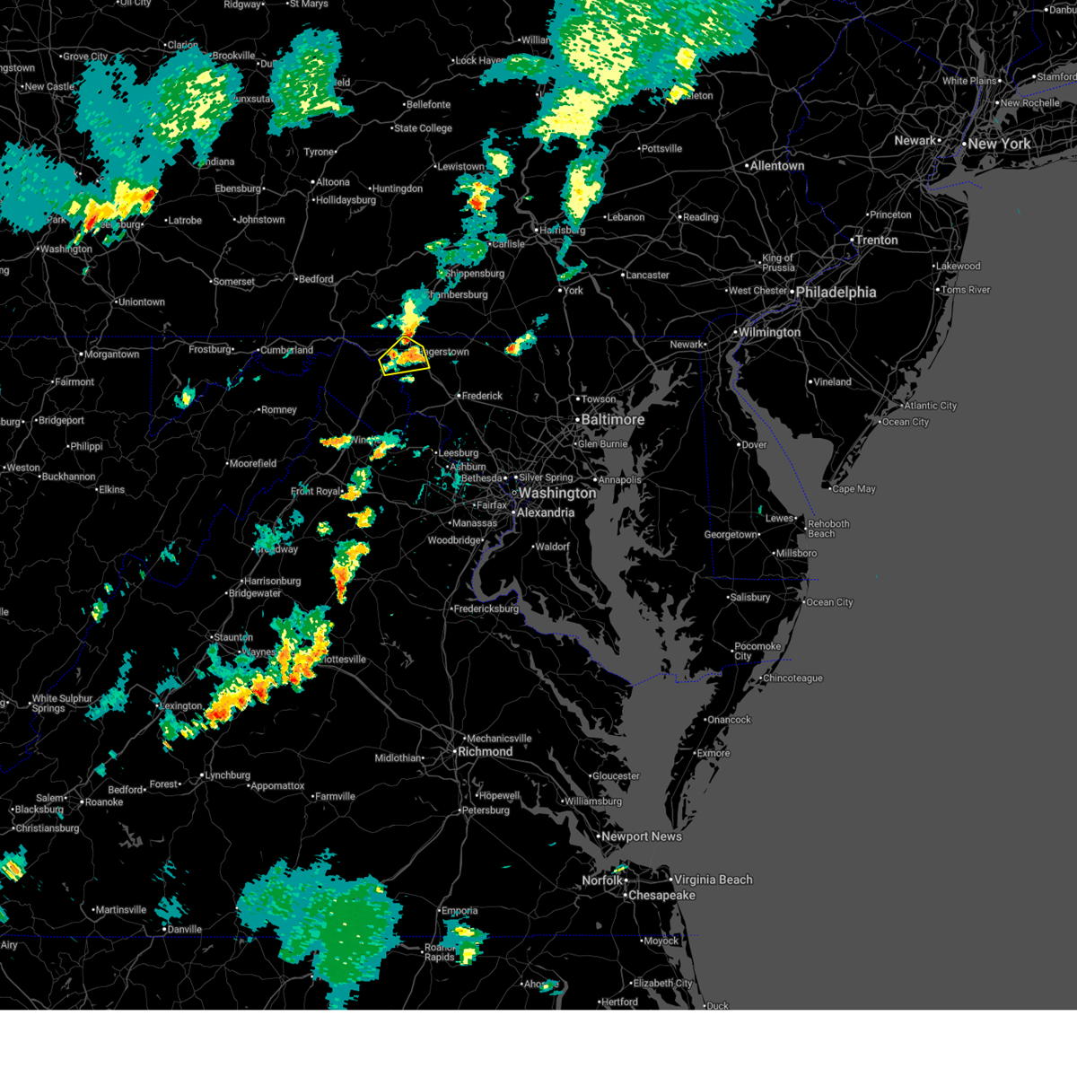
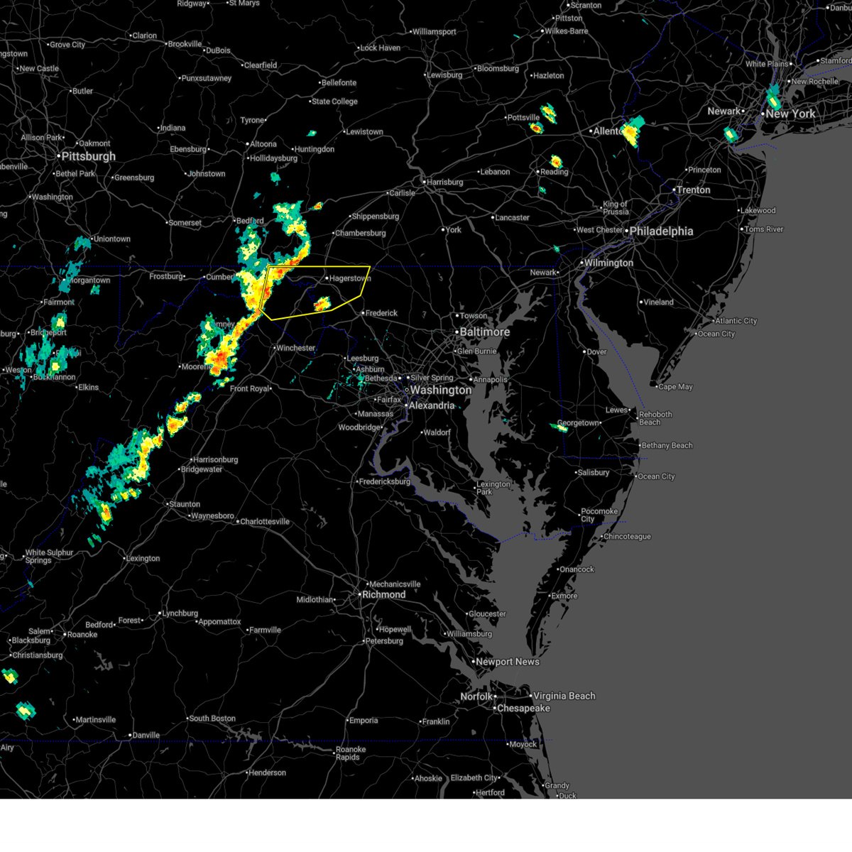
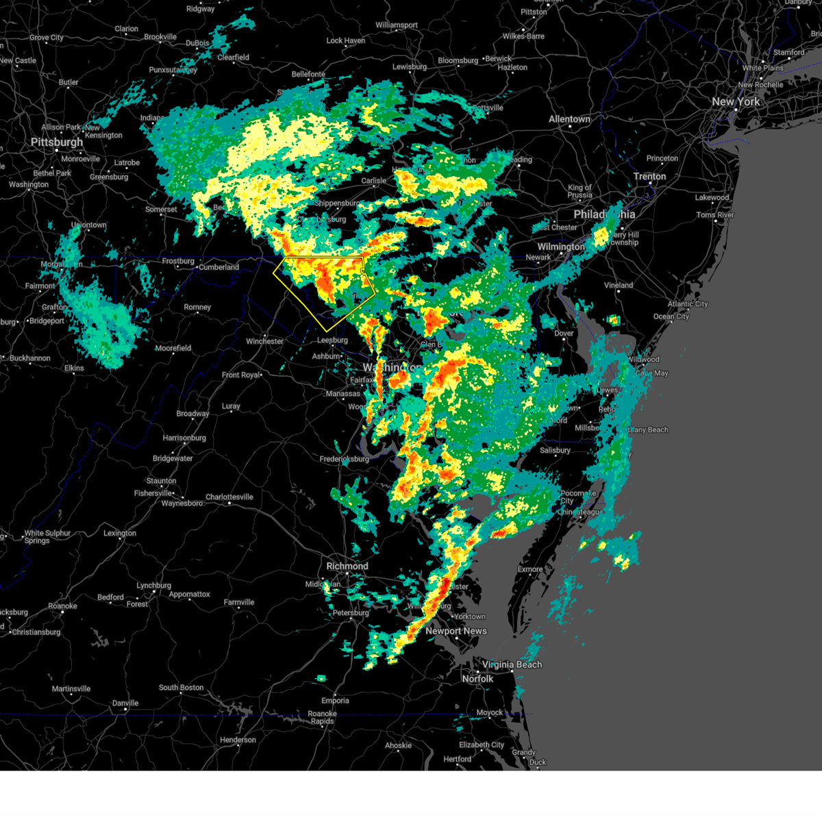
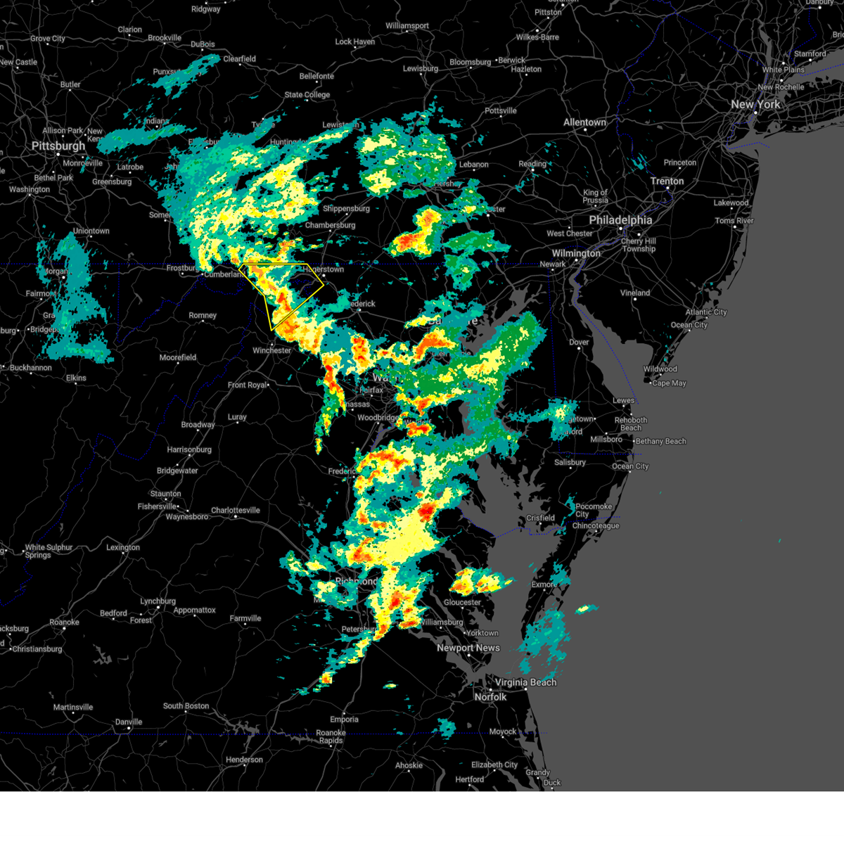
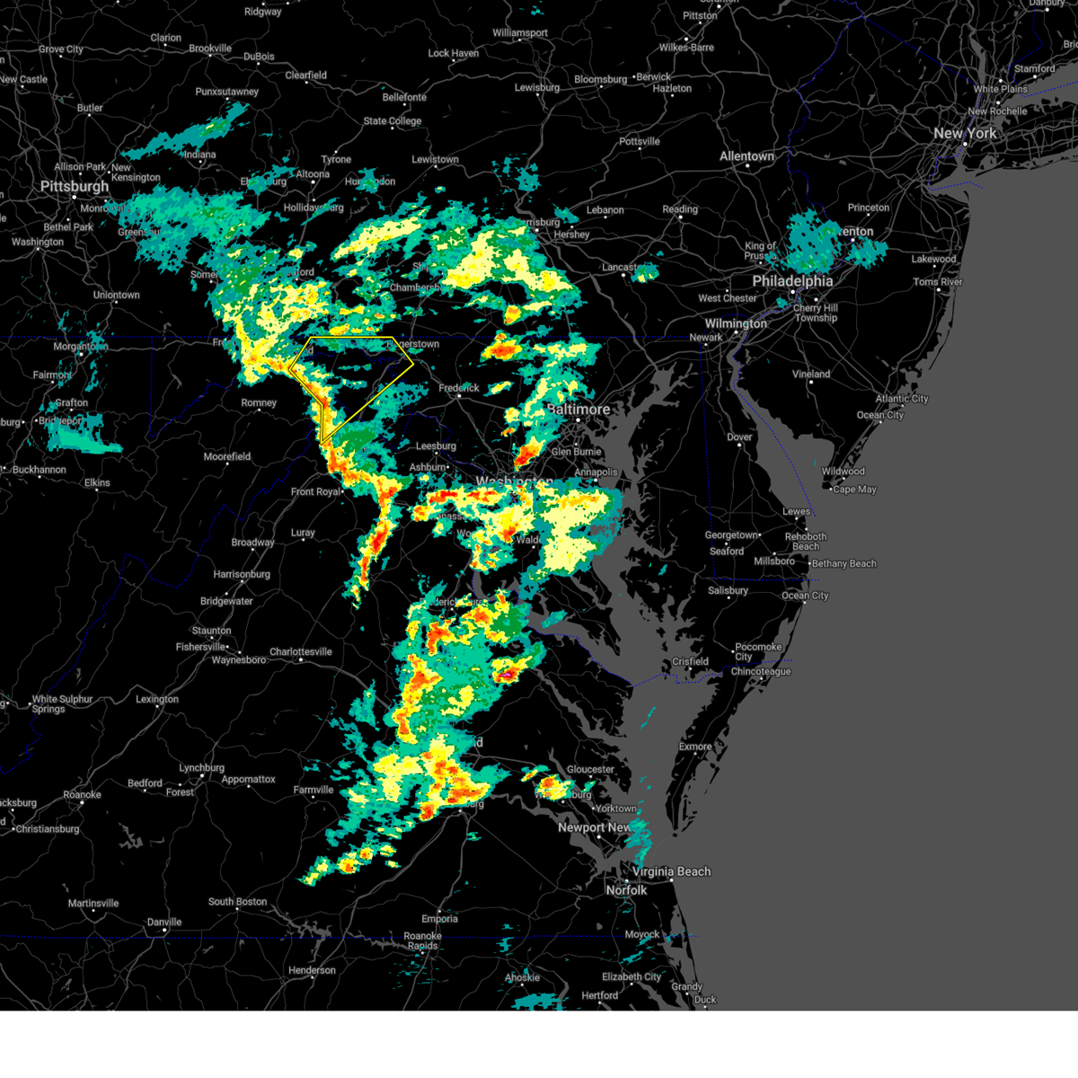
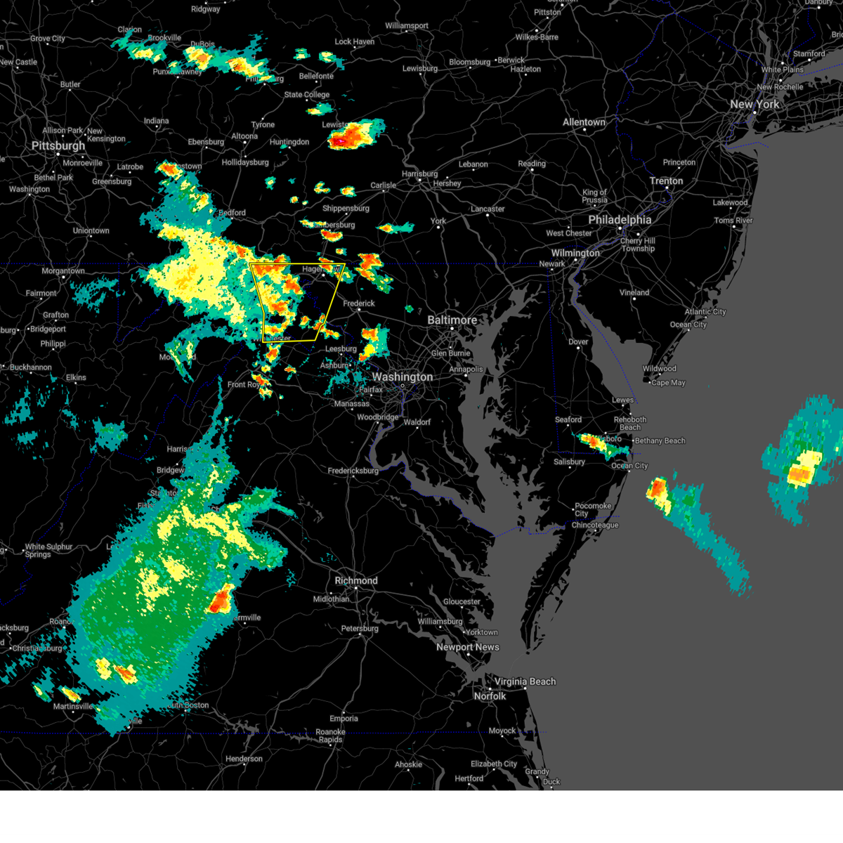
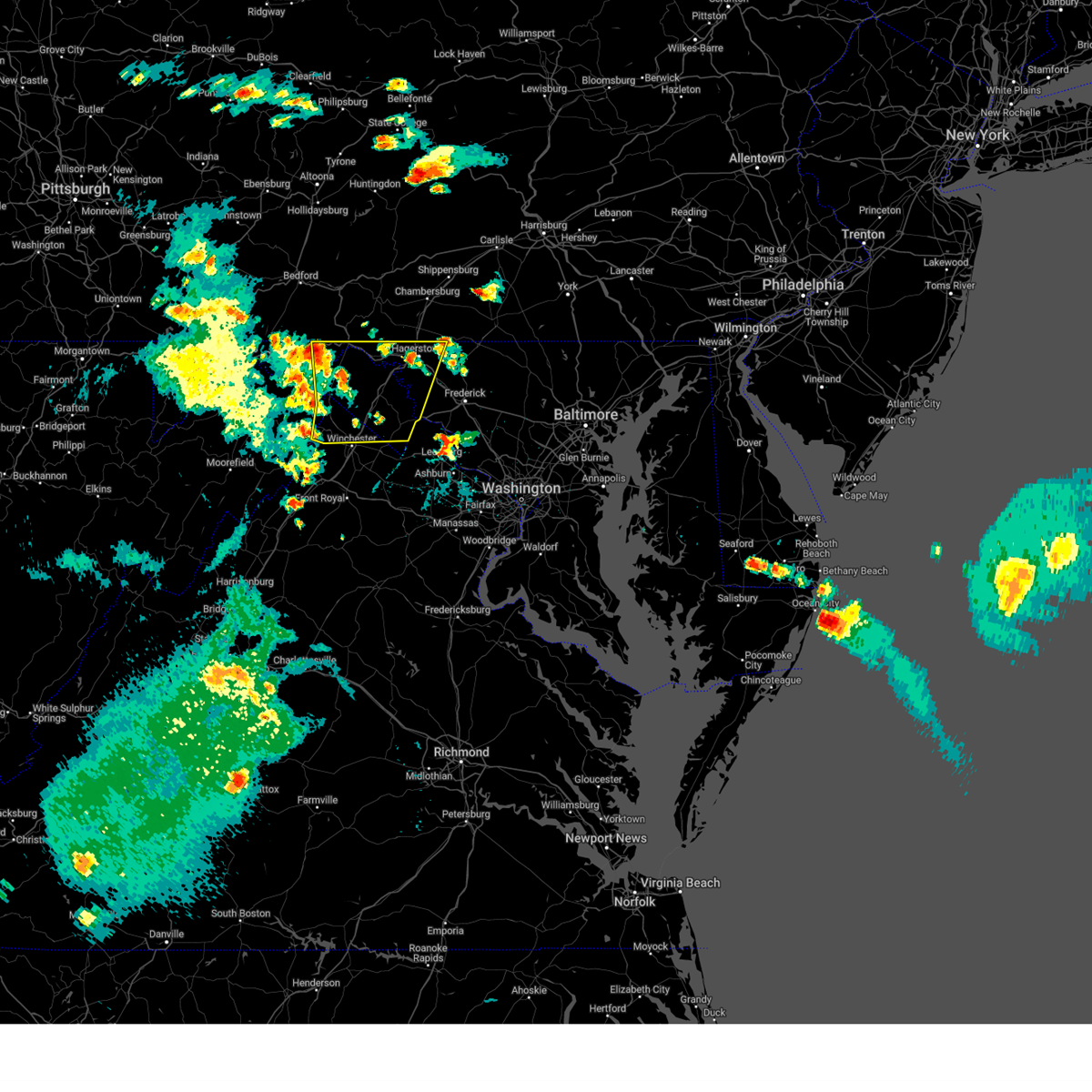
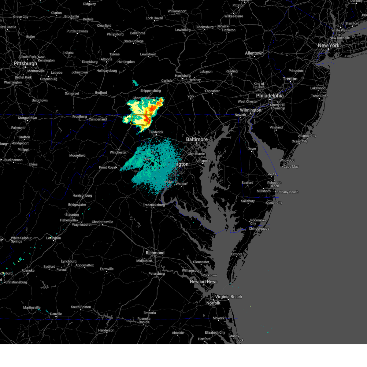
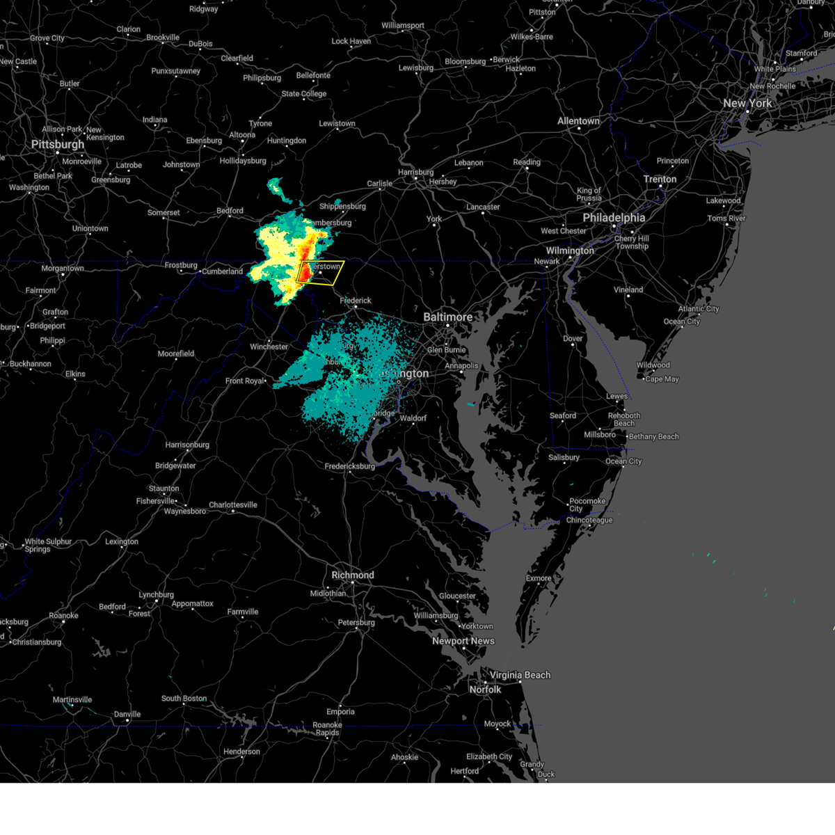
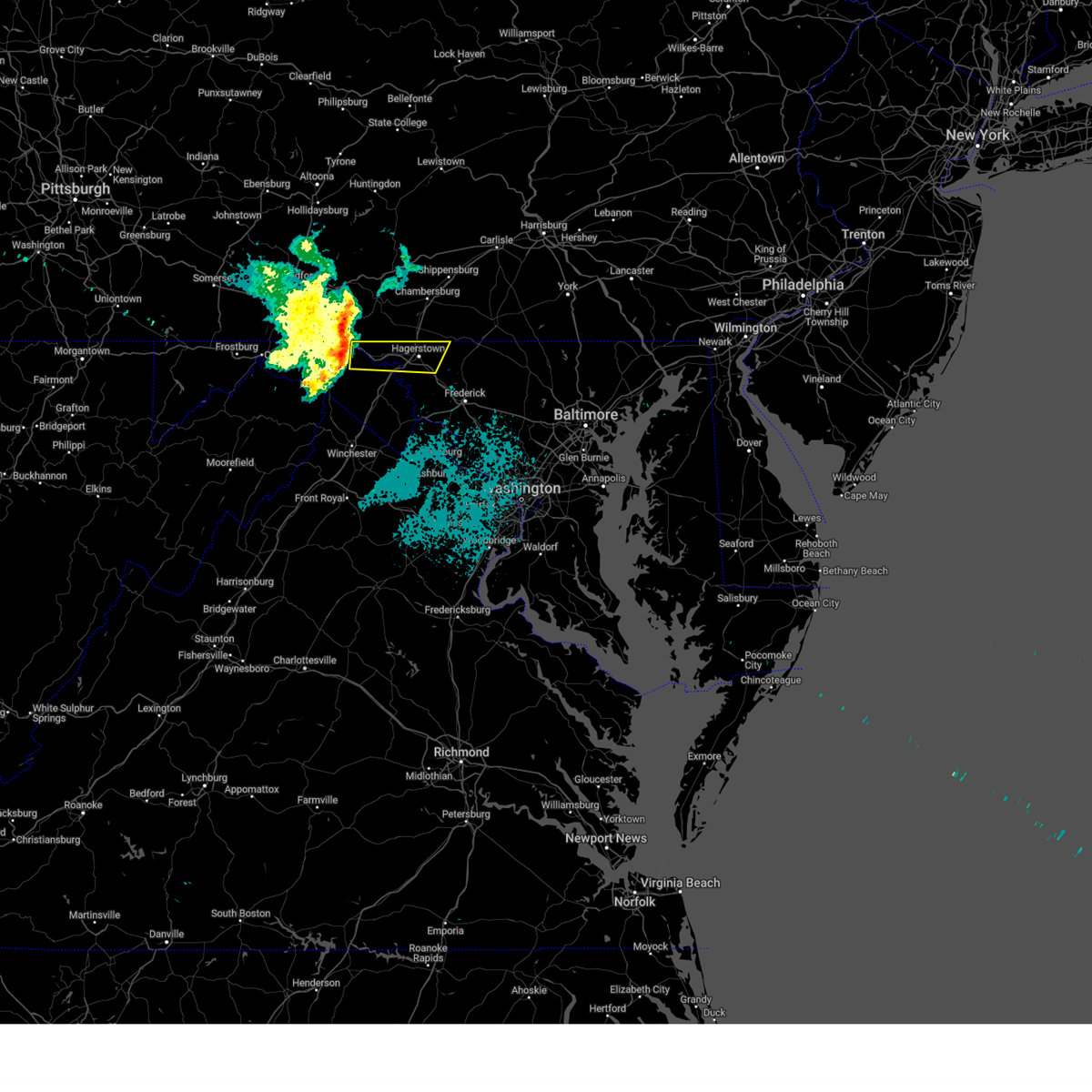
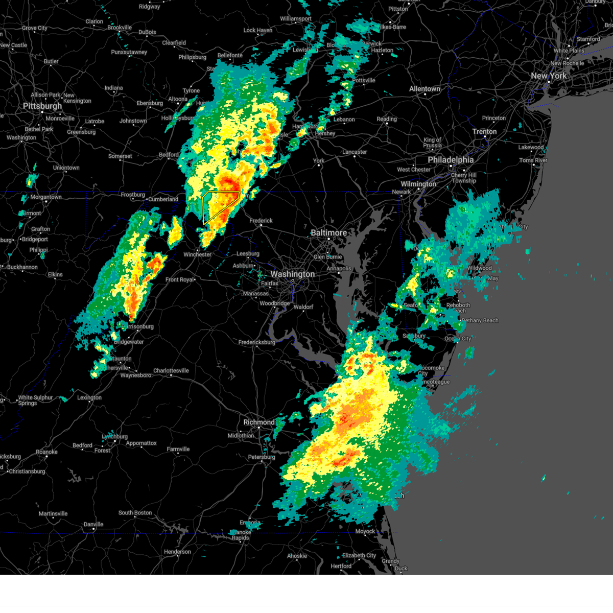
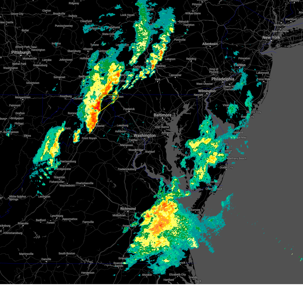
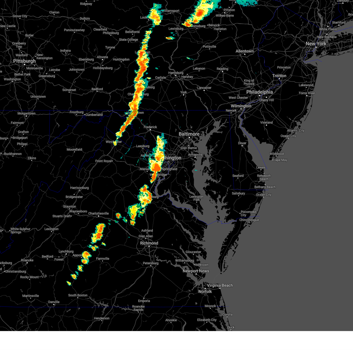
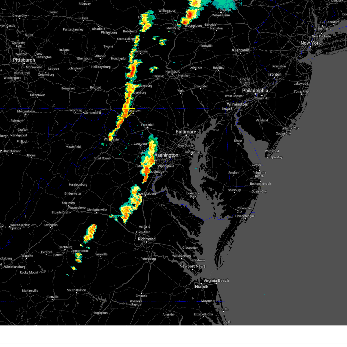
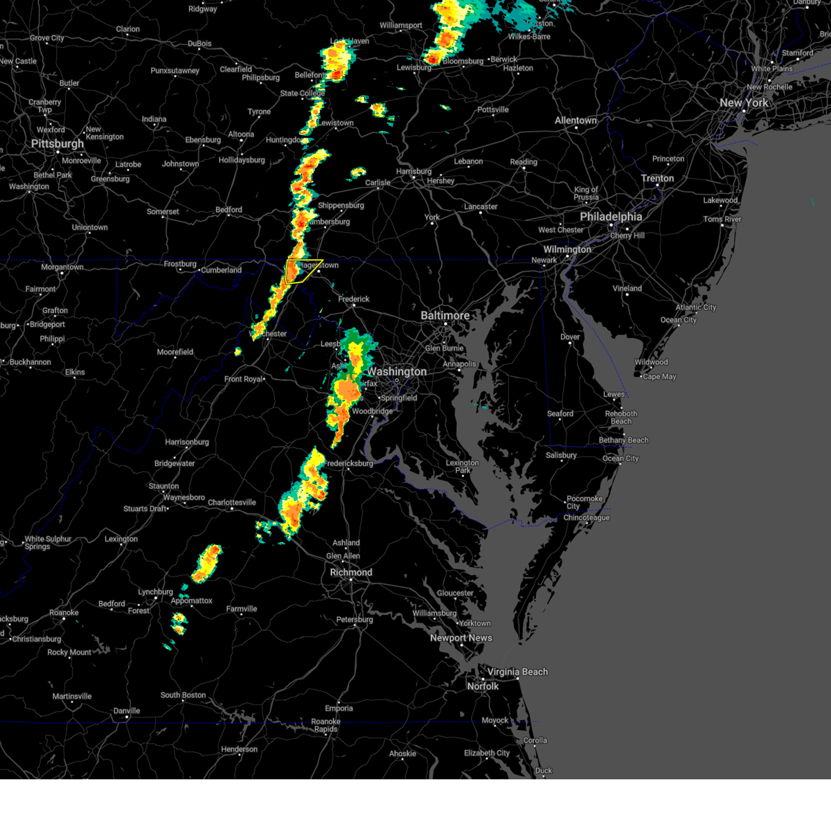
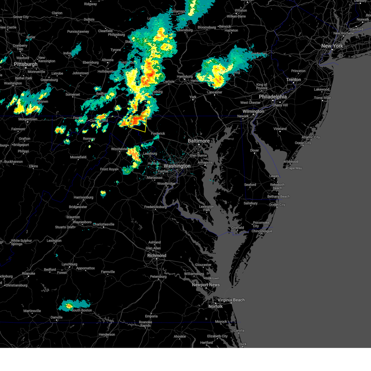
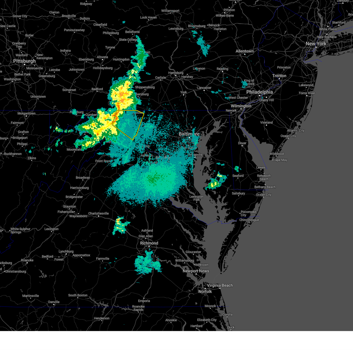
Hail Map for Hagerstown, MD
The Hagerstown, MD area has had 13 reports of on-the-ground hail by trained spotters, and has been under severe weather warnings 27 times during the past 12 months. Doppler radar has detected hail at or near Hagerstown, MD on 44 occasions, including 2 occasions during the past year.
| Name: | Hagerstown, MD |
| Where Located: | 63.9 miles WNW of Baltimore, MD |
| Map: | Google Map for Hagerstown, MD |
| Population: | 39662 |
| Housing Units: | 18682 |
| More Info: | Search Google for Hagerstown, MD |
0
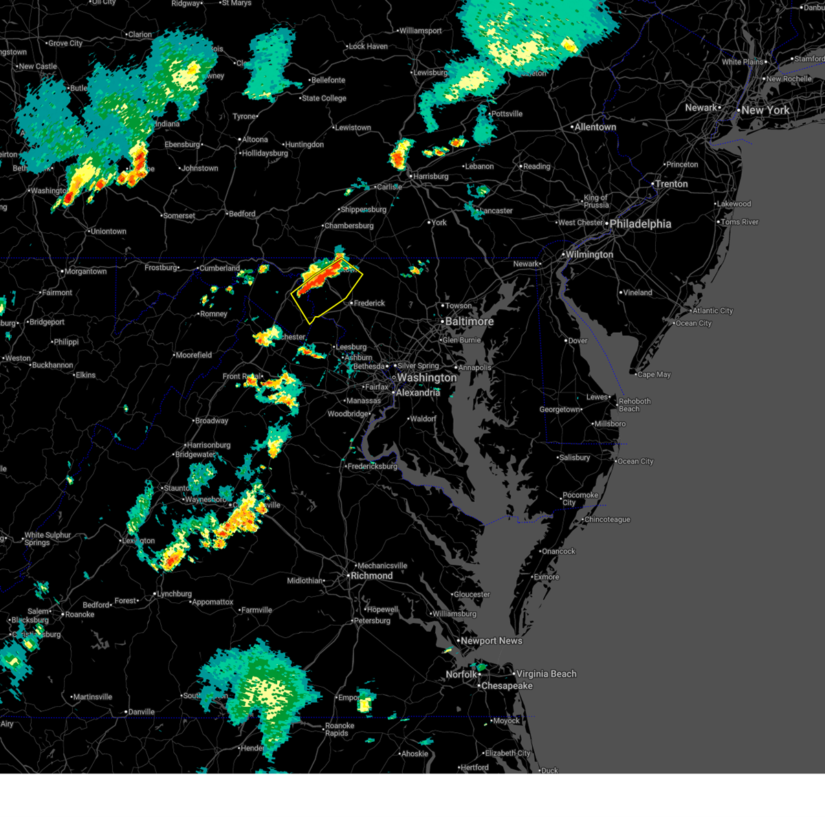
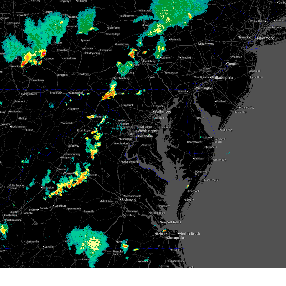
The Top Recent Hail Date for Hagerstown, MD is Saturday, June 28, 2025 (25th out of 44)
Hail and Wind Damage Spotted near Hagerstown, MD
| Date / Time | Report Details |
|---|---|
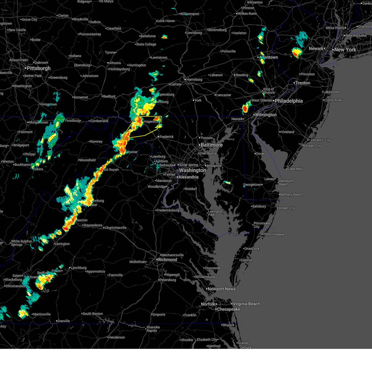
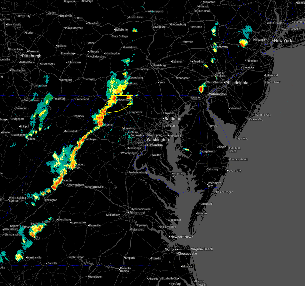
| 6/28/2025 6:16 PM EDT |
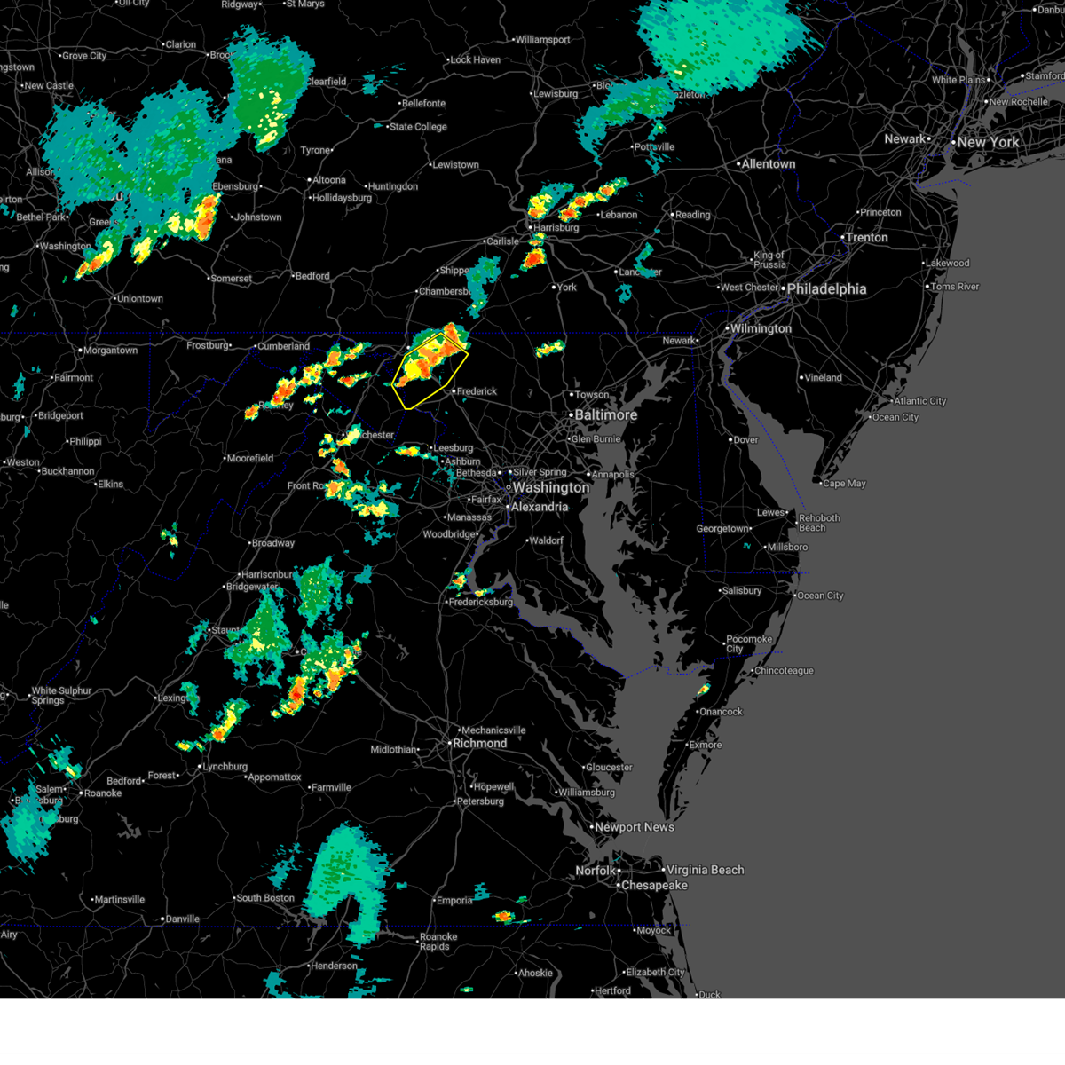 At 615 pm edt, severe thunderstorms were located along a line extending from near thurmont to mount lena to shepherdstown, moving southeast at 15 mph (radar indicated). Hazards include 60 mph wind gusts and quarter size hail. Damaging winds will cause some trees and large branches to fall. this could injure those outdoors, as well as damage homes and vehicles. roadways may become blocked by downed trees. localized power outages are possible. unsecured light objects may become projectiles. Locations impacted include, frederick, hagerstown, thurmont, shepherdstown, robinwood, boonsboro, smithsburg, braddock heights, mount aetna, mount lena, san mar, harpers ferry, wolfsville, saint james, myersville, cavetown, keedysville, funkstown, sharpsburg, and fairplay. At 615 pm edt, severe thunderstorms were located along a line extending from near thurmont to mount lena to shepherdstown, moving southeast at 15 mph (radar indicated). Hazards include 60 mph wind gusts and quarter size hail. Damaging winds will cause some trees and large branches to fall. this could injure those outdoors, as well as damage homes and vehicles. roadways may become blocked by downed trees. localized power outages are possible. unsecured light objects may become projectiles. Locations impacted include, frederick, hagerstown, thurmont, shepherdstown, robinwood, boonsboro, smithsburg, braddock heights, mount aetna, mount lena, san mar, harpers ferry, wolfsville, saint james, myersville, cavetown, keedysville, funkstown, sharpsburg, and fairplay.
|
| 6/28/2025 6:16 PM EDT |
 the severe thunderstorm warning has been cancelled and is no longer in effect the severe thunderstorm warning has been cancelled and is no longer in effect
|
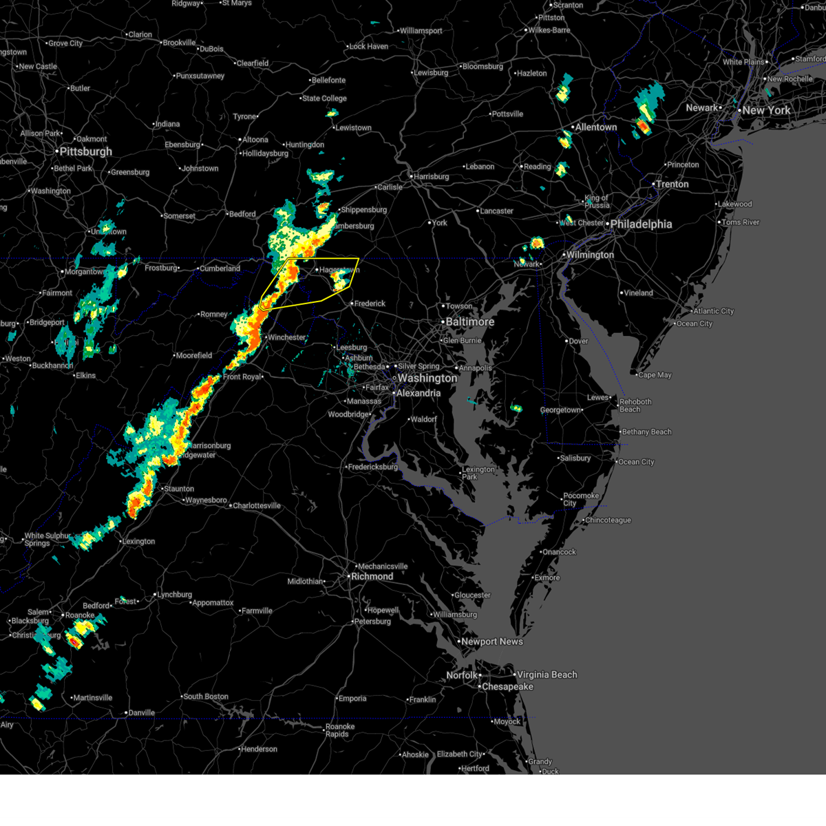
| 6/28/2025 5:53 PM EDT |
 Svrlwx the national weather service in sterling virginia has issued a * severe thunderstorm warning for, eastern washington county in north central maryland, northwestern frederick county in north central maryland, northwestern loudoun county in northern virginia, northeastern jefferson county in the panhandle of west virginia, east central berkeley county in the panhandle of west virginia, * until 645 pm edt. * at 552 pm edt, severe thunderstorms were located along a line extending from near rouzerville to near san mar to near shepherdstown, moving southeast at 15 mph (radar indicated). Hazards include 60 mph wind gusts and quarter size hail. Damaging winds will cause some trees and large branches to fall. this could injure those outdoors, as well as damage homes and vehicles. roadways may become blocked by downed trees. localized power outages are possible. Unsecured light objects may become projectiles. Svrlwx the national weather service in sterling virginia has issued a * severe thunderstorm warning for, eastern washington county in north central maryland, northwestern frederick county in north central maryland, northwestern loudoun county in northern virginia, northeastern jefferson county in the panhandle of west virginia, east central berkeley county in the panhandle of west virginia, * until 645 pm edt. * at 552 pm edt, severe thunderstorms were located along a line extending from near rouzerville to near san mar to near shepherdstown, moving southeast at 15 mph (radar indicated). Hazards include 60 mph wind gusts and quarter size hail. Damaging winds will cause some trees and large branches to fall. this could injure those outdoors, as well as damage homes and vehicles. roadways may become blocked by downed trees. localized power outages are possible. Unsecured light objects may become projectiles.
|
| 6/28/2025 5:37 PM EDT | A few trees were down around funkstow in washington county MD, 2.7 miles NNW of Hagerstown, MD |
| 6/28/2025 5:37 PM EDT |
 At 537 pm edt, a severe thunderstorm was located over williamsport, or near hagerstown, moving east at 10 mph (radar indicated). Hazards include 60 mph wind gusts and quarter size hail. Damaging winds will cause some trees and large branches to fall. this could injure those outdoors, as well as damage homes and vehicles. roadways may become blocked by downed trees. localized power outages are possible. unsecured light objects may become projectiles. Locations impacted include, hagerstown, municipal stadium, robinwood, williamsport, mount aetna, mount lena, san mar, saint james, halfway, funkstown, falling waters, fairplay, chewsville, and bridgeport. At 537 pm edt, a severe thunderstorm was located over williamsport, or near hagerstown, moving east at 10 mph (radar indicated). Hazards include 60 mph wind gusts and quarter size hail. Damaging winds will cause some trees and large branches to fall. this could injure those outdoors, as well as damage homes and vehicles. roadways may become blocked by downed trees. localized power outages are possible. unsecured light objects may become projectiles. Locations impacted include, hagerstown, municipal stadium, robinwood, williamsport, mount aetna, mount lena, san mar, saint james, halfway, funkstown, falling waters, fairplay, chewsville, and bridgeport.
|
| 6/28/2025 5:28 PM EDT | A few trees were down around halfwa in washington county MD, 3.3 miles NE of Hagerstown, MD |
| 6/28/2025 5:23 PM EDT |
 Svrlwx the national weather service in sterling virginia has issued a * severe thunderstorm warning for, northeastern washington county in north central maryland, northeastern berkeley county in the panhandle of west virginia, * until 600 pm edt. * at 523 pm edt, a severe thunderstorm was located over williamsport, or 7 miles southwest of hagerstown, moving east at 10 mph (radar indicated). Hazards include 60 mph wind gusts and quarter size hail. Damaging winds will cause some trees and large branches to fall. this could injure those outdoors, as well as damage homes and vehicles. roadways may become blocked by downed trees. localized power outages are possible. Unsecured light objects may become projectiles. Svrlwx the national weather service in sterling virginia has issued a * severe thunderstorm warning for, northeastern washington county in north central maryland, northeastern berkeley county in the panhandle of west virginia, * until 600 pm edt. * at 523 pm edt, a severe thunderstorm was located over williamsport, or 7 miles southwest of hagerstown, moving east at 10 mph (radar indicated). Hazards include 60 mph wind gusts and quarter size hail. Damaging winds will cause some trees and large branches to fall. this could injure those outdoors, as well as damage homes and vehicles. roadways may become blocked by downed trees. localized power outages are possible. Unsecured light objects may become projectiles.
|
| 6/19/2025 2:26 PM EDT |
 At 225 pm edt, a severe thunderstorm was located near williamsport, or 8 miles north of shepherdstown, moving east at 35 mph (radar indicated). Hazards include 60 mph wind gusts. Damaging winds will cause some trees and large branches to fall. this could injure those outdoors, as well as damage homes and vehicles. roadways may become blocked by downed trees. localized power outages are possible. unsecured light objects may become projectiles. Locations impacted include, hagerstown, martinsburg, thurmont, shepherdstown, municipal stadium, robinwood, fountainhead-orchard hills, boonsboro, smithsburg, paramount-long meadow, wilson-conococheague, williamsport, mount aetna, mount lena, san mar, long meadow, wolfsville, saint james, berkeley, and halfway. At 225 pm edt, a severe thunderstorm was located near williamsport, or 8 miles north of shepherdstown, moving east at 35 mph (radar indicated). Hazards include 60 mph wind gusts. Damaging winds will cause some trees and large branches to fall. this could injure those outdoors, as well as damage homes and vehicles. roadways may become blocked by downed trees. localized power outages are possible. unsecured light objects may become projectiles. Locations impacted include, hagerstown, martinsburg, thurmont, shepherdstown, municipal stadium, robinwood, fountainhead-orchard hills, boonsboro, smithsburg, paramount-long meadow, wilson-conococheague, williamsport, mount aetna, mount lena, san mar, long meadow, wolfsville, saint james, berkeley, and halfway.
|
| 6/19/2025 2:26 PM EDT |
 the severe thunderstorm warning has been cancelled and is no longer in effect the severe thunderstorm warning has been cancelled and is no longer in effect
|
| 6/19/2025 2:08 PM EDT |
 At 208 pm edt, a severe thunderstorm was located 7 miles west of williamsport, or 7 miles north of martinsburg, moving east at 35 mph (radar indicated). Hazards include 60 mph wind gusts. Damaging winds will cause some trees and large branches to fall. this could injure those outdoors, as well as damage homes and vehicles. roadways may become blocked by downed trees. localized power outages are possible. unsecured light objects may become projectiles. Locations impacted include, hagerstown, martinsburg, thurmont, shepherdstown, municipal stadium, robinwood, fountainhead-orchard hills, boonsboro, smithsburg, paramount-long meadow, wilson-conococheague, williamsport, mount aetna, mount lena, san mar, long meadow, wolfsville, saint james, berkeley, and halfway. At 208 pm edt, a severe thunderstorm was located 7 miles west of williamsport, or 7 miles north of martinsburg, moving east at 35 mph (radar indicated). Hazards include 60 mph wind gusts. Damaging winds will cause some trees and large branches to fall. this could injure those outdoors, as well as damage homes and vehicles. roadways may become blocked by downed trees. localized power outages are possible. unsecured light objects may become projectiles. Locations impacted include, hagerstown, martinsburg, thurmont, shepherdstown, municipal stadium, robinwood, fountainhead-orchard hills, boonsboro, smithsburg, paramount-long meadow, wilson-conococheague, williamsport, mount aetna, mount lena, san mar, long meadow, wolfsville, saint james, berkeley, and halfway.
|
| 6/19/2025 1:44 PM EDT |
 Svrlwx the national weather service in sterling virginia has issued a * severe thunderstorm warning for, washington county in north central maryland, northwestern frederick county in north central maryland, northeastern jefferson county in the panhandle of west virginia, central morgan county in the panhandle of west virginia, berkeley county in the panhandle of west virginia, * until 245 pm edt. * at 144 pm edt, a severe thunderstorm was located 7 miles northeast of greenwood, moving east at 50 mph (radar indicated). Hazards include 60 mph wind gusts. Damaging winds will cause some trees and large branches to fall. this could injure those outdoors, as well as damage homes and vehicles. roadways may become blocked by downed trees. localized power outages are possible. Unsecured light objects may become projectiles. Svrlwx the national weather service in sterling virginia has issued a * severe thunderstorm warning for, washington county in north central maryland, northwestern frederick county in north central maryland, northeastern jefferson county in the panhandle of west virginia, central morgan county in the panhandle of west virginia, berkeley county in the panhandle of west virginia, * until 245 pm edt. * at 144 pm edt, a severe thunderstorm was located 7 miles northeast of greenwood, moving east at 50 mph (radar indicated). Hazards include 60 mph wind gusts. Damaging winds will cause some trees and large branches to fall. this could injure those outdoors, as well as damage homes and vehicles. roadways may become blocked by downed trees. localized power outages are possible. Unsecured light objects may become projectiles.
|
| 5/30/2025 8:25 PM EDT | Several trees and wires blew down in the northern part of hagerstow in washington county MD, 1.6 miles S of Hagerstown, MD |
| 5/30/2025 8:25 PM EDT |
 The storms which prompted the warning have weakened below severe limits, and no longer pose an immediate threat to life or property. therefore, the warning will be allowed to expire. however, gusty winds are still possible with these thunderstorms. a tornado watch remains in effect until midnight edt for north central maryland, and northern virginia. The storms which prompted the warning have weakened below severe limits, and no longer pose an immediate threat to life or property. therefore, the warning will be allowed to expire. however, gusty winds are still possible with these thunderstorms. a tornado watch remains in effect until midnight edt for north central maryland, and northern virginia.
|
| 5/30/2025 8:01 PM EDT |
 Svrlwx the national weather service in sterling virginia has issued a * severe thunderstorm warning for, washington county in north central maryland, frederick county in north central maryland, north central loudoun county in northern virginia, northeastern jefferson county in the panhandle of west virginia, northeastern morgan county in the panhandle of west virginia, northeastern berkeley county in the panhandle of west virginia, * until 830 pm edt. * at 801 pm edt, severe thunderstorms were located along a line extending from 9 miles west of williamsport to near shepherdstown to near brunswick, moving northeast at 30 mph (radar indicated). Hazards include 60 mph wind gusts. Damaging winds will cause some trees and large branches to fall. this could injure those outdoors, as well as damage homes and vehicles. roadways may become blocked by downed trees. localized power outages are possible. Unsecured light objects may become projectiles. Svrlwx the national weather service in sterling virginia has issued a * severe thunderstorm warning for, washington county in north central maryland, frederick county in north central maryland, north central loudoun county in northern virginia, northeastern jefferson county in the panhandle of west virginia, northeastern morgan county in the panhandle of west virginia, northeastern berkeley county in the panhandle of west virginia, * until 830 pm edt. * at 801 pm edt, severe thunderstorms were located along a line extending from 9 miles west of williamsport to near shepherdstown to near brunswick, moving northeast at 30 mph (radar indicated). Hazards include 60 mph wind gusts. Damaging winds will cause some trees and large branches to fall. this could injure those outdoors, as well as damage homes and vehicles. roadways may become blocked by downed trees. localized power outages are possible. Unsecured light objects may become projectiles.
|
| 5/30/2025 7:34 PM EDT |
 the severe thunderstorm warning has been cancelled and is no longer in effect the severe thunderstorm warning has been cancelled and is no longer in effect
|
| 5/30/2025 7:34 PM EDT |
 At 734 pm edt, severe thunderstorms were located along a line extending from near inglesmith to 7 miles southeast of berkeley springs to near inwood, moving northeast at 30 mph (radar indicated). Hazards include 60 mph wind gusts. Damaging winds will cause some trees and large branches to fall. this could injure those outdoors, as well as damage homes and vehicles. roadways may become blocked by downed trees. localized power outages are possible. unsecured light objects may become projectiles. Locations impacted include, johnsons mill, tomahawk, johnsontown, berkeley springs, martinsburg, valley view, berkeley, hancock, spohrs crossroads, wilson-conococheague, big spring, great cacapon, big pool, halfway, arden, falling waters, smith crossroads, jones springs, williamsport, and new hope. At 734 pm edt, severe thunderstorms were located along a line extending from near inglesmith to 7 miles southeast of berkeley springs to near inwood, moving northeast at 30 mph (radar indicated). Hazards include 60 mph wind gusts. Damaging winds will cause some trees and large branches to fall. this could injure those outdoors, as well as damage homes and vehicles. roadways may become blocked by downed trees. localized power outages are possible. unsecured light objects may become projectiles. Locations impacted include, johnsons mill, tomahawk, johnsontown, berkeley springs, martinsburg, valley view, berkeley, hancock, spohrs crossroads, wilson-conococheague, big spring, great cacapon, big pool, halfway, arden, falling waters, smith crossroads, jones springs, williamsport, and new hope.
|
| 5/30/2025 7:05 PM EDT |
 Svrlwx the national weather service in sterling virginia has issued a * severe thunderstorm warning for, northwestern washington county in north central maryland, northeastern allegany county in western maryland, northeastern frederick county in northwestern virginia, morgan county in the panhandle of west virginia, berkeley county in the panhandle of west virginia, northeastern hampshire county in eastern west virginia, * until 800 pm edt. * at 704 pm edt, severe thunderstorms were located along a line extending from paw paw to near greenwood to 9 miles northwest of winchester, moving northeast at 30 mph (radar indicated). Hazards include 60 mph wind gusts. Damaging winds will cause some trees and large branches to fall. this could injure those outdoors, as well as damage homes and vehicles. roadways may become blocked by downed trees. localized power outages are possible. Unsecured light objects may become projectiles. Svrlwx the national weather service in sterling virginia has issued a * severe thunderstorm warning for, northwestern washington county in north central maryland, northeastern allegany county in western maryland, northeastern frederick county in northwestern virginia, morgan county in the panhandle of west virginia, berkeley county in the panhandle of west virginia, northeastern hampshire county in eastern west virginia, * until 800 pm edt. * at 704 pm edt, severe thunderstorms were located along a line extending from paw paw to near greenwood to 9 miles northwest of winchester, moving northeast at 30 mph (radar indicated). Hazards include 60 mph wind gusts. Damaging winds will cause some trees and large branches to fall. this could injure those outdoors, as well as damage homes and vehicles. roadways may become blocked by downed trees. localized power outages are possible. Unsecured light objects may become projectiles.
|
| 5/16/2025 4:37 PM EDT | the severe thunderstorm warning has been cancelled and is no longer in effect |
| 5/16/2025 4:37 PM EDT | At 437 pm edt, severe thunderstorms were located along a line extending from near claylick to municipal stadium to ranson, moving east at 50 mph (law enforcement has reported tree damage with these storms. the martinsburg airport gusted to 62 mph). Hazards include 60 mph wind gusts and quarter size hail. Damaging winds will cause some trees and large branches to fall. this could injure those outdoors, as well as damage homes and vehicles. roadways may become blocked by downed trees. localized power outages are possible. unsecured light objects may become projectiles. Locations impacted include, municipal stadium, warrenton, shepherdstown, ranson, wilson-conococheague, fairplay, bridgeport, keedysville, robinwood, halfway, bolivar, san mar, pleasantville, williamsport, millville, hagerstown, charles town, antietam, rippon, and mount lena. |
| 5/16/2025 4:36 PM EDT | Trees down on wire in franklin county PA, 5.9 miles SSE of Hagerstown, MD |
| 5/16/2025 4:17 PM EDT |
 the severe thunderstorm warning has been cancelled and is no longer in effect the severe thunderstorm warning has been cancelled and is no longer in effect
|
| 5/16/2025 4:17 PM EDT |
 At 417 pm edt, severe thunderstorms were located along a line extending from near hancock to 7 miles north of martinsburg to 6 miles southwest of inwood, moving east at 45 mph (law enforcement reported trees down in eastern allegany county in maryland). Hazards include 60 mph wind gusts and quarter size hail. Damaging winds will cause some trees and large branches to fall. this could injure those outdoors, as well as damage homes and vehicles. roadways may become blocked by downed trees. localized power outages are possible. unsecured light objects may become projectiles. Locations impacted include, winebrenners cross, municipal stadium, johnsontown, valley view, berkeley, ridgeway, oakland, big spring, fairplay, bridgeport, keedysville, robinwood, san mar, pleasantville, falling waters, jones springs, williamsport, albin, millville, and new hope. At 417 pm edt, severe thunderstorms were located along a line extending from near hancock to 7 miles north of martinsburg to 6 miles southwest of inwood, moving east at 45 mph (law enforcement reported trees down in eastern allegany county in maryland). Hazards include 60 mph wind gusts and quarter size hail. Damaging winds will cause some trees and large branches to fall. this could injure those outdoors, as well as damage homes and vehicles. roadways may become blocked by downed trees. localized power outages are possible. unsecured light objects may become projectiles. Locations impacted include, winebrenners cross, municipal stadium, johnsontown, valley view, berkeley, ridgeway, oakland, big spring, fairplay, bridgeport, keedysville, robinwood, san mar, pleasantville, falling waters, jones springs, williamsport, albin, millville, and new hope.
|
| 5/16/2025 3:53 PM EDT |
 Svrlwx the national weather service in sterling virginia has issued a * severe thunderstorm warning for, washington county in north central maryland, northeastern allegany county in western maryland, central frederick county in northwestern virginia, north central clarke county in northwestern virginia, the northwestern city of winchester in northwestern virginia, jefferson county in the panhandle of west virginia, morgan county in the panhandle of west virginia, berkeley county in the panhandle of west virginia, east central hampshire county in eastern west virginia, * until 445 pm edt. * at 353 pm edt, severe thunderstorms were located along a line extending from near barnes gap to near greenwood to 12 miles north of star tannery, moving east at 50 mph (radar indicated). Hazards include 60 mph wind gusts and quarter size hail. Damaging winds will cause some trees and large branches to fall. this could injure those outdoors, as well as damage homes and vehicles. roadways may become blocked by downed trees. localized power outages are possible. Unsecured light objects may become projectiles. Svrlwx the national weather service in sterling virginia has issued a * severe thunderstorm warning for, washington county in north central maryland, northeastern allegany county in western maryland, central frederick county in northwestern virginia, north central clarke county in northwestern virginia, the northwestern city of winchester in northwestern virginia, jefferson county in the panhandle of west virginia, morgan county in the panhandle of west virginia, berkeley county in the panhandle of west virginia, east central hampshire county in eastern west virginia, * until 445 pm edt. * at 353 pm edt, severe thunderstorms were located along a line extending from near barnes gap to near greenwood to 12 miles north of star tannery, moving east at 50 mph (radar indicated). Hazards include 60 mph wind gusts and quarter size hail. Damaging winds will cause some trees and large branches to fall. this could injure those outdoors, as well as damage homes and vehicles. roadways may become blocked by downed trees. localized power outages are possible. Unsecured light objects may become projectiles.
|
| 4/19/2025 10:09 PM EDT | Mddot sensor md 64 at md 418 in washington county MD, 9.4 miles WSW of Hagerstown, MD |
| 4/19/2025 10:06 PM EDT |
 The storm which prompted the warning has moved out of the area. therefore, the warning will be allowed to expire. The storm which prompted the warning has moved out of the area. therefore, the warning will be allowed to expire.
|
| 4/19/2025 10:05 PM EDT | Cwop station cw1323 in washington county MD, 1 miles WSW of Hagerstown, MD |
| 4/19/2025 10:04 PM EDT | Measured on personal weather station in washington county MD, 5.7 miles WSW of Hagerstown, MD |
| 4/19/2025 10:01 PM EDT | At least a dozen trees down across hagerstow in washington county MD, 0.2 miles SSE of Hagerstown, MD |
| 4/19/2025 10:00 PM EDT | Private weather station hgntc in washington county MD, 1.2 miles NNW of Hagerstown, MD |
| 4/19/2025 10:00 PM EDT | Storm damage reported in washington county MD, 5.1 miles S of Hagerstown, MD |
| 4/19/2025 9:56 PM EDT |
 the severe thunderstorm warning has been cancelled and is no longer in effect the severe thunderstorm warning has been cancelled and is no longer in effect
|
| 4/19/2025 9:56 PM EDT |
 At 956 pm edt, a severe thunderstorm was located over paramount-long meadow, or over hagerstown, moving east at 75 mph (radar indicated). Hazards include 60 mph wind gusts. Damaging winds will cause some trees and large branches to fall. this could injure those outdoors, as well as damage homes and vehicles. roadways may become blocked by downed trees. localized power outages are possible. unsecured light objects may become projectiles. Locations impacted include, long meadow, municipal stadium, fountainhead-orchard hills, smithsburg, warrenton, mount aetna, middleburg, wilson-conococheague, maugansville, ringgold, bridgeport, leitersburg, cavetown, robinwood, halfway, funkstown, williamsport, chewsville, hagerstown, and saint james. At 956 pm edt, a severe thunderstorm was located over paramount-long meadow, or over hagerstown, moving east at 75 mph (radar indicated). Hazards include 60 mph wind gusts. Damaging winds will cause some trees and large branches to fall. this could injure those outdoors, as well as damage homes and vehicles. roadways may become blocked by downed trees. localized power outages are possible. unsecured light objects may become projectiles. Locations impacted include, long meadow, municipal stadium, fountainhead-orchard hills, smithsburg, warrenton, mount aetna, middleburg, wilson-conococheague, maugansville, ringgold, bridgeport, leitersburg, cavetown, robinwood, halfway, funkstown, williamsport, chewsville, hagerstown, and saint james.
|
| 4/19/2025 9:39 PM EDT |
 Svrlwx the national weather service in sterling virginia has issued a * severe thunderstorm warning for, northeastern washington county in north central maryland, northeastern morgan county in the panhandle of west virginia, northeastern berkeley county in the panhandle of west virginia, * until 1015 pm edt. * at 938 pm edt, a severe thunderstorm was located over hancock, moving east at 75 mph (observation from cumberland regional airport). Hazards include 60 mph wind gusts. Damaging winds will cause some trees and large branches to fall. this could injure those outdoors, as well as damage homes and vehicles. roadways may become blocked by downed trees. localized power outages are possible. Unsecured light objects may become projectiles. Svrlwx the national weather service in sterling virginia has issued a * severe thunderstorm warning for, northeastern washington county in north central maryland, northeastern morgan county in the panhandle of west virginia, northeastern berkeley county in the panhandle of west virginia, * until 1015 pm edt. * at 938 pm edt, a severe thunderstorm was located over hancock, moving east at 75 mph (observation from cumberland regional airport). Hazards include 60 mph wind gusts. Damaging winds will cause some trees and large branches to fall. this could injure those outdoors, as well as damage homes and vehicles. roadways may become blocked by downed trees. localized power outages are possible. Unsecured light objects may become projectiles.
|
| 3/16/2025 7:20 PM EDT |
 the severe thunderstorm warning has been cancelled and is no longer in effect the severe thunderstorm warning has been cancelled and is no longer in effect
|
| 3/16/2025 6:53 PM EDT |
 Svrlwx the national weather service in sterling virginia has issued a * severe thunderstorm warning for, north central washington county in north central maryland, northeastern morgan county in the panhandle of west virginia, northeastern berkeley county in the panhandle of west virginia, * until 745 pm edt. * at 653 pm edt, a severe thunderstorm was located near martinsburg, moving northeast at 60 mph (radar indicated). Hazards include 60 mph wind gusts and quarter size hail. Damaging winds will cause some trees and large branches to fall. this could injure those outdoors, as well as damage homes and vehicles. roadways may become blocked by downed trees. localized power outages are possible. Unsecured light objects may become projectiles. Svrlwx the national weather service in sterling virginia has issued a * severe thunderstorm warning for, north central washington county in north central maryland, northeastern morgan county in the panhandle of west virginia, northeastern berkeley county in the panhandle of west virginia, * until 745 pm edt. * at 653 pm edt, a severe thunderstorm was located near martinsburg, moving northeast at 60 mph (radar indicated). Hazards include 60 mph wind gusts and quarter size hail. Damaging winds will cause some trees and large branches to fall. this could injure those outdoors, as well as damage homes and vehicles. roadways may become blocked by downed trees. localized power outages are possible. Unsecured light objects may become projectiles.
|
| 7/22/2024 7:56 PM EDT |
 the severe thunderstorm warning has been cancelled and is no longer in effect the severe thunderstorm warning has been cancelled and is no longer in effect
|
| 7/22/2024 7:30 PM EDT |
 Svrlwx the national weather service in sterling virginia has issued a * severe thunderstorm warning for, northeastern washington county in north central maryland, * until 815 pm edt. * at 730 pm edt, a severe thunderstorm was located near wilson-conococheague, or 8 miles west of hagerstown, moving east at 20 mph (radar indicated). Hazards include 60 mph wind gusts. Damaging winds will cause some trees and large branches to fall. this could injure those outdoors, as well as damage homes and vehicles. roadways may become blocked by downed trees. localized power outages are possible. Unsecured light objects may become projectiles. Svrlwx the national weather service in sterling virginia has issued a * severe thunderstorm warning for, northeastern washington county in north central maryland, * until 815 pm edt. * at 730 pm edt, a severe thunderstorm was located near wilson-conococheague, or 8 miles west of hagerstown, moving east at 20 mph (radar indicated). Hazards include 60 mph wind gusts. Damaging winds will cause some trees and large branches to fall. this could injure those outdoors, as well as damage homes and vehicles. roadways may become blocked by downed trees. localized power outages are possible. Unsecured light objects may become projectiles.
|
| 7/10/2024 7:57 PM EDT |
 The storms which prompted the warning have weakened below severe limits, and no longer pose an immediate threat to life or property. therefore, the warning will be allowed to expire. however, gusty winds are still possible with these thunderstorms. a severe thunderstorm watch remains in effect until 1000 pm edt for north central maryland, and the panhandle of west virginia. The storms which prompted the warning have weakened below severe limits, and no longer pose an immediate threat to life or property. therefore, the warning will be allowed to expire. however, gusty winds are still possible with these thunderstorms. a severe thunderstorm watch remains in effect until 1000 pm edt for north central maryland, and the panhandle of west virginia.
|
| 7/10/2024 7:50 PM EDT | Tree reported down on the 6600 block of remsburg roa in washington county MD, 0.2 miles SSE of Hagerstown, MD |
| 7/10/2024 7:43 PM EDT |
 At 743 pm edt, severe thunderstorms were located along a line extending from near paramount-long meadow to municipal stadium to near saint james to near shepherdstown, moving east at 20 mph (radar indicated). Hazards include 60 mph wind gusts. Damaging winds will cause some trees and large branches to fall. this could injure those outdoors, as well as damage homes and vehicles. roadways may become blocked by downed trees. localized power outages are possible. unsecured light objects may become projectiles. Locations impacted include, hagerstown, martinsburg, shepherdstown, municipal stadium, robinwood, fountainhead-orchard hills, boonsboro, smithsburg, paramount-long meadow, williamsport, mount aetna, mount lena, san mar, long meadow, wolfsville, saint james, berkeley, halfway, maugansville, and cavetown. At 743 pm edt, severe thunderstorms were located along a line extending from near paramount-long meadow to municipal stadium to near saint james to near shepherdstown, moving east at 20 mph (radar indicated). Hazards include 60 mph wind gusts. Damaging winds will cause some trees and large branches to fall. this could injure those outdoors, as well as damage homes and vehicles. roadways may become blocked by downed trees. localized power outages are possible. unsecured light objects may become projectiles. Locations impacted include, hagerstown, martinsburg, shepherdstown, municipal stadium, robinwood, fountainhead-orchard hills, boonsboro, smithsburg, paramount-long meadow, williamsport, mount aetna, mount lena, san mar, long meadow, wolfsville, saint james, berkeley, halfway, maugansville, and cavetown.
|
| 7/10/2024 7:35 PM EDT |
 At 735 pm edt, severe thunderstorms were located along a line extending from marion to near greencastle to near fountainhead-orchard hills, moving northeast at 30 mph (radar indicated). Hazards include 60 mph wind gusts. Damaging winds will cause some trees and large branches to fall. this could injure those outdoors, as well as damage homes and vehicles. roadways may become blocked by downed trees. localized power outages are possible. unsecured light objects may become projectiles. Locations impacted include, hagerstown, fountainhead-orchard hills, wilson-conococheague, williamsport, maugansville, falling waters, and middleburg. At 735 pm edt, severe thunderstorms were located along a line extending from marion to near greencastle to near fountainhead-orchard hills, moving northeast at 30 mph (radar indicated). Hazards include 60 mph wind gusts. Damaging winds will cause some trees and large branches to fall. this could injure those outdoors, as well as damage homes and vehicles. roadways may become blocked by downed trees. localized power outages are possible. unsecured light objects may become projectiles. Locations impacted include, hagerstown, fountainhead-orchard hills, wilson-conococheague, williamsport, maugansville, falling waters, and middleburg.
|
| 7/10/2024 7:18 PM EDT |
 At 717 pm edt, severe thunderstorms were located along a line extending from near claylick to wilson-conococheague, moving northeast at 30 mph (radar indicated). Hazards include 60 mph wind gusts. Damaging winds will cause some trees and large branches to fall. this could injure those outdoors, as well as damage homes and vehicles. roadways may become blocked by downed trees. localized power outages are possible. unsecured light objects may become projectiles. Locations impacted include, hagerstown, fountainhead-orchard hills, wilson-conococheague, williamsport, maugansville, falling waters, middleburg, and warrenton. At 717 pm edt, severe thunderstorms were located along a line extending from near claylick to wilson-conococheague, moving northeast at 30 mph (radar indicated). Hazards include 60 mph wind gusts. Damaging winds will cause some trees and large branches to fall. this could injure those outdoors, as well as damage homes and vehicles. roadways may become blocked by downed trees. localized power outages are possible. unsecured light objects may become projectiles. Locations impacted include, hagerstown, fountainhead-orchard hills, wilson-conococheague, williamsport, maugansville, falling waters, middleburg, and warrenton.
|
| 7/10/2024 7:17 PM EDT |
 Svrlwx the national weather service in sterling virginia has issued a * severe thunderstorm warning for, northeastern washington county in north central maryland, northwestern frederick county in north central maryland, north central jefferson county in the panhandle of west virginia, northeastern berkeley county in the panhandle of west virginia, * until 800 pm edt. * at 717 pm edt, severe thunderstorms were located along a line extending from near wilson-conococheague to near williamsport to near martinsburg, moving east at 25 mph (radar indicated). Hazards include 60 mph wind gusts. Damaging winds will cause some trees and large branches to fall. this could injure those outdoors, as well as damage homes and vehicles. roadways may become blocked by downed trees. localized power outages are possible. Unsecured light objects may become projectiles. Svrlwx the national weather service in sterling virginia has issued a * severe thunderstorm warning for, northeastern washington county in north central maryland, northwestern frederick county in north central maryland, north central jefferson county in the panhandle of west virginia, northeastern berkeley county in the panhandle of west virginia, * until 800 pm edt. * at 717 pm edt, severe thunderstorms were located along a line extending from near wilson-conococheague to near williamsport to near martinsburg, moving east at 25 mph (radar indicated). Hazards include 60 mph wind gusts. Damaging winds will cause some trees and large branches to fall. this could injure those outdoors, as well as damage homes and vehicles. roadways may become blocked by downed trees. localized power outages are possible. Unsecured light objects may become projectiles.
|
| 7/10/2024 7:04 PM EDT |
 Svrlwx the national weather service in sterling virginia has issued a * severe thunderstorm warning for, north central washington county in north central maryland, northeastern berkeley county in the panhandle of west virginia, * until 745 pm edt. * at 704 pm edt, severe thunderstorms were located along a line extending from near claylick to near wilson-conococheague to 7 miles west of williamsport, moving northeast at 35 mph (radar indicated). Hazards include 60 mph wind gusts. Damaging winds will cause some trees and large branches to fall. this could injure those outdoors, as well as damage homes and vehicles. roadways may become blocked by downed trees. localized power outages are possible. Unsecured light objects may become projectiles. Svrlwx the national weather service in sterling virginia has issued a * severe thunderstorm warning for, north central washington county in north central maryland, northeastern berkeley county in the panhandle of west virginia, * until 745 pm edt. * at 704 pm edt, severe thunderstorms were located along a line extending from near claylick to near wilson-conococheague to 7 miles west of williamsport, moving northeast at 35 mph (radar indicated). Hazards include 60 mph wind gusts. Damaging winds will cause some trees and large branches to fall. this could injure those outdoors, as well as damage homes and vehicles. roadways may become blocked by downed trees. localized power outages are possible. Unsecured light objects may become projectiles.
|
| 6/29/2024 7:49 PM EDT |
 Svrlwx the national weather service in sterling virginia has issued a * severe thunderstorm warning for, northeastern washington county in north central maryland, northwestern frederick county in north central maryland, * until 815 pm edt. * at 749 pm edt, a severe thunderstorm was located over smithsburg, or near waynesboro, moving northeast at 35 mph (radar indicated). Hazards include 60 mph wind gusts. Damaging winds will cause some trees and large branches to fall. this could injure those outdoors, as well as damage homes and vehicles. roadways may become blocked by downed trees. localized power outages are possible. Unsecured light objects may become projectiles. Svrlwx the national weather service in sterling virginia has issued a * severe thunderstorm warning for, northeastern washington county in north central maryland, northwestern frederick county in north central maryland, * until 815 pm edt. * at 749 pm edt, a severe thunderstorm was located over smithsburg, or near waynesboro, moving northeast at 35 mph (radar indicated). Hazards include 60 mph wind gusts. Damaging winds will cause some trees and large branches to fall. this could injure those outdoors, as well as damage homes and vehicles. roadways may become blocked by downed trees. localized power outages are possible. Unsecured light objects may become projectiles.
|
| 6/26/2024 9:50 PM EDT |
 The storms which prompted the warning have moved out of the area. therefore, the warning will be allowed to expire. a severe thunderstorm watch remains in effect until midnight edt for central and north central maryland. The storms which prompted the warning have moved out of the area. therefore, the warning will be allowed to expire. a severe thunderstorm watch remains in effect until midnight edt for central and north central maryland.
|
| 6/26/2024 9:27 PM EDT |
 At 926 pm edt, severe thunderstorms were located along a line extending from near robinwood to harry grove stadium, moving east at 50 mph (trained weather spotter reported a 65 mph wind gust in shepherdstown, wv). Hazards include 60 mph wind gusts. Damaging winds will cause some trees and large branches to fall. this could injure those outdoors, as well as damage homes and vehicles. roadways may become blocked by downed trees. localized power outages are possible. unsecured light objects may become projectiles. Locations impacted include, frederick, hagerstown, thurmont, emmitsburg, municipal stadium, harry grove stadium, ballenger creek, mount airy, robinwood, walkersville, fountainhead-orchard hills, boonsboro, smithsburg, braddock heights, paramount-long meadow, new market, mount aetna, mount lena, san mar, and long meadow. At 926 pm edt, severe thunderstorms were located along a line extending from near robinwood to harry grove stadium, moving east at 50 mph (trained weather spotter reported a 65 mph wind gust in shepherdstown, wv). Hazards include 60 mph wind gusts. Damaging winds will cause some trees and large branches to fall. this could injure those outdoors, as well as damage homes and vehicles. roadways may become blocked by downed trees. localized power outages are possible. unsecured light objects may become projectiles. Locations impacted include, frederick, hagerstown, thurmont, emmitsburg, municipal stadium, harry grove stadium, ballenger creek, mount airy, robinwood, walkersville, fountainhead-orchard hills, boonsboro, smithsburg, braddock heights, paramount-long meadow, new market, mount aetna, mount lena, san mar, and long meadow.
|
| 6/26/2024 9:27 PM EDT |
 the severe thunderstorm warning has been cancelled and is no longer in effect the severe thunderstorm warning has been cancelled and is no longer in effect
|
| 6/26/2024 9:10 PM EDT |
 Svrlwx the national weather service in sterling virginia has issued a * severe thunderstorm warning for, washington county in north central maryland, frederick county in north central maryland, north central loudoun county in northern virginia, northeastern jefferson county in the panhandle of west virginia, northeastern berkeley county in the panhandle of west virginia, * until 1000 pm edt. * at 909 pm edt, severe thunderstorms were located along a line extending from near williamsport to near harpers ferry, moving east at 45 mph (trained weather spotter reported a 65 mph wind gust in shepherdstown, wv). Hazards include 60 mph wind gusts. Damaging winds will cause some trees and large branches to fall. this could injure those outdoors, as well as damage homes and vehicles. roadways may become blocked by downed trees. localized power outages are possible. Unsecured light objects may become projectiles. Svrlwx the national weather service in sterling virginia has issued a * severe thunderstorm warning for, washington county in north central maryland, frederick county in north central maryland, north central loudoun county in northern virginia, northeastern jefferson county in the panhandle of west virginia, northeastern berkeley county in the panhandle of west virginia, * until 1000 pm edt. * at 909 pm edt, severe thunderstorms were located along a line extending from near williamsport to near harpers ferry, moving east at 45 mph (trained weather spotter reported a 65 mph wind gust in shepherdstown, wv). Hazards include 60 mph wind gusts. Damaging winds will cause some trees and large branches to fall. this could injure those outdoors, as well as damage homes and vehicles. roadways may become blocked by downed trees. localized power outages are possible. Unsecured light objects may become projectiles.
|
| 5/29/2024 5:40 PM EDT |
 The storm which prompted the warning has weakened below severe limits, and no longer poses an immediate threat to life or property. therefore, the warning will be allowed to expire. however, small hail is still possible with this thunderstorm. to report severe weather, contact your nearest law enforcement agency. they will relay your report to the national weather service sterling virginia. The storm which prompted the warning has weakened below severe limits, and no longer poses an immediate threat to life or property. therefore, the warning will be allowed to expire. however, small hail is still possible with this thunderstorm. to report severe weather, contact your nearest law enforcement agency. they will relay your report to the national weather service sterling virginia.
|
| 5/29/2024 5:25 PM EDT |
 At 525 pm edt, a severe thunderstorm was located over williamsport, or near hagerstown, moving southeast at 20 mph (radar indicated). Hazards include 60 mph wind gusts and quarter size hail. Damaging winds will cause some trees and large branches to fall. this could injure those outdoors, as well as damage homes and vehicles. roadways may become blocked by downed trees. localized power outages are possible. unsecured light objects may become projectiles. Locations impacted include, hagerstown, municipal stadium, robinwood, fountainhead-orchard hills, paramount-long meadow, wilson-conococheague, williamsport, mount aetna, saint james, halfway, maugansville, cavetown, funkstown, falling waters, fairplay, clear spring, hedgesville, chewsville, big spring, and bridgeport. At 525 pm edt, a severe thunderstorm was located over williamsport, or near hagerstown, moving southeast at 20 mph (radar indicated). Hazards include 60 mph wind gusts and quarter size hail. Damaging winds will cause some trees and large branches to fall. this could injure those outdoors, as well as damage homes and vehicles. roadways may become blocked by downed trees. localized power outages are possible. unsecured light objects may become projectiles. Locations impacted include, hagerstown, municipal stadium, robinwood, fountainhead-orchard hills, paramount-long meadow, wilson-conococheague, williamsport, mount aetna, saint james, halfway, maugansville, cavetown, funkstown, falling waters, fairplay, clear spring, hedgesville, chewsville, big spring, and bridgeport.
|
| 5/29/2024 5:15 PM EDT |
 Svrlwx the national weather service in sterling virginia has issued a * severe thunderstorm warning for, northeastern washington county in north central maryland, northeastern berkeley county in the panhandle of west virginia, * until 545 pm edt. * at 515 pm edt, a severe thunderstorm was located over wilson-conococheague, or near hagerstown, moving southeast at 20 mph (radar indicated). Hazards include 60 mph wind gusts and half dollar size hail. Damaging winds will cause some trees and large branches to fall. this could injure those outdoors, as well as damage homes and vehicles. roadways may become blocked by downed trees. localized power outages are possible. Unsecured light objects may become projectiles. Svrlwx the national weather service in sterling virginia has issued a * severe thunderstorm warning for, northeastern washington county in north central maryland, northeastern berkeley county in the panhandle of west virginia, * until 545 pm edt. * at 515 pm edt, a severe thunderstorm was located over wilson-conococheague, or near hagerstown, moving southeast at 20 mph (radar indicated). Hazards include 60 mph wind gusts and half dollar size hail. Damaging winds will cause some trees and large branches to fall. this could injure those outdoors, as well as damage homes and vehicles. roadways may become blocked by downed trees. localized power outages are possible. Unsecured light objects may become projectiles.
|
| 5/26/2024 11:11 PM EDT |
 The storms which prompted the warning have weakened below severe limits, and no longer pose an immediate threat to life or property. therefore, the warning will be allowed to expire. a severe thunderstorm watch remains in effect until midnight edt for north central maryland, northern virginia, and the panhandle of west virginia. The storms which prompted the warning have weakened below severe limits, and no longer pose an immediate threat to life or property. therefore, the warning will be allowed to expire. a severe thunderstorm watch remains in effect until midnight edt for north central maryland, northern virginia, and the panhandle of west virginia.
|
| 5/26/2024 10:56 PM EDT | Tree down at the intersection of howell rd and mt aetna r in washington county MD, 1.1 miles WNW of Hagerstown, MD |
| 5/26/2024 10:38 PM EDT |
 the severe thunderstorm warning has been cancelled and is no longer in effect the severe thunderstorm warning has been cancelled and is no longer in effect
|
| 5/26/2024 10:38 PM EDT |
 Svrlwx the national weather service in sterling virginia has issued a * severe thunderstorm warning for, washington county in north central maryland, western carroll county in north central maryland, frederick county in north central maryland, north central loudoun county in northern virginia, northeastern jefferson county in the panhandle of west virginia, northeastern berkeley county in the panhandle of west virginia, * until 1115 pm edt. * at 1037 pm edt, severe thunderstorms were located along a line extending from near wilson-conococheague to near shepherdstown to harpers ferry to near charles town, moving east at 40 mph (radar indicated). Hazards include 60 mph wind gusts. Damaging winds will cause some trees and large branches to fall. this could injure those outdoors, as well as damage homes and vehicles. roadways may become blocked by downed trees. localized power outages are possible. Unsecured light objects may become projectiles. Svrlwx the national weather service in sterling virginia has issued a * severe thunderstorm warning for, washington county in north central maryland, western carroll county in north central maryland, frederick county in north central maryland, north central loudoun county in northern virginia, northeastern jefferson county in the panhandle of west virginia, northeastern berkeley county in the panhandle of west virginia, * until 1115 pm edt. * at 1037 pm edt, severe thunderstorms were located along a line extending from near wilson-conococheague to near shepherdstown to harpers ferry to near charles town, moving east at 40 mph (radar indicated). Hazards include 60 mph wind gusts. Damaging winds will cause some trees and large branches to fall. this could injure those outdoors, as well as damage homes and vehicles. roadways may become blocked by downed trees. localized power outages are possible. Unsecured light objects may become projectiles.
|
| 5/26/2024 10:38 PM EDT |
 At 1038 pm edt, severe thunderstorms were located along a line extending from near mcconnellsburg to wilson-conococheague to shepherdstown to near round hill, moving northeast at 40 mph (radar indicated). Hazards include 60 mph wind gusts. Damaging winds will cause some trees and large branches to fall. this could injure those outdoors, as well as damage homes and vehicles. roadways may become blocked by downed trees. localized power outages are possible. unsecured light objects may become projectiles. Locations impacted include, hagerstown, martinsburg, charles town, shepherdstown, purcellville, ranson, wilson-conococheague, williamsport, round hill, harpers ferry, kearneysville, corporation of ranson, saint james, berkeley, halfway, maugansville, keedysville, bolivar, falling waters, and sharpsburg. At 1038 pm edt, severe thunderstorms were located along a line extending from near mcconnellsburg to wilson-conococheague to shepherdstown to near round hill, moving northeast at 40 mph (radar indicated). Hazards include 60 mph wind gusts. Damaging winds will cause some trees and large branches to fall. this could injure those outdoors, as well as damage homes and vehicles. roadways may become blocked by downed trees. localized power outages are possible. unsecured light objects may become projectiles. Locations impacted include, hagerstown, martinsburg, charles town, shepherdstown, purcellville, ranson, wilson-conococheague, williamsport, round hill, harpers ferry, kearneysville, corporation of ranson, saint james, berkeley, halfway, maugansville, keedysville, bolivar, falling waters, and sharpsburg.
|
| 5/26/2024 10:21 PM EDT |
 the severe thunderstorm warning has been cancelled and is no longer in effect the severe thunderstorm warning has been cancelled and is no longer in effect
|
| 5/26/2024 10:21 PM EDT |
 At 1019 pm edt, severe thunderstorms were located along a line extending from near needmore to 8 miles north of martinsburg to near ranson to near berryville, moving east at 40 mph (radar indicated). Hazards include 60 mph wind gusts. Damaging winds will cause some trees and large branches to fall. this could injure those outdoors, as well as damage homes and vehicles. roadways may become blocked by downed trees. localized power outages are possible. unsecured light objects may become projectiles. Locations impacted include, hagerstown, winchester, martinsburg, charles town, shepherdstown, hancock, millwood pike, purcellville, ranson, berryville, inwood, wilson-conococheague, williamsport, round hill, harpers ferry, corporation of ranson, kearneysville, delaplane, bluemont, and saint james. At 1019 pm edt, severe thunderstorms were located along a line extending from near needmore to 8 miles north of martinsburg to near ranson to near berryville, moving east at 40 mph (radar indicated). Hazards include 60 mph wind gusts. Damaging winds will cause some trees and large branches to fall. this could injure those outdoors, as well as damage homes and vehicles. roadways may become blocked by downed trees. localized power outages are possible. unsecured light objects may become projectiles. Locations impacted include, hagerstown, winchester, martinsburg, charles town, shepherdstown, hancock, millwood pike, purcellville, ranson, berryville, inwood, wilson-conococheague, williamsport, round hill, harpers ferry, corporation of ranson, kearneysville, delaplane, bluemont, and saint james.
|
| 5/26/2024 9:56 PM EDT |
 Svrlwx the national weather service in sterling virginia has issued a * severe thunderstorm warning for, washington county in north central maryland, western frederick county in north central maryland, northeastern allegany county in western maryland, northwestern loudoun county in northern virginia, eastern frederick county in northwestern virginia, north central rappahannock county in northwestern virginia, northwestern fauquier county in northern virginia, northeastern warren county in northwestern virginia, clarke county in northwestern virginia, the city of winchester in northwestern virginia, jefferson county in the panhandle of west virginia, morgan county in the panhandle of west virginia, berkeley county in the panhandle of west virginia, * until 1045 pm edt. * at 956 pm edt, severe thunderstorms were located along a line extending from near barnes gap to greenwood to near winchester to near front royal, moving northeast at 40 mph (radar indicated). Hazards include 60 mph wind gusts. Damaging winds will cause some trees and large branches to fall. this could injure those outdoors, as well as damage homes and vehicles. roadways may become blocked by downed trees. localized power outages are possible. Unsecured light objects may become projectiles. Svrlwx the national weather service in sterling virginia has issued a * severe thunderstorm warning for, washington county in north central maryland, western frederick county in north central maryland, northeastern allegany county in western maryland, northwestern loudoun county in northern virginia, eastern frederick county in northwestern virginia, north central rappahannock county in northwestern virginia, northwestern fauquier county in northern virginia, northeastern warren county in northwestern virginia, clarke county in northwestern virginia, the city of winchester in northwestern virginia, jefferson county in the panhandle of west virginia, morgan county in the panhandle of west virginia, berkeley county in the panhandle of west virginia, * until 1045 pm edt. * at 956 pm edt, severe thunderstorms were located along a line extending from near barnes gap to greenwood to near winchester to near front royal, moving northeast at 40 mph (radar indicated). Hazards include 60 mph wind gusts. Damaging winds will cause some trees and large branches to fall. this could injure those outdoors, as well as damage homes and vehicles. roadways may become blocked by downed trees. localized power outages are possible. Unsecured light objects may become projectiles.
|
| 5/25/2024 7:36 PM EDT |
 At 736 pm edt, a severe thunderstorm was located near thurmont, moving east at 30 mph (radar indicated). Hazards include 60 mph wind gusts. Damaging winds will cause some trees and large branches to fall. this could injure those outdoors, as well as damage homes and vehicles. roadways may become blocked by downed trees. localized power outages are possible. unsecured light objects may become projectiles. Locations impacted include, frederick, hagerstown, thurmont, emmitsburg, municipal stadium, ballenger creek, robinwood, boonsboro, smithsburg, braddock heights, paramount-long meadow, mount aetna, mount lena, san mar, clover hill, wolfsville, saint james, halfway, myersville, and cavetown. At 736 pm edt, a severe thunderstorm was located near thurmont, moving east at 30 mph (radar indicated). Hazards include 60 mph wind gusts. Damaging winds will cause some trees and large branches to fall. this could injure those outdoors, as well as damage homes and vehicles. roadways may become blocked by downed trees. localized power outages are possible. unsecured light objects may become projectiles. Locations impacted include, frederick, hagerstown, thurmont, emmitsburg, municipal stadium, ballenger creek, robinwood, boonsboro, smithsburg, braddock heights, paramount-long meadow, mount aetna, mount lena, san mar, clover hill, wolfsville, saint james, halfway, myersville, and cavetown.
|
| 5/25/2024 7:36 PM EDT |
 the severe thunderstorm warning has been cancelled and is no longer in effect the severe thunderstorm warning has been cancelled and is no longer in effect
|
| 5/25/2024 7:14 PM EDT |
 Svrlwx the national weather service in sterling virginia has issued a * severe thunderstorm warning for, northeastern washington county in north central maryland, northwestern frederick county in north central maryland, north central jefferson county in the panhandle of west virginia, northeastern berkeley county in the panhandle of west virginia, * until 745 pm edt. * at 713 pm edt, a severe thunderstorm was located over robinwood, or near municipal stadium, moving east at 30 mph (radar indicated). Hazards include 60 mph wind gusts. Damaging winds will cause some trees and large branches to fall. this could injure those outdoors, as well as damage homes and vehicles. roadways may become blocked by downed trees. localized power outages are possible. Unsecured light objects may become projectiles. Svrlwx the national weather service in sterling virginia has issued a * severe thunderstorm warning for, northeastern washington county in north central maryland, northwestern frederick county in north central maryland, north central jefferson county in the panhandle of west virginia, northeastern berkeley county in the panhandle of west virginia, * until 745 pm edt. * at 713 pm edt, a severe thunderstorm was located over robinwood, or near municipal stadium, moving east at 30 mph (radar indicated). Hazards include 60 mph wind gusts. Damaging winds will cause some trees and large branches to fall. this could injure those outdoors, as well as damage homes and vehicles. roadways may become blocked by downed trees. localized power outages are possible. Unsecured light objects may become projectiles.
|
| 5/25/2024 7:08 PM EDT | Two trees were reported down and blocking the road on fountain head rd near gordon circl in washington county MD, 2.3 miles S of Hagerstown, MD |
| 5/25/2024 6:57 PM EDT |
 At 657 pm edt, a severe thunderstorm was located over williamsport, or near hagerstown, moving east at 25 mph (radar indicated). Hazards include 60 mph wind gusts. Damaging winds will cause some trees and large branches to fall. this could injure those outdoors, as well as damage homes and vehicles. roadways may become blocked by downed trees. localized power outages are possible. unsecured light objects may become projectiles. Locations impacted include, hagerstown, municipal stadium, robinwood, fountainhead-orchard hills, boonsboro, paramount-long meadow, wilson-conococheague, williamsport, long meadow, saint james, halfway, maugansville, keedysville, funkstown, falling waters, fairplay, leitersburg, clear spring, chewsville, and big spring. At 657 pm edt, a severe thunderstorm was located over williamsport, or near hagerstown, moving east at 25 mph (radar indicated). Hazards include 60 mph wind gusts. Damaging winds will cause some trees and large branches to fall. this could injure those outdoors, as well as damage homes and vehicles. roadways may become blocked by downed trees. localized power outages are possible. unsecured light objects may become projectiles. Locations impacted include, hagerstown, municipal stadium, robinwood, fountainhead-orchard hills, boonsboro, paramount-long meadow, wilson-conococheague, williamsport, long meadow, saint james, halfway, maugansville, keedysville, funkstown, falling waters, fairplay, leitersburg, clear spring, chewsville, and big spring.
|
| 5/25/2024 6:38 PM EDT |
 Svrlwx the national weather service in sterling virginia has issued a * severe thunderstorm warning for, northeastern washington county in north central maryland, northeastern berkeley county in the panhandle of west virginia, * until 715 pm edt. * at 638 pm edt, a severe thunderstorm was located 7 miles west of wilson-conococheague, or 10 miles north of martinsburg, moving east at 25 mph (radar indicated). Hazards include 60 mph wind gusts. Damaging winds will cause some trees and large branches to fall. this could injure those outdoors, as well as damage homes and vehicles. roadways may become blocked by downed trees. localized power outages are possible. Unsecured light objects may become projectiles. Svrlwx the national weather service in sterling virginia has issued a * severe thunderstorm warning for, northeastern washington county in north central maryland, northeastern berkeley county in the panhandle of west virginia, * until 715 pm edt. * at 638 pm edt, a severe thunderstorm was located 7 miles west of wilson-conococheague, or 10 miles north of martinsburg, moving east at 25 mph (radar indicated). Hazards include 60 mph wind gusts. Damaging winds will cause some trees and large branches to fall. this could injure those outdoors, as well as damage homes and vehicles. roadways may become blocked by downed trees. localized power outages are possible. Unsecured light objects may become projectiles.
|
| 5/11/2024 10:14 PM EDT |
 The storms which prompted the warning have weakened below severe limits, and no longer pose an immediate threat to life or property. therefore, the warning will be allowed to expire. to report severe weather, contact your nearest law enforcement agency. they will relay your report to the national weather service sterling virginia. The storms which prompted the warning have weakened below severe limits, and no longer pose an immediate threat to life or property. therefore, the warning will be allowed to expire. to report severe weather, contact your nearest law enforcement agency. they will relay your report to the national weather service sterling virginia.
|
| 5/11/2024 9:59 PM EDT |
 the severe thunderstorm warning has been cancelled and is no longer in effect the severe thunderstorm warning has been cancelled and is no longer in effect
|
| 5/11/2024 9:59 PM EDT |
 At 958 pm edt, severe thunderstorms were located along a line extending from near wilson-conococheague to martinsburg, moving southeast at 35 mph (radar indicated). Hazards include 60 mph wind gusts. Damaging winds will cause some trees and large branches to fall. this could injure those outdoors, as well as damage homes and vehicles. roadways may become blocked by downed trees. localized power outages are possible. unsecured light objects may become projectiles. Locations impacted include, hagerstown, martinsburg, charles town, shepherdstown, municipal stadium, robinwood, fountainhead-orchard hills, ranson, boonsboro, smithsburg, paramount-long meadow, wilson-conococheague, williamsport, mount aetna, mount lena, san mar, harpers ferry, long meadow, kearneysville, and saint james. At 958 pm edt, severe thunderstorms were located along a line extending from near wilson-conococheague to martinsburg, moving southeast at 35 mph (radar indicated). Hazards include 60 mph wind gusts. Damaging winds will cause some trees and large branches to fall. this could injure those outdoors, as well as damage homes and vehicles. roadways may become blocked by downed trees. localized power outages are possible. unsecured light objects may become projectiles. Locations impacted include, hagerstown, martinsburg, charles town, shepherdstown, municipal stadium, robinwood, fountainhead-orchard hills, ranson, boonsboro, smithsburg, paramount-long meadow, wilson-conococheague, williamsport, mount aetna, mount lena, san mar, harpers ferry, long meadow, kearneysville, and saint james.
|
| 5/11/2024 9:42 PM EDT |
 Svrlwx the national weather service in sterling virginia has issued a * severe thunderstorm warning for, washington county in north central maryland, northeastern jefferson county in the panhandle of west virginia, northeastern morgan county in the panhandle of west virginia, berkeley county in the panhandle of west virginia, * until 1015 pm edt. * at 942 pm edt, severe thunderstorms were located along a line extending from 6 miles east of hancock to 8 miles southeast of berkeley springs, moving southeast at 35 mph (radar indicated). Hazards include 60 mph wind gusts. Damaging winds will cause some trees and large branches to fall. this could injure those outdoors, as well as damage homes and vehicles. roadways may become blocked by downed trees. localized power outages are possible. Unsecured light objects may become projectiles. Svrlwx the national weather service in sterling virginia has issued a * severe thunderstorm warning for, washington county in north central maryland, northeastern jefferson county in the panhandle of west virginia, northeastern morgan county in the panhandle of west virginia, berkeley county in the panhandle of west virginia, * until 1015 pm edt. * at 942 pm edt, severe thunderstorms were located along a line extending from 6 miles east of hancock to 8 miles southeast of berkeley springs, moving southeast at 35 mph (radar indicated). Hazards include 60 mph wind gusts. Damaging winds will cause some trees and large branches to fall. this could injure those outdoors, as well as damage homes and vehicles. roadways may become blocked by downed trees. localized power outages are possible. Unsecured light objects may become projectiles.
|
| 9/9/2023 4:45 PM EDT | A dozen reports of trees and wires causing traffic hazards near the hagerstown are in washington county MD, 0.2 miles SSE of Hagerstown, MD |
| 9/7/2023 1:56 PM EDT |
 At 156 pm edt, a severe thunderstorm was located over hagerstown, moving northeast at 30 mph (radar indicated). Hazards include golf ball size hail and 60 mph wind gusts. Expect wind damage to trees and power lines. hail is large enough to dent and damage vehicles. some hail damage to roofs, siding, and windows is possible. locations impacted include, hagerstown, municipal stadium, robinwood, fountainhead-orchard hills, smithsburg, paramount-long meadow, wilson-conococheague, williamsport, long meadow, saint james, halfway, maugansville, cavetown, funkstown, leitersburg, clear spring, fort ritchie, chewsville, ringgold, and middleburg. thunderstorm damage threat, considerable hail threat, radar indicated max hail size, 1. 75 in wind threat, radar indicated max wind gust, 60 mph. At 156 pm edt, a severe thunderstorm was located over hagerstown, moving northeast at 30 mph (radar indicated). Hazards include golf ball size hail and 60 mph wind gusts. Expect wind damage to trees and power lines. hail is large enough to dent and damage vehicles. some hail damage to roofs, siding, and windows is possible. locations impacted include, hagerstown, municipal stadium, robinwood, fountainhead-orchard hills, smithsburg, paramount-long meadow, wilson-conococheague, williamsport, long meadow, saint james, halfway, maugansville, cavetown, funkstown, leitersburg, clear spring, fort ritchie, chewsville, ringgold, and middleburg. thunderstorm damage threat, considerable hail threat, radar indicated max hail size, 1. 75 in wind threat, radar indicated max wind gust, 60 mph.
|
| 9/7/2023 1:34 PM EDT |
 At 134 pm edt, a severe thunderstorm was located near williamsport, or 8 miles north of martinsburg, moving northeast at 30 mph (radar indicated). Hazards include golf ball size hail and 70 mph wind gusts. Expect wind damage to trees and power lines. hail is large enough to dent and damage vehicles. some hail damage to roofs, siding, and windows is possible. locations impacted include, hagerstown, martinsburg, municipal stadium, robinwood, fountainhead-orchard hills, smithsburg, paramount-long meadow, wilson-conococheague, williamsport, long meadow, saint james, berkeley, halfway, maugansville, cavetown, funkstown, falling waters, leitersburg, clear spring, and hedgesville. thunderstorm damage threat, considerable hail threat, radar indicated max hail size, 1. 75 in wind threat, radar indicated max wind gust, 70 mph. At 134 pm edt, a severe thunderstorm was located near williamsport, or 8 miles north of martinsburg, moving northeast at 30 mph (radar indicated). Hazards include golf ball size hail and 70 mph wind gusts. Expect wind damage to trees and power lines. hail is large enough to dent and damage vehicles. some hail damage to roofs, siding, and windows is possible. locations impacted include, hagerstown, martinsburg, municipal stadium, robinwood, fountainhead-orchard hills, smithsburg, paramount-long meadow, wilson-conococheague, williamsport, long meadow, saint james, berkeley, halfway, maugansville, cavetown, funkstown, falling waters, leitersburg, clear spring, and hedgesville. thunderstorm damage threat, considerable hail threat, radar indicated max hail size, 1. 75 in wind threat, radar indicated max wind gust, 70 mph.
|
| 9/7/2023 1:23 PM EDT |
 At 123 pm edt, a severe thunderstorm was located 7 miles northwest of martinsburg, moving northeast at 35 mph (radar indicated). Hazards include 60 mph wind gusts and quarter size hail. Damaging winds will cause some trees and large branches to fall. this could injure those outdoors, as well as damage homes and vehicles. roadways may become blocked by downed trees. localized power outages are possible. Unsecured light objects may become projectiles. At 123 pm edt, a severe thunderstorm was located 7 miles northwest of martinsburg, moving northeast at 35 mph (radar indicated). Hazards include 60 mph wind gusts and quarter size hail. Damaging winds will cause some trees and large branches to fall. this could injure those outdoors, as well as damage homes and vehicles. roadways may become blocked by downed trees. localized power outages are possible. Unsecured light objects may become projectiles.
|
| 8/7/2023 4:03 PM EDT | Several reports of downed trees... power lines... and branches in between hagerstown... clear spring... and williamspor in washington county MD, 2.9 miles NE of Hagerstown, MD |
| 8/7/2023 3:49 PM EDT |
 At 349 pm edt, severe thunderstorms were located along a line extending from near wilson-conococheague to 8 miles west of inwood, moving east at 40 mph (radar indicated). Hazards include 70 mph wind gusts and quarter size hail. Damaging winds will cause some trees and large branches to fall. this could injure those outdoors, as well as damage homes and vehicles. roadways may become blocked by downed trees. localized power outages are possible. Unsecured light objects may become projectiles. At 349 pm edt, severe thunderstorms were located along a line extending from near wilson-conococheague to 8 miles west of inwood, moving east at 40 mph (radar indicated). Hazards include 70 mph wind gusts and quarter size hail. Damaging winds will cause some trees and large branches to fall. this could injure those outdoors, as well as damage homes and vehicles. roadways may become blocked by downed trees. localized power outages are possible. Unsecured light objects may become projectiles.
|
| 8/7/2023 3:25 PM EDT |
 At 325 pm edt, a severe thunderstorm was located near waynesboro, moving northeast at 40 mph (radar indicated). Hazards include 60 mph wind gusts and quarter size hail. Damaging winds will cause some trees and large branches to fall. this could injure those outdoors, as well as damage homes and vehicles. roadways may become blocked by downed trees. localized power outages are possible. unsecured light objects may become projectiles. locations impacted include, robinwood, leitersburg, sabillasville, fort ritchie, chewsville, ringgold, bridgeport, highfield and cascade. hail threat, radar indicated max hail size, 1. 00 in wind threat, radar indicated max wind gust, 60 mph. At 325 pm edt, a severe thunderstorm was located near waynesboro, moving northeast at 40 mph (radar indicated). Hazards include 60 mph wind gusts and quarter size hail. Damaging winds will cause some trees and large branches to fall. this could injure those outdoors, as well as damage homes and vehicles. roadways may become blocked by downed trees. localized power outages are possible. unsecured light objects may become projectiles. locations impacted include, robinwood, leitersburg, sabillasville, fort ritchie, chewsville, ringgold, bridgeport, highfield and cascade. hail threat, radar indicated max hail size, 1. 00 in wind threat, radar indicated max wind gust, 60 mph.
|
| 8/7/2023 3:24 PM EDT |
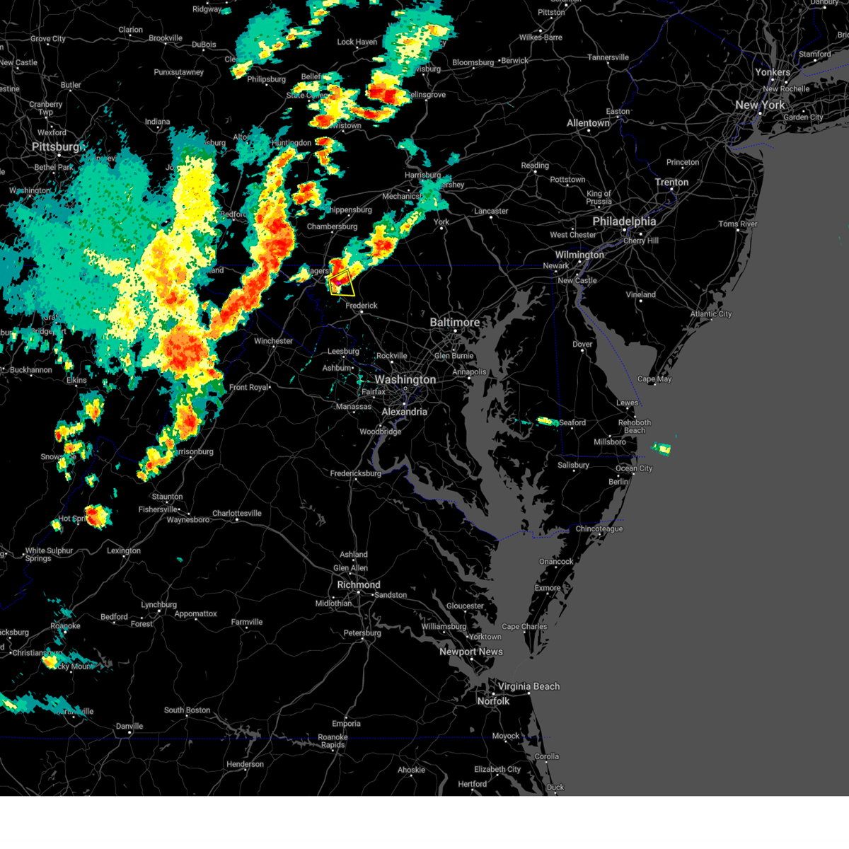 At 324 pm edt, a severe thunderstorm was located over mount aetna, or near municipal stadium, moving east at 20 mph (radar indicated). Hazards include golf ball size hail and 70 mph wind gusts. Expect wind damage to trees and power lines. hail is large enough to dent and damage vehicles. some hail damage to roofs, siding, and windows is possible. locations impacted include, hagerstown, robinwood, smithsburg, mount aetna, mount lena, san mar, wolfsville, cavetown, chewsville and pleasant walk. thunderstorm damage threat, considerable hail threat, radar indicated max hail size, 1. 75 in wind threat, radar indicated max wind gust, 70 mph. At 324 pm edt, a severe thunderstorm was located over mount aetna, or near municipal stadium, moving east at 20 mph (radar indicated). Hazards include golf ball size hail and 70 mph wind gusts. Expect wind damage to trees and power lines. hail is large enough to dent and damage vehicles. some hail damage to roofs, siding, and windows is possible. locations impacted include, hagerstown, robinwood, smithsburg, mount aetna, mount lena, san mar, wolfsville, cavetown, chewsville and pleasant walk. thunderstorm damage threat, considerable hail threat, radar indicated max hail size, 1. 75 in wind threat, radar indicated max wind gust, 70 mph.
|
| 8/7/2023 3:20 PM EDT | Tree down on mapleville road near interstate 7 in washington county MD, 5.3 miles NW of Hagerstown, MD |
| 8/7/2023 3:20 PM EDT | Ping Pong Ball sized hail reported 5.3 miles NW of Hagerstown, MD |
| 8/7/2023 3:17 PM EDT | Quarter sized hail reported 3.7 miles S of Hagerstown, MD |
| 8/7/2023 3:15 PM EDT | Quarter sized hail reported 0.8 miles NE of Hagerstown, MD |
| 8/7/2023 3:15 PM EDT |
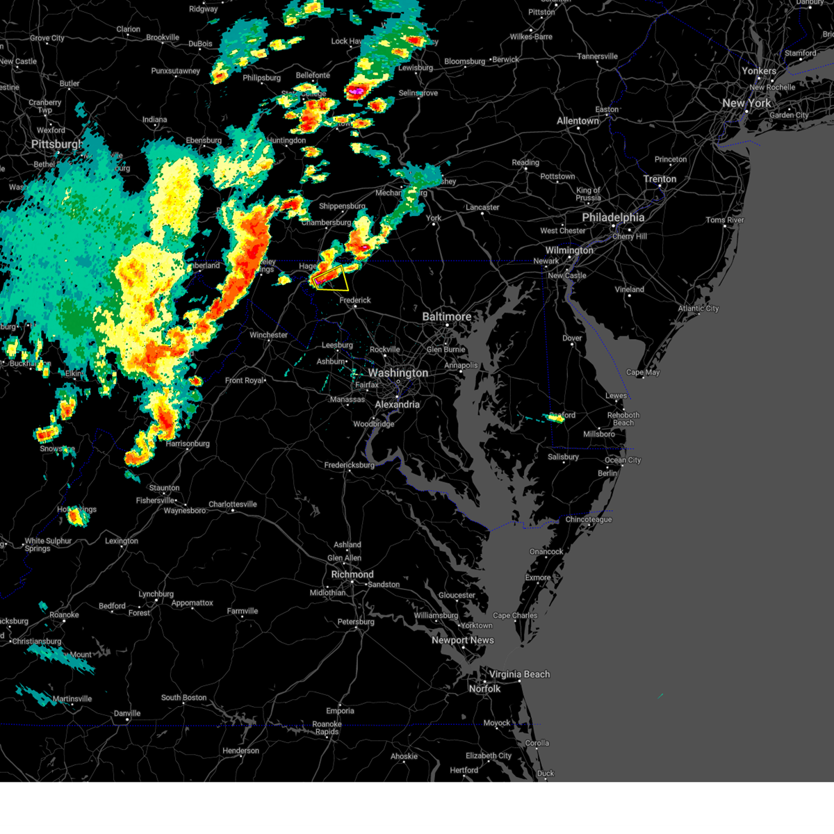 At 314 pm edt, a severe thunderstorm was located over saint james, or near municipal stadium, moving east at 20 mph (radar indicated). Hazards include golf ball size hail and 70 mph wind gusts. Expect wind damage to trees and power lines. hail is large enough to dent and damage vehicles. some hail damage to roofs, siding, and windows is possible. locations impacted include, hagerstown, robinwood, smithsburg, mount aetna, mount lena, san mar, wolfsville, saint james, halfway, cavetown, funkstown, fairplay, chewsville and pleasant walk. thunderstorm damage threat, considerable hail threat, radar indicated max hail size, 1. 75 in wind threat, radar indicated max wind gust, 70 mph. At 314 pm edt, a severe thunderstorm was located over saint james, or near municipal stadium, moving east at 20 mph (radar indicated). Hazards include golf ball size hail and 70 mph wind gusts. Expect wind damage to trees and power lines. hail is large enough to dent and damage vehicles. some hail damage to roofs, siding, and windows is possible. locations impacted include, hagerstown, robinwood, smithsburg, mount aetna, mount lena, san mar, wolfsville, saint james, halfway, cavetown, funkstown, fairplay, chewsville and pleasant walk. thunderstorm damage threat, considerable hail threat, radar indicated max hail size, 1. 75 in wind threat, radar indicated max wind gust, 70 mph.
|
| 8/7/2023 3:14 PM EDT | Quarter sized hail reported 1.1 miles SE of Hagerstown, MD |
| 8/7/2023 3:14 PM EDT | Golf Ball sized hail reported 3.6 miles NNW of Hagerstown, MD |
| 8/7/2023 3:07 PM EDT |
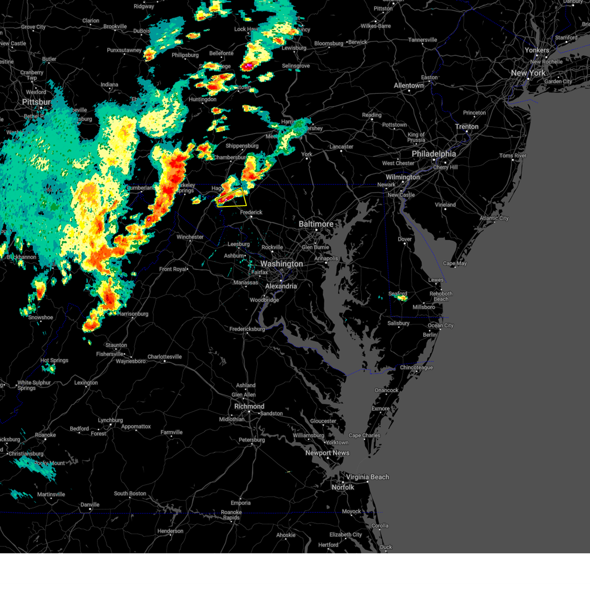 At 306 pm edt, a severe thunderstorm was located over saint james, or near municipal stadium, moving east at 20 mph (radar indicated). Hazards include tennis ball size hail and 70 mph wind gusts. Expect wind damage to trees and power lines. hail is large enough to dent and damage vehicles. Some hail damage to roofs, siding, and windows is possible. At 306 pm edt, a severe thunderstorm was located over saint james, or near municipal stadium, moving east at 20 mph (radar indicated). Hazards include tennis ball size hail and 70 mph wind gusts. Expect wind damage to trees and power lines. hail is large enough to dent and damage vehicles. Some hail damage to roofs, siding, and windows is possible.
|
| 8/7/2023 2:55 PM EDT |
 At 255 pm edt, a severe thunderstorm was located near williamsport, or 7 miles north of shepherdstown, moving east at 15 mph (radar indicated). Hazards include 60 mph wind gusts and half dollar size hail. Damaging winds will cause some trees and large branches to fall. this could injure those outdoors, as well as damage homes and vehicles. roadways may become blocked by downed trees. localized power outages are possible. Unsecured light objects may become projectiles. At 255 pm edt, a severe thunderstorm was located near williamsport, or 7 miles north of shepherdstown, moving east at 15 mph (radar indicated). Hazards include 60 mph wind gusts and half dollar size hail. Damaging winds will cause some trees and large branches to fall. this could injure those outdoors, as well as damage homes and vehicles. roadways may become blocked by downed trees. localized power outages are possible. Unsecured light objects may become projectiles.
|
| 8/7/2023 2:55 PM EDT |
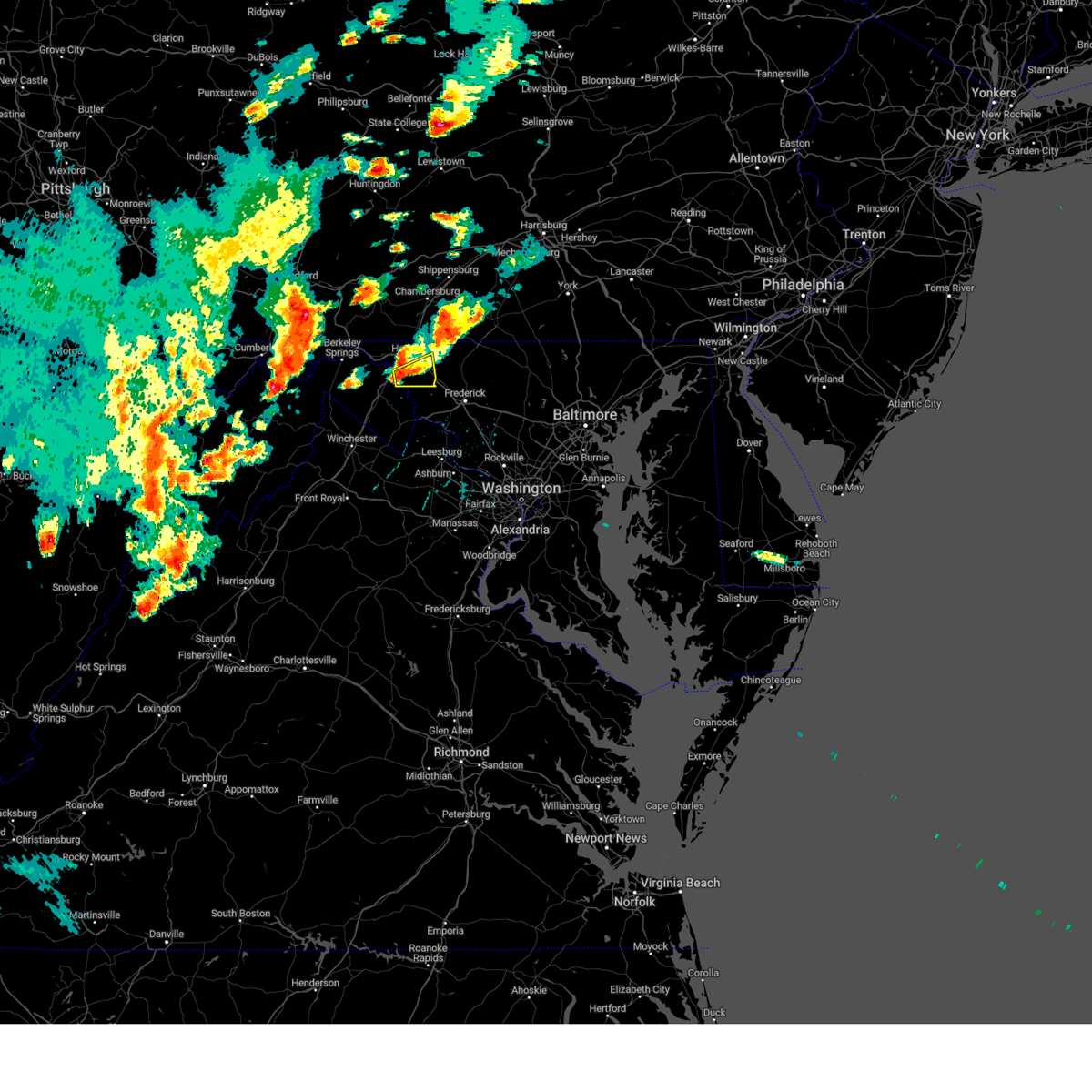 At 255 pm edt, a severe thunderstorm was located near williamsport, or 7 miles north of shepherdstown, moving east at 15 mph (radar indicated). Hazards include 60 mph wind gusts and half dollar size hail. Damaging winds will cause some trees and large branches to fall. this could injure those outdoors, as well as damage homes and vehicles. roadways may become blocked by downed trees. localized power outages are possible. Unsecured light objects may become projectiles. At 255 pm edt, a severe thunderstorm was located near williamsport, or 7 miles north of shepherdstown, moving east at 15 mph (radar indicated). Hazards include 60 mph wind gusts and half dollar size hail. Damaging winds will cause some trees and large branches to fall. this could injure those outdoors, as well as damage homes and vehicles. roadways may become blocked by downed trees. localized power outages are possible. Unsecured light objects may become projectiles.
|
| 8/7/2023 2:42 PM EDT |
 The severe thunderstorm warning for northeastern washington, northwestern carroll and northwestern frederick counties in north central maryland will expire at 245 pm edt, the storm which prompted the warning has weakened below severe limits, and no longer poses an immediate threat to life or property. therefore, the warning will be allowed to expire. a tornado watch remains in effect until 900 pm edt for north central maryland. to report severe weather, contact your nearest law enforcement agency. they will relay your report to the national weather service sterling virginia. The severe thunderstorm warning for northeastern washington, northwestern carroll and northwestern frederick counties in north central maryland will expire at 245 pm edt, the storm which prompted the warning has weakened below severe limits, and no longer poses an immediate threat to life or property. therefore, the warning will be allowed to expire. a tornado watch remains in effect until 900 pm edt for north central maryland. to report severe weather, contact your nearest law enforcement agency. they will relay your report to the national weather service sterling virginia.
|
| 8/7/2023 2:25 PM EDT | Quarter sized hail reported 5.1 miles S of Hagerstown, MD, quarter sized hail observed at hagerstown regional airport. |
| 8/7/2023 2:17 PM EDT |
 At 217 pm edt, a severe thunderstorm was located over fountainhead-orchard hills, or near hagerstown, moving east at 20 mph (radar indicated). Hazards include golf ball size hail and 70 mph wind gusts. Expect wind damage to trees and power lines. hail is large enough to dent and damage vehicles. some hail damage to roofs, siding, and windows is possible. locations impacted include, hagerstown, thurmont, emmitsburg, municipal stadium, robinwood, fountainhead-orchard hills, smithsburg, paramount-long meadow, wilson-conococheague, williamsport, mount aetna, long meadow, halfway, maugansville, cavetown, funkstown, leitersburg, sabillasville, fort ritchie and chewsville. thunderstorm damage threat, considerable hail threat, radar indicated max hail size, 1. 75 in wind threat, radar indicated max wind gust, 70 mph. At 217 pm edt, a severe thunderstorm was located over fountainhead-orchard hills, or near hagerstown, moving east at 20 mph (radar indicated). Hazards include golf ball size hail and 70 mph wind gusts. Expect wind damage to trees and power lines. hail is large enough to dent and damage vehicles. some hail damage to roofs, siding, and windows is possible. locations impacted include, hagerstown, thurmont, emmitsburg, municipal stadium, robinwood, fountainhead-orchard hills, smithsburg, paramount-long meadow, wilson-conococheague, williamsport, mount aetna, long meadow, halfway, maugansville, cavetown, funkstown, leitersburg, sabillasville, fort ritchie and chewsville. thunderstorm damage threat, considerable hail threat, radar indicated max hail size, 1. 75 in wind threat, radar indicated max wind gust, 70 mph.
|
| 8/7/2023 1:56 PM EDT |
 At 156 pm edt, a severe thunderstorm was located near wilson-conococheague, or near hagerstown, moving east at 40 mph (radar indicated). Hazards include golf ball size hail and 70 mph wind gusts. Expect wind damage to trees and power lines. hail is large enough to dent and damage vehicles. Some hail damage to roofs, siding, and windows is possible. At 156 pm edt, a severe thunderstorm was located near wilson-conococheague, or near hagerstown, moving east at 40 mph (radar indicated). Hazards include golf ball size hail and 70 mph wind gusts. Expect wind damage to trees and power lines. hail is large enough to dent and damage vehicles. Some hail damage to roofs, siding, and windows is possible.
|
| 8/7/2023 1:41 PM EDT |
 At 141 pm edt, a severe thunderstorm was located near claylick, or 11 miles east of hancock, moving northeast at 35 mph (radar indicated). Hazards include golf ball size hail and 60 mph wind gusts. Expect wind damage to trees and power lines. hail is large enough to dent and damage vehicles. some hail damage to roofs, siding, and windows is possible. locations impacted include, hagerstown, hancock, fountainhead-orchard hills, paramount-long meadow, wilson-conococheague, long meadow, maugansville, leitersburg, clear spring, pecktonville, ringgold, big spring, big pool, middleburg, cherry run, johnsontown, warrenton, spruce pine hollow and sleepy creek. thunderstorm damage threat, considerable hail threat, radar indicated max hail size, 1. 75 in wind threat, radar indicated max wind gust, 60 mph. At 141 pm edt, a severe thunderstorm was located near claylick, or 11 miles east of hancock, moving northeast at 35 mph (radar indicated). Hazards include golf ball size hail and 60 mph wind gusts. Expect wind damage to trees and power lines. hail is large enough to dent and damage vehicles. some hail damage to roofs, siding, and windows is possible. locations impacted include, hagerstown, hancock, fountainhead-orchard hills, paramount-long meadow, wilson-conococheague, long meadow, maugansville, leitersburg, clear spring, pecktonville, ringgold, big spring, big pool, middleburg, cherry run, johnsontown, warrenton, spruce pine hollow and sleepy creek. thunderstorm damage threat, considerable hail threat, radar indicated max hail size, 1. 75 in wind threat, radar indicated max wind gust, 60 mph.
|
| 8/7/2023 1:39 PM EDT |
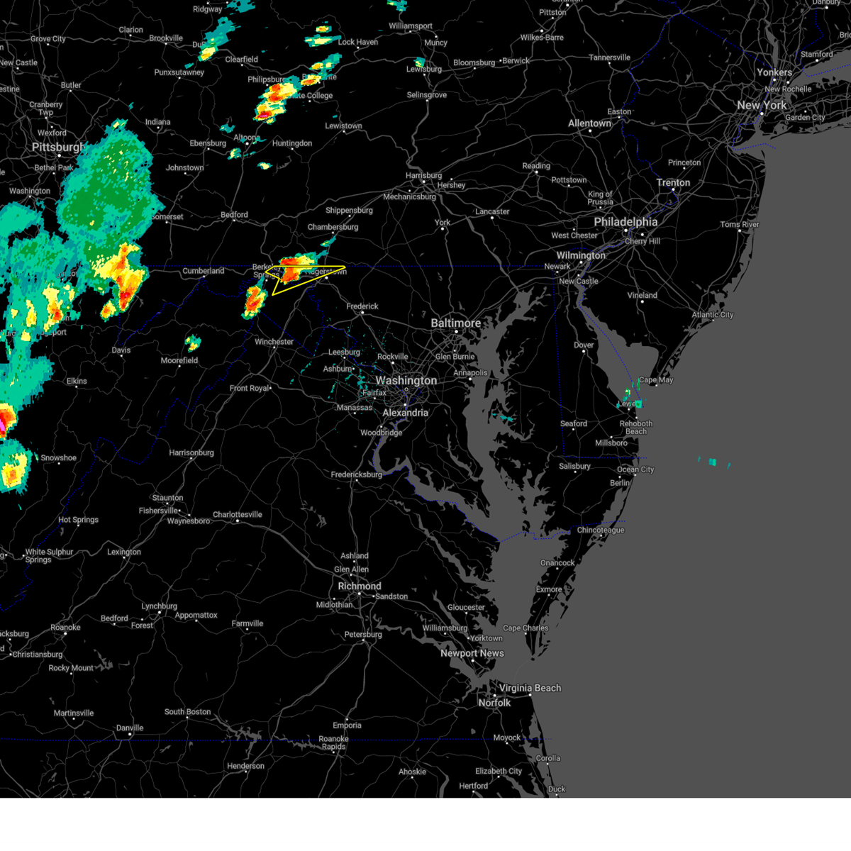 At 139 pm edt, a severe thunderstorm was located 7 miles southwest of claylick, or 9 miles east of hancock, moving northeast at 30 mph (radar indicated). Hazards include 60 mph wind gusts and quarter size hail. Damaging winds will cause some trees and large branches to fall. this could injure those outdoors, as well as damage homes and vehicles. roadways may become blocked by downed trees. localized power outages are possible. unsecured light objects may become projectiles. locations impacted include, hagerstown, hancock, fountainhead-orchard hills, paramount-long meadow, wilson-conococheague, long meadow, maugansville, leitersburg, clear spring, pecktonville, ringgold, big spring, big pool, middleburg, cherry run, johnsontown, warrenton, spruce pine hollow and sleepy creek. hail threat, radar indicated max hail size, 1. 00 in wind threat, radar indicated max wind gust, 60 mph. At 139 pm edt, a severe thunderstorm was located 7 miles southwest of claylick, or 9 miles east of hancock, moving northeast at 30 mph (radar indicated). Hazards include 60 mph wind gusts and quarter size hail. Damaging winds will cause some trees and large branches to fall. this could injure those outdoors, as well as damage homes and vehicles. roadways may become blocked by downed trees. localized power outages are possible. unsecured light objects may become projectiles. locations impacted include, hagerstown, hancock, fountainhead-orchard hills, paramount-long meadow, wilson-conococheague, long meadow, maugansville, leitersburg, clear spring, pecktonville, ringgold, big spring, big pool, middleburg, cherry run, johnsontown, warrenton, spruce pine hollow and sleepy creek. hail threat, radar indicated max hail size, 1. 00 in wind threat, radar indicated max wind gust, 60 mph.
|
| 8/7/2023 1:39 PM EDT |
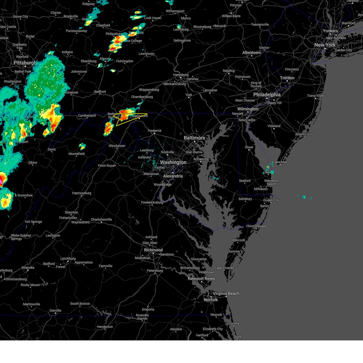 At 139 pm edt, a severe thunderstorm was located 7 miles southwest of claylick, or 9 miles east of hancock, moving northeast at 30 mph (radar indicated). Hazards include 60 mph wind gusts and quarter size hail. Damaging winds will cause some trees and large branches to fall. this could injure those outdoors, as well as damage homes and vehicles. roadways may become blocked by downed trees. localized power outages are possible. unsecured light objects may become projectiles. locations impacted include, hagerstown, hancock, fountainhead-orchard hills, paramount-long meadow, wilson-conococheague, long meadow, maugansville, leitersburg, clear spring, pecktonville, ringgold, big spring, big pool, middleburg, cherry run, johnsontown, warrenton, spruce pine hollow and sleepy creek. hail threat, radar indicated max hail size, 1. 00 in wind threat, radar indicated max wind gust, 60 mph. At 139 pm edt, a severe thunderstorm was located 7 miles southwest of claylick, or 9 miles east of hancock, moving northeast at 30 mph (radar indicated). Hazards include 60 mph wind gusts and quarter size hail. Damaging winds will cause some trees and large branches to fall. this could injure those outdoors, as well as damage homes and vehicles. roadways may become blocked by downed trees. localized power outages are possible. unsecured light objects may become projectiles. locations impacted include, hagerstown, hancock, fountainhead-orchard hills, paramount-long meadow, wilson-conococheague, long meadow, maugansville, leitersburg, clear spring, pecktonville, ringgold, big spring, big pool, middleburg, cherry run, johnsontown, warrenton, spruce pine hollow and sleepy creek. hail threat, radar indicated max hail size, 1. 00 in wind threat, radar indicated max wind gust, 60 mph.
|
| 8/7/2023 1:14 PM EDT |
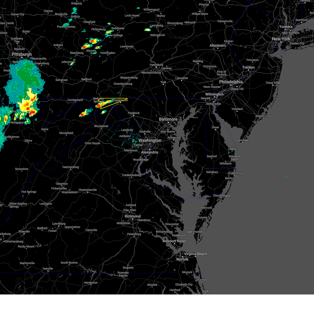 At 113 pm edt, a severe thunderstorm was located over berkeley springs, or 7 miles south of hancock, moving northeast at 35 mph (radar indicated). Hazards include 60 mph wind gusts and quarter size hail. Damaging winds will cause some trees and large branches to fall. this could injure those outdoors, as well as damage homes and vehicles. roadways may become blocked by downed trees. localized power outages are possible. Unsecured light objects may become projectiles. At 113 pm edt, a severe thunderstorm was located over berkeley springs, or 7 miles south of hancock, moving northeast at 35 mph (radar indicated). Hazards include 60 mph wind gusts and quarter size hail. Damaging winds will cause some trees and large branches to fall. this could injure those outdoors, as well as damage homes and vehicles. roadways may become blocked by downed trees. localized power outages are possible. Unsecured light objects may become projectiles.
|
| 8/7/2023 1:14 PM EDT |
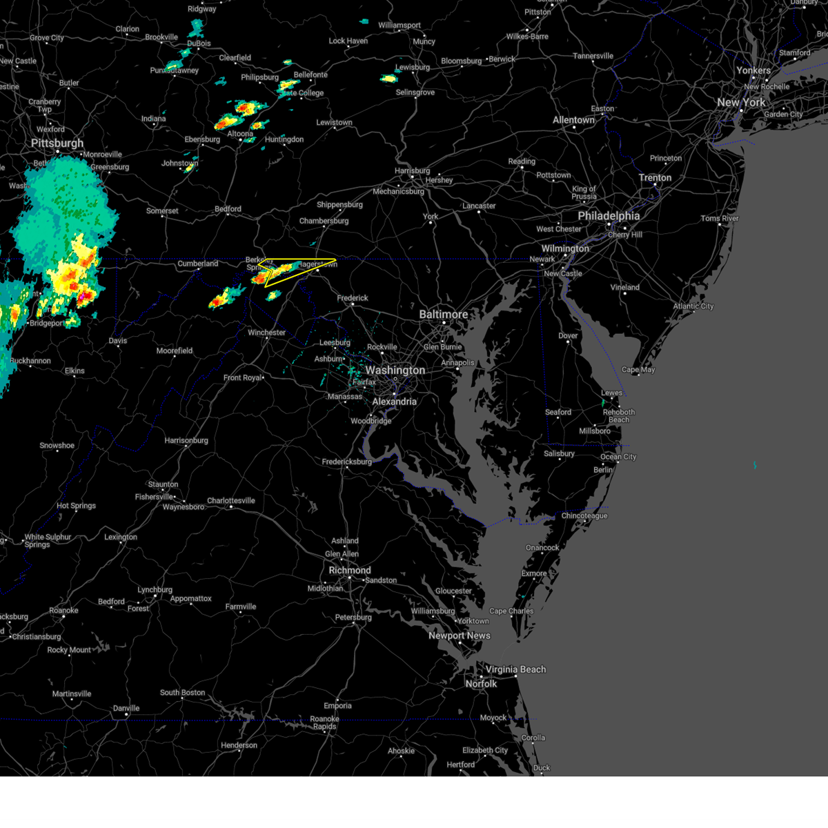 At 113 pm edt, a severe thunderstorm was located over berkeley springs, or 7 miles south of hancock, moving northeast at 35 mph (radar indicated). Hazards include 60 mph wind gusts and quarter size hail. Damaging winds will cause some trees and large branches to fall. this could injure those outdoors, as well as damage homes and vehicles. roadways may become blocked by downed trees. localized power outages are possible. Unsecured light objects may become projectiles. At 113 pm edt, a severe thunderstorm was located over berkeley springs, or 7 miles south of hancock, moving northeast at 35 mph (radar indicated). Hazards include 60 mph wind gusts and quarter size hail. Damaging winds will cause some trees and large branches to fall. this could injure those outdoors, as well as damage homes and vehicles. roadways may become blocked by downed trees. localized power outages are possible. Unsecured light objects may become projectiles.
|
| 7/9/2023 1:28 PM EDT |
 At 128 pm edt, severe thunderstorms were located along a line extending from saint james to near harpers ferry, moving northeast at 15 mph (radar indicated). Hazards include 60 mph wind gusts and quarter size hail. Damaging winds will cause some trees and large branches to fall. this could injure those outdoors, as well as damage homes and vehicles. roadways may become blocked by downed trees. localized power outages are possible. Unsecured light objects may become projectiles. At 128 pm edt, severe thunderstorms were located along a line extending from saint james to near harpers ferry, moving northeast at 15 mph (radar indicated). Hazards include 60 mph wind gusts and quarter size hail. Damaging winds will cause some trees and large branches to fall. this could injure those outdoors, as well as damage homes and vehicles. roadways may become blocked by downed trees. localized power outages are possible. Unsecured light objects may become projectiles.
|
| 7/9/2023 1:28 PM EDT |
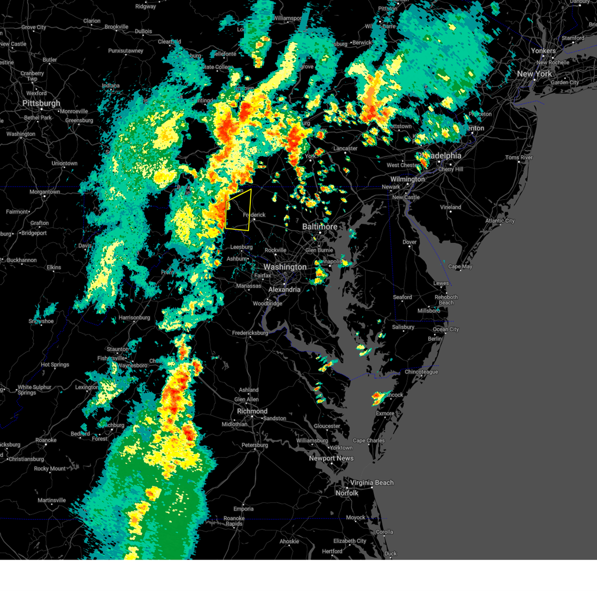 At 128 pm edt, severe thunderstorms were located along a line extending from saint james to near harpers ferry, moving northeast at 15 mph (radar indicated). Hazards include 60 mph wind gusts and quarter size hail. Damaging winds will cause some trees and large branches to fall. this could injure those outdoors, as well as damage homes and vehicles. roadways may become blocked by downed trees. localized power outages are possible. Unsecured light objects may become projectiles. At 128 pm edt, severe thunderstorms were located along a line extending from saint james to near harpers ferry, moving northeast at 15 mph (radar indicated). Hazards include 60 mph wind gusts and quarter size hail. Damaging winds will cause some trees and large branches to fall. this could injure those outdoors, as well as damage homes and vehicles. roadways may become blocked by downed trees. localized power outages are possible. Unsecured light objects may become projectiles.
|
| 11/30/2022 1:53 PM EST |
 The severe thunderstorm warning for north central washington county in north central maryland, shenandoah, frederick, northwestern warren and northwestern clarke counties in northwestern virginia, northwestern jefferson and central morgan counties in the panhandle of west virginia, southeastern hardy county in eastern west virginia, berkeley county in the panhandle of west virginia and southeastern hampshire counties in eastern west virginia and the city of winchester will expire at 200 pm est, the storms which prompted the warning have moved out of the area. therefore, the warning will be allowed to expire. however gusty winds are still possible with these thunderstorms. The severe thunderstorm warning for north central washington county in north central maryland, shenandoah, frederick, northwestern warren and northwestern clarke counties in northwestern virginia, northwestern jefferson and central morgan counties in the panhandle of west virginia, southeastern hardy county in eastern west virginia, berkeley county in the panhandle of west virginia and southeastern hampshire counties in eastern west virginia and the city of winchester will expire at 200 pm est, the storms which prompted the warning have moved out of the area. therefore, the warning will be allowed to expire. however gusty winds are still possible with these thunderstorms.
|
| 11/30/2022 1:15 PM EST |
 At 115 pm est, severe thunderstorms were located along a line extending from 7 miles southeast of berkeley springs to near star tannery to near mathias, moving east at 45 mph (radar indicated). Hazards include 60 mph wind gusts. Damaging winds will cause some trees and large branches to fall. this could injure those outdoors, as well as damage homes and vehicles. roadways may become blocked by downed trees. localized power outages are possible. Unsecured light objects may become projectiles. At 115 pm est, severe thunderstorms were located along a line extending from 7 miles southeast of berkeley springs to near star tannery to near mathias, moving east at 45 mph (radar indicated). Hazards include 60 mph wind gusts. Damaging winds will cause some trees and large branches to fall. this could injure those outdoors, as well as damage homes and vehicles. roadways may become blocked by downed trees. localized power outages are possible. Unsecured light objects may become projectiles.
|
| 8/4/2022 4:25 PM EDT |
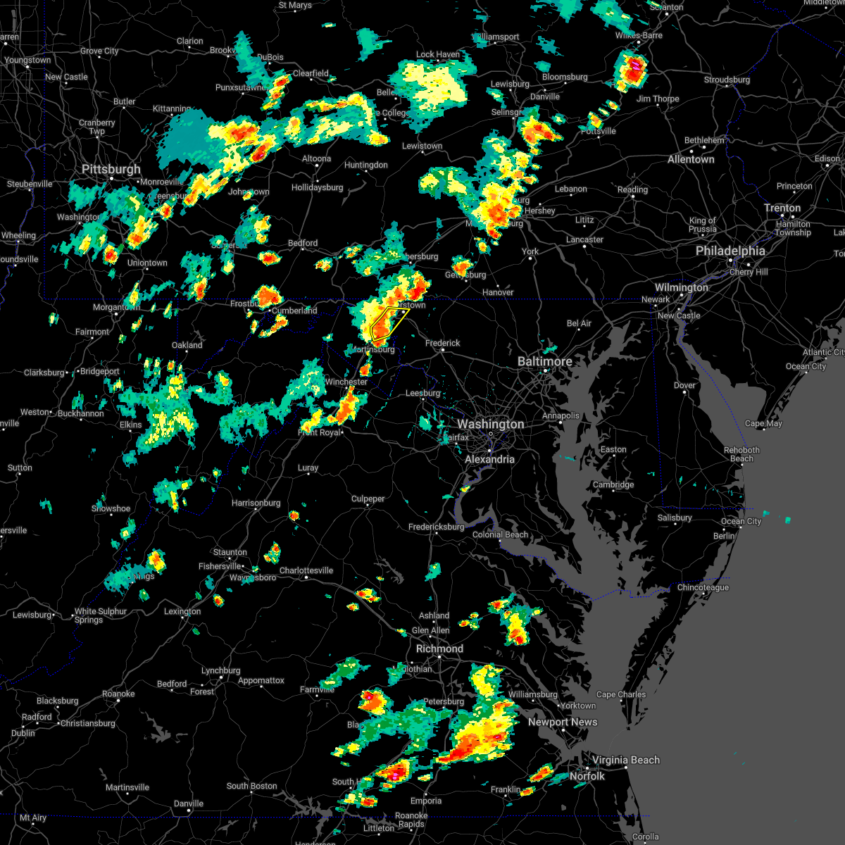 At 424 pm edt, severe thunderstorms were located along a line extending from near wilson-conococheague to near williamsport to near martinsburg, moving northeast at 25 mph (radar indicated). Hazards include 60 mph wind gusts and quarter size hail. Damaging winds will cause some trees and large branches to fall. this could injure those outdoors, as well as damage homes and vehicles. roadways may become blocked by downed trees. localized power outages are possible. unsecured light objects may become projectiles. locations impacted include, hagerstown, municipal stadium, wilson-conococheague, williamsport, saint james, berkeley, halfway and falling waters. hail threat, radar indicated max hail size, 1. 00 in wind threat, radar indicated max wind gust, 60 mph. At 424 pm edt, severe thunderstorms were located along a line extending from near wilson-conococheague to near williamsport to near martinsburg, moving northeast at 25 mph (radar indicated). Hazards include 60 mph wind gusts and quarter size hail. Damaging winds will cause some trees and large branches to fall. this could injure those outdoors, as well as damage homes and vehicles. roadways may become blocked by downed trees. localized power outages are possible. unsecured light objects may become projectiles. locations impacted include, hagerstown, municipal stadium, wilson-conococheague, williamsport, saint james, berkeley, halfway and falling waters. hail threat, radar indicated max hail size, 1. 00 in wind threat, radar indicated max wind gust, 60 mph.
|
| 8/4/2022 4:07 PM EDT |
 At 407 pm edt, severe thunderstorms were located along a line extending from near wilson-conococheague to 8 miles west of williamsport to near martinsburg, moving northeast at 25 mph (radar indicated). Hazards include 60 mph wind gusts and quarter size hail. Damaging winds will cause some trees and large branches to fall. this could injure those outdoors, as well as damage homes and vehicles. roadways may become blocked by downed trees. localized power outages are possible. Unsecured light objects may become projectiles. At 407 pm edt, severe thunderstorms were located along a line extending from near wilson-conococheague to 8 miles west of williamsport to near martinsburg, moving northeast at 25 mph (radar indicated). Hazards include 60 mph wind gusts and quarter size hail. Damaging winds will cause some trees and large branches to fall. this could injure those outdoors, as well as damage homes and vehicles. roadways may become blocked by downed trees. localized power outages are possible. Unsecured light objects may become projectiles.
|
| 7/23/2022 6:53 PM EDT | Tree and numerous large branches down near pangborn par in washington county MD, 1.3 miles SW of Hagerstown, MD |
| 7/23/2022 6:53 PM EDT | Numerous trees were reported down near halfway blvd and virginia av in washington county MD, 2.5 miles ENE of Hagerstown, MD |
| 7/23/2022 6:52 PM EDT | Tree down on route 40 westbound near cleveland avenu in washington county MD, 0.5 miles WSW of Hagerstown, MD |
| 7/23/2022 6:51 PM EDT |
 At 650 pm edt, severe thunderstorms were located along a line extending from near paramount-long meadow to near berryville, moving east at 40 mph (radar indicated). Hazards include 60 mph wind gusts and quarter size hail. Damaging winds will cause some trees and large branches to fall. this could injure those outdoors, as well as damage homes and vehicles. roadways may become blocked by downed trees. localized power outages are possible. Unsecured light objects may become projectiles. At 650 pm edt, severe thunderstorms were located along a line extending from near paramount-long meadow to near berryville, moving east at 40 mph (radar indicated). Hazards include 60 mph wind gusts and quarter size hail. Damaging winds will cause some trees and large branches to fall. this could injure those outdoors, as well as damage homes and vehicles. roadways may become blocked by downed trees. localized power outages are possible. Unsecured light objects may become projectiles.
|
| 7/23/2022 6:46 PM EDT |
 At 646 pm edt, a severe thunderstorm was located over wilson-conococheague, or near hagerstown, moving east at 30 mph (radar indicated). Hazards include 60 mph wind gusts and quarter size hail. Damaging winds will cause some trees and large branches to fall. this could injure those outdoors, as well as damage homes and vehicles. roadways may become blocked by downed trees. localized power outages are possible. unsecured light objects may become projectiles. locations impacted include, hagerstown, municipal stadium, robinwood, fountainhead-orchard hills, paramount-long meadow, wilson-conococheague, williamsport, mount aetna, long meadow, saint james, halfway, maugansville, cavetown, funkstown, leitersburg, clear spring, chewsville, pecktonville, big spring and big pool. hail threat, radar indicated max hail size, 1. 00 in wind threat, radar indicated max wind gust, 60 mph. At 646 pm edt, a severe thunderstorm was located over wilson-conococheague, or near hagerstown, moving east at 30 mph (radar indicated). Hazards include 60 mph wind gusts and quarter size hail. Damaging winds will cause some trees and large branches to fall. this could injure those outdoors, as well as damage homes and vehicles. roadways may become blocked by downed trees. localized power outages are possible. unsecured light objects may become projectiles. locations impacted include, hagerstown, municipal stadium, robinwood, fountainhead-orchard hills, paramount-long meadow, wilson-conococheague, williamsport, mount aetna, long meadow, saint james, halfway, maugansville, cavetown, funkstown, leitersburg, clear spring, chewsville, pecktonville, big spring and big pool. hail threat, radar indicated max hail size, 1. 00 in wind threat, radar indicated max wind gust, 60 mph.
|
| 7/23/2022 6:46 PM EDT |
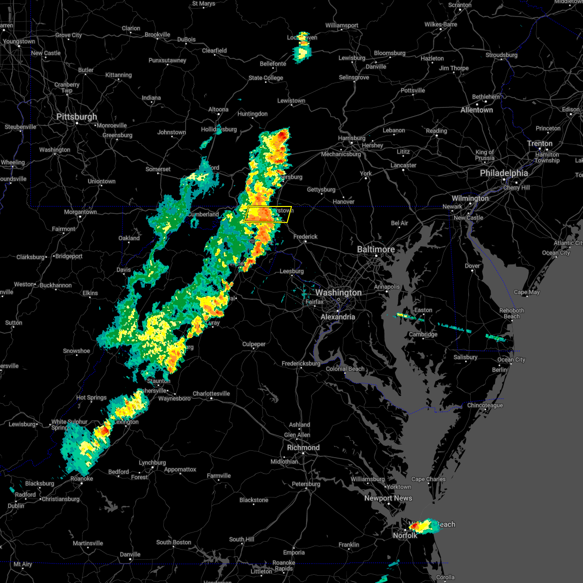 At 646 pm edt, a severe thunderstorm was located over wilson-conococheague, or near hagerstown, moving east at 30 mph (radar indicated). Hazards include 60 mph wind gusts and quarter size hail. Damaging winds will cause some trees and large branches to fall. this could injure those outdoors, as well as damage homes and vehicles. roadways may become blocked by downed trees. localized power outages are possible. unsecured light objects may become projectiles. locations impacted include, hagerstown, municipal stadium, robinwood, fountainhead-orchard hills, paramount-long meadow, wilson-conococheague, williamsport, mount aetna, long meadow, saint james, halfway, maugansville, cavetown, funkstown, leitersburg, clear spring, chewsville, pecktonville, big spring and big pool. hail threat, radar indicated max hail size, 1. 00 in wind threat, radar indicated max wind gust, 60 mph. At 646 pm edt, a severe thunderstorm was located over wilson-conococheague, or near hagerstown, moving east at 30 mph (radar indicated). Hazards include 60 mph wind gusts and quarter size hail. Damaging winds will cause some trees and large branches to fall. this could injure those outdoors, as well as damage homes and vehicles. roadways may become blocked by downed trees. localized power outages are possible. unsecured light objects may become projectiles. locations impacted include, hagerstown, municipal stadium, robinwood, fountainhead-orchard hills, paramount-long meadow, wilson-conococheague, williamsport, mount aetna, long meadow, saint james, halfway, maugansville, cavetown, funkstown, leitersburg, clear spring, chewsville, pecktonville, big spring and big pool. hail threat, radar indicated max hail size, 1. 00 in wind threat, radar indicated max wind gust, 60 mph.
|
| 7/23/2022 6:19 PM EDT |
 At 619 pm edt, a severe thunderstorm was located near hancock, moving east at 40 mph (radar indicated). Hazards include 60 mph wind gusts and quarter size hail. Damaging winds will cause some trees and large branches to fall. this could injure those outdoors, as well as damage homes and vehicles. roadways may become blocked by downed trees. localized power outages are possible. Unsecured light objects may become projectiles. At 619 pm edt, a severe thunderstorm was located near hancock, moving east at 40 mph (radar indicated). Hazards include 60 mph wind gusts and quarter size hail. Damaging winds will cause some trees and large branches to fall. this could injure those outdoors, as well as damage homes and vehicles. roadways may become blocked by downed trees. localized power outages are possible. Unsecured light objects may become projectiles.
|
| 7/23/2022 6:08 PM EDT | Numerous trees and powerlines were reported down along w main st in hancock m in washington county MD, 0.2 miles SSE of Hagerstown, MD |
| 7/12/2022 3:57 PM EDT |
 The severe thunderstorm warning for northeastern washington, northwestern frederick counties in north central maryland and northeastern berkeley counties in the panhandle of west virginia will expire at 400 pm edt, the storm which prompted the warning has moved out of the area. therefore, the warning will be allowed to expire. a severe thunderstorm watch remains in effect until 1000 pm edt for north central maryland, and the panhandle of west virginia. remember, a severe thunderstorm warning still remains in effect for much of northern and central frederick county. The severe thunderstorm warning for northeastern washington, northwestern frederick counties in north central maryland and northeastern berkeley counties in the panhandle of west virginia will expire at 400 pm edt, the storm which prompted the warning has moved out of the area. therefore, the warning will be allowed to expire. a severe thunderstorm watch remains in effect until 1000 pm edt for north central maryland, and the panhandle of west virginia. remember, a severe thunderstorm warning still remains in effect for much of northern and central frederick county.
|
| 7/12/2022 3:33 PM EDT |
 At 333 pm edt, a severe thunderstorm was located over williamsport, or near hagerstown, moving east at 50 mph (radar indicated). Hazards include 70 mph wind gusts and quarter size hail. Damaging winds will cause some trees and large branches to fall. this could injure those outdoors, as well as damage homes and vehicles. roadways may become blocked by downed trees. localized power outages are possible. unsecured light objects may become projectiles. locations impacted include, hagerstown, thurmont, municipal stadium, robinwood, fountainhead-orchard hills, smithsburg, paramount-long meadow, wilson-conococheague, williamsport, mount aetna, mount lena, san mar, long meadow, wolfsville, saint james, halfway, maugansville, cavetown, funkstown and falling waters. thunderstorm damage threat, considerable hail threat, radar indicated max hail size, 1. 00 in wind threat, radar indicated max wind gust, 70 mph. At 333 pm edt, a severe thunderstorm was located over williamsport, or near hagerstown, moving east at 50 mph (radar indicated). Hazards include 70 mph wind gusts and quarter size hail. Damaging winds will cause some trees and large branches to fall. this could injure those outdoors, as well as damage homes and vehicles. roadways may become blocked by downed trees. localized power outages are possible. unsecured light objects may become projectiles. locations impacted include, hagerstown, thurmont, municipal stadium, robinwood, fountainhead-orchard hills, smithsburg, paramount-long meadow, wilson-conococheague, williamsport, mount aetna, mount lena, san mar, long meadow, wolfsville, saint james, halfway, maugansville, cavetown, funkstown and falling waters. thunderstorm damage threat, considerable hail threat, radar indicated max hail size, 1. 00 in wind threat, radar indicated max wind gust, 70 mph.
|
| 7/12/2022 3:22 PM EDT |
 At 322 pm edt, a severe thunderstorm was located near claylick, or 12 miles west of hagerstown, moving east at 40 mph (radar indicated). Hazards include 60 mph wind gusts and quarter size hail. Damaging winds will cause some trees and large branches to fall. this could injure those outdoors, as well as damage homes and vehicles. roadways may become blocked by downed trees. localized power outages are possible. Unsecured light objects may become projectiles. At 322 pm edt, a severe thunderstorm was located near claylick, or 12 miles west of hagerstown, moving east at 40 mph (radar indicated). Hazards include 60 mph wind gusts and quarter size hail. Damaging winds will cause some trees and large branches to fall. this could injure those outdoors, as well as damage homes and vehicles. roadways may become blocked by downed trees. localized power outages are possible. Unsecured light objects may become projectiles.
|
| 7/2/2022 5:52 PM EDT | Lines were reported down near the 3640 block of harpers ferry r in washington county MD, 0.2 miles SSE of Hagerstown, MD |
| 7/2/2022 3:58 PM EDT |
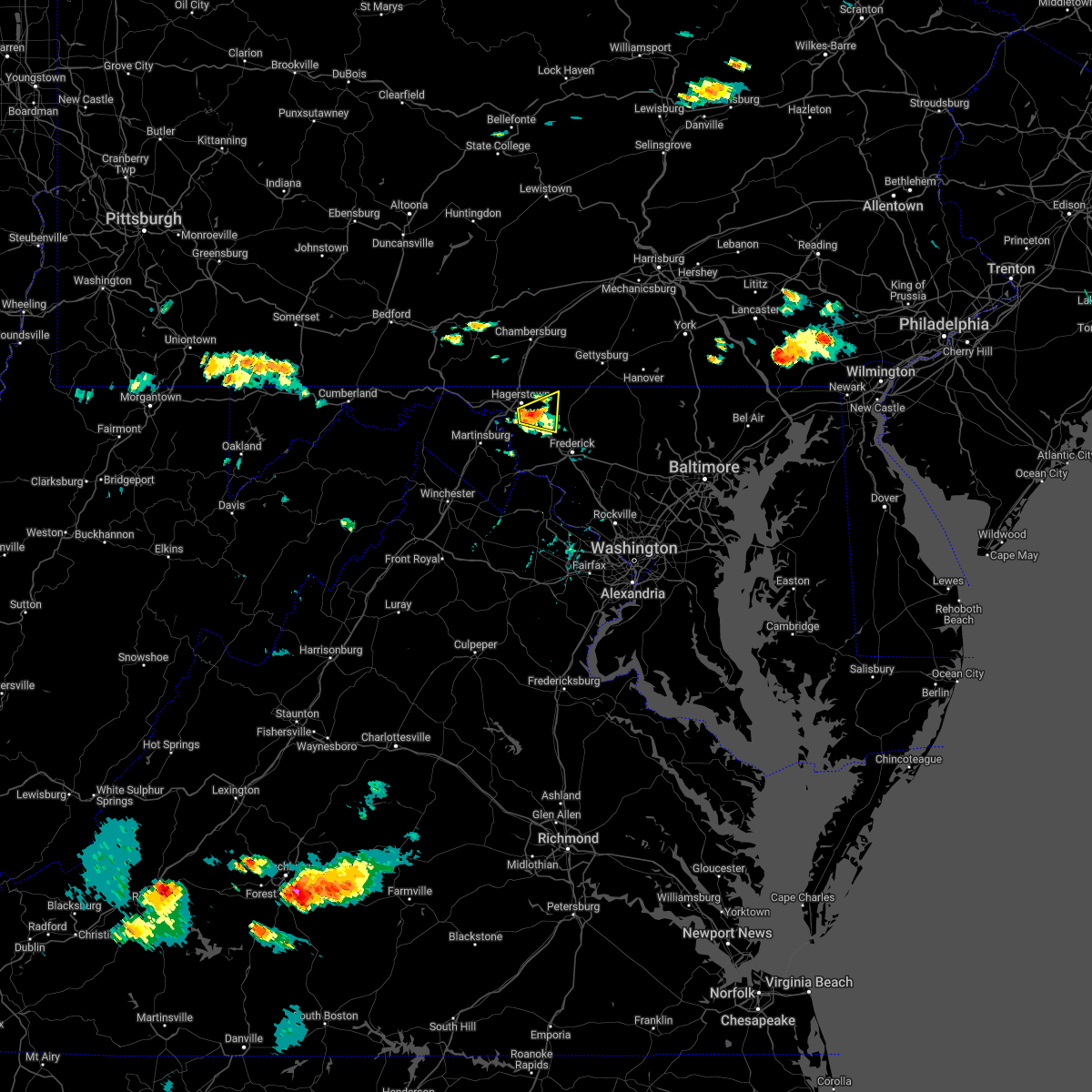 At 358 pm edt, a severe thunderstorm was located over mount aetna, or 7 miles east of municipal stadium, moving east at 30 mph (radar indicated). Hazards include 60 mph wind gusts and quarter size hail. Damaging winds will cause some trees and large branches to fall. this could injure those outdoors, as well as damage homes and vehicles. roadways may become blocked by downed trees. localized power outages are possible. unsecured light objects may become projectiles. locations impacted include, hagerstown, robinwood, smithsburg, mount aetna, mount lena, san mar, wolfsville, saint james, cavetown, funkstown, fort ritchie, chewsville, pleasant walk and bridgeport. hail threat, radar indicated max hail size, 1. 00 in wind threat, radar indicated max wind gust, 60 mph. At 358 pm edt, a severe thunderstorm was located over mount aetna, or 7 miles east of municipal stadium, moving east at 30 mph (radar indicated). Hazards include 60 mph wind gusts and quarter size hail. Damaging winds will cause some trees and large branches to fall. this could injure those outdoors, as well as damage homes and vehicles. roadways may become blocked by downed trees. localized power outages are possible. unsecured light objects may become projectiles. locations impacted include, hagerstown, robinwood, smithsburg, mount aetna, mount lena, san mar, wolfsville, saint james, cavetown, funkstown, fort ritchie, chewsville, pleasant walk and bridgeport. hail threat, radar indicated max hail size, 1. 00 in wind threat, radar indicated max wind gust, 60 mph.
|
| 7/2/2022 3:53 PM EDT | A tree blew down and downed wires near the 2020 block of day r in washington county MD, 2.7 miles NW of Hagerstown, MD |
| 7/2/2022 3:50 PM EDT | Several trees and wires blew down around funkstown. a tree and wires blew down on bear creek drive. a tree blew down onto wires in the 2000 block of day roa in washington county MD, 2.6 miles NNE of Hagerstown, MD |
| 7/2/2022 3:47 PM EDT | A tree and wires blew down on bear creek d in washington county MD, 2.6 miles NNE of Hagerstown, MD |
| 7/2/2022 3:43 PM EDT |
 At 343 pm edt, a severe thunderstorm was located over saint james, or near municipal stadium, moving east at 30 mph (radar indicated). Hazards include 60 mph wind gusts and quarter size hail. Damaging winds will cause some trees and large branches to fall. this could injure those outdoors, as well as damage homes and vehicles. roadways may become blocked by downed trees. localized power outages are possible. Unsecured light objects may become projectiles. At 343 pm edt, a severe thunderstorm was located over saint james, or near municipal stadium, moving east at 30 mph (radar indicated). Hazards include 60 mph wind gusts and quarter size hail. Damaging winds will cause some trees and large branches to fall. this could injure those outdoors, as well as damage homes and vehicles. roadways may become blocked by downed trees. localized power outages are possible. Unsecured light objects may become projectiles.
|
| 6/22/2022 3:22 PM EDT | Several trees... wires and poles down in the haflway are in washington county MD, 3 miles ENE of Hagerstown, MD |
| 6/22/2022 3:22 PM EDT |
 At 322 pm edt, severe thunderstorms were located along a line extending from ellicott city to near boonsboro, moving south at 50 mph (radar indicated). Hazards include 60 mph wind gusts. Damaging winds will cause some trees and large branches to fall. this could injure those outdoors, as well as damage homes and vehicles. roadways may become blocked by downed trees. localized power outages are possible. unsecured light objects may become projectiles. locations impacted include, frederick, hagerstown, charles town, shepherdstown, municipal stadium, ballenger creek, robinwood, brunswick, ranson, boonsboro, braddock heights, mount aetna, mount lena, san mar, harpers ferry, corporation of ranson, kearneysville, point of rocks, saint james and clover hill. hail threat, radar indicated max hail size, <. 75 in wind threat, radar indicated max wind gust, 60 mph. At 322 pm edt, severe thunderstorms were located along a line extending from ellicott city to near boonsboro, moving south at 50 mph (radar indicated). Hazards include 60 mph wind gusts. Damaging winds will cause some trees and large branches to fall. this could injure those outdoors, as well as damage homes and vehicles. roadways may become blocked by downed trees. localized power outages are possible. unsecured light objects may become projectiles. locations impacted include, frederick, hagerstown, charles town, shepherdstown, municipal stadium, ballenger creek, robinwood, brunswick, ranson, boonsboro, braddock heights, mount aetna, mount lena, san mar, harpers ferry, corporation of ranson, kearneysville, point of rocks, saint james and clover hill. hail threat, radar indicated max hail size, <. 75 in wind threat, radar indicated max wind gust, 60 mph.
|
| 6/22/2022 3:22 PM EDT |
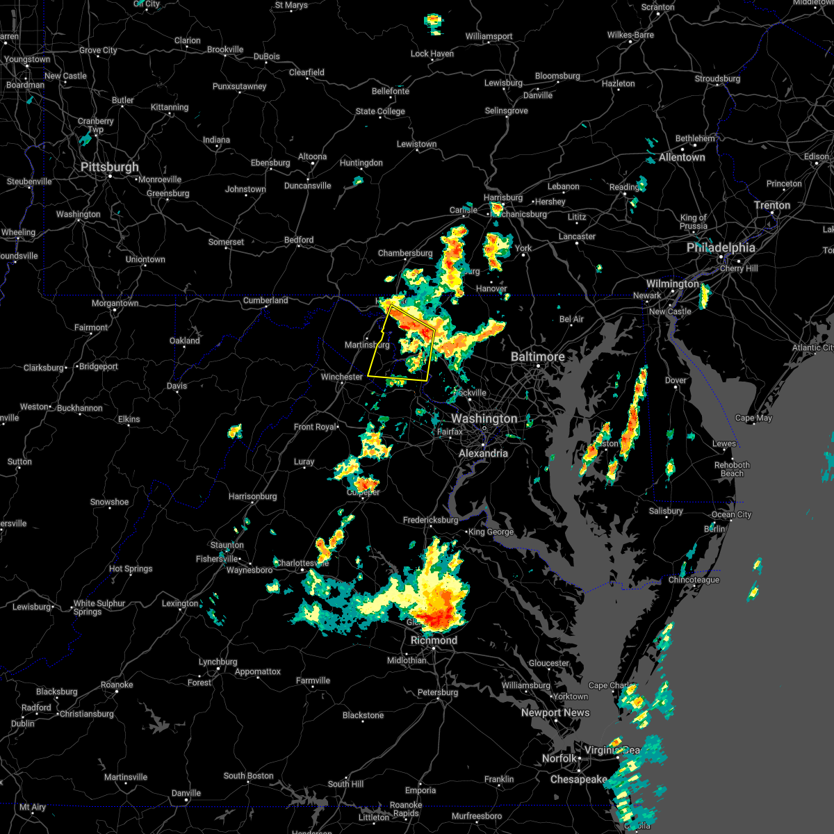 At 322 pm edt, severe thunderstorms were located along a line extending from ellicott city to near boonsboro, moving south at 50 mph (radar indicated). Hazards include 60 mph wind gusts. Damaging winds will cause some trees and large branches to fall. this could injure those outdoors, as well as damage homes and vehicles. roadways may become blocked by downed trees. localized power outages are possible. unsecured light objects may become projectiles. locations impacted include, frederick, hagerstown, charles town, shepherdstown, municipal stadium, ballenger creek, robinwood, brunswick, ranson, boonsboro, braddock heights, mount aetna, mount lena, san mar, harpers ferry, corporation of ranson, kearneysville, point of rocks, saint james and clover hill. hail threat, radar indicated max hail size, <. 75 in wind threat, radar indicated max wind gust, 60 mph. At 322 pm edt, severe thunderstorms were located along a line extending from ellicott city to near boonsboro, moving south at 50 mph (radar indicated). Hazards include 60 mph wind gusts. Damaging winds will cause some trees and large branches to fall. this could injure those outdoors, as well as damage homes and vehicles. roadways may become blocked by downed trees. localized power outages are possible. unsecured light objects may become projectiles. locations impacted include, frederick, hagerstown, charles town, shepherdstown, municipal stadium, ballenger creek, robinwood, brunswick, ranson, boonsboro, braddock heights, mount aetna, mount lena, san mar, harpers ferry, corporation of ranson, kearneysville, point of rocks, saint james and clover hill. hail threat, radar indicated max hail size, <. 75 in wind threat, radar indicated max wind gust, 60 mph.
|
| 6/22/2022 3:12 PM EDT |
 At 311 pm edt, severe thunderstorms were located along a line extending from near randallstown to san mar, moving southeast at 85 mph (radar indicated). Hazards include 60 mph wind gusts. Damaging winds will cause some trees and large branches to fall. this could injure those outdoors, as well as damage homes and vehicles. roadways may become blocked by downed trees. localized power outages are possible. unsecured light objects may become projectiles. locations impacted include, columbia, germantown, frederick, hagerstown, olney, westminster, damascus, thurmont, charles town, shepherdstown, municipal stadium, harry grove stadium, montgomery village, eldersburg, ballenger creek, mount airy, robinwood, brunswick, walkersville and fountainhead-orchard hills. hail threat, radar indicated max hail size, <. 75 in wind threat, radar indicated max wind gust, 60 mph. At 311 pm edt, severe thunderstorms were located along a line extending from near randallstown to san mar, moving southeast at 85 mph (radar indicated). Hazards include 60 mph wind gusts. Damaging winds will cause some trees and large branches to fall. this could injure those outdoors, as well as damage homes and vehicles. roadways may become blocked by downed trees. localized power outages are possible. unsecured light objects may become projectiles. locations impacted include, columbia, germantown, frederick, hagerstown, olney, westminster, damascus, thurmont, charles town, shepherdstown, municipal stadium, harry grove stadium, montgomery village, eldersburg, ballenger creek, mount airy, robinwood, brunswick, walkersville and fountainhead-orchard hills. hail threat, radar indicated max hail size, <. 75 in wind threat, radar indicated max wind gust, 60 mph.
|
| 6/22/2022 2:56 PM EDT |
 At 255 pm edt, severe thunderstorms were located along a line extending from near manchester to paramount-long meadow, moving south at 50 mph (radar indicated). Hazards include 60 mph wind gusts. Damaging winds will cause some trees and large branches to fall. this could injure those outdoors, as well as damage homes and vehicles. roadways may become blocked by downed trees. localized power outages are possible. Unsecured light objects may become projectiles. At 255 pm edt, severe thunderstorms were located along a line extending from near manchester to paramount-long meadow, moving south at 50 mph (radar indicated). Hazards include 60 mph wind gusts. Damaging winds will cause some trees and large branches to fall. this could injure those outdoors, as well as damage homes and vehicles. roadways may become blocked by downed trees. localized power outages are possible. Unsecured light objects may become projectiles.
|
| 6/16/2022 3:49 PM EDT |
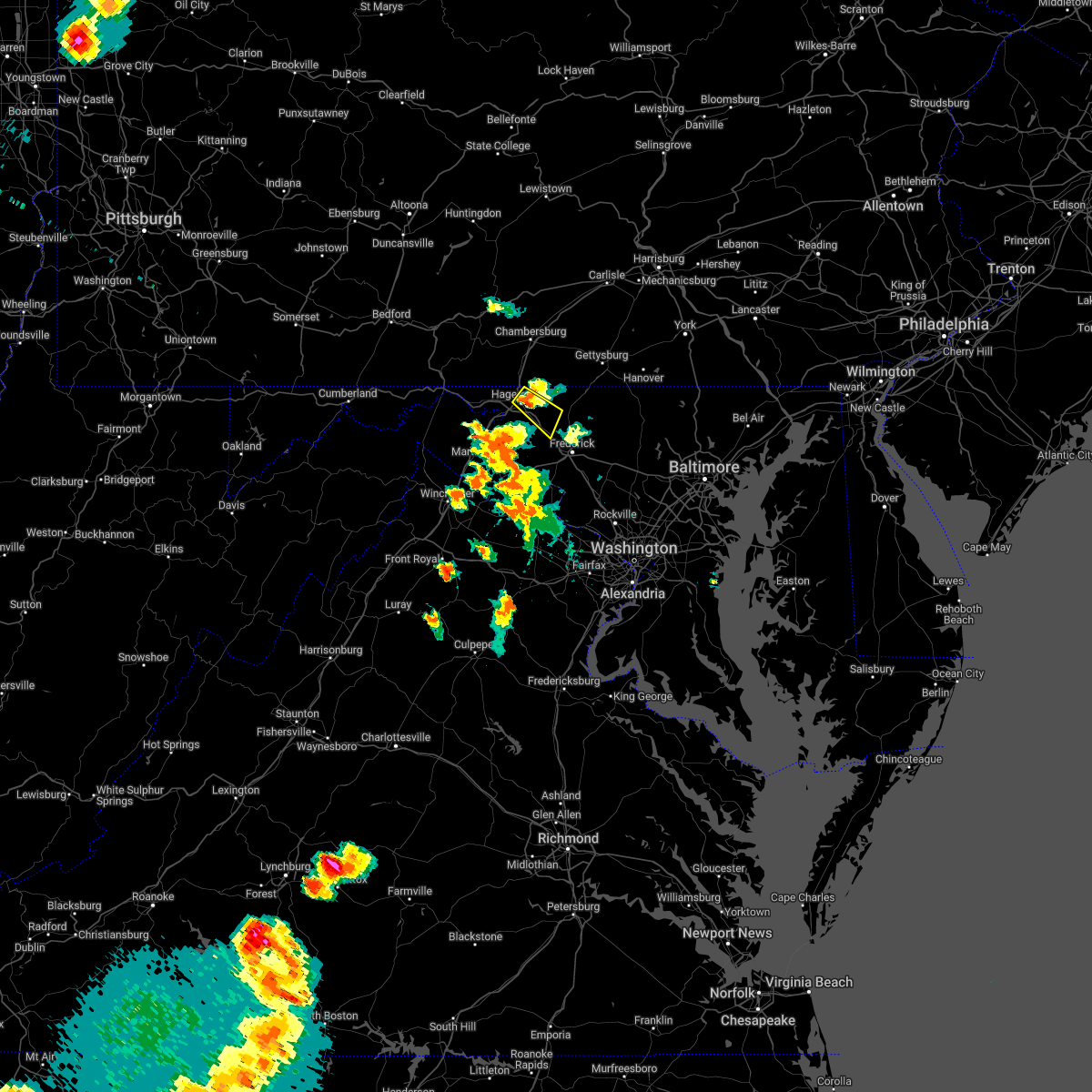 At 349 pm edt, a severe thunderstorm was located over robinwood, or near municipal stadium, moving southeast at 25 mph (radar indicated). Hazards include 60 mph wind gusts. Damaging winds will cause some trees and large branches to fall. this could injure those outdoors, as well as damage homes and vehicles. roadways may become blocked by downed trees. localized power outages are possible. unsecured light objects may become projectiles. locations impacted include, hagerstown, municipal stadium, robinwood, fountainhead-orchard hills, smithsburg, paramount-long meadow, mount aetna, mount lena, san mar, long meadow, wolfsville, maugansville, myersville, cavetown, funkstown, leitersburg, chewsville, pleasant walk and bridgeport. hail threat, radar indicated max hail size, <. 75 in wind threat, radar indicated max wind gust, 60 mph. At 349 pm edt, a severe thunderstorm was located over robinwood, or near municipal stadium, moving southeast at 25 mph (radar indicated). Hazards include 60 mph wind gusts. Damaging winds will cause some trees and large branches to fall. this could injure those outdoors, as well as damage homes and vehicles. roadways may become blocked by downed trees. localized power outages are possible. unsecured light objects may become projectiles. locations impacted include, hagerstown, municipal stadium, robinwood, fountainhead-orchard hills, smithsburg, paramount-long meadow, mount aetna, mount lena, san mar, long meadow, wolfsville, maugansville, myersville, cavetown, funkstown, leitersburg, chewsville, pleasant walk and bridgeport. hail threat, radar indicated max hail size, <. 75 in wind threat, radar indicated max wind gust, 60 mph.
|
| 6/16/2022 3:38 PM EDT |
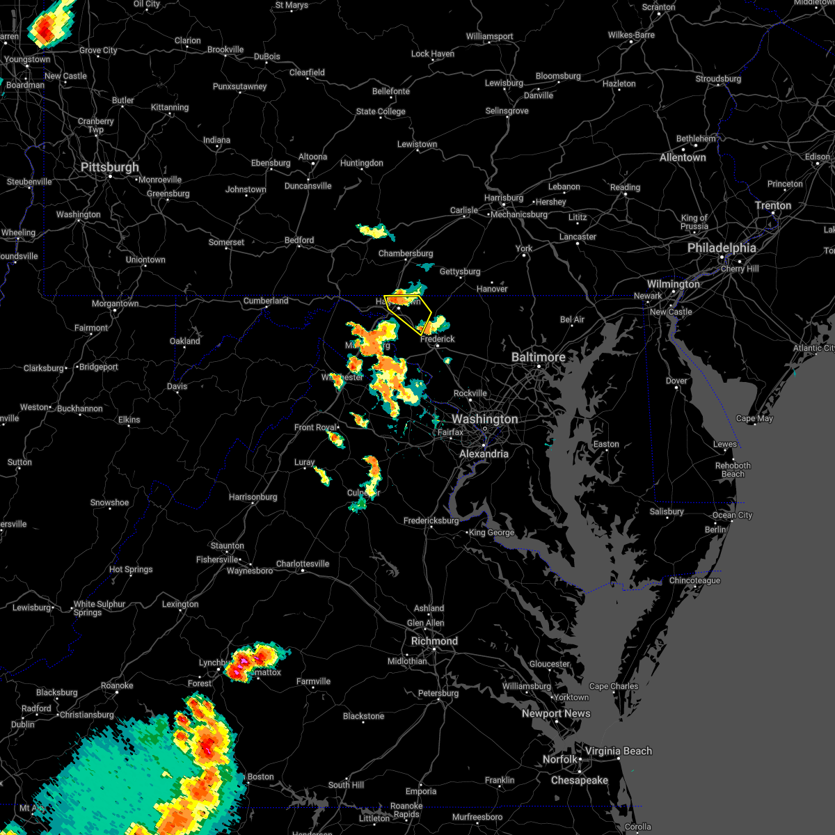 At 338 pm edt, a severe thunderstorm was located over fountainhead-orchard hills, or near hagerstown, moving southeast at 25 mph (radar indicated). Hazards include 60 mph wind gusts and quarter size hail. Damaging winds will cause some trees and large branches to fall. this could injure those outdoors, as well as damage homes and vehicles. roadways may become blocked by downed trees. localized power outages are possible. unsecured light objects may become projectiles. locations impacted include, hagerstown, municipal stadium, robinwood, fountainhead-orchard hills, smithsburg, paramount-long meadow, wilson-conococheague, mount aetna, mount lena, san mar, long meadow, wolfsville, halfway, maugansville, myersville, cavetown, funkstown, leitersburg, chewsville and ringgold. hail threat, radar indicated max hail size, 1. 00 in wind threat, radar indicated max wind gust, 60 mph. At 338 pm edt, a severe thunderstorm was located over fountainhead-orchard hills, or near hagerstown, moving southeast at 25 mph (radar indicated). Hazards include 60 mph wind gusts and quarter size hail. Damaging winds will cause some trees and large branches to fall. this could injure those outdoors, as well as damage homes and vehicles. roadways may become blocked by downed trees. localized power outages are possible. unsecured light objects may become projectiles. locations impacted include, hagerstown, municipal stadium, robinwood, fountainhead-orchard hills, smithsburg, paramount-long meadow, wilson-conococheague, mount aetna, mount lena, san mar, long meadow, wolfsville, halfway, maugansville, myersville, cavetown, funkstown, leitersburg, chewsville and ringgold. hail threat, radar indicated max hail size, 1. 00 in wind threat, radar indicated max wind gust, 60 mph.
|
| 6/16/2022 3:24 PM EDT |
 At 324 pm edt, a severe thunderstorm was located near claylick, or near greencastle, moving southeast at 25 mph (radar indicated). Hazards include 60 mph wind gusts and quarter size hail. Damaging winds will cause some trees and large branches to fall. this could injure those outdoors, as well as damage homes and vehicles. roadways may become blocked by downed trees. localized power outages are possible. Unsecured light objects may become projectiles. At 324 pm edt, a severe thunderstorm was located near claylick, or near greencastle, moving southeast at 25 mph (radar indicated). Hazards include 60 mph wind gusts and quarter size hail. Damaging winds will cause some trees and large branches to fall. this could injure those outdoors, as well as damage homes and vehicles. roadways may become blocked by downed trees. localized power outages are possible. Unsecured light objects may become projectiles.
|
| 6/14/2022 4:27 AM EDT |
 At 427 am edt, severe thunderstorms were located along a line extending from mercersburg to wilson-conococheague to near saint james to near shepherdstown, moving east at 25 mph (radar indicated). Hazards include 60 mph wind gusts and quarter size hail. Damaging winds will cause some trees and large branches to fall. this could injure those outdoors, as well as damage homes and vehicles. roadways may become blocked by downed trees. localized power outages are possible. unsecured light objects may become projectiles. locations impacted include, hagerstown, shepherdstown, municipal stadium, robinwood, fountainhead-orchard hills, boonsboro, smithsburg, paramount-long meadow, wilson-conococheague, williamsport, mount aetna, mount lena, san mar, long meadow, saint james, halfway, maugansville, cavetown, keedysville and funkstown. hail threat, radar indicated max hail size, 1. 00 in wind threat, radar indicated max wind gust, 60 mph. At 427 am edt, severe thunderstorms were located along a line extending from mercersburg to wilson-conococheague to near saint james to near shepherdstown, moving east at 25 mph (radar indicated). Hazards include 60 mph wind gusts and quarter size hail. Damaging winds will cause some trees and large branches to fall. this could injure those outdoors, as well as damage homes and vehicles. roadways may become blocked by downed trees. localized power outages are possible. unsecured light objects may become projectiles. locations impacted include, hagerstown, shepherdstown, municipal stadium, robinwood, fountainhead-orchard hills, boonsboro, smithsburg, paramount-long meadow, wilson-conococheague, williamsport, mount aetna, mount lena, san mar, long meadow, saint james, halfway, maugansville, cavetown, keedysville and funkstown. hail threat, radar indicated max hail size, 1. 00 in wind threat, radar indicated max wind gust, 60 mph.
|
| 6/14/2022 4:01 AM EDT |
 At 401 am edt, severe thunderstorms were located along a line extending from near big cove tannery to 8 miles west of wilson-conococheague to martinsburg to near inwood, moving east at 25 mph (radar indicated). Hazards include 60 mph wind gusts and quarter size hail. Damaging winds will cause some trees and large branches to fall. this could injure those outdoors, as well as damage homes and vehicles. roadways may become blocked by downed trees. localized power outages are possible. Unsecured light objects may become projectiles. At 401 am edt, severe thunderstorms were located along a line extending from near big cove tannery to 8 miles west of wilson-conococheague to martinsburg to near inwood, moving east at 25 mph (radar indicated). Hazards include 60 mph wind gusts and quarter size hail. Damaging winds will cause some trees and large branches to fall. this could injure those outdoors, as well as damage homes and vehicles. roadways may become blocked by downed trees. localized power outages are possible. Unsecured light objects may become projectiles.
|
| 3/31/2022 6:12 PM EDT |
 At 611 pm edt, a severe thunderstorm was located over san mar, or near municipal stadium, moving northeast at 60 mph (radar indicated). Hazards include 60 mph wind gusts and quarter size hail. Damaging winds will cause some trees and large branches to fall. this could injure those outdoors, as well as damage homes and vehicles. roadways may become blocked by downed trees. localized power outages are possible. unsecured light objects may become projectiles. locations impacted include, hagerstown, thurmont, emmitsburg, municipal stadium, robinwood, boonsboro, smithsburg, williamsport, mount aetna, mount lena, san mar, wolfsville, saint james, halfway, myersville, cavetown, keedysville, funkstown, sharpsburg and fairplay. hail threat, radar indicated max hail size, 1. 00 in wind threat, radar indicated max wind gust, 60 mph. At 611 pm edt, a severe thunderstorm was located over san mar, or near municipal stadium, moving northeast at 60 mph (radar indicated). Hazards include 60 mph wind gusts and quarter size hail. Damaging winds will cause some trees and large branches to fall. this could injure those outdoors, as well as damage homes and vehicles. roadways may become blocked by downed trees. localized power outages are possible. unsecured light objects may become projectiles. locations impacted include, hagerstown, thurmont, emmitsburg, municipal stadium, robinwood, boonsboro, smithsburg, williamsport, mount aetna, mount lena, san mar, wolfsville, saint james, halfway, myersville, cavetown, keedysville, funkstown, sharpsburg and fairplay. hail threat, radar indicated max hail size, 1. 00 in wind threat, radar indicated max wind gust, 60 mph.
|
| 3/31/2022 5:56 PM EDT |
 At 555 pm edt, a severe thunderstorm was located over martinsburg, moving northeast at 55 mph (radar indicated). Hazards include 60 mph wind gusts and quarter size hail. Damaging winds will cause some trees and large branches to fall. this could injure those outdoors, as well as damage homes and vehicles. roadways may become blocked by downed trees. localized power outages are possible. Unsecured light objects may become projectiles. At 555 pm edt, a severe thunderstorm was located over martinsburg, moving northeast at 55 mph (radar indicated). Hazards include 60 mph wind gusts and quarter size hail. Damaging winds will cause some trees and large branches to fall. this could injure those outdoors, as well as damage homes and vehicles. roadways may become blocked by downed trees. localized power outages are possible. Unsecured light objects may become projectiles.
|
| 9/15/2021 6:45 PM EDT | Tree down on mapleville road near chewsville roa in washington county MD, 5.9 miles WNW of Hagerstown, MD |
| 9/15/2021 6:44 PM EDT |
 At 644 pm edt, a severe thunderstorm was located over mount aetna, or near municipal stadium, moving east at 30 mph (radar indicated). Hazards include 60 mph wind gusts. Damaging winds will cause some trees and large branches to fall. this could injure those outdoors, as well as damage homes and vehicles. roadways may become blocked by downed trees. localized power outages are possible. unsecured light objects may become projectiles. locations impacted include, hagerstown, robinwood, mount aetna, mount lena, san mar, wolfsville, saint james, cavetown, funkstown, fairplay and chewsville. hail threat, radar indicated max hail size, <. 75 in wind threat, radar indicated max wind gust, 60 mph. At 644 pm edt, a severe thunderstorm was located over mount aetna, or near municipal stadium, moving east at 30 mph (radar indicated). Hazards include 60 mph wind gusts. Damaging winds will cause some trees and large branches to fall. this could injure those outdoors, as well as damage homes and vehicles. roadways may become blocked by downed trees. localized power outages are possible. unsecured light objects may become projectiles. locations impacted include, hagerstown, robinwood, mount aetna, mount lena, san mar, wolfsville, saint james, cavetown, funkstown, fairplay and chewsville. hail threat, radar indicated max hail size, <. 75 in wind threat, radar indicated max wind gust, 60 mph.
|
| 9/15/2021 6:28 PM EDT |
 At 628 pm edt, a severe thunderstorm was located over saint james, or near municipal stadium, moving east at 30 mph (radar indicated). Hazards include 60 mph wind gusts and quarter size hail. Damaging winds will cause some trees and large branches to fall. this could injure those outdoors, as well as damage homes and vehicles. roadways may become blocked by downed trees. localized power outages are possible. Unsecured light objects may become projectiles. At 628 pm edt, a severe thunderstorm was located over saint james, or near municipal stadium, moving east at 30 mph (radar indicated). Hazards include 60 mph wind gusts and quarter size hail. Damaging winds will cause some trees and large branches to fall. this could injure those outdoors, as well as damage homes and vehicles. roadways may become blocked by downed trees. localized power outages are possible. Unsecured light objects may become projectiles.
|
| 9/15/2021 6:13 PM EDT |
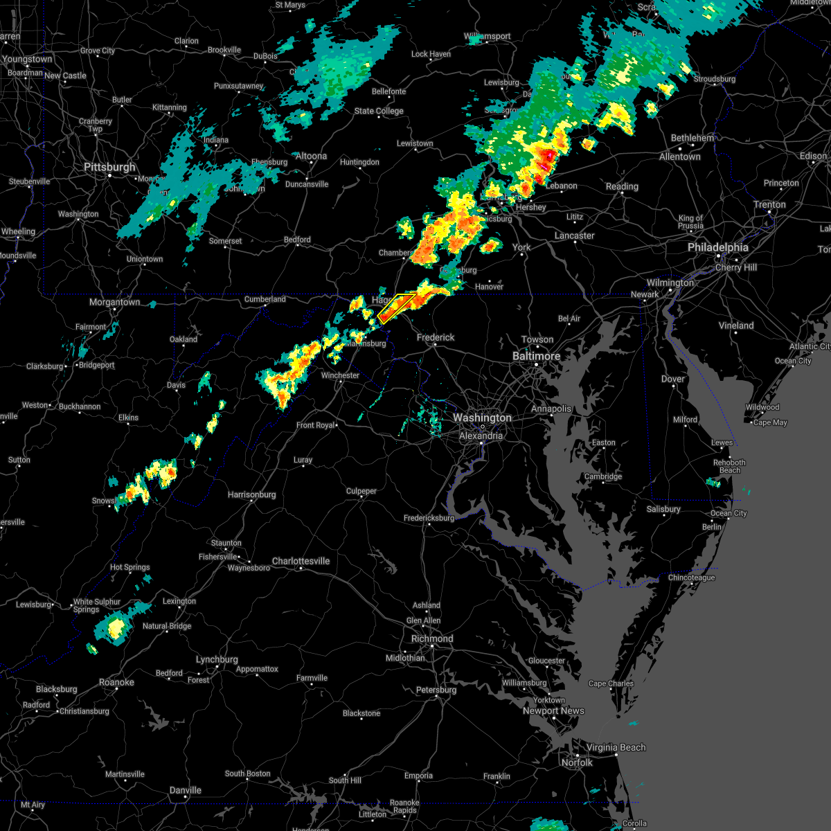 At 613 pm edt, a severe thunderstorm was located over long meadow, or near hagerstown, moving northeast at 25 mph (radar indicated). Hazards include 60 mph wind gusts and quarter size hail. Damaging winds will cause some trees and large branches to fall. this could injure those outdoors, as well as damage homes and vehicles. roadways may become blocked by downed trees. localized power outages are possible. unsecured light objects may become projectiles. locations impacted include, hagerstown, municipal stadium, fountainhead-orchard hills, paramount-long meadow, wilson-conococheague, williamsport, long meadow, saint james, halfway, maugansville and leitersburg. hail threat, radar indicated max hail size, 1. 00 in wind threat, radar indicated max wind gust, 60 mph. At 613 pm edt, a severe thunderstorm was located over long meadow, or near hagerstown, moving northeast at 25 mph (radar indicated). Hazards include 60 mph wind gusts and quarter size hail. Damaging winds will cause some trees and large branches to fall. this could injure those outdoors, as well as damage homes and vehicles. roadways may become blocked by downed trees. localized power outages are possible. unsecured light objects may become projectiles. locations impacted include, hagerstown, municipal stadium, fountainhead-orchard hills, paramount-long meadow, wilson-conococheague, williamsport, long meadow, saint james, halfway, maugansville and leitersburg. hail threat, radar indicated max hail size, 1. 00 in wind threat, radar indicated max wind gust, 60 mph.
|
| 9/15/2021 6:08 PM EDT |
 At 608 pm edt, a severe thunderstorm was located over fountainhead-orchard hills, or over hagerstown, moving northeast at 25 mph (radar indicated). Hazards include 60 mph wind gusts and quarter size hail. Damaging winds will cause some trees and large branches to fall. this could injure those outdoors, as well as damage homes and vehicles. roadways may become blocked by downed trees. localized power outages are possible. unsecured light objects may become projectiles. locations impacted include, hagerstown, municipal stadium, fountainhead-orchard hills, paramount-long meadow, wilson-conococheague, williamsport, long meadow, saint james, halfway, maugansville, leitersburg and middleburg. hail threat, radar indicated max hail size, 1. 00 in wind threat, radar indicated max wind gust, 60 mph. At 608 pm edt, a severe thunderstorm was located over fountainhead-orchard hills, or over hagerstown, moving northeast at 25 mph (radar indicated). Hazards include 60 mph wind gusts and quarter size hail. Damaging winds will cause some trees and large branches to fall. this could injure those outdoors, as well as damage homes and vehicles. roadways may become blocked by downed trees. localized power outages are possible. unsecured light objects may become projectiles. locations impacted include, hagerstown, municipal stadium, fountainhead-orchard hills, paramount-long meadow, wilson-conococheague, williamsport, long meadow, saint james, halfway, maugansville, leitersburg and middleburg. hail threat, radar indicated max hail size, 1. 00 in wind threat, radar indicated max wind gust, 60 mph.
|
| 9/15/2021 6:08 PM EDT |
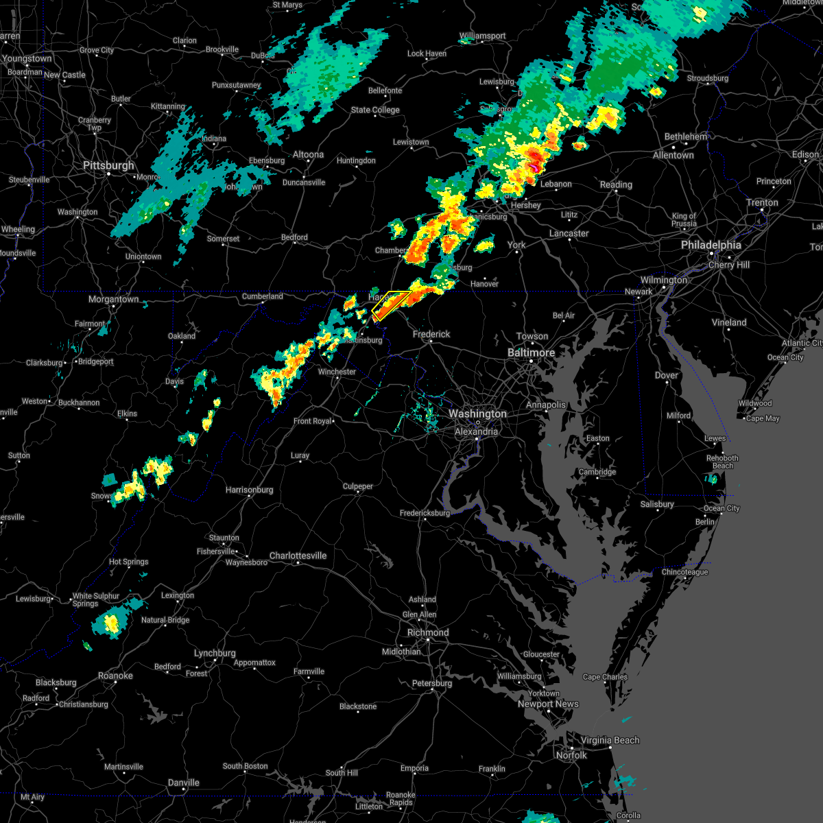 At 608 pm edt, a severe thunderstorm was located over fountainhead-orchard hills, or over hagerstown, moving northeast at 25 mph (radar indicated). Hazards include 60 mph wind gusts and quarter size hail. Damaging winds will cause some trees and large branches to fall. this could injure those outdoors, as well as damage homes and vehicles. roadways may become blocked by downed trees. localized power outages are possible. unsecured light objects may become projectiles. locations impacted include, hagerstown, municipal stadium, fountainhead-orchard hills, paramount-long meadow, wilson-conococheague, williamsport, long meadow, saint james, halfway, maugansville, leitersburg and middleburg. hail threat, radar indicated max hail size, 1. 00 in wind threat, radar indicated max wind gust, 60 mph. At 608 pm edt, a severe thunderstorm was located over fountainhead-orchard hills, or over hagerstown, moving northeast at 25 mph (radar indicated). Hazards include 60 mph wind gusts and quarter size hail. Damaging winds will cause some trees and large branches to fall. this could injure those outdoors, as well as damage homes and vehicles. roadways may become blocked by downed trees. localized power outages are possible. unsecured light objects may become projectiles. locations impacted include, hagerstown, municipal stadium, fountainhead-orchard hills, paramount-long meadow, wilson-conococheague, williamsport, long meadow, saint james, halfway, maugansville, leitersburg and middleburg. hail threat, radar indicated max hail size, 1. 00 in wind threat, radar indicated max wind gust, 60 mph.
|
| 9/15/2021 5:52 PM EDT |
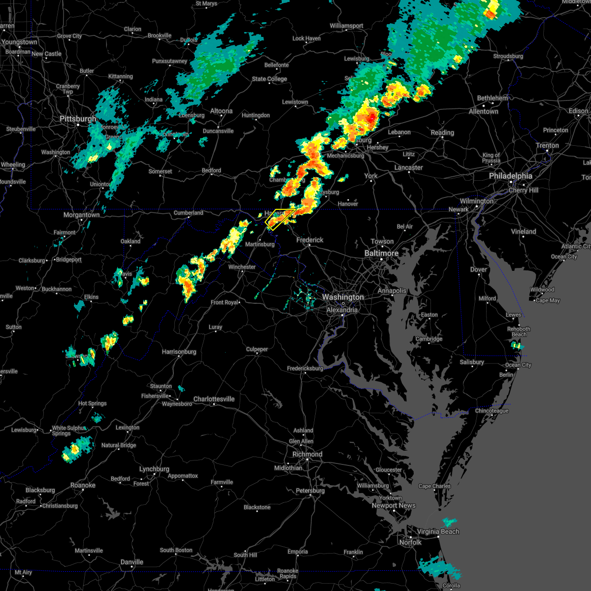 At 552 pm edt, a severe thunderstorm was located over williamsport, or near hagerstown, moving northeast at 25 mph (radar indicated). Hazards include 60 mph wind gusts and quarter size hail. Damaging winds will cause some trees and large branches to fall. this could injure those outdoors, as well as damage homes and vehicles. roadways may become blocked by downed trees. localized power outages are possible. Unsecured light objects may become projectiles. At 552 pm edt, a severe thunderstorm was located over williamsport, or near hagerstown, moving northeast at 25 mph (radar indicated). Hazards include 60 mph wind gusts and quarter size hail. Damaging winds will cause some trees and large branches to fall. this could injure those outdoors, as well as damage homes and vehicles. roadways may become blocked by downed trees. localized power outages are possible. Unsecured light objects may become projectiles.
|
| 9/15/2021 5:43 PM EDT |
 The severe thunderstorm warning for northeastern washington county will expire at 545 pm edt, the storm which prompted the warning has moved out of the area. therefore, the warning will be allowed to expire. to report severe weather, contact your nearest law enforcement agency. they will relay your report to the national weather service sterling virginia. remember, a severe thunderstorm warning still remains in effect for portions of washington county. The severe thunderstorm warning for northeastern washington county will expire at 545 pm edt, the storm which prompted the warning has moved out of the area. therefore, the warning will be allowed to expire. to report severe weather, contact your nearest law enforcement agency. they will relay your report to the national weather service sterling virginia. remember, a severe thunderstorm warning still remains in effect for portions of washington county.
|
| 9/15/2021 5:31 PM EDT | Tree down on little antietam road near winding creek roa in washington county MD, 5.6 miles WSW of Hagerstown, MD |
| 9/15/2021 5:27 PM EDT | Tree down on clopper road near old forge roa in washington county MD, 4.3 miles WSW of Hagerstown, MD |
| 9/15/2021 5:25 PM EDT | Multiple trees and wires down in and near leitersbur in washington county MD, 6.4 miles SW of Hagerstown, MD |
| 9/15/2021 5:25 PM EDT |
 At 524 pm edt, a severe thunderstorm was located near waynesboro, moving northeast at 25 mph (radar indicated). Hazards include 60 mph wind gusts and quarter size hail. Damaging winds will cause some trees and large branches to fall. this could injure those outdoors, as well as damage homes and vehicles. roadways may become blocked by downed trees. localized power outages are possible. unsecured light objects may become projectiles. locations impacted include, hagerstown, robinwood, fountainhead-orchard hills, paramount-long meadow, leitersburg, chewsville, ringgold and bridgeport. hail threat, radar indicated max hail size, 1. 00 in wind threat, radar indicated max wind gust, 60 mph. At 524 pm edt, a severe thunderstorm was located near waynesboro, moving northeast at 25 mph (radar indicated). Hazards include 60 mph wind gusts and quarter size hail. Damaging winds will cause some trees and large branches to fall. this could injure those outdoors, as well as damage homes and vehicles. roadways may become blocked by downed trees. localized power outages are possible. unsecured light objects may become projectiles. locations impacted include, hagerstown, robinwood, fountainhead-orchard hills, paramount-long meadow, leitersburg, chewsville, ringgold and bridgeport. hail threat, radar indicated max hail size, 1. 00 in wind threat, radar indicated max wind gust, 60 mph.
|
| 9/15/2021 5:15 PM EDT |
 At 514 pm edt, a severe thunderstorm was located over paramount-long meadow, or near hagerstown, moving northeast at 25 mph (radar indicated). Hazards include 60 mph wind gusts and quarter size hail. Damaging winds will cause some trees and large branches to fall. this could injure those outdoors, as well as damage homes and vehicles. roadways may become blocked by downed trees. localized power outages are possible. Unsecured light objects may become projectiles. At 514 pm edt, a severe thunderstorm was located over paramount-long meadow, or near hagerstown, moving northeast at 25 mph (radar indicated). Hazards include 60 mph wind gusts and quarter size hail. Damaging winds will cause some trees and large branches to fall. this could injure those outdoors, as well as damage homes and vehicles. roadways may become blocked by downed trees. localized power outages are possible. Unsecured light objects may become projectiles.
|
| 8/28/2021 4:56 PM EDT |
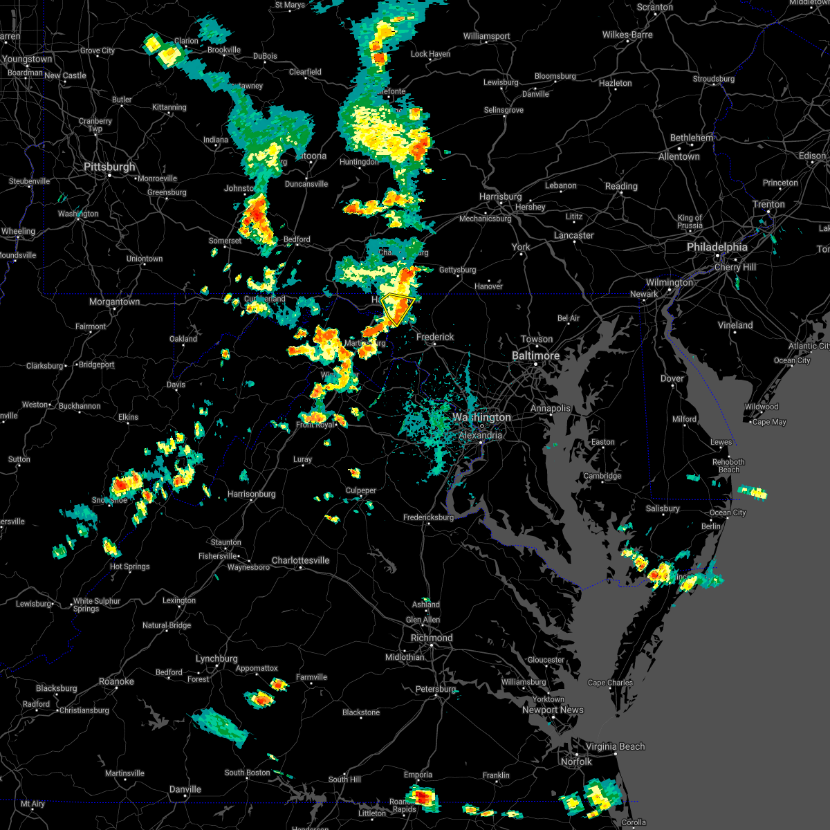 The severe thunderstorm warning for northeastern washington county will expire at 500 pm edt, the storm which prompted the warning has weakened below severe limits, and no longer poses an immediate threat to life or property. therefore, the warning will be allowed to expire. The severe thunderstorm warning for northeastern washington county will expire at 500 pm edt, the storm which prompted the warning has weakened below severe limits, and no longer poses an immediate threat to life or property. therefore, the warning will be allowed to expire.
|
| 8/28/2021 4:38 PM EDT |
 At 438 pm edt, a severe thunderstorm was located over fountainhead-orchard hills, or over hagerstown, moving southeast at 15 mph (radar indicated). Hazards include 60 mph wind gusts and quarter size hail. Damaging winds will cause some trees and large branches to fall. this could injure those outdoors, as well as damage homes and vehicles. roadways may become blocked by downed trees. localized power outages are possible. unsecured light objects may become projectiles. locations impacted include, hagerstown, municipal stadium, robinwood, fountainhead-orchard hills, paramount-long meadow, wilson-conococheague, long meadow, saint james, halfway, maugansville, cavetown, funkstown, leitersburg, chewsville, middleburg and bridgeport. hail threat, radar indicated max hail size, 1. 00 in wind threat, radar indicated max wind gust, 60 mph. At 438 pm edt, a severe thunderstorm was located over fountainhead-orchard hills, or over hagerstown, moving southeast at 15 mph (radar indicated). Hazards include 60 mph wind gusts and quarter size hail. Damaging winds will cause some trees and large branches to fall. this could injure those outdoors, as well as damage homes and vehicles. roadways may become blocked by downed trees. localized power outages are possible. unsecured light objects may become projectiles. locations impacted include, hagerstown, municipal stadium, robinwood, fountainhead-orchard hills, paramount-long meadow, wilson-conococheague, long meadow, saint james, halfway, maugansville, cavetown, funkstown, leitersburg, chewsville, middleburg and bridgeport. hail threat, radar indicated max hail size, 1. 00 in wind threat, radar indicated max wind gust, 60 mph.
|
| 8/28/2021 4:28 PM EDT | Tree branches and wires down on concord stree in washington county MD, 1.5 miles SE of Hagerstown, MD |
| 8/28/2021 4:20 PM EDT |
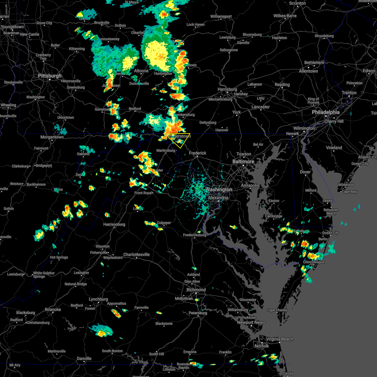 At 420 pm edt, a severe thunderstorm was located near fountainhead-orchard hills, or near hagerstown, moving southeast at 15 mph (radar indicated). Hazards include 60 mph wind gusts and quarter size hail. Damaging winds will cause some trees and large branches to fall. this could injure those outdoors, as well as damage homes and vehicles. roadways may become blocked by downed trees. localized power outages are possible. Unsecured light objects may become projectiles. At 420 pm edt, a severe thunderstorm was located near fountainhead-orchard hills, or near hagerstown, moving southeast at 15 mph (radar indicated). Hazards include 60 mph wind gusts and quarter size hail. Damaging winds will cause some trees and large branches to fall. this could injure those outdoors, as well as damage homes and vehicles. roadways may become blocked by downed trees. localized power outages are possible. Unsecured light objects may become projectiles.
|
| 8/18/2021 5:13 PM EDT |
 At 513 pm edt, a severe thunderstorm was located over robinwood, or near municipal stadium, moving northeast at 30 mph (radar indicated). Hazards include 60 mph wind gusts and quarter size hail. Damaging winds will cause some trees and large branches to fall. this could injure those outdoors, as well as damage homes and vehicles. roadways may become blocked by downed trees. localized power outages are possible. Unsecured light objects may become projectiles. At 513 pm edt, a severe thunderstorm was located over robinwood, or near municipal stadium, moving northeast at 30 mph (radar indicated). Hazards include 60 mph wind gusts and quarter size hail. Damaging winds will cause some trees and large branches to fall. this could injure those outdoors, as well as damage homes and vehicles. roadways may become blocked by downed trees. localized power outages are possible. Unsecured light objects may become projectiles.
|
| 8/11/2021 5:05 PM EDT |
 The severe thunderstorm warning for north central washington, morgan and northern berkeley counties will expire at 515 pm edt, the storms which prompted the warning have weakened below severe limits, and no longer pose an immediate threat to life or property. therefore, the warning will be allowed to expire. a severe thunderstorm watch remains in effect until 900 pm edt for north central maryland, northwestern virginia, and the panhandle of west virginia. The severe thunderstorm warning for north central washington, morgan and northern berkeley counties will expire at 515 pm edt, the storms which prompted the warning have weakened below severe limits, and no longer pose an immediate threat to life or property. therefore, the warning will be allowed to expire. a severe thunderstorm watch remains in effect until 900 pm edt for north central maryland, northwestern virginia, and the panhandle of west virginia.
|
| 8/11/2021 5:05 PM EDT |
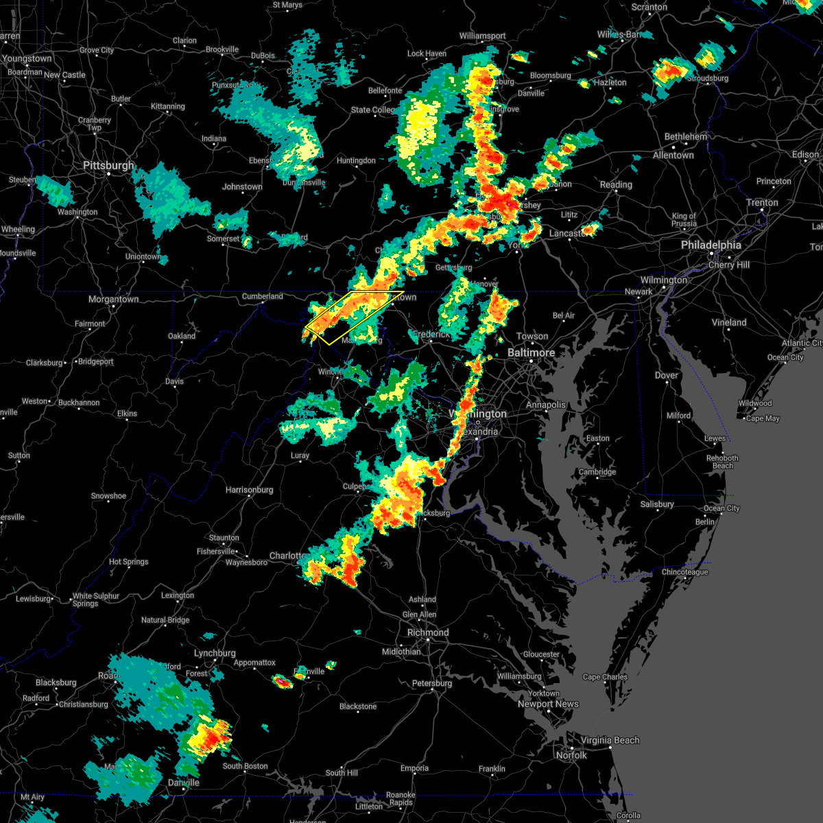 The severe thunderstorm warning for north central washington, morgan and northern berkeley counties will expire at 515 pm edt, the storms which prompted the warning have weakened below severe limits, and no longer pose an immediate threat to life or property. therefore, the warning will be allowed to expire. a severe thunderstorm watch remains in effect until 900 pm edt for north central maryland, northwestern virginia, and the panhandle of west virginia. The severe thunderstorm warning for north central washington, morgan and northern berkeley counties will expire at 515 pm edt, the storms which prompted the warning have weakened below severe limits, and no longer pose an immediate threat to life or property. therefore, the warning will be allowed to expire. a severe thunderstorm watch remains in effect until 900 pm edt for north central maryland, northwestern virginia, and the panhandle of west virginia.
|
| 8/11/2021 4:57 PM EDT |
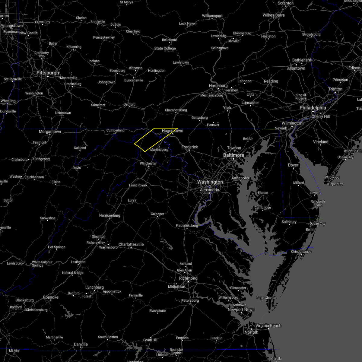 At 457 pm edt, severe thunderstorms were located along a line extending from near wilson-conococheague to near greenwood, moving southeast at 25 mph (radar indicated). Hazards include 60 mph wind gusts. Damaging winds will cause some trees and large branches to fall. this could injure those outdoors, as well as damage homes and vehicles. roadways may become blocked by downed trees. localized power outages are possible. unsecured light objects may become projectiles. locations impacted include, hagerstown, greenwood, fountainhead-orchard hills, paramount-long meadow, wilson-conococheague, long meadow, maugansville, clear spring, hedgesville, pecktonville, big spring, big pool, middleburg, johnsons mill, tomahawk, johnsontown, warrenton, valley view, fishers bridge and spohrs crossroads. hail threat, radar indicated max hail size, <. 75 in wind threat, radar indicated max wind gust, 60 mph. At 457 pm edt, severe thunderstorms were located along a line extending from near wilson-conococheague to near greenwood, moving southeast at 25 mph (radar indicated). Hazards include 60 mph wind gusts. Damaging winds will cause some trees and large branches to fall. this could injure those outdoors, as well as damage homes and vehicles. roadways may become blocked by downed trees. localized power outages are possible. unsecured light objects may become projectiles. locations impacted include, hagerstown, greenwood, fountainhead-orchard hills, paramount-long meadow, wilson-conococheague, long meadow, maugansville, clear spring, hedgesville, pecktonville, big spring, big pool, middleburg, johnsons mill, tomahawk, johnsontown, warrenton, valley view, fishers bridge and spohrs crossroads. hail threat, radar indicated max hail size, <. 75 in wind threat, radar indicated max wind gust, 60 mph.
|
| 8/11/2021 4:34 PM EDT |
 At 434 pm edt, severe thunderstorms were located along a line extending from 8 miles southwest of claylick to near paw paw, moving southeast at 25 mph (radar indicated). Hazards include 60 mph wind gusts. Damaging winds will cause some trees and large branches to fall. this could injure those outdoors, as well as damage homes and vehicles. roadways may become blocked by downed trees. localized power outages are possible. Unsecured light objects may become projectiles. At 434 pm edt, severe thunderstorms were located along a line extending from 8 miles southwest of claylick to near paw paw, moving southeast at 25 mph (radar indicated). Hazards include 60 mph wind gusts. Damaging winds will cause some trees and large branches to fall. this could injure those outdoors, as well as damage homes and vehicles. roadways may become blocked by downed trees. localized power outages are possible. Unsecured light objects may become projectiles.
|
| 8/11/2021 4:34 PM EDT |
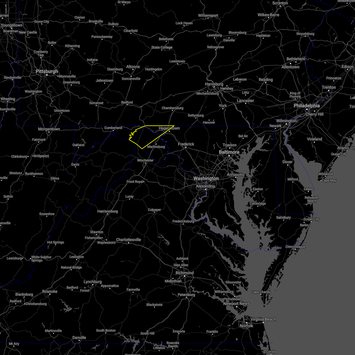 At 434 pm edt, severe thunderstorms were located along a line extending from 8 miles southwest of claylick to near paw paw, moving southeast at 25 mph (radar indicated). Hazards include 60 mph wind gusts. Damaging winds will cause some trees and large branches to fall. this could injure those outdoors, as well as damage homes and vehicles. roadways may become blocked by downed trees. localized power outages are possible. Unsecured light objects may become projectiles. At 434 pm edt, severe thunderstorms were located along a line extending from 8 miles southwest of claylick to near paw paw, moving southeast at 25 mph (radar indicated). Hazards include 60 mph wind gusts. Damaging winds will cause some trees and large branches to fall. this could injure those outdoors, as well as damage homes and vehicles. roadways may become blocked by downed trees. localized power outages are possible. Unsecured light objects may become projectiles.
|
| 8/11/2021 3:11 PM EDT |
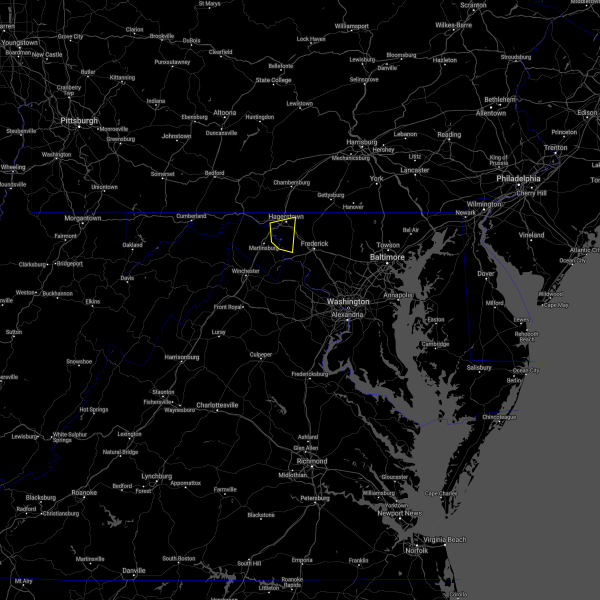 At 310 pm edt, a severe thunderstorm was located near williamsport, or 7 miles northeast of martinsburg, moving east at 15 mph (radar indicated). Hazards include 70 mph wind gusts and quarter size hail. Damaging winds will cause some trees and large branches to fall. this could injure those outdoors, as well as damage homes and vehicles. roadways may become blocked by downed trees. localized power outages are possible. unsecured light objects may become projectiles. locations impacted include, hagerstown, shepherdstown, municipal stadium, robinwood, boonsboro, paramount-long meadow, wilson-conococheague, williamsport, mount lena, san mar, saint james, halfway, keedysville, funkstown, falling waters, sharpsburg, fairplay, chewsville, rohrersville and gapland. thunderstorm damage threat, considerable hail threat, radar indicated max hail size, 1. 00 in wind threat, radar indicated max wind gust, 70 mph. At 310 pm edt, a severe thunderstorm was located near williamsport, or 7 miles northeast of martinsburg, moving east at 15 mph (radar indicated). Hazards include 70 mph wind gusts and quarter size hail. Damaging winds will cause some trees and large branches to fall. this could injure those outdoors, as well as damage homes and vehicles. roadways may become blocked by downed trees. localized power outages are possible. unsecured light objects may become projectiles. locations impacted include, hagerstown, shepherdstown, municipal stadium, robinwood, boonsboro, paramount-long meadow, wilson-conococheague, williamsport, mount lena, san mar, saint james, halfway, keedysville, funkstown, falling waters, sharpsburg, fairplay, chewsville, rohrersville and gapland. thunderstorm damage threat, considerable hail threat, radar indicated max hail size, 1. 00 in wind threat, radar indicated max wind gust, 70 mph.
|
| 8/11/2021 3:07 PM EDT | Several trees down in and around the city of hagerstow in washington county MD, 0.2 miles SSE of Hagerstown, MD |
| 8/11/2021 2:56 PM EDT |
 At 255 pm edt, a severe thunderstorm was located near martinsburg, moving east at 15 mph (radar indicated). Hazards include 60 mph wind gusts. Damaging winds will cause some trees and large branches to fall. this could injure those outdoors, as well as damage homes and vehicles. roadways may become blocked by downed trees. localized power outages are possible. unsecured light objects may become projectiles. locations impacted include, hagerstown, martinsburg, shepherdstown, municipal stadium, robinwood, boonsboro, paramount-long meadow, wilson-conococheague, williamsport, mount lena, san mar, saint james, berkeley, halfway, keedysville, funkstown, falling waters, sharpsburg, fairplay and chewsville. hail threat, radar indicated max hail size, <. 75 in wind threat, radar indicated max wind gust, 60 mph. At 255 pm edt, a severe thunderstorm was located near martinsburg, moving east at 15 mph (radar indicated). Hazards include 60 mph wind gusts. Damaging winds will cause some trees and large branches to fall. this could injure those outdoors, as well as damage homes and vehicles. roadways may become blocked by downed trees. localized power outages are possible. unsecured light objects may become projectiles. locations impacted include, hagerstown, martinsburg, shepherdstown, municipal stadium, robinwood, boonsboro, paramount-long meadow, wilson-conococheague, williamsport, mount lena, san mar, saint james, berkeley, halfway, keedysville, funkstown, falling waters, sharpsburg, fairplay and chewsville. hail threat, radar indicated max hail size, <. 75 in wind threat, radar indicated max wind gust, 60 mph.
|
| 8/11/2021 2:51 PM EDT |
 At 251 pm edt, a severe thunderstorm was located near martinsburg, moving east at 15 mph (radar indicated). Hazards include 60 mph wind gusts. Damaging winds will cause some trees and large branches to fall. this could injure those outdoors, as well as damage homes and vehicles. roadways may become blocked by downed trees. localized power outages are possible. Unsecured light objects may become projectiles. At 251 pm edt, a severe thunderstorm was located near martinsburg, moving east at 15 mph (radar indicated). Hazards include 60 mph wind gusts. Damaging winds will cause some trees and large branches to fall. this could injure those outdoors, as well as damage homes and vehicles. roadways may become blocked by downed trees. localized power outages are possible. Unsecured light objects may become projectiles.
|
| 7/21/2021 1:27 PM EDT |
 At 127 pm edt, a severe thunderstorm was located over paramount-long meadow, or near greencastle, moving southeast at 25 mph (radar indicated). Hazards include 60 mph wind gusts and quarter size hail. Damaging winds will cause some trees and large branches to fall. this could injure those outdoors, as well as damage homes and vehicles. roadways may become blocked by downed trees. localized power outages are possible. Unsecured light objects may become projectiles. At 127 pm edt, a severe thunderstorm was located over paramount-long meadow, or near greencastle, moving southeast at 25 mph (radar indicated). Hazards include 60 mph wind gusts and quarter size hail. Damaging winds will cause some trees and large branches to fall. this could injure those outdoors, as well as damage homes and vehicles. roadways may become blocked by downed trees. localized power outages are possible. Unsecured light objects may become projectiles.
|
| 7/17/2021 6:59 PM EDT |
 At 659 pm edt, severe thunderstorms were located along a line extending from san mar to near boonsboro, moving east at 45 mph (radar indicated). Hazards include 60 mph wind gusts. Damaging winds will cause some trees and large branches to fall. this could injure those outdoors, as well as damage homes and vehicles. roadways may become blocked by downed trees. localized power outages are possible. unsecured light objects may become projectiles. Locations impacted include, frederick, hagerstown, thurmont, emmitsburg, robinwood, walkersville, boonsboro, smithsburg, mount aetna, mount lena, san mar, wolfsville, discovery-spring garden, myersville, cavetown, woodsboro, sabillasville, fort ritchie, chewsville and utica. At 659 pm edt, severe thunderstorms were located along a line extending from san mar to near boonsboro, moving east at 45 mph (radar indicated). Hazards include 60 mph wind gusts. Damaging winds will cause some trees and large branches to fall. this could injure those outdoors, as well as damage homes and vehicles. roadways may become blocked by downed trees. localized power outages are possible. unsecured light objects may become projectiles. Locations impacted include, frederick, hagerstown, thurmont, emmitsburg, robinwood, walkersville, boonsboro, smithsburg, mount aetna, mount lena, san mar, wolfsville, discovery-spring garden, myersville, cavetown, woodsboro, sabillasville, fort ritchie, chewsville and utica.
|
| 7/17/2021 6:45 PM EDT |
 At 645 pm edt, severe thunderstorms were located along a line extending from near saint james to near boonsboro, moving east at 45 mph (radar indicated). Hazards include 60 mph wind gusts. Damaging winds will cause some trees and large branches to fall. this could injure those outdoors, as well as damage homes and vehicles. roadways may become blocked by downed trees. localized power outages are possible. Unsecured light objects may become projectiles. At 645 pm edt, severe thunderstorms were located along a line extending from near saint james to near boonsboro, moving east at 45 mph (radar indicated). Hazards include 60 mph wind gusts. Damaging winds will cause some trees and large branches to fall. this could injure those outdoors, as well as damage homes and vehicles. roadways may become blocked by downed trees. localized power outages are possible. Unsecured light objects may become projectiles.
|
| 7/17/2021 6:01 PM EDT | Several trees down in leitersbur in washington county MD, 6.4 miles SW of Hagerstown, MD |
| 7/12/2021 3:03 PM EDT |
 At 303 pm edt, a severe thunderstorm was located over shepherdstown, moving northeast at 25 mph (radar indicated). Hazards include 60 mph wind gusts and quarter size hail. Damaging winds will cause some trees and large branches to fall. this could injure those outdoors, as well as damage homes and vehicles. roadways may become blocked by downed trees. localized power outages are possible. unsecured light objects may become projectiles. Locations impacted include, shepherdstown, ranson, boonsboro, kearneysville, saint james, halfway, keedysville, sharpsburg, shenandoah junction, fairplay, middleway, rohrersville, burkittsville, gapland, antietam, brownsville, winebrenners cross, vanville, arnoldtown and moler crossroads. At 303 pm edt, a severe thunderstorm was located over shepherdstown, moving northeast at 25 mph (radar indicated). Hazards include 60 mph wind gusts and quarter size hail. Damaging winds will cause some trees and large branches to fall. this could injure those outdoors, as well as damage homes and vehicles. roadways may become blocked by downed trees. localized power outages are possible. unsecured light objects may become projectiles. Locations impacted include, shepherdstown, ranson, boonsboro, kearneysville, saint james, halfway, keedysville, sharpsburg, shenandoah junction, fairplay, middleway, rohrersville, burkittsville, gapland, antietam, brownsville, winebrenners cross, vanville, arnoldtown and moler crossroads.
|
| 7/12/2021 3:03 PM EDT |
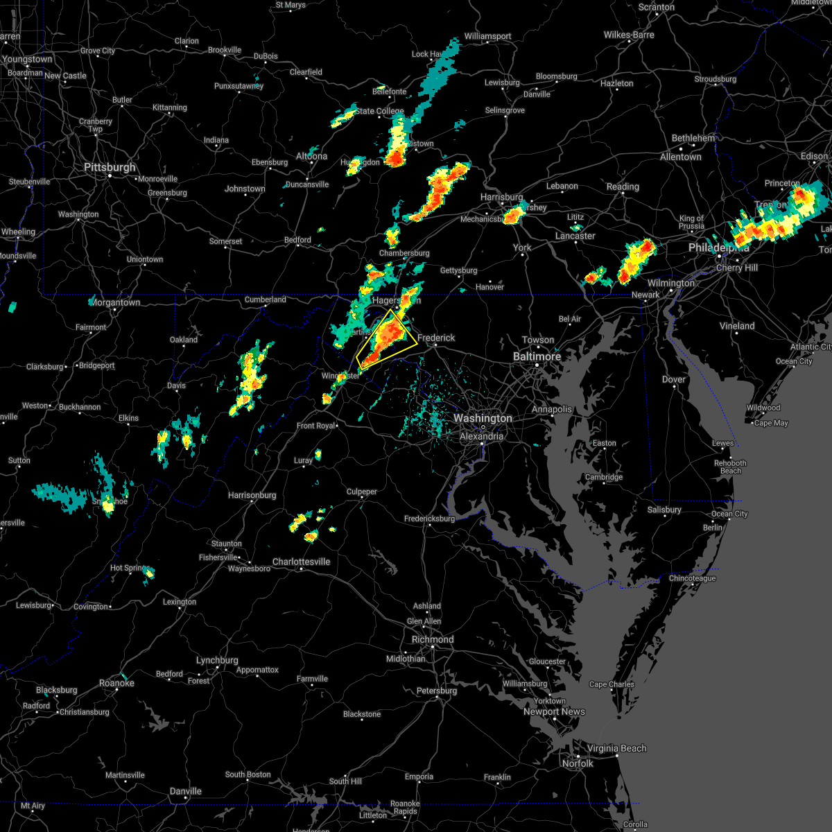 At 303 pm edt, a severe thunderstorm was located over shepherdstown, moving northeast at 25 mph (radar indicated). Hazards include 60 mph wind gusts and quarter size hail. Damaging winds will cause some trees and large branches to fall. this could injure those outdoors, as well as damage homes and vehicles. roadways may become blocked by downed trees. localized power outages are possible. unsecured light objects may become projectiles. Locations impacted include, shepherdstown, ranson, boonsboro, kearneysville, saint james, halfway, keedysville, sharpsburg, shenandoah junction, fairplay, middleway, rohrersville, burkittsville, gapland, antietam, brownsville, winebrenners cross, vanville, arnoldtown and moler crossroads. At 303 pm edt, a severe thunderstorm was located over shepherdstown, moving northeast at 25 mph (radar indicated). Hazards include 60 mph wind gusts and quarter size hail. Damaging winds will cause some trees and large branches to fall. this could injure those outdoors, as well as damage homes and vehicles. roadways may become blocked by downed trees. localized power outages are possible. unsecured light objects may become projectiles. Locations impacted include, shepherdstown, ranson, boonsboro, kearneysville, saint james, halfway, keedysville, sharpsburg, shenandoah junction, fairplay, middleway, rohrersville, burkittsville, gapland, antietam, brownsville, winebrenners cross, vanville, arnoldtown and moler crossroads.
|
| 7/12/2021 2:43 PM EDT |
 At 243 pm edt, a severe thunderstorm was located over kearneysville, or near martinsburg, moving northeast at 25 mph (radar indicated). Hazards include 60 mph wind gusts and quarter size hail. Damaging winds will cause some trees and large branches to fall. this could injure those outdoors, as well as damage homes and vehicles. roadways may become blocked by downed trees. localized power outages are possible. Unsecured light objects may become projectiles. At 243 pm edt, a severe thunderstorm was located over kearneysville, or near martinsburg, moving northeast at 25 mph (radar indicated). Hazards include 60 mph wind gusts and quarter size hail. Damaging winds will cause some trees and large branches to fall. this could injure those outdoors, as well as damage homes and vehicles. roadways may become blocked by downed trees. localized power outages are possible. Unsecured light objects may become projectiles.
|
| 6/21/2021 4:36 PM EDT | Trees down on leiters mill road and little antietam road in leitersbur in washington county MD, 6.4 miles SW of Hagerstown, MD |
| 6/21/2021 4:27 PM EDT | Tree down at 16867 shinham rd nw of cearfoss pik in washington county MD, 6.9 miles SSE of Hagerstown, MD |
| 6/21/2021 4:27 PM EDT |
 At 427 pm edt, severe thunderstorms were located along a line extending from near wilson-conococheague to near shepherdstown, moving east at 45 mph (radar indicated). Hazards include 60 mph wind gusts. Damaging winds will cause some trees and large branches to fall. this could injure those outdoors, as well as damage homes and vehicles. roadways may become blocked by downed trees. localized power outages are possible. unsecured light objects may become projectiles. Locations impacted include, hagerstown, municipal stadium, robinwood, fountainhead-orchard hills, boonsboro, smithsburg, paramount-long meadow, wilson-conococheague, williamsport, mount aetna, mount lena, san mar, long meadow, saint james, halfway, maugansville, cavetown, funkstown, falling waters and fairplay. At 427 pm edt, severe thunderstorms were located along a line extending from near wilson-conococheague to near shepherdstown, moving east at 45 mph (radar indicated). Hazards include 60 mph wind gusts. Damaging winds will cause some trees and large branches to fall. this could injure those outdoors, as well as damage homes and vehicles. roadways may become blocked by downed trees. localized power outages are possible. unsecured light objects may become projectiles. Locations impacted include, hagerstown, municipal stadium, robinwood, fountainhead-orchard hills, boonsboro, smithsburg, paramount-long meadow, wilson-conococheague, williamsport, mount aetna, mount lena, san mar, long meadow, saint james, halfway, maugansville, cavetown, funkstown, falling waters and fairplay.
|
| 6/21/2021 4:26 PM EDT | 7 trees down in hagerstow in washington county MD, 0.2 miles SSE of Hagerstown, MD |
| 6/21/2021 4:22 PM EDT | Tree blew down in the 1600 block of fairview roa in washington county MD, 0.2 miles SSE of Hagerstown, MD |
| 6/21/2021 3:59 PM EDT |
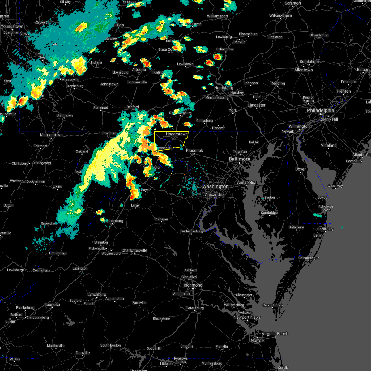 At 358 pm edt, severe thunderstorms were located along a line extending from near hancock to near greenwood, moving east at 50 mph (law enforcement. this storm has a history of downing numerous trees). Hazards include 60 mph wind gusts. Damaging winds will cause some trees and large branches to fall. this could injure those outdoors, as well as damage homes and vehicles. roadways may become blocked by downed trees. localized power outages are possible. Unsecured light objects may become projectiles. At 358 pm edt, severe thunderstorms were located along a line extending from near hancock to near greenwood, moving east at 50 mph (law enforcement. this storm has a history of downing numerous trees). Hazards include 60 mph wind gusts. Damaging winds will cause some trees and large branches to fall. this could injure those outdoors, as well as damage homes and vehicles. roadways may become blocked by downed trees. localized power outages are possible. Unsecured light objects may become projectiles.
|
| 5/26/2021 3:31 PM EDT |
 At 331 pm edt, a severe thunderstorm was located near boonsboro, or 7 miles south of municipal stadium, moving east at 20 mph (radar indicated). Hazards include 60 mph wind gusts. Damaging winds will cause some trees and large branches to fall. this could injure those outdoors, as well as damage homes and vehicles. roadways may become blocked by downed trees. localized power outages are possible. Unsecured light objects may become projectiles. At 331 pm edt, a severe thunderstorm was located near boonsboro, or 7 miles south of municipal stadium, moving east at 20 mph (radar indicated). Hazards include 60 mph wind gusts. Damaging winds will cause some trees and large branches to fall. this could injure those outdoors, as well as damage homes and vehicles. roadways may become blocked by downed trees. localized power outages are possible. Unsecured light objects may become projectiles.
|
| 4/30/2021 4:31 PM EDT |
 At 430 pm edt, severe thunderstorms were located along a line extending from near smithsburg to braddock heights to near purcellville, moving east at 60 mph (radar indicated). Hazards include 60 mph wind gusts. Damaging winds will cause some trees and large branches to fall. this could injure those outdoors, as well as damage homes and vehicles. roadways may become blocked by downed trees. localized power outages are possible. Unsecured light objects may become projectiles. At 430 pm edt, severe thunderstorms were located along a line extending from near smithsburg to braddock heights to near purcellville, moving east at 60 mph (radar indicated). Hazards include 60 mph wind gusts. Damaging winds will cause some trees and large branches to fall. this could injure those outdoors, as well as damage homes and vehicles. roadways may become blocked by downed trees. localized power outages are possible. Unsecured light objects may become projectiles.
|
| 3/28/2021 4:24 PM EDT |
 At 424 pm edt, severe thunderstorms were located along a line extending from near smithsburg to san mar to shepherdstown, moving east at 60 mph (radar indicated). Hazards include 60 mph wind gusts. Damaging winds will cause some trees and large branches to fall. this could injure those outdoors, as well as damage homes and vehicles. roadways may become blocked by downed trees. localized power outages are possible. unsecured light objects may become projectiles. Locations impacted include, frederick, hagerstown, thurmont, charles town, emmitsburg, shepherdstown, municipal stadium, harry grove stadium, ballenger creek, robinwood, brunswick, walkersville, fountainhead-orchard hills, ranson, boonsboro, smithsburg, braddock heights, paramount-long meadow, williamsport and mount aetna. At 424 pm edt, severe thunderstorms were located along a line extending from near smithsburg to san mar to shepherdstown, moving east at 60 mph (radar indicated). Hazards include 60 mph wind gusts. Damaging winds will cause some trees and large branches to fall. this could injure those outdoors, as well as damage homes and vehicles. roadways may become blocked by downed trees. localized power outages are possible. unsecured light objects may become projectiles. Locations impacted include, frederick, hagerstown, thurmont, charles town, emmitsburg, shepherdstown, municipal stadium, harry grove stadium, ballenger creek, robinwood, brunswick, walkersville, fountainhead-orchard hills, ranson, boonsboro, smithsburg, braddock heights, paramount-long meadow, williamsport and mount aetna.
|
| 3/28/2021 4:23 PM EDT |
 At 423 pm edt, severe thunderstorms were located along a line extending from near wayne heights to shepherdstown, moving east at 50 mph (radar indicated). Hazards include 60 mph wind gusts. Damaging winds will cause some trees and large branches to fall. this could injure those outdoors, as well as damage homes and vehicles. roadways may become blocked by downed trees. localized power outages are possible. Unsecured light objects may become projectiles. At 423 pm edt, severe thunderstorms were located along a line extending from near wayne heights to shepherdstown, moving east at 50 mph (radar indicated). Hazards include 60 mph wind gusts. Damaging winds will cause some trees and large branches to fall. this could injure those outdoors, as well as damage homes and vehicles. roadways may become blocked by downed trees. localized power outages are possible. Unsecured light objects may become projectiles.
|
| 3/28/2021 4:20 PM EDT | Storm damage reported in washington county MD, 1.2 miles NNW of Hagerstown, MD |
| 3/28/2021 4:19 PM EDT | Roof partially blown off building near intersection of west lee street and south stree in washington county MD, 0.2 miles SSE of Hagerstown, MD |
| 3/28/2021 4:19 PM EDT | Roof partially blown off building near intersection of west lee street and south stree in washington county MD, 0.2 miles SSE of Hagerstown, MD |
| 3/28/2021 4:12 PM EDT | Telephone pole and wires down on kenwood driv in washington county MD, 1.2 miles N of Hagerstown, MD |
| 3/28/2021 4:09 PM EDT |
 At 409 pm edt, severe thunderstorms were located along a line extending from wilson-conococheague to near martinsburg to near inwood, moving east at 45 mph (radar indicated). Hazards include 60 mph wind gusts. Damaging winds will cause some trees and large branches to fall. this could injure those outdoors, as well as damage homes and vehicles. roadways may become blocked by downed trees. localized power outages are possible. unsecured light objects may become projectiles. Locations impacted include, frederick, hagerstown, martinsburg, thurmont, charles town, emmitsburg, shepherdstown, municipal stadium, harry grove stadium, ballenger creek, robinwood, brunswick, walkersville, fountainhead-orchard hills, ranson, boonsboro, smithsburg, inwood, braddock heights and paramount-long meadow. At 409 pm edt, severe thunderstorms were located along a line extending from wilson-conococheague to near martinsburg to near inwood, moving east at 45 mph (radar indicated). Hazards include 60 mph wind gusts. Damaging winds will cause some trees and large branches to fall. this could injure those outdoors, as well as damage homes and vehicles. roadways may become blocked by downed trees. localized power outages are possible. unsecured light objects may become projectiles. Locations impacted include, frederick, hagerstown, martinsburg, thurmont, charles town, emmitsburg, shepherdstown, municipal stadium, harry grove stadium, ballenger creek, robinwood, brunswick, walkersville, fountainhead-orchard hills, ranson, boonsboro, smithsburg, inwood, braddock heights and paramount-long meadow.
|
| 3/28/2021 4:09 PM EDT |
 At 356 pm edt, severe thunderstorms were located along a line extending from 10 miles east of berkeley springs to 6 miles west of martinsburg to near greenwood, moving east at 50 mph (radar indicated). Hazards include 60 mph wind gusts. Damaging winds will cause some trees and large branches to fall. this could injure those outdoors, as well as damage homes and vehicles. roadways may become blocked by downed trees. localized power outages are possible. unsecured light objects may become projectiles. Locations impacted include, frederick, hagerstown, martinsburg, thurmont, charles town, emmitsburg, shepherdstown, municipal stadium, harry grove stadium, greenwood, ballenger creek, robinwood, brunswick, walkersville, fountainhead-orchard hills, ranson, boonsboro, smithsburg, inwood and braddock heights. At 356 pm edt, severe thunderstorms were located along a line extending from 10 miles east of berkeley springs to 6 miles west of martinsburg to near greenwood, moving east at 50 mph (radar indicated). Hazards include 60 mph wind gusts. Damaging winds will cause some trees and large branches to fall. this could injure those outdoors, as well as damage homes and vehicles. roadways may become blocked by downed trees. localized power outages are possible. unsecured light objects may become projectiles. Locations impacted include, frederick, hagerstown, martinsburg, thurmont, charles town, emmitsburg, shepherdstown, municipal stadium, harry grove stadium, greenwood, ballenger creek, robinwood, brunswick, walkersville, fountainhead-orchard hills, ranson, boonsboro, smithsburg, inwood and braddock heights.
|
| 3/28/2021 3:56 PM EDT |
 At 356 pm edt, severe thunderstorms were located along a line extending from 10 miles east of berkeley springs to 6 miles west of martinsburg to near greenwood, moving east at 50 mph (radar indicated). Hazards include 60 mph wind gusts. Damaging winds will cause some trees and large branches to fall. this could injure those outdoors, as well as damage homes and vehicles. roadways may become blocked by downed trees. localized power outages are possible. unsecured light objects may become projectiles. Locations impacted include, frederick, hagerstown, martinsburg, thurmont, charles town, emmitsburg, shepherdstown, municipal stadium, harry grove stadium, greenwood, ballenger creek, robinwood, brunswick, walkersville, fountainhead-orchard hills, ranson, boonsboro, smithsburg, inwood and braddock heights. At 356 pm edt, severe thunderstorms were located along a line extending from 10 miles east of berkeley springs to 6 miles west of martinsburg to near greenwood, moving east at 50 mph (radar indicated). Hazards include 60 mph wind gusts. Damaging winds will cause some trees and large branches to fall. this could injure those outdoors, as well as damage homes and vehicles. roadways may become blocked by downed trees. localized power outages are possible. unsecured light objects may become projectiles. Locations impacted include, frederick, hagerstown, martinsburg, thurmont, charles town, emmitsburg, shepherdstown, municipal stadium, harry grove stadium, greenwood, ballenger creek, robinwood, brunswick, walkersville, fountainhead-orchard hills, ranson, boonsboro, smithsburg, inwood and braddock heights.
|
| 3/28/2021 3:47 PM EDT |
 At 346 pm edt, severe thunderstorms were located along a line extending from near berkeley springs to near greenwood to 11 miles southeast of paw paw, moving east at 60 mph (radar indicated). Hazards include 60 mph wind gusts. Damaging winds will cause some trees and large branches to fall. this could injure those outdoors, as well as damage homes and vehicles. roadways may become blocked by downed trees. localized power outages are possible. Unsecured light objects may become projectiles. At 346 pm edt, severe thunderstorms were located along a line extending from near berkeley springs to near greenwood to 11 miles southeast of paw paw, moving east at 60 mph (radar indicated). Hazards include 60 mph wind gusts. Damaging winds will cause some trees and large branches to fall. this could injure those outdoors, as well as damage homes and vehicles. roadways may become blocked by downed trees. localized power outages are possible. Unsecured light objects may become projectiles.
|
| 11/15/2020 5:26 PM EST |
 At 525 pm est, severe thunderstorms were located along a line extending from near rouzerville to near shepherdstown to 6 miles northeast of winchester, moving east at 30 mph (radar indicated). Hazards include 60 mph wind gusts. Damaging winds will cause some trees and large branches to fall. this could injure those outdoors, as well as damage homes and vehicles. roadways may become blocked by downed trees. localized power outages are possible. unsecured light objects may become projectiles. Locations impacted include, hagerstown, winchester, martinsburg, thurmont, charles town, emmitsburg, shepherdstown, municipal stadium, millwood pike, robinwood, brunswick, fountainhead-orchard hills, ranson, berryville, boonsboro, smithsburg, inwood, braddock heights, paramount-long meadow and williamsport. At 525 pm est, severe thunderstorms were located along a line extending from near rouzerville to near shepherdstown to 6 miles northeast of winchester, moving east at 30 mph (radar indicated). Hazards include 60 mph wind gusts. Damaging winds will cause some trees and large branches to fall. this could injure those outdoors, as well as damage homes and vehicles. roadways may become blocked by downed trees. localized power outages are possible. unsecured light objects may become projectiles. Locations impacted include, hagerstown, winchester, martinsburg, thurmont, charles town, emmitsburg, shepherdstown, municipal stadium, millwood pike, robinwood, brunswick, fountainhead-orchard hills, ranson, berryville, boonsboro, smithsburg, inwood, braddock heights, paramount-long meadow and williamsport.
|
| 11/15/2020 4:56 PM EST |
 At 455 pm est, severe thunderstorms were located along a line extending from near mont alto to near wilson-conococheague to near greenwood, moving east at 40 mph (radar indicated). Hazards include 60 mph wind gusts. Damaging winds will cause some trees and large branches to fall. this could injure those outdoors, as well as damage homes and vehicles. roadways may become blocked by downed trees. localized power outages are possible. Unsecured light objects may become projectiles. At 455 pm est, severe thunderstorms were located along a line extending from near mont alto to near wilson-conococheague to near greenwood, moving east at 40 mph (radar indicated). Hazards include 60 mph wind gusts. Damaging winds will cause some trees and large branches to fall. this could injure those outdoors, as well as damage homes and vehicles. roadways may become blocked by downed trees. localized power outages are possible. Unsecured light objects may become projectiles.
|
| 8/24/2020 2:38 PM EDT |
 At 238 pm edt, a severe thunderstorm was located near claylick, or 11 miles east of hancock, moving southeast at 30 mph (radar indicated). Hazards include 60 mph wind gusts and quarter size hail. Damaging winds will cause some trees and large branches to fall. this could injure those outdoors, as well as damage homes and vehicles. roadways may become blocked by downed trees. localized power outages are possible. Unsecured light objects may become projectiles. At 238 pm edt, a severe thunderstorm was located near claylick, or 11 miles east of hancock, moving southeast at 30 mph (radar indicated). Hazards include 60 mph wind gusts and quarter size hail. Damaging winds will cause some trees and large branches to fall. this could injure those outdoors, as well as damage homes and vehicles. roadways may become blocked by downed trees. localized power outages are possible. Unsecured light objects may become projectiles.
|
| 8/1/2020 9:54 PM EDT |
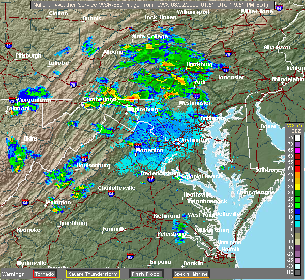 At 954 pm edt, a severe thunderstorm was located over wilson-conococheague, or near hagerstown, moving east at 15 mph (radar indicated). Hazards include 60 mph wind gusts. Damaging winds will cause some trees and large branches to fall. this could injure those outdoors, as well as damage homes and vehicles. roadways may become blocked by downed trees. localized power outages are possible. Unsecured light objects may become projectiles. At 954 pm edt, a severe thunderstorm was located over wilson-conococheague, or near hagerstown, moving east at 15 mph (radar indicated). Hazards include 60 mph wind gusts. Damaging winds will cause some trees and large branches to fall. this could injure those outdoors, as well as damage homes and vehicles. roadways may become blocked by downed trees. localized power outages are possible. Unsecured light objects may become projectiles.
|
| 8/1/2020 9:17 PM EDT |
 At 917 pm edt, a severe thunderstorm with a history of producing wind damage located near wilson-conococheague, or 11 miles west of hagerstown, moving east at 15 mph (observed wind damage and doppler radar). Hazards include 60 mph wind gusts and quarter size hail. Damaging winds will cause some trees and large branches to fall. this could injure those outdoors, as well as damage homes and vehicles. roadways may become blocked by downed trees. localized power outages are possible. unsecured light objects may become projectiles. Locations impacted include, hagerstown, fountainhead-orchard hills, paramount-long meadow, wilson-conococheague, williamsport, long meadow, saint james, halfway, maugansville, funkstown, clear spring, big spring, middleburg and warrenton. At 917 pm edt, a severe thunderstorm with a history of producing wind damage located near wilson-conococheague, or 11 miles west of hagerstown, moving east at 15 mph (observed wind damage and doppler radar). Hazards include 60 mph wind gusts and quarter size hail. Damaging winds will cause some trees and large branches to fall. this could injure those outdoors, as well as damage homes and vehicles. roadways may become blocked by downed trees. localized power outages are possible. unsecured light objects may become projectiles. Locations impacted include, hagerstown, fountainhead-orchard hills, paramount-long meadow, wilson-conococheague, williamsport, long meadow, saint james, halfway, maugansville, funkstown, clear spring, big spring, middleburg and warrenton.
|
| 8/1/2020 9:07 PM EDT |
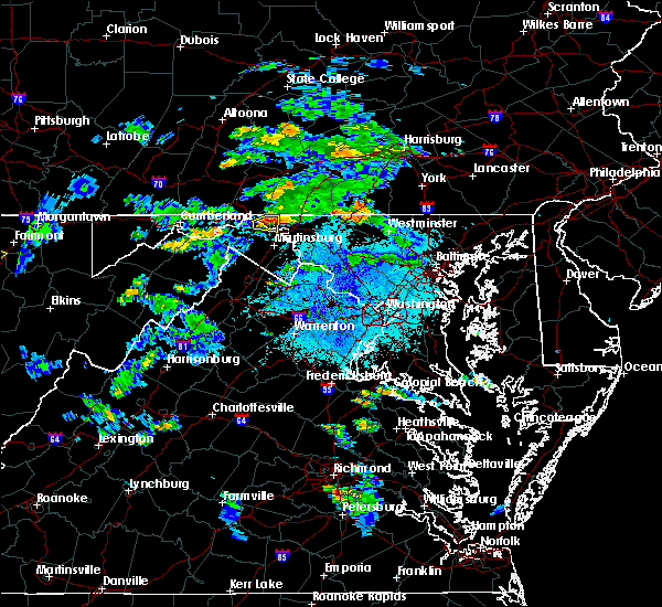 At 906 pm edt, a severe thunderstorm with a history of producing wind damage was located 8 miles west of wilson-conococheague, or 10 miles east of hancock, moving east at 15 mph (observed wind damage and doppler radar). Hazards include 65 mph wind gusts and quarter size hail. Damaging winds will cause some trees and large branches to fall. this could injure those outdoors, as well as damage homes and vehicles. roadways may become blocked by downed trees. localized power outages are possible. Unsecured light objects may become projectiles. At 906 pm edt, a severe thunderstorm with a history of producing wind damage was located 8 miles west of wilson-conococheague, or 10 miles east of hancock, moving east at 15 mph (observed wind damage and doppler radar). Hazards include 65 mph wind gusts and quarter size hail. Damaging winds will cause some trees and large branches to fall. this could injure those outdoors, as well as damage homes and vehicles. roadways may become blocked by downed trees. localized power outages are possible. Unsecured light objects may become projectiles.
|
| 7/24/2020 9:48 PM EDT |
 At 948 pm edt, a severe thunderstorm was located near paramount-long meadow, or near waynesboro, moving south at 15 mph (radar indicated). Hazards include 60 mph wind gusts. Damaging winds will cause some trees and large branches to fall. this could injure those outdoors, as well as damage homes and vehicles. roadways may become blocked by downed trees. localized power outages are possible. unsecured light objects may become projectiles. Locations impacted include, hagerstown, robinwood, fountainhead-orchard hills, smithsburg, paramount-long meadow, long meadow, maugansville, cavetown, leitersburg, fort ritchie, chewsville, ringgold, middleburg and bridgeport. At 948 pm edt, a severe thunderstorm was located near paramount-long meadow, or near waynesboro, moving south at 15 mph (radar indicated). Hazards include 60 mph wind gusts. Damaging winds will cause some trees and large branches to fall. this could injure those outdoors, as well as damage homes and vehicles. roadways may become blocked by downed trees. localized power outages are possible. unsecured light objects may become projectiles. Locations impacted include, hagerstown, robinwood, fountainhead-orchard hills, smithsburg, paramount-long meadow, long meadow, maugansville, cavetown, leitersburg, fort ritchie, chewsville, ringgold, middleburg and bridgeport.
|
| 7/24/2020 9:32 PM EDT |
 At 931 pm edt, a severe thunderstorm was located near greencastle, moving south at 10 mph (radar indicated). Hazards include 60 mph wind gusts and quarter size hail. Damaging winds will cause some trees and large branches to fall. this could injure those outdoors, as well as damage homes and vehicles. roadways may become blocked by downed trees. localized power outages are possible. Unsecured light objects may become projectiles. At 931 pm edt, a severe thunderstorm was located near greencastle, moving south at 10 mph (radar indicated). Hazards include 60 mph wind gusts and quarter size hail. Damaging winds will cause some trees and large branches to fall. this could injure those outdoors, as well as damage homes and vehicles. roadways may become blocked by downed trees. localized power outages are possible. Unsecured light objects may become projectiles.
|
| 6/25/2020 4:12 PM EDT |
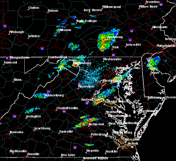 At 412 pm edt, a severe thunderstorm was located near shepherdstown, moving east at 20 mph (radar indicated). Hazards include 60 mph wind gusts and quarter size hail. Damaging winds will cause some trees and large branches to fall. this could injure those outdoors, as well as damage homes and vehicles. roadways may become blocked by downed trees. localized power outages are possible. Unsecured light objects may become projectiles. At 412 pm edt, a severe thunderstorm was located near shepherdstown, moving east at 20 mph (radar indicated). Hazards include 60 mph wind gusts and quarter size hail. Damaging winds will cause some trees and large branches to fall. this could injure those outdoors, as well as damage homes and vehicles. roadways may become blocked by downed trees. localized power outages are possible. Unsecured light objects may become projectiles.
|
| 6/23/2020 6:12 PM EDT |
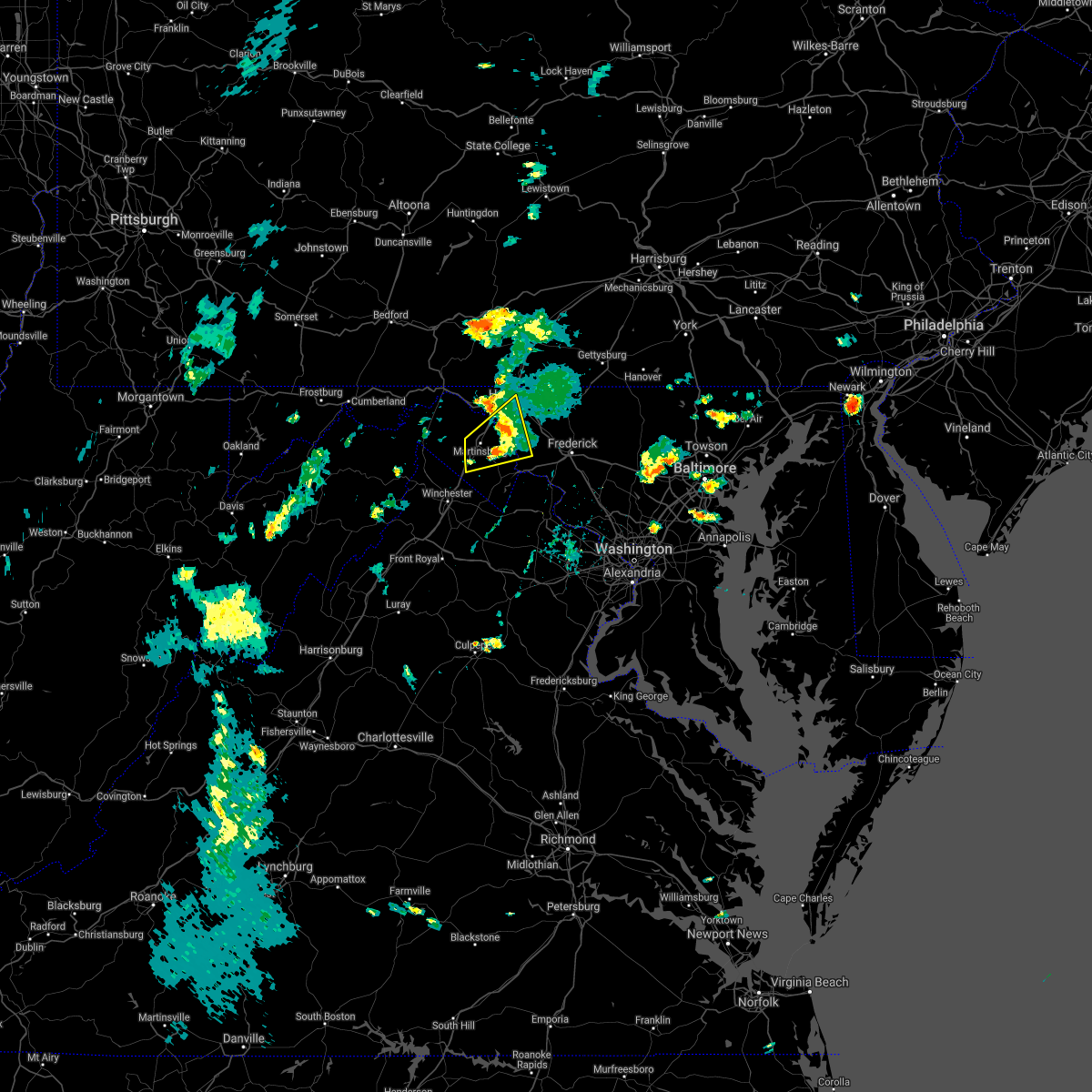 The severe thunderstorm warning for eastern washington, northern jefferson and eastern berkeley counties will expire at 615 pm edt, the storm which prompted the warning has weakened below severe limits, and no longer poses an immediate threat to life or property. therefore, the warning will be allowed to expire. however gusty winds are still possible with this thunderstorm. The severe thunderstorm warning for eastern washington, northern jefferson and eastern berkeley counties will expire at 615 pm edt, the storm which prompted the warning has weakened below severe limits, and no longer poses an immediate threat to life or property. therefore, the warning will be allowed to expire. however gusty winds are still possible with this thunderstorm.
|
| 6/23/2020 5:53 PM EDT |
 At 552 pm edt, a severe thunderstorm was located near martinsburg, moving northeast at 30 mph. a trained spotter reported quarter size hail in inwood, wv and a wind gust of 54 mph was observed at martinsburg airport (trained weather spotters). Hazards include 60 mph wind gusts and half dollar size hail. Damaging winds will cause some trees and large branches to fall. this could injure those outdoors, as well as damage homes and vehicles. roadways may become blocked by downed trees. localized power outages are possible. unsecured light objects may become projectiles. Locations impacted include, hagerstown, martinsburg, shepherdstown, ranson, inwood, wilson-conococheague, williamsport, kearneysville, saint james, berkeley, halfway, keedysville, falling waters, sharpsburg, fairplay, rohrersville, gapland, antietam, winebrenners cross and vanville. At 552 pm edt, a severe thunderstorm was located near martinsburg, moving northeast at 30 mph. a trained spotter reported quarter size hail in inwood, wv and a wind gust of 54 mph was observed at martinsburg airport (trained weather spotters). Hazards include 60 mph wind gusts and half dollar size hail. Damaging winds will cause some trees and large branches to fall. this could injure those outdoors, as well as damage homes and vehicles. roadways may become blocked by downed trees. localized power outages are possible. unsecured light objects may become projectiles. Locations impacted include, hagerstown, martinsburg, shepherdstown, ranson, inwood, wilson-conococheague, williamsport, kearneysville, saint james, berkeley, halfway, keedysville, falling waters, sharpsburg, fairplay, rohrersville, gapland, antietam, winebrenners cross and vanville.
|
| 6/23/2020 5:53 PM EDT |
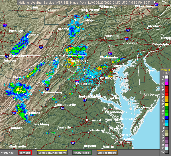 At 552 pm edt, a severe thunderstorm was located near martinsburg, moving northeast at 30 mph. a trained spotter reported quarter size hail in inwood, wv and a wind gust of 54 mph was observed at martinsburg airport (trained weather spotters). Hazards include 60 mph wind gusts and half dollar size hail. Damaging winds will cause some trees and large branches to fall. this could injure those outdoors, as well as damage homes and vehicles. roadways may become blocked by downed trees. localized power outages are possible. unsecured light objects may become projectiles. Locations impacted include, hagerstown, martinsburg, shepherdstown, ranson, inwood, wilson-conococheague, williamsport, kearneysville, saint james, berkeley, halfway, keedysville, falling waters, sharpsburg, fairplay, rohrersville, gapland, antietam, winebrenners cross and vanville. At 552 pm edt, a severe thunderstorm was located near martinsburg, moving northeast at 30 mph. a trained spotter reported quarter size hail in inwood, wv and a wind gust of 54 mph was observed at martinsburg airport (trained weather spotters). Hazards include 60 mph wind gusts and half dollar size hail. Damaging winds will cause some trees and large branches to fall. this could injure those outdoors, as well as damage homes and vehicles. roadways may become blocked by downed trees. localized power outages are possible. unsecured light objects may become projectiles. Locations impacted include, hagerstown, martinsburg, shepherdstown, ranson, inwood, wilson-conococheague, williamsport, kearneysville, saint james, berkeley, halfway, keedysville, falling waters, sharpsburg, fairplay, rohrersville, gapland, antietam, winebrenners cross and vanville.
|
| 6/23/2020 5:26 PM EDT |
 At 526 pm edt, a severe thunderstorm was located near inwood, or 7 miles southeast of greenwood, moving northeast at 30 mph (radar indicated). Hazards include 60 mph wind gusts and quarter size hail. Damaging winds will cause some trees and large branches to fall. this could injure those outdoors, as well as damage homes and vehicles. roadways may become blocked by downed trees. localized power outages are possible. Unsecured light objects may become projectiles. At 526 pm edt, a severe thunderstorm was located near inwood, or 7 miles southeast of greenwood, moving northeast at 30 mph (radar indicated). Hazards include 60 mph wind gusts and quarter size hail. Damaging winds will cause some trees and large branches to fall. this could injure those outdoors, as well as damage homes and vehicles. roadways may become blocked by downed trees. localized power outages are possible. Unsecured light objects may become projectiles.
|
| 6/23/2020 5:26 PM EDT |
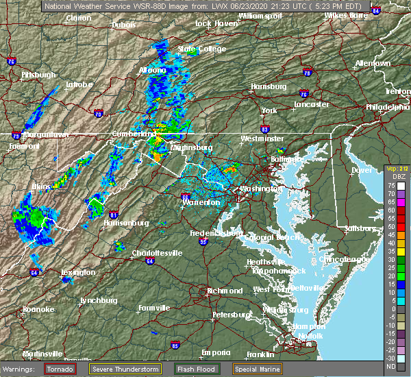 At 526 pm edt, a severe thunderstorm was located near inwood, or 7 miles southeast of greenwood, moving northeast at 30 mph (radar indicated). Hazards include 60 mph wind gusts and quarter size hail. Damaging winds will cause some trees and large branches to fall. this could injure those outdoors, as well as damage homes and vehicles. roadways may become blocked by downed trees. localized power outages are possible. Unsecured light objects may become projectiles. At 526 pm edt, a severe thunderstorm was located near inwood, or 7 miles southeast of greenwood, moving northeast at 30 mph (radar indicated). Hazards include 60 mph wind gusts and quarter size hail. Damaging winds will cause some trees and large branches to fall. this could injure those outdoors, as well as damage homes and vehicles. roadways may become blocked by downed trees. localized power outages are possible. Unsecured light objects may become projectiles.
|
| 6/4/2020 6:05 PM EDT |
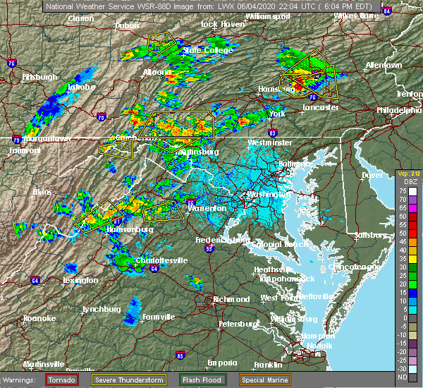 The severe thunderstorm warning for northwestern washington, northeastern morgan and north central berkeley counties will expire at 615 pm edt, the storm which prompted the warning has moved out of the area. therefore, the warning will be allowed to expire. a severe thunderstorm watch remains in effect until 1000 pm edt for north central maryland, and the panhandle of west virginia. The severe thunderstorm warning for northwestern washington, northeastern morgan and north central berkeley counties will expire at 615 pm edt, the storm which prompted the warning has moved out of the area. therefore, the warning will be allowed to expire. a severe thunderstorm watch remains in effect until 1000 pm edt for north central maryland, and the panhandle of west virginia.
|
| 6/4/2020 5:40 PM EDT |
 At 539 pm edt, a severe thunderstorm was located near berkeley springs, or near hancock, moving northeast at 35 mph (emergency management received reports of trees down near great cacapon). Hazards include 60 mph wind gusts and quarter size hail. Damaging winds will cause some trees and large branches to fall. this could injure those outdoors, as well as damage homes and vehicles. roadways may become blocked by downed trees. localized power outages are possible. Unsecured light objects may become projectiles. At 539 pm edt, a severe thunderstorm was located near berkeley springs, or near hancock, moving northeast at 35 mph (emergency management received reports of trees down near great cacapon). Hazards include 60 mph wind gusts and quarter size hail. Damaging winds will cause some trees and large branches to fall. this could injure those outdoors, as well as damage homes and vehicles. roadways may become blocked by downed trees. localized power outages are possible. Unsecured light objects may become projectiles.
|
| 6/4/2020 5:40 PM EDT |
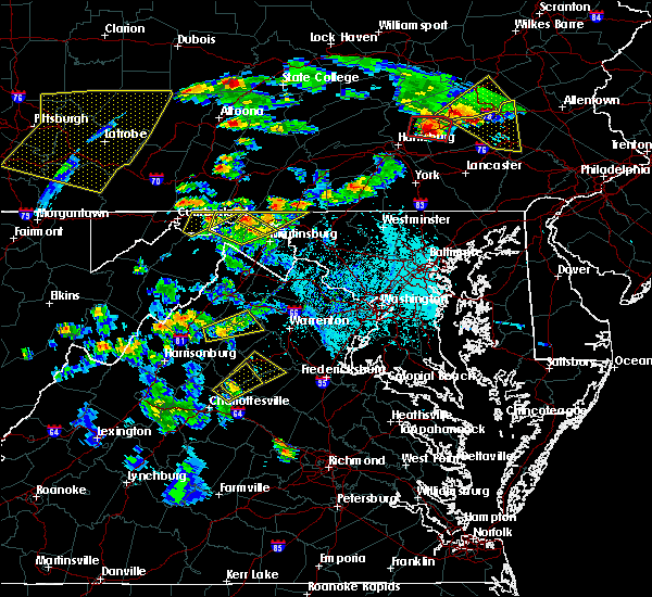 At 539 pm edt, a severe thunderstorm was located near berkeley springs, or near hancock, moving northeast at 35 mph (emergency management received reports of trees down near great cacapon). Hazards include 60 mph wind gusts and quarter size hail. Damaging winds will cause some trees and large branches to fall. this could injure those outdoors, as well as damage homes and vehicles. roadways may become blocked by downed trees. localized power outages are possible. Unsecured light objects may become projectiles. At 539 pm edt, a severe thunderstorm was located near berkeley springs, or near hancock, moving northeast at 35 mph (emergency management received reports of trees down near great cacapon). Hazards include 60 mph wind gusts and quarter size hail. Damaging winds will cause some trees and large branches to fall. this could injure those outdoors, as well as damage homes and vehicles. roadways may become blocked by downed trees. localized power outages are possible. Unsecured light objects may become projectiles.
|
| 5/29/2020 2:25 PM EDT |
 At 225 pm edt, a severe thunderstorm was located over shepherdstown, moving northeast at 35 mph (radar indicated). Hazards include 60 mph wind gusts and quarter size hail. Damaging winds will cause some trees and large branches to fall. this could injure those outdoors, as well as damage homes and vehicles. roadways may become blocked by downed trees. localized power outages are possible. Unsecured light objects may become projectiles. At 225 pm edt, a severe thunderstorm was located over shepherdstown, moving northeast at 35 mph (radar indicated). Hazards include 60 mph wind gusts and quarter size hail. Damaging winds will cause some trees and large branches to fall. this could injure those outdoors, as well as damage homes and vehicles. roadways may become blocked by downed trees. localized power outages are possible. Unsecured light objects may become projectiles.
|
| 5/29/2020 2:25 PM EDT |
 At 243 pm edt, a severe thunderstorm was located over mount lena, or 8 miles southeast of municipal stadium, moving northeast at 35 mph (radar indicated). Hazards include 60 mph wind gusts and quarter size hail. Damaging winds will cause some trees and large branches to fall. this could injure those outdoors, as well as damage homes and vehicles. roadways may become blocked by downed trees. localized power outages are possible. unsecured light objects may become projectiles. Locations impacted include, thurmont, emmitsburg, boonsboro, mount aetna, mount lena, san mar, wolfsville, myersville, cavetown, keedysville, sharpsburg, fairplay, sabillasville, rohrersville, antietam, bolivar, keysville, graceham, lewistown and pleasant walk. At 243 pm edt, a severe thunderstorm was located over mount lena, or 8 miles southeast of municipal stadium, moving northeast at 35 mph (radar indicated). Hazards include 60 mph wind gusts and quarter size hail. Damaging winds will cause some trees and large branches to fall. this could injure those outdoors, as well as damage homes and vehicles. roadways may become blocked by downed trees. localized power outages are possible. unsecured light objects may become projectiles. Locations impacted include, thurmont, emmitsburg, boonsboro, mount aetna, mount lena, san mar, wolfsville, myersville, cavetown, keedysville, sharpsburg, fairplay, sabillasville, rohrersville, antietam, bolivar, keysville, graceham, lewistown and pleasant walk.
|
| 4/13/2020 1:02 PM EDT |
 At 101 pm edt, severe thunderstorms were located along a line extending from near paramount-long meadow to near saint james, moving east at 45 mph (radar indicated). Hazards include 60 mph wind gusts and quarter size hail. Damaging winds will cause some trees and large branches to fall. this could injure those outdoors, as well as damage homes and vehicles. roadways may become blocked by downed trees. localized power outages are possible. unsecured light objects may become projectiles. Locations impacted include, hagerstown, thurmont, emmitsburg, municipal st**!adium, robinwood, fountainhead-orchard hills, boonsboro, smithsburg, paramount-long meadow, mount aetna, mount lena, san mar, long meadow, wolfsville, saint james, halfway, maugansville, cavetown, funkstown and fairplay. At 101 pm edt, severe thunderstorms were located along a line extending from near paramount-long meadow to near saint james, moving east at 45 mph (radar indicated). Hazards include 60 mph wind gusts and quarter size hail. Damaging winds will cause some trees and large branches to fall. this could injure those outdoors, as well as damage homes and vehicles. roadways may become blocked by downed trees. localized power outages are possible. unsecured light objects may become projectiles. Locations impacted include, hagerstown, thurmont, emmitsburg, municipal st**!adium, robinwood, fountainhead-orchard hills, boonsboro, smithsburg, paramount-long meadow, mount aetna, mount lena, san mar, long meadow, wolfsville, saint james, halfway, maugansville, cavetown, funkstown and fairplay.
|
| 4/13/2020 12:42 PM EDT |
 At 1241 pm edt, severe thunderstorms were located along a line extending from near wilson-conococheague to near martinsburg, moving east at 35 mph (radar indicated). Hazards include 60 mph wind gusts and quarter size hail. Damaging winds will cause some trees and large branches to fall. this could injure those outdoors, as well as damage homes and vehicles. roadways may become blocked by downed trees. localized power outages are possible. Unsecured light objects may become projectiles. At 1241 pm edt, severe thunderstorms were located along a line extending from near wilson-conococheague to near martinsburg, moving east at 35 mph (radar indicated). Hazards include 60 mph wind gusts and quarter size hail. Damaging winds will cause some trees and large branches to fall. this could injure those outdoors, as well as damage homes and vehicles. roadways may become blocked by downed trees. localized power outages are possible. Unsecured light objects may become projectiles.
|
| 4/8/2020 3:18 AM EDT |
 At 317 am edt, severe thunderstorms were located along a line extending from near fountainhead-orchard hills to near martinsburg to 10 miles south of paw paw, moving southeast at 55 mph (radar indicated). Hazards include 60 mph wind gusts. Damaging winds will cause some trees and large branches to fall. this could injure those outdoors, as well as damage homes and vehicles. roadways may become blocked by downed trees. localized power outages are possible. unsecured light objects may become projectiles. Locations impacted include, hagerstown, martinsburg, charles town, shepherdstown, municipal stadium, greenwood, robinwood, fountainhead-orchard hills, ranson, boonsboro, smithsburg, inwood, paramount-long meadow, wilson-conococheague, williamsport, mount aetna, mount lena, san mar, harpers ferry and long meadow. At 317 am edt, severe thunderstorms were located along a line extending from near fountainhead-orchard hills to near martinsburg to 10 miles south of paw paw, moving southeast at 55 mph (radar indicated). Hazards include 60 mph wind gusts. Damaging winds will cause some trees and large branches to fall. this could injure those outdoors, as well as damage homes and vehicles. roadways may become blocked by downed trees. localized power outages are possible. unsecured light objects may become projectiles. Locations impacted include, hagerstown, martinsburg, charles town, shepherdstown, municipal stadium, greenwood, robinwood, fountainhead-orchard hills, ranson, boonsboro, smithsburg, inwood, paramount-long meadow, wilson-conococheague, williamsport, mount aetna, mount lena, san mar, harpers ferry and long meadow.
|
| 4/8/2020 2:50 AM EDT |
 At 250 am edt, severe thunderstorms were located along a line extending from near saluvia to near warfordsburg to 6 miles southwest of inglesmith, moving southeast at 55 mph (radar indicated). Hazards include 60 mph wind gusts. Damaging winds will cause some trees and large branches to fall. this could injure those outdoors, as well as damage homes and vehicles. roadways may become blocked by downed trees. localized power outages are possible. Unsecured light objects may become projectiles. At 250 am edt, severe thunderstorms were located along a line extending from near saluvia to near warfordsburg to 6 miles southwest of inglesmith, moving southeast at 55 mph (radar indicated). Hazards include 60 mph wind gusts. Damaging winds will cause some trees and large branches to fall. this could injure those outdoors, as well as damage homes and vehicles. roadways may become blocked by downed trees. localized power outages are possible. Unsecured light objects may become projectiles.
|
| 3/3/2020 10:54 PM EST |
 At 1054 pm est, severe thunderstorms were located along a line extending from near carroll valley to 6 miles west of charles town, moving east at 70 mph (trained weather spotters). Hazards include 70 mph wind gusts. Damaging winds will cause some trees and large branches to fall. this could injure those outdoors, as well as damage homes and vehicles. roadways may become blocked by downed trees. localized power outages are possible. Unsecured light objects may become projectiles. At 1054 pm est, severe thunderstorms were located along a line extending from near carroll valley to 6 miles west of charles town, moving east at 70 mph (trained weather spotters). Hazards include 70 mph wind gusts. Damaging winds will cause some trees and large branches to fall. this could injure those outdoors, as well as damage homes and vehicles. roadways may become blocked by downed trees. localized power outages are possible. Unsecured light objects may become projectiles.
|
| 3/3/2020 10:52 PM EST | Downed tree on sharpsburg pike near roxbury rd in washington county MD, 4.7 miles N of Hagerstown, MD |
| 3/3/2020 10:48 PM EST | Storm damage reported in washington county MD, 5.1 miles S of Hagerstown, MD |
| 3/3/2020 10:48 PM EST |
 At 1048 pm est, severe thunderstorms were located along a line extending from near rouzerville to 6 miles northeast of winchester, moving east at 75 mph (emergency management). Hazards include 60 mph wind gusts. Damaging winds will cause some trees and large branches to fall. this could injure those outdoors, as well as damage homes and vehicles. roadways may become blocked by downed trees. localized power outages are possible. unsecured light objects may become projectiles. Locations impacted include, hagerstown, winchester, martinsburg, thurmont, charles town, emmitsburg, shepherdstown, municipal stadium, robinwood, brunswick, fountainhead-orchard hills, ranson, berryville, boonsboro, smithsburg, inwood, paramount-long meadow, wilson-conococheague, williamsport and mount aetna. At 1048 pm est, severe thunderstorms were located along a line extending from near rouzerville to 6 miles northeast of winchester, moving east at 75 mph (emergency management). Hazards include 60 mph wind gusts. Damaging winds will cause some trees and large branches to fall. this could injure those outdoors, as well as damage homes and vehicles. roadways may become blocked by downed trees. localized power outages are possible. unsecured light objects may become projectiles. Locations impacted include, hagerstown, winchester, martinsburg, thurmont, charles town, emmitsburg, shepherdstown, municipal stadium, robinwood, brunswick, fountainhead-orchard hills, ranson, berryville, boonsboro, smithsburg, inwood, paramount-long meadow, wilson-conococheague, williamsport and mount aetna.
|
| 3/3/2020 10:40 PM EST |
 At 1040 pm est, severe thunderstorms were located along a line extending from paramount-long meadow to 7 miles northwest of winchester, moving east at 75 mph (emergency management). Hazards include 60 mph wind gusts. Damaging winds will cause some trees and large branches to fall. this could injure those outdoors, as well as damage homes and vehicles. roadways may become blocked by downed trees. localized power outages are possible. unsecured light objects may become projectiles. Locations impacted include, hagerstown, winchester, martinsburg, thurmont, charles town, emmitsburg, shepherdstown, municipal stadium, robinwood, brunswick, fountainhead-orchard hills, ranson, berryville, boonsboro, smithsburg, inwood, paramount-long meadow, wilson-conococheague, williamsport and mount aetna. At 1040 pm est, severe thunderstorms were located along a line extending from paramount-long meadow to 7 miles northwest of winchester, moving east at 75 mph (emergency management). Hazards include 60 mph wind gusts. Damaging winds will cause some trees and large branches to fall. this could injure those outdoors, as well as damage homes and vehicles. roadways may become blocked by downed trees. localized power outages are possible. unsecured light objects may become projectiles. Locations impacted include, hagerstown, winchester, martinsburg, thurmont, charles town, emmitsburg, shepherdstown, municipal stadium, robinwood, brunswick, fountainhead-orchard hills, ranson, berryville, boonsboro, smithsburg, inwood, paramount-long meadow, wilson-conococheague, williamsport and mount aetna.
|
| 3/3/2020 10:26 PM EST |
 At 1026 pm est, severe thunderstorms were located along a line extending from 6 miles southwest of claylick to 11 miles southeast of romney, moving east at 75 mph (emergency management). Hazards include 60 mph wind gusts. Damaging winds will cause some trees and large branches to fall. this could injure those outdoors, as well as damage homes and vehicles. roadways may become blocked by downed trees. localized power outages are possible. Unsecured light objects may become projectiles. At 1026 pm est, severe thunderstorms were located along a line extending from 6 miles southwest of claylick to 11 miles southeast of romney, moving east at 75 mph (emergency management). Hazards include 60 mph wind gusts. Damaging winds will cause some trees and large branches to fall. this could injure those outdoors, as well as damage homes and vehicles. roadways may become blocked by downed trees. localized power outages are possible. Unsecured light objects may become projectiles.
|
| 10/31/2019 7:08 PM EDT |
 At 708 pm edt, a severe thunderstorm was located near shepherdstown, moving northeast at 55 mph (radar indicated). Hazards include 60 mph wind gusts. Damaging winds will cause some trees and large branches to fall. this could injure those outdoors, as well as damage homes and vehicles. roadways may become blocked by downed trees. localized power outages are possible. unsecured light objects may become projectiles. Locations impacted include, frederick, hagerstown, martinsburg, charles town, shepherdstown, robinwood, walkersville, ranson, boonsboro, braddock heights, mount aetna, mount lena, san mar, harpers ferry, corporation of ranson, kearneysville, clover hill, discovery-spring garden, wolfsville and saint james. At 708 pm edt, a severe thunderstorm was located near shepherdstown, moving northeast at 55 mph (radar indicated). Hazards include 60 mph wind gusts. Damaging winds will cause some trees and large branches to fall. this could injure those outdoors, as well as damage homes and vehicles. roadways may become blocked by downed trees. localized power outages are possible. unsecured light objects may become projectiles. Locations impacted include, frederick, hagerstown, martinsburg, charles town, shepherdstown, robinwood, walkersville, ranson, boonsboro, braddock heights, mount aetna, mount lena, san mar, harpers ferry, corporation of ranson, kearneysville, clover hill, discovery-spring garden, wolfsville and saint james.
|
| 10/31/2019 7:08 PM EDT |
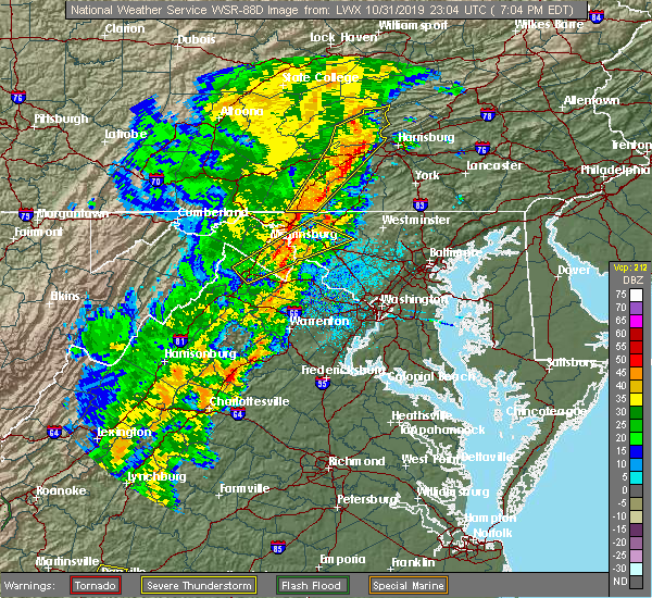 At 708 pm edt, a severe thunderstorm was located near shepherdstown, moving northeast at 55 mph (radar indicated). Hazards include 60 mph wind gusts. Damaging winds will cause some trees and large branches to fall. this could injure those outdoors, as well as damage homes and vehicles. roadways may become blocked by downed trees. localized power outages are possible. unsecured light objects may become projectiles. Locations impacted include, frederick, hagerstown, martinsburg, charles town, shepherdstown, robinwood, walkersville, ranson, boonsboro, braddock heights, mount aetna, mount lena, san mar, harpers ferry, corporation of ranson, kearneysville, clover hill, discovery-spring garden, wolfsville and saint james. At 708 pm edt, a severe thunderstorm was located near shepherdstown, moving northeast at 55 mph (radar indicated). Hazards include 60 mph wind gusts. Damaging winds will cause some trees and large branches to fall. this could injure those outdoors, as well as damage homes and vehicles. roadways may become blocked by downed trees. localized power outages are possible. unsecured light objects may become projectiles. Locations impacted include, frederick, hagerstown, martinsburg, charles town, shepherdstown, robinwood, walkersville, ranson, boonsboro, braddock heights, mount aetna, mount lena, san mar, harpers ferry, corporation of ranson, kearneysville, clover hill, discovery-spring garden, wolfsville and saint james.
|
| 10/31/2019 6:46 PM EDT |
 At 645 pm edt, a severe thunderstorm was located near inwood, or 9 miles northeast of winchester, moving northeast at 55 mph (radar indicated). Hazards include 60 mph wind gusts. Damaging winds will cause some trees and large branches to fall. this could injure those outdoors, as well as damage homes and vehicles. roadways may become blocked by downed trees. localized power outages are possible. Unsecured light objects may become projectiles. At 645 pm edt, a severe thunderstorm was located near inwood, or 9 miles northeast of winchester, moving northeast at 55 mph (radar indicated). Hazards include 60 mph wind gusts. Damaging winds will cause some trees and large branches to fall. this could injure those outdoors, as well as damage homes and vehicles. roadways may become blocked by downed trees. localized power outages are possible. Unsecured light objects may become projectiles.
|
| 10/31/2019 6:46 PM EDT |
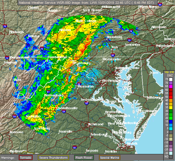 At 645 pm edt, a severe thunderstorm was located near inwood, or 9 miles northeast of winchester, moving northeast at 55 mph (radar indicated). Hazards include 60 mph wind gusts. Damaging winds will cause some trees and large branches to fall. this could injure those outdoors, as well as damage homes and vehicles. roadways may become blocked by downed trees. localized power outages are possible. Unsecured light objects may become projectiles. At 645 pm edt, a severe thunderstorm was located near inwood, or 9 miles northeast of winchester, moving northeast at 55 mph (radar indicated). Hazards include 60 mph wind gusts. Damaging winds will cause some trees and large branches to fall. this could injure those outdoors, as well as damage homes and vehicles. roadways may become blocked by downed trees. localized power outages are possible. Unsecured light objects may become projectiles.
|
| 8/22/2019 6:04 PM EDT | Tree reported down on little antietam road near serenity driv in washington county MD, 5.2 miles WSW of Hagerstown, MD |
| 8/22/2019 6:02 PM EDT |
 A severe thunderstorm warning remains in effect until 630 pm edt for northeastern washington and northwestern frederick counties in north central maryland. at 602 pm edt, a severe thunderstorm was located near smithsburg, or near municipal stadium, moving east at 25 mph. hazard. 70 mph wind gusts and half dollar size hail. A severe thunderstorm warning remains in effect until 630 pm edt for northeastern washington and northwestern frederick counties in north central maryland. at 602 pm edt, a severe thunderstorm was located near smithsburg, or near municipal stadium, moving east at 25 mph. hazard. 70 mph wind gusts and half dollar size hail.
|
| 8/22/2019 5:52 PM EDT |
 At 552 pm edt, a severe thunderstorm was located over long meadow, or near hagerstown, moving east at 25 mph (radar indicated). Hazards include 60 mph wind gusts and quarter size hail. Damaging winds will cause some trees and large branches to fall. this could injure those outdoors, as well as damage homes and vehicles. roadways may become blocked by downed trees. localized power outages are possible. Unsecured light objects may become projectiles. At 552 pm edt, a severe thunderstorm was located over long meadow, or near hagerstown, moving east at 25 mph (radar indicated). Hazards include 60 mph wind gusts and quarter size hail. Damaging winds will cause some trees and large branches to fall. this could injure those outdoors, as well as damage homes and vehicles. roadways may become blocked by downed trees. localized power outages are possible. Unsecured light objects may become projectiles.
|
| 8/3/2019 7:52 PM EDT | Large branch in driveway off of woodburn driv in washington county MD, 2.3 miles S of Hagerstown, MD |
| 8/3/2019 7:52 PM EDT | Tree down on northern ave near fountain head roa in washington county MD, 2.3 miles S of Hagerstown, MD |
| 7/6/2019 7:25 PM EDT | Tree down on the 13000 block of newcomer roa in washington county MD, 0.2 miles SSE of Hagerstown, MD |
| 7/6/2019 7:25 PM EDT | Tree down on the 13000 block of newcomer roa in washington county MD, 8.2 miles WSW of Hagerstown, MD |
| 7/6/2019 7:21 PM EDT |
 At 720 pm edt, a severe thunderstorm was located over smithsburg, or near waynesboro, moving southeast at 30 mph (radar indicated). Hazards include 60 mph wind gusts and quarter size hail. Damaging winds will cause some trees and large branches to fall. this could injure those outdoors, as well as damage homes and vehicles. roadways may become blocked by downed trees. localized power outages are possible. unsecured light objects may become projectiles. Locations impacted include, hagerstown, thurmont, emmitsburg, robinwood, taneytown, walkersville, fountainhead-orchard hills, smithsburg, paramount-long meadow, mount aetna, long meadow, discovery-spring garden, wolfsville, linganore-bartonsville, maugansville, cavetown, woodsboro, union bridge, libertytown and leitersburg. At 720 pm edt, a severe thunderstorm was located over smithsburg, or near waynesboro, moving southeast at 30 mph (radar indicated). Hazards include 60 mph wind gusts and quarter size hail. Damaging winds will cause some trees and large branches to fall. this could injure those outdoors, as well as damage homes and vehicles. roadways may become blocked by downed trees. localized power outages are possible. unsecured light objects may become projectiles. Locations impacted include, hagerstown, thurmont, emmitsburg, robinwood, taneytown, walkersville, fountainhead-orchard hills, smithsburg, paramount-long meadow, mount aetna, long meadow, discovery-spring garden, wolfsville, linganore-bartonsville, maugansville, cavetown, woodsboro, union bridge, libertytown and leitersburg.
|
| 7/6/2019 6:58 PM EDT |
 At 657 pm edt, a severe thunderstorm was located near mercersburg, or 9 miles northwest of greencastle, moving southeast at 35 mph (radar indicated). Hazards include 60 mph wind gusts and quarter size hail. Damaging winds will cause some trees and large branches to fall. this could injure those outdoors, as well as damage homes and vehicles. roadways may become blocked by downed trees. localized power outages are possible. Unsecured light objects may become projectiles. At 657 pm edt, a severe thunderstorm was located near mercersburg, or 9 miles northwest of greencastle, moving southeast at 35 mph (radar indicated). Hazards include 60 mph wind gusts and quarter size hail. Damaging winds will cause some trees and large branches to fall. this could injure those outdoors, as well as damage homes and vehicles. roadways may become blocked by downed trees. localized power outages are possible. Unsecured light objects may become projectiles.
|
| 7/2/2019 6:07 PM EDT | Numerous trees knocked into power lines along battletown rd and strite roa in washington county MD, 7.3 miles SW of Hagerstown, MD |
| 6/29/2019 9:36 PM EDT |
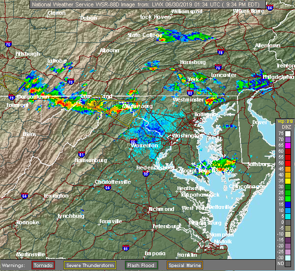 At 936 pm edt, severe thunderstorms were located along a line extending from near shepherdstown to near inwood, moving southeast at 25 mph (radar indicated). Hazards include 60 mph wind gusts. Damaging winds will cause some trees and large branches to fall. this could injure those outdoors, as well as damage homes and vehicles. roadways may become blocked by downed trees. localized power outages are possible. unsecured light objects may become projectiles. Locations impacted include, hagerstown, martinsburg, charles town, shepherdstown, paw paw, greenwood, robinwood, ranson, boonsboro, inwood, williamsport, berkeley springs, mount aetna, mount lena, san mar, harpers ferry, corporation of ranson, kearneysville, saint james and berkeley. At 936 pm edt, severe thunderstorms were located along a line extending from near shepherdstown to near inwood, moving southeast at 25 mph (radar indicated). Hazards include 60 mph wind gusts. Damaging winds will cause some trees and large branches to fall. this could injure those outdoors, as well as damage homes and vehicles. roadways may become blocked by downed trees. localized power outages are possible. unsecured light objects may become projectiles. Locations impacted include, hagerstown, martinsburg, charles town, shepherdstown, paw paw, greenwood, robinwood, ranson, boonsboro, inwood, williamsport, berkeley springs, mount aetna, mount lena, san mar, harpers ferry, corporation of ranson, kearneysville, saint james and berkeley.
|
| 6/29/2019 9:18 PM EDT |
 At 917 pm edt, severe thunderstorms were located along a line extending from near williamsport to near greenwood, moving southeast at 25 mph (radar indicated). Hazards include 60 mph wind gusts. Damaging winds will cause some trees and large branches to fall. this could injure those outdoors, as well as damage homes and vehicles. roadways may become blocked by downed trees. localized power outages are possible. Unsecured light objects may become projectiles. At 917 pm edt, severe thunderstorms were located along a line extending from near williamsport to near greenwood, moving southeast at 25 mph (radar indicated). Hazards include 60 mph wind gusts. Damaging winds will cause some trees and large branches to fall. this could injure those outdoors, as well as damage homes and vehicles. roadways may become blocked by downed trees. localized power outages are possible. Unsecured light objects may become projectiles.
|
| 6/29/2019 3:05 PM EDT |
 At 246 pm edt, a severe thunderstorm was located near mercersburg, or near greencastle, moving southeast at 20 mph (radar indicated). Hazards include 60 mph wind gusts and quarter size hail. Damaging winds will cause some trees and large branches to fall. this could injure those outdoors, as well as damage homes and vehicles. roadways may become blocked by downed trees. localized power outages are possible. Unsecured light objects may become projectiles. At 246 pm edt, a severe thunderstorm was located near mercersburg, or near greencastle, moving southeast at 20 mph (radar indicated). Hazards include 60 mph wind gusts and quarter size hail. Damaging winds will cause some trees and large branches to fall. this could injure those outdoors, as well as damage homes and vehicles. roadways may become blocked by downed trees. localized power outages are possible. Unsecured light objects may become projectiles.
|
| 6/29/2019 2:46 PM EDT |
 At 246 pm edt, a severe thunderstorm was located near mercersburg, or near greencastle, moving southeast at 20 mph (radar indicated). Hazards include 60 mph wind gusts and quarter size hail. Damaging winds will cause some trees and large branches to fall. this could injure those outdoors, as well as damage homes and vehicles. roadways may become blocked by downed trees. localized power outages are possible. Unsecured light objects may become projectiles. At 246 pm edt, a severe thunderstorm was located near mercersburg, or near greencastle, moving southeast at 20 mph (radar indicated). Hazards include 60 mph wind gusts and quarter size hail. Damaging winds will cause some trees and large branches to fall. this could injure those outdoors, as well as damage homes and vehicles. roadways may become blocked by downed trees. localized power outages are possible. Unsecured light objects may become projectiles.
|
| 6/13/2019 4:19 PM EDT |
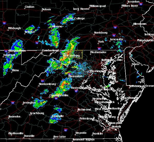 At 419 pm edt, severe thunderstorms were located along a line extending from wilson-conococheague to williamsport to near shepherdstown, moving northeast at 30 mph (radar indicated). Hazards include 60 mph wind gusts and quarter size hail. Damaging winds will cause some trees and large branches to fall. this could injure those outdoors, as well as damage homes and vehicles. roadways may become blocked by downed trees. localized power outages are possible. unsecured light objects may become projectiles. Locations impacted include, hagerstown, municipal stadium, robinwood, fountainhead-orchard hills, paramount-long meadow, wilson-conococheague, williamsport, long meadow, saint james, halfway, maugansville, funkstown, fairplay and middleburg. At 419 pm edt, severe thunderstorms were located along a line extending from wilson-conococheague to williamsport to near shepherdstown, moving northeast at 30 mph (radar indicated). Hazards include 60 mph wind gusts and quarter size hail. Damaging winds will cause some trees and large branches to fall. this could injure those outdoors, as well as damage homes and vehicles. roadways may become blocked by downed trees. localized power outages are possible. unsecured light objects may become projectiles. Locations impacted include, hagerstown, municipal stadium, robinwood, fountainhead-orchard hills, paramount-long meadow, wilson-conococheague, williamsport, long meadow, saint james, halfway, maugansville, funkstown, fairplay and middleburg.
|
| 6/13/2019 4:17 PM EDT |
 The national weather service in sterling virginia has issued a * severe thunderstorm warning for. northeastern washington county in north central maryland. northwestern frederick county in north central maryland. until 500 pm edt. At 417 pm edt, a severe thunderstorm was located over saint james,. The national weather service in sterling virginia has issued a * severe thunderstorm warning for. northeastern washington county in north central maryland. northwestern frederick county in north central maryland. until 500 pm edt. At 417 pm edt, a severe thunderstorm was located over saint james,.
|
| 6/13/2019 4:15 PM EDT | Tree down on slotler roa in washington county MD, 3.3 miles E of Hagerstown, MD |
| 6/13/2019 4:05 PM EDT |
 At 404 pm edt, severe thunderstorms were located along a line extending from near wilson-conococheague to near martinsburg to near inwood, moving northeast at 30 mph (radar indicated). Hazards include 60 mph wind gusts and quarter size hail. Damaging winds will cause some trees and large branches to fall. this could injure those outdoors, as well as damage homes and vehicles. roadways may become blocked by downed trees. localized power outages are possible. unsecured light objects may become projectiles. Locations impacted include, hagerstown, martinsburg, municipal stadium, robinwood, fountainhead-orchard hills, inwood, paramount-long meadow, wilson-conococheague, williamsport, long meadow, saint james, berkeley, halfway, maugansville, funkstown, falling waters, fairplay, clear spring, hedgesville and big spring. At 404 pm edt, severe thunderstorms were located along a line extending from near wilson-conococheague to near martinsburg to near inwood, moving northeast at 30 mph (radar indicated). Hazards include 60 mph wind gusts and quarter size hail. Damaging winds will cause some trees and large branches to fall. this could injure those outdoors, as well as damage homes and vehicles. roadways may become blocked by downed trees. localized power outages are possible. unsecured light objects may become projectiles. Locations impacted include, hagerstown, martinsburg, municipal stadium, robinwood, fountainhead-orchard hills, inwood, paramount-long meadow, wilson-conococheague, williamsport, long meadow, saint james, berkeley, halfway, maugansville, funkstown, falling waters, fairplay, clear spring, hedgesville and big spring.
|
| 6/13/2019 3:49 PM EDT |
 At 349 pm edt, severe thunderstorms were located along a line extending from 10 miles west of wilson-conococheague to near martinsburg to near greenwood, moving east at 30 mph (radar indicated). Hazards include 60 mph wind gusts and quarter size hail. Damaging winds will cause some trees and large branches to fall. this could injure those outdoors, as well as damage homes and vehicles. roadways may become blocked by downed trees. localized power outages are possible. Unsecured light objects may become projectiles. At 349 pm edt, severe thunderstorms were located along a line extending from 10 miles west of wilson-conococheague to near martinsburg to near greenwood, moving east at 30 mph (radar indicated). Hazards include 60 mph wind gusts and quarter size hail. Damaging winds will cause some trees and large branches to fall. this could injure those outdoors, as well as damage homes and vehicles. roadways may become blocked by downed trees. localized power outages are possible. Unsecured light objects may become projectiles.
|
| 6/13/2019 3:49 PM EDT |
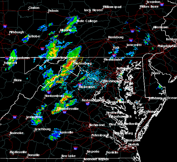 At 349 pm edt, severe thunderstorms were located along a line extending from 10 miles west of wilson-conococheague to near martinsburg to near greenwood, moving east at 30 mph (radar indicated). Hazards include 60 mph wind gusts and quarter size hail. Damaging winds will cause some trees and large branches to fall. this could injure those outdoors, as well as damage homes and vehicles. roadways may become blocked by downed trees. localized power outages are possible. Unsecured light objects may become projectiles. At 349 pm edt, severe thunderstorms were located along a line extending from 10 miles west of wilson-conococheague to near martinsburg to near greenwood, moving east at 30 mph (radar indicated). Hazards include 60 mph wind gusts and quarter size hail. Damaging winds will cause some trees and large branches to fall. this could injure those outdoors, as well as damage homes and vehicles. roadways may become blocked by downed trees. localized power outages are possible. Unsecured light objects may become projectiles.
|
| 6/2/2019 3:59 PM EDT |
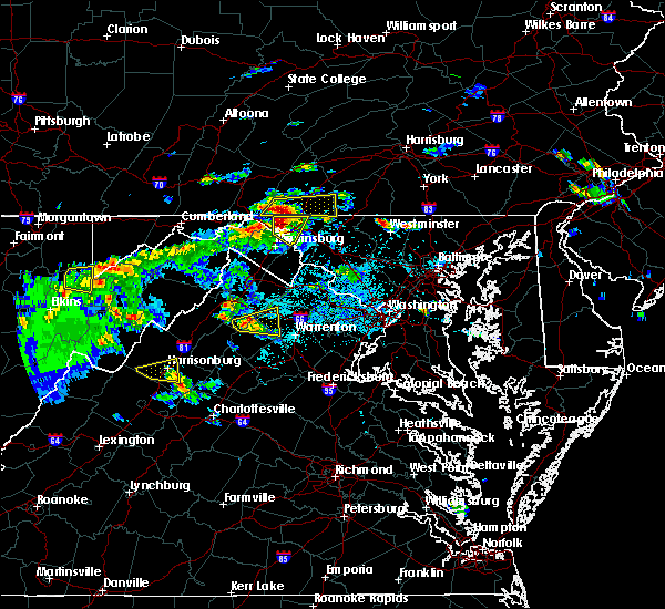 At 359 pm edt, a severe thunderstorm was located near wilson-conococheague, or 11 miles west of hagerstown, moving east at 15 mph (radar indicated). Hazards include 60 mph wind gusts and quarter size hail. Damaging winds will cause some trees and large branches to fall. this could injure those outdoors, as well as damage homes and vehicles. roadways may become blocked by downed trees. localized power outages are possible. unsecured light objects may become projectiles. Locations impacted include, hagerstown, fountainhead-orchard hills, wilson-conococheague, williamsport, long meadow, saint james, halfway, maugansville, falling waters, clear spring, big spring, middleburg and warrenton. At 359 pm edt, a severe thunderstorm was located near wilson-conococheague, or 11 miles west of hagerstown, moving east at 15 mph (radar indicated). Hazards include 60 mph wind gusts and quarter size hail. Damaging winds will cause some trees and large branches to fall. this could injure those outdoors, as well as damage homes and vehicles. roadways may become blocked by downed trees. localized power outages are possible. unsecured light objects may become projectiles. Locations impacted include, hagerstown, fountainhead-orchard hills, wilson-conococheague, williamsport, long meadow, saint james, halfway, maugansville, falling waters, clear spring, big spring, middleburg and warrenton.
|
| 6/2/2019 3:59 PM EDT |
 At 349 pm edt, a severe thunderstorm was located 7 miles southwest of claylick, or 10 miles east of hancock, moving east at 15 mph (radar indicated). Hazards include golf ball size hail and 60 mph wind gusts. Expect wind damage to trees and power lines. hail is large enough to dent and damage vehicles. some hail damage to roofs, siding, and windows is possible. Locations impacted include, hagerstown, fountainhead-orchard hills, wilson-conococheague, williamsport, long meadow, saint james, halfway, maugansville, falling waters, clear spring, hedgesville, pecktonville, big spring, big pool, middleburg, johnsontown, warrenton and sleepy creek. At 349 pm edt, a severe thunderstorm was located 7 miles southwest of claylick, or 10 miles east of hancock, moving east at 15 mph (radar indicated). Hazards include golf ball size hail and 60 mph wind gusts. Expect wind damage to trees and power lines. hail is large enough to dent and damage vehicles. some hail damage to roofs, siding, and windows is possible. Locations impacted include, hagerstown, fountainhead-orchard hills, wilson-conococheague, williamsport, long meadow, saint james, halfway, maugansville, falling waters, clear spring, hedgesville, pecktonville, big spring, big pool, middleburg, johnsontown, warrenton and sleepy creek.
|
| 6/2/2019 3:49 PM EDT |
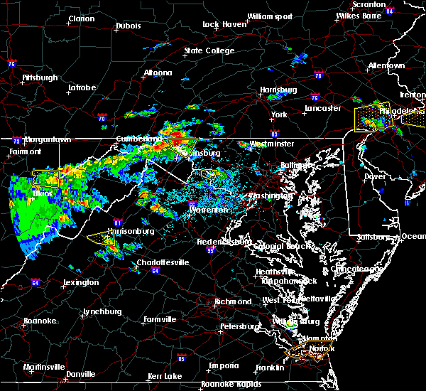 At 349 pm edt, a severe thunderstorm was located 7 miles southwest of claylick, or 10 miles east of hancock, moving east at 15 mph (radar indicated). Hazards include golf ball size hail and 60 mph wind gusts. Expect wind damage to trees and power lines. hail is large enough to dent and damage vehicles. some hail damage to roofs, siding, and windows is possible. Locations impacted include, hagerstown, fountainhead-orchard hills, wilson-conococheague, williamsport, long meadow, saint james, halfway, maugansville, falling waters, clear spring, hedgesville, pecktonville, big spring, big pool, middleburg, johnsontown, warrenton and sleepy creek. At 349 pm edt, a severe thunderstorm was located 7 miles southwest of claylick, or 10 miles east of hancock, moving east at 15 mph (radar indicated). Hazards include golf ball size hail and 60 mph wind gusts. Expect wind damage to trees and power lines. hail is large enough to dent and damage vehicles. some hail damage to roofs, siding, and windows is possible. Locations impacted include, hagerstown, fountainhead-orchard hills, wilson-conococheague, williamsport, long meadow, saint james, halfway, maugansville, falling waters, clear spring, hedgesville, pecktonville, big spring, big pool, middleburg, johnsontown, warrenton and sleepy creek.
|
| 6/2/2019 3:45 PM EDT |
 At 345 pm edt, a severe thunderstorm was located 8 miles southwest of claylick, or 9 miles east of hancock, moving east at 15 mph (radar indicated). Hazards include 60 mph wind gusts and half dollar size hail. Damaging winds will cause some trees and large branches to fall. this could injure those outdoors, as well as damage homes and vehicles. roadways may become blocked by downed trees. localized power outages are possible. Unsecured light objects may become projectiles. At 345 pm edt, a severe thunderstorm was located 8 miles southwest of claylick, or 9 miles east of hancock, moving east at 15 mph (radar indicated). Hazards include 60 mph wind gusts and half dollar size hail. Damaging winds will cause some trees and large branches to fall. this could injure those outdoors, as well as damage homes and vehicles. roadways may become blocked by downed trees. localized power outages are possible. Unsecured light objects may become projectiles.
|
| 6/2/2019 3:45 PM EDT |
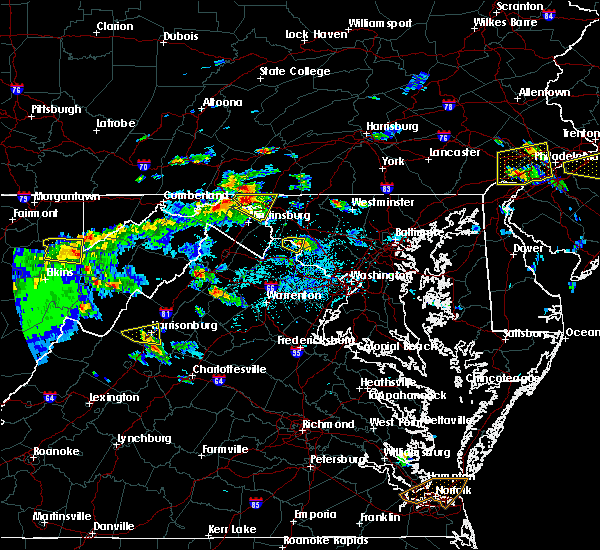 The national weather service in sterling virginia has issued a * severe thunderstorm warning for. north central washington county in north central maryland. northeastern berkeley county in the panhandle of west virginia. until 430 pm edt. At 345 pm edt, a severe thunderstorm was located 8 miles southwest. The national weather service in sterling virginia has issued a * severe thunderstorm warning for. north central washington county in north central maryland. northeastern berkeley county in the panhandle of west virginia. until 430 pm edt. At 345 pm edt, a severe thunderstorm was located 8 miles southwest.
|
| 5/26/2019 8:27 PM EDT |
 At 825 pm edt, a severe thunderstorm was located near hancock, moving east at 20 mph (radar indicated). Hazards include 60 mph wind gusts and quarter size hail. Damaging winds will cause some trees and large branches to fall. this could injure those outdoors, as well as damage homes and vehicles. roadways may become blocked by downed trees. localized power outages are possible. Unsecured light objects may become projectiles. At 825 pm edt, a severe thunderstorm was located near hancock, moving east at 20 mph (radar indicated). Hazards include 60 mph wind gusts and quarter size hail. Damaging winds will cause some trees and large branches to fall. this could injure those outdoors, as well as damage homes and vehicles. roadways may become blocked by downed trees. localized power outages are possible. Unsecured light objects may become projectiles.
|
| 5/26/2019 8:27 PM EDT |
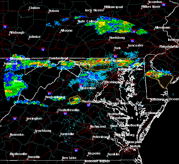 At 825 pm edt, a severe thunderstorm was located near hancock, moving east at 20 mph (radar indicated). Hazards include 60 mph wind gusts and quarter size hail. Damaging winds will cause some trees and large branches to fall. this could injure those outdoors, as well as damage homes and vehicles. roadways may become blocked by downed trees. localized power outages are possible. Unsecured light objects may become projectiles. At 825 pm edt, a severe thunderstorm was located near hancock, moving east at 20 mph (radar indicated). Hazards include 60 mph wind gusts and quarter size hail. Damaging winds will cause some trees and large branches to fall. this could injure those outdoors, as well as damage homes and vehicles. roadways may become blocked by downed trees. localized power outages are possible. Unsecured light objects may become projectiles.
|
| 5/26/2019 8:17 PM EDT |
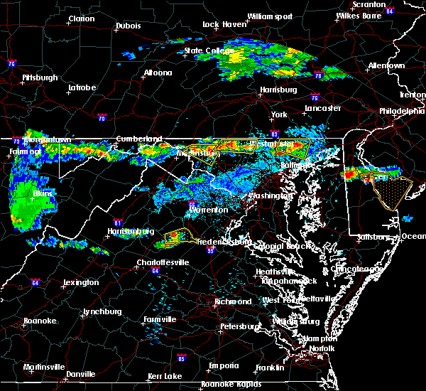 At 816 pm edt, a severe thunderstorm was located over mount lena, or 7 miles southeast of hagerstown`s municipal stadium, moving southeast at 20 mph (radar indicated). Hazards include 60 mph wind gusts and quarter size hail. Damaging winds will cause some trees and large branches to fall. this could injure those outdoors, as well as damage homes and vehicles. roadways may become blocked by downed trees. localized power outages are possible. unsecured light objects may become projectiles. Locations impacted include, hagerstown, municipal stadium, robinwood, boonsboro, braddock heights, williamsport, mount aetna, mount lena, san mar, wolfsville, saint james, halfway, myersville, cavetown, keedysville, funkstown, fairplay, clifton, pleasant walk and bolivar. At 816 pm edt, a severe thunderstorm was located over mount lena, or 7 miles southeast of hagerstown`s municipal stadium, moving southeast at 20 mph (radar indicated). Hazards include 60 mph wind gusts and quarter size hail. Damaging winds will cause some trees and large branches to fall. this could injure those outdoors, as well as damage homes and vehicles. roadways may become blocked by downed trees. localized power outages are possible. unsecured light objects may become projectiles. Locations impacted include, hagerstown, municipal stadium, robinwood, boonsboro, braddock heights, williamsport, mount aetna, mount lena, san mar, wolfsville, saint james, halfway, myersville, cavetown, keedysville, funkstown, fairplay, clifton, pleasant walk and bolivar.
|
| 5/26/2019 7:40 PM EDT |
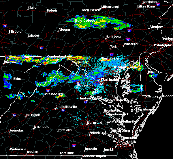 At 740 pm edt, a severe thunderstorm was located over wilson-conococheague, or near hagerstown, moving southeast at 20 mph (radar indicated). Hazards include 60 mph wind gusts and quarter size hail. Damaging winds will cause some trees and large branches to fall. this could injure those outdoors, as well as damage homes and vehicles. roadways may become blocked by downed trees. localized power outages are possible. Unsecured light objects may become projectiles. At 740 pm edt, a severe thunderstorm was located over wilson-conococheague, or near hagerstown, moving southeast at 20 mph (radar indicated). Hazards include 60 mph wind gusts and quarter size hail. Damaging winds will cause some trees and large branches to fall. this could injure those outdoors, as well as damage homes and vehicles. roadways may become blocked by downed trees. localized power outages are possible. Unsecured light objects may become projectiles.
|
| 5/23/2019 10:36 PM EDT |
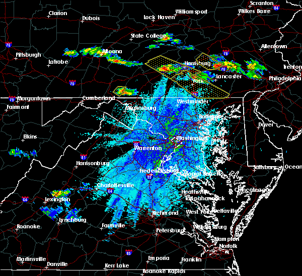 At 1034 pm edt, a severe thunderstorm was located over big cove tannery, or 11 miles northeast of hancock, moving southeast at 45 mph (radar indicated). Hazards include 60 mph wind gusts and quarter size hail. Damaging winds will cause some trees and large branches to fall. this could injure those outdoors, as well as damage homes and vehicles. roadways may become blocked by downed trees. localized power outages are possible. Unsecured light objects may become projectiles. At 1034 pm edt, a severe thunderstorm was located over big cove tannery, or 11 miles northeast of hancock, moving southeast at 45 mph (radar indicated). Hazards include 60 mph wind gusts and quarter size hail. Damaging winds will cause some trees and large branches to fall. this could injure those outdoors, as well as damage homes and vehicles. roadways may become blocked by downed trees. localized power outages are possible. Unsecured light objects may become projectiles.
|
| 5/23/2019 2:03 PM EDT |
 At 201 pm edt, a severe thunderstorm was located over mount aetna, or near municipal stadium, moving east at 60 mph (radar indicated. at 149 pm edt, the wind gusted to 40 mph at hagerstown municipal airport). Hazards include 60 mph wind gusts. Damaging winds will cause some trees and large branches to fall. this could injure those outdoors, as well as damage homes and vehicles. roadways may become blocked by downed trees. localized power outages are possible. unsecured light objects may become projectiles. Locations impacted include, hagerstown, thurmont, emmitsburg, municipal stadium, robinwood, walkersville, fountainhead-orchard hills, boonsboro, smithsburg, paramount-long meadow, mount aetna, mount lena, san mar, long meadow, wolfsville, saint james, halfway, maugansville, myersville and cavetown. At 201 pm edt, a severe thunderstorm was located over mount aetna, or near municipal stadium, moving east at 60 mph (radar indicated. at 149 pm edt, the wind gusted to 40 mph at hagerstown municipal airport). Hazards include 60 mph wind gusts. Damaging winds will cause some trees and large branches to fall. this could injure those outdoors, as well as damage homes and vehicles. roadways may become blocked by downed trees. localized power outages are possible. unsecured light objects may become projectiles. Locations impacted include, hagerstown, thurmont, emmitsburg, municipal stadium, robinwood, walkersville, fountainhead-orchard hills, boonsboro, smithsburg, paramount-long meadow, mount aetna, mount lena, san mar, long meadow, wolfsville, saint james, halfway, maugansville, myersville and cavetown.
|
| 5/23/2019 1:41 PM EDT |
 At 141 pm edt, a severe thunderstorm was located over wilson-conococheague, or 7 miles west of hagerstown, moving east at 50 mph (radar indicated). Hazards include 60 mph wind gusts. Damaging winds will cause some trees and large branches to fall. this could injure those outdoors, as well as damage homes and vehicles. roadways may become blocked by downed trees. localized power outages are possible. Unsecured light objects may become projectiles. At 141 pm edt, a severe thunderstorm was located over wilson-conococheague, or 7 miles west of hagerstown, moving east at 50 mph (radar indicated). Hazards include 60 mph wind gusts. Damaging winds will cause some trees and large branches to fall. this could injure those outdoors, as well as damage homes and vehicles. roadways may become blocked by downed trees. localized power outages are possible. Unsecured light objects may become projectiles.
|
| 5/19/2019 6:28 PM EDT |
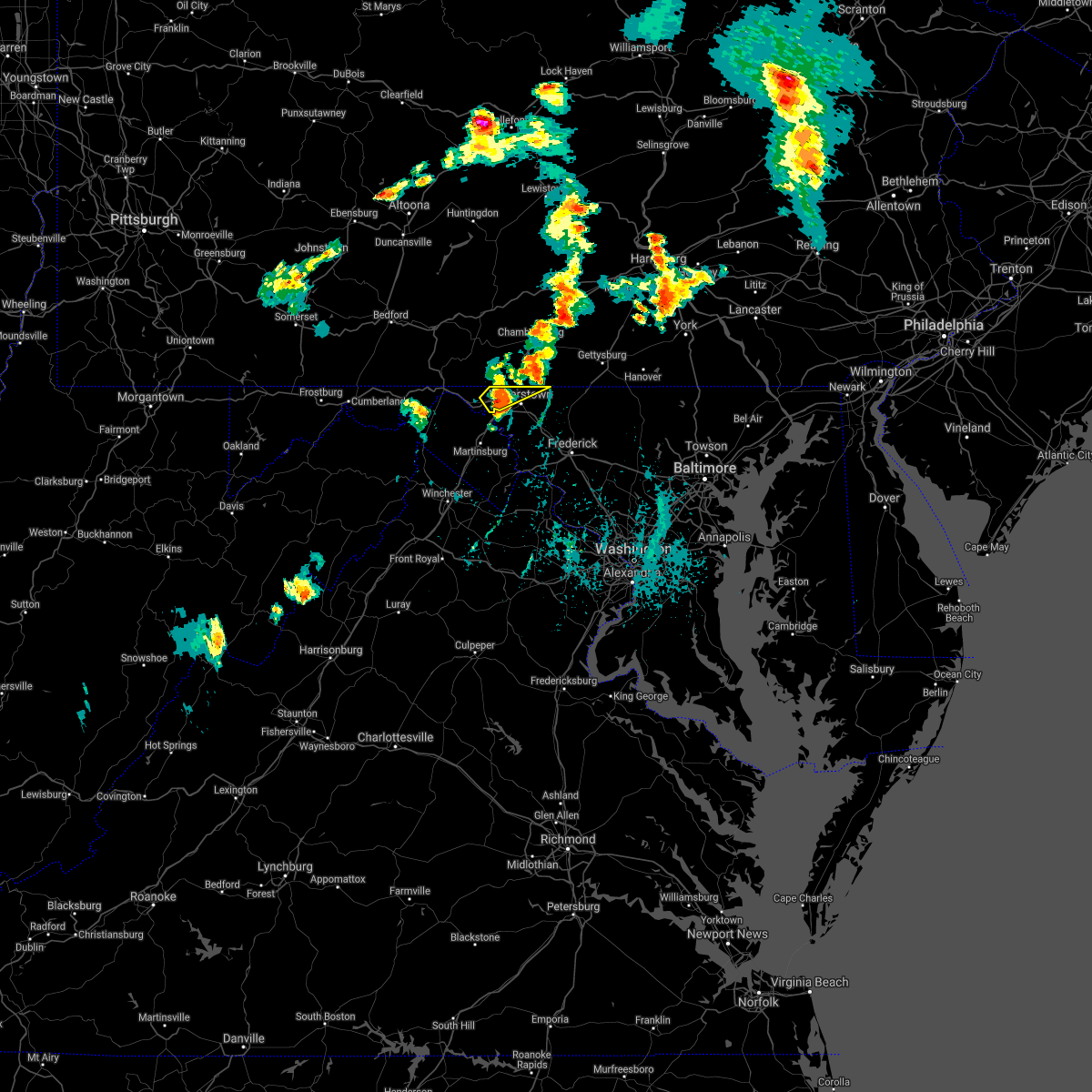 The severe thunderstorm warning for north central washington county will expire at 630 pm edt, the storm which prompted the warning has weakened below severe limits, and no longer poses an immediate threat to life or property. therefore, the warning will be allowed to expire. however small hail and gusty winds are still possible with this thunderstorm. a severe thunderstorm watch remains in effect until 900 pm edt for north central maryland, and the panhandle of west virginia. The severe thunderstorm warning for north central washington county will expire at 630 pm edt, the storm which prompted the warning has weakened below severe limits, and no longer poses an immediate threat to life or property. therefore, the warning will be allowed to expire. however small hail and gusty winds are still possible with this thunderstorm. a severe thunderstorm watch remains in effect until 900 pm edt for north central maryland, and the panhandle of west virginia.
|
| 5/19/2019 6:24 PM EDT |
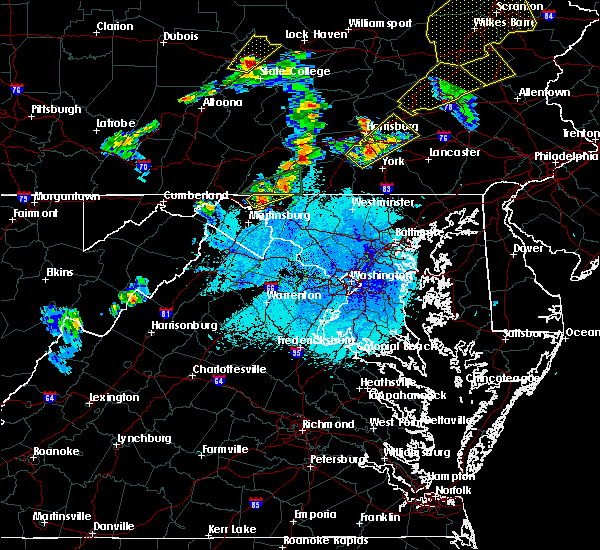 At 624 pm edt, a severe thunderstorm was located over wilson-conococheague, or 7 miles west of hagerstown, moving northeast at 35 mph (radar indicated). Hazards include 60 mph wind gusts and quarter size hail. Damaging winds will cause some trees and large branches to fall. this could injure those outdoors, as well as damage homes and vehicles. roadways may become blocked by downed trees. localized power outages are possible. unsecured light objects may become projectiles. Locations impacted include, hagerstown, fountainhead-orchard hills, paramount-long meadow, wilson-conococheague, long meadow, maugansville, leitersburg, clear spring, ringgold, middleburg and warrenton. At 624 pm edt, a severe thunderstorm was located over wilson-conococheague, or 7 miles west of hagerstown, moving northeast at 35 mph (radar indicated). Hazards include 60 mph wind gusts and quarter size hail. Damaging winds will cause some trees and large branches to fall. this could injure those outdoors, as well as damage homes and vehicles. roadways may become blocked by downed trees. localized power outages are possible. unsecured light objects may become projectiles. Locations impacted include, hagerstown, fountainhead-orchard hills, paramount-long meadow, wilson-conococheague, long meadow, maugansville, leitersburg, clear spring, ringgold, middleburg and warrenton.
|
| 5/19/2019 5:58 PM EDT |
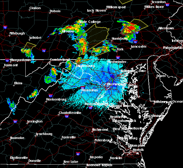 At 557 pm edt, a severe thunderstorm was located over wilson-conococheague, or 7 miles west of hagerstown, moving northeast at 40 mph (radar indicated). Hazards include 60 mph wind gusts and quarter size hail. Damaging winds will cause some trees and large branches to fall. this could injure those outdoors, as well as damage homes and vehicles. roadways may become blocked by downed trees. localized power outages are possible. Unsecured light objects may become projectiles. At 557 pm edt, a severe thunderstorm was located over wilson-conococheague, or 7 miles west of hagerstown, moving northeast at 40 mph (radar indicated). Hazards include 60 mph wind gusts and quarter size hail. Damaging winds will cause some trees and large branches to fall. this could injure those outdoors, as well as damage homes and vehicles. roadways may become blocked by downed trees. localized power outages are possible. Unsecured light objects may become projectiles.
|
| 5/19/2019 4:40 PM EDT |
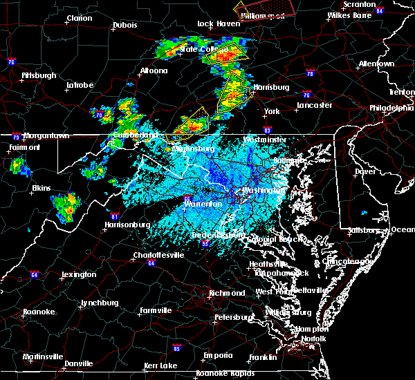 The severe thunderstorm warning for north central washington county will expire at 445 pm edt, the storm which prompted the warning has moved out of the area. therefore, the warning will be allowed to expire. a severe thunderstorm watch remains in effect until 900 pm edt for north central maryland. The severe thunderstorm warning for north central washington county will expire at 445 pm edt, the storm which prompted the warning has moved out of the area. therefore, the warning will be allowed to expire. a severe thunderstorm watch remains in effect until 900 pm edt for north central maryland.
|
| 5/19/2019 4:25 PM EDT |
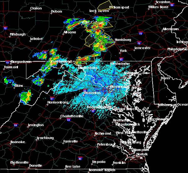 At 425 pm edt, a severe thunderstorm was located 8 miles southwest of claylick, or 9 miles east of hancock, moving northeast at 25 mph (radar indicated). Hazards include 60 mph wind gusts and quarter size hail. Damaging winds will cause some trees and large branches to fall. this could injure those outdoors, as well as damage homes and vehicles. roadways may become blocked by downed trees. localized power outages are possible. unsecured light objects may become projectiles. Locations impacted include, hagerstown, fountainhead-orchard hills, wilson-conococheague, long meadow, maugansville, clear spring, big spring, middleburg and warrenton. At 425 pm edt, a severe thunderstorm was located 8 miles southwest of claylick, or 9 miles east of hancock, moving northeast at 25 mph (radar indicated). Hazards include 60 mph wind gusts and quarter size hail. Damaging winds will cause some trees and large branches to fall. this could injure those outdoors, as well as damage homes and vehicles. roadways may become blocked by downed trees. localized power outages are possible. unsecured light objects may become projectiles. Locations impacted include, hagerstown, fountainhead-orchard hills, wilson-conococheague, long meadow, maugansville, clear spring, big spring, middleburg and warrenton.
|
| 5/19/2019 4:00 PM EDT |
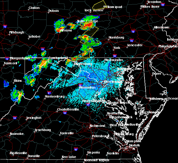 At 400 pm edt, a severe thunderstorm was located near wilson-conococheague, or 11 miles west of hagerstown, moving northeast at 25 mph (radar indicated). Hazards include 60 mph wind gusts and quarter size hail. Damaging winds will cause some trees and large branches to fall. this could injure those outdoors, as well as damage homes and vehicles. roadways may become blocked by downed trees. localized power outages are possible. Unsecured light objects may become projectiles. At 400 pm edt, a severe thunderstorm was located near wilson-conococheague, or 11 miles west of hagerstown, moving northeast at 25 mph (radar indicated). Hazards include 60 mph wind gusts and quarter size hail. Damaging winds will cause some trees and large branches to fall. this could injure those outdoors, as well as damage homes and vehicles. roadways may become blocked by downed trees. localized power outages are possible. Unsecured light objects may become projectiles.
|
| 5/19/2019 3:19 PM EDT | Quarter sized hail reported 5.7 miles S of Hagerstown, MD |
| 5/19/2019 3:18 PM EDT | Quarter sized hail reported 4 miles SSE of Hagerstown, MD |
| 5/19/2019 3:18 PM EDT |
 At 318 pm edt, a severe thunderstorm was located over fountainhead-orchard hills, or near hagerstown, moving east at 25 mph (radar indicated). Hazards include ping pong ball size hail and 60 mph wind gusts. Damaging winds will cause some trees and large branches to fall. this could injure those outdoors, as well as damage homes and vehicles. roadways may become blocked by downed trees. localized power outages are possible. unsecured light objects may become projectiles. Locations impacted include, hagerstown, fountainhead-orchard hills, smithsburg, paramount-long meadow, wilson-conococheague, long meadow, maugansville, cavetown, leitersburg, sabillasville, fort ritchie, chewsville, ringgold, middleburg, warrenton, highfield and cascade. At 318 pm edt, a severe thunderstorm was located over fountainhead-orchard hills, or near hagerstown, moving east at 25 mph (radar indicated). Hazards include ping pong ball size hail and 60 mph wind gusts. Damaging winds will cause some trees and large branches to fall. this could injure those outdoors, as well as damage homes and vehicles. roadways may become blocked by downed trees. localized power outages are possible. unsecured light objects may become projectiles. Locations impacted include, hagerstown, fountainhead-orchard hills, smithsburg, paramount-long meadow, wilson-conococheague, long meadow, maugansville, cavetown, leitersburg, sabillasville, fort ritchie, chewsville, ringgold, middleburg, warrenton, highfield and cascade.
|
| 5/19/2019 3:15 PM EDT | Tree down along broadfording roa in washington county MD, 3.6 miles SE of Hagerstown, MD |
| 5/19/2019 3:07 PM EDT | Golf Ball sized hail reported 5.7 miles SE of Hagerstown, MD |
| 5/19/2019 3:02 PM EDT |
 At 302 pm edt, a severe thunderstorm was located over wilson-conococheague, or 7 miles northwest of hagerstown, moving east at 25 mph (radar indicated). Hazards include golf ball size hail and 60 mph wind gusts. Expect wind damage to trees and power lines. hail is large enough to dent and damage vehicles. Some hail damage to roofs, siding, and windows is possible. At 302 pm edt, a severe thunderstorm was located over wilson-conococheague, or 7 miles northwest of hagerstown, moving east at 25 mph (radar indicated). Hazards include golf ball size hail and 60 mph wind gusts. Expect wind damage to trees and power lines. hail is large enough to dent and damage vehicles. Some hail damage to roofs, siding, and windows is possible.
|
| 5/18/2019 6:01 PM EDT |
 At 600 pm edt, a severe thunderstorm was located over saint james, or near municipal stadium, moving southeast at 20 mph (radar indicated). Hazards include 60 mph wind gusts and quarter size hail. Damaging winds will cause some trees and large branches to fall. this could injure those outdoors, as well as damage homes and vehicles. roadways may become blocked by downed trees. localized power outages are possible. unsecured light objects may become projectiles. Locations impacted include, hagerstown, robinwood, williamsport, mount aetna, mount lena, san mar, saint james, halfway, funkstown and fairplay. At 600 pm edt, a severe thunderstorm was located over saint james, or near municipal stadium, moving southeast at 20 mph (radar indicated). Hazards include 60 mph wind gusts and quarter size hail. Damaging winds will cause some trees and large branches to fall. this could injure those outdoors, as well as damage homes and vehicles. roadways may become blocked by downed trees. localized power outages are possible. unsecured light objects may become projectiles. Locations impacted include, hagerstown, robinwood, williamsport, mount aetna, mount lena, san mar, saint james, halfway, funkstown and fairplay.
|
| 5/18/2019 5:40 PM EDT |
 At 540 pm edt, a severe thunderstorm was located over wilson-conococheague, or 7 miles west of hagerstown, moving southeast at 20 mph (radar indicated). Hazards include 60 mph wind gusts and quarter size hail. Damaging winds will cause some trees and large branches to fall. this could injure those outdoors, as well as damage homes and vehicles. roadways may become blocked by downed trees. localized power outages are possible. Unsecured light objects may become projectiles. At 540 pm edt, a severe thunderstorm was located over wilson-conococheague, or 7 miles west of hagerstown, moving southeast at 20 mph (radar indicated). Hazards include 60 mph wind gusts and quarter size hail. Damaging winds will cause some trees and large branches to fall. this could injure those outdoors, as well as damage homes and vehicles. roadways may become blocked by downed trees. localized power outages are possible. Unsecured light objects may become projectiles.
|
| 5/3/2019 8:43 PM EDT |
 At 843 pm edt, severe thunderstorms were located along a line extending from near williamsport to near boonsboro to near harpers ferry, moving east at 30 mph (radar indicated). Hazards include 60 mph wind gusts. Damaging winds will cause some trees and large branches to fall. this could injure those outdoors, as well as damage homes and vehicles. roadways may become blocked by downed trees. localized power outages are possible. Unsecured light objects may become projectiles. At 843 pm edt, severe thunderstorms were located along a line extending from near williamsport to near boonsboro to near harpers ferry, moving east at 30 mph (radar indicated). Hazards include 60 mph wind gusts. Damaging winds will cause some trees and large branches to fall. this could injure those outdoors, as well as damage homes and vehicles. roadways may become blocked by downed trees. localized power outages are possible. Unsecured light objects may become projectiles.
|
| 9/7/2018 6:09 PM EDT |
 The severe thunderstorm warning for north central washington county will expire at 615 pm edt. the storm which prompted the warning has weakened below severe limits. therefore the warning will be allowed to expire. however, heavy rain is still possible with this thunderstorm. To report severe weather, contact your nearest law enforcement. The severe thunderstorm warning for north central washington county will expire at 615 pm edt. the storm which prompted the warning has weakened below severe limits. therefore the warning will be allowed to expire. however, heavy rain is still possible with this thunderstorm. To report severe weather, contact your nearest law enforcement.
|
| 9/7/2018 5:55 PM EDT |
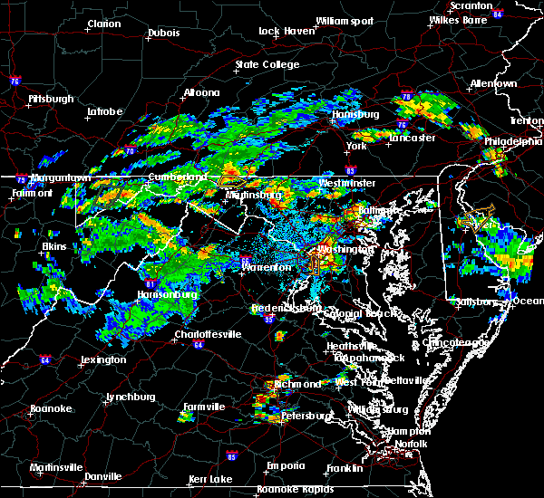 At 555 pm edt, a severe thunderstorm was located over wilson-conococheague, or 8 miles west of hagerstown, moving southeast at 15 mph (radar indicated). Hazards include 60 mph wind gusts. Damaging winds will cause some trees and large branches to fall. this could injure those outdoors, as well as damage homes and vehicles. roadways may become blocked by downed trees. localized power outages are possible. unsecured light objects may become projectiles. Locations impacted include, hagerstown, wilson-conococheague, clear spring and big spring. At 555 pm edt, a severe thunderstorm was located over wilson-conococheague, or 8 miles west of hagerstown, moving southeast at 15 mph (radar indicated). Hazards include 60 mph wind gusts. Damaging winds will cause some trees and large branches to fall. this could injure those outdoors, as well as damage homes and vehicles. roadways may become blocked by downed trees. localized power outages are possible. unsecured light objects may become projectiles. Locations impacted include, hagerstown, wilson-conococheague, clear spring and big spring.
|
| 9/7/2018 5:34 PM EDT |
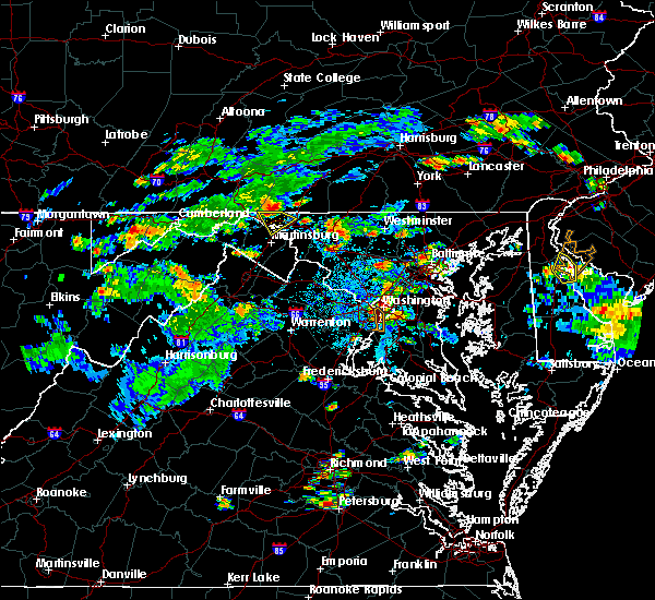 At 534 pm edt, a severe thunderstorm was located near claylick, or 11 miles east of hancock, moving southeast at 15 mph (radar indicated). Hazards include 60 mph wind gusts. Damaging winds will cause some trees and large branches to fall. this could injure those outdoors, as well as damage homes and vehicles. roadways may become blocked by downed trees. localized power outages are possible. Unsecured light objects may become projectiles. At 534 pm edt, a severe thunderstorm was located near claylick, or 11 miles east of hancock, moving southeast at 15 mph (radar indicated). Hazards include 60 mph wind gusts. Damaging winds will cause some trees and large branches to fall. this could injure those outdoors, as well as damage homes and vehicles. roadways may become blocked by downed trees. localized power outages are possible. Unsecured light objects may become projectiles.
|
| 8/21/2018 9:07 PM EDT |
 The severe thunderstorm warning for central washington, northwestern loudoun, northeastern warren, clarke, northwestern fauquier, jefferson, northeastern morgan and eastern berkeley counties will expire at 915 pm edt, the storms which prompted the warning have weakened below severe limits, and no longer pose an immediate threat to life or property. therefore the warning will be allowed to expire. a severe thunderstorm watch remains in effect until 1000 pm edt for north central maryland, northern and northwestern virginia, and the panhandle of west virginia. The severe thunderstorm warning for central washington, northwestern loudoun, northeastern warren, clarke, northwestern fauquier, jefferson, northeastern morgan and eastern berkeley counties will expire at 915 pm edt, the storms which prompted the warning have weakened below severe limits, and no longer pose an immediate threat to life or property. therefore the warning will be allowed to expire. a severe thunderstorm watch remains in effect until 1000 pm edt for north central maryland, northern and northwestern virginia, and the panhandle of west virginia.
|
| 8/21/2018 8:58 PM EDT |
 At 858 pm edt, severe thunderstorms were located along a line extending from near claylick to near berryville, moving northeast at 45 mph (radar indicated). Hazards include 60 mph wind gusts. Damaging winds will cause some trees and large branches to fall. this could injure those outdoors, as well as damage homes and vehicles. roadways may become blocked by downed trees. localized power outages are possible. unsecured light objects may become projectiles. Locations impacted include, hagerstown, martinsburg, charles town, shepherdstown, municipal stadium, purcellville, fountainhead-orchard hills, ranson, berryville, inwood, wilson-conococheague, williamsport, round hill, harpers ferry, long meadow, corporation of ranson, kearneysville, bluemont, saint james and berkeley. At 858 pm edt, severe thunderstorms were located along a line extending from near claylick to near berryville, moving northeast at 45 mph (radar indicated). Hazards include 60 mph wind gusts. Damaging winds will cause some trees and large branches to fall. this could injure those outdoors, as well as damage homes and vehicles. roadways may become blocked by downed trees. localized power outages are possible. unsecured light objects may become projectiles. Locations impacted include, hagerstown, martinsburg, charles town, shepherdstown, municipal stadium, purcellville, fountainhead-orchard hills, ranson, berryville, inwood, wilson-conococheague, williamsport, round hill, harpers ferry, long meadow, corporation of ranson, kearneysville, bluemont, saint james and berkeley.
|
| 8/21/2018 8:50 PM EDT |
 At 850 pm edt, severe thunderstorms were located along a line extending from 7 miles southwest of claylick to near berryville, moving northeast at 45 mph (radar indicated). Hazards include 60 mph wind gusts. Damaging winds will cause some trees and large branches to fall. this could injure those outdoors, as well as damage homes and vehicles. roadways may become blocked by downed trees. localized power outages are possible. unsecured light objects may become projectiles. Locations impacted include, hagerstown, martinsburg, charles town, shepherdstown, municipal stadium, purcellville, fountainhead-orchard hills, ranson, berryville, inwood, wilson-conococheague, williamsport, round hill, harpers ferry, long meadow, corporation of ranson, kearneysville, bluemont, saint james and berkeley. At 850 pm edt, severe thunderstorms were located along a line extending from 7 miles southwest of claylick to near berryville, moving northeast at 45 mph (radar indicated). Hazards include 60 mph wind gusts. Damaging winds will cause some trees and large branches to fall. this could injure those outdoors, as well as damage homes and vehicles. roadways may become blocked by downed trees. localized power outages are possible. unsecured light objects may become projectiles. Locations impacted include, hagerstown, martinsburg, charles town, shepherdstown, municipal stadium, purcellville, fountainhead-orchard hills, ranson, berryville, inwood, wilson-conococheague, williamsport, round hill, harpers ferry, long meadow, corporation of ranson, kearneysville, bluemont, saint james and berkeley.
|
| 8/21/2018 8:25 PM EDT |
 At 825 pm edt, severe thunderstorms were located along a line extending from near berkeley springs to near strasburg, moving northeast at 45 mph (radar indicated). Hazards include 60 mph wind gusts. Damaging winds will cause some trees and large branches to fall. this could injure those outdoors, as well as damage homes and vehicles. roadways may become blocked by downed trees. localized power outages are possible. Unsecured light objects may become projectiles. At 825 pm edt, severe thunderstorms were located along a line extending from near berkeley springs to near strasburg, moving northeast at 45 mph (radar indicated). Hazards include 60 mph wind gusts. Damaging winds will cause some trees and large branches to fall. this could injure those outdoors, as well as damage homes and vehicles. roadways may become blocked by downed trees. localized power outages are possible. Unsecured light objects may become projectiles.
|
| 8/21/2018 8:25 PM EDT |
 The national weather service in sterling virginia has issued a * severe thunderstorm warning for. central washington county in north central maryland. northwestern loudoun county in northern virginia. eastern frederick county in northwestern virginia. Northeastern warren county in northwestern virginia. The national weather service in sterling virginia has issued a * severe thunderstorm warning for. central washington county in north central maryland. northwestern loudoun county in northern virginia. eastern frederick county in northwestern virginia. Northeastern warren county in northwestern virginia.
|
| 8/21/2018 8:25 PM EDT |
 At 825 pm edt, severe thunderstorms were located along a line extending from near berkeley springs to near strasburg, moving northeast at 45 mph (radar indicated). Hazards include 60 mph wind gusts. Damaging winds will cause some trees and large branches to fall. this could injure those outdoors, as well as damage homes and vehicles. roadways may become blocked by downed trees. localized power outages are possible. Unsecured light objects may become projectiles. At 825 pm edt, severe thunderstorms were located along a line extending from near berkeley springs to near strasburg, moving northeast at 45 mph (radar indicated). Hazards include 60 mph wind gusts. Damaging winds will cause some trees and large branches to fall. this could injure those outdoors, as well as damage homes and vehicles. roadways may become blocked by downed trees. localized power outages are possible. Unsecured light objects may become projectiles.
|
| 8/21/2018 6:57 PM EDT |
 The severe thunderstorm warning for northeastern washington and northwestern frederick counties in north central maryland will expire at 700 pm edt, the severe thunderstorm which prompted the warning has weakened. therefore, the warning will be allowed to expire. a severe thunderstorm watch remains in effect until 1000 pm edt for north central maryland. The severe thunderstorm warning for northeastern washington and northwestern frederick counties in north central maryland will expire at 700 pm edt, the severe thunderstorm which prompted the warning has weakened. therefore, the warning will be allowed to expire. a severe thunderstorm watch remains in effect until 1000 pm edt for north central maryland.
|
| 8/21/2018 6:52 PM EDT |
 At 652 pm edt, a severe thunderstorm was located over carroll valley, or near emmitsburg, moving northeast at 30 mph (radar indicated). Hazards include 60 mph wind gusts and quarter size hail. Damaging winds will cause some trees and large branches to fall. this could injure those outdoors, as well as damage homes and vehicles. roadways may become blocked by downed trees. localized power outages are possible. unsecured light objects may become projectiles. Locations impacted include, thurmont, robinwood, smithsburg, cavetown, sabillasville, fort ritchie, chewsville, highfield and cascade. At 652 pm edt, a severe thunderstorm was located over carroll valley, or near emmitsburg, moving northeast at 30 mph (radar indicated). Hazards include 60 mph wind gusts and quarter size hail. Damaging winds will cause some trees and large branches to fall. this could injure those outdoors, as well as damage homes and vehicles. roadways may become blocked by downed trees. localized power outages are possible. unsecured light objects may become projectiles. Locations impacted include, thurmont, robinwood, smithsburg, cavetown, sabillasville, fort ritchie, chewsville, highfield and cascade.
|
| 8/21/2018 6:37 PM EDT |
 At 637 pm edt, a severe thunderstorm was located over smithsburg, or 7 miles west of thurmont, moving east at 30 mph (radar indicated). Hazards include 60 mph wind gusts and quarter size hail. Damaging winds will cause some trees and large branches to fall. this could injure those outdoors, as well as damage homes and vehicles. roadways may become blocked by downed trees. localized power outages are possible. unsecured light objects may become projectiles. Locations impacted include, hagerstown, thurmont, robinwood, walkersville, boonsboro, smithsburg, mount aetna, mount lena, san mar, wolfsville, saint james, myersville, cavetown, fairplay, sabillasville, fort ritchie, chewsville, utica, pleasant walk and highfield. At 637 pm edt, a severe thunderstorm was located over smithsburg, or 7 miles west of thurmont, moving east at 30 mph (radar indicated). Hazards include 60 mph wind gusts and quarter size hail. Damaging winds will cause some trees and large branches to fall. this could injure those outdoors, as well as damage homes and vehicles. roadways may become blocked by downed trees. localized power outages are possible. unsecured light objects may become projectiles. Locations impacted include, hagerstown, thurmont, robinwood, walkersville, boonsboro, smithsburg, mount aetna, mount lena, san mar, wolfsville, saint james, myersville, cavetown, fairplay, sabillasville, fort ritchie, chewsville, utica, pleasant walk and highfield.
|
| 8/21/2018 6:09 PM EDT |
 At 609 pm edt, a severe thunderstorm was located over williamsport, or near hagerstown, moving east at 30 mph (radar indicated). Hazards include 60 mph wind gusts and quarter size hail. Damaging winds will cause some trees and large branches to fall. this could injure those outdoors, as well as damage homes and vehicles. roadways may become blocked by downed trees. localized power outages are possible. Unsecured light objects may become projectiles. At 609 pm edt, a severe thunderstorm was located over williamsport, or near hagerstown, moving east at 30 mph (radar indicated). Hazards include 60 mph wind gusts and quarter size hail. Damaging winds will cause some trees and large branches to fall. this could injure those outdoors, as well as damage homes and vehicles. roadways may become blocked by downed trees. localized power outages are possible. Unsecured light objects may become projectiles.
|
| 8/21/2018 6:05 PM EDT | Downed tree on bottom rd near williamsport in washington county MD, 0.2 miles SSE of Hagerstown, MD |
| 8/21/2018 5:57 PM EDT |
 At 556 pm edt, severe thunderstorms were located along a line extending from wilson-conococheague to 14 miles southwest of greenwood, moving northeast at 35 mph (radar indicated). Hazards include 60 mph wind gusts and quarter size hail. Damaging winds will cause some trees and large branches to fall. this could injure those outdoors, as well as damage homes and vehicles. roadways may become blocked by downed trees. localized power outages are possible. unsecured light objects may become projectiles. Locations impacted include, hagerstown, martinsburg, municipal stadium, greenwood, robinwood, fountainhead-orchard hills, smithsburg, inwood, paramount-long meadow, wilson-conococheague, williamsport, long meadow, saint james, berkeley, halfway, maugansville, cavetown, funkstown, falling waters and fairplay. At 556 pm edt, severe thunderstorms were located along a line extending from wilson-conococheague to 14 miles southwest of greenwood, moving northeast at 35 mph (radar indicated). Hazards include 60 mph wind gusts and quarter size hail. Damaging winds will cause some trees and large branches to fall. this could injure those outdoors, as well as damage homes and vehicles. roadways may become blocked by downed trees. localized power outages are possible. unsecured light objects may become projectiles. Locations impacted include, hagerstown, martinsburg, municipal stadium, greenwood, robinwood, fountainhead-orchard hills, smithsburg, inwood, paramount-long meadow, wilson-conococheague, williamsport, long meadow, saint james, berkeley, halfway, maugansville, cavetown, funkstown, falling waters and fairplay.
|
| 8/21/2018 5:57 PM EDT |
 At 552 pm edt, severe thunderstorms were located along a line extending from near wilson-conococheague to 13 miles north of star tannery, moving northeast at 35 mph (radar indicated). Hazards include 60 mph wind gusts and quarter size hail. Damaging winds will cause some trees and large branches to fall. this could injure those outdoors, as well as damage homes and vehicles. roadways may become blocked by downed trees. localized power outages are possible. Unsecured light objects may become projectiles. At 552 pm edt, severe thunderstorms were located along a line extending from near wilson-conococheague to 13 miles north of star tannery, moving northeast at 35 mph (radar indicated). Hazards include 60 mph wind gusts and quarter size hail. Damaging winds will cause some trees and large branches to fall. this could injure those outdoors, as well as damage homes and vehicles. roadways may become blocked by downed trees. localized power outages are possible. Unsecured light objects may become projectiles.
|
| 8/21/2018 5:52 PM EDT |
 At 552 pm edt, severe thunderstorms were located along a line extending from near wilson-conococheague to 13 miles north of star tannery, moving northeast at 35 mph (radar indicated). Hazards include 60 mph wind gusts and quarter size hail. Damaging winds will cause some trees and large branches to fall. this could injure those outdoors, as well as damage homes and vehicles. roadways may become blocked by downed trees. localized power outages are possible. Unsecured light objects may become projectiles. At 552 pm edt, severe thunderstorms were located along a line extending from near wilson-conococheague to 13 miles north of star tannery, moving northeast at 35 mph (radar indicated). Hazards include 60 mph wind gusts and quarter size hail. Damaging winds will cause some trees and large branches to fall. this could injure those outdoors, as well as damage homes and vehicles. roadways may become blocked by downed trees. localized power outages are possible. Unsecured light objects may become projectiles.
|
| 8/17/2018 3:52 PM EDT |
 At 352 pm edt, a severe thunderstorm was located near shepherdstown, moving northeast at 25 mph (radar indicated). Hazards include 60 mph wind gusts. Damaging winds will cause some trees and large branches to fall. this could injure those outdoors, as well as damage homes and vehicles. roadways may become blocked by downed trees. localized power outages are possible. unsecured light objects may become projectiles. Locations impacted include, hagerstown, boonsboro, saint james, halfway, keedysville, sharpsburg, fairplay, rohrersville, burkittsville, gapland, brownsville and antietam. At 352 pm edt, a severe thunderstorm was located near shepherdstown, moving northeast at 25 mph (radar indicated). Hazards include 60 mph wind gusts. Damaging winds will cause some trees and large branches to fall. this could injure those outdoors, as well as damage homes and vehicles. roadways may become blocked by downed trees. localized power outages are possible. unsecured light objects may become projectiles. Locations impacted include, hagerstown, boonsboro, saint james, halfway, keedysville, sharpsburg, fairplay, rohrersville, burkittsville, gapland, brownsville and antietam.
|
| 8/17/2018 3:40 PM EDT |
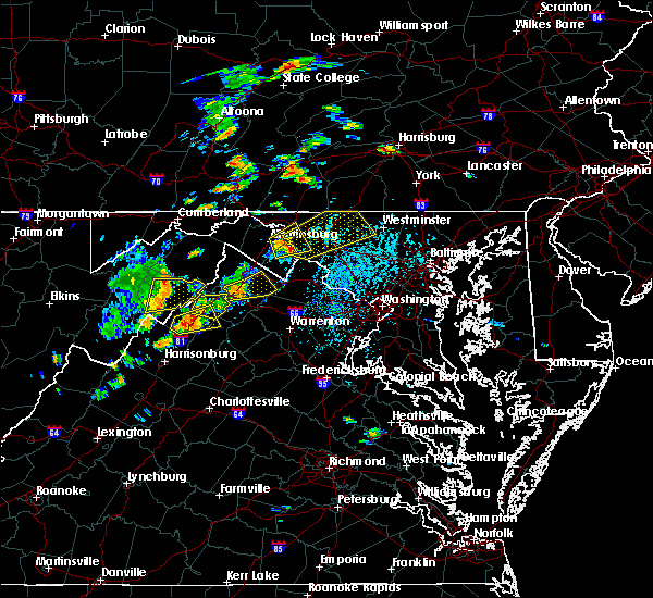 At 340 pm edt, a severe thunderstorm was located near shepherdstown, moving northeast at 25 mph (radar indicated. this storm has a history of producing 60 to 70 mph wind gusts). Hazards include 70 mph wind gusts and half dollar size hail. Damaging winds will cause some trees and large branches to fall. this could injure those outdoors, as well as damage homes and vehicles. roadways may become blocked by downed trees. localized power outages are possible. Unsecured light objects may become projectiles. At 340 pm edt, a severe thunderstorm was located near shepherdstown, moving northeast at 25 mph (radar indicated. this storm has a history of producing 60 to 70 mph wind gusts). Hazards include 70 mph wind gusts and half dollar size hail. Damaging winds will cause some trees and large branches to fall. this could injure those outdoors, as well as damage homes and vehicles. roadways may become blocked by downed trees. localized power outages are possible. Unsecured light objects may become projectiles.
|
| 8/17/2018 3:38 PM EDT |
 At 338 pm edt, a severe thunderstorm was located near kearneysville, or near shepherdstown, moving northeast at 25 mph (radar indicated). Hazards include 70 mph wind gusts and half dollar size hail. Damaging winds will cause some trees and large branches to fall. this could injure those outdoors, as well as damage homes and vehicles. roadways may become blocked by downed trees. localized power outages are possible. unsecured light objects may become projectiles. Locations impacted include, hagerstown, martinsburg, shepherdstown, ranson, boonsboro, kearneysville, saint james, berkeley, halfway, keedysville, sharpsburg, shenandoah junction, fairplay, rohrersville, burkittsville, gapland, brownsville, antietam, winebrenners cross and moler crossroads. At 338 pm edt, a severe thunderstorm was located near kearneysville, or near shepherdstown, moving northeast at 25 mph (radar indicated). Hazards include 70 mph wind gusts and half dollar size hail. Damaging winds will cause some trees and large branches to fall. this could injure those outdoors, as well as damage homes and vehicles. roadways may become blocked by downed trees. localized power outages are possible. unsecured light objects may become projectiles. Locations impacted include, hagerstown, martinsburg, shepherdstown, ranson, boonsboro, kearneysville, saint james, berkeley, halfway, keedysville, sharpsburg, shenandoah junction, fairplay, rohrersville, burkittsville, gapland, brownsville, antietam, winebrenners cross and moler crossroads.
|
| 8/17/2018 3:38 PM EDT |
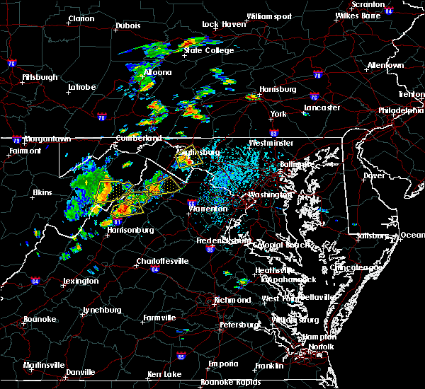 At 338 pm edt, a severe thunderstorm was located near kearneysville, or near shepherdstown, moving northeast at 25 mph (radar indicated). Hazards include 70 mph wind gusts and half dollar size hail. Damaging winds will cause some trees and large branches to fall. this could injure those outdoors, as well as damage homes and vehicles. roadways may become blocked by downed trees. localized power outages are possible. unsecured light objects may become projectiles. Locations impacted include, hagerstown, martinsburg, shepherdstown, ranson, boonsboro, kearneysville, saint james, berkeley, halfway, keedysville, sharpsburg, shenandoah junction, fairplay, rohrersville, burkittsville, gapland, brownsville, antietam, winebrenners cross and moler crossroads. At 338 pm edt, a severe thunderstorm was located near kearneysville, or near shepherdstown, moving northeast at 25 mph (radar indicated). Hazards include 70 mph wind gusts and half dollar size hail. Damaging winds will cause some trees and large branches to fall. this could injure those outdoors, as well as damage homes and vehicles. roadways may become blocked by downed trees. localized power outages are possible. unsecured light objects may become projectiles. Locations impacted include, hagerstown, martinsburg, shepherdstown, ranson, boonsboro, kearneysville, saint james, berkeley, halfway, keedysville, sharpsburg, shenandoah junction, fairplay, rohrersville, burkittsville, gapland, brownsville, antietam, winebrenners cross and moler crossroads.
|
| 8/17/2018 3:31 PM EDT |
 At 331 pm edt, a severe thunderstorm was located near martinsburg, moving northeast at 25 mph (radar indicated. a wind gust of 62 mph was reported at martinsburg airport). Hazards include 70 mph wind gusts and half dollar size hail. Damaging winds will cause some trees and large branches to fall. this could injure those outdoors, as well as damage homes and vehicles. roadways may become blocked by downed trees. localized power outages are possible. unsecured light objects may become projectiles. Locations impacted include, hagerstown, martinsburg, shepherdstown, ranson, boonsboro, inwood, williamsport, kearneysville, saint james, berkeley, halfway, keedysville, falling waters, sharpsburg, shenandoah junction, fairplay, middleway, rohrersville, burkittsville and gapland. At 331 pm edt, a severe thunderstorm was located near martinsburg, moving northeast at 25 mph (radar indicated. a wind gust of 62 mph was reported at martinsburg airport). Hazards include 70 mph wind gusts and half dollar size hail. Damaging winds will cause some trees and large branches to fall. this could injure those outdoors, as well as damage homes and vehicles. roadways may become blocked by downed trees. localized power outages are possible. unsecured light objects may become projectiles. Locations impacted include, hagerstown, martinsburg, shepherdstown, ranson, boonsboro, inwood, williamsport, kearneysville, saint james, berkeley, halfway, keedysville, falling waters, sharpsburg, shenandoah junction, fairplay, middleway, rohrersville, burkittsville and gapland.
|
| 8/17/2018 3:24 PM EDT |
 At 323 pm edt, a severe thunderstorm was located near martinsburg, moving northeast at 25 mph (radar indicated). Hazards include 70 mph wind gusts. a 63 mph wind gust was reported at martinsburg. Damaging winds will cause some trees and large branches to fall. this could injure those outdoors, as well as damage homes and vehicles. roadways may become blocked by downed trees. localized power outages are possible. Unsecured light objects may become projectiles. At 323 pm edt, a severe thunderstorm was located near martinsburg, moving northeast at 25 mph (radar indicated). Hazards include 70 mph wind gusts. a 63 mph wind gust was reported at martinsburg. Damaging winds will cause some trees and large branches to fall. this could injure those outdoors, as well as damage homes and vehicles. roadways may become blocked by downed trees. localized power outages are possible. Unsecured light objects may become projectiles.
|
| 8/17/2018 3:24 PM EDT |
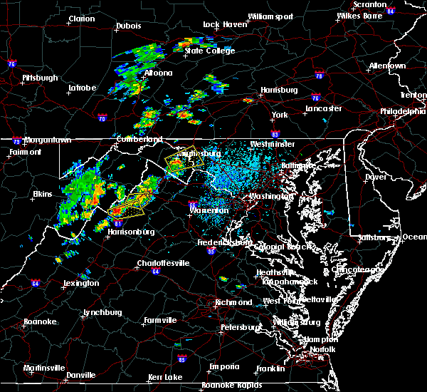 At 323 pm edt, a severe thunderstorm was located near martinsburg, moving northeast at 25 mph (radar indicated). Hazards include 70 mph wind gusts. a 63 mph wind gust was reported at martinsburg. Damaging winds will cause some trees and large branches to fall. this could injure those outdoors, as well as damage homes and vehicles. roadways may become blocked by downed trees. localized power outages are possible. Unsecured light objects may become projectiles. At 323 pm edt, a severe thunderstorm was located near martinsburg, moving northeast at 25 mph (radar indicated). Hazards include 70 mph wind gusts. a 63 mph wind gust was reported at martinsburg. Damaging winds will cause some trees and large branches to fall. this could injure those outdoors, as well as damage homes and vehicles. roadways may become blocked by downed trees. localized power outages are possible. Unsecured light objects may become projectiles.
|
| 8/8/2018 9:09 PM EDT |
 The severe thunderstorm warning for northeastern washington county will expire at 915 pm edt, the storm which prompted the warning has moved out of the area. therefore the warning will be allowed to expire. The severe thunderstorm warning for northeastern washington county will expire at 915 pm edt, the storm which prompted the warning has moved out of the area. therefore the warning will be allowed to expire.
|
| 8/8/2018 9:01 PM EDT |
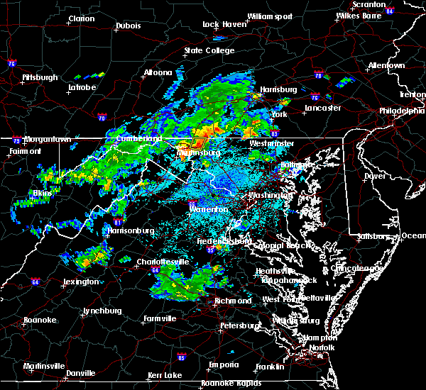 At 901 pm edt, a severe thunderstorm was located over robinwood, or over municipal stadium, moving east at 25 mph (radar indicated). Hazards include 60 mph wind gusts and quarter size hail. Damaging winds will cause some trees and large branches to fall. this could injure those outdoors, as well as damage homes and vehicles. roadways may become blocked by downed trees. localized power outages are possible. unsecured light objects may become projectiles. Locations impacted include, hagerstown, municipal stadium, robinwood, fountainhead-orchard hills, paramount-long meadow, mount aetna, san mar, long meadow, saint james, halfway, maugansville, cavetown, funkstown, leitersburg, chewsville, middleburg and bridgeport. At 901 pm edt, a severe thunderstorm was located over robinwood, or over municipal stadium, moving east at 25 mph (radar indicated). Hazards include 60 mph wind gusts and quarter size hail. Damaging winds will cause some trees and large branches to fall. this could injure those outdoors, as well as damage homes and vehicles. roadways may become blocked by downed trees. localized power outages are possible. unsecured light objects may become projectiles. Locations impacted include, hagerstown, municipal stadium, robinwood, fountainhead-orchard hills, paramount-long meadow, mount aetna, san mar, long meadow, saint james, halfway, maugansville, cavetown, funkstown, leitersburg, chewsville, middleburg and bridgeport.
|
| 8/8/2018 8:53 PM EDT | Downed power lines on 1000 block of georgia avenu in washington county MD, 1.7 miles SSE of Hagerstown, MD |
| 8/8/2018 8:50 PM EDT | Tree down on 10800 block of bower avenu in washington county MD, 3.3 miles NE of Hagerstown, MD |
| 8/8/2018 8:44 PM EDT |
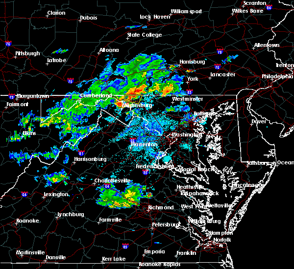 At 844 pm edt, a severe thunderstorm was located over wilson-conococheague, or near hagerstown, moving east at 20 mph (radar indicated). Hazards include 60 mph wind gusts and quarter size hail. Damaging winds will cause some trees and large branches to fall. this could injure those outdoors, as well as damage homes and vehicles. roadways may become blocked by downed trees. localized power outages are possible. unsecured light objects may become projectiles. Locations impacted include, hagerstown, municipal stadium, robinwood, fountainhead-orchard hills, paramount-long meadow, wilson-conococheague, williamsport, mount aetna, san mar, long meadow, saint james, halfway, maugansville, cavetown, funkstown, leitersburg, chewsville, middleburg, warrenton and bridgeport. At 844 pm edt, a severe thunderstorm was located over wilson-conococheague, or near hagerstown, moving east at 20 mph (radar indicated). Hazards include 60 mph wind gusts and quarter size hail. Damaging winds will cause some trees and large branches to fall. this could injure those outdoors, as well as damage homes and vehicles. roadways may become blocked by downed trees. localized power outages are possible. unsecured light objects may become projectiles. Locations impacted include, hagerstown, municipal stadium, robinwood, fountainhead-orchard hills, paramount-long meadow, wilson-conococheague, williamsport, mount aetna, san mar, long meadow, saint james, halfway, maugansville, cavetown, funkstown, leitersburg, chewsville, middleburg, warrenton and bridgeport.
|
| 8/8/2018 8:28 PM EDT |
 At 828 pm edt, a severe thunderstorm was located near claylick, or 12 miles east of hancock, moving east at 20 mph (radar indicated). Hazards include 60 mph wind gusts and quarter size hail. Damaging winds will cause some trees and large branches to fall. this could injure those outdoors, as well as damage homes and vehicles. roadways may become blocked by downed trees. localized power outages are possible. Unsecured light objects may become projectiles. At 828 pm edt, a severe thunderstorm was located near claylick, or 12 miles east of hancock, moving east at 20 mph (radar indicated). Hazards include 60 mph wind gusts and quarter size hail. Damaging winds will cause some trees and large branches to fall. this could injure those outdoors, as well as damage homes and vehicles. roadways may become blocked by downed trees. localized power outages are possible. Unsecured light objects may become projectiles.
|
| 7/27/2018 3:55 PM EDT | Tree down near the intersection of wagaman road and garis shop roa in washington county MD, 3.3 miles N of Hagerstown, MD |
| 7/17/2018 8:08 PM EDT |
 At 807 pm edt, a severe thunderstorm was located over robinwood, or near hagerstown, moving southeast at 30 mph (radar indicated). Hazards include 60 mph wind gusts. Damaging winds will cause some trees and large branches to fall. this could injure those outdoors, as well as damage homes and vehicles. roadways may become blocked by downed trees. localized power outages are possible. Unsecured light objects may become projectiles. At 807 pm edt, a severe thunderstorm was located over robinwood, or near hagerstown, moving southeast at 30 mph (radar indicated). Hazards include 60 mph wind gusts. Damaging winds will cause some trees and large branches to fall. this could injure those outdoors, as well as damage homes and vehicles. roadways may become blocked by downed trees. localized power outages are possible. Unsecured light objects may become projectiles.
|
| 7/17/2018 8:05 PM EDT | Downed tree on wires near the 10000 block of garis shop r in washington county MD, 3.4 miles NNW of Hagerstown, MD |
| 7/17/2018 8:02 PM EDT | Downed tree on wires near the 300 block of south cannon avenu in washington county MD, 0.5 miles WSW of Hagerstown, MD |
| 7/17/2018 8:00 PM EDT | Downed tree on wires near the 1000 block of columbia r in washington county MD, 2.3 miles S of Hagerstown, MD |
| 6/20/2018 5:16 PM EDT |
 At 516 pm edt, severe thunderstorms were located along a line extending from near hancock to 6 miles southwest of berkeley springs to 8 miles southwest of paw paw, moving southeast at 30 mph (radar indicated). Hazards include 60 mph wind gusts. Damaging winds will cause some trees and large branches to fall. this could injure those outdoors, as well as damage homes and vehicles. roadways may become blocked by downed trees. localized power outages are possible. unsecured light objects may become projectiles. Locations impacted include, hagerstown, martinsburg, hancock, paw paw, greenwood, fountainhead-orchard hills, inwood, wilson-conococheague, williamsport, berkeley springs, berkeley, halfway, maugansville, falling waters, springfield, clear spring, capon bridge, hedgesville, pecktonville and big spring. At 516 pm edt, severe thunderstorms were located along a line extending from near hancock to 6 miles southwest of berkeley springs to 8 miles southwest of paw paw, moving southeast at 30 mph (radar indicated). Hazards include 60 mph wind gusts. Damaging winds will cause some trees and large branches to fall. this could injure those outdoors, as well as damage homes and vehicles. roadways may become blocked by downed trees. localized power outages are possible. unsecured light objects may become projectiles. Locations impacted include, hagerstown, martinsburg, hancock, paw paw, greenwood, fountainhead-orchard hills, inwood, wilson-conococheague, williamsport, berkeley springs, berkeley, halfway, maugansville, falling waters, springfield, clear spring, capon bridge, hedgesville, pecktonville and big spring.
|
| 6/20/2018 4:59 PM EDT |
 At 459 pm edt, severe thunderstorms were located along a line extending from near warfordsburg to 7 miles northeast of paw paw to near fort ashby, moving southeast at 30 mph (radar indicated). Hazards include 60 mph wind gusts. Damaging winds will cause some trees and large branches to fall. this could injure those outdoors, as well as damage homes and vehicles. roadways may become blocked by downed trees. localized power outages are possible. Unsecured light objects may become projectiles. At 459 pm edt, severe thunderstorms were located along a line extending from near warfordsburg to 7 miles northeast of paw paw to near fort ashby, moving southeast at 30 mph (radar indicated). Hazards include 60 mph wind gusts. Damaging winds will cause some trees and large branches to fall. this could injure those outdoors, as well as damage homes and vehicles. roadways may become blocked by downed trees. localized power outages are possible. Unsecured light objects may become projectiles.
|
| 6/18/2018 2:42 PM EDT |
 At 241 pm edt, a severe thunderstorm was located over smithsburg, or near municipal stadium, moving southeast at 20 mph (radar indicated). Hazards include 60 mph wind gusts. Damaging winds will cause some trees and large branches to fall. this could injure those outdoors, as well as damage homes and vehicles. roadways may become blocked by downed trees. localized power outages are possible. Unsecured light objects may become projectiles. At 241 pm edt, a severe thunderstorm was located over smithsburg, or near municipal stadium, moving southeast at 20 mph (radar indicated). Hazards include 60 mph wind gusts. Damaging winds will cause some trees and large branches to fall. this could injure those outdoors, as well as damage homes and vehicles. roadways may become blocked by downed trees. localized power outages are possible. Unsecured light objects may become projectiles.
|
| 5/31/2018 4:10 PM EDT |
 The national weather service in sterling virginia has issued a * severe thunderstorm warning for. northeastern washington county in north central maryland. northwestern carroll county in north central maryland. northern frederick county in north central maryland. Until 500 pm edt. The national weather service in sterling virginia has issued a * severe thunderstorm warning for. northeastern washington county in north central maryland. northwestern carroll county in north central maryland. northern frederick county in north central maryland. Until 500 pm edt.
|
| 5/26/2018 5:40 PM EDT |
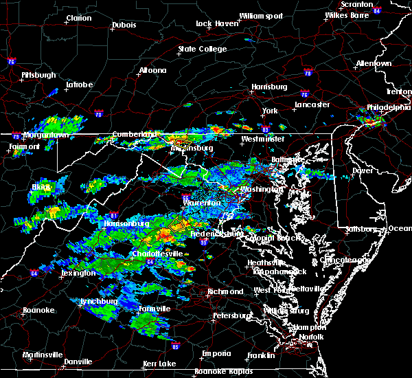 At 539 pm edt, a severe thunderstorm was located over williamsport, or 7 miles southwest of hagerstown, moving east at 10 mph (radar indicated). Hazards include 60 mph wind gusts and quarter size hail. Damaging winds will cause some trees and large branches to fall. this could injure those outdoors, as well as damage homes and vehicles. roadways may become blocked by downed trees. localized power outages are possible. unsecured light objects may become projectiles. Locations impacted include, hagerstown, wilson-conococheague, williamsport, saint james, halfway, funkstown, falling waters and fairplay. At 539 pm edt, a severe thunderstorm was located over williamsport, or 7 miles southwest of hagerstown, moving east at 10 mph (radar indicated). Hazards include 60 mph wind gusts and quarter size hail. Damaging winds will cause some trees and large branches to fall. this could injure those outdoors, as well as damage homes and vehicles. roadways may become blocked by downed trees. localized power outages are possible. unsecured light objects may become projectiles. Locations impacted include, hagerstown, wilson-conococheague, williamsport, saint james, halfway, funkstown, falling waters and fairplay.
|
| 5/26/2018 5:25 PM EDT |
 At 525 pm edt, a severe thunderstorm was located near williamsport, or 8 miles west of hagerstown, moving east at 10 mph (radar indicated). Hazards include 60 mph wind gusts and quarter size hail. Damaging winds will cause some trees and large branches to fall. this could injure those outdoors, as well as damage homes and vehicles. roadways may become blocked by downed trees. localized power outages are possible. Unsecured light objects may become projectiles. At 525 pm edt, a severe thunderstorm was located near williamsport, or 8 miles west of hagerstown, moving east at 10 mph (radar indicated). Hazards include 60 mph wind gusts and quarter size hail. Damaging winds will cause some trees and large branches to fall. this could injure those outdoors, as well as damage homes and vehicles. roadways may become blocked by downed trees. localized power outages are possible. Unsecured light objects may become projectiles.
|
| 5/26/2018 5:25 PM EDT |
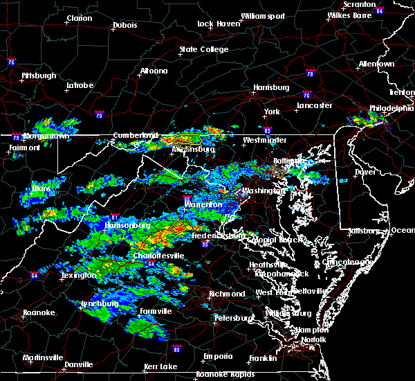 At 525 pm edt, a severe thunderstorm was located near williamsport, or 8 miles west of hagerstown, moving east at 10 mph (radar indicated). Hazards include 60 mph wind gusts and quarter size hail. Damaging winds will cause some trees and large branches to fall. this could injure those outdoors, as well as damage homes and vehicles. roadways may become blocked by downed trees. localized power outages are possible. Unsecured light objects may become projectiles. At 525 pm edt, a severe thunderstorm was located near williamsport, or 8 miles west of hagerstown, moving east at 10 mph (radar indicated). Hazards include 60 mph wind gusts and quarter size hail. Damaging winds will cause some trees and large branches to fall. this could injure those outdoors, as well as damage homes and vehicles. roadways may become blocked by downed trees. localized power outages are possible. Unsecured light objects may become projectiles.
|
| 5/26/2018 4:38 PM EDT |
 At 438 pm edt, a severe thunderstorm was located over wilson-conococheague, or near hagerstown, moving east at 10 mph (radar indicated). Hazards include 60 mph wind gusts and quarter size hail. Damaging winds will cause some trees and large branches to fall. this could injure those outdoors, as well as damage homes and vehicles. roadways may become blocked by downed trees. localized power outages are possible. Unsecured light objects may become projectiles. At 438 pm edt, a severe thunderstorm was located over wilson-conococheague, or near hagerstown, moving east at 10 mph (radar indicated). Hazards include 60 mph wind gusts and quarter size hail. Damaging winds will cause some trees and large branches to fall. this could injure those outdoors, as well as damage homes and vehicles. roadways may become blocked by downed trees. localized power outages are possible. Unsecured light objects may become projectiles.
|
| 1/12/2018 6:40 PM EST |
 The severe thunderstorm warning for washington county will expire at 645 pm est, the storm which prompted the warning is weakening and exiting the warned area. therefore, the warning will be allowed to expire. The severe thunderstorm warning for washington county will expire at 645 pm est, the storm which prompted the warning is weakening and exiting the warned area. therefore, the warning will be allowed to expire.
|
| 1/12/2018 6:18 PM EST |
 At 617 pm est, a severe thunderstorm was located over saint james, or 7 miles south of municipal stadium, moving northeast at 40 mph (radar indicated). Hazards include 60 mph wind gusts. Damaging winds will cause some trees and large branches to fall. this could injure those outdoors, as well as damage homes and vehicles. roadways may become blocked by downed trees. localized power outages are possible. unsecured light objects may become projectiles. Locations impacted include, hagerstown, municipal stadium, robinwood, fountainhead-orchard hills, boonsboro, smithsburg, paramount-long meadow, wilson-conococheague, williamsport, mount aetna, mount lena, san mar, harpers ferry, long meadow, saint james, halfway, maugansville, cavetown, keedysville and funkstown. At 617 pm est, a severe thunderstorm was located over saint james, or 7 miles south of municipal stadium, moving northeast at 40 mph (radar indicated). Hazards include 60 mph wind gusts. Damaging winds will cause some trees and large branches to fall. this could injure those outdoors, as well as damage homes and vehicles. roadways may become blocked by downed trees. localized power outages are possible. unsecured light objects may become projectiles. Locations impacted include, hagerstown, municipal stadium, robinwood, fountainhead-orchard hills, boonsboro, smithsburg, paramount-long meadow, wilson-conococheague, williamsport, mount aetna, mount lena, san mar, harpers ferry, long meadow, saint james, halfway, maugansville, cavetown, keedysville and funkstown.
|
| 1/12/2018 5:56 PM EST |
 At 555 pm est, a severe thunderstorm was located over ranson, or near charles town, moving northeast at 40 mph (radar indicated). Hazards include 60 mph wind gusts. Damaging winds will cause some trees and large branches to fall. this could injure those outdoors, as well as damage homes and vehicles. roadways may become blocked by downed trees. localized power outages are possible. unsecured light objects may become projectiles. Locations impacted include, hagerstown, charles town, shepherdstown, municipal stadium, robinwood, fountainhead-orchard hills, ranson, boonsboro, smithsburg, paramount-long meadow, wilson-conococheague, williamsport, mount aetna, mount lena, san mar, harpers ferry, long meadow, corporation of ranson, kearneysville and saint james. At 555 pm est, a severe thunderstorm was located over ranson, or near charles town, moving northeast at 40 mph (radar indicated). Hazards include 60 mph wind gusts. Damaging winds will cause some trees and large branches to fall. this could injure those outdoors, as well as damage homes and vehicles. roadways may become blocked by downed trees. localized power outages are possible. unsecured light objects may become projectiles. Locations impacted include, hagerstown, charles town, shepherdstown, municipal stadium, robinwood, fountainhead-orchard hills, ranson, boonsboro, smithsburg, paramount-long meadow, wilson-conococheague, williamsport, mount aetna, mount lena, san mar, harpers ferry, long meadow, corporation of ranson, kearneysville and saint james.
|
| 1/12/2018 5:49 PM EST |
 At 548 pm est, a severe thunderstorm was located over charles town, moving northeast at 40 mph (radar indicated). Hazards include 60 mph wind gusts. Damaging winds will cause some trees and large branches to fall. this could injure those outdoors, as well as damage homes and vehicles. roadways may become blocked by downed trees. localized power outages are possible. Unsecured light objects may become projectiles. At 548 pm est, a severe thunderstorm was located over charles town, moving northeast at 40 mph (radar indicated). Hazards include 60 mph wind gusts. Damaging winds will cause some trees and large branches to fall. this could injure those outdoors, as well as damage homes and vehicles. roadways may become blocked by downed trees. localized power outages are possible. Unsecured light objects may become projectiles.
|
| 9/5/2017 3:47 PM EDT |
 At 347 pm edt, severe thunderstorms were located along a line extending from near waynesboro to shepherdstown, moving east at 45 mph (radar indicated). Hazards include 70 mph wind gusts and quarter size hail. Damaging winds will cause some trees and large branches to fall. this could injure those outdoors, as well as damage homes and vehicles. roadways may become blocked by downed trees. localized power outages are possible. unsecured light objects may become projectiles. Locations impacted include, frederick, hagerstown, thurmont, emmitsburg, shepherdstown, municipal stadium, harry grove stadium, ballenger creek, robinwood, brunswick, walkersville, fountainhead-orchard hills, ranson, boonsboro, smithsburg, braddock heights, paramount-long meadow, wilson-conococheague, williamsport and mount aetna. At 347 pm edt, severe thunderstorms were located along a line extending from near waynesboro to shepherdstown, moving east at 45 mph (radar indicated). Hazards include 70 mph wind gusts and quarter size hail. Damaging winds will cause some trees and large branches to fall. this could injure those outdoors, as well as damage homes and vehicles. roadways may become blocked by downed trees. localized power outages are possible. unsecured light objects may become projectiles. Locations impacted include, frederick, hagerstown, thurmont, emmitsburg, shepherdstown, municipal stadium, harry grove stadium, ballenger creek, robinwood, brunswick, walkersville, fountainhead-orchard hills, ranson, boonsboro, smithsburg, braddock heights, paramount-long meadow, wilson-conococheague, williamsport and mount aetna.
|
| 9/5/2017 3:28 PM EDT | Storm damage reported in washington county MD, 5.1 miles S of Hagerstown, MD |
| 9/5/2017 3:20 PM EDT |
 At 320 pm edt, severe thunderstorms were located along a line extending from near claylick to near inwood, moving east at 45 mph (radar indicated). Hazards include 60 mph wind gusts. Damaging winds will cause some trees and large branches to fall. this could injure those outdoors, as well as damage homes and vehicles. roadways may become blocked by downed trees. localized power outages are possible. Unsecured light objects may become projectiles. At 320 pm edt, severe thunderstorms were located along a line extending from near claylick to near inwood, moving east at 45 mph (radar indicated). Hazards include 60 mph wind gusts. Damaging winds will cause some trees and large branches to fall. this could injure those outdoors, as well as damage homes and vehicles. roadways may become blocked by downed trees. localized power outages are possible. Unsecured light objects may become projectiles.
|
| 8/12/2017 4:12 PM EDT |
 At 411 pm edt, severe thunderstorms were located along a line extending from fountainhead-orchard hills to williamsport to 6 miles north of martinsburg, moving east at 45 mph (radar indicated). Hazards include 60 mph wind gusts and quarter size hail. Damaging winds will cause some trees and large branches to fall. this could injure those outdoors, as well as damage homes and vehicles. roadways may become blocked by downed trees. localized power outages are possible. unsecured light objects may become projectiles. Locations impacted include, hagerstown, martinsburg, municipal stadium, robinwood, fountainhead-orchard hills, paramount-long meadow, wilson-conococheague, williamsport, long meadow, saint james, berkeley, halfway, maugansville, funkstown, falling waters, leitersburg, clear spring, hedgesville, big spring and big pool. At 411 pm edt, severe thunderstorms were located along a line extending from fountainhead-orchard hills to williamsport to 6 miles north of martinsburg, moving east at 45 mph (radar indicated). Hazards include 60 mph wind gusts and quarter size hail. Damaging winds will cause some trees and large branches to fall. this could injure those outdoors, as well as damage homes and vehicles. roadways may become blocked by downed trees. localized power outages are possible. unsecured light objects may become projectiles. Locations impacted include, hagerstown, martinsburg, municipal stadium, robinwood, fountainhead-orchard hills, paramount-long meadow, wilson-conococheague, williamsport, long meadow, saint james, berkeley, halfway, maugansville, funkstown, falling waters, leitersburg, clear spring, hedgesville, big spring and big pool.
|
| 8/12/2017 4:12 PM EDT |
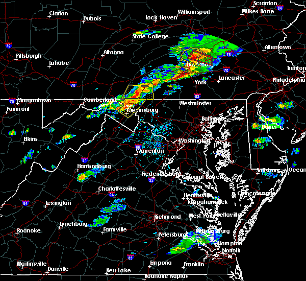 At 411 pm edt, severe thunderstorms were located along a line extending from fountainhead-orchard hills to williamsport to 6 miles north of martinsburg, moving east at 45 mph (radar indicated). Hazards include 60 mph wind gusts and quarter size hail. Damaging winds will cause some trees and large branches to fall. this could injure those outdoors, as well as damage homes and vehicles. roadways may become blocked by downed trees. localized power outages are possible. unsecured light objects may become projectiles. Locations impacted include, hagerstown, martinsburg, municipal stadium, robinwood, fountainhead-orchard hills, paramount-long meadow, wilson-conococheague, williamsport, long meadow, saint james, berkeley, halfway, maugansville, funkstown, falling waters, leitersburg, clear spring, hedgesville, big spring and big pool. At 411 pm edt, severe thunderstorms were located along a line extending from fountainhead-orchard hills to williamsport to 6 miles north of martinsburg, moving east at 45 mph (radar indicated). Hazards include 60 mph wind gusts and quarter size hail. Damaging winds will cause some trees and large branches to fall. this could injure those outdoors, as well as damage homes and vehicles. roadways may become blocked by downed trees. localized power outages are possible. unsecured light objects may become projectiles. Locations impacted include, hagerstown, martinsburg, municipal stadium, robinwood, fountainhead-orchard hills, paramount-long meadow, wilson-conococheague, williamsport, long meadow, saint james, berkeley, halfway, maugansville, funkstown, falling waters, leitersburg, clear spring, hedgesville, big spring and big pool.
|
| 8/12/2017 3:50 PM EDT |
 At 349 pm edt, a severe thunderstorm was located near berkeley springs, or 7 miles south of hancock, moving east at 30 mph (radar indicated). Hazards include ping pong ball size hail and 60 mph wind gusts. Damaging winds will cause some trees and large branches to fall. this could injure those outdoors, as well as damage homes and vehicles. roadways may become blocked by downed trees. localized power outages are possible. Unsecured light objects may become projectiles. At 349 pm edt, a severe thunderstorm was located near berkeley springs, or 7 miles south of hancock, moving east at 30 mph (radar indicated). Hazards include ping pong ball size hail and 60 mph wind gusts. Damaging winds will cause some trees and large branches to fall. this could injure those outdoors, as well as damage homes and vehicles. roadways may become blocked by downed trees. localized power outages are possible. Unsecured light objects may become projectiles.
|
| 8/4/2017 10:20 PM EDT |
 At 1019 pm edt, severe thunderstorms were located along a line extending from robinwood to near braddock heights, moving northeast at 40 mph (trained weather spotter reported multiple downed trees near fairplay). Hazards include 60 mph wind gusts. Damaging winds will cause some trees and large branches to fall. this could injure those outdoors, as well as damage homes and vehicles. roadways may become blocked by downed trees. localized power outages are possible. unsecured light objects may become projectiles. Locations impacted include, frederick, hagerstown, thurmont, emmitsburg, municipal stadium, harry grove stadium, ballenger creek, robinwood, brunswick, walkersville, fountainhead-orchard hills, boonsboro, smithsburg, braddock heights, paramount-long meadow, mount aetna, mount lena, san mar, long meadow and clover hill. At 1019 pm edt, severe thunderstorms were located along a line extending from robinwood to near braddock heights, moving northeast at 40 mph (trained weather spotter reported multiple downed trees near fairplay). Hazards include 60 mph wind gusts. Damaging winds will cause some trees and large branches to fall. this could injure those outdoors, as well as damage homes and vehicles. roadways may become blocked by downed trees. localized power outages are possible. unsecured light objects may become projectiles. Locations impacted include, frederick, hagerstown, thurmont, emmitsburg, municipal stadium, harry grove stadium, ballenger creek, robinwood, brunswick, walkersville, fountainhead-orchard hills, boonsboro, smithsburg, braddock heights, paramount-long meadow, mount aetna, mount lena, san mar, long meadow and clover hill.
|
| 8/4/2017 10:13 PM EDT |
 At 1012 pm edt, severe thunderstorms were located along a line extending from near hagerstown to near brunswick, moving northeast at 40 mph (radar indicated). Hazards include 60 mph wind gusts. Damaging winds will cause some trees and large branches to fall. this could injure those outdoors, as well as damage homes and vehicles. roadways may become blocked by downed trees. localized power outages are possible. unsecured light objects may become projectiles. Locations impacted include, frederick, hagerstown, thurmont, emmitsburg, municipal stadium, harry grove stadium, ballenger creek, robinwood, brunswick, walkersville, fountainhead-orchard hills, boonsboro, smithsburg, braddock heights, paramount-long meadow, wilson-conococheague, williamsport, mount aetna, mount lena and san mar. At 1012 pm edt, severe thunderstorms were located along a line extending from near hagerstown to near brunswick, moving northeast at 40 mph (radar indicated). Hazards include 60 mph wind gusts. Damaging winds will cause some trees and large branches to fall. this could injure those outdoors, as well as damage homes and vehicles. roadways may become blocked by downed trees. localized power outages are possible. unsecured light objects may become projectiles. Locations impacted include, frederick, hagerstown, thurmont, emmitsburg, municipal stadium, harry grove stadium, ballenger creek, robinwood, brunswick, walkersville, fountainhead-orchard hills, boonsboro, smithsburg, braddock heights, paramount-long meadow, wilson-conococheague, williamsport, mount aetna, mount lena and san mar.
|
| 8/4/2017 9:49 PM EDT |
 At 949 pm edt, severe thunderstorms were located along a line extending from near martinsburg to near charles town, moving northeast at 40 mph (radar indicated). Hazards include 60 mph wind gusts. Damaging winds will cause some trees and large branches to fall. this could injure those outdoors, as well as damage homes and vehicles. roadways may become blocked by downed trees. localized power outages are possible. Unsecured light objects may become projectiles. At 949 pm edt, severe thunderstorms were located along a line extending from near martinsburg to near charles town, moving northeast at 40 mph (radar indicated). Hazards include 60 mph wind gusts. Damaging winds will cause some trees and large branches to fall. this could injure those outdoors, as well as damage homes and vehicles. roadways may become blocked by downed trees. localized power outages are possible. Unsecured light objects may become projectiles.
|
| 8/4/2017 9:43 PM EDT |
 The severe thunderstorm warning for northeastern washington, northwestern frederick counties in north central maryland and northeastern jefferson counties in the panhandle of west virginia will expire at 945 pm edt, the storms which prompted the warning have weakened below severe limits, and no longer pose an immediate threat to life or property. therefore the warning will be allowed to expire. The severe thunderstorm warning for northeastern washington, northwestern frederick counties in north central maryland and northeastern jefferson counties in the panhandle of west virginia will expire at 945 pm edt, the storms which prompted the warning have weakened below severe limits, and no longer pose an immediate threat to life or property. therefore the warning will be allowed to expire.
|
| 8/4/2017 9:35 PM EDT |
 At 935 pm edt, severe thunderstorms were located along a line extending from near greencastle to near saint james, moving northeast at 35 mph (radar indicated). Hazards include 60 mph wind gusts. Damaging winds will cause some trees and large branches to fall. this could injure those outdoors, as well as damage homes and vehicles. roadways may become blocked by downed trees. localized power outages are possible. unsecured light objects may become projectiles. Locations impacted include, hagerstown, municipal stadium, robinwood, fountainhead-orchard hills, smithsburg, paramount-long meadow, wilson-conococheague, mount aetna, long meadow, saint james, halfway, maugansville, cavetown, funkstown, fairplay, leitersburg, sabillasville, fort ritchie, chewsville and ringgold. At 935 pm edt, severe thunderstorms were located along a line extending from near greencastle to near saint james, moving northeast at 35 mph (radar indicated). Hazards include 60 mph wind gusts. Damaging winds will cause some trees and large branches to fall. this could injure those outdoors, as well as damage homes and vehicles. roadways may become blocked by downed trees. localized power outages are possible. unsecured light objects may become projectiles. Locations impacted include, hagerstown, municipal stadium, robinwood, fountainhead-orchard hills, smithsburg, paramount-long meadow, wilson-conococheague, mount aetna, long meadow, saint james, halfway, maugansville, cavetown, funkstown, fairplay, leitersburg, sabillasville, fort ritchie, chewsville and ringgold.
|
| 8/4/2017 9:30 PM EDT | Tree limbs down in college rd near st james school in washington county MD, 4.5 miles NNE of Hagerstown, MD |
| 8/4/2017 9:22 PM EDT |
 At 922 pm edt, severe thunderstorms were located along a line extending from claylick to near shepherdstown, moving northeast at 35 mph (radar indicated). Hazards include 60 mph wind gusts. Damaging winds will cause some trees and large branches to fall. this could injure those outdoors, as well as damage homes and vehicles. roadways may become blocked by downed trees. localized power outages are possible. Unsecured light objects may become projectiles. At 922 pm edt, severe thunderstorms were located along a line extending from claylick to near shepherdstown, moving northeast at 35 mph (radar indicated). Hazards include 60 mph wind gusts. Damaging winds will cause some trees and large branches to fall. this could injure those outdoors, as well as damage homes and vehicles. roadways may become blocked by downed trees. localized power outages are possible. Unsecured light objects may become projectiles.
|
| 7/4/2017 5:02 PM EDT |
 At 459 pm edt, a severe thunderstorm was located over long meadow, moving southeast at 15 mph (trained weather spotters in long meadow reported large branches down and nickel-size hail with this storm at 4:46 pm edt). Hazards include 60 mph wind gusts and quarter size hail. Damaging winds will cause some trees and large branches to fall. this could injure those outdoors, as well as damage homes and vehicles. Locations impacted include, hagerstown, thurmont, municipal stadium, robinwood, smithsburg, mount aetna, mount lena, san mar, wolfsville, myersville, cavetown, funkstown, leitersburg, chewsville, pleasant walk, bridgeport and bolivar. At 459 pm edt, a severe thunderstorm was located over long meadow, moving southeast at 15 mph (trained weather spotters in long meadow reported large branches down and nickel-size hail with this storm at 4:46 pm edt). Hazards include 60 mph wind gusts and quarter size hail. Damaging winds will cause some trees and large branches to fall. this could injure those outdoors, as well as damage homes and vehicles. Locations impacted include, hagerstown, thurmont, municipal stadium, robinwood, smithsburg, mount aetna, mount lena, san mar, wolfsville, myersville, cavetown, funkstown, leitersburg, chewsville, pleasant walk, bridgeport and bolivar.
|
| 7/4/2017 4:48 PM EDT | Wires down in the 800 block of forest driv in washington county MD, 1 miles SSW of Hagerstown, MD |
| 7/4/2017 4:46 PM EDT | Large tree limb down in 18000 block of preston roa in washington county MD, 2.3 miles S of Hagerstown, MD |
| 7/4/2017 4:45 PM EDT |
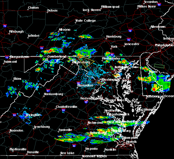 At 444 pm edt, a severe thunderstorm was located over paramount- long meadow, or near hagerstown municipal stadium, moving southeast at 35 mph (radar indicated). Hazards include 60 mph wind gusts and quarter size hail. Damaging winds will cause some trees and large branches to fall. this could injure those outdoors, as well as damage homes and vehicles. roadways may become blocked by downed trees. localized power outages are possible. Unsecured light objects may become projectiles. At 444 pm edt, a severe thunderstorm was located over paramount- long meadow, or near hagerstown municipal stadium, moving southeast at 35 mph (radar indicated). Hazards include 60 mph wind gusts and quarter size hail. Damaging winds will cause some trees and large branches to fall. this could injure those outdoors, as well as damage homes and vehicles. roadways may become blocked by downed trees. localized power outages are possible. Unsecured light objects may become projectiles.
|
| 6/19/2017 1:16 PM EDT |
 At 115 pm edt, a severe thunderstorm was located near thurmont, moving east at 55 mph (radar indicated). Hazards include 60 mph wind gusts. Damaging winds will cause some trees and large branches to fall. this could injure those outdoors, as well as damage homes and vehicles. roadways may become blocked by downed trees. localized power outages are possible. unsecured light objects may become projectiles. Locations impacted include, hagerstown, thurmont, emmitsburg, shepherdstown, municipal stadium, robinwood, fountainhead-orchard hills, boonsboro, smithsburg, paramount-long meadow, mount aetna, mount lena, san mar, wolfsville, saint james, halfway, myersville, cavetown, keedysville and funkstown. At 115 pm edt, a severe thunderstorm was located near thurmont, moving east at 55 mph (radar indicated). Hazards include 60 mph wind gusts. Damaging winds will cause some trees and large branches to fall. this could injure those outdoors, as well as damage homes and vehicles. roadways may become blocked by downed trees. localized power outages are possible. unsecured light objects may become projectiles. Locations impacted include, hagerstown, thurmont, emmitsburg, shepherdstown, municipal stadium, robinwood, fountainhead-orchard hills, boonsboro, smithsburg, paramount-long meadow, mount aetna, mount lena, san mar, wolfsville, saint james, halfway, myersville, cavetown, keedysville and funkstown.
|
| 6/19/2017 1:16 PM EDT |
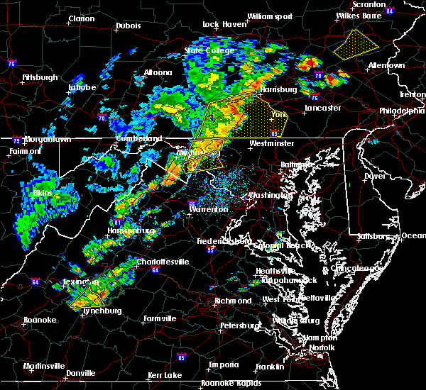 At 115 pm edt, a severe thunderstorm was located near thurmont, moving east at 55 mph (radar indicated). Hazards include 60 mph wind gusts. Damaging winds will cause some trees and large branches to fall. this could injure those outdoors, as well as damage homes and vehicles. roadways may become blocked by downed trees. localized power outages are possible. unsecured light objects may become projectiles. Locations impacted include, hagerstown, thurmont, emmitsburg, shepherdstown, municipal stadium, robinwood, fountainhead-orchard hills, boonsboro, smithsburg, paramount-long meadow, mount aetna, mount lena, san mar, wolfsville, saint james, halfway, myersville, cavetown, keedysville and funkstown. At 115 pm edt, a severe thunderstorm was located near thurmont, moving east at 55 mph (radar indicated). Hazards include 60 mph wind gusts. Damaging winds will cause some trees and large branches to fall. this could injure those outdoors, as well as damage homes and vehicles. roadways may become blocked by downed trees. localized power outages are possible. unsecured light objects may become projectiles. Locations impacted include, hagerstown, thurmont, emmitsburg, shepherdstown, municipal stadium, robinwood, fountainhead-orchard hills, boonsboro, smithsburg, paramount-long meadow, mount aetna, mount lena, san mar, wolfsville, saint james, halfway, myersville, cavetown, keedysville and funkstown.
|
| 6/19/2017 12:50 PM EDT |
 At 1250 pm edt, severe thunderstorms were located along a line extending from near shepherdstown to wilson-conococheague, moving northeast at 50 mph (radar indicated). Hazards include 60 mph wind gusts. Damaging winds will cause some trees and large branches to fall. this could injure those outdoors, as well as damage homes and vehicles. roadways may become blocked by downed trees. localized power outages are possible. Unsecured light objects may become projectiles. At 1250 pm edt, severe thunderstorms were located along a line extending from near shepherdstown to wilson-conococheague, moving northeast at 50 mph (radar indicated). Hazards include 60 mph wind gusts. Damaging winds will cause some trees and large branches to fall. this could injure those outdoors, as well as damage homes and vehicles. roadways may become blocked by downed trees. localized power outages are possible. Unsecured light objects may become projectiles.
|
| 3/1/2017 1:22 PM EST |
 The severe thunderstorm warning for eastern washington and western frederick counties in north central maryland, northern loudoun county in northern virginia and eastern jefferson counties in the panhandle of west virginia will expire at 130 pm est, the storms which prompted the warning have moved out of the area. therefore the warning will be allowed to expire. a severe thunderstorm watch remains in effect until 500 pm est for central and north central maryland, northern virginia, and the panhandle of west virginia. remember, a severe thunderstorm warning still remains in effect for portions of frederick and loudoun counties. The severe thunderstorm warning for eastern washington and western frederick counties in north central maryland, northern loudoun county in northern virginia and eastern jefferson counties in the panhandle of west virginia will expire at 130 pm est, the storms which prompted the warning have moved out of the area. therefore the warning will be allowed to expire. a severe thunderstorm watch remains in effect until 500 pm est for central and north central maryland, northern virginia, and the panhandle of west virginia. remember, a severe thunderstorm warning still remains in effect for portions of frederick and loudoun counties.
|
| 3/1/2017 1:10 PM EST |
 At 110 pm est, severe thunderstorms were located along a line extending from near paramount-long meadow to 6 miles northwest of delaplane, moving east at 50 mph (radar indicated). Hazards include 60 mph wind gusts. Damaging winds will cause some trees and large branches to fall. this could injure those outdoors, as well as damage homes and vehicles. roadways may become blocked by downed trees. localized power outages are possible. unsecured light objects may become projectiles. Locations impacted include, frederick, leesburg, hagerstown, lansdowne, thurmont, emmitsburg, municipal stadium, harry grove stadium, ballenger creek, purcellville, robinwood, brunswick, fountainhead-orchard hills, boonsboro, smithsburg, braddock heights, paramount-long meadow, mount aetna, round hill and mount lena. At 110 pm est, severe thunderstorms were located along a line extending from near paramount-long meadow to 6 miles northwest of delaplane, moving east at 50 mph (radar indicated). Hazards include 60 mph wind gusts. Damaging winds will cause some trees and large branches to fall. this could injure those outdoors, as well as damage homes and vehicles. roadways may become blocked by downed trees. localized power outages are possible. unsecured light objects may become projectiles. Locations impacted include, frederick, leesburg, hagerstown, lansdowne, thurmont, emmitsburg, municipal stadium, harry grove stadium, ballenger creek, purcellville, robinwood, brunswick, fountainhead-orchard hills, boonsboro, smithsburg, braddock heights, paramount-long meadow, mount aetna, round hill and mount lena.
|
| 3/1/2017 12:53 PM EST |
 At 1252 pm est, severe thunderstorms were located along a line extending from near claylick to near stephens city, moving east at 50 mph (radar indicated). Hazards include 60 mph wind gusts. Damaging winds will cause some trees and large branches to fall. this could injure those outdoors, as well as damage homes and vehicles. roadways may become blocked by downed trees. localized power outages are possible. unsecured light objects may become projectiles. Locations impacted include, frederick, leesburg, hagerstown, winchester, martinsburg, lansdowne, thurmont, charles town, emmitsburg, shepherdstown, municipal stadium, harry grove stadium, millwood pike, ballenger creek, purcellville, robinwood, brunswick, fountainhead-orchard hills, ranson and berryville. At 1252 pm est, severe thunderstorms were located along a line extending from near claylick to near stephens city, moving east at 50 mph (radar indicated). Hazards include 60 mph wind gusts. Damaging winds will cause some trees and large branches to fall. this could injure those outdoors, as well as damage homes and vehicles. roadways may become blocked by downed trees. localized power outages are possible. unsecured light objects may become projectiles. Locations impacted include, frederick, leesburg, hagerstown, winchester, martinsburg, lansdowne, thurmont, charles town, emmitsburg, shepherdstown, municipal stadium, harry grove stadium, millwood pike, ballenger creek, purcellville, robinwood, brunswick, fountainhead-orchard hills, ranson and berryville.
|
| 3/1/2017 12:42 PM EST |
 At 1241 pm est, severe thunderstorms were located along a line extending from 7 miles east of hancock to near strasburg, moving east at 50 mph (radar indicated). Hazards include 60 mph wind gusts. Damaging winds will cause some trees and large branches to fall. this could injure those outdoors, as well as damage homes and vehicles. roadways may become blocked by downed trees. localized power outages are possible. Unsecured light objects may become projectiles. At 1241 pm est, severe thunderstorms were located along a line extending from 7 miles east of hancock to near strasburg, moving east at 50 mph (radar indicated). Hazards include 60 mph wind gusts. Damaging winds will cause some trees and large branches to fall. this could injure those outdoors, as well as damage homes and vehicles. roadways may become blocked by downed trees. localized power outages are possible. Unsecured light objects may become projectiles.
|
| 2/12/2017 10:40 PM EST |
 The severe thunderstorm warning for eastern washington county in north central maryland, northwestern montgomery county in central maryland, frederick and northwestern carroll counties in north central maryland, northern loudoun county in northern virginia, northeastern shenandoah and frederick counties in northwestern virginia, northwestern fauquier county in northern virginia, northern warren and clarke counties in northwestern virginia, jefferson county in the panhandle of west virginia, northeastern hardy county in eastern west virginia, southern berkeley county in the panhandle of west virginia and southern hampshire counties in eastern west virginia and the city of winchester will expire at 1045 pm est, the storms which prompted the warning have moved out of the area. therefore the warning will be allowed to expire. to report severe weather, contact your nearest law enforcement agency. they will relay your report to the national weather service sterling virginia. The severe thunderstorm warning for eastern washington county in north central maryland, northwestern montgomery county in central maryland, frederick and northwestern carroll counties in north central maryland, northern loudoun county in northern virginia, northeastern shenandoah and frederick counties in northwestern virginia, northwestern fauquier county in northern virginia, northern warren and clarke counties in northwestern virginia, jefferson county in the panhandle of west virginia, northeastern hardy county in eastern west virginia, southern berkeley county in the panhandle of west virginia and southern hampshire counties in eastern west virginia and the city of winchester will expire at 1045 pm est, the storms which prompted the warning have moved out of the area. therefore the warning will be allowed to expire. to report severe weather, contact your nearest law enforcement agency. they will relay your report to the national weather service sterling virginia.
|
| 2/12/2017 10:22 PM EST |
 At 1020 pm est, severe thunderstorms were located along a line extending from near taneytown to near corporation of ranson to wardensville, moving southeast at 50 mph (radar indicated). Hazards include 60 mph wind gusts. Damaging winds will cause some trees and large branches to fall. this could injure those outdoors, as well as damage homes and vehicles. roadways may become blocked by downed trees. localized power outages are possible. unsecured light objects may become projectiles. locations impacted include, frederick, leesburg, hagerstown, winchester, westminster, martinsburg, lansdowne, strasburg, thurmont, charles town, poolesville, emmitsburg, shepherdstown, harry grove stadium, millwood pike, ballenger creek, mount airy, purcellville, robinwood and taneytown. There have been numerous reports of downed trees across berkeley county. At 1020 pm est, severe thunderstorms were located along a line extending from near taneytown to near corporation of ranson to wardensville, moving southeast at 50 mph (radar indicated). Hazards include 60 mph wind gusts. Damaging winds will cause some trees and large branches to fall. this could injure those outdoors, as well as damage homes and vehicles. roadways may become blocked by downed trees. localized power outages are possible. unsecured light objects may become projectiles. locations impacted include, frederick, leesburg, hagerstown, winchester, westminster, martinsburg, lansdowne, strasburg, thurmont, charles town, poolesville, emmitsburg, shepherdstown, harry grove stadium, millwood pike, ballenger creek, mount airy, purcellville, robinwood and taneytown. There have been numerous reports of downed trees across berkeley county.
|
| 2/12/2017 10:09 PM EST |
 The severe thunderstorm warning for washington and northwestern carroll counties in north central maryland, southern allegany county in western maryland, northwestern frederick county in north central maryland, north central frederick county in northwestern virginia, north central jefferson and morgan counties in the panhandle of west virginia, east central mineral county in eastern west virginia, berkeley county in the panhandle of west virginia and northeastern hampshire counties in eastern west virginia will expire at 1015 pm est, the storms which prompted the warning have moved out of the area. therefore the warning will be allowed to expire. to report severe weather, contact your nearest law enforcement agency. they will relay your report to the national weather service sterling virginia. The severe thunderstorm warning for washington and northwestern carroll counties in north central maryland, southern allegany county in western maryland, northwestern frederick county in north central maryland, north central frederick county in northwestern virginia, north central jefferson and morgan counties in the panhandle of west virginia, east central mineral county in eastern west virginia, berkeley county in the panhandle of west virginia and northeastern hampshire counties in eastern west virginia will expire at 1015 pm est, the storms which prompted the warning have moved out of the area. therefore the warning will be allowed to expire. to report severe weather, contact your nearest law enforcement agency. they will relay your report to the national weather service sterling virginia.
|
| 2/12/2017 10:01 PM EST |
 At 1001 pm est, severe thunderstorms were located along a line extending from hagerstown to near inwood to 6 miles south of romney, moving southeast at 45 mph (radar indicated). Hazards include 60 mph wind gusts. Damaging winds will cause some trees and large branches to fall. this could injure those outdoors, as well as damage homes and vehicles. roadways may become blocked by downed trees. localized power outages are possible. Unsecured light objects may become projectiles. At 1001 pm est, severe thunderstorms were located along a line extending from hagerstown to near inwood to 6 miles south of romney, moving southeast at 45 mph (radar indicated). Hazards include 60 mph wind gusts. Damaging winds will cause some trees and large branches to fall. this could injure those outdoors, as well as damage homes and vehicles. roadways may become blocked by downed trees. localized power outages are possible. Unsecured light objects may become projectiles.
|
| 2/12/2017 9:56 PM EST | Storm damage reported in washington county MD, 5.1 miles S of Hagerstown, MD |
| 2/12/2017 9:55 PM EST |
 At 955 pm est, severe thunderstorms were located along a line extending from near dillsburg to near williamsport to 12 miles east of romney, moving east at 60 mph (radar indicated). Hazards include 60 mph wind gusts. Damaging winds will cause some trees and large branches to fall. this could injure those outdoors, as well as damage homes and vehicles. roadways may become blocked by downed trees. localized power outages are possible. unsecured light objects may become projectiles. Locations impacted include, hagerstown, martinsburg, thurmont, keyser, emmitsburg, shepherdstown, paw paw, municipal stadium, greenwood, robinwood, taneytown, fountainhead-orchard hills, boonsboro, smithsburg, paramount-long meadow, wilson-conococheague, williamsport, fort ashby, berkeley springs and mount aetna. At 955 pm est, severe thunderstorms were located along a line extending from near dillsburg to near williamsport to 12 miles east of romney, moving east at 60 mph (radar indicated). Hazards include 60 mph wind gusts. Damaging winds will cause some trees and large branches to fall. this could injure those outdoors, as well as damage homes and vehicles. roadways may become blocked by downed trees. localized power outages are possible. unsecured light objects may become projectiles. Locations impacted include, hagerstown, martinsburg, thurmont, keyser, emmitsburg, shepherdstown, paw paw, municipal stadium, greenwood, robinwood, taneytown, fountainhead-orchard hills, boonsboro, smithsburg, paramount-long meadow, wilson-conococheague, williamsport, fort ashby, berkeley springs and mount aetna.
|
| 2/12/2017 9:32 PM EST |
 At 931 pm est, severe thunderstorms were located along a line extending from 6 miles west of newville to hancock to near westernport, moving east at 45 mph (radar indicated). Hazards include 60 mph wind gusts. Damaging winds will cause some trees and large branches to fall. this could injure those outdoors, as well as damage homes and vehicles. roadways may become blocked by downed trees. localized power outages are possible. Unsecured light objects may become projectiles. At 931 pm est, severe thunderstorms were located along a line extending from 6 miles west of newville to hancock to near westernport, moving east at 45 mph (radar indicated). Hazards include 60 mph wind gusts. Damaging winds will cause some trees and large branches to fall. this could injure those outdoors, as well as damage homes and vehicles. roadways may become blocked by downed trees. localized power outages are possible. Unsecured light objects may become projectiles.
|
| 8/16/2016 2:54 PM EDT |
 At 254 pm edt, a severe thunderstorm was located over mount lena, or 8 miles southeast of municipal stadium, moving east at 25 mph (radar indicated). Hazards include 60 mph wind gusts and quarter size hail. Damaging winds will cause some trees and large branches to fall. this could injure those outdoors, as well as damage homes and vehicles. roadways may become blocked by downed trees. localized power outages are possible. unsecured light objects may become projectiles. Locations impacted include, frederick, hagerstown, thurmont, shepherdstown, robinwood, boonsboro, smithsburg, braddock heights, mount aetna, mount lena, san mar, clover hill, wolfsville, saint james, myersville, cavetown, keedysville, funkstown, sharpsburg and fairplay. At 254 pm edt, a severe thunderstorm was located over mount lena, or 8 miles southeast of municipal stadium, moving east at 25 mph (radar indicated). Hazards include 60 mph wind gusts and quarter size hail. Damaging winds will cause some trees and large branches to fall. this could injure those outdoors, as well as damage homes and vehicles. roadways may become blocked by downed trees. localized power outages are possible. unsecured light objects may become projectiles. Locations impacted include, frederick, hagerstown, thurmont, shepherdstown, robinwood, boonsboro, smithsburg, braddock heights, mount aetna, mount lena, san mar, clover hill, wolfsville, saint james, myersville, cavetown, keedysville, funkstown, sharpsburg and fairplay.
|
| 8/16/2016 2:54 PM EDT |
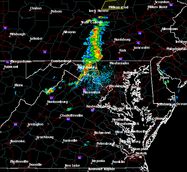 At 254 pm edt, a severe thunderstorm was located over mount lena, or 8 miles southeast of municipal stadium, moving east at 25 mph (radar indicated). Hazards include 60 mph wind gusts and quarter size hail. Damaging winds will cause some trees and large branches to fall. this could injure those outdoors, as well as damage homes and vehicles. roadways may become blocked by downed trees. localized power outages are possible. unsecured light objects may become projectiles. Locations impacted include, frederick, hagerstown, thurmont, shepherdstown, robinwood, boonsboro, smithsburg, braddock heights, mount aetna, mount lena, san mar, clover hill, wolfsville, saint james, myersville, cavetown, keedysville, funkstown, sharpsburg and fairplay. At 254 pm edt, a severe thunderstorm was located over mount lena, or 8 miles southeast of municipal stadium, moving east at 25 mph (radar indicated). Hazards include 60 mph wind gusts and quarter size hail. Damaging winds will cause some trees and large branches to fall. this could injure those outdoors, as well as damage homes and vehicles. roadways may become blocked by downed trees. localized power outages are possible. unsecured light objects may become projectiles. Locations impacted include, frederick, hagerstown, thurmont, shepherdstown, robinwood, boonsboro, smithsburg, braddock heights, mount aetna, mount lena, san mar, clover hill, wolfsville, saint james, myersville, cavetown, keedysville, funkstown, sharpsburg and fairplay.
|
| 8/16/2016 2:28 PM EDT |
 At 228 pm edt, a severe thunderstorm was located near saint james, or 7 miles southwest of municipal stadium, moving east at 25 mph (radar indicated). Hazards include 60 mph wind gusts and quarter size hail. Damaging winds will cause some trees and large branches to fall. this could injure those outdoors, as well as damage homes and vehicles. roadways may become blocked by downed trees. localized power outages are possible. Unsecured light objects may become projectiles. At 228 pm edt, a severe thunderstorm was located near saint james, or 7 miles southwest of municipal stadium, moving east at 25 mph (radar indicated). Hazards include 60 mph wind gusts and quarter size hail. Damaging winds will cause some trees and large branches to fall. this could injure those outdoors, as well as damage homes and vehicles. roadways may become blocked by downed trees. localized power outages are possible. Unsecured light objects may become projectiles.
|
| 8/16/2016 2:28 PM EDT |
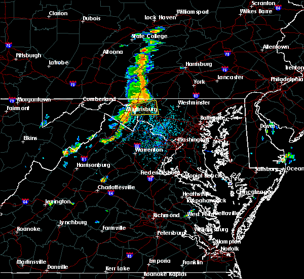 At 228 pm edt, a severe thunderstorm was located near saint james, or 7 miles southwest of municipal stadium, moving east at 25 mph (radar indicated). Hazards include 60 mph wind gusts and quarter size hail. Damaging winds will cause some trees and large branches to fall. this could injure those outdoors, as well as damage homes and vehicles. roadways may become blocked by downed trees. localized power outages are possible. Unsecured light objects may become projectiles. At 228 pm edt, a severe thunderstorm was located near saint james, or 7 miles southwest of municipal stadium, moving east at 25 mph (radar indicated). Hazards include 60 mph wind gusts and quarter size hail. Damaging winds will cause some trees and large branches to fall. this could injure those outdoors, as well as damage homes and vehicles. roadways may become blocked by downed trees. localized power outages are possible. Unsecured light objects may become projectiles.
|
| 8/13/2016 8:06 PM EDT | Tree on vehicle on east antietam st in washington county MD, 0.2 miles SSE of Hagerstown, MD |
| 8/13/2016 7:57 PM EDT | Tree down just nw of maugansville in washington county MD, 4.9 miles SSE of Hagerstown, MD |
| 7/30/2016 4:11 PM EDT |
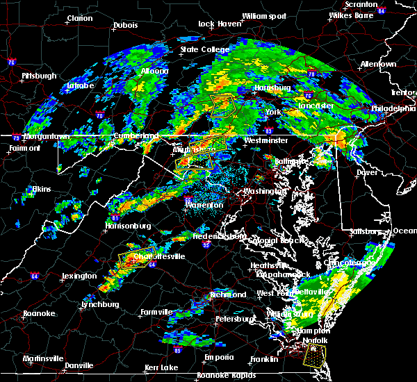 At 410 pm edt, a severe thunderstorm was located over san mar, or 7 miles southeast of municipal stadium, moving east at 20 mph (radar indicated). Hazards include 60 mph wind gusts and quarter size hail. Damaging winds will cause some trees and large branches to fall. this could injure those outdoors, as well as damage homes and vehicles. roadways may become blocked by downed trees. localized power outages are possible. Unsecured light objects may become projectiles. At 410 pm edt, a severe thunderstorm was located over san mar, or 7 miles southeast of municipal stadium, moving east at 20 mph (radar indicated). Hazards include 60 mph wind gusts and quarter size hail. Damaging winds will cause some trees and large branches to fall. this could injure those outdoors, as well as damage homes and vehicles. roadways may become blocked by downed trees. localized power outages are possible. Unsecured light objects may become projectiles.
|
| 6/21/2016 7:51 PM EDT |
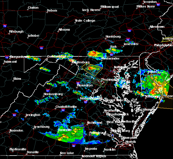 At 750 pm edt, a severe thunderstorm was located 7 miles west of williamsport, or 8 miles north of martinsburg, moving east at 30 mph (radar indicated). Hazards include 60 mph wind gusts and quarter size hail. Damaging winds will cause some trees and large branches to fall. this could injure those outdoors, as well as damage homes and vehicles. roadways may become blocked by downed trees. localized power outages are possible. Unsecured light objects may become projectiles. At 750 pm edt, a severe thunderstorm was located 7 miles west of williamsport, or 8 miles north of martinsburg, moving east at 30 mph (radar indicated). Hazards include 60 mph wind gusts and quarter size hail. Damaging winds will cause some trees and large branches to fall. this could injure those outdoors, as well as damage homes and vehicles. roadways may become blocked by downed trees. localized power outages are possible. Unsecured light objects may become projectiles.
|
| 6/21/2016 7:06 PM EDT |
 The severe thunderstorm warning for eastern washington, northeastern jefferson and northeastern berkeley counties will expire at 715 pm edt, the storm which prompted the warning has weakened and exited the warned area. therefore the warning will be allowed to expire. a severe thunderstorm watch remains in effect until 900 pm edt for north central maryland, and central west virginia. The severe thunderstorm warning for eastern washington, northeastern jefferson and northeastern berkeley counties will expire at 715 pm edt, the storm which prompted the warning has weakened and exited the warned area. therefore the warning will be allowed to expire. a severe thunderstorm watch remains in effect until 900 pm edt for north central maryland, and central west virginia.
|
| 6/21/2016 7:06 PM EDT |
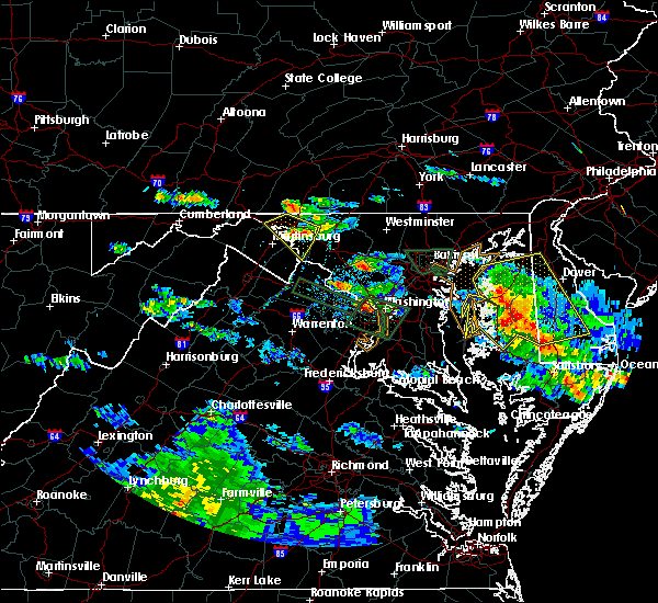 The severe thunderstorm warning for eastern washington, northeastern jefferson and northeastern berkeley counties will expire at 715 pm edt, the storm which prompted the warning has weakened and exited the warned area. therefore the warning will be allowed to expire. a severe thunderstorm watch remains in effect until 900 pm edt for north central maryland, and central west virginia. The severe thunderstorm warning for eastern washington, northeastern jefferson and northeastern berkeley counties will expire at 715 pm edt, the storm which prompted the warning has weakened and exited the warned area. therefore the warning will be allowed to expire. a severe thunderstorm watch remains in effect until 900 pm edt for north central maryland, and central west virginia.
|
| 6/21/2016 6:52 PM EDT |
 At 651 pm edt, a severe thunderstorm was located over williamsport, or 7 miles west of hagerstown, moving southeast at 25 mph (radar indicated). Hazards include 60 mph wind gusts and quarter size hail. Damaging winds will cause some trees and large branches to fall. this could injure those outdoors, as well as damage homes and vehicles. roadways may become blocked by downed trees. localized power outages are possible. unsecured light objects may become projectiles. Locations impacted include, hagerstown, shepherdstown, municipal stadium, robinwood, fountainhead-orchard hills, boonsboro, wilson-conococheague, williamsport, mount aetna, mount lena, san mar, saint james, halfway, maugansville, keedysville, funkstown, falling waters, sharpsburg, fairplay and clear spring. At 651 pm edt, a severe thunderstorm was located over williamsport, or 7 miles west of hagerstown, moving southeast at 25 mph (radar indicated). Hazards include 60 mph wind gusts and quarter size hail. Damaging winds will cause some trees and large branches to fall. this could injure those outdoors, as well as damage homes and vehicles. roadways may become blocked by downed trees. localized power outages are possible. unsecured light objects may become projectiles. Locations impacted include, hagerstown, shepherdstown, municipal stadium, robinwood, fountainhead-orchard hills, boonsboro, wilson-conococheague, williamsport, mount aetna, mount lena, san mar, saint james, halfway, maugansville, keedysville, funkstown, falling waters, sharpsburg, fairplay and clear spring.
|
| 6/21/2016 6:52 PM EDT |
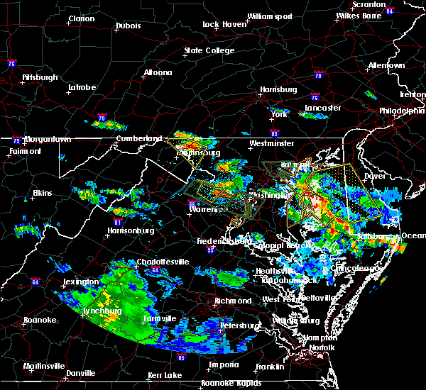 At 651 pm edt, a severe thunderstorm was located over williamsport, or 7 miles west of hagerstown, moving southeast at 25 mph (radar indicated). Hazards include 60 mph wind gusts and quarter size hail. Damaging winds will cause some trees and large branches to fall. this could injure those outdoors, as well as damage homes and vehicles. roadways may become blocked by downed trees. localized power outages are possible. unsecured light objects may become projectiles. Locations impacted include, hagerstown, shepherdstown, municipal stadium, robinwood, fountainhead-orchard hills, boonsboro, wilson-conococheague, williamsport, mount aetna, mount lena, san mar, saint james, halfway, maugansville, keedysville, funkstown, falling waters, sharpsburg, fairplay and clear spring. At 651 pm edt, a severe thunderstorm was located over williamsport, or 7 miles west of hagerstown, moving southeast at 25 mph (radar indicated). Hazards include 60 mph wind gusts and quarter size hail. Damaging winds will cause some trees and large branches to fall. this could injure those outdoors, as well as damage homes and vehicles. roadways may become blocked by downed trees. localized power outages are possible. unsecured light objects may become projectiles. Locations impacted include, hagerstown, shepherdstown, municipal stadium, robinwood, fountainhead-orchard hills, boonsboro, wilson-conococheague, williamsport, mount aetna, mount lena, san mar, saint james, halfway, maugansville, keedysville, funkstown, falling waters, sharpsburg, fairplay and clear spring.
|
| 6/21/2016 6:31 PM EDT |
 At 631 pm edt, a severe thunderstorm was located 8 miles southwest of claylick, or 9 miles east of hancock, moving southeast at 25 mph (radar indicated). Hazards include 60 mph wind gusts and quarter size hail. Damaging winds will cause some trees and large branches to fall. this could injure those outdoors, as well as damage homes and vehicles. roadways may become blocked by downed trees. localized power outages are possible. Unsecured light objects may become projectiles. At 631 pm edt, a severe thunderstorm was located 8 miles southwest of claylick, or 9 miles east of hancock, moving southeast at 25 mph (radar indicated). Hazards include 60 mph wind gusts and quarter size hail. Damaging winds will cause some trees and large branches to fall. this could injure those outdoors, as well as damage homes and vehicles. roadways may become blocked by downed trees. localized power outages are possible. Unsecured light objects may become projectiles.
|
| 6/21/2016 6:31 PM EDT |
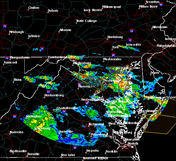 At 631 pm edt, a severe thunderstorm was located 8 miles southwest of claylick, or 9 miles east of hancock, moving southeast at 25 mph (radar indicated). Hazards include 60 mph wind gusts and quarter size hail. Damaging winds will cause some trees and large branches to fall. this could injure those outdoors, as well as damage homes and vehicles. roadways may become blocked by downed trees. localized power outages are possible. Unsecured light objects may become projectiles. At 631 pm edt, a severe thunderstorm was located 8 miles southwest of claylick, or 9 miles east of hancock, moving southeast at 25 mph (radar indicated). Hazards include 60 mph wind gusts and quarter size hail. Damaging winds will cause some trees and large branches to fall. this could injure those outdoors, as well as damage homes and vehicles. roadways may become blocked by downed trees. localized power outages are possible. Unsecured light objects may become projectiles.
|
| 6/21/2016 12:53 PM EDT |
 At 1253 pm edt, severe thunderstorms were located along a line extending from emmitsburg to near boonsboro, moving southeast at 30 mph (radar indicated). Hazards include 60 mph wind gusts. Damaging winds will cause some trees and large branches to fall. this could injure those outdoors, as well as damage homes and vehicles. roadways may become blocked by downed trees. localized power outages are possible. unsecured light objects may become projectiles. Locations impacted include, frederick, hagerstown, thurmont, emmitsburg, municipal stadium, robinwood, taneytown, walkersville, boonsboro, smithsburg, braddock heights, williamsport, mount aetna, mount lena, san mar, saint james, wolfsville, clover hill, halfway and myersville. At 1253 pm edt, severe thunderstorms were located along a line extending from emmitsburg to near boonsboro, moving southeast at 30 mph (radar indicated). Hazards include 60 mph wind gusts. Damaging winds will cause some trees and large branches to fall. this could injure those outdoors, as well as damage homes and vehicles. roadways may become blocked by downed trees. localized power outages are possible. unsecured light objects may become projectiles. Locations impacted include, frederick, hagerstown, thurmont, emmitsburg, municipal stadium, robinwood, taneytown, walkersville, boonsboro, smithsburg, braddock heights, williamsport, mount aetna, mount lena, san mar, saint james, wolfsville, clover hill, halfway and myersville.
|
| 6/21/2016 12:39 PM EDT |
 At 1238 pm edt, severe thunderstorms were located along a line extending from near carroll valley to williamsport, moving southeast at 30 mph (radar indicated). Hazards include 60 mph wind gusts. Damaging winds will cause some trees and large branches to fall. this could injure those outdoors, as well as damage homes and vehicles. roadways may become blocked by downed trees. localized power outages are possible. Unsecured light objects may become projectiles. At 1238 pm edt, severe thunderstorms were located along a line extending from near carroll valley to williamsport, moving southeast at 30 mph (radar indicated). Hazards include 60 mph wind gusts. Damaging winds will cause some trees and large branches to fall. this could injure those outdoors, as well as damage homes and vehicles. roadways may become blocked by downed trees. localized power outages are possible. Unsecured light objects may become projectiles.
|
| 6/21/2016 12:25 PM EDT |
 At 1225 pm edt, severe thunderstorms were located along a line extending from near mont alto to near hancock, moving southeast at 30 mph (radar indicated). Hazards include 60 mph wind gusts. Damaging winds will cause some trees and large branches to fall. this could injure those outdoors, as well as damage homes and vehicles. roadways may become blocked by downed trees. localized power outages are possible. unsecured light objects may become projectiles. Locations impacted include, hagerstown, thurmont, emmitsburg, municipal stadium, robinwood, fountainhead-orchard hills, smithsburg, paramount-long meadow, wilson-conococheague, williamsport, mount aetna, mount lena, san mar, long meadow, saint james, wolfsville, halfway, maugansville, cavetown and funkstown. At 1225 pm edt, severe thunderstorms were located along a line extending from near mont alto to near hancock, moving southeast at 30 mph (radar indicated). Hazards include 60 mph wind gusts. Damaging winds will cause some trees and large branches to fall. this could injure those outdoors, as well as damage homes and vehicles. roadways may become blocked by downed trees. localized power outages are possible. unsecured light objects may become projectiles. Locations impacted include, hagerstown, thurmont, emmitsburg, municipal stadium, robinwood, fountainhead-orchard hills, smithsburg, paramount-long meadow, wilson-conococheague, williamsport, mount aetna, mount lena, san mar, long meadow, saint james, wolfsville, halfway, maugansville, cavetown and funkstown.
|
| 6/21/2016 12:01 PM EDT |
 At 1201 pm edt, severe thunderstorms were located along a line extending from marion to warfordsburg, moving southeast at 25 mph (radar indicated). Hazards include 60 mph wind gusts. Damaging winds will cause some trees and large branches to fall. this could injure those outdoors, as well as damage homes and vehicles. roadways may become blocked by downed trees. localized power outages are possible. Unsecured light objects may become projectiles. At 1201 pm edt, severe thunderstorms were located along a line extending from marion to warfordsburg, moving southeast at 25 mph (radar indicated). Hazards include 60 mph wind gusts. Damaging winds will cause some trees and large branches to fall. this could injure those outdoors, as well as damage homes and vehicles. roadways may become blocked by downed trees. localized power outages are possible. Unsecured light objects may become projectiles.
|
| 6/5/2016 3:13 PM EDT |
 At 312 pm edt, severe thunderstorms were located along a line extending from near long meadow to boonsboro to ranson, moving east at 35 mph. numerous trees down have been reported in and around hagerstown (radar indicated). Hazards include 60 mph wind gusts. Damaging winds will cause some trees and large branches to fall. this could injure those outdoors, as well as damage homes and vehicles. roadways may become blocked by downed trees. localized power outages are possible. Unsecured light objects may become projectiles. At 312 pm edt, severe thunderstorms were located along a line extending from near long meadow to boonsboro to ranson, moving east at 35 mph. numerous trees down have been reported in and around hagerstown (radar indicated). Hazards include 60 mph wind gusts. Damaging winds will cause some trees and large branches to fall. this could injure those outdoors, as well as damage homes and vehicles. roadways may become blocked by downed trees. localized power outages are possible. Unsecured light objects may become projectiles.
|
| 6/5/2016 3:08 PM EDT |
 At 307 pm edt, severe thunderstorms were located along a line extending from near fountainhead-orchard hills to near shepherdstown to ranson, moving east at 35 mph. numerous trees down have been reported just south of hagerstown in washington county maryland (radar indicated). Hazards include 60 mph wind gusts. Damaging winds will cause some trees and large branches to fall. this could injure those outdoors, as well as damage homes and vehicles. roadways may become blocked by downed trees. localized power outages are possible. unsecured light objects may become projectiles. Locations impacted include, frederick, hagerstown, thurmont, charles town, emmitsburg, shepherdstown, harry grove stadium, municipal stadium, ballenger creek, robinwood, brunswick, walkersville, fountainhead-orchard hills, ranson, boonsboro, smithsburg, braddock heights, paramount-long meadow, wilson-conococheague and williamsport. At 307 pm edt, severe thunderstorms were located along a line extending from near fountainhead-orchard hills to near shepherdstown to ranson, moving east at 35 mph. numerous trees down have been reported just south of hagerstown in washington county maryland (radar indicated). Hazards include 60 mph wind gusts. Damaging winds will cause some trees and large branches to fall. this could injure those outdoors, as well as damage homes and vehicles. roadways may become blocked by downed trees. localized power outages are possible. unsecured light objects may become projectiles. Locations impacted include, frederick, hagerstown, thurmont, charles town, emmitsburg, shepherdstown, harry grove stadium, municipal stadium, ballenger creek, robinwood, brunswick, walkersville, fountainhead-orchard hills, ranson, boonsboro, smithsburg, braddock heights, paramount-long meadow, wilson-conococheague and williamsport.
|
| 6/5/2016 2:59 PM EDT | Multiple and wires down in the hagerstown are in washington county MD, 1.1 miles SE of Hagerstown, MD |
| 6/5/2016 2:40 PM EDT |
 At 240 pm edt, severe thunderstorms were located along a line extending from 6 miles southwest of claylick to near martinsburg to near inwood, moving east at 35 mph (radar indicated). Hazards include 60 mph wind gusts. Damaging winds will cause some trees and large branches to fall. this could injure those outdoors, as well as damage homes and vehicles. roadways may become blocked by downed trees. localized power outages are possible. Unsecured light objects may become projectiles. At 240 pm edt, severe thunderstorms were located along a line extending from 6 miles southwest of claylick to near martinsburg to near inwood, moving east at 35 mph (radar indicated). Hazards include 60 mph wind gusts. Damaging winds will cause some trees and large branches to fall. this could injure those outdoors, as well as damage homes and vehicles. roadways may become blocked by downed trees. localized power outages are possible. Unsecured light objects may become projectiles.
|
| 8/4/2015 2:30 AM EDT | Quarter sized hail reported 5.7 miles S of Hagerstown, MD |
| 8/4/2015 2:27 AM EDT |
 At 227 am edt, doppler radar indicated a severe thunderstorm capable of producing quarter size hail and damaging winds in excess of 60 mph. this storm was located over fountainhead-orchard hills, or near hagerstown, moving east at 45 mph. locations impacted include, hagerstown, thurmont, emmitsburg, smithsburg, long meadow, fountainhead-orchard hills, paramount-long meadow, wilson-conococheague, robinwood, maugansville, highfield, fort ritchie, rocky ridge, warrenton, graceham, leitersburg, cavetown, bridgeport, cascade and sabillasville. At 227 am edt, doppler radar indicated a severe thunderstorm capable of producing quarter size hail and damaging winds in excess of 60 mph. this storm was located over fountainhead-orchard hills, or near hagerstown, moving east at 45 mph. locations impacted include, hagerstown, thurmont, emmitsburg, smithsburg, long meadow, fountainhead-orchard hills, paramount-long meadow, wilson-conococheague, robinwood, maugansville, highfield, fort ritchie, rocky ridge, warrenton, graceham, leitersburg, cavetown, bridgeport, cascade and sabillasville.
|
| 8/4/2015 2:13 AM EDT |
 At 213 am edt, doppler radar indicated a severe thunderstorm capable of producing quarter size hail and damaging winds in excess of 60 mph. this storm was located near claylick, or 12 miles east of hancock, and moving east at 45 mph. At 213 am edt, doppler radar indicated a severe thunderstorm capable of producing quarter size hail and damaging winds in excess of 60 mph. this storm was located near claylick, or 12 miles east of hancock, and moving east at 45 mph.
|
| 8/4/2015 2:01 AM EDT |
 At 200 am edt, doppler radar indicated a severe thunderstorm capable of producing quarter size hail and damaging winds in excess of 60 mph. this storm was located over hancock, moving east at 30 mph. locations impacted include, hagerstown, hancock, wilson-conococheague, clear spring, sleepy creek, pecktonville, warrenton and halfway. At 200 am edt, doppler radar indicated a severe thunderstorm capable of producing quarter size hail and damaging winds in excess of 60 mph. this storm was located over hancock, moving east at 30 mph. locations impacted include, hagerstown, hancock, wilson-conococheague, clear spring, sleepy creek, pecktonville, warrenton and halfway.
|
| 8/4/2015 1:52 AM EDT |
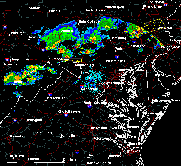 At 152 am edt, doppler radar indicated a severe thunderstorm capable of producing quarter size hail and damaging winds in excess of 60 mph. this storm was located over hancock, and moving east at 50 mph. At 152 am edt, doppler radar indicated a severe thunderstorm capable of producing quarter size hail and damaging winds in excess of 60 mph. this storm was located over hancock, and moving east at 50 mph.
|
| 6/20/2015 7:40 PM EDT |
 At 740 pm edt, doppler radar indicated a line of severe thunderstorms capable of producing damaging winds in excess of 60 mph. these storms were located along a line extending from near paramount-long meadow to near brambleton, and moving east at 35 mph. At 740 pm edt, doppler radar indicated a line of severe thunderstorms capable of producing damaging winds in excess of 60 mph. these storms were located along a line extending from near paramount-long meadow to near brambleton, and moving east at 35 mph.
|
| 6/15/2015 1:46 AM EDT |
 At 146 am edt, doppler radar indicated a line of severe thunderstorms capable of producing damaging winds in excess of 60 mph. these storms were located along a line extending from wayne heights to smithsburg to mount aetna, moving southeast at 35 mph. locations impacted include, hagerstown, municipal stadium, smithsburg, long meadow, wolfsville, mount lena, fountainhead-orchard hills, robinwood, paramount-long meadow, mount aetna, san mar, saint james, funkstown, pleasant walk, maugansville, highfield, fort ritchie, leitersburg, cavetown and bridgeport. At 146 am edt, doppler radar indicated a line of severe thunderstorms capable of producing damaging winds in excess of 60 mph. these storms were located along a line extending from wayne heights to smithsburg to mount aetna, moving southeast at 35 mph. locations impacted include, hagerstown, municipal stadium, smithsburg, long meadow, wolfsville, mount lena, fountainhead-orchard hills, robinwood, paramount-long meadow, mount aetna, san mar, saint james, funkstown, pleasant walk, maugansville, highfield, fort ritchie, leitersburg, cavetown and bridgeport.
|
| 6/15/2015 1:27 AM EDT |
 At 127 am edt, doppler radar indicated a line of severe thunderstorms capable of producing damaging winds in excess of 60 mph. these storms were located along a line extending from near greencastle to near fountainhead-orchard hills to near wilson-conococheague, and moving southeast at 35 mph. At 127 am edt, doppler radar indicated a line of severe thunderstorms capable of producing damaging winds in excess of 60 mph. these storms were located along a line extending from near greencastle to near fountainhead-orchard hills to near wilson-conococheague, and moving southeast at 35 mph.
|
| 6/8/2015 4:52 PM EDT | The severe thunderstorm warning for northwestern frederick and northeastern washington counties will expire at 500 pm edt, the storm which prompted the warning has moved out of the area. therefore the warning will be allowed to expire. |
| 6/8/2015 4:51 PM EDT | The severe thunderstorm warning for northeastern washington county will expire at 500 pm edt, the storm which prompted the warning has weakened below severe limits and exited the warned area. therefore the warning will be allowed to expire. |
| 6/8/2015 4:36 PM EDT |
 At 436 pm edt, doppler radar indicated a severe thunderstorm capable of producing destructive winds in excess of 70 mph. this storm was located over mount lena, or 7 miles southeast of municipal stadium, and moving northeast at 40 mph. At 436 pm edt, doppler radar indicated a severe thunderstorm capable of producing destructive winds in excess of 70 mph. this storm was located over mount lena, or 7 miles southeast of municipal stadium, and moving northeast at 40 mph.
|
| 6/8/2015 4:33 PM EDT |
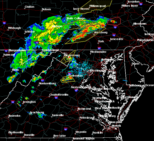 At 432 pm edt, doppler radar indicated a severe thunderstorm capable of producing half dollar size hail and damaging winds in excess of 60 mph. this storm was located over boonsboro, or 8 miles south of municipal stadium, moving northeast at 40 mph. locations impacted include, hagerstown, boonsboro, smithsburg, saint james, mount lena, robinwood, san mar, mount aetna, keedysville, funkstown, fairplay, cavetown, rohrersville, ringgold and chewsville. a tornado watch remains in effect until 800 pm edt for north central maryland. At 432 pm edt, doppler radar indicated a severe thunderstorm capable of producing half dollar size hail and damaging winds in excess of 60 mph. this storm was located over boonsboro, or 8 miles south of municipal stadium, moving northeast at 40 mph. locations impacted include, hagerstown, boonsboro, smithsburg, saint james, mount lena, robinwood, san mar, mount aetna, keedysville, funkstown, fairplay, cavetown, rohrersville, ringgold and chewsville. a tornado watch remains in effect until 800 pm edt for north central maryland.
|
| 6/8/2015 4:18 PM EDT |
 At 418 pm edt, doppler radar indicated a severe thunderstorm capable of producing quarter size hail and damaging winds in excess of 60 mph. this storm was located over kearneysville, or near shepherdstown, and moving northeast at 30 mph. At 418 pm edt, doppler radar indicated a severe thunderstorm capable of producing quarter size hail and damaging winds in excess of 60 mph. this storm was located over kearneysville, or near shepherdstown, and moving northeast at 30 mph.
|
| 5/27/2015 12:55 PM EDT | At 1254 pm edt, doppler radar indicated a severe thunderstorm capable of producing quarter size hail and damaging winds in excess of 60 mph. this storm was located over smithsburg, or near waynesboro, moving northeast at 20 mph. locations impacted include, hagerstown, emmitsburg, smithsburg, long meadow, fountainhead-orchard hills, robinwood, paramount-long meadow, mount aetna, highfield, fort ritchie, leitersburg, cavetown, bridgeport, cascade, sabillasville, ringgold, chewsville and maugansville. |
| 5/27/2015 12:50 PM EDT | At 1249 pm edt, doppler radar indicated a severe thunderstorm capable of producing damaging winds in excess of 60 mph. this storm was located over robinwood, or near municipal stadium, and moving northeast at 20 mph. |
| 5/16/2015 4:23 PM EDT | At 423 pm edt, doppler radar indicated a line of severe thunderstorms capable of producing damaging winds in excess of 60 mph. these storms were located along a line extending from hagerstown to near saint james to near shepherdstown, moving east at 30 mph. locations impacted include, frederick, hagerstown, thurmont, municipal stadium, boonsboro, williamsport, long meadow, mount lena, fountainhead-orchard hills, san mar, mount aetna, clover hill, saint james, wolfsville, braddock heights, robinwood, paramount-long meadow, smithsburg, myersville and keedysville. |
| 5/16/2015 4:23 PM EDT | At 423 pm edt, doppler radar indicated a line of severe thunderstorms capable of producing damaging winds in excess of 60 mph. these storms were located along a line extending from hagerstown to near saint james to near shepherdstown, moving east at 30 mph. locations impacted include, frederick, hagerstown, thurmont, municipal stadium, boonsboro, williamsport, long meadow, mount lena, fountainhead-orchard hills, san mar, mount aetna, clover hill, saint james, wolfsville, braddock heights, robinwood, paramount-long meadow, smithsburg, myersville and keedysville. |
| 5/16/2015 4:08 PM EDT | At 408 pm edt, doppler radar indicated a line of severe thunderstorms capable of producing damaging winds in excess of 60 mph. these storms were located along a line extending from near wilson-conococheague to williamsport to near shepherdstown, and moving east at 30 mph. |
| 5/16/2015 4:08 PM EDT | At 408 pm edt, doppler radar indicated a line of severe thunderstorms capable of producing damaging winds in excess of 60 mph. these storms were located along a line extending from near wilson-conococheague to williamsport to near shepherdstown, and moving east at 30 mph. |
| 4/20/2015 8:36 PM EDT | At 835 pm edt, doppler radar indicated a line of severe thunderstorms capable of producing damaging winds in excess of 60 mph. these storms were located along a line extending from near sleepy creek to near claylick to near wilson-conococheague, moving northeast at 30 mph. locations impacted include, hagerstown, municipal stadium, fountainhead-orchard hills, wilson-conococheague, long meadow, paramount-long meadow, clear spring, maugansville, leitersburg, warrenton in washington county, big spring, chewsville and halfway in washington county. a tornado watch remains in effect until 1000 pm edt for north central maryland. |
| 4/20/2015 8:24 PM EDT | At 824 pm edt, doppler radar indicated a line of severe thunderstorms capable of producing damaging winds in excess of 60 mph. these storms were located along a line extending from near warfordsburg to near sleepy creek to 6 miles southeast of spruce pine hollow, and moving northeast at 25 mph. |
| 4/20/2015 8:24 PM EDT | At 824 pm edt, doppler radar indicated a line of severe thunderstorms capable of producing damaging winds in excess of 60 mph. these storms were located along a line extending from near warfordsburg to near sleepy creek to 6 miles southeast of spruce pine hollow, and moving northeast at 25 mph. |
| 9/2/2014 5:00 PM EDT | Large tree down blocking road in washington county MD, 1 miles WSW of Hagerstown, MD |
| 7/8/2014 6:03 PM EDT | Four trees down on interval roa in washington county MD, 1 miles WSW of Hagerstown, MD |
| 7/8/2014 6:00 PM EDT | Multiple trees snapped and down on cars in the 700 and 800 blocks of interval rd in washington county MD, 1 miles WSW of Hagerstown, MD |
| 7/1/2014 7:10 PM EDT | Large tree branch down over the terrace in washington county MD, 1.6 miles SSW of Hagerstown, MD |
| 7/1/2014 6:37 PM EDT | Power line down in washington county MD, 1.9 miles SSW of Hagerstown, MD |
| 6/16/2014 6:08 PM EDT | Quarter sized hail reported 6.3 miles WNW of Hagerstown, MD, quarter size hail reported |
| 5/22/2014 3:24 PM EDT | Quarter sized hail reported 5.3 miles WNW of Hagerstown, MD, penny to quarter size hail reported in mount aetna. |
| 5/22/2014 3:16 PM EDT | Quarter sized hail reported 1.6 miles SSW of Hagerstown, MD |
| 5/22/2014 3:16 PM EDT | Trees down near north hagerstown high schoo in washington county MD, 1.6 miles SSW of Hagerstown, MD |
| 5/22/2014 3:12 PM EDT | A tree was reported down on interstate 81 at mile marker in washington county MD, 1.9 miles ESE of Hagerstown, MD |
| 7/19/2013 6:50 PM EDT | Trees down on 1200 block pennsylvania ave in washington county MD, 1 miles WSW of Hagerstown, MD |
| 7/19/2013 6:47 PM EDT | Tree down at walmart off garland groh blvd in washington county MD, 1 miles WSW of Hagerstown, MD |
| 6/25/2013 9:17 PM EDT | 1 tree down in the city. multiple wires dow in washington county MD, 0.2 miles SSE of Hagerstown, MD |
| 9/8/2012 12:46 PM EDT | Trees down on route 40 near interstate 7 in washington county MD, 3.2 miles NW of Hagerstown, MD |
| 8/10/2012 5:35 PM EDT | Multiple trees down in hagerstown in washington county MD, 0.2 miles SSE of Hagerstown, MD |
| 6/1/2012 7:42 PM EDT | A tree was down in hagerstow in washington county MD, 0.2 miles SSE of Hagerstown, MD |
| 5/27/2012 7:55 PM EDT | About a dozen fallen tree reports across washington co in washington county MD, 0.2 miles SSE of Hagerstown, MD |
| 1/1/0001 12:00 AM | Tree down on national pike at beaver creek roa in washington county MD, 0.2 miles SSE of Hagerstown, MD |
| 1/1/0001 12:00 AM | Large branches and one tree down on dual highway rt 40 and eastern boulevard in washington county MD, 0.9 miles S of Hagerstown, MD |
| 1/1/0001 12:00 AM | Stadium lights tower blown over into hagerstown suns stadiu in washington county MD, 0.9 miles S of Hagerstown, MD |
| 1/1/0001 12:00 AM | Tree down on george stree in washington county MD, 1.1 miles SE of Hagerstown, MD |
Hail Maps for Hagerstown, MD


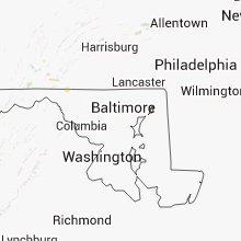


Connect with Interactive Hail Maps