

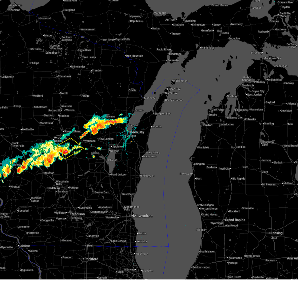
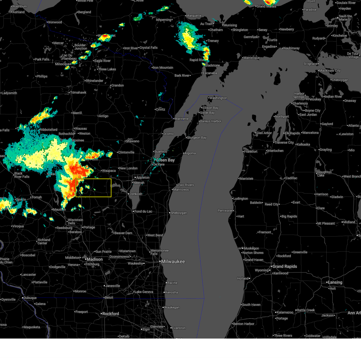
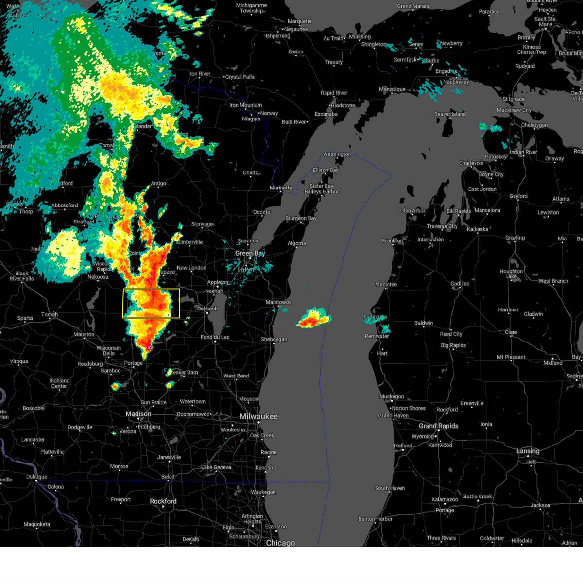
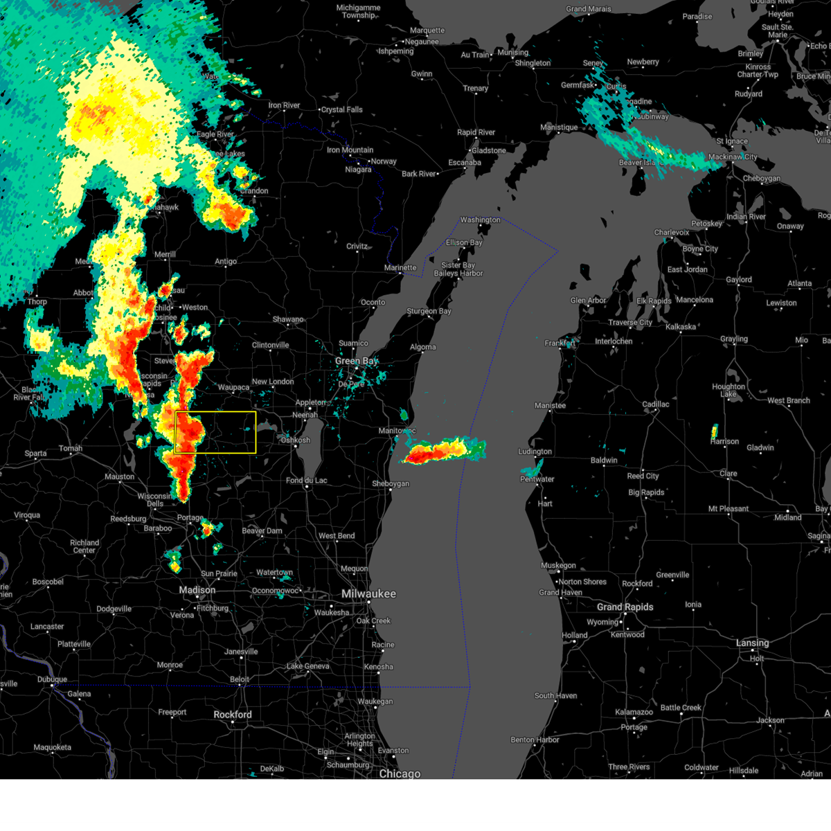
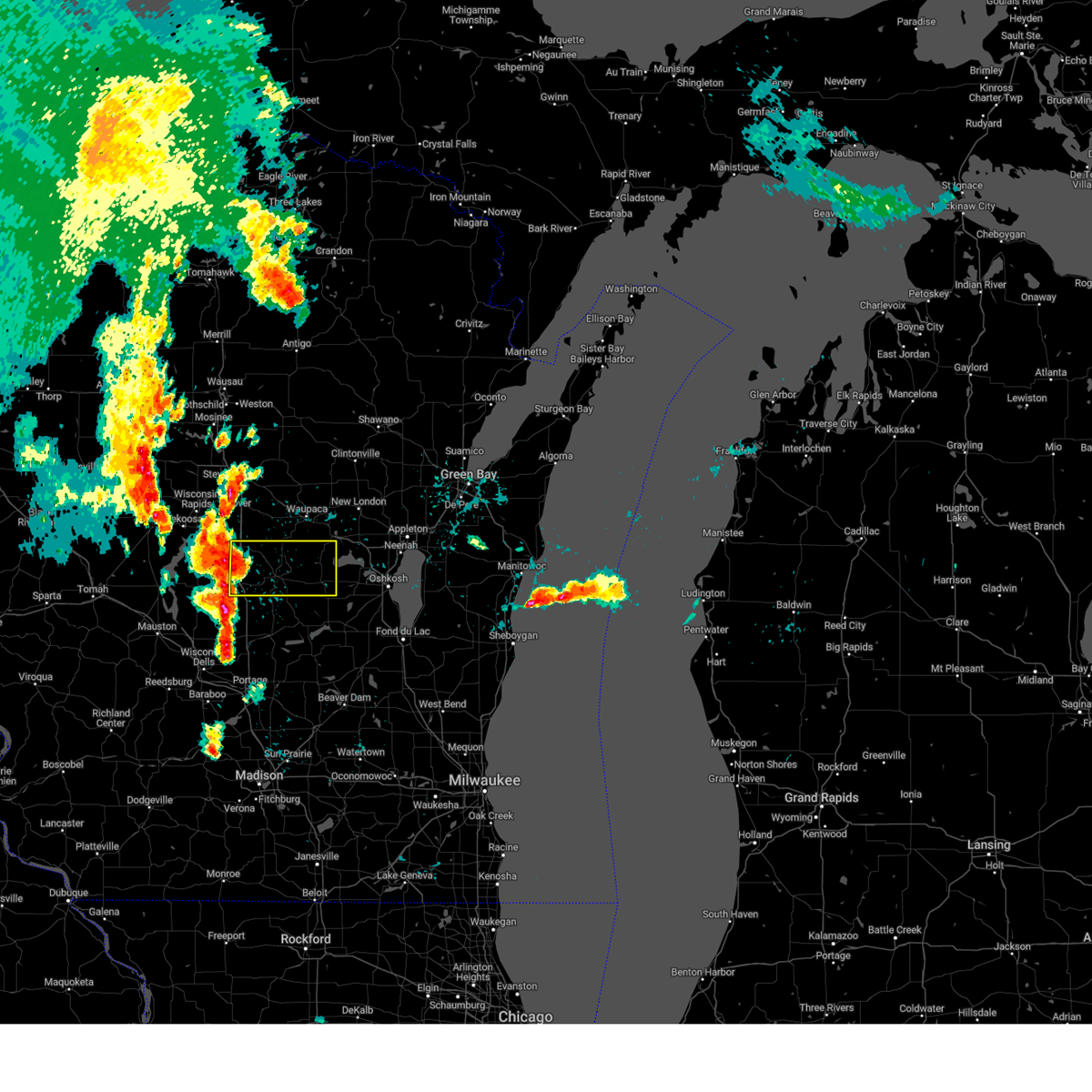
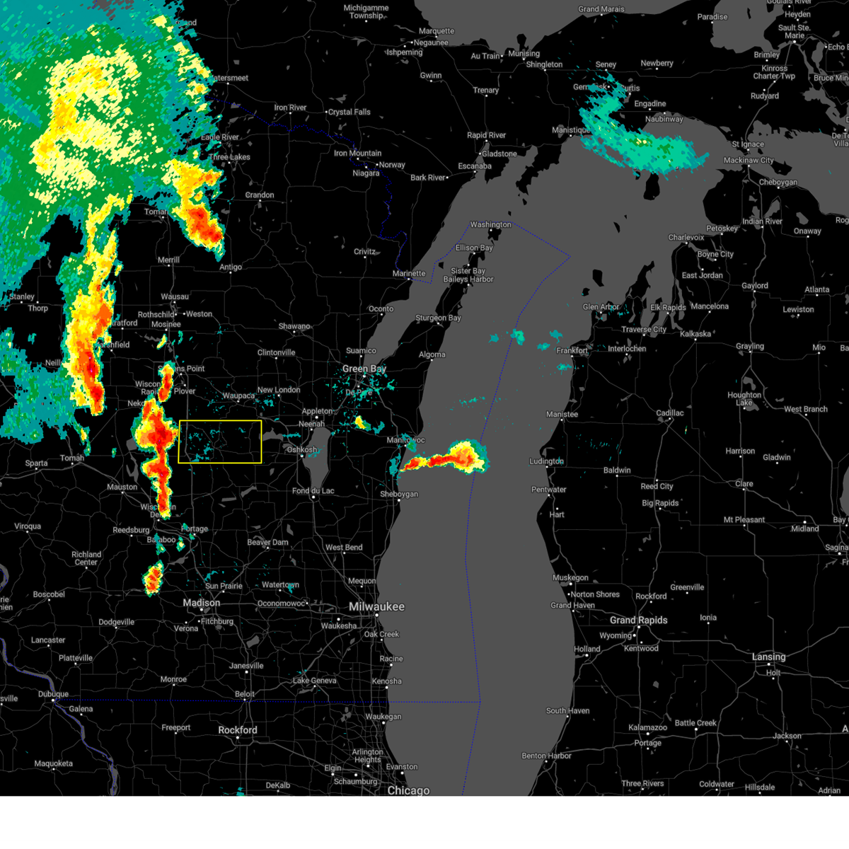
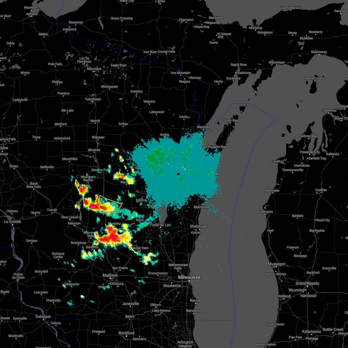
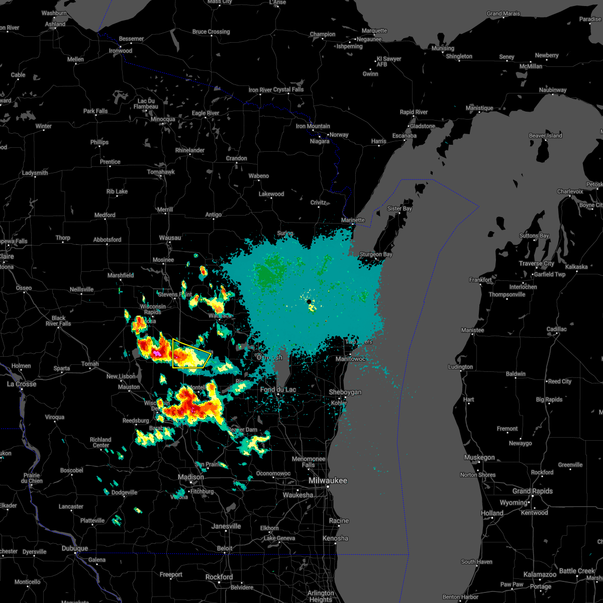
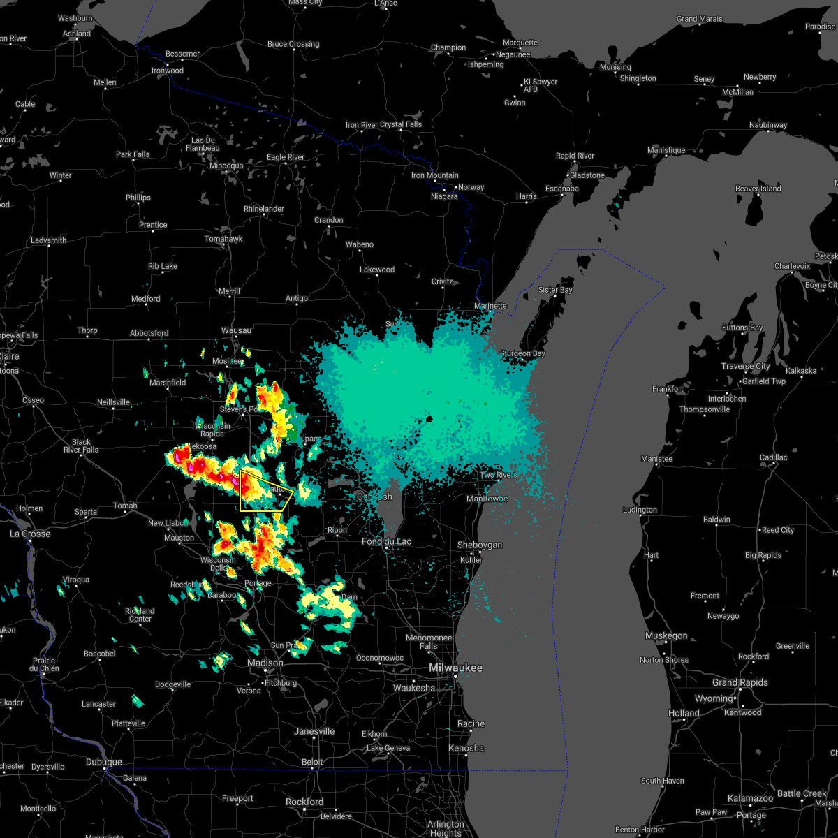
Hail Map for Hancock, WI
The Hancock, WI area has had 1 report of on-the-ground hail by trained spotters, and has been under severe weather warnings 10 times during the past 12 months. Doppler radar has detected hail at or near Hancock, WI on 48 occasions, including 4 occasions during the past year.
| Name: | Hancock, WI |
| Where Located: | 73.3 miles N of Madison, WI |
| Map: | Google Map for Hancock, WI |
| Population: | 417 |
| Housing Units: | 251 |
| More Info: | Search Google for Hancock, WI |
1
The Top Recent Hail Date for Hancock, WI is Tuesday, August 27, 2024 (16th out of 48)

Hail and Wind Damage Spotted near Hancock, WI
| Date / Time | Report Details |
|---|---|
| 6/29/2025 2:21 PM CDT |
 Svrgrb the national weather service in green bay has issued a * severe thunderstorm warning for, southeastern portage county in central wisconsin, northwestern waushara county in central wisconsin, * until 300 pm cdt. * at 221 pm cdt, a severe thunderstorm was located over plainfield, or 12 miles northwest of wautoma, moving east at 20 mph (radar indicated). Hazards include 60 mph wind gusts and half dollar size hail. Hail damage to vehicles is expected. expect wind damage to roofs, siding, and trees. this severe thunderstorm will be near, plainfield around 225 pm cdt. Other locations impacted by this severe thunderstorm include keene, heffron, almond, blaine, bancroft, wild rose, hancock, and emmons creek barrens. Svrgrb the national weather service in green bay has issued a * severe thunderstorm warning for, southeastern portage county in central wisconsin, northwestern waushara county in central wisconsin, * until 300 pm cdt. * at 221 pm cdt, a severe thunderstorm was located over plainfield, or 12 miles northwest of wautoma, moving east at 20 mph (radar indicated). Hazards include 60 mph wind gusts and half dollar size hail. Hail damage to vehicles is expected. expect wind damage to roofs, siding, and trees. this severe thunderstorm will be near, plainfield around 225 pm cdt. Other locations impacted by this severe thunderstorm include keene, heffron, almond, blaine, bancroft, wild rose, hancock, and emmons creek barrens.
|
| 6/23/2025 5:30 PM CDT | At 526 pm cdt, severe thunderstorms were located along a line extending from near plainfield to near westfield to near wisconsin dells, moving east at 40 mph (radar indicated). Hazards include 60 mph wind gusts and penny size hail. Expect damage to roofs, siding, and trees. these severe storms will be near, wautoma around 535 pm cdt. napowan scout camp around 545 pm cdt. redgranite around 550 pm cdt. Other locations impacted by these severe thunderstorms include saxeville, coloma, spring lake, lohrville, silver lake, mount morris, pine river, wild rose, hancock, and dakota. |
| 6/23/2025 5:16 PM CDT |
 Svrgrb the national weather service in green bay has issued a * severe thunderstorm warning for, waushara county in central wisconsin, * until 600 pm cdt. * at 516 pm cdt, severe thunderstorms were located along a line extending from 6 miles southwest of plainfield to 8 miles west of westfield to 6 miles west of wisconsin dells, moving east at 40 mph (radar indicated). Hazards include 60 mph wind gusts and penny size hail. Expect damage to roofs, siding, and trees. severe thunderstorms will be near, plainfield around 520 pm cdt. wautoma around 535 pm cdt. napowan scout camp around 545 pm cdt. redgranite around 550 pm cdt. Other locations impacted by these severe thunderstorms include saxeville, coloma, spring lake, lohrville, silver lake, mount morris, pine river, wild rose, hancock, and dakota. Svrgrb the national weather service in green bay has issued a * severe thunderstorm warning for, waushara county in central wisconsin, * until 600 pm cdt. * at 516 pm cdt, severe thunderstorms were located along a line extending from 6 miles southwest of plainfield to 8 miles west of westfield to 6 miles west of wisconsin dells, moving east at 40 mph (radar indicated). Hazards include 60 mph wind gusts and penny size hail. Expect damage to roofs, siding, and trees. severe thunderstorms will be near, plainfield around 520 pm cdt. wautoma around 535 pm cdt. napowan scout camp around 545 pm cdt. redgranite around 550 pm cdt. Other locations impacted by these severe thunderstorms include saxeville, coloma, spring lake, lohrville, silver lake, mount morris, pine river, wild rose, hancock, and dakota.
|
| 6/23/2025 2:41 PM CDT |
 At 240 pm cdt, severe thunderstorms were located along a line extending from near fremont to 6 miles west of lake poygan to 6 miles northeast of redgranite to near wautoma, moving east at 60 mph. law enforcement reported trees down 2 miles northwest of wautoma at 225 pm (radar indicated). Hazards include 60 mph wind gusts. Expect damage to roofs, siding, and trees. these severe storms will be near, redgranite around 245 pm cdt. Other locations impacted by these severe thunderstorms include saxeville, coloma, mount morris, auroraville, wild rose, hancock, borth, spring lake, lohrville, and silver lake. At 240 pm cdt, severe thunderstorms were located along a line extending from near fremont to 6 miles west of lake poygan to 6 miles northeast of redgranite to near wautoma, moving east at 60 mph. law enforcement reported trees down 2 miles northwest of wautoma at 225 pm (radar indicated). Hazards include 60 mph wind gusts. Expect damage to roofs, siding, and trees. these severe storms will be near, redgranite around 245 pm cdt. Other locations impacted by these severe thunderstorms include saxeville, coloma, mount morris, auroraville, wild rose, hancock, borth, spring lake, lohrville, and silver lake.
|
| 6/23/2025 2:27 PM CDT |
 At 227 pm cdt, severe thunderstorms were located along a line extending from near hartman creek state park to 6 miles west of napowan scout camp to wautoma to near westfield, moving east at 60 mph (radar indicated). Hazards include 60 mph wind gusts. Expect damage to roofs, siding, and trees. these severe storms will be near, wautoma and napowan scout camp around 230 pm cdt. redgranite around 235 pm cdt. Other locations impacted by these severe thunderstorms include saxeville, coloma, mount morris, auroraville, wild rose, hancock, borth, spring lake, lohrville, and silver lake. At 227 pm cdt, severe thunderstorms were located along a line extending from near hartman creek state park to 6 miles west of napowan scout camp to wautoma to near westfield, moving east at 60 mph (radar indicated). Hazards include 60 mph wind gusts. Expect damage to roofs, siding, and trees. these severe storms will be near, wautoma and napowan scout camp around 230 pm cdt. redgranite around 235 pm cdt. Other locations impacted by these severe thunderstorms include saxeville, coloma, mount morris, auroraville, wild rose, hancock, borth, spring lake, lohrville, and silver lake.
|
| 6/23/2025 2:14 PM CDT |
 Svrgrb the national weather service in green bay has issued a * severe thunderstorm warning for, waushara county in central wisconsin, * until 300 pm cdt. * at 214 pm cdt, severe thunderstorms were located along a line extending from near plainfield to 12 miles northwest of wautoma to 7 miles northwest of westfield, moving east at 60 mph (radar indicated). Hazards include 60 mph wind gusts. expect damage to roofs, siding, and trees Svrgrb the national weather service in green bay has issued a * severe thunderstorm warning for, waushara county in central wisconsin, * until 300 pm cdt. * at 214 pm cdt, severe thunderstorms were located along a line extending from near plainfield to 12 miles northwest of wautoma to 7 miles northwest of westfield, moving east at 60 mph (radar indicated). Hazards include 60 mph wind gusts. expect damage to roofs, siding, and trees
|
| 8/27/2024 10:14 AM CDT |
 The storms which prompted the warning have weakened below severe limits, and no longer pose an immediate threat to life or property. therefore, the warning will be allowed to expire. however, gusty winds and heavy rain are still possible with these thunderstorms. The storms which prompted the warning have weakened below severe limits, and no longer pose an immediate threat to life or property. therefore, the warning will be allowed to expire. however, gusty winds and heavy rain are still possible with these thunderstorms.
|
| 8/27/2024 9:58 AM CDT |
 At 958 am cdt, severe thunderstorms were located along a line extending from 8 miles east of plainfield to near napowan scout camp to near wautoma, moving east at 45 mph (radar indicated). Hazards include 60 mph wind gusts and penny size hail. Expect damage to roofs, siding, and trees. these severe storms will be near, redgranite and napowan scout camp around 1005 am cdt. Other locations impacted by these severe thunderstorms include saxeville, coloma, mount morris, auroraville, wild rose, hancock, borth, silver lake, spring lake, and lohrville. At 958 am cdt, severe thunderstorms were located along a line extending from 8 miles east of plainfield to near napowan scout camp to near wautoma, moving east at 45 mph (radar indicated). Hazards include 60 mph wind gusts and penny size hail. Expect damage to roofs, siding, and trees. these severe storms will be near, redgranite and napowan scout camp around 1005 am cdt. Other locations impacted by these severe thunderstorms include saxeville, coloma, mount morris, auroraville, wild rose, hancock, borth, silver lake, spring lake, and lohrville.
|
| 8/27/2024 9:46 AM CDT |
 At 945 am cdt, a severe thunderstorm was located near wautoma, moving east at 50 mph (radar indicated). Hazards include 60 mph wind gusts and penny size hail. Expect damage to roofs, siding, and trees. this severe storm will be near, wautoma around 950 am cdt. redgranite and napowan scout camp around 1000 am cdt. Other locations impacted by this severe thunderstorm include saxeville, coloma, mount morris, auroraville, wild rose, hancock, borth, silver lake, spring lake, and lohrville. At 945 am cdt, a severe thunderstorm was located near wautoma, moving east at 50 mph (radar indicated). Hazards include 60 mph wind gusts and penny size hail. Expect damage to roofs, siding, and trees. this severe storm will be near, wautoma around 950 am cdt. redgranite and napowan scout camp around 1000 am cdt. Other locations impacted by this severe thunderstorm include saxeville, coloma, mount morris, auroraville, wild rose, hancock, borth, silver lake, spring lake, and lohrville.
|
| 8/27/2024 9:36 AM CDT |
 Svrgrb the national weather service in green bay has issued a * severe thunderstorm warning for, waushara county in central wisconsin, * until 1015 am cdt. * at 935 am cdt, a severe thunderstorm was located 7 miles southwest of plainfield, or 15 miles west of wautoma, moving east at 50 mph (radar indicated). Hazards include 60 mph wind gusts and penny size hail. Expect damage to roofs, siding, and trees. this severe thunderstorm will be near, wautoma around 950 am cdt. redgranite and napowan scout camp around 1000 am cdt. Other locations impacted by this severe thunderstorm include saxeville, coloma, mount morris, auroraville, wild rose, hancock, borth, silver lake, spring lake, and lohrville. Svrgrb the national weather service in green bay has issued a * severe thunderstorm warning for, waushara county in central wisconsin, * until 1015 am cdt. * at 935 am cdt, a severe thunderstorm was located 7 miles southwest of plainfield, or 15 miles west of wautoma, moving east at 50 mph (radar indicated). Hazards include 60 mph wind gusts and penny size hail. Expect damage to roofs, siding, and trees. this severe thunderstorm will be near, wautoma around 950 am cdt. redgranite and napowan scout camp around 1000 am cdt. Other locations impacted by this severe thunderstorm include saxeville, coloma, mount morris, auroraville, wild rose, hancock, borth, silver lake, spring lake, and lohrville.
|
| 7/13/2024 6:27 PM CDT |
 The storms which prompted the warning have weakened below severe limits, and no longer pose an immediate threat to life or property. therefore, the warning will be allowed to expire. however, small hail, gusty winds and heavy rain are still possible with these thunderstorms. a severe thunderstorm watch remains in effect until 1000 pm cdt for central wisconsin. The storms which prompted the warning have weakened below severe limits, and no longer pose an immediate threat to life or property. therefore, the warning will be allowed to expire. however, small hail, gusty winds and heavy rain are still possible with these thunderstorms. a severe thunderstorm watch remains in effect until 1000 pm cdt for central wisconsin.
|
| 7/13/2024 6:16 PM CDT |
 the severe thunderstorm warning has been cancelled and is no longer in effect the severe thunderstorm warning has been cancelled and is no longer in effect
|
| 7/13/2024 6:16 PM CDT |
 At 616 pm cdt, severe thunderstorms were located along a line extending from 9 miles north of wisconsin rapids to near whiting to 7 miles south of plainfield, moving east at 45 mph (radar indicated). Hazards include 60 mph wind gusts. Expect damage to roofs, siding, and trees. Locations impacted include, stevens point, wautoma, whiting, amherst, plainfield, lake wazeecha, plover, stockton, silver lake, and dakota. At 616 pm cdt, severe thunderstorms were located along a line extending from 9 miles north of wisconsin rapids to near whiting to 7 miles south of plainfield, moving east at 45 mph (radar indicated). Hazards include 60 mph wind gusts. Expect damage to roofs, siding, and trees. Locations impacted include, stevens point, wautoma, whiting, amherst, plainfield, lake wazeecha, plover, stockton, silver lake, and dakota.
|
| 7/13/2024 6:06 PM CDT | At 606 pm cdt, severe thunderstorms were located along a line extending from 9 miles north of wisconsin rapids to near whiting to 11 miles southwest of plainfield, moving east at 45 mph (radar indicated). Hazards include 60 mph wind gusts. Expect damage to roofs, siding, and trees. Locations impacted include, stevens point, wisconsin rapids, wautoma, whiting, amherst, plainfield, lake wazeecha, plover, stockton, and nekoosa. |
| 7/13/2024 5:51 PM CDT |
 Svrgrb the national weather service in green bay has issued a * severe thunderstorm warning for, eastern wood county in central wisconsin, portage county in central wisconsin, western waushara county in central wisconsin, * until 630 pm cdt. * at 550 pm cdt, severe thunderstorms were located along a line extending from 11 miles southeast of marshfield to near new rome to near dellwood, moving east at 50 mph (radar indicated). Hazards include 60 mph wind gusts. expect damage to roofs, siding, and trees Svrgrb the national weather service in green bay has issued a * severe thunderstorm warning for, eastern wood county in central wisconsin, portage county in central wisconsin, western waushara county in central wisconsin, * until 630 pm cdt. * at 550 pm cdt, severe thunderstorms were located along a line extending from 11 miles southeast of marshfield to near new rome to near dellwood, moving east at 50 mph (radar indicated). Hazards include 60 mph wind gusts. expect damage to roofs, siding, and trees
|
| 5/21/2024 8:18 PM CDT |
 Svrgrb the national weather service in green bay has issued a * severe thunderstorm warning for, eastern portage county in central wisconsin, eastern marathon county in central wisconsin, menominee county in northeastern wisconsin, winnebago county in east central wisconsin, waushara county in central wisconsin, waupaca county in northeastern wisconsin, western outagamie county in northeastern wisconsin, southern langlade county in north central wisconsin, shawano county in northeastern wisconsin, * until 915 pm cdt. * at 817 pm cdt, severe thunderstorms were located along a line extending from 12 miles northeast of wausau to near bevent to 7 miles southwest of plainfield, moving east at 60 mph (radar indicated). Hazards include 70 mph wind gusts. Expect considerable tree damage. Damage is likely to mobile homes, roofs, and outbuildings. Svrgrb the national weather service in green bay has issued a * severe thunderstorm warning for, eastern portage county in central wisconsin, eastern marathon county in central wisconsin, menominee county in northeastern wisconsin, winnebago county in east central wisconsin, waushara county in central wisconsin, waupaca county in northeastern wisconsin, western outagamie county in northeastern wisconsin, southern langlade county in north central wisconsin, shawano county in northeastern wisconsin, * until 915 pm cdt. * at 817 pm cdt, severe thunderstorms were located along a line extending from 12 miles northeast of wausau to near bevent to 7 miles southwest of plainfield, moving east at 60 mph (radar indicated). Hazards include 70 mph wind gusts. Expect considerable tree damage. Damage is likely to mobile homes, roofs, and outbuildings.
|
| 8/11/2023 8:21 PM CDT |
 The severe thunderstorm warning for eastern portage, southeastern marathon, waushara and waupaca counties will expire at 830 pm cdt, the storms which prompted the warning have weakened below severe limits, and no longer pose an immediate threat to life or property. therefore, the warning will be allowed to expire. however gusty winds and heavy rain are still possible with these thunderstorms. a severe thunderstorm watch remains in effect until 100 am cdt for central, northeastern and east central wisconsin. The severe thunderstorm warning for eastern portage, southeastern marathon, waushara and waupaca counties will expire at 830 pm cdt, the storms which prompted the warning have weakened below severe limits, and no longer pose an immediate threat to life or property. therefore, the warning will be allowed to expire. however gusty winds and heavy rain are still possible with these thunderstorms. a severe thunderstorm watch remains in effect until 100 am cdt for central, northeastern and east central wisconsin.
|
| 8/11/2023 8:11 PM CDT |
 At 811 pm cdt, severe thunderstorms were located along a line extending from 9 miles north of amherst to hartman creek state park to 6 miles south of plainfield, moving southeast at 45 mph (radar indicated). Hazards include 60 mph wind gusts. Expect damage to roofs, siding, and trees. these severe storms will be near, hartman creek state park and chain o` lakes-king around 815 pm cdt. waupaca around 825 pm cdt. wautoma around 830 pm cdt. fremont around 835 pm cdt. redgranite around 840 pm cdt. new london around 845 pm cdt. other locations impacted by these severe thunderstorms include schmidt corner, northport, coddington, ellis, nelsonville, king, iola, symco, custer and manawa. hail threat, radar indicated max hail size, <. 75 in wind threat, radar indicated max wind gust, 60 mph. At 811 pm cdt, severe thunderstorms were located along a line extending from 9 miles north of amherst to hartman creek state park to 6 miles south of plainfield, moving southeast at 45 mph (radar indicated). Hazards include 60 mph wind gusts. Expect damage to roofs, siding, and trees. these severe storms will be near, hartman creek state park and chain o` lakes-king around 815 pm cdt. waupaca around 825 pm cdt. wautoma around 830 pm cdt. fremont around 835 pm cdt. redgranite around 840 pm cdt. new london around 845 pm cdt. other locations impacted by these severe thunderstorms include schmidt corner, northport, coddington, ellis, nelsonville, king, iola, symco, custer and manawa. hail threat, radar indicated max hail size, <. 75 in wind threat, radar indicated max wind gust, 60 mph.
|
| 8/11/2023 7:50 PM CDT |
 At 750 pm cdt, severe thunderstorms were located along a line extending from near bevent to near whiting to 6 miles south of lake wazeecha, moving southeast at 45 mph (trained weather spotters). Hazards include 60 mph wind gusts. Expect damage to roofs, siding, and trees. severe thunderstorms will be near, amherst around 800 pm cdt. plainfield and hartman creek state park around 810 pm cdt. chain o` lakes-king around 815 pm cdt. waupaca around 820 pm cdt. wautoma around 825 pm cdt. redgranite, fremont and napowan scout camp around 830 pm cdt. other locations impacted by these severe thunderstorms include schmidt corner, northport, coddington, kellner, ellis, nelsonville, king, iola, symco and custer. hail threat, radar indicated max hail size, <. 75 in wind threat, radar indicated max wind gust, 60 mph. At 750 pm cdt, severe thunderstorms were located along a line extending from near bevent to near whiting to 6 miles south of lake wazeecha, moving southeast at 45 mph (trained weather spotters). Hazards include 60 mph wind gusts. Expect damage to roofs, siding, and trees. severe thunderstorms will be near, amherst around 800 pm cdt. plainfield and hartman creek state park around 810 pm cdt. chain o` lakes-king around 815 pm cdt. waupaca around 820 pm cdt. wautoma around 825 pm cdt. redgranite, fremont and napowan scout camp around 830 pm cdt. other locations impacted by these severe thunderstorms include schmidt corner, northport, coddington, kellner, ellis, nelsonville, king, iola, symco and custer. hail threat, radar indicated max hail size, <. 75 in wind threat, radar indicated max wind gust, 60 mph.
|
| 7/28/2023 9:21 PM CDT |
 At 919 pm cdt, a severe thunderstorm was located near wautoma, moving east at 45 mph (radar indicated). Hazards include 60 mph wind gusts and penny size hail. Expect damage to roofs, siding, and trees. locations impacted include, wautoma, redgranite, napowan scout camp, silver lake, pine river, dakota, mount morris, saxeville, wild rose and richford. hail threat, radar indicated max hail size, 0. 75 in wind threat, radar indicated max wind gust, 60 mph. At 919 pm cdt, a severe thunderstorm was located near wautoma, moving east at 45 mph (radar indicated). Hazards include 60 mph wind gusts and penny size hail. Expect damage to roofs, siding, and trees. locations impacted include, wautoma, redgranite, napowan scout camp, silver lake, pine river, dakota, mount morris, saxeville, wild rose and richford. hail threat, radar indicated max hail size, 0. 75 in wind threat, radar indicated max wind gust, 60 mph.
|
| 7/28/2023 9:13 PM CDT |
 At 912 pm cdt, a severe thunderstorm was located near wautoma, moving east at 50 mph (radar indicated). Hazards include 70 mph wind gusts and penny size hail. Expect considerable tree damage. damage is likely to mobile homes, roofs, and outbuildings. locations impacted include, waupaca, wautoma, redgranite, plainfield, chain o` lakes-king, napowan scout camp, hartman creek state park, silver lake, weyauwega and pine river. thunderstorm damage threat, considerable hail threat, radar indicated max hail size, 0. 75 in wind threat, radar indicated max wind gust, 70 mph. At 912 pm cdt, a severe thunderstorm was located near wautoma, moving east at 50 mph (radar indicated). Hazards include 70 mph wind gusts and penny size hail. Expect considerable tree damage. damage is likely to mobile homes, roofs, and outbuildings. locations impacted include, waupaca, wautoma, redgranite, plainfield, chain o` lakes-king, napowan scout camp, hartman creek state park, silver lake, weyauwega and pine river. thunderstorm damage threat, considerable hail threat, radar indicated max hail size, 0. 75 in wind threat, radar indicated max wind gust, 70 mph.
|
| 7/28/2023 8:51 PM CDT |
 At 850 pm cdt, a severe thunderstorm was located 7 miles northeast of friendship, moving east at 45 mph (radar indicated). Hazards include 70 mph wind gusts and quarter size hail. Hail damage to vehicles is expected. expect considerable tree damage. Wind damage is also likely to mobile homes, roofs, and outbuildings. At 850 pm cdt, a severe thunderstorm was located 7 miles northeast of friendship, moving east at 45 mph (radar indicated). Hazards include 70 mph wind gusts and quarter size hail. Hail damage to vehicles is expected. expect considerable tree damage. Wind damage is also likely to mobile homes, roofs, and outbuildings.
|
| 7/23/2022 4:46 PM CDT |
 At 446 pm cdt, a severe thunderstorm was located near wautoma, moving northeast at 40 mph (radar indicated). Hazards include 60 mph wind gusts and penny size hail. Expect damage to roofs, siding, and trees. this severe storm will be near, wautoma around 455 pm cdt. redgranite around 505 pm cdt. napowan scout camp around 510 pm cdt. other locations impacted by this severe thunderstorm include saxeville, mount morris, auroraville, wild rose, hancock, borth, silver lake, spring lake, lohrville and heffron. hail threat, radar indicated max hail size, 0. 75 in wind threat, radar indicated max wind gust, 60 mph. At 446 pm cdt, a severe thunderstorm was located near wautoma, moving northeast at 40 mph (radar indicated). Hazards include 60 mph wind gusts and penny size hail. Expect damage to roofs, siding, and trees. this severe storm will be near, wautoma around 455 pm cdt. redgranite around 505 pm cdt. napowan scout camp around 510 pm cdt. other locations impacted by this severe thunderstorm include saxeville, mount morris, auroraville, wild rose, hancock, borth, silver lake, spring lake, lohrville and heffron. hail threat, radar indicated max hail size, 0. 75 in wind threat, radar indicated max wind gust, 60 mph.
|
| 7/23/2022 4:31 PM CDT |
 At 431 pm cdt, a severe thunderstorm was located 7 miles north of westfield, or 11 miles southwest of wautoma, moving northeast at 45 mph (radar indicated). Hazards include 60 mph wind gusts and half dollar size hail. Hail damage to vehicles is expected. expect wind damage to roofs, siding, and trees. this severe storm will be near, wautoma around 450 pm cdt. redgranite and napowan scout camp around 500 pm cdt. other locations impacted by this severe thunderstorm include saxeville, coloma, mount morris, auroraville, wild rose, hancock, borth, silver lake, spring lake and lohrville. hail threat, radar indicated max hail size, 1. 25 in wind threat, radar indicated max wind gust, 60 mph. At 431 pm cdt, a severe thunderstorm was located 7 miles north of westfield, or 11 miles southwest of wautoma, moving northeast at 45 mph (radar indicated). Hazards include 60 mph wind gusts and half dollar size hail. Hail damage to vehicles is expected. expect wind damage to roofs, siding, and trees. this severe storm will be near, wautoma around 450 pm cdt. redgranite and napowan scout camp around 500 pm cdt. other locations impacted by this severe thunderstorm include saxeville, coloma, mount morris, auroraville, wild rose, hancock, borth, silver lake, spring lake and lohrville. hail threat, radar indicated max hail size, 1. 25 in wind threat, radar indicated max wind gust, 60 mph.
|
| 7/23/2022 4:14 PM CDT |
 At 414 pm cdt, a severe thunderstorm was located near adams, or 7 miles southeast of friendship, moving northeast at 45 mph (radar indicated). Hazards include 60 mph wind gusts and half dollar size hail. Hail damage to vehicles is expected. expect wind damage to roofs, siding, and trees. this severe thunderstorm will be near, wautoma around 450 pm cdt. redgranite and napowan scout camp around 500 pm cdt. other locations impacted by this severe thunderstorm include saxeville, coloma, mount morris, auroraville, wild rose, hancock, borth, silver lake, spring lake and lohrville. hail threat, radar indicated max hail size, 1. 25 in wind threat, radar indicated max wind gust, 60 mph. At 414 pm cdt, a severe thunderstorm was located near adams, or 7 miles southeast of friendship, moving northeast at 45 mph (radar indicated). Hazards include 60 mph wind gusts and half dollar size hail. Hail damage to vehicles is expected. expect wind damage to roofs, siding, and trees. this severe thunderstorm will be near, wautoma around 450 pm cdt. redgranite and napowan scout camp around 500 pm cdt. other locations impacted by this severe thunderstorm include saxeville, coloma, mount morris, auroraville, wild rose, hancock, borth, silver lake, spring lake and lohrville. hail threat, radar indicated max hail size, 1. 25 in wind threat, radar indicated max wind gust, 60 mph.
|
| 6/15/2022 5:02 PM CDT |
 At 501 pm cdt, severe thunderstorms were located along a line extending from near new rome to near friendship to 10 miles south of adams, moving east at 35 mph (radar indicated). Hazards include 60 mph wind gusts. expect damage to roofs, siding, and trees At 501 pm cdt, severe thunderstorms were located along a line extending from near new rome to near friendship to 10 miles south of adams, moving east at 35 mph (radar indicated). Hazards include 60 mph wind gusts. expect damage to roofs, siding, and trees
|
| 4/12/2022 5:05 PM CDT |
 At 504 pm cdt, a severe thunderstorm was located 7 miles west of amherst, or 10 miles southeast of stevens point, moving east at 55 mph (trained weather spotters). Hazards include 60 mph wind gusts and quarter size hail. Hail damage to vehicles is expected. expect wind damage to roofs, siding, and trees. locations impacted include, stevens point, waupaca, wautoma, redgranite, whiting, amherst, plainfield, napowan scout camp, hartman creek state park and chain o` lakes-king. hail threat, observed max hail size, 1. 00 in wind threat, radar indicated max wind gust, 60 mph. At 504 pm cdt, a severe thunderstorm was located 7 miles west of amherst, or 10 miles southeast of stevens point, moving east at 55 mph (trained weather spotters). Hazards include 60 mph wind gusts and quarter size hail. Hail damage to vehicles is expected. expect wind damage to roofs, siding, and trees. locations impacted include, stevens point, waupaca, wautoma, redgranite, whiting, amherst, plainfield, napowan scout camp, hartman creek state park and chain o` lakes-king. hail threat, observed max hail size, 1. 00 in wind threat, radar indicated max wind gust, 60 mph.
|
| 4/12/2022 4:49 PM CDT |
 At 449 pm cdt, a severe thunderstorm was located near lake wazeecha, or 7 miles southeast of wisconsin rapids, moving east at 55 mph (trained weather spotters). Hazards include 60 mph wind gusts and quarter size hail. Hail damage to vehicles is expected. Expect wind damage to roofs, siding, and trees. At 449 pm cdt, a severe thunderstorm was located near lake wazeecha, or 7 miles southeast of wisconsin rapids, moving east at 55 mph (trained weather spotters). Hazards include 60 mph wind gusts and quarter size hail. Hail damage to vehicles is expected. Expect wind damage to roofs, siding, and trees.
|
| 12/15/2021 10:55 PM CST |
 The severe thunderstorm warning for portage, western waushara and western langlade counties will expire at 1100 pm cst, the storms which prompted the warning have weakened below severe limits, and have exited the warned area. therefore, the warning will be allowed to expire. however, gusty winds are still possible with these thunderstorms. a severe thunderstorm watch remains in effect until 100 am cst for north central and northeastern wisconsin. remember, a severe thunderstorm warning still remains in effect for langlade county!. The severe thunderstorm warning for portage, western waushara and western langlade counties will expire at 1100 pm cst, the storms which prompted the warning have weakened below severe limits, and have exited the warned area. therefore, the warning will be allowed to expire. however, gusty winds are still possible with these thunderstorms. a severe thunderstorm watch remains in effect until 100 am cst for north central and northeastern wisconsin. remember, a severe thunderstorm warning still remains in effect for langlade county!.
|
| 8/11/2021 2:47 PM CDT |
 At 247 pm cdt, a severe thunderstorm was located near adams, or near friendship, moving east at 50 mph (radar indicated). Hazards include 60 mph wind gusts and quarter size hail. Hail damage to vehicles is expected. Expect wind damage to roofs, siding, and trees. At 247 pm cdt, a severe thunderstorm was located near adams, or near friendship, moving east at 50 mph (radar indicated). Hazards include 60 mph wind gusts and quarter size hail. Hail damage to vehicles is expected. Expect wind damage to roofs, siding, and trees.
|
| 8/8/2021 4:15 PM CDT | Tree damage on i-3 in waushara county WI, 0.1 miles ENE of Hancock, WI |
| 8/8/2021 4:11 PM CDT |
 At 411 pm cdt, severe thunderstorms were located along a line extending from near plainfield to near wautoma, moving north at 45 mph (radar indicated). Hazards include 60 mph wind gusts and penny size hail. Expect damage to roofs, siding, and trees. locations impacted include, wautoma, plainfield, napowan scout camp, silver lake, dakota, mount morris, wild rose, richford, coloma and hancock. hail threat, radar indicated max hail size, 0. 75 in wind threat, radar indicated max wind gust, 60 mph. At 411 pm cdt, severe thunderstorms were located along a line extending from near plainfield to near wautoma, moving north at 45 mph (radar indicated). Hazards include 60 mph wind gusts and penny size hail. Expect damage to roofs, siding, and trees. locations impacted include, wautoma, plainfield, napowan scout camp, silver lake, dakota, mount morris, wild rose, richford, coloma and hancock. hail threat, radar indicated max hail size, 0. 75 in wind threat, radar indicated max wind gust, 60 mph.
|
| 8/8/2021 3:54 PM CDT |
 At 354 pm cdt, a severe thunderstorm was located 7 miles north of westfield, or 13 miles east of friendship, moving northeast at 30 mph (radar indicated). Hazards include 60 mph wind gusts and penny size hail. expect damage to roofs, siding, and trees At 354 pm cdt, a severe thunderstorm was located 7 miles north of westfield, or 13 miles east of friendship, moving northeast at 30 mph (radar indicated). Hazards include 60 mph wind gusts and penny size hail. expect damage to roofs, siding, and trees
|
| 7/28/2021 11:26 PM CDT |
 At 1125 pm cdt, severe thunderstorms were located along a line extending from near plainfield to redgranite to near oshkosh, moving southeast at 15 mph (radar indicated). Hazards include 70 mph wind gusts. Expect considerable tree damage. damage is likely to mobile homes, roofs, and outbuildings. Locations impacted include, oshkosh, wautoma, redgranite, plainfield, napowan scout camp, lake poygan, rush lake, central lake winnebago, omro and silver lake. At 1125 pm cdt, severe thunderstorms were located along a line extending from near plainfield to redgranite to near oshkosh, moving southeast at 15 mph (radar indicated). Hazards include 70 mph wind gusts. Expect considerable tree damage. damage is likely to mobile homes, roofs, and outbuildings. Locations impacted include, oshkosh, wautoma, redgranite, plainfield, napowan scout camp, lake poygan, rush lake, central lake winnebago, omro and silver lake.
|
| 7/28/2021 11:12 PM CDT |
 At 1112 pm cdt, severe thunderstorms were located along a line extending from 7 miles southeast of lake wazeecha to near napowan scout camp to near oshkosh, moving southeast at 15 mph (radar indicated). Hazards include 70 mph wind gusts. Expect considerable tree damage. damage is likely to mobile homes, roofs, and outbuildings. severe thunderstorms will be near, oshkosh around 1115 pm cdt. redgranite around 1125 pm cdt. Other locations in the path of these severe thunderstorms include plainfield and rush lake. At 1112 pm cdt, severe thunderstorms were located along a line extending from 7 miles southeast of lake wazeecha to near napowan scout camp to near oshkosh, moving southeast at 15 mph (radar indicated). Hazards include 70 mph wind gusts. Expect considerable tree damage. damage is likely to mobile homes, roofs, and outbuildings. severe thunderstorms will be near, oshkosh around 1115 pm cdt. redgranite around 1125 pm cdt. Other locations in the path of these severe thunderstorms include plainfield and rush lake.
|
| 7/6/2021 5:53 PM CDT |
 At 552 pm cdt, severe thunderstorms were located along a line extending from near clintonville to near waupaca to 8 miles southwest of wautoma, moving east at 30 mph (radar indicated). Hazards include 60 mph wind gusts and penny size hail. Expect damage to roofs, siding, and trees. Locations impacted include, fremont, new london and redgranite. At 552 pm cdt, severe thunderstorms were located along a line extending from near clintonville to near waupaca to 8 miles southwest of wautoma, moving east at 30 mph (radar indicated). Hazards include 60 mph wind gusts and penny size hail. Expect damage to roofs, siding, and trees. Locations impacted include, fremont, new london and redgranite.
|
| 7/6/2021 5:27 PM CDT |
 At 527 pm cdt, severe thunderstorms were located along a line extending from 13 miles south of wittenberg to near amherst to 9 miles northeast of friendship, moving east at 35 mph (radar indicated). Hazards include 60 mph wind gusts and penny size hail. Expect damage to roofs, siding, and trees. severe thunderstorms will be near, amherst around 530 pm cdt. hartman creek state park around 540 pm cdt. chain o` lakes-king around 545 pm cdt. Other locations in the path of these severe thunderstorms include clintonville, waupaca, wautoma and fremont. At 527 pm cdt, severe thunderstorms were located along a line extending from 13 miles south of wittenberg to near amherst to 9 miles northeast of friendship, moving east at 35 mph (radar indicated). Hazards include 60 mph wind gusts and penny size hail. Expect damage to roofs, siding, and trees. severe thunderstorms will be near, amherst around 530 pm cdt. hartman creek state park around 540 pm cdt. chain o` lakes-king around 545 pm cdt. Other locations in the path of these severe thunderstorms include clintonville, waupaca, wautoma and fremont.
|
| 6/24/2021 7:56 PM CDT |
 The severe thunderstorm warning for southeastern portage, waushara and waupaca counties will expire at 800 pm cdt, the storms which prompted the warning have weakened below severe limits, and no longer pose an immediate threat to life or property. therefore, the warning will be allowed to expire. however, gusty winds and heavy rain are still possible with these thunderstorms. to report severe weather, contact your nearest law enforcement agency. they will relay your report to the national weather service green bay. The severe thunderstorm warning for southeastern portage, waushara and waupaca counties will expire at 800 pm cdt, the storms which prompted the warning have weakened below severe limits, and no longer pose an immediate threat to life or property. therefore, the warning will be allowed to expire. however, gusty winds and heavy rain are still possible with these thunderstorms. to report severe weather, contact your nearest law enforcement agency. they will relay your report to the national weather service green bay.
|
| 6/24/2021 7:37 PM CDT |
 At 737 pm cdt, severe thunderstorms were located along a line extending from 9 miles northwest of new london to 6 miles west of wautoma, moving east at 30 mph (radar indicated). Hazards include 60 mph wind gusts and quarter size hail. Hail damage to vehicles is expected. expect wind damage to roofs, siding, and trees. these severe storms will be near, new london around 755 pm cdt. redgranite around 810 pm cdt. Other locations impacted by these severe thunderstorms include fitzgerald corners, coloma, northport, hancock, scandinavia, king, iola, symco, tustin and manawa. At 737 pm cdt, severe thunderstorms were located along a line extending from 9 miles northwest of new london to 6 miles west of wautoma, moving east at 30 mph (radar indicated). Hazards include 60 mph wind gusts and quarter size hail. Hail damage to vehicles is expected. expect wind damage to roofs, siding, and trees. these severe storms will be near, new london around 755 pm cdt. redgranite around 810 pm cdt. Other locations impacted by these severe thunderstorms include fitzgerald corners, coloma, northport, hancock, scandinavia, king, iola, symco, tustin and manawa.
|
| 6/24/2021 7:22 PM CDT |
 At 721 pm cdt, severe thunderstorms were located along a line extending from 7 miles north of waupaca to 11 miles southwest of plainfield, moving east at 30 mph (radar indicated). Hazards include 60 mph wind gusts and quarter size hail. Hail damage to vehicles is expected. expect wind damage to roofs, siding, and trees. these severe storms will be near, new london around 750 pm cdt. wautoma around 755 pm cdt. napowan scout camp around 805 pm cdt. redgranite around 810 pm cdt. Other locations impacted by these severe thunderstorms include fitzgerald corners, coloma, northport, hancock, scandinavia, king, iola, symco, tustin and manawa. At 721 pm cdt, severe thunderstorms were located along a line extending from 7 miles north of waupaca to 11 miles southwest of plainfield, moving east at 30 mph (radar indicated). Hazards include 60 mph wind gusts and quarter size hail. Hail damage to vehicles is expected. expect wind damage to roofs, siding, and trees. these severe storms will be near, new london around 750 pm cdt. wautoma around 755 pm cdt. napowan scout camp around 805 pm cdt. redgranite around 810 pm cdt. Other locations impacted by these severe thunderstorms include fitzgerald corners, coloma, northport, hancock, scandinavia, king, iola, symco, tustin and manawa.
|
| 6/24/2021 7:05 PM CDT |
 At 703 pm cdt, severe thunderstorms were located along a line extending from near amherst to 9 miles northeast of friendship, moving east at 30 mph (radar indicated). Hazards include 60 mph wind gusts and quarter size hail. Hail damage to vehicles is expected. expect wind damage to roofs, siding, and trees. severe thunderstorms will be near, new london around 750 pm cdt. wautoma around 755 pm cdt. redgranite and napowan scout camp around 800 pm cdt. Other locations impacted by these severe thunderstorms include fitzgerald corners, coloma, northport, coddington, hancock, scandinavia, nelsonville, king, iola and symco. At 703 pm cdt, severe thunderstorms were located along a line extending from near amherst to 9 miles northeast of friendship, moving east at 30 mph (radar indicated). Hazards include 60 mph wind gusts and quarter size hail. Hail damage to vehicles is expected. expect wind damage to roofs, siding, and trees. severe thunderstorms will be near, new london around 750 pm cdt. wautoma around 755 pm cdt. redgranite and napowan scout camp around 800 pm cdt. Other locations impacted by these severe thunderstorms include fitzgerald corners, coloma, northport, coddington, hancock, scandinavia, nelsonville, king, iola and symco.
|
| 6/24/2021 8:11 AM CDT |
 At 811 am cdt, severe thunderstorms were located along a line extending from near brillion to 10 miles east of lake poygan to near napowan scout camp to 9 miles west of wautoma, moving southeast at 40 mph (radar indicated). Hazards include 60 mph wind gusts and quarter size hail. Hail damage to vehicles is expected. expect wind damage to roofs, siding, and trees. Locations impacted include, appleton, oshkosh, waupaca, wautoma, menasha, kaukauna, little chute, new london, kimberly and chilton. At 811 am cdt, severe thunderstorms were located along a line extending from near brillion to 10 miles east of lake poygan to near napowan scout camp to 9 miles west of wautoma, moving southeast at 40 mph (radar indicated). Hazards include 60 mph wind gusts and quarter size hail. Hail damage to vehicles is expected. expect wind damage to roofs, siding, and trees. Locations impacted include, appleton, oshkosh, waupaca, wautoma, menasha, kaukauna, little chute, new london, kimberly and chilton.
|
| 6/24/2021 7:56 AM CDT |
 A severe thunderstorm warning remains in effect until 845 am cdt for southeastern portage. calumet. winnebago. waushara. waupaca and outagamie counties. At 755 am cdt, severe thunderstorms were located along a line extending from 6 miles north of little chute to near fremont to near chain o` lakes-king to 9 miles southwest of plainfield, moving south. A severe thunderstorm warning remains in effect until 845 am cdt for southeastern portage. calumet. winnebago. waushara. waupaca and outagamie counties. At 755 am cdt, severe thunderstorms were located along a line extending from 6 miles north of little chute to near fremont to near chain o` lakes-king to 9 miles southwest of plainfield, moving south.
|
| 6/24/2021 7:39 AM CDT |
 At 739 am cdt, severe thunderstorms were located along a line extending from near black creek to 6 miles north of fremont to near amherst to near new rome, moving southeast at 45 mph (radar indicated). Hazards include 60 mph wind gusts and quarter size hail. Hail damage to vehicles is expected. Expect wind damage to roofs, siding, and trees. At 739 am cdt, severe thunderstorms were located along a line extending from near black creek to 6 miles north of fremont to near amherst to near new rome, moving southeast at 45 mph (radar indicated). Hazards include 60 mph wind gusts and quarter size hail. Hail damage to vehicles is expected. Expect wind damage to roofs, siding, and trees.
|
| 8/25/2020 11:21 AM CDT |
 At 1121 am cdt, a severe thunderstorm was located over plainfield, or 12 miles northwest of wautoma, moving southeast at 40 mph (radar indicated). Hazards include quarter size hail. Damage to vehicles is expected. Locations impacted include, plainfield, wild rose, coloma and hancock. At 1121 am cdt, a severe thunderstorm was located over plainfield, or 12 miles northwest of wautoma, moving southeast at 40 mph (radar indicated). Hazards include quarter size hail. Damage to vehicles is expected. Locations impacted include, plainfield, wild rose, coloma and hancock.
|
| 8/25/2020 11:09 AM CDT |
 At 1109 am cdt, a severe thunderstorm was located near plainfield, or 16 miles southeast of wisconsin rapids, moving southeast at 40 mph (radar indicated). Hazards include quarter size hail. Damage to vehicles is expected. Locations impacted include, plainfield, wild rose, coloma, almond, hancock and bancroft. At 1109 am cdt, a severe thunderstorm was located near plainfield, or 16 miles southeast of wisconsin rapids, moving southeast at 40 mph (radar indicated). Hazards include quarter size hail. Damage to vehicles is expected. Locations impacted include, plainfield, wild rose, coloma, almond, hancock and bancroft.
|
| 8/25/2020 10:58 AM CDT |
 At 1058 am cdt, a severe thunderstorm was located 7 miles southeast of lake wazeecha, or 10 miles southeast of wisconsin rapids, moving southeast at 40 mph (radar indicated). Hazards include quarter size hail. damage to vehicles is expected At 1058 am cdt, a severe thunderstorm was located 7 miles southeast of lake wazeecha, or 10 miles southeast of wisconsin rapids, moving southeast at 40 mph (radar indicated). Hazards include quarter size hail. damage to vehicles is expected
|
| 8/25/2020 1:15 AM CDT |
 At 114 am cdt, a severe thunderstorm was located near wautoma, moving southeast at 45 mph (radar indicated). Hazards include 60 mph wind gusts and quarter size hail. Hail damage to vehicles is expected. expect wind damage to roofs, siding, and trees. Locations impacted include, wautoma, redgranite, silver lake, dakota, mount morris, richford, spring lake, coloma, hancock and lohrville. At 114 am cdt, a severe thunderstorm was located near wautoma, moving southeast at 45 mph (radar indicated). Hazards include 60 mph wind gusts and quarter size hail. Hail damage to vehicles is expected. expect wind damage to roofs, siding, and trees. Locations impacted include, wautoma, redgranite, silver lake, dakota, mount morris, richford, spring lake, coloma, hancock and lohrville.
|
| 8/25/2020 12:47 AM CDT |
 At 1246 am cdt, a severe thunderstorm was located near new rome, or 8 miles south of wisconsin rapids, moving southeast at 40 mph (radar indicated). Hazards include 60 mph wind gusts and quarter size hail. Hail damage to vehicles is expected. Expect wind damage to roofs, siding, and trees. At 1246 am cdt, a severe thunderstorm was located near new rome, or 8 miles south of wisconsin rapids, moving southeast at 40 mph (radar indicated). Hazards include 60 mph wind gusts and quarter size hail. Hail damage to vehicles is expected. Expect wind damage to roofs, siding, and trees.
|
| 8/24/2020 11:45 PM CDT |
 At 1130 pm cdt, a severe thunderstorm was located 9 miles southwest of plainfield, or 14 miles northeast of friendship, moving southeast at 35 mph (radar indicated). Hazards include 60 mph wind gusts and quarter size hail. Hail damage to vehicles is expected. expect wind damage to roofs, siding, and trees. Locations impacted include, wautoma, dakota, richford, coloma and hancock. At 1130 pm cdt, a severe thunderstorm was located 9 miles southwest of plainfield, or 14 miles northeast of friendship, moving southeast at 35 mph (radar indicated). Hazards include 60 mph wind gusts and quarter size hail. Hail damage to vehicles is expected. expect wind damage to roofs, siding, and trees. Locations impacted include, wautoma, dakota, richford, coloma and hancock.
|
| 8/24/2020 11:30 PM CDT |
 At 1130 pm cdt, a severe thunderstorm was located 9 miles southwest of plainfield, or 14 miles northeast of friendship, moving southeast at 35 mph (radar indicated). Hazards include 60 mph wind gusts and quarter size hail. Hail damage to vehicles is expected. expect wind damage to roofs, siding, and trees. Locations impacted include, wautoma, dakota, richford, coloma and hancock. At 1130 pm cdt, a severe thunderstorm was located 9 miles southwest of plainfield, or 14 miles northeast of friendship, moving southeast at 35 mph (radar indicated). Hazards include 60 mph wind gusts and quarter size hail. Hail damage to vehicles is expected. expect wind damage to roofs, siding, and trees. Locations impacted include, wautoma, dakota, richford, coloma and hancock.
|
| 8/24/2020 11:19 PM CDT |
 At 1119 pm cdt, a severe thunderstorm was located 11 miles north of westfield, or 13 miles east of friendship, moving southeast at 30 mph (radar indicated). Hazards include 60 mph wind gusts and quarter size hail. Hail damage to vehicles is expected. Expect wind damage to roofs, siding, and trees. At 1119 pm cdt, a severe thunderstorm was located 11 miles north of westfield, or 13 miles east of friendship, moving southeast at 30 mph (radar indicated). Hazards include 60 mph wind gusts and quarter size hail. Hail damage to vehicles is expected. Expect wind damage to roofs, siding, and trees.
|
| 8/24/2020 10:30 PM CDT |
 At 1030 pm cdt, a severe thunderstorm was located 9 miles northeast of friendship, moving southeast at 40 mph (radar indicated). Hazards include 60 mph wind gusts and quarter size hail. Hail damage to vehicles is expected. expect wind damage to roofs, siding, and trees. Locations impacted include, wautoma, silver lake, dakota, richford, coloma and hancock. At 1030 pm cdt, a severe thunderstorm was located 9 miles northeast of friendship, moving southeast at 40 mph (radar indicated). Hazards include 60 mph wind gusts and quarter size hail. Hail damage to vehicles is expected. expect wind damage to roofs, siding, and trees. Locations impacted include, wautoma, silver lake, dakota, richford, coloma and hancock.
|
| 8/24/2020 10:21 PM CDT |
 At 1021 pm cdt, a severe thunderstorm was located 9 miles west of wautoma, moving southeast at 35 mph (radar indicated). Hazards include 60 mph wind gusts and quarter size hail. Hail damage to vehicles is expected. expect wind damage to roofs, siding, and trees. Locations impacted include, wautoma, silver lake, dakota, richford, coloma and hancock. At 1021 pm cdt, a severe thunderstorm was located 9 miles west of wautoma, moving southeast at 35 mph (radar indicated). Hazards include 60 mph wind gusts and quarter size hail. Hail damage to vehicles is expected. expect wind damage to roofs, siding, and trees. Locations impacted include, wautoma, silver lake, dakota, richford, coloma and hancock.
|
| 8/24/2020 10:06 PM CDT |
 At 1006 pm cdt, a severe thunderstorm was located 8 miles south of plainfield, or 12 miles west of wautoma, moving southeast at 30 mph (radar indicated). Hazards include 60 mph wind gusts and quarter size hail. Hail damage to vehicles is expected. expect wind damage to roofs, siding, and trees. Locations impacted include, wautoma, silver lake, dakota, richford, coloma and hancock. At 1006 pm cdt, a severe thunderstorm was located 8 miles south of plainfield, or 12 miles west of wautoma, moving southeast at 30 mph (radar indicated). Hazards include 60 mph wind gusts and quarter size hail. Hail damage to vehicles is expected. expect wind damage to roofs, siding, and trees. Locations impacted include, wautoma, silver lake, dakota, richford, coloma and hancock.
|
| 8/24/2020 9:54 PM CDT |
 At 953 pm cdt, a severe thunderstorm was located 7 miles southwest of plainfield, or 16 miles northeast of friendship, moving southeast at 30 mph (public reported 1 inch hail near nekoosa at 9:29 pm cdt). Hazards include 60 mph wind gusts and quarter size hail. Hail damage to vehicles is expected. Expect wind damage to roofs, siding, and trees. At 953 pm cdt, a severe thunderstorm was located 7 miles southwest of plainfield, or 16 miles northeast of friendship, moving southeast at 30 mph (public reported 1 inch hail near nekoosa at 9:29 pm cdt). Hazards include 60 mph wind gusts and quarter size hail. Hail damage to vehicles is expected. Expect wind damage to roofs, siding, and trees.
|
| 8/10/2020 8:43 AM CDT |
 The severe thunderstorm warning for southeastern portage and western waushara counties will expire at 845 am cdt, the storms which prompted the warning have moved out of the area. therefore, the warning will be allowed to expire. however gusty winds are still possible with these thunderstorms. remember, a severe thunderstorm warning still remains in effect for the eastern two thirds of waushara county. The severe thunderstorm warning for southeastern portage and western waushara counties will expire at 845 am cdt, the storms which prompted the warning have moved out of the area. therefore, the warning will be allowed to expire. however gusty winds are still possible with these thunderstorms. remember, a severe thunderstorm warning still remains in effect for the eastern two thirds of waushara county.
|
| 8/10/2020 8:34 AM CDT |
 At 834 am cdt, severe thunderstorms were located along a line extending from 6 miles southwest of hartman creek state park to near wautoma to 6 miles north of montello, moving east at 55 mph (radar indicated). Hazards include 70 mph wind gusts and nickel size hail. Expect considerable tree damage. damage is likely to mobile homes, roofs, and outbuildings. These severe thunderstorms will remain over mainly rural areas of southeastern portage and western waushara counties, including the following locations, coloma, heffron, almond, blaine, bancroft, wild rose, hancock, dakota and richford. At 834 am cdt, severe thunderstorms were located along a line extending from 6 miles southwest of hartman creek state park to near wautoma to 6 miles north of montello, moving east at 55 mph (radar indicated). Hazards include 70 mph wind gusts and nickel size hail. Expect considerable tree damage. damage is likely to mobile homes, roofs, and outbuildings. These severe thunderstorms will remain over mainly rural areas of southeastern portage and western waushara counties, including the following locations, coloma, heffron, almond, blaine, bancroft, wild rose, hancock, dakota and richford.
|
| 8/10/2020 8:24 AM CDT |
 At 824 am cdt, severe thunderstorms were located along a line extending from near plainfield to 6 miles northwest of wautoma to westfield, moving east at 45 mph (radar indicated). Hazards include 70 mph wind gusts and nickel size hail. Expect considerable tree damage. damage is likely to mobile homes, roofs, and outbuildings. these severe storms will be near, wautoma around 830 am cdt. Other locations impacted by these severe thunderstorms include coloma, keene, heffron, almond, blaine, bancroft, wild rose, hancock, dakota and richford. At 824 am cdt, severe thunderstorms were located along a line extending from near plainfield to 6 miles northwest of wautoma to westfield, moving east at 45 mph (radar indicated). Hazards include 70 mph wind gusts and nickel size hail. Expect considerable tree damage. damage is likely to mobile homes, roofs, and outbuildings. these severe storms will be near, wautoma around 830 am cdt. Other locations impacted by these severe thunderstorms include coloma, keene, heffron, almond, blaine, bancroft, wild rose, hancock, dakota and richford.
|
| 8/10/2020 8:14 AM CDT |
 At 813 am cdt, severe thunderstorms were located along a line extending from 7 miles southeast of lake wazeecha to near plainfield to 8 miles west of westfield, moving east at 45 mph (radar indicated). Hazards include 60 mph wind gusts. Expect damage to roofs, siding, and trees. these severe storms will be near, plainfield around 820 am cdt. wautoma around 835 am cdt. Other locations impacted by these severe thunderstorms include coloma, kellner, keene, heffron, almond, blaine, bancroft, wild rose, hancock and dakota. At 813 am cdt, severe thunderstorms were located along a line extending from 7 miles southeast of lake wazeecha to near plainfield to 8 miles west of westfield, moving east at 45 mph (radar indicated). Hazards include 60 mph wind gusts. Expect damage to roofs, siding, and trees. these severe storms will be near, plainfield around 820 am cdt. wautoma around 835 am cdt. Other locations impacted by these severe thunderstorms include coloma, kellner, keene, heffron, almond, blaine, bancroft, wild rose, hancock and dakota.
|
| 8/10/2020 7:57 AM CDT |
 The national weather service in green bay has issued a * severe thunderstorm warning for. southeastern wood county in central wisconsin. southern portage county in central wisconsin. western waushara county in central wisconsin. Until 845 am cdt. The national weather service in green bay has issued a * severe thunderstorm warning for. southeastern wood county in central wisconsin. southern portage county in central wisconsin. western waushara county in central wisconsin. Until 845 am cdt.
|
| 8/8/2020 9:43 PM CDT |
 At 943 pm cdt, severe thunderstorms were located along a line extending from near whiting to 6 miles southwest of amherst, moving east at 15 mph (radar indicated). Hazards include 60 mph wind gusts and quarter size hail. Hail damage to vehicles is expected. expect wind damage to roofs, siding, and trees. Locations impacted include, stevens point, whiting, amherst, plainfield, lake wazeecha, plover, stockton, biron, wild rose and jordan. At 943 pm cdt, severe thunderstorms were located along a line extending from near whiting to 6 miles southwest of amherst, moving east at 15 mph (radar indicated). Hazards include 60 mph wind gusts and quarter size hail. Hail damage to vehicles is expected. expect wind damage to roofs, siding, and trees. Locations impacted include, stevens point, whiting, amherst, plainfield, lake wazeecha, plover, stockton, biron, wild rose and jordan.
|
| 8/8/2020 9:31 PM CDT |
 At 930 pm cdt, severe thunderstorms were located along a line extending from near whiting to 6 miles northwest of plainfield, moving east at 15 mph (radar indicated). Hazards include 60 mph wind gusts and quarter size hail. Hail damage to vehicles is expected. expect wind damage to roofs, siding, and trees. Locations impacted include, stevens point, whiting, amherst, plainfield, lake wazeecha, plover, stockton, biron, wild rose and jordan. At 930 pm cdt, severe thunderstorms were located along a line extending from near whiting to 6 miles northwest of plainfield, moving east at 15 mph (radar indicated). Hazards include 60 mph wind gusts and quarter size hail. Hail damage to vehicles is expected. expect wind damage to roofs, siding, and trees. Locations impacted include, stevens point, whiting, amherst, plainfield, lake wazeecha, plover, stockton, biron, wild rose and jordan.
|
| 8/8/2020 9:12 PM CDT |
 At 911 pm cdt, severe thunderstorms were located along a line extending from near wisconsin rapids to 7 miles southeast of lake wazeecha, moving east at 15 mph (trained weather spotters). Hazards include 60 mph wind gusts and quarter size hail. Hail damage to vehicles is expected. Expect wind damage to roofs, siding, and trees. At 911 pm cdt, severe thunderstorms were located along a line extending from near wisconsin rapids to 7 miles southeast of lake wazeecha, moving east at 15 mph (trained weather spotters). Hazards include 60 mph wind gusts and quarter size hail. Hail damage to vehicles is expected. Expect wind damage to roofs, siding, and trees.
|
| 7/6/2020 9:09 PM CDT |
 The severe thunderstorm warning for western waushara county will expire at 915 pm cdt, the storm which prompted the warning has weakened below severe limits, and no longer poses an immediate threat to life or property. therefore, the warning will be allowed to expire. however gusty winds are still possible with this thunderstorm. The severe thunderstorm warning for western waushara county will expire at 915 pm cdt, the storm which prompted the warning has weakened below severe limits, and no longer poses an immediate threat to life or property. therefore, the warning will be allowed to expire. however gusty winds are still possible with this thunderstorm.
|
| 7/6/2020 8:47 PM CDT |
 At 846 pm cdt, a severe thunderstorm was located near plainfield, or 8 miles west of wautoma, moving east at 20 mph (radar indicated). Hazards include 60 mph wind gusts,penny size hail and torrential rainfall. Expect damage to roofs, siding, and trees. Locations impacted include, wautoma, plainfield, silver lake, dakota, wild rose, richford, coloma and hancock. At 846 pm cdt, a severe thunderstorm was located near plainfield, or 8 miles west of wautoma, moving east at 20 mph (radar indicated). Hazards include 60 mph wind gusts,penny size hail and torrential rainfall. Expect damage to roofs, siding, and trees. Locations impacted include, wautoma, plainfield, silver lake, dakota, wild rose, richford, coloma and hancock.
|
| 7/6/2020 8:27 PM CDT |
 At 826 pm cdt, a severe thunderstorm was located near plainfield, or 16 miles west of wautoma, moving east at 20 mph (radar indicated). Hazards include 60 mph wind gusts and penny size hail. expect damage to roofs, siding, and trees At 826 pm cdt, a severe thunderstorm was located near plainfield, or 16 miles west of wautoma, moving east at 20 mph (radar indicated). Hazards include 60 mph wind gusts and penny size hail. expect damage to roofs, siding, and trees
|
| 6/2/2020 7:34 PM CDT |
 At 734 pm cdt, a severe thunderstorm was located near wautoma, moving east at 30 mph (radar indicated). Hazards include 70 mph wind gusts and quarter size hail. Hail damage to vehicles is expected. expect considerable tree damage. wind damage is also likely to mobile homes, roofs, and outbuildings. Locations impacted include, waupaca, wautoma, redgranite, fremont, chain o` lakes-king, napowan scout camp, hartman creek state park, silver lake, weyauwega and pine river. At 734 pm cdt, a severe thunderstorm was located near wautoma, moving east at 30 mph (radar indicated). Hazards include 70 mph wind gusts and quarter size hail. Hail damage to vehicles is expected. expect considerable tree damage. wind damage is also likely to mobile homes, roofs, and outbuildings. Locations impacted include, waupaca, wautoma, redgranite, fremont, chain o` lakes-king, napowan scout camp, hartman creek state park, silver lake, weyauwega and pine river.
|
| 6/2/2020 7:21 PM CDT |
 At 721 pm cdt, a severe thunderstorm was located near wautoma, or 11 miles northwest of wautoma, moving southeast at 45 mph (radar indicated). Hazards include 70 mph wind gusts and quarter size hail. Hail damage to vehicles is expected. expect considerable tree damage. wind damage is also likely to mobile homes, roofs, and outbuildings. Locations impacted include, waupaca, wautoma, redgranite, amherst, plainfield, fremont, napowan scout camp, hartman creek state park, chain o` lakes-king and silver lake. At 721 pm cdt, a severe thunderstorm was located near wautoma, or 11 miles northwest of wautoma, moving southeast at 45 mph (radar indicated). Hazards include 70 mph wind gusts and quarter size hail. Hail damage to vehicles is expected. expect considerable tree damage. wind damage is also likely to mobile homes, roofs, and outbuildings. Locations impacted include, waupaca, wautoma, redgranite, amherst, plainfield, fremont, napowan scout camp, hartman creek state park, chain o` lakes-king and silver lake.
|
| 6/2/2020 7:09 PM CDT |
 At 708 pm cdt, a severe thunderstorm was located near stevens point, moving east at 30 mph (radar indicated. at 701 pm, a 70 mph wind gust was reported in plover with these storms. a funnel cloud was reported northwest of waushara at 703 pm). Hazards include 70 mph wind gusts and quarter size hail. Hail damage to vehicles is expected. expect considerable tree damage. wind damage is also likely to mobile homes, roofs, and outbuildings. Locations impacted include, stevens point, waupaca, wautoma, redgranite, whiting, amherst, plainfield, fremont, napowan scout camp and hartman creek state park. At 708 pm cdt, a severe thunderstorm was located near stevens point, moving east at 30 mph (radar indicated. at 701 pm, a 70 mph wind gust was reported in plover with these storms. a funnel cloud was reported northwest of waushara at 703 pm). Hazards include 70 mph wind gusts and quarter size hail. Hail damage to vehicles is expected. expect considerable tree damage. wind damage is also likely to mobile homes, roofs, and outbuildings. Locations impacted include, stevens point, waupaca, wautoma, redgranite, whiting, amherst, plainfield, fremont, napowan scout camp and hartman creek state park.
|
| 6/2/2020 6:53 PM CDT |
 At 652 pm cdt, a severe thunderstorm was located near stevens point, moving east at 30 mph (radar indicated. at 640 pm, nickel size hail was reported just east of plainfield in northwest waushara county). Hazards include 60 mph wind gusts and half dollar size hail. Hail damage to vehicles is expected. expect wind damage to roofs, siding, and trees. Locations impacted include, stevens point, waupaca, wautoma, redgranite, whiting, amherst, plainfield, fremont, napowan scout camp and hartman creek state park. At 652 pm cdt, a severe thunderstorm was located near stevens point, moving east at 30 mph (radar indicated. at 640 pm, nickel size hail was reported just east of plainfield in northwest waushara county). Hazards include 60 mph wind gusts and half dollar size hail. Hail damage to vehicles is expected. expect wind damage to roofs, siding, and trees. Locations impacted include, stevens point, waupaca, wautoma, redgranite, whiting, amherst, plainfield, fremont, napowan scout camp and hartman creek state park.
|
| 6/2/2020 6:42 PM CDT |
 At 642 pm cdt, a cluster of severe thunderstorms was located 9 miles northwest of stevens point, moving east at 30 mph (radar indicated). Hazards include 60 mph wind gusts and half dollar size hail. Hail damage to vehicles is expected. Expect wind damage to roofs, siding, and trees. At 642 pm cdt, a cluster of severe thunderstorms was located 9 miles northwest of stevens point, moving east at 30 mph (radar indicated). Hazards include 60 mph wind gusts and half dollar size hail. Hail damage to vehicles is expected. Expect wind damage to roofs, siding, and trees.
|
| 4/20/2020 7:15 PM CDT |
 At 715 pm cdt, severe thunderstorms were located along a line extending from near navarino wildlife area to near lake poygan to near westfield, moving southeast at 55 mph (radar indicated). Hazards include 60 mph wind gusts. Expect damage to roofs, siding, and trees. these severe storms will be near, fremont, lake poygan and navarino wildlife area around 720 pm cdt. black creek around 730 pm cdt. oshkosh around 740 pm cdt. Other locations impacted by these severe thunderstorms include pickett, butte des morts, northport, rose lawn, freedom, borth, zittau, harbor springs, allenville and frazer corners. At 715 pm cdt, severe thunderstorms were located along a line extending from near navarino wildlife area to near lake poygan to near westfield, moving southeast at 55 mph (radar indicated). Hazards include 60 mph wind gusts. Expect damage to roofs, siding, and trees. these severe storms will be near, fremont, lake poygan and navarino wildlife area around 720 pm cdt. black creek around 730 pm cdt. oshkosh around 740 pm cdt. Other locations impacted by these severe thunderstorms include pickett, butte des morts, northport, rose lawn, freedom, borth, zittau, harbor springs, allenville and frazer corners.
|
| 4/20/2020 6:58 PM CDT |
 At 657 pm cdt, severe thunderstorms were located along a line extending from 10 miles northwest of embarrass to near chain o` lakes-king to 6 miles east of adams, moving southeast at 55 mph (radar indicated). Hazards include 60 mph wind gusts. Expect damage to roofs, siding, and trees. severe thunderstorms will be near, waupaca and napowan scout camp around 705 pm cdt. shawano, clintonville and embarrass around 710 pm cdt. fremont around 715 pm cdt. lake poygan and navarino wildlife area around 720 pm cdt. black creek around 730 pm cdt. oshkosh around 735 pm cdt. central lake winnebago around 745 pm cdt. Other locations impacted by these severe thunderstorms include pickett, butte des morts, northport, rose lawn, freedom, borth, whitcomb, zittau, harbor springs and allenville. At 657 pm cdt, severe thunderstorms were located along a line extending from 10 miles northwest of embarrass to near chain o` lakes-king to 6 miles east of adams, moving southeast at 55 mph (radar indicated). Hazards include 60 mph wind gusts. Expect damage to roofs, siding, and trees. severe thunderstorms will be near, waupaca and napowan scout camp around 705 pm cdt. shawano, clintonville and embarrass around 710 pm cdt. fremont around 715 pm cdt. lake poygan and navarino wildlife area around 720 pm cdt. black creek around 730 pm cdt. oshkosh around 735 pm cdt. central lake winnebago around 745 pm cdt. Other locations impacted by these severe thunderstorms include pickett, butte des morts, northport, rose lawn, freedom, borth, whitcomb, zittau, harbor springs and allenville.
|
| 8/7/2019 8:07 PM CDT |
 At 806 pm cdt, severe thunderstorms were located along a line extending from 6 miles north of wautoma to near westfield, moving east at 45 mph (radar indicated). Hazards include 60 mph wind gusts and penny size hail. Expect damage to roofs, siding, and trees. Locations impacted include, wautoma, berlin, redgranite, napowan scout camp, silver lake, pine river, dakota, mount morris, richford and spring lake. At 806 pm cdt, severe thunderstorms were located along a line extending from 6 miles north of wautoma to near westfield, moving east at 45 mph (radar indicated). Hazards include 60 mph wind gusts and penny size hail. Expect damage to roofs, siding, and trees. Locations impacted include, wautoma, berlin, redgranite, napowan scout camp, silver lake, pine river, dakota, mount morris, richford and spring lake.
|
| 8/7/2019 7:47 PM CDT |
 At 746 pm cdt, severe thunderstorms were located along a line extending from near plainfield to near adams, moving southeast at 45 mph (radar indicated). Hazards include 60 mph wind gusts and penny size hail. expect damage to roofs, siding, and trees At 746 pm cdt, severe thunderstorms were located along a line extending from near plainfield to near adams, moving southeast at 45 mph (radar indicated). Hazards include 60 mph wind gusts and penny size hail. expect damage to roofs, siding, and trees
|
| 7/20/2019 11:12 AM CDT |
 At 1112 am cdt, severe thunderstorms were located along a line extending from near wittenberg to 12 miles west of clintonville to new london to 6 miles east of fremont to near redgranite, moving east at 60 mph (radar indicated). Hazards include 70 mph wind gusts and penny size hail. Expect considerable tree damage. damage is likely to mobile homes, roofs, and outbuildings. these severe storms will be near, new london around 1115 am cdt. appleton, menasha, berlin, clintonville, black creek and embarrass around 1125 am cdt. navarino wildlife area, rush lake and keshena around 1130 am cdt. oshkosh around 1130 am cdt. other locations impacted by these severe thunderstorms include pickett, butte des morts, northport, borth, whitcomb, zittau, harbor springs, allenville, iola and metz. People at ford festival park, and experimental aircraft association grounds should seek safe shelter immediately!. At 1112 am cdt, severe thunderstorms were located along a line extending from near wittenberg to 12 miles west of clintonville to new london to 6 miles east of fremont to near redgranite, moving east at 60 mph (radar indicated). Hazards include 70 mph wind gusts and penny size hail. Expect considerable tree damage. damage is likely to mobile homes, roofs, and outbuildings. these severe storms will be near, new london around 1115 am cdt. appleton, menasha, berlin, clintonville, black creek and embarrass around 1125 am cdt. navarino wildlife area, rush lake and keshena around 1130 am cdt. oshkosh around 1130 am cdt. other locations impacted by these severe thunderstorms include pickett, butte des morts, northport, borth, whitcomb, zittau, harbor springs, allenville, iola and metz. People at ford festival park, and experimental aircraft association grounds should seek safe shelter immediately!.
|
| 7/20/2019 11:04 AM CDT |
 At 1103 am cdt, severe thunderstorms were located along a line extending from 7 miles northwest of wittenberg to 13 miles southeast of bevent to 7 miles northeast of waupaca to near fremont to 6 miles southwest of wautoma, moving east at 55 mph (radar indicated). Hazards include 70 mph wind gusts and quarter size hail. Hail damage to vehicles is expected. expect considerable tree damage. wind damage is also likely to mobile homes, roofs, and outbuildings. these severe storms will be near, fremont and lake poygan around 1110 am cdt. new london and redgranite around 1115 am cdt. berlin and clintonville around 1125 am cdt. appleton, menasha, black creek, embarrass, rush lake and navarino wildlife area around 1130 am cdt. other locations impacted by these severe thunderstorms include pickett, butte des morts, big eau pleine county park, northport, moon, coddington, borth, fenwood, kellner and whitcomb. People at ford festival park, and experimental aircraft association grounds should seek safe shelter immediately!. At 1103 am cdt, severe thunderstorms were located along a line extending from 7 miles northwest of wittenberg to 13 miles southeast of bevent to 7 miles northeast of waupaca to near fremont to 6 miles southwest of wautoma, moving east at 55 mph (radar indicated). Hazards include 70 mph wind gusts and quarter size hail. Hail damage to vehicles is expected. expect considerable tree damage. wind damage is also likely to mobile homes, roofs, and outbuildings. these severe storms will be near, fremont and lake poygan around 1110 am cdt. new london and redgranite around 1115 am cdt. berlin and clintonville around 1125 am cdt. appleton, menasha, black creek, embarrass, rush lake and navarino wildlife area around 1130 am cdt. other locations impacted by these severe thunderstorms include pickett, butte des morts, big eau pleine county park, northport, moon, coddington, borth, fenwood, kellner and whitcomb. People at ford festival park, and experimental aircraft association grounds should seek safe shelter immediately!.
|
| 7/20/2019 10:34 AM CDT |
 At 1033 am cdt, severe thunderstorms were located along a line extending from 10 miles west of rib mountain to 9 miles south of mosinee to near whiting to near plainfield to 10 miles southeast of new rome, moving east at 60 mph (radar indicated). Hazards include 70 mph wind gusts and quarter size hail. Hail damage to vehicles is expected. expect considerable tree damage. wind damage is also likely to mobile homes, roofs, and outbuildings. severe thunderstorms will be near, plainfield around 1040 am cdt. amherst around 1045 am cdt. weston and hartman creek state park around 1050 am cdt. wautoma and chain o` lakes-king around 1055 am cdt. waupaca, bevent and napowan scout camp around 1100 am cdt. redgranite and wittenberg around 1105 am cdt. fremont around 1110 am cdt. new london and lake poygan around 1115 am cdt. oshkosh around 1130 am cdt. other locations impacted by these severe thunderstorms include pickett, butte des morts, big eau pleine county park, northport, moon, coddington, borth, fenwood, kellner and whitcomb. People at ford festival park, and experimental aircraft association grounds should seek safe shelter immediately!. At 1033 am cdt, severe thunderstorms were located along a line extending from 10 miles west of rib mountain to 9 miles south of mosinee to near whiting to near plainfield to 10 miles southeast of new rome, moving east at 60 mph (radar indicated). Hazards include 70 mph wind gusts and quarter size hail. Hail damage to vehicles is expected. expect considerable tree damage. wind damage is also likely to mobile homes, roofs, and outbuildings. severe thunderstorms will be near, plainfield around 1040 am cdt. amherst around 1045 am cdt. weston and hartman creek state park around 1050 am cdt. wautoma and chain o` lakes-king around 1055 am cdt. waupaca, bevent and napowan scout camp around 1100 am cdt. redgranite and wittenberg around 1105 am cdt. fremont around 1110 am cdt. new london and lake poygan around 1115 am cdt. oshkosh around 1130 am cdt. other locations impacted by these severe thunderstorms include pickett, butte des morts, big eau pleine county park, northport, moon, coddington, borth, fenwood, kellner and whitcomb. People at ford festival park, and experimental aircraft association grounds should seek safe shelter immediately!.
|
| 7/19/2019 9:38 PM CDT |
 At 937 pm cdt, severe thunderstorms were located along a line extending from near bay shore park to near green bay to 6 miles north of black creek to near new london to 6 miles northeast of necedah, moving southeast at 45 mph (radar indicated). Hazards include 60 mph wind gusts. Expect damage to roofs, siding, and trees. these severe storms will be near, green bay, black creek and bellevue town around 945 pm cdt. luxemburg around 950 pm cdt. appleton and menasha around 955 pm cdt. kewaunee, little chute, kimberly, darboy and high cliff state park around 1000 pm cdt. Other locations impacted by these severe thunderstorms include krok, butte des morts, mackville, larsen, northport, orihula, slovan, sugar bush, humboldt and freedom. At 937 pm cdt, severe thunderstorms were located along a line extending from near bay shore park to near green bay to 6 miles north of black creek to near new london to 6 miles northeast of necedah, moving southeast at 45 mph (radar indicated). Hazards include 60 mph wind gusts. Expect damage to roofs, siding, and trees. these severe storms will be near, green bay, black creek and bellevue town around 945 pm cdt. luxemburg around 950 pm cdt. appleton and menasha around 955 pm cdt. kewaunee, little chute, kimberly, darboy and high cliff state park around 1000 pm cdt. Other locations impacted by these severe thunderstorms include krok, butte des morts, mackville, larsen, northport, orihula, slovan, sugar bush, humboldt and freedom.
|
| 7/19/2019 9:10 PM CDT |
 At 910 pm cdt, severe thunderstorms were located along a line extending from 8 miles north of pulaski to near navarino wildlife area to near embarrass to 7 miles north of waupaca to 11 miles southwest of babcock, moving southeast at 45 mph (radar indicated). Hazards include 60 mph wind gusts. Expect damage to roofs, siding, and trees. severe thunderstorms will be near, clintonville and embarrass around 915 pm cdt. waupaca around 920 pm cdt. navarino wildlife area around 925 pm cdt. new london and fremont around 930 pm cdt. green bay around 935 pm cdt. black creek and bellevue town around 940 pm cdt. luxemburg around 950 pm cdt. appleton and menasha around 955 pm cdt. Other locations impacted by these severe thunderstorms include butte des morts, northport, rose lawn, coddington, freedom, borth, kellner, zittau, howard and allenville. At 910 pm cdt, severe thunderstorms were located along a line extending from 8 miles north of pulaski to near navarino wildlife area to near embarrass to 7 miles north of waupaca to 11 miles southwest of babcock, moving southeast at 45 mph (radar indicated). Hazards include 60 mph wind gusts. Expect damage to roofs, siding, and trees. severe thunderstorms will be near, clintonville and embarrass around 915 pm cdt. waupaca around 920 pm cdt. navarino wildlife area around 925 pm cdt. new london and fremont around 930 pm cdt. green bay around 935 pm cdt. black creek and bellevue town around 940 pm cdt. luxemburg around 950 pm cdt. appleton and menasha around 955 pm cdt. Other locations impacted by these severe thunderstorms include butte des morts, northport, rose lawn, coddington, freedom, borth, kellner, zittau, howard and allenville.
|
| 6/27/2019 4:08 PM CDT |
 At 407 pm cdt, severe thunderstorms were located along a line extending from near amherst to near hartman creek state park to near redgranite, moving east at 35 mph (trained weather spotters). Hazards include 60 mph wind gusts and penny size hail. Expect damage to roofs, siding, and trees. these severe storms will be near, chain o` lakes-king around 425 pm cdt. waupaca around 435 pm cdt. fremont around 440 pm cdt. Other locations impacted by these severe thunderstorms include schmidt corner, coddington, borth, kellner, ellis, nelsonville, king, iola, symco and tustin. At 407 pm cdt, severe thunderstorms were located along a line extending from near amherst to near hartman creek state park to near redgranite, moving east at 35 mph (trained weather spotters). Hazards include 60 mph wind gusts and penny size hail. Expect damage to roofs, siding, and trees. these severe storms will be near, chain o` lakes-king around 425 pm cdt. waupaca around 435 pm cdt. fremont around 440 pm cdt. Other locations impacted by these severe thunderstorms include schmidt corner, coddington, borth, kellner, ellis, nelsonville, king, iola, symco and tustin.
|
| 6/27/2019 3:51 PM CDT |
 At 351 pm cdt, severe thunderstorms were located along a line extending from near whiting to near plainfield to near wautoma, moving northeast at 30 mph (radar indicated). Hazards include 60 mph wind gusts and penny size hail. Expect damage to roofs, siding, and trees. severe thunderstorms will be near, stevens point and whiting around 355 pm cdt. wautoma around 400 pm cdt. redgranite around 415 pm cdt. napowan scout camp around 420 pm cdt. amherst and hartman creek state park around 425 pm cdt. chain o` lakes-king around 435 pm cdt. waupaca and fremont around 445 pm cdt. Other locations impacted by these severe thunderstorms include schmidt corner, coddington, borth, kellner, ellis, nelsonville, king, iola, symco and tustin. At 351 pm cdt, severe thunderstorms were located along a line extending from near whiting to near plainfield to near wautoma, moving northeast at 30 mph (radar indicated). Hazards include 60 mph wind gusts and penny size hail. Expect damage to roofs, siding, and trees. severe thunderstorms will be near, stevens point and whiting around 355 pm cdt. wautoma around 400 pm cdt. redgranite around 415 pm cdt. napowan scout camp around 420 pm cdt. amherst and hartman creek state park around 425 pm cdt. chain o` lakes-king around 435 pm cdt. waupaca and fremont around 445 pm cdt. Other locations impacted by these severe thunderstorms include schmidt corner, coddington, borth, kellner, ellis, nelsonville, king, iola, symco and tustin.
|
| 8/28/2018 3:13 PM CDT |
 The severe thunderstorm warning for waushara county will expire at 315 pm cdt, the storms which prompted the warning have weakened below severe limits, and no longer pose an immediate threat to life or property. therefore, the warning will be allowed to expire. however gusty winds and heavy rain are still possible with these thunderstorms. a severe thunderstorm watch remains in effect until 900 pm cdt for central wisconsin. The severe thunderstorm warning for waushara county will expire at 315 pm cdt, the storms which prompted the warning have weakened below severe limits, and no longer pose an immediate threat to life or property. therefore, the warning will be allowed to expire. however gusty winds and heavy rain are still possible with these thunderstorms. a severe thunderstorm watch remains in effect until 900 pm cdt for central wisconsin.
|
| 8/28/2018 3:02 PM CDT |
 At 301 pm cdt, severe thunderstorms were located along a line extending from 6 miles northeast of plainfield to 7 miles northeast of westfield, moving east at 30 mph (radar indicated). Hazards include 60 mph wind gusts and nickel size hail. Expect damage to roofs, siding, and trees. Locations impacted include, wautoma, berlin, redgranite, plainfield, silver lake, pine river, dakota, mount morris, saxeville and wild rose. At 301 pm cdt, severe thunderstorms were located along a line extending from 6 miles northeast of plainfield to 7 miles northeast of westfield, moving east at 30 mph (radar indicated). Hazards include 60 mph wind gusts and nickel size hail. Expect damage to roofs, siding, and trees. Locations impacted include, wautoma, berlin, redgranite, plainfield, silver lake, pine river, dakota, mount morris, saxeville and wild rose.
|
| 8/28/2018 2:47 PM CDT |
 At 246 pm cdt, severe thunderstorms were located along a line extending from near plainfield to 6 miles northeast of westfield, moving east at 40 mph (radar indicated). Hazards include 60 mph wind gusts and quarter size hail. Hail damage to vehicles is expected. expect wind damage to roofs, siding, and trees. Locations impacted include, wautoma, berlin, redgranite, plainfield, silver lake, pine river, dakota, mount morris, saxeville and wild rose. At 246 pm cdt, severe thunderstorms were located along a line extending from near plainfield to 6 miles northeast of westfield, moving east at 40 mph (radar indicated). Hazards include 60 mph wind gusts and quarter size hail. Hail damage to vehicles is expected. expect wind damage to roofs, siding, and trees. Locations impacted include, wautoma, berlin, redgranite, plainfield, silver lake, pine river, dakota, mount morris, saxeville and wild rose.
|
| 8/28/2018 2:36 PM CDT |
 At 235 pm cdt, severe thunderstorms were located along a line extending from 6 miles north of plainfield to 6 miles east of friendship, moving east at 30 mph (radar indicated). Hazards include 60 mph wind gusts and quarter size hail. Hail damage to vehicles is expected. Expect wind damage to roofs, siding, and trees. At 235 pm cdt, severe thunderstorms were located along a line extending from 6 miles north of plainfield to 6 miles east of friendship, moving east at 30 mph (radar indicated). Hazards include 60 mph wind gusts and quarter size hail. Hail damage to vehicles is expected. Expect wind damage to roofs, siding, and trees.
|
| 8/27/2018 9:08 PM CDT |
 At 907 pm cdt, severe thunderstorms were located along a line extending from 6 miles south of lake wazeecha to near friendship, moving east at 60 mph (radar indicated). Hazards include 70 mph wind gusts and penny size hail. Expect considerable tree damage. Damage is likely to mobile homes, roofs, and outbuildings. At 907 pm cdt, severe thunderstorms were located along a line extending from 6 miles south of lake wazeecha to near friendship, moving east at 60 mph (radar indicated). Hazards include 70 mph wind gusts and penny size hail. Expect considerable tree damage. Damage is likely to mobile homes, roofs, and outbuildings.
|
| 7/19/2017 8:50 PM CDT | Tree down across the road in waushara county WI, 0.1 miles ENE of Hancock, WI |
| 7/12/2017 8:10 PM CDT |
 At 809 pm cdt, a severe thunderstorm was located 7 miles southwest of wautoma, moving northeast at 35 mph (radar indicated). Hazards include 60 mph wind gusts and penny size hail. expect damage to roofs, siding, and trees At 809 pm cdt, a severe thunderstorm was located 7 miles southwest of wautoma, moving northeast at 35 mph (radar indicated). Hazards include 60 mph wind gusts and penny size hail. expect damage to roofs, siding, and trees
|
| 7/7/2017 12:13 AM CDT |
 At 1213 am cdt, a severe thunderstorm was located 7 miles north of westfield, or 9 miles southwest of wautoma, moving southeast at 40 mph (radar indicated). Hazards include 60 mph wind gusts and quarter size hail. Hail damage to vehicles is expected. expect wind damage to roofs, siding, and trees. Locations impacted include, dakota, richford, coloma and hancock. At 1213 am cdt, a severe thunderstorm was located 7 miles north of westfield, or 9 miles southwest of wautoma, moving southeast at 40 mph (radar indicated). Hazards include 60 mph wind gusts and quarter size hail. Hail damage to vehicles is expected. expect wind damage to roofs, siding, and trees. Locations impacted include, dakota, richford, coloma and hancock.
|
| 7/7/2017 12:00 AM CDT |
 At 1159 pm cdt, a severe thunderstorm was located 11 miles southwest of plainfield, or 12 miles northeast of friendship, moving southeast at 45 mph (radar indicated). Hazards include 60 mph wind gusts and quarter size hail. Hail damage to vehicles is expected. Expect wind damage to roofs, siding, and trees. At 1159 pm cdt, a severe thunderstorm was located 11 miles southwest of plainfield, or 12 miles northeast of friendship, moving southeast at 45 mph (radar indicated). Hazards include 60 mph wind gusts and quarter size hail. Hail damage to vehicles is expected. Expect wind damage to roofs, siding, and trees.
|
| 7/6/2017 8:17 PM CDT |
 At 816 pm cdt, a severe thunderstorm was located 5 miles west of wautoma, moving east at 25 mph (radar indicated). Hazards include 60 mph wind gusts and half dollar size hail. Hail damage to vehicles is expected. expect wind damage to roofs, siding, and trees. Locations impacted include, wautoma, silver lake, dakota, mount morris, richford, coloma, neshkoro and hancock. At 816 pm cdt, a severe thunderstorm was located 5 miles west of wautoma, moving east at 25 mph (radar indicated). Hazards include 60 mph wind gusts and half dollar size hail. Hail damage to vehicles is expected. expect wind damage to roofs, siding, and trees. Locations impacted include, wautoma, silver lake, dakota, mount morris, richford, coloma, neshkoro and hancock.
|
| 7/6/2017 8:00 PM CDT | Ping Pong Ball sized hail reported 4.9 miles WNW of Hancock, WI, intersection of county highways b and c |
| 7/6/2017 8:00 PM CDT |
 At 759 pm cdt, a severe thunderstorm was located 9 miles south of plainfield, or 10 miles west of wautoma, moving east at 25 mph (radar indicated). Hazards include 60 mph wind gusts and half dollar size hail. Hail damage to vehicles is expected. expect wind damage to roofs, siding, and trees. Locations impacted include, wautoma, plainfield, silver lake, dakota, mount morris, wild rose, richford, coloma, neshkoro and hancock. At 759 pm cdt, a severe thunderstorm was located 9 miles south of plainfield, or 10 miles west of wautoma, moving east at 25 mph (radar indicated). Hazards include 60 mph wind gusts and half dollar size hail. Hail damage to vehicles is expected. expect wind damage to roofs, siding, and trees. Locations impacted include, wautoma, plainfield, silver lake, dakota, mount morris, wild rose, richford, coloma, neshkoro and hancock.
|
| 7/6/2017 7:44 PM CDT |
 At 743 pm cdt, a severe thunderstorm was located 11 miles southwest of plainfield, or 12 miles northeast of friendship, moving east at 25 mph (radar indicated). Hazards include 60 mph wind gusts and half dollar size hail. Hail damage to vehicles is expected. Expect wind damage to roofs, siding, and trees. At 743 pm cdt, a severe thunderstorm was located 11 miles southwest of plainfield, or 12 miles northeast of friendship, moving east at 25 mph (radar indicated). Hazards include 60 mph wind gusts and half dollar size hail. Hail damage to vehicles is expected. Expect wind damage to roofs, siding, and trees.
|
| 6/14/2017 2:46 PM CDT |
 At 246 pm cdt, severe thunderstorms were located along a line extending from lake wazeecha to 9 miles north of plainfield to 6 miles northwest of wautoma, moving northeast at 35 mph (radar indicated). Hazards include 60 mph wind gusts and quarter size hail. Hail damage to vehicles is expected. expect wind damage to roofs, siding, and trees. Locations impacted include, stevens point, wautoma, redgranite, randolph, whiting, amherst, plainfield, lake wazeecha, plover and stockton. At 246 pm cdt, severe thunderstorms were located along a line extending from lake wazeecha to 9 miles north of plainfield to 6 miles northwest of wautoma, moving northeast at 35 mph (radar indicated). Hazards include 60 mph wind gusts and quarter size hail. Hail damage to vehicles is expected. expect wind damage to roofs, siding, and trees. Locations impacted include, stevens point, wautoma, redgranite, randolph, whiting, amherst, plainfield, lake wazeecha, plover and stockton.
|
| 6/14/2017 2:37 PM CDT |
 At 236 pm cdt, severe thunderstorms were located along a line extending from near wisconsin rapids to 7 miles north of plainfield to 7 miles northwest of wautoma, moving northeast at 35 mph (radar indicated). Hazards include 60 mph wind gusts and quarter size hail. Hail damage to vehicles is expected. expect wind damage to roofs, siding, and trees. Locations impacted include, stevens point, wisconsin rapids, wautoma, redgranite, randolph, whiting, amherst, plainfield, lake wazeecha and plover. At 236 pm cdt, severe thunderstorms were located along a line extending from near wisconsin rapids to 7 miles north of plainfield to 7 miles northwest of wautoma, moving northeast at 35 mph (radar indicated). Hazards include 60 mph wind gusts and quarter size hail. Hail damage to vehicles is expected. expect wind damage to roofs, siding, and trees. Locations impacted include, stevens point, wisconsin rapids, wautoma, redgranite, randolph, whiting, amherst, plainfield, lake wazeecha and plover.
|
| 6/14/2017 2:30 PM CDT | Tree dow in adams county WI, 5.9 miles ESE of Hancock, WI |
| 6/14/2017 2:14 PM CDT |
 At 213 pm cdt, severe thunderstorms were located along a line extending from near new rome to 11 miles northeast of friendship, moving northeast at 35 mph (radar indicated). Hazards include 60 mph wind gusts and quarter size hail. Hail damage to vehicles is expected. Expect wind damage to roofs, siding, and trees. At 213 pm cdt, severe thunderstorms were located along a line extending from near new rome to 11 miles northeast of friendship, moving northeast at 35 mph (radar indicated). Hazards include 60 mph wind gusts and quarter size hail. Hail damage to vehicles is expected. Expect wind damage to roofs, siding, and trees.
|
| 6/12/2017 6:00 PM CDT |
 At 542 pm cdt, a severe thunderstorm was located 11 miles northeast of friendship, moving east at 50 mph (radar indicated). Hazards include 60 mph wind gusts and penny size hail. Expect damage to roofs, siding, and trees. this severe thunderstorm will be near, wautoma around 605 pm cdt. redgranite around 615 pm cdt. berlin around 620 pm cdt. Other locations impacted by this severe thunderstorm include saxeville, coloma, mount morris, auroraville, wild rose, hancock, borth, silver lake, spring lake and lohrville. At 542 pm cdt, a severe thunderstorm was located 11 miles northeast of friendship, moving east at 50 mph (radar indicated). Hazards include 60 mph wind gusts and penny size hail. Expect damage to roofs, siding, and trees. this severe thunderstorm will be near, wautoma around 605 pm cdt. redgranite around 615 pm cdt. berlin around 620 pm cdt. Other locations impacted by this severe thunderstorm include saxeville, coloma, mount morris, auroraville, wild rose, hancock, borth, silver lake, spring lake and lohrville.
|
| 6/12/2017 5:42 PM CDT |
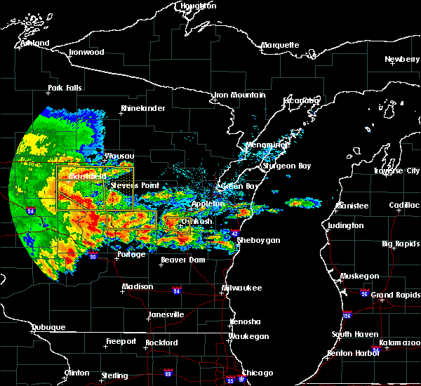 At 542 pm cdt, a severe thunderstorm was located 11 miles northeast of friendship, moving east at 50 mph (radar indicated). Hazards include 60 mph wind gusts and penny size hail. Expect damage to roofs, siding, and trees. this severe thunderstorm will be near, wautoma around 605 pm cdt. redgranite around 615 pm cdt. berlin around 620 pm cdt. Other locations impacted by this severe thunderstorm include saxeville, coloma, mount morris, auroraville, wild rose, hancock, borth, silver lake, spring lake and lohrville. At 542 pm cdt, a severe thunderstorm was located 11 miles northeast of friendship, moving east at 50 mph (radar indicated). Hazards include 60 mph wind gusts and penny size hail. Expect damage to roofs, siding, and trees. this severe thunderstorm will be near, wautoma around 605 pm cdt. redgranite around 615 pm cdt. berlin around 620 pm cdt. Other locations impacted by this severe thunderstorm include saxeville, coloma, mount morris, auroraville, wild rose, hancock, borth, silver lake, spring lake and lohrville.
|
| 5/17/2017 9:31 PM CDT |
 At 930 pm cdt, severe thunderstorms were located along a line extending from 12 miles north of wisconsin rapids to whiting to near redgranite to near cambria, moving north at 55 mph (radar indicated). Hazards include 70 mph wind gusts. Expect considerable tree damage. damage is likely to mobile homes, roofs, and outbuildings. locations impacted include, stevens point, wisconsin rapids, wautoma, whiting, plainfield, lake wazeecha, plover, stockton, silver lake and dakota. A tornado watch remains in effect until 100 am cdt for central and northeastern wisconsin. At 930 pm cdt, severe thunderstorms were located along a line extending from 12 miles north of wisconsin rapids to whiting to near redgranite to near cambria, moving north at 55 mph (radar indicated). Hazards include 70 mph wind gusts. Expect considerable tree damage. damage is likely to mobile homes, roofs, and outbuildings. locations impacted include, stevens point, wisconsin rapids, wautoma, whiting, plainfield, lake wazeecha, plover, stockton, silver lake and dakota. A tornado watch remains in effect until 100 am cdt for central and northeastern wisconsin.
|
| 5/17/2017 9:07 PM CDT |
 At 906 pm cdt, severe thunderstorms were located along a line extending from 6 miles northeast of humbird to 10 miles west of plainfield to 10 miles southeast of montello to near sun prairie, moving northeast at 55 mph (radar indicated). Hazards include 70 mph wind gusts. Expect considerable tree damage. damage is likely to mobile homes, roofs, and outbuildings. locations impacted include, stevens point, wisconsin rapids, wautoma, marshfield, mosinee, abbotsford, spencer, whiting, pittsville and plainfield. A tornado watch remains in effect until 100 am cdt for central and northeastern wisconsin. At 906 pm cdt, severe thunderstorms were located along a line extending from 6 miles northeast of humbird to 10 miles west of plainfield to 10 miles southeast of montello to near sun prairie, moving northeast at 55 mph (radar indicated). Hazards include 70 mph wind gusts. Expect considerable tree damage. damage is likely to mobile homes, roofs, and outbuildings. locations impacted include, stevens point, wisconsin rapids, wautoma, marshfield, mosinee, abbotsford, spencer, whiting, pittsville and plainfield. A tornado watch remains in effect until 100 am cdt for central and northeastern wisconsin.
|
| 5/17/2017 8:54 PM CDT |
 At 853 pm cdt, severe thunderstorms were located along a line extending from near humbird to 6 miles north of dellwood to portage to maple bluff, moving north at 55 mph (radar indicated). Hazards include 70 mph wind gusts. Expect considerable tree damage. Damage is likely to mobile homes, roofs, and outbuildings. At 853 pm cdt, severe thunderstorms were located along a line extending from near humbird to 6 miles north of dellwood to portage to maple bluff, moving north at 55 mph (radar indicated). Hazards include 70 mph wind gusts. Expect considerable tree damage. Damage is likely to mobile homes, roofs, and outbuildings.
|
| 3/6/2017 11:00 PM CST |
 At 1059 pm cst, severe thunderstorms were located along a line extending from near shawano to 8 miles northwest of new london to 6 miles southwest of wautoma, moving northeast at 55 mph (radar indicated). Hazards include 70 mph wind gusts. Expect considerable tree damage. damage is likely to mobile homes, roofs, and outbuildings. these severe storms will be near, shawano and keshena around 1105 pm cst. clintonville and redgranite around 1115 pm cst. embarrass around 1120 pm cst. waupaca around 1130 pm cst. Other locations impacted by these severe thunderstorms include fitzgerald corners, coloma, college of menominee nation, schmidt corner, northport, sugar bush, hancock, scandinavia, thornton and gresham. At 1059 pm cst, severe thunderstorms were located along a line extending from near shawano to 8 miles northwest of new london to 6 miles southwest of wautoma, moving northeast at 55 mph (radar indicated). Hazards include 70 mph wind gusts. Expect considerable tree damage. damage is likely to mobile homes, roofs, and outbuildings. these severe storms will be near, shawano and keshena around 1105 pm cst. clintonville and redgranite around 1115 pm cst. embarrass around 1120 pm cst. waupaca around 1130 pm cst. Other locations impacted by these severe thunderstorms include fitzgerald corners, coloma, college of menominee nation, schmidt corner, northport, sugar bush, hancock, scandinavia, thornton and gresham.
|
| 3/6/2017 10:47 PM CST |
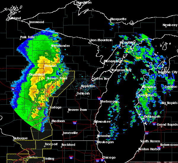 At 1046 pm cst, severe thunderstorms were located along a line extending from 7 miles west of embarrass to near waupaca to near westfield, moving northeast at 50 mph (radar indicated). Hazards include 60 mph wind gusts. Expect damage to roofs, siding, and trees. severe thunderstorms will be near, waupaca around 1050 pm cst. embarrass around 1055 pm cst. shawano, wautoma and keshena around 1105 pm cst. redgranite around 1115 pm cst. clintonville around 1120 pm cst. other locations impacted by these severe thunderstorms include fitzgerald corners, coloma, college of menominee nation, schmidt corner, northport, sugar bush, hancock, scandinavia, thornton and gresham. This extends the warning already in effect for portions of portage, waushara and waupaca counties. At 1046 pm cst, severe thunderstorms were located along a line extending from 7 miles west of embarrass to near waupaca to near westfield, moving northeast at 50 mph (radar indicated). Hazards include 60 mph wind gusts. Expect damage to roofs, siding, and trees. severe thunderstorms will be near, waupaca around 1050 pm cst. embarrass around 1055 pm cst. shawano, wautoma and keshena around 1105 pm cst. redgranite around 1115 pm cst. clintonville around 1120 pm cst. other locations impacted by these severe thunderstorms include fitzgerald corners, coloma, college of menominee nation, schmidt corner, northport, sugar bush, hancock, scandinavia, thornton and gresham. This extends the warning already in effect for portions of portage, waushara and waupaca counties.
|
| 3/6/2017 10:26 PM CST |
 At 1024 pm cst, severe thunderstorms were located along a line extending from 6 miles southeast of bevent to near amherst to 11 miles northwest of westfield, moving east at 60 mph (a trained weather spotter in plover reported a wind gust to 74 mph). Hazards include 70 mph wind gusts. Expect considerable tree damage. damage is likely to mobile homes, roofs, and outbuildings. these severe storms will be near, randolph, chain o` lakes-king and hartman creek state park around 1030 pm cst. waupaca around 1035 pm cst. wautoma around 1040 pm cst. redgranite around 1045 pm cst. Other locations impacted by these severe thunderstorms include schmidt corner, borth, ellis, nelsonville, king, iola, symco, metz, tustin and custer. At 1024 pm cst, severe thunderstorms were located along a line extending from 6 miles southeast of bevent to near amherst to 11 miles northwest of westfield, moving east at 60 mph (a trained weather spotter in plover reported a wind gust to 74 mph). Hazards include 70 mph wind gusts. Expect considerable tree damage. damage is likely to mobile homes, roofs, and outbuildings. these severe storms will be near, randolph, chain o` lakes-king and hartman creek state park around 1030 pm cst. waupaca around 1035 pm cst. wautoma around 1040 pm cst. redgranite around 1045 pm cst. Other locations impacted by these severe thunderstorms include schmidt corner, borth, ellis, nelsonville, king, iola, symco, metz, tustin and custer.
|
| 3/6/2017 10:11 PM CST |
 At 1010 pm cst, severe thunderstorms were located along a line extending from near stevens point to 8 miles south of whiting to 9 miles northeast of friendship, moving east at 65 mph (radar indicated). Hazards include 60 mph wind gusts. Expect damage to roofs, siding, and trees. severe thunderstorms will be near, randolph and amherst around 1020 pm cst. hartman creek state park around 1025 pm cst. wautoma and chain o` lakes-king around 1030 pm cst. redgranite around 1035 pm cst. other locations impacted by these severe thunderstorms include schmidt corner, coddington, borth, ellis, nelsonville, king, iola, symco, metz and tustin. This warning extends the severe thunderstorm warning already in effect for southwestern portage county. At 1010 pm cst, severe thunderstorms were located along a line extending from near stevens point to 8 miles south of whiting to 9 miles northeast of friendship, moving east at 65 mph (radar indicated). Hazards include 60 mph wind gusts. Expect damage to roofs, siding, and trees. severe thunderstorms will be near, randolph and amherst around 1020 pm cst. hartman creek state park around 1025 pm cst. wautoma and chain o` lakes-king around 1030 pm cst. redgranite around 1035 pm cst. other locations impacted by these severe thunderstorms include schmidt corner, coddington, borth, ellis, nelsonville, king, iola, symco, metz and tustin. This warning extends the severe thunderstorm warning already in effect for southwestern portage county.
|
| 9/21/2016 3:06 PM CDT |
 At 304 pm cdt, a severe thunderstorm was located near plainfield, or 12 miles north of wautoma, moving southeast at 25 mph (radar indicated). Hazards include 60 mph wind gusts and quarter size hail. Hail damage to vehicles is expected. expect wind damage to roofs, siding, and trees. This severe thunderstorm will impact the following locations: wild rose, heffron, blaine, almond, bancroft and hancock. At 304 pm cdt, a severe thunderstorm was located near plainfield, or 12 miles north of wautoma, moving southeast at 25 mph (radar indicated). Hazards include 60 mph wind gusts and quarter size hail. Hail damage to vehicles is expected. expect wind damage to roofs, siding, and trees. This severe thunderstorm will impact the following locations: wild rose, heffron, blaine, almond, bancroft and hancock.
|
| 9/21/2016 2:56 PM CDT |
 At 254 pm cdt, a severe thunderstorm was located 7 miles northeast of plainfield, or 15 miles west of waupaca, moving southeast at 25 mph (radar indicated). Hazards include 60 mph wind gusts and quarter size hail. Hail damage to vehicles is expected. expect wind damage to roofs, siding, and trees. This severe thunderstorm will impact the following locations: emmons creek barrens, kellner, keene, wild rose, meehan, heffron, blaine, almond, coddington and bancroft. At 254 pm cdt, a severe thunderstorm was located 7 miles northeast of plainfield, or 15 miles west of waupaca, moving southeast at 25 mph (radar indicated). Hazards include 60 mph wind gusts and quarter size hail. Hail damage to vehicles is expected. expect wind damage to roofs, siding, and trees. This severe thunderstorm will impact the following locations: emmons creek barrens, kellner, keene, wild rose, meehan, heffron, blaine, almond, coddington and bancroft.
|
| 9/21/2016 3:04 AM CDT |
 At 303 am cdt, severe thunderstorms were located along a line extending from 11 miles northwest of clintonville to 6 miles northeast of waupaca to near berlin, moving east at 40 mph (radar indicated). Hazards include 60 mph wind gusts and penny size hail. Expect damage to roofs. siding. and trees. these severe storms will be near, new london around 320 am cdt. clintonville and embarrass around 330 am cdt. Other locations impacted by these severe thunderstorms include tustin, poy sippi, northport, pine river, king, big falls, mount morris, blaine, readfield and nelsonville. At 303 am cdt, severe thunderstorms were located along a line extending from 11 miles northwest of clintonville to 6 miles northeast of waupaca to near berlin, moving east at 40 mph (radar indicated). Hazards include 60 mph wind gusts and penny size hail. Expect damage to roofs. siding. and trees. these severe storms will be near, new london around 320 am cdt. clintonville and embarrass around 330 am cdt. Other locations impacted by these severe thunderstorms include tustin, poy sippi, northport, pine river, king, big falls, mount morris, blaine, readfield and nelsonville.
|
| 9/21/2016 2:42 AM CDT |
 At 240 am cdt, severe thunderstorms were located along a line extending from 9 miles north of amherst to wautoma, moving east at 40 mph (radar indicated). Hazards include 60 mph wind gusts and nickel size hail. Expect damage to roofs. siding. and trees. severe thunderstorms will be near, randolph around 255 am cdt. redgranite around 305 am cdt. berlin around 315 am cdt. clintonville around 325 am cdt. Other locations impacted by these severe thunderstorms include ellis, tustin, poy sippi, northport, pine river, king, big falls, polonia, mount morris and jordan. At 240 am cdt, severe thunderstorms were located along a line extending from 9 miles north of amherst to wautoma, moving east at 40 mph (radar indicated). Hazards include 60 mph wind gusts and nickel size hail. Expect damage to roofs. siding. and trees. severe thunderstorms will be near, randolph around 255 am cdt. redgranite around 305 am cdt. berlin around 315 am cdt. clintonville around 325 am cdt. Other locations impacted by these severe thunderstorms include ellis, tustin, poy sippi, northport, pine river, king, big falls, polonia, mount morris and jordan.
|
| 9/6/2016 5:56 PM CDT |
 At 555 pm cdt, doppler radar indicated severe thunderstorms were located along a line extending from near chain o` lakes-king to 6 miles northwest of westfield, moving east at 45 mph (radar indicated). Hazards include 60 mph wind gusts and half dollar size hail. Hail damage to vehicles is expected. expect wind damage to roofs, siding, and trees. these severe storms will be near, berlin around 630 pm cdt. Other locations impacted by these severe thunderstorms include hancock, tustin, saxeville, poy sippi, auroraville, spring lake, west bloomfield, dakota, pine river and coloma. At 555 pm cdt, doppler radar indicated severe thunderstorms were located along a line extending from near chain o` lakes-king to 6 miles northwest of westfield, moving east at 45 mph (radar indicated). Hazards include 60 mph wind gusts and half dollar size hail. Hail damage to vehicles is expected. expect wind damage to roofs, siding, and trees. these severe storms will be near, berlin around 630 pm cdt. Other locations impacted by these severe thunderstorms include hancock, tustin, saxeville, poy sippi, auroraville, spring lake, west bloomfield, dakota, pine river and coloma.
|
| 9/6/2016 5:37 PM CDT |
 At 536 pm cdt, a severe thunderstorm was located near plainfield, or 13 miles northwest of wautoma, moving east at 50 mph (radar indicated). Hazards include 60 mph wind gusts and half dollar size hail. Hail damage to vehicles is expected. expect wind damage to roofs, siding, and trees. this severe storm will be near, wautoma around 550 pm cdt. redgranite around 600 pm cdt. Other locations impacted by this severe thunderstorm include hancock, tustin, saxeville, poy sippi, auroraville, spring lake, west bloomfield, dakota, pine river and coloma. At 536 pm cdt, a severe thunderstorm was located near plainfield, or 13 miles northwest of wautoma, moving east at 50 mph (radar indicated). Hazards include 60 mph wind gusts and half dollar size hail. Hail damage to vehicles is expected. expect wind damage to roofs, siding, and trees. this severe storm will be near, wautoma around 550 pm cdt. redgranite around 600 pm cdt. Other locations impacted by this severe thunderstorm include hancock, tustin, saxeville, poy sippi, auroraville, spring lake, west bloomfield, dakota, pine river and coloma.
|
| 9/6/2016 5:27 PM CDT |
 At 526 pm cdt, a severe thunderstorm was located 10 miles southeast of new rome, or 14 miles northeast of friendship, moving east at 45 mph (radar indicated). Hazards include 60 mph wind gusts and half dollar size hail. Hail damage to vehicles is expected. expect wind damage to roofs, siding, and trees. this severe thunderstorm will be near, plainfield around 540 pm cdt. wautoma around 550 pm cdt. redgranite around 600 pm cdt. Other locations impacted by this severe thunderstorm include hancock, tustin, saxeville, poy sippi, auroraville, spring lake, west bloomfield, dakota, pine river and coloma. At 526 pm cdt, a severe thunderstorm was located 10 miles southeast of new rome, or 14 miles northeast of friendship, moving east at 45 mph (radar indicated). Hazards include 60 mph wind gusts and half dollar size hail. Hail damage to vehicles is expected. expect wind damage to roofs, siding, and trees. this severe thunderstorm will be near, plainfield around 540 pm cdt. wautoma around 550 pm cdt. redgranite around 600 pm cdt. Other locations impacted by this severe thunderstorm include hancock, tustin, saxeville, poy sippi, auroraville, spring lake, west bloomfield, dakota, pine river and coloma.
|
| 7/21/2016 4:40 PM CDT |
 At 440 pm cdt, severe thunderstorms were located along a line extending from near wautoma to near westfield, moving southeast at 30 mph (radar indicated). Hazards include 60 mph wind gusts and nickel size hail. Expect damage to roofs. siding. and trees. Locations impacted include, wautoma, berlin, redgranite, silver lake, pine river, dakota, mount morris, saxeville, wild rose and richford. At 440 pm cdt, severe thunderstorms were located along a line extending from near wautoma to near westfield, moving southeast at 30 mph (radar indicated). Hazards include 60 mph wind gusts and nickel size hail. Expect damage to roofs. siding. and trees. Locations impacted include, wautoma, berlin, redgranite, silver lake, pine river, dakota, mount morris, saxeville, wild rose and richford.
|
| 7/21/2016 4:25 PM CDT |
 At 424 pm cdt, severe thunderstorms were located along a line extending from near plainfield to 8 miles northwest of westfield, moving southeast at 40 mph (trained weather spotters). Hazards include 60 mph wind gusts and nickel size hail. Expect damage to roofs. siding. and trees. Locations impacted include, wautoma, berlin, redgranite, plainfield, silver lake, pine river, dakota, mount morris, saxeville and wild rose. At 424 pm cdt, severe thunderstorms were located along a line extending from near plainfield to 8 miles northwest of westfield, moving southeast at 40 mph (trained weather spotters). Hazards include 60 mph wind gusts and nickel size hail. Expect damage to roofs. siding. and trees. Locations impacted include, wautoma, berlin, redgranite, plainfield, silver lake, pine river, dakota, mount morris, saxeville and wild rose.
|
| 7/21/2016 4:15 PM CDT |
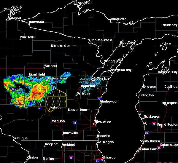 At 415 pm cdt, severe thunderstorms were located along a line extending from near plainfield to 6 miles northeast of friendship, moving southeast at 40 mph (trained weather spotters). Hazards include 60 mph wind gusts and nickel size hail. Expect damage to roofs. siding. and trees. Locations impacted include, wautoma, berlin, redgranite, plainfield, lake wazeecha, silver lake, pine river, dakota, mount morris and saxeville. At 415 pm cdt, severe thunderstorms were located along a line extending from near plainfield to 6 miles northeast of friendship, moving southeast at 40 mph (trained weather spotters). Hazards include 60 mph wind gusts and nickel size hail. Expect damage to roofs. siding. and trees. Locations impacted include, wautoma, berlin, redgranite, plainfield, lake wazeecha, silver lake, pine river, dakota, mount morris and saxeville.
|
| 7/21/2016 4:00 PM CDT |
 At 400 pm cdt, severe thunderstorms were located along a line extending from 6 miles southeast of lake wazeecha to 7 miles south of new rome, moving southeast at 35 mph (trained weather spotters). Hazards include 60 mph wind gusts and nickel size hail. Expect damage to roofs. siding. And trees. At 400 pm cdt, severe thunderstorms were located along a line extending from 6 miles southeast of lake wazeecha to 7 miles south of new rome, moving southeast at 35 mph (trained weather spotters). Hazards include 60 mph wind gusts and nickel size hail. Expect damage to roofs. siding. And trees.
|
| 7/21/2016 8:32 AM CDT |
 At 832 am cdt, severe thunderstorms were located along a line extending from lake poygan to 6 miles north of westfield, moving southeast at 45 mph (trained weather spotters). Hazards include 60 mph wind gusts and quarter size hail. Hail damage to vehicles is expected. expect wind damage to roofs, siding, and trees. Locations impacted include, wautoma, berlin, redgranite, silver lake, pine river, dakota, mount morris, saxeville, wild rose and richford. At 832 am cdt, severe thunderstorms were located along a line extending from lake poygan to 6 miles north of westfield, moving southeast at 45 mph (trained weather spotters). Hazards include 60 mph wind gusts and quarter size hail. Hail damage to vehicles is expected. expect wind damage to roofs, siding, and trees. Locations impacted include, wautoma, berlin, redgranite, silver lake, pine river, dakota, mount morris, saxeville, wild rose and richford.
|
| 7/21/2016 8:01 AM CDT |
 At 801 am cdt, severe thunderstorms were located along a line extending from near hartman creek state park to 6 miles south of new rome, moving southeast at 45 mph (trained weather spotters). Hazards include 60 mph wind gusts and quarter size hail. Hail damage to vehicles is expected. expect wind damage to roofs, siding, and trees. These severe thunderstorms will remain over mainly rural areas of waushara county, including the following locations: hancock, saxeville, poy sippi, auroraville, spring lake, west bloomfield, dakota, pine river, coloma and silver lake. At 801 am cdt, severe thunderstorms were located along a line extending from near hartman creek state park to 6 miles south of new rome, moving southeast at 45 mph (trained weather spotters). Hazards include 60 mph wind gusts and quarter size hail. Hail damage to vehicles is expected. expect wind damage to roofs, siding, and trees. These severe thunderstorms will remain over mainly rural areas of waushara county, including the following locations: hancock, saxeville, poy sippi, auroraville, spring lake, west bloomfield, dakota, pine river, coloma and silver lake.
|
| 7/13/2016 8:28 PM CDT |
 At 827 pm cdt, a severe thunderstorm was located near plainfield, or 13 miles northwest of wautoma, moving northeast at 40 mph (radar indicated). Hazards include 60 mph wind gusts and quarter size hail. Hail damage to vehicles is expected. expect wind damage to roofs, siding, and trees. Locations impacted include, plainfield, wild rose, almond, hancock, blaine, emmons creek barrens and heffron. At 827 pm cdt, a severe thunderstorm was located near plainfield, or 13 miles northwest of wautoma, moving northeast at 40 mph (radar indicated). Hazards include 60 mph wind gusts and quarter size hail. Hail damage to vehicles is expected. expect wind damage to roofs, siding, and trees. Locations impacted include, plainfield, wild rose, almond, hancock, blaine, emmons creek barrens and heffron.
|
| 7/13/2016 8:15 PM CDT |
 At 813 pm cdt, a severe thunderstorm was located near plainfield, or 16 miles northwest of wautoma, moving northeast at 30 mph (radar indicated). Hazards include 60 mph wind gusts and quarter size hail. Hail damage to vehicles is expected. Expect wind damage to roofs, siding, and trees. At 813 pm cdt, a severe thunderstorm was located near plainfield, or 16 miles northwest of wautoma, moving northeast at 30 mph (radar indicated). Hazards include 60 mph wind gusts and quarter size hail. Hail damage to vehicles is expected. Expect wind damage to roofs, siding, and trees.
|
| 6/10/2016 6:52 PM CDT |
 At 652 pm cdt, severe thunderstorms were located along a line extending from near whiting to 8 miles east of adams, moving east at 45 mph (radar indicated). Hazards include 60 mph wind gusts. Expect damage to roofs. siding. and trees. these severe thunderstorms will remain over mainly rural areas of waushara county, including the following locations: hancock, tustin, saxeville, poy sippi, auroraville, spring lake, west bloomfield, dakota, pine river and coloma. A tornado watch remains in effect until 900 pm cdt for central wisconsin. At 652 pm cdt, severe thunderstorms were located along a line extending from near whiting to 8 miles east of adams, moving east at 45 mph (radar indicated). Hazards include 60 mph wind gusts. Expect damage to roofs. siding. and trees. these severe thunderstorms will remain over mainly rural areas of waushara county, including the following locations: hancock, tustin, saxeville, poy sippi, auroraville, spring lake, west bloomfield, dakota, pine river and coloma. A tornado watch remains in effect until 900 pm cdt for central wisconsin.
|
| 6/5/2016 5:39 PM CDT |
 At 539 pm cdt, a severe thunderstorm was located 9 miles south of plainfield, or 12 miles west of wautoma, moving southeast at 45 mph (radar indicated). Hazards include 60 mph wind gusts. Expect damage to roofs. siding. and trees. Locations impacted include, wautoma, berlin, redgranite, plainfield, silver lake, dakota, mount morris, richford, spring lake and coloma. At 539 pm cdt, a severe thunderstorm was located 9 miles south of plainfield, or 12 miles west of wautoma, moving southeast at 45 mph (radar indicated). Hazards include 60 mph wind gusts. Expect damage to roofs. siding. and trees. Locations impacted include, wautoma, berlin, redgranite, plainfield, silver lake, dakota, mount morris, richford, spring lake and coloma.
|
| 6/5/2016 5:14 PM CDT |
 At 513 pm cdt, a severe thunderstorm was located 8 miles south of plainfield, or 8 miles west of wautoma, moving southeast at 55 mph (radar indicated). Hazards include 60 mph wind gusts. Expect damage to roofs. siding. And trees. At 513 pm cdt, a severe thunderstorm was located 8 miles south of plainfield, or 8 miles west of wautoma, moving southeast at 55 mph (radar indicated). Hazards include 60 mph wind gusts. Expect damage to roofs. siding. And trees.
|
| 5/25/2016 4:50 PM CDT |
 At 450 pm cdt, severe thunderstorms were located along a line extending from near amherst to near wautoma, moving northeast at 30 mph (radar indicated). Hazards include 60 mph wind gusts and half dollar size hail. Hail damage to vehicles is expected. expect wind damage to roofs, siding, and trees. These severe thunderstorms will remain over mainly rural areas of waushara, southeastern portage and southwestern waupaca counties, including the following locations: hancock, keene, saxeville, almond, amherst junction, standing rock park, dakota, pine river, coloma and silver lake. At 450 pm cdt, severe thunderstorms were located along a line extending from near amherst to near wautoma, moving northeast at 30 mph (radar indicated). Hazards include 60 mph wind gusts and half dollar size hail. Hail damage to vehicles is expected. expect wind damage to roofs, siding, and trees. These severe thunderstorms will remain over mainly rural areas of waushara, southeastern portage and southwestern waupaca counties, including the following locations: hancock, keene, saxeville, almond, amherst junction, standing rock park, dakota, pine river, coloma and silver lake.
|
| 5/25/2016 4:41 PM CDT |
 At 441 pm cdt, severe thunderstorms were located along a line extending from near amherst to near wautoma, moving northeast at 35 mph (radar indicated). Hazards include 60 mph wind gusts and half dollar size hail. Hail damage to vehicles is expected. expect wind damage to roofs, siding, and trees. these severe storms will be near, wild rose around 445 pm cdt. mount morris around 450 pm cdt. redgranite around 500 pm cdt. Other locations impacted by these severe thunderstorms include hancock, keene, saxeville, almond, amherst junction, standing rock park, dakota, pine river, coloma and silver lake. At 441 pm cdt, severe thunderstorms were located along a line extending from near amherst to near wautoma, moving northeast at 35 mph (radar indicated). Hazards include 60 mph wind gusts and half dollar size hail. Hail damage to vehicles is expected. expect wind damage to roofs, siding, and trees. these severe storms will be near, wild rose around 445 pm cdt. mount morris around 450 pm cdt. redgranite around 500 pm cdt. Other locations impacted by these severe thunderstorms include hancock, keene, saxeville, almond, amherst junction, standing rock park, dakota, pine river, coloma and silver lake.
|
| 5/25/2016 4:30 PM CDT |
 At 429 pm cdt, severe thunderstorms were located along a line extending from 6 miles east of whiting to near wautoma, moving northeast at 35 mph (radar indicated). Hazards include 60 mph wind gusts and nickel size hail. Expect damage to roofs. siding. and trees. severe thunderstorms will be near, amherst around 440 pm cdt. redgranite around 450 pm cdt. other locations impacted by these severe thunderstorms include hancock, keene, saxeville, almond, amherst junction, standing rock park, dakota, pine river, coloma and silver lake. This warning replaces the warning already in effect for western waushara county. At 429 pm cdt, severe thunderstorms were located along a line extending from 6 miles east of whiting to near wautoma, moving northeast at 35 mph (radar indicated). Hazards include 60 mph wind gusts and nickel size hail. Expect damage to roofs. siding. and trees. severe thunderstorms will be near, amherst around 440 pm cdt. redgranite around 450 pm cdt. other locations impacted by these severe thunderstorms include hancock, keene, saxeville, almond, amherst junction, standing rock park, dakota, pine river, coloma and silver lake. This warning replaces the warning already in effect for western waushara county.
|
| 5/25/2016 4:21 PM CDT |
 At 421 pm cdt, a severe thunderstorm was located 8 miles west of wautoma, moving northeast at 35 mph (radar indicated). Hazards include 60 mph wind gusts and quarter size hail. Hail damage to vehicles is expected. expect wind damage to roofs, siding, and trees. this severe storm will be near, wautoma around 425 pm cdt. Other locations impacted by this severe thunderstorm include hancock, mount morris, wild rose, saxeville, dakota, richford, coloma and silver lake. At 421 pm cdt, a severe thunderstorm was located 8 miles west of wautoma, moving northeast at 35 mph (radar indicated). Hazards include 60 mph wind gusts and quarter size hail. Hail damage to vehicles is expected. expect wind damage to roofs, siding, and trees. this severe storm will be near, wautoma around 425 pm cdt. Other locations impacted by this severe thunderstorm include hancock, mount morris, wild rose, saxeville, dakota, richford, coloma and silver lake.
|
| 5/25/2016 4:05 PM CDT |
 At 405 pm cdt, a severe thunderstorm was located 10 miles east of friendship, moving northeast at 35 mph (radar indicated). Hazards include 60 mph wind gusts and half dollar size hail. Hail damage to vehicles is expected. expect wind damage to roofs, siding, and trees. this severe thunderstorm will be near, wautoma around 430 pm cdt. Other locations impacted by this severe thunderstorm include hancock, mount morris, wild rose, heffron, saxeville, dakota, richford, coloma and silver lake. At 405 pm cdt, a severe thunderstorm was located 10 miles east of friendship, moving northeast at 35 mph (radar indicated). Hazards include 60 mph wind gusts and half dollar size hail. Hail damage to vehicles is expected. expect wind damage to roofs, siding, and trees. this severe thunderstorm will be near, wautoma around 430 pm cdt. Other locations impacted by this severe thunderstorm include hancock, mount morris, wild rose, heffron, saxeville, dakota, richford, coloma and silver lake.
|
| 8/2/2015 4:58 PM CDT | The severe thunderstorm warning for southwestern winnebago, southwestern waupaca and waushara counties will expire at 500 pm cdt, the storms which prompted the warning have weakened below severe limits, and exited the warned area. therefore the warning will be allowed to expire. however small hail and gusty winds are still possible with these thunderstorms. |
| 8/2/2015 4:26 PM CDT |
 At 424 pm cdt, severe thunderstorms were located along a line extending from 10 miles southeast of fremont to 6 miles southeast of lake poygan to near wautoma, moving southeast at 45 mph (trained weather spotters). Hazards include golf ball size hail and 60 mph wind gusts. some rotation was noted by the radar near mount morris. People and animals outdoors will be injured. expect hail damage to roofs, siding, windows and vehicles. expect wind damage to roofs, siding and trees. Locations impacted include, wautoma, berlin, redgranite, rush lake, chain o` lakes-king, omro, silver lake, pine river, eureka, dakota, mount morris, saxeville, wild rose, richford, spring lake, coloma, neshkoro, hancock, lohrville and fisk. At 424 pm cdt, severe thunderstorms were located along a line extending from 10 miles southeast of fremont to 6 miles southeast of lake poygan to near wautoma, moving southeast at 45 mph (trained weather spotters). Hazards include golf ball size hail and 60 mph wind gusts. some rotation was noted by the radar near mount morris. People and animals outdoors will be injured. expect hail damage to roofs, siding, windows and vehicles. expect wind damage to roofs, siding and trees. Locations impacted include, wautoma, berlin, redgranite, rush lake, chain o` lakes-king, omro, silver lake, pine river, eureka, dakota, mount morris, saxeville, wild rose, richford, spring lake, coloma, neshkoro, hancock, lohrville and fisk.
|
| 8/2/2015 4:01 PM CDT |
 At 401 pm cdt, severe thunderstorms were located along a line extending from near fremont to 8 miles northwest of lake poygan to 9 miles southwest of plainfield, moving southeast at 40 mph (trained weather spotters). Hazards include golf ball size hail and 60 mph wind gusts. People and animals outdoors will be injured. expect hail damage to roofs, siding, windows and vehicles. Expect wind damage to roofs, siding and trees. At 401 pm cdt, severe thunderstorms were located along a line extending from near fremont to 8 miles northwest of lake poygan to 9 miles southwest of plainfield, moving southeast at 40 mph (trained weather spotters). Hazards include golf ball size hail and 60 mph wind gusts. People and animals outdoors will be injured. expect hail damage to roofs, siding, windows and vehicles. Expect wind damage to roofs, siding and trees.
|
| 7/18/2015 5:01 AM CDT |
 At 501 am cdt, severe thunderstorms were located along a line extending from 6 miles west of neopit to 8 miles northeast of amherst to 6 miles south of hartman creek state park to near redgranite, moving east at 40 mph (radar indicated). Hazards include 60 mph wind gusts and nickel size hail. Expect damage to roofs. siding and trees. Locations impacted include, waupaca, wautoma, berlin, redgranite, wittenberg, amherst, fremont, hartman creek state park, neopit, chain o` lakes-king, silver lake, weyauwega, pine river, royalton, manawa, iola, marion, dakota, mount morris and saxeville. At 501 am cdt, severe thunderstorms were located along a line extending from 6 miles west of neopit to 8 miles northeast of amherst to 6 miles south of hartman creek state park to near redgranite, moving east at 40 mph (radar indicated). Hazards include 60 mph wind gusts and nickel size hail. Expect damage to roofs. siding and trees. Locations impacted include, waupaca, wautoma, berlin, redgranite, wittenberg, amherst, fremont, hartman creek state park, neopit, chain o` lakes-king, silver lake, weyauwega, pine river, royalton, manawa, iola, marion, dakota, mount morris and saxeville.
|
| 7/18/2015 4:45 AM CDT |
 At 444 am cdt, severe thunderstorms were located along a line extending from 11 miles south of antigo to near amherst to near plainfield to near wautoma, moving southeast at 45 mph (radar indicated). Hazards include 60 mph wind gusts and nickel size hail. Expect damage to roofs. siding and trees. Locations impacted include, stevens point, antigo, waupaca, wautoma, berlin, redgranite, randolph, whiting, bevent, wittenberg, amherst, plainfield, fremont, hartman creek state park, neopit, chain o` lakes-king, plover, stockton, silver lake and weyauwega. At 444 am cdt, severe thunderstorms were located along a line extending from 11 miles south of antigo to near amherst to near plainfield to near wautoma, moving southeast at 45 mph (radar indicated). Hazards include 60 mph wind gusts and nickel size hail. Expect damage to roofs. siding and trees. Locations impacted include, stevens point, antigo, waupaca, wautoma, berlin, redgranite, randolph, whiting, bevent, wittenberg, amherst, plainfield, fremont, hartman creek state park, neopit, chain o` lakes-king, plover, stockton, silver lake and weyauwega.
|
| 7/18/2015 4:40 AM CDT |
 At 440 am cdt, severe thunderstorms were located along a line extending from 8 miles west of neopit to 8 miles southeast of randolph to near hartman creek state park to near wautoma, moving east at 40 mph (radar indicated). Hazards include 60 mph wind gusts and nickel size hail. Expect damage to roofs. siding and trees. Locations impacted include, wausau, stevens point, wisconsin rapids, antigo, waupaca, wautoma, weston, rib mountain, berlin, mosinee, redgranite, randolph, whiting, bevent, wittenberg, amherst, plainfield, fremont, hartman creek state park and neopit. At 440 am cdt, severe thunderstorms were located along a line extending from 8 miles west of neopit to 8 miles southeast of randolph to near hartman creek state park to near wautoma, moving east at 40 mph (radar indicated). Hazards include 60 mph wind gusts and nickel size hail. Expect damage to roofs. siding and trees. Locations impacted include, wausau, stevens point, wisconsin rapids, antigo, waupaca, wautoma, weston, rib mountain, berlin, mosinee, redgranite, randolph, whiting, bevent, wittenberg, amherst, plainfield, fremont, hartman creek state park and neopit.
|
| 7/18/2015 4:33 AM CDT |
 At 432 am cdt, severe thunderstorms were located along a line extending from 9 miles southeast of antigo to near randolph to near hartman creek state park to near wautoma, moving east around 40 mph (radar indicated). Hazards include 60 mph wind gusts and nickel size hail. Expect damage to roofs. siding and trees. Locations impacted include, wausau, stevens point, wisconsin rapids, antigo, waupaca, wautoma, weston, rib mountain, berlin, mosinee, redgranite, randolph, whiting, bevent, wittenberg, amherst, plainfield, fremont, hartman creek state park and neopit. At 432 am cdt, severe thunderstorms were located along a line extending from 9 miles southeast of antigo to near randolph to near hartman creek state park to near wautoma, moving east around 40 mph (radar indicated). Hazards include 60 mph wind gusts and nickel size hail. Expect damage to roofs. siding and trees. Locations impacted include, wausau, stevens point, wisconsin rapids, antigo, waupaca, wautoma, weston, rib mountain, berlin, mosinee, redgranite, randolph, whiting, bevent, wittenberg, amherst, plainfield, fremont, hartman creek state park and neopit.
|
| 7/18/2015 4:15 AM CDT |
 At 414 am cdt, severe thunderstorms were located along a line extending from 7 miles southeast of merrill to 8 miles west of whiting to near adams, moving east at 40 mph (radar indicated). Hazards include 60 mph wind gusts and nickel size hail. Expect damage to roofs. siding and trees. severe thunderstorms will be near, stevens point and whiting around 430 am cdt. amherst around 445 am cdt. antigo around 450 am cdt. hartman creek state park around 455 am cdt. chain o` lakes-king around 500 am cdt. waupaca and neopit around 510 am cdt. other locations impacted by these severe thunderstorms include elderon, custer, marion, meehan, rudolph, hatley, elmhurst, lyndhurst, symco and phlox. People camping for the wisconsin aquaskier tournament should seek safe shelter immediately!. At 414 am cdt, severe thunderstorms were located along a line extending from 7 miles southeast of merrill to 8 miles west of whiting to near adams, moving east at 40 mph (radar indicated). Hazards include 60 mph wind gusts and nickel size hail. Expect damage to roofs. siding and trees. severe thunderstorms will be near, stevens point and whiting around 430 am cdt. amherst around 445 am cdt. antigo around 450 am cdt. hartman creek state park around 455 am cdt. chain o` lakes-king around 500 am cdt. waupaca and neopit around 510 am cdt. other locations impacted by these severe thunderstorms include elderon, custer, marion, meehan, rudolph, hatley, elmhurst, lyndhurst, symco and phlox. People camping for the wisconsin aquaskier tournament should seek safe shelter immediately!.
|
| 7/13/2015 3:05 AM CDT |
 At 305 am cdt, severe thunderstorms were located along a line extending from 7 miles south of hartman creek state park to 7 miles northeast of westfield, moving east at 45 mph (radar indicated). Hazards include 60 mph wind gusts and penny size hail. Expect damage to roofs. siding and trees. these severe storms will be near, redgranite around 330 am cdt. Other locations impacted by these severe thunderstorms include spring lake, richford, poy sippi, borth, hancock, dakota, coloma, mount morris, auroraville and pine river. At 305 am cdt, severe thunderstorms were located along a line extending from 7 miles south of hartman creek state park to 7 miles northeast of westfield, moving east at 45 mph (radar indicated). Hazards include 60 mph wind gusts and penny size hail. Expect damage to roofs. siding and trees. these severe storms will be near, redgranite around 330 am cdt. Other locations impacted by these severe thunderstorms include spring lake, richford, poy sippi, borth, hancock, dakota, coloma, mount morris, auroraville and pine river.
|
| 7/13/2015 2:52 AM CDT |
 At 251 am cdt, severe thunderstorms were located along a line extending from 7 miles northwest of plainfield to 9 miles south of adams, moving east at 40 mph (radar indicated). Hazards include 60 mph wind gusts and penny size hail. Expect damage to roofs. siding and trees. severe thunderstorms will be near, plainfield around 300 am cdt. Other locations impacted by these severe thunderstorms include spring lake, tustin, richford, poy sippi, borth, hancock, dakota, coloma, mount morris and auroraville. At 251 am cdt, severe thunderstorms were located along a line extending from 7 miles northwest of plainfield to 9 miles south of adams, moving east at 40 mph (radar indicated). Hazards include 60 mph wind gusts and penny size hail. Expect damage to roofs. siding and trees. severe thunderstorms will be near, plainfield around 300 am cdt. Other locations impacted by these severe thunderstorms include spring lake, tustin, richford, poy sippi, borth, hancock, dakota, coloma, mount morris and auroraville.
|
Hail Maps for Hancock, WI


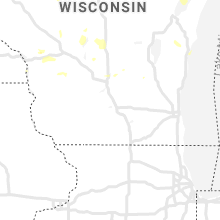


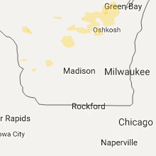


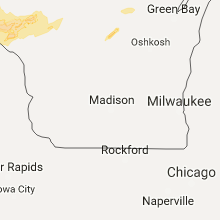


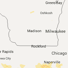


Connect with Interactive Hail Maps