

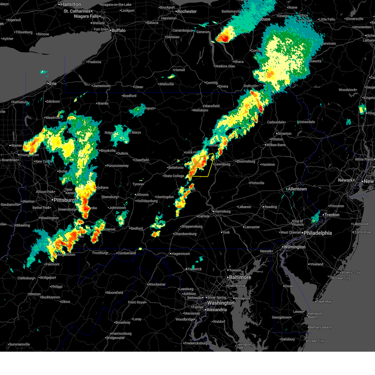
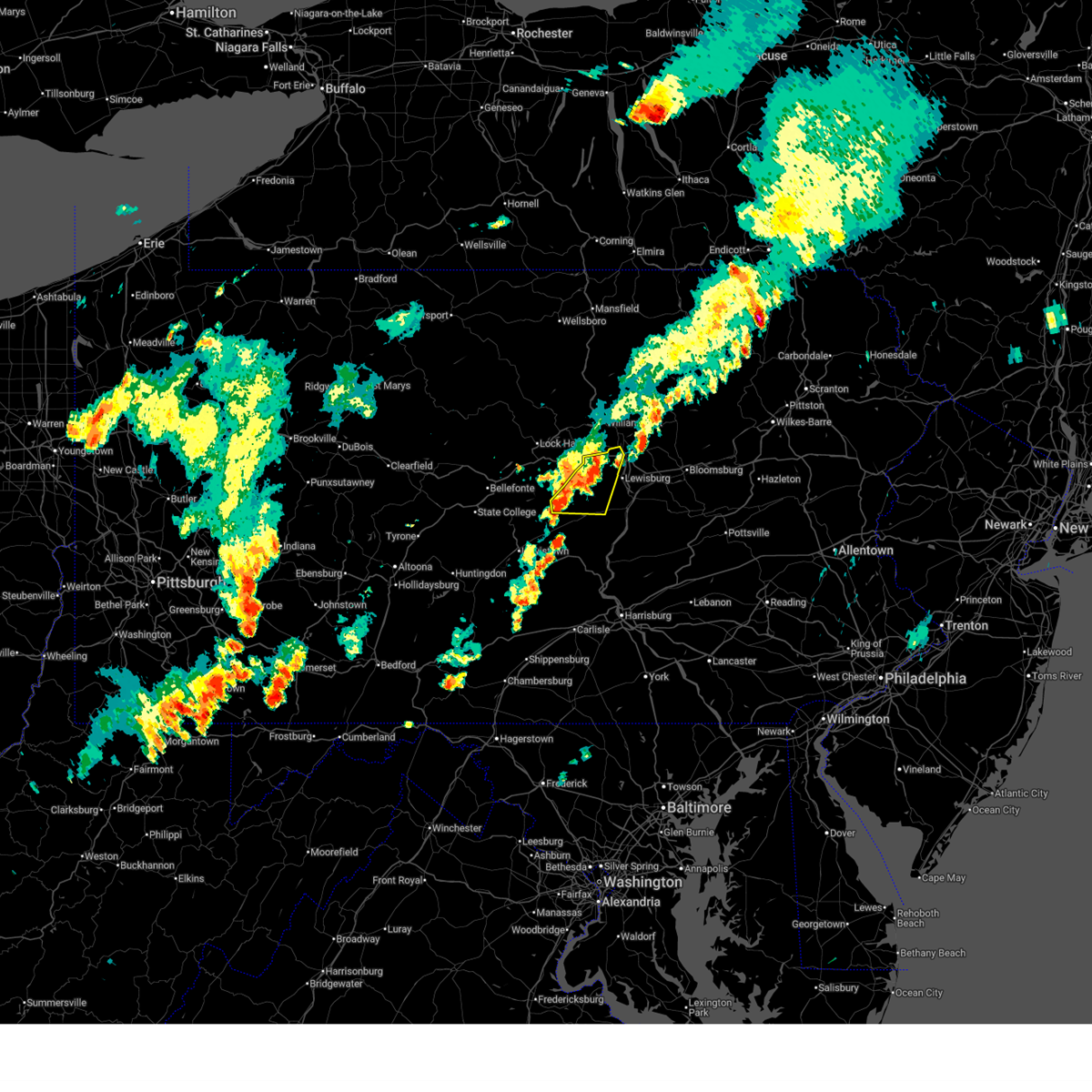
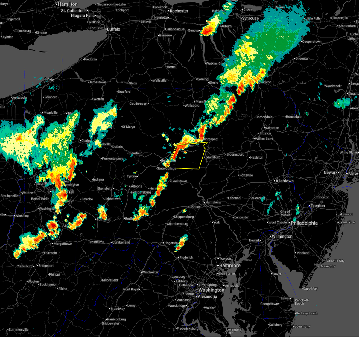
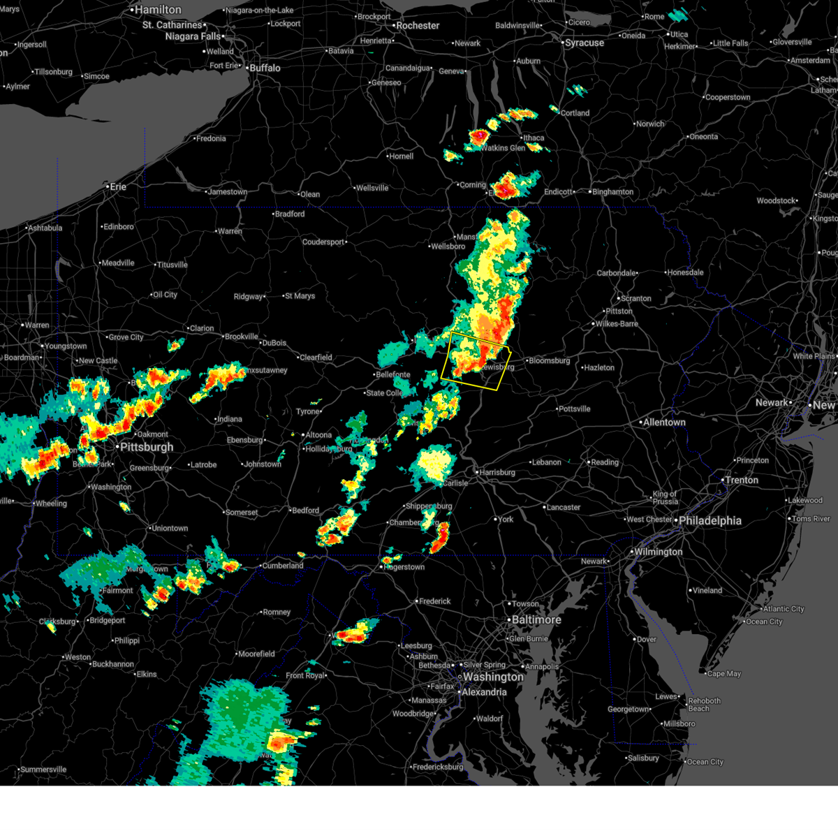
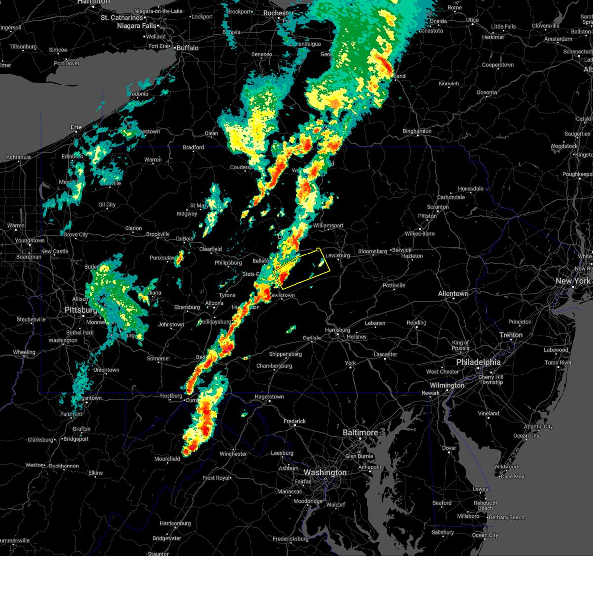
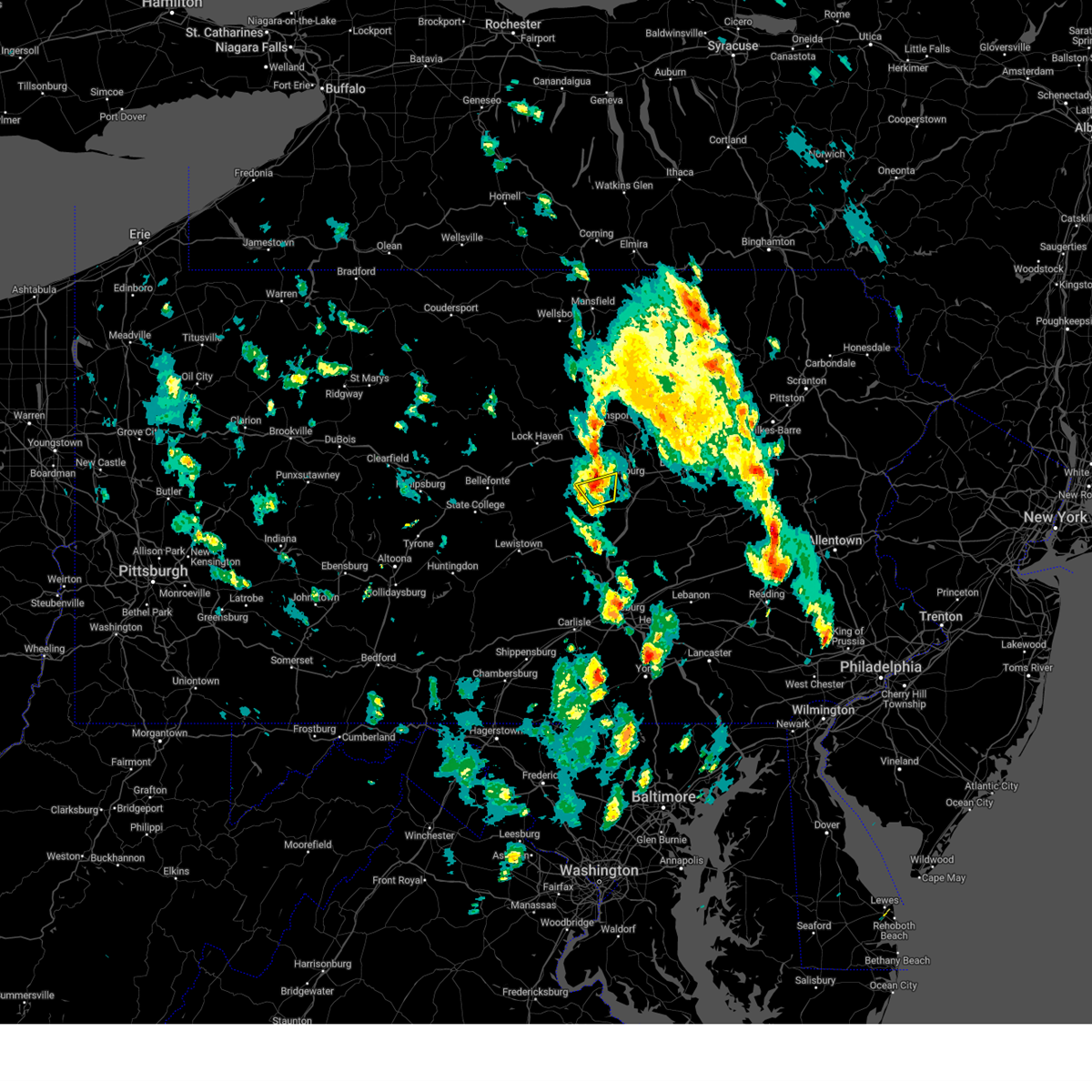
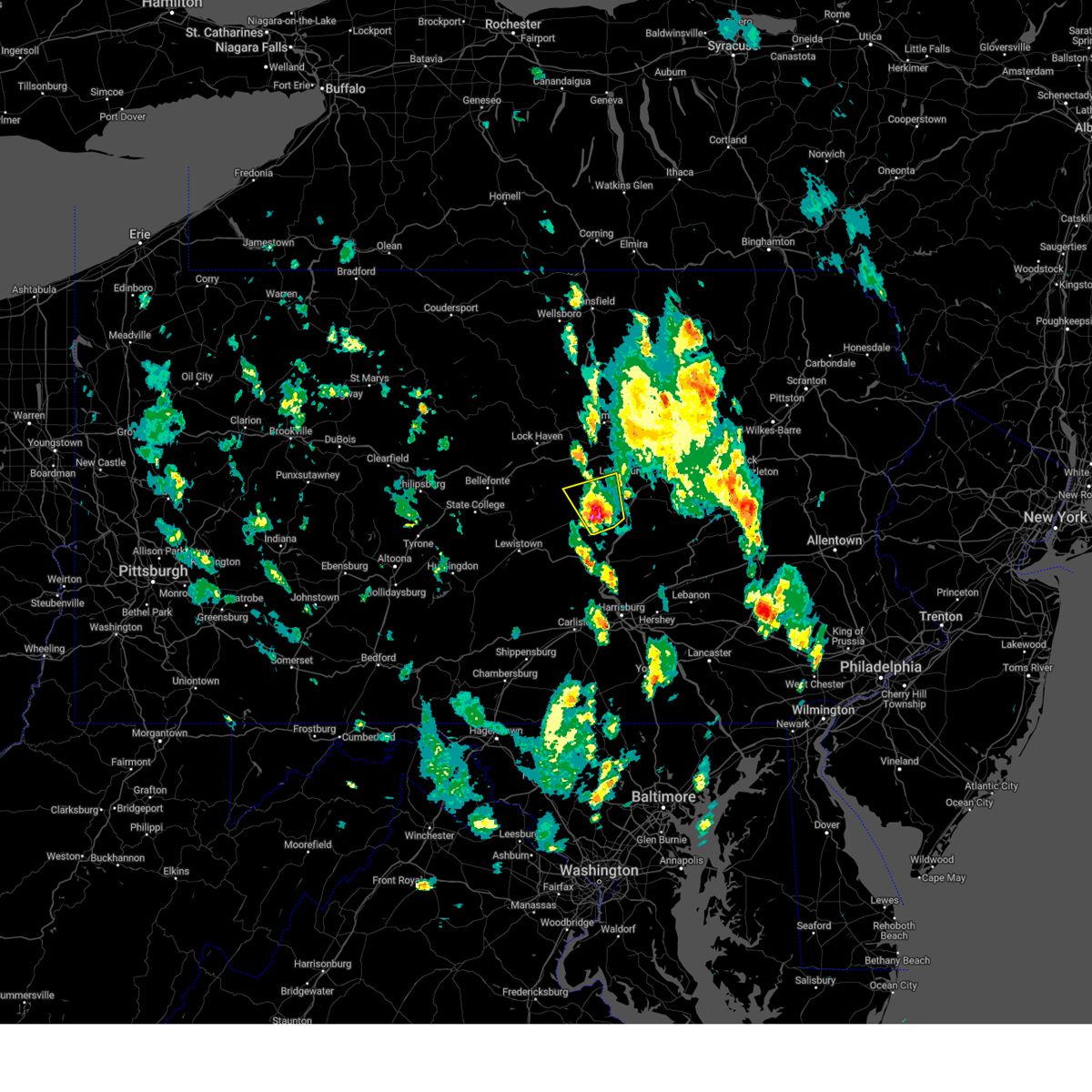
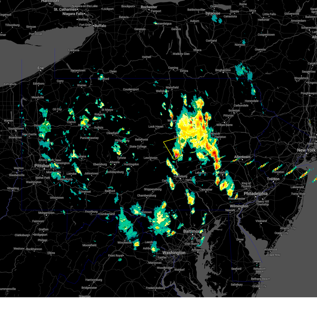
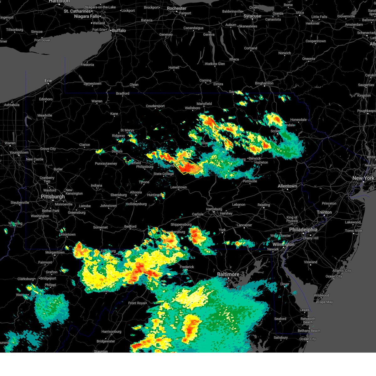
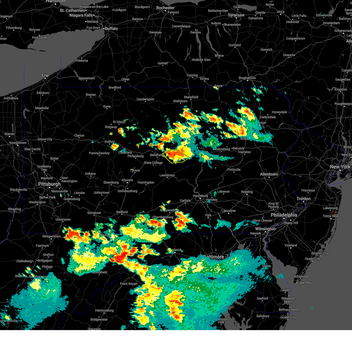
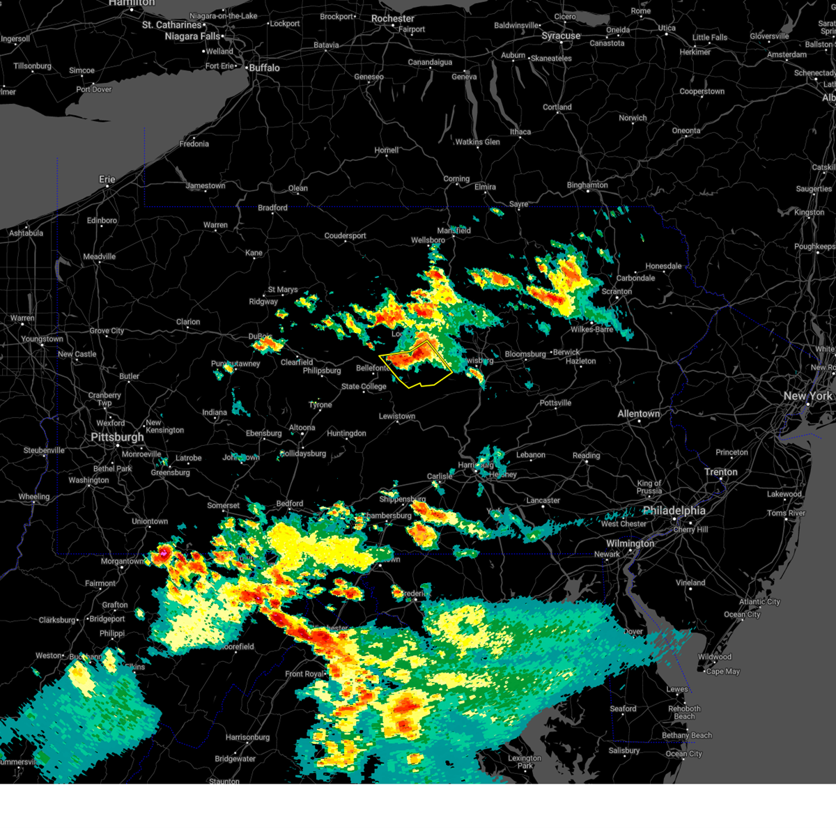
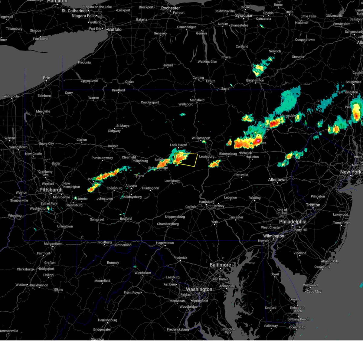
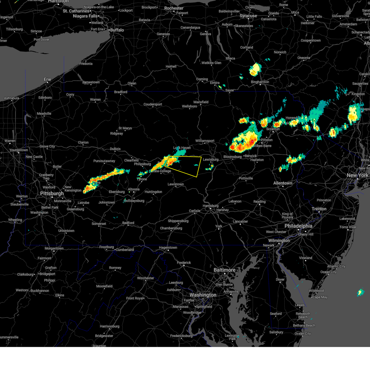
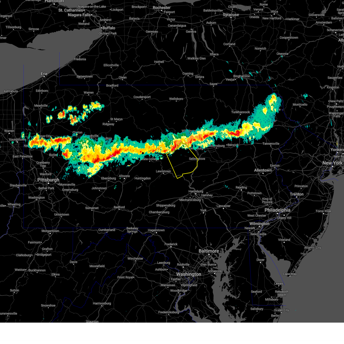
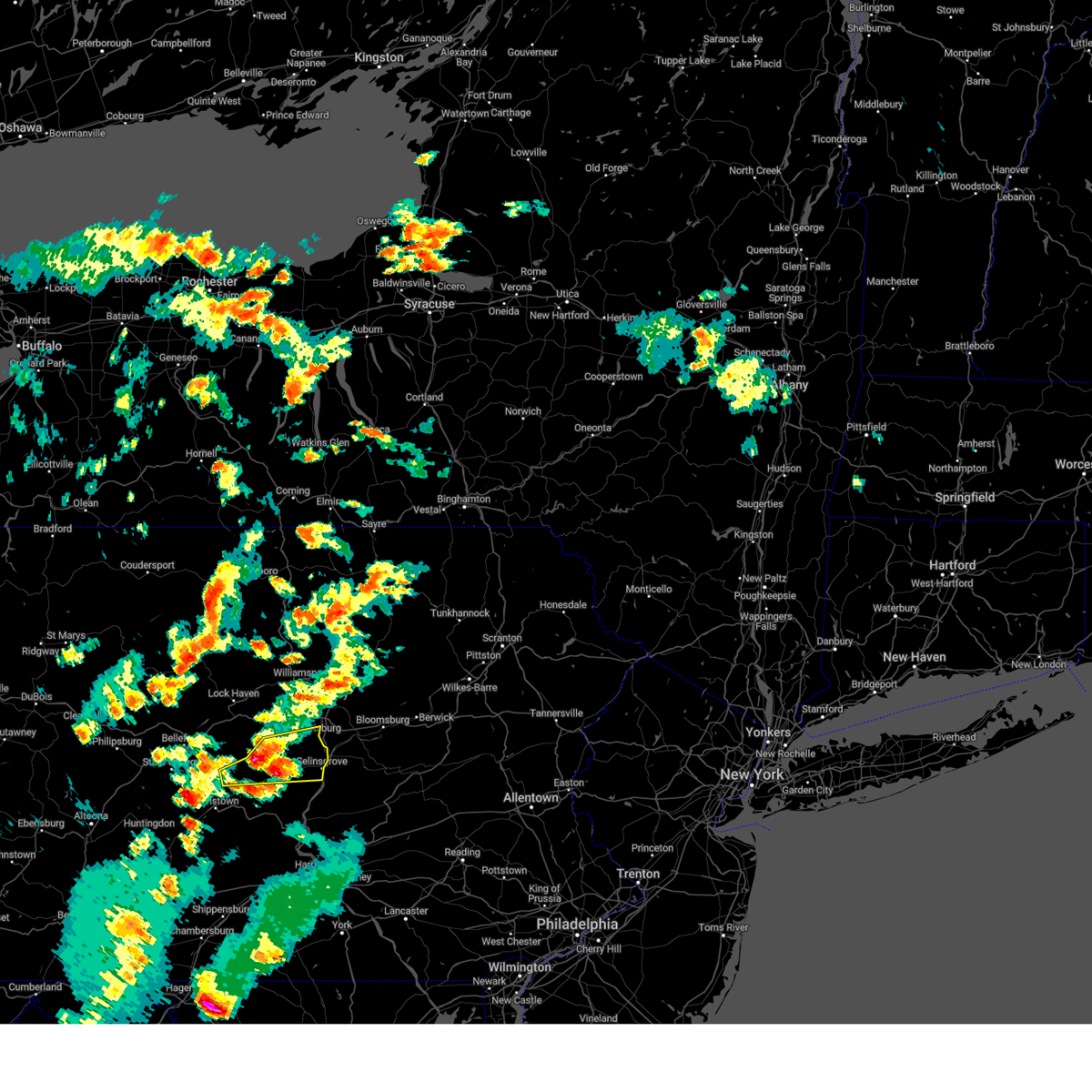
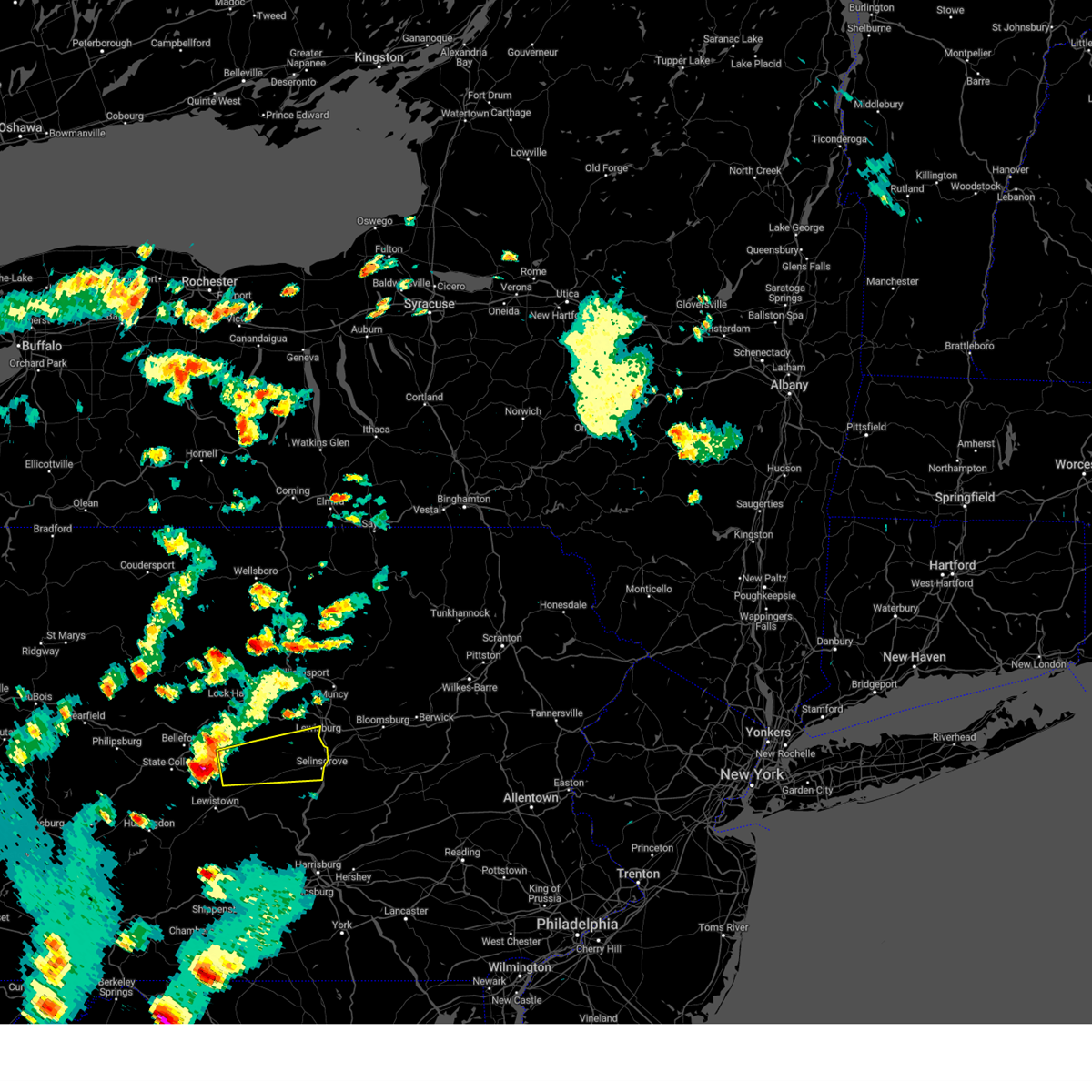
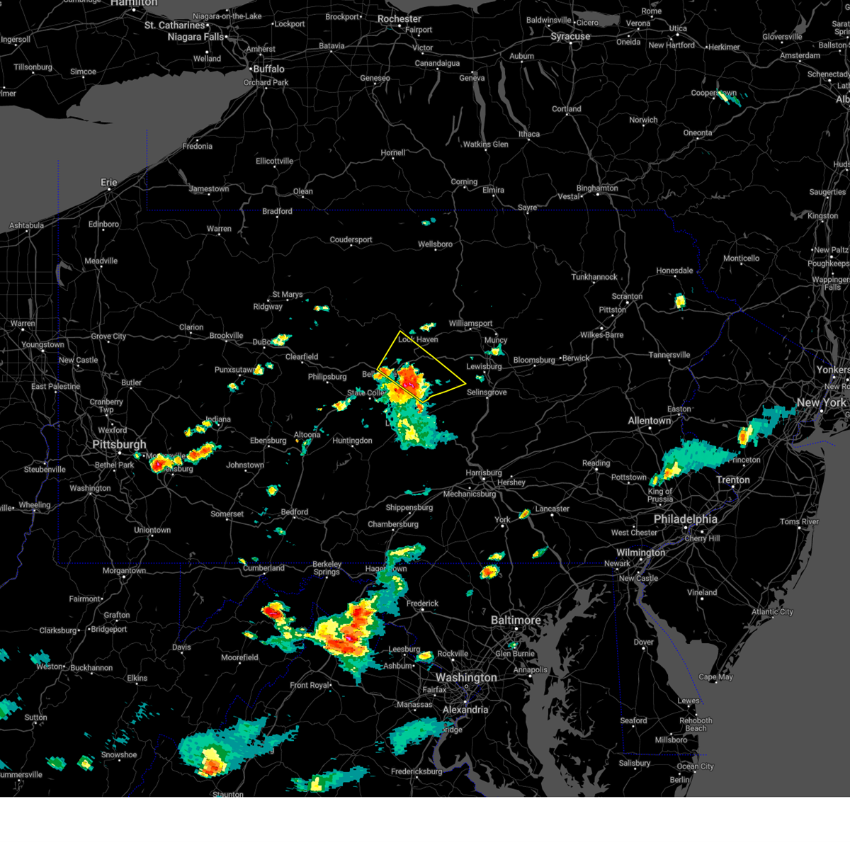
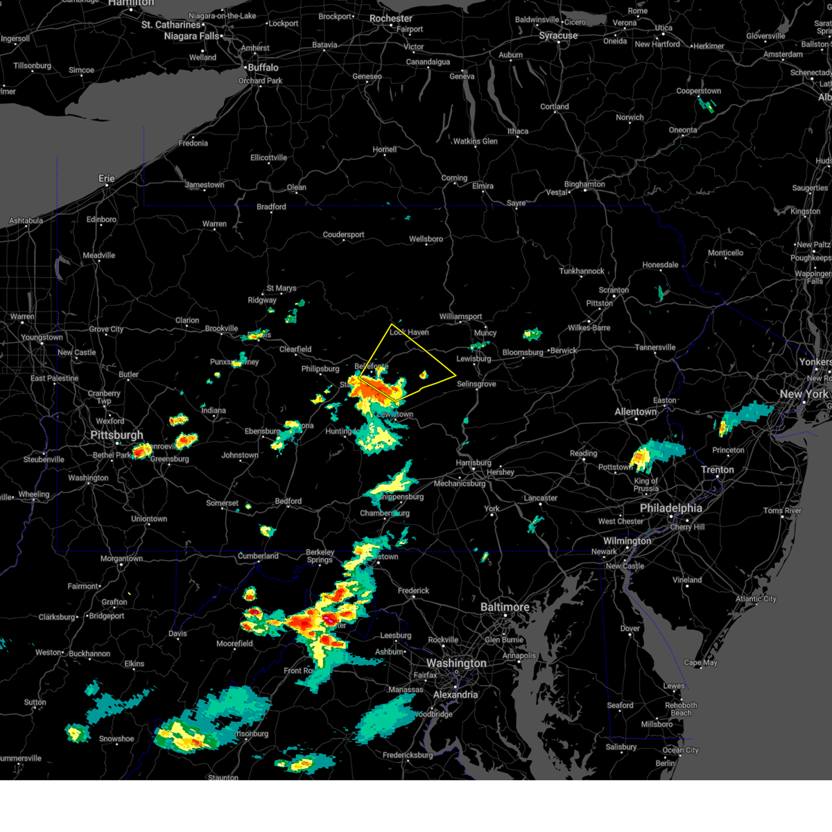
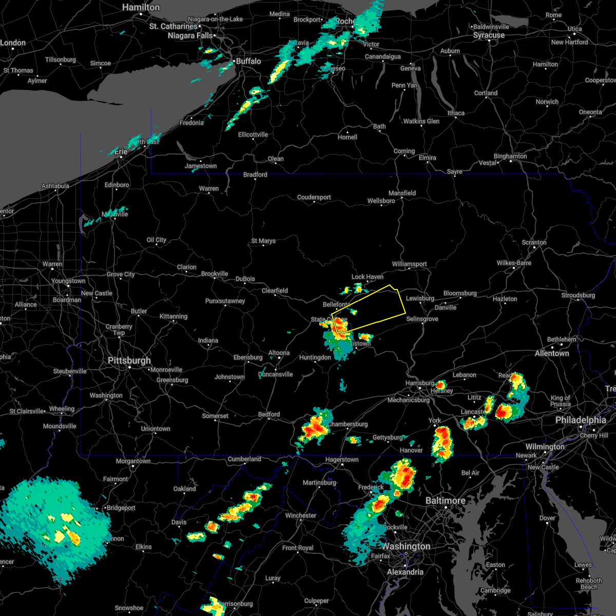
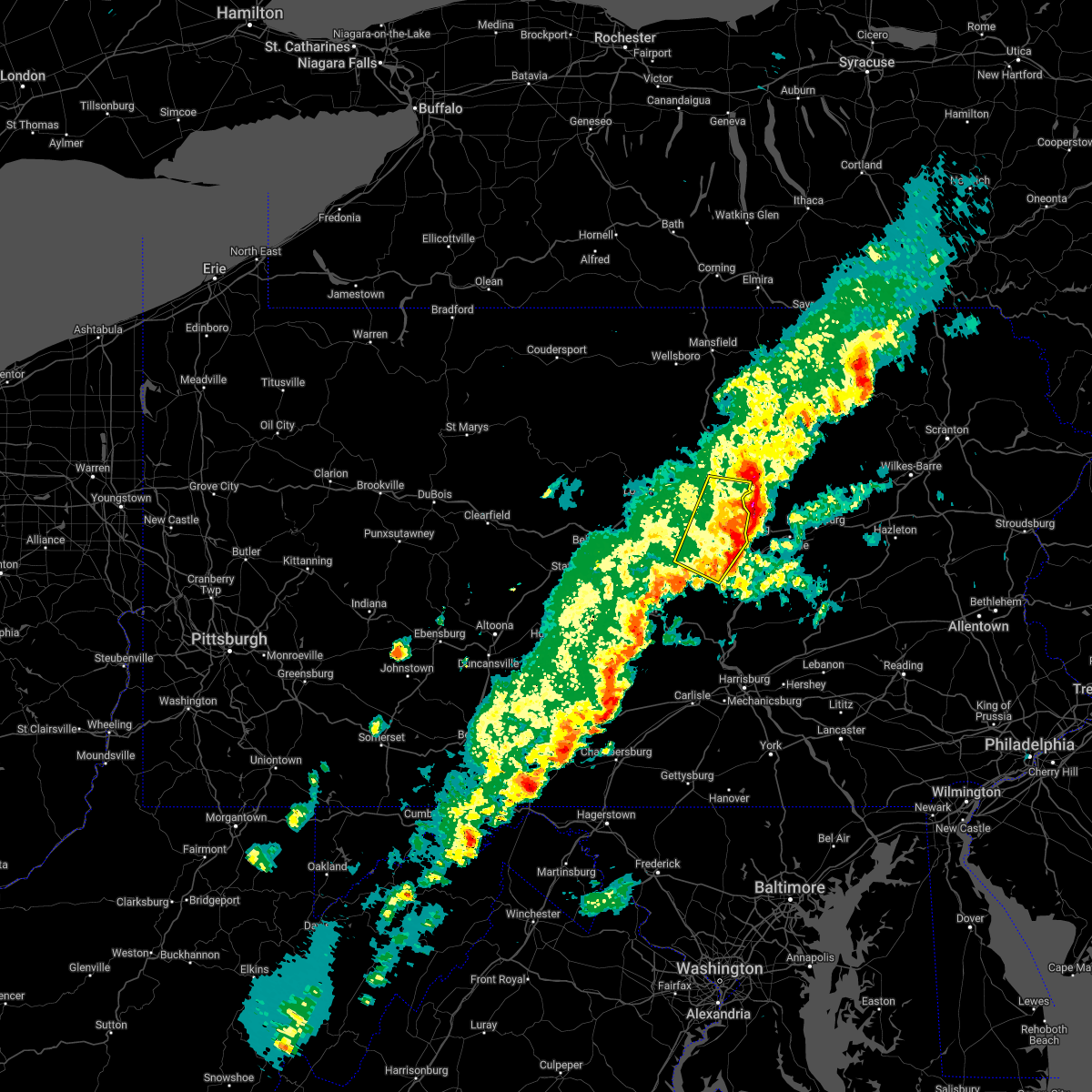
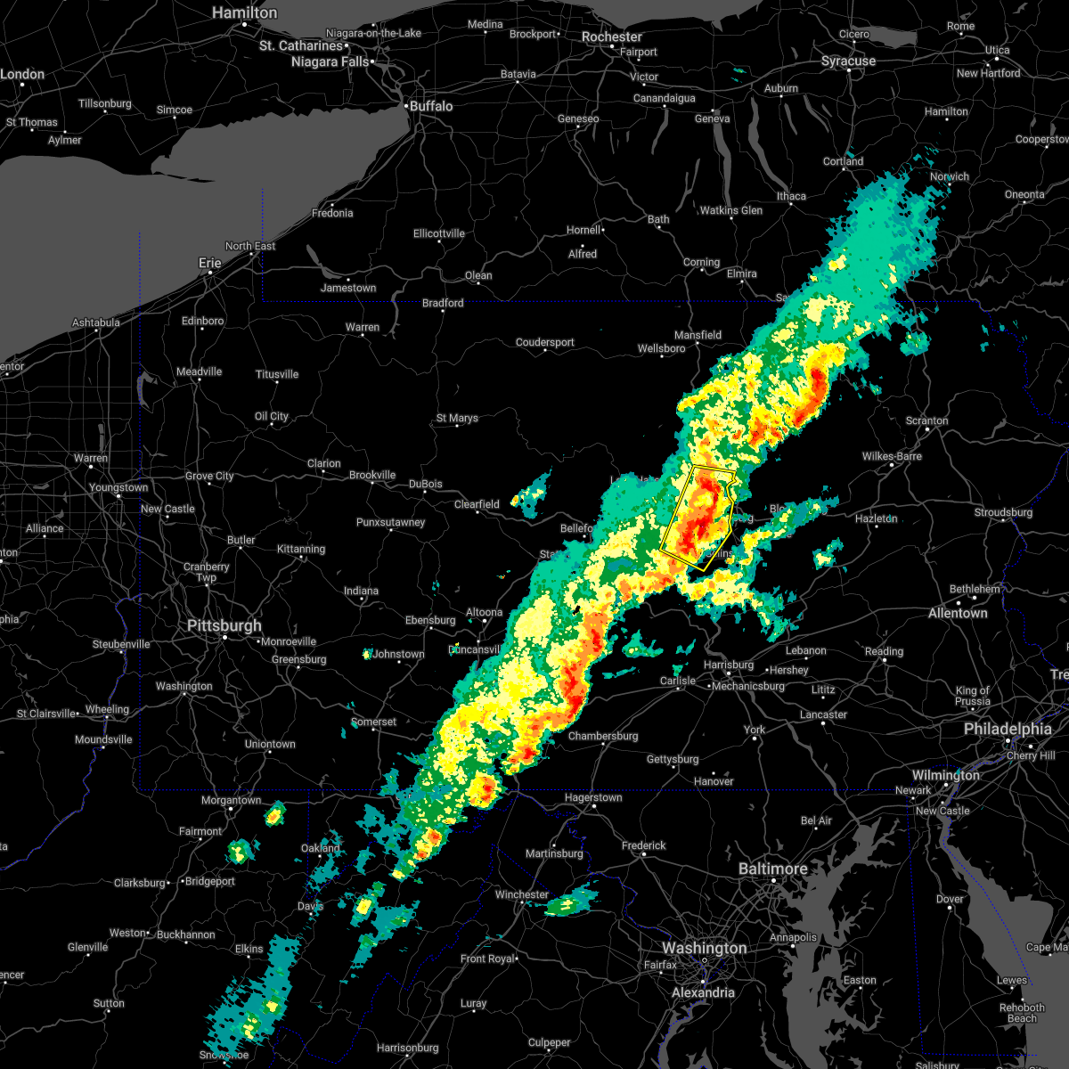
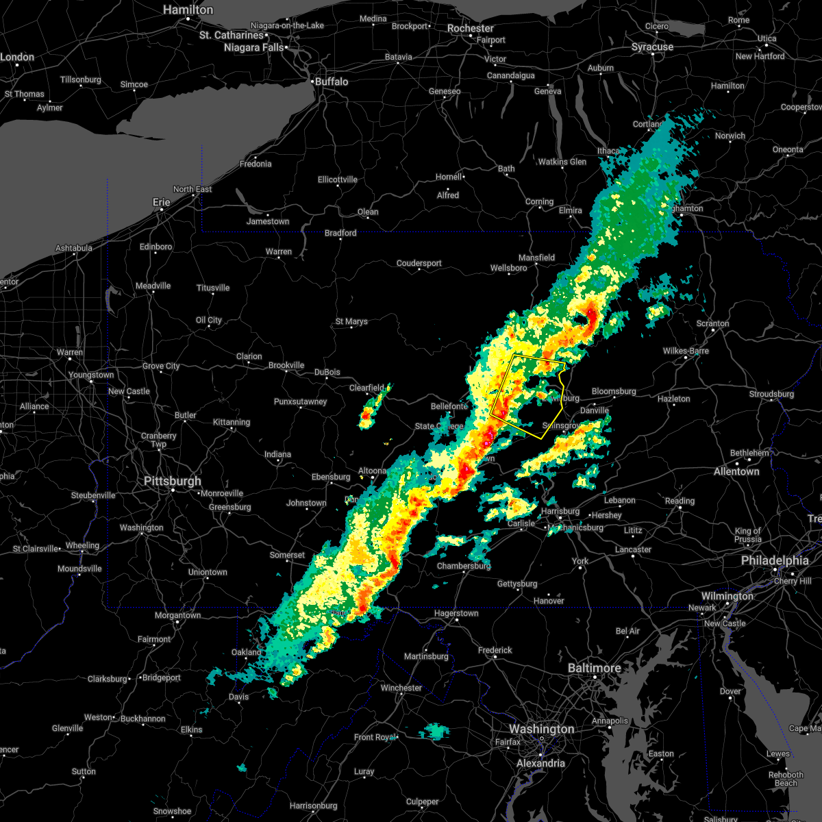
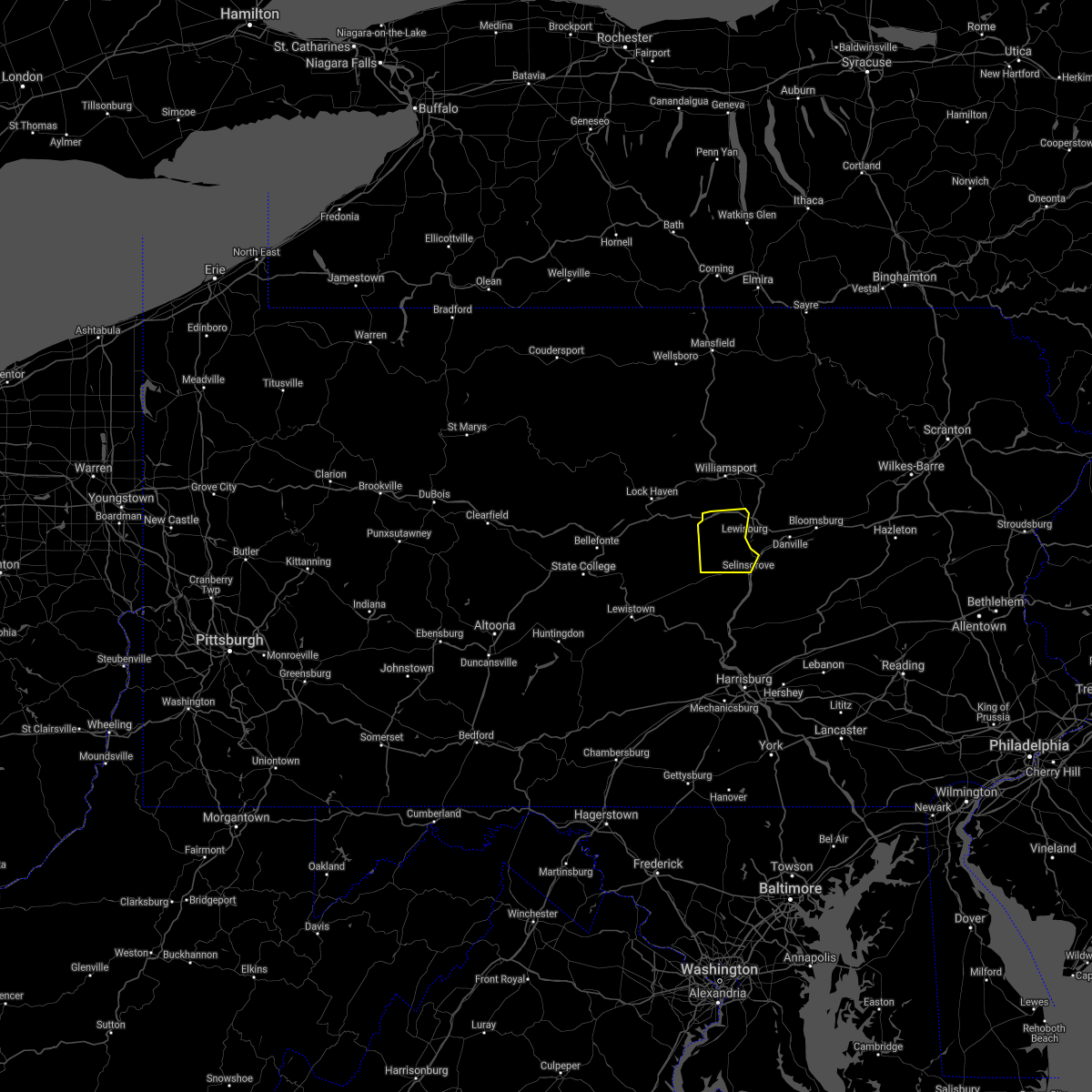
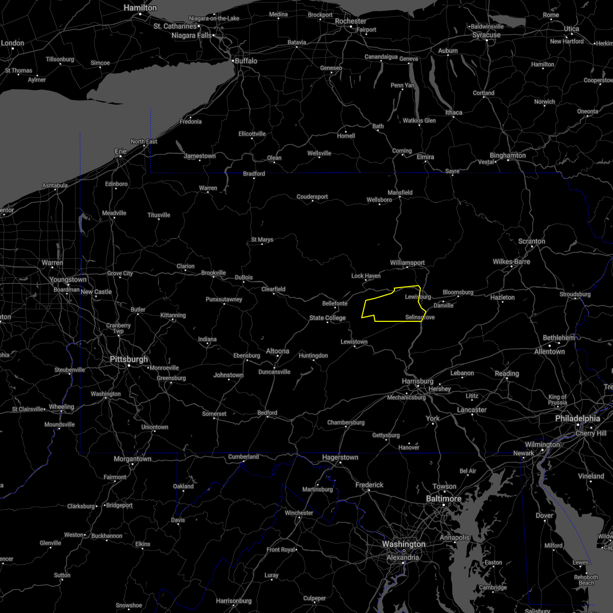
Hail Map for Hartleton, PA
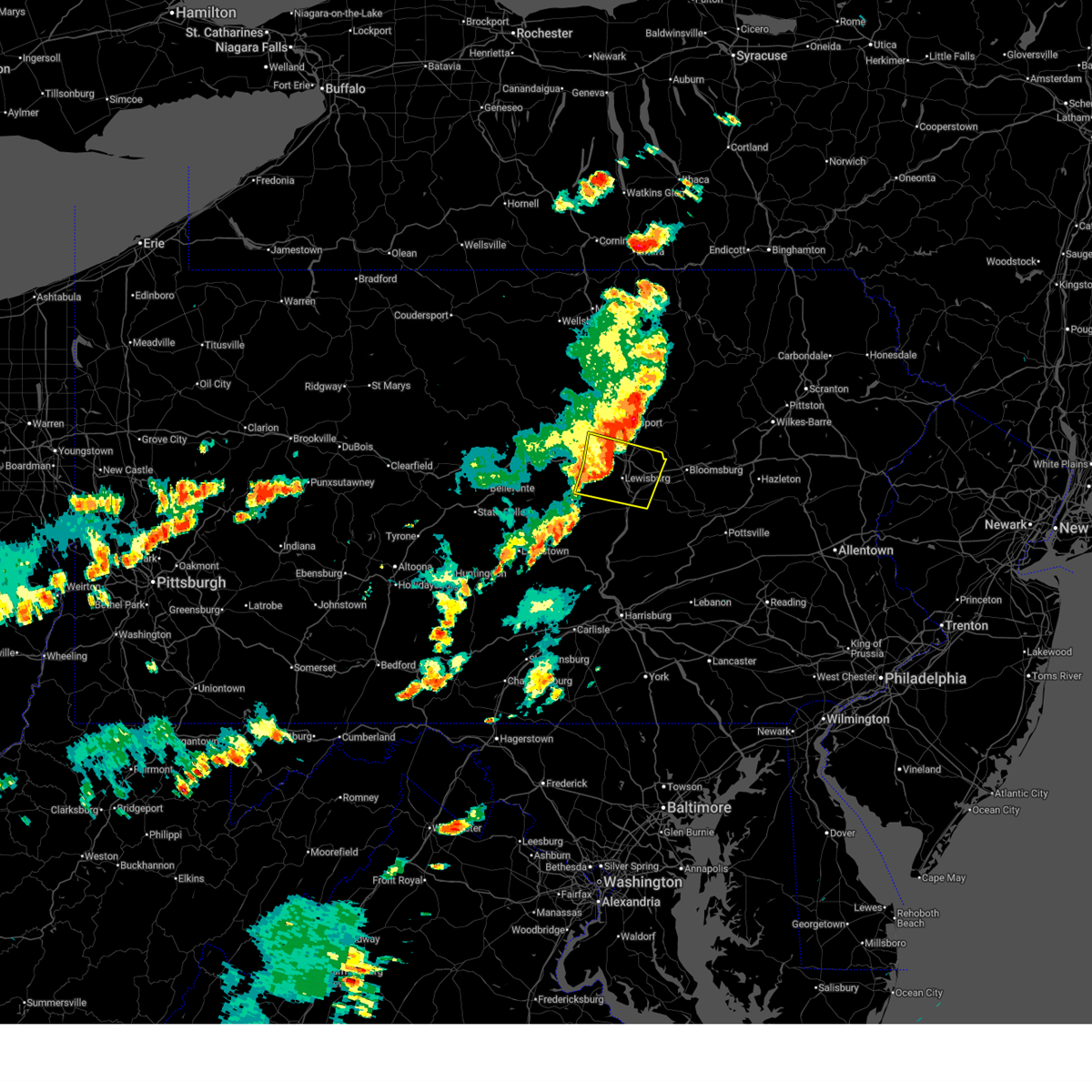
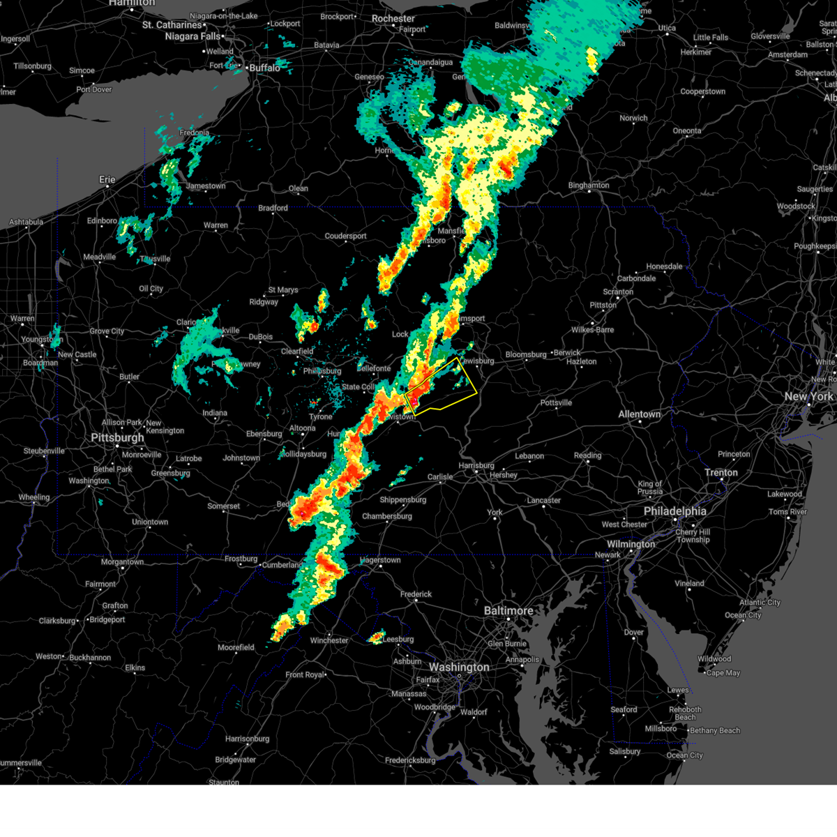
The Hartleton, PA area has had 0 reports of on-the-ground hail by trained spotters, and has been under severe weather warnings 20 times during the past 12 months. Doppler radar has detected hail at or near Hartleton, PA on 26 occasions, including 1 occasion during the past year.
| Name: | Hartleton, PA |
| Where Located: | 37.7 miles E of State College, PA |
| Map: | Google Map for Hartleton, PA |
| Population: | 283 |
| Housing Units: | 107 |
| More Info: | Search Google for Hartleton, PA |
0
The Top Recent Hail Date for Hartleton, PA is Thursday, August 29, 2024 (8th out of 26)

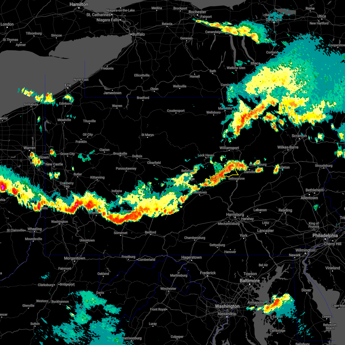
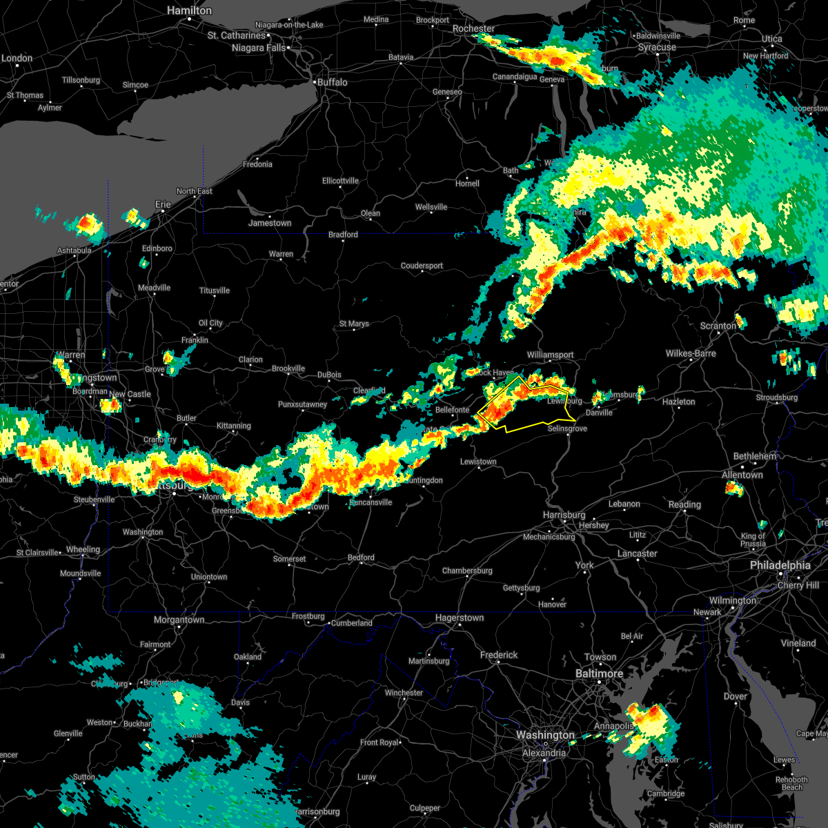
Hail and Wind Damage Spotted near Hartleton, PA
| Date / Time | Report Details |
|---|---|
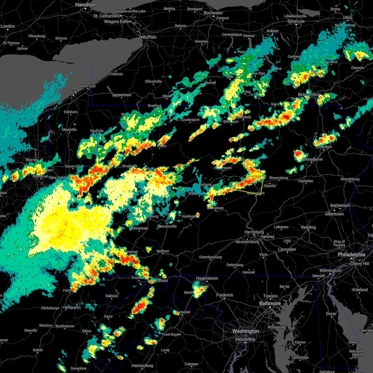
| 7/7/2025 7:55 PM EDT |
 At 755 pm edt, severe thunderstorms were located along a line extending from spruce run reservoir to laurelton center, moving east at 25 mph (radar indicated). Hazards include 60 mph wind gusts and penny size hail. Expect damage to roofs, siding, and trees. locations impacted include, mifflinburg, watsontown, middleburg, new columbia, kreamer, penns creek, allenwood, vicksburg, troxelville, weikert, r. b. winter state park, and spruce run reservoir. For those driving on interstate 80, this includes areas between the jersey shore and lewisburg-williamsport exits, specifically from mile markers 195 to 209. At 755 pm edt, severe thunderstorms were located along a line extending from spruce run reservoir to laurelton center, moving east at 25 mph (radar indicated). Hazards include 60 mph wind gusts and penny size hail. Expect damage to roofs, siding, and trees. locations impacted include, mifflinburg, watsontown, middleburg, new columbia, kreamer, penns creek, allenwood, vicksburg, troxelville, weikert, r. b. winter state park, and spruce run reservoir. For those driving on interstate 80, this includes areas between the jersey shore and lewisburg-williamsport exits, specifically from mile markers 195 to 209.
|
| 7/7/2025 7:55 PM EDT |
 the severe thunderstorm warning has been cancelled and is no longer in effect the severe thunderstorm warning has been cancelled and is no longer in effect
|
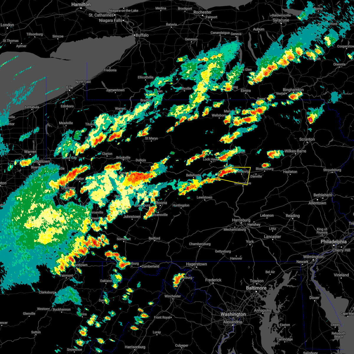
| 7/7/2025 7:16 PM EDT |
 Svrctp the national weather service in state college pa has issued a * severe thunderstorm warning for, southeastern centre county in central pennsylvania, southeastern clinton county in north central pennsylvania, south central lycoming county in north central pennsylvania, northeastern mifflin county in central pennsylvania, northwestern snyder county in central pennsylvania, union county in central pennsylvania, * until 815 pm edt. * at 715 pm edt, severe thunderstorms were located along a line extending from castanea to madisonburg, moving east at 20 mph (radar indicated). Hazards include 60 mph wind gusts and penny size hail. expect damage to roofs, siding, and trees Svrctp the national weather service in state college pa has issued a * severe thunderstorm warning for, southeastern centre county in central pennsylvania, southeastern clinton county in north central pennsylvania, south central lycoming county in north central pennsylvania, northeastern mifflin county in central pennsylvania, northwestern snyder county in central pennsylvania, union county in central pennsylvania, * until 815 pm edt. * at 715 pm edt, severe thunderstorms were located along a line extending from castanea to madisonburg, moving east at 20 mph (radar indicated). Hazards include 60 mph wind gusts and penny size hail. expect damage to roofs, siding, and trees
|
| 6/28/2025 4:15 PM EDT |
 The storms which prompted the warning have weakened below severe limits, and no longer pose an immediate threat to life or property. therefore, the warning has been allowed to expire. however, gusty winds are still possible with these thunderstorms. a severe thunderstorm watch remains in effect until 800 pm edt for central and north central pennsylvania. The storms which prompted the warning have weakened below severe limits, and no longer pose an immediate threat to life or property. therefore, the warning has been allowed to expire. however, gusty winds are still possible with these thunderstorms. a severe thunderstorm watch remains in effect until 800 pm edt for central and north central pennsylvania.
|
| 6/28/2025 4:02 PM EDT |
 At 402 pm edt, severe thunderstorms were located along a line extending from muncy to penns creek, moving east at 40 mph (radar indicated). Hazards include 60 mph wind gusts and penny size hail. Expect damage to roofs, siding, and trees. locations impacted include, sunbury, milton, lewisburg, northumberland, mifflinburg, winfield, watsontown, riverside, shamokin dam, linntown, hummels wharf, and new columbia. for those driving on interstate 80, this includes areas between the jersey shore and buckhorn exits, specifically from mile markers 196 to 225. This includes interstate 180 from mile markers 1 to 5. At 402 pm edt, severe thunderstorms were located along a line extending from muncy to penns creek, moving east at 40 mph (radar indicated). Hazards include 60 mph wind gusts and penny size hail. Expect damage to roofs, siding, and trees. locations impacted include, sunbury, milton, lewisburg, northumberland, mifflinburg, winfield, watsontown, riverside, shamokin dam, linntown, hummels wharf, and new columbia. for those driving on interstate 80, this includes areas between the jersey shore and buckhorn exits, specifically from mile markers 196 to 225. This includes interstate 180 from mile markers 1 to 5.
|
| 6/28/2025 4:02 PM EDT |
 the severe thunderstorm warning has been cancelled and is no longer in effect the severe thunderstorm warning has been cancelled and is no longer in effect
|
| 6/28/2025 3:47 PM EDT |
 the severe thunderstorm warning has been cancelled and is no longer in effect the severe thunderstorm warning has been cancelled and is no longer in effect
|
| 6/28/2025 3:47 PM EDT |
 At 346 pm edt, severe thunderstorms were located along a line extending from williamsport to laurelton center, moving east at 40 mph (radar indicated). Hazards include 60 mph wind gusts and penny size hail. Expect damage to roofs, siding, and trees. locations impacted include, sunbury, milton, lewisburg, selinsgrove, northumberland, mifflinburg, carroll, woodward, winfield, watsontown, riverside, and shamokin dam. for those driving on interstate 80, this includes areas between the loganton and buckhorn exits, specifically from mile markers 187 to 225. This includes interstate 180 from mile markers 1 to 5. At 346 pm edt, severe thunderstorms were located along a line extending from williamsport to laurelton center, moving east at 40 mph (radar indicated). Hazards include 60 mph wind gusts and penny size hail. Expect damage to roofs, siding, and trees. locations impacted include, sunbury, milton, lewisburg, selinsgrove, northumberland, mifflinburg, carroll, woodward, winfield, watsontown, riverside, and shamokin dam. for those driving on interstate 80, this includes areas between the loganton and buckhorn exits, specifically from mile markers 187 to 225. This includes interstate 180 from mile markers 1 to 5.
|
| 6/28/2025 3:25 PM EDT |
 Svrctp the national weather service in state college pa has issued a * severe thunderstorm warning for, southeastern centre county in central pennsylvania, southeastern clinton county in north central pennsylvania, southwestern lycoming county in north central pennsylvania, northeastern mifflin county in central pennsylvania, northwestern montour county in central pennsylvania, western northumberland county in central pennsylvania, snyder county in central pennsylvania, union county in central pennsylvania, * until 415 pm edt. * at 324 pm edt, severe thunderstorms were located along a line extending from jersey shore to coburn, moving east at 40 mph (radar indicated). Hazards include 60 mph wind gusts. expect damage to roofs, siding, and trees Svrctp the national weather service in state college pa has issued a * severe thunderstorm warning for, southeastern centre county in central pennsylvania, southeastern clinton county in north central pennsylvania, southwestern lycoming county in north central pennsylvania, northeastern mifflin county in central pennsylvania, northwestern montour county in central pennsylvania, western northumberland county in central pennsylvania, snyder county in central pennsylvania, union county in central pennsylvania, * until 415 pm edt. * at 324 pm edt, severe thunderstorms were located along a line extending from jersey shore to coburn, moving east at 40 mph (radar indicated). Hazards include 60 mph wind gusts. expect damage to roofs, siding, and trees
|
| 6/9/2025 9:56 PM EDT |
 Svrctp the national weather service in state college pa has issued a * severe thunderstorm warning for, northeastern mifflin county in central pennsylvania, snyder county in central pennsylvania, southwestern union county in central pennsylvania, * until 1045 pm edt. * at 956 pm edt, a severe thunderstorm was located over belltown, moving northeast at 25 mph (radar indicated). Hazards include 70 mph wind gusts and ping pong ball size hail. People and animals outdoors will be injured. expect hail damage to roofs, siding, windows, and vehicles. expect considerable tree damage. wind damage is also likely to mobile homes, roofs, and outbuildings. this severe thunderstorm will be near, mcclure and snyder-middleswart state park around 1000 pm edt. beaver springs and troxelville around 1010 pm edt. penns creek around 1030 pm edt. mifflinburg around 1040 pm edt. Other locations impacted by this severe thunderstorm include beavertown, new berlin, wagner, and hartleton. Svrctp the national weather service in state college pa has issued a * severe thunderstorm warning for, northeastern mifflin county in central pennsylvania, snyder county in central pennsylvania, southwestern union county in central pennsylvania, * until 1045 pm edt. * at 956 pm edt, a severe thunderstorm was located over belltown, moving northeast at 25 mph (radar indicated). Hazards include 70 mph wind gusts and ping pong ball size hail. People and animals outdoors will be injured. expect hail damage to roofs, siding, windows, and vehicles. expect considerable tree damage. wind damage is also likely to mobile homes, roofs, and outbuildings. this severe thunderstorm will be near, mcclure and snyder-middleswart state park around 1000 pm edt. beaver springs and troxelville around 1010 pm edt. penns creek around 1030 pm edt. mifflinburg around 1040 pm edt. Other locations impacted by this severe thunderstorm include beavertown, new berlin, wagner, and hartleton.
|
| 6/9/2025 9:11 PM EDT |
 Svrctp the national weather service in state college pa has issued a * severe thunderstorm warning for, southeastern centre county in central pennsylvania, northeastern mifflin county in central pennsylvania, northwestern snyder county in central pennsylvania, southwestern union county in central pennsylvania, * until 1000 pm edt. * at 911 pm edt, a severe thunderstorm was located over poe valley state park, moving northeast at 30 mph (radar indicated). Hazards include 60 mph wind gusts and half dollar size hail. Hail damage to vehicles is expected. Expect wind damage to roofs, siding, and trees. Svrctp the national weather service in state college pa has issued a * severe thunderstorm warning for, southeastern centre county in central pennsylvania, northeastern mifflin county in central pennsylvania, northwestern snyder county in central pennsylvania, southwestern union county in central pennsylvania, * until 1000 pm edt. * at 911 pm edt, a severe thunderstorm was located over poe valley state park, moving northeast at 30 mph (radar indicated). Hazards include 60 mph wind gusts and half dollar size hail. Hail damage to vehicles is expected. Expect wind damage to roofs, siding, and trees.
|
| 5/6/2025 2:38 PM EDT | The storm which prompted the warning has weakened below severe limits, and has exited the warned area. therefore, the warning will be allowed to expire. however, gusty winds are still possible with this thunderstorm. |
| 5/6/2025 2:32 PM EDT |
 At 232 pm edt, a severe thunderstorm was located over mifflinburg, moving north at 30 mph (radar indicated). Hazards include 60 mph wind gusts and quarter size hail. Hail damage to vehicles is expected. expect wind damage to roofs, siding, and trees. Locations impacted include, mifflinburg, penns creek, vicksburg, new berlin, and hartleton. At 232 pm edt, a severe thunderstorm was located over mifflinburg, moving north at 30 mph (radar indicated). Hazards include 60 mph wind gusts and quarter size hail. Hail damage to vehicles is expected. expect wind damage to roofs, siding, and trees. Locations impacted include, mifflinburg, penns creek, vicksburg, new berlin, and hartleton.
|
| 5/6/2025 2:12 PM EDT |
 At 211 pm edt, a severe thunderstorm was located over middleburg, moving north at 30 mph (radar indicated). Hazards include 60 mph wind gusts and quarter size hail. Hail damage to vehicles is expected. expect wind damage to roofs, siding, and trees. Locations impacted include, selinsgrove, mifflinburg, middleburg, kreamer, penns creek, mount pleasant mills, kratzerville, paxtonville, vicksburg, troxelville, laurelton center, and fremont. At 211 pm edt, a severe thunderstorm was located over middleburg, moving north at 30 mph (radar indicated). Hazards include 60 mph wind gusts and quarter size hail. Hail damage to vehicles is expected. expect wind damage to roofs, siding, and trees. Locations impacted include, selinsgrove, mifflinburg, middleburg, kreamer, penns creek, mount pleasant mills, kratzerville, paxtonville, vicksburg, troxelville, laurelton center, and fremont.
|
| 5/6/2025 2:12 PM EDT |
 the severe thunderstorm warning has been cancelled and is no longer in effect the severe thunderstorm warning has been cancelled and is no longer in effect
|
| 5/6/2025 1:55 PM EDT |
 Svrctp the national weather service in state college pa has issued a * severe thunderstorm warning for, northeastern juniata county in central pennsylvania, snyder county in central pennsylvania, southern union county in central pennsylvania, * until 245 pm edt. * at 154 pm edt, a severe thunderstorm was located over meiserville, moving north at 25 mph (radar indicated). Hazards include 60 mph wind gusts and quarter size hail. Hail damage to vehicles is expected. Expect wind damage to roofs, siding, and trees. Svrctp the national weather service in state college pa has issued a * severe thunderstorm warning for, northeastern juniata county in central pennsylvania, snyder county in central pennsylvania, southern union county in central pennsylvania, * until 245 pm edt. * at 154 pm edt, a severe thunderstorm was located over meiserville, moving north at 25 mph (radar indicated). Hazards include 60 mph wind gusts and quarter size hail. Hail damage to vehicles is expected. Expect wind damage to roofs, siding, and trees.
|
| 4/29/2025 7:16 PM EDT | Svrctp the national weather service in state college pa has issued a * severe thunderstorm warning for, juniata county in central pennsylvania, lycoming county in north central pennsylvania, northeastern mifflin county in central pennsylvania, montour county in central pennsylvania, northumberland county in central pennsylvania, northern perry county in south central pennsylvania, snyder county in central pennsylvania, union county in central pennsylvania, * until 815 pm edt. * at 716 pm edt, severe thunderstorms were located along a line extending from tamarack to dunnstown to rebersburg to walnut, moving east at 60 mph (radar indicated). Hazards include 60 mph wind gusts. expect damage to roofs, siding, and trees |
| 8/29/2024 8:29 PM EDT |
 The storms which prompted the warning have moved out of the area. therefore, the warning will be allowed to expire. however, small hail and damaging winds are still possible with these thunderstorms. a severe thunderstorm watch remains in effect until 1100 pm edt for central pennsylvania. The storms which prompted the warning have moved out of the area. therefore, the warning will be allowed to expire. however, small hail and damaging winds are still possible with these thunderstorms. a severe thunderstorm watch remains in effect until 1100 pm edt for central pennsylvania.
|
| 8/29/2024 8:06 PM EDT |
 At 805 pm edt, severe thunderstorms were located along a line extending from r.b. winter state park to woodward to millheim, moving southeast at 20 mph (radar indicated). Hazards include 60 mph wind gusts and quarter size hail. Hail damage to vehicles is expected. expect wind damage to roofs, siding, and trees. locations impacted include, woodward, lamar, millheim, aaronsburg, rebersburg, coburn, madisonburg, weikert, laurelton center, poe valley state park, and hartleton. For those driving on interstate 80, this includes areas between the bellefonte and lamar exits, specifically from mile markers 164 to 166. At 805 pm edt, severe thunderstorms were located along a line extending from r.b. winter state park to woodward to millheim, moving southeast at 20 mph (radar indicated). Hazards include 60 mph wind gusts and quarter size hail. Hail damage to vehicles is expected. expect wind damage to roofs, siding, and trees. locations impacted include, woodward, lamar, millheim, aaronsburg, rebersburg, coburn, madisonburg, weikert, laurelton center, poe valley state park, and hartleton. For those driving on interstate 80, this includes areas between the bellefonte and lamar exits, specifically from mile markers 164 to 166.
|
| 8/29/2024 7:39 PM EDT |
 Svrctp the national weather service in state college pa has issued a * severe thunderstorm warning for, east central centre county in central pennsylvania, southeastern clinton county in north central pennsylvania, southwestern union county in central pennsylvania, * until 830 pm edt. * at 739 pm edt, severe thunderstorms were located along a line extending from carroll to madisonburg to lamar, moving southeast at 20 mph (radar indicated). Hazards include 60 mph wind gusts and quarter size hail. Hail damage to vehicles is expected. Expect wind damage to roofs, siding, and trees. Svrctp the national weather service in state college pa has issued a * severe thunderstorm warning for, east central centre county in central pennsylvania, southeastern clinton county in north central pennsylvania, southwestern union county in central pennsylvania, * until 830 pm edt. * at 739 pm edt, severe thunderstorms were located along a line extending from carroll to madisonburg to lamar, moving southeast at 20 mph (radar indicated). Hazards include 60 mph wind gusts and quarter size hail. Hail damage to vehicles is expected. Expect wind damage to roofs, siding, and trees.
|
| 6/30/2024 1:37 PM EDT | Trees down on wires along kaiser run roa in union county PA, 2.5 miles WSW of Hartleton, PA |
| 6/30/2024 1:30 PM EDT |
 Svrctp the national weather service in state college pa has issued a * severe thunderstorm warning for, south central columbia county in central pennsylvania, southern montour county in central pennsylvania, northumberland county in central pennsylvania, northeastern snyder county in central pennsylvania, southern union county in central pennsylvania, * until 215 pm edt. * at 129 pm edt, a severe thunderstorm was located over laurelton center, moving east at 55 mph (radar indicated). Hazards include 60 mph wind gusts and quarter size hail. Hail damage to vehicles is expected. Expect wind damage to roofs, siding, and trees. Svrctp the national weather service in state college pa has issued a * severe thunderstorm warning for, south central columbia county in central pennsylvania, southern montour county in central pennsylvania, northumberland county in central pennsylvania, northeastern snyder county in central pennsylvania, southern union county in central pennsylvania, * until 215 pm edt. * at 129 pm edt, a severe thunderstorm was located over laurelton center, moving east at 55 mph (radar indicated). Hazards include 60 mph wind gusts and quarter size hail. Hail damage to vehicles is expected. Expect wind damage to roofs, siding, and trees.
|
| 6/30/2024 1:15 PM EDT |
 the severe thunderstorm warning has been cancelled and is no longer in effect the severe thunderstorm warning has been cancelled and is no longer in effect
|
| 6/30/2024 1:15 PM EDT |
 At 114 pm edt, a severe thunderstorm was located over woodward, moving east at 40 mph (radar indicated). Hazards include 60 mph wind gusts and quarter size hail. Hail damage to vehicles is expected. expect wind damage to roofs, siding, and trees. locations impacted include, woodward, lamar, millheim, aaronsburg, rebersburg, madisonburg, laurelton center, r. b. winter state park, loganton, hartleton, and mccall dam state park. For those driving on interstate 80, this includes areas between the lamar and lock haven exits, specifically from mile markers 173 to 177. At 114 pm edt, a severe thunderstorm was located over woodward, moving east at 40 mph (radar indicated). Hazards include 60 mph wind gusts and quarter size hail. Hail damage to vehicles is expected. expect wind damage to roofs, siding, and trees. locations impacted include, woodward, lamar, millheim, aaronsburg, rebersburg, madisonburg, laurelton center, r. b. winter state park, loganton, hartleton, and mccall dam state park. For those driving on interstate 80, this includes areas between the lamar and lock haven exits, specifically from mile markers 173 to 177.
|
| 6/30/2024 12:55 PM EDT |
 Svrctp the national weather service in state college pa has issued a * severe thunderstorm warning for, east central centre county in central pennsylvania, southeastern clinton county in north central pennsylvania, northeastern mifflin county in central pennsylvania, northwestern snyder county in central pennsylvania, southwestern union county in central pennsylvania, * until 130 pm edt. * at 1254 pm edt, a severe thunderstorm was located over zion, moving east at 40 mph (radar indicated). Hazards include 60 mph wind gusts and quarter size hail. Hail damage to vehicles is expected. Expect wind damage to roofs, siding, and trees. Svrctp the national weather service in state college pa has issued a * severe thunderstorm warning for, east central centre county in central pennsylvania, southeastern clinton county in north central pennsylvania, northeastern mifflin county in central pennsylvania, northwestern snyder county in central pennsylvania, southwestern union county in central pennsylvania, * until 130 pm edt. * at 1254 pm edt, a severe thunderstorm was located over zion, moving east at 40 mph (radar indicated). Hazards include 60 mph wind gusts and quarter size hail. Hail damage to vehicles is expected. Expect wind damage to roofs, siding, and trees.
|
| 6/29/2024 4:53 PM EDT |
 At 452 pm edt, severe thunderstorms were located along a line extending from spruce run reservoir to troxelville to reedsville, moving east at 30 mph (radar indicated). Hazards include 60 mph wind gusts. Expect damage to roofs, siding, and trees. Locations impacted include, mifflinburg, milroy, middleburg, mcclure, kreamer, penns creek, beaver springs, paxtonville, troxelville, belltown, weikert, and snyder-middleswart state park. At 452 pm edt, severe thunderstorms were located along a line extending from spruce run reservoir to troxelville to reedsville, moving east at 30 mph (radar indicated). Hazards include 60 mph wind gusts. Expect damage to roofs, siding, and trees. Locations impacted include, mifflinburg, milroy, middleburg, mcclure, kreamer, penns creek, beaver springs, paxtonville, troxelville, belltown, weikert, and snyder-middleswart state park.
|
| 6/29/2024 4:53 PM EDT |
 the severe thunderstorm warning has been cancelled and is no longer in effect the severe thunderstorm warning has been cancelled and is no longer in effect
|
| 6/29/2024 4:32 PM EDT |
 At 431 pm edt, severe thunderstorms were located along a line extending from carroll to poe valley state park to near mcalevys fort, moving east at 30 mph (radar indicated). Hazards include 60 mph wind gusts. Expect damage to roofs, siding, and trees. locations impacted include, mifflinburg, carroll, woodward, milroy, middleburg, new columbia, mcclure, millheim, kreamer, penns creek, beaver springs, and aaronsburg. For those driving on interstate 80, this includes areas between the lock haven and milton-williamsport exits, specifically between mile markers 180 and 198, and from mile markers 209 to 210. At 431 pm edt, severe thunderstorms were located along a line extending from carroll to poe valley state park to near mcalevys fort, moving east at 30 mph (radar indicated). Hazards include 60 mph wind gusts. Expect damage to roofs, siding, and trees. locations impacted include, mifflinburg, carroll, woodward, milroy, middleburg, new columbia, mcclure, millheim, kreamer, penns creek, beaver springs, and aaronsburg. For those driving on interstate 80, this includes areas between the lock haven and milton-williamsport exits, specifically between mile markers 180 and 198, and from mile markers 209 to 210.
|
| 6/29/2024 4:13 PM EDT |
 Svrctp the national weather service in state college pa has issued a * severe thunderstorm warning for, southeastern centre county in central pennsylvania, southeastern clinton county in north central pennsylvania, northeastern huntingdon county in central pennsylvania, northeastern mifflin county in central pennsylvania, northwestern snyder county in central pennsylvania, union county in central pennsylvania, * until 500 pm edt. * at 412 pm edt, severe thunderstorms were located along a line extending from near castanea to spring mills to ramblewood, moving east at 30 mph (radar indicated). Hazards include 60 mph wind gusts. expect damage to roofs, siding, and trees Svrctp the national weather service in state college pa has issued a * severe thunderstorm warning for, southeastern centre county in central pennsylvania, southeastern clinton county in north central pennsylvania, northeastern huntingdon county in central pennsylvania, northeastern mifflin county in central pennsylvania, northwestern snyder county in central pennsylvania, union county in central pennsylvania, * until 500 pm edt. * at 412 pm edt, severe thunderstorms were located along a line extending from near castanea to spring mills to ramblewood, moving east at 30 mph (radar indicated). Hazards include 60 mph wind gusts. expect damage to roofs, siding, and trees
|
| 5/23/2024 6:08 AM EDT |
 Svrctp the national weather service in state college pa has issued a * severe thunderstorm warning for, southwestern columbia county in central pennsylvania, montour county in central pennsylvania, central northumberland county in central pennsylvania, northeastern snyder county in central pennsylvania, central union county in central pennsylvania, * until 700 am edt. * at 606 am edt, a severe thunderstorm was located over penns creek, moving east northeast 40 mph (radar indicated). Hazards include 60 mph wind gusts and penny size hail. expect damage to roofs, siding, and trees Svrctp the national weather service in state college pa has issued a * severe thunderstorm warning for, southwestern columbia county in central pennsylvania, montour county in central pennsylvania, central northumberland county in central pennsylvania, northeastern snyder county in central pennsylvania, central union county in central pennsylvania, * until 700 am edt. * at 606 am edt, a severe thunderstorm was located over penns creek, moving east northeast 40 mph (radar indicated). Hazards include 60 mph wind gusts and penny size hail. expect damage to roofs, siding, and trees
|
| 5/23/2024 5:35 AM EDT |
 Svrctp the national weather service in state college pa has issued a * severe thunderstorm warning for, southeastern centre county in central pennsylvania, north central juniata county in central pennsylvania, northeastern mifflin county in central pennsylvania, snyder county in central pennsylvania, union county in central pennsylvania, * until 615 am edt. * at 532 am edt, a severe thunderstorm was located over poe valley state park, moving east northeast at 50 mph (radar indicated). Hazards include 70 mph wind gusts and penny size hail. Expect considerable tree damage. damage is likely to mobile homes, roofs, and outbuildings. Numerous reports of downed trees have occurred with this storm over the past 30 minutes. Svrctp the national weather service in state college pa has issued a * severe thunderstorm warning for, southeastern centre county in central pennsylvania, north central juniata county in central pennsylvania, northeastern mifflin county in central pennsylvania, snyder county in central pennsylvania, union county in central pennsylvania, * until 615 am edt. * at 532 am edt, a severe thunderstorm was located over poe valley state park, moving east northeast at 50 mph (radar indicated). Hazards include 70 mph wind gusts and penny size hail. Expect considerable tree damage. damage is likely to mobile homes, roofs, and outbuildings. Numerous reports of downed trees have occurred with this storm over the past 30 minutes.
|
| 4/14/2024 7:05 PM EDT |
 Svrctp the national weather service in state college pa has issued a * severe thunderstorm warning for, east central centre county in central pennsylvania, southeastern clinton county in north central pennsylvania, northeastern juniata county in central pennsylvania, northeastern mifflin county in central pennsylvania, snyder county in central pennsylvania, southern union county in central pennsylvania, * until 730 pm edt. * at 704 pm edt, severe thunderstorms were located along a line extending from sand bridge state park to laurelton center to snyder-middleswart state park, moving southeast at 50 mph (radar indicated). Hazards include 60 mph wind gusts and penny size hail. expect damage to roofs, siding, and trees Svrctp the national weather service in state college pa has issued a * severe thunderstorm warning for, east central centre county in central pennsylvania, southeastern clinton county in north central pennsylvania, northeastern juniata county in central pennsylvania, northeastern mifflin county in central pennsylvania, snyder county in central pennsylvania, southern union county in central pennsylvania, * until 730 pm edt. * at 704 pm edt, severe thunderstorms were located along a line extending from sand bridge state park to laurelton center to snyder-middleswart state park, moving southeast at 50 mph (radar indicated). Hazards include 60 mph wind gusts and penny size hail. expect damage to roofs, siding, and trees
|
| 8/7/2023 3:45 PM EDT |
 At 345 pm edt, a severe thunderstorm was located over milroy, moving northeast at 25 mph (radar indicated). Hazards include 60 mph wind gusts and half dollar size hail. Hail damage to vehicles is expected. expect wind damage to roofs, siding, and trees. this severe thunderstorm will be near, reeds gap state park and alfarata around 350 pm edt. belltown around 400 pm edt. mcclure around 410 pm edt. snyder-middleswart state park and weikert around 420 pm edt. troxelville, beaver springs and laurelton center around 430 pm edt. other locations impacted by this severe thunderstorm include siglerville, beavertown, maitland, wagner and hartleton. radar has indicated rotation within this severe thunderstorm. Although a tornado is not immediately likely, tornadoes can develop quickly during severe thunderstorms. At 345 pm edt, a severe thunderstorm was located over milroy, moving northeast at 25 mph (radar indicated). Hazards include 60 mph wind gusts and half dollar size hail. Hail damage to vehicles is expected. expect wind damage to roofs, siding, and trees. this severe thunderstorm will be near, reeds gap state park and alfarata around 350 pm edt. belltown around 400 pm edt. mcclure around 410 pm edt. snyder-middleswart state park and weikert around 420 pm edt. troxelville, beaver springs and laurelton center around 430 pm edt. other locations impacted by this severe thunderstorm include siglerville, beavertown, maitland, wagner and hartleton. radar has indicated rotation within this severe thunderstorm. Although a tornado is not immediately likely, tornadoes can develop quickly during severe thunderstorms.
|
| 8/7/2023 3:22 PM EDT |
 At 321 pm edt, a severe thunderstorm was located over weikert, moving east at 30 mph (radar indicated). Hazards include ping pong ball size hail and 60 mph wind gusts. People and animals outdoors will be injured. expect hail damage to roofs, siding, windows, and vehicles. expect wind damage to roofs, siding, and trees. this severe storm will be near, paxtonville around 340 pm edt. mifflinburg, penns creek and vicksburg around 350 pm edt. lewisburg, selinsgrove and kratzerville around 400 pm edt. Other locations impacted by this severe thunderstorm include beavertown, new berlin, freeburg, hartleton and selinsgrove airport. At 321 pm edt, a severe thunderstorm was located over weikert, moving east at 30 mph (radar indicated). Hazards include ping pong ball size hail and 60 mph wind gusts. People and animals outdoors will be injured. expect hail damage to roofs, siding, windows, and vehicles. expect wind damage to roofs, siding, and trees. this severe storm will be near, paxtonville around 340 pm edt. mifflinburg, penns creek and vicksburg around 350 pm edt. lewisburg, selinsgrove and kratzerville around 400 pm edt. Other locations impacted by this severe thunderstorm include beavertown, new berlin, freeburg, hartleton and selinsgrove airport.
|
| 8/7/2023 3:02 PM EDT |
 At 301 pm edt, a severe thunderstorm was located over poe valley state park, moving east at 35 mph (radar indicated). Hazards include 60 mph wind gusts and half dollar size hail. Hail damage to vehicles is expected. expect wind damage to roofs, siding, and trees. this severe thunderstorm will be near, woodward around 310 pm edt. snyder-middleswart state park, weikert and troxelville around 320 pm edt. paxtonville around 330 pm edt. mifflinburg, penns creek and vicksburg around 340 pm edt. other locations impacted by this severe thunderstorm include beavertown, new berlin, freeburg, hartleton and selinsgrove airport. radar has indicated rotation within this severe thunderstorm. Although a tornado is not immediately likely, tornadoes can develop quickly during severe thunderstorms. At 301 pm edt, a severe thunderstorm was located over poe valley state park, moving east at 35 mph (radar indicated). Hazards include 60 mph wind gusts and half dollar size hail. Hail damage to vehicles is expected. expect wind damage to roofs, siding, and trees. this severe thunderstorm will be near, woodward around 310 pm edt. snyder-middleswart state park, weikert and troxelville around 320 pm edt. paxtonville around 330 pm edt. mifflinburg, penns creek and vicksburg around 340 pm edt. other locations impacted by this severe thunderstorm include beavertown, new berlin, freeburg, hartleton and selinsgrove airport. radar has indicated rotation within this severe thunderstorm. Although a tornado is not immediately likely, tornadoes can develop quickly during severe thunderstorms.
|
| 7/14/2023 4:21 PM EDT |
 At 419 pm edt, a line of severe thunderstorms was located from near mackeyville to laurelton center, moving northeast at 30 mph (radar indicated). Hazards include 60 mph wind gusts and penny size hail. expect damage to roofs, siding, and trees At 419 pm edt, a line of severe thunderstorms was located from near mackeyville to laurelton center, moving northeast at 30 mph (radar indicated). Hazards include 60 mph wind gusts and penny size hail. expect damage to roofs, siding, and trees
|
| 7/14/2023 4:10 PM EDT |
 At 409 pm edt, a severe thunderstorm was located near millheim, moving northeast at 30 mph (radar indicated). Hazards include 60 mph wind gusts and quarter size hail. Hail damage to vehicles is expected. expect wind damage to roofs, siding, and trees. locations impacted include, lock haven, woodward, lamar, zion, mill hall, flemington, castanea, millheim, blanchard, aaronsburg, rebersburg and spring mills. for those driving on interstate 80, this includes areas between the milesburg and jersey shore exits, specifically from mile markers 159 to 185. hail threat, radar indicated max hail size, 1. 00 in wind threat, radar indicated max wind gust, 60 mph. At 409 pm edt, a severe thunderstorm was located near millheim, moving northeast at 30 mph (radar indicated). Hazards include 60 mph wind gusts and quarter size hail. Hail damage to vehicles is expected. expect wind damage to roofs, siding, and trees. locations impacted include, lock haven, woodward, lamar, zion, mill hall, flemington, castanea, millheim, blanchard, aaronsburg, rebersburg and spring mills. for those driving on interstate 80, this includes areas between the milesburg and jersey shore exits, specifically from mile markers 159 to 185. hail threat, radar indicated max hail size, 1. 00 in wind threat, radar indicated max wind gust, 60 mph.
|
| 7/14/2023 3:48 PM EDT |
 At 347 pm edt, a severe thunderstorm was located near pleasant gap, moving northeast at 25 mph (radar indicated). Hazards include 60 mph wind gusts and quarter size hail. Hail damage to vehicles is expected. Expect wind damage to roofs, siding, and trees. At 347 pm edt, a severe thunderstorm was located near pleasant gap, moving northeast at 25 mph (radar indicated). Hazards include 60 mph wind gusts and quarter size hail. Hail damage to vehicles is expected. Expect wind damage to roofs, siding, and trees.
|
| 7/6/2023 8:24 PM EDT |
 At 823 pm edt, a severe thunderstorm was located over troxelville, moving northeast at 20 mph (radar indicated). Hazards include 60 mph wind gusts and penny size hail. Expect damage to roofs, siding, and trees. locations impacted include, penns creek, beaver springs, troxelville, weikert, laurelton center, snyder-middleswart state park, beavertown and hartleton. hail threat, radar indicated max hail size, 0. 75 in wind threat, radar indicated max wind gust, 60 mph. At 823 pm edt, a severe thunderstorm was located over troxelville, moving northeast at 20 mph (radar indicated). Hazards include 60 mph wind gusts and penny size hail. Expect damage to roofs, siding, and trees. locations impacted include, penns creek, beaver springs, troxelville, weikert, laurelton center, snyder-middleswart state park, beavertown and hartleton. hail threat, radar indicated max hail size, 0. 75 in wind threat, radar indicated max wind gust, 60 mph.
|
| 7/6/2023 8:04 PM EDT |
 At 803 pm edt, a severe thunderstorm was located over snyder-middleswart state park, moving northeast at 20 mph (radar indicated). Hazards include 60 mph wind gusts and quarter size hail. Hail damage to vehicles is expected. Expect wind damage to roofs, siding, and trees. At 803 pm edt, a severe thunderstorm was located over snyder-middleswart state park, moving northeast at 20 mph (radar indicated). Hazards include 60 mph wind gusts and quarter size hail. Hail damage to vehicles is expected. Expect wind damage to roofs, siding, and trees.
|
| 6/3/2023 4:42 PM EDT |
 The severe thunderstorm warning for northeastern juniata, northeastern perry, central snyder and south central union counties will expire at 445 pm edt, the severe thunderstorm which prompted the warning has weakened. therefore, the warning will be allowed to expire. The severe thunderstorm warning for northeastern juniata, northeastern perry, central snyder and south central union counties will expire at 445 pm edt, the severe thunderstorm which prompted the warning has weakened. therefore, the warning will be allowed to expire.
|
| 6/3/2023 4:12 PM EDT |
 At 410 pm edt, a severe thunderstorm was located over richfield, moving south at 25 mph. this storm has a history of producing hail (radar indicated). Hazards include 60 mph wind gusts and quarter size hail. Hail damage to vehicles is expected. expect wind damage to roofs, siding, and trees. locations impacted include, newport, duncannon, middleburg, mcalisterville, penns creek, beaver springs, richfield, mexico, mount pleasant mills, paxtonville, troxelville and beavertown. hail threat, radar indicated max hail size, 1. 00 in wind threat, radar indicated max wind gust, 60 mph. At 410 pm edt, a severe thunderstorm was located over richfield, moving south at 25 mph. this storm has a history of producing hail (radar indicated). Hazards include 60 mph wind gusts and quarter size hail. Hail damage to vehicles is expected. expect wind damage to roofs, siding, and trees. locations impacted include, newport, duncannon, middleburg, mcalisterville, penns creek, beaver springs, richfield, mexico, mount pleasant mills, paxtonville, troxelville and beavertown. hail threat, radar indicated max hail size, 1. 00 in wind threat, radar indicated max wind gust, 60 mph.
|
| 6/3/2023 3:58 PM EDT |
 At 356 pm edt, a severe thunderstorm was located over paxtonville, moving south at 25 mph. other storms were just south of this storm (radar indicated). Hazards include 60 mph wind gusts and quarter size hail. Hail damage to vehicles is expected. Expect wind damage to roofs, siding, and trees. At 356 pm edt, a severe thunderstorm was located over paxtonville, moving south at 25 mph. other storms were just south of this storm (radar indicated). Hazards include 60 mph wind gusts and quarter size hail. Hail damage to vehicles is expected. Expect wind damage to roofs, siding, and trees.
|
| 7/25/2022 8:35 AM EDT |
 At 834 am edt, a severe thunderstorm was located over beaver springs, moving east at 50 mph (radar indicated). Hazards include 60 mph wind gusts. Expect damage to roofs, siding, and trees. locations impacted include, lewistown, burnham, belleville, milroy, highland park, yeagertown, mcclure, beaver springs, reedsville, richfield, troxelville and alfarata. for those driving on interstate 80, this includes areas between the jersey shore and mile run exits, specifically near mile marker 195. hail threat, radar indicated max hail size, <. 75 in wind threat, radar indicated max wind gust, 60 mph. At 834 am edt, a severe thunderstorm was located over beaver springs, moving east at 50 mph (radar indicated). Hazards include 60 mph wind gusts. Expect damage to roofs, siding, and trees. locations impacted include, lewistown, burnham, belleville, milroy, highland park, yeagertown, mcclure, beaver springs, reedsville, richfield, troxelville and alfarata. for those driving on interstate 80, this includes areas between the jersey shore and mile run exits, specifically near mile marker 195. hail threat, radar indicated max hail size, <. 75 in wind threat, radar indicated max wind gust, 60 mph.
|
| 7/25/2022 8:00 AM EDT | At 759 am edt, a severe thunderstorm was located over pine grove mills, moving northeast at 55 mph (radar indicated). Hazards include 60 mph wind gusts and penny size hail. expect damage to roofs, siding, and trees |
| 7/2/2022 12:25 AM EDT |
 At 1225 am edt, a severe thunderstorm was located over mackeyville, moving east at 30 mph (radar indicated). Hazards include 60 mph wind gusts. expect damage to roofs, siding, and trees At 1225 am edt, a severe thunderstorm was located over mackeyville, moving east at 30 mph (radar indicated). Hazards include 60 mph wind gusts. expect damage to roofs, siding, and trees
|
| 7/1/2022 2:26 PM EDT |
 At 226 pm edt, a severe thunderstorm was located over centre hall, moving east at 40 mph (radar indicated). Hazards include 60 mph wind gusts and quarter size hail. Hail damage to vehicles is expected. expect wind damage to roofs, siding, and trees. this severe thunderstorm will be near, potters mills around 230 pm edt. spring mills, poe valley state park and madisonburg around 240 pm edt. millheim, aaronsburg and coburn around 250 pm edt. woodward and weikert around 300 pm edt. mifflinburg, r. b. winter state park and laurelton center around 310 pm edt. other locations impacted by this severe thunderstorm include loganton, hartleton, mccall dam state park, tussey mountain ski area and pennsylvania military museum. for those driving on interstate 80, this includes areas between the lock haven and mile run exits, specifically from mile markers 183 to 196. this includes interstate 99 from mile markers 77 to 82. hail threat, radar indicated max hail size, 1. 00 in wind threat, radar indicated max wind gust, 60 mph. At 226 pm edt, a severe thunderstorm was located over centre hall, moving east at 40 mph (radar indicated). Hazards include 60 mph wind gusts and quarter size hail. Hail damage to vehicles is expected. expect wind damage to roofs, siding, and trees. this severe thunderstorm will be near, potters mills around 230 pm edt. spring mills, poe valley state park and madisonburg around 240 pm edt. millheim, aaronsburg and coburn around 250 pm edt. woodward and weikert around 300 pm edt. mifflinburg, r. b. winter state park and laurelton center around 310 pm edt. other locations impacted by this severe thunderstorm include loganton, hartleton, mccall dam state park, tussey mountain ski area and pennsylvania military museum. for those driving on interstate 80, this includes areas between the lock haven and mile run exits, specifically from mile markers 183 to 196. this includes interstate 99 from mile markers 77 to 82. hail threat, radar indicated max hail size, 1. 00 in wind threat, radar indicated max wind gust, 60 mph.
|
| 3/31/2022 4:38 PM EDT |
 The severe thunderstorm warning for east central centre, eastern clinton, south central lycoming, northwestern snyder and union counties will expire at 445 pm edt, the storm which prompted the warning has moved out of the area. therefore, the warning will be allowed to expire. however gusty winds and heavy rain are still possible with this thunderstorm. a severe thunderstorm watch remains in effect until 1000 pm edt for central and north central pennsylvania. remember, a severe thunderstorm warning still remains in effect for southern lycoming, union, synder, montour, northern northumberland, columbia, and southern sullivan counties. The severe thunderstorm warning for east central centre, eastern clinton, south central lycoming, northwestern snyder and union counties will expire at 445 pm edt, the storm which prompted the warning has moved out of the area. therefore, the warning will be allowed to expire. however gusty winds and heavy rain are still possible with this thunderstorm. a severe thunderstorm watch remains in effect until 1000 pm edt for central and north central pennsylvania. remember, a severe thunderstorm warning still remains in effect for southern lycoming, union, synder, montour, northern northumberland, columbia, and southern sullivan counties.
|
| 3/31/2022 4:22 PM EDT |
 At 421 pm edt, a severe thunderstorm was located over muncy, moving northeast at 70 mph (radar indicated). Hazards include 70 mph wind gusts and nickel size hail. Expect considerable tree damage. damage is likely to mobile homes, roofs, and outbuildings. locations impacted include, williamsport, lewisburg, mifflinburg, carroll, montgomery, linntown, middleburg, duboistown, new columbia, penns creek, allenwood and paxtonville. for those driving on interstate 80, this includes areas between the jersey shore and milton-williamsport exits, specifically from mile markers 192 to 210. This includes interstate 180 near mile marker 29. At 421 pm edt, a severe thunderstorm was located over muncy, moving northeast at 70 mph (radar indicated). Hazards include 70 mph wind gusts and nickel size hail. Expect considerable tree damage. damage is likely to mobile homes, roofs, and outbuildings. locations impacted include, williamsport, lewisburg, mifflinburg, carroll, montgomery, linntown, middleburg, duboistown, new columbia, penns creek, allenwood and paxtonville. for those driving on interstate 80, this includes areas between the jersey shore and milton-williamsport exits, specifically from mile markers 192 to 210. This includes interstate 180 near mile marker 29.
|
| 3/31/2022 4:01 PM EDT |
 At 401 pm edt, a severe thunderstorm was located over r.b. winter state park, moving northeast at 70 mph (radar indicated). Hazards include 60 mph wind gusts and nickel size hail. expect damage to roofs, siding, and trees At 401 pm edt, a severe thunderstorm was located over r.b. winter state park, moving northeast at 70 mph (radar indicated). Hazards include 60 mph wind gusts and nickel size hail. expect damage to roofs, siding, and trees
|
| 3/7/2022 5:59 PM EST |
 At 559 pm est, severe thunderstorms were located along a line extending from south corning to blanchard to williamsburg, moving east at 50 mph (radar indicated). Hazards include 60 mph wind gusts. expect damage to roofs, siding, and trees At 559 pm est, severe thunderstorms were located along a line extending from south corning to blanchard to williamsburg, moving east at 50 mph (radar indicated). Hazards include 60 mph wind gusts. expect damage to roofs, siding, and trees
|
| 8/12/2021 8:42 PM EDT |
 At 842 pm edt, severe thunderstorms were located along a line extending from mill hall to near rebersburg to coburn, moving northeast at 30 mph (radar indicated). Hazards include 60 mph wind gusts and penny size hail. expect damage to roofs, siding, and trees At 842 pm edt, severe thunderstorms were located along a line extending from mill hall to near rebersburg to coburn, moving northeast at 30 mph (radar indicated). Hazards include 60 mph wind gusts and penny size hail. expect damage to roofs, siding, and trees
|
| 8/11/2021 4:51 PM EDT |
 At 451 pm edt, a severe thunderstorm was located over sand bridge state park, moving east at 35 mph (radar indicated). Hazards include 60 mph wind gusts. Expect damage to roofs, siding, and trees. locations impacted include, lewisburg, selinsgrove, mifflinburg, winfield, shamokin dam, linntown, hummels wharf, new columbia, kreamer, penns creek, kratzerville, vicksburg, spruce run reservoir, forest hill, sand bridge state park, west milton, new berlin, hartleton, selinsgrove airport and bucknell. for those driving on interstate 80, this includes areas between the jersey shore and milton-williamsport exits, specifically from mile markers 195 to 210. hail threat, radar indicated max hail size, <. 75 in wind threat, radar indicated max wind gust, 60 mph. At 451 pm edt, a severe thunderstorm was located over sand bridge state park, moving east at 35 mph (radar indicated). Hazards include 60 mph wind gusts. Expect damage to roofs, siding, and trees. locations impacted include, lewisburg, selinsgrove, mifflinburg, winfield, shamokin dam, linntown, hummels wharf, new columbia, kreamer, penns creek, kratzerville, vicksburg, spruce run reservoir, forest hill, sand bridge state park, west milton, new berlin, hartleton, selinsgrove airport and bucknell. for those driving on interstate 80, this includes areas between the jersey shore and milton-williamsport exits, specifically from mile markers 195 to 210. hail threat, radar indicated max hail size, <. 75 in wind threat, radar indicated max wind gust, 60 mph.
|
| 8/11/2021 4:23 PM EDT |
 At 423 pm edt, a severe thunderstorm was located over woodward, moving east at 25 mph (radar indicated). Hazards include 60 mph wind gusts. expect damage to roofs, siding, and trees At 423 pm edt, a severe thunderstorm was located over woodward, moving east at 25 mph (radar indicated). Hazards include 60 mph wind gusts. expect damage to roofs, siding, and trees
|
| 7/17/2021 5:20 PM EDT |
 At 520 pm edt, severe thunderstorms were located along a line extending from sand bridge state park to near mount pleasant mills, moving northeast at 30 mph (radar indicated). Hazards include 60 mph wind gusts. Expect damage to roofs, siding, and trees. locations impacted include, sunbury, milton, lewisburg, selinsgrove, northumberland, mifflinburg, winfield, watsontown, shamokin dam, linntown, hummels wharf, middleburg, new columbia, montandon, kreamer, port trevorton, penns creek, richfield, mount pleasant mills and kratzerville. for those driving on interstate 80, this includes areas between the jersey shore and danville exits, specifically from mile markers 196 to 216. This includes interstate 180 from mile markers 1 to 8. At 520 pm edt, severe thunderstorms were located along a line extending from sand bridge state park to near mount pleasant mills, moving northeast at 30 mph (radar indicated). Hazards include 60 mph wind gusts. Expect damage to roofs, siding, and trees. locations impacted include, sunbury, milton, lewisburg, selinsgrove, northumberland, mifflinburg, winfield, watsontown, shamokin dam, linntown, hummels wharf, middleburg, new columbia, montandon, kreamer, port trevorton, penns creek, richfield, mount pleasant mills and kratzerville. for those driving on interstate 80, this includes areas between the jersey shore and danville exits, specifically from mile markers 196 to 216. This includes interstate 180 from mile markers 1 to 8.
|
| 7/17/2021 4:50 PM EDT |
 At 450 pm edt, severe thunderstorms were located along a line extending from weikert to near mcalisterville, moving northeast at 35 mph (radar indicated). Hazards include 60 mph wind gusts. expect damage to roofs, siding, and trees At 450 pm edt, severe thunderstorms were located along a line extending from weikert to near mcalisterville, moving northeast at 35 mph (radar indicated). Hazards include 60 mph wind gusts. expect damage to roofs, siding, and trees
|
| 7/13/2021 9:48 PM EDT |
 At 948 pm edt, severe thunderstorms were located along a line extending from near elimsport to spruce run reservoir to forest hill to penns creek to paxtonville, moving east at 25 mph (radar indicated). Hazards include 70 mph wind gusts and penny size hail. Expect considerable tree damage. damage is likely to mobile homes, roofs, and outbuildings. these severe storms will be near, montoursville and spruce run reservoir around 950 pm edt. fremont, vicksburg, new columbia, middleburg, montgomery, mount pleasant mills, allenwood and watsontown around 1000 pm edt. milton, selinsgrove, lewisburg, delaware run, winfield, kratzerville, kreamer, linntown, montandon and port trevorton around 1010 pm edt. northumberland, sunbury, shamokin dam and hummels wharf around 1020 pm edt. other locations impacted by these severe thunderstorms include beavertown, turbotville, south williamsport, west milton, new berlin, freeburg, mcewensville, herndon, selinsgrove airport and williamsport airport. for those driving on interstate 80, this includes areas between the jersey shore and danville exits, specifically from mile markers 198 to 216. This includes interstate 180 between mile markers 1 and 15, and from mile markers 26 to 29. At 948 pm edt, severe thunderstorms were located along a line extending from near elimsport to spruce run reservoir to forest hill to penns creek to paxtonville, moving east at 25 mph (radar indicated). Hazards include 70 mph wind gusts and penny size hail. Expect considerable tree damage. damage is likely to mobile homes, roofs, and outbuildings. these severe storms will be near, montoursville and spruce run reservoir around 950 pm edt. fremont, vicksburg, new columbia, middleburg, montgomery, mount pleasant mills, allenwood and watsontown around 1000 pm edt. milton, selinsgrove, lewisburg, delaware run, winfield, kratzerville, kreamer, linntown, montandon and port trevorton around 1010 pm edt. northumberland, sunbury, shamokin dam and hummels wharf around 1020 pm edt. other locations impacted by these severe thunderstorms include beavertown, turbotville, south williamsport, west milton, new berlin, freeburg, mcewensville, herndon, selinsgrove airport and williamsport airport. for those driving on interstate 80, this includes areas between the jersey shore and danville exits, specifically from mile markers 198 to 216. This includes interstate 180 between mile markers 1 and 15, and from mile markers 26 to 29.
|
| 7/13/2021 9:30 PM EDT |
 At 930 pm edt, severe thunderstorms were located along a line extending from near collomsville to near carroll to r.b. winter state park to laurelton center to snyder-middleswart state park, moving east at 20 mph (radar indicated). Hazards include 60 mph wind gusts and penny size hail. Expect damage to roofs, siding, and trees. severe thunderstorms will be near, sand bridge state park, duboistown, elimsport and richfield around 950 pm edt. montoursville, mifflinburg, williamsport, penns creek, forest hill, paxtonville and spruce run reservoir around 1000 pm edt. middleburg, allenwood, vicksburg, fremont and mount pleasant mills around 1010 pm edt. milton, kreamer, linntown, watsontown, montgomery, kratzerville, new columbia and delaware run around 1020 pm edt. other locations impacted by these severe thunderstorms include beavertown, turbotville, south williamsport, west milton, hartleton, garden view, oval, picture rocks, new berlin and freeburg. for those driving on interstate 80, this includes areas between the loganton and danville exits, specifically from mile markers 188 to 216. This includes interstate 180 from mile markers 1 to 29. At 930 pm edt, severe thunderstorms were located along a line extending from near collomsville to near carroll to r.b. winter state park to laurelton center to snyder-middleswart state park, moving east at 20 mph (radar indicated). Hazards include 60 mph wind gusts and penny size hail. Expect damage to roofs, siding, and trees. severe thunderstorms will be near, sand bridge state park, duboistown, elimsport and richfield around 950 pm edt. montoursville, mifflinburg, williamsport, penns creek, forest hill, paxtonville and spruce run reservoir around 1000 pm edt. middleburg, allenwood, vicksburg, fremont and mount pleasant mills around 1010 pm edt. milton, kreamer, linntown, watsontown, montgomery, kratzerville, new columbia and delaware run around 1020 pm edt. other locations impacted by these severe thunderstorms include beavertown, turbotville, south williamsport, west milton, hartleton, garden view, oval, picture rocks, new berlin and freeburg. for those driving on interstate 80, this includes areas between the loganton and danville exits, specifically from mile markers 188 to 216. This includes interstate 180 from mile markers 1 to 29.
|
| 7/13/2021 7:59 PM EDT |
 At 759 pm edt, severe thunderstorms were located along a line extending from monument to near zion to potters mills to near seven mountains to belleville, moving northeast at 45 mph. these are very dangerous storms (radar indicated). Hazards include 80 mph wind gusts and quarter size hail. Flying debris will be dangerous to those caught without shelter. mobile homes will be heavily damaged. expect considerable damage to roofs, windows, and vehicles. extensive tree damage and power outages are likely. severe thunderstorms will be near, monument, potters mills, zion and bald eagle state park around 800 pm edt. lewistown, lamar, spring mills, highland park, burnham, madisonburg, blanchard, juniata terrace and glen union around 810 pm edt. lock haven, poe valley state park, reeds gap state park, rebersburg, aaronsburg, mackeyville, coburn, mill hall, millheim and castanea around 820 pm edt. woodward, avis, mcelhattan, dunnstown and mcclure around 830 pm edt. other locations impacted by these severe thunderstorms include siglerville, howard, maitland, wagner, hartleton, barrville, loganton, orviston, mccall dam state park and beech creek. for those driving on interstate 80, this includes areas between the milesburg and mile run exits, specifically from mile markers 159 to 194. This includes interstate 99 from mile markers 82 to 85. At 759 pm edt, severe thunderstorms were located along a line extending from monument to near zion to potters mills to near seven mountains to belleville, moving northeast at 45 mph. these are very dangerous storms (radar indicated). Hazards include 80 mph wind gusts and quarter size hail. Flying debris will be dangerous to those caught without shelter. mobile homes will be heavily damaged. expect considerable damage to roofs, windows, and vehicles. extensive tree damage and power outages are likely. severe thunderstorms will be near, monument, potters mills, zion and bald eagle state park around 800 pm edt. lewistown, lamar, spring mills, highland park, burnham, madisonburg, blanchard, juniata terrace and glen union around 810 pm edt. lock haven, poe valley state park, reeds gap state park, rebersburg, aaronsburg, mackeyville, coburn, mill hall, millheim and castanea around 820 pm edt. woodward, avis, mcelhattan, dunnstown and mcclure around 830 pm edt. other locations impacted by these severe thunderstorms include siglerville, howard, maitland, wagner, hartleton, barrville, loganton, orviston, mccall dam state park and beech creek. for those driving on interstate 80, this includes areas between the milesburg and mile run exits, specifically from mile markers 159 to 194. This includes interstate 99 from mile markers 82 to 85.
|
| 7/11/2021 8:03 PM EDT |
 At 802 pm edt, severe thunderstorms were located along a line extending from near castanea to r.b. winter state park to near mifflinburg to paxtonville to near richfield, moving east at 40 mph. these are very dangerous storms (radar indicated). Hazards include 80 mph wind gusts. Flying debris will be dangerous to those caught without shelter. mobile homes will be heavily damaged. expect considerable damage to roofs, windows, and vehicles. Extensive tree damage and power outages are likely. At 802 pm edt, severe thunderstorms were located along a line extending from near castanea to r.b. winter state park to near mifflinburg to paxtonville to near richfield, moving east at 40 mph. these are very dangerous storms (radar indicated). Hazards include 80 mph wind gusts. Flying debris will be dangerous to those caught without shelter. mobile homes will be heavily damaged. expect considerable damage to roofs, windows, and vehicles. Extensive tree damage and power outages are likely.
|
| 7/11/2021 7:31 PM EDT |
 At 731 pm edt, severe thunderstorms were located along a line extending from near zion to near coburn to alfarata to near juniata terrace to near allensville to near blacklog, moving northeast at 35 mph (radar indicated). Hazards include 70 mph wind gusts. Expect considerable tree damage. damage is likely to mobile homes, roofs, and outbuildings. severe thunderstorms will be near, belltown, millheim, aaronsburg, coburn, lamar, madisonburg, rebersburg, reeds gap state park, poe valley state park and bald eagle state park around 740 pm edt. woodward, mackeyville, mcclure, weikert and mill hall around 750 pm edt. mcalisterville, beaver springs, troxelville, alfarata, laurelton center, snyder-middleswart state park, castanea, flemington and dunnstown around 800 pm edt. mifflinburg, mexico, r. b. winter state park, sand bridge state park, paxtonville, richfield, middleburg, forest hill, carroll and penns creek around 810 pm edt. other locations impacted by these severe thunderstorms include beavertown, port royal, wagner, thompsontown, mccall dam state park, atkinson mills, east salem, mifflin, mifflintown and siglerville. For those driving on interstate 80, this includes areas between the milesburg and mile run exits, specifically from mile markers 158 to 196. At 731 pm edt, severe thunderstorms were located along a line extending from near zion to near coburn to alfarata to near juniata terrace to near allensville to near blacklog, moving northeast at 35 mph (radar indicated). Hazards include 70 mph wind gusts. Expect considerable tree damage. damage is likely to mobile homes, roofs, and outbuildings. severe thunderstorms will be near, belltown, millheim, aaronsburg, coburn, lamar, madisonburg, rebersburg, reeds gap state park, poe valley state park and bald eagle state park around 740 pm edt. woodward, mackeyville, mcclure, weikert and mill hall around 750 pm edt. mcalisterville, beaver springs, troxelville, alfarata, laurelton center, snyder-middleswart state park, castanea, flemington and dunnstown around 800 pm edt. mifflinburg, mexico, r. b. winter state park, sand bridge state park, paxtonville, richfield, middleburg, forest hill, carroll and penns creek around 810 pm edt. other locations impacted by these severe thunderstorms include beavertown, port royal, wagner, thompsontown, mccall dam state park, atkinson mills, east salem, mifflin, mifflintown and siglerville. For those driving on interstate 80, this includes areas between the milesburg and mile run exits, specifically from mile markers 158 to 196.
|
| 7/7/2021 7:31 PM EDT |
 At 730 pm edt, severe thunderstorms were located along a line extending from near tamarack to near hyner to near dunnstown to carroll to penns creek, moving east at 90 mph (radar indicated). Hazards include 60 mph wind gusts and quarter size hail. Hail damage to vehicles is expected. Expect wind damage to roofs, siding, and trees. At 730 pm edt, severe thunderstorms were located along a line extending from near tamarack to near hyner to near dunnstown to carroll to penns creek, moving east at 90 mph (radar indicated). Hazards include 60 mph wind gusts and quarter size hail. Hail damage to vehicles is expected. Expect wind damage to roofs, siding, and trees.
|
| 7/7/2021 6:56 PM EDT |
 At 656 pm edt, severe thunderstorms were located along a line extending from near karthaus to 6 miles northeast of clarence to near bald eagle state park to near madisonburg to near poe valley state park, moving northeast at 30 mph (radar indicated). Hazards include 70 mph wind gusts and quarter size hail. Hail damage to vehicles is expected. expect considerable tree damage. wind damage is also likely to mobile homes, roofs, and outbuildings. severe thunderstorms will be near, madisonburg, bald eagle state park, spring mills, monument, reeds gap state park, potters mills and belltown around 700 pm edt. rebersburg, blanchard, poe valley state park, coburn, aaronsburg, millheim and lamar around 710 pm edt. lock haven, weikert, mill hall, woodward, keating, flemington, snyder-middleswart state park and mackeyville around 720 pm edt. dunnstown, laurelton center, glen union, westport, castanea and troxelville around 730 pm edt. other locations impacted by these severe thunderstorms include siglerville, howard, hartleton, loganton, orviston, mccall dam state park, beech creek and lock haven university. for those driving on interstate 80, this includes areas between the snow shoe and mile run exits, specifically near mile marker 155, and from mile markers 158 to 194. This includes interstate 99 near mile marker 85. At 656 pm edt, severe thunderstorms were located along a line extending from near karthaus to 6 miles northeast of clarence to near bald eagle state park to near madisonburg to near poe valley state park, moving northeast at 30 mph (radar indicated). Hazards include 70 mph wind gusts and quarter size hail. Hail damage to vehicles is expected. expect considerable tree damage. wind damage is also likely to mobile homes, roofs, and outbuildings. severe thunderstorms will be near, madisonburg, bald eagle state park, spring mills, monument, reeds gap state park, potters mills and belltown around 700 pm edt. rebersburg, blanchard, poe valley state park, coburn, aaronsburg, millheim and lamar around 710 pm edt. lock haven, weikert, mill hall, woodward, keating, flemington, snyder-middleswart state park and mackeyville around 720 pm edt. dunnstown, laurelton center, glen union, westport, castanea and troxelville around 730 pm edt. other locations impacted by these severe thunderstorms include siglerville, howard, hartleton, loganton, orviston, mccall dam state park, beech creek and lock haven university. for those driving on interstate 80, this includes areas between the snow shoe and mile run exits, specifically near mile marker 155, and from mile markers 158 to 194. This includes interstate 99 near mile marker 85.
|
| 6/30/2021 4:16 PM EDT |
 At 415 pm edt, a severe thunderstorm was located over vicksburg, moving east at 30 mph (radar indicated). Hazards include 60 mph wind gusts. Expect damage to roofs, siding, and trees. locations impacted include, sunbury, milton, lewisburg, northumberland, mifflinburg, winfield, shamokin dam, linntown, hummels wharf, new columbia, montandon, penns creek, kratzerville, vicksburg, spruce run reservoir, forest hill, laurelton center, sand bridge state park, west milton and new berlin. For those driving on interstate 80, this includes areas between the mile run and danville exits, specifically from mile markers 209 to 218. At 415 pm edt, a severe thunderstorm was located over vicksburg, moving east at 30 mph (radar indicated). Hazards include 60 mph wind gusts. Expect damage to roofs, siding, and trees. locations impacted include, sunbury, milton, lewisburg, northumberland, mifflinburg, winfield, shamokin dam, linntown, hummels wharf, new columbia, montandon, penns creek, kratzerville, vicksburg, spruce run reservoir, forest hill, laurelton center, sand bridge state park, west milton and new berlin. For those driving on interstate 80, this includes areas between the mile run and danville exits, specifically from mile markers 209 to 218.
|
| 6/30/2021 3:46 PM EDT |
 At 345 pm edt, a severe thunderstorm was located over r.b. winter state park, moving east at 30 mph (radar indicated). Hazards include 60 mph wind gusts and penny size hail. expect damage to roofs, siding, and trees At 345 pm edt, a severe thunderstorm was located over r.b. winter state park, moving east at 30 mph (radar indicated). Hazards include 60 mph wind gusts and penny size hail. expect damage to roofs, siding, and trees
|
| 6/14/2021 3:18 PM EDT |
 At 316 pm edt, severe thunderstorms were located along a line extending from montgomery to new columbia to mifflinburg, moving east at 35 mph (radar indicated). Hazards include 60 mph wind gusts. expect damage to roofs, siding, and trees At 316 pm edt, severe thunderstorms were located along a line extending from montgomery to new columbia to mifflinburg, moving east at 35 mph (radar indicated). Hazards include 60 mph wind gusts. expect damage to roofs, siding, and trees
|
| 8/27/2020 7:00 PM EDT |
 At 658 pm edt, severe thunderstorms were located along a line extending from near linntown to near mcclure, moving southeast at 45 mph (radar indicated). Hazards include 60 mph wind gusts and penny size hail. Expect damage to trees, roofs, and siding. locations impacted include, lewisburg, mifflinburg, winfield, linntown, new columbia, penns creek, vicksburg, weikert, spruce run reservoir, forest hill, laurelton center, sand bridge state park, west milton, new berlin, hartleton and bucknell. For those driving on interstate 80, this includes areas between the mile run and milton-williamsport exits, specifically near mile marker 205, and from mile markers 209 to 210. At 658 pm edt, severe thunderstorms were located along a line extending from near linntown to near mcclure, moving southeast at 45 mph (radar indicated). Hazards include 60 mph wind gusts and penny size hail. Expect damage to trees, roofs, and siding. locations impacted include, lewisburg, mifflinburg, winfield, linntown, new columbia, penns creek, vicksburg, weikert, spruce run reservoir, forest hill, laurelton center, sand bridge state park, west milton, new berlin, hartleton and bucknell. For those driving on interstate 80, this includes areas between the mile run and milton-williamsport exits, specifically near mile marker 205, and from mile markers 209 to 210.
|
| 8/27/2020 6:38 PM EDT |
 At 637 pm edt, severe thunderstorms were located along a line extending from carroll to spring mills, moving southeast at 45 mph (radar indicated). Hazards include 60 mph wind gusts and penny size hail. expect damage to trees, roofs, and siding At 637 pm edt, severe thunderstorms were located along a line extending from carroll to spring mills, moving southeast at 45 mph (radar indicated). Hazards include 60 mph wind gusts and penny size hail. expect damage to trees, roofs, and siding
|
| 7/19/2020 7:20 PM EDT |
 At 720 pm edt, severe thunderstorms were located along a line extending from spring mills to near potters mills to milroy, moving east at 35 mph (radar indicated). Hazards include 60 mph wind gusts. expect damage to trees, roofs, and siding At 720 pm edt, severe thunderstorms were located along a line extending from spring mills to near potters mills to milroy, moving east at 35 mph (radar indicated). Hazards include 60 mph wind gusts. expect damage to trees, roofs, and siding
|
| 6/3/2020 5:11 PM EDT |
 The severe thunderstorm warning for east central centre, southern union and south central clinton counties will expire at 515 pm edt, the storm which prompted the warning has moved out of the area. therefore, the warning will be allowed to expire. a severe thunderstorm watch remains in effect until 1000 pm edt for central and north central pennsylvania. to report severe weather, contact your nearest law enforcement agency. they will relay your report to the national weather service state college pa. The severe thunderstorm warning for east central centre, southern union and south central clinton counties will expire at 515 pm edt, the storm which prompted the warning has moved out of the area. therefore, the warning will be allowed to expire. a severe thunderstorm watch remains in effect until 1000 pm edt for central and north central pennsylvania. to report severe weather, contact your nearest law enforcement agency. they will relay your report to the national weather service state college pa.
|
| 6/3/2020 4:52 PM EDT |
 At 452 pm edt, a severe thunderstorm was located over troxelville, moving southeast at 50 mph (radar indicated). Hazards include 60 mph wind gusts and quarter size hail. Hail damage to vehicles is expected. expect wind damage to trees, roofs, and siding. locations impacted include, mifflinburg, woodward, winfield, lamar, millheim, blanchard, penns creek, aaronsburg, rebersburg, coburn, madisonburg, weikert, bald eagle state park, laurelton center, new berlin, howard, beech creek and hartleton. For those driving on interstate 80, this includes areas between the bellefonte and lock haven exits, specifically from mile markers 164 to 175. At 452 pm edt, a severe thunderstorm was located over troxelville, moving southeast at 50 mph (radar indicated). Hazards include 60 mph wind gusts and quarter size hail. Hail damage to vehicles is expected. expect wind damage to trees, roofs, and siding. locations impacted include, mifflinburg, woodward, winfield, lamar, millheim, blanchard, penns creek, aaronsburg, rebersburg, coburn, madisonburg, weikert, bald eagle state park, laurelton center, new berlin, howard, beech creek and hartleton. For those driving on interstate 80, this includes areas between the bellefonte and lock haven exits, specifically from mile markers 164 to 175.
|
| 6/3/2020 4:49 PM EDT |
 At 449 pm edt, a severe thunderstorm was located over weikert, moving southeast at 40 mph (radar indicated). Hazards include 60 mph wind gusts and quarter size hail. Hail damage to vehicles is expected. expect wind damage to trees, roofs, and siding. this severe thunderstorm will be near, laurelton center around 450 pm edt. paxtonville, troxelville, penns creek and beaver springs around 500 pm edt. fremont, mount pleasant mills, middleburg, kreamer, meiserville and richfield around 510 pm edt. port trevorton around 520 pm edt. Other locations impacted by this severe thunderstorm include beavertown, freeburg, hartleton, dalmatia, herndon and east salem. At 449 pm edt, a severe thunderstorm was located over weikert, moving southeast at 40 mph (radar indicated). Hazards include 60 mph wind gusts and quarter size hail. Hail damage to vehicles is expected. expect wind damage to trees, roofs, and siding. this severe thunderstorm will be near, laurelton center around 450 pm edt. paxtonville, troxelville, penns creek and beaver springs around 500 pm edt. fremont, mount pleasant mills, middleburg, kreamer, meiserville and richfield around 510 pm edt. port trevorton around 520 pm edt. Other locations impacted by this severe thunderstorm include beavertown, freeburg, hartleton, dalmatia, herndon and east salem.
|
| 6/3/2020 4:11 PM EDT |
 At 410 pm edt, a severe thunderstorm was located over monument, moving southeast at 35 mph (radar indicated). Hazards include 60 mph wind gusts and quarter size hail. Hail damage to vehicles is expected. Expect wind damage to trees, roofs, and siding. At 410 pm edt, a severe thunderstorm was located over monument, moving southeast at 35 mph (radar indicated). Hazards include 60 mph wind gusts and quarter size hail. Hail damage to vehicles is expected. Expect wind damage to trees, roofs, and siding.
|
| 4/13/2020 2:04 PM EDT |
 At 203 pm edt, severe thunderstorms were located along a line extending from near waterville to near mcelhattan to near woodward to near belltown to juniata terrace, moving east at 40 mph (radar indicated). Hazards include 60 mph wind gusts and penny size hail. Expect damage to trees, roofs, and siding. severe thunderstorms will be near, mcclure, carroll, laurelton center, r. b. winter state park, mcalisterville, snyder-middleswart state park and weikert around 210 pm edt. mifflinburg, richfield, forest hill, sand bridge state park, beaver springs, cogan station, penns creek, collomsville, ickesburg and troxelville around 220 pm edt. montoursville, williamsport, vicksburg, mount pleasant mills, spruce run reservoir, fremont, duboistown, meiserville, linntown and allenwood around 230 pm edt. lewisburg, selinsgrove, port trevorton, winfield, new columbia, muncy, montgomery, newport, shamokin dam and hummels wharf around 240 pm edt. other locations impacted by these severe thunderstorms include wagner, west milton, mifflintown, millerstown, hartleton, garden view, oval, loganton, new berlin and beavertown. for those driving on interstate 80, this includes areas between the lock haven and milton-williamsport exits, specifically from mile markers 181 to 210. this includes interstate 180 from mile markers 9 to 29. This includes the following covid-19 test sites, evangelical hospital, and upmc. At 203 pm edt, severe thunderstorms were located along a line extending from near waterville to near mcelhattan to near woodward to near belltown to juniata terrace, moving east at 40 mph (radar indicated). Hazards include 60 mph wind gusts and penny size hail. Expect damage to trees, roofs, and siding. severe thunderstorms will be near, mcclure, carroll, laurelton center, r. b. winter state park, mcalisterville, snyder-middleswart state park and weikert around 210 pm edt. mifflinburg, richfield, forest hill, sand bridge state park, beaver springs, cogan station, penns creek, collomsville, ickesburg and troxelville around 220 pm edt. montoursville, williamsport, vicksburg, mount pleasant mills, spruce run reservoir, fremont, duboistown, meiserville, linntown and allenwood around 230 pm edt. lewisburg, selinsgrove, port trevorton, winfield, new columbia, muncy, montgomery, newport, shamokin dam and hummels wharf around 240 pm edt. other locations impacted by these severe thunderstorms include wagner, west milton, mifflintown, millerstown, hartleton, garden view, oval, loganton, new berlin and beavertown. for those driving on interstate 80, this includes areas between the lock haven and milton-williamsport exits, specifically from mile markers 181 to 210. this includes interstate 180 from mile markers 9 to 29. This includes the following covid-19 test sites, evangelical hospital, and upmc.
|
| 7/6/2019 4:40 PM EDT |
 At 439 pm edt, severe thunderstorms were located along a line extending from near muncy valley to near montgomery to near forest hill to near mcalisterville, moving southeast at 30 mph (radar indicated). Hazards include 60 mph wind gusts and quarter size hail. Hail damage to vehicles is expected. Expect wind damage to trees, roofs, and siding. At 439 pm edt, severe thunderstorms were located along a line extending from near muncy valley to near montgomery to near forest hill to near mcalisterville, moving southeast at 30 mph (radar indicated). Hazards include 60 mph wind gusts and quarter size hail. Hail damage to vehicles is expected. Expect wind damage to trees, roofs, and siding.
|
| 6/29/2019 1:11 PM EDT |
 At 111 pm edt, a severe thunderstorm was located over mcclure, moving east at 30 mph (radar indicated). Hazards include 60 mph wind gusts and quarter size hail. Hail damage to vehicles is expected. expect wind damage to trees, roofs, and siding. Locations impacted include, mcalisterville, mcclure, beaver springs, troxelville, weikert, laurelton center, snyder-middleswart state park, beavertown and hartleton. At 111 pm edt, a severe thunderstorm was located over mcclure, moving east at 30 mph (radar indicated). Hazards include 60 mph wind gusts and quarter size hail. Hail damage to vehicles is expected. expect wind damage to trees, roofs, and siding. Locations impacted include, mcalisterville, mcclure, beaver springs, troxelville, weikert, laurelton center, snyder-middleswart state park, beavertown and hartleton.
|
| 6/29/2019 12:45 PM EDT |
 At 1245 pm edt, a severe thunderstorm was located near reeds gap state park, moving east at 30 mph (radar indicated). Hazards include 60 mph wind gusts and quarter size hail. Hail damage to vehicles is expected. Expect wind damage to trees, roofs, and siding. At 1245 pm edt, a severe thunderstorm was located near reeds gap state park, moving east at 30 mph (radar indicated). Hazards include 60 mph wind gusts and quarter size hail. Hail damage to vehicles is expected. Expect wind damage to trees, roofs, and siding.
|
| 5/29/2019 4:04 PM EDT |
 At 402 pm edt, severe thunderstorms were located along a line extending from ricketts glen state park to near jerseytown to mifflinburg, moving east at 45 mph (radar indicated). Hazards include 60 mph wind gusts and quarter size hail. Hail damage to vehicles is expected. expect wind damage to trees, roofs, and siding. locations impacted include, bloomsburg, sunbury, milton, lewisburg, danville, northumberland, mifflinburg, winfield, watsontown, elysburg, riverside, linntown, lightstreet, montandon, penns creek, mechanicsville, and buckhorn. for those driving on interstate 80, this includes areas between the jersey shore and bloomsburg-light street exits, specifically from mile markers 195 to 235. This includes interstate 180 from mile markers 1 to 8. At 402 pm edt, severe thunderstorms were located along a line extending from ricketts glen state park to near jerseytown to mifflinburg, moving east at 45 mph (radar indicated). Hazards include 60 mph wind gusts and quarter size hail. Hail damage to vehicles is expected. expect wind damage to trees, roofs, and siding. locations impacted include, bloomsburg, sunbury, milton, lewisburg, danville, northumberland, mifflinburg, winfield, watsontown, elysburg, riverside, linntown, lightstreet, montandon, penns creek, mechanicsville, and buckhorn. for those driving on interstate 80, this includes areas between the jersey shore and bloomsburg-light street exits, specifically from mile markers 195 to 235. This includes interstate 180 from mile markers 1 to 8.
|
| 5/29/2019 3:40 PM EDT |
 At 339 pm edt, severe thunderstorms were located along a line extending from near kettle creek gorge to allenwood to near rebersburg, moving east at 45 mph (radar indicated). Hazards include 60 mph wind gusts and quarter size hail. Hail damage to vehicles is expected. Expect wind damage to trees, roofs, and siding. At 339 pm edt, severe thunderstorms were located along a line extending from near kettle creek gorge to allenwood to near rebersburg, moving east at 45 mph (radar indicated). Hazards include 60 mph wind gusts and quarter size hail. Hail damage to vehicles is expected. Expect wind damage to trees, roofs, and siding.
|
| 5/28/2019 5:27 PM EDT |
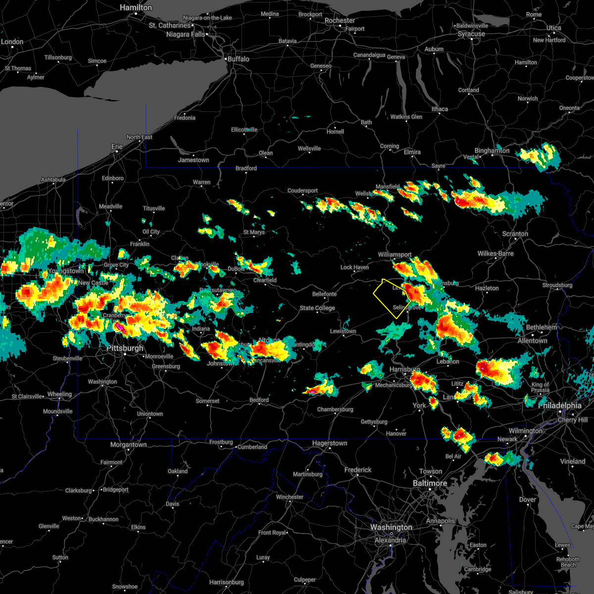 The severe thunderstorm warning for northeastern snyder and central union counties will expire at 530 pm edt, the storm which prompted the warning has moved out of the area. therefore, the warning will be allowed to expire. a tornado watch remains in effect until 1000 pm edt for central and north central pennsylvania. to report severe weather, contact your nearest law enforcement agency. they will relay your report to the national weather service state college pa. The severe thunderstorm warning for northeastern snyder and central union counties will expire at 530 pm edt, the storm which prompted the warning has moved out of the area. therefore, the warning will be allowed to expire. a tornado watch remains in effect until 1000 pm edt for central and north central pennsylvania. to report severe weather, contact your nearest law enforcement agency. they will relay your report to the national weather service state college pa.
|
| 5/28/2019 5:04 PM EDT |
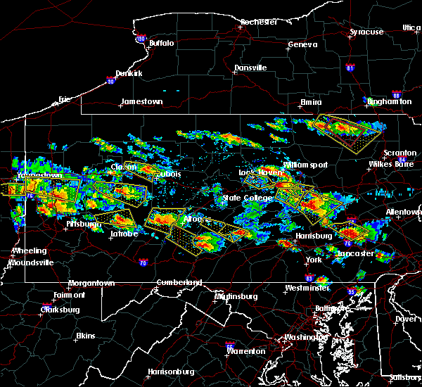 At 504 pm edt, a severe thunderstorm was located over r.b. winter state park, moving southeast at 45 mph (radar indicated). Hazards include ping pong ball size hail and 60 mph wind gusts. People and animals outdoors will be injured. expect hail damage to roofs, siding, windows, and vehicles. Expect wind damage to trees, roofs, and siding. At 504 pm edt, a severe thunderstorm was located over r.b. winter state park, moving southeast at 45 mph (radar indicated). Hazards include ping pong ball size hail and 60 mph wind gusts. People and animals outdoors will be injured. expect hail damage to roofs, siding, windows, and vehicles. Expect wind damage to trees, roofs, and siding.
|
| 5/28/2019 4:08 PM EDT |
 At 408 pm edt, a severe thunderstorm was located near carroll, moving east at 45 mph (radar indicated). Hazards include ping pong ball size hail and 60 mph wind gusts. People and animals outdoors will be injured. expect hail damage to roofs, siding, windows, and vehicles. Expect wind damage to trees, roofs, and siding. At 408 pm edt, a severe thunderstorm was located near carroll, moving east at 45 mph (radar indicated). Hazards include ping pong ball size hail and 60 mph wind gusts. People and animals outdoors will be injured. expect hail damage to roofs, siding, windows, and vehicles. Expect wind damage to trees, roofs, and siding.
|
| 5/19/2019 4:52 PM EDT |
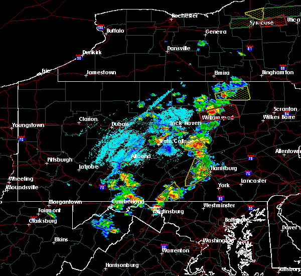 At 450 pm edt, a severe thunderstorm was located over penns creek, moving northeast at 30 mph (radar indicated). Hazards include 60 mph wind gusts and quarter size hail. Hail damage to vehicles is expected. expect wind damage to trees, roofs, and siding. Locations impacted include, middleburg, mcclure, kreamer, penns creek, beaver springs, mount pleasant mills, paxtonville, troxelville, weikert, snyder-middleswart state park, fremont, beavertown and hartleton. At 450 pm edt, a severe thunderstorm was located over penns creek, moving northeast at 30 mph (radar indicated). Hazards include 60 mph wind gusts and quarter size hail. Hail damage to vehicles is expected. expect wind damage to trees, roofs, and siding. Locations impacted include, middleburg, mcclure, kreamer, penns creek, beaver springs, mount pleasant mills, paxtonville, troxelville, weikert, snyder-middleswart state park, fremont, beavertown and hartleton.
|
| 5/19/2019 4:13 PM EDT |
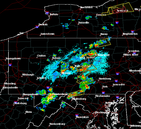 At 413 pm edt, a severe thunderstorm was located over mcclure, moving northeast at 30 mph (radar indicated). Hazards include 60 mph wind gusts and quarter size hail. Hail damage to vehicles is expected. Expect wind damage to trees, roofs, and siding. At 413 pm edt, a severe thunderstorm was located over mcclure, moving northeast at 30 mph (radar indicated). Hazards include 60 mph wind gusts and quarter size hail. Hail damage to vehicles is expected. Expect wind damage to trees, roofs, and siding.
|
| 4/15/2019 12:33 AM EDT |
 At 1230 am edt, severe thunderstorms were located along a line extending from near ralston to near spruce run reservoir to near mcalisterville, moving east at 50 mph. the strongest storm was near penns creek approaching mifflinsburg and new berlin (radar indicated). Hazards include 60 mph wind gusts and penny size hail. Expect damage to roofs, siding, and trees. locations impacted include, williamsport, lewisburg, selinsgrove, montoursville, mifflinburg, winfield, muncy, hughesville, shamokin dam, montgomery, linntown, hummels wharf, middleburg, duboistown, new columbia, kreamer, port trevorton, penns creek, richfield and mount pleasant mills. for those driving on interstate 80, this includes areas between the jersey shore and milton-williamsport exits, specifically from mile markers 194 to 210. this includes interstate 180 from mile markers 9 to 29. A tornado watch remains in effect until 300 am edt for central and north central pennsylvania. At 1230 am edt, severe thunderstorms were located along a line extending from near ralston to near spruce run reservoir to near mcalisterville, moving east at 50 mph. the strongest storm was near penns creek approaching mifflinsburg and new berlin (radar indicated). Hazards include 60 mph wind gusts and penny size hail. Expect damage to roofs, siding, and trees. locations impacted include, williamsport, lewisburg, selinsgrove, montoursville, mifflinburg, winfield, muncy, hughesville, shamokin dam, montgomery, linntown, hummels wharf, middleburg, duboistown, new columbia, kreamer, port trevorton, penns creek, richfield and mount pleasant mills. for those driving on interstate 80, this includes areas between the jersey shore and milton-williamsport exits, specifically from mile markers 194 to 210. this includes interstate 180 from mile markers 9 to 29. A tornado watch remains in effect until 300 am edt for central and north central pennsylvania.
|
| 4/15/2019 12:02 AM EDT |
 At 1202 am edt, severe thunderstorms were located along a line extending from near little pine state park to near rebersburg to near walnut, moving east at 50 mph (radar indicated). Hazards include 60 mph wind gusts and penny size hail. Expect damage to roofs, siding, and trees. locations impacted include, williamsport, lock haven, lewistown, lewisburg, selinsgrove, montoursville, jersey shore, mifflinburg, carroll, woodward, winfield, lamar, muncy, watsontown, hughesville, burnham, shamokin dam, mill hall, montgomery and milroy. for those driving on interstate 80, this includes areas between the bellefonte and milton-williamsport exits, specifically from mile markers 171 to 210. this includes interstate 180 from mile markers 9 to 29. A tornado watch remains in effect until 300 am edt for central, south central and north central pennsylvania. At 1202 am edt, severe thunderstorms were located along a line extending from near little pine state park to near rebersburg to near walnut, moving east at 50 mph (radar indicated). Hazards include 60 mph wind gusts and penny size hail. Expect damage to roofs, siding, and trees. locations impacted include, williamsport, lock haven, lewistown, lewisburg, selinsgrove, montoursville, jersey shore, mifflinburg, carroll, woodward, winfield, lamar, muncy, watsontown, hughesville, burnham, shamokin dam, mill hall, montgomery and milroy. for those driving on interstate 80, this includes areas between the bellefonte and milton-williamsport exits, specifically from mile markers 171 to 210. this includes interstate 180 from mile markers 9 to 29. A tornado watch remains in effect until 300 am edt for central, south central and north central pennsylvania.
|
| 4/14/2019 11:34 PM EDT |
 At 1134 pm edt, severe thunderstorms were located along a line extending from near south renovo to near lemont to mount union, moving east at 50 mph (radar indicated). Hazards include 60 mph wind gusts and penny size hail. expect damage to roofs, siding, and trees At 1134 pm edt, severe thunderstorms were located along a line extending from near south renovo to near lemont to mount union, moving east at 50 mph (radar indicated). Hazards include 60 mph wind gusts and penny size hail. expect damage to roofs, siding, and trees
|
| 10/2/2018 6:37 PM EDT |
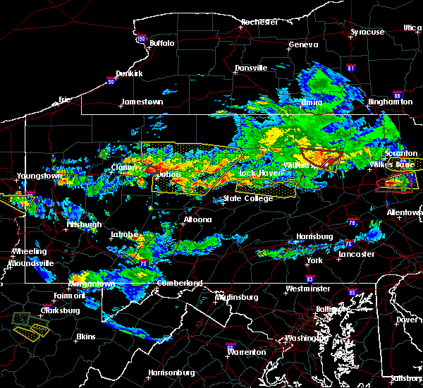 At 636 pm edt, a severe thunderstorm was located over blanchard, moving east at 30 mph (radar indicated). Hazards include 60 mph wind gusts and half dollar size hail. Hail damage to vehicles is expected. Expect wind damage to roofs, siding, and trees. At 636 pm edt, a severe thunderstorm was located over blanchard, moving east at 30 mph (radar indicated). Hazards include 60 mph wind gusts and half dollar size hail. Hail damage to vehicles is expected. Expect wind damage to roofs, siding, and trees.
|
| 5/15/2018 2:57 PM EDT |
 At 256 pm edt, severe thunderstorms were located along a line extending from waller to near milton to near kreamer to near richfield, moving east at 55 mph (radar indicated). Hazards include 70 mph wind gusts. Expect considerable tree damage. damage is likely to mobile homes, roofs, and outbuildings. these severe storms will be near, fairmount spgs, mooresburg, central, waller, jamison city, rohrsburg and ricketts glen state park around 300 pm edt. danville, meiserville, stonington, buckhorn, port trevorton, riverside, fremont, jerseytown and eyers grove around 310 pm edt. shamokin, bloomsburg, kulpmont, mainville, urban, almedia, marshallton, elysburg, fairview-ferndale and knoebels grove around 320 pm edt. mount carmel, berwick, wilburton number two, wilburton number one, aristes, locustdale, numidia, shumans, leck kill and mifflinville around 330 pm edt. Other locations impacted by these severe thunderstorms include wagner, lime ridge, marion heights, seven points, hartleton, new berlin, stillwater, millville, herndon and edgewood. At 256 pm edt, severe thunderstorms were located along a line extending from waller to near milton to near kreamer to near richfield, moving east at 55 mph (radar indicated). Hazards include 70 mph wind gusts. Expect considerable tree damage. damage is likely to mobile homes, roofs, and outbuildings. these severe storms will be near, fairmount spgs, mooresburg, central, waller, jamison city, rohrsburg and ricketts glen state park around 300 pm edt. danville, meiserville, stonington, buckhorn, port trevorton, riverside, fremont, jerseytown and eyers grove around 310 pm edt. shamokin, bloomsburg, kulpmont, mainville, urban, almedia, marshallton, elysburg, fairview-ferndale and knoebels grove around 320 pm edt. mount carmel, berwick, wilburton number two, wilburton number one, aristes, locustdale, numidia, shumans, leck kill and mifflinville around 330 pm edt. Other locations impacted by these severe thunderstorms include wagner, lime ridge, marion heights, seven points, hartleton, new berlin, stillwater, millville, herndon and edgewood.
|
| 5/15/2018 2:16 PM EDT |
 At 215 pm edt, severe thunderstorms were located along a line extending from near williamsport to near lamar to centre hall to whipple dam state park, moving east at 55 mph (radar indicated). Hazards include 70 mph wind gusts. Expect considerable tree damage. damage is likely to mobile homes, roofs, and outbuildings. severe thunderstorms will be near, williamsport, duboistown and cogan station around 220 pm edt. montoursville, reedsville, r. b. winter state park, yeagertown, carroll, montgomery, seven mountains, muncy, woodward and milroy around 230 pm edt. mifflinburg, sand bridge state park, alfarata, forest hill, hughesville, weikert, snyder-middleswart state park, troxelville, lairdsville and reeds gap state park around 240 pm edt. lewisburg, milton, biggertown, linntown, penns creek, mcalisterville, mcclure, montandon, new columbia and middleburg around 250 pm edt. other locations impacted by these severe thunderstorms include wagner, lime ridge, west milton, marion heights, siglerville, seven points, hartleton, garden view, oval and loganton. for those driving on interstate 80, this includes areas between the bellefonte and nescopek exits, specifically from mile markers 172 to 247. This includes interstate 180 from mile markers 1 to 29. At 215 pm edt, severe thunderstorms were located along a line extending from near williamsport to near lamar to centre hall to whipple dam state park, moving east at 55 mph (radar indicated). Hazards include 70 mph wind gusts. Expect considerable tree damage. damage is likely to mobile homes, roofs, and outbuildings. severe thunderstorms will be near, williamsport, duboistown and cogan station around 220 pm edt. montoursville, reedsville, r. b. winter state park, yeagertown, carroll, montgomery, seven mountains, muncy, woodward and milroy around 230 pm edt. mifflinburg, sand bridge state park, alfarata, forest hill, hughesville, weikert, snyder-middleswart state park, troxelville, lairdsville and reeds gap state park around 240 pm edt. lewisburg, milton, biggertown, linntown, penns creek, mcalisterville, mcclure, montandon, new columbia and middleburg around 250 pm edt. other locations impacted by these severe thunderstorms include wagner, lime ridge, west milton, marion heights, siglerville, seven points, hartleton, garden view, oval and loganton. for those driving on interstate 80, this includes areas between the bellefonte and nescopek exits, specifically from mile markers 172 to 247. This includes interstate 180 from mile markers 1 to 29.
|
| 8/19/2017 6:46 PM EDT |
 At 643 pm edt, severe thunderstorms were located along a line extending from near rebersburg to near poe valley state park to near mcalisterville, moving east at 50 mph (radar indicated). Hazards include 70 mph wind gusts and penny size hail. Expect considerable tree damage. damage is likely to mobile homes, roofs, and outbuildings. severe thunderstorms will be near, snyder-middleswart state park and weikert around 650 pm edt. mifflinburg, richfield, troxelville, sand bridge state park, r. b. winter state park, forest hill, mount pleasant mills, beaver springs, paxtonville and laurelton center around 700 pm edt. lewisburg, port trevorton, spruce run reservoir, meiserville, kreamer, middleburg, linntown, penns creek, vicksburg and fremont around 710 pm edt. selinsgrove, shamokin dam, hummels wharf, new columbia, kratzerville, winfield and watsontown around 720 pm edt. other locations impacted by these severe thunderstorms include beavertown, hartleton, new berlin, freeburg, west milton, selinsgrove airport and bucknell. For those driving on interstate 80, this includes areas between the jersey shore and milton-williamsport exits, specifically from mile markers 195 to 210. At 643 pm edt, severe thunderstorms were located along a line extending from near rebersburg to near poe valley state park to near mcalisterville, moving east at 50 mph (radar indicated). Hazards include 70 mph wind gusts and penny size hail. Expect considerable tree damage. damage is likely to mobile homes, roofs, and outbuildings. severe thunderstorms will be near, snyder-middleswart state park and weikert around 650 pm edt. mifflinburg, richfield, troxelville, sand bridge state park, r. b. winter state park, forest hill, mount pleasant mills, beaver springs, paxtonville and laurelton center around 700 pm edt. lewisburg, port trevorton, spruce run reservoir, meiserville, kreamer, middleburg, linntown, penns creek, vicksburg and fremont around 710 pm edt. selinsgrove, shamokin dam, hummels wharf, new columbia, kratzerville, winfield and watsontown around 720 pm edt. other locations impacted by these severe thunderstorms include beavertown, hartleton, new berlin, freeburg, west milton, selinsgrove airport and bucknell. For those driving on interstate 80, this includes areas between the jersey shore and milton-williamsport exits, specifically from mile markers 195 to 210.
|
| 7/1/2017 1:55 PM EDT |
 At 154 pm edt, severe thunderstorms were located along a line extending from near weikert to near beaver springs to near spruce hill, moving east at 40 mph (radar indicated). Hazards include 60 mph wind gusts and quarter size hail. Hail damage to vehicles is possible. expect wind damage to trees and power lines. Locations impacted include, lewisburg, mifflinburg, selinsgrove, newport, mcalisterville, weikert, winfield, paxtonville, ickesburg and snyder-middleswart state park. At 154 pm edt, severe thunderstorms were located along a line extending from near weikert to near beaver springs to near spruce hill, moving east at 40 mph (radar indicated). Hazards include 60 mph wind gusts and quarter size hail. Hail damage to vehicles is possible. expect wind damage to trees and power lines. Locations impacted include, lewisburg, mifflinburg, selinsgrove, newport, mcalisterville, weikert, winfield, paxtonville, ickesburg and snyder-middleswart state park.
|
| 7/1/2017 1:24 PM EDT |
 At 123 pm edt, severe thunderstorms were located along a line extending from potters mills to reedsville to near blacklog, moving east at 35 mph (radar indicated). Hazards include torrential rain, 60 mph wind gusts and quarter size hail. Hail damage to vehicles is possible. Expect wind damage to trees and power lines. At 123 pm edt, severe thunderstorms were located along a line extending from potters mills to reedsville to near blacklog, moving east at 35 mph (radar indicated). Hazards include torrential rain, 60 mph wind gusts and quarter size hail. Hail damage to vehicles is possible. Expect wind damage to trees and power lines.
|
| 5/1/2017 7:35 PM EDT |
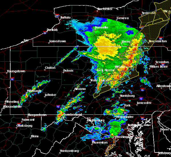 At 734 pm edt, severe thunderstorms were located along a line extending from owego to near muncy valley, moving northeast at 75 mph (radar indicated). Hazards include 70 mph wind gusts. Expect considerable tree damage. damage is likely to mobile homes, roofs, and outbuildings. locations impacted include, montoursville, lewisburg, mifflinburg, elimsport, weikert, winfield, lairdsville, allenwood, r. b. winter state park and forest hill. A tornado watch remains in effect until 1000 pm edt for central and north central pennsylvania. At 734 pm edt, severe thunderstorms were located along a line extending from owego to near muncy valley, moving northeast at 75 mph (radar indicated). Hazards include 70 mph wind gusts. Expect considerable tree damage. damage is likely to mobile homes, roofs, and outbuildings. locations impacted include, montoursville, lewisburg, mifflinburg, elimsport, weikert, winfield, lairdsville, allenwood, r. b. winter state park and forest hill. A tornado watch remains in effect until 1000 pm edt for central and north central pennsylvania.
|
| 5/1/2017 6:36 PM EDT |
 At 635 pm edt, severe thunderstorms were located along a line extending from near english center to near potters mills, moving northeast at 75 mph (radar indicated). Hazards include 70 mph wind gusts. Expect considerable tree damage. Damage is likely to mobile homes, roofs, and outbuildings. At 635 pm edt, severe thunderstorms were located along a line extending from near english center to near potters mills, moving northeast at 75 mph (radar indicated). Hazards include 70 mph wind gusts. Expect considerable tree damage. Damage is likely to mobile homes, roofs, and outbuildings.
|
| 7/31/2016 8:18 PM EDT |
 At 817 pm edt, severe thunderstorms were located along a line extending from new columbia to laurelton center, moving southeast at 15 mph (radar indicated). Hazards include 50 to 60 mph wind gusts. Downed tree limbs and isolated power outages are possible. Locations impacted include, lewisburg, mifflinburg, spruce run reservoir, winfield, vicksburg, linntown, sand bridge state park, laurelton center, forest hill, new columbia, penns creek, west milton, new berlin, hartleton and bucknell university. At 817 pm edt, severe thunderstorms were located along a line extending from new columbia to laurelton center, moving southeast at 15 mph (radar indicated). Hazards include 50 to 60 mph wind gusts. Downed tree limbs and isolated power outages are possible. Locations impacted include, lewisburg, mifflinburg, spruce run reservoir, winfield, vicksburg, linntown, sand bridge state park, laurelton center, forest hill, new columbia, penns creek, west milton, new berlin, hartleton and bucknell university.
|
| 7/31/2016 7:44 PM EDT |
 At 742 pm edt, a severe thunderstorm was located near carroll, moving southeast at 20 mph (radar indicated). Hazards include 60 mph wind gusts and quarter size hail. downed tree limbs and isolated power outages are possible At 742 pm edt, a severe thunderstorm was located near carroll, moving southeast at 20 mph (radar indicated). Hazards include 60 mph wind gusts and quarter size hail. downed tree limbs and isolated power outages are possible
|
| 7/25/2016 4:48 PM EDT |
 At 448 pm edt, severe thunderstorms were located along a line extending from near carroll to near weikert to near pine grove mills, moving east at 35 mph (radar indicated). Hazards include 60 mph wind gusts and nickel size hail. Expect damage to roofs. siding. And trees. At 448 pm edt, severe thunderstorms were located along a line extending from near carroll to near weikert to near pine grove mills, moving east at 35 mph (radar indicated). Hazards include 60 mph wind gusts and nickel size hail. Expect damage to roofs. siding. And trees.
|
| 6/30/2015 9:47 PM EDT |
 At 946 pm edt, doppler radar indicated severe thunderstorms from benton to lewisburg which are capable of producing destructive winds in excess of 70 mph. the storms were moving east at 25 to 30 mph. locations impacted include, lewisburg, mifflinburg, milton, allenwood, biggertown, delaware run, exchange, eyers grove, forest hill, hughesville, iola, jerseytown, lairdsville, linntown, montandon, mooresburg, muncy, new columbia, rohrsburg and spruce run reservoir. At 946 pm edt, doppler radar indicated severe thunderstorms from benton to lewisburg which are capable of producing destructive winds in excess of 70 mph. the storms were moving east at 25 to 30 mph. locations impacted include, lewisburg, mifflinburg, milton, allenwood, biggertown, delaware run, exchange, eyers grove, forest hill, hughesville, iola, jerseytown, lairdsville, linntown, montandon, mooresburg, muncy, new columbia, rohrsburg and spruce run reservoir.
|
| 6/30/2015 9:04 PM EDT |
 At 902 pm edt, doppler radar indicated a cluster of severe thunderstorms capable of producing damaging winds of 60 to 70 mph. the strongest winds were over southwestern lycoming and western union counties, and moving northeast at 25 mph. At 902 pm edt, doppler radar indicated a cluster of severe thunderstorms capable of producing damaging winds of 60 to 70 mph. the strongest winds were over southwestern lycoming and western union counties, and moving northeast at 25 mph.
|
| 6/30/2015 3:07 PM EDT |
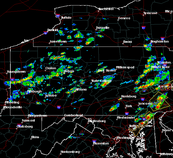 At 306 pm edt, doppler radar indicated a severe thunderstorm capable of producing damaging winds around 60 mph and small hail. this storm was located near belltown, and moving east at 20 mph. At 306 pm edt, doppler radar indicated a severe thunderstorm capable of producing damaging winds around 60 mph and small hail. this storm was located near belltown, and moving east at 20 mph.
|
| 6/23/2015 12:50 PM EDT |
 At 1250 pm edt, doppler radar indicated a line of severe thunderstorms capable of producing damaging winds of 60 to 70 mph. these storms were located along a line extending from near carroll to near troxelville to near reeds gap state park, and moving east at 60 mph. At 1250 pm edt, doppler radar indicated a line of severe thunderstorms capable of producing damaging winds of 60 to 70 mph. these storms were located along a line extending from near carroll to near troxelville to near reeds gap state park, and moving east at 60 mph.
|
| 6/23/2015 12:35 PM EDT |
 At 1234 pm edt, doppler radar indicated a line of severe thunderstorms capable of producing destructive winds in excess of 70 mph. these storms were located along a line extending from near rebersburg to seven mountains, moving east at 65 mph. locations impacted include, state college, aaronsburg, beaver springs, belltown, boalsburg, centre hall, coburn, laurelton center, lemont, madisonburg, mcclure, millheim, milroy, pleasant gap, poe valley state park, potters mills, r.b. winter state park, rebersburg and reeds gap state park. At 1234 pm edt, doppler radar indicated a line of severe thunderstorms capable of producing destructive winds in excess of 70 mph. these storms were located along a line extending from near rebersburg to seven mountains, moving east at 65 mph. locations impacted include, state college, aaronsburg, beaver springs, belltown, boalsburg, centre hall, coburn, laurelton center, lemont, madisonburg, mcclure, millheim, milroy, pleasant gap, poe valley state park, potters mills, r.b. winter state park, rebersburg and reeds gap state park.
|
| 6/23/2015 12:23 PM EDT |
 At 1223 pm edt, doppler radar indicated a line of severe thunderstorms capable of producing damaging winds around 60 mph. these storms were located along a line extending from near zion to near pine grove mills, and moving east at 65 mph. At 1223 pm edt, doppler radar indicated a line of severe thunderstorms capable of producing damaging winds around 60 mph. these storms were located along a line extending from near zion to near pine grove mills, and moving east at 65 mph.
|
| 6/23/2015 9:49 AM EDT |
 At 948 am edt, doppler radar indicated a severe thunderstorm capable of producing destructive winds in excess of 70 mph. this storm was located near linntown, moving east at 50 mph. locations impacted include, bloomsburg, danville, lewisburg, mifflinburg, milton, northumberland, selinsgrove, shamokin, sunbury, allenwood, almedia, buckhorn, catawissa, elysburg, exchange, eyers grove, fairview-ferndale, fernville, forest hill and hummels wharf. At 948 am edt, doppler radar indicated a severe thunderstorm capable of producing destructive winds in excess of 70 mph. this storm was located near linntown, moving east at 50 mph. locations impacted include, bloomsburg, danville, lewisburg, mifflinburg, milton, northumberland, selinsgrove, shamokin, sunbury, allenwood, almedia, buckhorn, catawissa, elysburg, exchange, eyers grove, fairview-ferndale, fernville, forest hill and hummels wharf.
|
| 6/23/2015 9:37 AM EDT |
 At 936 am edt, doppler radar indicated a severe thunderstorm capable of producing damaging winds of 60 to 70 mph. this storm was located over woodward, and moving east at 50 mph. At 936 am edt, doppler radar indicated a severe thunderstorm capable of producing damaging winds of 60 to 70 mph. this storm was located over woodward, and moving east at 50 mph.
|
| 6/12/2015 9:01 PM EDT |
 At 900 pm edt, doppler radar indicated a line of severe thunderstorms capable of producing destructive winds in excess of 70 mph. these storms were located along a line extending from near collomsville to near sand bridge state park to near weikert to near woodward to near reeds gap state park, moving east at 40 mph. locations impacted include, berwick, bloomsburg, danville, kulpmont, lewisburg, mifflinburg, milton, mount carmel, northumberland, selinsgrove, shamokin, sunbury, allenwood, almedia, aristes, beaver springs, buckhorn, catawissa, collomsville and delaware run. At 900 pm edt, doppler radar indicated a line of severe thunderstorms capable of producing destructive winds in excess of 70 mph. these storms were located along a line extending from near collomsville to near sand bridge state park to near weikert to near woodward to near reeds gap state park, moving east at 40 mph. locations impacted include, berwick, bloomsburg, danville, kulpmont, lewisburg, mifflinburg, milton, mount carmel, northumberland, selinsgrove, shamokin, sunbury, allenwood, almedia, aristes, beaver springs, buckhorn, catawissa, collomsville and delaware run.
|
| 6/12/2015 8:43 PM EDT |
 At 843 pm edt, doppler radar indicated a line of severe thunderstorms capable of producing damaging winds of 60 to 70 mph. these storms were located along a line extending from near avis to near r.b. winter state park to near weikert to near woodward to near alfarata, and moving east at 40 mph. At 843 pm edt, doppler radar indicated a line of severe thunderstorms capable of producing damaging winds of 60 to 70 mph. these storms were located along a line extending from near avis to near r.b. winter state park to near weikert to near woodward to near alfarata, and moving east at 40 mph.
|
| 6/12/2015 8:29 PM EDT |
 At 828 pm edt, doppler radar indicated a line of severe thunderstorms capable of producing damaging winds in excess of 60 mph. these storms were located along a line extending from near keating to near milesburg to near birmingham, moving east at 55 mph. locations impacted include, jersey shore, lewisburg, lock haven, mifflinburg, montoursville, williamsport, aaronsburg, alfarata, allenwood, avis, beaver springs, belltown, blanchard, burnham, carroll, castanea, coburn, cogan station, collomsville and duboistown. At 828 pm edt, doppler radar indicated a line of severe thunderstorms capable of producing damaging winds in excess of 60 mph. these storms were located along a line extending from near keating to near milesburg to near birmingham, moving east at 55 mph. locations impacted include, jersey shore, lewisburg, lock haven, mifflinburg, montoursville, williamsport, aaronsburg, alfarata, allenwood, avis, beaver springs, belltown, blanchard, burnham, carroll, castanea, coburn, cogan station, collomsville and duboistown.
|
| 6/12/2015 8:19 PM EDT |
 At 818 pm edt, doppler radar indicated a line of severe thunderstorms capable of producing damaging winds in excess of 60 mph. these storms were located along a line extending from near karthaus to near black moshannon state park to near tipton. these storms were nearly stationary. locations impacted include, bellefonte, jersey shore, lewisburg, lewistown, lock haven, mifflinburg, montoursville, state college, williamsport, aaronsburg, alfarata, allenwood, avis, bald eagle state park, beaver springs, belltown, blanchard, boalsburg, burnham and carroll. At 818 pm edt, doppler radar indicated a line of severe thunderstorms capable of producing damaging winds in excess of 60 mph. these storms were located along a line extending from near karthaus to near black moshannon state park to near tipton. these storms were nearly stationary. locations impacted include, bellefonte, jersey shore, lewisburg, lewistown, lock haven, mifflinburg, montoursville, state college, williamsport, aaronsburg, alfarata, allenwood, avis, bald eagle state park, beaver springs, belltown, blanchard, boalsburg, burnham and carroll.
|
| 6/12/2015 7:42 PM EDT |
 The national weather service in state college pa has issued a * severe thunderstorm warning for. northeastern blair county in central pennsylvania. northern mifflin county in central pennsylvania. northern huntingdon county in central pennsylvania. Southwestern lycoming county in north central pennsylvania. The national weather service in state college pa has issued a * severe thunderstorm warning for. northeastern blair county in central pennsylvania. northern mifflin county in central pennsylvania. northern huntingdon county in central pennsylvania. Southwestern lycoming county in north central pennsylvania.
|
| 6/12/2015 7:42 PM EDT |
 At 741 pm edt, doppler radar indicated a line of severe thunderstorms capable of producing damaging winds around 60 mph. these storms were located along a line extending from near karthaus to near black moshannon state park to near tipton, and moving east at 45 mph. At 741 pm edt, doppler radar indicated a line of severe thunderstorms capable of producing damaging winds around 60 mph. these storms were located along a line extending from near karthaus to near black moshannon state park to near tipton, and moving east at 45 mph.
|
| 6/11/2015 7:43 PM EDT |
 At 742 pm edt, doppler radar indicated a severe thunderstorm capable of producing quarter size hail and damaging winds in excess of 60 mph. this storm was located over aaronsburg, moving east at 25 mph. locations impacted include, aaronsburg, beaver springs, coburn, laurelton center, millheim, poe valley state park, r.b. winter state park, rebersburg, snyder-middleswart state park, troxelville, weikert, woodward and hartleton. At 742 pm edt, doppler radar indicated a severe thunderstorm capable of producing quarter size hail and damaging winds in excess of 60 mph. this storm was located over aaronsburg, moving east at 25 mph. locations impacted include, aaronsburg, beaver springs, coburn, laurelton center, millheim, poe valley state park, r.b. winter state park, rebersburg, snyder-middleswart state park, troxelville, weikert, woodward and hartleton.
|
| 6/11/2015 7:13 PM EDT |
 At 713 pm edt, doppler radar indicated a severe thunderstorm capable of producing damaging winds of 60 to 70 mph. this storm was located near zion, and moving east at 25 mph. At 713 pm edt, doppler radar indicated a severe thunderstorm capable of producing damaging winds of 60 to 70 mph. this storm was located near zion, and moving east at 25 mph.
|
| 6/8/2015 2:00 PM EDT |
 At 159 pm edt, doppler radar indicated a severe thunderstorm capable of producing quarter size hail and damaging winds in excess of 60 mph. this storm was located over mcclure, and moving northeast at 50 mph. At 159 pm edt, doppler radar indicated a severe thunderstorm capable of producing quarter size hail and damaging winds in excess of 60 mph. this storm was located over mcclure, and moving northeast at 50 mph.
|
| 4/20/2015 9:08 PM EDT | At 908 pm edt, doppler radar indicated a line of severe thunderstorms capable of producing quarter size hail and damaging winds in excess of 60 mph. these storms were located along a line extending from williamsport to near alfarata, moving northeast at 35 mph. locations impacted include, lewisburg, mifflinburg, linntown, penns creek, vicksburg, troxelville, spruce run reservoir, elimsport, sand bridge state park, r.b. winter state park, laurelton center, snyder-middleswart state park, forest hill, new berlin, hartleton and bucknell. |
| 4/20/2015 8:19 PM EDT | At 819 pm edt, doppler radar indicated a severe thunderstorm capable of producing quarter size hail and damaging winds around 60 mph. this storm was located near seven mountains, and moving northeast at 45 mph. |
Hail Maps for Hartleton, PA


Connect with Interactive Hail Maps