

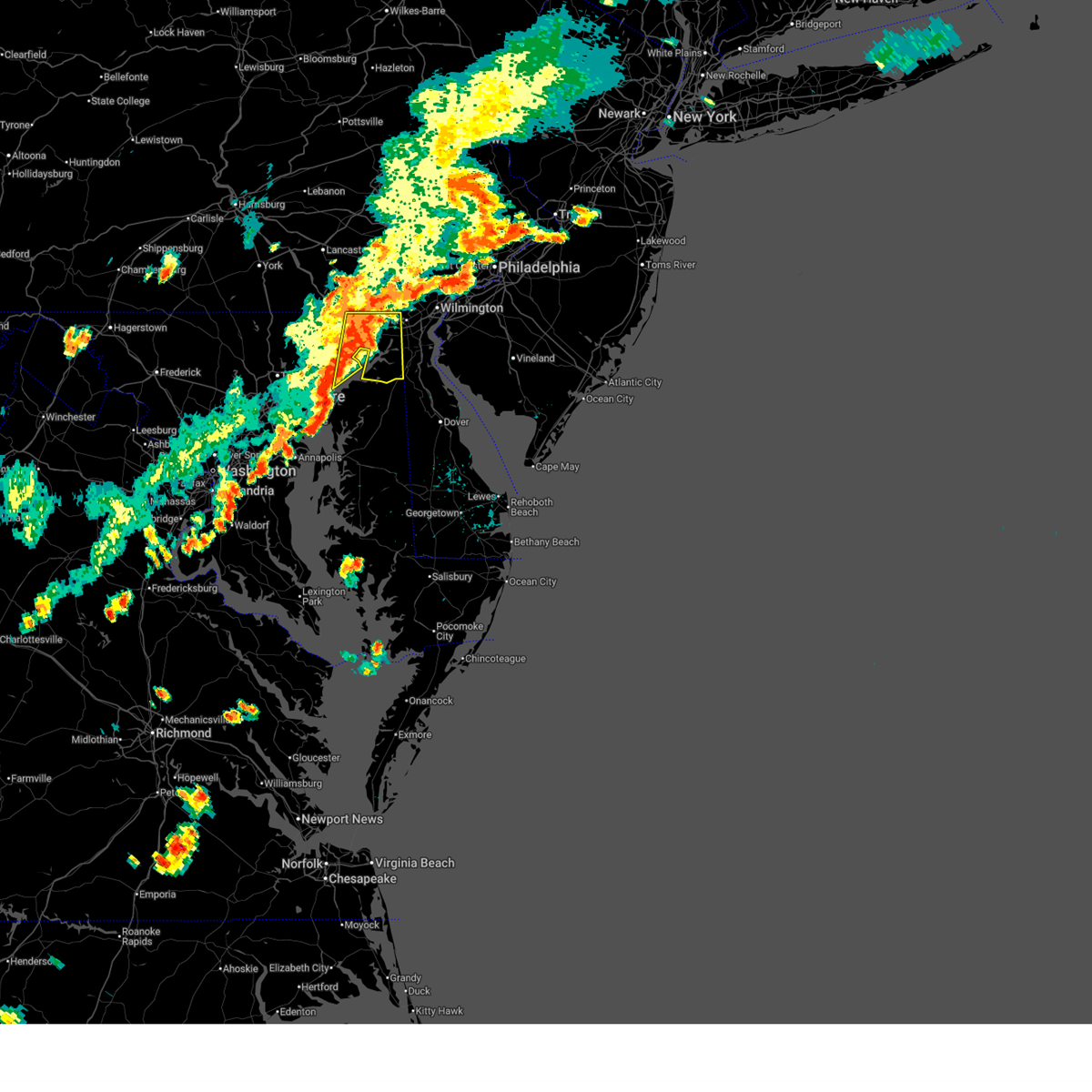
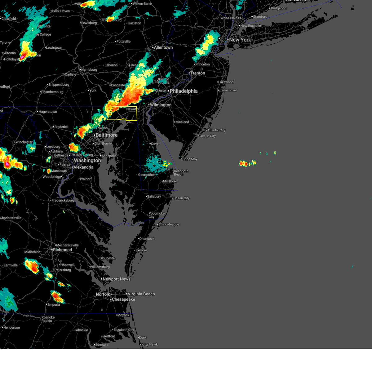
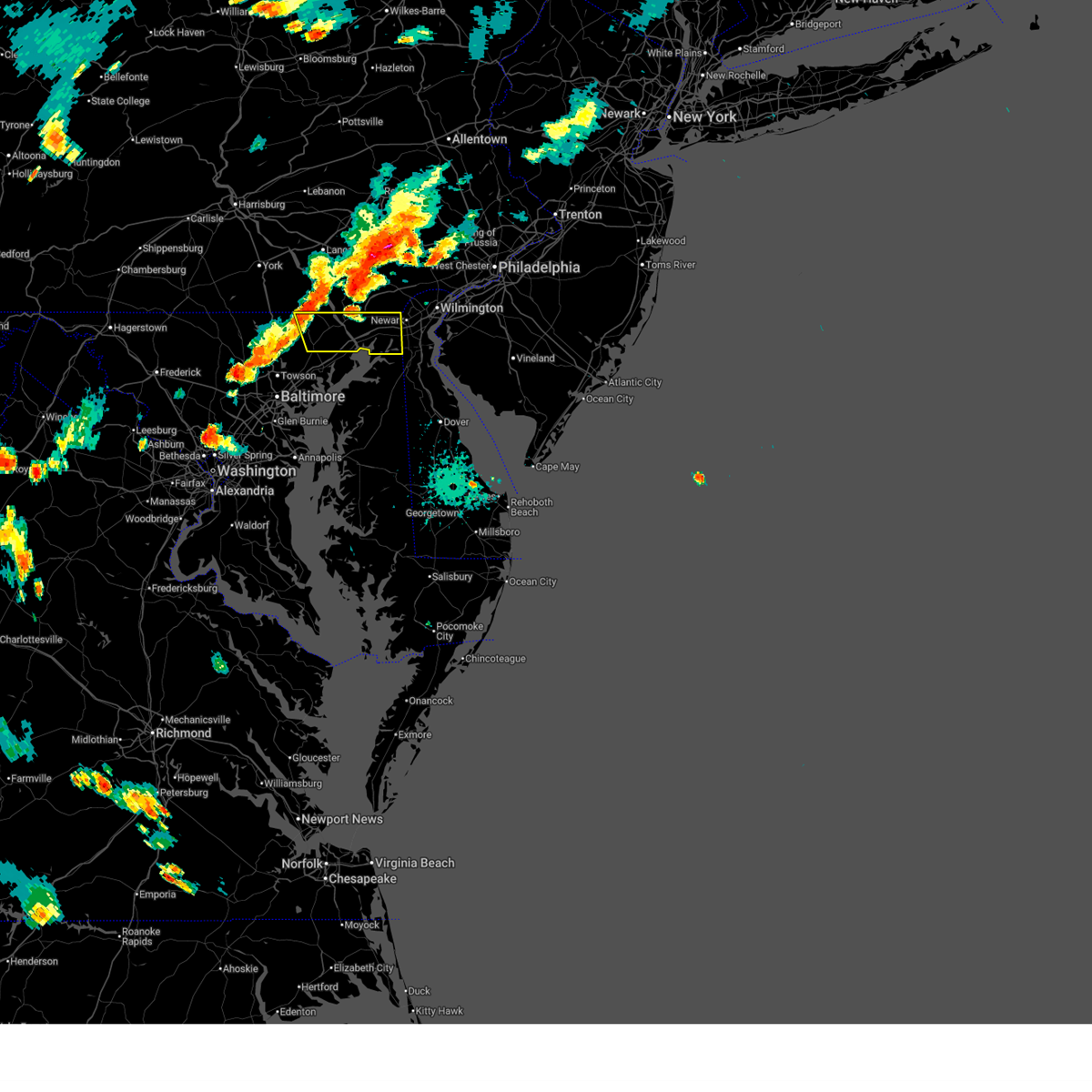
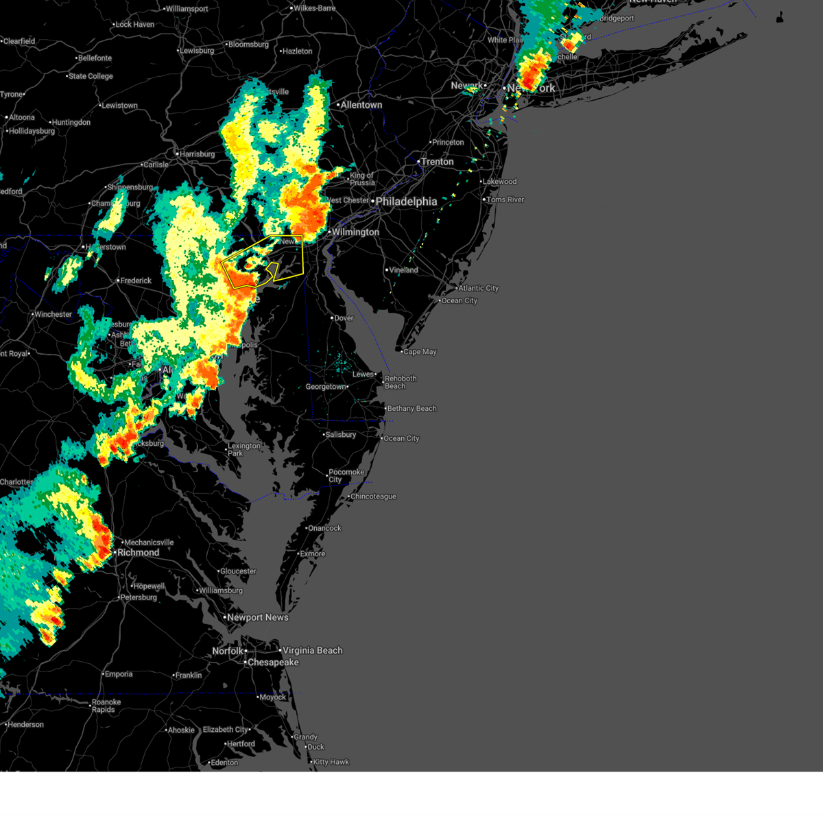
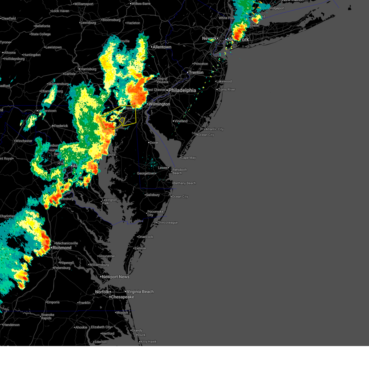
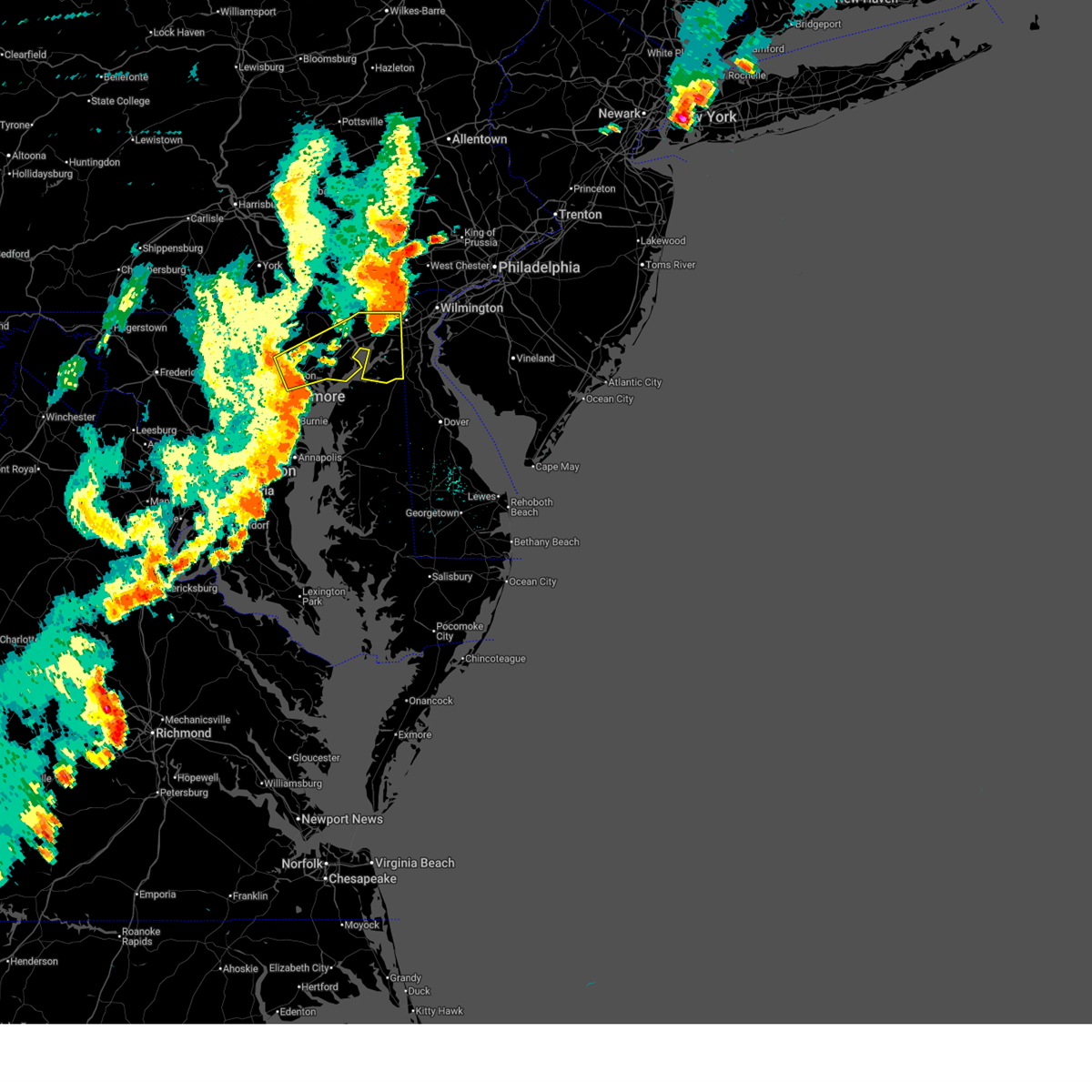
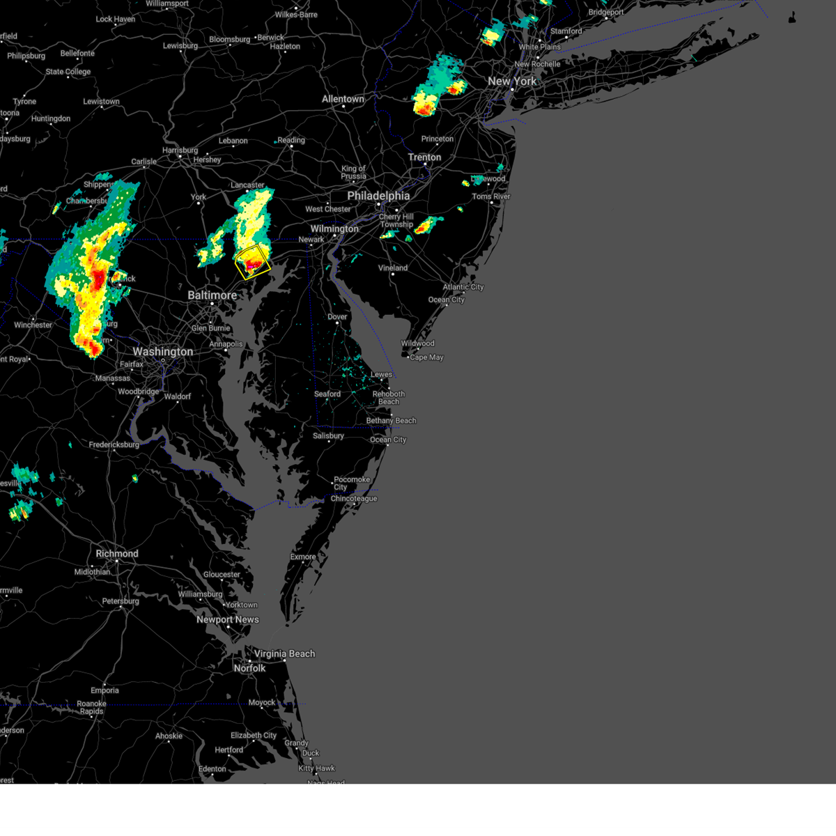
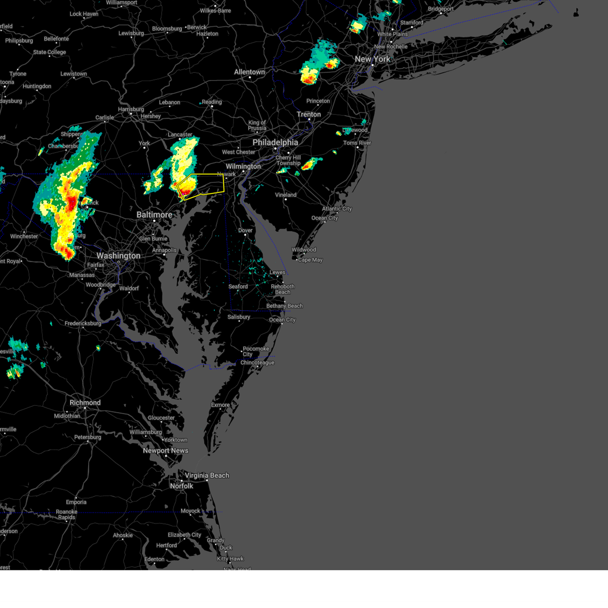
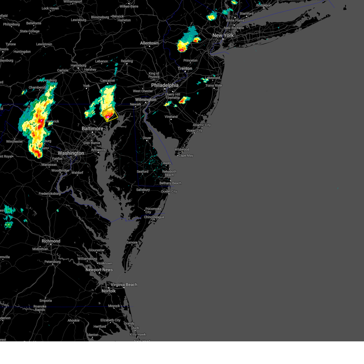
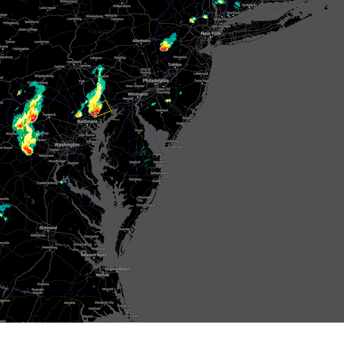
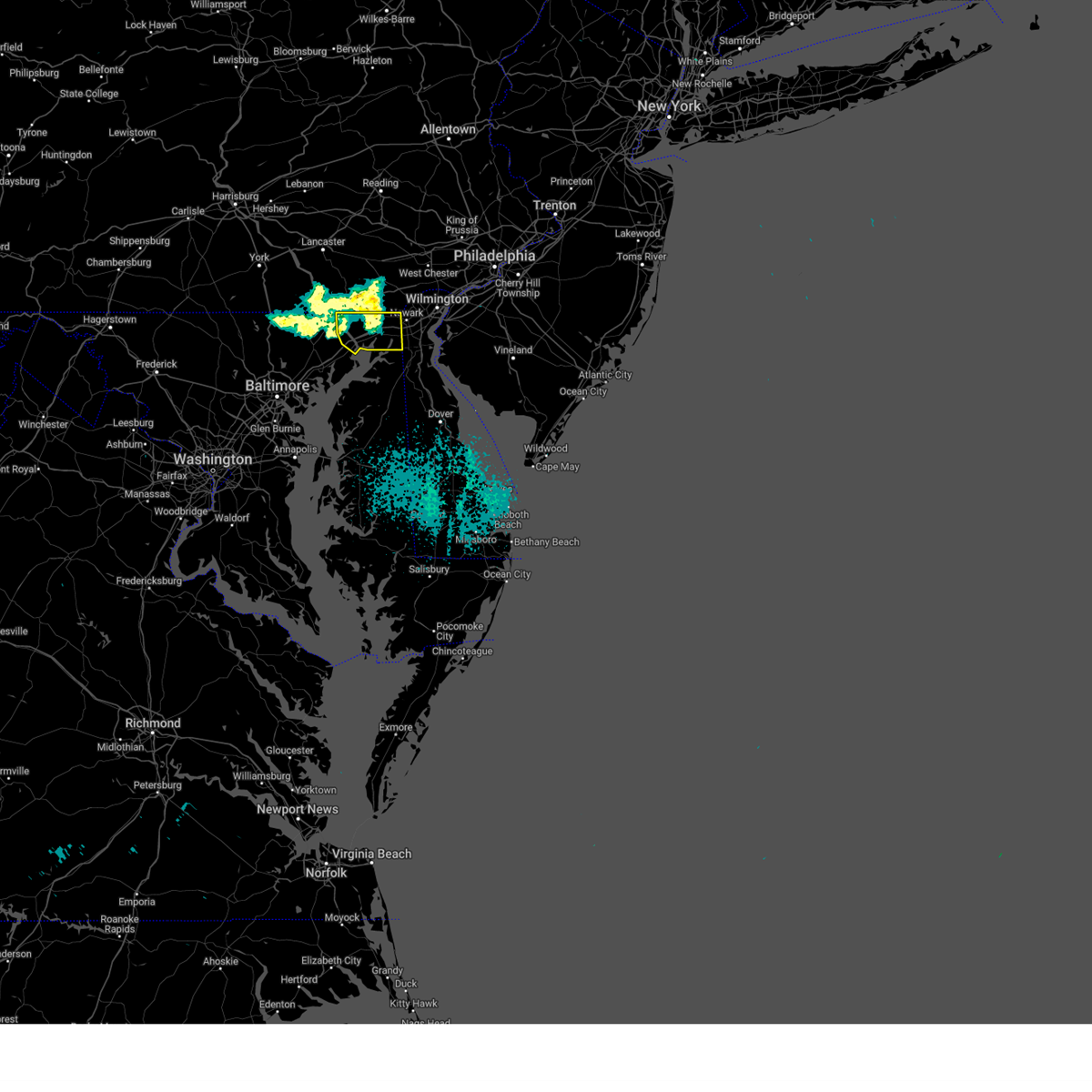
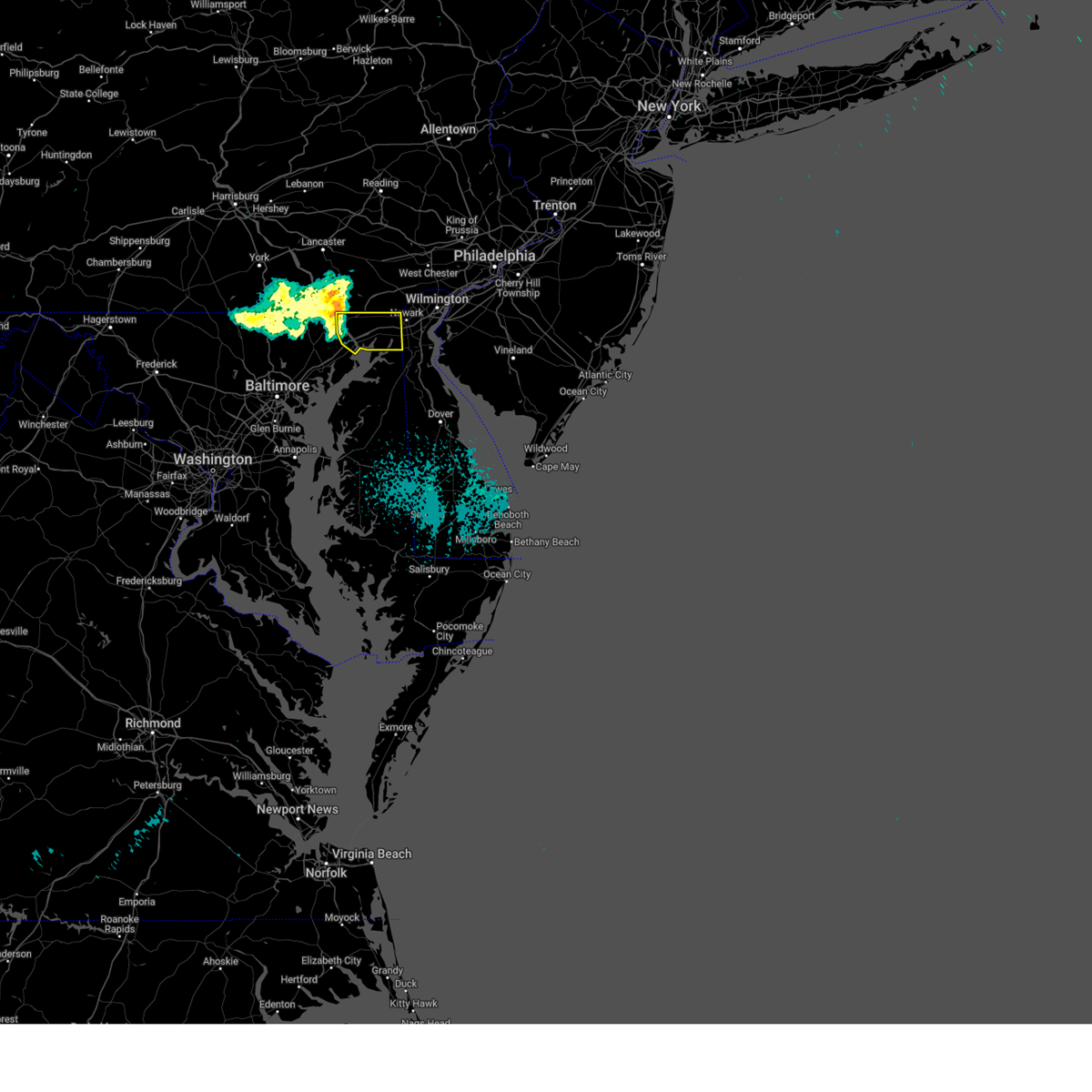
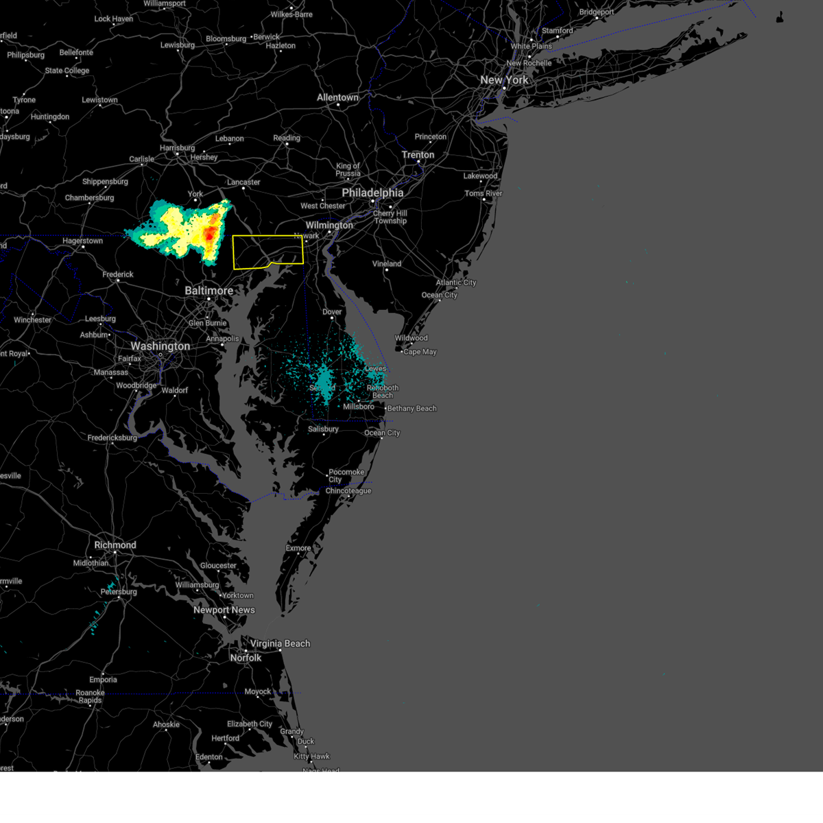
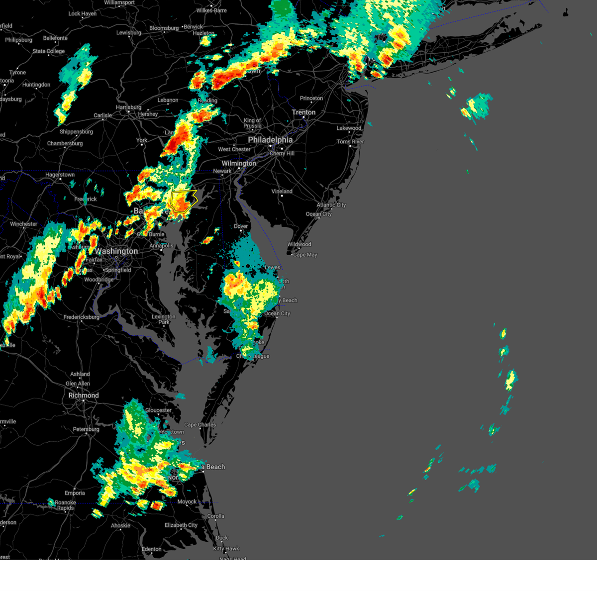
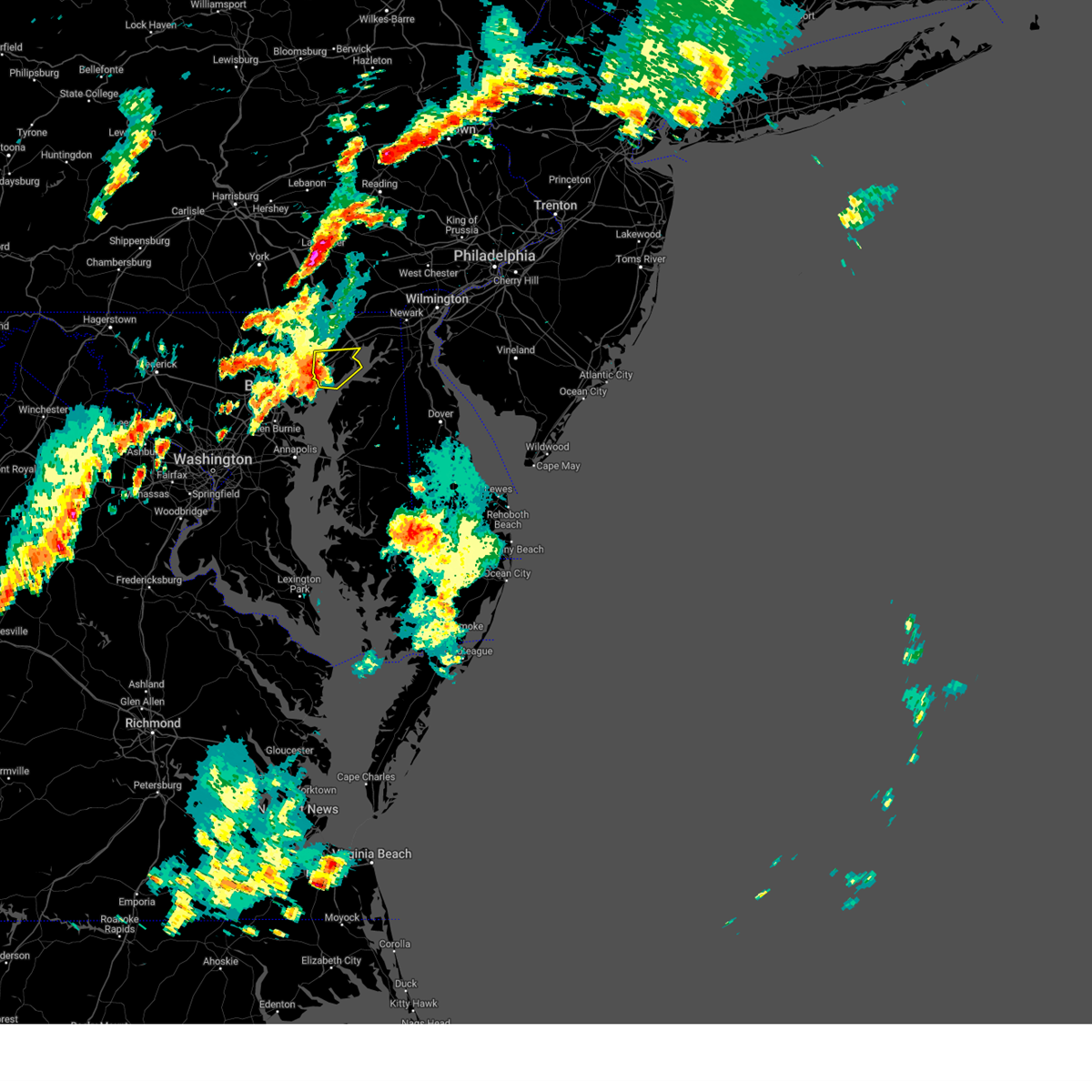
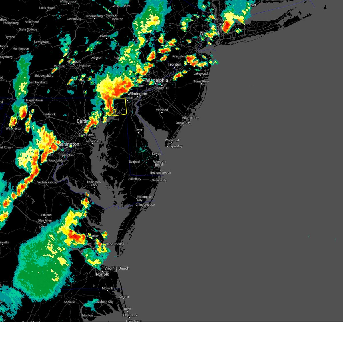
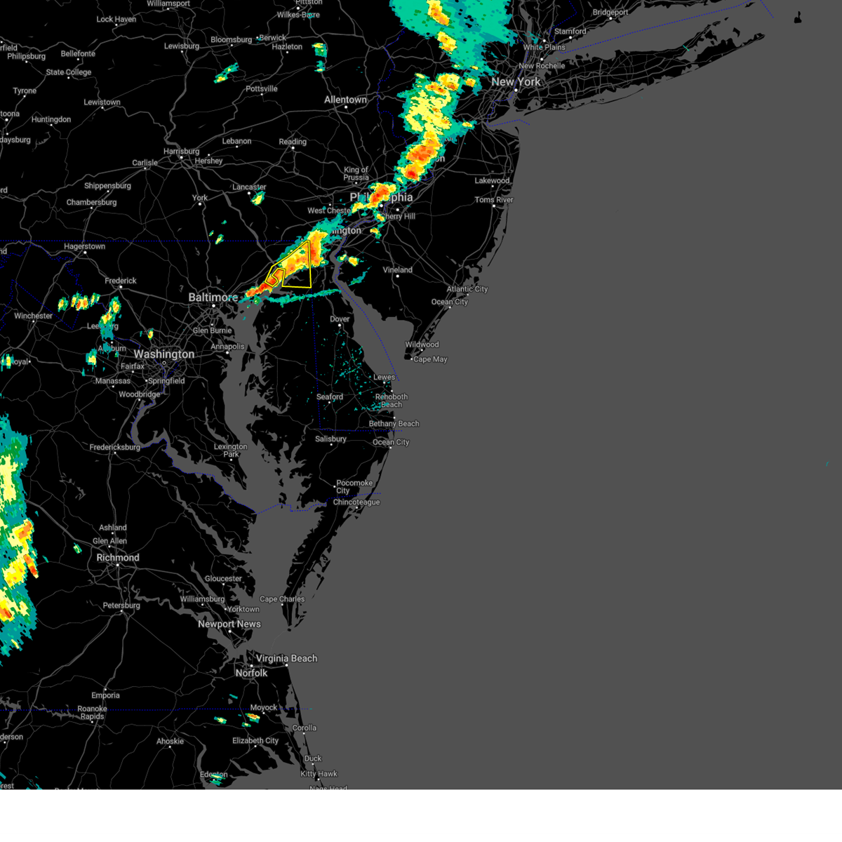
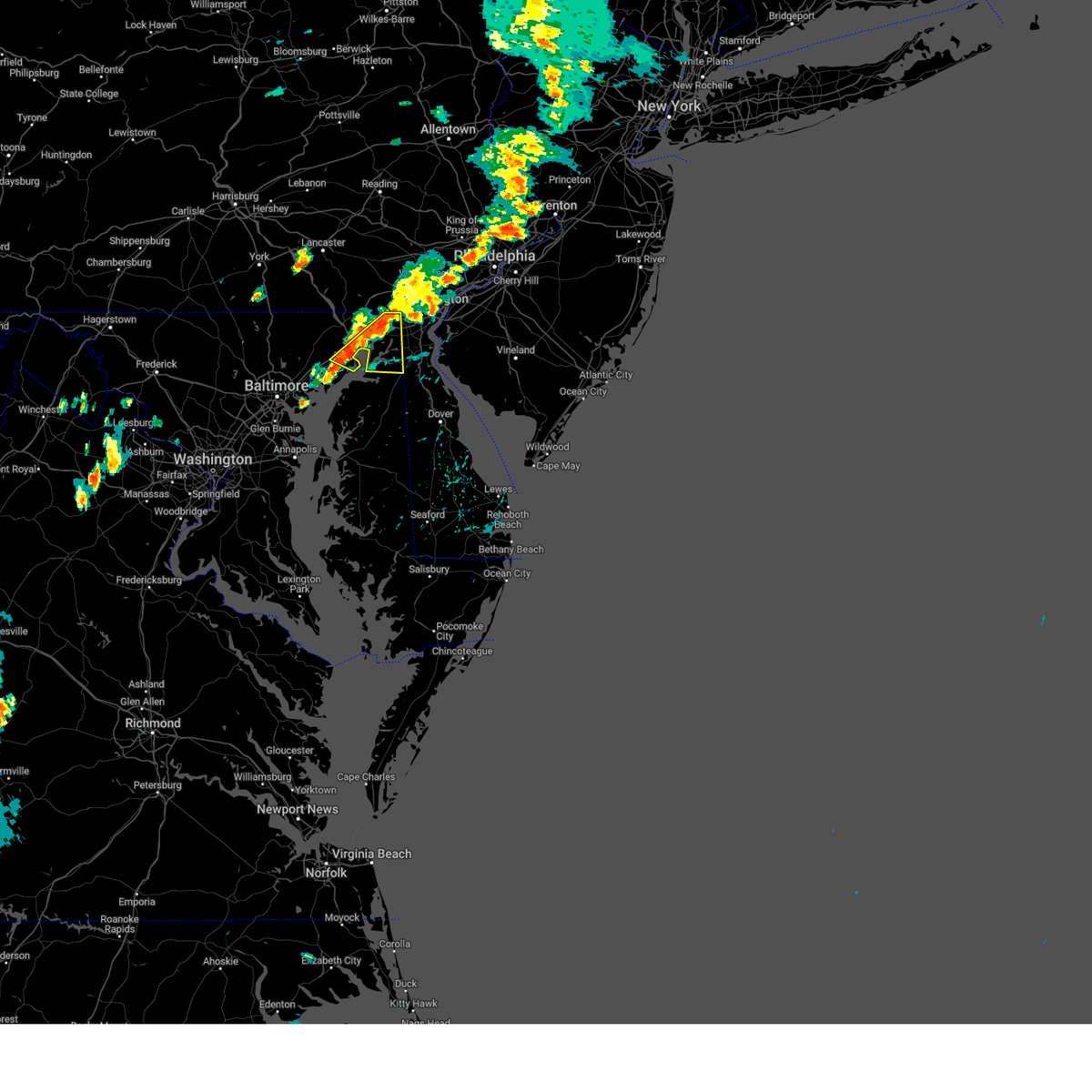
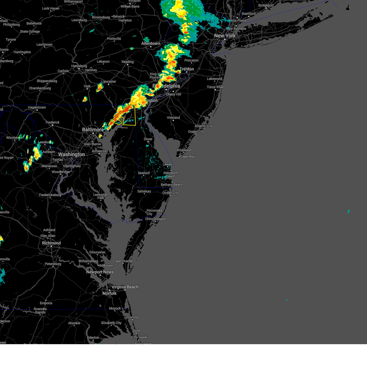
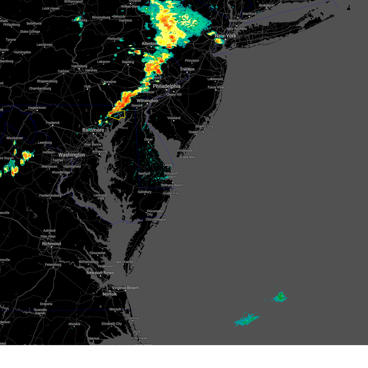
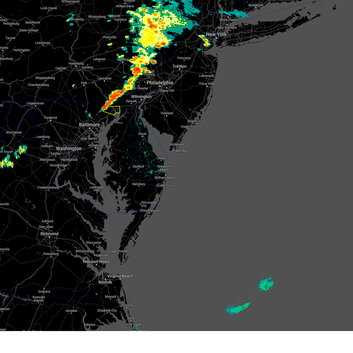
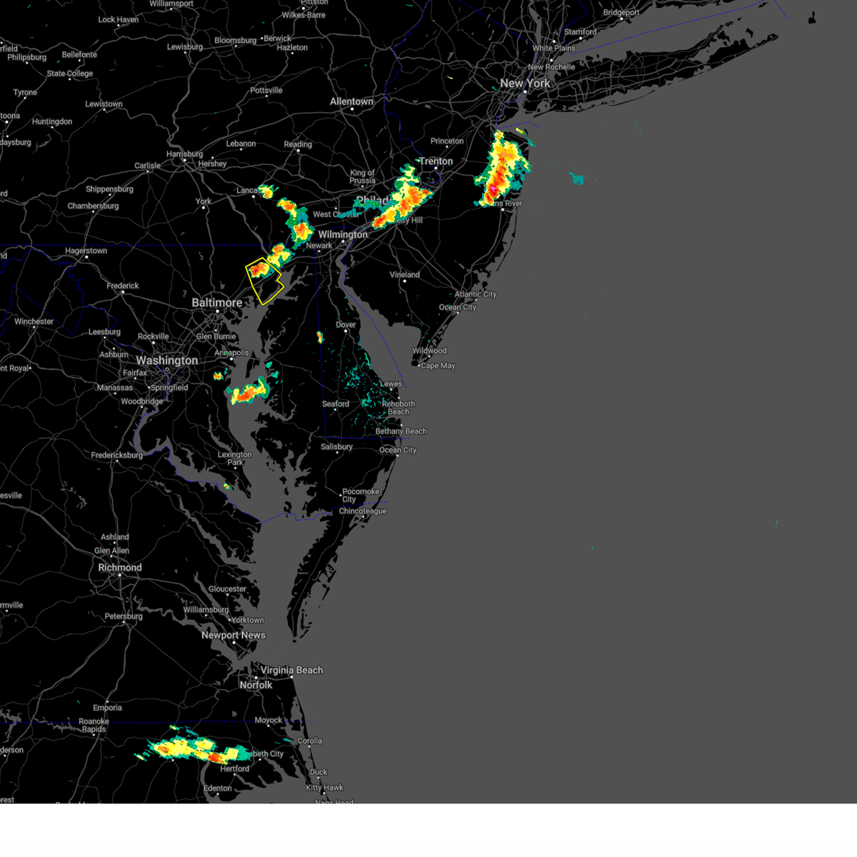
Hail Map for Havre de Grace, MD
The Havre de Grace, MD area has had 5 reports of on-the-ground hail by trained spotters, and has been under severe weather warnings 58 times during the past 12 months. Doppler radar has detected hail at or near Havre de Grace, MD on 39 occasions, including 6 occasions during the past year.
| Name: | Havre de Grace, MD |
| Where Located: | 31.6 miles NE of Baltimore, MD |
| Map: | Google Map for Havre de Grace, MD |
| Population: | 12952 |
| Housing Units: | 5875 |
| More Info: | Search Google for Havre de Grace, MD |
1
The Top Recent Hail Date for Havre de Grace, MD is Saturday, August 3, 2024 (10th out of 39)

Hail and Wind Damage Spotted near Havre de Grace, MD
| Date / Time | Report Details |
|---|---|
| 7/8/2025 6:02 PM EDT |
 the severe thunderstorm warning has been cancelled and is no longer in effect the severe thunderstorm warning has been cancelled and is no longer in effect
|
| 7/8/2025 6:02 PM EDT |
 At 602 pm edt, a severe thunderstorm was located over havre de grace, moving east at 10 mph (radar indicated). Hazards include 60 mph wind gusts. Damaging winds will cause some trees and large branches to fall. this could injure those outdoors, as well as damage homes and vehicles. roadways may become blocked by downed trees. localized power outages are possible. unsecured light objects may become projectiles. Locations impacted include, elkton, aberdeen, havre de grace, aberdeen proving ground, calvert, north east, rising sun, perryman, charlestown, cecilton, warwick, zion, blake, barksdale, bohemias mills, west nottingham, octoraro, brantwood, fair hill, and glen westover. At 602 pm edt, a severe thunderstorm was located over havre de grace, moving east at 10 mph (radar indicated). Hazards include 60 mph wind gusts. Damaging winds will cause some trees and large branches to fall. this could injure those outdoors, as well as damage homes and vehicles. roadways may become blocked by downed trees. localized power outages are possible. unsecured light objects may become projectiles. Locations impacted include, elkton, aberdeen, havre de grace, aberdeen proving ground, calvert, north east, rising sun, perryman, charlestown, cecilton, warwick, zion, blake, barksdale, bohemias mills, west nottingham, octoraro, brantwood, fair hill, and glen westover.
|
| 7/8/2025 5:28 PM EDT | Svrlwx the national weather service in sterling virginia has issued a * severe thunderstorm warning for, eastern harford county in northern maryland, southeastern baltimore county in northern maryland, cecil county in northeastern maryland, * until 645 pm edt. * at 527 pm edt, a severe thunderstorm was located over bel air south, or near aberdeen, moving east at 20 mph (radar indicated). Hazards include 60 mph wind gusts. Damaging winds will cause some trees and large branches to fall. this could injure those outdoors, as well as damage homes and vehicles. roadways may become blocked by downed trees. localized power outages are possible. Unsecured light objects may become projectiles. |
| 6/30/2025 8:40 PM EDT |
 The storm which prompted the warning has weakened below severe limits, and no longer appears capable of producing a tornado. therefore, the warning will be allowed to expire. however, heavy rain is still possible with this thunderstorm. The storm which prompted the warning has weakened below severe limits, and no longer appears capable of producing a tornado. therefore, the warning will be allowed to expire. however, heavy rain is still possible with this thunderstorm.
|
| 6/30/2025 8:24 PM EDT |
 At 824 pm edt, a severe thunderstorm capable of producing a tornado was located over riverside, or near aberdeen, moving northeast at 15 mph (radar indicated rotation). Hazards include tornado and quarter size hail. For those in the direct path of a tornado touchdown, flying debris will be dangerous to those caught without shelter. damage to roofs, siding, and windows may occur. mobile homes may be damaged or destroyed. tree damage is likely. this dangerous storm will be near, aberdeen, aberdeen proving ground, riverside, and perryman around 830 pm edt. Other locations impacted by this tornadic thunderstorm include harford furnace, abingdon, carsins, belcamp, and edgewood. At 824 pm edt, a severe thunderstorm capable of producing a tornado was located over riverside, or near aberdeen, moving northeast at 15 mph (radar indicated rotation). Hazards include tornado and quarter size hail. For those in the direct path of a tornado touchdown, flying debris will be dangerous to those caught without shelter. damage to roofs, siding, and windows may occur. mobile homes may be damaged or destroyed. tree damage is likely. this dangerous storm will be near, aberdeen, aberdeen proving ground, riverside, and perryman around 830 pm edt. Other locations impacted by this tornadic thunderstorm include harford furnace, abingdon, carsins, belcamp, and edgewood.
|
| 6/30/2025 8:17 PM EDT | Tree down and siding ripped off home near the 700 block of ruddy c in harford county MD, 0.6 miles WSW of Havre de Grace, MD |
| 6/30/2025 8:14 PM EDT |
 Torlwx the national weather service in sterling virginia has issued a * tornado warning for, east central harford county in northern maryland, * until 845 pm edt. * at 814 pm edt, a severe thunderstorm capable of producing a tornado was located near riverside, or 7 miles southwest of aberdeen, moving east at 20 mph (radar indicated rotation). Hazards include tornado and quarter size hail. For those in the direct path of a tornado touchdown, flying debris will be dangerous to those caught without shelter. damage to roofs, siding, and windows may occur. mobile homes may be damaged or destroyed. tree damage is likely. this dangerous storm will be near, aberdeen, havre de grace, aberdeen proving ground, riverside, and perryman around 820 pm edt. Other locations impacted by this tornadic thunderstorm include edgewood, harford furnace, abingdon, joppa, carsins, belcamp, and joppatowne. Torlwx the national weather service in sterling virginia has issued a * tornado warning for, east central harford county in northern maryland, * until 845 pm edt. * at 814 pm edt, a severe thunderstorm capable of producing a tornado was located near riverside, or 7 miles southwest of aberdeen, moving east at 20 mph (radar indicated rotation). Hazards include tornado and quarter size hail. For those in the direct path of a tornado touchdown, flying debris will be dangerous to those caught without shelter. damage to roofs, siding, and windows may occur. mobile homes may be damaged or destroyed. tree damage is likely. this dangerous storm will be near, aberdeen, havre de grace, aberdeen proving ground, riverside, and perryman around 820 pm edt. Other locations impacted by this tornadic thunderstorm include edgewood, harford furnace, abingdon, joppa, carsins, belcamp, and joppatowne.
|
| 6/26/2025 8:43 PM EDT |
 the severe thunderstorm warning has been cancelled and is no longer in effect the severe thunderstorm warning has been cancelled and is no longer in effect
|
| 6/26/2025 8:33 PM EDT |
 At 833 pm edt, a severe thunderstorm was located near aberdeen proving ground, moving southeast at 15 mph (radar indicated). Hazards include 60 mph wind gusts. Damaging winds will cause some trees and large branches to fall. this could injure those outdoors, as well as damage homes and vehicles. roadways may become blocked by downed trees. localized power outages are possible. unsecured light objects may become projectiles. Locations impacted include, aberdeen, havre de grace, aberdeen proving ground, perryman, and edgewood. At 833 pm edt, a severe thunderstorm was located near aberdeen proving ground, moving southeast at 15 mph (radar indicated). Hazards include 60 mph wind gusts. Damaging winds will cause some trees and large branches to fall. this could injure those outdoors, as well as damage homes and vehicles. roadways may become blocked by downed trees. localized power outages are possible. unsecured light objects may become projectiles. Locations impacted include, aberdeen, havre de grace, aberdeen proving ground, perryman, and edgewood.
|
| 6/26/2025 8:06 PM EDT | Multiple trees down on tydings lan in harford county MD, 2.7 miles NNW of Havre de Grace, MD |
| 6/26/2025 8:06 PM EDT |
 Svrlwx the national weather service in sterling virginia has issued a * severe thunderstorm warning for, southeastern harford county in northern maryland, southeastern cecil county in northeastern maryland, * until 900 pm edt. * at 805 pm edt, a severe thunderstorm was located over perryman, or over aberdeen, moving southeast at 15 mph (radar indicated). Hazards include 60 mph wind gusts. Damaging winds will cause some trees and large branches to fall. this could injure those outdoors, as well as damage homes and vehicles. roadways may become blocked by downed trees. localized power outages are possible. Unsecured light objects may become projectiles. Svrlwx the national weather service in sterling virginia has issued a * severe thunderstorm warning for, southeastern harford county in northern maryland, southeastern cecil county in northeastern maryland, * until 900 pm edt. * at 805 pm edt, a severe thunderstorm was located over perryman, or over aberdeen, moving southeast at 15 mph (radar indicated). Hazards include 60 mph wind gusts. Damaging winds will cause some trees and large branches to fall. this could injure those outdoors, as well as damage homes and vehicles. roadways may become blocked by downed trees. localized power outages are possible. Unsecured light objects may become projectiles.
|
| 6/26/2025 7:59 PM EDT |
 The storm which prompted the warning has weakened below severe limits, and no longer poses an immediate threat to life or property. therefore, the warning will be allowed to expire. a severe thunderstorm watch remains in effect until 1000 pm edt for northern and northeastern maryland. to report severe weather, contact your nearest law enforcement agency. they will relay your report to the national weather service sterling virginia. The storm which prompted the warning has weakened below severe limits, and no longer poses an immediate threat to life or property. therefore, the warning will be allowed to expire. a severe thunderstorm watch remains in effect until 1000 pm edt for northern and northeastern maryland. to report severe weather, contact your nearest law enforcement agency. they will relay your report to the national weather service sterling virginia.
|
| 6/26/2025 7:25 PM EDT |
 At 725 pm edt, a severe thunderstorm was located over woodlawn, or 7 miles north of havre de grace, moving southeast at 25 mph (radar indicated). Hazards include 60 mph wind gusts. Damaging winds will cause some trees and large branches to fall. this could injure those outdoors, as well as damage homes and vehicles. roadways may become blocked by downed trees. localized power outages are possible. unsecured light objects may become projectiles. Locations impacted include, elkton, aberdeen, havre de grace, calvert, bel air south, bel air north, north east, rising sun, charlestown, zion, blake, barksdale, west nottingham, octoraro, brantwood, fair hill, glen westover, bay view, lombard, and richardsmere. At 725 pm edt, a severe thunderstorm was located over woodlawn, or 7 miles north of havre de grace, moving southeast at 25 mph (radar indicated). Hazards include 60 mph wind gusts. Damaging winds will cause some trees and large branches to fall. this could injure those outdoors, as well as damage homes and vehicles. roadways may become blocked by downed trees. localized power outages are possible. unsecured light objects may become projectiles. Locations impacted include, elkton, aberdeen, havre de grace, calvert, bel air south, bel air north, north east, rising sun, charlestown, zion, blake, barksdale, west nottingham, octoraro, brantwood, fair hill, glen westover, bay view, lombard, and richardsmere.
|
| 6/26/2025 7:01 PM EDT |
 Svrlwx the national weather service in sterling virginia has issued a * severe thunderstorm warning for, northern harford county in northern maryland, cecil county in northeastern maryland, * until 800 pm edt. * at 700 pm edt, a severe thunderstorm was located over glen roy, or 16 miles north of havre de grace, moving south at 30 mph (radar indicated). Hazards include 60 mph wind gusts. Damaging winds will cause some trees and large branches to fall. this could injure those outdoors, as well as damage homes and vehicles. roadways may become blocked by downed trees. localized power outages are possible. Unsecured light objects may become projectiles. Svrlwx the national weather service in sterling virginia has issued a * severe thunderstorm warning for, northern harford county in northern maryland, cecil county in northeastern maryland, * until 800 pm edt. * at 700 pm edt, a severe thunderstorm was located over glen roy, or 16 miles north of havre de grace, moving south at 30 mph (radar indicated). Hazards include 60 mph wind gusts. Damaging winds will cause some trees and large branches to fall. this could injure those outdoors, as well as damage homes and vehicles. roadways may become blocked by downed trees. localized power outages are possible. Unsecured light objects may become projectiles.
|
| 6/19/2025 6:05 PM EDT | The storm which prompted the warning has moved out of the area. therefore, the warning will be allowed to expire. a severe thunderstorm watch remains in effect until 900 pm edt for northern and northeastern maryland. to report severe weather, contact your nearest law enforcement agency. they will relay your report to the national weather service sterling virginia. |
| 6/19/2025 5:29 PM EDT | the severe thunderstorm warning has been cancelled and is no longer in effect |
| 6/19/2025 5:29 PM EDT | At 528 pm edt, a severe thunderstorm was located over hollywood beach, or 8 miles south of elkton, moving east at 60 mph (emergency management). Hazards include 70 mph wind gusts. Damaging winds will cause some trees and large branches to fall. this could injure those outdoors, as well as damage homes and vehicles. roadways may become blocked by downed trees. localized power outages are possible. unsecured light objects may become projectiles. Locations impacted include, elkton, aberdeen, havre de grace, aberdeen proving ground, calvert, north east, rising sun, charlestown, zion, blake, barksdale, west nottingham, octoraro, brantwood, fair hill, glen westover, bay view, lombard, richardsmere, and woodlawn. |
| 6/19/2025 5:12 PM EDT |
 the severe thunderstorm warning has been cancelled and is no longer in effect the severe thunderstorm warning has been cancelled and is no longer in effect
|
| 6/19/2025 5:12 PM EDT |
 At 512 pm edt, a severe thunderstorm was located near bel air south, or 9 miles southwest of aberdeen, moving east at 40 mph (emergency management reports a history of downed trees with this line of storms). Hazards include 60 mph wind gusts. Damaging winds will cause some trees and large branches to fall. this could injure those outdoors, as well as damage homes and vehicles. roadways may become blocked by downed trees. localized power outages are possible. unsecured light objects may become projectiles. Locations impacted include, elkton, aberdeen, havre de grace, aberdeen proving ground, calvert, bel air south, bel air north, fallston, riverside, kingsville, north east, pleasant hills, rising sun, perryman, charlestown, blake, west nottingham, bay view, lombard, and richardsmere. At 512 pm edt, a severe thunderstorm was located near bel air south, or 9 miles southwest of aberdeen, moving east at 40 mph (emergency management reports a history of downed trees with this line of storms). Hazards include 60 mph wind gusts. Damaging winds will cause some trees and large branches to fall. this could injure those outdoors, as well as damage homes and vehicles. roadways may become blocked by downed trees. localized power outages are possible. unsecured light objects may become projectiles. Locations impacted include, elkton, aberdeen, havre de grace, aberdeen proving ground, calvert, bel air south, bel air north, fallston, riverside, kingsville, north east, pleasant hills, rising sun, perryman, charlestown, blake, west nottingham, bay view, lombard, and richardsmere.
|
| 6/19/2025 4:59 PM EDT |
 Svrlwx the national weather service in sterling virginia has issued a * severe thunderstorm warning for, northeastern baltimore city in northern maryland, harford county in northern maryland, east central baltimore county in northern maryland, cecil county in northeastern maryland, * until 615 pm edt. * at 459 pm edt, a severe thunderstorm was located over perry hall, or near middle river, moving east at 35 mph (emergency management reports a history of downed trees with this line of storms). Hazards include 60 mph wind gusts. Damaging winds will cause some trees and large branches to fall. this could injure those outdoors, as well as damage homes and vehicles. roadways may become blocked by downed trees. localized power outages are possible. Unsecured light objects may become projectiles. Svrlwx the national weather service in sterling virginia has issued a * severe thunderstorm warning for, northeastern baltimore city in northern maryland, harford county in northern maryland, east central baltimore county in northern maryland, cecil county in northeastern maryland, * until 615 pm edt. * at 459 pm edt, a severe thunderstorm was located over perry hall, or near middle river, moving east at 35 mph (emergency management reports a history of downed trees with this line of storms). Hazards include 60 mph wind gusts. Damaging winds will cause some trees and large branches to fall. this could injure those outdoors, as well as damage homes and vehicles. roadways may become blocked by downed trees. localized power outages are possible. Unsecured light objects may become projectiles.
|
| 6/19/2025 4:25 PM EDT |
 Svrlwx the national weather service in sterling virginia has issued a * severe thunderstorm warning for, northeastern harford county in northern maryland, cecil county in northeastern maryland, * until 515 pm edt. * at 425 pm edt, a severe thunderstorm was located near conowingo, or 11 miles northwest of havre de grace, moving east at 40 mph (radar indicated). Hazards include 60 mph wind gusts. Damaging winds will cause some trees and large branches to fall. this could injure those outdoors, as well as damage homes and vehicles. roadways may become blocked by downed trees. localized power outages are possible. Unsecured light objects may become projectiles. Svrlwx the national weather service in sterling virginia has issued a * severe thunderstorm warning for, northeastern harford county in northern maryland, cecil county in northeastern maryland, * until 515 pm edt. * at 425 pm edt, a severe thunderstorm was located near conowingo, or 11 miles northwest of havre de grace, moving east at 40 mph (radar indicated). Hazards include 60 mph wind gusts. Damaging winds will cause some trees and large branches to fall. this could injure those outdoors, as well as damage homes and vehicles. roadways may become blocked by downed trees. localized power outages are possible. Unsecured light objects may become projectiles.
|
| 5/16/2025 6:37 PM EDT | At 636 pm edt, severe thunderstorms were located along a line extending from bay view to hollywood beach to near cecilton, moving east at 45 mph (law enforcement). Hazards include 70 mph wind gusts and nickel size hail. Damaging winds will cause some trees and large branches to fall. this could injure those outdoors, as well as damage homes and vehicles. roadways may become blocked by downed trees. localized power outages are possible. unsecured light objects may become projectiles. Locations impacted include, warwick, zion, chesapeake city, blake, barksdale, bohemias mills, west nottingham, brantwood, port deposit, fair hill, glen westover, bay view, charlestown, cecilton, perryville, lombard, havre de grace, elkton, woodlawn, and calvert. |
| 5/16/2025 6:27 PM EDT | the severe thunderstorm warning has been cancelled and is no longer in effect |
| 5/16/2025 6:27 PM EDT | At 626 pm edt, severe thunderstorms were located along a line extending from near octoraro to near aberdeen proving ground to betterton, moving east at 45 mph (law enforcement). Hazards include 70 mph wind gusts and nickel size hail. Damaging winds will cause some trees and large branches to fall. this could injure those outdoors, as well as damage homes and vehicles. roadways may become blocked by downed trees. localized power outages are possible. unsecured light objects may become projectiles. Locations impacted include, warwick, zion, chesapeake city, blake, aberdeen, churchville, barksdale, darlington, carsins, bohemias mills, west nottingham, octoraro, brantwood, port deposit, fair hill, glen westover, bay view, charlestown, cecilton, and perryville. |
| 5/16/2025 5:51 PM EDT | Svrlwx the national weather service in sterling virginia has issued a * severe thunderstorm warning for, southeastern baltimore city in northern maryland, eastern harford county in northern maryland, southeastern baltimore county in northern maryland, cecil county in northeastern maryland, * until 645 pm edt. * at 551 pm edt, severe thunderstorms were located along a line extending from near jarrettsville to near fallston to near baltimore, moving east at 45 mph (radar indicated). Hazards include 70 mph wind gusts and ping pong ball size hail. Damaging winds will cause some trees and large branches to fall. this could injure those outdoors, as well as damage homes and vehicles. roadways may become blocked by downed trees. localized power outages are possible. Unsecured light objects may become projectiles. |
| 5/3/2025 6:08 PM EDT |
 At 608 pm edt, a severe thunderstorm was located over woodlawn, or near havre de grace, moving northeast at 25 mph (radar indicated). Hazards include ping pong ball size hail and 60 mph wind gusts. Damaging winds will cause some trees and large branches to fall. this could injure those outdoors, as well as damage homes and vehicles. roadways may become blocked by downed trees. localized power outages are possible. unsecured light objects may become projectiles. Locations impacted include, zion, blake, barksdale, west nottingham, octoraro, port deposit, fair hill, glen westover, bay view, charlestown, perryville, lombard, richardsmere, havre de grace, woodlawn, calvert, andora, rising sun, pleasant hill, and cherry hill. At 608 pm edt, a severe thunderstorm was located over woodlawn, or near havre de grace, moving northeast at 25 mph (radar indicated). Hazards include ping pong ball size hail and 60 mph wind gusts. Damaging winds will cause some trees and large branches to fall. this could injure those outdoors, as well as damage homes and vehicles. roadways may become blocked by downed trees. localized power outages are possible. unsecured light objects may become projectiles. Locations impacted include, zion, blake, barksdale, west nottingham, octoraro, port deposit, fair hill, glen westover, bay view, charlestown, perryville, lombard, richardsmere, havre de grace, woodlawn, calvert, andora, rising sun, pleasant hill, and cherry hill.
|
| 5/3/2025 6:05 PM EDT |
 At 605 pm edt, a severe thunderstorm was located over woodlawn, or near havre de grace, moving northeast at 25 mph (radar indicated). Hazards include 60 mph wind gusts and quarter size hail. Damaging winds will cause some trees and large branches to fall. this could injure those outdoors, as well as damage homes and vehicles. roadways may become blocked by downed trees. localized power outages are possible. unsecured light objects may become projectiles. Locations impacted include, zion, blake, barksdale, west nottingham, octoraro, port deposit, fair hill, glen westover, bay view, charlestown, perryville, lombard, richardsmere, havre de grace, woodlawn, calvert, andora, rising sun, pleasant hill, and cherry hill. At 605 pm edt, a severe thunderstorm was located over woodlawn, or near havre de grace, moving northeast at 25 mph (radar indicated). Hazards include 60 mph wind gusts and quarter size hail. Damaging winds will cause some trees and large branches to fall. this could injure those outdoors, as well as damage homes and vehicles. roadways may become blocked by downed trees. localized power outages are possible. unsecured light objects may become projectiles. Locations impacted include, zion, blake, barksdale, west nottingham, octoraro, port deposit, fair hill, glen westover, bay view, charlestown, perryville, lombard, richardsmere, havre de grace, woodlawn, calvert, andora, rising sun, pleasant hill, and cherry hill.
|
| 5/3/2025 5:44 PM EDT |
 The storm which prompted the warning has moved out of the area. therefore, the warning will be allowed to expire. a severe thunderstorm watch remains in effect until 1000 pm edt for northern maryland. to report severe weather, contact your nearest law enforcement agency. they will relay your report to the national weather service sterling virginia. The storm which prompted the warning has moved out of the area. therefore, the warning will be allowed to expire. a severe thunderstorm watch remains in effect until 1000 pm edt for northern maryland. to report severe weather, contact your nearest law enforcement agency. they will relay your report to the national weather service sterling virginia.
|
| 5/3/2025 5:41 PM EDT |
 Svrlwx the national weather service in sterling virginia has issued a * severe thunderstorm warning for, northeastern harford county in northern maryland, cecil county in northeastern maryland, * until 645 pm edt. * at 540 pm edt, a severe thunderstorm was located near aberdeen, moving northeast at 30 mph (radar indicated). Hazards include 60 mph wind gusts and quarter size hail. Damaging winds will cause some trees and large branches to fall. this could injure those outdoors, as well as damage homes and vehicles. roadways may become blocked by downed trees. localized power outages are possible. Unsecured light objects may become projectiles. Svrlwx the national weather service in sterling virginia has issued a * severe thunderstorm warning for, northeastern harford county in northern maryland, cecil county in northeastern maryland, * until 645 pm edt. * at 540 pm edt, a severe thunderstorm was located near aberdeen, moving northeast at 30 mph (radar indicated). Hazards include 60 mph wind gusts and quarter size hail. Damaging winds will cause some trees and large branches to fall. this could injure those outdoors, as well as damage homes and vehicles. roadways may become blocked by downed trees. localized power outages are possible. Unsecured light objects may become projectiles.
|
| 5/3/2025 5:34 PM EDT |
 the severe thunderstorm warning has been cancelled and is no longer in effect the severe thunderstorm warning has been cancelled and is no longer in effect
|
| 5/3/2025 5:34 PM EDT |
 At 533 pm edt, a severe thunderstorm was located near aberdeen, moving northeast at 30 mph (radar indicated). Hazards include two inch hail and 60 mph wind gusts. Expect wind damage to trees and power lines. hail is large enough to dent and damage vehicles. some hail damage to roofs, siding, and windows is possible. Locations impacted include, aberdeen, churchville, bel air south, darlington, carsins, scarboro, forest hill, bynum, harford furnace, bel air north, hickory, riverside, abingdon, havre de grace, perryman, and edgewood. At 533 pm edt, a severe thunderstorm was located near aberdeen, moving northeast at 30 mph (radar indicated). Hazards include two inch hail and 60 mph wind gusts. Expect wind damage to trees and power lines. hail is large enough to dent and damage vehicles. some hail damage to roofs, siding, and windows is possible. Locations impacted include, aberdeen, churchville, bel air south, darlington, carsins, scarboro, forest hill, bynum, harford furnace, bel air north, hickory, riverside, abingdon, havre de grace, perryman, and edgewood.
|
| 5/3/2025 5:16 PM EDT |
 At 516 pm edt, a severe thunderstorm was located over pleasant hills, or 10 miles north of middle river, moving northeast at 30 mph (radar indicated). Hazards include two inch hail and 60 mph wind gusts. Expect wind damage to trees and power lines. hail is large enough to dent and damage vehicles. some hail damage to roofs, siding, and windows is possible. Locations impacted include, glen arm, fork, benson, aberdeen, churchville, baldwin, pleasant hills, long green, bel air south, darlington, carsins, scarboro, hydes, kingsville, forest hill, bynum, harford furnace, fallston, bel air north, and upper falls. At 516 pm edt, a severe thunderstorm was located over pleasant hills, or 10 miles north of middle river, moving northeast at 30 mph (radar indicated). Hazards include two inch hail and 60 mph wind gusts. Expect wind damage to trees and power lines. hail is large enough to dent and damage vehicles. some hail damage to roofs, siding, and windows is possible. Locations impacted include, glen arm, fork, benson, aberdeen, churchville, baldwin, pleasant hills, long green, bel air south, darlington, carsins, scarboro, hydes, kingsville, forest hill, bynum, harford furnace, fallston, bel air north, and upper falls.
|
| 5/3/2025 5:04 PM EDT | Svrlwx the national weather service in sterling virginia has issued a * severe thunderstorm warning for, central harford county in northern maryland, east central baltimore county in northern maryland, * until 545 pm edt. * at 504 pm edt, a severe thunderstorm was located over carney, or near cockeysville, moving northeast at 35 mph (radar indicated). Hazards include 60 mph wind gusts and quarter size hail. Damaging winds will cause some trees and large branches to fall. this could injure those outdoors, as well as damage homes and vehicles. roadways may become blocked by downed trees. localized power outages are possible. Unsecured light objects may become projectiles. |
| 4/19/2025 11:21 PM EDT |
 The storm which prompted the warning has weakened below severe limits, and has exited the warned area. therefore, the warning will be allowed to expire. The storm which prompted the warning has weakened below severe limits, and has exited the warned area. therefore, the warning will be allowed to expire.
|
| 4/19/2025 11:06 PM EDT |
 At 1106 pm edt, a severe thunderstorm was located over west nottingham, or 8 miles north of havre de grace, moving east at 70 mph (observations at multiple sites). Hazards include 60 mph wind gusts. Damaging winds will cause some trees and large branches to fall. this could injure those outdoors, as well as damage homes and vehicles. roadways may become blocked by downed trees. localized power outages are possible. unsecured light objects may become projectiles. Locations impacted include, zion, blake, barksdale, darlington, west nottingham, octoraro, brantwood, port deposit, fair hill, glen westover, bay view, charlestown, perryville, lombard, richardsmere, havre de grace, elkton, woodlawn, calvert, and andora. At 1106 pm edt, a severe thunderstorm was located over west nottingham, or 8 miles north of havre de grace, moving east at 70 mph (observations at multiple sites). Hazards include 60 mph wind gusts. Damaging winds will cause some trees and large branches to fall. this could injure those outdoors, as well as damage homes and vehicles. roadways may become blocked by downed trees. localized power outages are possible. unsecured light objects may become projectiles. Locations impacted include, zion, blake, barksdale, darlington, west nottingham, octoraro, brantwood, port deposit, fair hill, glen westover, bay view, charlestown, perryville, lombard, richardsmere, havre de grace, elkton, woodlawn, calvert, and andora.
|
| 4/19/2025 10:49 PM EDT |
 Svrlwx the national weather service in sterling virginia has issued a * severe thunderstorm warning for, northeastern harford county in northern maryland, cecil county in northeastern maryland, * until 1130 pm edt. * at 1049 pm edt, a severe thunderstorm was located near jarrettsville, or 15 miles northeast of cockeysville, moving east at 70 mph (observations at multiple sites to the west of this line). Hazards include 60 mph wind gusts. Damaging winds will cause some trees and large branches to fall. this could injure those outdoors, as well as damage homes and vehicles. roadways may become blocked by downed trees. localized power outages are possible. Unsecured light objects may become projectiles. Svrlwx the national weather service in sterling virginia has issued a * severe thunderstorm warning for, northeastern harford county in northern maryland, cecil county in northeastern maryland, * until 1130 pm edt. * at 1049 pm edt, a severe thunderstorm was located near jarrettsville, or 15 miles northeast of cockeysville, moving east at 70 mph (observations at multiple sites to the west of this line). Hazards include 60 mph wind gusts. Damaging winds will cause some trees and large branches to fall. this could injure those outdoors, as well as damage homes and vehicles. roadways may become blocked by downed trees. localized power outages are possible. Unsecured light objects may become projectiles.
|
| 8/18/2024 8:39 PM EDT |
 The storm which prompted the warning has weakened below severe limits, and no longer poses an immediate threat to life or property. therefore, the warning will be allowed to expire. however, heavy rain is still possible with this thunderstorm. a severe thunderstorm watch remains in effect until 1000 pm edt for northern maryland. to report severe weather, contact your nearest law enforcement agency. they will relay your report to the national weather service sterling virginia. The storm which prompted the warning has weakened below severe limits, and no longer poses an immediate threat to life or property. therefore, the warning will be allowed to expire. however, heavy rain is still possible with this thunderstorm. a severe thunderstorm watch remains in effect until 1000 pm edt for northern maryland. to report severe weather, contact your nearest law enforcement agency. they will relay your report to the national weather service sterling virginia.
|
| 8/18/2024 8:25 PM EDT |
 the severe thunderstorm warning has been cancelled and is no longer in effect the severe thunderstorm warning has been cancelled and is no longer in effect
|
| 8/18/2024 8:25 PM EDT |
 At 824 pm edt, a severe thunderstorm was located near riverside, or 8 miles southwest of aberdeen, moving east at 25 mph (radar indicated). Hazards include 60 mph wind gusts. Damaging winds will cause some trees and large branches to fall. this could injure those outdoors, as well as damage homes and vehicles. roadways may become blocked by downed trees. localized power outages are possible. unsecured light objects may become projectiles. Locations impacted include, aberdeen, havre de grace, aberdeen proving ground, bel air south, riverside, perryman, edgewood, joppatowne, magnolia, harford furnace, abingdon, joppa, and belcamp. At 824 pm edt, a severe thunderstorm was located near riverside, or 8 miles southwest of aberdeen, moving east at 25 mph (radar indicated). Hazards include 60 mph wind gusts. Damaging winds will cause some trees and large branches to fall. this could injure those outdoors, as well as damage homes and vehicles. roadways may become blocked by downed trees. localized power outages are possible. unsecured light objects may become projectiles. Locations impacted include, aberdeen, havre de grace, aberdeen proving ground, bel air south, riverside, perryman, edgewood, joppatowne, magnolia, harford furnace, abingdon, joppa, and belcamp.
|
| 8/18/2024 7:58 PM EDT |
 Svrlwx the national weather service in sterling virginia has issued a * severe thunderstorm warning for, southern harford county in northern maryland, east central baltimore county in northern maryland, * until 845 pm edt. * at 758 pm edt, a severe thunderstorm was located over perry hall, or near middle river, moving east at 30 mph (radar indicated). Hazards include 60 mph wind gusts and quarter size hail. Damaging winds will cause some trees and large branches to fall. this could injure those outdoors, as well as damage homes and vehicles. roadways may become blocked by downed trees. localized power outages are possible. Unsecured light objects may become projectiles. Svrlwx the national weather service in sterling virginia has issued a * severe thunderstorm warning for, southern harford county in northern maryland, east central baltimore county in northern maryland, * until 845 pm edt. * at 758 pm edt, a severe thunderstorm was located over perry hall, or near middle river, moving east at 30 mph (radar indicated). Hazards include 60 mph wind gusts and quarter size hail. Damaging winds will cause some trees and large branches to fall. this could injure those outdoors, as well as damage homes and vehicles. roadways may become blocked by downed trees. localized power outages are possible. Unsecured light objects may become projectiles.
|
| 8/3/2024 6:24 PM EDT |
 The storms which prompted the warning have moved out of the area. therefore, the warning has been allowed to expire. a severe thunderstorm watch remains in effect until 900 pm edt for northern and northeastern maryland. to report severe weather, contact your nearest law enforcement agency. they will relay your report to the national weather service sterling virginia. The storms which prompted the warning have moved out of the area. therefore, the warning has been allowed to expire. a severe thunderstorm watch remains in effect until 900 pm edt for northern and northeastern maryland. to report severe weather, contact your nearest law enforcement agency. they will relay your report to the national weather service sterling virginia.
|
| 8/3/2024 5:59 PM EDT |
 At 558 pm edt, severe thunderstorms were located along a line extending from near mount vernon to near betterton, moving east at 35 mph (emergency management). Hazards include 70 mph wind gusts and quarter size hail. Damaging winds will cause some trees and large branches to fall. this could injure those outdoors, as well as damage homes and vehicles. roadways may become blocked by downed trees. localized power outages are possible. unsecured light objects may become projectiles. Locations impacted include, elkton, havre de grace, aberdeen proving ground, calvert, north east, rising sun, charlestown, zion, blake, barksdale, bohemias mills, west nottingham, brantwood, fair hill, bay view, lombard, richardsmere, woodlawn, andora, and pleasant hill. At 558 pm edt, severe thunderstorms were located along a line extending from near mount vernon to near betterton, moving east at 35 mph (emergency management). Hazards include 70 mph wind gusts and quarter size hail. Damaging winds will cause some trees and large branches to fall. this could injure those outdoors, as well as damage homes and vehicles. roadways may become blocked by downed trees. localized power outages are possible. unsecured light objects may become projectiles. Locations impacted include, elkton, havre de grace, aberdeen proving ground, calvert, north east, rising sun, charlestown, zion, blake, barksdale, bohemias mills, west nottingham, brantwood, fair hill, bay view, lombard, richardsmere, woodlawn, andora, and pleasant hill.
|
| 8/3/2024 5:44 PM EDT |
 At 544 pm edt, severe thunderstorms were located along a line extending from near wakefield to near perryman, moving east at 25 mph (radar indicated). Hazards include 60 mph wind gusts. Damaging winds will cause some trees and large branches to fall. this could injure those outdoors, as well as damage homes and vehicles. roadways may become blocked by downed trees. localized power outages are possible. unsecured light objects may become projectiles. Locations impacted include, elkton, aberdeen, havre de grace, aberdeen proving ground, calvert, bel air south, bel air north, riverside, north east, rising sun, perryman, charlestown, zion, blake, barksdale, bohemias mills, west nottingham, octoraro, brantwood, and fair hill. At 544 pm edt, severe thunderstorms were located along a line extending from near wakefield to near perryman, moving east at 25 mph (radar indicated). Hazards include 60 mph wind gusts. Damaging winds will cause some trees and large branches to fall. this could injure those outdoors, as well as damage homes and vehicles. roadways may become blocked by downed trees. localized power outages are possible. unsecured light objects may become projectiles. Locations impacted include, elkton, aberdeen, havre de grace, aberdeen proving ground, calvert, bel air south, bel air north, riverside, north east, rising sun, perryman, charlestown, zion, blake, barksdale, bohemias mills, west nottingham, octoraro, brantwood, and fair hill.
|
| 8/3/2024 5:44 PM EDT |
 the severe thunderstorm warning has been cancelled and is no longer in effect the severe thunderstorm warning has been cancelled and is no longer in effect
|
| 8/3/2024 5:22 PM EDT | Svrlwx the national weather service in sterling virginia has issued a * severe thunderstorm warning for, harford county in northern maryland, cecil county in northeastern maryland, east central baltimore county in northern maryland, * until 615 pm edt. * at 521 pm edt, severe thunderstorms were located along a line extending from near sunnyburn to near kingsville, moving east at 35 mph (radar indicated). Hazards include 60 mph wind gusts. Damaging winds will cause some trees and large branches to fall. this could injure those outdoors, as well as damage homes and vehicles. roadways may become blocked by downed trees. localized power outages are possible. Unsecured light objects may become projectiles. |
| 8/2/2024 5:58 PM EDT |
 The storm which prompted the warning has weakened below severe limits, and no longer poses an immediate threat to life or property. therefore, the warning will be allowed to expire. a severe thunderstorm watch remains in effect until 900 pm edt for northern and northeastern maryland. to report severe weather, contact your nearest law enforcement agency. they will relay your report to the national weather service sterling virginia. The storm which prompted the warning has weakened below severe limits, and no longer poses an immediate threat to life or property. therefore, the warning will be allowed to expire. a severe thunderstorm watch remains in effect until 900 pm edt for northern and northeastern maryland. to report severe weather, contact your nearest law enforcement agency. they will relay your report to the national weather service sterling virginia.
|
| 8/2/2024 5:47 PM EDT |
 At 547 pm edt, a severe thunderstorm was located near aberdeen proving ground, moving east at 5 mph (radar indicated). Hazards include 60 mph wind gusts. Damaging winds will cause some trees and large branches to fall. this could injure those outdoors, as well as damage homes and vehicles. roadways may become blocked by downed trees. localized power outages are possible. unsecured light objects may become projectiles. Locations impacted include, elkton, havre de grace, aberdeen proving ground, charlestown, warwick, brantwood, cayots, hollywood beach, bohemias mills, glasgow, perryville, and chesapeake city. At 547 pm edt, a severe thunderstorm was located near aberdeen proving ground, moving east at 5 mph (radar indicated). Hazards include 60 mph wind gusts. Damaging winds will cause some trees and large branches to fall. this could injure those outdoors, as well as damage homes and vehicles. roadways may become blocked by downed trees. localized power outages are possible. unsecured light objects may become projectiles. Locations impacted include, elkton, havre de grace, aberdeen proving ground, charlestown, warwick, brantwood, cayots, hollywood beach, bohemias mills, glasgow, perryville, and chesapeake city.
|
| 8/2/2024 5:27 PM EDT |
 At 527 pm edt, a severe thunderstorm was located near charlestown, or near havre de grace, moving east at 15 mph (radar indicated). Hazards include 60 mph wind gusts. Damaging winds will cause some trees and large branches to fall. this could injure those outdoors, as well as damage homes and vehicles. roadways may become blocked by downed trees. localized power outages are possible. unsecured light objects may become projectiles. Locations impacted include, newark, elkton, havre de grace, aberdeen proving ground, north east, charlestown, warwick, barksdale, bohemias mills, andora, brantwood, cherry hill, cayots, glen westover, hollywood beach, appleton, glasgow, perryville, and chesapeake city. At 527 pm edt, a severe thunderstorm was located near charlestown, or near havre de grace, moving east at 15 mph (radar indicated). Hazards include 60 mph wind gusts. Damaging winds will cause some trees and large branches to fall. this could injure those outdoors, as well as damage homes and vehicles. roadways may become blocked by downed trees. localized power outages are possible. unsecured light objects may become projectiles. Locations impacted include, newark, elkton, havre de grace, aberdeen proving ground, north east, charlestown, warwick, barksdale, bohemias mills, andora, brantwood, cherry hill, cayots, glen westover, hollywood beach, appleton, glasgow, perryville, and chesapeake city.
|
| 8/2/2024 5:03 PM EDT |
 At 503 pm edt, a severe thunderstorm was located over aberdeen, moving east at 15 mph (radar indicated). Hazards include 70 mph wind gusts. Damaging winds will cause some trees and large branches to fall. this could injure those outdoors, as well as damage homes and vehicles. roadways may become blocked by downed trees. localized power outages are possible. unsecured light objects may become projectiles. Locations impacted include, newark, elkton, aberdeen, havre de grace, aberdeen proving ground, riverside, north east, perryman, charlestown, warwick, zion, barksdale, bohemias mills, brantwood, fair hill, glen westover, bay view, andora, pleasant hill, and cherry hill. At 503 pm edt, a severe thunderstorm was located over aberdeen, moving east at 15 mph (radar indicated). Hazards include 70 mph wind gusts. Damaging winds will cause some trees and large branches to fall. this could injure those outdoors, as well as damage homes and vehicles. roadways may become blocked by downed trees. localized power outages are possible. unsecured light objects may become projectiles. Locations impacted include, newark, elkton, aberdeen, havre de grace, aberdeen proving ground, riverside, north east, perryman, charlestown, warwick, zion, barksdale, bohemias mills, brantwood, fair hill, glen westover, bay view, andora, pleasant hill, and cherry hill.
|
| 8/2/2024 4:59 PM EDT | Tree down on level roa in harford county MD, 1.1 miles W of Havre de Grace, MD |
| 8/2/2024 4:51 PM EDT |
 Svrlwx the national weather service in sterling virginia has issued a * severe thunderstorm warning for, east central harford county in northern maryland, cecil county in northeastern maryland, * until 600 pm edt. * at 450 pm edt, a severe thunderstorm was located over aberdeen, moving east at 15 mph (radar indicated). Hazards include 60 mph wind gusts. Damaging winds will cause some trees and large branches to fall. this could injure those outdoors, as well as damage homes and vehicles. roadways may become blocked by downed trees. localized power outages are possible. Unsecured light objects may become projectiles. Svrlwx the national weather service in sterling virginia has issued a * severe thunderstorm warning for, east central harford county in northern maryland, cecil county in northeastern maryland, * until 600 pm edt. * at 450 pm edt, a severe thunderstorm was located over aberdeen, moving east at 15 mph (radar indicated). Hazards include 60 mph wind gusts. Damaging winds will cause some trees and large branches to fall. this could injure those outdoors, as well as damage homes and vehicles. roadways may become blocked by downed trees. localized power outages are possible. Unsecured light objects may become projectiles.
|
| 8/2/2024 4:15 PM EDT |
 At 415 pm edt, a severe thunderstorm was located near aberdeen, moving east at 10 mph (radar indicated). Hazards include 60 mph wind gusts and quarter size hail. Damaging winds will cause some trees and large branches to fall. this could injure those outdoors, as well as damage homes and vehicles. roadways may become blocked by downed trees. localized power outages are possible. unsecured light objects may become projectiles. Locations impacted include, aberdeen, havre de grace, bel air south, bel air north, charlestown, woodlawn, perryville, port deposit, churchville, and carsins. At 415 pm edt, a severe thunderstorm was located near aberdeen, moving east at 10 mph (radar indicated). Hazards include 60 mph wind gusts and quarter size hail. Damaging winds will cause some trees and large branches to fall. this could injure those outdoors, as well as damage homes and vehicles. roadways may become blocked by downed trees. localized power outages are possible. unsecured light objects may become projectiles. Locations impacted include, aberdeen, havre de grace, bel air south, bel air north, charlestown, woodlawn, perryville, port deposit, churchville, and carsins.
|
| 8/2/2024 3:55 PM EDT |
 Svrlwx the national weather service in sterling virginia has issued a * severe thunderstorm warning for, northeastern harford county in northern maryland, central cecil county in northeastern maryland, * until 500 pm edt. * at 355 pm edt, a severe thunderstorm was located near bel air north, or 7 miles northwest of aberdeen, moving east at 20 mph (radar indicated). Hazards include 60 mph wind gusts and quarter size hail. Damaging winds will cause some trees and large branches to fall. this could injure those outdoors, as well as damage homes and vehicles. roadways may become blocked by downed trees. localized power outages are possible. Unsecured light objects may become projectiles. Svrlwx the national weather service in sterling virginia has issued a * severe thunderstorm warning for, northeastern harford county in northern maryland, central cecil county in northeastern maryland, * until 500 pm edt. * at 355 pm edt, a severe thunderstorm was located near bel air north, or 7 miles northwest of aberdeen, moving east at 20 mph (radar indicated). Hazards include 60 mph wind gusts and quarter size hail. Damaging winds will cause some trees and large branches to fall. this could injure those outdoors, as well as damage homes and vehicles. roadways may become blocked by downed trees. localized power outages are possible. Unsecured light objects may become projectiles.
|
| 7/31/2024 3:51 PM EDT |
 The storm which prompted the warning has weakened below severe limits, and no longer poses an immediate threat to life or property. therefore, the warning will be allowed to expire. however, gusty winds are still possible with this thunderstorm. The storm which prompted the warning has weakened below severe limits, and no longer poses an immediate threat to life or property. therefore, the warning will be allowed to expire. however, gusty winds are still possible with this thunderstorm.
|
| 7/31/2024 3:27 PM EDT |
 At 327 pm edt, a severe thunderstorm was located near charlestown, or near havre de grace, moving south at 10 mph (radar indicated). Hazards include 60 mph wind gusts and quarter size hail. Damaging winds will cause some trees and large branches to fall. this could injure those outdoors, as well as damage homes and vehicles. roadways may become blocked by downed trees. localized power outages are possible. unsecured light objects may become projectiles. Locations impacted include, havre de grace, north east, charlestown, and perryville. At 327 pm edt, a severe thunderstorm was located near charlestown, or near havre de grace, moving south at 10 mph (radar indicated). Hazards include 60 mph wind gusts and quarter size hail. Damaging winds will cause some trees and large branches to fall. this could injure those outdoors, as well as damage homes and vehicles. roadways may become blocked by downed trees. localized power outages are possible. unsecured light objects may become projectiles. Locations impacted include, havre de grace, north east, charlestown, and perryville.
|
| 7/31/2024 3:12 PM EDT |
 Svrlwx the national weather service in sterling virginia has issued a * severe thunderstorm warning for, east central harford county in northern maryland, central cecil county in northeastern maryland, * until 400 pm edt. * at 311 pm edt, a severe thunderstorm was located near woodlawn, or near havre de grace, moving south at 10 mph (radar indicated). Hazards include 60 mph wind gusts and quarter size hail. Damaging winds will cause some trees and large branches to fall. this could injure those outdoors, as well as damage homes and vehicles. roadways may become blocked by downed trees. localized power outages are possible. Unsecured light objects may become projectiles. Svrlwx the national weather service in sterling virginia has issued a * severe thunderstorm warning for, east central harford county in northern maryland, central cecil county in northeastern maryland, * until 400 pm edt. * at 311 pm edt, a severe thunderstorm was located near woodlawn, or near havre de grace, moving south at 10 mph (radar indicated). Hazards include 60 mph wind gusts and quarter size hail. Damaging winds will cause some trees and large branches to fall. this could injure those outdoors, as well as damage homes and vehicles. roadways may become blocked by downed trees. localized power outages are possible. Unsecured light objects may become projectiles.
|
| 7/16/2024 10:46 PM EDT |
 The storms which prompted the warning have moved out of the area. therefore, the warning will be allowed to expire. however, gusty winds and heavy rain are still possible with these thunderstorms. a severe thunderstorm watch remains in effect until 1100 pm edt for northern and northeastern maryland. to report severe weather, contact your nearest law enforcement agency. they will relay your report to the national weather service sterling virginia. The storms which prompted the warning have moved out of the area. therefore, the warning will be allowed to expire. however, gusty winds and heavy rain are still possible with these thunderstorms. a severe thunderstorm watch remains in effect until 1100 pm edt for northern and northeastern maryland. to report severe weather, contact your nearest law enforcement agency. they will relay your report to the national weather service sterling virginia.
|
| 7/16/2024 10:21 PM EDT |
 At 1021 pm edt, severe thunderstorms were located along a line extending from near elkton to near aberdeen proving ground to near newtown, moving east at 20 mph (radar indicated). Hazards include 60 mph wind gusts. Damaging winds will cause some trees and large branches to fall. this could injure those outdoors, as well as damage homes and vehicles. roadways may become blocked by downed trees. localized power outages are possible. unsecured light objects may become projectiles. Locations impacted include, elkton, aberdeen, havre de grace, aberdeen proving ground, north east, perryman, charlestown, cecilton, warwick, barksdale, bohemias mills, woodlawn, brantwood, cherry hill, cayots, bay view, hollywood beach, perryville, and chesapeake city. At 1021 pm edt, severe thunderstorms were located along a line extending from near elkton to near aberdeen proving ground to near newtown, moving east at 20 mph (radar indicated). Hazards include 60 mph wind gusts. Damaging winds will cause some trees and large branches to fall. this could injure those outdoors, as well as damage homes and vehicles. roadways may become blocked by downed trees. localized power outages are possible. unsecured light objects may become projectiles. Locations impacted include, elkton, aberdeen, havre de grace, aberdeen proving ground, north east, perryman, charlestown, cecilton, warwick, barksdale, bohemias mills, woodlawn, brantwood, cherry hill, cayots, bay view, hollywood beach, perryville, and chesapeake city.
|
| 7/16/2024 10:21 PM EDT |
 the severe thunderstorm warning has been cancelled and is no longer in effect the severe thunderstorm warning has been cancelled and is no longer in effect
|
| 7/16/2024 10:04 PM EDT |
 Svrlwx the national weather service in sterling virginia has issued a * severe thunderstorm warning for, eastern harford county in northern maryland, cecil county in northeastern maryland, east central baltimore county in northern maryland, * until 1045 pm edt. * at 1004 pm edt, severe thunderstorms were located along a line extending from north east to aberdeen proving ground to near bowleys quarters, moving east at 25 mph (radar indicated). Hazards include 60 mph wind gusts. Damaging winds will cause some trees and large branches to fall. this could injure those outdoors, as well as damage homes and vehicles. roadways may become blocked by downed trees. localized power outages are possible. Unsecured light objects may become projectiles. Svrlwx the national weather service in sterling virginia has issued a * severe thunderstorm warning for, eastern harford county in northern maryland, cecil county in northeastern maryland, east central baltimore county in northern maryland, * until 1045 pm edt. * at 1004 pm edt, severe thunderstorms were located along a line extending from north east to aberdeen proving ground to near bowleys quarters, moving east at 25 mph (radar indicated). Hazards include 60 mph wind gusts. Damaging winds will cause some trees and large branches to fall. this could injure those outdoors, as well as damage homes and vehicles. roadways may become blocked by downed trees. localized power outages are possible. Unsecured light objects may become projectiles.
|
| 7/16/2024 8:58 PM EDT |
 Svrlwx the national weather service in sterling virginia has issued a * severe thunderstorm warning for, northeastern harford county in northern maryland, cecil county in northeastern maryland, * until 1000 pm edt. * at 858 pm edt, severe thunderstorms were located along a line extending from kemblesville to near aberdeen, moving east at 25 mph (radar indicated). Hazards include 60 mph wind gusts. Damaging winds will cause some trees and large branches to fall. this could injure those outdoors, as well as damage homes and vehicles. roadways may become blocked by downed trees. localized power outages are possible. Unsecured light objects may become projectiles. Svrlwx the national weather service in sterling virginia has issued a * severe thunderstorm warning for, northeastern harford county in northern maryland, cecil county in northeastern maryland, * until 1000 pm edt. * at 858 pm edt, severe thunderstorms were located along a line extending from kemblesville to near aberdeen, moving east at 25 mph (radar indicated). Hazards include 60 mph wind gusts. Damaging winds will cause some trees and large branches to fall. this could injure those outdoors, as well as damage homes and vehicles. roadways may become blocked by downed trees. localized power outages are possible. Unsecured light objects may become projectiles.
|
| 7/14/2024 4:31 PM EDT |
 Svrlwx the national weather service in sterling virginia has issued a * severe thunderstorm warning for, eastern harford county in northern maryland, * until 515 pm edt. * at 430 pm edt, a severe thunderstorm was located near bel air south, or near aberdeen, moving southeast at 10 mph (radar indicated). Hazards include 60 mph wind gusts. Damaging winds will cause some trees and large branches to fall. this could injure those outdoors, as well as damage homes and vehicles. roadways may become blocked by downed trees. localized power outages are possible. Unsecured light objects may become projectiles. Svrlwx the national weather service in sterling virginia has issued a * severe thunderstorm warning for, eastern harford county in northern maryland, * until 515 pm edt. * at 430 pm edt, a severe thunderstorm was located near bel air south, or near aberdeen, moving southeast at 10 mph (radar indicated). Hazards include 60 mph wind gusts. Damaging winds will cause some trees and large branches to fall. this could injure those outdoors, as well as damage homes and vehicles. roadways may become blocked by downed trees. localized power outages are possible. Unsecured light objects may become projectiles.
|
| 6/30/2024 7:14 PM EDT |
 Svrlwx the national weather service in sterling virginia has issued a * severe thunderstorm warning for, harford county in northern maryland, northwestern cecil county in northeastern maryland, * until 745 pm edt. * at 714 pm edt, a severe thunderstorm was located near jarrettsville, or 16 miles northwest of aberdeen, moving southeast at 25 mph (radar indicated). Hazards include 60 mph wind gusts. Damaging winds will cause some trees and large branches to fall. this could injure those outdoors, as well as damage homes and vehicles. roadways may become blocked by downed trees. localized power outages are possible. Unsecured light objects may become projectiles. Svrlwx the national weather service in sterling virginia has issued a * severe thunderstorm warning for, harford county in northern maryland, northwestern cecil county in northeastern maryland, * until 745 pm edt. * at 714 pm edt, a severe thunderstorm was located near jarrettsville, or 16 miles northwest of aberdeen, moving southeast at 25 mph (radar indicated). Hazards include 60 mph wind gusts. Damaging winds will cause some trees and large branches to fall. this could injure those outdoors, as well as damage homes and vehicles. roadways may become blocked by downed trees. localized power outages are possible. Unsecured light objects may become projectiles.
|
| 6/5/2024 8:29 PM EDT |
 At 829 pm edt, a severe thunderstorm capable of producing a tornado was located near riverside, or 8 miles southwest of aberdeen, moving northeast at 20 mph (radar indicated rotation). Hazards include tornado. For those in the direct path of a tornado touchdown, flying debris will be dangerous to those caught without shelter. damage to roofs, siding, and windows may occur. mobile homes may be damaged or destroyed. tree damage is likely. this dangerous storm will be near, aberdeen, aberdeen proving ground, bel air south, riverside, and perryman around 835 pm edt. Other locations impacted by this tornadic thunderstorm include edgewood, joppatowne, harford furnace, abingdon, joppa, carsins, magnolia, and belcamp. At 829 pm edt, a severe thunderstorm capable of producing a tornado was located near riverside, or 8 miles southwest of aberdeen, moving northeast at 20 mph (radar indicated rotation). Hazards include tornado. For those in the direct path of a tornado touchdown, flying debris will be dangerous to those caught without shelter. damage to roofs, siding, and windows may occur. mobile homes may be damaged or destroyed. tree damage is likely. this dangerous storm will be near, aberdeen, aberdeen proving ground, bel air south, riverside, and perryman around 835 pm edt. Other locations impacted by this tornadic thunderstorm include edgewood, joppatowne, harford furnace, abingdon, joppa, carsins, magnolia, and belcamp.
|
| 6/5/2024 8:29 PM EDT |
 the tornado warning has been cancelled and is no longer in effect the tornado warning has been cancelled and is no longer in effect
|
| 6/5/2024 8:13 PM EDT |
 Torlwx the national weather service in sterling virginia has issued a * tornado warning for, southeastern harford county in northern maryland, east central baltimore county in northern maryland, * until 845 pm edt. * at 813 pm edt, a severe thunderstorm capable of producing a tornado was located near kingsville, or near middle river, moving northeast at 20 mph (radar indicated rotation). Hazards include tornado. For those in the direct path of a tornado touchdown, flying debris will be dangerous to those caught without shelter. damage to roofs, siding, and windows may occur. mobile homes may be damaged or destroyed. tree damage is likely. this dangerous storm will be near, bel air south, riverside, pleasant hills, and perryman around 820 pm edt. Other locations impacted by this tornadic thunderstorm include edgewood, joppatowne, harford furnace, abingdon, joppa, upper falls, carsins, magnolia, gunpowder, and chase. Torlwx the national weather service in sterling virginia has issued a * tornado warning for, southeastern harford county in northern maryland, east central baltimore county in northern maryland, * until 845 pm edt. * at 813 pm edt, a severe thunderstorm capable of producing a tornado was located near kingsville, or near middle river, moving northeast at 20 mph (radar indicated rotation). Hazards include tornado. For those in the direct path of a tornado touchdown, flying debris will be dangerous to those caught without shelter. damage to roofs, siding, and windows may occur. mobile homes may be damaged or destroyed. tree damage is likely. this dangerous storm will be near, bel air south, riverside, pleasant hills, and perryman around 820 pm edt. Other locations impacted by this tornadic thunderstorm include edgewood, joppatowne, harford furnace, abingdon, joppa, upper falls, carsins, magnolia, gunpowder, and chase.
|
| 8/10/2023 12:25 PM EDT |
 At 1225 pm edt, a severe thunderstorm was located near aberdeen, moving northeast at 20 mph (radar indicated). Hazards include 60 mph wind gusts. Damaging winds will cause some trees and large branches to fall. this could injure those outdoors, as well as damage homes and vehicles. roadways may become blocked by downed trees. localized power outages are possible. Unsecured light objects may become projectiles. At 1225 pm edt, a severe thunderstorm was located near aberdeen, moving northeast at 20 mph (radar indicated). Hazards include 60 mph wind gusts. Damaging winds will cause some trees and large branches to fall. this could injure those outdoors, as well as damage homes and vehicles. roadways may become blocked by downed trees. localized power outages are possible. Unsecured light objects may become projectiles.
|
| 8/7/2023 5:35 PM EDT |
 At 534 pm edt, severe thunderstorms were located along a line extending from delta to pleasant hills to rosedale, moving east at 45 mph (radar indicated). Hazards include 60 mph wind gusts. Damaging winds will cause some trees and large branches to fall. this could injure those outdoors, as well as damage homes and vehicles. roadways may become blocked by downed trees. localized power outages are possible. Unsecured light objects may become projectiles. At 534 pm edt, severe thunderstorms were located along a line extending from delta to pleasant hills to rosedale, moving east at 45 mph (radar indicated). Hazards include 60 mph wind gusts. Damaging winds will cause some trees and large branches to fall. this could injure those outdoors, as well as damage homes and vehicles. roadways may become blocked by downed trees. localized power outages are possible. Unsecured light objects may become projectiles.
|
| 7/29/2023 5:09 PM EDT |
 At 509 pm edt, severe thunderstorms were located along a line extending from near north east to near charlestown to near bowleys quarters, moving east at 20 mph (radar indicated). Hazards include 70 mph wind gusts and quarter size hail. Damaging winds will cause some trees and large branches to fall. this could injure those outdoors, as well as damage homes and vehicles. roadways may become blocked by downed trees. localized power outages are possible. unsecured light objects may become projectiles. locations impacted include, middle river, elkton, aberdeen, havre de grace, aberdeen proving ground, bel air south, essex, bowleys quarters, riverside, north east, perryman, charlestown, cecilton, warwick, barksdale, bohemias mills, brantwood, glen westover, andora and cherry hill. thunderstorm damage threat, considerable hail threat, radar indicated max hail size, 1. 00 in wind threat, radar indicated max wind gust, 70 mph. At 509 pm edt, severe thunderstorms were located along a line extending from near north east to near charlestown to near bowleys quarters, moving east at 20 mph (radar indicated). Hazards include 70 mph wind gusts and quarter size hail. Damaging winds will cause some trees and large branches to fall. this could injure those outdoors, as well as damage homes and vehicles. roadways may become blocked by downed trees. localized power outages are possible. unsecured light objects may become projectiles. locations impacted include, middle river, elkton, aberdeen, havre de grace, aberdeen proving ground, bel air south, essex, bowleys quarters, riverside, north east, perryman, charlestown, cecilton, warwick, barksdale, bohemias mills, brantwood, glen westover, andora and cherry hill. thunderstorm damage threat, considerable hail threat, radar indicated max hail size, 1. 00 in wind threat, radar indicated max wind gust, 70 mph.
|
| 7/29/2023 4:52 PM EDT |
 At 451 pm edt, severe thunderstorms were located along a line extending from octoraro to aberdeen proving ground to middle river, moving east at 40 mph (radar indicated). Hazards include 60 mph wind gusts and quarter size hail. Damaging winds will cause some trees and large branches to fall. this could injure those outdoors, as well as damage homes and vehicles. roadways may become blocked by downed trees. localized power outages are possible. unsecured light objects may become projectiles. locations impacted include, baltimore, middle river, elkton, aberdeen, havre de grace, aberdeen proving ground, calvert, dundalk, towson, bel air south, essex, parkville, bel air north, carney, perry hall, rosedale, rossville, timonium, white marsh and bowleys quarters. hail threat, radar indicated max hail size, 1. 00 in wind threat, radar indicated max wind gust, 60 mph. At 451 pm edt, severe thunderstorms were located along a line extending from octoraro to aberdeen proving ground to middle river, moving east at 40 mph (radar indicated). Hazards include 60 mph wind gusts and quarter size hail. Damaging winds will cause some trees and large branches to fall. this could injure those outdoors, as well as damage homes and vehicles. roadways may become blocked by downed trees. localized power outages are possible. unsecured light objects may become projectiles. locations impacted include, baltimore, middle river, elkton, aberdeen, havre de grace, aberdeen proving ground, calvert, dundalk, towson, bel air south, essex, parkville, bel air north, carney, perry hall, rosedale, rossville, timonium, white marsh and bowleys quarters. hail threat, radar indicated max hail size, 1. 00 in wind threat, radar indicated max wind gust, 60 mph.
|
| 7/29/2023 4:30 PM EDT |
 At 430 pm edt, severe thunderstorms were located along a line extending from near jarrettsville to near fallston to milford mill, moving east at 20 mph (radar indicated). Hazards include 60 mph wind gusts and quarter size hail. Damaging winds will cause some trees and large branches to fall. this could injure those outdoors, as well as damage homes and vehicles. roadways may become blocked by downed trees. localized power outages are possible. Unsecured light objects may become projectiles. At 430 pm edt, severe thunderstorms were located along a line extending from near jarrettsville to near fallston to milford mill, moving east at 20 mph (radar indicated). Hazards include 60 mph wind gusts and quarter size hail. Damaging winds will cause some trees and large branches to fall. this could injure those outdoors, as well as damage homes and vehicles. roadways may become blocked by downed trees. localized power outages are possible. Unsecured light objects may become projectiles.
|
| 7/28/2023 8:32 PM EDT |
 At 831 pm edt, severe thunderstorms were located along a line extending from calvert to charlestown to near betterton, moving east at 35 mph (radar indicated). Hazards include 70 mph wind gusts and nickel size hail. Damaging winds will cause some trees and large branches to fall. this could injure those outdoors, as well as damage homes and vehicles. roadways may become blocked by downed trees. localized power outages are possible. unsecured light objects may become projectiles. locations impacted include, elkton, aberdeen, havre de grace, aberdeen proving ground, calvert, north east, rising sun, perryman, charlestown, cecilton, warwick, zion, blake, barksdale, bohemias mills, west nottingham, octoraro, brantwood, fair hill and glen westover. thunderstorm damage threat, considerable hail threat, radar indicated max hail size, 0. 88 in wind threat, radar indicated max wind gust, 70 mph. At 831 pm edt, severe thunderstorms were located along a line extending from calvert to charlestown to near betterton, moving east at 35 mph (radar indicated). Hazards include 70 mph wind gusts and nickel size hail. Damaging winds will cause some trees and large branches to fall. this could injure those outdoors, as well as damage homes and vehicles. roadways may become blocked by downed trees. localized power outages are possible. unsecured light objects may become projectiles. locations impacted include, elkton, aberdeen, havre de grace, aberdeen proving ground, calvert, north east, rising sun, perryman, charlestown, cecilton, warwick, zion, blake, barksdale, bohemias mills, west nottingham, octoraro, brantwood, fair hill and glen westover. thunderstorm damage threat, considerable hail threat, radar indicated max hail size, 0. 88 in wind threat, radar indicated max wind gust, 70 mph.
|
| 7/28/2023 8:17 PM EDT |
 At 817 pm edt, severe thunderstorms were located along a line extending from rising sun to near havre de grace to near perryman, moving east at 35 mph (radar indicated). Hazards include 70 mph wind gusts and quarter size hail. Damaging winds will cause some trees and large branches to fall. this could injure those outdoors, as well as damage homes and vehicles. roadways may become blocked by downed trees. localized power outages are possible. unsecured light objects may become projectiles. locations impacted include, elkton, aberdeen, havre de grace, aberdeen proving ground, calvert, riverside, north east, rising sun, perryman, charlestown, cecilton, warwick, zion, blake, barksdale, bohemias mills, west nottingham, octoraro, brantwood and fair hill. thunderstorm damage threat, considerable hail threat, radar indicated max hail size, 1. 00 in wind threat, radar indicated max wind gust, 70 mph. At 817 pm edt, severe thunderstorms were located along a line extending from rising sun to near havre de grace to near perryman, moving east at 35 mph (radar indicated). Hazards include 70 mph wind gusts and quarter size hail. Damaging winds will cause some trees and large branches to fall. this could injure those outdoors, as well as damage homes and vehicles. roadways may become blocked by downed trees. localized power outages are possible. unsecured light objects may become projectiles. locations impacted include, elkton, aberdeen, havre de grace, aberdeen proving ground, calvert, riverside, north east, rising sun, perryman, charlestown, cecilton, warwick, zion, blake, barksdale, bohemias mills, west nottingham, octoraro, brantwood and fair hill. thunderstorm damage threat, considerable hail threat, radar indicated max hail size, 1. 00 in wind threat, radar indicated max wind gust, 70 mph.
|
| 7/28/2023 8:10 PM EDT | Several trees... branches and wires blew down in havre de grac in harford county MD, 1.1 miles W of Havre de Grace, MD |
| 7/28/2023 7:41 PM EDT |
 At 740 pm edt, severe thunderstorms were located along a line extending from near delta to kingsville to baltimore, moving east at 35 mph (radar indicated). Hazards include 70 mph wind gusts and quarter size hail. Damaging winds will cause some trees and large branches to fall. this could injure those outdoors, as well as damage homes and vehicles. roadways may become blocked by downed trees. localized power outages are possible. Unsecured light objects may become projectiles. At 740 pm edt, severe thunderstorms were located along a line extending from near delta to kingsville to baltimore, moving east at 35 mph (radar indicated). Hazards include 70 mph wind gusts and quarter size hail. Damaging winds will cause some trees and large branches to fall. this could injure those outdoors, as well as damage homes and vehicles. roadways may become blocked by downed trees. localized power outages are possible. Unsecured light objects may become projectiles.
|
| 7/3/2023 8:35 PM EDT |
 At 834 pm edt, a severe thunderstorm was located near hollywood beach, or 7 miles east of havre de grace, moving east at 25 mph (radar indicated). Hazards include 60 mph wind gusts. Damaging winds will cause some trees and large branches to fall. this could injure those outdoors, as well as damage homes and vehicles. roadways may become blocked by downed trees. localized power outages are possible. unsecured light objects may become projectiles. locations impacted include, elkton, havre de grace, aberdeen proving ground, north east, charlestown, cecilton, warwick, bohemias mills, brantwood, cayots, hollywood beach, perryville and chesapeake city. hail threat, radar indicated max hail size, <. 75 in wind threat, radar indicated max wind gust, 60 mph. At 834 pm edt, a severe thunderstorm was located near hollywood beach, or 7 miles east of havre de grace, moving east at 25 mph (radar indicated). Hazards include 60 mph wind gusts. Damaging winds will cause some trees and large branches to fall. this could injure those outdoors, as well as damage homes and vehicles. roadways may become blocked by downed trees. localized power outages are possible. unsecured light objects may become projectiles. locations impacted include, elkton, havre de grace, aberdeen proving ground, north east, charlestown, cecilton, warwick, bohemias mills, brantwood, cayots, hollywood beach, perryville and chesapeake city. hail threat, radar indicated max hail size, <. 75 in wind threat, radar indicated max wind gust, 60 mph.
|
| 7/3/2023 8:07 PM EDT |
 At 807 pm edt, a severe thunderstorm was located over perryman, or near aberdeen, moving east at 25 mph (radar indicated). Hazards include 60 mph wind gusts. Damaging winds will cause some trees and large branches to fall. this could injure those outdoors, as well as damage homes and vehicles. roadways may become blocked by downed trees. localized power outages are possible. Unsecured light objects may become projectiles. At 807 pm edt, a severe thunderstorm was located over perryman, or near aberdeen, moving east at 25 mph (radar indicated). Hazards include 60 mph wind gusts. Damaging winds will cause some trees and large branches to fall. this could injure those outdoors, as well as damage homes and vehicles. roadways may become blocked by downed trees. localized power outages are possible. Unsecured light objects may become projectiles.
|
| 6/26/2023 9:27 PM EDT |
 The severe thunderstorm warning for northeastern harford county will expire at 930 pm edt, the storms which prompted the warning have weakened below severe limits, and no longer pose an immediate threat to life or property. therefore, the warning will be allowed to expire. a severe thunderstorm watch remains in effect until 1100 pm edt for northern and northeastern maryland. The severe thunderstorm warning for northeastern harford county will expire at 930 pm edt, the storms which prompted the warning have weakened below severe limits, and no longer pose an immediate threat to life or property. therefore, the warning will be allowed to expire. a severe thunderstorm watch remains in effect until 1100 pm edt for northern and northeastern maryland.
|
| 6/26/2023 9:15 PM EDT |
 At 915 pm edt, severe thunderstorms were located along a line extending from 6 miles northeast of jarrettsville to near delta to near bel air north to bel air south, moving northeast at 25 mph (radar indicated). Hazards include 60 mph wind gusts and quarter size hail. Damaging winds will cause some trees and large branches to fall. this could injure those outdoors, as well as damage homes and vehicles. roadways may become blocked by downed trees. localized power outages are possible. unsecured light objects may become projectiles. locations impacted include, aberdeen, havre de grace, bel air south, bel air north, pylesville, darlington, cardiff, churchville, carsins, scarboro, forest hill, chrome hill, bynum, harford furnace, street, rocks, hickory and whiteford. hail threat, radar indicated max hail size, 1. 00 in wind threat, radar indicated max wind gust, 60 mph. At 915 pm edt, severe thunderstorms were located along a line extending from 6 miles northeast of jarrettsville to near delta to near bel air north to bel air south, moving northeast at 25 mph (radar indicated). Hazards include 60 mph wind gusts and quarter size hail. Damaging winds will cause some trees and large branches to fall. this could injure those outdoors, as well as damage homes and vehicles. roadways may become blocked by downed trees. localized power outages are possible. unsecured light objects may become projectiles. locations impacted include, aberdeen, havre de grace, bel air south, bel air north, pylesville, darlington, cardiff, churchville, carsins, scarboro, forest hill, chrome hill, bynum, harford furnace, street, rocks, hickory and whiteford. hail threat, radar indicated max hail size, 1. 00 in wind threat, radar indicated max wind gust, 60 mph.
|
| 6/26/2023 9:00 PM EDT |
 At 859 pm edt, severe thunderstorms were located along a line extending from near jarrettsville to near bel air north to near pleasant hills to kingsville, moving northeast at 25 mph (radar indicated). Hazards include 60 mph wind gusts and quarter size hail. Damaging winds will cause some trees and large branches to fall. this could injure those outdoors, as well as damage homes and vehicles. roadways may become blocked by downed trees. localized power outages are possible. unsecured light objects may become projectiles. locations impacted include, aberdeen, havre de grace, bel air south, bel air north, fallston, kingsville, pleasant hills, jarrettsville, joppatowne, pylesville, darlington, cardiff, churchville, carsins, forest hill, street, upper falls, hickory, whiteford and benson. hail threat, radar indicated max hail size, 1. 00 in wind threat, radar indicated max wind gust, 60 mph. At 859 pm edt, severe thunderstorms were located along a line extending from near jarrettsville to near bel air north to near pleasant hills to kingsville, moving northeast at 25 mph (radar indicated). Hazards include 60 mph wind gusts and quarter size hail. Damaging winds will cause some trees and large branches to fall. this could injure those outdoors, as well as damage homes and vehicles. roadways may become blocked by downed trees. localized power outages are possible. unsecured light objects may become projectiles. locations impacted include, aberdeen, havre de grace, bel air south, bel air north, fallston, kingsville, pleasant hills, jarrettsville, joppatowne, pylesville, darlington, cardiff, churchville, carsins, forest hill, street, upper falls, hickory, whiteford and benson. hail threat, radar indicated max hail size, 1. 00 in wind threat, radar indicated max wind gust, 60 mph.
|
| 6/26/2023 8:49 PM EDT |
 At 849 pm edt, severe thunderstorms were located along a line extending from 6 miles northwest of fallston to near jarrettsville to kingsville to perry hall, moving northeast at 25 mph (radar indicated). Hazards include 60 mph wind gusts and quarter size hail. Damaging winds will cause some trees and large branches to fall. this could injure those outdoors, as well as damage homes and vehicles. roadways may become blocked by downed trees. localized power outages are possible. Unsecured light objects may become projectiles. At 849 pm edt, severe thunderstorms were located along a line extending from 6 miles northwest of fallston to near jarrettsville to kingsville to perry hall, moving northeast at 25 mph (radar indicated). Hazards include 60 mph wind gusts and quarter size hail. Damaging winds will cause some trees and large branches to fall. this could injure those outdoors, as well as damage homes and vehicles. roadways may become blocked by downed trees. localized power outages are possible. Unsecured light objects may become projectiles.
|
| 6/25/2023 2:55 PM EDT | Multiple trees down along darlington rd. between moxley rd. and harmony church r in harford county MD, 5.2 miles SE of Havre de Grace, MD |
| 4/1/2023 6:46 PM EDT |
 At 645 pm edt, severe thunderstorms were located along a line extending from fair hill to riverside, moving east at 55 mph (radar indicated). Hazards include 60 mph wind gusts and quarter size hail. Damaging winds will cause some trees and large branches to fall. this could injure those outdoors, as well as damage homes and vehicles. roadways may become blocked by downed trees. localized power outages are possible. unsecured light objects may become projectiles. Locations impacted include, newark, elkton, aberdeen, havre de grace, aberdeen proving ground, calvert, bel air south, riverside, north east, pleasant hills, perryman, charlestown, zion, blake, barksdale, bohemias mills, west nottingham, brantwood, fair hill and glen westover. At 645 pm edt, severe thunderstorms were located along a line extending from fair hill to riverside, moving east at 55 mph (radar indicated). Hazards include 60 mph wind gusts and quarter size hail. Damaging winds will cause some trees and large branches to fall. this could injure those outdoors, as well as damage homes and vehicles. roadways may become blocked by downed trees. localized power outages are possible. unsecured light objects may become projectiles. Locations impacted include, newark, elkton, aberdeen, havre de grace, aberdeen proving ground, calvert, bel air south, riverside, north east, pleasant hills, perryman, charlestown, zion, blake, barksdale, bohemias mills, west nottingham, brantwood, fair hill and glen westover.
|
| 4/1/2023 6:39 PM EDT | Ping Pong Ball sized hail reported 1.7 miles WNW of Havre de Grace, MD |
| 4/1/2023 6:36 PM EDT | A tree fell onto a house along locust stree in harford county MD, 2 miles NE of Havre de Grace, MD |
| 4/1/2023 6:27 PM EDT |
 At 626 pm edt, severe thunderstorms were located along a line extending from richardsmere to fallston, moving east at 55 mph (radar indicated). Hazards include 60 mph wind gusts and quarter size hail. Damaging winds will cause some trees and large branches to fall. this could injure those outdoors, as well as damage homes and vehicles. roadways may become blocked by downed trees. localized power outages are possible. Unsecured light objects may become projectiles. At 626 pm edt, severe thunderstorms were located along a line extending from richardsmere to fallston, moving east at 55 mph (radar indicated). Hazards include 60 mph wind gusts and quarter size hail. Damaging winds will cause some trees and large branches to fall. this could injure those outdoors, as well as damage homes and vehicles. roadways may become blocked by downed trees. localized power outages are possible. Unsecured light objects may become projectiles.
|
| 7/18/2022 5:42 PM EDT |
 The severe thunderstorm warning for eastern harford and central cecil counties will expire at 545 pm edt, the storms which prompted the warning have moved out of the area. therefore, the warning will be allowed to expire. a severe thunderstorm watch remains in effect until 1000 pm edt for northern and northeastern maryland. The severe thunderstorm warning for eastern harford and central cecil counties will expire at 545 pm edt, the storms which prompted the warning have moved out of the area. therefore, the warning will be allowed to expire. a severe thunderstorm watch remains in effect until 1000 pm edt for northern and northeastern maryland.
|
| 7/18/2022 5:17 PM EDT |
 At 517 pm edt, severe thunderstorms were located along a line extending from near aberdeen to near newtown, moving east at 35 mph (radar indicated). Hazards include 60 mph wind gusts. Damaging winds will cause some trees and large branches to fall. this could injure those outdoors, as well as damage homes and vehicles. roadways may become blocked by downed trees. localized power outages are possible. unsecured light objects may become projectiles. locations impacted include, aberdeen, havre de grace, aberdeen proving ground, bel air south, bel air north, riverside, perryman, charlestown, woodlawn, farmington, edgewood, perryville, port deposit, churchville, carsins, harford furnace, abingdon and belcamp. hail threat, radar indicated max hail size, <. 75 in wind threat, radar indicated max wind gust, 60 mph. At 517 pm edt, severe thunderstorms were located along a line extending from near aberdeen to near newtown, moving east at 35 mph (radar indicated). Hazards include 60 mph wind gusts. Damaging winds will cause some trees and large branches to fall. this could injure those outdoors, as well as damage homes and vehicles. roadways may become blocked by downed trees. localized power outages are possible. unsecured light objects may become projectiles. locations impacted include, aberdeen, havre de grace, aberdeen proving ground, bel air south, bel air north, riverside, perryman, charlestown, woodlawn, farmington, edgewood, perryville, port deposit, churchville, carsins, harford furnace, abingdon and belcamp. hail threat, radar indicated max hail size, <. 75 in wind threat, radar indicated max wind gust, 60 mph.
|
| 7/18/2022 4:56 PM EDT |
 At 456 pm edt, severe thunderstorms were located along a line extending from pleasant hills to back river, moving east at 35 mph (radar indicated). Hazards include 60 mph wind gusts. Damaging winds will cause some trees and large branches to fall. this could injure those outdoors, as well as damage homes and vehicles. roadways may become blocked by downed trees. localized power outages are possible. Unsecured light objects may become projectiles. At 456 pm edt, severe thunderstorms were located along a line extending from pleasant hills to back river, moving east at 35 mph (radar indicated). Hazards include 60 mph wind gusts. Damaging winds will cause some trees and large branches to fall. this could injure those outdoors, as well as damage homes and vehicles. roadways may become blocked by downed trees. localized power outages are possible. Unsecured light objects may become projectiles.
|
| 7/12/2022 5:24 PM EDT |
 At 524 pm edt, a severe thunderstorm was located near aberdeen proving ground, moving east at 45 mph (radar indicated). Hazards include 60 mph wind gusts and quarter size hail. Damaging winds will cause some trees and large branches to fall. this could injure those outdoors, as well as damage homes and vehicles. roadways may become blocked by downed trees. localized power outages are possible. unsecured light objects may become projectiles. locations impacted include, elkton, havre de grace, north east, charlestown, cecilton, warwick, zion, barksdale, bohemias mills, woodlawn, andora, brantwood, pleasant hill, cherry hill, cayots, glen westover, bay view, hollywood beach, appleton and glasgow. hail threat, radar indicated max hail size, 1. 00 in wind threat, radar indicated max wind gust, 60 mph. At 524 pm edt, a severe thunderstorm was located near aberdeen proving ground, moving east at 45 mph (radar indicated). Hazards include 60 mph wind gusts and quarter size hail. Damaging winds will cause some trees and large branches to fall. this could injure those outdoors, as well as damage homes and vehicles. roadways may become blocked by downed trees. localized power outages are possible. unsecured light objects may become projectiles. locations impacted include, elkton, havre de grace, north east, charlestown, cecilton, warwick, zion, barksdale, bohemias mills, woodlawn, andora, brantwood, pleasant hill, cherry hill, cayots, glen westover, bay view, hollywood beach, appleton and glasgow. hail threat, radar indicated max hail size, 1. 00 in wind threat, radar indicated max wind gust, 60 mph.
|
| 7/12/2022 5:12 PM EDT | Mddot sensor at hatem bridge in harford county MD, 1.8 miles WSW of Havre de Grace, MD |
| 7/12/2022 5:11 PM EDT |
 At 510 pm edt, a severe thunderstorm was located over riverside, or near aberdeen, moving east at 45 mph (radar indicated). Hazards include 70 mph wind gusts and ping pong ball size hail. Damaging winds will cause some trees and large branches to fall. this could injure those outdoors, as well as damage homes and vehicles. roadways may become blocked by downed trees. localized power outages are possible. unsecured light objects may become projectiles. locations impacted include, elkton, aberdeen, havre de grace, aberdeen proving ground, calvert, riverside, north east, rising sun, perryman, charlestown, cecilton, warwick, zion, barksdale, bohemias mills, west nottingham, octoraro, brantwood, fair hill and glen westover. thunderstorm damage threat, considerable hail threat, radar indicated max hail size, 1. 50 in wind threat, radar indicated max wind gust, 70 mph. At 510 pm edt, a severe thunderstorm was located over riverside, or near aberdeen, moving east at 45 mph (radar indicated). Hazards include 70 mph wind gusts and ping pong ball size hail. Damaging winds will cause some trees and large branches to fall. this could injure those outdoors, as well as damage homes and vehicles. roadways may become blocked by downed trees. localized power outages are possible. unsecured light objects may become projectiles. locations impacted include, elkton, aberdeen, havre de grace, aberdeen proving ground, calvert, riverside, north east, rising sun, perryman, charlestown, cecilton, warwick, zion, barksdale, bohemias mills, west nottingham, octoraro, brantwood, fair hill and glen westover. thunderstorm damage threat, considerable hail threat, radar indicated max hail size, 1. 50 in wind threat, radar indicated max wind gust, 70 mph.
|
| 7/12/2022 5:06 PM EDT |
 At 506 pm edt, a severe thunderstorm was located over bel air south, or 8 miles west of aberdeen, moving east at 45 mph (radar indicated). Hazards include 60 mph wind gusts and quarter size hail. Damaging winds will cause some trees and large branches to fall. this could injure those outdoors, as well as damage homes and vehicles. roadways may become blocked by downed trees. localized power outages are possible. unsecured light objects may become projectiles. locations impacted include, elkton, aberdeen, havre de grace, aberdeen proving ground, calvert, bel air south, bel air north, riverside, north east, rising sun, perryman, charlestown, cecilton, blake, bohemias mills, west nottingham, bay view, lombard, richardsmere and woodlawn. hail threat, radar indicated max hail size, 1. 00 in wind threat, radar indicated max wind gust, 60 mph. At 506 pm edt, a severe thunderstorm was located over bel air south, or 8 miles west of aberdeen, moving east at 45 mph (radar indicated). Hazards include 60 mph wind gusts and quarter size hail. Damaging winds will cause some trees and large branches to fall. this could injure those outdoors, as well as damage homes and vehicles. roadways may become blocked by downed trees. localized power outages are possible. unsecured light objects may become projectiles. locations impacted include, elkton, aberdeen, havre de grace, aberdeen proving ground, calvert, bel air south, bel air north, riverside, north east, rising sun, perryman, charlestown, cecilton, blake, bohemias mills, west nottingham, bay view, lombard, richardsmere and woodlawn. hail threat, radar indicated max hail size, 1. 00 in wind threat, radar indicated max wind gust, 60 mph.
|
| 7/12/2022 4:50 PM EDT |
 At 450 pm edt, a severe thunderstorm was located near cockeysville, moving east at 50 mph (radar indicated). Hazards include 60 mph wind gusts and quarter size hail. Damaging winds will cause some trees and large branches to fall. this could injure those outdoors, as well as damage homes and vehicles. roadways may become blocked by downed trees. localized power outages are possible. Unsecured light objects may become projectiles. At 450 pm edt, a severe thunderstorm was located near cockeysville, moving east at 50 mph (radar indicated). Hazards include 60 mph wind gusts and quarter size hail. Damaging winds will cause some trees and large branches to fall. this could injure those outdoors, as well as damage homes and vehicles. roadways may become blocked by downed trees. localized power outages are possible. Unsecured light objects may become projectiles.
|
| 5/27/2022 1:54 PM EDT |
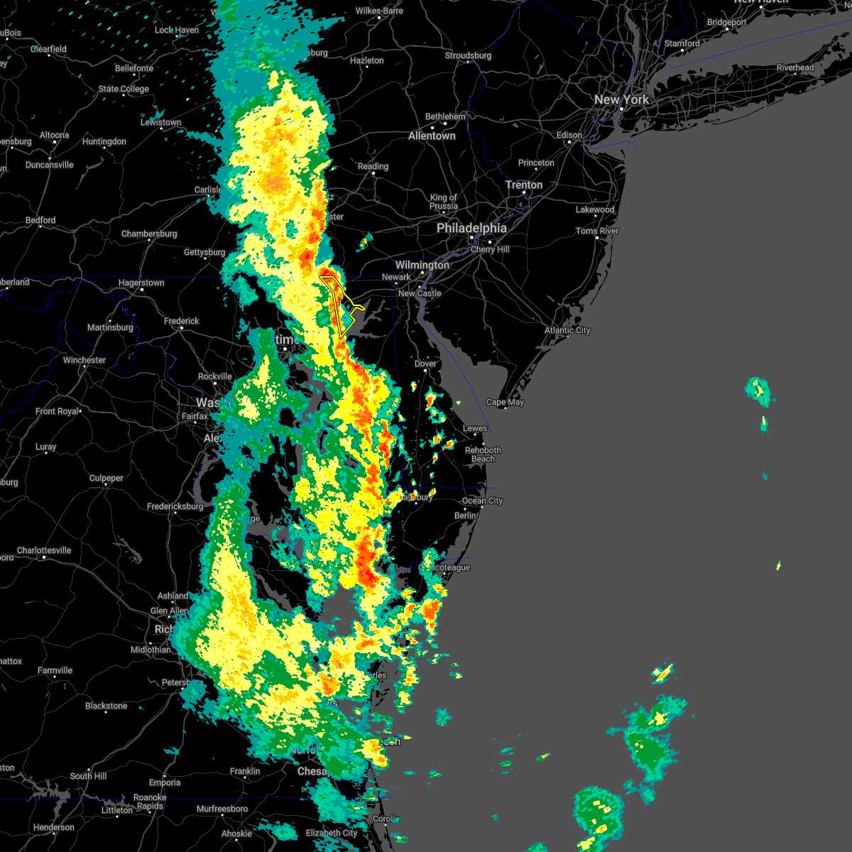 At 154 pm edt, severe thunderstorms were located along a line extending from near sunnyburn to near octoraro to aberdeen proving ground, moving northeast at 35 mph (radar indicated). Hazards include 60 mph wind gusts. Damaging winds will cause some trees and large branches to fall. this could injure those outdoors, as well as damage homes and vehicles. roadways may become blocked by downed trees. localized power outages are possible. unsecured light objects may become projectiles. Locations impacted include, aberdeen, havre de grace, aberdeen proving ground, perryman, darlington, carsins and cardiff. At 154 pm edt, severe thunderstorms were located along a line extending from near sunnyburn to near octoraro to aberdeen proving ground, moving northeast at 35 mph (radar indicated). Hazards include 60 mph wind gusts. Damaging winds will cause some trees and large branches to fall. this could injure those outdoors, as well as damage homes and vehicles. roadways may become blocked by downed trees. localized power outages are possible. unsecured light objects may become projectiles. Locations impacted include, aberdeen, havre de grace, aberdeen proving ground, perryman, darlington, carsins and cardiff.
|
| 5/27/2022 1:44 PM EDT |
 At 144 pm edt, severe thunderstorms were located along a line extending from near delta to 6 miles southwest of octoraro to near perryman, moving northeast at 45 mph (radar indicated). Hazards include 60 mph wind gusts. Damaging winds will cause some trees and large branches to fall. this could injure those outdoors, as well as damage homes and vehicles. roadways may become blocked by downed trees. localized power outages are possible. Unsecured light objects may become projectiles. At 144 pm edt, severe thunderstorms were located along a line extending from near delta to 6 miles southwest of octoraro to near perryman, moving northeast at 45 mph (radar indicated). Hazards include 60 mph wind gusts. Damaging winds will cause some trees and large branches to fall. this could injure those outdoors, as well as damage homes and vehicles. roadways may become blocked by downed trees. localized power outages are possible. Unsecured light objects may become projectiles.
|
| 5/27/2022 1:35 PM EDT |
 At 135 pm edt, severe thunderstorms were located along a line extending from stewartstown to bel air north to near kingsville, moving northeast at 40 mph (radar indicated). Hazards include 60 mph wind gusts. Damaging winds will cause some trees and large branches to fall. this could injure those outdoors, as well as damage homes and vehicles. roadways may become blocked by downed trees. localized power outages are possible. unsecured light objects may become projectiles. Locations impacted include, aberdeen, havre de grace, aberdeen proving ground, bel air south, bel air north, fallston, riverside, kingsville, pleasant hills, jarrettsville, perryman, edgewood, joppatowne, pylesville, darlington, cardiff, churchville, norrisville, carsins and bradshaw. At 135 pm edt, severe thunderstorms were located along a line extending from stewartstown to bel air north to near kingsville, moving northeast at 40 mph (radar indicated). Hazards include 60 mph wind gusts. Damaging winds will cause some trees and large branches to fall. this could injure those outdoors, as well as damage homes and vehicles. roadways may become blocked by downed trees. localized power outages are possible. unsecured light objects may become projectiles. Locations impacted include, aberdeen, havre de grace, aberdeen proving ground, bel air south, bel air north, fallston, riverside, kingsville, pleasant hills, jarrettsville, perryman, edgewood, joppatowne, pylesville, darlington, cardiff, churchville, norrisville, carsins and bradshaw.
|
| 5/27/2022 1:15 PM EDT |
 At 115 pm edt, severe thunderstorms were located along a line extending from near railroad to near cockeysville to rosedale, moving northeast at 35 mph (radar indicated). Hazards include 60 mph wind gusts. Damaging winds will cause some trees and large branches to fall. this could injure those outdoors, as well as damage homes and vehicles. roadways may become blocked by downed trees. localized power outages are possible. Unsecured light objects may become projectiles. At 115 pm edt, severe thunderstorms were located along a line extending from near railroad to near cockeysville to rosedale, moving northeast at 35 mph (radar indicated). Hazards include 60 mph wind gusts. Damaging winds will cause some trees and large branches to fall. this could injure those outdoors, as well as damage homes and vehicles. roadways may become blocked by downed trees. localized power outages are possible. Unsecured light objects may become projectiles.
|
| 5/22/2022 6:16 PM EDT |
 At 616 pm edt, severe thunderstorms were located along a line extending from glen westover to near newtown, moving east at 30 mph (radar indicated). Hazards include 60 mph wind gusts and quarter size hail. Damaging winds will cause some trees and large branches to fall. this could injure those outdoors, as well as damage homes and vehicles. roadways may become blocked by downed trees. localized power outages are possible. Unsecured light objects may become projectiles. At 616 pm edt, severe thunderstorms were located along a line extending from glen westover to near newtown, moving east at 30 mph (radar indicated). Hazards include 60 mph wind gusts and quarter size hail. Damaging winds will cause some trees and large branches to fall. this could injure those outdoors, as well as damage homes and vehicles. roadways may become blocked by downed trees. localized power outages are possible. Unsecured light objects may become projectiles.
|
| 5/22/2022 6:06 PM EDT |
 At 605 pm edt, severe thunderstorms were located along a line extending from pleasant hill to fort smallwood state park, moving east at 25 mph (radar indicated). Hazards include 60 mph wind gusts and quarter size hail. Damaging winds will cause some trees and large branches to fall. this could injure those outdoors, as well as damage homes and vehicles. roadways may become blocked by downed trees. localized power outages are possible. unsecured light objects may become projectiles. locations impacted include, newark, middle river, elkton, aberdeen, havre de grace, riviera beach, aberdeen proving ground, fort smallwood state park, millers island, north point state park, sparrows point, back river, calvert, dundalk, bel air south, essex, pasadena, bowleys quarters, riverside and north east. hail threat, radar indicated max hail size, 1. 00 in wind threat, radar indicated max wind gust, 60 mph. At 605 pm edt, severe thunderstorms were located along a line extending from pleasant hill to fort smallwood state park, moving east at 25 mph (radar indicated). Hazards include 60 mph wind gusts and quarter size hail. Damaging winds will cause some trees and large branches to fall. this could injure those outdoors, as well as damage homes and vehicles. roadways may become blocked by downed trees. localized power outages are possible. unsecured light objects may become projectiles. locations impacted include, newark, middle river, elkton, aberdeen, havre de grace, riviera beach, aberdeen proving ground, fort smallwood state park, millers island, north point state park, sparrows point, back river, calvert, dundalk, bel air south, essex, pasadena, bowleys quarters, riverside and north east. hail threat, radar indicated max hail size, 1. 00 in wind threat, radar indicated max wind gust, 60 mph.
|
| 5/22/2022 5:52 PM EDT |
 At 552 pm edt, severe thunderstorms were located along a line extending from farmington to pasadena, moving east at 25 mph (radar indicated). Hazards include 60 mph wind gusts. Damaging winds will cause some trees and large branches to fall. this could injure those outdoors, as well as damage homes and vehicles. roadways may become blocked by downed trees. localized power outages are possible. unsecured light objects may become projectiles. locations impacted include, baltimore, newark, middle river, elkton, aberdeen, havre de grace, riviera beach, aberdeen proving ground, fort smallwood state park, millers island, north point state park, sparrows point, back river, calvert, glen burnie, dundalk, bel air south, essex, parkville and bel air north. hail threat, radar indicated max hail size, <. 75 in wind threat, radar indicated max wind gust, 60 mph. At 552 pm edt, severe thunderstorms were located along a line extending from farmington to pasadena, moving east at 25 mph (radar indicated). Hazards include 60 mph wind gusts. Damaging winds will cause some trees and large branches to fall. this could injure those outdoors, as well as damage homes and vehicles. roadways may become blocked by downed trees. localized power outages are possible. unsecured light objects may become projectiles. locations impacted include, baltimore, newark, middle river, elkton, aberdeen, havre de grace, riviera beach, aberdeen proving ground, fort smallwood state park, millers island, north point state park, sparrows point, back river, calvert, glen burnie, dundalk, bel air south, essex, parkville and bel air north. hail threat, radar indicated max hail size, <. 75 in wind threat, radar indicated max wind gust, 60 mph.
|
| 5/22/2022 5:36 PM EDT |
 At 536 pm edt, severe thunderstorms were located along a line extending from richardsmere to baltimore-washington airport, moving east at 25 mph (radar indicated). Hazards include 60 mph wind gusts. Damaging winds will cause some trees and large branches to fall. this could injure those outdoors, as well as damage homes and vehicles. roadways may become blocked by downed trees. localized power outages are possible. Unsecured light objects may become projectiles. At 536 pm edt, severe thunderstorms were located along a line extending from richardsmere to baltimore-washington airport, moving east at 25 mph (radar indicated). Hazards include 60 mph wind gusts. Damaging winds will cause some trees and large branches to fall. this could injure those outdoors, as well as damage homes and vehicles. roadways may become blocked by downed trees. localized power outages are possible. Unsecured light objects may become projectiles.
|
| 10/25/2021 7:01 PM EDT |
 At 701 pm edt, severe thunderstorms were located along a line extending from 6 miles northeast of bel air north to near bay view to bear, moving north at 40 mph (radar indicated). Hazards include 60 mph wind gusts. Damaging winds will cause some trees and large branches to fall. this could injure those outdoors, as well as damage homes and vehicles. roadways may become blocked by downed trees. localized power outages are possible. unsecured light objects may become projectiles. locations impacted include, newark, elkton, havre de grace, calvert, bel air north, north east, rising sun, charlestown, zion, blake, barksdale, west nottingham, octoraro, fair hill, glen westover, bay view, lombard, richardsmere, woodlawn and andora. hail threat, radar indicated max hail size, <. 75 in wind threat, radar indicated max wind gust, 60 mph. At 701 pm edt, severe thunderstorms were located along a line extending from 6 miles northeast of bel air north to near bay view to bear, moving north at 40 mph (radar indicated). Hazards include 60 mph wind gusts. Damaging winds will cause some trees and large branches to fall. this could injure those outdoors, as well as damage homes and vehicles. roadways may become blocked by downed trees. localized power outages are possible. unsecured light objects may become projectiles. locations impacted include, newark, elkton, havre de grace, calvert, bel air north, north east, rising sun, charlestown, zion, blake, barksdale, west nottingham, octoraro, fair hill, glen westover, bay view, lombard, richardsmere, woodlawn and andora. hail threat, radar indicated max hail size, <. 75 in wind threat, radar indicated max wind gust, 60 mph.
|
| 10/25/2021 6:52 PM EDT | Multiple trees down on stafford... lapidum... and webster-lapidum roads in harford county MD, 3.6 miles S of Havre de Grace, MD |
| 10/25/2021 6:52 PM EDT | Tree down on stafford rd. near intersection with craigs corner r in harford county MD, 5.6 miles SSE of Havre de Grace, MD |
| 10/25/2021 6:43 PM EDT | Trees down on the boardwalk/promenade in harford county MD, 1.7 miles WNW of Havre de Grace, MD |
| 10/25/2021 6:43 PM EDT | Three trees down on oakington rd in aberdee in harford county MD, 2.6 miles N of Havre de Grace, MD |
| 10/25/2021 6:35 PM EDT |
 At 635 pm edt, severe thunderstorms were located along a line extending from perryman to near aberdeen proving ground to warwick, moving north at 40 mph (radar indicated). Hazards include 60 mph wind gusts. Damaging winds will cause some trees and large branches to fall. this could injure those outdoors, as well as damage homes and vehicles. roadways may become blocked by downed trees. localized power outages are possible. Unsecured light objects may become projectiles. At 635 pm edt, severe thunderstorms were located along a line extending from perryman to near aberdeen proving ground to warwick, moving north at 40 mph (radar indicated). Hazards include 60 mph wind gusts. Damaging winds will cause some trees and large branches to fall. this could injure those outdoors, as well as damage homes and vehicles. roadways may become blocked by downed trees. localized power outages are possible. Unsecured light objects may become projectiles.
|
| 9/23/2021 9:47 AM EDT |
 At 946 am edt, severe thunderstorms were located along a line extending from near holtwood to near kennedyville, moving east at 25 mph (radar indicated). Hazards include 60 mph wind gusts. Damaging winds will cause some trees and large branches to fall. this could injure those outdoors, as well as damage homes and vehicles. roadways may become blocked by downed trees. localized power outages are possible. unsecured light objects may become projectiles. locations impacted include, elkton, aberdeen, havre de grace, aberdeen proving ground, calvert, north east, rising sun, perryman, charlestown, cecilton, warwick, zion, blake, barksdale, bohemias mills, west nottingham, octoraro, brantwood, fair hill and glen westover. hail threat, radar indicated max hail size, <. 75 in wind threat, radar indicated max wind gust, 60 mph. At 946 am edt, severe thunderstorms were located along a line extending from near holtwood to near kennedyville, moving east at 25 mph (radar indicated). Hazards include 60 mph wind gusts. Damaging winds will cause some trees and large branches to fall. this could injure those outdoors, as well as damage homes and vehicles. roadways may become blocked by downed trees. localized power outages are possible. unsecured light objects may become projectiles. locations impacted include, elkton, aberdeen, havre de grace, aberdeen proving ground, calvert, north east, rising sun, perryman, charlestown, cecilton, warwick, zion, blake, barksdale, bohemias mills, west nottingham, octoraro, brantwood, fair hill and glen westover. hail threat, radar indicated max hail size, <. 75 in wind threat, radar indicated max wind gust, 60 mph.
|
| 9/23/2021 9:37 AM EDT | Tree down on i-95 south past exit 89/md-155 level road at mile marker 87. in harford county MD, 1.8 miles ESE of Havre de Grace, MD |
| 9/23/2021 9:27 AM EDT |
 At 927 am edt, severe thunderstorms were located along a line extending from delta to near chestertown, moving northeast at 25 mph (radar indicated). Hazards include 60 mph wind gusts. Damaging winds will cause some trees and large branches to fall. this could injure those outdoors, as well as damage homes and vehicles. roadways may become blocked by downed trees. localized power outages are possible. Unsecured light objects may become projectiles. At 927 am edt, severe thunderstorms were located along a line extending from delta to near chestertown, moving northeast at 25 mph (radar indicated). Hazards include 60 mph wind gusts. Damaging winds will cause some trees and large branches to fall. this could injure those outdoors, as well as damage homes and vehicles. roadways may become blocked by downed trees. localized power outages are possible. Unsecured light objects may become projectiles.
|
| 9/15/2021 10:00 PM EDT |
 At 959 pm edt, severe thunderstorms were located along a line extending from wakefield to near bel air south, moving east at 30 mph (radar indicated). Hazards include 60 mph wind gusts. Damaging winds will cause some trees and large branches to fall. this could injure those outdoors, as well as damage homes and vehicles. roadways may become blocked by downed trees. localized power outages are possible. unsecured light objects may become projectiles. locations impacted include, aberdeen, havre de grace, aberdeen proving ground, calvert, bel air south, bel air north, riverside, kingsville, north east, pleasant hills, rising sun, perryman, charlestown, zion, blake, west nottingham, octoraro, fair hill, bay view and lombard. hail threat, radar indicated max hail size, <. 75 in wind threat, radar indicated max wind gust, 60 mph. At 959 pm edt, severe thunderstorms were located along a line extending from wakefield to near bel air south, moving east at 30 mph (radar indicated). Hazards include 60 mph wind gusts. Damaging winds will cause some trees and large branches to fall. this could injure those outdoors, as well as damage homes and vehicles. roadways may become blocked by downed trees. localized power outages are possible. unsecured light objects may become projectiles. locations impacted include, aberdeen, havre de grace, aberdeen proving ground, calvert, bel air south, bel air north, riverside, kingsville, north east, pleasant hills, rising sun, perryman, charlestown, zion, blake, west nottingham, octoraro, fair hill, bay view and lombard. hail threat, radar indicated max hail size, <. 75 in wind threat, radar indicated max wind gust, 60 mph.
|
| 9/15/2021 9:38 PM EDT |
 At 938 pm edt, severe thunderstorms were located along a line extending from delta to fallston, moving east at 25 mph (radar indicated). Hazards include 60 mph wind gusts. Damaging winds will cause some trees and large branches to fall. this could injure those outdoors, as well as damage homes and vehicles. roadways may become blocked by downed trees. localized power outages are possible. Unsecured light objects may become projectiles. At 938 pm edt, severe thunderstorms were located along a line extending from delta to fallston, moving east at 25 mph (radar indicated). Hazards include 60 mph wind gusts. Damaging winds will cause some trees and large branches to fall. this could injure those outdoors, as well as damage homes and vehicles. roadways may become blocked by downed trees. localized power outages are possible. Unsecured light objects may become projectiles.
|
| 9/9/2021 12:50 AM EDT |
 The severe thunderstorm warning for northeastern harford and northwestern cecil counties will expire at 100 am edt, the storm which prompted the warning has moved out of the area. therefore, the warning will be allowed to expire. The severe thunderstorm warning for northeastern harford and northwestern cecil counties will expire at 100 am edt, the storm which prompted the warning has moved out of the area. therefore, the warning will be allowed to expire.
|
| 9/9/2021 12:35 AM EDT | Trees down on darlington road near wilkinson lan in harford county MD, 5.2 miles SE of Havre de Grace, MD |
| 9/9/2021 12:30 AM EDT |
 At 1229 am edt, a severe thunderstorm was located near bel air south, or near aberdeen, moving northeast at 30 mph (radar indicated). Hazards include 60 mph wind gusts. Damaging winds will cause some trees and large branches to fall. this could injure those outdoors, as well as damage homes and vehicles. roadways may become blocked by downed trees. localized power outages are possible. unsecured light objects may become projectiles. locations impacted include, aberdeen, havre de grace, aberdeen proving ground, calvert, bel air south, bel air north, riverside, north east, rising sun, perryman, zion, west nottingham, octoraro, bay view, richardsmere, woodlawn, conowingo, rock springs, farmington and edgewood. hail threat, radar indicated max hail size, <. 75 in wind threat, radar indicated max wind gust, 60 mph. At 1229 am edt, a severe thunderstorm was located near bel air south, or near aberdeen, moving northeast at 30 mph (radar indicated). Hazards include 60 mph wind gusts. Damaging winds will cause some trees and large branches to fall. this could injure those outdoors, as well as damage homes and vehicles. roadways may become blocked by downed trees. localized power outages are possible. unsecured light objects may become projectiles. locations impacted include, aberdeen, havre de grace, aberdeen proving ground, calvert, bel air south, bel air north, riverside, north east, rising sun, perryman, zion, west nottingham, octoraro, bay view, richardsmere, woodlawn, conowingo, rock springs, farmington and edgewood. hail threat, radar indicated max hail size, <. 75 in wind threat, radar indicated max wind gust, 60 mph.
|
| 9/9/2021 12:17 AM EDT |
 At 1217 am edt, a severe thunderstorm was located over pleasant hills, or 11 miles west of aberdeen, moving northeast at 25 mph (radar indicated). Hazards include 60 mph wind gusts. Damaging winds will cause some trees and large branches to fall. this could injure those outdoors, as well as damage homes and vehicles. roadways may become blocked by downed trees. localized power outages are possible. Unsecured light objects may become projectiles. At 1217 am edt, a severe thunderstorm was located over pleasant hills, or 11 miles west of aberdeen, moving northeast at 25 mph (radar indicated). Hazards include 60 mph wind gusts. Damaging winds will cause some trees and large branches to fall. this could injure those outdoors, as well as damage homes and vehicles. roadways may become blocked by downed trees. localized power outages are possible. Unsecured light objects may become projectiles.
|
| 9/1/2021 4:05 PM EDT |
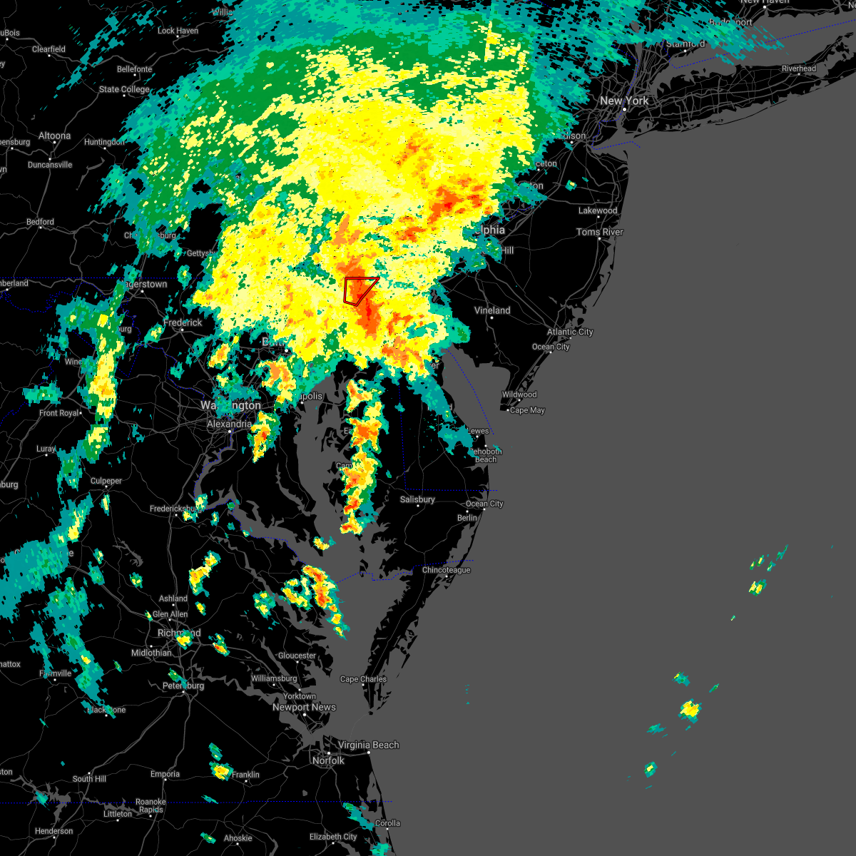 The tornado warning for east central harford and northwestern cecil counties will expire at 415 pm edt, the storm which prompted the warning has weakened below severe limits, and no longer appears capable of producing a tornado. therefore, the warning will be allowed to expire. a tornado watch remains in effect until 700 pm edt for northern and northeastern maryland. to report severe weather, contact your nearest law enforcement agency. they will relay your report to the national weather service sterling virginia. The tornado warning for east central harford and northwestern cecil counties will expire at 415 pm edt, the storm which prompted the warning has weakened below severe limits, and no longer appears capable of producing a tornado. therefore, the warning will be allowed to expire. a tornado watch remains in effect until 700 pm edt for northern and northeastern maryland. to report severe weather, contact your nearest law enforcement agency. they will relay your report to the national weather service sterling virginia.
|
| 9/1/2021 3:57 PM EDT |
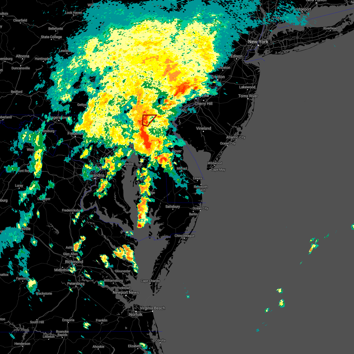 At 357 pm edt, a severe thunderstorm capable of producing a tornado was located over woodlawn, or near havre de grace, moving north at 30 mph (radar indicated rotation). Hazards include tornado. For those in the direct path of a tornado touchdown, flying debris will be dangerous to those caught without shelter. damage to roofs, siding, and windows may occur. mobile homes may be damaged or destroyed. tree damage is likely. this dangerous storm will be near, woodlawn and octoraro around 400 pm edt. west nottingham and richardsmere around 405 pm edt. farmington and zion around 410 pm edt. calvert and rising sun around 415 pm edt. lombard and blake around 420 pm edt. Other locations impacted by this tornadic thunderstorm include perryville and port deposit. At 357 pm edt, a severe thunderstorm capable of producing a tornado was located over woodlawn, or near havre de grace, moving north at 30 mph (radar indicated rotation). Hazards include tornado. For those in the direct path of a tornado touchdown, flying debris will be dangerous to those caught without shelter. damage to roofs, siding, and windows may occur. mobile homes may be damaged or destroyed. tree damage is likely. this dangerous storm will be near, woodlawn and octoraro around 400 pm edt. west nottingham and richardsmere around 405 pm edt. farmington and zion around 410 pm edt. calvert and rising sun around 415 pm edt. lombard and blake around 420 pm edt. Other locations impacted by this tornadic thunderstorm include perryville and port deposit.
|
| 9/1/2021 3:49 PM EDT |
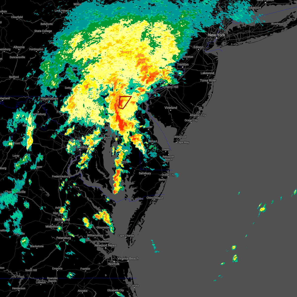 At 349 pm edt, a severe thunderstorm capable of producing a tornado was located over havre de grace, moving north at 30 mph (radar indicated rotation). Hazards include tornado. For those in the direct path of a tornado touchdown, flying debris will be dangerous to those caught without shelter. damage to roofs, siding, and windows may occur. mobile homes may be damaged or destroyed. tree damage is likely. this dangerous storm will be near, woodlawn and octoraro around 400 pm edt. west nottingham and richardsmere around 405 pm edt. farmington and zion around 410 pm edt. calvert, rising sun, lombard and blake around 415 pm edt. Other locations impacted by this tornadic thunderstorm include perryville and port deposit. At 349 pm edt, a severe thunderstorm capable of producing a tornado was located over havre de grace, moving north at 30 mph (radar indicated rotation). Hazards include tornado. For those in the direct path of a tornado touchdown, flying debris will be dangerous to those caught without shelter. damage to roofs, siding, and windows may occur. mobile homes may be damaged or destroyed. tree damage is likely. this dangerous storm will be near, woodlawn and octoraro around 400 pm edt. west nottingham and richardsmere around 405 pm edt. farmington and zion around 410 pm edt. calvert, rising sun, lombard and blake around 415 pm edt. Other locations impacted by this tornadic thunderstorm include perryville and port deposit.
|
| 9/1/2021 3:37 PM EDT |
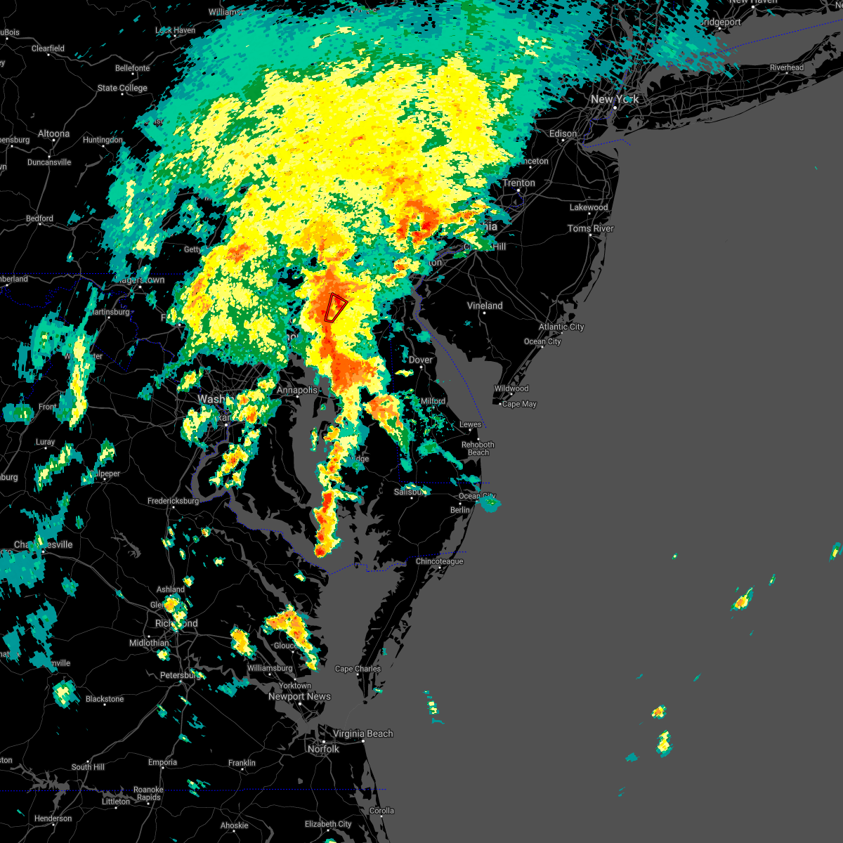 The tornado warning for east central harford county will expire at 345 pm edt, the storm which prompted the warning has weakened below severe limits, and no longer appears capable of producing a tornado. therefore, the warning will be allowed to expire. a tornado watch remains in effect until 700 pm edt for northern maryland. The tornado warning for east central harford county will expire at 345 pm edt, the storm which prompted the warning has weakened below severe limits, and no longer appears capable of producing a tornado. therefore, the warning will be allowed to expire. a tornado watch remains in effect until 700 pm edt for northern maryland.
|
| 9/1/2021 3:28 PM EDT |
 At 328 pm edt, a severe thunderstorm capable of producing a tornado was located over perryman, or over aberdeen, moving northeast at 40 mph (radar indicated rotation). Hazards include tornado. For those in the direct path of a tornado touchdown, flying debris will be dangerous to those caught without shelter. damage to roofs, siding, and windows may occur. mobile homes may be damaged or destroyed. tree damage is likely. this dangerous storm will be near, havre de grace around 340 pm edt. Other locations impacted by this tornadic thunderstorm include carsins, belcamp and edgewood. At 328 pm edt, a severe thunderstorm capable of producing a tornado was located over perryman, or over aberdeen, moving northeast at 40 mph (radar indicated rotation). Hazards include tornado. For those in the direct path of a tornado touchdown, flying debris will be dangerous to those caught without shelter. damage to roofs, siding, and windows may occur. mobile homes may be damaged or destroyed. tree damage is likely. this dangerous storm will be near, havre de grace around 340 pm edt. Other locations impacted by this tornadic thunderstorm include carsins, belcamp and edgewood.
|
| 9/1/2021 3:17 PM EDT |
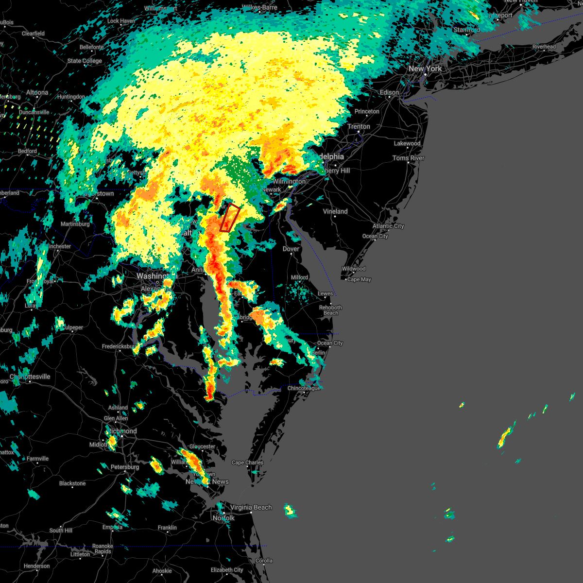 At 316 pm edt, a severe thunderstorm capable of producing a tornado was located near perryman, or 9 miles east of middle river, moving northeast at 40 mph (radar indicated rotation). Hazards include tornado. For those in the direct path of a tornado touchdown, flying debris will be dangerous to those caught without shelter. damage to roofs, siding, and windows may occur. mobile homes may be damaged or destroyed. tree damage is likely. this dangerous storm will be near, riverside and perryman around 330 pm edt. aberdeen and aberdeen proving ground around 335 pm edt. havre de grace around 340 pm edt. Other locations impacted by this tornadic thunderstorm include harford furnace, edgewood, abingdon, carsins and belcamp. At 316 pm edt, a severe thunderstorm capable of producing a tornado was located near perryman, or 9 miles east of middle river, moving northeast at 40 mph (radar indicated rotation). Hazards include tornado. For those in the direct path of a tornado touchdown, flying debris will be dangerous to those caught without shelter. damage to roofs, siding, and windows may occur. mobile homes may be damaged or destroyed. tree damage is likely. this dangerous storm will be near, riverside and perryman around 330 pm edt. aberdeen and aberdeen proving ground around 335 pm edt. havre de grace around 340 pm edt. Other locations impacted by this tornadic thunderstorm include harford furnace, edgewood, abingdon, carsins and belcamp.
|
| 8/13/2021 5:52 PM EDT |
 The severe thunderstorm warning for northern harford county will expire at 600 pm edt, the storms which prompted the warning have weakened below severe limits, and no longer pose an immediate threat to life or property. therefore, the warning will be allowed to expire. a severe thunderstorm watch remains in effect until 800 pm edt for northern and northeastern maryland. The severe thunderstorm warning for northern harford county will expire at 600 pm edt, the storms which prompted the warning have weakened below severe limits, and no longer pose an immediate threat to life or property. therefore, the warning will be allowed to expire. a severe thunderstorm watch remains in effect until 800 pm edt for northern and northeastern maryland.
|
| 8/13/2021 5:52 PM EDT |
 At 552 pm edt, severe thunderstorms were located along a line extending from near rock springs to near aberdeen, moving east at 15 mph (radar indicated). Hazards include 60 mph wind gusts. Damaging winds will cause some trees and large branches to fall. this could injure those outdoors, as well as damage homes and vehicles. roadways may become blocked by downed trees. localized power outages are possible. Unsecured light objects may become projectiles. At 552 pm edt, severe thunderstorms were located along a line extending from near rock springs to near aberdeen, moving east at 15 mph (radar indicated). Hazards include 60 mph wind gusts. Damaging winds will cause some trees and large branches to fall. this could injure those outdoors, as well as damage homes and vehicles. roadways may become blocked by downed trees. localized power outages are possible. Unsecured light objects may become projectiles.
|
| 8/13/2021 5:22 PM EDT |
 At 522 pm edt, severe thunderstorms were located along a line extending from 6 miles west of delta to near kingsville, moving northeast at 25 mph (radar indicated). Hazards include 60 mph wind gusts. Damaging winds will cause some trees and large branches to fall. this could injure those outdoors, as well as damage homes and vehicles. roadways may become blocked by downed trees. localized power outages are possible. Unsecured light objects may become projectiles. At 522 pm edt, severe thunderstorms were located along a line extending from 6 miles west of delta to near kingsville, moving northeast at 25 mph (radar indicated). Hazards include 60 mph wind gusts. Damaging winds will cause some trees and large branches to fall. this could injure those outdoors, as well as damage homes and vehicles. roadways may become blocked by downed trees. localized power outages are possible. Unsecured light objects may become projectiles.
|
| 8/11/2021 6:14 PM EDT |
 At 614 pm edt, a severe thunderstorm was located over perryman, or near aberdeen, moving east at 20 mph (radar indicated). Hazards include 60 mph wind gusts. Damaging winds will cause some trees and large branches to fall. this could injure those outdoors, as well as damage homes and vehicles. roadways may become blocked by downed trees. localized power outages are possible. Unsecured light objects may become projectiles. At 614 pm edt, a severe thunderstorm was located over perryman, or near aberdeen, moving east at 20 mph (radar indicated). Hazards include 60 mph wind gusts. Damaging winds will cause some trees and large branches to fall. this could injure those outdoors, as well as damage homes and vehicles. roadways may become blocked by downed trees. localized power outages are possible. Unsecured light objects may become projectiles.
|
| 8/11/2021 5:57 PM EDT |
 At 556 pm edt, severe thunderstorms were located along a line extending from near pleasant hills to glen burnie, moving southeast at 15 mph (radar indicated). Hazards include 60 mph wind gusts and quarter size hail. Damaging winds will cause some trees and large branches to fall. this could injure those outdoors, as well as damage homes and vehicles. roadways may become blocked by downed trees. localized power outages are possible. unsecured light objects may become projectiles. locations impacted include, baltimore, severn, middle river, aberdeen, havre de grace, riviera beach, aberdeen proving ground, baltimore-washington airport, fort smallwood state park, gibson island, sillery bay, bodkin point, millers island, north point state park, magothy river, sparrows point, dobbins island, pinehurst, back river and glen burnie. hail threat, radar indicated max hail size, 1. 00 in wind threat, radar indicated max wind gust, 60 mph. At 556 pm edt, severe thunderstorms were located along a line extending from near pleasant hills to glen burnie, moving southeast at 15 mph (radar indicated). Hazards include 60 mph wind gusts and quarter size hail. Damaging winds will cause some trees and large branches to fall. this could injure those outdoors, as well as damage homes and vehicles. roadways may become blocked by downed trees. localized power outages are possible. unsecured light objects may become projectiles. locations impacted include, baltimore, severn, middle river, aberdeen, havre de grace, riviera beach, aberdeen proving ground, baltimore-washington airport, fort smallwood state park, gibson island, sillery bay, bodkin point, millers island, north point state park, magothy river, sparrows point, dobbins island, pinehurst, back river and glen burnie. hail threat, radar indicated max hail size, 1. 00 in wind threat, radar indicated max wind gust, 60 mph.
|
| 8/11/2021 5:32 PM EDT |
 At 532 pm edt, severe thunderstorms were located along a line extending from near fallston to near baltimore-washington airport, moving southeast at 15 mph (radar indicated). Hazards include 60 mph wind gusts and quarter size hail. Damaging winds will cause some trees and large branches to fall. this could injure those outdoors, as well as damage homes and vehicles. roadways may become blocked by downed trees. localized power outages are possible. Unsecured light objects may become projectiles. At 532 pm edt, severe thunderstorms were located along a line extending from near fallston to near baltimore-washington airport, moving southeast at 15 mph (radar indicated). Hazards include 60 mph wind gusts and quarter size hail. Damaging winds will cause some trees and large branches to fall. this could injure those outdoors, as well as damage homes and vehicles. roadways may become blocked by downed trees. localized power outages are possible. Unsecured light objects may become projectiles.
|
| 8/10/2021 7:39 PM EDT |
 The severe thunderstorm warning for central harford and eastern baltimore counties will expire at 745 pm edt, the storms which prompted the warning have weakened below severe limits, and have exited the warned area. therefore, the warning will be allowed to expire. The severe thunderstorm warning for central harford and eastern baltimore counties will expire at 745 pm edt, the storms which prompted the warning have weakened below severe limits, and have exited the warned area. therefore, the warning will be allowed to expire.
|
| 8/10/2021 7:13 PM EDT |
 At 713 pm edt, severe thunderstorms were located along a line extending from near jarrettsville to near bel air south, moving east at 20 mph (radar indicated). Hazards include 60 mph wind gusts. Damaging winds will cause some trees and large branches to fall. this could injure those outdoors, as well as damage homes and vehicles. roadways may become blocked by downed trees. localized power outages are possible. unsecured light objects may become projectiles. locations impacted include, aberdeen, havre de grace, bel air south, bel air north, fallston, pleasant hills, benson, bynum, churchville, carsins and hickory. hail threat, radar indicated max hail size, <. 75 in wind threat, radar indicated max wind gust, 60 mph. At 713 pm edt, severe thunderstorms were located along a line extending from near jarrettsville to near bel air south, moving east at 20 mph (radar indicated). Hazards include 60 mph wind gusts. Damaging winds will cause some trees and large branches to fall. this could injure those outdoors, as well as damage homes and vehicles. roadways may become blocked by downed trees. localized power outages are possible. unsecured light objects may become projectiles. locations impacted include, aberdeen, havre de grace, bel air south, bel air north, fallston, pleasant hills, benson, bynum, churchville, carsins and hickory. hail threat, radar indicated max hail size, <. 75 in wind threat, radar indicated max wind gust, 60 mph.
|
| 8/10/2021 6:55 PM EDT |
 At 655 pm edt, severe thunderstorms were located along a line extending from near jarrettsville to kingsville, moving east at 20 mph (radar indicated). Hazards include 60 mph wind gusts. Damaging winds will cause some trees and large branches to fall. this could injure those outdoors, as well as damage homes and vehicles. roadways may become blocked by downed trees. localized power outages are possible. Unsecured light objects may become projectiles. At 655 pm edt, severe thunderstorms were located along a line extending from near jarrettsville to kingsville, moving east at 20 mph (radar indicated). Hazards include 60 mph wind gusts. Damaging winds will cause some trees and large branches to fall. this could injure those outdoors, as well as damage homes and vehicles. roadways may become blocked by downed trees. localized power outages are possible. Unsecured light objects may become projectiles.
|
| 7/12/2021 8:07 PM EDT |
 The severe thunderstorm warning for southeastern harford and northeastern cecil counties will expire at 815 pm edt, the storms which prompted the warning have weakened below severe limits, and no longer pose an immediate threat to life or property. therefore, the warning will be allowed to expire. a severe thunderstorm watch remains in effect until 1100 pm edt for northern and northeastern maryland. The severe thunderstorm warning for southeastern harford and northeastern cecil counties will expire at 815 pm edt, the storms which prompted the warning have weakened below severe limits, and no longer pose an immediate threat to life or property. therefore, the warning will be allowed to expire. a severe thunderstorm watch remains in effect until 1100 pm edt for northern and northeastern maryland.
|
| 7/12/2021 7:58 PM EDT |
 At 758 pm edt, severe thunderstorms were located along a line extending from blake to near bel air south, moving east at 10 mph (radar indicated). Hazards include 60 mph wind gusts and quarter size hail. Damaging winds will cause some trees and large branches to fall. this could injure those outdoors, as well as damage homes and vehicles. roadways may become blocked by downed trees. localized power outages are possible. unsecured light objects may become projectiles. Locations impacted include, elkton, aberdeen, havre de grace, aberdeen proving ground, calvert, bel air south, riverside, kingsville, north east, pleasant hills, perryman, charlestown, zion, blake, barksdale, fair hill, glen westover, bay view, lombard and woodlawn. At 758 pm edt, severe thunderstorms were located along a line extending from blake to near bel air south, moving east at 10 mph (radar indicated). Hazards include 60 mph wind gusts and quarter size hail. Damaging winds will cause some trees and large branches to fall. this could injure those outdoors, as well as damage homes and vehicles. roadways may become blocked by downed trees. localized power outages are possible. unsecured light objects may become projectiles. Locations impacted include, elkton, aberdeen, havre de grace, aberdeen proving ground, calvert, bel air south, riverside, kingsville, north east, pleasant hills, perryman, charlestown, zion, blake, barksdale, fair hill, glen westover, bay view, lombard and woodlawn.
|
| 7/12/2021 7:23 PM EDT |
 At 723 pm edt, severe thunderstorms were located along a line extending from rising sun to pleasant hills, moving east at 10 mph (radar indicated). Hazards include 60 mph wind gusts and quarter size hail. Damaging winds will cause some trees and large branches to fall. this could injure those outdoors, as well as damage homes and vehicles. roadways may become blocked by downed trees. localized power outages are possible. Unsecured light objects may become projectiles. At 723 pm edt, severe thunderstorms were located along a line extending from rising sun to pleasant hills, moving east at 10 mph (radar indicated). Hazards include 60 mph wind gusts and quarter size hail. Damaging winds will cause some trees and large branches to fall. this could injure those outdoors, as well as damage homes and vehicles. roadways may become blocked by downed trees. localized power outages are possible. Unsecured light objects may become projectiles.
|
| 7/9/2021 6:03 PM EDT |
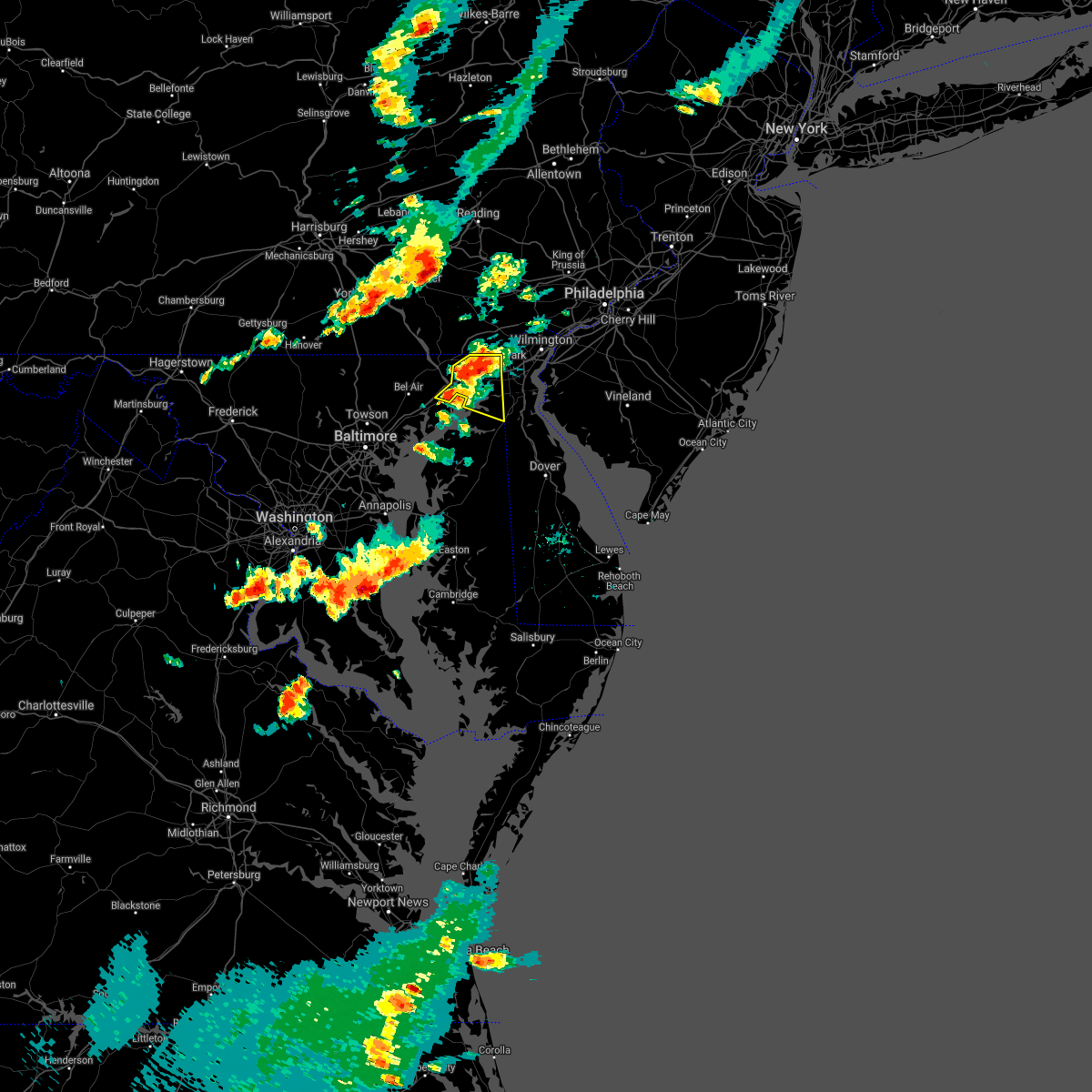 At 603 pm edt, severe thunderstorms were located along a line extending from fair hill to near aberdeen proving ground, moving east at 15 mph (radar indicated). Hazards include 60 mph wind gusts. Damaging winds will cause some trees and large branches to fall. this could injure those outdoors, as well as damage homes and vehicles. roadways may become blocked by downed trees. localized power outages are possible. Unsecured light objects may become projectiles. At 603 pm edt, severe thunderstorms were located along a line extending from fair hill to near aberdeen proving ground, moving east at 15 mph (radar indicated). Hazards include 60 mph wind gusts. Damaging winds will cause some trees and large branches to fall. this could injure those outdoors, as well as damage homes and vehicles. roadways may become blocked by downed trees. localized power outages are possible. Unsecured light objects may become projectiles.
|
| 7/1/2021 3:50 PM EDT |
 At 349 pm edt, severe thunderstorms were located along a line extending from near bel air south to near perryman to 6 miles east of bowleys quarters, moving east at 30 mph (radar indicated). Hazards include 60 mph wind gusts. Damaging winds will cause some trees and large branches to fall. this could injure those outdoors, as well as damage homes and vehicles. roadways may become blocked by downed trees. localized power outages are possible. unsecured light objects may become projectiles. Locations impacted include, aberdeen, havre de grace, aberdeen proving ground, bel air south, riverside, perryman, edgewood, churchville, harford furnace, abingdon, carsins and belcamp. At 349 pm edt, severe thunderstorms were located along a line extending from near bel air south to near perryman to 6 miles east of bowleys quarters, moving east at 30 mph (radar indicated). Hazards include 60 mph wind gusts. Damaging winds will cause some trees and large branches to fall. this could injure those outdoors, as well as damage homes and vehicles. roadways may become blocked by downed trees. localized power outages are possible. unsecured light objects may become projectiles. Locations impacted include, aberdeen, havre de grace, aberdeen proving ground, bel air south, riverside, perryman, edgewood, churchville, harford furnace, abingdon, carsins and belcamp.
|
| 7/1/2021 3:26 PM EDT |
 At 326 pm edt, severe thunderstorms were located along a line extending from near fallston to near white marsh to essex, moving east at 50 mph (radar indicated). Hazards include 60 mph wind gusts. Damaging winds will cause some trees and large branches to fall. this could injure those outdoors, as well as damage homes and vehicles. roadways may become blocked by downed trees. localized power outages are possible. Unsecured light objects may become projectiles. At 326 pm edt, severe thunderstorms were located along a line extending from near fallston to near white marsh to essex, moving east at 50 mph (radar indicated). Hazards include 60 mph wind gusts. Damaging winds will cause some trees and large branches to fall. this could injure those outdoors, as well as damage homes and vehicles. roadways may become blocked by downed trees. localized power outages are possible. Unsecured light objects may become projectiles.
|
| 6/21/2021 6:51 PM EDT |
 At 650 pm edt, severe thunderstorms were located along a line extending from richardsmere to perryman, moving east at 40 mph (radar indicated). Hazards include 60 mph wind gusts. Damaging winds will cause some trees and large branches to fall. this could injure those outdoors, as well as damage homes and vehicles. roadways may become blocked by downed trees. localized power outages are possible. Unsecured light objects may become projectiles. At 650 pm edt, severe thunderstorms were located along a line extending from richardsmere to perryman, moving east at 40 mph (radar indicated). Hazards include 60 mph wind gusts. Damaging winds will cause some trees and large branches to fall. this could injure those outdoors, as well as damage homes and vehicles. roadways may become blocked by downed trees. localized power outages are possible. Unsecured light objects may become projectiles.
|
| 6/21/2021 6:36 PM EDT |
 At 636 pm edt, severe thunderstorms were located along a line extending from near delta to fallston, moving east at 25 mph (radar indicated). Hazards include 60 mph wind gusts. Damaging winds will cause some trees and large branches to fall. this could injure those outdoors, as well as damage homes and vehicles. roadways may become blocked by downed trees. localized power outages are possible. unsecured light objects may become projectiles. Locations impacted include, aberdeen, havre de grace, calvert, bel air south, bel air north, fallston, jarrettsville, rising sun, zion, blake, west nottingham, octoraro, lombard, richardsmere, woodlawn, conowingo, rock springs, farmington, bay view and perryville. At 636 pm edt, severe thunderstorms were located along a line extending from near delta to fallston, moving east at 25 mph (radar indicated). Hazards include 60 mph wind gusts. Damaging winds will cause some trees and large branches to fall. this could injure those outdoors, as well as damage homes and vehicles. roadways may become blocked by downed trees. localized power outages are possible. unsecured light objects may become projectiles. Locations impacted include, aberdeen, havre de grace, calvert, bel air south, bel air north, fallston, jarrettsville, rising sun, zion, blake, west nottingham, octoraro, lombard, richardsmere, woodlawn, conowingo, rock springs, farmington, bay view and perryville.
|
| 6/21/2021 6:14 PM EDT |
 At 614 pm edt, severe thunderstorms were located along a line extending from near delta to near cockeysville, moving east at 35 mph (radar indicated). Hazards include 60 mph wind gusts. Damaging winds will cause some trees and large branches to fall. this could injure those outdoors, as well as damage homes and vehicles. roadways may become blocked by downed trees. localized power outages are possible. Unsecured light objects may become projectiles. At 614 pm edt, severe thunderstorms were located along a line extending from near delta to near cockeysville, moving east at 35 mph (radar indicated). Hazards include 60 mph wind gusts. Damaging winds will cause some trees and large branches to fall. this could injure those outdoors, as well as damage homes and vehicles. roadways may become blocked by downed trees. localized power outages are possible. Unsecured light objects may become projectiles.
|
| 6/3/2021 6:53 PM EDT |
 At 653 pm edt, a severe thunderstorm capable of producing a tornado was located over bel air south, or 8 miles west of aberdeen, moving northeast at 20 mph (radar indicated rotation). Hazards include tornado. For those in the direct path of a tornado touchdown, flying debris will be dangerous to those caught without shelter. damage to roofs, siding, and windows may occur. mobile homes may be damaged or destroyed. tree damage is likely. this dangerous storm will be near, aberdeen around 715 pm edt. Other locations impacted by this tornadic thunderstorm include carsins and churchville. At 653 pm edt, a severe thunderstorm capable of producing a tornado was located over bel air south, or 8 miles west of aberdeen, moving northeast at 20 mph (radar indicated rotation). Hazards include tornado. For those in the direct path of a tornado touchdown, flying debris will be dangerous to those caught without shelter. damage to roofs, siding, and windows may occur. mobile homes may be damaged or destroyed. tree damage is likely. this dangerous storm will be near, aberdeen around 715 pm edt. Other locations impacted by this tornadic thunderstorm include carsins and churchville.
|
| 6/3/2021 6:34 PM EDT |
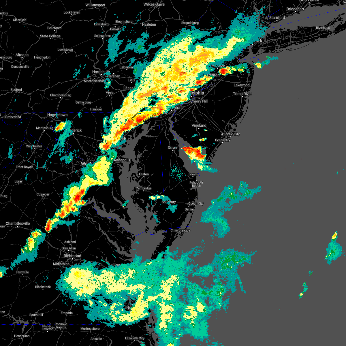 At 633 pm edt, a severe thunderstorm was located over octoraro, or near havre de grace, moving northeast at 25 mph (radar indicated). Hazards include 60 mph wind gusts and quarter size hail. Damaging winds will cause some trees and large branches to fall. this could injure those outdoors, as well as damage homes and vehicles. roadways may become blocked by downed trees. localized power outages are possible. unsecured light objects may become projectiles. Locations impacted include, calvert, rising sun, zion, blake, lombard, richardsmere, woodlawn, west nottingham, octoraro, conowingo, rock springs, fair hill, farmington, port deposit and darlington. At 633 pm edt, a severe thunderstorm was located over octoraro, or near havre de grace, moving northeast at 25 mph (radar indicated). Hazards include 60 mph wind gusts and quarter size hail. Damaging winds will cause some trees and large branches to fall. this could injure those outdoors, as well as damage homes and vehicles. roadways may become blocked by downed trees. localized power outages are possible. unsecured light objects may become projectiles. Locations impacted include, calvert, rising sun, zion, blake, lombard, richardsmere, woodlawn, west nottingham, octoraro, conowingo, rock springs, fair hill, farmington, port deposit and darlington.
|
| 6/3/2021 6:01 PM EDT |
 At 547 pm edt, severe thunderstorms were located along a line extending from near west nottingham to aberdeen to near riverside, moving east at 25 mph (radar indicated). Hazards include 60 mph wind gusts. Damaging winds will cause some trees and large branches to fall. this could injure those outdoors, as well as damage homes and vehicles. roadways may become blocked by downed trees. localized power outages are possible. unsecured light objects may become projectiles. Locations impacted include, aberdeen, havre de grace, aberdeen proving ground, calvert, bel air south, bel air north, white marsh, riverside, kingsville, north east, pleasant hills, rising sun, perryman, charlestown, zion, blake, west nottingham, octoraro, fair hill and bay view. At 547 pm edt, severe thunderstorms were located along a line extending from near west nottingham to aberdeen to near riverside, moving east at 25 mph (radar indicated). Hazards include 60 mph wind gusts. Damaging winds will cause some trees and large branches to fall. this could injure those outdoors, as well as damage homes and vehicles. roadways may become blocked by downed trees. localized power outages are possible. unsecured light objects may become projectiles. Locations impacted include, aberdeen, havre de grace, aberdeen proving ground, calvert, bel air south, bel air north, white marsh, riverside, kingsville, north east, pleasant hills, rising sun, perryman, charlestown, zion, blake, west nottingham, octoraro, fair hill and bay view.
|
| 6/3/2021 5:47 PM EDT |
 At 547 pm edt, severe thunderstorms were located along a line extending from near west nottingham to aberdeen to near riverside, moving east at 25 mph (radar indicated). Hazards include 60 mph wind gusts. Damaging winds will cause some trees and large branches to fall. this could injure those outdoors, as well as damage homes and vehicles. roadways may become blocked by downed trees. localized power outages are possible. unsecured light objects may become projectiles. Locations impacted include, aberdeen, havre de grace, aberdeen proving ground, calvert, bel air south, bel air north, white marsh, riverside, kingsville, north east, pleasant hills, rising sun, perryman, charlestown, zion, blake, west nottingham, octoraro, fair hill and bay view. At 547 pm edt, severe thunderstorms were located along a line extending from near west nottingham to aberdeen to near riverside, moving east at 25 mph (radar indicated). Hazards include 60 mph wind gusts. Damaging winds will cause some trees and large branches to fall. this could injure those outdoors, as well as damage homes and vehicles. roadways may become blocked by downed trees. localized power outages are possible. unsecured light objects may become projectiles. Locations impacted include, aberdeen, havre de grace, aberdeen proving ground, calvert, bel air south, bel air north, white marsh, riverside, kingsville, north east, pleasant hills, rising sun, perryman, charlestown, zion, blake, west nottingham, octoraro, fair hill and bay view.
|
| 6/3/2021 5:26 PM EDT |
 At 525 pm edt, severe thunderstorms were located along a line extending from near octoraro to near bel air south to kingsville, moving east at 25 mph (radar indicated). Hazards include 60 mph wind gusts and quarter size hail. Damaging winds will cause some trees and large branches to fall. this could injure those outdoors, as well as damage homes and vehicles. roadways may become blocked by downed trees. localized power outages are possible. Unsecured light objects may become projectiles. At 525 pm edt, severe thunderstorms were located along a line extending from near octoraro to near bel air south to kingsville, moving east at 25 mph (radar indicated). Hazards include 60 mph wind gusts and quarter size hail. Damaging winds will cause some trees and large branches to fall. this could injure those outdoors, as well as damage homes and vehicles. roadways may become blocked by downed trees. localized power outages are possible. Unsecured light objects may become projectiles.
|
| 5/26/2021 6:31 PM EDT |
 At 631 pm edt, a severe thunderstorm was located over octoraro, or near havre de grace, moving northeast at 25 mph (radar indicated). Hazards include 70 mph wind gusts and ping pong ball size hail. Damaging winds will cause some trees and large branches to fall. this could injure those outdoors, as well as damage homes and vehicles. roadways may become blocked by downed trees. localized power outages are possible. unsecured light objects may become projectiles. Locations impacted include, elkton, havre de grace, calvert, north east, rising sun, charlestown, zion, blake, barksdale, west nottingham, octoraro, fair hill, glen westover, bay view, lombard, richardsmere, woodlawn, andora, pleasant hill and cherry hill. At 631 pm edt, a severe thunderstorm was located over octoraro, or near havre de grace, moving northeast at 25 mph (radar indicated). Hazards include 70 mph wind gusts and ping pong ball size hail. Damaging winds will cause some trees and large branches to fall. this could injure those outdoors, as well as damage homes and vehicles. roadways may become blocked by downed trees. localized power outages are possible. unsecured light objects may become projectiles. Locations impacted include, elkton, havre de grace, calvert, north east, rising sun, charlestown, zion, blake, barksdale, west nottingham, octoraro, fair hill, glen westover, bay view, lombard, richardsmere, woodlawn, andora, pleasant hill and cherry hill.
|
| 5/26/2021 6:23 PM EDT |
 At 623 pm edt, a severe thunderstorm was located near octoraro, or near aberdeen, moving northeast at 25 mph (radar indicated). Hazards include 70 mph wind gusts and quarter size hail. Damaging winds will cause some trees and large branches to fall. this could injure those outdoors, as well as damage homes and vehicles. roadways may become blocked by downed trees. localized power outages are possible. unsecured light objects may become projectiles. Locations impacted include, elkton, aberdeen, havre de grace, calvert, north east, rising sun, charlestown, zion, blake, barksdale, west nottingham, octoraro, fair hill, glen westover, bay view, lombard, richardsmere, woodlawn, andora and pleasant hill. At 623 pm edt, a severe thunderstorm was located near octoraro, or near aberdeen, moving northeast at 25 mph (radar indicated). Hazards include 70 mph wind gusts and quarter size hail. Damaging winds will cause some trees and large branches to fall. this could injure those outdoors, as well as damage homes and vehicles. roadways may become blocked by downed trees. localized power outages are possible. unsecured light objects may become projectiles. Locations impacted include, elkton, aberdeen, havre de grace, calvert, north east, rising sun, charlestown, zion, blake, barksdale, west nottingham, octoraro, fair hill, glen westover, bay view, lombard, richardsmere, woodlawn, andora and pleasant hill.
|
| 5/26/2021 6:17 PM EDT |
 At 617 pm edt, a severe thunderstorm was located near bel air south, or near aberdeen, moving northeast at 25 mph (radar indicated). Hazards include 60 mph wind gusts. Damaging winds will cause some trees and large branches to fall. this could injure those outdoors, as well as damage homes and vehicles. roadways may become blocked by downed trees. localized power outages are possible. Unsecured light objects may become projectiles. At 617 pm edt, a severe thunderstorm was located near bel air south, or near aberdeen, moving northeast at 25 mph (radar indicated). Hazards include 60 mph wind gusts. Damaging winds will cause some trees and large branches to fall. this could injure those outdoors, as well as damage homes and vehicles. roadways may become blocked by downed trees. localized power outages are possible. Unsecured light objects may become projectiles.
|
| 4/11/2021 9:27 PM EDT |
 At 926 pm edt, a severe thunderstorm was located over havre de grace, moving northeast at 15 mph (radar indicated). Hazards include 60 mph wind gusts and quarter size hail. Damaging winds will cause some trees and large branches to fall. this could injure those outdoors, as well as damage homes and vehicles. roadways may become blocked by downed trees. localized power outages are possible. unsecured light objects may become projectiles. Locations impacted include, elkton, aberdeen, havre de grace, aberdeen proving ground, north east, rising sun, charlestown, woodlawn, west nottingham, bay view, farmington, perryville and port deposit. At 926 pm edt, a severe thunderstorm was located over havre de grace, moving northeast at 15 mph (radar indicated). Hazards include 60 mph wind gusts and quarter size hail. Damaging winds will cause some trees and large branches to fall. this could injure those outdoors, as well as damage homes and vehicles. roadways may become blocked by downed trees. localized power outages are possible. unsecured light objects may become projectiles. Locations impacted include, elkton, aberdeen, havre de grace, aberdeen proving ground, north east, rising sun, charlestown, woodlawn, west nottingham, bay view, farmington, perryville and port deposit.
|
| 4/11/2021 9:01 PM EDT |
 At 901 pm edt, a severe thunderstorm was located over aberdeen proving ground, moving northeast at 15 mph (radar indicated). Hazards include 60 mph wind gusts and quarter size hail. Damaging winds will cause some trees and large branches to fall. this could injure those outdoors, as well as damage homes and vehicles. roadways may become blocked by downed trees. localized power outages are possible. Unsecured light objects may become projectiles. At 901 pm edt, a severe thunderstorm was located over aberdeen proving ground, moving northeast at 15 mph (radar indicated). Hazards include 60 mph wind gusts and quarter size hail. Damaging winds will cause some trees and large branches to fall. this could injure those outdoors, as well as damage homes and vehicles. roadways may become blocked by downed trees. localized power outages are possible. Unsecured light objects may become projectiles.
|
| 3/28/2021 6:18 PM EDT |
 At 618 pm edt, severe thunderstorms were located along a line extending from near glen roy to aberdeen, moving east at 35 mph (radar indicated). Hazards include 70 mph wind gusts. Damaging winds will cause some trees and large branches to fall. this could injure those outdoors, as well as damage homes and vehicles. roadways may become blocked by downed trees. localized power outages are possible. unsecured light objects may become projectiles. Locations impacted include, elkton, havre de grace, calvert, north east, rising sun, charlestown, cecilton, warwick, zion, blake, barksdale, bohemias mills, west nottingham, brantwood, fair hill, glen westover, bay view, lombard, woodlawn and andora. At 618 pm edt, severe thunderstorms were located along a line extending from near glen roy to aberdeen, moving east at 35 mph (radar indicated). Hazards include 70 mph wind gusts. Damaging winds will cause some trees and large branches to fall. this could injure those outdoors, as well as damage homes and vehicles. roadways may become blocked by downed trees. localized power outages are possible. unsecured light objects may become projectiles. Locations impacted include, elkton, havre de grace, calvert, north east, rising sun, charlestown, cecilton, warwick, zion, blake, barksdale, bohemias mills, west nottingham, brantwood, fair hill, glen westover, bay view, lombard, woodlawn and andora.
|
| 3/28/2021 6:07 PM EDT |
 At 607 pm edt, severe thunderstorms were located along a line extending from near aberdeen to near bowleys quarters, moving east at 55 mph (radar indicated). Hazards include 60 mph wind gusts. Damaging winds will cause some trees and large branches to fall. this could injure those outdoors, as well as damage homes and vehicles. roadways may become blocked by downed trees. localized power outages are possible. unsecured light objects may become projectiles. Locations impacted include, baltimore, middle river, aberdeen, havre de grace, aberdeen proving ground, north point state park, sparrows point, back river, millers island, dundalk, bel air south, essex, bel air north, pasadena, rosedale, white marsh, bowleys quarters, riverside, kingsville and pleasant hills. At 607 pm edt, severe thunderstorms were located along a line extending from near aberdeen to near bowleys quarters, moving east at 55 mph (radar indicated). Hazards include 60 mph wind gusts. Damaging winds will cause some trees and large branches to fall. this could injure those outdoors, as well as damage homes and vehicles. roadways may become blocked by downed trees. localized power outages are possible. unsecured light objects may become projectiles. Locations impacted include, baltimore, middle river, aberdeen, havre de grace, aberdeen proving ground, north point state park, sparrows point, back river, millers island, dundalk, bel air south, essex, bel air north, pasadena, rosedale, white marsh, bowleys quarters, riverside, kingsville and pleasant hills.
|
| 3/28/2021 6:07 PM EDT |
 At 607 pm edt, severe thunderstorms were located along a line extending from rock springs to near riverside, moving east at 35 mph (radar indicated). Hazards include 70 mph wind gusts. Damaging winds will cause some trees and large branches to fall. this could injure those outdoors, as well as damage homes and vehicles. roadways may become blocked by downed trees. localized power outages are possible. unsecured light objects may become projectiles. Locations impacted include, elkton, aberdeen, havre de grace, calvert, bel air south, bel air north, north east, rising sun, charlestown, cecilton, warwick, zion, blake, barksdale, bohemias mills, west nottingham, octoraro, brantwood, fair hill and glen westover. At 607 pm edt, severe thunderstorms were located along a line extending from rock springs to near riverside, moving east at 35 mph (radar indicated). Hazards include 70 mph wind gusts. Damaging winds will cause some trees and large branches to fall. this could injure those outdoors, as well as damage homes and vehicles. roadways may become blocked by downed trees. localized power outages are possible. unsecured light objects may become projectiles. Locations impacted include, elkton, aberdeen, havre de grace, calvert, bel air south, bel air north, north east, rising sun, charlestown, cecilton, warwick, zion, blake, barksdale, bohemias mills, west nottingham, octoraro, brantwood, fair hill and glen westover.
|
| 3/28/2021 5:56 PM EDT |
 At 555 pm edt, severe thunderstorms with a history of producing wind damage and measured wind gusts to near 60 mph were located along a line extending from near bel air north to rosedale, moving east at 55 mph (radar indicated and observed wind). Hazards include 60 mph wind gusts. Damaging winds will cause some trees and large branches to fall. this could injure those outdoors, as well as damage homes and vehicles. roadways may become blocked by downed trees. localized power outages are possible. unsecured light objects may become projectiles. Locations impacted include, baltimore, middle river, aberdeen, havre de grace, aberdeen proving ground, millers island, north point state park, sparrows point, back river, dundalk, towson, bel air south, essex, parkville, bel air north, carney, perry hall, pasadena, rosedale and rossville. At 555 pm edt, severe thunderstorms with a history of producing wind damage and measured wind gusts to near 60 mph were located along a line extending from near bel air north to rosedale, moving east at 55 mph (radar indicated and observed wind). Hazards include 60 mph wind gusts. Damaging winds will cause some trees and large branches to fall. this could injure those outdoors, as well as damage homes and vehicles. roadways may become blocked by downed trees. localized power outages are possible. unsecured light objects may become projectiles. Locations impacted include, baltimore, middle river, aberdeen, havre de grace, aberdeen proving ground, millers island, north point state park, sparrows point, back river, dundalk, towson, bel air south, essex, parkville, bel air north, carney, perry hall, pasadena, rosedale and rossville.
|
| 3/28/2021 5:56 PM EDT |
 At 556 pm edt, severe thunderstorms were located along a line extending from delta to pleasant hills, moving east at 45 mph (radar indicated). Hazards include 60 mph wind gusts. Damaging winds will cause some trees and large branches to fall. this could injure those outdoors, as well as damage homes and vehicles. roadways may become blocked by downed trees. localized power outages are possible. unsecured light objects may become projectiles. Locations impacted include, elkton, aberdeen, havre de grace, calvert, bel air south, bel air north, north east, jarrettsville, rising sun, charlestown, cecilton, blake, bohemias mills, west nottingham, bay view, lombard, richardsmere, woodlawn, cherry hill and conowingo. At 556 pm edt, severe thunderstorms were located along a line extending from delta to pleasant hills, moving east at 45 mph (radar indicated). Hazards include 60 mph wind gusts. Damaging winds will cause some trees and large branches to fall. this could injure those outdoors, as well as damage homes and vehicles. roadways may become blocked by downed trees. localized power outages are possible. unsecured light objects may become projectiles. Locations impacted include, elkton, aberdeen, havre de grace, calvert, bel air south, bel air north, north east, jarrettsville, rising sun, charlestown, cecilton, blake, bohemias mills, west nottingham, bay view, lombard, richardsmere, woodlawn, cherry hill and conowingo.
|
| 3/28/2021 5:43 PM EDT |
 At 543 pm edt, severe thunderstorms were located along a line extending from near stewartstown to near cockeysville, moving east at 35 mph (radar indicated). Hazards include 60 mph wind gusts. Damaging winds will cause some trees and large branches to fall. this could injure those outdoors, as well as damage homes and vehicles. roadways may become blocked by downed trees. localized power outages are possible. Unsecured light objects may become projectiles. At 543 pm edt, severe thunderstorms were located along a line extending from near stewartstown to near cockeysville, moving east at 35 mph (radar indicated). Hazards include 60 mph wind gusts. Damaging winds will cause some trees and large branches to fall. this could injure those outdoors, as well as damage homes and vehicles. roadways may become blocked by downed trees. localized power outages are possible. Unsecured light objects may become projectiles.
|
| 3/28/2021 5:37 PM EDT |
 At 535 pm edt, severe thunderstorms with a history of producing wind damage and measured wind gusts to near 60 mph were located along a line extending from near cockeysville to ellicott city, moving east at 55 mph (radar indicated). Hazards include 60 mph wind gusts. Damaging winds will cause some trees and large branches to fall. this could injure those outdoors, as well as damage homes and vehicles. roadways may become blocked by downed trees. localized power outages are possible. Unsecured light objects may become projectiles. At 535 pm edt, severe thunderstorms with a history of producing wind damage and measured wind gusts to near 60 mph were located along a line extending from near cockeysville to ellicott city, moving east at 55 mph (radar indicated). Hazards include 60 mph wind gusts. Damaging winds will cause some trees and large branches to fall. this could injure those outdoors, as well as damage homes and vehicles. roadways may become blocked by downed trees. localized power outages are possible. Unsecured light objects may become projectiles.
|
| 11/30/2020 2:40 PM EST |
 At 239 pm est, a severe thunderstorm was located over woodlawn, or 7 miles northeast of havre de grace, moving northeast at 45 mph (radar indicated). Hazards include 60 mph wind gusts. Damaging winds will cause some trees and large branches to fall. this could injure those outdoors, as well as damage homes and vehicles. roadways may become blocked by downed trees. localized power outages are possible. unsecured light objects may become projectiles. Locations impacted include, havre de grace, calvert, north east, rising sun, charlestown, zion, blake, barksdale, lombard, richardsmere, woodlawn, andora, west nottingham, octoraro, pleasant hill, cherry hill, fair hill, glen westover, bay view and farmington. At 239 pm est, a severe thunderstorm was located over woodlawn, or 7 miles northeast of havre de grace, moving northeast at 45 mph (radar indicated). Hazards include 60 mph wind gusts. Damaging winds will cause some trees and large branches to fall. this could injure those outdoors, as well as damage homes and vehicles. roadways may become blocked by downed trees. localized power outages are possible. unsecured light objects may become projectiles. Locations impacted include, havre de grace, calvert, north east, rising sun, charlestown, zion, blake, barksdale, lombard, richardsmere, woodlawn, andora, west nottingham, octoraro, pleasant hill, cherry hill, fair hill, glen westover, bay view and farmington.
|
| 11/30/2020 2:30 PM EST |
 At 230 pm est, a severe thunderstorm was located over havre de grace, moving northeast at 45 mph (radar indicated). Hazards include 60 mph wind gusts. Damaging winds will cause some trees and large branches to fall. this could injure those outdoors, as well as damage homes and vehicles. roadways may become blocked by downed trees. localized power outages are possible. unsecured light objects may become projectiles. Locations impacted include, aberdeen, havre de grace, aberdeen proving ground, calvert, north east, rising sun, perryman, charlestown, zion, blake, barksdale, west nottingham, octoraro, fair hill, glen westover, bay view, lombard, richardsmere, woodlawn and andora. At 230 pm est, a severe thunderstorm was located over havre de grace, moving northeast at 45 mph (radar indicated). Hazards include 60 mph wind gusts. Damaging winds will cause some trees and large branches to fall. this could injure those outdoors, as well as damage homes and vehicles. roadways may become blocked by downed trees. localized power outages are possible. unsecured light objects may become projectiles. Locations impacted include, aberdeen, havre de grace, aberdeen proving ground, calvert, north east, rising sun, perryman, charlestown, zion, blake, barksdale, west nottingham, octoraro, fair hill, glen westover, bay view, lombard, richardsmere, woodlawn and andora.
|
| 11/30/2020 2:22 PM EST |
 At 222 pm est, a severe thunderstorm was located over riverside, or near aberdeen, moving northeast at 45 mph (radar indicated). Hazards include 60 mph wind gusts. Damaging winds will cause some trees and large branches to fall. this could injure those outdoors, as well as damage homes and vehicles. roadways may become blocked by downed trees. localized power outages are possible. Unsecured light objects may become projectiles. At 222 pm est, a severe thunderstorm was located over riverside, or near aberdeen, moving northeast at 45 mph (radar indicated). Hazards include 60 mph wind gusts. Damaging winds will cause some trees and large branches to fall. this could injure those outdoors, as well as damage homes and vehicles. roadways may become blocked by downed trees. localized power outages are possible. Unsecured light objects may become projectiles.
|
| 11/15/2020 7:58 PM EST |
 The severe thunderstorm warning for northwestern anne arundel, southeastern harford and southeastern baltimore counties and southeastern baltimore city will expire at 800 pm est, the storms which prompted the warning have moved out of the area. therefore, the warning will be allowed to expire. a severe thunderstorm watch remains in effect until 1100 pm est for central, northern and northeastern maryland. The severe thunderstorm warning for northwestern anne arundel, southeastern harford and southeastern baltimore counties and southeastern baltimore city will expire at 800 pm est, the storms which prompted the warning have moved out of the area. therefore, the warning will be allowed to expire. a severe thunderstorm watch remains in effect until 1100 pm est for central, northern and northeastern maryland.
|
| 11/15/2020 7:38 PM EST |
 At 737 pm est, severe thunderstorms were located along a line extending from north east to near bowleys quarters to south gate, moving southeast at 40 mph (radar indicated). Hazards include 60 mph wind gusts. Damaging winds will cause some trees and large branches to fall. this could injure those outdoors, as well as damage homes and vehicles. roadways may become blocked by downed trees. localized power outages are possible. unsecured light objects may become projectiles. Locations impacted include, baltimore, severn, middle river, aberdeen, havre de grace, riviera beach, aberdeen proving ground, north point state park, sparrows point, fort smallwood state park, back river, millers island, glen burnie, dundalk, essex, severna park, odenton, pasadena, lake shore and ferndale. At 737 pm est, severe thunderstorms were located along a line extending from north east to near bowleys quarters to south gate, moving southeast at 40 mph (radar indicated). Hazards include 60 mph wind gusts. Damaging winds will cause some trees and large branches to fall. this could injure those outdoors, as well as damage homes and vehicles. roadways may become blocked by downed trees. localized power outages are possible. unsecured light objects may become projectiles. Locations impacted include, baltimore, severn, middle river, aberdeen, havre de grace, riviera beach, aberdeen proving ground, north point state park, sparrows point, fort smallwood state park, back river, millers island, glen burnie, dundalk, essex, severna park, odenton, pasadena, lake shore and ferndale.
|
| 11/15/2020 7:28 PM EST |
 At 728 pm est, severe thunderstorms were located along a line extending from near pughtown to near parkesburg to richardsmere, moving east at 45 mph (radar indicated). Hazards include 60 mph wind gusts. Damaging winds will cause some trees and large branches to fall. this could injure those outdoors, as well as damage homes and vehicles. roadways may become blocked by downed trees. localized power outages are possible. unsecured light objects may become projectiles. Locations impacted include, elkton, havre de grace, calvert, north east, rising sun, charlestown, cecilton, warwick, zion, blake, barksdale, bohemias mills, west nottingham, octoraro, brantwood, fair hill, glen westover, bay view, lombard and richardsmere. At 728 pm est, severe thunderstorms were located along a line extending from near pughtown to near parkesburg to richardsmere, moving east at 45 mph (radar indicated). Hazards include 60 mph wind gusts. Damaging winds will cause some trees and large branches to fall. this could injure those outdoors, as well as damage homes and vehicles. roadways may become blocked by downed trees. localized power outages are possible. unsecured light objects may become projectiles. Locations impacted include, elkton, havre de grace, calvert, north east, rising sun, charlestown, cecilton, warwick, zion, blake, barksdale, bohemias mills, west nottingham, octoraro, brantwood, fair hill, glen westover, bay view, lombard and richardsmere.
|
| 11/15/2020 7:17 PM EST |
 At 716 pm est, severe thunderstorms were located along a line extending from rock springs to white marsh to savage-guilford, moving southeast at 40 mph (radar indicated). Hazards include 60 mph wind gusts. Damaging winds will cause some trees and large branches to fall. this could injure those outdoors, as well as damage homes and vehicles. roadways may become blocked by downed trees. localized power outages are possible. unsecured light objects may become projectiles. Locations impacted include, baltimore, columbia, severn, middle river, elkridge, aberdeen, havre de grace, riviera beach, aberdeen proving ground, baltimore-washington airport, fort smallwood state park, millers island, north point state park, sparrows point, back river, glen burnie, dundalk, towson, bel air south and catonsville. At 716 pm est, severe thunderstorms were located along a line extending from rock springs to white marsh to savage-guilford, moving southeast at 40 mph (radar indicated). Hazards include 60 mph wind gusts. Damaging winds will cause some trees and large branches to fall. this could injure those outdoors, as well as damage homes and vehicles. roadways may become blocked by downed trees. localized power outages are possible. unsecured light objects may become projectiles. Locations impacted include, baltimore, columbia, severn, middle river, elkridge, aberdeen, havre de grace, riviera beach, aberdeen proving ground, baltimore-washington airport, fort smallwood state park, millers island, north point state park, sparrows point, back river, glen burnie, dundalk, towson, bel air south and catonsville.
|
| 11/15/2020 7:00 PM EST |
 At 700 pm est, severe thunderstorms were located along a line extending from near delta to cockeysville to near ellicott city, moving east at 40 mph (radar indicated). Hazards include 60 mph wind gusts. Damaging winds will cause some trees and large branches to fall. this could injure those outdoors, as well as damage homes and vehicles. roadways may become blocked by downed trees. localized power outages are possible. unsecured light objects may become projectiles. Locations impacted include, baltimore, columbia, severn, pikesville, middle river, cockeysville, elkridge, aberdeen, havre de grace, riviera beach, aberdeen proving ground, baltimore-washington airport, fort smallwood state park, millers island, north point state park, sparrows point, back river, historic ellicott city, glen burnie and ellicott city. At 700 pm est, severe thunderstorms were located along a line extending from near delta to cockeysville to near ellicott city, moving east at 40 mph (radar indicated). Hazards include 60 mph wind gusts. Damaging winds will cause some trees and large branches to fall. this could injure those outdoors, as well as damage homes and vehicles. roadways may become blocked by downed trees. localized power outages are possible. unsecured light objects may become projectiles. Locations impacted include, baltimore, columbia, severn, pikesville, middle river, cockeysville, elkridge, aberdeen, havre de grace, riviera beach, aberdeen proving ground, baltimore-washington airport, fort smallwood state park, millers island, north point state park, sparrows point, back river, historic ellicott city, glen burnie and ellicott city.
|
| 11/15/2020 6:54 PM EST |
 At 654 pm est, severe thunderstorms were located along a line extending from near bareville to near holtwood to near jarrettsville, moving east at 45 mph (radar indicated). Hazards include 60 mph wind gusts. Damaging winds will cause some trees and large branches to fall. this could injure those outdoors, as well as damage homes and vehicles. roadways may become blocked by downed trees. localized power outages are possible. Unsecured light objects may become projectiles. At 654 pm est, severe thunderstorms were located along a line extending from near bareville to near holtwood to near jarrettsville, moving east at 45 mph (radar indicated). Hazards include 60 mph wind gusts. Damaging winds will cause some trees and large branches to fall. this could injure those outdoors, as well as damage homes and vehicles. roadways may become blocked by downed trees. localized power outages are possible. Unsecured light objects may become projectiles.
|
| 11/15/2020 6:28 PM EST |
 At 628 pm est, severe thunderstorms were located along a line extending from glen rock to near westminster to green valley, moving east at 30 mph (radar indicated). Hazards include 60 mph wind gusts. Damaging winds will cause some trees and large branches to fall. this could injure those outdoors, as well as damage homes and vehicles. roadways may become blocked by downed trees. localized power outages are possible. Unsecured light objects may become projectiles. At 628 pm est, severe thunderstorms were located along a line extending from glen rock to near westminster to green valley, moving east at 30 mph (radar indicated). Hazards include 60 mph wind gusts. Damaging winds will cause some trees and large branches to fall. this could injure those outdoors, as well as damage homes and vehicles. roadways may become blocked by downed trees. localized power outages are possible. Unsecured light objects may become projectiles.
|
| 9/2/2020 8:32 PM EDT |
 At 831 pm edt, a severe thunderstorm was located over octoraro, or 8 miles north of havre de grace, moving east at 35 mph (radar indicated). Hazards include 60 mph wind gusts. Damage to roofs, siding, trees, and power lines is possible. locations impacted include, elkton, calvert, oxford, north east, west grove, rising sun, charlestown, cecilton, warwick, homeville, glen roy, zion, blake, barksdale, bohemias mills, west nottingham, octoraro, brantwood, mount vernon and fair hill. This includes interstate 95 in maryland between mile markers 91 and 109. At 831 pm edt, a severe thunderstorm was located over octoraro, or 8 miles north of havre de grace, moving east at 35 mph (radar indicated). Hazards include 60 mph wind gusts. Damage to roofs, siding, trees, and power lines is possible. locations impacted include, elkton, calvert, oxford, north east, west grove, rising sun, charlestown, cecilton, warwick, homeville, glen roy, zion, blake, barksdale, bohemias mills, west nottingham, octoraro, brantwood, mount vernon and fair hill. This includes interstate 95 in maryland between mile markers 91 and 109.
|
| 9/2/2020 8:07 PM EDT |
 At 806 pm edt, a severe thunderstorm was located near jarrettsville, or 16 miles northwest of aberdeen, moving east at 35 mph (radar indicated). Hazards include 60 mph wind gusts. damage to roofs, siding, trees, and power lines is possible At 806 pm edt, a severe thunderstorm was located near jarrettsville, or 16 miles northwest of aberdeen, moving east at 35 mph (radar indicated). Hazards include 60 mph wind gusts. damage to roofs, siding, trees, and power lines is possible
|
| 8/28/2020 4:43 PM EDT |
 The severe thunderstorm warning for central harford and east central baltimore counties will expire at 445 pm edt, the storms which prompted the warning have weakened below severe limits, and have exited the warned area. therefore, the warning will be allowed to expire. a severe thunderstorm watch remains in effect until 800 pm edt for northern maryland. The severe thunderstorm warning for central harford and east central baltimore counties will expire at 445 pm edt, the storms which prompted the warning have weakened below severe limits, and have exited the warned area. therefore, the warning will be allowed to expire. a severe thunderstorm watch remains in effect until 800 pm edt for northern maryland.
|
| 8/28/2020 4:23 PM EDT |
 At 423 pm edt, severe thunderstorms were located along a line extending from homeville to near octoraro to pleasant hills, moving east at 35 mph (radar indicated). Hazards include 60 mph wind gusts. Damaging winds will cause some trees and large branches to fall. this could injure those outdoors, as well as damage homes and vehicles. roadways may become blocked by downed trees. localized power outages are possible. unsecured light objects may become projectiles. Locations impacted include, aberdeen, havre de grace, aberdeen proving ground, bel air south, bel air north, fallston, riverside, kingsville, pleasant hills, perryman, edgewood, joppatowne, darlington, fork, churchville, carsins, forest hill, abingdon, hickory and benson. At 423 pm edt, severe thunderstorms were located along a line extending from homeville to near octoraro to pleasant hills, moving east at 35 mph (radar indicated). Hazards include 60 mph wind gusts. Damaging winds will cause some trees and large branches to fall. this could injure those outdoors, as well as damage homes and vehicles. roadways may become blocked by downed trees. localized power outages are possible. unsecured light objects may become projectiles. Locations impacted include, aberdeen, havre de grace, aberdeen proving ground, bel air south, bel air north, fallston, riverside, kingsville, pleasant hills, perryman, edgewood, joppatowne, darlington, fork, churchville, carsins, forest hill, abingdon, hickory and benson.
|
| 8/28/2020 4:23 PM EDT |
 At 423 pm edt, severe thunderstorms were located along a line extending from near coatesville to near blake to near havre de grace, moving southeast at 40 mph (radar indicated). Hazards include 60 mph wind gusts and quarter size hail. Minor damage to vehicles is possible. wind damage to roofs, siding, trees, and power lines is possible. locations impacted include, newark, west chester, elkton, calvert, coatesville, westtown, downingtown, kennett square, oxford, parkesburg, north east, west grove, rising sun, honey brook, charlestown, glen roy, blake, west nottingham, mount vernon and marshallton. this includes the following highways, pennsylvania turnpike between mile markers 307 and 321. interstate 95 in delaware between mile markers 0 and 4. Interstate 95 in maryland between mile markers 91 and 109. At 423 pm edt, severe thunderstorms were located along a line extending from near coatesville to near blake to near havre de grace, moving southeast at 40 mph (radar indicated). Hazards include 60 mph wind gusts and quarter size hail. Minor damage to vehicles is possible. wind damage to roofs, siding, trees, and power lines is possible. locations impacted include, newark, west chester, elkton, calvert, coatesville, westtown, downingtown, kennett square, oxford, parkesburg, north east, west grove, rising sun, honey brook, charlestown, glen roy, blake, west nottingham, mount vernon and marshallton. this includes the following highways, pennsylvania turnpike between mile markers 307 and 321. interstate 95 in delaware between mile markers 0 and 4. Interstate 95 in maryland between mile markers 91 and 109.
|
| 8/28/2020 4:02 PM EDT |
 At 402 pm edt, severe thunderstorms were located along a line extending from near quarryville to near jarrettsville to near cockeysville, moving east at 35 mph (radar indicated). Hazards include 60 mph wind gusts. Damaging winds will cause some trees and large branches to fall. this could injure those outdoors, as well as damage homes and vehicles. roadways may become blocked by downed trees. localized power outages are possible. Unsecured light objects may become projectiles. At 402 pm edt, severe thunderstorms were located along a line extending from near quarryville to near jarrettsville to near cockeysville, moving east at 35 mph (radar indicated). Hazards include 60 mph wind gusts. Damaging winds will cause some trees and large branches to fall. this could injure those outdoors, as well as damage homes and vehicles. roadways may become blocked by downed trees. localized power outages are possible. Unsecured light objects may become projectiles.
|
| 8/28/2020 4:01 PM EDT |
 At 401 pm edt, severe thunderstorms were located along a line extending from new holland to quarryville to near jarrettsville, moving east at 40 mph (radar indicated). Hazards include 60 mph wind gusts and quarter size hail. Minor damage to vehicles is possible. Wind damage to roofs, siding, trees, and power lines is possible. At 401 pm edt, severe thunderstorms were located along a line extending from new holland to quarryville to near jarrettsville, moving east at 40 mph (radar indicated). Hazards include 60 mph wind gusts and quarter size hail. Minor damage to vehicles is possible. Wind damage to roofs, siding, trees, and power lines is possible.
|
| 8/28/2020 2:06 PM EDT |
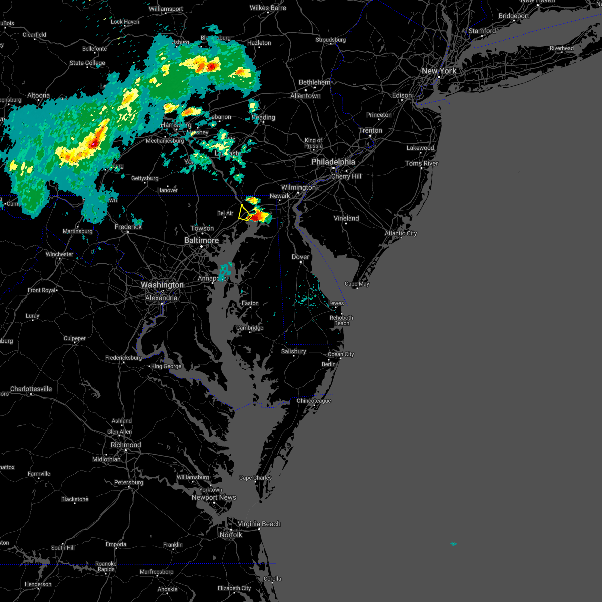 The severe thunderstorm warning for northeastern harford county will expire at 215 pm edt, the storm which prompted the warning has moved out of the area. therefore, the warning will be allowed to expire. a severe thunderstorm watch remains in effect until 800 pm edt for northern maryland. The severe thunderstorm warning for northeastern harford county will expire at 215 pm edt, the storm which prompted the warning has moved out of the area. therefore, the warning will be allowed to expire. a severe thunderstorm watch remains in effect until 800 pm edt for northern maryland.
|
| 8/28/2020 1:57 PM EDT | A pole and wires were down near the intersection of md-155 level road and graceview driv in harford county MD, 1 miles SSW of Havre de Grace, MD |
| 8/28/2020 1:53 PM EDT |
 At 153 pm edt, a severe thunderstorm was located over havre de grace, moving east at 25 mph (radar indicated). Hazards include 60 mph wind gusts and penny size hail. damage to roofs, siding, trees, and power lines is possible At 153 pm edt, a severe thunderstorm was located over havre de grace, moving east at 25 mph (radar indicated). Hazards include 60 mph wind gusts and penny size hail. damage to roofs, siding, trees, and power lines is possible
|
| 8/28/2020 1:51 PM EDT |
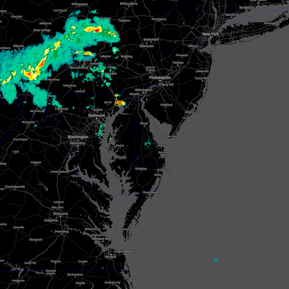 At 151 pm edt, a severe thunderstorm was located over havre de grace, moving east at 25 mph (radar indicated). Hazards include 60 mph wind gusts. Damaging winds will cause some trees and large branches to fall. this could injure those outdoors, as well as damage homes and vehicles. roadways may become blocked by downed trees. localized power outages are possible. Unsecured light objects may become projectiles. At 151 pm edt, a severe thunderstorm was located over havre de grace, moving east at 25 mph (radar indicated). Hazards include 60 mph wind gusts. Damaging winds will cause some trees and large branches to fall. this could injure those outdoors, as well as damage homes and vehicles. roadways may become blocked by downed trees. localized power outages are possible. Unsecured light objects may become projectiles.
|
| 8/12/2020 3:40 PM EDT |
 At 339 pm edt, a severe thunderstorm was located over hockessin, or 7 miles north of newark, moving east at 20 mph (radar indicated). Hazards include 60 mph wind gusts. Damage to roofs, siding, trees, and power lines is possible. locations impacted include, wilmington, newark, west chester, elkton, calvert, pennsville, westtown, elsmere, kennett square, new castle, penns grove, oxford, north east, west grove, rising sun, delaware city, charlestown, newport, arden and glen roy. this includes the following highways, interstate 95 in delaware between mile markers 0 and 20. interstate 95 in maryland between mile markers 91 and 109. Interstate 295 in new jersey near mile marker 0. At 339 pm edt, a severe thunderstorm was located over hockessin, or 7 miles north of newark, moving east at 20 mph (radar indicated). Hazards include 60 mph wind gusts. Damage to roofs, siding, trees, and power lines is possible. locations impacted include, wilmington, newark, west chester, elkton, calvert, pennsville, westtown, elsmere, kennett square, new castle, penns grove, oxford, north east, west grove, rising sun, delaware city, charlestown, newport, arden and glen roy. this includes the following highways, interstate 95 in delaware between mile markers 0 and 20. interstate 95 in maryland between mile markers 91 and 109. Interstate 295 in new jersey near mile marker 0.
|
| 8/12/2020 3:20 PM EDT |
 At 320 pm edt, a severe thunderstorm was located over kemblesville, or 8 miles northwest of newark, moving east at 20 mph (radar indicated). Hazards include 60 mph wind gusts. damage to roofs, siding, trees, and power lines is possible At 320 pm edt, a severe thunderstorm was located over kemblesville, or 8 miles northwest of newark, moving east at 20 mph (radar indicated). Hazards include 60 mph wind gusts. damage to roofs, siding, trees, and power lines is possible
|
| 8/7/2020 7:06 PM EDT |
 The severe thunderstorm warning for southwestern new castle, northern kent, northeastern queen anne`s, northeastern kent and cecil counties will expire at 715 pm edt, the storm which prompted the warning has moved out of the area. therefore, the warning will be allowed to expire. remember, a severe thunderstorm warning #218 still remains in effect. The severe thunderstorm warning for southwestern new castle, northern kent, northeastern queen anne`s, northeastern kent and cecil counties will expire at 715 pm edt, the storm which prompted the warning has moved out of the area. therefore, the warning will be allowed to expire. remember, a severe thunderstorm warning #218 still remains in effect.
|
| 8/7/2020 6:31 PM EDT |
 At 631 pm edt, a severe thunderstorm was located near aberdeen proving ground, moving east at 25 mph (radar indicated). Hazards include 60 mph wind gusts. Damage to roofs, siding, trees, and power lines is possible. locations impacted include, dover, middletown, elkton, smyrna, north east, clayton, delaware city, cheswold, charlestown, cecilton, millington, betterton, hartly, warwick, woodland beach, bohemias mills, port penn, brantwood, delaney corner and crumpton. This includes interstate 95 in maryland between mile markers 91 and 99. At 631 pm edt, a severe thunderstorm was located near aberdeen proving ground, moving east at 25 mph (radar indicated). Hazards include 60 mph wind gusts. Damage to roofs, siding, trees, and power lines is possible. locations impacted include, dover, middletown, elkton, smyrna, north east, clayton, delaware city, cheswold, charlestown, cecilton, millington, betterton, hartly, warwick, woodland beach, bohemias mills, port penn, brantwood, delaney corner and crumpton. This includes interstate 95 in maryland between mile markers 91 and 99.
|
| 8/7/2020 6:25 PM EDT |
 At 625 pm edt, a severe thunderstorm was located over aberdeen proving ground, moving east at 20 mph (radar indicated). Hazards include 60 mph wind gusts. Damaging winds will cause some trees and large branches to fall. this could injure those outdoors, as well as damage homes and vehicles. roadways may become blocked by downed trees. localized power outages are possible. unsecured light objects may become projectiles. Locations impacted include, aberdeen, havre de grace, aberdeen proving ground, bel air south, riverside, perryman, edgewood, churchville, harford furnace, abingdon, carsins and belcamp. At 625 pm edt, a severe thunderstorm was located over aberdeen proving ground, moving east at 20 mph (radar indicated). Hazards include 60 mph wind gusts. Damaging winds will cause some trees and large branches to fall. this could injure those outdoors, as well as damage homes and vehicles. roadways may become blocked by downed trees. localized power outages are possible. unsecured light objects may become projectiles. Locations impacted include, aberdeen, havre de grace, aberdeen proving ground, bel air south, riverside, perryman, edgewood, churchville, harford furnace, abingdon, carsins and belcamp.
|
| 8/7/2020 6:12 PM EDT |
 At 611 pm edt, a severe thunderstorm was located over aberdeen, moving east at 30 mph (radar indicated). Hazards include 60 mph wind gusts. damage to roofs, siding, trees, and power lines is possible At 611 pm edt, a severe thunderstorm was located over aberdeen, moving east at 30 mph (radar indicated). Hazards include 60 mph wind gusts. damage to roofs, siding, trees, and power lines is possible
|
| 8/7/2020 6:04 PM EDT |
 At 603 pm edt, a severe thunderstorm was located over riverside, or near aberdeen, moving east at 15 mph (radar indicated). Hazards include 60 mph wind gusts. Damaging winds will cause some trees and large branches to fall. this could injure those outdoors, as well as damage homes and vehicles. roadways may become blocked by downed trees. localized power outages are possible. Unsecured light objects may become projectiles. At 603 pm edt, a severe thunderstorm was located over riverside, or near aberdeen, moving east at 15 mph (radar indicated). Hazards include 60 mph wind gusts. Damaging winds will cause some trees and large branches to fall. this could injure those outdoors, as well as damage homes and vehicles. roadways may become blocked by downed trees. localized power outages are possible. Unsecured light objects may become projectiles.
|
| 8/4/2020 9:26 AM EDT |
 At 926 am edt, a severe thunderstorm capable of producing a tornado was located over aberdeen proving ground, moving northwest at 20 mph (radar indicated rotation). Hazards include tornado. For those in the direct path of a tornado touchdown, flying debris will be dangerous to those caught without shelter. damage to roofs, siding, and windows may occur. mobile homes may be damaged or destroyed. Tree damage is likely. At 926 am edt, a severe thunderstorm capable of producing a tornado was located over aberdeen proving ground, moving northwest at 20 mph (radar indicated rotation). Hazards include tornado. For those in the direct path of a tornado touchdown, flying debris will be dangerous to those caught without shelter. damage to roofs, siding, and windows may occur. mobile homes may be damaged or destroyed. Tree damage is likely.
|
| 7/30/2020 9:36 PM EDT |
 At 935 pm edt, a severe thunderstorm was located over riverside, or near aberdeen, moving northeast at 30 mph (radar indicated). Hazards include 60 mph wind gusts. Damaging winds will cause some trees and large branches to fall. this could injure those outdoors, as well as damage homes and vehicles. roadways may become blocked by downed trees. localized power outages are possible. Unsecured light objects may become projectiles. At 935 pm edt, a severe thunderstorm was located over riverside, or near aberdeen, moving northeast at 30 mph (radar indicated). Hazards include 60 mph wind gusts. Damaging winds will cause some trees and large branches to fall. this could injure those outdoors, as well as damage homes and vehicles. roadways may become blocked by downed trees. localized power outages are possible. Unsecured light objects may become projectiles.
|
| 7/22/2020 5:21 PM EDT |
 The severe thunderstorm warning for central harford and southeastern baltimore counties and baltimore city will expire at 530 pm edt, the storms which prompted the warning are exiting the warned area. therefore, the warning will be allowed to expire. however heavy rain is still possible with these thunderstorms. a severe thunderstorm watch remains in effect until 700 pm edt for central and northern maryland. to report severe weather, contact your nearest law enforcement agency. they will relay your report to the national weather service sterling virginia. The severe thunderstorm warning for central harford and southeastern baltimore counties and baltimore city will expire at 530 pm edt, the storms which prompted the warning are exiting the warned area. therefore, the warning will be allowed to expire. however heavy rain is still possible with these thunderstorms. a severe thunderstorm watch remains in effect until 700 pm edt for central and northern maryland. to report severe weather, contact your nearest law enforcement agency. they will relay your report to the national weather service sterling virginia.
|
| 7/22/2020 5:20 PM EDT |
 The severe thunderstorm warning for cecil and central chester counties will expire at 530 pm edt, the storms which prompted the warning have moved out of the area. therefore, the warning will be allowed to expire. however gusty winds and heavy rain are still possible with these thunderstorms. a severe thunderstorm watch remains in effect until 1000 pm edt for northern delaware, northeastern maryland, and eastern and southeastern pennsylvania. The severe thunderstorm warning for cecil and central chester counties will expire at 530 pm edt, the storms which prompted the warning have moved out of the area. therefore, the warning will be allowed to expire. however gusty winds and heavy rain are still possible with these thunderstorms. a severe thunderstorm watch remains in effect until 1000 pm edt for northern delaware, northeastern maryland, and eastern and southeastern pennsylvania.
|
| 7/22/2020 5:13 PM EDT |
 At 512 pm edt, severe thunderstorms were located along a line extending from near havre de grace to near bowleys quarters to severna park, moving east at 35 mph (radar indicated). Hazards include 60 mph wind gusts and nickel size hail. damage to roofs, siding, trees, and power lines is possible At 512 pm edt, severe thunderstorms were located along a line extending from near havre de grace to near bowleys quarters to severna park, moving east at 35 mph (radar indicated). Hazards include 60 mph wind gusts and nickel size hail. damage to roofs, siding, trees, and power lines is possible
|
| 7/22/2020 5:10 PM EDT |
 At 510 pm edt, severe thunderstorms were located along a line extending from near bel air south to near baltimore, moving east at 15 mph (radar indicated). Hazards include damaging wind gusts up to 65 mph and isolated large hail up to quarter size. Damaging winds will cause some trees and large branches to fall. this could injure those outdoors, as well as damage homes and vehicles. roadways may become blocked by downed trees. localized power outages are possible. unsecured light objects may become projectiles. Locations impacted include, baltimore, middle river, aberdeen, havre de grace, aberdeen proving ground, millers island, north point state park, sparrows point, back river, dundalk, towson, bel air south, essex, parkville, bel air north, carney, perry hall, rosedale, rossville and brooklyn park. At 510 pm edt, severe thunderstorms were located along a line extending from near bel air south to near baltimore, moving east at 15 mph (radar indicated). Hazards include damaging wind gusts up to 65 mph and isolated large hail up to quarter size. Damaging winds will cause some trees and large branches to fall. this could injure those outdoors, as well as damage homes and vehicles. roadways may become blocked by downed trees. localized power outages are possible. unsecured light objects may become projectiles. Locations impacted include, baltimore, middle river, aberdeen, havre de grace, aberdeen proving ground, millers island, north point state park, sparrows point, back river, dundalk, towson, bel air south, essex, parkville, bel air north, carney, perry hall, rosedale, rossville and brooklyn park.
|
| 7/22/2020 5:00 PM EDT |
 At 459 pm edt, severe thunderstorms were located along a line extending from elverson to oxford to near pleasant hills, moving east at 30 mph (radar indicated). Hazards include 60 mph wind gusts and penny size hail. Damage to roofs, siding, trees, and power lines is possible. locations impacted include, calvert, coatesville, downingtown, kennett square, oxford, parkesburg, north east, west grove, rising sun, honey brook, elverson, charlestown, homeville, zion, blake, barksdale, cochranville, west nottingham, octoraro and pughtown. this includes the following highways, pennsylvania turnpike between mile markers 300 and 312. Interstate 95 in maryland between mile markers 91 and 106. At 459 pm edt, severe thunderstorms were located along a line extending from elverson to oxford to near pleasant hills, moving east at 30 mph (radar indicated). Hazards include 60 mph wind gusts and penny size hail. Damage to roofs, siding, trees, and power lines is possible. locations impacted include, calvert, coatesville, downingtown, kennett square, oxford, parkesburg, north east, west grove, rising sun, honey brook, elverson, charlestown, homeville, zion, blake, barksdale, cochranville, west nottingham, octoraro and pughtown. this includes the following highways, pennsylvania turnpike between mile markers 300 and 312. Interstate 95 in maryland between mile markers 91 and 106.
|
| 7/22/2020 4:52 PM EDT |
 At 451 pm edt, severe thunderstorms were located along a line extending from pleasant hills to baltimore, moving east at 15 mph (radar indicated). Hazards include damaging wind gusts up to 65 mph and isolated hail up to quarter size. Damaging winds will cause some trees and large branches to fall. this could injure those outdoors, as well as damage homes and vehicles. roadways may become blocked by downed trees. localized power outages are possible. Unsecured light objects may become projectiles. At 451 pm edt, severe thunderstorms were located along a line extending from pleasant hills to baltimore, moving east at 15 mph (radar indicated). Hazards include damaging wind gusts up to 65 mph and isolated hail up to quarter size. Damaging winds will cause some trees and large branches to fall. this could injure those outdoors, as well as damage homes and vehicles. roadways may become blocked by downed trees. localized power outages are possible. Unsecured light objects may become projectiles.
|
| 7/22/2020 4:46 PM EDT |
 At 420 pm edt, developing severe thunderstorms were located along a line extending from near bel air north to towson to near elkridge, moving east at 15 mph (radar indicated). Hazards include 60 mph wind gusts. Damaging winds will cause some trees and large branches to fall. this could injure those outdoors, as well as damage homes and vehicles. roadways may become blocked by downed trees. localized power outages are possible. Unsecured light objects may become projectiles. At 420 pm edt, developing severe thunderstorms were located along a line extending from near bel air north to towson to near elkridge, moving east at 15 mph (radar indicated). Hazards include 60 mph wind gusts. Damaging winds will cause some trees and large branches to fall. this could injure those outdoors, as well as damage homes and vehicles. roadways may become blocked by downed trees. localized power outages are possible. Unsecured light objects may become projectiles.
|
| 7/22/2020 4:38 PM EDT |
 At 437 pm edt, severe thunderstorms were located along a line extending from near adamstown to rock springs to carney, moving east at 30 mph (radar indicated). Hazards include 60 mph wind gusts and penny size hail. damage to roofs, siding, trees, and power lines is possible At 437 pm edt, severe thunderstorms were located along a line extending from near adamstown to rock springs to carney, moving east at 30 mph (radar indicated). Hazards include 60 mph wind gusts and penny size hail. damage to roofs, siding, trees, and power lines is possible
|
| 7/22/2020 4:21 PM EDT |
 At 420 pm edt, developing severe thunderstorms were located along a line extending from near bel air north to towson to near elkridge, moving east at 15 mph (radar indicated). Hazards include 60 mph wind gusts. Damaging winds will cause some trees and large branches to fall. this could injure those outdoors, as well as damage homes and vehicles. roadways may become blocked by downed trees. localized power outages are possible. Unsecured light objects may become projectiles. At 420 pm edt, developing severe thunderstorms were located along a line extending from near bel air north to towson to near elkridge, moving east at 15 mph (radar indicated). Hazards include 60 mph wind gusts. Damaging winds will cause some trees and large branches to fall. this could injure those outdoors, as well as damage homes and vehicles. roadways may become blocked by downed trees. localized power outages are possible. Unsecured light objects may become projectiles.
|
| 7/5/2020 2:57 PM EDT |
 At 214 pm edt, a severe thunderstorm was located over aberdeen proving ground, moving southeast at 5 mph (radar indicated). Hazards include 60 mph wind gusts and quarter size hail. Damaging winds will cause some trees and large branches to fall. this could injure those outdoors, as well as damage homes and vehicles. roadways may become blocked by downed trees. localized power outages are possible. Unsecured light objects may become projectiles. At 214 pm edt, a severe thunderstorm was located over aberdeen proving ground, moving southeast at 5 mph (radar indicated). Hazards include 60 mph wind gusts and quarter size hail. Damaging winds will cause some trees and large branches to fall. this could injure those outdoors, as well as damage homes and vehicles. roadways may become blocked by downed trees. localized power outages are possible. Unsecured light objects may become projectiles.
|
| 7/5/2020 2:14 PM EDT |
 At 214 pm edt, a severe thunderstorm was located over aberdeen proving ground, moving southeast at 5 mph (radar indicated). Hazards include 60 mph wind gusts and quarter size hail. Damaging winds will cause some trees and large branches to fall. this could injure those outdoors, as well as damage homes and vehicles. roadways may become blocked by downed trees. localized power outages are possible. Unsecured light objects may become projectiles. At 214 pm edt, a severe thunderstorm was located over aberdeen proving ground, moving southeast at 5 mph (radar indicated). Hazards include 60 mph wind gusts and quarter size hail. Damaging winds will cause some trees and large branches to fall. this could injure those outdoors, as well as damage homes and vehicles. roadways may become blocked by downed trees. localized power outages are possible. Unsecured light objects may become projectiles.
|
| 6/10/2020 10:18 PM EDT |
 At 1017 pm edt, severe thunderstorms with a history of producing wind damage were located along a line extending from near wakefield to near octoraro, moving northeast at 25 mph (radar indicated and storm reports. trees blew down onto power lines in bel air with this storm shortly before 10 pm). Hazards include 60 mph wind gusts. Damaging winds will cause some trees and large branches to fall. this could injure those outdoors, as well as damage homes and vehicles. roadways may become blocked by downed trees. localized power outages are possible. unsecured light objects may become projectiles. Locations impacted include, aberdeen, havre de grace, bel air south, bel air north, darlington, churchville and carsins. At 1017 pm edt, severe thunderstorms with a history of producing wind damage were located along a line extending from near wakefield to near octoraro, moving northeast at 25 mph (radar indicated and storm reports. trees blew down onto power lines in bel air with this storm shortly before 10 pm). Hazards include 60 mph wind gusts. Damaging winds will cause some trees and large branches to fall. this could injure those outdoors, as well as damage homes and vehicles. roadways may become blocked by downed trees. localized power outages are possible. unsecured light objects may become projectiles. Locations impacted include, aberdeen, havre de grace, bel air south, bel air north, darlington, churchville and carsins.
|
| 6/10/2020 10:08 PM EDT |
 At 1008 pm edt, severe thunderstorms were located along a line extending from wakefield to near octoraro, moving northeast at 25 mph (radar indicated). Hazards include 60 mph wind gusts. Damaging winds will cause some trees and large branches to fall. this could injure those outdoors, as well as damage homes and vehicles. roadways may become blocked by downed trees. localized power outages are possible. unsecured light objects may become projectiles. Locations impacted include, aberdeen, havre de grace, bel air south, bel air north, darlington, churchville and carsins. At 1008 pm edt, severe thunderstorms were located along a line extending from wakefield to near octoraro, moving northeast at 25 mph (radar indicated). Hazards include 60 mph wind gusts. Damaging winds will cause some trees and large branches to fall. this could injure those outdoors, as well as damage homes and vehicles. roadways may become blocked by downed trees. localized power outages are possible. unsecured light objects may become projectiles. Locations impacted include, aberdeen, havre de grace, bel air south, bel air north, darlington, churchville and carsins.
|
| 6/10/2020 9:49 PM EDT |
 At 949 pm edt, severe thunderstorms were located along a line extending from near wakefield to near bel air south, moving northeast at 25 mph (radar indicated). Hazards include 60 mph wind gusts. Damaging winds will cause some trees and large branches to fall. this could injure those outdoors, as well as damage homes and vehicles. roadways may become blocked by downed trees. localized power outages are possible. Unsecured light objects may become projectiles. At 949 pm edt, severe thunderstorms were located along a line extending from near wakefield to near bel air south, moving northeast at 25 mph (radar indicated). Hazards include 60 mph wind gusts. Damaging winds will cause some trees and large branches to fall. this could injure those outdoors, as well as damage homes and vehicles. roadways may become blocked by downed trees. localized power outages are possible. Unsecured light objects may become projectiles.
|
| 6/3/2020 8:52 PM EDT |
 At 851 pm edt, a severe thunderstorm was located over holtwood, or 11 miles south of willow street, moving southeast at 40 mph (radar indicated). Hazards include 60 mph wind gusts and quarter size hail. Minor damage to vehicles is possible. Wind damage to roofs, siding, trees, and power lines is possible. At 851 pm edt, a severe thunderstorm was located over holtwood, or 11 miles south of willow street, moving southeast at 40 mph (radar indicated). Hazards include 60 mph wind gusts and quarter size hail. Minor damage to vehicles is possible. Wind damage to roofs, siding, trees, and power lines is possible.
|
| 4/13/2020 3:11 PM EDT |
 The severe thunderstorm warning for eastern harford and southeastern baltimore counties will expire at 315 pm edt, the storms which prompted the warning have moved out of the area. therefore, the warning will be allowed to expire. a tornado watch remains in effect until 600 pm edt for northern maryland. to report severe weather, contact your nearest law enforcement agency. they will relay your report to the national weather service sterling virginia. The severe thunderstorm warning for eastern harford and southeastern baltimore counties will expire at 315 pm edt, the storms which prompted the warning have moved out of the area. therefore, the warning will be allowed to expire. a tornado watch remains in effect until 600 pm edt for northern maryland. to report severe weather, contact your nearest law enforcement agency. they will relay your report to the national weather service sterling virginia.
|
| 4/13/2020 2:59 PM EDT |
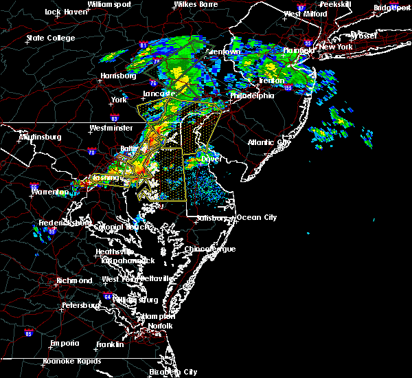 At 227 pm edt, severe thunderstorms were located along a line extending from near delta to baltimore, moving east at 50 mph (radar indicated). Hazards include 60 mph wind gusts. Damaging winds will cause some trees and large branches to fall. this could injure those outdoors, as well as damage homes and vehicles. roadways may become blocked by downed trees. localized power outages are possible. Unsecured light objects may become projectiles. At 227 pm edt, severe thunderstorms were located along a line extending from near delta to baltimore, moving east at 50 mph (radar indicated). Hazards include 60 mph wind gusts. Damaging winds will cause some trees and large branches to fall. this could injure those outdoors, as well as damage homes and vehicles. roadways may become blocked by downed trees. localized power outages are possible. Unsecured light objects may become projectiles.
|
| 4/13/2020 2:41 PM EDT |
 At 239 pm edt, severe thunderstorms were located along a line extending from churchtown to severn, moving east at 40 mph (radar indicated). Hazards include 60 mph wind gusts. damage to roofs, siding, trees, and power lines is possible At 239 pm edt, severe thunderstorms were located along a line extending from churchtown to severn, moving east at 40 mph (radar indicated). Hazards include 60 mph wind gusts. damage to roofs, siding, trees, and power lines is possible
|
| 4/13/2020 2:27 PM EDT |
 At 227 pm edt, severe thunderstorms were located along a line extending from near delta to baltimore, moving east at 50 mph (radar indicated). Hazards include 60 mph wind gusts. Damaging winds will cause some trees and large branches to fall. this could injure those outdoors, as well as damage homes and vehicles. roadways may become blocked by downed trees. localized power outages are possible. Unsecured light objects may become projectiles. At 227 pm edt, severe thunderstorms were located along a line extending from near delta to baltimore, moving east at 50 mph (radar indicated). Hazards include 60 mph wind gusts. Damaging winds will cause some trees and large branches to fall. this could injure those outdoors, as well as damage homes and vehicles. roadways may become blocked by downed trees. localized power outages are possible. Unsecured light objects may become projectiles.
|
| 4/9/2020 11:49 PM EDT |
 At 1148 pm edt, severe thunderstorms were located along a line extending from near coatesville to pleasant hill to near bel air south, moving east at 60 mph (radar indicated). Hazards include 60 mph wind gusts and small hail. damage to roofs, siding, trees, and power lines is possible At 1148 pm edt, severe thunderstorms were located along a line extending from near coatesville to pleasant hill to near bel air south, moving east at 60 mph (radar indicated). Hazards include 60 mph wind gusts and small hail. damage to roofs, siding, trees, and power lines is possible
|
| 4/9/2020 11:43 PM EDT |
 At 1142 pm edt, severe thunderstorms were located along a line extending from kemblesville to near woodlawn to near aberdeen, moving southeast at 55 mph (radar indicated). Hazards include 60 mph wind gusts. Damaging winds will cause some trees and large branches to fall. this could injure those outdoors, as well as damage homes and vehicles. roadways may become blocked by downed trees. localized power outages are possible. unsecured light objects may become projectiles. Locations impacted include, aberdeen, havre de grace, aberdeen proving ground, perryman, carsins and churchville. At 1142 pm edt, severe thunderstorms were located along a line extending from kemblesville to near woodlawn to near aberdeen, moving southeast at 55 mph (radar indicated). Hazards include 60 mph wind gusts. Damaging winds will cause some trees and large branches to fall. this could injure those outdoors, as well as damage homes and vehicles. roadways may become blocked by downed trees. localized power outages are possible. unsecured light objects may become projectiles. Locations impacted include, aberdeen, havre de grace, aberdeen proving ground, perryman, carsins and churchville.
|
| 4/9/2020 11:37 PM EDT |
 At 1135 pm edt, severe thunderstorms were located along a line extending from near paradise to homeville to near delta to 7 miles south of railroad, moving east at 60 mph (radar indicated). Hazards include 60 mph wind gusts and small hail. Damage to roofs, siding, trees, and power lines is possible. locations impacted include, elkton, calvert, coatesville, kennett square, oxford, parkesburg, north east, west grove, rising sun, charlestown, homeville, glen roy, zion, blake, barksdale, cochranville, west nottingham, octoraro, mount vernon and marshallton. This includes interstate 95 in maryland between mile markers 91 and 107. At 1135 pm edt, severe thunderstorms were located along a line extending from near paradise to homeville to near delta to 7 miles south of railroad, moving east at 60 mph (radar indicated). Hazards include 60 mph wind gusts and small hail. Damage to roofs, siding, trees, and power lines is possible. locations impacted include, elkton, calvert, coatesville, kennett square, oxford, parkesburg, north east, west grove, rising sun, charlestown, homeville, glen roy, zion, blake, barksdale, cochranville, west nottingham, octoraro, mount vernon and marshallton. This includes interstate 95 in maryland between mile markers 91 and 107.
|
| 4/9/2020 11:24 PM EDT |
 At 1124 pm edt, a severe thunderstorm was located near wakefield, or 14 miles south of willow street, moving southeast at 55 mph (radar indicated). Hazards include 60 mph wind gusts. damage to roofs, siding, trees, and power lines is possible At 1124 pm edt, a severe thunderstorm was located near wakefield, or 14 miles south of willow street, moving southeast at 55 mph (radar indicated). Hazards include 60 mph wind gusts. damage to roofs, siding, trees, and power lines is possible
|
| 4/9/2020 11:21 PM EDT |
 At 1120 pm edt, severe thunderstorms were located along a line extending from smithville to near sunnyburn to near manchester, moving southeast at 55 mph (radar indicated). Hazards include 60 mph wind gusts. Damaging winds will cause some trees and large branches to fall. this could injure those outdoors, as well as damage homes and vehicles. roadways may become blocked by downed trees. localized power outages are possible. Unsecured light objects may become projectiles. At 1120 pm edt, severe thunderstorms were located along a line extending from smithville to near sunnyburn to near manchester, moving southeast at 55 mph (radar indicated). Hazards include 60 mph wind gusts. Damaging winds will cause some trees and large branches to fall. this could injure those outdoors, as well as damage homes and vehicles. roadways may become blocked by downed trees. localized power outages are possible. Unsecured light objects may become projectiles.
|
| 4/9/2020 12:51 PM EDT |
 At 1251 pm edt, severe thunderstorms were located along a line extending from near conowingo to carney, moving east at 65 mph (radar indicated). Hazards include 60 mph wind gusts. Damaging winds will cause some trees and large branches to fall. this could injure those outdoors, as well as damage homes and vehicles. roadways may become blocked by downed trees. localized power outages are possible. unsecured light objects may become projectiles. Locations impacted include, middle river, aberdeen, havre de grace, aberdeen proving ground, towson, bel air south, parkville, bel air north, carney, perry hall, rossville, white marsh, fallston, riverside, hampton, kingsville, pleasant hills, jarrettsville, perryman and edgewood. At 1251 pm edt, severe thunderstorms were located along a line extending from near conowingo to carney, moving east at 65 mph (radar indicated). Hazards include 60 mph wind gusts. Damaging winds will cause some trees and large branches to fall. this could injure those outdoors, as well as damage homes and vehicles. roadways may become blocked by downed trees. localized power outages are possible. unsecured light objects may become projectiles. Locations impacted include, middle river, aberdeen, havre de grace, aberdeen proving ground, towson, bel air south, parkville, bel air north, carney, perry hall, rossville, white marsh, fallston, riverside, hampton, kingsville, pleasant hills, jarrettsville, perryman and edgewood.
|
| 4/9/2020 12:24 PM EDT |
 At 1224 pm edt, severe thunderstorms were located along a line extending from near railroad to near mount airy, moving east at 65 mph (radar indicated). Hazards include 60 mph wind gusts. Damaging winds will cause some trees and large branches to fall. this could injure those outdoors, as well as damage homes and vehicles. roadways may become blocked by downed trees. localized power outages are possible. Unsecured light objects may become projectiles. At 1224 pm edt, severe thunderstorms were located along a line extending from near railroad to near mount airy, moving east at 65 mph (radar indicated). Hazards include 60 mph wind gusts. Damaging winds will cause some trees and large branches to fall. this could injure those outdoors, as well as damage homes and vehicles. roadways may become blocked by downed trees. localized power outages are possible. Unsecured light objects may become projectiles.
|
| 4/8/2020 12:59 AM EDT |
 At 1251 am edt, a severe thunderstorm was located near bel air north, or 13 miles northwest of aberdeen, moving east at 35 mph (radar indicated). Hazards include quarter size hail. some hail damage to agriculture is expected At 1251 am edt, a severe thunderstorm was located near bel air north, or 13 miles northwest of aberdeen, moving east at 35 mph (radar indicated). Hazards include quarter size hail. some hail damage to agriculture is expected
|
| 4/8/2020 12:52 AM EDT |
 At 1251 am edt, a severe thunderstorm was located near bel air north, or 13 miles northwest of aberdeen, moving east at 35 mph (radar indicated). Hazards include quarter size hail. some hail damage to agriculture is expected At 1251 am edt, a severe thunderstorm was located near bel air north, or 13 miles northwest of aberdeen, moving east at 35 mph (radar indicated). Hazards include quarter size hail. some hail damage to agriculture is expected
|
| 2/7/2020 9:22 AM EST |
 At 920 am est, severe thunderstorms were located along a line extending from reading to near parkesburg to near aberdeen proving ground, moving northeast at 65 mph. numerous trees have been reported down along with numerous power outages due to high winds along and ahead of this line of storms (radar indicated). Hazards include 70 mph wind gusts and penny size hail. Expect considerable tree damage. damage is likely to mobile homes, roofs, and outbuildings. locations impacted include, reading, wilmington, newark, middletown, west chester, elkton, calvert, pottstown, phoenixville, coatesville, westtown, wyomissing, downingtown, elsmere, kennett square, birdsboro, collegeville, oxford, kutztown and royersford. this includes the following highways, interstate 78 in pennsylvania between mile markers 43 and 44. interstate 95 in maryland between mile markers 91 and 109. interstate 95 in delaware between mile markers 0 and 11. pennsylvania turnpike between exits 298 and 320. Interstate 176 in pennsylvania between mile markers 1 and 11. At 920 am est, severe thunderstorms were located along a line extending from reading to near parkesburg to near aberdeen proving ground, moving northeast at 65 mph. numerous trees have been reported down along with numerous power outages due to high winds along and ahead of this line of storms (radar indicated). Hazards include 70 mph wind gusts and penny size hail. Expect considerable tree damage. damage is likely to mobile homes, roofs, and outbuildings. locations impacted include, reading, wilmington, newark, middletown, west chester, elkton, calvert, pottstown, phoenixville, coatesville, westtown, wyomissing, downingtown, elsmere, kennett square, birdsboro, collegeville, oxford, kutztown and royersford. this includes the following highways, interstate 78 in pennsylvania between mile markers 43 and 44. interstate 95 in maryland between mile markers 91 and 109. interstate 95 in delaware between mile markers 0 and 11. pennsylvania turnpike between exits 298 and 320. Interstate 176 in pennsylvania between mile markers 1 and 11.
|
| 2/7/2020 8:52 AM EST |
 At 851 am est, severe thunderstorms were located along a line extending from mountville to delta to essex, moving northeast at 60 mph. this storm has a history of producing wind damage across portions of maryland (radar indicated). Hazards include 70 mph wind gusts and penny size hail. Expect considerable tree damage. Damage is likely to mobile homes, roofs, and outbuildings. At 851 am est, severe thunderstorms were located along a line extending from mountville to delta to essex, moving northeast at 60 mph. this storm has a history of producing wind damage across portions of maryland (radar indicated). Hazards include 70 mph wind gusts and penny size hail. Expect considerable tree damage. Damage is likely to mobile homes, roofs, and outbuildings.
|
| 10/31/2019 11:01 PM EDT |
 At 1101 pm edt, severe thunderstorms were located along a line extending from near quakertown to west nottingham, moving northeast at 50 mph (radar indicated). Hazards include 60 mph wind gusts. Damage to roofs, siding, trees, and power lines is possible. locations impacted include, west chester, elkton, calvert, norristown, pottstown, phoenixville, lansdale, west norriton, east norriton, coatesville, westtown, quakertown, perkasie, doylestown, downingtown, conshohocken, souderton, bedminster, ambler and kennett square. this includes the following highways, interstate 95 in maryland between mile markers 91 and 109. Interstate 95 in delaware near mile marker 0. At 1101 pm edt, severe thunderstorms were located along a line extending from near quakertown to west nottingham, moving northeast at 50 mph (radar indicated). Hazards include 60 mph wind gusts. Damage to roofs, siding, trees, and power lines is possible. locations impacted include, west chester, elkton, calvert, norristown, pottstown, phoenixville, lansdale, west norriton, east norriton, coatesville, westtown, quakertown, perkasie, doylestown, downingtown, conshohocken, souderton, bedminster, ambler and kennett square. this includes the following highways, interstate 95 in maryland between mile markers 91 and 109. Interstate 95 in delaware near mile marker 0.
|
| 10/31/2019 10:31 PM EDT |
 At 1030 pm edt, severe thunderstorms were located along a line extending from near rock springs to near riverside, moving northeast at 50 mph (radar indicated). Hazards include 60 mph wind gusts. Damaging winds will cause some trees and large branches to fall. this could injure those outdoors, as well as damage homes and vehicles. roadways may become blocked by downed trees. localized power outages are possible. unsecured light objects may become projectiles. Locations impacted include, middle river, aberdeen, havre de grace, aberdeen proving ground, bel air south, bel air north, perry hall, rosedale, rossville, white marsh, fallston, bowleys quarters, riverside, kingsville, pleasant hills, jarrettsville, perryman, edgewood, joppatowne and pylesville. At 1030 pm edt, severe thunderstorms were located along a line extending from near rock springs to near riverside, moving northeast at 50 mph (radar indicated). Hazards include 60 mph wind gusts. Damaging winds will cause some trees and large branches to fall. this could injure those outdoors, as well as damage homes and vehicles. roadways may become blocked by downed trees. localized power outages are possible. unsecured light objects may become projectiles. Locations impacted include, middle river, aberdeen, havre de grace, aberdeen proving ground, bel air south, bel air north, perry hall, rosedale, rossville, white marsh, fallston, bowleys quarters, riverside, kingsville, pleasant hills, jarrettsville, perryman, edgewood, joppatowne and pylesville.
|
| 10/31/2019 10:23 PM EDT |
 At 1023 pm edt, severe thunderstorms were located along a line extending from east greenville to near aberdeen, moving northeast at 65 mph (radar indicated). Hazards include 60 mph wind gusts. damage to roofs, siding, trees, and power lines is possible At 1023 pm edt, severe thunderstorms were located along a line extending from east greenville to near aberdeen, moving northeast at 65 mph (radar indicated). Hazards include 60 mph wind gusts. damage to roofs, siding, trees, and power lines is possible
|
| 10/31/2019 10:14 PM EDT |
 At 1013 pm edt, severe thunderstorms were located along a line extending from near delta to white marsh, moving northeast at 65 mph (radar indicated). Hazards include 60 mph wind gusts. Damaging winds will cause some trees and large branches to fall. this could injure those outdoors, as well as damage homes and vehicles. roadways may become blocked by downed trees. localized power outages are possible. Unsecured light objects may become projectiles. At 1013 pm edt, severe thunderstorms were located along a line extending from near delta to white marsh, moving northeast at 65 mph (radar indicated). Hazards include 60 mph wind gusts. Damaging winds will cause some trees and large branches to fall. this could injure those outdoors, as well as damage homes and vehicles. roadways may become blocked by downed trees. localized power outages are possible. Unsecured light objects may become projectiles.
|
| 10/31/2019 10:02 PM EDT |
 At 1001 pm edt, severe thunderstorms were located along a line extending from near cedarville to near bel air north, moving northeast at 50 mph (radar indicated). Hazards include 60 mph wind gusts. Damage to roofs, siding, trees, and power lines is possible. locations impacted include, reading, calvert, pottstown, coatesville, wyomissing, downingtown, birdsboro, oxford, kutztown, royersford, fleetwood, laureldale, parkesburg, east greenville, west grove, rising sun, topton, honey brook, schwenksville and elverson. This includes interstate 95 in maryland between mile markers 91 and 98. At 1001 pm edt, severe thunderstorms were located along a line extending from near cedarville to near bel air north, moving northeast at 50 mph (radar indicated). Hazards include 60 mph wind gusts. Damage to roofs, siding, trees, and power lines is possible. locations impacted include, reading, calvert, pottstown, coatesville, wyomissing, downingtown, birdsboro, oxford, kutztown, royersford, fleetwood, laureldale, parkesburg, east greenville, west grove, rising sun, topton, honey brook, schwenksville and elverson. This includes interstate 95 in maryland between mile markers 91 and 98.
|
| 10/31/2019 9:35 PM EDT |
 At 934 pm edt, severe thunderstorms were located along a line extending from new holland to towson, moving northeast at 50 mph (radar indicated). Hazards include 60 mph wind gusts. damage to roofs, siding, trees, and power lines is possible At 934 pm edt, severe thunderstorms were located along a line extending from new holland to towson, moving northeast at 50 mph (radar indicated). Hazards include 60 mph wind gusts. damage to roofs, siding, trees, and power lines is possible
|
| 8/22/2019 8:54 PM EDT |
 At 854 pm edt, severe thunderstorms were located along a line extending from near havre de grace to near aberdeen proving ground to near newtown, moving east at 30 mph (radar indicated). Hazards include 60 mph wind gusts and penny size hail. damage to roofs, siding, trees, and power lines is possible At 854 pm edt, severe thunderstorms were located along a line extending from near havre de grace to near aberdeen proving ground to near newtown, moving east at 30 mph (radar indicated). Hazards include 60 mph wind gusts and penny size hail. damage to roofs, siding, trees, and power lines is possible
|
| 8/17/2019 2:32 PM EDT |
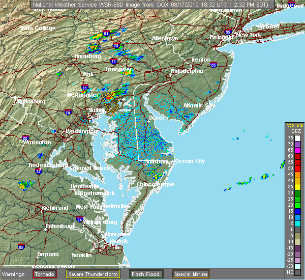 At 207 pm edt, a severe thunderstorm was located near bel air north, or 7 miles northwest of aberdeen, moving southeast at 35 mph (radar indicated). Hazards include 60 mph wind gusts and quarter size hail. Damaging winds will cause some trees and large branches to fall. this could injure those outdoors, as well as damage homes and vehicles. roadways may become blocked by downed trees. localized power outages are possible. Unsecured light objects may become projectiles. At 207 pm edt, a severe thunderstorm was located near bel air north, or 7 miles northwest of aberdeen, moving southeast at 35 mph (radar indicated). Hazards include 60 mph wind gusts and quarter size hail. Damaging winds will cause some trees and large branches to fall. this could injure those outdoors, as well as damage homes and vehicles. roadways may become blocked by downed trees. localized power outages are possible. Unsecured light objects may become projectiles.
|
| 8/17/2019 2:08 PM EDT |
 At 207 pm edt, a severe thunderstorm was located near bel air north, or 7 miles northwest of aberdeen, moving southeast at 35 mph (radar indicated). Hazards include 60 mph wind gusts and quarter size hail. Damaging winds will cause some trees and large branches to fall. this could injure those outdoors, as well as damage homes and vehicles. roadways may become blocked by downed trees. localized power outages are possible. Unsecured light objects may become projectiles. At 207 pm edt, a severe thunderstorm was located near bel air north, or 7 miles northwest of aberdeen, moving southeast at 35 mph (radar indicated). Hazards include 60 mph wind gusts and quarter size hail. Damaging winds will cause some trees and large branches to fall. this could injure those outdoors, as well as damage homes and vehicles. roadways may become blocked by downed trees. localized power outages are possible. Unsecured light objects may become projectiles.
|
| 8/7/2019 4:18 PM EDT |
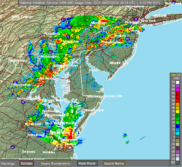 At 417 pm edt, severe thunderstorms were located along a line extending from aberdeen proving ground to millers island, moving east at 25 mph (radar indicated). Hazards include 60 mph wind gusts and quarter size hail. Damaging winds will cause some trees and large branches to fall. this could injure those outdoors, as well as damage homes and vehicles. roadways may become blocked by downed trees. localized power outages are possible. unsecured light objects may become projectiles. Locations impacted include, middle river, aberdeen, havre de grace, aberdeen proving ground, north point state park, back river, millers island, essex, bowleys quarters, riverside, perryman, edgewood, joppatowne, edgemere, magnolia, chase, martin state airport and belcamp. At 417 pm edt, severe thunderstorms were located along a line extending from aberdeen proving ground to millers island, moving east at 25 mph (radar indicated). Hazards include 60 mph wind gusts and quarter size hail. Damaging winds will cause some trees and large branches to fall. this could injure those outdoors, as well as damage homes and vehicles. roadways may become blocked by downed trees. localized power outages are possible. unsecured light objects may become projectiles. Locations impacted include, middle river, aberdeen, havre de grace, aberdeen proving ground, north point state park, back river, millers island, essex, bowleys quarters, riverside, perryman, edgewood, joppatowne, edgemere, magnolia, chase, martin state airport and belcamp.
|
| 8/7/2019 4:07 PM EDT |
 At 407 pm edt, severe thunderstorms were located along a line extending from near conowingo to near bowleys quarters to near crofton, moving east at 15 mph (radar indicated). Hazards include 60 mph wind gusts and nickel size hail. damage to roofs, siding, trees, and power lines is possible At 407 pm edt, severe thunderstorms were located along a line extending from near conowingo to near bowleys quarters to near crofton, moving east at 15 mph (radar indicated). Hazards include 60 mph wind gusts and nickel size hail. damage to roofs, siding, trees, and power lines is possible
|
| 8/7/2019 4:00 PM EDT |
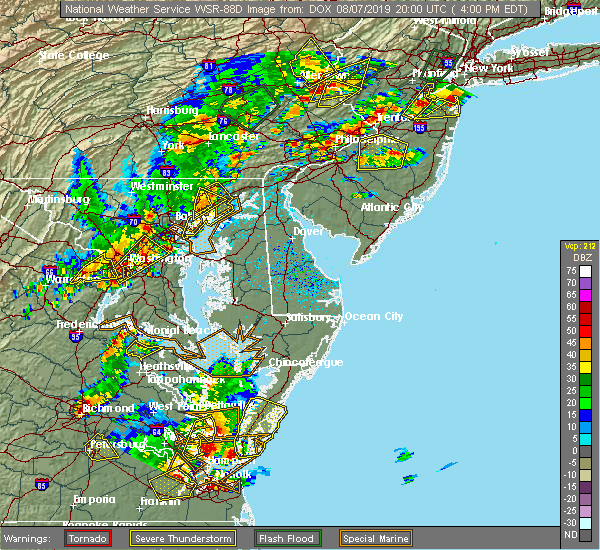 At 359 pm edt, severe thunderstorms were located along a line extending from near octoraro to near bowleys quarters, moving northeast at 30 mph (radar indicated). Hazards include 60 mph wind gusts and quarter size hail. Damaging winds will cause some trees and large branches to fall. this could injure those outdoors, as well as damage homes and vehicles. roadways may become blocked by downed trees. localized power outages are possible. unsecured light objects may become projectiles. Locations impacted include, middle river, aberdeen, havre de grace, aberdeen proving ground, north point state park, back river, millers island, essex, bowleys quarters, riverside, perryman, edgewood, joppatowne, edgemere, darlington, churchville, carsins, magnolia, chase and martin state airport. At 359 pm edt, severe thunderstorms were located along a line extending from near octoraro to near bowleys quarters, moving northeast at 30 mph (radar indicated). Hazards include 60 mph wind gusts and quarter size hail. Damaging winds will cause some trees and large branches to fall. this could injure those outdoors, as well as damage homes and vehicles. roadways may become blocked by downed trees. localized power outages are possible. unsecured light objects may become projectiles. Locations impacted include, middle river, aberdeen, havre de grace, aberdeen proving ground, north point state park, back river, millers island, essex, bowleys quarters, riverside, perryman, edgewood, joppatowne, edgemere, darlington, churchville, carsins, magnolia, chase and martin state airport.
|
| 8/7/2019 3:58 PM EDT |
 The severe thunderstorm warning for central harford and east central baltimore counties will expire at 400 pm edt, the storm which prompted the warning has weakened below severe limits, and no longer poses an immediate threat to life or property. therefore, the warning will be allowed to expire. a severe thunderstorm watch remains in effect until 800 pm edt for northern maryland. The severe thunderstorm warning for central harford and east central baltimore counties will expire at 400 pm edt, the storm which prompted the warning has weakened below severe limits, and no longer poses an immediate threat to life or property. therefore, the warning will be allowed to expire. a severe thunderstorm watch remains in effect until 800 pm edt for northern maryland.
|
| 8/7/2019 3:48 PM EDT |
 At 348 pm edt, a severe thunderstorm was located over bel air north, or 10 miles west of aberdeen, moving northeast at 30 mph (radar indicated). Hazards include 60 mph wind gusts and quarter size hail. Damaging winds will cause some trees and large branches to fall. this could injure those outdoors, as well as damage homes and vehicles. roadways may become blocked by downed trees. localized power outages are possible. unsecured light objects may become projectiles. Locations impacted include, middle river, aberdeen, havre de grace, bel air south, bel air north, fallston, riverside, kingsville, pleasant hills, perryman, edgewood, joppatowne, churchville, carsins, bradshaw, abingdon, joppa, upper falls, gunpowder and hickory. At 348 pm edt, a severe thunderstorm was located over bel air north, or 10 miles west of aberdeen, moving northeast at 30 mph (radar indicated). Hazards include 60 mph wind gusts and quarter size hail. Damaging winds will cause some trees and large branches to fall. this could injure those outdoors, as well as damage homes and vehicles. roadways may become blocked by downed trees. localized power outages are possible. unsecured light objects may become projectiles. Locations impacted include, middle river, aberdeen, havre de grace, bel air south, bel air north, fallston, riverside, kingsville, pleasant hills, perryman, edgewood, joppatowne, churchville, carsins, bradshaw, abingdon, joppa, upper falls, gunpowder and hickory.
|
| 8/7/2019 3:44 PM EDT |
 At 344 pm edt, severe thunderstorms were located along a line extending from near bel air north to back river, moving northeast at 30 mph (radar indicated). Hazards include 60 mph wind gusts and quarter size hail. Damaging winds will cause some trees and large branches to fall. this could injure those outdoors, as well as damage homes and vehicles. roadways may become blocked by downed trees. localized power outages are possible. Unsecured light objects may become projectiles. At 344 pm edt, severe thunderstorms were located along a line extending from near bel air north to back river, moving northeast at 30 mph (radar indicated). Hazards include 60 mph wind gusts and quarter size hail. Damaging winds will cause some trees and large branches to fall. this could injure those outdoors, as well as damage homes and vehicles. roadways may become blocked by downed trees. localized power outages are possible. Unsecured light objects may become projectiles.
|
| 8/7/2019 3:30 PM EDT |
 At 330 pm edt, a severe thunderstorm was located over kingsville, or 9 miles east of cockeysville, moving northeast at 30 mph (radar indicated). Hazards include 60 mph wind gusts and quarter size hail. Damaging winds will cause some trees and large branches to fall. this could injure those outdoors, as well as damage homes and vehicles. roadways may become blocked by downed trees. localized power outages are possible. unsecured light objects may become projectiles. Locations impacted include, middle river, aberdeen, havre de grace, bel air south, bel air north, carney, perry hall, rossville, white marsh, fallston, riverside, hampton, kingsville, pleasant hills, perryman, lutherville-timonium, edgewood, joppatowne, nottingham and glen arm. At 330 pm edt, a severe thunderstorm was located over kingsville, or 9 miles east of cockeysville, moving northeast at 30 mph (radar indicated). Hazards include 60 mph wind gusts and quarter size hail. Damaging winds will cause some trees and large branches to fall. this could injure those outdoors, as well as damage homes and vehicles. roadways may become blocked by downed trees. localized power outages are possible. unsecured light objects may become projectiles. Locations impacted include, middle river, aberdeen, havre de grace, bel air south, bel air north, carney, perry hall, rossville, white marsh, fallston, riverside, hampton, kingsville, pleasant hills, perryman, lutherville-timonium, edgewood, joppatowne, nottingham and glen arm.
|
| 8/7/2019 3:14 PM EDT |
 At 314 pm edt, a severe thunderstorm was located over parkville, or near baltimore, moving northeast at 30 mph (radar indicated). Hazards include 60 mph wind gusts and quarter size hail. Damaging winds will cause some trees and large branches to fall. this could injure those outdoors, as well as damage homes and vehicles. roadways may become blocked by downed trees. localized power outages are possible. Unsecured light objects may become projectiles. At 314 pm edt, a severe thunderstorm was located over parkville, or near baltimore, moving northeast at 30 mph (radar indicated). Hazards include 60 mph wind gusts and quarter size hail. Damaging winds will cause some trees and large branches to fall. this could injure those outdoors, as well as damage homes and vehicles. roadways may become blocked by downed trees. localized power outages are possible. Unsecured light objects may become projectiles.
|
| 8/1/2019 4:39 PM EDT |
 The severe thunderstorm warning for northeastern harford county will expire at 445 pm edt, the storm which prompted the warning has weakened below severe limits, and no longer poses an immediate threat to life or property. therefore, the warning will be allowed to expire. however gusty winds and small hail are still possible with this thunderstorm. The severe thunderstorm warning for northeastern harford county will expire at 445 pm edt, the storm which prompted the warning has weakened below severe limits, and no longer poses an immediate threat to life or property. therefore, the warning will be allowed to expire. however gusty winds and small hail are still possible with this thunderstorm.
|
| 8/1/2019 4:24 PM EDT |
 At 422 pm edt, a severe thunderstorm was located near delta, or 11 miles northwest of havre de grace, moving south at 15 mph. new thunderstorm development is also occurring further west toward pylesville and north of scarboro, this storm is moving south at 15 mph and will likely become severe by 430 pm edt (radar indicated). Hazards include 60 mph wind gusts and quarter size hail. Damaging winds will cause some trees and large branches to fall. this could injure those outdoors, as well as damage homes and vehicles. roadways may become blocked by downed trees. localized power outages are possible. unsecured light objects may become projectiles. Locations impacted include, aberdeen, havre de grace, bel air south, bel air north, pylesville, darlington, cardiff, churchville, carsins, scarboro, bynum, harford furnace, street, hickory and whiteford. At 422 pm edt, a severe thunderstorm was located near delta, or 11 miles northwest of havre de grace, moving south at 15 mph. new thunderstorm development is also occurring further west toward pylesville and north of scarboro, this storm is moving south at 15 mph and will likely become severe by 430 pm edt (radar indicated). Hazards include 60 mph wind gusts and quarter size hail. Damaging winds will cause some trees and large branches to fall. this could injure those outdoors, as well as damage homes and vehicles. roadways may become blocked by downed trees. localized power outages are possible. unsecured light objects may become projectiles. Locations impacted include, aberdeen, havre de grace, bel air south, bel air north, pylesville, darlington, cardiff, churchville, carsins, scarboro, bynum, harford furnace, street, hickory and whiteford.
|
| 8/1/2019 4:23 PM EDT |
 At 423 pm edt, a severe thunderstorm was located over rock springs, or 11 miles north of havre de grace, moving south at 10 mph (radar indicated). Hazards include 60 mph wind gusts and quarter size hail. Minor damage to vehicles is possible. wind damage to roofs, siding, trees, and power lines is possible. Locations impacted include, elkton, calvert, north east, rising sun, charlestown, zion, blake, lombard, richardsmere, woodlawn, west nottingham, octoraro, pleasant hill, conowingo, rock springs, bay view, farmington, perryville and port deposit. At 423 pm edt, a severe thunderstorm was located over rock springs, or 11 miles north of havre de grace, moving south at 10 mph (radar indicated). Hazards include 60 mph wind gusts and quarter size hail. Minor damage to vehicles is possible. wind damage to roofs, siding, trees, and power lines is possible. Locations impacted include, elkton, calvert, north east, rising sun, charlestown, zion, blake, lombard, richardsmere, woodlawn, west nottingham, octoraro, pleasant hill, conowingo, rock springs, bay view, farmington, perryville and port deposit.
|
| 8/1/2019 4:02 PM EDT |
 At 402 pm edt, a severe thunderstorm was located over rock springs, or 12 miles north of havre de grace, moving southeast at 15 mph (radar indicated). Hazards include 60 mph wind gusts and quarter size hail. Minor damage to vehicles is possible. Wind damage to roofs, siding, trees, and power lines is possible. At 402 pm edt, a severe thunderstorm was located over rock springs, or 12 miles north of havre de grace, moving southeast at 15 mph (radar indicated). Hazards include 60 mph wind gusts and quarter size hail. Minor damage to vehicles is possible. Wind damage to roofs, siding, trees, and power lines is possible.
|
| 8/1/2019 4:00 PM EDT |
 At 400 pm edt, a severe thunderstorm was located near wakefield, or 15 miles northwest of havre de grace, moving southeast at 10 mph (radar indicated). Hazards include 60 mph wind gusts and quarter size hail. Damaging winds will cause some trees and large branches to fall. this could injure those outdoors, as well as damage homes and vehicles. roadways may become blocked by downed trees. localized power outages are possible. Unsecured light objects may become projectiles. At 400 pm edt, a severe thunderstorm was located near wakefield, or 15 miles northwest of havre de grace, moving southeast at 10 mph (radar indicated). Hazards include 60 mph wind gusts and quarter size hail. Damaging winds will cause some trees and large branches to fall. this could injure those outdoors, as well as damage homes and vehicles. roadways may become blocked by downed trees. localized power outages are possible. Unsecured light objects may become projectiles.
|
| 7/22/2019 4:37 PM EDT | Large tree branches snapped and a few onto wires... bringing the wires dow in harford county MD, 2.7 miles N of Havre de Grace, MD |
| 7/22/2019 4:37 PM EDT |
 At 437 pm edt, severe thunderstorms were located along a line extending from aberdeen to near newtown, moving east at 45 mph (radar indicated). Hazards include 60 mph wind gusts. Damaging winds will cause some trees and large branches to fall. this could injure those outdoors, as well as damage homes and vehicles. roadways may become blocked by downed trees. localized power outages are possible. unsecured light objects may become projectiles. Locations impacted include, aberdeen, aberdeen proving ground, riverside, perryman, edgewood and belcamp. At 437 pm edt, severe thunderstorms were located along a line extending from aberdeen to near newtown, moving east at 45 mph (radar indicated). Hazards include 60 mph wind gusts. Damaging winds will cause some trees and large branches to fall. this could injure those outdoors, as well as damage homes and vehicles. roadways may become blocked by downed trees. localized power outages are possible. unsecured light objects may become projectiles. Locations impacted include, aberdeen, aberdeen proving ground, riverside, perryman, edgewood and belcamp.
|
| 7/22/2019 4:24 PM EDT |
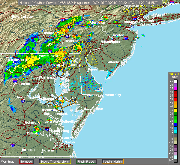 A severe thunderstorm warning remains in effect until 500 pm edt for southeastern harford county. at 424 pm edt, severe thunderstorms were located along a line extending from near riverside to 6 miles east of bowleys quarters, moving east at 50 mph. hazard. 60 mph wind gusts. A severe thunderstorm warning remains in effect until 500 pm edt for southeastern harford county. at 424 pm edt, severe thunderstorms were located along a line extending from near riverside to 6 miles east of bowleys quarters, moving east at 50 mph. hazard. 60 mph wind gusts.
|
| 7/22/2019 4:23 PM EDT |
 At 422 pm edt, severe thunderstorms with a history of producing wind damage were located along a line extending from near holtwood to near conowingo to 6 miles northeast of bel air north to bel air south, moving northeast at 50 mph (radar indicated). Hazards include 60 mph wind gusts. Damaging winds will cause some trees and large branches to fall. this could injure those outdoors, as well as damage homes and vehicles. roadways may become blocked by downed trees. localized power outages are possible. unsecured light objects may become projectiles. Locations impacted include, aberdeen, havre de grace, bel air south, bel air north, riverside, kingsville, pleasant hills, edgewood, joppatowne, darlington, cardiff, benson, churchville, carsins, scarboro, bradshaw, bynum, harford furnace, abingdon and joppa. At 422 pm edt, severe thunderstorms with a history of producing wind damage were located along a line extending from near holtwood to near conowingo to 6 miles northeast of bel air north to bel air south, moving northeast at 50 mph (radar indicated). Hazards include 60 mph wind gusts. Damaging winds will cause some trees and large branches to fall. this could injure those outdoors, as well as damage homes and vehicles. roadways may become blocked by downed trees. localized power outages are possible. unsecured light objects may become projectiles. Locations impacted include, aberdeen, havre de grace, bel air south, bel air north, riverside, kingsville, pleasant hills, edgewood, joppatowne, darlington, cardiff, benson, churchville, carsins, scarboro, bradshaw, bynum, harford furnace, abingdon and joppa.
|
| 7/22/2019 4:16 PM EDT |
 At 416 pm edt, severe thunderstorms were located along a line extending from near jarrettsville to near bowleys quarters, moving east at 55 mph (radar indicated). Hazards include 60 mph wind gusts. damage to roofs, siding, trees, and power lines is possible At 416 pm edt, severe thunderstorms were located along a line extending from near jarrettsville to near bowleys quarters, moving east at 55 mph (radar indicated). Hazards include 60 mph wind gusts. damage to roofs, siding, trees, and power lines is possible
|
| 7/22/2019 4:13 PM EDT |
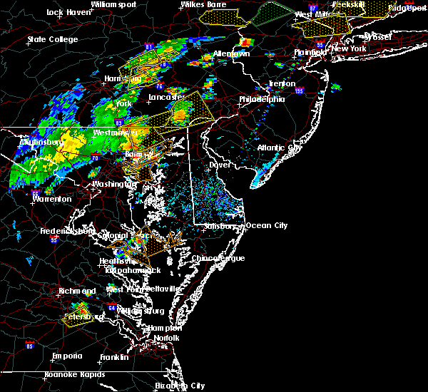 At 413 pm edt, severe thunderstorms were located along a line extending from white marsh to millers island, moving east at 50 mph (radar indicated). Hazards include 60 mph wind gusts. Damaging winds will cause some trees and large branches to fall. this could injure those outdoors, as well as damage homes and vehicles. roadways may become blocked by downed trees. localized power outages are possible. Unsecured light objects may become projectiles. At 413 pm edt, severe thunderstorms were located along a line extending from white marsh to millers island, moving east at 50 mph (radar indicated). Hazards include 60 mph wind gusts. Damaging winds will cause some trees and large branches to fall. this could injure those outdoors, as well as damage homes and vehicles. roadways may become blocked by downed trees. localized power outages are possible. Unsecured light objects may become projectiles.
|
| 7/22/2019 4:10 PM EDT |
 At 410 pm edt, severe thunderstorms with a history of producing wind damage were located along a line extending from 6 miles east of stewartstown to near bel air north to near fallston to near kingsville, moving northeast at 50 mph (radar indicated). Hazards include 70 mph wind gusts. Damaging winds will cause some trees and large branches to fall. this could injure those outdoors, as well as damage homes and vehicles. roadways may become blocked by downed trees. localized power outages are possible. unsecured light objects may become projectiles. Locations impacted include, aberdeen, havre de grace, bel air south, bel air north, perry hall, white marsh, fallston, riverside, kingsville, pleasant hills, jarrettsville, perryman, edgewood, joppatowne, pylesville, darlington, fork, cardiff, churchville and norrisville. At 410 pm edt, severe thunderstorms with a history of producing wind damage were located along a line extending from 6 miles east of stewartstown to near bel air north to near fallston to near kingsville, moving northeast at 50 mph (radar indicated). Hazards include 70 mph wind gusts. Damaging winds will cause some trees and large branches to fall. this could injure those outdoors, as well as damage homes and vehicles. roadways may become blocked by downed trees. localized power outages are possible. unsecured light objects may become projectiles. Locations impacted include, aberdeen, havre de grace, bel air south, bel air north, perry hall, white marsh, fallston, riverside, kingsville, pleasant hills, jarrettsville, perryman, edgewood, joppatowne, pylesville, darlington, fork, cardiff, churchville and norrisville.
|
| 7/22/2019 4:05 PM EDT |
 At 404 pm edt, severe thunderstorms with a history of producing wind damage were located along a line extending from near stewartstown to near jarrettsville to near fallston to carney, moving northeast at 60 mph (radar indicated). Hazards include 60 to 75 mph wind gusts. Damaging winds will cause some trees and large branches to fall. this could injure those outdoors, as well as damage homes and vehicles. roadways may become blocked by downed trees. localized power outages are possible. unsecured light objects may become projectiles. Locations impacted include, cockeysville, aberdeen, havre de grace, towson, bel air south, parkville, bel air north, carney, perry hall, timonium, white marsh, fallston, riverside, hampton, kingsville, pleasant hills, jarrettsville, perryman, lutherville-timonium and edgewood. At 404 pm edt, severe thunderstorms with a history of producing wind damage were located along a line extending from near stewartstown to near jarrettsville to near fallston to carney, moving northeast at 60 mph (radar indicated). Hazards include 60 to 75 mph wind gusts. Damaging winds will cause some trees and large branches to fall. this could injure those outdoors, as well as damage homes and vehicles. roadways may become blocked by downed trees. localized power outages are possible. unsecured light objects may become projectiles. Locations impacted include, cockeysville, aberdeen, havre de grace, towson, bel air south, parkville, bel air north, carney, perry hall, timonium, white marsh, fallston, riverside, hampton, kingsville, pleasant hills, jarrettsville, perryman, lutherville-timonium and edgewood.
|
| 7/22/2019 3:56 PM EDT |
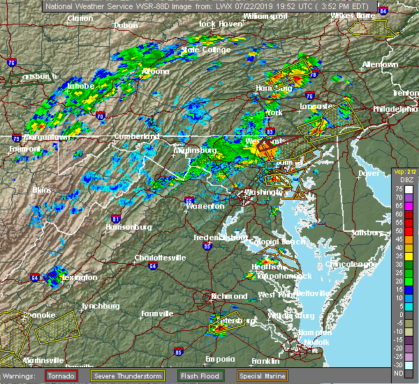 At 356 pm edt, severe thunderstorms with a history of producing wind damage were located along a line extending from hampstead to near reisterstown, moving northeast at 50 mph (radar indicated). Hazards include 60 to 75 mph wind gusts. Damaging winds will cause some trees and large branches to fall. this could injure those outdoors, as well as damage homes and vehicles. roadways may become blocked by downed trees. localized power outages are possible. unsecured light objects may become projectiles. Locations impacted include, pikesville, cockeysville, aberdeen, havre de grace, towson, bel air south, parkville, bel air north, carney, perry hall, mays chapel, timonium, white marsh, fallston, riverside, hampton, kingsville, pleasant hills, jarrettsville and perryman. At 356 pm edt, severe thunderstorms with a history of producing wind damage were located along a line extending from hampstead to near reisterstown, moving northeast at 50 mph (radar indicated). Hazards include 60 to 75 mph wind gusts. Damaging winds will cause some trees and large branches to fall. this could injure those outdoors, as well as damage homes and vehicles. roadways may become blocked by downed trees. localized power outages are possible. unsecured light objects may become projectiles. Locations impacted include, pikesville, cockeysville, aberdeen, havre de grace, towson, bel air south, parkville, bel air north, carney, perry hall, mays chapel, timonium, white marsh, fallston, riverside, hampton, kingsville, pleasant hills, jarrettsville and perryman.
|
| 7/22/2019 3:47 PM EDT |
 At 347 pm edt, severe thunderstorms with a history of producing wind damage and measured wind gusts to nearly 60 mph were located along a line extending from near westminster to near oakland, moving northeast at 50 mph (radar indicated). Hazards include 60 to 75 mph wind gusts. Damaging winds will cause some trees and large branches to fall. this could injure those outdoors, as well as damage homes and vehicles. roadways may become blocked by downed trees. localized power outages are possible. unsecured light objects may become projectiles. Locations impacted include, pikesville, cockeysville, aberdeen, havre de grace, towson, bel air south, randallstown, parkville, owings mills, bel air north, carney, milford mill, perry hall, reisterstown, lochearn, mays chapel, timonium, white marsh, fallston and riverside. At 347 pm edt, severe thunderstorms with a history of producing wind damage and measured wind gusts to nearly 60 mph were located along a line extending from near westminster to near oakland, moving northeast at 50 mph (radar indicated). Hazards include 60 to 75 mph wind gusts. Damaging winds will cause some trees and large branches to fall. this could injure those outdoors, as well as damage homes and vehicles. roadways may become blocked by downed trees. localized power outages are possible. unsecured light objects may become projectiles. Locations impacted include, pikesville, cockeysville, aberdeen, havre de grace, towson, bel air south, randallstown, parkville, owings mills, bel air north, carney, milford mill, perry hall, reisterstown, lochearn, mays chapel, timonium, white marsh, fallston and riverside.
|
| 7/22/2019 3:37 PM EDT |
 At 336 pm edt, severe thunderstorms with a history of producing wind damage and measured wind gusts to near 60 mph were located along a line extending from westminster to sykesville, moving northeast at 50 mph. these are dangerous storms! (radar indicated). Hazards include 60 to 80 mph wind gusts. Damaging winds will cause some trees and large branches to fall. this could injure those outdoors, as well as damage homes and vehicles. roadways may become blocked by downed trees. localized power outages are possible. unsecured light objects may become projectiles. Locations impacted include, pikesville, cockeysville, westminster, aberdeen, havre de grace, towson, bel air south, randallstown, parkville, owings mills, bel air north, eldersburg, carney, milford mill, perry hall, reisterstown, lochearn, mays chapel, timonium and white marsh. At 336 pm edt, severe thunderstorms with a history of producing wind damage and measured wind gusts to near 60 mph were located along a line extending from westminster to sykesville, moving northeast at 50 mph. these are dangerous storms! (radar indicated). Hazards include 60 to 80 mph wind gusts. Damaging winds will cause some trees and large branches to fall. this could injure those outdoors, as well as damage homes and vehicles. roadways may become blocked by downed trees. localized power outages are possible. unsecured light objects may become projectiles. Locations impacted include, pikesville, cockeysville, westminster, aberdeen, havre de grace, towson, bel air south, randallstown, parkville, owings mills, bel air north, eldersburg, carney, milford mill, perry hall, reisterstown, lochearn, mays chapel, timonium and white marsh.
|
| 7/22/2019 3:23 PM EDT |
 At 322 pm edt, severe thunderstorms with a history of producing wind damage and measured wind gusts to nearly 60 mph were located along a line extending from 9 miles northeast of new market to near mount airy, moving northeast at 50 mph (radar indicated). Hazards include 60 to 75 mph wind gusts. Damaging winds will cause some trees and large branches to fall. this could injure those outdoors, as well as damage homes and vehicles. roadways may become blocked by downed trees. localized power outages are possible. Unsecured light objects may become projectiles. At 322 pm edt, severe thunderstorms with a history of producing wind damage and measured wind gusts to nearly 60 mph were located along a line extending from 9 miles northeast of new market to near mount airy, moving northeast at 50 mph (radar indicated). Hazards include 60 to 75 mph wind gusts. Damaging winds will cause some trees and large branches to fall. this could injure those outdoors, as well as damage homes and vehicles. roadways may become blocked by downed trees. localized power outages are possible. Unsecured light objects may become projectiles.
|
| 7/21/2019 10:00 PM EDT |
 At 1000 pm edt, a severe thunderstorm was located over north east, or near elkton, moving east at 30 mph (radar indicated). Hazards include 60 mph wind gusts and quarter size hail. Minor damage to vehicles is possible. wind damage to roofs, siding, trees, and power lines is possible. Locations impacted include, wilmington, newark, middletown, elkton, calvert, elsmere, new castle, oxford, north east, rising sun, delaware city, charlestown, newport, arden, blake, stanton, glasgow, talleyville, bohemias mills and west nottingham. At 1000 pm edt, a severe thunderstorm was located over north east, or near elkton, moving east at 30 mph (radar indicated). Hazards include 60 mph wind gusts and quarter size hail. Minor damage to vehicles is possible. wind damage to roofs, siding, trees, and power lines is possible. Locations impacted include, wilmington, newark, middletown, elkton, calvert, elsmere, new castle, oxford, north east, rising sun, delaware city, charlestown, newport, arden, blake, stanton, glasgow, talleyville, bohemias mills and west nottingham.
|
| 7/21/2019 9:54 PM EDT |
 At 942 pm edt, severe thunderstorms were located along a line extending from near wakefield to near havre de grace to near aberdeen, moving east at 25 mph (radar indicated). Hazards include 60 mph wind gusts. Damaging winds will cause some trees and large branches to fall. this could injure those outdoors, as well as damage homes and vehicles. roadways may become blocked by downed trees. localized power outages are possible. unsecured light objects may become projectiles. Locations impacted include, aberdeen, havre de grace, bel air south, darlington, cardiff, churchville, carsins and scarboro. At 942 pm edt, severe thunderstorms were located along a line extending from near wakefield to near havre de grace to near aberdeen, moving east at 25 mph (radar indicated). Hazards include 60 mph wind gusts. Damaging winds will cause some trees and large branches to fall. this could injure those outdoors, as well as damage homes and vehicles. roadways may become blocked by downed trees. localized power outages are possible. unsecured light objects may become projectiles. Locations impacted include, aberdeen, havre de grace, bel air south, darlington, cardiff, churchville, carsins and scarboro.
|
| 7/21/2019 9:42 PM EDT |
 At 942 pm edt, severe thunderstorms were located along a line extending from near wakefield to near havre de grace to near aberdeen, moving east at 25 mph (radar indicated). Hazards include 60 mph wind gusts. Damaging winds will cause some trees and large branches to fall. this could injure those outdoors, as well as damage homes and vehicles. roadways may become blocked by downed trees. localized power outages are possible. unsecured light objects may become projectiles. Locations impacted include, aberdeen, havre de grace, bel air south, darlington, cardiff, churchville, carsins and scarboro. At 942 pm edt, severe thunderstorms were located along a line extending from near wakefield to near havre de grace to near aberdeen, moving east at 25 mph (radar indicated). Hazards include 60 mph wind gusts. Damaging winds will cause some trees and large branches to fall. this could injure those outdoors, as well as damage homes and vehicles. roadways may become blocked by downed trees. localized power outages are possible. unsecured light objects may become projectiles. Locations impacted include, aberdeen, havre de grace, bel air south, darlington, cardiff, churchville, carsins and scarboro.
|
| 7/21/2019 9:30 PM EDT |
 At 930 pm edt, severe thunderstorms were located along a line extending from near homeville to near conowingo to aberdeen, moving east at 40 mph (radar indicated). Hazards include 60 mph wind gusts and quarter size hail. Minor damage to vehicles is possible. Wind damage to roofs, siding, trees, and power lines is possible. At 930 pm edt, severe thunderstorms were located along a line extending from near homeville to near conowingo to aberdeen, moving east at 40 mph (radar indicated). Hazards include 60 mph wind gusts and quarter size hail. Minor damage to vehicles is possible. Wind damage to roofs, siding, trees, and power lines is possible.
|
| 7/21/2019 9:14 PM EDT |
 At 914 pm edt, severe thunderstorms were located along a line extending from near sunnyburn to near jarrettsville to fallston, moving east at 25 mph (radar indicated). Hazards include 60 mph wind gusts. Damaging winds will cause some trees and large branches to fall. this could injure those outdoors, as well as damage homes and vehicles. roadways may become blocked by downed trees. localized power outages are possible. Unsecured light objects may become projectiles. At 914 pm edt, severe thunderstorms were located along a line extending from near sunnyburn to near jarrettsville to fallston, moving east at 25 mph (radar indicated). Hazards include 60 mph wind gusts. Damaging winds will cause some trees and large branches to fall. this could injure those outdoors, as well as damage homes and vehicles. roadways may become blocked by downed trees. localized power outages are possible. Unsecured light objects may become projectiles.
|
| 7/17/2019 7:07 PM EDT |
 The severe thunderstorm warning for east central harford county will expire at 715 pm edt, the storms which prompted the warning have moved out of the area. therefore, the warning will be allowed to expire. however gusty winds are still possible with these thunderstorms. a severe thunderstorm watch remains in effect until midnight edt for northern maryland. The severe thunderstorm warning for east central harford county will expire at 715 pm edt, the storms which prompted the warning have moved out of the area. therefore, the warning will be allowed to expire. however gusty winds are still possible with these thunderstorms. a severe thunderstorm watch remains in effect until midnight edt for northern maryland.
|
| 7/17/2019 7:02 PM EDT |
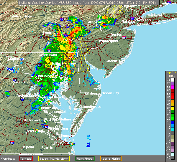 At 702 pm edt, severe thunderstorms were located along a line extending from near conowingo to havre de grace to near betterton, moving east at 35 mph (radar indicated). Hazards include 60 mph wind gusts. Damaging winds will cause some trees and large branches to fall. this could injure those outdoors, as well as damage homes and vehicles. roadways may become blocked by downed trees. localized power outages are possible. unsecured light objects may become projectiles. Locations impacted include, aberdeen, havre de grace and aberdeen proving ground. At 702 pm edt, severe thunderstorms were located along a line extending from near conowingo to havre de grace to near betterton, moving east at 35 mph (radar indicated). Hazards include 60 mph wind gusts. Damaging winds will cause some trees and large branches to fall. this could injure those outdoors, as well as damage homes and vehicles. roadways may become blocked by downed trees. localized power outages are possible. unsecured light objects may become projectiles. Locations impacted include, aberdeen, havre de grace and aberdeen proving ground.
|
| 7/17/2019 7:00 PM EDT |
 At 657 pm edt, severe thunderstorms were located along a line extending from bareville to near elkton, moving northeast at 40 mph. worth noting, there has also been some rotation detected with cells on a portion of this line over lancaster county pa as it moves toward chester county (radar indicated). Hazards include 70 mph wind gusts. Expect considerable tree damage. damage is likely to mobile homes, roofs, and outbuildings. Locations impacted include, wilmington, newark, west chester, elkton, calvert, coatesville, westtown, carneys point, downingtown, elsmere, kennett square, new castle, penns grove, oxford, parkesburg, north east, west grove, rising sun, honey brook and elverson. At 657 pm edt, severe thunderstorms were located along a line extending from bareville to near elkton, moving northeast at 40 mph. worth noting, there has also been some rotation detected with cells on a portion of this line over lancaster county pa as it moves toward chester county (radar indicated). Hazards include 70 mph wind gusts. Expect considerable tree damage. damage is likely to mobile homes, roofs, and outbuildings. Locations impacted include, wilmington, newark, west chester, elkton, calvert, coatesville, westtown, carneys point, downingtown, elsmere, kennett square, new castle, penns grove, oxford, parkesburg, north east, west grove, rising sun, honey brook and elverson.
|
| 7/17/2019 6:36 PM EDT |
 At 636 pm edt, severe thunderstorms were located along a line extending from near sunnyburn to near octoraro to perryman, moving northeast at 35 mph (radar indicated). Hazards include 60 mph wind gusts. Damaging winds will cause some trees and large branches to fall. this could injure those outdoors, as well as damage homes and vehicles. roadways may become blocked by downed trees. localized power outages are possible. unsecured light objects may become projectiles. Locations impacted include, aberdeen, havre de grace, aberdeen proving ground, bel air south, bel air north, riverside, perryman, edgewood, pylesville, darlington, cardiff, churchville, carsins, scarboro, harford furnace, abingdon, belcamp and whiteford. At 636 pm edt, severe thunderstorms were located along a line extending from near sunnyburn to near octoraro to perryman, moving northeast at 35 mph (radar indicated). Hazards include 60 mph wind gusts. Damaging winds will cause some trees and large branches to fall. this could injure those outdoors, as well as damage homes and vehicles. roadways may become blocked by downed trees. localized power outages are possible. unsecured light objects may become projectiles. Locations impacted include, aberdeen, havre de grace, aberdeen proving ground, bel air south, bel air north, riverside, perryman, edgewood, pylesville, darlington, cardiff, churchville, carsins, scarboro, harford furnace, abingdon, belcamp and whiteford.
|
| 7/17/2019 6:35 PM EDT |
 At 634 pm edt, severe thunderstorms were located along a line extending from millersville to near havre de grace, moving northeast at 40 mph (radar indicated). Hazards include 60 mph wind gusts. damage to roofs, siding, trees, and power lines is possible At 634 pm edt, severe thunderstorms were located along a line extending from millersville to near havre de grace, moving northeast at 40 mph (radar indicated). Hazards include 60 mph wind gusts. damage to roofs, siding, trees, and power lines is possible
|
| 7/17/2019 6:31 PM EDT |
 At 631 pm edt, severe thunderstorms were located along a line extending from near delta to 6 miles southwest of octoraro to near perryman, moving east at 40 mph (radar indicated). Hazards include 60 mph wind gusts. Damaging winds will cause some trees and large branches to fall. this could injure those outdoors, as well as damage homes and vehicles. roadways may become blocked by downed trees. localized power outages are possible. Unsecured light objects may become projectiles. At 631 pm edt, severe thunderstorms were located along a line extending from near delta to 6 miles southwest of octoraro to near perryman, moving east at 40 mph (radar indicated). Hazards include 60 mph wind gusts. Damaging winds will cause some trees and large branches to fall. this could injure those outdoors, as well as damage homes and vehicles. roadways may become blocked by downed trees. localized power outages are possible. Unsecured light objects may become projectiles.
|
| 7/17/2019 6:20 PM EDT |
 At 620 pm edt, severe thunderstorms were located along a line extending from near stewartstown to near jarrettsville to near kingsville, moving northeast at 40 mph (radar indicated). Hazards include 60 mph wind gusts. Damaging winds will cause some trees and large branches to fall. this could injure those outdoors, as well as damage homes and vehicles. roadways may become blocked by downed trees. localized power outages are possible. unsecured light objects may become projectiles. Locations impacted include, baltimore, cockeysville, aberdeen, havre de grace, aberdeen proving ground, towson, bel air south, parkville, bel air north, carney, perry hall, rossville, timonium, white marsh, fallston, riverside, hampton, kingsville, pleasant hills and jarrettsville. At 620 pm edt, severe thunderstorms were located along a line extending from near stewartstown to near jarrettsville to near kingsville, moving northeast at 40 mph (radar indicated). Hazards include 60 mph wind gusts. Damaging winds will cause some trees and large branches to fall. this could injure those outdoors, as well as damage homes and vehicles. roadways may become blocked by downed trees. localized power outages are possible. unsecured light objects may become projectiles. Locations impacted include, baltimore, cockeysville, aberdeen, havre de grace, aberdeen proving ground, towson, bel air south, parkville, bel air north, carney, perry hall, rossville, timonium, white marsh, fallston, riverside, hampton, kingsville, pleasant hills and jarrettsville.
|
| 7/17/2019 5:46 PM EDT |
 At 546 pm edt, severe thunderstorms were located along a line extending from near gamber to owings mills to woodlawn, moving northeast at 35 mph (radar indicated). Hazards include 60 mph wind gusts. Damaging winds will cause some trees and large branches to fall. this could injure those outdoors, as well as damage homes and vehicles. roadways may become blocked by downed trees. localized power outages are possible. Unsecured light objects may become projectiles. At 546 pm edt, severe thunderstorms were located along a line extending from near gamber to owings mills to woodlawn, moving northeast at 35 mph (radar indicated). Hazards include 60 mph wind gusts. Damaging winds will cause some trees and large branches to fall. this could injure those outdoors, as well as damage homes and vehicles. roadways may become blocked by downed trees. localized power outages are possible. Unsecured light objects may become projectiles.
|
| 7/11/2019 5:25 PM EDT | Tree branch down onto power line and across roadway at 113 old bay ln in harford county MD, 1.3 miles NNW of Havre de Grace, MD |
| 7/2/2019 8:23 PM EDT | Tree down on residence on pine st. in havre de grace in harford county MD, 1.6 miles NE of Havre de Grace, MD |
| 7/2/2019 8:21 PM EDT |
 At 821 pm edt, severe thunderstorms were located along a line extending from conowingo to near aberdeen, moving east at 30 mph (radar indicated). Hazards include 60 mph wind gusts. Damaging winds will cause some trees and large branches to fall. this could injure those outdoors, as well as damage homes and vehicles. roadways may become blocked by downed trees. localized power outages are possible. unsecured light objects may become projectiles. Locations impacted include, aberdeen, havre de grace, aberdeen proving ground, riverside, perryman, darlington, churchville and carsins. At 821 pm edt, severe thunderstorms were located along a line extending from conowingo to near aberdeen, moving east at 30 mph (radar indicated). Hazards include 60 mph wind gusts. Damaging winds will cause some trees and large branches to fall. this could injure those outdoors, as well as damage homes and vehicles. roadways may become blocked by downed trees. localized power outages are possible. unsecured light objects may become projectiles. Locations impacted include, aberdeen, havre de grace, aberdeen proving ground, riverside, perryman, darlington, churchville and carsins.
|
| 7/2/2019 7:56 PM EDT |
 At 755 pm edt, severe thunderstorms were located along a line extending from near delta to bel air north to fallston, moving east at 35 mph (radar indicated). Hazards include 60 mph wind gusts. Damaging winds will cause some trees and large branches to fall. this could injure those outdoors, as well as damage homes and vehicles. roadways may become blocked by downed trees. localized power outages are possible. unsecured light objects may become projectiles. Locations impacted include, aberdeen, havre de grace, aberdeen proving ground, bel air south, bel air north, fallston, riverside, pleasant hills, jarrettsville, perryman, pylesville, darlington, cardiff, churchville, carsins, forest hill, street, hickory, whiteford and benson. At 755 pm edt, severe thunderstorms were located along a line extending from near delta to bel air north to fallston, moving east at 35 mph (radar indicated). Hazards include 60 mph wind gusts. Damaging winds will cause some trees and large branches to fall. this could injure those outdoors, as well as damage homes and vehicles. roadways may become blocked by downed trees. localized power outages are possible. unsecured light objects may become projectiles. Locations impacted include, aberdeen, havre de grace, aberdeen proving ground, bel air south, bel air north, fallston, riverside, pleasant hills, jarrettsville, perryman, pylesville, darlington, cardiff, churchville, carsins, forest hill, street, hickory, whiteford and benson.
|
| 7/2/2019 7:45 PM EDT |
 At 745 pm edt, severe thunderstorms were located along a line extending from near stewartstown to near fallston to near cockeysville, moving east at 35 mph (radar indicated). Hazards include 60 mph wind gusts and quarter size hail. Damaging winds will cause some trees and large branches to fall. this could injure those outdoors, as well as damage homes and vehicles. roadways may become blocked by downed trees. localized power outages are possible. Unsecured light objects may become projectiles. At 745 pm edt, severe thunderstorms were located along a line extending from near stewartstown to near fallston to near cockeysville, moving east at 35 mph (radar indicated). Hazards include 60 mph wind gusts and quarter size hail. Damaging winds will cause some trees and large branches to fall. this could injure those outdoors, as well as damage homes and vehicles. roadways may become blocked by downed trees. localized power outages are possible. Unsecured light objects may become projectiles.
|
| 6/29/2019 11:56 PM EDT |
 At 1156 pm edt, severe thunderstorms were located along a line extending from near bel air south to near bowleys quarters, moving east at 35 mph (radar indicated). Hazards include 60 mph wind gusts. Damaging winds will cause some trees and large branches to fall. this could injure those outdoors, as well as damage homes and vehicles. roadways may become blocked by downed trees. localized power outages are possible. unsecured light objects may become projectiles. Locations impacted include, aberdeen, havre de grace, aberdeen proving ground, bel air south, bel air north, riverside, kingsville, pleasant hills, perryman, edgewood, joppatowne, churchville, carsins, magnolia, harford furnace, abingdon, joppa and belcamp. At 1156 pm edt, severe thunderstorms were located along a line extending from near bel air south to near bowleys quarters, moving east at 35 mph (radar indicated). Hazards include 60 mph wind gusts. Damaging winds will cause some trees and large branches to fall. this could injure those outdoors, as well as damage homes and vehicles. roadways may become blocked by downed trees. localized power outages are possible. unsecured light objects may become projectiles. Locations impacted include, aberdeen, havre de grace, aberdeen proving ground, bel air south, bel air north, riverside, kingsville, pleasant hills, perryman, edgewood, joppatowne, churchville, carsins, magnolia, harford furnace, abingdon, joppa and belcamp.
|
| 6/29/2019 11:40 PM EDT |
 At 1139 pm edt, severe thunderstorms were located along a line extending from fallston to rosedale, moving east at 35 mph (radar indicated). Hazards include 60 mph wind gusts. Damaging winds will cause some trees and large branches to fall. this could injure those outdoors, as well as damage homes and vehicles. roadways may become blocked by downed trees. localized power outages are possible. Unsecured light objects may become projectiles. At 1139 pm edt, severe thunderstorms were located along a line extending from fallston to rosedale, moving east at 35 mph (radar indicated). Hazards include 60 mph wind gusts. Damaging winds will cause some trees and large branches to fall. this could injure those outdoors, as well as damage homes and vehicles. roadways may become blocked by downed trees. localized power outages are possible. Unsecured light objects may become projectiles.
|
| 6/29/2019 4:15 PM EDT |
 At 415 pm edt, severe thunderstorms were located along a line extending from west nottingham to aberdeen, moving east at 30 mph (radar indicated). Hazards include 60 mph wind gusts. Damaging winds will cause some trees and large branches to fall. this could injure those outdoors, as well as damage homes and vehicles. roadways may become blocked by downed trees. localized power outages are possible. unsecured light objects may become projectiles. Locations impacted include, aberdeen, havre de grace, aberdeen proving ground, riverside, perryman, edgewood, abingdon and belcamp. At 415 pm edt, severe thunderstorms were located along a line extending from west nottingham to aberdeen, moving east at 30 mph (radar indicated). Hazards include 60 mph wind gusts. Damaging winds will cause some trees and large branches to fall. this could injure those outdoors, as well as damage homes and vehicles. roadways may become blocked by downed trees. localized power outages are possible. unsecured light objects may become projectiles. Locations impacted include, aberdeen, havre de grace, aberdeen proving ground, riverside, perryman, edgewood, abingdon and belcamp.
|
| 6/29/2019 4:04 PM EDT |
 At 403 pm edt, severe thunderstorms were located along a line extending from near kennett square to near homeville to near rock springs, moving east at 25 mph (public. numerous reports of large hail and wind damage have been received from chester county). Hazards include 70 mph wind gusts and ping pong ball size hail. People and animals outdoors will be injured. expect hail damage to roofs, siding, windows, and vehicles. expect considerable tree damage. wind damage is also likely to mobile homes, roofs, and outbuildings. Locations impacted include, havre de grace, calvert, kennett square, oxford, north east, west grove, rising sun, homeville, glen roy, zion, blake, cochranville, west nottingham, octoraro, mount vernon, fair hill, glen westover, bay view, lombard and richardsmere. At 403 pm edt, severe thunderstorms were located along a line extending from near kennett square to near homeville to near rock springs, moving east at 25 mph (public. numerous reports of large hail and wind damage have been received from chester county). Hazards include 70 mph wind gusts and ping pong ball size hail. People and animals outdoors will be injured. expect hail damage to roofs, siding, windows, and vehicles. expect considerable tree damage. wind damage is also likely to mobile homes, roofs, and outbuildings. Locations impacted include, havre de grace, calvert, kennett square, oxford, north east, west grove, rising sun, homeville, glen roy, zion, blake, cochranville, west nottingham, octoraro, mount vernon, fair hill, glen westover, bay view, lombard and richardsmere.
|
| 6/29/2019 4:02 PM EDT |
 At 402 pm edt, severe thunderstorms were located along a line extending from conowingo to near riverside, moving east at 30 mph (radar indicated). Hazards include 60 mph wind gusts. Damaging winds will cause some trees and large branches to fall. this could injure those outdoors, as well as damage homes and vehicles. roadways may become blocked by downed trees. localized power outages are possible. unsecured light objects may become projectiles. Locations impacted include, aberdeen, havre de grace, aberdeen proving ground, bel air south, bel air north, fallston, riverside, pleasant hills, perryman, edgewood, darlington, benson, churchville, carsins, scarboro, bynum, harford furnace, abingdon, hickory and belcamp. At 402 pm edt, severe thunderstorms were located along a line extending from conowingo to near riverside, moving east at 30 mph (radar indicated). Hazards include 60 mph wind gusts. Damaging winds will cause some trees and large branches to fall. this could injure those outdoors, as well as damage homes and vehicles. roadways may become blocked by downed trees. localized power outages are possible. unsecured light objects may become projectiles. Locations impacted include, aberdeen, havre de grace, aberdeen proving ground, bel air south, bel air north, fallston, riverside, pleasant hills, perryman, edgewood, darlington, benson, churchville, carsins, scarboro, bynum, harford furnace, abingdon, hickory and belcamp.
|
| 6/29/2019 3:59 PM EDT |
 At 359 pm edt, severe thunderstorms were located along a line extending from near kennett square to glen westover to farmington, moving southeast at 35 mph (radar indicated). Hazards include 70 mph wind gusts and quarter size hail. Minor damage to vehicles is possible. expect considerable tree damage. Wind damage is also likely to mobile homes, roofs, and outbuildings. At 359 pm edt, severe thunderstorms were located along a line extending from near kennett square to glen westover to farmington, moving southeast at 35 mph (radar indicated). Hazards include 70 mph wind gusts and quarter size hail. Minor damage to vehicles is possible. expect considerable tree damage. Wind damage is also likely to mobile homes, roofs, and outbuildings.
|
| 6/29/2019 3:48 PM EDT |
 At 348 pm edt, severe thunderstorms were located along a line extending from near delta to bel air north, moving east at 30 mph (radar indicated). Hazards include 60 mph wind gusts. Damaging winds will cause some trees and large branches to fall. this could injure those outdoors, as well as damage homes and vehicles. roadways may become blocked by downed trees. localized power outages are possible. Unsecured light objects may become projectiles. At 348 pm edt, severe thunderstorms were located along a line extending from near delta to bel air north, moving east at 30 mph (radar indicated). Hazards include 60 mph wind gusts. Damaging winds will cause some trees and large branches to fall. this could injure those outdoors, as well as damage homes and vehicles. roadways may become blocked by downed trees. localized power outages are possible. Unsecured light objects may become projectiles.
|
| 6/29/2019 3:27 PM EDT |
 At 326 pm edt, severe thunderstorms were located along a line extending from near gap to near safe harbor to near stewartstown, moving east at 25 mph (radar indicated). Hazards include golf ball size hail and 70 mph wind gusts. People and animals outdoors will be injured. expect hail damage to roofs, siding, windows, and vehicles. expect considerable tree damage. Wind damage is also likely to mobile homes, roofs, and outbuildings. At 326 pm edt, severe thunderstorms were located along a line extending from near gap to near safe harbor to near stewartstown, moving east at 25 mph (radar indicated). Hazards include golf ball size hail and 70 mph wind gusts. People and animals outdoors will be injured. expect hail damage to roofs, siding, windows, and vehicles. expect considerable tree damage. Wind damage is also likely to mobile homes, roofs, and outbuildings.
|
| 6/13/2019 6:48 PM EDT |
 At 648 pm edt, severe thunderstorms were located along a line extending from near wakefield to near aberdeen to near riverside, moving east at 35 mph (radar indicated). Hazards include 60 mph wind gusts. Damaging winds will cause some trees and large branches to fall. this could injure those outdoors, as well as damage homes and vehicles. roadways may become blocked by downed trees. localized power outages are possible. unsecured light objects may become projectiles. Locations impacted include, baltimore, aberdeen, havre de grace, aberdeen proving ground, towson, bel air south, parkville, bel air north, carney, perry hall, rosedale, rossville, timonium, white marsh, fallston, riverside, hampton, kingsville, pleasant hills and perryman. At 648 pm edt, severe thunderstorms were located along a line extending from near wakefield to near aberdeen to near riverside, moving east at 35 mph (radar indicated). Hazards include 60 mph wind gusts. Damaging winds will cause some trees and large branches to fall. this could injure those outdoors, as well as damage homes and vehicles. roadways may become blocked by downed trees. localized power outages are possible. unsecured light objects may become projectiles. Locations impacted include, baltimore, aberdeen, havre de grace, aberdeen proving ground, towson, bel air south, parkville, bel air north, carney, perry hall, rosedale, rossville, timonium, white marsh, fallston, riverside, hampton, kingsville, pleasant hills and perryman.
|
| 6/13/2019 6:42 PM EDT | Tree down in the 4400 block of webster lapidum road in harford county MD, 3.1 miles SSE of Havre de Grace, MD |
| 6/13/2019 6:21 PM EDT |
 At 621 pm edt, severe thunderstorms were located along a line extending from near stewartstown to near perry hall to near parkville, moving east at 35 mph (radar indicated). Hazards include 60 mph wind gusts. Damaging winds will cause some trees and large branches to fall. this could injure those outdoors, as well as damage homes and vehicles. roadways may become blocked by downed trees. localized power outages are possible. Unsecured light objects may become projectiles. At 621 pm edt, severe thunderstorms were located along a line extending from near stewartstown to near perry hall to near parkville, moving east at 35 mph (radar indicated). Hazards include 60 mph wind gusts. Damaging winds will cause some trees and large branches to fall. this could injure those outdoors, as well as damage homes and vehicles. roadways may become blocked by downed trees. localized power outages are possible. Unsecured light objects may become projectiles.
|
| 6/2/2019 6:22 PM EDT |
 The severe thunderstorm warning for new castle, northeastern kent, cecil and western chester counties will expire at 630 pm edt, the storms which prompted the warning have weakened below severe limits, and no longer pose an immediate threat to life or property. therefore, the warning will be allowed to expire. however small hail and heavy rain are still possible with these thunderstorms. a severe thunderstorm watch remains in effect until 1000 pm edt for northern delaware, northeastern maryland, and southeastern pennsylvania. The severe thunderstorm warning for new castle, northeastern kent, cecil and western chester counties will expire at 630 pm edt, the storms which prompted the warning have weakened below severe limits, and no longer pose an immediate threat to life or property. therefore, the warning will be allowed to expire. however small hail and heavy rain are still possible with these thunderstorms. a severe thunderstorm watch remains in effect until 1000 pm edt for northern delaware, northeastern maryland, and southeastern pennsylvania.
|
| 6/2/2019 6:04 PM EDT |
 At 604 pm edt, severe thunderstorms were located along a line extending from richardsmere to massey, moving northeast at 40 mph (radar indicated). Hazards include 60 mph wind gusts and quarter size hail. Minor damage to vehicles is possible. wind damage to roofs, siding, trees, and power lines is possible. Locations impacted include, newark, middletown, elkton, calvert, coatesville, kennett square, chestertown, oxford, parkesburg, north east, west grove, rising sun, honey brook, delaware city, elverson, charlestown, cecilton, betterton, glen roy and blake. At 604 pm edt, severe thunderstorms were located along a line extending from richardsmere to massey, moving northeast at 40 mph (radar indicated). Hazards include 60 mph wind gusts and quarter size hail. Minor damage to vehicles is possible. wind damage to roofs, siding, trees, and power lines is possible. Locations impacted include, newark, middletown, elkton, calvert, coatesville, kennett square, chestertown, oxford, parkesburg, north east, west grove, rising sun, honey brook, delaware city, elverson, charlestown, cecilton, betterton, glen roy and blake.
|
| 6/2/2019 5:46 PM EDT |
 At 546 pm edt, severe thunderstorms were located along a line extending from near delta to near betterton, moving northeast at 45 mph (radar indicated). Hazards include 60 mph wind gusts and quarter size hail. Minor damage to vehicles is possible. Wind damage to roofs, siding, trees, and power lines is possible. At 546 pm edt, severe thunderstorms were located along a line extending from near delta to near betterton, moving northeast at 45 mph (radar indicated). Hazards include 60 mph wind gusts and quarter size hail. Minor damage to vehicles is possible. Wind damage to roofs, siding, trees, and power lines is possible.
|
| 6/2/2019 5:39 PM EDT |
 The national weather service in sterling virginia has issued a * severe thunderstorm warning for. southeastern harford county in northern maryland. until 630 pm edt. At 539 pm edt, a severe thunderstorm was located near bel air south, or near aberdeen, moving east at 25 mph. The national weather service in sterling virginia has issued a * severe thunderstorm warning for. southeastern harford county in northern maryland. until 630 pm edt. At 539 pm edt, a severe thunderstorm was located near bel air south, or near aberdeen, moving east at 25 mph.
|
| 5/29/2019 7:09 PM EDT |
 The severe thunderstorm warning for northern new castle, cecil, southeastern montgomery, chester, philadelphia and delaware counties will expire at 715 pm edt, the storms which prompted the warning have moved out of the area. therefore, the warning will be allowed to expire. a tornado watch remains in effect until 800 pm edt for northern delaware, northeastern maryland, southern new jersey, and southeastern pennsylvania. to report severe weather, contact your nearest law enforcement agency. they will relay your report to the national weather service mount holly nj. The severe thunderstorm warning for northern new castle, cecil, southeastern montgomery, chester, philadelphia and delaware counties will expire at 715 pm edt, the storms which prompted the warning have moved out of the area. therefore, the warning will be allowed to expire. a tornado watch remains in effect until 800 pm edt for northern delaware, northeastern maryland, southern new jersey, and southeastern pennsylvania. to report severe weather, contact your nearest law enforcement agency. they will relay your report to the national weather service mount holly nj.
|
| 5/29/2019 6:51 PM EDT |
 The severe thunderstorm warning for northeastern harford county will expire at 700 pm edt, the storm which prompted the warning has weakened below severe limits, and has exited the warned area. therefore, the warning will be allowed to expire. The severe thunderstorm warning for northeastern harford county will expire at 700 pm edt, the storm which prompted the warning has weakened below severe limits, and has exited the warned area. therefore, the warning will be allowed to expire.
|
| 5/29/2019 6:49 PM EDT | Roof blown off of house on the 200 block of n washington stree in harford county MD, 1.6 miles W of Havre de Grace, MD |
| 5/29/2019 6:41 PM EDT |
 At 618 pm edt, a severe thunderstorm was located near jarrettsville, or 15 miles south of red lion, moving east at 45 mph (radar indicated). Hazards include 60 mph wind gusts and quarter size hail. Damaging winds will cause some trees and large branches to fall. this could injure those outdoors, as well as damage homes and vehicles. roadways may become blocked by downed trees. localized power outages are possible. Unsecured light objects may become projectiles. At 618 pm edt, a severe thunderstorm was located near jarrettsville, or 15 miles south of red lion, moving east at 45 mph (radar indicated). Hazards include 60 mph wind gusts and quarter size hail. Damaging winds will cause some trees and large branches to fall. this could injure those outdoors, as well as damage homes and vehicles. roadways may become blocked by downed trees. localized power outages are possible. Unsecured light objects may become projectiles.
|
| 5/29/2019 6:22 PM EDT |
 At 621 pm edt, severe thunderstorms were located along a line extending from strasburg to near bel air north, moving east at 60 mph (radar indicated). Hazards include 60 mph wind gusts and quarter size hail. Minor damage to vehicles is possible. Wind damage to roofs, siding, trees, and power lines is possible. At 621 pm edt, severe thunderstorms were located along a line extending from strasburg to near bel air north, moving east at 60 mph (radar indicated). Hazards include 60 mph wind gusts and quarter size hail. Minor damage to vehicles is possible. Wind damage to roofs, siding, trees, and power lines is possible.
|
| 5/29/2019 6:22 PM EDT |
 The severe thunderstorm warning for harford and northeastern baltimore counties and northeastern baltimore city will expire at 630 pm edt, the storm which prompted the warning has moved out of the area. therefore, the warning will be allowed to expire. The severe thunderstorm warning for harford and northeastern baltimore counties and northeastern baltimore city will expire at 630 pm edt, the storm which prompted the warning has moved out of the area. therefore, the warning will be allowed to expire.
|
| 5/29/2019 6:22 PM EDT |
 At 621 pm edt, severe thunderstorms were located along a line extending from strasburg to near bel air north, moving east at 60 mph (radar indicated). Hazards include 60 mph wind gusts and quarter size hail. Minor damage to vehicles is possible. Wind damage to roofs, siding, trees, and power lines is possible. At 621 pm edt, severe thunderstorms were located along a line extending from strasburg to near bel air north, moving east at 60 mph (radar indicated). Hazards include 60 mph wind gusts and quarter size hail. Minor damage to vehicles is possible. Wind damage to roofs, siding, trees, and power lines is possible.
|
| 5/29/2019 6:22 PM EDT |
 At 621 pm edt, severe thunderstorms were located along a line extending from strasburg to near bel air north, moving east at 60 mph (radar indicated). Hazards include 60 mph wind gusts and quarter size hail. Minor damage to vehicles is possible. Wind damage to roofs, siding, trees, and power lines is possible. At 621 pm edt, severe thunderstorms were located along a line extending from strasburg to near bel air north, moving east at 60 mph (radar indicated). Hazards include 60 mph wind gusts and quarter size hail. Minor damage to vehicles is possible. Wind damage to roofs, siding, trees, and power lines is possible.
|
| 5/29/2019 6:18 PM EDT |
 At 618 pm edt, a severe thunderstorm was located near jarrettsville, or 15 miles south of red lion, moving east at 45 mph (radar indicated). Hazards include 60 mph wind gusts and quarter size hail. Damaging winds will cause some trees and large branches to fall. this could injure those outdoors, as well as damage homes and vehicles. roadways may become blocked by downed trees. localized power outages are possible. Unsecured light objects may become projectiles. At 618 pm edt, a severe thunderstorm was located near jarrettsville, or 15 miles south of red lion, moving east at 45 mph (radar indicated). Hazards include 60 mph wind gusts and quarter size hail. Damaging winds will cause some trees and large branches to fall. this could injure those outdoors, as well as damage homes and vehicles. roadways may become blocked by downed trees. localized power outages are possible. Unsecured light objects may become projectiles.
|
| 5/29/2019 5:55 PM EDT |
 At 555 pm edt, a severe thunderstorm was located over rossville, or near middle river, moving east at 40 mph (radar indicated). Hazards include two inch hail and 70 mph wind gusts. Expect wind damage to trees and power lines. hail is large enough to dent and damage vehicles. some hail damage to roofs, siding, and windows is possible. Locations impacted include, middle river, aberdeen, havre de grace, aberdeen proving ground, bel air south, parkville, bel air north, carney, perry hall, rosedale, rossville, white marsh, fallston, riverside, hampton, kingsville, pleasant hills, jarrettsville, perryman and edgewood. At 555 pm edt, a severe thunderstorm was located over rossville, or near middle river, moving east at 40 mph (radar indicated). Hazards include two inch hail and 70 mph wind gusts. Expect wind damage to trees and power lines. hail is large enough to dent and damage vehicles. some hail damage to roofs, siding, and windows is possible. Locations impacted include, middle river, aberdeen, havre de grace, aberdeen proving ground, bel air south, parkville, bel air north, carney, perry hall, rosedale, rossville, white marsh, fallston, riverside, hampton, kingsville, pleasant hills, jarrettsville, perryman and edgewood.
|
| 5/29/2019 5:38 PM EDT |
 At 538 pm edt, a severe thunderstorm was located over lochearn, or over pikesville, moving east at 40 mph (radar indicated). Hazards include 60 mph wind gusts and half dollar size hail. Damaging winds will cause some trees and large branches to fall. this could injure those outdoors, as well as damage homes and vehicles. roadways may become blocked by downed trees. localized power outages are possible. Unsecured light objects may become projectiles. At 538 pm edt, a severe thunderstorm was located over lochearn, or over pikesville, moving east at 40 mph (radar indicated). Hazards include 60 mph wind gusts and half dollar size hail. Damaging winds will cause some trees and large branches to fall. this could injure those outdoors, as well as damage homes and vehicles. roadways may become blocked by downed trees. localized power outages are possible. Unsecured light objects may become projectiles.
|
| 4/26/2019 4:06 PM EDT |
 At 406 pm edt, severe thunderstorms were located along a line extending from wakefield to riverside, moving northeast at 40 mph (radar indicated). Hazards include 60 mph wind gusts. Damaging winds will cause some trees and large branches to fall. this could injure those outdoors, as well as damage homes and vehicles. roadways may become blocked by downed trees. localized power outages are possible. unsecured light objects may become projectiles. Locations impacted include, aberdeen, havre de grace, aberdeen proving ground, bel air south, bel air north, riverside, perryman, edgewood, joppatowne, darlington, cardiff, churchville, carsins, magnolia, scarboro, harford furnace, abingdon, joppa, hickory and belcamp. At 406 pm edt, severe thunderstorms were located along a line extending from wakefield to riverside, moving northeast at 40 mph (radar indicated). Hazards include 60 mph wind gusts. Damaging winds will cause some trees and large branches to fall. this could injure those outdoors, as well as damage homes and vehicles. roadways may become blocked by downed trees. localized power outages are possible. unsecured light objects may become projectiles. Locations impacted include, aberdeen, havre de grace, aberdeen proving ground, bel air south, bel air north, riverside, perryman, edgewood, joppatowne, darlington, cardiff, churchville, carsins, magnolia, scarboro, harford furnace, abingdon, joppa, hickory and belcamp.
|
| 4/26/2019 3:50 PM EDT |
 At 350 pm edt, severe thunderstorms were located along a line extending from delta to near white marsh, moving east at 30 mph (radar indicated). Hazards include 60 mph wind gusts. Damaging winds will cause some trees and large branches to fall. this could injure those outdoors, as well as damage homes and vehicles. roadways may become blocked by downed trees. localized power outages are possible. unsecured light objects may become projectiles. Locations impacted include, aberdeen, havre de grace, aberdeen proving ground, bel air south, parkville, bel air north, carney, perry hall, rossville, white marsh, fallston, riverside, hampton, kingsville, pleasant hills, jarrettsville, perryman, edgewood, joppatowne and pylesville. At 350 pm edt, severe thunderstorms were located along a line extending from delta to near white marsh, moving east at 30 mph (radar indicated). Hazards include 60 mph wind gusts. Damaging winds will cause some trees and large branches to fall. this could injure those outdoors, as well as damage homes and vehicles. roadways may become blocked by downed trees. localized power outages are possible. unsecured light objects may become projectiles. Locations impacted include, aberdeen, havre de grace, aberdeen proving ground, bel air south, parkville, bel air north, carney, perry hall, rossville, white marsh, fallston, riverside, hampton, kingsville, pleasant hills, jarrettsville, perryman, edgewood, joppatowne and pylesville.
|
| 4/26/2019 3:08 PM EDT |
 At 308 pm edt, severe thunderstorms were located along a line extending from near railroad to pikesville, moving northeast at 40 mph (radar indicated). Hazards include 60 mph wind gusts. Damaging winds will cause some trees and large branches to fall. this could injure those outdoors, as well as damage homes and vehicles. roadways may become blocked by downed trees. localized power outages are possible. Unsecured light objects may become projectiles. At 308 pm edt, severe thunderstorms were located along a line extending from near railroad to pikesville, moving northeast at 40 mph (radar indicated). Hazards include 60 mph wind gusts. Damaging winds will cause some trees and large branches to fall. this could injure those outdoors, as well as damage homes and vehicles. roadways may become blocked by downed trees. localized power outages are possible. Unsecured light objects may become projectiles.
|
| 4/15/2019 2:52 AM EDT |
 At 252 am edt, severe thunderstorms were located along a line extending from fallston to kingsville, moving northeast at 65 mph (radar indicated). Hazards include 60 mph wind gusts. Damaging winds will cause some trees and large branches to fall. this could injure those outdoors, as well as damage homes and vehicles. roadways may become blocked by downed trees. localized power outages are possible. Unsecured light objects may become projectiles. At 252 am edt, severe thunderstorms were located along a line extending from fallston to kingsville, moving northeast at 65 mph (radar indicated). Hazards include 60 mph wind gusts. Damaging winds will cause some trees and large branches to fall. this could injure those outdoors, as well as damage homes and vehicles. roadways may become blocked by downed trees. localized power outages are possible. Unsecured light objects may become projectiles.
|
| 4/15/2019 2:33 AM EDT |
 At 233 am edt, severe thunderstorms were located along a line extending from near gamber to randallstown, moving east at 70 mph (radar indicated). Hazards include 60 mph wind gusts. Damaging winds will cause some trees and large branches to fall. this could injure those outdoors, as well as damage homes and vehicles. roadways may become blocked by downed trees. localized power outages are possible. unsecured light objects may become projectiles. Locations impacted include, baltimore, pikesville, cockeysville, aberdeen, havre de grace, aberdeen proving ground, towson, bel air south, parkville, bel air north, carney, perry hall, rossville, mays chapel, timonium, white marsh, fallston, riverside, hampton and kingsville. At 233 am edt, severe thunderstorms were located along a line extending from near gamber to randallstown, moving east at 70 mph (radar indicated). Hazards include 60 mph wind gusts. Damaging winds will cause some trees and large branches to fall. this could injure those outdoors, as well as damage homes and vehicles. roadways may become blocked by downed trees. localized power outages are possible. unsecured light objects may become projectiles. Locations impacted include, baltimore, pikesville, cockeysville, aberdeen, havre de grace, aberdeen proving ground, towson, bel air south, parkville, bel air north, carney, perry hall, rossville, mays chapel, timonium, white marsh, fallston, riverside, hampton and kingsville.
|
| 4/15/2019 2:01 AM EDT |
 At 200 am edt, severe thunderstorms were located along a line extending from 6 miles east of stewartstown to mays chapel, moving northeast at 55 mph (radar indicated). Hazards include 60 mph wind gusts. Damaging winds will cause some trees and large branches to fall. this could injure those outdoors, as well as damage homes and vehicles. roadways may become blocked by downed trees. localized power outages are possible. Unsecured light objects may become projectiles. At 200 am edt, severe thunderstorms were located along a line extending from 6 miles east of stewartstown to mays chapel, moving northeast at 55 mph (radar indicated). Hazards include 60 mph wind gusts. Damaging winds will cause some trees and large branches to fall. this could injure those outdoors, as well as damage homes and vehicles. roadways may become blocked by downed trees. localized power outages are possible. Unsecured light objects may become projectiles.
|
| 11/2/2018 10:33 PM EDT |
 At 1033 pm edt, severe thunderstorms were located along a line extending from near cochranville to near woodlawn, moving northeast at 35 mph (radar indicated). Hazards include 60 mph wind gusts. Damage to roofs, siding, trees, and power lines is possible. Locations impacted include, wilmington, newark, west chester, elkton, calvert, pottstown, phoenixville, coatesville, westtown, carneys point, downingtown, elsmere, kennett square, new castle, oxford, royersford, parkesburg, north east, east greenville and west grove. At 1033 pm edt, severe thunderstorms were located along a line extending from near cochranville to near woodlawn, moving northeast at 35 mph (radar indicated). Hazards include 60 mph wind gusts. Damage to roofs, siding, trees, and power lines is possible. Locations impacted include, wilmington, newark, west chester, elkton, calvert, pottstown, phoenixville, coatesville, westtown, carneys point, downingtown, elsmere, kennett square, new castle, oxford, royersford, parkesburg, north east, east greenville and west grove.
|
| 11/2/2018 10:17 PM EDT |
 At 1017 pm edt, severe thunderstorms were located along a line extending from wakefield to near octoraro to near perryman, moving northeast at 45 mph (radar indicated). Hazards include 60 mph wind gusts. Damaging winds will cause some trees and large branches to fall. this could injure those outdoors, as well as damage homes and vehicles. roadways may become blocked by downed trees. localized power outages are possible. unsecured light objects may become projectiles. Locations impacted include, aberdeen, havre de grace, aberdeen proving ground, bel air south, bel air north, riverside, perryman, edgewood, darlington, cardiff, churchville, carsins, scarboro, harford furnace, abingdon and belcamp. At 1017 pm edt, severe thunderstorms were located along a line extending from wakefield to near octoraro to near perryman, moving northeast at 45 mph (radar indicated). Hazards include 60 mph wind gusts. Damaging winds will cause some trees and large branches to fall. this could injure those outdoors, as well as damage homes and vehicles. roadways may become blocked by downed trees. localized power outages are possible. unsecured light objects may become projectiles. Locations impacted include, aberdeen, havre de grace, aberdeen proving ground, bel air south, bel air north, riverside, perryman, edgewood, darlington, cardiff, churchville, carsins, scarboro, harford furnace, abingdon and belcamp.
|
| 11/2/2018 10:09 PM EDT |
 At 1008 pm edt, severe thunderstorms were located along a line extending from near wakefield to perryman, moving northeast at 50 mph (radar indicated). Hazards include 60 mph wind gusts. damage to roofs, siding, trees, and power lines is possible At 1008 pm edt, severe thunderstorms were located along a line extending from near wakefield to perryman, moving northeast at 50 mph (radar indicated). Hazards include 60 mph wind gusts. damage to roofs, siding, trees, and power lines is possible
|
| 11/2/2018 10:03 PM EDT |
 At 1002 pm edt, severe thunderstorms were located along a line extending from delta to bel air north to near kingsville, moving northeast at 40 mph (radar indicated). Hazards include 60 mph wind gusts. Damaging winds will cause some trees and large branches to fall. this could injure those outdoors, as well as damage homes and vehicles. roadways may become blocked by downed trees. localized power outages are possible. Unsecured light objects may become projectiles. At 1002 pm edt, severe thunderstorms were located along a line extending from delta to bel air north to near kingsville, moving northeast at 40 mph (radar indicated). Hazards include 60 mph wind gusts. Damaging winds will cause some trees and large branches to fall. this could injure those outdoors, as well as damage homes and vehicles. roadways may become blocked by downed trees. localized power outages are possible. Unsecured light objects may become projectiles.
|
| 9/26/2018 7:54 PM EDT |
 The severe thunderstorm warning for northwestern cecil, west central montgomery and chester counties will expire at 800 pm edt, the storms which prompted the warning have weakened below severe limits, and have exited the warned area. therefore, the warning will be allowed to expire. however gusty winds and heavy rain are still possible with these thunderstorms. a severe thunderstorm watch remains in effect until 1100 pm edt for northeastern maryland, and eastern and southeastern pennsylvania. to report severe weather, contact your nearest law enforcement agency. they will relay your report to the national weather service in mount holly nj. a new severe thunderstorm warning is now in effect for new castle county in delaware, cecil county in maryland, and for chester county in pennsylvania until 8:45 pm edt. The severe thunderstorm warning for northwestern cecil, west central montgomery and chester counties will expire at 800 pm edt, the storms which prompted the warning have weakened below severe limits, and have exited the warned area. therefore, the warning will be allowed to expire. however gusty winds and heavy rain are still possible with these thunderstorms. a severe thunderstorm watch remains in effect until 1100 pm edt for northeastern maryland, and eastern and southeastern pennsylvania. to report severe weather, contact your nearest law enforcement agency. they will relay your report to the national weather service in mount holly nj. a new severe thunderstorm warning is now in effect for new castle county in delaware, cecil county in maryland, and for chester county in pennsylvania until 8:45 pm edt.
|
| 9/26/2018 7:53 PM EDT |
 At 752 pm edt, a severe thunderstorm was located over calvert, or 10 miles northwest of elkton, moving east at 25 mph (radar indicated). Hazards include 60 mph wind gusts. damage to roofs, siding, trees, and power lines is possible At 752 pm edt, a severe thunderstorm was located over calvert, or 10 miles northwest of elkton, moving east at 25 mph (radar indicated). Hazards include 60 mph wind gusts. damage to roofs, siding, trees, and power lines is possible
|
| 9/26/2018 7:47 PM EDT |
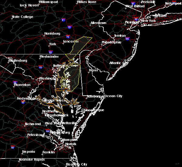 At 745 pm edt, severe thunderstorms were located along a line extending from near pottstown to near octoraro, moving east at 30 mph (radar indicated). Hazards include 60 mph wind gusts and penny size hail. Damage to roofs, siding, trees, and power lines is possible. Locations impacted include, calvert, pottstown, phoenixville, coatesville, downingtown, collegeville, oxford, royersford, parkesburg, trappe, west grove, rising sun, honey brook, elverson, glen roy, blake, west nottingham, pughtown, mount vernon and marshallton. At 745 pm edt, severe thunderstorms were located along a line extending from near pottstown to near octoraro, moving east at 30 mph (radar indicated). Hazards include 60 mph wind gusts and penny size hail. Damage to roofs, siding, trees, and power lines is possible. Locations impacted include, calvert, pottstown, phoenixville, coatesville, downingtown, collegeville, oxford, royersford, parkesburg, trappe, west grove, rising sun, honey brook, elverson, glen roy, blake, west nottingham, pughtown, mount vernon and marshallton.
|
| 9/26/2018 7:34 PM EDT |
 At 734 pm edt, severe thunderstorms were located along a line extending from pottstown to near octoraro, moving east at 20 mph (radar indicated). Hazards include 60 mph wind gusts and penny size hail. Damage to roofs, siding, trees, and power lines is possible. Locations impacted include, wilmington, newark, west chester, elkton, calvert, norristown, pottstown, phoenixville, lansdale, west norriton, east norriton, coatesville, westtown, downingtown, conshohocken, souderton, ambler, elsmere, kennett square and birdsboro. At 734 pm edt, severe thunderstorms were located along a line extending from pottstown to near octoraro, moving east at 20 mph (radar indicated). Hazards include 60 mph wind gusts and penny size hail. Damage to roofs, siding, trees, and power lines is possible. Locations impacted include, wilmington, newark, west chester, elkton, calvert, norristown, pottstown, phoenixville, lansdale, west norriton, east norriton, coatesville, westtown, downingtown, conshohocken, souderton, ambler, elsmere, kennett square and birdsboro.
|
| 9/26/2018 7:29 PM EDT |
 At 729 pm edt, severe thunderstorms were located along a line extending from rock springs to near bel air south, moving east at 25 mph (radar indicated). Hazards include 60 mph wind gusts. Damaging winds will cause some trees and large branches to fall. this could injure those outdoors, as well as damage homes and vehicles. roadways may become blocked by downed trees. localized power outages are possible. unsecured light objects may become projectiles. Locations impacted include, aberdeen, havre de grace, aberdeen proving ground, bel air south, bel air north, riverside, pleasant hills, perryman, edgewood, joppatowne, darlington, churchville, carsins, magnolia, scarboro, harford furnace, abingdon, joppa, belcamp and hickory. At 729 pm edt, severe thunderstorms were located along a line extending from rock springs to near bel air south, moving east at 25 mph (radar indicated). Hazards include 60 mph wind gusts. Damaging winds will cause some trees and large branches to fall. this could injure those outdoors, as well as damage homes and vehicles. roadways may become blocked by downed trees. localized power outages are possible. unsecured light objects may become projectiles. Locations impacted include, aberdeen, havre de grace, aberdeen proving ground, bel air south, bel air north, riverside, pleasant hills, perryman, edgewood, joppatowne, darlington, churchville, carsins, magnolia, scarboro, harford furnace, abingdon, joppa, belcamp and hickory.
|
| 9/26/2018 7:06 PM EDT |
 At 705 pm edt, severe thunderstorms were located along a line extending from near birdsboro to near delta, moving east at 30 mph (radar indicated). Hazards include 60 mph wind gusts and penny size hail. damage to roofs, siding, trees, and power lines is possible At 705 pm edt, severe thunderstorms were located along a line extending from near birdsboro to near delta, moving east at 30 mph (radar indicated). Hazards include 60 mph wind gusts and penny size hail. damage to roofs, siding, trees, and power lines is possible
|
| 9/26/2018 7:04 PM EDT |
 At 704 pm edt, severe thunderstorms were located along a line extending from delta to near kingsville, moving east at 25 mph (radar indicated). Hazards include 60 mph wind gusts. Damaging winds will cause some trees and large branches to fall. this could injure those outdoors, as well as damage homes and vehicles. roadways may become blocked by downed trees. localized power outages are possible. unsecured light objects may become projectiles. Locations impacted include, cockeysville, aberdeen, havre de grace, aberdeen proving ground, bel air south, bel air north, perry hall, mays chapel, timonium, fallston, riverside, hampton, kingsville, pleasant hills, jarrettsville, perryman, lutherville-timonium, edgewood, joppatowne and lutherville. At 704 pm edt, severe thunderstorms were located along a line extending from delta to near kingsville, moving east at 25 mph (radar indicated). Hazards include 60 mph wind gusts. Damaging winds will cause some trees and large branches to fall. this could injure those outdoors, as well as damage homes and vehicles. roadways may become blocked by downed trees. localized power outages are possible. unsecured light objects may become projectiles. Locations impacted include, cockeysville, aberdeen, havre de grace, aberdeen proving ground, bel air south, bel air north, perry hall, mays chapel, timonium, fallston, riverside, hampton, kingsville, pleasant hills, jarrettsville, perryman, lutherville-timonium, edgewood, joppatowne and lutherville.
|
| 9/26/2018 6:55 PM EDT |
 At 655 pm edt, severe thunderstorms were located along a line extending from near delta to near timonium, moving east at 25 mph (radar indicated). Hazards include 60 mph wind gusts. Damaging winds will cause some trees and large branches to fall. this could injure those outdoors, as well as damage homes and vehicles. roadways may become blocked by downed trees. localized power outages are possible. Unsecured light objects may become projectiles. At 655 pm edt, severe thunderstorms were located along a line extending from near delta to near timonium, moving east at 25 mph (radar indicated). Hazards include 60 mph wind gusts. Damaging winds will cause some trees and large branches to fall. this could injure those outdoors, as well as damage homes and vehicles. roadways may become blocked by downed trees. localized power outages are possible. Unsecured light objects may become projectiles.
|
| 8/13/2018 7:17 PM EDT | Tree limb down on md-462 paradise road south of md-155 level roa in harford county MD, 3.1 miles ESE of Havre de Grace, MD |
| 8/13/2018 6:49 PM EDT |
 At 649 pm edt, severe thunderstorms were located along a line extending from bel air south to near newtown, moving northeast at 30 mph (radar indicated). Hazards include 60 mph wind gusts. Damaging winds will cause some trees and large branches to fall. this could injure those outdoors, as well as damage homes and vehicles. roadways may become blocked by downed trees. localized power outages are possible. unsecured light objects may become projectiles. Locations impacted include, aberdeen, havre de grace, aberdeen proving ground, bel air south, bel air north, riverside, kingsville, pleasant hills, perryman, edgewood, joppatowne, benson, churchville, carsins, magnolia, harford furnace, abingdon, joppa and belcamp. At 649 pm edt, severe thunderstorms were located along a line extending from bel air south to near newtown, moving northeast at 30 mph (radar indicated). Hazards include 60 mph wind gusts. Damaging winds will cause some trees and large branches to fall. this could injure those outdoors, as well as damage homes and vehicles. roadways may become blocked by downed trees. localized power outages are possible. unsecured light objects may become projectiles. Locations impacted include, aberdeen, havre de grace, aberdeen proving ground, bel air south, bel air north, riverside, kingsville, pleasant hills, perryman, edgewood, joppatowne, benson, churchville, carsins, magnolia, harford furnace, abingdon, joppa and belcamp.
|
| 8/13/2018 6:20 PM EDT |
 At 620 pm edt, severe thunderstorms were located along a line extending from perry hall to back river, moving northeast at 30 mph (radar indicated). Hazards include 60 mph wind gusts. Damaging winds will cause some trees and large branches to fall. this could injure those outdoors, as well as damage homes and vehicles. roadways may become blocked by downed trees. localized power outages are possible. Unsecured light objects may become projectiles. At 620 pm edt, severe thunderstorms were located along a line extending from perry hall to back river, moving northeast at 30 mph (radar indicated). Hazards include 60 mph wind gusts. Damaging winds will cause some trees and large branches to fall. this could injure those outdoors, as well as damage homes and vehicles. roadways may become blocked by downed trees. localized power outages are possible. Unsecured light objects may become projectiles.
|
| 8/8/2018 10:46 PM EDT |
 At 1046 pm edt, a severe thunderstorm was located over bel air north, or 10 miles west of aberdeen, moving east at 40 mph (radar indicated). Hazards include 60 mph wind gusts. Damaging winds will cause some trees and large branches to fall. this could injure those outdoors, as well as damage homes and vehicles. roadways may become blocked by downed trees. localized power outages are possible. Unsecured light objects may become projectiles. At 1046 pm edt, a severe thunderstorm was located over bel air north, or 10 miles west of aberdeen, moving east at 40 mph (radar indicated). Hazards include 60 mph wind gusts. Damaging winds will cause some trees and large branches to fall. this could injure those outdoors, as well as damage homes and vehicles. roadways may become blocked by downed trees. localized power outages are possible. Unsecured light objects may become projectiles.
|
| 8/1/2018 11:25 PM EDT |
 At 1124 pm edt, a severe thunderstorm was located over zion, or 9 miles northwest of elkton, moving east at 25 mph (radar indicated). Hazards include 60 mph wind gusts. Damage to roofs, siding, trees, and power lines is possible. Locations impacted include, newark, elkton, havre de grace, calvert, north east, rising sun, charlestown, zion, blake, barksdale, glasgow, bear, west nottingham, fair hill, glen westover, bay view, lombard, woodlawn, andora and pleasant hill. At 1124 pm edt, a severe thunderstorm was located over zion, or 9 miles northwest of elkton, moving east at 25 mph (radar indicated). Hazards include 60 mph wind gusts. Damage to roofs, siding, trees, and power lines is possible. Locations impacted include, newark, elkton, havre de grace, calvert, north east, rising sun, charlestown, zion, blake, barksdale, glasgow, bear, west nottingham, fair hill, glen westover, bay view, lombard, woodlawn, andora and pleasant hill.
|
| 8/1/2018 10:58 PM EDT |
 At 1057 pm edt, a severe thunderstorm was located near octoraro, or near havre de grace, moving east at 30 mph (radar indicated). Hazards include 60 mph wind gusts. damage to roofs, siding, trees, and power lines is possible At 1057 pm edt, a severe thunderstorm was located near octoraro, or near havre de grace, moving east at 30 mph (radar indicated). Hazards include 60 mph wind gusts. damage to roofs, siding, trees, and power lines is possible
|
| 8/1/2018 10:42 PM EDT |
 At 1041 pm edt, severe thunderstorms were located along a line extending from delta to white marsh, moving east at 25 mph (radar indicated). Hazards include 60 mph wind gusts. Damaging winds will cause some trees and large branches to fall. this could injure those outdoors, as well as damage homes and vehicles. roadways may become blocked by downed trees. localized power outages are possible. unsecured light objects may become projectiles. Locations impacted include, baltimore, middle river, cockeysville, aberdeen, havre de grace, aberdeen proving ground, towson, bel air south, parkville, bel air north, carney, perry hall, rosedale, rossville, timonium, white marsh, fallston, bowleys quarters, riverside and hampton. At 1041 pm edt, severe thunderstorms were located along a line extending from delta to white marsh, moving east at 25 mph (radar indicated). Hazards include 60 mph wind gusts. Damaging winds will cause some trees and large branches to fall. this could injure those outdoors, as well as damage homes and vehicles. roadways may become blocked by downed trees. localized power outages are possible. unsecured light objects may become projectiles. Locations impacted include, baltimore, middle river, cockeysville, aberdeen, havre de grace, aberdeen proving ground, towson, bel air south, parkville, bel air north, carney, perry hall, rosedale, rossville, timonium, white marsh, fallston, bowleys quarters, riverside and hampton.
|
| 8/1/2018 10:19 PM EDT |
 At 1018 pm edt, severe thunderstorms were located along a line extending from 6 miles southeast of stewartstown to towson, moving east at 25 mph (radar indicated). Hazards include 60 mph wind gusts. Damaging winds will cause some trees and large branches to fall. this could injure those outdoors, as well as damage homes and vehicles. roadways may become blocked by downed trees. localized power outages are possible. Unsecured light objects may become projectiles. At 1018 pm edt, severe thunderstorms were located along a line extending from 6 miles southeast of stewartstown to towson, moving east at 25 mph (radar indicated). Hazards include 60 mph wind gusts. Damaging winds will cause some trees and large branches to fall. this could injure those outdoors, as well as damage homes and vehicles. roadways may become blocked by downed trees. localized power outages are possible. Unsecured light objects may become projectiles.
|
| 7/27/2018 6:33 PM EDT |
 At 633 pm edt, severe thunderstorms were located along a line extending from west nottingham to north east to middletown, moving northeast at 20 mph (radar indicated). Hazards include 60 mph wind gusts. Damage to roofs, siding, trees, and power lines is possible. Locations impacted include, newark, middletown, elkton, calvert, oxford, north east, west grove, rising sun, charlestown, cecilton, warwick, glen roy, zion, blake, barksdale, glasgow, bohemias mills, west nottingham, octoraro and brantwood. At 633 pm edt, severe thunderstorms were located along a line extending from west nottingham to north east to middletown, moving northeast at 20 mph (radar indicated). Hazards include 60 mph wind gusts. Damage to roofs, siding, trees, and power lines is possible. Locations impacted include, newark, middletown, elkton, calvert, oxford, north east, west grove, rising sun, charlestown, cecilton, warwick, glen roy, zion, blake, barksdale, glasgow, bohemias mills, west nottingham, octoraro and brantwood.
|
| 7/27/2018 6:07 PM EDT |
 At 605 pm edt, a severe thunderstorm was located near aberdeen, moving northeast at 35 mph. additional thunderstorms over baltimore city were also headed northeast into baltimore county (radar indicated). Hazards include 60 mph wind gusts. Damaging winds will cause some trees and large branches to fall. this could injure those outdoors, as well as damage homes and vehicles. roadways may become blocked by downed trees. localized power outages are possible. unsecured light objects may become projectiles. Locations impacted include, baltimore, middle river, cockeysville, aberdeen, havre de grace, aberdeen proving ground, towson, bel air south, essex, parkville, bel air north, carney, perry hall, rosedale, rossville, mays chapel, timonium, white marsh, fallston and bowleys quarters. At 605 pm edt, a severe thunderstorm was located near aberdeen, moving northeast at 35 mph. additional thunderstorms over baltimore city were also headed northeast into baltimore county (radar indicated). Hazards include 60 mph wind gusts. Damaging winds will cause some trees and large branches to fall. this could injure those outdoors, as well as damage homes and vehicles. roadways may become blocked by downed trees. localized power outages are possible. unsecured light objects may become projectiles. Locations impacted include, baltimore, middle river, cockeysville, aberdeen, havre de grace, aberdeen proving ground, towson, bel air south, essex, parkville, bel air north, carney, perry hall, rosedale, rossville, mays chapel, timonium, white marsh, fallston and bowleys quarters.
|
| 7/27/2018 6:03 PM EDT |
 At 602 pm edt, severe thunderstorms were located along a line extending from near octoraro to havre de grace to near cecilton, moving northeast at 25 mph (radar indicated). Hazards include 60 mph wind gusts and quarter size hail. Minor damage to vehicles is possible. Wind damage to roofs, siding, trees, and power lines is possible. At 602 pm edt, severe thunderstorms were located along a line extending from near octoraro to havre de grace to near cecilton, moving northeast at 25 mph (radar indicated). Hazards include 60 mph wind gusts and quarter size hail. Minor damage to vehicles is possible. Wind damage to roofs, siding, trees, and power lines is possible.
|
| 7/27/2018 6:03 PM EDT |
 The national weather service in mount holly nj has issued a * severe thunderstorm warning for. west central new castle county in northern delaware. cecil county in northeastern maryland. southwestern chester county in southeastern pennsylvania. Until 645 pm edt. The national weather service in mount holly nj has issued a * severe thunderstorm warning for. west central new castle county in northern delaware. cecil county in northeastern maryland. southwestern chester county in southeastern pennsylvania. Until 645 pm edt.
|
| 7/27/2018 5:52 PM EDT |
 At 550 pm edt, a severe thunderstorm was located over kingsville, or 8 miles north of middle river, moving northeast at 30 mph (radar indicated). Hazards include 60 mph wind gusts and quarter size hail. Damaging winds will cause some trees and large branches to fall. this could injure those outdoors, as well as damage homes and vehicles. roadways may become blocked by downed trees. localized power outages are possible. unsecured light objects may become projectiles. Locations impacted include, baltimore, middle river, cockeysville, aberdeen, havre de grace, aberdeen proving ground, towson, bel air south, essex, parkville, bel air north, carney, perry hall, rosedale, rossville, mays chapel, timonium, white marsh, fallston and bowleys quarters. At 550 pm edt, a severe thunderstorm was located over kingsville, or 8 miles north of middle river, moving northeast at 30 mph (radar indicated). Hazards include 60 mph wind gusts and quarter size hail. Damaging winds will cause some trees and large branches to fall. this could injure those outdoors, as well as damage homes and vehicles. roadways may become blocked by downed trees. localized power outages are possible. unsecured light objects may become projectiles. Locations impacted include, baltimore, middle river, cockeysville, aberdeen, havre de grace, aberdeen proving ground, towson, bel air south, essex, parkville, bel air north, carney, perry hall, rosedale, rossville, mays chapel, timonium, white marsh, fallston and bowleys quarters.
|
| 7/27/2018 5:38 PM EDT |
 At 538 pm edt, a severe thunderstorm was located over carney, or 7 miles southeast of cockeysville, moving northeast at 25 mph (radar indicated). Hazards include 70 mph wind gusts and half dollar size hail. Damaging winds will cause some trees and large branches to fall. this could injure those outdoors, as well as damage homes and vehicles. roadways may become blocked by downed trees. localized power outages are possible. Unsecured light objects may become projectiles. At 538 pm edt, a severe thunderstorm was located over carney, or 7 miles southeast of cockeysville, moving northeast at 25 mph (radar indicated). Hazards include 70 mph wind gusts and half dollar size hail. Damaging winds will cause some trees and large branches to fall. this could injure those outdoors, as well as damage homes and vehicles. roadways may become blocked by downed trees. localized power outages are possible. Unsecured light objects may become projectiles.
|
| 7/22/2018 1:59 PM EDT |
 At 158 pm edt, a severe thunderstorm was located over cecilton, or 11 miles southwest of middletown, moving north at 25 mph (radar indicated). Hazards include 60 mph wind gusts and penny size hail. Damage to roofs, siding, trees, and power lines is possible. Locations impacted include, elkton, havre de grace, calvert, north east, rising sun, charlestown, cecilton, zion, blake, barksdale, west nottingham, octoraro, morgnec, fair hill, glen westover, bay view, lombard, richardsmere, woodlawn and andora. At 158 pm edt, a severe thunderstorm was located over cecilton, or 11 miles southwest of middletown, moving north at 25 mph (radar indicated). Hazards include 60 mph wind gusts and penny size hail. Damage to roofs, siding, trees, and power lines is possible. Locations impacted include, elkton, havre de grace, calvert, north east, rising sun, charlestown, cecilton, zion, blake, barksdale, west nottingham, octoraro, morgnec, fair hill, glen westover, bay view, lombard, richardsmere, woodlawn and andora.
|
| 7/22/2018 1:41 PM EDT |
 At 141 pm edt, a severe thunderstorm was located over morgnec, or 15 miles southeast of aberdeen proving ground, moving north at 25 mph (radar indicated). Hazards include 60 mph wind gusts and quarter size hail. Minor damage to vehicles is possible. Wind damage to roofs, siding, trees, and power lines is possible. At 141 pm edt, a severe thunderstorm was located over morgnec, or 15 miles southeast of aberdeen proving ground, moving north at 25 mph (radar indicated). Hazards include 60 mph wind gusts and quarter size hail. Minor damage to vehicles is possible. Wind damage to roofs, siding, trees, and power lines is possible.
|
| 7/17/2018 3:20 PM EDT |
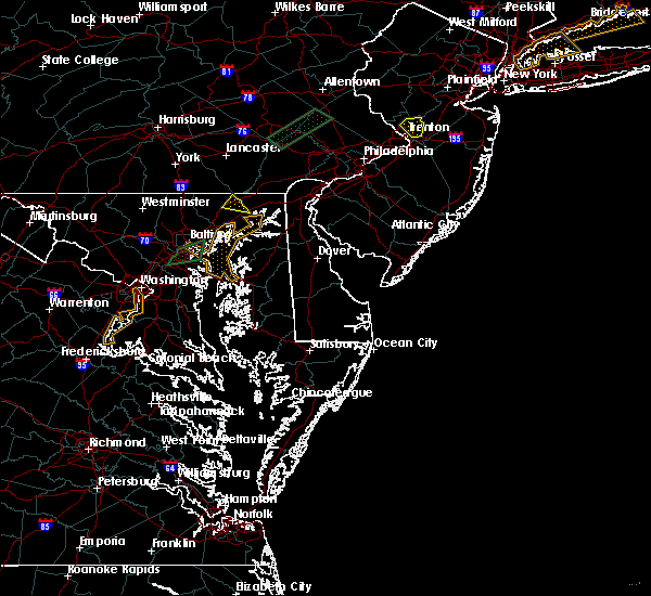 At 319 pm edt, a severe thunderstorm was located near octoraro, or 8 miles northwest of havre de grace, moving north at 20 mph (radar indicated). Hazards include 60 mph wind gusts. Damaging winds will cause some trees and large branches to fall. this could injure those outdoors, as well as damage homes and vehicles. roadways may become blocked by downed trees. localized power outages are possible. unsecured light objects may become projectiles. Locations impacted include, havre de grace and darlington. At 319 pm edt, a severe thunderstorm was located near octoraro, or 8 miles northwest of havre de grace, moving north at 20 mph (radar indicated). Hazards include 60 mph wind gusts. Damaging winds will cause some trees and large branches to fall. this could injure those outdoors, as well as damage homes and vehicles. roadways may become blocked by downed trees. localized power outages are possible. unsecured light objects may become projectiles. Locations impacted include, havre de grace and darlington.
|
| 7/17/2018 2:55 PM EDT |
 At 254 pm edt, a severe thunderstorm was located near bel air south, or near aberdeen, moving northeast at 20 mph (radar indicated). Hazards include 60 mph wind gusts. Damaging winds will cause some trees and large branches to fall. this could injure those outdoors, as well as damage homes and vehicles. roadways may become blocked by downed trees. localized power outages are possible. Unsecured light objects may become projectiles. At 254 pm edt, a severe thunderstorm was located near bel air south, or near aberdeen, moving northeast at 20 mph (radar indicated). Hazards include 60 mph wind gusts. Damaging winds will cause some trees and large branches to fall. this could injure those outdoors, as well as damage homes and vehicles. roadways may become blocked by downed trees. localized power outages are possible. Unsecured light objects may become projectiles.
|
| 7/3/2018 9:22 PM EDT |
 The severe thunderstorm warning for northeastern harford county will expire at 930 pm edt, the storms which prompted the warning have weakened below severe limits, and no longer pose an immediate threat to life or property. therefore the warning will be allowed to expire. however heavy rain is still possible with these thunderstorms. The severe thunderstorm warning for northeastern harford county will expire at 930 pm edt, the storms which prompted the warning have weakened below severe limits, and no longer pose an immediate threat to life or property. therefore the warning will be allowed to expire. however heavy rain is still possible with these thunderstorms.
|
| 7/3/2018 9:09 PM EDT |
 At 909 pm edt, a severe thunderstorms were located across much of eastern harford county, nearly stationary (radar indicated). Hazards include 60 mph wind gusts and quarter size hail. Damaging winds will cause some trees and large branches to fall. this could injure those outdoors, as well as damage homes and vehicles. roadways may become blocked by downed trees. localized power outages are possible. unsecured light objects may become projectiles. Locations impacted include, aberdeen, havre de grace, bel air south, darlington, churchville, carsins and scarboro. At 909 pm edt, a severe thunderstorms were located across much of eastern harford county, nearly stationary (radar indicated). Hazards include 60 mph wind gusts and quarter size hail. Damaging winds will cause some trees and large branches to fall. this could injure those outdoors, as well as damage homes and vehicles. roadways may become blocked by downed trees. localized power outages are possible. unsecured light objects may become projectiles. Locations impacted include, aberdeen, havre de grace, bel air south, darlington, churchville, carsins and scarboro.
|
| 7/3/2018 8:55 PM EDT |
 The national weather service in sterling virginia has issued a * severe thunderstorm warning for. southeastern harford county in northern maryland. until 1000 pm edt. At 854 pm edt, a severe thunderstorm was located near riverside, or near aberdeen, moving south at 15 mph. The national weather service in sterling virginia has issued a * severe thunderstorm warning for. southeastern harford county in northern maryland. until 1000 pm edt. At 854 pm edt, a severe thunderstorm was located near riverside, or near aberdeen, moving south at 15 mph.
|
| 7/3/2018 8:52 PM EDT | Branches down on road near cool branch rd and glenville rd in harford county MD, 6.5 miles ESE of Havre de Grace, MD |
| 7/3/2018 8:47 PM EDT | Downed tree blocking the road near the 1500 block of glenville rd in harford county MD, 6.9 miles ESE of Havre de Grace, MD |
| 7/3/2018 8:41 PM EDT |
 At 841 pm edt, a severe thunderstorm was located near octoraro, or 9 miles northwest of aberdeen, and is nearly stationary (radar indicated). Hazards include 60 mph wind gusts and quarter size hail. Damaging winds will cause some trees and large branches to fall. this could injure those outdoors, as well as damage homes and vehicles. roadways may become blocked by downed trees. localized power outages are possible. Unsecured light objects may become projectiles. At 841 pm edt, a severe thunderstorm was located near octoraro, or 9 miles northwest of aberdeen, and is nearly stationary (radar indicated). Hazards include 60 mph wind gusts and quarter size hail. Damaging winds will cause some trees and large branches to fall. this could injure those outdoors, as well as damage homes and vehicles. roadways may become blocked by downed trees. localized power outages are possible. Unsecured light objects may become projectiles.
|
| 5/15/2018 8:01 PM EDT |
 At 800 pm edt, severe thunderstorms were located across cecil and northern new castle counties, near middletown, moving southeast at 20 mph (radar indicated). Hazards include 60 mph wind gusts and nickel size hail. Damage to roofs, siding, trees, and power lines is possible. Locations impacted include, middletown, salem, quinton, delaware city, charlestown, cecilton, warwick, saint georges, mount pleasant, woodland beach, bohemias mills, hancocks bridge, port penn, brantwood, hope creek, cayots, hollywood beach, glasgow, townsend and chesapeake city. At 800 pm edt, severe thunderstorms were located across cecil and northern new castle counties, near middletown, moving southeast at 20 mph (radar indicated). Hazards include 60 mph wind gusts and nickel size hail. Damage to roofs, siding, trees, and power lines is possible. Locations impacted include, middletown, salem, quinton, delaware city, charlestown, cecilton, warwick, saint georges, mount pleasant, woodland beach, bohemias mills, hancocks bridge, port penn, brantwood, hope creek, cayots, hollywood beach, glasgow, townsend and chesapeake city.
|
| 5/15/2018 7:25 PM EDT |
 At 725 pm edt, severe thunderstorms were located along a line extending from near havre de grace to discovery-spring garden, moving south at 10 mph (radar indicated). Hazards include quarter size hail. Some hail damage to agriculture is expected. Locations impacted include, frederick, westminster, havre de grace, thurmont, bel air north, fallston, hampstead, walkersville, manchester, jarrettsville, discovery-spring garden, linganore-bartonsville, new windsor, woodsboro, union bridge, libertytown, darlington, carrollton, upperco and churchville. At 725 pm edt, severe thunderstorms were located along a line extending from near havre de grace to discovery-spring garden, moving south at 10 mph (radar indicated). Hazards include quarter size hail. Some hail damage to agriculture is expected. Locations impacted include, frederick, westminster, havre de grace, thurmont, bel air north, fallston, hampstead, walkersville, manchester, jarrettsville, discovery-spring garden, linganore-bartonsville, new windsor, woodsboro, union bridge, libertytown, darlington, carrollton, upperco and churchville.
|
| 5/15/2018 7:25 PM EDT |
 At 724 pm edt, severe thunderstorms were located along a line extending from near aberdeen proving ground to near point of rocks, moving south at 20 mph (radar indicated). Hazards include 60 mph wind gusts and quarter size hail. Damaging winds will cause some trees and large branches to fall. this could injure those outdoors, as well as damage homes and vehicles. roadways may become blocked by downed trees. localized power outages are possible. unsecured light objects may become projectiles. Locations impacted include, baltimore, columbia, germantown, frederick, pikesville, middle river, cockeysville, damascus, aberdeen, havre de grace, aberdeen proving ground, harry grove stadium, back river, ellicott city, dundalk, towson, bel air south, catonsville, essex and woodlawn. At 724 pm edt, severe thunderstorms were located along a line extending from near aberdeen proving ground to near point of rocks, moving south at 20 mph (radar indicated). Hazards include 60 mph wind gusts and quarter size hail. Damaging winds will cause some trees and large branches to fall. this could injure those outdoors, as well as damage homes and vehicles. roadways may become blocked by downed trees. localized power outages are possible. unsecured light objects may become projectiles. Locations impacted include, baltimore, columbia, germantown, frederick, pikesville, middle river, cockeysville, damascus, aberdeen, havre de grace, aberdeen proving ground, harry grove stadium, back river, ellicott city, dundalk, towson, bel air south, catonsville, essex and woodlawn.
|
| 5/15/2018 7:18 PM EDT |
 At 718 pm edt, a severe thunderstorm was located over charlestown, or near havre de grace, moving southeast at 40 mph (radar indicated). Hazards include 60 mph wind gusts and nickel size hail. damage to roofs, siding, trees, and power lines is possible At 718 pm edt, a severe thunderstorm was located over charlestown, or near havre de grace, moving southeast at 40 mph (radar indicated). Hazards include 60 mph wind gusts and nickel size hail. damage to roofs, siding, trees, and power lines is possible
|
| 5/15/2018 7:16 PM EDT |
 At 716 pm edt, severe thunderstorms were located along a line extending from near havre de grace to discovery-spring garden, moving south at 10 mph (radar indicated). Hazards include quarter size hail. some hail damage to agriculture is expected At 716 pm edt, severe thunderstorms were located along a line extending from near havre de grace to discovery-spring garden, moving south at 10 mph (radar indicated). Hazards include quarter size hail. some hail damage to agriculture is expected
|
| 5/15/2018 7:04 PM EDT |
 At 633 pm edt, severe thunderstorms were located along a line extending from rock springs to near manchester, moving south at 15 mph (radar indicated). Hazards include 60 mph wind gusts and quarter size hail. nickel size hail was reported in whiteford. Damaging winds will cause some trees and large branches to fall. this could injure those outdoors, as well as damage homes and vehicles. roadways may become blocked by downed trees. localized power outages are possible. Unsecured light objects may become projectiles. At 633 pm edt, severe thunderstorms were located along a line extending from rock springs to near manchester, moving south at 15 mph (radar indicated). Hazards include 60 mph wind gusts and quarter size hail. nickel size hail was reported in whiteford. Damaging winds will cause some trees and large branches to fall. this could injure those outdoors, as well as damage homes and vehicles. roadways may become blocked by downed trees. localized power outages are possible. Unsecured light objects may become projectiles.
|
| 5/15/2018 6:55 PM EDT |
 At 655 pm edt, severe thunderstorms were located along a line extending from havre de grace to near brunswick, moving south at 20 mph (radar indicated). Hazards include 60 mph wind gusts and quarter size hail. Damaging winds will cause some trees and large branches to fall. this could injure those outdoors, as well as damage homes and vehicles. roadways may become blocked by downed trees. localized power outages are possible. Unsecured light objects may become projectiles. At 655 pm edt, severe thunderstorms were located along a line extending from havre de grace to near brunswick, moving south at 20 mph (radar indicated). Hazards include 60 mph wind gusts and quarter size hail. Damaging winds will cause some trees and large branches to fall. this could injure those outdoors, as well as damage homes and vehicles. roadways may become blocked by downed trees. localized power outages are possible. Unsecured light objects may become projectiles.
|
| 5/15/2018 6:35 PM EDT |
 At 634 pm edt, a severe thunderstorm was located over farmington, or 9 miles northeast of havre de grace, moving southeast at 45 mph (radar indicated). Hazards include 70 mph wind gusts and quarter size hail. Minor damage to vehicles is possible. expect considerable tree damage. Wind damage is also likely to mobile homes, roofs, and outbuildings. At 634 pm edt, a severe thunderstorm was located over farmington, or 9 miles northeast of havre de grace, moving southeast at 45 mph (radar indicated). Hazards include 70 mph wind gusts and quarter size hail. Minor damage to vehicles is possible. expect considerable tree damage. Wind damage is also likely to mobile homes, roofs, and outbuildings.
|
| 5/15/2018 6:33 PM EDT |
 At 633 pm edt, severe thunderstorms were located along a line extending from rock springs to near manchester, moving south at 15 mph (radar indicated). Hazards include 60 mph wind gusts and quarter size hail. nickel size hail was reported in whiteford. Damaging winds will cause some trees and large branches to fall. this could injure those outdoors, as well as damage homes and vehicles. roadways may become blocked by downed trees. localized power outages are possible. Unsecured light objects may become projectiles. At 633 pm edt, severe thunderstorms were located along a line extending from rock springs to near manchester, moving south at 15 mph (radar indicated). Hazards include 60 mph wind gusts and quarter size hail. nickel size hail was reported in whiteford. Damaging winds will cause some trees and large branches to fall. this could injure those outdoors, as well as damage homes and vehicles. roadways may become blocked by downed trees. localized power outages are possible. Unsecured light objects may become projectiles.
|
| 5/12/2018 8:14 PM EDT |
 At 814 pm edt, severe thunderstorms were located along a line extending from near octoraro to pumphrey, moving southeast at 30 mph (radar indicated). Hazards include 60 mph wind gusts and quarter size hail. Damaging winds will cause some trees and large branches to fall. this could injure those outdoors, as well as damage homes and vehicles. roadways may become blocked by downed trees. localized power outages are possible. unsecured light objects may become projectiles. locations impacted include, baltimore, middle river, aberdeen, havre de grace, aberdeen proving ground, north point state park, sparrows point, back river, millers island, dundalk, bel air south, essex, parkville, bel air north, carney, perry hall, rosedale, rossville, brooklyn park and white marsh. A tornado watch remains in effect until 100 am edt for central and northern maryland. At 814 pm edt, severe thunderstorms were located along a line extending from near octoraro to pumphrey, moving southeast at 30 mph (radar indicated). Hazards include 60 mph wind gusts and quarter size hail. Damaging winds will cause some trees and large branches to fall. this could injure those outdoors, as well as damage homes and vehicles. roadways may become blocked by downed trees. localized power outages are possible. unsecured light objects may become projectiles. locations impacted include, baltimore, middle river, aberdeen, havre de grace, aberdeen proving ground, north point state park, sparrows point, back river, millers island, dundalk, bel air south, essex, parkville, bel air north, carney, perry hall, rosedale, rossville, brooklyn park and white marsh. A tornado watch remains in effect until 100 am edt for central and northern maryland.
|
| 5/12/2018 8:07 PM EDT |
 At 806 pm edt, severe thunderstorms were located along a line extending from near octoraro to pumphrey, moving southeast at 30 mph (radar indicated). Hazards include 60 mph wind gusts and quarter size hail. Damaging winds will cause some trees and large branches to fall. this could injure those outdoors, as well as damage homes and vehicles. roadways may become blocked by downed trees. localized power outages are possible. unsecured light objects may become projectiles. locations impacted include, baltimore, pikesville, middle river, cockeysville, aberdeen, havre de grace, aberdeen proving ground, millers island, north point state park, sparrows point, back river, dundalk, towson, bel air south, catonsville, essex, woodlawn, parkville, bel air north and carney. A tornado watch remains in effect until 100 am edt for central and northern maryland. At 806 pm edt, severe thunderstorms were located along a line extending from near octoraro to pumphrey, moving southeast at 30 mph (radar indicated). Hazards include 60 mph wind gusts and quarter size hail. Damaging winds will cause some trees and large branches to fall. this could injure those outdoors, as well as damage homes and vehicles. roadways may become blocked by downed trees. localized power outages are possible. unsecured light objects may become projectiles. locations impacted include, baltimore, pikesville, middle river, cockeysville, aberdeen, havre de grace, aberdeen proving ground, millers island, north point state park, sparrows point, back river, dundalk, towson, bel air south, catonsville, essex, woodlawn, parkville, bel air north and carney. A tornado watch remains in effect until 100 am edt for central and northern maryland.
|
| 5/12/2018 7:57 PM EDT |
 At 756 pm edt, severe thunderstorms were located along a line extending from near delta to catonsville, moving southeast at 30 mph (radar indicated. this storm has a history of producing large hail. the most intense portion of the storm is heading into downtown baltimore city). Hazards include damaging wind gusts of 60 to 75 mph wind gusts and quarter to golf ball size hail. Damaging winds will cause some trees and large branches to fall. this could injure those outdoors, as well as damage homes and vehicles. roadways may become blocked by downed trees. localized power outages are possible. unsecured light objects may become projectiles. locations impacted include, baltimore, pikesville, middle river, cockeysville, aberdeen, havre de grace, aberdeen proving ground, millers island, north point state park, sparrows point, back river, ellicott city, dundalk, towson, bel air south, catonsville, essex, woodlawn, randallstown and parkville. A tornado watch remains in effect until 100 am edt for central and northern maryland. At 756 pm edt, severe thunderstorms were located along a line extending from near delta to catonsville, moving southeast at 30 mph (radar indicated. this storm has a history of producing large hail. the most intense portion of the storm is heading into downtown baltimore city). Hazards include damaging wind gusts of 60 to 75 mph wind gusts and quarter to golf ball size hail. Damaging winds will cause some trees and large branches to fall. this could injure those outdoors, as well as damage homes and vehicles. roadways may become blocked by downed trees. localized power outages are possible. unsecured light objects may become projectiles. locations impacted include, baltimore, pikesville, middle river, cockeysville, aberdeen, havre de grace, aberdeen proving ground, millers island, north point state park, sparrows point, back river, ellicott city, dundalk, towson, bel air south, catonsville, essex, woodlawn, randallstown and parkville. A tornado watch remains in effect until 100 am edt for central and northern maryland.
|
| 5/12/2018 7:44 PM EDT |
 At 743 pm edt, severe thunderstorms were located along a line extending from near delta to near ellicott city, moving southeast at 30 mph (radar indicated. these storms have a history of producing large hail). Hazards include quarter to golf ball size hail and 60 mph wind gusts. Damaging winds will cause some trees and large branches to fall. this could injure those outdoors, as well as damage homes and vehicles. roadways may become blocked by downed trees. localized power outages are possible. Unsecured light objects may become projectiles. At 743 pm edt, severe thunderstorms were located along a line extending from near delta to near ellicott city, moving southeast at 30 mph (radar indicated. these storms have a history of producing large hail). Hazards include quarter to golf ball size hail and 60 mph wind gusts. Damaging winds will cause some trees and large branches to fall. this could injure those outdoors, as well as damage homes and vehicles. roadways may become blocked by downed trees. localized power outages are possible. Unsecured light objects may become projectiles.
|
| 5/10/2018 6:53 PM EDT |
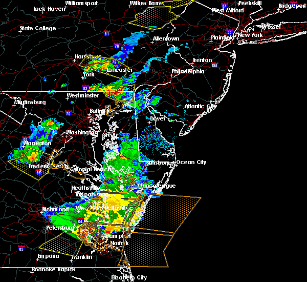 At 653 pm edt, a severe thunderstorm was located near octoraro, or 8 miles northwest of havre de grace, moving east at 30 mph (radar indicated). Hazards include 60 mph wind gusts and quarter size hail. Damaging winds will cause some trees and large branches to fall. this could injure those outdoors, as well as damage homes and vehicles. roadways may become blocked by downed trees. localized power outages are possible. unsecured light objects may become projectiles. Locations impacted include, havre de grace, darlington and scarboro. At 653 pm edt, a severe thunderstorm was located near octoraro, or 8 miles northwest of havre de grace, moving east at 30 mph (radar indicated). Hazards include 60 mph wind gusts and quarter size hail. Damaging winds will cause some trees and large branches to fall. this could injure those outdoors, as well as damage homes and vehicles. roadways may become blocked by downed trees. localized power outages are possible. unsecured light objects may become projectiles. Locations impacted include, havre de grace, darlington and scarboro.
|
| 5/10/2018 6:37 PM EDT |
 At 636 pm edt, a severe thunderstorm was located near delta, or 15 miles northwest of aberdeen, moving east at 30 mph (radar indicated). Hazards include ping pong ball size hail and 60 mph wind gusts. Damaging winds will cause some trees and large branches to fall. this could injure those outdoors, as well as damage homes and vehicles. roadways may become blocked by downed trees. localized power outages are possible. Unsecured light objects may become projectiles. At 636 pm edt, a severe thunderstorm was located near delta, or 15 miles northwest of aberdeen, moving east at 30 mph (radar indicated). Hazards include ping pong ball size hail and 60 mph wind gusts. Damaging winds will cause some trees and large branches to fall. this could injure those outdoors, as well as damage homes and vehicles. roadways may become blocked by downed trees. localized power outages are possible. Unsecured light objects may become projectiles.
|
| 5/10/2018 6:19 PM EDT |
 At 557 pm edt, a severe thunderstorm was located near glen rock, or near dallastown, moving east at 30 mph (radar indicated). Hazards include 60 mph wind gusts and half dollar size hail. Damaging winds will cause some trees and large branches to fall. this could injure those outdoors, as well as damage homes and vehicles. roadways may become blocked by downed trees. localized power outages are possible. unsecured light objects may become projectiles. Locations impacted include, havre de grace, pylesville, darlington, cardiff, norrisville, street, rocks, scarboro and whiteford. At 557 pm edt, a severe thunderstorm was located near glen rock, or near dallastown, moving east at 30 mph (radar indicated). Hazards include 60 mph wind gusts and half dollar size hail. Damaging winds will cause some trees and large branches to fall. this could injure those outdoors, as well as damage homes and vehicles. roadways may become blocked by downed trees. localized power outages are possible. unsecured light objects may become projectiles. Locations impacted include, havre de grace, pylesville, darlington, cardiff, norrisville, street, rocks, scarboro and whiteford.
|
| 5/10/2018 5:57 PM EDT |
 At 545 pm edt, a severe thunderstorm was located near codorus, or near spry, moving east at 25 mph (radar indicated). Hazards include 60 mph wind gusts and quarter size hail. Damaging winds will cause some trees and large branches to fall. this could injure those outdoors, as well as damage homes and vehicles. roadways may become blocked by downed trees. localized power outages are possible. Unsecured light objects may become projectiles. At 545 pm edt, a severe thunderstorm was located near codorus, or near spry, moving east at 25 mph (radar indicated). Hazards include 60 mph wind gusts and quarter size hail. Damaging winds will cause some trees and large branches to fall. this could injure those outdoors, as well as damage homes and vehicles. roadways may become blocked by downed trees. localized power outages are possible. Unsecured light objects may become projectiles.
|
| 5/10/2018 5:45 PM EDT |
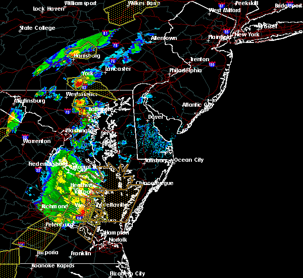 At 545 pm edt, a severe thunderstorm was located near codorus, or near spry, moving east at 25 mph (radar indicated). Hazards include 60 mph wind gusts and quarter size hail. Damaging winds will cause some trees and large branches to fall. this could injure those outdoors, as well as damage homes and vehicles. roadways may become blocked by downed trees. localized power outages are possible. Unsecured light objects may become projectiles. At 545 pm edt, a severe thunderstorm was located near codorus, or near spry, moving east at 25 mph (radar indicated). Hazards include 60 mph wind gusts and quarter size hail. Damaging winds will cause some trees and large branches to fall. this could injure those outdoors, as well as damage homes and vehicles. roadways may become blocked by downed trees. localized power outages are possible. Unsecured light objects may become projectiles.
|
| 4/16/2018 3:56 AM EDT |
 At 356 am edt, severe thunderstorms were located along a line extending from near severn river to kent point, moving northeast at 50 mph (radar indicated). Hazards include 60 mph wind gusts. expect damage to trees and power lines At 356 am edt, severe thunderstorms were located along a line extending from near severn river to kent point, moving northeast at 50 mph (radar indicated). Hazards include 60 mph wind gusts. expect damage to trees and power lines
|
| 8/22/2017 10:42 PM EDT |
 At 1042 pm edt, severe thunderstorms were located along a line extending from near schwenksville to charlestown, moving east at 45 mph (radar indicated). Hazards include 60 mph wind gusts and quarter size hail. Minor damage to vehicles is possible. expect damage to trees and power lines. Locations impacted include, philadelphia, camden, wilmington, newark, middletown, west chester, elkton, gloucester city, calvert, bensalem, ewing, norristown, chester, deptford, pottstown, west deptford, phoenixville, lansdale, west norriton and east norriton. At 1042 pm edt, severe thunderstorms were located along a line extending from near schwenksville to charlestown, moving east at 45 mph (radar indicated). Hazards include 60 mph wind gusts and quarter size hail. Minor damage to vehicles is possible. expect damage to trees and power lines. Locations impacted include, philadelphia, camden, wilmington, newark, middletown, west chester, elkton, gloucester city, calvert, bensalem, ewing, norristown, chester, deptford, pottstown, west deptford, phoenixville, lansdale, west norriton and east norriton.
|
| 8/22/2017 10:32 PM EDT |
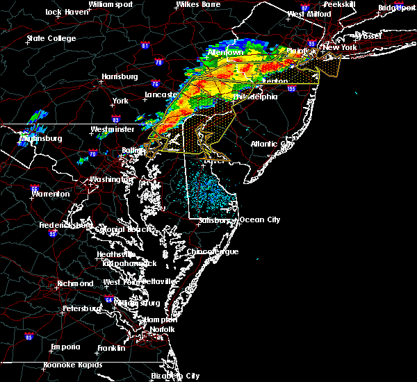 At 1032 pm edt, a severe thunderstorm was located near octoraro, or near havre de grace, moving east at 30 mph (radar indicated). Hazards include 60 mph wind gusts. Damaging winds will cause some trees and large branches to fall. this could injure those outdoors, as well as damage homes and vehicles. roadways may become blocked by downed trees. localized power outages are possible. unsecured light objects may become projectiles. Locations impacted include, aberdeen, havre de grace and carsins. At 1032 pm edt, a severe thunderstorm was located near octoraro, or near havre de grace, moving east at 30 mph (radar indicated). Hazards include 60 mph wind gusts. Damaging winds will cause some trees and large branches to fall. this could injure those outdoors, as well as damage homes and vehicles. roadways may become blocked by downed trees. localized power outages are possible. unsecured light objects may become projectiles. Locations impacted include, aberdeen, havre de grace and carsins.
|
| 8/22/2017 10:21 PM EDT |
 At 1021 pm edt, a severe thunderstorm was located near bel air north, or 7 miles northwest of aberdeen, moving east at 30 mph (radar indicated). Hazards include 60 mph wind gusts. Damaging winds will cause some trees and large branches to fall. this could injure those outdoors, as well as damage homes and vehicles. roadways may become blocked by downed trees. localized power outages are possible. unsecured light objects may become projectiles. Locations impacted include, aberdeen, havre de grace, bel air south, bel air north, darlington, churchville, carsins and scarboro. At 1021 pm edt, a severe thunderstorm was located near bel air north, or 7 miles northwest of aberdeen, moving east at 30 mph (radar indicated). Hazards include 60 mph wind gusts. Damaging winds will cause some trees and large branches to fall. this could injure those outdoors, as well as damage homes and vehicles. roadways may become blocked by downed trees. localized power outages are possible. unsecured light objects may become projectiles. Locations impacted include, aberdeen, havre de grace, bel air south, bel air north, darlington, churchville, carsins and scarboro.
|
| 8/22/2017 10:14 PM EDT |
 At 1021 pm edt, a severe thunderstorm was located near bel air north, or 7 miles northwest of aberdeen, moving east at 30 mph (radar indicated). Hazards include 60 mph wind gusts. Damaging winds will cause some trees and large branches to fall. this could injure those outdoors, as well as damage homes and vehicles. roadways may become blocked by downed trees. localized power outages are possible. unsecured light objects may become projectiles. Locations impacted include, aberdeen, havre de grace, bel air south, bel air north, darlington, churchville, carsins and scarboro. At 1021 pm edt, a severe thunderstorm was located near bel air north, or 7 miles northwest of aberdeen, moving east at 30 mph (radar indicated). Hazards include 60 mph wind gusts. Damaging winds will cause some trees and large branches to fall. this could injure those outdoors, as well as damage homes and vehicles. roadways may become blocked by downed trees. localized power outages are possible. unsecured light objects may become projectiles. Locations impacted include, aberdeen, havre de grace, bel air south, bel air north, darlington, churchville, carsins and scarboro.
|
| 8/22/2017 10:07 PM EDT |
 At 1007 pm edt, severe thunderstorms were located along a line extending from near elverson to near pleasant hills, moving east at 55 mph (radar indicated). Hazards include 60 mph wind gusts and quarter size hail. Minor damage to vehicles is possible. Expect damage to trees and power lines. At 1007 pm edt, severe thunderstorms were located along a line extending from near elverson to near pleasant hills, moving east at 55 mph (radar indicated). Hazards include 60 mph wind gusts and quarter size hail. Minor damage to vehicles is possible. Expect damage to trees and power lines.
|
| 8/18/2017 6:36 PM EDT |
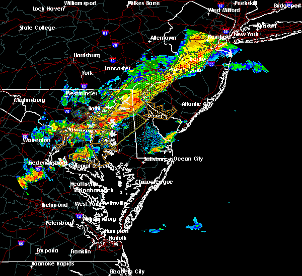 The severe thunderstorm warning for southeastern harford and southeastern baltimore counties will expire at 645 pm edt, the storms which prompted the warning have moved out of the area. therefore the warning will be allowed to expire. a severe thunderstorm watch remains in effect until 900 pm edt for northern maryland. The severe thunderstorm warning for southeastern harford and southeastern baltimore counties will expire at 645 pm edt, the storms which prompted the warning have moved out of the area. therefore the warning will be allowed to expire. a severe thunderstorm watch remains in effect until 900 pm edt for northern maryland.
|
| 8/18/2017 6:23 PM EDT |
 At 623 pm edt, severe thunderstorms were located along a line extending from near charlestown to near newtown to fort smallwood state park, moving east at 20 mph (radar indicated). Hazards include 60 mph wind gusts. Damaging winds will cause some trees and large branches to fall. this could injure those outdoors, as well as damage homes and vehicles. roadways may become blocked by downed trees. localized power outages are possible. unsecured light objects may become projectiles. Locations impacted include, aberdeen, havre de grace, aberdeen proving ground, north point state park, sparrows point, millers island, back river, dundalk, essex, bowleys quarters, riverside, perryman, edgewood, edgemere, fort howard and belcamp. At 623 pm edt, severe thunderstorms were located along a line extending from near charlestown to near newtown to fort smallwood state park, moving east at 20 mph (radar indicated). Hazards include 60 mph wind gusts. Damaging winds will cause some trees and large branches to fall. this could injure those outdoors, as well as damage homes and vehicles. roadways may become blocked by downed trees. localized power outages are possible. unsecured light objects may become projectiles. Locations impacted include, aberdeen, havre de grace, aberdeen proving ground, north point state park, sparrows point, millers island, back river, dundalk, essex, bowleys quarters, riverside, perryman, edgewood, edgemere, fort howard and belcamp.
|
| 8/18/2017 5:47 PM EDT |
 At 546 pm edt, severe thunderstorms were located along a line extending from near aberdeen to near middle river to arbutus, moving east at 25 mph (radar indicated). Hazards include 60 mph wind gusts and quarter size hail. Damaging winds will cause some trees and large branches to fall. this could injure those outdoors, as well as damage homes and vehicles. roadways may become blocked by downed trees. localized power outages are possible. unsecured light objects may become projectiles. Locations impacted include, baltimore, middle river, aberdeen, havre de grace, aberdeen proving ground, north point state park, sparrows point, back river, millers island, glen burnie, dundalk, bel air south, essex, bel air north, pasadena, rosedale, ferndale, brooklyn park, white marsh and bowleys quarters. At 546 pm edt, severe thunderstorms were located along a line extending from near aberdeen to near middle river to arbutus, moving east at 25 mph (radar indicated). Hazards include 60 mph wind gusts and quarter size hail. Damaging winds will cause some trees and large branches to fall. this could injure those outdoors, as well as damage homes and vehicles. roadways may become blocked by downed trees. localized power outages are possible. unsecured light objects may become projectiles. Locations impacted include, baltimore, middle river, aberdeen, havre de grace, aberdeen proving ground, north point state park, sparrows point, back river, millers island, glen burnie, dundalk, bel air south, essex, bel air north, pasadena, rosedale, ferndale, brooklyn park, white marsh and bowleys quarters.
|
| 8/18/2017 5:39 PM EDT |
 At 539 pm edt, severe thunderstorms were located along a line extending from near kennett square to back river, moving east at 30 mph (radar indicated). Hazards include 60 mph wind gusts and quarter size hail. Minor damage to vehicles is possible. Expect damage to trees and power lines. At 539 pm edt, severe thunderstorms were located along a line extending from near kennett square to back river, moving east at 30 mph (radar indicated). Hazards include 60 mph wind gusts and quarter size hail. Minor damage to vehicles is possible. Expect damage to trees and power lines.
|
| 8/18/2017 5:34 PM EDT |
 At 534 pm edt, severe thunderstorms were located along a line extending from near bel air north to arbutus, moving east at 25 mph (radar indicated). Hazards include 60 mph wind gusts and quarter size hail. Damaging winds will cause some trees and large branches to fall. this could injure those outdoors, as well as damage homes and vehicles. roadways may become blocked by downed trees. localized power outages are possible. unsecured light objects may become projectiles. Locations impacted include, baltimore, columbia, middle river, elkridge, aberdeen, havre de grace, aberdeen proving ground, millers island, north point state park, sparrows point, back river, glen burnie, dundalk, towson, bel air south, catonsville, essex, parkville, bel air north and carney. At 534 pm edt, severe thunderstorms were located along a line extending from near bel air north to arbutus, moving east at 25 mph (radar indicated). Hazards include 60 mph wind gusts and quarter size hail. Damaging winds will cause some trees and large branches to fall. this could injure those outdoors, as well as damage homes and vehicles. roadways may become blocked by downed trees. localized power outages are possible. unsecured light objects may become projectiles. Locations impacted include, baltimore, columbia, middle river, elkridge, aberdeen, havre de grace, aberdeen proving ground, millers island, north point state park, sparrows point, back river, glen burnie, dundalk, towson, bel air south, catonsville, essex, parkville, bel air north and carney.
|
| 8/18/2017 5:33 PM EDT |
 At 532 pm edt, severe thunderstorms were located along a line extending from near west grove to bel air south, moving east at 30 mph (radar indicated). Hazards include 60 mph wind gusts and quarter size hail. Minor damage to vehicles is possible. expect damage to trees and power lines. Locations impacted include, wilmington, newark, elkton, calvert, pennsville, elsmere, kennett square, new castle, oxford, north east, west grove, rising sun, delaware city, charlestown, newport, cecilton, arden, betterton, glen roy and blake. At 532 pm edt, severe thunderstorms were located along a line extending from near west grove to bel air south, moving east at 30 mph (radar indicated). Hazards include 60 mph wind gusts and quarter size hail. Minor damage to vehicles is possible. expect damage to trees and power lines. Locations impacted include, wilmington, newark, elkton, calvert, pennsville, elsmere, kennett square, new castle, oxford, north east, west grove, rising sun, delaware city, charlestown, newport, cecilton, arden, betterton, glen roy and blake.
|
| 8/18/2017 5:23 PM EDT |
 At 523 pm edt, a severe thunderstorm was located near bel air north, or 9 miles northwest of aberdeen, moving east at 25 mph (radar indicated). Hazards include 60 mph wind gusts and quarter size hail. Damaging winds will cause some trees and large branches to fall. this could injure those outdoors, as well as damage homes and vehicles. roadways may become blocked by downed trees. localized power outages are possible. unsecured light objects may become projectiles. Locations impacted include, aberdeen, havre de grace, aberdeen proving ground, bel air south, bel air north, fallston, riverside, pleasant hills, jarrettsville, perryman, darlington, benson, churchville, baldwin, carsins, scarboro, forest hill, bynum, harford furnace and jacksonville. At 523 pm edt, a severe thunderstorm was located near bel air north, or 9 miles northwest of aberdeen, moving east at 25 mph (radar indicated). Hazards include 60 mph wind gusts and quarter size hail. Damaging winds will cause some trees and large branches to fall. this could injure those outdoors, as well as damage homes and vehicles. roadways may become blocked by downed trees. localized power outages are possible. unsecured light objects may become projectiles. Locations impacted include, aberdeen, havre de grace, aberdeen proving ground, bel air south, bel air north, fallston, riverside, pleasant hills, jarrettsville, perryman, darlington, benson, churchville, baldwin, carsins, scarboro, forest hill, bynum, harford furnace and jacksonville.
|
| 8/18/2017 5:15 PM EDT |
 At 514 pm edt, severe thunderstorms were located along a line extending from mount vernon to near cockeysville, moving east at 20 mph (radar indicated). Hazards include 60 mph wind gusts. Damaging winds will cause some trees and large branches to fall. this could injure those outdoors, as well as damage homes and vehicles. roadways may become blocked by downed trees. localized power outages are possible. unsecured light objects may become projectiles. Locations impacted include, aberdeen, havre de grace, aberdeen proving ground, bel air south, bel air north, fallston, riverside, pleasant hills, jarrettsville, perryman, pylesville, darlington, cardiff, churchville, carsins, forest hill, street, jacksonville, hickory and whiteford. At 514 pm edt, severe thunderstorms were located along a line extending from mount vernon to near cockeysville, moving east at 20 mph (radar indicated). Hazards include 60 mph wind gusts. Damaging winds will cause some trees and large branches to fall. this could injure those outdoors, as well as damage homes and vehicles. roadways may become blocked by downed trees. localized power outages are possible. unsecured light objects may become projectiles. Locations impacted include, aberdeen, havre de grace, aberdeen proving ground, bel air south, bel air north, fallston, riverside, pleasant hills, jarrettsville, perryman, pylesville, darlington, cardiff, churchville, carsins, forest hill, street, jacksonville, hickory and whiteford.
|
| 8/18/2017 5:14 PM EDT |
 At 513 pm edt, severe thunderstorms were located along a line extending from cockeysville to catonsville, moving east at 20 mph (radar indicated). Hazards include 60 mph wind gusts. Damaging winds will cause some trees and large branches to fall. this could injure those outdoors, as well as damage homes and vehicles. roadways may become blocked by downed trees. localized power outages are possible. Unsecured light objects may become projectiles. At 513 pm edt, severe thunderstorms were located along a line extending from cockeysville to catonsville, moving east at 20 mph (radar indicated). Hazards include 60 mph wind gusts. Damaging winds will cause some trees and large branches to fall. this could injure those outdoors, as well as damage homes and vehicles. roadways may become blocked by downed trees. localized power outages are possible. Unsecured light objects may become projectiles.
|
| 8/18/2017 5:03 PM EDT |
 At 502 pm edt, severe thunderstorms were located along a line extending from quarryville to near cockeysville, moving east at 30 mph (radar indicated). Hazards include 60 mph wind gusts and quarter size hail. Minor damage to vehicles is possible. Expect damage to trees and power lines. At 502 pm edt, severe thunderstorms were located along a line extending from quarryville to near cockeysville, moving east at 30 mph (radar indicated). Hazards include 60 mph wind gusts and quarter size hail. Minor damage to vehicles is possible. Expect damage to trees and power lines.
|
| 8/18/2017 4:49 PM EDT |
 At 448 pm edt, severe thunderstorms were located along a line extending from near holtwood to near cockeysville, moving east at 35 mph (radar indicated). Hazards include 60 mph wind gusts. Damaging winds will cause some trees and large branches to fall. this could injure those outdoors, as well as damage homes and vehicles. roadways may become blocked by downed trees. localized power outages are possible. unsecured light objects may become projectiles. Locations impacted include, aberdeen, havre de grace, aberdeen proving ground, bel air south, bel air north, fallston, riverside, pleasant hills, jarrettsville, perryman, pylesville, darlington, cardiff, churchville, carsins, forest hill, phoenix, street, jacksonville and butler. At 448 pm edt, severe thunderstorms were located along a line extending from near holtwood to near cockeysville, moving east at 35 mph (radar indicated). Hazards include 60 mph wind gusts. Damaging winds will cause some trees and large branches to fall. this could injure those outdoors, as well as damage homes and vehicles. roadways may become blocked by downed trees. localized power outages are possible. unsecured light objects may become projectiles. Locations impacted include, aberdeen, havre de grace, aberdeen proving ground, bel air south, bel air north, fallston, riverside, pleasant hills, jarrettsville, perryman, pylesville, darlington, cardiff, churchville, carsins, forest hill, phoenix, street, jacksonville and butler.
|
| 8/18/2017 4:35 PM EDT |
 At 435 pm edt, severe thunderstorms were located along a line extending from near sunnyburn to 7 miles northwest of cockeysville, moving east at 35 mph (radar indicated). Hazards include 60 mph wind gusts. Damaging winds will cause some trees and large branches to fall. this could injure those outdoors, as well as damage homes and vehicles. roadways may become blocked by downed trees. localized power outages are possible. Unsecured light objects may become projectiles. At 435 pm edt, severe thunderstorms were located along a line extending from near sunnyburn to 7 miles northwest of cockeysville, moving east at 35 mph (radar indicated). Hazards include 60 mph wind gusts. Damaging winds will cause some trees and large branches to fall. this could injure those outdoors, as well as damage homes and vehicles. roadways may become blocked by downed trees. localized power outages are possible. Unsecured light objects may become projectiles.
|
| 7/24/2017 8:35 PM EDT |
 The severe thunderstorm warning for east central harford county will expire at 845 pm edt, the storm which prompted the warning has moved out of the area. therefore the warning will be allowed to expire. however gusty winds are still possible with this thunderstorm. to report severe weather, contact your nearest law enforcement agency. they will relay your report to the national weather service sterling virginia. The severe thunderstorm warning for east central harford county will expire at 845 pm edt, the storm which prompted the warning has moved out of the area. therefore the warning will be allowed to expire. however gusty winds are still possible with this thunderstorm. to report severe weather, contact your nearest law enforcement agency. they will relay your report to the national weather service sterling virginia.
|
| 7/24/2017 8:22 PM EDT |
 At 822 pm edt, a severe thunderstorm was located over havre de grace, moving east at 25 mph (radar indicated). Hazards include 60 mph wind gusts and quarter size hail. Damaging winds will cause some trees and large branches to fall. this could injure those outdoors, as well as damage homes and vehicles. roadways may become blocked by downed trees. localized power outages are possible. unsecured light objects may become projectiles. Locations impacted include, aberdeen, havre de grace, aberdeen proving ground, bel air south, riverside, perryman, churchville, harford furnace and carsins. At 822 pm edt, a severe thunderstorm was located over havre de grace, moving east at 25 mph (radar indicated). Hazards include 60 mph wind gusts and quarter size hail. Damaging winds will cause some trees and large branches to fall. this could injure those outdoors, as well as damage homes and vehicles. roadways may become blocked by downed trees. localized power outages are possible. unsecured light objects may become projectiles. Locations impacted include, aberdeen, havre de grace, aberdeen proving ground, bel air south, riverside, perryman, churchville, harford furnace and carsins.
|
| 7/24/2017 8:09 PM EDT |
 The national weather service in sterling virginia has issued a * severe thunderstorm warning for. east central harford county in northern maryland. Until 845 pm edt * at 808 pm edt, a severe thunderstorm was located over aberdeen, moving east at 30 mph. The national weather service in sterling virginia has issued a * severe thunderstorm warning for. east central harford county in northern maryland. Until 845 pm edt * at 808 pm edt, a severe thunderstorm was located over aberdeen, moving east at 30 mph.
|
| 7/24/2017 8:08 PM EDT |
 At 807 pm edt, severe thunderstorms were located along a line extending from near phoenixville to near riverside, moving east at 35 mph (radar indicated). Hazards include 60 mph wind gusts. expect damage to trees and power lines At 807 pm edt, severe thunderstorms were located along a line extending from near phoenixville to near riverside, moving east at 35 mph (radar indicated). Hazards include 60 mph wind gusts. expect damage to trees and power lines
|
| 7/24/2017 7:54 PM EDT |
 At 754 pm edt, a severe thunderstorm was located near bel air north, or 7 miles west of aberdeen, moving east at 30 mph (radar indicated). Hazards include 60 mph wind gusts and quarter size hail. Damaging winds will cause some trees and large branches to fall. this could injure those outdoors, as well as damage homes and vehicles. roadways may become blocked by downed trees. localized power outages are possible. unsecured light objects may become projectiles. Locations impacted include, aberdeen, havre de grace, aberdeen proving ground, bel air south, bel air north, fallston, riverside, pleasant hills, jarrettsville, perryman, pylesville, darlington, benson, churchville, carsins, scarboro, forest hill, bynum, chrome hill and harford furnace. At 754 pm edt, a severe thunderstorm was located near bel air north, or 7 miles west of aberdeen, moving east at 30 mph (radar indicated). Hazards include 60 mph wind gusts and quarter size hail. Damaging winds will cause some trees and large branches to fall. this could injure those outdoors, as well as damage homes and vehicles. roadways may become blocked by downed trees. localized power outages are possible. unsecured light objects may become projectiles. Locations impacted include, aberdeen, havre de grace, aberdeen proving ground, bel air south, bel air north, fallston, riverside, pleasant hills, jarrettsville, perryman, pylesville, darlington, benson, churchville, carsins, scarboro, forest hill, bynum, chrome hill and harford furnace.
|
| 7/24/2017 7:43 PM EDT |
 At 743 pm edt, a severe thunderstorm was located near bel air north, or 12 miles northwest of aberdeen, moving east at 30 mph (radar indicated). Hazards include 60 mph wind gusts and quarter size hail. Damaging winds will cause some trees and large branches to fall. this could injure those outdoors, as well as damage homes and vehicles. roadways may become blocked by downed trees. localized power outages are possible. unsecured light objects may become projectiles. Locations impacted include, aberdeen, havre de grace, aberdeen proving ground, bel air south, bel air north, fallston, riverside, pleasant hills, jarrettsville, perryman, pylesville, darlington, cardiff, churchville, norrisville, carsins, forest hill, street, whiteford and hickory. At 743 pm edt, a severe thunderstorm was located near bel air north, or 12 miles northwest of aberdeen, moving east at 30 mph (radar indicated). Hazards include 60 mph wind gusts and quarter size hail. Damaging winds will cause some trees and large branches to fall. this could injure those outdoors, as well as damage homes and vehicles. roadways may become blocked by downed trees. localized power outages are possible. unsecured light objects may become projectiles. Locations impacted include, aberdeen, havre de grace, aberdeen proving ground, bel air south, bel air north, fallston, riverside, pleasant hills, jarrettsville, perryman, pylesville, darlington, cardiff, churchville, norrisville, carsins, forest hill, street, whiteford and hickory.
|
| 7/24/2017 7:27 PM EDT |
 At 727 pm edt, a severe thunderstorm was located over jarrettsville, or 11 miles northeast of cockeysville, moving east at 35 mph (radar indicated). Hazards include 60 mph wind gusts. Damaging winds will cause some trees and large branches to fall. this could injure those outdoors, as well as damage homes and vehicles. roadways may become blocked by downed trees. localized power outages are possible. Unsecured light objects may become projectiles. At 727 pm edt, a severe thunderstorm was located over jarrettsville, or 11 miles northeast of cockeysville, moving east at 35 mph (radar indicated). Hazards include 60 mph wind gusts. Damaging winds will cause some trees and large branches to fall. this could injure those outdoors, as well as damage homes and vehicles. roadways may become blocked by downed trees. localized power outages are possible. Unsecured light objects may become projectiles.
|
| 7/23/2017 3:44 PM EDT |
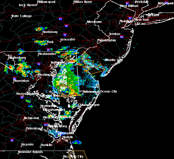 At 344 pm edt, a severe thunderstorm was located near aberdeen, moving southeast at 10 mph (radar indicated). Hazards include 60 mph wind gusts. Damaging winds will cause some trees and large branches to fall. this could injure those outdoors, as well as damage homes and vehicles. roadways may become blocked by downed trees. localized power outages are possible. Unsecured light objects may become projectiles. At 344 pm edt, a severe thunderstorm was located near aberdeen, moving southeast at 10 mph (radar indicated). Hazards include 60 mph wind gusts. Damaging winds will cause some trees and large branches to fall. this could injure those outdoors, as well as damage homes and vehicles. roadways may become blocked by downed trees. localized power outages are possible. Unsecured light objects may become projectiles.
|
| 7/23/2017 3:24 PM EDT |
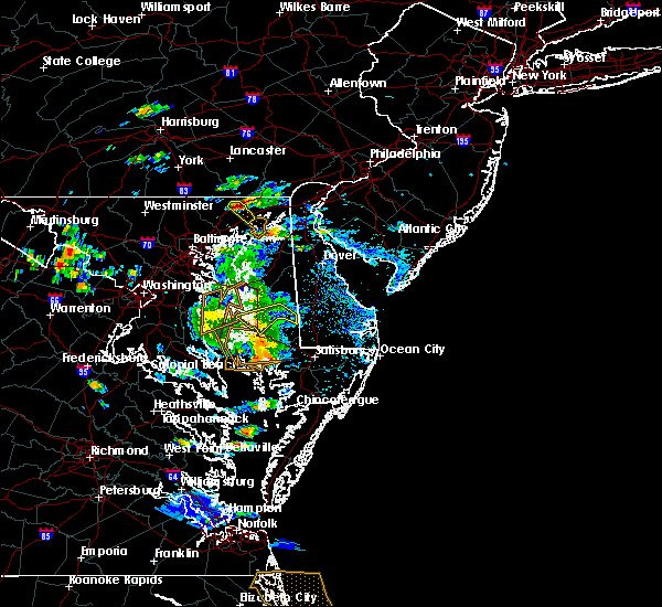 At 324 pm edt, a severe thunderstorm was located near octoraro, or 7 miles northwest of aberdeen, moving southeast at 10 mph (radar indicated). Hazards include 60 mph wind gusts and quarter size hail. Damaging winds will cause some trees and large branches to fall. this could injure those outdoors, as well as damage homes and vehicles. roadways may become blocked by downed trees. localized power outages are possible. unsecured light objects may become projectiles. Locations impacted include, aberdeen, havre de grace, darlington and scarboro. At 324 pm edt, a severe thunderstorm was located near octoraro, or 7 miles northwest of aberdeen, moving southeast at 10 mph (radar indicated). Hazards include 60 mph wind gusts and quarter size hail. Damaging winds will cause some trees and large branches to fall. this could injure those outdoors, as well as damage homes and vehicles. roadways may become blocked by downed trees. localized power outages are possible. unsecured light objects may become projectiles. Locations impacted include, aberdeen, havre de grace, darlington and scarboro.
|
| 7/23/2017 3:06 PM EDT |
 At 306 pm edt, a severe thunderstorm was located near delta, or 11 miles northwest of aberdeen, moving southeast at 10 mph (radar indicated). Hazards include 60 mph wind gusts. Damaging winds will cause some trees and large branches to fall. this could injure those outdoors, as well as damage homes and vehicles. roadways may become blocked by downed trees. localized power outages are possible. Unsecured light objects may become projectiles. At 306 pm edt, a severe thunderstorm was located near delta, or 11 miles northwest of aberdeen, moving southeast at 10 mph (radar indicated). Hazards include 60 mph wind gusts. Damaging winds will cause some trees and large branches to fall. this could injure those outdoors, as well as damage homes and vehicles. roadways may become blocked by downed trees. localized power outages are possible. Unsecured light objects may become projectiles.
|
| 7/14/2017 3:46 PM EDT |
 At 346 pm edt, severe thunderstorms were located along a line extending from swedesboro to near salem to brantwood, moving southeast at 30 mph (radar indicated). Hazards include golf ball size hail and 60 mph wind gusts. People and animals outdoors will be injured. expect hail damage to roofs, siding, windows, and vehicles. expect damage to trees and power lines. Locations impacted include, wilmington, newark, elkton, glassboro, pennsville, pitman, carneys point, paulsboro, new castle, penns grove, salem, north east, woodstown, alloway, quinton, swedesboro, delaware city, charlestown, newport and barksdale. At 346 pm edt, severe thunderstorms were located along a line extending from swedesboro to near salem to brantwood, moving southeast at 30 mph (radar indicated). Hazards include golf ball size hail and 60 mph wind gusts. People and animals outdoors will be injured. expect hail damage to roofs, siding, windows, and vehicles. expect damage to trees and power lines. Locations impacted include, wilmington, newark, elkton, glassboro, pennsville, pitman, carneys point, paulsboro, new castle, penns grove, salem, north east, woodstown, alloway, quinton, swedesboro, delaware city, charlestown, newport and barksdale.
|
| 7/14/2017 3:23 PM EDT |
 At 322 pm edt, severe thunderstorms were located along a line extending from arden to bear to near bay view, moving southeast at 30 mph (radar indicated). Hazards include 60 mph wind gusts and quarter size hail. Minor damage to vehicles is possible. Expect damage to trees and power lines. At 322 pm edt, severe thunderstorms were located along a line extending from arden to bear to near bay view, moving southeast at 30 mph (radar indicated). Hazards include 60 mph wind gusts and quarter size hail. Minor damage to vehicles is possible. Expect damage to trees and power lines.
|
| 7/14/2017 3:18 PM EDT |
 At 316 pm edt, severe thunderstorms were located along a line extending from elam to near newark to woodlawn, moving southeast at 30 mph (radar indicated). Hazards include 60 mph wind gusts and quarter size hail. Minor damage to vehicles is possible. expect damage to trees and power lines. severe thunderstorms will be near, wilmington, arden, bear, glasgow, chelsea, elam, talleyville, concordville, stanton and greenville around 320 pm edt. newport around 325 pm edt. chester, new castle, penns grove, swedesboro, delaware city, beckett, saint georges, chester township, wilmington manor and cherry hill around 330 pm edt. Other locations impacted by these severe thunderstorms include perryville, chesapeake city, edgemoor, marcus hook, boothwyn, trainer, chester heights, village green-green ridge, bellefonte and upland. At 316 pm edt, severe thunderstorms were located along a line extending from elam to near newark to woodlawn, moving southeast at 30 mph (radar indicated). Hazards include 60 mph wind gusts and quarter size hail. Minor damage to vehicles is possible. expect damage to trees and power lines. severe thunderstorms will be near, wilmington, arden, bear, glasgow, chelsea, elam, talleyville, concordville, stanton and greenville around 320 pm edt. newport around 325 pm edt. chester, new castle, penns grove, swedesboro, delaware city, beckett, saint georges, chester township, wilmington manor and cherry hill around 330 pm edt. Other locations impacted by these severe thunderstorms include perryville, chesapeake city, edgemoor, marcus hook, boothwyn, trainer, chester heights, village green-green ridge, bellefonte and upland.
|
| 7/14/2017 3:04 PM EDT |
 At 303 pm edt, severe thunderstorms were located along a line extending from near elam to fair hill to conowingo, moving southeast at 25 mph (radar indicated). Hazards include 60 mph wind gusts and penny size hail. Expect damage to trees and power lines. these severe storms will be near, westtown, kennett square, barksdale, appleton, elam, cherry hill, glen westover, greenville, concordville and ashland around 310 pm edt. newark, elkton, elsmere and talleyville around 315 pm edt. arden and chelsea around 320 pm edt. wilmington, brantwood, chester township and stanton around 325 pm edt. pennsville, charlestown, glasgow, bear and delaware memorial bridge around 330 pm edt. Other locations impacted by these severe thunderstorms include perryville, chesapeake city, edgemoor, marcus hook, boothwyn, trainer, chester heights, village green-green ridge, bellefonte and upland. At 303 pm edt, severe thunderstorms were located along a line extending from near elam to fair hill to conowingo, moving southeast at 25 mph (radar indicated). Hazards include 60 mph wind gusts and penny size hail. Expect damage to trees and power lines. these severe storms will be near, westtown, kennett square, barksdale, appleton, elam, cherry hill, glen westover, greenville, concordville and ashland around 310 pm edt. newark, elkton, elsmere and talleyville around 315 pm edt. arden and chelsea around 320 pm edt. wilmington, brantwood, chester township and stanton around 325 pm edt. pennsville, charlestown, glasgow, bear and delaware memorial bridge around 330 pm edt. Other locations impacted by these severe thunderstorms include perryville, chesapeake city, edgemoor, marcus hook, boothwyn, trainer, chester heights, village green-green ridge, bellefonte and upland.
|
| 7/14/2017 2:42 PM EDT |
 At 241 pm edt, severe thunderstorms were located along a line extending from near marshallton to oxford to conowingo, moving southeast at 30 mph (radar indicated). Hazards include 60 mph wind gusts and penny size hail. Expect damage to trees and power lines. these severe storms will be near, downingtown and marshallton around 245 pm edt. west chester, calvert, kennett square, west grove, lombard and zion around 250 pm edt. westtown, blake, hockessin and north star around 255 pm edt. andora, fair hill, pleasant hill, kemblesville, ashland, bay view, ladenberg and pike creek around 300 pm edt. north east, charlestown, barksdale, talleyville, cherry hill, elam, appleton, glen westover, greenville and concordville around 305 pm edt. newark, elkton, elsmere, newport, arden and chelsea around 310 pm edt. wilmington, brantwood, chester township and wilmington manor around 315 pm edt. hollywood beach, glasgow, bear and delaware memorial bridge around 320 pm edt. Other locations impacted by these severe thunderstorms include perryville, chesapeake city, south coatesville, modena, edgemoor, marcus hook, boothwyn, trainer, thorndale and chester heights. At 241 pm edt, severe thunderstorms were located along a line extending from near marshallton to oxford to conowingo, moving southeast at 30 mph (radar indicated). Hazards include 60 mph wind gusts and penny size hail. Expect damage to trees and power lines. these severe storms will be near, downingtown and marshallton around 245 pm edt. west chester, calvert, kennett square, west grove, lombard and zion around 250 pm edt. westtown, blake, hockessin and north star around 255 pm edt. andora, fair hill, pleasant hill, kemblesville, ashland, bay view, ladenberg and pike creek around 300 pm edt. north east, charlestown, barksdale, talleyville, cherry hill, elam, appleton, glen westover, greenville and concordville around 305 pm edt. newark, elkton, elsmere, newport, arden and chelsea around 310 pm edt. wilmington, brantwood, chester township and wilmington manor around 315 pm edt. hollywood beach, glasgow, bear and delaware memorial bridge around 320 pm edt. Other locations impacted by these severe thunderstorms include perryville, chesapeake city, south coatesville, modena, edgemoor, marcus hook, boothwyn, trainer, thorndale and chester heights.
|
| 7/14/2017 2:31 PM EDT |
 At 231 pm edt, severe thunderstorms were located along a line extending from near coatesville to near mount vernon to near rock springs, moving southeast at 25 mph (radar indicated). Hazards include 60 mph wind gusts and penny size hail. Expect damage to trees and power lines. severe thunderstorms will be near, coatesville and downingtown around 235 pm edt. oxford, rising sun and marshallton around 245 pm edt. west chester, kennett square and west nottingham around 250 pm edt. calvert, west grove, woodlawn, lombard, hockessin, farmington and north star around 255 pm edt. westtown, blake, zion, ashland and pike creek around 300 pm edt. fair hill, andora, elam, pleasant hill, kemblesville, greenville, concordville, bay view and ladenberg around 305 pm edt. elsmere, north east, charlestown, newport, talleyville, appleton, cherry hill, glen westover and chelsea around 310 pm edt. wilmington, newark, arden and barksdale around 315 pm edt. Other locations impacted by these severe thunderstorms include perryville, chesapeake city, south coatesville, modena, edgemoor, marcus hook, boothwyn, trainer, thorndale and chester heights. At 231 pm edt, severe thunderstorms were located along a line extending from near coatesville to near mount vernon to near rock springs, moving southeast at 25 mph (radar indicated). Hazards include 60 mph wind gusts and penny size hail. Expect damage to trees and power lines. severe thunderstorms will be near, coatesville and downingtown around 235 pm edt. oxford, rising sun and marshallton around 245 pm edt. west chester, kennett square and west nottingham around 250 pm edt. calvert, west grove, woodlawn, lombard, hockessin, farmington and north star around 255 pm edt. westtown, blake, zion, ashland and pike creek around 300 pm edt. fair hill, andora, elam, pleasant hill, kemblesville, greenville, concordville, bay view and ladenberg around 305 pm edt. elsmere, north east, charlestown, newport, talleyville, appleton, cherry hill, glen westover and chelsea around 310 pm edt. wilmington, newark, arden and barksdale around 315 pm edt. Other locations impacted by these severe thunderstorms include perryville, chesapeake city, south coatesville, modena, edgemoor, marcus hook, boothwyn, trainer, thorndale and chester heights.
|
| 7/1/2017 5:20 PM EDT |
 At 520 pm edt, severe thunderstorms were located along a line extending from north east to near hollywood beach to near starkey corner, moving east at 40 mph (radar indicated). Hazards include 60 mph wind gusts and penny size hail. Expect damage to trees and power lines. Locations impacted include, elkton, havre de grace, calvert, chestertown, centreville, north east, charlestown, church hill, cecilton, millington, sudlersville, betterton, zion, barksdale, old town, newtown, brantwood, morgnec, fair hill and crumpton. At 520 pm edt, severe thunderstorms were located along a line extending from north east to near hollywood beach to near starkey corner, moving east at 40 mph (radar indicated). Hazards include 60 mph wind gusts and penny size hail. Expect damage to trees and power lines. Locations impacted include, elkton, havre de grace, calvert, chestertown, centreville, north east, charlestown, church hill, cecilton, millington, sudlersville, betterton, zion, barksdale, old town, newtown, brantwood, morgnec, fair hill and crumpton.
|
| 7/1/2017 4:55 PM EDT |
 At 455 pm edt, severe thunderstorms were located along a line extending from near kingsville to bowleys quarters to 7 miles southwest of newtown to near rock hall, moving northeast at 20 mph (radar indicated). Hazards include 60 mph wind gusts and nickel size hail. Expect damage to trees and power lines. Locations impacted include, elkton, havre de grace, calvert, chestertown, centreville, north east, rising sun, rock hall, charlestown, church hill, cecilton, millington, sudlersville, betterton, zion, barksdale, old town, newtown, west nottingham and octoraro. At 455 pm edt, severe thunderstorms were located along a line extending from near kingsville to bowleys quarters to 7 miles southwest of newtown to near rock hall, moving northeast at 20 mph (radar indicated). Hazards include 60 mph wind gusts and nickel size hail. Expect damage to trees and power lines. Locations impacted include, elkton, havre de grace, calvert, chestertown, centreville, north east, rising sun, rock hall, charlestown, church hill, cecilton, millington, sudlersville, betterton, zion, barksdale, old town, newtown, west nottingham and octoraro.
|
| 7/1/2017 4:49 PM EDT |
 At 449 pm edt, a severe thunderstorm was located over octoraro, or 8 miles north of havre de grace, moving east at 35 mph (radar indicated. maryland state highways reported a tree down near the intersection of fallston road and oakton road). Hazards include 60 mph wind gusts. Damaging winds will cause some trees and large branches to fall. this could injure those outdoors, as well as damage homes and vehicles. roadways may become blocked by downed trees. localized power outages are possible. unsecured light objects may become projectiles. Locations impacted include, aberdeen, havre de grace, bel air south, bel air north, darlington, cardiff, churchville, carsins, scarboro and hickory. At 449 pm edt, a severe thunderstorm was located over octoraro, or 8 miles north of havre de grace, moving east at 35 mph (radar indicated. maryland state highways reported a tree down near the intersection of fallston road and oakton road). Hazards include 60 mph wind gusts. Damaging winds will cause some trees and large branches to fall. this could injure those outdoors, as well as damage homes and vehicles. roadways may become blocked by downed trees. localized power outages are possible. unsecured light objects may become projectiles. Locations impacted include, aberdeen, havre de grace, bel air south, bel air north, darlington, cardiff, churchville, carsins, scarboro and hickory.
|
| 7/1/2017 4:40 PM EDT |
 At 440 pm edt, a severe thunderstorm was located near octoraro, or 9 miles northwest of havre de grace, moving east at 35 mph (radar indicated). Hazards include 60 mph wind gusts. Damaging winds will cause some trees and large branches to fall. this could injure those outdoors, as well as damage homes and vehicles. roadways may become blocked by downed trees. localized power outages are possible. unsecured light objects may become projectiles. Locations impacted include, aberdeen, havre de grace, bel air south, bel air north, fallston, pleasant hills, pylesville, darlington, cardiff, benson, churchville, carsins, scarboro, forest hill, bynum, street, rocks, whiteford, hickory and chrome hill. At 440 pm edt, a severe thunderstorm was located near octoraro, or 9 miles northwest of havre de grace, moving east at 35 mph (radar indicated). Hazards include 60 mph wind gusts. Damaging winds will cause some trees and large branches to fall. this could injure those outdoors, as well as damage homes and vehicles. roadways may become blocked by downed trees. localized power outages are possible. unsecured light objects may become projectiles. Locations impacted include, aberdeen, havre de grace, bel air south, bel air north, fallston, pleasant hills, pylesville, darlington, cardiff, benson, churchville, carsins, scarboro, forest hill, bynum, street, rocks, whiteford, hickory and chrome hill.
|
| 7/1/2017 4:38 PM EDT |
 At 438 pm edt, severe thunderstorms were located along a line extending from white marsh to back river to near millers island to near gibson island, moving northeast at 20 mph (radar indicated). Hazards include 60 mph wind gusts and nickel size hail. expect damage to trees and power lines At 438 pm edt, severe thunderstorms were located along a line extending from white marsh to back river to near millers island to near gibson island, moving northeast at 20 mph (radar indicated). Hazards include 60 mph wind gusts and nickel size hail. expect damage to trees and power lines
|
| 7/1/2017 4:30 PM EDT |
 At 430 pm edt, a severe thunderstorm was located near bel air north, or 11 miles northwest of aberdeen, moving east at 35 mph (radar indicated). Hazards include 60 mph wind gusts. Damaging winds will cause some trees and large branches to fall. this could injure those outdoors, as well as damage homes and vehicles. roadways may become blocked by downed trees. localized power outages are possible. unsecured light objects may become projectiles. Locations impacted include, aberdeen, havre de grace, bel air south, bel air north, fallston, pleasant hills, jarrettsville, pylesville, darlington, cardiff, benson, churchville, carsins, scarboro, forest hill, bynum, chrome hill, street, rocks and whiteford. At 430 pm edt, a severe thunderstorm was located near bel air north, or 11 miles northwest of aberdeen, moving east at 35 mph (radar indicated). Hazards include 60 mph wind gusts. Damaging winds will cause some trees and large branches to fall. this could injure those outdoors, as well as damage homes and vehicles. roadways may become blocked by downed trees. localized power outages are possible. unsecured light objects may become projectiles. Locations impacted include, aberdeen, havre de grace, bel air south, bel air north, fallston, pleasant hills, jarrettsville, pylesville, darlington, cardiff, benson, churchville, carsins, scarboro, forest hill, bynum, chrome hill, street, rocks and whiteford.
|
| 7/1/2017 4:11 PM EDT |
 At 410 pm edt, a severe thunderstorm was located near cockeysville, moving east at 35 mph (radar indicated). Hazards include 60 mph wind gusts. Damaging winds will cause some trees and large branches to fall. this could injure those outdoors, as well as damage homes and vehicles. roadways may become blocked by downed trees. localized power outages are possible. unsecured light objects may become projectiles. Locations impacted include, cockeysville, aberdeen, havre de grace, bel air south, bel air north, mays chapel, timonium, fallston, kingsville, pleasant hills, jarrettsville, lutherville-timonium, pylesville, darlington, cardiff, churchville, long green, carsins, forest hill and street. At 410 pm edt, a severe thunderstorm was located near cockeysville, moving east at 35 mph (radar indicated). Hazards include 60 mph wind gusts. Damaging winds will cause some trees and large branches to fall. this could injure those outdoors, as well as damage homes and vehicles. roadways may become blocked by downed trees. localized power outages are possible. unsecured light objects may become projectiles. Locations impacted include, cockeysville, aberdeen, havre de grace, bel air south, bel air north, mays chapel, timonium, fallston, kingsville, pleasant hills, jarrettsville, lutherville-timonium, pylesville, darlington, cardiff, churchville, long green, carsins, forest hill and street.
|
| 7/1/2017 3:56 PM EDT |
 At 356 pm edt, a severe thunderstorm was located near cockeysville, moving east at 35 mph (radar indicated). Hazards include 60 mph wind gusts. Damaging winds will cause some trees and large branches to fall. this could injure those outdoors, as well as damage homes and vehicles. roadways may become blocked by downed trees. localized power outages are possible. Unsecured light objects may become projectiles. At 356 pm edt, a severe thunderstorm was located near cockeysville, moving east at 35 mph (radar indicated). Hazards include 60 mph wind gusts. Damaging winds will cause some trees and large branches to fall. this could injure those outdoors, as well as damage homes and vehicles. roadways may become blocked by downed trees. localized power outages are possible. Unsecured light objects may become projectiles.
|
| 5/19/2017 4:21 PM EDT |
 At 420 pm edt, a severe thunderstorm was located near charlestown, or near havre de grace, moving east at 15 mph (radar indicated). Hazards include 60 mph wind gusts and quarter size hail. Minor damage to vehicles is possible. Expect damage to trees and power lines. At 420 pm edt, a severe thunderstorm was located near charlestown, or near havre de grace, moving east at 15 mph (radar indicated). Hazards include 60 mph wind gusts and quarter size hail. Minor damage to vehicles is possible. Expect damage to trees and power lines.
|
| 4/6/2017 2:52 PM EDT | Tree limbs down in the 2000 block of level roa in harford county MD, 1 miles SSE of Havre de Grace, MD |
| 4/6/2017 2:48 PM EDT |
 At 247 pm edt, severe thunderstorms were located along a line extending from near cockeysville to near riverside to near langford, moving northeast at 50 mph (radar indicated). Hazards include 60 mph wind gusts. Damaging winds will cause some trees and large branches to fall. this could injure those outdoors, as well as damage homes and vehicles. roadways may become blocked by downed trees. localized power outages are possible. Unsecured light objects may become projectiles. At 247 pm edt, severe thunderstorms were located along a line extending from near cockeysville to near riverside to near langford, moving northeast at 50 mph (radar indicated). Hazards include 60 mph wind gusts. Damaging winds will cause some trees and large branches to fall. this could injure those outdoors, as well as damage homes and vehicles. roadways may become blocked by downed trees. localized power outages are possible. Unsecured light objects may become projectiles.
|
| 3/1/2017 2:40 PM EST |
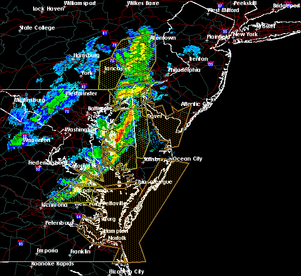 The severe thunderstorm warning for northeastern harford county will expire at 245 pm est, the storms which prompted the warning have moved out of the area. therefore the warning will be allowed to expire. a severe thunderstorm watch remains in effect until 500 pm est for northern maryland. The severe thunderstorm warning for northeastern harford county will expire at 245 pm est, the storms which prompted the warning have moved out of the area. therefore the warning will be allowed to expire. a severe thunderstorm watch remains in effect until 500 pm est for northern maryland.
|
| 3/1/2017 2:34 PM EST |
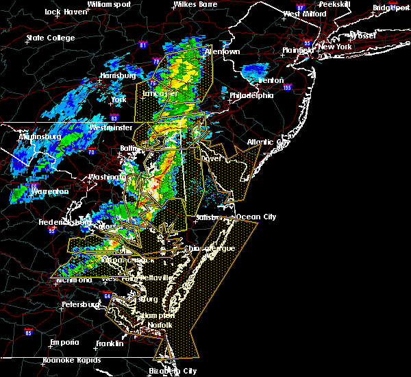 At 234 pm est, severe thunderstorms were located along a line extending from near quarryville to havre de grace to near langford, moving east at 50 mph (radar indicated). Hazards include 60 mph wind gusts. Damaging winds will cause some trees and large branches to fall. this could injure those outdoors, as well as damage homes and vehicles. roadways may become blocked by downed trees. localized power outages are possible. unsecured light objects may become projectiles. Locations impacted include, aberdeen, havre de grace, aberdeen proving ground and perryman. At 234 pm est, severe thunderstorms were located along a line extending from near quarryville to havre de grace to near langford, moving east at 50 mph (radar indicated). Hazards include 60 mph wind gusts. Damaging winds will cause some trees and large branches to fall. this could injure those outdoors, as well as damage homes and vehicles. roadways may become blocked by downed trees. localized power outages are possible. unsecured light objects may become projectiles. Locations impacted include, aberdeen, havre de grace, aberdeen proving ground and perryman.
|
| 3/1/2017 2:29 PM EST |
 At 228 pm est, severe thunderstorms were located along a line extending from ladenberg to near north east to near betterton, moving east at 60 mph (trained weather spotters). Hazards include 60 mph wind gusts and penny size hail. Expect damage to roofs, siding, and trees. these severe storms will be near, newark, elsmere, newport, ashland, greenville, pike creek, hockessin, north star and stanton around 235 pm est. wilmington, new castle, arden, saint georges, talleyville, glasgow, mount pleasant, bear, wilmington manor and delaware memorial bridge around 240 pm est. middletown, pennsville, carneys point, penns grove, salem, delaware city and port penn around 245 pm est. Other locations impacted by these severe thunderstorms include townsend, brookside, perryville, chesapeake city, ardencroft, port deposit, edgemoor, claymont, bellefonte and ardentown. At 228 pm est, severe thunderstorms were located along a line extending from ladenberg to near north east to near betterton, moving east at 60 mph (trained weather spotters). Hazards include 60 mph wind gusts and penny size hail. Expect damage to roofs, siding, and trees. these severe storms will be near, newark, elsmere, newport, ashland, greenville, pike creek, hockessin, north star and stanton around 235 pm est. wilmington, new castle, arden, saint georges, talleyville, glasgow, mount pleasant, bear, wilmington manor and delaware memorial bridge around 240 pm est. middletown, pennsville, carneys point, penns grove, salem, delaware city and port penn around 245 pm est. Other locations impacted by these severe thunderstorms include townsend, brookside, perryville, chesapeake city, ardencroft, port deposit, edgemoor, claymont, bellefonte and ardentown.
|
| 3/1/2017 2:25 PM EST |
 At 225 pm est, severe thunderstorms were located along a line extending from near wakefield to aberdeen to rock hall, moving east at 60 mph (radar indicated). Hazards include 60 mph wind gusts. Damaging winds will cause some trees and large branches to fall. this could injure those outdoors, as well as damage homes and vehicles. roadways may become blocked by downed trees. localized power outages are possible. unsecured light objects may become projectiles. Locations impacted include, aberdeen, havre de grace, aberdeen proving ground, bel air south, bel air north, fallston, riverside, kingsville, pleasant hills, perryman, edgewood, joppatowne, darlington, churchville, carsins, forest hill, abingdon, joppa, hickory and benson. At 225 pm est, severe thunderstorms were located along a line extending from near wakefield to aberdeen to rock hall, moving east at 60 mph (radar indicated). Hazards include 60 mph wind gusts. Damaging winds will cause some trees and large branches to fall. this could injure those outdoors, as well as damage homes and vehicles. roadways may become blocked by downed trees. localized power outages are possible. unsecured light objects may become projectiles. Locations impacted include, aberdeen, havre de grace, aberdeen proving ground, bel air south, bel air north, fallston, riverside, kingsville, pleasant hills, perryman, edgewood, joppatowne, darlington, churchville, carsins, forest hill, abingdon, joppa, hickory and benson.
|
| 3/1/2017 2:19 PM EST |
 At 219 pm est, severe thunderstorms were located along a line extending from holtwood to near riverside to near rock hall, moving east at 60 mph (radar indicated). Hazards include 60 mph wind gusts. Damaging winds will cause some trees and large branches to fall. this could injure those outdoors, as well as damage homes and vehicles. roadways may become blocked by downed trees. localized power outages are possible. unsecured light objects may become projectiles. Locations impacted include, aberdeen, havre de grace, aberdeen proving ground, bel air south, bel air north, perry hall, white marsh, fallston, riverside, kingsville, pleasant hills, jarrettsville, perryman, edgewood, joppatowne, pylesville, darlington, glen arm, fork and cardiff. At 219 pm est, severe thunderstorms were located along a line extending from holtwood to near riverside to near rock hall, moving east at 60 mph (radar indicated). Hazards include 60 mph wind gusts. Damaging winds will cause some trees and large branches to fall. this could injure those outdoors, as well as damage homes and vehicles. roadways may become blocked by downed trees. localized power outages are possible. unsecured light objects may become projectiles. Locations impacted include, aberdeen, havre de grace, aberdeen proving ground, bel air south, bel air north, perry hall, white marsh, fallston, riverside, kingsville, pleasant hills, jarrettsville, perryman, edgewood, joppatowne, pylesville, darlington, glen arm, fork and cardiff.
|
| 3/1/2017 2:12 PM EST |
 At 211 pm est, severe thunderstorms were located along a line extending from near sunnyburn to pleasant hills to bodkin point, moving east at 55 mph (radar indicated). Hazards include 60 mph wind gusts. Damaging winds will cause some trees and large branches to fall. this could injure those outdoors, as well as damage homes and vehicles. roadways may become blocked by downed trees. localized power outages are possible. unsecured light objects may become projectiles. Locations impacted include, middle river, cockeysville, aberdeen, havre de grace, aberdeen proving ground, fort smallwood state park, gibson island, bodkin point, sillery bay, millers island, north point state park, sparrows point, pinehurst, back river, dundalk, bel air south, essex, parkville, bel air north and carney. At 211 pm est, severe thunderstorms were located along a line extending from near sunnyburn to pleasant hills to bodkin point, moving east at 55 mph (radar indicated). Hazards include 60 mph wind gusts. Damaging winds will cause some trees and large branches to fall. this could injure those outdoors, as well as damage homes and vehicles. roadways may become blocked by downed trees. localized power outages are possible. unsecured light objects may become projectiles. Locations impacted include, middle river, cockeysville, aberdeen, havre de grace, aberdeen proving ground, fort smallwood state park, gibson island, bodkin point, sillery bay, millers island, north point state park, sparrows point, pinehurst, back river, dundalk, bel air south, essex, parkville, bel air north and carney.
|
| 3/1/2017 2:05 PM EST |
 At 204 pm est, severe thunderstorms were located along a line extending from near delta to near kingsville to lake shore, moving east at 60 mph (radar indicated). Hazards include 60 mph wind gusts. Damaging winds will cause some trees and large branches to fall. this could injure those outdoors, as well as damage homes and vehicles. roadways may become blocked by downed trees. localized power outages are possible. unsecured light objects may become projectiles. Locations impacted include, baltimore, severn, pikesville, middle river, cockeysville, aberdeen, havre de grace, riviera beach, aberdeen proving ground, baltimore-washington airport, fort smallwood state park, gibson island, sillery bay, millers island, north point state park, sparrows point, pinehurst, bodkin point, back river and glen burnie. At 204 pm est, severe thunderstorms were located along a line extending from near delta to near kingsville to lake shore, moving east at 60 mph (radar indicated). Hazards include 60 mph wind gusts. Damaging winds will cause some trees and large branches to fall. this could injure those outdoors, as well as damage homes and vehicles. roadways may become blocked by downed trees. localized power outages are possible. unsecured light objects may become projectiles. Locations impacted include, baltimore, severn, pikesville, middle river, cockeysville, aberdeen, havre de grace, riviera beach, aberdeen proving ground, baltimore-washington airport, fort smallwood state park, gibson island, sillery bay, millers island, north point state park, sparrows point, pinehurst, bodkin point, back river and glen burnie.
|
| 3/1/2017 2:00 PM EST |
 At 159 pm est, severe thunderstorms were located along a line extending from delta to fallston to towson, moving east at 60 mph (trained weather spotters). Hazards include 60 mph wind gusts and penny size hail. Expect damage to roofs, siding, and trees. severe thunderstorms will be near, rock springs, richardsmere, conowingo, west nottingham and octoraro around 210 pm est. calvert, rising sun, glen roy and farmington around 215 pm est. havre de grace, oxford, lombard, blake, woodlawn, zion and pleasant hill around 220 pm est. north east, charlestown, betterton, kemblesville, glen westover, fair hill, bay view, appleton and andora around 225 pm est. newark, north star, ladenberg, pike creek and cherry hill around 230 pm est. elkton, elsmere, newport, cecilton, ashland, greenville, brantwood, hockessin, hollywood beach and stanton around 235 pm est. wilmington, penns grove, arden, talleyville, bohemias mills, saint georges, cayots, glasgow, warwick and bear around 240 pm est. middletown, pennsville, carneys point, new castle, salem, delaware city, mount pleasant, port penn, wilmington manor and delaware memorial bridge around 245 pm est. Other locations impacted by these severe thunderstorms include townsend, brookside, perryville, chesapeake city, ardencroft, port deposit, edgemoor, claymont, bellefonte and ardentown. At 159 pm est, severe thunderstorms were located along a line extending from delta to fallston to towson, moving east at 60 mph (trained weather spotters). Hazards include 60 mph wind gusts and penny size hail. Expect damage to roofs, siding, and trees. severe thunderstorms will be near, rock springs, richardsmere, conowingo, west nottingham and octoraro around 210 pm est. calvert, rising sun, glen roy and farmington around 215 pm est. havre de grace, oxford, lombard, blake, woodlawn, zion and pleasant hill around 220 pm est. north east, charlestown, betterton, kemblesville, glen westover, fair hill, bay view, appleton and andora around 225 pm est. newark, north star, ladenberg, pike creek and cherry hill around 230 pm est. elkton, elsmere, newport, cecilton, ashland, greenville, brantwood, hockessin, hollywood beach and stanton around 235 pm est. wilmington, penns grove, arden, talleyville, bohemias mills, saint georges, cayots, glasgow, warwick and bear around 240 pm est. middletown, pennsville, carneys point, new castle, salem, delaware city, mount pleasant, port penn, wilmington manor and delaware memorial bridge around 245 pm est. Other locations impacted by these severe thunderstorms include townsend, brookside, perryville, chesapeake city, ardencroft, port deposit, edgemoor, claymont, bellefonte and ardentown.
|
| 3/1/2017 1:47 PM EST |
 At 147 pm est, severe thunderstorms were located along a line extending from near stewartstown to towson to near fort meade, moving east at 60 mph (radar indicated). Hazards include 60 mph wind gusts. Damaging winds will cause some trees and large branches to fall. this could injure those outdoors, as well as damage homes and vehicles. roadways may become blocked by downed trees. localized power outages are possible. Unsecured light objects may become projectiles. At 147 pm est, severe thunderstorms were located along a line extending from near stewartstown to towson to near fort meade, moving east at 60 mph (radar indicated). Hazards include 60 mph wind gusts. Damaging winds will cause some trees and large branches to fall. this could injure those outdoors, as well as damage homes and vehicles. roadways may become blocked by downed trees. localized power outages are possible. Unsecured light objects may become projectiles.
|
| 2/25/2017 4:04 PM EST |
 At 403 pm est, severe thunderstorms were located along a line extending from calvert to near stevensville, moving east at 40 mph (radar indicated). Hazards include 60 mph wind gusts and quarter size hail. Hail damage to vehicles is expected. Expect wind damage to roofs, siding, and trees. At 403 pm est, severe thunderstorms were located along a line extending from calvert to near stevensville, moving east at 40 mph (radar indicated). Hazards include 60 mph wind gusts and quarter size hail. Hail damage to vehicles is expected. Expect wind damage to roofs, siding, and trees.
|
| 2/25/2017 3:43 PM EST |
 At 342 pm est, a severe thunderstorm was located near bel air north, or 7 miles northwest of aberdeen, moving northeast at 55 mph (radar indicated). Hazards include 60 mph wind gusts and half dollar size hail. Damaging winds will cause some trees and large branches to fall. this could injure those outdoors, as well as damage homes and vehicles. roadways may become blocked by downed trees. localized power outages are possible. unsecured light objects may become projectiles. Locations impacted include, aberdeen, havre de grace, aberdeen proving ground, bel air south, bel air north, fallston, riverside, kingsville, pleasant hills, perryman, edgewood, joppatowne, pylesville, darlington, cardiff, churchville, carsins, forest hill, abingdon and street. At 342 pm est, a severe thunderstorm was located near bel air north, or 7 miles northwest of aberdeen, moving northeast at 55 mph (radar indicated). Hazards include 60 mph wind gusts and half dollar size hail. Damaging winds will cause some trees and large branches to fall. this could injure those outdoors, as well as damage homes and vehicles. roadways may become blocked by downed trees. localized power outages are possible. unsecured light objects may become projectiles. Locations impacted include, aberdeen, havre de grace, aberdeen proving ground, bel air south, bel air north, fallston, riverside, kingsville, pleasant hills, perryman, edgewood, joppatowne, pylesville, darlington, cardiff, churchville, carsins, forest hill, abingdon and street.
|
| 2/25/2017 3:24 PM EST |
 At 324 pm est, a severe thunderstorm was located over rossville, or near middle river, moving northeast at 55 mph (radar indicated). Hazards include 60 mph wind gusts and half dollar size hail. Damaging winds will cause some trees and large branches to fall. this could injure those outdoors, as well as damage homes and vehicles. roadways may become blocked by downed trees. localized power outages are possible. Unsecured light objects may become projectiles. At 324 pm est, a severe thunderstorm was located over rossville, or near middle river, moving northeast at 55 mph (radar indicated). Hazards include 60 mph wind gusts and half dollar size hail. Damaging winds will cause some trees and large branches to fall. this could injure those outdoors, as well as damage homes and vehicles. roadways may become blocked by downed trees. localized power outages are possible. Unsecured light objects may become projectiles.
|
| 2/12/2017 11:24 PM EST |
 The severe thunderstorm warning for northern anne arundel, southeastern howard, harford and southeastern baltimore counties and baltimore city will expire at 1130 pm est, the storms which prompted the warning have moved out of the area. therefore the warning will be allowed to expire. to report severe weather, contact your nearest law enforcement agency. they will relay your report to the national weather service sterling virginia. remember, a severe thunderstorm warning still remains in effect for southern anne arundel county until 11:45 pm. The severe thunderstorm warning for northern anne arundel, southeastern howard, harford and southeastern baltimore counties and baltimore city will expire at 1130 pm est, the storms which prompted the warning have moved out of the area. therefore the warning will be allowed to expire. to report severe weather, contact your nearest law enforcement agency. they will relay your report to the national weather service sterling virginia. remember, a severe thunderstorm warning still remains in effect for southern anne arundel county until 11:45 pm.
|
| 2/12/2017 11:10 PM EST |
 At 1108 pm est, severe thunderstorms were located along a line extending from near plymouth meeting to near bel air north, moving east at 60 mph (radar indicated). Hazards include 60 mph wind gusts. expect damage to roofs, siding, and trees At 1108 pm est, severe thunderstorms were located along a line extending from near plymouth meeting to near bel air north, moving east at 60 mph (radar indicated). Hazards include 60 mph wind gusts. expect damage to roofs, siding, and trees
|
| 2/12/2017 11:08 PM EST |
 At 1108 pm est, severe thunderstorms were located along a line extending from near bel air north to near columbia, moving east at 55 mph (radar indicated). Hazards include 60 mph wind gusts. Damaging winds will cause some trees and large branches to fall. this could injure those outdoors, as well as damage homes and vehicles. roadways may become blocked by downed trees. localized power outages are possible. unsecured light objects may become projectiles. Locations impacted include, baltimore, columbia, severn, pikesville, middle river, cockeysville, elkridge, aberdeen, havre de grace, riviera beach, aberdeen proving ground, baltimore-washington airport, fort smallwood state park, gibson island, sillery bay, millers island, north point state park, sparrows point, pinehurst and bodkin point. At 1108 pm est, severe thunderstorms were located along a line extending from near bel air north to near columbia, moving east at 55 mph (radar indicated). Hazards include 60 mph wind gusts. Damaging winds will cause some trees and large branches to fall. this could injure those outdoors, as well as damage homes and vehicles. roadways may become blocked by downed trees. localized power outages are possible. unsecured light objects may become projectiles. Locations impacted include, baltimore, columbia, severn, pikesville, middle river, cockeysville, elkridge, aberdeen, havre de grace, riviera beach, aberdeen proving ground, baltimore-washington airport, fort smallwood state park, gibson island, sillery bay, millers island, north point state park, sparrows point, pinehurst and bodkin point.
|
| 2/12/2017 10:47 PM EST |
 At 1046 pm est, severe thunderstorms were located along a line extending from near hampstead to near damascus, moving east at 55 mph (radar indicated). Hazards include 60 mph wind gusts. Damaging winds will cause some trees and large branches to fall. this could injure those outdoors, as well as damage homes and vehicles. roadways may become blocked by downed trees. localized power outages are possible. unsecured light objects may become projectiles. Locations impacted include, baltimore, columbia, germantown, severn, olney, pikesville, middle river, cockeysville, elkridge, damascus, aberdeen, havre de grace, riviera beach, aberdeen proving ground, baltimore-washington airport, fort smallwood state park, gibson island, sillery bay, millers island and north point state park. At 1046 pm est, severe thunderstorms were located along a line extending from near hampstead to near damascus, moving east at 55 mph (radar indicated). Hazards include 60 mph wind gusts. Damaging winds will cause some trees and large branches to fall. this could injure those outdoors, as well as damage homes and vehicles. roadways may become blocked by downed trees. localized power outages are possible. unsecured light objects may become projectiles. Locations impacted include, baltimore, columbia, germantown, severn, olney, pikesville, middle river, cockeysville, elkridge, damascus, aberdeen, havre de grace, riviera beach, aberdeen proving ground, baltimore-washington airport, fort smallwood state park, gibson island, sillery bay, millers island and north point state park.
|
| 2/12/2017 10:29 PM EST |
 At 1029 pm est, severe thunderstorms were located along a line extending from near littlestown to near point of rocks, moving east at 55 mph (radar indicated). Hazards include 60 mph wind gusts. Damaging winds will cause some trees and large branches to fall. this could injure those outdoors, as well as damage homes and vehicles. roadways may become blocked by downed trees. localized power outages are possible. Unsecured light objects may become projectiles. At 1029 pm est, severe thunderstorms were located along a line extending from near littlestown to near point of rocks, moving east at 55 mph (radar indicated). Hazards include 60 mph wind gusts. Damaging winds will cause some trees and large branches to fall. this could injure those outdoors, as well as damage homes and vehicles. roadways may become blocked by downed trees. localized power outages are possible. Unsecured light objects may become projectiles.
|
| 8/31/2016 11:46 PM EDT |
 At 1145 pm edt, a severe thunderstorm was located over bel air north, or 10 miles west of aberdeen, moving southeast at 15 mph (radar indicated). Hazards include 60 mph wind gusts. Damaging winds will cause some trees and large branches to fall. this could injure those outdoors, as well as damage homes and vehicles. roadways may become blocked by downed trees. localized power outages are possible. unsecured light objects may become projectiles. Locations impacted include, aberdeen, havre de grace, aberdeen proving ground, bel air south, bel air north, fallston, riverside, pleasant hills, perryman, edgewood, joppatowne, abingdon, harford furnace, benson, carsins, bynum, belcamp, hickory and churchville. At 1145 pm edt, a severe thunderstorm was located over bel air north, or 10 miles west of aberdeen, moving southeast at 15 mph (radar indicated). Hazards include 60 mph wind gusts. Damaging winds will cause some trees and large branches to fall. this could injure those outdoors, as well as damage homes and vehicles. roadways may become blocked by downed trees. localized power outages are possible. unsecured light objects may become projectiles. Locations impacted include, aberdeen, havre de grace, aberdeen proving ground, bel air south, bel air north, fallston, riverside, pleasant hills, perryman, edgewood, joppatowne, abingdon, harford furnace, benson, carsins, bynum, belcamp, hickory and churchville.
|
| 8/31/2016 11:27 PM EDT |
 At 1127 pm edt, a severe thunderstorm was located over fallston, or 11 miles northeast of cockeysville, moving southeast at 15 mph (radar indicated). Hazards include 60 mph wind gusts. Damaging winds will cause some trees and large branches to fall. this could injure those outdoors, as well as damage homes and vehicles. roadways may become blocked by downed trees. localized power outages are possible. Unsecured light objects may become projectiles. At 1127 pm edt, a severe thunderstorm was located over fallston, or 11 miles northeast of cockeysville, moving southeast at 15 mph (radar indicated). Hazards include 60 mph wind gusts. Damaging winds will cause some trees and large branches to fall. this could injure those outdoors, as well as damage homes and vehicles. roadways may become blocked by downed trees. localized power outages are possible. Unsecured light objects may become projectiles.
|
| 8/16/2016 6:14 PM EDT |
 At 613 pm edt, a severe thunderstorm was located over havre de grace, moving east at 15 mph (radar indicated). Hazards include 60 mph wind gusts and quarter size hail. Damaging winds will cause some trees and large branches to fall. this could injure those outdoors, as well as damage homes and vehicles. roadways may become blocked by downed trees. localized power outages are possible. unsecured light objects may become projectiles. Locations impacted include, aberdeen, havre de grace, aberdeen proving ground, perryman and carsins. At 613 pm edt, a severe thunderstorm was located over havre de grace, moving east at 15 mph (radar indicated). Hazards include 60 mph wind gusts and quarter size hail. Damaging winds will cause some trees and large branches to fall. this could injure those outdoors, as well as damage homes and vehicles. roadways may become blocked by downed trees. localized power outages are possible. unsecured light objects may become projectiles. Locations impacted include, aberdeen, havre de grace, aberdeen proving ground, perryman and carsins.
|
| 8/16/2016 6:02 PM EDT |
 At 601 pm edt, a severe thunderstorm was located over havre de grace, moving northeast at 15 mph (radar indicated). Hazards include 60 mph wind gusts. Expect damage to roofs. siding. and trees. Locations impacted include, calvert, north east, rising sun, charlestown, rock springs, pleasant hill, blake, andora, farmington, richardsmere, conowingo, west nottingham, fair hill, woodlawn, hollywood beach, cherry hill, bay view, lombard, octoraro and zion. At 601 pm edt, a severe thunderstorm was located over havre de grace, moving northeast at 15 mph (radar indicated). Hazards include 60 mph wind gusts. Expect damage to roofs. siding. and trees. Locations impacted include, calvert, north east, rising sun, charlestown, rock springs, pleasant hill, blake, andora, farmington, richardsmere, conowingo, west nottingham, fair hill, woodlawn, hollywood beach, cherry hill, bay view, lombard, octoraro and zion.
|
| 8/16/2016 5:58 PM EDT |
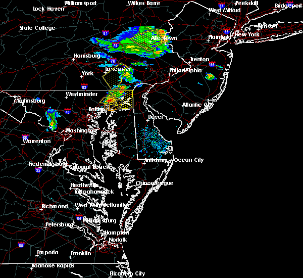 At 558 pm edt, a severe thunderstorm was located over aberdeen, moving east at 15 mph (radar indicated). Hazards include 60 mph wind gusts and quarter size hail. Damaging winds will cause some trees and large branches to fall. this could injure those outdoors, as well as damage homes and vehicles. roadways may become blocked by downed trees. localized power outages are possible. Unsecured light objects may become projectiles. At 558 pm edt, a severe thunderstorm was located over aberdeen, moving east at 15 mph (radar indicated). Hazards include 60 mph wind gusts and quarter size hail. Damaging winds will cause some trees and large branches to fall. this could injure those outdoors, as well as damage homes and vehicles. roadways may become blocked by downed trees. localized power outages are possible. Unsecured light objects may become projectiles.
|
| 8/16/2016 5:42 PM EDT |
 At 542 pm edt, a severe thunderstorm was located over bel air south, or near aberdeen, moving east at 20 mph (radar indicated). Hazards include 60 mph wind gusts and quarter size hail. Damaging winds will cause some trees and large branches to fall. this could injure those outdoors, as well as damage homes and vehicles. roadways may become blocked by downed trees. localized power outages are possible. unsecured light objects may become projectiles. Locations impacted include, aberdeen, havre de grace, aberdeen proving ground, bel air south, bel air north, riverside, pleasant hills, perryman, carsins, harford furnace, churchville and benson. At 542 pm edt, a severe thunderstorm was located over bel air south, or near aberdeen, moving east at 20 mph (radar indicated). Hazards include 60 mph wind gusts and quarter size hail. Damaging winds will cause some trees and large branches to fall. this could injure those outdoors, as well as damage homes and vehicles. roadways may become blocked by downed trees. localized power outages are possible. unsecured light objects may become projectiles. Locations impacted include, aberdeen, havre de grace, aberdeen proving ground, bel air south, bel air north, riverside, pleasant hills, perryman, carsins, harford furnace, churchville and benson.
|
| 8/16/2016 5:37 PM EDT |
 At 536 pm edt, a severe thunderstorm was located over woodlawn, or near havre de grace, moving east at 40 mph (radar indicated). Hazards include 60 mph wind gusts. Expect damage to roofs. siding. And trees. At 536 pm edt, a severe thunderstorm was located over woodlawn, or near havre de grace, moving east at 40 mph (radar indicated). Hazards include 60 mph wind gusts. Expect damage to roofs. siding. And trees.
|
| 8/16/2016 5:14 PM EDT |
 At 514 pm edt, a severe thunderstorm was located over bel air north, or 9 miles west of aberdeen, moving east at 25 mph (radar indicated). Hazards include 60 mph wind gusts and quarter size hail. Damaging winds will cause some trees and large branches to fall. this could injure those outdoors, as well as damage homes and vehicles. roadways may become blocked by downed trees. localized power outages are possible. Unsecured light objects may become projectiles. At 514 pm edt, a severe thunderstorm was located over bel air north, or 9 miles west of aberdeen, moving east at 25 mph (radar indicated). Hazards include 60 mph wind gusts and quarter size hail. Damaging winds will cause some trees and large branches to fall. this could injure those outdoors, as well as damage homes and vehicles. roadways may become blocked by downed trees. localized power outages are possible. Unsecured light objects may become projectiles.
|
| 8/14/2016 9:37 PM EDT |
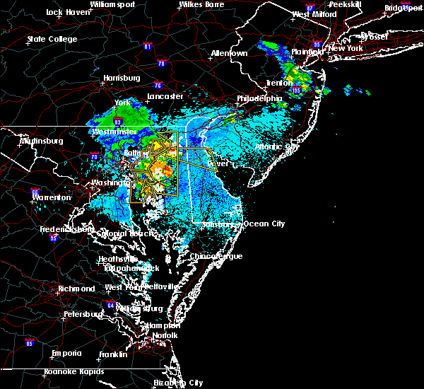 The severe thunderstorm warning for southeastern harford county will expire at 945 pm edt, the storm which prompted the warning has moved out of the area. therefore the warning will be allowed to expire. however gusty winds are still possible with this thunderstorm. The severe thunderstorm warning for southeastern harford county will expire at 945 pm edt, the storm which prompted the warning has moved out of the area. therefore the warning will be allowed to expire. however gusty winds are still possible with this thunderstorm.
|
| 8/14/2016 9:27 PM EDT |
 At 927 pm edt, a severe thunderstorm was located over aberdeen proving ground, moving east at 35 mph (radar indicated). Hazards include 60 mph wind gusts. Damaging winds will cause some trees and large branches to fall. this could injure those outdoors, as well as damage homes and vehicles. roadways may become blocked by downed trees. localized power outages are possible. unsecured light objects may become projectiles. Locations impacted include, aberdeen, havre de grace, aberdeen proving ground, riverside, perryman and carsins. At 927 pm edt, a severe thunderstorm was located over aberdeen proving ground, moving east at 35 mph (radar indicated). Hazards include 60 mph wind gusts. Damaging winds will cause some trees and large branches to fall. this could injure those outdoors, as well as damage homes and vehicles. roadways may become blocked by downed trees. localized power outages are possible. unsecured light objects may become projectiles. Locations impacted include, aberdeen, havre de grace, aberdeen proving ground, riverside, perryman and carsins.
|
| 8/14/2016 9:17 PM EDT |
 At 916 pm edt, severe thunderstorms were located along a line extending from near aberdeen to rock hall to rhode river, moving east at 50 mph (radar indicated). Hazards include 60 mph wind gusts. Damaging winds will cause some trees and large branches to fall. this could injure those outdoors, as well as damage homes and vehicles. roadways may become blocked by downed trees. localized power outages are possible. unsecured light objects may become projectiles. Locations impacted include, aberdeen, havre de grace, aberdeen proving ground, bel air south, bel air north, fallston, riverside, kingsville, pleasant hills, perryman, edgewood, joppatowne, abingdon, magnolia, harford furnace, benson, joppa, carsins and belcamp. At 916 pm edt, severe thunderstorms were located along a line extending from near aberdeen to rock hall to rhode river, moving east at 50 mph (radar indicated). Hazards include 60 mph wind gusts. Damaging winds will cause some trees and large branches to fall. this could injure those outdoors, as well as damage homes and vehicles. roadways may become blocked by downed trees. localized power outages are possible. unsecured light objects may become projectiles. Locations impacted include, aberdeen, havre de grace, aberdeen proving ground, bel air south, bel air north, fallston, riverside, kingsville, pleasant hills, perryman, edgewood, joppatowne, abingdon, magnolia, harford furnace, benson, joppa, carsins and belcamp.
|
| 8/14/2016 9:03 PM EDT |
 At 903 pm edt, severe thunderstorms were located along a line extending from pleasant hills to near bowleys quarters, moving east at 45 mph (observed wind gust). Hazards include 60 mph wind gusts. Damaging winds will cause some trees and large branches to fall. this could injure those outdoors, as well as damage homes and vehicles. roadways may become blocked by downed trees. localized power outages are possible. Unsecured light objects may become projectiles. At 903 pm edt, severe thunderstorms were located along a line extending from pleasant hills to near bowleys quarters, moving east at 45 mph (observed wind gust). Hazards include 60 mph wind gusts. Damaging winds will cause some trees and large branches to fall. this could injure those outdoors, as well as damage homes and vehicles. roadways may become blocked by downed trees. localized power outages are possible. Unsecured light objects may become projectiles.
|
| 7/23/2016 6:35 PM EDT |
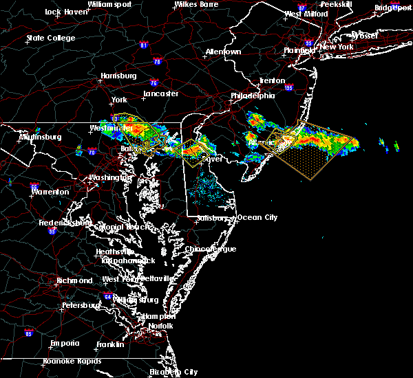 The severe thunderstorm warning for northeastern baltimore and harford counties will expire at 645 pm edt, the storms which prompted the warning have weakened below severe limits, and no longer poses a threat to life or property. therefore the warning will be allowed to expire. however gusty winds are still possible with these thunderstorms. The severe thunderstorm warning for northeastern baltimore and harford counties will expire at 645 pm edt, the storms which prompted the warning have weakened below severe limits, and no longer poses a threat to life or property. therefore the warning will be allowed to expire. however gusty winds are still possible with these thunderstorms.
|
| 7/23/2016 6:28 PM EDT |
 At 626 pm edt, severe thunderstorms were located along a line extending from near jarrettsville to near bel air north to 6 miles west of octoraro, moving southeast at 30 mph. winds estimated to gust between 50 and 60 mph were reported near norrisville around 615 pm (radar indicated). Hazards include 60 mph wind gusts and quarter size hail. Damaging winds will cause some trees and large branches to fall. this could injure those outdoors, as well as damage homes and vehicles. roadways may become blocked by downed trees. localized power outages are possible. Locations impacted include, middle river, aberdeen, havre de grace, bel air south, bel air north, white marsh, fallston, riverside, kingsville, pleasant hills, jarrettsville, joppatowne, pylesville, and darlington. At 626 pm edt, severe thunderstorms were located along a line extending from near jarrettsville to near bel air north to 6 miles west of octoraro, moving southeast at 30 mph. winds estimated to gust between 50 and 60 mph were reported near norrisville around 615 pm (radar indicated). Hazards include 60 mph wind gusts and quarter size hail. Damaging winds will cause some trees and large branches to fall. this could injure those outdoors, as well as damage homes and vehicles. roadways may become blocked by downed trees. localized power outages are possible. Locations impacted include, middle river, aberdeen, havre de grace, bel air south, bel air north, white marsh, fallston, riverside, kingsville, pleasant hills, jarrettsville, joppatowne, pylesville, and darlington.
|
| 7/23/2016 6:05 PM EDT |
 At 603 pm edt, severe thunderstorms were located along a line extending from stewartstown to near delta, moving southeast at 25 mph. winds of 35 to 45 mph are in an outflow gust front moving 10 miles ahead of the main thunderstorms (radar indicated). Hazards include 60 mph wind gusts and quarter size hail. Damaging winds will cause some trees and large branches to fall. this could injure those outdoors, as well as damage homes and vehicles. roadways may become blocked by downed trees. localized power outages are possible. Locations impacted include, middle river, aberdeen, havre de grace, bel air south, bel air north, fallston, riverside, kingsville, pleasant hills, jarrettsville, edgewood, joppatowne, pylesville, and darlington. At 603 pm edt, severe thunderstorms were located along a line extending from stewartstown to near delta, moving southeast at 25 mph. winds of 35 to 45 mph are in an outflow gust front moving 10 miles ahead of the main thunderstorms (radar indicated). Hazards include 60 mph wind gusts and quarter size hail. Damaging winds will cause some trees and large branches to fall. this could injure those outdoors, as well as damage homes and vehicles. roadways may become blocked by downed trees. localized power outages are possible. Locations impacted include, middle river, aberdeen, havre de grace, bel air south, bel air north, fallston, riverside, kingsville, pleasant hills, jarrettsville, edgewood, joppatowne, pylesville, and darlington.
|
| 7/23/2016 5:42 PM EDT |
 At 542 pm edt, severe thunderstorms were located along a line extending from near glen rock to near brogue, moving southeast at 25 mph (radar indicated). Hazards include 60 mph wind gusts and quarter size hail. Damaging winds will cause some trees and large branches to fall. this could injure those outdoors, as well as damage homes and vehicles. roadways may become blocked by downed trees. Localized power outages are possible. At 542 pm edt, severe thunderstorms were located along a line extending from near glen rock to near brogue, moving southeast at 25 mph (radar indicated). Hazards include 60 mph wind gusts and quarter size hail. Damaging winds will cause some trees and large branches to fall. this could injure those outdoors, as well as damage homes and vehicles. roadways may become blocked by downed trees. Localized power outages are possible.
|
| 7/23/2016 5:25 PM EDT |
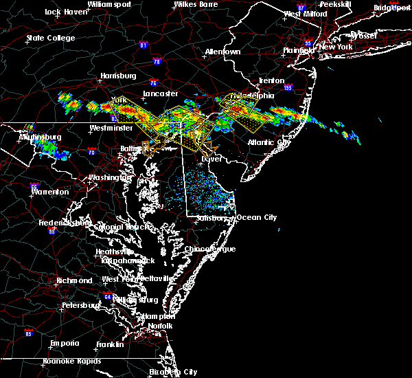 At 524 pm edt, a severe thunderstorm was located in southeast pennsylvania over delta, or 15 miles south of willow street, moving southeast at 25 mph (radar indicated). Hazards include 60 mph wind gusts and quarter size hail. Damaging winds will cause some trees and large branches to fall. this could injure those outdoors, as well as damage homes and vehicles. roadways may become blocked by downed trees. Localized power outages are possible. At 524 pm edt, a severe thunderstorm was located in southeast pennsylvania over delta, or 15 miles south of willow street, moving southeast at 25 mph (radar indicated). Hazards include 60 mph wind gusts and quarter size hail. Damaging winds will cause some trees and large branches to fall. this could injure those outdoors, as well as damage homes and vehicles. roadways may become blocked by downed trees. Localized power outages are possible.
|
| 6/28/2016 6:02 PM EDT |
 At 602 pm edt, a severe thunderstorm was located 7 miles south of stewartstown, or 11 miles north of cockeysville, moving southeast at 20 mph (radar indicated). Hazards include 60 mph wind gusts and quarter size hail. Damaging winds will cause some trees and large branches to fall. this could injure those outdoors, as well as damage homes and vehicles. roadways may become blocked by downed trees. Locations impacted include, middle river, aberdeen, havre de grace, aberdeen proving ground, bel air south, essex, bel air north, carney, perry hall, rossville, white marsh, fallston, bowleys quarters, riverside, kingsville, pleasant hills, jarrettsville, perryman, edgewood and joppatowne. At 602 pm edt, a severe thunderstorm was located 7 miles south of stewartstown, or 11 miles north of cockeysville, moving southeast at 20 mph (radar indicated). Hazards include 60 mph wind gusts and quarter size hail. Damaging winds will cause some trees and large branches to fall. this could injure those outdoors, as well as damage homes and vehicles. roadways may become blocked by downed trees. Locations impacted include, middle river, aberdeen, havre de grace, aberdeen proving ground, bel air south, essex, bel air north, carney, perry hall, rossville, white marsh, fallston, bowleys quarters, riverside, kingsville, pleasant hills, jarrettsville, perryman, edgewood and joppatowne.
|
| 6/28/2016 5:49 PM EDT |
 At 549 pm edt, a severe thunderstorm was located near railroad, or 13 miles north of cockeysville, moving southeast at 20 mph (radar indicated). Hazards include 60 mph wind gusts and quarter size hail. Damaging winds will cause some trees and large branches to fall. this could injure those outdoors, as well as damage homes and vehicles. roadways may become blocked by downed trees. localized power outages are possible. Unsecured light objects may become projectiles. At 549 pm edt, a severe thunderstorm was located near railroad, or 13 miles north of cockeysville, moving southeast at 20 mph (radar indicated). Hazards include 60 mph wind gusts and quarter size hail. Damaging winds will cause some trees and large branches to fall. this could injure those outdoors, as well as damage homes and vehicles. roadways may become blocked by downed trees. localized power outages are possible. Unsecured light objects may become projectiles.
|
| 6/8/2016 11:10 AM EDT |
 At 1109 am edt, showers with damaging winds were located along a line extending from near rock springs to near kingsville to near dundalk, moving east at 55 mph (radar indicated). Hazards include 60 mph wind gusts. Damaging winds will cause some trees and large branches to fall. this could injure those outdoors, as well as damage homes and vehicles. roadways may become blocked by downed trees. localized power outages are possible. unsecured light objects may become projectiles. Locations impacted include, baltimore, middle river, aberdeen, havre de grace, aberdeen proving ground, back river, north point state park, millers island, sparrows point, dundalk, towson, bel air south, essex, parkville, bel air north, carney, perry hall, arbutus, rosedale and rossville. At 1109 am edt, showers with damaging winds were located along a line extending from near rock springs to near kingsville to near dundalk, moving east at 55 mph (radar indicated). Hazards include 60 mph wind gusts. Damaging winds will cause some trees and large branches to fall. this could injure those outdoors, as well as damage homes and vehicles. roadways may become blocked by downed trees. localized power outages are possible. unsecured light objects may become projectiles. Locations impacted include, baltimore, middle river, aberdeen, havre de grace, aberdeen proving ground, back river, north point state park, millers island, sparrows point, dundalk, towson, bel air south, essex, parkville, bel air north, carney, perry hall, arbutus, rosedale and rossville.
|
| 6/8/2016 10:50 AM EDT |
 At 1048 am edt, showers with damaging wind gusts were located along a line extending from near delta to near mays chapel to near sykesville, moving east at 60 mph (radar indicated). Hazards include 60 mph wind gusts. Damaging winds will cause some trees and large branches to fall. this could injure those outdoors, as well as damage homes and vehicles. roadways may become blocked by downed trees. localized power outages are possible. unsecured light objects may become projectiles. Locations impacted include, baltimore, pikesville, middle river, cockeysville, aberdeen, havre de grace, aberdeen proving ground, back river, millers island, north point state park, sparrows point, ellicott city, dundalk, towson, bel air south, catonsville, essex, woodlawn, randallstown and parkville. At 1048 am edt, showers with damaging wind gusts were located along a line extending from near delta to near mays chapel to near sykesville, moving east at 60 mph (radar indicated). Hazards include 60 mph wind gusts. Damaging winds will cause some trees and large branches to fall. this could injure those outdoors, as well as damage homes and vehicles. roadways may become blocked by downed trees. localized power outages are possible. unsecured light objects may become projectiles. Locations impacted include, baltimore, pikesville, middle river, cockeysville, aberdeen, havre de grace, aberdeen proving ground, back river, millers island, north point state park, sparrows point, ellicott city, dundalk, towson, bel air south, catonsville, essex, woodlawn, randallstown and parkville.
|
| 6/8/2016 10:28 AM EDT |
 At 1027 am edt, strong showers with damaging winds were located along a line extending from near manchester to near westminster to near new market, moving southeast at 35 mph (radar indicated). Hazards include 60 mph wind gusts. Damaging winds will cause some trees and large branches to fall. this could injure those outdoors, as well as damage homes and vehicles. roadways may become blocked by downed trees. localized power outages are possible. Unsecured light objects may become projectiles. At 1027 am edt, strong showers with damaging winds were located along a line extending from near manchester to near westminster to near new market, moving southeast at 35 mph (radar indicated). Hazards include 60 mph wind gusts. Damaging winds will cause some trees and large branches to fall. this could injure those outdoors, as well as damage homes and vehicles. roadways may become blocked by downed trees. localized power outages are possible. Unsecured light objects may become projectiles.
|
| 6/5/2016 5:08 PM EDT |
 The severe thunderstorm warning for baltimore, northwestern anne arundel, southeastern howard and southern harford counties and baltimore city will expire at 515 pm edt, the storms which prompted the warning have weakened, and no longer pose an immediate threat to life or property. therefore the warning will be allowed to expire. however gusty winds and heavy rain are still possible with these thunderstorms. a severe thunderstorm watch remains in effect until 1000 pm edt for northern maryland. The severe thunderstorm warning for baltimore, northwestern anne arundel, southeastern howard and southern harford counties and baltimore city will expire at 515 pm edt, the storms which prompted the warning have weakened, and no longer pose an immediate threat to life or property. therefore the warning will be allowed to expire. however gusty winds and heavy rain are still possible with these thunderstorms. a severe thunderstorm watch remains in effect until 1000 pm edt for northern maryland.
|
| 6/5/2016 5:00 PM EDT |
 At 500 pm edt, severe thunderstorms were located along a line extending from rising sun to riverside to arbutus, moving east at 40 mph (radar indicated). Hazards include 60 mph wind gusts. Damaging winds will cause some trees and large branches to fall. this could injure those outdoors, as well as damage homes and vehicles. roadways may become blocked by downed trees. localized power outages are possible. unsecured light objects may become projectiles. Locations impacted include, baltimore, columbia, severn, middle river, elkridge, aberdeen, havre de grace, riviera beach, aberdeen proving ground, fort smallwood state park, baltimore-washington airport, sparrows point, back river, north point state park, millers island, glen burnie, ellicott city, dundalk, towson and bel air south. At 500 pm edt, severe thunderstorms were located along a line extending from rising sun to riverside to arbutus, moving east at 40 mph (radar indicated). Hazards include 60 mph wind gusts. Damaging winds will cause some trees and large branches to fall. this could injure those outdoors, as well as damage homes and vehicles. roadways may become blocked by downed trees. localized power outages are possible. unsecured light objects may become projectiles. Locations impacted include, baltimore, columbia, severn, middle river, elkridge, aberdeen, havre de grace, riviera beach, aberdeen proving ground, fort smallwood state park, baltimore-washington airport, sparrows point, back river, north point state park, millers island, glen burnie, ellicott city, dundalk, towson and bel air south.
|
| 6/5/2016 4:43 PM EDT |
 At 442 pm edt, severe thunderstorms were located along a line extending from delta to near hampton to 6 miles west of columbia, moving east at 35 mph (radar indicated). Hazards include 60 mph wind gusts. Damaging winds will cause some trees and large branches to fall. this could injure those outdoors, as well as damage homes and vehicles. roadways may become blocked by downed trees. localized power outages are possible. unsecured light objects may become projectiles. Locations impacted include, baltimore, columbia, severn, pikesville, middle river, cockeysville, elkridge, aberdeen, havre de grace, riviera beach, aberdeen proving ground, fort smallwood state park, back river, millers island, baltimore-washington airport, sparrows point, north point state park, glen burnie, ellicott city and dundalk. At 442 pm edt, severe thunderstorms were located along a line extending from delta to near hampton to 6 miles west of columbia, moving east at 35 mph (radar indicated). Hazards include 60 mph wind gusts. Damaging winds will cause some trees and large branches to fall. this could injure those outdoors, as well as damage homes and vehicles. roadways may become blocked by downed trees. localized power outages are possible. unsecured light objects may become projectiles. Locations impacted include, baltimore, columbia, severn, pikesville, middle river, cockeysville, elkridge, aberdeen, havre de grace, riviera beach, aberdeen proving ground, fort smallwood state park, back river, millers island, baltimore-washington airport, sparrows point, north point state park, glen burnie, ellicott city and dundalk.
|
| 6/5/2016 4:37 PM EDT |
 At 436 pm edt, severe thunderstorms were located along a line extending from rothsville to near delta to hampton, moving east at 45 mph (public). Hazards include 60 mph wind gusts. Expect damage to roofs. siding. And trees. At 436 pm edt, severe thunderstorms were located along a line extending from rothsville to near delta to hampton, moving east at 45 mph (public). Hazards include 60 mph wind gusts. Expect damage to roofs. siding. And trees.
|
| 6/5/2016 4:22 PM EDT |
 At 422 pm edt, severe thunderstorms were located along a line extending from near stewartstown to near cockeysville to near montgomery village, moving east at 50 mph (radar indicated). Hazards include 60 mph wind gusts. Damaging winds will cause some trees and large branches to fall. this could injure those outdoors, as well as damage homes and vehicles. roadways may become blocked by downed trees. localized power outages are possible. Unsecured light objects may become projectiles. At 422 pm edt, severe thunderstorms were located along a line extending from near stewartstown to near cockeysville to near montgomery village, moving east at 50 mph (radar indicated). Hazards include 60 mph wind gusts. Damaging winds will cause some trees and large branches to fall. this could injure those outdoors, as well as damage homes and vehicles. roadways may become blocked by downed trees. localized power outages are possible. Unsecured light objects may become projectiles.
|
| 4/2/2016 10:51 PM EDT |
 At 1050 pm edt, doppler radar indicated a line of severe thunderstorms capable of producing damaging winds in excess of 60 mph. these storms were located along a line extending from near lombard to near middle river, and moving east at 40 mph. * severe thunderstorms will be near, calvert, oxford, blake, lombard, fair hill, pleasant hill, zion and bay view around 1055 pm edt. kemblesville, appleton, andora, barksdale and cherry hill around 1100 pm edt. chestertown, ladenberg and glen westover around 1105 pm edt. newark, betterton and north star around 1110 pm edt. ashland, kennedyville, hockessin, pike creek, morgnec and stanton around 1115 pm edt. elsmere, newport, greenville, crumpton and wilmington manor around 1120 pm edt. wilmington, pennsville, millington and talleyville around 1125 pm edt. carneys point, penns grove, cecilton, arden, massey, delaney corner, sassafras and warwick around 1130 pm edt. other locations impacted by these severe thunderstorms include marcus hook, townsend, chesapeake city, brookside, kenton, chambersville, ardencroft, edgemoor, kingstown and odessa. At 1050 pm edt, doppler radar indicated a line of severe thunderstorms capable of producing damaging winds in excess of 60 mph. these storms were located along a line extending from near lombard to near middle river, and moving east at 40 mph. * severe thunderstorms will be near, calvert, oxford, blake, lombard, fair hill, pleasant hill, zion and bay view around 1055 pm edt. kemblesville, appleton, andora, barksdale and cherry hill around 1100 pm edt. chestertown, ladenberg and glen westover around 1105 pm edt. newark, betterton and north star around 1110 pm edt. ashland, kennedyville, hockessin, pike creek, morgnec and stanton around 1115 pm edt. elsmere, newport, greenville, crumpton and wilmington manor around 1120 pm edt. wilmington, pennsville, millington and talleyville around 1125 pm edt. carneys point, penns grove, cecilton, arden, massey, delaney corner, sassafras and warwick around 1130 pm edt. other locations impacted by these severe thunderstorms include marcus hook, townsend, chesapeake city, brookside, kenton, chambersville, ardencroft, edgemoor, kingstown and odessa.
|
| 2/24/2016 6:39 PM EST |
 At 638 pm est, trained weather spotters reported a line of severe thunderstorms producing damaging winds in excess of 60 mph. these storms were located along a line extending from near stewartstown to fells point, and moving east at 55 mph. At 638 pm est, trained weather spotters reported a line of severe thunderstorms producing damaging winds in excess of 60 mph. these storms were located along a line extending from near stewartstown to fells point, and moving east at 55 mph.
|
| 2/24/2016 6:24 PM EST |
 At 623 pm est, doppler radar indicated a line of severe thunderstorms capable of producing damaging winds in excess of 60 mph. these storms were located along a line extending from 6 miles northeast of manchester to near catonsville, moving east at 45 mph. locations impacted include, baltimore, aberdeen, bel air, union square, guilford, howard park, baltimore inner harbor, locust point, camden yards, roland park, fallstaff, cockeysville, pikesville, gwynns falls, middle river, clifton park, columbia, hampstead, manchester and oakland. a tornado watch remains in effect until 1100 pm est for northern maryland. At 623 pm est, doppler radar indicated a line of severe thunderstorms capable of producing damaging winds in excess of 60 mph. these storms were located along a line extending from 6 miles northeast of manchester to near catonsville, moving east at 45 mph. locations impacted include, baltimore, aberdeen, bel air, union square, guilford, howard park, baltimore inner harbor, locust point, camden yards, roland park, fallstaff, cockeysville, pikesville, gwynns falls, middle river, clifton park, columbia, hampstead, manchester and oakland. a tornado watch remains in effect until 1100 pm est for northern maryland.
|
| 2/24/2016 5:54 PM EST |
 At 554 pm est, doppler radar indicated a line of severe thunderstorms capable of producing damaging winds in excess of 60 mph. these storms were located along a line extending from near littlestown to montgomery village, moving east at 50 mph. locations impacted include, baltimore, rockville, gaithersburg, westminster, aberdeen, bel air, union square, guilford, howard park, olney, baltimore inner harbor, damascus, locust point, camden yards, germantown, gwynns falls, clifton park, roland park, fallstaff and cockeysville. a tornado watch remains in effect until 1100 pm est for northern maryland. At 554 pm est, doppler radar indicated a line of severe thunderstorms capable of producing damaging winds in excess of 60 mph. these storms were located along a line extending from near littlestown to montgomery village, moving east at 50 mph. locations impacted include, baltimore, rockville, gaithersburg, westminster, aberdeen, bel air, union square, guilford, howard park, olney, baltimore inner harbor, damascus, locust point, camden yards, germantown, gwynns falls, clifton park, roland park, fallstaff and cockeysville. a tornado watch remains in effect until 1100 pm est for northern maryland.
|
| 2/24/2016 5:46 PM EST |
 At 545 pm est, doppler radar indicated a line of severe thunderstorms capable of producing damaging winds in excess of 60 mph. these storms were located along a line extending from near littlestown to near damascus, and moving northeast at 50 mph. At 545 pm est, doppler radar indicated a line of severe thunderstorms capable of producing damaging winds in excess of 60 mph. these storms were located along a line extending from near littlestown to near damascus, and moving northeast at 50 mph.
|
| 8/24/2015 8:03 PM EDT |
 At 802 pm edt, doppler radar indicated a severe thunderstorm capable of producing damaging winds in excess of 60 mph. this storm was located near bowleys quarters, or near middle river, moving east at 20 mph. locations impacted include, aberdeen, back river, middle river, rossville, white marsh, essex, riverside, bowleys quarters, perry hall, dundalk, carney, perryman, bel air south, kingsville, rosedale, pleasant hills, edgewood, glen arm, harford furnace and chase. At 802 pm edt, doppler radar indicated a severe thunderstorm capable of producing damaging winds in excess of 60 mph. this storm was located near bowleys quarters, or near middle river, moving east at 20 mph. locations impacted include, aberdeen, back river, middle river, rossville, white marsh, essex, riverside, bowleys quarters, perry hall, dundalk, carney, perryman, bel air south, kingsville, rosedale, pleasant hills, edgewood, glen arm, harford furnace and chase.
|
| 8/24/2015 7:38 PM EDT |
 At 738 pm edt, doppler radar indicated a severe thunderstorm capable of producing damaging winds in excess of 60 mph. this storm was located over rossville, or near clifton park, and moving east at 20 mph. At 738 pm edt, doppler radar indicated a severe thunderstorm capable of producing damaging winds in excess of 60 mph. this storm was located over rossville, or near clifton park, and moving east at 20 mph.
|
| 7/15/2015 2:41 AM EDT |
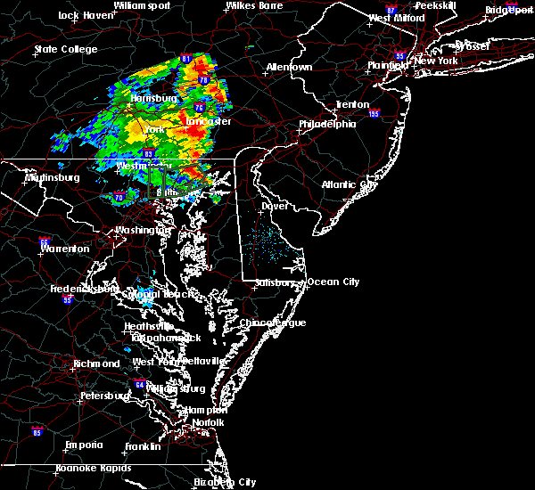 At 240 am edt, doppler radar indicated a severe thunderstorm capable of producing damaging winds in excess of 60 mph. this storm was located near aberdeen, and moving northeast at 30 mph. At 240 am edt, doppler radar indicated a severe thunderstorm capable of producing damaging winds in excess of 60 mph. this storm was located near aberdeen, and moving northeast at 30 mph.
|
| 7/9/2015 7:05 PM EDT |
 At 705 pm edt, doppler radar indicated a line of severe thunderstorms capable of producing damaging winds in excess of 60 mph. these storms were located along a line extending from conowingo to near bel air south, moving east at 40 mph. locations impacted include, aberdeen, bel air, perryman, riverside, bel air south, bel air north, abingdon, harford furnace, darlington, carsins, belcamp, churchville and edgewood. a tornado watch remains in effect until 900 pm edt for northern maryland. At 705 pm edt, doppler radar indicated a line of severe thunderstorms capable of producing damaging winds in excess of 60 mph. these storms were located along a line extending from conowingo to near bel air south, moving east at 40 mph. locations impacted include, aberdeen, bel air, perryman, riverside, bel air south, bel air north, abingdon, harford furnace, darlington, carsins, belcamp, churchville and edgewood. a tornado watch remains in effect until 900 pm edt for northern maryland.
|
| 7/9/2015 6:55 PM EDT |
 At 654 pm edt, doppler radar indicated a line of severe thunderstorms capable of producing damaging winds in excess of 60 mph. these storms were located along a line extending from delta to kingsville, and moving east at 40 mph. At 654 pm edt, doppler radar indicated a line of severe thunderstorms capable of producing damaging winds in excess of 60 mph. these storms were located along a line extending from delta to kingsville, and moving east at 40 mph.
|
| 7/9/2015 6:50 PM EDT |
 At 648 pm edt, doppler radar indicated a line of severe thunderstorms capable of producing damaging winds in excess of 60 mph. these storms were located near delta, or 7 miles north of bel air, and moving east at 50 mph. At 648 pm edt, doppler radar indicated a line of severe thunderstorms capable of producing damaging winds in excess of 60 mph. these storms were located near delta, or 7 miles north of bel air, and moving east at 50 mph.
|
| 7/9/2015 6:44 PM EDT |
 At 642 pm edt, doppler radar indicated a line of severe thunderstorms capable of producing damaging winds in excess of 60 mph. these storms were located along a line extending from near jarrettsville to cockeysville, moving east at 35 mph. locations impacted include, aberdeen, bel air, cockeysville, riverside, fallston, perryman, bel air south, jarrettsville, kingsville, bel air north, pleasant hills, perry hall, lutherville-timonium, hampton, carney, edgewood, long green, harford furnace, hydes and phoenix. a tornado watch remains in effect until 900 pm edt for northern maryland. At 642 pm edt, doppler radar indicated a line of severe thunderstorms capable of producing damaging winds in excess of 60 mph. these storms were located along a line extending from near jarrettsville to cockeysville, moving east at 35 mph. locations impacted include, aberdeen, bel air, cockeysville, riverside, fallston, perryman, bel air south, jarrettsville, kingsville, bel air north, pleasant hills, perry hall, lutherville-timonium, hampton, carney, edgewood, long green, harford furnace, hydes and phoenix. a tornado watch remains in effect until 900 pm edt for northern maryland.
|
| 7/9/2015 6:24 PM EDT |
 The national weather service in sterling virginia has issued a * severe thunderstorm warning for. northern baltimore county in northern maryland. harford county in northern maryland. until 700 pm edt * at 624 pm edt. Doppler radar indicated a severe thunderstorm. The national weather service in sterling virginia has issued a * severe thunderstorm warning for. northern baltimore county in northern maryland. harford county in northern maryland. until 700 pm edt * at 624 pm edt. Doppler radar indicated a severe thunderstorm.
|
| 7/1/2015 2:24 AM EDT |
 The severe thunderstorm warning for cecil and southwestern chester counties will expire at 230 am edt, the strongest part of the severe thunderstorm which prompted the warning has moved into new castle county. therefore the warning will be allowed to expire. The severe thunderstorm warning for cecil and southwestern chester counties will expire at 230 am edt, the strongest part of the severe thunderstorm which prompted the warning has moved into new castle county. therefore the warning will be allowed to expire.
|
| 7/1/2015 1:45 AM EDT |
 At 145 am edt, doppler radar indicated a severe thunderstorm capable of producing quarter size hail and damaging winds in excess of 60 mph. this storm was located over aberdeen, moving north at 35 mph. locations impacted include, aberdeen, bel air, riverside, fallston, perryman, bel air south, kingsville, bel air north, pleasant hills, jarrettsville, perry hall, edgewood, street, glen arm, harford furnace, hydes, chrome hill, fork, bynum and scarboro. At 145 am edt, doppler radar indicated a severe thunderstorm capable of producing quarter size hail and damaging winds in excess of 60 mph. this storm was located over aberdeen, moving north at 35 mph. locations impacted include, aberdeen, bel air, riverside, fallston, perryman, bel air south, kingsville, bel air north, pleasant hills, jarrettsville, perry hall, edgewood, street, glen arm, harford furnace, hydes, chrome hill, fork, bynum and scarboro.
|
| 7/1/2015 1:42 AM EDT |
 At 141 am edt, doppler radar indicated a severe thunderstorm capable of producing quarter size hail and damaging winds in excess of 60 mph. this storm was located over aberdeen, and moving northeast at 40 mph. At 141 am edt, doppler radar indicated a severe thunderstorm capable of producing quarter size hail and damaging winds in excess of 60 mph. this storm was located over aberdeen, and moving northeast at 40 mph.
|
| 7/1/2015 1:37 AM EDT |
 At 137 am edt, doppler radar indicated a severe thunderstorm capable of producing quarter size hail and damaging winds in excess of 60 mph. this storm was located over perryman, or over aberdeen, and moving north at 35 mph. At 137 am edt, doppler radar indicated a severe thunderstorm capable of producing quarter size hail and damaging winds in excess of 60 mph. this storm was located over perryman, or over aberdeen, and moving north at 35 mph.
|
| 6/30/2015 3:25 PM EDT |
 At 325 pm edt, doppler radar indicated a severe thunderstorm capable of producing quarter size hail and damaging winds in excess of 60 mph. this storm was located over havre de grace, or near aberdeen, and moving northeast at 25 mph. At 325 pm edt, doppler radar indicated a severe thunderstorm capable of producing quarter size hail and damaging winds in excess of 60 mph. this storm was located over havre de grace, or near aberdeen, and moving northeast at 25 mph.
|
| 6/30/2015 2:41 PM EDT |
 At 241 pm edt, doppler radar indicated a severe thunderstorm capable of producing quarter size hail and damaging winds in excess of 60 mph. this storm was located over havre de grace, or near aberdeen, and moving northeast at 25 mph. At 241 pm edt, doppler radar indicated a severe thunderstorm capable of producing quarter size hail and damaging winds in excess of 60 mph. this storm was located over havre de grace, or near aberdeen, and moving northeast at 25 mph.
|
| 6/30/2015 2:28 PM EDT |
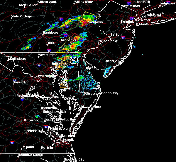 At 227 pm edt, doppler radar indicated a severe thunderstorm capable of producing damaging winds in excess of 60 mph. this storm was located over aberdeen, moving northeast at 20 mph. locations impacted include, aberdeen, perryman, riverside and carsins. At 227 pm edt, doppler radar indicated a severe thunderstorm capable of producing damaging winds in excess of 60 mph. this storm was located over aberdeen, moving northeast at 20 mph. locations impacted include, aberdeen, perryman, riverside and carsins.
|
| 6/30/2015 2:15 PM EDT |
 At 214 pm edt, doppler radar indicated a severe thunderstorm capable of producing damaging winds in excess of 60 mph. this storm was located over riverside, or near aberdeen, and moving northeast at 20 mph. At 214 pm edt, doppler radar indicated a severe thunderstorm capable of producing damaging winds in excess of 60 mph. this storm was located over riverside, or near aberdeen, and moving northeast at 20 mph.
|
| 6/23/2015 6:14 PM EDT |
 At 613 pm edt, doppler radar indicated a line of severe thunderstorms capable of producing half dollar size hail and destructive winds in excess of 70 mph. these storms were located along a line extending from near charlestown to howard park, and moving southeast at 20 mph. At 613 pm edt, doppler radar indicated a line of severe thunderstorms capable of producing half dollar size hail and destructive winds in excess of 70 mph. these storms were located along a line extending from near charlestown to howard park, and moving southeast at 20 mph.
|
| 6/23/2015 6:05 PM EDT |
 At 605 pm edt, doppler radar indicated a line of severe thunderstorms capable of producing large damaging hail up to golf ball size and destructive winds in excess of 70 mph. these storms were located along a line extending from near north east to howard park, moving southeast at 30 mph. locations impacted include, baltimore, aberdeen, bel air, union square, guilford, howard park, baltimore inner harbor, back river, locust point, camden yards, roland park, fallstaff, cockeysville, fells point, pikesville, gwynns falls, middle river, clifton park, sparrows point and north point state park. At 605 pm edt, doppler radar indicated a line of severe thunderstorms capable of producing large damaging hail up to golf ball size and destructive winds in excess of 70 mph. these storms were located along a line extending from near north east to howard park, moving southeast at 30 mph. locations impacted include, baltimore, aberdeen, bel air, union square, guilford, howard park, baltimore inner harbor, back river, locust point, camden yards, roland park, fallstaff, cockeysville, fells point, pikesville, gwynns falls, middle river, clifton park, sparrows point and north point state park.
|
| 6/23/2015 5:45 PM EDT |
 At 544 pm edt, doppler radar indicated a line of severe thunderstorms capable of producing large damaging hail up to golf ball size and destructive winds in excess of 70 mph. these storms were located along a line extending from woodlawn to randallstown, and moving southeast at 30 mph. At 544 pm edt, doppler radar indicated a line of severe thunderstorms capable of producing large damaging hail up to golf ball size and destructive winds in excess of 70 mph. these storms were located along a line extending from woodlawn to randallstown, and moving southeast at 30 mph.
|
| 6/23/2015 5:30 PM EDT |
 At 529 pm edt, doppler radar indicated a line of severe thunderstorms capable of producing half dollar size hail and destructive winds in excess of 70 mph. these storms were located along a line extending from delta to hampton, moving east at 40 mph. locations impacted include, aberdeen, bel air, cockeysville, riverside, reisterstown, fallston, carney, perryman, bel air south, hampton, jarrettsville, white marsh, perry hall, mays chapel, kingsville, bel air north, lutherville-timonium, pleasant hills, timonium and owings mills. At 529 pm edt, doppler radar indicated a line of severe thunderstorms capable of producing half dollar size hail and destructive winds in excess of 70 mph. these storms were located along a line extending from delta to hampton, moving east at 40 mph. locations impacted include, aberdeen, bel air, cockeysville, riverside, reisterstown, fallston, carney, perryman, bel air south, hampton, jarrettsville, white marsh, perry hall, mays chapel, kingsville, bel air north, lutherville-timonium, pleasant hills, timonium and owings mills.
|
| 6/23/2015 5:11 PM EDT |
 At 511 pm edt, doppler radar indicated a line of severe thunderstorms capable of producing quarter size hail and damaging winds in excess of 60 mph. these storms were located along a line extending from near stewartstown to near reisterstown, and moving east at 40 mph. At 511 pm edt, doppler radar indicated a line of severe thunderstorms capable of producing quarter size hail and damaging winds in excess of 60 mph. these storms were located along a line extending from near stewartstown to near reisterstown, and moving east at 40 mph.
|
| 6/20/2015 10:15 PM EDT |
 At 1015 pm edt, doppler radar indicated a severe thunderstorm capable of producing damaging winds in excess of 60 mph. this storm was located over bay view, or 7 miles west of elkton, moving northeast at 40 mph. locations impacted include, elkton, calvert, north east, rising sun, charlestown, cecilton, cayots, blake, pleasant hill, andora, richardsmere, woodlawn, hollywood beach, appleton, cherry hill, bay view, octoraro, farmington, barksdale and conowingo. At 1015 pm edt, doppler radar indicated a severe thunderstorm capable of producing damaging winds in excess of 60 mph. this storm was located over bay view, or 7 miles west of elkton, moving northeast at 40 mph. locations impacted include, elkton, calvert, north east, rising sun, charlestown, cecilton, cayots, blake, pleasant hill, andora, richardsmere, woodlawn, hollywood beach, appleton, cherry hill, bay view, octoraro, farmington, barksdale and conowingo.
|
| 6/20/2015 9:49 PM EDT |
 At 947 pm edt, doppler radar indicated a severe thunderstorm capable of producing damaging winds in excess of 60 mph. this storm was located over aberdeen, and moving northeast at 40 mph. At 947 pm edt, doppler radar indicated a severe thunderstorm capable of producing damaging winds in excess of 60 mph. this storm was located over aberdeen, and moving northeast at 40 mph.
|
| 6/20/2015 9:37 PM EDT |
 At 936 pm edt, doppler radar indicated a line of severe thunderstorms capable of producing damaging winds in excess of 60 mph. these storms were located along a line extending from fallston to near bel air south to near middle river, and moving east at 45 mph. At 936 pm edt, doppler radar indicated a line of severe thunderstorms capable of producing damaging winds in excess of 60 mph. these storms were located along a line extending from fallston to near bel air south to near middle river, and moving east at 45 mph.
|
| 6/8/2015 8:47 PM EDT | At 847 pm edt, doppler radar indicated a line of severe thunderstorms capable of producing damaging winds in excess of 60 mph. these storms were located along a line extending from woodlawn to near newtown to fells point, moving east at 25 mph. locations impacted include, aberdeen, bel air, middle river, back river, north point state park, millers island, essex, riverside, fallston, carney, perryman, bel air south, rosedale, rossville, white marsh, bowleys quarters, perry hall, dundalk, kingsville and bel air north. |
| 6/8/2015 8:07 PM EDT | At 807 pm edt, doppler radar indicated a line of severe thunderstorms capable of producing damaging winds in excess of 60 mph. these storms were located along a line extending from near delta to carney to ellicott city, and moving east at 25 mph. |
| 5/16/2015 6:45 PM EDT | At 644 pm edt, doppler radar indicated a line of severe thunderstorms capable of producing quarter size hail and damaging winds in excess of 60 mph. these storms were located along a line extending from near rock springs to near middle river to fort smallwood state park, and moving east at 30 mph. * severe thunderstorms will be near, rock springs, richardsmere, conowingo and octoraro around 650 pm edt. newtown, west nottingham and woodlawn around 655 pm edt. rising sun and farmington around 700 pm edt. calvert, betterton, zion and bay view around 705 pm edt. lombard, blake, kennedyville and pleasant hill around 710 pm edt. langford, fair hill, andora and cherry hill around 715 pm edt. elkton, chestertown, kemblesville, appleton, old town and barksdale around 720 pm edt. cecilton, millington, glen westover and starkey corner around 725 pm edt. other locations impacted by these severe thunderstorms include kingstown, brookside, chesapeake city, galena and perryville. the strongest part of the storms is moving toward kent conty maryland. |
| 5/16/2015 6:45 PM EDT | At 644 pm edt, doppler radar indicated a line of severe thunderstorms capable of producing quarter size hail and damaging winds in excess of 60 mph. these storms were located along a line extending from near rock springs to near middle river to fort smallwood state park, and moving east at 30 mph. * severe thunderstorms will be near, rock springs, richardsmere, conowingo and octoraro around 650 pm edt. newtown, west nottingham and woodlawn around 655 pm edt. rising sun and farmington around 700 pm edt. calvert, betterton, zion and bay view around 705 pm edt. lombard, blake, kennedyville and pleasant hill around 710 pm edt. langford, fair hill, andora and cherry hill around 715 pm edt. elkton, chestertown, kemblesville, appleton, old town and barksdale around 720 pm edt. cecilton, millington, glen westover and starkey corner around 725 pm edt. other locations impacted by these severe thunderstorms include kingstown, brookside, chesapeake city, galena and perryville. the strongest part of the storms is moving toward kent conty maryland. |
| 5/16/2015 6:45 PM EDT | At 644 pm edt, doppler radar indicated a line of severe thunderstorms capable of producing quarter size hail and damaging winds in excess of 60 mph. these storms were located along a line extending from near rock springs to near middle river to fort smallwood state park, and moving east at 30 mph. * severe thunderstorms will be near, rock springs, richardsmere, conowingo and octoraro around 650 pm edt. newtown, west nottingham and woodlawn around 655 pm edt. rising sun and farmington around 700 pm edt. calvert, betterton, zion and bay view around 705 pm edt. lombard, blake, kennedyville and pleasant hill around 710 pm edt. langford, fair hill, andora and cherry hill around 715 pm edt. elkton, chestertown, kemblesville, appleton, old town and barksdale around 720 pm edt. cecilton, millington, glen westover and starkey corner around 725 pm edt. other locations impacted by these severe thunderstorms include kingstown, brookside, chesapeake city, galena and perryville. the strongest part of the storms is moving toward kent conty maryland. |
| 4/20/2015 9:06 PM EDT | At 905 pm edt, doppler radar indicated a line of severe thunderstorms capable of producing damaging winds in excess of 60 mph. these storms were located along a line extending from beechfield to arnold, moving northeast at 30 mph. locations impacted include, baltimore, aberdeen, bel air, morgan state university, severn, fells point, woodring, turners station, m and t stadium, fort smallwood state park, armistead gardens, john hopkins university, middle river, baltimore-washington airport, clifton park, baltimore inner harbor, riviera beach, josephine lee, sparrows point and back river. a tornado watch remains in effect until 1000 pm edt for northern maryland. |
| 4/20/2015 8:52 PM EDT | At 851 pm edt, doppler radar indicated a line of severe thunderstorms capable of producing damaging winds in excess of 60 mph. these storms were located along a line extending from mays chapel to baltimore inner harbor to near severn, and moving northeast at 85 mph. |
| 7/13/2014 10:25 PM EDT | A tree was down on md-155 at paradise roa in harford county MD, 3.1 miles ESE of Havre de Grace, MD |
| 5/22/2014 3:37 PM EDT | A tree was reported down on wires in havre de grac in harford county MD, 1.1 miles W of Havre de Grace, MD |
| 8/13/2013 6:15 PM EDT | Large tree down in harford county MD, 1.4 miles SW of Havre de Grace, MD |
| 8/13/2013 6:12 PM EDT | Tree and several branches down in harford county MD, 0.8 miles S of Havre de Grace, MD |
| 8/13/2013 6:18 AM EDT | Large tree down near intersection of rt 155 and rt 7a in harford county MD, 1.4 miles SW of Havre de Grace, MD |
| 6/22/2012 6:39 PM EDT | Tree down near overpass of lapidum road and interstate 9 in harford county MD, 2.3 miles SSE of Havre de Grace, MD |
| 10/14/2011 11:22 AM EDT | Quarter sized hail reported 6.8 miles SE of Havre de Grace, MD |
| 1/1/0001 12:00 AM | Quarter sized hail reported 1.6 miles SSE of Havre de Grace, MD, hail ranged from pea to quarter size |
| 8/18/2011 6:00 PM EDT | Golf Ball sized hail reported 3.8 miles SSE of Havre de Grace, MD, golf ball hail at steppingstone museum. |
| 8/18/2011 5:48 PM EDT | Hen Egg sized hail reported 4.3 miles ESE of Havre de Grace, MD |
Hail Maps for Havre de Grace, MD
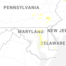
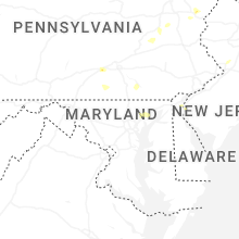
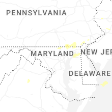


Connect with Interactive Hail Maps