

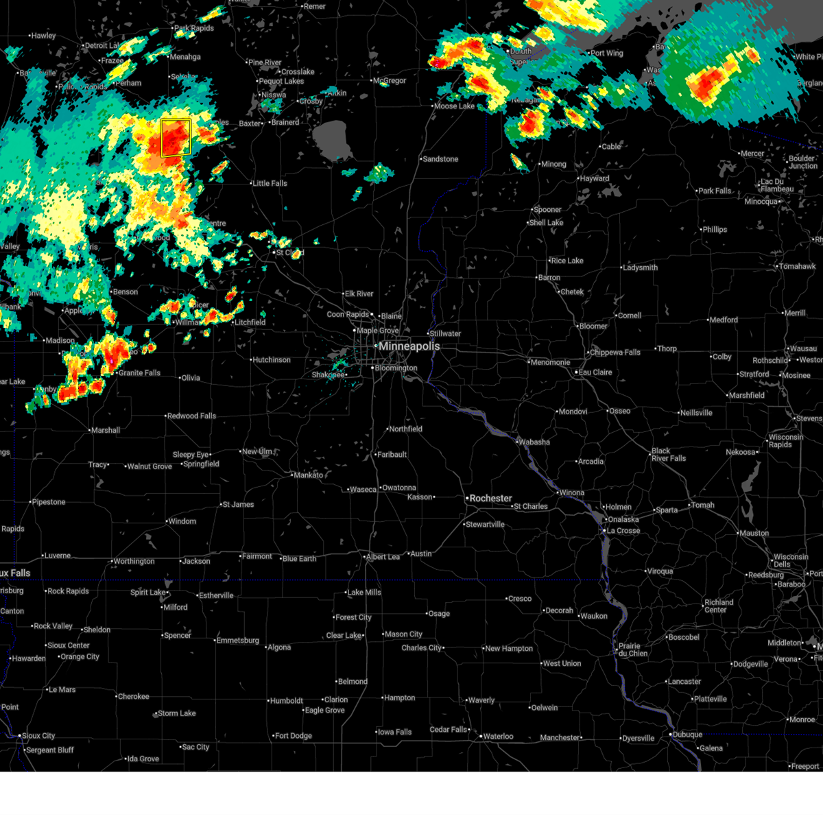
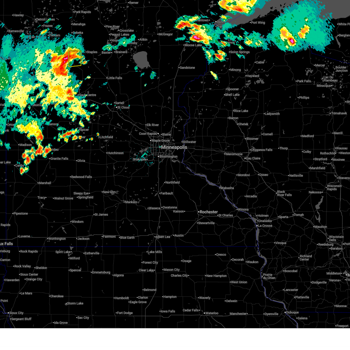
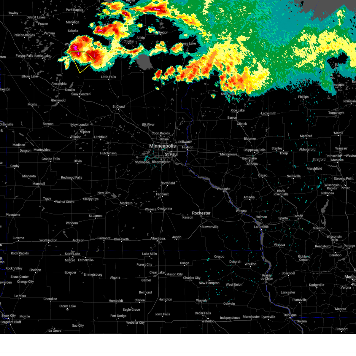
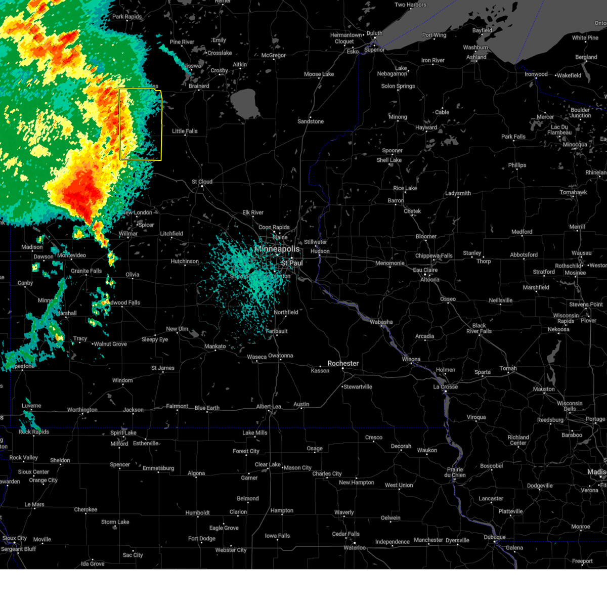
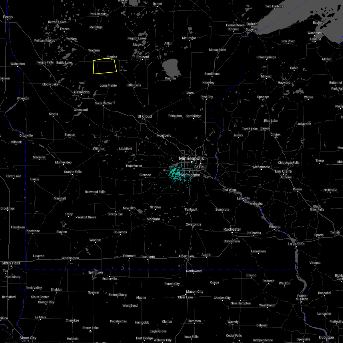
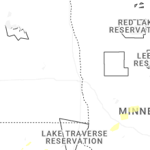
Hail Map for Hewitt, MN
The Hewitt, MN area has had 4 reports of on-the-ground hail by trained spotters, and has been under severe weather warnings 5 times during the past 12 months. Doppler radar has detected hail at or near Hewitt, MN on 55 occasions, including 2 occasions during the past year.
| Name: | Hewitt, MN |
| Where Located: | 80 miles S of Bemidji, MN |
| Map: | Google Map for Hewitt, MN |
| Population: | 266 |
| Housing Units: | 129 |
| More Info: | Search Google for Hewitt, MN |
2
The Top Recent Hail Date for Hewitt, MN is Saturday, August 3, 2024 (10th out of 55)

Hail and Wind Damage Spotted near Hewitt, MN
| Date / Time | Report Details |
|---|---|
| 7/15/2025 3:38 PM CDT |
 The storm which prompted the warning has weakened below severe limits, and no longer poses an immediate threat to life or property. therefore, the warning will be allowed to expire. however, small hail is still possible with this thunderstorm. a severe thunderstorm watch remains in effect until 1000 pm cdt tuesday for a portion of central minnesota. The storm which prompted the warning has weakened below severe limits, and no longer poses an immediate threat to life or property. therefore, the warning will be allowed to expire. however, small hail is still possible with this thunderstorm. a severe thunderstorm watch remains in effect until 1000 pm cdt tuesday for a portion of central minnesota.
|
| 7/15/2025 3:19 PM CDT |
 Svrmpx the national weather service in the twin cities has issued a * severe thunderstorm warning for, northwestern todd county in central minnesota, * until 345 pm cdt. * at 319 pm cdt, a severe thunderstorm was located over bertha, or 27 miles northeast of alexandria, moving east at 30 mph (radar indicated). Hazards include 60 mph wind gusts and quarter size hail. Hail damage to vehicles is expected. Expect wind damage to roofs, siding, and trees. Svrmpx the national weather service in the twin cities has issued a * severe thunderstorm warning for, northwestern todd county in central minnesota, * until 345 pm cdt. * at 319 pm cdt, a severe thunderstorm was located over bertha, or 27 miles northeast of alexandria, moving east at 30 mph (radar indicated). Hazards include 60 mph wind gusts and quarter size hail. Hail damage to vehicles is expected. Expect wind damage to roofs, siding, and trees.
|
| 8/3/2024 6:47 PM CDT |
 Svrmpx the national weather service in the twin cities has issued a * severe thunderstorm warning for, northern todd county in central minnesota, * until 715 pm cdt. * at 647 pm cdt, a severe thunderstorm was located near verndale, or 35 miles northeast of alexandria, moving southeast at 35 mph. this is a destructive storm for hewitt and bertha minnesota (trained weather spotters). Hazards include three inch hail and 60 mph wind gusts. People and animals outdoors will be severely injured. Expect shattered windows, extensive damage to roofs, siding, and vehicles. Svrmpx the national weather service in the twin cities has issued a * severe thunderstorm warning for, northern todd county in central minnesota, * until 715 pm cdt. * at 647 pm cdt, a severe thunderstorm was located near verndale, or 35 miles northeast of alexandria, moving southeast at 35 mph. this is a destructive storm for hewitt and bertha minnesota (trained weather spotters). Hazards include three inch hail and 60 mph wind gusts. People and animals outdoors will be severely injured. Expect shattered windows, extensive damage to roofs, siding, and vehicles.
|
| 7/31/2024 2:22 PM CDT |
 At 222 pm cdt, severe thunderstorms were located along a line extending from wadena to clarissa to near lake osakis, moving northeast at 50 mph (radar indicated). Hazards include 60 mph wind gusts. Expect damage to roofs, siding, and trees. Locations impacted include, long prairie, staples, browerville, clarissa, eagle bend, staples airport, bertha, grey eagle, hewitt, lake osakis, little sauk, and round prairie. At 222 pm cdt, severe thunderstorms were located along a line extending from wadena to clarissa to near lake osakis, moving northeast at 50 mph (radar indicated). Hazards include 60 mph wind gusts. Expect damage to roofs, siding, and trees. Locations impacted include, long prairie, staples, browerville, clarissa, eagle bend, staples airport, bertha, grey eagle, hewitt, lake osakis, little sauk, and round prairie.
|
| 7/31/2024 2:07 PM CDT |
 Svrmpx the national weather service in the twin cities has issued a * severe thunderstorm warning for, todd county in central minnesota, * until 300 pm cdt. * at 205 pm cdt, severe thunderstorms were located along a line extending from near henning to 8 miles northeast of carlos to 8 miles south of alexandria, moving northeast at 55 mph (radar indicated). Hazards include 60 mph wind gusts. expect damage to roofs, siding, and trees Svrmpx the national weather service in the twin cities has issued a * severe thunderstorm warning for, todd county in central minnesota, * until 300 pm cdt. * at 205 pm cdt, severe thunderstorms were located along a line extending from near henning to 8 miles northeast of carlos to 8 miles south of alexandria, moving northeast at 55 mph (radar indicated). Hazards include 60 mph wind gusts. expect damage to roofs, siding, and trees
|
| 7/13/2024 10:13 PM CDT |
 Svrmpx the national weather service in the twin cities has issued a * severe thunderstorm warning for, douglas county in west central minnesota, northwestern todd county in central minnesota, * until 1100 pm cdt. * at 1013 pm cdt, a severe thunderstorm was located 7 miles west of parkers prairie, or 17 miles north of alexandria, moving southeast at 40 mph (radar indicated). Hazards include 60 mph wind gusts and quarter size hail. Hail damage to vehicles is expected. Expect wind damage to roofs, siding, and trees. Svrmpx the national weather service in the twin cities has issued a * severe thunderstorm warning for, douglas county in west central minnesota, northwestern todd county in central minnesota, * until 1100 pm cdt. * at 1013 pm cdt, a severe thunderstorm was located 7 miles west of parkers prairie, or 17 miles north of alexandria, moving southeast at 40 mph (radar indicated). Hazards include 60 mph wind gusts and quarter size hail. Hail damage to vehicles is expected. Expect wind damage to roofs, siding, and trees.
|
| 6/24/2022 11:38 PM CDT |
 The severe thunderstorm warning for northern todd county will expire at 1145 pm cdt, the storms which prompted the warning have weakened below severe limits, and no longer pose an immediate threat to life or property. therefore, the warning will be allowed to expire. however gusty winds and heavy rain are still possible with these thunderstorms. a severe thunderstorm watch remains in effect until 300 am cdt for central minnesota. The severe thunderstorm warning for northern todd county will expire at 1145 pm cdt, the storms which prompted the warning have weakened below severe limits, and no longer pose an immediate threat to life or property. therefore, the warning will be allowed to expire. however gusty winds and heavy rain are still possible with these thunderstorms. a severe thunderstorm watch remains in effect until 300 am cdt for central minnesota.
|
| 6/24/2022 11:23 PM CDT |
 At 1123 pm cdt, severe thunderstorms were located along a line extending from near leader to near hewitt to 6 miles southeast of clitherall, moving southeast at 25 mph (radar indicated. at 1105 pm a 59 mph wind gust was reported at wadena). Hazards include 60 mph wind gusts and penny size hail. Expect damage to roofs, siding, and trees. locations impacted include, staples, clarissa, eagle bend, staples airport, bertha, hewitt and philbrook. hail threat, radar indicated max hail size, 0. 75 in wind threat, radar indicated max wind gust, 60 mph. At 1123 pm cdt, severe thunderstorms were located along a line extending from near leader to near hewitt to 6 miles southeast of clitherall, moving southeast at 25 mph (radar indicated. at 1105 pm a 59 mph wind gust was reported at wadena). Hazards include 60 mph wind gusts and penny size hail. Expect damage to roofs, siding, and trees. locations impacted include, staples, clarissa, eagle bend, staples airport, bertha, hewitt and philbrook. hail threat, radar indicated max hail size, 0. 75 in wind threat, radar indicated max wind gust, 60 mph.
|
| 6/24/2022 10:59 PM CDT |
 At 1058 pm cdt, severe thunderstorms were located along a line extending from near poplar to near wadena to 5 miles southwest of battle lake, moving southeast at 30 mph (radar indicated). Hazards include 60 mph wind gusts and penny size hail. Expect damage to roofs, siding, and trees. locations impacted include, staples, clarissa, eagle bend, bertha, hewitt and philbrook. hail threat, radar indicated max hail size, 0. 75 in wind threat, radar indicated max wind gust, 60 mph. At 1058 pm cdt, severe thunderstorms were located along a line extending from near poplar to near wadena to 5 miles southwest of battle lake, moving southeast at 30 mph (radar indicated). Hazards include 60 mph wind gusts and penny size hail. Expect damage to roofs, siding, and trees. locations impacted include, staples, clarissa, eagle bend, bertha, hewitt and philbrook. hail threat, radar indicated max hail size, 0. 75 in wind threat, radar indicated max wind gust, 60 mph.
|
| 6/24/2022 10:40 PM CDT |
 At 1039 pm cdt, severe thunderstorms were located along a line extending from 5 miles east of park rapids to near bluffton to near underwood, moving southeast at 35 mph (radar indicated). Hazards include 60 mph wind gusts and penny size hail. expect damage to roofs, siding, and trees At 1039 pm cdt, severe thunderstorms were located along a line extending from 5 miles east of park rapids to near bluffton to near underwood, moving southeast at 35 mph (radar indicated). Hazards include 60 mph wind gusts and penny size hail. expect damage to roofs, siding, and trees
|
| 5/30/2022 5:26 PM CDT |
 The tornado warning for central todd county will expire at 530 pm cdt, the storm which prompted the warning has moved out of the area. therefore, the warning will be allowed to expire. a tornado watch remains in effect until 1000 pm cdt for central minnesota. to report severe weather, contact your nearest law enforcement agency. they will relay your report to the national weather service the twin cities. remember, a tornado warning still remains in effect for eastern todd county until 6 pm. The tornado warning for central todd county will expire at 530 pm cdt, the storm which prompted the warning has moved out of the area. therefore, the warning will be allowed to expire. a tornado watch remains in effect until 1000 pm cdt for central minnesota. to report severe weather, contact your nearest law enforcement agency. they will relay your report to the national weather service the twin cities. remember, a tornado warning still remains in effect for eastern todd county until 6 pm.
|
| 5/30/2022 5:13 PM CDT |
 At 513 pm cdt, a severe thunderstorm capable of producing a tornado was located near bertha, or 32 miles northeast of alexandria, moving north at 55 mph (radar indicated rotation). Hazards include tornado and ping pong ball size hail. Flying debris will be dangerous to those caught without shelter. mobile homes will be damaged or destroyed. damage to roofs, windows, and vehicles will occur. tree damage is likely. This tornadic thunderstorm will remain over mainly rural areas of central todd county, including the following locations, round prairie, little sauk and west union. At 513 pm cdt, a severe thunderstorm capable of producing a tornado was located near bertha, or 32 miles northeast of alexandria, moving north at 55 mph (radar indicated rotation). Hazards include tornado and ping pong ball size hail. Flying debris will be dangerous to those caught without shelter. mobile homes will be damaged or destroyed. damage to roofs, windows, and vehicles will occur. tree damage is likely. This tornadic thunderstorm will remain over mainly rural areas of central todd county, including the following locations, round prairie, little sauk and west union.
|
| 5/30/2022 5:02 PM CDT |
 At 502 pm cdt, a large and extremely dangerous tornado was located over eagle bend, or 23 miles northeast of alexandria, moving northeast at 55 mph. this is a particularly dangerous situation. take cover now! (radar indicated rotation). Hazards include damaging tornado. You are in a life-threatening situation. flying debris may be deadly to those caught without shelter. mobile homes will be destroyed. considerable damage to homes, businesses, and vehicles is likely and complete destruction is possible. the tornado will be near, bertha and hewitt around 510 pm cdt. Other locations impacted by this tornadic thunderstorm include rose city, belle river, round prairie, little sauk, west union and clotho. At 502 pm cdt, a large and extremely dangerous tornado was located over eagle bend, or 23 miles northeast of alexandria, moving northeast at 55 mph. this is a particularly dangerous situation. take cover now! (radar indicated rotation). Hazards include damaging tornado. You are in a life-threatening situation. flying debris may be deadly to those caught without shelter. mobile homes will be destroyed. considerable damage to homes, businesses, and vehicles is likely and complete destruction is possible. the tornado will be near, bertha and hewitt around 510 pm cdt. Other locations impacted by this tornadic thunderstorm include rose city, belle river, round prairie, little sauk, west union and clotho.
|
| 5/30/2022 4:45 PM CDT |
 At 445 pm cdt, a confirmed large and extremely dangerous tornado was located along a line extending from near carlos to 9 miles south of lake osakis, moving northeast at 60 mph. this is a particularly dangerous situation. take cover now! (emergency management confirmed tornado). Hazards include damaging tornado. You are in a life-threatening situation. flying debris may be deadly to those caught without shelter. mobile homes will be destroyed. considerable damage to homes, businesses, and vehicles is likely and complete destruction is possible. these tornadic storms will be near, lake osakis around 455 pm cdt. long prairie and eagle bend around 505 pm cdt. browerville and bertha around 510 pm cdt. clarissa and hewitt around 515 pm cdt. Other locations impacted by these tornadic storms include rose city, belle river, round prairie, little sauk, west union and clotho. At 445 pm cdt, a confirmed large and extremely dangerous tornado was located along a line extending from near carlos to 9 miles south of lake osakis, moving northeast at 60 mph. this is a particularly dangerous situation. take cover now! (emergency management confirmed tornado). Hazards include damaging tornado. You are in a life-threatening situation. flying debris may be deadly to those caught without shelter. mobile homes will be destroyed. considerable damage to homes, businesses, and vehicles is likely and complete destruction is possible. these tornadic storms will be near, lake osakis around 455 pm cdt. long prairie and eagle bend around 505 pm cdt. browerville and bertha around 510 pm cdt. clarissa and hewitt around 515 pm cdt. Other locations impacted by these tornadic storms include rose city, belle river, round prairie, little sauk, west union and clotho.
|
| 5/30/2022 5:09 AM CDT |
 The severe thunderstorm warning for central douglas, todd and western morrison counties will expire at 515 am cdt, the storms which prompted the warning have moved out of the area. therefore, the warning will be allowed to expire. a severe thunderstorm watch remains in effect until 800 am cdt for central and west central minnesota. to report severe weather, contact your nearest law enforcement agency. they will relay your report to the national weather service the twin cities. The severe thunderstorm warning for central douglas, todd and western morrison counties will expire at 515 am cdt, the storms which prompted the warning have moved out of the area. therefore, the warning will be allowed to expire. a severe thunderstorm watch remains in effect until 800 am cdt for central and west central minnesota. to report severe weather, contact your nearest law enforcement agency. they will relay your report to the national weather service the twin cities.
|
| 5/30/2022 5:01 AM CDT |
 At 500 am cdt, severe thunderstorms were located along a line extending from randall to 5 miles southwest of parkers prairie, moving north at 65 mph (radar indicated). Hazards include 70 mph wind gusts. Expect considerable tree damage. damage is likely to mobile homes, roofs, and outbuildings. locations impacted include, camp ripley. thunderstorm damage threat, considerable hail threat, radar indicated max hail size, <. 75 in wind threat, radar indicated max wind gust, 70 mph. At 500 am cdt, severe thunderstorms were located along a line extending from randall to 5 miles southwest of parkers prairie, moving north at 65 mph (radar indicated). Hazards include 70 mph wind gusts. Expect considerable tree damage. damage is likely to mobile homes, roofs, and outbuildings. locations impacted include, camp ripley. thunderstorm damage threat, considerable hail threat, radar indicated max hail size, <. 75 in wind threat, radar indicated max wind gust, 70 mph.
|
| 5/30/2022 4:37 AM CDT |
 At 437 am cdt, severe thunderstorms were located along a line extending from near freeport to near lowry, moving north at 50 mph (radar indicated). Hazards include 70 mph wind gusts. Expect considerable tree damage. damage is likely to mobile homes, roofs, and outbuildings. severe thunderstorms will be near, upsala and grey eagle around 445 am cdt. brandon, swanville and flensburg around 455 am cdt. other locations in the path of these severe thunderstorms include randall. thunderstorm damage threat, considerable hail threat, radar indicated max hail size, <. 75 in wind threat, radar indicated max wind gust, 70 mph. At 437 am cdt, severe thunderstorms were located along a line extending from near freeport to near lowry, moving north at 50 mph (radar indicated). Hazards include 70 mph wind gusts. Expect considerable tree damage. damage is likely to mobile homes, roofs, and outbuildings. severe thunderstorms will be near, upsala and grey eagle around 445 am cdt. brandon, swanville and flensburg around 455 am cdt. other locations in the path of these severe thunderstorms include randall. thunderstorm damage threat, considerable hail threat, radar indicated max hail size, <. 75 in wind threat, radar indicated max wind gust, 70 mph.
|
| 5/12/2022 7:44 PM CDT | Quarter sized hail reported 5.9 miles NE of Hewitt, MN, quarter sized hail 12s wadena. small branches down as well. |
| 5/12/2022 7:31 PM CDT |
 At 731 pm cdt, severe thunderstorms were located along a line extending from near bertha to 5 miles east of long prairie to near avon, moving northeast at 75 mph (radar indicated). Hazards include 70 mph wind gusts. Expect considerable tree damage. damage is likely to mobile homes, roofs, and outbuildings. severe thunderstorms will be near, bertha and hewitt around 735 pm cdt. royalton around 740 pm cdt. staples airport around 745 pm cdt. motley around 750 pm cdt. thunderstorm damage threat, considerable hail threat, radar indicated max hail size, <. 75 in wind threat, radar indicated max wind gust, 70 mph. At 731 pm cdt, severe thunderstorms were located along a line extending from near bertha to 5 miles east of long prairie to near avon, moving northeast at 75 mph (radar indicated). Hazards include 70 mph wind gusts. Expect considerable tree damage. damage is likely to mobile homes, roofs, and outbuildings. severe thunderstorms will be near, bertha and hewitt around 735 pm cdt. royalton around 740 pm cdt. staples airport around 745 pm cdt. motley around 750 pm cdt. thunderstorm damage threat, considerable hail threat, radar indicated max hail size, <. 75 in wind threat, radar indicated max wind gust, 70 mph.
|
| 6/9/2021 6:41 PM CDT |
 The severe thunderstorm warning for northern todd county will expire at 645 pm cdt, the storm which prompted the warning has weakened below severe limits, and no longer poses an immediate threat to life or property. therefore, the warning will be allowed to expire. The severe thunderstorm warning for northern todd county will expire at 645 pm cdt, the storm which prompted the warning has weakened below severe limits, and no longer poses an immediate threat to life or property. therefore, the warning will be allowed to expire.
|
| 6/9/2021 6:26 PM CDT |
 At 626 pm cdt, a severe thunderstorm was located over hewitt, or 31 miles northeast of alexandria, moving northeast at 40 mph (radar indicated). Hazards include 60 mph wind gusts and quarter size hail. Hail damage to vehicles is expected. expect wind damage to roofs, siding, and trees. This severe thunderstorm will be near, staples and staples airport around 645 pm cdt. At 626 pm cdt, a severe thunderstorm was located over hewitt, or 31 miles northeast of alexandria, moving northeast at 40 mph (radar indicated). Hazards include 60 mph wind gusts and quarter size hail. Hail damage to vehicles is expected. expect wind damage to roofs, siding, and trees. This severe thunderstorm will be near, staples and staples airport around 645 pm cdt.
|
| 10/11/2020 7:46 PM CDT |
 At 745 pm cdt, severe thunderstorms were located along a line extending from 5 miles southeast of parkers prairie to near lake osakis to 9 miles east of lake hassel, moving northeast at 45 mph (radar indicated). Hazards include 60 mph wind gusts. Expect damage to roofs, siding, and trees. these severe storms will be near, lake osakis around 750 pm cdt. eagle bend around 800 pm cdt. long prairie, brooten, bertha and hewitt around 805 pm cdt. browerville, belgrade and clarissa around 810 pm cdt. staples around 825 pm cdt. Other locations impacted by these severe thunderstorms include glenwood airport, westport, nelson, round prairie, grove lake, villard, miltona, padua, rose city and clotho. At 745 pm cdt, severe thunderstorms were located along a line extending from 5 miles southeast of parkers prairie to near lake osakis to 9 miles east of lake hassel, moving northeast at 45 mph (radar indicated). Hazards include 60 mph wind gusts. Expect damage to roofs, siding, and trees. these severe storms will be near, lake osakis around 750 pm cdt. eagle bend around 800 pm cdt. long prairie, brooten, bertha and hewitt around 805 pm cdt. browerville, belgrade and clarissa around 810 pm cdt. staples around 825 pm cdt. Other locations impacted by these severe thunderstorms include glenwood airport, westport, nelson, round prairie, grove lake, villard, miltona, padua, rose city and clotho.
|
| 10/11/2020 7:28 PM CDT |
 At 727 pm cdt, severe thunderstorms were located along a line extending from 6 miles northeast of brandon to near alexandria to 6 miles northeast of lowry to 5 miles northeast of lake hassel, moving northeast at 45 mph (radar indicated. a personal weather station measured a 65 mph gust in garfield). Hazards include 60 mph wind gusts. Expect damage to roofs, siding, and trees. severe thunderstorms will be near, alexandria and carlos around 735 pm cdt. glenwood around 745 pm cdt. lake osakis around 750 pm cdt. eagle bend around 800 pm cdt. bertha and hewitt around 805 pm cdt. sauk centre, staples, browerville and clarissa around 815 pm cdt. Other locations impacted by these severe thunderstorms include glenwood airport, westport, nelson, round prairie, grove lake, villard, miltona, padua, rose city and clotho. At 727 pm cdt, severe thunderstorms were located along a line extending from 6 miles northeast of brandon to near alexandria to 6 miles northeast of lowry to 5 miles northeast of lake hassel, moving northeast at 45 mph (radar indicated. a personal weather station measured a 65 mph gust in garfield). Hazards include 60 mph wind gusts. Expect damage to roofs, siding, and trees. severe thunderstorms will be near, alexandria and carlos around 735 pm cdt. glenwood around 745 pm cdt. lake osakis around 750 pm cdt. eagle bend around 800 pm cdt. bertha and hewitt around 805 pm cdt. sauk centre, staples, browerville and clarissa around 815 pm cdt. Other locations impacted by these severe thunderstorms include glenwood airport, westport, nelson, round prairie, grove lake, villard, miltona, padua, rose city and clotho.
|
| 8/14/2020 4:24 AM CDT |
 At 424 am cdt, a severe thunderstorm was located near evansville, or 16 miles northwest of alexandria, moving east at 25 mph (radar indicated). Hazards include ping pong ball size hail and 60 mph wind gusts. People and animals outdoors will be injured. expect hail damage to roofs, siding, windows, and vehicles. expect wind damage to roofs, siding, and trees. This severe thunderstorm will remain over mainly rural areas of northern douglas and northwestern todd counties, including the following locations, miltona, rose city, millerville, melby and leaf valley. At 424 am cdt, a severe thunderstorm was located near evansville, or 16 miles northwest of alexandria, moving east at 25 mph (radar indicated). Hazards include ping pong ball size hail and 60 mph wind gusts. People and animals outdoors will be injured. expect hail damage to roofs, siding, windows, and vehicles. expect wind damage to roofs, siding, and trees. This severe thunderstorm will remain over mainly rural areas of northern douglas and northwestern todd counties, including the following locations, miltona, rose city, millerville, melby and leaf valley.
|
| 7/17/2020 10:13 PM CDT |
 At 1012 pm cdt, severe thunderstorms were located along a line extending from near nisswa to motley to clarissa, moving east at 25 mph (law enforcement. at 910 pm cdt, trees and power lines were coming down in staples). Hazards include 70 mph wind gusts. Expect considerable tree damage. damage is likely to mobile homes, roofs, and outbuildings. severe thunderstorms will be near, randall around 1110 pm cdt. Camp ripley around 1115 pm cdt. At 1012 pm cdt, severe thunderstorms were located along a line extending from near nisswa to motley to clarissa, moving east at 25 mph (law enforcement. at 910 pm cdt, trees and power lines were coming down in staples). Hazards include 70 mph wind gusts. Expect considerable tree damage. damage is likely to mobile homes, roofs, and outbuildings. severe thunderstorms will be near, randall around 1110 pm cdt. Camp ripley around 1115 pm cdt.
|
| 7/17/2020 10:00 PM CDT |
 At 1000 pm cdt, severe thunderstorms were located along a line extending from near staples airport to near bertha, moving east at 30 mph (radar indicated). Hazards include 60 mph wind gusts and quarter size hail. Hail damage to vehicles is expected. expect wind damage to roofs, siding, and trees. These severe storms will be near, browerville around 1020 pm cdt. At 1000 pm cdt, severe thunderstorms were located along a line extending from near staples airport to near bertha, moving east at 30 mph (radar indicated). Hazards include 60 mph wind gusts and quarter size hail. Hail damage to vehicles is expected. expect wind damage to roofs, siding, and trees. These severe storms will be near, browerville around 1020 pm cdt.
|
| 7/17/2020 9:34 PM CDT |
 At 934 pm cdt, severe thunderstorms were located along a line extending from near wadena to near hewitt, moving southeast at 40 mph (radar indicated). Hazards include 70 mph wind gusts. Expect considerable tree damage. damage is likely to mobile homes, roofs, and outbuildings. these severe storms will be near, bertha around 945 pm cdt. eagle bend around 950 pm cdt. staples and staples airport around 955 pm cdt. clarissa around 1000 pm cdt. Browerville around 1005 pm cdt. At 934 pm cdt, severe thunderstorms were located along a line extending from near wadena to near hewitt, moving southeast at 40 mph (radar indicated). Hazards include 70 mph wind gusts. Expect considerable tree damage. damage is likely to mobile homes, roofs, and outbuildings. these severe storms will be near, bertha around 945 pm cdt. eagle bend around 950 pm cdt. staples and staples airport around 955 pm cdt. clarissa around 1000 pm cdt. Browerville around 1005 pm cdt.
|
| 7/17/2020 9:22 PM CDT |
 At 921 pm cdt, severe thunderstorms were located along a line extending from near bluffton to near deer creek, moving southeast at 40 mph (radar indicated). Hazards include 70 mph wind gusts. Expect considerable tree damage. damage is likely to mobile homes, roofs, and outbuildings. severe thunderstorms will be near, hewitt around 940 pm cdt. bertha around 945 pm cdt. eagle bend around 950 pm cdt. staples, clarissa and staples airport around 955 pm cdt. Browerville around 1005 pm cdt. At 921 pm cdt, severe thunderstorms were located along a line extending from near bluffton to near deer creek, moving southeast at 40 mph (radar indicated). Hazards include 70 mph wind gusts. Expect considerable tree damage. damage is likely to mobile homes, roofs, and outbuildings. severe thunderstorms will be near, hewitt around 940 pm cdt. bertha around 945 pm cdt. eagle bend around 950 pm cdt. staples, clarissa and staples airport around 955 pm cdt. Browerville around 1005 pm cdt.
|
| 7/8/2020 6:56 PM CDT |
 At 655 pm cdt, a severe thunderstorm capable of producing a tornado was located over bertha, or 29 miles northeast of alexandria, moving east at 20 mph (radar indicated rotation). Hazards include tornado. Flying debris will be dangerous to those caught without shelter. mobile homes will be damaged or destroyed. damage to roofs, windows, and vehicles will occur. tree damage is likely. This tornadic thunderstorm will remain over mainly rural areas of northwestern todd county. At 655 pm cdt, a severe thunderstorm capable of producing a tornado was located over bertha, or 29 miles northeast of alexandria, moving east at 20 mph (radar indicated rotation). Hazards include tornado. Flying debris will be dangerous to those caught without shelter. mobile homes will be damaged or destroyed. damage to roofs, windows, and vehicles will occur. tree damage is likely. This tornadic thunderstorm will remain over mainly rural areas of northwestern todd county.
|
| 7/8/2020 6:43 PM CDT |
 At 643 pm cdt, a severe thunderstorm capable of producing a tornado was located near bertha, or 25 miles northeast of alexandria, moving east at 20 mph (radar indicated rotation). Hazards include tornado. Flying debris will be dangerous to those caught without shelter. mobile homes will be damaged or destroyed. damage to roofs, windows, and vehicles will occur. tree damage is likely. this dangerous storm will be near, bertha and hewitt around 655 pm cdt. this includes u. s. Highway 71 between mile markers 207 and 219. At 643 pm cdt, a severe thunderstorm capable of producing a tornado was located near bertha, or 25 miles northeast of alexandria, moving east at 20 mph (radar indicated rotation). Hazards include tornado. Flying debris will be dangerous to those caught without shelter. mobile homes will be damaged or destroyed. damage to roofs, windows, and vehicles will occur. tree damage is likely. this dangerous storm will be near, bertha and hewitt around 655 pm cdt. this includes u. s. Highway 71 between mile markers 207 and 219.
|
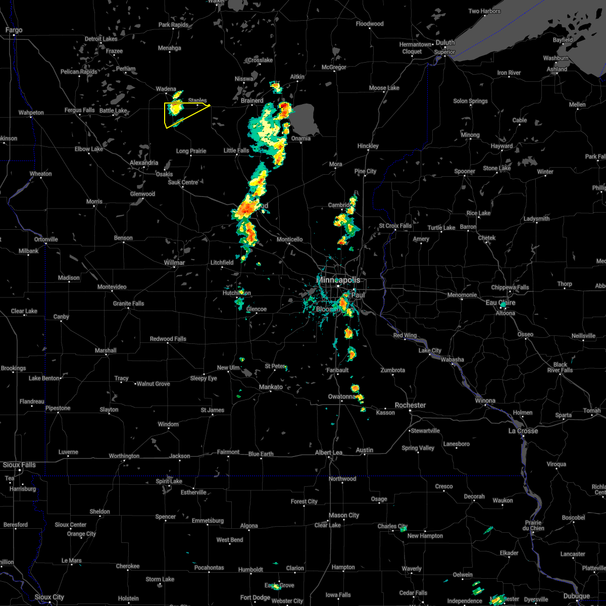
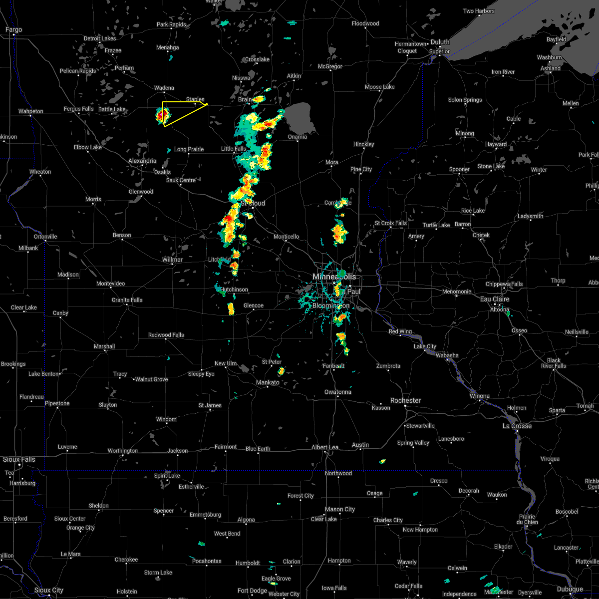
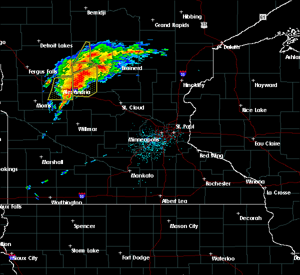
| 7/19/2019 2:44 PM CDT | Half Dollar sized hail reported 5.1 miles ENE of Hewitt, MN |
| 7/19/2019 2:22 PM CDT |
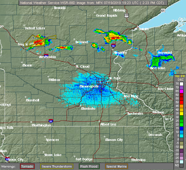 At 222 pm cdt, a severe thunderstorm was located near henning, or 22 miles north of alexandria, moving east at 40 mph (radar indicated). Hazards include two inch hail and 60 mph wind gusts. People and animals outdoors will be injured. expect hail damage to roofs, siding, windows, and vehicles. Expect wind damage to roofs, siding, and trees. At 222 pm cdt, a severe thunderstorm was located near henning, or 22 miles north of alexandria, moving east at 40 mph (radar indicated). Hazards include two inch hail and 60 mph wind gusts. People and animals outdoors will be injured. expect hail damage to roofs, siding, windows, and vehicles. Expect wind damage to roofs, siding, and trees.
|
| 6/30/2018 12:47 AM CDT |
 At 1246 am cdt, a severe thunderstorm was located near staples, or 31 miles west of brainerd, moving northeast at 30 mph (radar indicated). Hazards include 60 mph wind gusts and quarter size hail. Hail damage to vehicles is expected. expect wind damage to roofs, siding, and trees. Locations impacted include, staples, staples airport, bertha and hewitt. At 1246 am cdt, a severe thunderstorm was located near staples, or 31 miles west of brainerd, moving northeast at 30 mph (radar indicated). Hazards include 60 mph wind gusts and quarter size hail. Hail damage to vehicles is expected. expect wind damage to roofs, siding, and trees. Locations impacted include, staples, staples airport, bertha and hewitt.
|
| 6/30/2018 12:18 AM CDT |
 At 1217 am cdt, a severe thunderstorm was located over bertha, or 29 miles northeast of alexandria, moving northeast at 30 mph (radar indicated). Hazards include ping pong ball size hail and 60 mph wind gusts. People and animals outdoors will be injured. expect hail damage to roofs, siding, windows, and vehicles. Expect wind damage to roofs, siding, and trees. At 1217 am cdt, a severe thunderstorm was located over bertha, or 29 miles northeast of alexandria, moving northeast at 30 mph (radar indicated). Hazards include ping pong ball size hail and 60 mph wind gusts. People and animals outdoors will be injured. expect hail damage to roofs, siding, windows, and vehicles. Expect wind damage to roofs, siding, and trees.
|
| 6/6/2018 2:57 AM CDT |
 The severe thunderstorm warning for douglas and todd counties will expire at 300 am cdt, the storms which prompted the warning have weakened below severe limits, and no longer pose an immediate threat to life or property. therefore the warning will be allowed to expire. however wind gusts to 45 mph are still possible with these thunderstorms. a severe thunderstorm watch remains in effect until 600 am cdt for central and west central minnesota. The severe thunderstorm warning for douglas and todd counties will expire at 300 am cdt, the storms which prompted the warning have weakened below severe limits, and no longer pose an immediate threat to life or property. therefore the warning will be allowed to expire. however wind gusts to 45 mph are still possible with these thunderstorms. a severe thunderstorm watch remains in effect until 600 am cdt for central and west central minnesota.
|
| 6/6/2018 2:28 AM CDT |
 At 228 am cdt, severe thunderstorms were located along a line extending from near bertha to near carlos to 6 miles southwest of hoffman, moving east at 45 mph (radar indicated). Hazards include 60 mph wind gusts. Expect damage to roofs, siding, and trees. these severe storms will be near, carlos around 235 am cdt. staples around 240 am cdt. lake osakis around 250 am cdt. long prairie around 300 am cdt. Other locations impacted by these severe thunderstorms include nelson, garfield, melby, miltona, rose city, holmes city, clotho, philbrook and forada. At 228 am cdt, severe thunderstorms were located along a line extending from near bertha to near carlos to 6 miles southwest of hoffman, moving east at 45 mph (radar indicated). Hazards include 60 mph wind gusts. Expect damage to roofs, siding, and trees. these severe storms will be near, carlos around 235 am cdt. staples around 240 am cdt. lake osakis around 250 am cdt. long prairie around 300 am cdt. Other locations impacted by these severe thunderstorms include nelson, garfield, melby, miltona, rose city, holmes city, clotho, philbrook and forada.
|
| 6/6/2018 2:09 AM CDT |
 At 209 am cdt, severe thunderstorms were located along a line extending from near deer creek to near evansville to near herman, moving east at 45 mph (radar indicated). Hazards include 60 mph wind gusts. Expect damage to roofs, siding, and trees. severe thunderstorms will be near, hewitt around 220 am cdt. bertha around 225 am cdt. staples, carlos, and kensington around 235 am cdt. lake osakis around 245 am cdt. long prairie around 300 am cdt. other locations impacted by these severe thunderstorms include alexandria airport, nelson, garfield, melby, miltona, rose city, holmes city, clotho, philbrook and forada. this includes the following highways, interstate 94 in minnesota between mile markers 81 and 119. u. s. highway 10 in minnesota between mile markers 103 and 114, between mile markers 117 and 118, and between mile markers 123 and 125. u. s. Highway 71 between mile markers 185 and 219. At 209 am cdt, severe thunderstorms were located along a line extending from near deer creek to near evansville to near herman, moving east at 45 mph (radar indicated). Hazards include 60 mph wind gusts. Expect damage to roofs, siding, and trees. severe thunderstorms will be near, hewitt around 220 am cdt. bertha around 225 am cdt. staples, carlos, and kensington around 235 am cdt. lake osakis around 245 am cdt. long prairie around 300 am cdt. other locations impacted by these severe thunderstorms include alexandria airport, nelson, garfield, melby, miltona, rose city, holmes city, clotho, philbrook and forada. this includes the following highways, interstate 94 in minnesota between mile markers 81 and 119. u. s. highway 10 in minnesota between mile markers 103 and 114, between mile markers 117 and 118, and between mile markers 123 and 125. u. s. Highway 71 between mile markers 185 and 219.
|
| 9/22/2017 4:14 AM CDT |
 At 414 am cdt, a severe thunderstorm was located near eagle bend, or 29 miles northeast of alexandria, moving northeast at 35 mph (radar indicated). Hazards include 60 mph wind gusts and quarter size hail. Hail damage to vehicles is expected. expect wind damage to roofs, siding, and trees. this severe thunderstorm will be near, staples around 435 am cdt. staples airport around 440 am cdt. other locations impacted by this severe thunderstorm include philbrook. this includes the following highways, u. s. highway 10 in minnesota between mile markers 103 and 114. u. s. Highway 71 between mile markers 196 and 197, and between mile markers 207 and 219. At 414 am cdt, a severe thunderstorm was located near eagle bend, or 29 miles northeast of alexandria, moving northeast at 35 mph (radar indicated). Hazards include 60 mph wind gusts and quarter size hail. Hail damage to vehicles is expected. expect wind damage to roofs, siding, and trees. this severe thunderstorm will be near, staples around 435 am cdt. staples airport around 440 am cdt. other locations impacted by this severe thunderstorm include philbrook. this includes the following highways, u. s. highway 10 in minnesota between mile markers 103 and 114. u. s. Highway 71 between mile markers 196 and 197, and between mile markers 207 and 219.
|
| 7/17/2017 5:29 PM CDT |
 At 529 pm cdt, a severe thunderstorm was located over clarissa, or 26 miles northeast of alexandria, moving east at 20 mph (radar indicated). Hazards include golf ball size hail and 60 mph wind gusts. People and animals outdoors will be injured. expect hail damage to roofs, siding, windows, and vehicles. expect wind damage to roofs, siding, and trees. this severe thunderstorm will be near, browerville around 540 pm cdt. randall and fort ripley around 630 pm cdt. Other locations impacted by this severe thunderstorm include philbrook, cushing, clotho and crow wing state park. At 529 pm cdt, a severe thunderstorm was located over clarissa, or 26 miles northeast of alexandria, moving east at 20 mph (radar indicated). Hazards include golf ball size hail and 60 mph wind gusts. People and animals outdoors will be injured. expect hail damage to roofs, siding, windows, and vehicles. expect wind damage to roofs, siding, and trees. this severe thunderstorm will be near, browerville around 540 pm cdt. randall and fort ripley around 630 pm cdt. Other locations impacted by this severe thunderstorm include philbrook, cushing, clotho and crow wing state park.
|
| 7/17/2017 5:15 PM CDT |
 At 514 pm cdt, a severe thunderstorm was located over eagle bend, or 25 miles northeast of alexandria, moving east at 25 mph (radar indicated). Hazards include ping pong ball size hail and 60 mph wind gusts. People and animals outdoors will be injured. expect hail damage to roofs, siding, windows, and vehicles. expect wind damage to roofs, siding, and trees. this severe storm will be near, clarissa around 520 pm cdt. Other locations impacted by this severe thunderstorm include philbrook. At 514 pm cdt, a severe thunderstorm was located over eagle bend, or 25 miles northeast of alexandria, moving east at 25 mph (radar indicated). Hazards include ping pong ball size hail and 60 mph wind gusts. People and animals outdoors will be injured. expect hail damage to roofs, siding, windows, and vehicles. expect wind damage to roofs, siding, and trees. this severe storm will be near, clarissa around 520 pm cdt. Other locations impacted by this severe thunderstorm include philbrook.
|
| 7/17/2017 4:59 PM CDT |
 At 459 pm cdt, a severe thunderstorm was located near eagle bend, or 23 miles northeast of alexandria, moving northeast at 25 mph (radar indicated). Hazards include golf ball size hail and 60 mph wind gusts. People and animals outdoors will be injured. expect hail damage to roofs, siding, windows, and vehicles. expect wind damage to roofs, siding, and trees. this severe storm will be near, eagle bend around 505 pm cdt. bertha around 510 pm cdt. hewitt around 515 pm cdt. staples and staples airport around 530 pm cdt. Other locations impacted by this severe thunderstorm include philbrook. At 459 pm cdt, a severe thunderstorm was located near eagle bend, or 23 miles northeast of alexandria, moving northeast at 25 mph (radar indicated). Hazards include golf ball size hail and 60 mph wind gusts. People and animals outdoors will be injured. expect hail damage to roofs, siding, windows, and vehicles. expect wind damage to roofs, siding, and trees. this severe storm will be near, eagle bend around 505 pm cdt. bertha around 510 pm cdt. hewitt around 515 pm cdt. staples and staples airport around 530 pm cdt. Other locations impacted by this severe thunderstorm include philbrook.
|
| 7/17/2017 4:50 PM CDT |
 At 450 pm cdt, a severe thunderstorm was located near eagle bend, or 22 miles northeast of alexandria, moving northeast at 30 mph (public). Hazards include golf ball size hail and 60 mph wind gusts. People and animals outdoors will be injured. expect hail damage to roofs, siding, windows, and vehicles. expect wind damage to roofs, siding, and trees. this severe thunderstorm will be near, eagle bend around 455 pm cdt. bertha around 500 pm cdt. clarissa and hewitt around 505 pm cdt. staples and staples airport around 530 pm cdt. Other locations impacted by this severe thunderstorm include philbrook. At 450 pm cdt, a severe thunderstorm was located near eagle bend, or 22 miles northeast of alexandria, moving northeast at 30 mph (public). Hazards include golf ball size hail and 60 mph wind gusts. People and animals outdoors will be injured. expect hail damage to roofs, siding, windows, and vehicles. expect wind damage to roofs, siding, and trees. this severe thunderstorm will be near, eagle bend around 455 pm cdt. bertha around 500 pm cdt. clarissa and hewitt around 505 pm cdt. staples and staples airport around 530 pm cdt. Other locations impacted by this severe thunderstorm include philbrook.
|
| 7/21/2016 4:58 AM CDT |
 The severe thunderstorm warning for northern todd county will expire at 500 am cdt. the storm which prompted the warning has moved out of the area. therefore the warning will be allowed to expire. A severe thunderstorm watch remains in effect until 700 am cdt for central minnesota. The severe thunderstorm warning for northern todd county will expire at 500 am cdt. the storm which prompted the warning has moved out of the area. therefore the warning will be allowed to expire. A severe thunderstorm watch remains in effect until 700 am cdt for central minnesota.
|
| 7/21/2016 4:27 AM CDT |
 At 427 am cdt, a severe thunderstorm was located near bertha, or 25 miles northeast of alexandria, moving east at 25 mph (radar indicated). Hazards include 60 mph wind gusts and quarter size hail. Hail damage to vehicles is expected. expect wind damage to roofs, siding, and trees. this severe thunderstorm will be near, hewitt around 430 am cdt. eagle bend and bertha around 435 am cdt. staples around 500 am cdt. this includes the following highways, u. s. highway 10 in minnesota between mile markers 103 and 109. u. s. Highway 71 between mile markers 205 and 217. At 427 am cdt, a severe thunderstorm was located near bertha, or 25 miles northeast of alexandria, moving east at 25 mph (radar indicated). Hazards include 60 mph wind gusts and quarter size hail. Hail damage to vehicles is expected. expect wind damage to roofs, siding, and trees. this severe thunderstorm will be near, hewitt around 430 am cdt. eagle bend and bertha around 435 am cdt. staples around 500 am cdt. this includes the following highways, u. s. highway 10 in minnesota between mile markers 103 and 109. u. s. Highway 71 between mile markers 205 and 217.
|
| 7/21/2016 2:27 AM CDT |
 The severe thunderstorm warning for todd, douglas and northwestern morrison counties will expire at 230 am cdt, the storms which prompted the warning have weakened below severe limits, and no longer pose an immediate threat to life or property. therefore the warning will be allowed to expire. however gusty winds are still possible with these thunderstorms. a severe thunderstorm watch remains in effect until 700 am cdt for central minnesota. The severe thunderstorm warning for todd, douglas and northwestern morrison counties will expire at 230 am cdt, the storms which prompted the warning have weakened below severe limits, and no longer pose an immediate threat to life or property. therefore the warning will be allowed to expire. however gusty winds are still possible with these thunderstorms. a severe thunderstorm watch remains in effect until 700 am cdt for central minnesota.
|
| 7/21/2016 1:51 AM CDT |
 At 151 am cdt, severe thunderstorms were located along a line extending from near motley to near rose city to near campbell, moving southeast at 50 mph (radar indicated). Hazards include 60 mph wind gusts. Expect damage to roofs. siding. and trees. severe thunderstorms will be near, motley and eagle bend around 155 am cdt. clarissa around 200 am cdt. crow wing state park and long prairie around 210 am cdt. randall around 215 am cdt. camp ripley around 220 am cdt. other locations impacted by these severe thunderstorms include garfield, round prairie, nelson, clotho, alexandria airport, rose city, leaf valley, melby, miltona and holmes city. this includes the following highways, interstate 94 in minnesota between mile markers 81 and 117. u. s. highway 10 in minnesota between mile markers 104 and 138. u. s. Highway 71 between mile markers 181 and 219. At 151 am cdt, severe thunderstorms were located along a line extending from near motley to near rose city to near campbell, moving southeast at 50 mph (radar indicated). Hazards include 60 mph wind gusts. Expect damage to roofs. siding. and trees. severe thunderstorms will be near, motley and eagle bend around 155 am cdt. clarissa around 200 am cdt. crow wing state park and long prairie around 210 am cdt. randall around 215 am cdt. camp ripley around 220 am cdt. other locations impacted by these severe thunderstorms include garfield, round prairie, nelson, clotho, alexandria airport, rose city, leaf valley, melby, miltona and holmes city. this includes the following highways, interstate 94 in minnesota between mile markers 81 and 117. u. s. highway 10 in minnesota between mile markers 104 and 138. u. s. Highway 71 between mile markers 181 and 219.
|
| 6/17/2016 10:54 AM CDT | Quarter sized hail reported 4.9 miles ENE of Hewitt, MN, nickel to quarter size hail falling. |
| 6/17/2016 10:27 AM CDT |
 At 1027 am cdt, severe thunderstorms were located along a line extending from near new york mills to near almora, moving east at 20 mph (radar indicated). Hazards include 60 mph wind gusts and quarter size hail. Hail damage to vehicles is expected. Expect wind damage to roofs, siding, and trees. At 1027 am cdt, severe thunderstorms were located along a line extending from near new york mills to near almora, moving east at 20 mph (radar indicated). Hazards include 60 mph wind gusts and quarter size hail. Hail damage to vehicles is expected. Expect wind damage to roofs, siding, and trees.
|
| 8/2/2015 8:24 AM CDT |
 At 823 am cdt, a severe thunderstorm was located near eagle bend, or 20 miles northeast of alexandria, moving southeast at 55 mph (radar indicated). Hazards include golf ball size hail and 60 mph wind gusts. People and animals outdoors will be injured. expect hail damage to roofs, siding, windows and vehicles. expect wind damage to roofs, siding and trees. this severe storm will be near, browerville around 835 am cdt. long prairie around 840 am cdt. other locations impacted by this severe thunderstorm include rose city, belle river, clotho and miltona. this includes u. s. Highway 71 between mile markers 184 and 219. At 823 am cdt, a severe thunderstorm was located near eagle bend, or 20 miles northeast of alexandria, moving southeast at 55 mph (radar indicated). Hazards include golf ball size hail and 60 mph wind gusts. People and animals outdoors will be injured. expect hail damage to roofs, siding, windows and vehicles. expect wind damage to roofs, siding and trees. this severe storm will be near, browerville around 835 am cdt. long prairie around 840 am cdt. other locations impacted by this severe thunderstorm include rose city, belle river, clotho and miltona. this includes u. s. Highway 71 between mile markers 184 and 219.
|
| 8/2/2015 8:13 AM CDT |
 At 813 am cdt, a severe thunderstorm was located near wrightstown, or 24 miles north of alexandria, moving southeast at 55 mph (radar indicated). Hazards include 60 mph wind gusts and quarter size hail. Hail damage to vehicles is expected. expect wind damage to roofs, siding and trees. this severe thunderstorm will be near, eagle bend around 825 am cdt. long prairie around 840 am cdt. other locations impacted by this severe thunderstorm include rose city, belle river, clotho and miltona. this includes u. s. Highway 71 between mile markers 184 and 219. At 813 am cdt, a severe thunderstorm was located near wrightstown, or 24 miles north of alexandria, moving southeast at 55 mph (radar indicated). Hazards include 60 mph wind gusts and quarter size hail. Hail damage to vehicles is expected. expect wind damage to roofs, siding and trees. this severe thunderstorm will be near, eagle bend around 825 am cdt. long prairie around 840 am cdt. other locations impacted by this severe thunderstorm include rose city, belle river, clotho and miltona. this includes u. s. Highway 71 between mile markers 184 and 219.
|
| 7/12/2015 6:24 PM CDT |
 At 624 pm cdt, a severe thunderstorm capable of producing a tornado was located near parkers prairie, or 19 miles north of alexandria, moving east at 40 mph (radar indicated rotation). Hazards include tornado and half dollar size hail. Flying debris will be dangerous to those caught without shelter. mobile homes will be damaged or destroyed. damage to roofs, windows and vehicles will occur. tree damage is likely. this dangerous storm will be near, eagle bend and bertha around 640 pm cdt. clarissa and hewitt around 645 pm cdt. staples around 705 pm cdt. Other locations impacted by this tornadic thunderstorm include rose city and philbrook. At 624 pm cdt, a severe thunderstorm capable of producing a tornado was located near parkers prairie, or 19 miles north of alexandria, moving east at 40 mph (radar indicated rotation). Hazards include tornado and half dollar size hail. Flying debris will be dangerous to those caught without shelter. mobile homes will be damaged or destroyed. damage to roofs, windows and vehicles will occur. tree damage is likely. this dangerous storm will be near, eagle bend and bertha around 640 pm cdt. clarissa and hewitt around 645 pm cdt. staples around 705 pm cdt. Other locations impacted by this tornadic thunderstorm include rose city and philbrook.
|
| 7/12/2015 6:23 PM CDT | Trees and power lines down in todd county MN, 0.4 miles NW of Hewitt, MN |
| 9/4/2014 6:20 AM CDT | Trees reported down on hwy. 210 and a roof blown off a building in the city of hewit in todd county MN, 0.4 miles NW of Hewitt, MN |
| 6/20/2014 6:10 PM CDT | Quarter sized hail reported 0.8 miles ENE of Hewitt, MN |
Hail Maps for Hewitt, MN


Connect with Interactive Hail Maps