

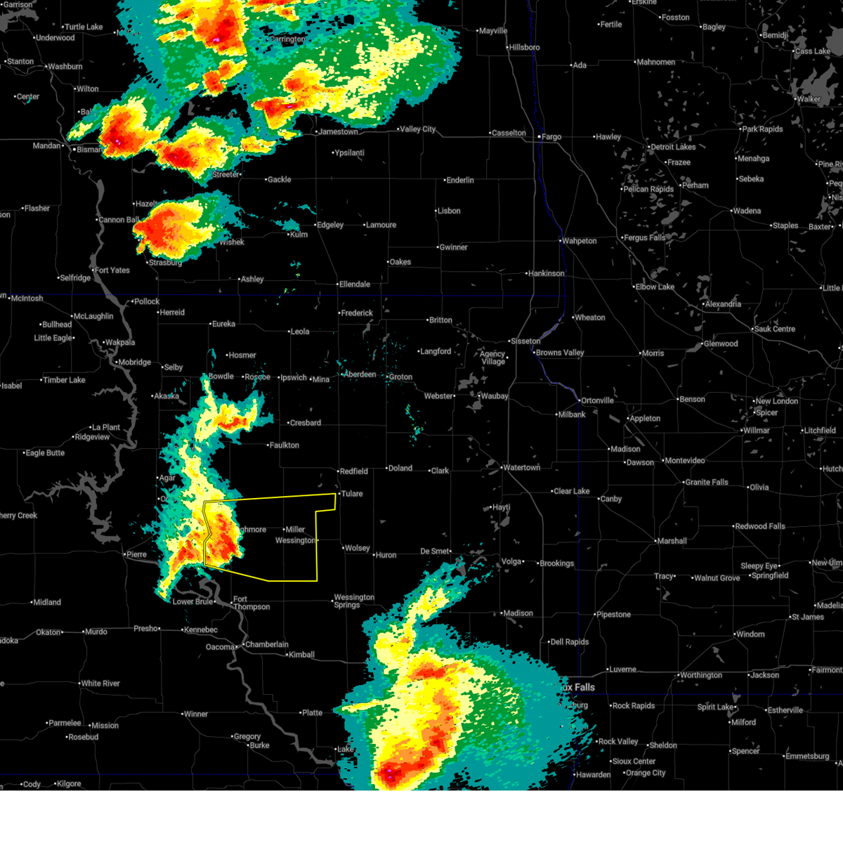
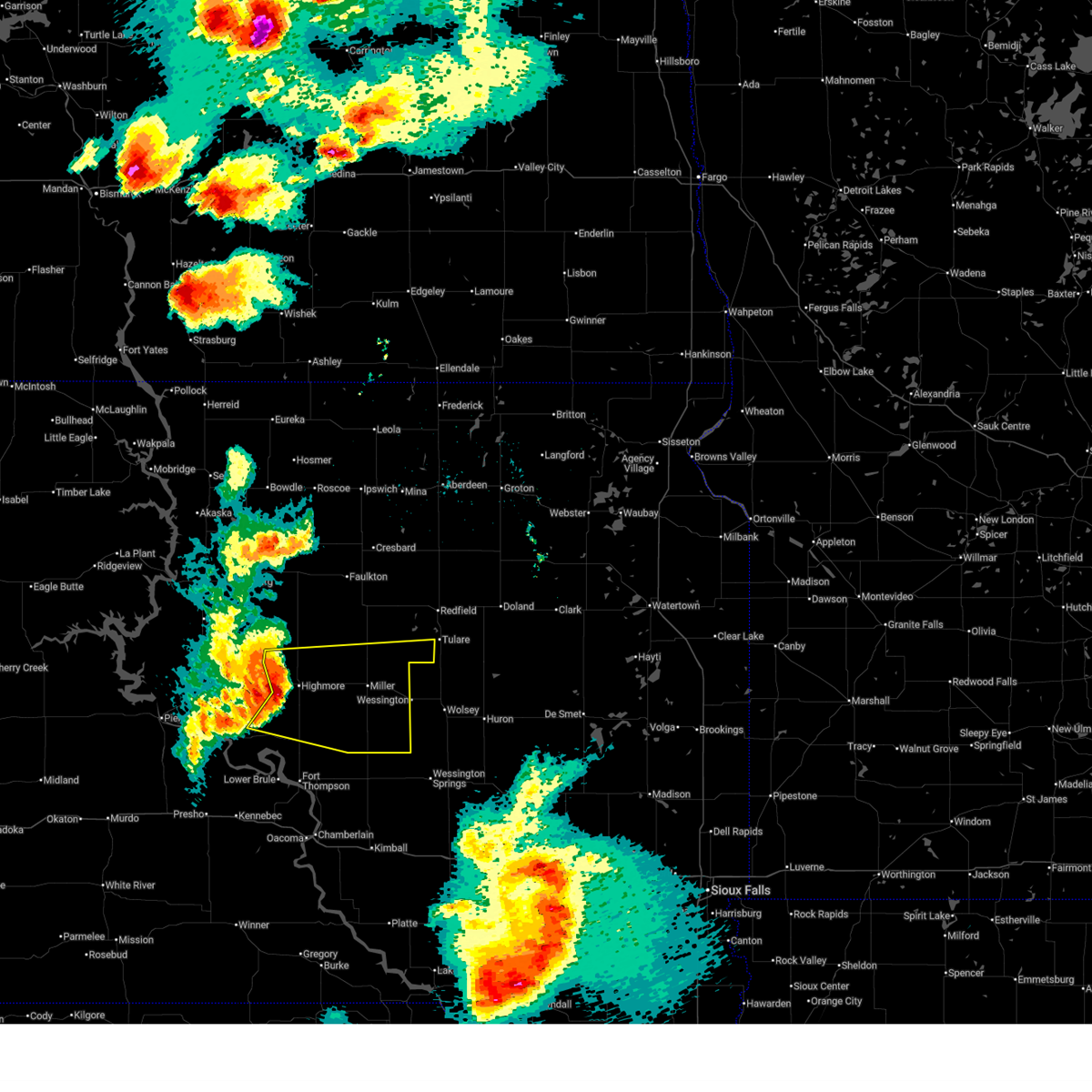
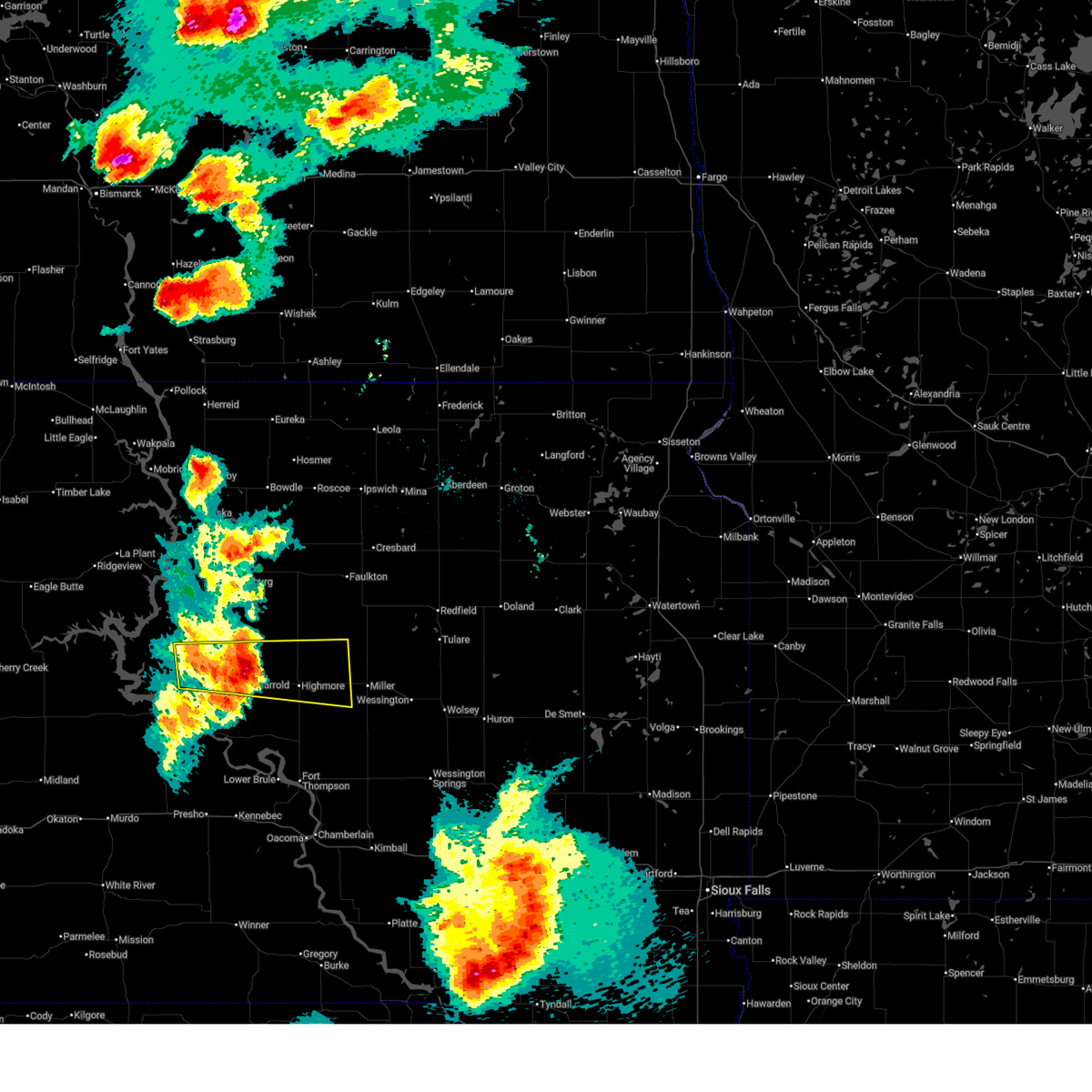
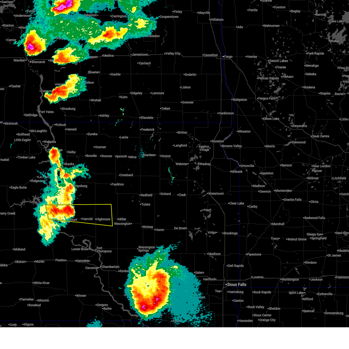
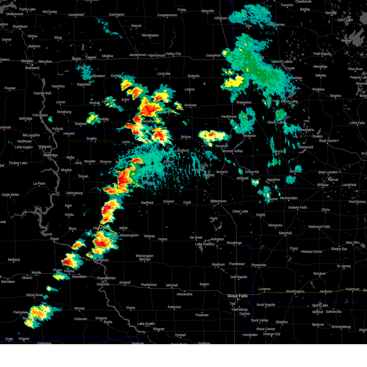
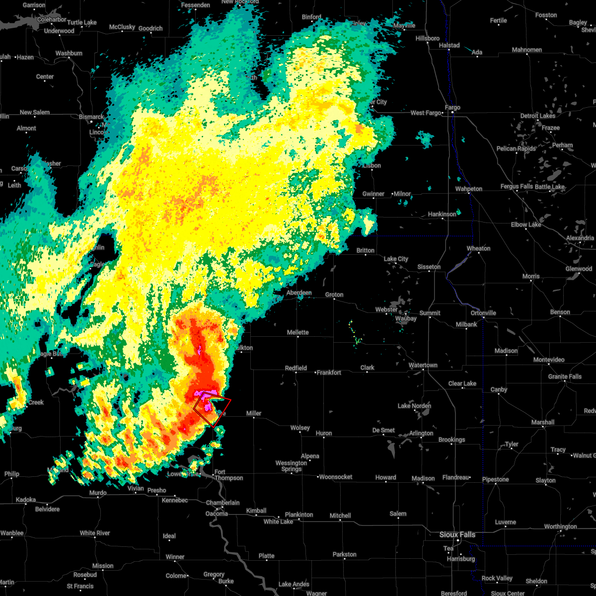
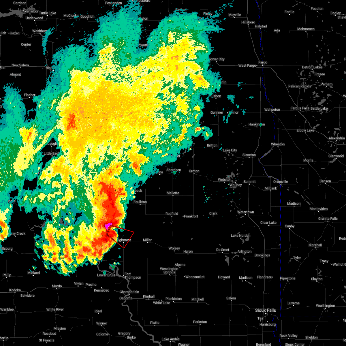
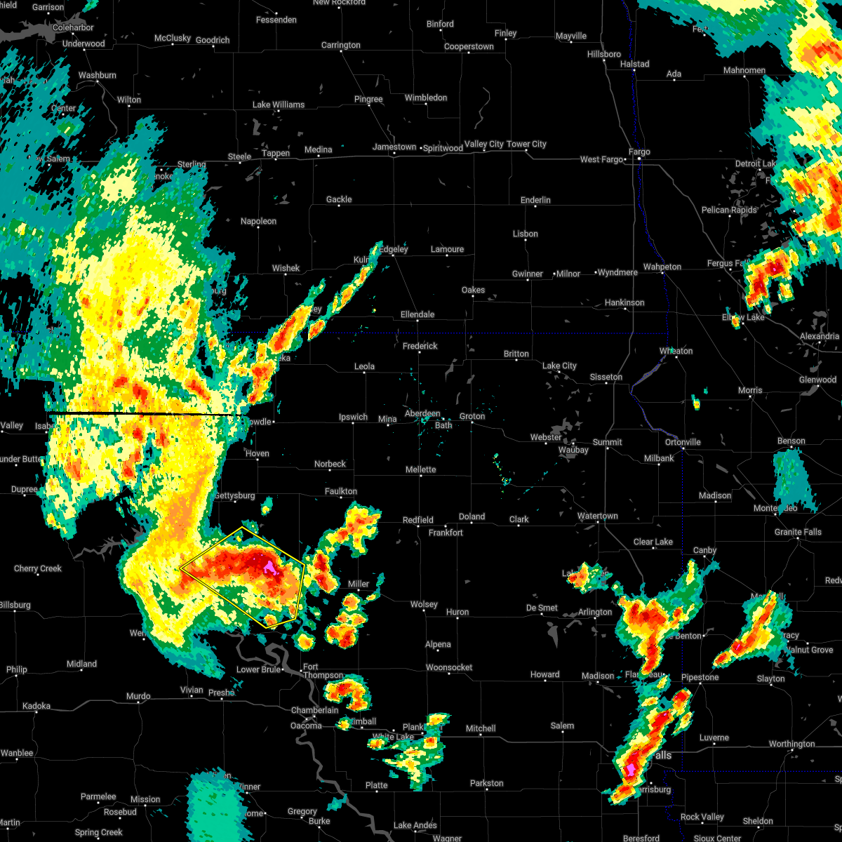
Hail Map for Highmore, SD
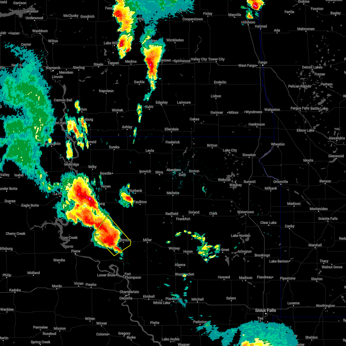
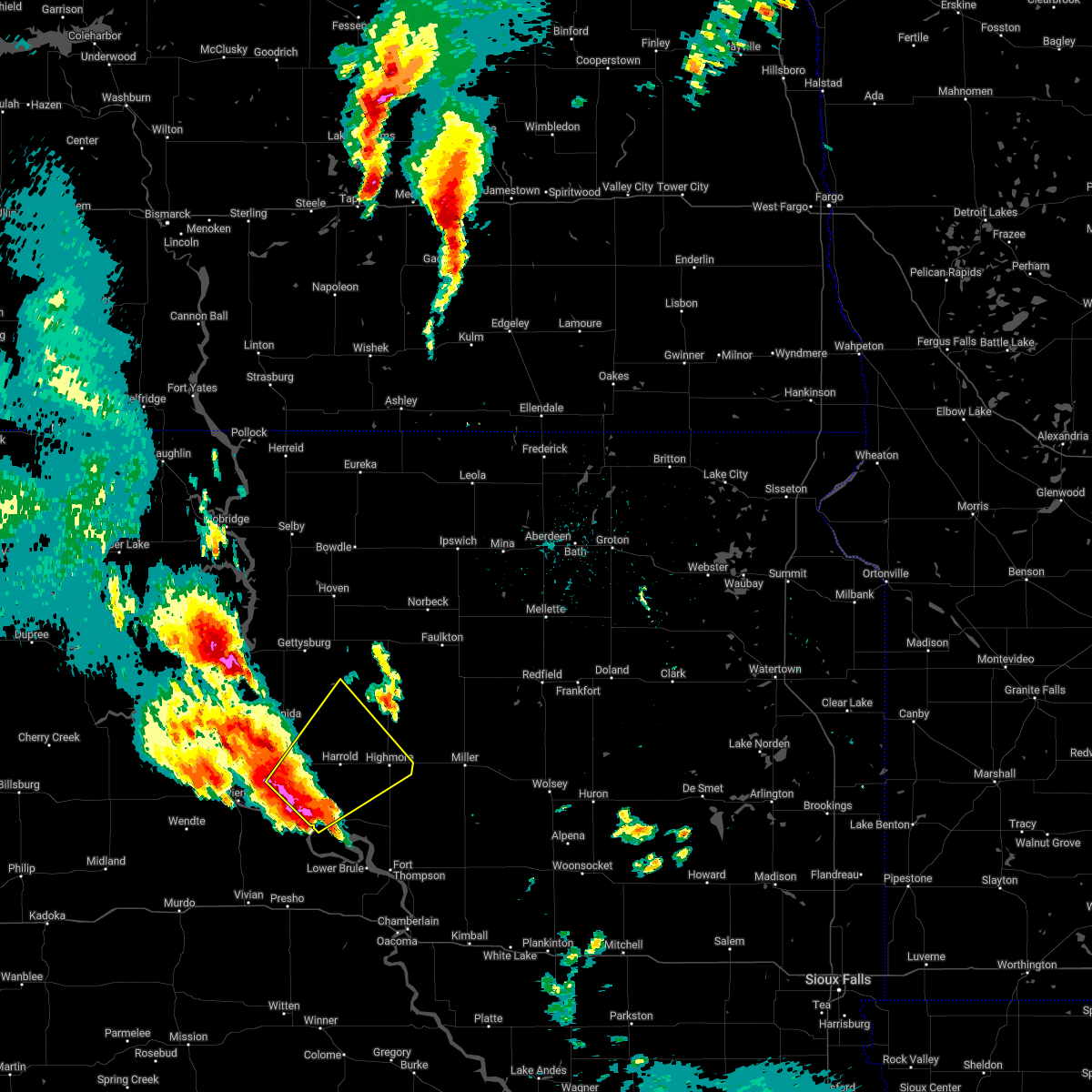
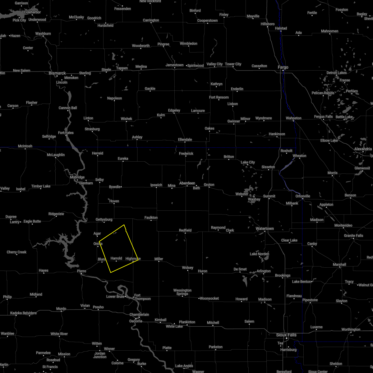
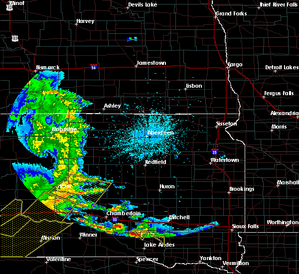
The Highmore, SD area has had 17 reports of on-the-ground hail by trained spotters, and has been under severe weather warnings 17 times during the past 12 months. Doppler radar has detected hail at or near Highmore, SD on 43 occasions, including 3 occasions during the past year.
| Name: | Highmore, SD |
| Where Located: | 46.2 miles ENE of Pierre, SD |
| Map: | Google Map for Highmore, SD |
| Population: | 795 |
| Housing Units: | 393 |
| More Info: | Search Google for Highmore, SD |
0
The Top Recent Hail Date for Highmore, SD is Thursday, June 12, 2025 (40th out of 43)
Hail and Wind Damage Spotted near Highmore, SD
| Date / Time | Report Details |
|---|---|
| 6/29/2025 5:51 AM CDT |
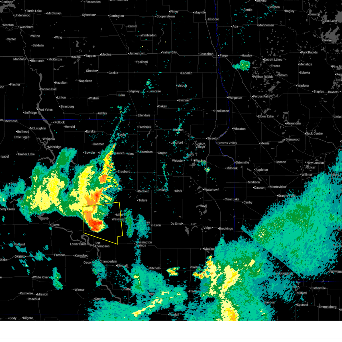
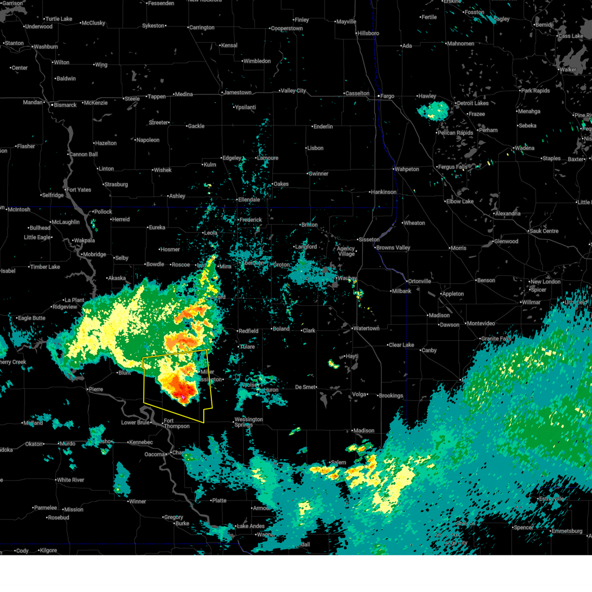 At 548 am cdt, a severe thunderstorm was located near miller dale colony, or 12 miles southwest of miller, moving east at 30 mph (trained weather spotters. at 537 am the department of transportation weather station at macs corner recorded a wind gust of 65 mph). Hazards include 70 mph wind gusts and penny size hail. Expect considerable tree damage. damage is likely to mobile homes, roofs, and outbuildings. locations impacted include, miller, highmore, st. Lawrence, miller dale colony, stephan, ree heights, sunshine bible academy, pleasant valley country church, holabird, danforth, and northern crow creek reservation. At 548 am cdt, a severe thunderstorm was located near miller dale colony, or 12 miles southwest of miller, moving east at 30 mph (trained weather spotters. at 537 am the department of transportation weather station at macs corner recorded a wind gust of 65 mph). Hazards include 70 mph wind gusts and penny size hail. Expect considerable tree damage. damage is likely to mobile homes, roofs, and outbuildings. locations impacted include, miller, highmore, st. Lawrence, miller dale colony, stephan, ree heights, sunshine bible academy, pleasant valley country church, holabird, danforth, and northern crow creek reservation.
|
| 6/29/2025 5:48 AM CDT | Mesonet station 183 macs corner (sddot in hyde county SD, 18.1 miles N of Highmore, SD |
| 6/29/2025 5:37 AM CDT | Mesonet station 183 macs corner (sddot in hyde county SD, 18.1 miles N of Highmore, SD |
| 6/29/2025 5:35 AM CDT |
 At 533 am cdt, a severe thunderstorm was located near highmore, moving east at 30 mph (trained weather spotters). Hazards include 70 mph wind gusts and penny size hail. Expect considerable tree damage. damage is likely to mobile homes, roofs, and outbuildings. locations impacted include, ree heights, miller dale colony, miller and st. lawrence. those camping at the ree heights roundup are in the path of this storm and should prepare for imminent dangerous weather conditions. Seek shelter now!. At 533 am cdt, a severe thunderstorm was located near highmore, moving east at 30 mph (trained weather spotters). Hazards include 70 mph wind gusts and penny size hail. Expect considerable tree damage. damage is likely to mobile homes, roofs, and outbuildings. locations impacted include, ree heights, miller dale colony, miller and st. lawrence. those camping at the ree heights roundup are in the path of this storm and should prepare for imminent dangerous weather conditions. Seek shelter now!.
|
| 6/29/2025 5:35 AM CDT |
 the severe thunderstorm warning has been cancelled and is no longer in effect the severe thunderstorm warning has been cancelled and is no longer in effect
|
| 6/29/2025 5:30 AM CDT | Mesonet station hihs2 highmore (sd mesonet in hyde county SD, 1.1 miles ESE of Highmore, SD |
| 6/29/2025 5:20 AM CDT |
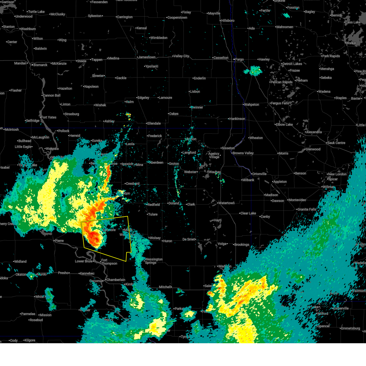 Svrabr the national weather service in aberdeen has issued a * severe thunderstorm warning for, southwestern hand county in central south dakota, southeastern sully county in central south dakota, hyde county in central south dakota, northeastern hughes county in central south dakota, northeastern buffalo county in central south dakota, * until 615 am cdt. * at 519 am cdt, a severe thunderstorm was located near holabird, or 7 miles southwest of highmore, moving east at 30 mph (trained weather spotters). Hazards include 60 mph wind gusts and penny size hail. Expect damage to roofs, siding, and trees. this severe thunderstorm will be near, highmore around 525 am cdt. other locations in the path of this severe thunderstorm include ree heights and miller dale colony. those camping at the ree heights roundup are in the path of this storm and should prepare for imminent dangerous weather conditions. Seek shelter now!. Svrabr the national weather service in aberdeen has issued a * severe thunderstorm warning for, southwestern hand county in central south dakota, southeastern sully county in central south dakota, hyde county in central south dakota, northeastern hughes county in central south dakota, northeastern buffalo county in central south dakota, * until 615 am cdt. * at 519 am cdt, a severe thunderstorm was located near holabird, or 7 miles southwest of highmore, moving east at 30 mph (trained weather spotters). Hazards include 60 mph wind gusts and penny size hail. Expect damage to roofs, siding, and trees. this severe thunderstorm will be near, highmore around 525 am cdt. other locations in the path of this severe thunderstorm include ree heights and miller dale colony. those camping at the ree heights roundup are in the path of this storm and should prepare for imminent dangerous weather conditions. Seek shelter now!.
|
| 6/27/2025 11:31 PM CDT |
 The storm which prompted the warning has weakened below severe limits, and no longer poses an immediate threat to life or property. therefore, the warning has been allowed to expire. however, gusty winds are still possible with this thunderstorm. a severe thunderstorm watch remains in effect until midnight cdt for central south dakota. The storm which prompted the warning has weakened below severe limits, and no longer poses an immediate threat to life or property. therefore, the warning has been allowed to expire. however, gusty winds are still possible with this thunderstorm. a severe thunderstorm watch remains in effect until midnight cdt for central south dakota.
|
| 6/27/2025 11:08 PM CDT |
 the severe thunderstorm warning has been cancelled and is no longer in effect the severe thunderstorm warning has been cancelled and is no longer in effect
|
| 6/27/2025 11:08 PM CDT |
 At 1106 pm cdt, a severe thunderstorm was located over miller dale colony, or 10 miles southwest of miller, moving east at 45 mph (trained weather spotters. at 1053 pm cdt a 62 mph wind gust was reported at the dot weather station at macs corner). Hazards include 60 mph wind gusts and penny size hail. Expect damage to roofs, siding, and trees. Locations impacted include, miller dale colony, sunshine bible academy and rosehill dam. At 1106 pm cdt, a severe thunderstorm was located over miller dale colony, or 10 miles southwest of miller, moving east at 45 mph (trained weather spotters. at 1053 pm cdt a 62 mph wind gust was reported at the dot weather station at macs corner). Hazards include 60 mph wind gusts and penny size hail. Expect damage to roofs, siding, and trees. Locations impacted include, miller dale colony, sunshine bible academy and rosehill dam.
|
| 6/27/2025 10:53 PM CDT | Mesonet station 183 macs corner (sddot in hyde county SD, 18.1 miles N of Highmore, SD |
| 6/27/2025 10:49 PM CDT |
 Svrabr the national weather service in aberdeen has issued a * severe thunderstorm warning for, hand county in central south dakota, hyde county in central south dakota, east central hughes county in central south dakota, southwestern spink county in northeastern south dakota, * until 1130 pm cdt. * at 1048 pm cdt, a severe thunderstorm was located near highmore, moving east at 45 mph (trained weather spotters). Hazards include 60 mph wind gusts and penny size hail. Expect damage to roofs, siding, and trees. this severe thunderstorm will be near, miller dale colony around 1100 pm cdt. Other locations in the path of this severe thunderstorm include sunshine bible academy. Svrabr the national weather service in aberdeen has issued a * severe thunderstorm warning for, hand county in central south dakota, hyde county in central south dakota, east central hughes county in central south dakota, southwestern spink county in northeastern south dakota, * until 1130 pm cdt. * at 1048 pm cdt, a severe thunderstorm was located near highmore, moving east at 45 mph (trained weather spotters). Hazards include 60 mph wind gusts and penny size hail. Expect damage to roofs, siding, and trees. this severe thunderstorm will be near, miller dale colony around 1100 pm cdt. Other locations in the path of this severe thunderstorm include sunshine bible academy.
|
| 6/27/2025 10:32 PM CDT |
 At 1031 pm cdt, a severe thunderstorm was located 9 miles north of holabird, or 14 miles northwest of highmore, moving east at 55 mph (trained weather spotters. at 1000 pm cdt, 60 mph wind was reported in onida). Hazards include 60 mph wind gusts and quarter size hail. Hail damage to vehicles is expected. expect wind damage to roofs, siding, and trees. Locations impacted include, highmore, onida, blunt, harrold, ree heights, holabird, and sully lake. At 1031 pm cdt, a severe thunderstorm was located 9 miles north of holabird, or 14 miles northwest of highmore, moving east at 55 mph (trained weather spotters. at 1000 pm cdt, 60 mph wind was reported in onida). Hazards include 60 mph wind gusts and quarter size hail. Hail damage to vehicles is expected. expect wind damage to roofs, siding, and trees. Locations impacted include, highmore, onida, blunt, harrold, ree heights, holabird, and sully lake.
|
| 6/27/2025 10:19 PM CDT |
 At 1017 pm cdt, a severe thunderstorm was located 8 miles southeast of onida, moving east at 55 mph (radar indicated). Hazards include 60 mph wind gusts and quarter size hail. Hail damage to vehicles is expected. expect wind damage to roofs, siding, and trees. Locations impacted include, highmore, onida, blunt, harrold, ree heights, holabird, and sully lake. At 1017 pm cdt, a severe thunderstorm was located 8 miles southeast of onida, moving east at 55 mph (radar indicated). Hazards include 60 mph wind gusts and quarter size hail. Hail damage to vehicles is expected. expect wind damage to roofs, siding, and trees. Locations impacted include, highmore, onida, blunt, harrold, ree heights, holabird, and sully lake.
|
| 6/27/2025 10:15 PM CDT |
 Svrabr the national weather service in aberdeen has issued a * severe thunderstorm warning for, west central hand county in central south dakota, southeastern sully county in central south dakota, central hyde county in central south dakota, northeastern hughes county in central south dakota, * until 1100 pm cdt. * at 1015 pm cdt, a severe thunderstorm was located near onida, moving east at 50 mph.**enter location**! (radar indicated). Hazards include 60 mph wind gusts and quarter size hail. Hail damage to vehicles is expected. expect wind damage to roofs, siding, and trees. This severe thunderstorm will remain over mainly rural areas of west central hand, southeastern sully, central hyde and northeastern hughes counties. Svrabr the national weather service in aberdeen has issued a * severe thunderstorm warning for, west central hand county in central south dakota, southeastern sully county in central south dakota, central hyde county in central south dakota, northeastern hughes county in central south dakota, * until 1100 pm cdt. * at 1015 pm cdt, a severe thunderstorm was located near onida, moving east at 50 mph.**enter location**! (radar indicated). Hazards include 60 mph wind gusts and quarter size hail. Hail damage to vehicles is expected. expect wind damage to roofs, siding, and trees. This severe thunderstorm will remain over mainly rural areas of west central hand, southeastern sully, central hyde and northeastern hughes counties.
|
| 7/14/2024 3:09 AM CDT |
 The storms which prompted the warning have weakened below severe limits, and have exited the warned area. therefore, the warning will be allowed to expire. however, gusty winds and heavy rain are still possible with these thunderstorms. a severe thunderstorm watch remains in effect until 600 am cdt for central and north central south dakota. a severe thunderstorm watch also remains in effect until 800 am cdt for northeastern south dakota. The storms which prompted the warning have weakened below severe limits, and have exited the warned area. therefore, the warning will be allowed to expire. however, gusty winds and heavy rain are still possible with these thunderstorms. a severe thunderstorm watch remains in effect until 600 am cdt for central and north central south dakota. a severe thunderstorm watch also remains in effect until 800 am cdt for northeastern south dakota.
|
| 7/14/2024 2:52 AM CDT |
 the severe thunderstorm warning has been cancelled and is no longer in effect the severe thunderstorm warning has been cancelled and is no longer in effect
|
| 7/14/2024 2:52 AM CDT |
 At 251 am cdt, severe thunderstorms were located along a line extending from 6 miles west of athol to 7 miles west of aurora center, moving east at 55 mph (radar indicated). Hazards include 70 mph wind gusts. Expect considerable tree damage. damage is likely to mobile homes, roofs, and outbuildings. Locations impacted include, redfield, tulare, cottonwood lake, twin lakes, spottswood, hitchcock, frankfort, glendale colony, spink colony and camrose colony. At 251 am cdt, severe thunderstorms were located along a line extending from 6 miles west of athol to 7 miles west of aurora center, moving east at 55 mph (radar indicated). Hazards include 70 mph wind gusts. Expect considerable tree damage. damage is likely to mobile homes, roofs, and outbuildings. Locations impacted include, redfield, tulare, cottonwood lake, twin lakes, spottswood, hitchcock, frankfort, glendale colony, spink colony and camrose colony.
|
| 7/14/2024 2:20 AM CDT |
 Svrabr the national weather service in aberdeen has issued a * severe thunderstorm warning for, eastern jones county in central south dakota, hand county in central south dakota, sully county in central south dakota, hyde county in central south dakota, southern faulk county in north central south dakota, southern potter county in north central south dakota, southeastern stanley county in central south dakota, hughes county in central south dakota, southern spink county in northeastern south dakota, lyman county in central south dakota, buffalo county in central south dakota, * until 315 am cdt. * at 220 am cdt, severe thunderstorms were located along a line extending from near burkmere to 8 miles east of iona, moving east at 55 mph (radar indicated). Hazards include 70 mph wind gusts. Expect considerable tree damage. damage is likely to mobile homes, roofs, and outbuildings. severe thunderstorms will be near, miller, faulkton, miller dale colony, shelby, orient, ree heights, gann valley, polo, etbauer hill, and sunshine bible academy around 225 am cdt. st. lawrence, miranda, and pleasant valley country church around 230 am cdt. burdette, rockham, devoe, and danforth around 235 am cdt. zell, vayland, and rosehill dam around 240 am cdt. Other locations in the path of these severe thunderstorms include cottonwood lake, redfield, athol, twin lakes, tulare, ashton, spottswood and hitchcock. Svrabr the national weather service in aberdeen has issued a * severe thunderstorm warning for, eastern jones county in central south dakota, hand county in central south dakota, sully county in central south dakota, hyde county in central south dakota, southern faulk county in north central south dakota, southern potter county in north central south dakota, southeastern stanley county in central south dakota, hughes county in central south dakota, southern spink county in northeastern south dakota, lyman county in central south dakota, buffalo county in central south dakota, * until 315 am cdt. * at 220 am cdt, severe thunderstorms were located along a line extending from near burkmere to 8 miles east of iona, moving east at 55 mph (radar indicated). Hazards include 70 mph wind gusts. Expect considerable tree damage. damage is likely to mobile homes, roofs, and outbuildings. severe thunderstorms will be near, miller, faulkton, miller dale colony, shelby, orient, ree heights, gann valley, polo, etbauer hill, and sunshine bible academy around 225 am cdt. st. lawrence, miranda, and pleasant valley country church around 230 am cdt. burdette, rockham, devoe, and danforth around 235 am cdt. zell, vayland, and rosehill dam around 240 am cdt. Other locations in the path of these severe thunderstorms include cottonwood lake, redfield, athol, twin lakes, tulare, ashton, spottswood and hitchcock.
|
| 7/14/2024 2:17 AM CDT | Mesonet station 215 polo 17 w jct sd47/sd26 (sddot in hyde county SD, 17.9 miles S of Highmore, SD |
| 7/14/2024 2:10 AM CDT | Mesonet station hihs2 highmore (sd mesonet in hyde county SD, 1.1 miles ESE of Highmore, SD |
| 7/14/2024 2:06 AM CDT | Mesonet station 183 macs corner (sddot in hyde county SD, 18.1 miles N of Highmore, SD |
| 7/14/2024 2:01 AM CDT | Mesonet station 183 macs corner (sddot in hyde county SD, 18.1 miles N of Highmore, SD |
| 7/14/2024 1:50 AM CDT |
 At 148 am cdt/1248 am mdt/, severe thunderstorms were located along a line extending from 8 miles south of lowry to 9 miles south of earling hill, moving east at 50 mph (radar indicated). Hazards include 70 mph wind gusts. Expect considerable tree damage. damage is likely to mobile homes, roofs, and outbuildings. Locations impacted include, kennebec, harrold, lebanon, lake sharpe, joe creek rec area, lyman, west bend rec area, stone lake, byre lake, holabird, lower brule, reliance, seneca, medicine butte, fort thompson, highmore, stephan, onaka, lake francis case, counselor creek boat access area, tailrace rec area, oacoma, dude ranch, brentwood colony, thunderbird colony, burkmere, lees corner, shelby, ree heights, norbeck, crow creek housing and etbauer hill. At 148 am cdt/1248 am mdt/, severe thunderstorms were located along a line extending from 8 miles south of lowry to 9 miles south of earling hill, moving east at 50 mph (radar indicated). Hazards include 70 mph wind gusts. Expect considerable tree damage. damage is likely to mobile homes, roofs, and outbuildings. Locations impacted include, kennebec, harrold, lebanon, lake sharpe, joe creek rec area, lyman, west bend rec area, stone lake, byre lake, holabird, lower brule, reliance, seneca, medicine butte, fort thompson, highmore, stephan, onaka, lake francis case, counselor creek boat access area, tailrace rec area, oacoma, dude ranch, brentwood colony, thunderbird colony, burkmere, lees corner, shelby, ree heights, norbeck, crow creek housing and etbauer hill.
|
| 7/14/2024 1:27 AM CDT |
 Svrabr the national weather service in aberdeen has issued a * severe thunderstorm warning for, jones county in central south dakota, western hand county in central south dakota, sully county in central south dakota, hyde county in central south dakota, western faulk county in north central south dakota, potter county in north central south dakota, stanley county in central south dakota, southeastern dewey county in north central south dakota, hughes county in central south dakota, lyman county in central south dakota, western buffalo county in central south dakota, * until 230 am cdt/130 am mdt/. * at 126 am cdt/1226 am mdt/, severe thunderstorms were located along a line extending from 6 miles south of swan creek rec area to 12 miles south of 5 mile corner, moving east at 50 mph. these are destructive storms (radar indicated). Hazards include 80 mph wind gusts. Flying debris will be dangerous to those caught without shelter. mobile homes will be heavily damaged. expect considerable damage to roofs, windows, and vehicles. extensive tree damage and power outages are likely. severe thunderstorms will be near, onida, presho, agar, lake sharpe, rousseau, gorman, canning, earling hill, sully lake, and 5 mile corner around 130 am cdt. gettysburg, blunt, cedar creek rec area, cottonwood lake near agar, degrey rec area, and fate dam around 135 am cdt. kennebec and byre lake around 140 am cdt. harrold, lebanon, joe creek rec area, and stone lake around 145 am cdt. Other locations in the path of these severe thunderstorms include lyman, west bend rec area, lower brule, reliance, holabird, medicine butte, seneca, onaka, lake francis case, counselor creek boat access area, fort thompson, highmore, stephan, tailrace rec area and dude ranch. Svrabr the national weather service in aberdeen has issued a * severe thunderstorm warning for, jones county in central south dakota, western hand county in central south dakota, sully county in central south dakota, hyde county in central south dakota, western faulk county in north central south dakota, potter county in north central south dakota, stanley county in central south dakota, southeastern dewey county in north central south dakota, hughes county in central south dakota, lyman county in central south dakota, western buffalo county in central south dakota, * until 230 am cdt/130 am mdt/. * at 126 am cdt/1226 am mdt/, severe thunderstorms were located along a line extending from 6 miles south of swan creek rec area to 12 miles south of 5 mile corner, moving east at 50 mph. these are destructive storms (radar indicated). Hazards include 80 mph wind gusts. Flying debris will be dangerous to those caught without shelter. mobile homes will be heavily damaged. expect considerable damage to roofs, windows, and vehicles. extensive tree damage and power outages are likely. severe thunderstorms will be near, onida, presho, agar, lake sharpe, rousseau, gorman, canning, earling hill, sully lake, and 5 mile corner around 130 am cdt. gettysburg, blunt, cedar creek rec area, cottonwood lake near agar, degrey rec area, and fate dam around 135 am cdt. kennebec and byre lake around 140 am cdt. harrold, lebanon, joe creek rec area, and stone lake around 145 am cdt. Other locations in the path of these severe thunderstorms include lyman, west bend rec area, lower brule, reliance, holabird, medicine butte, seneca, onaka, lake francis case, counselor creek boat access area, fort thompson, highmore, stephan, tailrace rec area and dude ranch.
|
| 7/6/2024 3:00 PM CDT | Quarter sized hail reported 4 miles S of Highmore, SD, via facebook. |
| 6/28/2024 12:39 AM CDT |
 The storms which prompted the warning have moved out of the area. therefore, the warning will be allowed to expire. however, gusty winds are still possible with these thunderstorms. a severe thunderstorm watch remains in effect until 200 am cdt for central and north central south dakota. a severe thunderstorm watch also remains in effect until 300 am cdt for northeastern south dakota. The storms which prompted the warning have moved out of the area. therefore, the warning will be allowed to expire. however, gusty winds are still possible with these thunderstorms. a severe thunderstorm watch remains in effect until 200 am cdt for central and north central south dakota. a severe thunderstorm watch also remains in effect until 300 am cdt for northeastern south dakota.
|
| 6/28/2024 12:24 AM CDT |
 At 1224 am cdt, severe thunderstorms were located along a line extending from richmond lake rec area to near etbauer hill, moving east at 45 mph (radar indicated). Hazards include 60 mph wind gusts. Expect damage to roofs, siding, and trees. locations impacted include, aberdeen, warner, st. Lawrence, northville, mansfield, athol, zell, burdette, rockham, cottonwood lake, mellette and rosehill dam. At 1224 am cdt, severe thunderstorms were located along a line extending from richmond lake rec area to near etbauer hill, moving east at 45 mph (radar indicated). Hazards include 60 mph wind gusts. Expect damage to roofs, siding, and trees. locations impacted include, aberdeen, warner, st. Lawrence, northville, mansfield, athol, zell, burdette, rockham, cottonwood lake, mellette and rosehill dam.
|
| 6/28/2024 12:05 AM CDT | Pole barn roof ripped off. 2 to 3 inch tree limbs dow in hyde county SD, 0.8 miles N of Highmore, SD |
| 6/27/2024 11:45 PM CDT | Mesonet station hihs2 highmore (sd mesonet in hyde county SD, 1.1 miles ESE of Highmore, SD |
| 6/27/2024 11:42 PM CDT |
 Svrabr the national weather service in aberdeen has issued a * severe thunderstorm warning for, eastern edmunds county in north central south dakota, hand county in central south dakota, hyde county in central south dakota, southwestern brown county in northeastern south dakota, faulk county in north central south dakota, southeastern mcpherson county in north central south dakota, western spink county in northeastern south dakota, * until 1245 am cdt. * at 1142 pm cdt, severe thunderstorms were located along a line extending from 10 miles northwest of plainview colony to near west bend rec area, moving east at 45 mph (radar indicated). Hazards include 60 mph wind gusts. Expect damage to roofs, siding, and trees. severe thunderstorms will be near, highmore, brentwood colony, thunderbird colony, norbeck, burkmere, lake sharpe, loyalton, and blumengard colony around 1145 pm cdt. ipswich, faulkton, plainview colony, and stephan around 1150 pm cdt. pembrook colony, deerfield colony, evergreen colony, orient, and cravens corner around 1155 pm cdt. cresbard, ree heights, long lake colony, and polo around 1200 am cdt. other locations in the path of these severe thunderstorms include mina lake rec area, miller dale colony, devoe, wetonka, mina, miranda, miller, south scatterwood lake, north scatterwood lake, richmond lake rec area, st. Lawrence, rockham, chelsea, sunshine bible academy, pleasant valley country church, aberdeen, zell and burdette. Svrabr the national weather service in aberdeen has issued a * severe thunderstorm warning for, eastern edmunds county in north central south dakota, hand county in central south dakota, hyde county in central south dakota, southwestern brown county in northeastern south dakota, faulk county in north central south dakota, southeastern mcpherson county in north central south dakota, western spink county in northeastern south dakota, * until 1245 am cdt. * at 1142 pm cdt, severe thunderstorms were located along a line extending from 10 miles northwest of plainview colony to near west bend rec area, moving east at 45 mph (radar indicated). Hazards include 60 mph wind gusts. Expect damage to roofs, siding, and trees. severe thunderstorms will be near, highmore, brentwood colony, thunderbird colony, norbeck, burkmere, lake sharpe, loyalton, and blumengard colony around 1145 pm cdt. ipswich, faulkton, plainview colony, and stephan around 1150 pm cdt. pembrook colony, deerfield colony, evergreen colony, orient, and cravens corner around 1155 pm cdt. cresbard, ree heights, long lake colony, and polo around 1200 am cdt. other locations in the path of these severe thunderstorms include mina lake rec area, miller dale colony, devoe, wetonka, mina, miranda, miller, south scatterwood lake, north scatterwood lake, richmond lake rec area, st. Lawrence, rockham, chelsea, sunshine bible academy, pleasant valley country church, aberdeen, zell and burdette.
|
| 6/27/2024 10:59 PM CDT |
 Svrabr the national weather service in aberdeen has issued a * severe thunderstorm warning for, western edmunds county in north central south dakota, sully county in central south dakota, northern hyde county in central south dakota, western faulk county in north central south dakota, southeastern campbell county in north central south dakota, potter county in north central south dakota, northeastern hughes county in central south dakota, southwestern mcpherson county in north central south dakota, walworth county in north central south dakota, * until midnight cdt. * at 1059 pm cdt, severe thunderstorms were located along a line extending from near lake hiddenwood rec area to 7 miles northeast of cow creek rec area, moving east at 45 mph (radar indicated). Hazards include 60 mph wind gusts and quarter size hail. Hail damage to vehicles is expected. expect wind damage to roofs, siding, and trees. severe thunderstorms will be near, gettysburg, onida, java, agar, lowry, gorman, lake hiddenwood rec area, and sully lake around 1105 pm cdt. bowdle, hoven, and cottonwood lake near agar around 1115 pm cdt. Other locations in the path of these severe thunderstorms include blunt, lebanon, hosmer, tolstoy, stone lake, harrold, roscoe, seneca, onaka, holabird, brentwood colony, thunderbird colony, burkmere and loyalton. Svrabr the national weather service in aberdeen has issued a * severe thunderstorm warning for, western edmunds county in north central south dakota, sully county in central south dakota, northern hyde county in central south dakota, western faulk county in north central south dakota, southeastern campbell county in north central south dakota, potter county in north central south dakota, northeastern hughes county in central south dakota, southwestern mcpherson county in north central south dakota, walworth county in north central south dakota, * until midnight cdt. * at 1059 pm cdt, severe thunderstorms were located along a line extending from near lake hiddenwood rec area to 7 miles northeast of cow creek rec area, moving east at 45 mph (radar indicated). Hazards include 60 mph wind gusts and quarter size hail. Hail damage to vehicles is expected. expect wind damage to roofs, siding, and trees. severe thunderstorms will be near, gettysburg, onida, java, agar, lowry, gorman, lake hiddenwood rec area, and sully lake around 1105 pm cdt. bowdle, hoven, and cottonwood lake near agar around 1115 pm cdt. Other locations in the path of these severe thunderstorms include blunt, lebanon, hosmer, tolstoy, stone lake, harrold, roscoe, seneca, onaka, holabird, brentwood colony, thunderbird colony, burkmere and loyalton.
|
| 5/23/2024 4:29 PM CDT |
 Svrabr the national weather service in aberdeen has issued a * severe thunderstorm warning for, west central hand county in central south dakota, southeastern hyde county in central south dakota, * until 515 pm cdt. * at 429 pm cdt, a severe thunderstorm was located near stephan, or 12 miles south of highmore, moving northeast at 20 mph (radar indicated). Hazards include 60 mph wind gusts and quarter size hail. Hail damage to vehicles is expected. Expect wind damage to roofs, siding, and trees. Svrabr the national weather service in aberdeen has issued a * severe thunderstorm warning for, west central hand county in central south dakota, southeastern hyde county in central south dakota, * until 515 pm cdt. * at 429 pm cdt, a severe thunderstorm was located near stephan, or 12 miles south of highmore, moving northeast at 20 mph (radar indicated). Hazards include 60 mph wind gusts and quarter size hail. Hail damage to vehicles is expected. Expect wind damage to roofs, siding, and trees.
|
| 7/30/2023 12:11 PM CDT |
 At 1211 pm cdt, a severe thunderstorm was located 14 miles southeast of stone lake, or 16 miles north of highmore, moving southeast at 40 mph (radar indicated). Hazards include ping pong ball size hail and 60 mph wind gusts. People and animals outdoors will be injured. expect hail damage to roofs, siding, windows, and vehicles. Expect wind damage to roofs, siding, and trees. At 1211 pm cdt, a severe thunderstorm was located 14 miles southeast of stone lake, or 16 miles north of highmore, moving southeast at 40 mph (radar indicated). Hazards include ping pong ball size hail and 60 mph wind gusts. People and animals outdoors will be injured. expect hail damage to roofs, siding, windows, and vehicles. Expect wind damage to roofs, siding, and trees.
|
| 7/30/2023 12:05 PM CDT | Half Dollar sized hail reported 24.7 miles SSE of Highmore, SD |
| 7/18/2023 6:59 PM CDT |
 At 659 pm cdt, a severe thunderstorm was located 7 miles northwest of ree heights, or 7 miles northeast of highmore, moving east at 45 mph (radar indicated). Hazards include golf ball size hail and 60 mph wind gusts. People and animals outdoors will be injured. expect hail damage to roofs, siding, windows, and vehicles. expect wind damage to roofs, siding, and trees. locations impacted include, miller, highmore, st. lawrence, miller dale colony, ree heights, sunshine bible academy, pleasant valley country church and holabird. thunderstorm damage threat, considerable hail threat, radar indicated max hail size, 1. 75 in wind threat, radar indicated max wind gust, 60 mph. At 659 pm cdt, a severe thunderstorm was located 7 miles northwest of ree heights, or 7 miles northeast of highmore, moving east at 45 mph (radar indicated). Hazards include golf ball size hail and 60 mph wind gusts. People and animals outdoors will be injured. expect hail damage to roofs, siding, windows, and vehicles. expect wind damage to roofs, siding, and trees. locations impacted include, miller, highmore, st. lawrence, miller dale colony, ree heights, sunshine bible academy, pleasant valley country church and holabird. thunderstorm damage threat, considerable hail threat, radar indicated max hail size, 1. 75 in wind threat, radar indicated max wind gust, 60 mph.
|
| 7/18/2023 6:54 PM CDT |
 At 654 pm cdt, a severe thunderstorm was located near highmore, moving east at 30 mph (radar indicated). Hazards include golf ball size hail and 60 mph wind gusts. People and animals outdoors will be injured. expect hail damage to roofs, siding, windows, and vehicles. expect wind damage to roofs, siding, and trees. locations impacted include, ree heights, miller and st. lawrence. thunderstorm damage threat, considerable hail threat, radar indicated max hail size, 1. 75 in wind threat, radar indicated max wind gust, 60 mph. At 654 pm cdt, a severe thunderstorm was located near highmore, moving east at 30 mph (radar indicated). Hazards include golf ball size hail and 60 mph wind gusts. People and animals outdoors will be injured. expect hail damage to roofs, siding, windows, and vehicles. expect wind damage to roofs, siding, and trees. locations impacted include, ree heights, miller and st. lawrence. thunderstorm damage threat, considerable hail threat, radar indicated max hail size, 1. 75 in wind threat, radar indicated max wind gust, 60 mph.
|
| 7/18/2023 6:29 PM CDT |
 At 629 pm cdt, a severe thunderstorm was located over holabird, or 7 miles west of highmore, moving east at 45 mph (radar indicated). Hazards include 60 mph wind gusts and quarter size hail. Hail damage to vehicles is expected. expect wind damage to roofs, siding, and trees. this severe thunderstorm will be near, highmore around 640 pm cdt. other locations in the path of this severe thunderstorm include ree heights, miller dale colony, miller and st. lawrence. hail threat, radar indicated max hail size, 1. 00 in wind threat, radar indicated max wind gust, 60 mph. At 629 pm cdt, a severe thunderstorm was located over holabird, or 7 miles west of highmore, moving east at 45 mph (radar indicated). Hazards include 60 mph wind gusts and quarter size hail. Hail damage to vehicles is expected. expect wind damage to roofs, siding, and trees. this severe thunderstorm will be near, highmore around 640 pm cdt. other locations in the path of this severe thunderstorm include ree heights, miller dale colony, miller and st. lawrence. hail threat, radar indicated max hail size, 1. 00 in wind threat, radar indicated max wind gust, 60 mph.
|
| 7/14/2023 4:00 PM CDT | Mesonet station 183 macs corner (sddot in hyde county SD, 18.1 miles N of Highmore, SD |
| 1/1/0001 12:00 AM | Mesonet station 215 jct sd47/sd26 (sddot in hyde county SD, 17.9 miles S of Highmore, SD |
| 6/24/2023 3:07 AM CDT |
 The severe thunderstorm warning for hand, eastern hyde, faulk and spink counties will expire at 315 am cdt, the storms which prompted the warning have weakened below severe limits, and no longer pose an immediate threat to life or property. therefore, the warning will be allowed to expire. however gusty winds and heavy rain are still possible with these thunderstorms. a severe thunderstorm watch remains in effect until 500 am cdt for central, north central and northeastern south dakota. to report severe weather, contact your nearest law enforcement agency. they will relay your report to the national weather service aberdeen. The severe thunderstorm warning for hand, eastern hyde, faulk and spink counties will expire at 315 am cdt, the storms which prompted the warning have weakened below severe limits, and no longer pose an immediate threat to life or property. therefore, the warning will be allowed to expire. however gusty winds and heavy rain are still possible with these thunderstorms. a severe thunderstorm watch remains in effect until 500 am cdt for central, north central and northeastern south dakota. to report severe weather, contact your nearest law enforcement agency. they will relay your report to the national weather service aberdeen.
|
| 6/24/2023 2:49 AM CDT |
 At 248 am cdt, severe thunderstorms were located along a line extending from 8 miles west of orient to near zell to frankfort to 6 miles northwest of hillside colony, moving north at 40 mph (radar indicated). Hazards include 60 mph wind gusts. Expect damage to roofs, siding, and trees. locations impacted include, ashton, faulkton, burkmere, devoe, brentwood colony, cresbard, chelsea, south scatterwood lake, thunderbird colony, north scatterwood lake, norbeck, onaka and blumengard colony. hail threat, radar indicated max hail size, <. 75 in wind threat, radar indicated max wind gust, 60 mph. At 248 am cdt, severe thunderstorms were located along a line extending from 8 miles west of orient to near zell to frankfort to 6 miles northwest of hillside colony, moving north at 40 mph (radar indicated). Hazards include 60 mph wind gusts. Expect damage to roofs, siding, and trees. locations impacted include, ashton, faulkton, burkmere, devoe, brentwood colony, cresbard, chelsea, south scatterwood lake, thunderbird colony, north scatterwood lake, norbeck, onaka and blumengard colony. hail threat, radar indicated max hail size, <. 75 in wind threat, radar indicated max wind gust, 60 mph.
|
| 6/24/2023 2:30 AM CDT |
 At 230 am cdt, severe thunderstorms were located along a line extending from 7 miles east of stone lake to polo to near virgil, moving northeast at 35 mph (radar indicated). Hazards include 60 mph wind gusts. Expect damage to roofs, siding, and trees. severe thunderstorms will be near, orient around 240 am cdt. seneca around 250 am cdt. other locations in the path of these severe thunderstorms include miranda, rockham, burkmere, brentwood colony, zell, faulkton, thunderbird colony, evergreen colony, athol, norbeck and blumengard colony. hail threat, radar indicated max hail size, <. 75 in wind threat, radar indicated max wind gust, 60 mph. At 230 am cdt, severe thunderstorms were located along a line extending from 7 miles east of stone lake to polo to near virgil, moving northeast at 35 mph (radar indicated). Hazards include 60 mph wind gusts. Expect damage to roofs, siding, and trees. severe thunderstorms will be near, orient around 240 am cdt. seneca around 250 am cdt. other locations in the path of these severe thunderstorms include miranda, rockham, burkmere, brentwood colony, zell, faulkton, thunderbird colony, evergreen colony, athol, norbeck and blumengard colony. hail threat, radar indicated max hail size, <. 75 in wind threat, radar indicated max wind gust, 60 mph.
|
| 6/24/2023 2:20 AM CDT | Mesonet station 215 jct sd47/sd26 (sddot in hyde county SD, 17.9 miles S of Highmore, SD |
| 6/24/2023 1:58 AM CDT | Mesonet station 183 macs corner (sddot in hyde county SD, 18.1 miles N of Highmore, SD |
| 6/24/2023 1:58 AM CDT |
 The severe thunderstorm warning for sully, hyde, potter and hughes counties will expire at 200 am cdt, the storms which prompted the warning have moved out of the area. therefore, the warning will be allowed to expire. however gusty winds are still possible with these thunderstorms. a severe thunderstorm watch remains in effect until 500 am cdt for central and north central south dakota. The severe thunderstorm warning for sully, hyde, potter and hughes counties will expire at 200 am cdt, the storms which prompted the warning have moved out of the area. therefore, the warning will be allowed to expire. however gusty winds are still possible with these thunderstorms. a severe thunderstorm watch remains in effect until 500 am cdt for central and north central south dakota.
|
| 6/24/2023 1:53 AM CDT | Mesonet station 183 macs corner (sddot in hyde county SD, 18.1 miles N of Highmore, SD |
| 6/24/2023 1:50 AM CDT |
 At 150 am cdt, severe thunderstorms were located along a line extending from 7 miles north of highmore to near gann valley, moving north at 35 mph (radar indicated). Hazards include 60 mph wind gusts. Expect damage to roofs, siding, and trees. severe thunderstorms will be near, pleasant valley country church around 210 am cdt. other locations in the path of these severe thunderstorms include sunshine bible academy, rosehill dam and vayland. hail threat, radar indicated max hail size, <. 75 in wind threat, radar indicated max wind gust, 60 mph. At 150 am cdt, severe thunderstorms were located along a line extending from 7 miles north of highmore to near gann valley, moving north at 35 mph (radar indicated). Hazards include 60 mph wind gusts. Expect damage to roofs, siding, and trees. severe thunderstorms will be near, pleasant valley country church around 210 am cdt. other locations in the path of these severe thunderstorms include sunshine bible academy, rosehill dam and vayland. hail threat, radar indicated max hail size, <. 75 in wind threat, radar indicated max wind gust, 60 mph.
|
| 6/24/2023 1:15 AM CDT |
 At 115 am cdt, severe thunderstorms were located along a line extending from near swan creek rec area to near lake sharpe, moving east at 45 mph (radar indicated). Hazards include 60 mph wind gusts. Expect damage to roofs, siding, and trees. severe thunderstorms will be near, stephan around 135 am cdt. other locations in the path of these severe thunderstorms include tolstoy. hail threat, radar indicated max hail size, <. 75 in wind threat, radar indicated max wind gust, 60 mph. At 115 am cdt, severe thunderstorms were located along a line extending from near swan creek rec area to near lake sharpe, moving east at 45 mph (radar indicated). Hazards include 60 mph wind gusts. Expect damage to roofs, siding, and trees. severe thunderstorms will be near, stephan around 135 am cdt. other locations in the path of these severe thunderstorms include tolstoy. hail threat, radar indicated max hail size, <. 75 in wind threat, radar indicated max wind gust, 60 mph.
|
| 7/5/2022 1:24 PM CDT | Mesonet station 183 macs corner (sddot in hyde county SD, 18.1 miles N of Highmore, SD |
| 7/5/2022 12:54 PM CDT | Mesonet station 183 macs corner (sddot in hyde county SD, 18.1 miles N of Highmore, SD |
| 7/5/2022 12:51 PM CDT | Mesonet station 215 jct sd47/sd26 (sddot in hyde county SD, 17.9 miles S of Highmore, SD |
| 7/5/2022 12:44 PM CDT | Mesonet station 183 macs corner (sddot in hyde county SD, 18.1 miles N of Highmore, SD |
| 7/5/2022 12:41 PM CDT |
 At 1240 pm cdt, severe thunderstorms were located along a line extending from near orient to near ree heights, moving east at 40 mph. these are destructive storms for miller (trained weather spotters. at 1233 pm, 84 mph wind gust was reported near ree heights). Hazards include 80 mph wind gusts and two inch hail. Flying debris will be dangerous to those caught without shelter. mobile homes will be heavily damaged. expect considerable damage to roofs, windows, and vehicles. extensive tree damage and power outages are likely. locations impacted include, miller, highmore, faulkton, st. Lawrence, athol, zell, orient, ree heights, burdette, rockham, miranda, vayland, rosehill dam, polo, miller dale colony, sunshine bible academy, cottonwood lake and burkmere. At 1240 pm cdt, severe thunderstorms were located along a line extending from near orient to near ree heights, moving east at 40 mph. these are destructive storms for miller (trained weather spotters. at 1233 pm, 84 mph wind gust was reported near ree heights). Hazards include 80 mph wind gusts and two inch hail. Flying debris will be dangerous to those caught without shelter. mobile homes will be heavily damaged. expect considerable damage to roofs, windows, and vehicles. extensive tree damage and power outages are likely. locations impacted include, miller, highmore, faulkton, st. Lawrence, athol, zell, orient, ree heights, burdette, rockham, miranda, vayland, rosehill dam, polo, miller dale colony, sunshine bible academy, cottonwood lake and burkmere.
|
| 7/5/2022 12:36 PM CDT | Mesonet station 215 jct sd47/sd26 (sddot in hyde county SD, 17.9 miles S of Highmore, SD |
| 7/5/2022 12:31 PM CDT |
 At 1230 pm cdt, severe thunderstorms were located along a line extending from near orient to ree heights, moving east at 40 mph. these are destructive storms for hand county, including miller (trained weather spotters). Hazards include 80 mph wind gusts and two inch hail. Flying debris will be dangerous to those caught without shelter. mobile homes will be heavily damaged. expect considerable damage to roofs, windows, and vehicles. extensive tree damage and power outages are likely. locations impacted include, ree heights, miller dale colony, miranda, polo, miller, st. Lawrence, rockham, vayland, zell, burdette, cottonwood lake and rosehill dam. At 1230 pm cdt, severe thunderstorms were located along a line extending from near orient to ree heights, moving east at 40 mph. these are destructive storms for hand county, including miller (trained weather spotters). Hazards include 80 mph wind gusts and two inch hail. Flying debris will be dangerous to those caught without shelter. mobile homes will be heavily damaged. expect considerable damage to roofs, windows, and vehicles. extensive tree damage and power outages are likely. locations impacted include, ree heights, miller dale colony, miranda, polo, miller, st. Lawrence, rockham, vayland, zell, burdette, cottonwood lake and rosehill dam.
|
| 7/5/2022 12:16 PM CDT | Mesonet station 215 jct sd47/sd26 (sddot in hyde county SD, 17.9 miles S of Highmore, SD |
| 7/5/2022 12:15 PM CDT | Roof blown off hom in hyde county SD, 0.1 miles NNW of Highmore, SD |
| 7/5/2022 12:15 PM CDT | Sd mesonet station hihs in hyde county SD, 1.1 miles ESE of Highmore, SD |
| 7/5/2022 12:12 PM CDT |
 At 1211 pm cdt, severe thunderstorms were located along a line extending from 6 miles southwest of burkmere to near highmore, moving east at 40 mph. these are destructive storms for northern hyde and hand counties (trained weather spotters. at 1207 pm, 60 mph wind and golf ball sized hail was reported 5 miles north of highmore). Hazards include 80 mph wind gusts and two inch hail. Flying debris will be dangerous to those caught without shelter. mobile homes will be heavily damaged. expect considerable damage to roofs, windows, and vehicles. extensive tree damage and power outages are likely. severe thunderstorms will be near, highmore around 1215 pm cdt. ree heights around 1230 pm cdt. other locations in the path of these severe thunderstorms include orient, miller dale colony, miranda, polo, miller, st. Lawrence, rockham, zell, burdette and vayland. At 1211 pm cdt, severe thunderstorms were located along a line extending from 6 miles southwest of burkmere to near highmore, moving east at 40 mph. these are destructive storms for northern hyde and hand counties (trained weather spotters. at 1207 pm, 60 mph wind and golf ball sized hail was reported 5 miles north of highmore). Hazards include 80 mph wind gusts and two inch hail. Flying debris will be dangerous to those caught without shelter. mobile homes will be heavily damaged. expect considerable damage to roofs, windows, and vehicles. extensive tree damage and power outages are likely. severe thunderstorms will be near, highmore around 1215 pm cdt. ree heights around 1230 pm cdt. other locations in the path of these severe thunderstorms include orient, miller dale colony, miranda, polo, miller, st. Lawrence, rockham, zell, burdette and vayland.
|
| 7/5/2022 12:10 PM CDT | Golf Ball sized hail reported 4.8 miles S of Highmore, SD, also had 60 mph winds. |
| 7/5/2022 12:08 PM CDT |
 At 1208 pm cdt, a severe thunderstorm capable of producing a tornado was located near highmore, moving southeast at 30 mph (radar indicated rotation). Hazards include tornado and tennis ball size hail. Flying debris will be dangerous to those caught without shelter. mobile homes will be damaged or destroyed. damage to roofs, windows, and vehicles will occur. tree damage is likely. Locations impacted include, highmore. At 1208 pm cdt, a severe thunderstorm capable of producing a tornado was located near highmore, moving southeast at 30 mph (radar indicated rotation). Hazards include tornado and tennis ball size hail. Flying debris will be dangerous to those caught without shelter. mobile homes will be damaged or destroyed. damage to roofs, windows, and vehicles will occur. tree damage is likely. Locations impacted include, highmore.
|
| 7/5/2022 12:06 PM CDT |
 At 1205 pm cdt/1105 am mdt/, severe thunderstorms were located along a line extending from 7 miles south of highmore to 7 miles south of rousseau, moving southeast at 45 mph (trained weather spotters. at 1157 pm cdt, a 69 mph wind gust was reported north of vivian). Hazards include 70 mph wind gusts and quarter size hail. Hail damage to vehicles is expected. expect considerable tree damage. wind damage is also likely to mobile homes, roofs, and outbuildings. locations impacted include, joe creek rec area, west bend rec area, lower brule, pleasant valley country church and counselor creek boat access area. thunderstorm damage threat, considerable hail threat, radar indicated max hail size, 1. 00 in wind threat, observed max wind gust, 70 mph. At 1205 pm cdt/1105 am mdt/, severe thunderstorms were located along a line extending from 7 miles south of highmore to 7 miles south of rousseau, moving southeast at 45 mph (trained weather spotters. at 1157 pm cdt, a 69 mph wind gust was reported north of vivian). Hazards include 70 mph wind gusts and quarter size hail. Hail damage to vehicles is expected. expect considerable tree damage. wind damage is also likely to mobile homes, roofs, and outbuildings. locations impacted include, joe creek rec area, west bend rec area, lower brule, pleasant valley country church and counselor creek boat access area. thunderstorm damage threat, considerable hail threat, radar indicated max hail size, 1. 00 in wind threat, observed max wind gust, 70 mph.
|
| 7/5/2022 11:57 AM CDT |
 At 1156 am cdt, a severe thunderstorm capable of producing a tornado was located 8 miles north of holabird, or 13 miles northwest of highmore, moving southeast at 30 mph (radar indicated rotation). Hazards include tornado and tennis ball size hail. Flying debris will be dangerous to those caught without shelter. mobile homes will be damaged or destroyed. damage to roofs, windows, and vehicles will occur. Tree damage is likely. At 1156 am cdt, a severe thunderstorm capable of producing a tornado was located 8 miles north of holabird, or 13 miles northwest of highmore, moving southeast at 30 mph (radar indicated rotation). Hazards include tornado and tennis ball size hail. Flying debris will be dangerous to those caught without shelter. mobile homes will be damaged or destroyed. damage to roofs, windows, and vehicles will occur. Tree damage is likely.
|
| 7/5/2022 11:47 AM CDT |
 At 1145 am cdt/1045 am mdt/, severe thunderstorms were located along a line extending from harrold to near pierre, moving southeast at 50 mph (trained weather spotters. this storm has a history of producing 60 to 70 mph winds in the pierre area). Hazards include 70 mph wind gusts and quarter size hail. Hail damage to vehicles is expected. expect considerable tree damage. wind damage is also likely to mobile homes, roofs, and outbuildings. severe thunderstorms will be near, harrold around 1150 am cdt. holabird around 1155 am cdt. highmore and rousseau around 1200 pm cdt. other locations in the path of these severe thunderstorms include cedar creek rec area and joe creek rec area. thunderstorm damage threat, considerable hail threat, radar indicated max hail size, 1. 00 in wind threat, observed max wind gust, 70 mph. At 1145 am cdt/1045 am mdt/, severe thunderstorms were located along a line extending from harrold to near pierre, moving southeast at 50 mph (trained weather spotters. this storm has a history of producing 60 to 70 mph winds in the pierre area). Hazards include 70 mph wind gusts and quarter size hail. Hail damage to vehicles is expected. expect considerable tree damage. wind damage is also likely to mobile homes, roofs, and outbuildings. severe thunderstorms will be near, harrold around 1150 am cdt. holabird around 1155 am cdt. highmore and rousseau around 1200 pm cdt. other locations in the path of these severe thunderstorms include cedar creek rec area and joe creek rec area. thunderstorm damage threat, considerable hail threat, radar indicated max hail size, 1. 00 in wind threat, observed max wind gust, 70 mph.
|
| 6/29/2022 6:55 PM CDT | Sdsu mesonet statio in hyde county SD, 0.7 miles SE of Highmore, SD |
| 6/29/2022 6:31 PM CDT | Mesonet station 183 macs corner (sddot in hyde county SD, 18.1 miles N of Highmore, SD |
| 6/29/2022 6:26 PM CDT | Mesonet station 183 macs corner (sddot in hyde county SD, 18.1 miles N of Highmore, SD |
| 6/20/2022 8:30 PM CDT | Mesonet station 215 jct sd47/sd26 (sddot in hyde county SD, 17.9 miles S of Highmore, SD |
| 6/20/2022 8:25 PM CDT | Relayed by emergency manage in hyde county SD, 20.6 miles SSE of Highmore, SD |
| 6/20/2022 8:09 PM CDT |
 At 809 pm cdt, a severe thunderstorm was located near holabird, or 10 miles northwest of highmore, moving northeast at 55 mph (trained weather spotters). Hazards include 80 mph wind gusts and ping pong ball size hail. Flying debris will be dangerous to those caught without shelter. mobile homes will be heavily damaged. expect considerable damage to roofs, windows, and vehicles. extensive tree damage and power outages are likely. this severe thunderstorm will remain over mainly rural areas of eastern sully, southwestern hyde and northeastern hughes counties. thunderstorm damage threat, destructive hail threat, radar indicated max hail size, 1. 50 in wind threat, observed max wind gust, 80 mph. At 809 pm cdt, a severe thunderstorm was located near holabird, or 10 miles northwest of highmore, moving northeast at 55 mph (trained weather spotters). Hazards include 80 mph wind gusts and ping pong ball size hail. Flying debris will be dangerous to those caught without shelter. mobile homes will be heavily damaged. expect considerable damage to roofs, windows, and vehicles. extensive tree damage and power outages are likely. this severe thunderstorm will remain over mainly rural areas of eastern sully, southwestern hyde and northeastern hughes counties. thunderstorm damage threat, destructive hail threat, radar indicated max hail size, 1. 50 in wind threat, observed max wind gust, 80 mph.
|
| 6/20/2022 8:08 PM CDT | Mesonet station 183 macs corner (sddot in hyde county SD, 18.1 miles N of Highmore, SD |
| 6/20/2022 7:33 PM CDT |
 At 733 pm cdt/633 pm mdt/, a severe thunderstorm was located near pierre, moving northeast at 55 mph (trained weather spotters). Hazards include 80 mph wind gusts. Flying debris will be dangerous to those caught without shelter. mobile homes will be heavily damaged. expect considerable damage to roofs, windows, and vehicles. extensive tree damage and power outages are likely. this severe thunderstorm will be near, canning around 740 pm cdt. blunt around 750 pm cdt. Other locations in the path of this severe thunderstorm include harrold and holabird. At 733 pm cdt/633 pm mdt/, a severe thunderstorm was located near pierre, moving northeast at 55 mph (trained weather spotters). Hazards include 80 mph wind gusts. Flying debris will be dangerous to those caught without shelter. mobile homes will be heavily damaged. expect considerable damage to roofs, windows, and vehicles. extensive tree damage and power outages are likely. this severe thunderstorm will be near, canning around 740 pm cdt. blunt around 750 pm cdt. Other locations in the path of this severe thunderstorm include harrold and holabird.
|
| 6/14/2022 4:20 AM CDT | Time estimated by radar. large window broken by object. privacy fence blown ove in hyde county SD, 0.1 miles NNW of Highmore, SD |
| 6/14/2022 3:21 AM CDT |
 At 320 am cdt, severe thunderstorms were located along a line extending from near gorman to near highmore, moving northeast at 40 mph (trained weather spotters). Hazards include 70 mph wind gusts and ping pong ball size hail. People and animals outdoors will be injured. expect hail damage to roofs, siding, windows, and vehicles. expect considerable tree damage. wind damage is also likely to mobile homes, roofs, and outbuildings. severe thunderstorms will be near, highmore around 325 am cdt. gettysburg around 330 am cdt. ree heights around 335 am cdt. other locations in the path of these severe thunderstorms include polo, tolstoy, burdette and rockham. thunderstorm damage threat, considerable hail threat, radar indicated max hail size, 1. 50 in wind threat, observed max wind gust, 70 mph. At 320 am cdt, severe thunderstorms were located along a line extending from near gorman to near highmore, moving northeast at 40 mph (trained weather spotters). Hazards include 70 mph wind gusts and ping pong ball size hail. People and animals outdoors will be injured. expect hail damage to roofs, siding, windows, and vehicles. expect considerable tree damage. wind damage is also likely to mobile homes, roofs, and outbuildings. severe thunderstorms will be near, highmore around 325 am cdt. gettysburg around 330 am cdt. ree heights around 335 am cdt. other locations in the path of these severe thunderstorms include polo, tolstoy, burdette and rockham. thunderstorm damage threat, considerable hail threat, radar indicated max hail size, 1. 50 in wind threat, observed max wind gust, 70 mph.
|
| 6/14/2022 3:10 AM CDT |
 At 310 am cdt, a severe thunderstorm was located over holabird, or 9 miles west of highmore, moving northeast at 40 mph (radar indicated). Hazards include 60 mph wind gusts and quarter size hail. Hail damage to vehicles is expected. expect wind damage to roofs, siding, and trees. locations impacted include, highmore, harrold, stone lake and holabird. hail threat, radar indicated max hail size, 1. 00 in wind threat, radar indicated max wind gust, 60 mph. At 310 am cdt, a severe thunderstorm was located over holabird, or 9 miles west of highmore, moving northeast at 40 mph (radar indicated). Hazards include 60 mph wind gusts and quarter size hail. Hail damage to vehicles is expected. expect wind damage to roofs, siding, and trees. locations impacted include, highmore, harrold, stone lake and holabird. hail threat, radar indicated max hail size, 1. 00 in wind threat, radar indicated max wind gust, 60 mph.
|
| 6/14/2022 2:43 AM CDT |
 At 243 am cdt, a severe thunderstorm was located near canning, or 19 miles east of pierre, moving northeast at 40 mph (radar indicated). Hazards include 60 mph wind gusts and quarter size hail. Hail damage to vehicles is expected. Expect wind damage to roofs, siding, and trees. At 243 am cdt, a severe thunderstorm was located near canning, or 19 miles east of pierre, moving northeast at 40 mph (radar indicated). Hazards include 60 mph wind gusts and quarter size hail. Hail damage to vehicles is expected. Expect wind damage to roofs, siding, and trees.
|
| 4/22/2022 8:09 PM CDT |
 At 809 pm cdt, a severe thunderstorm was located near highmore, moving north at 40 mph (radar indicated). Hazards include 60 mph wind gusts and quarter size hail. Hail damage to vehicles is expected. expect wind damage to roofs, siding, and trees. locations impacted include, highmore and ree heights. hail threat, radar indicated max hail size, 1. 00 in wind threat, radar indicated max wind gust, 60 mph. At 809 pm cdt, a severe thunderstorm was located near highmore, moving north at 40 mph (radar indicated). Hazards include 60 mph wind gusts and quarter size hail. Hail damage to vehicles is expected. expect wind damage to roofs, siding, and trees. locations impacted include, highmore and ree heights. hail threat, radar indicated max hail size, 1. 00 in wind threat, radar indicated max wind gust, 60 mph.
|
| 4/22/2022 8:03 PM CDT | Mesonet station 183 macs corner (sddot in hyde county SD, 18.1 miles N of Highmore, SD |
| 4/22/2022 7:55 PM CDT | Quarter sized hail reported 15.4 miles N of Highmore, SD, quarter was about the largest. |
| 4/22/2022 7:52 PM CDT |
 At 751 pm cdt, a severe thunderstorm was located near stephan, or 15 miles south of highmore, moving north at 40 mph (radar indicated). Hazards include 60 mph wind gusts and quarter size hail. Hail damage to vehicles is expected. Expect wind damage to roofs, siding, and trees. At 751 pm cdt, a severe thunderstorm was located near stephan, or 15 miles south of highmore, moving north at 40 mph (radar indicated). Hazards include 60 mph wind gusts and quarter size hail. Hail damage to vehicles is expected. Expect wind damage to roofs, siding, and trees.
|
| 4/22/2022 7:28 PM CDT | Ping Pong Ball sized hail reported 9.8 miles NE of Highmore, SD, relayed via social media. approximate time and location. |
| 8/27/2021 2:00 AM CDT |
 At 200 am cdt, severe thunderstorms were located along a line extending from near cottonwood lake near agar to near harrold, moving northeast at 35 mph (radar indicated). Hazards include 60 mph wind gusts and penny size hail. Expect damage to roofs, siding, and trees. locations impacted include, cottonwood lake near agar, holabird, stone lake and highmore. hail threat, radar indicated max hail size, 0. 75 in wind threat, radar indicated max wind gust, 60 mph. At 200 am cdt, severe thunderstorms were located along a line extending from near cottonwood lake near agar to near harrold, moving northeast at 35 mph (radar indicated). Hazards include 60 mph wind gusts and penny size hail. Expect damage to roofs, siding, and trees. locations impacted include, cottonwood lake near agar, holabird, stone lake and highmore. hail threat, radar indicated max hail size, 0. 75 in wind threat, radar indicated max wind gust, 60 mph.
|
| 8/27/2021 1:44 AM CDT |
 At 144 am cdt, severe thunderstorms were located along a line extending from near agar to 7 miles east of canning, moving northeast at 35 mph (radar indicated). Hazards include 60 mph wind gusts and quarter size hail. Hail damage to vehicles is expected. expect wind damage to roofs, siding, and trees. severe thunderstorms will be near, agar around 150 am cdt. cottonwood lake near agar around 200 am cdt. other locations in the path of these severe thunderstorms include harrold, holabird, stone lake and highmore. hail threat, radar indicated max hail size, 1. 00 in wind threat, radar indicated max wind gust, 60 mph. At 144 am cdt, severe thunderstorms were located along a line extending from near agar to 7 miles east of canning, moving northeast at 35 mph (radar indicated). Hazards include 60 mph wind gusts and quarter size hail. Hail damage to vehicles is expected. expect wind damage to roofs, siding, and trees. severe thunderstorms will be near, agar around 150 am cdt. cottonwood lake near agar around 200 am cdt. other locations in the path of these severe thunderstorms include harrold, holabird, stone lake and highmore. hail threat, radar indicated max hail size, 1. 00 in wind threat, radar indicated max wind gust, 60 mph.
|
| 8/26/2021 7:59 AM CDT | Corrects previous non-tstm wnd gst report from 17 w polo. mesonet station 215 jct sd47/sd26 (sddot in hyde county SD, 17.9 miles S of Highmore, SD |
| 8/24/2021 12:28 AM CDT | Mesonet station 215 jct sd47/sd26 (sddot in hyde county SD, 17.9 miles S of Highmore, SD |
| 8/7/2021 12:34 AM CDT |
 At 1233 am cdt, a severe thunderstorm was located near polo, or 13 miles northwest of miller, moving northeast at 40 mph (radar indicated). Hazards include 70 mph wind gusts and quarter size hail. Hail damage to vehicles is expected. expect considerable tree damage. wind damage is also likely to mobile homes, roofs, and outbuildings. locations impacted include, redfield, miller, highmore, tulare, st. lawrence, zell, orient, ree heights, burdette, rockham, vayland, miranda, miller dale colony, polo, sunshine bible academy, twin lakes and cottonwood lake. thunderstorm damage threat, considerable hail threat, radar indicated max hail size, 1. 00 in wind threat, radar indicated max wind gust, 70 mph. At 1233 am cdt, a severe thunderstorm was located near polo, or 13 miles northwest of miller, moving northeast at 40 mph (radar indicated). Hazards include 70 mph wind gusts and quarter size hail. Hail damage to vehicles is expected. expect considerable tree damage. wind damage is also likely to mobile homes, roofs, and outbuildings. locations impacted include, redfield, miller, highmore, tulare, st. lawrence, zell, orient, ree heights, burdette, rockham, vayland, miranda, miller dale colony, polo, sunshine bible academy, twin lakes and cottonwood lake. thunderstorm damage threat, considerable hail threat, radar indicated max hail size, 1. 00 in wind threat, radar indicated max wind gust, 70 mph.
|
| 8/7/2021 12:10 AM CDT |
 At 1210 am cdt, a severe thunderstorm was located over ree heights, or 9 miles east of highmore, moving northeast at 55 mph (radar indicated). Hazards include 70 mph wind gusts and quarter size hail. Hail damage to vehicles is expected. expect considerable tree damage. Wind damage is also likely to mobile homes, roofs, and outbuildings. At 1210 am cdt, a severe thunderstorm was located over ree heights, or 9 miles east of highmore, moving northeast at 55 mph (radar indicated). Hazards include 70 mph wind gusts and quarter size hail. Hail damage to vehicles is expected. expect considerable tree damage. Wind damage is also likely to mobile homes, roofs, and outbuildings.
|
| 8/7/2021 12:06 AM CDT |
 At 1204 am cdt, a severe thunderstorm was located over miller dale colony, or 11 miles southwest of miller, moving northeast at 50 mph (radar indicated. at 1150 pm cdt...a 73 mph wind was measured 1 mile northeast stephan). Hazards include 70 mph wind gusts and quarter size hail. Hail damage to vehicles is expected. expect considerable tree damage. wind damage is also likely to mobile homes, roofs, and outbuildings. locations impacted include, miller and st. lawrence. thunderstorm damage threat, considerable hail threat, radar indicated max hail size, 1. 00 in wind threat, radar indicated max wind gust, 70 mph. At 1204 am cdt, a severe thunderstorm was located over miller dale colony, or 11 miles southwest of miller, moving northeast at 50 mph (radar indicated. at 1150 pm cdt...a 73 mph wind was measured 1 mile northeast stephan). Hazards include 70 mph wind gusts and quarter size hail. Hail damage to vehicles is expected. expect considerable tree damage. wind damage is also likely to mobile homes, roofs, and outbuildings. locations impacted include, miller and st. lawrence. thunderstorm damage threat, considerable hail threat, radar indicated max hail size, 1. 00 in wind threat, radar indicated max wind gust, 70 mph.
|
| 8/6/2021 11:50 PM CDT | Mesonet station 183 mac''s corner (sddot in hyde county SD, 18.1 miles N of Highmore, SD |
| 8/6/2021 11:36 PM CDT |
 At 1134 pm cdt, a severe thunderstorm was located over lees corner, or near fort thompson, moving northeast at 50 mph (radar indicated. at 1115 pm cdt...reliance weather station reported a 71 mph wind). Hazards include 70 mph wind gusts and quarter size hail. Hail damage to vehicles is expected. expect considerable tree damage. wind damage is also likely to mobile homes, roofs, and outbuildings. locations impacted include, miller dale colony, ree heights, miller and st. lawrence. thunderstorm damage threat, considerable hail threat, radar indicated max hail size, 1. 00 in wind threat, radar indicated max wind gust, 70 mph. At 1134 pm cdt, a severe thunderstorm was located over lees corner, or near fort thompson, moving northeast at 50 mph (radar indicated. at 1115 pm cdt...reliance weather station reported a 71 mph wind). Hazards include 70 mph wind gusts and quarter size hail. Hail damage to vehicles is expected. expect considerable tree damage. wind damage is also likely to mobile homes, roofs, and outbuildings. locations impacted include, miller dale colony, ree heights, miller and st. lawrence. thunderstorm damage threat, considerable hail threat, radar indicated max hail size, 1. 00 in wind threat, radar indicated max wind gust, 70 mph.
|
| 8/6/2021 11:29 PM CDT |
 At 1129 pm cdt, a severe thunderstorm was located over tailrace rec area, or over fort thompson, moving northeast at 50 mph (radar indicated). Hazards include 60 mph wind gusts and quarter size hail. Hail damage to vehicles is expected. expect wind damage to roofs, siding, and trees. this severe thunderstorm will be near, lees corner around 1135 pm cdt. other locations in the path of this severe thunderstorm include miller dale colony, ree heights, miller and st. lawrence. hail threat, radar indicated max hail size, 1. 00 in wind threat, radar indicated max wind gust, 60 mph. At 1129 pm cdt, a severe thunderstorm was located over tailrace rec area, or over fort thompson, moving northeast at 50 mph (radar indicated). Hazards include 60 mph wind gusts and quarter size hail. Hail damage to vehicles is expected. expect wind damage to roofs, siding, and trees. this severe thunderstorm will be near, lees corner around 1135 pm cdt. other locations in the path of this severe thunderstorm include miller dale colony, ree heights, miller and st. lawrence. hail threat, radar indicated max hail size, 1. 00 in wind threat, radar indicated max wind gust, 60 mph.
|
| 7/25/2021 7:07 PM CDT | Ping Pong Ball sized hail reported 17.9 miles SSW of Highmore, SD |
| 5/23/2021 10:47 PM CDT | Mesonet station 215 jct sd47/sd26 (sddot in hyde county SD, 17.9 miles S of Highmore, SD |
| 5/23/2021 10:32 PM CDT | Mesonet station 183 mac''s corner (sddot in hyde county SD, 18.1 miles N of Highmore, SD |
| 5/23/2021 10:32 PM CDT |
 At 1031 pm cdt, severe thunderstorms were located along a line extending from near cottonwood lake near agar to 6 miles north of holabird to near stephan, moving northeast at 45 mph (trained weather spotters. at 1022 pm cdt, a 64 mph wind gust was reported near harrold). Hazards include 70 mph wind gusts. Expect considerable tree damage. damage is likely to mobile homes, roofs, and outbuildings. These severe thunderstorms will remain over mainly rural areas of southwestern hand, eastern sully, hyde, southwestern faulk, southeastern potter, northeastern hughes, north central lyman and northwestern buffalo counties, including the following locations, northern crow creek reservation and lower brule reservation. At 1031 pm cdt, severe thunderstorms were located along a line extending from near cottonwood lake near agar to 6 miles north of holabird to near stephan, moving northeast at 45 mph (trained weather spotters. at 1022 pm cdt, a 64 mph wind gust was reported near harrold). Hazards include 70 mph wind gusts. Expect considerable tree damage. damage is likely to mobile homes, roofs, and outbuildings. These severe thunderstorms will remain over mainly rural areas of southwestern hand, eastern sully, hyde, southwestern faulk, southeastern potter, northeastern hughes, north central lyman and northwestern buffalo counties, including the following locations, northern crow creek reservation and lower brule reservation.
|
| 5/23/2021 10:14 PM CDT |
 At 1013 pm cdt, severe thunderstorms were located along a line extending from near agar to near harrold to near west bend rec area, moving northeast at 45 mph (trained weather spotters. at 955 pm cdt, a 65 mph wind gust was reported in blunt). Hazards include 70 mph wind gusts. Expect considerable tree damage. damage is likely to mobile homes, roofs, and outbuildings. severe thunderstorms will be near, harrold around 1020 pm cdt. holabird around 1025 pm cdt. stephan around 1030 pm cdt. Other locations in the path of these severe thunderstorms include stone lake. At 1013 pm cdt, severe thunderstorms were located along a line extending from near agar to near harrold to near west bend rec area, moving northeast at 45 mph (trained weather spotters. at 955 pm cdt, a 65 mph wind gust was reported in blunt). Hazards include 70 mph wind gusts. Expect considerable tree damage. damage is likely to mobile homes, roofs, and outbuildings. severe thunderstorms will be near, harrold around 1020 pm cdt. holabird around 1025 pm cdt. stephan around 1030 pm cdt. Other locations in the path of these severe thunderstorms include stone lake.
|
| 8/28/2020 12:12 AM CDT | At 1211 am cdt, a severe thunderstorm was located near ree heights, or 8 miles east of highmore, moving east at 65 mph (radar indicated). Hazards include 60 mph wind gusts. Expect damage to roofs, siding, and trees. locations impacted include, miller, highmore, st. Lawrence, zell, orient, ree heights, burdette, vayland, rosehill dam, miller dale colony, polo, sunshine bible academy, pleasant valley country church, holabird, stephan and lake sharpe. |
| 8/27/2020 11:42 PM CDT | At 1141 pm cdt, a severe thunderstorm was located near canning, or 20 miles east of pierre, moving east at 65 mph (emergency management). Hazards include 70 mph wind gusts. Expect considerable tree damage. Damage is likely to mobile homes, roofs, and outbuildings. |
| 8/9/2020 1:18 AM CDT |
 At 118 am cdt, severe thunderstorms were located along a line extending from 9 miles northeast of stephan to 8 miles southeast of pleasant valley country church, moving northeast at 20 mph (trained weather spotters). Hazards include 70 mph wind gusts. Expect considerable tree damage. damage is likely to mobile homes, roofs, and outbuildings. locations impacted include, miller, highmore, st. Lawrence, ree heights, vayland, stephan, rosehill dam, miller dale colony, sunshine bible academy, pleasant valley country church and holabird. At 118 am cdt, severe thunderstorms were located along a line extending from 9 miles northeast of stephan to 8 miles southeast of pleasant valley country church, moving northeast at 20 mph (trained weather spotters). Hazards include 70 mph wind gusts. Expect considerable tree damage. damage is likely to mobile homes, roofs, and outbuildings. locations impacted include, miller, highmore, st. Lawrence, ree heights, vayland, stephan, rosehill dam, miller dale colony, sunshine bible academy, pleasant valley country church and holabird.
|
| 8/9/2020 1:07 AM CDT |
 At 107 am cdt, severe thunderstorms were located along a line extending from near stephan to 8 miles southeast of pleasant valley country church, moving northeast at 20 mph (radar indicated). Hazards include 60 mph wind gusts. expect damage to roofs, siding, and trees At 107 am cdt, severe thunderstorms were located along a line extending from near stephan to 8 miles southeast of pleasant valley country church, moving northeast at 20 mph (radar indicated). Hazards include 60 mph wind gusts. expect damage to roofs, siding, and trees
|
| 7/6/2020 11:24 PM CDT |
 At 1123 pm cdt/1023 pm mdt/, severe thunderstorms were located along a line extending from 8 miles northeast of blunt to 7 miles southwest of rousseau, moving east at 55 mph (radar indicated). Hazards include 60 mph wind gusts and penny size hail. Expect damage to roofs, siding, and trees. these severe storms will be near, harrold around 1130 pm cdt. degrey rec area around 1135 pm cdt. holabird and cedar creek rec area around 1140 pm cdt. joe creek rec area around 1145 pm cdt. highmore and west bend rec area around 1150 pm cdt. lower brule around 1155 pm cdt. stephan around 1200 am cdt. Lake sharpe around 1205 am cdt. At 1123 pm cdt/1023 pm mdt/, severe thunderstorms were located along a line extending from 8 miles northeast of blunt to 7 miles southwest of rousseau, moving east at 55 mph (radar indicated). Hazards include 60 mph wind gusts and penny size hail. Expect damage to roofs, siding, and trees. these severe storms will be near, harrold around 1130 pm cdt. degrey rec area around 1135 pm cdt. holabird and cedar creek rec area around 1140 pm cdt. joe creek rec area around 1145 pm cdt. highmore and west bend rec area around 1150 pm cdt. lower brule around 1155 pm cdt. stephan around 1200 am cdt. Lake sharpe around 1205 am cdt.
|
| 7/6/2020 11:13 PM CDT |
 At 1112 pm cdt/1012 pm mdt/, severe thunderstorms were located along a line extending from 6 miles north of blunt to 8 miles south of pierre, moving east at 55 mph (radar indicated). Hazards include 60 mph wind gusts and penny size hail. Expect damage to roofs, siding, and trees. severe thunderstorms will be near, blunt around 1120 pm cdt. harrold around 1125 pm cdt. degrey rec area around 1130 pm cdt. holabird and cedar creek rec area around 1135 pm cdt. joe creek rec area around 1140 pm cdt. highmore and west bend rec area around 1145 pm cdt. lower brule around 1155 pm cdt. Lake sharpe around 1200 am cdt. At 1112 pm cdt/1012 pm mdt/, severe thunderstorms were located along a line extending from 6 miles north of blunt to 8 miles south of pierre, moving east at 55 mph (radar indicated). Hazards include 60 mph wind gusts and penny size hail. Expect damage to roofs, siding, and trees. severe thunderstorms will be near, blunt around 1120 pm cdt. harrold around 1125 pm cdt. degrey rec area around 1130 pm cdt. holabird and cedar creek rec area around 1135 pm cdt. joe creek rec area around 1140 pm cdt. highmore and west bend rec area around 1145 pm cdt. lower brule around 1155 pm cdt. Lake sharpe around 1200 am cdt.
|
| 7/5/2020 7:04 PM CDT | Mesonet station 183 mac''s corner (sddot in hyde county SD, 18.1 miles N of Highmore, SD |
| 6/17/2020 10:19 PM CDT | Mesonet station 183 mac''s corner (sddot in hyde county SD, 18.1 miles N of Highmore, SD |
| 6/7/2020 8:40 PM CDT | Ping Pong Ball sized hail reported 0.1 miles NNW of Highmore, SD |
| 6/7/2020 8:40 PM CDT | Ping Pong Ball sized hail reported 0.9 miles NNE of Highmore, SD |
| 6/7/2020 8:40 PM CDT | Golf Ball sized hail reported 2.9 miles N of Highmore, SD |
| 6/7/2020 8:30 PM CDT |
 At 830 pm cdt, a severe thunderstorm was located near holabird, or near highmore, moving northeast at 60 mph (radar indicated). Hazards include ping pong ball size hail and 60 mph wind gusts. People and animals outdoors will be injured. expect hail damage to roofs, siding, windows, and vehicles. Expect wind damage to roofs, siding, and trees. At 830 pm cdt, a severe thunderstorm was located near holabird, or near highmore, moving northeast at 60 mph (radar indicated). Hazards include ping pong ball size hail and 60 mph wind gusts. People and animals outdoors will be injured. expect hail damage to roofs, siding, windows, and vehicles. Expect wind damage to roofs, siding, and trees.
|
| 6/7/2020 7:34 PM CDT | Corrects previous non-tstm wnd gst report from 17 w polo. mesonet station 215 jct sd47/sd26 (sddot in hyde county SD, 17.9 miles S of Highmore, SD |
| 6/7/2020 6:19 PM CDT | Storm damage reported in hyde county SD, 17.9 miles S of Highmore, SD |
| 6/6/2020 10:47 PM CDT |
 At 1047 pm cdt, severe thunderstorms were located along a line extending from 9 miles north of lake sharpe to medicine butte to near hamill, moving northeast at 55 mph (radar indicated). Hazards include 60 mph wind gusts and penny size hail. expect damage to roofs, siding, and trees At 1047 pm cdt, severe thunderstorms were located along a line extending from 9 miles north of lake sharpe to medicine butte to near hamill, moving northeast at 55 mph (radar indicated). Hazards include 60 mph wind gusts and penny size hail. expect damage to roofs, siding, and trees
|
| 8/17/2019 5:24 PM CDT |
 At 524 pm cdt, a severe thunderstorm was located over highmore, moving east at 20 mph (radar indicated). Hazards include 60 mph wind gusts and quarter size hail. Hail damage to vehicles is expected. Expect wind damage to roofs, siding, and trees. At 524 pm cdt, a severe thunderstorm was located over highmore, moving east at 20 mph (radar indicated). Hazards include 60 mph wind gusts and quarter size hail. Hail damage to vehicles is expected. Expect wind damage to roofs, siding, and trees.
|
| 7/20/2019 4:34 AM CDT |
 At 433 am cdt/333 am mdt/, severe thunderstorms were located along a line extending from 7 miles northeast of holabird to near harrold to near degrey rec area to 9 miles north of vivian to near okaton, moving east at 30 mph (radar indicated). Hazards include 60 mph wind gusts and penny size hail. expect damage to roofs, siding, and trees At 433 am cdt/333 am mdt/, severe thunderstorms were located along a line extending from 7 miles northeast of holabird to near harrold to near degrey rec area to 9 miles north of vivian to near okaton, moving east at 30 mph (radar indicated). Hazards include 60 mph wind gusts and penny size hail. expect damage to roofs, siding, and trees
|
| 7/13/2019 6:28 AM CDT |
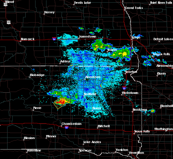 At 618 am cdt, a severe thunderstorm was located 12 miles southwest of polo, or 13 miles north of highmore, moving southeast at 15 mph (radar indicated). Hazards include half dollar size hail. damage to vehicles is expected At 618 am cdt, a severe thunderstorm was located 12 miles southwest of polo, or 13 miles north of highmore, moving southeast at 15 mph (radar indicated). Hazards include half dollar size hail. damage to vehicles is expected
|
| 7/13/2019 6:19 AM CDT |
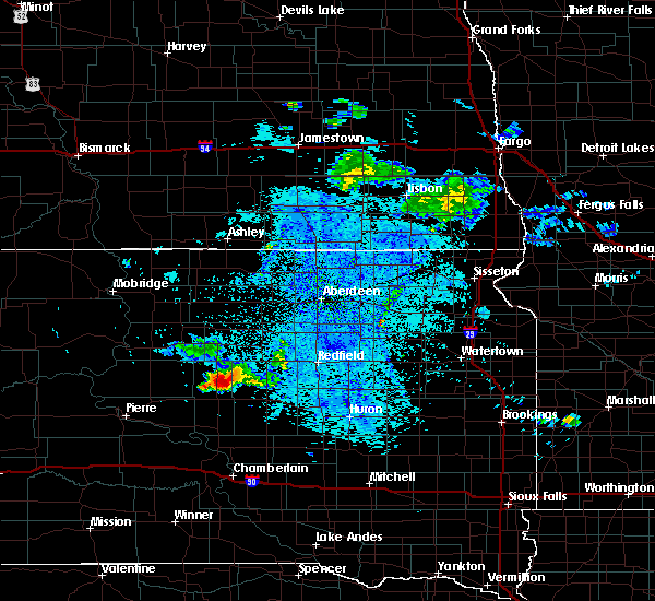 The national weather service in aberdeen has issued a * severe thunderstorm warning for. northwestern hand county in central south dakota. central hyde county in central south dakota. until 700 am cdt. At 618 am cdt, a severe thunderstorm was located 12 miles southwest. The national weather service in aberdeen has issued a * severe thunderstorm warning for. northwestern hand county in central south dakota. central hyde county in central south dakota. until 700 am cdt. At 618 am cdt, a severe thunderstorm was located 12 miles southwest.
|
| 6/11/2019 7:22 PM CDT |
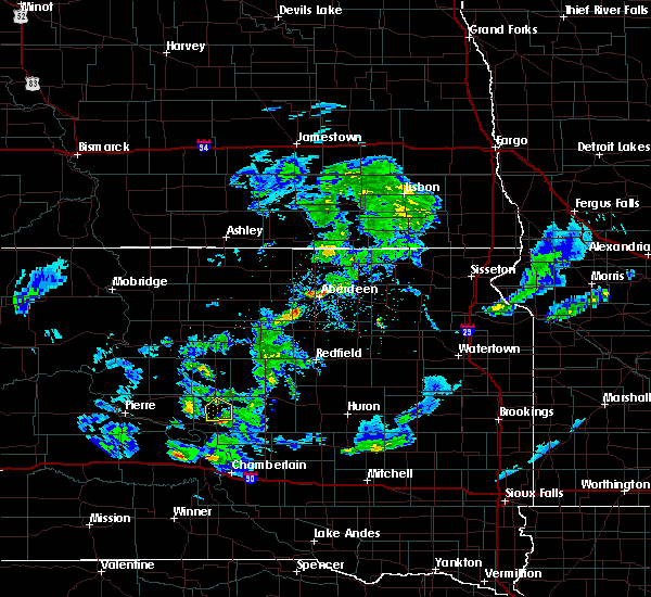 The severe thunderstorm warning for southeastern hyde county will expire at 730 pm cdt, the storm which prompted the warning has weakened below severe limits, and has exited the warned area. therefore, the warning will be allowed to expire. however small hail and gusty winds are still possible with this thunderstorm. The severe thunderstorm warning for southeastern hyde county will expire at 730 pm cdt, the storm which prompted the warning has weakened below severe limits, and has exited the warned area. therefore, the warning will be allowed to expire. however small hail and gusty winds are still possible with this thunderstorm.
|
| 6/11/2019 6:53 PM CDT |
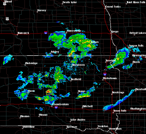 At 651 pm cdt, a severe thunderstorm was located near highmore, moving south at 25 mph (public. at 636 pm cdt, half dollar-sized hail was reported about 3 miles west-southwest of highmore). Hazards include half dollar size hail. Damage to vehicles is expected. Locations impacted include, highmore. At 651 pm cdt, a severe thunderstorm was located near highmore, moving south at 25 mph (public. at 636 pm cdt, half dollar-sized hail was reported about 3 miles west-southwest of highmore). Hazards include half dollar size hail. Damage to vehicles is expected. Locations impacted include, highmore.
|
| 6/11/2019 6:46 PM CDT |
 At 646 pm cdt, a severe thunderstorm was located near highmore, moving southeast at 25 mph (radar indicated). Hazards include 60 mph wind gusts and quarter size hail. Hail damage to vehicles is expected. expect wind damage to roofs, siding, and trees. Locations impacted include, highmore. At 646 pm cdt, a severe thunderstorm was located near highmore, moving southeast at 25 mph (radar indicated). Hazards include 60 mph wind gusts and quarter size hail. Hail damage to vehicles is expected. expect wind damage to roofs, siding, and trees. Locations impacted include, highmore.
|
| 6/11/2019 6:36 PM CDT | Half Dollar sized hail reported 3.3 miles ENE of Highmore, SD, ground covered white. |
| 6/11/2019 6:27 PM CDT |
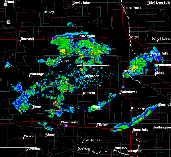 The national weather service in aberdeen has issued a * severe thunderstorm warning for. southeastern hyde county in central south dakota. until 730 pm cdt. At 626 pm cdt, a severe thunderstorm was located near highmore, moving south at 20 mph. The national weather service in aberdeen has issued a * severe thunderstorm warning for. southeastern hyde county in central south dakota. until 730 pm cdt. At 626 pm cdt, a severe thunderstorm was located near highmore, moving south at 20 mph.
|
| 6/4/2019 3:54 PM CDT | Ping Pong Ball sized hail reported 7 miles NW of Highmore, SD |
| 6/4/2019 3:50 PM CDT | Quarter sized hail reported 2.9 miles N of Highmore, SD, ground covered in hail. some quarters... mostly dimes. |
| 6/4/2019 3:40 PM CDT |
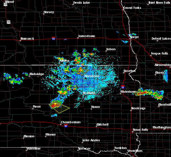 At 340 pm cdt, a severe thunderstorm was located over highmore, moving southeast at 25 mph (radar indicated). Hazards include ping pong ball size hail and 60 mph wind gusts. People and animals outdoors will be injured. expect hail damage to roofs, siding, windows, and vehicles. Expect wind damage to roofs, siding, and trees. At 340 pm cdt, a severe thunderstorm was located over highmore, moving southeast at 25 mph (radar indicated). Hazards include ping pong ball size hail and 60 mph wind gusts. People and animals outdoors will be injured. expect hail damage to roofs, siding, windows, and vehicles. Expect wind damage to roofs, siding, and trees.
|
| 6/4/2019 3:36 PM CDT |
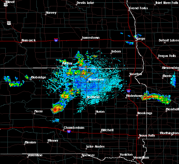 At 336 pm cdt, a severe thunderstorm was located over highmore, moving southeast at 25 mph (radar indicated). Hazards include ping pong ball size hail and 60 mph wind gusts. People and animals outdoors will be injured. expect hail damage to roofs, siding, windows, and vehicles. expect wind damage to roofs, siding, and trees. Locations impacted include, highmore and holabird. At 336 pm cdt, a severe thunderstorm was located over highmore, moving southeast at 25 mph (radar indicated). Hazards include ping pong ball size hail and 60 mph wind gusts. People and animals outdoors will be injured. expect hail damage to roofs, siding, windows, and vehicles. expect wind damage to roofs, siding, and trees. Locations impacted include, highmore and holabird.
|
| 6/4/2019 3:13 PM CDT |
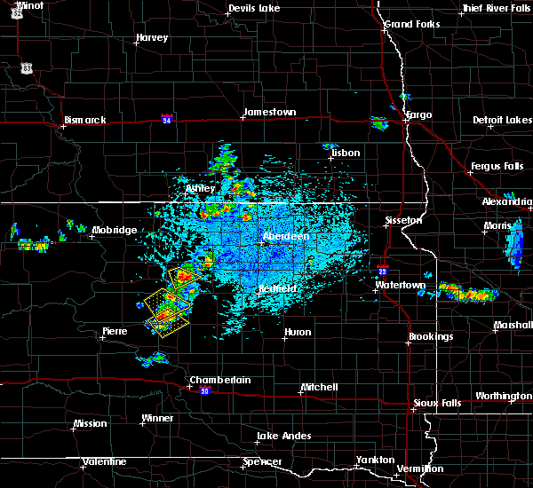 At 312 pm cdt, a severe thunderstorm was located near holabird, or 11 miles northwest of highmore, moving southeast at 15 mph (radar indicated). Hazards include 60 mph wind gusts and quarter size hail. Hail damage to vehicles is expected. Expect wind damage to roofs, siding, and trees. At 312 pm cdt, a severe thunderstorm was located near holabird, or 11 miles northwest of highmore, moving southeast at 15 mph (radar indicated). Hazards include 60 mph wind gusts and quarter size hail. Hail damage to vehicles is expected. Expect wind damage to roofs, siding, and trees.
|
| 6/4/2019 2:54 PM CDT | Hen Egg sized hail reported 26.1 miles SSE of Highmore, SD, 1.47 inches of rain. |
| 8/26/2018 8:48 PM CDT |
 At 845 pm cdt, a severe thunderstorm was located near highmore, moving east at 45 mph (radar indicated. also, at 836 pm...58 mph winds were reported at holabird). Hazards include 70 mph wind gusts and half dollar size hail. Hail damage to vehicles is expected. expect considerable tree damage. Wind damage is also likely to mobile homes, roofs, and outbuildings. At 845 pm cdt, a severe thunderstorm was located near highmore, moving east at 45 mph (radar indicated. also, at 836 pm...58 mph winds were reported at holabird). Hazards include 70 mph wind gusts and half dollar size hail. Hail damage to vehicles is expected. expect considerable tree damage. Wind damage is also likely to mobile homes, roofs, and outbuildings.
|
| 8/26/2018 8:32 PM CDT |
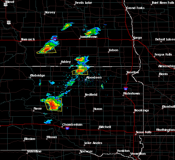 At 829 pm cdt, a severe thunderstorm was located over harrold, or 15 miles west of highmore, moving east at 40 mph (trained weather spotters. hail up to 2 inches has been reported with this storm). Hazards include golf ball size hail and 70 mph wind gusts. People and animals outdoors will be injured. expect hail damage to roofs, siding, windows, and vehicles. expect considerable tree damage. wind damage is also likely to mobile homes, roofs, and outbuildings. locations impacted include, highmore, harrold and holabird. A tornado watch remains in effect until 200 am cdt for central south dakota. At 829 pm cdt, a severe thunderstorm was located over harrold, or 15 miles west of highmore, moving east at 40 mph (trained weather spotters. hail up to 2 inches has been reported with this storm). Hazards include golf ball size hail and 70 mph wind gusts. People and animals outdoors will be injured. expect hail damage to roofs, siding, windows, and vehicles. expect considerable tree damage. wind damage is also likely to mobile homes, roofs, and outbuildings. locations impacted include, highmore, harrold and holabird. A tornado watch remains in effect until 200 am cdt for central south dakota.
|
| 8/26/2018 8:14 PM CDT |
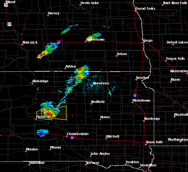 At 811 pm cdt, a severe thunderstorm was located over blunt, or 15 miles south of onida, moving east at 40 mph (trained weather spotters. at 802 pm cdt...two inch hail was reported 6 miles west of blunt). Hazards include golf ball size hail and 70 mph wind gusts. People and animals outdoors will be injured. expect hail damage to roofs, siding, windows, and vehicles. expect considerable tree damage. Wind damage is also likely to mobile homes, roofs, and outbuildings. At 811 pm cdt, a severe thunderstorm was located over blunt, or 15 miles south of onida, moving east at 40 mph (trained weather spotters. at 802 pm cdt...two inch hail was reported 6 miles west of blunt). Hazards include golf ball size hail and 70 mph wind gusts. People and animals outdoors will be injured. expect hail damage to roofs, siding, windows, and vehicles. expect considerable tree damage. Wind damage is also likely to mobile homes, roofs, and outbuildings.
|
| 8/25/2018 10:41 PM CDT |
 The severe thunderstorm warning for southern hand, southeastern hyde and north central buffalo counties will expire at 1045 pm cdt, the storm which prompted the warning has weakened below severe limits, and no longer poses an immediate threat to life or property. therefore, the warning will be allowed to expire. The severe thunderstorm warning for southern hand, southeastern hyde and north central buffalo counties will expire at 1045 pm cdt, the storm which prompted the warning has weakened below severe limits, and no longer poses an immediate threat to life or property. therefore, the warning will be allowed to expire.
|
| 8/25/2018 10:36 PM CDT |
 At 1035 pm cdt, a severe thunderstorm was located near miller dale colony, or 11 miles southwest of miller, moving northeast at 55 mph (radar indicated). Hazards include 60 mph wind gusts and nickel size hail. Expect damage to roofs, siding, and trees. locations impacted include, miller, highmore, st. Lawrence, ree heights, miller dale colony, sunshine bible academy and pleasant valley country church. At 1035 pm cdt, a severe thunderstorm was located near miller dale colony, or 11 miles southwest of miller, moving northeast at 55 mph (radar indicated). Hazards include 60 mph wind gusts and nickel size hail. Expect damage to roofs, siding, and trees. locations impacted include, miller, highmore, st. Lawrence, ree heights, miller dale colony, sunshine bible academy and pleasant valley country church.
|
| 8/25/2018 10:20 PM CDT | Storm damage reported in hyde county SD, 18.1 miles N of Highmore, SD |
| 8/25/2018 10:20 PM CDT |
 At 1020 pm cdt, a severe thunderstorm was located near stephan, or 15 miles south of highmore, moving northeast at 55 mph (radar indicated). Hazards include 60 mph wind gusts and nickel size hail. expect damage to roofs, siding, and trees At 1020 pm cdt, a severe thunderstorm was located near stephan, or 15 miles south of highmore, moving northeast at 55 mph (radar indicated). Hazards include 60 mph wind gusts and nickel size hail. expect damage to roofs, siding, and trees
|
| 8/25/2018 10:04 PM CDT | Storm damage reported in hyde county SD, 18.1 miles N of Highmore, SD |
| 6/29/2018 10:15 PM CDT | Golf Ball sized hail reported 19.9 miles S of Highmore, SD, wind gusts up to 60 mph. |
| 6/1/2018 8:55 PM CDT |
 The severe thunderstorm warning for western edmunds, eastern sully, hyde, western faulk, southeastern stanley, potter, hughes, north central lyman and southeastern walworth counties will expire at 900 pm cdt, the storms which prompted the warning have weakened below severe limits, and no longer pose an immediate threat to life or property. therefore, the warning will be allowed to expire. however gusty winds are still possible with these thunderstorms. a severe thunderstorm watch remains in effect until 1000 pm cdt for central and north central south dakota. to report severe weather, contact your nearest law enforcement agency. they will relay your report to the national weather service aberdeen. The severe thunderstorm warning for western edmunds, eastern sully, hyde, western faulk, southeastern stanley, potter, hughes, north central lyman and southeastern walworth counties will expire at 900 pm cdt, the storms which prompted the warning have weakened below severe limits, and no longer pose an immediate threat to life or property. therefore, the warning will be allowed to expire. however gusty winds are still possible with these thunderstorms. a severe thunderstorm watch remains in effect until 1000 pm cdt for central and north central south dakota. to report severe weather, contact your nearest law enforcement agency. they will relay your report to the national weather service aberdeen.
|
| 6/1/2018 8:14 PM CDT |
 At 814 pm cdt, severe thunderstorms were located along a line extending from near hosmer to 9 miles west of cedar creek rec area, moving east at 40 mph (radar indicated). Hazards include 60 mph wind gusts. expect damage to roofs, siding, and trees At 814 pm cdt, severe thunderstorms were located along a line extending from near hosmer to 9 miles west of cedar creek rec area, moving east at 40 mph (radar indicated). Hazards include 60 mph wind gusts. expect damage to roofs, siding, and trees
|
| 6/1/2018 7:44 PM CDT | Storm damage reported in hyde county SD, 17.8 miles S of Highmore, SD |
| 5/17/2018 11:41 PM CDT |
 The severe thunderstorm warning for hand, eastern sully, hyde, southeastern stanley, hughes, lyman and buffalo counties will expire at 1145 pm cdt, the storms which prompted the warning have weakened below severe limits, and no longer pose an immediate threat to life or property. therefore the warning will be allowed to expire. a severe thunderstorm watch remains in effect until midnight cdt for central south dakota. The severe thunderstorm warning for hand, eastern sully, hyde, southeastern stanley, hughes, lyman and buffalo counties will expire at 1145 pm cdt, the storms which prompted the warning have weakened below severe limits, and no longer pose an immediate threat to life or property. therefore the warning will be allowed to expire. a severe thunderstorm watch remains in effect until midnight cdt for central south dakota.
|
| 5/17/2018 10:42 PM CDT |
 At 1040 pm cdt, severe thunderstorms were located along a line extending from near blunt to near earling hills, moving east at 40 mph (trained weather spotters). Hazards include 60 mph wind gusts and nickel size hail. expect damage to roofs, siding, and trees At 1040 pm cdt, severe thunderstorms were located along a line extending from near blunt to near earling hills, moving east at 40 mph (trained weather spotters). Hazards include 60 mph wind gusts and nickel size hail. expect damage to roofs, siding, and trees
|
| 5/17/2018 10:10 PM CDT | Storm damage reported in hyde county SD, 17.8 miles S of Highmore, SD |
| 7/21/2017 11:18 PM CDT |
 At 1117 pm cdt, a severe thunderstorm was located near highmore, moving southeast at 35 mph (radar indicated). Hazards include 60 mph wind gusts and quarter size hail. Hail damage to vehicles is expected. Expect wind damage to roofs, siding, and trees. At 1117 pm cdt, a severe thunderstorm was located near highmore, moving southeast at 35 mph (radar indicated). Hazards include 60 mph wind gusts and quarter size hail. Hail damage to vehicles is expected. Expect wind damage to roofs, siding, and trees.
|
| 7/19/2017 10:24 AM CDT | Winds knocked down an 18 inch in diameter tre in hyde county SD, 17.2 miles S of Highmore, SD |
| 7/19/2017 10:22 AM CDT | Measured at rwis station at the intersection of sd47 and sd2 in hyde county SD, 17.9 miles S of Highmore, SD |
| 7/19/2017 10:21 AM CDT | A few small trees knocked ove in hyde county SD, 21.4 miles S of Highmore, SD |
| 7/19/2017 10:20 AM CDT | Significant tree damage... damage to property... will provide additional details at a later tim in hyde county SD, 17.2 miles S of Highmore, SD |
| 7/19/2017 10:20 AM CDT | 3 or 4 grain bins destroyed... a few miles north of this location... trailer homes that were being moved were blown off of moving trailer in hyde county SD, 19.2 miles S of Highmore, SD |
| 7/5/2017 9:14 PM CDT |
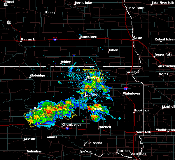 At 914 pm cdt, a severe thunderstorm was located over highmore, moving southeast at 40 mph (trained weather spotters). Hazards include 60 mph wind gusts. expect damage to roofs, siding, and trees At 914 pm cdt, a severe thunderstorm was located over highmore, moving southeast at 40 mph (trained weather spotters). Hazards include 60 mph wind gusts. expect damage to roofs, siding, and trees
|
| 7/5/2017 9:07 PM CDT | Storm damage reported in hyde county SD, 0.6 miles S of Highmore, SD |
| 6/11/2017 2:07 AM CDT |
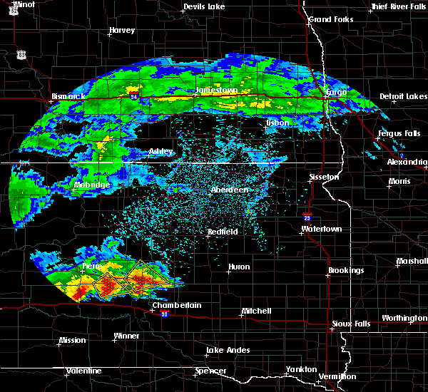 At 205 am cdt, a severe thunderstorm was located over stephan, or 11 miles north of fort thompson, moving northeast at 40 mph (trained weather spotters. at 142 am cdt...golf ball hail was reported 2 miles east southeast of joe creek rec area). Hazards include golf ball size hail and 60 mph wind gusts. People and animals outdoors will be injured. expect hail damage to roofs, siding, windows, and vehicles. expect wind damage to roofs, siding, and trees. Locations impacted include, highmore, stephan and lake sharpe. At 205 am cdt, a severe thunderstorm was located over stephan, or 11 miles north of fort thompson, moving northeast at 40 mph (trained weather spotters. at 142 am cdt...golf ball hail was reported 2 miles east southeast of joe creek rec area). Hazards include golf ball size hail and 60 mph wind gusts. People and animals outdoors will be injured. expect hail damage to roofs, siding, windows, and vehicles. expect wind damage to roofs, siding, and trees. Locations impacted include, highmore, stephan and lake sharpe.
|
| 6/11/2017 1:40 AM CDT |
 At 140 am cdt, a severe thunderstorm was located near west bend rec area, or 7 miles northwest of lower brule, moving northeast at 45 mph (radar indicated). Hazards include golf ball size hail and 60 mph wind gusts. People and animals outdoors will be injured. expect hail damage to roofs, siding, windows, and vehicles. Expect wind damage to roofs, siding, and trees. At 140 am cdt, a severe thunderstorm was located near west bend rec area, or 7 miles northwest of lower brule, moving northeast at 45 mph (radar indicated). Hazards include golf ball size hail and 60 mph wind gusts. People and animals outdoors will be injured. expect hail damage to roofs, siding, windows, and vehicles. Expect wind damage to roofs, siding, and trees.
|
| 9/4/2016 10:12 PM CDT |
 The severe thunderstorm warning for southeastern stanley, southeastern hughes, northeastern jones, buffalo, lyman, southern hyde and southwestern hand counties will expire at 1015 pm cdt, the storm which prompted the warning has weakened below severe limits, and no longer pose an immediate threat to life or property. therefore, the warning will be allowed to expire. a severe thunderstorm watch remains in effect until midnight cdt for central south dakota. The severe thunderstorm warning for southeastern stanley, southeastern hughes, northeastern jones, buffalo, lyman, southern hyde and southwestern hand counties will expire at 1015 pm cdt, the storm which prompted the warning has weakened below severe limits, and no longer pose an immediate threat to life or property. therefore, the warning will be allowed to expire. a severe thunderstorm watch remains in effect until midnight cdt for central south dakota.
|
| 9/4/2016 9:22 PM CDT |
 At 921 pm cdt, a severe thunderstorm was located near kennebec, or near presho, moving east at 55 mph (radar indicated). Hazards include 60 mph wind gusts and penny size hail. Expect damage to roofs. siding. and trees. this severe thunderstorm will be near, kennebec and byre lake around 925 pm cdt. lyman around 930 pm cdt. reliance and medicine butte around 940 pm cdt. lower brule and counselor creek boat access area around 945 pm cdt. fort thompson, tailrace rec area and lake sharpe around 950 pm cdt. lees corner around 955 pm cdt. etbauer hill around 1005 pm cdt. Pleasant valley country church around 1015 pm cdt. At 921 pm cdt, a severe thunderstorm was located near kennebec, or near presho, moving east at 55 mph (radar indicated). Hazards include 60 mph wind gusts and penny size hail. Expect damage to roofs. siding. and trees. this severe thunderstorm will be near, kennebec and byre lake around 925 pm cdt. lyman around 930 pm cdt. reliance and medicine butte around 940 pm cdt. lower brule and counselor creek boat access area around 945 pm cdt. fort thompson, tailrace rec area and lake sharpe around 950 pm cdt. lees corner around 955 pm cdt. etbauer hill around 1005 pm cdt. Pleasant valley country church around 1015 pm cdt.
|
| 8/14/2016 10:33 PM CDT | . in hyde county SD, 18.1 miles N of Highmore, SD |
| 8/14/2016 9:48 PM CDT |
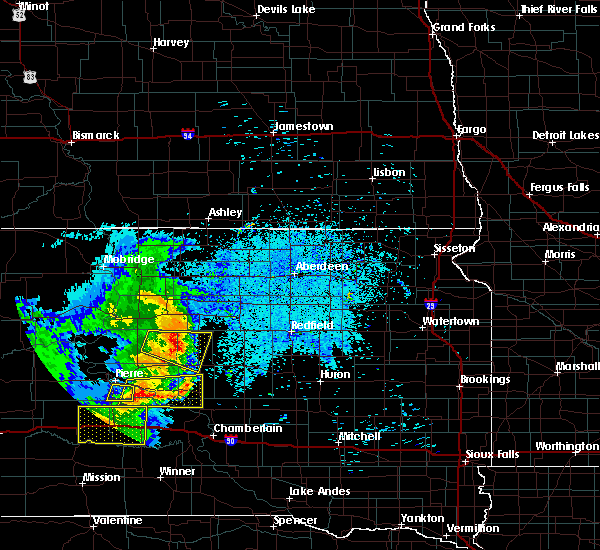 At 948 pm cdt, a severe thunderstorm was located 11 miles north of holabird, or 14 miles northwest of highmore, moving east at 30 mph (radar indicated). Hazards include 60 mph wind gusts and nickel size hail. Expect damage to roofs. siding. and trees. This severe thunderstorm will remain over mainly rural areas of eastern sully, northeastern hughes and northern hyde counties. At 948 pm cdt, a severe thunderstorm was located 11 miles north of holabird, or 14 miles northwest of highmore, moving east at 30 mph (radar indicated). Hazards include 60 mph wind gusts and nickel size hail. Expect damage to roofs. siding. and trees. This severe thunderstorm will remain over mainly rural areas of eastern sully, northeastern hughes and northern hyde counties.
|
| 8/14/2016 9:26 PM CDT |
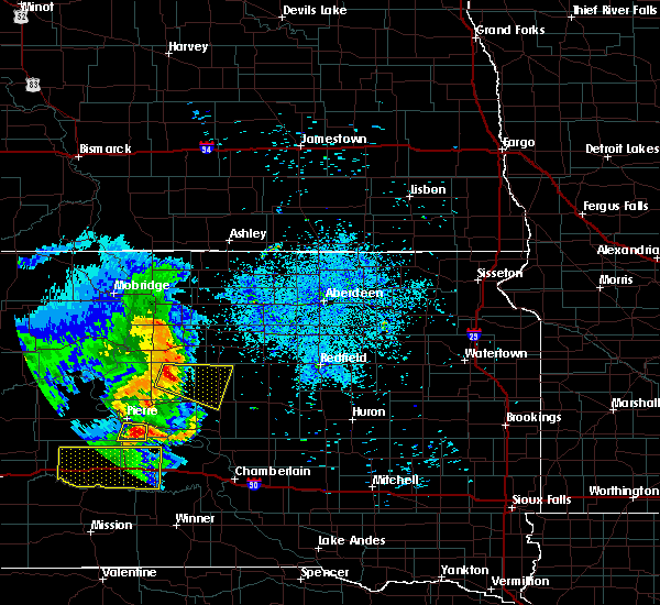 At 925 pm cdt, a severe thunderstorm was located 7 miles south of cottonwood lake near agar, or 10 miles east of onida, moving east at 30 mph (radar indicated). Hazards include 60 mph wind gusts and nickel size hail. Expect damage to roofs. siding. and trees. This severe thunderstorm will be near, highmore around 1015 pm cdt. At 925 pm cdt, a severe thunderstorm was located 7 miles south of cottonwood lake near agar, or 10 miles east of onida, moving east at 30 mph (radar indicated). Hazards include 60 mph wind gusts and nickel size hail. Expect damage to roofs. siding. and trees. This severe thunderstorm will be near, highmore around 1015 pm cdt.
|
| 7/10/2016 12:19 AM CDT |
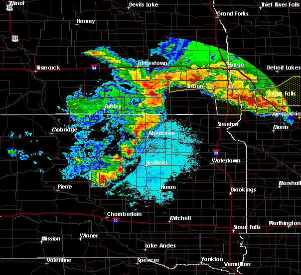 At 1219 am cdt, a severe thunderstorm was located near highmore, moving east at 20 mph (radar indicated). Hazards include 60 mph wind gusts and quarter size hail. Hail damage to vehicles is expected. expect wind damage to roofs, siding, and trees. This severe thunderstorm will remain over mainly rural areas of central hyde and northwestern hand counties. At 1219 am cdt, a severe thunderstorm was located near highmore, moving east at 20 mph (radar indicated). Hazards include 60 mph wind gusts and quarter size hail. Hail damage to vehicles is expected. expect wind damage to roofs, siding, and trees. This severe thunderstorm will remain over mainly rural areas of central hyde and northwestern hand counties.
|
| 7/10/2016 12:03 AM CDT |
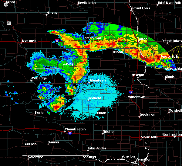 At 1202 am cdt, a severe thunderstorm was located near holabird, or 9 miles northwest of highmore, moving east at 20 mph (radar indicated). Hazards include 60 mph wind gusts and quarter size hail. Hail damage to vehicles is expected. expect wind damage to roofs, siding, and trees. This severe thunderstorm will be near, highmore around 1225 am cdt. At 1202 am cdt, a severe thunderstorm was located near holabird, or 9 miles northwest of highmore, moving east at 20 mph (radar indicated). Hazards include 60 mph wind gusts and quarter size hail. Hail damage to vehicles is expected. expect wind damage to roofs, siding, and trees. This severe thunderstorm will be near, highmore around 1225 am cdt.
|
| 7/9/2016 11:43 PM CDT |
 At 1142 pm cdt, a severe thunderstorm was located 12 miles south of burkmere, or 15 miles southwest of faulkton, moving east at 45 mph (radar indicated). Hazards include 60 mph wind gusts and quarter size hail. Hail damage to vehicles is expected. expect wind damage to roofs, siding, and trees. Locations impacted include, highmore, onida, blunt, harrold, agar, ree heights, stone lake, holabird and cottonwood lake near agar. At 1142 pm cdt, a severe thunderstorm was located 12 miles south of burkmere, or 15 miles southwest of faulkton, moving east at 45 mph (radar indicated). Hazards include 60 mph wind gusts and quarter size hail. Hail damage to vehicles is expected. expect wind damage to roofs, siding, and trees. Locations impacted include, highmore, onida, blunt, harrold, agar, ree heights, stone lake, holabird and cottonwood lake near agar.
|
| 7/9/2016 11:31 PM CDT |
 At 1130 pm cdt/1030 pm mdt/, a severe thunderstorm was located 7 miles east of stone lake, or 20 miles southeast of gettysburg, moving east at 55 mph (radar indicated). Hazards include 60 mph wind gusts and quarter size hail. Hail damage to vehicles is expected. expect wind damage to roofs, siding, and trees. This severe thunderstorm will remain over mainly rural areas of sully, northeastern hughes, eastern dewey, western faulk, potter, northern hyde and northwestern hand counties. At 1130 pm cdt/1030 pm mdt/, a severe thunderstorm was located 7 miles east of stone lake, or 20 miles southeast of gettysburg, moving east at 55 mph (radar indicated). Hazards include 60 mph wind gusts and quarter size hail. Hail damage to vehicles is expected. expect wind damage to roofs, siding, and trees. This severe thunderstorm will remain over mainly rural areas of sully, northeastern hughes, eastern dewey, western faulk, potter, northern hyde and northwestern hand counties.
|
| 7/9/2016 11:02 PM CDT |
 At 1101 pm cdt/1001 pm mdt/, a severe thunderstorm was located near agar, or near onida, moving east at 55 mph (radar indicated). Hazards include 60 mph wind gusts and nickel size hail. Expect damage to roofs. siding. and trees. this severe thunderstorm will be near, agar around 1105 pm cdt. cottonwood lake near agar around 1115 pm cdt. Stone lake around 1125 pm cdt. At 1101 pm cdt/1001 pm mdt/, a severe thunderstorm was located near agar, or near onida, moving east at 55 mph (radar indicated). Hazards include 60 mph wind gusts and nickel size hail. Expect damage to roofs. siding. and trees. this severe thunderstorm will be near, agar around 1105 pm cdt. cottonwood lake near agar around 1115 pm cdt. Stone lake around 1125 pm cdt.
|
| 7/6/2016 8:27 PM CDT |
 At 827 pm cdt, a severe thunderstorm was located over highmore, moving east at 50 mph (radar indicated). Hazards include 60 mph wind gusts. Expect damage to roofs. siding. and trees. this severe thunderstorm will be near, ree heights around 840 pm cdt. miller dale colony around 845 pm cdt. miller and st. lawrence around 855 pm cdt. vayland around 905 pm cdt. A tornado watch remains in effect until 1000 pm cdt for central south dakota. At 827 pm cdt, a severe thunderstorm was located over highmore, moving east at 50 mph (radar indicated). Hazards include 60 mph wind gusts. Expect damage to roofs. siding. and trees. this severe thunderstorm will be near, ree heights around 840 pm cdt. miller dale colony around 845 pm cdt. miller and st. lawrence around 855 pm cdt. vayland around 905 pm cdt. A tornado watch remains in effect until 1000 pm cdt for central south dakota.
|
| 7/6/2016 8:18 PM CDT |
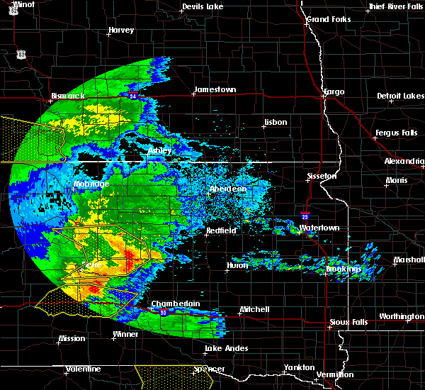 At 818 pm cdt, severe thunderstorms were located along a line extending from 6 miles southeast of gettysburg to 14 miles north of holabird to near highmore to 7 miles north of lake sharpe, moving east at 55 mph (radar indicated). Hazards include 60 mph wind gusts. Expect damage to roofs. siding. and trees. these severe storms will be near, highmore around 825 pm cdt. A tornado watch remains in effect until 1000 pm cdt for central south dakota. At 818 pm cdt, severe thunderstorms were located along a line extending from 6 miles southeast of gettysburg to 14 miles north of holabird to near highmore to 7 miles north of lake sharpe, moving east at 55 mph (radar indicated). Hazards include 60 mph wind gusts. Expect damage to roofs. siding. and trees. these severe storms will be near, highmore around 825 pm cdt. A tornado watch remains in effect until 1000 pm cdt for central south dakota.
|
| 7/6/2016 7:42 PM CDT |
 At 741 pm cdt/641 pm mdt/, severe thunderstorms were located along a line extending from 8 miles south of lake oahe to sully lake to 7 miles west of blunt to near fort pierre, moving east at 55 mph (radar indicated. at 740 pm cdt...a funnel cloud was spotted 7 miles west of agar). Hazards include 70 mph wind gusts. Expect considerable tree damage. damage is likely to mobile homes, roofs, and outbuildings. severe thunderstorms will be near, sully lake around 745 pm cdt. onida, blunt, agar and sutton bay rec area around 750 pm cdt. cottonwood lake near agar around 755 pm cdt. harrold and rousseau around 800 pm cdt. gorman and canning around 805 pm cdt. holabird around 810 pm cdt. gettysburg around 815 pm cdt. highmore around 820 pm cdt. A tornado watch remains in effect until 1000 pm cdt/900 pm mdt/ for north central south dakota. At 741 pm cdt/641 pm mdt/, severe thunderstorms were located along a line extending from 8 miles south of lake oahe to sully lake to 7 miles west of blunt to near fort pierre, moving east at 55 mph (radar indicated. at 740 pm cdt...a funnel cloud was spotted 7 miles west of agar). Hazards include 70 mph wind gusts. Expect considerable tree damage. damage is likely to mobile homes, roofs, and outbuildings. severe thunderstorms will be near, sully lake around 745 pm cdt. onida, blunt, agar and sutton bay rec area around 750 pm cdt. cottonwood lake near agar around 755 pm cdt. harrold and rousseau around 800 pm cdt. gorman and canning around 805 pm cdt. holabird around 810 pm cdt. gettysburg around 815 pm cdt. highmore around 820 pm cdt. A tornado watch remains in effect until 1000 pm cdt/900 pm mdt/ for north central south dakota.
|
| 5/25/2016 6:19 PM CDT |
 At 618 pm cdt, severe thunderstorms were located along a line extending from 6 miles northeast of highmore to near miller dale colony, moving east at 40 mph (law enforcement). Hazards include golf ball size hail and 60 mph wind gusts. golf ball sized hail was reported 9 miles south of ree heights with this storm. People and animals outdoors will be injured. expect hail damage to roofs, siding, windows, and vehicles. expect wind damage to roofs, siding, and trees. these severe storms will be near, miller dale colony around 625 pm cdt. Miller around 630 pm cdt. At 618 pm cdt, severe thunderstorms were located along a line extending from 6 miles northeast of highmore to near miller dale colony, moving east at 40 mph (law enforcement). Hazards include golf ball size hail and 60 mph wind gusts. golf ball sized hail was reported 9 miles south of ree heights with this storm. People and animals outdoors will be injured. expect hail damage to roofs, siding, windows, and vehicles. expect wind damage to roofs, siding, and trees. these severe storms will be near, miller dale colony around 625 pm cdt. Miller around 630 pm cdt.
|
| 5/25/2016 6:14 PM CDT |
 At 612 pm cdt, severe thunderstorms were located along a line extending from near highmore to near miller dale colony, moving east at 40 mph. these are very dangerous storms (law enforcement). Hazards include baseball size hail and 60 mph wind gusts. People and animals outdoors will be severely injured. expect shattered windows, extensive damage to roofs, siding, and vehicles. these severe storms will be near, miller dale colony around 620 pm cdt. ree heights around 625 pm cdt. Miller around 630 pm cdt. At 612 pm cdt, severe thunderstorms were located along a line extending from near highmore to near miller dale colony, moving east at 40 mph. these are very dangerous storms (law enforcement). Hazards include baseball size hail and 60 mph wind gusts. People and animals outdoors will be severely injured. expect shattered windows, extensive damage to roofs, siding, and vehicles. these severe storms will be near, miller dale colony around 620 pm cdt. ree heights around 625 pm cdt. Miller around 630 pm cdt.
|
| 5/25/2016 5:55 PM CDT |
 At 554 pm cdt, severe thunderstorms were located along a line extending from near holabird to 9 miles south of highmore, moving east at 40 mph. these are very dangerous storms (law enforcement). Hazards include baseball size hail and 60 mph wind gusts. People and animals outdoors will be severely injured. expect shattered windows, extensive damage to roofs, siding, and vehicles. severe thunderstorms will be near, highmore around 610 pm cdt. miller dale colony around 620 pm cdt. ree heights around 625 pm cdt. Miller around 630 pm cdt. At 554 pm cdt, severe thunderstorms were located along a line extending from near holabird to 9 miles south of highmore, moving east at 40 mph. these are very dangerous storms (law enforcement). Hazards include baseball size hail and 60 mph wind gusts. People and animals outdoors will be severely injured. expect shattered windows, extensive damage to roofs, siding, and vehicles. severe thunderstorms will be near, highmore around 610 pm cdt. miller dale colony around 620 pm cdt. ree heights around 625 pm cdt. Miller around 630 pm cdt.
|
| 5/25/2016 5:40 PM CDT |
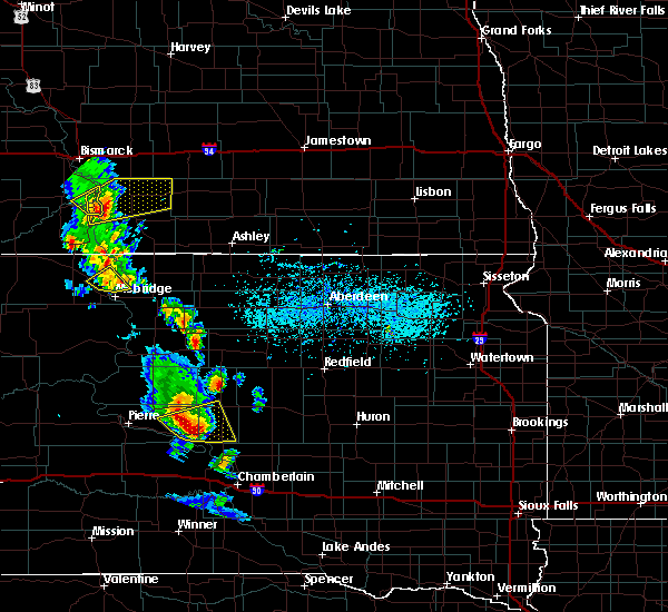 At 539 pm cdt, a severe thunderstorm was located 11 miles north of lake sharpe, or 17 miles southwest of highmore, moving east at 40 mph. this is a very dangerous storm (radar indicated). Hazards include baseball size hail and 60 mph wind gusts. People and animals outdoors will be severely injured. expect shattered windows, extensive damage to roofs, siding, and vehicles. Locations impacted include, highmore, stephan, holabird and lake sharpe. At 539 pm cdt, a severe thunderstorm was located 11 miles north of lake sharpe, or 17 miles southwest of highmore, moving east at 40 mph. this is a very dangerous storm (radar indicated). Hazards include baseball size hail and 60 mph wind gusts. People and animals outdoors will be severely injured. expect shattered windows, extensive damage to roofs, siding, and vehicles. Locations impacted include, highmore, stephan, holabird and lake sharpe.
|
| 5/25/2016 5:21 PM CDT |
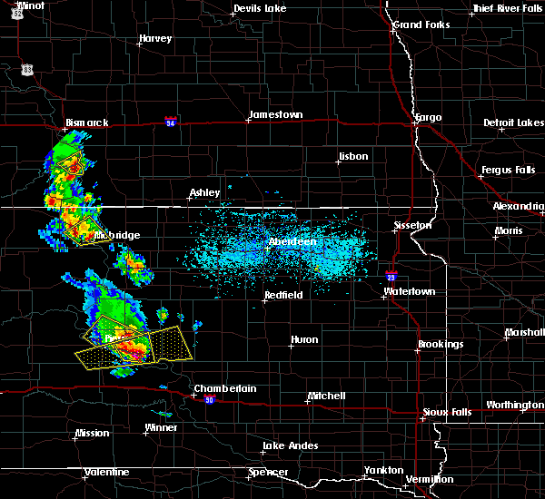 At 521 pm cdt, a severe thunderstorm was located over degrey rec area, or 19 miles east of pierre, moving east at 40 mph. this is a very dangerous storm (radar indicated). Hazards include baseball size hail and 60 mph wind gusts. People and animals outdoors will be severely injured. expect shattered windows, extensive damage to roofs, siding, and vehicles. This severe thunderstorm will remain over mainly rural areas of southeastern stanley, eastern hughes and southern hyde counties. At 521 pm cdt, a severe thunderstorm was located over degrey rec area, or 19 miles east of pierre, moving east at 40 mph. this is a very dangerous storm (radar indicated). Hazards include baseball size hail and 60 mph wind gusts. People and animals outdoors will be severely injured. expect shattered windows, extensive damage to roofs, siding, and vehicles. This severe thunderstorm will remain over mainly rural areas of southeastern stanley, eastern hughes and southern hyde counties.
|
| 7/27/2015 11:56 PM CDT |
 At 1155 pm cdt, a severe thunderstorm was located over medicine butte, or near lower brule, moving east at 60 mph (radar indicated). Hazards include 60 mph wind gusts. Expect damage to roofs. siding and trees. this severe thunderstorm will be near, fort thompson and tailrace rec area around 1205 am cdt. lees corner around 1210 am cdt. shelby, etbauer hill and crow creek housing around 1215 am cdt. Gann valley around 1225 am cdt. At 1155 pm cdt, a severe thunderstorm was located over medicine butte, or near lower brule, moving east at 60 mph (radar indicated). Hazards include 60 mph wind gusts. Expect damage to roofs. siding and trees. this severe thunderstorm will be near, fort thompson and tailrace rec area around 1205 am cdt. lees corner around 1210 am cdt. shelby, etbauer hill and crow creek housing around 1215 am cdt. Gann valley around 1225 am cdt.
|
| 7/1/2015 4:09 AM CDT |
 At 409 am cdt, a severe thunderstorm was located 9 miles south of highmore, moving southeast at 45 mph (radar indicated). Hazards include 60 mph wind gusts and quarter size hail. Hail damage to vehicles is expected. expect wind damage to roofs, siding and trees. this severe thunderstorm will be near, stephan around 420 am cdt. etbauer hill around 440 am cdt. Gann valley around 450 am cdt. At 409 am cdt, a severe thunderstorm was located 9 miles south of highmore, moving southeast at 45 mph (radar indicated). Hazards include 60 mph wind gusts and quarter size hail. Hail damage to vehicles is expected. expect wind damage to roofs, siding and trees. this severe thunderstorm will be near, stephan around 420 am cdt. etbauer hill around 440 am cdt. Gann valley around 450 am cdt.
|
| 6/22/2015 3:37 AM CDT |
 At 336 am cdt, severe thunderstorms were located along a line extending from near highmore to 6 miles southwest of pleasant valley country church to 7 miles south of lake francis case, moving east at 70 mph. these are very dangerous storms (radar indicated). Hazards include 80 mph wind gusts. Flying debris will be dangerous to those caught without shelter. mobile homes will be heavily damaged. expect considerable damage to roofs, windows and vehicles. extensive tree damage and power outages are likely. severe thunderstorms will be near, pleasant valley country church around 340 am cdt. ree heights around 350 am cdt. miller and st. lawrence around 400 am cdt. Vayland around 405 am cdt. At 336 am cdt, severe thunderstorms were located along a line extending from near highmore to 6 miles southwest of pleasant valley country church to 7 miles south of lake francis case, moving east at 70 mph. these are very dangerous storms (radar indicated). Hazards include 80 mph wind gusts. Flying debris will be dangerous to those caught without shelter. mobile homes will be heavily damaged. expect considerable damage to roofs, windows and vehicles. extensive tree damage and power outages are likely. severe thunderstorms will be near, pleasant valley country church around 340 am cdt. ree heights around 350 am cdt. miller and st. lawrence around 400 am cdt. Vayland around 405 am cdt.
|
| 6/20/2015 2:11 AM CDT |
 The severe thunderstorm warning for east central hyde, eastern buffalo, hand and southwestern spink counties will expire at 215 am cdt, the storms which prompted the warning have moved out of the area. therefore the warning will be allowed to expire. a severe thunderstorm watch remains in effect until 400 am cdt for central south dakota. to report severe weather, contact your nearest law enforcement agency. they will relay your report to the national weather service aberdeen. The severe thunderstorm warning for east central hyde, eastern buffalo, hand and southwestern spink counties will expire at 215 am cdt, the storms which prompted the warning have moved out of the area. therefore the warning will be allowed to expire. a severe thunderstorm watch remains in effect until 400 am cdt for central south dakota. to report severe weather, contact your nearest law enforcement agency. they will relay your report to the national weather service aberdeen.
|
| 6/20/2015 1:49 AM CDT |
 At 146 am cdt, severe thunderstorms were located along a line extending from near ree heights to 9 miles northeast of kimball, moving east at 70 mph. these are very dangerous storms (radar indicated). Hazards include 80 mph wind gusts and penny size hail. Flying debris will be dangerous to those caught without shelter. mobile homes will be heavily damaged. expect considerable damage to roofs, windows and vehicles. extensive tree damage and power outages are likely. these severe storms will be near, st. lawrence around 155 am cdt. vayland around 200 am cdt. Spottswood around 210 am cdt. At 146 am cdt, severe thunderstorms were located along a line extending from near ree heights to 9 miles northeast of kimball, moving east at 70 mph. these are very dangerous storms (radar indicated). Hazards include 80 mph wind gusts and penny size hail. Flying debris will be dangerous to those caught without shelter. mobile homes will be heavily damaged. expect considerable damage to roofs, windows and vehicles. extensive tree damage and power outages are likely. these severe storms will be near, st. lawrence around 155 am cdt. vayland around 200 am cdt. Spottswood around 210 am cdt.
|
| 6/20/2015 1:29 AM CDT |
 At 129 am cdt, severe thunderstorms were located along a line extending from 11 miles north of holabird to near chamberlain, moving east at 90 mph. these are very dangerous storms (radar indicated). Hazards include 80 mph wind gusts and penny size hail. Flying debris will be dangerous to those caught without shelter. mobile homes will be heavily damaged. expect considerable damage to roofs, windows and vehicles. extensive tree damage and power outages are likely. severe thunderstorms will be near, shelby around 135 am cdt. polo around 145 am cdt. burdette around 155 am cdt. cottonwood lake around 200 am cdt. redfield, tulare, twin lakes and spottswood around 205 am cdt. Spink colony and glendale colony around 215 am cdt. At 129 am cdt, severe thunderstorms were located along a line extending from 11 miles north of holabird to near chamberlain, moving east at 90 mph. these are very dangerous storms (radar indicated). Hazards include 80 mph wind gusts and penny size hail. Flying debris will be dangerous to those caught without shelter. mobile homes will be heavily damaged. expect considerable damage to roofs, windows and vehicles. extensive tree damage and power outages are likely. severe thunderstorms will be near, shelby around 135 am cdt. polo around 145 am cdt. burdette around 155 am cdt. cottonwood lake around 200 am cdt. redfield, tulare, twin lakes and spottswood around 205 am cdt. Spink colony and glendale colony around 215 am cdt.
|
| 6/20/2015 1:13 AM CDT |
 At 111 am cdt, severe thunderstorms were located along a line extending from onida to 9 miles northwest of hamill, moving east at 60 mph. these are very dangerous storms (trained weather spotters. at 105 am cdt...75 to 80 mph winds were reported 6 miles nne of kennebec). Hazards include 80 mph wind gusts and penny size hail. Flying debris will be dangerous to those caught without shelter. mobile homes will be heavily damaged. expect considerable damage to roofs, windows and vehicles. extensive tree damage and power outages are likely. these severe storms will be near, lake francis case around 125 am cdt. Oacoma and dude ranch around 130 am cdt. At 111 am cdt, severe thunderstorms were located along a line extending from onida to 9 miles northwest of hamill, moving east at 60 mph. these are very dangerous storms (trained weather spotters. at 105 am cdt...75 to 80 mph winds were reported 6 miles nne of kennebec). Hazards include 80 mph wind gusts and penny size hail. Flying debris will be dangerous to those caught without shelter. mobile homes will be heavily damaged. expect considerable damage to roofs, windows and vehicles. extensive tree damage and power outages are likely. these severe storms will be near, lake francis case around 125 am cdt. Oacoma and dude ranch around 130 am cdt.
|
| 6/20/2015 12:54 AM CDT |
 At 1254 am cdt, severe thunderstorms were located along a line extending from 8 miles north of grey goose to 10 miles south of earling hills, moving east at 50 mph (radar indicated). Hazards include 70 mph wind gusts and penny size hail. Expect considerable tree damage. damage is likely to mobile homes, roofs and outbuildings. severe thunderstorms will be near, onida around 110 am cdt. lyman around 120 am cdt. reliance around 125 am cdt. lake francis case around 130 am cdt. oacoma and dude ranch around 135 am cdt. Shelby and crow creek housing around 150 am cdt. At 1254 am cdt, severe thunderstorms were located along a line extending from 8 miles north of grey goose to 10 miles south of earling hills, moving east at 50 mph (radar indicated). Hazards include 70 mph wind gusts and penny size hail. Expect considerable tree damage. damage is likely to mobile homes, roofs and outbuildings. severe thunderstorms will be near, onida around 110 am cdt. lyman around 120 am cdt. reliance around 125 am cdt. lake francis case around 130 am cdt. oacoma and dude ranch around 135 am cdt. Shelby and crow creek housing around 150 am cdt.
|
| 6/19/2014 5:47 PM CDT | Storm damage reported in hyde county SD, 17.2 miles S of Highmore, SD |
| 6/21/2013 12:56 PM CDT | Quarter sized hail reported 2 miles W of Highmore, SD |
| 9/3/2012 5:34 PM CDT | Quarter sized hail reported 6.3 miles N of Highmore, SD, some quarters with mostly nickel and dimes. |
| 8/1/2012 4:35 PM CDT | Golf Ball sized hail reported 16.1 miles N of Highmore, SD, a few golfball hail but mostly nickel. covers the ground. |
| 1/1/0001 12:00 AM | Branches down in highmor in hyde county SD, 0.1 miles NNW of Highmore, SD |
Hail Maps for Highmore, SD
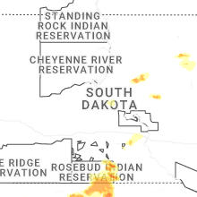


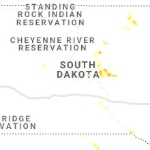


Connect with Interactive Hail Maps