

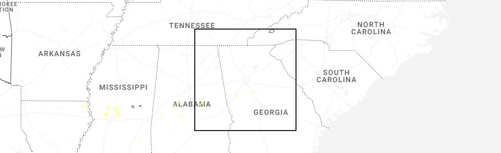
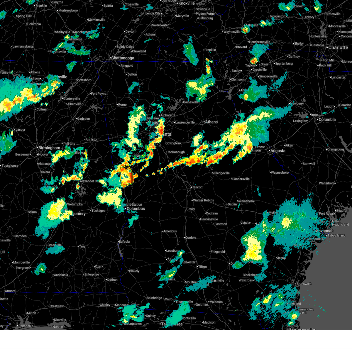
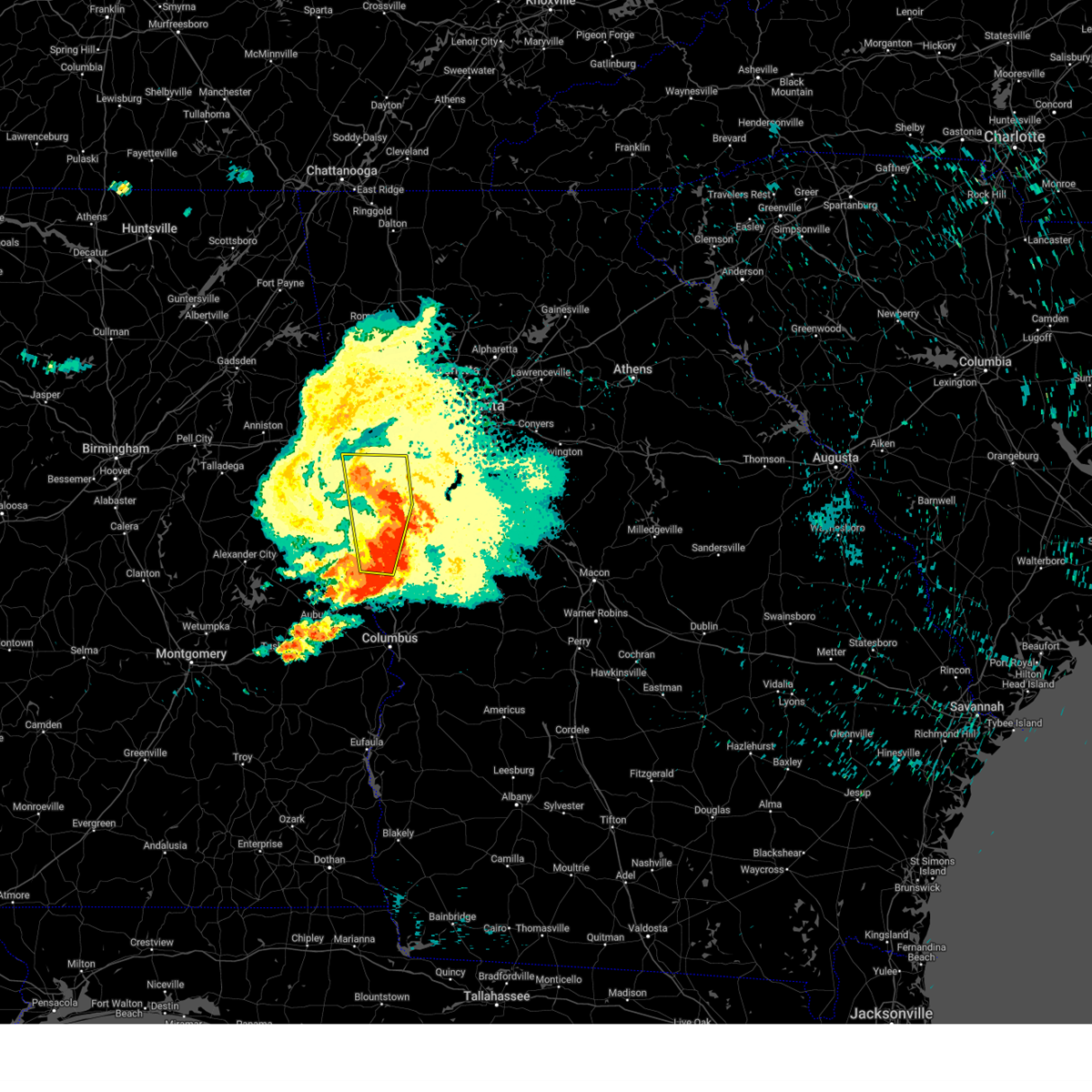
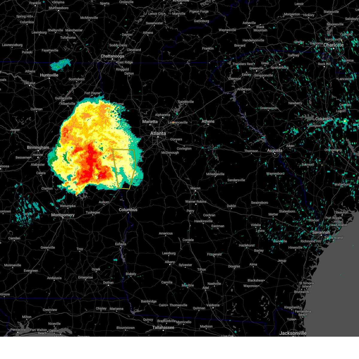
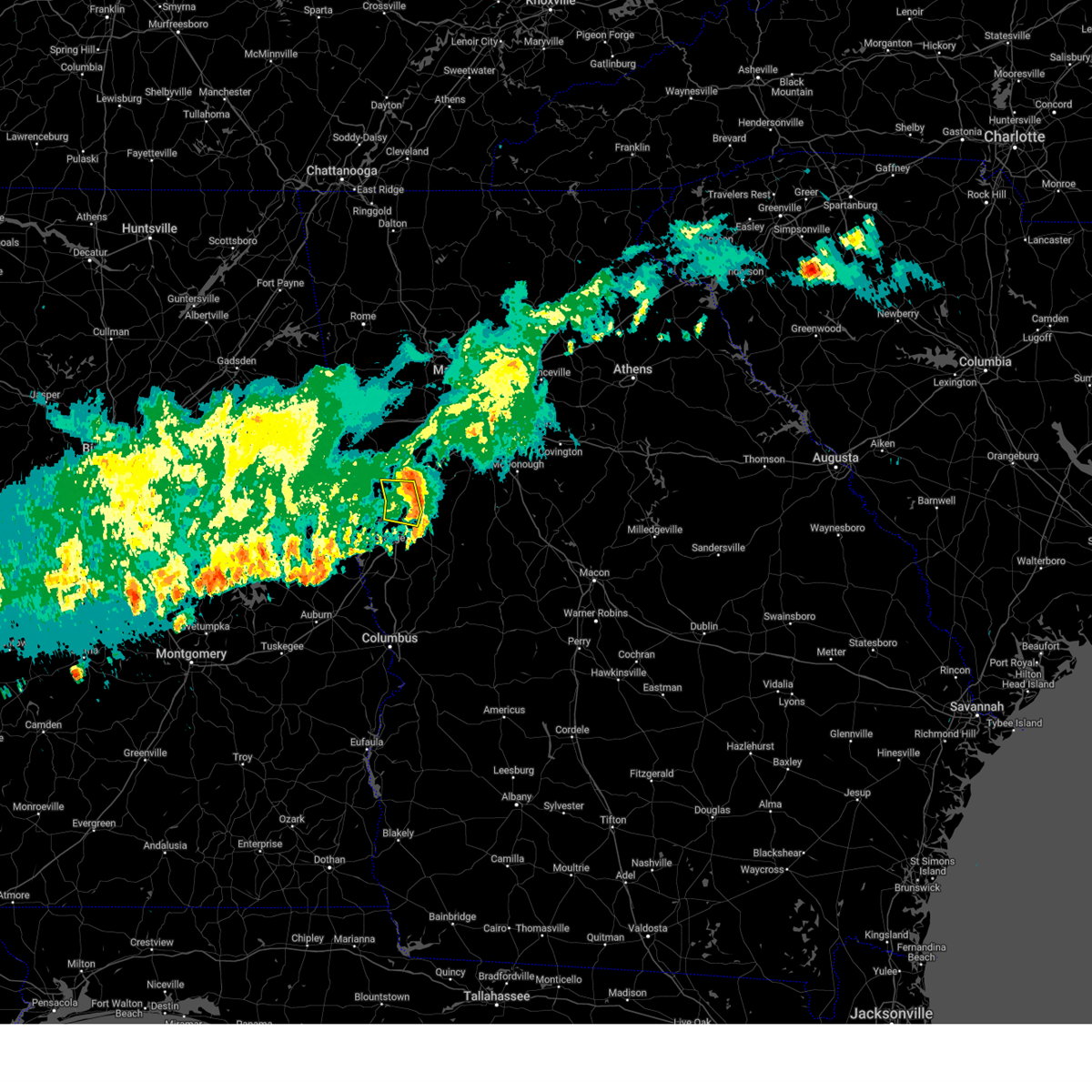
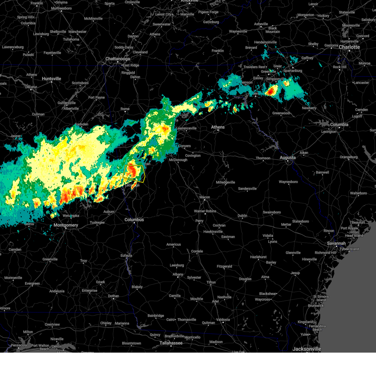
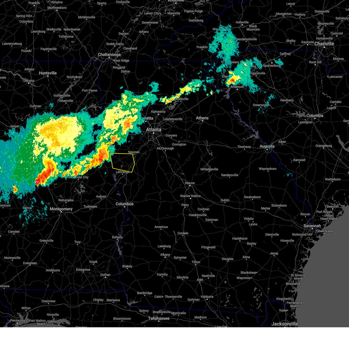
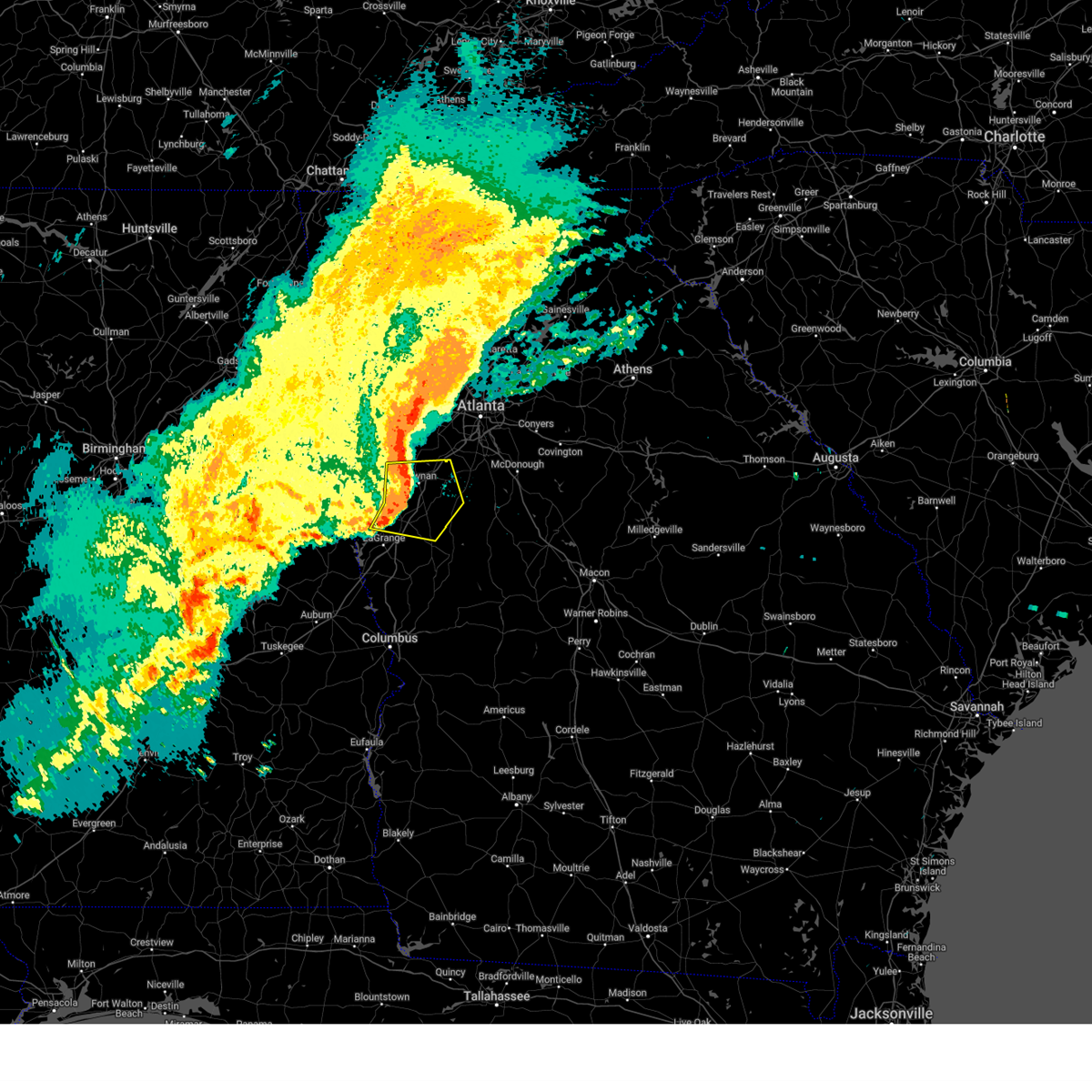
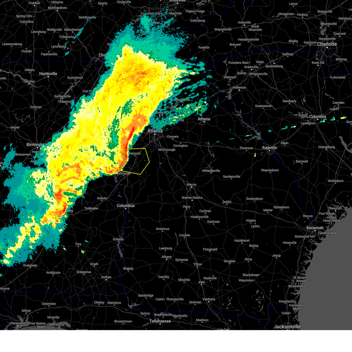
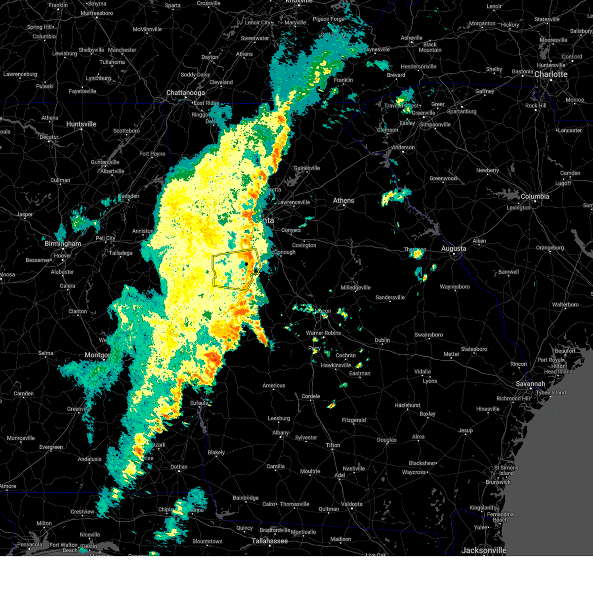
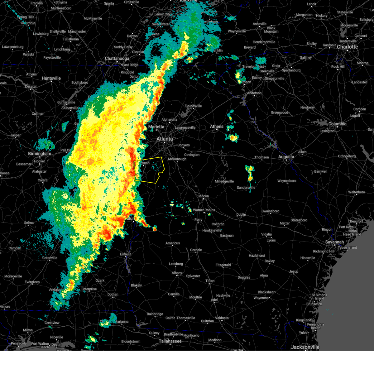
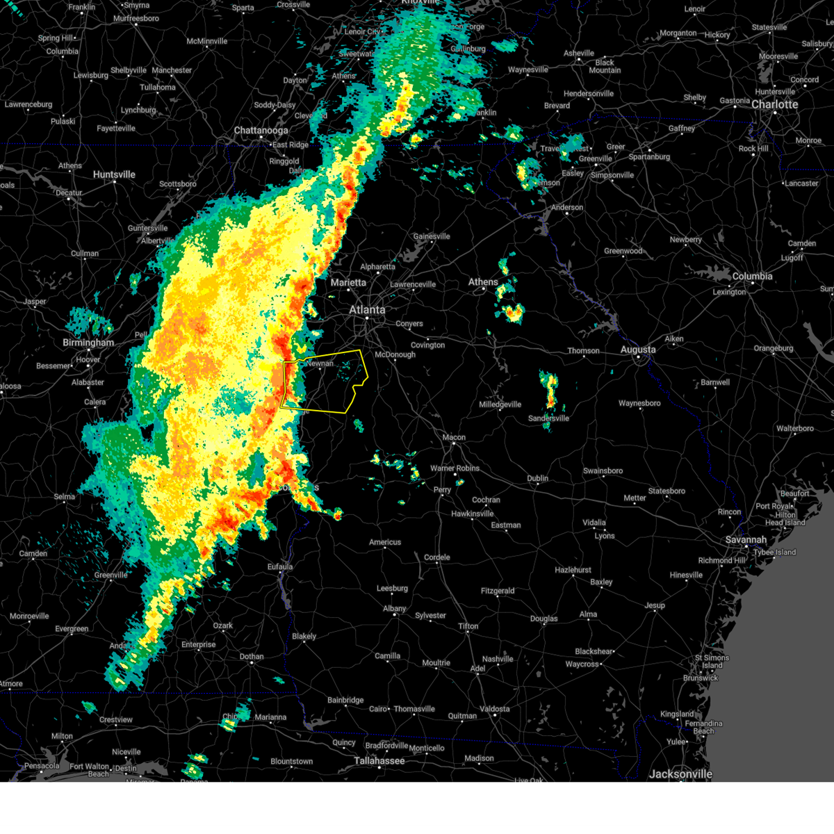
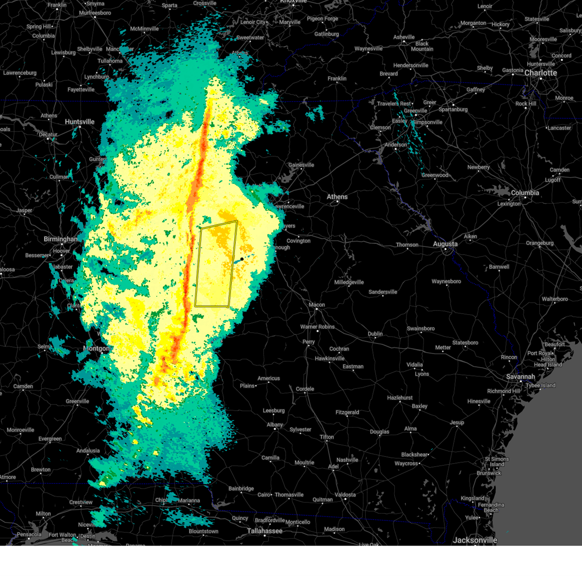
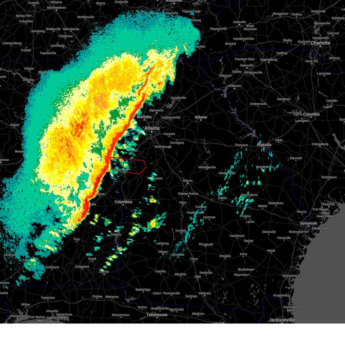
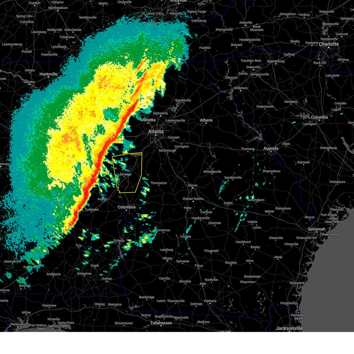
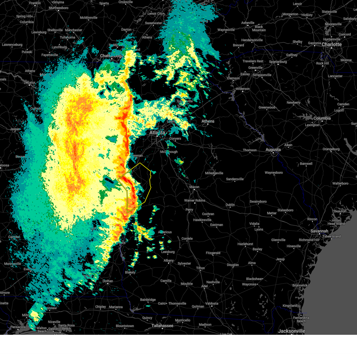
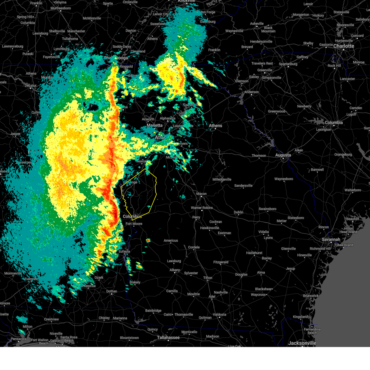
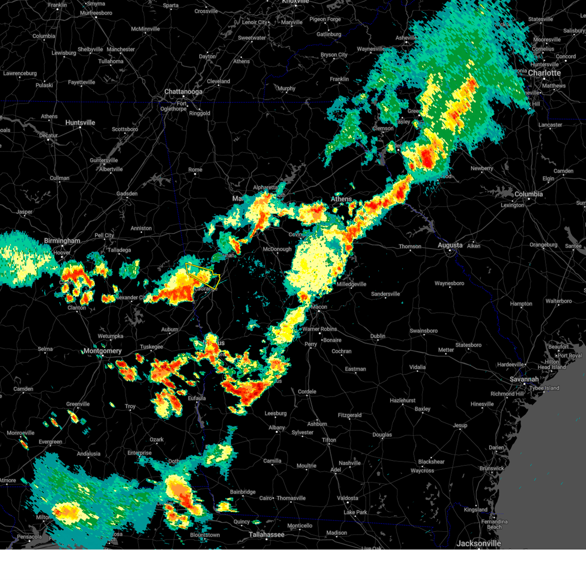
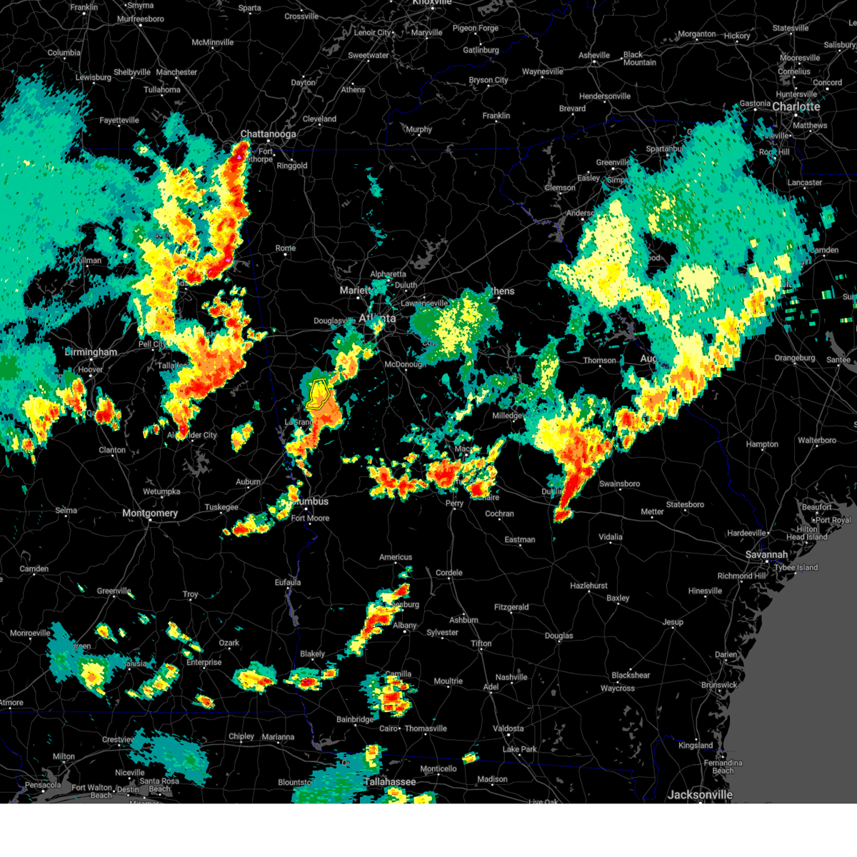
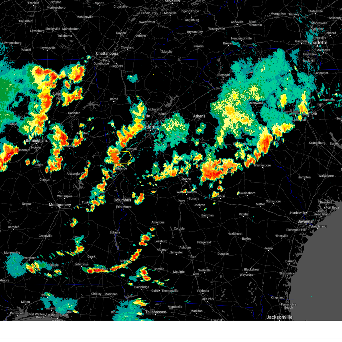
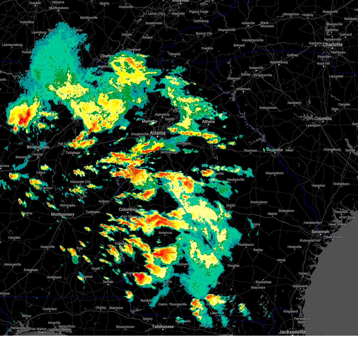
Hail Map for Hogansville, GA
The Hogansville, GA area has had 6 reports of on-the-ground hail by trained spotters, and has been under severe weather warnings 44 times during the past 12 months. Doppler radar has detected hail at or near Hogansville, GA on 54 occasions, including 2 occasions during the past year.
| Name: | Hogansville, GA |
| Where Located: | 49.8 miles SW of Atlanta, GA |
| Map: | Google Map for Hogansville, GA |
| Population: | 3060 |
| Housing Units: | 1421 |
| More Info: | Search Google for Hogansville, GA |
0
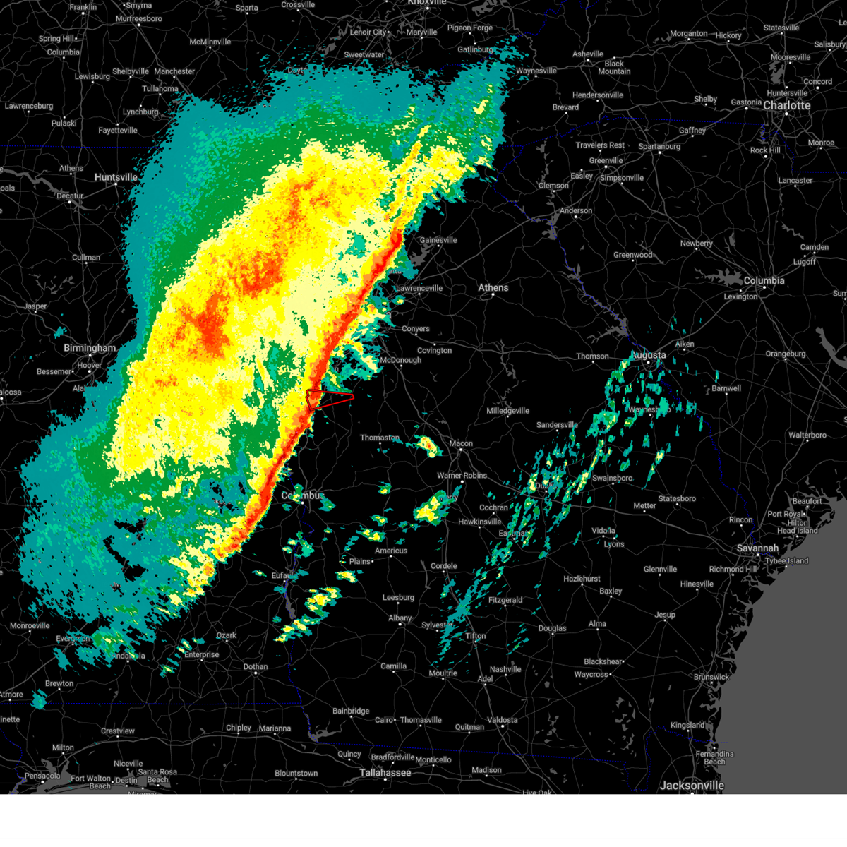
The Top Recent Hail Date for Hogansville, GA is Tuesday, July 1, 2025 (54th out of 54)
Hail and Wind Damage Spotted near Hogansville, GA
| Date / Time | Report Details |
|---|---|
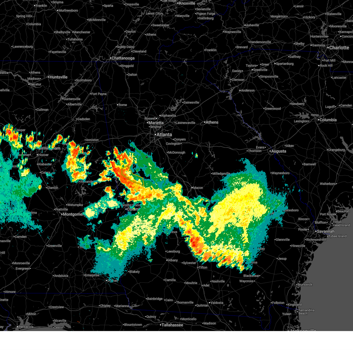
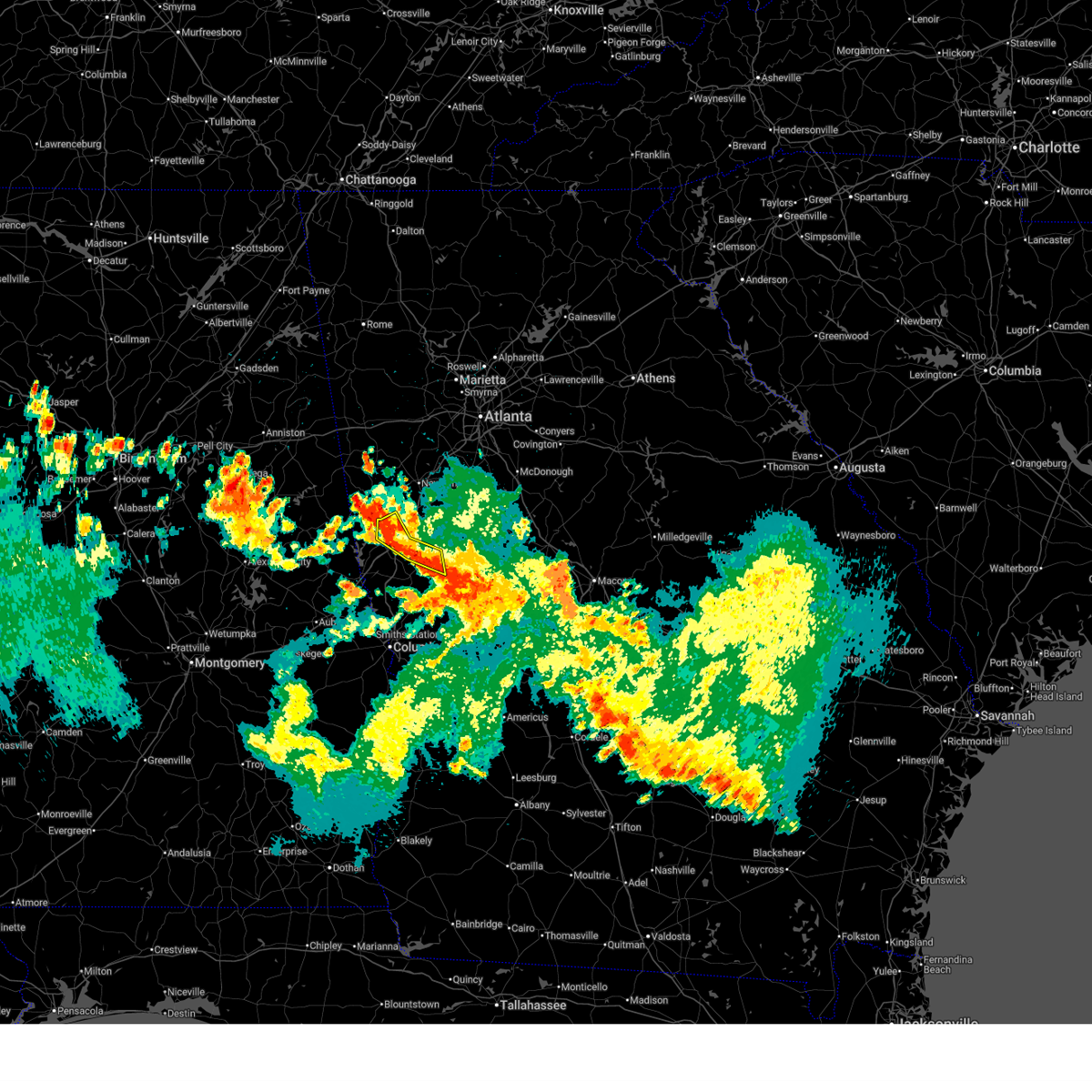
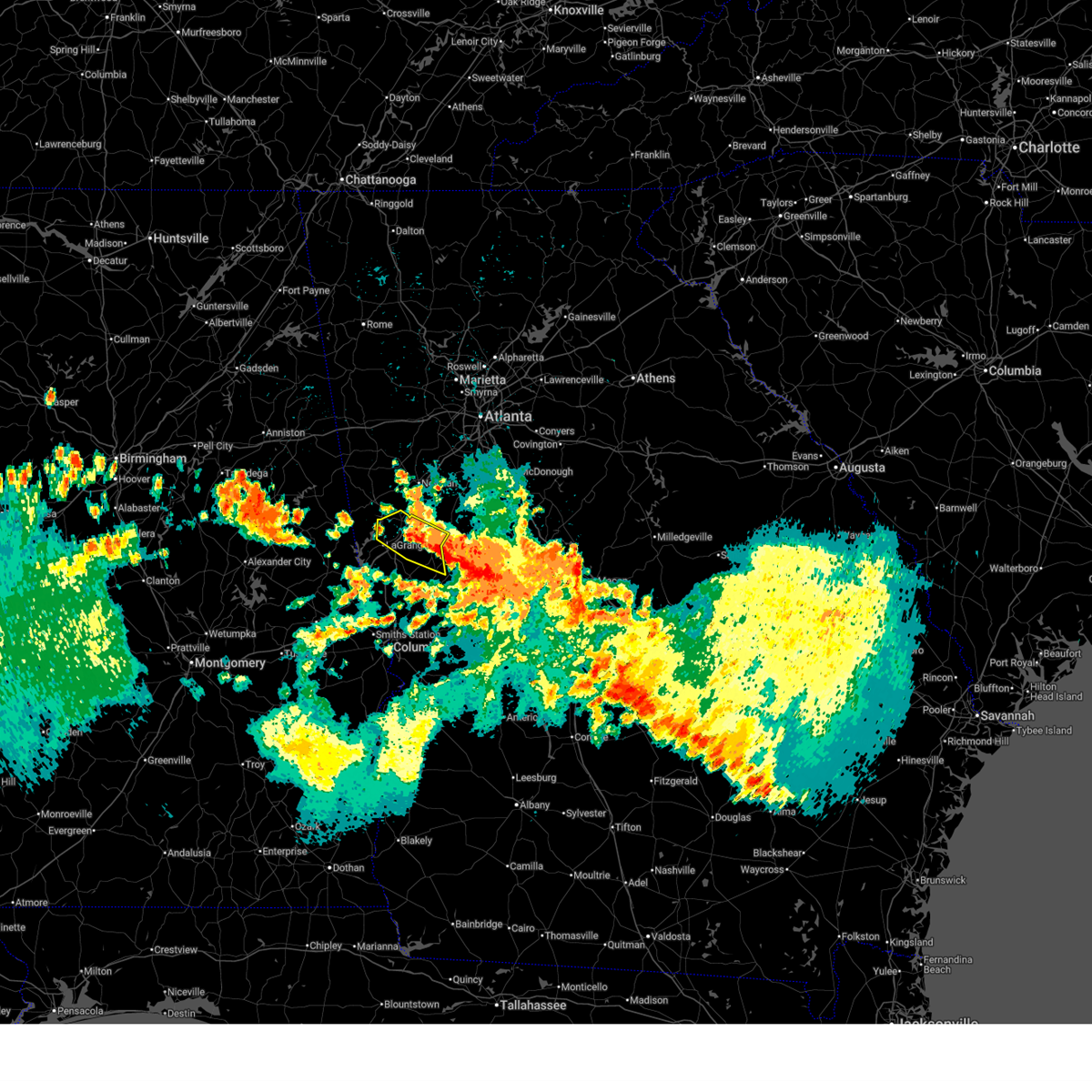
| 7/1/2025 6:17 PM EDT | Svrffc the national weather service in peachtree city has issued a * severe thunderstorm warning for, northwestern meriwether county in west central georgia, east central troup county in west central georgia, * until 645 pm edt. * at 616 pm edt, severe thunderstorms were located along a line extending from near grantville to saint marks to louise, moving southeast at 20 mph (radar indicated). Hazards include 60 mph wind gusts and penny size hail. expect damage to roofs, siding, and trees |
| 6/26/2025 2:12 AM EDT |
 The storm which prompted the warning has moved out of the area. therefore, the warning will be allowed to expire. a severe thunderstorm watch remains in effect until 400 am edt for west central georgia. The storm which prompted the warning has moved out of the area. therefore, the warning will be allowed to expire. a severe thunderstorm watch remains in effect until 400 am edt for west central georgia.
|
| 6/26/2025 1:50 AM EDT |
 At 150 am edt, a severe thunderstorm was located over big springs, or near lagrange, moving southwest at 25 mph (radar indicated). Hazards include 60 mph wind gusts. Expect damage to roofs, siding, and trees. Locations impacted include, lagrange, greenville, hogansville, warm springs, raleigh, mountville, louise, odessadale, stovall, harrisonville, hillcrest, big springs, wares crossroads, and harris city. At 150 am edt, a severe thunderstorm was located over big springs, or near lagrange, moving southwest at 25 mph (radar indicated). Hazards include 60 mph wind gusts. Expect damage to roofs, siding, and trees. Locations impacted include, lagrange, greenville, hogansville, warm springs, raleigh, mountville, louise, odessadale, stovall, harrisonville, hillcrest, big springs, wares crossroads, and harris city.
|
| 6/26/2025 1:28 AM EDT |
 Svrffc the national weather service in peachtree city has issued a * severe thunderstorm warning for, western meriwether county in west central georgia, northeastern troup county in west central georgia, * until 215 am edt. * at 128 am edt, a severe thunderstorm was located near saint marks, or 7 miles northwest of greenville, moving southwest at 25 mph (radar indicated). Hazards include 60 mph wind gusts. expect damage to roofs, siding, and trees Svrffc the national weather service in peachtree city has issued a * severe thunderstorm warning for, western meriwether county in west central georgia, northeastern troup county in west central georgia, * until 215 am edt. * at 128 am edt, a severe thunderstorm was located near saint marks, or 7 miles northwest of greenville, moving southwest at 25 mph (radar indicated). Hazards include 60 mph wind gusts. expect damage to roofs, siding, and trees
|
| 6/14/2025 8:06 PM EDT |
 At 806 pm edt, a severe thunderstorm was located over saint marks, or 9 miles northwest of greenville, moving northeast at 40 mph (radar indicated). Hazards include 60 mph wind gusts. Expect damage to roofs, siding, and trees. Locations impacted include, lagrange, hogansville, mountville, harrisonville, hillcrest, big springs, wares crossroads, louise, baughs crossroads, smiths crossroad, and jones crossroads. At 806 pm edt, a severe thunderstorm was located over saint marks, or 9 miles northwest of greenville, moving northeast at 40 mph (radar indicated). Hazards include 60 mph wind gusts. Expect damage to roofs, siding, and trees. Locations impacted include, lagrange, hogansville, mountville, harrisonville, hillcrest, big springs, wares crossroads, louise, baughs crossroads, smiths crossroad, and jones crossroads.
|
| 6/14/2025 8:06 PM EDT |
 the severe thunderstorm warning has been cancelled and is no longer in effect the severe thunderstorm warning has been cancelled and is no longer in effect
|
| 6/14/2025 7:52 PM EDT |
 Svrffc the national weather service in peachtree city has issued a * severe thunderstorm warning for, meriwether county in west central georgia, northeastern troup county in west central georgia, south central coweta county in west central georgia, * until 830 pm edt. * at 751 pm edt, a severe thunderstorm was located over louise, or 7 miles east of lagrange, moving northeast at 45 mph (radar indicated). Hazards include 60 mph wind gusts and dime size hail. expect damage to roofs, siding, and trees Svrffc the national weather service in peachtree city has issued a * severe thunderstorm warning for, meriwether county in west central georgia, northeastern troup county in west central georgia, south central coweta county in west central georgia, * until 830 pm edt. * at 751 pm edt, a severe thunderstorm was located over louise, or 7 miles east of lagrange, moving northeast at 45 mph (radar indicated). Hazards include 60 mph wind gusts and dime size hail. expect damage to roofs, siding, and trees
|
| 6/14/2025 7:29 PM EDT |
 Svrffc the national weather service in peachtree city has issued a * severe thunderstorm warning for, troup county in west central georgia, northwestern harris county in west central georgia, * until 815 pm edt. * at 729 pm edt, a severe thunderstorm was located over amity park, or near lanett, moving northeast at 40 mph (radar indicated). Hazards include 60 mph wind gusts and dime size hail. expect damage to roofs, siding, and trees Svrffc the national weather service in peachtree city has issued a * severe thunderstorm warning for, troup county in west central georgia, northwestern harris county in west central georgia, * until 815 pm edt. * at 729 pm edt, a severe thunderstorm was located over amity park, or near lanett, moving northeast at 40 mph (radar indicated). Hazards include 60 mph wind gusts and dime size hail. expect damage to roofs, siding, and trees
|
| 6/8/2025 6:52 AM EDT |
 At 652 am edt, severe thunderstorms were located along a line extending from near powers crossroads to louise, moving east at 50 mph (radar indicated). Hazards include 60 mph wind gusts. Expect damage to roofs, siding, and trees. Locations impacted include, hogansville, corinth, and harrisonville. At 652 am edt, severe thunderstorms were located along a line extending from near powers crossroads to louise, moving east at 50 mph (radar indicated). Hazards include 60 mph wind gusts. Expect damage to roofs, siding, and trees. Locations impacted include, hogansville, corinth, and harrisonville.
|
| 6/8/2025 6:31 AM EDT |
 Svrffc the national weather service in peachtree city has issued a * severe thunderstorm warning for, southern heard county in west central georgia, northern troup county in west central georgia, southwestern coweta county in west central georgia, * until 700 am edt. * at 631 am edt, severe thunderstorms were located along a line extending from near franklin to abbottsford, moving east at 55 mph (radar indicated). Hazards include 60 mph wind gusts. expect damage to roofs, siding, and trees Svrffc the national weather service in peachtree city has issued a * severe thunderstorm warning for, southern heard county in west central georgia, northern troup county in west central georgia, southwestern coweta county in west central georgia, * until 700 am edt. * at 631 am edt, severe thunderstorms were located along a line extending from near franklin to abbottsford, moving east at 55 mph (radar indicated). Hazards include 60 mph wind gusts. expect damage to roofs, siding, and trees
|
| 6/8/2025 6:11 AM EDT |
 Svrffc the national weather service in peachtree city has issued a * severe thunderstorm warning for, heard county in west central georgia, northern troup county in west central georgia, western coweta county in west central georgia, * until 645 am edt. * at 611 am edt, severe thunderstorms were located along a line extending from ephesus to rock stand, moving east at 45 mph (radar indicated). Hazards include 60 mph wind gusts and penny size hail. expect damage to roofs, siding, and trees Svrffc the national weather service in peachtree city has issued a * severe thunderstorm warning for, heard county in west central georgia, northern troup county in west central georgia, western coweta county in west central georgia, * until 645 am edt. * at 611 am edt, severe thunderstorms were located along a line extending from ephesus to rock stand, moving east at 45 mph (radar indicated). Hazards include 60 mph wind gusts and penny size hail. expect damage to roofs, siding, and trees
|
| 5/27/2025 3:11 PM EDT |
 Svrffc the national weather service in peachtree city has issued a * severe thunderstorm warning for, fayette county in north central georgia, northern meriwether county in west central georgia, eastern coweta county in west central georgia, southwestern clayton county in north central georgia, * until 345 pm edt. * at 311 pm edt, severe thunderstorms were located along a line extending from douglasville to near newnan to near hogansville, moving east at 35 mph (radar indicated). Hazards include 60 mph wind gusts and quarter size hail. Hail damage to vehicles is expected. Expect wind damage to roofs, siding, and trees. Svrffc the national weather service in peachtree city has issued a * severe thunderstorm warning for, fayette county in north central georgia, northern meriwether county in west central georgia, eastern coweta county in west central georgia, southwestern clayton county in north central georgia, * until 345 pm edt. * at 311 pm edt, severe thunderstorms were located along a line extending from douglasville to near newnan to near hogansville, moving east at 35 mph (radar indicated). Hazards include 60 mph wind gusts and quarter size hail. Hail damage to vehicles is expected. Expect wind damage to roofs, siding, and trees.
|
| 5/18/2025 9:30 AM EDT | Numerous trees (6-10) snapped near mm 30 on i-8 in troup county GA, 2.6 miles W of Hogansville, GA |
| 5/18/2025 9:28 AM EDT |
 The storms which prompted the warning have moved out of the area. therefore, the warning will be allowed to expire. a severe thunderstorm watch remains in effect until 100 pm edt for northwestern and west central georgia. The storms which prompted the warning have moved out of the area. therefore, the warning will be allowed to expire. a severe thunderstorm watch remains in effect until 100 pm edt for northwestern and west central georgia.
|
| 5/18/2025 9:03 AM EDT |
 Svrffc the national weather service in peachtree city has issued a * severe thunderstorm warning for, western spalding county in west central georgia, fayette county in north central georgia, meriwether county in west central georgia, pike county in west central georgia, southeastern carroll county in northwestern georgia, northwestern upson county in west central georgia, eastern troup county in west central georgia, coweta county in west central georgia, southwestern clayton county in north central georgia, northwestern talbot county in west central georgia, harris county in west central georgia, * until 945 am edt. * at 903 am edt, severe thunderstorms were located along a line extending from graham to paran to near ridge grove, moving east at 65 mph (radar indicated). Hazards include 60 mph wind gusts and quarter size hail. Hail damage to vehicles is expected. Expect wind damage to roofs, siding, and trees. Svrffc the national weather service in peachtree city has issued a * severe thunderstorm warning for, western spalding county in west central georgia, fayette county in north central georgia, meriwether county in west central georgia, pike county in west central georgia, southeastern carroll county in northwestern georgia, northwestern upson county in west central georgia, eastern troup county in west central georgia, coweta county in west central georgia, southwestern clayton county in north central georgia, northwestern talbot county in west central georgia, harris county in west central georgia, * until 945 am edt. * at 903 am edt, severe thunderstorms were located along a line extending from graham to paran to near ridge grove, moving east at 65 mph (radar indicated). Hazards include 60 mph wind gusts and quarter size hail. Hail damage to vehicles is expected. Expect wind damage to roofs, siding, and trees.
|
| 5/18/2025 8:38 AM EDT |
 Svrffc the national weather service in peachtree city has issued a * severe thunderstorm warning for, southern carroll county in northwestern georgia, heard county in west central georgia, troup county in west central georgia, western coweta county in west central georgia, * until 930 am edt. * at 837 am edt, severe thunderstorms were located along a line extending from near camp sequoyah to cragford to near northern lake martin, moving east at 65 mph (radar indicated). Hazards include 60 mph wind gusts and quarter size hail. Hail damage to vehicles is expected. Expect wind damage to roofs, siding, and trees. Svrffc the national weather service in peachtree city has issued a * severe thunderstorm warning for, southern carroll county in northwestern georgia, heard county in west central georgia, troup county in west central georgia, western coweta county in west central georgia, * until 930 am edt. * at 837 am edt, severe thunderstorms were located along a line extending from near camp sequoyah to cragford to near northern lake martin, moving east at 65 mph (radar indicated). Hazards include 60 mph wind gusts and quarter size hail. Hail damage to vehicles is expected. Expect wind damage to roofs, siding, and trees.
|
| 5/17/2025 8:30 AM EDT |
 The storm which prompted the warning has weakened below severe limits, and has exited the warned area. therefore, the warning has been allowed to expire. however, gusty winds are still possible with this thunderstorm. The storm which prompted the warning has weakened below severe limits, and has exited the warned area. therefore, the warning has been allowed to expire. however, gusty winds are still possible with this thunderstorm.
|
| 5/17/2025 8:18 AM EDT |
 At 818 am edt, a severe thunderstorm was located over corinth, or 9 miles east of franklin, moving east at 45 mph (radar indicated). Hazards include 60 mph wind gusts. Expect damage to roofs, siding, and trees. Locations impacted include, newnan, hogansville, grantville, lone oak, corinth, harrisonville, powers crossroads, and handy. At 818 am edt, a severe thunderstorm was located over corinth, or 9 miles east of franklin, moving east at 45 mph (radar indicated). Hazards include 60 mph wind gusts. Expect damage to roofs, siding, and trees. Locations impacted include, newnan, hogansville, grantville, lone oak, corinth, harrisonville, powers crossroads, and handy.
|
| 5/17/2025 8:12 AM EDT |
 At 812 am edt, a severe thunderstorm was located near franklin, moving east at 45 mph (radar indicated). Hazards include 60 mph wind gusts. Expect damage to roofs, siding, and trees. Locations impacted include, newnan, franklin, hogansville, grantville, centralhatchee, lone oak, corinth, saint marks, texas, harrisonville, powers crossroads, and handy. At 812 am edt, a severe thunderstorm was located near franklin, moving east at 45 mph (radar indicated). Hazards include 60 mph wind gusts. Expect damage to roofs, siding, and trees. Locations impacted include, newnan, franklin, hogansville, grantville, centralhatchee, lone oak, corinth, saint marks, texas, harrisonville, powers crossroads, and handy.
|
| 5/17/2025 7:45 AM EDT |
 Svrffc the national weather service in peachtree city has issued a * severe thunderstorm warning for, northwestern meriwether county in west central georgia, heard county in west central georgia, northern troup county in west central georgia, southwestern coweta county in west central georgia, * until 830 am edt. * at 745 am edt, a severe thunderstorm was located near tennant, or near wedowee, moving east at 45 mph (radar indicated). Hazards include 60 mph wind gusts and penny size hail. expect damage to roofs, siding, and trees Svrffc the national weather service in peachtree city has issued a * severe thunderstorm warning for, northwestern meriwether county in west central georgia, heard county in west central georgia, northern troup county in west central georgia, southwestern coweta county in west central georgia, * until 830 am edt. * at 745 am edt, a severe thunderstorm was located near tennant, or near wedowee, moving east at 45 mph (radar indicated). Hazards include 60 mph wind gusts and penny size hail. expect damage to roofs, siding, and trees
|
| 4/6/2025 2:46 PM EDT |
 Svrffc the national weather service in peachtree city has issued a * severe thunderstorm warning for, southwestern spalding county in west central georgia, south central fayette county in north central georgia, northern meriwether county in west central georgia, northwestern pike county in west central georgia, east central troup county in west central georgia, southeastern coweta county in west central georgia, * until 330 pm edt. * at 246 pm edt, severe thunderstorms were located along a line extending from near louise to jones crossroads, moving northeast at 40 mph (radar indicated). Hazards include 60 mph wind gusts. expect damage to roofs, siding, and trees Svrffc the national weather service in peachtree city has issued a * severe thunderstorm warning for, southwestern spalding county in west central georgia, south central fayette county in north central georgia, northern meriwether county in west central georgia, northwestern pike county in west central georgia, east central troup county in west central georgia, southeastern coweta county in west central georgia, * until 330 pm edt. * at 246 pm edt, severe thunderstorms were located along a line extending from near louise to jones crossroads, moving northeast at 40 mph (radar indicated). Hazards include 60 mph wind gusts. expect damage to roofs, siding, and trees
|
| 4/6/2025 1:06 PM EDT |
 The storms which prompted the warning have moved out of the area. therefore, the warning will be allowed to expire. however, gusty winds are still possible with these thunderstorms. a tornado watch remains in effect until 700 pm edt for north central, northwestern and west central georgia. The storms which prompted the warning have moved out of the area. therefore, the warning will be allowed to expire. however, gusty winds are still possible with these thunderstorms. a tornado watch remains in effect until 700 pm edt for north central, northwestern and west central georgia.
|
| 4/6/2025 12:43 PM EDT |
 the severe thunderstorm warning has been cancelled and is no longer in effect the severe thunderstorm warning has been cancelled and is no longer in effect
|
| 4/6/2025 12:43 PM EDT |
 At 1243 pm edt, severe thunderstorms were located along a line extending from near arnco-sargent to near moreland to near hogansville, moving east at 35 mph (radar indicated). Hazards include 60 mph wind gusts. Expect damage to roofs, siding, and trees. Locations impacted include, turin, plant yates, haralson, dunaway gardens, hogansville, cannongate, harrisonville, east newnan, madras, rocky mount, saint marks, sharpsburg, luthersville, arnco-sargent, tyrone, peachtree city, senoia, grantville, lone oak, and moreland. At 1243 pm edt, severe thunderstorms were located along a line extending from near arnco-sargent to near moreland to near hogansville, moving east at 35 mph (radar indicated). Hazards include 60 mph wind gusts. Expect damage to roofs, siding, and trees. Locations impacted include, turin, plant yates, haralson, dunaway gardens, hogansville, cannongate, harrisonville, east newnan, madras, rocky mount, saint marks, sharpsburg, luthersville, arnco-sargent, tyrone, peachtree city, senoia, grantville, lone oak, and moreland.
|
| 4/6/2025 12:36 PM EDT |
 At 1236 pm edt, severe thunderstorms were located along a line extending from near arnco-sargent to near grantville to near corinth, moving east at 35 mph (radar indicated). Hazards include 60 mph wind gusts. Expect damage to roofs, siding, and trees. Locations impacted include, turin, plant yates, haralson, dunaway gardens, hogansville, cannongate, harrisonville, east newnan, hillcrest, corinth, whitesburg, madras, rocky mount, saint marks, sharpsburg, luthersville, arnco-sargent, tyrone, powers crossroads, and peachtree city. At 1236 pm edt, severe thunderstorms were located along a line extending from near arnco-sargent to near grantville to near corinth, moving east at 35 mph (radar indicated). Hazards include 60 mph wind gusts. Expect damage to roofs, siding, and trees. Locations impacted include, turin, plant yates, haralson, dunaway gardens, hogansville, cannongate, harrisonville, east newnan, hillcrest, corinth, whitesburg, madras, rocky mount, saint marks, sharpsburg, luthersville, arnco-sargent, tyrone, powers crossroads, and peachtree city.
|
| 4/6/2025 12:28 PM EDT |
 Svrffc the national weather service in peachtree city has issued a * severe thunderstorm warning for, southwestern fayette county in north central georgia, northwestern meriwether county in west central georgia, southeastern carroll county in northwestern georgia, eastern heard county in west central georgia, northeastern troup county in west central georgia, coweta county in west central georgia, * until 115 pm edt. * at 1228 pm edt, severe thunderstorms were located along a line extending from near handy to near corinth to near harrisonville, moving east at 35 mph (radar indicated). Hazards include 60 mph wind gusts. expect damage to roofs, siding, and trees Svrffc the national weather service in peachtree city has issued a * severe thunderstorm warning for, southwestern fayette county in north central georgia, northwestern meriwether county in west central georgia, southeastern carroll county in northwestern georgia, eastern heard county in west central georgia, northeastern troup county in west central georgia, coweta county in west central georgia, * until 115 pm edt. * at 1228 pm edt, severe thunderstorms were located along a line extending from near handy to near corinth to near harrisonville, moving east at 35 mph (radar indicated). Hazards include 60 mph wind gusts. expect damage to roofs, siding, and trees
|
| 3/31/2025 12:56 PM EDT |
 The storms which prompted the warning have moved out of the area. therefore, the warning will be allowed to expire. a severe thunderstorm watch remains in effect until 100 pm edt for northwestern georgia. a severe thunderstorm watch also remains in effect until 700 pm edt for north central and west central georgia. to report severe weather, contact your nearest law enforcement agency. they will relay your report to the national weather service peachtree city. The storms which prompted the warning have moved out of the area. therefore, the warning will be allowed to expire. a severe thunderstorm watch remains in effect until 100 pm edt for northwestern georgia. a severe thunderstorm watch also remains in effect until 700 pm edt for north central and west central georgia. to report severe weather, contact your nearest law enforcement agency. they will relay your report to the national weather service peachtree city.
|
| 3/31/2025 12:22 PM EDT |
 the severe thunderstorm warning has been cancelled and is no longer in effect the severe thunderstorm warning has been cancelled and is no longer in effect
|
| 3/31/2025 12:22 PM EDT |
 At 1222 pm edt, severe thunderstorms were located along a line extending from near plant yates to corinth to near hogansville, moving east at 50 mph (radar indicated). Hazards include 60 mph wind gusts and nickel size hail. Expect damage to roofs, siding, and trees. Locations impacted include, turin, starrs mill, woolsey, haralson, inman, hogansville, cannongate, east newnan, madras, rocky mount, saint marks, brooks, fayetteville, sharpsburg, luthersville, arnco-sargent, tyrone, powers crossroads, peachtree city, and senoia. At 1222 pm edt, severe thunderstorms were located along a line extending from near plant yates to corinth to near hogansville, moving east at 50 mph (radar indicated). Hazards include 60 mph wind gusts and nickel size hail. Expect damage to roofs, siding, and trees. Locations impacted include, turin, starrs mill, woolsey, haralson, inman, hogansville, cannongate, east newnan, madras, rocky mount, saint marks, brooks, fayetteville, sharpsburg, luthersville, arnco-sargent, tyrone, powers crossroads, peachtree city, and senoia.
|
| 3/31/2025 12:13 PM EDT |
 Svrffc the national weather service in peachtree city has issued a * severe thunderstorm warning for, fayette county in north central georgia, northern meriwether county in west central georgia, eastern heard county in west central georgia, northeastern troup county in west central georgia, coweta county in west central georgia, * until 100 pm edt. * at 1213 pm edt, severe thunderstorms were located along a line extending from plant wansley to near harrisonville to wares crossroads, moving east at 50 mph (radar indicated). Hazards include 60 mph wind gusts and quarter size hail. Hail damage to vehicles is expected. Expect wind damage to roofs, siding, and trees. Svrffc the national weather service in peachtree city has issued a * severe thunderstorm warning for, fayette county in north central georgia, northern meriwether county in west central georgia, eastern heard county in west central georgia, northeastern troup county in west central georgia, coweta county in west central georgia, * until 100 pm edt. * at 1213 pm edt, severe thunderstorms were located along a line extending from plant wansley to near harrisonville to wares crossroads, moving east at 50 mph (radar indicated). Hazards include 60 mph wind gusts and quarter size hail. Hail damage to vehicles is expected. Expect wind damage to roofs, siding, and trees.
|
| 3/5/2025 2:13 AM EST |
 The storms which prompted the warning have moved out of the area. therefore, the warning will be allowed to expire. a severe thunderstorm watch remains in effect until 400 am est for north central, northwestern and west central georgia. The storms which prompted the warning have moved out of the area. therefore, the warning will be allowed to expire. a severe thunderstorm watch remains in effect until 400 am est for north central, northwestern and west central georgia.
|
| 3/5/2025 1:31 AM EST |
 The storms which prompted the warning have moved out of the area. therefore, the warning has been allowed to expire. a severe thunderstorm watch remains in effect until 400 am est for north central, northwestern and west central georgia. The storms which prompted the warning have moved out of the area. therefore, the warning has been allowed to expire. a severe thunderstorm watch remains in effect until 400 am est for north central, northwestern and west central georgia.
|
| 3/5/2025 1:24 AM EST |
 Svrffc the national weather service in peachtree city has issued a * severe thunderstorm warning for, southwestern spalding county in west central georgia, fayette county in north central georgia, meriwether county in west central georgia, western pike county in west central georgia, southeastern carroll county in northwestern georgia, southern douglas county in north central georgia, northwestern upson county in west central georgia, eastern troup county in west central georgia, coweta county in west central georgia, southwestern fulton county in north central georgia, northwestern talbot county in west central georgia, northeastern harris county in west central georgia, * until 215 am est. * at 123 am est, severe thunderstorms were located along a line extending from near winston to near pine mountain, moving east at 30 mph (radar indicated). Hazards include 60 mph wind gusts. expect damage to roofs, siding, and trees Svrffc the national weather service in peachtree city has issued a * severe thunderstorm warning for, southwestern spalding county in west central georgia, fayette county in north central georgia, meriwether county in west central georgia, western pike county in west central georgia, southeastern carroll county in northwestern georgia, southern douglas county in north central georgia, northwestern upson county in west central georgia, eastern troup county in west central georgia, coweta county in west central georgia, southwestern fulton county in north central georgia, northwestern talbot county in west central georgia, northeastern harris county in west central georgia, * until 215 am est. * at 123 am est, severe thunderstorms were located along a line extending from near winston to near pine mountain, moving east at 30 mph (radar indicated). Hazards include 60 mph wind gusts. expect damage to roofs, siding, and trees
|
| 3/5/2025 12:48 AM EST |
 Svrffc the national weather service in peachtree city has issued a * severe thunderstorm warning for, western meriwether county in west central georgia, southeastern carroll county in northwestern georgia, douglas county in north central georgia, eastern heard county in west central georgia, troup county in west central georgia, coweta county in west central georgia, southwestern fulton county in north central georgia, * until 130 am est. * at 1248 am est, severe thunderstorms were located along a line extending from bowdon junction to near fairfax, moving northeast at 60 mph (radar indicated). Hazards include 60 mph wind gusts. expect damage to roofs, siding, and trees Svrffc the national weather service in peachtree city has issued a * severe thunderstorm warning for, western meriwether county in west central georgia, southeastern carroll county in northwestern georgia, douglas county in north central georgia, eastern heard county in west central georgia, troup county in west central georgia, coweta county in west central georgia, southwestern fulton county in north central georgia, * until 130 am est. * at 1248 am est, severe thunderstorms were located along a line extending from bowdon junction to near fairfax, moving northeast at 60 mph (radar indicated). Hazards include 60 mph wind gusts. expect damage to roofs, siding, and trees
|
| 2/16/2025 4:26 AM EST |
 the tornado warning has been cancelled and is no longer in effect the tornado warning has been cancelled and is no longer in effect
|
| 2/16/2025 4:26 AM EST |
 At 425 am est, a severe thunderstorm capable of producing a tornado was located over lone oak, or 11 miles northwest of greenville, moving east at 60 mph (radar indicated rotation). Hazards include tornado. Flying debris will be dangerous to those caught without shelter. mobile homes will be damaged or destroyed. damage to roofs, windows, and vehicles will occur. tree damage is likely. Locations impacted include, hogansville, grantville, luthersville, haralson, lone oak, and corinth. At 425 am est, a severe thunderstorm capable of producing a tornado was located over lone oak, or 11 miles northwest of greenville, moving east at 60 mph (radar indicated rotation). Hazards include tornado. Flying debris will be dangerous to those caught without shelter. mobile homes will be damaged or destroyed. damage to roofs, windows, and vehicles will occur. tree damage is likely. Locations impacted include, hogansville, grantville, luthersville, haralson, lone oak, and corinth.
|
| 2/16/2025 4:25 AM EST |
 Torffc the national weather service in peachtree city has issued a * tornado warning for, northwestern spalding county in west central georgia, southern fayette county in north central georgia, northern meriwether county in west central georgia, northeastern troup county in west central georgia, southern coweta county in west central georgia, * until 500 am est. * at 424 am est, severe thunderstorms capable of producing both tornadoes and extensive straight line wind damage were located over grantville, or 12 miles southwest of newnan, moving east at 55 mph (radar indicated rotation). Hazards include tornado. Flying debris will be dangerous to those caught without shelter. mobile homes will be damaged or destroyed. damage to roofs, windows, and vehicles will occur. Tree damage is likely. Torffc the national weather service in peachtree city has issued a * tornado warning for, northwestern spalding county in west central georgia, southern fayette county in north central georgia, northern meriwether county in west central georgia, northeastern troup county in west central georgia, southern coweta county in west central georgia, * until 500 am est. * at 424 am est, severe thunderstorms capable of producing both tornadoes and extensive straight line wind damage were located over grantville, or 12 miles southwest of newnan, moving east at 55 mph (radar indicated rotation). Hazards include tornado. Flying debris will be dangerous to those caught without shelter. mobile homes will be damaged or destroyed. damage to roofs, windows, and vehicles will occur. Tree damage is likely.
|
| 2/16/2025 4:18 AM EST |
 At 418 am est, a severe thunderstorm capable of producing a tornado was located over harrisonville, or 10 miles southeast of franklin, moving east at 60 mph (radar indicated rotation). Hazards include tornado. Flying debris will be dangerous to those caught without shelter. mobile homes will be damaged or destroyed. damage to roofs, windows, and vehicles will occur. tree damage is likely. Locations impacted include, lagrange, greenville, hogansville, grantville, luthersville, haralson, lone oak, gay, corinth, rocky mount, saint marks, mountville, louise, alvaton, harrisonville, hillcrest, wares crossroads, and wooster. At 418 am est, a severe thunderstorm capable of producing a tornado was located over harrisonville, or 10 miles southeast of franklin, moving east at 60 mph (radar indicated rotation). Hazards include tornado. Flying debris will be dangerous to those caught without shelter. mobile homes will be damaged or destroyed. damage to roofs, windows, and vehicles will occur. tree damage is likely. Locations impacted include, lagrange, greenville, hogansville, grantville, luthersville, haralson, lone oak, gay, corinth, rocky mount, saint marks, mountville, louise, alvaton, harrisonville, hillcrest, wares crossroads, and wooster.
|
| 2/16/2025 4:09 AM EST |
 At 408 am est, a severe thunderstorm capable of producing a tornado was located near texas, or near franklin, moving east at 60 mph (radar indicated rotation). Hazards include tornado. Flying debris will be dangerous to those caught without shelter. mobile homes will be damaged or destroyed. damage to roofs, windows, and vehicles will occur. tree damage is likely. Locations impacted include, lagrange, franklin, greenville, hogansville, grantville, luthersville, haralson, lone oak, gay, corinth, rocky mount, saint marks, mountville, louise, waresville, alvaton, texas, harrisonville, hillcrest, and wares crossroads. At 408 am est, a severe thunderstorm capable of producing a tornado was located near texas, or near franklin, moving east at 60 mph (radar indicated rotation). Hazards include tornado. Flying debris will be dangerous to those caught without shelter. mobile homes will be damaged or destroyed. damage to roofs, windows, and vehicles will occur. tree damage is likely. Locations impacted include, lagrange, franklin, greenville, hogansville, grantville, luthersville, haralson, lone oak, gay, corinth, rocky mount, saint marks, mountville, louise, waresville, alvaton, texas, harrisonville, hillcrest, and wares crossroads.
|
| 2/16/2025 4:09 AM EST |
 the tornado warning has been cancelled and is no longer in effect the tornado warning has been cancelled and is no longer in effect
|
| 2/16/2025 4:02 AM EST |
 Torffc the national weather service in peachtree city has issued a * tornado warning for, northern meriwether county in west central georgia, northwestern pike county in west central georgia, southern heard county in west central georgia, northern troup county in west central georgia, southern coweta county in west central georgia, * until 445 am est. * at 402 am est, a severe thunderstorm capable of producing a tornado was located over paran, or 7 miles northeast of roanoke, moving east at 60 mph (radar indicated rotation). Hazards include tornado. Flying debris will be dangerous to those caught without shelter. mobile homes will be damaged or destroyed. damage to roofs, windows, and vehicles will occur. Tree damage is likely. Torffc the national weather service in peachtree city has issued a * tornado warning for, northern meriwether county in west central georgia, northwestern pike county in west central georgia, southern heard county in west central georgia, northern troup county in west central georgia, southern coweta county in west central georgia, * until 445 am est. * at 402 am est, a severe thunderstorm capable of producing a tornado was located over paran, or 7 miles northeast of roanoke, moving east at 60 mph (radar indicated rotation). Hazards include tornado. Flying debris will be dangerous to those caught without shelter. mobile homes will be damaged or destroyed. damage to roofs, windows, and vehicles will occur. Tree damage is likely.
|
| 2/16/2025 3:46 AM EST |
 Svrffc the national weather service in peachtree city has issued a * severe thunderstorm warning for, western meriwether county in west central georgia, heard county in west central georgia, troup county in west central georgia, western coweta county in west central georgia, northern harris county in west central georgia, * until 430 am est. * at 346 am est, severe thunderstorms were located along a line extending from near wedowee to sparkling springs to susannah crossing, moving east at 55 mph (radar indicated). Hazards include 60 mph wind gusts. expect damage to roofs, siding, and trees Svrffc the national weather service in peachtree city has issued a * severe thunderstorm warning for, western meriwether county in west central georgia, heard county in west central georgia, troup county in west central georgia, western coweta county in west central georgia, northern harris county in west central georgia, * until 430 am est. * at 346 am est, severe thunderstorms were located along a line extending from near wedowee to sparkling springs to susannah crossing, moving east at 55 mph (radar indicated). Hazards include 60 mph wind gusts. expect damage to roofs, siding, and trees
|
| 12/29/2024 4:02 AM EST |
 Svrffc the national weather service in peachtree city has issued a * severe thunderstorm warning for, spalding county in west central georgia, southern fayette county in north central georgia, meriwether county in west central georgia, pike county in west central georgia, monroe county in central georgia, upson county in west central georgia, southwestern butts county in central georgia, henry county in north central georgia, crawford county in central georgia, southeastern coweta county in west central georgia, southeastern clayton county in north central georgia, central talbot county in west central georgia, taylor county in west central georgia, lamar county in west central georgia, * until 500 am est. * at 401 am est, severe thunderstorms were located along a line extending from near hogansville to near woodland to near eelbeck/west fort moore, moving east at 45 mph (radar indicated). Hazards include 60 mph wind gusts. expect damage to roofs, siding, and trees Svrffc the national weather service in peachtree city has issued a * severe thunderstorm warning for, spalding county in west central georgia, southern fayette county in north central georgia, meriwether county in west central georgia, pike county in west central georgia, monroe county in central georgia, upson county in west central georgia, southwestern butts county in central georgia, henry county in north central georgia, crawford county in central georgia, southeastern coweta county in west central georgia, southeastern clayton county in north central georgia, central talbot county in west central georgia, taylor county in west central georgia, lamar county in west central georgia, * until 500 am est. * at 401 am est, severe thunderstorms were located along a line extending from near hogansville to near woodland to near eelbeck/west fort moore, moving east at 45 mph (radar indicated). Hazards include 60 mph wind gusts. expect damage to roofs, siding, and trees
|
| 12/29/2024 3:47 AM EST |
 At 347 am est, severe thunderstorms were located along a line extending from near lagrange to pine mountain-callaway gardens to near ellerslie to flat rock, moving northeast at 55 mph (radar indicated). Hazards include 60 mph wind gusts. Expect damage to roofs, siding, and trees. locations impacted include, columbus, lagrange, hamilton, greenville, manchester, hogansville, grantville, pine mountain, woodbury, luthersville, waverly hall, warm springs, woodland, moreland, lone oak, gay, pine mountain-callaway gardens, bibb city, shiloh, and f. d. Roosevelt state park. At 347 am est, severe thunderstorms were located along a line extending from near lagrange to pine mountain-callaway gardens to near ellerslie to flat rock, moving northeast at 55 mph (radar indicated). Hazards include 60 mph wind gusts. Expect damage to roofs, siding, and trees. locations impacted include, columbus, lagrange, hamilton, greenville, manchester, hogansville, grantville, pine mountain, woodbury, luthersville, waverly hall, warm springs, woodland, moreland, lone oak, gay, pine mountain-callaway gardens, bibb city, shiloh, and f. d. Roosevelt state park.
|
| 12/29/2024 3:12 AM EST |
 Svrffc the national weather service in peachtree city has issued a * severe thunderstorm warning for, meriwether county in west central georgia, northern muscogee county in west central georgia, troup county in west central georgia, south central coweta county in west central georgia, northwestern talbot county in west central georgia, harris county in west central georgia, * until 415 am est. * at 311 am est, severe thunderstorms were located along a line extending from near chambers county lake to beans mill to near griffen mill to near parkmanville in eastern alabama, moving northeast at 55 mph (radar indicated). Hazards include 60 mph wind gusts. expect damage to roofs, siding, and trees Svrffc the national weather service in peachtree city has issued a * severe thunderstorm warning for, meriwether county in west central georgia, northern muscogee county in west central georgia, troup county in west central georgia, south central coweta county in west central georgia, northwestern talbot county in west central georgia, harris county in west central georgia, * until 415 am est. * at 311 am est, severe thunderstorms were located along a line extending from near chambers county lake to beans mill to near griffen mill to near parkmanville in eastern alabama, moving northeast at 55 mph (radar indicated). Hazards include 60 mph wind gusts. expect damage to roofs, siding, and trees
|
| 6/10/2024 4:19 AM EDT |
 the severe thunderstorm warning has been cancelled and is no longer in effect the severe thunderstorm warning has been cancelled and is no longer in effect
|
| 6/10/2024 4:19 AM EDT |
 At 418 am edt, a severe thunderstorm was located over saint marks, or 11 miles northwest of greenville, moving east at 30 mph (radar indicated). Hazards include 60 mph wind gusts and quarter size hail. Hail damage to vehicles is expected. expect wind damage to roofs, siding, and trees. Locations impacted include, greenville, hogansville, woodbury, luthersville, lone oak, gay, rocky mount, saint marks, louise, odessadale, alvaton, imlac, and wooster. At 418 am edt, a severe thunderstorm was located over saint marks, or 11 miles northwest of greenville, moving east at 30 mph (radar indicated). Hazards include 60 mph wind gusts and quarter size hail. Hail damage to vehicles is expected. expect wind damage to roofs, siding, and trees. Locations impacted include, greenville, hogansville, woodbury, luthersville, lone oak, gay, rocky mount, saint marks, louise, odessadale, alvaton, imlac, and wooster.
|
| 6/10/2024 4:07 AM EDT |
 Svrffc the national weather service in peachtree city has issued a * severe thunderstorm warning for, meriwether county in west central georgia, east central heard county in west central georgia, northeastern troup county in west central georgia, southwestern coweta county in west central georgia, * until 445 am edt. * at 407 am edt, a severe thunderstorm was located over hogansville, or 11 miles southeast of franklin, moving east at 30 mph (radar indicated). Hazards include 60 mph wind gusts and quarter size hail. Hail damage to vehicles is expected. Expect wind damage to roofs, siding, and trees. Svrffc the national weather service in peachtree city has issued a * severe thunderstorm warning for, meriwether county in west central georgia, east central heard county in west central georgia, northeastern troup county in west central georgia, southwestern coweta county in west central georgia, * until 445 am edt. * at 407 am edt, a severe thunderstorm was located over hogansville, or 11 miles southeast of franklin, moving east at 30 mph (radar indicated). Hazards include 60 mph wind gusts and quarter size hail. Hail damage to vehicles is expected. Expect wind damage to roofs, siding, and trees.
|
| 5/11/2024 11:50 AM EDT | Em reported tree down at w hopson rd and hogansville r in troup county GA, 3.4 miles NNE of Hogansville, GA |
| 2/28/2024 4:09 PM EST |
 At 408 pm est, severe thunderstorms were located along a line extending from bonanza to near moreland to near louise, moving east at 50 mph (radar indicated). Hazards include 60 mph wind gusts. Expect damage to roofs, siding, and trees. Locations impacted include, newnan, griffin, mcdonough, fayetteville, jackson, jonesboro, zebulon, greenville, peachtree city, stockbridge, hampton, tyrone, lovejoy, locust grove, senoia, hogansville, grantville, luthersville, brooks, and moreland. At 408 pm est, severe thunderstorms were located along a line extending from bonanza to near moreland to near louise, moving east at 50 mph (radar indicated). Hazards include 60 mph wind gusts. Expect damage to roofs, siding, and trees. Locations impacted include, newnan, griffin, mcdonough, fayetteville, jackson, jonesboro, zebulon, greenville, peachtree city, stockbridge, hampton, tyrone, lovejoy, locust grove, senoia, hogansville, grantville, luthersville, brooks, and moreland.
|
| 2/28/2024 3:55 PM EST |
 Svrffc the national weather service in peachtree city has issued a * severe thunderstorm warning for, spalding county in west central georgia, fayette county in north central georgia, meriwether county in west central georgia, pike county in west central georgia, henry county in north central georgia, southeastern heard county in west central georgia, troup county in west central georgia, central butts county in central georgia, coweta county in west central georgia, southern clayton county in north central georgia, * until 445 pm est. * at 354 pm est, severe thunderstorms were located along a line extending from near fayetteville to near corinth to near abbottsford, moving east at 50 mph (radar indicated). Hazards include 60 mph wind gusts. expect damage to roofs, siding, and trees Svrffc the national weather service in peachtree city has issued a * severe thunderstorm warning for, spalding county in west central georgia, fayette county in north central georgia, meriwether county in west central georgia, pike county in west central georgia, henry county in north central georgia, southeastern heard county in west central georgia, troup county in west central georgia, central butts county in central georgia, coweta county in west central georgia, southern clayton county in north central georgia, * until 445 pm est. * at 354 pm est, severe thunderstorms were located along a line extending from near fayetteville to near corinth to near abbottsford, moving east at 50 mph (radar indicated). Hazards include 60 mph wind gusts. expect damage to roofs, siding, and trees
|
| 2/28/2024 3:50 PM EST |
 At 350 pm est, severe thunderstorms were located along a line extending from sandy creek to near powers crossroads to near wares crossroads, moving east at 65 mph (radar indicated). Hazards include 60 mph wind gusts. Expect damage to roofs, siding, and trees. Locations impacted include, newnan, lagrange, fayetteville, franklin, city of south fulton, peachtree city, union city, fairburn, tyrone, palmetto, hogansville, grantville, moreland, sharpsburg, turin, east newnan, corinth, plant yates, dunaway gardens, and rocky point. At 350 pm est, severe thunderstorms were located along a line extending from sandy creek to near powers crossroads to near wares crossroads, moving east at 65 mph (radar indicated). Hazards include 60 mph wind gusts. Expect damage to roofs, siding, and trees. Locations impacted include, newnan, lagrange, fayetteville, franklin, city of south fulton, peachtree city, union city, fairburn, tyrone, palmetto, hogansville, grantville, moreland, sharpsburg, turin, east newnan, corinth, plant yates, dunaway gardens, and rocky point.
|
| 2/28/2024 3:21 PM EST |
 Svrffc the national weather service in peachtree city has issued a * severe thunderstorm warning for, northern fayette county in north central georgia, southeastern carroll county in northwestern georgia, heard county in west central georgia, northern troup county in west central georgia, coweta county in west central georgia, southwestern fulton county in north central georgia, * until 400 pm est. * at 320 pm est, severe thunderstorms were located along a line extending from near fairplay to near roopville to wadley, moving southeast at 35 mph (radar indicated). Hazards include 60 mph wind gusts. expect damage to roofs, siding, and trees Svrffc the national weather service in peachtree city has issued a * severe thunderstorm warning for, northern fayette county in north central georgia, southeastern carroll county in northwestern georgia, heard county in west central georgia, northern troup county in west central georgia, coweta county in west central georgia, southwestern fulton county in north central georgia, * until 400 pm est. * at 320 pm est, severe thunderstorms were located along a line extending from near fairplay to near roopville to wadley, moving southeast at 35 mph (radar indicated). Hazards include 60 mph wind gusts. expect damage to roofs, siding, and trees
|
| 2/28/2024 3:21 PM EST |
 Svrffc the national weather service in peachtree city has issued a * severe thunderstorm warning for, northern fayette county in north central georgia, southeastern carroll county in northwestern georgia, heard county in west central georgia, northern troup county in west central georgia, coweta county in west central georgia, southwestern fulton county in north central georgia, * until 400 pm est. * at 321 pm est, severe thunderstorms were located along a line extending from near chattahoochee hills to roopville to wadley, moving southeast at 35 mph (radar indicated). Hazards include 60 mph wind gusts. expect damage to roofs, siding, and trees Svrffc the national weather service in peachtree city has issued a * severe thunderstorm warning for, northern fayette county in north central georgia, southeastern carroll county in northwestern georgia, heard county in west central georgia, northern troup county in west central georgia, coweta county in west central georgia, southwestern fulton county in north central georgia, * until 400 pm est. * at 321 pm est, severe thunderstorms were located along a line extending from near chattahoochee hills to roopville to wadley, moving southeast at 35 mph (radar indicated). Hazards include 60 mph wind gusts. expect damage to roofs, siding, and trees
|
| 8/28/2023 4:57 PM EDT |
 The severe thunderstorm warning for western meriwether, eastern troup and south central coweta counties will expire at 500 pm edt, the storm which prompted the warning has weakened below severe limits, and no longer poses an immediate threat to life or property. therefore, the warning will be allowed to expire. The severe thunderstorm warning for western meriwether, eastern troup and south central coweta counties will expire at 500 pm edt, the storm which prompted the warning has weakened below severe limits, and no longer poses an immediate threat to life or property. therefore, the warning will be allowed to expire.
|
| 8/28/2023 4:22 PM EDT |
 At 422 pm edt, a severe thunderstorm was located over odessadale, or near greenville, moving north at 15 mph (radar indicated). Hazards include 60 mph wind gusts and nickel size hail. expect damage to roofs, siding, and trees At 422 pm edt, a severe thunderstorm was located over odessadale, or near greenville, moving north at 15 mph (radar indicated). Hazards include 60 mph wind gusts and nickel size hail. expect damage to roofs, siding, and trees
|
| 8/12/2023 6:54 PM EDT |
 The severe thunderstorm warning for central heard and northeastern troup counties will expire at 700 pm edt, the storm which prompted the warning has moved out of the area. therefore, the warning will be allowed to expire. however, gusty winds and heavy rain are still possible with this thunderstorm. remember, a severe thunderstorm warning still remains in effect for southern heard and northwestern troup until 715pm. The severe thunderstorm warning for central heard and northeastern troup counties will expire at 700 pm edt, the storm which prompted the warning has moved out of the area. therefore, the warning will be allowed to expire. however, gusty winds and heavy rain are still possible with this thunderstorm. remember, a severe thunderstorm warning still remains in effect for southern heard and northwestern troup until 715pm.
|
| 8/12/2023 6:42 PM EDT |
 At 641 pm edt, a severe thunderstorm was located over harrisonville, or near franklin, moving southeast at 30 mph (radar indicated). Hazards include 60 mph wind gusts. Expect damage to roofs, siding, and trees. locations impacted include, franklin, hogansville, corinth, waresville, frolona, texas, harrisonville, hillcrest, and louise. hail threat, radar indicated max hail size, <. 75 in wind threat, radar indicated max wind gust, 60 mph. At 641 pm edt, a severe thunderstorm was located over harrisonville, or near franklin, moving southeast at 30 mph (radar indicated). Hazards include 60 mph wind gusts. Expect damage to roofs, siding, and trees. locations impacted include, franklin, hogansville, corinth, waresville, frolona, texas, harrisonville, hillcrest, and louise. hail threat, radar indicated max hail size, <. 75 in wind threat, radar indicated max wind gust, 60 mph.
|
| 8/12/2023 6:35 PM EDT |
 At 635 pm edt, a severe thunderstorm was located over glenn, or 9 miles northeast of stroud, moving southeast at 35 mph (radar indicated). Hazards include 60 mph wind gusts. expect damage to roofs, siding, and trees At 635 pm edt, a severe thunderstorm was located over glenn, or 9 miles northeast of stroud, moving southeast at 35 mph (radar indicated). Hazards include 60 mph wind gusts. expect damage to roofs, siding, and trees
|
| 8/12/2023 6:13 PM EDT |
 At 613 pm edt, a severe thunderstorm was located over frolona, or 7 miles northwest of franklin, moving east at 30 mph (radar indicated). Hazards include 60 mph wind gusts. expect damage to roofs, siding, and trees At 613 pm edt, a severe thunderstorm was located over frolona, or 7 miles northwest of franklin, moving east at 30 mph (radar indicated). Hazards include 60 mph wind gusts. expect damage to roofs, siding, and trees
|
| 8/7/2023 6:00 PM EDT | Sheet metal roofing panels were removed from an outbuildin in troup county GA, 1.5 miles SSE of Hogansville, GA |
| 8/7/2023 5:58 PM EDT | Emergency manager reported a tree down on the intersection of norwood rd and ralls r in troup county GA, 3.6 miles S of Hogansville, GA |
| 8/7/2023 5:54 PM EDT |
 At 554 pm edt, severe thunderstorms were located along a line extending from palmetto to harrisonville, moving east at 30 mph (radar indicated). Hazards include 60 mph wind gusts and nickel size hail. expect damage to roofs, siding, and trees At 554 pm edt, severe thunderstorms were located along a line extending from palmetto to harrisonville, moving east at 30 mph (radar indicated). Hazards include 60 mph wind gusts and nickel size hail. expect damage to roofs, siding, and trees
|
| 8/6/2023 5:07 PM EDT |
 At 507 pm edt, a severe thunderstorm was located over luthersville, or 9 miles south of newnan, moving east at 25 mph (radar indicated). Hazards include 60 mph wind gusts and penny size hail. Expect damage to roofs, siding, and trees. locations impacted include, hogansville, grantville, and corinth. hail threat, radar indicated max hail size, 0. 75 in wind threat, radar indicated max wind gust, 60 mph. At 507 pm edt, a severe thunderstorm was located over luthersville, or 9 miles south of newnan, moving east at 25 mph (radar indicated). Hazards include 60 mph wind gusts and penny size hail. Expect damage to roofs, siding, and trees. locations impacted include, hogansville, grantville, and corinth. hail threat, radar indicated max hail size, 0. 75 in wind threat, radar indicated max wind gust, 60 mph.
|
| 8/6/2023 4:51 PM EDT |
 At 451 pm edt, severe thunderstorms were located along a line extending from hogansville to near smiths crossroad to valley, moving east at 30 mph (radar indicated). Hazards include 60 mph wind gusts and penny size hail. expect damage to roofs, siding, and trees At 451 pm edt, severe thunderstorms were located along a line extending from hogansville to near smiths crossroad to valley, moving east at 30 mph (radar indicated). Hazards include 60 mph wind gusts and penny size hail. expect damage to roofs, siding, and trees
|
| 8/6/2023 4:50 PM EDT | A tree fell across the roadway in the 1100 block of simms r in troup county GA, 2.8 miles NW of Hogansville, GA |
| 8/6/2023 4:31 PM EDT |
 At 431 pm edt, a severe thunderstorm was located near franklin, moving east at 25 mph (radar indicated). Hazards include 60 mph wind gusts and penny size hail. expect damage to roofs, siding, and trees At 431 pm edt, a severe thunderstorm was located near franklin, moving east at 25 mph (radar indicated). Hazards include 60 mph wind gusts and penny size hail. expect damage to roofs, siding, and trees
|
| 8/3/2023 5:49 PM EDT |
 At 549 pm edt, severe thunderstorms were located along a line extending from near sandy creek to near haralson to piedmont heights, moving east at 45 mph (radar indicated). Hazards include 60 mph wind gusts. Expect damage to roofs, siding, and trees. locations impacted include, lagrange, fayetteville, greenville, peachtree city, west point, senoia, hogansville, woodbury, luthersville, brooks, molena, williamson, haralson, woolsey, lone oak, gay, concord, starrs mill, mountville, and cannonville. hail threat, radar indicated max hail size, <. 75 in wind threat, radar indicated max wind gust, 60 mph. At 549 pm edt, severe thunderstorms were located along a line extending from near sandy creek to near haralson to piedmont heights, moving east at 45 mph (radar indicated). Hazards include 60 mph wind gusts. Expect damage to roofs, siding, and trees. locations impacted include, lagrange, fayetteville, greenville, peachtree city, west point, senoia, hogansville, woodbury, luthersville, brooks, molena, williamson, haralson, woolsey, lone oak, gay, concord, starrs mill, mountville, and cannonville. hail threat, radar indicated max hail size, <. 75 in wind threat, radar indicated max wind gust, 60 mph.
|
| 8/3/2023 5:31 PM EDT |
 At 531 pm edt, severe thunderstorms were located along a line extending from near palmetto to near moreland to standing rock, moving southeast at 40 mph (radar indicated). Hazards include 60 mph wind gusts. expect damage to roofs, siding, and trees At 531 pm edt, severe thunderstorms were located along a line extending from near palmetto to near moreland to standing rock, moving southeast at 40 mph (radar indicated). Hazards include 60 mph wind gusts. expect damage to roofs, siding, and trees
|
| 6/30/2023 3:15 PM EDT | Multiple trees down with some on houses in the town of hogansvill in troup county GA, 0.4 miles ESE of Hogansville, GA |
| 6/30/2023 3:13 PM EDT |
 At 313 pm edt, severe thunderstorms were located along a line extending from glenn to hillcrest to hogansville, moving south at 15 mph (radar indicated). Hazards include 60 mph wind gusts and quarter size hail. Hail damage to vehicles is expected. Expect wind damage to roofs, siding, and trees. At 313 pm edt, severe thunderstorms were located along a line extending from glenn to hillcrest to hogansville, moving south at 15 mph (radar indicated). Hazards include 60 mph wind gusts and quarter size hail. Hail damage to vehicles is expected. Expect wind damage to roofs, siding, and trees.
|
| 6/30/2023 3:11 PM EDT | Tree down at perkins rd and sims r in troup county GA, 3.6 miles NNW of Hogansville, GA |
| 6/30/2023 3:10 PM EDT | Tree down on powerlines at tin bridge rd and cedar ridge r in troup county GA, 4.2 miles NE of Hogansville, GA |
| 6/30/2023 3:05 PM EDT | Numerous trees and powerlines down with some on houses in the town of hogansvill in troup county GA, 0.4 miles ESE of Hogansville, GA |
| 6/30/2023 2:55 PM EDT |
 At 254 pm edt, severe thunderstorms were located along a line extending from near centralhatchee to near powers crossroads to near luthersville to senoia, moving south at 35 mph (radar indicated). Hazards include 60 mph wind gusts and quarter size hail. Hail damage to vehicles is expected. Expect wind damage to roofs, siding, and trees. At 254 pm edt, severe thunderstorms were located along a line extending from near centralhatchee to near powers crossroads to near luthersville to senoia, moving south at 35 mph (radar indicated). Hazards include 60 mph wind gusts and quarter size hail. Hail damage to vehicles is expected. Expect wind damage to roofs, siding, and trees.
|
| 6/25/2023 8:10 PM EDT |
 The severe thunderstorm warning for meriwether, troup and southeastern coweta counties will expire at 815 pm edt, the storms which prompted the warning have moved out of the area. therefore, the warning will be allowed to expire. a severe thunderstorm watch remains in effect until 100 am edt for north central and west central georgia. The severe thunderstorm warning for meriwether, troup and southeastern coweta counties will expire at 815 pm edt, the storms which prompted the warning have moved out of the area. therefore, the warning will be allowed to expire. a severe thunderstorm watch remains in effect until 100 am edt for north central and west central georgia.
|
| 6/25/2023 7:51 PM EDT |
 At 750 pm edt, severe thunderstorms were located along a line extending from long cane to odessadale to near woodbury, moving south at 40 mph (radar indicated). Hazards include 60 mph wind gusts. Expect damage to roofs, siding, and trees. locations impacted include, lagrange, greenville, manchester, west point, hogansville, grantville, pine mountain, woodbury, luthersville, warm springs, haralson, lone oak, gay, mountville, cannonville, louise, odessadale, stovall, piedmont heights and harrisonville. hail threat, radar indicated max hail size, <. 75 in wind threat, radar indicated max wind gust, 60 mph. At 750 pm edt, severe thunderstorms were located along a line extending from long cane to odessadale to near woodbury, moving south at 40 mph (radar indicated). Hazards include 60 mph wind gusts. Expect damage to roofs, siding, and trees. locations impacted include, lagrange, greenville, manchester, west point, hogansville, grantville, pine mountain, woodbury, luthersville, warm springs, haralson, lone oak, gay, mountville, cannonville, louise, odessadale, stovall, piedmont heights and harrisonville. hail threat, radar indicated max hail size, <. 75 in wind threat, radar indicated max wind gust, 60 mph.
|
| 6/25/2023 7:33 PM EDT |
 At 733 pm edt, severe thunderstorms were located along a line extending from near standing rock to near hogansville to gay, moving south at 40 mph (radar indicated). Hazards include 60 mph wind gusts. Expect damage to roofs, siding, and trees. locations impacted include, newnan, lagrange, franklin, greenville, peachtree city, tyrone, manchester, west point, senoia, hogansville, grantville, pine mountain, woodbury, luthersville, warm springs, centralhatchee, moreland, sharpsburg, turin and haralson. hail threat, radar indicated max hail size, <. 75 in wind threat, radar indicated max wind gust, 60 mph. At 733 pm edt, severe thunderstorms were located along a line extending from near standing rock to near hogansville to gay, moving south at 40 mph (radar indicated). Hazards include 60 mph wind gusts. Expect damage to roofs, siding, and trees. locations impacted include, newnan, lagrange, franklin, greenville, peachtree city, tyrone, manchester, west point, senoia, hogansville, grantville, pine mountain, woodbury, luthersville, warm springs, centralhatchee, moreland, sharpsburg, turin and haralson. hail threat, radar indicated max hail size, <. 75 in wind threat, radar indicated max wind gust, 60 mph.
|
| 6/25/2023 7:19 PM EDT |
 At 718 pm edt, severe thunderstorms were located along a line extending from glenn to near grantville to alvaton, moving south at 40 mph (radar indicated). Hazards include 60 mph wind gusts. expect damage to roofs, siding, and trees At 718 pm edt, severe thunderstorms were located along a line extending from glenn to near grantville to alvaton, moving south at 40 mph (radar indicated). Hazards include 60 mph wind gusts. expect damage to roofs, siding, and trees
|
| 6/14/2023 8:27 PM EDT | 20+ reports of trees down along and near roads in the area of hwy 54 west of hogansvill in troup county GA, 2.2 miles ESE of Hogansville, GA |
| 6/14/2023 4:37 PM EDT |
 The severe thunderstorm warning for northwestern meriwether, southern heard, troup and southwestern coweta counties will expire at 445 pm edt, the storms which prompted the warning have weakened below severe limits, and no longer pose an immediate threat to life or property. therefore, the warning will be allowed to expire. a tornado watch remains in effect until 700 pm edt for west central georgia. The severe thunderstorm warning for northwestern meriwether, southern heard, troup and southwestern coweta counties will expire at 445 pm edt, the storms which prompted the warning have weakened below severe limits, and no longer pose an immediate threat to life or property. therefore, the warning will be allowed to expire. a tornado watch remains in effect until 700 pm edt for west central georgia.
|
| 6/14/2023 4:27 PM EDT |
 At 426 pm edt, severe thunderstorms were located along a line extending from near newnan to harrisonville to near standing rock, moving east at 65 mph (radar indicated). Hazards include 60 mph wind gusts. Expect damage to roofs, siding, and trees. locations impacted include, lagrange, franklin, hogansville, grantville, luthersville, moreland, lone oak, corinth, saint marks, mountville, cannonville, louise, abbottsford, waresville, piedmont heights, texas, harrisonville, hillcrest, wares crossroads and glenn. hail threat, radar indicated max hail size, <. 75 in wind threat, radar indicated max wind gust, 60 mph. At 426 pm edt, severe thunderstorms were located along a line extending from near newnan to harrisonville to near standing rock, moving east at 65 mph (radar indicated). Hazards include 60 mph wind gusts. Expect damage to roofs, siding, and trees. locations impacted include, lagrange, franklin, hogansville, grantville, luthersville, moreland, lone oak, corinth, saint marks, mountville, cannonville, louise, abbottsford, waresville, piedmont heights, texas, harrisonville, hillcrest, wares crossroads and glenn. hail threat, radar indicated max hail size, <. 75 in wind threat, radar indicated max wind gust, 60 mph.
|
| 6/14/2023 4:14 PM EDT |
 At 413 pm edt, severe thunderstorms were located along a line extending from lowell to texas to near dickert, moving east at 65 mph (radar indicated). Hazards include 60 mph wind gusts. Expect damage to roofs, siding, and trees. locations impacted include, newnan, lagrange, franklin, west point, hogansville, grantville, luthersville, ephesus, centralhatchee, moreland, lone oak, east newnan, corinth, mountville, cannonville, louise, piedmont heights, harrisonville, hillcrest and big springs. hail threat, radar indicated max hail size, <. 75 in wind threat, radar indicated max wind gust, 60 mph. At 413 pm edt, severe thunderstorms were located along a line extending from lowell to texas to near dickert, moving east at 65 mph (radar indicated). Hazards include 60 mph wind gusts. Expect damage to roofs, siding, and trees. locations impacted include, newnan, lagrange, franklin, west point, hogansville, grantville, luthersville, ephesus, centralhatchee, moreland, lone oak, east newnan, corinth, mountville, cannonville, louise, piedmont heights, harrisonville, hillcrest and big springs. hail threat, radar indicated max hail size, <. 75 in wind threat, radar indicated max wind gust, 60 mph.
|
| 6/14/2023 3:54 PM EDT |
 At 353 pm edt, severe thunderstorms were located along a line extending from near ranburne to near wedowee to near ashland, moving east at 60 mph (radar indicated). Hazards include 60 mph wind gusts. expect damage to roofs, siding, and trees At 353 pm edt, severe thunderstorms were located along a line extending from near ranburne to near wedowee to near ashland, moving east at 60 mph (radar indicated). Hazards include 60 mph wind gusts. expect damage to roofs, siding, and trees
|
| 6/14/2023 2:25 PM EDT | Quarter sized hail reported 0.4 miles ESE of Hogansville, GA, quarter sized hail reported by emergency manager in hogansville. |
| 6/14/2023 2:25 PM EDT | Golf Ball sized hail reported 0.4 miles ESE of Hogansville, GA, public report with picture via social media of golf ball sized hail in hoganville. |
| 6/14/2023 2:20 PM EDT |
 At 218 pm edt, a severe thunderstorm was located over lone oak, or 12 miles south of newnan, moving northeast at 50 mph (radar indicated). Hazards include 60 mph wind gusts and quarter size hail. Hail damage to vehicles is expected. expect wind damage to roofs, siding, and trees. locations impacted include, hogansville. hail threat, radar indicated max hail size, 1. 00 in wind threat, radar indicated max wind gust, 60 mph. At 218 pm edt, a severe thunderstorm was located over lone oak, or 12 miles south of newnan, moving northeast at 50 mph (radar indicated). Hazards include 60 mph wind gusts and quarter size hail. Hail damage to vehicles is expected. expect wind damage to roofs, siding, and trees. locations impacted include, hogansville. hail threat, radar indicated max hail size, 1. 00 in wind threat, radar indicated max wind gust, 60 mph.
|
| 6/14/2023 2:16 PM EDT |
 At 216 pm edt, a severe thunderstorm was located near grantville, or 12 miles southwest of newnan, moving northeast at 55 mph (radar indicated). Hazards include 60 mph wind gusts and quarter size hail. Hail damage to vehicles is expected. Expect wind damage to roofs, siding, and trees. At 216 pm edt, a severe thunderstorm was located near grantville, or 12 miles southwest of newnan, moving northeast at 55 mph (radar indicated). Hazards include 60 mph wind gusts and quarter size hail. Hail damage to vehicles is expected. Expect wind damage to roofs, siding, and trees.
|
| 6/14/2023 2:15 PM EDT | Corrects previous tstm wnd dmg report from 2 wnw hogansville. 20+ reports of trees down along and near roads in the area of hwy 54 west of hogansvill in troup county GA, 2.2 miles ESE of Hogansville, GA |
| 6/14/2023 2:15 PM EDT | Quarter sized hail reported 3.9 miles ESE of Hogansville, GA, quarter sized hail reported on hammett road near hwy 54. |
| 6/14/2023 2:15 PM EDT | Tree down on hammett road near highway 5 in troup county GA, 3.9 miles ESE of Hogansville, GA |
| 6/14/2023 2:00 PM EDT |
 At 159 pm edt, a severe thunderstorm was located over wares crossroads, or near lagrange, moving northeast at 50 mph (radar indicated). Hazards include 60 mph wind gusts and quarter size hail. Hail damage to vehicles is expected. Expect wind damage to roofs, siding, and trees. At 159 pm edt, a severe thunderstorm was located over wares crossroads, or near lagrange, moving northeast at 50 mph (radar indicated). Hazards include 60 mph wind gusts and quarter size hail. Hail damage to vehicles is expected. Expect wind damage to roofs, siding, and trees.
|
| 3/27/2023 12:22 AM EDT |
 At 1222 am edt, severe thunderstorms were located along a line extending from near harrisonville to near north fort benning, moving east at 75 mph (radar indicated). Hazards include 60 mph wind gusts. Expect damage to roofs, siding, and trees. locations impacted include, columbus, lagrange, hamilton, talbotton, greenville, manchester, hogansville, pine mountain, woodbury, luthersville, waverly hall, warm springs, woodland, junction city, geneva, lone oak, gay, pine mountain-callaway gardens, north fort benning and river view. hail threat, radar indicated max hail size, <. 75 in wind threat, radar indicated max wind gust, 60 mph. At 1222 am edt, severe thunderstorms were located along a line extending from near harrisonville to near north fort benning, moving east at 75 mph (radar indicated). Hazards include 60 mph wind gusts. Expect damage to roofs, siding, and trees. locations impacted include, columbus, lagrange, hamilton, talbotton, greenville, manchester, hogansville, pine mountain, woodbury, luthersville, waverly hall, warm springs, woodland, junction city, geneva, lone oak, gay, pine mountain-callaway gardens, north fort benning and river view. hail threat, radar indicated max hail size, <. 75 in wind threat, radar indicated max wind gust, 60 mph.
|
| 3/26/2023 11:57 PM EDT |
 At 1157 pm edt, severe thunderstorms were located along a line extending from near penton to near marvyn, moving east at 65 mph (radar indicated). Hazards include 60 mph wind gusts and penny size hail. expect damage to roofs, siding, and trees At 1157 pm edt, severe thunderstorms were located along a line extending from near penton to near marvyn, moving east at 65 mph (radar indicated). Hazards include 60 mph wind gusts and penny size hail. expect damage to roofs, siding, and trees
|
| 3/26/2023 8:18 PM EDT |
 At 818 pm edt, a severe thunderstorm was located over lagrange, moving northeast at 30 mph (radar indicated). Hazards include 60 mph wind gusts and quarter size hail. Hail damage to vehicles is expected. Expect wind damage to roofs, siding, and trees. At 818 pm edt, a severe thunderstorm was located over lagrange, moving northeast at 30 mph (radar indicated). Hazards include 60 mph wind gusts and quarter size hail. Hail damage to vehicles is expected. Expect wind damage to roofs, siding, and trees.
|
| 3/26/2023 7:27 AM EDT |
 The severe thunderstorm warning for eastern troup county will expire at 730 am edt, the storm which prompted the warning has moved out of the area. therefore, the warning will be allowed to expire. a severe thunderstorm watch remains in effect until 900 am edt for west central georgia. The severe thunderstorm warning for eastern troup county will expire at 730 am edt, the storm which prompted the warning has moved out of the area. therefore, the warning will be allowed to expire. a severe thunderstorm watch remains in effect until 900 am edt for west central georgia.
|
| 3/26/2023 7:12 AM EDT |
 At 712 am edt, a severe thunderstorm was located over louise, or 8 miles northeast of lagrange, moving east at 40 mph (radar indicated). Hazards include ping pong ball size hail and 60 mph wind gusts. People and animals outdoors will be injured. expect hail damage to roofs, siding, windows, and vehicles. expect wind damage to roofs, siding, and trees. locations impacted include, lagrange, hogansville, mountville, harrisonville, big springs, louise, smiths crossroad and baughs crossroads. hail threat, radar indicated max hail size, 1. 50 in wind threat, radar indicated max wind gust, 60 mph. At 712 am edt, a severe thunderstorm was located over louise, or 8 miles northeast of lagrange, moving east at 40 mph (radar indicated). Hazards include ping pong ball size hail and 60 mph wind gusts. People and animals outdoors will be injured. expect hail damage to roofs, siding, windows, and vehicles. expect wind damage to roofs, siding, and trees. locations impacted include, lagrange, hogansville, mountville, harrisonville, big springs, louise, smiths crossroad and baughs crossroads. hail threat, radar indicated max hail size, 1. 50 in wind threat, radar indicated max wind gust, 60 mph.
|
| 3/26/2023 6:31 AM EDT |
 At 630 am edt, a severe thunderstorm was located over white plains, or near stroud, moving east at 40 mph (radar indicated). Hazards include ping pong ball size hail and 60 mph wind gusts. People and animals outdoors will be injured. expect hail damage to roofs, siding, windows, and vehicles. Expect wind damage to roofs, siding, and trees. At 630 am edt, a severe thunderstorm was located over white plains, or near stroud, moving east at 40 mph (radar indicated). Hazards include ping pong ball size hail and 60 mph wind gusts. People and animals outdoors will be injured. expect hail damage to roofs, siding, windows, and vehicles. Expect wind damage to roofs, siding, and trees.
|
| 3/26/2023 6:11 AM EDT |
 At 611 am edt, a severe thunderstorm was located near hogansville, or 10 miles northeast of lagrange, moving east at 45 mph (radar indicated). Hazards include 60 mph wind gusts and half dollar size hail. Hail damage to vehicles is expected. Expect wind damage to roofs, siding, and trees. At 611 am edt, a severe thunderstorm was located near hogansville, or 10 miles northeast of lagrange, moving east at 45 mph (radar indicated). Hazards include 60 mph wind gusts and half dollar size hail. Hail damage to vehicles is expected. Expect wind damage to roofs, siding, and trees.
|
| 3/26/2023 5:37 AM EDT |
 At 537 am edt, a severe thunderstorm was located over stroud creek, or near stroud, moving east at 45 mph (radar indicated). Hazards include 60 mph wind gusts and quarter size hail. Hail damage to vehicles is expected. Expect wind damage to roofs, siding, and trees. At 537 am edt, a severe thunderstorm was located over stroud creek, or near stroud, moving east at 45 mph (radar indicated). Hazards include 60 mph wind gusts and quarter size hail. Hail damage to vehicles is expected. Expect wind damage to roofs, siding, and trees.
|
| 1/12/2023 3:49 PM EST |
 At 348 pm est, severe thunderstorms were located along a line extending from near chattahoochee hills to near grantville, moving northeast at 80 mph (radar indicated). Hazards include 60 mph wind gusts and quarter size hail. Hail damage to vehicles is expected. Expect wind damage to roofs, siding, and trees. At 348 pm est, severe thunderstorms were located along a line extending from near chattahoochee hills to near grantville, moving northeast at 80 mph (radar indicated). Hazards include 60 mph wind gusts and quarter size hail. Hail damage to vehicles is expected. Expect wind damage to roofs, siding, and trees.
|
| 1/12/2023 3:23 PM EST |
 At 323 pm est, a confirmed large and extremely dangerous tornado was located over standing rock, or near stroud, moving northeast at 50 mph. this is a particularly dangerous situation. take cover now! (radar confirmed tornado). Hazards include damaging tornado. You are in a life-threatening situation. flying debris may be deadly to those caught without shelter. mobile homes will be destroyed. considerable damage to homes, businesses, and vehicles is likely and complete destruction is possible. Locations impacted include, lagrange, hogansville, corinth, harrisonville, hillcrest, wares crossroads, louise, glenn, state line park, abbottsford and mountville. At 323 pm est, a confirmed large and extremely dangerous tornado was located over standing rock, or near stroud, moving northeast at 50 mph. this is a particularly dangerous situation. take cover now! (radar confirmed tornado). Hazards include damaging tornado. You are in a life-threatening situation. flying debris may be deadly to those caught without shelter. mobile homes will be destroyed. considerable damage to homes, businesses, and vehicles is likely and complete destruction is possible. Locations impacted include, lagrange, hogansville, corinth, harrisonville, hillcrest, wares crossroads, louise, glenn, state line park, abbottsford and mountville.
|
| 1/12/2023 3:13 PM EST |
 At 313 pm est, severe thunderstorms capable of producing both tornadoes and extensive straight line wind damage were located over five points, or near stroud, moving east at 60 mph (radar indicated rotation). Hazards include tornado. Flying debris will be dangerous to those caught without shelter. mobile homes will be damaged or destroyed. damage to roofs, windows, and vehicles will occur. Tree damage is likely. At 313 pm est, severe thunderstorms capable of producing both tornadoes and extensive straight line wind damage were located over five points, or near stroud, moving east at 60 mph (radar indicated rotation). Hazards include tornado. Flying debris will be dangerous to those caught without shelter. mobile homes will be damaged or destroyed. damage to roofs, windows, and vehicles will occur. Tree damage is likely.
|
| 1/4/2023 4:32 AM EST |
 At 432 am est, severe thunderstorms were located along a line extending from near r.l. harris dam in alabama to crystal lake to buffalo, moving northeast at 60 mph (radar indicated). Hazards include 60 mph wind gusts. expect damage to roofs, siding, and trees At 432 am est, severe thunderstorms were located along a line extending from near r.l. harris dam in alabama to crystal lake to buffalo, moving northeast at 60 mph (radar indicated). Hazards include 60 mph wind gusts. expect damage to roofs, siding, and trees
|
| 1/3/2023 4:21 PM EST |
 At 421 pm est, severe thunderstorms were located along a line extending from welch to near lafayette to waverly, moving east at 40 mph (radar indicated). Hazards include 60 mph wind gusts. expect damage to roofs, siding, and trees At 421 pm est, severe thunderstorms were located along a line extending from welch to near lafayette to waverly, moving east at 40 mph (radar indicated). Hazards include 60 mph wind gusts. expect damage to roofs, siding, and trees
|
| 7/21/2022 2:16 PM EDT |
 At 216 pm edt, a severe thunderstorm was located over corinth, or 10 miles southeast of franklin, and is nearly stationary (radar indicated). Hazards include 60 mph wind gusts and penny size hail. Expect damage to roofs, siding, and trees. locations impacted include, lagrange, hogansville, grantville, lone oak, corinth, saint marks, harrisonville, hillcrest and louise. hail threat, radar indicated max hail size, 0. 75 in wind threat, radar indicated max wind gust, 60 mph. At 216 pm edt, a severe thunderstorm was located over corinth, or 10 miles southeast of franklin, and is nearly stationary (radar indicated). Hazards include 60 mph wind gusts and penny size hail. Expect damage to roofs, siding, and trees. locations impacted include, lagrange, hogansville, grantville, lone oak, corinth, saint marks, harrisonville, hillcrest and louise. hail threat, radar indicated max hail size, 0. 75 in wind threat, radar indicated max wind gust, 60 mph.
|
| 7/21/2022 1:50 PM EDT |
 At 150 pm edt, a severe thunderstorm was located over corinth, or 8 miles southeast of franklin, and is nearly stationary (radar indicated). Hazards include 60 mph wind gusts and penny size hail. expect damage to roofs, siding, and trees At 150 pm edt, a severe thunderstorm was located over corinth, or 8 miles southeast of franklin, and is nearly stationary (radar indicated). Hazards include 60 mph wind gusts and penny size hail. expect damage to roofs, siding, and trees
|
| 6/15/2022 8:41 PM EDT |
 The severe thunderstorm warning for northwestern meriwether, eastern heard, northeastern troup and central coweta counties will expire at 845 pm edt, the storm which prompted the warning has weakened below severe limits, and no longer poses an immediate threat to life or property. therefore, the warning will be allowed to expire. The severe thunderstorm warning for northwestern meriwether, eastern heard, northeastern troup and central coweta counties will expire at 845 pm edt, the storm which prompted the warning has weakened below severe limits, and no longer poses an immediate threat to life or property. therefore, the warning will be allowed to expire.
|
| 6/15/2022 8:04 PM EDT |
 At 804 pm edt, a severe thunderstorm was located near lone oak, or 8 miles north of greenville, moving west at 35 mph (radar indicated). Hazards include 60 mph wind gusts and quarter size hail. Hail damage to vehicles is expected. Expect wind damage to roofs, siding, and trees. At 804 pm edt, a severe thunderstorm was located near lone oak, or 8 miles north of greenville, moving west at 35 mph (radar indicated). Hazards include 60 mph wind gusts and quarter size hail. Hail damage to vehicles is expected. Expect wind damage to roofs, siding, and trees.
|
| 6/15/2022 7:05 PM EDT |
 At 704 pm edt, a severe thunderstorm was located over hogansville, or 12 miles south of newnan, moving southwest at 10 mph (radar indicated). Hazards include 60 mph wind gusts and quarter size hail. Hail damage to vehicles is expected. Expect wind damage to roofs, siding, and trees. At 704 pm edt, a severe thunderstorm was located over hogansville, or 12 miles south of newnan, moving southwest at 10 mph (radar indicated). Hazards include 60 mph wind gusts and quarter size hail. Hail damage to vehicles is expected. Expect wind damage to roofs, siding, and trees.
|
| 6/14/2022 3:19 PM EDT |
 At 319 pm edt, a severe thunderstorm was located near hogansville, or 12 miles northeast of lagrange, moving south at 15 mph (radar indicated). Hazards include 60 mph wind gusts and quarter size hail. Hail damage to vehicles is expected. Expect wind damage to roofs, siding, and trees. At 319 pm edt, a severe thunderstorm was located near hogansville, or 12 miles northeast of lagrange, moving south at 15 mph (radar indicated). Hazards include 60 mph wind gusts and quarter size hail. Hail damage to vehicles is expected. Expect wind damage to roofs, siding, and trees.
|
| 2/3/2022 7:17 PM EST |
 At 717 pm est, severe thunderstorms were located along a line extending from near stroud to auburn university, moving northeast at 45 mph (radar indicated). Hazards include 60 mph wind gusts. expect damage to roofs, siding, and trees At 717 pm est, severe thunderstorms were located along a line extending from near stroud to auburn university, moving northeast at 45 mph (radar indicated). Hazards include 60 mph wind gusts. expect damage to roofs, siding, and trees
|
| 1/9/2022 4:40 PM EST | Tree down across highway 100 roughly 2.5 miles southeast of lone oak road/highway 5 in meriwether county GA, 5 miles WNW of Hogansville, GA |
| 8/17/2021 4:40 AM EDT |
 At 440 am edt, a confirmed tornado was located over lone oak, or 10 miles north of greenville, moving northwest at 35 mph (radar confirmed tornado). Hazards include damaging tornado. Flying debris will be dangerous to those caught without shelter. mobile homes will be damaged or destroyed. damage to roofs, windows, and vehicles will occur. tree damage is likely. Locations impacted include, hogansville, grantville, lone oak and corinth. At 440 am edt, a confirmed tornado was located over lone oak, or 10 miles north of greenville, moving northwest at 35 mph (radar confirmed tornado). Hazards include damaging tornado. Flying debris will be dangerous to those caught without shelter. mobile homes will be damaged or destroyed. damage to roofs, windows, and vehicles will occur. tree damage is likely. Locations impacted include, hogansville, grantville, lone oak and corinth.
|
| 8/17/2021 4:39 AM EDT |
 At 439 am edt, a severe thunderstorm capable of producing a tornado was located over lone oak, or 9 miles north of greenville, moving northwest at 35 mph (radar indicated rotation). Hazards include tornado. Flying debris will be dangerous to those caught without shelter. mobile homes will be damaged or destroyed. damage to roofs, windows, and vehicles will occur. Tree damage is likely. At 439 am edt, a severe thunderstorm capable of producing a tornado was located over lone oak, or 9 miles north of greenville, moving northwest at 35 mph (radar indicated rotation). Hazards include tornado. Flying debris will be dangerous to those caught without shelter. mobile homes will be damaged or destroyed. damage to roofs, windows, and vehicles will occur. Tree damage is likely.
|
| 8/11/2021 5:51 PM EDT |
 At 551 pm edt, a severe thunderstorm was located near louise, or 7 miles northeast of lagrange, moving southwest at 10 mph (radar indicated). Hazards include 60 mph wind gusts and quarter size hail. Hail damage to vehicles is expected. Expect wind damage to roofs, siding, and trees. At 551 pm edt, a severe thunderstorm was located near louise, or 7 miles northeast of lagrange, moving southwest at 10 mph (radar indicated). Hazards include 60 mph wind gusts and quarter size hail. Hail damage to vehicles is expected. Expect wind damage to roofs, siding, and trees.
|
| 7/12/2021 6:40 PM EDT |
 The severe thunderstorm warning for meriwether, pike, northwestern upson and eastern troup counties will expire at 645 pm edt, the storms which prompted the warning are weakening below severe limits, and therefore, the warning will be allowed to expire. however, gusty winds and heavy rain are still possible with these thunderstorms. to report severe weather, contact your nearest law enforcement agency. they will relay your report to the national weather service peachtree city. The severe thunderstorm warning for meriwether, pike, northwestern upson and eastern troup counties will expire at 645 pm edt, the storms which prompted the warning are weakening below severe limits, and therefore, the warning will be allowed to expire. however, gusty winds and heavy rain are still possible with these thunderstorms. to report severe weather, contact your nearest law enforcement agency. they will relay your report to the national weather service peachtree city.
|
| 7/12/2021 6:27 PM EDT |
 At 627 pm edt, severe thunderstorms were located along a line extending from crest to near greenville to smiths crossroad, moving northeast at 40 mph (radar indicated). Hazards include 60 mph wind gusts. Expect damage to roofs, siding, and trees. Locations impacted include, lagrange, thomaston, zebulon, greenville, manchester, hogansville, woodbury, luthersville, warm springs, molena, williamson, meansville, lone oak, gay, sunset village, mountville, atwater, hilltop, louise and odessadale. At 627 pm edt, severe thunderstorms were located along a line extending from crest to near greenville to smiths crossroad, moving northeast at 40 mph (radar indicated). Hazards include 60 mph wind gusts. Expect damage to roofs, siding, and trees. Locations impacted include, lagrange, thomaston, zebulon, greenville, manchester, hogansville, woodbury, luthersville, warm springs, molena, williamson, meansville, lone oak, gay, sunset village, mountville, atwater, hilltop, louise and odessadale.
|
| 7/12/2021 6:11 PM EDT |
 At 609 pm edt, severe thunderstorms were located along a line extending from near woodland to durand to near whitesville-pine lake, moving northeast at 35 mph (radar indicated). Hazards include 60 mph wind gusts and penny size hail. expect damage to roofs, siding, and trees At 609 pm edt, severe thunderstorms were located along a line extending from near woodland to durand to near whitesville-pine lake, moving northeast at 35 mph (radar indicated). Hazards include 60 mph wind gusts and penny size hail. expect damage to roofs, siding, and trees
|
| 6/14/2021 3:23 PM EDT |
 At 323 pm edt, a severe thunderstorm was located near hillcrest, or near franklin, moving southeast at 25 mph (radar indicated). Hazards include 60 mph wind gusts and quarter size hail. Hail damage to vehicles is expected. Expect wind damage to roofs, siding, and trees. At 323 pm edt, a severe thunderstorm was located near hillcrest, or near franklin, moving southeast at 25 mph (radar indicated). Hazards include 60 mph wind gusts and quarter size hail. Hail damage to vehicles is expected. Expect wind damage to roofs, siding, and trees.
|
| 5/4/2021 8:14 PM EDT |
 At 813 pm edt, a severe thunderstorm was located near lagrange, moving east at 55 mph. another lines of severe thunderstorms was located 15 miles west of the alabama-georgia state line also moving east at 55 mph. damaging winds are likely with this second line of storms (radar indicated). Hazards include 70 mph wind gusts and quarter size hail. Hail damage to vehicles is expected. expect considerable tree damage. wind damage is also likely to mobile homes, roofs, and outbuildings. locations impacted include, columbus, lagrange, hamilton, greenville, manchester, west point, hogansville, pine mountain, waverly hall, warm springs, lone oak, north fort benning, bibb city, upatoi, f. d. Roosevelt state park, green island hills, cataula, columbus metropolitan airport, louise and stovall. At 813 pm edt, a severe thunderstorm was located near lagrange, moving east at 55 mph. another lines of severe thunderstorms was located 15 miles west of the alabama-georgia state line also moving east at 55 mph. damaging winds are likely with this second line of storms (radar indicated). Hazards include 70 mph wind gusts and quarter size hail. Hail damage to vehicles is expected. expect considerable tree damage. wind damage is also likely to mobile homes, roofs, and outbuildings. locations impacted include, columbus, lagrange, hamilton, greenville, manchester, west point, hogansville, pine mountain, waverly hall, warm springs, lone oak, north fort benning, bibb city, upatoi, f. d. Roosevelt state park, green island hills, cataula, columbus metropolitan airport, louise and stovall.
|
| 5/4/2021 7:51 PM EDT |
 At 751 pm edt, a severe thunderstorm was located over state line park, or 8 miles east of stroud, moving northeast at 55 mph (radar indicated). Hazards include 60 mph wind gusts and quarter size hail. Hail damage to vehicles is expected. Expect wind damage to roofs, siding, and trees. At 751 pm edt, a severe thunderstorm was located over state line park, or 8 miles east of stroud, moving northeast at 55 mph (radar indicated). Hazards include 60 mph wind gusts and quarter size hail. Hail damage to vehicles is expected. Expect wind damage to roofs, siding, and trees.
|
| 4/24/2021 8:20 PM EDT |
 At 820 pm edt, severe thunderstorms were located along a line extending from near centralhatchee to near red level, moving east at 60 mph (radar indicated). Hazards include 70 mph wind gusts and quarter size hail. Hail damage to vehicles is expected. expect considerable tree damage. Wind damage is also likely to mobile homes, roofs, and outbuildings. At 820 pm edt, severe thunderstorms were located along a line extending from near centralhatchee to near red level, moving east at 60 mph (radar indicated). Hazards include 70 mph wind gusts and quarter size hail. Hail damage to vehicles is expected. expect considerable tree damage. Wind damage is also likely to mobile homes, roofs, and outbuildings.
|
| 4/24/2021 6:09 PM EDT | Quarter sized hail reported 5.9 miles NW of Hogansville, GA, quarter-sized hail fell on 2100 block of st. mark's road. |
| 4/24/2021 6:09 PM EDT |
 At 609 pm edt, a severe thunderstorm was located over lone oak, or 10 miles northwest of greenville, moving northeast at 60 mph (radar indicated). Hazards include 60 mph wind gusts and quarter size hail. Hail damage to vehicles is expected. Expect wind damage to roofs, siding, and trees. At 609 pm edt, a severe thunderstorm was located over lone oak, or 10 miles northwest of greenville, moving northeast at 60 mph (radar indicated). Hazards include 60 mph wind gusts and quarter size hail. Hail damage to vehicles is expected. Expect wind damage to roofs, siding, and trees.
|
| 4/24/2021 5:32 PM EDT |
 At 531 pm edt, a severe thunderstorm was located over lanett municipal airport, or near valley, moving northeast at 65 mph (radar indicated). Hazards include ping pong ball size hail and 60 mph wind gusts. People and animals outdoors will be injured. expect hail damage to roofs, siding, windows, and vehicles. Expect wind damage to roofs, siding, and trees. At 531 pm edt, a severe thunderstorm was located over lanett municipal airport, or near valley, moving northeast at 65 mph (radar indicated). Hazards include ping pong ball size hail and 60 mph wind gusts. People and animals outdoors will be injured. expect hail damage to roofs, siding, windows, and vehicles. Expect wind damage to roofs, siding, and trees.
|
| 8/10/2020 5:11 PM EDT |
 At 511 pm edt, a severe thunderstorm was located near franklin, moving southeast at 10 mph (radar indicated). Hazards include 60 mph wind gusts and nickel size hail. expect damage to roofs, siding, and trees At 511 pm edt, a severe thunderstorm was located near franklin, moving southeast at 10 mph (radar indicated). Hazards include 60 mph wind gusts and nickel size hail. expect damage to roofs, siding, and trees
|
| 7/15/2020 5:52 PM EDT | Golf Ball sized hail reported 6.2 miles NNE of Hogansville, GA, golf ball sized hail was reported on oak street. a truck windshield was reported shattered by the hail. |
| 7/15/2020 5:51 PM EDT |
 At 550 pm edt, a severe thunderstorm was located over louise, or near lagrange, moving northwest at 5 mph (radar indicated). Hazards include 60 mph wind gusts and quarter size hail. Hail damage to vehicles is expected. Expect wind damage to roofs, siding, and trees. At 550 pm edt, a severe thunderstorm was located over louise, or near lagrange, moving northwest at 5 mph (radar indicated). Hazards include 60 mph wind gusts and quarter size hail. Hail damage to vehicles is expected. Expect wind damage to roofs, siding, and trees.
|
| 5/24/2020 5:19 PM EDT |
 At 518 pm edt, severe thunderstorms were located along a line extending from newnan to near corinth to harrisonville, moving north at 10 mph (radar indicated). Hazards include 60 mph wind gusts and quarter size hail. Hail damage to vehicles is expected. Expect wind damage to roofs, siding, and trees. At 518 pm edt, severe thunderstorms were located along a line extending from newnan to near corinth to harrisonville, moving north at 10 mph (radar indicated). Hazards include 60 mph wind gusts and quarter size hail. Hail damage to vehicles is expected. Expect wind damage to roofs, siding, and trees.
|
| 4/13/2020 1:24 AM EDT |
 At 124 am edt, severe thunderstorms were located along a line extending from lakeview to near west point to near river view, moving northeast at 55 mph (radar indicated). Hazards include 60 mph wind gusts. expect damage to roofs, siding, and trees At 124 am edt, severe thunderstorms were located along a line extending from lakeview to near west point to near river view, moving northeast at 55 mph (radar indicated). Hazards include 60 mph wind gusts. expect damage to roofs, siding, and trees
|
| 3/31/2020 11:18 AM EDT |
 At 1118 am edt, a severe thunderstorm was located over sharpsburg, or 9 miles east of newnan, moving east at 60 mph (radar indicated). Hazards include 70 mph wind gusts. Expect considerable tree damage. damage is likely to mobile homes, roofs, and outbuildings. Locations impacted include, newnan, lagrange, greenville, peachtree city, palmetto, senoia, hogansville, grantville, woodbury, luthersville, moreland, sharpsburg, turin, haralson, lone oak, gay, east newnan, corinth, mountville and louise. At 1118 am edt, a severe thunderstorm was located over sharpsburg, or 9 miles east of newnan, moving east at 60 mph (radar indicated). Hazards include 70 mph wind gusts. Expect considerable tree damage. damage is likely to mobile homes, roofs, and outbuildings. Locations impacted include, newnan, lagrange, greenville, peachtree city, palmetto, senoia, hogansville, grantville, woodbury, luthersville, moreland, sharpsburg, turin, haralson, lone oak, gay, east newnan, corinth, mountville and louise.
|
| 3/31/2020 11:04 AM EDT |
 At 1104 am edt, a severe thunderstorm was located near powers crossroads, or near newnan, moving east at 60 mph (radar indicated). Hazards include 70 mph wind gusts. Expect considerable tree damage. damage is likely to mobile homes, roofs, and outbuildings. Locations impacted include, newnan, lagrange, franklin, greenville, peachtree city, tyrone, palmetto, senoia, hogansville, grantville, woodbury, luthersville, whitesburg, centralhatchee, moreland, sharpsburg, turin, haralson, lone oak and gay. At 1104 am edt, a severe thunderstorm was located near powers crossroads, or near newnan, moving east at 60 mph (radar indicated). Hazards include 70 mph wind gusts. Expect considerable tree damage. damage is likely to mobile homes, roofs, and outbuildings. Locations impacted include, newnan, lagrange, franklin, greenville, peachtree city, tyrone, palmetto, senoia, hogansville, grantville, woodbury, luthersville, whitesburg, centralhatchee, moreland, sharpsburg, turin, haralson, lone oak and gay.
|
| 3/31/2020 10:31 AM EDT |
 At 1030 am edt, a severe thunderstorm was located over tennant, or over wedowee, moving east at 60 mph (radar indicated). Hazards include 60 mph wind gusts. expect damage to roofs, siding, and trees At 1030 am edt, a severe thunderstorm was located over tennant, or over wedowee, moving east at 60 mph (radar indicated). Hazards include 60 mph wind gusts. expect damage to roofs, siding, and trees
|
| 1/11/2020 4:47 PM EST |
 At 446 pm est, severe thunderstorms were located along a line extending from rock mills to near beulah to near hatchechubbe, moving northeast at 60 mph (radar indicated). Hazards include 60 mph wind gusts. expect damage to roofs, siding, and trees At 446 pm est, severe thunderstorms were located along a line extending from rock mills to near beulah to near hatchechubbe, moving northeast at 60 mph (radar indicated). Hazards include 60 mph wind gusts. expect damage to roofs, siding, and trees
|
| 6/29/2019 12:21 PM EDT |
 At 1221 pm edt, a severe thunderstorm was located over big springs, or near lagrange, moving north at 10 mph (radar indicated). Hazards include 60 mph wind gusts and quarter size hail. Hail damage to vehicles is expected. Expect wind damage to roofs, siding, and trees. At 1221 pm edt, a severe thunderstorm was located over big springs, or near lagrange, moving north at 10 mph (radar indicated). Hazards include 60 mph wind gusts and quarter size hail. Hail damage to vehicles is expected. Expect wind damage to roofs, siding, and trees.
|
| 6/24/2019 7:38 PM EDT |
 At 738 pm edt, a severe thunderstorm was located near turin, or 10 miles southeast of newnan, moving east at 45 mph (radar indicated). Hazards include 60 mph wind gusts. Expect damage to roofs, siding, and trees. Locations impacted include, newnan, hogansville, grantville, luthersville, moreland, sharpsburg, turin, lone oak, east newnan, corinth, rocky mount, saint marks, powers crossroads, thomas crossroads and wooster. At 738 pm edt, a severe thunderstorm was located near turin, or 10 miles southeast of newnan, moving east at 45 mph (radar indicated). Hazards include 60 mph wind gusts. Expect damage to roofs, siding, and trees. Locations impacted include, newnan, hogansville, grantville, luthersville, moreland, sharpsburg, turin, lone oak, east newnan, corinth, rocky mount, saint marks, powers crossroads, thomas crossroads and wooster.
|
| 6/24/2019 7:17 PM EDT | Several trees reported down on hwy 100 near the intersection with old corinth r in heard county GA, 5 miles SSE of Hogansville, GA |
| 6/24/2019 7:06 PM EDT |
 At 705 pm edt, a severe thunderstorm was located near franklin, moving east at 45 mph (radar indicated). Hazards include 60 mph wind gusts. expect damage to roofs, siding, and trees At 705 pm edt, a severe thunderstorm was located near franklin, moving east at 45 mph (radar indicated). Hazards include 60 mph wind gusts. expect damage to roofs, siding, and trees
|
| 6/22/2019 6:56 PM EDT |
 At 655 pm edt, a severe thunderstorm was located over greenville, moving east at 50 mph (radar indicated). Hazards include 60 mph wind gusts and quarter size hail. Hail damage to vehicles is expected. expect wind damage to roofs, siding, and trees. Locations impacted include, lagrange, hogansville, grantville, luthersville, lone oak, corinth, saint marks, mountville, cannonville, louise, odessadale, stovall, harrisonville, hillcrest, big springs, wares crossroads, baughs crossroads, smiths crossroad and long cane. At 655 pm edt, a severe thunderstorm was located over greenville, moving east at 50 mph (radar indicated). Hazards include 60 mph wind gusts and quarter size hail. Hail damage to vehicles is expected. expect wind damage to roofs, siding, and trees. Locations impacted include, lagrange, hogansville, grantville, luthersville, lone oak, corinth, saint marks, mountville, cannonville, louise, odessadale, stovall, harrisonville, hillcrest, big springs, wares crossroads, baughs crossroads, smiths crossroad and long cane.
|
| 6/22/2019 6:29 PM EDT |
 The national weather service in peachtree city has issued a * severe thunderstorm warning for. northwestern meriwether county in west central georgia. southern heard county in west central georgia. troup county in west central georgia. Southwestern coweta county in west central georgia. The national weather service in peachtree city has issued a * severe thunderstorm warning for. northwestern meriwether county in west central georgia. southern heard county in west central georgia. troup county in west central georgia. Southwestern coweta county in west central georgia.
|
| 3/15/2019 1:37 AM EDT |
 The severe thunderstorm warning for west central spalding, northern meriwether, central fayette, northeastern troup and eastern coweta counties will expire at 145 am edt, the storm which prompted the warning has weakened below severe limits, and no longer poses an immediate threat to life or property. therefore, the warning will be allowed to expire. however gusty winds are still possible with this thunderstorm. The severe thunderstorm warning for west central spalding, northern meriwether, central fayette, northeastern troup and eastern coweta counties will expire at 145 am edt, the storm which prompted the warning has weakened below severe limits, and no longer poses an immediate threat to life or property. therefore, the warning will be allowed to expire. however gusty winds are still possible with this thunderstorm.
|
| 3/15/2019 1:27 AM EDT |
 At 127 am edt, a severe thunderstorm was located near turin, or 8 miles southeast of newnan, moving northeast at 45 mph (radar indicated). Hazards include 60 mph wind gusts. Expect damage to roofs, siding, and trees. Locations impacted include, newnan, fayetteville, peachtree city, tyrone, senoia, hogansville, grantville, luthersville, brooks, moreland, sharpsburg, turin, haralson, lone oak, east newnan, rocky mount, saint marks, starrs mill, digbey and zetella. At 127 am edt, a severe thunderstorm was located near turin, or 8 miles southeast of newnan, moving northeast at 45 mph (radar indicated). Hazards include 60 mph wind gusts. Expect damage to roofs, siding, and trees. Locations impacted include, newnan, fayetteville, peachtree city, tyrone, senoia, hogansville, grantville, luthersville, brooks, moreland, sharpsburg, turin, haralson, lone oak, east newnan, rocky mount, saint marks, starrs mill, digbey and zetella.
|
| 3/15/2019 1:15 AM EDT |
 At 115 am edt, a severe thunderstorm was located over grantville, or 10 miles south of newnan, moving northeast at 45 mph (radar indicated). Hazards include 60 mph wind gusts. expect damage to roofs, siding, and trees At 115 am edt, a severe thunderstorm was located over grantville, or 10 miles south of newnan, moving northeast at 45 mph (radar indicated). Hazards include 60 mph wind gusts. expect damage to roofs, siding, and trees
|
| 3/15/2019 1:08 AM EDT |
 At 107 am edt, a severe thunderstorm was located over grantville, or 8 miles southwest of newnan, moving northeast at 45 mph (radar indicated). Hazards include 70 mph wind gusts. Expect considerable tree damage. damage is likely to mobile homes, roofs, and outbuildings. Locations impacted include, newnan, lagrange, hogansville, grantville, luthersville, moreland, lone oak, east newnan, corinth, rocky mount, saint marks, powers crossroads, harrisonville, hillcrest and wares crossroads. At 107 am edt, a severe thunderstorm was located over grantville, or 8 miles southwest of newnan, moving northeast at 45 mph (radar indicated). Hazards include 70 mph wind gusts. Expect considerable tree damage. damage is likely to mobile homes, roofs, and outbuildings. Locations impacted include, newnan, lagrange, hogansville, grantville, luthersville, moreland, lone oak, east newnan, corinth, rocky mount, saint marks, powers crossroads, harrisonville, hillcrest and wares crossroads.
|
| 3/15/2019 12:41 AM EDT |
 At 1241 am edt, a severe thunderstorm was located over glenn, or 10 miles northwest of lagrange, moving northeast at 45 mph (radar indicated). Hazards include 70 mph wind gusts. Expect considerable tree damage. Damage is likely to mobile homes, roofs, and outbuildings. At 1241 am edt, a severe thunderstorm was located over glenn, or 10 miles northwest of lagrange, moving northeast at 45 mph (radar indicated). Hazards include 70 mph wind gusts. Expect considerable tree damage. Damage is likely to mobile homes, roofs, and outbuildings.
|
| 2/24/2019 4:27 AM EST |
 At 427 am est, severe thunderstorms were located along a line extending from near hogansville to near lagrange, moving east at 50 mph (radar indicated). Hazards include 60 mph wind gusts. expect damage to roofs, siding, and trees At 427 am est, severe thunderstorms were located along a line extending from near hogansville to near lagrange, moving east at 50 mph (radar indicated). Hazards include 60 mph wind gusts. expect damage to roofs, siding, and trees
|
| 7/21/2018 6:43 PM EDT |
 At 643 pm edt, a severe thunderstorm was located over big springs, or 7 miles east of lagrange, moving east at 35 mph (radar indicated). Hazards include 60 mph wind gusts and quarter size hail. Hail damage to vehicles is expected. Expect wind damage to roofs, siding, and trees. At 643 pm edt, a severe thunderstorm was located over big springs, or 7 miles east of lagrange, moving east at 35 mph (radar indicated). Hazards include 60 mph wind gusts and quarter size hail. Hail damage to vehicles is expected. Expect wind damage to roofs, siding, and trees.
|
| 7/6/2018 7:25 PM EDT | Report of a tree down along trimble road near the intersection of hogansville road in troup county GA, 2.4 miles SSW of Hogansville, GA |
| 7/6/2018 7:22 PM EDT |
 At 722 pm edt, a severe thunderstorm was located over corinth, or 8 miles southeast of franklin, and is nearly stationary (radar indicated). Hazards include 60 mph wind gusts and nickel size hail. expect damage to roofs, siding, and trees At 722 pm edt, a severe thunderstorm was located over corinth, or 8 miles southeast of franklin, and is nearly stationary (radar indicated). Hazards include 60 mph wind gusts and nickel size hail. expect damage to roofs, siding, and trees
|
| 6/28/2018 2:47 PM EDT |
 At 246 pm edt, the leading edge of a line of severe thunderstorms were located along a line extending from stroud creek to near fortson, moving southwest at 30 mph (radar indicated). Hazards include 60 mph wind gusts and quarter size hail. Hail damage to vehicles is expected. Expect wind damage to roofs, siding, and trees. At 246 pm edt, the leading edge of a line of severe thunderstorms were located along a line extending from stroud creek to near fortson, moving southwest at 30 mph (radar indicated). Hazards include 60 mph wind gusts and quarter size hail. Hail damage to vehicles is expected. Expect wind damage to roofs, siding, and trees.
|
| 6/28/2018 2:02 PM EDT |
 At 201 pm edt, severe thunderstorms were located along a line extending from near franklin to raleigh, moving southwest at 35 mph (radar indicated). Hazards include 60 mph wind gusts and up to quarter size hail. Hail damage to vehicles is expected. Expect wind damage to roofs, siding, and trees. At 201 pm edt, severe thunderstorms were located along a line extending from near franklin to raleigh, moving southwest at 35 mph (radar indicated). Hazards include 60 mph wind gusts and up to quarter size hail. Hail damage to vehicles is expected. Expect wind damage to roofs, siding, and trees.
|
| 6/28/2018 1:57 PM EDT |
 At 156 pm edt, severe thunderstorms were located along a line extending from corinth to near woodbury, moving southwest at 35 mph (radar indicated). Hazards include 60 mph wind gusts. Expect damage to roofs, siding, and trees. Locations impacted include, newnan, greenville, hogansville, grantville, woodbury, luthersville, moreland, molena, haralson, lone oak, gay, east newnan, corinth, rocky mount, saint marks, hilltop, hollonville, alvaton, imlac and wooster. At 156 pm edt, severe thunderstorms were located along a line extending from corinth to near woodbury, moving southwest at 35 mph (radar indicated). Hazards include 60 mph wind gusts. Expect damage to roofs, siding, and trees. Locations impacted include, newnan, greenville, hogansville, grantville, woodbury, luthersville, moreland, molena, haralson, lone oak, gay, east newnan, corinth, rocky mount, saint marks, hilltop, hollonville, alvaton, imlac and wooster.
|
| 6/28/2018 1:26 PM EDT |
 At 126 pm edt, severe thunderstorms were located along a line extending from madras to near hollonville, moving south at 30 mph (radar indicated). Hazards include 60 mph wind gusts. expect damage to roofs, siding, and trees At 126 pm edt, severe thunderstorms were located along a line extending from madras to near hollonville, moving south at 30 mph (radar indicated). Hazards include 60 mph wind gusts. expect damage to roofs, siding, and trees
|
| 6/22/2018 6:44 PM EDT |
 At 644 pm edt, a severe thunderstorm was located over lone oak, or 12 miles northwest of greenville, moving northeast at 35 mph (radar indicated). Hazards include 60 to 70 mph wind gusts. Expect damage to roofs, siding, and trees. Locations impacted include, hogansville, grantville, luthersville, moreland, lone oak, alvaton, rocky mount, saint marks and wooster. At 644 pm edt, a severe thunderstorm was located over lone oak, or 12 miles northwest of greenville, moving northeast at 35 mph (radar indicated). Hazards include 60 to 70 mph wind gusts. Expect damage to roofs, siding, and trees. Locations impacted include, hogansville, grantville, luthersville, moreland, lone oak, alvaton, rocky mount, saint marks and wooster.
|
| 6/22/2018 6:37 PM EDT | A tree was blown down on hammett rd at johnson r in troup county GA, 3.9 miles SE of Hogansville, GA |
| 6/22/2018 6:15 PM EDT |
 The national weather service in peachtree city has issued a * severe thunderstorm warning for. meriwether county in west central georgia. troup county in west central georgia. southeastern coweta county in west central georgia. Until 700 pm edt. The national weather service in peachtree city has issued a * severe thunderstorm warning for. meriwether county in west central georgia. troup county in west central georgia. southeastern coweta county in west central georgia. Until 700 pm edt.
|
| 6/22/2018 5:37 PM EDT | A tree was blown down on hammett rd at johnson r in troup county GA, 3.9 miles SE of Hogansville, GA |
| 6/1/2018 4:38 PM EDT |
 At 438 pm edt, severe thunderstorms were located along a line extending from near fayetteville to near turin to near powers crossroads, moving southeast at 10 mph (radar indicated). Hazards include 60 mph wind gusts and quarter size hail. Hail damage to vehicles is expected. Expect wind damage to roofs, siding, and trees. At 438 pm edt, severe thunderstorms were located along a line extending from near fayetteville to near turin to near powers crossroads, moving southeast at 10 mph (radar indicated). Hazards include 60 mph wind gusts and quarter size hail. Hail damage to vehicles is expected. Expect wind damage to roofs, siding, and trees.
|
| 5/20/2018 7:54 PM EDT |
 At 754 pm edt, a severe thunderstorm was located over lone oak, or 12 miles northwest of greenville, moving southwest at 25 mph (radar indicated). Hazards include 60 mph wind gusts and penny size hail. Expect damage to roofs, siding, and trees. Locations impacted include, hogansville, grantville, luthersville, moreland, lone oak and saint marks. At 754 pm edt, a severe thunderstorm was located over lone oak, or 12 miles northwest of greenville, moving southwest at 25 mph (radar indicated). Hazards include 60 mph wind gusts and penny size hail. Expect damage to roofs, siding, and trees. Locations impacted include, hogansville, grantville, luthersville, moreland, lone oak and saint marks.
|
| 5/20/2018 7:41 PM EDT |
 The national weather service in peachtree city has issued a * severe thunderstorm warning for. northwestern meriwether county in west central georgia. northeastern troup county in west central georgia. south central coweta county in west central georgia. Until 815 pm edt. The national weather service in peachtree city has issued a * severe thunderstorm warning for. northwestern meriwether county in west central georgia. northeastern troup county in west central georgia. south central coweta county in west central georgia. Until 815 pm edt.
|
| 2/7/2018 9:23 AM EST |
 At 922 am est, a severe thunderstorm capable of producing a tornado was located over grantville, or 11 miles southwest of newnan, moving east at 55 mph (radar indicated rotation). Hazards include tornado. Flying debris will be dangerous to those caught without shelter. mobile homes will be damaged or destroyed. damage to roofs, windows, and vehicles will occur. tree damage is likely. Locations impacted include, newnan, hogansville, grantville, luthersville, moreland, lone oak, east newnan and corinth. At 922 am est, a severe thunderstorm capable of producing a tornado was located over grantville, or 11 miles southwest of newnan, moving east at 55 mph (radar indicated rotation). Hazards include tornado. Flying debris will be dangerous to those caught without shelter. mobile homes will be damaged or destroyed. damage to roofs, windows, and vehicles will occur. tree damage is likely. Locations impacted include, newnan, hogansville, grantville, luthersville, moreland, lone oak, east newnan and corinth.
|
| 2/7/2018 9:12 AM EST |
 At 912 am est, a severe thunderstorm capable of producing a tornado was located near harrisonville, or near franklin, moving east at 55 mph (radar indicated rotation). Hazards include tornado. Flying debris will be dangerous to those caught without shelter. mobile homes will be damaged or destroyed. damage to roofs, windows, and vehicles will occur. Tree damage is likely. At 912 am est, a severe thunderstorm capable of producing a tornado was located near harrisonville, or near franklin, moving east at 55 mph (radar indicated rotation). Hazards include tornado. Flying debris will be dangerous to those caught without shelter. mobile homes will be damaged or destroyed. damage to roofs, windows, and vehicles will occur. Tree damage is likely.
|
| 2/7/2018 9:05 AM EST | Multiple trees reported down on 300 block of ridge rd in heard count in heard county GA, 7.3 miles ESE of Hogansville, GA |
| 7/11/2017 6:39 PM EDT |
 At 639 pm edt, a severe thunderstorm was located near lagrange, moving north at 5 mph (radar indicated). Hazards include 60 mph wind gusts and quarter size hail. Hail damage to vehicles is expected. Expect wind damage to roofs, siding, and trees. At 639 pm edt, a severe thunderstorm was located near lagrange, moving north at 5 mph (radar indicated). Hazards include 60 mph wind gusts and quarter size hail. Hail damage to vehicles is expected. Expect wind damage to roofs, siding, and trees.
|
| 6/23/2017 8:20 PM EDT | A tree was reported down on minardi driv in heard county GA, 5.3 miles SE of Hogansville, GA |
| 6/15/2017 6:23 PM EDT |
 At 623 pm edt, severe thunderstorms were located along a line extending from near college park to near arnco-sargent to texas, moving southeast at 35 mph (radar indicated). Hazards include 60 mph wind gusts. Expect damage to roofs, siding, and trees. Locations impacted include, atlanta, newnan, franklin, peachtree city, east point, union city, forest park, riverdale, college park, fairburn, tyrone, hapeville, palmetto, hogansville, grantville, ephesus, centralhatchee, moreland, sharpsburg and turin. At 623 pm edt, severe thunderstorms were located along a line extending from near college park to near arnco-sargent to texas, moving southeast at 35 mph (radar indicated). Hazards include 60 mph wind gusts. Expect damage to roofs, siding, and trees. Locations impacted include, atlanta, newnan, franklin, peachtree city, east point, union city, forest park, riverdale, college park, fairburn, tyrone, hapeville, palmetto, hogansville, grantville, ephesus, centralhatchee, moreland, sharpsburg and turin.
|
| 6/15/2017 6:20 PM EDT |
 At 619 pm edt, severe thunderstorms were located along a line extending from madras to near corinth to near glenn, moving southeast at 30 mph (radar indicated). Hazards include 60 mph wind gusts. expect damage to roofs, siding, and trees At 619 pm edt, severe thunderstorms were located along a line extending from madras to near corinth to near glenn, moving southeast at 30 mph (radar indicated). Hazards include 60 mph wind gusts. expect damage to roofs, siding, and trees
|
| 6/15/2017 5:50 PM EDT |
 At 549 pm edt, severe thunderstorms were located along a line extending from near powder springs to near treasure lake to graham, moving southeast at 35 mph (radar indicated). Hazards include 60 mph wind gusts. expect damage to roofs, siding, and trees At 549 pm edt, severe thunderstorms were located along a line extending from near powder springs to near treasure lake to graham, moving southeast at 35 mph (radar indicated). Hazards include 60 mph wind gusts. expect damage to roofs, siding, and trees
|
| 4/5/2017 10:40 PM EDT |
 At 1040 pm edt, a severe thunderstorm was located over mountville, or 9 miles east of lagrange, moving east at 60 mph (radar indicated). Hazards include 60 mph wind gusts and quarter size hail. Hail damage to vehicles is expected. Expect wind damage to roofs, siding, and trees. At 1040 pm edt, a severe thunderstorm was located over mountville, or 9 miles east of lagrange, moving east at 60 mph (radar indicated). Hazards include 60 mph wind gusts and quarter size hail. Hail damage to vehicles is expected. Expect wind damage to roofs, siding, and trees.
|
| 4/5/2017 9:57 PM EDT |
 At 956 pm edt, a severe thunderstorm was located over stroud, moving northeast at 40 mph (radar indicated). Hazards include 60 mph wind gusts and penny size hail. expect damage to roofs, siding, and trees At 956 pm edt, a severe thunderstorm was located over stroud, moving northeast at 40 mph (radar indicated). Hazards include 60 mph wind gusts and penny size hail. expect damage to roofs, siding, and trees
|
| 4/5/2017 7:12 PM EDT |
 At 712 pm edt, a severe thunderstorm was located over hogansville, or 10 miles northeast of lagrange, moving east at 45 mph (radar indicated). Hazards include 60 mph wind gusts and penny size hail. expect damage to roofs, siding, and trees At 712 pm edt, a severe thunderstorm was located over hogansville, or 10 miles northeast of lagrange, moving east at 45 mph (radar indicated). Hazards include 60 mph wind gusts and penny size hail. expect damage to roofs, siding, and trees
|
| 4/5/2017 6:37 PM EDT |
 At 636 pm edt, a severe thunderstorm was located over waresville, or 8 miles southwest of franklin, moving northeast at 45 mph (radar indicated). Hazards include golf ball size hail and 60 mph wind gusts. People and animals outdoors will be injured. expect hail damage to roofs, siding, windows, and vehicles. Expect wind damage to roofs, siding, and trees. At 636 pm edt, a severe thunderstorm was located over waresville, or 8 miles southwest of franklin, moving northeast at 45 mph (radar indicated). Hazards include golf ball size hail and 60 mph wind gusts. People and animals outdoors will be injured. expect hail damage to roofs, siding, windows, and vehicles. Expect wind damage to roofs, siding, and trees.
|
| 4/5/2017 7:24 AM EDT |
 At 724 am edt, a severe thunderstorm was located over harrisonville, or 9 miles north of lagrange, moving northeast at 45 mph (radar indicated). Hazards include quarter size hail. damage to vehicles is expected At 724 am edt, a severe thunderstorm was located over harrisonville, or 9 miles north of lagrange, moving northeast at 45 mph (radar indicated). Hazards include quarter size hail. damage to vehicles is expected
|
| 4/5/2017 7:20 AM EDT |
 At 720 am edt, a severe thunderstorm was located over hillcrest, or 7 miles north of lagrange, moving northeast at 45 mph (radar indicated). Hazards include quarter size hail. Damage to vehicles is expected. Locations impacted include, hogansville, corinth, hillcrest and harrisonville. At 720 am edt, a severe thunderstorm was located over hillcrest, or 7 miles north of lagrange, moving northeast at 45 mph (radar indicated). Hazards include quarter size hail. Damage to vehicles is expected. Locations impacted include, hogansville, corinth, hillcrest and harrisonville.
|
| 4/5/2017 6:50 AM EDT |
 At 650 am edt, a severe thunderstorm was located near penton, or near stroud, moving northeast at 40 mph (radar indicated). Hazards include quarter size hail. damage to vehicles is expected At 650 am edt, a severe thunderstorm was located near penton, or near stroud, moving northeast at 40 mph (radar indicated). Hazards include quarter size hail. damage to vehicles is expected
|
| 4/3/2017 11:21 AM EDT |
 At 1121 am edt, a severe thunderstorm was located over louise, or near lagrange, moving east at 35 mph (radar indicated). Hazards include 60 mph wind gusts. expect damage to roofs, siding, and trees At 1121 am edt, a severe thunderstorm was located over louise, or near lagrange, moving east at 35 mph (radar indicated). Hazards include 60 mph wind gusts. expect damage to roofs, siding, and trees
|
| 2/7/2017 4:57 PM EST |
 At 457 pm est, a severe thunderstorm was located over stovall, or southwest of greenville, moving northeast at 45 mph (radar indicated). Hazards include 60 mph wind gusts. Expect damage to roofs, siding, and trees. locations impacted include, lagrange, hamilton, greenville, manchester, hogansville, pine mountain, woodbury, warm springs, lone oak, gay, rocky mount, f. d. Roosevelt state park, saint marks, raleigh, mountville, louise, odessadale, stovall, big springs and durand. At 457 pm est, a severe thunderstorm was located over stovall, or southwest of greenville, moving northeast at 45 mph (radar indicated). Hazards include 60 mph wind gusts. Expect damage to roofs, siding, and trees. locations impacted include, lagrange, hamilton, greenville, manchester, hogansville, pine mountain, woodbury, warm springs, lone oak, gay, rocky mount, f. d. Roosevelt state park, saint marks, raleigh, mountville, louise, odessadale, stovall, big springs and durand.
|
| 2/7/2017 4:29 PM EST |
 At 428 pm est, a severe thunderstorm was located over whitesville- pine lake, moving northeast at 45 mph (radar indicated). Hazards include 60 mph wind gusts. expect damage to roofs, siding, and trees At 428 pm est, a severe thunderstorm was located over whitesville- pine lake, moving northeast at 45 mph (radar indicated). Hazards include 60 mph wind gusts. expect damage to roofs, siding, and trees
|
| 1/22/2017 3:46 PM EST |
 At 346 pm est, severe thunderstorms were located extending from ephesus to near standing rock, moving northeast at 65 mph (radar indicated). Hazards include 60 mph wind gusts and quarter size hail. Hail damage to vehicles is expected. Expect wind damage to roofs, siding, and trees. At 346 pm est, severe thunderstorms were located extending from ephesus to near standing rock, moving northeast at 65 mph (radar indicated). Hazards include 60 mph wind gusts and quarter size hail. Hail damage to vehicles is expected. Expect wind damage to roofs, siding, and trees.
|
| 1/21/2017 8:57 AM EST |
 The tornado warning for troup county will expire at 900 am est, the tornado threat has slightly diminished and the tornado warning has been cancelled. however, large hail and damaging winds remain likely and a severe thunderstorm warning remains in effect for the area. to report severe weather, contact your nearest law enforcement agency. they will relay your report to the national weather service peachtree city. The tornado warning for troup county will expire at 900 am est, the tornado threat has slightly diminished and the tornado warning has been cancelled. however, large hail and damaging winds remain likely and a severe thunderstorm warning remains in effect for the area. to report severe weather, contact your nearest law enforcement agency. they will relay your report to the national weather service peachtree city.
|
| 1/21/2017 8:55 AM EST |
 At 855 am est, a severe thunderstorm was located over lagrange, moving northeast at 35 mph (radar indicated). Hazards include 60 mph wind gusts and nickel size hail. expect damage to roofs, siding, and trees At 855 am est, a severe thunderstorm was located over lagrange, moving northeast at 35 mph (radar indicated). Hazards include 60 mph wind gusts and nickel size hail. expect damage to roofs, siding, and trees
|
| 1/21/2017 8:33 AM EST |
 At 833 am est, a severe thunderstorm capable of producing a tornado was located over lakeview, or over lanett, moving northeast at 40 mph (radar indicated rotation). Hazards include tornado. Flying debris will be dangerous to those caught without shelter. mobile homes will be damaged or destroyed. damage to roofs, windows, and vehicles will occur. Tree damage is likely. At 833 am est, a severe thunderstorm capable of producing a tornado was located over lakeview, or over lanett, moving northeast at 40 mph (radar indicated rotation). Hazards include tornado. Flying debris will be dangerous to those caught without shelter. mobile homes will be damaged or destroyed. damage to roofs, windows, and vehicles will occur. Tree damage is likely.
|
| 11/30/2016 2:02 PM EST |
 At 202 pm est, severe thunderstorms were located along a line extending from near abbottsford to near long cane to near west point, moving northeast at 50 mph (radar indicated). Hazards include 60 mph wind gusts. Expect damage to roofs. siding. And trees. At 202 pm est, severe thunderstorms were located along a line extending from near abbottsford to near long cane to near west point, moving northeast at 50 mph (radar indicated). Hazards include 60 mph wind gusts. Expect damage to roofs. siding. And trees.
|
| 7/19/2016 6:44 PM EDT | Two trees down along coweta heard r in coweta county GA, 4.4 miles SSE of Hogansville, GA |
| 7/19/2016 6:36 PM EDT |
 At 635 pm edt, a severe thunderstorm was located over grantville, or 11 miles southwest of newnan, moving southwest at 15 mph (radar indicated). Hazards include 60 mph wind gusts and quarter size hail. Hail damage to vehicles is expected. expect wind damage to roofs, siding, and trees. Other locations in the warning include but are not limited to hogansville, grantville, luthersville, lone oak, corinth, hillcrest, harrisonville, wares crossroads and saint marks. At 635 pm edt, a severe thunderstorm was located over grantville, or 11 miles southwest of newnan, moving southwest at 15 mph (radar indicated). Hazards include 60 mph wind gusts and quarter size hail. Hail damage to vehicles is expected. expect wind damage to roofs, siding, and trees. Other locations in the warning include but are not limited to hogansville, grantville, luthersville, lone oak, corinth, hillcrest, harrisonville, wares crossroads and saint marks.
|
| 7/11/2016 5:31 PM EDT |
 At 531 pm edt, a severe thunderstorm was located over lone oak, or 12 miles northwest of greenville, moving northeast at 40 mph (radar indicated). Hazards include 60 mph wind gusts. Expect damage to roofs. siding. and trees. Other locations in the warning include but are not limited to newnan, fayetteville, peachtree city, tyrone, senoia, hogansville, grantville, luthersville, brooks, moreland, sharpsburg, turin, haralson, woolsey, lone oak, east newnan, corinth, thomas crossroads, rocky mount and madras. At 531 pm edt, a severe thunderstorm was located over lone oak, or 12 miles northwest of greenville, moving northeast at 40 mph (radar indicated). Hazards include 60 mph wind gusts. Expect damage to roofs. siding. and trees. Other locations in the warning include but are not limited to newnan, fayetteville, peachtree city, tyrone, senoia, hogansville, grantville, luthersville, brooks, moreland, sharpsburg, turin, haralson, woolsey, lone oak, east newnan, corinth, thomas crossroads, rocky mount and madras.
|
| 7/9/2016 7:00 PM EDT |
 At 700 pm edt, severe thunderstorms were located along a line extending from near jackson to near jenkinsburg, and are nearly stationary (radar indicated). Hazards include 60 mph wind gusts. Expect damage to roofs. siding. and trees. other locations in the warning include but are not limited to newnan, hamilton, greenville, hogansville, grantville, pine mountain, luthersville, waverly hall, moreland, sharpsburg, turin, lone oak, east newnan, harris city, thomas crossroads, rocky mount, madras, f. d. Roosevelt state park, cannongate and durand. At 700 pm edt, severe thunderstorms were located along a line extending from near jackson to near jenkinsburg, and are nearly stationary (radar indicated). Hazards include 60 mph wind gusts. Expect damage to roofs. siding. and trees. other locations in the warning include but are not limited to newnan, hamilton, greenville, hogansville, grantville, pine mountain, luthersville, waverly hall, moreland, sharpsburg, turin, lone oak, east newnan, harris city, thomas crossroads, rocky mount, madras, f. d. Roosevelt state park, cannongate and durand.
|
| 6/16/2016 6:56 PM EDT |
 At 655 pm edt, severe thunderstorms were located along a line extending from near greenville to near lagrange, moving southeast at 30 mph (radar indicated). Hazards include 60 mph wind gusts and quarter size hail. Hail damage to vehicles is expected. expect wind damage to roofs, siding, and trees. Other locations in the warning include but are not limited to lagrange, greenville, hogansville, pine mountain, woodbury, lone oak, gay, wooster, baughs crossroads, durand, harris city, big springs, rocky mount, mountville, saint marks, abbottsford, state line park, louise, piedmont heights and odessadale. At 655 pm edt, severe thunderstorms were located along a line extending from near greenville to near lagrange, moving southeast at 30 mph (radar indicated). Hazards include 60 mph wind gusts and quarter size hail. Hail damage to vehicles is expected. expect wind damage to roofs, siding, and trees. Other locations in the warning include but are not limited to lagrange, greenville, hogansville, pine mountain, woodbury, lone oak, gay, wooster, baughs crossroads, durand, harris city, big springs, rocky mount, mountville, saint marks, abbottsford, state line park, louise, piedmont heights and odessadale.
|
| 6/16/2016 6:31 PM EDT |
 At 631 pm edt, severe thunderstorms were located along a line extending from grantville to 6 miles northwest of lagrange, moving southeast at 30 mph (radar indicated). Hazards include 60 mph wind gusts and quarter size hail. Hail damage to vehicles is expected. expect wind damage to roofs, siding, and trees. Other locations in the warning include but are not limited to lagrange, greenville, hogansville, grantville, pine mountain, woodbury, luthersville, moreland, lone oak, gay, corinth, baughs crossroads, harris city, rocky mount, abbottsford, state line park, cannonville, imlac, wooster and durand. At 631 pm edt, severe thunderstorms were located along a line extending from grantville to 6 miles northwest of lagrange, moving southeast at 30 mph (radar indicated). Hazards include 60 mph wind gusts and quarter size hail. Hail damage to vehicles is expected. expect wind damage to roofs, siding, and trees. Other locations in the warning include but are not limited to lagrange, greenville, hogansville, grantville, pine mountain, woodbury, luthersville, moreland, lone oak, gay, corinth, baughs crossroads, harris city, rocky mount, abbottsford, state line park, cannonville, imlac, wooster and durand.
|
| 6/1/2016 2:55 PM EDT |
 At 255 pm edt, a severe thunderstorm was located near hogansville, or 8 miles northeast of lagrange, moving north at 5 mph (radar indicated). Hazards include 60 mph wind gusts and quarter size hail. Hail damage to vehicles is expected. expect wind damage to roofs, siding, and trees. Other locations in the warning include but are not limited to lagrange, hogansville, lone oak, corinth, mountville, saint marks, harrisonville, louise, odessadale and big springs. At 255 pm edt, a severe thunderstorm was located near hogansville, or 8 miles northeast of lagrange, moving north at 5 mph (radar indicated). Hazards include 60 mph wind gusts and quarter size hail. Hail damage to vehicles is expected. expect wind damage to roofs, siding, and trees. Other locations in the warning include but are not limited to lagrange, hogansville, lone oak, corinth, mountville, saint marks, harrisonville, louise, odessadale and big springs.
|
| 6/1/2016 2:34 PM EDT |
 At 233 pm edt, a severe thunderstorm was located near hogansville, or 7 miles northeast of lagrange, moving north at 5 mph (radar indicated). Hazards include 60 mph wind gusts and quarter size hail. Hail damage to vehicles is expected. expect wind damage to roofs, siding, and trees. Other locations in the warning include but are not limited to lagrange, hogansville, lone oak, corinth, mountville, saint marks, harrisonville, louise, odessadale and big springs. At 233 pm edt, a severe thunderstorm was located near hogansville, or 7 miles northeast of lagrange, moving north at 5 mph (radar indicated). Hazards include 60 mph wind gusts and quarter size hail. Hail damage to vehicles is expected. expect wind damage to roofs, siding, and trees. Other locations in the warning include but are not limited to lagrange, hogansville, lone oak, corinth, mountville, saint marks, harrisonville, louise, odessadale and big springs.
|
| 4/7/2016 12:09 AM EDT |
 At 1209 am edt, severe thunderstorms were located along a line extending from near east newnan to 8 miles east of west point, moving east at 50 mph (radar indicated). Hazards include 60 mph wind gusts and quarter size hail. Hail damage to vehicles is expected. expect wind damage to roofs, siding, and trees. Other locations in the warning include but are not limited to lagrange, griffin, zebulon, greenville, peachtree city, manchester, senoia, hogansville, grantville, pine mountain, woodbury, luthersville, brooks, warm springs, moreland, molena, williamson, sharpsburg, turin and orchard hill. At 1209 am edt, severe thunderstorms were located along a line extending from near east newnan to 8 miles east of west point, moving east at 50 mph (radar indicated). Hazards include 60 mph wind gusts and quarter size hail. Hail damage to vehicles is expected. expect wind damage to roofs, siding, and trees. Other locations in the warning include but are not limited to lagrange, griffin, zebulon, greenville, peachtree city, manchester, senoia, hogansville, grantville, pine mountain, woodbury, luthersville, brooks, warm springs, moreland, molena, williamson, sharpsburg, turin and orchard hill.
|
| 8/6/2015 8:00 PM EDT |
 At 800 pm edt, a severe thunderstorm was located near woodland, or 7 miles east of wedowee, moving east at 45 mph (radar indicated). Hazards include 60 mph wind gusts. Expect damage to roofs. siding and trees. Other locations in the warning include but are not limited to newnan, lagrange, franklin, hogansville, grantville, ephesus, centralhatchee, corinth, harrisonville, powers crossroads, frolona, plant wansley, texas, roosterville, handy, hillcrest, wares crossroads, louise, glenn and waresville. At 800 pm edt, a severe thunderstorm was located near woodland, or 7 miles east of wedowee, moving east at 45 mph (radar indicated). Hazards include 60 mph wind gusts. Expect damage to roofs. siding and trees. Other locations in the warning include but are not limited to newnan, lagrange, franklin, hogansville, grantville, ephesus, centralhatchee, corinth, harrisonville, powers crossroads, frolona, plant wansley, texas, roosterville, handy, hillcrest, wares crossroads, louise, glenn and waresville.
|
| 7/10/2015 4:15 PM EDT |
 At 415 pm edt, severe thunderstorms were located extending from near luthersville to near hogansville to near lagrange, moving northeast at 10 mph (radar indicated). Hazards include 60 mph wind gusts and penny size hail. Expect damage to roofs. siding and trees. Other locations in the warning include but are not limited to lagrange, greenville, manchester, west point, hogansville, pine mountain, woodbury, luthersville, warm springs, lone oak, gay, harrisonville, baughs crossroads, harris city, rocky mount, abbottsford, state line park, cannonville, alvaton and imlac. At 415 pm edt, severe thunderstorms were located extending from near luthersville to near hogansville to near lagrange, moving northeast at 10 mph (radar indicated). Hazards include 60 mph wind gusts and penny size hail. Expect damage to roofs. siding and trees. Other locations in the warning include but are not limited to lagrange, greenville, manchester, west point, hogansville, pine mountain, woodbury, luthersville, warm springs, lone oak, gay, harrisonville, baughs crossroads, harris city, rocky mount, abbottsford, state line park, cannonville, alvaton and imlac.
|
| 7/4/2015 1:51 AM EDT |
 At 151 am edt, a severe thunderstorm was located near lagrange, moving east at 50 mph (radar indicated). Hazards include 60 mph wind gusts. Expect damage to roofs. siding and trees. Other locations in the warning include but are not limited to greenville, senoia, hogansville, grantville, woodbury, luthersville, haralson, lone oak, gay, wooster, harris city, big springs, rocky mount, mountville, saint marks, louise, odessadale, stovall, alvaton and imlac. At 151 am edt, a severe thunderstorm was located near lagrange, moving east at 50 mph (radar indicated). Hazards include 60 mph wind gusts. Expect damage to roofs. siding and trees. Other locations in the warning include but are not limited to greenville, senoia, hogansville, grantville, woodbury, luthersville, haralson, lone oak, gay, wooster, harris city, big springs, rocky mount, mountville, saint marks, louise, odessadale, stovall, alvaton and imlac.
|
| 7/4/2015 1:35 AM EDT |
 At 134 am edt, a severe thunderstorm was located near amity park, or near lagrange, moving northeast at 40 mph (radar indicated). Hazards include 60 mph wind gusts. Expect damage to roofs. siding and trees. Other locations in the warning include but are not limited to lagrange, west point, hogansville, harrisonville, baughs crossroads, big springs, hillcrest, mountville, abbottsford, wares crossroads, state line park, piedmont heights, louise, cannonville, smiths crossroad and long cane. At 134 am edt, a severe thunderstorm was located near amity park, or near lagrange, moving northeast at 40 mph (radar indicated). Hazards include 60 mph wind gusts. Expect damage to roofs. siding and trees. Other locations in the warning include but are not limited to lagrange, west point, hogansville, harrisonville, baughs crossroads, big springs, hillcrest, mountville, abbottsford, wares crossroads, state line park, piedmont heights, louise, cannonville, smiths crossroad and long cane.
|
| 7/3/2015 11:50 PM EDT |
 The severe thunderstorm warning for northeastern troup, southern coweta and northern meriwether counties will expire at 1200 am edt, the storm which prompted the warning has weakened below severe limits and exited the warned area. therefore the warning will be allowed to expire. The severe thunderstorm warning for northeastern troup, southern coweta and northern meriwether counties will expire at 1200 am edt, the storm which prompted the warning has weakened below severe limits and exited the warned area. therefore the warning will be allowed to expire.
|
| 7/3/2015 11:23 PM EDT |
 At 1123 pm edt, a severe thunderstorm was located over grantville, or 11 miles south of newnan, moving east at 45 mph (radar indicated). Hazards include 60 mph wind gusts. Expect damage to roofs. siding and trees. Other locations in the warning include but are not limited to hogansville, grantville, luthersville, moreland, sharpsburg, turin, haralson, lone oak, corinth, east newnan, wooster, alvaton and rocky mount. At 1123 pm edt, a severe thunderstorm was located over grantville, or 11 miles south of newnan, moving east at 45 mph (radar indicated). Hazards include 60 mph wind gusts. Expect damage to roofs. siding and trees. Other locations in the warning include but are not limited to hogansville, grantville, luthersville, moreland, sharpsburg, turin, haralson, lone oak, corinth, east newnan, wooster, alvaton and rocky mount.
|
| 7/3/2015 10:58 PM EDT |
 At 1058 pm edt, a severe thunderstorm was located near standing rock, or 8 miles northeast of stroud, moving east at 40 mph (radar indicated). Hazards include 60 mph wind gusts. Expect damage to roofs. siding and trees. Other locations in the warning include but are not limited to lagrange, hogansville, hillcrest, mountville, harrisonville, abbottsford, wares crossroads, state line park and louise. At 1058 pm edt, a severe thunderstorm was located near standing rock, or 8 miles northeast of stroud, moving east at 40 mph (radar indicated). Hazards include 60 mph wind gusts. Expect damage to roofs. siding and trees. Other locations in the warning include but are not limited to lagrange, hogansville, hillcrest, mountville, harrisonville, abbottsford, wares crossroads, state line park and louise.
|
| 3/31/2015 7:14 PM EDT | A severe thunderstorm warning remains in effect until 730 pm edt for northeastern troup county. at 713 pm edt. doppler radar indicated a severe thunderstorm capable of producing quarter size hail and damaging winds in excess of 60 mph. this storm was located near hogansville. or 7 miles northeast of lagrange. This storm was nearly stationary. |
| 3/31/2015 6:43 PM EDT | The national weather service in peachtree city has issued a * severe thunderstorm warning for. southern heard county in west central georgia. troup county in west central georgia. until 730 pm edt * at 642 pm edt. Doppler radar indicated a severe thunderstorm. |
| 6/6/2014 4:50 PM EDT | Troup county 911 relayed a report of several trees down in the hogansville area. a tree was reported downed on a house between hogansville and lagrang in troup county GA, 2 miles N of Hogansville, GA |
| 1/1/0001 12:00 AM | 911 relayed a report of several trees down in the hogansville are in troup county GA, 0.4 miles ESE of Hogansville, GA |
| 1/1/0001 12:00 AM | Heard county 911 relayed reports of over a dozen downed trees in the corinth area. one tree was downed onto a hous in heard county GA, 5 miles SSE of Hogansville, GA |
| 1/1/0001 12:00 AM | Golf Ball sized hail reported 5 miles SSE of Hogansville, GA, public reports golf ball sized hail in corinth. |
Hail Maps for Hogansville, GA
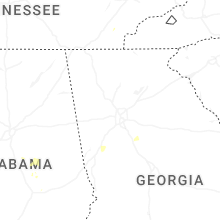
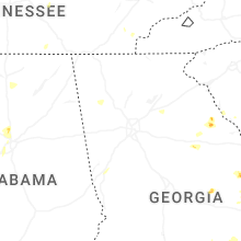


Connect with Interactive Hail Maps