

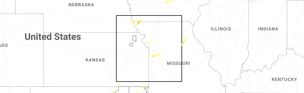
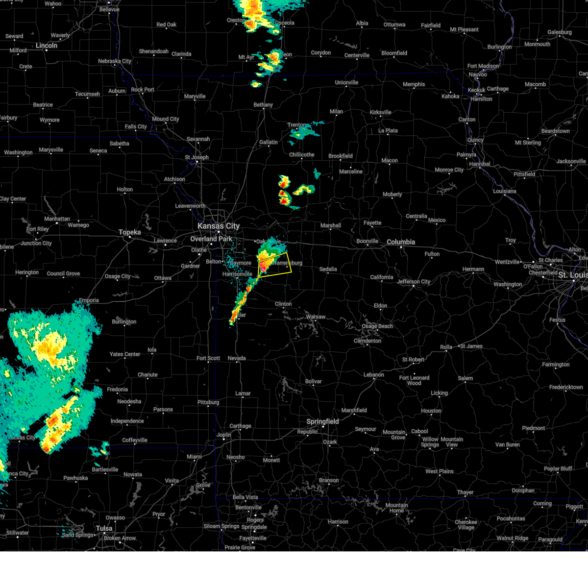
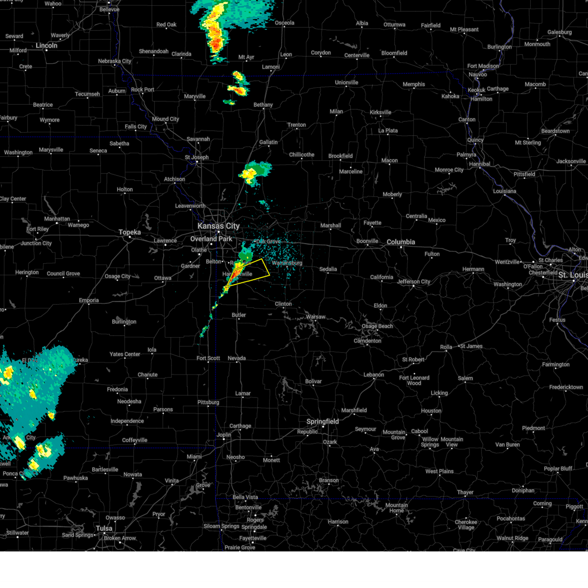
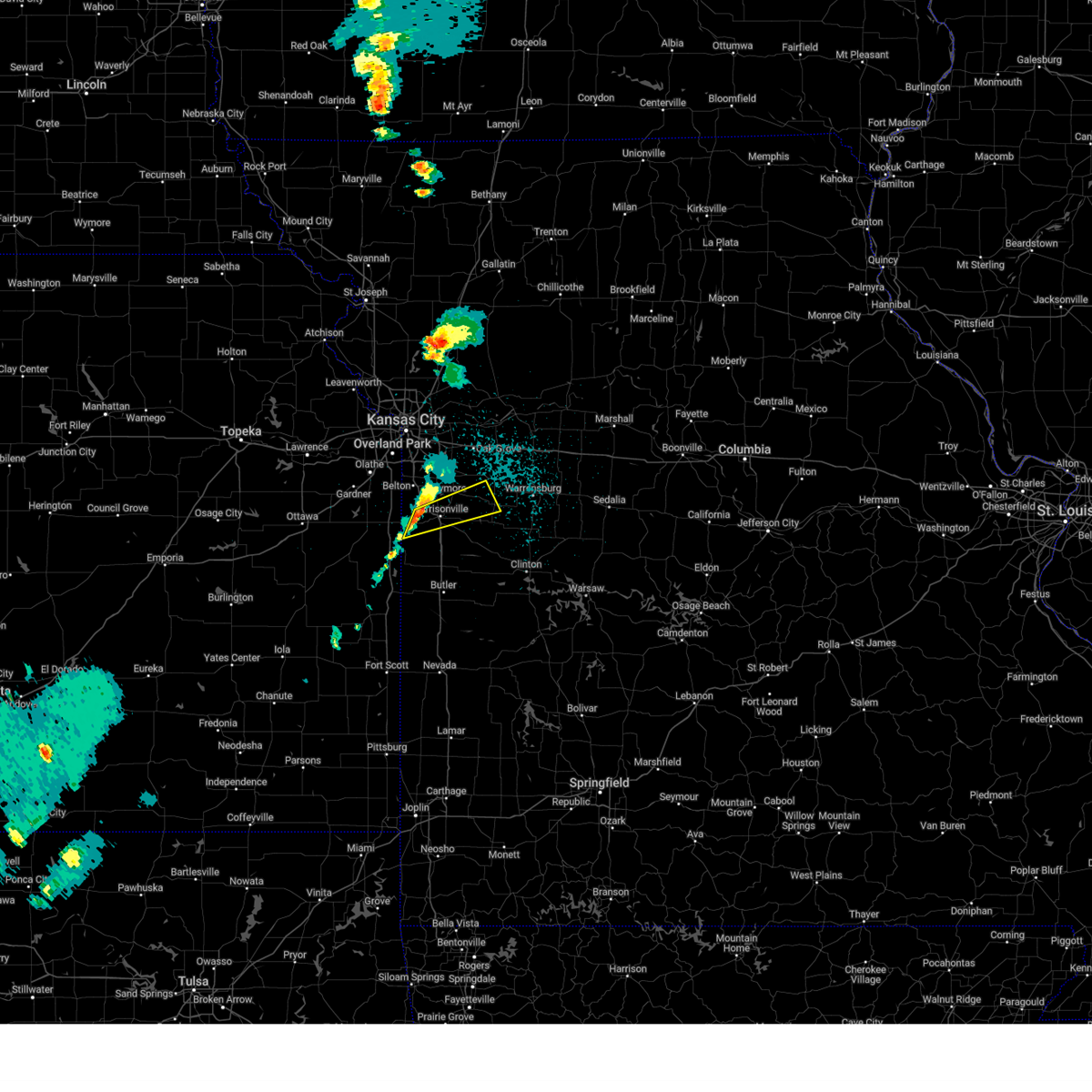
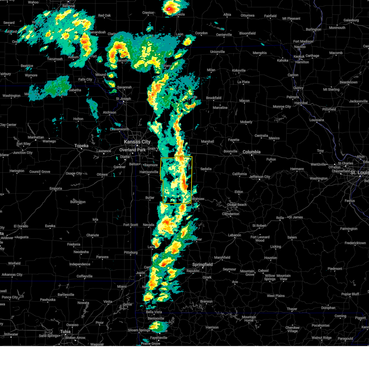
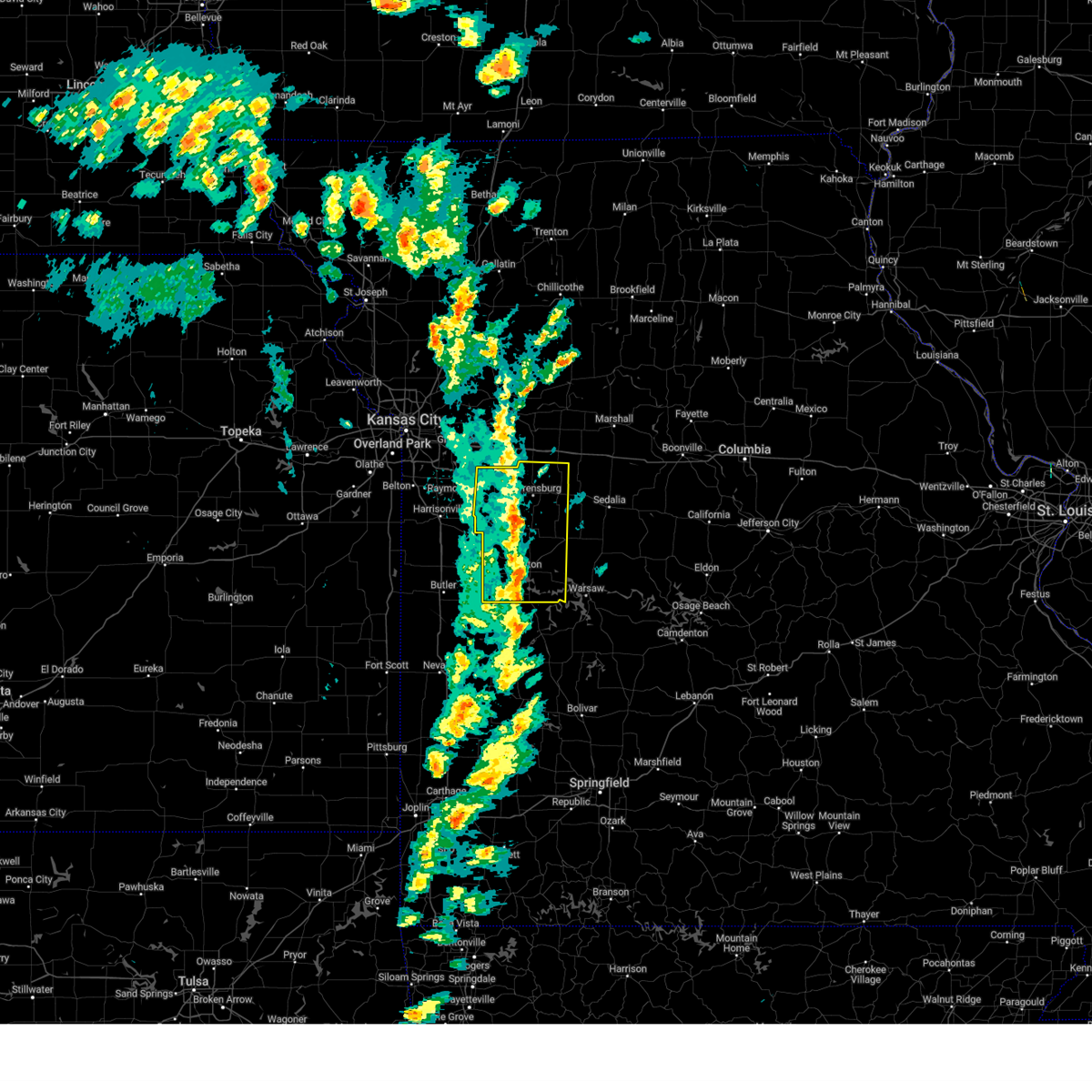
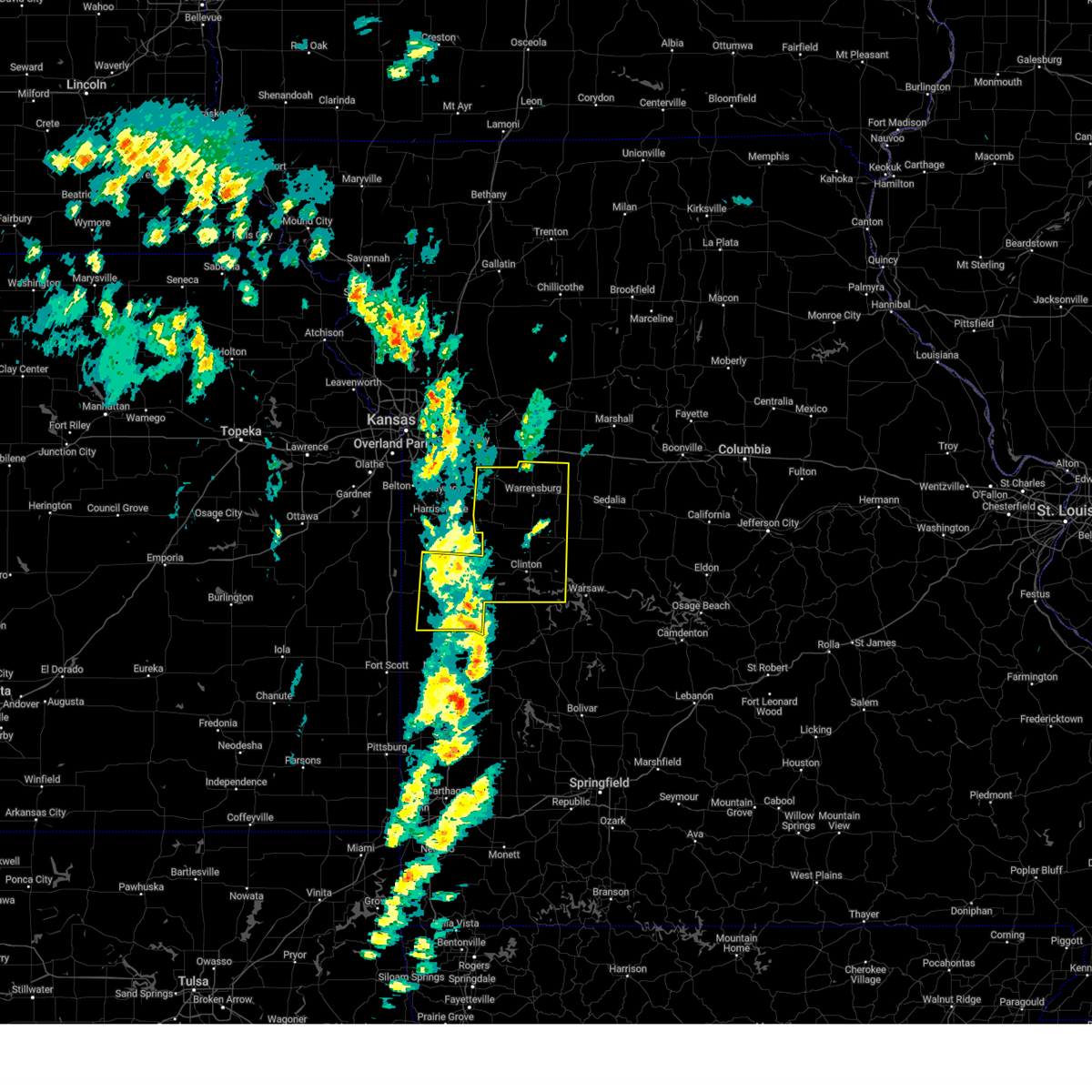
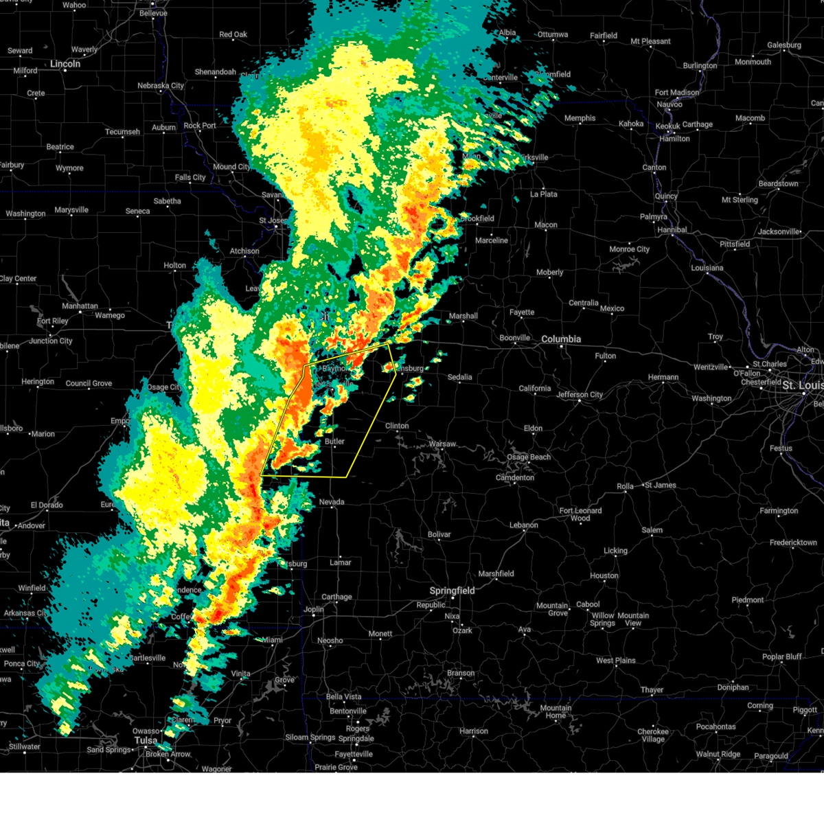
Hail Map for Holden, MO
The Holden, MO area has had 12 reports of on-the-ground hail by trained spotters, and has been under severe weather warnings 23 times during the past 12 months. Doppler radar has detected hail at or near Holden, MO on 65 occasions, including 3 occasions during the past year.
| Name: | Holden, MO |
| Where Located: | 41.9 miles SE of Kansas City, MO |
| Map: | Google Map for Holden, MO |
| Population: | 2252 |
| Housing Units: | 1060 |
| More Info: | Search Google for Holden, MO |
1
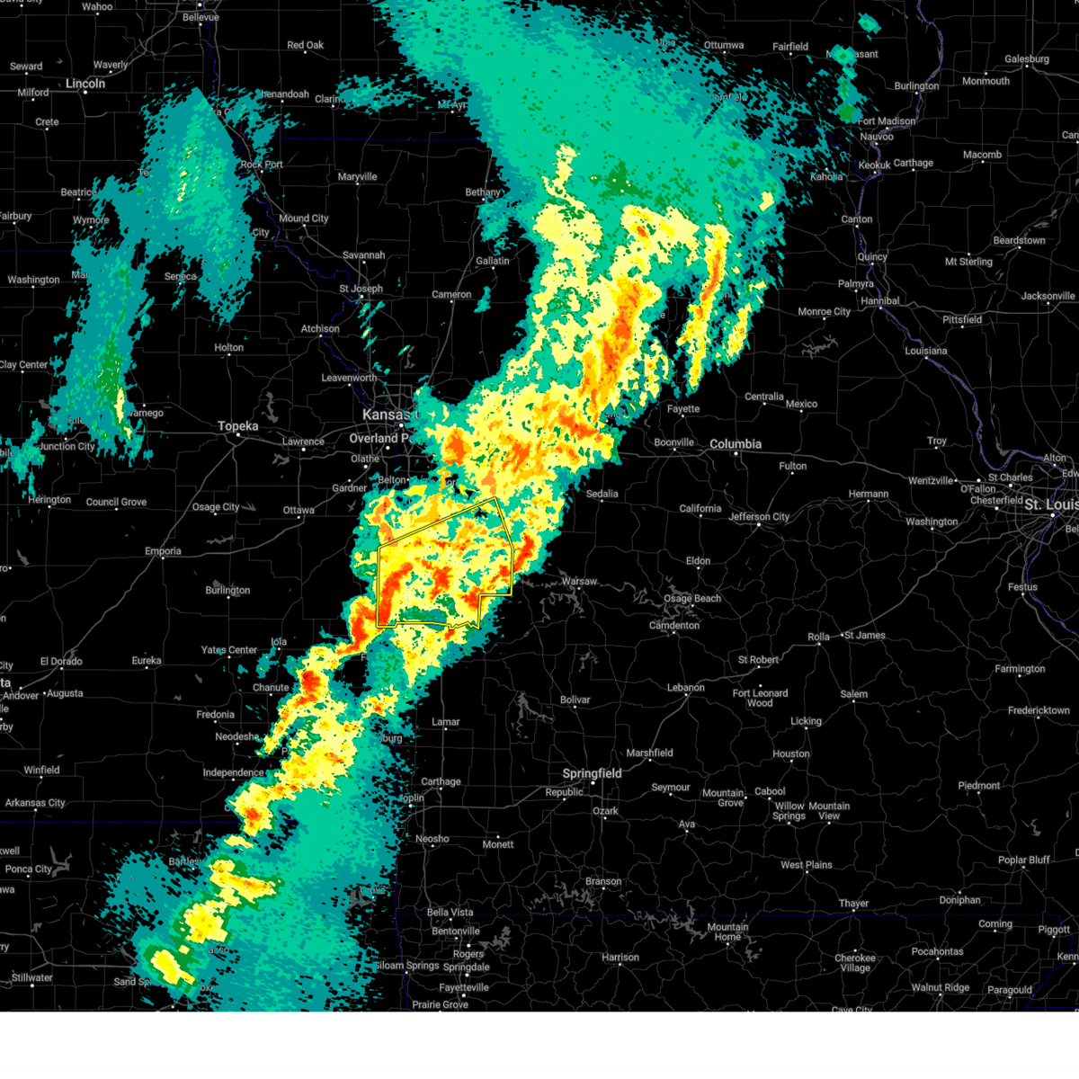
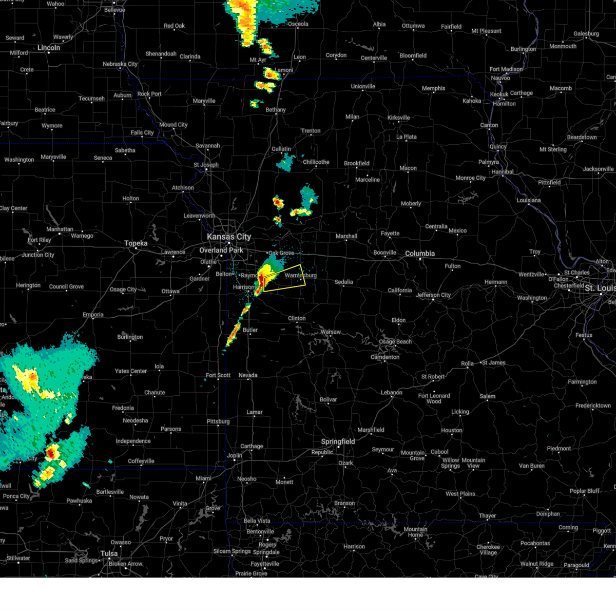
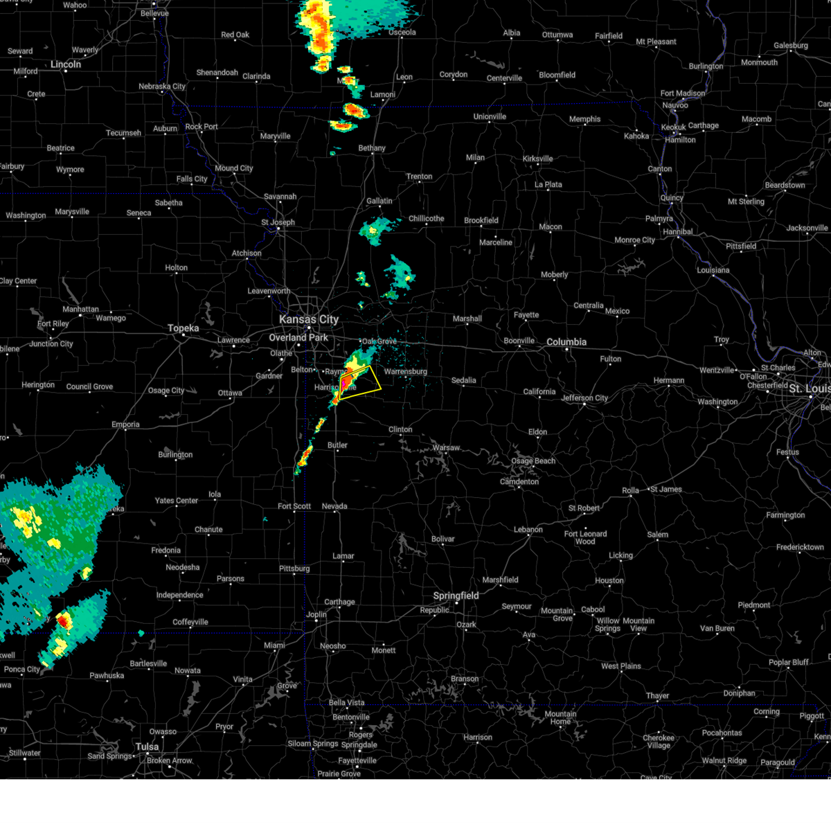
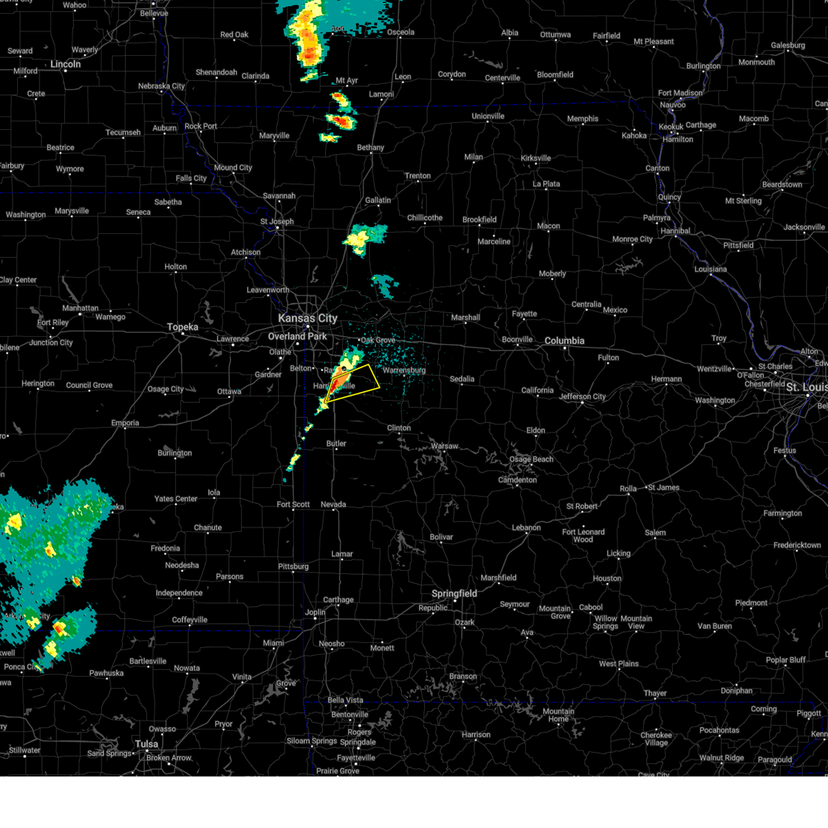
The Top Recent Hail Date for Holden, MO is Saturday, March 29, 2025 (4th out of 65)
Hail and Wind Damage Spotted near Holden, MO
| Date / Time | Report Details |
|---|---|
| 5/19/2025 4:49 PM CDT |
 Svreax the national weather service in pleasant hill has issued a * severe thunderstorm warning for, central cass county in west central missouri, southeastern jackson county in west central missouri, northwestern johnson county in west central missouri, * until 515 pm cdt. * at 449 pm cdt, a severe thunderstorm was located over harrisonville, moving northeast at 55 mph (radar indicated). Hazards include 60 mph wind gusts and quarter size hail. Hail damage to vehicles is expected. Expect wind damage to roofs, siding, and trees. Svreax the national weather service in pleasant hill has issued a * severe thunderstorm warning for, central cass county in west central missouri, southeastern jackson county in west central missouri, northwestern johnson county in west central missouri, * until 515 pm cdt. * at 449 pm cdt, a severe thunderstorm was located over harrisonville, moving northeast at 55 mph (radar indicated). Hazards include 60 mph wind gusts and quarter size hail. Hail damage to vehicles is expected. Expect wind damage to roofs, siding, and trees.
|
| 4/2/2025 6:32 AM CDT |
 Svreax the national weather service in pleasant hill has issued a * severe thunderstorm warning for, southeastern miami county in east central kansas, eastern linn county in east central kansas, southern cass county in west central missouri, western henry county in west central missouri, bates county in west central missouri, southwestern johnson county in west central missouri, * until 715 am cdt. * at 631 am cdt, a severe thunderstorm was located 8 miles east of pleasanton, moving northeast at 60 mph (radar indicated). Hazards include 60 mph wind gusts and penny size hail. expect damage to roofs, siding, and trees Svreax the national weather service in pleasant hill has issued a * severe thunderstorm warning for, southeastern miami county in east central kansas, eastern linn county in east central kansas, southern cass county in west central missouri, western henry county in west central missouri, bates county in west central missouri, southwestern johnson county in west central missouri, * until 715 am cdt. * at 631 am cdt, a severe thunderstorm was located 8 miles east of pleasanton, moving northeast at 60 mph (radar indicated). Hazards include 60 mph wind gusts and penny size hail. expect damage to roofs, siding, and trees
|
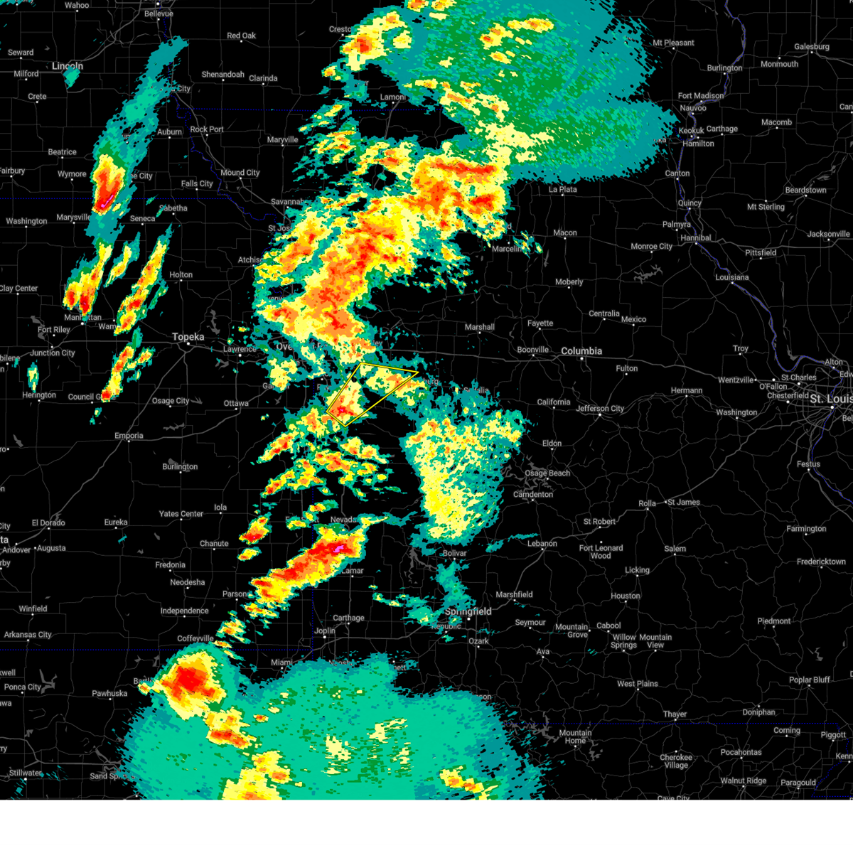
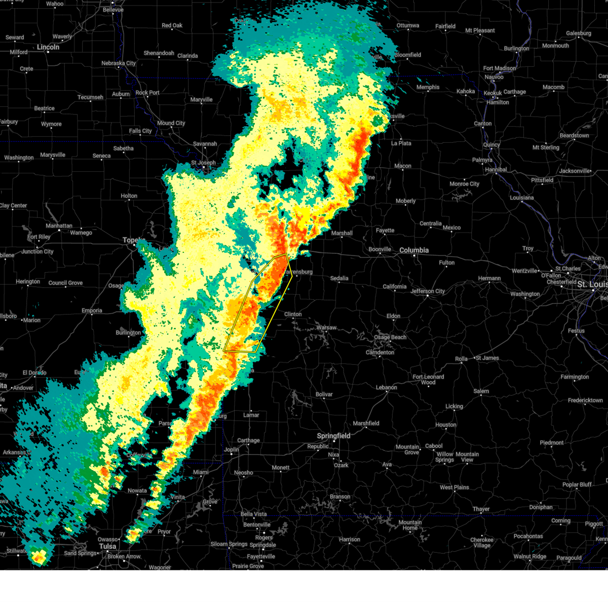
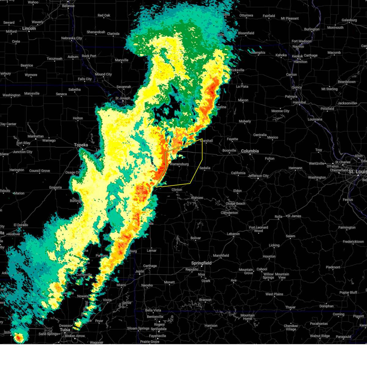
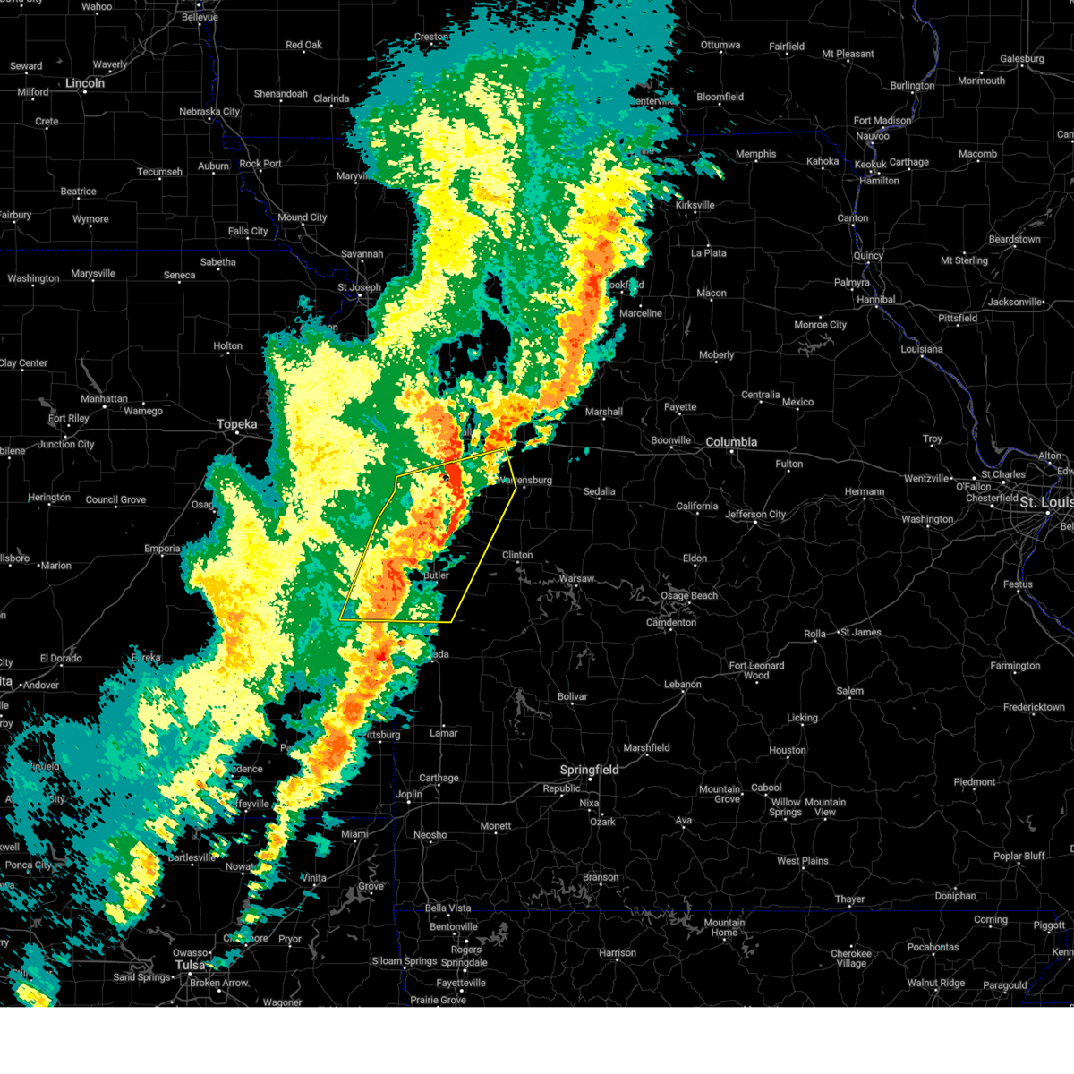
| 3/29/2025 11:23 PM CDT |
 At 1122 pm cdt, a severe thunderstorm was located near holden, moving east at 30 mph (trained weather spotters have reported a history of 60 mph winds and up to half dollar sized hail). Hazards include ping pong ball size hail and 60 mph wind gusts. People and animals outdoors will be injured. expect hail damage to roofs, siding, windows, and vehicles. expect wind damage to roofs, siding, and trees. Locations impacted include, centerview, warrensburg, fayetteville, and holden. At 1122 pm cdt, a severe thunderstorm was located near holden, moving east at 30 mph (trained weather spotters have reported a history of 60 mph winds and up to half dollar sized hail). Hazards include ping pong ball size hail and 60 mph wind gusts. People and animals outdoors will be injured. expect hail damage to roofs, siding, windows, and vehicles. expect wind damage to roofs, siding, and trees. Locations impacted include, centerview, warrensburg, fayetteville, and holden.
|
| 3/29/2025 11:19 PM CDT | Downed tree and power pole at a residence in holden. report via social media. time estimated from rada in johnson county MO, 0.7 miles N of Holden, MO |
| 3/29/2025 11:18 PM CDT | Reports of trees and power lines down in holden. time estimated from rada in johnson county MO, 0.1 miles NE of Holden, MO |
| 3/29/2025 11:15 PM CDT | Several tree limbs down at a residence in holden. report via social media. time estimated from rada in johnson county MO, 1.3 miles S of Holden, MO |
| 3/29/2025 11:14 PM CDT | Quarter sized hail reported 2 miles S of Holden, MO, report via social media. time estimated from radar. |
| 3/29/2025 11:13 PM CDT |
 At 1112 pm cdt, a severe thunderstorm was located over holden, moving east at 30 mph (trained weather spotters have reported a history of 60 mph winds and up to half dollar sized hail). Hazards include ping pong ball size hail and 60 mph wind gusts. People and animals outdoors will be injured. expect hail damage to roofs, siding, windows, and vehicles. expect wind damage to roofs, siding, and trees. Locations impacted include, kingsville, centerview, warrensburg, fayetteville, and holden. At 1112 pm cdt, a severe thunderstorm was located over holden, moving east at 30 mph (trained weather spotters have reported a history of 60 mph winds and up to half dollar sized hail). Hazards include ping pong ball size hail and 60 mph wind gusts. People and animals outdoors will be injured. expect hail damage to roofs, siding, windows, and vehicles. expect wind damage to roofs, siding, and trees. Locations impacted include, kingsville, centerview, warrensburg, fayetteville, and holden.
|
| 3/29/2025 11:13 PM CDT |
 the severe thunderstorm warning has been cancelled and is no longer in effect the severe thunderstorm warning has been cancelled and is no longer in effect
|
| 3/29/2025 10:59 PM CDT |
 Svreax the national weather service in pleasant hill has issued a * severe thunderstorm warning for, east central cass county in west central missouri, northwestern johnson county in west central missouri, * until 1145 pm cdt. * at 1058 pm cdt, a severe thunderstorm was located near kingsville, or 7 miles west of holden, moving east at 30 mph (radar indicated). Hazards include 60 mph wind gusts and half dollar size hail. Hail damage to vehicles is expected. Expect wind damage to roofs, siding, and trees. Svreax the national weather service in pleasant hill has issued a * severe thunderstorm warning for, east central cass county in west central missouri, northwestern johnson county in west central missouri, * until 1145 pm cdt. * at 1058 pm cdt, a severe thunderstorm was located near kingsville, or 7 miles west of holden, moving east at 30 mph (radar indicated). Hazards include 60 mph wind gusts and half dollar size hail. Hail damage to vehicles is expected. Expect wind damage to roofs, siding, and trees.
|
| 3/29/2025 10:46 PM CDT |
 At 1045 pm cdt, a severe thunderstorm was located over east lynne, or near pleasant hill, moving northeast at 30 mph (trained weather spotters have reported quarter sized hail in harrisonville). Hazards include ping pong ball size hail and 60 mph wind gusts. People and animals outdoors will be injured. expect hail damage to roofs, siding, windows, and vehicles. expect wind damage to roofs, siding, and trees. Locations impacted include, kingsville, east lynne, holden, gunn city, and strasburg. At 1045 pm cdt, a severe thunderstorm was located over east lynne, or near pleasant hill, moving northeast at 30 mph (trained weather spotters have reported quarter sized hail in harrisonville). Hazards include ping pong ball size hail and 60 mph wind gusts. People and animals outdoors will be injured. expect hail damage to roofs, siding, windows, and vehicles. expect wind damage to roofs, siding, and trees. Locations impacted include, kingsville, east lynne, holden, gunn city, and strasburg.
|
| 3/29/2025 10:34 PM CDT |
 At 1034 pm cdt, a severe thunderstorm was located over harrisonville, moving northeast at 30 mph (radar indicated). Hazards include ping pong ball size hail and 60 mph wind gusts. People and animals outdoors will be injured. expect hail damage to roofs, siding, windows, and vehicles. expect wind damage to roofs, siding, and trees. Locations impacted include, kingsville, east lynne, holden, gunn city, strasburg, and harrisonville. At 1034 pm cdt, a severe thunderstorm was located over harrisonville, moving northeast at 30 mph (radar indicated). Hazards include ping pong ball size hail and 60 mph wind gusts. People and animals outdoors will be injured. expect hail damage to roofs, siding, windows, and vehicles. expect wind damage to roofs, siding, and trees. Locations impacted include, kingsville, east lynne, holden, gunn city, strasburg, and harrisonville.
|
| 3/29/2025 10:32 PM CDT |
 At 1031 pm cdt, a severe thunderstorm was located over harrisonville, moving northeast at 30 mph (radar indicated). Hazards include 60 mph wind gusts and quarter size hail. Hail damage to vehicles is expected. expect wind damage to roofs, siding, and trees. Locations impacted include, kingsville, east lynne, holden, gunn city, strasburg, and harrisonville. At 1031 pm cdt, a severe thunderstorm was located over harrisonville, moving northeast at 30 mph (radar indicated). Hazards include 60 mph wind gusts and quarter size hail. Hail damage to vehicles is expected. expect wind damage to roofs, siding, and trees. Locations impacted include, kingsville, east lynne, holden, gunn city, strasburg, and harrisonville.
|
| 3/29/2025 10:18 PM CDT |
 Svreax the national weather service in pleasant hill has issued a * severe thunderstorm warning for, central cass county in west central missouri, west central johnson county in west central missouri, * until 1100 pm cdt. * at 1018 pm cdt, a severe thunderstorm was located over freeman, or near peculiar, moving northeast at 35 mph (radar indicated). Hazards include 60 mph wind gusts and quarter size hail. Hail damage to vehicles is expected. Expect wind damage to roofs, siding, and trees. Svreax the national weather service in pleasant hill has issued a * severe thunderstorm warning for, central cass county in west central missouri, west central johnson county in west central missouri, * until 1100 pm cdt. * at 1018 pm cdt, a severe thunderstorm was located over freeman, or near peculiar, moving northeast at 35 mph (radar indicated). Hazards include 60 mph wind gusts and quarter size hail. Hail damage to vehicles is expected. Expect wind damage to roofs, siding, and trees.
|
| 3/23/2025 2:15 AM CDT | Quarter sized hail reported 0.7 miles S of Holden, MO |
| 3/14/2025 4:26 PM CDT |
 A new warning has been issued for eastern johnson and henry counties. a severe thunderstorm watch remains in effect until 700 pm cdt for west central missouri. A new warning has been issued for eastern johnson and henry counties. a severe thunderstorm watch remains in effect until 700 pm cdt for west central missouri.
|
| 3/14/2025 4:07 PM CDT |
 the severe thunderstorm warning has been cancelled and is no longer in effect the severe thunderstorm warning has been cancelled and is no longer in effect
|
| 3/14/2025 4:07 PM CDT |
 At 404 pm cdt, severe thunderstorms were located along a line extending from 7 miles southwest of oak grove to near chilhowee to near deepwater, moving northeast at 50 mph (radar indicated). Hazards include 70 mph wind gusts and penny size hail. Expect considerable tree damage. damage is likely to mobile homes, roofs, and outbuildings. Locations impacted include, chilhowee, blairstown, windsor, leeton, montrose, kingsville, warrensburg, urich, pittsville, coal, knob noster, tightwad, hartwell, brownington, la due, quick city, fayetteville, holden, calhoun, and whiteman afb. At 404 pm cdt, severe thunderstorms were located along a line extending from 7 miles southwest of oak grove to near chilhowee to near deepwater, moving northeast at 50 mph (radar indicated). Hazards include 70 mph wind gusts and penny size hail. Expect considerable tree damage. damage is likely to mobile homes, roofs, and outbuildings. Locations impacted include, chilhowee, blairstown, windsor, leeton, montrose, kingsville, warrensburg, urich, pittsville, coal, knob noster, tightwad, hartwell, brownington, la due, quick city, fayetteville, holden, calhoun, and whiteman afb.
|
| 3/14/2025 3:43 PM CDT |
 Svreax the national weather service in pleasant hill has issued a * severe thunderstorm warning for, henry county in west central missouri, bates county in west central missouri, johnson county in west central missouri, * until 430 pm cdt. * at 343 pm cdt, a severe thunderstorm was located near garden city, moving northeast at 65 mph (radar indicated). Hazards include 70 mph wind gusts and penny size hail. Expect considerable tree damage. Damage is likely to mobile homes, roofs, and outbuildings. Svreax the national weather service in pleasant hill has issued a * severe thunderstorm warning for, henry county in west central missouri, bates county in west central missouri, johnson county in west central missouri, * until 430 pm cdt. * at 343 pm cdt, a severe thunderstorm was located near garden city, moving northeast at 65 mph (radar indicated). Hazards include 70 mph wind gusts and penny size hail. Expect considerable tree damage. Damage is likely to mobile homes, roofs, and outbuildings.
|
| 10/30/2024 9:16 PM CDT |
 At 915 pm cdt, severe thunderstorms were located along a line extending from near oak grove to 7 miles west of warrensburg to near creighton to near rich hill, moving east at 50 mph (radar indicated). Hazards include 60 mph wind gusts. Expect damage to roofs, siding, and trees. Locations impacted include, butler, holden, adrian, garden city, rich hill, archie, urich, creighton, hume, east lynne, kingsville, centerview, strasburg, gunn city, foster, blairstown, passaic, la tour, ballard, and pittsville. At 915 pm cdt, severe thunderstorms were located along a line extending from near oak grove to 7 miles west of warrensburg to near creighton to near rich hill, moving east at 50 mph (radar indicated). Hazards include 60 mph wind gusts. Expect damage to roofs, siding, and trees. Locations impacted include, butler, holden, adrian, garden city, rich hill, archie, urich, creighton, hume, east lynne, kingsville, centerview, strasburg, gunn city, foster, blairstown, passaic, la tour, ballard, and pittsville.
|
| 10/30/2024 9:16 PM CDT |
 the severe thunderstorm warning has been cancelled and is no longer in effect the severe thunderstorm warning has been cancelled and is no longer in effect
|
| 10/30/2024 9:11 PM CDT |
 Svreax the national weather service in pleasant hill has issued a * severe thunderstorm warning for, southeastern cass county in west central missouri, northern henry county in west central missouri, northwestern pettis county in central missouri, southwestern saline county in central missouri, southern lafayette county in west central missouri, johnson county in west central missouri, * until 1000 pm cdt. * at 910 pm cdt, severe thunderstorms were located along a line extending from near odessa to near holden to creighton, moving east at 40 mph (radar indicated). Hazards include 60 mph wind gusts. expect damage to roofs, siding, and trees Svreax the national weather service in pleasant hill has issued a * severe thunderstorm warning for, southeastern cass county in west central missouri, northern henry county in west central missouri, northwestern pettis county in central missouri, southwestern saline county in central missouri, southern lafayette county in west central missouri, johnson county in west central missouri, * until 1000 pm cdt. * at 910 pm cdt, severe thunderstorms were located along a line extending from near odessa to near holden to creighton, moving east at 40 mph (radar indicated). Hazards include 60 mph wind gusts. expect damage to roofs, siding, and trees
|
| 10/30/2024 8:59 PM CDT |
 At 859 pm cdt, severe thunderstorms were located along a line extending from lone jack to near kingsville to near garden city to hume, moving east at 60 mph (radar indicated). Hazards include 60 mph wind gusts. Expect damage to roofs, siding, and trees. Locations impacted include, lee's summit, belton, raymore, harrisonville, pleasant hill, greenwood, peculiar, louisburg, butler, holden, adrian, garden city, rich hill, pleasanton, la cygne, mound city, archie, lake winnebago, lone jack, and drexel. At 859 pm cdt, severe thunderstorms were located along a line extending from lone jack to near kingsville to near garden city to hume, moving east at 60 mph (radar indicated). Hazards include 60 mph wind gusts. Expect damage to roofs, siding, and trees. Locations impacted include, lee's summit, belton, raymore, harrisonville, pleasant hill, greenwood, peculiar, louisburg, butler, holden, adrian, garden city, rich hill, pleasanton, la cygne, mound city, archie, lake winnebago, lone jack, and drexel.
|
| 10/30/2024 8:39 PM CDT |
 Svreax the national weather service in pleasant hill has issued a * severe thunderstorm warning for, southeastern miami county in east central kansas, eastern linn county in east central kansas, cass county in west central missouri, northwestern henry county in west central missouri, bates county in west central missouri, southwestern lafayette county in west central missouri, southeastern jackson county in west central missouri, western johnson county in west central missouri, * until 930 pm cdt. * at 838 pm cdt, severe thunderstorms were located along a line extending from near belton to near freeman to near linn valley to near mound city, moving east at 50 mph (radar indicated). Hazards include 60 mph wind gusts. expect damage to roofs, siding, and trees Svreax the national weather service in pleasant hill has issued a * severe thunderstorm warning for, southeastern miami county in east central kansas, eastern linn county in east central kansas, cass county in west central missouri, northwestern henry county in west central missouri, bates county in west central missouri, southwestern lafayette county in west central missouri, southeastern jackson county in west central missouri, western johnson county in west central missouri, * until 930 pm cdt. * at 838 pm cdt, severe thunderstorms were located along a line extending from near belton to near freeman to near linn valley to near mound city, moving east at 50 mph (radar indicated). Hazards include 60 mph wind gusts. expect damage to roofs, siding, and trees
|
| 7/31/2024 11:39 PM CDT |
 The storms which prompted the warning have weakened below severe limits, and no longer pose an immediate threat to life or property. therefore, the warning will be allowed to expire. however, gusty winds are still possible with these thunderstorms. a severe thunderstorm watch remains in effect until 300 am cdt for northeastern and east central kansas, and central, north central and west central missouri. The storms which prompted the warning have weakened below severe limits, and no longer pose an immediate threat to life or property. therefore, the warning will be allowed to expire. however, gusty winds are still possible with these thunderstorms. a severe thunderstorm watch remains in effect until 300 am cdt for northeastern and east central kansas, and central, north central and west central missouri.
|
| 7/31/2024 11:22 PM CDT |
 At 1121 pm cdt, severe thunderstorms were located along a line extending from near kingston to near wellington to lone jack, moving east at 50 mph (radar indicated). Hazards include 60 mph wind gusts. Expect damage to roofs, siding, and trees. locations impacted include, kansas city, independence, lee's summit, blue springs, leawood, raytown, liberty, gladstone, grandview, belton, prairie village, raymore, warrensburg, grain valley, excelsior springs, harrisonville, smithville, kearney, pleasant hill, and oak grove. this includes the following highways, interstate 70 in missouri between mile markers 1 and 62. interstate 35 in missouri between mile markers 0 and 28. interstate 35 in kansas near mile marker 235. interstate 29 between mile markers 0 and 2. interstate 470 between mile markers 0 and 16. Interstate 435 between mile markers 40 and 75. At 1121 pm cdt, severe thunderstorms were located along a line extending from near kingston to near wellington to lone jack, moving east at 50 mph (radar indicated). Hazards include 60 mph wind gusts. Expect damage to roofs, siding, and trees. locations impacted include, kansas city, independence, lee's summit, blue springs, leawood, raytown, liberty, gladstone, grandview, belton, prairie village, raymore, warrensburg, grain valley, excelsior springs, harrisonville, smithville, kearney, pleasant hill, and oak grove. this includes the following highways, interstate 70 in missouri between mile markers 1 and 62. interstate 35 in missouri between mile markers 0 and 28. interstate 35 in kansas near mile marker 235. interstate 29 between mile markers 0 and 2. interstate 470 between mile markers 0 and 16. Interstate 435 between mile markers 40 and 75.
|
| 7/31/2024 11:22 PM CDT |
 the severe thunderstorm warning has been cancelled and is no longer in effect the severe thunderstorm warning has been cancelled and is no longer in effect
|
| 7/31/2024 11:04 PM CDT |
 Svreax the national weather service in pleasant hill has issued a * severe thunderstorm warning for, eastern wyandotte county in northeastern kansas, northern miami county in east central kansas, johnson county in east central kansas, cass county in west central missouri, clay county in west central missouri, ray county in west central missouri, lafayette county in west central missouri, southeastern platte county in west central missouri, jackson county in west central missouri, johnson county in west central missouri, * until 1145 pm cdt. * at 1103 pm cdt, severe thunderstorms were located along a line extending from near plattsburg to near independence to near grandview, moving east at 50 mph (radar indicated). Hazards include 60 mph wind gusts. expect damage to roofs, siding, and trees Svreax the national weather service in pleasant hill has issued a * severe thunderstorm warning for, eastern wyandotte county in northeastern kansas, northern miami county in east central kansas, johnson county in east central kansas, cass county in west central missouri, clay county in west central missouri, ray county in west central missouri, lafayette county in west central missouri, southeastern platte county in west central missouri, jackson county in west central missouri, johnson county in west central missouri, * until 1145 pm cdt. * at 1103 pm cdt, severe thunderstorms were located along a line extending from near plattsburg to near independence to near grandview, moving east at 50 mph (radar indicated). Hazards include 60 mph wind gusts. expect damage to roofs, siding, and trees
|
| 7/2/2024 9:44 PM CDT |
 Svreax the national weather service in pleasant hill has issued a * severe thunderstorm warning for, eastern cass county in west central missouri, northwestern henry county in west central missouri, northern bates county in west central missouri, southern carroll county in north central missouri, western saline county in central missouri, lafayette county in west central missouri, johnson county in west central missouri, * until 1015 pm cdt. * at 944 pm cdt, severe thunderstorms were located along a line extending from near carrollton to oak grove to near adrian, moving east at 45 mph (radar indicated). Hazards include 60 mph wind gusts. expect damage to roofs, siding, and trees Svreax the national weather service in pleasant hill has issued a * severe thunderstorm warning for, eastern cass county in west central missouri, northwestern henry county in west central missouri, northern bates county in west central missouri, southern carroll county in north central missouri, western saline county in central missouri, lafayette county in west central missouri, johnson county in west central missouri, * until 1015 pm cdt. * at 944 pm cdt, severe thunderstorms were located along a line extending from near carrollton to oak grove to near adrian, moving east at 45 mph (radar indicated). Hazards include 60 mph wind gusts. expect damage to roofs, siding, and trees
|
| 7/2/2024 9:38 PM CDT |
 At 937 pm cdt, severe thunderstorms were located along a line extending from near kingsville to near garden city to near adrian, moving east at 60 mph (radar indicated). Hazards include 70 mph wind gusts. Expect considerable tree damage. damage is likely to mobile homes, roofs, and outbuildings. Locations impacted include, harrisonville, peculiar, holden, adrian, garden city, archie, drexel, urich, freeman, creighton, chilhowee, east lynne, lake annette, gunn city, blairstown, merwin, la tour, hartwell, and quick city. At 937 pm cdt, severe thunderstorms were located along a line extending from near kingsville to near garden city to near adrian, moving east at 60 mph (radar indicated). Hazards include 70 mph wind gusts. Expect considerable tree damage. damage is likely to mobile homes, roofs, and outbuildings. Locations impacted include, harrisonville, peculiar, holden, adrian, garden city, archie, drexel, urich, freeman, creighton, chilhowee, east lynne, lake annette, gunn city, blairstown, merwin, la tour, hartwell, and quick city.
|
| 7/2/2024 9:38 PM CDT |
 the severe thunderstorm warning has been cancelled and is no longer in effect the severe thunderstorm warning has been cancelled and is no longer in effect
|
| 7/2/2024 9:19 PM CDT |
 Svreax the national weather service in pleasant hill has issued a * severe thunderstorm warning for, southeastern miami county in east central kansas, northeastern linn county in east central kansas, cass county in west central missouri, northwestern henry county in west central missouri, northern bates county in west central missouri, southwestern johnson county in west central missouri, * until 945 pm cdt. * at 918 pm cdt, severe thunderstorms were located along a line extending from near lake winnebago to 6 miles south of freeman to 6 miles north of pleasanton, moving east at 55 mph (radar indicated). Hazards include 70 mph wind gusts. Expect considerable tree damage. Damage is likely to mobile homes, roofs, and outbuildings. Svreax the national weather service in pleasant hill has issued a * severe thunderstorm warning for, southeastern miami county in east central kansas, northeastern linn county in east central kansas, cass county in west central missouri, northwestern henry county in west central missouri, northern bates county in west central missouri, southwestern johnson county in west central missouri, * until 945 pm cdt. * at 918 pm cdt, severe thunderstorms were located along a line extending from near lake winnebago to 6 miles south of freeman to 6 miles north of pleasanton, moving east at 55 mph (radar indicated). Hazards include 70 mph wind gusts. Expect considerable tree damage. Damage is likely to mobile homes, roofs, and outbuildings.
|
| 6/28/2024 10:59 PM CDT |
 Svreax the national weather service in pleasant hill has issued a * severe thunderstorm warning for, eastern cass county in west central missouri, henry county in west central missouri, northeastern bates county in west central missouri, johnson county in west central missouri, * until midnight cdt. * at 1059 pm cdt, a severe thunderstorm was located near garden city, moving east at 30 mph (radar indicated). Hazards include 60 mph wind gusts. expect damage to roofs, siding, and trees Svreax the national weather service in pleasant hill has issued a * severe thunderstorm warning for, eastern cass county in west central missouri, henry county in west central missouri, northeastern bates county in west central missouri, johnson county in west central missouri, * until midnight cdt. * at 1059 pm cdt, a severe thunderstorm was located near garden city, moving east at 30 mph (radar indicated). Hazards include 60 mph wind gusts. expect damage to roofs, siding, and trees
|
| 6/26/2024 2:57 AM CDT |
 The storms which prompted the warning have weakened below severe limits, and no longer pose an immediate threat to life or property. therefore, the warning will be allowed to expire. however, gusty winds and heavy rain are still possible with these thunderstorms. a severe thunderstorm watch remains in effect until 700 am cdt for northeastern and east central kansas, and north central and west central missouri. The storms which prompted the warning have weakened below severe limits, and no longer pose an immediate threat to life or property. therefore, the warning will be allowed to expire. however, gusty winds and heavy rain are still possible with these thunderstorms. a severe thunderstorm watch remains in effect until 700 am cdt for northeastern and east central kansas, and north central and west central missouri.
|
| 6/26/2024 2:55 AM CDT | Downed power lines and power outages near route 2. time estimated from rada in johnson county MO, 6.2 miles N of Holden, MO |
| 6/26/2024 2:48 AM CDT |
 At 247 am cdt, severe thunderstorms were located along a line extending from near warrensburg to near lake winnebago to near gardner, moving south at 30 mph. there is a gust front ahead of the main area of thunderstorms and wind gusts of 50 mph have been occurring along and behind that gust front (radar indicated). Hazards include 60 mph wind gusts. Expect damage to roofs, siding, and trees. locations impacted include, kansas city, overland park, olathe, independence, lee's summit, shawnee, blue springs, lenexa, leavenworth, leawood, raytown, liberty, gladstone, grandview, belton, prairie village, raymore, gardner, warrensburg, and grain valley. this includes the following highways, interstate 70 in missouri between mile markers 0 and 49. interstate 70 in kansas between mile markers 410 and 423. interstate 35 in missouri between mile markers 0 and 16. interstate 35 in kansas between mile markers 200 and 235. interstate 29 between mile markers 0 and 10. interstate 635 between mile markers 0 and 12. interstate 470 between mile markers 0 and 16. interstate 435 between mile markers 0 and 26, and between mile markers 48 and 83. Kansas turnpike between mile markers 215 and 226. At 247 am cdt, severe thunderstorms were located along a line extending from near warrensburg to near lake winnebago to near gardner, moving south at 30 mph. there is a gust front ahead of the main area of thunderstorms and wind gusts of 50 mph have been occurring along and behind that gust front (radar indicated). Hazards include 60 mph wind gusts. Expect damage to roofs, siding, and trees. locations impacted include, kansas city, overland park, olathe, independence, lee's summit, shawnee, blue springs, lenexa, leavenworth, leawood, raytown, liberty, gladstone, grandview, belton, prairie village, raymore, gardner, warrensburg, and grain valley. this includes the following highways, interstate 70 in missouri between mile markers 0 and 49. interstate 70 in kansas between mile markers 410 and 423. interstate 35 in missouri between mile markers 0 and 16. interstate 35 in kansas between mile markers 200 and 235. interstate 29 between mile markers 0 and 10. interstate 635 between mile markers 0 and 12. interstate 470 between mile markers 0 and 16. interstate 435 between mile markers 0 and 26, and between mile markers 48 and 83. Kansas turnpike between mile markers 215 and 226.
|
| 6/26/2024 2:22 AM CDT |
 Svreax the national weather service in pleasant hill has issued a * severe thunderstorm warning for, wyandotte county in northeastern kansas, northern miami county in east central kansas, central leavenworth county in northeastern kansas, johnson county in east central kansas, cass county in west central missouri, southern clay county in west central missouri, southern ray county in west central missouri, western lafayette county in west central missouri, southeastern platte county in west central missouri, jackson county in west central missouri, johnson county in west central missouri, * until 300 am cdt. * at 221 am cdt, severe thunderstorms were located along a line extending from near mayview to near independence to near lansing, moving south at 50 mph (radar indicated). Hazards include 60 mph wind gusts. expect damage to roofs, siding, and trees Svreax the national weather service in pleasant hill has issued a * severe thunderstorm warning for, wyandotte county in northeastern kansas, northern miami county in east central kansas, central leavenworth county in northeastern kansas, johnson county in east central kansas, cass county in west central missouri, southern clay county in west central missouri, southern ray county in west central missouri, western lafayette county in west central missouri, southeastern platte county in west central missouri, jackson county in west central missouri, johnson county in west central missouri, * until 300 am cdt. * at 221 am cdt, severe thunderstorms were located along a line extending from near mayview to near independence to near lansing, moving south at 50 mph (radar indicated). Hazards include 60 mph wind gusts. expect damage to roofs, siding, and trees
|
| 6/13/2024 11:32 PM CDT |
 the severe thunderstorm warning has been cancelled and is no longer in effect the severe thunderstorm warning has been cancelled and is no longer in effect
|
| 6/13/2024 11:27 PM CDT |
 The storms which prompted the warning have weakened below severe limits, and have exited the warned area. therefore, the warning will be allowed to expire. a severe thunderstorm watch remains in effect until 100 am cdt for central and west central missouri. a severe thunderstorm watch also remains in effect until 100 am cdt for central and west central missouri. to report severe weather, contact your nearest law enforcement agency. they will relay your report to the national weather service pleasant hill. The storms which prompted the warning have weakened below severe limits, and have exited the warned area. therefore, the warning will be allowed to expire. a severe thunderstorm watch remains in effect until 100 am cdt for central and west central missouri. a severe thunderstorm watch also remains in effect until 100 am cdt for central and west central missouri. to report severe weather, contact your nearest law enforcement agency. they will relay your report to the national weather service pleasant hill.
|
| 6/13/2024 11:14 PM CDT |
 Svreax the national weather service in pleasant hill has issued a * severe thunderstorm warning for, eastern cass county in west central missouri, southwestern johnson county in west central missouri, * until midnight cdt. * at 1114 pm cdt, a severe thunderstorm was located over lone jack, or 7 miles northeast of pleasant hill, moving south at 40 mph (radar indicated). Hazards include 70 mph wind gusts and nickel size hail. Expect considerable tree damage. Damage is likely to mobile homes, roofs, and outbuildings. Svreax the national weather service in pleasant hill has issued a * severe thunderstorm warning for, eastern cass county in west central missouri, southwestern johnson county in west central missouri, * until midnight cdt. * at 1114 pm cdt, a severe thunderstorm was located over lone jack, or 7 miles northeast of pleasant hill, moving south at 40 mph (radar indicated). Hazards include 70 mph wind gusts and nickel size hail. Expect considerable tree damage. Damage is likely to mobile homes, roofs, and outbuildings.
|
| 6/13/2024 11:09 PM CDT | Downed power lines and power outages near 400th road. time estimated from rada in johnson county MO, 8.4 miles S of Holden, MO |
| 6/13/2024 10:38 PM CDT |
 Svreax the national weather service in pleasant hill has issued a * severe thunderstorm warning for, western pettis county in central missouri, lafayette county in west central missouri, johnson county in west central missouri, * until 1130 pm cdt. * at 1038 pm cdt, severe thunderstorms were located along a line extending from near concordia to near wellington, moving south at 35 mph (radar indicated). Hazards include 70 mph wind gusts and quarter size hail. Hail damage to vehicles is expected. expect considerable tree damage. Wind damage is also likely to mobile homes, roofs, and outbuildings. Svreax the national weather service in pleasant hill has issued a * severe thunderstorm warning for, western pettis county in central missouri, lafayette county in west central missouri, johnson county in west central missouri, * until 1130 pm cdt. * at 1038 pm cdt, severe thunderstorms were located along a line extending from near concordia to near wellington, moving south at 35 mph (radar indicated). Hazards include 70 mph wind gusts and quarter size hail. Hail damage to vehicles is expected. expect considerable tree damage. Wind damage is also likely to mobile homes, roofs, and outbuildings.
|
| 5/25/2024 11:14 PM CDT |
 Svreax the national weather service in pleasant hill has issued a * severe thunderstorm warning for, northeastern cass county in west central missouri, southeastern clay county in west central missouri, southern ray county in west central missouri, lafayette county in west central missouri, jackson county in west central missouri, northwestern johnson county in west central missouri, * until midnight cdt. * at 1113 pm cdt, a severe thunderstorm was located over lone jack, or near pleasant hill, moving northeast at 45 mph (radar indicated). Hazards include 70 mph wind gusts. Expect considerable tree damage. Damage is likely to mobile homes, roofs, and outbuildings. Svreax the national weather service in pleasant hill has issued a * severe thunderstorm warning for, northeastern cass county in west central missouri, southeastern clay county in west central missouri, southern ray county in west central missouri, lafayette county in west central missouri, jackson county in west central missouri, northwestern johnson county in west central missouri, * until midnight cdt. * at 1113 pm cdt, a severe thunderstorm was located over lone jack, or near pleasant hill, moving northeast at 45 mph (radar indicated). Hazards include 70 mph wind gusts. Expect considerable tree damage. Damage is likely to mobile homes, roofs, and outbuildings.
|
| 5/21/2024 5:01 PM CDT |
 At 501 pm cdt, severe thunderstorms were located along a line extending from near la monte to 6 miles southeast of appleton city, moving east at 70 mph (radar indicated). Hazards include 60 mph wind gusts and penny size hail. Expect damage to roofs, siding, and trees. Locations impacted include, warrensburg, clinton, butler, windsor, knob noster, holden, adrian, rich hill, whiteman air force base, leeton, urich, calhoun, deepwater, montrose, creighton, chilhowee, whiteman afb, coal, centerview, and rockville. At 501 pm cdt, severe thunderstorms were located along a line extending from near la monte to 6 miles southeast of appleton city, moving east at 70 mph (radar indicated). Hazards include 60 mph wind gusts and penny size hail. Expect damage to roofs, siding, and trees. Locations impacted include, warrensburg, clinton, butler, windsor, knob noster, holden, adrian, rich hill, whiteman air force base, leeton, urich, calhoun, deepwater, montrose, creighton, chilhowee, whiteman afb, coal, centerview, and rockville.
|
| 5/21/2024 5:01 PM CDT |
 the severe thunderstorm warning has been cancelled and is no longer in effect the severe thunderstorm warning has been cancelled and is no longer in effect
|
| 5/21/2024 4:39 PM CDT |
 Svreax the national weather service in pleasant hill has issued a * severe thunderstorm warning for, southeastern cass county in west central missouri, henry county in west central missouri, bates county in west central missouri, johnson county in west central missouri, * until 515 pm cdt. * at 439 pm cdt, severe thunderstorms were located along a line extending from near chilhowee to rich hill, moving east at 70 mph (radar indicated). Hazards include 60 mph wind gusts and nickel size hail. expect damage to roofs, siding, and trees Svreax the national weather service in pleasant hill has issued a * severe thunderstorm warning for, southeastern cass county in west central missouri, henry county in west central missouri, bates county in west central missouri, johnson county in west central missouri, * until 515 pm cdt. * at 439 pm cdt, severe thunderstorms were located along a line extending from near chilhowee to rich hill, moving east at 70 mph (radar indicated). Hazards include 60 mph wind gusts and nickel size hail. expect damage to roofs, siding, and trees
|
| 5/19/2024 11:15 PM CDT |
 Svreax the national weather service in pleasant hill has issued a * severe thunderstorm warning for, ray county in west central missouri, southwestern carroll county in north central missouri, southwestern caldwell county in north central missouri, lafayette county in west central missouri, johnson county in west central missouri, * until midnight cdt. * at 1114 pm cdt, severe thunderstorms were located along a line extending from kearney to near kingsville, moving northeast at 55 mph (radar indicated). Hazards include 60 mph wind gusts. expect damage to roofs, siding, and trees Svreax the national weather service in pleasant hill has issued a * severe thunderstorm warning for, ray county in west central missouri, southwestern carroll county in north central missouri, southwestern caldwell county in north central missouri, lafayette county in west central missouri, johnson county in west central missouri, * until midnight cdt. * at 1114 pm cdt, severe thunderstorms were located along a line extending from kearney to near kingsville, moving northeast at 55 mph (radar indicated). Hazards include 60 mph wind gusts. expect damage to roofs, siding, and trees
|
| 5/8/2024 7:48 AM CDT |
 the severe thunderstorm warning has been cancelled and is no longer in effect the severe thunderstorm warning has been cancelled and is no longer in effect
|
| 5/8/2024 7:48 AM CDT |
 At 747 am cdt, a severe thunderstorm was located near chilhowee, or 10 miles south of holden, moving east at 40 mph (radar indicated). Hazards include ping pong ball size hail and 60 mph wind gusts. People and animals outdoors will be injured. expect hail damage to roofs, siding, windows, and vehicles. expect wind damage to roofs, siding, and trees. Locations impacted include, leeton, urich, calhoun, creighton, chilhowee, blairstown, post oak, la tour, and quick city. At 747 am cdt, a severe thunderstorm was located near chilhowee, or 10 miles south of holden, moving east at 40 mph (radar indicated). Hazards include ping pong ball size hail and 60 mph wind gusts. People and animals outdoors will be injured. expect hail damage to roofs, siding, windows, and vehicles. expect wind damage to roofs, siding, and trees. Locations impacted include, leeton, urich, calhoun, creighton, chilhowee, blairstown, post oak, la tour, and quick city.
|
| 5/8/2024 7:34 AM CDT |
 Svreax the national weather service in pleasant hill has issued a * severe thunderstorm warning for, southeastern cass county in west central missouri, northern henry county in west central missouri, southern johnson county in west central missouri, * until 815 am cdt. * at 734 am cdt, a severe thunderstorm was located near creighton, or near garden city, moving east at 40 mph (radar indicated). Hazards include two inch hail and 60 mph wind gusts. People and animals outdoors will be injured. expect hail damage to roofs, siding, windows, and vehicles. Expect wind damage to roofs, siding, and trees. Svreax the national weather service in pleasant hill has issued a * severe thunderstorm warning for, southeastern cass county in west central missouri, northern henry county in west central missouri, southern johnson county in west central missouri, * until 815 am cdt. * at 734 am cdt, a severe thunderstorm was located near creighton, or near garden city, moving east at 40 mph (radar indicated). Hazards include two inch hail and 60 mph wind gusts. People and animals outdoors will be injured. expect hail damage to roofs, siding, windows, and vehicles. Expect wind damage to roofs, siding, and trees.
|
| 5/8/2024 7:29 AM CDT |
 At 729 am cdt, a severe thunderstorm was located near creighton, or 9 miles east of garden city, moving east at 40 mph (radar indicated). Hazards include two inch hail and 60 mph wind gusts. People and animals outdoors will be injured. expect hail damage to roofs, siding, windows, and vehicles. expect wind damage to roofs, siding, and trees. Locations impacted include, harrisonville, holden, garden city, archie, urich, creighton, east lynne, kingsville, strasburg, gunn city, blairstown, la tour, pittsville, and quick city. At 729 am cdt, a severe thunderstorm was located near creighton, or 9 miles east of garden city, moving east at 40 mph (radar indicated). Hazards include two inch hail and 60 mph wind gusts. People and animals outdoors will be injured. expect hail damage to roofs, siding, windows, and vehicles. expect wind damage to roofs, siding, and trees. Locations impacted include, harrisonville, holden, garden city, archie, urich, creighton, east lynne, kingsville, strasburg, gunn city, blairstown, la tour, pittsville, and quick city.
|
| 5/8/2024 7:10 AM CDT |
 Svreax the national weather service in pleasant hill has issued a * severe thunderstorm warning for, southeastern cass county in west central missouri, northwestern henry county in west central missouri, western johnson county in west central missouri, * until 745 am cdt. * at 710 am cdt, a severe thunderstorm was located near garden city, moving northeast at 35 mph (radar indicated). Hazards include tennis ball size hail and 60 mph wind gusts. People and animals outdoors will be injured. expect hail damage to roofs, siding, windows, and vehicles. Expect wind damage to roofs, siding, and trees. Svreax the national weather service in pleasant hill has issued a * severe thunderstorm warning for, southeastern cass county in west central missouri, northwestern henry county in west central missouri, western johnson county in west central missouri, * until 745 am cdt. * at 710 am cdt, a severe thunderstorm was located near garden city, moving northeast at 35 mph (radar indicated). Hazards include tennis ball size hail and 60 mph wind gusts. People and animals outdoors will be injured. expect hail damage to roofs, siding, windows, and vehicles. Expect wind damage to roofs, siding, and trees.
|
| 5/8/2024 7:01 AM CDT |
 the severe thunderstorm warning has been cancelled and is no longer in effect the severe thunderstorm warning has been cancelled and is no longer in effect
|
| 5/8/2024 7:01 AM CDT |
 At 700 am cdt, a severe thunderstorm was located near archie, or near harrisonville, moving northeast at 40 mph (radar indicated). Hazards include two inch hail and 60 mph wind gusts. People and animals outdoors will be injured. expect hail damage to roofs, siding, windows, and vehicles. expect wind damage to roofs, siding, and trees. Locations impacted include, belton, raymore, harrisonville, peculiar, garden city, archie, drexel, cleveland, freeman, east lynne, lake annette, gunn city, west line, and la tour. At 700 am cdt, a severe thunderstorm was located near archie, or near harrisonville, moving northeast at 40 mph (radar indicated). Hazards include two inch hail and 60 mph wind gusts. People and animals outdoors will be injured. expect hail damage to roofs, siding, windows, and vehicles. expect wind damage to roofs, siding, and trees. Locations impacted include, belton, raymore, harrisonville, peculiar, garden city, archie, drexel, cleveland, freeman, east lynne, lake annette, gunn city, west line, and la tour.
|
| 5/8/2024 6:48 AM CDT |
 the severe thunderstorm warning has been cancelled and is no longer in effect the severe thunderstorm warning has been cancelled and is no longer in effect
|
| 5/8/2024 6:48 AM CDT |
 At 648 am cdt, a severe thunderstorm was located near archie, or 9 miles northwest of adrian, moving northeast at 45 mph (radar indicated). Hazards include golf ball size hail and 60 mph wind gusts. People and animals outdoors will be injured. expect hail damage to roofs, siding, windows, and vehicles. expect wind damage to roofs, siding, and trees. Locations impacted include, belton, raymore, harrisonville, peculiar, garden city, archie, drexel, cleveland, freeman, east lynne, lake annette, gunn city, west line, merwin, and la tour. At 648 am cdt, a severe thunderstorm was located near archie, or 9 miles northwest of adrian, moving northeast at 45 mph (radar indicated). Hazards include golf ball size hail and 60 mph wind gusts. People and animals outdoors will be injured. expect hail damage to roofs, siding, windows, and vehicles. expect wind damage to roofs, siding, and trees. Locations impacted include, belton, raymore, harrisonville, peculiar, garden city, archie, drexel, cleveland, freeman, east lynne, lake annette, gunn city, west line, merwin, and la tour.
|
| 5/8/2024 6:40 AM CDT |
 Svreax the national weather service in pleasant hill has issued a * severe thunderstorm warning for, southeastern miami county in east central kansas, cass county in west central missouri, northwestern bates county in west central missouri, west central johnson county in west central missouri, * until 715 am cdt. * at 639 am cdt, a severe thunderstorm was located near drexel, or 12 miles southeast of louisburg, moving northeast at 45 mph (radar indicated). Hazards include 60 mph wind gusts and half dollar size hail. Hail damage to vehicles is expected. Expect wind damage to roofs, siding, and trees. Svreax the national weather service in pleasant hill has issued a * severe thunderstorm warning for, southeastern miami county in east central kansas, cass county in west central missouri, northwestern bates county in west central missouri, west central johnson county in west central missouri, * until 715 am cdt. * at 639 am cdt, a severe thunderstorm was located near drexel, or 12 miles southeast of louisburg, moving northeast at 45 mph (radar indicated). Hazards include 60 mph wind gusts and half dollar size hail. Hail damage to vehicles is expected. Expect wind damage to roofs, siding, and trees.
|
| 5/6/2024 11:44 PM CDT |
 Toreax the national weather service in pleasant hill has issued a * tornado warning for, northwestern johnson county in west central missouri, * until 1215 am cdt. * at 1142 pm cdt, severe thunderstorms capable of producing both tornadoes and extensive straight line wind damage were located over kingsville, or near holden, moving northeast at 40 mph (radar indicated rotation). Hazards include tornado. Flying debris will be dangerous to those caught without shelter. mobile homes will be damaged or destroyed. damage to roofs, windows, and vehicles will occur. Tree damage is likely. Toreax the national weather service in pleasant hill has issued a * tornado warning for, northwestern johnson county in west central missouri, * until 1215 am cdt. * at 1142 pm cdt, severe thunderstorms capable of producing both tornadoes and extensive straight line wind damage were located over kingsville, or near holden, moving northeast at 40 mph (radar indicated rotation). Hazards include tornado. Flying debris will be dangerous to those caught without shelter. mobile homes will be damaged or destroyed. damage to roofs, windows, and vehicles will occur. Tree damage is likely.
|
| 5/6/2024 11:36 PM CDT |
 Svreax the national weather service in pleasant hill has issued a * severe thunderstorm warning for, henry county in west central missouri, johnson county in west central missouri, * until 1245 am cdt. * at 1136 pm cdt, severe thunderstorms were located along a line extending from lone jack to 6 miles southeast of rich hill, moving northeast at 40 mph (radar indicated). Hazards include 60 mph wind gusts and penny size hail. expect damage to roofs, siding, and trees Svreax the national weather service in pleasant hill has issued a * severe thunderstorm warning for, henry county in west central missouri, johnson county in west central missouri, * until 1245 am cdt. * at 1136 pm cdt, severe thunderstorms were located along a line extending from lone jack to 6 miles southeast of rich hill, moving northeast at 40 mph (radar indicated). Hazards include 60 mph wind gusts and penny size hail. expect damage to roofs, siding, and trees
|
| 4/27/2024 9:07 PM CDT |
 Svreax the national weather service in pleasant hill has issued a * severe thunderstorm warning for, henry county in west central missouri, western pettis county in central missouri, johnson county in west central missouri, * until 945 pm cdt. * at 907 pm cdt, severe thunderstorms were located along a line extending from near holden to 7 miles south of chilhowee to clinton to near deepwater to 6 miles east of appleton city, moving east at 40 mph (radar indicated). Hazards include 60 mph wind gusts and quarter size hail. Hail damage to vehicles is expected. Expect wind damage to roofs, siding, and trees. Svreax the national weather service in pleasant hill has issued a * severe thunderstorm warning for, henry county in west central missouri, western pettis county in central missouri, johnson county in west central missouri, * until 945 pm cdt. * at 907 pm cdt, severe thunderstorms were located along a line extending from near holden to 7 miles south of chilhowee to clinton to near deepwater to 6 miles east of appleton city, moving east at 40 mph (radar indicated). Hazards include 60 mph wind gusts and quarter size hail. Hail damage to vehicles is expected. Expect wind damage to roofs, siding, and trees.
|
| 4/27/2024 9:02 PM CDT |
 At 902 pm cdt, severe thunderstorms were located along a line extending from near creighton to near montrose to 10 miles southeast of appleton city to schell city, moving east at 35 mph (radar indicated). Hazards include 60 mph wind gusts and quarter size hail. Hail damage to vehicles is expected. expect wind damage to roofs, siding, and trees. Locations impacted include, harrisonville, holden, garden city, urich, montrose, creighton, east lynne, kingsville, rockville, gunn city, blairstown, la tour, hartwell, la due, and quick city. At 902 pm cdt, severe thunderstorms were located along a line extending from near creighton to near montrose to 10 miles southeast of appleton city to schell city, moving east at 35 mph (radar indicated). Hazards include 60 mph wind gusts and quarter size hail. Hail damage to vehicles is expected. expect wind damage to roofs, siding, and trees. Locations impacted include, harrisonville, holden, garden city, urich, montrose, creighton, east lynne, kingsville, rockville, gunn city, blairstown, la tour, hartwell, la due, and quick city.
|
| 4/27/2024 8:31 PM CDT |
 Svreax the national weather service in pleasant hill has issued a * severe thunderstorm warning for, southeastern cass county in west central missouri, western henry county in west central missouri, eastern bates county in west central missouri, southwestern johnson county in west central missouri, * until 915 pm cdt. * at 831 pm cdt, severe thunderstorms were located along a line extending from near archie to 6 miles east of butler to 7 miles northwest of schell city to near rich hill, moving east at 35 mph (radar indicated). Hazards include 60 mph wind gusts and quarter size hail. Hail damage to vehicles is expected. Expect wind damage to roofs, siding, and trees. Svreax the national weather service in pleasant hill has issued a * severe thunderstorm warning for, southeastern cass county in west central missouri, western henry county in west central missouri, eastern bates county in west central missouri, southwestern johnson county in west central missouri, * until 915 pm cdt. * at 831 pm cdt, severe thunderstorms were located along a line extending from near archie to 6 miles east of butler to 7 miles northwest of schell city to near rich hill, moving east at 35 mph (radar indicated). Hazards include 60 mph wind gusts and quarter size hail. Hail damage to vehicles is expected. Expect wind damage to roofs, siding, and trees.
|
| 4/16/2024 1:27 PM CDT |
 The storm which prompted the warning has weakened below severe limits, and no longer poses an immediate threat to life or property. therefore, the warning will be allowed to expire. however, gusty winds are still possible with this thunderstorm. a tornado watch remains in effect until 600 pm cdt for west central missouri. The storm which prompted the warning has weakened below severe limits, and no longer poses an immediate threat to life or property. therefore, the warning will be allowed to expire. however, gusty winds are still possible with this thunderstorm. a tornado watch remains in effect until 600 pm cdt for west central missouri.
|
| 4/16/2024 12:56 PM CDT |
 Svreax the national weather service in pleasant hill has issued a * severe thunderstorm warning for, cass county in west central missouri, northwestern bates county in west central missouri, southwestern johnson county in west central missouri, * until 130 pm cdt. * at 1256 pm cdt, a severe thunderstorm was located near archie, or 10 miles northwest of adrian, moving northeast at 40 mph (radar indicated). Hazards include 60 mph wind gusts. expect damage to roofs, siding, and trees Svreax the national weather service in pleasant hill has issued a * severe thunderstorm warning for, cass county in west central missouri, northwestern bates county in west central missouri, southwestern johnson county in west central missouri, * until 130 pm cdt. * at 1256 pm cdt, a severe thunderstorm was located near archie, or 10 miles northwest of adrian, moving northeast at 40 mph (radar indicated). Hazards include 60 mph wind gusts. expect damage to roofs, siding, and trees
|
| 3/14/2024 3:59 AM CDT |
 At 359 am cdt, a severe thunderstorm was located near chilhowee, or 9 miles south of warrensburg, moving northeast at 60 mph (radar indicated). Hazards include 60 mph wind gusts and quarter size hail. Hail damage to vehicles is expected. expect wind damage to roofs, siding, and trees. Locations impacted include, clinton, holden, leeton, urich, calhoun, deepwater, montrose, creighton, chilhowee, kingsville, coal, centerview, rockville, brownington, blairstown, tightwad, ballard, post oak, hartwell, and la due. At 359 am cdt, a severe thunderstorm was located near chilhowee, or 9 miles south of warrensburg, moving northeast at 60 mph (radar indicated). Hazards include 60 mph wind gusts and quarter size hail. Hail damage to vehicles is expected. expect wind damage to roofs, siding, and trees. Locations impacted include, clinton, holden, leeton, urich, calhoun, deepwater, montrose, creighton, chilhowee, kingsville, coal, centerview, rockville, brownington, blairstown, tightwad, ballard, post oak, hartwell, and la due.
|
| 3/14/2024 3:50 AM CDT |
 At 350 am cdt, a severe thunderstorm was located near chilhowee, or 10 miles south of holden, moving northeast at 60 mph (radar indicated). Hazards include 60 mph wind gusts and quarter size hail. Hail damage to vehicles is expected. expect wind damage to roofs, siding, and trees. Locations impacted include, clinton, butler, holden, adrian, garden city, rich hill, archie, leeton, urich, calhoun, deepwater, montrose, creighton, hume, chilhowee, east lynne, kingsville, coal, centerview, and rockville. At 350 am cdt, a severe thunderstorm was located near chilhowee, or 10 miles south of holden, moving northeast at 60 mph (radar indicated). Hazards include 60 mph wind gusts and quarter size hail. Hail damage to vehicles is expected. expect wind damage to roofs, siding, and trees. Locations impacted include, clinton, butler, holden, adrian, garden city, rich hill, archie, leeton, urich, calhoun, deepwater, montrose, creighton, hume, chilhowee, east lynne, kingsville, coal, centerview, and rockville.
|
| 3/14/2024 3:39 AM CDT |
 Svreax the national weather service in pleasant hill has issued a * severe thunderstorm warning for, southern cass county in west central missouri, henry county in west central missouri, bates county in west central missouri, southwestern johnson county in west central missouri, * until 415 am cdt. * at 338 am cdt, a severe thunderstorm was located near creighton, or near garden city, moving northeast at 60 mph (radar indicated). Hazards include 60 mph wind gusts and quarter size hail. Hail damage to vehicles is expected. Expect wind damage to roofs, siding, and trees. Svreax the national weather service in pleasant hill has issued a * severe thunderstorm warning for, southern cass county in west central missouri, henry county in west central missouri, bates county in west central missouri, southwestern johnson county in west central missouri, * until 415 am cdt. * at 338 am cdt, a severe thunderstorm was located near creighton, or near garden city, moving northeast at 60 mph (radar indicated). Hazards include 60 mph wind gusts and quarter size hail. Hail damage to vehicles is expected. Expect wind damage to roofs, siding, and trees.
|
| 3/12/2024 9:48 PM CDT |
 Svreax the national weather service in pleasant hill has issued a * severe thunderstorm warning for, north central henry county in west central missouri, west central pettis county in central missouri, central johnson county in west central missouri, * until 1045 pm cdt. * at 947 pm cdt, a severe thunderstorm was located near chilhowee, or 7 miles east of holden, moving northeast at 30 mph (radar indicated). Hazards include 60 mph wind gusts and quarter size hail. Hail damage to vehicles is expected. Expect wind damage to roofs, siding, and trees. Svreax the national weather service in pleasant hill has issued a * severe thunderstorm warning for, north central henry county in west central missouri, west central pettis county in central missouri, central johnson county in west central missouri, * until 1045 pm cdt. * at 947 pm cdt, a severe thunderstorm was located near chilhowee, or 7 miles east of holden, moving northeast at 30 mph (radar indicated). Hazards include 60 mph wind gusts and quarter size hail. Hail damage to vehicles is expected. Expect wind damage to roofs, siding, and trees.
|
| 3/12/2024 9:30 PM CDT |
 the severe thunderstorm warning has been cancelled and is no longer in effect the severe thunderstorm warning has been cancelled and is no longer in effect
|
| 3/12/2024 9:30 PM CDT |
 At 930 pm cdt, a severe thunderstorm was located near creighton, or 10 miles south of holden, moving northeast at 30 mph (radar indicated). Hazards include 60 mph wind gusts and quarter size hail. Hail damage to vehicles is expected. expect wind damage to roofs, siding, and trees. Locations impacted include, holden, chilhowee, centerview, blairstown, post oak, la tour, and quick city. At 930 pm cdt, a severe thunderstorm was located near creighton, or 10 miles south of holden, moving northeast at 30 mph (radar indicated). Hazards include 60 mph wind gusts and quarter size hail. Hail damage to vehicles is expected. expect wind damage to roofs, siding, and trees. Locations impacted include, holden, chilhowee, centerview, blairstown, post oak, la tour, and quick city.
|
| 3/12/2024 9:07 PM CDT |
 Svreax the national weather service in pleasant hill has issued a * severe thunderstorm warning for, southeastern cass county in west central missouri, northwestern henry county in west central missouri, northeastern bates county in west central missouri, southwestern johnson county in west central missouri, * until 1000 pm cdt. * at 907 pm cdt, a severe thunderstorm was located near creighton, or near garden city, moving northeast at 30 mph (radar indicated). Hazards include 60 mph wind gusts and quarter size hail. Hail damage to vehicles is expected. Expect wind damage to roofs, siding, and trees. Svreax the national weather service in pleasant hill has issued a * severe thunderstorm warning for, southeastern cass county in west central missouri, northwestern henry county in west central missouri, northeastern bates county in west central missouri, southwestern johnson county in west central missouri, * until 1000 pm cdt. * at 907 pm cdt, a severe thunderstorm was located near creighton, or near garden city, moving northeast at 30 mph (radar indicated). Hazards include 60 mph wind gusts and quarter size hail. Hail damage to vehicles is expected. Expect wind damage to roofs, siding, and trees.
|
| 9/23/2023 6:03 PM CDT |
 At 603 pm cdt, a severe thunderstorm was located near calhoun, or 7 miles north of clinton, moving east at 30 mph (radar indicated). Hazards include 60 mph wind gusts and quarter size hail. Hail damage to vehicles is expected. expect wind damage to roofs, siding, and trees. locations impacted include, clinton, windsor, holden, leeton, urich, calhoun, deepwater, creighton, chilhowee, coal, brownington, blairstown, tightwad, post oak, hartwell, la due, quick city and truman lake. hail threat, radar indicated max hail size, 1. 00 in wind threat, radar indicated max wind gust, 60 mph. At 603 pm cdt, a severe thunderstorm was located near calhoun, or 7 miles north of clinton, moving east at 30 mph (radar indicated). Hazards include 60 mph wind gusts and quarter size hail. Hail damage to vehicles is expected. expect wind damage to roofs, siding, and trees. locations impacted include, clinton, windsor, holden, leeton, urich, calhoun, deepwater, creighton, chilhowee, coal, brownington, blairstown, tightwad, post oak, hartwell, la due, quick city and truman lake. hail threat, radar indicated max hail size, 1. 00 in wind threat, radar indicated max wind gust, 60 mph.
|
| 9/23/2023 5:35 PM CDT |
 At 535 pm cdt, a severe thunderstorm was located near urich, or 13 miles east of garden city, moving east at 35 mph (radar indicated). Hazards include 60 mph wind gusts and quarter size hail. Hail damage to vehicles is expected. Expect wind damage to roofs, siding, and trees. At 535 pm cdt, a severe thunderstorm was located near urich, or 13 miles east of garden city, moving east at 35 mph (radar indicated). Hazards include 60 mph wind gusts and quarter size hail. Hail damage to vehicles is expected. Expect wind damage to roofs, siding, and trees.
|
| 9/23/2023 5:21 PM CDT |
 At 521 pm cdt, a severe thunderstorm was located near garden city, moving southeast at 35 mph (radar indicated). Hazards include 60 mph wind gusts and quarter size hail. Hail damage to vehicles is expected. expect wind damage to roofs, siding, and trees. locations impacted include, harrisonville, pleasant hill, holden, lone jack, east lynne, kingsville, baldwin park, strasburg, gunn city and la tour. hail threat, radar indicated max hail size, 1. 00 in wind threat, radar indicated max wind gust, 60 mph. At 521 pm cdt, a severe thunderstorm was located near garden city, moving southeast at 35 mph (radar indicated). Hazards include 60 mph wind gusts and quarter size hail. Hail damage to vehicles is expected. expect wind damage to roofs, siding, and trees. locations impacted include, harrisonville, pleasant hill, holden, lone jack, east lynne, kingsville, baldwin park, strasburg, gunn city and la tour. hail threat, radar indicated max hail size, 1. 00 in wind threat, radar indicated max wind gust, 60 mph.
|
| 9/23/2023 5:08 PM CDT |
 At 508 pm cdt, a severe thunderstorm was located over garden city, moving southeast at 40 mph (radar indicated). Hazards include 60 mph wind gusts and quarter size hail. Hail damage to vehicles is expected. expect wind damage to roofs, siding, and trees. locations impacted include, harrisonville, pleasant hill, peculiar, holden, lake winnebago, lone jack, freeman, east lynne, kingsville, lake annette, baldwin park, strasburg, gunn city and la tour. hail threat, radar indicated max hail size, 1. 00 in wind threat, radar indicated max wind gust, 60 mph. At 508 pm cdt, a severe thunderstorm was located over garden city, moving southeast at 40 mph (radar indicated). Hazards include 60 mph wind gusts and quarter size hail. Hail damage to vehicles is expected. expect wind damage to roofs, siding, and trees. locations impacted include, harrisonville, pleasant hill, peculiar, holden, lake winnebago, lone jack, freeman, east lynne, kingsville, lake annette, baldwin park, strasburg, gunn city and la tour. hail threat, radar indicated max hail size, 1. 00 in wind threat, radar indicated max wind gust, 60 mph.
|
| 9/23/2023 4:55 PM CDT |
 At 454 pm cdt, a severe thunderstorm was located over east lynne, or near harrisonville, moving northeast at 35 mph (radar indicated). Hazards include 60 mph wind gusts and half dollar size hail. Hail damage to vehicles is expected. Expect wind damage to roofs, siding, and trees. At 454 pm cdt, a severe thunderstorm was located over east lynne, or near harrisonville, moving northeast at 35 mph (radar indicated). Hazards include 60 mph wind gusts and half dollar size hail. Hail damage to vehicles is expected. Expect wind damage to roofs, siding, and trees.
|
| 9/23/2023 1:31 PM CDT | Quarter sized hail reported 0.1 miles NE of Holden, MO, report from mping: quarter (1.00 in.). |
| 9/23/2023 1:29 PM CDT |
 At 129 pm cdt, a severe thunderstorm was located near holden, moving east at 35 mph (radar indicated). Hazards include 60 mph wind gusts and quarter size hail. Hail damage to vehicles is expected. Expect wind damage to roofs, siding, and trees. At 129 pm cdt, a severe thunderstorm was located near holden, moving east at 35 mph (radar indicated). Hazards include 60 mph wind gusts and quarter size hail. Hail damage to vehicles is expected. Expect wind damage to roofs, siding, and trees.
|
| 9/23/2023 1:02 PM CDT |
 At 101 pm cdt, a severe thunderstorm was located over east lynne, or 7 miles north of garden city, moving east at 25 mph (radar indicated). Hazards include golf ball size hail and 60 mph wind gusts. People and animals outdoors will be injured. expect hail damage to roofs, siding, windows, and vehicles. Expect wind damage to roofs, siding, and trees. At 101 pm cdt, a severe thunderstorm was located over east lynne, or 7 miles north of garden city, moving east at 25 mph (radar indicated). Hazards include golf ball size hail and 60 mph wind gusts. People and animals outdoors will be injured. expect hail damage to roofs, siding, windows, and vehicles. Expect wind damage to roofs, siding, and trees.
|
| 9/23/2023 12:38 PM CDT |
 At 1238 pm cdt, a severe thunderstorm was located over east lynne, or near harrisonville, moving east at 35 mph (radar indicated). Hazards include 60 mph wind gusts and quarter size hail. Hail damage to vehicles is expected. Expect wind damage to roofs, siding, and trees. At 1238 pm cdt, a severe thunderstorm was located over east lynne, or near harrisonville, moving east at 35 mph (radar indicated). Hazards include 60 mph wind gusts and quarter size hail. Hail damage to vehicles is expected. Expect wind damage to roofs, siding, and trees.
|
| 9/5/2023 6:57 PM CDT |
 At 656 pm cdt, a severe thunderstorm was located near holden, moving east at 20 mph (radar indicated). Hazards include 60 mph wind gusts and quarter size hail. Hail damage to vehicles is expected. expect wind damage to roofs, siding, and trees. locations impacted include, warrensburg, holden and centerview. hail threat, radar indicated max hail size, 1. 00 in wind threat, radar indicated max wind gust, 60 mph. At 656 pm cdt, a severe thunderstorm was located near holden, moving east at 20 mph (radar indicated). Hazards include 60 mph wind gusts and quarter size hail. Hail damage to vehicles is expected. expect wind damage to roofs, siding, and trees. locations impacted include, warrensburg, holden and centerview. hail threat, radar indicated max hail size, 1. 00 in wind threat, radar indicated max wind gust, 60 mph.
|
| 9/5/2023 6:45 PM CDT | Quarter sized hail reported 0.1 miles NE of Holden, MO, report from mping: quarter (1.00 in.). |
| 9/5/2023 6:42 PM CDT |
 At 642 pm cdt, a severe thunderstorm was located over holden, moving east at 25 mph (radar indicated). Hazards include 60 mph wind gusts and quarter size hail. Hail damage to vehicles is expected. Expect wind damage to roofs, siding, and trees. At 642 pm cdt, a severe thunderstorm was located over holden, moving east at 25 mph (radar indicated). Hazards include 60 mph wind gusts and quarter size hail. Hail damage to vehicles is expected. Expect wind damage to roofs, siding, and trees.
|
| 9/5/2023 6:36 PM CDT |
 At 636 pm cdt, a severe thunderstorm was located over kingsville, or over holden, moving east at 30 mph (radar indicated). Hazards include 60 mph wind gusts and quarter size hail. Hail damage to vehicles is expected. expect wind damage to roofs, siding, and trees. locations impacted include, holden and kingsville. hail threat, radar indicated max hail size, 1. 00 in wind threat, radar indicated max wind gust, 60 mph. At 636 pm cdt, a severe thunderstorm was located over kingsville, or over holden, moving east at 30 mph (radar indicated). Hazards include 60 mph wind gusts and quarter size hail. Hail damage to vehicles is expected. expect wind damage to roofs, siding, and trees. locations impacted include, holden and kingsville. hail threat, radar indicated max hail size, 1. 00 in wind threat, radar indicated max wind gust, 60 mph.
|
| 9/5/2023 6:30 PM CDT |
 At 629 pm cdt, a severe thunderstorm was located over kingsville, or near holden, moving east at 20 mph (radar indicated). Hazards include 60 mph wind gusts and penny size hail. Expect damage to roofs, siding, and trees. locations impacted include, holden and kingsville. hail threat, radar indicated max hail size, 0. 75 in wind threat, radar indicated max wind gust, 60 mph. At 629 pm cdt, a severe thunderstorm was located over kingsville, or near holden, moving east at 20 mph (radar indicated). Hazards include 60 mph wind gusts and penny size hail. Expect damage to roofs, siding, and trees. locations impacted include, holden and kingsville. hail threat, radar indicated max hail size, 0. 75 in wind threat, radar indicated max wind gust, 60 mph.
|
| 9/5/2023 6:15 PM CDT |
 At 615 pm cdt, a severe thunderstorm was located near kingsville, or 8 miles southeast of pleasant hill, moving east at 30 mph (radar indicated). Hazards include 60 mph wind gusts and quarter size hail. Hail damage to vehicles is expected. Expect wind damage to roofs, siding, and trees. At 615 pm cdt, a severe thunderstorm was located near kingsville, or 8 miles southeast of pleasant hill, moving east at 30 mph (radar indicated). Hazards include 60 mph wind gusts and quarter size hail. Hail damage to vehicles is expected. Expect wind damage to roofs, siding, and trees.
|
| 7/30/2023 9:09 PM CDT |
 At 909 pm cdt, severe thunderstorms were located along a line extending from 8 miles east of lone jack to near harrisonville to near louisburg, moving southeast at 45 mph (radar indicated). Hazards include 70 mph wind gusts. Expect considerable tree damage. damage is likely to mobile homes, roofs, and outbuildings. locations impacted include, warrensburg, harrisonville, pleasant hill, paola, higginsville, peculiar, louisburg, concordia, holden, garden city, archie, lone jack, drexel, cleveland, freeman, east lynne, kingsville, lake annette, baldwin park and lake lafayette. this includes interstate 70 in missouri between mile markers 41 and 58. thunderstorm damage threat, considerable hail threat, radar indicated max hail size, <. 75 in wind threat, radar indicated max wind gust, 70 mph. At 909 pm cdt, severe thunderstorms were located along a line extending from 8 miles east of lone jack to near harrisonville to near louisburg, moving southeast at 45 mph (radar indicated). Hazards include 70 mph wind gusts. Expect considerable tree damage. damage is likely to mobile homes, roofs, and outbuildings. locations impacted include, warrensburg, harrisonville, pleasant hill, paola, higginsville, peculiar, louisburg, concordia, holden, garden city, archie, lone jack, drexel, cleveland, freeman, east lynne, kingsville, lake annette, baldwin park and lake lafayette. this includes interstate 70 in missouri between mile markers 41 and 58. thunderstorm damage threat, considerable hail threat, radar indicated max hail size, <. 75 in wind threat, radar indicated max wind gust, 70 mph.
|
| 7/30/2023 8:54 PM CDT |
 At 853 pm cdt, severe thunderstorms were located along a line extending from near grain valley to raymore to 6 miles west of cleveland, moving southeast at 45 mph (radar indicated). Hazards include 70 mph wind gusts. Expect considerable tree damage. damage is likely to mobile homes, roofs, and outbuildings. locations impacted include, kansas city, overland park, olathe, independence, lee`s summit, shawnee, blue springs, lenexa, leawood, raytown, grandview, belton, prairie village, raymore, gardner, warrensburg, grain valley, merriam, harrisonville and mission. this includes the following highways, interstate 70 in missouri between mile markers 6 and 58. interstate 35 in kansas between mile markers 204 and 228. interstate 470 between mile markers 0 and 16. interstate 435 between mile markers 0 and 4, and between mile markers 60 and 83. thunderstorm damage threat, considerable hail threat, radar indicated max hail size, <. 75 in wind threat, radar indicated max wind gust, 70 mph. At 853 pm cdt, severe thunderstorms were located along a line extending from near grain valley to raymore to 6 miles west of cleveland, moving southeast at 45 mph (radar indicated). Hazards include 70 mph wind gusts. Expect considerable tree damage. damage is likely to mobile homes, roofs, and outbuildings. locations impacted include, kansas city, overland park, olathe, independence, lee`s summit, shawnee, blue springs, lenexa, leawood, raytown, grandview, belton, prairie village, raymore, gardner, warrensburg, grain valley, merriam, harrisonville and mission. this includes the following highways, interstate 70 in missouri between mile markers 6 and 58. interstate 35 in kansas between mile markers 204 and 228. interstate 470 between mile markers 0 and 16. interstate 435 between mile markers 0 and 4, and between mile markers 60 and 83. thunderstorm damage threat, considerable hail threat, radar indicated max hail size, <. 75 in wind threat, radar indicated max wind gust, 70 mph.
|
| 7/30/2023 8:50 PM CDT |
 At 849 pm cdt, severe thunderstorms were located along a line extending from near oak grove to near archie to near parker, moving southeast at 40 mph (radar indicated). Hazards include 70 mph wind gusts. Expect considerable tree damage. Damage is likely to mobile homes, roofs, and outbuildings. At 849 pm cdt, severe thunderstorms were located along a line extending from near oak grove to near archie to near parker, moving southeast at 40 mph (radar indicated). Hazards include 70 mph wind gusts. Expect considerable tree damage. Damage is likely to mobile homes, roofs, and outbuildings.
|
| 7/30/2023 8:23 PM CDT |
 At 823 pm cdt, severe thunderstorms were located along a line extending from near missouri city to near lake quivira to de soto, moving southeast at 45 mph (radar indicated). Hazards include 70 mph wind gusts. Expect considerable tree damage. Damage is likely to mobile homes, roofs, and outbuildings. At 823 pm cdt, severe thunderstorms were located along a line extending from near missouri city to near lake quivira to de soto, moving southeast at 45 mph (radar indicated). Hazards include 70 mph wind gusts. Expect considerable tree damage. Damage is likely to mobile homes, roofs, and outbuildings.
|
| 7/24/2023 8:57 AM CDT |
 The severe thunderstorm warning for northeastern cass, southwestern lafayette, southeastern jackson and northwestern johnson counties will expire at 900 am cdt, the storm which prompted the warning has weakened below severe limits, and no longer poses an immediate threat to life or property. therefore, the warning will be allowed to expire. however gusty winds and heavy rain are still possible with this thunderstorm. a severe thunderstorm watch remains in effect until noon cdt for west central missouri. The severe thunderstorm warning for northeastern cass, southwestern lafayette, southeastern jackson and northwestern johnson counties will expire at 900 am cdt, the storm which prompted the warning has weakened below severe limits, and no longer poses an immediate threat to life or property. therefore, the warning will be allowed to expire. however gusty winds and heavy rain are still possible with this thunderstorm. a severe thunderstorm watch remains in effect until noon cdt for west central missouri.
|
| 7/24/2023 8:34 AM CDT |
 At 834 am cdt, a severe thunderstorm was located near lone jack, or 8 miles southeast of lake lotawana, moving east at 30 mph (radar indicated). Hazards include 60 mph wind gusts and quarter size hail. Hail damage to vehicles is expected. expect wind damage to roofs, siding, and trees. locations impacted include, pleasant hill, holden, lake lotawana, lone jack, kingsville, baldwin park, lake lafayette, strasburg, tarsney lakes and pittsville. hail threat, radar indicated max hail size, 1. 00 in wind threat, radar indicated max wind gust, 60 mph. At 834 am cdt, a severe thunderstorm was located near lone jack, or 8 miles southeast of lake lotawana, moving east at 30 mph (radar indicated). Hazards include 60 mph wind gusts and quarter size hail. Hail damage to vehicles is expected. expect wind damage to roofs, siding, and trees. locations impacted include, pleasant hill, holden, lake lotawana, lone jack, kingsville, baldwin park, lake lafayette, strasburg, tarsney lakes and pittsville. hail threat, radar indicated max hail size, 1. 00 in wind threat, radar indicated max wind gust, 60 mph.
|
| 7/24/2023 8:10 AM CDT |
 At 809 am cdt, a severe thunderstorm was located over lee`s summit, moving east at 30 mph (radar indicated). Hazards include 60 mph wind gusts and half dollar size hail. Hail damage to vehicles is expected. Expect wind damage to roofs, siding, and trees. At 809 am cdt, a severe thunderstorm was located over lee`s summit, moving east at 30 mph (radar indicated). Hazards include 60 mph wind gusts and half dollar size hail. Hail damage to vehicles is expected. Expect wind damage to roofs, siding, and trees.
|
| 7/14/2023 5:18 PM CDT |
 At 517 pm cdt, severe thunderstorms were located along a line extending from corder to near knob noster to 6 miles north of montrose, moving east at 40 mph (radar indicated). Hazards include 60 mph wind gusts and nickel size hail. Expect damage to roofs, siding, and trees. locations impacted include, sedalia, warrensburg, odessa, higginsville, windsor, knob noster, concordia, holden, sweet springs, whiteman air force base, la monte, leeton, urich, green ridge, calhoun, corder, alma, chilhowee, blackburn and houstonia. this includes interstate 70 in missouri between mile markers 36 and 74. hail threat, radar indicated max hail size, 0. 88 in wind threat, radar indicated max wind gust, 60 mph. At 517 pm cdt, severe thunderstorms were located along a line extending from corder to near knob noster to 6 miles north of montrose, moving east at 40 mph (radar indicated). Hazards include 60 mph wind gusts and nickel size hail. Expect damage to roofs, siding, and trees. locations impacted include, sedalia, warrensburg, odessa, higginsville, windsor, knob noster, concordia, holden, sweet springs, whiteman air force base, la monte, leeton, urich, green ridge, calhoun, corder, alma, chilhowee, blackburn and houstonia. this includes interstate 70 in missouri between mile markers 36 and 74. hail threat, radar indicated max hail size, 0. 88 in wind threat, radar indicated max wind gust, 60 mph.
|
| 7/14/2023 4:58 PM CDT |
 At 458 pm cdt, severe thunderstorms were located along a line extending from near lexington to near oak grove to 6 miles east of adrian, moving east at 35 mph (radar indicated). Hazards include 60 mph wind gusts and nickel size hail. expect damage to roofs, siding, and trees At 458 pm cdt, severe thunderstorms were located along a line extending from near lexington to near oak grove to 6 miles east of adrian, moving east at 35 mph (radar indicated). Hazards include 60 mph wind gusts and nickel size hail. expect damage to roofs, siding, and trees
|
| 7/14/2023 4:31 PM CDT |
 At 431 pm cdt, severe thunderstorms were located along a line extending from sibley to near lone jack to near harrisonville, moving east at 45 mph (trained weather spotters). Hazards include 60 mph wind gusts. Expect damage to roofs, siding, and trees. locations impacted include, kansas city, independence, lee`s summit, blue springs, liberty, raymore, warrensburg, grain valley, harrisonville, pleasant hill, oak grove, odessa, greenwood, higginsville, lexington, peculiar, sugar creek, buckner, holden and lake lotawana. this includes the following highways, interstate 70 in missouri between mile markers 12 and 55. interstate 470 between mile markers 8 and 16. hail threat, radar indicated max hail size, <. 75 in wind threat, observed max wind gust, 60 mph. At 431 pm cdt, severe thunderstorms were located along a line extending from sibley to near lone jack to near harrisonville, moving east at 45 mph (trained weather spotters). Hazards include 60 mph wind gusts. Expect damage to roofs, siding, and trees. locations impacted include, kansas city, independence, lee`s summit, blue springs, liberty, raymore, warrensburg, grain valley, harrisonville, pleasant hill, oak grove, odessa, greenwood, higginsville, lexington, peculiar, sugar creek, buckner, holden and lake lotawana. this includes the following highways, interstate 70 in missouri between mile markers 12 and 55. interstate 470 between mile markers 8 and 16. hail threat, radar indicated max hail size, <. 75 in wind threat, observed max wind gust, 60 mph.
|
| 7/14/2023 4:21 PM CDT |
 At 421 pm cdt, severe thunderstorms were located along a line extending from near missouri city to near lake lotawana to near freeman, moving east at 45 mph (radar indicated). Hazards include 70 mph wind gusts. Expect considerable tree damage. Damage is likely to mobile homes, roofs, and outbuildings. At 421 pm cdt, severe thunderstorms were located along a line extending from near missouri city to near lake lotawana to near freeman, moving east at 45 mph (radar indicated). Hazards include 70 mph wind gusts. Expect considerable tree damage. Damage is likely to mobile homes, roofs, and outbuildings.
|
| 7/5/2023 1:27 AM CDT |
 At 127 am cdt, severe thunderstorms were located along a line extending from 7 miles south of polo to near garden city, moving east at 40 mph (radar indicated). Hazards include 60 mph wind gusts. expect damage to roofs, siding, and trees At 127 am cdt, severe thunderstorms were located along a line extending from 7 miles south of polo to near garden city, moving east at 40 mph (radar indicated). Hazards include 60 mph wind gusts. expect damage to roofs, siding, and trees
|
| 4/5/2023 2:20 AM CDT |
 At 220 am cdt, a severe thunderstorm was located near urich, or 9 miles northwest of clinton, moving northeast at 65 mph (radar indicated). Hazards include 60 mph wind gusts and quarter size hail. Hail damage to vehicles is expected. Expect wind damage to roofs, siding, and trees. At 220 am cdt, a severe thunderstorm was located near urich, or 9 miles northwest of clinton, moving northeast at 65 mph (radar indicated). Hazards include 60 mph wind gusts and quarter size hail. Hail damage to vehicles is expected. Expect wind damage to roofs, siding, and trees.
|
| 4/5/2023 1:34 AM CDT |
 At 134 am cdt, a severe thunderstorm was located near chilhowee, or 9 miles south of holden, moving northeast at 60 mph (radar indicated). Hazards include 60 mph wind gusts and quarter size hail. Hail damage to vehicles is expected. Expect wind damage to roofs, siding, and trees. At 134 am cdt, a severe thunderstorm was located near chilhowee, or 9 miles south of holden, moving northeast at 60 mph (radar indicated). Hazards include 60 mph wind gusts and quarter size hail. Hail damage to vehicles is expected. Expect wind damage to roofs, siding, and trees.
|
| 4/4/2023 2:00 PM CDT |
 At 200 pm cdt, a severe thunderstorm was located near urich, or 10 miles northwest of clinton, moving northeast at 65 mph (radar indicated). Hazards include 60 mph wind gusts and half dollar size hail. Hail damage to vehicles is expected. expect wind damage to roofs, siding, and trees. locations impacted include, warrensburg, holden, leeton, urich, chilhowee, centerview, blairstown, post oak and hartwell. hail threat, radar indicated max hail size, 1. 25 in wind threat, radar indicated max wind gust, 60 mph. At 200 pm cdt, a severe thunderstorm was located near urich, or 10 miles northwest of clinton, moving northeast at 65 mph (radar indicated). Hazards include 60 mph wind gusts and half dollar size hail. Hail damage to vehicles is expected. expect wind damage to roofs, siding, and trees. locations impacted include, warrensburg, holden, leeton, urich, chilhowee, centerview, blairstown, post oak and hartwell. hail threat, radar indicated max hail size, 1. 25 in wind threat, radar indicated max wind gust, 60 mph.
|
| 4/4/2023 1:49 PM CDT |
 At 149 pm cdt, a severe thunderstorm was located near urich, or 14 miles southeast of garden city, moving northeast at 60 mph (radar indicated). Hazards include 60 mph wind gusts and half dollar size hail. Hail damage to vehicles is expected. Expect wind damage to roofs, siding, and trees. At 149 pm cdt, a severe thunderstorm was located near urich, or 14 miles southeast of garden city, moving northeast at 60 mph (radar indicated). Hazards include 60 mph wind gusts and half dollar size hail. Hail damage to vehicles is expected. Expect wind damage to roofs, siding, and trees.
|
| 8/29/2022 2:45 PM CDT | Half Dollar sized hail reported 6.2 miles S of Holden, MO, off duty officer reported half dollar size hail. timing estimated by radar. |
| 6/8/2022 2:16 AM CDT |
 At 215 am cdt, severe thunderstorms were located along a line extending from higginsville to 7 miles southwest of warrensburg to 7 miles east of butler, moving southeast at 45 mph (radar indicated). Hazards include 60 mph wind gusts. expect damage to roofs, siding, and trees At 215 am cdt, severe thunderstorms were located along a line extending from higginsville to 7 miles southwest of warrensburg to 7 miles east of butler, moving southeast at 45 mph (radar indicated). Hazards include 60 mph wind gusts. expect damage to roofs, siding, and trees
|
| 6/8/2022 2:03 AM CDT |
 At 203 am cdt, severe thunderstorms were located along a line extending from henrietta to kingsville to near archie, moving southeast at 50 mph (radar indicated). Hazards include 60 mph wind gusts. Expect damage to roofs, siding, and trees. locations impacted include, warrensburg, grain valley, harrisonville, pleasant hill, oak grove, richmond, odessa, higginsville, lexington, buckner, holden, garden city, lone jack, orrick, wellington, hardin, urich, corder, henrietta and sibley. this includes interstate 70 in missouri between mile markers 24 and 53. hail threat, radar indicated max hail size, <. 75 in wind threat, radar indicated max wind gust, 60 mph. At 203 am cdt, severe thunderstorms were located along a line extending from henrietta to kingsville to near archie, moving southeast at 50 mph (radar indicated). Hazards include 60 mph wind gusts. Expect damage to roofs, siding, and trees. locations impacted include, warrensburg, grain valley, harrisonville, pleasant hill, oak grove, richmond, odessa, higginsville, lexington, buckner, holden, garden city, lone jack, orrick, wellington, hardin, urich, corder, henrietta and sibley. this includes interstate 70 in missouri between mile markers 24 and 53. hail threat, radar indicated max hail size, <. 75 in wind threat, radar indicated max wind gust, 60 mph.
|
| 6/8/2022 1:46 AM CDT |
 At 146 am cdt, severe thunderstorms were located along a line extending from crystal lakes to near greenwood to near drexel, moving southeast at 45 mph (radar indicated). Hazards include 60 mph wind gusts. expect damage to roofs, siding, and trees At 146 am cdt, severe thunderstorms were located along a line extending from crystal lakes to near greenwood to near drexel, moving southeast at 45 mph (radar indicated). Hazards include 60 mph wind gusts. expect damage to roofs, siding, and trees
|
| 4/29/2022 11:27 PM CDT |
 At 1127 pm cdt, a severe thunderstorm was located 8 miles southwest of oak grove, moving east at 45 mph (radar indicated). Hazards include 60 mph wind gusts and penny size hail. Expect damage to roofs, siding, and trees. locations impacted include, odessa, holden, kingsville, lake lafayette, centerview, pittsville and la tour. this includes interstate 70 in missouri between mile markers 39 and 44. hail threat, radar indicated max hail size, 0. 75 in wind threat, radar indicated max wind gust, 60 mph. At 1127 pm cdt, a severe thunderstorm was located 8 miles southwest of oak grove, moving east at 45 mph (radar indicated). Hazards include 60 mph wind gusts and penny size hail. Expect damage to roofs, siding, and trees. locations impacted include, odessa, holden, kingsville, lake lafayette, centerview, pittsville and la tour. this includes interstate 70 in missouri between mile markers 39 and 44. hail threat, radar indicated max hail size, 0. 75 in wind threat, radar indicated max wind gust, 60 mph.
|
| 4/29/2022 11:07 PM CDT |
 At 1107 pm cdt, a severe thunderstorm was located over baldwin park, or over pleasant hill, moving east at 40 mph (radar indicated). Hazards include 60 mph wind gusts and nickel size hail. expect damage to roofs, siding, and trees At 1107 pm cdt, a severe thunderstorm was located over baldwin park, or over pleasant hill, moving east at 40 mph (radar indicated). Hazards include 60 mph wind gusts and nickel size hail. expect damage to roofs, siding, and trees
|
| 4/29/2022 11:26 AM CDT |
 At 1125 am cdt, a severe thunderstorm was located near oak grove, moving northeast at 30 mph. golf ball sized hail was reported between pittsville and warrensburg along highway 50 (public). Hazards include golf ball size hail and 60 mph wind gusts. People and animals outdoors will be injured. expect hail damage to roofs, siding, windows, and vehicles. expect wind damage to roofs, siding, and trees. locations impacted include, warrensburg, higginsville, knob noster, concordia, holden, sweet springs, la monte, corder, alma, centerview, emma, aullville and fayetteville. this includes interstate 70 in missouri between mile markers 46 and 67. thunderstorm damage threat, considerable hail threat, radar indicated max hail size, 1. 75 in wind threat, radar indicated max wind gust, 60 mph. At 1125 am cdt, a severe thunderstorm was located near oak grove, moving northeast at 30 mph. golf ball sized hail was reported between pittsville and warrensburg along highway 50 (public). Hazards include golf ball size hail and 60 mph wind gusts. People and animals outdoors will be injured. expect hail damage to roofs, siding, windows, and vehicles. expect wind damage to roofs, siding, and trees. locations impacted include, warrensburg, higginsville, knob noster, concordia, holden, sweet springs, la monte, corder, alma, centerview, emma, aullville and fayetteville. this includes interstate 70 in missouri between mile markers 46 and 67. thunderstorm damage threat, considerable hail threat, radar indicated max hail size, 1. 75 in wind threat, radar indicated max wind gust, 60 mph.
|
| 4/29/2022 11:21 AM CDT | Golf Ball sized hail reported 8.4 miles SSW of Holden, MO |
| 4/29/2022 11:08 AM CDT |
 At 1108 am cdt, a severe thunderstorm was located near oak grove, moving east at 35 mph (radar indicated). Hazards include 60 mph wind gusts and half dollar size hail. Hail damage to vehicles is expected. Expect wind damage to roofs, siding, and trees. At 1108 am cdt, a severe thunderstorm was located near oak grove, moving east at 35 mph (radar indicated). Hazards include 60 mph wind gusts and half dollar size hail. Hail damage to vehicles is expected. Expect wind damage to roofs, siding, and trees.
|
| 3/5/2022 6:36 PM CST |
 At 635 pm cst, severe thunderstorms were located along a line extending from near lexington to near garden city to near hume, moving east at 40 mph (radar indicated). Hazards include 60 mph wind gusts and quarter size hail. Hail damage to vehicles is expected. Expect wind damage to roofs, siding, and trees. At 635 pm cst, severe thunderstorms were located along a line extending from near lexington to near garden city to near hume, moving east at 40 mph (radar indicated). Hazards include 60 mph wind gusts and quarter size hail. Hail damage to vehicles is expected. Expect wind damage to roofs, siding, and trees.
|
| 3/5/2022 6:30 PM CST |
 At 630 pm cst, a severe thunderstorm was located 8 miles south of odessa, moving east at 45 mph (radar indicated). Hazards include 60 mph wind gusts and quarter size hail. Hail damage to vehicles is expected. expect wind damage to roofs, siding, and trees. locations impacted include, richmond, odessa, lexington, holden, garden city, wellington, hardin, henrietta, east lynne, kingsville, mayview, lake lafayette, bates city, camden, strasburg, gunn city, blairstown, la tour, pittsville and quick city. this includes interstate 70 in missouri between mile markers 31 and 43. hail threat, radar indicated max hail size, 1. 00 in wind threat, radar indicated max wind gust, 60 mph. At 630 pm cst, a severe thunderstorm was located 8 miles south of odessa, moving east at 45 mph (radar indicated). Hazards include 60 mph wind gusts and quarter size hail. Hail damage to vehicles is expected. expect wind damage to roofs, siding, and trees. locations impacted include, richmond, odessa, lexington, holden, garden city, wellington, hardin, henrietta, east lynne, kingsville, mayview, lake lafayette, bates city, camden, strasburg, gunn city, blairstown, la tour, pittsville and quick city. this includes interstate 70 in missouri between mile markers 31 and 43. hail threat, radar indicated max hail size, 1. 00 in wind threat, radar indicated max wind gust, 60 mph.
|
| 3/5/2022 6:08 PM CST |
 At 608 pm cst, a severe thunderstorm was located over lake lotawana, moving east at 50 mph (radar indicated). Hazards include 60 mph wind gusts and quarter size hail. Hail damage to vehicles is expected. Expect wind damage to roofs, siding, and trees. At 608 pm cst, a severe thunderstorm was located over lake lotawana, moving east at 50 mph (radar indicated). Hazards include 60 mph wind gusts and quarter size hail. Hail damage to vehicles is expected. Expect wind damage to roofs, siding, and trees.
|
| 6/11/2021 5:04 PM CDT |
 At 503 pm cdt, severe thunderstorms and strong thunderstorm outflow were located along a line extending from near sweet springs to 6 miles south of warrensburg to near garden city, moving southeast at 35 mph (radar indicated). Hazards include 60 mph wind gusts. Expect damage to roofs, siding, and trees. Locations impacted include, leeton, windsor and green ridge. At 503 pm cdt, severe thunderstorms and strong thunderstorm outflow were located along a line extending from near sweet springs to 6 miles south of warrensburg to near garden city, moving southeast at 35 mph (radar indicated). Hazards include 60 mph wind gusts. Expect damage to roofs, siding, and trees. Locations impacted include, leeton, windsor and green ridge.
|
| 6/11/2021 4:58 PM CDT |
 The severe thunderstorm warning for northern cass, southeastern ray, lafayette, southeastern jackson and western johnson counties will expire at 500 pm cdt, the storm which prompted the warning has weakened below severe limits, and has exited the warned area. therefore, the warning will be allowed to expire. however gusty winds and heavy rain are still possible with this thunderstorm. a severe thunderstorm watch remains in effect until 700 pm cdt for north central and west central missouri. The severe thunderstorm warning for northern cass, southeastern ray, lafayette, southeastern jackson and western johnson counties will expire at 500 pm cdt, the storm which prompted the warning has weakened below severe limits, and has exited the warned area. therefore, the warning will be allowed to expire. however gusty winds and heavy rain are still possible with this thunderstorm. a severe thunderstorm watch remains in effect until 700 pm cdt for north central and west central missouri.
|
| 6/11/2021 4:42 PM CDT |
 At 440 pm cdt, severe thunderstorms were located along a line extending from near concordia to near holden to near harrisonville, moving southeast at 35 mph (radar indicated). Hazards include 70 mph wind gusts and nickel size hail. Expect considerable tree damage. damage is likely to mobile homes, roofs, and outbuildings. severe thunderstorms will be near, warrensburg and chilhowee around 455 pm cdt. Other locations in the path of these severe thunderstorms include leeton, creighton, windsor and urich. At 440 pm cdt, severe thunderstorms were located along a line extending from near concordia to near holden to near harrisonville, moving southeast at 35 mph (radar indicated). Hazards include 70 mph wind gusts and nickel size hail. Expect considerable tree damage. damage is likely to mobile homes, roofs, and outbuildings. severe thunderstorms will be near, warrensburg and chilhowee around 455 pm cdt. Other locations in the path of these severe thunderstorms include leeton, creighton, windsor and urich.
|
| 6/11/2021 4:38 PM CDT |
 At 438 pm cdt, a severe thunderstorm was located 7 miles southwest of oak grove, moving southeast at 30 mph (radar indicated). Hazards include 70 mph wind gusts and nickel size hail. Expect considerable tree damage. damage is likely to mobile homes, roofs, and outbuildings. This severe thunderstorm will remain over mainly rural areas of northern cass, southeastern ray, lafayette, southeastern jackson and western johnson counties, including the following locations, fayetteville, unity village, bates city, tarsney lakes, gunn city, pittsville, aullville, la tour, lake lafayette and strasburg. At 438 pm cdt, a severe thunderstorm was located 7 miles southwest of oak grove, moving southeast at 30 mph (radar indicated). Hazards include 70 mph wind gusts and nickel size hail. Expect considerable tree damage. damage is likely to mobile homes, roofs, and outbuildings. This severe thunderstorm will remain over mainly rural areas of northern cass, southeastern ray, lafayette, southeastern jackson and western johnson counties, including the following locations, fayetteville, unity village, bates city, tarsney lakes, gunn city, pittsville, aullville, la tour, lake lafayette and strasburg.
|
| 6/11/2021 4:14 PM CDT |
 At 413 pm cdt, a severe thunderstorm was located near odessa, moving southeast at 25 mph. this is a very dangerous storm (radar indicated). Hazards include 80 mph wind gusts and half dollar size hail. Flying debris will be dangerous to those caught without shelter. mobile homes will be heavily damaged. expect considerable damage to roofs, windows, and vehicles. extensive tree damage and power outages are likely. this severe thunderstorm will be near, odessa around 420 pm cdt. this includes the following highways, interstate 70 in missouri between mile markers 11 and 58. Interstate 470 between mile markers 4 and 16. At 413 pm cdt, a severe thunderstorm was located near odessa, moving southeast at 25 mph. this is a very dangerous storm (radar indicated). Hazards include 80 mph wind gusts and half dollar size hail. Flying debris will be dangerous to those caught without shelter. mobile homes will be heavily damaged. expect considerable damage to roofs, windows, and vehicles. extensive tree damage and power outages are likely. this severe thunderstorm will be near, odessa around 420 pm cdt. this includes the following highways, interstate 70 in missouri between mile markers 11 and 58. Interstate 470 between mile markers 4 and 16.
|
| 5/9/2021 1:52 AM CDT |
 The severe thunderstorm warning for northwestern henry and southwestern johnson counties will expire at 200 am cdt, the storm which prompted the warning has moved out of the area. therefore, the warning will be allowed to expire. however gusty winds and heavy rain are still possible with this thunderstorm. a severe thunderstorm watch remains in effect until 500 am cdt for west central missouri. The severe thunderstorm warning for northwestern henry and southwestern johnson counties will expire at 200 am cdt, the storm which prompted the warning has moved out of the area. therefore, the warning will be allowed to expire. however gusty winds and heavy rain are still possible with this thunderstorm. a severe thunderstorm watch remains in effect until 500 am cdt for west central missouri.
|
| 5/9/2021 1:38 AM CDT |
 At 138 am cdt, a severe thunderstorm was located near holden, moving east at 60 mph (radar indicated). Hazards include 60 mph wind gusts and quarter size hail. Hail damage to vehicles is expected. expect wind damage to roofs, siding, and trees. Locations impacted include, holden, chilhowee, blairstown and quick city. At 138 am cdt, a severe thunderstorm was located near holden, moving east at 60 mph (radar indicated). Hazards include 60 mph wind gusts and quarter size hail. Hail damage to vehicles is expected. expect wind damage to roofs, siding, and trees. Locations impacted include, holden, chilhowee, blairstown and quick city.
|
| 5/9/2021 1:27 AM CDT |
 At 126 am cdt, a severe thunderstorm was located near harrisonville, moving east at 40 mph (radar indicated). Hazards include 60 mph wind gusts and quarter size hail. Hail damage to vehicles is expected. Expect wind damage to roofs, siding, and trees. At 126 am cdt, a severe thunderstorm was located near harrisonville, moving east at 40 mph (radar indicated). Hazards include 60 mph wind gusts and quarter size hail. Hail damage to vehicles is expected. Expect wind damage to roofs, siding, and trees.
|
| 3/17/2021 4:18 AM CDT |
 At 417 am cdt, a severe thunderstorm was located over chilhowee, or 9 miles southeast of holden, moving northeast at 30 mph (radar indicated). Hazards include quarter size hail. Damage to vehicles is expected. Locations impacted include, warrensburg, holden, leeton, chilhowee, centerview, post oak and quick city. At 417 am cdt, a severe thunderstorm was located over chilhowee, or 9 miles southeast of holden, moving northeast at 30 mph (radar indicated). Hazards include quarter size hail. Damage to vehicles is expected. Locations impacted include, warrensburg, holden, leeton, chilhowee, centerview, post oak and quick city.
|
| 3/17/2021 4:01 AM CDT |
 At 401 am cdt, a severe thunderstorm was located near urich, or 13 miles east of garden city, moving northeast at 30 mph (radar indicated). Hazards include quarter size hail. damage to vehicles is expected At 401 am cdt, a severe thunderstorm was located near urich, or 13 miles east of garden city, moving northeast at 30 mph (radar indicated). Hazards include quarter size hail. damage to vehicles is expected
|
| 3/15/2021 5:35 PM CDT |
 At 535 pm cdt, a severe thunderstorm capable of producing a tornado was located near holden, moving northeast at 25 mph (radar indicated rotation). Hazards include tornado and quarter size hail. Flying debris will be dangerous to those caught without shelter. mobile homes will be damaged or destroyed. damage to roofs, windows, and vehicles will occur. tree damage is likely. Locations impacted include, holden. At 535 pm cdt, a severe thunderstorm capable of producing a tornado was located near holden, moving northeast at 25 mph (radar indicated rotation). Hazards include tornado and quarter size hail. Flying debris will be dangerous to those caught without shelter. mobile homes will be damaged or destroyed. damage to roofs, windows, and vehicles will occur. tree damage is likely. Locations impacted include, holden.
|
| 3/15/2021 5:21 PM CDT |
 At 521 pm cdt, a severe thunderstorm capable of producing a tornado was located over kingsville, or over holden, moving east at 20 mph (radar indicated rotation). Hazards include tornado and quarter size hail. Flying debris will be dangerous to those caught without shelter. mobile homes will be damaged or destroyed. damage to roofs, windows, and vehicles will occur. tree damage is likely. Locations impacted include, holden, kingsville and la tour. At 521 pm cdt, a severe thunderstorm capable of producing a tornado was located over kingsville, or over holden, moving east at 20 mph (radar indicated rotation). Hazards include tornado and quarter size hail. Flying debris will be dangerous to those caught without shelter. mobile homes will be damaged or destroyed. damage to roofs, windows, and vehicles will occur. tree damage is likely. Locations impacted include, holden, kingsville and la tour.
|
| 3/15/2021 5:07 PM CDT |
 At 507 pm cdt, a severe thunderstorm capable of producing a tornado was located near east lynne, or 8 miles west of holden, moving northeast at 20 mph (radar indicated rotation). Hazards include tornado and quarter size hail. Flying debris will be dangerous to those caught without shelter. mobile homes will be damaged or destroyed. damage to roofs, windows, and vehicles will occur. Tree damage is likely. At 507 pm cdt, a severe thunderstorm capable of producing a tornado was located near east lynne, or 8 miles west of holden, moving northeast at 20 mph (radar indicated rotation). Hazards include tornado and quarter size hail. Flying debris will be dangerous to those caught without shelter. mobile homes will be damaged or destroyed. damage to roofs, windows, and vehicles will occur. Tree damage is likely.
|
| 11/14/2020 6:12 PM CST |
 At 612 pm cst, severe thunderstorms were located along a line extending from 6 miles west of warrensburg to near holden to near garden city, moving east at 50 mph (radar indicated). Hazards include 60 mph wind gusts. expect damage to roofs, siding, and trees At 612 pm cst, severe thunderstorms were located along a line extending from 6 miles west of warrensburg to near holden to near garden city, moving east at 50 mph (radar indicated). Hazards include 60 mph wind gusts. expect damage to roofs, siding, and trees
|
| 9/27/2020 12:56 PM CDT |
 At 1255 pm cdt, severe thunderstorms were located along a line extending from 6 miles south of holden to 7 miles south of garden city to 9 miles west of adrian, moving southeast at 35 mph (radar indicated). Hazards include 60 mph wind gusts. Expect damage to roofs, siding, and trees. Locations impacted include, butler, holden, adrian, garden city, rich hill, archie, urich, montrose, creighton, chilhowee, amsterdam, blairstown, passaic, la tour, ballard, hartwell and quick city. At 1255 pm cdt, severe thunderstorms were located along a line extending from 6 miles south of holden to 7 miles south of garden city to 9 miles west of adrian, moving southeast at 35 mph (radar indicated). Hazards include 60 mph wind gusts. Expect damage to roofs, siding, and trees. Locations impacted include, butler, holden, adrian, garden city, rich hill, archie, urich, montrose, creighton, chilhowee, amsterdam, blairstown, passaic, la tour, ballard, hartwell and quick city.
|
| 9/27/2020 12:44 PM CDT |
 At 1243 pm cdt, severe thunderstorms were located along a line extending from near kingsville to near garden city to 6 miles south of drexel, moving southeast at 35 mph (radar indicated). Hazards include 60 mph wind gusts. expect damage to roofs, siding, and trees At 1243 pm cdt, severe thunderstorms were located along a line extending from near kingsville to near garden city to 6 miles south of drexel, moving southeast at 35 mph (radar indicated). Hazards include 60 mph wind gusts. expect damage to roofs, siding, and trees
|
| 8/15/2020 8:14 AM CDT |
 At 813 am cdt, severe thunderstorms were located along a line extending from near east lynne to near holden to 8 miles east of kingsville, moving south at 35 mph (radar indicated). Hazards include 60 mph wind gusts and half dollar size hail. Hail damage to vehicles is expected. expect wind damage to roofs, siding, and trees. Locations impacted include, holden, garden city, leeton, urich, creighton, chilhowee, east lynne, kingsville, centerview, strasburg, gunn city, blairstown, la tour, post oak and quick city. At 813 am cdt, severe thunderstorms were located along a line extending from near east lynne to near holden to 8 miles east of kingsville, moving south at 35 mph (radar indicated). Hazards include 60 mph wind gusts and half dollar size hail. Hail damage to vehicles is expected. expect wind damage to roofs, siding, and trees. Locations impacted include, holden, garden city, leeton, urich, creighton, chilhowee, east lynne, kingsville, centerview, strasburg, gunn city, blairstown, la tour, post oak and quick city.
|
| 8/15/2020 8:04 AM CDT | Storm damage reported in johnson county MO, 0.1 miles NE of Holden, MO |
| 8/15/2020 8:03 AM CDT |
 At 802 am cdt, severe thunderstorms were located along a line extending from baldwin park to near kingsville to 9 miles north of holden, moving south at 35 mph (radar indicated). Hazards include ping pong ball size hail and 60 mph wind gusts. People and animals outdoors will be injured. expect hail damage to roofs, siding, windows, and vehicles. expect wind damage to roofs, siding, and trees. Locations impacted include, pleasant hill, holden, garden city, lone jack, leeton, urich, creighton, chilhowee, east lynne, kingsville, baldwin park, lake lafayette, centerview, strasburg, gunn city, blairstown, la tour, pittsville, post oak and quick city. At 802 am cdt, severe thunderstorms were located along a line extending from baldwin park to near kingsville to 9 miles north of holden, moving south at 35 mph (radar indicated). Hazards include ping pong ball size hail and 60 mph wind gusts. People and animals outdoors will be injured. expect hail damage to roofs, siding, windows, and vehicles. expect wind damage to roofs, siding, and trees. Locations impacted include, pleasant hill, holden, garden city, lone jack, leeton, urich, creighton, chilhowee, east lynne, kingsville, baldwin park, lake lafayette, centerview, strasburg, gunn city, blairstown, la tour, pittsville, post oak and quick city.
|
| 8/15/2020 7:48 AM CDT |
 At 748 am cdt, severe thunderstorms were located along a line extending from lake lotawana to near lone jack to near odessa, moving south at 35 mph (radar indicated). Hazards include 60 mph wind gusts and half dollar size hail. Hail damage to vehicles is expected. Expect wind damage to roofs, siding, and trees. At 748 am cdt, severe thunderstorms were located along a line extending from lake lotawana to near lone jack to near odessa, moving south at 35 mph (radar indicated). Hazards include 60 mph wind gusts and half dollar size hail. Hail damage to vehicles is expected. Expect wind damage to roofs, siding, and trees.
|
| 8/10/2020 2:27 PM CDT |
 At 226 pm cdt, severe thunderstorms were located along a line extending from near lone jack to near holden to 6 miles west of chilhowee, moving east at 45 mph (radar indicated). Hazards include 70 mph wind gusts and nickel size hail. Expect considerable tree damage. damage is likely to mobile homes, roofs, and outbuildings. Locations impacted include, warrensburg, pleasant hill, oak grove, knob noster, holden, whiteman air force base, lone jack, chilhowee, kingsville, baldwin park, whiteman afb, lake lafayette, centerview, strasburg, gunn city, blairstown, fayetteville, la tour, pittsville and quick city. At 226 pm cdt, severe thunderstorms were located along a line extending from near lone jack to near holden to 6 miles west of chilhowee, moving east at 45 mph (radar indicated). Hazards include 70 mph wind gusts and nickel size hail. Expect considerable tree damage. damage is likely to mobile homes, roofs, and outbuildings. Locations impacted include, warrensburg, pleasant hill, oak grove, knob noster, holden, whiteman air force base, lone jack, chilhowee, kingsville, baldwin park, whiteman afb, lake lafayette, centerview, strasburg, gunn city, blairstown, fayetteville, la tour, pittsville and quick city.
|
| 8/10/2020 2:25 PM CDT |
 At 225 pm cdt, severe thunderstorms were located along a line extending from near lone jack to kingsville to 6 miles south of holden, moving east at 40 mph (radar indicated). Hazards include 60 mph wind gusts and nickel size hail. Expect damage to roofs, siding, and trees. Locations impacted include, warrensburg, pleasant hill, oak grove, knob noster, holden, whiteman air force base, lone jack, chilhowee, east lynne, kingsville, baldwin park, whiteman afb, lake lafayette, centerview, strasburg, gunn city, blairstown, fayetteville, la tour and pittsville. At 225 pm cdt, severe thunderstorms were located along a line extending from near lone jack to kingsville to 6 miles south of holden, moving east at 40 mph (radar indicated). Hazards include 60 mph wind gusts and nickel size hail. Expect damage to roofs, siding, and trees. Locations impacted include, warrensburg, pleasant hill, oak grove, knob noster, holden, whiteman air force base, lone jack, chilhowee, east lynne, kingsville, baldwin park, whiteman afb, lake lafayette, centerview, strasburg, gunn city, blairstown, fayetteville, la tour and pittsville.
|
| 8/10/2020 2:24 PM CDT | Power lines down within the city of holde in johnson county MO, 0.7 miles S of Holden, MO |
| 8/10/2020 2:10 PM CDT |
 At 210 pm cdt, severe thunderstorms were located along a line extending from near harrisonville to east lynne to near garden city, moving northeast at 35 mph (radar indicated). Hazards include 60 mph wind gusts and quarter size hail. Hail damage to vehicles is expected. Expect wind damage to roofs, siding, and trees. At 210 pm cdt, severe thunderstorms were located along a line extending from near harrisonville to east lynne to near garden city, moving northeast at 35 mph (radar indicated). Hazards include 60 mph wind gusts and quarter size hail. Hail damage to vehicles is expected. Expect wind damage to roofs, siding, and trees.
|
| 7/1/2020 7:08 AM CDT |
 The severe thunderstorm warning for northern henry, west central pettis and johnson counties will expire at 715 am cdt, the storms which prompted the warning have weakened below severe limits, and no longer pose an immediate threat to life or property. therefore, the warning will be allowed to expire. however gusty winds are still possible with these thunderstorms. The severe thunderstorm warning for northern henry, west central pettis and johnson counties will expire at 715 am cdt, the storms which prompted the warning have weakened below severe limits, and no longer pose an immediate threat to life or property. therefore, the warning will be allowed to expire. however gusty winds are still possible with these thunderstorms.
|
| 7/1/2020 6:58 AM CDT |
 At 658 am cdt, severe thunderstorms were located along a line extending from 6 miles northwest of knob noster to warrensburg to 9 miles northwest of leeton to 6 miles north of chilhowee to near holden, moving southeast at 25 mph (radar indicated). Hazards include 60 mph wind gusts and quarter size hail. Hail damage to vehicles is expected. expect wind damage to roofs, siding, and trees. Locations impacted include, warrensburg, windsor, knob noster, holden, whiteman air force base, la monte, leeton, creighton, chilhowee, whiteman afb, centerview, blairstown, post oak and quick city. At 658 am cdt, severe thunderstorms were located along a line extending from 6 miles northwest of knob noster to warrensburg to 9 miles northwest of leeton to 6 miles north of chilhowee to near holden, moving southeast at 25 mph (radar indicated). Hazards include 60 mph wind gusts and quarter size hail. Hail damage to vehicles is expected. expect wind damage to roofs, siding, and trees. Locations impacted include, warrensburg, windsor, knob noster, holden, whiteman air force base, la monte, leeton, creighton, chilhowee, whiteman afb, centerview, blairstown, post oak and quick city.
|
| 7/1/2020 6:44 AM CDT |
 At 643 am cdt, severe thunderstorms were located along a line extending from 10 miles southwest of concordia to near warrensburg to 10 miles north of chilhowee to near holden to kingsville, moving southeast at 25 mph (radar indicated). Hazards include 60 mph wind gusts and quarter size hail. Hail damage to vehicles is expected. expect wind damage to roofs, siding, and trees. Locations impacted include, warrensburg, windsor, knob noster, holden, whiteman air force base, la monte, leeton, creighton, chilhowee, kingsville, whiteman afb, centerview, blairstown, fayetteville, la tour, pittsville, post oak and quick city. At 643 am cdt, severe thunderstorms were located along a line extending from 10 miles southwest of concordia to near warrensburg to 10 miles north of chilhowee to near holden to kingsville, moving southeast at 25 mph (radar indicated). Hazards include 60 mph wind gusts and quarter size hail. Hail damage to vehicles is expected. expect wind damage to roofs, siding, and trees. Locations impacted include, warrensburg, windsor, knob noster, holden, whiteman air force base, la monte, leeton, creighton, chilhowee, kingsville, whiteman afb, centerview, blairstown, fayetteville, la tour, pittsville, post oak and quick city.
|
| 7/1/2020 6:26 AM CDT |
 At 626 am cdt, severe thunderstorms were located along a line extending from 7 miles south of mayview to 9 miles south of odessa to 7 miles north of holden to near kingsville to near baldwin park, moving southeast at 25 mph (radar indicated). Hazards include 60 mph wind gusts and quarter size hail. Hail damage to vehicles is expected. expect wind damage to roofs, siding, and trees. Locations impacted include, warrensburg, oak grove, odessa, higginsville, windsor, knob noster, holden, garden city, whiteman air force base, la monte, lone jack, leeton, creighton, chilhowee, kingsville, whiteman afb, lake lafayette, centerview, bates city and strasburg. At 626 am cdt, severe thunderstorms were located along a line extending from 7 miles south of mayview to 9 miles south of odessa to 7 miles north of holden to near kingsville to near baldwin park, moving southeast at 25 mph (radar indicated). Hazards include 60 mph wind gusts and quarter size hail. Hail damage to vehicles is expected. expect wind damage to roofs, siding, and trees. Locations impacted include, warrensburg, oak grove, odessa, higginsville, windsor, knob noster, holden, garden city, whiteman air force base, la monte, lone jack, leeton, creighton, chilhowee, kingsville, whiteman afb, lake lafayette, centerview, bates city and strasburg.
|
| 7/1/2020 6:14 AM CDT |
 At 613 am cdt, severe thunderstorms were located along a line extending from near mayview to near odessa to 8 miles north of kingsville to near lone jack to baldwin park, moving southeast at 25 mph (radar indicated). Hazards include 60 mph wind gusts and quarter size hail. Hail damage to vehicles is expected. Expect wind damage to roofs, siding, and trees. At 613 am cdt, severe thunderstorms were located along a line extending from near mayview to near odessa to 8 miles north of kingsville to near lone jack to baldwin park, moving southeast at 25 mph (radar indicated). Hazards include 60 mph wind gusts and quarter size hail. Hail damage to vehicles is expected. Expect wind damage to roofs, siding, and trees.
|
| 7/1/2020 5:58 AM CDT |
 At 557 am cdt, severe thunderstorms were located along a line extending from near hardin to near wellington to near odessa to near lone jack to lee`s summit, moving southeast at 35 mph (radar indicated). Hazards include 60 mph wind gusts and quarter size hail. Hail damage to vehicles is expected. expect wind damage to roofs, siding, and trees. Locations impacted include, kansas city, independence, lee`s summit, blue springs, raytown, grandview, raymore, warrensburg, grain valley, harrisonville, pleasant hill, oak grove, richmond, odessa, greenwood, higginsville, lexington, peculiar, buckner and concordia. At 557 am cdt, severe thunderstorms were located along a line extending from near hardin to near wellington to near odessa to near lone jack to lee`s summit, moving southeast at 35 mph (radar indicated). Hazards include 60 mph wind gusts and quarter size hail. Hail damage to vehicles is expected. expect wind damage to roofs, siding, and trees. Locations impacted include, kansas city, independence, lee`s summit, blue springs, raytown, grandview, raymore, warrensburg, grain valley, harrisonville, pleasant hill, oak grove, richmond, odessa, greenwood, higginsville, lexington, peculiar, buckner and concordia.
|
| 7/1/2020 5:38 AM CDT |
 At 538 am cdt, severe thunderstorms were located along a line extending from 10 miles south of cowgill to near richmond to near buckner to blue springs to near raytown, moving southeast at 30 mph (radar indicated). Hazards include 60 mph wind gusts and quarter size hail. Hail damage to vehicles is expected. expect wind damage to roofs, siding, and trees. Locations impacted include, kansas city, independence, lee`s summit, blue springs, leawood, raytown, liberty, grandview, belton, prairie village, raymore, warrensburg, grain valley, excelsior springs, harrisonville, pleasant hill, oak grove, richmond, odessa and greenwood. At 538 am cdt, severe thunderstorms were located along a line extending from 10 miles south of cowgill to near richmond to near buckner to blue springs to near raytown, moving southeast at 30 mph (radar indicated). Hazards include 60 mph wind gusts and quarter size hail. Hail damage to vehicles is expected. expect wind damage to roofs, siding, and trees. Locations impacted include, kansas city, independence, lee`s summit, blue springs, leawood, raytown, liberty, grandview, belton, prairie village, raymore, warrensburg, grain valley, excelsior springs, harrisonville, pleasant hill, oak grove, richmond, odessa and greenwood.
|
| 7/1/2020 5:22 AM CDT |
 At 521 am cdt, severe thunderstorms were located along a line extending from near polo to near woods heights to near missouri city to near independence to near westwood, moving southeast at 30 mph (radar indicated). Hazards include 70 mph wind gusts and quarter size hail. Hail damage to vehicles is expected. expect considerable tree damage. Wind damage is also likely to mobile homes, roofs, and outbuildings. At 521 am cdt, severe thunderstorms were located along a line extending from near polo to near woods heights to near missouri city to near independence to near westwood, moving southeast at 30 mph (radar indicated). Hazards include 70 mph wind gusts and quarter size hail. Hail damage to vehicles is expected. expect considerable tree damage. Wind damage is also likely to mobile homes, roofs, and outbuildings.
|
| 6/5/2020 4:47 AM CDT |
 At 447 am cdt, severe thunderstorms were located along a line extending from near concordia to near leeton to near urich, moving southeast at 60 mph (radar indicated). Hazards include 70 mph wind gusts and nickel size hail. Expect considerable tree damage. damage is likely to mobile homes, roofs, and outbuildings. Locations impacted include, warrensburg, clinton, knob noster, concordia, holden, whiteman air force base, leeton, chilhowee, whiteman afb, centerview, emma, aullville, blairstown, fayetteville, la tour, post oak and quick city. At 447 am cdt, severe thunderstorms were located along a line extending from near concordia to near leeton to near urich, moving southeast at 60 mph (radar indicated). Hazards include 70 mph wind gusts and nickel size hail. Expect considerable tree damage. damage is likely to mobile homes, roofs, and outbuildings. Locations impacted include, warrensburg, clinton, knob noster, concordia, holden, whiteman air force base, leeton, chilhowee, whiteman afb, centerview, emma, aullville, blairstown, fayetteville, la tour, post oak and quick city.
|
| 6/5/2020 4:32 AM CDT |
 At 431 am cdt, severe thunderstorms were located along a line extending from mayview to near holden to garden city, moving southeast at 65 mph (radar indicated). Hazards include 70 mph wind gusts and nickel size hail. Expect considerable tree damage. damage is likely to mobile homes, roofs, and outbuildings. Locations impacted include, warrensburg, harrisonville, clinton, pleasant hill, oak grove, odessa, higginsville, lexington, knob noster, concordia, holden, whiteman air force base, lone jack, wellington, leeton, chilhowee, east lynne, kingsville, mayview and baldwin park. At 431 am cdt, severe thunderstorms were located along a line extending from mayview to near holden to garden city, moving southeast at 65 mph (radar indicated). Hazards include 70 mph wind gusts and nickel size hail. Expect considerable tree damage. damage is likely to mobile homes, roofs, and outbuildings. Locations impacted include, warrensburg, harrisonville, clinton, pleasant hill, oak grove, odessa, higginsville, lexington, knob noster, concordia, holden, whiteman air force base, lone jack, wellington, leeton, chilhowee, east lynne, kingsville, mayview and baldwin park.
|
| 6/5/2020 4:11 AM CDT |
 At 410 am cdt, severe thunderstorms were located along a line extending from near sibley to lee`s summit to near lake annette, moving southeast at 60 mph (radar indicated). Hazards include 70 mph wind gusts and nickel size hail. Expect considerable tree damage. Damage is likely to mobile homes, roofs, and outbuildings. At 410 am cdt, severe thunderstorms were located along a line extending from near sibley to lee`s summit to near lake annette, moving southeast at 60 mph (radar indicated). Hazards include 70 mph wind gusts and nickel size hail. Expect considerable tree damage. Damage is likely to mobile homes, roofs, and outbuildings.
|
| 6/4/2020 3:11 AM CDT |
 The severe thunderstorm warning for eastern cass, northwestern henry, eastern ray, carroll, northwestern saline, lafayette, southeastern jackson and johnson counties will expire at 315 am cdt, the storms which prompted the warning have moved out of the warned area. therefore, the warning will be allowed to expire. however gusty winds are still possible with these thunderstorms. a severe thunderstorm watch remains in effect until 400 am cdt for west central missouri. a severe thunderstorm watch also remains in effect until 800 am cdt for west central missouri. remember, a severe thunderstorm warning still remains in effect for saline, lafayette, johnson, cass, and henry counties. The severe thunderstorm warning for eastern cass, northwestern henry, eastern ray, carroll, northwestern saline, lafayette, southeastern jackson and johnson counties will expire at 315 am cdt, the storms which prompted the warning have moved out of the warned area. therefore, the warning will be allowed to expire. however gusty winds are still possible with these thunderstorms. a severe thunderstorm watch remains in effect until 400 am cdt for west central missouri. a severe thunderstorm watch also remains in effect until 800 am cdt for west central missouri. remember, a severe thunderstorm warning still remains in effect for saline, lafayette, johnson, cass, and henry counties.
|
| 6/4/2020 2:57 AM CDT |
 At 256 am cdt, severe thunderstorms were located along a line extending from near carrollton to 7 miles south of mayview to near garden city, moving southeast at 45 mph (radar indicated). Hazards include 60 mph wind gusts and quarter size hail. Hail damage to vehicles is expected. expect wind damage to roofs, siding, and trees. Locations impacted include, warrensburg, harrisonville, pleasant hill, oak grove, odessa, higginsville, lexington, peculiar, carrollton, concordia, holden, garden city, lone jack, waverly, wellington, norborne, hardin, urich, corder and alma. At 256 am cdt, severe thunderstorms were located along a line extending from near carrollton to 7 miles south of mayview to near garden city, moving southeast at 45 mph (radar indicated). Hazards include 60 mph wind gusts and quarter size hail. Hail damage to vehicles is expected. expect wind damage to roofs, siding, and trees. Locations impacted include, warrensburg, harrisonville, pleasant hill, oak grove, odessa, higginsville, lexington, peculiar, carrollton, concordia, holden, garden city, lone jack, waverly, wellington, norborne, hardin, urich, corder and alma.
|
| 6/4/2020 2:26 AM CDT |
 At 226 am cdt, severe thunderstorms were located along a line extending from near braymer to levasy to peculiar, moving southeast at 45 mph (radar indicated). Hazards include 60 mph wind gusts and quarter size hail. Hail damage to vehicles is expected. Expect wind damage to roofs, siding, and trees. At 226 am cdt, severe thunderstorms were located along a line extending from near braymer to levasy to peculiar, moving southeast at 45 mph (radar indicated). Hazards include 60 mph wind gusts and quarter size hail. Hail damage to vehicles is expected. Expect wind damage to roofs, siding, and trees.
|
| 5/4/2020 12:41 PM CDT |
 At 1241 pm cdt, severe thunderstorms were located along a line extending from 7 miles southeast of mayview to calhoun to near clinton, moving east at 60 mph (radar indicated). Hazards include 70 mph wind gusts. Expect considerable tree damage. Damage is likely to mobile homes, roofs, and outbuildings. At 1241 pm cdt, severe thunderstorms were located along a line extending from 7 miles southeast of mayview to calhoun to near clinton, moving east at 60 mph (radar indicated). Hazards include 70 mph wind gusts. Expect considerable tree damage. Damage is likely to mobile homes, roofs, and outbuildings.
|
| 5/4/2020 12:08 PM CDT |
 At 1207 pm cdt, severe thunderstorms were located along a line extending from near raytown to near east lynne to near adrian, moving east at 65 mph (trained weather spotters). Hazards include 70 mph wind gusts and quarter size hail. Hail damage to vehicles is expected. expect considerable tree damage. Wind damage is also likely to mobile homes, roofs, and outbuildings. At 1207 pm cdt, severe thunderstorms were located along a line extending from near raytown to near east lynne to near adrian, moving east at 65 mph (trained weather spotters). Hazards include 70 mph wind gusts and quarter size hail. Hail damage to vehicles is expected. expect considerable tree damage. Wind damage is also likely to mobile homes, roofs, and outbuildings.
|
| 4/28/2020 4:12 PM CDT |
 The severe thunderstorm warning for southeastern cass, northwestern henry, northwestern pettis and southern johnson counties will expire at 415 pm cdt, the storms which prompted the warning have moved out of the area. therefore, the warning will be allowed to expire. however small hail, gusty winds and heavy rain are still possible with these thunderstorms. a severe thunderstorm watch remains in effect until 1100 pm cdt for central and west central missouri. The severe thunderstorm warning for southeastern cass, northwestern henry, northwestern pettis and southern johnson counties will expire at 415 pm cdt, the storms which prompted the warning have moved out of the area. therefore, the warning will be allowed to expire. however small hail, gusty winds and heavy rain are still possible with these thunderstorms. a severe thunderstorm watch remains in effect until 1100 pm cdt for central and west central missouri.
|
| 4/28/2020 3:40 PM CDT |
 At 339 pm cdt, severe thunderstorms were located along a line extending from near warrensburg to archie, moving east at 15 mph (radar indicated). Hazards include 60 mph wind gusts and quarter size hail. Hail damage to vehicles is expected. Expect wind damage to roofs, siding, and trees. At 339 pm cdt, severe thunderstorms were located along a line extending from near warrensburg to archie, moving east at 15 mph (radar indicated). Hazards include 60 mph wind gusts and quarter size hail. Hail damage to vehicles is expected. Expect wind damage to roofs, siding, and trees.
|
| 3/27/2020 2:19 AM CDT |
 At 213 am cdt, a severe thunderstorm was located over holden, moving east at 55 mph (radar indicated). Hazards include quarter size hail. Damage to vehicles is expected. Locations impacted include, warrensburg, holden, chilhowee, kingsville and centerview. At 213 am cdt, a severe thunderstorm was located over holden, moving east at 55 mph (radar indicated). Hazards include quarter size hail. Damage to vehicles is expected. Locations impacted include, warrensburg, holden, chilhowee, kingsville and centerview.
|
| 3/27/2020 2:14 AM CDT |
 At 213 am cdt, a severe thunderstorm was located over holden, moving east at 55 mph (radar indicated). Hazards include quarter size hail. Damage to vehicles is expected. Locations impacted include, warrensburg, holden, chilhowee, kingsville and centerview. At 213 am cdt, a severe thunderstorm was located over holden, moving east at 55 mph (radar indicated). Hazards include quarter size hail. Damage to vehicles is expected. Locations impacted include, warrensburg, holden, chilhowee, kingsville and centerview.
|
| 3/27/2020 2:10 AM CDT | Ping Pong Ball sized hail reported 0.1 miles NE of Holden, MO |
| 3/27/2020 2:09 AM CDT | Quarter sized hail reported 0.1 miles NE of Holden, MO, pea to quarter size hail covering the ground. |
| 3/27/2020 2:02 AM CDT |
 At 201 am cdt, a severe thunderstorm was located near east lynne, or near pleasant hill, moving east at 55 mph (radar indicated). Hazards include quarter size hail. damage to vehicles is expected At 201 am cdt, a severe thunderstorm was located near east lynne, or near pleasant hill, moving east at 55 mph (radar indicated). Hazards include quarter size hail. damage to vehicles is expected
|
| 3/26/2020 11:27 PM CDT |
 At 1127 pm cdt, a severe thunderstorm was located over kingsville, or near holden, moving east at 75 mph (radar indicated). Hazards include quarter size hail. Damage to vehicles is expected. Locations impacted include, pleasant hill, holden, east lynne, kingsville, baldwin park, centerview, strasburg and pittsville. At 1127 pm cdt, a severe thunderstorm was located over kingsville, or near holden, moving east at 75 mph (radar indicated). Hazards include quarter size hail. Damage to vehicles is expected. Locations impacted include, pleasant hill, holden, east lynne, kingsville, baldwin park, centerview, strasburg and pittsville.
|
| 3/26/2020 11:12 PM CDT |
 At 1112 pm cdt, a severe thunderstorm was located near peculiar, moving east at 70 mph (radar indicated). Hazards include quarter size hail. damage to vehicles is expected At 1112 pm cdt, a severe thunderstorm was located near peculiar, moving east at 70 mph (radar indicated). Hazards include quarter size hail. damage to vehicles is expected
|
| 12/28/2019 5:51 PM CST |
 At 551 pm cst, severe thunderstorms were located along a line extending from near oak grove to near kingsville to creighton, moving northeast at 40 mph (radar indicated). Hazards include 60 mph wind gusts. Expect damage to roofs, siding, and trees. Locations impacted include, odessa, holden, kingsville, lake lafayette, pittsville, la tour and quick city. At 551 pm cst, severe thunderstorms were located along a line extending from near oak grove to near kingsville to creighton, moving northeast at 40 mph (radar indicated). Hazards include 60 mph wind gusts. Expect damage to roofs, siding, and trees. Locations impacted include, odessa, holden, kingsville, lake lafayette, pittsville, la tour and quick city.
|
| 12/28/2019 5:36 PM CST |
 At 536 pm cst, severe thunderstorms were located along a line extending from lake lotawana to near kingsville to 7 miles southwest of creighton, moving northeast at 40 mph (radar indicated). Hazards include 60 mph wind gusts. Expect damage to roofs, siding, and trees. Locations impacted include, pleasant hill, odessa, greenwood, holden, garden city, lone jack, east lynne, kingsville, baldwin park, lake lafayette, strasburg, gunn city, blairstown, la tour, pittsville and quick city. At 536 pm cst, severe thunderstorms were located along a line extending from lake lotawana to near kingsville to 7 miles southwest of creighton, moving northeast at 40 mph (radar indicated). Hazards include 60 mph wind gusts. Expect damage to roofs, siding, and trees. Locations impacted include, pleasant hill, odessa, greenwood, holden, garden city, lone jack, east lynne, kingsville, baldwin park, lake lafayette, strasburg, gunn city, blairstown, la tour, pittsville and quick city.
|
| 12/28/2019 5:22 PM CST |
 At 521 pm cst, severe thunderstorms were located along a line extending from lee`s summit to near harrisonville to adrian, moving northeast at 45 mph (radar indicated). Hazards include 60 mph wind gusts. expect damage to roofs, siding, and trees At 521 pm cst, severe thunderstorms were located along a line extending from lee`s summit to near harrisonville to adrian, moving northeast at 45 mph (radar indicated). Hazards include 60 mph wind gusts. expect damage to roofs, siding, and trees
|
| 8/26/2019 12:04 PM CDT |
 At 1204 pm cdt, a severe thunderstorm was located over chilhowee, or 8 miles southeast of holden, moving east at 50 mph (radar indicated). Hazards include 60 mph wind gusts. Expect damage to roofs, siding, and trees. Locations impacted include, warrensburg, knob noster, holden, leeton, chilhowee, whiteman afb, centerview, blairstown, fayetteville, la tour, pittsville, post oak and quick city. At 1204 pm cdt, a severe thunderstorm was located over chilhowee, or 8 miles southeast of holden, moving east at 50 mph (radar indicated). Hazards include 60 mph wind gusts. Expect damage to roofs, siding, and trees. Locations impacted include, warrensburg, knob noster, holden, leeton, chilhowee, whiteman afb, centerview, blairstown, fayetteville, la tour, pittsville, post oak and quick city.
|
| 8/26/2019 11:51 AM CDT |
 At 1151 am cdt, a severe thunderstorm was located near kingsville, or near holden, moving southeast at 45 mph (radar indicated). Hazards include 60 mph wind gusts. expect damage to roofs, siding, and trees At 1151 am cdt, a severe thunderstorm was located near kingsville, or near holden, moving southeast at 45 mph (radar indicated). Hazards include 60 mph wind gusts. expect damage to roofs, siding, and trees
|
| 8/17/2019 4:53 AM CDT |
 At 452 am cdt, a severe thunderstorm was located near chilhowee, or 8 miles southwest of warrensburg, moving east at 45 mph (radar indicated). Hazards include 70 mph wind gusts and penny size hail. Expect considerable tree damage. damage is likely to mobile homes, roofs, and outbuildings. Locations impacted include, warrensburg, holden, leeton, chilhowee, kingsville, centerview, fayetteville, pittsville, post oak and quick city. At 452 am cdt, a severe thunderstorm was located near chilhowee, or 8 miles southwest of warrensburg, moving east at 45 mph (radar indicated). Hazards include 70 mph wind gusts and penny size hail. Expect considerable tree damage. damage is likely to mobile homes, roofs, and outbuildings. Locations impacted include, warrensburg, holden, leeton, chilhowee, kingsville, centerview, fayetteville, pittsville, post oak and quick city.
|
| 8/17/2019 4:42 AM CDT |
 At 442 am cdt, a severe thunderstorm was located over holden, moving east at 40 mph (radar indicated). Hazards include 70 mph wind gusts and penny size hail. Expect considerable tree damage. damage is likely to mobile homes, roofs, and outbuildings. Locations impacted include, warrensburg, holden, leeton, chilhowee, east lynne, kingsville, centerview, strasburg, gunn city, fayetteville, la tour, pittsville, post oak and quick city. At 442 am cdt, a severe thunderstorm was located over holden, moving east at 40 mph (radar indicated). Hazards include 70 mph wind gusts and penny size hail. Expect considerable tree damage. damage is likely to mobile homes, roofs, and outbuildings. Locations impacted include, warrensburg, holden, leeton, chilhowee, east lynne, kingsville, centerview, strasburg, gunn city, fayetteville, la tour, pittsville, post oak and quick city.
|
| 8/17/2019 4:30 AM CDT |
 The national weather service in pleasant hill has issued a * severe thunderstorm warning for. northeastern cass county in west central missouri. johnson county in west central missouri. until 515 am cdt. At 430 am cdt, a severe thunderstorm was located near kingsville,. The national weather service in pleasant hill has issued a * severe thunderstorm warning for. northeastern cass county in west central missouri. johnson county in west central missouri. until 515 am cdt. At 430 am cdt, a severe thunderstorm was located near kingsville,.
|
| 7/10/2019 10:11 AM CDT |
 At 1011 am cdt, severe thunderstorms were located along a line extending from henrietta to 6 miles north of warrensburg to near urich, moving east at 45 mph (radar indicated). Hazards include 60 mph wind gusts and penny size hail. Expect damage to roofs, siding, and trees. Locations impacted include, independence, lee`s summit, blue springs, raymore, warrensburg, grain valley, harrisonville, clinton, pleasant hill, oak grove, odessa, greenwood, higginsville, lexington, peculiar, buckner, knob noster, concordia, holden and lake lotawana. At 1011 am cdt, severe thunderstorms were located along a line extending from henrietta to 6 miles north of warrensburg to near urich, moving east at 45 mph (radar indicated). Hazards include 60 mph wind gusts and penny size hail. Expect damage to roofs, siding, and trees. Locations impacted include, independence, lee`s summit, blue springs, raymore, warrensburg, grain valley, harrisonville, clinton, pleasant hill, oak grove, odessa, greenwood, higginsville, lexington, peculiar, buckner, knob noster, concordia, holden and lake lotawana.
|
| 7/10/2019 9:43 AM CDT |
 At 942 am cdt, severe thunderstorms were located along a line extending from excelsior springs to near odessa to near east lynne, moving east at 45 mph (radar indicated). Hazards include 60 mph wind gusts. expect damage to roofs, siding, and trees At 942 am cdt, severe thunderstorms were located along a line extending from excelsior springs to near odessa to near east lynne, moving east at 45 mph (radar indicated). Hazards include 60 mph wind gusts. expect damage to roofs, siding, and trees
|
| 6/22/2019 10:55 PM CDT | Off duty nws meteorologists. large tree broken and hit side of house. power ou in johnson county MO, 4.6 miles SW of Holden, MO |
| 6/22/2019 10:28 PM CDT |
 At 1028 pm cdt, severe thunderstorms were located along a line extending from near wellington to near parker, moving southeast at 50 mph (radar indicated). Hazards include 60 mph wind gusts. expect damage to roofs, siding, and trees At 1028 pm cdt, severe thunderstorms were located along a line extending from near wellington to near parker, moving southeast at 50 mph (radar indicated). Hazards include 60 mph wind gusts. expect damage to roofs, siding, and trees
|
| 6/21/2019 10:37 AM CDT |
 At 1037 am cdt, a severe thunderstorm was located over oak grove, moving southeast at 40 mph (radar indicated). Hazards include 70 mph wind gusts. Expect considerable tree damage. damage is likely to mobile homes, roofs, and outbuildings. Locations impacted include, independence, lee`s summit, blue springs, grandview, belton, raymore, warrensburg, grain valley, harrisonville, pleasant hill, oak grove, richmond, odessa, greenwood, higginsville, lexington, peculiar, louisburg, carrollton and buckner. At 1037 am cdt, a severe thunderstorm was located over oak grove, moving southeast at 40 mph (radar indicated). Hazards include 70 mph wind gusts. Expect considerable tree damage. damage is likely to mobile homes, roofs, and outbuildings. Locations impacted include, independence, lee`s summit, blue springs, grandview, belton, raymore, warrensburg, grain valley, harrisonville, pleasant hill, oak grove, richmond, odessa, greenwood, higginsville, lexington, peculiar, louisburg, carrollton and buckner.
|
| 6/21/2019 10:28 AM CDT |
 The national weather service in pleasant hill has issued a * severe thunderstorm warning for. eastern miami county in east central kansas. northern linn county in east central kansas. cass county in west central missouri. Northwestern bates county in west central missouri. The national weather service in pleasant hill has issued a * severe thunderstorm warning for. eastern miami county in east central kansas. northern linn county in east central kansas. cass county in west central missouri. Northwestern bates county in west central missouri.
|
| 6/21/2019 10:28 AM CDT |
 At 1026 am cdt, a severe thunderstorm was located over blue springs, moving southeast at 40 mph (radar indicated). Hazards include 60 mph wind gusts. expect damage to roofs, siding, and trees At 1026 am cdt, a severe thunderstorm was located over blue springs, moving southeast at 40 mph (radar indicated). Hazards include 60 mph wind gusts. expect damage to roofs, siding, and trees
|
| 6/21/2019 8:55 AM CDT |
 At 855 am cdt, a severe thunderstorm was located 7 miles south of odessa, moving east at 50 mph (radar indicated). Hazards include 60 mph wind gusts and quarter size hail. Hail damage to vehicles is expected. expect wind damage to roofs, siding, and trees. Locations impacted include, warrensburg, odessa, higginsville, holden, kingsville, mayview, lake lafayette, centerview, bates city, fayetteville and pittsville. At 855 am cdt, a severe thunderstorm was located 7 miles south of odessa, moving east at 50 mph (radar indicated). Hazards include 60 mph wind gusts and quarter size hail. Hail damage to vehicles is expected. expect wind damage to roofs, siding, and trees. Locations impacted include, warrensburg, odessa, higginsville, holden, kingsville, mayview, lake lafayette, centerview, bates city, fayetteville and pittsville.
|
| 6/21/2019 8:28 AM CDT |
 The severe thunderstorm warning for northeastern cass, southeastern clay, southwestern ray, southwestern lafayette, jackson and northwestern johnson counties will expire at 830 am cdt, the storms which prompted the warning have moved out of the area. therefore, the warning will be allowed to expire. however small hail and gusty winds are still possible with these thunderstorms. a severe thunderstorm watch remains in effect until 1000 am cdt for west central missouri. a severe thunderstorm watch also remains in effect until 400 pm cdt for west central missouri. remember, a severe thunderstorm warning still remains in effect for southeastern jackson county and western johnson and lafayette counties. The severe thunderstorm warning for northeastern cass, southeastern clay, southwestern ray, southwestern lafayette, jackson and northwestern johnson counties will expire at 830 am cdt, the storms which prompted the warning have moved out of the area. therefore, the warning will be allowed to expire. however small hail and gusty winds are still possible with these thunderstorms. a severe thunderstorm watch remains in effect until 1000 am cdt for west central missouri. a severe thunderstorm watch also remains in effect until 400 pm cdt for west central missouri. remember, a severe thunderstorm warning still remains in effect for southeastern jackson county and western johnson and lafayette counties.
|
| 6/21/2019 8:26 AM CDT |
 At 826 am cdt, a severe thunderstorm was located over lake lotawana, moving east at 25 mph (radar indicated). Hazards include 60 mph wind gusts and quarter size hail. Hail damage to vehicles is expected. Expect wind damage to roofs, siding, and trees. At 826 am cdt, a severe thunderstorm was located over lake lotawana, moving east at 25 mph (radar indicated). Hazards include 60 mph wind gusts and quarter size hail. Hail damage to vehicles is expected. Expect wind damage to roofs, siding, and trees.
|
| 6/21/2019 8:06 AM CDT |
 At 806 am cdt, severe thunderstorms were located along a line extending from river bend to near lake winnebago, moving east at 35 mph (radar indicated). Hazards include 60 mph wind gusts and quarter size hail. Hail damage to vehicles is expected. expect wind damage to roofs, siding, and trees. Locations impacted include, kansas city, independence, lee`s summit, blue springs, raytown, liberty, raymore, grain valley, pleasant hill, oak grove, greenwood, peculiar, sugar creek, buckner, holden, lake lotawana, claycomo, courtney, pleasant valley and lake winnebago. At 806 am cdt, severe thunderstorms were located along a line extending from river bend to near lake winnebago, moving east at 35 mph (radar indicated). Hazards include 60 mph wind gusts and quarter size hail. Hail damage to vehicles is expected. expect wind damage to roofs, siding, and trees. Locations impacted include, kansas city, independence, lee`s summit, blue springs, raytown, liberty, raymore, grain valley, pleasant hill, oak grove, greenwood, peculiar, sugar creek, buckner, holden, lake lotawana, claycomo, courtney, pleasant valley and lake winnebago.
|
| 6/21/2019 7:50 AM CDT |
 At 750 am cdt, severe thunderstorms were located along a line extending from near avondale to near peculiar, moving east at 35 mph (radar indicated). Hazards include 60 mph wind gusts and quarter size hail. Hail damage to vehicles is expected. Expect wind damage to roofs, siding, and trees. At 750 am cdt, severe thunderstorms were located along a line extending from near avondale to near peculiar, moving east at 35 mph (radar indicated). Hazards include 60 mph wind gusts and quarter size hail. Hail damage to vehicles is expected. Expect wind damage to roofs, siding, and trees.
|
| 6/12/2019 4:31 PM CDT |
 At 430 pm cdt, severe thunderstorms were located along a line extending from near warrensburg to near chilhowee to near east lynne to near peculiar, moving south at 45 mph (radar indicated). Hazards include 60 mph wind gusts and penny size hail. Expect damage to roofs, siding, and trees. the strongest winds with this storm will be along the gust front ahead of any thunderstorm activity. Locations impacted include, belton, raymore, warrensburg, harrisonville, clinton, peculiar, windsor, holden, adrian, garden city, archie, leeton, urich, freeman, calhoun, creighton, chilhowee, east lynne, lake annette and centerview. At 430 pm cdt, severe thunderstorms were located along a line extending from near warrensburg to near chilhowee to near east lynne to near peculiar, moving south at 45 mph (radar indicated). Hazards include 60 mph wind gusts and penny size hail. Expect damage to roofs, siding, and trees. the strongest winds with this storm will be along the gust front ahead of any thunderstorm activity. Locations impacted include, belton, raymore, warrensburg, harrisonville, clinton, peculiar, windsor, holden, adrian, garden city, archie, leeton, urich, freeman, calhoun, creighton, chilhowee, east lynne, lake annette and centerview.
|
| 6/12/2019 4:27 PM CDT |
 The severe thunderstorm warning for northeastern cass, southwestern lafayette, southern jackson and northwestern johnson counties will expire at 430 pm cdt, the storms which prompted the warning have moved out of the area. therefore, the warning will be allowed to expire. however gusty winds are still possible with these thunderstorms. The severe thunderstorm warning for northeastern cass, southwestern lafayette, southern jackson and northwestern johnson counties will expire at 430 pm cdt, the storms which prompted the warning have moved out of the area. therefore, the warning will be allowed to expire. however gusty winds are still possible with these thunderstorms.
|
| 6/12/2019 4:19 PM CDT |
 At 412 pm cdt, severe thunderstorms were located along a line extending from 10 miles south of mayview to 9 miles northwest of warrensburg to lone jack to grandview, moving south at 40 mph (radar indicated). Hazards include 60 mph wind gusts and nickel size hail. expect damage to roofs, siding, and trees At 412 pm cdt, severe thunderstorms were located along a line extending from 10 miles south of mayview to 9 miles northwest of warrensburg to lone jack to grandview, moving south at 40 mph (radar indicated). Hazards include 60 mph wind gusts and nickel size hail. expect damage to roofs, siding, and trees
|
| 6/12/2019 4:15 PM CDT |
 At 414 pm cdt, severe thunderstorms were located along a line extending from near higginsville to near lone jack to leawood, moving south at 40 mph (radar indicated). Hazards include 60 mph wind gusts and nickel size hail. Expect damage to roofs, siding, and trees. Locations impacted include, kansas city, independence, lee`s summit, blue springs, raytown, grandview, belton, raymore, grain valley, pleasant hill, oak grove, odessa, greenwood, holden, lake lotawana, lake winnebago, lone jack, lake tapawingo, kingsville and mayview. At 414 pm cdt, severe thunderstorms were located along a line extending from near higginsville to near lone jack to leawood, moving south at 40 mph (radar indicated). Hazards include 60 mph wind gusts and nickel size hail. Expect damage to roofs, siding, and trees. Locations impacted include, kansas city, independence, lee`s summit, blue springs, raytown, grandview, belton, raymore, grain valley, pleasant hill, oak grove, odessa, greenwood, holden, lake lotawana, lake winnebago, lone jack, lake tapawingo, kingsville and mayview.
|
| 6/12/2019 4:13 PM CDT |
 At 412 pm cdt, severe thunderstorms were located along a line extending from 10 miles south of mayview to 9 miles northwest of warrensburg to lone jack to grandview, moving south at 40 mph (radar indicated). Hazards include 60 mph wind gusts and nickel size hail. expect damage to roofs, siding, and trees At 412 pm cdt, severe thunderstorms were located along a line extending from 10 miles south of mayview to 9 miles northwest of warrensburg to lone jack to grandview, moving south at 40 mph (radar indicated). Hazards include 60 mph wind gusts and nickel size hail. expect damage to roofs, siding, and trees
|
| 6/12/2019 3:46 PM CDT |
 At 346 pm cdt, severe thunderstorms were located along a line extending from near hardin to near buckner to houston lake, moving south at 40 mph (radar indicated). Hazards include 60 mph wind gusts and quarter size hail. Hail damage to vehicles is expected. Expect wind damage to roofs, siding, and trees. At 346 pm cdt, severe thunderstorms were located along a line extending from near hardin to near buckner to houston lake, moving south at 40 mph (radar indicated). Hazards include 60 mph wind gusts and quarter size hail. Hail damage to vehicles is expected. Expect wind damage to roofs, siding, and trees.
|
| 5/24/2019 8:20 PM CDT | Damage to barn...time estimated via rada in johnson county MO, 11.1 miles S of Holden, MO |
| 5/22/2019 7:43 PM CDT |
 At 742 pm cdt, a severe thunderstorm was located near holden, moving northeast at 35 mph (radar indicated). Hazards include 60 mph wind gusts and quarter size hail. Hail damage to vehicles is expected. Expect wind damage to roofs, siding, and trees. At 742 pm cdt, a severe thunderstorm was located near holden, moving northeast at 35 mph (radar indicated). Hazards include 60 mph wind gusts and quarter size hail. Hail damage to vehicles is expected. Expect wind damage to roofs, siding, and trees.
|
| 7/19/2018 2:10 PM CDT |
 At 152 pm cdt, a severe thunderstorm was located near baldwin park, or near pleasant hill, moving south at 15 mph (radar indicated). Hazards include golf ball size hail and 60 mph wind gusts. People and animals outdoors will be injured. expect hail damage to roofs, siding, windows, and vehicles. Expect wind damage to roofs, siding, and trees. At 152 pm cdt, a severe thunderstorm was located near baldwin park, or near pleasant hill, moving south at 15 mph (radar indicated). Hazards include golf ball size hail and 60 mph wind gusts. People and animals outdoors will be injured. expect hail damage to roofs, siding, windows, and vehicles. Expect wind damage to roofs, siding, and trees.
|
| 7/19/2018 1:52 PM CDT |
 At 152 pm cdt, a severe thunderstorm was located near baldwin park, or near pleasant hill, moving south at 15 mph (radar indicated). Hazards include golf ball size hail and 60 mph wind gusts. People and animals outdoors will be injured. expect hail damage to roofs, siding, windows, and vehicles. Expect wind damage to roofs, siding, and trees. At 152 pm cdt, a severe thunderstorm was located near baldwin park, or near pleasant hill, moving south at 15 mph (radar indicated). Hazards include golf ball size hail and 60 mph wind gusts. People and animals outdoors will be injured. expect hail damage to roofs, siding, windows, and vehicles. Expect wind damage to roofs, siding, and trees.
|
| 6/26/2018 2:19 PM CDT |
 At 219 pm cdt, a severe thunderstorm was located near sedalia, moving east at 50 mph (radar indicated). Hazards include 60 mph wind gusts and quarter size hail. Hail damage to vehicles is expected. expect wind damage to roofs, siding, and trees. Locations impacted include, warrensburg, knob noster, holden, whiteman air force base, leeton, kingsville, whiteman afb and centerview. At 219 pm cdt, a severe thunderstorm was located near sedalia, moving east at 50 mph (radar indicated). Hazards include 60 mph wind gusts and quarter size hail. Hail damage to vehicles is expected. expect wind damage to roofs, siding, and trees. Locations impacted include, warrensburg, knob noster, holden, whiteman air force base, leeton, kingsville, whiteman afb and centerview.
|
| 6/26/2018 2:06 PM CDT | Large tree limbs dow in johnson county MO, 0.1 miles NE of Holden, MO |
| 6/26/2018 2:05 PM CDT | Outbuilding totally destroye in johnson county MO, 0.5 miles W of Holden, MO |
| 6/26/2018 1:54 PM CDT |
 At 154 pm cdt, a severe thunderstorm was located near knob noster, moving east at 50 mph (radar indicated). Hazards include 60 mph wind gusts and quarter size hail. Hail damage to vehicles is expected. expect wind damage to roofs, siding, and trees. locations impacted include, warrensburg, higginsville, knob noster, concordia, holden, whiteman air force base, leeton, kingsville, whiteman afb, centerview, emma, aullville, fayetteville and pittsville. This includes interstate 70 in missouri between mile markers 44 and 62. At 154 pm cdt, a severe thunderstorm was located near knob noster, moving east at 50 mph (radar indicated). Hazards include 60 mph wind gusts and quarter size hail. Hail damage to vehicles is expected. expect wind damage to roofs, siding, and trees. locations impacted include, warrensburg, higginsville, knob noster, concordia, holden, whiteman air force base, leeton, kingsville, whiteman afb, centerview, emma, aullville, fayetteville and pittsville. This includes interstate 70 in missouri between mile markers 44 and 62.
|
| 6/26/2018 1:28 PM CDT | Delayed report...several large trees dow in johnson county MO, 11 miles S of Holden, MO |
| 6/26/2018 1:22 PM CDT |
 At 122 pm cdt, a severe thunderstorm was located over lone jack, or near lake lotawana, moving east at 50 mph (radar indicated). Hazards include 60 mph wind gusts and quarter size hail. Hail damage to vehicles is expected. Expect wind damage to roofs, siding, and trees. At 122 pm cdt, a severe thunderstorm was located over lone jack, or near lake lotawana, moving east at 50 mph (radar indicated). Hazards include 60 mph wind gusts and quarter size hail. Hail damage to vehicles is expected. Expect wind damage to roofs, siding, and trees.
|
| 6/26/2018 7:45 AM CDT |
 At 745 am cdt, a severe thunderstorm was located near holden, moving east at 45 mph (radar indicated). Hazards include 60 mph wind gusts and quarter size hail. Hail damage to vehicles is expected. Expect wind damage to roofs, siding, and trees. At 745 am cdt, a severe thunderstorm was located near holden, moving east at 45 mph (radar indicated). Hazards include 60 mph wind gusts and quarter size hail. Hail damage to vehicles is expected. Expect wind damage to roofs, siding, and trees.
|
| 5/14/2018 5:26 PM CDT |
 At 526 pm cdt, a severe thunderstorm was located near holden, moving east at 35 mph (radar indicated). Hazards include 60 mph wind gusts and quarter size hail. Hail damage to vehicles is expected. Expect wind damage to roofs, siding, and trees. At 526 pm cdt, a severe thunderstorm was located near holden, moving east at 35 mph (radar indicated). Hazards include 60 mph wind gusts and quarter size hail. Hail damage to vehicles is expected. Expect wind damage to roofs, siding, and trees.
|
| 5/14/2018 2:37 PM CDT | Quarter sized hail reported 10.4 miles S of Holden, MO |
| 5/14/2018 1:57 PM CDT |
 At 157 pm cdt, severe thunderstorms were located along a line extending from 7 miles southwest of odessa to kingsville, moving east at 30 mph (radar indicated). Hazards include 60 mph wind gusts and quarter size hail. Hail damage to vehicles is expected. expect wind damage to roofs, siding, and trees. Locations impacted include, holden, kingsville, centerview and pittsville. At 157 pm cdt, severe thunderstorms were located along a line extending from 7 miles southwest of odessa to kingsville, moving east at 30 mph (radar indicated). Hazards include 60 mph wind gusts and quarter size hail. Hail damage to vehicles is expected. expect wind damage to roofs, siding, and trees. Locations impacted include, holden, kingsville, centerview and pittsville.
|
| 5/14/2018 1:42 PM CDT |
 At 142 pm cdt, severe thunderstorms were located along a line extending from near lone jack to near east lynne, moving east at 30 mph (radar indicated). Hazards include 60 mph wind gusts and quarter size hail. Hail damage to vehicles is expected. Expect wind damage to roofs, siding, and trees. At 142 pm cdt, severe thunderstorms were located along a line extending from near lone jack to near east lynne, moving east at 30 mph (radar indicated). Hazards include 60 mph wind gusts and quarter size hail. Hail damage to vehicles is expected. Expect wind damage to roofs, siding, and trees.
|
| 5/2/2018 10:21 PM CDT |
 A severe thunderstorm warning remains in effect until 1100 pm cdt for henry. eastern bates. southeastern ray. southwestern carroll. lafayette and johnson counties. At 1020 pm cdt, severe thunderstorms were located along a line extending from near norborne to higginsville to near warrensburg to near chilhowee to 6 miles east of urich to near appleton city, moving. A severe thunderstorm warning remains in effect until 1100 pm cdt for henry. eastern bates. southeastern ray. southwestern carroll. lafayette and johnson counties. At 1020 pm cdt, severe thunderstorms were located along a line extending from near norborne to higginsville to near warrensburg to near chilhowee to 6 miles east of urich to near appleton city, moving.
|
| 5/2/2018 9:57 PM CDT |
 At 956 pm cdt, severe thunderstorms were located along a line extending from near orrick to near odessa to near kingsville to near garden city to 8 miles southwest of creighton to near rich hill, moving east at 40 mph (radar indicated). Hazards include 70 mph wind gusts. Expect considerable tree damage. Damage is likely to mobile homes, roofs, and outbuildings. At 956 pm cdt, severe thunderstorms were located along a line extending from near orrick to near odessa to near kingsville to near garden city to 8 miles southwest of creighton to near rich hill, moving east at 40 mph (radar indicated). Hazards include 70 mph wind gusts. Expect considerable tree damage. Damage is likely to mobile homes, roofs, and outbuildings.
|
| 5/2/2018 9:22 PM CDT |
 At 921 pm cdt, severe thunderstorms were located along a line extending from near raytown to 8 miles southeast of drexel to near prescott, moving east at 55 mph. this is a dangerous line of storms with potential for embedded tornadoes and 70 mph winds (radar indicated). Hazards include 70 mph wind gusts. Expect considerable tree damage. Damage is likely to mobile homes, roofs, and outbuildings. At 921 pm cdt, severe thunderstorms were located along a line extending from near raytown to 8 miles southeast of drexel to near prescott, moving east at 55 mph. this is a dangerous line of storms with potential for embedded tornadoes and 70 mph winds (radar indicated). Hazards include 70 mph wind gusts. Expect considerable tree damage. Damage is likely to mobile homes, roofs, and outbuildings.
|
| 10/14/2017 6:24 PM CDT |
 At 624 pm cdt, severe thunderstorms were located along a line extending from near lee`s summit to near pleasant hill to near archie, moving east at 50 mph (radar indicated). Hazards include 60 mph wind gusts and nickel size hail. Expect damage to roofs, siding, and trees. locations impacted include, lee`s summit, blue springs, grain valley, harrisonville, pleasant hill, oak grove, greenwood, peculiar, holden, lake lotawana, lake winnebago, lone jack, lake tapawingo, freeman, east lynne, kingsville, baldwin park, bates city, strasburg and gunn city. this includes the following highways, interstate 70 in missouri between mile markers 19 and 30. interstate 470 between mile markers 8 and 15. A tornado watch remains in effect until 100 am cdt for west central missouri. At 624 pm cdt, severe thunderstorms were located along a line extending from near lee`s summit to near pleasant hill to near archie, moving east at 50 mph (radar indicated). Hazards include 60 mph wind gusts and nickel size hail. Expect damage to roofs, siding, and trees. locations impacted include, lee`s summit, blue springs, grain valley, harrisonville, pleasant hill, oak grove, greenwood, peculiar, holden, lake lotawana, lake winnebago, lone jack, lake tapawingo, freeman, east lynne, kingsville, baldwin park, bates city, strasburg and gunn city. this includes the following highways, interstate 70 in missouri between mile markers 19 and 30. interstate 470 between mile markers 8 and 15. A tornado watch remains in effect until 100 am cdt for west central missouri.
|
| 10/14/2017 6:03 PM CDT |
 At 603 pm cdt, severe thunderstorms were located along a line extending from near leawood to near belton to near louisburg, moving east at 50 mph (radar indicated). Hazards include 60 mph wind gusts and nickel size hail. expect damage to roofs, siding, and trees At 603 pm cdt, severe thunderstorms were located along a line extending from near leawood to near belton to near louisburg, moving east at 50 mph (radar indicated). Hazards include 60 mph wind gusts and nickel size hail. expect damage to roofs, siding, and trees
|
| 7/22/2017 11:15 PM CDT |
 At 1115 pm cdt, a severe thunderstorm was located over corder, or near higginsville, moving east at 40 mph (radar indicated). Hazards include 70 mph wind gusts and penny size hail. Expect considerable tree damage. damage is likely to mobile homes, roofs, and outbuildings. locations impacted include, warrensburg, richmond, odessa, higginsville, lexington, knob noster, concordia, holden, sweet springs, whiteman air force base, la monte, waverly, wellington, norborne, hardin, leeton, corder, alma, henrietta and chilhowee. This includes interstate 70 in missouri between mile markers 30 and 74. At 1115 pm cdt, a severe thunderstorm was located over corder, or near higginsville, moving east at 40 mph (radar indicated). Hazards include 70 mph wind gusts and penny size hail. Expect considerable tree damage. damage is likely to mobile homes, roofs, and outbuildings. locations impacted include, warrensburg, richmond, odessa, higginsville, lexington, knob noster, concordia, holden, sweet springs, whiteman air force base, la monte, waverly, wellington, norborne, hardin, leeton, corder, alma, henrietta and chilhowee. This includes interstate 70 in missouri between mile markers 30 and 74.
|
| 7/22/2017 10:54 PM CDT |
 At 1054 pm cdt, a severe thunderstorm was located over mayview, or near odessa, moving east at 40 mph (radar indicated). Hazards include 60 mph wind gusts and penny size hail. expect damage to roofs, siding, and trees At 1054 pm cdt, a severe thunderstorm was located over mayview, or near odessa, moving east at 40 mph (radar indicated). Hazards include 60 mph wind gusts and penny size hail. expect damage to roofs, siding, and trees
|
| 7/22/2017 10:23 PM CDT |
 At 1022 pm cdt, a severe thunderstorm was located over raytown, moving east at 40 mph (radar indicated). Hazards include 70 mph wind gusts and nickel size hail. Expect considerable tree damage. Damage is likely to mobile homes, roofs, and outbuildings. At 1022 pm cdt, a severe thunderstorm was located over raytown, moving east at 40 mph (radar indicated). Hazards include 70 mph wind gusts and nickel size hail. Expect considerable tree damage. Damage is likely to mobile homes, roofs, and outbuildings.
|
| 7/22/2017 9:45 PM CDT |
 At 945 pm cdt, a severe thunderstorm was located over grandview, moving east at 20 mph (radar indicated). Hazards include 60 mph wind gusts and penny size hail. expect damage to roofs, siding, and trees At 945 pm cdt, a severe thunderstorm was located over grandview, moving east at 20 mph (radar indicated). Hazards include 60 mph wind gusts and penny size hail. expect damage to roofs, siding, and trees
|
| 6/17/2017 1:57 AM CDT |
 The severe thunderstorm warning for southern cass, northwestern henry, northern bates and western johnson counties will expire at 200 am cdt, the storms which prompted the warning have weakened below severe limits, and no longer pose an immediate threat to life or property. therefore the warning will be allowed to expire. however gusty winds to 55 mph are still possible with these thunderstorms. a severe thunderstorm watch remains in effect until 400 am cdt for west central missouri. The severe thunderstorm warning for southern cass, northwestern henry, northern bates and western johnson counties will expire at 200 am cdt, the storms which prompted the warning have weakened below severe limits, and no longer pose an immediate threat to life or property. therefore the warning will be allowed to expire. however gusty winds to 55 mph are still possible with these thunderstorms. a severe thunderstorm watch remains in effect until 400 am cdt for west central missouri.
|
| 6/17/2017 1:48 AM CDT |
 At 147 am cdt, severe thunderstorms were located along a line extending from near warrensburg to near urich to 8 miles southwest of adrian, moving southeast at 45 mph (radar indicated). Hazards include 60 mph wind gusts. Expect damage to roofs, siding, and trees. Locations impacted include, harrisonville, butler, holden, adrian, garden city, archie, drexel, urich, creighton, chilhowee, east lynne, kingsville, centerview, amsterdam, amoret, gunn city, blairstown, merwin, passaic and ballard. At 147 am cdt, severe thunderstorms were located along a line extending from near warrensburg to near urich to 8 miles southwest of adrian, moving southeast at 45 mph (radar indicated). Hazards include 60 mph wind gusts. Expect damage to roofs, siding, and trees. Locations impacted include, harrisonville, butler, holden, adrian, garden city, archie, drexel, urich, creighton, chilhowee, east lynne, kingsville, centerview, amsterdam, amoret, gunn city, blairstown, merwin, passaic and ballard.
|
| 6/17/2017 1:40 AM CDT |
 At 140 am cdt, severe thunderstorms were located along a line extending from 6 miles northeast of holden to near creighton to 8 miles east of linn valley, moving southeast at 50 mph (radar indicated). Hazards include 60 mph wind gusts. Expect damage to roofs, siding, and trees. Locations impacted include, raymore, harrisonville, pleasant hill, oak grove, paola, peculiar, louisburg, butler, holden, adrian, garden city, la cygne, archie, lake winnebago, lone jack, drexel, linn valley, cleveland, urich and freeman. At 140 am cdt, severe thunderstorms were located along a line extending from 6 miles northeast of holden to near creighton to 8 miles east of linn valley, moving southeast at 50 mph (radar indicated). Hazards include 60 mph wind gusts. Expect damage to roofs, siding, and trees. Locations impacted include, raymore, harrisonville, pleasant hill, oak grove, paola, peculiar, louisburg, butler, holden, adrian, garden city, la cygne, archie, lake winnebago, lone jack, drexel, linn valley, cleveland, urich and freeman.
|
| 6/17/2017 1:28 AM CDT |
 At 127 am cdt, severe thunderstorms were located along a line extending from 7 miles south of odessa to near garden city to near drexel, moving southeast at 50 mph (radar indicated). Hazards include 60 mph wind gusts. Expect damage to roofs, siding, and trees. Locations impacted include, raymore, harrisonville, pleasant hill, oak grove, paola, peculiar, louisburg, butler, holden, adrian, garden city, la cygne, archie, lake winnebago, lone jack, drexel, linn valley, cleveland, urich and freeman. At 127 am cdt, severe thunderstorms were located along a line extending from 7 miles south of odessa to near garden city to near drexel, moving southeast at 50 mph (radar indicated). Hazards include 60 mph wind gusts. Expect damage to roofs, siding, and trees. Locations impacted include, raymore, harrisonville, pleasant hill, oak grove, paola, peculiar, louisburg, butler, holden, adrian, garden city, la cygne, archie, lake winnebago, lone jack, drexel, linn valley, cleveland, urich and freeman.
|
| 6/17/2017 1:10 AM CDT |
 At 110 am cdt, severe thunderstorms were located along a line extending from grain valley to near pleasant hill to near spring hill, moving southeast at 45 mph (radar indicated). Hazards include 60 mph wind gusts. expect damage to roofs, siding, and trees At 110 am cdt, severe thunderstorms were located along a line extending from grain valley to near pleasant hill to near spring hill, moving southeast at 45 mph (radar indicated). Hazards include 60 mph wind gusts. expect damage to roofs, siding, and trees
|
| 6/17/2017 1:00 AM CDT |
 At 100 am cdt, severe thunderstorms were located along a line extending from near lee`s summit to lake winnebago to near spring hill, moving southeast at 60 mph (radar indicated). Hazards include 60 mph wind gusts. Expect damage to roofs, siding, and trees. Locations impacted include, kansas city, overland park, olathe, independence, lee`s summit, shawnee, lenexa, leawood, raytown, grandview, belton, prairie village, raymore, gardner, merriam, harrisonville, mission, pleasant hill, bonner springs and de soto. At 100 am cdt, severe thunderstorms were located along a line extending from near lee`s summit to lake winnebago to near spring hill, moving southeast at 60 mph (radar indicated). Hazards include 60 mph wind gusts. Expect damage to roofs, siding, and trees. Locations impacted include, kansas city, overland park, olathe, independence, lee`s summit, shawnee, lenexa, leawood, raytown, grandview, belton, prairie village, raymore, gardner, merriam, harrisonville, mission, pleasant hill, bonner springs and de soto.
|
| 6/17/2017 12:49 AM CDT |
 At 1248 am cdt, severe thunderstorms were located along a line extending from near raytown to grandview to near gardner, moving southeast at 60 mph (radar indicated). Hazards include 70 mph wind gusts. Expect considerable tree damage. damage is likely to mobile homes, roofs, and outbuildings. Locations impacted include, kansas city, overland park, olathe, independence, lee`s summit, shawnee, lenexa, leawood, raytown, grandview, belton, prairie village, raymore, gardner, merriam, harrisonville, mission, pleasant hill, bonner springs and de soto. At 1248 am cdt, severe thunderstorms were located along a line extending from near raytown to grandview to near gardner, moving southeast at 60 mph (radar indicated). Hazards include 70 mph wind gusts. Expect considerable tree damage. damage is likely to mobile homes, roofs, and outbuildings. Locations impacted include, kansas city, overland park, olathe, independence, lee`s summit, shawnee, lenexa, leawood, raytown, grandview, belton, prairie village, raymore, gardner, merriam, harrisonville, mission, pleasant hill, bonner springs and de soto.
|
| 6/17/2017 12:28 AM CDT |
 At 1227 am cdt, a severe thunderstorm was located near kansas city kansas, or near lake quivira, moving southeast at 60 mph. this is a very dangerous storm (radar indicated). Hazards include 85 mph wind gusts. Flying debris will be dangerous to those caught without shelter. mobile homes will be heavily damaged. expect considerable damage to roofs, windows, and vehicles. Extensive tree damage and power outages are likely. At 1227 am cdt, a severe thunderstorm was located near kansas city kansas, or near lake quivira, moving southeast at 60 mph. this is a very dangerous storm (radar indicated). Hazards include 85 mph wind gusts. Flying debris will be dangerous to those caught without shelter. mobile homes will be heavily damaged. expect considerable damage to roofs, windows, and vehicles. Extensive tree damage and power outages are likely.
|
| 5/27/2017 1:04 PM CDT |
 At 103 pm cdt, severe thunderstorms were located along a line extending from near oak grove to holden to 8 miles northwest of montrose, moving east at 40 mph. these are very dangerous storms (trained weather spotters). Hazards include baseball size hail and 70 mph wind gusts. ***the most severe portion of the storm will move across henry county, where winds up to 70 mph and baseball size hail is likely***. People and animals outdoors will be severely injured. expect shattered windows, extensive damage to roofs, siding, and vehicles. locations impacted include, warrensburg, clinton, oak grove, odessa, higginsville, windsor, knob noster, concordia, holden, whiteman air force base, leeton, urich, calhoun, deepwater, creighton, chilhowee, kingsville, mayview, whiteman afb and lake lafayette. this includes interstate 70 in missouri between mile markers 30 and 62. A tornado watch remains in effect until 700 pm cdt for central and west central missouri. At 103 pm cdt, severe thunderstorms were located along a line extending from near oak grove to holden to 8 miles northwest of montrose, moving east at 40 mph. these are very dangerous storms (trained weather spotters). Hazards include baseball size hail and 70 mph wind gusts. ***the most severe portion of the storm will move across henry county, where winds up to 70 mph and baseball size hail is likely***. People and animals outdoors will be severely injured. expect shattered windows, extensive damage to roofs, siding, and vehicles. locations impacted include, warrensburg, clinton, oak grove, odessa, higginsville, windsor, knob noster, concordia, holden, whiteman air force base, leeton, urich, calhoun, deepwater, creighton, chilhowee, kingsville, mayview, whiteman afb and lake lafayette. this includes interstate 70 in missouri between mile markers 30 and 62. A tornado watch remains in effect until 700 pm cdt for central and west central missouri.
|
| 5/27/2017 12:49 PM CDT |
 At 1248 pm cdt, severe thunderstorms were located along a line extending from near blue springs to near kingsville to 7 miles east of adrian, moving east at 40 mph (trained weather spotters). Hazards include 60 mph wind gusts and quarter size hail. Hail damage to vehicles is expected. Expect wind damage to roofs, siding, and trees. At 1248 pm cdt, severe thunderstorms were located along a line extending from near blue springs to near kingsville to 7 miles east of adrian, moving east at 40 mph (trained weather spotters). Hazards include 60 mph wind gusts and quarter size hail. Hail damage to vehicles is expected. Expect wind damage to roofs, siding, and trees.
|
| 4/30/2017 6:45 AM CDT |
 At 644 am cdt, a severe thunderstorm was located near holden, moving north at 60 mph (radar indicated). Hazards include quarter size hail. damage to vehicles is expected At 644 am cdt, a severe thunderstorm was located near holden, moving north at 60 mph (radar indicated). Hazards include quarter size hail. damage to vehicles is expected
|
| 3/6/2017 8:53 PM CST | Tree fell on mobile home with three people trapped insid in johnson county MO, 0.7 miles S of Holden, MO |
| 3/6/2017 8:15 PM CST |
 At 815 pm cst, a severe thunderstorm was located over grain valley, moving east at 50 mph (radar indicated). Hazards include 60 mph wind gusts and quarter size hail. Hail damage to vehicles is expected. Expect wind damage to roofs, siding, and trees. At 815 pm cst, a severe thunderstorm was located over grain valley, moving east at 50 mph (radar indicated). Hazards include 60 mph wind gusts and quarter size hail. Hail damage to vehicles is expected. Expect wind damage to roofs, siding, and trees.
|
| 2/28/2017 8:59 PM CST |
 At 859 pm cst, a severe thunderstorm was located over east lynne, or near pleasant hill, moving east at 45 mph (public). Hazards include ping pong ball size hail. People and animals outdoors will be injured. expect damage to roofs, siding, windows, and vehicles. locations impacted include, harrisonville, holden, east lynne, kingsville, strasburg, gunn city and la tour. A tornado watch remains in effect until 100 am cst for west central missouri. At 859 pm cst, a severe thunderstorm was located over east lynne, or near pleasant hill, moving east at 45 mph (public). Hazards include ping pong ball size hail. People and animals outdoors will be injured. expect damage to roofs, siding, windows, and vehicles. locations impacted include, harrisonville, holden, east lynne, kingsville, strasburg, gunn city and la tour. A tornado watch remains in effect until 100 am cst for west central missouri.
|
| 2/28/2017 8:51 PM CST |
 At 850 pm cst, a severe thunderstorm was located over harrisonville, moving east at 45 mph (radar indicated). Hazards include half dollar size hail. damage to vehicles is expected At 850 pm cst, a severe thunderstorm was located over harrisonville, moving east at 45 mph (radar indicated). Hazards include half dollar size hail. damage to vehicles is expected
|
| 8/24/2016 9:41 PM CDT |
 At 938 pm cdt, severe thunderstorms were located along a line extending from near lee`s summit to near lake lotawana to near pleasant hill to near harrisonville, moving northeast at 45 mph (trained weather spotters measured 60 mph winds in grandview around 9:30 pm). Hazards include 60 mph wind gusts and nickel size hail. Expect damage to roofs. siding. and trees. locations impacted include, independence, lee`s summit, blue springs, grain valley, harrisonville, pleasant hill, oak grove, odessa, greenwood, buckner, holden, lake lotawana, garden city, lake winnebago, lone jack, wellington, lake tapawingo, east lynne, kingsville and baldwin park. this includes the following highways, interstate 70 in missouri between mile markers 17 and 42. Interstate 470 between mile markers 5 and 15. At 938 pm cdt, severe thunderstorms were located along a line extending from near lee`s summit to near lake lotawana to near pleasant hill to near harrisonville, moving northeast at 45 mph (trained weather spotters measured 60 mph winds in grandview around 9:30 pm). Hazards include 60 mph wind gusts and nickel size hail. Expect damage to roofs. siding. and trees. locations impacted include, independence, lee`s summit, blue springs, grain valley, harrisonville, pleasant hill, oak grove, odessa, greenwood, buckner, holden, lake lotawana, garden city, lake winnebago, lone jack, wellington, lake tapawingo, east lynne, kingsville and baldwin park. this includes the following highways, interstate 70 in missouri between mile markers 17 and 42. Interstate 470 between mile markers 5 and 15.
|
| 8/24/2016 9:28 PM CDT |
 At 926 pm cdt, severe thunderstorms were located along a line extending from near grandview to near raymore to near peculiar to 6 miles south of freeman, moving northeast at 45 mph (trained weather spotters reported 73 mph wind in stanley kansas). Hazards include 70 mph wind gusts and quarter size hail. Hail damage to vehicles is expected. expect considerable tree damage. Wind damage is also likely to mobile homes, roofs, and outbuildings. At 926 pm cdt, severe thunderstorms were located along a line extending from near grandview to near raymore to near peculiar to 6 miles south of freeman, moving northeast at 45 mph (trained weather spotters reported 73 mph wind in stanley kansas). Hazards include 70 mph wind gusts and quarter size hail. Hail damage to vehicles is expected. expect considerable tree damage. Wind damage is also likely to mobile homes, roofs, and outbuildings.
|
| 7/13/2016 12:11 PM CDT |
 The severe thunderstorm warning for southwestern carroll, northwestern pettis, lafayette, johnson and southwestern saline counties will expire at 1215 pm cdt, the storms which prompted the warning have moved out of the area. therefore the warning will be allowed to expire. a severe thunderstorm watch remains in effect until 600 pm cdt for north central, west central and central missouri. The severe thunderstorm warning for southwestern carroll, northwestern pettis, lafayette, johnson and southwestern saline counties will expire at 1215 pm cdt, the storms which prompted the warning have moved out of the area. therefore the warning will be allowed to expire. a severe thunderstorm watch remains in effect until 600 pm cdt for north central, west central and central missouri.
|
| 7/13/2016 12:01 PM CDT |
 At 1201 pm cdt, severe thunderstorms were located along a line extending from near norborne to near concordia to near chilhowee, moving east at 45 mph (radar indicated). Hazards include 60 mph wind gusts and penny size hail. Expect damage to roofs. siding. and trees. locations impacted include, warrensburg, higginsville, knob noster, concordia, holden, waverly, corder, alma, blackburn, mayview, centerview, emma, dover, aullville, pittsville and fayetteville. This includes interstate 70 in missouri between mile markers 40 and 65. At 1201 pm cdt, severe thunderstorms were located along a line extending from near norborne to near concordia to near chilhowee, moving east at 45 mph (radar indicated). Hazards include 60 mph wind gusts and penny size hail. Expect damage to roofs. siding. and trees. locations impacted include, warrensburg, higginsville, knob noster, concordia, holden, waverly, corder, alma, blackburn, mayview, centerview, emma, dover, aullville, pittsville and fayetteville. This includes interstate 70 in missouri between mile markers 40 and 65.
|
| 7/13/2016 11:45 AM CDT |
 At 1144 am cdt, severe thunderstorms were located along a line extending from near hardin to 7 miles south of mayview to near kingsville, moving east at 45 mph (radar indicated). Hazards include 60 mph wind gusts and penny size hail. Expect damage to roofs. siding. and trees. locations impacted include, warrensburg, oak grove, richmond, odessa, higginsville, lexington, knob noster, concordia, holden, lone jack, waverly, wellington, hardin, corder, alma, henrietta, kingsville, blackburn, mayview and lake lafayette. This includes interstate 70 in missouri between mile markers 29 and 65. At 1144 am cdt, severe thunderstorms were located along a line extending from near hardin to 7 miles south of mayview to near kingsville, moving east at 45 mph (radar indicated). Hazards include 60 mph wind gusts and penny size hail. Expect damage to roofs. siding. and trees. locations impacted include, warrensburg, oak grove, richmond, odessa, higginsville, lexington, knob noster, concordia, holden, lone jack, waverly, wellington, hardin, corder, alma, henrietta, kingsville, blackburn, mayview and lake lafayette. This includes interstate 70 in missouri between mile markers 29 and 65.
|
| 7/13/2016 11:27 AM CDT |
 At 1126 am cdt, severe thunderstorms were located along a line extending from near woods heights to near odessa to near harrisonville, moving east at 45 mph (radar indicated). Hazards include 60 mph wind gusts and penny size hail. Expect damage to roofs. siding. And trees. At 1126 am cdt, severe thunderstorms were located along a line extending from near woods heights to near odessa to near harrisonville, moving east at 45 mph (radar indicated). Hazards include 60 mph wind gusts and penny size hail. Expect damage to roofs. siding. And trees.
|
| 7/12/2016 4:37 AM CDT |
 At 435 am cdt, severe thunderstorms were located along a line extending from 8 miles south of marshall to near warrensburg to near lake winnebago, moving southeast at 35 mph (radar indicated). Hazards include 60 mph wind gusts. Expect damage to roofs. siding. And trees. At 435 am cdt, severe thunderstorms were located along a line extending from 8 miles south of marshall to near warrensburg to near lake winnebago, moving southeast at 35 mph (radar indicated). Hazards include 60 mph wind gusts. Expect damage to roofs. siding. And trees.
|
| 7/7/2016 5:33 AM CDT |
 At 532 am cdt, severe thunderstorms were located along a line extending from near kingsville to near harrisonville to near osawatomie, moving south at 55 mph (radar indicated). Hazards include 60 mph wind gusts. Expect damage to roofs. siding. and trees. locations impacted include, harrisonville, pleasant hill, paola, spring hill, peculiar, osawatomie, louisburg, holden, adrian, garden city, archie, drexel, cleveland, urich, freeman, creighton, east lynne, kingsville, fontana and lake annette. This includes interstate 35 in kansas between mile markers 200 and 201. At 532 am cdt, severe thunderstorms were located along a line extending from near kingsville to near harrisonville to near osawatomie, moving south at 55 mph (radar indicated). Hazards include 60 mph wind gusts. Expect damage to roofs. siding. and trees. locations impacted include, harrisonville, pleasant hill, paola, spring hill, peculiar, osawatomie, louisburg, holden, adrian, garden city, archie, drexel, cleveland, urich, freeman, creighton, east lynne, kingsville, fontana and lake annette. This includes interstate 35 in kansas between mile markers 200 and 201.
|
| 7/7/2016 5:15 AM CDT |
 At 515 am cdt, severe thunderstorms were located along a line extending from grain valley to raymore to near wellsville, moving south at 45 mph (radar indicated). Hazards include 60 mph wind gusts. Expect damage to roofs. siding. and trees. locations impacted include, kansas city, overland park, olathe, independence, lee`s summit, blue springs, lenexa, leawood, raytown, grandview, belton, prairie village, raymore, gardner, grain valley, harrisonville, pleasant hill, oak grove, de soto and paola. this includes the following highways, interstate 70 in missouri between mile markers 11 and 41. interstate 35 in kansas between mile markers 200 and 224. interstate 470 between mile markers 0 and 16. Interstate 435 between mile markers 0 and 3, and between mile markers 66 and 83. At 515 am cdt, severe thunderstorms were located along a line extending from grain valley to raymore to near wellsville, moving south at 45 mph (radar indicated). Hazards include 60 mph wind gusts. Expect damage to roofs. siding. and trees. locations impacted include, kansas city, overland park, olathe, independence, lee`s summit, blue springs, lenexa, leawood, raytown, grandview, belton, prairie village, raymore, gardner, grain valley, harrisonville, pleasant hill, oak grove, de soto and paola. this includes the following highways, interstate 70 in missouri between mile markers 11 and 41. interstate 35 in kansas between mile markers 200 and 224. interstate 470 between mile markers 0 and 16. Interstate 435 between mile markers 0 and 3, and between mile markers 66 and 83.
|
| 7/7/2016 5:00 AM CDT |
 At 500 am cdt, severe thunderstorms were located along a line extending from near independence to near leawood to 6 miles south of eudora, moving south at 55 mph (radar indicated). Hazards include 60 mph wind gusts. Expect damage to roofs. siding. And trees. At 500 am cdt, severe thunderstorms were located along a line extending from near independence to near leawood to 6 miles south of eudora, moving south at 55 mph (radar indicated). Hazards include 60 mph wind gusts. Expect damage to roofs. siding. And trees.
|
| 5/26/2016 6:38 PM CDT |
 The severe thunderstorm warning for southwestern lafayette, western johnson, southern cass, north central bates and northwestern henry counties will expire at 645 pm cdt, the storms which prompted the warning have weakened below severe limits, and strong winds have exited the warned area. therefore the warning will be allowed to expire. however gusty winds and heavy rain are still possible with these thunderstorms. a tornado watch remains in effect until 1000 pm cdt for west central missouri. The severe thunderstorm warning for southwestern lafayette, western johnson, southern cass, north central bates and northwestern henry counties will expire at 645 pm cdt, the storms which prompted the warning have weakened below severe limits, and strong winds have exited the warned area. therefore the warning will be allowed to expire. however gusty winds and heavy rain are still possible with these thunderstorms. a tornado watch remains in effect until 1000 pm cdt for west central missouri.
|
| 5/26/2016 6:08 PM CDT |
 At 608 pm cdt, severe thunderstorms were located along a line extending from near wellington to near kingsville to near archie, moving southeast at 45 mph (radar indicated). Hazards include 60 mph wind gusts and penny size hail. Expect damage to roofs. siding. And trees. At 608 pm cdt, severe thunderstorms were located along a line extending from near wellington to near kingsville to near archie, moving southeast at 45 mph (radar indicated). Hazards include 60 mph wind gusts and penny size hail. Expect damage to roofs. siding. And trees.
|
| 5/26/2016 5:58 PM CDT |
 At 558 pm cdt, a severe thunderstorm was located over lone jack, or near lake lotawana, moving east at 35 mph (radar indicated). Hazards include 60 mph wind gusts and penny size hail. Expect damage to roofs. siding. And trees. At 558 pm cdt, a severe thunderstorm was located over lone jack, or near lake lotawana, moving east at 35 mph (radar indicated). Hazards include 60 mph wind gusts and penny size hail. Expect damage to roofs. siding. And trees.
|
| 5/26/2016 4:22 PM CDT | 2 to 3 inch limbs snapped 1 mile south of holde in johnson county MO, 0.7 miles N of Holden, MO |
| 5/26/2016 4:04 PM CDT |
 At 403 pm cdt, a severe thunderstorm was located near holden, moving northeast at 25 mph (radar indicated). Hazards include two inch hail and 60 mph wind gusts. People and animals outdoors will be injured. expect hail damage to roofs, siding, windows, and vehicles. Expect wind damage to roofs, siding, and trees. At 403 pm cdt, a severe thunderstorm was located near holden, moving northeast at 25 mph (radar indicated). Hazards include two inch hail and 60 mph wind gusts. People and animals outdoors will be injured. expect hail damage to roofs, siding, windows, and vehicles. Expect wind damage to roofs, siding, and trees.
|
| 4/26/2016 11:23 PM CDT |
 At 1122 pm cdt, severe thunderstorms were located along a line extending from excelsior springs to near urich, moving east at 45 mph (radar indicated). Hazards include 60 mph wind gusts and quarter size hail. Hail damage to vehicles is expected. expect wind damage to roofs, siding, and trees. locations impacted include, kansas city, independence, lee`s summit, blue springs, liberty, grain valley, excelsior springs, pleasant hill, oak grove, richmond, odessa, greenwood, sugar creek, buckner, holden, lake lotawana, garden city, claycomo, courtney and pleasant valley. this includes the following highways, interstate 70 in missouri between mile markers 11 and 39. interstate 35 in missouri between mile markers 13 and 23. interstate 470 between mile markers 8 and 16. Interstate 435 between mile markers 44 and 48, and between mile markers 50 and 51. At 1122 pm cdt, severe thunderstorms were located along a line extending from excelsior springs to near urich, moving east at 45 mph (radar indicated). Hazards include 60 mph wind gusts and quarter size hail. Hail damage to vehicles is expected. expect wind damage to roofs, siding, and trees. locations impacted include, kansas city, independence, lee`s summit, blue springs, liberty, grain valley, excelsior springs, pleasant hill, oak grove, richmond, odessa, greenwood, sugar creek, buckner, holden, lake lotawana, garden city, claycomo, courtney and pleasant valley. this includes the following highways, interstate 70 in missouri between mile markers 11 and 39. interstate 35 in missouri between mile markers 13 and 23. interstate 470 between mile markers 8 and 16. Interstate 435 between mile markers 44 and 48, and between mile markers 50 and 51.
|
| 4/26/2016 11:03 PM CDT |
 At 1102 pm cdt, severe thunderstorms were located along a line extending from near liberty to near adrian, moving east at 45 mph. this replaces the existing warnings (radar indicated). Hazards include 60 mph wind gusts and quarter size hail. Hail damage to vehicles is expected. Expect wind damage to roofs, siding, and trees. At 1102 pm cdt, severe thunderstorms were located along a line extending from near liberty to near adrian, moving east at 45 mph. this replaces the existing warnings (radar indicated). Hazards include 60 mph wind gusts and quarter size hail. Hail damage to vehicles is expected. Expect wind damage to roofs, siding, and trees.
|
| 4/26/2016 9:50 AM CDT |
 At 950 am cdt, severe thunderstorms were located along a line extending from 6 miles west of bosworth to warrensburg, moving east at 60 mph (radar indicated). Hazards include 60 mph wind gusts and half dollar size hail. Hail damage to vehicles is expected. expect wind damage to roofs, siding, and trees. locations impacted include, warrensburg, higginsville, carrollton, knob noster, concordia, holden, sweet springs, whiteman air force base, waverly, norborne, corder, alma, malta bend, blackburn, mayview, whiteman afb, wakenda, centerview, emma and miami. This includes interstate 70 in missouri between mile markers 40 and 69. At 950 am cdt, severe thunderstorms were located along a line extending from 6 miles west of bosworth to warrensburg, moving east at 60 mph (radar indicated). Hazards include 60 mph wind gusts and half dollar size hail. Hail damage to vehicles is expected. expect wind damage to roofs, siding, and trees. locations impacted include, warrensburg, higginsville, carrollton, knob noster, concordia, holden, sweet springs, whiteman air force base, waverly, norborne, corder, alma, malta bend, blackburn, mayview, whiteman afb, wakenda, centerview, emma and miami. This includes interstate 70 in missouri between mile markers 40 and 69.
|
| 4/26/2016 9:42 AM CDT |
 At 941 am cdt, severe thunderstorms were located along a line extending from 10 miles northwest of carrollton to 6 miles northeast of holden, moving east at 55 mph (radar indicated). Hazards include 60 mph wind gusts and half dollar size hail. Hail damage to vehicles is expected. expect wind damage to roofs, siding, and trees. locations impacted include, warrensburg, odessa, higginsville, lexington, carrollton, knob noster, concordia, holden, sweet springs, whiteman air force base, waverly, norborne, hardin, corder, alma, kingsville, malta bend, blackburn, mayview and whiteman afb. This includes interstate 70 in missouri between mile markers 35 and 69. At 941 am cdt, severe thunderstorms were located along a line extending from 10 miles northwest of carrollton to 6 miles northeast of holden, moving east at 55 mph (radar indicated). Hazards include 60 mph wind gusts and half dollar size hail. Hail damage to vehicles is expected. expect wind damage to roofs, siding, and trees. locations impacted include, warrensburg, odessa, higginsville, lexington, carrollton, knob noster, concordia, holden, sweet springs, whiteman air force base, waverly, norborne, hardin, corder, alma, kingsville, malta bend, blackburn, mayview and whiteman afb. This includes interstate 70 in missouri between mile markers 35 and 69.
|
| 4/26/2016 9:24 AM CDT |
 At 924 am cdt, severe thunderstorms were located along a line extending from 7 miles south of cowgill to near lone jack, moving east at 60 mph (radar indicated). Hazards include 60 mph wind gusts and half dollar size hail. Hail damage to vehicles is expected. Expect wind damage to roofs, siding, and trees. At 924 am cdt, severe thunderstorms were located along a line extending from 7 miles south of cowgill to near lone jack, moving east at 60 mph (radar indicated). Hazards include 60 mph wind gusts and half dollar size hail. Hail damage to vehicles is expected. Expect wind damage to roofs, siding, and trees.
|
| 8/10/2015 4:28 AM CDT |
 At 427 am cdt, a severe thunderstorm was located over kingsville, or near holden, moving southeast at 30 mph (radar indicated). Hazards include 60 mph wind gusts and quarter size hail. Hail damage to vehicles is expected. Expect wind damage to roofs, siding and trees. At 427 am cdt, a severe thunderstorm was located over kingsville, or near holden, moving southeast at 30 mph (radar indicated). Hazards include 60 mph wind gusts and quarter size hail. Hail damage to vehicles is expected. Expect wind damage to roofs, siding and trees.
|
| 7/1/2015 8:29 PM CDT |
 At 828 pm cdt, a severe thunderstorm was located near east lynne, and moving southeast at 15 mph (radar indicated). Hazards include 60 mph wind gusts and quarter size hail. Hail damage to vehicles is expected. Expect wind damage to roofs, siding and trees. At 828 pm cdt, a severe thunderstorm was located near east lynne, and moving southeast at 15 mph (radar indicated). Hazards include 60 mph wind gusts and quarter size hail. Hail damage to vehicles is expected. Expect wind damage to roofs, siding and trees.
|
| 7/1/2015 2:42 AM CDT | The severe thunderstorm warning for southwestern johnson, northwestern henry, southeastern cass and northeastern bates counties in west central missouri will expire at 245 am cdt, the line of storms which prompted the warning has moved out of the warned area. |
| 7/1/2015 2:10 AM CDT |
 At 207 am cdt, severe thunderstorms were located along a line extending from pleasant hill to east lynne to harrisonville, and moving southeast at 45 mph (radar indicated). Hazards include 70 mph wind gusts. Expect considerable tree damage. damage is likely to mobile homes, roofs and outbuildings. Locations impacted include, garden city, holden, archie, kingsville, creighton, urich, chilhowee, gunn city, la tour, quick city, blairstown, ballard, hartwell and post oak. At 207 am cdt, severe thunderstorms were located along a line extending from pleasant hill to east lynne to harrisonville, and moving southeast at 45 mph (radar indicated). Hazards include 70 mph wind gusts. Expect considerable tree damage. damage is likely to mobile homes, roofs and outbuildings. Locations impacted include, garden city, holden, archie, kingsville, creighton, urich, chilhowee, gunn city, la tour, quick city, blairstown, ballard, hartwell and post oak.
|
| 7/1/2015 2:02 AM CDT |
 At 159 am cdt, severe thunderstorms were located along a line extending from pleasant hill to freeman, and moving southeast at 45 mph (radar indicated). Hazards include 60 mph wind gusts and quarter size hail. Hail damage to vehicles is expected. Expect wind damage to roofs, siding and trees. At 159 am cdt, severe thunderstorms were located along a line extending from pleasant hill to freeman, and moving southeast at 45 mph (radar indicated). Hazards include 60 mph wind gusts and quarter size hail. Hail damage to vehicles is expected. Expect wind damage to roofs, siding and trees.
|
| 7/1/2015 1:47 AM CDT |
 At 146 am cdt, severe thunderstorms were located along a line extending from 10 miles northeast of holden to pleasant hill to lake winnebago, and moving southeast at 35 mph (radar indicated). Hazards include 60 mph wind gusts and nickel size hail. Expect damage to roofs. siding and trees. locations impacted include, pleasant hill, holden, lake winnebago, kingsville, fayetteville and strasburg. this will impact the following interstates, i-70 between mile markers 16 and 42. I-470 between mile markers 2 and 15. At 146 am cdt, severe thunderstorms were located along a line extending from 10 miles northeast of holden to pleasant hill to lake winnebago, and moving southeast at 35 mph (radar indicated). Hazards include 60 mph wind gusts and nickel size hail. Expect damage to roofs. siding and trees. locations impacted include, pleasant hill, holden, lake winnebago, kingsville, fayetteville and strasburg. this will impact the following interstates, i-70 between mile markers 16 and 42. I-470 between mile markers 2 and 15.
|
| 7/1/2015 1:24 AM CDT |
 At 122 am cdt, severe thunderstorms were located along a line extending from oak grove to raytown, and moving southeast at 35 mph (radar indicated). Hazards include 60 mph wind gusts and nickel size hail. Expect damage to roofs. Siding and trees. At 122 am cdt, severe thunderstorms were located along a line extending from oak grove to raytown, and moving southeast at 35 mph (radar indicated). Hazards include 60 mph wind gusts and nickel size hail. Expect damage to roofs. Siding and trees.
|
| 6/26/2015 2:38 AM CDT |
 At 236 am cdt, severe thunderstorms were located along a line extending from 9 miles south of mayview to 5 miles northeast of creighton to adrian, and moving southeast at 45 mph (radar indicated). Hazards include 60 mph wind gusts. Expect damage to roofs. Siding and trees. At 236 am cdt, severe thunderstorms were located along a line extending from 9 miles south of mayview to 5 miles northeast of creighton to adrian, and moving southeast at 45 mph (radar indicated). Hazards include 60 mph wind gusts. Expect damage to roofs. Siding and trees.
|
| 6/26/2015 2:29 AM CDT |
 At 226 am cdt, severe thunderstorms were located along a line extending from 6 miles southeast of odessa to holden to adrian, and moving southeast at 50 mph (radar indicated). Hazards include 70 mph wind gusts. Expect considerable tree damage. damage is likely to mobile homes, roofs and outbuildings. locations impacted include, adrian, concordia, warrensburg, creighton, chilhowee, urich, fayetteville, quick city, centerview, blairstown and passaic. This will impact i-70 in missouri between mile markers 32 and 61. At 226 am cdt, severe thunderstorms were located along a line extending from 6 miles southeast of odessa to holden to adrian, and moving southeast at 50 mph (radar indicated). Hazards include 70 mph wind gusts. Expect considerable tree damage. damage is likely to mobile homes, roofs and outbuildings. locations impacted include, adrian, concordia, warrensburg, creighton, chilhowee, urich, fayetteville, quick city, centerview, blairstown and passaic. This will impact i-70 in missouri between mile markers 32 and 61.
|
| 6/26/2015 2:08 AM CDT |
 At 205 am cdt, severe thunderstorms were located along a line extending from levasy to lone jack to cleveland, and moving southeast at 55 mph. * these storms have a history of producing widespread wind damage and wind gusts up to 80 mph. these are very dangerous storms! (radar indicated). Hazards include 80 mph wind gusts. Flying debris will be dangerous to those caught without shelter. mobile homes will be heavily damaged. expect considerable damage to roofs, windows and vehicles. Extensive tree damage and power outages are likely. At 205 am cdt, severe thunderstorms were located along a line extending from levasy to lone jack to cleveland, and moving southeast at 55 mph. * these storms have a history of producing widespread wind damage and wind gusts up to 80 mph. these are very dangerous storms! (radar indicated). Hazards include 80 mph wind gusts. Flying debris will be dangerous to those caught without shelter. mobile homes will be heavily damaged. expect considerable damage to roofs, windows and vehicles. Extensive tree damage and power outages are likely.
|
| 6/25/2015 8:12 PM CDT | The severe thunderstorm warning for northwestern johnson county in west central missouri will expire at 815 pm cdt, the storm which prompted the warning has weakened below severe limits, and no longer poses an immediate threat to life or property. additional strong thunderstorms are still possible, and a severe thunderstorm watch remains in effect. |
| 6/25/2015 8:06 PM CDT |
 At 801 pm cdt, a severe thunderstorm was located near warrensburg, and moving east at 20 mph (radar indicated. at 745 pm...the public reported penny size hail 3 miles southeast of lone jack. at 747 pm, the public reported penny size hail 3 miles northeast of strasburg). Hazards include 60 mph wind gusts and quarter size hail. Hail damage to vehicles is expected. expect wind damage to roofs, siding and trees. Locations impacted include, warrensburg. At 801 pm cdt, a severe thunderstorm was located near warrensburg, and moving east at 20 mph (radar indicated. at 745 pm...the public reported penny size hail 3 miles southeast of lone jack. at 747 pm, the public reported penny size hail 3 miles northeast of strasburg). Hazards include 60 mph wind gusts and quarter size hail. Hail damage to vehicles is expected. expect wind damage to roofs, siding and trees. Locations impacted include, warrensburg.
|
| 6/25/2015 7:32 PM CDT |
 At 729 pm cdt, a severe thunderstorm was located near kingsville, and moving east at 15 mph (radar indicated). Hazards include 60 mph wind gusts and quarter size hail. Hail damage to vehicles is expected. Expect wind damage to roofs, siding and trees. At 729 pm cdt, a severe thunderstorm was located near kingsville, and moving east at 15 mph (radar indicated). Hazards include 60 mph wind gusts and quarter size hail. Hail damage to vehicles is expected. Expect wind damage to roofs, siding and trees.
|
| 5/17/2015 12:43 AM CDT | At 1239 am cdt, severe thunderstorms were located along a line extending from mayview to appleton city, and moving east at 50 mph. at 1207 am, local law enforcement reported straight line wind damage in adrian. winds up to 80 mph will be possible in holden, centerview, warrensburg, knob knoster, and whiteman air force base (radar indicated). Hazards include 60 mph wind gusts. Expect damage to roofs. Siding and trees. |
| 5/17/2015 12:31 AM CDT | At 1207 am, local law enforcement reported straight line wind damage in adrian. at 1228 am cdt, severe thunderstorms were located along a line extending from 7 miles east of lone jack to 6 miles north of schell city, and moving east at 40 mph (radar indicated). Hazards include 60 mph wind gusts. Expect damage to roofs. siding and trees. locations impacted include, holden, odessa, urich, montrose, chilhowee, rockville, quick city, pittsville, lake lafayette, blairstown, hartwell, centerview and la due. winds up to 80 mph are possible near lake lafayette and odessa. this will impact i-70 between mile markers 32 and 49. 75in. |
| 5/17/2015 12:21 AM CDT | At 1218 am cdt, severe thunderstorms were located along a line extending from lone jack to 6 miles east of rich hill, and moving east at 40 mph (radar indicated). Hazards include 60 mph wind gusts. Expect damage to roofs. siding and trees. locations impacted include, holden, odessa, kingsville, creighton, urich, montrose, chilhowee, la tour, ballard, bates city, pittsville, rockville, lake lafayette, quick city, blairstown, hartwell, centerview and la due. winds up to 80 mph are possible near creighton, garden city, la tour, and east lynn this will impact i-70 between mile markers 32 and 49. 75in. |
| 5/17/2015 12:07 AM CDT | At 1205 am cdt, severe thunderstorms were located along a line extending from greenwood to rich hill, and moving east at 35 mph (radar indicated). Hazards include 60 mph wind gusts. Expect damage to roofs. siding and trees. locations impacted include, adrian, rich hill, butler, pleasant hill, lake lotawana, garden city, holden, odessa, archie, east lynne, lone jack, kingsville, creighton, urich, montrose, chilhowee, passaic, tarsney lakes, strasburg and gunn city. winds around 70 to 80 mph are possible near adrian. this will impact the following interstates, i-70 between mile markers 32 and 49. i-470 between mile markers 2 and 11. 75in. |
| 5/17/2015 12:03 AM CDT | At midnight cdt, severe thunderstorms were located along a line extending from lake winnebago to 5 miles southeast of hume, and moving east at 35 mph (radar indicated). Hazards include 60 mph wind gusts. Expect damage to roofs. Siding and trees. |
| 4/8/2015 5:09 PM CDT | A severe thunderstorm warning remains in effect for southwestern johnson. henry and central cass counties in west central missouri until 515 pm cdt. at 438 pm. trained weather spotters reported a 61 mph wind gust west of butler. at 502 pm. The public reported a 60 mph wind gust 5 miles east of. |
| 4/8/2015 5:02 PM CDT | A severe thunderstorm warning remains in effect for southwestern johnson. henry. southern cass and eastern bates counties in west central missouri until 515 pm cdt. at 438 pm. trained weather spotters reported a 61 mph wind gust west of butler. at 438 pm. The public reported a 50 mph wind gust 2 miles north of. |
| 4/8/2015 4:53 PM CDT | A severe thunderstorm warning remains in effect for southwestern johnson. henry. southern cass and northeastern bates counties in west central missouri until 515 pm cdt. at 435 pm. local law enforcement reported a 60 mph wind gust in amsterdam. at 438 pm. Trained weather spotters reported a 61 mph wind gust west. |
| 4/8/2015 4:36 PM CDT | The national weather service in pleasant hill has issued a * severe thunderstorm warning for. northeastern linn county in east central kansas. southeastern miami county in east central kansas. bates county in west central missouri. Southern cass county in west central missouri. |
| 4/8/2015 4:36 PM CDT | The national weather service in pleasant hill has issued a * severe thunderstorm warning for. northeastern linn county in east central kansas. southeastern miami county in east central kansas. bates county in west central missouri. Southern cass county in west central missouri. |
| 4/8/2015 8:35 AM CDT | The national weather service in pleasant hill has issued a * severe thunderstorm warning for. johnson county in west central missouri. until 930 am cdt * at 828 am cdt. a severe thunderstorm was located near holden. And moving east at 25 mph. |
| 4/8/2015 8:02 AM CDT | The national weather service in pleasant hill has issued a * severe thunderstorm warning for. northwestern johnson county in west central missouri. until 845 am cdt * at 800 am cdt. a severe thunderstorm was located 5 miles west of kingsville. And moving northeast at 25 mph. |
| 3/24/2015 5:19 PM CDT | A severe thunderstorm warning remains in effect for south central lafayette and north central johnson counties in west central missouri until 545 pm cdt. at 505 pm. trained weather spotters reported quarter size hail 5 miles north of garden city. at 515 pm. Trained weather spotters reported penny size hail 1 mile. |
| 3/24/2015 5:09 PM CDT | The national weather service in pleasant hill has issued a * severe thunderstorm warning for. johnson county in west central missouri. south central lafayette county in west central missouri. until 545 pm cdt * at 505 pm cdt. A severe thunderstorm was located 6 miles southwest. |
| 4/24/2014 1:35 PM CDT | Delayed report... several outbuildings lifted off foundations and moved several yards. power poles snapped. 18 to 24 inch trees snapped. at least one large tree was sna in johnson county MO, 0.1 miles NE of Holden, MO |
| 3/27/2014 3:25 PM CDT | Ping Pong Ball sized hail reported 0.1 miles NE of Holden, MO, ping pong sized hail saved in a freezer at caseys general store...measured post-storm |
| 5/20/2013 4:20 PM CDT | Golf Ball sized hail reported 0.1 miles NE of Holden, MO |
| 1/1/0001 12:00 AM | Quarter sized hail reported 11 miles S of Holden, MO |
Hail Maps for Holden, MO

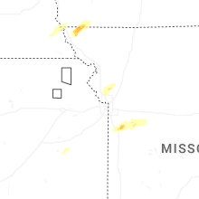


Connect with Interactive Hail Maps