

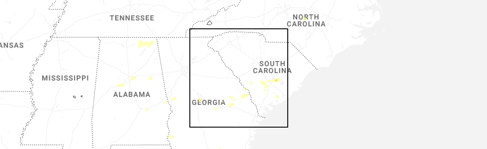
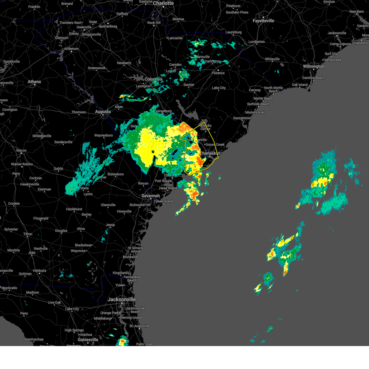
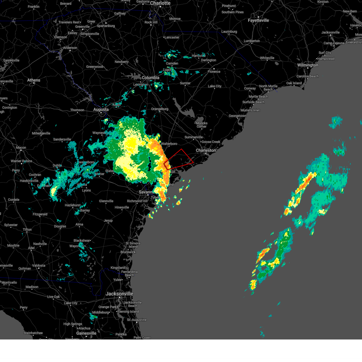
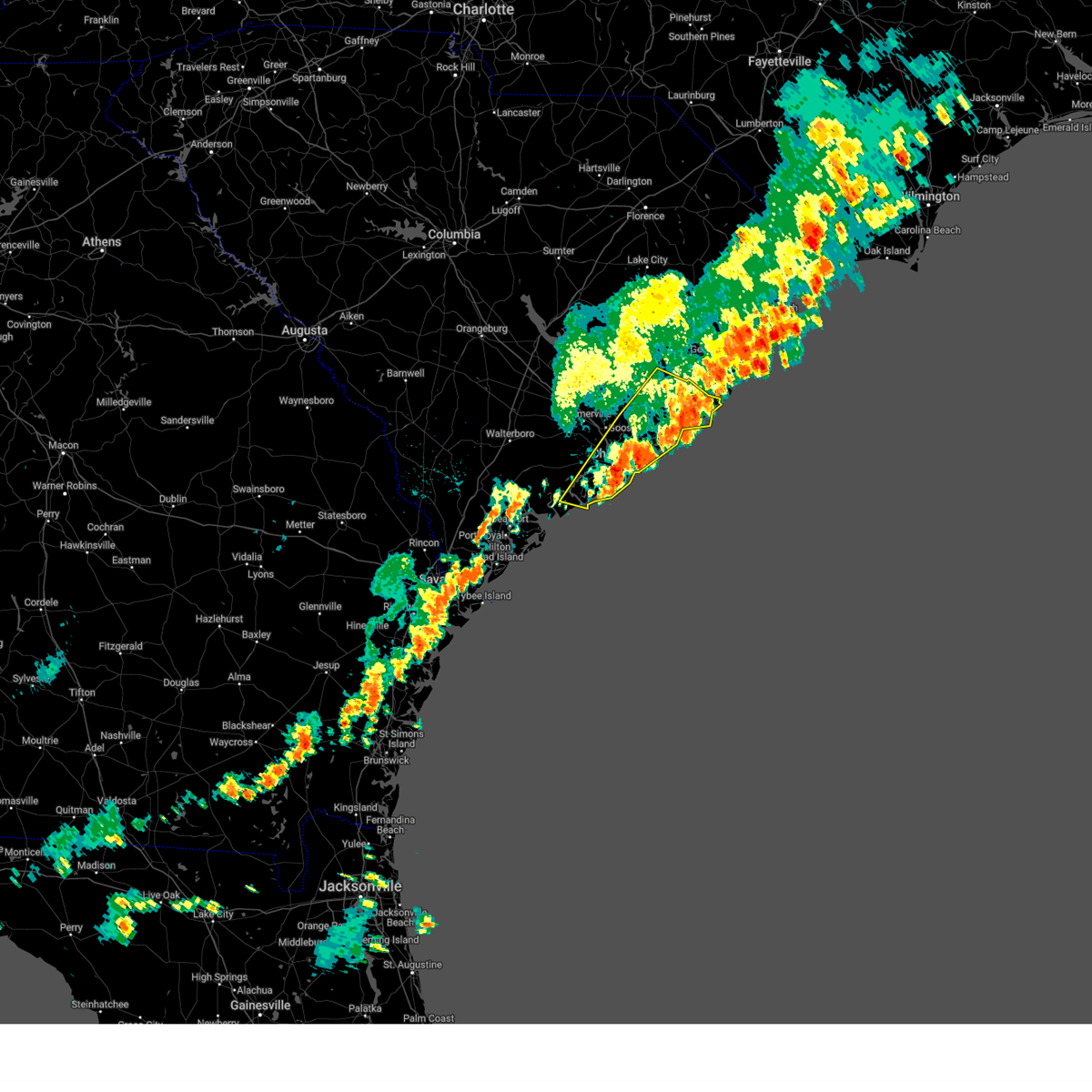
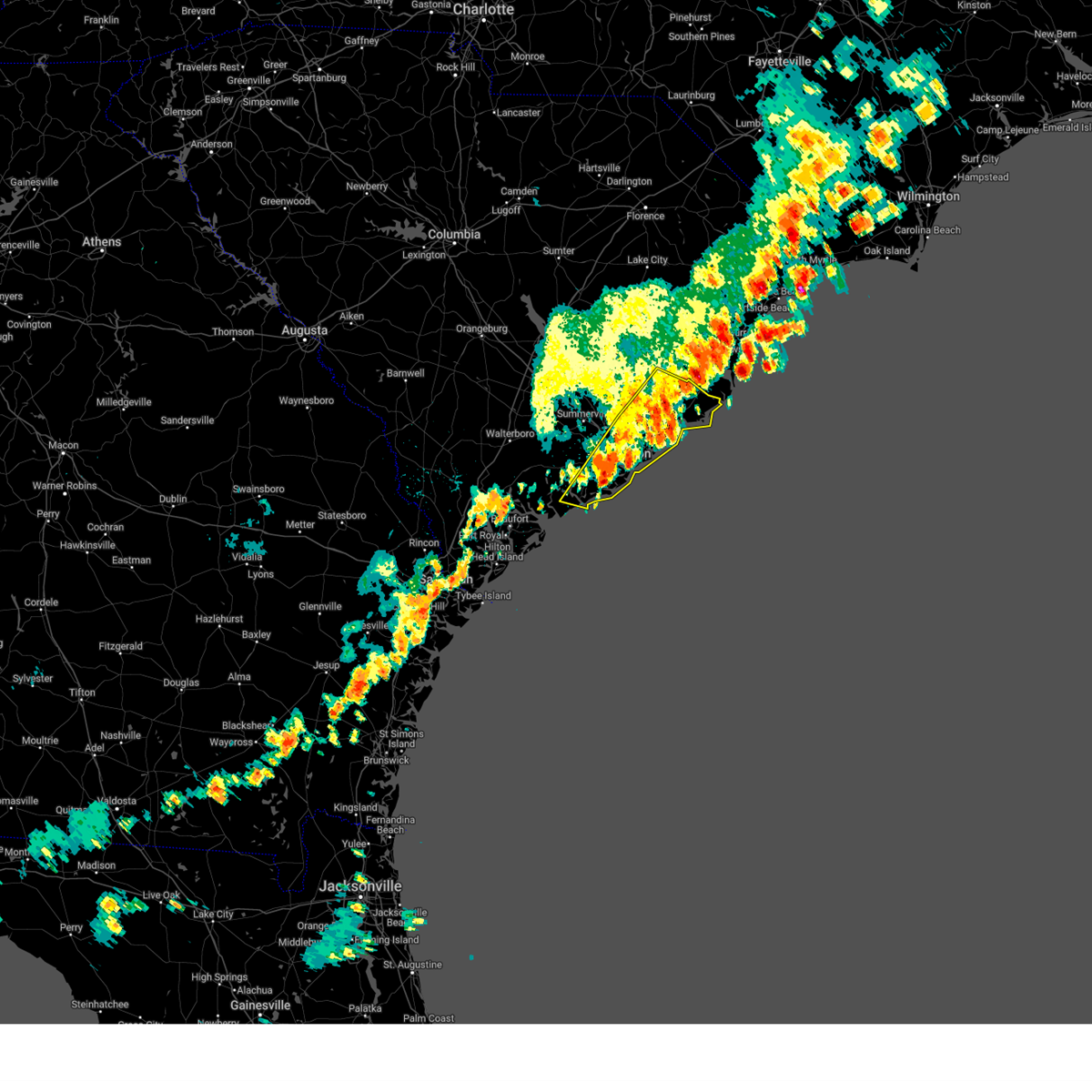
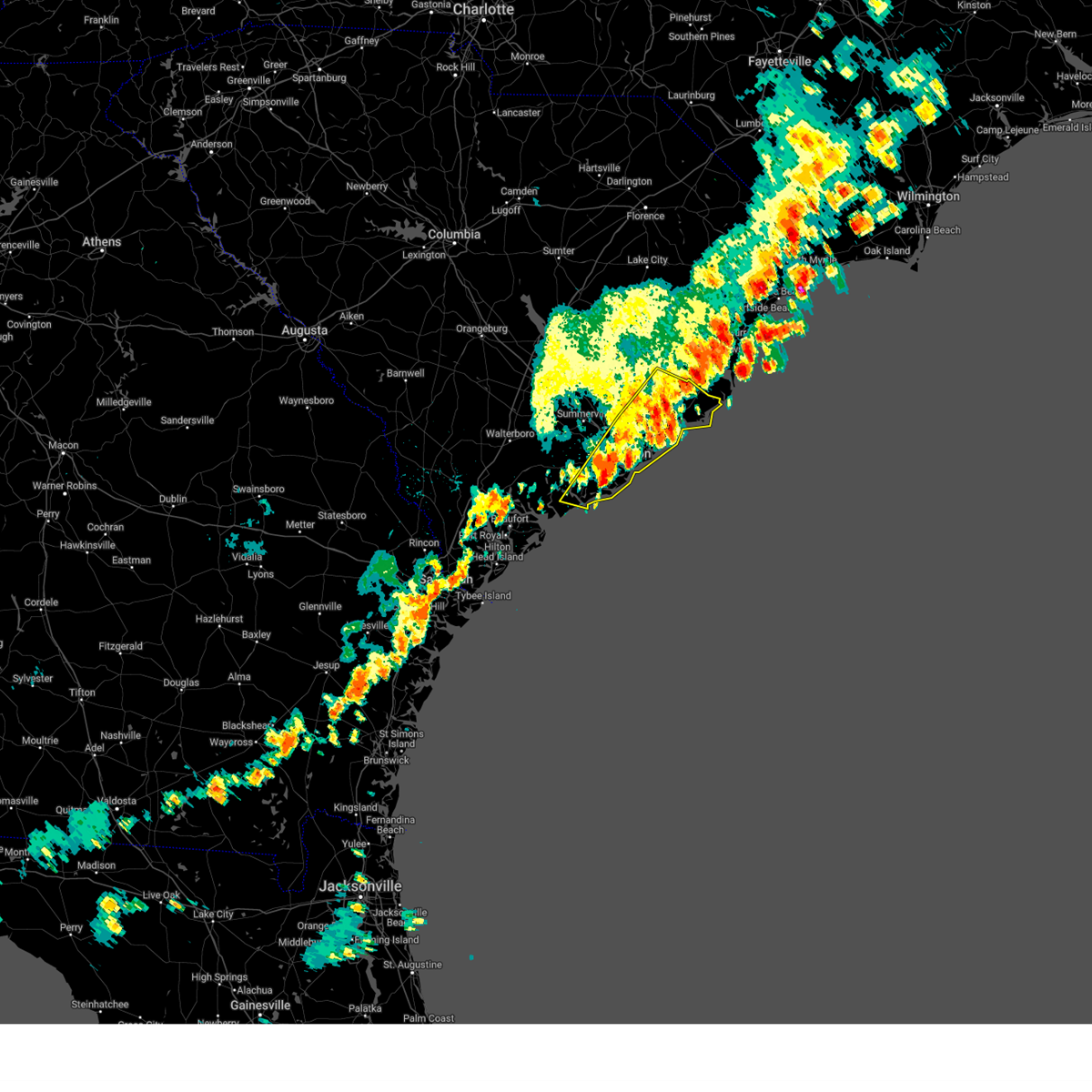
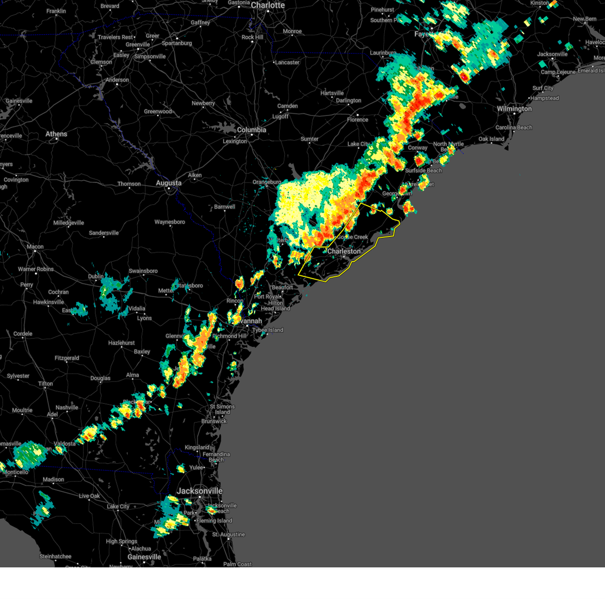
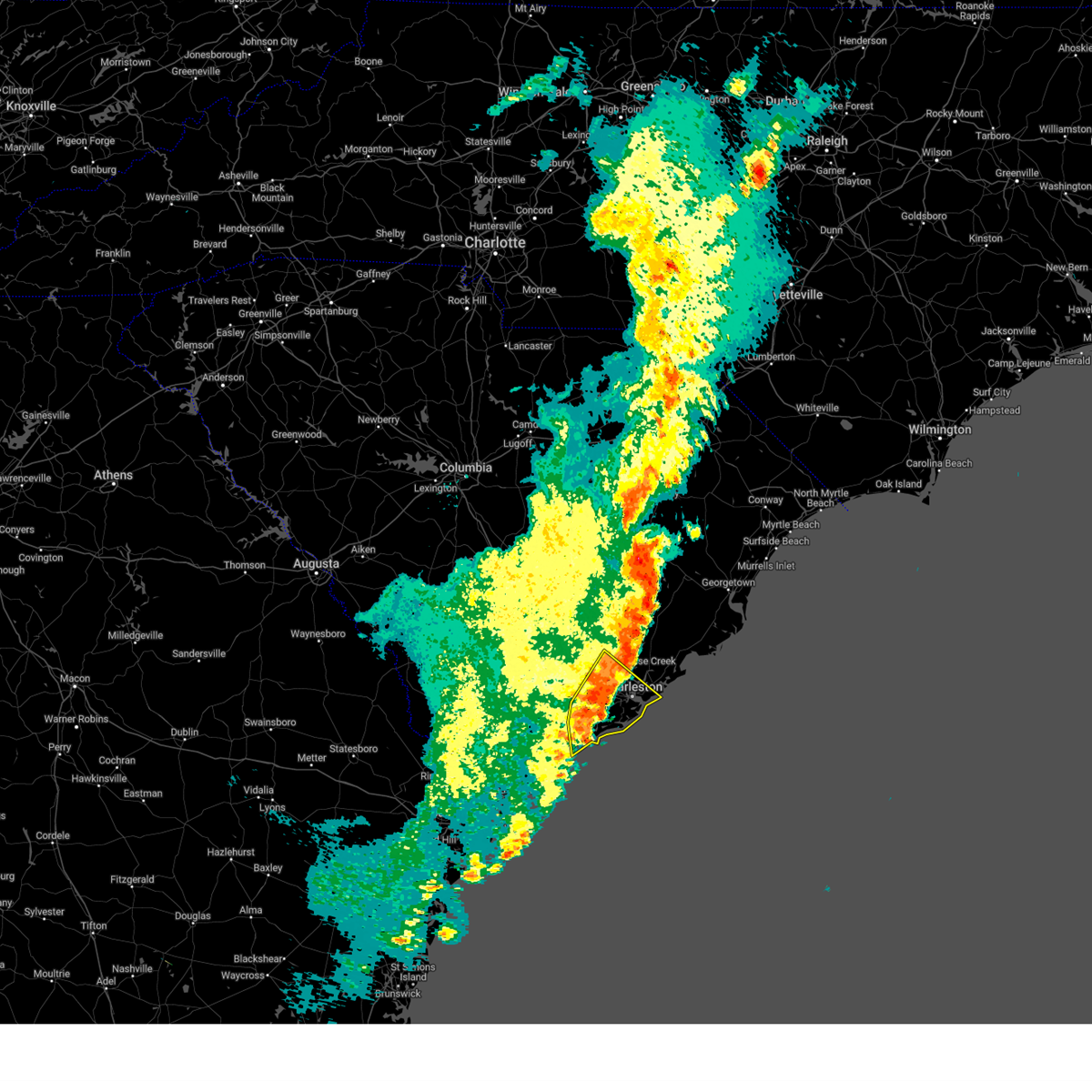
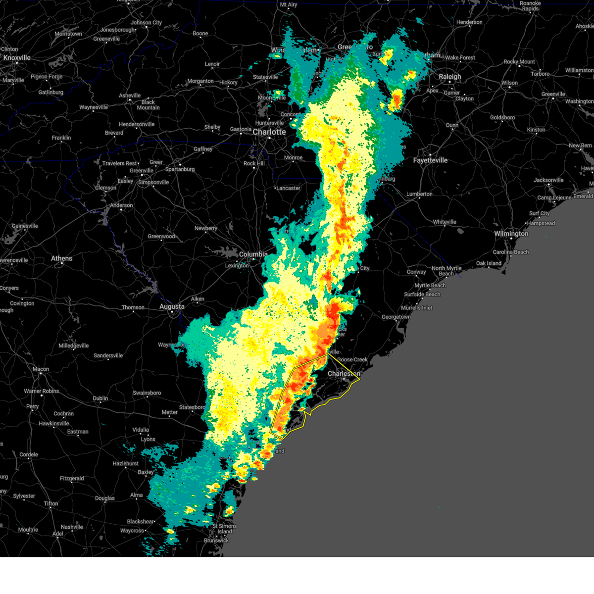
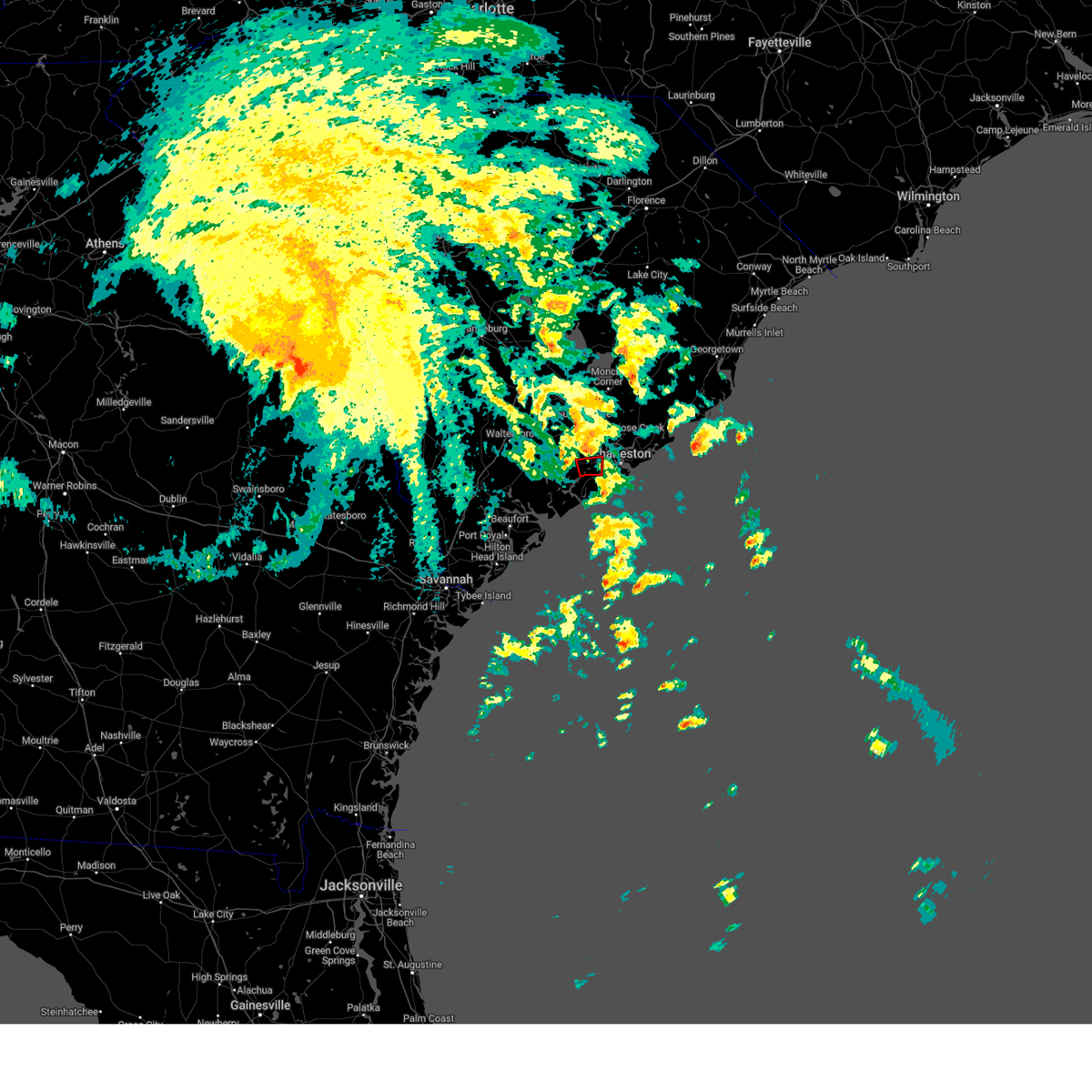
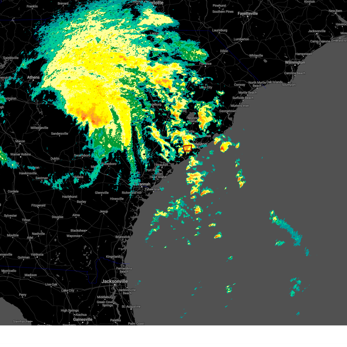
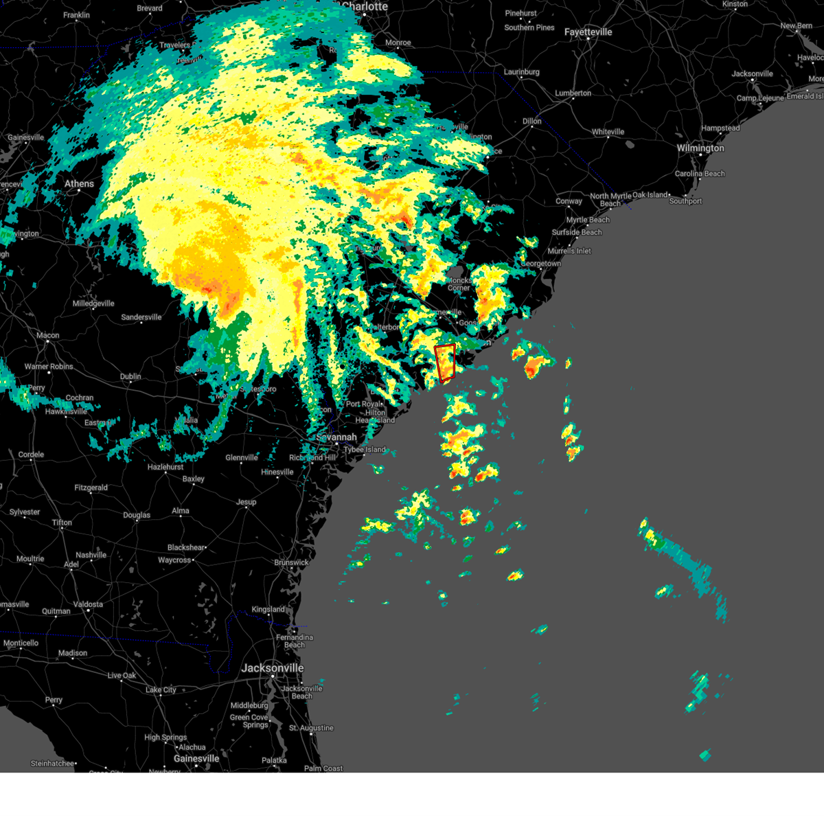
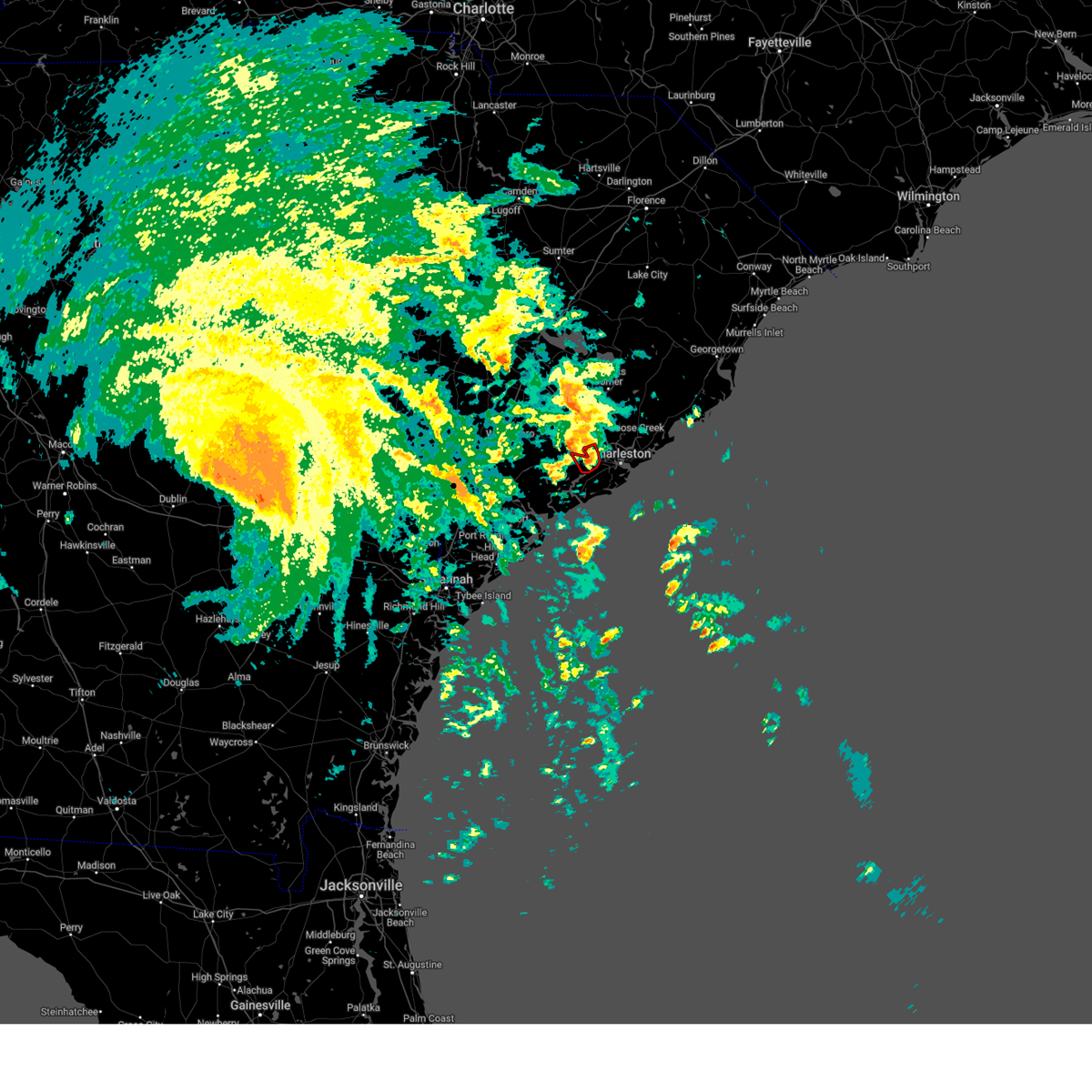
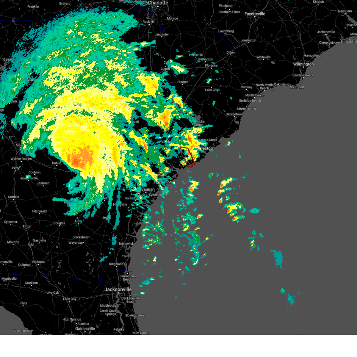
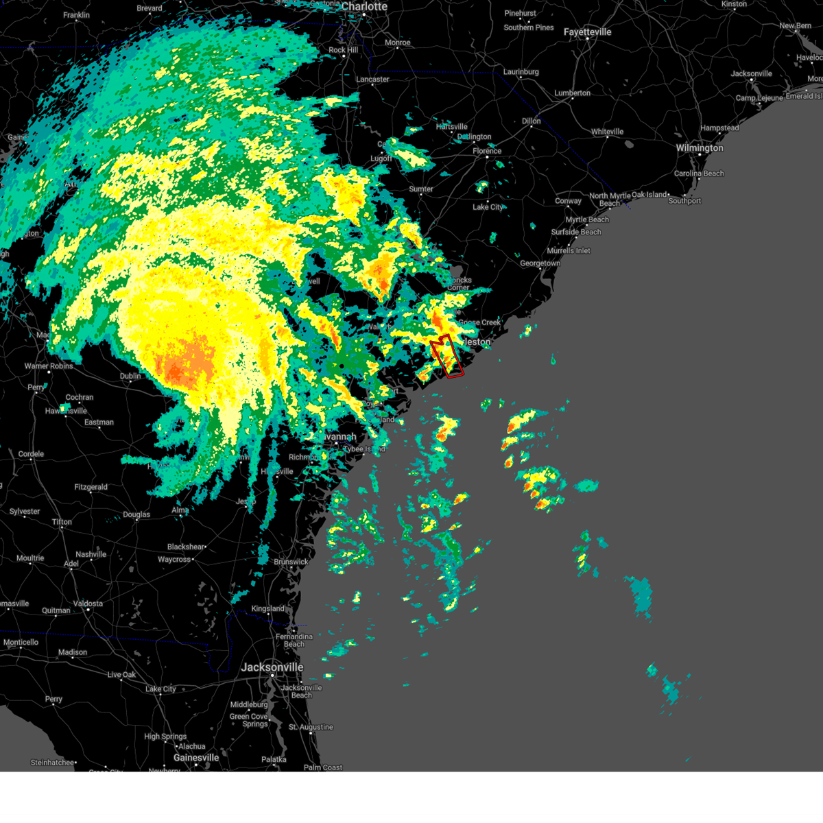
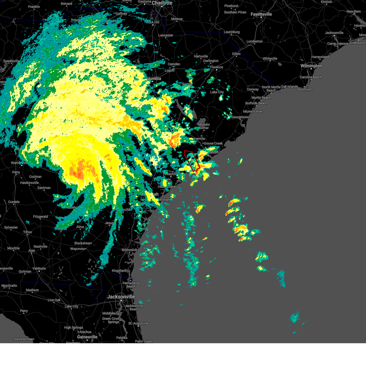
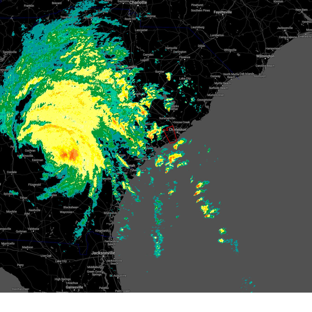
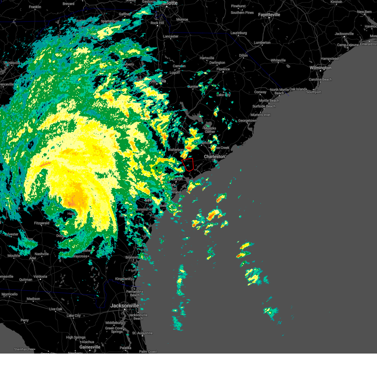
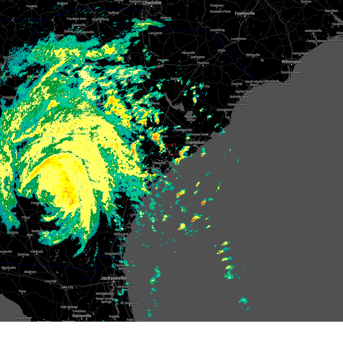
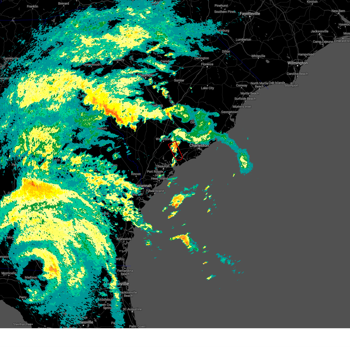
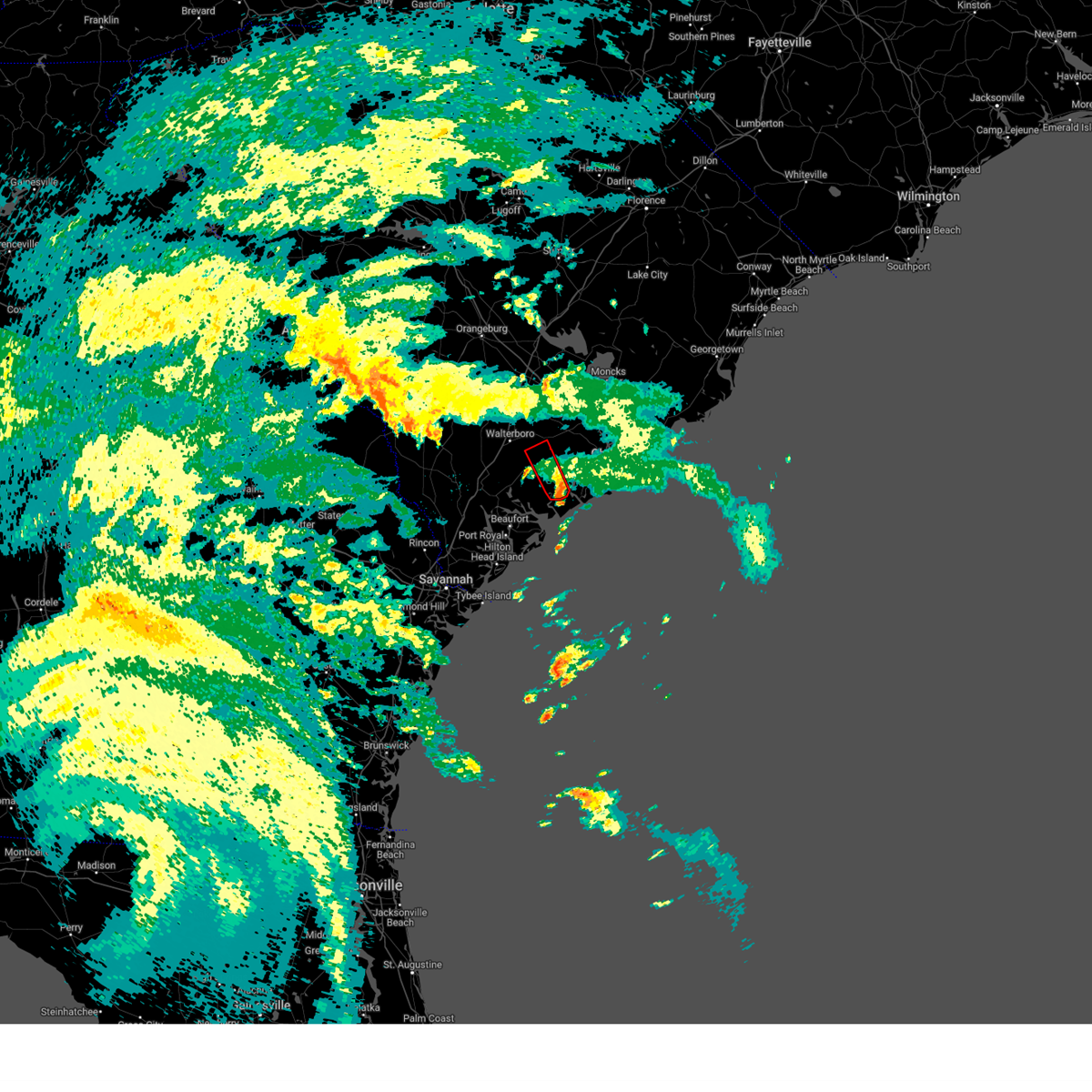
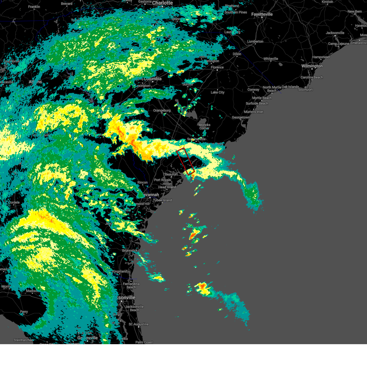
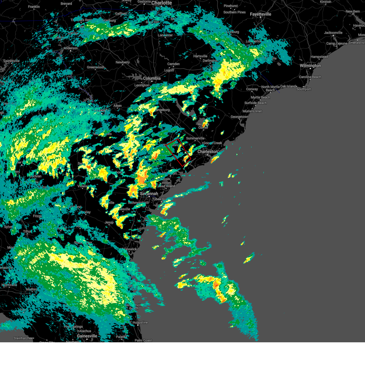
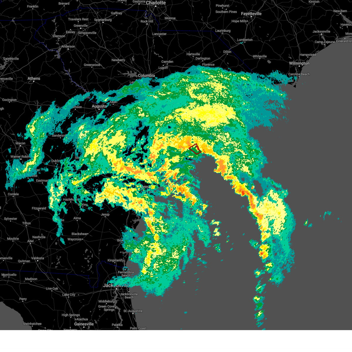
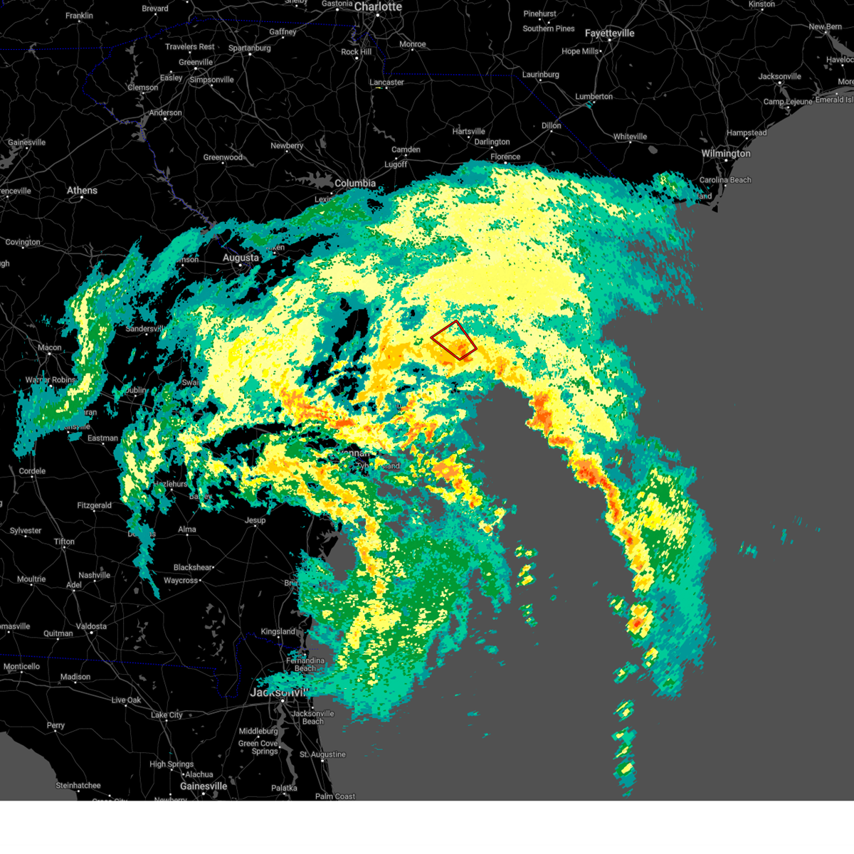
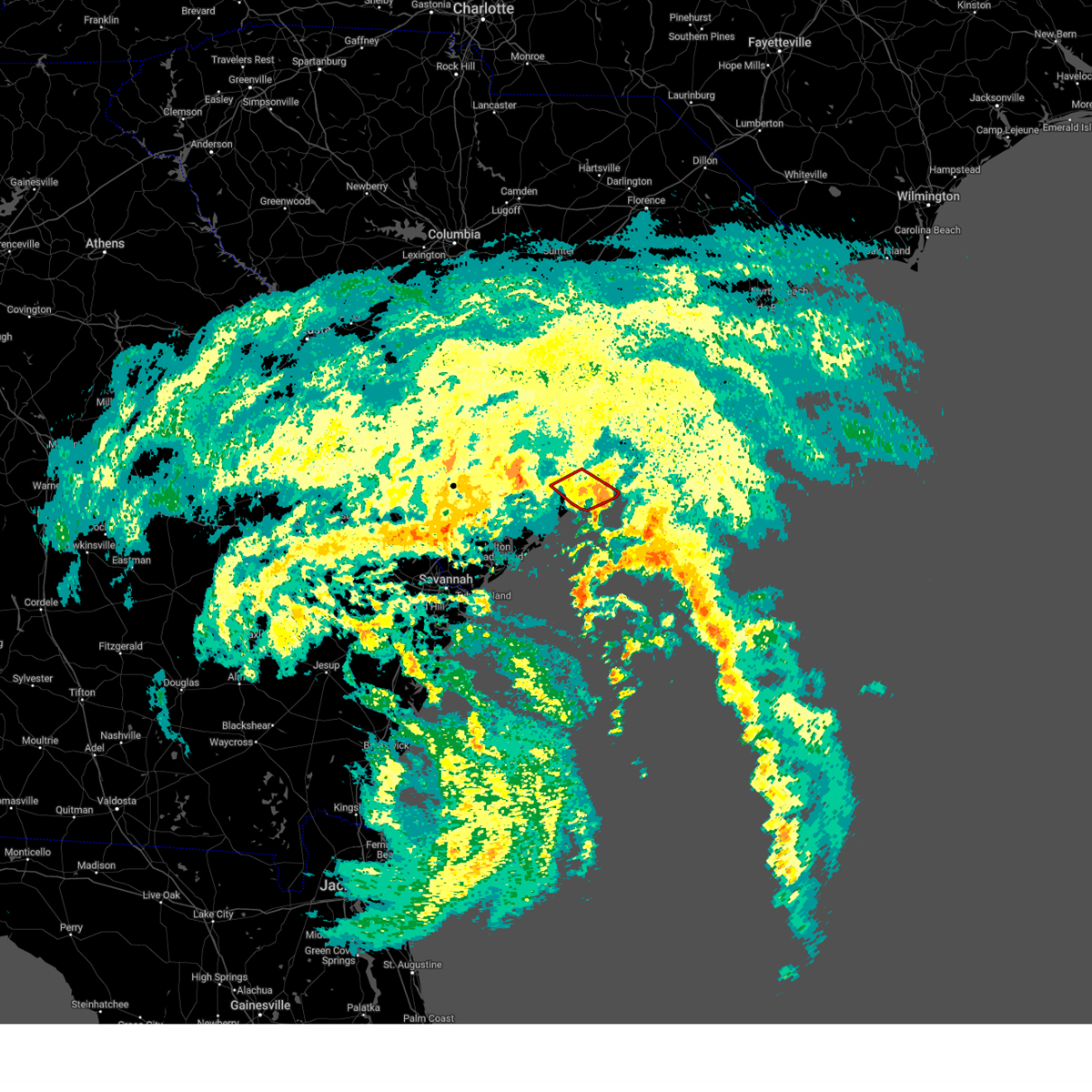
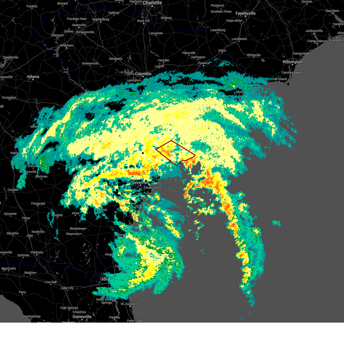
Hail Map for Hollywood, SC
The Hollywood, SC area has had 1 report of on-the-ground hail by trained spotters, and has been under severe weather warnings 57 times during the past 12 months. Doppler radar has detected hail at or near Hollywood, SC on 44 occasions, including 1 occasion during the past year.
| Name: | Hollywood, SC |
| Where Located: | 31.6 miles SSW of Charleston, SC |
| Map: | Google Map for Hollywood, SC |
| Population: | 4714 |
| Housing Units: | 2032 |
| More Info: | Search Google for Hollywood, SC |
2
The Top Recent Hail Date for Hollywood, SC is Monday, March 31, 2025 (5th out of 44)
Hail and Wind Damage Spotted near Hollywood, SC
| Date / Time | Report Details |
|---|---|
| 7/11/2025 8:32 PM EDT | the severe thunderstorm warning has been cancelled and is no longer in effect |
| 7/11/2025 8:06 PM EDT | the severe thunderstorm warning has been cancelled and is no longer in effect |
| 7/11/2025 8:01 PM EDT | At 801 pm edt, severe thunderstorms were located along a line from over sullivan's island to 8 miles south of kiawah island, moving southeast at 25 mph (radar indicated). Hazards include 60 mph wind gusts. Expect damage to roofs, siding, and trees. locations impacted include, north charleston, mount pleasant, hanahan, johns island, james island, west ashley, downtown charleston, fort sumter, i-26/i-526 interchange and daniel island. this includes the following highways, i-26 between mile markers 214 and 221. I-526 between mile markers 11 and 17, and between mile markers 19 and 31. |
| 7/11/2025 7:54 PM EDT | At 754 pm edt, severe thunderstorms were located along a line from 6 miles south of adams run to over fort johnson, moving southeast at 20 mph (radar indicated). Hazards include 60 mph wind gusts. Expect damage to roofs, siding, and trees. locations impacted include, north charleston, summerville, hanahan, johns island, west ashley, i-26/i-526 interchange, hollywood, ravenel, meggett and cottageville. this includes the following highways, i-26 between mile markers 207 and 214. I-526 between mile markers 17 and 19. |
| 7/11/2025 7:54 PM EDT | the severe thunderstorm warning has been cancelled and is no longer in effect |
| 7/11/2025 7:39 PM EDT | Svrchs the national weather service in charleston has issued a * severe thunderstorm warning for portions of, berkeley county in southeastern south carolina, charleston county in southeastern south carolina, * until 845 pm edt. * at 739 pm edt, severe thunderstorms were located along a line from over charleston naval complex to over seabrook island, moving southeast at 25 mph (radar indicated). Hazards include 60 mph wind gusts. expect damage to roofs, siding, and trees |
| 7/11/2025 7:21 PM EDT | Svrchs the national weather service in charleston has issued a * severe thunderstorm warning for portions of, berkeley county in southeastern south carolina, charleston county in southeastern south carolina, colleton county in southeastern south carolina, dorchester county in southeastern south carolina, * until 815 pm edt. * at 721 pm edt, severe thunderstorms were located along a line from over ashepoo to over i-26/i-526 interchange, moving southeast at 20 mph (radar indicated). Hazards include 60 mph wind gusts. expect damage to roofs, siding, and trees |
| 6/25/2025 9:40 PM EDT |
 The severe thunderstorm warning that was previously in effect has been reissued for colleton and dorchester counties and is in effect until 1030 pm edt. please refer to that bulletin for the latest severe weather information. a severe thunderstorm watch remains in effect until 1200 am edt for a portion of southeast south carolina. The severe thunderstorm warning that was previously in effect has been reissued for colleton and dorchester counties and is in effect until 1030 pm edt. please refer to that bulletin for the latest severe weather information. a severe thunderstorm watch remains in effect until 1200 am edt for a portion of southeast south carolina.
|
| 6/25/2025 9:06 PM EDT |
 At 906 pm edt, a combination of a severe wind shift and severe thunderstorms were located along a line from 7 miles southeast of capers inlet to over reevesville, moving southwest at 25 mph (trained spotters reported. at 855 pm, wind gust to 58 mph was observed at the charleston harbor pilot office in downtown charleston). Hazards include 60 mph wind gusts. Expect damage to roofs, siding, and trees. locations impacted include, moncks corner, mcclellanville, goose creek, ladson, hanahan, north charleston, mount pleasant, summerville, saint george and walterboro. this includes the following highways, i-26 between mile markers 171 and 221. i-526 between mile markers 11 and 31. I-95 in south carolina between mile markers 59 and 85. At 906 pm edt, a combination of a severe wind shift and severe thunderstorms were located along a line from 7 miles southeast of capers inlet to over reevesville, moving southwest at 25 mph (trained spotters reported. at 855 pm, wind gust to 58 mph was observed at the charleston harbor pilot office in downtown charleston). Hazards include 60 mph wind gusts. Expect damage to roofs, siding, and trees. locations impacted include, moncks corner, mcclellanville, goose creek, ladson, hanahan, north charleston, mount pleasant, summerville, saint george and walterboro. this includes the following highways, i-26 between mile markers 171 and 221. i-526 between mile markers 11 and 31. I-95 in south carolina between mile markers 59 and 85.
|
| 6/25/2025 8:38 PM EDT |
 Svrchs the national weather service in charleston has issued a * severe thunderstorm warning for portions of, berkeley county in southeastern south carolina, charleston county in southeastern south carolina, colleton county in southeastern south carolina, dorchester county in southeastern south carolina, * until 945 pm edt. * at 838 pm edt, severe thunderstorms were located along a line from near awendaw to 5 miles northeast of harleyville, moving southwest at 40 mph (law enforcement reported. at 835 pm, law enforcement continued to report wind damage occurring across northern and central berkeley county). Hazards include 60 mph wind gusts. expect damage to roofs, siding, and trees Svrchs the national weather service in charleston has issued a * severe thunderstorm warning for portions of, berkeley county in southeastern south carolina, charleston county in southeastern south carolina, colleton county in southeastern south carolina, dorchester county in southeastern south carolina, * until 945 pm edt. * at 838 pm edt, severe thunderstorms were located along a line from near awendaw to 5 miles northeast of harleyville, moving southwest at 40 mph (law enforcement reported. at 835 pm, law enforcement continued to report wind damage occurring across northern and central berkeley county). Hazards include 60 mph wind gusts. expect damage to roofs, siding, and trees
|
| 6/10/2025 10:36 AM EDT |
 The storms which prompted the warning have weakened below severe limits, and no longer pose an immediate threat to life or property. therefore, the warning will be allowed to expire. The storms which prompted the warning have weakened below severe limits, and no longer pose an immediate threat to life or property. therefore, the warning will be allowed to expire.
|
| 6/10/2025 10:21 AM EDT |
 the severe thunderstorm warning has been cancelled and is no longer in effect the severe thunderstorm warning has been cancelled and is no longer in effect
|
| 6/10/2025 10:21 AM EDT |
 At 1021 am edt, severe thunderstorms were located along a line from over ridgeville to over rockville, moving northeast at 60 mph (radar indicated). Hazards include 60 mph wind gusts. Expect damage to roofs, siding, and trees. locations impacted include, north charleston, mount pleasant, summerville, goose creek, hanahan, moncks corner, edisto beach, i-26/i-526 interchange, west ashley and ladson. this includes the following highways, i-26 between mile markers 185 and 221. I-526 between mile markers 11 and 31. At 1021 am edt, severe thunderstorms were located along a line from over ridgeville to over rockville, moving northeast at 60 mph (radar indicated). Hazards include 60 mph wind gusts. Expect damage to roofs, siding, and trees. locations impacted include, north charleston, mount pleasant, summerville, goose creek, hanahan, moncks corner, edisto beach, i-26/i-526 interchange, west ashley and ladson. this includes the following highways, i-26 between mile markers 185 and 221. I-526 between mile markers 11 and 31.
|
| 6/10/2025 10:04 AM EDT |
 Svrchs the national weather service in charleston has issued a * severe thunderstorm warning for portions of, berkeley county in southeastern south carolina, charleston county in southeastern south carolina, colleton county in southeastern south carolina, dorchester county in southeastern south carolina, * until 1045 am edt. * at 1004 am edt, severe thunderstorms were located along a line from over round o to 5 miles west of edisto beach, moving northeast at 60 mph (radar indicated). Hazards include 60 mph wind gusts. expect damage to roofs, siding, and trees Svrchs the national weather service in charleston has issued a * severe thunderstorm warning for portions of, berkeley county in southeastern south carolina, charleston county in southeastern south carolina, colleton county in southeastern south carolina, dorchester county in southeastern south carolina, * until 1045 am edt. * at 1004 am edt, severe thunderstorms were located along a line from over round o to 5 miles west of edisto beach, moving northeast at 60 mph (radar indicated). Hazards include 60 mph wind gusts. expect damage to roofs, siding, and trees
|
| 6/10/2025 10:02 AM EDT |
 the tornado warning has been cancelled and is no longer in effect the tornado warning has been cancelled and is no longer in effect
|
| 6/10/2025 9:57 AM EDT |
 the tornado warning has been cancelled and is no longer in effect the tornado warning has been cancelled and is no longer in effect
|
| 6/10/2025 9:57 AM EDT |
 At 957 am edt, a severe thunderstorm capable of producing a tornado was located 6 miles south of ashepoo, moving northeast at 45 mph (radar indicated rotation). Hazards include tornado. Flying debris will be dangerous to those caught without shelter. mobile homes will be damaged or destroyed. damage to roofs, windows and vehicles will occur. tree damage is likely. Locations impacted include, hollywood, meggett, jacksonboro, adams run, ashepoo, bears bluff, fenwick, parkers ferry, beck landing and canady landing. At 957 am edt, a severe thunderstorm capable of producing a tornado was located 6 miles south of ashepoo, moving northeast at 45 mph (radar indicated rotation). Hazards include tornado. Flying debris will be dangerous to those caught without shelter. mobile homes will be damaged or destroyed. damage to roofs, windows and vehicles will occur. tree damage is likely. Locations impacted include, hollywood, meggett, jacksonboro, adams run, ashepoo, bears bluff, fenwick, parkers ferry, beck landing and canady landing.
|
| 6/10/2025 9:43 AM EDT |
 Torchs the national weather service in charleston has issued a * tornado warning for portions of, beaufort county in southeastern south carolina, charleston county in southeastern south carolina, colleton county in southeastern south carolina, * until 1015 am edt. * at 943 am edt, a severe thunderstorm capable of producing a tornado was located over dale, moving northeast at 45 mph (radar indicated rotation). Hazards include tornado. Flying debris will be dangerous to those caught without shelter. mobile homes will be damaged or destroyed. damage to roofs, windows and vehicles will occur. Tree damage is likely. Torchs the national weather service in charleston has issued a * tornado warning for portions of, beaufort county in southeastern south carolina, charleston county in southeastern south carolina, colleton county in southeastern south carolina, * until 1015 am edt. * at 943 am edt, a severe thunderstorm capable of producing a tornado was located over dale, moving northeast at 45 mph (radar indicated rotation). Hazards include tornado. Flying debris will be dangerous to those caught without shelter. mobile homes will be damaged or destroyed. damage to roofs, windows and vehicles will occur. Tree damage is likely.
|
| 6/8/2025 2:00 PM EDT |
 The storms which prompted the warning have weakened below severe limits, and no longer pose an immediate threat to life or property. therefore, the warning has been allowed to expire. however, gusty winds are still possible with these thunderstorms. a severe thunderstorm watch remains in effect until 500 pm edt for a portion of southeast south carolina. The storms which prompted the warning have weakened below severe limits, and no longer pose an immediate threat to life or property. therefore, the warning has been allowed to expire. however, gusty winds are still possible with these thunderstorms. a severe thunderstorm watch remains in effect until 500 pm edt for a portion of southeast south carolina.
|
| 6/8/2025 1:46 PM EDT |
 At 146 pm edt, severe thunderstorms were located along a line from 5 miles northeast of hampton plantation state park to over folly beach, moving east at 40 mph (radar indicated). Hazards include 60 mph wind gusts and small hail. Expect damage to roofs, siding, and trees. locations impacted include, north charleston, mount pleasant, goose creek, hanahan, mcclellanville, daniel island, naval weapons station charleston, downtown charleston, fort sumter and i-26/i-526 interchange. this includes the following highways, i-26 between mile markers 211 and 221. I-526 between mile markers 11 and 31. At 146 pm edt, severe thunderstorms were located along a line from 5 miles northeast of hampton plantation state park to over folly beach, moving east at 40 mph (radar indicated). Hazards include 60 mph wind gusts and small hail. Expect damage to roofs, siding, and trees. locations impacted include, north charleston, mount pleasant, goose creek, hanahan, mcclellanville, daniel island, naval weapons station charleston, downtown charleston, fort sumter and i-26/i-526 interchange. this includes the following highways, i-26 between mile markers 211 and 221. I-526 between mile markers 11 and 31.
|
| 6/8/2025 1:46 PM EDT |
 the severe thunderstorm warning has been cancelled and is no longer in effect the severe thunderstorm warning has been cancelled and is no longer in effect
|
| 6/8/2025 1:21 PM EDT |
 the severe thunderstorm warning has been cancelled and is no longer in effect the severe thunderstorm warning has been cancelled and is no longer in effect
|
| 6/8/2025 1:16 PM EDT |
 Svrchs the national weather service in charleston has issued a * severe thunderstorm warning for portions of, berkeley county in southeastern south carolina, charleston county in southeastern south carolina, colleton county in southeastern south carolina, dorchester county in southeastern south carolina, * until 200 pm edt. * at 116 pm edt, severe thunderstorms were located along a line from near jamestown to over adams run, moving east at 40 mph (radar indicated). Hazards include 60 mph wind gusts and small hail. expect damage to roofs, siding, and trees Svrchs the national weather service in charleston has issued a * severe thunderstorm warning for portions of, berkeley county in southeastern south carolina, charleston county in southeastern south carolina, colleton county in southeastern south carolina, dorchester county in southeastern south carolina, * until 200 pm edt. * at 116 pm edt, severe thunderstorms were located along a line from near jamestown to over adams run, moving east at 40 mph (radar indicated). Hazards include 60 mph wind gusts and small hail. expect damage to roofs, siding, and trees
|
| 6/8/2025 1:03 PM EDT |
 the severe thunderstorm warning has been cancelled and is no longer in effect the severe thunderstorm warning has been cancelled and is no longer in effect
|
| 6/8/2025 1:03 PM EDT |
 At 103 pm edt, severe thunderstorms were located along a line from 5 miles northwest of jacksonboro to over pocotaligo, moving east at 30 mph (radar indicated). Hazards include 60 mph wind gusts and small hail. Expect damage to roofs, siding, and trees. Locations impacted include, walterboro, hollywood, ravenel, meggett, ashepoo, jacksonboro, green pond, ritter, adams run and white hall. At 103 pm edt, severe thunderstorms were located along a line from 5 miles northwest of jacksonboro to over pocotaligo, moving east at 30 mph (radar indicated). Hazards include 60 mph wind gusts and small hail. Expect damage to roofs, siding, and trees. Locations impacted include, walterboro, hollywood, ravenel, meggett, ashepoo, jacksonboro, green pond, ritter, adams run and white hall.
|
| 6/8/2025 12:48 PM EDT |
 Svrchs the national weather service in charleston has issued a * severe thunderstorm warning for portions of, beaufort county in southeastern south carolina, charleston county in southeastern south carolina, colleton county in southeastern south carolina, dorchester county in southeastern south carolina, jasper county in southeastern south carolina, * until 130 pm edt. * at 1248 pm edt, severe thunderstorms were located along a line from near ritter to near pineland, moving east at 30 mph (radar indicated). Hazards include 60 mph wind gusts and small hail. expect damage to roofs, siding, and trees Svrchs the national weather service in charleston has issued a * severe thunderstorm warning for portions of, beaufort county in southeastern south carolina, charleston county in southeastern south carolina, colleton county in southeastern south carolina, dorchester county in southeastern south carolina, jasper county in southeastern south carolina, * until 130 pm edt. * at 1248 pm edt, severe thunderstorms were located along a line from near ritter to near pineland, moving east at 30 mph (radar indicated). Hazards include 60 mph wind gusts and small hail. expect damage to roofs, siding, and trees
|
| 3/31/2025 6:41 PM EDT |
 the severe thunderstorm warning has been cancelled and is no longer in effect the severe thunderstorm warning has been cancelled and is no longer in effect
|
| 3/31/2025 6:41 PM EDT |
 At 641 pm edt, a severe thunderstorm was located near hollywood, moving east at 45 mph (radar indicated). Hazards include 60 mph wind gusts and small hail. Expect damage to roofs, siding, and trees. locations impacted include, north charleston, mount pleasant, summerville, goose creek, hanahan, edisto beach, johns island, west ashley, james island and i-26/i-526 interchange. this includes the following highways, i-26 between mile markers 202 and 221. I-526 between mile markers 11 and 31. At 641 pm edt, a severe thunderstorm was located near hollywood, moving east at 45 mph (radar indicated). Hazards include 60 mph wind gusts and small hail. Expect damage to roofs, siding, and trees. locations impacted include, north charleston, mount pleasant, summerville, goose creek, hanahan, edisto beach, johns island, west ashley, james island and i-26/i-526 interchange. this includes the following highways, i-26 between mile markers 202 and 221. I-526 between mile markers 11 and 31.
|
| 3/31/2025 6:21 PM EDT |
 Svrchs the national weather service in charleston has issued a * severe thunderstorm warning for portions of, beaufort county in southeastern south carolina, berkeley county in southeastern south carolina, charleston county in southeastern south carolina, colleton county in southeastern south carolina, dorchester county in southeastern south carolina, * until 715 pm edt. * at 621 pm edt, severe thunderstorms were located along a line from 6 miles west of delemar crossroads to near folly field, moving east at 45 mph (radar indicated). Hazards include 60 mph wind gusts. expect damage to roofs, siding, and trees Svrchs the national weather service in charleston has issued a * severe thunderstorm warning for portions of, beaufort county in southeastern south carolina, berkeley county in southeastern south carolina, charleston county in southeastern south carolina, colleton county in southeastern south carolina, dorchester county in southeastern south carolina, * until 715 pm edt. * at 621 pm edt, severe thunderstorms were located along a line from 6 miles west of delemar crossroads to near folly field, moving east at 45 mph (radar indicated). Hazards include 60 mph wind gusts. expect damage to roofs, siding, and trees
|
| 9/27/2024 5:37 AM EDT |
 the tornado warning has been cancelled and is no longer in effect the tornado warning has been cancelled and is no longer in effect
|
| 9/27/2024 5:29 AM EDT |
 At 529 am edt, a severe thunderstorm capable of producing a tornado was located 5 miles northeast of hollywood, moving north at 60 mph (radar indicated rotation). Hazards include tornado. Flying debris will be dangerous to those caught without shelter. mobile homes will be damaged or destroyed. damage to roofs, windows and vehicles will occur. tree damage is likely. Locations impacted include, johns island, west ashley, hollywood, ravenel, meggett, rantowles, red top and dungannon heritage preserve. At 529 am edt, a severe thunderstorm capable of producing a tornado was located 5 miles northeast of hollywood, moving north at 60 mph (radar indicated rotation). Hazards include tornado. Flying debris will be dangerous to those caught without shelter. mobile homes will be damaged or destroyed. damage to roofs, windows and vehicles will occur. tree damage is likely. Locations impacted include, johns island, west ashley, hollywood, ravenel, meggett, rantowles, red top and dungannon heritage preserve.
|
| 9/27/2024 5:18 AM EDT |
 Torchs the national weather service in charleston has issued a * tornado warning for portions of, charleston county in southeastern south carolina, * until 545 am edt. * at 518 am edt, a severe thunderstorm capable of producing a tornado was located near seabrook island, moving north at 55 mph (radar indicated rotation). Hazards include tornado. Flying debris will be dangerous to those caught without shelter. mobile homes will be damaged or destroyed. damage to roofs, windows and vehicles will occur. Tree damage is likely. Torchs the national weather service in charleston has issued a * tornado warning for portions of, charleston county in southeastern south carolina, * until 545 am edt. * at 518 am edt, a severe thunderstorm capable of producing a tornado was located near seabrook island, moving north at 55 mph (radar indicated rotation). Hazards include tornado. Flying debris will be dangerous to those caught without shelter. mobile homes will be damaged or destroyed. damage to roofs, windows and vehicles will occur. Tree damage is likely.
|
| 9/27/2024 4:56 AM EDT |
 The storm which prompted the warning has moved out of the area. therefore, the warning will be allowed to expire. a tornado watch remains in effect until 800 am edt friday for a portion of southeast south carolina. The storm which prompted the warning has moved out of the area. therefore, the warning will be allowed to expire. a tornado watch remains in effect until 800 am edt friday for a portion of southeast south carolina.
|
| 9/27/2024 4:50 AM EDT |
 At 450 am edt, a severe thunderstorm capable of producing a tornado was located over delemar crossroads, moving north at 75 mph (radar indicated rotation). Hazards include tornado. Flying debris will be dangerous to those caught without shelter. mobile homes will be damaged or destroyed. damage to roofs, windows and vehicles will occur. tree damage is likely. Locations impacted include, hollywood, ravenel, capwells crossroads and dungannon heritage preserve. At 450 am edt, a severe thunderstorm capable of producing a tornado was located over delemar crossroads, moving north at 75 mph (radar indicated rotation). Hazards include tornado. Flying debris will be dangerous to those caught without shelter. mobile homes will be damaged or destroyed. damage to roofs, windows and vehicles will occur. tree damage is likely. Locations impacted include, hollywood, ravenel, capwells crossroads and dungannon heritage preserve.
|
| 9/27/2024 4:36 AM EDT |
 Torchs the national weather service in charleston has issued a * tornado warning for portions of, charleston county in southeastern south carolina, * until 500 am edt. * at 436 am edt, a severe thunderstorm capable of producing a tornado was located near rockville, moving north at 75 mph (radar indicated rotation). Hazards include tornado. Flying debris will be dangerous to those caught without shelter. mobile homes will be damaged or destroyed. damage to roofs, windows and vehicles will occur. Tree damage is likely. Torchs the national weather service in charleston has issued a * tornado warning for portions of, charleston county in southeastern south carolina, * until 500 am edt. * at 436 am edt, a severe thunderstorm capable of producing a tornado was located near rockville, moving north at 75 mph (radar indicated rotation). Hazards include tornado. Flying debris will be dangerous to those caught without shelter. mobile homes will be damaged or destroyed. damage to roofs, windows and vehicles will occur. Tree damage is likely.
|
| 9/27/2024 4:23 AM EDT |
 the tornado warning has been cancelled and is no longer in effect the tornado warning has been cancelled and is no longer in effect
|
| 9/27/2024 4:21 AM EDT |
 At 421 am edt, a severe thunderstorm capable of producing a tornado was located 5 miles southwest of magnolia gardens, moving north at 70 mph (radar indicated rotation). Hazards include tornado. Flying debris will be dangerous to those caught without shelter. mobile homes will be damaged or destroyed. damage to roofs, windows and vehicles will occur. tree damage is likely. Locations impacted include, west ashley, johns island, hollywood, ravenel, meggett, rantowles, red top and dungannon heritage preserve. At 421 am edt, a severe thunderstorm capable of producing a tornado was located 5 miles southwest of magnolia gardens, moving north at 70 mph (radar indicated rotation). Hazards include tornado. Flying debris will be dangerous to those caught without shelter. mobile homes will be damaged or destroyed. damage to roofs, windows and vehicles will occur. tree damage is likely. Locations impacted include, west ashley, johns island, hollywood, ravenel, meggett, rantowles, red top and dungannon heritage preserve.
|
| 9/27/2024 4:15 AM EDT |
 At 415 am edt, a severe thunderstorm capable of producing a tornado was located over ravenel, moving north at 65 mph (radar indicated rotation). Hazards include tornado. Flying debris will be dangerous to those caught without shelter. mobile homes will be damaged or destroyed. damage to roofs, windows and vehicles will occur. tree damage is likely. Locations impacted include, johns island, hollywood, ravenel, seabrook island, kiawah island, meggett, rockville, yonges island, bears bluff and wadmalaw island. At 415 am edt, a severe thunderstorm capable of producing a tornado was located over ravenel, moving north at 65 mph (radar indicated rotation). Hazards include tornado. Flying debris will be dangerous to those caught without shelter. mobile homes will be damaged or destroyed. damage to roofs, windows and vehicles will occur. tree damage is likely. Locations impacted include, johns island, hollywood, ravenel, seabrook island, kiawah island, meggett, rockville, yonges island, bears bluff and wadmalaw island.
|
| 9/27/2024 4:14 AM EDT |
 At 414 am edt, a severe thunderstorm capable of producing a tornado was located over hollywood, moving north at 60 mph (radar indicated rotation). Hazards include tornado. Flying debris will be dangerous to those caught without shelter. mobile homes will be damaged or destroyed. damage to roofs, windows and vehicles will occur. tree damage is likely. Locations impacted include, johns island, west ashley, james island, hollywood, folly beach, ravenel, kiawah island, meggett, wadmalaw island and angel oak park. At 414 am edt, a severe thunderstorm capable of producing a tornado was located over hollywood, moving north at 60 mph (radar indicated rotation). Hazards include tornado. Flying debris will be dangerous to those caught without shelter. mobile homes will be damaged or destroyed. damage to roofs, windows and vehicles will occur. tree damage is likely. Locations impacted include, johns island, west ashley, james island, hollywood, folly beach, ravenel, kiawah island, meggett, wadmalaw island and angel oak park.
|
| 9/27/2024 4:00 AM EDT |
 Torchs the national weather service in charleston has issued a * tornado warning for portions of, charleston county in southeastern south carolina, * until 430 am edt. * at 400 am edt, a severe thunderstorm capable of producing a tornado was located over seabrook island, moving north at 65 mph (radar indicated rotation). Hazards include tornado. Flying debris will be dangerous to those caught without shelter. mobile homes will be damaged or destroyed. damage to roofs, windows and vehicles will occur. Tree damage is likely. Torchs the national weather service in charleston has issued a * tornado warning for portions of, charleston county in southeastern south carolina, * until 430 am edt. * at 400 am edt, a severe thunderstorm capable of producing a tornado was located over seabrook island, moving north at 65 mph (radar indicated rotation). Hazards include tornado. Flying debris will be dangerous to those caught without shelter. mobile homes will be damaged or destroyed. damage to roofs, windows and vehicles will occur. Tree damage is likely.
|
| 9/27/2024 3:42 AM EDT |
 Torchs the national weather service in charleston has issued a * tornado warning for portions of, charleston county in southeastern south carolina, * until 430 am edt. * at 342 am edt, a severe thunderstorm capable of producing a tornado was located 7 miles southeast of kiawah island, moving north at 70 mph (radar indicated rotation). Hazards include tornado. Flying debris will be dangerous to those caught without shelter. mobile homes will be damaged or destroyed. damage to roofs, windows and vehicles will occur. Tree damage is likely. Torchs the national weather service in charleston has issued a * tornado warning for portions of, charleston county in southeastern south carolina, * until 430 am edt. * at 342 am edt, a severe thunderstorm capable of producing a tornado was located 7 miles southeast of kiawah island, moving north at 70 mph (radar indicated rotation). Hazards include tornado. Flying debris will be dangerous to those caught without shelter. mobile homes will be damaged or destroyed. damage to roofs, windows and vehicles will occur. Tree damage is likely.
|
| 9/27/2024 3:15 AM EDT |
 the tornado warning has been cancelled and is no longer in effect the tornado warning has been cancelled and is no longer in effect
|
| 9/27/2024 3:03 AM EDT |
 At 303 am edt, a severe thunderstorm capable of producing a tornado was located 6 miles southwest of adams run, moving north at 70 mph (radar indicated rotation). Hazards include tornado. Flying debris will be dangerous to those caught without shelter. mobile homes will be damaged or destroyed. damage to roofs, windows and vehicles will occur. tree damage is likely. Locations impacted include, jacksonboro, adams run, parkers ferry and fenwick. At 303 am edt, a severe thunderstorm capable of producing a tornado was located 6 miles southwest of adams run, moving north at 70 mph (radar indicated rotation). Hazards include tornado. Flying debris will be dangerous to those caught without shelter. mobile homes will be damaged or destroyed. damage to roofs, windows and vehicles will occur. tree damage is likely. Locations impacted include, jacksonboro, adams run, parkers ferry and fenwick.
|
| 9/27/2024 2:53 AM EDT |
 Torchs the national weather service in charleston has issued a * tornado warning for portions of, charleston county in southeastern south carolina, colleton county in southeastern south carolina, * until 330 am edt. * at 253 am edt, a severe thunderstorm capable of producing a tornado was located over edisto beach, moving north at 65 mph (radar indicated rotation). Hazards include tornado. Flying debris will be dangerous to those caught without shelter. mobile homes will be damaged or destroyed. damage to roofs, windows and vehicles will occur. Tree damage is likely. Torchs the national weather service in charleston has issued a * tornado warning for portions of, charleston county in southeastern south carolina, colleton county in southeastern south carolina, * until 330 am edt. * at 253 am edt, a severe thunderstorm capable of producing a tornado was located over edisto beach, moving north at 65 mph (radar indicated rotation). Hazards include tornado. Flying debris will be dangerous to those caught without shelter. mobile homes will be damaged or destroyed. damage to roofs, windows and vehicles will occur. Tree damage is likely.
|
| 9/27/2024 12:29 AM EDT |
 The tornado warning that was previously in effect has been reissued for colleton and charleston counties and is in effect until 100 am edt. please refer to that bulletin for the latest severe weather information. a tornado watch remains in effect until 800 am edt friday for a portion of southeast south carolina. The tornado warning that was previously in effect has been reissued for colleton and charleston counties and is in effect until 100 am edt. please refer to that bulletin for the latest severe weather information. a tornado watch remains in effect until 800 am edt friday for a portion of southeast south carolina.
|
| 9/27/2024 12:28 AM EDT |
 Torchs the national weather service in charleston has issued a * tornado warning for portions of, charleston county in southeastern south carolina, colleton county in southeastern south carolina, * until 100 am edt. * at 1228 am edt, a severe thunderstorm capable of producing a tornado was located near jacksonboro, moving northwest at 50 mph (radar indicated rotation). Hazards include tornado. Flying debris will be dangerous to those caught without shelter. mobile homes will be damaged or destroyed. damage to roofs, windows and vehicles will occur. Tree damage is likely. Torchs the national weather service in charleston has issued a * tornado warning for portions of, charleston county in southeastern south carolina, colleton county in southeastern south carolina, * until 100 am edt. * at 1228 am edt, a severe thunderstorm capable of producing a tornado was located near jacksonboro, moving northwest at 50 mph (radar indicated rotation). Hazards include tornado. Flying debris will be dangerous to those caught without shelter. mobile homes will be damaged or destroyed. damage to roofs, windows and vehicles will occur. Tree damage is likely.
|
| 9/27/2024 12:16 AM EDT |
 At 1216 am edt, a severe thunderstorm capable of producing a tornado was located 5 miles northwest of edisto island, moving northwest at 55 mph (radar indicated rotation). Hazards include tornado. Flying debris will be dangerous to those caught without shelter. mobile homes will be damaged or destroyed. damage to roofs, windows and vehicles will occur. tree damage is likely. Locations impacted include, meggett, jacksonboro, adams run, parkers ferry, beck landing, canady landing and parkers ferry landing. At 1216 am edt, a severe thunderstorm capable of producing a tornado was located 5 miles northwest of edisto island, moving northwest at 55 mph (radar indicated rotation). Hazards include tornado. Flying debris will be dangerous to those caught without shelter. mobile homes will be damaged or destroyed. damage to roofs, windows and vehicles will occur. tree damage is likely. Locations impacted include, meggett, jacksonboro, adams run, parkers ferry, beck landing, canady landing and parkers ferry landing.
|
| 9/27/2024 12:07 AM EDT |
 Torchs the national weather service in charleston has issued a * tornado warning for portions of, charleston county in southeastern south carolina, colleton county in southeastern south carolina, * until 1230 am edt. * at 1207 am edt, a severe thunderstorm capable of producing a tornado was located over edisto island, moving northwest at 55 mph (radar indicated rotation). Hazards include tornado. Flying debris will be dangerous to those caught without shelter. mobile homes will be damaged or destroyed. damage to roofs, windows and vehicles will occur. Tree damage is likely. Torchs the national weather service in charleston has issued a * tornado warning for portions of, charleston county in southeastern south carolina, colleton county in southeastern south carolina, * until 1230 am edt. * at 1207 am edt, a severe thunderstorm capable of producing a tornado was located over edisto island, moving northwest at 55 mph (radar indicated rotation). Hazards include tornado. Flying debris will be dangerous to those caught without shelter. mobile homes will be damaged or destroyed. damage to roofs, windows and vehicles will occur. Tree damage is likely.
|
| 9/26/2024 9:40 PM EDT |
 Torchs the national weather service in charleston has issued a * tornado warning for portions of, charleston county in southeastern south carolina, colleton county in southeastern south carolina, * until 1015 pm edt. * at 940 pm edt, a severe thunderstorm capable of producing a tornado was located over adams run, moving northwest at 40 mph (radar indicated rotation). Hazards include tornado. Flying debris will be dangerous to those caught without shelter. mobile homes will be damaged or destroyed. damage to roofs, windows and vehicles will occur. Tree damage is likely. Torchs the national weather service in charleston has issued a * tornado warning for portions of, charleston county in southeastern south carolina, colleton county in southeastern south carolina, * until 1015 pm edt. * at 940 pm edt, a severe thunderstorm capable of producing a tornado was located over adams run, moving northwest at 40 mph (radar indicated rotation). Hazards include tornado. Flying debris will be dangerous to those caught without shelter. mobile homes will be damaged or destroyed. damage to roofs, windows and vehicles will occur. Tree damage is likely.
|
| 8/6/2024 12:26 AM EDT |
 the tornado warning has been cancelled and is no longer in effect the tornado warning has been cancelled and is no longer in effect
|
| 8/6/2024 12:22 AM EDT |
 Torchs the national weather service in charleston has issued a * tornado warning for portions of, charleston county in southeastern south carolina, berkeley county in southeastern south carolina, dorchester county in southeastern south carolina, * until 100 am edt. * at 1222 am edt, a severe thunderstorm capable of producing a tornado was located over west ashley, moving northwest at 30 mph (radar indicated rotation). Hazards include tornado. Flying debris will be dangerous to those caught without shelter. mobile homes will be damaged or destroyed. damage to roofs, windows, and vehicles will occur. tree damage is likely. locations impacted include: north charleston, summerville, i-26/i-526 interchange, ladson, west ashley, hollywood, charleston airport, magnolia gardens, and knightsville. this warning includes the following interstates: i-26 between mile markers 197 and 201, and between mile markers 213 and 214. I-526 near mile marker 18. Torchs the national weather service in charleston has issued a * tornado warning for portions of, charleston county in southeastern south carolina, berkeley county in southeastern south carolina, dorchester county in southeastern south carolina, * until 100 am edt. * at 1222 am edt, a severe thunderstorm capable of producing a tornado was located over west ashley, moving northwest at 30 mph (radar indicated rotation). Hazards include tornado. Flying debris will be dangerous to those caught without shelter. mobile homes will be damaged or destroyed. damage to roofs, windows, and vehicles will occur. tree damage is likely. locations impacted include: north charleston, summerville, i-26/i-526 interchange, ladson, west ashley, hollywood, charleston airport, magnolia gardens, and knightsville. this warning includes the following interstates: i-26 between mile markers 197 and 201, and between mile markers 213 and 214. I-526 near mile marker 18.
|
| 8/6/2024 12:10 AM EDT |
 Torchs the national weather service in charleston has issued a * tornado warning for portions of, charleston county in southeastern south carolina, * until 1245 am edt. * at 1209 am edt, a severe thunderstorm capable of producing a tornado was located over maybank bridge, moving northwest at 30 mph (radar indicated rotation). Hazards include tornado. Flying debris will be dangerous to those caught without shelter. mobile homes will be damaged or destroyed. damage to roofs, windows, and vehicles will occur. tree damage is likely. locations impacted include: north charleston, west ashley, downtown charleston, johns island, hollywood, james island, james island county park, maybank bridge, and charles towne landing. this warning includes the following interstates: i-26 near mile marker 215. I-526 between mile markers 11 and 17. Torchs the national weather service in charleston has issued a * tornado warning for portions of, charleston county in southeastern south carolina, * until 1245 am edt. * at 1209 am edt, a severe thunderstorm capable of producing a tornado was located over maybank bridge, moving northwest at 30 mph (radar indicated rotation). Hazards include tornado. Flying debris will be dangerous to those caught without shelter. mobile homes will be damaged or destroyed. damage to roofs, windows, and vehicles will occur. tree damage is likely. locations impacted include: north charleston, west ashley, downtown charleston, johns island, hollywood, james island, james island county park, maybank bridge, and charles towne landing. this warning includes the following interstates: i-26 near mile marker 215. I-526 between mile markers 11 and 17.
|
| 8/5/2024 11:10 PM EDT |
 The storms which prompted the warning have weakened below severe limits, and no longer appear capable of producing a tornado. therefore, the warning will be allowed to expire. a tornado watch remains in effect until 100 am edt for southeastern south carolina. to report severe weather, contact your nearest law enforcement agency. they will relay your report to the national weather service charleston. The storms which prompted the warning have weakened below severe limits, and no longer appear capable of producing a tornado. therefore, the warning will be allowed to expire. a tornado watch remains in effect until 100 am edt for southeastern south carolina. to report severe weather, contact your nearest law enforcement agency. they will relay your report to the national weather service charleston.
|
| 8/5/2024 11:02 PM EDT |
 At 1101 pm edt, tornado producing storms were located along a line extending from seabrook island to near kiawah island, moving northwest at 25 mph (radar confirmed tornado). Hazards include damaging tornado. Flying debris will be dangerous to those caught without shelter. mobile homes will be damaged or destroyed. damage to roofs, windows, and vehicles will occur. tree damage is likely. Locations impacted include: johns island, hollywood, folly beach, seabrook island, kiawah island, meggett, rockville, yonges island, bears bluff, and wadmalaw island. At 1101 pm edt, tornado producing storms were located along a line extending from seabrook island to near kiawah island, moving northwest at 25 mph (radar confirmed tornado). Hazards include damaging tornado. Flying debris will be dangerous to those caught without shelter. mobile homes will be damaged or destroyed. damage to roofs, windows, and vehicles will occur. tree damage is likely. Locations impacted include: johns island, hollywood, folly beach, seabrook island, kiawah island, meggett, rockville, yonges island, bears bluff, and wadmalaw island.
|
| 8/5/2024 10:46 PM EDT |
 the tornado warning has been cancelled and is no longer in effect the tornado warning has been cancelled and is no longer in effect
|
| 8/5/2024 10:46 PM EDT |
 At 1046 pm edt, severe thunderstorms capable of producing tornadoes were located along a line extending from near seabrook island to near kiawah island, moving northwest at 40 mph (radar indicated rotation). Hazards include tornado. Flying debris will be dangerous to those caught without shelter. mobile homes will be damaged or destroyed. damage to roofs, windows, and vehicles will occur. tree damage is likely. Locations impacted include: johns island, hollywood, folly beach, seabrook island, kiawah island, meggett, rockville, yonges island, bears bluff, and wadmalaw island. At 1046 pm edt, severe thunderstorms capable of producing tornadoes were located along a line extending from near seabrook island to near kiawah island, moving northwest at 40 mph (radar indicated rotation). Hazards include tornado. Flying debris will be dangerous to those caught without shelter. mobile homes will be damaged or destroyed. damage to roofs, windows, and vehicles will occur. tree damage is likely. Locations impacted include: johns island, hollywood, folly beach, seabrook island, kiawah island, meggett, rockville, yonges island, bears bluff, and wadmalaw island.
|
| 8/5/2024 10:33 PM EDT |
 Torchs the national weather service in charleston has issued a * tornado warning for portions of, charleston county in southeastern south carolina, colleton county in southeastern south carolina, * until 1115 pm edt. * at 1032 pm edt, a severe thunderstorm capable of producing a tornado was located near bennetts point, moving northwest at 30 mph. there is also a waterspout 15 miles offshore of kiawah that is moving toward the coast, and could come ashore as a tornado (radar indicated rotation). Hazards include tornado. Flying debris will be dangerous to those caught without shelter. mobile homes will be damaged or destroyed. damage to roofs, windows, and vehicles will occur. tree damage is likely. Locations impacted include: edisto beach, johns island, hollywood, folly beach, ravenel, seabrook island, kiawah island, meggett, rockville, bennetts point, jacksonboro, bears bluff, wadmalaw island, green pond, and yonges island. Torchs the national weather service in charleston has issued a * tornado warning for portions of, charleston county in southeastern south carolina, colleton county in southeastern south carolina, * until 1115 pm edt. * at 1032 pm edt, a severe thunderstorm capable of producing a tornado was located near bennetts point, moving northwest at 30 mph. there is also a waterspout 15 miles offshore of kiawah that is moving toward the coast, and could come ashore as a tornado (radar indicated rotation). Hazards include tornado. Flying debris will be dangerous to those caught without shelter. mobile homes will be damaged or destroyed. damage to roofs, windows, and vehicles will occur. tree damage is likely. Locations impacted include: edisto beach, johns island, hollywood, folly beach, ravenel, seabrook island, kiawah island, meggett, rockville, bennetts point, jacksonboro, bears bluff, wadmalaw island, green pond, and yonges island.
|
| 6/10/2024 7:54 PM EDT |
 At 754 pm edt, a severe thunderstorm was located over sangaree, moving northeast at 30 mph (radar indicated). Hazards include tennis ball size hail and 60 mph wind gusts. People and animals outdoors will be injured. expect hail damage to roofs, siding, windows, and vehicles. expect wind damage to trees and powerlines. Locations impacted include: givhans ferry state park, ravenel, delemar crossroads, and givhans. At 754 pm edt, a severe thunderstorm was located over sangaree, moving northeast at 30 mph (radar indicated). Hazards include tennis ball size hail and 60 mph wind gusts. People and animals outdoors will be injured. expect hail damage to roofs, siding, windows, and vehicles. expect wind damage to trees and powerlines. Locations impacted include: givhans ferry state park, ravenel, delemar crossroads, and givhans.
|
| 6/10/2024 7:35 PM EDT |
 At 735 pm edt, a severe thunderstorm was located near delemar crossroads, moving northeast at 30 mph (radar indicated). Hazards include tennis ball size hail and 60 mph wind gusts. People and animals outdoors will be injured. expect hail damage to roofs, siding, windows, and vehicles. expect wind damage to trees and powerlines. Locations impacted include: givhans ferry state park, ravenel, meggett, cottageville, delemar crossroads, givhans, and adams run. At 735 pm edt, a severe thunderstorm was located near delemar crossroads, moving northeast at 30 mph (radar indicated). Hazards include tennis ball size hail and 60 mph wind gusts. People and animals outdoors will be injured. expect hail damage to roofs, siding, windows, and vehicles. expect wind damage to trees and powerlines. Locations impacted include: givhans ferry state park, ravenel, meggett, cottageville, delemar crossroads, givhans, and adams run.
|
| 6/10/2024 7:22 PM EDT |
 At 721 pm edt, a severe thunderstorm was located near delemar crossroads, moving northeast at 35 mph (radar indicated). Hazards include tennis ball size hail and 60 mph wind gusts. People and animals outdoors will be injured. expect hail damage to roofs, siding, windows, and vehicles. expect wind damage to trees and powerlines. locations impacted include: walterboro, givhans ferry state park, ravenel, meggett, cottageville, givhans, jacksonboro, ritter, round o, delemar crossroads, green pond, adams run, and ashepoo. This warning includes i-95 in south carolina near mile marker 51. At 721 pm edt, a severe thunderstorm was located near delemar crossroads, moving northeast at 35 mph (radar indicated). Hazards include tennis ball size hail and 60 mph wind gusts. People and animals outdoors will be injured. expect hail damage to roofs, siding, windows, and vehicles. expect wind damage to trees and powerlines. locations impacted include: walterboro, givhans ferry state park, ravenel, meggett, cottageville, givhans, jacksonboro, ritter, round o, delemar crossroads, green pond, adams run, and ashepoo. This warning includes i-95 in south carolina near mile marker 51.
|
| 6/10/2024 7:08 PM EDT |
 Svrchs the national weather service in charleston has issued a * severe thunderstorm warning for portions of, charleston county in southeastern south carolina, colleton county in southeastern south carolina, dorchester county in southeastern south carolina, * until 800 pm edt. * at 704 pm edt, a severe thunderstorm was located over jacksonboro, moving northeast at 30 mph (radar indicated). Hazards include ping pong ball size hail and 60 mph wind gusts. People and animals outdoors will be injured. expect hail damage to roofs, siding, windows, and vehicles. expect wind damage to trees and powerlines. locations impacted include: walterboro, givhans ferry state park, ravenel, meggett, cottageville, givhans, jacksonboro, ritter, round o, delemar crossroads, green pond, adams run, and ashepoo. This warning includes i-95 in south carolina near mile marker 51. Svrchs the national weather service in charleston has issued a * severe thunderstorm warning for portions of, charleston county in southeastern south carolina, colleton county in southeastern south carolina, dorchester county in southeastern south carolina, * until 800 pm edt. * at 704 pm edt, a severe thunderstorm was located over jacksonboro, moving northeast at 30 mph (radar indicated). Hazards include ping pong ball size hail and 60 mph wind gusts. People and animals outdoors will be injured. expect hail damage to roofs, siding, windows, and vehicles. expect wind damage to trees and powerlines. locations impacted include: walterboro, givhans ferry state park, ravenel, meggett, cottageville, givhans, jacksonboro, ritter, round o, delemar crossroads, green pond, adams run, and ashepoo. This warning includes i-95 in south carolina near mile marker 51.
|
| 5/24/2024 6:17 PM EDT |
 the severe thunderstorm warning has been cancelled and is no longer in effect the severe thunderstorm warning has been cancelled and is no longer in effect
|
| 5/24/2024 5:51 PM EDT |
 At 551 pm edt, a severe thunderstorm was located over edisto island, moving east at 20 mph (radar indicated). Hazards include 60 mph wind gusts and nickel size hail. Expect damage to trees and powerlines. Locations impacted include: edisto beach, johns island, hollywood, seabrook island, kiawah island, meggett, rockville, yonges island, edisto island, adams run, bears bluff, and wadmalaw island. At 551 pm edt, a severe thunderstorm was located over edisto island, moving east at 20 mph (radar indicated). Hazards include 60 mph wind gusts and nickel size hail. Expect damage to trees and powerlines. Locations impacted include: edisto beach, johns island, hollywood, seabrook island, kiawah island, meggett, rockville, yonges island, edisto island, adams run, bears bluff, and wadmalaw island.
|
| 5/24/2024 5:31 PM EDT |
 Svrchs the national weather service in charleston has issued a * severe thunderstorm warning for portions of, charleston county in southeastern south carolina, colleton county in southeastern south carolina, * until 630 pm edt. * at 531 pm edt, a severe thunderstorm was located near bennetts point, moving east at 20 mph (radar indicated). Hazards include 60 mph wind gusts and quarter size hail. Minor hail damage to vehicles is possible. expect wind damage to trees and powerlines. Locations impacted include: edisto beach, johns island, hollywood, seabrook island, kiawah island, meggett, rockville, bennetts point, bears bluff, wadmalaw island, yonges island, edisto island, and adams run. Svrchs the national weather service in charleston has issued a * severe thunderstorm warning for portions of, charleston county in southeastern south carolina, colleton county in southeastern south carolina, * until 630 pm edt. * at 531 pm edt, a severe thunderstorm was located near bennetts point, moving east at 20 mph (radar indicated). Hazards include 60 mph wind gusts and quarter size hail. Minor hail damage to vehicles is possible. expect wind damage to trees and powerlines. Locations impacted include: edisto beach, johns island, hollywood, seabrook island, kiawah island, meggett, rockville, bennetts point, bears bluff, wadmalaw island, yonges island, edisto island, and adams run.
|
| 5/9/2024 2:39 PM EDT |
 The storms which prompted the warning have weakened below severe limits, and no longer pose an immediate threat to life or property. therefore, the warning will be allowed to expire. however, gusty winds are still possible with these thunderstorms. a tornado watch remains in effect until 700 pm edt for southeastern south carolina. to report severe weather, contact your nearest law enforcement agency. they will relay your report to the national weather service charleston. The storms which prompted the warning have weakened below severe limits, and no longer pose an immediate threat to life or property. therefore, the warning will be allowed to expire. however, gusty winds are still possible with these thunderstorms. a tornado watch remains in effect until 700 pm edt for southeastern south carolina. to report severe weather, contact your nearest law enforcement agency. they will relay your report to the national weather service charleston.
|
| 5/9/2024 2:30 PM EDT |
 At 230 pm edt, severe thunderstorms were located along a line extending from near ashepoo to near garris landing, moving east at 40 mph (radar indicated). Hazards include 60 mph wind gusts. Expect damage to trees and powerlines. locations impacted include: north charleston, mount pleasant, goose creek, hanahan, edisto beach, fort sumter, downtown charleston, west ashley, daniel island, naval weapons station charleston, johns island, i-26/i-526 interchange, hollywood, isle of palms, and folly beach. this warning includes the following interstates: i-26 between mile markers 209 and 221. I-526 between mile markers 11 and 31. At 230 pm edt, severe thunderstorms were located along a line extending from near ashepoo to near garris landing, moving east at 40 mph (radar indicated). Hazards include 60 mph wind gusts. Expect damage to trees and powerlines. locations impacted include: north charleston, mount pleasant, goose creek, hanahan, edisto beach, fort sumter, downtown charleston, west ashley, daniel island, naval weapons station charleston, johns island, i-26/i-526 interchange, hollywood, isle of palms, and folly beach. this warning includes the following interstates: i-26 between mile markers 209 and 221. I-526 between mile markers 11 and 31.
|
| 5/9/2024 2:12 PM EDT |
 At 211 pm edt, severe thunderstorms were located along a line extending from meggett to near boone hall plantation, moving southeast at 40 mph (trained weather spotters). Hazards include 60 mph wind gusts and quarter size hail. Minor hail damage to vehicles is possible. expect wind damage to trees and powerlines. locations impacted include: north charleston, mount pleasant, summerville, goose creek, hanahan, edisto beach, fort sumter, downtown charleston, west ashley, daniel island, naval weapons station charleston, johns island, ladson, i-26/i-526 interchange, and hollywood. this warning includes the following interstates: i-26 between mile markers 200 and 221. I-526 between mile markers 11 and 31. At 211 pm edt, severe thunderstorms were located along a line extending from meggett to near boone hall plantation, moving southeast at 40 mph (trained weather spotters). Hazards include 60 mph wind gusts and quarter size hail. Minor hail damage to vehicles is possible. expect wind damage to trees and powerlines. locations impacted include: north charleston, mount pleasant, summerville, goose creek, hanahan, edisto beach, fort sumter, downtown charleston, west ashley, daniel island, naval weapons station charleston, johns island, ladson, i-26/i-526 interchange, and hollywood. this warning includes the following interstates: i-26 between mile markers 200 and 221. I-526 between mile markers 11 and 31.
|
| 5/9/2024 1:43 PM EDT |
 Svrchs the national weather service in charleston has issued a * severe thunderstorm warning for portions of, charleston county in southeastern south carolina, colleton county in southeastern south carolina, berkeley county in southeastern south carolina, dorchester county in southeastern south carolina, * until 245 pm edt. * at 142 pm edt, severe thunderstorms were located along a line extending from near ritter to near crowfield plantation, moving southeast at 40 mph (radar indicated). Hazards include 60 mph wind gusts and penny size hail. Expect damage to trees and powerlines. locations impacted include: north charleston, mount pleasant, summerville, goose creek, hanahan, walterboro, edisto beach, fort sumter, downtown charleston, west ashley, daniel island, naval weapons station charleston, johns island, ladson, and i-26/i-526 interchange. this warning includes the following interstates: i-26 between mile markers 198 and 221. i-526 between mile markers 11 and 31. I-95 in south carolina between mile markers 50 and 52. Svrchs the national weather service in charleston has issued a * severe thunderstorm warning for portions of, charleston county in southeastern south carolina, colleton county in southeastern south carolina, berkeley county in southeastern south carolina, dorchester county in southeastern south carolina, * until 245 pm edt. * at 142 pm edt, severe thunderstorms were located along a line extending from near ritter to near crowfield plantation, moving southeast at 40 mph (radar indicated). Hazards include 60 mph wind gusts and penny size hail. Expect damage to trees and powerlines. locations impacted include: north charleston, mount pleasant, summerville, goose creek, hanahan, walterboro, edisto beach, fort sumter, downtown charleston, west ashley, daniel island, naval weapons station charleston, johns island, ladson, and i-26/i-526 interchange. this warning includes the following interstates: i-26 between mile markers 198 and 221. i-526 between mile markers 11 and 31. I-95 in south carolina between mile markers 50 and 52.
|
| 5/9/2024 1:30 PM EDT |
 At 130 pm edt, severe thunderstorms were located along a line extending from near jedburg to near cottageville, moving east at 35 mph (radar indicated). Hazards include 60 mph wind gusts and penny size hail. Expect damage to trees and powerlines. these severe thunderstorms will remain over mainly rural areas of charleston, colleton, berkeley and dorchester counties, including the following locations, charleston southern university, wappoola, parkers ferry landing, middleton place, poppenheim crossing, otranto, orchard hill, gettysville, rantowles, and groomville. this warning includes the following interstates: i-26 between mile markers 187 and 215. I-526 between mile markers 16 and 21. At 130 pm edt, severe thunderstorms were located along a line extending from near jedburg to near cottageville, moving east at 35 mph (radar indicated). Hazards include 60 mph wind gusts and penny size hail. Expect damage to trees and powerlines. these severe thunderstorms will remain over mainly rural areas of charleston, colleton, berkeley and dorchester counties, including the following locations, charleston southern university, wappoola, parkers ferry landing, middleton place, poppenheim crossing, otranto, orchard hill, gettysville, rantowles, and groomville. this warning includes the following interstates: i-26 between mile markers 187 and 215. I-526 between mile markers 16 and 21.
|
| 5/9/2024 1:04 PM EDT |
 Svrchs the national weather service in charleston has issued a * severe thunderstorm warning for portions of, charleston county in southeastern south carolina, colleton county in southeastern south carolina, berkeley county in southeastern south carolina, dorchester county in southeastern south carolina, * until 145 pm edt. * at 103 pm edt, severe thunderstorms were located along a line extending from 6 miles southeast of saint george to near canadys, moving east at 35 mph (radar indicated). Hazards include 60 mph wind gusts and penny size hail. Expect damage to trees and powerlines. locations impacted include: north charleston, summerville, goose creek, hanahan, walterboro, givhans ferry state park, naval weapons station charleston, ladson, i-26/i-526 interchange, west ashley, johns island, dorchester, hollywood, ravenel, and ridgeville. this warning includes the following interstates: i-26 between mile markers 184 and 215. i-526 between mile markers 16 and 21. I-95 in south carolina between mile markers 57 and 62. Svrchs the national weather service in charleston has issued a * severe thunderstorm warning for portions of, charleston county in southeastern south carolina, colleton county in southeastern south carolina, berkeley county in southeastern south carolina, dorchester county in southeastern south carolina, * until 145 pm edt. * at 103 pm edt, severe thunderstorms were located along a line extending from 6 miles southeast of saint george to near canadys, moving east at 35 mph (radar indicated). Hazards include 60 mph wind gusts and penny size hail. Expect damage to trees and powerlines. locations impacted include: north charleston, summerville, goose creek, hanahan, walterboro, givhans ferry state park, naval weapons station charleston, ladson, i-26/i-526 interchange, west ashley, johns island, dorchester, hollywood, ravenel, and ridgeville. this warning includes the following interstates: i-26 between mile markers 184 and 215. i-526 between mile markers 16 and 21. I-95 in south carolina between mile markers 57 and 62.
|
| 4/21/2024 2:33 PM EDT |
 At 232 pm edt, a severe thunderstorm was located near bennetts point, moving east at 40 mph (radar indicated). Hazards include 60 mph wind gusts and quarter size hail. Minor hail damage to vehicles is possible. expect wind damage to trees and powerlines. This severe thunderstorm will remain over mainly rural areas of beaufort, charleston and colleton counties, including the following locations, walling grove, sams point, edisto beach state park, ashdale, chisolm point, daniels, wiggins, fenwick, and coosaw island. At 232 pm edt, a severe thunderstorm was located near bennetts point, moving east at 40 mph (radar indicated). Hazards include 60 mph wind gusts and quarter size hail. Minor hail damage to vehicles is possible. expect wind damage to trees and powerlines. This severe thunderstorm will remain over mainly rural areas of beaufort, charleston and colleton counties, including the following locations, walling grove, sams point, edisto beach state park, ashdale, chisolm point, daniels, wiggins, fenwick, and coosaw island.
|
| 4/21/2024 2:25 PM EDT |
 At 225 pm edt, a severe thunderstorm was located near ladys island, moving east at 35 mph (radar indicated). Hazards include 60 mph wind gusts and quarter size hail. Minor hail damage to vehicles is possible. expect wind damage to trees and powerlines. Locations impacted include: beaufort, edisto beach, meggett, bennetts point, edisto island, dale, ladys island, adams run, beaufort marine corps air station, and burton. At 225 pm edt, a severe thunderstorm was located near ladys island, moving east at 35 mph (radar indicated). Hazards include 60 mph wind gusts and quarter size hail. Minor hail damage to vehicles is possible. expect wind damage to trees and powerlines. Locations impacted include: beaufort, edisto beach, meggett, bennetts point, edisto island, dale, ladys island, adams run, beaufort marine corps air station, and burton.
|
| 4/21/2024 2:14 PM EDT |
 Svrchs the national weather service in charleston has issued a * severe thunderstorm warning for portions of, beaufort county in southeastern south carolina, charleston county in southeastern south carolina, colleton county in southeastern south carolina, * until 300 pm edt. * at 214 pm edt, a severe thunderstorm was located near dale, moving east at 40 mph (radar indicated). Hazards include 60 mph wind gusts and quarter size hail. Minor hail damage to vehicles is possible. expect wind damage to trees and powerlines. Locations impacted include: beaufort, edisto beach, clarendon, meggett, bennetts point, gardens corner, edisto island, laurel bay, dale, ladys island, adams run, beaufort marine corps air station, and burton. Svrchs the national weather service in charleston has issued a * severe thunderstorm warning for portions of, beaufort county in southeastern south carolina, charleston county in southeastern south carolina, colleton county in southeastern south carolina, * until 300 pm edt. * at 214 pm edt, a severe thunderstorm was located near dale, moving east at 40 mph (radar indicated). Hazards include 60 mph wind gusts and quarter size hail. Minor hail damage to vehicles is possible. expect wind damage to trees and powerlines. Locations impacted include: beaufort, edisto beach, clarendon, meggett, bennetts point, gardens corner, edisto island, laurel bay, dale, ladys island, adams run, beaufort marine corps air station, and burton.
|
| 1/9/2024 5:08 PM EST |
 At 507 pm est, severe thunderstorms were located along a line extending from near saint stephen to near seabrook island, moving east at 45 mph (law enforcement. these storms have a history of producing widespread wind damage). Hazards include 70 mph wind gusts. Expect considerable tree damage. damage is likely to mobile homes, roofs, and outbuildings. locations impacted include: north charleston, mount pleasant, summerville, goose creek, hanahan, moncks corner, mcclellanville, fort sumter, downtown charleston, west ashley, daniel island, naval weapons station charleston, johns island, ladson, and i-26/i-526 interchange. this warning includes the following interstates: i-26 between mile markers 199 and 221. i-526 between mile markers 11 and 31. thunderstorm damage threat, considerable hail threat, radar indicated max hail size, <. 75 in wind threat, observed max wind gust, 70 mph. At 507 pm est, severe thunderstorms were located along a line extending from near saint stephen to near seabrook island, moving east at 45 mph (law enforcement. these storms have a history of producing widespread wind damage). Hazards include 70 mph wind gusts. Expect considerable tree damage. damage is likely to mobile homes, roofs, and outbuildings. locations impacted include: north charleston, mount pleasant, summerville, goose creek, hanahan, moncks corner, mcclellanville, fort sumter, downtown charleston, west ashley, daniel island, naval weapons station charleston, johns island, ladson, and i-26/i-526 interchange. this warning includes the following interstates: i-26 between mile markers 199 and 221. i-526 between mile markers 11 and 31. thunderstorm damage threat, considerable hail threat, radar indicated max hail size, <. 75 in wind threat, observed max wind gust, 70 mph.
|
| 1/9/2024 4:47 PM EST |
 At 446 pm est, severe thunderstorms were located along a line extending from near cross to near edisto beach, moving east at 35 mph (law enforcement. these storms have a history of producing widespread wind damage). Hazards include 70 mph wind gusts. Expect considerable tree damage. damage is likely to mobile homes, roofs, and outbuildings. locations impacted include: north charleston, mount pleasant, summerville, goose creek, hanahan, moncks corner, edisto beach, fort sumter, downtown charleston, west ashley, daniel island, givhans ferry state park, naval weapons station charleston, johns island, and ladson. this warning includes the following interstates: i-26 between mile markers 183 and 221. i-526 between mile markers 11 and 31. thunderstorm damage threat, considerable hail threat, radar indicated max hail size, <. 75 in wind threat, observed max wind gust, 70 mph. At 446 pm est, severe thunderstorms were located along a line extending from near cross to near edisto beach, moving east at 35 mph (law enforcement. these storms have a history of producing widespread wind damage). Hazards include 70 mph wind gusts. Expect considerable tree damage. damage is likely to mobile homes, roofs, and outbuildings. locations impacted include: north charleston, mount pleasant, summerville, goose creek, hanahan, moncks corner, edisto beach, fort sumter, downtown charleston, west ashley, daniel island, givhans ferry state park, naval weapons station charleston, johns island, and ladson. this warning includes the following interstates: i-26 between mile markers 183 and 221. i-526 between mile markers 11 and 31. thunderstorm damage threat, considerable hail threat, radar indicated max hail size, <. 75 in wind threat, observed max wind gust, 70 mph.
|
| 1/9/2024 4:14 PM EST |
 At 413 pm est, severe thunderstorms were located along a line extending from near harleyville to port royal, moving east at 45 mph. these storms have a history of producing widespread wind damage (law enforcement). Hazards include 70 mph wind gusts. Expect considerable tree damage. damage is likely to mobile homes, roofs, and outbuildings. locations impacted include: north charleston, mount pleasant, summerville, goose creek, hanahan, moncks corner, edisto beach, fort sumter, downtown charleston, west ashley, daniel island, givhans ferry state park, naval weapons station charleston, johns island, and ladson. this warning includes the following interstates: i-26 between mile markers 183 and 221. i-526 between mile markers 11 and 31. thunderstorm damage threat, considerable hail threat, radar indicated max hail size, <. 75 in wind threat, observed max wind gust, 70 mph. At 413 pm est, severe thunderstorms were located along a line extending from near harleyville to port royal, moving east at 45 mph. these storms have a history of producing widespread wind damage (law enforcement). Hazards include 70 mph wind gusts. Expect considerable tree damage. damage is likely to mobile homes, roofs, and outbuildings. locations impacted include: north charleston, mount pleasant, summerville, goose creek, hanahan, moncks corner, edisto beach, fort sumter, downtown charleston, west ashley, daniel island, givhans ferry state park, naval weapons station charleston, johns island, and ladson. this warning includes the following interstates: i-26 between mile markers 183 and 221. i-526 between mile markers 11 and 31. thunderstorm damage threat, considerable hail threat, radar indicated max hail size, <. 75 in wind threat, observed max wind gust, 70 mph.
|
| 9/11/2023 7:19 PM EDT |
 At 719 pm edt, severe thunderstorms were located along a line extending from adams run to near bennetts point to near gardens corner, moving southeast at 20 mph (radar indicated). Hazards include 60 mph wind gusts. Expect damage to trees and powerlines. locations impacted include: beaufort, clarendon, hollywood, meggett, gardens corner, jacksonboro, green pond, laurel bay, dale, sheldon, adams run, ashepoo, and white hall. hail threat, radar indicated max hail size, <. 75 in wind threat, radar indicated max wind gust, 60 mph. At 719 pm edt, severe thunderstorms were located along a line extending from adams run to near bennetts point to near gardens corner, moving southeast at 20 mph (radar indicated). Hazards include 60 mph wind gusts. Expect damage to trees and powerlines. locations impacted include: beaufort, clarendon, hollywood, meggett, gardens corner, jacksonboro, green pond, laurel bay, dale, sheldon, adams run, ashepoo, and white hall. hail threat, radar indicated max hail size, <. 75 in wind threat, radar indicated max wind gust, 60 mph.
|
| 9/11/2023 7:04 PM EDT |
 At 704 pm edt, severe thunderstorms were located along a line extending from near jacksonboro to near green pond to near yemassee, moving southeast at 20 mph (radar indicated). Hazards include 60 mph wind gusts and penny size hail. Expect damage to trees and powerlines. locations impacted include: beaufort, walterboro, yemassee, clarendon, hollywood, meggett, gardens corner, jacksonboro, ritter, hendersonville, green pond, laurel bay, dale, sheldon, and adams run. this warning includes i-95 in south carolina between mile markers 45 and 54. hail threat, radar indicated max hail size, 0. 75 in wind threat, radar indicated max wind gust, 60 mph. At 704 pm edt, severe thunderstorms were located along a line extending from near jacksonboro to near green pond to near yemassee, moving southeast at 20 mph (radar indicated). Hazards include 60 mph wind gusts and penny size hail. Expect damage to trees and powerlines. locations impacted include: beaufort, walterboro, yemassee, clarendon, hollywood, meggett, gardens corner, jacksonboro, ritter, hendersonville, green pond, laurel bay, dale, sheldon, and adams run. this warning includes i-95 in south carolina between mile markers 45 and 54. hail threat, radar indicated max hail size, 0. 75 in wind threat, radar indicated max wind gust, 60 mph.
|
| 9/11/2023 6:57 PM EDT |
 At 656 pm edt, severe thunderstorms were located along a line extending from jacksonboro to near green pond to near yemassee, moving southeast at 20 mph (radar indicated). Hazards include 60 mph wind gusts and nickel size hail. Expect damage to trees and powerlines. locations impacted include: beaufort, walterboro, yemassee, clarendon, hollywood, meggett, gardens corner, jacksonboro, ritter, hendersonville, green pond, laurel bay, dale, sheldon, and adams run. this warning includes i-95 in south carolina between mile markers 39 and 60. hail threat, radar indicated max hail size, 0. 88 in wind threat, radar indicated max wind gust, 60 mph. At 656 pm edt, severe thunderstorms were located along a line extending from jacksonboro to near green pond to near yemassee, moving southeast at 20 mph (radar indicated). Hazards include 60 mph wind gusts and nickel size hail. Expect damage to trees and powerlines. locations impacted include: beaufort, walterboro, yemassee, clarendon, hollywood, meggett, gardens corner, jacksonboro, ritter, hendersonville, green pond, laurel bay, dale, sheldon, and adams run. this warning includes i-95 in south carolina between mile markers 39 and 60. hail threat, radar indicated max hail size, 0. 88 in wind threat, radar indicated max wind gust, 60 mph.
|
| 9/11/2023 6:38 PM EDT |
 At 638 pm edt, a severe thunderstorm was located over ritter, moving southeast at 20 mph (radar indicated). Hazards include 60 mph wind gusts and quarter size hail. Minor hail damage to vehicles is possible. expect wind damage to trees and powerlines. locations impacted include: beaufort, walterboro, yemassee, clarendon, hollywood, meggett, gardens corner, jacksonboro, ritter, hendersonville, islandton, green pond, laurel bay, dale, and sheldon. this warning includes i-95 in south carolina between mile markers 34 and 60. hail threat, radar indicated max hail size, 1. 00 in wind threat, radar indicated max wind gust, 60 mph. At 638 pm edt, a severe thunderstorm was located over ritter, moving southeast at 20 mph (radar indicated). Hazards include 60 mph wind gusts and quarter size hail. Minor hail damage to vehicles is possible. expect wind damage to trees and powerlines. locations impacted include: beaufort, walterboro, yemassee, clarendon, hollywood, meggett, gardens corner, jacksonboro, ritter, hendersonville, islandton, green pond, laurel bay, dale, and sheldon. this warning includes i-95 in south carolina between mile markers 34 and 60. hail threat, radar indicated max hail size, 1. 00 in wind threat, radar indicated max wind gust, 60 mph.
|
| 9/11/2023 5:48 PM EDT |
 At 548 pm edt, severe thunderstorms were located along a line extending from near huger to charles towne landing, moving east at 25 mph (radar indicated). Hazards include 60 mph wind gusts and penny size hail. Expect damage to trees and powerlines. locations impacted include: north charleston, mount pleasant, goose creek, hanahan, downtown charleston, west ashley, daniel island, fort sumter, naval weapons station charleston, johns island, i-26/i-526 interchange, hollywood, isle of palms, folly beach, and ravenel. this warning includes the following interstates: i-26 between mile markers 211 and 221. i-526 between mile markers 11 and 31. hail threat, radar indicated max hail size, 0. 75 in wind threat, radar indicated max wind gust, 60 mph. At 548 pm edt, severe thunderstorms were located along a line extending from near huger to charles towne landing, moving east at 25 mph (radar indicated). Hazards include 60 mph wind gusts and penny size hail. Expect damage to trees and powerlines. locations impacted include: north charleston, mount pleasant, goose creek, hanahan, downtown charleston, west ashley, daniel island, fort sumter, naval weapons station charleston, johns island, i-26/i-526 interchange, hollywood, isle of palms, folly beach, and ravenel. this warning includes the following interstates: i-26 between mile markers 211 and 221. i-526 between mile markers 11 and 31. hail threat, radar indicated max hail size, 0. 75 in wind threat, radar indicated max wind gust, 60 mph.
|
| 9/11/2023 5:22 PM EDT |
 At 521 pm edt, severe thunderstorms were located along a line extending from near huger to west ashley, moving east at 25 mph (radar indicated). Hazards include 60 mph wind gusts and penny size hail. Expect damage to trees and powerlines. locations impacted include: north charleston, mount pleasant, summerville, goose creek, hanahan, mcclellanville, downtown charleston, west ashley, daniel island, fort sumter, naval weapons station charleston, johns island, ladson, i-26/i-526 interchange, and hollywood. this warning includes the following interstates: i-26 between mile markers 203 and 221. i-526 between mile markers 11 and 31. hail threat, radar indicated max hail size, 0. 75 in wind threat, radar indicated max wind gust, 60 mph. At 521 pm edt, severe thunderstorms were located along a line extending from near huger to west ashley, moving east at 25 mph (radar indicated). Hazards include 60 mph wind gusts and penny size hail. Expect damage to trees and powerlines. locations impacted include: north charleston, mount pleasant, summerville, goose creek, hanahan, mcclellanville, downtown charleston, west ashley, daniel island, fort sumter, naval weapons station charleston, johns island, ladson, i-26/i-526 interchange, and hollywood. this warning includes the following interstates: i-26 between mile markers 203 and 221. i-526 between mile markers 11 and 31. hail threat, radar indicated max hail size, 0. 75 in wind threat, radar indicated max wind gust, 60 mph.
|
| 8/30/2023 11:26 AM EDT |
 At 1126 am edt, a severe thunderstorm capable of producing a tornado was located over ravenel, moving northwest at 20 mph (radar indicated rotation). Hazards include tornado. Flying debris will be dangerous to those caught without shelter. mobile homes will be damaged or destroyed. damage to roofs, windows, and vehicles will occur. tree damage is likely. Locations impacted include: hollywood, ravenel, and meggett. At 1126 am edt, a severe thunderstorm capable of producing a tornado was located over ravenel, moving northwest at 20 mph (radar indicated rotation). Hazards include tornado. Flying debris will be dangerous to those caught without shelter. mobile homes will be damaged or destroyed. damage to roofs, windows, and vehicles will occur. tree damage is likely. Locations impacted include: hollywood, ravenel, and meggett.
|
| 8/30/2023 11:15 AM EDT |
 At 1115 am edt, a severe thunderstorm capable of producing a tornado was located over yonges island, moving north at 25 mph (radar indicated rotation). Hazards include tornado. Flying debris will be dangerous to those caught without shelter. mobile homes will be damaged or destroyed. damage to roofs, windows, and vehicles will occur. tree damage is likely. Locations impacted include: johns island, hollywood, ravenel, meggett, yonges island, and wadmalaw island. At 1115 am edt, a severe thunderstorm capable of producing a tornado was located over yonges island, moving north at 25 mph (radar indicated rotation). Hazards include tornado. Flying debris will be dangerous to those caught without shelter. mobile homes will be damaged or destroyed. damage to roofs, windows, and vehicles will occur. tree damage is likely. Locations impacted include: johns island, hollywood, ravenel, meggett, yonges island, and wadmalaw island.
|
| 8/7/2023 9:56 PM EDT |
 At 956 pm edt, a severe thunderstorm was located over edisto island, moving southeast at 30 mph (radar indicated). Hazards include 60 mph wind gusts. Expect damage to trees and powerlines. locations impacted include: edisto beach, johns island, folly beach, seabrook island, kiawah island, meggett, rockville, edisto island, and bears bluff. hail threat, radar indicated max hail size, <. 75 in wind threat, radar indicated max wind gust, 60 mph. At 956 pm edt, a severe thunderstorm was located over edisto island, moving southeast at 30 mph (radar indicated). Hazards include 60 mph wind gusts. Expect damage to trees and powerlines. locations impacted include: edisto beach, johns island, folly beach, seabrook island, kiawah island, meggett, rockville, edisto island, and bears bluff. hail threat, radar indicated max hail size, <. 75 in wind threat, radar indicated max wind gust, 60 mph.
|
| 8/7/2023 9:42 PM EDT |
 The severe thunderstorm warning for portions of beaufort, charleston and colleton counties will expire at 945 pm edt, the storm which prompted the warning has weakened below severe limits, and no longer poses an immediate threat to life or property. therefore, the warning will be allowed to expire. a severe thunderstorm watch remains in effect until 300 am edt for southeastern south carolina. to report severe weather, contact your nearest law enforcement agency. they will relay your report to the national weather service charleston. The severe thunderstorm warning for portions of beaufort, charleston and colleton counties will expire at 945 pm edt, the storm which prompted the warning has weakened below severe limits, and no longer poses an immediate threat to life or property. therefore, the warning will be allowed to expire. a severe thunderstorm watch remains in effect until 300 am edt for southeastern south carolina. to report severe weather, contact your nearest law enforcement agency. they will relay your report to the national weather service charleston.
|
| 8/7/2023 9:20 PM EDT |
 At 920 pm edt, a severe thunderstorm was located near bennetts point, moving southeast at 25 mph (emergency management. colleton county emergency management continues to report trees down from this storm all across the county). Hazards include 60 mph wind gusts. Expect damage to trees and powerlines. locations impacted include: hollywood, ravenel, meggett, adams run, and bennetts point. hail threat, radar indicated max hail size, <. 75 in wind threat, observed max wind gust, 60 mph. At 920 pm edt, a severe thunderstorm was located near bennetts point, moving southeast at 25 mph (emergency management. colleton county emergency management continues to report trees down from this storm all across the county). Hazards include 60 mph wind gusts. Expect damage to trees and powerlines. locations impacted include: hollywood, ravenel, meggett, adams run, and bennetts point. hail threat, radar indicated max hail size, <. 75 in wind threat, observed max wind gust, 60 mph.
|
| 8/7/2023 8:42 PM EDT |
 At 841 pm edt, severe thunderstorms were located along a line extending from near round o to ritter to sheldon, moving southeast at 30 mph (emergency management. these storms have a history of producing wind damage. colleton county emergency management has reported several trees down across the county so far). Hazards include 60 mph wind gusts. Expect damage to trees and powerlines. locations impacted include: north charleston, summerville, beaufort, yemassee, hollywood, ravenel, meggett, cottageville, bennetts point, gardens corner, jacksonboro, ritter, hendersonville, round o, and delemar crossroads. hail threat, radar indicated max hail size, <. 75 in wind threat, radar indicated max wind gust, 60 mph. At 841 pm edt, severe thunderstorms were located along a line extending from near round o to ritter to sheldon, moving southeast at 30 mph (emergency management. these storms have a history of producing wind damage. colleton county emergency management has reported several trees down across the county so far). Hazards include 60 mph wind gusts. Expect damage to trees and powerlines. locations impacted include: north charleston, summerville, beaufort, yemassee, hollywood, ravenel, meggett, cottageville, bennetts point, gardens corner, jacksonboro, ritter, hendersonville, round o, and delemar crossroads. hail threat, radar indicated max hail size, <. 75 in wind threat, radar indicated max wind gust, 60 mph.
|
| 7/31/2023 11:35 PM EDT |
 At 1133 pm edt, a severe thunderstorm was located over yonges island, moving southeast at 25 mph (radar indicated). Hazards include 60 mph wind gusts. Expect damage to trees and powerlines. locations impacted include, rockville and seabrook island. hail threat, radar indicated max hail size, <. 75 in wind threat, radar indicated max wind gust, 60 mph. At 1133 pm edt, a severe thunderstorm was located over yonges island, moving southeast at 25 mph (radar indicated). Hazards include 60 mph wind gusts. Expect damage to trees and powerlines. locations impacted include, rockville and seabrook island. hail threat, radar indicated max hail size, <. 75 in wind threat, radar indicated max wind gust, 60 mph.
|
| 7/31/2023 11:12 PM EDT |
 At 1112 pm edt, a severe thunderstorm was located over delemar crossroads, moving southeast at 25 mph (radar indicated). Hazards include 60 mph wind gusts. Expect damage to trees and powerlines. locations impacted include: johns island, james island, west ashley, hollywood, folly beach, ravenel, seabrook island, kiawah island, meggett, rockville, bears bluff, wadmalaw island, james island county park, delemar crossroads, and yonges island. hail threat, radar indicated max hail size, <. 75 in wind threat, radar indicated max wind gust, 60 mph. At 1112 pm edt, a severe thunderstorm was located over delemar crossroads, moving southeast at 25 mph (radar indicated). Hazards include 60 mph wind gusts. Expect damage to trees and powerlines. locations impacted include: johns island, james island, west ashley, hollywood, folly beach, ravenel, seabrook island, kiawah island, meggett, rockville, bears bluff, wadmalaw island, james island county park, delemar crossroads, and yonges island. hail threat, radar indicated max hail size, <. 75 in wind threat, radar indicated max wind gust, 60 mph.
|
| 7/20/2023 11:13 PM EDT |
 At 1113 pm edt, severe thunderstorms were located along a line extending from near cape island to near sangaree, moving southeast at 20 mph (radar indicated). Hazards include 60 mph wind gusts. Expect damage to trees and powerlines. these severe thunderstorms will remain over mainly rural areas of charleston, berkeley and dorchester counties, including the following locations, charleston southern university, tibwin, cordesville, middleton place, poppenheim crossing, south windermere, saint andrews, dunes west, groomville, and wild dunes. this warning includes the following interstates: i-26 between mile markers 198 and 221. i-526 between mile markers 11 and 31. hail threat, radar indicated max hail size, <. 75 in wind threat, radar indicated max wind gust, 60 mph. At 1113 pm edt, severe thunderstorms were located along a line extending from near cape island to near sangaree, moving southeast at 20 mph (radar indicated). Hazards include 60 mph wind gusts. Expect damage to trees and powerlines. these severe thunderstorms will remain over mainly rural areas of charleston, berkeley and dorchester counties, including the following locations, charleston southern university, tibwin, cordesville, middleton place, poppenheim crossing, south windermere, saint andrews, dunes west, groomville, and wild dunes. this warning includes the following interstates: i-26 between mile markers 198 and 221. i-526 between mile markers 11 and 31. hail threat, radar indicated max hail size, <. 75 in wind threat, radar indicated max wind gust, 60 mph.
|
| 7/20/2023 10:39 PM EDT |
 At 1038 pm edt, severe thunderstorms were located along a line extending from hampton plantation state park to 7 miles northeast of ridgeville, moving southeast at 20 mph (radar indicated). Hazards include 60 mph wind gusts and quarter size hail. Minor hail damage to vehicles is possible. expect wind damage to trees and powerlines. locations impacted include: north charleston, mount pleasant, summerville, goose creek, hanahan, moncks corner, mcclellanville, fort sumter, downtown charleston, west ashley, daniel island, naval weapons station charleston, johns island, ladson, and i-26/i-526 interchange. this warning includes the following interstates: i-26 between mile markers 191 and 221. i-526 between mile markers 11 and 31. hail threat, radar indicated max hail size, 1. 00 in wind threat, radar indicated max wind gust, 60 mph. At 1038 pm edt, severe thunderstorms were located along a line extending from hampton plantation state park to 7 miles northeast of ridgeville, moving southeast at 20 mph (radar indicated). Hazards include 60 mph wind gusts and quarter size hail. Minor hail damage to vehicles is possible. expect wind damage to trees and powerlines. locations impacted include: north charleston, mount pleasant, summerville, goose creek, hanahan, moncks corner, mcclellanville, fort sumter, downtown charleston, west ashley, daniel island, naval weapons station charleston, johns island, ladson, and i-26/i-526 interchange. this warning includes the following interstates: i-26 between mile markers 191 and 221. i-526 between mile markers 11 and 31. hail threat, radar indicated max hail size, 1. 00 in wind threat, radar indicated max wind gust, 60 mph.
|
| 6/19/2023 12:34 PM EDT | Charleston county dispatch reported a tree down on ethel post office road near the intersection with mule barn roa in charleston county SC, 7.7 miles NE of Hollywood, SC |
| 6/14/2023 9:12 PM EDT |
 The severe thunderstorm warning for portions of charleston and colleton counties will expire at 915 pm edt, the storms which prompted the warning have weakened below severe limits, and no longer pose an immediate threat to life or property. therefore, the warning will be allowed to expire. The severe thunderstorm warning for portions of charleston and colleton counties will expire at 915 pm edt, the storms which prompted the warning have weakened below severe limits, and no longer pose an immediate threat to life or property. therefore, the warning will be allowed to expire.
|
| 6/14/2023 8:40 PM EDT |
 At 839 pm edt, severe thunderstorms were located along a line extending from meggett to 6 miles south of edisto beach, moving east at 60 mph (radar indicated). Hazards include 60 mph wind gusts. Expect damage to trees and powerlines. locations impacted include: edisto beach, johns island, james island, folly beach, seabrook island, kiawah island, meggett, rockville, yonges island, edisto island, bears bluff, and wadmalaw island. hail threat, radar indicated max hail size, <. 75 in wind threat, radar indicated max wind gust, 60 mph. At 839 pm edt, severe thunderstorms were located along a line extending from meggett to 6 miles south of edisto beach, moving east at 60 mph (radar indicated). Hazards include 60 mph wind gusts. Expect damage to trees and powerlines. locations impacted include: edisto beach, johns island, james island, folly beach, seabrook island, kiawah island, meggett, rockville, yonges island, edisto island, bears bluff, and wadmalaw island. hail threat, radar indicated max hail size, <. 75 in wind threat, radar indicated max wind gust, 60 mph.
|
| 6/14/2023 8:23 PM EDT |
 At 823 pm edt, severe thunderstorms were located along a line extending from near adams run to near forest beach, moving east at 55 mph (radar indicated). Hazards include 60 mph wind gusts. Expect damage to trees and powerlines. locations impacted include: hilton head island, bluffton, beaufort, port royal, edisto beach, bellinger hill area, johns island, james island, folly beach, seabrook island, kiawah island, meggett, rockville, bennetts point, and bears bluff. hail threat, radar indicated max hail size, <. 75 in wind threat, radar indicated max wind gust, 60 mph. At 823 pm edt, severe thunderstorms were located along a line extending from near adams run to near forest beach, moving east at 55 mph (radar indicated). Hazards include 60 mph wind gusts. Expect damage to trees and powerlines. locations impacted include: hilton head island, bluffton, beaufort, port royal, edisto beach, bellinger hill area, johns island, james island, folly beach, seabrook island, kiawah island, meggett, rockville, bennetts point, and bears bluff. hail threat, radar indicated max hail size, <. 75 in wind threat, radar indicated max wind gust, 60 mph.
|
| 6/14/2023 8:09 PM EDT |
 At 808 pm edt, severe thunderstorms were located along a line extending from green pond to near whitemarsh island, moving east at 55 mph (radar indicated). Hazards include 60 mph wind gusts. Expect damage to trees and powerlines. locations impacted include: hilton head island, bluffton, beaufort, port royal, tybee island, edisto beach, bellinger hill area, wilmington island, fort pulaski national monument, hutchinson island, midtown savannah, johns island, downtown savannah, hunter army airfield, and windsor forest. hail threat, radar indicated max hail size, <. 75 in wind threat, radar indicated max wind gust, 60 mph. At 808 pm edt, severe thunderstorms were located along a line extending from green pond to near whitemarsh island, moving east at 55 mph (radar indicated). Hazards include 60 mph wind gusts. Expect damage to trees and powerlines. locations impacted include: hilton head island, bluffton, beaufort, port royal, tybee island, edisto beach, bellinger hill area, wilmington island, fort pulaski national monument, hutchinson island, midtown savannah, johns island, downtown savannah, hunter army airfield, and windsor forest. hail threat, radar indicated max hail size, <. 75 in wind threat, radar indicated max wind gust, 60 mph.
|
| 6/7/2023 8:32 PM EDT |
 At 831 pm edt, a severe thunderstorm was located near adams run, moving east at 30 mph (radar indicated). Hazards include 60 mph wind gusts and penny size hail. Expect damage to trees and powerlines. locations impacted include: johns island, west ashley, hollywood, ravenel, seabrook island, kiawah island, meggett, rockville, jacksonboro, bears bluff, wadmalaw island, yonges island, and adams run. hail threat, radar indicated max hail size, 0. 75 in wind threat, radar indicated max wind gust, 60 mph. At 831 pm edt, a severe thunderstorm was located near adams run, moving east at 30 mph (radar indicated). Hazards include 60 mph wind gusts and penny size hail. Expect damage to trees and powerlines. locations impacted include: johns island, west ashley, hollywood, ravenel, seabrook island, kiawah island, meggett, rockville, jacksonboro, bears bluff, wadmalaw island, yonges island, and adams run. hail threat, radar indicated max hail size, 0. 75 in wind threat, radar indicated max wind gust, 60 mph.
|
| 6/7/2023 8:12 PM EDT |
 At 812 pm edt, a severe thunderstorm was located over ashepoo, moving east at 30 mph (radar indicated). Hazards include 60 mph wind gusts and quarter size hail. Minor hail damage to vehicles is possible. expect wind damage to trees and powerlines. locations impacted include: johns island, west ashley, hollywood, ravenel, seabrook island, kiawah island, meggett, rockville, jacksonboro, bears bluff, wadmalaw island, yonges island, adams run, and ashepoo. hail threat, radar indicated max hail size, 1. 00 in wind threat, radar indicated max wind gust, 60 mph. At 812 pm edt, a severe thunderstorm was located over ashepoo, moving east at 30 mph (radar indicated). Hazards include 60 mph wind gusts and quarter size hail. Minor hail damage to vehicles is possible. expect wind damage to trees and powerlines. locations impacted include: johns island, west ashley, hollywood, ravenel, seabrook island, kiawah island, meggett, rockville, jacksonboro, bears bluff, wadmalaw island, yonges island, adams run, and ashepoo. hail threat, radar indicated max hail size, 1. 00 in wind threat, radar indicated max wind gust, 60 mph.
|
| 6/7/2023 6:35 PM EDT |
 At 634 pm edt, a severe thunderstorm was located near kiawah island, moving east at 25 mph (radar indicated). Hazards include 60 mph wind gusts and quarter size hail. Minor hail damage to vehicles is possible. expect wind damage to trees and powerlines. locations impacted include: johns island, james island, hollywood, folly beach, seabrook island, kiawah island, meggett, rockville, yonges island, bears bluff, and wadmalaw island. hail threat, radar indicated max hail size, 1. 00 in wind threat, radar indicated max wind gust, 60 mph. At 634 pm edt, a severe thunderstorm was located near kiawah island, moving east at 25 mph (radar indicated). Hazards include 60 mph wind gusts and quarter size hail. Minor hail damage to vehicles is possible. expect wind damage to trees and powerlines. locations impacted include: johns island, james island, hollywood, folly beach, seabrook island, kiawah island, meggett, rockville, yonges island, bears bluff, and wadmalaw island. hail threat, radar indicated max hail size, 1. 00 in wind threat, radar indicated max wind gust, 60 mph.
|
| 6/7/2023 6:00 PM EDT |
 At 559 pm edt, a severe thunderstorm was located near adams run, moving east at 25 mph (radar indicated). Hazards include 60 mph wind gusts and quarter size hail. Minor hail damage to vehicles is possible. expect wind damage to trees and powerlines. locations impacted include: johns island, james island, hollywood, folly beach, seabrook island, kiawah island, meggett, rockville, yonges island, adams run, bears bluff, and wadmalaw island. hail threat, radar indicated max hail size, 1. 00 in wind threat, radar indicated max wind gust, 60 mph. At 559 pm edt, a severe thunderstorm was located near adams run, moving east at 25 mph (radar indicated). Hazards include 60 mph wind gusts and quarter size hail. Minor hail damage to vehicles is possible. expect wind damage to trees and powerlines. locations impacted include: johns island, james island, hollywood, folly beach, seabrook island, kiawah island, meggett, rockville, yonges island, adams run, bears bluff, and wadmalaw island. hail threat, radar indicated max hail size, 1. 00 in wind threat, radar indicated max wind gust, 60 mph.
|
| 6/6/2023 8:13 PM EDT |
 The severe thunderstorm warning for portions of charleston county will expire at 815 pm edt, the storm which prompted the warning has weakened below severe limits, and no longer poses an immediate threat to life or property. therefore, the warning will be allowed to expire. however, gusty winds are still possible with this thunderstorm. The severe thunderstorm warning for portions of charleston county will expire at 815 pm edt, the storm which prompted the warning has weakened below severe limits, and no longer poses an immediate threat to life or property. therefore, the warning will be allowed to expire. however, gusty winds are still possible with this thunderstorm.
|
| 6/6/2023 7:52 PM EDT |
 At 751 pm edt, a severe thunderstorm was located over maybank bridge, moving southeast at 10 mph (radar indicated). Hazards include 60 mph wind gusts and penny size hail. Expect damage to trees and powerlines. locations impacted include: north charleston, mount pleasant, downtown charleston, johns island, west ashley, fort sumter, daniel island, hollywood, isle of palms, folly beach, ravenel, sullivan`s island, kiawah island, meggett, and sullivans island. this warning includes the following interstates: i-26 between mile markers 215 and 221. i-526 between mile markers 11 and 17, and between mile markers 30 and 31. hail threat, radar indicated max hail size, 0. 75 in wind threat, radar indicated max wind gust, 60 mph. At 751 pm edt, a severe thunderstorm was located over maybank bridge, moving southeast at 10 mph (radar indicated). Hazards include 60 mph wind gusts and penny size hail. Expect damage to trees and powerlines. locations impacted include: north charleston, mount pleasant, downtown charleston, johns island, west ashley, fort sumter, daniel island, hollywood, isle of palms, folly beach, ravenel, sullivan`s island, kiawah island, meggett, and sullivans island. this warning includes the following interstates: i-26 between mile markers 215 and 221. i-526 between mile markers 11 and 17, and between mile markers 30 and 31. hail threat, radar indicated max hail size, 0. 75 in wind threat, radar indicated max wind gust, 60 mph.
|
| 6/6/2023 7:34 PM EDT |
 At 734 pm edt, severe thunderstorms were located along a line extending from near sullivan`s island to near hollywood, moving southeast at 20 mph (radar indicated). Hazards include 60 mph wind gusts and penny size hail. Expect damage to trees and powerlines. locations impacted include: north charleston, mount pleasant, hanahan, downtown charleston, west ashley, fort sumter, johns island, i-26/i-526 interchange, daniel island, hollywood, isle of palms, folly beach, ravenel, sullivan`s island, and kiawah island. this warning includes the following interstates: i-26 between mile markers 213 and 221. i-526 between mile markers 11 and 22, and between mile markers 28 and 31. hail threat, radar indicated max hail size, 0. 75 in wind threat, radar indicated max wind gust, 60 mph. At 734 pm edt, severe thunderstorms were located along a line extending from near sullivan`s island to near hollywood, moving southeast at 20 mph (radar indicated). Hazards include 60 mph wind gusts and penny size hail. Expect damage to trees and powerlines. locations impacted include: north charleston, mount pleasant, hanahan, downtown charleston, west ashley, fort sumter, johns island, i-26/i-526 interchange, daniel island, hollywood, isle of palms, folly beach, ravenel, sullivan`s island, and kiawah island. this warning includes the following interstates: i-26 between mile markers 213 and 221. i-526 between mile markers 11 and 22, and between mile markers 28 and 31. hail threat, radar indicated max hail size, 0. 75 in wind threat, radar indicated max wind gust, 60 mph.
|
| 6/6/2023 7:15 PM EDT |
 At 715 pm edt, severe thunderstorms were located along a line extending from near cainhoy to near ravenel, moving southeast at 20 mph (radar indicated). Hazards include 60 mph wind gusts and penny size hail. Expect damage to trees and powerlines. locations impacted include: north charleston, mount pleasant, goose creek, hanahan, downtown charleston, west ashley, daniel island, fort sumter, naval weapons station charleston, johns island, i-26/i-526 interchange, hollywood, isle of palms, folly beach, and ravenel. this warning includes the following interstates: i-26 between mile markers 208 and 221. i-526 between mile markers 11 and 31. hail threat, radar indicated max hail size, 0. 75 in wind threat, radar indicated max wind gust, 60 mph. At 715 pm edt, severe thunderstorms were located along a line extending from near cainhoy to near ravenel, moving southeast at 20 mph (radar indicated). Hazards include 60 mph wind gusts and penny size hail. Expect damage to trees and powerlines. locations impacted include: north charleston, mount pleasant, goose creek, hanahan, downtown charleston, west ashley, daniel island, fort sumter, naval weapons station charleston, johns island, i-26/i-526 interchange, hollywood, isle of palms, folly beach, and ravenel. this warning includes the following interstates: i-26 between mile markers 208 and 221. i-526 between mile markers 11 and 31. hail threat, radar indicated max hail size, 0. 75 in wind threat, radar indicated max wind gust, 60 mph.
|
| 5/9/2023 9:12 PM EDT |
 At 911 pm edt, severe thunderstorms were located along a line extending from near west ashley to near mount pleasant towne centre, moving southeast at 25 mph (radar indicated). Hazards include 60 mph wind gusts and penny size hail. Expect damage to trees and powerlines. locations impacted include: mount pleasant, downtown charleston, west ashley, fort sumter, johns island, daniel island, hollywood, isle of palms, folly beach, ravenel, sullivan`s island, seabrook island, kiawah island, meggett, and rockville. this warning includes the following interstates: i-26 between mile markers 220 and 221. i-526 between mile markers 11 and 13, and between mile markers 30 and 31. hail threat, radar indicated max hail size, 0. 75 in wind threat, radar indicated max wind gust, 60 mph. At 911 pm edt, severe thunderstorms were located along a line extending from near west ashley to near mount pleasant towne centre, moving southeast at 25 mph (radar indicated). Hazards include 60 mph wind gusts and penny size hail. Expect damage to trees and powerlines. locations impacted include: mount pleasant, downtown charleston, west ashley, fort sumter, johns island, daniel island, hollywood, isle of palms, folly beach, ravenel, sullivan`s island, seabrook island, kiawah island, meggett, and rockville. this warning includes the following interstates: i-26 between mile markers 220 and 221. i-526 between mile markers 11 and 13, and between mile markers 30 and 31. hail threat, radar indicated max hail size, 0. 75 in wind threat, radar indicated max wind gust, 60 mph.
|
| 5/9/2023 8:51 PM EDT |
 At 851 pm edt, severe thunderstorms were located along a line extending from near magnolia gardens to daniel island, moving southeast at 35 mph (radar indicated). Hazards include 60 mph wind gusts and quarter size hail. Minor hail damage to vehicles is possible. expect wind damage to trees and powerlines. locations impacted include: north charleston, mount pleasant, goose creek, hanahan, downtown charleston, west ashley, daniel island, fort sumter, johns island, i-26/i-526 interchange, hollywood, isle of palms, folly beach, ravenel, and sullivan`s island. this warning includes the following interstates: i-26 between mile markers 211 and 221. i-526 between mile markers 11 and 31. hail threat, radar indicated max hail size, 1. 00 in wind threat, radar indicated max wind gust, 60 mph. At 851 pm edt, severe thunderstorms were located along a line extending from near magnolia gardens to daniel island, moving southeast at 35 mph (radar indicated). Hazards include 60 mph wind gusts and quarter size hail. Minor hail damage to vehicles is possible. expect wind damage to trees and powerlines. locations impacted include: north charleston, mount pleasant, goose creek, hanahan, downtown charleston, west ashley, daniel island, fort sumter, johns island, i-26/i-526 interchange, hollywood, isle of palms, folly beach, ravenel, and sullivan`s island. this warning includes the following interstates: i-26 between mile markers 211 and 221. i-526 between mile markers 11 and 31. hail threat, radar indicated max hail size, 1. 00 in wind threat, radar indicated max wind gust, 60 mph.
|
| 5/9/2023 8:50 PM EDT |
 At 850 pm edt, severe thunderstorms were located along a line extending from near delemar crossroads to daniel island, moving northeast at 85 mph (radar indicated). Hazards include 60 mph wind gusts and quarter size hail. Minor hail damage to vehicles is possible. expect wind damage to trees and powerlines. locations impacted include: north charleston, mount pleasant, goose creek, hanahan, downtown charleston, west ashley, daniel island, fort sumter, johns island, i-26/i-526 interchange, hollywood, isle of palms, folly beach, ravenel, and sullivan`s island. this warning includes the following interstates: i-26 between mile markers 211 and 221. i-526 between mile markers 11 and 31. hail threat, radar indicated max hail size, 1. 00 in wind threat, radar indicated max wind gust, 60 mph. At 850 pm edt, severe thunderstorms were located along a line extending from near delemar crossroads to daniel island, moving northeast at 85 mph (radar indicated). Hazards include 60 mph wind gusts and quarter size hail. Minor hail damage to vehicles is possible. expect wind damage to trees and powerlines. locations impacted include: north charleston, mount pleasant, goose creek, hanahan, downtown charleston, west ashley, daniel island, fort sumter, johns island, i-26/i-526 interchange, hollywood, isle of palms, folly beach, ravenel, and sullivan`s island. this warning includes the following interstates: i-26 between mile markers 211 and 221. i-526 between mile markers 11 and 31. hail threat, radar indicated max hail size, 1. 00 in wind threat, radar indicated max wind gust, 60 mph.
|
| 5/9/2023 8:46 PM EDT |
 At 846 pm edt, severe thunderstorms were located along a line extending from near north charleston to near wando, moving northeast at 110 mph (radar indicated). Hazards include 60 mph wind gusts. Expect damage to trees and powerlines. locations impacted include: north charleston, mount pleasant, goose creek, hanahan, mcclellanville, downtown charleston, west ashley, daniel island, fort sumter, naval weapons station charleston, johns island, i-26/i-526 interchange, hollywood, isle of palms, and folly beach. this warning includes the following interstates: i-26 between mile markers 207 and 221. i-526 between mile markers 11 and 31. hail threat, radar indicated max hail size, <. 75 in wind threat, radar indicated max wind gust, 60 mph. At 846 pm edt, severe thunderstorms were located along a line extending from near north charleston to near wando, moving northeast at 110 mph (radar indicated). Hazards include 60 mph wind gusts. Expect damage to trees and powerlines. locations impacted include: north charleston, mount pleasant, goose creek, hanahan, mcclellanville, downtown charleston, west ashley, daniel island, fort sumter, naval weapons station charleston, johns island, i-26/i-526 interchange, hollywood, isle of palms, and folly beach. this warning includes the following interstates: i-26 between mile markers 207 and 221. i-526 between mile markers 11 and 31. hail threat, radar indicated max hail size, <. 75 in wind threat, radar indicated max wind gust, 60 mph.
|
| 11/11/2022 12:41 AM EST |
 The tornado warning for portions of charleston county will expire at 1245 am est, the storm which prompted the warning has weakened below severe limits, and no longer appears capable of producing a tornado. therefore, the warning will be allowed to expire. The tornado warning for portions of charleston county will expire at 1245 am est, the storm which prompted the warning has weakened below severe limits, and no longer appears capable of producing a tornado. therefore, the warning will be allowed to expire.
|
| 11/11/2022 12:22 AM EST |
 At 1221 am est, a severe thunderstorm capable of producing a tornado was located near kiawah island, moving northwest at 25 mph (radar indicated rotation). Hazards include tornado. Flying debris will be dangerous to those caught without shelter. mobile homes will be damaged or destroyed. damage to roofs, windows, and vehicles will occur. tree damage is likely. Locations impacted include: johns island, hollywood, seabrook island, kiawah island, meggett, yonges island and wadmalaw island. At 1221 am est, a severe thunderstorm capable of producing a tornado was located near kiawah island, moving northwest at 25 mph (radar indicated rotation). Hazards include tornado. Flying debris will be dangerous to those caught without shelter. mobile homes will be damaged or destroyed. damage to roofs, windows, and vehicles will occur. tree damage is likely. Locations impacted include: johns island, hollywood, seabrook island, kiawah island, meggett, yonges island and wadmalaw island.
|
| 9/9/2022 11:31 PM EDT |
 At 1130 pm edt, a severe thunderstorm capable of producing a tornado was located over seabrook island, moving north at 20 mph (radar indicated rotation). Hazards include tornado. Flying debris will be dangerous to those caught without shelter. mobile homes will be damaged or destroyed. damage to roofs, windows, and vehicles will occur. tree damage is likely. Locations impacted include: johns island, seabrook island, kiawah island, meggett, rockville, yonges island, bears bluff and wadmalaw island. At 1130 pm edt, a severe thunderstorm capable of producing a tornado was located over seabrook island, moving north at 20 mph (radar indicated rotation). Hazards include tornado. Flying debris will be dangerous to those caught without shelter. mobile homes will be damaged or destroyed. damage to roofs, windows, and vehicles will occur. tree damage is likely. Locations impacted include: johns island, seabrook island, kiawah island, meggett, rockville, yonges island, bears bluff and wadmalaw island.
|
| 7/23/2022 5:12 PM EDT |
 The severe thunderstorm warning for portions of charleston and dorchester counties will expire at 515 pm edt, the storm which prompted the warning has weakened below severe limits, and no longer poses an immediate threat to life or property. therefore, the warning will be allowed to expire. however, heavy rain is still possible with this thunderstorm. The severe thunderstorm warning for portions of charleston and dorchester counties will expire at 515 pm edt, the storm which prompted the warning has weakened below severe limits, and no longer poses an immediate threat to life or property. therefore, the warning will be allowed to expire. however, heavy rain is still possible with this thunderstorm.
|
| 7/23/2022 4:37 PM EDT |
 At 437 pm edt, a severe thunderstorm was located over west ashley, moving southwest at 5 mph (radar indicated). Hazards include 60 mph wind gusts and penny size hail. Expect damage to trees and powerlines. locations impacted include: north charleston, summerville, west ashley, i-26/i-526 interchange, downtown charleston, james island, johns island, hollywood, ravenel, charleston airport, magnolia gardens, maybank bridge and charles towne landing. this warning includes the following interstates: i-26 between mile markers 213 and 218. i-526 between mile markers 11 and 19. hail threat, radar indicated max hail size, 0. 75 in wind threat, radar indicated max wind gust, 60 mph. At 437 pm edt, a severe thunderstorm was located over west ashley, moving southwest at 5 mph (radar indicated). Hazards include 60 mph wind gusts and penny size hail. Expect damage to trees and powerlines. locations impacted include: north charleston, summerville, west ashley, i-26/i-526 interchange, downtown charleston, james island, johns island, hollywood, ravenel, charleston airport, magnolia gardens, maybank bridge and charles towne landing. this warning includes the following interstates: i-26 between mile markers 213 and 218. i-526 between mile markers 11 and 19. hail threat, radar indicated max hail size, 0. 75 in wind threat, radar indicated max wind gust, 60 mph.
|
| 7/23/2022 4:20 PM EDT |
 At 419 pm edt, a severe thunderstorm was located over i-26/i-526 interchange, moving south at 10 mph (radar indicated). Hazards include 60 mph wind gusts and nickel size hail. Expect damage to trees and powerlines. locations impacted include: north charleston, summerville, hanahan, west ashley, i-26/i-526 interchange, downtown charleston, james island, johns island, hollywood, ravenel, charleston airport, magnolia gardens, maybank bridge and charles towne landing. this warning includes the following interstates: i-26 between mile markers 209 and 218. i-526 between mile markers 11 and 22. hail threat, radar indicated max hail size, 0. 88 in wind threat, radar indicated max wind gust, 60 mph. At 419 pm edt, a severe thunderstorm was located over i-26/i-526 interchange, moving south at 10 mph (radar indicated). Hazards include 60 mph wind gusts and nickel size hail. Expect damage to trees and powerlines. locations impacted include: north charleston, summerville, hanahan, west ashley, i-26/i-526 interchange, downtown charleston, james island, johns island, hollywood, ravenel, charleston airport, magnolia gardens, maybank bridge and charles towne landing. this warning includes the following interstates: i-26 between mile markers 209 and 218. i-526 between mile markers 11 and 22. hail threat, radar indicated max hail size, 0. 88 in wind threat, radar indicated max wind gust, 60 mph.
|
| 7/13/2022 3:42 PM EDT |
 At 341 pm edt, severe thunderstorms were located along a line extending from near jacksonboro to near bennetts point, moving east at 35 mph (radar indicated). Hazards include 60 mph wind gusts and quarter size hail. Minor hail damage to vehicles is possible. expect wind damage to trees and powerlines. locations impacted include: north charleston, hanahan, west ashley, johns island, hollywood, ravenel, meggett, charleston airport, jacksonboro, bears bluff, wadmalaw island, delemar crossroads, yonges island, magnolia gardens and adams run. this warning includes i-26 between mile markers 210 and 213. hail threat, radar indicated max hail size, 1. 00 in wind threat, radar indicated max wind gust, 60 mph. At 341 pm edt, severe thunderstorms were located along a line extending from near jacksonboro to near bennetts point, moving east at 35 mph (radar indicated). Hazards include 60 mph wind gusts and quarter size hail. Minor hail damage to vehicles is possible. expect wind damage to trees and powerlines. locations impacted include: north charleston, hanahan, west ashley, johns island, hollywood, ravenel, meggett, charleston airport, jacksonboro, bears bluff, wadmalaw island, delemar crossroads, yonges island, magnolia gardens and adams run. this warning includes i-26 between mile markers 210 and 213. hail threat, radar indicated max hail size, 1. 00 in wind threat, radar indicated max wind gust, 60 mph.
|
| 7/9/2022 5:52 PM EDT |
 At 551 pm edt, a severe thunderstorm was located over wadmalaw island, moving east at 20 mph (radar indicated). Hazards include 60 mph wind gusts. Expect damage to trees and powerlines. locations impacted include: edisto beach, johns island, seabrook island, kiawah island, meggett, rockville, edisto island and bears bluff. hail threat, radar indicated max hail size, <. 75 in wind threat, radar indicated max wind gust, 60 mph. At 551 pm edt, a severe thunderstorm was located over wadmalaw island, moving east at 20 mph (radar indicated). Hazards include 60 mph wind gusts. Expect damage to trees and powerlines. locations impacted include: edisto beach, johns island, seabrook island, kiawah island, meggett, rockville, edisto island and bears bluff. hail threat, radar indicated max hail size, <. 75 in wind threat, radar indicated max wind gust, 60 mph.
|
| 7/9/2022 5:41 PM EDT |
 At 541 pm edt, a severe thunderstorm was located over bears bluff, moving east at 20 mph (radar indicated). Hazards include 60 mph wind gusts. Expect damage to trees and powerlines. locations impacted include: edisto beach, johns island, seabrook island, kiawah island, meggett, rockville, bennetts point, edisto island and bears bluff. hail threat, radar indicated max hail size, <. 75 in wind threat, radar indicated max wind gust, 60 mph. At 541 pm edt, a severe thunderstorm was located over bears bluff, moving east at 20 mph (radar indicated). Hazards include 60 mph wind gusts. Expect damage to trees and powerlines. locations impacted include: edisto beach, johns island, seabrook island, kiawah island, meggett, rockville, bennetts point, edisto island and bears bluff. hail threat, radar indicated max hail size, <. 75 in wind threat, radar indicated max wind gust, 60 mph.
|
| 7/9/2022 5:29 PM EDT |
 At 528 pm edt, a severe thunderstorm was located near bears bluff, moving east at 25 mph (radar indicated). Hazards include 60 mph wind gusts. Expect damage to trees and powerlines. locations impacted include: edisto beach, johns island, seabrook island, kiawah island, meggett, rockville, bennetts point, edisto island and bears bluff. hail threat, radar indicated max hail size, <. 75 in wind threat, radar indicated max wind gust, 60 mph. At 528 pm edt, a severe thunderstorm was located near bears bluff, moving east at 25 mph (radar indicated). Hazards include 60 mph wind gusts. Expect damage to trees and powerlines. locations impacted include: edisto beach, johns island, seabrook island, kiawah island, meggett, rockville, bennetts point, edisto island and bears bluff. hail threat, radar indicated max hail size, <. 75 in wind threat, radar indicated max wind gust, 60 mph.
|
| 7/4/2022 3:42 PM EDT |
 At 342 pm edt, a severe thunderstorm was located near jacksonboro, moving southwest at 10 mph (radar indicated). Hazards include 60 mph wind gusts. Expect damage to trees and powerlines. locations impacted include: meggett, adams run, delemar crossroads and jacksonboro. hail threat, radar indicated max hail size, <. 75 in wind threat, radar indicated max wind gust, 60 mph. At 342 pm edt, a severe thunderstorm was located near jacksonboro, moving southwest at 10 mph (radar indicated). Hazards include 60 mph wind gusts. Expect damage to trees and powerlines. locations impacted include: meggett, adams run, delemar crossroads and jacksonboro. hail threat, radar indicated max hail size, <. 75 in wind threat, radar indicated max wind gust, 60 mph.
|
| 7/4/2022 3:18 PM EDT |
 At 317 pm edt, a severe thunderstorm was located over delemar crossroads, moving southwest at 10 mph (radar indicated). Hazards include 60 mph wind gusts and penny size hail. Expect damage to trees and powerlines. locations impacted include: west ashley, hollywood, ravenel, meggett, delemar crossroads, yonges island, adams run, jacksonboro and bears bluff. hail threat, radar indicated max hail size, 0. 75 in wind threat, radar indicated max wind gust, 60 mph. At 317 pm edt, a severe thunderstorm was located over delemar crossroads, moving southwest at 10 mph (radar indicated). Hazards include 60 mph wind gusts and penny size hail. Expect damage to trees and powerlines. locations impacted include: west ashley, hollywood, ravenel, meggett, delemar crossroads, yonges island, adams run, jacksonboro and bears bluff. hail threat, radar indicated max hail size, 0. 75 in wind threat, radar indicated max wind gust, 60 mph.
|
| 6/17/2022 9:46 PM EDT |
 At 946 pm edt, severe thunderstorms were located along a line extending from maybank bridge to 8 miles north of fripp island, moving southeast at 50 mph (radar indicated). Hazards include 60 mph wind gusts and penny size hail. Expect damage to trees and powerlines. locations impacted include: north charleston, summerville, edisto beach, johns island, west ashley, hollywood, folly beach, ravenel, seabrook island, kiawah island, meggett, rockville, bennetts point, bears bluff and wadmalaw island. this warning includes i-526 between mile markers 11 and 13. hail threat, radar indicated max hail size, 0. 75 in wind threat, radar indicated max wind gust, 60 mph. At 946 pm edt, severe thunderstorms were located along a line extending from maybank bridge to 8 miles north of fripp island, moving southeast at 50 mph (radar indicated). Hazards include 60 mph wind gusts and penny size hail. Expect damage to trees and powerlines. locations impacted include: north charleston, summerville, edisto beach, johns island, west ashley, hollywood, folly beach, ravenel, seabrook island, kiawah island, meggett, rockville, bennetts point, bears bluff and wadmalaw island. this warning includes i-526 between mile markers 11 and 13. hail threat, radar indicated max hail size, 0. 75 in wind threat, radar indicated max wind gust, 60 mph.
|
| 6/17/2022 9:26 PM EDT | Tree down on an unoccupied vehicle off hyde park r in charleston county SC, 10.4 miles ENE of Hollywood, SC |
| 6/17/2022 9:10 PM EDT |
 At 910 pm edt, severe thunderstorms were located along a line extending from near givhans to near white hall, moving southeast at 25 mph (radar indicated). Hazards include 60 mph wind gusts and nickel size hail. Expect damage to trees and powerlines. locations impacted include: north charleston, summerville, edisto beach, west ashley, johns island, hollywood, folly beach, ravenel, seabrook island, kiawah island, meggett, rockville, bennetts point, givhans and bears bluff. this warning includes i-526 between mile markers 11 and 13. hail threat, radar indicated max hail size, 0. 88 in wind threat, radar indicated max wind gust, 60 mph. At 910 pm edt, severe thunderstorms were located along a line extending from near givhans to near white hall, moving southeast at 25 mph (radar indicated). Hazards include 60 mph wind gusts and nickel size hail. Expect damage to trees and powerlines. locations impacted include: north charleston, summerville, edisto beach, west ashley, johns island, hollywood, folly beach, ravenel, seabrook island, kiawah island, meggett, rockville, bennetts point, givhans and bears bluff. this warning includes i-526 between mile markers 11 and 13. hail threat, radar indicated max hail size, 0. 88 in wind threat, radar indicated max wind gust, 60 mph.
|
| 4/26/2022 5:21 PM EDT |
 At 521 pm edt, a severe thunderstorm was located near magnolia gardens, moving northeast at 40 mph (radar indicated). Hazards include 60 mph wind gusts and quarter size hail. Minor hail damage to vehicles is possible. expect wind damage to trees and powerlines. locations impacted include: north charleston, summerville, goose creek, hanahan, ladson, i-26/i-526 interchange, west ashley, hollywood, ravenel, meggett, charleston airport, college park, delemar crossroads, magnolia gardens and don holt bridge. this warning includes the following interstates: i-26 between mile markers 202 and 215. i-526 between mile markers 17 and 23. hail threat, radar indicated max hail size, 1. 00 in wind threat, radar indicated max wind gust, 60 mph. At 521 pm edt, a severe thunderstorm was located near magnolia gardens, moving northeast at 40 mph (radar indicated). Hazards include 60 mph wind gusts and quarter size hail. Minor hail damage to vehicles is possible. expect wind damage to trees and powerlines. locations impacted include: north charleston, summerville, goose creek, hanahan, ladson, i-26/i-526 interchange, west ashley, hollywood, ravenel, meggett, charleston airport, college park, delemar crossroads, magnolia gardens and don holt bridge. this warning includes the following interstates: i-26 between mile markers 202 and 215. i-526 between mile markers 17 and 23. hail threat, radar indicated max hail size, 1. 00 in wind threat, radar indicated max wind gust, 60 mph.
|
| 4/26/2022 4:59 PM EDT |
 At 459 pm edt, a severe thunderstorm was located near delemar crossroads, moving northeast at 45 mph (radar indicated). Hazards include 60 mph wind gusts and quarter size hail. Minor hail damage to vehicles is possible. expect wind damage to trees and powerlines. locations impacted include: north charleston, summerville, goose creek, hanahan, ladson, i-26/i-526 interchange, west ashley, hollywood, ravenel, meggett, charleston airport, college park, delemar crossroads, magnolia gardens and don holt bridge. this warning includes the following interstates: i-26 between mile markers 202 and 215. i-526 between mile markers 17 and 23. hail threat, radar indicated max hail size, 1. 00 in wind threat, radar indicated max wind gust, 60 mph. At 459 pm edt, a severe thunderstorm was located near delemar crossroads, moving northeast at 45 mph (radar indicated). Hazards include 60 mph wind gusts and quarter size hail. Minor hail damage to vehicles is possible. expect wind damage to trees and powerlines. locations impacted include: north charleston, summerville, goose creek, hanahan, ladson, i-26/i-526 interchange, west ashley, hollywood, ravenel, meggett, charleston airport, college park, delemar crossroads, magnolia gardens and don holt bridge. this warning includes the following interstates: i-26 between mile markers 202 and 215. i-526 between mile markers 17 and 23. hail threat, radar indicated max hail size, 1. 00 in wind threat, radar indicated max wind gust, 60 mph.
|
| 4/7/2022 2:38 PM EDT |
 At 238 pm edt, a severe thunderstorm was located near magnolia gardens, moving northeast at 55 mph (radar indicated). Hazards include 60 mph wind gusts and quarter size hail. Minor hail damage to vehicles is possible. expect wind damage to trees and powerlines. locations impacted include: north charleston, mount pleasant, summerville, goose creek, hanahan, mcclellanville, fort sumter, downtown charleston, west ashley, daniel island, naval weapons station charleston, johns island, ladson, i-26/i-526 interchange and hollywood. this warning includes the following interstates: i-26 between mile markers 198 and 221. i-526 between mile markers 11 and 31. hail threat, radar indicated max hail size, 1. 00 in wind threat, radar indicated max wind gust, 60 mph. At 238 pm edt, a severe thunderstorm was located near magnolia gardens, moving northeast at 55 mph (radar indicated). Hazards include 60 mph wind gusts and quarter size hail. Minor hail damage to vehicles is possible. expect wind damage to trees and powerlines. locations impacted include: north charleston, mount pleasant, summerville, goose creek, hanahan, mcclellanville, fort sumter, downtown charleston, west ashley, daniel island, naval weapons station charleston, johns island, ladson, i-26/i-526 interchange and hollywood. this warning includes the following interstates: i-26 between mile markers 198 and 221. i-526 between mile markers 11 and 31. hail threat, radar indicated max hail size, 1. 00 in wind threat, radar indicated max wind gust, 60 mph.
|
| 4/6/2022 11:30 PM EDT |
 At 1130 pm edt, severe thunderstorms were located along a line extending from near dorchester to near kiawah island, moving east at 50 mph (radar indicated). Hazards include 70 mph wind gusts. Expect considerable tree damage. damage is likely to mobile homes, roofs, and outbuildings. locations impacted include: north charleston, mount pleasant, summerville, goose creek, hanahan, moncks corner, fort sumter, downtown charleston, west ashley, daniel island, givhans ferry state park, naval weapons station charleston, johns island, ladson and i-26/i-526 interchange. this warning includes the following interstates: i-26 between mile markers 184 and 221. i-526 between mile markers 11 and 31. thunderstorm damage threat, considerable hail threat, radar indicated max hail size, <. 75 in wind threat, radar indicated max wind gust, 70 mph. At 1130 pm edt, severe thunderstorms were located along a line extending from near dorchester to near kiawah island, moving east at 50 mph (radar indicated). Hazards include 70 mph wind gusts. Expect considerable tree damage. damage is likely to mobile homes, roofs, and outbuildings. locations impacted include: north charleston, mount pleasant, summerville, goose creek, hanahan, moncks corner, fort sumter, downtown charleston, west ashley, daniel island, givhans ferry state park, naval weapons station charleston, johns island, ladson and i-26/i-526 interchange. this warning includes the following interstates: i-26 between mile markers 184 and 221. i-526 between mile markers 11 and 31. thunderstorm damage threat, considerable hail threat, radar indicated max hail size, <. 75 in wind threat, radar indicated max wind gust, 70 mph.
|
| 4/6/2022 11:14 PM EDT |
 At 1113 pm edt, severe thunderstorms were located along a line extending from near saint george to near seabrook island, moving east at 50 mph (the beaufort warning point reported numerous trees and powerlines down). Hazards include 60 mph wind gusts. Expect damage to trees and powerlines. locations impacted include: north charleston, mount pleasant, summerville, goose creek, hanahan, moncks corner, walterboro, saint george, edisto beach, fort sumter, downtown charleston, west ashley, daniel island, givhans ferry state park and naval weapons station charleston. this warning includes the following interstates: i-26 between mile markers 171 and 221. i-526 between mile markers 11 and 31. i-95 in south carolina between mile markers 61 and 85. hail threat, radar indicated max hail size, <. 75 in wind threat, radar indicated max wind gust, 60 mph. At 1113 pm edt, severe thunderstorms were located along a line extending from near saint george to near seabrook island, moving east at 50 mph (the beaufort warning point reported numerous trees and powerlines down). Hazards include 60 mph wind gusts. Expect damage to trees and powerlines. locations impacted include: north charleston, mount pleasant, summerville, goose creek, hanahan, moncks corner, walterboro, saint george, edisto beach, fort sumter, downtown charleston, west ashley, daniel island, givhans ferry state park and naval weapons station charleston. this warning includes the following interstates: i-26 between mile markers 171 and 221. i-526 between mile markers 11 and 31. i-95 in south carolina between mile markers 61 and 85. hail threat, radar indicated max hail size, <. 75 in wind threat, radar indicated max wind gust, 60 mph.
|
| 4/6/2022 10:53 PM EDT |
 At 1053 pm edt, severe thunderstorms were located along a line extending from smoaks to near bennetts point, moving east at 50 mph (radar indicated). Hazards include 60 mph wind gusts and penny size hail. Expect damage to trees and powerlines. locations impacted include: north charleston, mount pleasant, summerville, goose creek, hanahan, moncks corner, walterboro, saint george, edisto beach, fort sumter, downtown charleston, west ashley, daniel island, givhans ferry state park and naval weapons station charleston. this warning includes the following interstates: i-26 between mile markers 171 and 221. i-526 between mile markers 11 and 31. i-95 in south carolina between mile markers 48 and 85. hail threat, radar indicated max hail size, 0. 75 in wind threat, radar indicated max wind gust, 60 mph. At 1053 pm edt, severe thunderstorms were located along a line extending from smoaks to near bennetts point, moving east at 50 mph (radar indicated). Hazards include 60 mph wind gusts and penny size hail. Expect damage to trees and powerlines. locations impacted include: north charleston, mount pleasant, summerville, goose creek, hanahan, moncks corner, walterboro, saint george, edisto beach, fort sumter, downtown charleston, west ashley, daniel island, givhans ferry state park and naval weapons station charleston. this warning includes the following interstates: i-26 between mile markers 171 and 221. i-526 between mile markers 11 and 31. i-95 in south carolina between mile markers 48 and 85. hail threat, radar indicated max hail size, 0. 75 in wind threat, radar indicated max wind gust, 60 mph.
|
| 4/5/2022 7:45 PM EDT | Large tree blown down blocking hwy 165 at long island road. state maintenance has been notifie in charleston county SC, 4.5 miles NE of Hollywood, SC |
| 4/5/2022 7:45 PM EDT | One foot diameter limb down along chisholm rd on johns islan in charleston county SC, 2.9 miles WNW of Hollywood, SC |
| 4/5/2022 7:41 PM EDT |
 At 740 pm edt, severe thunderstorms were located along a line extending from near moncks corner to near crowfield plantation to near ravenel, moving east at 60 mph (radar indicated). Hazards include 60 mph wind gusts and penny size hail. Expect damage to trees and powerlines. locations impacted include: north charleston, summerville, goose creek, hanahan, west ashley, daniel island, givhans ferry state park, naval weapons station charleston, ladson, i-26/i-526 interchange, downtown charleston, johns island, hollywood, ravenel and ridgeville. this warning includes the following interstates: i-26 between mile markers 184 and 219. i-526 between mile markers 11 and 26. hail threat, radar indicated max hail size, 0. 75 in wind threat, radar indicated max wind gust, 60 mph. At 740 pm edt, severe thunderstorms were located along a line extending from near moncks corner to near crowfield plantation to near ravenel, moving east at 60 mph (radar indicated). Hazards include 60 mph wind gusts and penny size hail. Expect damage to trees and powerlines. locations impacted include: north charleston, summerville, goose creek, hanahan, west ashley, daniel island, givhans ferry state park, naval weapons station charleston, ladson, i-26/i-526 interchange, downtown charleston, johns island, hollywood, ravenel and ridgeville. this warning includes the following interstates: i-26 between mile markers 184 and 219. i-526 between mile markers 11 and 26. hail threat, radar indicated max hail size, 0. 75 in wind threat, radar indicated max wind gust, 60 mph.
|
| 4/5/2022 7:40 PM EDT |
 The tornado warning for portions of charleston county will expire at 745 pm edt, the storm which prompted the warning has weakened below severe limits, and no longer appears capable of producing a tornado. therefore, the warning will be allowed to expire. however, additional strong to severe storms will move in. The tornado warning for portions of charleston county will expire at 745 pm edt, the storm which prompted the warning has weakened below severe limits, and no longer appears capable of producing a tornado. therefore, the warning will be allowed to expire. however, additional strong to severe storms will move in.
|
| 4/5/2022 7:39 PM EDT | A large tree was blocking state route 165 near the long island road intersection. tim was estimated from radar dat in charleston county SC, 5.1 miles NE of Hollywood, SC |
| 4/5/2022 7:26 PM EDT |
 At 726 pm edt, a severe thunderstorm capable of producing a tornado was located over rockville, moving east at 30 mph (radar indicated rotation). Hazards include tornado. Flying debris will be dangerous to those caught without shelter. mobile homes will be damaged or destroyed. damage to roofs, windows, and vehicles will occur. tree damage is likely. Locations impacted include: johns island, james island, west ashley, folly beach, seabrook island, kiawah island, meggett, rockville, bears bluff, wadmalaw island, james island county park, yonges island, edisto island and maybank bridge. At 726 pm edt, a severe thunderstorm capable of producing a tornado was located over rockville, moving east at 30 mph (radar indicated rotation). Hazards include tornado. Flying debris will be dangerous to those caught without shelter. mobile homes will be damaged or destroyed. damage to roofs, windows, and vehicles will occur. tree damage is likely. Locations impacted include: johns island, james island, west ashley, folly beach, seabrook island, kiawah island, meggett, rockville, bears bluff, wadmalaw island, james island county park, yonges island, edisto island and maybank bridge.
|
| 4/5/2022 7:16 PM EDT |
 At 716 pm edt, a severe thunderstorm capable of producing a tornado was located over bears bluff, moving northeast at 45 mph (radar indicated rotation). Hazards include tornado. Flying debris will be dangerous to those caught without shelter. mobile homes will be damaged or destroyed. damage to roofs, windows, and vehicles will occur. tree damage is likely. Locations impacted include: johns island, james island, west ashley, folly beach, seabrook island, kiawah island, meggett, rockville, bears bluff, wadmalaw island, james island county park, yonges island, edisto island and maybank bridge. At 716 pm edt, a severe thunderstorm capable of producing a tornado was located over bears bluff, moving northeast at 45 mph (radar indicated rotation). Hazards include tornado. Flying debris will be dangerous to those caught without shelter. mobile homes will be damaged or destroyed. damage to roofs, windows, and vehicles will occur. tree damage is likely. Locations impacted include: johns island, james island, west ashley, folly beach, seabrook island, kiawah island, meggett, rockville, bears bluff, wadmalaw island, james island county park, yonges island, edisto island and maybank bridge.
|
| 4/5/2022 7:14 PM EDT |
 At 713 pm edt, severe thunderstorms were located along a line extending from 6 miles northeast of round o to cottageville to green pond, moving east at 60 mph (radar indicated). Hazards include 60 mph wind gusts and penny size hail. Expect damage to trees and powerlines. locations impacted include: north charleston, summerville, goose creek, hanahan, beaufort, walterboro, saint george, west ashley, daniel island, givhans ferry state park, naval weapons station charleston, ladson, i-26/i-526 interchange, downtown charleston and johns island. this warning includes the following interstates: i-26 between mile markers 171 and 219. i-526 between mile markers 11 and 26. i-95 in south carolina between mile markers 58 and 85. hail threat, radar indicated max hail size, 0. 75 in wind threat, radar indicated max wind gust, 60 mph. At 713 pm edt, severe thunderstorms were located along a line extending from 6 miles northeast of round o to cottageville to green pond, moving east at 60 mph (radar indicated). Hazards include 60 mph wind gusts and penny size hail. Expect damage to trees and powerlines. locations impacted include: north charleston, summerville, goose creek, hanahan, beaufort, walterboro, saint george, west ashley, daniel island, givhans ferry state park, naval weapons station charleston, ladson, i-26/i-526 interchange, downtown charleston and johns island. this warning includes the following interstates: i-26 between mile markers 171 and 219. i-526 between mile markers 11 and 26. i-95 in south carolina between mile markers 58 and 85. hail threat, radar indicated max hail size, 0. 75 in wind threat, radar indicated max wind gust, 60 mph.
|
| 4/5/2022 6:59 PM EDT |
 At 658 pm edt, a severe thunderstorm capable of producing a tornado was located over bennetts point, moving east at 40 mph (radar indicated rotation). Hazards include tornado. Flying debris will be dangerous to those caught without shelter. mobile homes will be damaged or destroyed. damage to roofs, windows, and vehicles will occur. tree damage is likely. Locations impacted include: johns island, james island, west ashley, folly beach, seabrook island, kiawah island, meggett, rockville, bennetts point, bears bluff, wadmalaw island, james island county park, yonges island, edisto island and maybank bridge. At 658 pm edt, a severe thunderstorm capable of producing a tornado was located over bennetts point, moving east at 40 mph (radar indicated rotation). Hazards include tornado. Flying debris will be dangerous to those caught without shelter. mobile homes will be damaged or destroyed. damage to roofs, windows, and vehicles will occur. tree damage is likely. Locations impacted include: johns island, james island, west ashley, folly beach, seabrook island, kiawah island, meggett, rockville, bennetts point, bears bluff, wadmalaw island, james island county park, yonges island, edisto island and maybank bridge.
|
| 4/5/2022 6:45 PM EDT |
 At 645 pm edt, severe thunderstorms were located along a line extending from near green pond to near ladys island, moving east at 40 mph (radar indicated). Hazards include 60 mph wind gusts and penny size hail. Expect damage to trees and powerlines. locations impacted include: north charleston, edisto beach, downtown charleston, west ashley, johns island, hollywood, folly beach, ravenel, seabrook island, kiawah island, meggett, rockville, bennetts point, bears bluff and wadmalaw island. this warning includes the following interstates: i-26 between mile markers 219 and 221. i-526 between mile markers 11 and 14. hail threat, radar indicated max hail size, 0. 75 in wind threat, radar indicated max wind gust, 60 mph. At 645 pm edt, severe thunderstorms were located along a line extending from near green pond to near ladys island, moving east at 40 mph (radar indicated). Hazards include 60 mph wind gusts and penny size hail. Expect damage to trees and powerlines. locations impacted include: north charleston, edisto beach, downtown charleston, west ashley, johns island, hollywood, folly beach, ravenel, seabrook island, kiawah island, meggett, rockville, bennetts point, bears bluff and wadmalaw island. this warning includes the following interstates: i-26 between mile markers 219 and 221. i-526 between mile markers 11 and 14. hail threat, radar indicated max hail size, 0. 75 in wind threat, radar indicated max wind gust, 60 mph.
|
| 7/8/2021 1:26 AM EDT |
 The tornado warning for portions of charleston county will expire at 130 am edt, the storm which prompted the warning has weakened below severe limits, and no longer appears capable of producing a tornado. therefore the warning will be allowed to expire. a tropical storm warning remains in effect. The tornado warning for portions of charleston county will expire at 130 am edt, the storm which prompted the warning has weakened below severe limits, and no longer appears capable of producing a tornado. therefore the warning will be allowed to expire. a tropical storm warning remains in effect.
|
| 7/8/2021 1:13 AM EDT |
 At 112 am edt, a confirmed tornado was located over meggett, moving north at 45 mph (radar confirmed tornado). Hazards include damaging tornado. Flying debris will be dangerous to those caught without shelter. mobile homes will be damaged or destroyed. damage to roofs, windows, and vehicles will occur. tree damage is likely. Locations impacted include, hollywood, ravenel, meggett, adams run and bears bluff. At 112 am edt, a confirmed tornado was located over meggett, moving north at 45 mph (radar confirmed tornado). Hazards include damaging tornado. Flying debris will be dangerous to those caught without shelter. mobile homes will be damaged or destroyed. damage to roofs, windows, and vehicles will occur. tree damage is likely. Locations impacted include, hollywood, ravenel, meggett, adams run and bears bluff.
|
| 7/8/2021 1:02 AM EDT |
 At 101 am edt, a confirmed tornado was located over edisto island, moving north at 50 mph (radar confirmed tornado). Hazards include damaging tornado. Flying debris will be dangerous to those caught without shelter. mobile homes will be damaged or destroyed. damage to roofs, windows, and vehicles will occur. tree damage is likely. Locations impacted include, johns island, hollywood, ravenel, meggett, yonges island, edisto island, adams run and bears bluff. At 101 am edt, a confirmed tornado was located over edisto island, moving north at 50 mph (radar confirmed tornado). Hazards include damaging tornado. Flying debris will be dangerous to those caught without shelter. mobile homes will be damaged or destroyed. damage to roofs, windows, and vehicles will occur. tree damage is likely. Locations impacted include, johns island, hollywood, ravenel, meggett, yonges island, edisto island, adams run and bears bluff.
|
| 7/8/2021 12:59 AM EDT |
 At 1258 am edt, a severe thunderstorm capable of producing a tornado was located over edisto island, moving north at 50 mph (radar indicated rotation). Hazards include tornado. Flying debris will be dangerous to those caught without shelter. mobile homes will be damaged or destroyed. damage to roofs, windows, and vehicles will occur. Tree damage is likely. At 1258 am edt, a severe thunderstorm capable of producing a tornado was located over edisto island, moving north at 50 mph (radar indicated rotation). Hazards include tornado. Flying debris will be dangerous to those caught without shelter. mobile homes will be damaged or destroyed. damage to roofs, windows, and vehicles will occur. Tree damage is likely.
|
| 6/15/2021 8:02 PM EDT |
 At 801 pm edt, a severe thunderstorm was located near adams run and fenwick, moving east at 20 mph (radar indicated). Hazards include 60 mph wind gusts and quarter size hail. Minor hail damage to vehicles is possible. Expect wind damage to trees and powerlines. At 801 pm edt, a severe thunderstorm was located near adams run and fenwick, moving east at 20 mph (radar indicated). Hazards include 60 mph wind gusts and quarter size hail. Minor hail damage to vehicles is possible. Expect wind damage to trees and powerlines.
|
| 6/15/2021 7:55 PM EDT |
 At 755 pm edt, a severe thunderstorm was located over west ashley, moving east at 20 mph (trained weather spotters. at 750 pm, a trained weather spotter reported quarter size hail in the grand oaks planation subdivision in west ashley). Hazards include 60 mph wind gusts and quarter size hail. Minor hail damage to vehicles is possible. expect wind damage to trees and powerlines. locations impacted include, north charleston, mount pleasant, downtown charleston, west ashley, fort sumter, i-26/i-526 interchange, daniel island, johns island, hollywood, isle of palms, folly beach, ravenel, sullivan`s island, sullivans island and james island county park. this warning includes the following interstates: i-26 between mile markers 214 and 221. I-526 between mile markers 11 and 18, and between mile markers 28 and 31. At 755 pm edt, a severe thunderstorm was located over west ashley, moving east at 20 mph (trained weather spotters. at 750 pm, a trained weather spotter reported quarter size hail in the grand oaks planation subdivision in west ashley). Hazards include 60 mph wind gusts and quarter size hail. Minor hail damage to vehicles is possible. expect wind damage to trees and powerlines. locations impacted include, north charleston, mount pleasant, downtown charleston, west ashley, fort sumter, i-26/i-526 interchange, daniel island, johns island, hollywood, isle of palms, folly beach, ravenel, sullivan`s island, sullivans island and james island county park. this warning includes the following interstates: i-26 between mile markers 214 and 221. I-526 between mile markers 11 and 18, and between mile markers 28 and 31.
|
| 6/15/2021 7:46 PM EDT |
 At 746 pm edt, a severe thunderstorm was located over west ashley, moving southeast at 20 mph (radar indicated). Hazards include 60 mph wind gusts and quarter size hail. Minor hail damage to vehicles is possible. Expect wind damage to trees and powerlines. At 746 pm edt, a severe thunderstorm was located over west ashley, moving southeast at 20 mph (radar indicated). Hazards include 60 mph wind gusts and quarter size hail. Minor hail damage to vehicles is possible. Expect wind damage to trees and powerlines.
|
| 5/4/2021 6:40 PM EDT |
 At 639 pm edt, severe thunderstorms were located along a line extending from near cottageville to near delemar crossroads to yonges island, moving northeast at 40 mph (radar indicated). Hazards include 60 mph wind gusts. Expect damage to trees and powerlines. locations impacted include, north charleston, mount pleasant, summerville, goose creek, hanahan, walterboro, fort sumter, downtown charleston, west ashley, daniel island, givhans ferry state park, naval weapons station charleston, johns island, ladson and i-26/i-526 interchange. this warning includes, i-26 between mile markers 190 and 221. i-526 between mile markers 11 and 31. I-95 in south carolina between mile markers 47 and 50. At 639 pm edt, severe thunderstorms were located along a line extending from near cottageville to near delemar crossroads to yonges island, moving northeast at 40 mph (radar indicated). Hazards include 60 mph wind gusts. Expect damage to trees and powerlines. locations impacted include, north charleston, mount pleasant, summerville, goose creek, hanahan, walterboro, fort sumter, downtown charleston, west ashley, daniel island, givhans ferry state park, naval weapons station charleston, johns island, ladson and i-26/i-526 interchange. this warning includes, i-26 between mile markers 190 and 221. i-526 between mile markers 11 and 31. I-95 in south carolina between mile markers 47 and 50.
|
| 5/4/2021 6:17 PM EDT |
 At 617 pm edt, severe thunderstorms were located along a line extending from ritter to near ashepoo to near bennetts point, moving northeast at 40 mph (radar indicated). Hazards include 60 mph wind gusts and quarter size hail. Minor hail damage to vehicles is possible. Expect wind damage to trees and powerlines. At 617 pm edt, severe thunderstorms were located along a line extending from ritter to near ashepoo to near bennetts point, moving northeast at 40 mph (radar indicated). Hazards include 60 mph wind gusts and quarter size hail. Minor hail damage to vehicles is possible. Expect wind damage to trees and powerlines.
|
| 3/31/2021 8:33 PM EDT |
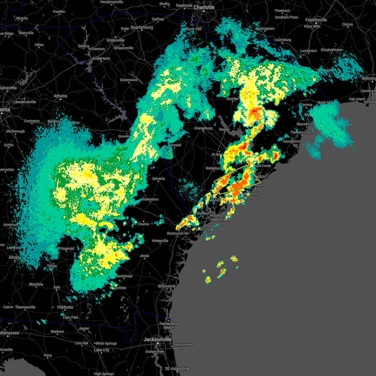 At 832 pm edt, a severe thunderstorm was located over magnolia gardens, moving east at 30 mph (radar indicated). Hazards include 60 mph wind gusts and quarter size hail. Minor hail damage to vehicles is possible. expect wind damage to trees and powerlines. locations impacted include, north charleston, mount pleasant, summerville, hanahan, downtown charleston, west ashley, fort sumter, johns island, i-26/i-526 interchange, ladson, hollywood, ravenel, meggett, bears bluff and wadmalaw island. this warning includes, i-26 between mile markers 207 and 221. I-526 between mile markers 11 and 19. At 832 pm edt, a severe thunderstorm was located over magnolia gardens, moving east at 30 mph (radar indicated). Hazards include 60 mph wind gusts and quarter size hail. Minor hail damage to vehicles is possible. expect wind damage to trees and powerlines. locations impacted include, north charleston, mount pleasant, summerville, hanahan, downtown charleston, west ashley, fort sumter, johns island, i-26/i-526 interchange, ladson, hollywood, ravenel, meggett, bears bluff and wadmalaw island. this warning includes, i-26 between mile markers 207 and 221. I-526 between mile markers 11 and 19.
|
| 3/31/2021 8:13 PM EDT |
 At 812 pm edt, a severe thunderstorm was located over ravenel, moving east at 35 mph (radar indicated). Hazards include 60 mph wind gusts and quarter size hail. Minor hail damage to vehicles is possible. expect wind damage to trees and powerlines. locations impacted include, north charleston, mount pleasant, summerville, hanahan, downtown charleston, west ashley, fort sumter, johns island, i-26/i-526 interchange, ladson, hollywood, ravenel, meggett, bears bluff and wadmalaw island. this warning includes, i-26 between mile markers 207 and 221. I-526 between mile markers 11 and 19. At 812 pm edt, a severe thunderstorm was located over ravenel, moving east at 35 mph (radar indicated). Hazards include 60 mph wind gusts and quarter size hail. Minor hail damage to vehicles is possible. expect wind damage to trees and powerlines. locations impacted include, north charleston, mount pleasant, summerville, hanahan, downtown charleston, west ashley, fort sumter, johns island, i-26/i-526 interchange, ladson, hollywood, ravenel, meggett, bears bluff and wadmalaw island. this warning includes, i-26 between mile markers 207 and 221. I-526 between mile markers 11 and 19.
|
| 3/31/2021 7:54 PM EDT |
 At 753 pm edt, a severe thunderstorm was located near jacksonboro, moving east at 30 mph (radar indicated). Hazards include 60 mph wind gusts and quarter size hail. Minor hail damage to vehicles is possible. Expect wind damage to trees and powerlines. At 753 pm edt, a severe thunderstorm was located near jacksonboro, moving east at 30 mph (radar indicated). Hazards include 60 mph wind gusts and quarter size hail. Minor hail damage to vehicles is possible. Expect wind damage to trees and powerlines.
|
| 8/18/2020 5:39 PM EDT |
 At 516 pm edt, a severe thunderstorm was located over ravenel, moving east at 20 mph (radar indicated). Hazards include 60 mph wind gusts and quarter size hail. Minor hail damage to vehicles is possible. expect wind damage to trees and powerlines. Locations impacted include, hollywood, ravenel, meggett, adams run and yonges island. At 516 pm edt, a severe thunderstorm was located over ravenel, moving east at 20 mph (radar indicated). Hazards include 60 mph wind gusts and quarter size hail. Minor hail damage to vehicles is possible. expect wind damage to trees and powerlines. Locations impacted include, hollywood, ravenel, meggett, adams run and yonges island.
|
| 8/18/2020 5:17 PM EDT |
 At 516 pm edt, a severe thunderstorm was located over ravenel, moving east at 20 mph (radar indicated). Hazards include 60 mph wind gusts and quarter size hail. Minor hail damage to vehicles is possible. expect wind damage to trees and powerlines. Locations impacted include, hollywood, ravenel, meggett, adams run and yonges island. At 516 pm edt, a severe thunderstorm was located over ravenel, moving east at 20 mph (radar indicated). Hazards include 60 mph wind gusts and quarter size hail. Minor hail damage to vehicles is possible. expect wind damage to trees and powerlines. Locations impacted include, hollywood, ravenel, meggett, adams run and yonges island.
|
| 8/18/2020 5:05 PM EDT |
 At 505 pm edt, a severe thunderstorm was located near delemar crossroads, moving east at 15 mph (radar indicated). Hazards include 60 mph wind gusts and quarter size hail. Minor hail damage to vehicles is possible. expect wind damage to trees and powerlines. Locations impacted include, hollywood, ravenel, meggett, adams run, jacksonboro and yonges island. At 505 pm edt, a severe thunderstorm was located near delemar crossroads, moving east at 15 mph (radar indicated). Hazards include 60 mph wind gusts and quarter size hail. Minor hail damage to vehicles is possible. expect wind damage to trees and powerlines. Locations impacted include, hollywood, ravenel, meggett, adams run, jacksonboro and yonges island.
|
| 8/18/2020 4:47 PM EDT |
 At 447 pm edt, a severe thunderstorm was located over jacksonboro, moving east at 20 mph (radar indicated). Hazards include 60 mph wind gusts and quarter size hail. Minor hail damage to vehicles is possible. Expect wind damage to trees and powerlines. At 447 pm edt, a severe thunderstorm was located over jacksonboro, moving east at 20 mph (radar indicated). Hazards include 60 mph wind gusts and quarter size hail. Minor hail damage to vehicles is possible. Expect wind damage to trees and powerlines.
|
| 6/30/2020 9:13 PM EDT |
 The severe thunderstorm warning for charleston and dorchester counties will expire at 915 pm edt, the storm which prompted the warning has weakened below severe limits, and no longer pose an immediate threat to life or property. therefore the warning will be allowed to expire. The severe thunderstorm warning for charleston and dorchester counties will expire at 915 pm edt, the storm which prompted the warning has weakened below severe limits, and no longer pose an immediate threat to life or property. therefore the warning will be allowed to expire.
|
| 6/30/2020 8:32 PM EDT |
 At 831 pm edt, a severe thunderstorm was located near ravenel, moving southeast at 20 mph (radar indicated). Hazards include 60 mph wind gusts. Expect damage to trees and powerlines. locations impacted include, ravenel, meggett, and red top. this warning includes, i-26 near mile marker 221. I-526 between mile markers 11 and 15. At 831 pm edt, a severe thunderstorm was located near ravenel, moving southeast at 20 mph (radar indicated). Hazards include 60 mph wind gusts. Expect damage to trees and powerlines. locations impacted include, ravenel, meggett, and red top. this warning includes, i-26 near mile marker 221. I-526 between mile markers 11 and 15.
|
| 6/30/2020 8:13 PM EDT |
 At 812 pm edt, a severe thunderstorm was located over delemar crossroads, moving southeast at 20 mph (radar indicated). Hazards include 60 mph wind gusts and nickel size hail. expect damage to trees and powerlines At 812 pm edt, a severe thunderstorm was located over delemar crossroads, moving southeast at 20 mph (radar indicated). Hazards include 60 mph wind gusts and nickel size hail. expect damage to trees and powerlines
|
| 5/20/2020 12:05 PM EDT |
 At 1204 pm edt, a severe thunderstorm was located over west ashley, moving northeast at 15 mph (radar indicated. just before noon, half dollar hail was reported on johns island). Hazards include 60 mph wind gusts and half dollar size hail. Minor hail damage to vehicles is possible. expect wind damage to trees and powerlines. locations impacted include, johns island, west ashley, james island, hollywood, ravenel, seabrook island, meggett, rockville, yonges island, bears bluff, wadmalaw island and maybank bridge. This warning includes i-526 near mile marker 11. At 1204 pm edt, a severe thunderstorm was located over west ashley, moving northeast at 15 mph (radar indicated. just before noon, half dollar hail was reported on johns island). Hazards include 60 mph wind gusts and half dollar size hail. Minor hail damage to vehicles is possible. expect wind damage to trees and powerlines. locations impacted include, johns island, west ashley, james island, hollywood, ravenel, seabrook island, meggett, rockville, yonges island, bears bluff, wadmalaw island and maybank bridge. This warning includes i-526 near mile marker 11.
|
| 5/20/2020 11:54 AM EDT |
 At 1154 am edt, a severe thunderstorm capable of producing a tornado was located over johns island, moving northeast at 10 mph (radar indicated rotation). Hazards include tornado. Flying debris will be dangerous to those caught without shelter. mobile homes will be damaged or destroyed. damage to roofs, windows, and vehicles will occur. tree damage is likely. locations impacted include, west ashley, johns island, james island and maybank bridge. This warning includes i-526 between mile markers 11 and 12. At 1154 am edt, a severe thunderstorm capable of producing a tornado was located over johns island, moving northeast at 10 mph (radar indicated rotation). Hazards include tornado. Flying debris will be dangerous to those caught without shelter. mobile homes will be damaged or destroyed. damage to roofs, windows, and vehicles will occur. tree damage is likely. locations impacted include, west ashley, johns island, james island and maybank bridge. This warning includes i-526 between mile markers 11 and 12.
|
| 5/20/2020 11:50 AM EDT | Half Dollar sized hail reported 3.9 miles W of Hollywood, SC, half dollar size hail was reported on johns island. |
| 5/20/2020 11:47 AM EDT |
 At 1147 am edt, a severe thunderstorm capable of producing a tornado was located over johns island, moving northeast at 15 mph (radar indicated rotation). Hazards include tornado. Flying debris will be dangerous to those caught without shelter. mobile homes will be damaged or destroyed. damage to roofs, windows, and vehicles will occur. Tree damage is likely. At 1147 am edt, a severe thunderstorm capable of producing a tornado was located over johns island, moving northeast at 15 mph (radar indicated rotation). Hazards include tornado. Flying debris will be dangerous to those caught without shelter. mobile homes will be damaged or destroyed. damage to roofs, windows, and vehicles will occur. Tree damage is likely.
|
| 5/20/2020 11:40 AM EDT |
 At 1139 am edt, a severe thunderstorm was located over wadmalaw island, moving northeast at 15 mph (radar indicated). Hazards include 60 mph wind gusts and quarter size hail. Minor hail damage to vehicles is possible. Expect wind damage to trees and powerlines. At 1139 am edt, a severe thunderstorm was located over wadmalaw island, moving northeast at 15 mph (radar indicated). Hazards include 60 mph wind gusts and quarter size hail. Minor hail damage to vehicles is possible. Expect wind damage to trees and powerlines.
|
| 4/13/2020 8:29 AM EDT |
 At 828 am edt, severe thunderstorms were located along a line extending from near debordieu colony to near lighthouse island to near folly beach, moving east at 50 mph (trained weather spotters). Hazards include 70 mph wind gusts and penny size hail. Expect considerable tree damage. damage is likely to mobile homes, roofs, and outbuildings. locations impacted include, north charleston, mount pleasant, summerville, goose creek, hanahan, mcclellanville, edisto beach, fort sumter, downtown charleston, west ashley, daniel island, naval weapons station charleston, johns island, i-26/i-526 interchange and james island. this warning includes, i-26 between mile markers 205 and 221. I-526 between mile markers 11 and 31. At 828 am edt, severe thunderstorms were located along a line extending from near debordieu colony to near lighthouse island to near folly beach, moving east at 50 mph (trained weather spotters). Hazards include 70 mph wind gusts and penny size hail. Expect considerable tree damage. damage is likely to mobile homes, roofs, and outbuildings. locations impacted include, north charleston, mount pleasant, summerville, goose creek, hanahan, mcclellanville, edisto beach, fort sumter, downtown charleston, west ashley, daniel island, naval weapons station charleston, johns island, i-26/i-526 interchange and james island. this warning includes, i-26 between mile markers 205 and 221. I-526 between mile markers 11 and 31.
|
| 4/13/2020 8:14 AM EDT |
 At 814 am edt, a severe thunderstorm capable of producing a tornado was located near edisto island, moving east at 45 mph (radar indicated rotation). Hazards include tornado. Flying debris will be dangerous to those caught without shelter. mobile homes will be damaged or destroyed. damage to roofs, windows, and vehicles will occur. tree damage is likely. Locations impacted include, edisto beach, johns island, hollywood, seabrook island, kiawah island, meggett, rockville, yonges island, edisto island, bears bluff and wadmalaw island. At 814 am edt, a severe thunderstorm capable of producing a tornado was located near edisto island, moving east at 45 mph (radar indicated rotation). Hazards include tornado. Flying debris will be dangerous to those caught without shelter. mobile homes will be damaged or destroyed. damage to roofs, windows, and vehicles will occur. tree damage is likely. Locations impacted include, edisto beach, johns island, hollywood, seabrook island, kiawah island, meggett, rockville, yonges island, edisto island, bears bluff and wadmalaw island.
|
| 4/13/2020 8:00 AM EDT |
 At 759 am edt, a severe thunderstorm capable of producing a tornado was located near bennetts point, moving east at 45 mph (radar indicated rotation). Hazards include tornado. Flying debris will be dangerous to those caught without shelter. mobile homes will be damaged or destroyed. damage to roofs, windows, and vehicles will occur. Tree damage is likely. At 759 am edt, a severe thunderstorm capable of producing a tornado was located near bennetts point, moving east at 45 mph (radar indicated rotation). Hazards include tornado. Flying debris will be dangerous to those caught without shelter. mobile homes will be damaged or destroyed. damage to roofs, windows, and vehicles will occur. Tree damage is likely.
|
| 4/13/2020 7:42 AM EDT |
 At 741 am edt, severe thunderstorms were located along a line extending from 7 miles southwest of jamestown to near magnolia gardens to near dale, moving east at 50 mph (radar indicated). Hazards include 70 mph wind gusts and penny size hail. Expect considerable tree damage. Damage is likely to mobile homes, roofs, and outbuildings. At 741 am edt, severe thunderstorms were located along a line extending from 7 miles southwest of jamestown to near magnolia gardens to near dale, moving east at 50 mph (radar indicated). Hazards include 70 mph wind gusts and penny size hail. Expect considerable tree damage. Damage is likely to mobile homes, roofs, and outbuildings.
|
| 4/13/2020 6:53 AM EDT |
 At 652 am edt, severe thunderstorms were located along a line extending from near santee cooper regional airport to near cottageville to tillman, moving east at 90 mph (radar indicated). Hazards include 70 mph wind gusts and penny size hail. Expect considerable tree damage. Damage is likely to mobile homes, roofs, and outbuildings. At 652 am edt, severe thunderstorms were located along a line extending from near santee cooper regional airport to near cottageville to tillman, moving east at 90 mph (radar indicated). Hazards include 70 mph wind gusts and penny size hail. Expect considerable tree damage. Damage is likely to mobile homes, roofs, and outbuildings.
|
| 3/31/2020 5:34 PM EDT |
 At 534 pm edt, severe thunderstorms were located along a line extending from near summerville to near delemar crossroads to near green pond, moving east at 40 mph (radar indicated). Hazards include 60 mph wind gusts. Expect damage to trees and powerlines. locations impacted include, north charleston, summerville, hanahan, west ashley, ladson, i-26/i-526 interchange, johns island, hollywood, ravenel, meggett, jedburg, charleston airport, jacksonboro, ritter and delemar crossroads. this warning includes, i-26 between mile markers 206 and 213. I-526 between mile markers 17 and 18. At 534 pm edt, severe thunderstorms were located along a line extending from near summerville to near delemar crossroads to near green pond, moving east at 40 mph (radar indicated). Hazards include 60 mph wind gusts. Expect damage to trees and powerlines. locations impacted include, north charleston, summerville, hanahan, west ashley, ladson, i-26/i-526 interchange, johns island, hollywood, ravenel, meggett, jedburg, charleston airport, jacksonboro, ritter and delemar crossroads. this warning includes, i-26 between mile markers 206 and 213. I-526 between mile markers 17 and 18.
|
| 3/31/2020 5:09 PM EDT |
 At 508 pm edt, severe thunderstorms were located along a line extending from ridgeville to near round o to near grays, moving east at 40 mph (radar indicated). Hazards include 60 mph wind gusts and quarter size hail. Minor hail damage to vehicles is possible. Expect wind damage to trees and powerlines. At 508 pm edt, severe thunderstorms were located along a line extending from ridgeville to near round o to near grays, moving east at 40 mph (radar indicated). Hazards include 60 mph wind gusts and quarter size hail. Minor hail damage to vehicles is possible. Expect wind damage to trees and powerlines.
|
| 8/14/2019 4:55 PM EDT |
 At 454 pm edt, a severe thunderstorm was located 11 miles southwest of middleton place, moving east at 15 mph (radar indicated). Hazards include 60 mph wind gusts. Expect damage to trees and powerlines. Locations impacted include, charleston, north charleston, summerville, middleton place, slands bridge, hollywood, ravenel and meggett. At 454 pm edt, a severe thunderstorm was located 11 miles southwest of middleton place, moving east at 15 mph (radar indicated). Hazards include 60 mph wind gusts. Expect damage to trees and powerlines. Locations impacted include, charleston, north charleston, summerville, middleton place, slands bridge, hollywood, ravenel and meggett.
|
| 8/14/2019 4:37 PM EDT |
 At 435 pm edt, a severe thunderstorm was located 16 miles southwest of middleton place, moving east at 20 mph (radar indicated). Hazards include 60 mph wind gusts and nickel size hail. expect damage to trees and powerlines At 435 pm edt, a severe thunderstorm was located 16 miles southwest of middleton place, moving east at 20 mph (radar indicated). Hazards include 60 mph wind gusts and nickel size hail. expect damage to trees and powerlines
|
| 8/14/2019 3:31 PM EDT |
 At 331 pm edt, a severe thunderstorm was located over ladson, and is nearly stationary (radar indicated). Hazards include 60 mph wind gusts. Expect damage to trees and powerlines. locations impacted include, charleston, north charleston, mount pleasant, summerville, goose creek, hanahan, middleton place and slands bridge. this warning includes, i-26 between mile markers 193 and 220. I-526 between mile markers 12 and 29. At 331 pm edt, a severe thunderstorm was located over ladson, and is nearly stationary (radar indicated). Hazards include 60 mph wind gusts. Expect damage to trees and powerlines. locations impacted include, charleston, north charleston, mount pleasant, summerville, goose creek, hanahan, middleton place and slands bridge. this warning includes, i-26 between mile markers 193 and 220. I-526 between mile markers 12 and 29.
|
| 8/14/2019 3:12 PM EDT |
 At 311 pm edt, a severe thunderstorm was located near ladson, and is nearly stationary (radar indicated. these thunderstorms also have a history of producing hail the size of quarters). Hazards include 60 mph wind gusts and quarter size hail. Minor hail damage to vehicles is possible. Expect wind damage to trees and powerlines. At 311 pm edt, a severe thunderstorm was located near ladson, and is nearly stationary (radar indicated. these thunderstorms also have a history of producing hail the size of quarters). Hazards include 60 mph wind gusts and quarter size hail. Minor hail damage to vehicles is possible. Expect wind damage to trees and powerlines.
|
| 7/17/2019 7:12 PM EDT | Charleston county 911 reported a tree down on highway 162 near the intersection with highway 174. highway 162 had to be closed for a time due to the tree in the roadway in charleston county SC, 9.3 miles ENE of Hollywood, SC |
| 7/17/2019 7:11 PM EDT |
 At 711 pm edt, a severe thunderstorm was located 14 miles north of edisto beach, moving east at 15 mph (radar indicated). Hazards include 60 mph wind gusts and quarter size hail. Minor hail damage to vehicles is possible. expect wind damage to trees and powerlines. Locations impacted include, hollywood, ravenel, seabrook island, meggett, rockville, delemar crossroads, yonges island and adams run. At 711 pm edt, a severe thunderstorm was located 14 miles north of edisto beach, moving east at 15 mph (radar indicated). Hazards include 60 mph wind gusts and quarter size hail. Minor hail damage to vehicles is possible. expect wind damage to trees and powerlines. Locations impacted include, hollywood, ravenel, seabrook island, meggett, rockville, delemar crossroads, yonges island and adams run.
|
| 7/17/2019 7:06 PM EDT |
 At 706 pm edt, a severe thunderstorm was located 15 miles north of edisto beach, moving east at 15 mph (radar indicated). Hazards include 60 mph wind gusts and quarter size hail. Minor hail damage to vehicles is possible. expect wind damage to trees and powerlines. Locations impacted include, hollywood, ravenel, seabrook island, meggett, rockville, delemar crossroads, yonges island and adams run. At 706 pm edt, a severe thunderstorm was located 15 miles north of edisto beach, moving east at 15 mph (radar indicated). Hazards include 60 mph wind gusts and quarter size hail. Minor hail damage to vehicles is possible. expect wind damage to trees and powerlines. Locations impacted include, hollywood, ravenel, seabrook island, meggett, rockville, delemar crossroads, yonges island and adams run.
|
| 7/17/2019 6:33 PM EDT |
 At 633 pm edt, a severe thunderstorm was located 17 miles southeast of walterboro, moving east at 15 mph (radar indicated). Hazards include 60 mph wind gusts and quarter size hail. Minor hail damage to vehicles is possible. Expect wind damage to trees and powerlines. At 633 pm edt, a severe thunderstorm was located 17 miles southeast of walterboro, moving east at 15 mph (radar indicated). Hazards include 60 mph wind gusts and quarter size hail. Minor hail damage to vehicles is possible. Expect wind damage to trees and powerlines.
|
| 7/2/2019 4:04 PM EDT |
 At 404 pm edt, a severe thunderstorm was located near edisto beach, moving south at 15 mph (radar indicated). Hazards include 60 mph wind gusts and penny size hail. Expect damage to trees and powerlines. Locations impacted include, edisto beach, seabrook island, meggett, rockville, bears bluff and edisto island. At 404 pm edt, a severe thunderstorm was located near edisto beach, moving south at 15 mph (radar indicated). Hazards include 60 mph wind gusts and penny size hail. Expect damage to trees and powerlines. Locations impacted include, edisto beach, seabrook island, meggett, rockville, bears bluff and edisto island.
|
| 7/2/2019 3:35 PM EDT | Warning point reported tree down on white point road near highway 17 in charleston county SC, 11.7 miles NE of Hollywood, SC |
| 7/2/2019 3:25 PM EDT |
 At 324 pm edt, a severe thunderstorm was located 13 miles north of edisto beach, moving south at 5 mph (radar indicated). Hazards include 60 mph wind gusts and quarter size hail. Minor hail damage to vehicles is possible. Expect wind damage to trees and powerlines. At 324 pm edt, a severe thunderstorm was located 13 miles north of edisto beach, moving south at 5 mph (radar indicated). Hazards include 60 mph wind gusts and quarter size hail. Minor hail damage to vehicles is possible. Expect wind damage to trees and powerlines.
|
| 6/22/2019 6:30 PM EDT |
 At 629 pm edt, severe thunderstorms were located along a line extending from near charleston to 10 miles southwest of fort sumter, moving northeast at 40 mph (radar indicated. at 627 pm, a wind gust to 61 mph was recorded by an automated weather sensor on the folly beach pier). Hazards include 60 mph wind gusts. Expect damage to trees and powerlines. locations impacted include, charleston, mount pleasant, downtown charleston, fort sumter, hollywood, isle of palms, folly beach and ravenel. This warning includes i-526 near mile marker 11. At 629 pm edt, severe thunderstorms were located along a line extending from near charleston to 10 miles southwest of fort sumter, moving northeast at 40 mph (radar indicated. at 627 pm, a wind gust to 61 mph was recorded by an automated weather sensor on the folly beach pier). Hazards include 60 mph wind gusts. Expect damage to trees and powerlines. locations impacted include, charleston, mount pleasant, downtown charleston, fort sumter, hollywood, isle of palms, folly beach and ravenel. This warning includes i-526 near mile marker 11.
|
| 6/22/2019 6:19 PM EDT |
 At 619 pm edt, severe thunderstorms were located along a line extending from 10 miles west of charleston to 21 miles south of fort sumter, moving east at 60 mph (radar indicated). Hazards include 60 mph wind gusts. expect damage to trees and powerlines At 619 pm edt, severe thunderstorms were located along a line extending from 10 miles west of charleston to 21 miles south of fort sumter, moving east at 60 mph (radar indicated). Hazards include 60 mph wind gusts. expect damage to trees and powerlines
|
| 6/22/2019 5:24 PM EDT |
 At 524 pm edt, severe thunderstorms were located along a line extending from 11 miles north of beaufort to near edisto beach, moving east at 35 mph (radar indicated). Hazards include 60 mph wind gusts. Expect damage to trees and powerlines. locations impacted include, beaufort, walterboro, edisto beach, clarendon, hollywood, meggett, cottageville and bennetts point. This warning includes i-95 in south carolina between mile markers 49 and 55. At 524 pm edt, severe thunderstorms were located along a line extending from 11 miles north of beaufort to near edisto beach, moving east at 35 mph (radar indicated). Hazards include 60 mph wind gusts. Expect damage to trees and powerlines. locations impacted include, beaufort, walterboro, edisto beach, clarendon, hollywood, meggett, cottageville and bennetts point. This warning includes i-95 in south carolina between mile markers 49 and 55.
|
| 6/22/2019 4:51 PM EDT |
 At 451 pm edt, severe thunderstorms were located along a line extending from near yemassee to 6 miles north of beaufort, moving east at 45 mph (radar indicated). Hazards include 60 mph wind gusts. expect damage to trees and powerlines At 451 pm edt, severe thunderstorms were located along a line extending from near yemassee to 6 miles north of beaufort, moving east at 45 mph (radar indicated). Hazards include 60 mph wind gusts. expect damage to trees and powerlines
|
| 6/22/2019 6:28 AM EDT |
 At 628 am edt, severe thunderstorms were located along a line extending from 6 miles northeast of mcclellanville to 8 miles southwest of fort sumter to near hilton head island, moving southeast at 50 mph (radar indicated). Hazards include 60 mph wind gusts and quarter size hail. Minor hail damage to vehicles is possible. expect wind damage to trees and powerlines. locations impacted include, charleston, north charleston, mount pleasant, hilton head island, goose creek, hanahan, bluffton and beaufort. this warning includes, i-26 between mile markers 210 and 221. I-526 between mile markers 11 and 31. At 628 am edt, severe thunderstorms were located along a line extending from 6 miles northeast of mcclellanville to 8 miles southwest of fort sumter to near hilton head island, moving southeast at 50 mph (radar indicated). Hazards include 60 mph wind gusts and quarter size hail. Minor hail damage to vehicles is possible. expect wind damage to trees and powerlines. locations impacted include, charleston, north charleston, mount pleasant, hilton head island, goose creek, hanahan, bluffton and beaufort. this warning includes, i-26 between mile markers 210 and 221. I-526 between mile markers 11 and 31.
|
| 6/22/2019 6:09 AM EDT |
 The national weather service in charleston has issued a * severe thunderstorm warning for portions of. beaufort county in southeastern south carolina. charleston county in southeastern south carolina. colleton county in southeastern south carolina. Berkeley county in southeastern south carolina. The national weather service in charleston has issued a * severe thunderstorm warning for portions of. beaufort county in southeastern south carolina. charleston county in southeastern south carolina. colleton county in southeastern south carolina. Berkeley county in southeastern south carolina.
|
| 6/20/2019 7:59 PM EDT | Charleston county dispatch reported a tree down on dixie plantation r in charleston county SC, 2.3 miles NE of Hollywood, SC |
| 6/20/2019 7:59 PM EDT |
 At 759 pm edt, severe thunderstorms were located along a line extending from near naval weapons station charleston to 6 miles south of magnolia gardens to 8 miles northwest of edisto beach, moving southeast at 50 mph (radar indicated). Hazards include 60 mph wind gusts. Expect damage to trees and powerlines. locations impacted include, charleston, north charleston, mount pleasant, summerville, goose creek, hanahan, edisto beach and middleton place. this warning includes, i-26 between mile markers 205 and 221. I-526 between mile markers 11 and 31. At 759 pm edt, severe thunderstorms were located along a line extending from near naval weapons station charleston to 6 miles south of magnolia gardens to 8 miles northwest of edisto beach, moving southeast at 50 mph (radar indicated). Hazards include 60 mph wind gusts. Expect damage to trees and powerlines. locations impacted include, charleston, north charleston, mount pleasant, summerville, goose creek, hanahan, edisto beach and middleton place. this warning includes, i-26 between mile markers 205 and 221. I-526 between mile markers 11 and 31.
|
| 6/20/2019 7:24 PM EDT |
 At 724 pm edt, severe thunderstorms were located along a line extending from 7 miles north of summerville to 6 miles northeast of walterboro to near yemassee, moving east at 40 mph (radar indicated). Hazards include 60 mph wind gusts. expect damage to trees and powerlines At 724 pm edt, severe thunderstorms were located along a line extending from 7 miles north of summerville to 6 miles northeast of walterboro to near yemassee, moving east at 40 mph (radar indicated). Hazards include 60 mph wind gusts. expect damage to trees and powerlines
|
| 6/4/2019 4:36 PM EDT |
 At 436 pm edt, a severe thunderstorm was located 13 miles southeast of walterboro, moving south at 10 mph (radar indicated). Hazards include 70 mph wind gusts and ping pong ball size hail. People and animals outdoors will be injured. expect hail damage to roofs, siding, windows, and vehicles. expect considerable tree damage. wind damage is also likely to mobile homes, roofs, and outbuildings. Locations impacted include, meggett, adams run, jacksonboro and ashepoo. At 436 pm edt, a severe thunderstorm was located 13 miles southeast of walterboro, moving south at 10 mph (radar indicated). Hazards include 70 mph wind gusts and ping pong ball size hail. People and animals outdoors will be injured. expect hail damage to roofs, siding, windows, and vehicles. expect considerable tree damage. wind damage is also likely to mobile homes, roofs, and outbuildings. Locations impacted include, meggett, adams run, jacksonboro and ashepoo.
|
| 6/4/2019 4:11 PM EDT |
 The national weather service in charleston has issued a * severe thunderstorm warning for portions of. charleston county in southeastern south carolina. colleton county in southeastern south carolina. dorchester county in southeastern south carolina. Until 500 pm edt. The national weather service in charleston has issued a * severe thunderstorm warning for portions of. charleston county in southeastern south carolina. colleton county in southeastern south carolina. dorchester county in southeastern south carolina. Until 500 pm edt.
|
| 4/19/2019 2:39 PM EDT |
 At 238 pm edt, severe thunderstorms were located along a line extending from near summerville to 14 miles southwest of fort sumter, moving northeast at 55 mph (radar indicated. these thunderstorms have a history of producing wind damage). Hazards include 70 mph wind gusts. Expect considerable tree damage. Damage is likely to mobile homes, roofs, and outbuildings. At 238 pm edt, severe thunderstorms were located along a line extending from near summerville to 14 miles southwest of fort sumter, moving northeast at 55 mph (radar indicated. these thunderstorms have a history of producing wind damage). Hazards include 70 mph wind gusts. Expect considerable tree damage. Damage is likely to mobile homes, roofs, and outbuildings.
|
| 4/19/2019 2:30 PM EDT |
 At 229 pm edt, severe thunderstorms were located along a line extending from 6 miles south of manning to 6 miles north of moncks corner to 11 miles southwest of middleton place, moving northeast at 60 mph (radar indicated. these thunderstorms have a history of producing wind damage). Hazards include 70 mph wind gusts. Expect considerable tree damage. damage is likely to mobile homes, roofs, and outbuildings. locations impacted include, charleston, north charleston, mount pleasant, summerville, goose creek, hanahan, moncks corner and edisto beach. this warning includes, i-26 between mile markers 184 and 221. I-526 between mile markers 11 and 31. At 229 pm edt, severe thunderstorms were located along a line extending from 6 miles south of manning to 6 miles north of moncks corner to 11 miles southwest of middleton place, moving northeast at 60 mph (radar indicated. these thunderstorms have a history of producing wind damage). Hazards include 70 mph wind gusts. Expect considerable tree damage. damage is likely to mobile homes, roofs, and outbuildings. locations impacted include, charleston, north charleston, mount pleasant, summerville, goose creek, hanahan, moncks corner and edisto beach. this warning includes, i-26 between mile markers 184 and 221. I-526 between mile markers 11 and 31.
|
| 4/19/2019 2:05 PM EDT | Ace basin raws (abrs1) gusted to 60 mph in charleston county SC, 14.7 miles ENE of Hollywood, SC |
| 4/19/2019 2:02 PM EDT |
 At 201 pm edt, severe thunderstorms were located along a line extending from 13 miles north of indian field to near givhans ferry state park to 14 miles northwest of edisto beach, moving northeast at 50 mph (radar indicated. these thunderstorms have a history of producing wind damage). Hazards include 70 mph wind gusts. Expect considerable tree damage. damage is likely to mobile homes, roofs, and outbuildings. locations impacted include, charleston, north charleston, mount pleasant, summerville, goose creek, hanahan, moncks corner and walterboro. this warning includes, i-26 between mile markers 171 and 221. i-526 between mile markers 11 and 31. I-95 in south carolina between mile markers 69 and 85. At 201 pm edt, severe thunderstorms were located along a line extending from 13 miles north of indian field to near givhans ferry state park to 14 miles northwest of edisto beach, moving northeast at 50 mph (radar indicated. these thunderstorms have a history of producing wind damage). Hazards include 70 mph wind gusts. Expect considerable tree damage. damage is likely to mobile homes, roofs, and outbuildings. locations impacted include, charleston, north charleston, mount pleasant, summerville, goose creek, hanahan, moncks corner and walterboro. this warning includes, i-26 between mile markers 171 and 221. i-526 between mile markers 11 and 31. I-95 in south carolina between mile markers 69 and 85.
|
| 4/19/2019 1:40 PM EDT |
 At 138 pm edt, severe thunderstorms were located along a line extending from 7 miles southeast of bamberg to 14 miles northwest of edisto beach, moving northeast at 90 mph (radar indicated. these thunderstorms have a history of producing wind damage). Hazards include 70 mph wind gusts. Expect considerable tree damage. Damage is likely to mobile homes, roofs, and outbuildings. At 138 pm edt, severe thunderstorms were located along a line extending from 7 miles southeast of bamberg to 14 miles northwest of edisto beach, moving northeast at 90 mph (radar indicated. these thunderstorms have a history of producing wind damage). Hazards include 70 mph wind gusts. Expect considerable tree damage. Damage is likely to mobile homes, roofs, and outbuildings.
|
| 8/9/2018 8:16 PM EDT |
 At 815 pm edt, a severe thunderstorm was located near middleton place, moving east at 25 mph (radar indicated. these thunderstorms have a history of producing wind damage with numerous trees down across colleton and dorchester counties). Hazards include 60 mph wind gusts. Expect damage to trees and powerlines. locations impacted include, charleston, north charleston, summerville, goose creek, hanahan, middleton place, archdale and slands bridge. this warning includes, i-26 between mile markers 196 and 211. I-526 between mile markers 11 and 13. At 815 pm edt, a severe thunderstorm was located near middleton place, moving east at 25 mph (radar indicated. these thunderstorms have a history of producing wind damage with numerous trees down across colleton and dorchester counties). Hazards include 60 mph wind gusts. Expect damage to trees and powerlines. locations impacted include, charleston, north charleston, summerville, goose creek, hanahan, middleton place, archdale and slands bridge. this warning includes, i-26 between mile markers 196 and 211. I-526 between mile markers 11 and 13.
|
| 8/9/2018 8:05 PM EDT | South carolina highway patrol reported a tree down near 8600 moffett roa in charleston county SC, 11.4 miles ENE of Hollywood, SC |
| 8/9/2018 7:50 PM EDT |
 At 749 pm edt, a severe thunderstorm was located 9 miles south of givhans ferry state park, moving east at 10 mph (radar indicated. at around 715 pm, these thunderstorms blew down trees in and around walterboro). Hazards include 60 mph wind gusts. expect damage to trees and powerlines At 749 pm edt, a severe thunderstorm was located 9 miles south of givhans ferry state park, moving east at 10 mph (radar indicated. at around 715 pm, these thunderstorms blew down trees in and around walterboro). Hazards include 60 mph wind gusts. expect damage to trees and powerlines
|
| 8/6/2018 6:03 PM EDT |
 At 603 pm edt, a severe thunderstorm was located near middleton place, moving southeast at 10 mph (radar indicated). Hazards include 60 mph wind gusts. Expect damage to trees and powerlines. Locations impacted include, north charleston, summerville, slands bridge, middleton place, archdale, ladson and knightsville. At 603 pm edt, a severe thunderstorm was located near middleton place, moving southeast at 10 mph (radar indicated). Hazards include 60 mph wind gusts. Expect damage to trees and powerlines. Locations impacted include, north charleston, summerville, slands bridge, middleton place, archdale, ladson and knightsville.
|
| 8/6/2018 5:32 PM EDT |
 At 532 pm edt, a severe thunderstorm was located over slands bridge, moving southeast at 10 mph (radar indicated). Hazards include 60 mph wind gusts and nickel size hail. expect damage to trees and powerlines At 532 pm edt, a severe thunderstorm was located over slands bridge, moving southeast at 10 mph (radar indicated). Hazards include 60 mph wind gusts and nickel size hail. expect damage to trees and powerlines
|
| 6/25/2018 5:15 PM EDT |
 At 515 pm edt, a severe thunderstorm was located 11 miles southeast of walterboro, moving east at 10 mph (radar indicated). Hazards include 60 mph wind gusts and penny size hail. expect damage to trees and powerlines At 515 pm edt, a severe thunderstorm was located 11 miles southeast of walterboro, moving east at 10 mph (radar indicated). Hazards include 60 mph wind gusts and penny size hail. expect damage to trees and powerlines
|
| 6/14/2018 5:22 PM EDT |
 The severe thunderstorm warning for charleston, colleton, berkeley and dorchester counties will expire at 530 pm edt, the storms which prompted the warning have weakened below severe limits, and no longer pose an immediate threat to life or property. therefore the warning will be allowed to expire. to report severe weather, contact your nearest law enforcement agency. they will relay your report to the national weather service charleston. The severe thunderstorm warning for charleston, colleton, berkeley and dorchester counties will expire at 530 pm edt, the storms which prompted the warning have weakened below severe limits, and no longer pose an immediate threat to life or property. therefore the warning will be allowed to expire. to report severe weather, contact your nearest law enforcement agency. they will relay your report to the national weather service charleston.
|
| 6/14/2018 5:09 PM EDT |
 At 509 pm edt, severe thunderstorms were located along a line extending from 14 miles west of mcclellanville to near walterboro, moving southeast at 15 mph (radar indicated). Hazards include 60 mph wind gusts. Expect damage to trees and powerlines. locations impacted include, charleston, north charleston, mount pleasant, summerville, goose creek, hanahan, walterboro and mcclellanville. this warning includes, i-26 between mile markers 197 and 218. i-526 between mile markers 14 and 26. I-95 in south carolina between mile markers 55 and 64. At 509 pm edt, severe thunderstorms were located along a line extending from 14 miles west of mcclellanville to near walterboro, moving southeast at 15 mph (radar indicated). Hazards include 60 mph wind gusts. Expect damage to trees and powerlines. locations impacted include, charleston, north charleston, mount pleasant, summerville, goose creek, hanahan, walterboro and mcclellanville. this warning includes, i-26 between mile markers 197 and 218. i-526 between mile markers 14 and 26. I-95 in south carolina between mile markers 55 and 64.
|
| 6/14/2018 4:51 PM EDT |
 At 451 pm edt, severe thunderstorms were located along a line extending from 14 miles northeast of naval weapons station charleston to 6 miles north of walterboro, moving southeast at 15 mph (radar indicated). Hazards include 60 mph wind gusts and penny size hail. Expect damage to trees and powerlines. locations impacted include, charleston, north charleston, mount pleasant, summerville, goose creek, hanahan, walterboro and mcclellanville. this warning includes, i-26 between mile markers 191 and 218. i-526 between mile markers 14 and 26. I-95 in south carolina between mile markers 55 and 68. At 451 pm edt, severe thunderstorms were located along a line extending from 14 miles northeast of naval weapons station charleston to 6 miles north of walterboro, moving southeast at 15 mph (radar indicated). Hazards include 60 mph wind gusts and penny size hail. Expect damage to trees and powerlines. locations impacted include, charleston, north charleston, mount pleasant, summerville, goose creek, hanahan, walterboro and mcclellanville. this warning includes, i-26 between mile markers 191 and 218. i-526 between mile markers 14 and 26. I-95 in south carolina between mile markers 55 and 68.
|
| 6/14/2018 4:29 PM EDT |
 The national weather service in charleston has issued a * severe thunderstorm warning for portions of. charleston county in southeastern south carolina. colleton county in southeastern south carolina. berkeley county in southeastern south carolina. Dorchester county in southeastern south carolina. The national weather service in charleston has issued a * severe thunderstorm warning for portions of. charleston county in southeastern south carolina. colleton county in southeastern south carolina. berkeley county in southeastern south carolina. Dorchester county in southeastern south carolina.
|
| 3/20/2018 4:07 PM EDT |
 The severe thunderstorm warning for charleston county will expire at 415 pm edt, the immediate risk for severe weather has ended. to report severe weather, contact your nearest law enforcement agency. they will relay your report to the national weather service charleston. The severe thunderstorm warning for charleston county will expire at 415 pm edt, the immediate risk for severe weather has ended. to report severe weather, contact your nearest law enforcement agency. they will relay your report to the national weather service charleston.
|
| 3/20/2018 3:59 PM EDT |
 At 358 pm edt, severe thunderstorms were located along a line extending from 8 miles southwest of magnolia gardens to 15 miles southwest of fort sumter, moving east at 45 mph (radar indicated). Hazards include 60 mph wind gusts and quarter size hail. Minor hail damage to vehicles is possible. expect wind damage to trees and powerlines. Locations impacted include, charleston, hollywood, folly beach, ravenel, seabrook island, kiawah island, meggett and yonges island. At 358 pm edt, severe thunderstorms were located along a line extending from 8 miles southwest of magnolia gardens to 15 miles southwest of fort sumter, moving east at 45 mph (radar indicated). Hazards include 60 mph wind gusts and quarter size hail. Minor hail damage to vehicles is possible. expect wind damage to trees and powerlines. Locations impacted include, charleston, hollywood, folly beach, ravenel, seabrook island, kiawah island, meggett and yonges island.
|
| 3/20/2018 3:56 PM EDT |
 The severe thunderstorm warning for charleston, berkeley and dorchester counties will expire at 400 pm edt, the immediate risk for severe weather has ended. to report severe weather, contact your nearest law enforcement agency. they will relay your report to the national weather service charleston. The severe thunderstorm warning for charleston, berkeley and dorchester counties will expire at 400 pm edt, the immediate risk for severe weather has ended. to report severe weather, contact your nearest law enforcement agency. they will relay your report to the national weather service charleston.
|
| 3/20/2018 3:46 PM EDT |
 At 345 pm edt, a severe thunderstorm was located near middleton place, moving east at 40 mph (radar indicated. these thunderstorms have a history of producing hail up to golf ball size). Hazards include 60 mph wind gusts and quarter size hail. Minor hail damage to vehicles is possible. expect wind damage to trees and powerlines. locations impacted include, charleston, north charleston, summerville, goose creek, hanahan, moncks corner, middleton place and slands bridge. this warning includes, i-26 between mile markers 188 and 220. I-526 between mile markers 11 and 26. At 345 pm edt, a severe thunderstorm was located near middleton place, moving east at 40 mph (radar indicated. these thunderstorms have a history of producing hail up to golf ball size). Hazards include 60 mph wind gusts and quarter size hail. Minor hail damage to vehicles is possible. expect wind damage to trees and powerlines. locations impacted include, charleston, north charleston, summerville, goose creek, hanahan, moncks corner, middleton place and slands bridge. this warning includes, i-26 between mile markers 188 and 220. I-526 between mile markers 11 and 26.
|
| 3/20/2018 3:41 PM EDT |
 At 340 pm edt, severe thunderstorms were located along a line extending from 15 miles southwest of slands bridge to 8 miles northeast of edisto beach, moving east at 45 mph (radar indicated. at 340 pm edt golf ball size hail was reported near edisto beach). Hazards include golf ball size hail and 60 mph wind gusts. People and animals outdoors will be injured. expect hail damage to roofs, siding, windows, and vehicles. expect wind damage to trees and powerlines. Locations impacted include, charleston, edisto beach, hollywood, folly beach, ravenel, seabrook island, kiawah island and meggett. At 340 pm edt, severe thunderstorms were located along a line extending from 15 miles southwest of slands bridge to 8 miles northeast of edisto beach, moving east at 45 mph (radar indicated. at 340 pm edt golf ball size hail was reported near edisto beach). Hazards include golf ball size hail and 60 mph wind gusts. People and animals outdoors will be injured. expect hail damage to roofs, siding, windows, and vehicles. expect wind damage to trees and powerlines. Locations impacted include, charleston, edisto beach, hollywood, folly beach, ravenel, seabrook island, kiawah island and meggett.
|
| 3/20/2018 3:22 PM EDT |
 At 322 pm edt, severe thunderstorms were located along a line extending from 12 miles northeast of moncks corner to 16 miles west of mcclellanville to archdale, moving east at 65 mph (radar indicated). Hazards include 60 mph wind gusts and half dollar size hail. Minor hail damage to vehicles is possible. expect wind damage to trees and powerlines. locations impacted include, charleston, north charleston, summerville, goose creek, hanahan, moncks corner, middleton place and slands bridge. this warning includes, i-26 between mile markers 188 and 220. I-526 between mile markers 11 and 26. At 322 pm edt, severe thunderstorms were located along a line extending from 12 miles northeast of moncks corner to 16 miles west of mcclellanville to archdale, moving east at 65 mph (radar indicated). Hazards include 60 mph wind gusts and half dollar size hail. Minor hail damage to vehicles is possible. expect wind damage to trees and powerlines. locations impacted include, charleston, north charleston, summerville, goose creek, hanahan, moncks corner, middleton place and slands bridge. this warning includes, i-26 between mile markers 188 and 220. I-526 between mile markers 11 and 26.
|
| 3/20/2018 3:18 PM EDT |
 The national weather service in charleston has issued a * severe thunderstorm warning for portions of. beaufort county in southeastern south carolina. charleston county in southeastern south carolina. colleton county in southeastern south carolina. Dorchester county in southeastern south carolina. The national weather service in charleston has issued a * severe thunderstorm warning for portions of. beaufort county in southeastern south carolina. charleston county in southeastern south carolina. colleton county in southeastern south carolina. Dorchester county in southeastern south carolina.
|
| 3/20/2018 3:06 PM EDT |
 At 306 pm edt, severe thunderstorms were located along a line extending from 7 miles southeast of moncks corner to near slands bridge, moving northeast at 45 mph (radar indicated). Hazards include 60 mph wind gusts and quarter size hail. Minor hail damage to vehicles is possible. Expect wind damage to trees and powerlines. At 306 pm edt, severe thunderstorms were located along a line extending from 7 miles southeast of moncks corner to near slands bridge, moving northeast at 45 mph (radar indicated). Hazards include 60 mph wind gusts and quarter size hail. Minor hail damage to vehicles is possible. Expect wind damage to trees and powerlines.
|
| 3/20/2018 5:11 AM EDT |
 At 511 am edt, a severe thunderstorm was located 10 miles southwest of magnolia gardens, moving east at 60 mph (radar indicated). Hazards include 60 mph wind gusts and quarter size hail. Minor hail damage to vehicles is possible. Expect wind damage to trees and powerlines. At 511 am edt, a severe thunderstorm was located 10 miles southwest of magnolia gardens, moving east at 60 mph (radar indicated). Hazards include 60 mph wind gusts and quarter size hail. Minor hail damage to vehicles is possible. Expect wind damage to trees and powerlines.
|
| 3/20/2018 5:07 AM EDT |
 At 506 am edt, a severe thunderstorm was located 14 miles southwest of middleton place, moving east at 55 mph (radar indicated). Hazards include 60 mph wind gusts and quarter size hail. Minor hail damage to vehicles is possible. expect wind damage to trees and powerlines. Locations impacted include, hollywood, ravenel, meggett and adams run. At 506 am edt, a severe thunderstorm was located 14 miles southwest of middleton place, moving east at 55 mph (radar indicated). Hazards include 60 mph wind gusts and quarter size hail. Minor hail damage to vehicles is possible. expect wind damage to trees and powerlines. Locations impacted include, hollywood, ravenel, meggett and adams run.
|
| 3/20/2018 4:48 AM EDT |
 At 448 am edt, severe thunderstorms were located along a line extending from 11 miles south of givhans ferry state park to 12 miles south of walterboro to 7 miles east of yemassee, moving east at 55 mph (radar indicated). Hazards include 60 mph wind gusts and quarter size hail. Minor hail damage to vehicles is possible. expect wind damage to trees and powerlines. Locations impacted include, hollywood, ravenel, meggett, bennetts point, green pond, adams run, jacksonboro and ashepoo. At 448 am edt, severe thunderstorms were located along a line extending from 11 miles south of givhans ferry state park to 12 miles south of walterboro to 7 miles east of yemassee, moving east at 55 mph (radar indicated). Hazards include 60 mph wind gusts and quarter size hail. Minor hail damage to vehicles is possible. expect wind damage to trees and powerlines. Locations impacted include, hollywood, ravenel, meggett, bennetts point, green pond, adams run, jacksonboro and ashepoo.
|
| 3/20/2018 4:26 AM EDT |
 At 425 am edt, severe thunderstorms were located along a line extending from 7 miles southwest of walterboro to 10 miles southeast of lake warren state park, moving east at 50 mph (radar indicated). Hazards include 60 mph wind gusts and penny size hail. expect damage to trees and powerlines At 425 am edt, severe thunderstorms were located along a line extending from 7 miles southwest of walterboro to 10 miles southeast of lake warren state park, moving east at 50 mph (radar indicated). Hazards include 60 mph wind gusts and penny size hail. expect damage to trees and powerlines
|
| 9/11/2017 2:07 PM EDT |
 At 206 pm edt, a severe thunderstorm capable of producing a tornado was located 9 miles south of slands bridge, moving northwest at 60 mph (radar indicated rotation). Hazards include tornado. Flying debris will be dangerous to those caught without shelter. mobile homes will be damaged or destroyed. damage to roofs, windows, and vehicles will occur. tree damage is likely. Locations impacted include, charleston, hollywood, ravenel and delemar crossroads. At 206 pm edt, a severe thunderstorm capable of producing a tornado was located 9 miles south of slands bridge, moving northwest at 60 mph (radar indicated rotation). Hazards include tornado. Flying debris will be dangerous to those caught without shelter. mobile homes will be damaged or destroyed. damage to roofs, windows, and vehicles will occur. tree damage is likely. Locations impacted include, charleston, hollywood, ravenel and delemar crossroads.
|
| 9/11/2017 2:04 PM EDT |
 At 203 pm edt, a severe thunderstorm capable of producing a tornado was located 9 miles southwest of middleton place, moving northwest at 65 mph (radar indicated rotation). Hazards include tornado. Flying debris will be dangerous to those caught without shelter. mobile homes will be damaged or destroyed. damage to roofs, windows, and vehicles will occur. tree damage is likely. Locations impacted include, hollywood, ravenel, meggett, delemar crossroads, wadmalaw island and yonges island. At 203 pm edt, a severe thunderstorm capable of producing a tornado was located 9 miles southwest of middleton place, moving northwest at 65 mph (radar indicated rotation). Hazards include tornado. Flying debris will be dangerous to those caught without shelter. mobile homes will be damaged or destroyed. damage to roofs, windows, and vehicles will occur. tree damage is likely. Locations impacted include, hollywood, ravenel, meggett, delemar crossroads, wadmalaw island and yonges island.
|
| 9/11/2017 1:53 PM EDT |
 At 152 pm edt, a severe thunderstorm capable of producing a tornado was located 10 miles southwest of charleston, moving northwest at 55 mph (radar indicated rotation). Hazards include tornado. Flying debris will be dangerous to those caught without shelter. mobile homes will be damaged or destroyed. damage to roofs, windows, and vehicles will occur. Tree damage is likely. At 152 pm edt, a severe thunderstorm capable of producing a tornado was located 10 miles southwest of charleston, moving northwest at 55 mph (radar indicated rotation). Hazards include tornado. Flying debris will be dangerous to those caught without shelter. mobile homes will be damaged or destroyed. damage to roofs, windows, and vehicles will occur. Tree damage is likely.
|
| 9/11/2017 1:49 PM EDT |
 At 149 pm edt, a severe thunderstorm capable of producing a tornado was located 14 miles southwest of magnolia gardens, moving northwest at 55 mph (radar indicated rotation). Hazards include tornado. Flying debris will be dangerous to those caught without shelter. mobile homes will be damaged or destroyed. damage to roofs, windows, and vehicles will occur. Tree damage is likely. At 149 pm edt, a severe thunderstorm capable of producing a tornado was located 14 miles southwest of magnolia gardens, moving northwest at 55 mph (radar indicated rotation). Hazards include tornado. Flying debris will be dangerous to those caught without shelter. mobile homes will be damaged or destroyed. damage to roofs, windows, and vehicles will occur. Tree damage is likely.
|
| 9/11/2017 1:22 PM EDT |
 At 122 pm edt, a severe thunderstorm capable of producing a tornado was located 13 miles northeast of edisto beach, moving northwest at 50 mph (radar indicated rotation). Hazards include tornado. Flying debris will be dangerous to those caught without shelter. mobile homes will be damaged or destroyed. damage to roofs, windows, and vehicles will occur. tree damage is likely. Locations impacted include, charleston, hollywood, ravenel, seabrook island, kiawah island, meggett, rockville and johns island. At 122 pm edt, a severe thunderstorm capable of producing a tornado was located 13 miles northeast of edisto beach, moving northwest at 50 mph (radar indicated rotation). Hazards include tornado. Flying debris will be dangerous to those caught without shelter. mobile homes will be damaged or destroyed. damage to roofs, windows, and vehicles will occur. tree damage is likely. Locations impacted include, charleston, hollywood, ravenel, seabrook island, kiawah island, meggett, rockville and johns island.
|
| 9/11/2017 1:10 PM EDT |
 At 110 pm edt, a severe thunderstorm capable of producing a tornado was located 15 miles southwest of fort sumter, moving northwest at 50 mph (radar indicated rotation). Hazards include tornado. Flying debris will be dangerous to those caught without shelter. mobile homes will be damaged or destroyed. damage to roofs, windows, and vehicles will occur. Tree damage is likely. At 110 pm edt, a severe thunderstorm capable of producing a tornado was located 15 miles southwest of fort sumter, moving northwest at 50 mph (radar indicated rotation). Hazards include tornado. Flying debris will be dangerous to those caught without shelter. mobile homes will be damaged or destroyed. damage to roofs, windows, and vehicles will occur. Tree damage is likely.
|
| 9/11/2017 12:59 PM EDT |
 At 1258 pm edt, a severe thunderstorm capable of producing a tornado was located near magnolia gardens, moving northwest at 55 mph (radar indicated rotation). Hazards include tornado. Flying debris will be dangerous to those caught without shelter. mobile homes will be damaged or destroyed. damage to roofs, windows, and vehicles will occur. Tree damage is likely. At 1258 pm edt, a severe thunderstorm capable of producing a tornado was located near magnolia gardens, moving northwest at 55 mph (radar indicated rotation). Hazards include tornado. Flying debris will be dangerous to those caught without shelter. mobile homes will be damaged or destroyed. damage to roofs, windows, and vehicles will occur. Tree damage is likely.
|
| 9/11/2017 12:37 PM EDT |
 At 1237 pm edt, a severe thunderstorm capable of producing a tornado was located near fort sumter, moving northwest at 60 mph (radar indicated rotation). Hazards include tornado. Flying debris will be dangerous to those caught without shelter. mobile homes will be damaged or destroyed. damage to roofs, windows, and vehicles will occur. Tree damage is likely. At 1237 pm edt, a severe thunderstorm capable of producing a tornado was located near fort sumter, moving northwest at 60 mph (radar indicated rotation). Hazards include tornado. Flying debris will be dangerous to those caught without shelter. mobile homes will be damaged or destroyed. damage to roofs, windows, and vehicles will occur. Tree damage is likely.
|
| 7/8/2017 10:48 PM EDT |
 At 1048 pm edt, severe thunderstorms were located along a line extending from i-26/i-526 interchange to near edisto beach, moving east at 25 mph (radar indicated). Hazards include 60 mph wind gusts. Expect damage to trees and powerlines. locations impacted include, charleston, north charleston, mount pleasant, hanahan, middleton place, downtown charleston, fort sumter and i-26/i-526 interchange. this warning includes, i-26 between mile markers 212 and 221. I-526 between mile markers 11 and 31. At 1048 pm edt, severe thunderstorms were located along a line extending from i-26/i-526 interchange to near edisto beach, moving east at 25 mph (radar indicated). Hazards include 60 mph wind gusts. Expect damage to trees and powerlines. locations impacted include, charleston, north charleston, mount pleasant, hanahan, middleton place, downtown charleston, fort sumter and i-26/i-526 interchange. this warning includes, i-26 between mile markers 212 and 221. I-526 between mile markers 11 and 31.
|
| 7/8/2017 10:27 PM EDT |
 At 1027 pm edt, severe thunderstorms were located along a line extending from middleton place to 10 miles east of port royal, moving east at 25 mph (radar indicated). Hazards include 60 mph wind gusts. Expect damage to trees and powerlines. locations impacted include, charleston, north charleston, mount pleasant, hanahan, edisto beach, middleton place, downtown charleston and fort sumter. this warning includes, i-26 between mile markers 212 and 221. I-526 between mile markers 11 and 31. At 1027 pm edt, severe thunderstorms were located along a line extending from middleton place to 10 miles east of port royal, moving east at 25 mph (radar indicated). Hazards include 60 mph wind gusts. Expect damage to trees and powerlines. locations impacted include, charleston, north charleston, mount pleasant, hanahan, edisto beach, middleton place, downtown charleston and fort sumter. this warning includes, i-26 between mile markers 212 and 221. I-526 between mile markers 11 and 31.
|
| 7/8/2017 9:59 PM EDT |
 At 959 pm edt, severe thunderstorms were located along a line extending from 8 miles southwest of slands bridge to near hilton head island, moving east at 25 mph (radar indicated). Hazards include 60 mph wind gusts. expect damage to trees and powerlines At 959 pm edt, severe thunderstorms were located along a line extending from 8 miles southwest of slands bridge to near hilton head island, moving east at 25 mph (radar indicated). Hazards include 60 mph wind gusts. expect damage to trees and powerlines
|
| 4/5/2017 8:02 PM EDT |
 At 801 pm edt, a severe thunderstorm was located over north charleston, moving east at 35 mph (radar indicated. at 755 pm edt penny to quarter sized hail was occurring in west ashley near carolina bay and hunt club along bees ferry road and savannah highway). Hazards include 60 mph wind gusts and quarter size hail. Hail damage to vehicles is expected. expect wind damage to roofs, siding, and trees. locations impacted include, charleston, north charleston, hanahan, middleton place, i-26/i-526 interchange, archdale, magnolia gardens and hollywood. A tornado watch remains in effect until 1100 pm edt for southeastern south carolina. At 801 pm edt, a severe thunderstorm was located over north charleston, moving east at 35 mph (radar indicated. at 755 pm edt penny to quarter sized hail was occurring in west ashley near carolina bay and hunt club along bees ferry road and savannah highway). Hazards include 60 mph wind gusts and quarter size hail. Hail damage to vehicles is expected. expect wind damage to roofs, siding, and trees. locations impacted include, charleston, north charleston, hanahan, middleton place, i-26/i-526 interchange, archdale, magnolia gardens and hollywood. A tornado watch remains in effect until 1100 pm edt for southeastern south carolina.
|
| 4/5/2017 7:46 PM EDT |
 At 745 pm edt, a severe thunderstorm was located near magnolia gardens, moving east at 40 mph (radar indicated). Hazards include 60 mph wind gusts and penny size hail. Expect damage to roofs, siding, and trees. locations impacted include, charleston, north charleston, hanahan, middleton place, i-26/i-526 interchange, archdale, magnolia gardens and hollywood. A tornado watch remains in effect until 800 pm edt for southeastern south carolina. At 745 pm edt, a severe thunderstorm was located near magnolia gardens, moving east at 40 mph (radar indicated). Hazards include 60 mph wind gusts and penny size hail. Expect damage to roofs, siding, and trees. locations impacted include, charleston, north charleston, hanahan, middleton place, i-26/i-526 interchange, archdale, magnolia gardens and hollywood. A tornado watch remains in effect until 800 pm edt for southeastern south carolina.
|
| 4/5/2017 7:23 PM EDT |
 At 723 pm edt, a severe thunderstorm was located 15 miles southeast of walterboro, moving east at 40 mph (radar indicated). Hazards include 60 mph wind gusts and quarter size hail. Hail damage to vehicles is expected. Expect wind damage to roofs, siding, and trees. At 723 pm edt, a severe thunderstorm was located 15 miles southeast of walterboro, moving east at 40 mph (radar indicated). Hazards include 60 mph wind gusts and quarter size hail. Hail damage to vehicles is expected. Expect wind damage to roofs, siding, and trees.
|
| 4/3/2017 6:36 PM EDT |
 At 636 pm edt, a severe thunderstorm was located 7 miles south of magnolia gardens, moving northeast at 60 mph (radar indicated). Hazards include 60 mph wind gusts and quarter size hail. Hail damage to vehicles is expected. Expect wind damage to roofs, siding, and trees. At 636 pm edt, a severe thunderstorm was located 7 miles south of magnolia gardens, moving northeast at 60 mph (radar indicated). Hazards include 60 mph wind gusts and quarter size hail. Hail damage to vehicles is expected. Expect wind damage to roofs, siding, and trees.
|
| 3/22/2017 1:09 AM EDT |
 At 109 am edt, severe thunderstorms were located along a line extending from 11 miles northeast of naval weapons station charleston to 7 miles southwest of charleston, moving northeast at 10 mph (radar indicated). Hazards include 60 mph wind gusts and quarter size hail. Hail damage to vehicles is expected. expect wind damage to roofs, siding, and trees. Locations impacted include, charleston, north charleston, mount pleasant, goose creek, hanahan, moncks corner, middleton place and i-26/i-526 interchange. At 109 am edt, severe thunderstorms were located along a line extending from 11 miles northeast of naval weapons station charleston to 7 miles southwest of charleston, moving northeast at 10 mph (radar indicated). Hazards include 60 mph wind gusts and quarter size hail. Hail damage to vehicles is expected. expect wind damage to roofs, siding, and trees. Locations impacted include, charleston, north charleston, mount pleasant, goose creek, hanahan, moncks corner, middleton place and i-26/i-526 interchange.
|
| 3/22/2017 12:59 AM EDT |
 At 1259 am edt, severe thunderstorms were located along a line extending from 9 miles southeast of moncks corner to 10 miles southwest of charleston, moving east at 40 mph (radar indicated). Hazards include 60 mph wind gusts and quarter size hail. Hail damage to vehicles is expected. expect wind damage to roofs, siding, and trees. Locations impacted include, charleston, north charleston, mount pleasant, summerville, goose creek, hanahan, moncks corner and middleton place. At 1259 am edt, severe thunderstorms were located along a line extending from 9 miles southeast of moncks corner to 10 miles southwest of charleston, moving east at 40 mph (radar indicated). Hazards include 60 mph wind gusts and quarter size hail. Hail damage to vehicles is expected. expect wind damage to roofs, siding, and trees. Locations impacted include, charleston, north charleston, mount pleasant, summerville, goose creek, hanahan, moncks corner and middleton place.
|
| 3/22/2017 12:50 AM EDT |
 At 1249 am edt, a severe thunderstorm was located over i-26/i-526 interchange, moving east at 60 mph (radar indicated). Hazards include 60 mph wind gusts and quarter size hail. Hail damage to vehicles is expected. Expect wind damage to roofs, siding, and trees. At 1249 am edt, a severe thunderstorm was located over i-26/i-526 interchange, moving east at 60 mph (radar indicated). Hazards include 60 mph wind gusts and quarter size hail. Hail damage to vehicles is expected. Expect wind damage to roofs, siding, and trees.
|
| 1/21/2017 4:38 PM EST |
 The severe thunderstorm warning for beaufort, charleston, colleton, berkeley, dorchester and jasper counties will expire at 445 pm est, the storms which prompted the warning have weakened below severe limits, and no longer pose an immediate threat to life or property. therefore the warning will be allowed to expire. however gusty winds are still possible with these thunderstorms. The severe thunderstorm warning for beaufort, charleston, colleton, berkeley, dorchester and jasper counties will expire at 445 pm est, the storms which prompted the warning have weakened below severe limits, and no longer pose an immediate threat to life or property. therefore the warning will be allowed to expire. however gusty winds are still possible with these thunderstorms.
|
| 1/21/2017 4:12 PM EST |
 At 411 pm est, severe thunderstorms were located along a line extending from near saint george to 14 miles southwest of slands bridge to 6 miles east of beaufort, moving east at 45 mph (radar indicated). Hazards include 60 mph wind gusts. Expect damage to roofs, siding, and trees. locations impacted include, charleston, north charleston, summerville, goose creek, hanahan, beaufort, port royal and moncks corner. A tornado watch remains in effect until 700 pm est for southeastern south carolina. At 411 pm est, severe thunderstorms were located along a line extending from near saint george to 14 miles southwest of slands bridge to 6 miles east of beaufort, moving east at 45 mph (radar indicated). Hazards include 60 mph wind gusts. Expect damage to roofs, siding, and trees. locations impacted include, charleston, north charleston, summerville, goose creek, hanahan, beaufort, port royal and moncks corner. A tornado watch remains in effect until 700 pm est for southeastern south carolina.
|
| 1/21/2017 3:56 PM EST |
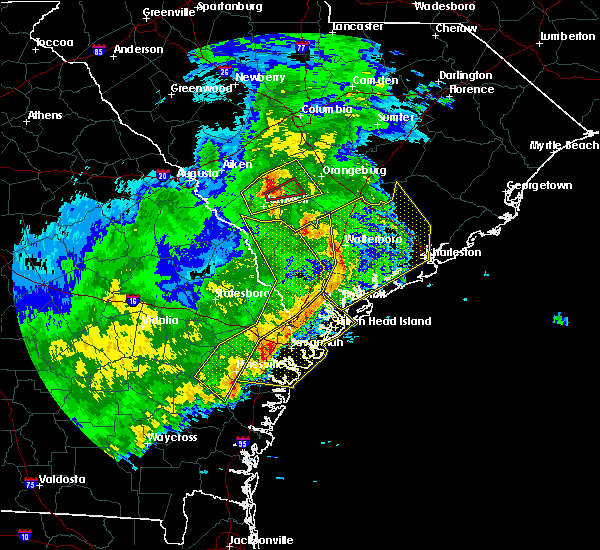 At 356 pm est, severe thunderstorms were located along a line extending from 16 miles southeast of bamberg to 10 miles south of walterboro to near port royal, moving east at 65 mph (radar indicated). Hazards include 60 mph wind gusts. expect damage to roofs, siding, and trees At 356 pm est, severe thunderstorms were located along a line extending from 16 miles southeast of bamberg to 10 miles south of walterboro to near port royal, moving east at 65 mph (radar indicated). Hazards include 60 mph wind gusts. expect damage to roofs, siding, and trees
|
| 1/3/2017 2:39 AM EST |
 At 239 am est, severe thunderstorms were located along a line extending from near givhans ferry state park to 14 miles southwest of middleton place to near edisto beach, moving east at 55 mph (radar indicated). Hazards include 60 mph wind gusts. expect damage to roofs, siding, and trees At 239 am est, severe thunderstorms were located along a line extending from near givhans ferry state park to 14 miles southwest of middleton place to near edisto beach, moving east at 55 mph (radar indicated). Hazards include 60 mph wind gusts. expect damage to roofs, siding, and trees
|
| 1/3/2017 2:26 AM EST |
 At 226 am est, severe thunderstorms were located along a line extending from 18 miles southeast of walterboro to 8 miles northwest of edisto beach to 8 miles east of port royal, moving east at 50 mph (radar indicated). Hazards include 60 mph wind gusts. Expect damage to roofs, siding, and trees. Locations impacted include, beaufort, port royal, edisto beach, clarendon, hollywood, ravenel, meggett and bennetts point. At 226 am est, severe thunderstorms were located along a line extending from 18 miles southeast of walterboro to 8 miles northwest of edisto beach to 8 miles east of port royal, moving east at 50 mph (radar indicated). Hazards include 60 mph wind gusts. Expect damage to roofs, siding, and trees. Locations impacted include, beaufort, port royal, edisto beach, clarendon, hollywood, ravenel, meggett and bennetts point.
|
| 1/3/2017 2:04 AM EST |
 At 203 am est, a severe thunderstorm was located near beaufort, moving east at 35 mph (radar indicated). Hazards include 60 mph wind gusts and penny size hail. expect damage to roofs, siding, and trees At 203 am est, a severe thunderstorm was located near beaufort, moving east at 35 mph (radar indicated). Hazards include 60 mph wind gusts and penny size hail. expect damage to roofs, siding, and trees
|
| 9/11/2016 5:44 PM EDT |
 At 543 pm edt, severe thunderstorms were located along a line extending from slands bridge to near hanahan, moving east at 30 mph (radar indicated). Hazards include 60 mph wind gusts and penny size hail. Expect damage to roofs. siding. And trees. At 543 pm edt, severe thunderstorms were located along a line extending from slands bridge to near hanahan, moving east at 30 mph (radar indicated). Hazards include 60 mph wind gusts and penny size hail. Expect damage to roofs. siding. And trees.
|
| 7/21/2016 3:54 PM EDT |
 At 354 pm edt, a severe thunderstorm was located over archdale, moving southeast at 15 mph (radar indicated). Hazards include 60 mph wind gusts. Expect damage to roofs. siding. and trees. Locations impacted include, north charleston, goose creek, hanahan, archdale, middleton place, magnolia gardens and i-26/i-526 interchange. At 354 pm edt, a severe thunderstorm was located over archdale, moving southeast at 15 mph (radar indicated). Hazards include 60 mph wind gusts. Expect damage to roofs. siding. and trees. Locations impacted include, north charleston, goose creek, hanahan, archdale, middleton place, magnolia gardens and i-26/i-526 interchange.
|
| 7/21/2016 3:44 PM EDT |
 At 344 pm edt, a severe thunderstorm was located over archdale, moving south at 5 mph (radar indicated). Hazards include 60 mph wind gusts. Expect damage to roofs. siding. and trees. Locations impacted include, charleston, north charleston, mount pleasant, goose creek, hanahan, archdale, middleton place and magnolia gardens. At 344 pm edt, a severe thunderstorm was located over archdale, moving south at 5 mph (radar indicated). Hazards include 60 mph wind gusts. Expect damage to roofs. siding. and trees. Locations impacted include, charleston, north charleston, mount pleasant, goose creek, hanahan, archdale, middleton place and magnolia gardens.
|
| 7/21/2016 3:26 PM EDT |
 At 326 pm edt, a severe thunderstorm was located over north charleston, moving south at 10 mph (radar indicated). Hazards include 60 mph wind gusts and quarter size hail. Hail damage to vehicles is expected. expect wind damage to roofs, siding, and trees. Locations impacted include, charleston, north charleston, mount pleasant, goose creek, hanahan, middleton place, west ashley, downtown charleston and archdale. At 326 pm edt, a severe thunderstorm was located over north charleston, moving south at 10 mph (radar indicated). Hazards include 60 mph wind gusts and quarter size hail. Hail damage to vehicles is expected. expect wind damage to roofs, siding, and trees. Locations impacted include, charleston, north charleston, mount pleasant, goose creek, hanahan, middleton place, west ashley, downtown charleston and archdale.
|
| 7/21/2016 3:13 PM EDT |
 At 313 pm edt, a severe thunderstorm was located over north charleston, moving southeast at 15 mph (radar indicated). Hazards include 60 mph wind gusts and quarter size hail. Hail damage to vehicles is expected. Expect wind damage to roofs, siding, and trees. At 313 pm edt, a severe thunderstorm was located over north charleston, moving southeast at 15 mph (radar indicated). Hazards include 60 mph wind gusts and quarter size hail. Hail damage to vehicles is expected. Expect wind damage to roofs, siding, and trees.
|
| 7/20/2016 3:42 PM EDT |
 At 341 pm edt, severe thunderstorms were located along a line extending from 7 miles northeast of walterboro to 12 miles south of slands bridge, moving south at 15 mph (radar indicated). Hazards include 60 mph wind gusts. Expect damage to roofs. siding. and trees. Locations impacted include, walterboro, hollywood, ravenel, meggett, cottageville, round o, ashepoo and ritter. At 341 pm edt, severe thunderstorms were located along a line extending from 7 miles northeast of walterboro to 12 miles south of slands bridge, moving south at 15 mph (radar indicated). Hazards include 60 mph wind gusts. Expect damage to roofs. siding. and trees. Locations impacted include, walterboro, hollywood, ravenel, meggett, cottageville, round o, ashepoo and ritter.
|
| 7/20/2016 3:32 PM EDT |
 At 332 pm edt, severe thunderstorms were located along a line extending from 8 miles northeast of walterboro to 10 miles south of slands bridge, moving southwest at 10 mph (radar indicated). Hazards include 60 mph wind gusts. Expect damage to roofs. siding. and trees. Locations impacted include, walterboro, hollywood, ravenel, meggett, cottageville, round o, ashepoo and ritter. At 332 pm edt, severe thunderstorms were located along a line extending from 8 miles northeast of walterboro to 10 miles south of slands bridge, moving southwest at 10 mph (radar indicated). Hazards include 60 mph wind gusts. Expect damage to roofs. siding. and trees. Locations impacted include, walterboro, hollywood, ravenel, meggett, cottageville, round o, ashepoo and ritter.
|
| 7/20/2016 3:14 PM EDT |
 At 313 pm edt, severe thunderstorms were located along a line extending from 7 miles southwest of givhans ferry state park to near slands bridge, moving south at 15 mph (radar indicated). Hazards include 60 mph wind gusts. Expect damage to roofs. siding. And trees. At 313 pm edt, severe thunderstorms were located along a line extending from 7 miles southwest of givhans ferry state park to near slands bridge, moving south at 15 mph (radar indicated). Hazards include 60 mph wind gusts. Expect damage to roofs. siding. And trees.
|
| 7/19/2016 7:05 PM EDT |
 The severe thunderstorm warning for charleston, dorchester and colleton counties will expire at 715 pm edt, the storms which prompted the warning have weakened below severe limits, and no longer pose an immediate threat to life or property. therefore the warning will be allowed to expire. The severe thunderstorm warning for charleston, dorchester and colleton counties will expire at 715 pm edt, the storms which prompted the warning have weakened below severe limits, and no longer pose an immediate threat to life or property. therefore the warning will be allowed to expire.
|
| 7/19/2016 6:47 PM EDT |
 At 647 pm edt, severe thunderstorms were located along a line extending from 6 miles southwest of givhans ferry state park to 8 miles south of slands bridge to magnolia gardens, moving southwest at 10 mph (radar indicated). Hazards include 60 mph wind gusts and nickel size hail. Expect damage to roofs. siding. and trees. Locations impacted include, archdale, magnolia gardens, middleton place, hollywood, ravenel and cottageville. At 647 pm edt, severe thunderstorms were located along a line extending from 6 miles southwest of givhans ferry state park to 8 miles south of slands bridge to magnolia gardens, moving southwest at 10 mph (radar indicated). Hazards include 60 mph wind gusts and nickel size hail. Expect damage to roofs. siding. and trees. Locations impacted include, archdale, magnolia gardens, middleton place, hollywood, ravenel and cottageville.
|
| 7/19/2016 6:32 PM EDT |
 At 632 pm edt, severe thunderstorms were located along a line extending from near givhans ferry state park to 6 miles south of slands bridge to archdale, moving southwest at 10 mph (radar indicated). Hazards include 60 mph wind gusts and half dollar size hail. Hail damage to vehicles is expected. Expect wind damage to roofs, siding, and trees. At 632 pm edt, severe thunderstorms were located along a line extending from near givhans ferry state park to 6 miles south of slands bridge to archdale, moving southwest at 10 mph (radar indicated). Hazards include 60 mph wind gusts and half dollar size hail. Hail damage to vehicles is expected. Expect wind damage to roofs, siding, and trees.
|
| 7/14/2016 3:25 PM EDT |
 At 324 pm edt, a severe thunderstorm was located over magnolia gardens, moving northeast at 5 mph (radar indicated). Hazards include 60 mph wind gusts and quarter size hail. Hail damage to vehicles is expected. Expect wind damage to roofs, siding, and trees. At 324 pm edt, a severe thunderstorm was located over magnolia gardens, moving northeast at 5 mph (radar indicated). Hazards include 60 mph wind gusts and quarter size hail. Hail damage to vehicles is expected. Expect wind damage to roofs, siding, and trees.
|
| 7/9/2016 4:17 PM EDT |
 At 416 pm edt, severe thunderstorms were located along a line extending from 23 miles southwest of charleston to near edisto beach to near hilton head island, moving southeast at 25 mph (radar indicated). Hazards include 60 mph wind gusts and quarter size hail. Hail damage to vehicles is expected. expect wind damage to roofs, siding, and trees. Locations impacted include, hilton head island, bluffton, beaufort, port royal, edisto beach, clarendon, seabrook island and kiawah island. At 416 pm edt, severe thunderstorms were located along a line extending from 23 miles southwest of charleston to near edisto beach to near hilton head island, moving southeast at 25 mph (radar indicated). Hazards include 60 mph wind gusts and quarter size hail. Hail damage to vehicles is expected. expect wind damage to roofs, siding, and trees. Locations impacted include, hilton head island, bluffton, beaufort, port royal, edisto beach, clarendon, seabrook island and kiawah island.
|
| 7/9/2016 3:52 PM EDT |
 At 351 pm edt, severe thunderstorms were located along a line extending from 7 miles north of edisto beach to 10 miles northeast of beaufort to near bluffton, moving southeast at 25 mph (radar indicated). Hazards include 60 mph wind gusts and quarter size hail. Hail damage to vehicles is expected. Expect wind damage to roofs, siding, and trees. At 351 pm edt, severe thunderstorms were located along a line extending from 7 miles north of edisto beach to 10 miles northeast of beaufort to near bluffton, moving southeast at 25 mph (radar indicated). Hazards include 60 mph wind gusts and quarter size hail. Hail damage to vehicles is expected. Expect wind damage to roofs, siding, and trees.
|
| 7/6/2016 6:33 PM EDT |
 At 632 pm edt, severe thunderstorms were located along a line extending from 9 miles northeast of edisto beach to near hilton head island, moving east at 50 mph (radar indicated). Hazards include 60 mph wind gusts. Expect damage to roofs. siding. and trees. Locations impacted include, charleston, hilton head island, beaufort, port royal, edisto beach, clarendon, hollywood and folly beach. At 632 pm edt, severe thunderstorms were located along a line extending from 9 miles northeast of edisto beach to near hilton head island, moving east at 50 mph (radar indicated). Hazards include 60 mph wind gusts. Expect damage to roofs. siding. and trees. Locations impacted include, charleston, hilton head island, beaufort, port royal, edisto beach, clarendon, hollywood and folly beach.
|
| 7/6/2016 6:14 PM EDT |
 At 613 pm edt, severe thunderstorms were located along a line extending from 10 miles northwest of edisto beach to near bluffton, moving southeast at 30 mph (radar indicated). Hazards include 60 mph wind gusts. Expect damage to roofs. siding. and trees. Locations impacted include, charleston, hilton head island, bluffton, beaufort, port royal, ridgeland, yemassee and edisto beach. At 613 pm edt, severe thunderstorms were located along a line extending from 10 miles northwest of edisto beach to near bluffton, moving southeast at 30 mph (radar indicated). Hazards include 60 mph wind gusts. Expect damage to roofs. siding. and trees. Locations impacted include, charleston, hilton head island, bluffton, beaufort, port royal, ridgeland, yemassee and edisto beach.
|
| 7/6/2016 5:58 PM EDT |
 At 558 pm edt, a severe thunderstorm was located near yemassee, moving east at 50 mph (radar indicated). Hazards include 60 mph wind gusts. Expect damage to roofs. siding. And trees. At 558 pm edt, a severe thunderstorm was located near yemassee, moving east at 50 mph (radar indicated). Hazards include 60 mph wind gusts. Expect damage to roofs. siding. And trees.
|
| 7/4/2016 6:56 PM EDT |
 The severe thunderstorm warning for charleston, dorchester and colleton counties will expire at 700 pm edt, the storms which prompted the warning have moved out of the area. therefore the warning will be allowed to expire. however gusty winds and lightning are still likely with these thunderstorms as they move into the charleston metro area. to report severe weather, contact your nearest law enforcement agency. they will relay your report to the national weather service charleston. The severe thunderstorm warning for charleston, dorchester and colleton counties will expire at 700 pm edt, the storms which prompted the warning have moved out of the area. therefore the warning will be allowed to expire. however gusty winds and lightning are still likely with these thunderstorms as they move into the charleston metro area. to report severe weather, contact your nearest law enforcement agency. they will relay your report to the national weather service charleston.
|
| 7/4/2016 6:43 PM EDT |
 At 642 pm edt, severe thunderstorms were located along a line extending from near middleton place to 13 miles northeast of edisto beach, moving northeast at 35 mph (radar indicated). Hazards include 60 mph wind gusts. Expect damage to roofs. siding. and trees. Locations impacted include, hollywood, ravenel, seabrook island, kiawah island, meggett and rockville. At 642 pm edt, severe thunderstorms were located along a line extending from near middleton place to 13 miles northeast of edisto beach, moving northeast at 35 mph (radar indicated). Hazards include 60 mph wind gusts. Expect damage to roofs. siding. and trees. Locations impacted include, hollywood, ravenel, seabrook island, kiawah island, meggett and rockville.
|
| 7/4/2016 6:12 PM EDT |
 At 611 pm edt, severe thunderstorms were located along a line extending from 14 miles southeast of walterboro to 7 miles west of edisto beach, moving northeast at 35 mph (radar indicated). Hazards include 60 mph wind gusts. Expect damage to roofs. siding. and trees. Locations impacted include, summerville, edisto beach, hollywood, ravenel, seabrook island, parkers ferry, adams run and meggett. At 611 pm edt, severe thunderstorms were located along a line extending from 14 miles southeast of walterboro to 7 miles west of edisto beach, moving northeast at 35 mph (radar indicated). Hazards include 60 mph wind gusts. Expect damage to roofs. siding. and trees. Locations impacted include, summerville, edisto beach, hollywood, ravenel, seabrook island, parkers ferry, adams run and meggett.
|
| 7/4/2016 5:53 PM EDT |
 At 553 pm edt, severe thunderstorms were located along a line extending from 15 miles south of walterboro to near beaufort, moving northeast at 35 mph (radar indicated). Hazards include 60 mph wind gusts. Expect damage to roofs. siding. And trees. At 553 pm edt, severe thunderstorms were located along a line extending from 15 miles south of walterboro to near beaufort, moving northeast at 35 mph (radar indicated). Hazards include 60 mph wind gusts. Expect damage to roofs. siding. And trees.
|
| 6/17/2016 5:23 PM EDT |
 The severe thunderstorm warning for charleston and colleton counties will expire at 530 pm edt, the storms which prompted the warning have moved out of the area. therefore the warning will be allowed to expire. a severe thunderstorm watch remains in effect until 1000 pm edt for southeastern south carolina. to report severe weather, contact your nearest law enforcement agency. they will relay your report to the national weather service charleston. The severe thunderstorm warning for charleston and colleton counties will expire at 530 pm edt, the storms which prompted the warning have moved out of the area. therefore the warning will be allowed to expire. a severe thunderstorm watch remains in effect until 1000 pm edt for southeastern south carolina. to report severe weather, contact your nearest law enforcement agency. they will relay your report to the national weather service charleston.
|
| 6/17/2016 5:18 PM EDT |
 At 517 pm edt, severe thunderstorms were located along a line extending from 18 miles south of fort sumter to 7 miles northeast of edisto beach, moving southeast at 30 mph (radar indicated). Hazards include 60 mph wind gusts. Expect damage to roofs. siding. and trees. Locations impacted include, seabrook island, kiawah island, meggett, rockville, edisto island, yonges island and bears bluff. At 517 pm edt, severe thunderstorms were located along a line extending from 18 miles south of fort sumter to 7 miles northeast of edisto beach, moving southeast at 30 mph (radar indicated). Hazards include 60 mph wind gusts. Expect damage to roofs. siding. and trees. Locations impacted include, seabrook island, kiawah island, meggett, rockville, edisto island, yonges island and bears bluff.
|
| 6/17/2016 5:15 PM EDT | Ace basin raws in charleston county SC, 14.7 miles ENE of Hollywood, SC |
| 6/17/2016 5:06 PM EDT | Charleston county sheriff office reports a tree down and blocking road at intersection of smoak road and ethel post office roa in charleston county SC, 7.2 miles NE of Hollywood, SC |
| 6/17/2016 4:58 PM EDT |
 At 456 pm edt, severe thunderstorms were located along a line extending from 12 miles southwest of fort sumter to 12 miles north of edisto beach, moving south at 40 mph (radar indicated). Hazards include 60 mph wind gusts. Expect damage to roofs. siding. and trees. Locations impacted include, edisto beach, hollywood. At 456 pm edt, severe thunderstorms were located along a line extending from 12 miles southwest of fort sumter to 12 miles north of edisto beach, moving south at 40 mph (radar indicated). Hazards include 60 mph wind gusts. Expect damage to roofs. siding. and trees. Locations impacted include, edisto beach, hollywood.
|
| 6/17/2016 4:50 PM EDT | Ethel post office road closed near smoak road due to tree over roa in charleston county SC, 7.2 miles NE of Hollywood, SC |
| 6/17/2016 4:33 PM EDT | Charleston county sheriff office reports a tree down at the intersection of highway 165 and ballpark roa in charleston county SC, 3.9 miles ENE of Hollywood, SC |
| 6/17/2016 4:27 PM EDT |
 At 426 pm edt, severe thunderstorms were located along a line extending from 9 miles south of mcclellanville to 6 miles east of walterboro, moving southeast at 30 mph (trained weather spotters). Hazards include 60 mph wind gusts and penny size hail. Expect damage to roofs. siding. And trees. At 426 pm edt, severe thunderstorms were located along a line extending from 9 miles south of mcclellanville to 6 miles east of walterboro, moving southeast at 30 mph (trained weather spotters). Hazards include 60 mph wind gusts and penny size hail. Expect damage to roofs. siding. And trees.
|
| 6/17/2016 4:16 PM EDT |
 At 416 pm edt, severe thunderstorms were located along a line extending from 13 miles northeast of mount pleasant to 9 miles southwest of givhans ferry state park, moving southeast at 25 mph (radar indicated). Hazards include 70 mph wind gusts and quarter size hail. Hail damage to vehicles is expected. expect considerable tree damage. wind damage is also likely to mobile homes, roofs, and outbuildings. Locations impacted include, charleston, north charleston, mount pleasant, summerville, goose creek, hanahan, isle of palms, mcclellanville and givhans ferry state park. At 416 pm edt, severe thunderstorms were located along a line extending from 13 miles northeast of mount pleasant to 9 miles southwest of givhans ferry state park, moving southeast at 25 mph (radar indicated). Hazards include 70 mph wind gusts and quarter size hail. Hail damage to vehicles is expected. expect considerable tree damage. wind damage is also likely to mobile homes, roofs, and outbuildings. Locations impacted include, charleston, north charleston, mount pleasant, summerville, goose creek, hanahan, isle of palms, mcclellanville and givhans ferry state park.
|
| 6/17/2016 3:54 PM EDT |
 At 352 pm edt, severe thunderstorms were located along a line extending from 14 miles west of mcclellanville to near slands bridge, moving southeast at 35 mph (radar indicated). Hazards include 70 mph wind gusts and quarter size hail. Hail damage to vehicles is expected. expect considerable tree damage. wind damage is also likely to mobile homes, roofs, and outbuildings. Locations impacted include, charleston, north charleston, mount pleasant, summerville, goose creek, hanahan, moncks corner and mcclellanville. At 352 pm edt, severe thunderstorms were located along a line extending from 14 miles west of mcclellanville to near slands bridge, moving southeast at 35 mph (radar indicated). Hazards include 70 mph wind gusts and quarter size hail. Hail damage to vehicles is expected. expect considerable tree damage. wind damage is also likely to mobile homes, roofs, and outbuildings. Locations impacted include, charleston, north charleston, mount pleasant, summerville, goose creek, hanahan, moncks corner and mcclellanville.
|
| 6/17/2016 3:36 PM EDT |
 At 335 pm edt, severe thunderstorms were located along a line extending from 9 miles east of moncks corner to near givhans ferry state park, moving southeast at 35 mph (radar indicated). Hazards include 60 mph wind gusts and quarter size hail. Hail damage to vehicles is expected. Expect wind damage to roofs, siding, and trees. At 335 pm edt, severe thunderstorms were located along a line extending from 9 miles east of moncks corner to near givhans ferry state park, moving southeast at 35 mph (radar indicated). Hazards include 60 mph wind gusts and quarter size hail. Hail damage to vehicles is expected. Expect wind damage to roofs, siding, and trees.
|
| 5/3/2016 10:07 PM EDT |
 At 1006 pm edt, a severe thunderstorm was located over hanahan, moving northeast at 55 mph (radar indicated). Hazards include 60 mph wind gusts. Expect damage to roofs. siding. and trees. Locations impacted include, charleston, north charleston, summerville, middleton place, slands bridge, hollywood, folly beach and ravenel. At 1006 pm edt, a severe thunderstorm was located over hanahan, moving northeast at 55 mph (radar indicated). Hazards include 60 mph wind gusts. Expect damage to roofs. siding. and trees. Locations impacted include, charleston, north charleston, summerville, middleton place, slands bridge, hollywood, folly beach and ravenel.
|
| 5/3/2016 9:42 PM EDT |
 At 941 pm edt, a severe thunderstorm was located 14 miles southwest of slands bridge, moving northeast at 55 mph (radar indicated). Hazards include 60 mph wind gusts. Expect damage to roofs. siding. and trees. Locations impacted include, charleston, north charleston, summerville, middleton place, slands bridge, hollywood, folly beach and ravenel. At 941 pm edt, a severe thunderstorm was located 14 miles southwest of slands bridge, moving northeast at 55 mph (radar indicated). Hazards include 60 mph wind gusts. Expect damage to roofs. siding. and trees. Locations impacted include, charleston, north charleston, summerville, middleton place, slands bridge, hollywood, folly beach and ravenel.
|
| 5/3/2016 9:16 PM EDT |
 At 915 pm edt, a severe thunderstorm was located 7 miles southeast of yemassee, moving northeast at 55 mph (radar indicated). Hazards include 60 mph wind gusts and quarter size hail. Hail damage to vehicles is expected. Expect wind damage to roofs, siding, and trees. At 915 pm edt, a severe thunderstorm was located 7 miles southeast of yemassee, moving northeast at 55 mph (radar indicated). Hazards include 60 mph wind gusts and quarter size hail. Hail damage to vehicles is expected. Expect wind damage to roofs, siding, and trees.
|
| 4/28/2016 4:52 PM EDT |
 At 452 pm edt, a severe thunderstorm was located over middleton place, moving southeast at 5 mph (radar indicated). Hazards include 60 mph wind gusts and quarter size hail. Hail damage to vehicles is expected. Expect wind damage to roofs, siding, and trees. At 452 pm edt, a severe thunderstorm was located over middleton place, moving southeast at 5 mph (radar indicated). Hazards include 60 mph wind gusts and quarter size hail. Hail damage to vehicles is expected. Expect wind damage to roofs, siding, and trees.
|
| 4/7/2016 6:12 AM EDT |
 At 612 am edt, severe thunderstorms were located along a line extending from near moncks corner to 12 miles south of slands bridge, moving east at 45 mph (radar indicated). Hazards include 60 mph wind gusts. Expect damage to roofs. siding. And trees. At 612 am edt, severe thunderstorms were located along a line extending from near moncks corner to 12 miles south of slands bridge, moving east at 45 mph (radar indicated). Hazards include 60 mph wind gusts. Expect damage to roofs. siding. And trees.
|
| 10/3/2015 9:08 PM EDT |
 The severe thunderstorm warning for charleston, berkeley and dorchester counties will expire at 915 pm edt, the storm which prompted the warning has moved out of the area. therefore the warning will be allowed to expire. however heavy rain is still possible with this thunderstorm. The severe thunderstorm warning for charleston, berkeley and dorchester counties will expire at 915 pm edt, the storm which prompted the warning has moved out of the area. therefore the warning will be allowed to expire. however heavy rain is still possible with this thunderstorm.
|
| 10/3/2015 8:55 PM EDT |
 At 852 pm edt, a severe thunderstorm was located over ladson, moving northwest at 35 mph (radar indicated). Hazards include 60 mph wind gusts. Expect damage to roofs. siding and trees. Locations impacted include, charleston, north charleston, mount pleasant, goose creek, hanahan, middleton place, downtown charleston and archdale. At 852 pm edt, a severe thunderstorm was located over ladson, moving northwest at 35 mph (radar indicated). Hazards include 60 mph wind gusts. Expect damage to roofs. siding and trees. Locations impacted include, charleston, north charleston, mount pleasant, goose creek, hanahan, middleton place, downtown charleston and archdale.
|
| 10/3/2015 8:29 PM EDT |
 At 828 pm edt, a severe thunderstorm was located over north charleston, moving northwest at 35 mph (radar indicated). Hazards include 60 mph wind gusts. Expect damage to roofs. Siding and trees. At 828 pm edt, a severe thunderstorm was located over north charleston, moving northwest at 35 mph (radar indicated). Hazards include 60 mph wind gusts. Expect damage to roofs. Siding and trees.
|
| 9/25/2015 1:26 AM EDT |
 The tornado warning for dorchester and charleston counties will expire at 130 am edt, the storm which prompted the warning has weakened below severe limits, and no longer appears capable of producing a tornado. therefore the warning will be allowed to expire. The tornado warning for dorchester and charleston counties will expire at 130 am edt, the storm which prompted the warning has weakened below severe limits, and no longer appears capable of producing a tornado. therefore the warning will be allowed to expire.
|
| 9/25/2015 1:18 AM EDT |
 At 117 am edt, a severe thunderstorm capable of producing a tornado was located near middleton place, moving northwest at 20 mph. this storm has a history of producing a tornado in west ashley. damage was reported (radar indicated rotation). Hazards include tornado. Flying debris will be dangerous to those caught without shelter. mobile homes will be damaged or destroyed. damage to roofs, windows and vehicles will occur. tree damage is likely. Locations impacted include, north charleston, archdale, magnolia gardens, middleton place, hollywood and shadowmoss. At 117 am edt, a severe thunderstorm capable of producing a tornado was located near middleton place, moving northwest at 20 mph. this storm has a history of producing a tornado in west ashley. damage was reported (radar indicated rotation). Hazards include tornado. Flying debris will be dangerous to those caught without shelter. mobile homes will be damaged or destroyed. damage to roofs, windows and vehicles will occur. tree damage is likely. Locations impacted include, north charleston, archdale, magnolia gardens, middleton place, hollywood and shadowmoss.
|
| 9/25/2015 1:05 AM EDT |
 At 103 am edt, a confirmed tornado was located near grand oaks, moving north at 30 mph. radar continues to track debris with this tornado (radar confirmed tornado). Hazards include damaging tornado. Flying debris will be dangerous to those caught without shelter. mobile homes will be damaged or destroyed. damage to roofs, windows and vehicles will occur. tree damage is likely. Locations impacted include, charleston, north charleston, hanahan, archdale, magnolia gardens, middleton place, hollywood and ravenel. At 103 am edt, a confirmed tornado was located near grand oaks, moving north at 30 mph. radar continues to track debris with this tornado (radar confirmed tornado). Hazards include damaging tornado. Flying debris will be dangerous to those caught without shelter. mobile homes will be damaged or destroyed. damage to roofs, windows and vehicles will occur. tree damage is likely. Locations impacted include, charleston, north charleston, hanahan, archdale, magnolia gardens, middleton place, hollywood and ravenel.
|
| 9/25/2015 12:55 AM EDT |
 At 1255 am edt, a confirmed tornado was located near red top in west ashley, moving northwest at 25 mph. radar is tracking debris with this tornado (radar confirmed tornado). Hazards include damaging tornado. Flying debris will be dangerous to those caught without shelter. mobile homes will be damaged or destroyed. damage to roofs, windows and vehicles will occur. tree damage is likely. Locations impacted include, charleston, north charleston, hanahan, archdale, magnolia gardens, middleton place, i-26/i-526 interchange and hollywood. At 1255 am edt, a confirmed tornado was located near red top in west ashley, moving northwest at 25 mph. radar is tracking debris with this tornado (radar confirmed tornado). Hazards include damaging tornado. Flying debris will be dangerous to those caught without shelter. mobile homes will be damaged or destroyed. damage to roofs, windows and vehicles will occur. tree damage is likely. Locations impacted include, charleston, north charleston, hanahan, archdale, magnolia gardens, middleton place, i-26/i-526 interchange and hollywood.
|
| 9/25/2015 12:52 AM EDT |
 At 1252 am edt, a confirmed tornado was located near magnolia gardens, moving north at 30 mph. radar was tracking debris with this tornado (radar confirmed tornado). Hazards include damaging tornado. Flying debris will be dangerous to those caught without shelter. mobile homes will be damaged or destroyed. damage to roofs, windows and vehicles will occur. tree damage is likely. Locations impacted include, charleston, north charleston, hanahan, archdale, magnolia gardens, middleton place, i-26/i-526 interchange and hollywood. At 1252 am edt, a confirmed tornado was located near magnolia gardens, moving north at 30 mph. radar was tracking debris with this tornado (radar confirmed tornado). Hazards include damaging tornado. Flying debris will be dangerous to those caught without shelter. mobile homes will be damaged or destroyed. damage to roofs, windows and vehicles will occur. tree damage is likely. Locations impacted include, charleston, north charleston, hanahan, archdale, magnolia gardens, middleton place, i-26/i-526 interchange and hollywood.
|
| 9/25/2015 12:50 AM EDT |
 At 1250 am edt, a severe thunderstorm capable of producing a tornado was located 8 miles south of magnolia gardens, moving north at 30 mph. radar has indicated possible debris with this storm (radar indicated rotation). Hazards include tornado. Flying debris will be dangerous to those caught without shelter. mobile homes will be damaged or destroyed. damage to roofs, windows and vehicles will occur. tree damage is likely. Locations impacted include, charleston, hollywood, james island county park, johns island and maybank bridge. At 1250 am edt, a severe thunderstorm capable of producing a tornado was located 8 miles south of magnolia gardens, moving north at 30 mph. radar has indicated possible debris with this storm (radar indicated rotation). Hazards include tornado. Flying debris will be dangerous to those caught without shelter. mobile homes will be damaged or destroyed. damage to roofs, windows and vehicles will occur. tree damage is likely. Locations impacted include, charleston, hollywood, james island county park, johns island and maybank bridge.
|
| 9/25/2015 12:45 AM EDT |
 At 1245 am edt, a severe thunderstorm capable of producing a tornado was located 8 miles west of charleston, moving north at 30 mph (radar indicated rotation). Hazards include tornado. Flying debris will be dangerous to those caught without shelter. mobile homes will be damaged or destroyed. damage to roofs, windows and vehicles will occur. Tree damage is likely. At 1245 am edt, a severe thunderstorm capable of producing a tornado was located 8 miles west of charleston, moving north at 30 mph (radar indicated rotation). Hazards include tornado. Flying debris will be dangerous to those caught without shelter. mobile homes will be damaged or destroyed. damage to roofs, windows and vehicles will occur. Tree damage is likely.
|
| 9/25/2015 12:38 AM EDT |
 At 1238 am edt, a severe thunderstorm capable of producing a tornado was located 9 miles southwest of charleston, moving north at 25 mph (radar indicated rotation). Hazards include tornado. Flying debris will be dangerous to those caught without shelter. mobile homes will be damaged or destroyed. damage to roofs, windows and vehicles will occur. Tree damage is likely. At 1238 am edt, a severe thunderstorm capable of producing a tornado was located 9 miles southwest of charleston, moving north at 25 mph (radar indicated rotation). Hazards include tornado. Flying debris will be dangerous to those caught without shelter. mobile homes will be damaged or destroyed. damage to roofs, windows and vehicles will occur. Tree damage is likely.
|
| 9/25/2015 12:37 AM EDT |
 At 1237 am edt, a severe thunderstorm was located 9 miles southwest of charleston, moving north at 30 mph (radar indicated). Hazards include 60 mph wind gusts. Expect damage to roofs. Siding and trees. At 1237 am edt, a severe thunderstorm was located 9 miles southwest of charleston, moving north at 30 mph (radar indicated). Hazards include 60 mph wind gusts. Expect damage to roofs. Siding and trees.
|
| 9/10/2015 8:38 PM EDT |
 At 837 pm edt, severe thunderstorms were located along a line extending from 6 miles northeast of naval weapons station charleston to 14 miles east of hilton head island, moving east at 35 mph (radar indicated. at 818 pm an estimate of 60 mph winds and several branches were reported down in the hanahan area). Hazards include 60 mph wind gusts. Expect damage to roofs. siding and trees. Locations impacted include, charleston, north charleston, mount pleasant, goose creek, hanahan, edisto beach, downtown charleston and naval weapons station charleston. At 837 pm edt, severe thunderstorms were located along a line extending from 6 miles northeast of naval weapons station charleston to 14 miles east of hilton head island, moving east at 35 mph (radar indicated. at 818 pm an estimate of 60 mph winds and several branches were reported down in the hanahan area). Hazards include 60 mph wind gusts. Expect damage to roofs. siding and trees. Locations impacted include, charleston, north charleston, mount pleasant, goose creek, hanahan, edisto beach, downtown charleston and naval weapons station charleston.
|
| 9/10/2015 8:12 PM EDT |
 At 811 pm edt, severe thunderstorms were located along a line extending from near ladson to hilton head island, moving east at 35 mph (radar indicated). Hazards include 60 mph wind gusts. Expect damage to roofs. siding and trees. Locations impacted include, charleston, ladson, mount pleasant, summerville, hilton head island, goose creek, hanahan and bluffton. At 811 pm edt, severe thunderstorms were located along a line extending from near ladson to hilton head island, moving east at 35 mph (radar indicated). Hazards include 60 mph wind gusts. Expect damage to roofs. siding and trees. Locations impacted include, charleston, ladson, mount pleasant, summerville, hilton head island, goose creek, hanahan and bluffton.
|
| 9/10/2015 7:54 PM EDT |
 At 754 pm edt, severe thunderstorms were located along a line extending from near slands bridge to bluffton, moving east at 35 mph (radar indicated). Hazards include 60 mph wind gusts. Expect damage to roofs. Siding and trees. At 754 pm edt, severe thunderstorms were located along a line extending from near slands bridge to bluffton, moving east at 35 mph (radar indicated). Hazards include 60 mph wind gusts. Expect damage to roofs. Siding and trees.
|
| 8/6/2015 3:24 PM EDT |
 At 322 pm edt, severe thunderstorms were located along a line extending from 6 miles north of mount pleasant to near fort sumter, moving east at 30 mph (radar indicated. at 318 pm...a wind gust to 51 mph was observed at fort sumter). Hazards include 70 mph wind gusts. Expect considerable tree damage. damage is likely to mobile homes, roofs and outbuildings. Locations impacted include, charleston, north charleston, mount pleasant, goose creek, hanahan, downtown charleston, i-26/i-526 interchange and hollywood. At 322 pm edt, severe thunderstorms were located along a line extending from 6 miles north of mount pleasant to near fort sumter, moving east at 30 mph (radar indicated. at 318 pm...a wind gust to 51 mph was observed at fort sumter). Hazards include 70 mph wind gusts. Expect considerable tree damage. damage is likely to mobile homes, roofs and outbuildings. Locations impacted include, charleston, north charleston, mount pleasant, goose creek, hanahan, downtown charleston, i-26/i-526 interchange and hollywood.
|
| 8/6/2015 3:10 PM EDT |
 At 310 pm edt, severe thunderstorms were located along a line extending from daniel island to 10 miles southwest of charleston, moving east at 30 mph (radar indicated). Hazards include 70 mph wind gusts. Expect considerable tree damage. damage is likely to mobile homes, roofs and outbuildings. Locations impacted include, charleston, north charleston, mount pleasant, goose creek, hanahan, downtown charleston, i-26/i-526 interchange and hollywood. At 310 pm edt, severe thunderstorms were located along a line extending from daniel island to 10 miles southwest of charleston, moving east at 30 mph (radar indicated). Hazards include 70 mph wind gusts. Expect considerable tree damage. damage is likely to mobile homes, roofs and outbuildings. Locations impacted include, charleston, north charleston, mount pleasant, goose creek, hanahan, downtown charleston, i-26/i-526 interchange and hollywood.
|
| 8/6/2015 3:05 PM EDT |
 At 305 pm edt, severe thunderstorms were located along a line extending from near hanahan to 13 miles southwest of charleston, moving east at 30 mph (radar indicated). Hazards include 60 mph wind gusts. Expect damage to roofs. siding and trees. Locations impacted include, charleston, north charleston, mount pleasant, goose creek, hanahan, downtown charleston, i-26/i-526 interchange and hollywood. At 305 pm edt, severe thunderstorms were located along a line extending from near hanahan to 13 miles southwest of charleston, moving east at 30 mph (radar indicated). Hazards include 60 mph wind gusts. Expect damage to roofs. siding and trees. Locations impacted include, charleston, north charleston, mount pleasant, goose creek, hanahan, downtown charleston, i-26/i-526 interchange and hollywood.
|
| 8/6/2015 2:53 PM EDT | Media reported tree down across marshwood dr in the stono ferry area. time estimated based on rada in charleston county SC, 1.2 miles WNW of Hollywood, SC |
| 8/6/2015 2:52 PM EDT |
 At 252 pm edt, severe thunderstorms were located along a line extending from near magnolia gardens to 11 miles north of edisto beach, moving northeast at 25 mph (radar indicated). Hazards include 60 mph wind gusts. Expect damage to roofs. Siding and trees. At 252 pm edt, severe thunderstorms were located along a line extending from near magnolia gardens to 11 miles north of edisto beach, moving northeast at 25 mph (radar indicated). Hazards include 60 mph wind gusts. Expect damage to roofs. Siding and trees.
|
| 7/22/2015 5:11 PM EDT |
 At 511 pm edt, a severe thunderstorm was located 10 miles north of edisto beach, moving east at 10 mph (radar indicated). Hazards include 60 mph wind gusts and quarter size hail. Hail damage to vehicles is expected. Expect wind damage to roofs, siding and trees. At 511 pm edt, a severe thunderstorm was located 10 miles north of edisto beach, moving east at 10 mph (radar indicated). Hazards include 60 mph wind gusts and quarter size hail. Hail damage to vehicles is expected. Expect wind damage to roofs, siding and trees.
|
| 7/21/2015 3:06 PM EDT |
 At 305 pm edt, severe thunderstorms were located along a line extending from 17 miles southwest of charleston to 11 miles southwest of edisto beach, moving east at 20 mph (radar indicated. at 235 pm a tree was reported down near fripp island with these storms). Hazards include 60 mph wind gusts. Expect damage to roofs. siding and trees. Locations impacted include, hollywood, folly beach, seabrook island, kiawah island, meggett, rockville, edisto island and yonges island. At 305 pm edt, severe thunderstorms were located along a line extending from 17 miles southwest of charleston to 11 miles southwest of edisto beach, moving east at 20 mph (radar indicated. at 235 pm a tree was reported down near fripp island with these storms). Hazards include 60 mph wind gusts. Expect damage to roofs. siding and trees. Locations impacted include, hollywood, folly beach, seabrook island, kiawah island, meggett, rockville, edisto island and yonges island.
|
| 7/21/2015 2:50 PM EDT |
 At 250 pm edt, severe thunderstorms were located along a line extending from 11 miles northeast of edisto beach to 9 miles east of port royal, moving east at 25 mph (radar indicated). Hazards include 60 mph wind gusts. Expect damage to roofs. siding and trees. Locations impacted include, edisto beach, hollywood, folly beach, seabrook island, kiawah island, meggett, rockville, hunting island and edisto island. At 250 pm edt, severe thunderstorms were located along a line extending from 11 miles northeast of edisto beach to 9 miles east of port royal, moving east at 25 mph (radar indicated). Hazards include 60 mph wind gusts. Expect damage to roofs. siding and trees. Locations impacted include, edisto beach, hollywood, folly beach, seabrook island, kiawah island, meggett, rockville, hunting island and edisto island.
|
| 7/21/2015 2:28 PM EDT |
 At 228 pm edt, severe thunderstorms were located along a line extending from 13 miles north of edisto beach to beaufort, moving east at 20 mph (radar indicated). Hazards include 60 mph wind gusts and penny size hail. Expect damage to roofs. Siding and trees. At 228 pm edt, severe thunderstorms were located along a line extending from 13 miles north of edisto beach to beaufort, moving east at 20 mph (radar indicated). Hazards include 60 mph wind gusts and penny size hail. Expect damage to roofs. Siding and trees.
|
| 7/19/2015 4:59 PM EDT |
 At 457 pm edt, severe thunderstorms were located along a line extending from 10 miles northeast of naval weapons station charleston to near edisto beach, moving east at 70 mph (radar indicated. at 423 pm a tree was down near magnolia plantation in west ashley). Hazards include 60 mph wind gusts. Expect damage to roofs. siding and trees. locations impacted include, charleston, north charleston, mount pleasant, goose creek, hanahan, mcclellanville, edisto beach, patriots point and i-26/i- 526 interchange. those attending the patriots point event are in the path of these storms and should prepare for imminent dangerous weather conditions. Seek shelter now!. At 457 pm edt, severe thunderstorms were located along a line extending from 10 miles northeast of naval weapons station charleston to near edisto beach, moving east at 70 mph (radar indicated. at 423 pm a tree was down near magnolia plantation in west ashley). Hazards include 60 mph wind gusts. Expect damage to roofs. siding and trees. locations impacted include, charleston, north charleston, mount pleasant, goose creek, hanahan, mcclellanville, edisto beach, patriots point and i-26/i- 526 interchange. those attending the patriots point event are in the path of these storms and should prepare for imminent dangerous weather conditions. Seek shelter now!.
|
| 7/19/2015 4:49 PM EDT |
 At 448 pm edt, severe thunderstorms were located along a line extending from 6 miles east of naval weapons station charleston to near edisto beach, moving east at 60 mph (radar indicated. at 430 pm there was a wind gust to 54 mph at the charleston airport). Hazards include 60 mph wind gusts. Expect damage to roofs. siding and trees. locations impacted include, charleston, north charleston, mount pleasant, goose creek, patriots point, hanahan, mcclellanville, edisto beach and i-26/i- 526 interchange. those attending the show at patriots point are in the path of these storms and should prepare for imminent dangerous weather conditions. Seek shelter now!. At 448 pm edt, severe thunderstorms were located along a line extending from 6 miles east of naval weapons station charleston to near edisto beach, moving east at 60 mph (radar indicated. at 430 pm there was a wind gust to 54 mph at the charleston airport). Hazards include 60 mph wind gusts. Expect damage to roofs. siding and trees. locations impacted include, charleston, north charleston, mount pleasant, goose creek, patriots point, hanahan, mcclellanville, edisto beach and i-26/i- 526 interchange. those attending the show at patriots point are in the path of these storms and should prepare for imminent dangerous weather conditions. Seek shelter now!.
|
| 7/19/2015 4:31 PM EDT |
 At 431 pm edt, severe thunderstorms were located along a line extending from hanahan to 13 miles northwest of edisto beach, moving east at 75 mph (radar indicated). Hazards include 60 mph wind gusts and quarter size hail. Hail damage to vehicles is expected. Expect wind damage to roofs, siding and trees. At 431 pm edt, severe thunderstorms were located along a line extending from hanahan to 13 miles northwest of edisto beach, moving east at 75 mph (radar indicated). Hazards include 60 mph wind gusts and quarter size hail. Hail damage to vehicles is expected. Expect wind damage to roofs, siding and trees.
|
| 7/19/2015 4:03 PM EDT |
 At 402 pm edt, severe thunderstorms were located along a line extending from ladson to 14 miles southeast of walterboro, moving east at 35 mph (radar indicated). Hazards include 60 mph wind gusts and quarter size hail. Hail damage to vehicles is expected. expect wind damage to roofs, siding and trees. Locations impacted include, charleston, north charleston, mount pleasant, summerville, goose creek, hanahan, middleton place and downtown charleston. At 402 pm edt, severe thunderstorms were located along a line extending from ladson to 14 miles southeast of walterboro, moving east at 35 mph (radar indicated). Hazards include 60 mph wind gusts and quarter size hail. Hail damage to vehicles is expected. expect wind damage to roofs, siding and trees. Locations impacted include, charleston, north charleston, mount pleasant, summerville, goose creek, hanahan, middleton place and downtown charleston.
|
| 7/19/2015 3:32 PM EDT |
 At 331 pm edt, severe thunderstorms were located along a line extending from near summerville to 15 miles north of edisto beach, moving east at 30 mph (radar indicated). Hazards include 60 mph wind gusts and quarter size hail. Hail damage to vehicles is expected. Expect wind damage to roofs, siding and trees. At 331 pm edt, severe thunderstorms were located along a line extending from near summerville to 15 miles north of edisto beach, moving east at 30 mph (radar indicated). Hazards include 60 mph wind gusts and quarter size hail. Hail damage to vehicles is expected. Expect wind damage to roofs, siding and trees.
|
| 7/13/2015 9:58 PM EDT | The severe thunderstorm warning for charleston. dorchester and berkeley counties will expire at 1000 pm edt. the storm which prompted the warning has weakened below severe limits. and no longer pose an immediate threat to life or property. therefore the warning will be allowed to expire. However gusty winds are still possible with this thunderstorm. |
| 7/13/2015 9:40 PM EDT |
 At 939 pm edt, a severe thunderstorm was located over west ashley, or near north charleston, moving south at 10 mph (radar indicated). Hazards include 60 mph wind gusts and penny size hail. Expect damage to roofs. siding and trees. Locations impacted include, charleston, north charleston, mount pleasant, archdale, magnolia gardens, downtown charleston, middleton place and fort sumter. At 939 pm edt, a severe thunderstorm was located over west ashley, or near north charleston, moving south at 10 mph (radar indicated). Hazards include 60 mph wind gusts and penny size hail. Expect damage to roofs. siding and trees. Locations impacted include, charleston, north charleston, mount pleasant, archdale, magnolia gardens, downtown charleston, middleton place and fort sumter.
|
| 7/13/2015 9:22 PM EDT |
 At 921 pm edt, a severe thunderstorm was located over i-26/i-526 interchange, moving south at 10 mph (radar indicated). Hazards include 60 mph wind gusts and nickel size hail. Expect damage to roofs. siding and trees. Locations impacted include, charleston, north charleston, mount pleasant, hanahan, archdale, magnolia gardens and downtown charleston. At 921 pm edt, a severe thunderstorm was located over i-26/i-526 interchange, moving south at 10 mph (radar indicated). Hazards include 60 mph wind gusts and nickel size hail. Expect damage to roofs. siding and trees. Locations impacted include, charleston, north charleston, mount pleasant, hanahan, archdale, magnolia gardens and downtown charleston.
|
| 7/13/2015 9:01 PM EDT |
 At 900 pm edt, a severe thunderstorm was located near charleston airport, or near hanahan, moving south at 10 mph (radar indicated). Hazards include 60 mph wind gusts and quarter size hail. Hail damage to vehicles is expected. Expect wind damage to roofs, siding and trees. At 900 pm edt, a severe thunderstorm was located near charleston airport, or near hanahan, moving south at 10 mph (radar indicated). Hazards include 60 mph wind gusts and quarter size hail. Hail damage to vehicles is expected. Expect wind damage to roofs, siding and trees.
|
| 7/3/2015 3:13 PM EDT |
 At 312 pm edt, severe thunderstorms were located along a line extending from near capers inlet to near fripp island, moving east at 45 mph (radar indicated). Hazards include 60 mph wind gusts. Expect damage to roofs. siding and trees. Locations impacted include, charleston, north charleston, mount pleasant, mcclellanville and downtown charleston. At 312 pm edt, severe thunderstorms were located along a line extending from near capers inlet to near fripp island, moving east at 45 mph (radar indicated). Hazards include 60 mph wind gusts. Expect damage to roofs. siding and trees. Locations impacted include, charleston, north charleston, mount pleasant, mcclellanville and downtown charleston.
|
| 7/3/2015 2:54 PM EDT |
 At 254 pm edt, severe thunderstorms were located along a line extending from near don holt bridge to near edisto island, moving east at 45 mph (radar indicated). Hazards include 60 mph wind gusts. Expect damage to roofs. siding and trees. Locations impacted include, charleston, north charleston, hanahan, beaufort, magnolia gardens and i-26/i-526 interchange. At 254 pm edt, severe thunderstorms were located along a line extending from near don holt bridge to near edisto island, moving east at 45 mph (radar indicated). Hazards include 60 mph wind gusts. Expect damage to roofs. siding and trees. Locations impacted include, charleston, north charleston, hanahan, beaufort, magnolia gardens and i-26/i-526 interchange.
|
| 7/3/2015 2:50 PM EDT |
 At 249 pm edt, severe thunderstorms were located along a line extending from don holt bridge to near lemon island, moving east at 45 mph (radar indicated. at 245 pm there was a wind gust to 62 mph at the charleston international airport). Hazards include 60 mph wind gusts. Expect damage to roofs. siding and trees. Locations impacted include, charleston, north charleston, mount pleasant, hilton head island, beaufort, port royal, mcclellanville and edisto beach. At 249 pm edt, severe thunderstorms were located along a line extending from don holt bridge to near lemon island, moving east at 45 mph (radar indicated. at 245 pm there was a wind gust to 62 mph at the charleston international airport). Hazards include 60 mph wind gusts. Expect damage to roofs. siding and trees. Locations impacted include, charleston, north charleston, mount pleasant, hilton head island, beaufort, port royal, mcclellanville and edisto beach.
|
| 7/3/2015 2:43 PM EDT |
 At 242 pm edt, severe thunderstorms were located along a line extending from near archdale to 6 miles north of bennetts point, moving east at 45 mph (radar indicated). Hazards include 60 mph wind gusts. Expect damage to roofs. siding and trees. locations impacted include, charleston, north charleston, summerville, hanahan, beaufort, slands bridge, archdale and magnolia gardens. This line of thunderstorms has a history of producing wind damage to trees. At 242 pm edt, severe thunderstorms were located along a line extending from near archdale to 6 miles north of bennetts point, moving east at 45 mph (radar indicated). Hazards include 60 mph wind gusts. Expect damage to roofs. siding and trees. locations impacted include, charleston, north charleston, summerville, hanahan, beaufort, slands bridge, archdale and magnolia gardens. This line of thunderstorms has a history of producing wind damage to trees.
|
| 7/3/2015 2:40 PM EDT |
 At 239 pm edt, severe thunderstorms were located along a line extending from 6 miles south of jamestown to old house, moving east at 40 mph (radar indicated). Hazards include 60 mph wind gusts. Expect damage to roofs. Siding and trees. At 239 pm edt, severe thunderstorms were located along a line extending from 6 miles south of jamestown to old house, moving east at 40 mph (radar indicated). Hazards include 60 mph wind gusts. Expect damage to roofs. Siding and trees.
|
| 7/3/2015 2:20 PM EDT |
 At 219 pm edt, severe thunderstorms were located along a line extending from givhans to near white hall, moving east at 45 mph (radar indicated). Hazards include 60 mph wind gusts. Expect damage to roofs. siding and trees. Locations impacted include, givhans, white hall, ashepoo, jacksonboro, charleston, north charleston, summerville, hanahan, beaufort, slands bridge, archdale and magnolia gardens. At 219 pm edt, severe thunderstorms were located along a line extending from givhans to near white hall, moving east at 45 mph (radar indicated). Hazards include 60 mph wind gusts. Expect damage to roofs. siding and trees. Locations impacted include, givhans, white hall, ashepoo, jacksonboro, charleston, north charleston, summerville, hanahan, beaufort, slands bridge, archdale and magnolia gardens.
|
| 7/3/2015 2:05 PM EDT |
 At 205 pm edt, severe thunderstorms were located along a line extending from 6 miles east of canadys to early branch, moving east at 45 mph (radar indicated). Hazards include 60 mph wind gusts and quarter size hail. Hail damage to vehicles is expected. Expect wind damage to roofs, siding and trees. At 205 pm edt, severe thunderstorms were located along a line extending from 6 miles east of canadys to early branch, moving east at 45 mph (radar indicated). Hazards include 60 mph wind gusts and quarter size hail. Hail damage to vehicles is expected. Expect wind damage to roofs, siding and trees.
|
| 7/2/2015 8:33 PM EDT |
 At 832 pm edt, severe thunderstorms were located along a line extending from near hampton plantation state park to fripp island, moving east at 30 mph (radar indicated). Hazards include 60 mph wind gusts. Expect damage to roofs. siding and trees. Locations impacted include, awendaw, charleston, north charleston, mount pleasant, goose creek, seabrook island, hanahan, mcclellanville, edisto beach and isle of palms. At 832 pm edt, severe thunderstorms were located along a line extending from near hampton plantation state park to fripp island, moving east at 30 mph (radar indicated). Hazards include 60 mph wind gusts. Expect damage to roofs. siding and trees. Locations impacted include, awendaw, charleston, north charleston, mount pleasant, goose creek, seabrook island, hanahan, mcclellanville, edisto beach and isle of palms.
|
| 7/2/2015 8:23 PM EDT |
 At 822 pm edt, severe thunderstorms were located along a line extending from near jamestown to near charleston to near fripp island, moving east at 35 mph (radar indicated). Hazards include 60 mph wind gusts. Expect damage to roofs. siding and trees. Locations impacted include, charleston, north charleston, mount pleasant, summerville, goose creek, hanahan, beaufort and port royal. At 822 pm edt, severe thunderstorms were located along a line extending from near jamestown to near charleston to near fripp island, moving east at 35 mph (radar indicated). Hazards include 60 mph wind gusts. Expect damage to roofs. siding and trees. Locations impacted include, charleston, north charleston, mount pleasant, summerville, goose creek, hanahan, beaufort and port royal.
|
| 7/2/2015 8:12 PM EDT |
 At 810 pm edt, severe thunderstorms were located along a line extending from near jamestown to near forest beach, moving east at 25 mph (radar indicated). Hazards include 70 mph wind gusts. Expect considerable tree damage. damage is likely to mobile homes, roofs and outbuildings. locations impacted include, park circle, charleston, north charleston, mount pleasant, summerville, hilton head island, goose creek, hanahan, fripp island, hunting island and beaufort. those attending the music festival in the park circle north charleston area are in the path of these storms and should prepare for imminent dangerous weather conditions. Seek shelter now!. At 810 pm edt, severe thunderstorms were located along a line extending from near jamestown to near forest beach, moving east at 25 mph (radar indicated). Hazards include 70 mph wind gusts. Expect considerable tree damage. damage is likely to mobile homes, roofs and outbuildings. locations impacted include, park circle, charleston, north charleston, mount pleasant, summerville, hilton head island, goose creek, hanahan, fripp island, hunting island and beaufort. those attending the music festival in the park circle north charleston area are in the path of these storms and should prepare for imminent dangerous weather conditions. Seek shelter now!.
|
| 7/2/2015 7:57 PM EDT |
 At 756 pm edt, severe thunderstorms were located along a line extending from jamestown to 6 miles north of fort pulaski national monument, moving east at 30 mph (radar indicated). Hazards include 70 mph wind gusts. Expect considerable tree damage. Damage is likely to mobile homes, roofs and outbuildings. At 756 pm edt, severe thunderstorms were located along a line extending from jamestown to 6 miles north of fort pulaski national monument, moving east at 30 mph (radar indicated). Hazards include 70 mph wind gusts. Expect considerable tree damage. Damage is likely to mobile homes, roofs and outbuildings.
|
| 7/2/2015 7:42 PM EDT |
 At 740 pm edt, severe thunderstorms were located along a line extending from near jamestown to near calawassie island, moving east at 55 mph (radar indicated). Hazards include 70 mph wind gusts. Expect considerable tree damage. damage is likely to mobile homes, roofs and outbuildings. locations impacted include, beaufort, parris island, fripp island, charleston, north charleston, mount pleasant, summerville, hilton head island, goose creek, hanahan and bluffton. those attending the music festival in the north charleston park circle area at river front park are in the path of these storms and should prepare for imminent dangerous weather conditions. Seek shelter now!. At 740 pm edt, severe thunderstorms were located along a line extending from near jamestown to near calawassie island, moving east at 55 mph (radar indicated). Hazards include 70 mph wind gusts. Expect considerable tree damage. damage is likely to mobile homes, roofs and outbuildings. locations impacted include, beaufort, parris island, fripp island, charleston, north charleston, mount pleasant, summerville, hilton head island, goose creek, hanahan and bluffton. those attending the music festival in the north charleston park circle area at river front park are in the path of these storms and should prepare for imminent dangerous weather conditions. Seek shelter now!.
|
| 7/2/2015 7:33 PM EDT |
 At 731 pm edt, severe thunderstorms were located along a line extending from near bonneau to old house, moving east at 70 mph (radar indicated). Hazards include 60 mph wind gusts. Expect damage to roofs. siding and trees. locations impacted include, charleston, north charleston, mount pleasant, summerville, hilton head island, goose creek, moncks corner, hanahan, laurel bay, ashepoo, jacksonboro and bluffton. those attending the music festival at river front park in north charleston and park circle area are in the path of these storms and should prepare for imminent dangerous weather conditions. Seek shelter now!. At 731 pm edt, severe thunderstorms were located along a line extending from near bonneau to old house, moving east at 70 mph (radar indicated). Hazards include 60 mph wind gusts. Expect damage to roofs. siding and trees. locations impacted include, charleston, north charleston, mount pleasant, summerville, hilton head island, goose creek, moncks corner, hanahan, laurel bay, ashepoo, jacksonboro and bluffton. those attending the music festival at river front park in north charleston and park circle area are in the path of these storms and should prepare for imminent dangerous weather conditions. Seek shelter now!.
|
| 7/2/2015 7:07 PM EDT |
 At 706 pm edt, severe thunderstorms were located along a line extending from st. stephen to near white hall, moving east at 65 mph (radar indicated). Hazards include 60 mph wind gusts. Expect damage to roofs. Siding and trees. At 706 pm edt, severe thunderstorms were located along a line extending from st. stephen to near white hall, moving east at 65 mph (radar indicated). Hazards include 60 mph wind gusts. Expect damage to roofs. Siding and trees.
|
| 6/30/2015 7:25 PM EDT |
 The severe thunderstorm warning for charleston county will expire at 730 pm edt, the storms which prompted the warning have weakened below severe limits, and no longer pose an immediate threat to life or property. therefore the warning will be allowed to expire. a severe thunderstorm watch remains in effect until 800 pm edt for southeastern south carolina. The severe thunderstorm warning for charleston county will expire at 730 pm edt, the storms which prompted the warning have weakened below severe limits, and no longer pose an immediate threat to life or property. therefore the warning will be allowed to expire. a severe thunderstorm watch remains in effect until 800 pm edt for southeastern south carolina.
|
| 6/30/2015 6:58 PM EDT |
 At 658 pm edt, severe thunderstorms were located along a line extending from near ladson to near edisto island, moving northeast at 20 mph (radar indicated). Hazards include 60 mph wind gusts. Expect damage to roofs. siding and trees. Locations impacted include, charleston, north charleston, hanahan, magnolia gardens, downtown charleston, i-26/i-526 interchange and ladson. At 658 pm edt, severe thunderstorms were located along a line extending from near ladson to near edisto island, moving northeast at 20 mph (radar indicated). Hazards include 60 mph wind gusts. Expect damage to roofs. siding and trees. Locations impacted include, charleston, north charleston, hanahan, magnolia gardens, downtown charleston, i-26/i-526 interchange and ladson.
|
| 6/30/2015 6:25 PM EDT |
 At 624 pm edt, severe thunderstorms were located along a line extending from near delemar crossroads to near bennetts point, moving east at 35 mph (radar indicated). Hazards include 60 mph wind gusts. Expect damage to roofs. Siding and trees. At 624 pm edt, severe thunderstorms were located along a line extending from near delemar crossroads to near bennetts point, moving east at 35 mph (radar indicated). Hazards include 60 mph wind gusts. Expect damage to roofs. Siding and trees.
|
| 6/28/2015 3:20 PM EDT |
 At 318 pm edt, a severe thunderstorm was located over bears bluff, or 12 miles northeast of edisto beach, moving east at 40 mph (radar indicated). Hazards include 60 mph wind gusts and penny size hail. Expect damage to roofs. siding and trees. Locations impacted include, yonges island, wadmalaw island, rockville, johns island, folly beach, kiawah island, seabrook island, legareville,. At 318 pm edt, a severe thunderstorm was located over bears bluff, or 12 miles northeast of edisto beach, moving east at 40 mph (radar indicated). Hazards include 60 mph wind gusts and penny size hail. Expect damage to roofs. siding and trees. Locations impacted include, yonges island, wadmalaw island, rockville, johns island, folly beach, kiawah island, seabrook island, legareville,.
|
| 6/28/2015 3:00 PM EDT |
 At 259 pm edt, a severe thunderstorm was located near bennetts point, or 13 miles northwest of edisto beach, moving east at 25 mph (radar indicated). Hazards include 60 mph wind gusts and penny size hail. Expect damage to roofs. siding and trees. locations impacted include, charleston, edisto beach,. Adams run, wadmalaw island, edisto island, kiawah island, johns island, folly beach,. At 259 pm edt, a severe thunderstorm was located near bennetts point, or 13 miles northwest of edisto beach, moving east at 25 mph (radar indicated). Hazards include 60 mph wind gusts and penny size hail. Expect damage to roofs. siding and trees. locations impacted include, charleston, edisto beach,. Adams run, wadmalaw island, edisto island, kiawah island, johns island, folly beach,.
|
| 6/28/2015 2:51 PM EDT |
 At 251 pm edt, a severe thunderstorm was located near bennetts point, or 12 miles northwest of edisto beach, moving east at 30 mph (radar indicated). Hazards include 60 mph wind gusts. Expect damage to roofs. Siding and trees. At 251 pm edt, a severe thunderstorm was located near bennetts point, or 12 miles northwest of edisto beach, moving east at 30 mph (radar indicated). Hazards include 60 mph wind gusts. Expect damage to roofs. Siding and trees.
|
| 6/25/2015 1:34 AM EDT |
 At 134 am edt, severe thunderstorms were located along a line extending from near adams run to near beaufort marine corps air station, moving southeast at 15 mph (radar indicated). Hazards include 60 mph wind gusts and quarter size hail. Hail damage to vehicles is expected. Expect wind damage to roofs, siding and trees. At 134 am edt, severe thunderstorms were located along a line extending from near adams run to near beaufort marine corps air station, moving southeast at 15 mph (radar indicated). Hazards include 60 mph wind gusts and quarter size hail. Hail damage to vehicles is expected. Expect wind damage to roofs, siding and trees.
|
| 6/25/2015 12:43 AM EDT |
 At 1243 am edt, a severe thunderstorm was located over hanahan, and is nearly stationary (radar indicated). Hazards include 70 mph wind gusts and quarter size hail. Hail damage to vehicles is expected. expect considerable tree damage. wind damage is also likely to mobile homes, roofs and outbuildings. Locations impacted include, charleston, north charleston, mount pleasant, summerville, goose creek, hanahan, archdale and magnolia gardens. At 1243 am edt, a severe thunderstorm was located over hanahan, and is nearly stationary (radar indicated). Hazards include 70 mph wind gusts and quarter size hail. Hail damage to vehicles is expected. expect considerable tree damage. wind damage is also likely to mobile homes, roofs and outbuildings. Locations impacted include, charleston, north charleston, mount pleasant, summerville, goose creek, hanahan, archdale and magnolia gardens.
|
| 6/25/2015 12:33 AM EDT |
 At 1233 am edt, a severe thunderstorm was located over hanahan, and is nearly stationary (radar indicated). Hazards include 60 mph wind gusts and penny size hail. Expect damage to roofs. Siding and trees. At 1233 am edt, a severe thunderstorm was located over hanahan, and is nearly stationary (radar indicated). Hazards include 60 mph wind gusts and penny size hail. Expect damage to roofs. Siding and trees.
|
| 6/22/2015 6:23 PM EDT |
 At 622 pm edt, a severe thunderstorm was located near givhans, or near slands bridge, moving south at 25 mph (radar indicated). Hazards include 60 mph wind gusts and quarter size hail. Hail damage to vehicles is expected. expect wind damage to roofs, siding and trees. Locations impacted include, charleston, north charleston, mount pleasant, summerville, edisto beach, slands bridge, archdale and magnolia gardens. At 622 pm edt, a severe thunderstorm was located near givhans, or near slands bridge, moving south at 25 mph (radar indicated). Hazards include 60 mph wind gusts and quarter size hail. Hail damage to vehicles is expected. expect wind damage to roofs, siding and trees. Locations impacted include, charleston, north charleston, mount pleasant, summerville, edisto beach, slands bridge, archdale and magnolia gardens.
|
| 6/22/2015 6:08 PM EDT |
 At 608 pm edt, a severe thunderstorm was located over givhans, or near slands bridge, moving southeast at 10 mph (radar indicated). Hazards include 60 mph wind gusts and quarter size hail. Hail damage to vehicles is expected. expect wind damage to roofs, siding and trees. Locations impacted include, charleston, north charleston, mount pleasant, summerville, edisto beach, slands bridge, archdale and magnolia gardens. At 608 pm edt, a severe thunderstorm was located over givhans, or near slands bridge, moving southeast at 10 mph (radar indicated). Hazards include 60 mph wind gusts and quarter size hail. Hail damage to vehicles is expected. expect wind damage to roofs, siding and trees. Locations impacted include, charleston, north charleston, mount pleasant, summerville, edisto beach, slands bridge, archdale and magnolia gardens.
|
| 6/22/2015 5:48 PM EDT |
 At 547 pm edt, severe thunderstorms were located along a line extending from givhans to middleton place, moving southeast at 30 mph (radar indicated). Hazards include 60 mph wind gusts and quarter size hail. Hail damage to vehicles is expected. Expect wind damage to roofs, siding and trees. At 547 pm edt, severe thunderstorms were located along a line extending from givhans to middleton place, moving southeast at 30 mph (radar indicated). Hazards include 60 mph wind gusts and quarter size hail. Hail damage to vehicles is expected. Expect wind damage to roofs, siding and trees.
|
| 6/9/2015 6:32 PM EDT |
 At 631 pm edt, a severe thunderstorm was located near adams run, or 11 miles north of edisto beach, moving south at 5 mph (radar indicated). Hazards include ping pong ball size hail and 60 mph wind gusts. People and animals outdoors will be injured. expect hail damage to roofs, siding, windows and vehicles. expect wind damage to roofs, siding and trees. This severe thunderstorm will remain over mainly rural areas of colleton and charleston counties, including the following locations, parkers ferry, fenwick, wiggins, capwells crossroads, blake and dungannon heritage preserve. At 631 pm edt, a severe thunderstorm was located near adams run, or 11 miles north of edisto beach, moving south at 5 mph (radar indicated). Hazards include ping pong ball size hail and 60 mph wind gusts. People and animals outdoors will be injured. expect hail damage to roofs, siding, windows and vehicles. expect wind damage to roofs, siding and trees. This severe thunderstorm will remain over mainly rural areas of colleton and charleston counties, including the following locations, parkers ferry, fenwick, wiggins, capwells crossroads, blake and dungannon heritage preserve.
|
| 6/9/2015 6:05 PM EDT |
 At 604 pm edt, a severe thunderstorm was located over adams run, or 14 miles north of edisto beach, moving south at 10 mph (radar indicated). Hazards include golf ball size hail and 60 mph wind gusts. People and animals outdoors will be injured. expect hail damage to roofs, siding, windows and vehicles. expect wind damage to roofs, siding and trees. This severe thunderstorm will remain over mainly rural areas of colleton and charleston counties, including the following locations, parkers ferry, fenwick, wiggins, capwells crossroads, blake and dungannon heritage preserve. At 604 pm edt, a severe thunderstorm was located over adams run, or 14 miles north of edisto beach, moving south at 10 mph (radar indicated). Hazards include golf ball size hail and 60 mph wind gusts. People and animals outdoors will be injured. expect hail damage to roofs, siding, windows and vehicles. expect wind damage to roofs, siding and trees. This severe thunderstorm will remain over mainly rural areas of colleton and charleston counties, including the following locations, parkers ferry, fenwick, wiggins, capwells crossroads, blake and dungannon heritage preserve.
|
| 6/9/2015 5:51 PM EDT |
 At 551 pm edt, severe thunderstorms were located along a line extending from near adams run to near yemassee, moving southeast at 5 mph (radar indicated). Hazards include 60 mph wind gusts and quarter size hail. Hail damage to vehicles is expected. expect wind damage to roofs, siding and trees. These severe thunderstorms will remain over mainly rural areas of colleton and charleston counties, including the following locations, parkers ferry, fenwick, wiggins, capwells crossroads, blake and dungannon heritage preserve. At 551 pm edt, severe thunderstorms were located along a line extending from near adams run to near yemassee, moving southeast at 5 mph (radar indicated). Hazards include 60 mph wind gusts and quarter size hail. Hail damage to vehicles is expected. expect wind damage to roofs, siding and trees. These severe thunderstorms will remain over mainly rural areas of colleton and charleston counties, including the following locations, parkers ferry, fenwick, wiggins, capwells crossroads, blake and dungannon heritage preserve.
|
| 6/9/2015 4:15 PM EDT |
 At 414 pm edt, a severe thunderstorm was located over north charleston and goose creek, moving east at 15 mph (radar indicated). Hazards include 60 mph wind gusts and quarter size hail. Hail damage to vehicles is expected. expect wind damage to roofs, siding and trees. Locations impacted include, charleston, north charleston, mount pleasant, summerville, goose creek, hanahan, archdale and magnolia gardens. At 414 pm edt, a severe thunderstorm was located over north charleston and goose creek, moving east at 15 mph (radar indicated). Hazards include 60 mph wind gusts and quarter size hail. Hail damage to vehicles is expected. expect wind damage to roofs, siding and trees. Locations impacted include, charleston, north charleston, mount pleasant, summerville, goose creek, hanahan, archdale and magnolia gardens.
|
| 6/9/2015 4:03 PM EDT |
 At 402 pm edt, a severe thunderstorm was located near north charleston, moving east at 30 mph (radar indicated). Hazards include 60 mph wind gusts and quarter size hail. Hail damage to vehicles is expected. Expect wind damage to roofs, siding and trees. At 402 pm edt, a severe thunderstorm was located near north charleston, moving east at 30 mph (radar indicated). Hazards include 60 mph wind gusts and quarter size hail. Hail damage to vehicles is expected. Expect wind damage to roofs, siding and trees.
|
| 5/20/2015 3:10 PM EDT | The national weather service in charleston has issued a * severe thunderstorm warning for portions of. charleston county in southeastern south carolina. berkeley county in southeastern south carolina. until 415 pm edt * at 310 pm edt. Severe thunderstorms were located along a line. |
| 4/19/2015 6:10 PM EDT | At 609 pm edt, severe thunderstorms were located along a line extending from 8 miles southeast of holly hill to near kiawah island, moving northeast at 45 mph (radar indicated. at 607 pm...a funnel cloud was reported by the public near kiawah island). Hazards include 60 mph wind gusts. Expect damage to roofs. siding and trees. locations impacted include, charleston, north charleston, mount pleasant, summerville, goose creek, hanahan, moncks corner and mcclellanville. a tornado watch remains in effect until 800 pm edt for southeastern south carolina. 75in. |
| 4/19/2015 5:59 PM EDT | At 558 pm edt, severe thunderstorms were located along a line extending from givhans to edisto island, moving northeast at 45 mph (radar indicated). Hazards include 60 mph wind gusts. Expect damage to roofs. siding and trees. locations impacted include, charleston, north charleston, summerville, slands bridge and middleton place. a tornado watch remains in effect until 800 pm edt for southeastern south carolina. 75in. |
| 4/19/2015 5:57 PM EDT | At 556 pm edt, severe thunderstorms were located along a line extending from harleyville to near edisto island, moving northeast at 45 mph (radar indicated. these storms have a history of producing wind damage throughout colleton and beaufort counties). Hazards include 60 mph wind gusts. Expect damage to roofs. Siding and trees. |
| 4/19/2015 5:43 PM EDT | At 543 pm edt, severe thunderstorms were located along a line extending from 6 miles northeast of jacksonboro to near edisto beach, moving northeast at 45 mph (radar indicated). Hazards include 60 mph wind gusts. Expect damage to roofs. Siding and trees. |
| 6/18/2013 2:31 AM EDT | The south carolina highway patrol reports a tree down over dixie plantation road near highway 162. time estimated based on rada in charleston county SC, 2.3 miles NE of Hollywood, SC |
| 6/10/2013 8:30 PM EDT | Tree down reported near intersection of main road and patton avenu in charleston county SC, 4 miles W of Hollywood, SC |
| 7/27/2012 6:29 PM EDT | Tree down near the intersection of highway 164 and rodd driv in charleston county SC, 10.6 miles ENE of Hollywood, SC |
| 6/13/2012 4:11 PM EDT | One tree down along belvedere road and main road. time estimated by rada in charleston county SC, 4 miles W of Hollywood, SC |
Hail Maps for Hollywood, SC


Connect with Interactive Hail Maps