

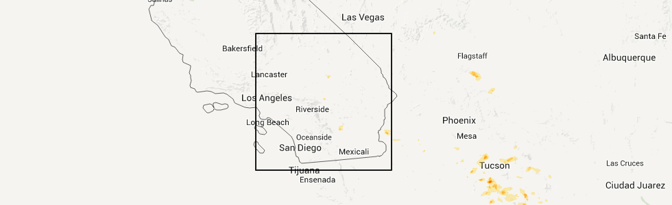
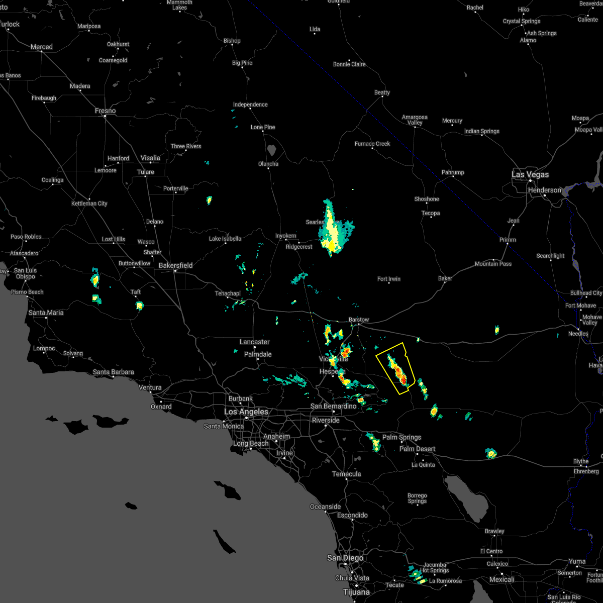
Hail Map for Homestead Valley, CA
The Homestead Valley, CA area has had 0 reports of on-the-ground hail by trained spotters, and has been under severe weather warnings 1 time during the past 12 months. Doppler radar has detected hail at or near Homestead Valley, CA on 7 occasions.
| Name: | Homestead Valley, CA |
| Where Located: | 9.8 miles N of Yucca Valley, CA |
| Map: | Google Map for Homestead Valley, CA |
| Population: | 3032 |
| Housing Units: | 2198 |
| More Info: | Search Google for Homestead Valley, CA |
5
The Top Recent Hail Date for Homestead Valley, CA is Friday, September 9, 2011 (1st out of 7)
Hail and Wind Damage Spotted near Homestead Valley, CA
| Date / Time | Report Details |
|---|---|
| 6/3/2025 2:30 PM PDT | Svrvef the national weather service in las vegas has issued a * severe thunderstorm warning for, southern san bernardino county in southern california, * until 315 pm pdt. * at 230 pm pdt, a severe thunderstorm was located over joshua tree lake campground, or 10 miles west of twentynine palms, moving northeast at 10 mph (radar indicated). Hazards include 60 mph wind gusts and quarter size hail. Hail damage to vehicles is expected. Expect wind damage to roofs and trees. |
| 8/20/2022 3:54 PM PDT |
 The severe thunderstorm warning for south central san bernardino county will expire at 400 pm pdt, the storm which prompted the warning has weakened below severe limits, and no longer poses an immediate threat to life or property. therefore, the warning will be allowed to expire. however gusty winds are still possible with this thunderstorm especially south of highway 62. The severe thunderstorm warning for south central san bernardino county will expire at 400 pm pdt, the storm which prompted the warning has weakened below severe limits, and no longer poses an immediate threat to life or property. therefore, the warning will be allowed to expire. however gusty winds are still possible with this thunderstorm especially south of highway 62.
|
| 8/20/2022 3:28 PM PDT |
 At 320 pm pdt, wind gusts near 50 mph were recorded in surprise valley north of joshua tree. wind gusts to 60 mph remain possible (radar indicated). Hazards include 60 mph wind gusts. Expect damage to roofs and trees. locations impacted include, twentynine palms, twentynine palms base, joshua tree lake campground and joshua tree. hail threat, radar indicated max hail size, <. 75 in wind threat, radar indicated max wind gust, 60 mph. At 320 pm pdt, wind gusts near 50 mph were recorded in surprise valley north of joshua tree. wind gusts to 60 mph remain possible (radar indicated). Hazards include 60 mph wind gusts. Expect damage to roofs and trees. locations impacted include, twentynine palms, twentynine palms base, joshua tree lake campground and joshua tree. hail threat, radar indicated max hail size, <. 75 in wind threat, radar indicated max wind gust, 60 mph.
|
| 8/20/2022 3:15 PM PDT |
 At 315 pm pdt, a severe thunderstorm was located over joshua tree lake campground, or 13 miles west of twentynine palms, moving northeast at 15 mph (radar indicated). Hazards include 60 mph wind gusts. expect damage to roofs and trees At 315 pm pdt, a severe thunderstorm was located over joshua tree lake campground, or 13 miles west of twentynine palms, moving northeast at 15 mph (radar indicated). Hazards include 60 mph wind gusts. expect damage to roofs and trees
|
| 9/24/2021 2:11 PM PDT |
 At 211 pm pdt, a severe thunderstorm was located over yucca valley, or 18 miles east of onyx summit, moving north at 10 mph (radar indicated). Hazards include 60 mph wind gusts and quarter size hail. Hail damage to vehicles is expected. Expect wind damage to roofs and trees. At 211 pm pdt, a severe thunderstorm was located over yucca valley, or 18 miles east of onyx summit, moving north at 10 mph (radar indicated). Hazards include 60 mph wind gusts and quarter size hail. Hail damage to vehicles is expected. Expect wind damage to roofs and trees.
|
| 9/9/2021 3:25 PM PDT |
 The severe thunderstorm warning for south central san bernardino county will expire at 330 pm pdt, the storm which prompted the warning has weakened below severe limits, and no longer poses an immediate threat to life or property. therefore, the warning will be allowed to expire. The severe thunderstorm warning for south central san bernardino county will expire at 330 pm pdt, the storm which prompted the warning has weakened below severe limits, and no longer poses an immediate threat to life or property. therefore, the warning will be allowed to expire.
|
| 9/9/2021 3:00 PM PDT |
 At 259 pm pdt, a severe thunderstorm was located near joshua tree lake campground, or 14 miles northwest of twentynine palms, moving northwest at 20 mph (radar indicated). Hazards include 60 mph wind gusts. Expect damage to roofs and trees. locations impacted include, twentynine palms, twentynine palms base, twentynine palms airport, ludlow, joshua tree lake campground, joshua tree, pioneertown and johnson valley. this includes interstate 40 in california between mile markers 45 and 49. hail threat, radar indicated max hail size, <. 75 in wind threat, radar indicated max wind gust, 60 mph. At 259 pm pdt, a severe thunderstorm was located near joshua tree lake campground, or 14 miles northwest of twentynine palms, moving northwest at 20 mph (radar indicated). Hazards include 60 mph wind gusts. Expect damage to roofs and trees. locations impacted include, twentynine palms, twentynine palms base, twentynine palms airport, ludlow, joshua tree lake campground, joshua tree, pioneertown and johnson valley. this includes interstate 40 in california between mile markers 45 and 49. hail threat, radar indicated max hail size, <. 75 in wind threat, radar indicated max wind gust, 60 mph.
|
| 9/9/2021 2:31 PM PDT |
 At 231 pm pdt, a severe thunderstorm was located near joshua tree lake campground, or near twentynine palms, moving northwest at 25 mph (radar indicated). Hazards include 60 mph wind gusts. expect damage to roofs and trees At 231 pm pdt, a severe thunderstorm was located near joshua tree lake campground, or near twentynine palms, moving northwest at 25 mph (radar indicated). Hazards include 60 mph wind gusts. expect damage to roofs and trees
|
| 9/9/2021 1:05 PM PDT |
 At 104 pm pdt, a severe thunderstorm was located over northeastern johnson valley, or 17 miles northeast of onyx summit, moving northwest at 20 mph (radar indicated). Hazards include 60 mph wind gusts and penny size hail. expect damage to roofs, siding, and trees At 104 pm pdt, a severe thunderstorm was located over northeastern johnson valley, or 17 miles northeast of onyx summit, moving northwest at 20 mph (radar indicated). Hazards include 60 mph wind gusts and penny size hail. expect damage to roofs, siding, and trees
|
| 8/11/2017 2:42 PM PDT |
 At 241 pm pdt, a severe thunderstorm was located near joshua tree lake campground, or 16 miles northwest of twentynine palms, moving northeast at 5 mph (radar indicated). Hazards include 60 mph wind gusts. expect damage to roofs, siding, and trees At 241 pm pdt, a severe thunderstorm was located near joshua tree lake campground, or 16 miles northwest of twentynine palms, moving northeast at 5 mph (radar indicated). Hazards include 60 mph wind gusts. expect damage to roofs, siding, and trees
|
Hail Maps for Homestead Valley, CA


Connect with Interactive Hail Maps