

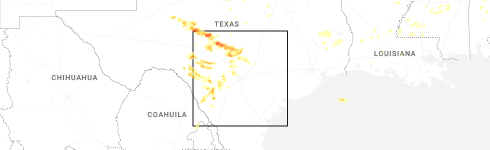
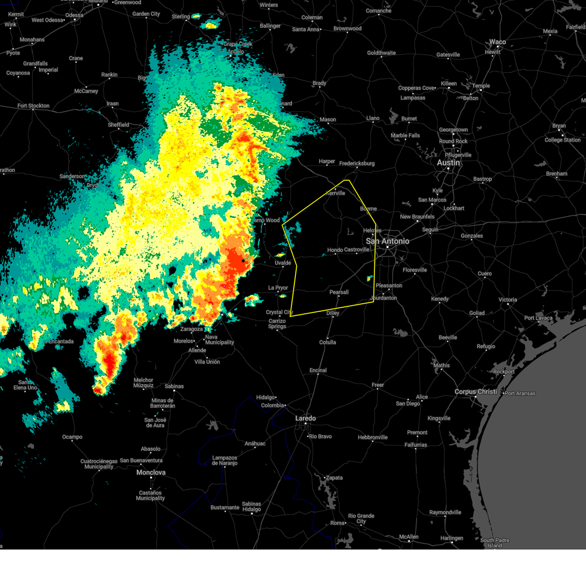
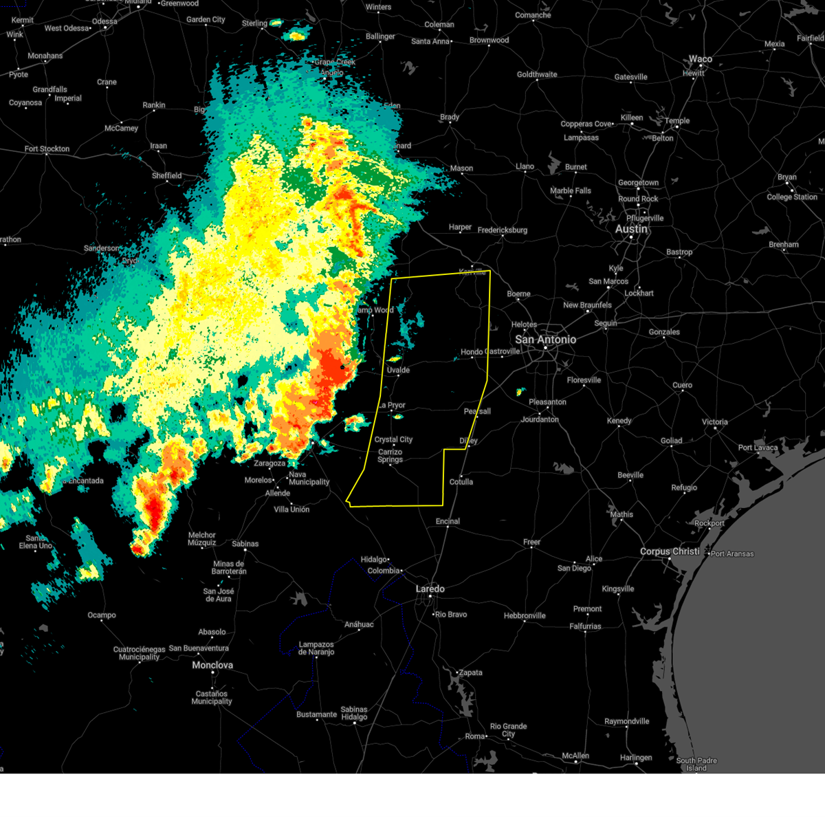
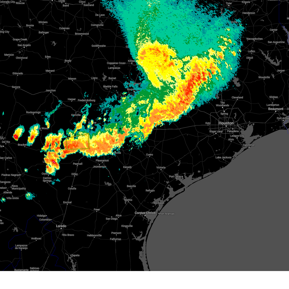
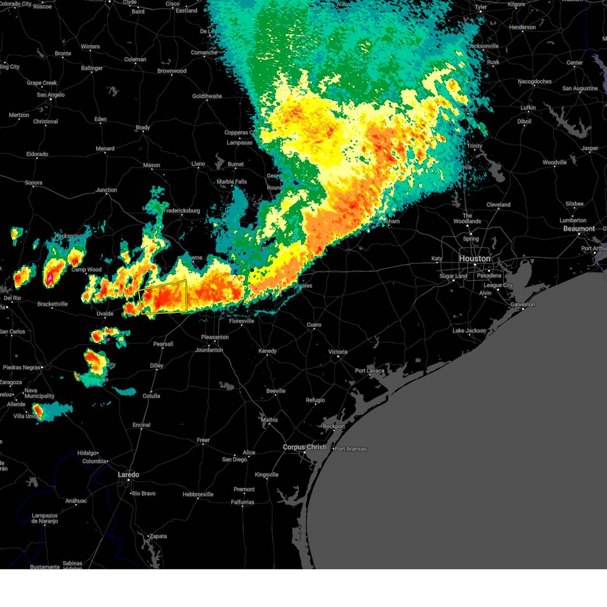
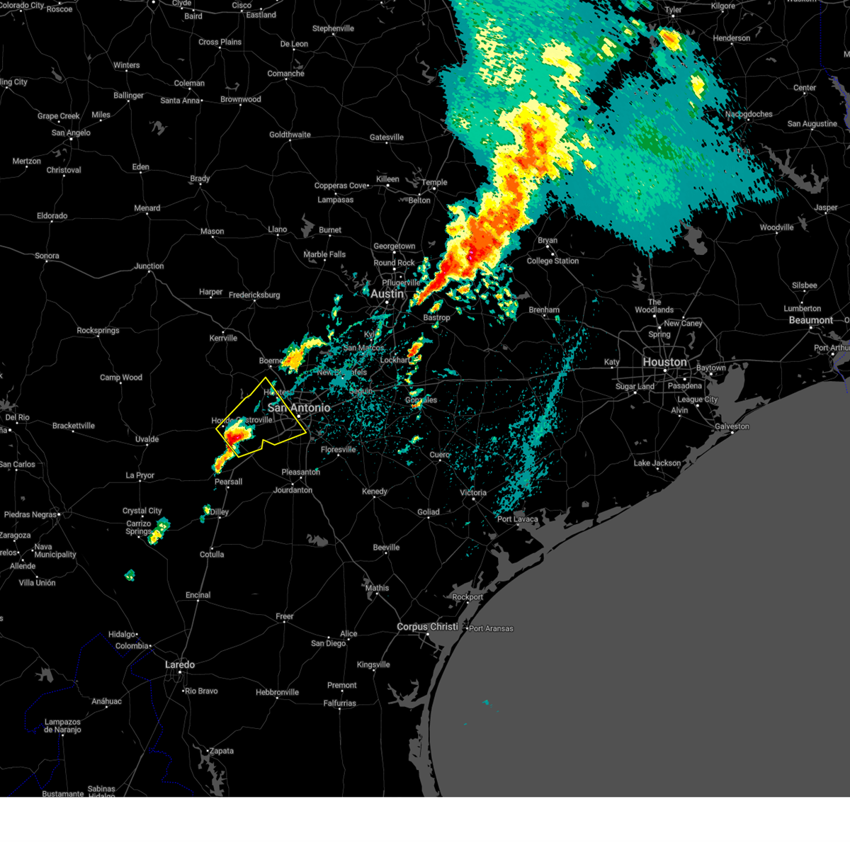
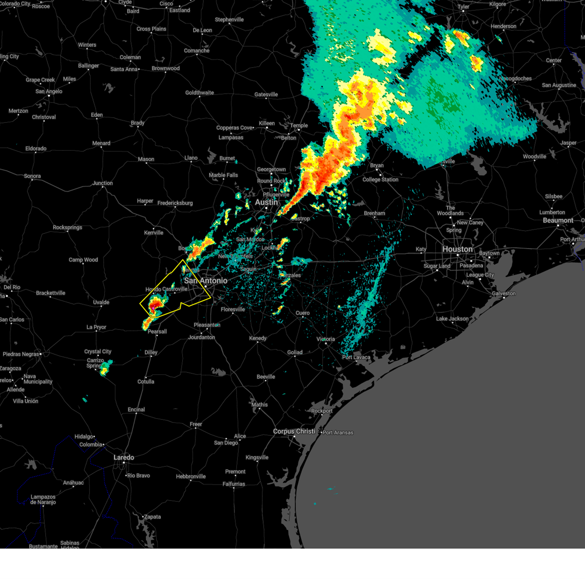
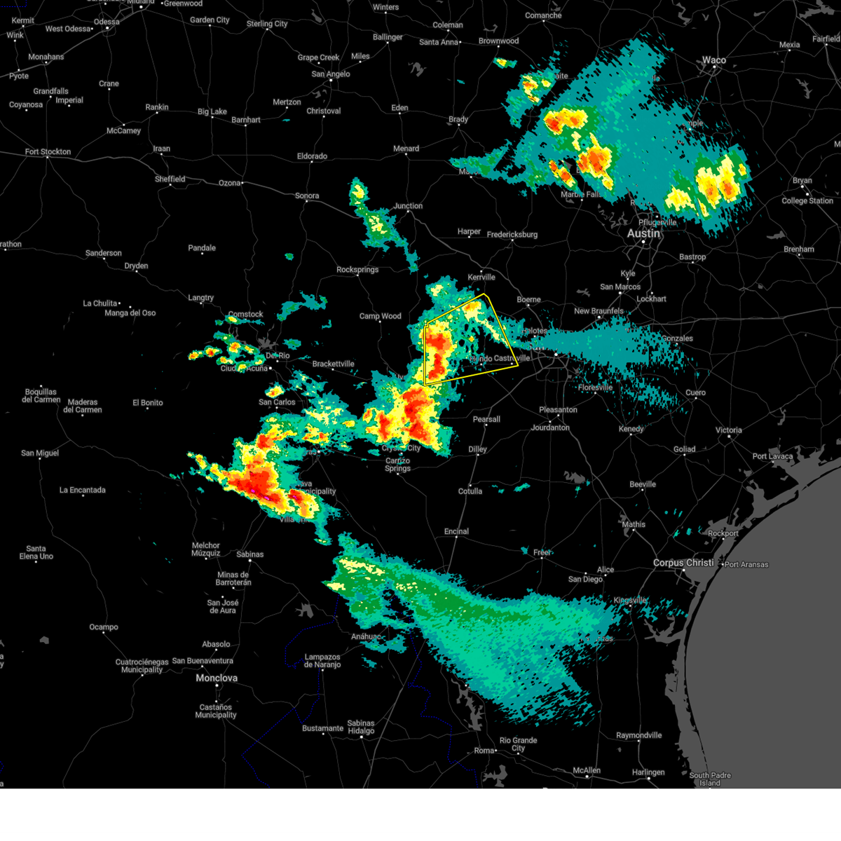
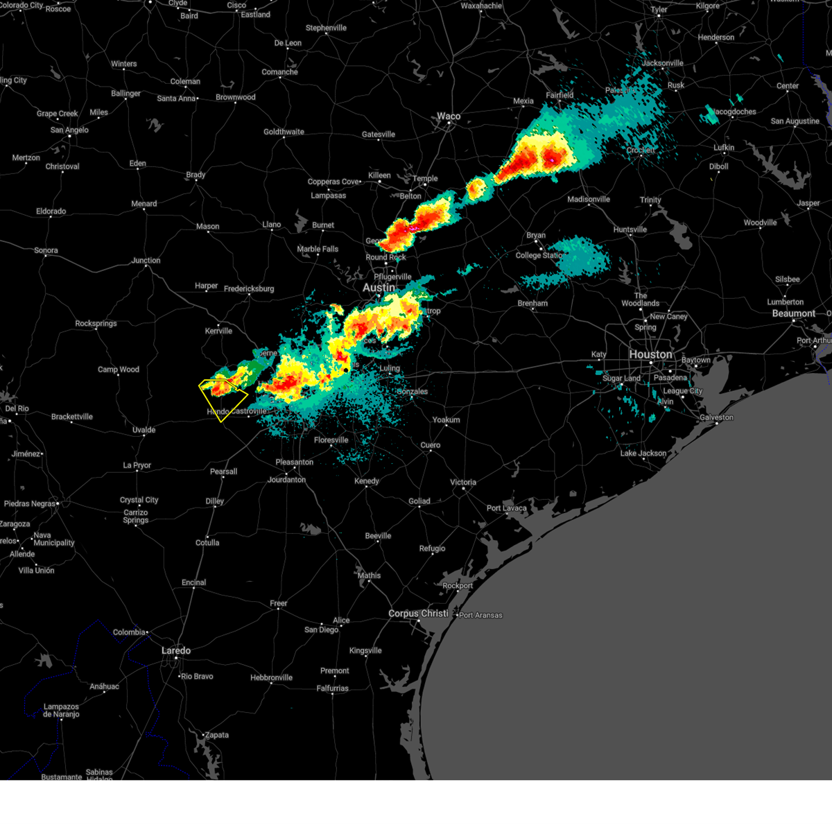
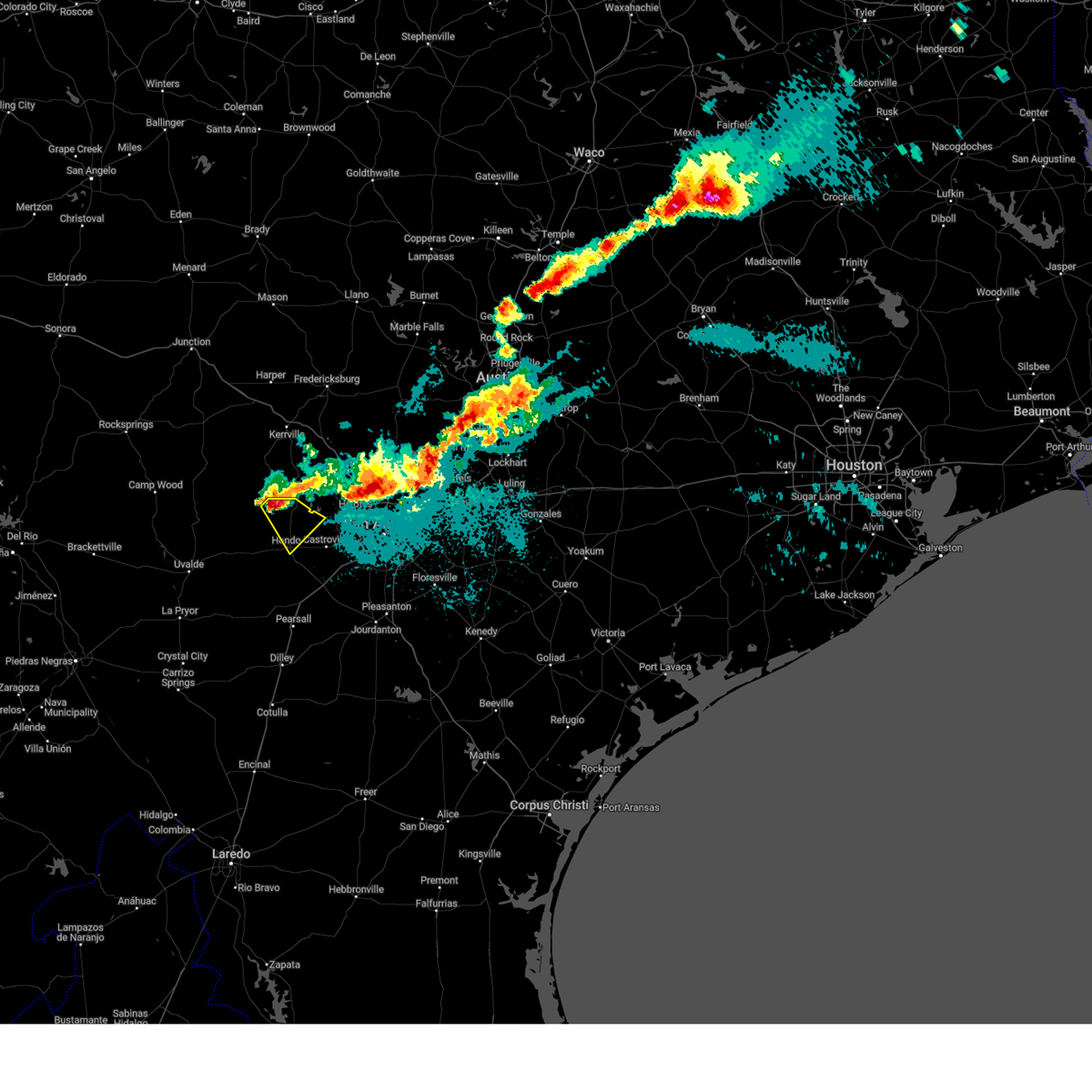
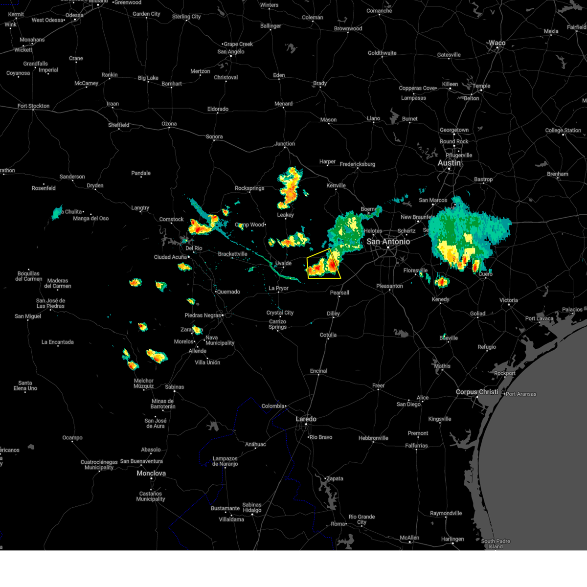
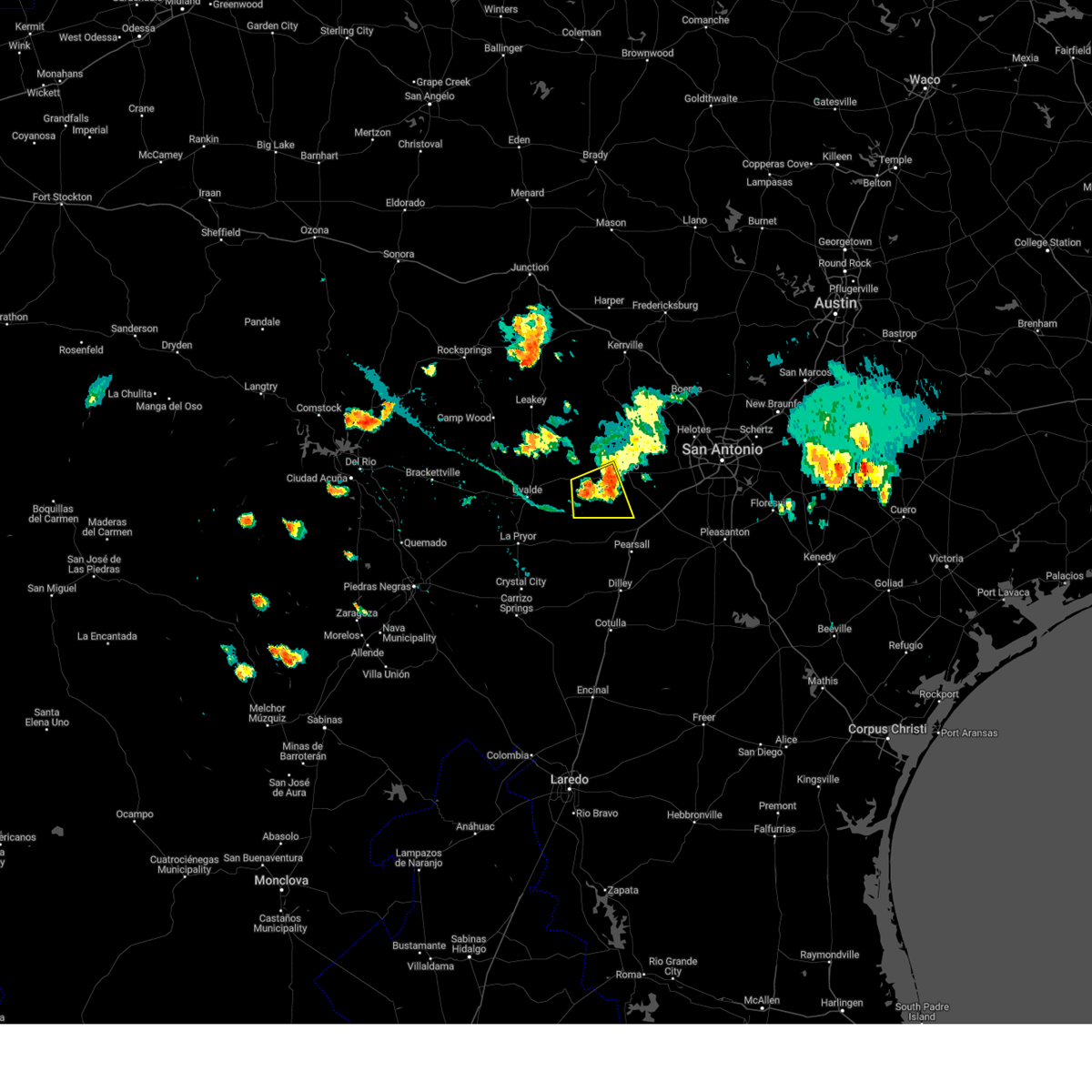
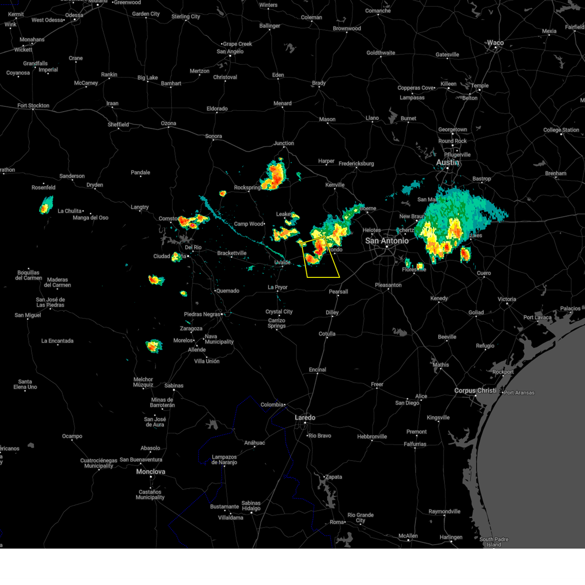
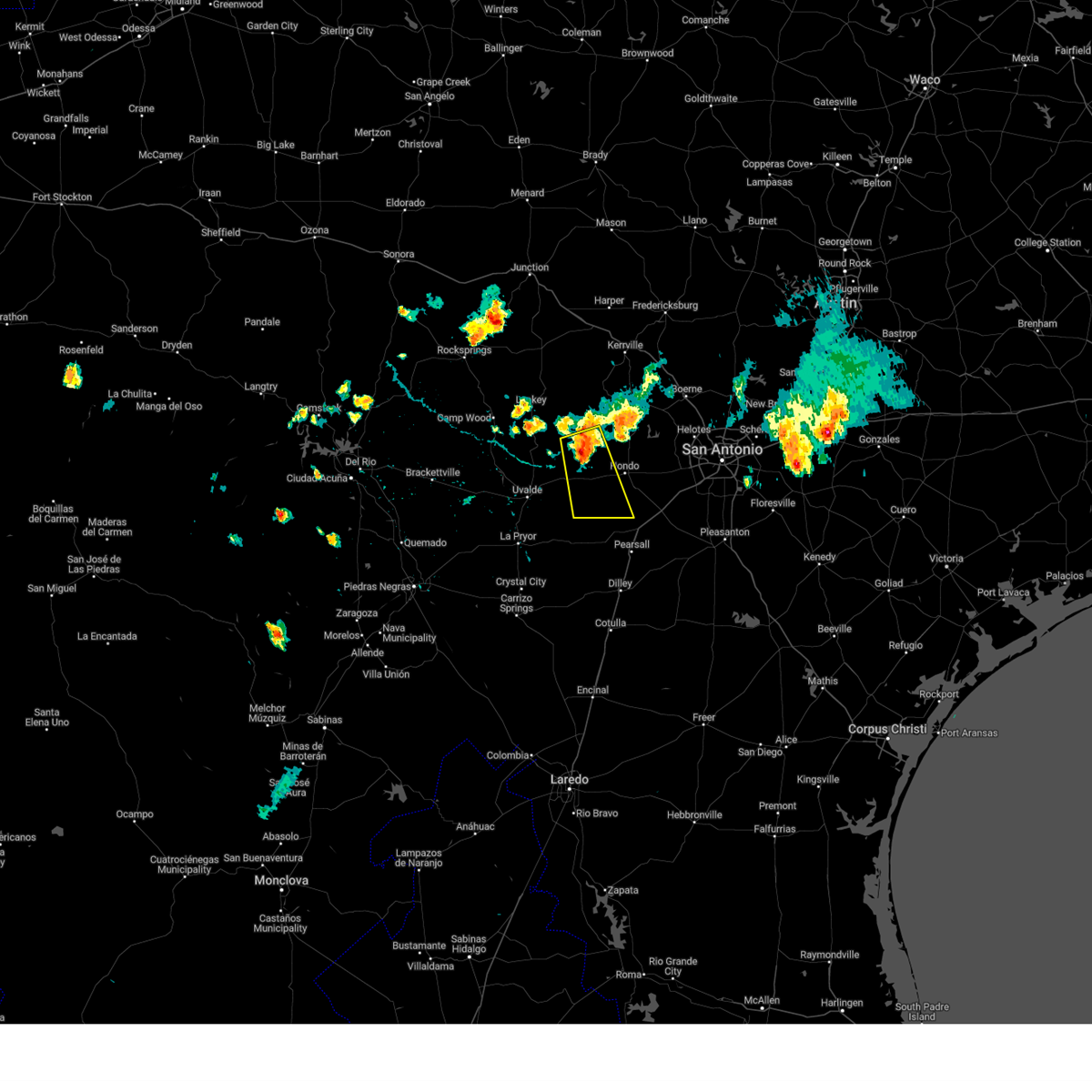
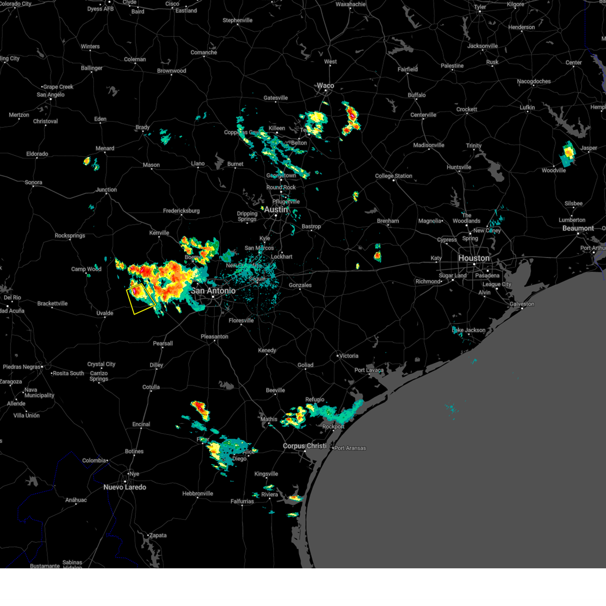
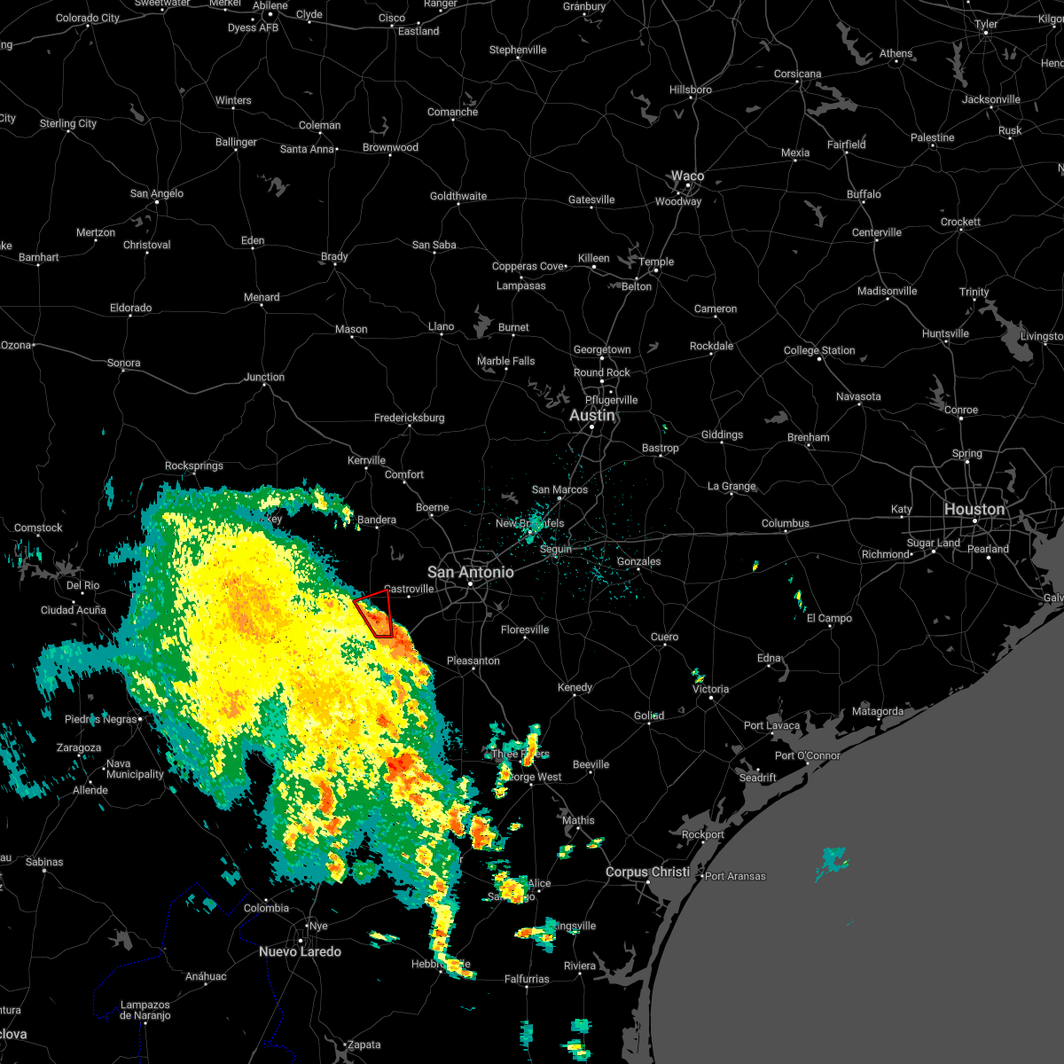
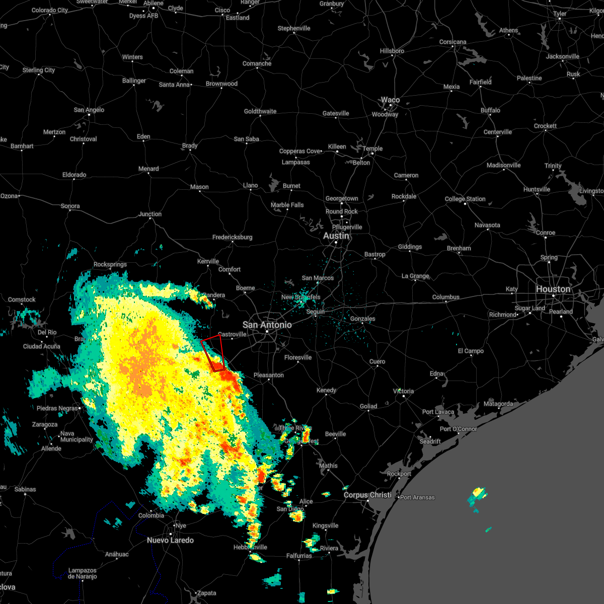
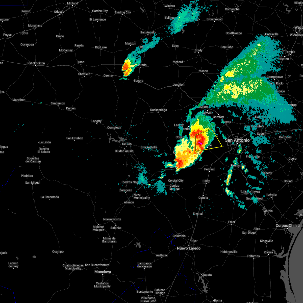
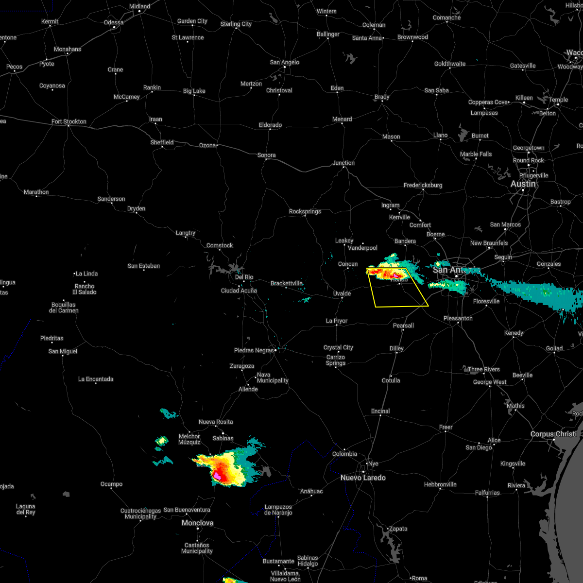
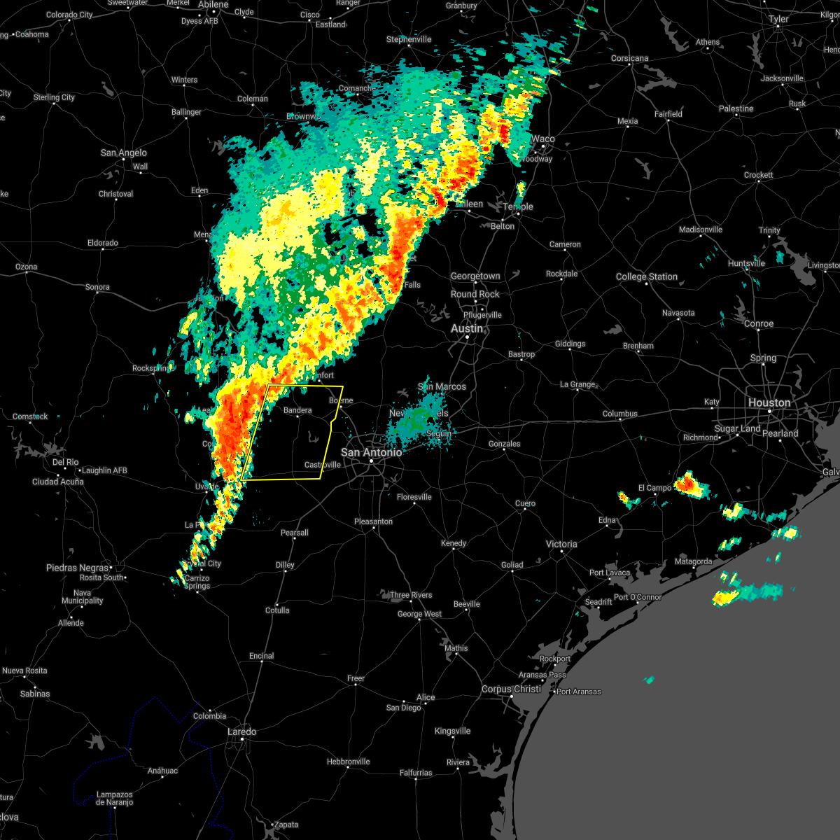
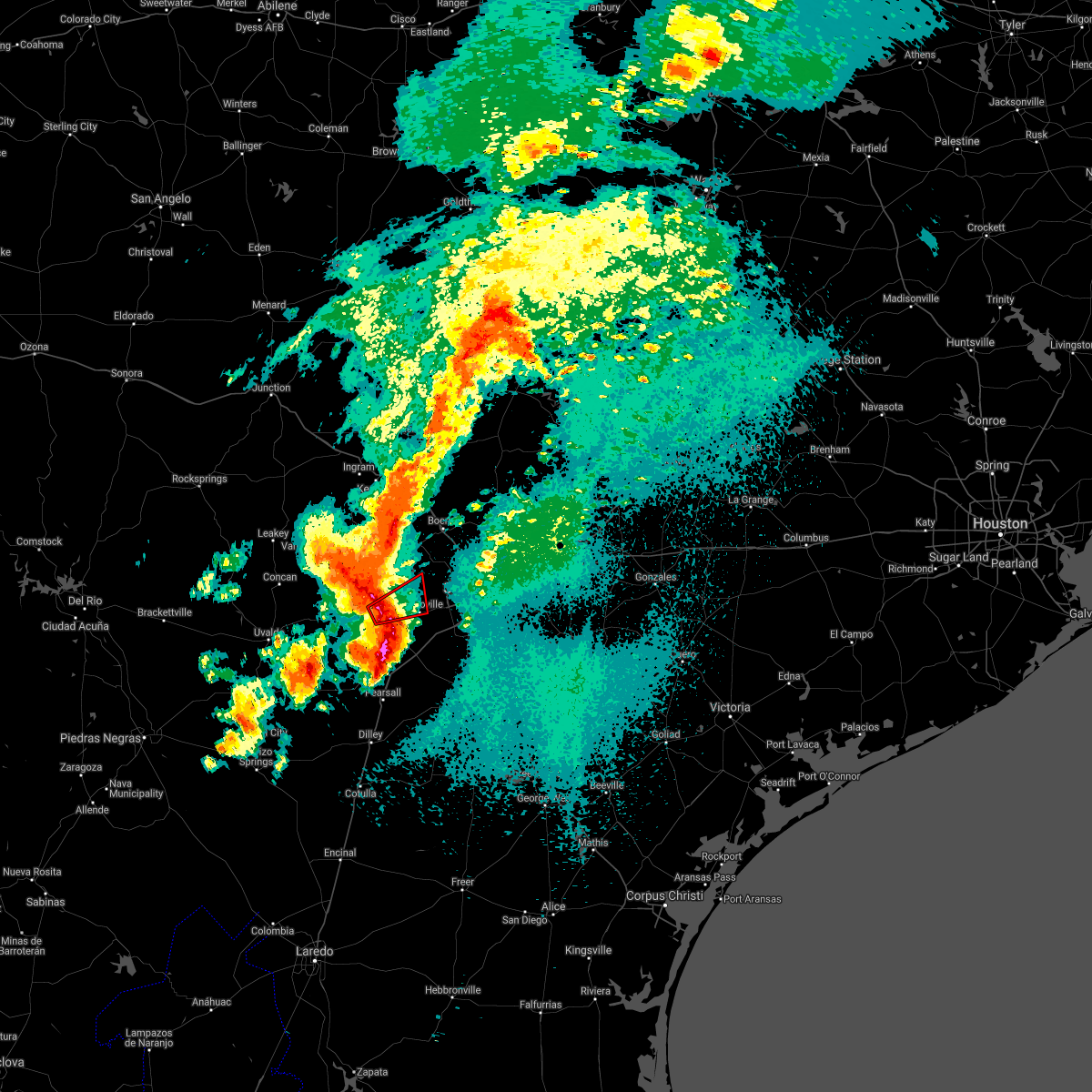
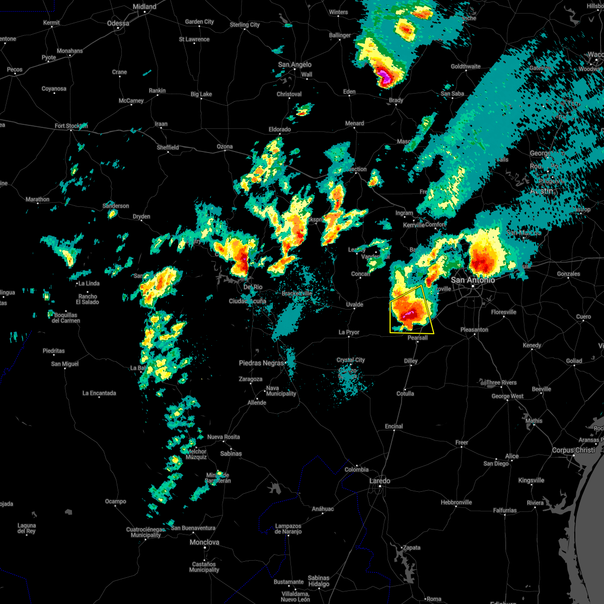
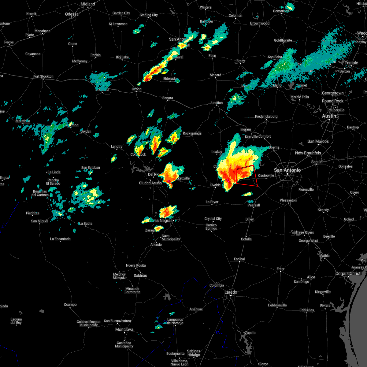
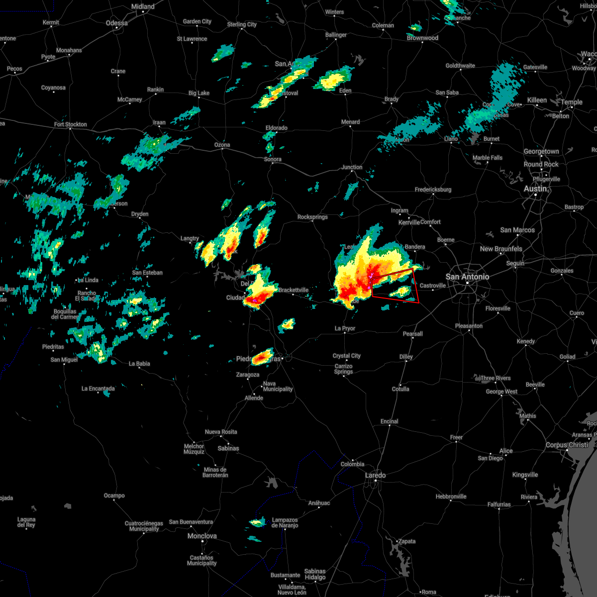
Hail Map for Hondo, TX
The Hondo, TX area has had 22 reports of on-the-ground hail by trained spotters, and has been under severe weather warnings 15 times during the past 12 months. Doppler radar has detected hail at or near Hondo, TX on 65 occasions, including 3 occasions during the past year.
| Name: | Hondo, TX |
| Where Located: | 39.7 miles W of San Antonio, TX |
| Map: | Google Map for Hondo, TX |
| Population: | 8803 |
| Housing Units: | 2621 |
| More Info: | Search Google for Hondo, TX |
1
The Top Recent Hail Date for Hondo, TX is Monday, May 26, 2025 (9th out of 65)
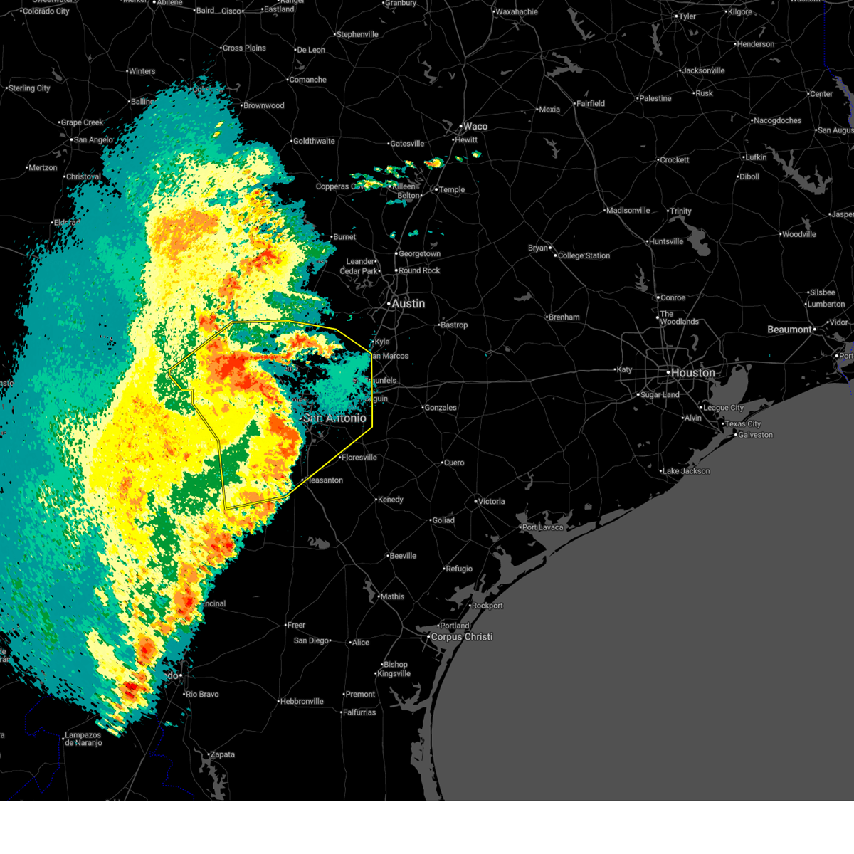
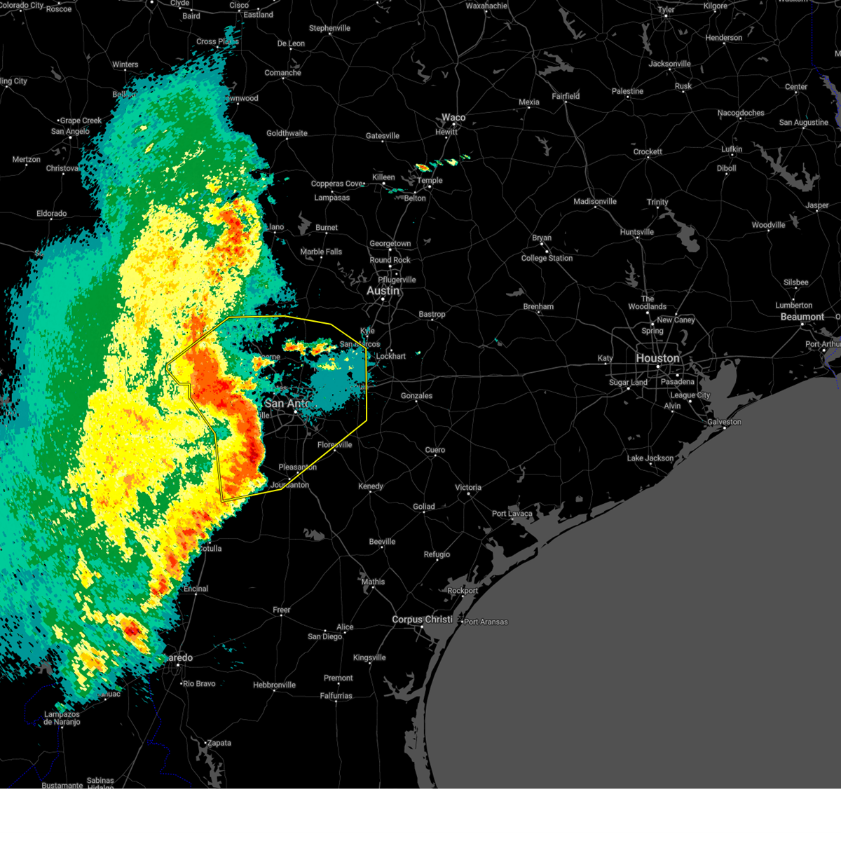
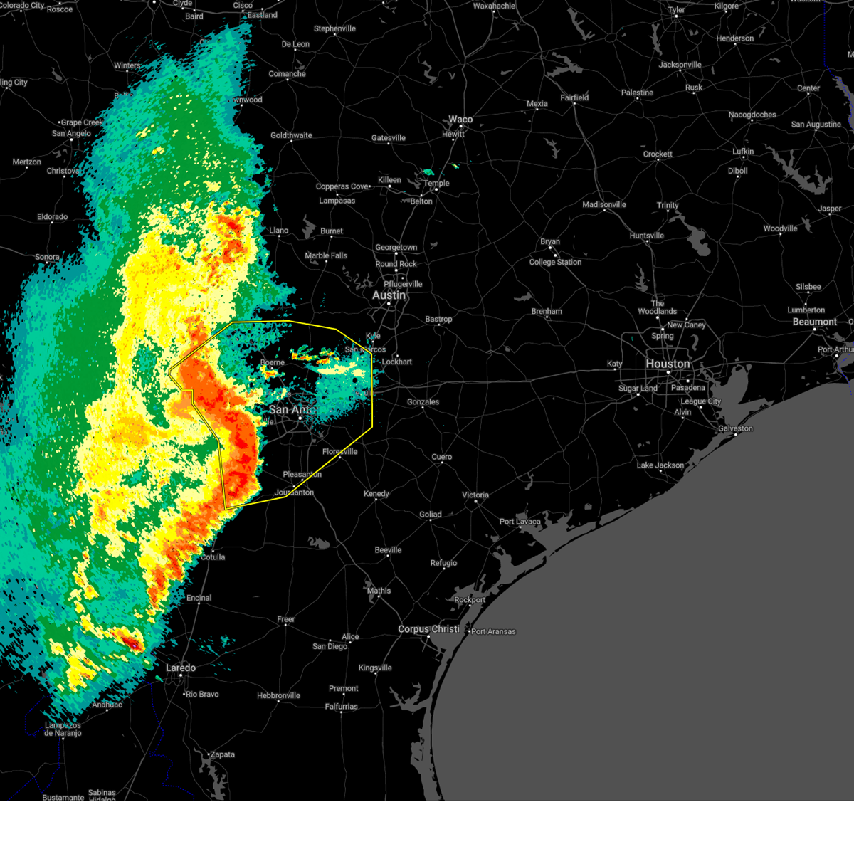
Hail and Wind Damage Spotted near Hondo, TX
| Date / Time | Report Details |
|---|---|
| 6/11/2025 12:53 AM CDT |
 The storms which prompted the warning have weakened below severe limits, and no longer pose an immediate threat to life or property. therefore, the warning will be allowed to expire. a severe thunderstorm watch remains in effect until 200 am cdt for south central texas. The storms which prompted the warning have weakened below severe limits, and no longer pose an immediate threat to life or property. therefore, the warning will be allowed to expire. a severe thunderstorm watch remains in effect until 200 am cdt for south central texas.
|
| 6/11/2025 12:19 AM CDT |
 At 1218 am cdt, severe thunderstorms were located along a line extending from near lakehills to near sea world to near somerset, moving east at 60 mph (radar indicated). Hazards include 60 mph wind gusts and quarter size hail. Hail damage to vehicles is expected. expect wind damage to roofs, siding, and trees. Locations impacted include, san antonio, new braunfels, san marcos, medina, schertz, seguin, cibolo, kerrville, converse, universal city, live oak, boerne, pleasanton, selma, pearsall, hondo, floresville, devine, jourdanton, and poteet. At 1218 am cdt, severe thunderstorms were located along a line extending from near lakehills to near sea world to near somerset, moving east at 60 mph (radar indicated). Hazards include 60 mph wind gusts and quarter size hail. Hail damage to vehicles is expected. expect wind damage to roofs, siding, and trees. Locations impacted include, san antonio, new braunfels, san marcos, medina, schertz, seguin, cibolo, kerrville, converse, universal city, live oak, boerne, pleasanton, selma, pearsall, hondo, floresville, devine, jourdanton, and poteet.
|
| 6/11/2025 12:13 AM CDT |
 The storms which prompted the warning have moved out of the area. therefore, the warning will be allowed to expire. however small hail, gusty winds and heavy rain are still possible with these thunderstorms. a severe thunderstorm watch remains in effect until 200 am cdt for south central texas. remember, a severe thunderstorm warning still remains in effect for portions of medina, bandera, frio, bexar, kendall, kerr, and atascosa. The storms which prompted the warning have moved out of the area. therefore, the warning will be allowed to expire. however small hail, gusty winds and heavy rain are still possible with these thunderstorms. a severe thunderstorm watch remains in effect until 200 am cdt for south central texas. remember, a severe thunderstorm warning still remains in effect for portions of medina, bandera, frio, bexar, kendall, kerr, and atascosa.
|
| 6/11/2025 12:10 AM CDT |
 Svrewx the national weather service in austin san antonio has issued a * severe thunderstorm warning for, medina county in south central texas, bandera county in south central texas, southeastern kerr county in south central texas, southwestern hays county in south central texas, guadalupe county in south central texas, southwestern blanco county in south central texas, northeastern frio county in south central texas, northwestern atascosa county in south central texas, kendall county in south central texas, northwestern wilson county in south central texas, bexar county in south central texas, comal county in south central texas, * until 100 am cdt. * at 1207 am cdt, severe thunderstorms were located along a line extending from near mico to near rio medina to near lytle, moving northeast at 55 mph (radar indicated). Hazards include 60 mph wind gusts and quarter size hail. Hail damage to vehicles is expected. Expect wind damage to roofs, siding, and trees. Svrewx the national weather service in austin san antonio has issued a * severe thunderstorm warning for, medina county in south central texas, bandera county in south central texas, southeastern kerr county in south central texas, southwestern hays county in south central texas, guadalupe county in south central texas, southwestern blanco county in south central texas, northeastern frio county in south central texas, northwestern atascosa county in south central texas, kendall county in south central texas, northwestern wilson county in south central texas, bexar county in south central texas, comal county in south central texas, * until 100 am cdt. * at 1207 am cdt, severe thunderstorms were located along a line extending from near mico to near rio medina to near lytle, moving northeast at 55 mph (radar indicated). Hazards include 60 mph wind gusts and quarter size hail. Hail damage to vehicles is expected. Expect wind damage to roofs, siding, and trees.
|
| 6/10/2025 11:31 PM CDT |
 Svrewx the national weather service in austin san antonio has issued a * severe thunderstorm warning for, medina county in south central texas, bandera county in south central texas, southeastern kerr county in south central texas, eastern uvalde county in south central texas, eastern zavala county in south central texas, frio county in south central texas, northwestern atascosa county in south central texas, southwestern kendall county in south central texas, western bexar county in south central texas, southeastern real county in south central texas, * until 1215 am cdt. * at 1130 pm cdt, severe thunderstorms were located along a line extending from 8 miles east of vanderpool to near hondo to bluff, moving northeast at 35 mph (radar indicated). Hazards include 60 mph wind gusts and quarter size hail. Hail damage to vehicles is expected. Expect wind damage to roofs, siding, and trees. Svrewx the national weather service in austin san antonio has issued a * severe thunderstorm warning for, medina county in south central texas, bandera county in south central texas, southeastern kerr county in south central texas, eastern uvalde county in south central texas, eastern zavala county in south central texas, frio county in south central texas, northwestern atascosa county in south central texas, southwestern kendall county in south central texas, western bexar county in south central texas, southeastern real county in south central texas, * until 1215 am cdt. * at 1130 pm cdt, severe thunderstorms were located along a line extending from 8 miles east of vanderpool to near hondo to bluff, moving northeast at 35 mph (radar indicated). Hazards include 60 mph wind gusts and quarter size hail. Hail damage to vehicles is expected. Expect wind damage to roofs, siding, and trees.
|
| 6/10/2025 11:00 PM CDT |
 At 1100 pm cdt, severe thunderstorms were located along a line extending from 8 miles west of medina to 8 miles south of sabinal to near asherton, moving east at 35 mph (radar indicated). Hazards include 60 mph wind gusts and half dollar size hail. Hail damage to vehicles is expected. expect wind damage to roofs, siding, and trees. Locations impacted include, medina, kerrville, uvalde, pearsall, hondo, crystal city, carrizo springs, dilley, bandera, big wells, leakey, la pryor, tarpley, vanderpool, batesville, sabinal, asherton, north pearsall, chula vista-river spur, and d'hanis. At 1100 pm cdt, severe thunderstorms were located along a line extending from 8 miles west of medina to 8 miles south of sabinal to near asherton, moving east at 35 mph (radar indicated). Hazards include 60 mph wind gusts and half dollar size hail. Hail damage to vehicles is expected. expect wind damage to roofs, siding, and trees. Locations impacted include, medina, kerrville, uvalde, pearsall, hondo, crystal city, carrizo springs, dilley, bandera, big wells, leakey, la pryor, tarpley, vanderpool, batesville, sabinal, asherton, north pearsall, chula vista-river spur, and d'hanis.
|
| 6/10/2025 10:40 PM CDT |
 Svrewx the national weather service in austin san antonio has issued a * severe thunderstorm warning for, medina county in south central texas, bandera county in south central texas, southern kerr county in south central texas, eastern maverick county in south central texas, dimmit county in south central texas, uvalde county in south central texas, zavala county in south central texas, western frio county in south central texas, real county in south central texas, * until 1130 pm cdt. * at 1039 pm cdt, severe thunderstorms were located along a line extending from lost maples state natural area to 6 miles southeast of knippa to 6 miles southwest of carrizo hill, moving east at 35 mph (radar indicated). Hazards include ping pong ball size hail and 60 mph wind gusts. People and animals outdoors will be injured. expect hail damage to roofs, siding, windows, and vehicles. Expect wind damage to roofs, siding, and trees. Svrewx the national weather service in austin san antonio has issued a * severe thunderstorm warning for, medina county in south central texas, bandera county in south central texas, southern kerr county in south central texas, eastern maverick county in south central texas, dimmit county in south central texas, uvalde county in south central texas, zavala county in south central texas, western frio county in south central texas, real county in south central texas, * until 1130 pm cdt. * at 1039 pm cdt, severe thunderstorms were located along a line extending from lost maples state natural area to 6 miles southeast of knippa to 6 miles southwest of carrizo hill, moving east at 35 mph (radar indicated). Hazards include ping pong ball size hail and 60 mph wind gusts. People and animals outdoors will be injured. expect hail damage to roofs, siding, windows, and vehicles. Expect wind damage to roofs, siding, and trees.
|
| 5/26/2025 11:01 PM CDT |
 the severe thunderstorm warning has been cancelled and is no longer in effect the severe thunderstorm warning has been cancelled and is no longer in effect
|
| 5/26/2025 10:25 PM CDT |
 Svrewx the national weather service in austin san antonio has issued a * severe thunderstorm warning for, central medina county in south central texas, * until 1130 pm cdt. * at 1024 pm cdt, a severe thunderstorm was located near hondo, moving east at 25 mph (radar indicated). Hazards include 60 mph wind gusts and quarter size hail. Hail damage to vehicles is expected. Expect wind damage to roofs, siding, and trees. Svrewx the national weather service in austin san antonio has issued a * severe thunderstorm warning for, central medina county in south central texas, * until 1130 pm cdt. * at 1024 pm cdt, a severe thunderstorm was located near hondo, moving east at 25 mph (radar indicated). Hazards include 60 mph wind gusts and quarter size hail. Hail damage to vehicles is expected. Expect wind damage to roofs, siding, and trees.
|
| 5/6/2025 12:52 PM CDT |
 At 1252 pm cdt, a severe thunderstorm was located near dunlay, or near castroville, moving northeast at 50 mph (radar indicated). Hazards include 60 mph wind gusts and quarter size hail. Hail damage to vehicles is expected. expect wind damage to roofs, siding, and trees. Locations impacted include, san antonio, hondo, devine, castroville, stinson municipal airport, leon valley, helotes, lytle, somerset, natalia, lacoste, noonan, quihi, dunlay, mico, government canyon state natural area, pearson, sea world, bader, and lackland afb. At 1252 pm cdt, a severe thunderstorm was located near dunlay, or near castroville, moving northeast at 50 mph (radar indicated). Hazards include 60 mph wind gusts and quarter size hail. Hail damage to vehicles is expected. expect wind damage to roofs, siding, and trees. Locations impacted include, san antonio, hondo, devine, castroville, stinson municipal airport, leon valley, helotes, lytle, somerset, natalia, lacoste, noonan, quihi, dunlay, mico, government canyon state natural area, pearson, sea world, bader, and lackland afb.
|
| 5/6/2025 12:37 PM CDT |
 Svrewx the national weather service in austin san antonio has issued a * severe thunderstorm warning for, southeastern medina county in south central texas, southwestern bexar county in south central texas, * until 115 pm cdt. * at 1237 pm cdt, a severe thunderstorm was located near yancey, or 11 miles south of hondo, moving northeast at 50 mph (radar indicated). Hazards include 60 mph wind gusts and quarter size hail. Hail damage to vehicles is expected. Expect wind damage to roofs, siding, and trees. Svrewx the national weather service in austin san antonio has issued a * severe thunderstorm warning for, southeastern medina county in south central texas, southwestern bexar county in south central texas, * until 115 pm cdt. * at 1237 pm cdt, a severe thunderstorm was located near yancey, or 11 miles south of hondo, moving northeast at 50 mph (radar indicated). Hazards include 60 mph wind gusts and quarter size hail. Hail damage to vehicles is expected. Expect wind damage to roofs, siding, and trees.
|
| 5/1/2025 9:00 PM CDT |
 the severe thunderstorm warning has been cancelled and is no longer in effect the severe thunderstorm warning has been cancelled and is no longer in effect
|
| 5/1/2025 8:22 PM CDT |
 Svrewx the national weather service in austin san antonio has issued a * severe thunderstorm warning for, central medina county in south central texas, central bandera county in south central texas, eastern uvalde county in south central texas, * until 915 pm cdt. * at 822 pm cdt, a severe thunderstorm was located 9 miles south of utopia, or 18 miles south of vanderpool, moving east at 25 mph (radar indicated). Hazards include 60 mph wind gusts and nickel size hail. expect damage to roofs, siding, and trees Svrewx the national weather service in austin san antonio has issued a * severe thunderstorm warning for, central medina county in south central texas, central bandera county in south central texas, eastern uvalde county in south central texas, * until 915 pm cdt. * at 822 pm cdt, a severe thunderstorm was located 9 miles south of utopia, or 18 miles south of vanderpool, moving east at 25 mph (radar indicated). Hazards include 60 mph wind gusts and nickel size hail. expect damage to roofs, siding, and trees
|
| 3/23/2025 10:25 PM CDT |
 the severe thunderstorm warning has been cancelled and is no longer in effect the severe thunderstorm warning has been cancelled and is no longer in effect
|
| 3/23/2025 10:09 PM CDT |
 Svrewx the national weather service in austin san antonio has issued a * severe thunderstorm warning for, northern medina county in south central texas, * until 1100 pm cdt. * at 1008 pm cdt, a severe thunderstorm was located near hill country state natural area, or 7 miles southeast of tarpley, moving southeast at 20 mph (radar indicated). Hazards include half dollar size hail. damage to vehicles is expected Svrewx the national weather service in austin san antonio has issued a * severe thunderstorm warning for, northern medina county in south central texas, * until 1100 pm cdt. * at 1008 pm cdt, a severe thunderstorm was located near hill country state natural area, or 7 miles southeast of tarpley, moving southeast at 20 mph (radar indicated). Hazards include half dollar size hail. damage to vehicles is expected
|
| 6/11/2024 6:44 PM CDT |
 The storm which prompted the warning has weakened below severe limits, and no longer poses an immediate threat to life or property. therefore, the warning will be allowed to expire. however gusty winds are still possible with this thunderstorm. The storm which prompted the warning has weakened below severe limits, and no longer poses an immediate threat to life or property. therefore, the warning will be allowed to expire. however gusty winds are still possible with this thunderstorm.
|
| 6/11/2024 6:32 PM CDT |
 At 632 pm cdt, a severe thunderstorm was located near yancey, or 10 miles south of hondo, moving southeast at 30 mph (radar indicated). Hazards include 60 mph wind gusts and quarter size hail. Hail damage to vehicles is expected. expect wind damage to roofs, siding, and trees. Locations impacted include, hondo, sabinal, yancey, and d'hanis. At 632 pm cdt, a severe thunderstorm was located near yancey, or 10 miles south of hondo, moving southeast at 30 mph (radar indicated). Hazards include 60 mph wind gusts and quarter size hail. Hail damage to vehicles is expected. expect wind damage to roofs, siding, and trees. Locations impacted include, hondo, sabinal, yancey, and d'hanis.
|
| 6/11/2024 6:16 PM CDT |
 At 616 pm cdt, a severe thunderstorm was located over d'hanis, or 9 miles west of hondo, moving southeast at 30 mph (radar indicated). Hazards include 60 mph wind gusts and quarter size hail. Hail damage to vehicles is expected. expect wind damage to roofs, siding, and trees. Locations impacted include, hondo, sabinal, yancey, and d'hanis. At 616 pm cdt, a severe thunderstorm was located over d'hanis, or 9 miles west of hondo, moving southeast at 30 mph (radar indicated). Hazards include 60 mph wind gusts and quarter size hail. Hail damage to vehicles is expected. expect wind damage to roofs, siding, and trees. Locations impacted include, hondo, sabinal, yancey, and d'hanis.
|
| 6/11/2024 6:00 PM CDT |
 Svrewx the national weather service in austin san antonio has issued a * severe thunderstorm warning for, western medina county in south central texas, eastern uvalde county in south central texas, * until 645 pm cdt. * at 600 pm cdt, a severe thunderstorm was located 8 miles northeast of sabinal, or 16 miles west of hondo, moving south at 35 mph (radar indicated). Hazards include 60 mph wind gusts and quarter size hail. Hail damage to vehicles is expected. Expect wind damage to roofs, siding, and trees. Svrewx the national weather service in austin san antonio has issued a * severe thunderstorm warning for, western medina county in south central texas, eastern uvalde county in south central texas, * until 645 pm cdt. * at 600 pm cdt, a severe thunderstorm was located 8 miles northeast of sabinal, or 16 miles west of hondo, moving south at 35 mph (radar indicated). Hazards include 60 mph wind gusts and quarter size hail. Hail damage to vehicles is expected. Expect wind damage to roofs, siding, and trees.
|
| 5/13/2024 9:28 AM CDT |
 Svrewx the national weather service in austin san antonio has issued a * severe thunderstorm warning for, southern medina county in south central texas, * until 1030 am cdt. * at 927 am cdt, a severe thunderstorm was located near yancey, or 10 miles south of hondo, moving northeast at 25 mph (radar indicated). Hazards include 60 mph wind gusts and quarter size hail. Hail damage to vehicles is expected. Expect wind damage to roofs, siding, and trees. Svrewx the national weather service in austin san antonio has issued a * severe thunderstorm warning for, southern medina county in south central texas, * until 1030 am cdt. * at 927 am cdt, a severe thunderstorm was located near yancey, or 10 miles south of hondo, moving northeast at 25 mph (radar indicated). Hazards include 60 mph wind gusts and quarter size hail. Hail damage to vehicles is expected. Expect wind damage to roofs, siding, and trees.
|
| 4/9/2024 9:55 PM CDT |
 At 955 pm cdt, severe thunderstorms were located along a line extending from near helotes to near yancey, moving east at 50 mph (radar indicated). Hazards include 60 mph wind gusts and quarter size hail. Hail damage to vehicles is expected. expect wind damage to roofs, siding, and trees. Locations impacted include, san antonio, hondo, devine, castroville, leon valley, helotes, shavano park, hollywood park, cross mountain, lytle, natalia, lacoste, noonan, quihi, dunlay, mico, government canyon state natural area, pearson, sea world, and bader. At 955 pm cdt, severe thunderstorms were located along a line extending from near helotes to near yancey, moving east at 50 mph (radar indicated). Hazards include 60 mph wind gusts and quarter size hail. Hail damage to vehicles is expected. expect wind damage to roofs, siding, and trees. Locations impacted include, san antonio, hondo, devine, castroville, leon valley, helotes, shavano park, hollywood park, cross mountain, lytle, natalia, lacoste, noonan, quihi, dunlay, mico, government canyon state natural area, pearson, sea world, and bader.
|
| 4/9/2024 9:55 PM CDT |
 the severe thunderstorm warning has been cancelled and is no longer in effect the severe thunderstorm warning has been cancelled and is no longer in effect
|
| 4/9/2024 9:39 PM CDT |
 Svrewx the national weather service in austin san antonio has issued a * severe thunderstorm warning for, medina county in south central texas, southeastern bandera county in south central texas, southeastern uvalde county in south central texas, northwestern bexar county in south central texas, * until 1045 pm cdt. * at 938 pm cdt, severe thunderstorms were located along a line extending from mico to 6 miles northwest of frio town, moving east at 35 mph (radar indicated). Hazards include 60 mph wind gusts and quarter size hail. Hail damage to vehicles is expected. Expect wind damage to roofs, siding, and trees. Svrewx the national weather service in austin san antonio has issued a * severe thunderstorm warning for, medina county in south central texas, southeastern bandera county in south central texas, southeastern uvalde county in south central texas, northwestern bexar county in south central texas, * until 1045 pm cdt. * at 938 pm cdt, severe thunderstorms were located along a line extending from mico to 6 miles northwest of frio town, moving east at 35 mph (radar indicated). Hazards include 60 mph wind gusts and quarter size hail. Hail damage to vehicles is expected. Expect wind damage to roofs, siding, and trees.
|
| 6/4/2023 3:27 PM CDT |
 At 327 pm cdt, a severe thunderstorm was located 10 miles southeast of utopia, or 15 miles southwest of tarpley, moving southeast at 10 mph (radar indicated). Hazards include 60 mph wind gusts and quarter size hail. Hail damage to vehicles is expected. Expect wind damage to roofs, siding, and trees. At 327 pm cdt, a severe thunderstorm was located 10 miles southeast of utopia, or 15 miles southwest of tarpley, moving southeast at 10 mph (radar indicated). Hazards include 60 mph wind gusts and quarter size hail. Hail damage to vehicles is expected. Expect wind damage to roofs, siding, and trees.
|
| 6/2/2023 11:53 PM CDT |
 At 1153 pm cdt, severe thunderstorms were located along a line extending from near kendalia to timberwood park to pearson, moving east at 45 mph (radar indicated). Hazards include 60 mph wind gusts and penny size hail. expect damage to roofs, siding, and trees At 1153 pm cdt, severe thunderstorms were located along a line extending from near kendalia to timberwood park to pearson, moving east at 45 mph (radar indicated). Hazards include 60 mph wind gusts and penny size hail. expect damage to roofs, siding, and trees
|
| 6/2/2023 11:47 PM CDT |
 At 1146 pm cdt, severe thunderstorms were located along a line extending from near sisterdale to near the dominion to near dunlay, moving east at 45 mph (radar indicated). Hazards include 70 mph wind gusts and penny size hail. Expect considerable tree damage. damage is likely to mobile homes, roofs, and outbuildings. locations impacted include, san antonio, boerne, hondo, castroville, canyon lake, leon valley, helotes, fair oaks ranch, bulverde, shavano park, cross mountain, lacoste, walnut grove, guadalupe river state park, kendalia, smithson valley, d`hanis, noonan, the dominion and quihi. thunderstorm damage threat, considerable hail threat, radar indicated max hail size, 0. 75 in wind threat, radar indicated max wind gust, 70 mph. At 1146 pm cdt, severe thunderstorms were located along a line extending from near sisterdale to near the dominion to near dunlay, moving east at 45 mph (radar indicated). Hazards include 70 mph wind gusts and penny size hail. Expect considerable tree damage. damage is likely to mobile homes, roofs, and outbuildings. locations impacted include, san antonio, boerne, hondo, castroville, canyon lake, leon valley, helotes, fair oaks ranch, bulverde, shavano park, cross mountain, lacoste, walnut grove, guadalupe river state park, kendalia, smithson valley, d`hanis, noonan, the dominion and quihi. thunderstorm damage threat, considerable hail threat, radar indicated max hail size, 0. 75 in wind threat, radar indicated max wind gust, 70 mph.
|
| 6/2/2023 11:35 PM CDT | Hondo asos 51 knot gus in medina county TX, 1.4 miles ESE of Hondo, TX |
| 6/2/2023 11:29 PM CDT |
 At 1128 pm cdt, severe thunderstorms were located along a line extending from near old tunnel state park to near kronkosky state natural area to near d`hanis, moving east at 65 mph (radar indicated). Hazards include 70 mph wind gusts and penny size hail. Expect considerable tree damage. damage is likely to mobile homes, roofs, and outbuildings. locations impacted include, san antonio, kerrville, boerne, hondo, castroville, comfort, bandera, tarpley, canyon lake, leon valley, helotes, fair oaks ranch, bulverde, shavano park, cross mountain, lytle, lacoste, guadalupe river state park, kendalia and d`hanis. thunderstorm damage threat, considerable hail threat, radar indicated max hail size, 0. 75 in wind threat, radar indicated max wind gust, 70 mph. At 1128 pm cdt, severe thunderstorms were located along a line extending from near old tunnel state park to near kronkosky state natural area to near d`hanis, moving east at 65 mph (radar indicated). Hazards include 70 mph wind gusts and penny size hail. Expect considerable tree damage. damage is likely to mobile homes, roofs, and outbuildings. locations impacted include, san antonio, kerrville, boerne, hondo, castroville, comfort, bandera, tarpley, canyon lake, leon valley, helotes, fair oaks ranch, bulverde, shavano park, cross mountain, lytle, lacoste, guadalupe river state park, kendalia and d`hanis. thunderstorm damage threat, considerable hail threat, radar indicated max hail size, 0. 75 in wind threat, radar indicated max wind gust, 70 mph.
|
| 6/2/2023 11:12 PM CDT |
 At 1112 pm cdt, severe thunderstorms were located along a line extending from near kerrville to 7 miles southeast of camp verde to near sabinal, moving east at 45 mph (radar indicated). Hazards include 60 mph wind gusts and quarter size hail. Hail damage to vehicles is expected. Expect wind damage to roofs, siding, and trees. At 1112 pm cdt, severe thunderstorms were located along a line extending from near kerrville to 7 miles southeast of camp verde to near sabinal, moving east at 45 mph (radar indicated). Hazards include 60 mph wind gusts and quarter size hail. Hail damage to vehicles is expected. Expect wind damage to roofs, siding, and trees.
|
| 6/2/2023 10:43 PM CDT |
 At 1042 pm cdt, severe thunderstorms were located along a line extending from near vanderpool to near concan to blewett, moving east at 45 mph (radar indicated). Hazards include two inch hail and 70 mph wind gusts. People and animals outdoors will be injured. expect hail damage to roofs, siding, windows, and vehicles. expect considerable tree damage. wind damage is also likely to mobile homes, roofs, and outbuildings. locations impacted include, uvalde, hondo, bandera, leakey, vanderpool, tarpley, sabinal, laguna, knippa, blewett, d`hanis, bandera falls, rio frio, concan, uvalde estates, pipe creek, cline, garner state park, reagan wells and utopia. thunderstorm damage threat, considerable hail threat, radar indicated max hail size, 2. 00 in wind threat, radar indicated max wind gust, 70 mph. At 1042 pm cdt, severe thunderstorms were located along a line extending from near vanderpool to near concan to blewett, moving east at 45 mph (radar indicated). Hazards include two inch hail and 70 mph wind gusts. People and animals outdoors will be injured. expect hail damage to roofs, siding, windows, and vehicles. expect considerable tree damage. wind damage is also likely to mobile homes, roofs, and outbuildings. locations impacted include, uvalde, hondo, bandera, leakey, vanderpool, tarpley, sabinal, laguna, knippa, blewett, d`hanis, bandera falls, rio frio, concan, uvalde estates, pipe creek, cline, garner state park, reagan wells and utopia. thunderstorm damage threat, considerable hail threat, radar indicated max hail size, 2. 00 in wind threat, radar indicated max wind gust, 70 mph.
|
| 6/2/2023 10:41 PM CDT |
 At 1041 pm cdt, severe thunderstorms were located along a line extending from near vanderpool to near concan to blewett, moving east at 45 mph (radar indicated). Hazards include golf ball size hail and 70 mph wind gusts. People and animals outdoors will be injured. expect hail damage to roofs, siding, windows, and vehicles. expect considerable tree damage. Wind damage is also likely to mobile homes, roofs, and outbuildings. At 1041 pm cdt, severe thunderstorms were located along a line extending from near vanderpool to near concan to blewett, moving east at 45 mph (radar indicated). Hazards include golf ball size hail and 70 mph wind gusts. People and animals outdoors will be injured. expect hail damage to roofs, siding, windows, and vehicles. expect considerable tree damage. Wind damage is also likely to mobile homes, roofs, and outbuildings.
|
| 5/15/2023 4:15 PM CDT | Wind gust of 58 mph measured at the hondo municipal airpor in medina county TX, 1.4 miles ESE of Hondo, TX |
| 5/12/2023 11:43 PM CDT |
 At 1143 pm cdt, severe thunderstorms were located along a line extending from near tarpley to near new fountain to yancey, moving northeast at 30 mph (radar indicated). Hazards include 60 mph wind gusts. Expect damage to roofs, siding, and trees. locations impacted include, san antonio, hondo, castroville, bandera, tarpley, lacoste, camp verde, d`hanis, bandera falls, noonan, quihi, dunlay, mico, pearson, pipe creek, sea world, bader, lakehills, cliff and new fountain. hail threat, radar indicated max hail size, <. 75 in wind threat, radar indicated max wind gust, 60 mph. At 1143 pm cdt, severe thunderstorms were located along a line extending from near tarpley to near new fountain to yancey, moving northeast at 30 mph (radar indicated). Hazards include 60 mph wind gusts. Expect damage to roofs, siding, and trees. locations impacted include, san antonio, hondo, castroville, bandera, tarpley, lacoste, camp verde, d`hanis, bandera falls, noonan, quihi, dunlay, mico, pearson, pipe creek, sea world, bader, lakehills, cliff and new fountain. hail threat, radar indicated max hail size, <. 75 in wind threat, radar indicated max wind gust, 60 mph.
|
| 5/12/2023 11:25 PM CDT |
 At 1125 pm cdt, severe thunderstorms were located along a line extending from 10 miles southeast of utopia to near yancey, moving northeast at 25 mph (radar indicated). Hazards include 60 mph wind gusts and penny size hail. Expect damage to roofs, siding, and trees. locations impacted include, san antonio, medina, hondo, castroville, bandera, tarpley, sabinal, lacoste, camp verde, d`hanis, bandera falls, noonan, quihi, dunlay, mico, pearson, pipe creek, utopia, sea world and bader. hail threat, radar indicated max hail size, 0. 75 in wind threat, radar indicated max wind gust, 60 mph. At 1125 pm cdt, severe thunderstorms were located along a line extending from 10 miles southeast of utopia to near yancey, moving northeast at 25 mph (radar indicated). Hazards include 60 mph wind gusts and penny size hail. Expect damage to roofs, siding, and trees. locations impacted include, san antonio, medina, hondo, castroville, bandera, tarpley, sabinal, lacoste, camp verde, d`hanis, bandera falls, noonan, quihi, dunlay, mico, pearson, pipe creek, utopia, sea world and bader. hail threat, radar indicated max hail size, 0. 75 in wind threat, radar indicated max wind gust, 60 mph.
|
| 5/12/2023 11:13 PM CDT |
 At 1113 pm cdt, severe thunderstorms were located along a line extending from 9 miles north of sabinal to near yancey, moving northeast at 25 mph (radar indicated). Hazards include 60 mph wind gusts and penny size hail. expect damage to roofs, siding, and trees At 1113 pm cdt, severe thunderstorms were located along a line extending from 9 miles north of sabinal to near yancey, moving northeast at 25 mph (radar indicated). Hazards include 60 mph wind gusts and penny size hail. expect damage to roofs, siding, and trees
|
| 4/21/2023 12:55 AM CDT |
 At 1255 am cdt, a severe thunderstorm was located over lytle, or 8 miles southeast of castroville, moving southeast at 40 mph (radar indicated). Hazards include 60 mph wind gusts and quarter size hail. Hail damage to vehicles is expected. expect wind damage to roofs, siding, and trees. locations impacted include, san antonio, hondo, devine, poteet, castroville, lytle, somerset, natalia, lacoste, noonan, quihi, dunlay, mico, pearson, bader, new fountain, biry, rio medina, bigfoot and von ormy. hail threat, radar indicated max hail size, 1. 00 in wind threat, radar indicated max wind gust, 60 mph. At 1255 am cdt, a severe thunderstorm was located over lytle, or 8 miles southeast of castroville, moving southeast at 40 mph (radar indicated). Hazards include 60 mph wind gusts and quarter size hail. Hail damage to vehicles is expected. expect wind damage to roofs, siding, and trees. locations impacted include, san antonio, hondo, devine, poteet, castroville, lytle, somerset, natalia, lacoste, noonan, quihi, dunlay, mico, pearson, bader, new fountain, biry, rio medina, bigfoot and von ormy. hail threat, radar indicated max hail size, 1. 00 in wind threat, radar indicated max wind gust, 60 mph.
|
| 4/21/2023 12:26 AM CDT |
 At 1226 am cdt, a severe thunderstorm was located over quihi, or 8 miles northeast of hondo, moving southeast at 40 mph (radar indicated). Hazards include 60 mph wind gusts and quarter size hail. Hail damage to vehicles is expected. Expect wind damage to roofs, siding, and trees. At 1226 am cdt, a severe thunderstorm was located over quihi, or 8 miles northeast of hondo, moving southeast at 40 mph (radar indicated). Hazards include 60 mph wind gusts and quarter size hail. Hail damage to vehicles is expected. Expect wind damage to roofs, siding, and trees.
|
| 8/15/2022 1:04 PM CDT |
 At 104 pm cdt, a severe thunderstorm capable of producing a tornado was located near hondo, moving north at 35 mph (radar indicated rotation). Hazards include tornado. Flying debris will be dangerous to those caught without shelter. mobile homes will be damaged or destroyed. damage to roofs, windows, and vehicles will occur. tree damage is likely. Locations impacted include, hondo and biry. At 104 pm cdt, a severe thunderstorm capable of producing a tornado was located near hondo, moving north at 35 mph (radar indicated rotation). Hazards include tornado. Flying debris will be dangerous to those caught without shelter. mobile homes will be damaged or destroyed. damage to roofs, windows, and vehicles will occur. tree damage is likely. Locations impacted include, hondo and biry.
|
| 8/15/2022 12:55 PM CDT |
 At 1254 pm cdt, a severe thunderstorm capable of producing a tornado was located over biry, or 10 miles northwest of devine, moving north at 35 mph (radar indicated rotation). Hazards include tornado. Flying debris will be dangerous to those caught without shelter. mobile homes will be damaged or destroyed. damage to roofs, windows, and vehicles will occur. tree damage is likely. Locations impacted include, hondo and biry. At 1254 pm cdt, a severe thunderstorm capable of producing a tornado was located over biry, or 10 miles northwest of devine, moving north at 35 mph (radar indicated rotation). Hazards include tornado. Flying debris will be dangerous to those caught without shelter. mobile homes will be damaged or destroyed. damage to roofs, windows, and vehicles will occur. tree damage is likely. Locations impacted include, hondo and biry.
|
| 8/15/2022 12:45 PM CDT |
 At 1245 pm cdt, a severe thunderstorm capable of producing a tornado was located near moore, or 8 miles west of devine, moving north at 35 mph (radar indicated rotation). Hazards include tornado. Flying debris will be dangerous to those caught without shelter. mobile homes will be damaged or destroyed. damage to roofs, windows, and vehicles will occur. Tree damage is likely. At 1245 pm cdt, a severe thunderstorm capable of producing a tornado was located near moore, or 8 miles west of devine, moving north at 35 mph (radar indicated rotation). Hazards include tornado. Flying debris will be dangerous to those caught without shelter. mobile homes will be damaged or destroyed. damage to roofs, windows, and vehicles will occur. Tree damage is likely.
|
| 5/25/2022 12:30 AM CDT |
 At 1230 am cdt, severe thunderstorms were located along a line extending from near yoakum to 8 miles northwest of nell to 8 miles east of dilley, moving southeast at 40 mph (radar indicated). Hazards include 60 mph wind gusts. Expect damage to roofs, siding, and trees. locations impacted include, san antonio, new braunfels, san marcos, schertz, kyle, seguin, cibolo, universal city, live oak, lockhart, pleasanton, selma, pearsall, hondo, gonzales, floresville, luling, devine, jourdanton and poteet. hail threat, radar indicated max hail size, <. 75 in wind threat, radar indicated max wind gust, 60 mph. At 1230 am cdt, severe thunderstorms were located along a line extending from near yoakum to 8 miles northwest of nell to 8 miles east of dilley, moving southeast at 40 mph (radar indicated). Hazards include 60 mph wind gusts. Expect damage to roofs, siding, and trees. locations impacted include, san antonio, new braunfels, san marcos, schertz, kyle, seguin, cibolo, universal city, live oak, lockhart, pleasanton, selma, pearsall, hondo, gonzales, floresville, luling, devine, jourdanton and poteet. hail threat, radar indicated max hail size, <. 75 in wind threat, radar indicated max wind gust, 60 mph.
|
| 5/25/2022 12:11 AM CDT |
 At 1211 am cdt, severe thunderstorms were located along a line extending from 10 miles east of lockhart to stinson municipal airport to 9 miles north of frio town, moving southeast at 50 mph (radar indicated). Hazards include 60 mph wind gusts and penny size hail. Expect damage to roofs, siding, and trees. locations impacted include, san antonio, new braunfels, san marcos, schertz, kyle, seguin, cibolo, universal city, live oak, lockhart, pleasanton, selma, pearsall, hondo, gonzales, floresville, luling, devine, jourdanton and poteet. hail threat, radar indicated max hail size, 0. 75 in wind threat, radar indicated max wind gust, 60 mph. At 1211 am cdt, severe thunderstorms were located along a line extending from 10 miles east of lockhart to stinson municipal airport to 9 miles north of frio town, moving southeast at 50 mph (radar indicated). Hazards include 60 mph wind gusts and penny size hail. Expect damage to roofs, siding, and trees. locations impacted include, san antonio, new braunfels, san marcos, schertz, kyle, seguin, cibolo, universal city, live oak, lockhart, pleasanton, selma, pearsall, hondo, gonzales, floresville, luling, devine, jourdanton and poteet. hail threat, radar indicated max hail size, 0. 75 in wind threat, radar indicated max wind gust, 60 mph.
|
| 5/24/2022 11:49 PM CDT |
 At 1148 pm cdt, severe thunderstorms were located along a line extending from near martindale to rio medina to sabinal, moving southeast at 40 mph (radar indicated). Hazards include 60 mph wind gusts and nickel size hail. expect damage to roofs, siding, and trees At 1148 pm cdt, severe thunderstorms were located along a line extending from near martindale to rio medina to sabinal, moving southeast at 40 mph (radar indicated). Hazards include 60 mph wind gusts and nickel size hail. expect damage to roofs, siding, and trees
|
| 5/24/2022 11:45 PM CDT | Measured at hondo regional airpor in medina county TX, 2 miles ESE of Hondo, TX |
| 5/24/2022 11:27 PM CDT |
 At 1127 pm cdt, severe thunderstorms were located along a line extending from near buda to near canyon lake dam to 8 miles north of sabinal, moving east at 60 mph (radar indicated). Hazards include 60 mph wind gusts and quarter size hail. Hail damage to vehicles is expected. expect wind damage to roofs, siding, and trees. locations impacted include, san antonio, new braunfels, san marcos, boerne, hondo, wimberley, bandera, leakey, tarpley, vanderpool, canyon lake dam, canyon lake, helotes, fair oaks ranch, bulverde, garden ridge, shavano park, hollywood park, cross mountain and sabinal. hail threat, radar indicated max hail size, 1. 00 in wind threat, radar indicated max wind gust, 60 mph. At 1127 pm cdt, severe thunderstorms were located along a line extending from near buda to near canyon lake dam to 8 miles north of sabinal, moving east at 60 mph (radar indicated). Hazards include 60 mph wind gusts and quarter size hail. Hail damage to vehicles is expected. expect wind damage to roofs, siding, and trees. locations impacted include, san antonio, new braunfels, san marcos, boerne, hondo, wimberley, bandera, leakey, tarpley, vanderpool, canyon lake dam, canyon lake, helotes, fair oaks ranch, bulverde, garden ridge, shavano park, hollywood park, cross mountain and sabinal. hail threat, radar indicated max hail size, 1. 00 in wind threat, radar indicated max wind gust, 60 mph.
|
| 5/24/2022 11:01 PM CDT |
 At 1100 pm cdt, severe thunderstorms were located along a line extending from 6 miles north of woodcreek to near kendalia to near vanderpool, moving east at 50 mph (radar indicated). Hazards include 60 mph wind gusts and quarter size hail. Hail damage to vehicles is expected. Expect wind damage to roofs, siding, and trees. At 1100 pm cdt, severe thunderstorms were located along a line extending from 6 miles north of woodcreek to near kendalia to near vanderpool, moving east at 50 mph (radar indicated). Hazards include 60 mph wind gusts and quarter size hail. Hail damage to vehicles is expected. Expect wind damage to roofs, siding, and trees.
|
| 5/21/2022 9:37 PM CDT |
 At 937 pm cdt, severe thunderstorms were located along a line extending from near helotes to lackland afb to near lytle, moving east at 25 mph (radar indicated). Hazards include 70 mph wind gusts and ping pong ball size hail. People and animals outdoors will be injured. expect hail damage to roofs, siding, windows, and vehicles. expect considerable tree damage. wind damage is also likely to mobile homes, roofs, and outbuildings. locations impacted include, san antonio, hondo, devine, castroville, stinson municipal airport, san antonio int airport, leon valley, helotes, kirby, alamo heights, terrell hills, shavano park, hollywood park, cross mountain, lytle, olmos park, somerset, natalia, lacoste and moore. thunderstorm damage threat, considerable hail threat, radar indicated max hail size, 1. 50 in wind threat, radar indicated max wind gust, 70 mph. At 937 pm cdt, severe thunderstorms were located along a line extending from near helotes to lackland afb to near lytle, moving east at 25 mph (radar indicated). Hazards include 70 mph wind gusts and ping pong ball size hail. People and animals outdoors will be injured. expect hail damage to roofs, siding, windows, and vehicles. expect considerable tree damage. wind damage is also likely to mobile homes, roofs, and outbuildings. locations impacted include, san antonio, hondo, devine, castroville, stinson municipal airport, san antonio int airport, leon valley, helotes, kirby, alamo heights, terrell hills, shavano park, hollywood park, cross mountain, lytle, olmos park, somerset, natalia, lacoste and moore. thunderstorm damage threat, considerable hail threat, radar indicated max hail size, 1. 50 in wind threat, radar indicated max wind gust, 70 mph.
|
| 5/21/2022 8:48 PM CDT |
 At 848 pm cdt, severe thunderstorms were located along a line extending from bandera falls to near rio medina to near biry, moving east at 25 mph (radar indicated). Hazards include 70 mph wind gusts and ping pong ball size hail. People and animals outdoors will be injured. expect hail damage to roofs, siding, windows, and vehicles. expect considerable tree damage. Wind damage is also likely to mobile homes, roofs, and outbuildings. At 848 pm cdt, severe thunderstorms were located along a line extending from bandera falls to near rio medina to near biry, moving east at 25 mph (radar indicated). Hazards include 70 mph wind gusts and ping pong ball size hail. People and animals outdoors will be injured. expect hail damage to roofs, siding, windows, and vehicles. expect considerable tree damage. Wind damage is also likely to mobile homes, roofs, and outbuildings.
|
| 5/21/2022 8:30 PM CDT | Ping Pong Ball sized hail reported 0.5 miles WNW of Hondo, TX, social media report with picture. |
| 5/21/2022 8:22 PM CDT |
 At 822 pm cdt, a severe thunderstorm was located near new fountain, or 8 miles northeast of hondo, moving southeast at 20 mph (radar indicated). Hazards include ping pong ball size hail and 60 mph wind gusts. People and animals outdoors will be injured. expect hail damage to roofs, siding, windows, and vehicles. Expect wind damage to roofs, siding, and trees. At 822 pm cdt, a severe thunderstorm was located near new fountain, or 8 miles northeast of hondo, moving southeast at 20 mph (radar indicated). Hazards include ping pong ball size hail and 60 mph wind gusts. People and animals outdoors will be injured. expect hail damage to roofs, siding, windows, and vehicles. Expect wind damage to roofs, siding, and trees.
|
| 5/4/2022 11:33 PM CDT | Thunderstorm wind damage to carport or awning just outside the city limits of hondo. time estimated via rada in medina county TX, 3.1 miles NNW of Hondo, TX |
| 5/4/2022 10:56 PM CDT |
 At 1055 pm cdt, a severe thunderstorm was located 7 miles southeast of hill country state natural area, or 12 miles southeast of tarpley, moving northeast at 35 mph (radar indicated). Hazards include 70 mph wind gusts and ping pong ball size hail. People and animals outdoors will be injured. expect hail damage to roofs, siding, windows, and vehicles. expect considerable tree damage. wind damage is also likely to mobile homes, roofs, and outbuildings. locations impacted include, hondo, castroville, new fountain, quihi, dunlay, hill country state natural area, rio medina, bader, mico, and lakehills. thunderstorm damage threat, considerable hail threat, radar indicated max hail size, 1. 50 in wind threat, radar indicated max wind gust, 70 mph. At 1055 pm cdt, a severe thunderstorm was located 7 miles southeast of hill country state natural area, or 12 miles southeast of tarpley, moving northeast at 35 mph (radar indicated). Hazards include 70 mph wind gusts and ping pong ball size hail. People and animals outdoors will be injured. expect hail damage to roofs, siding, windows, and vehicles. expect considerable tree damage. wind damage is also likely to mobile homes, roofs, and outbuildings. locations impacted include, hondo, castroville, new fountain, quihi, dunlay, hill country state natural area, rio medina, bader, mico, and lakehills. thunderstorm damage threat, considerable hail threat, radar indicated max hail size, 1. 50 in wind threat, radar indicated max wind gust, 70 mph.
|
| 5/4/2022 10:38 PM CDT |
 At 1037 pm cdt, a severe thunderstorm was located 9 miles north of d`hanis, or 10 miles northwest of hondo, moving northeast at 35 mph (radar indicated). Hazards include 70 mph wind gusts and ping pong ball size hail. People and animals outdoors will be injured. expect hail damage to roofs, siding, windows, and vehicles. expect considerable tree damage. wind damage is also likely to mobile homes, roofs, and outbuildings. locations impacted include, hondo, castroville, d`hanis, new fountain, quihi, dunlay, hill country state natural area, rio medina, bader, mico, and lakehills. thunderstorm damage threat, considerable hail threat, radar indicated max hail size, 1. 50 in wind threat, radar indicated max wind gust, 70 mph. At 1037 pm cdt, a severe thunderstorm was located 9 miles north of d`hanis, or 10 miles northwest of hondo, moving northeast at 35 mph (radar indicated). Hazards include 70 mph wind gusts and ping pong ball size hail. People and animals outdoors will be injured. expect hail damage to roofs, siding, windows, and vehicles. expect considerable tree damage. wind damage is also likely to mobile homes, roofs, and outbuildings. locations impacted include, hondo, castroville, d`hanis, new fountain, quihi, dunlay, hill country state natural area, rio medina, bader, mico, and lakehills. thunderstorm damage threat, considerable hail threat, radar indicated max hail size, 1. 50 in wind threat, radar indicated max wind gust, 70 mph.
|
| 5/4/2022 10:20 PM CDT |
 At 1020 pm cdt, a severe thunderstorm was located near sabinal, or 15 miles west of hondo, moving northeast at 35 mph (radar indicated). Hazards include 70 mph wind gusts and ping pong ball size hail. People and animals outdoors will be injured. expect hail damage to roofs, siding, windows, and vehicles. expect considerable tree damage. Wind damage is also likely to mobile homes, roofs, and outbuildings. At 1020 pm cdt, a severe thunderstorm was located near sabinal, or 15 miles west of hondo, moving northeast at 35 mph (radar indicated). Hazards include 70 mph wind gusts and ping pong ball size hail. People and animals outdoors will be injured. expect hail damage to roofs, siding, windows, and vehicles. expect considerable tree damage. Wind damage is also likely to mobile homes, roofs, and outbuildings.
|
| 4/17/2022 5:58 PM CDT | Half Dollar sized hail reported 1.7 miles W of Hondo, TX, report from mping: half dollar (1.25 in.). |
| 4/17/2022 5:55 PM CDT | Half Dollar sized hail reported 2.9 miles W of Hondo, TX |
| 4/17/2022 5:55 PM CDT |
 At 554 pm cdt, severe thunderstorms were located along a line extending from near d`hanis to near new fountain, moving southeast at 35 mph (radar indicated). Hazards include 60 mph wind gusts and quarter size hail. Hail damage to vehicles is expected. expect wind damage to roofs, siding, and trees. locations impacted include, hondo, devine, natalia, biry, d`hanis, yancey, new fountain, quihi and dunlay. hail threat, radar indicated max hail size, 1. 00 in wind threat, radar indicated max wind gust, 60 mph. At 554 pm cdt, severe thunderstorms were located along a line extending from near d`hanis to near new fountain, moving southeast at 35 mph (radar indicated). Hazards include 60 mph wind gusts and quarter size hail. Hail damage to vehicles is expected. expect wind damage to roofs, siding, and trees. locations impacted include, hondo, devine, natalia, biry, d`hanis, yancey, new fountain, quihi and dunlay. hail threat, radar indicated max hail size, 1. 00 in wind threat, radar indicated max wind gust, 60 mph.
|
| 4/17/2022 5:54 PM CDT | Quarter sized hail reported 0.5 miles WNW of Hondo, TX, report of quarter size hail relayed via social media. time estimated from radar. |
| 4/17/2022 5:43 PM CDT | Tea Cup sized hail reported 4.1 miles SE of Hondo, TX, tennis ball to tea cup size hail reported northwest of hondo. |
| 4/17/2022 5:42 PM CDT |
 At 542 pm cdt, severe thunderstorms were located along a line extending from 9 miles north of sabinal to near hondo, moving southeast at 25 mph (radar indicated). Hazards include golf ball size hail and 60 mph wind gusts. People and animals outdoors will be injured. expect hail damage to roofs, siding, windows, and vehicles. expect wind damage to roofs, siding, and trees. locations impacted include, hondo, devine, sabinal, natalia, biry, d`hanis, yancey, new fountain, quihi and dunlay. thunderstorm damage threat, considerable hail threat, radar indicated max hail size, 1. 75 in wind threat, radar indicated max wind gust, 60 mph. At 542 pm cdt, severe thunderstorms were located along a line extending from 9 miles north of sabinal to near hondo, moving southeast at 25 mph (radar indicated). Hazards include golf ball size hail and 60 mph wind gusts. People and animals outdoors will be injured. expect hail damage to roofs, siding, windows, and vehicles. expect wind damage to roofs, siding, and trees. locations impacted include, hondo, devine, sabinal, natalia, biry, d`hanis, yancey, new fountain, quihi and dunlay. thunderstorm damage threat, considerable hail threat, radar indicated max hail size, 1. 75 in wind threat, radar indicated max wind gust, 60 mph.
|
| 4/17/2022 5:37 PM CDT |
 At 537 pm cdt, severe thunderstorms were located along a line extending from 10 miles north of sabinal to near hondo, moving southeast at 25 mph (radar indicated). Hazards include 60 mph wind gusts and quarter size hail. Hail damage to vehicles is expected. Expect wind damage to roofs, siding, and trees. At 537 pm cdt, severe thunderstorms were located along a line extending from 10 miles north of sabinal to near hondo, moving southeast at 25 mph (radar indicated). Hazards include 60 mph wind gusts and quarter size hail. Hail damage to vehicles is expected. Expect wind damage to roofs, siding, and trees.
|
| 4/17/2022 4:39 PM CDT |
 At 438 pm cdt, a severe thunderstorm was located near lakehills, or 8 miles south of bandera, moving southeast at 20 mph (radar indicated). Hazards include golf ball size hail and 60 mph wind gusts. People and animals outdoors will be injured. expect hail damage to roofs, siding, windows, and vehicles. Expect wind damage to roofs, siding, and trees. At 438 pm cdt, a severe thunderstorm was located near lakehills, or 8 miles south of bandera, moving southeast at 20 mph (radar indicated). Hazards include golf ball size hail and 60 mph wind gusts. People and animals outdoors will be injured. expect hail damage to roofs, siding, windows, and vehicles. Expect wind damage to roofs, siding, and trees.
|
| 10/27/2021 4:15 AM CDT |
 At 414 am cdt, severe thunderstorms were located along a line extending from near medina to near sabinal, moving east at 50 mph (radar indicated). Hazards include 60 mph wind gusts and penny size hail. Expect damage to roofs, siding, and trees. locations impacted include, medina, boerne, hondo, castroville, bandera, tarpley, sabinal, camp verde, d`hanis, bandera falls, quihi, dunlay, mico, pipe creek, welfare, nelson city, utopia, bader, lakehills and new fountain. hail threat, radar indicated max hail size, 0. 75 in wind threat, radar indicated max wind gust, 60 mph. At 414 am cdt, severe thunderstorms were located along a line extending from near medina to near sabinal, moving east at 50 mph (radar indicated). Hazards include 60 mph wind gusts and penny size hail. Expect damage to roofs, siding, and trees. locations impacted include, medina, boerne, hondo, castroville, bandera, tarpley, sabinal, camp verde, d`hanis, bandera falls, quihi, dunlay, mico, pipe creek, welfare, nelson city, utopia, bader, lakehills and new fountain. hail threat, radar indicated max hail size, 0. 75 in wind threat, radar indicated max wind gust, 60 mph.
|
| 10/27/2021 4:08 AM CDT |
 At 408 am cdt, severe thunderstorms were located along a line extending from near medina to near sabinal, moving east at 50 mph (radar indicated). Hazards include 60 mph wind gusts and penny size hail. expect damage to roofs, siding, and trees At 408 am cdt, severe thunderstorms were located along a line extending from near medina to near sabinal, moving east at 50 mph (radar indicated). Hazards include 60 mph wind gusts and penny size hail. expect damage to roofs, siding, and trees
|
| 10/27/2021 4:05 AM CDT |
 At 405 am cdt, severe thunderstorms were located along a line extending from near medina to near sabinal, moving east at 40 mph (radar indicated). Hazards include 60 mph wind gusts and penny size hail. expect damage to roofs, siding, and trees At 405 am cdt, severe thunderstorms were located along a line extending from near medina to near sabinal, moving east at 40 mph (radar indicated). Hazards include 60 mph wind gusts and penny size hail. expect damage to roofs, siding, and trees
|
| 5/29/2021 4:46 AM CDT |
 At 445 am cdt, a severe thunderstorm was located over rio frio, or 7 miles south of leakey, moving southeast at 35 mph (radar indicated). Hazards include 60 mph wind gusts and quarter size hail. Hail damage to vehicles is expected. Expect wind damage to roofs, siding, and trees. At 445 am cdt, a severe thunderstorm was located over rio frio, or 7 miles south of leakey, moving southeast at 35 mph (radar indicated). Hazards include 60 mph wind gusts and quarter size hail. Hail damage to vehicles is expected. Expect wind damage to roofs, siding, and trees.
|
| 5/28/2021 9:10 PM CDT |
 At 909 pm cdt, severe thunderstorms were located along a line extending from walnut grove to near government canyon state natural area to near mico to near utopia, moving southeast at 40 mph (radar indicated). Hazards include 80 mph wind gusts and ping pong ball size hail. People and animals outdoors will be injured. expect hail damage to roofs, siding, windows, and vehicles. expect considerable tree damage. wind damage is also likely to mobile homes, roofs, and outbuildings. Locations impacted include, san antonio, live oak, boerne, hondo, castroville, bandera, stinson municipal airport, san antonio int airport, canyon lake, leon valley, helotes, fair oaks ranch, kirby, alamo heights, windcrest, terrell hills, bulverde, shavano park, hollywood park and cross mountain. At 909 pm cdt, severe thunderstorms were located along a line extending from walnut grove to near government canyon state natural area to near mico to near utopia, moving southeast at 40 mph (radar indicated). Hazards include 80 mph wind gusts and ping pong ball size hail. People and animals outdoors will be injured. expect hail damage to roofs, siding, windows, and vehicles. expect considerable tree damage. wind damage is also likely to mobile homes, roofs, and outbuildings. Locations impacted include, san antonio, live oak, boerne, hondo, castroville, bandera, stinson municipal airport, san antonio int airport, canyon lake, leon valley, helotes, fair oaks ranch, kirby, alamo heights, windcrest, terrell hills, bulverde, shavano park, hollywood park and cross mountain.
|
| 5/28/2021 8:44 PM CDT |
 At 844 pm cdt, severe thunderstorms were located along a line extending from near center point to near pipe creek to near hill country state natural area to near tuff, moving southeast at 40 mph (radar indicated). Hazards include 60 mph wind gusts and quarter size hail. Hail damage to vehicles is expected. Expect wind damage to roofs, siding, and trees. At 844 pm cdt, severe thunderstorms were located along a line extending from near center point to near pipe creek to near hill country state natural area to near tuff, moving southeast at 40 mph (radar indicated). Hazards include 60 mph wind gusts and quarter size hail. Hail damage to vehicles is expected. Expect wind damage to roofs, siding, and trees.
|
| 5/10/2021 10:18 PM CDT |
 At 1018 pm cdt, severe thunderstorms were located along a line extending from hill country state natural area to hondo, moving east at 30 mph. these are very dangerous storms (radar indicated). Hazards include 80 mph wind gusts and half dollar size hail. Flying debris will be dangerous to those caught without shelter. mobile homes will be heavily damaged. expect considerable damage to roofs, windows, and vehicles. extensive tree damage and power outages are likely. Locations impacted include, hondo, castroville, lacoste, lakehills, cliff, d`hanis, bandera falls, new fountain, quihi, dunlay, mico, pipe creek, hill country state natural area, rio medina, bader, kronkosky state natural area, government canyon state natural area, lake medina shores and san geronimo. At 1018 pm cdt, severe thunderstorms were located along a line extending from hill country state natural area to hondo, moving east at 30 mph. these are very dangerous storms (radar indicated). Hazards include 80 mph wind gusts and half dollar size hail. Flying debris will be dangerous to those caught without shelter. mobile homes will be heavily damaged. expect considerable damage to roofs, windows, and vehicles. extensive tree damage and power outages are likely. Locations impacted include, hondo, castroville, lacoste, lakehills, cliff, d`hanis, bandera falls, new fountain, quihi, dunlay, mico, pipe creek, hill country state natural area, rio medina, bader, kronkosky state natural area, government canyon state natural area, lake medina shores and san geronimo.
|
| 5/10/2021 10:13 PM CDT |
 At 1012 pm cdt, severe thunderstorms were located along a line extending from near hill country state natural area to hondo, moving east at 40 mph (radar indicated). Hazards include 70 mph wind gusts and quarter size hail. Hail damage to vehicles is expected. expect considerable tree damage. wind damage is also likely to mobile homes, roofs, and outbuildings. Locations impacted include, hondo, castroville, lacoste, lakehills, cliff, d`hanis, bandera falls, new fountain, quihi, dunlay, mico, pipe creek, hill country state natural area, rio medina, bader, kronkosky state natural area, government canyon state natural area, lake medina shores and san geronimo. At 1012 pm cdt, severe thunderstorms were located along a line extending from near hill country state natural area to hondo, moving east at 40 mph (radar indicated). Hazards include 70 mph wind gusts and quarter size hail. Hail damage to vehicles is expected. expect considerable tree damage. wind damage is also likely to mobile homes, roofs, and outbuildings. Locations impacted include, hondo, castroville, lacoste, lakehills, cliff, d`hanis, bandera falls, new fountain, quihi, dunlay, mico, pipe creek, hill country state natural area, rio medina, bader, kronkosky state natural area, government canyon state natural area, lake medina shores and san geronimo.
|
| 5/10/2021 10:12 PM CDT | A wind gust of 70 mph was recorded at the hondo municipal airpor in medina county TX, 2 miles ESE of Hondo, TX |
| 5/10/2021 9:52 PM CDT |
 At 951 pm cdt, severe thunderstorms were located along a line extending from near utopia to near sabinal, moving east at 30 mph (radar indicated). Hazards include 70 mph wind gusts and quarter size hail. Hail damage to vehicles is expected. expect considerable tree damage. Wind damage is also likely to mobile homes, roofs, and outbuildings. At 951 pm cdt, severe thunderstorms were located along a line extending from near utopia to near sabinal, moving east at 30 mph (radar indicated). Hazards include 70 mph wind gusts and quarter size hail. Hail damage to vehicles is expected. expect considerable tree damage. Wind damage is also likely to mobile homes, roofs, and outbuildings.
|
| 4/29/2021 1:35 AM CDT |
 At 135 am cdt, a severe thunderstorm was located near new fountain, or near hondo, moving east at 45 mph (radar indicated). Hazards include 60 mph wind gusts and quarter size hail. Hail damage to vehicles is expected. expect wind damage to roofs, siding, and trees. Locations impacted include, hondo, castroville, lacoste, d`hanis, new fountain, quihi, dunlay, mico, rio medina and bader. At 135 am cdt, a severe thunderstorm was located near new fountain, or near hondo, moving east at 45 mph (radar indicated). Hazards include 60 mph wind gusts and quarter size hail. Hail damage to vehicles is expected. expect wind damage to roofs, siding, and trees. Locations impacted include, hondo, castroville, lacoste, d`hanis, new fountain, quihi, dunlay, mico, rio medina and bader.
|
| 4/29/2021 1:33 AM CDT |
 At 133 am cdt, a severe thunderstorm capable of producing a tornado was located over hondo, moving northeast at 25 mph (radar indicated rotation). Hazards include tornado and half dollar size hail. Flying debris will be dangerous to those caught without shelter. mobile homes will be damaged or destroyed. damage to roofs, windows, and vehicles will occur. Tree damage is likely. At 133 am cdt, a severe thunderstorm capable of producing a tornado was located over hondo, moving northeast at 25 mph (radar indicated rotation). Hazards include tornado and half dollar size hail. Flying debris will be dangerous to those caught without shelter. mobile homes will be damaged or destroyed. damage to roofs, windows, and vehicles will occur. Tree damage is likely.
|
| 4/29/2021 1:07 AM CDT |
 At 107 am cdt, a severe thunderstorm was located near sabinal, or 19 miles west of hondo, moving east at 55 mph (radar indicated). Hazards include 60 mph wind gusts and quarter size hail. Hail damage to vehicles is expected. Expect wind damage to roofs, siding, and trees. At 107 am cdt, a severe thunderstorm was located near sabinal, or 19 miles west of hondo, moving east at 55 mph (radar indicated). Hazards include 60 mph wind gusts and quarter size hail. Hail damage to vehicles is expected. Expect wind damage to roofs, siding, and trees.
|
| 4/29/2021 12:36 AM CDT |
 At 1236 am cdt, severe thunderstorms were located along a line extending from near uvalde to 6 miles northwest of batesville to near las colonias, moving east at 55 mph (radar indicated). Hazards include tennis ball size hail and 70 mph wind gusts. People and animals outdoors will be injured. expect hail damage to roofs, siding, windows, and vehicles. expect considerable tree damage. Wind damage is also likely to mobile homes, roofs, and outbuildings. At 1236 am cdt, severe thunderstorms were located along a line extending from near uvalde to 6 miles northwest of batesville to near las colonias, moving east at 55 mph (radar indicated). Hazards include tennis ball size hail and 70 mph wind gusts. People and animals outdoors will be injured. expect hail damage to roofs, siding, windows, and vehicles. expect considerable tree damage. Wind damage is also likely to mobile homes, roofs, and outbuildings.
|
| 4/28/2021 9:26 PM CDT |
 A severe thunderstorm warning remains in effect until 945 pm cdt for southwestern medina and northern frio counties. at 926 pm cdt, a severe thunderstorm was located 9 miles south of d`hanis, or 14 miles southwest of hondo, and is nearly stationary. hazard. ping pong ball size hail and 60 mph wind gusts. source. Radar indicated. A severe thunderstorm warning remains in effect until 945 pm cdt for southwestern medina and northern frio counties. at 926 pm cdt, a severe thunderstorm was located 9 miles south of d`hanis, or 14 miles southwest of hondo, and is nearly stationary. hazard. ping pong ball size hail and 60 mph wind gusts. source. Radar indicated.
|
| 4/28/2021 9:11 PM CDT |
 At 911 pm cdt, a severe thunderstorm was located 10 miles south of sabinal, or 16 miles northeast of batesville, and is nearly stationary (radar indicated). Hazards include ping pong ball size hail and 60 mph wind gusts. People and animals outdoors will be injured. expect hail damage to roofs, siding, windows, and vehicles. expect wind damage to roofs, siding, and trees. Locations impacted include, hondo, sabinal, moore, knippa, biry, d`hanis, yancey, new fountain, frio town and three oaks. At 911 pm cdt, a severe thunderstorm was located 10 miles south of sabinal, or 16 miles northeast of batesville, and is nearly stationary (radar indicated). Hazards include ping pong ball size hail and 60 mph wind gusts. People and animals outdoors will be injured. expect hail damage to roofs, siding, windows, and vehicles. expect wind damage to roofs, siding, and trees. Locations impacted include, hondo, sabinal, moore, knippa, biry, d`hanis, yancey, new fountain, frio town and three oaks.
|
| 4/28/2021 8:49 PM CDT |
 At 849 pm cdt, a severe thunderstorm was located 7 miles southeast of uvalde, moving east at 45 mph (radar indicated). Hazards include golf ball size hail and 60 mph wind gusts. People and animals outdoors will be injured. expect hail damage to roofs, siding, windows, and vehicles. Expect wind damage to roofs, siding, and trees. At 849 pm cdt, a severe thunderstorm was located 7 miles southeast of uvalde, moving east at 45 mph (radar indicated). Hazards include golf ball size hail and 60 mph wind gusts. People and animals outdoors will be injured. expect hail damage to roofs, siding, windows, and vehicles. Expect wind damage to roofs, siding, and trees.
|
| 4/28/2021 8:00 PM CDT | Tennis Ball sized hail reported 9.5 miles W of Hondo, TX |
| 4/28/2021 7:59 PM CDT |
 At 759 pm cdt, a severe thunderstorm was located over rio medina, or near castroville, moving east at 45 mph (radar indicated). Hazards include two inch hail and 70 mph wind gusts. People and animals outdoors will be injured. expect hail damage to roofs, siding, windows, and vehicles. expect considerable tree damage. Wind damage is also likely to mobile homes, roofs, and outbuildings. At 759 pm cdt, a severe thunderstorm was located over rio medina, or near castroville, moving east at 45 mph (radar indicated). Hazards include two inch hail and 70 mph wind gusts. People and animals outdoors will be injured. expect hail damage to roofs, siding, windows, and vehicles. expect considerable tree damage. Wind damage is also likely to mobile homes, roofs, and outbuildings.
|
| 4/28/2021 7:45 PM CDT | Grapefruit sized hail reported 0.5 miles WNW of Hondo, TX, several pictures showing 3 to 4 inch diameter hail in the hondo area. |
| 4/28/2021 7:42 PM CDT |
 At 741 pm cdt, a severe thunderstorm capable of producing a tornado was located near hondo, moving east at 35 mph (radar indicated rotation). Hazards include tornado and tennis ball size hail. Flying debris will be dangerous to those caught without shelter. mobile homes will be damaged or destroyed. damage to roofs, windows, and vehicles will occur. tree damage is likely. Locations impacted include, hondo, devine, castroville, lytle, natalia, lacoste, cliff, noonan, new fountain, quihi, dunlay, mico, biry, pearson, rio medina, bader, government canyon state natural area and san geronimo. At 741 pm cdt, a severe thunderstorm capable of producing a tornado was located near hondo, moving east at 35 mph (radar indicated rotation). Hazards include tornado and tennis ball size hail. Flying debris will be dangerous to those caught without shelter. mobile homes will be damaged or destroyed. damage to roofs, windows, and vehicles will occur. tree damage is likely. Locations impacted include, hondo, devine, castroville, lytle, natalia, lacoste, cliff, noonan, new fountain, quihi, dunlay, mico, biry, pearson, rio medina, bader, government canyon state natural area and san geronimo.
|
| 4/28/2021 7:34 PM CDT |
 At 733 pm cdt, a severe thunderstorm was located 8 miles north of hondo, moving east at 45 mph (radar indicated). Hazards include tennis ball size hail and 70 mph wind gusts. People and animals outdoors will be injured. expect hail damage to roofs, siding, windows, and vehicles. expect considerable tree damage. wind damage is also likely to mobile homes, roofs, and outbuildings. Locations impacted include, hondo, devine, castroville, tarpley, lytle, natalia, lacoste, d`hanis, bandera falls, noonan, quihi, dunlay, mico, pearson, pipe creek, bader, lakehills, cliff, new fountain and biry. At 733 pm cdt, a severe thunderstorm was located 8 miles north of hondo, moving east at 45 mph (radar indicated). Hazards include tennis ball size hail and 70 mph wind gusts. People and animals outdoors will be injured. expect hail damage to roofs, siding, windows, and vehicles. expect considerable tree damage. wind damage is also likely to mobile homes, roofs, and outbuildings. Locations impacted include, hondo, devine, castroville, tarpley, lytle, natalia, lacoste, d`hanis, bandera falls, noonan, quihi, dunlay, mico, pearson, pipe creek, bader, lakehills, cliff, new fountain and biry.
|
| 4/28/2021 7:26 PM CDT |
 At 725 pm cdt, a confirmed tornado was located over d`hanis, or near hondo, moving east at 45 mph (weather spotters confirmed tornado). Hazards include damaging tornado and tennis ball size hail. Flying debris will be dangerous to those caught without shelter. mobile homes will be damaged or destroyed. damage to roofs, windows, and vehicles will occur. Tree damage is likely. At 725 pm cdt, a confirmed tornado was located over d`hanis, or near hondo, moving east at 45 mph (weather spotters confirmed tornado). Hazards include damaging tornado and tennis ball size hail. Flying debris will be dangerous to those caught without shelter. mobile homes will be damaged or destroyed. damage to roofs, windows, and vehicles will occur. Tree damage is likely.
|
| 4/28/2021 7:21 PM CDT |
 At 721 pm cdt, a confirmed tornado was located over d`hanis, or near hondo, moving east at 45 mph (weather spotters confirmed tornado). Hazards include damaging tornado and tennis ball size hail. Flying debris will be dangerous to those caught without shelter. mobile homes will be damaged or destroyed. damage to roofs, windows, and vehicles will occur. tree damage is likely. Locations impacted include, hondo and d`hanis. At 721 pm cdt, a confirmed tornado was located over d`hanis, or near hondo, moving east at 45 mph (weather spotters confirmed tornado). Hazards include damaging tornado and tennis ball size hail. Flying debris will be dangerous to those caught without shelter. mobile homes will be damaged or destroyed. damage to roofs, windows, and vehicles will occur. tree damage is likely. Locations impacted include, hondo and d`hanis.
|
| 4/28/2021 7:14 PM CDT |
 At 714 pm cdt, a severe thunderstorm capable of producing a tornado was located near d`hanis, or 12 miles west of hondo, moving east at 30 mph (radar indicated rotation). Hazards include tornado and tennis ball size hail. Flying debris will be dangerous to those caught without shelter. mobile homes will be damaged or destroyed. damage to roofs, windows, and vehicles will occur. tree damage is likely. Locations impacted include, hondo and d`hanis. At 714 pm cdt, a severe thunderstorm capable of producing a tornado was located near d`hanis, or 12 miles west of hondo, moving east at 30 mph (radar indicated rotation). Hazards include tornado and tennis ball size hail. Flying debris will be dangerous to those caught without shelter. mobile homes will be damaged or destroyed. damage to roofs, windows, and vehicles will occur. tree damage is likely. Locations impacted include, hondo and d`hanis.
|
| 4/28/2021 7:10 PM CDT |
 At 710 pm cdt, a severe thunderstorm was located 8 miles northwest of sabinal, or 20 miles northeast of uvalde, moving east at 45 mph (radar indicated). Hazards include two inch hail and 70 mph wind gusts. People and animals outdoors will be injured. expect hail damage to roofs, siding, windows, and vehicles. expect considerable tree damage. Wind damage is also likely to mobile homes, roofs, and outbuildings. At 710 pm cdt, a severe thunderstorm was located 8 miles northwest of sabinal, or 20 miles northeast of uvalde, moving east at 45 mph (radar indicated). Hazards include two inch hail and 70 mph wind gusts. People and animals outdoors will be injured. expect hail damage to roofs, siding, windows, and vehicles. expect considerable tree damage. Wind damage is also likely to mobile homes, roofs, and outbuildings.
|
| 4/28/2021 7:00 PM CDT |
 At 700 pm cdt, a severe thunderstorm capable of producing a tornado was located near sabinal, or 19 miles west of hondo, moving east at 40 mph (radar indicated rotation). Hazards include tornado and softball size hail. Flying debris will be dangerous to those caught without shelter. mobile homes will be damaged or destroyed. damage to roofs, windows, and vehicles will occur. Tree damage is likely. At 700 pm cdt, a severe thunderstorm capable of producing a tornado was located near sabinal, or 19 miles west of hondo, moving east at 40 mph (radar indicated rotation). Hazards include tornado and softball size hail. Flying debris will be dangerous to those caught without shelter. mobile homes will be damaged or destroyed. damage to roofs, windows, and vehicles will occur. Tree damage is likely.
|
| 3/23/2021 1:48 AM CDT |
 At 147 am cdt, a severe thunderstorm was located near yancey, or 10 miles south of hondo, moving east at 35 mph (radar indicated). Hazards include 60 mph wind gusts and quarter size hail. Hail damage to vehicles is expected. Expect wind damage to roofs, siding, and trees. At 147 am cdt, a severe thunderstorm was located near yancey, or 10 miles south of hondo, moving east at 35 mph (radar indicated). Hazards include 60 mph wind gusts and quarter size hail. Hail damage to vehicles is expected. Expect wind damage to roofs, siding, and trees.
|
| 3/23/2021 1:13 AM CDT |
 At 113 am cdt, a severe thunderstorm was located near cliff, or 14 miles north of castroville, moving east at 35 mph (radar indicated). Hazards include 60 mph wind gusts and quarter size hail. Hail damage to vehicles is expected. Expect wind damage to roofs, siding, and trees. At 113 am cdt, a severe thunderstorm was located near cliff, or 14 miles north of castroville, moving east at 35 mph (radar indicated). Hazards include 60 mph wind gusts and quarter size hail. Hail damage to vehicles is expected. Expect wind damage to roofs, siding, and trees.
|
| 5/27/2020 11:44 PM CDT |
 At 1143 pm cdt, a severe thunderstorm was located 8 miles north of sabinal, or 17 miles west of hondo, moving southeast at 30 mph. another severe thunderstorm was located near leakey, moving southeast at 30 mph (radar indicated). Hazards include 60 mph wind gusts and half dollar size hail. Hail damage to vehicles is expected. expect wind damage to roofs, siding, and trees. Locations impacted include, sabinal, d`hanis, garner state park, rio frio and utopia. At 1143 pm cdt, a severe thunderstorm was located 8 miles north of sabinal, or 17 miles west of hondo, moving southeast at 30 mph. another severe thunderstorm was located near leakey, moving southeast at 30 mph (radar indicated). Hazards include 60 mph wind gusts and half dollar size hail. Hail damage to vehicles is expected. expect wind damage to roofs, siding, and trees. Locations impacted include, sabinal, d`hanis, garner state park, rio frio and utopia.
|
| 5/27/2020 11:06 PM CDT |
 At 1106 pm cdt, a severe thunderstorm was located near rio frio, or 8 miles southwest of vanderpool, moving southeast at 35 mph (radar indicated). Hazards include golf ball size hail and 60 mph wind gusts. People and animals outdoors will be injured. expect hail damage to roofs, siding, windows, and vehicles. Expect wind damage to roofs, siding, and trees. At 1106 pm cdt, a severe thunderstorm was located near rio frio, or 8 miles southwest of vanderpool, moving southeast at 35 mph (radar indicated). Hazards include golf ball size hail and 60 mph wind gusts. People and animals outdoors will be injured. expect hail damage to roofs, siding, windows, and vehicles. Expect wind damage to roofs, siding, and trees.
|
| 5/27/2020 10:37 PM CDT |
 At 1036 pm cdt, a severe thunderstorm was located near sabinal, or 14 miles west of hondo, moving south at 40 mph (radar indicated). Hazards include two inch hail and 60 mph wind gusts. People and animals outdoors will be injured. expect hail damage to roofs, siding, windows, and vehicles. expect wind damage to roofs, siding, and trees. Locations impacted include, hondo, sabinal, yancey, d`hanis and frio town. At 1036 pm cdt, a severe thunderstorm was located near sabinal, or 14 miles west of hondo, moving south at 40 mph (radar indicated). Hazards include two inch hail and 60 mph wind gusts. People and animals outdoors will be injured. expect hail damage to roofs, siding, windows, and vehicles. expect wind damage to roofs, siding, and trees. Locations impacted include, hondo, sabinal, yancey, d`hanis and frio town.
|
| 5/27/2020 10:09 PM CDT |
 At 1009 pm cdt, a severe thunderstorm was located near utopia, or 15 miles south of vanderpool, moving southeast at 35 mph. this is a very dangerous storm (radar indicated). Hazards include baseball size hail and 60 mph wind gusts. People and animals outdoors will be severely injured. Expect shattered windows, extensive damage to roofs, siding, and vehicles. At 1009 pm cdt, a severe thunderstorm was located near utopia, or 15 miles south of vanderpool, moving southeast at 35 mph. this is a very dangerous storm (radar indicated). Hazards include baseball size hail and 60 mph wind gusts. People and animals outdoors will be severely injured. Expect shattered windows, extensive damage to roofs, siding, and vehicles.
|
| 5/27/2020 9:27 PM CDT |
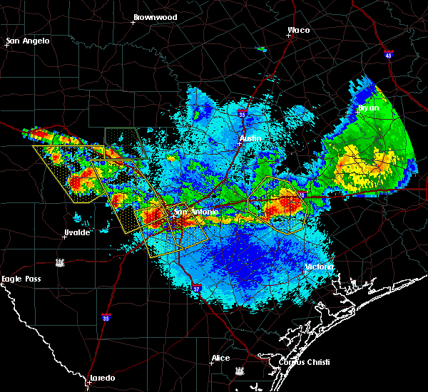 At 927 pm cdt, a severe thunderstorm was located over hill country state natural area, or 7 miles southeast of tarpley, moving southeast at 40 mph (radar indicated). Hazards include two inch hail and 60 mph wind gusts. People and animals outdoors will be injured. expect hail damage to roofs, siding, windows, and vehicles. Expect wind damage to roofs, siding, and trees. At 927 pm cdt, a severe thunderstorm was located over hill country state natural area, or 7 miles southeast of tarpley, moving southeast at 40 mph (radar indicated). Hazards include two inch hail and 60 mph wind gusts. People and animals outdoors will be injured. expect hail damage to roofs, siding, windows, and vehicles. Expect wind damage to roofs, siding, and trees.
|
| 5/24/2020 8:00 PM CDT |
 At 759 pm cdt, severe thunderstorms were located along a line extending from near crabapple to 6 miles east of derby, moving east at 40 mph (radar indicated). Hazards include 60 mph wind gusts and quarter size hail. Hail damage to vehicles is expected. Expect wind damage to roofs, siding, and trees. At 759 pm cdt, severe thunderstorms were located along a line extending from near crabapple to 6 miles east of derby, moving east at 40 mph (radar indicated). Hazards include 60 mph wind gusts and quarter size hail. Hail damage to vehicles is expected. Expect wind damage to roofs, siding, and trees.
|
| 5/24/2020 7:43 PM CDT |
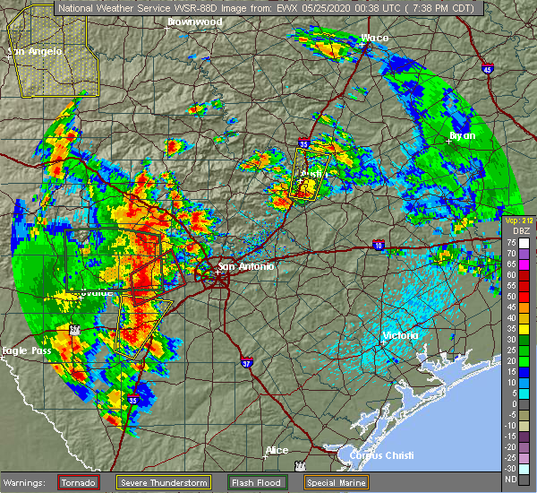 At 743 pm cdt, a severe thunderstorm capable of producing a tornado was located near hondo, moving northeast at 20 mph (radar indicated rotation). Hazards include tornado. Flying debris will be dangerous to those caught without shelter. mobile homes will be damaged or destroyed. damage to roofs, windows, and vehicles will occur. Tree damage is likely. At 743 pm cdt, a severe thunderstorm capable of producing a tornado was located near hondo, moving northeast at 20 mph (radar indicated rotation). Hazards include tornado. Flying debris will be dangerous to those caught without shelter. mobile homes will be damaged or destroyed. damage to roofs, windows, and vehicles will occur. Tree damage is likely.
|
| 5/24/2020 7:42 PM CDT | Asos station khdo south tx rgnl arpt at hond in medina county TX, 1.8 miles SE of Hondo, TX |
| 5/24/2020 7:11 PM CDT |
 At 711 pm cdt, a severe thunderstorm was located 7 miles south of hill country state natural area, or 11 miles southeast of tarpley, moving north at 30 mph (radar indicated). Hazards include golf ball size hail and 60 mph wind gusts. People and animals outdoors will be injured. expect hail damage to roofs, siding, windows, and vehicles. expect wind damage to roofs, siding, and trees. Locations impacted include, medina, hondo, bandera, tarpley, new fountain and hill country state natural area. At 711 pm cdt, a severe thunderstorm was located 7 miles south of hill country state natural area, or 11 miles southeast of tarpley, moving north at 30 mph (radar indicated). Hazards include golf ball size hail and 60 mph wind gusts. People and animals outdoors will be injured. expect hail damage to roofs, siding, windows, and vehicles. expect wind damage to roofs, siding, and trees. Locations impacted include, medina, hondo, bandera, tarpley, new fountain and hill country state natural area.
|
| 5/24/2020 6:57 PM CDT |
 At 656 pm cdt, a severe thunderstorm was located near hondo, moving north at 30 mph (radar indicated). Hazards include 60 mph wind gusts and half dollar size hail. Hail damage to vehicles is expected. Expect wind damage to roofs, siding, and trees. At 656 pm cdt, a severe thunderstorm was located near hondo, moving north at 30 mph (radar indicated). Hazards include 60 mph wind gusts and half dollar size hail. Hail damage to vehicles is expected. Expect wind damage to roofs, siding, and trees.
|
| 5/23/2020 9:05 PM CDT |
 At 905 pm cdt, a severe thunderstorm was located 9 miles northeast of sabinal, or 15 miles west of hondo, moving east at 40 mph (radar indicated). Hazards include 60 mph wind gusts and nickel size hail. expect damage to roofs, siding, and trees At 905 pm cdt, a severe thunderstorm was located 9 miles northeast of sabinal, or 15 miles west of hondo, moving east at 40 mph (radar indicated). Hazards include 60 mph wind gusts and nickel size hail. expect damage to roofs, siding, and trees
|
| 5/20/2020 10:21 PM CDT | 52 knot gust reported at the hondo airpor in medina county TX, 1.4 miles ESE of Hondo, TX |
| 5/15/2020 10:43 PM CDT |
 At 1042 pm cdt, a severe thunderstorm was located near charlotte, moving east at 40 mph (radar indicated). Hazards include 60 mph wind gusts and quarter size hail. Hail damage to vehicles is expected. expect wind damage to roofs, siding, and trees. Locations impacted include, san antonio, pearsall, hondo, devine, dilley, castroville, lytle, somerset, natalia, lacoste, north pearsall, moore, goldfinch, hilltop, noonan, quihi, dunlay, pearson, bader, and schattel. At 1042 pm cdt, a severe thunderstorm was located near charlotte, moving east at 40 mph (radar indicated). Hazards include 60 mph wind gusts and quarter size hail. Hail damage to vehicles is expected. expect wind damage to roofs, siding, and trees. Locations impacted include, san antonio, pearsall, hondo, devine, dilley, castroville, lytle, somerset, natalia, lacoste, north pearsall, moore, goldfinch, hilltop, noonan, quihi, dunlay, pearson, bader, and schattel.
|
| 5/15/2020 10:16 PM CDT |
 At 1015 pm cdt, a severe thunderstorm was located near moore, or 9 miles northeast of pearsall, moving east at 40 mph (radar indicated). Hazards include 60 mph wind gusts and penny size hail. Expect damage to roofs, siding, and trees. Locations impacted include, san antonio, pearsall, hondo, devine, dilley, castroville, lytle, somerset, natalia, lacoste, north pearsall, moore, goldfinch, d`hanis, hilltop, noonan, quihi, dunlay, pearson and bader. At 1015 pm cdt, a severe thunderstorm was located near moore, or 9 miles northeast of pearsall, moving east at 40 mph (radar indicated). Hazards include 60 mph wind gusts and penny size hail. Expect damage to roofs, siding, and trees. Locations impacted include, san antonio, pearsall, hondo, devine, dilley, castroville, lytle, somerset, natalia, lacoste, north pearsall, moore, goldfinch, d`hanis, hilltop, noonan, quihi, dunlay, pearson and bader.
|
| 5/15/2020 9:54 PM CDT |
 At 953 pm cdt, a severe thunderstorm was located near frio town, or 16 miles northwest of pearsall, moving east at 40 mph (radar indicated). Hazards include 60 mph wind gusts and penny size hail. expect damage to roofs, siding, and trees At 953 pm cdt, a severe thunderstorm was located near frio town, or 16 miles northwest of pearsall, moving east at 40 mph (radar indicated). Hazards include 60 mph wind gusts and penny size hail. expect damage to roofs, siding, and trees
|
| 3/4/2020 5:11 AM CST |
 At 511 am cst, severe thunderstorms were located along a line extending from near fredericksburg to 7 miles southeast of luckenbach to near kronkosky state natural area to near quihi, moving east at 45 mph (radar indicated). Hazards include 60 mph wind gusts and penny size hail. Expect damage to roofs, siding, and trees. Locations impacted include, boerne, fredericksburg, hondo, castroville, comfort, helotes, fair oaks ranch, cross mountain, stonewall, walnut grove, bandera falls, dunlay, quihi, mico, rocky hill, sisterdale, rocky creek, kreutzberg, government canyon state natural area and pipe creek. At 511 am cst, severe thunderstorms were located along a line extending from near fredericksburg to 7 miles southeast of luckenbach to near kronkosky state natural area to near quihi, moving east at 45 mph (radar indicated). Hazards include 60 mph wind gusts and penny size hail. Expect damage to roofs, siding, and trees. Locations impacted include, boerne, fredericksburg, hondo, castroville, comfort, helotes, fair oaks ranch, cross mountain, stonewall, walnut grove, bandera falls, dunlay, quihi, mico, rocky hill, sisterdale, rocky creek, kreutzberg, government canyon state natural area and pipe creek.
|
| 3/4/2020 4:43 AM CST |
 At 442 am cst, severe thunderstorms were located along a line extending from near tivydale to near cypress creek to near hill country state natural area to near d`hanis, moving east at 35 mph (radar indicated). Hazards include 60 mph wind gusts and quarter size hail. Hail damage to vehicles is expected. Expect wind damage to roofs, siding, and trees. At 442 am cst, severe thunderstorms were located along a line extending from near tivydale to near cypress creek to near hill country state natural area to near d`hanis, moving east at 35 mph (radar indicated). Hazards include 60 mph wind gusts and quarter size hail. Hail damage to vehicles is expected. Expect wind damage to roofs, siding, and trees.
|
| 3/4/2020 4:28 AM CST |
 At 428 am cst, severe thunderstorms were located along a line extending from near mountain home to kerrville to medina to 7 miles southwest of tarpley, moving east at 40 mph (radar indicated). Hazards include 60 mph wind gusts and quarter size hail. Hail damage to vehicles is expected. expect wind damage to roofs, siding, and trees. Locations impacted include, medina, kerrville, hondo, bandera, tarpley, ingram, hunt, camp verde, d`hanis, kerrville-schreiner park, waltonia, harper, cypress creek, mountain home, center point and hill country state natural area. At 428 am cst, severe thunderstorms were located along a line extending from near mountain home to kerrville to medina to 7 miles southwest of tarpley, moving east at 40 mph (radar indicated). Hazards include 60 mph wind gusts and quarter size hail. Hail damage to vehicles is expected. expect wind damage to roofs, siding, and trees. Locations impacted include, medina, kerrville, hondo, bandera, tarpley, ingram, hunt, camp verde, d`hanis, kerrville-schreiner park, waltonia, harper, cypress creek, mountain home, center point and hill country state natural area.
|
| 3/4/2020 4:17 AM CST |
 At 417 am cst, severe thunderstorms were located along a line extending from near mountain home to near waltonia to 7 miles southwest of medina to near sabinal, moving east at 40 mph (radar indicated). Hazards include 60 mph wind gusts and penny size hail. Expect damage to roofs, siding, and trees. Locations impacted include, medina, kerrville, hondo, bandera, tarpley, ingram, sabinal, hunt, camp verde, d`hanis, kerrville-schreiner park, waltonia, harper, cypress creek, mountain home, center point, utopia, hill country state natural area and knippa. At 417 am cst, severe thunderstorms were located along a line extending from near mountain home to near waltonia to 7 miles southwest of medina to near sabinal, moving east at 40 mph (radar indicated). Hazards include 60 mph wind gusts and penny size hail. Expect damage to roofs, siding, and trees. Locations impacted include, medina, kerrville, hondo, bandera, tarpley, ingram, sabinal, hunt, camp verde, d`hanis, kerrville-schreiner park, waltonia, harper, cypress creek, mountain home, center point, utopia, hill country state natural area and knippa.
|
| 3/4/2020 3:56 AM CST |
 At 355 am cst, severe thunderstorms were located along a line extending from 16 miles south of segovia to near kerr wildlife management area to vanderpool to 6 miles northwest of knippa, moving east at 40 mph (radar indicated). Hazards include 60 mph wind gusts and penny size hail. expect damage to roofs, siding, and trees At 355 am cst, severe thunderstorms were located along a line extending from 16 miles south of segovia to near kerr wildlife management area to vanderpool to 6 miles northwest of knippa, moving east at 40 mph (radar indicated). Hazards include 60 mph wind gusts and penny size hail. expect damage to roofs, siding, and trees
|
| 1/10/2020 7:14 PM CST |
 At 714 pm cst, a severe thunderstorm was located over dunlay, or 7 miles southwest of castroville, moving northeast at 40 mph (radar indicated). Hazards include 60 mph wind gusts and half dollar size hail. Hail damage to vehicles is expected. expect wind damage to roofs, siding, and trees. Locations impacted include, hondo, devine, castroville, lytle, natalia, lacoste, cliff, noonan, new fountain, dunlay, quihi, biry, pearson, bader, rio medina and government canyon state natural area. At 714 pm cst, a severe thunderstorm was located over dunlay, or 7 miles southwest of castroville, moving northeast at 40 mph (radar indicated). Hazards include 60 mph wind gusts and half dollar size hail. Hail damage to vehicles is expected. expect wind damage to roofs, siding, and trees. Locations impacted include, hondo, devine, castroville, lytle, natalia, lacoste, cliff, noonan, new fountain, dunlay, quihi, biry, pearson, bader, rio medina and government canyon state natural area.
|
| 1/10/2020 7:05 PM CST |
 At 704 pm cst, a severe thunderstorm was located near biry, or near hondo, moving northeast at 35 mph (radar indicated). Hazards include golf ball size hail and 60 mph wind gusts. People and animals outdoors will be injured. expect hail damage to roofs, siding, windows, and vehicles. expect wind damage to roofs, siding, and trees. Locations impacted include, hondo, devine, castroville, lytle, natalia, lacoste, cliff, noonan, new fountain, dunlay, quihi, biry, pearson, yancey, bader, rio medina and government canyon state natural area. At 704 pm cst, a severe thunderstorm was located near biry, or near hondo, moving northeast at 35 mph (radar indicated). Hazards include golf ball size hail and 60 mph wind gusts. People and animals outdoors will be injured. expect hail damage to roofs, siding, windows, and vehicles. expect wind damage to roofs, siding, and trees. Locations impacted include, hondo, devine, castroville, lytle, natalia, lacoste, cliff, noonan, new fountain, dunlay, quihi, biry, pearson, yancey, bader, rio medina and government canyon state natural area.
|
| 1/10/2020 6:54 PM CST |
 At 654 pm cst, a severe thunderstorm was located 7 miles northwest of yancey, or 9 miles southwest of hondo, moving northeast at 35 mph (radar indicated). Hazards include two inch hail and 60 mph wind gusts. People and animals outdoors will be injured. expect hail damage to roofs, siding, windows, and vehicles. expect wind damage to roofs, siding, and trees. Locations impacted include, hondo, devine, castroville, lytle, natalia, lacoste, cliff, noonan, new fountain, dunlay, quihi, biry, pearson, yancey, bader, rio medina, frio town and government canyon state natural area. At 654 pm cst, a severe thunderstorm was located 7 miles northwest of yancey, or 9 miles southwest of hondo, moving northeast at 35 mph (radar indicated). Hazards include two inch hail and 60 mph wind gusts. People and animals outdoors will be injured. expect hail damage to roofs, siding, windows, and vehicles. expect wind damage to roofs, siding, and trees. Locations impacted include, hondo, devine, castroville, lytle, natalia, lacoste, cliff, noonan, new fountain, dunlay, quihi, biry, pearson, yancey, bader, rio medina, frio town and government canyon state natural area.
|
| 1/10/2020 6:52 PM CST |
 At 652 pm cst, a severe thunderstorm was located 7 miles northwest of yancey, or 11 miles southwest of hondo, moving northeast at 35 mph (radar indicated). Hazards include ping pong ball size hail and 60 mph wind gusts. People and animals outdoors will be injured. expect hail damage to roofs, siding, windows, and vehicles. Expect wind damage to roofs, siding, and trees. At 652 pm cst, a severe thunderstorm was located 7 miles northwest of yancey, or 11 miles southwest of hondo, moving northeast at 35 mph (radar indicated). Hazards include ping pong ball size hail and 60 mph wind gusts. People and animals outdoors will be injured. expect hail damage to roofs, siding, windows, and vehicles. Expect wind damage to roofs, siding, and trees.
|
| 6/17/2019 1:01 AM CDT |
 At 101 am cdt, severe thunderstorms were located along a line extending from near new braunfels to near zuehl to near elmendorf to 11 miles south of tarpley, moving southeast at 40 mph (radar indicated). Hazards include 70 mph wind gusts and nickel size hail. Expect considerable tree damage. damage is likely to mobile homes, roofs, and outbuildings. Locations impacted include, san antonio, new braunfels, schertz, seguin, cibolo, universal city, live oak, selma, hondo, castroville, san antonio int airport, randolph afb, stinson municipal airport, canyon lake, leon valley, helotes, fair oaks ranch, kirby, alamo heights and windcrest. At 101 am cdt, severe thunderstorms were located along a line extending from near new braunfels to near zuehl to near elmendorf to 11 miles south of tarpley, moving southeast at 40 mph (radar indicated). Hazards include 70 mph wind gusts and nickel size hail. Expect considerable tree damage. damage is likely to mobile homes, roofs, and outbuildings. Locations impacted include, san antonio, new braunfels, schertz, seguin, cibolo, universal city, live oak, selma, hondo, castroville, san antonio int airport, randolph afb, stinson municipal airport, canyon lake, leon valley, helotes, fair oaks ranch, kirby, alamo heights and windcrest.
|
| 6/17/2019 12:49 AM CDT |
 At 1249 am cdt, severe thunderstorms were located along a line extending from near smithson valley to garden ridge to near kirby to rio medina, moving southeast at 35 mph (radar indicated). Hazards include 70 mph wind gusts and nickel size hail. Expect considerable tree damage. damage is likely to mobile homes, roofs, and outbuildings. Locations impacted include, san antonio, new braunfels, schertz, seguin, cibolo, universal city, live oak, selma, hondo, castroville, san antonio int airport, randolph afb, stinson municipal airport, canyon lake, leon valley, helotes, fair oaks ranch, kirby, alamo heights and windcrest. At 1249 am cdt, severe thunderstorms were located along a line extending from near smithson valley to garden ridge to near kirby to rio medina, moving southeast at 35 mph (radar indicated). Hazards include 70 mph wind gusts and nickel size hail. Expect considerable tree damage. damage is likely to mobile homes, roofs, and outbuildings. Locations impacted include, san antonio, new braunfels, schertz, seguin, cibolo, universal city, live oak, selma, hondo, castroville, san antonio int airport, randolph afb, stinson municipal airport, canyon lake, leon valley, helotes, fair oaks ranch, kirby, alamo heights and windcrest.
|
| 6/17/2019 12:27 AM CDT |
 At 1226 am cdt, severe thunderstorms were located along a line extending from near guadalupe river state park to near timberwood park to near leon valley to 7 miles southwest of tarpley, moving east at 35 mph (radar indicated). Hazards include 70 mph wind gusts and penny size hail. Expect considerable tree damage. Damage is likely to mobile homes, roofs, and outbuildings. At 1226 am cdt, severe thunderstorms were located along a line extending from near guadalupe river state park to near timberwood park to near leon valley to 7 miles southwest of tarpley, moving east at 35 mph (radar indicated). Hazards include 70 mph wind gusts and penny size hail. Expect considerable tree damage. Damage is likely to mobile homes, roofs, and outbuildings.
|
| 6/17/2019 12:16 AM CDT |
 At 1215 am cdt, severe thunderstorms were located along a line extending from near bergheim to helotes to near tarpley, moving southeast at 25 mph (radar indicated). Hazards include 60 mph wind gusts and penny size hail. Expect damage to roofs, siding, and trees. Locations impacted include, san antonio, medina, boerne, hondo, castroville, bandera, tarpley, canyon lake, leon valley, helotes, fair oaks ranch, bulverde, shavano park, cross mountain, lacoste, guadalupe river state park, d`hanis, bandera falls, the dominion and dunlay. At 1215 am cdt, severe thunderstorms were located along a line extending from near bergheim to helotes to near tarpley, moving southeast at 25 mph (radar indicated). Hazards include 60 mph wind gusts and penny size hail. Expect damage to roofs, siding, and trees. Locations impacted include, san antonio, medina, boerne, hondo, castroville, bandera, tarpley, canyon lake, leon valley, helotes, fair oaks ranch, bulverde, shavano park, cross mountain, lacoste, guadalupe river state park, d`hanis, bandera falls, the dominion and dunlay.
|
| 6/17/2019 12:02 AM CDT |
 At 1201 am cdt, severe thunderstorms were located along a line extending from near bergheim to near lakehills to near tarpley, moving southeast at 35 mph (radar indicated). Hazards include 60 mph wind gusts and quarter size hail. Hail damage to vehicles is expected. expect wind damage to roofs, siding, and trees. Locations impacted include, san antonio, medina, boerne, hondo, castroville, bandera, tarpley, canyon lake, leon valley, helotes, fair oaks ranch, bulverde, shavano park, cross mountain, lacoste, guadalupe river state park, d`hanis, bandera falls, the dominion and dunlay. At 1201 am cdt, severe thunderstorms were located along a line extending from near bergheim to near lakehills to near tarpley, moving southeast at 35 mph (radar indicated). Hazards include 60 mph wind gusts and quarter size hail. Hail damage to vehicles is expected. expect wind damage to roofs, siding, and trees. Locations impacted include, san antonio, medina, boerne, hondo, castroville, bandera, tarpley, canyon lake, leon valley, helotes, fair oaks ranch, bulverde, shavano park, cross mountain, lacoste, guadalupe river state park, d`hanis, bandera falls, the dominion and dunlay.
|
| 6/16/2019 11:28 PM CDT |
 The national weather service in austin san antonio has issued a * severe thunderstorm warning for. medina county in south central texas. bandera county in south central texas. southeastern kerr county in south central texas. Northeastern uvalde county in south central texas. The national weather service in austin san antonio has issued a * severe thunderstorm warning for. medina county in south central texas. bandera county in south central texas. southeastern kerr county in south central texas. Northeastern uvalde county in south central texas.
|
| 6/9/2019 10:26 PM CDT |
 At 1026 pm cdt, a severe thunderstorm was located over hondo, moving south at 15 mph (radar indicated). Hazards include 60 mph wind gusts and quarter size hail. Hail damage to vehicles is expected. Expect wind damage to roofs, siding, and trees. At 1026 pm cdt, a severe thunderstorm was located over hondo, moving south at 15 mph (radar indicated). Hazards include 60 mph wind gusts and quarter size hail. Hail damage to vehicles is expected. Expect wind damage to roofs, siding, and trees.
|
| 6/9/2019 9:58 PM CDT |
 At 958 pm cdt, severe thunderstorms were located along a line extending from near leon valley to near rio medina to 6 miles northwest of new fountain, moving southeast at 20 mph (radar indicated). Hazards include 60 mph wind gusts and quarter size hail. Hail damage to vehicles is expected. expect wind damage to roofs, siding, and trees. Locations impacted include, san antonio, hondo, castroville, stinson municipal airport, san antonio int airport, leon valley, helotes, shavano park, hollywood park, olmos park, lacoste, d`hanis, quihi, dunlay, mico, government canyon state natural area, sea world, bader, lackland afb and cliff. At 958 pm cdt, severe thunderstorms were located along a line extending from near leon valley to near rio medina to 6 miles northwest of new fountain, moving southeast at 20 mph (radar indicated). Hazards include 60 mph wind gusts and quarter size hail. Hail damage to vehicles is expected. expect wind damage to roofs, siding, and trees. Locations impacted include, san antonio, hondo, castroville, stinson municipal airport, san antonio int airport, leon valley, helotes, shavano park, hollywood park, olmos park, lacoste, d`hanis, quihi, dunlay, mico, government canyon state natural area, sea world, bader, lackland afb and cliff.
|
| 6/9/2019 9:28 PM CDT |
 At 927 pm cdt, severe thunderstorms were located along a line extending from the dominion to near cross mountain to near lakehills to near hill country state natural area, moving south at 20 mph (radar indicated). Hazards include 60 mph wind gusts and quarter size hail. Hail damage to vehicles is expected. Expect wind damage to roofs, siding, and trees. At 927 pm cdt, severe thunderstorms were located along a line extending from the dominion to near cross mountain to near lakehills to near hill country state natural area, moving south at 20 mph (radar indicated). Hazards include 60 mph wind gusts and quarter size hail. Hail damage to vehicles is expected. Expect wind damage to roofs, siding, and trees.
|
| 6/9/2019 9:01 PM CDT |
 At 901 pm cdt, severe thunderstorms were located along a line extending from near fair oaks ranch to medina to 13 miles north of vance, moving south at 15 mph (radar indicated). Hazards include 60 mph wind gusts and quarter size hail. Hail damage to vehicles is expected. expect wind damage to roofs, siding, and trees. Locations impacted include, san antonio, medina, boerne, hondo, castroville, bandera, leakey, stinson municipal airport, tarpley, san antonio int airport, vanderpool, leon valley, helotes, fair oaks ranch, alamo heights, terrell hills, shavano park, hollywood park, cross mountain and lytle. At 901 pm cdt, severe thunderstorms were located along a line extending from near fair oaks ranch to medina to 13 miles north of vance, moving south at 15 mph (radar indicated). Hazards include 60 mph wind gusts and quarter size hail. Hail damage to vehicles is expected. expect wind damage to roofs, siding, and trees. Locations impacted include, san antonio, medina, boerne, hondo, castroville, bandera, leakey, stinson municipal airport, tarpley, san antonio int airport, vanderpool, leon valley, helotes, fair oaks ranch, alamo heights, terrell hills, shavano park, hollywood park, cross mountain and lytle.
|
| 6/9/2019 8:35 PM CDT |
 At 835 pm cdt, severe thunderstorms were located along a line extending from fair oaks ranch to medina to 15 miles north of vance, moving southwest at 40 mph (radar indicated). Hazards include 60 mph wind gusts and quarter size hail. Hail damage to vehicles is expected. Expect wind damage to roofs, siding, and trees. At 835 pm cdt, severe thunderstorms were located along a line extending from fair oaks ranch to medina to 15 miles north of vance, moving southwest at 40 mph (radar indicated). Hazards include 60 mph wind gusts and quarter size hail. Hail damage to vehicles is expected. Expect wind damage to roofs, siding, and trees.
|
| 5/3/2019 8:40 PM CDT |
 The severe thunderstorm warning for medina, southern uvalde, northeastern zavala and northwestern frio counties will expire at 845 pm cdt, the storms which prompted the warning have weakened below severe limits, and no longer pose an immediate threat to life or property. therefore, the warning will be allowed to expire. however small hail, gusty winds and heavy rain are still possible with these thunderstorms. a severe thunderstorm watch remains in effect until 1100 pm cdt for south central texas. to report severe weather, contact your nearest law enforcement agency. they will relay your report to the national weather service austin san antonio. The severe thunderstorm warning for medina, southern uvalde, northeastern zavala and northwestern frio counties will expire at 845 pm cdt, the storms which prompted the warning have weakened below severe limits, and no longer pose an immediate threat to life or property. therefore, the warning will be allowed to expire. however small hail, gusty winds and heavy rain are still possible with these thunderstorms. a severe thunderstorm watch remains in effect until 1100 pm cdt for south central texas. to report severe weather, contact your nearest law enforcement agency. they will relay your report to the national weather service austin san antonio.
|
| 5/3/2019 8:10 PM CDT |
 At 810 pm cdt, severe thunderstorms were located along a line extending from 11 miles southeast of utopia to sabinal to near uvalde, moving southeast at 30 mph (radar indicated). Hazards include 60 mph wind gusts and quarter size hail. Hail damage to vehicles is expected. expect wind damage to roofs, siding, and trees. Locations impacted include, uvalde, hondo, devine, castroville, batesville, sabinal, moore, knippa, d`hanis, noonan, new fountain, quihi, dunlay, mico, uvalde estates, biry, yancey, rio medina, bader and frio town. At 810 pm cdt, severe thunderstorms were located along a line extending from 11 miles southeast of utopia to sabinal to near uvalde, moving southeast at 30 mph (radar indicated). Hazards include 60 mph wind gusts and quarter size hail. Hail damage to vehicles is expected. expect wind damage to roofs, siding, and trees. Locations impacted include, uvalde, hondo, devine, castroville, batesville, sabinal, moore, knippa, d`hanis, noonan, new fountain, quihi, dunlay, mico, uvalde estates, biry, yancey, rio medina, bader and frio town.
|
| 5/3/2019 7:43 PM CDT |
 At 742 pm cdt, severe thunderstorms were located along a line extending from near utopia to 7 miles south of concan to 8 miles northeast of blewett, moving southeast at 30 mph (radar indicated). Hazards include 60 mph wind gusts and quarter size hail. Hail damage to vehicles is expected. Expect wind damage to roofs, siding, and trees. At 742 pm cdt, severe thunderstorms were located along a line extending from near utopia to 7 miles south of concan to 8 miles northeast of blewett, moving southeast at 30 mph (radar indicated). Hazards include 60 mph wind gusts and quarter size hail. Hail damage to vehicles is expected. Expect wind damage to roofs, siding, and trees.
|
| 4/17/2019 11:53 PM CDT |
 At 1153 pm cdt, severe thunderstorms were located along a line extending from 6 miles north of sabinal to 9 miles northwest of frio town to near loma vista, moving east at 50 mph (radar indicated). Hazards include 60 mph wind gusts and nickel size hail. expect damage to roofs, siding, and trees At 1153 pm cdt, severe thunderstorms were located along a line extending from 6 miles north of sabinal to 9 miles northwest of frio town to near loma vista, moving east at 50 mph (radar indicated). Hazards include 60 mph wind gusts and nickel size hail. expect damage to roofs, siding, and trees
|
| 4/13/2019 8:35 AM CDT |
 At 834 am cdt, a severe thunderstorm was located north of hondo, moving east at 25 mph (radar indicated). Hazards include 60 mph wind gusts and quarter size hail. this storm also has a history of producing a rotating wall cloud. Hail damage to vehicles is expected. expect wind damage to roofs, siding, and trees. Locations impacted include, hondo, castroville, cliff, new fountain, quihi, dunlay, mico, rio medina, bader and government canyon state natural area. At 834 am cdt, a severe thunderstorm was located north of hondo, moving east at 25 mph (radar indicated). Hazards include 60 mph wind gusts and quarter size hail. this storm also has a history of producing a rotating wall cloud. Hail damage to vehicles is expected. expect wind damage to roofs, siding, and trees. Locations impacted include, hondo, castroville, cliff, new fountain, quihi, dunlay, mico, rio medina, bader and government canyon state natural area.
|
| 4/13/2019 8:19 AM CDT |
 At 817 am cdt, a severe thunderstorm capable of producing a tornado was located over d`hanis, or 8 miles west of hondo, moving east at 30 mph. at 8:12 am, a trained spotter reported a rotating wall cloud just north of us highway 90 between sabinal and hondo (radar indicated rotation). Hazards include tornado and quarter size hail. Flying debris will be dangerous to those caught without shelter. mobile homes will be damaged or destroyed. damage to roofs, windows, and vehicles will occur. tree damage is likely. Locations impacted include, hondo and d`hanis. At 817 am cdt, a severe thunderstorm capable of producing a tornado was located over d`hanis, or 8 miles west of hondo, moving east at 30 mph. at 8:12 am, a trained spotter reported a rotating wall cloud just north of us highway 90 between sabinal and hondo (radar indicated rotation). Hazards include tornado and quarter size hail. Flying debris will be dangerous to those caught without shelter. mobile homes will be damaged or destroyed. damage to roofs, windows, and vehicles will occur. tree damage is likely. Locations impacted include, hondo and d`hanis.
|
| 4/13/2019 8:12 AM CDT |
 At 811 am cdt, a severe thunderstorm was located northwest of d`hanis, or 11 miles northwest of hondo, moving east at 30 mph (radar indicated). Hazards include 60 mph wind gusts and quarter size hail. Hail damage to vehicles is expected. Expect wind damage to roofs, siding, and trees. At 811 am cdt, a severe thunderstorm was located northwest of d`hanis, or 11 miles northwest of hondo, moving east at 30 mph (radar indicated). Hazards include 60 mph wind gusts and quarter size hail. Hail damage to vehicles is expected. Expect wind damage to roofs, siding, and trees.
|
| 4/13/2019 8:07 AM CDT |
 At 806 am cdt, a severe thunderstorm capable of producing a tornado was located near sabinal, or 14 miles west of hondo, moving east at 30 mph (radar indicated rotation). Hazards include tornado and ping pong ball size hail. Flying debris will be dangerous to those caught without shelter. mobile homes will be damaged or destroyed. damage to roofs, windows, and vehicles will occur. Tree damage is likely. At 806 am cdt, a severe thunderstorm capable of producing a tornado was located near sabinal, or 14 miles west of hondo, moving east at 30 mph (radar indicated rotation). Hazards include tornado and ping pong ball size hail. Flying debris will be dangerous to those caught without shelter. mobile homes will be damaged or destroyed. damage to roofs, windows, and vehicles will occur. Tree damage is likely.
|
| 4/7/2019 6:01 AM CDT |
 At 600 am cdt, severe thunderstorms were located along a line extending from near bandera to near pleasanton, moving east at 45 mph (radar indicated). Hazards include 60 mph wind gusts and penny size hail. Expect damage to roofs, siding, and trees. Locations impacted include, san antonio, pleasanton, devine, jourdanton, poteet, castroville, charlotte, bandera, christine, tarpley, lytle, somerset, natalia, lacoste, bandera falls, dunlay, mico, pearson, leming and sea world. At 600 am cdt, severe thunderstorms were located along a line extending from near bandera to near pleasanton, moving east at 45 mph (radar indicated). Hazards include 60 mph wind gusts and penny size hail. Expect damage to roofs, siding, and trees. Locations impacted include, san antonio, pleasanton, devine, jourdanton, poteet, castroville, charlotte, bandera, christine, tarpley, lytle, somerset, natalia, lacoste, bandera falls, dunlay, mico, pearson, leming and sea world.
|
| 4/7/2019 5:39 AM CDT |
 At 539 am cdt, severe thunderstorms were located along a line extending from near tarpley to charlotte, moving east at 45 mph (radar indicated). Hazards include 60 mph wind gusts and penny size hail. expect damage to roofs, siding, and trees At 539 am cdt, severe thunderstorms were located along a line extending from near tarpley to charlotte, moving east at 45 mph (radar indicated). Hazards include 60 mph wind gusts and penny size hail. expect damage to roofs, siding, and trees
|
| 4/7/2019 5:27 AM CDT | Hondo asos measured 60 mph gust in medina county TX, 1.4 miles ESE of Hondo, TX |
| 4/7/2019 5:00 AM CDT |
 At 459 am cdt, severe thunderstorms were located along a line extending from garner state park to near yancey, moving east northeast at 35 mph (radar indicated). Hazards include 60 mph wind gusts and penny size hail. Expect damage to roofs, siding, and trees. Locations impacted include, uvalde, hondo, leakey, tarpley, vanderpool, sabinal, knippa, d`hanis, rio frio, concan, garner state park, reagan wells, utopia and hill country state natural area. At 459 am cdt, severe thunderstorms were located along a line extending from garner state park to near yancey, moving east northeast at 35 mph (radar indicated). Hazards include 60 mph wind gusts and penny size hail. Expect damage to roofs, siding, and trees. Locations impacted include, uvalde, hondo, leakey, tarpley, vanderpool, sabinal, knippa, d`hanis, rio frio, concan, garner state park, reagan wells, utopia and hill country state natural area.
|
| 4/7/2019 4:32 AM CDT |
 At 432 am cdt, severe thunderstorms were located along a line extending from montell to 11 miles northwest of frio town, moving northeast at 50 mph (radar indicated). Hazards include 60 mph wind gusts and nickel size hail. expect damage to roofs, siding, and trees At 432 am cdt, severe thunderstorms were located along a line extending from montell to 11 miles northwest of frio town, moving northeast at 50 mph (radar indicated). Hazards include 60 mph wind gusts and nickel size hail. expect damage to roofs, siding, and trees
|
| 7/7/2018 6:54 PM CDT |
 At 654 pm cdt, a severe thunderstorm was located 8 miles north of d`hanis, or 8 miles northwest of hondo, moving southwest at 20 mph (radar indicated). Hazards include ping pong ball size hail and 60 mph wind gusts. People and animals outdoors will be injured. expect hail damage to roofs, siding, windows, and vehicles. expect wind damage to roofs, siding, and trees. Locations impacted include, hondo and d`hanis. At 654 pm cdt, a severe thunderstorm was located 8 miles north of d`hanis, or 8 miles northwest of hondo, moving southwest at 20 mph (radar indicated). Hazards include ping pong ball size hail and 60 mph wind gusts. People and animals outdoors will be injured. expect hail damage to roofs, siding, windows, and vehicles. expect wind damage to roofs, siding, and trees. Locations impacted include, hondo and d`hanis.
|
| 7/7/2018 6:45 PM CDT |
 At 644 pm cdt, a severe thunderstorm was located 8 miles north of hondo, moving southwest at 20 mph (radar indicated). Hazards include 60 mph wind gusts and quarter size hail. Hail damage to vehicles is expected. Expect wind damage to roofs, siding, and trees. At 644 pm cdt, a severe thunderstorm was located 8 miles north of hondo, moving southwest at 20 mph (radar indicated). Hazards include 60 mph wind gusts and quarter size hail. Hail damage to vehicles is expected. Expect wind damage to roofs, siding, and trees.
|
| 5/15/2018 10:47 PM CDT |
 At 1047 pm cdt, a severe thunderstorm was located 7 miles northeast of sabinal, or 15 miles west of hondo, moving south at 45 mph (radar indicated). Hazards include 60 mph wind gusts and penny size hail. Expect damage to roofs, siding, and trees. Locations impacted include, hondo, sabinal, utopia and d`hanis. At 1047 pm cdt, a severe thunderstorm was located 7 miles northeast of sabinal, or 15 miles west of hondo, moving south at 45 mph (radar indicated). Hazards include 60 mph wind gusts and penny size hail. Expect damage to roofs, siding, and trees. Locations impacted include, hondo, sabinal, utopia and d`hanis.
|
| 5/15/2018 10:32 PM CDT |
 At 1031 pm cdt, a severe thunderstorm was located 7 miles southeast of utopia, or 9 miles southwest of tarpley, moving southeast at 40 mph (radar indicated). Hazards include 60 mph wind gusts and quarter size hail. Hail damage to vehicles is expected. expect wind damage to roofs, siding, and trees. Locations impacted include, hondo, sabinal, utopia and d`hanis. At 1031 pm cdt, a severe thunderstorm was located 7 miles southeast of utopia, or 9 miles southwest of tarpley, moving southeast at 40 mph (radar indicated). Hazards include 60 mph wind gusts and quarter size hail. Hail damage to vehicles is expected. expect wind damage to roofs, siding, and trees. Locations impacted include, hondo, sabinal, utopia and d`hanis.
|
| 5/15/2018 10:07 PM CDT |
 At 1007 pm cdt, a severe thunderstorm was located 8 miles east of lost maples state natural area, or 8 miles northeast of vanderpool, moving south at 40 mph (radar indicated). Hazards include 60 mph wind gusts and quarter size hail. Hail damage to vehicles is expected. expect wind damage to roofs, siding, and trees. Locations impacted include, hondo, tarpley, sabinal, utopia and d`hanis. At 1007 pm cdt, a severe thunderstorm was located 8 miles east of lost maples state natural area, or 8 miles northeast of vanderpool, moving south at 40 mph (radar indicated). Hazards include 60 mph wind gusts and quarter size hail. Hail damage to vehicles is expected. expect wind damage to roofs, siding, and trees. Locations impacted include, hondo, tarpley, sabinal, utopia and d`hanis.
|
| 5/15/2018 9:55 PM CDT |
 At 954 pm cdt, a severe thunderstorm was located 11 miles northeast of lost maples state natural area, or 12 miles northwest of medina, moving south at 45 mph (radar indicated). Hazards include golf ball size hail and 60 mph wind gusts. People and animals outdoors will be injured. expect hail damage to roofs, siding, windows, and vehicles. Expect wind damage to roofs, siding, and trees. At 954 pm cdt, a severe thunderstorm was located 11 miles northeast of lost maples state natural area, or 12 miles northwest of medina, moving south at 45 mph (radar indicated). Hazards include golf ball size hail and 60 mph wind gusts. People and animals outdoors will be injured. expect hail damage to roofs, siding, windows, and vehicles. Expect wind damage to roofs, siding, and trees.
|
| 5/4/2018 8:00 AM CDT | Quarter sized hail reported 19.4 miles SSE of Hondo, TX, nickel to quarter size hail and lots of tree damage. |
| 4/13/2018 11:53 PM CDT |
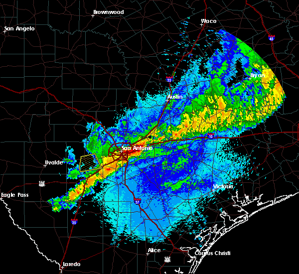 The severe thunderstorm warning for southeastern medina county will expire at midnight cdt, the severe thunderstorm which prompted the warning has moved out of the warned area. therefore, the warning will be allowed to expire. The severe thunderstorm warning for southeastern medina county will expire at midnight cdt, the severe thunderstorm which prompted the warning has moved out of the warned area. therefore, the warning will be allowed to expire.
|
| 4/13/2018 11:28 PM CDT |
 At 1117 pm cdt, a severe thunderstorm was located near biry, or near hondo, moving east at 40 mph (radar indicated). Hazards include 60 mph wind gusts and nickel size hail. Expect damage to roofs, siding, and trees. Locations impacted include, hondo, castroville, natalia, biry, pearson, d`hanis, noonan, yancey, new fountain, dunlay, quihi and bader. At 1117 pm cdt, a severe thunderstorm was located near biry, or near hondo, moving east at 40 mph (radar indicated). Hazards include 60 mph wind gusts and nickel size hail. Expect damage to roofs, siding, and trees. Locations impacted include, hondo, castroville, natalia, biry, pearson, d`hanis, noonan, yancey, new fountain, dunlay, quihi and bader.
|
| 4/13/2018 11:17 PM CDT |
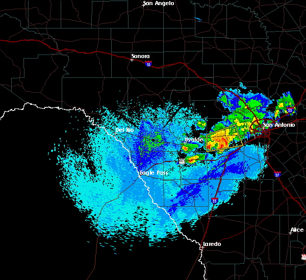 At 1117 pm cdt, a severe thunderstorm was located near biry, or near hondo, moving east at 40 mph (radar indicated). Hazards include 60 mph wind gusts and nickel size hail. Expect damage to roofs, siding, and trees. Locations impacted include, hondo, castroville, natalia, biry, pearson, d`hanis, noonan, yancey, new fountain, dunlay, quihi and bader. At 1117 pm cdt, a severe thunderstorm was located near biry, or near hondo, moving east at 40 mph (radar indicated). Hazards include 60 mph wind gusts and nickel size hail. Expect damage to roofs, siding, and trees. Locations impacted include, hondo, castroville, natalia, biry, pearson, d`hanis, noonan, yancey, new fountain, dunlay, quihi and bader.
|
| 4/13/2018 11:03 PM CDT |
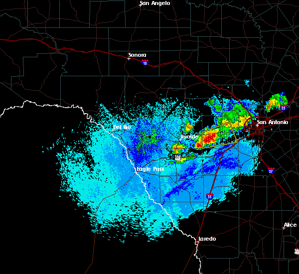 At 1102 pm cdt, a severe thunderstorm was located near d`hanis, or 10 miles southwest of hondo, moving east at 30 mph (radar indicated). Hazards include 60 mph wind gusts and quarter size hail. Hail damage to vehicles is expected. Expect wind damage to roofs, siding, and trees. At 1102 pm cdt, a severe thunderstorm was located near d`hanis, or 10 miles southwest of hondo, moving east at 30 mph (radar indicated). Hazards include 60 mph wind gusts and quarter size hail. Hail damage to vehicles is expected. Expect wind damage to roofs, siding, and trees.
|
| 3/28/2018 9:03 AM CDT |
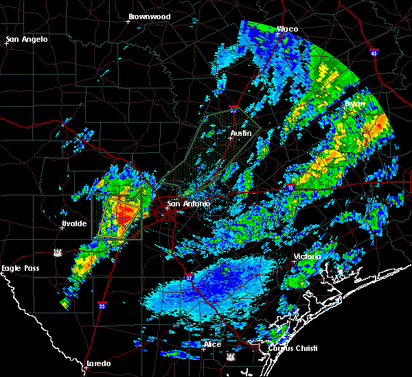 At 902 am cdt, a severe thunderstorm was located near dunlay, or 7 miles southeast of hondo, moving northeast at 40 mph (radar indicated). Hazards include golf ball size hail and 60 mph wind gusts. People and animals outdoors will be injured. expect hail damage to roofs, siding, windows, and vehicles. expect wind damage to roofs, siding, and trees. locations impacted include, hondo, castroville, biry, yancey, new fountain, dunlay, bader, rio medina, state highway 173 and u. s. Highway 90. At 902 am cdt, a severe thunderstorm was located near dunlay, or 7 miles southeast of hondo, moving northeast at 40 mph (radar indicated). Hazards include golf ball size hail and 60 mph wind gusts. People and animals outdoors will be injured. expect hail damage to roofs, siding, windows, and vehicles. expect wind damage to roofs, siding, and trees. locations impacted include, hondo, castroville, biry, yancey, new fountain, dunlay, bader, rio medina, state highway 173 and u. s. Highway 90.
|
| 3/28/2018 8:47 AM CDT |
 At 845 am cdt, a severe thunderstorm was located near hondo, moving northeast at 45 mph (radar indicated). Hazards include tennis ball size hail and 60 mph wind gusts. People and animals outdoors will be injured. expect hail damage to roofs, siding, windows, and vehicles. expect wind damage to roofs, siding, and trees. locations impacted include, hondo, castroville, yancey, new fountain, dunlay, bader, rio medina, d`hanis, state highway 173 and u. s. Highway 90. At 845 am cdt, a severe thunderstorm was located near hondo, moving northeast at 45 mph (radar indicated). Hazards include tennis ball size hail and 60 mph wind gusts. People and animals outdoors will be injured. expect hail damage to roofs, siding, windows, and vehicles. expect wind damage to roofs, siding, and trees. locations impacted include, hondo, castroville, yancey, new fountain, dunlay, bader, rio medina, d`hanis, state highway 173 and u. s. Highway 90.
|
| 3/28/2018 8:33 AM CDT |
 At 833 am cdt, a severe thunderstorm was located 9 miles south of d`hanis, or 14 miles southwest of hondo, moving northeast at 45 mph (radar indicated). Hazards include tennis ball size hail and 60 mph wind gusts. People and animals outdoors will be injured. expect hail damage to roofs, siding, windows, and vehicles. Expect wind damage to roofs, siding, and trees. At 833 am cdt, a severe thunderstorm was located 9 miles south of d`hanis, or 14 miles southwest of hondo, moving northeast at 45 mph (radar indicated). Hazards include tennis ball size hail and 60 mph wind gusts. People and animals outdoors will be injured. expect hail damage to roofs, siding, windows, and vehicles. Expect wind damage to roofs, siding, and trees.
|
| 2/25/2018 5:30 AM CST |
 At 530 am cst, a severe thunderstorm was located near d`hanis, or 10 miles west of hondo, moving north at 45 mph (radar indicated). Hazards include 60 mph wind gusts and quarter size hail. Hail damage to vehicles is expected. Expect wind damage to roofs, siding, and trees. At 530 am cst, a severe thunderstorm was located near d`hanis, or 10 miles west of hondo, moving north at 45 mph (radar indicated). Hazards include 60 mph wind gusts and quarter size hail. Hail damage to vehicles is expected. Expect wind damage to roofs, siding, and trees.
|
| 6/4/2017 9:47 PM CDT | Asos peak wind gust from the north. fastest 2-minute wind speed was 54 mph from the nort in medina county TX, 2 miles ESE of Hondo, TX |
| 6/4/2017 9:30 PM CDT |
 At 930 pm cdt, a severe thunderstorm was located 9 miles southeast of tarpley, moving south at 20 mph (radar indicated). Hazards include two inch hail and 60 mph wind gusts. People and animals outdoors will be injured. expect hail damage to roofs, siding, windows, and vehicles. Expect wind damage to roofs, siding, and trees. At 930 pm cdt, a severe thunderstorm was located 9 miles southeast of tarpley, moving south at 20 mph (radar indicated). Hazards include two inch hail and 60 mph wind gusts. People and animals outdoors will be injured. expect hail damage to roofs, siding, windows, and vehicles. Expect wind damage to roofs, siding, and trees.
|
| 5/28/2017 7:32 PM CDT |
 At 731 pm cdt, a severe thunderstorm was located 7 miles west of frio town, or 11 miles east of batesville, moving southeast at 10 mph (radar indicated). Hazards include golf ball size hail and 70 mph wind gusts. People and animals outdoors will be injured. expect hail damage to roofs, siding, windows, and vehicles. expect considerable tree damage. wind damage is also likely to mobile homes, roofs, and outbuildings. Locations impacted include, uvalde, hondo, batesville, sabinal, knippa, d`hanis and frio town. At 731 pm cdt, a severe thunderstorm was located 7 miles west of frio town, or 11 miles east of batesville, moving southeast at 10 mph (radar indicated). Hazards include golf ball size hail and 70 mph wind gusts. People and animals outdoors will be injured. expect hail damage to roofs, siding, windows, and vehicles. expect considerable tree damage. wind damage is also likely to mobile homes, roofs, and outbuildings. Locations impacted include, uvalde, hondo, batesville, sabinal, knippa, d`hanis and frio town.
|
| 5/28/2017 7:17 PM CDT |
 At 717 pm cdt, a severe thunderstorm was located 9 miles northeast of batesville, and is nearly stationary (radar indicated). Hazards include golf ball size hail and 60 mph wind gusts. People and animals outdoors will be injured. expect hail damage to roofs, siding, windows, and vehicles. expect wind damage to roofs, siding, and trees. Locations impacted include, uvalde, hondo, batesville, sabinal, knippa, d`hanis and frio town. At 717 pm cdt, a severe thunderstorm was located 9 miles northeast of batesville, and is nearly stationary (radar indicated). Hazards include golf ball size hail and 60 mph wind gusts. People and animals outdoors will be injured. expect hail damage to roofs, siding, windows, and vehicles. expect wind damage to roofs, siding, and trees. Locations impacted include, uvalde, hondo, batesville, sabinal, knippa, d`hanis and frio town.
|
| 5/28/2017 7:00 PM CDT |
 At 700 pm cdt, a severe thunderstorm was located 7 miles north of batesville, moving southwest at 5 mph (radar indicated). Hazards include golf ball size hail and 60 mph wind gusts. People and animals outdoors will be injured. expect hail damage to roofs, siding, windows, and vehicles. expect wind damage to roofs, siding, and trees. Locations impacted include, uvalde, pearsall, hondo, la pryor, batesville, moore, sabinal, knippa, d`hanis, uvalde estates, yancey, frio town, north pearsall and west pearsall. At 700 pm cdt, a severe thunderstorm was located 7 miles north of batesville, moving southwest at 5 mph (radar indicated). Hazards include golf ball size hail and 60 mph wind gusts. People and animals outdoors will be injured. expect hail damage to roofs, siding, windows, and vehicles. expect wind damage to roofs, siding, and trees. Locations impacted include, uvalde, pearsall, hondo, la pryor, batesville, moore, sabinal, knippa, d`hanis, uvalde estates, yancey, frio town, north pearsall and west pearsall.
|
| 5/28/2017 6:36 PM CDT |
 At 636 pm cdt, a severe thunderstorm was located 12 miles northeast of batesville, moving northeast at 10 mph (radar indicated). Hazards include ping pong ball size hail and 60 mph wind gusts. People and animals outdoors will be injured. expect hail damage to roofs, siding, windows, and vehicles. Expect wind damage to roofs, siding, and trees. At 636 pm cdt, a severe thunderstorm was located 12 miles northeast of batesville, moving northeast at 10 mph (radar indicated). Hazards include ping pong ball size hail and 60 mph wind gusts. People and animals outdoors will be injured. expect hail damage to roofs, siding, windows, and vehicles. Expect wind damage to roofs, siding, and trees.
|
| 5/20/2017 10:28 AM CDT |
 The severe thunderstorm warning for southwestern medina, southeastern uvalde and northern zavala counties will expire at 1030 am cdt, the storm which prompted the warning has weakened below severe limits, and no longer poses an immediate threat to life or property. therefore the warning will be allowed to expire. however heavy rain is still possible with this thunderstorm. a severe thunderstorm watch remains in effect until 500 pm cdt for south central texas. The severe thunderstorm warning for southwestern medina, southeastern uvalde and northern zavala counties will expire at 1030 am cdt, the storm which prompted the warning has weakened below severe limits, and no longer poses an immediate threat to life or property. therefore the warning will be allowed to expire. however heavy rain is still possible with this thunderstorm. a severe thunderstorm watch remains in effect until 500 pm cdt for south central texas.
|
| 5/20/2017 9:41 AM CDT |
 At 941 am cdt, a severe thunderstorm was located near sabinal, or 18 miles east of uvalde, moving southeast at 20 mph (public). Hazards include golf ball size hail and 60 mph wind gusts. People and animals outdoors will be injured. expect hail damage to roofs, siding, windows, and vehicles. expect wind damage to roofs, siding, and trees. Locations impacted include, uvalde, hondo, la pryor, batesville, sabinal, knippa, uvalde estates, d`hanis and washer. At 941 am cdt, a severe thunderstorm was located near sabinal, or 18 miles east of uvalde, moving southeast at 20 mph (public). Hazards include golf ball size hail and 60 mph wind gusts. People and animals outdoors will be injured. expect hail damage to roofs, siding, windows, and vehicles. expect wind damage to roofs, siding, and trees. Locations impacted include, uvalde, hondo, la pryor, batesville, sabinal, knippa, uvalde estates, d`hanis and washer.
|
| 5/20/2017 9:28 AM CDT |
 At 928 am cdt, a severe thunderstorm was located near knippa, or 14 miles northeast of uvalde, moving southeast at 15 mph (radar indicated). Hazards include golf ball size hail and 60 mph wind gusts. People and animals outdoors will be injured. expect hail damage to roofs, siding, windows, and vehicles. Expect wind damage to roofs, siding, and trees. At 928 am cdt, a severe thunderstorm was located near knippa, or 14 miles northeast of uvalde, moving southeast at 15 mph (radar indicated). Hazards include golf ball size hail and 60 mph wind gusts. People and animals outdoors will be injured. expect hail damage to roofs, siding, windows, and vehicles. Expect wind damage to roofs, siding, and trees.
|
| 5/3/2017 7:51 PM CDT |
 The severe thunderstorm warning for central medina county will expire at 800 pm cdt, the storm which prompted the warning has weakened below severe limits, and no longer poses an immediate threat to life or property. therefore the warning will be allowed to expire. however small hail is still possible with this thunderstorm. The severe thunderstorm warning for central medina county will expire at 800 pm cdt, the storm which prompted the warning has weakened below severe limits, and no longer poses an immediate threat to life or property. therefore the warning will be allowed to expire. however small hail is still possible with this thunderstorm.
|
| 5/3/2017 7:30 PM CDT | Quarter sized hail reported 6.1 miles S of Hondo, TX, multiple social media reports of quarter sized hail north of the city of hondo. |
| 5/3/2017 7:26 PM CDT |
 At 725 pm cdt, a severe thunderstorm was located near hondo, moving east at 15 mph (radar indicated). Hazards include quarter size hail. Damage to vehicles is expected. Locations impacted include, hondo, biry, new fountain, quihi, dunlay and bader. At 725 pm cdt, a severe thunderstorm was located near hondo, moving east at 15 mph (radar indicated). Hazards include quarter size hail. Damage to vehicles is expected. Locations impacted include, hondo, biry, new fountain, quihi, dunlay and bader.
|
| 5/3/2017 7:08 PM CDT |
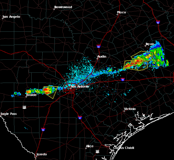 At 707 pm cdt, a severe thunderstorm was located near hondo, moving east at 20 mph (radar indicated). Hazards include quarter size hail. damage to vehicles is expected At 707 pm cdt, a severe thunderstorm was located near hondo, moving east at 20 mph (radar indicated). Hazards include quarter size hail. damage to vehicles is expected
|
| 4/2/2017 8:41 AM CDT |
 At 835 am cdt, a line of severe thunderstorms was located 7 miles northwest of north pearsall, or 9 miles north of pearsall, moving east at 30 mph. these storms are producing heavy rains, frequent cloud to ground lightning strikes, strong wind gusts and up to one inch hail size according to radar tools (radar indicated). Hazards include 60 mph wind gusts and quarter size hail. Hail damage to vehicles is expected. expect wind damage to roofs, siding, and trees. locations impacted include, pearsall, hondo, devine, castroville, moore, lytle, natalia, lacoste, goldfinch, d`hanis, noonan, quihi, dunlay, mico, pearson, north pearsall, bader, bluff, schattel and west pearsall. A tornado watch remains in effect until 100 pm cdt for south central texas. At 835 am cdt, a line of severe thunderstorms was located 7 miles northwest of north pearsall, or 9 miles north of pearsall, moving east at 30 mph. these storms are producing heavy rains, frequent cloud to ground lightning strikes, strong wind gusts and up to one inch hail size according to radar tools (radar indicated). Hazards include 60 mph wind gusts and quarter size hail. Hail damage to vehicles is expected. expect wind damage to roofs, siding, and trees. locations impacted include, pearsall, hondo, devine, castroville, moore, lytle, natalia, lacoste, goldfinch, d`hanis, noonan, quihi, dunlay, mico, pearson, north pearsall, bader, bluff, schattel and west pearsall. A tornado watch remains in effect until 100 pm cdt for south central texas.
|
| 4/2/2017 8:13 AM CDT |
 At 812 am cdt, a severe thunderstorm was located over frio town, or 16 miles east of batesville, moving east at 30 mph (radar indicated). Hazards include 60 mph wind gusts and quarter size hail. Hail damage to vehicles is expected. Expect wind damage to roofs, siding, and trees. At 812 am cdt, a severe thunderstorm was located over frio town, or 16 miles east of batesville, moving east at 30 mph (radar indicated). Hazards include 60 mph wind gusts and quarter size hail. Hail damage to vehicles is expected. Expect wind damage to roofs, siding, and trees.
|
| 3/29/2017 12:41 AM CDT |
 At 1240 am cdt, severe thunderstorms were located along a line extending from near tarpley to near sabinal to 8 miles southeast of uvalde, moving east at 40 mph (radar indicated). Hazards include 60 mph wind gusts and quarter size hail. Hail damage to vehicles is expected. expect wind damage to roofs, siding, and trees. Locations impacted include, uvalde, hondo, tarpley, sabinal, knippa, uvalde estates, blewett, d`hanis and utopia. At 1240 am cdt, severe thunderstorms were located along a line extending from near tarpley to near sabinal to 8 miles southeast of uvalde, moving east at 40 mph (radar indicated). Hazards include 60 mph wind gusts and quarter size hail. Hail damage to vehicles is expected. expect wind damage to roofs, siding, and trees. Locations impacted include, uvalde, hondo, tarpley, sabinal, knippa, uvalde estates, blewett, d`hanis and utopia.
|
| 3/29/2017 12:12 AM CDT |
 At 1211 am cdt, a severe thunderstorm was located 7 miles southeast of laguna, or 11 miles northwest of uvalde, moving east at 45 mph (radar indicated). Hazards include 60 mph wind gusts and quarter size hail. Hail damage to vehicles is expected. Expect wind damage to roofs, siding, and trees. At 1211 am cdt, a severe thunderstorm was located 7 miles southeast of laguna, or 11 miles northwest of uvalde, moving east at 45 mph (radar indicated). Hazards include 60 mph wind gusts and quarter size hail. Hail damage to vehicles is expected. Expect wind damage to roofs, siding, and trees.
|
| 2/19/2017 9:26 PM CST |
 At 925 pm cst, a severe thunderstorm was located near biry, or 10 miles southwest of castroville, moving east at 40 mph (radar indicated). Hazards include 60 mph wind gusts. Expect damage to roofs, siding, and trees. Locations impacted include, hondo, devine, castroville, lytle, natalia, lacoste, cliff, d`hanis, noonan, new fountain, quihi, dunlay, biry, pearson, yancey, bader and rio medina. At 925 pm cst, a severe thunderstorm was located near biry, or 10 miles southwest of castroville, moving east at 40 mph (radar indicated). Hazards include 60 mph wind gusts. Expect damage to roofs, siding, and trees. Locations impacted include, hondo, devine, castroville, lytle, natalia, lacoste, cliff, d`hanis, noonan, new fountain, quihi, dunlay, biry, pearson, yancey, bader and rio medina.
|
| 2/19/2017 9:10 PM CST |
 At 910 pm cst, a severe thunderstorm was located near yancey, or 9 miles south of hondo, moving east at 40 mph (radar indicated). Hazards include 60 mph wind gusts and penny size hail. expect damage to roofs, siding, and trees At 910 pm cst, a severe thunderstorm was located near yancey, or 9 miles south of hondo, moving east at 40 mph (radar indicated). Hazards include 60 mph wind gusts and penny size hail. expect damage to roofs, siding, and trees
|
| 5/28/2016 7:33 PM CDT |
 At 733 pm cdt, a severe thunderstorm was located near dunlay, or 7 miles southeast of hondo, moving east at 10 mph (radar indicated). Hazards include ping pong ball size hail and 60 mph wind gusts. People and animals outdoors will be injured. expect hail damage to roofs, siding, windows, and vehicles. Expect wind damage to roofs, siding, and trees. At 733 pm cdt, a severe thunderstorm was located near dunlay, or 7 miles southeast of hondo, moving east at 10 mph (radar indicated). Hazards include ping pong ball size hail and 60 mph wind gusts. People and animals outdoors will be injured. expect hail damage to roofs, siding, windows, and vehicles. Expect wind damage to roofs, siding, and trees.
|
| 5/28/2016 7:18 PM CDT |
 At 717 pm cdt, a severe thunderstorm was nearly stationary located near hondo. this storm was capable of producing quarter sized hail and very heavy rainfall leading to flash flooding (radar indicated). Hazards include 60 mph wind gusts and quarter size hail. Hail damage to vehicles is expected. expect wind damage to roofs, siding, and trees. Locations impacted include, hondo, castroville, bandera, tarpley, lytle, natalia, lacoste, dunlay, d`hanis, pearson, bader, noonan, lakehills, new fountain, pipe creek, biry, quihi, cliff, rio medina and bandera falls. At 717 pm cdt, a severe thunderstorm was nearly stationary located near hondo. this storm was capable of producing quarter sized hail and very heavy rainfall leading to flash flooding (radar indicated). Hazards include 60 mph wind gusts and quarter size hail. Hail damage to vehicles is expected. expect wind damage to roofs, siding, and trees. Locations impacted include, hondo, castroville, bandera, tarpley, lytle, natalia, lacoste, dunlay, d`hanis, pearson, bader, noonan, lakehills, new fountain, pipe creek, biry, quihi, cliff, rio medina and bandera falls.
|
| 5/28/2016 7:13 PM CDT |
 At 711 pm cdt, a severe thunderstorm was nearly stationary and located near hondo. this storm has a history of producing hail two inches in diameter. it is also producing torrential downpours which could lead to significant flash flooding (public). Hazards include two inch hail and 60 mph wind gusts. People and animals outdoors will be injured. expect hail damage to roofs, siding, windows, and vehicles. expect wind damage to roofs, siding, and trees. Locations impacted include, hondo, castroville, bandera, tarpley, lytle, natalia, lacoste, dunlay, d`hanis, pearson, bader, noonan, lakehills, new fountain, pipe creek, biry, quihi, cliff, rio medina and bandera falls. At 711 pm cdt, a severe thunderstorm was nearly stationary and located near hondo. this storm has a history of producing hail two inches in diameter. it is also producing torrential downpours which could lead to significant flash flooding (public). Hazards include two inch hail and 60 mph wind gusts. People and animals outdoors will be injured. expect hail damage to roofs, siding, windows, and vehicles. expect wind damage to roofs, siding, and trees. Locations impacted include, hondo, castroville, bandera, tarpley, lytle, natalia, lacoste, dunlay, d`hanis, pearson, bader, noonan, lakehills, new fountain, pipe creek, biry, quihi, cliff, rio medina and bandera falls.
|
| 5/28/2016 7:05 PM CDT | Softball sized hail reported 3.8 miles NNW of Hondo, TX, picture shows hailstones approximately the size of an actual softball |
| 5/28/2016 6:55 PM CDT |
 At 652 pm cdt, a severe thunderstorm was located near hondo, moving east at 10 mph. doppler radar indicated this storm may be producing tennis ball sized hail. a second severe thunderstorm was located 10 miles southeast of tarpley moving north at 15 mph. this storm could produce quarter sized hail (radar indicated). Hazards include tennis ball size hail and 60 mph wind gusts. People and animals outdoors will be injured. expect hail damage to roofs, siding, windows, and vehicles. expect wind damage to roofs, siding, and trees. Locations impacted include, hondo, castroville, bandera, tarpley, lytle, natalia, lacoste, dunlay, d`hanis, pearson, bader, noonan, lakehills, new fountain, pipe creek, biry, quihi, cliff, rio medina and bandera falls. At 652 pm cdt, a severe thunderstorm was located near hondo, moving east at 10 mph. doppler radar indicated this storm may be producing tennis ball sized hail. a second severe thunderstorm was located 10 miles southeast of tarpley moving north at 15 mph. this storm could produce quarter sized hail (radar indicated). Hazards include tennis ball size hail and 60 mph wind gusts. People and animals outdoors will be injured. expect hail damage to roofs, siding, windows, and vehicles. expect wind damage to roofs, siding, and trees. Locations impacted include, hondo, castroville, bandera, tarpley, lytle, natalia, lacoste, dunlay, d`hanis, pearson, bader, noonan, lakehills, new fountain, pipe creek, biry, quihi, cliff, rio medina and bandera falls.
|
| 5/28/2016 6:43 PM CDT |
 At 641 pm cdt, a severe thunderstorm was located 8 miles north of hondo, moving north at 15 mph. another severe thunderstorm was located 5 miles south of hondo and was nearly stationary (radar indicated). Hazards include ping pong ball size hail and 60 mph wind gusts. People and animals outdoors will be injured. expect hail damage to roofs, siding, windows, and vehicles. Expect wind damage to roofs, siding, and trees. At 641 pm cdt, a severe thunderstorm was located 8 miles north of hondo, moving north at 15 mph. another severe thunderstorm was located 5 miles south of hondo and was nearly stationary (radar indicated). Hazards include ping pong ball size hail and 60 mph wind gusts. People and animals outdoors will be injured. expect hail damage to roofs, siding, windows, and vehicles. Expect wind damage to roofs, siding, and trees.
|
| 5/28/2016 6:34 PM CDT |
 At 633 pm cdt, a severe thunderstorm was located over hondo, moving north at 15 mph. a report was received from the public of golf ball sized hail between hondo and yancey (public). Hazards include ping pong ball size hail and 60 mph wind gusts. People and animals outdoors will be injured. expect hail damage to roofs, siding, windows, and vehicles. expect wind damage to roofs, siding, and trees. Locations impacted include, hondo, new fountain, dunlay, bader, biry, quihi and rio medina. At 633 pm cdt, a severe thunderstorm was located over hondo, moving north at 15 mph. a report was received from the public of golf ball sized hail between hondo and yancey (public). Hazards include ping pong ball size hail and 60 mph wind gusts. People and animals outdoors will be injured. expect hail damage to roofs, siding, windows, and vehicles. expect wind damage to roofs, siding, and trees. Locations impacted include, hondo, new fountain, dunlay, bader, biry, quihi and rio medina.
|
| 5/28/2016 6:30 PM CDT | Hen Egg sized hail reported 1.7 miles NNE of Hondo, TX, near highway 173 south of hondo |
| 5/28/2016 6:17 PM CDT |
 At 617 pm cdt, a severe thunderstorm was located near hondo, moving north at 5 mph (radar indicated). Hazards include ping pong ball size hail and 60 mph wind gusts. People and animals outdoors will be injured. expect hail damage to roofs, siding, windows, and vehicles. expect wind damage to roofs, siding, and trees. Locations impacted include, hondo, new fountain, dunlay, bader, biry, quihi and rio medina. At 617 pm cdt, a severe thunderstorm was located near hondo, moving north at 5 mph (radar indicated). Hazards include ping pong ball size hail and 60 mph wind gusts. People and animals outdoors will be injured. expect hail damage to roofs, siding, windows, and vehicles. expect wind damage to roofs, siding, and trees. Locations impacted include, hondo, new fountain, dunlay, bader, biry, quihi and rio medina.
|
| 5/28/2016 6:12 PM CDT | Golf Ball sized hail reported 4.4 miles NNW of Hondo, TX |
| 5/28/2016 5:57 PM CDT |
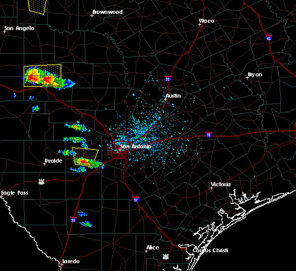 At 557 pm cdt, a severe thunderstorm was located near hondo, moving north at 15 mph (radar indicated). Hazards include 60 mph wind gusts and quarter size hail. Hail damage to vehicles is expected. Expect wind damage to roofs, siding, and trees. At 557 pm cdt, a severe thunderstorm was located near hondo, moving north at 15 mph (radar indicated). Hazards include 60 mph wind gusts and quarter size hail. Hail damage to vehicles is expected. Expect wind damage to roofs, siding, and trees.
|
| 5/17/2016 11:14 PM CDT |
 At 1114 pm cdt, a severe thunderstorm was located 10 miles south of tarpley, moving east at 30 mph (radar indicated). Hazards include 60 mph wind gusts and quarter size hail. Hail damage to vehicles is expected. Expect wind damage to roofs, siding, and trees. At 1114 pm cdt, a severe thunderstorm was located 10 miles south of tarpley, moving east at 30 mph (radar indicated). Hazards include 60 mph wind gusts and quarter size hail. Hail damage to vehicles is expected. Expect wind damage to roofs, siding, and trees.
|
| 5/17/2016 10:48 PM CDT | Hen Egg sized hail reported 9.5 miles W of Hondo, TX |
| 5/17/2016 10:34 PM CDT | Ping Pong Ball sized hail reported 7.6 miles WSW of Hondo, TX, ping pong ball sized hail reported in the town of quihi. |
| 5/17/2016 10:14 PM CDT |
 At 1014 pm cdt, severe thunderstorms were located along a line extending from near bandera to near hondo, moving east at 20 mph (radar indicated). Hazards include golf ball size hail and 60 mph wind gusts. People and animals outdoors will be injured. expect hail damage to roofs, siding, windows, and vehicles. Expect wind damage to roofs, siding, and trees. At 1014 pm cdt, severe thunderstorms were located along a line extending from near bandera to near hondo, moving east at 20 mph (radar indicated). Hazards include golf ball size hail and 60 mph wind gusts. People and animals outdoors will be injured. expect hail damage to roofs, siding, windows, and vehicles. Expect wind damage to roofs, siding, and trees.
|
| 5/17/2016 10:11 PM CDT | Baseball sized hail reported 6.1 miles S of Hondo, TX, baseball sized hail 6 miles north of hondo |
| 5/17/2016 10:11 PM CDT | Tea Cup sized hail reported 6.1 miles S of Hondo, TX, corrected hail size after receiving picture with hailstone against a ruler. teacup sized hail 6 miles north of hondo. |
| 5/17/2016 9:29 PM CDT |
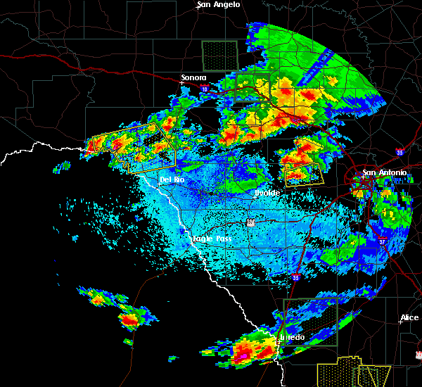 At 929 pm cdt, a severe thunderstorm was located 9 miles north of d`hanis, or 12 miles south of tarpley, moving east at 20 mph (radar indicated). Hazards include 70 mph wind gusts and quarter size hail. Hail damage to vehicles is expected. expect considerable tree damage. Wind damage is also likely to mobile homes, roofs, and outbuildings. At 929 pm cdt, a severe thunderstorm was located 9 miles north of d`hanis, or 12 miles south of tarpley, moving east at 20 mph (radar indicated). Hazards include 70 mph wind gusts and quarter size hail. Hail damage to vehicles is expected. expect considerable tree damage. Wind damage is also likely to mobile homes, roofs, and outbuildings.
|
| 4/30/2016 3:25 AM CDT |
 At 324 am cdt, a severe thunderstorm was located 7 miles north of hondo, moving east at 40 mph (radar indicated). Hazards include 60 mph wind gusts and quarter size hail. Hail damage to vehicles is expected. expect wind damage to roofs, siding, and trees. Locations impacted include, hondo, castroville, lacoste, dunlay, bader, pearson, lakehills, new fountain, quihi, cliff, rio medina, mico and noonan. At 324 am cdt, a severe thunderstorm was located 7 miles north of hondo, moving east at 40 mph (radar indicated). Hazards include 60 mph wind gusts and quarter size hail. Hail damage to vehicles is expected. expect wind damage to roofs, siding, and trees. Locations impacted include, hondo, castroville, lacoste, dunlay, bader, pearson, lakehills, new fountain, quihi, cliff, rio medina, mico and noonan.
|
| 4/30/2016 3:03 AM CDT |
 At 303 am cdt, a severe thunderstorm was located 8 miles north of sabinal, or 15 miles southwest of tarpley, moving east at 40 mph (radar indicated). Hazards include tennis ball size hail and 60 mph wind gusts. People and animals outdoors will be injured. expect hail damage to roofs, siding, windows, and vehicles. Expect wind damage to roofs, siding, and trees. At 303 am cdt, a severe thunderstorm was located 8 miles north of sabinal, or 15 miles southwest of tarpley, moving east at 40 mph (radar indicated). Hazards include tennis ball size hail and 60 mph wind gusts. People and animals outdoors will be injured. expect hail damage to roofs, siding, windows, and vehicles. Expect wind damage to roofs, siding, and trees.
|
| 4/30/2016 2:40 AM CDT |
 At 240 am cdt, severe thunderstorms were located along a line extending from 6 miles west of nelson city to near tarpley to 9 miles southeast of utopia to 7 miles northwest of knippa to 8 miles northwest of uvalde to near brackettville, moving east at 40 mph. these are very dangerous storms (radar indicated). Hazards include baseball size hail and 60 mph wind gusts. People and animals outdoors will be severely injured. expect shattered windows, extensive damage to roofs, siding, and vehicles. Locations impacted include, medina, kerrville, uvalde, boerne, hondo, comfort, brackettville, bandera, spofford, tarpley, sabinal, laguna, d`hanis, waring, blewett, alamo village, concan, pipe creek, standart and walnut grove. At 240 am cdt, severe thunderstorms were located along a line extending from 6 miles west of nelson city to near tarpley to 9 miles southeast of utopia to 7 miles northwest of knippa to 8 miles northwest of uvalde to near brackettville, moving east at 40 mph. these are very dangerous storms (radar indicated). Hazards include baseball size hail and 60 mph wind gusts. People and animals outdoors will be severely injured. expect shattered windows, extensive damage to roofs, siding, and vehicles. Locations impacted include, medina, kerrville, uvalde, boerne, hondo, comfort, brackettville, bandera, spofford, tarpley, sabinal, laguna, d`hanis, waring, blewett, alamo village, concan, pipe creek, standart and walnut grove.
|
| 4/30/2016 2:27 AM CDT |
 At 226 am cdt, severe thunderstorms were located along a line extending from near camp verde to near tarpley to 8 miles south of utopia to 10 miles southwest of concan to near cline to 7 miles south of standart, moving east at 35 mph (radar indicated). Hazards include quarter size hail. damage to vehicles is expected At 226 am cdt, severe thunderstorms were located along a line extending from near camp verde to near tarpley to 8 miles south of utopia to 10 miles southwest of concan to near cline to 7 miles south of standart, moving east at 35 mph (radar indicated). Hazards include quarter size hail. damage to vehicles is expected
|
| 4/12/2016 10:03 PM CDT | Quarter sized hail reported 0.9 miles SE of Hondo, TX, quarter sized hail in hondo reported by emergency manager |
| 4/12/2016 9:59 PM CDT |
 At 957 pm cdt, a severe thunderstorm was located near hondo, moving southeast at 35 mph. this storm will move across the intersection of highways 90 and 173, then continue toward natalia and lytle (radar indicated). Hazards include tennis ball size hail and 60 mph wind gusts. People and animals outdoors will be injured. expect hail damage to roofs, siding, windows, and vehicles. expect wind damage to roofs, siding, and trees. Locations impacted include, hondo, castroville, lytle, natalia, lacoste, dunlay, bader, pearson, noonan, new fountain, quihi, rio medina and biry. At 957 pm cdt, a severe thunderstorm was located near hondo, moving southeast at 35 mph. this storm will move across the intersection of highways 90 and 173, then continue toward natalia and lytle (radar indicated). Hazards include tennis ball size hail and 60 mph wind gusts. People and animals outdoors will be injured. expect hail damage to roofs, siding, windows, and vehicles. expect wind damage to roofs, siding, and trees. Locations impacted include, hondo, castroville, lytle, natalia, lacoste, dunlay, bader, pearson, noonan, new fountain, quihi, rio medina and biry.
|
| 4/12/2016 9:29 PM CDT |
 At 927 pm cdt, a severe thunderstorm was located 8 miles northwest of d`hanis, or 12 miles northwest of hondo, moving east at 35 mph. this storm will move across northern parts of hondo (radar indicated). Hazards include tennis ball size hail and 60 mph wind gusts. People and animals outdoors will be injured. expect hail damage to roofs, siding, windows, and vehicles. Expect wind damage to roofs, siding, and trees. At 927 pm cdt, a severe thunderstorm was located 8 miles northwest of d`hanis, or 12 miles northwest of hondo, moving east at 35 mph. this storm will move across northern parts of hondo (radar indicated). Hazards include tennis ball size hail and 60 mph wind gusts. People and animals outdoors will be injured. expect hail damage to roofs, siding, windows, and vehicles. Expect wind damage to roofs, siding, and trees.
|
| 4/12/2016 8:47 PM CDT |
 At 846 pm cdt, a severe thunderstorm was located over concan, moving east at 30 mph. this storm will move across county roads 421, 392 and 349 (radar indicated). Hazards include ping pong ball size hail and 60 mph wind gusts. People and animals outdoors will be injured. expect hail damage to roofs, siding, windows, and vehicles. expect wind damage to roofs, siding, and trees. Locations impacted include, hondo, concan, garner state park and utopia. At 846 pm cdt, a severe thunderstorm was located over concan, moving east at 30 mph. this storm will move across county roads 421, 392 and 349 (radar indicated). Hazards include ping pong ball size hail and 60 mph wind gusts. People and animals outdoors will be injured. expect hail damage to roofs, siding, windows, and vehicles. expect wind damage to roofs, siding, and trees. Locations impacted include, hondo, concan, garner state park and utopia.
|
| 4/12/2016 8:24 PM CDT |
 At 822 pm cdt, a severe thunderstorm was located near reagan wells, moving east at 35 mph. this storm will cross highway 83 in the concan area and will cross county roads 720, 392 and 349 (radar indicated). Hazards include 60 mph wind gusts and quarter size hail. Hail damage to vehicles is expected. Expect wind damage to roofs, siding, and trees. At 822 pm cdt, a severe thunderstorm was located near reagan wells, moving east at 35 mph. this storm will cross highway 83 in the concan area and will cross county roads 720, 392 and 349 (radar indicated). Hazards include 60 mph wind gusts and quarter size hail. Hail damage to vehicles is expected. Expect wind damage to roofs, siding, and trees.
|
| 3/24/2016 1:34 AM CDT |
 At 134 am cdt, severe thunderstorms were located along a line extending from near lakehills to near d`hanis, moving east at 35 mph (radar indicated). Hazards include 60 mph wind gusts and quarter size hail. Hail damage to vehicles is expected. expect wind damage to roofs, siding, and trees. Locations impacted include, hondo, new fountain, dunlay, d`hanis, bader, biry, lakehills, quihi, bandera falls and mico. At 134 am cdt, severe thunderstorms were located along a line extending from near lakehills to near d`hanis, moving east at 35 mph (radar indicated). Hazards include 60 mph wind gusts and quarter size hail. Hail damage to vehicles is expected. expect wind damage to roofs, siding, and trees. Locations impacted include, hondo, new fountain, dunlay, d`hanis, bader, biry, lakehills, quihi, bandera falls and mico.
|
| 3/24/2016 1:14 AM CDT |
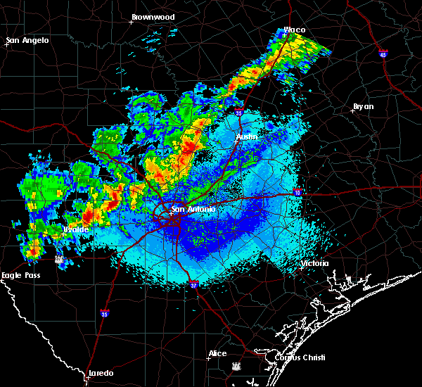 At 113 am cdt, severe thunderstorms were located along a line extending from 6 miles east of tarpley to near sabinal, moving east at 30 mph (radar indicated). Hazards include 60 mph wind gusts and quarter size hail. Hail damage to vehicles is expected. Expect wind damage to roofs, siding, and trees. At 113 am cdt, severe thunderstorms were located along a line extending from 6 miles east of tarpley to near sabinal, moving east at 30 mph (radar indicated). Hazards include 60 mph wind gusts and quarter size hail. Hail damage to vehicles is expected. Expect wind damage to roofs, siding, and trees.
|
| 3/8/2016 9:42 PM CST |
 At 942 pm cst, severe thunderstorms were located along a line extending from 8 miles southwest of medina to 8 miles southeast of tarpley to near d`hanis, moving east at 35 mph (radar indicated). Hazards include 60 mph wind gusts and quarter size hail. Hail damage to vehicles is expected. expect wind damage to roofs, siding, and trees. Locations impacted include, hondo. At 942 pm cst, severe thunderstorms were located along a line extending from 8 miles southwest of medina to 8 miles southeast of tarpley to near d`hanis, moving east at 35 mph (radar indicated). Hazards include 60 mph wind gusts and quarter size hail. Hail damage to vehicles is expected. expect wind damage to roofs, siding, and trees. Locations impacted include, hondo.
|
| 3/8/2016 9:31 PM CST |
 A severe thunderstorm warning remains in effect until 1000 pm cst for central bandera and western medina counties. at 931 pm cst. severe thunderstorms were located along a line extending from 7 miles west of tarpley to 9 miles northwest of hondo to 6 miles south of d`hanis. moving northeast at 30 mph. hazard. 60 mph wind gusts and quarter size hail. A severe thunderstorm warning remains in effect until 1000 pm cst for central bandera and western medina counties. at 931 pm cst. severe thunderstorms were located along a line extending from 7 miles west of tarpley to 9 miles northwest of hondo to 6 miles south of d`hanis. moving northeast at 30 mph. hazard. 60 mph wind gusts and quarter size hail.
|
| 3/8/2016 9:18 PM CST |
 At 918 pm cst, severe thunderstorms were located along a line extending from near utopia to 8 miles northwest of d`hanis to 10 miles southeast of sabinal, moving north at 25 mph (radar indicated). Hazards include 60 mph wind gusts and quarter size hail. Hail damage to vehicles is expected. expect wind damage to roofs, siding, and trees. Locations impacted include, medina, hondo, tarpley, vanderpool, sabinal, d`hanis and utopia. At 918 pm cst, severe thunderstorms were located along a line extending from near utopia to 8 miles northwest of d`hanis to 10 miles southeast of sabinal, moving north at 25 mph (radar indicated). Hazards include 60 mph wind gusts and quarter size hail. Hail damage to vehicles is expected. expect wind damage to roofs, siding, and trees. Locations impacted include, medina, hondo, tarpley, vanderpool, sabinal, d`hanis and utopia.
|
| 3/8/2016 8:50 PM CST |
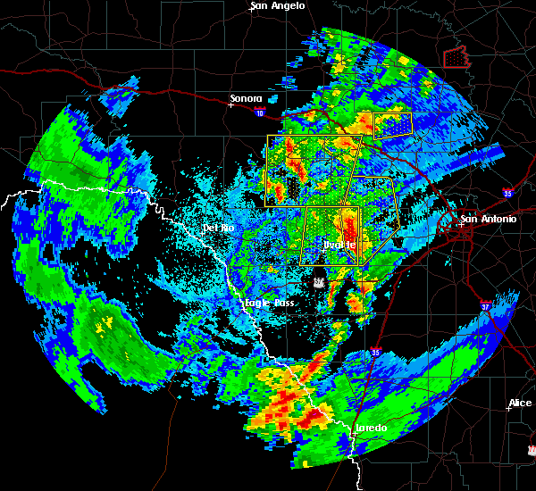 At 850 pm cst, severe thunderstorms were located along a line extending from near utopia to 6 miles north of frio town, moving northeast at 35 mph (radar indicated). Hazards include 60 mph wind gusts and quarter size hail. Hail damage to vehicles is expected. Expect wind damage to roofs, siding, and trees. At 850 pm cst, severe thunderstorms were located along a line extending from near utopia to 6 miles north of frio town, moving northeast at 35 mph (radar indicated). Hazards include 60 mph wind gusts and quarter size hail. Hail damage to vehicles is expected. Expect wind damage to roofs, siding, and trees.
|
| 2/23/2016 12:36 AM CST |
 At 1234 am cst, severe thunderstorms were located along a line extending from near yancey to near west pearsall to near divot to 9 miles west of dilley, moving southeast at 55 mph. another severe thunderstorm was 15 miles northwest of la pryor, moving southeast at 50 mph (radar indicated). Hazards include 70 mph wind gusts and quarter size hail. Hail damage to vehicles is expected. expect considerable tree damage. wind damage is also likely to mobile homes, roofs, and outbuildings. Locations impacted include, uvalde, pearsall, hondo, crystal city, dilley, big wells, la pryor, batesville, moore, sabinal, frio town, d`hanis, north pearsall, loma vista, west pearsall, knippa, las vegas, divot, yancey and washer. At 1234 am cst, severe thunderstorms were located along a line extending from near yancey to near west pearsall to near divot to 9 miles west of dilley, moving southeast at 55 mph. another severe thunderstorm was 15 miles northwest of la pryor, moving southeast at 50 mph (radar indicated). Hazards include 70 mph wind gusts and quarter size hail. Hail damage to vehicles is expected. expect considerable tree damage. wind damage is also likely to mobile homes, roofs, and outbuildings. Locations impacted include, uvalde, pearsall, hondo, crystal city, dilley, big wells, la pryor, batesville, moore, sabinal, frio town, d`hanis, north pearsall, loma vista, west pearsall, knippa, las vegas, divot, yancey and washer.
|
| 2/22/2016 11:54 PM CST |
 At 1153 pm cst, severe thunderstorms were located along a line extending from near uvalde estates to 7 miles southeast of washer to near la pryor, moving southeast at 45 mph (radar indicated). Hazards include 70 mph wind gusts and quarter size hail. Hail damage to vehicles is expected. expect considerable tree damage. Wind damage is also likely to mobile homes, roofs, and outbuildings. At 1153 pm cst, severe thunderstorms were located along a line extending from near uvalde estates to 7 miles southeast of washer to near la pryor, moving southeast at 45 mph (radar indicated). Hazards include 70 mph wind gusts and quarter size hail. Hail damage to vehicles is expected. expect considerable tree damage. Wind damage is also likely to mobile homes, roofs, and outbuildings.
|
| 12/13/2015 1:08 AM CST | 53 knot or 61 mph windgust measured by the hondo aso in medina county TX, 0.9 miles SE of Hondo, TX |
| 10/30/2015 4:23 AM CDT |
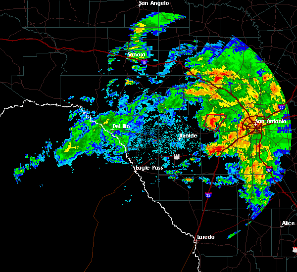 At 422 am cdt, a severe thunderstorm capable of producing a tornado was located 7 miles northwest of hondo, moving northeast at 25 mph (radar indicated rotation). Hazards include tornado. Flying debris will be dangerous to those caught without shelter. mobile homes will be damaged or destroyed. damage to roofs, windows and vehicles will occur. tree damage is likely. Locations impacted include, hondo. At 422 am cdt, a severe thunderstorm capable of producing a tornado was located 7 miles northwest of hondo, moving northeast at 25 mph (radar indicated rotation). Hazards include tornado. Flying debris will be dangerous to those caught without shelter. mobile homes will be damaged or destroyed. damage to roofs, windows and vehicles will occur. tree damage is likely. Locations impacted include, hondo.
|
| 10/30/2015 4:13 AM CDT |
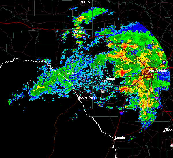 At 413 am cdt, a severe thunderstorm capable of producing a tornado was located north of d`hanis, and northwest of hondo, moving north at 25 mph (radar indicated rotation). Hazards include tornado. Flying debris will be dangerous to those caught without shelter. mobile homes will be damaged or destroyed. damage to roofs, windows and vehicles will occur. tree damage is likely. This tornadic thunderstorm will remain over mainly rural areas of northwestern medina county. At 413 am cdt, a severe thunderstorm capable of producing a tornado was located north of d`hanis, and northwest of hondo, moving north at 25 mph (radar indicated rotation). Hazards include tornado. Flying debris will be dangerous to those caught without shelter. mobile homes will be damaged or destroyed. damage to roofs, windows and vehicles will occur. tree damage is likely. This tornadic thunderstorm will remain over mainly rural areas of northwestern medina county.
|
| 5/28/2015 11:58 PM CDT | At 1157 pm cdt, severe thunderstorms were located along a line extending from near blanco to near pipe creek to near d`hanis, moving southeast at 35 mph (radar indicated). Hazards include 60 mph wind gusts. Expect damage to roofs. Siding and trees. |
| 4/27/2015 1:05 AM CDT | At 103 am cdt, severe thunderstorms were located along a line extending from near watson to near canyon lake to near fair oaks ranch to near lacoste to near yancey, and are nearly stationary. these are very dangerous storms (radar indicated). Hazards include 80 mph wind gusts and penny size hail. the strongest winds will impact medina, bexar and comal counties. Flying debris will be dangerous to those caught without shelter. mobile homes will be heavily damaged. expect considerable damage to roofs, windows and vehicles. extensive tree damage and power outages are likely. locations impacted include, san antonio, austin, round rock, new braunfels, cedar park, georgetown, pflugerville, san marcos, seguin, universal city, taylor, boerne, hondo, kingsland, marble falls, burnet, castroville, comfort, wimberley and dripping springs. 0. 75in. |
| 4/27/2015 12:56 AM CDT | At 1253 am cdt, a severe thunderstorm capable of producing a tornado was located 8 miles north of frio town, or 17 miles southwest of hondo, moving southeast at 45 mph (radar indicated rotation). Hazards include tornado. Flying debris will be dangerous to those caught without shelter. mobile homes will be damaged or destroyed. damage to roofs, windows and vehicles will occur. tree damage is likely. this dangerous storm will be near, yancey around 105 am cdt. Radar indicated. |
| 4/27/2015 12:44 AM CDT | At 1243 am cdt, severe thunderstorms were located along a line extending from near lake victor to near guadalupe river state park to near pipe creek to quihi to 9 miles southeast of sabinal, moving east at 45 mph (radar indicated). Hazards include 70 mph wind gusts and penny size hail. Expect considerable tree damage. Damage is likely to mobile homes, roofs and outbuildings. |
| 4/27/2015 12:38 AM CDT | At 1237 am cdt, a severe thunderstorm capable of producing a tornado was located 7 miles south of sabinal, or 16 miles east of uvalde, moving southeast at 40 mph (radar indicated rotation). Hazards include tornado. Flying debris will be dangerous to those caught without shelter. mobile homes will be damaged or destroyed. damage to roofs, windows and vehicles will occur. tree damage is likely. this dangerous storm will be near, frio town around 105 am cdt. yancey around 110 am cdt. Radar indicated. |
| 4/27/2015 12:37 AM CDT | At 1233 am cdt, severe thunderstorms were located along a line extending from near bandera falls to near d`hanis to near sabinal to 9 miles south of knippa, moving east at 45 mph (radar indicated). Hazards include 70 mph wind gusts and penny size hail. Expect considerable tree damage. damage is likely to mobile homes, roofs and outbuildings. locations impacted include, uvalde, hondo, devine, castroville, bandera, tarpley, lytle, sabinal, natalia, lacoste, d`hanis, pearson, bader, noonan, pipe creek, knippa, utopia, quihi, bandera falls and mico. 0. 75in. |
| 4/27/2015 12:14 AM CDT | At 1214 am cdt, severe thunderstorms were located along a line extending from near medina to 6 miles north of knippa to 7 miles east of washer, moving east at 70 mph (radar indicated). Hazards include 60 mph wind gusts and penny size hail. Expect damage to roofs. Siding and trees. |
| 4/25/2015 4:19 AM CDT | At 418 am cdt, a severe thunderstorm was located near biry, or 8 miles southeast of hondo, moving east at 45 mph (radar indicated). Hazards include 60 mph wind gusts and quarter size hail. Hail damage to vehicles is expected. Expect wind damage to roofs, siding and trees. |
| 4/25/2015 4:11 AM CDT | At 411 am cdt, a severe thunderstorm was located near biry, or 9 miles south of hondo, moving east at 45 mph (radar indicated). Hazards include 70 mph wind gusts and quarter size hail. Hail damage to vehicles is expected. expect considerable tree damage. wind damage is also likely to mobile homes, roofs and outbuildings. locations impacted include, hondo, quihi, new fountain, d`hanis, yancey and biry. Possible. |
| 4/25/2015 3:54 AM CDT | Trees down... 4-5 trailers flipped at hwy 90 and 173... doors blown out of ford dealership in medina county TX, 0.9 miles SE of Hondo, TX |
| 4/25/2015 3:54 AM CDT | At 354 am cdt, a severe thunderstorm was located 7 miles southeast of sabinal, or 16 miles southwest of hondo, moving east at 25 mph (radar indicated). Hazards include 60 mph wind gusts and quarter size hail. Hail damage to vehicles is expected. Expect wind damage to roofs, siding and trees. |
| 4/25/2015 2:41 AM CDT | At 241 am cdt, a severe thunderstorm was located over hondo, moving northeast at 40 mph (radar indicated). Hazards include 60 mph wind gusts and half dollar size hail. Hail damage to vehicles is expected. expect wind damage to roofs, siding and trees. locations impacted include, hondo, quihi, new fountain, dunlay, d`hanis and bader. 1. 25in. |
| 4/25/2015 2:26 AM CDT | At 226 am cdt, a severe thunderstorm was located near d`hanis, or 10 miles southwest of hondo, moving northeast at 40 mph (radar indicated). Hazards include 60 mph wind gusts and quarter size hail. Hail damage to vehicles is expected. Expect wind damage to roofs, siding and trees. |
| 5/26/2014 10:21 AM CDT | Quarter sized hail reported 13.8 miles SSE of Hondo, TX, penny to quarter size hail. |
| 5/10/2013 6:30 PM CDT | Quarter sized hail reported 0.9 miles SE of Hondo, TX |
| 5/10/2013 5:57 PM CDT | Quarter sized hail reported 0.9 miles SE of Hondo, TX |
| 5/7/2012 9:48 PM CDT | Numerous trees and tree limb blown down and several power outage in medina county TX, 0.9 miles SE of Hondo, TX |
| 5/7/2012 8:48 PM CDT | Hondo asos reported a gusts to 62 mph. hdo pk wnd 36054 014 in medina county TX, 1.8 miles SE of Hondo, TX |
| 1/1/0001 12:00 AM | Hondo asos observation 29041g59kt in medina county TX, 0.9 miles SE of Hondo, TX |
| 1/1/0001 12:00 AM | Winds est 60 plus mph. lots of tree damage city wid in medina county TX, 0.9 miles SE of Hondo, TX |
| 1/1/0001 12:00 AM | Damage to small portable building and small utility pole in medina county TX, 1.9 miles WNW of Hondo, TX |
| 1/1/0001 12:00 AM | Quarter sized hail reported 0.9 miles SE of Hondo, TX |
| 1/1/0001 12:00 AM | Golf Ball sized hail reported 3.4 miles SSE of Hondo, TX |
Hail Maps for Hondo, TX
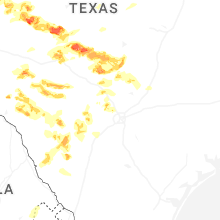
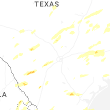


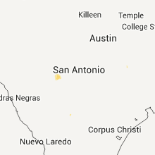

Connect with Interactive Hail Maps