

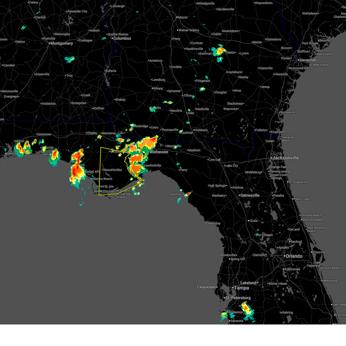
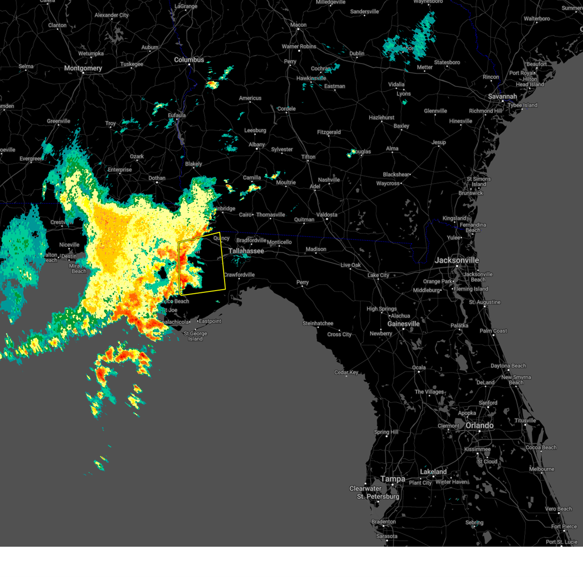
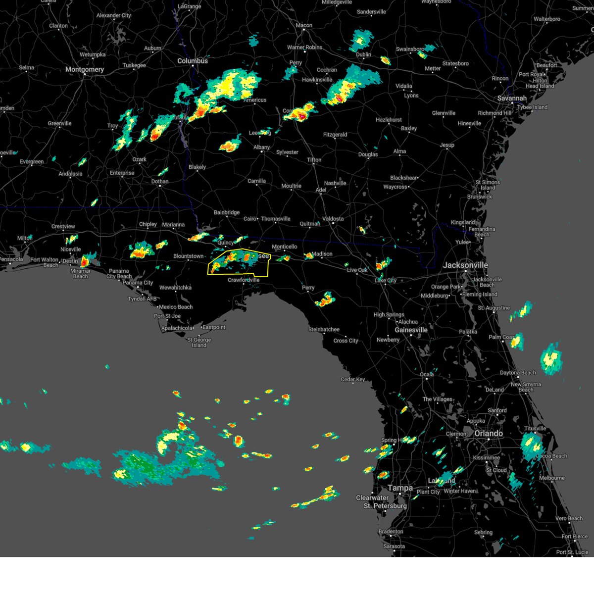
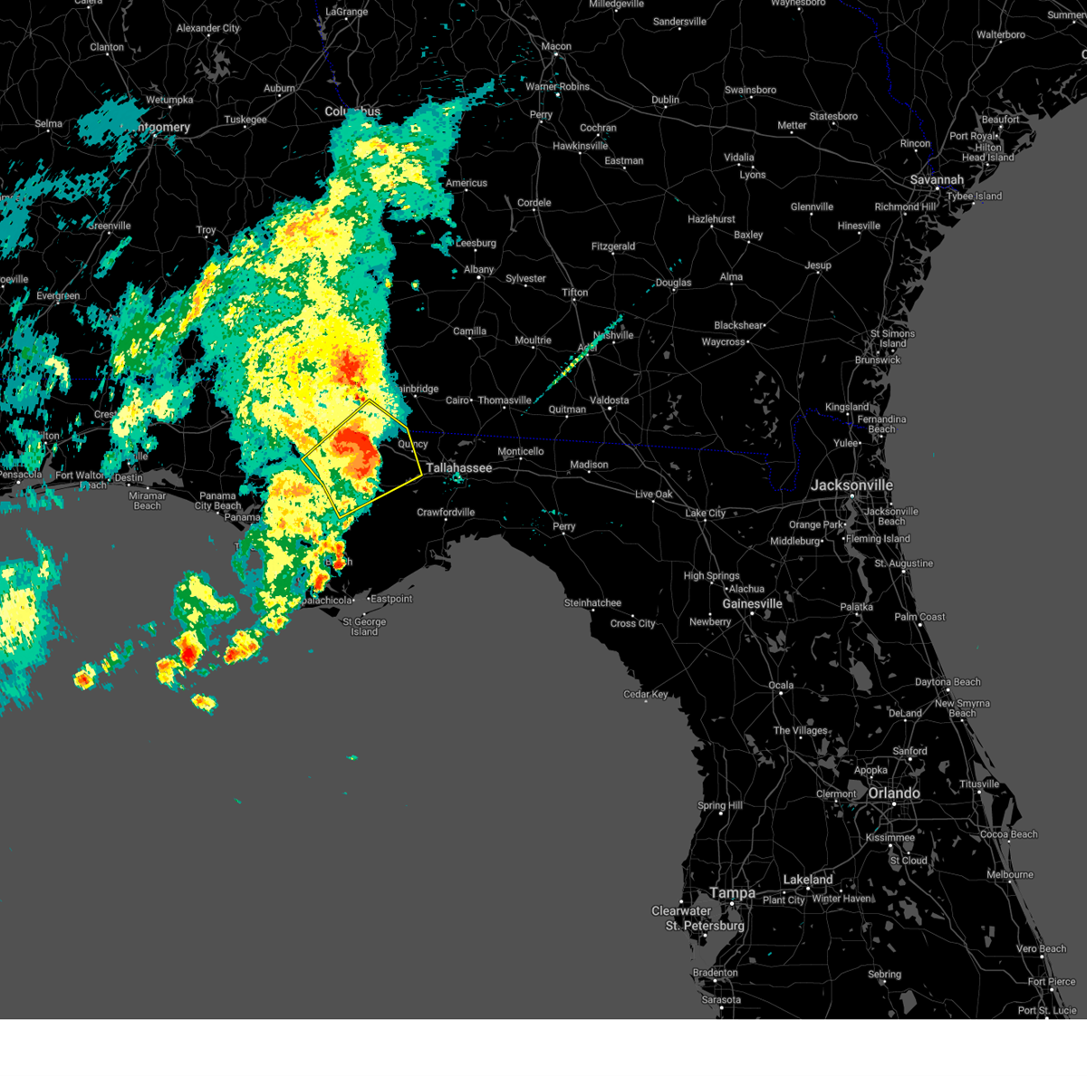
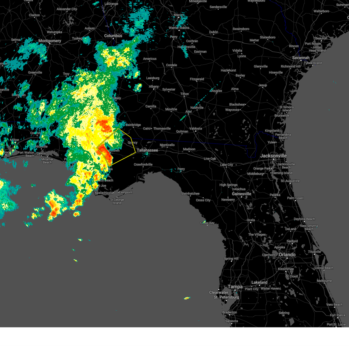
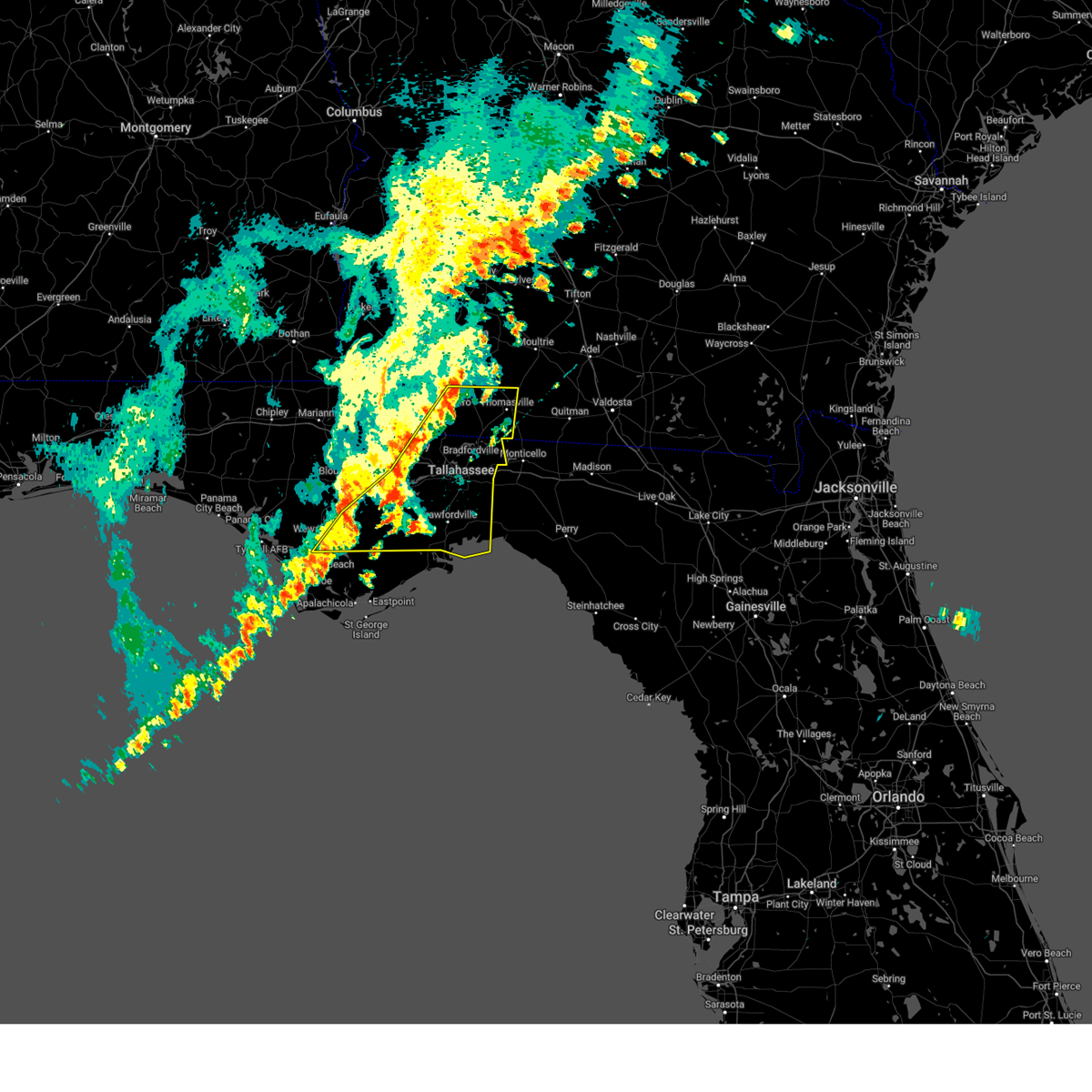
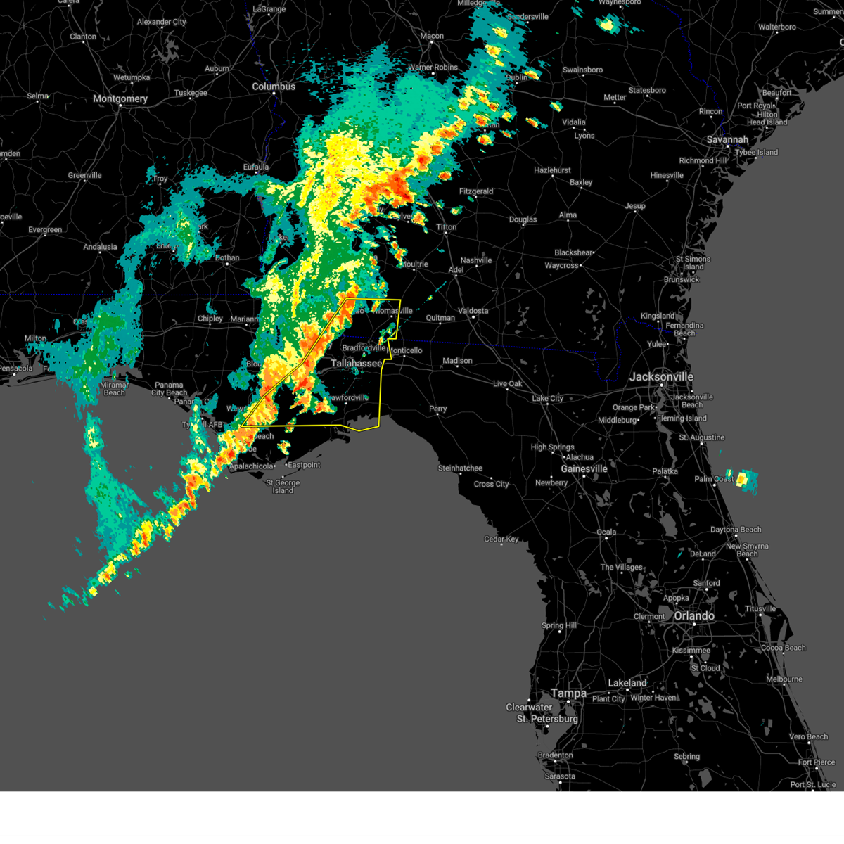
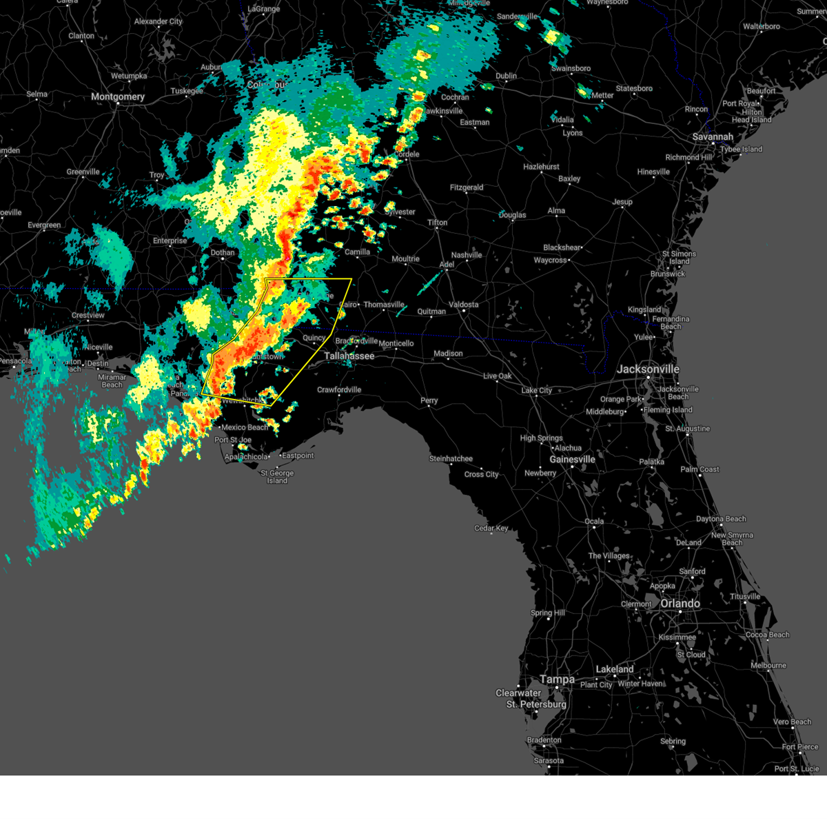
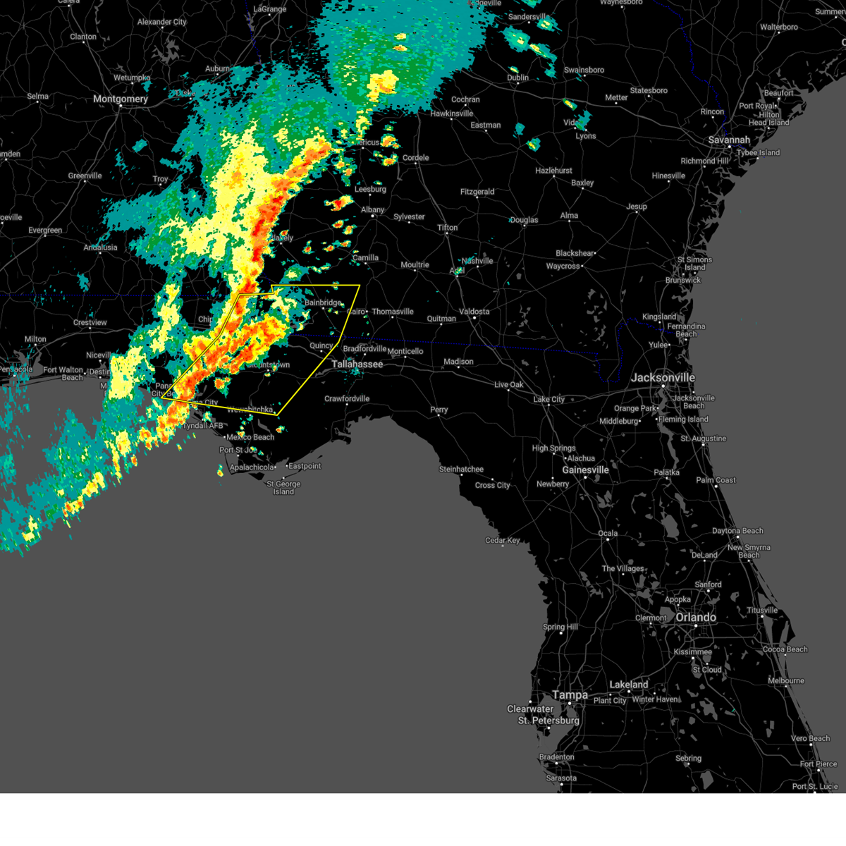
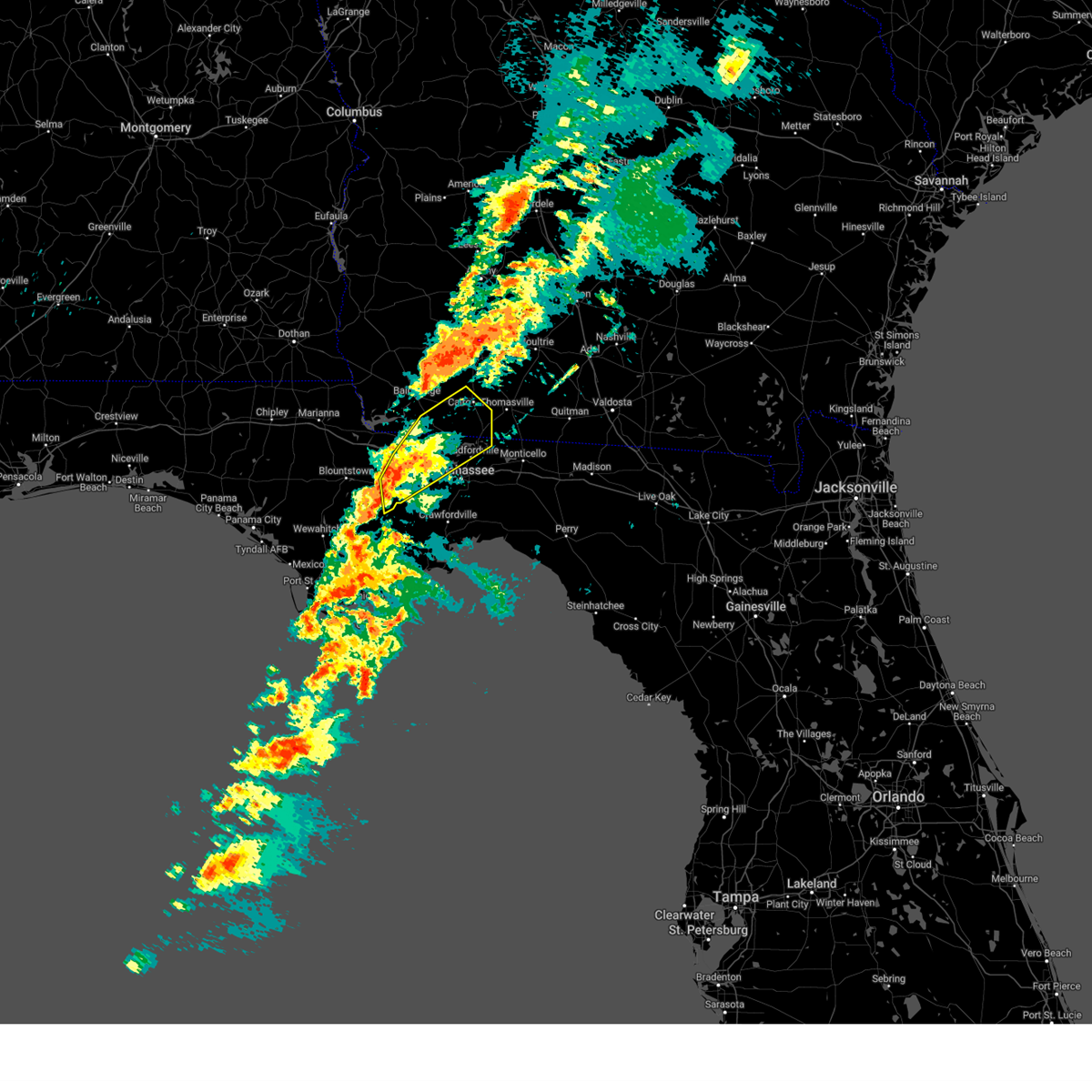
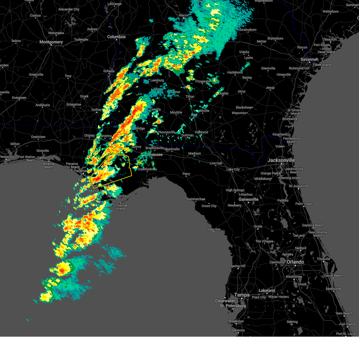
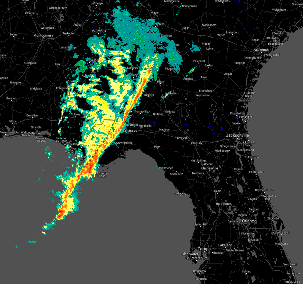
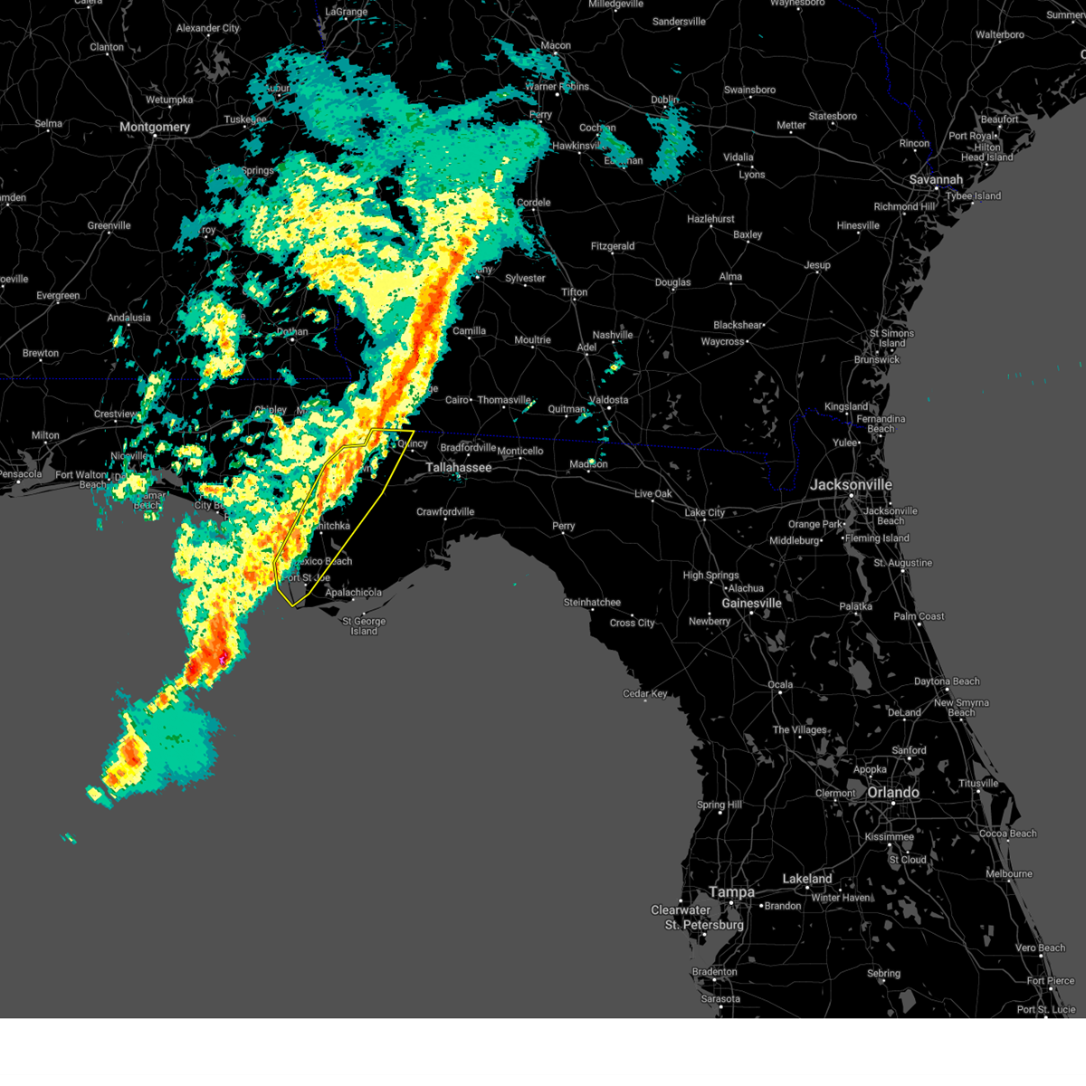
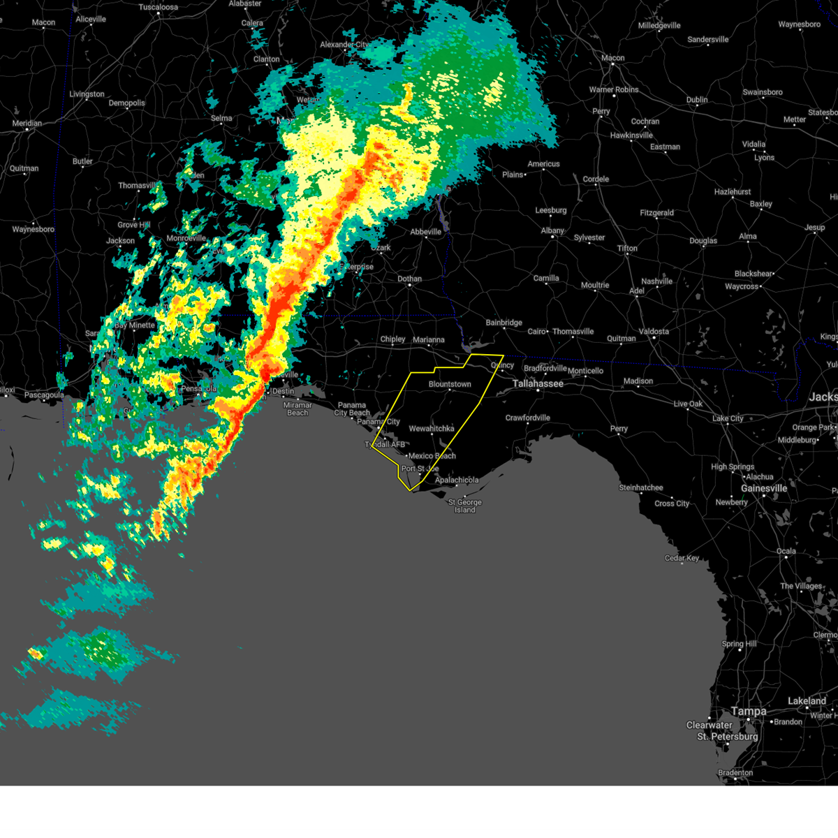
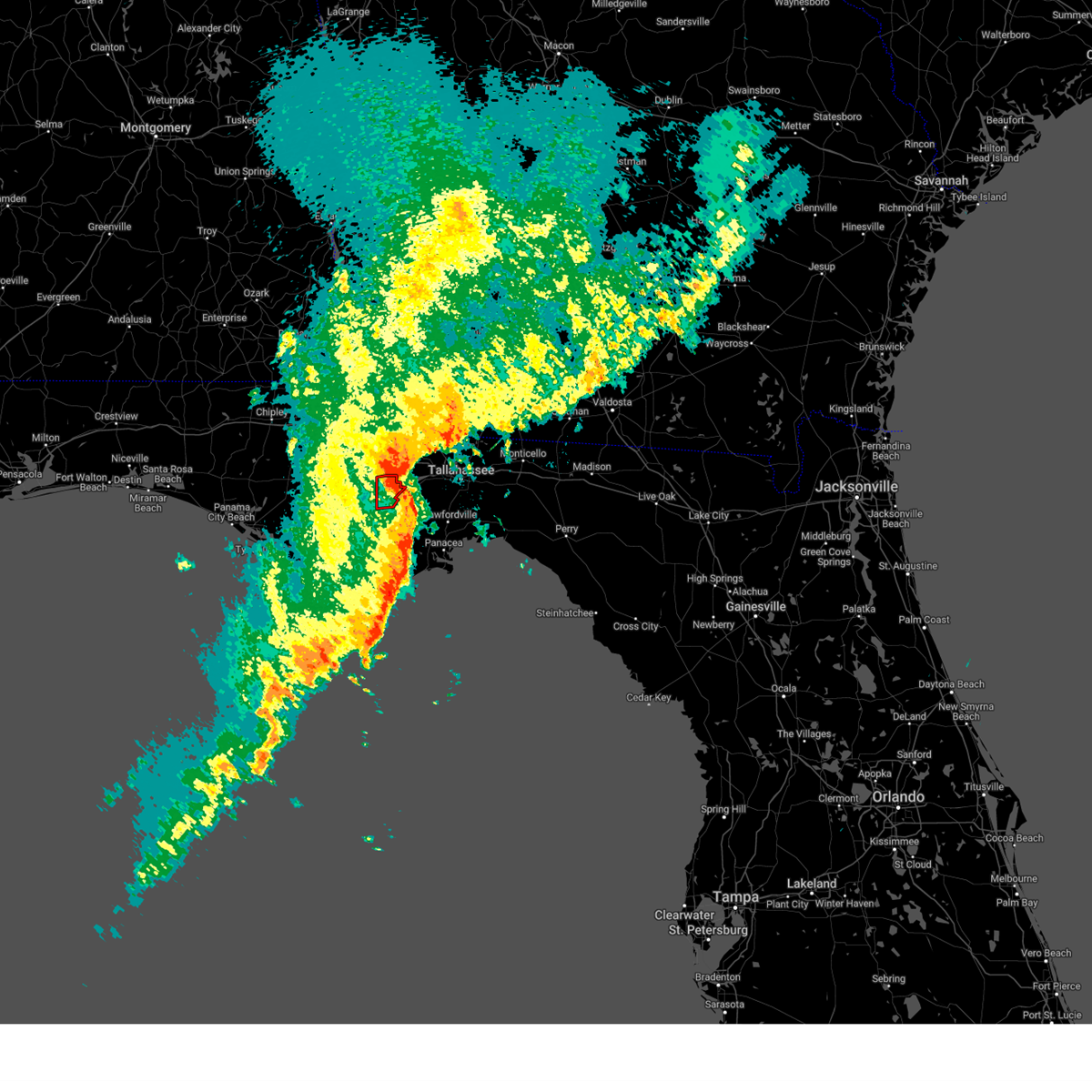
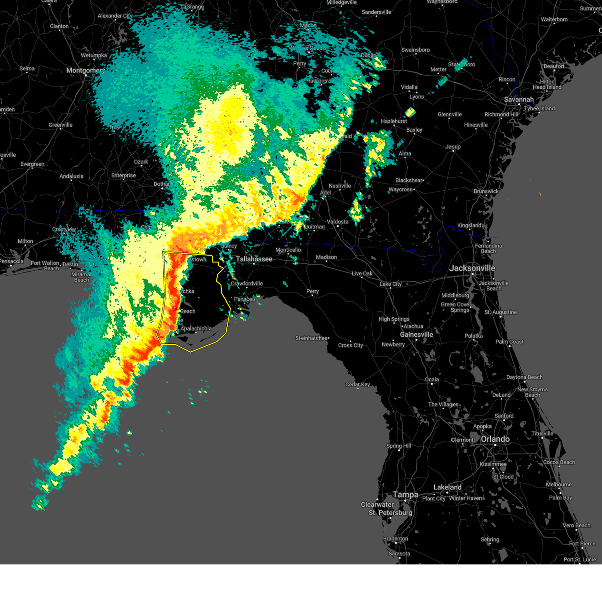
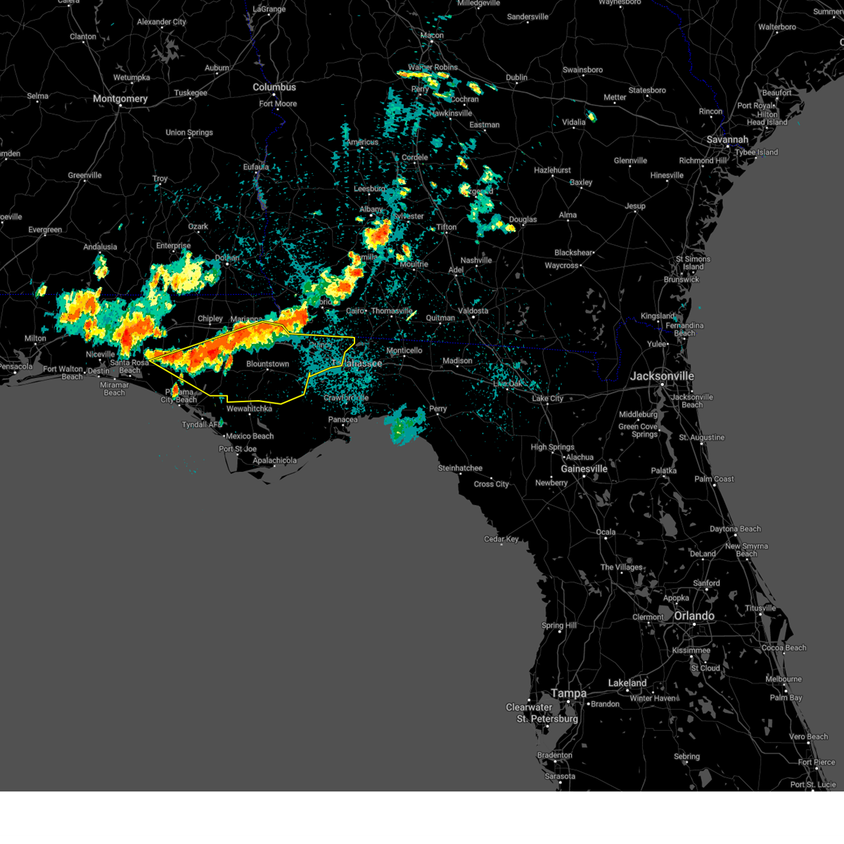
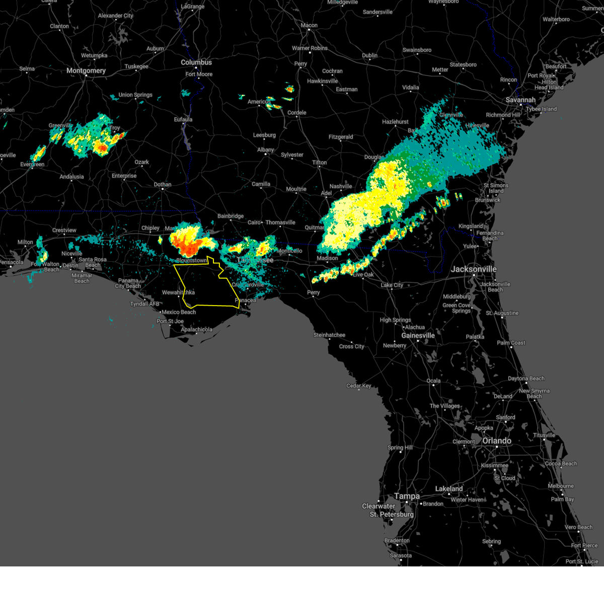
Hail Map for Hosford, FL
The Hosford, FL area has had 5 reports of on-the-ground hail by trained spotters, and has been under severe weather warnings 45 times during the past 12 months. Doppler radar has detected hail at or near Hosford, FL on 52 occasions, including 1 occasion during the past year.
| Name: | Hosford, FL |
| Where Located: | 31.3 miles W of Tallahassee, FL |
| Map: | Google Map for Hosford, FL |
| Population: | 650 |
| Housing Units: | 320 |
| More Info: | Search Google for Hosford, FL |
0
The Top Recent Hail Date for Hosford, FL is Wednesday, June 25, 2025 (52nd out of 52)

Hail and Wind Damage Spotted near Hosford, FL
| Date / Time | Report Details |
|---|---|
| 6/25/2025 6:26 PM EDT | the severe thunderstorm warning has been cancelled and is no longer in effect |
| 6/25/2025 5:54 PM EDT | At 554 pm edt/454 pm cdt/, severe thunderstorms were located along a line extending from 9 miles southwest of chattahoochee to 16 miles southeast of stonemill creek, moving west at 25 mph (radar indicated). Hazards include 60 mph wind gusts. Expect damage to roofs, siding, and trees. Locations impacted include, blountstown, stonemill creek, orange, wewahitchka, bristol, east camp, honeyville, jewel fire tower, clarksville, abe springs, vilas, chipola cutoff, hosford, jensen place, central city, red hill, clio, scotts ferry, kennys mill, and estiffanulga. |
| 6/25/2025 5:54 PM EDT | the severe thunderstorm warning has been cancelled and is no longer in effect |
| 6/25/2025 5:14 PM EDT |
 Svrtae the national weather service in tallahassee has issued a * severe thunderstorm warning for, central gulf county in the panhandle of florida, central calhoun county in the panhandle of florida, southwestern gadsden county in big bend florida, liberty county in big bend florida, franklin county in big bend florida, * until 645 pm edt/545 pm cdt/. * at 513 pm edt/413 pm cdt/, severe thunderstorms were located along a line extending from 13 miles southwest of midway to 12 miles northeast of carrabelle, moving west at 20 mph (radar indicated). Hazards include 60 mph wind gusts. expect damage to roofs, siding, and trees Svrtae the national weather service in tallahassee has issued a * severe thunderstorm warning for, central gulf county in the panhandle of florida, central calhoun county in the panhandle of florida, southwestern gadsden county in big bend florida, liberty county in big bend florida, franklin county in big bend florida, * until 645 pm edt/545 pm cdt/. * at 513 pm edt/413 pm cdt/, severe thunderstorms were located along a line extending from 13 miles southwest of midway to 12 miles northeast of carrabelle, moving west at 20 mph (radar indicated). Hazards include 60 mph wind gusts. expect damage to roofs, siding, and trees
|
| 6/25/2025 4:56 PM EDT | Svrtae the national weather service in tallahassee has issued a * severe thunderstorm warning for, gadsden county in big bend florida, northern liberty county in big bend florida, northern leon county in big bend florida, * until 600 pm edt. * at 456 pm edt, a severe thunderstorm was located near midway, moving west at 40 mph (radar indicated). Hazards include 60 mph wind gusts and quarter size hail. Hail damage to vehicles is expected. Expect wind damage to roofs, siding, and trees. |
| 6/10/2025 4:05 AM EDT |
 The storms which prompted the warning have moved out of the area. therefore, the warning will be allowed to expire. to report severe weather, contact your nearest law enforcement agency. they will relay your report to the national weather service tallahassee. The storms which prompted the warning have moved out of the area. therefore, the warning will be allowed to expire. to report severe weather, contact your nearest law enforcement agency. they will relay your report to the national weather service tallahassee.
|
| 6/10/2025 3:13 AM EDT |
 the severe thunderstorm warning has been cancelled and is no longer in effect the severe thunderstorm warning has been cancelled and is no longer in effect
|
| 6/10/2025 3:13 AM EDT |
 At 313 am edt, severe thunderstorms were located along a line extending from 10 miles southwest of chattahoochee to 15 miles east of stonemill creek, moving east at 25 mph (radar indicated). Hazards include 60 mph wind gusts. Expect damage to roofs, siding, and trees. Locations impacted include, quincy, greensboro, orange, gretna, bristol, east camp, rock bluff, jewel fire tower, juniper, douglas city, vilas, hosford, jensen place, central city, red hill, clio, poplar camp, smith creek, estiffanulga, and kern. At 313 am edt, severe thunderstorms were located along a line extending from 10 miles southwest of chattahoochee to 15 miles east of stonemill creek, moving east at 25 mph (radar indicated). Hazards include 60 mph wind gusts. Expect damage to roofs, siding, and trees. Locations impacted include, quincy, greensboro, orange, gretna, bristol, east camp, rock bluff, jewel fire tower, juniper, douglas city, vilas, hosford, jensen place, central city, red hill, clio, poplar camp, smith creek, estiffanulga, and kern.
|
| 6/10/2025 2:55 AM EDT |
 Svrtae the national weather service in tallahassee has issued a * severe thunderstorm warning for, eastern calhoun county in the panhandle of florida, northwestern wakulla county in big bend florida, western gadsden county in big bend florida, liberty county in big bend florida, southwestern leon county in big bend florida, * until 415 am edt/315 am cdt/. * at 255 am edt/155 am cdt/, severe thunderstorms were located along a line extending from 6 miles north of blountstown to 8 miles east of stonemill creek, moving east at 25 mph (radar indicated). Hazards include 60 mph wind gusts. expect damage to roofs, siding, and trees Svrtae the national weather service in tallahassee has issued a * severe thunderstorm warning for, eastern calhoun county in the panhandle of florida, northwestern wakulla county in big bend florida, western gadsden county in big bend florida, liberty county in big bend florida, southwestern leon county in big bend florida, * until 415 am edt/315 am cdt/. * at 255 am edt/155 am cdt/, severe thunderstorms were located along a line extending from 6 miles north of blountstown to 8 miles east of stonemill creek, moving east at 25 mph (radar indicated). Hazards include 60 mph wind gusts. expect damage to roofs, siding, and trees
|
| 5/30/2025 4:50 PM EDT |
 Svrtae the national weather service in tallahassee has issued a * severe thunderstorm warning for, southeastern gadsden county in big bend florida, east central liberty county in big bend florida, leon county in big bend florida, * until 545 pm edt. * at 450 pm edt, a severe thunderstorm was located over tallahassee state college, moving east at 20 mph (radar indicated). Hazards include 60 mph wind gusts. expect damage to roofs, siding, and trees Svrtae the national weather service in tallahassee has issued a * severe thunderstorm warning for, southeastern gadsden county in big bend florida, east central liberty county in big bend florida, leon county in big bend florida, * until 545 pm edt. * at 450 pm edt, a severe thunderstorm was located over tallahassee state college, moving east at 20 mph (radar indicated). Hazards include 60 mph wind gusts. expect damage to roofs, siding, and trees
|
| 5/29/2025 9:08 AM EDT |
 the severe thunderstorm warning has been cancelled and is no longer in effect the severe thunderstorm warning has been cancelled and is no longer in effect
|
| 5/29/2025 8:39 AM EDT |
 Svrtae the national weather service in tallahassee has issued a * severe thunderstorm warning for, southeastern jackson county in the panhandle of florida, northeastern calhoun county in the panhandle of florida, western gadsden county in big bend florida, northern liberty county in big bend florida, southwestern decatur county in southwestern georgia, southeastern seminole county in southwestern georgia, * until 930 am edt/830 am cdt/. * at 839 am edt/739 am cdt/, severe thunderstorms were located along a line extending from 13 miles south of marianna to near blountstown to 14 miles northeast of stonemill creek, moving northeast at 35 mph (radar indicated). Hazards include 60 mph wind gusts. expect damage to roofs, siding, and trees Svrtae the national weather service in tallahassee has issued a * severe thunderstorm warning for, southeastern jackson county in the panhandle of florida, northeastern calhoun county in the panhandle of florida, western gadsden county in big bend florida, northern liberty county in big bend florida, southwestern decatur county in southwestern georgia, southeastern seminole county in southwestern georgia, * until 930 am edt/830 am cdt/. * at 839 am edt/739 am cdt/, severe thunderstorms were located along a line extending from 13 miles south of marianna to near blountstown to 14 miles northeast of stonemill creek, moving northeast at 35 mph (radar indicated). Hazards include 60 mph wind gusts. expect damage to roofs, siding, and trees
|
| 3/31/2025 3:08 PM EDT |
 At 308 pm edt/208 pm cdt/, severe thunderstorms were located along a line extending from near whigham to 7 miles southwest of quincy to 11 miles east of stonemill creek to 6 miles northeast of port st. joe, moving east at 35 mph (radar indicated). Hazards include 60 mph wind gusts and quarter size hail. Hail damage to vehicles is expected. expect wind damage to roofs, siding, and trees. Locations impacted include, lake bradford, tallahassee state college, honeyville, jewel fire tower, wakulla springs, vilas, florence, chipola cutoff, florida state university, orange, south city, laingkat, calvary, climax, medart, kern, quincy airport, lowry, nixon garden, and bloxham. At 308 pm edt/208 pm cdt/, severe thunderstorms were located along a line extending from near whigham to 7 miles southwest of quincy to 11 miles east of stonemill creek to 6 miles northeast of port st. joe, moving east at 35 mph (radar indicated). Hazards include 60 mph wind gusts and quarter size hail. Hail damage to vehicles is expected. expect wind damage to roofs, siding, and trees. Locations impacted include, lake bradford, tallahassee state college, honeyville, jewel fire tower, wakulla springs, vilas, florence, chipola cutoff, florida state university, orange, south city, laingkat, calvary, climax, medart, kern, quincy airport, lowry, nixon garden, and bloxham.
|
| 3/31/2025 3:08 PM EDT |
 the severe thunderstorm warning has been cancelled and is no longer in effect the severe thunderstorm warning has been cancelled and is no longer in effect
|
| 3/31/2025 2:54 PM EDT | Svrtae the national weather service in tallahassee has issued a * severe thunderstorm warning for, northwestern gulf county in the panhandle of florida, southeastern calhoun county in the panhandle of florida, wakulla county in big bend florida, gadsden county in big bend florida, liberty county in big bend florida, leon county in big bend florida, southeastern decatur county in southwestern georgia, grady county in southwestern georgia, southwestern thomas county in south central georgia, * until 400 pm edt/300 pm cdt/. * at 254 pm edt/154 pm cdt/, severe thunderstorms were located along a line extending from near whigham to 6 miles south of greensboro to near wewahitchka to near mexico beach, moving east at 35 mph (radar indicated). Hazards include 60 mph wind gusts. expect damage to roofs, siding, and trees |
| 3/31/2025 2:43 PM EDT | the severe thunderstorm warning has been cancelled and is no longer in effect |
| 3/31/2025 2:43 PM EDT | At 243 pm edt/143 pm cdt/, severe thunderstorms were located along a line extending from 7 miles northwest of west bainbridge to 8 miles west of greensboro to near stonemill creek, moving east at 45 mph (radar indicated). Hazards include 60 mph wind gusts. Expect damage to roofs, siding, and trees. Locations impacted include, rock bluff, greensboro, clarksville, ocheesee, juniper, douglas city, selman, abe springs, vilas, jamieson, central city, orange, recovery, chipola, harrells still, laingkat, scotts ferry, kennys mill, climax, and kern. |
| 3/31/2025 1:23 PM CDT |
 At 223 pm edt/123 pm cdt/, severe thunderstorms were located along a line extending from near donalsonville to 11 miles north of blountstown to 7 miles northeast of callaway, moving east at 45 mph (radar indicated). Hazards include 60 mph wind gusts. Expect damage to roofs, siding, and trees. Locations impacted include, rock bluff, clarksville, brinson, vilas, orange, laingkat, climax, dellwood, kern, donaldsonville a/p, quincy airport, lowry, nixon garden, sawdust, buena vista, red oak, eldorendo, wilma, two egg, and torreya state park. At 223 pm edt/123 pm cdt/, severe thunderstorms were located along a line extending from near donalsonville to 11 miles north of blountstown to 7 miles northeast of callaway, moving east at 45 mph (radar indicated). Hazards include 60 mph wind gusts. Expect damage to roofs, siding, and trees. Locations impacted include, rock bluff, clarksville, brinson, vilas, orange, laingkat, climax, dellwood, kern, donaldsonville a/p, quincy airport, lowry, nixon garden, sawdust, buena vista, red oak, eldorendo, wilma, two egg, and torreya state park.
|
| 3/31/2025 1:23 PM CDT |
 the severe thunderstorm warning has been cancelled and is no longer in effect the severe thunderstorm warning has been cancelled and is no longer in effect
|
| 3/31/2025 12:58 PM CDT |
 Svrtae the national weather service in tallahassee has issued a * severe thunderstorm warning for, jackson county in the panhandle of florida, north central gulf county in the panhandle of florida, bay county in the panhandle of florida, calhoun county in the panhandle of florida, gadsden county in big bend florida, central liberty county in big bend florida, southeastern washington county in the panhandle of florida, decatur county in southwestern georgia, northwestern grady county in southwestern georgia, seminole county in southwestern georgia, * until 300 pm edt/200 pm cdt/. * at 158 pm edt/1258 pm cdt/, severe thunderstorms were located along a line extending from 7 miles east of cottonwood to 13 miles southwest of marianna to 6 miles east of panama city beach, moving east at 40 mph (radar indicated). Hazards include 60 mph wind gusts. expect damage to roofs, siding, and trees Svrtae the national weather service in tallahassee has issued a * severe thunderstorm warning for, jackson county in the panhandle of florida, north central gulf county in the panhandle of florida, bay county in the panhandle of florida, calhoun county in the panhandle of florida, gadsden county in big bend florida, central liberty county in big bend florida, southeastern washington county in the panhandle of florida, decatur county in southwestern georgia, northwestern grady county in southwestern georgia, seminole county in southwestern georgia, * until 300 pm edt/200 pm cdt/. * at 158 pm edt/1258 pm cdt/, severe thunderstorms were located along a line extending from 7 miles east of cottonwood to 13 miles southwest of marianna to 6 miles east of panama city beach, moving east at 40 mph (radar indicated). Hazards include 60 mph wind gusts. expect damage to roofs, siding, and trees
|
| 3/16/2025 6:20 AM EDT |
 Svrtae the national weather service in tallahassee has issued a * severe thunderstorm warning for, gadsden county in big bend florida, northeastern liberty county in big bend florida, central leon county in big bend florida, southeastern decatur county in southwestern georgia, grady county in southwestern georgia, * until 715 am edt. * at 620 am edt, a severe thunderstorm was located 11 miles south of greensboro, or 14 miles southwest of quincy, moving northeast at 45 mph (radar indicated). Hazards include 60 mph wind gusts and quarter size hail. Hail damage to vehicles is expected. Expect wind damage to roofs, siding, and trees. Svrtae the national weather service in tallahassee has issued a * severe thunderstorm warning for, gadsden county in big bend florida, northeastern liberty county in big bend florida, central leon county in big bend florida, southeastern decatur county in southwestern georgia, grady county in southwestern georgia, * until 715 am edt. * at 620 am edt, a severe thunderstorm was located 11 miles south of greensboro, or 14 miles southwest of quincy, moving northeast at 45 mph (radar indicated). Hazards include 60 mph wind gusts and quarter size hail. Hail damage to vehicles is expected. Expect wind damage to roofs, siding, and trees.
|
| 3/16/2025 4:57 AM EDT |
 Svrtae the national weather service in tallahassee has issued a * severe thunderstorm warning for, northern gulf county in the panhandle of florida, southeastern bay county in the panhandle of florida, southern calhoun county in the panhandle of florida, liberty county in big bend florida, * until 545 am edt/445 am cdt/. * at 456 am edt/356 am cdt/, a severe thunderstorm was located 8 miles southwest of wewahitchka, or 16 miles east of callaway, moving northeast at 45 mph (radar indicated). Hazards include 60 mph wind gusts and penny size hail. expect damage to roofs, siding, and trees Svrtae the national weather service in tallahassee has issued a * severe thunderstorm warning for, northern gulf county in the panhandle of florida, southeastern bay county in the panhandle of florida, southern calhoun county in the panhandle of florida, liberty county in big bend florida, * until 545 am edt/445 am cdt/. * at 456 am edt/356 am cdt/, a severe thunderstorm was located 8 miles southwest of wewahitchka, or 16 miles east of callaway, moving northeast at 45 mph (radar indicated). Hazards include 60 mph wind gusts and penny size hail. expect damage to roofs, siding, and trees
|
| 3/5/2025 3:10 AM CST |
 The storms which prompted the warning have moved out of the area. therefore, the warning will be allowed to expire. a tornado watch remains in effect until 700 am est/600 am cst/ for big bend and the panhandle of florida, and southwestern georgia. to report severe weather, contact your nearest law enforcement agency. they will relay your report to the national weather service tallahassee. The storms which prompted the warning have moved out of the area. therefore, the warning will be allowed to expire. a tornado watch remains in effect until 700 am est/600 am cst/ for big bend and the panhandle of florida, and southwestern georgia. to report severe weather, contact your nearest law enforcement agency. they will relay your report to the national weather service tallahassee.
|
| 3/5/2025 3:46 AM EST |
 Svrtae the national weather service in tallahassee has issued a * severe thunderstorm warning for, gulf county in the panhandle of florida, wakulla county in big bend florida, gadsden county in big bend florida, liberty county in big bend florida, leon county in big bend florida, franklin county in big bend florida, * until 515 am est/415 am cst/. * at 346 am est/246 am cst/, severe thunderstorms were located along a line extending from 7 miles north of quincy to 34 miles southwest of port st. joe, moving east at 35 mph (radar indicated). Hazards include 60 mph wind gusts. expect damage to roofs, siding, and trees Svrtae the national weather service in tallahassee has issued a * severe thunderstorm warning for, gulf county in the panhandle of florida, wakulla county in big bend florida, gadsden county in big bend florida, liberty county in big bend florida, leon county in big bend florida, franklin county in big bend florida, * until 515 am est/415 am cst/. * at 346 am est/246 am cst/, severe thunderstorms were located along a line extending from 7 miles north of quincy to 34 miles southwest of port st. joe, moving east at 35 mph (radar indicated). Hazards include 60 mph wind gusts. expect damage to roofs, siding, and trees
|
| 3/5/2025 2:20 AM CST |
 At 320 am est/220 am cst/, severe thunderstorms were located along a line extending from 7 miles southwest of chattahoochee to mexico beach, moving east at 30 mph (radar indicated). Hazards include 60 mph wind gusts. Expect damage to roofs, siding, and trees. Locations impacted include, rock bluff, greensboro, honeyville, clarksville, ocheesee, juniper, douglas city, selman, abe springs, chipola cutoff, central city, orange, chipola, overstreet, scotts ferry, kennys mill, kern, davis beach, bristol, and lowry. At 320 am est/220 am cst/, severe thunderstorms were located along a line extending from 7 miles southwest of chattahoochee to mexico beach, moving east at 30 mph (radar indicated). Hazards include 60 mph wind gusts. Expect damage to roofs, siding, and trees. Locations impacted include, rock bluff, greensboro, honeyville, clarksville, ocheesee, juniper, douglas city, selman, abe springs, chipola cutoff, central city, orange, chipola, overstreet, scotts ferry, kennys mill, kern, davis beach, bristol, and lowry.
|
| 3/5/2025 1:40 AM CST |
 Svrtae the national weather service in tallahassee has issued a * severe thunderstorm warning for, gulf county in the panhandle of florida, southeastern bay county in the panhandle of florida, calhoun county in the panhandle of florida, western gadsden county in big bend florida, western liberty county in big bend florida, * until 415 am est/315 am cst/. * at 240 am est/140 am cst/, severe thunderstorms were located along a line extending from 16 miles southwest of marianna to 6 miles south of panama city, moving east at 40 mph (radar indicated). Hazards include 60 mph wind gusts. expect damage to roofs, siding, and trees Svrtae the national weather service in tallahassee has issued a * severe thunderstorm warning for, gulf county in the panhandle of florida, southeastern bay county in the panhandle of florida, calhoun county in the panhandle of florida, western gadsden county in big bend florida, western liberty county in big bend florida, * until 415 am est/315 am cst/. * at 240 am est/140 am cst/, severe thunderstorms were located along a line extending from 16 miles southwest of marianna to 6 miles south of panama city, moving east at 40 mph (radar indicated). Hazards include 60 mph wind gusts. expect damage to roofs, siding, and trees
|
| 2/16/2025 8:23 AM EST |
 The storms which prompted the warning have moved out of the area. therefore, the warning will be allowed to expire. a tornado watch remains in effect until 1000 am est for big bend florida, and southwestern georgia. to report severe weather, contact your nearest law enforcement agency. they will relay your report to the national weather service tallahassee. The storms which prompted the warning have moved out of the area. therefore, the warning will be allowed to expire. a tornado watch remains in effect until 1000 am est for big bend florida, and southwestern georgia. to report severe weather, contact your nearest law enforcement agency. they will relay your report to the national weather service tallahassee.
|
| 2/16/2025 8:02 AM EST |
 At 802 am est, severe thunderstorms were located along a line extending from near havana to 15 miles southeast of blountstown, moving east at 50 mph (radar indicated). Hazards include 60 mph wind gusts. Expect damage to roofs, siding, and trees. Locations impacted include, midway, havana, quincy, freemont, telogia, littman, darsey, florence, concord, hosford, scotland, jamieson, gibson, clio, santa clara, shady rest, lowry, wetumpka, hinson, and lake talquin. At 802 am est, severe thunderstorms were located along a line extending from near havana to 15 miles southeast of blountstown, moving east at 50 mph (radar indicated). Hazards include 60 mph wind gusts. Expect damage to roofs, siding, and trees. Locations impacted include, midway, havana, quincy, freemont, telogia, littman, darsey, florence, concord, hosford, scotland, jamieson, gibson, clio, santa clara, shady rest, lowry, wetumpka, hinson, and lake talquin.
|
| 2/16/2025 7:07 AM EST |
 Svrtae the national weather service in tallahassee has issued a * severe thunderstorm warning for, gadsden county in big bend florida, northeastern liberty county in big bend florida, * until 830 am est. * at 707 am est, severe thunderstorms were located along a line extending from 10 miles northeast of chattahoochee to 15 miles west of blountstown, moving east at 50 mph (radar indicated). Hazards include 60 mph wind gusts. expect damage to roofs, siding, and trees Svrtae the national weather service in tallahassee has issued a * severe thunderstorm warning for, gadsden county in big bend florida, northeastern liberty county in big bend florida, * until 830 am est. * at 707 am est, severe thunderstorms were located along a line extending from 10 miles northeast of chattahoochee to 15 miles west of blountstown, moving east at 50 mph (radar indicated). Hazards include 60 mph wind gusts. expect damage to roofs, siding, and trees
|
| 12/29/2024 8:07 AM EST |
 The storm which prompted the warning has weakened below severe limits, and has exited the warned area. therefore, the warning will be allowed to expire. a tornado watch remains in effect until 900 am est for big bend florida. The storm which prompted the warning has weakened below severe limits, and has exited the warned area. therefore, the warning will be allowed to expire. a tornado watch remains in effect until 900 am est for big bend florida.
|
| 12/29/2024 7:56 AM EST |
 At 756 am est, a severe thunderstorm capable of producing a tornado was located 12 miles south of greensboro, or 15 miles southwest of quincy, moving east at 40 mph (radar indicated rotation). Hazards include tornado. Flying debris will be dangerous to those caught without shelter. mobile homes will be damaged or destroyed. damage to roofs, windows, and vehicles will occur. tree damage is likely. Locations impacted include, hosford, lowry, telogia, and clio. At 756 am est, a severe thunderstorm capable of producing a tornado was located 12 miles south of greensboro, or 15 miles southwest of quincy, moving east at 40 mph (radar indicated rotation). Hazards include tornado. Flying debris will be dangerous to those caught without shelter. mobile homes will be damaged or destroyed. damage to roofs, windows, and vehicles will occur. tree damage is likely. Locations impacted include, hosford, lowry, telogia, and clio.
|
| 12/29/2024 7:45 AM EST |
 At 745 am est, a severe thunderstorm capable of producing a tornado was located 12 miles east of blountstown, moving east at 45 mph (radar indicated rotation). Hazards include tornado. Flying debris will be dangerous to those caught without shelter. mobile homes will be damaged or destroyed. damage to roofs, windows, and vehicles will occur. tree damage is likely. Locations impacted include, bristol, hosford, lowry, telogia, and clio. At 745 am est, a severe thunderstorm capable of producing a tornado was located 12 miles east of blountstown, moving east at 45 mph (radar indicated rotation). Hazards include tornado. Flying debris will be dangerous to those caught without shelter. mobile homes will be damaged or destroyed. damage to roofs, windows, and vehicles will occur. tree damage is likely. Locations impacted include, bristol, hosford, lowry, telogia, and clio.
|
| 12/29/2024 7:40 AM EST |
 At 739 am est/639 am cst/, severe thunderstorms were located along a line extending from near blountstown to 17 miles east of stonemill creek to near apalachicola to 16 miles southwest of st george island, moving east at 35 mph (radar indicated). Hazards include 60 mph wind gusts and penny size hail. Expect damage to roofs, siding, and trees. Locations impacted include, carrabelle, eastpoint, apalachicola, blountstown, st george island, orange, franklin, bristol, jewel fire tower, abe springs, royal bluff, vilas, st george island st pk, central city, chipola, beverly, kennys mill, poplar camp, kern, and lowry. At 739 am est/639 am cst/, severe thunderstorms were located along a line extending from near blountstown to 17 miles east of stonemill creek to near apalachicola to 16 miles southwest of st george island, moving east at 35 mph (radar indicated). Hazards include 60 mph wind gusts and penny size hail. Expect damage to roofs, siding, and trees. Locations impacted include, carrabelle, eastpoint, apalachicola, blountstown, st george island, orange, franklin, bristol, jewel fire tower, abe springs, royal bluff, vilas, st george island st pk, central city, chipola, beverly, kennys mill, poplar camp, kern, and lowry.
|
| 12/29/2024 7:32 AM EST |
 Tortae the national weather service in tallahassee has issued a * tornado warning for, central liberty county in big bend florida, * until 815 am est. * at 732 am est, a severe thunderstorm capable of producing a tornado was located near blountstown, moving east at 40 mph (radar indicated rotation). Hazards include tornado. Flying debris will be dangerous to those caught without shelter. mobile homes will be damaged or destroyed. damage to roofs, windows, and vehicles will occur. tree damage is likely. This tornadic thunderstorm will remain over mainly rural areas of central liberty county, including the following locations, woods, hosford, lowry, telogia, bristol, and clio. Tortae the national weather service in tallahassee has issued a * tornado warning for, central liberty county in big bend florida, * until 815 am est. * at 732 am est, a severe thunderstorm capable of producing a tornado was located near blountstown, moving east at 40 mph (radar indicated rotation). Hazards include tornado. Flying debris will be dangerous to those caught without shelter. mobile homes will be damaged or destroyed. damage to roofs, windows, and vehicles will occur. tree damage is likely. This tornadic thunderstorm will remain over mainly rural areas of central liberty county, including the following locations, woods, hosford, lowry, telogia, bristol, and clio.
|
| 12/29/2024 7:06 AM EST |
 Svrtae the national weather service in tallahassee has issued a * severe thunderstorm warning for, gulf county in the panhandle of florida, calhoun county in the panhandle of florida, liberty county in big bend florida, franklin county in big bend florida, * until 800 am est/700 am cst/. * at 706 am est/606 am cst/, severe thunderstorms were located along a line extending from 16 miles west of blountstown to near wewahitchka to port st. joe to 25 miles south of mexico beach, moving east at 35 mph (radar indicated). Hazards include 60 mph wind gusts. expect damage to roofs, siding, and trees Svrtae the national weather service in tallahassee has issued a * severe thunderstorm warning for, gulf county in the panhandle of florida, calhoun county in the panhandle of florida, liberty county in big bend florida, franklin county in big bend florida, * until 800 am est/700 am cst/. * at 706 am est/606 am cst/, severe thunderstorms were located along a line extending from 16 miles west of blountstown to near wewahitchka to port st. joe to 25 miles south of mexico beach, moving east at 35 mph (radar indicated). Hazards include 60 mph wind gusts. expect damage to roofs, siding, and trees
|
| 8/19/2024 3:05 AM CDT |
 The storms which prompted the warning have moved out of the area. therefore, the warning will be allowed to expire. to report severe weather, contact your nearest law enforcement agency. they will relay your report to the national weather service tallahassee. The storms which prompted the warning have moved out of the area. therefore, the warning will be allowed to expire. to report severe weather, contact your nearest law enforcement agency. they will relay your report to the national weather service tallahassee.
|
| 8/19/2024 2:30 AM CDT |
 the severe thunderstorm warning has been cancelled and is no longer in effect the severe thunderstorm warning has been cancelled and is no longer in effect
|
| 8/19/2024 2:30 AM CDT |
 At 330 am edt/230 am cdt/, severe thunderstorms were located along a line extending from near greensboro to 11 miles east of lynn haven, moving southeast at 35 mph (radar indicated). Hazards include 60 mph wind gusts. Expect damage to roofs, siding, and trees. Locations impacted include, midway, quincy, havana, blountstown, greensboro, orange, gretna, bristol, ebro, rock bluff, clarksville, juniper, douglas city, selman, abe springs, vilas, florence, chipola, scotts ferry, and kennys mill. At 330 am edt/230 am cdt/, severe thunderstorms were located along a line extending from near greensboro to 11 miles east of lynn haven, moving southeast at 35 mph (radar indicated). Hazards include 60 mph wind gusts. Expect damage to roofs, siding, and trees. Locations impacted include, midway, quincy, havana, blountstown, greensboro, orange, gretna, bristol, ebro, rock bluff, clarksville, juniper, douglas city, selman, abe springs, vilas, florence, chipola, scotts ferry, and kennys mill.
|
| 8/19/2024 3:09 AM EDT |
 At 309 am edt/209 am cdt/, severe thunderstorms were located along a line extending from near greensboro to 8 miles north of lynn haven, moving southeast at 35 mph (radar indicated). Hazards include 60 mph wind gusts. Expect damage to roofs, siding, and trees. Locations impacted include, quincy, havana, blountstown, midway, chattahoochee, greensboro, orange, gretna, bristol, altha, ebro, rock bluff, clarksville, vilas, florence, quincy airport, lowry, nixon garden, sawdust, and red oak. At 309 am edt/209 am cdt/, severe thunderstorms were located along a line extending from near greensboro to 8 miles north of lynn haven, moving southeast at 35 mph (radar indicated). Hazards include 60 mph wind gusts. Expect damage to roofs, siding, and trees. Locations impacted include, quincy, havana, blountstown, midway, chattahoochee, greensboro, orange, gretna, bristol, altha, ebro, rock bluff, clarksville, vilas, florence, quincy airport, lowry, nixon garden, sawdust, and red oak.
|
| 8/19/2024 2:39 AM EDT |
 Svrtae the national weather service in tallahassee has issued a * severe thunderstorm warning for, southern jackson county in the panhandle of florida, northern bay county in the panhandle of florida, calhoun county in the panhandle of florida, gadsden county in big bend florida, east central walton county in the panhandle of florida, central liberty county in big bend florida, southern washington county in the panhandle of florida, * until 415 am edt/315 am cdt/. * at 239 am edt/139 am cdt/, severe thunderstorms were located along a line extending from 6 miles east of marianna to 15 miles southwest of vernon, moving southeast at 35 mph (radar indicated). Hazards include 60 mph wind gusts. expect damage to roofs, siding, and trees Svrtae the national weather service in tallahassee has issued a * severe thunderstorm warning for, southern jackson county in the panhandle of florida, northern bay county in the panhandle of florida, calhoun county in the panhandle of florida, gadsden county in big bend florida, east central walton county in the panhandle of florida, central liberty county in big bend florida, southern washington county in the panhandle of florida, * until 415 am edt/315 am cdt/. * at 239 am edt/139 am cdt/, severe thunderstorms were located along a line extending from 6 miles east of marianna to 15 miles southwest of vernon, moving southeast at 35 mph (radar indicated). Hazards include 60 mph wind gusts. expect damage to roofs, siding, and trees
|
| 8/19/2024 12:45 AM EDT |
 the severe thunderstorm warning has been cancelled and is no longer in effect the severe thunderstorm warning has been cancelled and is no longer in effect
|
| 8/19/2024 12:28 AM EDT |
 the severe thunderstorm warning has been cancelled and is no longer in effect the severe thunderstorm warning has been cancelled and is no longer in effect
|
| 8/19/2024 12:28 AM EDT |
 At 1228 am edt, a severe thunderstorm was located 17 miles southeast of blountstown, moving southeast at 30 mph (radar indicated). Hazards include 60 mph wind gusts. Expect damage to roofs, siding, and trees. Locations impacted include, orange, sopchoppy, telogia, east camp, jewel fire tower, vilas, hosford, jensen place, central city, sanborn, red hill, clio, owens bridge, poplar camp, smith creek, estiffanulga, kern, wilma, lewis, and woods. At 1228 am edt, a severe thunderstorm was located 17 miles southeast of blountstown, moving southeast at 30 mph (radar indicated). Hazards include 60 mph wind gusts. Expect damage to roofs, siding, and trees. Locations impacted include, orange, sopchoppy, telogia, east camp, jewel fire tower, vilas, hosford, jensen place, central city, sanborn, red hill, clio, owens bridge, poplar camp, smith creek, estiffanulga, kern, wilma, lewis, and woods.
|
| 8/19/2024 12:14 AM EDT |
 At 1214 am edt/1114 pm cdt/, a severe thunderstorm was located 11 miles southeast of blountstown, moving southeast at 30 mph (radar indicated). Hazards include 60 mph wind gusts. Expect damage to roofs, siding, and trees. Locations impacted include, blountstown, orange, bristol, sopchoppy, east camp, jewel fire tower, clarksville, abe springs, vilas, hosford, jensen place, central city, red hill, clio, scotts ferry, kennys mill, poplar camp, smith creek, estiffanulga, and kern. At 1214 am edt/1114 pm cdt/, a severe thunderstorm was located 11 miles southeast of blountstown, moving southeast at 30 mph (radar indicated). Hazards include 60 mph wind gusts. Expect damage to roofs, siding, and trees. Locations impacted include, blountstown, orange, bristol, sopchoppy, east camp, jewel fire tower, clarksville, abe springs, vilas, hosford, jensen place, central city, red hill, clio, scotts ferry, kennys mill, poplar camp, smith creek, estiffanulga, and kern.
|
| 8/18/2024 11:43 PM EDT |
 Svrtae the national weather service in tallahassee has issued a * severe thunderstorm warning for, central calhoun county in the panhandle of florida, western wakulla county in big bend florida, liberty county in big bend florida, * until 115 am edt/1215 am cdt/. * at 1143 pm edt/1043 pm cdt/, a severe thunderstorm was located 9 miles north of blountstown, moving southeast at 35 mph (radar indicated). Hazards include 70 mph wind gusts. Expect considerable tree damage. Damage is likely to mobile homes, roofs, and outbuildings. Svrtae the national weather service in tallahassee has issued a * severe thunderstorm warning for, central calhoun county in the panhandle of florida, western wakulla county in big bend florida, liberty county in big bend florida, * until 115 am edt/1215 am cdt/. * at 1143 pm edt/1043 pm cdt/, a severe thunderstorm was located 9 miles north of blountstown, moving southeast at 35 mph (radar indicated). Hazards include 70 mph wind gusts. Expect considerable tree damage. Damage is likely to mobile homes, roofs, and outbuildings.
|
| 5/17/2024 8:54 PM EDT |
 At 854 pm edt, severe thunderstorms were located along a line extending from 6 miles north of quincy to 9 miles south of greensboro, moving east at 30 mph (radar indicated). Hazards include 60 mph wind gusts and quarter size hail. Hail damage to vehicles is expected. expect wind damage to roofs, siding, and trees. Locations impacted include, quincy, havana, midway, greensboro, gretna, attapulgus, freemont, littman, juniper, douglas city, darsey, florence, hosford, scotland, jamieson, laingkat, calvary, santa clara, shady rest, and amsterdam. At 854 pm edt, severe thunderstorms were located along a line extending from 6 miles north of quincy to 9 miles south of greensboro, moving east at 30 mph (radar indicated). Hazards include 60 mph wind gusts and quarter size hail. Hail damage to vehicles is expected. expect wind damage to roofs, siding, and trees. Locations impacted include, quincy, havana, midway, greensboro, gretna, attapulgus, freemont, littman, juniper, douglas city, darsey, florence, hosford, scotland, jamieson, laingkat, calvary, santa clara, shady rest, and amsterdam.
|
| 5/17/2024 8:24 PM EDT |
 Svrtae the national weather service in tallahassee has issued a * severe thunderstorm warning for, gadsden county in big bend florida, northeastern liberty county in big bend florida, southwestern leon county in big bend florida, southern decatur county in southwestern georgia, southwestern grady county in southwestern georgia, * until 945 pm edt. * at 824 pm edt, severe thunderstorms were located along a line extending from near chattahoochee to near blountstown, moving southeast at 20 mph (radar indicated). Hazards include 60 mph wind gusts and quarter size hail. Hail damage to vehicles is expected. Expect wind damage to roofs, siding, and trees. Svrtae the national weather service in tallahassee has issued a * severe thunderstorm warning for, gadsden county in big bend florida, northeastern liberty county in big bend florida, southwestern leon county in big bend florida, southern decatur county in southwestern georgia, southwestern grady county in southwestern georgia, * until 945 pm edt. * at 824 pm edt, severe thunderstorms were located along a line extending from near chattahoochee to near blountstown, moving southeast at 20 mph (radar indicated). Hazards include 60 mph wind gusts and quarter size hail. Hail damage to vehicles is expected. Expect wind damage to roofs, siding, and trees.
|
| 5/17/2024 6:22 PM CDT |
 Svrtae the national weather service in tallahassee has issued a * severe thunderstorm warning for, southeastern houston county in southeastern alabama, jackson county in the panhandle of florida, northern calhoun county in the panhandle of florida, gadsden county in big bend florida, northwestern liberty county in big bend florida, northeastern washington county in the panhandle of florida, southern decatur county in southwestern georgia, seminole county in southwestern georgia, * until 830 pm edt/730 pm cdt/. * at 722 pm edt/622 pm cdt/, a severe thunderstorm was located near marianna, moving southeast at 35 mph (radar indicated). Hazards include 60 mph wind gusts and nickel size hail. expect damage to roofs, siding, and trees Svrtae the national weather service in tallahassee has issued a * severe thunderstorm warning for, southeastern houston county in southeastern alabama, jackson county in the panhandle of florida, northern calhoun county in the panhandle of florida, gadsden county in big bend florida, northwestern liberty county in big bend florida, northeastern washington county in the panhandle of florida, southern decatur county in southwestern georgia, seminole county in southwestern georgia, * until 830 pm edt/730 pm cdt/. * at 722 pm edt/622 pm cdt/, a severe thunderstorm was located near marianna, moving southeast at 35 mph (radar indicated). Hazards include 60 mph wind gusts and nickel size hail. expect damage to roofs, siding, and trees
|
| 5/10/2024 6:54 AM EDT |
 the severe thunderstorm warning has been cancelled and is no longer in effect the severe thunderstorm warning has been cancelled and is no longer in effect
|
| 5/10/2024 6:54 AM EDT |
 At 654 am edt/554 am cdt/, severe thunderstorms were located along a line extending from near tallahassee to 18 miles west of crawfordville to 11 miles northeast of port st. joe, moving east at 70 mph (radar indicated). Hazards include 70 mph wind gusts and penny size hail. Expect considerable tree damage. damage is likely to mobile homes, roofs, and outbuildings. locations impacted include, tallahassee, woodville, carrabelle, monticello, havana, perry, midway, florida state university, eastpoint, apalachicola, tallahassee community college, st. marks, madison, crawfordville, florida a and m, st george island, port st. Joe, mexico beach, doak campbell stadium, and wewahitchka. At 654 am edt/554 am cdt/, severe thunderstorms were located along a line extending from near tallahassee to 18 miles west of crawfordville to 11 miles northeast of port st. joe, moving east at 70 mph (radar indicated). Hazards include 70 mph wind gusts and penny size hail. Expect considerable tree damage. damage is likely to mobile homes, roofs, and outbuildings. locations impacted include, tallahassee, woodville, carrabelle, monticello, havana, perry, midway, florida state university, eastpoint, apalachicola, tallahassee community college, st. marks, madison, crawfordville, florida a and m, st george island, port st. Joe, mexico beach, doak campbell stadium, and wewahitchka.
|
| 5/10/2024 6:21 AM EDT |
 Svrtae the national weather service in tallahassee has issued a * severe thunderstorm warning for, southeastern jackson county in the panhandle of florida, gulf county in the panhandle of florida, southeastern bay county in the panhandle of florida, calhoun county in the panhandle of florida, wakulla county in big bend florida, gadsden county in big bend florida, liberty county in big bend florida, taylor county in big bend florida, jefferson county in big bend florida, leon county in big bend florida, franklin county in big bend florida, madison county in big bend florida, * until 745 am edt/645 am cdt/. * at 620 am edt/520 am cdt/, severe thunderstorms were located along a line extending from chattahoochee to 14 miles northwest of stonemill creek to 9 miles southwest of panama city, moving east at 70 mph (radar indicated). Hazards include 70 mph wind gusts. Expect considerable tree damage. Damage is likely to mobile homes, roofs, and outbuildings. Svrtae the national weather service in tallahassee has issued a * severe thunderstorm warning for, southeastern jackson county in the panhandle of florida, gulf county in the panhandle of florida, southeastern bay county in the panhandle of florida, calhoun county in the panhandle of florida, wakulla county in big bend florida, gadsden county in big bend florida, liberty county in big bend florida, taylor county in big bend florida, jefferson county in big bend florida, leon county in big bend florida, franklin county in big bend florida, madison county in big bend florida, * until 745 am edt/645 am cdt/. * at 620 am edt/520 am cdt/, severe thunderstorms were located along a line extending from chattahoochee to 14 miles northwest of stonemill creek to 9 miles southwest of panama city, moving east at 70 mph (radar indicated). Hazards include 70 mph wind gusts. Expect considerable tree damage. Damage is likely to mobile homes, roofs, and outbuildings.
|
| 4/11/2024 12:47 AM EDT |
 Svrtae the national weather service in tallahassee has issued a * severe thunderstorm warning for, gulf county in the panhandle of florida, calhoun county in the panhandle of florida, wakulla county in big bend florida, gadsden county in big bend florida, liberty county in big bend florida, leon county in big bend florida, franklin county in big bend florida, * until 215 am edt/115 am cdt/. * at 1247 am edt/1147 pm cdt/, severe thunderstorms were located along a line extending from 13 miles northwest of stonemill creek to near port st. joe, moving northeast at 55 mph (radar indicated). Hazards include 60 mph wind gusts. expect damage to roofs, siding, and trees Svrtae the national weather service in tallahassee has issued a * severe thunderstorm warning for, gulf county in the panhandle of florida, calhoun county in the panhandle of florida, wakulla county in big bend florida, gadsden county in big bend florida, liberty county in big bend florida, leon county in big bend florida, franklin county in big bend florida, * until 215 am edt/115 am cdt/. * at 1247 am edt/1147 pm cdt/, severe thunderstorms were located along a line extending from 13 miles northwest of stonemill creek to near port st. joe, moving northeast at 55 mph (radar indicated). Hazards include 60 mph wind gusts. expect damage to roofs, siding, and trees
|
| 3/27/2024 8:07 AM EDT |
 The storm which prompted the warning has moved out of the area. therefore, the warning will be allowed to expire. however, small hail is still possible with this thunderstorm. remember, a severe thunderstorm warning still remains in effect for southern gadsden county until 8:45 am edt. The storm which prompted the warning has moved out of the area. therefore, the warning will be allowed to expire. however, small hail is still possible with this thunderstorm. remember, a severe thunderstorm warning still remains in effect for southern gadsden county until 8:45 am edt.
|
| 3/27/2024 7:58 AM EDT |
 At 757 am edt, a severe thunderstorm was located 11 miles south of quincy, moving northeast at 40 mph (radar indicated). Hazards include quarter size hail. Damage to vehicles is expected. Locations impacted include, lowry and bloxham. At 757 am edt, a severe thunderstorm was located 11 miles south of quincy, moving northeast at 40 mph (radar indicated). Hazards include quarter size hail. Damage to vehicles is expected. Locations impacted include, lowry and bloxham.
|
| 3/27/2024 7:58 AM EDT |
 the severe thunderstorm warning has been cancelled and is no longer in effect the severe thunderstorm warning has been cancelled and is no longer in effect
|
| 3/27/2024 7:43 AM EDT |
 At 743 am edt, a severe thunderstorm was located 17 miles south of greensboro, or 19 miles southeast of blountstown, moving northeast at 45 mph (radar indicated). Hazards include quarter size hail. Damage to vehicles is expected. Locations impacted include, hosford, lowry, telogia, bloxham, juniper, and clio. At 743 am edt, a severe thunderstorm was located 17 miles south of greensboro, or 19 miles southeast of blountstown, moving northeast at 45 mph (radar indicated). Hazards include quarter size hail. Damage to vehicles is expected. Locations impacted include, hosford, lowry, telogia, bloxham, juniper, and clio.
|
| 3/27/2024 7:25 AM EDT |
 Svrtae the national weather service in tallahassee has issued a * severe thunderstorm warning for, northwestern wakulla county in big bend florida, southwestern gadsden county in big bend florida, central liberty county in big bend florida, southwestern leon county in big bend florida, * until 815 am edt. * at 724 am edt, a severe thunderstorm was located 16 miles east of stonemill creek, or 20 miles southeast of blountstown, moving northeast at 40 mph (radar indicated). Hazards include quarter size hail. damage to vehicles is expected Svrtae the national weather service in tallahassee has issued a * severe thunderstorm warning for, northwestern wakulla county in big bend florida, southwestern gadsden county in big bend florida, central liberty county in big bend florida, southwestern leon county in big bend florida, * until 815 am edt. * at 724 am edt, a severe thunderstorm was located 16 miles east of stonemill creek, or 20 miles southeast of blountstown, moving northeast at 40 mph (radar indicated). Hazards include quarter size hail. damage to vehicles is expected
|
| 3/27/2024 2:30 AM EDT |
 Svrtae the national weather service in tallahassee has issued a * severe thunderstorm warning for, eastern gadsden county in big bend florida, east central liberty county in big bend florida, central leon county in big bend florida, * until 330 am edt. * at 230 am edt, a severe thunderstorm was located 13 miles south of greensboro, or 14 miles southwest of quincy, moving northeast at 55 mph (radar indicated). Hazards include golf ball size hail. People and animals outdoors will be injured. Expect damage to roofs, siding, windows, and vehicles. Svrtae the national weather service in tallahassee has issued a * severe thunderstorm warning for, eastern gadsden county in big bend florida, east central liberty county in big bend florida, central leon county in big bend florida, * until 330 am edt. * at 230 am edt, a severe thunderstorm was located 13 miles south of greensboro, or 14 miles southwest of quincy, moving northeast at 55 mph (radar indicated). Hazards include golf ball size hail. People and animals outdoors will be injured. Expect damage to roofs, siding, windows, and vehicles.
|
| 3/27/2024 2:20 AM EDT |
 the severe thunderstorm warning has been cancelled and is no longer in effect the severe thunderstorm warning has been cancelled and is no longer in effect
|
| 3/27/2024 2:20 AM EDT |
 At 219 am edt, a severe thunderstorm was located 16 miles south of greensboro, or 19 miles east of blountstown, moving northeast at 60 mph (radar indicated). Hazards include golf ball size hail. People and animals outdoors will be injured. expect damage to roofs, siding, windows, and vehicles. Locations impacted include, telogia, east camp, jewel fire tower, poplar camp, smith creek, vilas, hosford, lowry, and clio. At 219 am edt, a severe thunderstorm was located 16 miles south of greensboro, or 19 miles east of blountstown, moving northeast at 60 mph (radar indicated). Hazards include golf ball size hail. People and animals outdoors will be injured. expect damage to roofs, siding, windows, and vehicles. Locations impacted include, telogia, east camp, jewel fire tower, poplar camp, smith creek, vilas, hosford, lowry, and clio.
|
| 3/27/2024 1:50 AM EDT |
 Svrtae the national weather service in tallahassee has issued a * severe thunderstorm warning for, northeastern gulf county in the panhandle of florida, northwestern wakulla county in big bend florida, liberty county in big bend florida, southwestern leon county in big bend florida, north central franklin county in big bend florida, * until 230 am edt. * at 150 am edt, a severe thunderstorm was located 9 miles southeast of wewahitchka, or 18 miles northeast of port st. joe, moving northeast at 60 mph (radar indicated). Hazards include golf ball size hail. People and animals outdoors will be injured. Expect damage to roofs, siding, windows, and vehicles. Svrtae the national weather service in tallahassee has issued a * severe thunderstorm warning for, northeastern gulf county in the panhandle of florida, northwestern wakulla county in big bend florida, liberty county in big bend florida, southwestern leon county in big bend florida, north central franklin county in big bend florida, * until 230 am edt. * at 150 am edt, a severe thunderstorm was located 9 miles southeast of wewahitchka, or 18 miles northeast of port st. joe, moving northeast at 60 mph (radar indicated). Hazards include golf ball size hail. People and animals outdoors will be injured. Expect damage to roofs, siding, windows, and vehicles.
|
| 3/26/2024 11:13 PM EDT |
 Svrtae the national weather service in tallahassee has issued a * severe thunderstorm warning for, southeastern gadsden county in big bend florida, northeastern liberty county in big bend florida, leon county in big bend florida, * until 1215 am edt. * at 1113 pm edt, a severe thunderstorm was located 14 miles south of greensboro, or 15 miles southwest of quincy, moving east at 40 mph (radar indicated). Hazards include quarter size hail. damage to vehicles is expected Svrtae the national weather service in tallahassee has issued a * severe thunderstorm warning for, southeastern gadsden county in big bend florida, northeastern liberty county in big bend florida, leon county in big bend florida, * until 1215 am edt. * at 1113 pm edt, a severe thunderstorm was located 14 miles south of greensboro, or 15 miles southwest of quincy, moving east at 40 mph (radar indicated). Hazards include quarter size hail. damage to vehicles is expected
|
| 1/9/2024 9:05 AM EST |
 At 905 am est/805 am cst/, severe thunderstorms were located along a line extending from 6 miles south of cottonwood to 22 miles southwest of tyndall air force base, moving northeast at 70 mph (radar indicated). Hazards include 70 mph wind gusts and quarter size hail. Hail damage to vehicles is expected. expect considerable tree damage. Wind damage is also likely to mobile homes, roofs, and outbuildings. At 905 am est/805 am cst/, severe thunderstorms were located along a line extending from 6 miles south of cottonwood to 22 miles southwest of tyndall air force base, moving northeast at 70 mph (radar indicated). Hazards include 70 mph wind gusts and quarter size hail. Hail damage to vehicles is expected. expect considerable tree damage. Wind damage is also likely to mobile homes, roofs, and outbuildings.
|
| 12/10/2023 8:54 AM EST |
 At 854 am est/754 am cst/, severe thunderstorms were located along a line extending from 7 miles north of quincy to 18 miles south of port st. joe, moving east at 25 mph (radar indicated). Hazards include 60 mph wind gusts. Expect damage to roofs, siding, and trees. locations impacted include, tallahassee, carrabelle, eastpoint, midway, apalachicola, quincy, havana, st george island, port st. Joe, greensboro, franklin, gretna, sopchoppy, honeyville, jewel fire tower, juniper, douglas city, royal bluff, vilas, and florence. At 854 am est/754 am cst/, severe thunderstorms were located along a line extending from 7 miles north of quincy to 18 miles south of port st. joe, moving east at 25 mph (radar indicated). Hazards include 60 mph wind gusts. Expect damage to roofs, siding, and trees. locations impacted include, tallahassee, carrabelle, eastpoint, midway, apalachicola, quincy, havana, st george island, port st. Joe, greensboro, franklin, gretna, sopchoppy, honeyville, jewel fire tower, juniper, douglas city, royal bluff, vilas, and florence.
|
| 12/10/2023 8:38 AM EST |
 At 838 am est/738 am cst/, severe thunderstorms were located along a line extending from 6 miles northeast of chattahoochee to 17 miles south of port st. joe, moving east at 20 mph (radar indicated). Hazards include 60 mph wind gusts. Expect damage to roofs, siding, and trees. locations impacted include, tallahassee, carrabelle, eastpoint, apalachicola, quincy, havana, midway, st george island, port st. Joe, mexico beach, stonemill creek, chattahoochee, greensboro, orange, franklin, wewahitchka, gretna, bristol, sopchoppy, and rock bluff. At 838 am est/738 am cst/, severe thunderstorms were located along a line extending from 6 miles northeast of chattahoochee to 17 miles south of port st. joe, moving east at 20 mph (radar indicated). Hazards include 60 mph wind gusts. Expect damage to roofs, siding, and trees. locations impacted include, tallahassee, carrabelle, eastpoint, apalachicola, quincy, havana, midway, st george island, port st. Joe, mexico beach, stonemill creek, chattahoochee, greensboro, orange, franklin, wewahitchka, gretna, bristol, sopchoppy, and rock bluff.
|
| 12/10/2023 8:12 AM EST |
 At 812 am est/712 am cst/, severe thunderstorms were located along a line extending from near chattahoochee to near mexico beach, moving east at 15 mph (radar indicated). Hazards include 60 mph wind gusts. expect damage to roofs, siding, and trees At 812 am est/712 am cst/, severe thunderstorms were located along a line extending from near chattahoochee to near mexico beach, moving east at 15 mph (radar indicated). Hazards include 60 mph wind gusts. expect damage to roofs, siding, and trees
|
| 9/7/2023 9:35 PM EDT |
 At 935 pm edt, a severe thunderstorm was located 8 miles southwest of greensboro, or 14 miles east of blountstown, moving south at 15 mph (radar indicated). Hazards include 60 mph wind gusts and penny size hail. expect damage to roofs, siding, and trees At 935 pm edt, a severe thunderstorm was located 8 miles southwest of greensboro, or 14 miles east of blountstown, moving south at 15 mph (radar indicated). Hazards include 60 mph wind gusts and penny size hail. expect damage to roofs, siding, and trees
|
| 8/4/2023 9:23 PM EDT |
 At 922 pm edt, severe thunderstorms were located along a line extending from 8 miles north of quincy to 14 miles southeast of blountstown, moving east at 30 mph (radar indicated). Hazards include 60 mph wind gusts. expect damage to roofs, siding, and trees At 922 pm edt, severe thunderstorms were located along a line extending from 8 miles north of quincy to 14 miles southeast of blountstown, moving east at 30 mph (radar indicated). Hazards include 60 mph wind gusts. expect damage to roofs, siding, and trees
|
| 7/16/2023 3:25 PM EDT |
 At 324 pm edt, severe thunderstorms were located along a line extending from bainbridge to 14 miles south of greensboro, moving east at 25 mph (radar indicated). Hazards include 60 mph wind gusts. Expect damage to roofs, siding, and trees. locations impacted include, tallahassee, woodville, florida state university, tallahassee community college, quincy, havana, bainbridge, midway, florida a and m, cairo, whigham, doak campbell stadium, greensboro, west bainbridge, gretna, attapulgus, climax, lake bradford, florence and south city. hail threat, radar indicated max hail size, <. 75 in wind threat, radar indicated max wind gust, 60 mph. At 324 pm edt, severe thunderstorms were located along a line extending from bainbridge to 14 miles south of greensboro, moving east at 25 mph (radar indicated). Hazards include 60 mph wind gusts. Expect damage to roofs, siding, and trees. locations impacted include, tallahassee, woodville, florida state university, tallahassee community college, quincy, havana, bainbridge, midway, florida a and m, cairo, whigham, doak campbell stadium, greensboro, west bainbridge, gretna, attapulgus, climax, lake bradford, florence and south city. hail threat, radar indicated max hail size, <. 75 in wind threat, radar indicated max wind gust, 60 mph.
|
| 7/16/2023 3:12 PM EDT |
 At 312 pm edt/212 pm cdt/, a severe thunderstorm was located over greensboro, or 7 miles west of quincy, moving east at 30 mph (radar indicated). Hazards include 60 mph wind gusts. Expect damage to roofs, siding, and trees. locations impacted include, tallahassee, woodville, florida state university, tallahassee community college, quincy, havana, bainbridge, midway, florida a and m, cairo, whigham, doak campbell stadium, chattahoochee, greensboro, west bainbridge, gretna, bristol, attapulgus, climax and lake bradford. hail threat, radar indicated max hail size, <. 75 in wind threat, radar indicated max wind gust, 60 mph. At 312 pm edt/212 pm cdt/, a severe thunderstorm was located over greensboro, or 7 miles west of quincy, moving east at 30 mph (radar indicated). Hazards include 60 mph wind gusts. Expect damage to roofs, siding, and trees. locations impacted include, tallahassee, woodville, florida state university, tallahassee community college, quincy, havana, bainbridge, midway, florida a and m, cairo, whigham, doak campbell stadium, chattahoochee, greensboro, west bainbridge, gretna, bristol, attapulgus, climax and lake bradford. hail threat, radar indicated max hail size, <. 75 in wind threat, radar indicated max wind gust, 60 mph.
|
| 7/16/2023 2:37 PM EDT |
 At 237 pm edt/137 pm cdt/, a severe thunderstorm was located 11 miles north of blountstown, moving east at 25 mph (radar indicated). Hazards include 60 mph wind gusts. expect damage to roofs, siding, and trees At 237 pm edt/137 pm cdt/, a severe thunderstorm was located 11 miles north of blountstown, moving east at 25 mph (radar indicated). Hazards include 60 mph wind gusts. expect damage to roofs, siding, and trees
|
| 7/10/2023 8:10 AM EDT |
 At 810 am edt, a severe thunderstorm was located 10 miles south of quincy, moving east at 40 mph (radar indicated). Hazards include 60 mph wind gusts. Expect damage to roofs, siding, and trees. locations impacted include, tallahassee, woodville, florida state university, midway, tallahassee community college, quincy, havana, florida a and m, doak campbell stadium, greensboro, lake bradford, leon sinks, juniper, gaither community center, tallahassee memorial hosp, florence, walker ford community center, miccosukee, south city and eight mile pond. hail threat, radar indicated max hail size, <. 75 in wind threat, radar indicated max wind gust, 60 mph. At 810 am edt, a severe thunderstorm was located 10 miles south of quincy, moving east at 40 mph (radar indicated). Hazards include 60 mph wind gusts. Expect damage to roofs, siding, and trees. locations impacted include, tallahassee, woodville, florida state university, midway, tallahassee community college, quincy, havana, florida a and m, doak campbell stadium, greensboro, lake bradford, leon sinks, juniper, gaither community center, tallahassee memorial hosp, florence, walker ford community center, miccosukee, south city and eight mile pond. hail threat, radar indicated max hail size, <. 75 in wind threat, radar indicated max wind gust, 60 mph.
|
| 7/10/2023 7:55 AM EDT |
 At 755 am edt, a severe thunderstorm was located 13 miles east of blountstown, moving east at 40 mph (radar indicated). Hazards include 60 mph wind gusts. expect damage to roofs, siding, and trees At 755 am edt, a severe thunderstorm was located 13 miles east of blountstown, moving east at 40 mph (radar indicated). Hazards include 60 mph wind gusts. expect damage to roofs, siding, and trees
|
| 7/9/2023 2:05 PM EDT |
 At 204 pm edt, severe thunderstorms were located along a line extending from 7 miles south of donalsonville to 8 miles northeast of chattahoochee to 17 miles south of greensboro, moving east at 40 mph (radar indicated). Hazards include 60 mph wind gusts. expect damage to roofs, siding, and trees At 204 pm edt, severe thunderstorms were located along a line extending from 7 miles south of donalsonville to 8 miles northeast of chattahoochee to 17 miles south of greensboro, moving east at 40 mph (radar indicated). Hazards include 60 mph wind gusts. expect damage to roofs, siding, and trees
|
| 7/8/2023 7:47 PM EDT |
 At 747 pm edt, severe thunderstorms were located along a line extending from west bainbridge to quincy to 16 miles south of greensboro, moving east at 25 mph (radar indicated). Hazards include 60 mph wind gusts. expect damage to roofs, siding, and trees At 747 pm edt, severe thunderstorms were located along a line extending from west bainbridge to quincy to 16 miles south of greensboro, moving east at 25 mph (radar indicated). Hazards include 60 mph wind gusts. expect damage to roofs, siding, and trees
|
| 6/23/2023 12:02 AM EDT |
 At 1202 am edt, a severe thunderstorm was located 13 miles south of greensboro, or 16 miles east of blountstown, moving east at 35 mph (radar indicated). Hazards include 60 mph wind gusts. Expect damage to roofs, siding, and trees. locations impacted include, hosford, lowry, telogia and clio. hail threat, radar indicated max hail size, <. 75 in wind threat, radar indicated max wind gust, 60 mph. At 1202 am edt, a severe thunderstorm was located 13 miles south of greensboro, or 16 miles east of blountstown, moving east at 35 mph (radar indicated). Hazards include 60 mph wind gusts. Expect damage to roofs, siding, and trees. locations impacted include, hosford, lowry, telogia and clio. hail threat, radar indicated max hail size, <. 75 in wind threat, radar indicated max wind gust, 60 mph.
|
| 6/22/2023 11:37 PM EDT |
 At 1137 pm edt/1037 pm cdt/, a severe thunderstorm was located near blountstown, moving east at 35 mph (radar indicated). Hazards include 60 mph wind gusts. Expect damage to roofs, siding, and trees. locations impacted include, blountstown, bristol, telogia, red oak, abe springs, sharpstown, hosford, chipola, clio, marysville, scotts ferry, kennys mill, nettle ridge, estiffanulga, woods, lowry, blountstown airport, hugh creek and durham. hail threat, radar indicated max hail size, <. 75 in wind threat, radar indicated max wind gust, 60 mph. At 1137 pm edt/1037 pm cdt/, a severe thunderstorm was located near blountstown, moving east at 35 mph (radar indicated). Hazards include 60 mph wind gusts. Expect damage to roofs, siding, and trees. locations impacted include, blountstown, bristol, telogia, red oak, abe springs, sharpstown, hosford, chipola, clio, marysville, scotts ferry, kennys mill, nettle ridge, estiffanulga, woods, lowry, blountstown airport, hugh creek and durham. hail threat, radar indicated max hail size, <. 75 in wind threat, radar indicated max wind gust, 60 mph.
|
| 6/22/2023 11:22 PM EDT |
 At 1122 pm edt/1022 pm cdt/, a severe thunderstorm was located 9 miles west of blountstown, moving east at 35 mph (radar indicated). Hazards include 60 mph wind gusts. expect damage to roofs, siding, and trees At 1122 pm edt/1022 pm cdt/, a severe thunderstorm was located 9 miles west of blountstown, moving east at 35 mph (radar indicated). Hazards include 60 mph wind gusts. expect damage to roofs, siding, and trees
|
| 6/21/2023 5:14 PM EDT |
 At 513 pm edt, severe thunderstorms were located along a line extending from 8 miles south of blountstown to near stonemill creek, moving east at 30 mph (radar indicated). Hazards include 60 mph wind gusts and penny size hail. expect damage to roofs, siding, and trees At 513 pm edt, severe thunderstorms were located along a line extending from 8 miles south of blountstown to near stonemill creek, moving east at 30 mph (radar indicated). Hazards include 60 mph wind gusts and penny size hail. expect damage to roofs, siding, and trees
|
| 6/19/2023 9:19 AM EDT |
 At 919 am edt, severe thunderstorms were located along a line extending from near havana to 12 miles south of greensboro, moving east at 45 mph (radar indicated). Hazards include 70 mph wind gusts. Expect considerable tree damage. damage is likely to mobile homes, roofs, and outbuildings. locations impacted include, tallahassee, woodville, monticello, florida state university, tallahassee community college, quincy, havana, midway, florida a and m, st. marks, crawfordville, doak campbell stadium, greensboro, wakulla, gretna, alma, lake bradford, cody, wakulla springs and florence. thunderstorm damage threat, considerable hail threat, radar indicated max hail size, <. 75 in wind threat, radar indicated max wind gust, 70 mph. At 919 am edt, severe thunderstorms were located along a line extending from near havana to 12 miles south of greensboro, moving east at 45 mph (radar indicated). Hazards include 70 mph wind gusts. Expect considerable tree damage. damage is likely to mobile homes, roofs, and outbuildings. locations impacted include, tallahassee, woodville, monticello, florida state university, tallahassee community college, quincy, havana, midway, florida a and m, st. marks, crawfordville, doak campbell stadium, greensboro, wakulla, gretna, alma, lake bradford, cody, wakulla springs and florence. thunderstorm damage threat, considerable hail threat, radar indicated max hail size, <. 75 in wind threat, radar indicated max wind gust, 70 mph.
|
| 6/19/2023 9:02 AM EDT |
 At 902 am edt, severe thunderstorms were located along a line extending from 8 miles northwest of quincy to near blountstown, moving east at 45 mph (radar indicated). Hazards include 60 mph wind gusts. expect damage to roofs, siding, and trees At 902 am edt, severe thunderstorms were located along a line extending from 8 miles northwest of quincy to near blountstown, moving east at 45 mph (radar indicated). Hazards include 60 mph wind gusts. expect damage to roofs, siding, and trees
|
| 6/17/2023 5:05 PM EDT |
 The severe thunderstorm warning for southeastern jackson and northeastern calhoun counties in the panhandle of florida, northwestern gadsden and north central liberty counties in big bend of florida will expire at 515 pm edt/415 pm cdt/, the storm which prompted the warning has moved out of the area. therefore, the warning will be allowed to expire. a severe thunderstorm watch remains in effect until 900 pm edt/800 pm cdt/ for big bend of and the panhandle of florida. to report severe weather, contact your nearest law enforcement agency. they will relay your report to the national weather service tallahassee. The severe thunderstorm warning for southeastern jackson and northeastern calhoun counties in the panhandle of florida, northwestern gadsden and north central liberty counties in big bend of florida will expire at 515 pm edt/415 pm cdt/, the storm which prompted the warning has moved out of the area. therefore, the warning will be allowed to expire. a severe thunderstorm watch remains in effect until 900 pm edt/800 pm cdt/ for big bend of and the panhandle of florida. to report severe weather, contact your nearest law enforcement agency. they will relay your report to the national weather service tallahassee.
|
| 6/17/2023 4:53 PM EDT |
 At 452 pm edt/352 pm cdt/, a severe thunderstorm was located 8 miles west of greensboro, or 13 miles northeast of blountstown, moving east at 35 mph (radar indicated). Hazards include 60 mph wind gusts and penny size hail. Expect damage to roofs, siding, and trees. locations impacted include, rock bluff, torreya state park, rosedale, sycamore and roy. hail threat, radar indicated max hail size, 0. 75 in wind threat, radar indicated max wind gust, 60 mph. At 452 pm edt/352 pm cdt/, a severe thunderstorm was located 8 miles west of greensboro, or 13 miles northeast of blountstown, moving east at 35 mph (radar indicated). Hazards include 60 mph wind gusts and penny size hail. Expect damage to roofs, siding, and trees. locations impacted include, rock bluff, torreya state park, rosedale, sycamore and roy. hail threat, radar indicated max hail size, 0. 75 in wind threat, radar indicated max wind gust, 60 mph.
|
| 6/17/2023 4:32 PM EDT |
 At 432 pm edt/332 pm cdt/, a severe thunderstorm was located 8 miles north of blountstown, moving east at 35 mph (radar indicated). Hazards include 60 mph wind gusts and quarter size hail. Hail damage to vehicles is expected. expect wind damage to roofs, siding, and trees. locations impacted include, blountstown, bristol, altha, telogia, rock bluff, red oak, ocheesee, selman, hosford, rosedale, chipola, henderson mill, clio, kennys mill, nettle ridge, sycamore, alliance, blountstown airport, macedonia and torreya state park. hail threat, radar indicated max hail size, 1. 00 in wind threat, radar indicated max wind gust, 60 mph. At 432 pm edt/332 pm cdt/, a severe thunderstorm was located 8 miles north of blountstown, moving east at 35 mph (radar indicated). Hazards include 60 mph wind gusts and quarter size hail. Hail damage to vehicles is expected. expect wind damage to roofs, siding, and trees. locations impacted include, blountstown, bristol, altha, telogia, rock bluff, red oak, ocheesee, selman, hosford, rosedale, chipola, henderson mill, clio, kennys mill, nettle ridge, sycamore, alliance, blountstown airport, macedonia and torreya state park. hail threat, radar indicated max hail size, 1. 00 in wind threat, radar indicated max wind gust, 60 mph.
|
| 6/17/2023 3:17 PM CDT |
 At 416 pm edt/316 pm cdt/, a severe thunderstorm was located 11 miles northwest of blountstown, moving east at 40 mph (radar indicated). Hazards include 60 mph wind gusts and half dollar size hail. Hail damage to vehicles is expected. expect wind damage to roofs, siding, and trees. locations impacted include, blountstown, bristol, altha, rock bluff, clarksville, ocheesee, selman, hosford, rosedale, union city, chipola, henderson mill, camps head, clio, kennys mill, alliance, blountstown airport, telogia, red oak and chason. hail threat, radar indicated max hail size, 1. 25 in wind threat, radar indicated max wind gust, 60 mph. At 416 pm edt/316 pm cdt/, a severe thunderstorm was located 11 miles northwest of blountstown, moving east at 40 mph (radar indicated). Hazards include 60 mph wind gusts and half dollar size hail. Hail damage to vehicles is expected. expect wind damage to roofs, siding, and trees. locations impacted include, blountstown, bristol, altha, rock bluff, clarksville, ocheesee, selman, hosford, rosedale, union city, chipola, henderson mill, camps head, clio, kennys mill, alliance, blountstown airport, telogia, red oak and chason. hail threat, radar indicated max hail size, 1. 25 in wind threat, radar indicated max wind gust, 60 mph.
|
| 6/17/2023 3:04 PM CDT |
 At 404 pm edt/304 pm cdt/, a severe thunderstorm was located 15 miles southwest of marianna, moving east at 40 mph (radar indicated). Hazards include 60 mph wind gusts and quarter size hail. Hail damage to vehicles is expected. Expect wind damage to roofs, siding, and trees. At 404 pm edt/304 pm cdt/, a severe thunderstorm was located 15 miles southwest of marianna, moving east at 40 mph (radar indicated). Hazards include 60 mph wind gusts and quarter size hail. Hail damage to vehicles is expected. Expect wind damage to roofs, siding, and trees.
|
| 6/16/2023 12:11 PM EDT |
 At 1211 pm edt/1111 am cdt/, severe thunderstorms were located along a line extending from 9 miles northeast of havana to near crawfordville to 10 miles northeast of carrabelle to near st george island, moving east at 65 mph (radar indicated). Hazards include 60 mph wind gusts. Expect damage to roofs, siding, and trees. locations impacted include, tallahassee, woodville, carrabelle, quincy, havana, midway, florida state university, eastpoint, apalachicola, tallahassee community college, st. marks, crawfordville, florida a and m, st george island, port st. joe, mexico beach, stonemill creek, doak campbell stadium, chattahoochee and greensboro. hail threat, radar indicated max hail size, <. 75 in wind threat, observed max wind gust, 60 mph. At 1211 pm edt/1111 am cdt/, severe thunderstorms were located along a line extending from 9 miles northeast of havana to near crawfordville to 10 miles northeast of carrabelle to near st george island, moving east at 65 mph (radar indicated). Hazards include 60 mph wind gusts. Expect damage to roofs, siding, and trees. locations impacted include, tallahassee, woodville, carrabelle, quincy, havana, midway, florida state university, eastpoint, apalachicola, tallahassee community college, st. marks, crawfordville, florida a and m, st george island, port st. joe, mexico beach, stonemill creek, doak campbell stadium, chattahoochee and greensboro. hail threat, radar indicated max hail size, <. 75 in wind threat, observed max wind gust, 60 mph.
|
| 6/16/2023 11:50 AM EDT | A few trees were blown down on highway 6 in liberty county FL, 2.6 miles NNE of Hosford, FL |
| 6/16/2023 11:24 AM EDT |
 At 1122 am edt/1022 am cdt/, severe thunderstorms were located along a line extending from 11 miles west of donalsonville to near blountstown to 6 miles northwest of stonemill creek to 7 miles south of tyndall air force base, moving east at 65 mph (radar indicated). Hazards include 70 mph wind gusts. Expect considerable tree damage. Damage is likely to mobile homes, roofs, and outbuildings. At 1122 am edt/1022 am cdt/, severe thunderstorms were located along a line extending from 11 miles west of donalsonville to near blountstown to 6 miles northwest of stonemill creek to 7 miles south of tyndall air force base, moving east at 65 mph (radar indicated). Hazards include 70 mph wind gusts. Expect considerable tree damage. Damage is likely to mobile homes, roofs, and outbuildings.
|
| 6/15/2023 12:52 AM EDT |
 At 1251 am edt, severe thunderstorms were located along a line extending from quincy to 17 miles south of greensboro to 14 miles southeast of blountstown, moving southeast at 45 mph (radar indicated). Hazards include 60 mph wind gusts. Expect damage to roofs, siding, and trees. Locations impacted include, quincy, greensboro, chattahoochee, gretna, telogia, littman, juniper, douglas city, mount pleasant, hosford, hardin heights, rosedale, clio, santa clara, hardaway, sycamore, quincy airport, lowry, wetumpka and branchville. At 1251 am edt, severe thunderstorms were located along a line extending from quincy to 17 miles south of greensboro to 14 miles southeast of blountstown, moving southeast at 45 mph (radar indicated). Hazards include 60 mph wind gusts. Expect damage to roofs, siding, and trees. Locations impacted include, quincy, greensboro, chattahoochee, gretna, telogia, littman, juniper, douglas city, mount pleasant, hosford, hardin heights, rosedale, clio, santa clara, hardaway, sycamore, quincy airport, lowry, wetumpka and branchville.
|
| 6/15/2023 12:10 AM EDT |
 At 1210 am edt/1110 pm cdt/, severe thunderstorms were located along a line extending from 10 miles east of marianna to 13 miles northwest of blountstown to 8 miles north of lynn haven, moving southeast at 45 mph (radar indicated). Hazards include 60 mph wind gusts and penny size hail. expect damage to roofs, siding, and trees At 1210 am edt/1110 pm cdt/, severe thunderstorms were located along a line extending from 10 miles east of marianna to 13 miles northwest of blountstown to 8 miles north of lynn haven, moving southeast at 45 mph (radar indicated). Hazards include 60 mph wind gusts and penny size hail. expect damage to roofs, siding, and trees
|
| 5/22/2023 1:27 PM EDT |
 At 127 pm edt, a severe thunderstorm was located 16 miles south of greensboro, or 18 miles southwest of quincy, and is nearly stationary (radar indicated). Hazards include quarter size hail. damage to vehicles is expected At 127 pm edt, a severe thunderstorm was located 16 miles south of greensboro, or 18 miles southwest of quincy, and is nearly stationary (radar indicated). Hazards include quarter size hail. damage to vehicles is expected
|
| 5/15/2023 4:26 PM EDT |
 The severe thunderstorm warning for southwestern gadsden and north central liberty counties will expire at 430 pm edt, the storm which prompted the warning has weakened below severe limits, and no longer poses an immediate threat to life or property. therefore, the warning will be allowed to expire. however gusty winds and heavy rain are still possible with this thunderstorm. The severe thunderstorm warning for southwestern gadsden and north central liberty counties will expire at 430 pm edt, the storm which prompted the warning has weakened below severe limits, and no longer poses an immediate threat to life or property. therefore, the warning will be allowed to expire. however gusty winds and heavy rain are still possible with this thunderstorm.
|
| 5/15/2023 3:51 PM EDT |
 At 350 pm edt, a severe thunderstorm was located near greensboro, or 12 miles southwest of quincy, and is nearly stationary (radar indicated). Hazards include 60 mph wind gusts and nickel size hail. expect damage to roofs, siding, and trees At 350 pm edt, a severe thunderstorm was located near greensboro, or 12 miles southwest of quincy, and is nearly stationary (radar indicated). Hazards include 60 mph wind gusts and nickel size hail. expect damage to roofs, siding, and trees
|
| 5/12/2023 1:56 PM EDT |
 At 155 pm edt, a severe thunderstorm was located 8 miles southwest of greensboro, or 12 miles northeast of blountstown, moving southeast at 10 mph (radar indicated). Hazards include 60 mph wind gusts and quarter size hail. Hail damage to vehicles is expected. Expect wind damage to roofs, siding, and trees. At 155 pm edt, a severe thunderstorm was located 8 miles southwest of greensboro, or 12 miles northeast of blountstown, moving southeast at 10 mph (radar indicated). Hazards include 60 mph wind gusts and quarter size hail. Hail damage to vehicles is expected. Expect wind damage to roofs, siding, and trees.
|
| 4/27/2023 4:51 PM EDT |
 At 451 pm edt/351 pm cdt/, severe thunderstorms were located along a line extending from 11 miles north of blountstown to 8 miles north of apalachicola, moving east at 30 mph (radar indicated). Hazards include 60 mph wind gusts. expect damage to roofs, siding, and trees At 451 pm edt/351 pm cdt/, severe thunderstorms were located along a line extending from 11 miles north of blountstown to 8 miles north of apalachicola, moving east at 30 mph (radar indicated). Hazards include 60 mph wind gusts. expect damage to roofs, siding, and trees
|
| 4/27/2023 4:10 PM EDT |
 At 409 pm edt, a confirmed large and extremely dangerous tornado was located 9 miles south of greensboro, or 14 miles southwest of quincy, moving northeast at 20 mph. this is a particularly dangerous situation. take cover now! (radar confirmed tornado). Hazards include damaging tornado. You are in a life-threatening situation. flying debris may be deadly to those caught without shelter. mobile homes will be destroyed. considerable damage to homes, businesses, and vehicles is likely and complete destruction is possible. the tornado will be near, greensboro around 435 pm edt. Other locations impacted by this tornadic thunderstorm include lowry, wetumpka, juniper and sawdust. At 409 pm edt, a confirmed large and extremely dangerous tornado was located 9 miles south of greensboro, or 14 miles southwest of quincy, moving northeast at 20 mph. this is a particularly dangerous situation. take cover now! (radar confirmed tornado). Hazards include damaging tornado. You are in a life-threatening situation. flying debris may be deadly to those caught without shelter. mobile homes will be destroyed. considerable damage to homes, businesses, and vehicles is likely and complete destruction is possible. the tornado will be near, greensboro around 435 pm edt. Other locations impacted by this tornadic thunderstorm include lowry, wetumpka, juniper and sawdust.
|
| 4/27/2023 4:02 PM EDT |
 At 402 pm edt, a confirmed large and extremely dangerous tornado was located 9 miles south of greensboro, or 13 miles southwest of quincy, moving northeast at 30 mph. this is a particularly dangerous situation. take cover now! (radar confirmed tornado). Hazards include damaging tornado. You are in a life-threatening situation. flying debris may be deadly to those caught without shelter. mobile homes will be destroyed. considerable damage to homes, businesses, and vehicles is likely and complete destruction is possible. Locations impacted include, hosford, lowry, telogia and bloxham. At 402 pm edt, a confirmed large and extremely dangerous tornado was located 9 miles south of greensboro, or 13 miles southwest of quincy, moving northeast at 30 mph. this is a particularly dangerous situation. take cover now! (radar confirmed tornado). Hazards include damaging tornado. You are in a life-threatening situation. flying debris may be deadly to those caught without shelter. mobile homes will be destroyed. considerable damage to homes, businesses, and vehicles is likely and complete destruction is possible. Locations impacted include, hosford, lowry, telogia and bloxham.
|
| 4/27/2023 3:54 PM EDT |
 At 354 pm edt, a confirmed tornado was located 11 miles south of greensboro, or 14 miles east of blountstown, moving northeast at 30 mph (radar confirmed tornado). Hazards include damaging tornado. Flying debris will be dangerous to those caught without shelter. mobile homes will be damaged or destroyed. damage to roofs, windows, and vehicles will occur. tree damage is likely. Locations impacted include, hosford, lowry, telogia and bloxham. At 354 pm edt, a confirmed tornado was located 11 miles south of greensboro, or 14 miles east of blountstown, moving northeast at 30 mph (radar confirmed tornado). Hazards include damaging tornado. Flying debris will be dangerous to those caught without shelter. mobile homes will be damaged or destroyed. damage to roofs, windows, and vehicles will occur. tree damage is likely. Locations impacted include, hosford, lowry, telogia and bloxham.
|
| 4/27/2023 3:49 PM EDT |
 At 348 pm edt, a severe thunderstorm capable of producing a tornado was located 12 miles east of blountstown, moving northeast at 25 mph (radar indicated rotation). Hazards include tornado. Flying debris will be dangerous to those caught without shelter. mobile homes will be damaged or destroyed. damage to roofs, windows, and vehicles will occur. tree damage is likely. This tornadic thunderstorm will remain over mainly rural areas of south central gadsden, northeastern liberty and western leon counties, including the following locations, hosford, lowry, telogia and bloxham. At 348 pm edt, a severe thunderstorm capable of producing a tornado was located 12 miles east of blountstown, moving northeast at 25 mph (radar indicated rotation). Hazards include tornado. Flying debris will be dangerous to those caught without shelter. mobile homes will be damaged or destroyed. damage to roofs, windows, and vehicles will occur. tree damage is likely. This tornadic thunderstorm will remain over mainly rural areas of south central gadsden, northeastern liberty and western leon counties, including the following locations, hosford, lowry, telogia and bloxham.
|
| 4/27/2023 3:38 PM EDT |
 At 338 pm edt/238 pm cdt/, a severe thunderstorm was located 9 miles southeast of blountstown, moving east at 30 mph (radar indicated). Hazards include 60 mph wind gusts and quarter size hail. Hail damage to vehicles is expected. Expect wind damage to roofs, siding, and trees. At 338 pm edt/238 pm cdt/, a severe thunderstorm was located 9 miles southeast of blountstown, moving east at 30 mph (radar indicated). Hazards include 60 mph wind gusts and quarter size hail. Hail damage to vehicles is expected. Expect wind damage to roofs, siding, and trees.
|
| 4/27/2023 2:07 PM CDT |
 At 307 pm edt/207 pm cdt/, a severe thunderstorm was located 10 miles southwest of blountstown, moving east at 25 mph (radar indicated). Hazards include ping pong ball size hail and 60 mph wind gusts. People and animals outdoors will be injured. expect hail damage to roofs, siding, windows, and vehicles. expect wind damage to roofs, siding, and trees. Locations impacted include, blountstown, orange, bristol, clarksville, selman, abe springs, vilas, jensen place, chipola, clio, scotts ferry, kennys mill, estiffanulga, kinard, blountstown airport, nixon garden, hugh creek, red oak, sharpstown and marysville. At 307 pm edt/207 pm cdt/, a severe thunderstorm was located 10 miles southwest of blountstown, moving east at 25 mph (radar indicated). Hazards include ping pong ball size hail and 60 mph wind gusts. People and animals outdoors will be injured. expect hail damage to roofs, siding, windows, and vehicles. expect wind damage to roofs, siding, and trees. Locations impacted include, blountstown, orange, bristol, clarksville, selman, abe springs, vilas, jensen place, chipola, clio, scotts ferry, kennys mill, estiffanulga, kinard, blountstown airport, nixon garden, hugh creek, red oak, sharpstown and marysville.
|
| 4/27/2023 1:41 PM CDT |
 At 240 pm edt/140 pm cdt/, a severe thunderstorm was located 15 miles northeast of callaway, moving east at 25 mph (radar indicated). Hazards include ping pong ball size hail and 60 mph wind gusts. People and animals outdoors will be injured. expect hail damage to roofs, siding, windows, and vehicles. Expect wind damage to roofs, siding, and trees. At 240 pm edt/140 pm cdt/, a severe thunderstorm was located 15 miles northeast of callaway, moving east at 25 mph (radar indicated). Hazards include ping pong ball size hail and 60 mph wind gusts. People and animals outdoors will be injured. expect hail damage to roofs, siding, windows, and vehicles. Expect wind damage to roofs, siding, and trees.
|
| 4/15/2023 8:07 PM EDT |
 At 807 pm edt/707 pm cdt/, severe thunderstorms were located along a line extending from 10 miles southwest of west bainbridge to near greensboro to 19 miles southwest of midway to 13 miles northwest of carrabelle to near eastpoint, moving east at 40 mph (radar indicated). Hazards include 60 mph wind gusts. Expect damage to roofs, siding, and trees. locations impacted include, carrabelle, eastpoint, apalachicola, st george island, port st. joe, blountstown, chattahoochee, orange, franklin, malone, sneads, bristol, grand ridge, bascom, rock bluff, jewel fire tower, ocheesee, selman, royal bluff and vilas. hail threat, radar indicated max hail size, <. 75 in wind threat, radar indicated max wind gust, 60 mph. At 807 pm edt/707 pm cdt/, severe thunderstorms were located along a line extending from 10 miles southwest of west bainbridge to near greensboro to 19 miles southwest of midway to 13 miles northwest of carrabelle to near eastpoint, moving east at 40 mph (radar indicated). Hazards include 60 mph wind gusts. Expect damage to roofs, siding, and trees. locations impacted include, carrabelle, eastpoint, apalachicola, st george island, port st. joe, blountstown, chattahoochee, orange, franklin, malone, sneads, bristol, grand ridge, bascom, rock bluff, jewel fire tower, ocheesee, selman, royal bluff and vilas. hail threat, radar indicated max hail size, <. 75 in wind threat, radar indicated max wind gust, 60 mph.
|
| 4/15/2023 7:23 PM EDT |
 At 722 pm edt/622 pm cdt/, severe thunderstorms were located along a line extending from 6 miles north of marianna to 20 miles west of chattahoochee to 9 miles southwest of blountstown to near wewahitchka to 6 miles west of port st. joe, moving east at 40 mph (radar indicated). Hazards include 60 mph wind gusts. expect damage to roofs, siding, and trees At 722 pm edt/622 pm cdt/, severe thunderstorms were located along a line extending from 6 miles north of marianna to 20 miles west of chattahoochee to 9 miles southwest of blountstown to near wewahitchka to 6 miles west of port st. joe, moving east at 40 mph (radar indicated). Hazards include 60 mph wind gusts. expect damage to roofs, siding, and trees
|
| 3/12/2023 4:32 PM EDT | Quarter sized hail reported 0.5 miles S of Hosford, FL, multiple reports of nickel to quarter-sized hail in hosford. hail was falling for about 4 minutes. |
| 3/12/2023 4:18 PM EDT |
 At 418 pm edt, doppler radar indicated a severe thunderstorm capable of producing quarter size hail and damaging winds in excess of 60 mph. this storm was located 8 miles southeast of blountstown, and moving east at 40 mph. At 418 pm edt, doppler radar indicated a severe thunderstorm capable of producing quarter size hail and damaging winds in excess of 60 mph. this storm was located 8 miles southeast of blountstown, and moving east at 40 mph.
|
| 1/25/2023 9:35 AM EST |
 At 934 am est, severe thunderstorms were located along a line extending from 7 miles southwest of pelham to 19 miles north of carrabelle, moving east at 20 mph (radar indicated). Hazards include 60 mph wind gusts. Expect damage to roofs, siding, and trees. Locations impacted include, midway, quincy, tallahassee, havana, cairo, bainbridge, ochlocknee, whigham, florida state university, florida a and m, tallahassee comm college, doak campbell stadium, attapulgus, climax, lake bradford, jewel fire tower, douglas city, capel, gaither community center and tallahassee memorial hosp. At 934 am est, severe thunderstorms were located along a line extending from 7 miles southwest of pelham to 19 miles north of carrabelle, moving east at 20 mph (radar indicated). Hazards include 60 mph wind gusts. Expect damage to roofs, siding, and trees. Locations impacted include, midway, quincy, tallahassee, havana, cairo, bainbridge, ochlocknee, whigham, florida state university, florida a and m, tallahassee comm college, doak campbell stadium, attapulgus, climax, lake bradford, jewel fire tower, douglas city, capel, gaither community center and tallahassee memorial hosp.
|
| 1/25/2023 8:52 AM EST |
 At 851 am est, a severe thunderstorm capable of producing a tornado was located 9 miles east of blountstown, moving northeast at 40 mph (radar indicated rotation). Hazards include tornado. Flying debris will be dangerous to those caught without shelter. mobile homes will be damaged or destroyed. damage to roofs, windows, and vehicles will occur. tree damage is likely. Locations impacted include, bristol, hosford, lowry, telogia and rock bluff. At 851 am est, a severe thunderstorm capable of producing a tornado was located 9 miles east of blountstown, moving northeast at 40 mph (radar indicated rotation). Hazards include tornado. Flying debris will be dangerous to those caught without shelter. mobile homes will be damaged or destroyed. damage to roofs, windows, and vehicles will occur. tree damage is likely. Locations impacted include, bristol, hosford, lowry, telogia and rock bluff.
|
| 1/25/2023 8:46 AM EST |
 The national weather service in tallahassee has issued a * severe thunderstorm warning for. northwestern wakulla county in big bend of florida. gadsden county in big bend of florida. central liberty county in big bend of florida. Leon county in big bend of florida. The national weather service in tallahassee has issued a * severe thunderstorm warning for. northwestern wakulla county in big bend of florida. gadsden county in big bend of florida. central liberty county in big bend of florida. Leon county in big bend of florida.
|
| 1/25/2023 8:46 AM EST |
 At 845 am est, severe thunderstorms were located along a line extending from 9 miles north of west bainbridge to 10 miles east of stonemill creek, moving east at 20 mph (radar indicated). Hazards include 60 mph wind gusts. expect damage to roofs, siding, and trees At 845 am est, severe thunderstorms were located along a line extending from 9 miles north of west bainbridge to 10 miles east of stonemill creek, moving east at 20 mph (radar indicated). Hazards include 60 mph wind gusts. expect damage to roofs, siding, and trees
|
| 1/25/2023 8:30 AM EST |
 At 829 am est/729 am cst/, a severe thunderstorm capable of producing a tornado was located 10 miles south of blountstown, moving northeast at 40 mph (radar indicated rotation). Hazards include tornado. Flying debris will be dangerous to those caught without shelter. mobile homes will be damaged or destroyed. damage to roofs, windows, and vehicles will occur. tree damage is likely. This tornadic thunderstorm will remain over mainly rural areas of southeastern calhoun county in the panhandle of florida and northwestern liberty counties in big bend of florida, including the following locations, marysville, telogia, rock bluff, estiffanulga, bristol, woods, hosford and lowry. At 829 am est/729 am cst/, a severe thunderstorm capable of producing a tornado was located 10 miles south of blountstown, moving northeast at 40 mph (radar indicated rotation). Hazards include tornado. Flying debris will be dangerous to those caught without shelter. mobile homes will be damaged or destroyed. damage to roofs, windows, and vehicles will occur. tree damage is likely. This tornadic thunderstorm will remain over mainly rural areas of southeastern calhoun county in the panhandle of florida and northwestern liberty counties in big bend of florida, including the following locations, marysville, telogia, rock bluff, estiffanulga, bristol, woods, hosford and lowry.
|
| 1/25/2023 7:46 AM EST |
 At 745 am est/645 am cst/, severe thunderstorms were located along a line extending from 6 miles south of donalsonville to near mexico beach, moving northeast at 55 mph (radar indicated). Hazards include 60 mph wind gusts. expect damage to roofs, siding, and trees At 745 am est/645 am cst/, severe thunderstorms were located along a line extending from 6 miles south of donalsonville to near mexico beach, moving northeast at 55 mph (radar indicated). Hazards include 60 mph wind gusts. expect damage to roofs, siding, and trees
|
| 1/4/2023 9:46 AM EST |
 At 946 am est/846 am cst/, severe thunderstorms were located along a line extending from near greensboro to 13 miles southeast of blountstown to 14 miles east of stonemill creek to 11 miles east of port st. joe, moving northeast at 45 mph (radar indicated). Hazards include 60 mph wind gusts. Expect damage to roofs, siding, and trees. locations impacted include, eastpoint, apalachicola, st george island, port st. joe, orange, franklin, jewel fire tower, vilas, central city, cape san blas, beverly, kern, nixon garden, simmons bayou, dalkeith, fort gadsden, nine mile, high bluff, st joseph state park and tilton. hail threat, radar indicated max hail size, <. 75 in wind threat, radar indicated max wind gust, 60 mph. At 946 am est/846 am cst/, severe thunderstorms were located along a line extending from near greensboro to 13 miles southeast of blountstown to 14 miles east of stonemill creek to 11 miles east of port st. joe, moving northeast at 45 mph (radar indicated). Hazards include 60 mph wind gusts. Expect damage to roofs, siding, and trees. locations impacted include, eastpoint, apalachicola, st george island, port st. joe, orange, franklin, jewel fire tower, vilas, central city, cape san blas, beverly, kern, nixon garden, simmons bayou, dalkeith, fort gadsden, nine mile, high bluff, st joseph state park and tilton. hail threat, radar indicated max hail size, <. 75 in wind threat, radar indicated max wind gust, 60 mph.
|
| 1/4/2023 9:45 AM EST |
 At 944 am est, severe thunderstorms were located along a line extending from 9 miles northwest of west bainbridge to 11 miles southwest of bainbridge to 8 miles south of greensboro, moving east at 25 mph (radar indicated). Hazards include 60 mph wind gusts. Expect damage to roofs, siding, and trees. locations impacted include, bainbridge, midway, quincy, havana, greensboro, west bainbridge, chattahoochee, gretna, bristol, attapulgus, climax, brinson, rock bluff, juniper, douglas city, florence, jamieson, recovery, laingkat and quincy airport. hail threat, radar indicated max hail size, <. 75 in wind threat, radar indicated max wind gust, 60 mph. At 944 am est, severe thunderstorms were located along a line extending from 9 miles northwest of west bainbridge to 11 miles southwest of bainbridge to 8 miles south of greensboro, moving east at 25 mph (radar indicated). Hazards include 60 mph wind gusts. Expect damage to roofs, siding, and trees. locations impacted include, bainbridge, midway, quincy, havana, greensboro, west bainbridge, chattahoochee, gretna, bristol, attapulgus, climax, brinson, rock bluff, juniper, douglas city, florence, jamieson, recovery, laingkat and quincy airport. hail threat, radar indicated max hail size, <. 75 in wind threat, radar indicated max wind gust, 60 mph.
|
| 1/4/2023 8:17 AM CST |
 At 916 am est/816 am cst/, severe thunderstorms were located along a line extending from near blountstown to 6 miles west of wewahitchka to 7 miles northeast of mexico beach to 11 miles southwest of port st. joe, moving northeast at 45 mph (radar indicated). Hazards include 60 mph wind gusts. expect damage to roofs, siding, and trees At 916 am est/816 am cst/, severe thunderstorms were located along a line extending from near blountstown to 6 miles west of wewahitchka to 7 miles northeast of mexico beach to 11 miles southwest of port st. joe, moving northeast at 45 mph (radar indicated). Hazards include 60 mph wind gusts. expect damage to roofs, siding, and trees
|
| 1/4/2023 9:07 AM EST |
 At 907 am est/807 am cst/, severe thunderstorms were located along a line extending from near donalsonville to near chattahoochee to near blountstown, moving east at 25 mph (radar indicated). Hazards include 60 mph wind gusts. expect damage to roofs, siding, and trees At 907 am est/807 am cst/, severe thunderstorms were located along a line extending from near donalsonville to near chattahoochee to near blountstown, moving east at 25 mph (radar indicated). Hazards include 60 mph wind gusts. expect damage to roofs, siding, and trees
|
| 11/30/2022 9:21 AM EST |
 At 921 am est/821 am cst/, severe thunderstorms were located along a line extending from 9 miles east of chattahoochee to near greensboro to 16 miles west of blountstown to 6 miles north of lynn haven to 8 miles southwest of panama city beach, moving southeast at 30 mph (radar indicated). Hazards include 60 mph wind gusts. expect damage to roofs, siding, and trees At 921 am est/821 am cst/, severe thunderstorms were located along a line extending from 9 miles east of chattahoochee to near greensboro to 16 miles west of blountstown to 6 miles north of lynn haven to 8 miles southwest of panama city beach, moving southeast at 30 mph (radar indicated). Hazards include 60 mph wind gusts. expect damage to roofs, siding, and trees
|
| 6/14/2022 6:07 PM EDT |
 At 607 pm edt/507 pm cdt/, severe thunderstorms were located along a line extending from 8 miles north of blountstown to 11 miles south of greensboro to 6 miles southwest of tallahassee comm college, moving southwest at 30 mph (radar indicated). Hazards include 60 mph wind gusts and penny size hail. expect damage to roofs, siding, and trees At 607 pm edt/507 pm cdt/, severe thunderstorms were located along a line extending from 8 miles north of blountstown to 11 miles south of greensboro to 6 miles southwest of tallahassee comm college, moving southwest at 30 mph (radar indicated). Hazards include 60 mph wind gusts and penny size hail. expect damage to roofs, siding, and trees
|
| 6/3/2022 6:18 PM EDT |
 At 618 pm edt/518 pm cdt/, a severe thunderstorm was located over blountstown, moving north at 15 mph (radar indicated). Hazards include 60 mph wind gusts and quarter size hail. Hail damage to vehicles is expected. Expect wind damage to roofs, siding, and trees. At 618 pm edt/518 pm cdt/, a severe thunderstorm was located over blountstown, moving north at 15 mph (radar indicated). Hazards include 60 mph wind gusts and quarter size hail. Hail damage to vehicles is expected. Expect wind damage to roofs, siding, and trees.
|
| 5/23/2022 2:48 PM EDT |
 At 248 pm edt, a severe thunderstorm was located 18 miles southeast of blountstown, moving northeast at 25 mph (radar indicated). Hazards include 60 mph wind gusts. expect damage to roofs, siding, and trees At 248 pm edt, a severe thunderstorm was located 18 miles southeast of blountstown, moving northeast at 25 mph (radar indicated). Hazards include 60 mph wind gusts. expect damage to roofs, siding, and trees
|
| 5/6/2022 4:23 PM EDT |
 At 423 pm edt, a severe thunderstorm was located 11 miles south of greensboro, or 15 miles east of blountstown, moving east at 55 mph (radar indicated). Hazards include 60 mph wind gusts. expect damage to roofs, siding, and trees At 423 pm edt, a severe thunderstorm was located 11 miles south of greensboro, or 15 miles east of blountstown, moving east at 55 mph (radar indicated). Hazards include 60 mph wind gusts. expect damage to roofs, siding, and trees
|
| 5/6/2022 3:38 PM EDT |
 At 338 pm edt/238 pm cdt/, a severe thunderstorm was located over blountstown, moving northeast at 55 mph (radar indicated). Hazards include 60 mph wind gusts. expect damage to roofs, siding, and trees At 338 pm edt/238 pm cdt/, a severe thunderstorm was located over blountstown, moving northeast at 55 mph (radar indicated). Hazards include 60 mph wind gusts. expect damage to roofs, siding, and trees
|
| 5/6/2022 2:58 PM EDT |
 At 257 pm edt, a severe thunderstorm was located 7 miles south of greensboro, or 12 miles southwest of quincy, moving northeast at 25 mph (radar indicated). Hazards include 60 mph wind gusts and quarter size hail. Hail damage to vehicles is expected. Expect wind damage to roofs, siding, and trees. At 257 pm edt, a severe thunderstorm was located 7 miles south of greensboro, or 12 miles southwest of quincy, moving northeast at 25 mph (radar indicated). Hazards include 60 mph wind gusts and quarter size hail. Hail damage to vehicles is expected. Expect wind damage to roofs, siding, and trees.
|
| 5/6/2022 2:42 PM EDT |
 At 241 pm edt, a severe thunderstorm was located 7 miles southwest of greensboro, or 14 miles east of blountstown, moving east at 25 mph (radar indicated). Hazards include 60 mph wind gusts and quarter size hail. Hail damage to vehicles is expected. expect wind damage to roofs, siding, and trees. Locations impacted include, quincy, greensboro, chattahoochee, gretna, telogia, rock bluff, juniper, douglas city, mount pleasant, hosford, hardin heights, rosedale, hardaway, sycamore, lowry, wetumpka, bloxham, sawdust, roy and river junction. At 241 pm edt, a severe thunderstorm was located 7 miles southwest of greensboro, or 14 miles east of blountstown, moving east at 25 mph (radar indicated). Hazards include 60 mph wind gusts and quarter size hail. Hail damage to vehicles is expected. expect wind damage to roofs, siding, and trees. Locations impacted include, quincy, greensboro, chattahoochee, gretna, telogia, rock bluff, juniper, douglas city, mount pleasant, hosford, hardin heights, rosedale, hardaway, sycamore, lowry, wetumpka, bloxham, sawdust, roy and river junction.
|
| 5/6/2022 2:12 PM EDT |
 At 211 pm edt/111 pm cdt/, a severe thunderstorm was located near blountstown, moving east at 35 mph (radar indicated). Hazards include 60 mph wind gusts and quarter size hail. Hail damage to vehicles is expected. Expect wind damage to roofs, siding, and trees. At 211 pm edt/111 pm cdt/, a severe thunderstorm was located near blountstown, moving east at 35 mph (radar indicated). Hazards include 60 mph wind gusts and quarter size hail. Hail damage to vehicles is expected. Expect wind damage to roofs, siding, and trees.
|
| 5/6/2022 12:25 PM CDT |
 At 125 pm edt/1225 pm cdt/, a severe thunderstorm was located 18 miles west of blountstown, moving east at 40 mph (radar indicated). Hazards include 60 mph wind gusts and quarter size hail. Hail damage to vehicles is expected. Expect wind damage to roofs, siding, and trees. At 125 pm edt/1225 pm cdt/, a severe thunderstorm was located 18 miles west of blountstown, moving east at 40 mph (radar indicated). Hazards include 60 mph wind gusts and quarter size hail. Hail damage to vehicles is expected. Expect wind damage to roofs, siding, and trees.
|
| 4/18/2022 2:41 AM EDT |
 At 240 am edt/140 am cdt/, severe thunderstorms were located along a line extending from 18 miles west of blountstown to 9 miles northeast of tyndall air force base to 20 miles west of mexico beach, moving east at 45 mph (radar indicated). Hazards include 60 mph wind gusts and nickel size hail. expect damage to roofs, siding, and trees At 240 am edt/140 am cdt/, severe thunderstorms were located along a line extending from 18 miles west of blountstown to 9 miles northeast of tyndall air force base to 20 miles west of mexico beach, moving east at 45 mph (radar indicated). Hazards include 60 mph wind gusts and nickel size hail. expect damage to roofs, siding, and trees
|
| 4/17/2022 6:21 PM EDT |
 At 621 pm edt/521 pm cdt/, severe thunderstorms were located along a line extending from near chattahoochee to 15 miles south of greensboro, moving east at 25 mph (radar indicated). Hazards include 60 mph wind gusts and quarter size hail. Hail damage to vehicles is expected. Expect wind damage to roofs, siding, and trees. At 621 pm edt/521 pm cdt/, severe thunderstorms were located along a line extending from near chattahoochee to 15 miles south of greensboro, moving east at 25 mph (radar indicated). Hazards include 60 mph wind gusts and quarter size hail. Hail damage to vehicles is expected. Expect wind damage to roofs, siding, and trees.
|
| 4/5/2022 4:35 PM EDT |
 At 435 pm edt, severe thunderstorms were located along a line extending from 7 miles southeast of pelham to 8 miles southwest of whigham to 6 miles southwest of greensboro, moving east at 50 mph (radar indicated). Hazards include 60 mph wind gusts and penny size hail. expect damage to roofs, siding, and trees At 435 pm edt, severe thunderstorms were located along a line extending from 7 miles southeast of pelham to 8 miles southwest of whigham to 6 miles southwest of greensboro, moving east at 50 mph (radar indicated). Hazards include 60 mph wind gusts and penny size hail. expect damage to roofs, siding, and trees
|
| 3/31/2022 7:35 AM CDT |
 At 835 am edt/735 am cdt/, severe thunderstorms were located along a line extending from near quincy to 11 miles southeast of port st. joe, moving east at 20 mph (radar indicated). Hazards include 60 mph wind gusts. Expect damage to roofs, siding, and trees. Locations impacted include, eastpoint, apalachicola, midway, quincy, havana, st george island, greensboro, franklin, gretna, jewel fire tower, juniper, douglas city, vilas, florence, jamieson, central city, cape san blas, beverly, poplar camp and kern. At 835 am edt/735 am cdt/, severe thunderstorms were located along a line extending from near quincy to 11 miles southeast of port st. joe, moving east at 20 mph (radar indicated). Hazards include 60 mph wind gusts. Expect damage to roofs, siding, and trees. Locations impacted include, eastpoint, apalachicola, midway, quincy, havana, st george island, greensboro, franklin, gretna, jewel fire tower, juniper, douglas city, vilas, florence, jamieson, central city, cape san blas, beverly, poplar camp and kern.
|
| 3/31/2022 6:42 AM CDT |
 At 742 am edt/642 am cdt/, severe thunderstorms were located along a line extending from chattahoochee to 13 miles southwest of port st. joe, moving east at 20 mph (radar indicated). Hazards include 60 mph wind gusts. expect damage to roofs, siding, and trees At 742 am edt/642 am cdt/, severe thunderstorms were located along a line extending from chattahoochee to 13 miles southwest of port st. joe, moving east at 20 mph (radar indicated). Hazards include 60 mph wind gusts. expect damage to roofs, siding, and trees
|
| 3/31/2022 6:15 AM CDT |
 At 714 am edt/614 am cdt/, severe thunderstorms were located along a line extending from 8 miles northwest of west bainbridge to 8 miles south of tyndall air force base, moving east at 25 mph (radar indicated). Hazards include 60 mph wind gusts. Expect damage to roofs, siding, and trees. locations impacted include, blountstown, bainbridge, port st. Joe, mexico beach, stonemill creek, chattahoochee, greensboro, tyndall air force base, west bainbridge, orange, wewahitchka, sneads, gretna, bristol, grand ridge, altha, iron city, climax, brinson and rock bluff. At 714 am edt/614 am cdt/, severe thunderstorms were located along a line extending from 8 miles northwest of west bainbridge to 8 miles south of tyndall air force base, moving east at 25 mph (radar indicated). Hazards include 60 mph wind gusts. Expect damage to roofs, siding, and trees. locations impacted include, blountstown, bainbridge, port st. Joe, mexico beach, stonemill creek, chattahoochee, greensboro, tyndall air force base, west bainbridge, orange, wewahitchka, sneads, gretna, bristol, grand ridge, altha, iron city, climax, brinson and rock bluff.
|
| 3/31/2022 5:22 AM CDT |
 At 621 am edt/521 am cdt/, severe thunderstorms were located along a line extending from near donalsonville to 9 miles south of panama city, moving east at 30 mph (radar indicated). Hazards include 60 mph wind gusts. expect damage to roofs, siding, and trees At 621 am edt/521 am cdt/, severe thunderstorms were located along a line extending from near donalsonville to 9 miles south of panama city, moving east at 30 mph (radar indicated). Hazards include 60 mph wind gusts. expect damage to roofs, siding, and trees
|
| 3/12/2022 4:48 AM EST |
 At 448 am est, severe thunderstorms were located along a line extending from near pelham to 12 miles southeast of blountstown, moving east at 45 mph (radar indicated). Hazards include 60 mph wind gusts. expect damage to roofs, siding, and trees At 448 am est, severe thunderstorms were located along a line extending from near pelham to 12 miles southeast of blountstown, moving east at 45 mph (radar indicated). Hazards include 60 mph wind gusts. expect damage to roofs, siding, and trees
|
| 1/2/2022 8:13 PM EST |
 At 812 pm est/712 pm cst/, severe thunderstorms were located along a line extending from 9 miles north of havana to 8 miles southwest of port st. joe, moving east at 25 mph (radar indicated). Hazards include 60 mph wind gusts. Expect damage to roofs, siding, and trees. locations impacted include, midway, quincy, havana, port st. joe, greensboro, wewahitchka, orange, gretna, bristol, honeyville, juniper, douglas city, vilas, florence, chipola cutoff, jamieson, central city, cape san blas, kern and quincy airport. hail threat, radar indicated max hail size, <. 75 in wind threat, radar indicated max wind gust, 60 mph. At 812 pm est/712 pm cst/, severe thunderstorms were located along a line extending from 9 miles north of havana to 8 miles southwest of port st. joe, moving east at 25 mph (radar indicated). Hazards include 60 mph wind gusts. Expect damage to roofs, siding, and trees. locations impacted include, midway, quincy, havana, port st. joe, greensboro, wewahitchka, orange, gretna, bristol, honeyville, juniper, douglas city, vilas, florence, chipola cutoff, jamieson, central city, cape san blas, kern and quincy airport. hail threat, radar indicated max hail size, <. 75 in wind threat, radar indicated max wind gust, 60 mph.
|
| 1/2/2022 7:38 PM EST |
 At 738 pm est/638 pm cst/, severe thunderstorms were located along a line extending from 7 miles east of chattahoochee to near mexico beach, moving east at 30 mph (radar indicated). Hazards include 60 mph wind gusts. expect damage to roofs, siding, and trees At 738 pm est/638 pm cst/, severe thunderstorms were located along a line extending from 7 miles east of chattahoochee to near mexico beach, moving east at 30 mph (radar indicated). Hazards include 60 mph wind gusts. expect damage to roofs, siding, and trees
|
| 8/31/2021 1:24 PM EDT |
 At 124 pm edt, severe thunderstorms were located along a line extending from 9 miles east of blountstown to 14 miles northeast of stonemill creek to 19 miles east of wewahitchka, moving east at 35 mph (radar indicated). Hazards include 60 mph wind gusts. expect damage to roofs, siding, and trees At 124 pm edt, severe thunderstorms were located along a line extending from 9 miles east of blountstown to 14 miles northeast of stonemill creek to 19 miles east of wewahitchka, moving east at 35 mph (radar indicated). Hazards include 60 mph wind gusts. expect damage to roofs, siding, and trees
|
| 8/20/2021 6:00 PM EDT |
 At 600 pm edt/500 pm cdt/, a severe thunderstorm was located 10 miles south of blountstown, moving east at 10 mph (radar indicated). Hazards include 60 mph wind gusts. expect damage to roofs, siding, and trees At 600 pm edt/500 pm cdt/, a severe thunderstorm was located 10 miles south of blountstown, moving east at 10 mph (radar indicated). Hazards include 60 mph wind gusts. expect damage to roofs, siding, and trees
|
| 6/22/2021 7:55 AM EDT |
 The severe thunderstorm warning for northwestern wakulla, south central gadsden, central liberty and southwestern leon counties will expire at 800 am edt, the storm which prompted the warning has moved out of the area. therefore, the warning will be allowed to expire. The severe thunderstorm warning for northwestern wakulla, south central gadsden, central liberty and southwestern leon counties will expire at 800 am edt, the storm which prompted the warning has moved out of the area. therefore, the warning will be allowed to expire.
|
| 6/22/2021 7:16 AM EDT |
 At 716 am edt, a severe thunderstorm was located 19 miles south of greensboro, or 20 miles southeast of blountstown, moving east at 45 mph (radar indicated). Hazards include 60 mph wind gusts. expect damage to roofs, siding, and trees At 716 am edt, a severe thunderstorm was located 19 miles south of greensboro, or 20 miles southeast of blountstown, moving east at 45 mph (radar indicated). Hazards include 60 mph wind gusts. expect damage to roofs, siding, and trees
|
| 6/12/2021 4:27 PM EDT |
 The severe thunderstorm warning for southeastern jackson and northeastern calhoun counties in the panhandle of florida, western gadsden and northeastern liberty counties in big bend of florida, southwestern decatur and southern seminole counties in southwestern georgia will expire at 430 pm edt/330 pm cdt/, the storm which prompted the warning has weakened below severe limits, and no longer poses an immediate threat to life or property. therefore, the warning will be allowed to expire. however gusty winds are still possible with this thunderstorm. The severe thunderstorm warning for southeastern jackson and northeastern calhoun counties in the panhandle of florida, western gadsden and northeastern liberty counties in big bend of florida, southwestern decatur and southern seminole counties in southwestern georgia will expire at 430 pm edt/330 pm cdt/, the storm which prompted the warning has weakened below severe limits, and no longer poses an immediate threat to life or property. therefore, the warning will be allowed to expire. however gusty winds are still possible with this thunderstorm.
|
| 6/12/2021 4:25 PM EDT |
 The severe thunderstorm warning for northwestern wakulla, southwestern gadsden, northeastern liberty and southwestern leon counties will expire at 430 pm edt, the storm which prompted the warning has weakened below severe limits, and no longer poses an immediate threat to life or property. therefore, the warning will be allowed to expire. however gusty winds are still possible with this thunderstorm. The severe thunderstorm warning for northwestern wakulla, southwestern gadsden, northeastern liberty and southwestern leon counties will expire at 430 pm edt, the storm which prompted the warning has weakened below severe limits, and no longer poses an immediate threat to life or property. therefore, the warning will be allowed to expire. however gusty winds are still possible with this thunderstorm.
|
| 6/12/2021 3:59 PM EDT |
 At 359 pm edt/259 pm cdt/, a severe thunderstorm was located near chattahoochee, or 15 miles northeast of blountstown, moving southeast at 25 mph (radar indicated). Hazards include 60 mph wind gusts. expect damage to roofs, siding, and trees At 359 pm edt/259 pm cdt/, a severe thunderstorm was located near chattahoochee, or 15 miles northeast of blountstown, moving southeast at 25 mph (radar indicated). Hazards include 60 mph wind gusts. expect damage to roofs, siding, and trees
|
| 6/12/2021 3:50 PM EDT |
 At 350 pm edt, a severe thunderstorm was located 9 miles south of quincy, moving southeast at 15 mph (radar indicated). Hazards include 60 mph wind gusts and penny size hail. expect damage to roofs, siding, and trees At 350 pm edt, a severe thunderstorm was located 9 miles south of quincy, moving southeast at 15 mph (radar indicated). Hazards include 60 mph wind gusts and penny size hail. expect damage to roofs, siding, and trees
|
| 4/10/2021 11:10 AM EDT |
 At 1015 am edt, severe thunderstorms were located along a line extending from 11 miles southeast of chipley to 18 miles southwest of mexico beach, moving east at 50 mph (radar indicated). Hazards include 70 mph wind gusts. Expect considerable tree damage. Damage is likely to mobile homes, roofs, and outbuildings. At 1015 am edt, severe thunderstorms were located along a line extending from 11 miles southeast of chipley to 18 miles southwest of mexico beach, moving east at 50 mph (radar indicated). Hazards include 70 mph wind gusts. Expect considerable tree damage. Damage is likely to mobile homes, roofs, and outbuildings.
|
| 4/10/2021 11:04 AM EDT | Numerous trees down throughout liberty count in liberty county FL, 0.5 miles S of Hosford, FL |
| 4/10/2021 10:15 AM EDT |
 At 1015 am edt, severe thunderstorms were located along a line extending from 11 miles southeast of chipley to 18 miles southwest of mexico beach, moving east at 50 mph (radar indicated). Hazards include 70 mph wind gusts. Expect considerable tree damage. Damage is likely to mobile homes, roofs, and outbuildings. At 1015 am edt, severe thunderstorms were located along a line extending from 11 miles southeast of chipley to 18 miles southwest of mexico beach, moving east at 50 mph (radar indicated). Hazards include 70 mph wind gusts. Expect considerable tree damage. Damage is likely to mobile homes, roofs, and outbuildings.
|
| 3/18/2021 8:35 AM EDT |
 At 835 am edt/735 am cdt/, severe thunderstorms were located along a line extending from near donalsonville to 17 miles northwest of carrabelle, moving east at 35 mph (radar indicated). Hazards include 60 mph wind gusts. Expect damage to roofs, siding, and trees. Locations impacted include, chattahoochee, orange, sneads, bristol, rock bluff, vilas, jensen place, central city, owens bridge, kern, wilma, lewis, sumatra, woods, willis landing, torreya state park, nixon garden, twin pole, roy and dalkeith. At 835 am edt/735 am cdt/, severe thunderstorms were located along a line extending from near donalsonville to 17 miles northwest of carrabelle, moving east at 35 mph (radar indicated). Hazards include 60 mph wind gusts. Expect damage to roofs, siding, and trees. Locations impacted include, chattahoochee, orange, sneads, bristol, rock bluff, vilas, jensen place, central city, owens bridge, kern, wilma, lewis, sumatra, woods, willis landing, torreya state park, nixon garden, twin pole, roy and dalkeith.
|
| 3/18/2021 8:19 AM EDT |
 At 818 am edt/718 am cdt/, severe thunderstorms were located along a line extending from 7 miles southwest of donalsonville to near chattahoochee to 14 miles northeast of stonemill creek to 19 miles south of port st. joe, moving northeast at 45 mph (radar indicated). Hazards include 60 mph wind gusts. expect damage to roofs, siding, and trees At 818 am edt/718 am cdt/, severe thunderstorms were located along a line extending from 7 miles southwest of donalsonville to near chattahoochee to 14 miles northeast of stonemill creek to 19 miles south of port st. joe, moving northeast at 45 mph (radar indicated). Hazards include 60 mph wind gusts. expect damage to roofs, siding, and trees
|
| 3/18/2021 6:45 AM CDT |
 At 745 am edt/645 am cdt/, severe thunderstorms were located along a line extending from 6 miles southwest of cottonwood to 8 miles southwest of wewahitchka, moving northeast at 35 mph (radar indicated). Hazards include 60 mph wind gusts. Expect damage to roofs, siding, and trees. Locations impacted include, blountstown, marianna, mexico beach, stonemill creek, chattahoochee, tyndall air force base, orange, malone, wewahitchka, sneads, bristol, cottondale, grand ridge, greenwood, altha, alford, campbellton, bascom, rock bluff and honeyville. At 745 am edt/645 am cdt/, severe thunderstorms were located along a line extending from 6 miles southwest of cottonwood to 8 miles southwest of wewahitchka, moving northeast at 35 mph (radar indicated). Hazards include 60 mph wind gusts. Expect damage to roofs, siding, and trees. Locations impacted include, blountstown, marianna, mexico beach, stonemill creek, chattahoochee, tyndall air force base, orange, malone, wewahitchka, sneads, bristol, cottondale, grand ridge, greenwood, altha, alford, campbellton, bascom, rock bluff and honeyville.
|
| 3/18/2021 6:19 AM CDT |
 At 719 am edt/619 am cdt/, severe thunderstorms were located along a line extending from near chipley to near tyndall air force base, moving east at 35 mph (radar indicated). Hazards include 60 mph wind gusts. expect damage to roofs, siding, and trees At 719 am edt/619 am cdt/, severe thunderstorms were located along a line extending from near chipley to near tyndall air force base, moving east at 35 mph (radar indicated). Hazards include 60 mph wind gusts. expect damage to roofs, siding, and trees
|
| 2/15/2021 4:03 PM EST |
 At 403 pm est/303 pm cst/, severe thunderstorms were located along a line extending from 10 miles southeast of cottonwood to 8 miles southwest of blountstown, moving northeast at 35 mph (radar indicated). Hazards include 60 mph wind gusts and quarter size hail. Hail damage to vehicles is expected. Expect wind damage to roofs, siding, and trees. At 403 pm est/303 pm cst/, severe thunderstorms were located along a line extending from 10 miles southeast of cottonwood to 8 miles southwest of blountstown, moving northeast at 35 mph (radar indicated). Hazards include 60 mph wind gusts and quarter size hail. Hail damage to vehicles is expected. Expect wind damage to roofs, siding, and trees.
|
| 12/24/2020 1:09 PM EST |
 At 109 pm est, severe thunderstorms were located along a line extending from near greensboro to 15 miles southeast of blountstown, moving northeast at 50 mph (radar indicated). Hazards include 60 mph wind gusts. expect damage to roofs, siding, and trees At 109 pm est, severe thunderstorms were located along a line extending from near greensboro to 15 miles southeast of blountstown, moving northeast at 50 mph (radar indicated). Hazards include 60 mph wind gusts. expect damage to roofs, siding, and trees
|
| 8/11/2020 2:11 PM EDT |
 The severe thunderstorm warning for southeastern jackson and northeastern calhoun counties in the panhandle of florida, north central wakulla, gadsden, northeastern liberty and southwestern leon counties in big bend of florida will expire at 215 pm edt/115 pm cdt/, the storms which prompted the warning have weakened below severe limits, and no longer pose an immediate threat to life or property. therefore, the warning will be allowed to expire. to report severe weather, contact your nearest law enforcement agency. they will relay your report to the national weather service tallahassee. The severe thunderstorm warning for southeastern jackson and northeastern calhoun counties in the panhandle of florida, north central wakulla, gadsden, northeastern liberty and southwestern leon counties in big bend of florida will expire at 215 pm edt/115 pm cdt/, the storms which prompted the warning have weakened below severe limits, and no longer pose an immediate threat to life or property. therefore, the warning will be allowed to expire. to report severe weather, contact your nearest law enforcement agency. they will relay your report to the national weather service tallahassee.
|
| 8/11/2020 1:36 PM EDT |
 At 136 pm edt/1236 pm cdt/, severe thunderstorms were located along a line extending from near chattahoochee to near tallahassee comm college, and are nearly stationary (radar indicated). Hazards include 60 mph wind gusts. expect damage to roofs, siding, and trees At 136 pm edt/1236 pm cdt/, severe thunderstorms were located along a line extending from near chattahoochee to near tallahassee comm college, and are nearly stationary (radar indicated). Hazards include 60 mph wind gusts. expect damage to roofs, siding, and trees
|
| 7/22/2020 5:45 PM EDT |
 At 544 pm edt/444 pm cdt/, severe thunderstorms were located along a line extending from 10 miles southwest of west bainbridge to 9 miles west of carrabelle, moving west at 15 mph (radar indicated). Hazards include 60 mph wind gusts. Expect damage to roofs, siding, and trees. Locations impacted include, blountstown, stonemill creek, chattahoochee, greensboro, orange, malone, wewahitchka, sneads, gretna, bristol, grand ridge, greenwood, altha, bascom, rock bluff, honeyville, jewel fire tower, clarksville, vilas and chipola cutoff. At 544 pm edt/444 pm cdt/, severe thunderstorms were located along a line extending from 10 miles southwest of west bainbridge to 9 miles west of carrabelle, moving west at 15 mph (radar indicated). Hazards include 60 mph wind gusts. Expect damage to roofs, siding, and trees. Locations impacted include, blountstown, stonemill creek, chattahoochee, greensboro, orange, malone, wewahitchka, sneads, gretna, bristol, grand ridge, greenwood, altha, bascom, rock bluff, honeyville, jewel fire tower, clarksville, vilas and chipola cutoff.
|
| 7/22/2020 5:10 PM EDT |
 The national weather service in tallahassee has issued a * severe thunderstorm warning for. eastern jackson county in the panhandle of florida. northern gulf county in the panhandle of florida. calhoun county in the panhandle of florida. Western wakulla county in big bend of florida. The national weather service in tallahassee has issued a * severe thunderstorm warning for. eastern jackson county in the panhandle of florida. northern gulf county in the panhandle of florida. calhoun county in the panhandle of florida. Western wakulla county in big bend of florida.
|
| 5/20/2020 9:15 AM CDT |
 At 1014 am edt/914 am cdt/, severe thunderstorms were located along a line extending from 8 miles east of blountstown to 17 miles northeast of lynn haven, moving southeast at 15 mph (radar indicated). Hazards include 60 mph wind gusts and penny size hail. expect damage to roofs, siding, and trees At 1014 am edt/914 am cdt/, severe thunderstorms were located along a line extending from 8 miles east of blountstown to 17 miles northeast of lynn haven, moving southeast at 15 mph (radar indicated). Hazards include 60 mph wind gusts and penny size hail. expect damage to roofs, siding, and trees
|
| 4/23/2020 5:59 PM EDT |
 A severe thunderstorm warning remains in effect until 645 pm edt/545 pm cdt/ for gulf and southeastern calhoun counties in the panhandle of florida. wakulla. gadsden. liberty. leon and franklin counties in big bend of florida. decatur and grady counties in southwestern georgia. At 558 pm edt/458 pm cdt/, severe thunderstorms were located along a. A severe thunderstorm warning remains in effect until 645 pm edt/545 pm cdt/ for gulf and southeastern calhoun counties in the panhandle of florida. wakulla. gadsden. liberty. leon and franklin counties in big bend of florida. decatur and grady counties in southwestern georgia. At 558 pm edt/458 pm cdt/, severe thunderstorms were located along a.
|
| 4/23/2020 5:44 PM EDT |
 At 543 pm edt/443 pm cdt/, severe thunderstorms were located along a line extending from 12 miles northwest of whigham to 6 miles northwest of quincy to near blountstown to port st. joe, moving east at 50 mph (radar indicated). Hazards include 60 mph wind gusts. expect damage to roofs, siding, and trees At 543 pm edt/443 pm cdt/, severe thunderstorms were located along a line extending from 12 miles northwest of whigham to 6 miles northwest of quincy to near blountstown to port st. joe, moving east at 50 mph (radar indicated). Hazards include 60 mph wind gusts. expect damage to roofs, siding, and trees
|
| 4/23/2020 4:06 PM CDT |
 At 506 pm edt/406 pm cdt/, severe thunderstorms were located along a line extending from near columbia to near marianna to 11 miles southwest of panama city, moving east at 55 mph (radar indicated). Hazards include 60 mph wind gusts and quarter size hail. Hail damage to vehicles is expected. Expect wind damage to roofs, siding, and trees. At 506 pm edt/406 pm cdt/, severe thunderstorms were located along a line extending from near columbia to near marianna to 11 miles southwest of panama city, moving east at 55 mph (radar indicated). Hazards include 60 mph wind gusts and quarter size hail. Hail damage to vehicles is expected. Expect wind damage to roofs, siding, and trees.
|
| 4/13/2020 6:35 AM EDT |
 At 635 am edt/535 am cdt/, doppler radar indicated a line of severe thunderstorms capable of producing damaging winds in excess of 60 mph. these storms were located along a line extending from 9 miles northeast of havana to near wewahitchka, and moving east at 45 mph. At 635 am edt/535 am cdt/, doppler radar indicated a line of severe thunderstorms capable of producing damaging winds in excess of 60 mph. these storms were located along a line extending from 9 miles northeast of havana to near wewahitchka, and moving east at 45 mph.
|
| 4/13/2020 6:27 AM EDT |
 At 627 am edt/527 am cdt/, severe thunderstorms were located along a line extending from near norman park to 13 miles northeast of stonemill creek, moving east at 50 mph (radar indicated). Hazards include 70 mph wind gusts and penny size hail. Expect considerable tree damage. damage is likely to mobile homes, roofs, and outbuildings. locations impacted include, quincy, blountstown, havana, midway, cairo, port st. Joe, tallahassee, mexico beach, ochlocknee, coolidge, whigham, stonemill creek, greensboro, tyndall air force base, orange, wewahitchka, gretna, bristol, attapulgus and climax. At 627 am edt/527 am cdt/, severe thunderstorms were located along a line extending from near norman park to 13 miles northeast of stonemill creek, moving east at 50 mph (radar indicated). Hazards include 70 mph wind gusts and penny size hail. Expect considerable tree damage. damage is likely to mobile homes, roofs, and outbuildings. locations impacted include, quincy, blountstown, havana, midway, cairo, port st. Joe, tallahassee, mexico beach, ochlocknee, coolidge, whigham, stonemill creek, greensboro, tyndall air force base, orange, wewahitchka, gretna, bristol, attapulgus and climax.
|
| 4/13/2020 5:52 AM EDT |
 At 551 am edt/451 am cdt/, severe thunderstorms were located along a line extending from near pelham to 7 miles northeast of tyndall air force base, moving east at 50 mph (radar indicated). Hazards include 70 mph wind gusts and penny size hail. Expect considerable tree damage. Damage is likely to mobile homes, roofs, and outbuildings. At 551 am edt/451 am cdt/, severe thunderstorms were located along a line extending from near pelham to 7 miles northeast of tyndall air force base, moving east at 50 mph (radar indicated). Hazards include 70 mph wind gusts and penny size hail. Expect considerable tree damage. Damage is likely to mobile homes, roofs, and outbuildings.
|
| 4/13/2020 4:43 AM CDT |
 At 542 am edt/442 am cdt/, a severe thunderstorm was located near west bainbridge, or near bainbridge, moving east at 50 mph (radar indicated). Hazards include 60 mph wind gusts and penny size hail. Expect damage to roofs, siding, and trees. Locations impacted include, panama city, lynn haven, callaway, blountstown, bainbridge, springfield, mexico beach, whigham, hiland park, stonemill creek, chattahoochee, greensboro, tyndall air force base, west bainbridge, orange, parker, wewahitchka, sneads, gretna and bristol. At 542 am edt/442 am cdt/, a severe thunderstorm was located near west bainbridge, or near bainbridge, moving east at 50 mph (radar indicated). Hazards include 60 mph wind gusts and penny size hail. Expect damage to roofs, siding, and trees. Locations impacted include, panama city, lynn haven, callaway, blountstown, bainbridge, springfield, mexico beach, whigham, hiland park, stonemill creek, chattahoochee, greensboro, tyndall air force base, west bainbridge, orange, parker, wewahitchka, sneads, gretna and bristol.
|
| 4/13/2020 4:04 AM CDT |
 At 504 am edt/404 am cdt/, a severe thunderstorm was located near marianna, moving east at 50 mph (radar indicated). Hazards include 60 mph wind gusts and penny size hail. expect damage to roofs, siding, and trees At 504 am edt/404 am cdt/, a severe thunderstorm was located near marianna, moving east at 50 mph (radar indicated). Hazards include 60 mph wind gusts and penny size hail. expect damage to roofs, siding, and trees
|
| 3/31/2020 2:08 PM CDT |
 The severe thunderstorm warning for southeastern jackson, northern gulf, bay, calhoun and southern walton counties in the panhandle of florida, gadsden and liberty counties in big bend of florida, southwestern decatur and southern seminole counties in southwestern georgia will expire at 315 pm edt/215 pm cdt/, the storms which prompted the warning have weakened below severe limits, and no longer pose an immediate threat to life or property. therefore, the warning will be allowed to expire. however gusty winds and heavy rain are still possible with these thunderstorms. a tornado watch remains in effect until 400 pm edt/300 pm cdt/ for big bend of and the panhandle of florida, and southwestern georgia. a tornado watch also remains in effect until 900 pm edt/800 pm cdt/ for big bend of and the panhandle of florida. The severe thunderstorm warning for southeastern jackson, northern gulf, bay, calhoun and southern walton counties in the panhandle of florida, gadsden and liberty counties in big bend of florida, southwestern decatur and southern seminole counties in southwestern georgia will expire at 315 pm edt/215 pm cdt/, the storms which prompted the warning have weakened below severe limits, and no longer pose an immediate threat to life or property. therefore, the warning will be allowed to expire. however gusty winds and heavy rain are still possible with these thunderstorms. a tornado watch remains in effect until 400 pm edt/300 pm cdt/ for big bend of and the panhandle of florida, and southwestern georgia. a tornado watch also remains in effect until 900 pm edt/800 pm cdt/ for big bend of and the panhandle of florida.
|
| 3/31/2020 1:50 PM CDT |
 At 249 pm edt/149 pm cdt/, severe thunderstorms were located along a line extending from near cairo to near callaway, moving east at 45 mph (radar indicated). Hazards include 60 mph wind gusts. Expect damage to roofs, siding, and trees. Locations impacted include, panama city, lynn haven, panama city beach, callaway, santa rosa beach, quincy, blountstown, havana, midway, springfield, hiland park, stonemill creek, chattahoochee, greensboro, tyndall air force base, orange, parker, wewahitchka, sneads and gretna. At 249 pm edt/149 pm cdt/, severe thunderstorms were located along a line extending from near cairo to near callaway, moving east at 45 mph (radar indicated). Hazards include 60 mph wind gusts. Expect damage to roofs, siding, and trees. Locations impacted include, panama city, lynn haven, panama city beach, callaway, santa rosa beach, quincy, blountstown, havana, midway, springfield, hiland park, stonemill creek, chattahoochee, greensboro, tyndall air force base, orange, parker, wewahitchka, sneads and gretna.
|
| 3/31/2020 1:12 PM CDT |
 At 212 pm edt/112 pm cdt/, severe thunderstorms were located along a line extending from 8 miles northwest of west bainbridge to 13 miles west of panama city beach, moving east at 45 mph (radar indicated). Hazards include 60 mph wind gusts. expect damage to roofs, siding, and trees At 212 pm edt/112 pm cdt/, severe thunderstorms were located along a line extending from 8 miles northwest of west bainbridge to 13 miles west of panama city beach, moving east at 45 mph (radar indicated). Hazards include 60 mph wind gusts. expect damage to roofs, siding, and trees
|
| 2/6/2020 4:32 PM EST |
 At 431 pm est/331 pm cst/, severe thunderstorms were located along a line extending from 9 miles north of quincy to 15 miles southeast of port st. joe, moving east at 35 mph (radar indicated). Hazards include 70 mph wind gusts. Expect considerable tree damage. damage is likely to mobile homes, roofs, and outbuildings. locations impacted include, eastpoint, apalachicola, quincy, havana, midway, st george island, port st. Joe, stonemill creek, chattahoochee, greensboro, orange, franklin, wewahitchka, gretna, bristol, attapulgus, rock bluff, honeyville, jewel fire tower and vilas. At 431 pm est/331 pm cst/, severe thunderstorms were located along a line extending from 9 miles north of quincy to 15 miles southeast of port st. joe, moving east at 35 mph (radar indicated). Hazards include 70 mph wind gusts. Expect considerable tree damage. damage is likely to mobile homes, roofs, and outbuildings. locations impacted include, eastpoint, apalachicola, quincy, havana, midway, st george island, port st. Joe, stonemill creek, chattahoochee, greensboro, orange, franklin, wewahitchka, gretna, bristol, attapulgus, rock bluff, honeyville, jewel fire tower and vilas.
|
| 2/6/2020 3:02 PM CST |
 At 401 pm est/301 pm cst/, severe thunderstorms were located along a line extending from 9 miles west of greensboro to 25 miles south of port st. joe, moving northeast at 60 mph (radar indicated). Hazards include 60 mph wind gusts. expect damage to roofs, siding, and trees At 401 pm est/301 pm cst/, severe thunderstorms were located along a line extending from 9 miles west of greensboro to 25 miles south of port st. joe, moving northeast at 60 mph (radar indicated). Hazards include 60 mph wind gusts. expect damage to roofs, siding, and trees
|
| 12/17/2019 12:08 PM EST |
 At 1207 pm est/1107 am cst/, a severe thunderstorm was located over wewahitchka, or 22 miles north of port st. joe, moving east at 45 mph (radar indicated). Hazards include 60 mph wind gusts. expect damage to roofs, siding, and trees At 1207 pm est/1107 am cst/, a severe thunderstorm was located over wewahitchka, or 22 miles north of port st. joe, moving east at 45 mph (radar indicated). Hazards include 60 mph wind gusts. expect damage to roofs, siding, and trees
|
| 7/7/2019 9:21 PM EDT |
 At 920 pm edt, a severe thunderstorm was located 18 miles southeast of blountstown, moving east at 20 mph (radar indicated). Hazards include 60 mph wind gusts. Expect damage to roofs, siding, and trees. Locations impacted include, telogia, east camp, jewel fire tower, vilas, hosford, jensen place, central city, clio, owens bridge, kern, wilma, lowry, wetumpka, nixon garden, bloxham and twin pole. At 920 pm edt, a severe thunderstorm was located 18 miles southeast of blountstown, moving east at 20 mph (radar indicated). Hazards include 60 mph wind gusts. Expect damage to roofs, siding, and trees. Locations impacted include, telogia, east camp, jewel fire tower, vilas, hosford, jensen place, central city, clio, owens bridge, kern, wilma, lowry, wetumpka, nixon garden, bloxham and twin pole.
|
| 7/7/2019 8:55 PM EDT |
 The national weather service in tallahassee has issued a * severe thunderstorm warning for. north central gulf county in the panhandle of florida. southeastern calhoun county in the panhandle of florida. northwestern wakulla county in big bend of florida. Southwestern gadsden county in big bend of florida. The national weather service in tallahassee has issued a * severe thunderstorm warning for. north central gulf county in the panhandle of florida. southeastern calhoun county in the panhandle of florida. northwestern wakulla county in big bend of florida. Southwestern gadsden county in big bend of florida.
|
| 7/7/2019 8:29 PM EDT |
 At 829 pm edt/729 pm cdt/, a severe thunderstorm was located near blountstown, moving southeast at 15 mph (radar indicated). Hazards include 60 mph wind gusts. expect damage to roofs, siding, and trees At 829 pm edt/729 pm cdt/, a severe thunderstorm was located near blountstown, moving southeast at 15 mph (radar indicated). Hazards include 60 mph wind gusts. expect damage to roofs, siding, and trees
|
| 5/12/2019 11:23 AM CDT |
 At 1223 pm edt/1123 am cdt/, severe thunderstorms were located along a line extending from 7 miles west of chattahoochee to 9 miles north of blountstown to 10 miles northeast of callaway, moving east at 40 mph (radar indicated). Hazards include 60 mph wind gusts. expect damage to roofs, siding, and trees At 1223 pm edt/1123 am cdt/, severe thunderstorms were located along a line extending from 7 miles west of chattahoochee to 9 miles north of blountstown to 10 miles northeast of callaway, moving east at 40 mph (radar indicated). Hazards include 60 mph wind gusts. expect damage to roofs, siding, and trees
|
| 4/19/2019 8:42 AM EDT |
 At 842 am edt, severe thunderstorms were located along a line extending from near west bainbridge to quincy, moving northeast at 60 mph (radar indicated). Hazards include 60 mph wind gusts. Expect damage to roofs, siding, and trees. locations impacted include, bainbridge, midway, quincy, havana, tallahassee, greensboro, florida state university, tallahassee comm college, west bainbridge, doak campbell stadium, chattahoochee, gretna, attapulgus, brinson, lake bradford, leon sinks, juniper, douglas city, gaither community center and florence. A tornado watch remains in effect until 1100 am edt for big bend of florida, and southwestern georgia. At 842 am edt, severe thunderstorms were located along a line extending from near west bainbridge to quincy, moving northeast at 60 mph (radar indicated). Hazards include 60 mph wind gusts. Expect damage to roofs, siding, and trees. locations impacted include, bainbridge, midway, quincy, havana, tallahassee, greensboro, florida state university, tallahassee comm college, west bainbridge, doak campbell stadium, chattahoochee, gretna, attapulgus, brinson, lake bradford, leon sinks, juniper, douglas city, gaither community center and florence. A tornado watch remains in effect until 1100 am edt for big bend of florida, and southwestern georgia.
|
| 4/19/2019 8:11 AM EDT |
 At 811 am edt/711 am cdt/, severe thunderstorms were located along a line extending from near chattahoochee to 16 miles southeast of blountstown, moving northeast at 60 mph (radar indicated). Hazards include 60 mph wind gusts. expect damage to roofs, siding, and trees At 811 am edt/711 am cdt/, severe thunderstorms were located along a line extending from near chattahoochee to 16 miles southeast of blountstown, moving northeast at 60 mph (radar indicated). Hazards include 60 mph wind gusts. expect damage to roofs, siding, and trees
|
| 4/19/2019 8:08 AM EDT |
 At 808 am edt, a severe thunderstorm capable of producing a tornado was located 11 miles north of eastpoint, moving northeast at 80 mph (radar indicated rotation). Hazards include tornado. Flying debris will be dangerous to those caught without shelter. mobile homes will be damaged or destroyed. damage to roofs, windows, and vehicles will occur. tree damage is likely. This tornadic thunderstorm will remain over mainly rural areas of southeastern gulf, northwestern wakulla, southwestern gadsden, southeastern liberty, southwestern leon and northwestern franklin counties, including the following locations, east camp, jewel fire tower, buck siding, morgan place, brown house, hilliardville, sanborn, beverly, owens bridge and poplar camp. At 808 am edt, a severe thunderstorm capable of producing a tornado was located 11 miles north of eastpoint, moving northeast at 80 mph (radar indicated rotation). Hazards include tornado. Flying debris will be dangerous to those caught without shelter. mobile homes will be damaged or destroyed. damage to roofs, windows, and vehicles will occur. tree damage is likely. This tornadic thunderstorm will remain over mainly rural areas of southeastern gulf, northwestern wakulla, southwestern gadsden, southeastern liberty, southwestern leon and northwestern franklin counties, including the following locations, east camp, jewel fire tower, buck siding, morgan place, brown house, hilliardville, sanborn, beverly, owens bridge and poplar camp.
|
| 4/14/2019 12:41 PM EDT |
 The severe thunderstorm warning for east central jackson, northeastern gulf and south central calhoun counties in the panhandle of florida, northwestern wakulla, gadsden, liberty and southwestern leon counties in big bend of florida, southeastern decatur and southeastern seminole counties in southwestern georgia will expire at 1245 pm edt/1145 am cdt/, the storms which prompted the warning have weakened below severe limits, and no longer pose an immediate threat to life or property. therefore, the warning will be allowed to expire. however gusty winds to 40 mph are still possible with these thunderstorms. a tornado watch remains in effect until 400 pm edt/300 pm cdt/ for big bend of and the panhandle of florida, and southwestern georgia. The severe thunderstorm warning for east central jackson, northeastern gulf and south central calhoun counties in the panhandle of florida, northwestern wakulla, gadsden, liberty and southwestern leon counties in big bend of florida, southeastern decatur and southeastern seminole counties in southwestern georgia will expire at 1245 pm edt/1145 am cdt/, the storms which prompted the warning have weakened below severe limits, and no longer pose an immediate threat to life or property. therefore, the warning will be allowed to expire. however gusty winds to 40 mph are still possible with these thunderstorms. a tornado watch remains in effect until 400 pm edt/300 pm cdt/ for big bend of and the panhandle of florida, and southwestern georgia.
|
| 4/14/2019 12:33 PM EDT |
 At 1232 pm edt/1132 am cdt/, severe thunderstorms were located along a line extending from near chattahoochee to 9 miles south of greensboro to 15 miles southeast of blountstown, moving east at 55 mph (radar indicated). Hazards include 60 mph wind gusts. Expect damage to roofs, siding, and trees. locations impacted include, bainbridge, quincy, greensboro, stonemill creek, west bainbridge, chattahoochee, orange, wewahitchka, sneads, gretna, bristol, attapulgus, rock bluff, honeyville, jewel fire tower, juniper, douglas city, vilas, florence and chipola cutoff. A tornado watch remains in effect until 400 pm edt/300 pm cdt/ for big bend of and the panhandle of florida, and southwestern georgia. At 1232 pm edt/1132 am cdt/, severe thunderstorms were located along a line extending from near chattahoochee to 9 miles south of greensboro to 15 miles southeast of blountstown, moving east at 55 mph (radar indicated). Hazards include 60 mph wind gusts. Expect damage to roofs, siding, and trees. locations impacted include, bainbridge, quincy, greensboro, stonemill creek, west bainbridge, chattahoochee, orange, wewahitchka, sneads, gretna, bristol, attapulgus, rock bluff, honeyville, jewel fire tower, juniper, douglas city, vilas, florence and chipola cutoff. A tornado watch remains in effect until 400 pm edt/300 pm cdt/ for big bend of and the panhandle of florida, and southwestern georgia.
|
| 4/14/2019 12:06 PM EDT |
 At 1205 pm edt/1105 am cdt/, severe thunderstorms were located along a line extending from near blountstown to 8 miles northeast of stonemill creek to near wewahitchka, moving northeast at 55 mph (radar indicated). Hazards include 60 mph wind gusts. expect damage to roofs, siding, and trees At 1205 pm edt/1105 am cdt/, severe thunderstorms were located along a line extending from near blountstown to 8 miles northeast of stonemill creek to near wewahitchka, moving northeast at 55 mph (radar indicated). Hazards include 60 mph wind gusts. expect damage to roofs, siding, and trees
|
| 3/3/2019 7:45 PM EST | Tree down in hosfor in liberty county FL, 0.5 miles S of Hosford, FL |
| 3/3/2019 7:31 PM EST |
 At 731 pm est/631 pm cst/, severe thunderstorms were located along a line extending from 6 miles north of quincy to 15 miles southeast of blountstown to near tyndall air force base, moving southeast at 35 mph (radar indicated). Hazards include 60 mph wind gusts. expect damage to roofs, siding, and trees At 731 pm est/631 pm cst/, severe thunderstorms were located along a line extending from 6 miles north of quincy to 15 miles southeast of blountstown to near tyndall air force base, moving southeast at 35 mph (radar indicated). Hazards include 60 mph wind gusts. expect damage to roofs, siding, and trees
|
| 3/3/2019 7:28 PM EST |
 At 727 pm est/627 pm cst/, a severe thunderstorm capable of producing a tornado was located 8 miles southeast of blountstown, moving east at 45 mph (radar indicated rotation). Hazards include tornado. Flying debris will be dangerous to those caught without shelter. mobile homes will be damaged or destroyed. damage to roofs, windows, and vehicles will occur. tree damage is likely. Locations impacted include, blountstown, bristol, telogia, estiffanulga, woods, hosford, lowry, hugh creek and clio. At 727 pm est/627 pm cst/, a severe thunderstorm capable of producing a tornado was located 8 miles southeast of blountstown, moving east at 45 mph (radar indicated rotation). Hazards include tornado. Flying debris will be dangerous to those caught without shelter. mobile homes will be damaged or destroyed. damage to roofs, windows, and vehicles will occur. tree damage is likely. Locations impacted include, blountstown, bristol, telogia, estiffanulga, woods, hosford, lowry, hugh creek and clio.
|
| 3/3/2019 7:12 PM EST |
 At 712 pm est/612 pm cst/, a severe thunderstorm capable of producing a tornado was located near blountstown, moving east at 55 mph (radar indicated rotation). Hazards include tornado. Flying debris will be dangerous to those caught without shelter. mobile homes will be damaged or destroyed. damage to roofs, windows, and vehicles will occur. tree damage is likely. This tornadic thunderstorm will remain over mainly rural areas of central calhoun county in the panhandle of florida, southwestern gadsden and central liberty counties in big bend of florida, including the following locations, rock bluff, clarksville, juniper, selman, abe springs, vilas, hosford, jensen place, orange and chipola. At 712 pm est/612 pm cst/, a severe thunderstorm capable of producing a tornado was located near blountstown, moving east at 55 mph (radar indicated rotation). Hazards include tornado. Flying debris will be dangerous to those caught without shelter. mobile homes will be damaged or destroyed. damage to roofs, windows, and vehicles will occur. tree damage is likely. This tornadic thunderstorm will remain over mainly rural areas of central calhoun county in the panhandle of florida, southwestern gadsden and central liberty counties in big bend of florida, including the following locations, rock bluff, clarksville, juniper, selman, abe springs, vilas, hosford, jensen place, orange and chipola.
|
| 3/3/2019 6:00 PM CST |
 At 659 pm est/559 pm cst/, a severe thunderstorm was located 12 miles west of blountstown, moving east at 65 mph (radar indicated). Hazards include 60 mph wind gusts. expect damage to roofs, siding, and trees At 659 pm est/559 pm cst/, a severe thunderstorm was located 12 miles west of blountstown, moving east at 65 mph (radar indicated). Hazards include 60 mph wind gusts. expect damage to roofs, siding, and trees
|
| 3/3/2019 5:24 PM CST |
 At 624 pm est/524 pm cst/, severe thunderstorms were located along a line extending from 13 miles northeast of marianna to 11 miles west of panama city beach, moving east at 50 mph (radar indicated). Hazards include 60 mph wind gusts. expect damage to roofs, siding, and trees At 624 pm est/524 pm cst/, severe thunderstorms were located along a line extending from 13 miles northeast of marianna to 11 miles west of panama city beach, moving east at 50 mph (radar indicated). Hazards include 60 mph wind gusts. expect damage to roofs, siding, and trees
|
| 3/2/2019 6:25 AM EST |
 The severe thunderstorm warning for southwestern gadsden and northern liberty counties will expire at 630 am est, the storm which prompted the warning has weakened below severe limits, and no longer poses an immediate threat to life or property. therefore, the warning will be allowed to expire. however small hail is still possible with this thunderstorm. The severe thunderstorm warning for southwestern gadsden and northern liberty counties will expire at 630 am est, the storm which prompted the warning has weakened below severe limits, and no longer poses an immediate threat to life or property. therefore, the warning will be allowed to expire. however small hail is still possible with this thunderstorm.
|
| 3/2/2019 6:15 AM EST |
 At 615 am est, a severe thunderstorm was located 8 miles south of greensboro, or 15 miles southwest of quincy, moving east at 40 mph (radar indicated). Hazards include 60 mph wind gusts and quarter size hail. Hail damage to vehicles is expected. expect wind damage to roofs, siding, and trees. Locations impacted include, bristol, hosford, lowry, telogia and rock bluff. At 615 am est, a severe thunderstorm was located 8 miles south of greensboro, or 15 miles southwest of quincy, moving east at 40 mph (radar indicated). Hazards include 60 mph wind gusts and quarter size hail. Hail damage to vehicles is expected. expect wind damage to roofs, siding, and trees. Locations impacted include, bristol, hosford, lowry, telogia and rock bluff.
|
| 3/2/2019 5:41 AM EST |
 At 541 am est/441 am cst/, doppler radar indicated a severe thunderstorm capable of producing half dollar size hail and damaging winds in excess of 60 mph. this storm was located near blountstown, and moving east at 40 mph. At 541 am est/441 am cst/, doppler radar indicated a severe thunderstorm capable of producing half dollar size hail and damaging winds in excess of 60 mph. this storm was located near blountstown, and moving east at 40 mph.
|
| 1/23/2019 10:20 PM CST |
 The severe thunderstorm warning for gulf and eastern calhoun counties in the panhandle of florida, liberty and western franklin counties in big bend of florida will expire at 1130 pm est/1030 pm cst/, the storms which prompted the warning have moved out of the area. therefore, the warning will be allowed to expire. to report severe weather, contact your nearest law enforcement agency. they will relay your report to the national weather service tallahassee. The severe thunderstorm warning for gulf and eastern calhoun counties in the panhandle of florida, liberty and western franklin counties in big bend of florida will expire at 1130 pm est/1030 pm cst/, the storms which prompted the warning have moved out of the area. therefore, the warning will be allowed to expire. to report severe weather, contact your nearest law enforcement agency. they will relay your report to the national weather service tallahassee.
|
| 1/23/2019 11:02 PM EST |
 At 1102 pm est, severe thunderstorms were located along a line extending from 8 miles east of chattahoochee to 9 miles west of apalachicola, moving east at 30 mph (radar indicated). Hazards include 60 mph wind gusts. expect damage to roofs, siding, and trees At 1102 pm est, severe thunderstorms were located along a line extending from 8 miles east of chattahoochee to 9 miles west of apalachicola, moving east at 30 mph (radar indicated). Hazards include 60 mph wind gusts. expect damage to roofs, siding, and trees
|
| 1/23/2019 9:43 PM CST |
 At 1043 pm est/943 pm cst/, severe thunderstorms were located along a line extending from 9 miles northeast of blountstown to 15 miles south of port st. joe, moving northeast at 50 mph (radar indicated). Hazards include 60 mph wind gusts. Expect damage to roofs, siding, and trees. locations impacted include, eastpoint, apalachicola, blountstown, port st. Joe, stonemill creek, orange, wewahitchka, bristol, honeyville, vilas, chipola cutoff, central city, cape san blas, beverly, scotts ferry, kennys mill, kern, nixon garden, hugh creek and simmons bayou. At 1043 pm est/943 pm cst/, severe thunderstorms were located along a line extending from 9 miles northeast of blountstown to 15 miles south of port st. joe, moving northeast at 50 mph (radar indicated). Hazards include 60 mph wind gusts. Expect damage to roofs, siding, and trees. locations impacted include, eastpoint, apalachicola, blountstown, port st. Joe, stonemill creek, orange, wewahitchka, bristol, honeyville, vilas, chipola cutoff, central city, cape san blas, beverly, scotts ferry, kennys mill, kern, nixon garden, hugh creek and simmons bayou.
|
| 1/23/2019 9:22 PM CST |
 At 1022 pm est/922 pm cst/, severe thunderstorms were located along a line extending from near blountstown to 41 miles southwest of port st. joe, moving northeast at 55 mph (radar indicated). Hazards include 60 mph wind gusts. Expect damage to roofs, siding, and trees. locations impacted include, eastpoint, apalachicola, blountstown, port st. Joe, mexico beach, stonemill creek, orange, wewahitchka, bristol, honeyville, clarksville, abe springs, vilas, chipola cutoff, central city, cape san blas, chipola, beverly, overstreet and scotts ferry. At 1022 pm est/922 pm cst/, severe thunderstorms were located along a line extending from near blountstown to 41 miles southwest of port st. joe, moving northeast at 55 mph (radar indicated). Hazards include 60 mph wind gusts. Expect damage to roofs, siding, and trees. locations impacted include, eastpoint, apalachicola, blountstown, port st. Joe, mexico beach, stonemill creek, orange, wewahitchka, bristol, honeyville, clarksville, abe springs, vilas, chipola cutoff, central city, cape san blas, chipola, beverly, overstreet and scotts ferry.
|
| 1/23/2019 10:00 PM EST |
 At 1000 pm est/900 pm cst/, severe thunderstorms were located along a line extending from 17 miles southwest of marianna to 62 miles southwest of port st. joe, moving northeast at 65 mph (radar indicated). Hazards include 60 mph wind gusts. expect damage to roofs, siding, and trees At 1000 pm est/900 pm cst/, severe thunderstorms were located along a line extending from 17 miles southwest of marianna to 62 miles southwest of port st. joe, moving northeast at 65 mph (radar indicated). Hazards include 60 mph wind gusts. expect damage to roofs, siding, and trees
|
| 1/19/2019 7:02 PM CST |
 At 802 pm est/702 pm cst/, severe thunderstorms were located along a line extending from chattahoochee to near port st. joe, moving east at 35 mph (radar indicated). Hazards include 60 mph wind gusts. Expect damage to roofs, siding, and trees. locations impacted include, quincy, blountstown, port st. joe, greensboro, stonemill creek, chattahoochee, orange, wewahitchka, gretna, bristol, rock bluff, honeyville, juniper, douglas city, abe springs, vilas, chipola cutoff, central city, cape san blas and scotts ferry. A tornado watch remains in effect until midnight est/1100 pm cst/ for big bend of and the panhandle of florida. At 802 pm est/702 pm cst/, severe thunderstorms were located along a line extending from chattahoochee to near port st. joe, moving east at 35 mph (radar indicated). Hazards include 60 mph wind gusts. Expect damage to roofs, siding, and trees. locations impacted include, quincy, blountstown, port st. joe, greensboro, stonemill creek, chattahoochee, orange, wewahitchka, gretna, bristol, rock bluff, honeyville, juniper, douglas city, abe springs, vilas, chipola cutoff, central city, cape san blas and scotts ferry. A tornado watch remains in effect until midnight est/1100 pm cst/ for big bend of and the panhandle of florida.
|
| 1/19/2019 6:30 PM CST |
 At 730 pm est/630 pm cst/, severe thunderstorms were located along a line extending from 11 miles northwest of blountstown to 12 miles southwest of tyndall air force base, moving east at 40 mph (radar indicated). Hazards include 60 mph wind gusts. expect damage to roofs, siding, and trees At 730 pm est/630 pm cst/, severe thunderstorms were located along a line extending from 11 miles northwest of blountstown to 12 miles southwest of tyndall air force base, moving east at 40 mph (radar indicated). Hazards include 60 mph wind gusts. expect damage to roofs, siding, and trees
|
| 9/2/2018 6:20 PM EDT | Very large branch down on highway 2 in liberty county FL, 5.3 miles ESE of Hosford, FL |
| 9/2/2018 6:19 PM EDT |
 A severe thunderstorm warning remains in effect until 630 pm edt for southern gadsden and central liberty counties. at 619 pm edt, a severe thunderstorm was located 12 miles south of greensboro, or 15 miles southwest of quincy, moving west at 20 mph. hazard. 60 mph wind gusts. source. Radar indicated. A severe thunderstorm warning remains in effect until 630 pm edt for southern gadsden and central liberty counties. at 619 pm edt, a severe thunderstorm was located 12 miles south of greensboro, or 15 miles southwest of quincy, moving west at 20 mph. hazard. 60 mph wind gusts. source. Radar indicated.
|
| 9/2/2018 5:48 PM EDT |
 At 548 pm edt, a severe thunderstorm was located 9 miles southwest of midway, moving west at 20 mph (radar indicated). Hazards include 60 mph wind gusts. expect damage to roofs, siding, and trees At 548 pm edt, a severe thunderstorm was located 9 miles southwest of midway, moving west at 20 mph (radar indicated). Hazards include 60 mph wind gusts. expect damage to roofs, siding, and trees
|
| 7/22/2018 5:38 PM EDT |
 At 538 pm edt/438 pm cdt/, a severe thunderstorm was located near blountstown, moving east at 45 mph (radar indicated). Hazards include 60 mph wind gusts and quarter size hail. Hail damage to vehicles is expected. Expect wind damage to roofs, siding, and trees. At 538 pm edt/438 pm cdt/, a severe thunderstorm was located near blountstown, moving east at 45 mph (radar indicated). Hazards include 60 mph wind gusts and quarter size hail. Hail damage to vehicles is expected. Expect wind damage to roofs, siding, and trees.
|
| 7/22/2018 5:22 PM EDT |
 At 522 pm edt/422 pm cdt/, a severe thunderstorm was located over blountstown, moving southeast at 35 mph (radar indicated). Hazards include 60 mph wind gusts and quarter size hail. Hail damage to vehicles is expected. expect wind damage to roofs, siding, and trees. Locations impacted include, blountstown, bristol, altha, telogia, red oak, selman, hosford, chason, chipola, henderson mill, clio, kennys mill, willis, nettle ridge, estiffanulga, woods, lowry, blountstown airport, macedonia and hugh creek. At 522 pm edt/422 pm cdt/, a severe thunderstorm was located over blountstown, moving southeast at 35 mph (radar indicated). Hazards include 60 mph wind gusts and quarter size hail. Hail damage to vehicles is expected. expect wind damage to roofs, siding, and trees. Locations impacted include, blountstown, bristol, altha, telogia, red oak, selman, hosford, chason, chipola, henderson mill, clio, kennys mill, willis, nettle ridge, estiffanulga, woods, lowry, blountstown airport, macedonia and hugh creek.
|
| 7/22/2018 4:03 PM CDT |
 At 503 pm edt/403 pm cdt/, severe thunderstorms were located along a line extending from 11 miles southeast of marianna to 10 miles north of blountstown to 21 miles southeast of chipley, moving southeast at 30 mph (radar indicated). Hazards include 60 mph wind gusts and quarter size hail. Hail damage to vehicles is expected. Expect wind damage to roofs, siding, and trees. At 503 pm edt/403 pm cdt/, severe thunderstorms were located along a line extending from 11 miles southeast of marianna to 10 miles north of blountstown to 21 miles southeast of chipley, moving southeast at 30 mph (radar indicated). Hazards include 60 mph wind gusts and quarter size hail. Hail damage to vehicles is expected. Expect wind damage to roofs, siding, and trees.
|
| 7/22/2018 4:21 PM EDT |
 A severe thunderstorm warning remains in effect until 445 pm edt for northwestern wakulla. south central gadsden. east central liberty and southwestern leon counties. at 421 pm edt, a severe thunderstorm was located 12 miles south of greensboro, or 14 miles southwest of quincy, moving east at 30 mph. hazard. 60 mph wind gusts and penny size hail. A severe thunderstorm warning remains in effect until 445 pm edt for northwestern wakulla. south central gadsden. east central liberty and southwestern leon counties. at 421 pm edt, a severe thunderstorm was located 12 miles south of greensboro, or 14 miles southwest of quincy, moving east at 30 mph. hazard. 60 mph wind gusts and penny size hail.
|
| 7/22/2018 4:00 PM EDT |
 At 400 pm edt/300 pm cdt/, a severe thunderstorm was located 9 miles east of blountstown, moving east at 30 mph (radar indicated). Hazards include 60 mph wind gusts and quarter size hail. Hail damage to vehicles is expected. Expect wind damage to roofs, siding, and trees. At 400 pm edt/300 pm cdt/, a severe thunderstorm was located 9 miles east of blountstown, moving east at 30 mph (radar indicated). Hazards include 60 mph wind gusts and quarter size hail. Hail damage to vehicles is expected. Expect wind damage to roofs, siding, and trees.
|
| 7/21/2018 1:15 PM EDT |
 At 115 pm edt/1215 pm cdt/, severe thunderstorms were located along a line extending from 7 miles southwest of midway to near wewahitchka, moving east at 25 mph (radar indicated). Hazards include 60 mph wind gusts and quarter size hail. Hail damage to vehicles is expected. expect wind damage to roofs, siding, and trees. Locations impacted include, quincy, midway, tallahassee, stonemill creek, orange, wewahitchka, honeyville, jewel fire tower, brown house, douglas city, vilas, chipola cutoff, hosford, jensen place, central city, red hill, clio, santa clara, estiffanulga and kern. At 115 pm edt/1215 pm cdt/, severe thunderstorms were located along a line extending from 7 miles southwest of midway to near wewahitchka, moving east at 25 mph (radar indicated). Hazards include 60 mph wind gusts and quarter size hail. Hail damage to vehicles is expected. expect wind damage to roofs, siding, and trees. Locations impacted include, quincy, midway, tallahassee, stonemill creek, orange, wewahitchka, honeyville, jewel fire tower, brown house, douglas city, vilas, chipola cutoff, hosford, jensen place, central city, red hill, clio, santa clara, estiffanulga and kern.
|
| 7/21/2018 12:48 PM EDT |
 At 1248 pm edt/1148 am cdt/, severe thunderstorms were located along a line extending from near quincy to 9 miles northwest of stonemill creek, moving southeast at 25 mph (radar indicated). Hazards include 60 mph wind gusts and quarter size hail. Hail damage to vehicles is expected. Expect wind damage to roofs, siding, and trees. At 1248 pm edt/1148 am cdt/, severe thunderstorms were located along a line extending from near quincy to 9 miles northwest of stonemill creek, moving southeast at 25 mph (radar indicated). Hazards include 60 mph wind gusts and quarter size hail. Hail damage to vehicles is expected. Expect wind damage to roofs, siding, and trees.
|
| 6/28/2018 9:02 PM EDT |
 At 901 pm edt/801 pm cdt/, severe thunderstorms were located along a line extending from near greensboro to 11 miles south of blountstown to 14 miles northeast of callaway, moving southeast at 40 mph (radar indicated). Hazards include 60 mph wind gusts. Expect damage to roofs, siding, and trees. Locations impacted include, blountstown, orange, bristol, clarksville, selman, abe springs, vilas, hosford, jensen place, central city, chipola, red hill, clio, scotts ferry, kennys mill, estiffanulga, kern, blountstown airport, nixon garden and hugh creek. At 901 pm edt/801 pm cdt/, severe thunderstorms were located along a line extending from near greensboro to 11 miles south of blountstown to 14 miles northeast of callaway, moving southeast at 40 mph (radar indicated). Hazards include 60 mph wind gusts. Expect damage to roofs, siding, and trees. Locations impacted include, blountstown, orange, bristol, clarksville, selman, abe springs, vilas, hosford, jensen place, central city, chipola, red hill, clio, scotts ferry, kennys mill, estiffanulga, kern, blountstown airport, nixon garden and hugh creek.
|
| 6/28/2018 8:40 PM EDT |
 At 840 pm edt/740 pm cdt/, severe thunderstorms were located along a line extending from chattahoochee to near blountstown to 16 miles northeast of lynn haven, moving southeast at 40 mph (radar indicated). Hazards include 60 mph wind gusts. expect damage to roofs, siding, and trees At 840 pm edt/740 pm cdt/, severe thunderstorms were located along a line extending from chattahoochee to near blountstown to 16 miles northeast of lynn haven, moving southeast at 40 mph (radar indicated). Hazards include 60 mph wind gusts. expect damage to roofs, siding, and trees
|
| 5/28/2018 7:31 AM EDT |
 At 730 am edt, a severe thunderstorm capable of producing a tornado was located 11 miles south of greensboro, or 14 miles southwest of quincy, moving north at 25 mph (radar indicated rotation). Hazards include tornado. Flying debris will be dangerous to those caught without shelter. mobile homes will be damaged or destroyed. damage to roofs, windows, and vehicles will occur. tree damage is likely. this dangerous storm will be near, greensboro around 800 am edt. Other locations impacted by this tornadic thunderstorm include lowry, juniper, sycamore, roy and sawdust. At 730 am edt, a severe thunderstorm capable of producing a tornado was located 11 miles south of greensboro, or 14 miles southwest of quincy, moving north at 25 mph (radar indicated rotation). Hazards include tornado. Flying debris will be dangerous to those caught without shelter. mobile homes will be damaged or destroyed. damage to roofs, windows, and vehicles will occur. tree damage is likely. this dangerous storm will be near, greensboro around 800 am edt. Other locations impacted by this tornadic thunderstorm include lowry, juniper, sycamore, roy and sawdust.
|
| 3/19/2018 4:09 AM EDT |
 At 408 am edt/308 am cdt/, a severe thunderstorm was located near greensboro, or near quincy, moving southeast at 50 mph (radar indicated). Hazards include 60 mph wind gusts. Expect damage to roofs, siding, and trees. Locations impacted include, quincy, blountstown, havana, greensboro, chattahoochee, sneads, gretna, bristol, altha, rock bluff, ocheesee, juniper, douglas city, selman, florence, jamieson, recovery, chipola, laingkat and kennys mill. At 408 am edt/308 am cdt/, a severe thunderstorm was located near greensboro, or near quincy, moving southeast at 50 mph (radar indicated). Hazards include 60 mph wind gusts. Expect damage to roofs, siding, and trees. Locations impacted include, quincy, blountstown, havana, greensboro, chattahoochee, sneads, gretna, bristol, altha, rock bluff, ocheesee, juniper, douglas city, selman, florence, jamieson, recovery, chipola, laingkat and kennys mill.
|
| 3/19/2018 3:41 AM EDT |
 At 341 am edt/241 am cdt/, a severe thunderstorm was located 10 miles west of chattahoochee, or 15 miles southeast of marianna, moving southeast at 50 mph (radar indicated). Hazards include 60 mph wind gusts and quarter size hail. Hail damage to vehicles is expected. Expect wind damage to roofs, siding, and trees. At 341 am edt/241 am cdt/, a severe thunderstorm was located 10 miles west of chattahoochee, or 15 miles southeast of marianna, moving southeast at 50 mph (radar indicated). Hazards include 60 mph wind gusts and quarter size hail. Hail damage to vehicles is expected. Expect wind damage to roofs, siding, and trees.
|
| 7/7/2017 2:27 PM EDT |
 At 227 pm edt, a severe thunderstorm was located 9 miles south of greensboro, or 14 miles southwest of quincy, moving east at 30 mph (radar indicated). Hazards include 60 mph wind gusts and quarter size hail. Hail damage to vehicles is expected. Expect wind damage to roofs, siding, and trees. At 227 pm edt, a severe thunderstorm was located 9 miles south of greensboro, or 14 miles southwest of quincy, moving east at 30 mph (radar indicated). Hazards include 60 mph wind gusts and quarter size hail. Hail damage to vehicles is expected. Expect wind damage to roofs, siding, and trees.
|
| 2/7/2017 6:08 PM EST |
 At 607 pm est/507 pm cst/, a severe thunderstorm was located 7 miles west of greensboro, or 15 miles northeast of blountstown, moving east at 50 mph (radar indicated). Hazards include 70 mph wind gusts. Expect considerable tree damage. Damage is likely to mobile homes, roofs, and outbuildings. At 607 pm est/507 pm cst/, a severe thunderstorm was located 7 miles west of greensboro, or 15 miles northeast of blountstown, moving east at 50 mph (radar indicated). Hazards include 70 mph wind gusts. Expect considerable tree damage. Damage is likely to mobile homes, roofs, and outbuildings.
|
| 1/22/2017 2:35 PM EST |
 At 235 pm est/135 pm cst/, a severe thunderstorm capable of producing a tornado was located over blountstown, moving northeast at 65 mph (radar indicated rotation). Hazards include tornado and quarter size hail. Flying debris will be dangerous to those caught without shelter. mobile homes will be damaged or destroyed. damage to roofs, windows, and vehicles will occur. tree damage is likely. this dangerous storm will be near, greensboro around 255 pm est. quincy around 300 pm est. Other locations impacted by this tornadic thunderstorm include quincy airport, durham, rock bluff, woods, river junction, nettle ridge, branchville, hardin heights, sycamore and juniper. At 235 pm est/135 pm cst/, a severe thunderstorm capable of producing a tornado was located over blountstown, moving northeast at 65 mph (radar indicated rotation). Hazards include tornado and quarter size hail. Flying debris will be dangerous to those caught without shelter. mobile homes will be damaged or destroyed. damage to roofs, windows, and vehicles will occur. tree damage is likely. this dangerous storm will be near, greensboro around 255 pm est. quincy around 300 pm est. Other locations impacted by this tornadic thunderstorm include quincy airport, durham, rock bluff, woods, river junction, nettle ridge, branchville, hardin heights, sycamore and juniper.
|
| 1/22/2017 1:08 PM CST |
 At 208 pm est/108 pm cst/, a severe thunderstorm capable of producing a tornado was located 9 miles east of callaway, moving northeast at 70 mph (radar indicated rotation). Hazards include tornado and quarter size hail. Flying debris will be dangerous to those caught without shelter. mobile homes will be damaged or destroyed. damage to roofs, windows, and vehicles will occur. tree damage is likely. this dangerous storm will be near, blountstown around 235 pm est. Other locations impacted by this tornadic thunderstorm include scotts ferry, red oak, durham, woods, nettle ridge, clarksville, blountstown airport, red hill, selman and clio. At 208 pm est/108 pm cst/, a severe thunderstorm capable of producing a tornado was located 9 miles east of callaway, moving northeast at 70 mph (radar indicated rotation). Hazards include tornado and quarter size hail. Flying debris will be dangerous to those caught without shelter. mobile homes will be damaged or destroyed. damage to roofs, windows, and vehicles will occur. tree damage is likely. this dangerous storm will be near, blountstown around 235 pm est. Other locations impacted by this tornadic thunderstorm include scotts ferry, red oak, durham, woods, nettle ridge, clarksville, blountstown airport, red hill, selman and clio.
|
| 1/22/2017 10:10 AM EST |
 At 1010 am est, a severe thunderstorm was located 8 miles southwest of greensboro, or 12 miles northeast of blountstown, moving northeast at 55 mph (radar indicated). Hazards include 60 mph wind gusts and nickel size hail. Expect damage to roofs, siding, and trees. locations impacted include, quincy, greensboro, chattahoochee, gretna, bristol, quincy airport, mount pleasant, rock bluff, jamieson, branchville, hardin heights, douglas city, sawdust, sycamore, juniper, dogtown, roy, rosedale, hardaway and santa clara. a tornado watch remains in effect until 1100 am est for big bend of florida, and southwestern georgia. A tornado watch also remains in effect until 300 pm est for the panhandle of and big bend of florida. At 1010 am est, a severe thunderstorm was located 8 miles southwest of greensboro, or 12 miles northeast of blountstown, moving northeast at 55 mph (radar indicated). Hazards include 60 mph wind gusts and nickel size hail. Expect damage to roofs, siding, and trees. locations impacted include, quincy, greensboro, chattahoochee, gretna, bristol, quincy airport, mount pleasant, rock bluff, jamieson, branchville, hardin heights, douglas city, sawdust, sycamore, juniper, dogtown, roy, rosedale, hardaway and santa clara. a tornado watch remains in effect until 1100 am est for big bend of florida, and southwestern georgia. A tornado watch also remains in effect until 300 pm est for the panhandle of and big bend of florida.
|
| 1/22/2017 9:51 AM EST |
 At 951 am est/851 am cst/, a severe thunderstorm was located near blountstown, moving northeast at 55 mph (radar indicated). Hazards include 60 mph wind gusts and nickel size hail. expect damage to roofs, siding, and trees At 951 am est/851 am cst/, a severe thunderstorm was located near blountstown, moving northeast at 55 mph (radar indicated). Hazards include 60 mph wind gusts and nickel size hail. expect damage to roofs, siding, and trees
|
| 1/22/2017 6:54 AM CST |
 At 754 am est/654 am cst/, a severe thunderstorm was located near springfield, or 7 miles northeast of callaway, moving northeast at 55 mph (radar indicated). Hazards include 60 mph wind gusts and nickel size hail. expect damage to roofs, siding, and trees At 754 am est/654 am cst/, a severe thunderstorm was located near springfield, or 7 miles northeast of callaway, moving northeast at 55 mph (radar indicated). Hazards include 60 mph wind gusts and nickel size hail. expect damage to roofs, siding, and trees
|
| 1/22/2017 7:09 AM EST |
 At 708 am est, a severe thunderstorm was located near midway, moving northeast at 55 mph (radar indicated). Hazards include 60 mph wind gusts and quarter size hail. Hail damage to vehicles is expected. Expect wind damage to roofs, siding, and trees. At 708 am est, a severe thunderstorm was located near midway, moving northeast at 55 mph (radar indicated). Hazards include 60 mph wind gusts and quarter size hail. Hail damage to vehicles is expected. Expect wind damage to roofs, siding, and trees.
|
| 1/22/2017 6:51 AM EST |
 At 651 am est/551 am cst/, a severe thunderstorm was located near midway, moving northeast at 60 mph (radar indicated). Hazards include 60 mph wind gusts and nickel size hail. Expect damage to roofs, siding, and trees. locations impacted include, havana, midway, tallahassee, quincy, blountstown, greensboro, tallahassee comm college, gretna, bristol, quincy airport, forest meadows park, branchville, tallahassee mall, juniper, clio, bloxham, calvary, santa clara, hosford and killearn estates. A tornado watch remains in effect until 1000 am est/900 am cst/ for big bend of florida, and southwestern georgia. At 651 am est/551 am cst/, a severe thunderstorm was located near midway, moving northeast at 60 mph (radar indicated). Hazards include 60 mph wind gusts and nickel size hail. Expect damage to roofs, siding, and trees. locations impacted include, havana, midway, tallahassee, quincy, blountstown, greensboro, tallahassee comm college, gretna, bristol, quincy airport, forest meadows park, branchville, tallahassee mall, juniper, clio, bloxham, calvary, santa clara, hosford and killearn estates. A tornado watch remains in effect until 1000 am est/900 am cst/ for big bend of florida, and southwestern georgia.
|
| 1/22/2017 6:33 AM EST |
 At 633 am est/533 am cst/, a severe thunderstorm was located 13 miles south of greensboro, or 15 miles east of blountstown, moving northeast at 60 mph (radar indicated). Hazards include 60 mph wind gusts and penny size hail. expect damage to roofs, siding, and trees At 633 am est/533 am cst/, a severe thunderstorm was located 13 miles south of greensboro, or 15 miles east of blountstown, moving northeast at 60 mph (radar indicated). Hazards include 60 mph wind gusts and penny size hail. expect damage to roofs, siding, and trees
|
| 1/21/2017 3:30 PM EST |
 At 330 pm est/230 pm cst/, a severe thunderstorm was located 8 miles southeast of blountstown, moving east at 30 mph (radar indicated). Hazards include 60 mph wind gusts. Expect damage to roofs, siding, and trees. locations impacted include, quincy, greensboro, stonemill creek, orange, wewahitchka, gretna, bristol, scotts ferry, quincy airport, rock bluff, woods, central city, red hill, wilma, sycamore, juniper, clio, chipola park, vilas and nixon garden. A tornado watch remains in effect until 700 pm est/600 pm cst/ for the panhandle of and big bend of florida. At 330 pm est/230 pm cst/, a severe thunderstorm was located 8 miles southeast of blountstown, moving east at 30 mph (radar indicated). Hazards include 60 mph wind gusts. Expect damage to roofs, siding, and trees. locations impacted include, quincy, greensboro, stonemill creek, orange, wewahitchka, gretna, bristol, scotts ferry, quincy airport, rock bluff, woods, central city, red hill, wilma, sycamore, juniper, clio, chipola park, vilas and nixon garden. A tornado watch remains in effect until 700 pm est/600 pm cst/ for the panhandle of and big bend of florida.
|
| 1/21/2017 3:10 PM EST |
 At 309 pm est/209 pm cst/, a severe thunderstorm was located 8 miles southwest of blountstown, moving east at 30 mph (radar indicated). Hazards include 60 mph wind gusts. expect damage to roofs, siding, and trees At 309 pm est/209 pm cst/, a severe thunderstorm was located 8 miles southwest of blountstown, moving east at 30 mph (radar indicated). Hazards include 60 mph wind gusts. expect damage to roofs, siding, and trees
|
| 1/2/2017 9:45 PM EST |
 At 944 pm est, severe thunderstorms were located along a line extending from 8 miles south of bainbridge to 6 miles east of blountstown, moving east at 35 mph (radar indicated). Hazards include 60 mph wind gusts. expect damage to roofs, siding, and trees At 944 pm est, severe thunderstorms were located along a line extending from 8 miles south of bainbridge to 6 miles east of blountstown, moving east at 35 mph (radar indicated). Hazards include 60 mph wind gusts. expect damage to roofs, siding, and trees
|
| 1/2/2017 8:28 PM CST |
 At 928 pm est/828 pm cst/, severe thunderstorms were located along a line extending from near chattahoochee to 12 miles west of blountstown, moving east at 45 mph (radar indicated). Hazards include 60 mph wind gusts. Expect damage to roofs, siding, and trees. locations impacted include, blountstown, greensboro, chattahoochee, sneads, bristol, grand ridge, altha, cypress, moose pond, white pond, red oak, chason, durham, rock bluff, river junction, nettle ridge, hardin heights, blountstown airport, sink creek and henderson mill. A tornado watch remains in effect until 1100 pm est/1000 pm cst/ for the panhandle of and big bend of florida, and southwestern georgia. At 928 pm est/828 pm cst/, severe thunderstorms were located along a line extending from near chattahoochee to 12 miles west of blountstown, moving east at 45 mph (radar indicated). Hazards include 60 mph wind gusts. Expect damage to roofs, siding, and trees. locations impacted include, blountstown, greensboro, chattahoochee, sneads, bristol, grand ridge, altha, cypress, moose pond, white pond, red oak, chason, durham, rock bluff, river junction, nettle ridge, hardin heights, blountstown airport, sink creek and henderson mill. A tornado watch remains in effect until 1100 pm est/1000 pm cst/ for the panhandle of and big bend of florida, and southwestern georgia.
|
| 1/2/2017 7:57 PM CST |
 At 856 pm est/756 pm cst/, severe thunderstorms were located along a line extending from near marianna to 9 miles southeast of vernon, moving east at 45 mph (radar indicated). Hazards include 60 mph wind gusts. expect damage to roofs, siding, and trees At 856 pm est/756 pm cst/, severe thunderstorms were located along a line extending from near marianna to 9 miles southeast of vernon, moving east at 45 mph (radar indicated). Hazards include 60 mph wind gusts. expect damage to roofs, siding, and trees
|
| 6/17/2016 3:39 PM EDT |
 The severe thunderstorm warning for east central liberty, south central gadsden and southwestern leon counties will expire at 345 pm edt, the storm which prompted the warning has moved out of the area. therefore the warning will be allowed to expire. The severe thunderstorm warning for east central liberty, south central gadsden and southwestern leon counties will expire at 345 pm edt, the storm which prompted the warning has moved out of the area. therefore the warning will be allowed to expire.
|
| 6/17/2016 3:20 PM EDT | Tree down across road in liberty county FL, 0.5 miles S of Hosford, FL |
| 6/17/2016 3:16 PM EDT |
 At 316 pm edt, a severe thunderstorm was located 12 miles south of greensboro, or 14 miles southwest of quincy, moving south at 15 mph (radar indicated). Hazards include 60 mph wind gusts and penny size hail. Expect damage to roofs. siding. and trees. Locations impacted include, wetumpka, clio, telogia, bloxham and hosford. At 316 pm edt, a severe thunderstorm was located 12 miles south of greensboro, or 14 miles southwest of quincy, moving south at 15 mph (radar indicated). Hazards include 60 mph wind gusts and penny size hail. Expect damage to roofs. siding. and trees. Locations impacted include, wetumpka, clio, telogia, bloxham and hosford.
|
| 6/17/2016 3:02 PM EDT | Wind gusted up to 63mph on sensor and pea sized hail reported in liberty county FL, 2.6 miles NNE of Hosford, FL |
| 6/17/2016 2:53 PM EDT |
 At 252 pm edt, a severe thunderstorm was located near greensboro, or 10 miles southwest of quincy, moving south at 15 mph (radar indicated). Hazards include 60 mph wind gusts and quarter size hail. Hail damage to vehicles is expected. Expect wind damage to roofs, siding, and trees. At 252 pm edt, a severe thunderstorm was located near greensboro, or 10 miles southwest of quincy, moving south at 15 mph (radar indicated). Hazards include 60 mph wind gusts and quarter size hail. Hail damage to vehicles is expected. Expect wind damage to roofs, siding, and trees.
|
| 6/16/2016 1:36 PM CDT |
 At 235 pm edt/135 pm cdt/, a severe thunderstorm was located near blountstown, moving southeast at 40 mph (radar indicated). Hazards include 60 mph wind gusts and penny size hail. Expect damage to roofs. siding. and trees. Locations impacted include, blountstown, bristol, grand ridge, hugh creek, torreya state park, ocheesee, marysville, durham, rock bluff, woods, nettle ridge, estiffanulga, selman, roy, macedonia, sharpstown, kennys mill and scotts ferry. At 235 pm edt/135 pm cdt/, a severe thunderstorm was located near blountstown, moving southeast at 40 mph (radar indicated). Hazards include 60 mph wind gusts and penny size hail. Expect damage to roofs. siding. and trees. Locations impacted include, blountstown, bristol, grand ridge, hugh creek, torreya state park, ocheesee, marysville, durham, rock bluff, woods, nettle ridge, estiffanulga, selman, roy, macedonia, sharpstown, kennys mill and scotts ferry.
|
| 6/16/2016 1:17 PM CDT |
 At 216 pm edt/116 pm cdt/, a severe thunderstorm was located 8 miles northwest of blountstown, moving southeast at 35 mph (radar indicated). Hazards include 60 mph wind gusts and penny size hail. Expect damage to roofs. siding. And trees. At 216 pm edt/116 pm cdt/, a severe thunderstorm was located 8 miles northwest of blountstown, moving southeast at 35 mph (radar indicated). Hazards include 60 mph wind gusts and penny size hail. Expect damage to roofs. siding. And trees.
|
| 3/18/2016 12:09 AM CDT |
 At 108 am edt/1208 am cdt/, severe thunderstorms were located along a line extending from 9 miles northeast of blountstown to 12 miles northwest of stonemill creek, moving east at 45 mph (radar indicated). Hazards include 60 mph wind gusts and quarter size hail. Hail damage to vehicles is expected. expect wind damage to roofs, siding, and trees. Locations impacted include, blountstown, quincy, greensboro, stonemill creek, orange, wewahitchka, bristol, altha, scotts ferry, white pond, red oak, chason, rock bluff, nettle ridge, blountstown airport, red hill, sycamore, juniper, selman and clio. At 108 am edt/1208 am cdt/, severe thunderstorms were located along a line extending from 9 miles northeast of blountstown to 12 miles northwest of stonemill creek, moving east at 45 mph (radar indicated). Hazards include 60 mph wind gusts and quarter size hail. Hail damage to vehicles is expected. expect wind damage to roofs, siding, and trees. Locations impacted include, blountstown, quincy, greensboro, stonemill creek, orange, wewahitchka, bristol, altha, scotts ferry, white pond, red oak, chason, rock bluff, nettle ridge, blountstown airport, red hill, sycamore, juniper, selman and clio.
|
| 3/17/2016 11:42 PM CDT |
 At 1242 am edt/1142 pm cdt/, severe thunderstorms were located along a line extending from 11 miles south of marianna to near lynn haven, moving east at 45 mph (radar indicated). Hazards include 60 mph wind gusts and quarter size hail. Hail damage to vehicles is expected. Expect wind damage to roofs, siding, and trees. At 1242 am edt/1142 pm cdt/, severe thunderstorms were located along a line extending from 11 miles south of marianna to near lynn haven, moving east at 45 mph (radar indicated). Hazards include 60 mph wind gusts and quarter size hail. Hail damage to vehicles is expected. Expect wind damage to roofs, siding, and trees.
|
| 3/3/2016 10:35 PM EST |
 At 1035 pm est/935 pm cst/, severe thunderstorms were located along a line extending from near thomasville to 9 miles southeast of blountstown, moving east at 60 mph (radar indicated). Hazards include 60 mph wind gusts. Expect damage to roofs. siding. and trees. Locations impacted include, thomasville, midway, quincy, havana, tallahassee, cairo, greensboro, bristol, quincy airport, lake talquin, forest meadows park, jamieson, branchville, moccasin gap, pisgah church, pine park, lake jackson, juniper, macon community park and beachton. At 1035 pm est/935 pm cst/, severe thunderstorms were located along a line extending from near thomasville to 9 miles southeast of blountstown, moving east at 60 mph (radar indicated). Hazards include 60 mph wind gusts. Expect damage to roofs. siding. and trees. Locations impacted include, thomasville, midway, quincy, havana, tallahassee, cairo, greensboro, bristol, quincy airport, lake talquin, forest meadows park, jamieson, branchville, moccasin gap, pisgah church, pine park, lake jackson, juniper, macon community park and beachton.
|
| 3/3/2016 10:27 PM EST |
 At 1027 pm est/927 pm cst/, severe thunderstorms were located along a line extending from near thomasville to 7 miles east of blountstown, moving east at 70 mph (radar indicated). Hazards include 60 mph wind gusts. Expect damage to roofs. siding. and trees. Locations impacted include, blountstown, thomasville, havana, cairo, midway, quincy, tallahassee, greensboro, gretna, bristol, attapulgus, red oak, quincy airport, forest meadows park, rock bluff, nettle ridge, branchville, blountstown airport, pine park and amsterdam. At 1027 pm est/927 pm cst/, severe thunderstorms were located along a line extending from near thomasville to 7 miles east of blountstown, moving east at 70 mph (radar indicated). Hazards include 60 mph wind gusts. Expect damage to roofs. siding. and trees. Locations impacted include, blountstown, thomasville, havana, cairo, midway, quincy, tallahassee, greensboro, gretna, bristol, attapulgus, red oak, quincy airport, forest meadows park, rock bluff, nettle ridge, branchville, blountstown airport, pine park and amsterdam.
|
| 3/3/2016 10:08 PM EST |
 At 1007 pm est/907 pm cst/, severe thunderstorms were located along a line extending from near whigham to 14 miles west of blountstown, moving east at 70 mph (radar indicated). Hazards include 60 mph wind gusts. Expect damage to roofs. siding. And trees. At 1007 pm est/907 pm cst/, severe thunderstorms were located along a line extending from near whigham to 14 miles west of blountstown, moving east at 70 mph (radar indicated). Hazards include 60 mph wind gusts. Expect damage to roofs. siding. And trees.
|
| 2/24/2016 2:53 AM EST |
 At 252 am est /152 am cst/, severe thunderstorms were located along a line extending from whigham to 12 miles southeast of port st. joe, moving east at 30 mph (radar indicated). Hazards include 60 mph wind gusts. Expect damage to roofs. siding and trees. locations impacted include, havana, bainbridge, apalachicola, midway, quincy, eastpoint, whigham, greensboro, west bainbridge, franklin, gretna, attapulgus, climax, jewel fire tower, odena, quincy airport, apalachicola airport, branchville, buck siding and central city. A tornado watch remains in effect until 600 am est/500 am cst/ for northwest florida and southwestern georgia. At 252 am est /152 am cst/, severe thunderstorms were located along a line extending from whigham to 12 miles southeast of port st. joe, moving east at 30 mph (radar indicated). Hazards include 60 mph wind gusts. Expect damage to roofs. siding and trees. locations impacted include, havana, bainbridge, apalachicola, midway, quincy, eastpoint, whigham, greensboro, west bainbridge, franklin, gretna, attapulgus, climax, jewel fire tower, odena, quincy airport, apalachicola airport, branchville, buck siding and central city. A tornado watch remains in effect until 600 am est/500 am cst/ for northwest florida and southwestern georgia.
|
| 2/24/2016 1:32 AM CST |
 At 232 am est /132 am cst/, severe thunderstorms were located along a line extending from 7 miles northwest of whigham to near port st. joe, moving east at 60 mph (radar indicated). Hazards include 60 mph wind gusts. Expect damage to roofs. siding and trees. locations impacted include, port st. joe, havana, bainbridge, apalachicola, midway, quincy, eastpoint, whigham, west bainbridge, chattahoochee, greensboro, wewahitchka, orange, franklin, gretna, bristol, attapulgus, climax, brinson and apalachicola airport. A tornado watch remains in effect until 600 am est/500 am cst/ for northwest florida and southwestern georgia. At 232 am est /132 am cst/, severe thunderstorms were located along a line extending from 7 miles northwest of whigham to near port st. joe, moving east at 60 mph (radar indicated). Hazards include 60 mph wind gusts. Expect damage to roofs. siding and trees. locations impacted include, port st. joe, havana, bainbridge, apalachicola, midway, quincy, eastpoint, whigham, west bainbridge, chattahoochee, greensboro, wewahitchka, orange, franklin, gretna, bristol, attapulgus, climax, brinson and apalachicola airport. A tornado watch remains in effect until 600 am est/500 am cst/ for northwest florida and southwestern georgia.
|
| 2/24/2016 12:49 AM CST |
 At 148 am est /1248 am cst/, severe thunderstorms were located along a line extending from 8 miles southeast of donalsonville to 8 miles south of tyndall air force base, moving northeast at 55 mph (radar indicated). Hazards include 60 mph wind gusts. Expect damage to roofs. Siding and trees. At 148 am est /1248 am cst/, severe thunderstorms were located along a line extending from 8 miles southeast of donalsonville to 8 miles south of tyndall air force base, moving northeast at 55 mph (radar indicated). Hazards include 60 mph wind gusts. Expect damage to roofs. Siding and trees.
|
| 1/22/2016 5:50 AM EST | At 549 am est, severe thunderstorms were located along a line extending from near greensboro to 10 miles west of st george island, moving east at 35 mph (radar indicated). Hazards include 60 mph wind gusts. Expect damage to roofs. siding and trees. locations impacted include, carrabelle, havana, midway, quincy, eastpoint, apalachicola, greensboro, franklin, gretna, jewel fire tower, quincy airport, apalachicola airport, branchville, buck siding, central city, juniper, clio, bloxham, vilas and high bluff. A tornado watch remains in effect until 600 am est for northwest florida and southwestern georgia. |
| 1/22/2016 5:36 AM EST | At 535 am est /435 am cst/, severe thunderstorms were located along a line extending from near chattahoochee to 17 miles south of port st. joe, moving east at 25 mph (radar indicated). Hazards include 60 mph wind gusts. Expect damage to roofs. siding and trees. locations impacted include, carrabelle, havana, midway, quincy, eastpoint, apalachicola, greensboro, chattahoochee, orange, franklin, gretna, bristol, jewel fire tower, odena, quincy airport, apalachicola airport, rock bluff, branchville, hardin heights and buck siding. A tornado watch remains in effect until 600 am est/500 am cst/ for northwest florida and southwestern georgia. |
| 1/22/2016 4:17 AM CST | The national weather service in tallahassee has issued a * severe thunderstorm warning for. liberty county in the big bend of florida. southwestern franklin county in the big bend of florida. gadsden county in the big bend of florida. Gulf county in the panhandle of florida. |
| 11/18/2015 5:31 PM EST |
 At 530 pm est, a severe thunderstorm was located 9 miles south of greensboro, or 15 miles southwest of quincy, moving northeast at 25 mph (radar indicated). Hazards include 60 mph wind gusts. Expect damage to roofs. Siding and trees. At 530 pm est, a severe thunderstorm was located 9 miles south of greensboro, or 15 miles southwest of quincy, moving northeast at 25 mph (radar indicated). Hazards include 60 mph wind gusts. Expect damage to roofs. Siding and trees.
|
| 11/18/2015 5:04 PM EST |
 At 503 pm est /403 pm cst/, severe thunderstorms were located along a line extending from 9 miles northeast of blountstown to 12 miles southeast of wewahitchka to near apalachicola, moving northeast at 30 mph (radar indicated). Hazards include 60 mph wind gusts. Expect damage to roofs. Siding and trees. At 503 pm est /403 pm cst/, severe thunderstorms were located along a line extending from 9 miles northeast of blountstown to 12 miles southeast of wewahitchka to near apalachicola, moving northeast at 30 mph (radar indicated). Hazards include 60 mph wind gusts. Expect damage to roofs. Siding and trees.
|
| 9/5/2015 8:20 PM EDT |
 At 820 pm edt, doppler radar indicated a severe thunderstorm capable of producing damaging winds in excess of 60 mph. this storm was located 7 miles northeast of blountstown, moving west at 35 mph. locations impacted include, bristol, lowry, telogia, rock bluff, woods and hosford. At 820 pm edt, doppler radar indicated a severe thunderstorm capable of producing damaging winds in excess of 60 mph. this storm was located 7 miles northeast of blountstown, moving west at 35 mph. locations impacted include, bristol, lowry, telogia, rock bluff, woods and hosford.
|
| 9/5/2015 7:56 PM EDT |
 At 755 pm edt, the national weather service has detected a severe thunderstorm capable of producing damaging winds in excess of 60 mph. this storm was located near greensboro, or near quincy, and moving west at 25 mph. this storm has a history of blowing down trees and powerlines in decatur and gadsden counties. At 755 pm edt, the national weather service has detected a severe thunderstorm capable of producing damaging winds in excess of 60 mph. this storm was located near greensboro, or near quincy, and moving west at 25 mph. this storm has a history of blowing down trees and powerlines in decatur and gadsden counties.
|
| 8/7/2015 6:45 PM EDT |
 At 645 pm edt, doppler radar indicated a severe thunderstorm capable of producing damaging winds in excess of 60 mph. this storm was located near crawfordville. this storm was nearly stationary. locations impacted include, carrabelle, st. marks, woodville, crawfordville, tallahassee, wakulla, sopchoppy, jewel fire tower, hyde park, panacea, fallschase, bethel, panacea-wakulla airport, curtis mill, state capital complex, eight mile pond, belair, chaires, clio and newport. At 645 pm edt, doppler radar indicated a severe thunderstorm capable of producing damaging winds in excess of 60 mph. this storm was located near crawfordville. this storm was nearly stationary. locations impacted include, carrabelle, st. marks, woodville, crawfordville, tallahassee, wakulla, sopchoppy, jewel fire tower, hyde park, panacea, fallschase, bethel, panacea-wakulla airport, curtis mill, state capital complex, eight mile pond, belair, chaires, clio and newport.
|
| 8/7/2015 6:38 PM EDT |
 At 638 pm edt, doppler radar indicated a severe thunderstorm capable of producing damaging winds in excess of 60 mph. this storm was located 11 miles northwest of crawfordville, and moving southeast at 40 mph. At 638 pm edt, doppler radar indicated a severe thunderstorm capable of producing damaging winds in excess of 60 mph. this storm was located 11 miles northwest of crawfordville, and moving southeast at 40 mph.
|
| 8/7/2015 5:58 PM EDT |
 At 557 pm edt, the national weather service has detected a severe thunderstorm capable of producing damaging winds in excess of 60 mph. this storm was located 8 miles west of midway, and moving southeast at 25 mph. At 557 pm edt, the national weather service has detected a severe thunderstorm capable of producing damaging winds in excess of 60 mph. this storm was located 8 miles west of midway, and moving southeast at 25 mph.
|
| 7/5/2015 12:56 PM EDT |
 At 1256 pm edt /1156 am cdt/, doppler radar indicated a line of severe thunderstorms capable of producing damaging winds in excess of 60 mph. these storms were located along a line extending from near wewahitchka to 7 miles south of tallahassee, moving east at 40 mph. locations impacted include, woodville, crawfordville, tallahassee, st. marks, havana, midway, quincy, stonemill creek, orange, wakulla, wewahitchka, sopchoppy, bethel, state capital complex, eight mile pond, tallahassee mall, clio, newport, lake bradford and chaires crossroads. At 1256 pm edt /1156 am cdt/, doppler radar indicated a line of severe thunderstorms capable of producing damaging winds in excess of 60 mph. these storms were located along a line extending from near wewahitchka to 7 miles south of tallahassee, moving east at 40 mph. locations impacted include, woodville, crawfordville, tallahassee, st. marks, havana, midway, quincy, stonemill creek, orange, wakulla, wewahitchka, sopchoppy, bethel, state capital complex, eight mile pond, tallahassee mall, clio, newport, lake bradford and chaires crossroads.
|
| 7/5/2015 12:28 PM EDT |
 At 1228 pm edt /1128 am cdt/, the national weather service has detected a line of severe thunderstorm capable of producing damaging winds in excess of 60 mph. these storms were located near stonemill creek, or 15 miles southwest of blountstown, and moving northeast at 45 mph. At 1228 pm edt /1128 am cdt/, the national weather service has detected a line of severe thunderstorm capable of producing damaging winds in excess of 60 mph. these storms were located near stonemill creek, or 15 miles southwest of blountstown, and moving northeast at 45 mph.
|
| 7/2/2015 1:13 PM EDT |
 At 113 pm edt /1213 pm cdt/, doppler radar indicated a line of severe thunderstorms capable of producing damaging winds in excess of 60 mph. these storms were located along a line extending from 13 miles north of blountstown to 10 miles northeast of carrabelle, moving northeast at 30 mph. locations impacted include, crawfordville, blountstown, greensboro, chattahoochee, sneads, gretna, bristol, altha, sopchoppy, jewel fire tower, panacea, rock bluff, nettle ridge, hardin heights, curtis mill, sycamore, juniper, selman, clio and macedonia. At 113 pm edt /1213 pm cdt/, doppler radar indicated a line of severe thunderstorms capable of producing damaging winds in excess of 60 mph. these storms were located along a line extending from 13 miles north of blountstown to 10 miles northeast of carrabelle, moving northeast at 30 mph. locations impacted include, crawfordville, blountstown, greensboro, chattahoochee, sneads, gretna, bristol, altha, sopchoppy, jewel fire tower, panacea, rock bluff, nettle ridge, hardin heights, curtis mill, sycamore, juniper, selman, clio and macedonia.
|
| 7/2/2015 12:42 PM EDT |
 At 1242 pm edt /1142 am cdt/, the national weather service has detected a line of severe thunderstorms capable of producing damaging winds in excess of 60 mph. these storms were located along a line extending from 13 miles northwest of blountstown to near eastpoint, and moving northeast at 35 mph. At 1242 pm edt /1142 am cdt/, the national weather service has detected a line of severe thunderstorms capable of producing damaging winds in excess of 60 mph. these storms were located along a line extending from 13 miles northwest of blountstown to near eastpoint, and moving northeast at 35 mph.
|
| 6/30/2015 5:45 PM EDT | Large tree snapped in eastern liberty county as reported via twitte in liberty county FL, 2.6 miles NNE of Hosford, FL |
| 6/30/2015 5:38 PM EDT |
 At 537 pm edt, the national weather service has detected a line of severe thunderstorms capable of producing destructive winds in excess of 70 mph. these storms were located along a line extending from 6 miles southwest of west bainbridge to near stonemill creek, and moving southeast at 45 mph. these storms have a history of producing significant wind damage. At 537 pm edt, the national weather service has detected a line of severe thunderstorms capable of producing destructive winds in excess of 70 mph. these storms were located along a line extending from 6 miles southwest of west bainbridge to near stonemill creek, and moving southeast at 45 mph. these storms have a history of producing significant wind damage.
|
| 6/30/2015 4:11 PM CDT |
 At 510 pm edt /410 pm cdt/, doppler radar indicated a line of severe thunderstorms capable of producing quarter size hail and destructive winds in excess of 70 mph. these storms were located along a line extending from 8 miles southeast of donalsonville to 8 miles northwest of blountstown to 20 miles north of stonemill creek to near tyndall air force base, and moving east at 50 mph. At 510 pm edt /410 pm cdt/, doppler radar indicated a line of severe thunderstorms capable of producing quarter size hail and destructive winds in excess of 70 mph. these storms were located along a line extending from 8 miles southeast of donalsonville to 8 miles northwest of blountstown to 20 miles north of stonemill creek to near tyndall air force base, and moving east at 50 mph.
|
| 6/17/2015 4:29 PM EDT |
 At 429 pm edt, the national weather service has detected a line of severe thunderstorms capable of producing quarter size hail and damaging winds in excess of 60 mph. these storms were located along a line extending from 7 miles east of blountstown to 14 miles east of wewahitchka. these storms were nearly stationary. At 429 pm edt, the national weather service has detected a line of severe thunderstorms capable of producing quarter size hail and damaging winds in excess of 60 mph. these storms were located along a line extending from 7 miles east of blountstown to 14 miles east of wewahitchka. these storms were nearly stationary.
|
| 4/25/2015 10:11 AM EDT | The severe thunderstorm warning for northeastern calhoun county in the panhandle of florida, northeastern liberty, gadsden counties in the big bend of florida and southern decatur counties in southwestern georgia will expire at 1015 am edt, the storms which prompted the warning have weakened below severe limits, and no longer poses an immediate threat to life or property. therefore the warning will be allowed to expire. a tornado warning remains in effect until 4 pm edt or 3 pm cdt for these counties. |
| 4/25/2015 10:11 AM EDT | The severe thunderstorm warning for northeastern calhoun county in the panhandle of florida, northeastern liberty, gadsden counties in the big bend of florida and southern decatur counties in southwestern georgia will expire at 1015 am edt, the storms which prompted the warning have weakened below severe limits, and no longer poses an immediate threat to life or property. therefore the warning will be allowed to expire. a tornado warning remains in effect until 4 pm edt or 3 pm cdt for these counties. |
| 4/25/2015 9:56 AM EDT | At 954 am edt /854 am cdt/, doppler radar indicated a line of severe thunderstorms capable of producing damaging winds in excess of 60 mph. these storms were located along a line extending from near bainbridge to near greensboro to near blountstown, moving east at 50 mph. locations impacted include, havana, midway, quincy, blountstown, greensboro, chattahoochee, gretna, bristol, attapulgus, climax, quincy airport, rock bluff, nettle ridge, branchville, hardin heights, amsterdam, sycamore, juniper and selman. a tornado watch remains in effect until 400 pm edt/300 pm cdt/ for the eastern florida panhandle and big bend, and southwestern georgia. |
| 4/25/2015 9:56 AM EDT | At 954 am edt /854 am cdt/, doppler radar indicated a line of severe thunderstorms capable of producing damaging winds in excess of 60 mph. these storms were located along a line extending from near bainbridge to near greensboro to near blountstown, moving east at 50 mph. locations impacted include, havana, midway, quincy, blountstown, greensboro, chattahoochee, gretna, bristol, attapulgus, climax, quincy airport, rock bluff, nettle ridge, branchville, hardin heights, amsterdam, sycamore, juniper and selman. a tornado watch remains in effect until 400 pm edt/300 pm cdt/ for the eastern florida panhandle and big bend, and southwestern georgia. |
| 4/25/2015 9:46 AM EDT | At 944 am edt /844 am cdt/, local law enforcement reported a line of severe thunderstorms producing damaging winds in excess of 60 mph. these storms were located along a line extending from 11 miles west of west bainbridge to 10 miles northeast of blountstown to 20 miles north of stonemill creek, moving east at 45 mph. trees have been blown down with this line of storms in washington and jackson counties. locations impacted include, blountstown, havana, midway, quincy, greensboro, chattahoochee, sneads, gretna, bristol, grand ridge, altha, attapulgus, climax, cypress, moose pond, white pond, red oak, chason and rock bluff. a tornado watch remains in effect until 100 pm edt/noon cdt/ for the western florida panhandle. a tornado watch also remains in effect until 400 pm edt/300 pm cdt/ for the eastern florida panhandle and big bend, and southwestern georgia. |
| 4/25/2015 9:46 AM EDT | At 944 am edt /844 am cdt/, local law enforcement reported a line of severe thunderstorms producing damaging winds in excess of 60 mph. these storms were located along a line extending from 11 miles west of west bainbridge to 10 miles northeast of blountstown to 20 miles north of stonemill creek, moving east at 45 mph. trees have been blown down with this line of storms in washington and jackson counties. locations impacted include, blountstown, havana, midway, quincy, greensboro, chattahoochee, sneads, gretna, bristol, grand ridge, altha, attapulgus, climax, cypress, moose pond, white pond, red oak, chason and rock bluff. a tornado watch remains in effect until 100 pm edt/noon cdt/ for the western florida panhandle. a tornado watch also remains in effect until 400 pm edt/300 pm cdt/ for the eastern florida panhandle and big bend, and southwestern georgia. |
| 4/25/2015 9:20 AM EDT | At 919 am edt /819 am cdt/, local law enforcement reported a line of severe thunderstorms producing damaging winds in excess of 60 mph. these storms were located along a line extending from 11 miles southwest of donalsonville to 12 miles south of marianna to 10 miles southeast of vernon, and moving east at 45 mph. |
| 4/25/2015 9:20 AM EDT | At 919 am edt /819 am cdt/, local law enforcement reported a line of severe thunderstorms producing damaging winds in excess of 60 mph. these storms were located along a line extending from 11 miles southwest of donalsonville to 12 miles south of marianna to 10 miles southeast of vernon, and moving east at 45 mph. |
| 4/20/2015 9:55 AM EDT | Large branch down blocking portions of highway 20 not far from turkey creek road in liberty county FL, 5.9 miles ESE of Hosford, FL |
| 4/20/2015 9:53 AM EDT | At 953 am edt, the national weather service has detected a line of severe thunderstorms capable of producing damaging winds in excess of 60 mph. these storms were located along a line extending from near blountstown to 16 miles south of greensboro to 22 miles west of crawfordville, and moving northeast at 45 mph. |
| 4/19/2015 11:48 AM EDT | The national weather service in tallahassee has issued a * tornado warning for. northwestern wakulla county in the big bend of florida. southwestern leon county in the big bend of florida. central liberty county in the big bend of florida. South central gadsden county in the big bend of florida. |
| 8/3/2014 3:08 PM EDT | Quarter sized hail reported 0.5 miles S of Hosford, FL, quarter size hail reported at a gas station on the northeast side of hosford |
| 8/3/2014 3:08 PM EDT | Golf Ball sized hail reported 0.5 miles S of Hosford, FL, golf ball size hail in hosford reported by dispatch |
| 8/3/2014 3:08 PM EDT | Trees down in the hosford area in liberty county FL, 0.5 miles S of Hosford, FL |
| 7/15/2014 11:35 AM EDT | Trees down on power lines near hosford in liberty county FL, 0.5 miles S of Hosford, FL |
| 7/9/2014 3:35 PM EDT | Relayed report of trees down and several houses with roof damage near lake talquin...around the intersection of highway 20 and 267. time is estimated from rada in leon county FL, 10.2 miles W of Hosford, FL |
| 7/3/2012 4:45 PM EDT | Tree down near roberts r in liberty county FL, 0.5 miles S of Hosford, FL |
| 7/3/2012 4:38 PM EDT | Tree down on a powerline leaning against a home along northeast dewber r in liberty county FL, 3.7 miles N of Hosford, FL |
| 7/3/2012 4:36 PM EDT | Tree down near blue creek rd. east of hosford causing a power outage in the are in liberty county FL, 6.1 miles W of Hosford, FL |
| 5/22/2012 5:00 PM EDT | Quarter sized hail reported 7.2 miles W of Hosford, FL, quarter size hail estimated at the southern express store east of hosford along state road 20. |
| 5/22/2012 4:50 PM EDT | At least two trees down in hosford in liberty county FL, 0.5 miles S of Hosford, FL |
| 5/22/2012 4:50 PM EDT | Golf Ball sized hail reported 0.5 miles S of Hosford, FL, hail later increased to golf ball size in hosford via emergency manager. |
Hail Maps for Hosford, FL


Connect with Interactive Hail Maps