

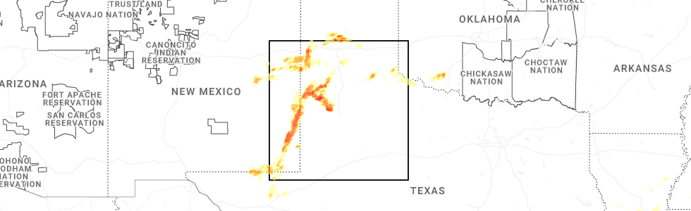
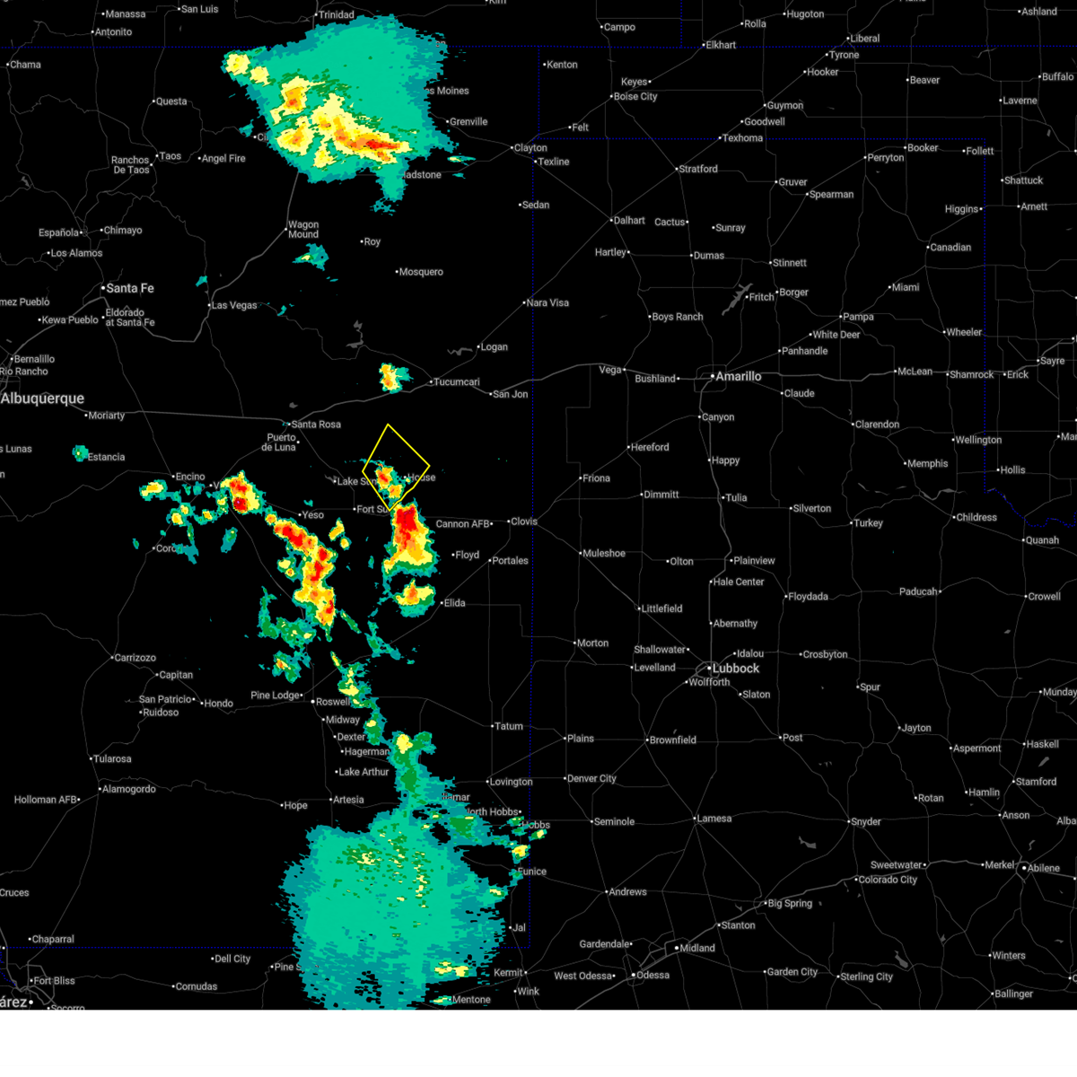
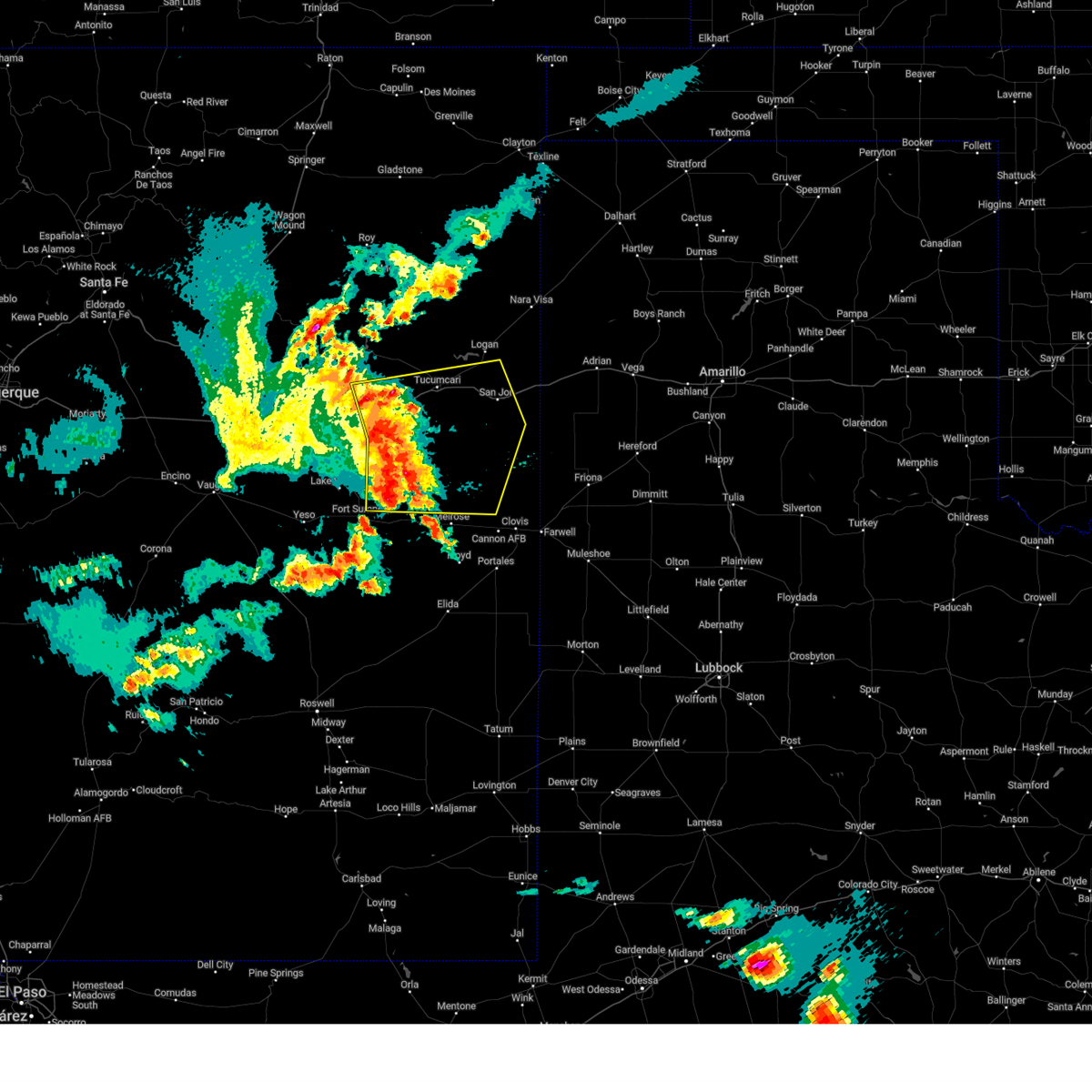
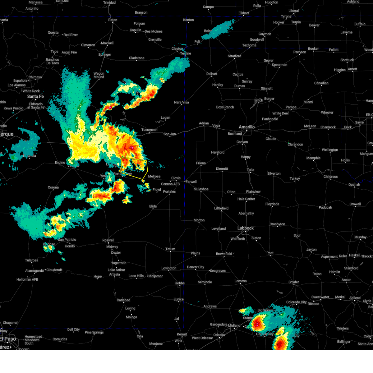
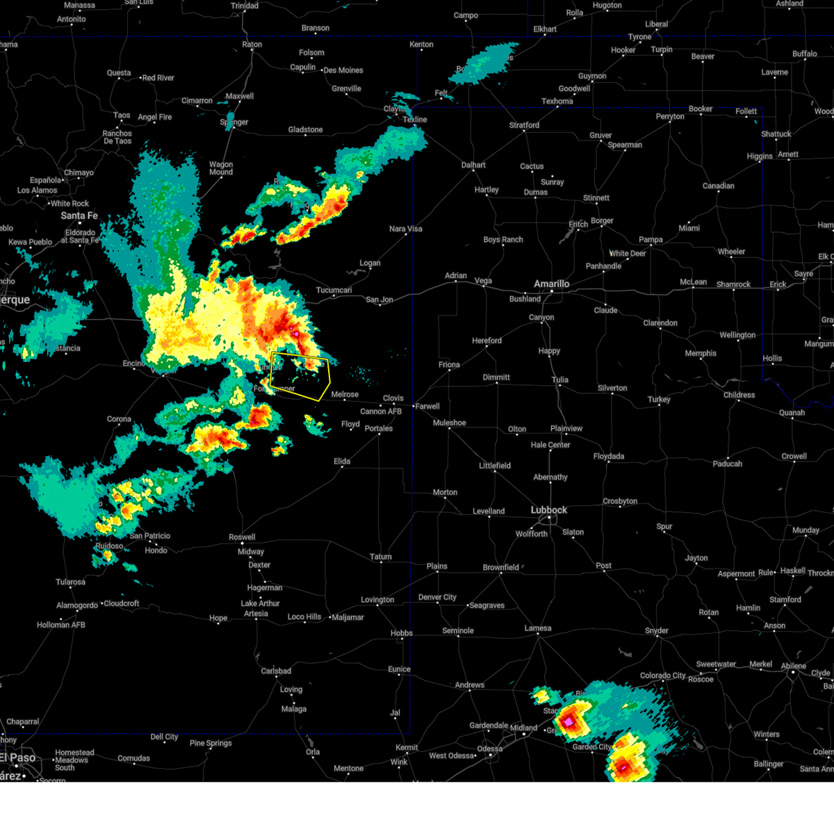
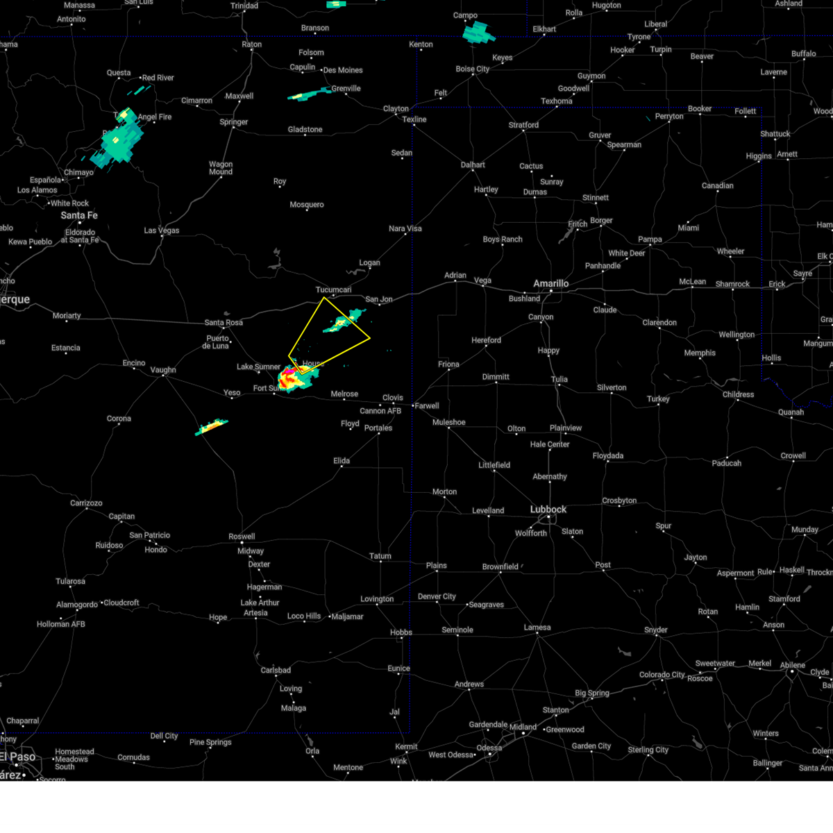
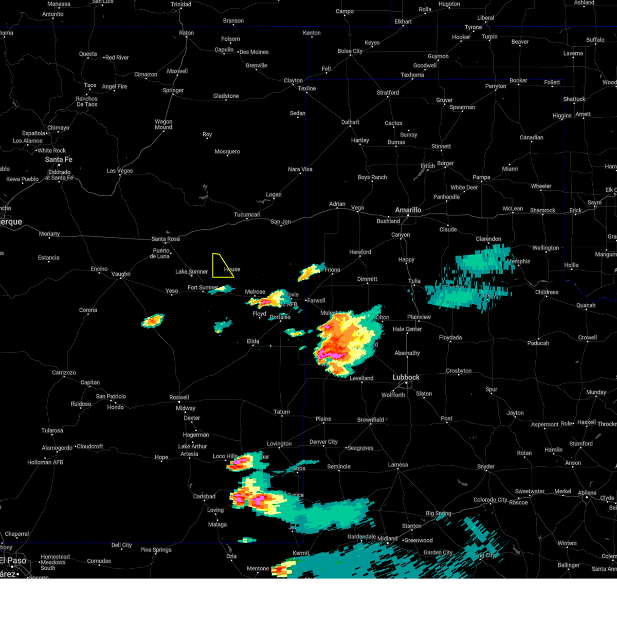
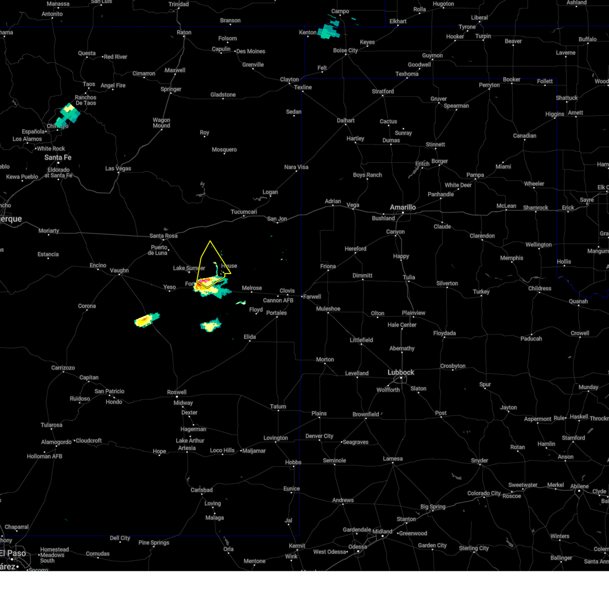
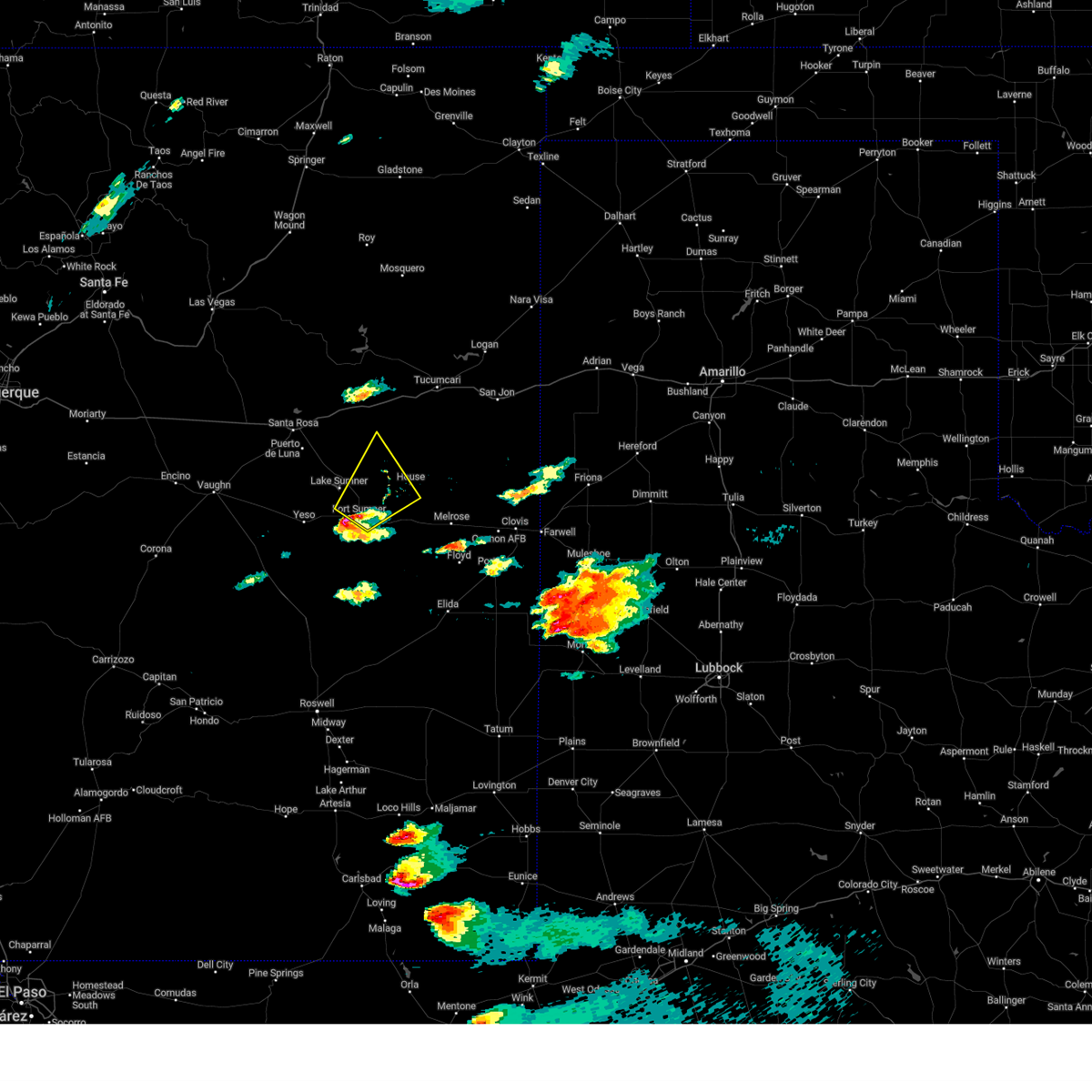
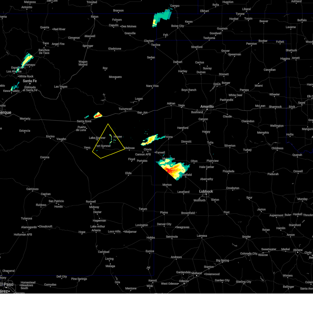
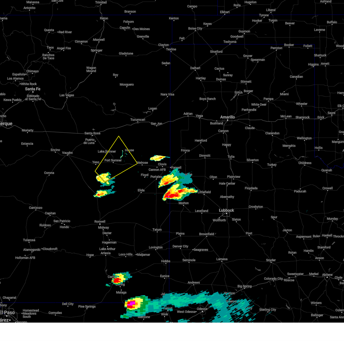
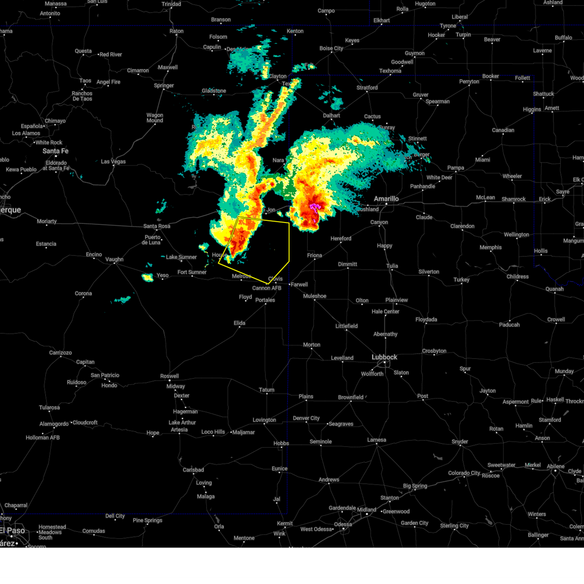
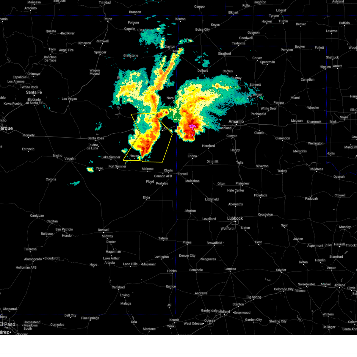
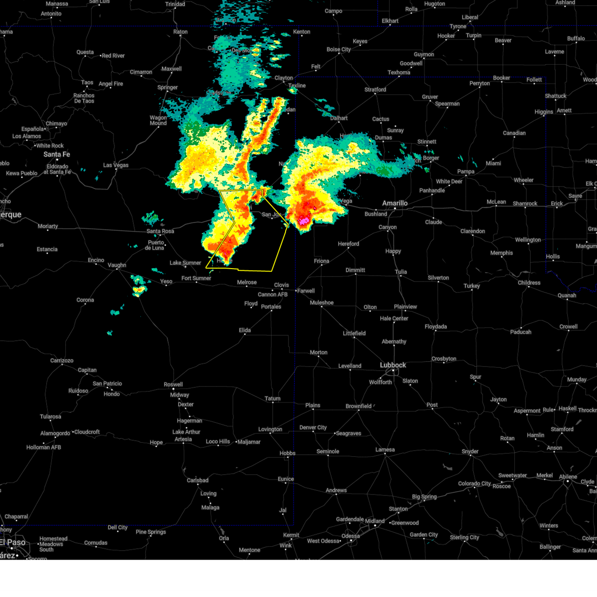
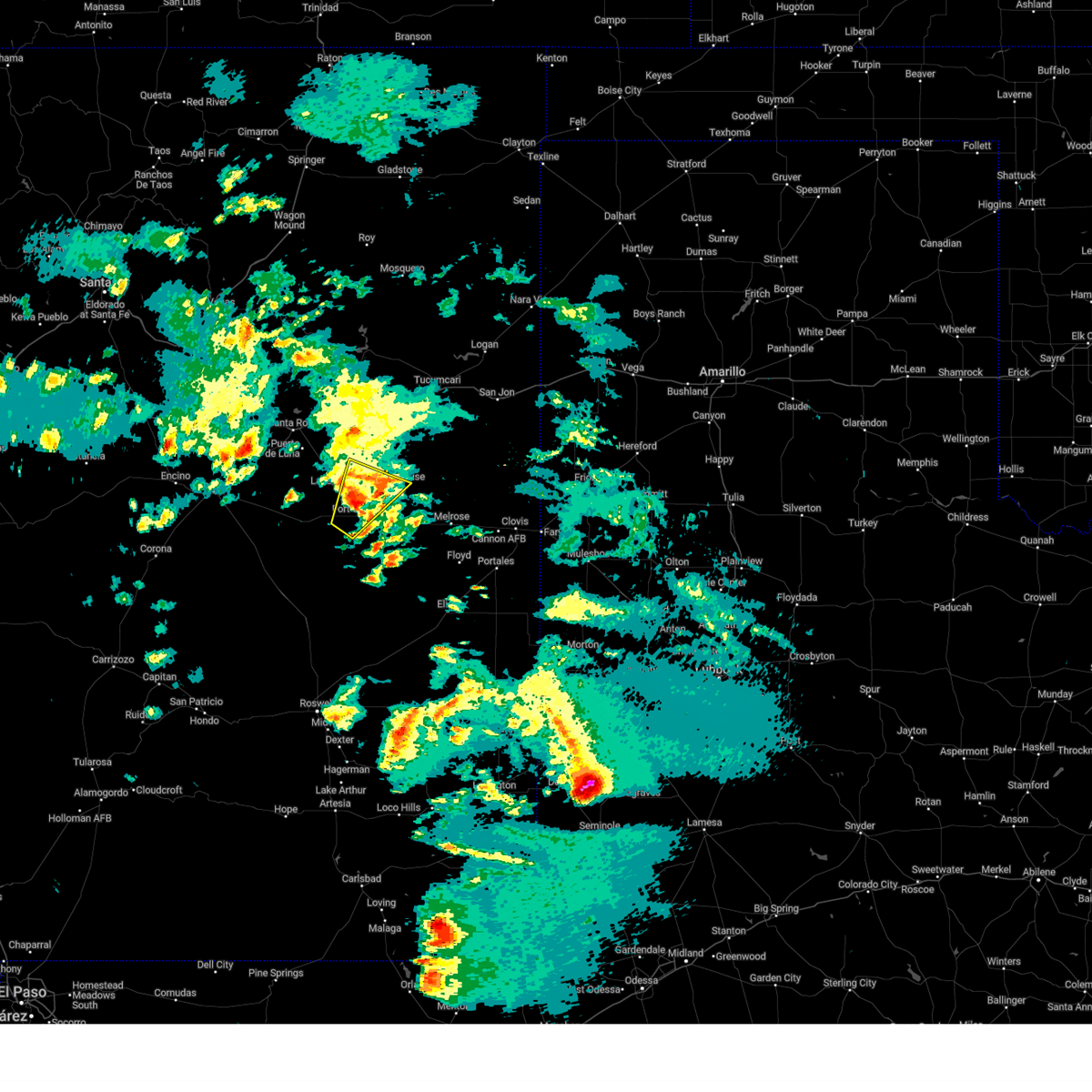
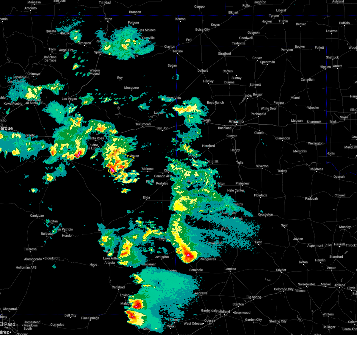
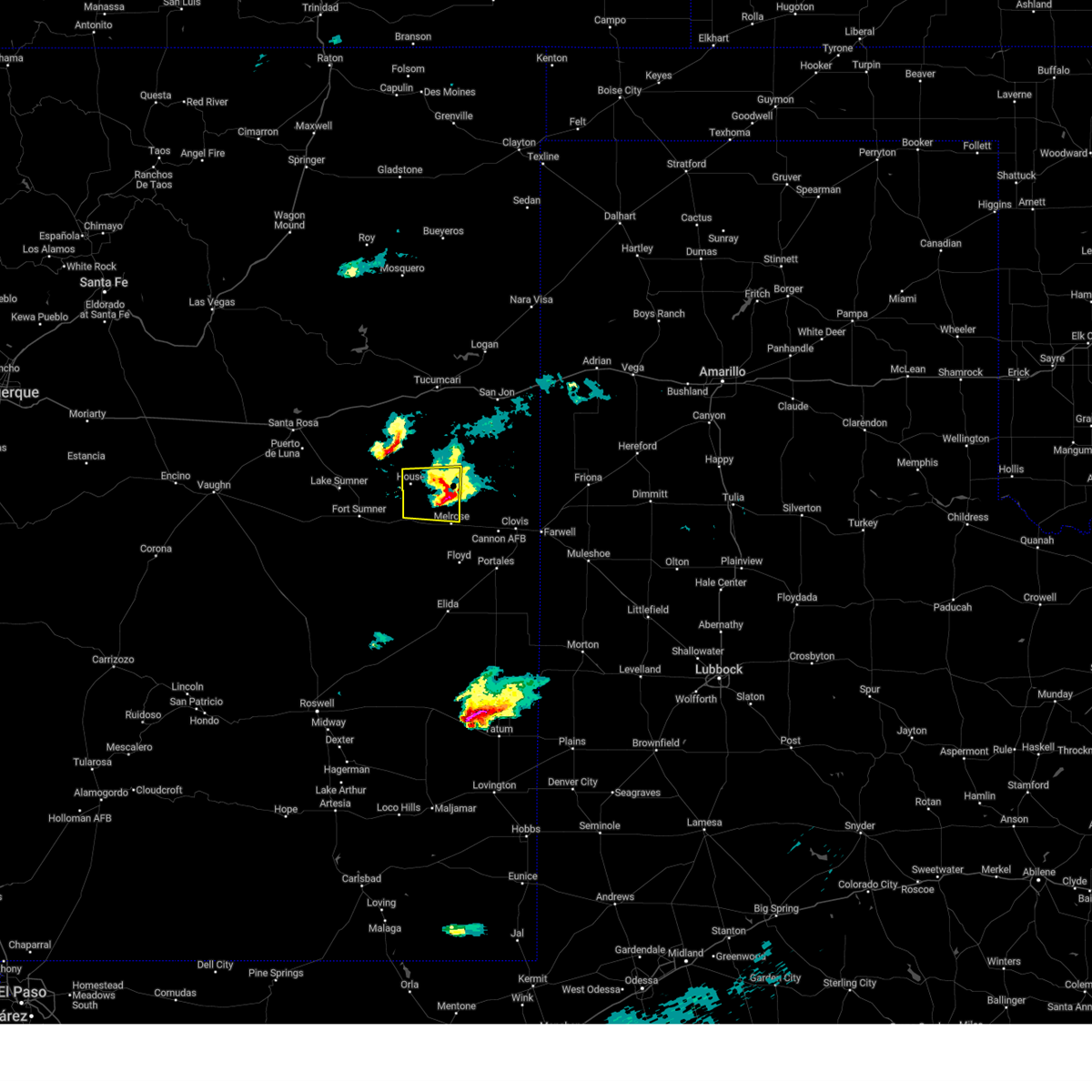
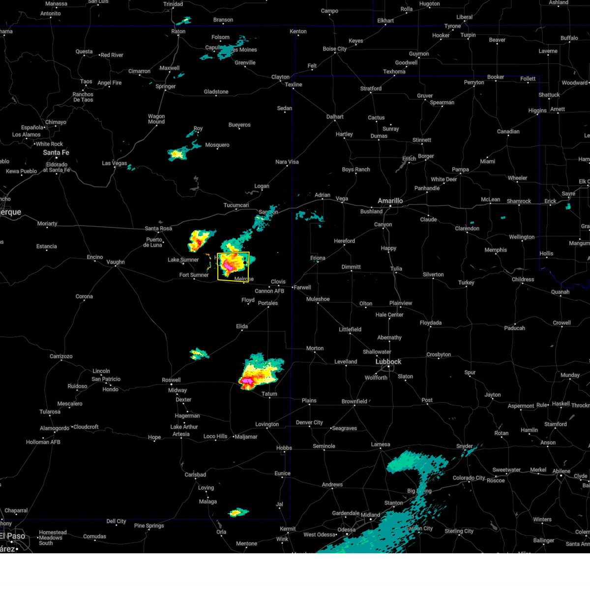
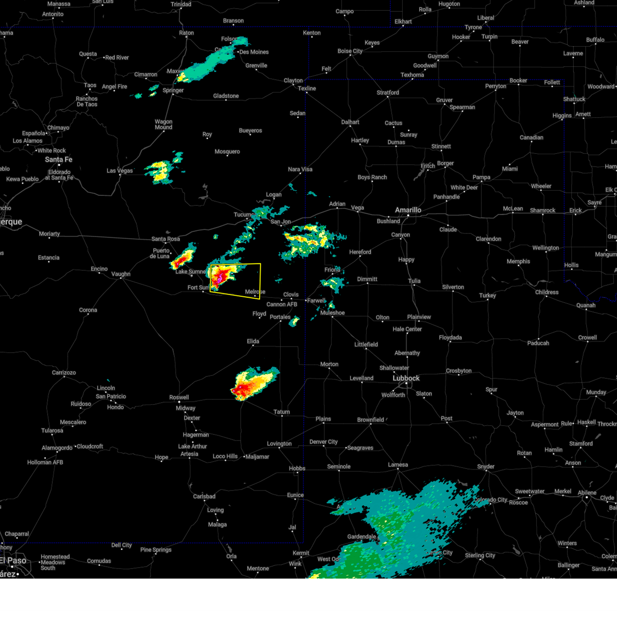
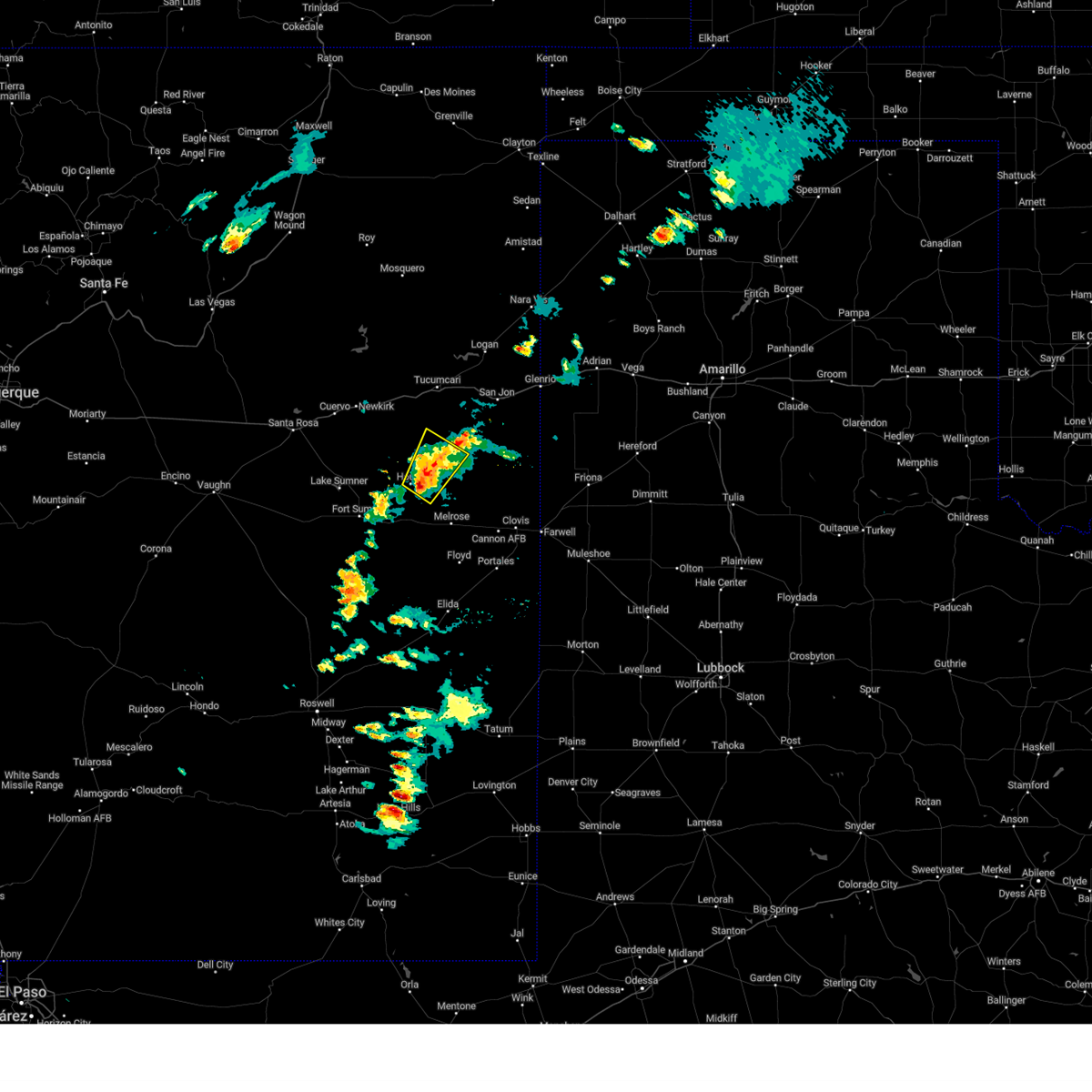
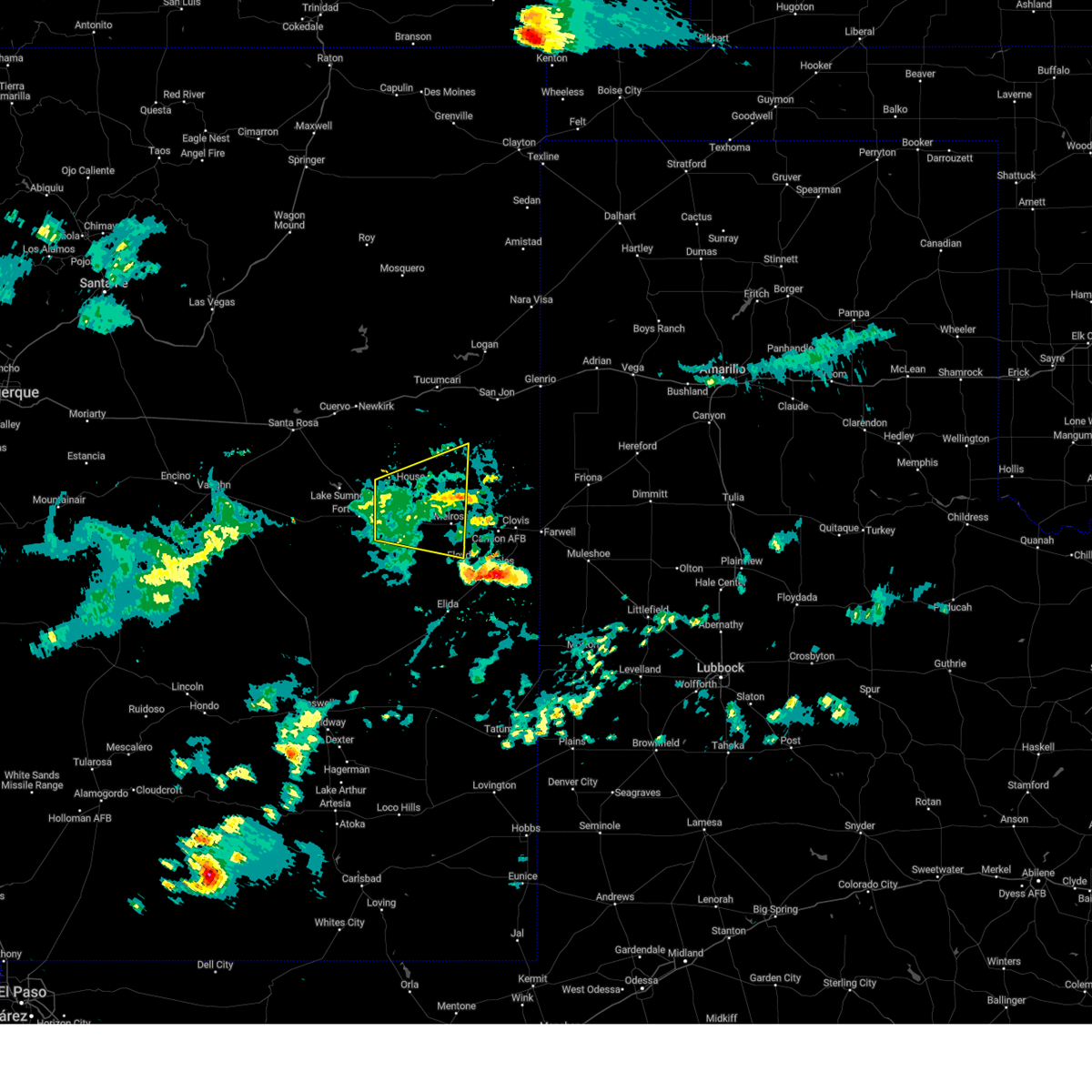
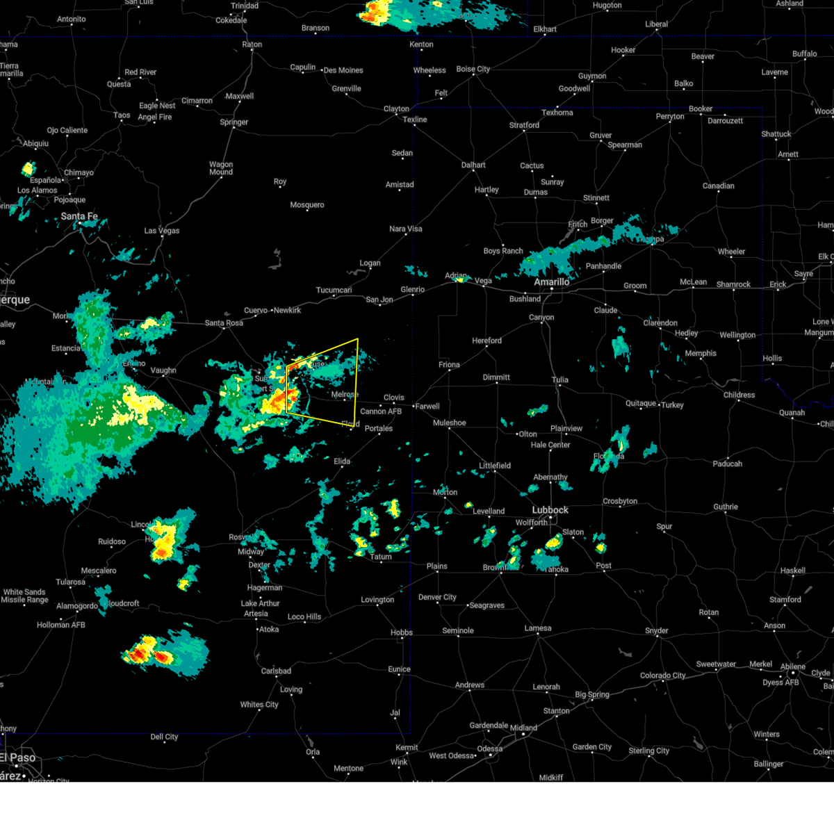
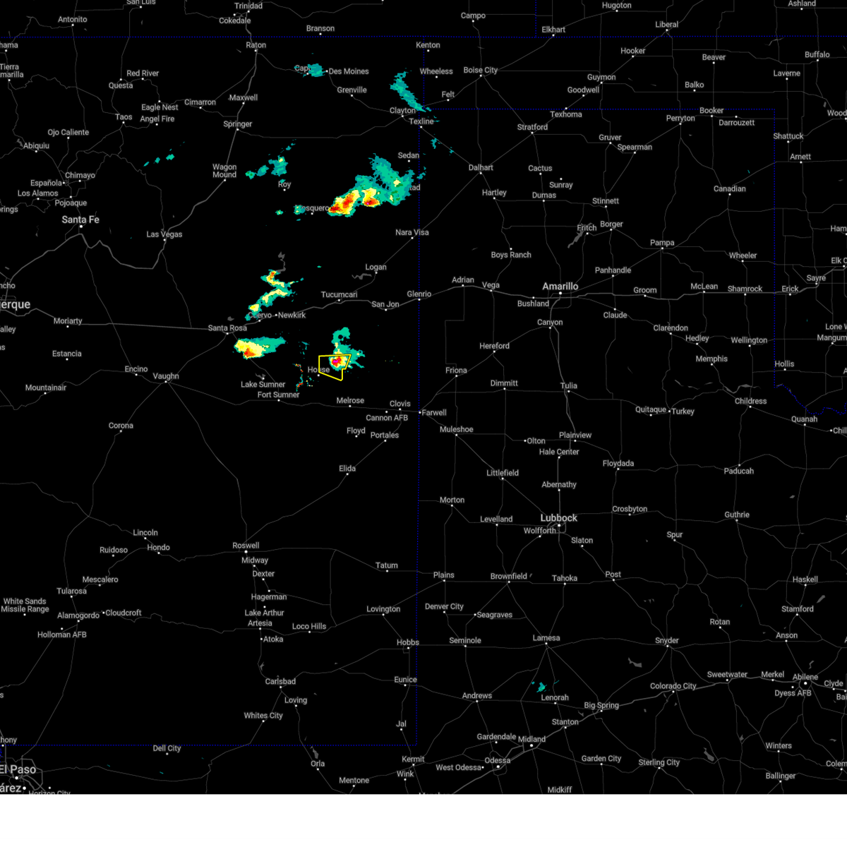
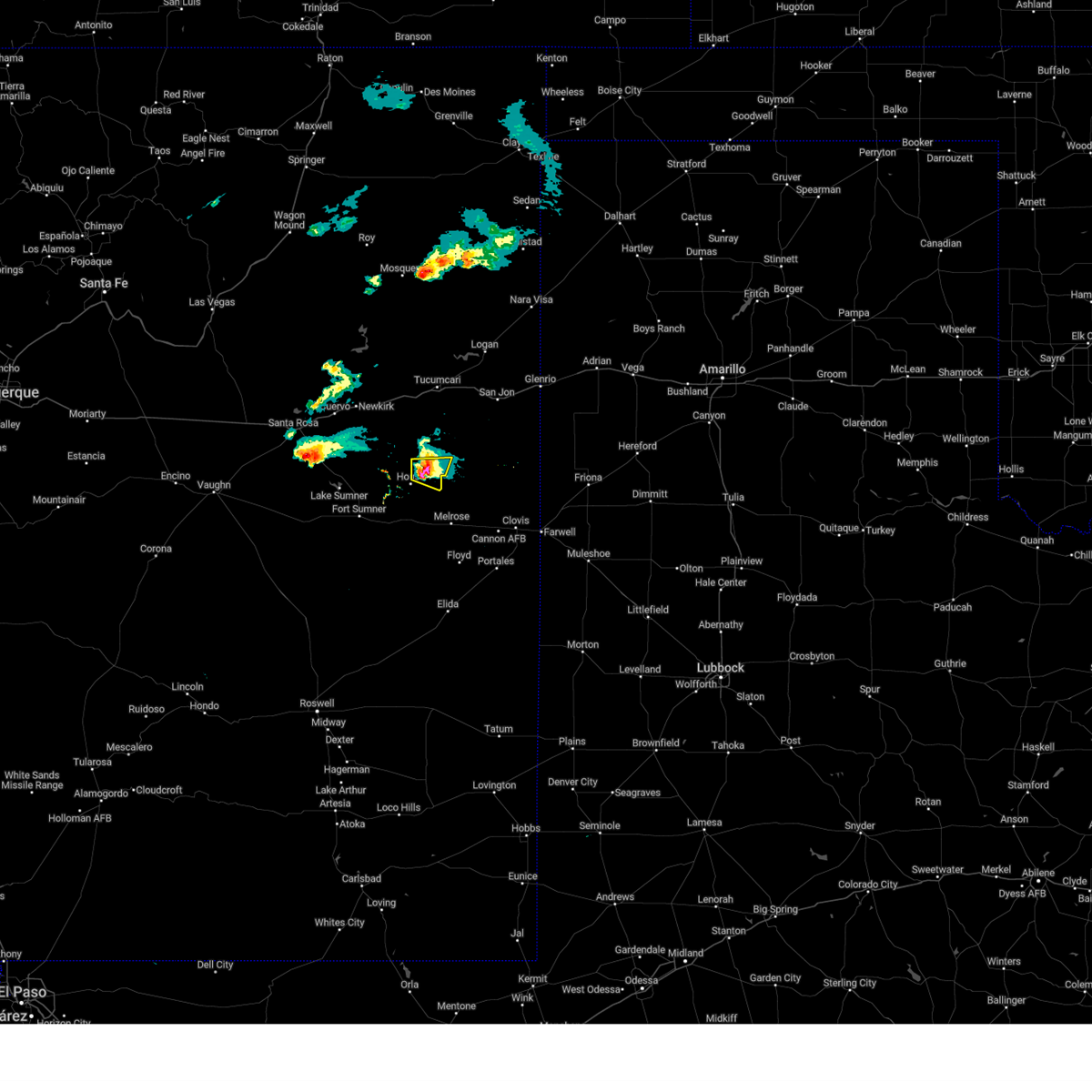
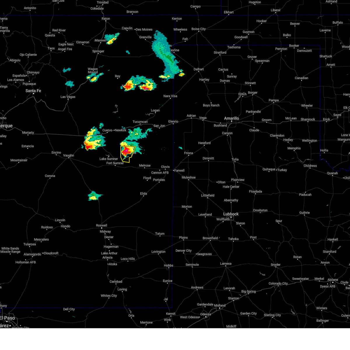
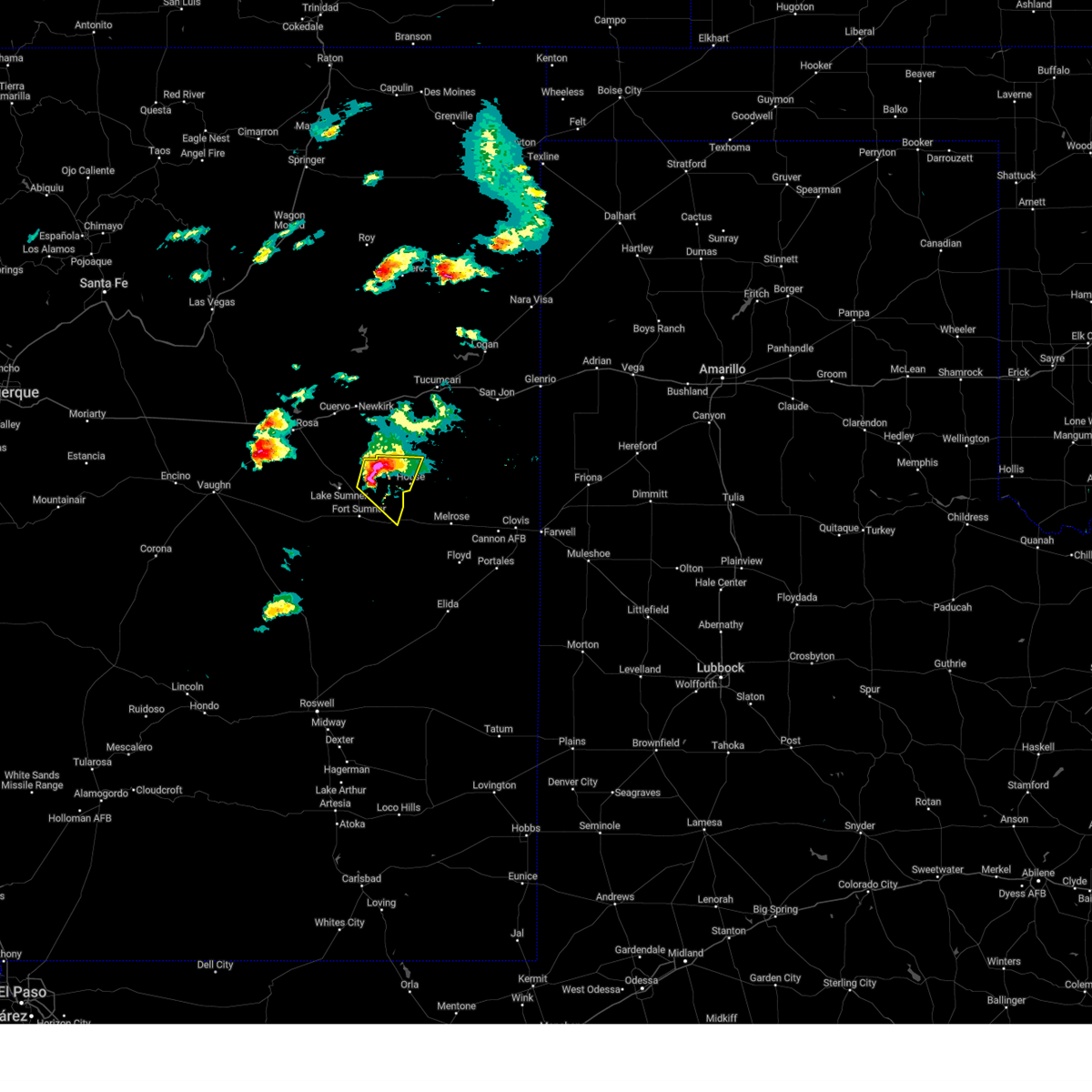
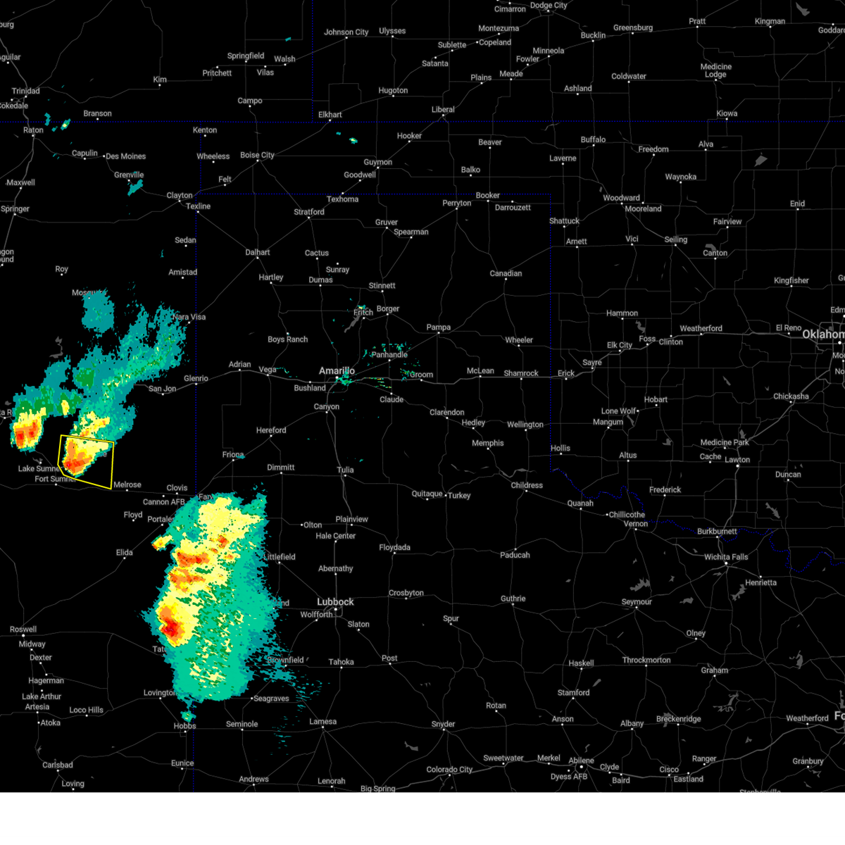
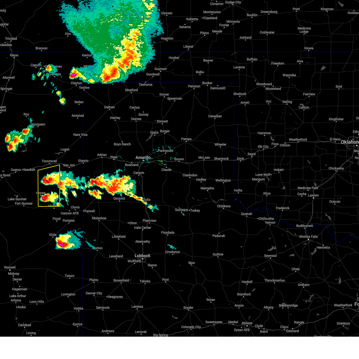
Hail Map for House, NM
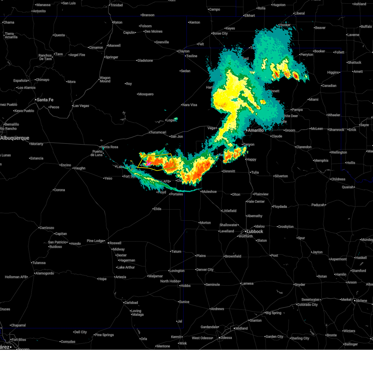
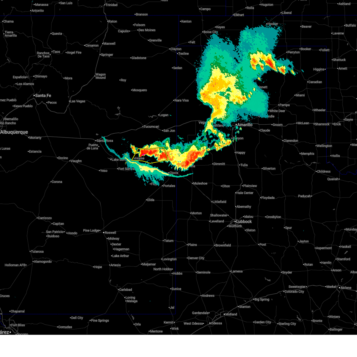
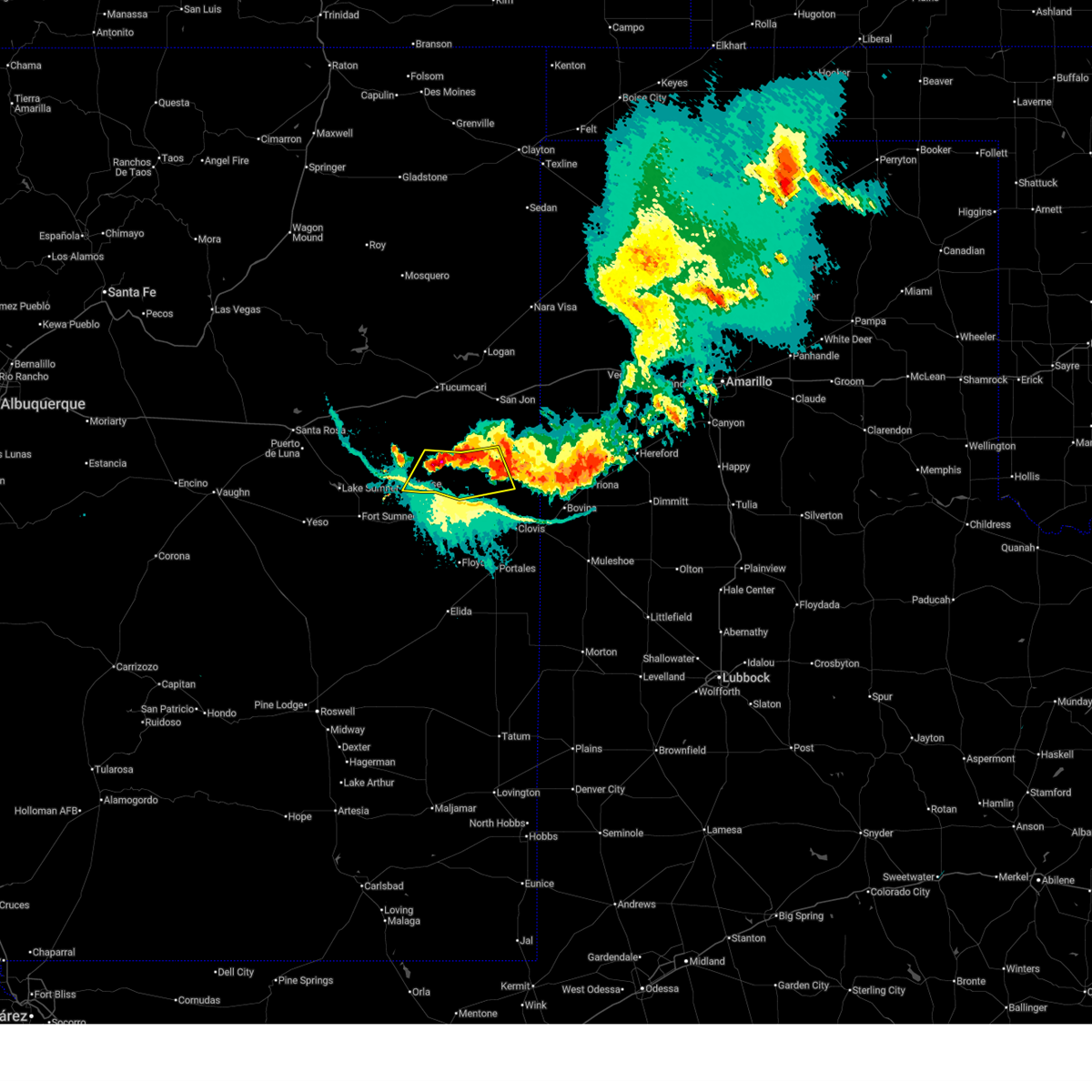
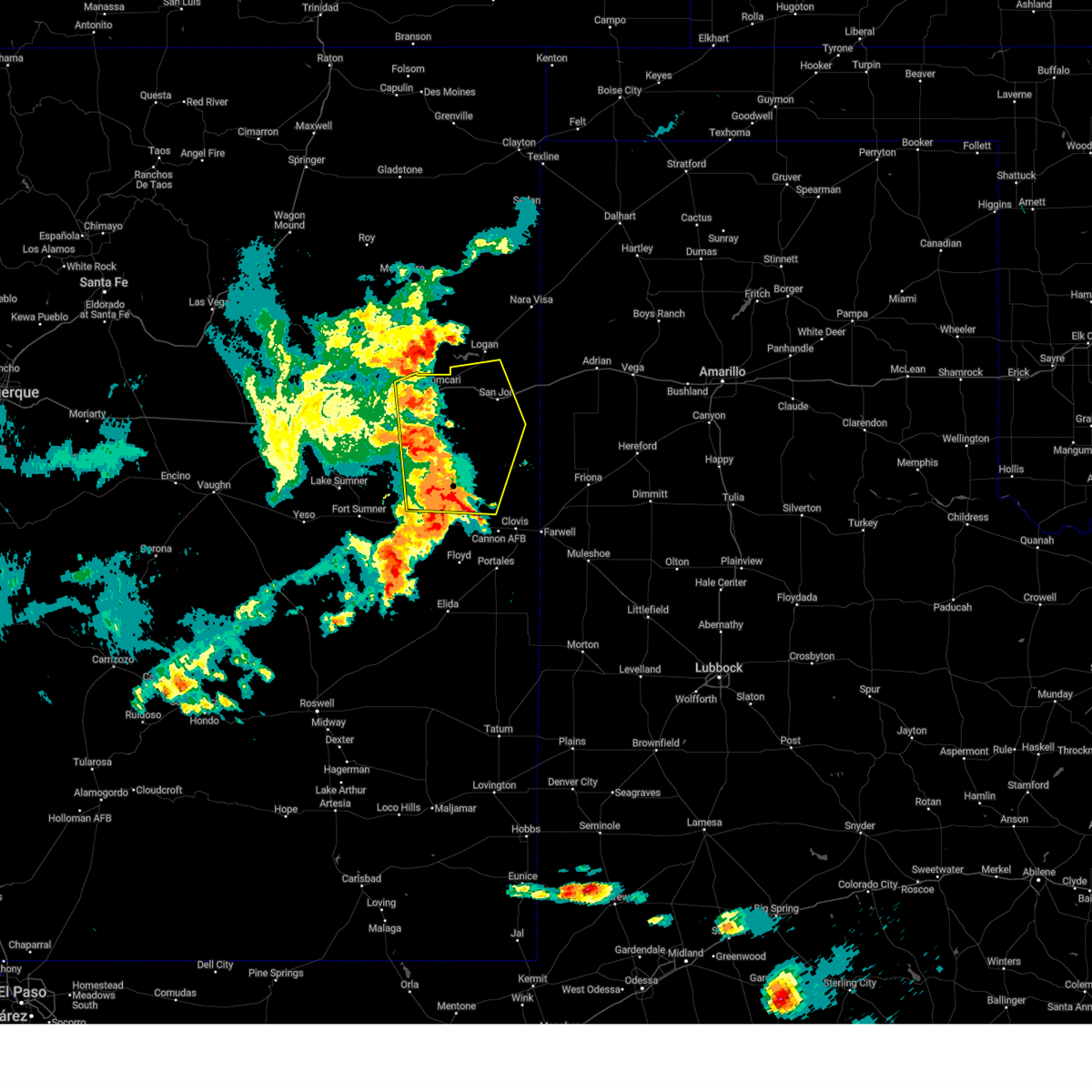
The House, NM area has had 5 reports of on-the-ground hail by trained spotters, and has been under severe weather warnings 31 times during the past 12 months. Doppler radar has detected hail at or near House, NM on 81 occasions, including 9 occasions during the past year.
| Name: | House, NM |
| Where Located: | 37.3 miles SSW of Tucumcari, NM |
| Map: | Google Map for House, NM |
| Population: | 68 |
| Housing Units: | 42 |
| More Info: | Search Google for House, NM |
3
The Top Recent Hail Date for House, NM is Friday, April 25, 2025 (5th out of 81)
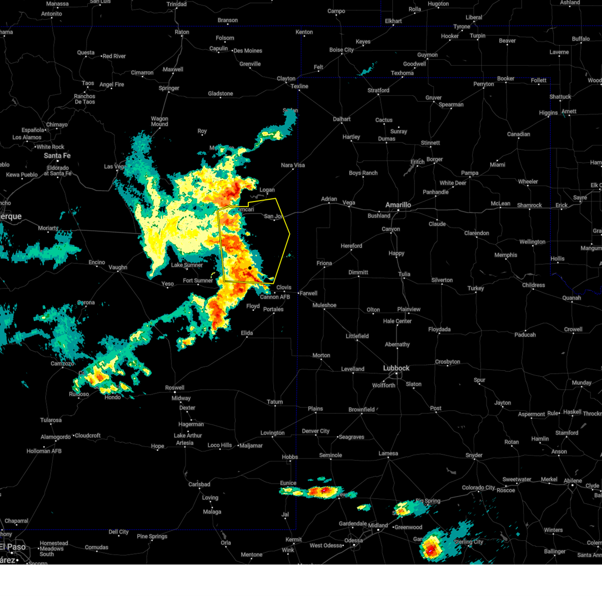
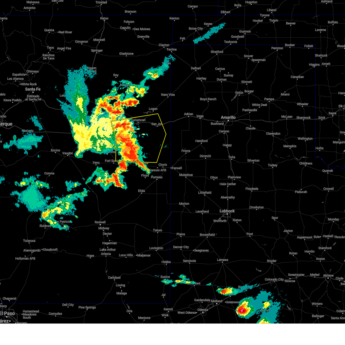
Hail and Wind Damage Spotted near House, NM
| Date / Time | Report Details |
|---|---|
| 7/5/2025 10:14 PM MDT |
 The storms which prompted the warning have weakened below severe limits, and no longer pose an immediate threat to life or property. therefore, the warning will be allowed to expire. however, small hail, gusty winds, and heavy rain are still possible with these thunderstorms. The storms which prompted the warning have weakened below severe limits, and no longer pose an immediate threat to life or property. therefore, the warning will be allowed to expire. however, small hail, gusty winds, and heavy rain are still possible with these thunderstorms.
|
| 7/5/2025 9:58 PM MDT |
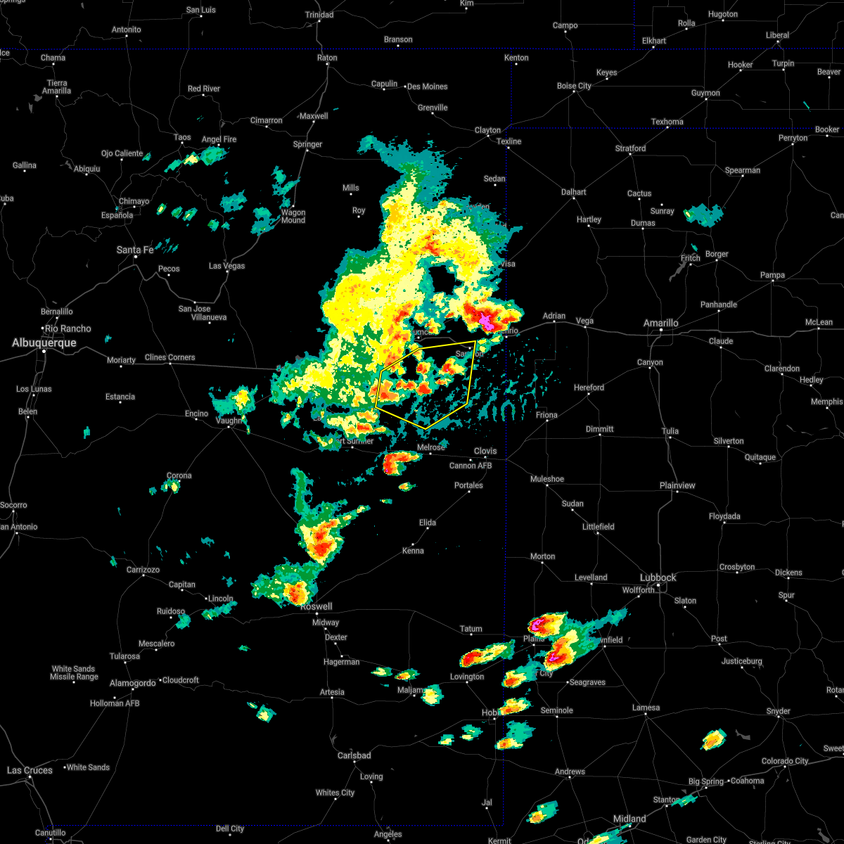
 At 958 pm mdt, severe thunderstorms were located along a line from 11 miles south of grady to near house, moving south at 15 mph (radar indicated). Hazards include 60 mph wind gusts and quarter size hail. Hail damage to vehicles is expected. expect wind damage to roofs, siding, and trees. Locations impacted include, grady, house, forrest and mcalister. At 958 pm mdt, severe thunderstorms were located along a line from 11 miles south of grady to near house, moving south at 15 mph (radar indicated). Hazards include 60 mph wind gusts and quarter size hail. Hail damage to vehicles is expected. expect wind damage to roofs, siding, and trees. Locations impacted include, grady, house, forrest and mcalister.
|
| 7/5/2025 9:43 PM MDT |
 Svrabq the national weather service in albuquerque has issued a * severe thunderstorm warning for, central curry county in east central new mexico, south central quay county in east central new mexico, * until 1015 pm mdt. * at 943 pm mdt, severe thunderstorms were located along a line from 7 miles south of grady to 6 miles northeast of house, moving south at 15 mph (radar indicated). Hazards include 60 mph wind gusts and quarter size hail. Hail damage to vehicles is expected. Expect wind damage to roofs, siding, and trees. Svrabq the national weather service in albuquerque has issued a * severe thunderstorm warning for, central curry county in east central new mexico, south central quay county in east central new mexico, * until 1015 pm mdt. * at 943 pm mdt, severe thunderstorms were located along a line from 7 miles south of grady to 6 miles northeast of house, moving south at 15 mph (radar indicated). Hazards include 60 mph wind gusts and quarter size hail. Hail damage to vehicles is expected. Expect wind damage to roofs, siding, and trees.
|
| 6/15/2025 6:59 PM MDT |
 The storm which prompted the warning has weakened below severe limits, and no longer poses an immediate threat to life or property. therefore, the warning will be allowed to expire. however, small hail, gusty winds, and heavy rain are still possible with this thunderstorm. a severe thunderstorm watch remains in effect until 1100 pm mdt sunday for a portion of east central new mexico. The storm which prompted the warning has weakened below severe limits, and no longer poses an immediate threat to life or property. therefore, the warning will be allowed to expire. however, small hail, gusty winds, and heavy rain are still possible with this thunderstorm. a severe thunderstorm watch remains in effect until 1100 pm mdt sunday for a portion of east central new mexico.
|
| 6/15/2025 6:49 PM MDT |
 At 649 pm mdt, a severe thunderstorm was located 9 miles northwest of house, or 22 miles northeast of fort sumner, moving northeast at 10 mph (radar indicated). Hazards include 60 mph wind gusts and quarter size hail. Hail damage to vehicles is expected. expect wind damage to roofs, siding, and trees. Locations impacted include, house and mcalister. At 649 pm mdt, a severe thunderstorm was located 9 miles northwest of house, or 22 miles northeast of fort sumner, moving northeast at 10 mph (radar indicated). Hazards include 60 mph wind gusts and quarter size hail. Hail damage to vehicles is expected. expect wind damage to roofs, siding, and trees. Locations impacted include, house and mcalister.
|
| 6/15/2025 6:12 PM MDT |
 Svrabq the national weather service in albuquerque has issued a * severe thunderstorm warning for, northeastern de baca county in east central new mexico, southwestern quay county in east central new mexico, northwestern roosevelt county in east central new mexico, * until 700 pm mdt. * at 612 pm mdt, a severe thunderstorm was located 9 miles west of house, or 16 miles northeast of fort sumner, moving northeast at 5 mph (radar indicated). Hazards include 60 mph wind gusts and quarter size hail. Hail damage to vehicles is expected. Expect wind damage to roofs, siding, and trees. Svrabq the national weather service in albuquerque has issued a * severe thunderstorm warning for, northeastern de baca county in east central new mexico, southwestern quay county in east central new mexico, northwestern roosevelt county in east central new mexico, * until 700 pm mdt. * at 612 pm mdt, a severe thunderstorm was located 9 miles west of house, or 16 miles northeast of fort sumner, moving northeast at 5 mph (radar indicated). Hazards include 60 mph wind gusts and quarter size hail. Hail damage to vehicles is expected. Expect wind damage to roofs, siding, and trees.
|
| 6/9/2025 7:49 PM MDT |
 At 749 pm mdt, severe thunderstorms were located along a line from 7 miles south of tucumcari to 8 miles north of melrose, moving east at 35 mph (trained spotters reported). Hazards include 70 mph wind gusts and quarter size hail. Hail damage to vehicles is expected. expect considerable tree damage. wind damage is also likely to mobile homes, roofs, and outbuildings. locations impacted include, tucumcari, quay, san jon, grady, house, ragland, wheatland, broadview, forrest and mcalister. this includes the following highways, interstate 40 between mile markers 316 and 362. State road 104 between mile markers 99 and 105. At 749 pm mdt, severe thunderstorms were located along a line from 7 miles south of tucumcari to 8 miles north of melrose, moving east at 35 mph (trained spotters reported). Hazards include 70 mph wind gusts and quarter size hail. Hail damage to vehicles is expected. expect considerable tree damage. wind damage is also likely to mobile homes, roofs, and outbuildings. locations impacted include, tucumcari, quay, san jon, grady, house, ragland, wheatland, broadview, forrest and mcalister. this includes the following highways, interstate 40 between mile markers 316 and 362. State road 104 between mile markers 99 and 105.
|
| 6/9/2025 7:49 PM MDT |
 the severe thunderstorm warning has been cancelled and is no longer in effect the severe thunderstorm warning has been cancelled and is no longer in effect
|
| 6/9/2025 7:27 PM MDT |
 At 727 pm mdt, severe thunderstorms were located along a line from 8 miles northeast of montoya to near house, moving east at 45 mph. these are destructive storms for ragland, mcalister (trained spotters reported). Hazards include 80 mph wind gusts and quarter size hail. Flying debris will be dangerous to those caught without shelter. mobile homes will be heavily damaged. expect considerable damage to roofs, windows, and vehicles. extensive tree damage and power outages are likely. locations impacted include, tucumcari, quay, san jon, grady, house, ragland, wheatland, montoya, broadview and forrest. this includes the following highways, interstate 40 between mile markers 301 and 362. State road 104 between mile markers 98 and 105. At 727 pm mdt, severe thunderstorms were located along a line from 8 miles northeast of montoya to near house, moving east at 45 mph. these are destructive storms for ragland, mcalister (trained spotters reported). Hazards include 80 mph wind gusts and quarter size hail. Flying debris will be dangerous to those caught without shelter. mobile homes will be heavily damaged. expect considerable damage to roofs, windows, and vehicles. extensive tree damage and power outages are likely. locations impacted include, tucumcari, quay, san jon, grady, house, ragland, wheatland, montoya, broadview and forrest. this includes the following highways, interstate 40 between mile markers 301 and 362. State road 104 between mile markers 98 and 105.
|
| 6/9/2025 7:25 PM MDT | Spotter reports broken tree branches of about 5 inches in diameter from trees around her hous in quay county NM, 3.6 miles W of House, NM |
| 6/9/2025 7:20 PM MDT | Trained spotter in house in southern quay county reports an estimated wind speed of 65 mph and small broken tree limbs and branche in quay county NM, 0.7 miles NE of House, NM |
| 6/9/2025 7:12 PM MDT |
 Svrabq the national weather service in albuquerque has issued a * severe thunderstorm warning for, central curry county in east central new mexico, northeastern de baca county in east central new mexico, northeastern guadalupe county in east central new mexico, quay county in east central new mexico, northwestern roosevelt county in east central new mexico, southeastern san miguel county in northeastern new mexico, * until 815 pm mdt. * at 712 pm mdt, severe thunderstorms were located along a line from near montoya to 8 miles southwest of house, moving east at 45 mph. these are destructive storms for house (radar indicated). Hazards include 80 mph wind gusts and quarter size hail. Flying debris will be dangerous to those caught without shelter. mobile homes will be heavily damaged. expect considerable damage to roofs, windows, and vehicles. Extensive tree damage and power outages are likely. Svrabq the national weather service in albuquerque has issued a * severe thunderstorm warning for, central curry county in east central new mexico, northeastern de baca county in east central new mexico, northeastern guadalupe county in east central new mexico, quay county in east central new mexico, northwestern roosevelt county in east central new mexico, southeastern san miguel county in northeastern new mexico, * until 815 pm mdt. * at 712 pm mdt, severe thunderstorms were located along a line from near montoya to 8 miles southwest of house, moving east at 45 mph. these are destructive storms for house (radar indicated). Hazards include 80 mph wind gusts and quarter size hail. Flying debris will be dangerous to those caught without shelter. mobile homes will be heavily damaged. expect considerable damage to roofs, windows, and vehicles. Extensive tree damage and power outages are likely.
|
| 6/9/2025 7:02 PM MDT |
 At 702 pm mdt, a severe thunderstorm was located 9 miles west of house, or 14 miles northeast of fort sumner, moving east at 45 mph. this is a destructive storm for house (radar indicated). Hazards include 80 mph wind gusts and quarter size hail. Flying debris will be dangerous to those caught without shelter. mobile homes will be heavily damaged. expect considerable damage to roofs, windows, and vehicles. extensive tree damage and power outages are likely. locations impacted include, house, tolar and mcalister. This includes highway 60 between mile markers 345 and 350. At 702 pm mdt, a severe thunderstorm was located 9 miles west of house, or 14 miles northeast of fort sumner, moving east at 45 mph. this is a destructive storm for house (radar indicated). Hazards include 80 mph wind gusts and quarter size hail. Flying debris will be dangerous to those caught without shelter. mobile homes will be heavily damaged. expect considerable damage to roofs, windows, and vehicles. extensive tree damage and power outages are likely. locations impacted include, house, tolar and mcalister. This includes highway 60 between mile markers 345 and 350.
|
| 6/9/2025 6:55 PM MDT |
 Svrabq the national weather service in albuquerque has issued a * severe thunderstorm warning for, northeastern de baca county in east central new mexico, southwestern quay county in east central new mexico, northwestern roosevelt county in east central new mexico, * until 715 pm mdt. * at 655 pm mdt, a severe thunderstorm was located 12 miles northeast of fort sumner, moving east at 45 mph (radar indicated). Hazards include 60 mph wind gusts and quarter size hail. Hail damage to vehicles is expected. Expect wind damage to roofs, siding, and trees. Svrabq the national weather service in albuquerque has issued a * severe thunderstorm warning for, northeastern de baca county in east central new mexico, southwestern quay county in east central new mexico, northwestern roosevelt county in east central new mexico, * until 715 pm mdt. * at 655 pm mdt, a severe thunderstorm was located 12 miles northeast of fort sumner, moving east at 45 mph (radar indicated). Hazards include 60 mph wind gusts and quarter size hail. Hail damage to vehicles is expected. Expect wind damage to roofs, siding, and trees.
|
| 6/5/2025 4:58 PM MDT |
 Svrabq the national weather service in albuquerque has issued a * severe thunderstorm warning for, southwestern quay county in east central new mexico, * until 545 pm mdt. * at 458 pm mdt, a severe thunderstorm was located 7 miles northwest of house, or 21 miles northeast of fort sumner, moving northeast at 35 mph (radar indicated). Hazards include 60 mph wind gusts and quarter size hail. Hail damage to vehicles is expected. Expect wind damage to roofs, siding, and trees. Svrabq the national weather service in albuquerque has issued a * severe thunderstorm warning for, southwestern quay county in east central new mexico, * until 545 pm mdt. * at 458 pm mdt, a severe thunderstorm was located 7 miles northwest of house, or 21 miles northeast of fort sumner, moving northeast at 35 mph (radar indicated). Hazards include 60 mph wind gusts and quarter size hail. Hail damage to vehicles is expected. Expect wind damage to roofs, siding, and trees.
|
| 6/5/2025 4:49 PM MDT |
 At 449 pm mdt, a severe thunderstorm was located 9 miles west of house, or 17 miles northeast of fort sumner, moving northeast at 35 mph (radar indicated). Hazards include ping pong ball size hail and 60 mph wind gusts. People and animals outdoors will be injured. expect hail damage to roofs, siding, windows, and vehicles. expect wind damage to roofs, siding, and trees. Locations impacted include, house. At 449 pm mdt, a severe thunderstorm was located 9 miles west of house, or 17 miles northeast of fort sumner, moving northeast at 35 mph (radar indicated). Hazards include ping pong ball size hail and 60 mph wind gusts. People and animals outdoors will be injured. expect hail damage to roofs, siding, windows, and vehicles. expect wind damage to roofs, siding, and trees. Locations impacted include, house.
|
| 6/5/2025 4:49 PM MDT |
 the severe thunderstorm warning has been cancelled and is no longer in effect the severe thunderstorm warning has been cancelled and is no longer in effect
|
| 6/5/2025 4:41 PM MDT |
 At 441 pm mdt, a severe thunderstorm was located 11 miles northeast of fort sumner, moving northeast at 35 mph (radar indicated). Hazards include golf ball size hail and 60 mph wind gusts. People and animals outdoors will be injured. expect hail damage to roofs, siding, windows, and vehicles. expect wind damage to roofs, siding, and trees. Locations impacted include, fort sumner and house. At 441 pm mdt, a severe thunderstorm was located 11 miles northeast of fort sumner, moving northeast at 35 mph (radar indicated). Hazards include golf ball size hail and 60 mph wind gusts. People and animals outdoors will be injured. expect hail damage to roofs, siding, windows, and vehicles. expect wind damage to roofs, siding, and trees. Locations impacted include, fort sumner and house.
|
| 6/5/2025 4:41 PM MDT |
 the severe thunderstorm warning has been cancelled and is no longer in effect the severe thunderstorm warning has been cancelled and is no longer in effect
|
| 6/5/2025 4:31 PM MDT |
 At 431 pm mdt, a severe thunderstorm was located near fort sumner, moving northeast at 30 mph (radar indicated). Hazards include 60 mph wind gusts and quarter size hail. Hail damage to vehicles is expected. expect wind damage to roofs, siding, and trees. locations impacted include, fort sumner and house. This includes highway 60 between mile markers 322 and 336. At 431 pm mdt, a severe thunderstorm was located near fort sumner, moving northeast at 30 mph (radar indicated). Hazards include 60 mph wind gusts and quarter size hail. Hail damage to vehicles is expected. expect wind damage to roofs, siding, and trees. locations impacted include, fort sumner and house. This includes highway 60 between mile markers 322 and 336.
|
| 6/5/2025 4:21 PM MDT |
 At 421 pm mdt, a severe thunderstorm was located near fort sumner, moving northeast at 30 mph (radar indicated). Hazards include 60 mph wind gusts and quarter size hail. Hail damage to vehicles is expected. expect wind damage to roofs, siding, and trees. locations impacted include, fort sumner, house, taiban and tolar. This includes highway 60 between mile markers 316 and 353. At 421 pm mdt, a severe thunderstorm was located near fort sumner, moving northeast at 30 mph (radar indicated). Hazards include 60 mph wind gusts and quarter size hail. Hail damage to vehicles is expected. expect wind damage to roofs, siding, and trees. locations impacted include, fort sumner, house, taiban and tolar. This includes highway 60 between mile markers 316 and 353.
|
| 6/5/2025 4:05 PM MDT |
 Svrabq the national weather service in albuquerque has issued a * severe thunderstorm warning for, eastern de baca county in east central new mexico, southeastern guadalupe county in east central new mexico, southwestern quay county in east central new mexico, northwestern roosevelt county in east central new mexico, * until 500 pm mdt. * at 405 pm mdt, a severe thunderstorm was located 9 miles southwest of fort sumner, moving northeast at 35 mph (radar indicated). Hazards include 60 mph wind gusts and quarter size hail. Hail damage to vehicles is expected. Expect wind damage to roofs, siding, and trees. Svrabq the national weather service in albuquerque has issued a * severe thunderstorm warning for, eastern de baca county in east central new mexico, southeastern guadalupe county in east central new mexico, southwestern quay county in east central new mexico, northwestern roosevelt county in east central new mexico, * until 500 pm mdt. * at 405 pm mdt, a severe thunderstorm was located 9 miles southwest of fort sumner, moving northeast at 35 mph (radar indicated). Hazards include 60 mph wind gusts and quarter size hail. Hail damage to vehicles is expected. Expect wind damage to roofs, siding, and trees.
|
| 6/4/2025 8:44 PM MDT |
 Svrabq the national weather service in albuquerque has issued a * severe thunderstorm warning for, curry county in east central new mexico, southeastern quay county in east central new mexico, northern roosevelt county in east central new mexico, * until 930 pm mdt. * at 844 pm mdt, severe thunderstorms were located along a line from near wheatland to 9 miles northwest of melrose, moving east at 35 mph (radar indicated). Hazards include 60 mph wind gusts and half dollar size hail. Hail damage to vehicles is expected. Expect wind damage to roofs, siding, and trees. Svrabq the national weather service in albuquerque has issued a * severe thunderstorm warning for, curry county in east central new mexico, southeastern quay county in east central new mexico, northern roosevelt county in east central new mexico, * until 930 pm mdt. * at 844 pm mdt, severe thunderstorms were located along a line from near wheatland to 9 miles northwest of melrose, moving east at 35 mph (radar indicated). Hazards include 60 mph wind gusts and half dollar size hail. Hail damage to vehicles is expected. Expect wind damage to roofs, siding, and trees.
|
| 6/4/2025 8:44 PM MDT |
 The severe thunderstorm warning that was previously in effect has been reissued for quay and curry counties and is in effect until 930 pm mdt. please refer to that bulletin for the latest severe weather information. however, gusty winds and heavy rain are still possible with these thunderstorms. a severe thunderstorm watch remains in effect until 1100 pm mdt for portions of east central and northeast new mexico. The severe thunderstorm warning that was previously in effect has been reissued for quay and curry counties and is in effect until 930 pm mdt. please refer to that bulletin for the latest severe weather information. however, gusty winds and heavy rain are still possible with these thunderstorms. a severe thunderstorm watch remains in effect until 1100 pm mdt for portions of east central and northeast new mexico.
|
| 6/4/2025 8:31 PM MDT |
 At 831 pm mdt, severe thunderstorms were located along a line from 6 miles west of ute lake state park to 9 miles east of house, moving east at 45 mph (radar indicated). Hazards include 60 mph wind gusts and small hail. Expect damage to roofs, siding, and trees. locations impacted include, tucumcari, quay, logan, san jon, grady, house, ragland, wheatland, ute lake state park and forrest. this includes the following highways, interstate 40 between mile markers 327 and 362. State road 104 between mile markers 93 and 105. At 831 pm mdt, severe thunderstorms were located along a line from 6 miles west of ute lake state park to 9 miles east of house, moving east at 45 mph (radar indicated). Hazards include 60 mph wind gusts and small hail. Expect damage to roofs, siding, and trees. locations impacted include, tucumcari, quay, logan, san jon, grady, house, ragland, wheatland, ute lake state park and forrest. this includes the following highways, interstate 40 between mile markers 327 and 362. State road 104 between mile markers 93 and 105.
|
| 6/4/2025 8:31 PM MDT |
 the severe thunderstorm warning has been cancelled and is no longer in effect the severe thunderstorm warning has been cancelled and is no longer in effect
|
| 5/4/2025 6:15 PM MDT |
 the severe thunderstorm warning has been cancelled and is no longer in effect the severe thunderstorm warning has been cancelled and is no longer in effect
|
| 5/4/2025 5:56 PM MDT |
 Svrabq the national weather service in albuquerque has issued a * severe thunderstorm warning for, northeastern de baca county in east central new mexico, southwestern quay county in east central new mexico, * until 700 pm mdt. * at 556 pm mdt, a severe thunderstorm was located 5 miles west of fort sumner, moving northeast at 20 mph (radar indicated). Hazards include 60 mph wind gusts and half dollar size hail. Hail damage to vehicles is expected. Expect wind damage to roofs, siding, and trees. Svrabq the national weather service in albuquerque has issued a * severe thunderstorm warning for, northeastern de baca county in east central new mexico, southwestern quay county in east central new mexico, * until 700 pm mdt. * at 556 pm mdt, a severe thunderstorm was located 5 miles west of fort sumner, moving northeast at 20 mph (radar indicated). Hazards include 60 mph wind gusts and half dollar size hail. Hail damage to vehicles is expected. Expect wind damage to roofs, siding, and trees.
|
| 4/26/2025 8:13 PM MDT |
 The severe thunderstorm warning that was previously in effect has been reissued for curry, quay, and roosevelt counties and is in effect until 900 pm mdt. please refer to that bulletin for the latest severe weather information. a tornado watch remains in effect until 900 pm mdt for a portion of east central new mexico. The severe thunderstorm warning that was previously in effect has been reissued for curry, quay, and roosevelt counties and is in effect until 900 pm mdt. please refer to that bulletin for the latest severe weather information. a tornado watch remains in effect until 900 pm mdt for a portion of east central new mexico.
|
| 4/26/2025 7:53 PM MDT |
 the severe thunderstorm warning has been cancelled and is no longer in effect the severe thunderstorm warning has been cancelled and is no longer in effect
|
| 4/26/2025 7:53 PM MDT |
 At 753 pm mdt, a severe thunderstorm was located 7 miles southeast of house, or 24 miles east of fort sumner, moving east at 25 mph (radar indicated). Hazards include ping pong ball size hail and 60 mph wind gusts. People and animals outdoors will be injured. expect hail damage to roofs, siding, windows, and vehicles. expect wind damage to roofs, siding, and trees. Locations impacted include, house and mcalister. At 753 pm mdt, a severe thunderstorm was located 7 miles southeast of house, or 24 miles east of fort sumner, moving east at 25 mph (radar indicated). Hazards include ping pong ball size hail and 60 mph wind gusts. People and animals outdoors will be injured. expect hail damage to roofs, siding, windows, and vehicles. expect wind damage to roofs, siding, and trees. Locations impacted include, house and mcalister.
|
| 4/26/2025 7:25 PM MDT |
 Svrabq the national weather service in albuquerque has issued a * severe thunderstorm warning for, southwestern curry county in east central new mexico, northeastern de baca county in east central new mexico, southwestern quay county in east central new mexico, northwestern roosevelt county in east central new mexico, * until 815 pm mdt. * at 725 pm mdt, a severe thunderstorm was located 8 miles southwest of house, or 15 miles northeast of fort sumner, moving east at 30 mph (radar indicated). Hazards include two inch hail and 60 mph wind gusts. People and animals outdoors will be injured. expect hail damage to roofs, siding, windows, and vehicles. Expect wind damage to roofs, siding, and trees. Svrabq the national weather service in albuquerque has issued a * severe thunderstorm warning for, southwestern curry county in east central new mexico, northeastern de baca county in east central new mexico, southwestern quay county in east central new mexico, northwestern roosevelt county in east central new mexico, * until 815 pm mdt. * at 725 pm mdt, a severe thunderstorm was located 8 miles southwest of house, or 15 miles northeast of fort sumner, moving east at 30 mph (radar indicated). Hazards include two inch hail and 60 mph wind gusts. People and animals outdoors will be injured. expect hail damage to roofs, siding, windows, and vehicles. Expect wind damage to roofs, siding, and trees.
|
| 4/25/2025 6:22 PM MDT |
 Svrabq the national weather service in albuquerque has issued a * severe thunderstorm warning for, west central curry county in east central new mexico, south central quay county in east central new mexico, northern roosevelt county in east central new mexico, * until 700 pm mdt. * at 622 pm mdt, a severe thunderstorm was located 7 miles east of house, or 27 miles east of fort sumner, moving east at 20 mph (radar indicated). Hazards include 60 mph wind gusts and half dollar size hail. Hail damage to vehicles is expected. Expect wind damage to roofs, siding, and trees. Svrabq the national weather service in albuquerque has issued a * severe thunderstorm warning for, west central curry county in east central new mexico, south central quay county in east central new mexico, northern roosevelt county in east central new mexico, * until 700 pm mdt. * at 622 pm mdt, a severe thunderstorm was located 7 miles east of house, or 27 miles east of fort sumner, moving east at 20 mph (radar indicated). Hazards include 60 mph wind gusts and half dollar size hail. Hail damage to vehicles is expected. Expect wind damage to roofs, siding, and trees.
|
| 5/31/2024 6:35 PM MDT |
 Svrabq the national weather service in albuquerque has issued a * severe thunderstorm warning for, northern roosevelt county in east central new mexico, northeastern de baca county in east central new mexico, southeastern quay county in east central new mexico, curry county in east central new mexico, * until 730 pm mdt. * at 635 pm mdt, severe thunderstorms were located along a line extending from near wheatland to 6 miles northeast of tolar, moving southeast at 40 mph (radar indicated). Hazards include 60 mph wind gusts and quarter size hail. Hail damage to vehicles is expected. Expect wind damage to roofs, siding, and trees. Svrabq the national weather service in albuquerque has issued a * severe thunderstorm warning for, northern roosevelt county in east central new mexico, northeastern de baca county in east central new mexico, southeastern quay county in east central new mexico, curry county in east central new mexico, * until 730 pm mdt. * at 635 pm mdt, severe thunderstorms were located along a line extending from near wheatland to 6 miles northeast of tolar, moving southeast at 40 mph (radar indicated). Hazards include 60 mph wind gusts and quarter size hail. Hail damage to vehicles is expected. Expect wind damage to roofs, siding, and trees.
|
| 5/31/2024 6:05 PM MDT |
 Svrabq the national weather service in albuquerque has issued a * severe thunderstorm warning for, northwestern roosevelt county in east central new mexico, northeastern de baca county in east central new mexico, southern quay county in east central new mexico, northwestern curry county in east central new mexico, eastern guadalupe county in east central new mexico, * until 645 pm mdt. * at 604 pm mdt, severe thunderstorms were located along a line extending from 9 miles southeast of tucumcari to 9 miles west of house, moving southeast at 30 mph (radar indicated). Hazards include ping pong ball size hail and 60 mph wind gusts. People and animals outdoors will be injured. expect hail damage to roofs, siding, windows, and vehicles. Expect wind damage to roofs, siding, and trees. Svrabq the national weather service in albuquerque has issued a * severe thunderstorm warning for, northwestern roosevelt county in east central new mexico, northeastern de baca county in east central new mexico, southern quay county in east central new mexico, northwestern curry county in east central new mexico, eastern guadalupe county in east central new mexico, * until 645 pm mdt. * at 604 pm mdt, severe thunderstorms were located along a line extending from 9 miles southeast of tucumcari to 9 miles west of house, moving southeast at 30 mph (radar indicated). Hazards include ping pong ball size hail and 60 mph wind gusts. People and animals outdoors will be injured. expect hail damage to roofs, siding, windows, and vehicles. Expect wind damage to roofs, siding, and trees.
|
| 5/28/2024 8:01 PM MDT |
 Svrabq the national weather service in albuquerque has issued a * severe thunderstorm warning for, southern quay county in east central new mexico, northern curry county in east central new mexico, * until 900 pm mdt. * at 759 pm mdt, severe thunderstorms were located along a line extending from near glenrio to san jon to 6 miles south of tucumcari, moving south at 25 mph (radar indicated). Hazards include 70 mph wind gusts and half dollar size hail. Hail damage to vehicles is expected. expect considerable tree damage. Wind damage is also likely to mobile homes, roofs, and outbuildings. Svrabq the national weather service in albuquerque has issued a * severe thunderstorm warning for, southern quay county in east central new mexico, northern curry county in east central new mexico, * until 900 pm mdt. * at 759 pm mdt, severe thunderstorms were located along a line extending from near glenrio to san jon to 6 miles south of tucumcari, moving south at 25 mph (radar indicated). Hazards include 70 mph wind gusts and half dollar size hail. Hail damage to vehicles is expected. expect considerable tree damage. Wind damage is also likely to mobile homes, roofs, and outbuildings.
|
| 5/11/2024 9:05 PM MDT |
 Svrabq the national weather service in albuquerque has issued a * severe thunderstorm warning for, southwestern quay county in east central new mexico, west central curry county in east central new mexico, * until 945 pm mdt. * at 905 pm mdt, a severe thunderstorm was located near ragland, or 27 miles south of tucumcari, moving east at 30 mph (radar indicated). Hazards include 60 mph wind gusts and quarter size hail. Hail damage to vehicles is expected. Expect wind damage to roofs, siding, and trees. Svrabq the national weather service in albuquerque has issued a * severe thunderstorm warning for, southwestern quay county in east central new mexico, west central curry county in east central new mexico, * until 945 pm mdt. * at 905 pm mdt, a severe thunderstorm was located near ragland, or 27 miles south of tucumcari, moving east at 30 mph (radar indicated). Hazards include 60 mph wind gusts and quarter size hail. Hail damage to vehicles is expected. Expect wind damage to roofs, siding, and trees.
|
| 10/2/2023 8:54 PM MDT |
 The severe thunderstorm warning for northwestern roosevelt, southeastern san miguel, northern de baca, quay, curry and northeastern guadalupe counties will expire at 900 pm mdt, the storms which prompted the warning have weakened below severe limits, and no longer pose an immediate threat to life or property. therefore, the warning will be allowed to expire. a severe thunderstorm watch remains in effect until 100 am mdt for east central new mexico. a severe thunderstorm watch also remains in effect until 300 am mdt for east central new mexico. The severe thunderstorm warning for northwestern roosevelt, southeastern san miguel, northern de baca, quay, curry and northeastern guadalupe counties will expire at 900 pm mdt, the storms which prompted the warning have weakened below severe limits, and no longer pose an immediate threat to life or property. therefore, the warning will be allowed to expire. a severe thunderstorm watch remains in effect until 100 am mdt for east central new mexico. a severe thunderstorm watch also remains in effect until 300 am mdt for east central new mexico.
|
| 10/2/2023 8:44 PM MDT |
 At 844 pm mdt, severe thunderstorms were located along a line extending from near ute lake state park to near fort sumner, moving east at 35 mph (radar indicated). Hazards include 60 mph wind gusts. Expect damage to roofs, siding, and trees. locations impacted include, clovis, quay, tucumcari, texico, logan, fort sumner, melrose, san jon, grady, and house. this includes the following highways, interstate 40 between mile markers 293 and 373. highway 60 between mile markers 300 and 397. state road 104 between mile markers 69 and 105. hail threat, radar indicated max hail size, <. 75 in wind threat, radar indicated max wind gust, 60 mph. At 844 pm mdt, severe thunderstorms were located along a line extending from near ute lake state park to near fort sumner, moving east at 35 mph (radar indicated). Hazards include 60 mph wind gusts. Expect damage to roofs, siding, and trees. locations impacted include, clovis, quay, tucumcari, texico, logan, fort sumner, melrose, san jon, grady, and house. this includes the following highways, interstate 40 between mile markers 293 and 373. highway 60 between mile markers 300 and 397. state road 104 between mile markers 69 and 105. hail threat, radar indicated max hail size, <. 75 in wind threat, radar indicated max wind gust, 60 mph.
|
| 10/2/2023 7:59 PM MDT |
 At 759 pm mdt, severe thunderstorms were located along a line extending from 11 miles east of conchas to near yeso, moving east at 40 mph (radar indicated). Hazards include 60 mph wind gusts. expect damage to roofs, siding, and trees At 759 pm mdt, severe thunderstorms were located along a line extending from 11 miles east of conchas to near yeso, moving east at 40 mph (radar indicated). Hazards include 60 mph wind gusts. expect damage to roofs, siding, and trees
|
| 10/2/2023 7:27 PM MDT |
 At 727 pm mdt, severe thunderstorms were located along a line extending from 7 miles south of cuervo to near ramon, moving east at 10 mph (radar indicated). Hazards include 60 mph wind gusts and quarter size hail. Hail damage to vehicles is expected. expect wind damage to roofs, siding, and trees. locations impacted include, santa rosa, fort sumner, house, tolar, yeso, puerto de luna, taiban, sumner lake state park, and sumner lake. this includes the following highways, interstate 40 between mile markers 276 and 277. highway 60 between mile markers 294 and 351. hail threat, radar indicated max hail size, 1. 00 in wind threat, radar indicated max wind gust, 60 mph. At 727 pm mdt, severe thunderstorms were located along a line extending from 7 miles south of cuervo to near ramon, moving east at 10 mph (radar indicated). Hazards include 60 mph wind gusts and quarter size hail. Hail damage to vehicles is expected. expect wind damage to roofs, siding, and trees. locations impacted include, santa rosa, fort sumner, house, tolar, yeso, puerto de luna, taiban, sumner lake state park, and sumner lake. this includes the following highways, interstate 40 between mile markers 276 and 277. highway 60 between mile markers 294 and 351. hail threat, radar indicated max hail size, 1. 00 in wind threat, radar indicated max wind gust, 60 mph.
|
| 10/2/2023 6:58 PM MDT |
 At 658 pm mdt, severe thunderstorms were located along a line extending from santa rosa to near ramon, moving northeast at 25 mph (radar indicated). Hazards include quarter size hail. damage to vehicles is expected At 658 pm mdt, severe thunderstorms were located along a line extending from santa rosa to near ramon, moving northeast at 25 mph (radar indicated). Hazards include quarter size hail. damage to vehicles is expected
|
| 10/2/2023 4:07 PM MDT |
 At 407 pm mdt, a severe thunderstorm was located 8 miles northwest of melrose, or 28 miles east of fort sumner, moving north at 40 mph (radar indicated). Hazards include ping pong ball size hail and 60 mph wind gusts. People and animals outdoors will be injured. expect hail damage to roofs, siding, windows, and vehicles. Expect wind damage to roofs, siding, and trees. At 407 pm mdt, a severe thunderstorm was located 8 miles northwest of melrose, or 28 miles east of fort sumner, moving north at 40 mph (radar indicated). Hazards include ping pong ball size hail and 60 mph wind gusts. People and animals outdoors will be injured. expect hail damage to roofs, siding, windows, and vehicles. Expect wind damage to roofs, siding, and trees.
|
| 10/1/2023 6:54 PM MDT |
 At 654 pm mdt, a severe thunderstorm was located near house, or 26 miles northeast of fort sumner, moving northeast at 20 mph (radar indicated). Hazards include 60 mph wind gusts and half dollar size hail. Hail damage to vehicles is expected. Expect wind damage to roofs, siding, and trees. At 654 pm mdt, a severe thunderstorm was located near house, or 26 miles northeast of fort sumner, moving northeast at 20 mph (radar indicated). Hazards include 60 mph wind gusts and half dollar size hail. Hail damage to vehicles is expected. Expect wind damage to roofs, siding, and trees.
|
| 10/1/2023 5:50 PM MDT |
 At 550 pm mdt, a severe thunderstorm was located near house, or 21 miles east of fort sumner, moving northeast at 20 mph (radar indicated). Hazards include 60 mph wind gusts and half dollar size hail. Hail damage to vehicles is expected. Expect wind damage to roofs, siding, and trees. At 550 pm mdt, a severe thunderstorm was located near house, or 21 miles east of fort sumner, moving northeast at 20 mph (radar indicated). Hazards include 60 mph wind gusts and half dollar size hail. Hail damage to vehicles is expected. Expect wind damage to roofs, siding, and trees.
|
| 9/9/2023 5:50 PM MDT |
 At 550 pm mdt, a severe thunderstorm was located 9 miles east of house, or 29 miles east of fort sumner, moving east at 20 mph (radar indicated). Hazards include 60 mph wind gusts and penny size hail. Minor damage to roofs, siding, and trees is possible. Locations impacted include, house and mcalister. At 550 pm mdt, a severe thunderstorm was located 9 miles east of house, or 29 miles east of fort sumner, moving east at 20 mph (radar indicated). Hazards include 60 mph wind gusts and penny size hail. Minor damage to roofs, siding, and trees is possible. Locations impacted include, house and mcalister.
|
| 9/9/2023 5:17 PM MDT |
 At 517 pm mdt, a severe thunderstorm was located 6 miles northwest of house, or 21 miles northeast of fort sumner, moving southeast at 20 mph (radar indicated). Hazards include 60 mph wind gusts and quarter size hail. hail damage to vehicles is expected At 517 pm mdt, a severe thunderstorm was located 6 miles northwest of house, or 21 miles northeast of fort sumner, moving southeast at 20 mph (radar indicated). Hazards include 60 mph wind gusts and quarter size hail. hail damage to vehicles is expected
|
| 8/7/2023 5:41 PM MDT |
 The severe thunderstorm warning for northwestern roosevelt, northeastern de baca, southwestern quay and southwestern curry counties will expire at 545 pm mdt, the storm which prompted the warning has weakened below severe limits, and no longer poses an immediate threat to life or property. therefore, the warning will be allowed to expire. however gusty winds are still possible with this thunderstorm. to report severe weather, contact your local law enforcement and the national weather service in albuquerque. The severe thunderstorm warning for northwestern roosevelt, northeastern de baca, southwestern quay and southwestern curry counties will expire at 545 pm mdt, the storm which prompted the warning has weakened below severe limits, and no longer poses an immediate threat to life or property. therefore, the warning will be allowed to expire. however gusty winds are still possible with this thunderstorm. to report severe weather, contact your local law enforcement and the national weather service in albuquerque.
|
| 8/7/2023 5:09 PM MDT |
 At 509 pm mdt, a severe thunderstorm was located near house, or 15 miles northeast of fort sumner, moving east at 45 mph (radar indicated). Hazards include 60 mph wind gusts and penny size hail. Expect damage to roofs, siding, and trees. locations impacted include, melrose, house, tolar, taiban, mcalister and forrest. this includes highway 60 between mile markers 334 and 368. hail threat, radar indicated max hail size, 0. 75 in wind threat, radar indicated max wind gust, 60 mph. At 509 pm mdt, a severe thunderstorm was located near house, or 15 miles northeast of fort sumner, moving east at 45 mph (radar indicated). Hazards include 60 mph wind gusts and penny size hail. Expect damage to roofs, siding, and trees. locations impacted include, melrose, house, tolar, taiban, mcalister and forrest. this includes highway 60 between mile markers 334 and 368. hail threat, radar indicated max hail size, 0. 75 in wind threat, radar indicated max wind gust, 60 mph.
|
| 8/7/2023 4:54 PM MDT |
 At 454 pm mdt, a severe thunderstorm was located near taiban, or 8 miles east of fort sumner, moving east at 45 mph (radar indicated). Hazards include 70 mph wind gusts and penny size hail. Expect considerable tree damage. Damage is likely to mobile homes, roofs, and outbuildings. At 454 pm mdt, a severe thunderstorm was located near taiban, or 8 miles east of fort sumner, moving east at 45 mph (radar indicated). Hazards include 70 mph wind gusts and penny size hail. Expect considerable tree damage. Damage is likely to mobile homes, roofs, and outbuildings.
|
| 7/21/2023 8:18 PM MDT |
 At 817 pm mdt, severe thunderstorms were located along a line extending from 10 miles east of house to 7 miles northeast of fort sumner, moving southeast at 20 mph (radar indicated). Hazards include 60 mph wind gusts and quarter size hail. Hail damage to vehicles is expected. Expect wind damage to roofs, siding, and trees. At 817 pm mdt, severe thunderstorms were located along a line extending from 10 miles east of house to 7 miles northeast of fort sumner, moving southeast at 20 mph (radar indicated). Hazards include 60 mph wind gusts and quarter size hail. Hail damage to vehicles is expected. Expect wind damage to roofs, siding, and trees.
|
| 7/15/2023 8:39 PM MDT |
 At 838 pm mdt, a severe thunderstorm was located 14 miles west of house, or 17 miles north of fort sumner, moving southeast at 15 mph (radar indicated). Hazards include ping pong ball size hail and 60 mph wind gusts. People and animals outdoors will be injured. expect hail damage to roofs, siding, windows, and vehicles. expect wind damage to roofs, siding, and trees. locations impacted include, fort sumner, melrose, floyd, house, ragland, tolar, taiban, forrest and mcalister. This includes highway 60 between mile markers 327 and 367. At 838 pm mdt, a severe thunderstorm was located 14 miles west of house, or 17 miles north of fort sumner, moving southeast at 15 mph (radar indicated). Hazards include ping pong ball size hail and 60 mph wind gusts. People and animals outdoors will be injured. expect hail damage to roofs, siding, windows, and vehicles. expect wind damage to roofs, siding, and trees. locations impacted include, fort sumner, melrose, floyd, house, ragland, tolar, taiban, forrest and mcalister. This includes highway 60 between mile markers 327 and 367.
|
| 7/15/2023 8:11 PM MDT |
 At 810 pm mdt, severe thunderstorms were located along a line extending from 9 miles south of cuervo to 8 miles west of house, moving southeast at 20 mph (radar indicated). Hazards include ping pong ball size hail and 60 mph wind gusts. People and animals outdoors will be injured. expect hail damage to roofs, siding, windows, and vehicles. Expect wind damage to roofs, siding, and trees. At 810 pm mdt, severe thunderstorms were located along a line extending from 9 miles south of cuervo to 8 miles west of house, moving southeast at 20 mph (radar indicated). Hazards include ping pong ball size hail and 60 mph wind gusts. People and animals outdoors will be injured. expect hail damage to roofs, siding, windows, and vehicles. Expect wind damage to roofs, siding, and trees.
|
| 7/15/2023 7:53 PM MDT |
 At 752 pm mdt, severe thunderstorms were located along a line extending from 13 miles north of santa rosa lake state park to 6 miles south of newkirk, moving southeast at 20 mph (radar indicated). Hazards include tennis ball size hail and 60 mph wind gusts. People and animals outdoors will be injured. expect hail damage to roofs, siding, windows, and vehicles. expect wind damage to roofs, siding, and trees. locations impacted include, quay, santa rosa, fort sumner, house, puerto de luna, newkirk, santa rosa lake state park, cuervo, tolar and sumner lake state park. this includes the following highways, interstate 40 between mile markers 273 and 311. Highway 60 between mile markers 312 and 333, and between mile markers 345 and 346. At 752 pm mdt, severe thunderstorms were located along a line extending from 13 miles north of santa rosa lake state park to 6 miles south of newkirk, moving southeast at 20 mph (radar indicated). Hazards include tennis ball size hail and 60 mph wind gusts. People and animals outdoors will be injured. expect hail damage to roofs, siding, windows, and vehicles. expect wind damage to roofs, siding, and trees. locations impacted include, quay, santa rosa, fort sumner, house, puerto de luna, newkirk, santa rosa lake state park, cuervo, tolar and sumner lake state park. this includes the following highways, interstate 40 between mile markers 273 and 311. Highway 60 between mile markers 312 and 333, and between mile markers 345 and 346.
|
| 7/15/2023 7:20 PM MDT |
 At 719 pm mdt, severe thunderstorms were located along a line extending from 13 miles west of variadero to near newkirk, moving southeast at 20 mph (radar indicated). Hazards include tennis ball size hail and 70 mph wind gusts. People and animals outdoors will be injured. expect hail damage to roofs, siding, windows, and vehicles. expect considerable tree damage. Wind damage is also likely to mobile homes, roofs, and outbuildings. At 719 pm mdt, severe thunderstorms were located along a line extending from 13 miles west of variadero to near newkirk, moving southeast at 20 mph (radar indicated). Hazards include tennis ball size hail and 70 mph wind gusts. People and animals outdoors will be injured. expect hail damage to roofs, siding, windows, and vehicles. expect considerable tree damage. Wind damage is also likely to mobile homes, roofs, and outbuildings.
|
| 7/5/2023 9:07 PM MDT |
 At 907 pm mdt, a severe thunderstorm was located 9 miles west of wheatland, or 19 miles southeast of tucumcari, moving southeast at 25 mph (radar indicated). Hazards include 70 mph wind gusts and quarter size hail. Hail damage to vehicles is expected. expect considerable tree damage. wind damage is also likely to mobile homes, roofs, and outbuildings. locations impacted include, tucumcari, quay, grady, house, ragland, wheatland, forrest and mcalister. this includes the following highways, interstate 40 between mile markers 322 and 352. state road 104 between mile markers 101 and 105. thunderstorm damage threat, considerable hail threat, radar indicated max hail size, 1. 00 in wind threat, radar indicated max wind gust, 70 mph. At 907 pm mdt, a severe thunderstorm was located 9 miles west of wheatland, or 19 miles southeast of tucumcari, moving southeast at 25 mph (radar indicated). Hazards include 70 mph wind gusts and quarter size hail. Hail damage to vehicles is expected. expect considerable tree damage. wind damage is also likely to mobile homes, roofs, and outbuildings. locations impacted include, tucumcari, quay, grady, house, ragland, wheatland, forrest and mcalister. this includes the following highways, interstate 40 between mile markers 322 and 352. state road 104 between mile markers 101 and 105. thunderstorm damage threat, considerable hail threat, radar indicated max hail size, 1. 00 in wind threat, radar indicated max wind gust, 70 mph.
|
| 7/5/2023 8:49 PM MDT |
 At 849 pm mdt, a severe thunderstorm was located 8 miles northeast of quay, or 11 miles southeast of tucumcari, moving south at 30 mph (radar indicated). Hazards include tennis ball size hail and 70 mph wind gusts. People and animals outdoors will be injured. expect hail damage to roofs, siding, windows, and vehicles. expect considerable tree damage. wind damage is also likely to mobile homes, roofs, and outbuildings. locations impacted include, quay, tucumcari, grady, house, ragland, wheatland, forrest and mcalister. this includes the following highways, interstate 40 between mile markers 322 and 352. state road 104 between mile markers 101 and 105. thunderstorm damage threat, considerable hail threat, radar indicated max hail size, 2. 50 in wind threat, radar indicated max wind gust, 70 mph. At 849 pm mdt, a severe thunderstorm was located 8 miles northeast of quay, or 11 miles southeast of tucumcari, moving south at 30 mph (radar indicated). Hazards include tennis ball size hail and 70 mph wind gusts. People and animals outdoors will be injured. expect hail damage to roofs, siding, windows, and vehicles. expect considerable tree damage. wind damage is also likely to mobile homes, roofs, and outbuildings. locations impacted include, quay, tucumcari, grady, house, ragland, wheatland, forrest and mcalister. this includes the following highways, interstate 40 between mile markers 322 and 352. state road 104 between mile markers 101 and 105. thunderstorm damage threat, considerable hail threat, radar indicated max hail size, 2. 50 in wind threat, radar indicated max wind gust, 70 mph.
|
| 7/5/2023 8:39 PM MDT |
 At 838 pm mdt, a severe thunderstorm was located near tucumcari, moving south at 30 mph (radar indicated). Hazards include 70 mph wind gusts. Expect considerable tree damage. Damage is likely to mobile homes, roofs, and outbuildings. At 838 pm mdt, a severe thunderstorm was located near tucumcari, moving south at 30 mph (radar indicated). Hazards include 70 mph wind gusts. Expect considerable tree damage. Damage is likely to mobile homes, roofs, and outbuildings.
|
| 6/2/2023 5:14 PM MDT |
 At 513 pm mdt, severe thunderstorms were located along a line extending from 6 miles northeast of house to near taiban, moving southeast at 10 mph (radar indicated). Hazards include 60 mph wind gusts and half dollar size hail. Hail damage to vehicles is expected. expect wind damage to roofs, siding, and trees. locations impacted include, fort sumner, house, tolar, taiban and mcalister. this includes highway 60 between mile markers 324 and 353. hail threat, radar indicated max hail size, 1. 25 in wind threat, radar indicated max wind gust, 60 mph. At 513 pm mdt, severe thunderstorms were located along a line extending from 6 miles northeast of house to near taiban, moving southeast at 10 mph (radar indicated). Hazards include 60 mph wind gusts and half dollar size hail. Hail damage to vehicles is expected. expect wind damage to roofs, siding, and trees. locations impacted include, fort sumner, house, tolar, taiban and mcalister. this includes highway 60 between mile markers 324 and 353. hail threat, radar indicated max hail size, 1. 25 in wind threat, radar indicated max wind gust, 60 mph.
|
| 6/2/2023 4:38 PM MDT |
 At 438 pm mdt, severe thunderstorms were located along a line extending from near ragland to near fort sumner, moving east at 10 mph (radar indicated). Hazards include 60 mph wind gusts and quarter size hail. Hail damage to vehicles is expected. Expect wind damage to roofs, siding, and trees. At 438 pm mdt, severe thunderstorms were located along a line extending from near ragland to near fort sumner, moving east at 10 mph (radar indicated). Hazards include 60 mph wind gusts and quarter size hail. Hail damage to vehicles is expected. Expect wind damage to roofs, siding, and trees.
|
| 6/1/2023 8:24 PM MDT |
 The severe thunderstorm warning for south central quay county will expire at 830 pm mdt, the storm which prompted the warning has weakened below severe limits, and no longer poses an immediate threat to life or property. therefore, the warning will be allowed to expire. The severe thunderstorm warning for south central quay county will expire at 830 pm mdt, the storm which prompted the warning has weakened below severe limits, and no longer poses an immediate threat to life or property. therefore, the warning will be allowed to expire.
|
| 6/1/2023 8:12 PM MDT |
 At 812 pm mdt, a severe thunderstorm was located 7 miles northeast of house, or 29 miles northeast of fort sumner, moving east at 20 mph (radar indicated). Hazards include 60 mph wind gusts and quarter size hail. Hail damage to vehicles is expected. expect wind damage to roofs, siding, and trees. locations impacted include, house and mcalister. hail threat, radar indicated max hail size, 1. 00 in wind threat, radar indicated max wind gust, 60 mph. At 812 pm mdt, a severe thunderstorm was located 7 miles northeast of house, or 29 miles northeast of fort sumner, moving east at 20 mph (radar indicated). Hazards include 60 mph wind gusts and quarter size hail. Hail damage to vehicles is expected. expect wind damage to roofs, siding, and trees. locations impacted include, house and mcalister. hail threat, radar indicated max hail size, 1. 00 in wind threat, radar indicated max wind gust, 60 mph.
|
| 6/1/2023 7:43 PM MDT |
 At 743 pm mdt, a severe thunderstorm was located over house, or 20 miles northeast of fort sumner, moving east at 15 mph (radar indicated). Hazards include 60 mph wind gusts and half dollar size hail. Hail damage to vehicles is expected. Expect wind damage to roofs, siding, and trees. At 743 pm mdt, a severe thunderstorm was located over house, or 20 miles northeast of fort sumner, moving east at 15 mph (radar indicated). Hazards include 60 mph wind gusts and half dollar size hail. Hail damage to vehicles is expected. Expect wind damage to roofs, siding, and trees.
|
| 6/1/2023 7:29 PM MDT |
 At 729 pm mdt, a severe thunderstorm was located near house, or 17 miles northeast of fort sumner, moving east at 25 mph (trained weather spotters). Hazards include two inch hail and 60 mph wind gusts. People and animals outdoors will be injured. expect hail damage to roofs, siding, windows, and vehicles. expect wind damage to roofs, siding, and trees. locations impacted include, house. thunderstorm damage threat, considerable hail threat, observed max hail size, 2. 00 in wind threat, radar indicated max wind gust, 60 mph. At 729 pm mdt, a severe thunderstorm was located near house, or 17 miles northeast of fort sumner, moving east at 25 mph (trained weather spotters). Hazards include two inch hail and 60 mph wind gusts. People and animals outdoors will be injured. expect hail damage to roofs, siding, windows, and vehicles. expect wind damage to roofs, siding, and trees. locations impacted include, house. thunderstorm damage threat, considerable hail threat, observed max hail size, 2. 00 in wind threat, radar indicated max wind gust, 60 mph.
|
| 6/1/2023 7:26 PM MDT | Hen Egg sized hail reported 7.2 miles E of House, NM |
| 6/1/2023 7:24 PM MDT |
 At 724 pm mdt, a severe thunderstorm was located near house, or 15 miles northeast of fort sumner, moving east at 25 mph (radar indicated). Hazards include 60 mph wind gusts and quarter size hail. Hail damage to vehicles is expected. expect wind damage to roofs, siding, and trees. Locations impacted include, house. At 724 pm mdt, a severe thunderstorm was located near house, or 15 miles northeast of fort sumner, moving east at 25 mph (radar indicated). Hazards include 60 mph wind gusts and quarter size hail. Hail damage to vehicles is expected. expect wind damage to roofs, siding, and trees. Locations impacted include, house.
|
| 6/1/2023 7:10 PM MDT |
 At 709 pm mdt, a severe thunderstorm was located 12 miles west of house, or 13 miles northeast of fort sumner, moving east at 25 mph (radar indicated). Hazards include 60 mph wind gusts and quarter size hail. Hail damage to vehicles is expected. Expect wind damage to roofs, siding, and trees. At 709 pm mdt, a severe thunderstorm was located 12 miles west of house, or 13 miles northeast of fort sumner, moving east at 25 mph (radar indicated). Hazards include 60 mph wind gusts and quarter size hail. Hail damage to vehicles is expected. Expect wind damage to roofs, siding, and trees.
|
| 5/31/2023 10:51 PM MDT |
 The severe thunderstorm warning for northwestern roosevelt, eastern de baca, southwestern quay and southwestern curry counties will expire at 1100 pm mdt, the storm which prompted the warning has weakened below severe limits, and no longer poses an immediate threat to life or property. therefore, the warning will be allowed to expire. however small hail is still possible with this thunderstorm. The severe thunderstorm warning for northwestern roosevelt, eastern de baca, southwestern quay and southwestern curry counties will expire at 1100 pm mdt, the storm which prompted the warning has weakened below severe limits, and no longer poses an immediate threat to life or property. therefore, the warning will be allowed to expire. however small hail is still possible with this thunderstorm.
|
| 5/31/2023 10:22 PM MDT |
 At 1022 pm mdt, a severe thunderstorm was located 12 miles south of taiban, or 20 miles southeast of fort sumner, moving northeast at 30 mph (radar indicated). Hazards include 60 mph wind gusts and half dollar size hail. Hail damage to vehicles is expected. expect wind damage to roofs, siding, and trees. locations impacted include, fort sumner, floyd, house, tolar and taiban. this includes highway 60 between mile markers 317 and 360. hail threat, radar indicated max hail size, 1. 25 in wind threat, radar indicated max wind gust, 60 mph. At 1022 pm mdt, a severe thunderstorm was located 12 miles south of taiban, or 20 miles southeast of fort sumner, moving northeast at 30 mph (radar indicated). Hazards include 60 mph wind gusts and half dollar size hail. Hail damage to vehicles is expected. expect wind damage to roofs, siding, and trees. locations impacted include, fort sumner, floyd, house, tolar and taiban. this includes highway 60 between mile markers 317 and 360. hail threat, radar indicated max hail size, 1. 25 in wind threat, radar indicated max wind gust, 60 mph.
|
| 5/31/2023 9:58 PM MDT |
 At 958 pm mdt, a severe thunderstorm was located 19 miles southwest of taiban, or 20 miles south of fort sumner, moving northeast at 25 mph (radar indicated). Hazards include 60 mph wind gusts and half dollar size hail. Hail damage to vehicles is expected. Expect wind damage to roofs, siding, and trees. At 958 pm mdt, a severe thunderstorm was located 19 miles southwest of taiban, or 20 miles south of fort sumner, moving northeast at 25 mph (radar indicated). Hazards include 60 mph wind gusts and half dollar size hail. Hail damage to vehicles is expected. Expect wind damage to roofs, siding, and trees.
|
| 5/27/2023 7:29 PM MDT |
 At 728 pm mdt, a severe thunderstorm was located 10 miles northeast of sumner lake state park, or 15 miles north of fort sumner, moving east at 20 mph (radar indicated). Hazards include 60 mph wind gusts and quarter size hail. Hail damage to vehicles is expected. Expect wind damage to roofs, siding, and trees. At 728 pm mdt, a severe thunderstorm was located 10 miles northeast of sumner lake state park, or 15 miles north of fort sumner, moving east at 20 mph (radar indicated). Hazards include 60 mph wind gusts and quarter size hail. Hail damage to vehicles is expected. Expect wind damage to roofs, siding, and trees.
|
| 5/27/2023 6:14 PM MDT |
 At 612 pm mdt, a severe thunderstorm was located 10 miles west of house, or 12 miles northeast of fort sumner, moving east at 20 mph (radar indicated). Hazards include 60 mph wind gusts and quarter size hail. Hail damage to vehicles is expected. expect wind damage to roofs, siding, and trees. locations impacted include, house and mcalister and areas along us highway 84 and 60 including taiban and tolar. hail threat, radar indicated max hail size, 1. 00 in wind threat, radar indicated max wind gust, 60 mph. At 612 pm mdt, a severe thunderstorm was located 10 miles west of house, or 12 miles northeast of fort sumner, moving east at 20 mph (radar indicated). Hazards include 60 mph wind gusts and quarter size hail. Hail damage to vehicles is expected. expect wind damage to roofs, siding, and trees. locations impacted include, house and mcalister and areas along us highway 84 and 60 including taiban and tolar. hail threat, radar indicated max hail size, 1. 00 in wind threat, radar indicated max wind gust, 60 mph.
|
| 5/27/2023 5:43 PM MDT |
 At 542 pm mdt, a severe thunderstorm was located 9 miles northeast of sumner lake state park, or 13 miles north of fort sumner, moving east at 20 mph (trained weather spotters. at 533 pm mdt, a trained spotter reported golf ball sized hail along us highway 84 northeast of sumner lake). Hazards include tennis ball size hail and 60 mph wind gusts. People and animals outdoors will be injured. expect hail damage to roofs, siding, windows, and vehicles. Expect wind damage to roofs, siding, and trees. At 542 pm mdt, a severe thunderstorm was located 9 miles northeast of sumner lake state park, or 13 miles north of fort sumner, moving east at 20 mph (trained weather spotters. at 533 pm mdt, a trained spotter reported golf ball sized hail along us highway 84 northeast of sumner lake). Hazards include tennis ball size hail and 60 mph wind gusts. People and animals outdoors will be injured. expect hail damage to roofs, siding, windows, and vehicles. Expect wind damage to roofs, siding, and trees.
|
| 5/27/2023 12:01 AM MDT |
 At 1201 am mdt, severe thunderstorms were located along a line extending from near quay to 8 miles southeast of house, moving east at 10 mph (radar indicated). Hazards include two inch hail and 70 mph wind gusts. People and animals outdoors will be injured. expect hail damage to roofs, siding, windows, and vehicles. expect considerable tree damage. wind damage is also likely to mobile homes, roofs, and outbuildings. locations impacted include, quay, house, ragland, mcalister and forrest. thunderstorm damage threat, considerable hail threat, radar indicated max hail size, 2. 00 in wind threat, radar indicated max wind gust, 70 mph. At 1201 am mdt, severe thunderstorms were located along a line extending from near quay to 8 miles southeast of house, moving east at 10 mph (radar indicated). Hazards include two inch hail and 70 mph wind gusts. People and animals outdoors will be injured. expect hail damage to roofs, siding, windows, and vehicles. expect considerable tree damage. wind damage is also likely to mobile homes, roofs, and outbuildings. locations impacted include, quay, house, ragland, mcalister and forrest. thunderstorm damage threat, considerable hail threat, radar indicated max hail size, 2. 00 in wind threat, radar indicated max wind gust, 70 mph.
|
| 5/26/2023 11:53 PM MDT |
 At 1153 pm mdt, severe thunderstorms were located along a line extending from near quay to 6 miles southeast of house, moving northeast at 15 mph (radar indicated). Hazards include golf ball size hail and 70 mph wind gusts. People and animals outdoors will be injured. expect hail damage to roofs, siding, windows, and vehicles. expect considerable tree damage. Wind damage is also likely to mobile homes, roofs, and outbuildings. At 1153 pm mdt, severe thunderstorms were located along a line extending from near quay to 6 miles southeast of house, moving northeast at 15 mph (radar indicated). Hazards include golf ball size hail and 70 mph wind gusts. People and animals outdoors will be injured. expect hail damage to roofs, siding, windows, and vehicles. expect considerable tree damage. Wind damage is also likely to mobile homes, roofs, and outbuildings.
|
| 7/4/2021 11:52 PM MDT |
 At 1150 pm mdt, severe thunderstorms were located along a line extending from near taiban to near melrose to 10 miles southwest of rhea, moving south at 40 mph (radar indicated). Hazards include 70 mph wind gusts. Expect considerable tree damage. damage is likely to mobile homes, roofs, and outbuildings. locations impacted include, clovis, portales, texico, melrose, floyd, grady, house, saint vrain, ranchvale and arch. This includes highway 60 between mile markers 336 and 397. At 1150 pm mdt, severe thunderstorms were located along a line extending from near taiban to near melrose to 10 miles southwest of rhea, moving south at 40 mph (radar indicated). Hazards include 70 mph wind gusts. Expect considerable tree damage. damage is likely to mobile homes, roofs, and outbuildings. locations impacted include, clovis, portales, texico, melrose, floyd, grady, house, saint vrain, ranchvale and arch. This includes highway 60 between mile markers 336 and 397.
|
| 7/4/2021 11:30 PM MDT |
 At 1129 pm mdt, severe thunderstorms were located along a line extending from 10 miles west of house to 11 miles north of melrose to 7 miles southeast of bellview, moving south at 40 mph (radar indicated). Hazards include 70 mph wind gusts. Expect considerable tree damage. Damage is likely to mobile homes, roofs, and outbuildings. At 1129 pm mdt, severe thunderstorms were located along a line extending from 10 miles west of house to 11 miles north of melrose to 7 miles southeast of bellview, moving south at 40 mph (radar indicated). Hazards include 70 mph wind gusts. Expect considerable tree damage. Damage is likely to mobile homes, roofs, and outbuildings.
|
| 7/4/2021 11:19 PM MDT |
 At 1118 pm mdt, severe thunderstorms were located along a line extending from 11 miles southeast of cuervo to 7 miles east of house to near bellview, moving south at 40 mph. these are very dangerous storms (radar indicated). Hazards include 70 to 80 mph wind gusts. Flying debris will be dangerous to those caught without shelter. mobile homes will be heavily damaged. expect considerable damage to roofs, windows, and vehicles. extensive tree damage and power outages are likely. Locations impacted include, clovis, grady, house, ragland, broadview, forrest and mcalister. At 1118 pm mdt, severe thunderstorms were located along a line extending from 11 miles southeast of cuervo to 7 miles east of house to near bellview, moving south at 40 mph. these are very dangerous storms (radar indicated). Hazards include 70 to 80 mph wind gusts. Flying debris will be dangerous to those caught without shelter. mobile homes will be heavily damaged. expect considerable damage to roofs, windows, and vehicles. extensive tree damage and power outages are likely. Locations impacted include, clovis, grady, house, ragland, broadview, forrest and mcalister.
|
| 7/4/2021 11:07 PM MDT |
 At 1106 pm mdt, severe thunderstorms were located along a line extending from 6 miles south of newkirk to near bellview, moving south at 40 mph. these are very dangerous storms (radar indicated). Hazards include 80 mph wind gusts and penny size hail. Flying debris will be dangerous to those caught without shelter. mobile homes will be heavily damaged. expect considerable damage to roofs, windows, and vehicles. extensive tree damage and power outages are likely. locations impacted include, clovis, texico, melrose, grady, house, saint vrain, ragland, ranchvale, cannon air force base and broadview. This includes highway 60 between mile markers 371 and 397. At 1106 pm mdt, severe thunderstorms were located along a line extending from 6 miles south of newkirk to near bellview, moving south at 40 mph. these are very dangerous storms (radar indicated). Hazards include 80 mph wind gusts and penny size hail. Flying debris will be dangerous to those caught without shelter. mobile homes will be heavily damaged. expect considerable damage to roofs, windows, and vehicles. extensive tree damage and power outages are likely. locations impacted include, clovis, texico, melrose, grady, house, saint vrain, ragland, ranchvale, cannon air force base and broadview. This includes highway 60 between mile markers 371 and 397.
|
| 7/4/2021 10:52 PM MDT |
 At 1051 pm mdt, severe thunderstorms were located along a line extending from near newkirk to near bellview, moving south at 35 mph (radar indicated). Hazards include 70 mph wind gusts and penny size hail. Expect considerable tree damage. Damage is likely to mobile homes, roofs, and outbuildings. At 1051 pm mdt, severe thunderstorms were located along a line extending from near newkirk to near bellview, moving south at 35 mph (radar indicated). Hazards include 70 mph wind gusts and penny size hail. Expect considerable tree damage. Damage is likely to mobile homes, roofs, and outbuildings.
|
| 6/26/2021 4:30 PM MDT |
 At 429 pm mdt, severe thunderstorms were located along a line extending from near tucumcari to ragland to house, moving southeast at 35 mph. these outflow winds ahead of the line of storms could reach 60 mph. strongest winds will reach mcalister to forrest through 445 pm mdt (radar indicated). Hazards include 60 mph wind gusts. Expect damage to roofs, siding, and trees. locations impacted include, quay, san jon, house, ragland, wheatland, forrest and mcalister. This includes interstate 40 between mile markers 351 and 358. At 429 pm mdt, severe thunderstorms were located along a line extending from near tucumcari to ragland to house, moving southeast at 35 mph. these outflow winds ahead of the line of storms could reach 60 mph. strongest winds will reach mcalister to forrest through 445 pm mdt (radar indicated). Hazards include 60 mph wind gusts. Expect damage to roofs, siding, and trees. locations impacted include, quay, san jon, house, ragland, wheatland, forrest and mcalister. This includes interstate 40 between mile markers 351 and 358.
|
| 6/26/2021 4:07 PM MDT |
 At 405 pm mdt, severe thunderstorms were located along a line extending from 7 miles west of tucumcari to 10 miles west of quay to 10 miles northwest of house, moving southeast at 30 mph. outflow winds along the gust front ahead of the storms could reach 60 mph (radar indicated). Hazards include 60 mph wind gusts. expect damage to roofs, siding, and trees At 405 pm mdt, severe thunderstorms were located along a line extending from 7 miles west of tucumcari to 10 miles west of quay to 10 miles northwest of house, moving southeast at 30 mph. outflow winds along the gust front ahead of the storms could reach 60 mph (radar indicated). Hazards include 60 mph wind gusts. expect damage to roofs, siding, and trees
|
| 6/12/2021 8:53 PM MDT |
 The severe thunderstorm warning for northwestern roosevelt, southeastern san miguel, northeastern de baca, southwestern quay, west central curry and northeastern guadalupe counties will expire at 900 pm mdt, the storms which prompted the warning have moved out of the area. therefore, the warning will be allowed to expire. however small hail is still possible with these thunderstorms. a severe thunderstorm watch remains in effect until 1000 pm mdt for northeastern and east central new mexico. The severe thunderstorm warning for northwestern roosevelt, southeastern san miguel, northeastern de baca, southwestern quay, west central curry and northeastern guadalupe counties will expire at 900 pm mdt, the storms which prompted the warning have moved out of the area. therefore, the warning will be allowed to expire. however small hail is still possible with these thunderstorms. a severe thunderstorm watch remains in effect until 1000 pm mdt for northeastern and east central new mexico.
|
| 6/12/2021 8:00 PM MDT |
 At 800 pm mdt, severe thunderstorms were located along a line extending from near montoya to 9 miles south of taiban, moving east at 15 mph (radar indicated). Hazards include 60 mph wind gusts and half dollar size hail. Hail damage to vehicles is expected. Expect wind damage to roofs, siding, and trees. At 800 pm mdt, severe thunderstorms were located along a line extending from near montoya to 9 miles south of taiban, moving east at 15 mph (radar indicated). Hazards include 60 mph wind gusts and half dollar size hail. Hail damage to vehicles is expected. Expect wind damage to roofs, siding, and trees.
|
| 6/12/2021 7:34 PM MDT |
 At 733 pm mdt, severe thunderstorms were located along a line extending from near montoya to 12 miles southwest of taiban, moving east at 15 mph (radar indicated). Hazards include 60 mph wind gusts and half dollar size hail. Hail damage to vehicles is expected. expect wind damage to roofs, siding, and trees. locations impacted include, fort sumner, house, newkirk and montoya. This includes interstate 40 between mile markers 295 and 324. At 733 pm mdt, severe thunderstorms were located along a line extending from near montoya to 12 miles southwest of taiban, moving east at 15 mph (radar indicated). Hazards include 60 mph wind gusts and half dollar size hail. Hail damage to vehicles is expected. expect wind damage to roofs, siding, and trees. locations impacted include, fort sumner, house, newkirk and montoya. This includes interstate 40 between mile markers 295 and 324.
|
| 6/12/2021 6:55 PM MDT |
 At 655 pm mdt, severe thunderstorms were located along a line extending from newkirk to 12 miles southwest of fort sumner, moving east at 15 mph (radar indicated). Hazards include ping pong ball size hail and 60 mph wind gusts. People and animals outdoors will be injured. expect hail damage to roofs, siding, windows, and vehicles. Expect wind damage to roofs, siding, and trees. At 655 pm mdt, severe thunderstorms were located along a line extending from newkirk to 12 miles southwest of fort sumner, moving east at 15 mph (radar indicated). Hazards include ping pong ball size hail and 60 mph wind gusts. People and animals outdoors will be injured. expect hail damage to roofs, siding, windows, and vehicles. Expect wind damage to roofs, siding, and trees.
|
| 5/30/2021 1:30 PM MDT |
 At 130 pm mdt, a severe thunderstorm was located near house, or 15 miles northeast of fort sumner, moving northeast at 10 mph (radar indicated). Hazards include 60 mph wind gusts and quarter size hail. Hail damage to vehicles is expected. Expect wind damage to roofs, siding, and trees. At 130 pm mdt, a severe thunderstorm was located near house, or 15 miles northeast of fort sumner, moving northeast at 10 mph (radar indicated). Hazards include 60 mph wind gusts and quarter size hail. Hail damage to vehicles is expected. Expect wind damage to roofs, siding, and trees.
|
| 5/28/2021 5:28 PM MDT |
 At 443 pm mdt, severe thunderstorms were located along a line extending from 15 miles northeast of sumner lake state park to 10 miles west of sumner lake, moving southeast at 20 mph (radar indicated). Hazards include 60 mph wind gusts and quarter size hail. Hail damage to vehicles is expected. expect wind damage to roofs, siding, and trees. locations impacted include, fort sumner, house, sumner lake state park and sumner lake. This includes highway 60 between mile markers 309 and 327. At 443 pm mdt, severe thunderstorms were located along a line extending from 15 miles northeast of sumner lake state park to 10 miles west of sumner lake, moving southeast at 20 mph (radar indicated). Hazards include 60 mph wind gusts and quarter size hail. Hail damage to vehicles is expected. expect wind damage to roofs, siding, and trees. locations impacted include, fort sumner, house, sumner lake state park and sumner lake. This includes highway 60 between mile markers 309 and 327.
|
| 5/28/2021 4:43 PM MDT |
 At 443 pm mdt, severe thunderstorms were located along a line extending from 15 miles northeast of sumner lake state park to 10 miles west of sumner lake, moving southeast at 20 mph (radar indicated). Hazards include 60 mph wind gusts and quarter size hail. Hail damage to vehicles is expected. expect wind damage to roofs, siding, and trees. locations impacted include, fort sumner, house, sumner lake state park and sumner lake. This includes highway 60 between mile markers 309 and 327. At 443 pm mdt, severe thunderstorms were located along a line extending from 15 miles northeast of sumner lake state park to 10 miles west of sumner lake, moving southeast at 20 mph (radar indicated). Hazards include 60 mph wind gusts and quarter size hail. Hail damage to vehicles is expected. expect wind damage to roofs, siding, and trees. locations impacted include, fort sumner, house, sumner lake state park and sumner lake. This includes highway 60 between mile markers 309 and 327.
|
| 5/28/2021 4:28 PM MDT |
 At 427 pm mdt, severe thunderstorms were located along a line extending from 15 miles south of newkirk to 9 miles south of puerto de luna, moving southeast at 20 mph (radar indicated). Hazards include 60 mph wind gusts and quarter size hail. Hail damage to vehicles is expected. Expect wind damage to roofs, siding, and trees. At 427 pm mdt, severe thunderstorms were located along a line extending from 15 miles south of newkirk to 9 miles south of puerto de luna, moving southeast at 20 mph (radar indicated). Hazards include 60 mph wind gusts and quarter size hail. Hail damage to vehicles is expected. Expect wind damage to roofs, siding, and trees.
|
| 5/17/2021 3:46 PM MDT |
 At 346 pm mdt, a severe thunderstorm was located 7 miles north of house, or 25 miles northeast of fort sumner, moving northeast at 10 mph (radar indicated). Hazards include 60 mph wind gusts and half dollar size hail. Hail damage to vehicles is expected. expect wind damage to roofs, siding, and trees. Locations impacted include, house. At 346 pm mdt, a severe thunderstorm was located 7 miles north of house, or 25 miles northeast of fort sumner, moving northeast at 10 mph (radar indicated). Hazards include 60 mph wind gusts and half dollar size hail. Hail damage to vehicles is expected. expect wind damage to roofs, siding, and trees. Locations impacted include, house.
|
| 5/17/2021 3:34 PM MDT |
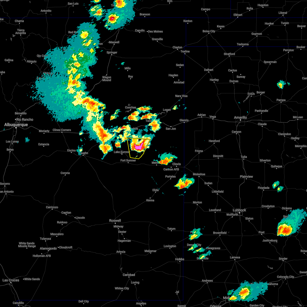 At 333 pm mdt, a severe thunderstorm was located 7 miles northwest of house, or 22 miles northeast of fort sumner, moving north at 10 mph (radar indicated). Hazards include golf ball size hail and 60 mph wind gusts. People and animals outdoors will be injured. expect hail damage to roofs, siding, windows, and vehicles. expect wind damage to roofs, siding, and trees. Locations impacted include, house. At 333 pm mdt, a severe thunderstorm was located 7 miles northwest of house, or 22 miles northeast of fort sumner, moving north at 10 mph (radar indicated). Hazards include golf ball size hail and 60 mph wind gusts. People and animals outdoors will be injured. expect hail damage to roofs, siding, windows, and vehicles. expect wind damage to roofs, siding, and trees. Locations impacted include, house.
|
| 5/17/2021 3:28 PM MDT |
 At 327 pm mdt, a severe thunderstorm was located 7 miles northwest of house, or 21 miles northeast of fort sumner, moving north at 10 mph (radar indicated). Hazards include ping pong ball size hail and 60 mph wind gusts. People and animals outdoors will be injured. expect hail damage to roofs, siding, windows, and vehicles. expect wind damage to roofs, siding, and trees. Locations impacted include, house. At 327 pm mdt, a severe thunderstorm was located 7 miles northwest of house, or 21 miles northeast of fort sumner, moving north at 10 mph (radar indicated). Hazards include ping pong ball size hail and 60 mph wind gusts. People and animals outdoors will be injured. expect hail damage to roofs, siding, windows, and vehicles. expect wind damage to roofs, siding, and trees. Locations impacted include, house.
|
| 5/17/2021 3:02 PM MDT |
 At 302 pm mdt, a severe thunderstorm was located 7 miles west of house, or 18 miles northeast of fort sumner, moving north at 15 mph (radar indicated). Hazards include 60 mph wind gusts and quarter size hail. Hail damage to vehicles is expected. Expect wind damage to roofs, siding, and trees. At 302 pm mdt, a severe thunderstorm was located 7 miles west of house, or 18 miles northeast of fort sumner, moving north at 15 mph (radar indicated). Hazards include 60 mph wind gusts and quarter size hail. Hail damage to vehicles is expected. Expect wind damage to roofs, siding, and trees.
|
| 9/1/2020 4:32 PM MDT |
 At 432 pm mdt, severe thunderstorms were located along a line extending from near quay to 11 miles east of ragland to 9 miles west of oasis state park to near elida, moving northeast at 45 mph (radar indicated). Hazards include 60 mph wind gusts. Expect damage to roofs, siding, and trees. locations impacted include, clovis, portales, melrose, san jon, elida, dora, floyd, grady, house and saint vrain. this includes the following highways, interstate 40 between mile markers 350 and 359. Highway 60 between mile markers 351 and 391. At 432 pm mdt, severe thunderstorms were located along a line extending from near quay to 11 miles east of ragland to 9 miles west of oasis state park to near elida, moving northeast at 45 mph (radar indicated). Hazards include 60 mph wind gusts. Expect damage to roofs, siding, and trees. locations impacted include, clovis, portales, melrose, san jon, elida, dora, floyd, grady, house and saint vrain. this includes the following highways, interstate 40 between mile markers 350 and 359. Highway 60 between mile markers 351 and 391.
|
| 9/1/2020 4:04 PM MDT |
 At 403 pm mdt, severe thunderstorms were located along a line extending from 15 miles west of ragland to near house to 13 miles northwest of elida to near elkins, moving northeast at 45 mph. this line of storms has a history of producing wind damage in fort sumner (radar indicated). Hazards include 60 mph wind gusts. expect damage to roofs, siding, and trees At 403 pm mdt, severe thunderstorms were located along a line extending from 15 miles west of ragland to near house to 13 miles northwest of elida to near elkins, moving northeast at 45 mph. this line of storms has a history of producing wind damage in fort sumner (radar indicated). Hazards include 60 mph wind gusts. expect damage to roofs, siding, and trees
|
| 7/15/2020 6:23 PM MDT |
 At 622 pm mdt, severe thunderstorms were located along a line extending from 11 miles northwest of house to near melrose, moving northeast at 25 mph (radar indicated). Hazards include 70 mph wind gusts and penny size hail. Expect considerable tree damage. damage is likely to mobile homes, roofs, and outbuildings. locations impacted include, quay, melrose, floyd, house, saint vrain, ragland, ranchvale, taiban, tolar and cannon air force base. This includes highway 60 between mile markers 340 and 383. At 622 pm mdt, severe thunderstorms were located along a line extending from 11 miles northwest of house to near melrose, moving northeast at 25 mph (radar indicated). Hazards include 70 mph wind gusts and penny size hail. Expect considerable tree damage. damage is likely to mobile homes, roofs, and outbuildings. locations impacted include, quay, melrose, floyd, house, saint vrain, ragland, ranchvale, taiban, tolar and cannon air force base. This includes highway 60 between mile markers 340 and 383.
|
| 7/15/2020 5:59 PM MDT |
 The national weather service in albuquerque has issued a * severe thunderstorm warning for. northwestern roosevelt county in east central new mexico. northeastern de baca county in east central new mexico. southwestern quay county in east central new mexico. Southwestern curry county in east central new mexico. The national weather service in albuquerque has issued a * severe thunderstorm warning for. northwestern roosevelt county in east central new mexico. northeastern de baca county in east central new mexico. southwestern quay county in east central new mexico. Southwestern curry county in east central new mexico.
|
| 7/15/2020 5:47 PM MDT |
 At 546 pm mdt, severe thunderstorms were located along a line extending from 6 miles southwest of house to 11 miles south of melrose, moving northeast at 30 mph (radar indicated). Hazards include 60 mph wind gusts and penny size hail. Expect damage to roofs, siding, and trees. locations impacted include, fort sumner, melrose, floyd, house, saint vrain, tolar, oasis state park, taiban and mcalister. This includes highway 60 between mile markers 330 and 372. At 546 pm mdt, severe thunderstorms were located along a line extending from 6 miles southwest of house to 11 miles south of melrose, moving northeast at 30 mph (radar indicated). Hazards include 60 mph wind gusts and penny size hail. Expect damage to roofs, siding, and trees. locations impacted include, fort sumner, melrose, floyd, house, saint vrain, tolar, oasis state park, taiban and mcalister. This includes highway 60 between mile markers 330 and 372.
|
| 7/15/2020 5:17 PM MDT |
 At 516 pm mdt, severe thunderstorms were located along a line extending from near fort sumner to 17 miles northwest of elida, moving northeast at 30 mph (radar indicated). Hazards include 60 mph wind gusts and penny size hail. expect damage to roofs, siding, and trees At 516 pm mdt, severe thunderstorms were located along a line extending from near fort sumner to 17 miles northwest of elida, moving northeast at 30 mph (radar indicated). Hazards include 60 mph wind gusts and penny size hail. expect damage to roofs, siding, and trees
|
| 7/5/2020 5:41 PM MDT |
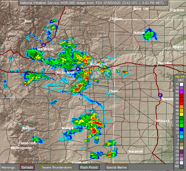 The severe thunderstorm warning for northeastern de baca and southwestern quay counties will expire at 545 pm mdt, the storms which prompted the warning have weakened below severe limits, and no longer pose an immediate threat to life or property. therefore the warning will be allowed to expire. however small hail, gusty winds and heavy rain are still possible with these thunderstorms. The severe thunderstorm warning for northeastern de baca and southwestern quay counties will expire at 545 pm mdt, the storms which prompted the warning have weakened below severe limits, and no longer pose an immediate threat to life or property. therefore the warning will be allowed to expire. however small hail, gusty winds and heavy rain are still possible with these thunderstorms.
|
| 7/5/2020 5:28 PM MDT |
 At 528 pm mdt, severe thunderstorms were located along a line extending from 8 miles southwest of ragland to 10 miles west of house, moving southeast at 20 mph (radar indicated). Hazards include 60 mph wind gusts and penny size hail. Expect damage to roofs, siding, and trees. Locations impacted include, house and ragland. At 528 pm mdt, severe thunderstorms were located along a line extending from 8 miles southwest of ragland to 10 miles west of house, moving southeast at 20 mph (radar indicated). Hazards include 60 mph wind gusts and penny size hail. Expect damage to roofs, siding, and trees. Locations impacted include, house and ragland.
|
| 7/5/2020 5:10 PM MDT |
 At 509 pm mdt, severe thunderstorms were located along a line extending from 10 miles west of ragland to 8 miles north of fort sumner, moving southeast at 20 mph (radar indicated). Hazards include 60 mph wind gusts and penny size hail. Expect damage to roofs, siding, and trees. locations impacted include, fort sumner, house and ragland. This includes highway 60 between mile markers 331 and 332. At 509 pm mdt, severe thunderstorms were located along a line extending from 10 miles west of ragland to 8 miles north of fort sumner, moving southeast at 20 mph (radar indicated). Hazards include 60 mph wind gusts and penny size hail. Expect damage to roofs, siding, and trees. locations impacted include, fort sumner, house and ragland. This includes highway 60 between mile markers 331 and 332.
|
| 7/5/2020 4:54 PM MDT |
 At 454 pm mdt, severe thunderstorms were located along a line extending from 13 miles west of quay to 7 miles east of sumner lake state park, moving southeast at 20 mph (radar indicated). Hazards include 60 mph wind gusts and quarter size hail. Hail damage to vehicles is expected. Expect wind damage to roofs, siding, and trees. At 454 pm mdt, severe thunderstorms were located along a line extending from 13 miles west of quay to 7 miles east of sumner lake state park, moving southeast at 20 mph (radar indicated). Hazards include 60 mph wind gusts and quarter size hail. Hail damage to vehicles is expected. Expect wind damage to roofs, siding, and trees.
|
| 6/22/2020 6:30 PM MDT |
 At 630 pm mdt, a severe thunderstorm was located 11 miles southeast of ragland, or 31 miles northwest of clovis, moving southeast at 20 mph (radar indicated). Hazards include golf ball size hail and 60 mph wind gusts. People and animals outdoors will be injured. expect hail damage to roofs, siding, windows, and vehicles. expect wind damage to roofs, siding, and trees. locations impacted include, melrose, grady, house, saint vrain, mcalister and forrest. This includes highway 60 between mile markers 348 and 371. At 630 pm mdt, a severe thunderstorm was located 11 miles southeast of ragland, or 31 miles northwest of clovis, moving southeast at 20 mph (radar indicated). Hazards include golf ball size hail and 60 mph wind gusts. People and animals outdoors will be injured. expect hail damage to roofs, siding, windows, and vehicles. expect wind damage to roofs, siding, and trees. locations impacted include, melrose, grady, house, saint vrain, mcalister and forrest. This includes highway 60 between mile markers 348 and 371.
|
| 6/22/2020 6:13 PM MDT |
 At 613 pm mdt, a severe thunderstorm was located 7 miles southeast of ragland, or 28 miles south of tucumcari, moving southeast at 25 mph (radar indicated). Hazards include 60 mph wind gusts and quarter size hail. Hail damage to vehicles is expected. Expect wind damage to roofs, siding, and trees. At 613 pm mdt, a severe thunderstorm was located 7 miles southeast of ragland, or 28 miles south of tucumcari, moving southeast at 25 mph (radar indicated). Hazards include 60 mph wind gusts and quarter size hail. Hail damage to vehicles is expected. Expect wind damage to roofs, siding, and trees.
|
| 5/10/2020 10:45 PM MDT |
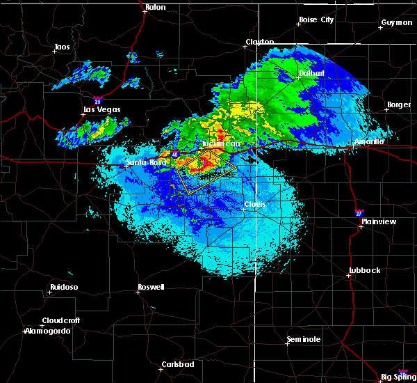 At 1045 pm mdt, severe thunderstorms were located along a line extending from 12 miles south of tucumcari to 6 miles southwest of quay, moving southeast at 20 mph (radar indicated). Hazards include golf ball size hail and 70 mph wind gusts. People and animals outdoors will be injured. expect hail damage to roofs, siding, windows, and vehicles. expect considerable tree damage. wind damage is also likely to mobile homes, roofs, and outbuildings. Locations impacted include, quay, house, ragland, wheatland, mcalister and forrest. At 1045 pm mdt, severe thunderstorms were located along a line extending from 12 miles south of tucumcari to 6 miles southwest of quay, moving southeast at 20 mph (radar indicated). Hazards include golf ball size hail and 70 mph wind gusts. People and animals outdoors will be injured. expect hail damage to roofs, siding, windows, and vehicles. expect considerable tree damage. wind damage is also likely to mobile homes, roofs, and outbuildings. Locations impacted include, quay, house, ragland, wheatland, mcalister and forrest.
|
| 5/10/2020 10:28 PM MDT |
 At 1028 pm mdt, severe thunderstorms were located along a line extending from 6 miles south of tucumcari to 7 miles west of quay, moving southeast at 20 mph (radar indicated). Hazards include golf ball size hail and 70 mph wind gusts. People and animals outdoors will be injured. expect hail damage to roofs, siding, windows, and vehicles. expect considerable tree damage. wind damage is also likely to mobile homes, roofs, and outbuildings. locations impacted include, quay, tucumcari, house, ragland, wheatland, forrest and mcalister. this includes the following highways, interstate 40 between mile markers 321 and 336. State road 104 between mile markers 104 and 105. At 1028 pm mdt, severe thunderstorms were located along a line extending from 6 miles south of tucumcari to 7 miles west of quay, moving southeast at 20 mph (radar indicated). Hazards include golf ball size hail and 70 mph wind gusts. People and animals outdoors will be injured. expect hail damage to roofs, siding, windows, and vehicles. expect considerable tree damage. wind damage is also likely to mobile homes, roofs, and outbuildings. locations impacted include, quay, tucumcari, house, ragland, wheatland, forrest and mcalister. this includes the following highways, interstate 40 between mile markers 321 and 336. State road 104 between mile markers 104 and 105.
|
| 5/10/2020 10:09 PM MDT |
 At 1008 pm mdt, severe thunderstorms were located along a line extending from near tucumcari to near montoya, moving southeast at 20 mph (radar indicated). Hazards include 70 mph wind gusts and quarter size hail. Hail damage to vehicles is expected. expect considerable tree damage. Wind damage is also likely to mobile homes, roofs, and outbuildings. At 1008 pm mdt, severe thunderstorms were located along a line extending from near tucumcari to near montoya, moving southeast at 20 mph (radar indicated). Hazards include 70 mph wind gusts and quarter size hail. Hail damage to vehicles is expected. expect considerable tree damage. Wind damage is also likely to mobile homes, roofs, and outbuildings.
|
| 8/14/2019 6:09 AM MDT |
 At 609 am mdt, a severe thunderstorm was located 9 miles east of house, or 29 miles east of fort sumner, moving southeast at 20 mph (radar indicated). Hazards include 60 mph wind gusts and quarter size hail. Hail damage to vehicles is expected. Expect wind damage to roofs, siding, and trees. At 609 am mdt, a severe thunderstorm was located 9 miles east of house, or 29 miles east of fort sumner, moving southeast at 20 mph (radar indicated). Hazards include 60 mph wind gusts and quarter size hail. Hail damage to vehicles is expected. Expect wind damage to roofs, siding, and trees.
|
| 6/5/2019 2:41 PM MDT |
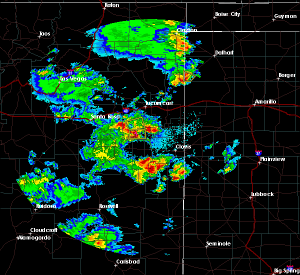 At 241 pm mdt, a severe thunderstorm was located near house, or 25 miles northeast of fort sumner, moving east at 15 mph (radar indicated). Hazards include 60 mph wind gusts and quarter size hail. Hail damage to vehicles is expected. Expect wind damage to roofs, siding, and trees. At 241 pm mdt, a severe thunderstorm was located near house, or 25 miles northeast of fort sumner, moving east at 15 mph (radar indicated). Hazards include 60 mph wind gusts and quarter size hail. Hail damage to vehicles is expected. Expect wind damage to roofs, siding, and trees.
|
| 5/20/2019 1:59 AM MDT |
 A severe thunderstorm warning remains in effect until 245 am mdt for northwestern roosevelt. south central quay and west central curry counties. at 158 am mdt, a severe thunderstorm was located 7 miles southeast of house, or 26 miles east of fort sumner, moving northeast at 35 mph. hazard. 60 mph wind gusts and quarter size hail. A severe thunderstorm warning remains in effect until 245 am mdt for northwestern roosevelt. south central quay and west central curry counties. at 158 am mdt, a severe thunderstorm was located 7 miles southeast of house, or 26 miles east of fort sumner, moving northeast at 35 mph. hazard. 60 mph wind gusts and quarter size hail.
|
| 5/20/2019 1:43 AM MDT |
 At 143 am mdt, a severe thunderstorm was located over taiban, or 14 miles east of fort sumner, moving northeast at 20 mph (radar indicated). Hazards include 60 mph wind gusts and half dollar size hail. Hail damage to vehicles is expected. Expect wind damage to roofs, siding, and trees. At 143 am mdt, a severe thunderstorm was located over taiban, or 14 miles east of fort sumner, moving northeast at 20 mph (radar indicated). Hazards include 60 mph wind gusts and half dollar size hail. Hail damage to vehicles is expected. Expect wind damage to roofs, siding, and trees.
|
| 8/13/2018 9:21 PM MDT |
 At 921 pm mdt, a severe thunderstorm was located near ragland, or 22 miles south of tucumcari, moving south at 20 mph (radar indicated). Hazards include 60 mph wind gusts and half dollar size hail. Hail damage to vehicles is expected. expect wind damage to roofs, siding, and trees. Locations impacted include, quay, house, ragland and mcalister. At 921 pm mdt, a severe thunderstorm was located near ragland, or 22 miles south of tucumcari, moving south at 20 mph (radar indicated). Hazards include 60 mph wind gusts and half dollar size hail. Hail damage to vehicles is expected. expect wind damage to roofs, siding, and trees. Locations impacted include, quay, house, ragland and mcalister.
|
| 8/13/2018 8:56 PM MDT |
 At 856 pm mdt, a severe thunderstorm was located near quay, or 14 miles south of tucumcari, moving south at 20 mph (radar indicated). Hazards include 60 mph wind gusts and half dollar size hail. Hail damage to vehicles is expected. Expect wind damage to roofs, siding, and trees. At 856 pm mdt, a severe thunderstorm was located near quay, or 14 miles south of tucumcari, moving south at 20 mph (radar indicated). Hazards include 60 mph wind gusts and half dollar size hail. Hail damage to vehicles is expected. Expect wind damage to roofs, siding, and trees.
|
| 8/8/2018 6:54 PM MDT |
 At 653 pm mdt, a severe thunderstorm was located near tolar, or 17 miles east of fort sumner, moving north at 15 mph (radar indicated). Hazards include 60 mph wind gusts and half dollar size hail. Hail damage to vehicles is expected. Expect wind damage to roofs, siding, and trees. At 653 pm mdt, a severe thunderstorm was located near tolar, or 17 miles east of fort sumner, moving north at 15 mph (radar indicated). Hazards include 60 mph wind gusts and half dollar size hail. Hail damage to vehicles is expected. Expect wind damage to roofs, siding, and trees.
|
| 8/3/2018 4:25 PM MDT | Schoolnet sit in quay county NM, 0.7 miles NE of House, NM |
| 6/8/2018 11:37 PM MDT |
 At 1136 pm mdt, a severe thunderstorm was located near house, or 22 miles east of fort sumner, moving northeast at 15 mph (radar indicated). Hazards include 60 mph wind gusts and half dollar size hail. Hail damage to vehicles is expected. Expect wind damage to roofs, siding, and trees. At 1136 pm mdt, a severe thunderstorm was located near house, or 22 miles east of fort sumner, moving northeast at 15 mph (radar indicated). Hazards include 60 mph wind gusts and half dollar size hail. Hail damage to vehicles is expected. Expect wind damage to roofs, siding, and trees.
|
| 5/21/2018 11:30 PM MDT |
 At 1129 pm mdt, a severe thunderstorm was located 9 miles east of house, or 31 miles northeast of fort sumner, moving northeast at 30 mph (radar indicated). Hazards include 70 mph wind gusts and quarter size hail. Hail damage to vehicles is expected. expect considerable tree damage. wind damage is also likely to mobile homes, roofs, and outbuildings. Locations impacted include, melrose, house, saint vrain, ranchvale, mcalister and forrest. At 1129 pm mdt, a severe thunderstorm was located 9 miles east of house, or 31 miles northeast of fort sumner, moving northeast at 30 mph (radar indicated). Hazards include 70 mph wind gusts and quarter size hail. Hail damage to vehicles is expected. expect considerable tree damage. wind damage is also likely to mobile homes, roofs, and outbuildings. Locations impacted include, melrose, house, saint vrain, ranchvale, mcalister and forrest.
|
| 5/21/2018 11:12 PM MDT |
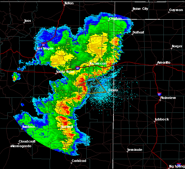 At 1112 pm mdt, a severe thunderstorm was located near house, or 22 miles east of fort sumner, moving northeast at 30 mph (radar indicated). Hazards include 70 mph wind gusts and quarter size hail. Hail damage to vehicles is expected. expect considerable tree damage. wind damage is also likely to mobile homes, roofs, and outbuildings. Locations impacted include, melrose, house, saint vrain, tolar, ranchvale, taiban, forrest and mcalister. At 1112 pm mdt, a severe thunderstorm was located near house, or 22 miles east of fort sumner, moving northeast at 30 mph (radar indicated). Hazards include 70 mph wind gusts and quarter size hail. Hail damage to vehicles is expected. expect considerable tree damage. wind damage is also likely to mobile homes, roofs, and outbuildings. Locations impacted include, melrose, house, saint vrain, tolar, ranchvale, taiban, forrest and mcalister.
|
| 5/21/2018 10:52 PM MDT |
 At 1052 pm mdt, a severe thunderstorm was located near taiban, or 14 miles east of fort sumner, moving northeast at 35 mph (radar indicated). Hazards include 70 mph wind gusts and nickel size hail. Expect considerable tree damage. Damage is likely to mobile homes, roofs, and outbuildings. At 1052 pm mdt, a severe thunderstorm was located near taiban, or 14 miles east of fort sumner, moving northeast at 35 mph (radar indicated). Hazards include 70 mph wind gusts and nickel size hail. Expect considerable tree damage. Damage is likely to mobile homes, roofs, and outbuildings.
|
| 4/29/2018 4:36 PM MDT |
 At 436 pm mdt, a severe thunderstorm was located over fort sumner, moving northeast at 30 mph (radar indicated). Hazards include 60 mph wind gusts and half dollar size hail. Hail damage to vehicles is expected. Expect wind damage to roofs, siding, and trees. At 436 pm mdt, a severe thunderstorm was located over fort sumner, moving northeast at 30 mph (radar indicated). Hazards include 60 mph wind gusts and half dollar size hail. Hail damage to vehicles is expected. Expect wind damage to roofs, siding, and trees.
|
| 7/1/2017 8:07 PM MDT |
 At 807 pm mdt, a severe thunderstorm was located near quay, or 18 miles southwest of tucumcari, moving southeast at 30 mph (radar indicated). Hazards include 60 mph wind gusts. Expect damage to roofs, siding, and trees. locations impacted include, quay, tucumcari, san jon, house, ragland, forrest, mcalister and bard. This includes interstate 40 between mile markers 326 and 366. At 807 pm mdt, a severe thunderstorm was located near quay, or 18 miles southwest of tucumcari, moving southeast at 30 mph (radar indicated). Hazards include 60 mph wind gusts. Expect damage to roofs, siding, and trees. locations impacted include, quay, tucumcari, san jon, house, ragland, forrest, mcalister and bard. This includes interstate 40 between mile markers 326 and 366.
|
| 7/1/2017 7:44 PM MDT |
 At 743 pm mdt, a line of severe thunderstorm were located from newkirk to near montoya to north of tucumcari. this line of storms was moving southeast at 30 mph (radar indicated). Hazards include 60 mph wind gusts and quarter size hail. Hail damage to vehicles is expected. Expect wind damage to roofs, siding, and trees. At 743 pm mdt, a line of severe thunderstorm were located from newkirk to near montoya to north of tucumcari. this line of storms was moving southeast at 30 mph (radar indicated). Hazards include 60 mph wind gusts and quarter size hail. Hail damage to vehicles is expected. Expect wind damage to roofs, siding, and trees.
|
| 6/30/2017 8:58 PM MDT |
 At 858 pm mdt, a severe thunderstorm was located 9 miles southwest of house, or 13 miles northeast of fort sumner, moving southeast at 25 mph (radar indicated). Hazards include golf ball size hail and 60 mph wind gusts. People and animals outdoors will be injured. expect hail damage to roofs, siding, windows, and vehicles. Expect wind damage to roofs, siding, and trees. At 858 pm mdt, a severe thunderstorm was located 9 miles southwest of house, or 13 miles northeast of fort sumner, moving southeast at 25 mph (radar indicated). Hazards include golf ball size hail and 60 mph wind gusts. People and animals outdoors will be injured. expect hail damage to roofs, siding, windows, and vehicles. Expect wind damage to roofs, siding, and trees.
|
| 6/30/2017 8:44 PM MDT |
 At 843 pm mdt, a severe thunderstorm was located 10 miles west of house, or 13 miles northeast of fort sumner, moving southeast at 25 mph (radar indicated). Hazards include two inch hail and 60 mph wind gusts. People and animals outdoors will be injured. expect hail damage to roofs, siding, windows, and vehicles. expect wind damage to roofs, siding, and trees. Locations impacted include, house. At 843 pm mdt, a severe thunderstorm was located 10 miles west of house, or 13 miles northeast of fort sumner, moving southeast at 25 mph (radar indicated). Hazards include two inch hail and 60 mph wind gusts. People and animals outdoors will be injured. expect hail damage to roofs, siding, windows, and vehicles. expect wind damage to roofs, siding, and trees. Locations impacted include, house.
|
| 6/30/2017 8:25 PM MDT |
 At 825 pm mdt, a severe thunderstorm was located 14 miles northeast of sumner lake state park, or 17 miles north of fort sumner, moving southeast at 20 mph (radar indicated). Hazards include golf ball size hail and 60 mph wind gusts. People and animals outdoors will be injured. expect hail damage to roofs, siding, windows, and vehicles. expect wind damage to roofs, siding, and trees. Locations impacted include, house and mcalister. At 825 pm mdt, a severe thunderstorm was located 14 miles northeast of sumner lake state park, or 17 miles north of fort sumner, moving southeast at 20 mph (radar indicated). Hazards include golf ball size hail and 60 mph wind gusts. People and animals outdoors will be injured. expect hail damage to roofs, siding, windows, and vehicles. expect wind damage to roofs, siding, and trees. Locations impacted include, house and mcalister.
|
| 6/30/2017 8:11 PM MDT |
 At 811 pm mdt, a severe thunderstorm was located 16 miles northeast of sumner lake state park, or 21 miles north of fort sumner, moving southeast at 25 mph (radar indicated). Hazards include 60 mph wind gusts and quarter size hail. Hail damage to vehicles is expected. Expect wind damage to roofs, siding, and trees. At 811 pm mdt, a severe thunderstorm was located 16 miles northeast of sumner lake state park, or 21 miles north of fort sumner, moving southeast at 25 mph (radar indicated). Hazards include 60 mph wind gusts and quarter size hail. Hail damage to vehicles is expected. Expect wind damage to roofs, siding, and trees.
|
| 5/22/2017 2:40 PM MDT | Quarter sized hail reported 5 miles E of House, NM |
| 5/22/2017 2:15 PM MDT |
 At 215 pm mdt, a severe thunderstorm was located 11 miles west of house, or 15 miles northeast of fort sumner, moving east at 20 mph (radar indicated). Hazards include 60 mph wind gusts and quarter size hail. Hail damage to vehicles is expected. expect wind damage to roofs, siding, and trees. Locations impacted include, house. At 215 pm mdt, a severe thunderstorm was located 11 miles west of house, or 15 miles northeast of fort sumner, moving east at 20 mph (radar indicated). Hazards include 60 mph wind gusts and quarter size hail. Hail damage to vehicles is expected. expect wind damage to roofs, siding, and trees. Locations impacted include, house.
|
| 5/22/2017 1:53 PM MDT |
 At 153 pm mdt, a severe thunderstorm was located 7 miles northeast of sumner lake state park, or 13 miles north of fort sumner, moving northeast at 30 mph (radar indicated). Hazards include 60 mph wind gusts and quarter size hail. Hail damage to vehicles is expected. Expect wind damage to roofs, siding, and trees. At 153 pm mdt, a severe thunderstorm was located 7 miles northeast of sumner lake state park, or 13 miles north of fort sumner, moving northeast at 30 mph (radar indicated). Hazards include 60 mph wind gusts and quarter size hail. Hail damage to vehicles is expected. Expect wind damage to roofs, siding, and trees.
|
| 5/21/2017 8:16 PM MDT |
 At 816 pm mdt, a severe thunderstorm was located 7 miles southeast of house, or 26 miles east of fort sumner, moving southeast at 20 mph (radar indicated). Hazards include 60 mph wind gusts and penny size hail. Expect damage to roofs, siding, and trees. Locations impacted include, house. At 816 pm mdt, a severe thunderstorm was located 7 miles southeast of house, or 26 miles east of fort sumner, moving southeast at 20 mph (radar indicated). Hazards include 60 mph wind gusts and penny size hail. Expect damage to roofs, siding, and trees. Locations impacted include, house.
|
| 5/21/2017 8:06 PM MDT |
 At 806 pm mdt, a severe thunderstorm was located near house, or 23 miles east of fort sumner, moving southeast at 30 mph (radar indicated). Hazards include 60 mph wind gusts and penny size hail. Expect damage to roofs, siding, and trees. Locations impacted include, house and mcalister. At 806 pm mdt, a severe thunderstorm was located near house, or 23 miles east of fort sumner, moving southeast at 30 mph (radar indicated). Hazards include 60 mph wind gusts and penny size hail. Expect damage to roofs, siding, and trees. Locations impacted include, house and mcalister.
|
| 5/21/2017 7:48 PM MDT |
 At 748 pm mdt, a severe thunderstorm was located over house, or 21 miles northeast of fort sumner, moving southeast at 20 mph (radar indicated). Hazards include 70 mph wind gusts and quarter size hail. Hail damage to vehicles is expected. expect considerable tree damage. wind damage is also likely to mobile homes, roofs, and outbuildings. Locations impacted include, house and mcalister. At 748 pm mdt, a severe thunderstorm was located over house, or 21 miles northeast of fort sumner, moving southeast at 20 mph (radar indicated). Hazards include 70 mph wind gusts and quarter size hail. Hail damage to vehicles is expected. expect considerable tree damage. wind damage is also likely to mobile homes, roofs, and outbuildings. Locations impacted include, house and mcalister.
|
| 5/21/2017 7:24 PM MDT |
 At 724 pm mdt, a severe thunderstorm was located 7 miles northwest of house, or 21 miles northeast of fort sumner, moving southeast at 20 mph (radar indicated). Hazards include 60 mph wind gusts and quarter size hail. Hail damage to vehicles is expected. Expect wind damage to roofs, siding, and trees. At 724 pm mdt, a severe thunderstorm was located 7 miles northwest of house, or 21 miles northeast of fort sumner, moving southeast at 20 mph (radar indicated). Hazards include 60 mph wind gusts and quarter size hail. Hail damage to vehicles is expected. Expect wind damage to roofs, siding, and trees.
|
| 5/8/2017 6:06 PM MDT |
 At 606 pm mdt, a severe thunderstorm was located 12 miles north of house, or 27 miles northeast of fort sumner, moving northeast at 15 mph (radar indicated). Hazards include ping pong ball size hail and 60 mph wind gusts. People and animals outdoors will be injured. expect hail damage to roofs, siding, windows, and vehicles. expect wind damage to roofs, siding, and trees. Locations impacted include, house. At 606 pm mdt, a severe thunderstorm was located 12 miles north of house, or 27 miles northeast of fort sumner, moving northeast at 15 mph (radar indicated). Hazards include ping pong ball size hail and 60 mph wind gusts. People and animals outdoors will be injured. expect hail damage to roofs, siding, windows, and vehicles. expect wind damage to roofs, siding, and trees. Locations impacted include, house.
|
| 5/8/2017 5:27 PM MDT |
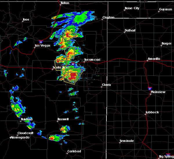 At 527 pm mdt, a severe thunderstorm was located 8 miles northwest of house, or 19 miles northeast of fort sumner, moving north at 15 mph (radar indicated). Hazards include ping pong ball size hail and 60 mph wind gusts. People and animals outdoors will be injured. expect hail damage to roofs, siding, windows, and vehicles. Expect wind damage to roofs, siding, and trees. At 527 pm mdt, a severe thunderstorm was located 8 miles northwest of house, or 19 miles northeast of fort sumner, moving north at 15 mph (radar indicated). Hazards include ping pong ball size hail and 60 mph wind gusts. People and animals outdoors will be injured. expect hail damage to roofs, siding, windows, and vehicles. Expect wind damage to roofs, siding, and trees.
|
| 5/8/2017 5:15 PM MDT | Golf Ball sized hail reported 7.2 miles E of House, NM |
| 9/14/2016 10:22 PM MDT |
 At 1022 pm mdt, a severe thunderstorm was located 7 miles southwest of house, or 14 miles northeast of fort sumner, moving northeast at 35 mph (radar indicated). Hazards include ping pong ball size hail and 60 mph wind gusts. People and animals outdoors will be injured. expect hail damage to roofs, siding, windows, and vehicles. expect wind damage to roofs, siding, and trees. Locations impacted include, fort sumner and house. At 1022 pm mdt, a severe thunderstorm was located 7 miles southwest of house, or 14 miles northeast of fort sumner, moving northeast at 35 mph (radar indicated). Hazards include ping pong ball size hail and 60 mph wind gusts. People and animals outdoors will be injured. expect hail damage to roofs, siding, windows, and vehicles. expect wind damage to roofs, siding, and trees. Locations impacted include, fort sumner and house.
|
| 9/14/2016 10:07 PM MDT |
 At 1006 pm mdt, a severe thunderstorm was located 6 miles east of fort sumner, moving northeast at 35 mph (radar indicated). Hazards include 60 mph wind gusts and half dollar size hail. Hail damage to vehicles is expected. Expect wind damage to roofs, siding, and trees. At 1006 pm mdt, a severe thunderstorm was located 6 miles east of fort sumner, moving northeast at 35 mph (radar indicated). Hazards include 60 mph wind gusts and half dollar size hail. Hail damage to vehicles is expected. Expect wind damage to roofs, siding, and trees.
|
| 6/13/2016 4:25 PM MDT |
 The severe thunderstorm warning for southwestern quay county will expire at 430 pm mdt, the storm which prompted the warning has weakened below severe limits, and no longer pose an immediate threat to life or property. therefore the warning will be allowed to expire. a tornado watch remains in effect until 900 pm mdt for east central new mexico. The severe thunderstorm warning for southwestern quay county will expire at 430 pm mdt, the storm which prompted the warning has weakened below severe limits, and no longer pose an immediate threat to life or property. therefore the warning will be allowed to expire. a tornado watch remains in effect until 900 pm mdt for east central new mexico.
|
| 6/13/2016 4:21 PM MDT |
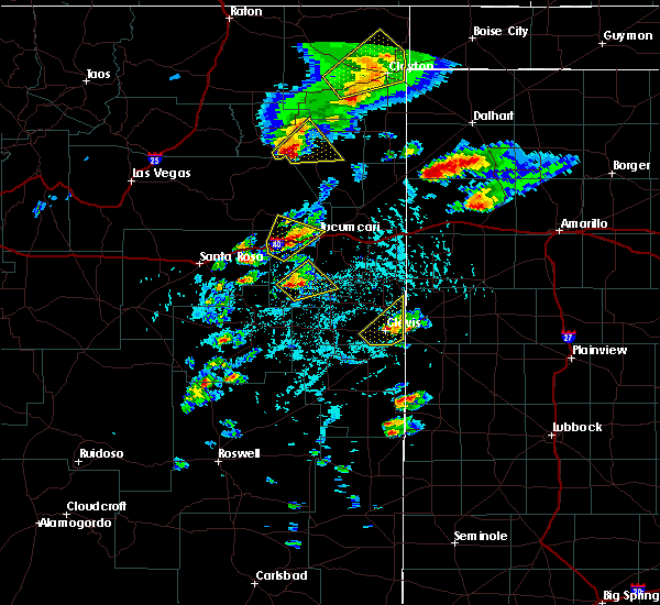 At 420 pm mdt, a severe thunderstorm was located 8 miles southwest of ragland, or 28 miles south of tucumcari, moving northeast at 30 mph (radar indicated). Hazards include 60 mph wind gusts and half dollar size hail. Hail damage to vehicles is expected. expect wind damage to roofs, siding, and trees. this severe storm will be near, mcalister around 425 pm mdt. ragland around 430 pm mdt. A tornado watch remains in effect until 900 pm mdt for east central new mexico. At 420 pm mdt, a severe thunderstorm was located 8 miles southwest of ragland, or 28 miles south of tucumcari, moving northeast at 30 mph (radar indicated). Hazards include 60 mph wind gusts and half dollar size hail. Hail damage to vehicles is expected. expect wind damage to roofs, siding, and trees. this severe storm will be near, mcalister around 425 pm mdt. ragland around 430 pm mdt. A tornado watch remains in effect until 900 pm mdt for east central new mexico.
|
| 6/13/2016 4:05 PM MDT |
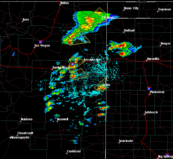 At 405 pm mdt, a severe thunderstorm was located 7 miles northwest of house, or 21 miles northeast of fort sumner, moving northeast at 30 mph (radar indicated). Hazards include half dollar size hail and 60 mph wind gusts. Hail damage to vehicles is expected. expect wind damage to roofs, siding, and trees. this severe thunderstorm will be near, house around 415 pm mdt. mcalister around 425 pm mdt. ragland around 430 pm mdt. A tornado watch remains in effect until 900 pm mdt for east central new mexico. At 405 pm mdt, a severe thunderstorm was located 7 miles northwest of house, or 21 miles northeast of fort sumner, moving northeast at 30 mph (radar indicated). Hazards include half dollar size hail and 60 mph wind gusts. Hail damage to vehicles is expected. expect wind damage to roofs, siding, and trees. this severe thunderstorm will be near, house around 415 pm mdt. mcalister around 425 pm mdt. ragland around 430 pm mdt. A tornado watch remains in effect until 900 pm mdt for east central new mexico.
|
| 5/31/2016 6:59 PM MDT |
 At 658 pm mdt, a severe thunderstorm was located over house, or 22 miles northeast of fort sumner, moving south at 5 mph (radar indicated). Hazards include quarter size hail and 60 mph wind gusts. Hail damage to vehicles is expected. Expect wind damage to roofs, siding, and trees. At 658 pm mdt, a severe thunderstorm was located over house, or 22 miles northeast of fort sumner, moving south at 5 mph (radar indicated). Hazards include quarter size hail and 60 mph wind gusts. Hail damage to vehicles is expected. Expect wind damage to roofs, siding, and trees.
|
| 5/31/2016 6:42 PM MDT |
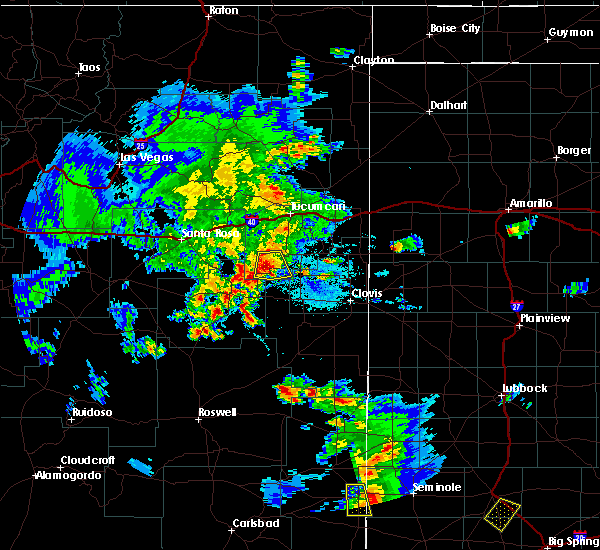 At 641 pm mdt, a severe thunderstorm was located over house, or 23 miles northeast of fort sumner, moving south at 10 mph (radar indicated). Hazards include 60 mph wind gusts and quarter size hail. Hail damage to vehicles is expected. expect wind damage to roofs, siding, and trees. Locations impacted include, house and mcalister. At 641 pm mdt, a severe thunderstorm was located over house, or 23 miles northeast of fort sumner, moving south at 10 mph (radar indicated). Hazards include 60 mph wind gusts and quarter size hail. Hail damage to vehicles is expected. expect wind damage to roofs, siding, and trees. Locations impacted include, house and mcalister.
|
| 5/31/2016 6:29 PM MDT |
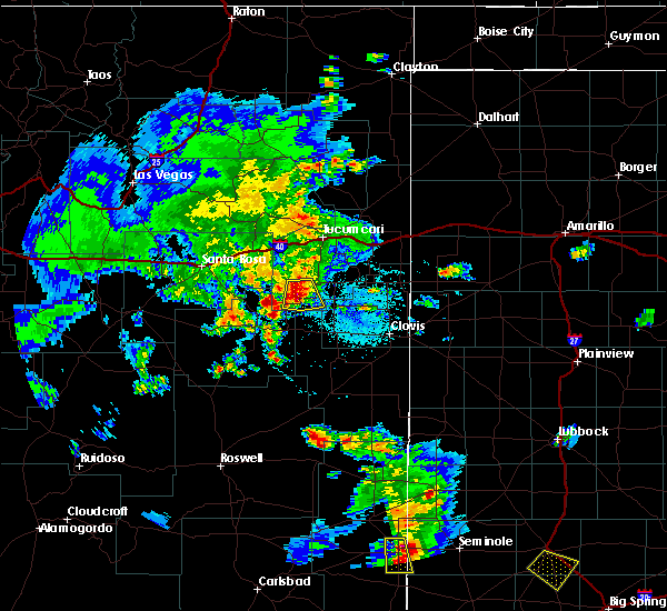 At 628 pm mdt, a severe thunderstorm was located near house, or 25 miles northeast of fort sumner, moving south at 10 mph (radar indicated). Hazards include 60 mph wind gusts and quarter size hail. Hail damage to vehicles is expected. expect wind damage to roofs, siding, and trees. Locations impacted include, house and mcalister. At 628 pm mdt, a severe thunderstorm was located near house, or 25 miles northeast of fort sumner, moving south at 10 mph (radar indicated). Hazards include 60 mph wind gusts and quarter size hail. Hail damage to vehicles is expected. expect wind damage to roofs, siding, and trees. Locations impacted include, house and mcalister.
|
| 5/31/2016 6:14 PM MDT |
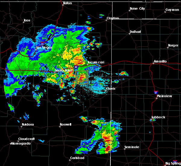 At 613 pm mdt, a severe thunderstorm was located 8 miles north of house, or 28 miles northeast of fort sumner, moving south at 5 mph (radar indicated). Hazards include quarter size hail and 60 mph wind gusts. Hail damage to vehicles is expected. Expect wind damage to roofs, siding, and trees. At 613 pm mdt, a severe thunderstorm was located 8 miles north of house, or 28 miles northeast of fort sumner, moving south at 5 mph (radar indicated). Hazards include quarter size hail and 60 mph wind gusts. Hail damage to vehicles is expected. Expect wind damage to roofs, siding, and trees.
|
| 5/29/2016 4:41 PM MDT |
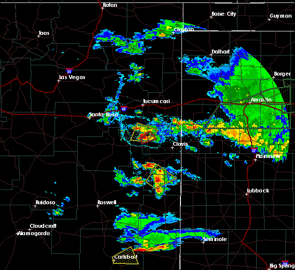 At 441 pm mdt, severe thunderstorms were located along a line extending from 11 miles south of ragland to 12 miles northwest of ranchvale, moving northeast at 20 mph (radar indicated). Hazards include 60 mph wind gusts and quarter size hail. Hail damage to vehicles is expected. expect wind damage to roofs, siding and trees. Locations impacted include, house, ragland and mcalister. At 441 pm mdt, severe thunderstorms were located along a line extending from 11 miles south of ragland to 12 miles northwest of ranchvale, moving northeast at 20 mph (radar indicated). Hazards include 60 mph wind gusts and quarter size hail. Hail damage to vehicles is expected. expect wind damage to roofs, siding and trees. Locations impacted include, house, ragland and mcalister.
|
| 5/29/2016 4:10 PM MDT |
 At 409 pm mdt, severe thunderstorms were located along a line extending from 6 miles southeast of house to 6 miles north of melrose, moving northeast at 20 mph (radar indicated). Hazards include quarter size hail and 60 mph wind gusts. Hail damage to vehicles is expected. Expect wind damage to roofs, siding and trees. At 409 pm mdt, severe thunderstorms were located along a line extending from 6 miles southeast of house to 6 miles north of melrose, moving northeast at 20 mph (radar indicated). Hazards include quarter size hail and 60 mph wind gusts. Hail damage to vehicles is expected. Expect wind damage to roofs, siding and trees.
|
| 5/21/2016 10:11 PM MDT |
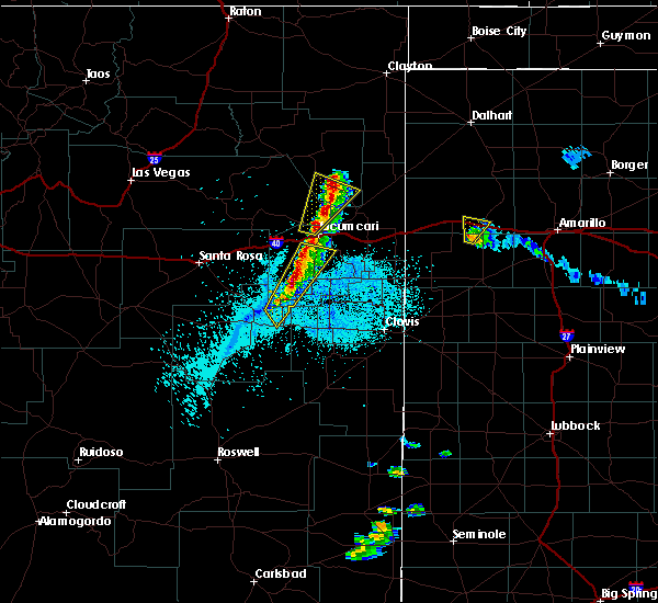 At 1010 pm mdt, severe thunderstorms were located along a line extending from 6 miles southwest of tucumcari to 5 miles west of house, moving northeast at 30 mph (radar indicated). Hazards include ping pong ball size hail and 60 mph wind gusts. People and animals outdoors will be injured. expect hail damage to roofs, siding, windows and vehicles. expect wind damage to roofs, siding and trees. Locations impacted include, quay, house and ragland. At 1010 pm mdt, severe thunderstorms were located along a line extending from 6 miles southwest of tucumcari to 5 miles west of house, moving northeast at 30 mph (radar indicated). Hazards include ping pong ball size hail and 60 mph wind gusts. People and animals outdoors will be injured. expect hail damage to roofs, siding, windows and vehicles. expect wind damage to roofs, siding and trees. Locations impacted include, quay, house and ragland.
|
| 10/21/2015 10:53 AM MDT |
 At 1052 am mdt, severe thunderstorms were located along a line extending from near ragland to 11 miles north of melrose, moving northeast at 50 mph (trained weather spotters). Hazards include golf ball size hail and 60 mph wind gusts. People and animals outdoors will be injured. expect hail damage to roofs, siding, windows and vehicles. expect wind damage to roofs, siding and trees. locations impacted include, clovis, tucumcari, quay, melrose, grady, house, broadview, saint vrain, wheatland and ranchvale. This includes interstate 40 between mile markers 329 and 339. At 1052 am mdt, severe thunderstorms were located along a line extending from near ragland to 11 miles north of melrose, moving northeast at 50 mph (trained weather spotters). Hazards include golf ball size hail and 60 mph wind gusts. People and animals outdoors will be injured. expect hail damage to roofs, siding, windows and vehicles. expect wind damage to roofs, siding and trees. locations impacted include, clovis, tucumcari, quay, melrose, grady, house, broadview, saint vrain, wheatland and ranchvale. This includes interstate 40 between mile markers 329 and 339.
|
| 10/21/2015 10:43 AM MDT |
 At 1043 am mdt, severe thunderstorms were located along a line extending from 7 miles north of house to 5 miles north of melrose, moving northeast at 50 mph (radar indicated). Hazards include golf ball size hail and 60 mph wind gusts. People and animals outdoors will be injured. expect hail damage to roofs, siding, windows and vehicles. Expect wind damage to roofs, siding and trees. At 1043 am mdt, severe thunderstorms were located along a line extending from 7 miles north of house to 5 miles north of melrose, moving northeast at 50 mph (radar indicated). Hazards include golf ball size hail and 60 mph wind gusts. People and animals outdoors will be injured. expect hail damage to roofs, siding, windows and vehicles. Expect wind damage to roofs, siding and trees.
|
| 10/21/2015 10:33 AM MDT |
 At 1032 am mdt, a severe thunderstorm was located 9 miles northwest of melrose, or 29 miles east of fort sumner, moving northeast at 50 mph. golf ball size hail has been reported at the melrose bombing range with this storm (radar indicated). Hazards include golf ball size hail and 60 mph wind gusts. People and animals outdoors will be injured. expect hail damage to roofs, siding, windows and vehicles. expect wind damage to roofs, siding and trees. Locations impacted include, clovis, quay, melrose, house, ranchvale, saint vrain, tolar, taiban, ragland and cannon air force base. At 1032 am mdt, a severe thunderstorm was located 9 miles northwest of melrose, or 29 miles east of fort sumner, moving northeast at 50 mph. golf ball size hail has been reported at the melrose bombing range with this storm (radar indicated). Hazards include golf ball size hail and 60 mph wind gusts. People and animals outdoors will be injured. expect hail damage to roofs, siding, windows and vehicles. expect wind damage to roofs, siding and trees. Locations impacted include, clovis, quay, melrose, house, ranchvale, saint vrain, tolar, taiban, ragland and cannon air force base.
|
| 10/21/2015 10:28 AM MDT |
 At 1027 am mdt, a severe thunderstorm was located 8 miles east of tolar, or 25 miles east of fort sumner, moving northeast at 30 mph (radar indicated). Hazards include 60 mph wind gusts and half dollar size hail. Hail damage to vehicles is expected. expect wind damage to roofs, siding and trees. Locations impacted include, clovis, quay, melrose, house, ranchvale, saint vrain, tolar, taiban, ragland and cannon air force base. At 1027 am mdt, a severe thunderstorm was located 8 miles east of tolar, or 25 miles east of fort sumner, moving northeast at 30 mph (radar indicated). Hazards include 60 mph wind gusts and half dollar size hail. Hail damage to vehicles is expected. expect wind damage to roofs, siding and trees. Locations impacted include, clovis, quay, melrose, house, ranchvale, saint vrain, tolar, taiban, ragland and cannon air force base.
|
| 10/21/2015 10:16 AM MDT |
 At 1016 am mdt, a severe thunderstorm was located near tolar, or 22 miles east of fort sumner, moving northeast at 30 mph (radar indicated). Hazards include ping pong ball size hail and 60 mph wind gusts. People and animals outdoors will be injured. expect hail damage to roofs, siding, windows and vehicles. expect wind damage to roofs, siding and trees. locations impacted include, clovis, fort sumner, quay, melrose, house, saint vrain, ranchvale, cannon air force base, tolar and taiban. Other locations affected include fort sumner state monument. At 1016 am mdt, a severe thunderstorm was located near tolar, or 22 miles east of fort sumner, moving northeast at 30 mph (radar indicated). Hazards include ping pong ball size hail and 60 mph wind gusts. People and animals outdoors will be injured. expect hail damage to roofs, siding, windows and vehicles. expect wind damage to roofs, siding and trees. locations impacted include, clovis, fort sumner, quay, melrose, house, saint vrain, ranchvale, cannon air force base, tolar and taiban. Other locations affected include fort sumner state monument.
|
| 10/21/2015 9:57 AM MDT |
 At 957 am mdt, a severe thunderstorm was located 10 miles south of tolar, or 20 miles southeast of fort sumner, moving northeast at 50 mph (radar indicated). Hazards include ping pong size hail and 60 mph wind gusts. People and animals outdoors will be injured. expect hail damage to roofs, siding, windows and vehicles. Expect wind damage to roofs, siding and trees. At 957 am mdt, a severe thunderstorm was located 10 miles south of tolar, or 20 miles southeast of fort sumner, moving northeast at 50 mph (radar indicated). Hazards include ping pong size hail and 60 mph wind gusts. People and animals outdoors will be injured. expect hail damage to roofs, siding, windows and vehicles. Expect wind damage to roofs, siding and trees.
|
| 10/20/2015 7:09 PM MDT |
 At 709 pm mdt, a severe thunderstorm was located 7 miles northwest of house, or 19 miles northeast of fort sumner, moving northeast at 10 mph (radar indicated). Hazards include quarter size hail and 60 mph wind gusts. Hail damage to vehicles is expected. Expect wind damage to roofs, siding and trees. At 709 pm mdt, a severe thunderstorm was located 7 miles northwest of house, or 19 miles northeast of fort sumner, moving northeast at 10 mph (radar indicated). Hazards include quarter size hail and 60 mph wind gusts. Hail damage to vehicles is expected. Expect wind damage to roofs, siding and trees.
|
| 6/13/2015 5:03 PM MDT |
 At 503 pm mdt, a severe thunderstorm was located 11 miles southeast of ragland, or 30 miles northwest of clovis, moving east at 35 mph (radar indicated). Hazards include 70 mph wind gusts and quarter size hail. Hail damage to vehicles is expected. expect considerable tree damage. wind damage is also likely to mobile homes, roofs and outbuildings. Locations impacted include, quay, grady, house, tolar, taiban, ragland, wheatland, mcalister and forrest. At 503 pm mdt, a severe thunderstorm was located 11 miles southeast of ragland, or 30 miles northwest of clovis, moving east at 35 mph (radar indicated). Hazards include 70 mph wind gusts and quarter size hail. Hail damage to vehicles is expected. expect considerable tree damage. wind damage is also likely to mobile homes, roofs and outbuildings. Locations impacted include, quay, grady, house, tolar, taiban, ragland, wheatland, mcalister and forrest.
|
| 6/13/2015 4:50 PM MDT |
 At 450 pm mdt, a severe thunderstorm was located over house, or 24 miles northeast of fort sumner, moving east at 35 mph (radar indicated). Hazards include quarter size hail and 70 mph wind gusts. Hail damage to vehicles is expected. expect considerable tree damage. Wind damage is also likely to mobile homes, roofs and outbuildings. At 450 pm mdt, a severe thunderstorm was located over house, or 24 miles northeast of fort sumner, moving east at 35 mph (radar indicated). Hazards include quarter size hail and 70 mph wind gusts. Hail damage to vehicles is expected. expect considerable tree damage. Wind damage is also likely to mobile homes, roofs and outbuildings.
|
| 6/4/2015 9:27 PM MDT | The severe thunderstorm warning for east central de baca, southwestern quay and northwestern roosevelt counties will expire at 930 pm mdt, the storms which prompted the warning have weakened below severe limits, and no longer pose an immediate threat to life or property. therefore the warning will be allowed to expire. however small hail and heavy rain are still possible with these thunderstorms. to report severe weather, contact your nearest law enforcement agency. they will relay your report to the national weather service albuquerque. |
| 6/4/2015 9:08 PM MDT | At 908 pm mdt, severe thunderstorms were located along a line extending from 6 miles northwest of quay to 6 miles north of tolar, moving northeast at 15 mph (radar indicated). Hazards include 70 mph wind gusts and quarter size hail. Hail damage to vehicles is expected. expect considerable tree damage. wind damage is also likely to mobile homes, roofs and outbuildings. Locations impacted include, quay, house and ragland. |
| 6/4/2015 8:40 PM MDT | At 839 pm mdt, severe thunderstorms were located along a line extending from 9 miles west of quay to near taiban, moving northeast at 15 mph (radar indicated). Hazards include quarter size hail and 70 mph wind gusts. Hail damage to vehicles is expected. expect considerable tree damage. Wind damage is also likely to mobile homes, roofs and outbuildings. |
| 5/29/2015 5:13 PM MDT | At 512 pm mdt, a severe thunderstorm was located near house, or 20 miles east of fort sumner, moving southeast at 25 mph (radar indicated). Hazards include 70 mph wind gusts and half dollar size hail. Hail damage to vehicles is expected. expect considerable tree damage. wind damage is also likely to mobile homes, roofs and outbuildings. Locations impacted include, house, tolar and mcalister. |
| 5/29/2015 4:53 PM MDT | At 453 pm mdt, a severe thunderstorm was located near house, or 19 miles northeast of fort sumner, moving southeast at 20 mph. this is a very dangerous storm (radar indicated). Hazards include 80 mph wind gusts and half dollar size hail. Flying debris will be dangerous to those caught without shelter. mobile homes will be heavily damaged. expect considerable damage to roofs, windows and vehicles. extensive tree damage and power outages are likely. Locations impacted include, house, tolar and mcalister. |
| 5/29/2015 4:33 PM MDT | At 432 pm mdt, a severe thunderstorm was located 13 miles northwest of house, or 22 miles northeast of fort sumner, moving southeast at 25 mph (radar indicated). Hazards include half dollar size hail and 70 mph wind gusts. Hail damage to vehicles is expected. expect considerable tree damage. Wind damage is also likely to mobile homes, roofs and outbuildings. |
| 5/23/2015 2:55 AM MDT | At 254 am mdt, a severe thunderstorm was located 8 miles south of tolar, or 20 miles southeast of fort sumner, moving northeast at 30 mph (radar indicated). Hazards include quarter size hail and 60 mph wind gusts. Hail damage to vehicles is expected. expect wind damage to roofs, siding and trees. this severe thunderstorm will be near, tolar around 305 am mdt. Other locations impacted by this severe thunderstorm include mcalister. |
| 5/23/2015 12:46 AM MDT | At 1245 am mdt, a severe thunderstorm was located 6 miles west of ragland, or 26 miles south of tucumcari, moving northeast at 25 mph (radar indicated). Hazards include 60 mph wind gusts and quarter size hail. Hail damage to vehicles is expected. expect wind damage to roofs, siding and trees. Locations impacted include, quay, house, ragland and mcalister. |
| 5/23/2015 12:12 AM MDT | At 1211 am mdt, a severe thunderstorm was located near house, or 19 miles northeast of fort sumner, moving northeast at 30 mph (radar indicated). Hazards include half dollar size hail and 60 mph wind gusts. Hail damage to vehicles is expected. Expect wind damage to roofs, siding and trees. |
| 5/23/2015 12:12 AM MDT | The severe thunderstorm warning for northeastern de baca and southwestern quay counties will expire at 1215 am mdt, the storm which prompted the warning has moved out of the area. therefore the warning will be allowed to expire. |
| 5/22/2015 11:50 PM MDT | At 1150 pm mdt, a severe thunderstorm was located 8 miles north of taiban, or 13 miles northeast of fort sumner, moving northeast at 35 mph (radar indicated). Hazards include 60 mph wind gusts and half dollar size hail. Hail damage to vehicles is expected. expect wind damage to roofs, siding and trees. Locations impacted include, house, taiban and mcalister. |
| 5/22/2015 11:31 PM MDT | At 1131 pm mdt, a severe thunderstorm was located 6 miles west of taiban, or 7 miles southeast of fort sumner, moving northeast at 35 mph (radar indicated). Hazards include half dollar size hail and 60 mph wind gusts. Hail damage to vehicles is expected. Expect wind damage to roofs, siding and trees. |
| 5/19/2015 4:08 AM MDT | At 408 am mdt, a severe thunderstorm was located near fort sumner, moving northeast at 40 mph (radar indicated). Hazards include quarter size hail. damage to vehicles is expected |
| 5/19/2015 3:06 AM MDT | At 305 am mdt, a severe thunderstorm was located 12 miles northeast of fort sumner, moving northeast at 35 mph (radar indicated). Hazards include quarter size hail. damage to vehicles is expected |
| 5/18/2015 11:25 PM MDT | At 1124 pm mdt, a severe thunderstorm was located near taiban, or 15 miles east of fort sumner, moving northeast at 30 mph (radar indicated). Hazards include 60 mph wind gusts and quarter size hail. Hail damage to vehicles is expected. expect wind damage to roofs, siding and trees. this severe storm will be near, tolar around 1130 pm mdt. 1. 00in. |
| 5/18/2015 11:15 PM MDT | At 1114 pm mdt, a severe thunderstorm was located near taiban, or 12 miles southeast of fort sumner, moving northeast at 30 mph (radar indicated). Hazards include quarter size hail and 60 mph wind gusts. Hail damage to vehicles is expected. expect wind damage to roofs, siding and trees. this severe thunderstorm will be near, taiban around 1125 pm mdt. tolar around 1130 pm mdt. melrose around 1200 am mdt. 1. 00in. |
| 6/13/2014 5:27 PM MDT | Schoolnet sit in quay county NM, 1.1 miles ENE of House, NM |
| 6/6/2014 4:23 PM MDT | Quarter sized hail reported 2.1 miles NNW of House, NM |
| 6/3/2013 8:15 PM MDT | Storm damage reported in quay county NM, 10.6 miles SSW of House, NM |
| 8/15/2012 7:14 PM MDT | Storm damage reported in quay county NM, 10.6 miles SSW of House, NM |
| 6/12/2012 7:10 PM MDT | Quarter sized hail reported 7.3 miles E of House, NM |
| 6/2/2012 6:04 PM MDT | Dime to nickel size hail and heavy rain in quay county NM, 2 miles WNW of House, NM |
Hail Maps for House, NM
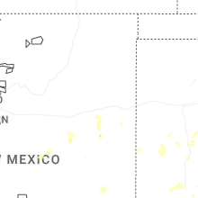
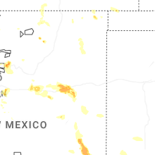


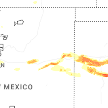

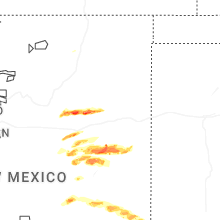
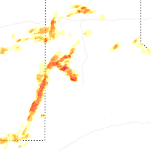


Connect with Interactive Hail Maps