

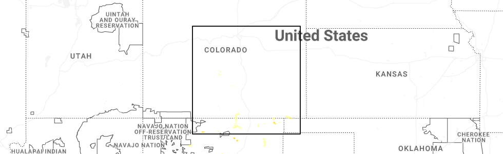
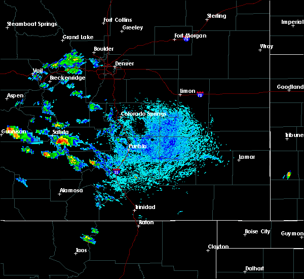
Hail Map for Howard, CO
The Howard, CO area has had 1 report of on-the-ground hail by trained spotters, and has been under severe weather warnings 3 times during the past 12 months. Doppler radar has detected hail at or near Howard, CO on 19 occasions, including 2 occasions during the past year.
| Name: | Howard, CO |
| Where Located: | 67.6 miles W of Pueblo, CO |
| Map: | Google Map for Howard, CO |
| Population: | 723 |
| Housing Units: | 518 |
| More Info: | Search Google for Howard, CO |
0
The Top Recent Hail Date for Howard, CO is Monday, June 9, 2025 (17th out of 19)
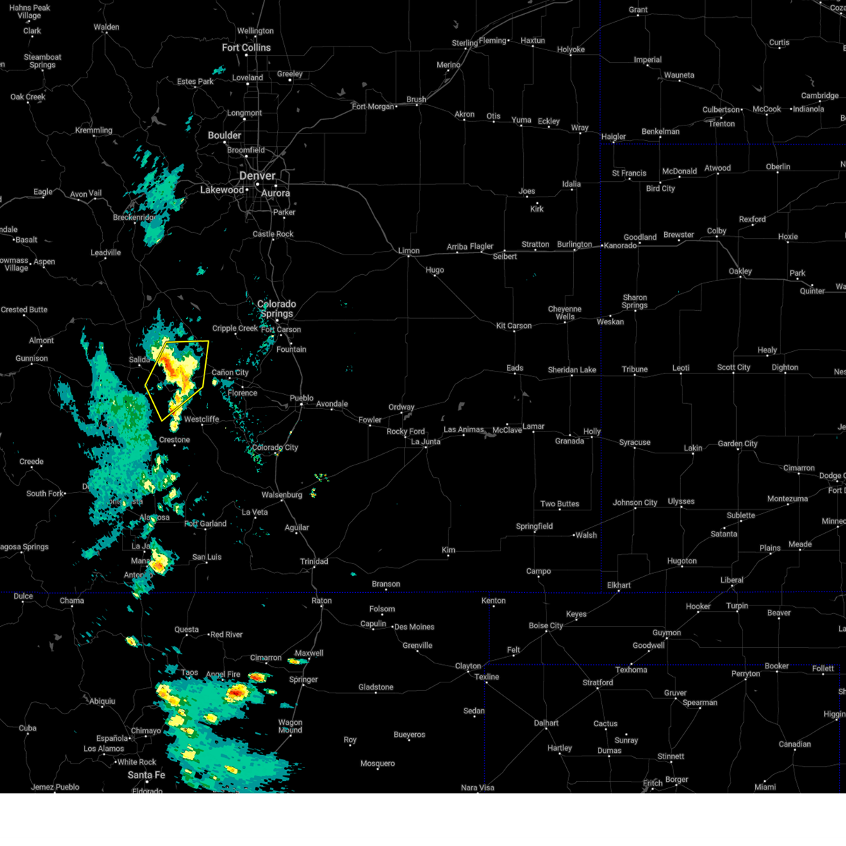
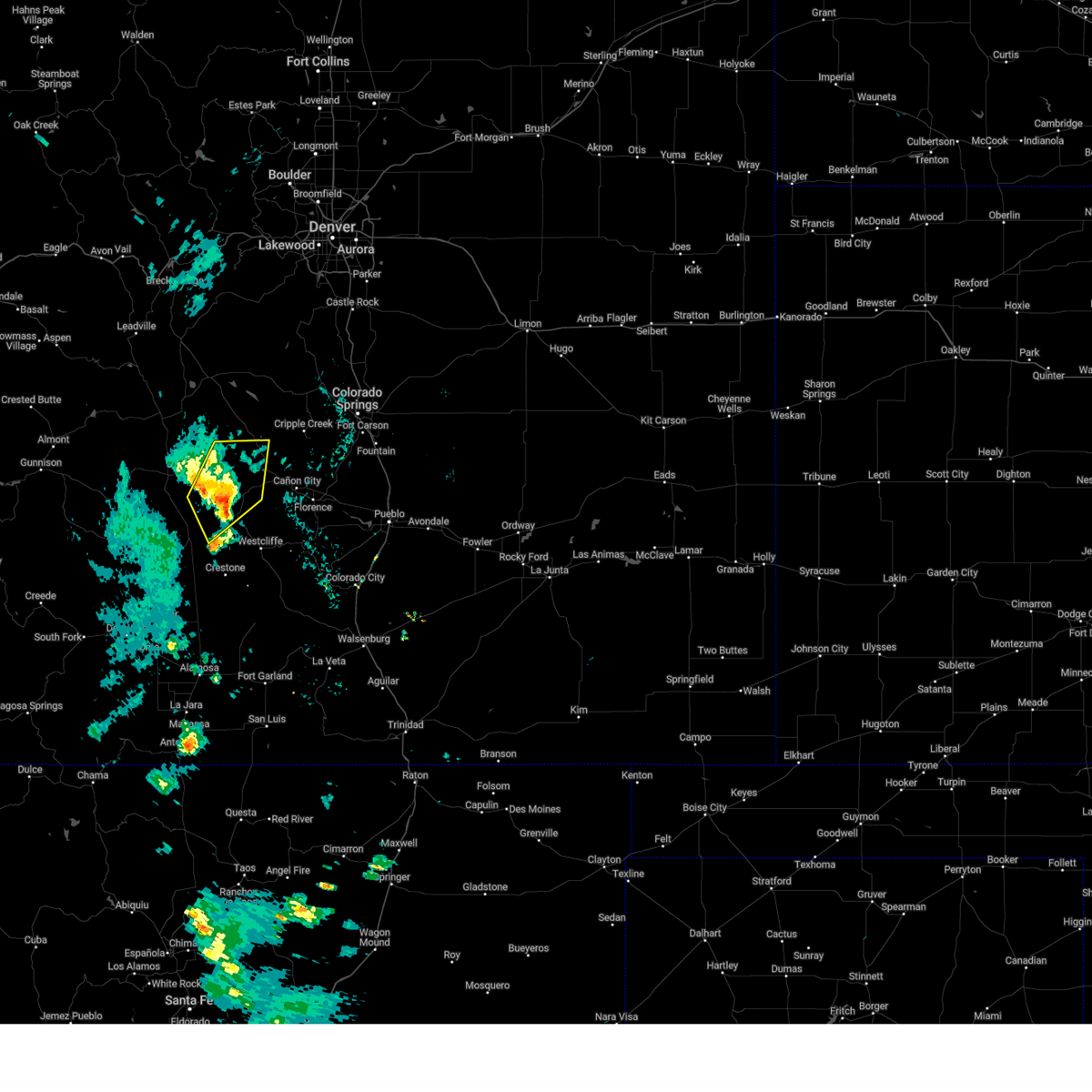
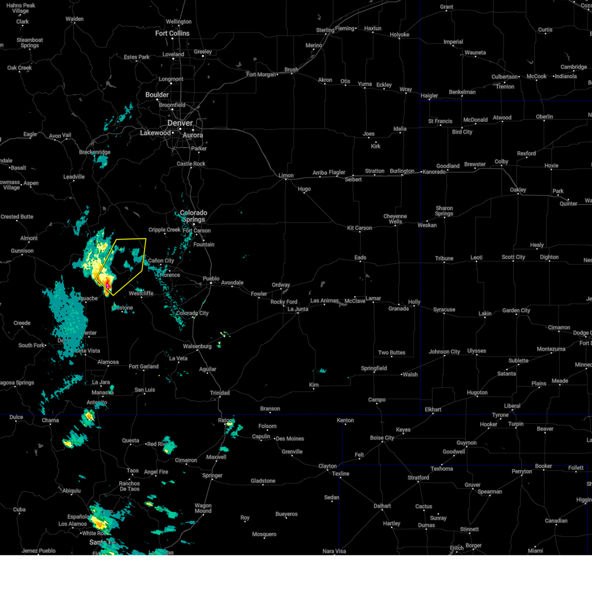
Hail and Wind Damage Spotted near Howard, CO
| Date / Time | Report Details |
|---|---|
| 9/17/2024 12:57 PM MDT |
 The storm which prompted the warning has weakened below severe limits, and no longer poses an immediate threat to life or property. therefore, the warning will be allowed to expire. however, gusty winds are still possible with this thunderstorm. a severe thunderstorm watch remains in effect until 700 pm mdt for central and southeastern colorado. The storm which prompted the warning has weakened below severe limits, and no longer poses an immediate threat to life or property. therefore, the warning will be allowed to expire. however, gusty winds are still possible with this thunderstorm. a severe thunderstorm watch remains in effect until 700 pm mdt for central and southeastern colorado.
|
| 9/17/2024 12:48 PM MDT |
 At 1248 pm mdt, a severe thunderstorm was located near coaldale, or 57 miles southwest of colorado springs, moving northeast at 40 mph (radar indicated). Hazards include 70 mph wind gusts and quarter size hail. Hail damage to vehicles is expected. expect considerable tree damage. wind damage is also likely to mobile homes, roofs, and outbuildings. Locations impacted include, texas creek, howard, coaldale, cotopaxi, and waugh mountain. At 1248 pm mdt, a severe thunderstorm was located near coaldale, or 57 miles southwest of colorado springs, moving northeast at 40 mph (radar indicated). Hazards include 70 mph wind gusts and quarter size hail. Hail damage to vehicles is expected. expect considerable tree damage. wind damage is also likely to mobile homes, roofs, and outbuildings. Locations impacted include, texas creek, howard, coaldale, cotopaxi, and waugh mountain.
|
| 9/17/2024 12:32 PM MDT |
 Svrpub the national weather service in pueblo has issued a * severe thunderstorm warning for, western fremont county in central colorado, northwestern custer county in southeastern colorado, northeastern saguache county in central colorado, * until 100 pm mdt. * at 1232 pm mdt, a severe thunderstorm was located near villa grove, or 55 miles north of alamosa, moving northeast at 40 mph (radar indicated). Hazards include 70 mph wind gusts and quarter size hail. Hail damage to vehicles is expected. expect considerable tree damage. Wind damage is also likely to mobile homes, roofs, and outbuildings. Svrpub the national weather service in pueblo has issued a * severe thunderstorm warning for, western fremont county in central colorado, northwestern custer county in southeastern colorado, northeastern saguache county in central colorado, * until 100 pm mdt. * at 1232 pm mdt, a severe thunderstorm was located near villa grove, or 55 miles north of alamosa, moving northeast at 40 mph (radar indicated). Hazards include 70 mph wind gusts and quarter size hail. Hail damage to vehicles is expected. expect considerable tree damage. Wind damage is also likely to mobile homes, roofs, and outbuildings.
|
| 6/6/2020 3:11 PM MDT |
 The severe thunderstorm warning for western fremont county will expire at 315 pm mdt, the storm which prompted the warning has weakened below severe limits, and no longer poses an immediate threat to life or property. therefore, the warning will be allowed to expire. however gusty winds are still possible with this thunderstorm. a severe thunderstorm watch remains in effect until 800 pm mdt for central colorado. The severe thunderstorm warning for western fremont county will expire at 315 pm mdt, the storm which prompted the warning has weakened below severe limits, and no longer poses an immediate threat to life or property. therefore, the warning will be allowed to expire. however gusty winds are still possible with this thunderstorm. a severe thunderstorm watch remains in effect until 800 pm mdt for central colorado.
|
| 6/6/2020 3:02 PM MDT |
 At 302 pm mdt, a severe thunderstorm was located near waugh mountain, or 17 miles north of hayden pass burn scar, moving northeast at 55 mph (radar indicated). Hazards include 60 mph wind gusts and quarter size hail. Hail damage to vehicles is expected. expect wind damage to roofs, siding, and trees. Locations impacted include, northern hayden pass burn scar, howard, coaldale, cotopaxi, waugh mountain and texas creek. At 302 pm mdt, a severe thunderstorm was located near waugh mountain, or 17 miles north of hayden pass burn scar, moving northeast at 55 mph (radar indicated). Hazards include 60 mph wind gusts and quarter size hail. Hail damage to vehicles is expected. expect wind damage to roofs, siding, and trees. Locations impacted include, northern hayden pass burn scar, howard, coaldale, cotopaxi, waugh mountain and texas creek.
|
| 6/6/2020 2:55 PM MDT |
 At 255 pm mdt, a severe thunderstorm was located near howard, or 11 miles north of hayden pass burn scar, moving northeast at 55 mph (radar indicated). Hazards include 60 mph wind gusts and quarter size hail. Hail damage to vehicles is expected. expect wind damage to roofs, siding, and trees. Locations impacted include, hayden pass burn scar, texas creek, howard, coaldale, cotopaxi and waugh mountain. At 255 pm mdt, a severe thunderstorm was located near howard, or 11 miles north of hayden pass burn scar, moving northeast at 55 mph (radar indicated). Hazards include 60 mph wind gusts and quarter size hail. Hail damage to vehicles is expected. expect wind damage to roofs, siding, and trees. Locations impacted include, hayden pass burn scar, texas creek, howard, coaldale, cotopaxi and waugh mountain.
|
| 6/6/2020 2:44 PM MDT |
 At 244 pm mdt, a severe thunderstorm was located near hayden pass burn scar, moving northeast at 55 mph (radar indicated). Hazards include 60 mph wind gusts and quarter size hail. Hail damage to vehicles is expected. Expect wind damage to roofs, siding, and trees. At 244 pm mdt, a severe thunderstorm was located near hayden pass burn scar, moving northeast at 55 mph (radar indicated). Hazards include 60 mph wind gusts and quarter size hail. Hail damage to vehicles is expected. Expect wind damage to roofs, siding, and trees.
|
| 7/2/2015 2:35 PM MDT | Ping Pong Ball sized hail reported 2.5 miles S of Howard, CO |
| 7/2/2015 2:33 PM MDT |
 At 233 pm mdt, a severe thunderstorm was located over howard, or 58 miles east of gunnison, moving south at 20 mph (radar indicated). Hazards include 60 mph wind gusts and quarter size hail. Hail damage to vehicles is expected. expect wind damage to roofs, siding and trees. Locations impacted include, howard, swissvale and coaldale. At 233 pm mdt, a severe thunderstorm was located over howard, or 58 miles east of gunnison, moving south at 20 mph (radar indicated). Hazards include 60 mph wind gusts and quarter size hail. Hail damage to vehicles is expected. expect wind damage to roofs, siding and trees. Locations impacted include, howard, swissvale and coaldale.
|
| 7/2/2015 2:22 PM MDT |
 At 222 pm mdt, a severe thunderstorm was located over swissvale, or 56 miles east of gunnison, moving south at 20 mph (radar indicated). Hazards include 60 mph wind gusts and quarter size hail. Hail damage to vehicles is expected. expect wind damage to roofs, siding and trees. Locations impacted include, howard, swissvale and coaldale. At 222 pm mdt, a severe thunderstorm was located over swissvale, or 56 miles east of gunnison, moving south at 20 mph (radar indicated). Hazards include 60 mph wind gusts and quarter size hail. Hail damage to vehicles is expected. expect wind damage to roofs, siding and trees. Locations impacted include, howard, swissvale and coaldale.
|
| 7/2/2015 2:14 PM MDT |
 At 213 pm mdt, a severe thunderstorm was located over swissvale, or 55 miles east of gunnison, moving south at 15 mph (radar indicated). Hazards include 60 mph wind gusts and quarter size hail. Hail damage to vehicles is expected. Expect wind damage to roofs, siding and trees. At 213 pm mdt, a severe thunderstorm was located over swissvale, or 55 miles east of gunnison, moving south at 15 mph (radar indicated). Hazards include 60 mph wind gusts and quarter size hail. Hail damage to vehicles is expected. Expect wind damage to roofs, siding and trees.
|
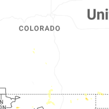
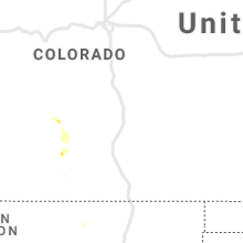
Hail Maps for Howard, CO


Connect with Interactive Hail Maps