

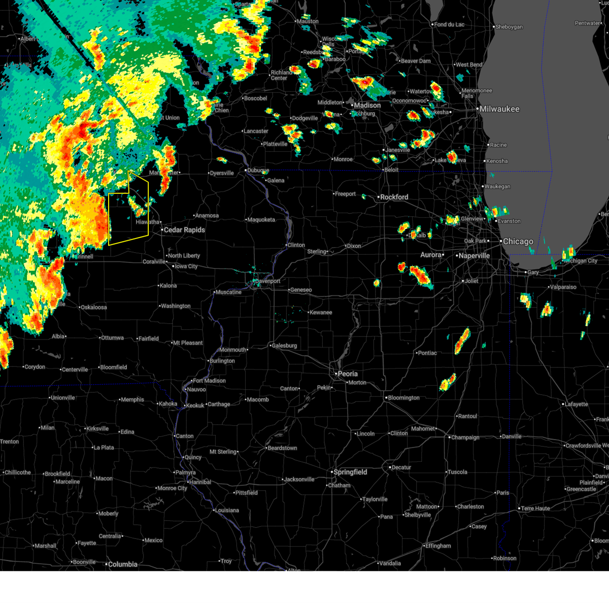
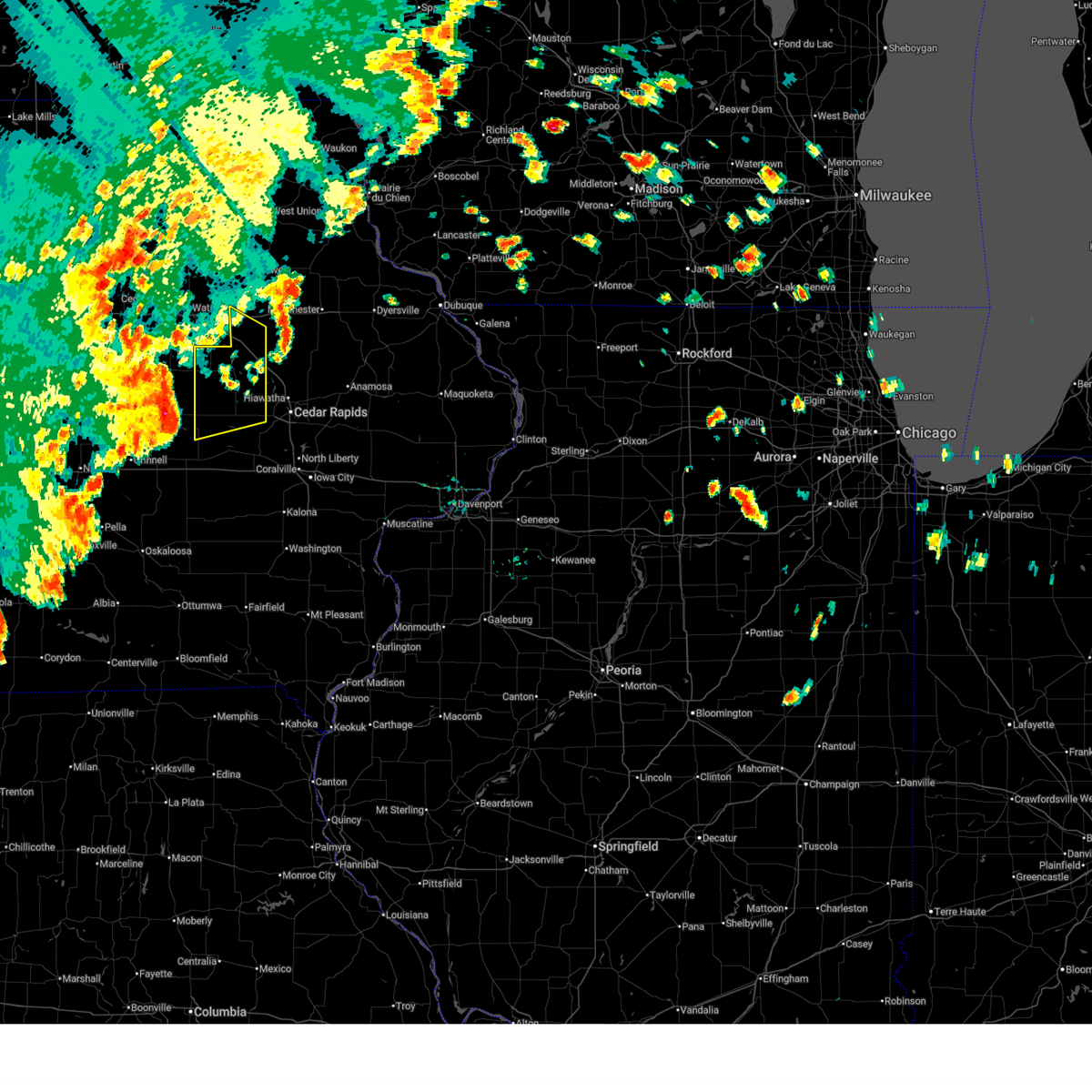
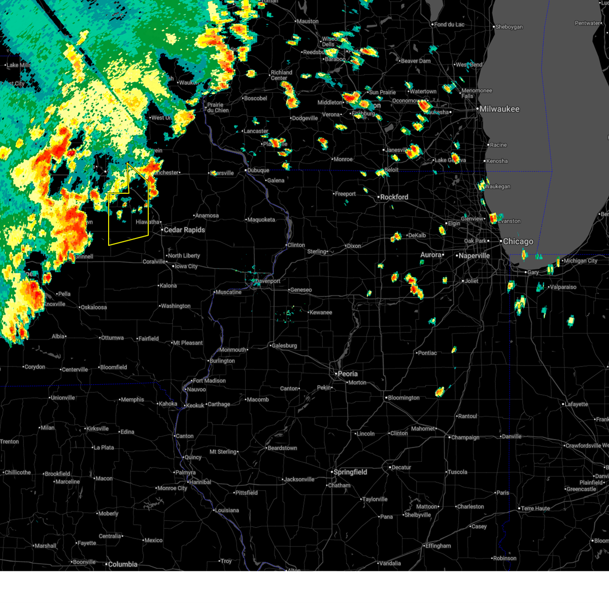
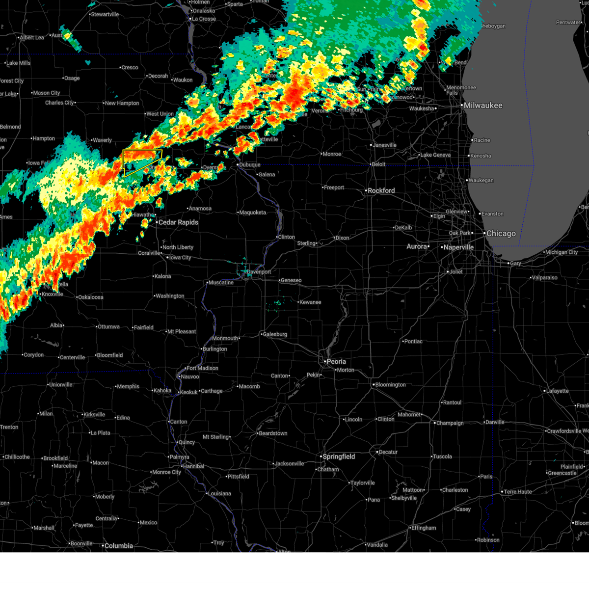
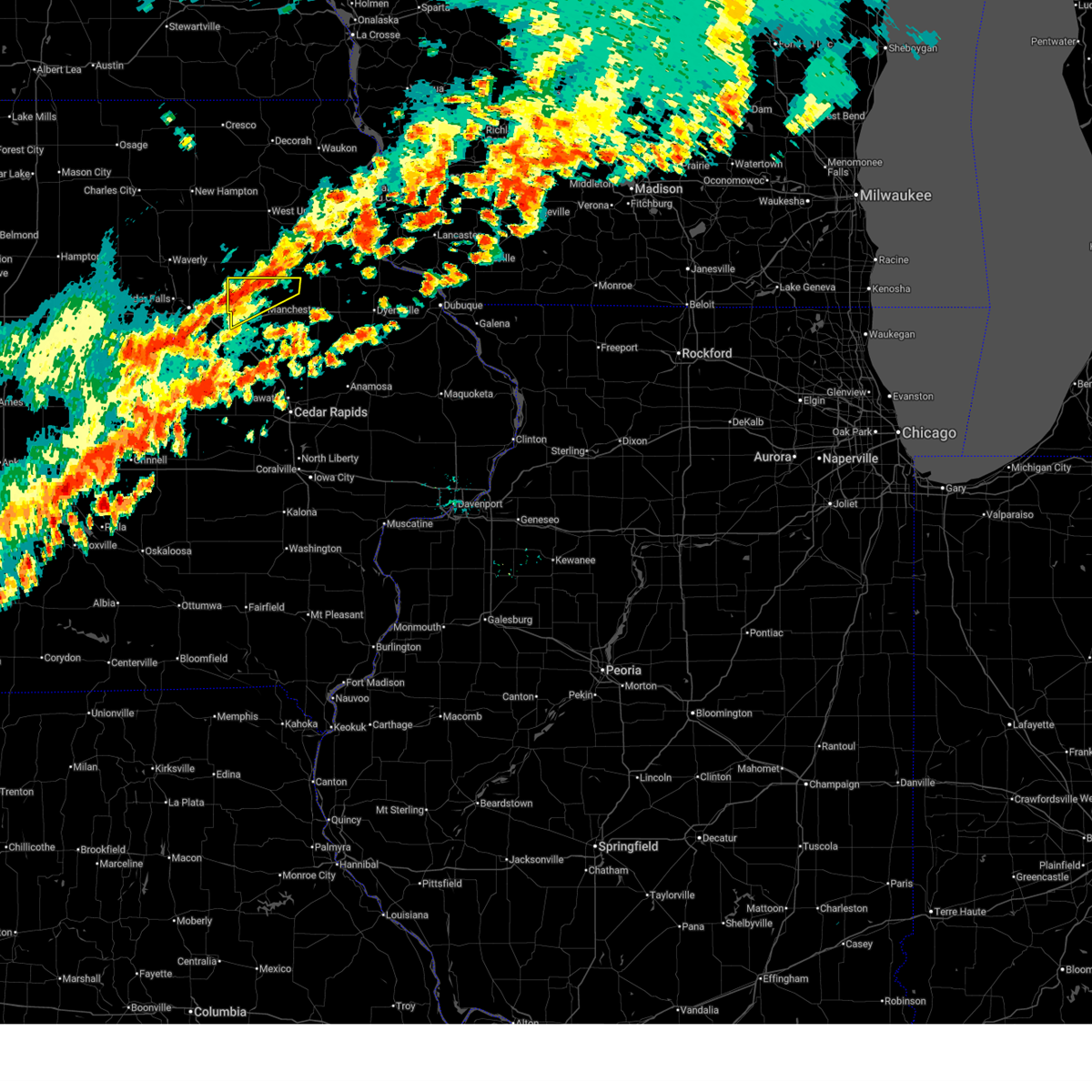
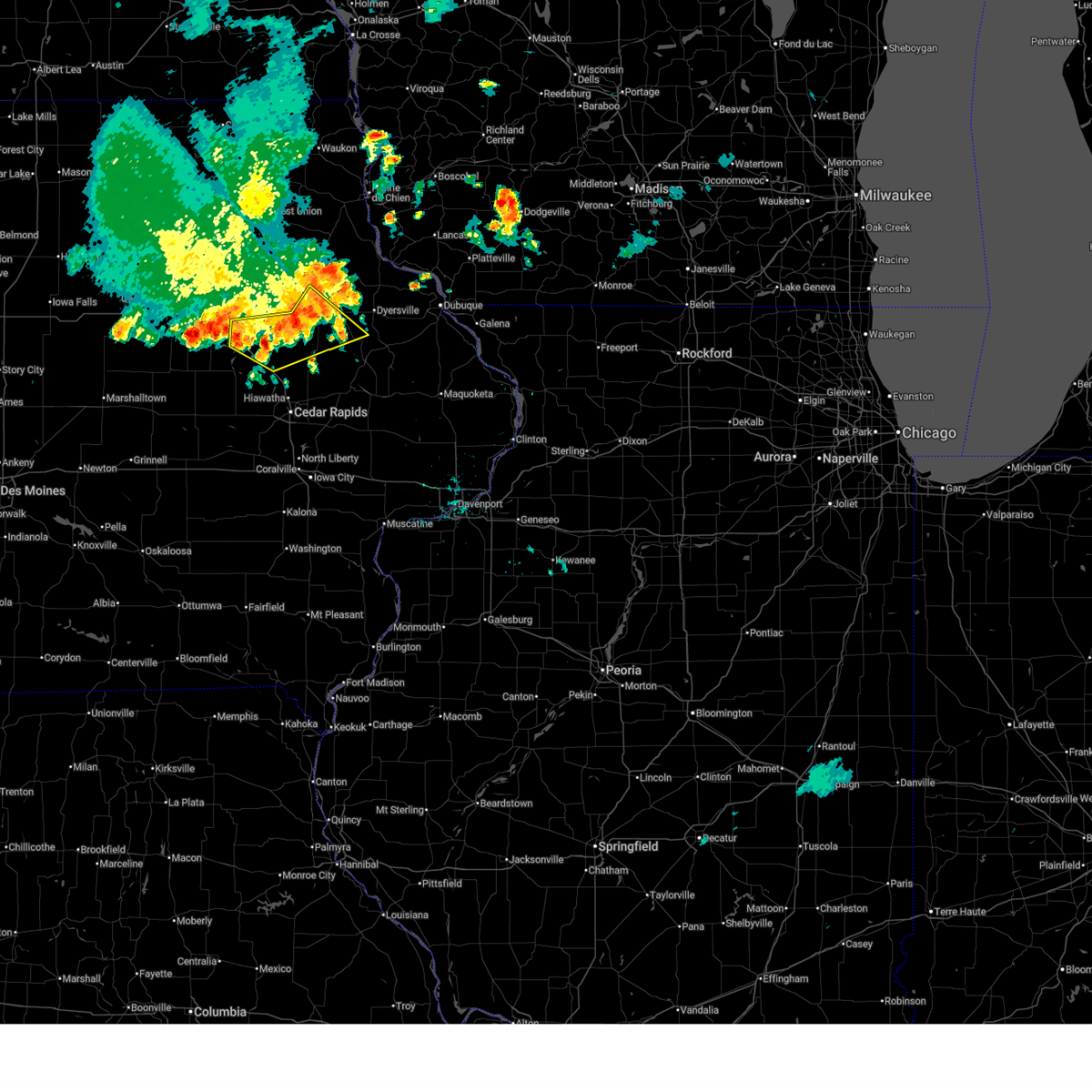
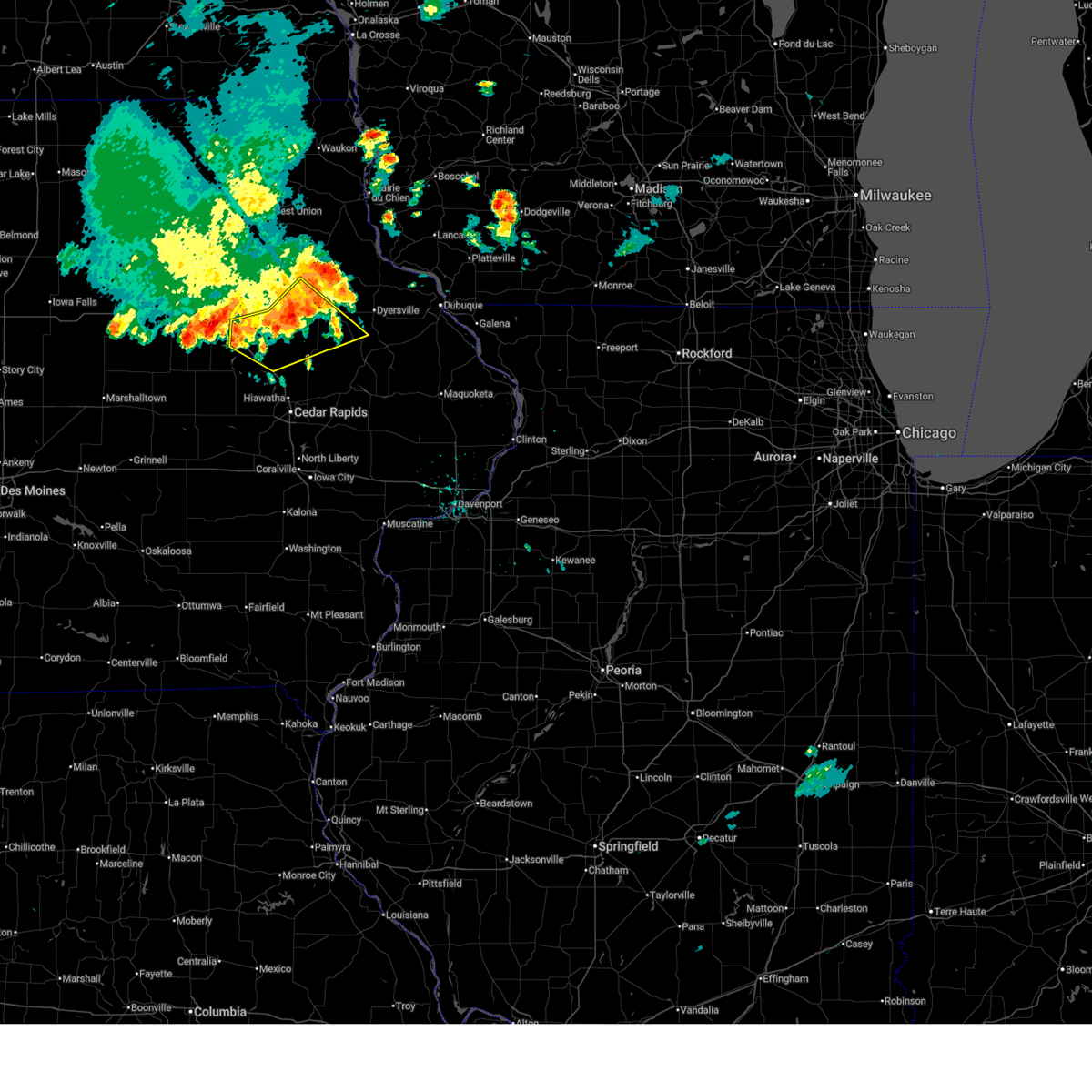
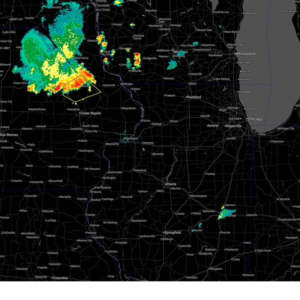
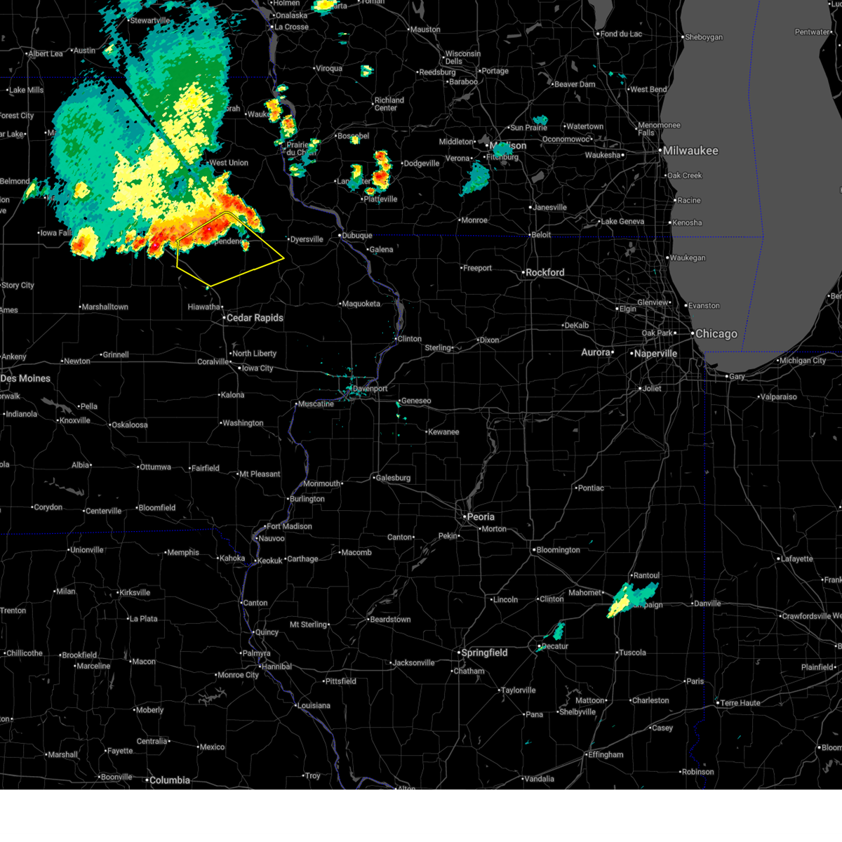
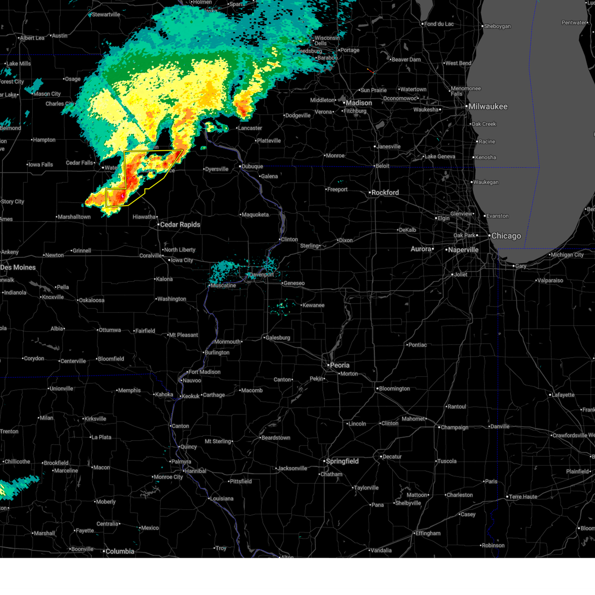
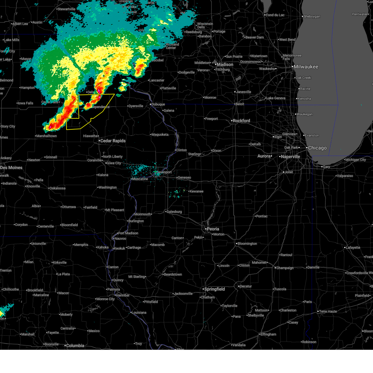
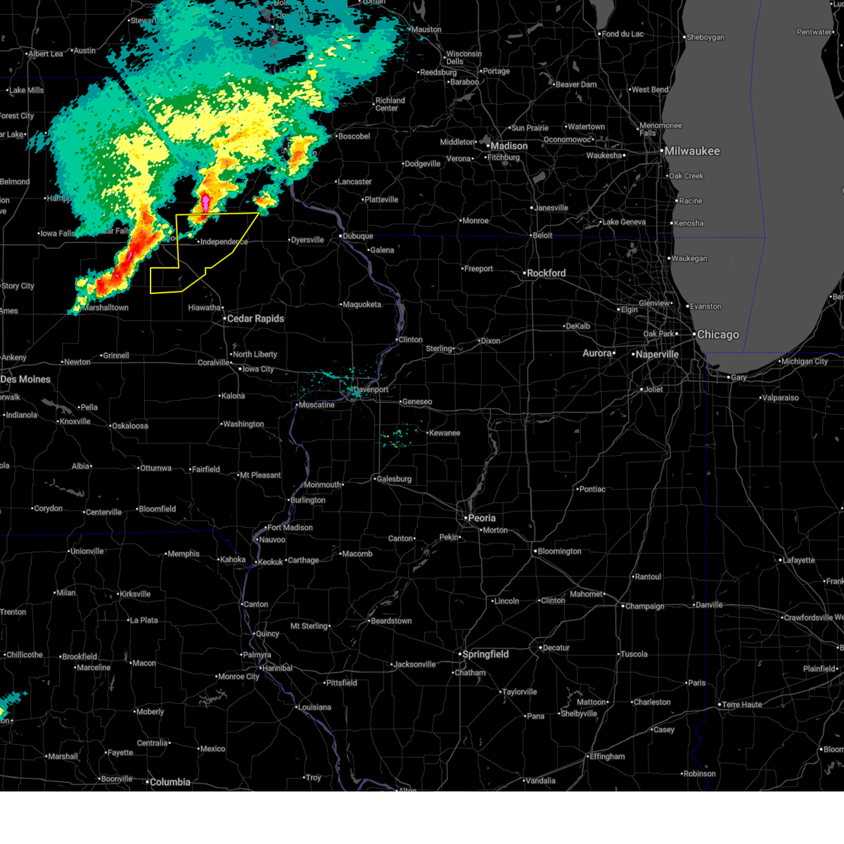
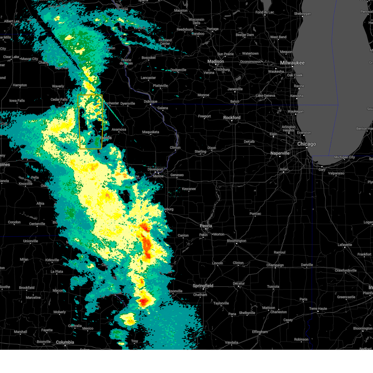
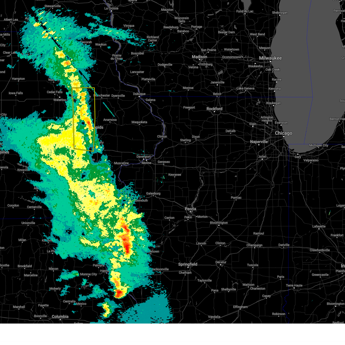
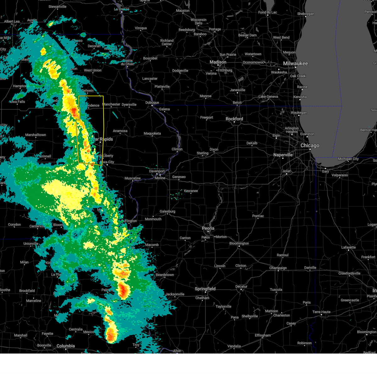
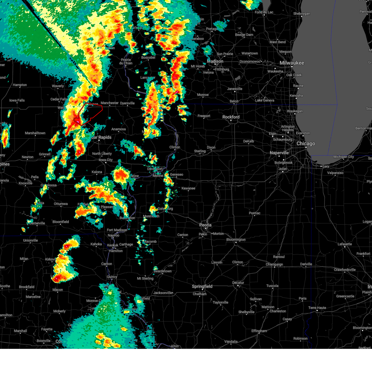
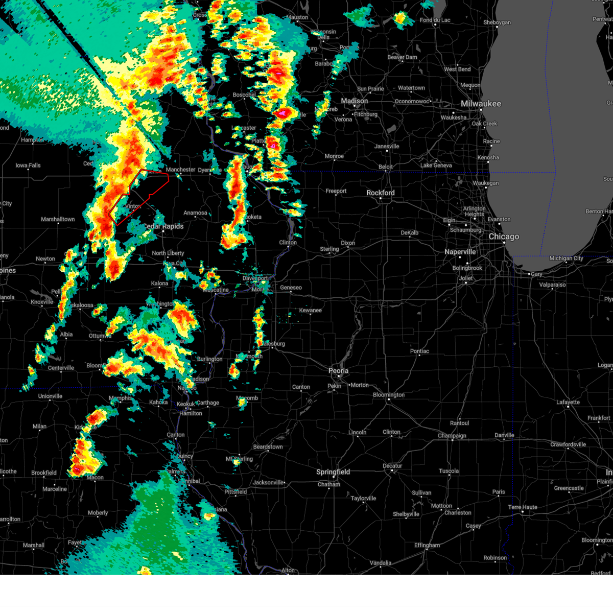
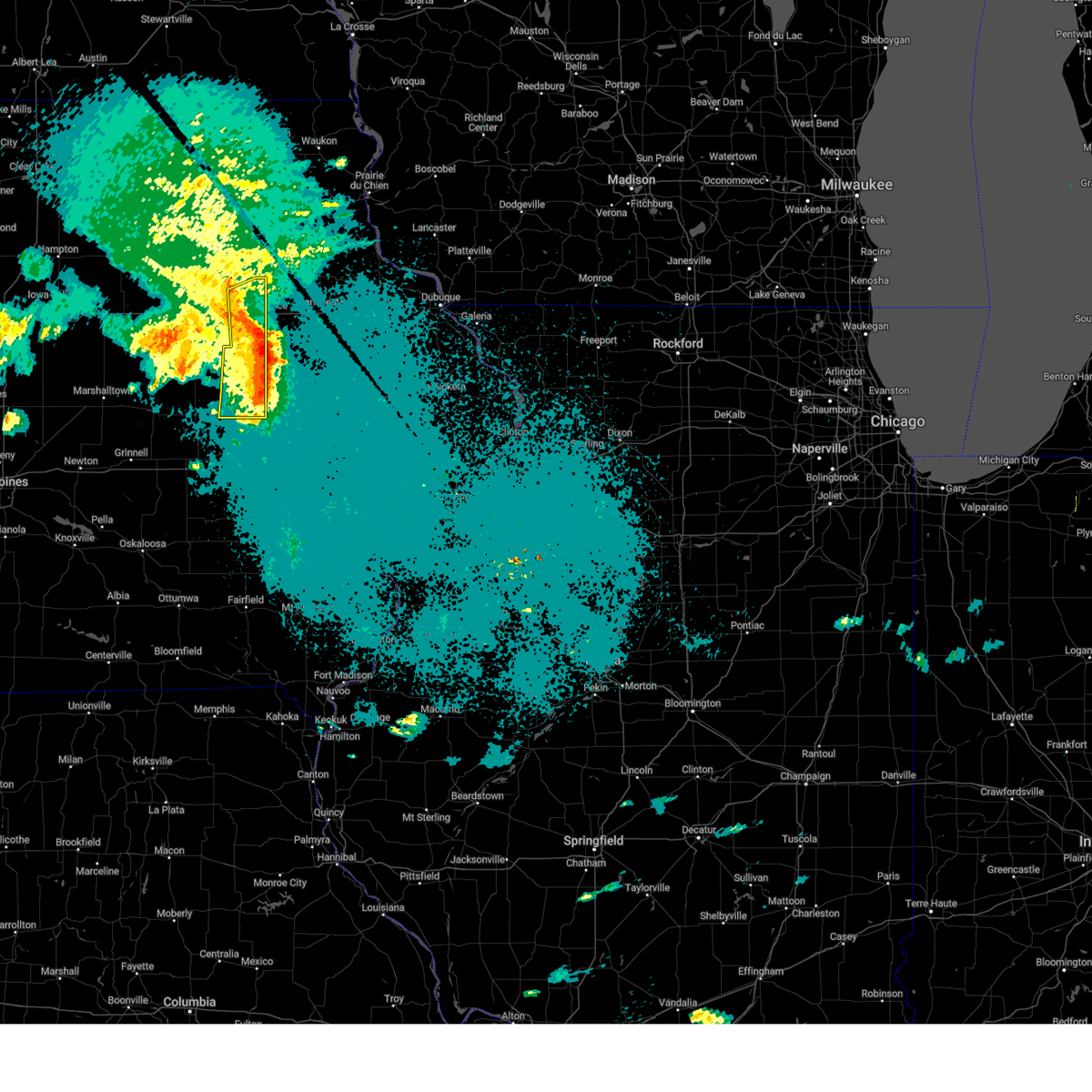
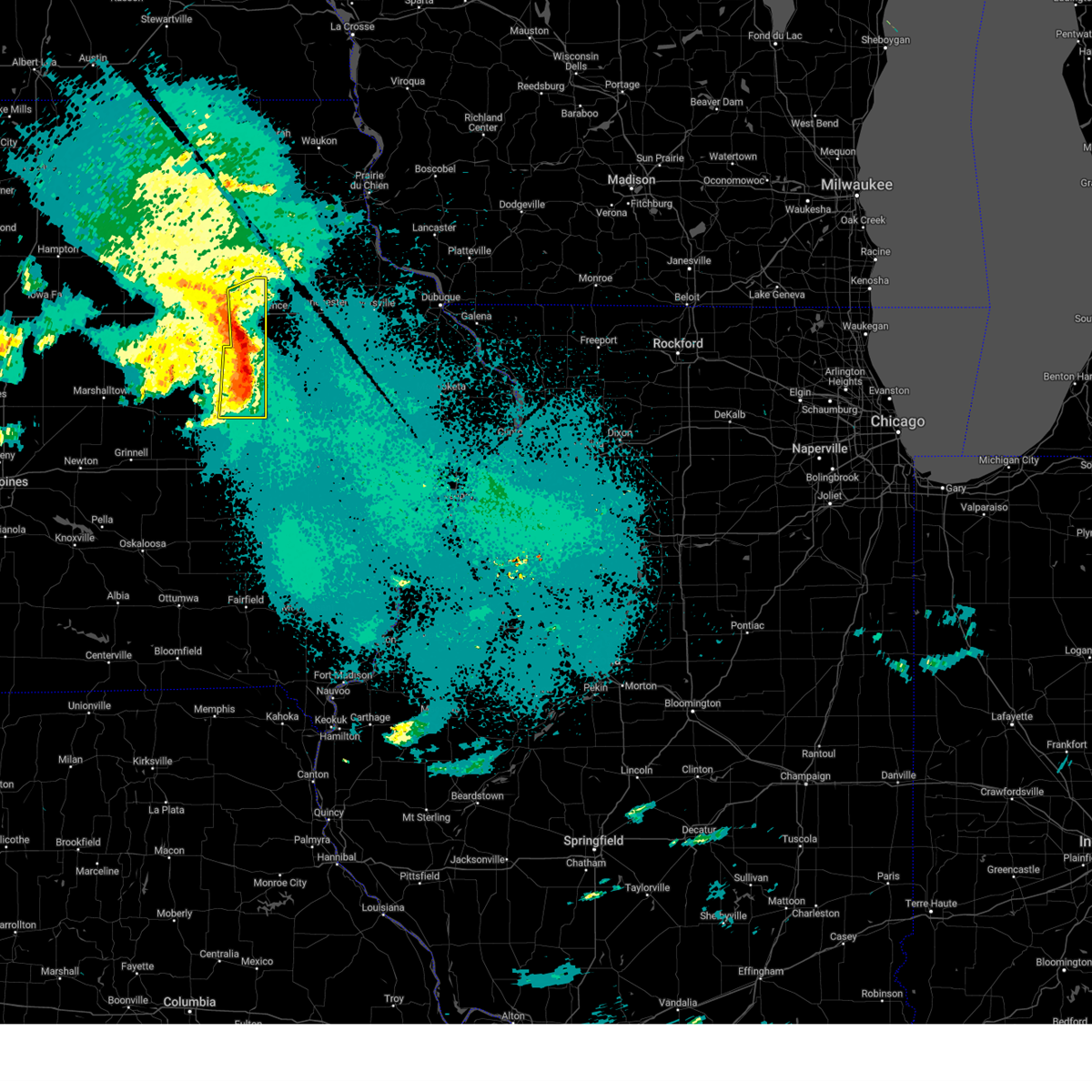
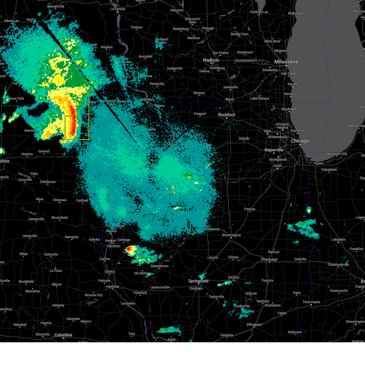
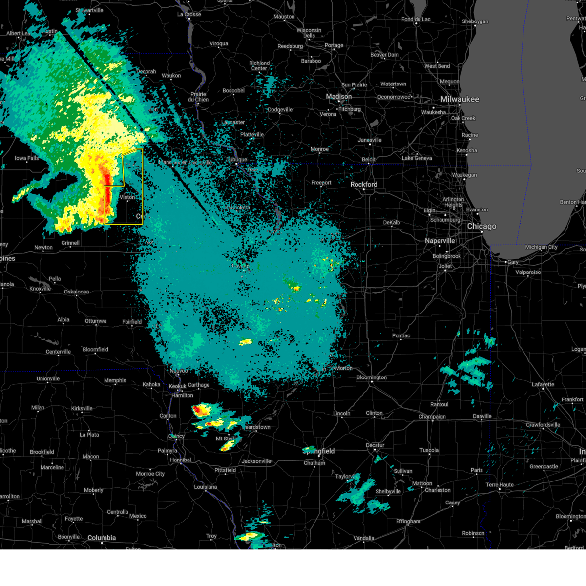
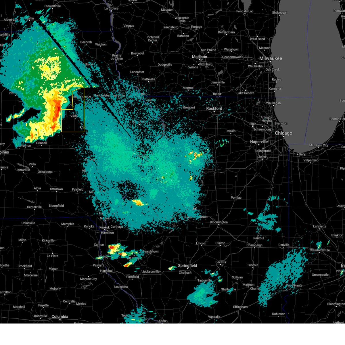
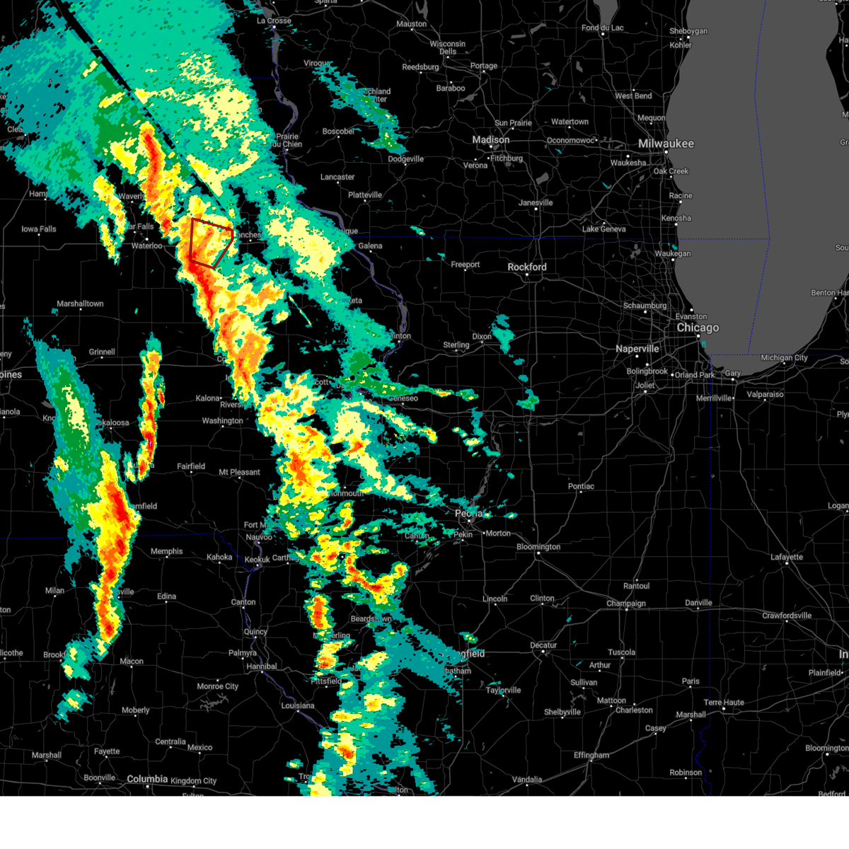
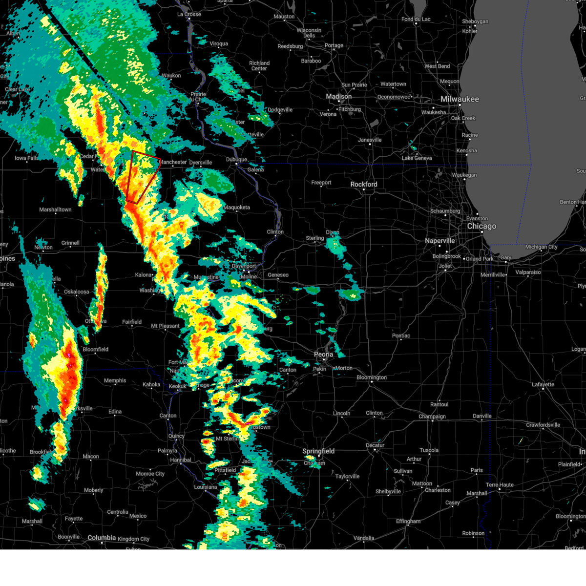
Hail Map for Independence, IA
The Independence, IA area has had 20 reports of on-the-ground hail by trained spotters, and has been under severe weather warnings 24 times during the past 12 months. Doppler radar has detected hail at or near Independence, IA on 69 occasions, including 3 occasions during the past year.
| Name: | Independence, IA |
| Where Located: | 35.6 miles NNW of Cedar Rapids, IA |
| Map: | Google Map for Independence, IA |
| Population: | 5966 |
| Housing Units: | 2745 |
| More Info: | Search Google for Independence, IA |
2
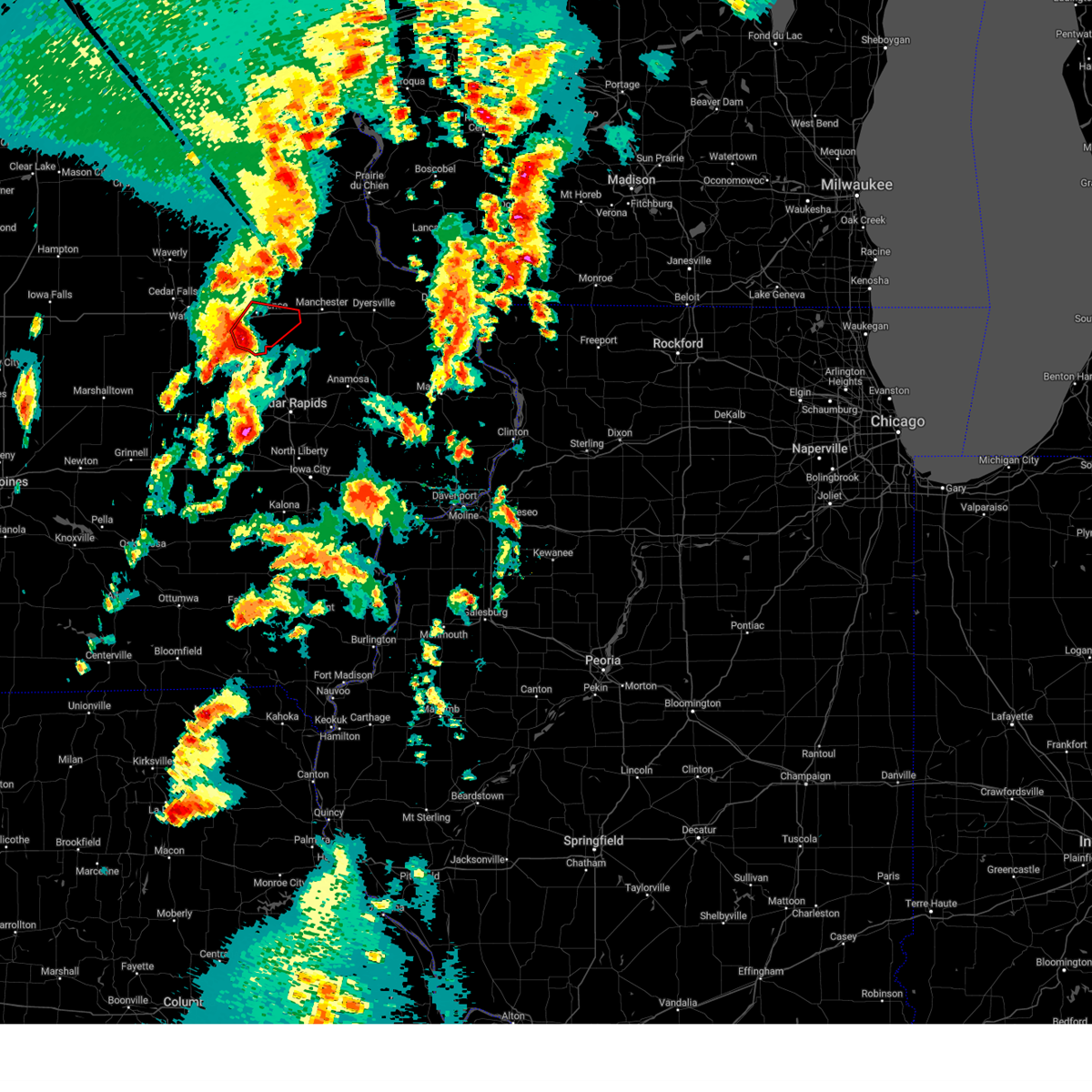
The Top Recent Hail Date for Independence, IA is Monday, July 15, 2024 (5th out of 69)

Hail and Wind Damage Spotted near Independence, IA
| Date / Time | Report Details |
|---|---|
| 6/26/2025 6:31 PM CDT | the severe thunderstorm warning has been cancelled and is no longer in effect |
| 6/26/2025 6:31 PM CDT | At 631 pm cdt, severe thunderstorms were located along a line extending from near la porte city to minne estema park to near benton county fairgrounds to blairstown, moving east at 45 mph (radar indicated). Hazards include 60 mph wind gusts. Expect damage to roofs, siding, and trees. locations impacted include, vinton, jesup, atkins, urbana, shellsburg, newhall, blairstown, van horne, garrison, brandon, rowley, mount auburn, lime creek county park, vinton memorial airport, rodgers park, benton city park, hoefle-dulin park, spencers grove, minne estema park, and benton county fairgrounds. This includes interstate 380 between mile markers 40 and 55. |
| 6/26/2025 6:22 PM CDT |
 At 621 pm cdt, severe thunderstorms were located along a line extending from near la porte city to near rodgers park to near van horne to luzerne, moving east at 55 mph (radar indicated). Hazards include 60 mph wind gusts. Expect damage to roofs, siding, and trees. locations impacted include, vinton, belle plaine, jesup, atkins, urbana, dysart, shellsburg, newhall, blairstown, van horne, keystone, garrison, brandon, rowley, mount auburn, luzerne, vinton memorial airport, minne estema park, benton county fairgrounds, and wildcat bluff park. This includes interstate 380 between mile markers 40 and 55. At 621 pm cdt, severe thunderstorms were located along a line extending from near la porte city to near rodgers park to near van horne to luzerne, moving east at 55 mph (radar indicated). Hazards include 60 mph wind gusts. Expect damage to roofs, siding, and trees. locations impacted include, vinton, belle plaine, jesup, atkins, urbana, dysart, shellsburg, newhall, blairstown, van horne, keystone, garrison, brandon, rowley, mount auburn, luzerne, vinton memorial airport, minne estema park, benton county fairgrounds, and wildcat bluff park. This includes interstate 380 between mile markers 40 and 55.
|
| 6/26/2025 6:09 PM CDT |
 At 608 pm cdt, severe thunderstorms were located along a line extending from near tf clark state park to near dysart to elberon to near hartwick, moving east at 35 mph (radar indicated). Hazards include 60 mph wind gusts. Expect damage to roofs, siding, and trees. locations impacted include, vinton, belle plaine, jesup, atkins, urbana, dysart, shellsburg, newhall, blairstown, van horne, keystone, garrison, brandon, rowley, mount auburn, luzerne, vinton memorial airport, minne estema park, benton county fairgrounds, and wildcat bluff park. This includes interstate 380 between mile markers 40 and 55. At 608 pm cdt, severe thunderstorms were located along a line extending from near tf clark state park to near dysart to elberon to near hartwick, moving east at 35 mph (radar indicated). Hazards include 60 mph wind gusts. Expect damage to roofs, siding, and trees. locations impacted include, vinton, belle plaine, jesup, atkins, urbana, dysart, shellsburg, newhall, blairstown, van horne, keystone, garrison, brandon, rowley, mount auburn, luzerne, vinton memorial airport, minne estema park, benton county fairgrounds, and wildcat bluff park. This includes interstate 380 between mile markers 40 and 55.
|
| 6/26/2025 5:53 PM CDT |
 Svrdvn the national weather service in the quad cities has issued a * severe thunderstorm warning for, southwestern buchanan county in northeastern iowa, benton county in east central iowa, northwestern iowa county in east central iowa, * until 700 pm cdt. * at 553 pm cdt, severe thunderstorms were located along a line extending from near lincoln to near clutier to near malcom, moving east at 45 mph (radar indicated). Hazards include 60 mph wind gusts. expect damage to roofs, siding, and trees Svrdvn the national weather service in the quad cities has issued a * severe thunderstorm warning for, southwestern buchanan county in northeastern iowa, benton county in east central iowa, northwestern iowa county in east central iowa, * until 700 pm cdt. * at 553 pm cdt, severe thunderstorms were located along a line extending from near lincoln to near clutier to near malcom, moving east at 45 mph (radar indicated). Hazards include 60 mph wind gusts. expect damage to roofs, siding, and trees
|
| 6/23/2025 6:56 PM CDT |
 At 656 pm cdt, a severe thunderstorm was located over hazleton, or near oelwein, moving northeast at 30 mph (radar indicated). Hazards include 60 mph wind gusts. Expect damage to roofs, siding, and trees. Locations impacted include, independence, jesup, fairbank, hazleton, lamont, aurora, stanley, wapsipinicon golf course, fontana county park, littleton, buchanan county fairgrounds, otterville, independence airport, jakway park, and fontana park. At 656 pm cdt, a severe thunderstorm was located over hazleton, or near oelwein, moving northeast at 30 mph (radar indicated). Hazards include 60 mph wind gusts. Expect damage to roofs, siding, and trees. Locations impacted include, independence, jesup, fairbank, hazleton, lamont, aurora, stanley, wapsipinicon golf course, fontana county park, littleton, buchanan county fairgrounds, otterville, independence airport, jakway park, and fontana park.
|
| 6/23/2025 6:36 PM CDT |
 Svrdvn the national weather service in the quad cities has issued a * severe thunderstorm warning for, northern buchanan county in northeastern iowa, * until 715 pm cdt. * at 635 pm cdt, a severe thunderstorm was located over littleton, or 9 miles northwest of independence, moving northeast at 30 mph (radar indicated). Hazards include 60 mph wind gusts and penny size hail. expect damage to roofs, siding, and trees Svrdvn the national weather service in the quad cities has issued a * severe thunderstorm warning for, northern buchanan county in northeastern iowa, * until 715 pm cdt. * at 635 pm cdt, a severe thunderstorm was located over littleton, or 9 miles northwest of independence, moving northeast at 30 mph (radar indicated). Hazards include 60 mph wind gusts and penny size hail. expect damage to roofs, siding, and trees
|
| 6/16/2025 2:39 PM CDT |
 At 239 pm cdt, severe thunderstorms were located along a line extending from delaware county fairgrounds to near monti to spencers grove, moving southeast at 35 mph (radar indicated). Hazards include 60 mph wind gusts. Expect damage to roofs, siding, and trees. locations impacted include, independence, manchester, center point, urbana, walker, coggon, hopkinton, quasqueton, delhi, ryan, brandon, rowley, dundee, delaware, masonville, troy mills, manchester airport, monti, buck creek, and baileys ford park. This includes interstate 380 between mile markers 40 and 55. At 239 pm cdt, severe thunderstorms were located along a line extending from delaware county fairgrounds to near monti to spencers grove, moving southeast at 35 mph (radar indicated). Hazards include 60 mph wind gusts. Expect damage to roofs, siding, and trees. locations impacted include, independence, manchester, center point, urbana, walker, coggon, hopkinton, quasqueton, delhi, ryan, brandon, rowley, dundee, delaware, masonville, troy mills, manchester airport, monti, buck creek, and baileys ford park. This includes interstate 380 between mile markers 40 and 55.
|
| 6/16/2025 2:32 PM CDT |
 At 232 pm cdt, severe thunderstorms were located along a line extending from near coffins grove park to near monti to lime creek county park, moving southeast at 35 mph (radar indicated). Hazards include 60 mph wind gusts and quarter size hail. Hail damage to vehicles is expected. expect wind damage to roofs, siding, and trees. locations impacted include, independence, manchester, center point, urbana, winthrop, walker, coggon, hopkinton, quasqueton, lamont, delhi, ryan, brandon, rowley, dundee, delaware, masonville, troy mills, manchester airport, and monti. This includes interstate 380 between mile markers 40 and 55. At 232 pm cdt, severe thunderstorms were located along a line extending from near coffins grove park to near monti to lime creek county park, moving southeast at 35 mph (radar indicated). Hazards include 60 mph wind gusts and quarter size hail. Hail damage to vehicles is expected. expect wind damage to roofs, siding, and trees. locations impacted include, independence, manchester, center point, urbana, winthrop, walker, coggon, hopkinton, quasqueton, lamont, delhi, ryan, brandon, rowley, dundee, delaware, masonville, troy mills, manchester airport, and monti. This includes interstate 380 between mile markers 40 and 55.
|
| 6/16/2025 2:24 PM CDT |
 At 224 pm cdt, severe thunderstorms were located along a line extending from dundee to near winthrop to near lime creek county park, moving southeast at 40 mph (radar indicated). Hazards include 60 mph wind gusts and quarter size hail. Hail damage to vehicles is expected. expect wind damage to roofs, siding, and trees. locations impacted include, independence, manchester, jesup, center point, urbana, winthrop, walker, coggon, hopkinton, quasqueton, lamont, delhi, ryan, brandon, rowley, aurora, dundee, delaware, masonville, and troy mills. This includes interstate 380 between mile markers 40 and 55. At 224 pm cdt, severe thunderstorms were located along a line extending from dundee to near winthrop to near lime creek county park, moving southeast at 40 mph (radar indicated). Hazards include 60 mph wind gusts and quarter size hail. Hail damage to vehicles is expected. expect wind damage to roofs, siding, and trees. locations impacted include, independence, manchester, jesup, center point, urbana, winthrop, walker, coggon, hopkinton, quasqueton, lamont, delhi, ryan, brandon, rowley, aurora, dundee, delaware, masonville, and troy mills. This includes interstate 380 between mile markers 40 and 55.
|
| 6/16/2025 2:16 PM CDT |
 Svrdvn the national weather service in the quad cities has issued a * severe thunderstorm warning for, buchanan county in northeastern iowa, northeastern benton county in east central iowa, southwestern delaware county in northeastern iowa, northwestern linn county in east central iowa, * until 315 pm cdt. * at 216 pm cdt, severe thunderstorms were located along a line extending from lamont to near independence airport, moving southeast at 30 mph (radar indicated). Hazards include 60 mph wind gusts and quarter size hail. Hail damage to vehicles is expected. Expect wind damage to roofs, siding, and trees. Svrdvn the national weather service in the quad cities has issued a * severe thunderstorm warning for, buchanan county in northeastern iowa, northeastern benton county in east central iowa, southwestern delaware county in northeastern iowa, northwestern linn county in east central iowa, * until 315 pm cdt. * at 216 pm cdt, severe thunderstorms were located along a line extending from lamont to near independence airport, moving southeast at 30 mph (radar indicated). Hazards include 60 mph wind gusts and quarter size hail. Hail damage to vehicles is expected. Expect wind damage to roofs, siding, and trees.
|
| 6/11/2025 8:24 PM CDT |
 At 822 pm cdt, severe thunderstorms were located along a line extending from camp c.s. klaus to vinton, moving east at 40 mph (radar indicated. a 66 mph wind gust was measured at the vinton airport around 815 pm). Hazards include 70 mph wind gusts and quarter size hail. Hail damage to vehicles is expected. expect considerable tree damage. wind damage is also likely to mobile homes, roofs, and outbuildings. locations impacted include, independence, vinton, jesup, urbana, dysart, fairbank, edgewood, winthrop, hazleton, quasqueton, lamont, garrison, brandon, rowley, aurora, dundee, mount auburn, masonville, stanley, and wapsipinicon golf course. This includes interstate 380 between mile markers 43 and 55. At 822 pm cdt, severe thunderstorms were located along a line extending from camp c.s. klaus to vinton, moving east at 40 mph (radar indicated. a 66 mph wind gust was measured at the vinton airport around 815 pm). Hazards include 70 mph wind gusts and quarter size hail. Hail damage to vehicles is expected. expect considerable tree damage. wind damage is also likely to mobile homes, roofs, and outbuildings. locations impacted include, independence, vinton, jesup, urbana, dysart, fairbank, edgewood, winthrop, hazleton, quasqueton, lamont, garrison, brandon, rowley, aurora, dundee, mount auburn, masonville, stanley, and wapsipinicon golf course. This includes interstate 380 between mile markers 43 and 55.
|
| 6/11/2025 7:54 PM CDT |
 At 753 pm cdt, severe thunderstorms were located along a line extending from joy springs county park to near dysart, moving east at 50 mph (trained weather spotters). Hazards include 60 mph wind gusts and quarter size hail. Hail damage to vehicles is expected. expect wind damage to roofs, siding, and trees. locations impacted include, independence, vinton, jesup, urbana, dysart, fairbank, edgewood, winthrop, hazleton, quasqueton, lamont, garrison, brandon, rowley, aurora, dundee, mount auburn, masonville, stanley, and wapsipinicon golf course. This includes interstate 380 between mile markers 43 and 55. At 753 pm cdt, severe thunderstorms were located along a line extending from joy springs county park to near dysart, moving east at 50 mph (trained weather spotters). Hazards include 60 mph wind gusts and quarter size hail. Hail damage to vehicles is expected. expect wind damage to roofs, siding, and trees. locations impacted include, independence, vinton, jesup, urbana, dysart, fairbank, edgewood, winthrop, hazleton, quasqueton, lamont, garrison, brandon, rowley, aurora, dundee, mount auburn, masonville, stanley, and wapsipinicon golf course. This includes interstate 380 between mile markers 43 and 55.
|
| 6/11/2025 7:39 PM CDT |
 Svrdvn the national weather service in the quad cities has issued a * severe thunderstorm warning for, buchanan county in northeastern iowa, northern benton county in east central iowa, northwestern delaware county in northeastern iowa, * until 900 pm cdt. * at 739 pm cdt, severe thunderstorms were located along a line extending from near fairbank to near traer, moving east at 40 mph (radar indicated). Hazards include 60 mph wind gusts and quarter size hail. Hail damage to vehicles is expected. Expect wind damage to roofs, siding, and trees. Svrdvn the national weather service in the quad cities has issued a * severe thunderstorm warning for, buchanan county in northeastern iowa, northern benton county in east central iowa, northwestern delaware county in northeastern iowa, * until 900 pm cdt. * at 739 pm cdt, severe thunderstorms were located along a line extending from near fairbank to near traer, moving east at 40 mph (radar indicated). Hazards include 60 mph wind gusts and quarter size hail. Hail damage to vehicles is expected. Expect wind damage to roofs, siding, and trees.
|
| 3/14/2025 8:43 PM CDT |
 At 842 pm cdt, severe thunderstorms were located along a line extending from highway 93 and county w 14 to near paris, moving north at 50 mph (radar indicated). Hazards include 60 mph wind gusts. Expect damage to roofs, siding, and trees. locations impacted include, hiawatha, newhall, wapsipinicon golf course, atkins, toddville, troy mills, monti, aurora, otterville, minne estema park, walford, robins, winthrop, cheney, walker, benton city park, pleasant creek state recreation area, fairfax, buchanan county fairgrounds, and watkins. This includes interstate 380 between mile markers 12 and 55. At 842 pm cdt, severe thunderstorms were located along a line extending from highway 93 and county w 14 to near paris, moving north at 50 mph (radar indicated). Hazards include 60 mph wind gusts. Expect damage to roofs, siding, and trees. locations impacted include, hiawatha, newhall, wapsipinicon golf course, atkins, toddville, troy mills, monti, aurora, otterville, minne estema park, walford, robins, winthrop, cheney, walker, benton city park, pleasant creek state recreation area, fairfax, buchanan county fairgrounds, and watkins. This includes interstate 380 between mile markers 12 and 55.
|
| 3/14/2025 8:43 PM CDT |
 the severe thunderstorm warning has been cancelled and is no longer in effect the severe thunderstorm warning has been cancelled and is no longer in effect
|
| 3/14/2025 8:24 PM CDT |
 At 822 pm cdt, severe thunderstorms were located along a line extending from oelwein to robins, moving north at 60 mph (public. measured wind gust of 71 mph reported near the cedar rapids airport). Hazards include 70 mph wind gusts. Expect considerable tree damage. damage is likely to mobile homes, roofs, and outbuildings. locations impacted include, middle amana, hiawatha, newhall, wapsipinicon golf course, atkins, toddville, troy mills, monti, aurora, otterville, swisher, high amana, minne estema park, walford, robins, conroy, winthrop, cheney, west amana, and cou falls. this includes the following highways, interstate 80 in iowa between mile markers 220 and 239. Interstate 380 between mile markers 1 and 55. At 822 pm cdt, severe thunderstorms were located along a line extending from oelwein to robins, moving north at 60 mph (public. measured wind gust of 71 mph reported near the cedar rapids airport). Hazards include 70 mph wind gusts. Expect considerable tree damage. damage is likely to mobile homes, roofs, and outbuildings. locations impacted include, middle amana, hiawatha, newhall, wapsipinicon golf course, atkins, toddville, troy mills, monti, aurora, otterville, swisher, high amana, minne estema park, walford, robins, conroy, winthrop, cheney, west amana, and cou falls. this includes the following highways, interstate 80 in iowa between mile markers 220 and 239. Interstate 380 between mile markers 1 and 55.
|
| 3/14/2025 8:11 PM CDT | At 810 pm cdt, severe thunderstorms were located along a line extending from near littleton to near fairfax, moving north at 60 mph (radar indicated). Hazards include 70 mph wind gusts. Expect considerable tree damage. damage is likely to mobile homes, roofs, and outbuildings. locations impacted include, middle amana, hiawatha, newhall, wapsipinicon golf course, atkins, toddville, troy mills, monti, aurora, otterville, swisher, high amana, minne estema park, walford, robins, conroy, winthrop, cheney, west amana, and cou falls. this includes the following highways, interstate 80 in iowa between mile markers 220 and 239. Interstate 380 between mile markers 1 and 55. |
| 3/14/2025 7:56 PM CDT |
 Svrdvn the national weather service in the quad cities has issued a * severe thunderstorm warning for, buchanan county in northeastern iowa, northwestern johnson county in east central iowa, benton county in east central iowa, western linn county in east central iowa, northeastern iowa county in east central iowa, * until 900 pm cdt. * at 756 pm cdt, severe thunderstorms were located along a line extending from 6 miles south of jesup to homestead, moving north at 60 mph (radar indicated). Hazards include 70 mph wind gusts. Expect considerable tree damage. Damage is likely to mobile homes, roofs, and outbuildings. Svrdvn the national weather service in the quad cities has issued a * severe thunderstorm warning for, buchanan county in northeastern iowa, northwestern johnson county in east central iowa, benton county in east central iowa, western linn county in east central iowa, northeastern iowa county in east central iowa, * until 900 pm cdt. * at 756 pm cdt, severe thunderstorms were located along a line extending from 6 miles south of jesup to homestead, moving north at 60 mph (radar indicated). Hazards include 70 mph wind gusts. Expect considerable tree damage. Damage is likely to mobile homes, roofs, and outbuildings.
|
| 7/15/2024 5:40 PM CDT | At 539 pm cdt, severe thunderstorms were located along a line extending from near twin bridges park to near fairfax, moving east at 25 mph (radar indicated). Hazards include 70 mph wind gusts and penny size hail. Expect considerable tree damage. damage is likely to mobile homes, roofs, and outbuildings. locations impacted include, cedar rapids, independence, anamosa, vinton, manchester, mechanicsville, marion, hiawatha, mount vernon, dyersville, monticello, robins, belle plaine, jesup, center point, cascade, lisbon, fairfax, solon, and epworth. This includes interstate 380 between mile markers 8 and 55. |
| 7/15/2024 5:20 PM CDT | Svrdvn the national weather service in the quad cities has issued a * severe thunderstorm warning for, buchanan county in northeastern iowa, northwestern cedar county in east central iowa, western dubuque county in northeastern iowa, northern johnson county in east central iowa, benton county in east central iowa, jones county in east central iowa, delaware county in northeastern iowa, linn county in east central iowa, northeastern iowa county in east central iowa, * until 630 pm cdt. * at 520 pm cdt, severe thunderstorms were located along a line extending from edgewood to near norway, moving east at 25 mph (radar indicated). Hazards include 70 mph wind gusts and quarter size hail. Hail damage to vehicles is expected. expect considerable tree damage. Wind damage is also likely to mobile homes, roofs, and outbuildings. |
| 7/15/2024 5:08 PM CDT |
 At 508 pm cdt, severe thunderstorms were located along a line extending from wapsipinicon golf course to hoefle-dulin park, moving east at 20 mph (radar indicated). Hazards include 70 mph wind gusts and quarter size hail. Hail damage to vehicles is expected. expect considerable tree damage. wind damage is also likely to mobile homes, roofs, and outbuildings. locations impacted include, independence, vinton, robins, jesup, center point, urbana, dysart, fairbank, palo, shellsburg, winthrop, hazleton, walker, alburnett, quasqueton, lamont, garrison, brandon, rowley, and aurora. This includes interstate 380 between mile markers 28 and 55. At 508 pm cdt, severe thunderstorms were located along a line extending from wapsipinicon golf course to hoefle-dulin park, moving east at 20 mph (radar indicated). Hazards include 70 mph wind gusts and quarter size hail. Hail damage to vehicles is expected. expect considerable tree damage. wind damage is also likely to mobile homes, roofs, and outbuildings. locations impacted include, independence, vinton, robins, jesup, center point, urbana, dysart, fairbank, palo, shellsburg, winthrop, hazleton, walker, alburnett, quasqueton, lamont, garrison, brandon, rowley, and aurora. This includes interstate 380 between mile markers 28 and 55.
|
| 7/15/2024 4:48 PM CDT |
 At 446 pm cdt, severe thunderstorms were located along a line extending from jesup to near garrison, moving east at 20 mph (radar indicated). Hazards include 70 mph wind gusts and quarter size hail. Hail damage to vehicles is expected. expect considerable tree damage. wind damage is also likely to mobile homes, roofs, and outbuildings. locations impacted include, independence, vinton, robins, jesup, center point, urbana, dysart, fairbank, palo, shellsburg, winthrop, hazleton, walker, alburnett, quasqueton, lamont, garrison, brandon, rowley, and aurora. This includes interstate 380 between mile markers 28 and 55. At 446 pm cdt, severe thunderstorms were located along a line extending from jesup to near garrison, moving east at 20 mph (radar indicated). Hazards include 70 mph wind gusts and quarter size hail. Hail damage to vehicles is expected. expect considerable tree damage. wind damage is also likely to mobile homes, roofs, and outbuildings. locations impacted include, independence, vinton, robins, jesup, center point, urbana, dysart, fairbank, palo, shellsburg, winthrop, hazleton, walker, alburnett, quasqueton, lamont, garrison, brandon, rowley, and aurora. This includes interstate 380 between mile markers 28 and 55.
|
| 7/15/2024 4:36 PM CDT |
 Svrdvn the national weather service in the quad cities has issued a * severe thunderstorm warning for, buchanan county in northeastern iowa, northern benton county in east central iowa, western delaware county in northeastern iowa, northwestern linn county in east central iowa, * until 530 pm cdt. * at 435 pm cdt, severe thunderstorms were located along a line extending from near jesup to garrison, moving east at 20 mph (radar indicated). Hazards include 70 mph wind gusts and quarter size hail. Hail damage to vehicles is expected. expect considerable tree damage. Wind damage is also likely to mobile homes, roofs, and outbuildings. Svrdvn the national weather service in the quad cities has issued a * severe thunderstorm warning for, buchanan county in northeastern iowa, northern benton county in east central iowa, western delaware county in northeastern iowa, northwestern linn county in east central iowa, * until 530 pm cdt. * at 435 pm cdt, severe thunderstorms were located along a line extending from near jesup to garrison, moving east at 20 mph (radar indicated). Hazards include 70 mph wind gusts and quarter size hail. Hail damage to vehicles is expected. expect considerable tree damage. Wind damage is also likely to mobile homes, roofs, and outbuildings.
|
| 7/10/2024 1:30 PM CDT | Received a call estimating 40-50 mph winds... with 6-8 inch branches down around tow in buchanan county IA, 0.9 miles WSW of Independence, IA |
| 6/18/2024 10:55 PM CDT |
 The storms which prompted the warning have weakened below severe limits, and no longer pose an immediate threat to life or property. therefore, the warning will be allowed to expire. however, gusty winds are still possible with these thunderstorms. The storms which prompted the warning have weakened below severe limits, and no longer pose an immediate threat to life or property. therefore, the warning will be allowed to expire. however, gusty winds are still possible with these thunderstorms.
|
| 6/18/2024 10:51 PM CDT |
 At 1051 pm cdt, severe thunderstorms were located along a line extending from county road w 33 and 187 to near rowley to near benton county fairgrounds, moving east at 45 mph (radar indicated). Hazards include 60 mph wind gusts. Expect damage to roofs, siding, and trees. locations impacted include, cedar rapids, independence, vinton, manchester, hiawatha, robins, center point, urbana, palo, shellsburg, newhall, edgewood, winthrop, hazleton, walker, van horne, alburnett, coggon, keystone, and quasqueton. This includes interstate 380 between mile markers 25 and 54. At 1051 pm cdt, severe thunderstorms were located along a line extending from county road w 33 and 187 to near rowley to near benton county fairgrounds, moving east at 45 mph (radar indicated). Hazards include 60 mph wind gusts. Expect damage to roofs, siding, and trees. locations impacted include, cedar rapids, independence, vinton, manchester, hiawatha, robins, center point, urbana, palo, shellsburg, newhall, edgewood, winthrop, hazleton, walker, van horne, alburnett, coggon, keystone, and quasqueton. This includes interstate 380 between mile markers 25 and 54.
|
| 6/18/2024 10:45 PM CDT |
 At 1045 pm cdt, severe thunderstorms were located along a line extending from maynard to near independence airport to near garrison, moving east at 45 mph (radar indicated). Hazards include 60 mph wind gusts. Expect damage to roofs, siding, and trees. locations impacted include, cedar rapids, independence, vinton, manchester, hiawatha, robins, jesup, center point, urbana, dysart, fairbank, palo, shellsburg, newhall, edgewood, winthrop, hazleton, walker, van horne, and alburnett. This includes interstate 380 between mile markers 25 and 55. At 1045 pm cdt, severe thunderstorms were located along a line extending from maynard to near independence airport to near garrison, moving east at 45 mph (radar indicated). Hazards include 60 mph wind gusts. Expect damage to roofs, siding, and trees. locations impacted include, cedar rapids, independence, vinton, manchester, hiawatha, robins, jesup, center point, urbana, dysart, fairbank, palo, shellsburg, newhall, edgewood, winthrop, hazleton, walker, van horne, and alburnett. This includes interstate 380 between mile markers 25 and 55.
|
| 6/18/2024 10:32 PM CDT |
 At 1031 pm cdt, severe thunderstorms were located along a line extending from near fairbank to near elberon, moving east at 60 mph (observed winds at marshalltown and waterloo airports). Hazards include 60 mph wind gusts. Expect damage to roofs, siding, and trees. locations impacted include, cedar rapids, independence, vinton, manchester, hiawatha, robins, belle plaine, jesup, center point, atkins, urbana, dysart, fairbank, palo, shellsburg, newhall, edgewood, winthrop, hazleton, and walker. This includes interstate 380 between mile markers 25 and 55. At 1031 pm cdt, severe thunderstorms were located along a line extending from near fairbank to near elberon, moving east at 60 mph (observed winds at marshalltown and waterloo airports). Hazards include 60 mph wind gusts. Expect damage to roofs, siding, and trees. locations impacted include, cedar rapids, independence, vinton, manchester, hiawatha, robins, belle plaine, jesup, center point, atkins, urbana, dysart, fairbank, palo, shellsburg, newhall, edgewood, winthrop, hazleton, and walker. This includes interstate 380 between mile markers 25 and 55.
|
| 6/18/2024 10:19 PM CDT |
 Svrdvn the national weather service in the quad cities has issued a * severe thunderstorm warning for, buchanan county in northeastern iowa, benton county in east central iowa, western delaware county in northeastern iowa, northwestern linn county in east central iowa, * until 1100 pm cdt. * at 1018 pm cdt, severe thunderstorms were located along a line extending from near denver to tama, moving east at 50 mph (observed winds at marshalltown and waterloo airports). Hazards include 60 mph wind gusts. expect damage to roofs, siding, and trees Svrdvn the national weather service in the quad cities has issued a * severe thunderstorm warning for, buchanan county in northeastern iowa, benton county in east central iowa, western delaware county in northeastern iowa, northwestern linn county in east central iowa, * until 1100 pm cdt. * at 1018 pm cdt, severe thunderstorms were located along a line extending from near denver to tama, moving east at 50 mph (observed winds at marshalltown and waterloo airports). Hazards include 60 mph wind gusts. expect damage to roofs, siding, and trees
|
| 5/27/2024 4:25 PM CDT |
 At 424 pm cdt, a severe thunderstorm was located near quasqueton, or 11 miles southeast of independence, moving east at 45 mph (radar indicated). Hazards include 60 mph wind gusts and quarter size hail. Hail damage to vehicles is expected. expect wind damage to roofs, siding, and trees. locations impacted include, independence, manchester, center point, urbana, winthrop, walker, alburnett, coggon, quasqueton, ryan, rowley, masonville, troy mills, paris, wapsipinicon golf course, manchester airport, monti, cheney, winthrop golf course, and robinson. This includes interstate 380 between mile markers 37 and 50. At 424 pm cdt, a severe thunderstorm was located near quasqueton, or 11 miles southeast of independence, moving east at 45 mph (radar indicated). Hazards include 60 mph wind gusts and quarter size hail. Hail damage to vehicles is expected. expect wind damage to roofs, siding, and trees. locations impacted include, independence, manchester, center point, urbana, winthrop, walker, alburnett, coggon, quasqueton, ryan, rowley, masonville, troy mills, paris, wapsipinicon golf course, manchester airport, monti, cheney, winthrop golf course, and robinson. This includes interstate 380 between mile markers 37 and 50.
|
| 5/27/2024 4:17 PM CDT |
 At 417 pm cdt, a severe thunderstorm was located over spencers grove, or 10 miles south of independence, moving east at 45 mph (radar indicated. at 442 pm, waterloo airport, 61 mph wind was reported). Hazards include 60 mph wind gusts and quarter size hail. Hail damage to vehicles is expected. expect wind damage to roofs, siding, and trees. locations impacted include, independence, manchester, jesup, center point, urbana, winthrop, walker, alburnett, coggon, quasqueton, ryan, brandon, rowley, masonville, troy mills, paris, wapsipinicon golf course, vinton memorial airport, manchester airport, and fontana county park. This includes interstate 380 between mile markers 33 and 55. At 417 pm cdt, a severe thunderstorm was located over spencers grove, or 10 miles south of independence, moving east at 45 mph (radar indicated. at 442 pm, waterloo airport, 61 mph wind was reported). Hazards include 60 mph wind gusts and quarter size hail. Hail damage to vehicles is expected. expect wind damage to roofs, siding, and trees. locations impacted include, independence, manchester, jesup, center point, urbana, winthrop, walker, alburnett, coggon, quasqueton, ryan, brandon, rowley, masonville, troy mills, paris, wapsipinicon golf course, vinton memorial airport, manchester airport, and fontana county park. This includes interstate 380 between mile markers 33 and 55.
|
| 5/27/2024 4:11 PM CDT |
 At 410 pm cdt, a severe thunderstorm was located over lime creek county park, or 9 miles southwest of independence, moving east at 45 mph (radar indicated. at 442 pm, waterloo airport, 61 mph wind was reported). Hazards include 60 mph wind gusts and quarter size hail. Hail damage to vehicles is expected. expect wind damage to roofs, siding, and trees. locations impacted include, independence, manchester, jesup, center point, urbana, fairbank, winthrop, walker, alburnett, coggon, quasqueton, ryan, brandon, rowley, mount auburn, masonville, troy mills, paris, wapsipinicon golf course, and vinton memorial airport. This includes interstate 380 between mile markers 33 and 55. At 410 pm cdt, a severe thunderstorm was located over lime creek county park, or 9 miles southwest of independence, moving east at 45 mph (radar indicated. at 442 pm, waterloo airport, 61 mph wind was reported). Hazards include 60 mph wind gusts and quarter size hail. Hail damage to vehicles is expected. expect wind damage to roofs, siding, and trees. locations impacted include, independence, manchester, jesup, center point, urbana, fairbank, winthrop, walker, alburnett, coggon, quasqueton, ryan, brandon, rowley, mount auburn, masonville, troy mills, paris, wapsipinicon golf course, and vinton memorial airport. This includes interstate 380 between mile markers 33 and 55.
|
| 5/27/2024 4:04 PM CDT |
 Svrdvn the national weather service in the quad cities has issued a * severe thunderstorm warning for, buchanan county in northeastern iowa, northern benton county in east central iowa, southwestern delaware county in northeastern iowa, northwestern linn county in east central iowa, * until 445 pm cdt. * at 404 pm cdt, a severe thunderstorm was located over lime creek county park, or 9 miles southwest of independence, moving east at 55 mph (radar indicated). Hazards include 60 mph wind gusts and quarter size hail. Hail damage to vehicles is expected. Expect wind damage to roofs, siding, and trees. Svrdvn the national weather service in the quad cities has issued a * severe thunderstorm warning for, buchanan county in northeastern iowa, northern benton county in east central iowa, southwestern delaware county in northeastern iowa, northwestern linn county in east central iowa, * until 445 pm cdt. * at 404 pm cdt, a severe thunderstorm was located over lime creek county park, or 9 miles southwest of independence, moving east at 55 mph (radar indicated). Hazards include 60 mph wind gusts and quarter size hail. Hail damage to vehicles is expected. Expect wind damage to roofs, siding, and trees.
|
| 5/27/2024 2:48 PM CDT |
 Svrdvn the national weather service in the quad cities has issued a * severe thunderstorm warning for, southern buchanan county in northeastern iowa, northeastern benton county in east central iowa, northwestern linn county in east central iowa, * until 330 pm cdt. * at 248 pm cdt, a severe thunderstorm was located near lime creek county park, or 8 miles southwest of independence, moving southeast at 30 mph (radar indicated). Hazards include 60 mph wind gusts and quarter size hail. Hail damage to vehicles is expected. Expect wind damage to roofs, siding, and trees. Svrdvn the national weather service in the quad cities has issued a * severe thunderstorm warning for, southern buchanan county in northeastern iowa, northeastern benton county in east central iowa, northwestern linn county in east central iowa, * until 330 pm cdt. * at 248 pm cdt, a severe thunderstorm was located near lime creek county park, or 8 miles southwest of independence, moving southeast at 30 mph (radar indicated). Hazards include 60 mph wind gusts and quarter size hail. Hail damage to vehicles is expected. Expect wind damage to roofs, siding, and trees.
|
| 5/24/2024 6:54 AM CDT |
 At 654 am cdt, severe thunderstorms were located along a line extending from stanley to lafayette to near swisher, moving east at 40 mph (radar indicated). Hazards include 70 mph wind gusts and quarter size hail. Hail damage to vehicles is expected. expect considerable tree damage. wind damage is also likely to mobile homes, roofs, and outbuildings. locations impacted include, cedar rapids, independence, anamosa, manchester, mechanicsville, stanwood, marion, hiawatha, mount vernon, dyersville, monticello, robins, center point, lisbon, fairfax, ely, atkins, walford, urbana, and central city. This includes interstate 380 between mile markers 12 and 48. At 654 am cdt, severe thunderstorms were located along a line extending from stanley to lafayette to near swisher, moving east at 40 mph (radar indicated). Hazards include 70 mph wind gusts and quarter size hail. Hail damage to vehicles is expected. expect considerable tree damage. wind damage is also likely to mobile homes, roofs, and outbuildings. locations impacted include, cedar rapids, independence, anamosa, manchester, mechanicsville, stanwood, marion, hiawatha, mount vernon, dyersville, monticello, robins, center point, lisbon, fairfax, ely, atkins, walford, urbana, and central city. This includes interstate 380 between mile markers 12 and 48.
|
| 5/24/2024 6:45 AM CDT |
 Svrdvn the national weather service in the quad cities has issued a * severe thunderstorm warning for, buchanan county in northeastern iowa, northwestern cedar county in east central iowa, southwestern dubuque county in northeastern iowa, eastern benton county in east central iowa, jones county in east central iowa, delaware county in northeastern iowa, linn county in east central iowa, * until 745 am cdt. * at 645 am cdt, severe thunderstorms were located along a line extending from hazleton to near center point to near east amana, moving east at 40 mph (radar indicated). Hazards include 60 mph wind gusts and quarter size hail. Hail damage to vehicles is expected. Expect wind damage to roofs, siding, and trees. Svrdvn the national weather service in the quad cities has issued a * severe thunderstorm warning for, buchanan county in northeastern iowa, northwestern cedar county in east central iowa, southwestern dubuque county in northeastern iowa, eastern benton county in east central iowa, jones county in east central iowa, delaware county in northeastern iowa, linn county in east central iowa, * until 745 am cdt. * at 645 am cdt, severe thunderstorms were located along a line extending from hazleton to near center point to near east amana, moving east at 40 mph (radar indicated). Hazards include 60 mph wind gusts and quarter size hail. Hail damage to vehicles is expected. Expect wind damage to roofs, siding, and trees.
|
| 5/24/2024 6:40 AM CDT |
 At 640 am cdt, severe thunderstorms were located along a line extending from near brandon to near shellsburg to homestead, moving east at 55 mph (radar indicated). Hazards include 60 mph wind gusts and nickel size hail. Expect damage to roofs, siding, and trees. locations impacted include, cedar rapids, independence, vinton, hiawatha, robins, belle plaine, jesup, center point, fairfax, atkins, walford, urbana, dysart, fairbank, palo, shellsburg, newhall, walker, blairstown, and van horne. This includes interstate 380 between mile markers 12 and 55. At 640 am cdt, severe thunderstorms were located along a line extending from near brandon to near shellsburg to homestead, moving east at 55 mph (radar indicated). Hazards include 60 mph wind gusts and nickel size hail. Expect damage to roofs, siding, and trees. locations impacted include, cedar rapids, independence, vinton, hiawatha, robins, belle plaine, jesup, center point, fairfax, atkins, walford, urbana, dysart, fairbank, palo, shellsburg, newhall, walker, blairstown, and van horne. This includes interstate 380 between mile markers 12 and 55.
|
| 5/24/2024 6:23 AM CDT |
 At 623 am cdt, severe thunderstorms were located along a line extending from near washburn to near van horne to near ladora, moving east at 55 mph (radar indicated). Hazards include 60 mph wind gusts and penny size hail. Expect damage to roofs, siding, and trees. locations impacted include, cedar rapids, independence, vinton, hiawatha, robins, belle plaine, jesup, center point, fairfax, atkins, walford, urbana, dysart, fairbank, palo, shellsburg, newhall, walker, blairstown, and van horne. This includes interstate 380 between mile markers 12 and 55. At 623 am cdt, severe thunderstorms were located along a line extending from near washburn to near van horne to near ladora, moving east at 55 mph (radar indicated). Hazards include 60 mph wind gusts and penny size hail. Expect damage to roofs, siding, and trees. locations impacted include, cedar rapids, independence, vinton, hiawatha, robins, belle plaine, jesup, center point, fairfax, atkins, walford, urbana, dysart, fairbank, palo, shellsburg, newhall, walker, blairstown, and van horne. This includes interstate 380 between mile markers 12 and 55.
|
| 5/24/2024 6:13 AM CDT |
 Svrdvn the national weather service in the quad cities has issued a * severe thunderstorm warning for, western buchanan county in northeastern iowa, benton county in east central iowa, western linn county in east central iowa, * until 700 am cdt. * at 613 am cdt, severe thunderstorms were located along a line extending from near reinbeck to near elberon to hartwick, moving east at 55 mph (radar indicated). Hazards include 60 mph wind gusts and penny size hail. expect damage to roofs, siding, and trees Svrdvn the national weather service in the quad cities has issued a * severe thunderstorm warning for, western buchanan county in northeastern iowa, benton county in east central iowa, western linn county in east central iowa, * until 700 am cdt. * at 613 am cdt, severe thunderstorms were located along a line extending from near reinbeck to near elberon to hartwick, moving east at 55 mph (radar indicated). Hazards include 60 mph wind gusts and penny size hail. expect damage to roofs, siding, and trees
|
| 5/21/2024 7:02 PM CDT |
 At 701 pm cdt, severe thunderstorms were located along a line extending from arlington to near pleasant creek state recreation area, moving northeast at 70 mph. these are destructive storms for northern buchanan county (emergency management). Hazards include 80 mph wind gusts and quarter size hail. Flying debris will be dangerous to those caught without shelter. mobile homes will be heavily damaged. expect considerable damage to roofs, windows, and vehicles. extensive tree damage and power outages are likely. locations impacted include, independence, manchester, center point, urbana, fairbank, shellsburg, edgewood, winthrop, hazleton, walker, coggon, quasqueton, lamont, ryan, rowley, aurora, dundee, masonville, stanley, and troy mills. This includes interstate 380 between mile markers 34 and 47. At 701 pm cdt, severe thunderstorms were located along a line extending from arlington to near pleasant creek state recreation area, moving northeast at 70 mph. these are destructive storms for northern buchanan county (emergency management). Hazards include 80 mph wind gusts and quarter size hail. Flying debris will be dangerous to those caught without shelter. mobile homes will be heavily damaged. expect considerable damage to roofs, windows, and vehicles. extensive tree damage and power outages are likely. locations impacted include, independence, manchester, center point, urbana, fairbank, shellsburg, edgewood, winthrop, hazleton, walker, coggon, quasqueton, lamont, ryan, rowley, aurora, dundee, masonville, stanley, and troy mills. This includes interstate 380 between mile markers 34 and 47.
|
| 5/21/2024 6:57 PM CDT |
 At 656 pm cdt, severe thunderstorms were located along a line extending from near county road w 45 and 187 to shellsburg, moving northeast at 45 mph. these are destructive storms for buchanan county (emergency management). Hazards include 80 mph wind gusts and quarter size hail. Flying debris will be dangerous to those caught without shelter. mobile homes will be heavily damaged. expect considerable damage to roofs, windows, and vehicles. extensive tree damage and power outages are likely. locations impacted include, independence, vinton, manchester, belle plaine, jesup, center point, urbana, dysart, fairbank, shellsburg, edgewood, winthrop, hazleton, walker, van horne, coggon, keystone, quasqueton, lamont, and garrison. This includes interstate 380 between mile markers 34 and 55. At 656 pm cdt, severe thunderstorms were located along a line extending from near county road w 45 and 187 to shellsburg, moving northeast at 45 mph. these are destructive storms for buchanan county (emergency management). Hazards include 80 mph wind gusts and quarter size hail. Flying debris will be dangerous to those caught without shelter. mobile homes will be heavily damaged. expect considerable damage to roofs, windows, and vehicles. extensive tree damage and power outages are likely. locations impacted include, independence, vinton, manchester, belle plaine, jesup, center point, urbana, dysart, fairbank, shellsburg, edgewood, winthrop, hazleton, walker, van horne, coggon, keystone, quasqueton, lamont, and garrison. This includes interstate 380 between mile markers 34 and 55.
|
| 5/21/2024 6:51 PM CDT |
 At 650 pm cdt, a severe thunderstorm capable of producing a tornado was located over rowley, or near independence, moving northeast at 70 mph (radar indicated rotation). Hazards include tornado and quarter size hail. Flying debris will be dangerous to those caught without shelter. mobile homes will be damaged or destroyed. damage to roofs, windows, and vehicles will occur. tree damage is likely. this dangerous storm will be near, independence, winthrop, quasqueton, wapsipinicon golf course, and buchanan county fairgrounds around 655 pm cdt. This includes interstate 380 between mile markers 47 and 54. At 650 pm cdt, a severe thunderstorm capable of producing a tornado was located over rowley, or near independence, moving northeast at 70 mph (radar indicated rotation). Hazards include tornado and quarter size hail. Flying debris will be dangerous to those caught without shelter. mobile homes will be damaged or destroyed. damage to roofs, windows, and vehicles will occur. tree damage is likely. this dangerous storm will be near, independence, winthrop, quasqueton, wapsipinicon golf course, and buchanan county fairgrounds around 655 pm cdt. This includes interstate 380 between mile markers 47 and 54.
|
| 5/21/2024 6:43 PM CDT |
 At 642 pm cdt, a severe thunderstorm capable of producing a tornado was located over brandon, or 8 miles north of vinton, moving northeast at 70 mph (radar indicated rotation). Hazards include tornado and quarter size hail. Flying debris will be dangerous to those caught without shelter. mobile homes will be damaged or destroyed. damage to roofs, windows, and vehicles will occur. tree damage is likely. this dangerous storm will be near, independence, winthrop, quasqueton, rowley, wapsipinicon golf course, independence airport, and buchanan county fairgrounds around 650 pm cdt. This includes interstate 380 between mile markers 44 and 55. At 642 pm cdt, a severe thunderstorm capable of producing a tornado was located over brandon, or 8 miles north of vinton, moving northeast at 70 mph (radar indicated rotation). Hazards include tornado and quarter size hail. Flying debris will be dangerous to those caught without shelter. mobile homes will be damaged or destroyed. damage to roofs, windows, and vehicles will occur. tree damage is likely. this dangerous storm will be near, independence, winthrop, quasqueton, rowley, wapsipinicon golf course, independence airport, and buchanan county fairgrounds around 650 pm cdt. This includes interstate 380 between mile markers 44 and 55.
|
| 5/21/2024 6:40 PM CDT |
 At 639 pm cdt, severe thunderstorms were located along a line extending from near county road w 45 and 187 to van horne, moving northeast at 65 mph. these are destructive storms for buchanan and benton counties! (emergency management). Hazards include 80 mph wind gusts and quarter size hail. Flying debris will be dangerous to those caught without shelter. mobile homes will be heavily damaged. expect considerable damage to roofs, windows, and vehicles. extensive tree damage and power outages are likely. locations impacted include, independence, vinton, manchester, belle plaine, jesup, center point, urbana, dysart, fairbank, shellsburg, edgewood, winthrop, hazleton, walker, van horne, coggon, keystone, quasqueton, lamont, and garrison. This includes interstate 380 between mile markers 34 and 55. At 639 pm cdt, severe thunderstorms were located along a line extending from near county road w 45 and 187 to van horne, moving northeast at 65 mph. these are destructive storms for buchanan and benton counties! (emergency management). Hazards include 80 mph wind gusts and quarter size hail. Flying debris will be dangerous to those caught without shelter. mobile homes will be heavily damaged. expect considerable damage to roofs, windows, and vehicles. extensive tree damage and power outages are likely. locations impacted include, independence, vinton, manchester, belle plaine, jesup, center point, urbana, dysart, fairbank, shellsburg, edgewood, winthrop, hazleton, walker, van horne, coggon, keystone, quasqueton, lamont, and garrison. This includes interstate 380 between mile markers 34 and 55.
|
| 5/21/2024 6:32 PM CDT |
 Tordvn the national weather service in the quad cities has issued a * tornado warning for, southern buchanan county in northeastern iowa, northern benton county in east central iowa, * until 700 pm cdt. * at 632 pm cdt, a severe thunderstorm capable of producing a tornado was located near garrison, or 9 miles west of vinton, moving northeast at 65 mph (radar indicated rotation). Hazards include tornado and quarter size hail. Flying debris will be dangerous to those caught without shelter. mobile homes will be damaged or destroyed. damage to roofs, windows, and vehicles will occur. tree damage is likely. this dangerous storm will be near, vinton, garrison, mount auburn, vinton memorial airport, rodgers park, minne estema park, and benton county fairgrounds around 635 pm cdt. urbana, brandon, lime creek county park, and cheney around 640 pm cdt. rowley and spencers grove around 645 pm cdt. independence, quasqueton, wapsipinicon golf course, independence airport, and buchanan county fairgrounds around 650 pm cdt. other locations in the path of this tornadic thunderstorm include winthrop. This includes interstate 380 between mile markers 43 and 55. Tordvn the national weather service in the quad cities has issued a * tornado warning for, southern buchanan county in northeastern iowa, northern benton county in east central iowa, * until 700 pm cdt. * at 632 pm cdt, a severe thunderstorm capable of producing a tornado was located near garrison, or 9 miles west of vinton, moving northeast at 65 mph (radar indicated rotation). Hazards include tornado and quarter size hail. Flying debris will be dangerous to those caught without shelter. mobile homes will be damaged or destroyed. damage to roofs, windows, and vehicles will occur. tree damage is likely. this dangerous storm will be near, vinton, garrison, mount auburn, vinton memorial airport, rodgers park, minne estema park, and benton county fairgrounds around 635 pm cdt. urbana, brandon, lime creek county park, and cheney around 640 pm cdt. rowley and spencers grove around 645 pm cdt. independence, quasqueton, wapsipinicon golf course, independence airport, and buchanan county fairgrounds around 650 pm cdt. other locations in the path of this tornadic thunderstorm include winthrop. This includes interstate 380 between mile markers 43 and 55.
|
| 5/21/2024 6:24 PM CDT |
 Svrdvn the national weather service in the quad cities has issued a * severe thunderstorm warning for, buchanan county in northeastern iowa, benton county in east central iowa, western delaware county in northeastern iowa, northwestern linn county in east central iowa, * until 715 pm cdt. * at 624 pm cdt, severe thunderstorms were located along a line extending from near fairbank to near belle plaine, moving northeast at 60 mph (radar indicated). Hazards include 70 mph wind gusts and quarter size hail. Hail damage to vehicles is expected. expect considerable tree damage. Wind damage is also likely to mobile homes, roofs, and outbuildings. Svrdvn the national weather service in the quad cities has issued a * severe thunderstorm warning for, buchanan county in northeastern iowa, benton county in east central iowa, western delaware county in northeastern iowa, northwestern linn county in east central iowa, * until 715 pm cdt. * at 624 pm cdt, severe thunderstorms were located along a line extending from near fairbank to near belle plaine, moving northeast at 60 mph (radar indicated). Hazards include 70 mph wind gusts and quarter size hail. Hail damage to vehicles is expected. expect considerable tree damage. Wind damage is also likely to mobile homes, roofs, and outbuildings.
|
| 5/21/2024 6:10 PM CDT |
 At 610 pm cdt, severe thunderstorms were located along a line extending from near dunkerton to near elberon, moving northeast at 65 mph (radar indicated). Hazards include 70 mph wind gusts and quarter size hail. Hail damage to vehicles is expected. expect considerable tree damage. wind damage is also likely to mobile homes, roofs, and outbuildings. locations impacted include, independence, vinton, jesup, urbana, dysart, fairbank, winthrop, hazleton, keystone, quasqueton, lamont, garrison, brandon, rowley, aurora, mount auburn, stanley, wapsipinicon golf course, vinton memorial airport, and fontana county park. This includes interstate 380 between mile markers 41 and 55. At 610 pm cdt, severe thunderstorms were located along a line extending from near dunkerton to near elberon, moving northeast at 65 mph (radar indicated). Hazards include 70 mph wind gusts and quarter size hail. Hail damage to vehicles is expected. expect considerable tree damage. wind damage is also likely to mobile homes, roofs, and outbuildings. locations impacted include, independence, vinton, jesup, urbana, dysart, fairbank, winthrop, hazleton, keystone, quasqueton, lamont, garrison, brandon, rowley, aurora, mount auburn, stanley, wapsipinicon golf course, vinton memorial airport, and fontana county park. This includes interstate 380 between mile markers 41 and 55.
|
| 5/21/2024 5:52 PM CDT |
 At 552 pm cdt, severe thunderstorms were located along a line extending from near uni-dome and mcleod center to near elberon, moving northeast at 60 mph (radar indicated). Hazards include 70 mph wind gusts and quarter size hail. Hail damage to vehicles is expected. expect considerable tree damage. wind damage is also likely to mobile homes, roofs, and outbuildings. locations impacted include, independence, vinton, jesup, urbana, dysart, fairbank, winthrop, hazleton, keystone, quasqueton, lamont, garrison, brandon, rowley, aurora, mount auburn, stanley, wapsipinicon golf course, vinton memorial airport, and fontana county park. This includes interstate 380 between mile markers 41 and 55. At 552 pm cdt, severe thunderstorms were located along a line extending from near uni-dome and mcleod center to near elberon, moving northeast at 60 mph (radar indicated). Hazards include 70 mph wind gusts and quarter size hail. Hail damage to vehicles is expected. expect considerable tree damage. wind damage is also likely to mobile homes, roofs, and outbuildings. locations impacted include, independence, vinton, jesup, urbana, dysart, fairbank, winthrop, hazleton, keystone, quasqueton, lamont, garrison, brandon, rowley, aurora, mount auburn, stanley, wapsipinicon golf course, vinton memorial airport, and fontana county park. This includes interstate 380 between mile markers 41 and 55.
|
| 5/21/2024 5:43 PM CDT |
 Svrdvn the national weather service in the quad cities has issued a * severe thunderstorm warning for, buchanan county in northeastern iowa, northern benton county in east central iowa, * until 630 pm cdt. * at 542 pm cdt, severe thunderstorms were located along a line extending from near morrison to near chelsea, moving northeast at 60 mph (radar indicated). Hazards include 70 mph wind gusts and quarter size hail. Hail damage to vehicles is expected. expect considerable tree damage. Wind damage is also likely to mobile homes, roofs, and outbuildings. Svrdvn the national weather service in the quad cities has issued a * severe thunderstorm warning for, buchanan county in northeastern iowa, northern benton county in east central iowa, * until 630 pm cdt. * at 542 pm cdt, severe thunderstorms were located along a line extending from near morrison to near chelsea, moving northeast at 60 mph (radar indicated). Hazards include 70 mph wind gusts and quarter size hail. Hail damage to vehicles is expected. expect considerable tree damage. Wind damage is also likely to mobile homes, roofs, and outbuildings.
|
| 5/8/2024 10:42 PM CDT |
 The storms which prompted the warning have weakened below severe limits, and no longer pose an immediate threat to life or property. therefore, the warning will be allowed to expire. however, gusty winds and heavy rain are still possible with these thunderstorms. The storms which prompted the warning have weakened below severe limits, and no longer pose an immediate threat to life or property. therefore, the warning will be allowed to expire. however, gusty winds and heavy rain are still possible with these thunderstorms.
|
| 5/8/2024 10:34 PM CDT |
 At 1034 pm cdt, severe thunderstorms were located along a line extending from jesup to near spencers grove to near newhall, moving east at 30 mph (radar indicated). Hazards include 60 mph wind gusts and penny size hail. Expect damage to roofs, siding, and trees. locations impacted include, independence, vinton, jesup, atkins, urbana, shellsburg, newhall, hazleton, van horne, brandon, rowley, mount auburn, wapsipinicon golf course, vinton memorial airport, fontana county park, otterville, minne estema park, benton county fairgrounds, wildcat bluff park, and cheney. This includes interstate 380 between mile markers 40 and 55. At 1034 pm cdt, severe thunderstorms were located along a line extending from jesup to near spencers grove to near newhall, moving east at 30 mph (radar indicated). Hazards include 60 mph wind gusts and penny size hail. Expect damage to roofs, siding, and trees. locations impacted include, independence, vinton, jesup, atkins, urbana, shellsburg, newhall, hazleton, van horne, brandon, rowley, mount auburn, wapsipinicon golf course, vinton memorial airport, fontana county park, otterville, minne estema park, benton county fairgrounds, wildcat bluff park, and cheney. This includes interstate 380 between mile markers 40 and 55.
|
| 5/8/2024 10:12 PM CDT |
 At 1012 pm cdt, severe thunderstorms were located along a line extending from near jesup to near mount auburn to near van horne, moving east at 30 mph (radar indicated). Hazards include 60 mph wind gusts and penny size hail. Expect damage to roofs, siding, and trees. locations impacted include, independence, vinton, jesup, atkins, urbana, dysart, shellsburg, newhall, hazleton, van horne, keystone, garrison, brandon, rowley, mount auburn, wapsipinicon golf course, vinton memorial airport, fontana county park, otterville, and minne estema park. This includes interstate 380 between mile markers 40 and 55. At 1012 pm cdt, severe thunderstorms were located along a line extending from near jesup to near mount auburn to near van horne, moving east at 30 mph (radar indicated). Hazards include 60 mph wind gusts and penny size hail. Expect damage to roofs, siding, and trees. locations impacted include, independence, vinton, jesup, atkins, urbana, dysart, shellsburg, newhall, hazleton, van horne, keystone, garrison, brandon, rowley, mount auburn, wapsipinicon golf course, vinton memorial airport, fontana county park, otterville, and minne estema park. This includes interstate 380 between mile markers 40 and 55.
|
| 5/8/2024 9:57 PM CDT |
 At 957 pm cdt, severe thunderstorms were located along a line extending from elk run heights to near la porte city to near keystone, moving east at 30 mph (radar indicated). Hazards include 60 mph wind gusts and penny size hail. Expect damage to roofs, siding, and trees. locations impacted include, independence, vinton, jesup, atkins, urbana, dysart, shellsburg, newhall, hazleton, van horne, keystone, garrison, brandon, rowley, mount auburn, wapsipinicon golf course, vinton memorial airport, fontana county park, otterville, and minne estema park. This includes interstate 380 between mile markers 40 and 55. At 957 pm cdt, severe thunderstorms were located along a line extending from elk run heights to near la porte city to near keystone, moving east at 30 mph (radar indicated). Hazards include 60 mph wind gusts and penny size hail. Expect damage to roofs, siding, and trees. locations impacted include, independence, vinton, jesup, atkins, urbana, dysart, shellsburg, newhall, hazleton, van horne, keystone, garrison, brandon, rowley, mount auburn, wapsipinicon golf course, vinton memorial airport, fontana county park, otterville, and minne estema park. This includes interstate 380 between mile markers 40 and 55.
|
| 5/8/2024 9:44 PM CDT |
 Svrdvn the national weather service in the quad cities has issued a * severe thunderstorm warning for, western buchanan county in northeastern iowa, benton county in east central iowa, * until 1045 pm cdt. * at 943 pm cdt, severe thunderstorms were located along a line extending from washburn to near vining, moving east at 30 mph (radar indicated). Hazards include 60 mph wind gusts and quarter size hail. Hail damage to vehicles is expected. Expect wind damage to roofs, siding, and trees. Svrdvn the national weather service in the quad cities has issued a * severe thunderstorm warning for, western buchanan county in northeastern iowa, benton county in east central iowa, * until 1045 pm cdt. * at 943 pm cdt, severe thunderstorms were located along a line extending from washburn to near vining, moving east at 30 mph (radar indicated). Hazards include 60 mph wind gusts and quarter size hail. Hail damage to vehicles is expected. Expect wind damage to roofs, siding, and trees.
|
| 5/7/2024 4:17 PM CDT |
 At 416 pm cdt, a severe thunderstorm was located near buchanan county fairgrounds, or near independence, moving northeast at 20 mph (trained weather spotters. at 409 pm, a trained weather spotter measured quarter size hail on the northwest side of independence). Hazards include 60 mph wind gusts and quarter size hail. Hail damage to vehicles is expected. expect wind damage to roofs, siding, and trees. Locations impacted include, independence, winthrop, hazleton, aurora, stanley, buchanan county fairgrounds, winthrop golf course, jakway park, fontana county park, and fontana park. At 416 pm cdt, a severe thunderstorm was located near buchanan county fairgrounds, or near independence, moving northeast at 20 mph (trained weather spotters. at 409 pm, a trained weather spotter measured quarter size hail on the northwest side of independence). Hazards include 60 mph wind gusts and quarter size hail. Hail damage to vehicles is expected. expect wind damage to roofs, siding, and trees. Locations impacted include, independence, winthrop, hazleton, aurora, stanley, buchanan county fairgrounds, winthrop golf course, jakway park, fontana county park, and fontana park.
|
| 5/7/2024 4:13 PM CDT | Quarter sized hail reported 2.6 miles SSW of Independence, IA, spotter measured quarter size hail at this location. |
| 5/7/2024 4:09 PM CDT | Quarter sized hail reported 0.5 miles SSE of Independence, IA |
| 5/7/2024 4:05 PM CDT |
 At 405 pm cdt, a severe thunderstorm was located over wapsipinicon golf course, or over independence, moving northeast at 20 mph (radar indicated). Hazards include 60 mph wind gusts and quarter size hail. Hail damage to vehicles is expected. expect wind damage to roofs, siding, and trees. Locations impacted include, independence, winthrop, hazleton, aurora, stanley, winthrop golf course, wapsipinicon golf course, fontana county park, littleton, buchanan county fairgrounds, otterville, independence airport, jakway park, and fontana park. At 405 pm cdt, a severe thunderstorm was located over wapsipinicon golf course, or over independence, moving northeast at 20 mph (radar indicated). Hazards include 60 mph wind gusts and quarter size hail. Hail damage to vehicles is expected. expect wind damage to roofs, siding, and trees. Locations impacted include, independence, winthrop, hazleton, aurora, stanley, winthrop golf course, wapsipinicon golf course, fontana county park, littleton, buchanan county fairgrounds, otterville, independence airport, jakway park, and fontana park.
|
| 5/7/2024 3:51 PM CDT |
 Svrdvn the national weather service in the quad cities has issued a * severe thunderstorm warning for, central buchanan county in northeastern iowa, * until 430 pm cdt. * at 351 pm cdt, a severe thunderstorm was located over independence airport, or near independence, moving northeast at 20 mph (radar indicated). Hazards include 60 mph wind gusts and quarter size hail. Hail damage to vehicles is expected. Expect wind damage to roofs, siding, and trees. Svrdvn the national weather service in the quad cities has issued a * severe thunderstorm warning for, central buchanan county in northeastern iowa, * until 430 pm cdt. * at 351 pm cdt, a severe thunderstorm was located over independence airport, or near independence, moving northeast at 20 mph (radar indicated). Hazards include 60 mph wind gusts and quarter size hail. Hail damage to vehicles is expected. Expect wind damage to roofs, siding, and trees.
|
| 4/16/2024 3:15 PM CDT |
 Svrdvn the national weather service in the quad cities has issued a * severe thunderstorm warning for, buchanan county in northeastern iowa, western dubuque county in northeastern iowa, northern johnson county in east central iowa, northwestern jones county in east central iowa, delaware county in northeastern iowa, linn county in east central iowa, * until 400 pm cdt. * at 314 pm cdt, severe thunderstorms were located along a line extending from near oelwein to near marion airport, moving northeast at 50 mph (radar indicated). Hazards include 70 mph wind gusts. Expect considerable tree damage. Damage is likely to mobile homes, roofs, and outbuildings. Svrdvn the national weather service in the quad cities has issued a * severe thunderstorm warning for, buchanan county in northeastern iowa, western dubuque county in northeastern iowa, northern johnson county in east central iowa, northwestern jones county in east central iowa, delaware county in northeastern iowa, linn county in east central iowa, * until 400 pm cdt. * at 314 pm cdt, severe thunderstorms were located along a line extending from near oelwein to near marion airport, moving northeast at 50 mph (radar indicated). Hazards include 70 mph wind gusts. Expect considerable tree damage. Damage is likely to mobile homes, roofs, and outbuildings.
|
| 4/16/2024 3:08 PM CDT | Semi blown over at milemarker 261. highway blocked. time of the event estimated using rada in buchanan county IA, 7.9 miles W of Independence, IA |
| 4/16/2024 3:06 PM CDT |
 the severe thunderstorm warning has been cancelled and is no longer in effect the severe thunderstorm warning has been cancelled and is no longer in effect
|
| 4/16/2024 3:06 PM CDT |
 At 305 pm cdt, severe thunderstorms were located along a line extending from near jakway park to squaw creek park, moving northeast at 55 mph (radar indicated). Hazards include 70 mph wind gusts. Expect considerable tree damage. damage is likely to mobile homes, roofs, and outbuildings. locations impacted include, cedar rapids, independence, marion, north liberty, hiawatha, robins, jesup, center point, ely, urbana, central city, fairbank, springville, palo, swisher, winthrop, hazleton, walker, alburnett, and coggon. This includes interstate 380 between mile markers 5 and 52. At 305 pm cdt, severe thunderstorms were located along a line extending from near jakway park to squaw creek park, moving northeast at 55 mph (radar indicated). Hazards include 70 mph wind gusts. Expect considerable tree damage. damage is likely to mobile homes, roofs, and outbuildings. locations impacted include, cedar rapids, independence, marion, north liberty, hiawatha, robins, jesup, center point, ely, urbana, central city, fairbank, springville, palo, swisher, winthrop, hazleton, walker, alburnett, and coggon. This includes interstate 380 between mile markers 5 and 52.
|
| 4/16/2024 3:03 PM CDT |
 the tornado warning has been cancelled and is no longer in effect the tornado warning has been cancelled and is no longer in effect
|
| 4/16/2024 3:03 PM CDT |
 At 303 pm cdt, a severe thunderstorm capable of producing a tornado was located near buchanan county fairgrounds, or near independence, moving north at 55 mph (radar indicated rotation). Hazards include tornado. Flying debris will be dangerous to those caught without shelter. mobile homes will be damaged or destroyed. damage to roofs, windows, and vehicles will occur. tree damage is likely. This dangerous storm will be near, hazleton, winthrop golf course, fontana county park, and fontana park around 310 pm cdt. At 303 pm cdt, a severe thunderstorm capable of producing a tornado was located near buchanan county fairgrounds, or near independence, moving north at 55 mph (radar indicated rotation). Hazards include tornado. Flying debris will be dangerous to those caught without shelter. mobile homes will be damaged or destroyed. damage to roofs, windows, and vehicles will occur. tree damage is likely. This dangerous storm will be near, hazleton, winthrop golf course, fontana county park, and fontana park around 310 pm cdt.
|
| 4/16/2024 2:55 PM CDT |
 At 255 pm cdt, a severe thunderstorm capable of producing a tornado was located over rowley, or 9 miles south of independence, moving north at 55 mph (radar indicated rotation). Hazards include tornado. Flying debris will be dangerous to those caught without shelter. mobile homes will be damaged or destroyed. damage to roofs, windows, and vehicles will occur. tree damage is likely. this dangerous storm will be near, independence, winthrop, quasqueton, rowley, wapsipinicon golf course, independence airport, and buchanan county fairgrounds around 300 pm cdt. otterville and winthrop golf course around 305 pm cdt. other locations in the path of this tornadic thunderstorm include hazleton, fontana county park and fontana park. This includes interstate 380 between mile markers 41 and 51. At 255 pm cdt, a severe thunderstorm capable of producing a tornado was located over rowley, or 9 miles south of independence, moving north at 55 mph (radar indicated rotation). Hazards include tornado. Flying debris will be dangerous to those caught without shelter. mobile homes will be damaged or destroyed. damage to roofs, windows, and vehicles will occur. tree damage is likely. this dangerous storm will be near, independence, winthrop, quasqueton, rowley, wapsipinicon golf course, independence airport, and buchanan county fairgrounds around 300 pm cdt. otterville and winthrop golf course around 305 pm cdt. other locations in the path of this tornadic thunderstorm include hazleton, fontana county park and fontana park. This includes interstate 380 between mile markers 41 and 51.
|
| 4/16/2024 2:50 PM CDT |
 At 250 pm cdt, severe thunderstorms were located along a line extending from near lime creek county park to swisher, moving northeast at 55 mph (radar indicated). Hazards include 70 mph wind gusts. Expect considerable tree damage. damage is likely to mobile homes, roofs, and outbuildings. locations impacted include, cedar rapids, independence, vinton, marion, north liberty, hiawatha, robins, jesup, center point, fairfax, tiffin, ely, atkins, walford, urbana, central city, fairbank, springville, palo, and shellsburg. this includes the following highways, interstate 80 in iowa between mile markers 232 and 236. Interstate 380 between mile markers 5 and 55. At 250 pm cdt, severe thunderstorms were located along a line extending from near lime creek county park to swisher, moving northeast at 55 mph (radar indicated). Hazards include 70 mph wind gusts. Expect considerable tree damage. damage is likely to mobile homes, roofs, and outbuildings. locations impacted include, cedar rapids, independence, vinton, marion, north liberty, hiawatha, robins, jesup, center point, fairfax, tiffin, ely, atkins, walford, urbana, central city, fairbank, springville, palo, and shellsburg. this includes the following highways, interstate 80 in iowa between mile markers 232 and 236. Interstate 380 between mile markers 5 and 55.
|
| 4/16/2024 2:48 PM CDT |
 Tordvn the national weather service in the quad cities has issued a * tornado warning for, central buchanan county in northeastern iowa, northeastern benton county in east central iowa, northwestern linn county in east central iowa, * until 315 pm cdt. * at 247 pm cdt, a severe thunderstorm capable of producing a tornado was located over cheney, or near vinton, moving north at 55 mph (radar indicated rotation). Hazards include tornado. Flying debris will be dangerous to those caught without shelter. mobile homes will be damaged or destroyed. damage to roofs, windows, and vehicles will occur. tree damage is likely. this dangerous storm will be near, independence, walker, quasqueton, brandon, rowley, lime creek county park, spencers grove, and independence airport around 255 pm cdt. winthrop, wapsipinicon golf course, and buchanan county fairgrounds around 300 pm cdt. otterville around 305 pm cdt. other locations in the path of this tornadic thunderstorm include winthrop golf course. This includes interstate 380 between mile markers 41 and 51. Tordvn the national weather service in the quad cities has issued a * tornado warning for, central buchanan county in northeastern iowa, northeastern benton county in east central iowa, northwestern linn county in east central iowa, * until 315 pm cdt. * at 247 pm cdt, a severe thunderstorm capable of producing a tornado was located over cheney, or near vinton, moving north at 55 mph (radar indicated rotation). Hazards include tornado. Flying debris will be dangerous to those caught without shelter. mobile homes will be damaged or destroyed. damage to roofs, windows, and vehicles will occur. tree damage is likely. this dangerous storm will be near, independence, walker, quasqueton, brandon, rowley, lime creek county park, spencers grove, and independence airport around 255 pm cdt. winthrop, wapsipinicon golf course, and buchanan county fairgrounds around 300 pm cdt. otterville around 305 pm cdt. other locations in the path of this tornadic thunderstorm include winthrop golf course. This includes interstate 380 between mile markers 41 and 51.
|
| 4/16/2024 2:34 PM CDT |
 Svrdvn the national weather service in the quad cities has issued a * severe thunderstorm warning for, buchanan county in northeastern iowa, northwestern johnson county in east central iowa, eastern benton county in east central iowa, southwestern delaware county in northeastern iowa, linn county in east central iowa, eastern iowa county in east central iowa, * until 315 pm cdt. * at 234 pm cdt, severe thunderstorms were located along a line extending from rodgers park to near windham, moving northeast at 55 mph (radar indicated). Hazards include 60 mph wind gusts. expect damage to roofs, siding, and trees Svrdvn the national weather service in the quad cities has issued a * severe thunderstorm warning for, buchanan county in northeastern iowa, northwestern johnson county in east central iowa, eastern benton county in east central iowa, southwestern delaware county in northeastern iowa, linn county in east central iowa, eastern iowa county in east central iowa, * until 315 pm cdt. * at 234 pm cdt, severe thunderstorms were located along a line extending from rodgers park to near windham, moving northeast at 55 mph (radar indicated). Hazards include 60 mph wind gusts. expect damage to roofs, siding, and trees
|
| 7/28/2023 7:29 PM CDT |
 At 729 pm cdt, severe thunderstorms were located along a line extending from near arlington to near winthrop to near la porte city, moving east at 35 mph (trained weather spotters). Hazards include 70 mph wind gusts and quarter size hail. Hail damage to vehicles is expected. expect considerable tree damage. wind damage is also likely to mobile homes, roofs, and outbuildings. locations impacted include, independence, manchester, jesup, fairbank, edgewood, winthrop, hazleton, quasqueton, lamont, rowley, aurora, dundee, masonville, stanley, wapsipinicon golf course, manchester airport, fontana county park, monti, otterville and jakway park. thunderstorm damage threat, considerable hail threat, radar indicated max hail size, 1. 00 in wind threat, observed max wind gust, 70 mph. At 729 pm cdt, severe thunderstorms were located along a line extending from near arlington to near winthrop to near la porte city, moving east at 35 mph (trained weather spotters). Hazards include 70 mph wind gusts and quarter size hail. Hail damage to vehicles is expected. expect considerable tree damage. wind damage is also likely to mobile homes, roofs, and outbuildings. locations impacted include, independence, manchester, jesup, fairbank, edgewood, winthrop, hazleton, quasqueton, lamont, rowley, aurora, dundee, masonville, stanley, wapsipinicon golf course, manchester airport, fontana county park, monti, otterville and jakway park. thunderstorm damage threat, considerable hail threat, radar indicated max hail size, 1. 00 in wind threat, observed max wind gust, 70 mph.
|
| 7/28/2023 7:16 PM CDT | Reported on davis weather statio in buchanan county IA, 1.4 miles SSW of Independence, IA |
| 7/28/2023 7:15 PM CDT |
 At 715 pm cdt, severe thunderstorms were located along a line extending from county road w 33 and 187 to near otterville to near washburn, moving east at 35 mph (radar indicated). Hazards include 70 mph wind gusts and quarter size hail. Hail damage to vehicles is expected. expect considerable tree damage. wind damage is also likely to mobile homes, roofs, and outbuildings. locations impacted include, independence, manchester, jesup, fairbank, edgewood, winthrop, hazleton, quasqueton, lamont, rowley, aurora, dundee, masonville, stanley, wapsipinicon golf course, manchester airport, fontana county park, monti, otterville and jakway park. thunderstorm damage threat, considerable hail threat, radar indicated max hail size, 1. 00 in wind threat, radar indicated max wind gust, 70 mph. At 715 pm cdt, severe thunderstorms were located along a line extending from county road w 33 and 187 to near otterville to near washburn, moving east at 35 mph (radar indicated). Hazards include 70 mph wind gusts and quarter size hail. Hail damage to vehicles is expected. expect considerable tree damage. wind damage is also likely to mobile homes, roofs, and outbuildings. locations impacted include, independence, manchester, jesup, fairbank, edgewood, winthrop, hazleton, quasqueton, lamont, rowley, aurora, dundee, masonville, stanley, wapsipinicon golf course, manchester airport, fontana county park, monti, otterville and jakway park. thunderstorm damage threat, considerable hail threat, radar indicated max hail size, 1. 00 in wind threat, radar indicated max wind gust, 70 mph.
|
| 7/28/2023 7:12 PM CDT |
 At 711 pm cdt, severe thunderstorms were located along a line extending from county road w 33 and 187 to near otterville to near washburn, moving east at 35 mph (radar indicated). Hazards include 60 mph wind gusts and quarter size hail. Hail damage to vehicles is expected. Expect wind damage to roofs, siding, and trees. At 711 pm cdt, severe thunderstorms were located along a line extending from county road w 33 and 187 to near otterville to near washburn, moving east at 35 mph (radar indicated). Hazards include 60 mph wind gusts and quarter size hail. Hail damage to vehicles is expected. Expect wind damage to roofs, siding, and trees.
|
| 6/25/2023 1:38 AM CDT |
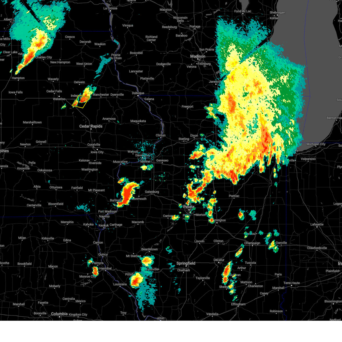 The severe thunderstorm warning for southern buchanan county will expire at 145 am cdt, the storm which prompted the warning has weakened below severe limits, and no longer poses an immediate threat to life or property. therefore, the warning will be allowed to expire. to report severe weather, contact your nearest law enforcement agency. they will relay your report to the national weather service the quad cities. The severe thunderstorm warning for southern buchanan county will expire at 145 am cdt, the storm which prompted the warning has weakened below severe limits, and no longer poses an immediate threat to life or property. therefore, the warning will be allowed to expire. to report severe weather, contact your nearest law enforcement agency. they will relay your report to the national weather service the quad cities.
|
| 6/25/2023 1:30 AM CDT |
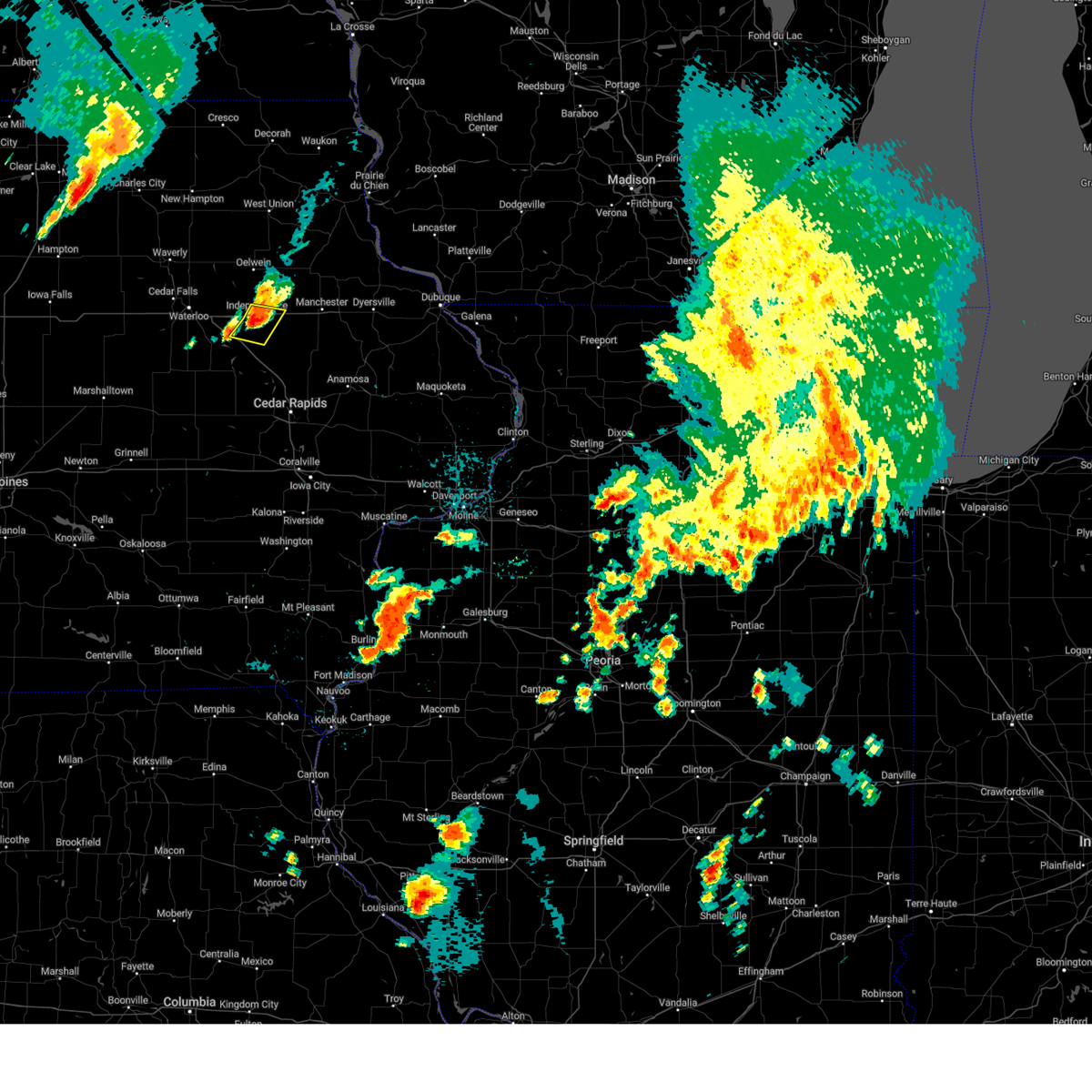 At 130 am cdt, a severe thunderstorm was located near independence, moving east at 35 mph (radar indicated). Hazards include 60 mph wind gusts and penny size hail. Expect damage to roofs, siding, and trees. this severe storm will be near, winthrop and quasqueton around 140 am cdt. hail threat, radar indicated max hail size, 0. 75 in wind threat, radar indicated max wind gust, 60 mph. At 130 am cdt, a severe thunderstorm was located near independence, moving east at 35 mph (radar indicated). Hazards include 60 mph wind gusts and penny size hail. Expect damage to roofs, siding, and trees. this severe storm will be near, winthrop and quasqueton around 140 am cdt. hail threat, radar indicated max hail size, 0. 75 in wind threat, radar indicated max wind gust, 60 mph.
|
| 6/25/2023 1:24 AM CDT |
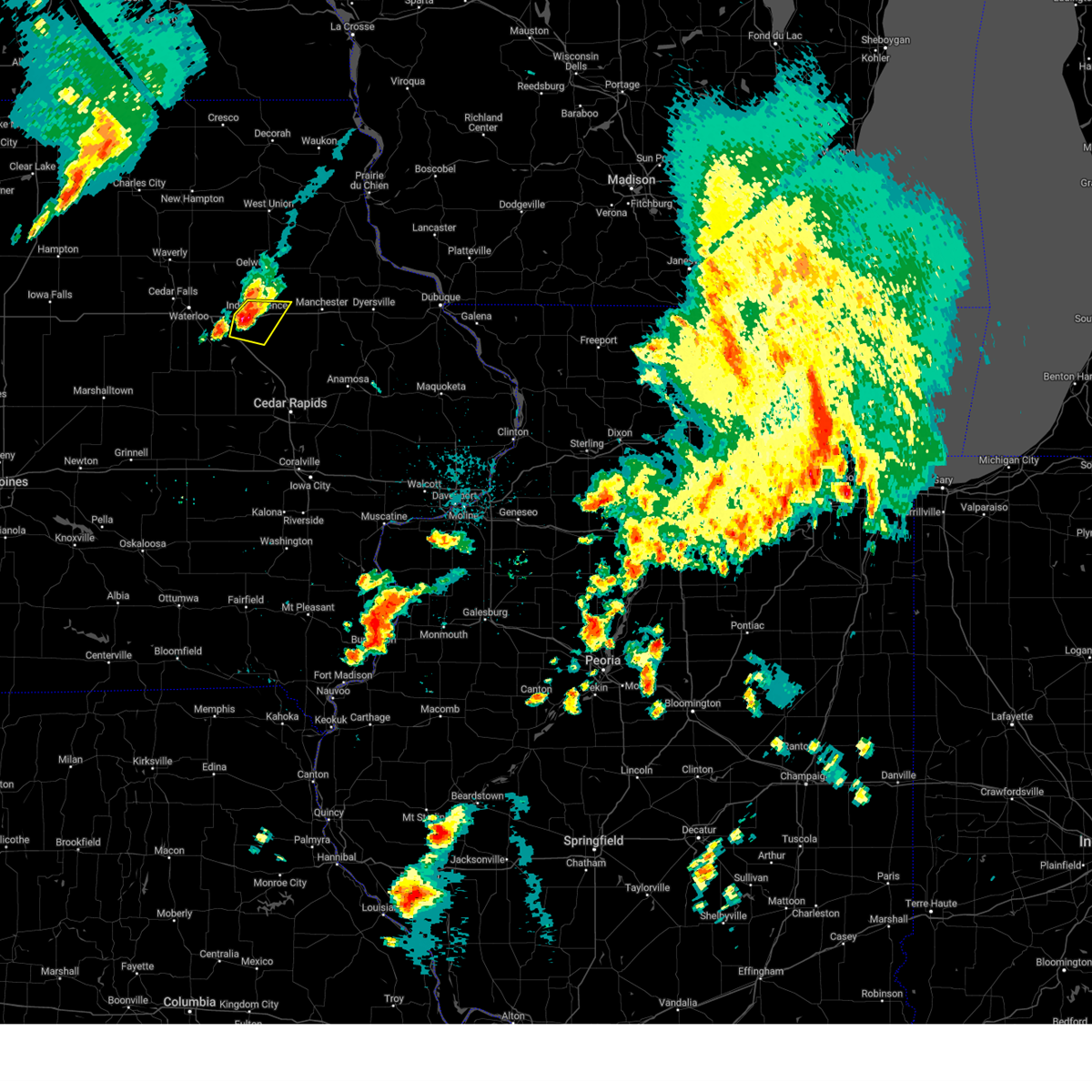 At 123 am cdt, a severe thunderstorm was located over independence airport, or near independence, moving east at 35 mph (radar indicated). Hazards include 60 mph wind gusts and quarter size hail. Hail damage to vehicles is expected. expect wind damage to roofs, siding, and trees. locations impacted include, rowley, winthrop and quasqueton. hail threat, radar indicated max hail size, 1. 00 in wind threat, radar indicated max wind gust, 60 mph. At 123 am cdt, a severe thunderstorm was located over independence airport, or near independence, moving east at 35 mph (radar indicated). Hazards include 60 mph wind gusts and quarter size hail. Hail damage to vehicles is expected. expect wind damage to roofs, siding, and trees. locations impacted include, rowley, winthrop and quasqueton. hail threat, radar indicated max hail size, 1. 00 in wind threat, radar indicated max wind gust, 60 mph.
|
| 6/25/2023 1:10 AM CDT |
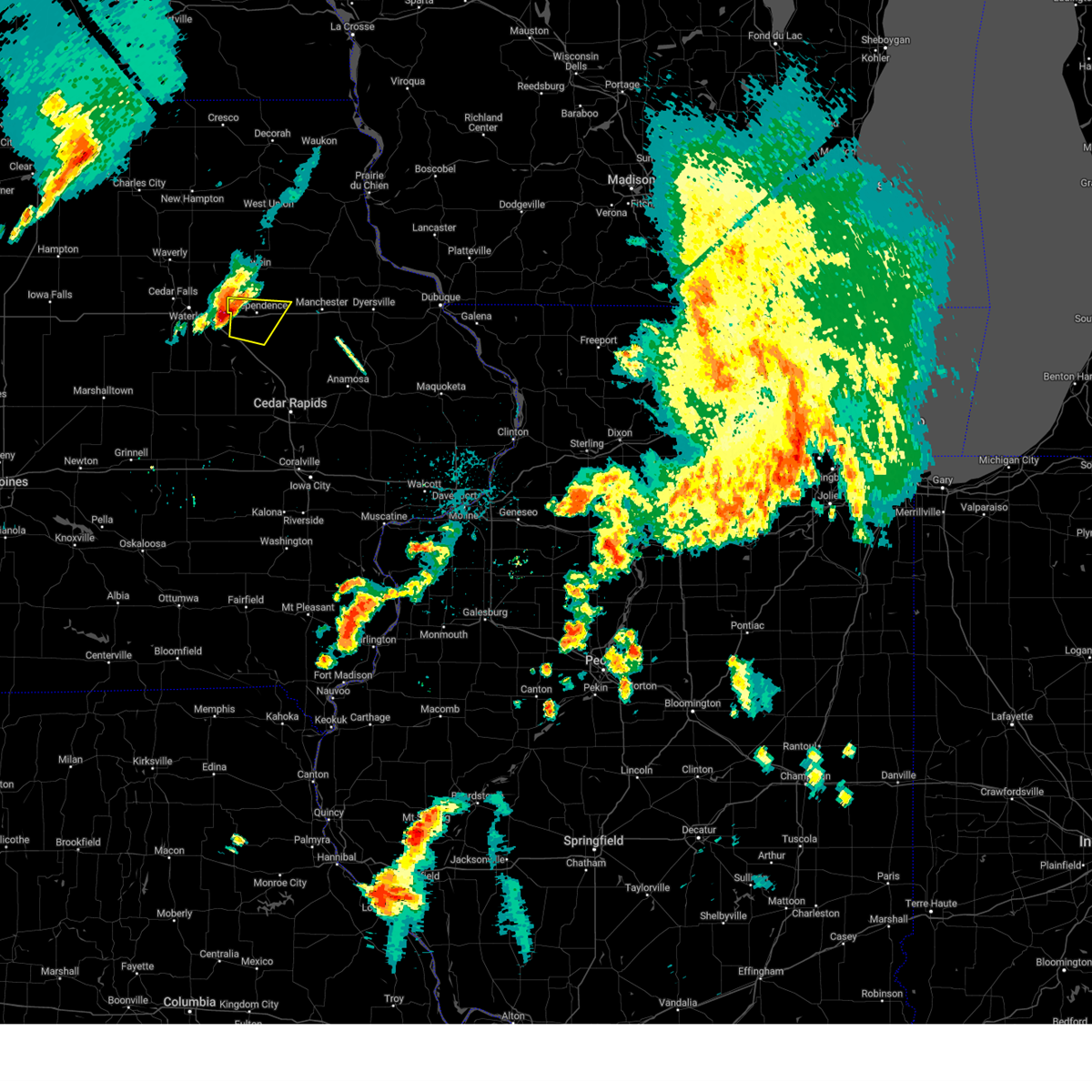 At 109 am cdt, a severe thunderstorm was located near jesup, or 11 miles west of independence, moving east at 35 mph (radar indicated). Hazards include 60 mph wind gusts and half dollar size hail. Hail damage to vehicles is expected. expect wind damage to roofs, siding, and trees. this severe thunderstorm will be near, littleton around 115 am cdt. independence airport, wapsipinicon golf course and otterville around 125 am cdt. other locations in the path of this severe thunderstorm include independence, buchanan county fairgrounds, rowley, winthrop and quasqueton. hail threat, radar indicated max hail size, 1. 25 in wind threat, radar indicated max wind gust, 60 mph. At 109 am cdt, a severe thunderstorm was located near jesup, or 11 miles west of independence, moving east at 35 mph (radar indicated). Hazards include 60 mph wind gusts and half dollar size hail. Hail damage to vehicles is expected. expect wind damage to roofs, siding, and trees. this severe thunderstorm will be near, littleton around 115 am cdt. independence airport, wapsipinicon golf course and otterville around 125 am cdt. other locations in the path of this severe thunderstorm include independence, buchanan county fairgrounds, rowley, winthrop and quasqueton. hail threat, radar indicated max hail size, 1. 25 in wind threat, radar indicated max wind gust, 60 mph.
|
| 5/7/2023 10:12 PM CDT |
 The severe thunderstorm warning for buchanan county will expire at 1015 pm cdt, the storm which prompted the warning has weakened below severe limits, and no longer poses an immediate threat to life or property. therefore, the warning will be allowed to expire. however small hail and gusty winds are still possible with this thunderstorm. a severe thunderstorm watch remains in effect until midnight cdt for northeastern iowa. The severe thunderstorm warning for buchanan county will expire at 1015 pm cdt, the storm which prompted the warning has weakened below severe limits, and no longer poses an immediate threat to life or property. therefore, the warning will be allowed to expire. however small hail and gusty winds are still possible with this thunderstorm. a severe thunderstorm watch remains in effect until midnight cdt for northeastern iowa.
|
| 5/7/2023 10:03 PM CDT |
 At 1003 pm cdt, a severe thunderstorm was located near buchanan county fairgrounds, or near independence, moving east at 30 mph (radar indicated). Hazards include 60 mph wind gusts and quarter size hail. Hail damage to vehicles is expected. expect wind damage to roofs, siding, and trees. locations impacted include, jakway park, winthrop, quasqueton, winthrop golf course and monti. hail threat, radar indicated max hail size, 1. 00 in wind threat, radar indicated max wind gust, 60 mph. At 1003 pm cdt, a severe thunderstorm was located near buchanan county fairgrounds, or near independence, moving east at 30 mph (radar indicated). Hazards include 60 mph wind gusts and quarter size hail. Hail damage to vehicles is expected. expect wind damage to roofs, siding, and trees. locations impacted include, jakway park, winthrop, quasqueton, winthrop golf course and monti. hail threat, radar indicated max hail size, 1. 00 in wind threat, radar indicated max wind gust, 60 mph.
|
| 5/7/2023 9:50 PM CDT | Half Dollar sized hail reported 7.9 miles SE of Independence, IA |
| 5/7/2023 9:50 PM CDT |
 At 949 pm cdt, a severe thunderstorm was located over littleton, or 7 miles northwest of independence, moving east at 35 mph (radar indicated). Hazards include 60 mph wind gusts and half dollar size hail. Hail damage to vehicles is expected. expect wind damage to roofs, siding, and trees. locations impacted include, wapsipinicon golf course, independence airport, independence, buchanan county fairgrounds, jakway park, winthrop, quasqueton, winthrop golf course and monti. hail threat, radar indicated max hail size, 1. 25 in wind threat, radar indicated max wind gust, 60 mph. At 949 pm cdt, a severe thunderstorm was located over littleton, or 7 miles northwest of independence, moving east at 35 mph (radar indicated). Hazards include 60 mph wind gusts and half dollar size hail. Hail damage to vehicles is expected. expect wind damage to roofs, siding, and trees. locations impacted include, wapsipinicon golf course, independence airport, independence, buchanan county fairgrounds, jakway park, winthrop, quasqueton, winthrop golf course and monti. hail threat, radar indicated max hail size, 1. 25 in wind threat, radar indicated max wind gust, 60 mph.
|
| 5/7/2023 9:33 PM CDT |
 At 933 pm cdt, a severe thunderstorm was located over fairbank, or 9 miles west of oelwein, moving east at 40 mph (radar indicated). Hazards include quarter size hail. Damage to vehicles is expected. this severe thunderstorm will be near, littleton around 940 pm cdt. otterville around 945 pm cdt. hazleton, fontana park and fontana county park around 950 pm cdt. other locations in the path of this severe thunderstorm include stanley, aurora, jakway park, winthrop, lamont and winthrop golf course. hail threat, radar indicated max hail size, 1. 00 in wind threat, radar indicated max wind gust, <50 mph. At 933 pm cdt, a severe thunderstorm was located over fairbank, or 9 miles west of oelwein, moving east at 40 mph (radar indicated). Hazards include quarter size hail. Damage to vehicles is expected. this severe thunderstorm will be near, littleton around 940 pm cdt. otterville around 945 pm cdt. hazleton, fontana park and fontana county park around 950 pm cdt. other locations in the path of this severe thunderstorm include stanley, aurora, jakway park, winthrop, lamont and winthrop golf course. hail threat, radar indicated max hail size, 1. 00 in wind threat, radar indicated max wind gust, <50 mph.
|
| 4/4/2023 10:56 PM CDT |
 At 1055 pm cdt, severe thunderstorms were located along a line extending from wapsipinicon golf course to minne estema park to near garrison, moving northeast at 20 mph. at 1055 pm cdt, law enforcement reported golf ball size hail west of independence (law enforcement). Hazards include golf ball size hail and 60 mph wind gusts. People and animals outdoors will be injured. expect hail damage to roofs, siding, windows, and vehicles. expect wind damage to roofs, siding, and trees. these severe storms will be near, jesup, wapsipinicon golf course, otterville, independence airport and littleton around 1100 pm cdt. independence, brandon and buchanan county fairgrounds around 1105 pm cdt. lime creek county park around 1110 pm cdt. fontana county park around 1115 pm cdt. spencers grove around 1120 pm cdt. rowley and hoefle-dulin park around 1130 pm cdt. walker, jakway park and benton city park around 1135 pm cdt. winthrop golf course around 1140 pm cdt. Other locations impacted by these severe thunderstorms include lime creek county park, winthrop golf course, wapsipinicon golf course, vinton memorial airport, rodgers park, benton city park, fontana county park, pleasant creek state recreation area, littleton and hoefle-dulin park. At 1055 pm cdt, severe thunderstorms were located along a line extending from wapsipinicon golf course to minne estema park to near garrison, moving northeast at 20 mph. at 1055 pm cdt, law enforcement reported golf ball size hail west of independence (law enforcement). Hazards include golf ball size hail and 60 mph wind gusts. People and animals outdoors will be injured. expect hail damage to roofs, siding, windows, and vehicles. expect wind damage to roofs, siding, and trees. these severe storms will be near, jesup, wapsipinicon golf course, otterville, independence airport and littleton around 1100 pm cdt. independence, brandon and buchanan county fairgrounds around 1105 pm cdt. lime creek county park around 1110 pm cdt. fontana county park around 1115 pm cdt. spencers grove around 1120 pm cdt. rowley and hoefle-dulin park around 1130 pm cdt. walker, jakway park and benton city park around 1135 pm cdt. winthrop golf course around 1140 pm cdt. Other locations impacted by these severe thunderstorms include lime creek county park, winthrop golf course, wapsipinicon golf course, vinton memorial airport, rodgers park, benton city park, fontana county park, pleasant creek state recreation area, littleton and hoefle-dulin park.
|
| 4/4/2023 10:54 PM CDT | Golf Ball sized hail reported 0.5 miles SSW of Independence, IA |
| 4/4/2023 10:29 PM CDT |
 At 1028 pm cdt, severe thunderstorms were located along a line extending from near jesup to near rodgers park to near elberon, moving northeast at 35 mph (radar indicated). Hazards include 60 mph wind gusts. Expect damage to roofs, siding, and trees. severe thunderstorms will be near, jesup and mount auburn around 1035 pm cdt. minne estema park, independence airport and littleton around 1040 pm cdt. independence, brandon, wapsipinicon golf course, buchanan county fairgrounds and otterville around 1045 pm cdt. lime creek county park and fontana county park around 1050 pm cdt. vinton and benton county fairgrounds around 1055 pm cdt. rowley, hoefle-dulin park and vinton memorial airport around 1100 pm cdt. jakway park and benton city park around 1105 pm cdt. quasqueton, lamont, aurora, cheney and wildcat bluff park around 1110 pm cdt. Other locations impacted by these severe thunderstorms include lime creek county park, winthrop golf course, wapsipinicon golf course, vinton memorial airport, rodgers park, benton city park, fontana county park, pleasant creek state recreation area, littleton and hoefle-dulin park. At 1028 pm cdt, severe thunderstorms were located along a line extending from near jesup to near rodgers park to near elberon, moving northeast at 35 mph (radar indicated). Hazards include 60 mph wind gusts. Expect damage to roofs, siding, and trees. severe thunderstorms will be near, jesup and mount auburn around 1035 pm cdt. minne estema park, independence airport and littleton around 1040 pm cdt. independence, brandon, wapsipinicon golf course, buchanan county fairgrounds and otterville around 1045 pm cdt. lime creek county park and fontana county park around 1050 pm cdt. vinton and benton county fairgrounds around 1055 pm cdt. rowley, hoefle-dulin park and vinton memorial airport around 1100 pm cdt. jakway park and benton city park around 1105 pm cdt. quasqueton, lamont, aurora, cheney and wildcat bluff park around 1110 pm cdt. Other locations impacted by these severe thunderstorms include lime creek county park, winthrop golf course, wapsipinicon golf course, vinton memorial airport, rodgers park, benton city park, fontana county park, pleasant creek state recreation area, littleton and hoefle-dulin park.
|
| 8/3/2022 10:29 AM CDT |
 At 1029 am cdt, severe thunderstorms were located along a line extending from near lime creek county park to cedar rapids, moving east at 40 mph (radar indicated). Hazards include 60 mph wind gusts and penny size hail. Expect damage to roofs, siding, and trees. locations impacted include, cedar rapids, independence, anamosa, vinton, marion, hiawatha, robins, jesup, center point, fairfax, atkins, urbana, central city, springville, palo, shellsburg, winthrop, hazleton, walker and alburnett. hail threat, radar indicated max hail size, 0. 75 in wind threat, radar indicated max wind gust, 60 mph. At 1029 am cdt, severe thunderstorms were located along a line extending from near lime creek county park to cedar rapids, moving east at 40 mph (radar indicated). Hazards include 60 mph wind gusts and penny size hail. Expect damage to roofs, siding, and trees. locations impacted include, cedar rapids, independence, anamosa, vinton, marion, hiawatha, robins, jesup, center point, fairfax, atkins, urbana, central city, springville, palo, shellsburg, winthrop, hazleton, walker and alburnett. hail threat, radar indicated max hail size, 0. 75 in wind threat, radar indicated max wind gust, 60 mph.
|
| 8/3/2022 10:19 AM CDT |
 At 1018 am cdt, severe thunderstorms were located along a line extending from near la porte city to fairfax, moving northeast at 40 mph (radar indicated). Hazards include 60 mph wind gusts and penny size hail. expect damage to roofs, siding, and trees At 1018 am cdt, severe thunderstorms were located along a line extending from near la porte city to fairfax, moving northeast at 40 mph (radar indicated). Hazards include 60 mph wind gusts and penny size hail. expect damage to roofs, siding, and trees
|
| 7/23/2022 11:57 PM CDT |
 At 1157 pm cdt, severe thunderstorms were located along a line extending from near highways 3 and 187 to near newhall, moving east at 45 mph (radar indicated). Hazards include 60 mph wind gusts. Expect damage to roofs, siding, and trees. locations impacted include, independence, robins, center point, urbana, palo, shellsburg, winthrop, walker, alburnett, quasqueton, lamont, rowley, aurora, stanley, toddville, troy mills, monti, jakway park, wildcat bluff park and cheney. hail threat, radar indicated max hail size, <. 75 in wind threat, radar indicated max wind gust, 60 mph. At 1157 pm cdt, severe thunderstorms were located along a line extending from near highways 3 and 187 to near newhall, moving east at 45 mph (radar indicated). Hazards include 60 mph wind gusts. Expect damage to roofs, siding, and trees. locations impacted include, independence, robins, center point, urbana, palo, shellsburg, winthrop, walker, alburnett, quasqueton, lamont, rowley, aurora, stanley, toddville, troy mills, monti, jakway park, wildcat bluff park and cheney. hail threat, radar indicated max hail size, <. 75 in wind threat, radar indicated max wind gust, 60 mph.
|
| 7/23/2022 11:55 PM CDT | Awos station kiib independence arp in buchanan county IA, 2.5 miles ENE of Independence, IA |
| 7/23/2022 11:47 PM CDT |
 At 1147 pm cdt, severe thunderstorms were located along a line extending from near county roads 3 and w 45 to near van horne, moving east at 50 mph (radar indicated). Hazards include 60 mph wind gusts. Expect damage to roofs, siding, and trees. locations impacted include, independence, vinton, robins, jesup, center point, urbana, dysart, fairbank, palo, shellsburg, winthrop, hazleton, walker, van horne, alburnett, keystone, quasqueton, lamont, garrison and brandon. hail threat, radar indicated max hail size, <. 75 in wind threat, radar indicated max wind gust, 60 mph. At 1147 pm cdt, severe thunderstorms were located along a line extending from near county roads 3 and w 45 to near van horne, moving east at 50 mph (radar indicated). Hazards include 60 mph wind gusts. Expect damage to roofs, siding, and trees. locations impacted include, independence, vinton, robins, jesup, center point, urbana, dysart, fairbank, palo, shellsburg, winthrop, hazleton, walker, van horne, alburnett, keystone, quasqueton, lamont, garrison and brandon. hail threat, radar indicated max hail size, <. 75 in wind threat, radar indicated max wind gust, 60 mph.
|
| 7/23/2022 11:40 PM CDT |
 At 1140 pm cdt, severe thunderstorms were located along a line extending from near oelwein to near keystone, moving east at 50 mph (radar indicated). Hazards include 60 mph wind gusts. Expect damage to roofs, siding, and trees. locations impacted include, independence, vinton, robins, jesup, center point, urbana, dysart, fairbank, palo, shellsburg, winthrop, hazleton, walker, van horne, alburnett, keystone, quasqueton, lamont, garrison and brandon. hail threat, radar indicated max hail size, <. 75 in wind threat, radar indicated max wind gust, 60 mph. At 1140 pm cdt, severe thunderstorms were located along a line extending from near oelwein to near keystone, moving east at 50 mph (radar indicated). Hazards include 60 mph wind gusts. Expect damage to roofs, siding, and trees. locations impacted include, independence, vinton, robins, jesup, center point, urbana, dysart, fairbank, palo, shellsburg, winthrop, hazleton, walker, van horne, alburnett, keystone, quasqueton, lamont, garrison and brandon. hail threat, radar indicated max hail size, <. 75 in wind threat, radar indicated max wind gust, 60 mph.
|
| 7/23/2022 11:32 PM CDT |
 At 1131 pm cdt, severe thunderstorms were located along a line extending from near fairbank to near belle plaine, moving east at 50 mph (radar indicated). Hazards include 60 mph wind gusts. expect damage to roofs, siding, and trees At 1131 pm cdt, severe thunderstorms were located along a line extending from near fairbank to near belle plaine, moving east at 50 mph (radar indicated). Hazards include 60 mph wind gusts. expect damage to roofs, siding, and trees
|
| 7/5/2022 9:04 PM CDT | Storm damage reported in buchanan county IA, 1.4 miles WSW of Independence, IA |
| 7/5/2022 8:55 PM CDT | 6 to 8 inch tree branch dow in buchanan county IA, 0.5 miles SSE of Independence, IA |
| 7/5/2022 8:54 PM CDT |
 At 854 pm cdt, a severe thunderstorm capable of producing a tornado was located near independence, moving east at 40 mph (weather spotters reported a funnel cloud). Hazards include tornado. Flying debris will be dangerous to those caught without shelter. mobile homes will be damaged or destroyed. damage to roofs, windows, and vehicles will occur. tree damage is likely. this dangerous storm will be near, winthrop and quasqueton around 900 pm cdt. Other locations in the path of this tornadic thunderstorm include winthrop golf course and monti. At 854 pm cdt, a severe thunderstorm capable of producing a tornado was located near independence, moving east at 40 mph (weather spotters reported a funnel cloud). Hazards include tornado. Flying debris will be dangerous to those caught without shelter. mobile homes will be damaged or destroyed. damage to roofs, windows, and vehicles will occur. tree damage is likely. this dangerous storm will be near, winthrop and quasqueton around 900 pm cdt. Other locations in the path of this tornadic thunderstorm include winthrop golf course and monti.
|
| 7/5/2022 8:51 PM CDT | Estimated gusts of 60-7 in buchanan county IA, 0.5 miles SSE of Independence, IA |
| 7/5/2022 8:42 PM CDT |
 At 842 pm cdt, a severe thunderstorm capable of producing a tornado was located over littleton, or 7 miles northwest of independence, moving east at 45 mph (weather spotters reported funnel cloud). Hazards include tornado. Flying debris will be dangerous to those caught without shelter. mobile homes will be damaged or destroyed. damage to roofs, windows, and vehicles will occur. tree damage is likely. this dangerous storm will be near, independence and buchanan county fairgrounds around 850 pm cdt. jakway park around 855 pm cdt. winthrop and quasqueton around 900 pm cdt. Other locations in the path of this tornadic thunderstorm include winthrop golf course and monti. At 842 pm cdt, a severe thunderstorm capable of producing a tornado was located over littleton, or 7 miles northwest of independence, moving east at 45 mph (weather spotters reported funnel cloud). Hazards include tornado. Flying debris will be dangerous to those caught without shelter. mobile homes will be damaged or destroyed. damage to roofs, windows, and vehicles will occur. tree damage is likely. this dangerous storm will be near, independence and buchanan county fairgrounds around 850 pm cdt. jakway park around 855 pm cdt. winthrop and quasqueton around 900 pm cdt. Other locations in the path of this tornadic thunderstorm include winthrop golf course and monti.
|
| 7/5/2022 8:35 PM CDT | Emergency manager reported trees and powerlines down across the county. wind continued for several minutes. leading edge of storm approximately moved through between 83 in buchanan county IA, 0.9 miles WSW of Independence, IA |
| 7/5/2022 8:23 PM CDT |
 At 821 pm cdt, severe thunderstorms were located along a line extending from near frederika to near denver to near reinbeck, moving east at 50 mph (trained weather spotters). Hazards include 70 mph wind gusts. Expect considerable tree damage. damage is likely to mobile homes, roofs, and outbuildings. locations impacted include, independence, jesup, fairbank, winthrop, hazleton, quasqueton, lamont, brandon, rowley, aurora, stanley, lime creek county park, winthrop golf course, wapsipinicon golf course, fontana county park, littleton, monti, buchanan county fairgrounds, otterville and independence airport. thunderstorm damage threat, considerable hail threat, radar indicated max hail size, <. 75 in wind threat, observed max wind gust, 70 mph. At 821 pm cdt, severe thunderstorms were located along a line extending from near frederika to near denver to near reinbeck, moving east at 50 mph (trained weather spotters). Hazards include 70 mph wind gusts. Expect considerable tree damage. damage is likely to mobile homes, roofs, and outbuildings. locations impacted include, independence, jesup, fairbank, winthrop, hazleton, quasqueton, lamont, brandon, rowley, aurora, stanley, lime creek county park, winthrop golf course, wapsipinicon golf course, fontana county park, littleton, monti, buchanan county fairgrounds, otterville and independence airport. thunderstorm damage threat, considerable hail threat, radar indicated max hail size, <. 75 in wind threat, observed max wind gust, 70 mph.
|
| 7/5/2022 8:11 PM CDT |
 At 811 pm cdt, severe thunderstorms were located along a line extending from near frederika to near waterloo municipal airport to lincoln, moving east at 50 mph (radar indicated). Hazards include 60 mph wind gusts. expect damage to roofs, siding, and trees At 811 pm cdt, severe thunderstorms were located along a line extending from near frederika to near waterloo municipal airport to lincoln, moving east at 50 mph (radar indicated). Hazards include 60 mph wind gusts. expect damage to roofs, siding, and trees
|
| 6/15/2022 4:54 PM CDT |
 At 454 pm cdt, a severe thunderstorm was located near buchanan county fairgrounds, or near independence, moving northeast at 55 mph (radar indicated). Hazards include ping pong ball size hail and 60 mph wind gusts. People and animals outdoors will be injured. expect hail damage to roofs, siding, windows, and vehicles. expect wind damage to roofs, siding, and trees. this severe storm will be near, stanley around 500 pm cdt. aurora, jakway park and winthrop golf course around 505 pm cdt. other locations in the path of this severe thunderstorm include lamont, dundee and backbone state park. hail threat, radar indicated max hail size, 1. 50 in wind threat, radar indicated max wind gust, 60 mph. At 454 pm cdt, a severe thunderstorm was located near buchanan county fairgrounds, or near independence, moving northeast at 55 mph (radar indicated). Hazards include ping pong ball size hail and 60 mph wind gusts. People and animals outdoors will be injured. expect hail damage to roofs, siding, windows, and vehicles. expect wind damage to roofs, siding, and trees. this severe storm will be near, stanley around 500 pm cdt. aurora, jakway park and winthrop golf course around 505 pm cdt. other locations in the path of this severe thunderstorm include lamont, dundee and backbone state park. hail threat, radar indicated max hail size, 1. 50 in wind threat, radar indicated max wind gust, 60 mph.
|
| 6/15/2022 4:48 PM CDT |
 At 448 pm cdt, a severe thunderstorm was located over wapsipinicon golf course, or over independence, moving northeast at 60 mph (radar indicated). Hazards include ping pong ball size hail and 60 mph wind gusts. People and animals outdoors will be injured. expect hail damage to roofs, siding, windows, and vehicles. expect wind damage to roofs, siding, and trees. this severe thunderstorm will be near, winthrop around 455 pm cdt. stanley and jakway park around 500 pm cdt. lamont and aurora around 505 pm cdt. other locations in the path of this severe thunderstorm include backbone state park. hail threat, radar indicated max hail size, 1. 50 in wind threat, radar indicated max wind gust, 60 mph. At 448 pm cdt, a severe thunderstorm was located over wapsipinicon golf course, or over independence, moving northeast at 60 mph (radar indicated). Hazards include ping pong ball size hail and 60 mph wind gusts. People and animals outdoors will be injured. expect hail damage to roofs, siding, windows, and vehicles. expect wind damage to roofs, siding, and trees. this severe thunderstorm will be near, winthrop around 455 pm cdt. stanley and jakway park around 500 pm cdt. lamont and aurora around 505 pm cdt. other locations in the path of this severe thunderstorm include backbone state park. hail threat, radar indicated max hail size, 1. 50 in wind threat, radar indicated max wind gust, 60 mph.
|
| 6/11/2022 9:50 PM CDT |
 The tornado warning for south central buchanan county will expire at 1000 pm cdt, the storm which prompted the warning has weakened below severe limits, and no longer appears capable of producing a tornado. therefore, the warning will be allowed to expire. however heavy rain is still possible with this thunderstorm. The tornado warning for south central buchanan county will expire at 1000 pm cdt, the storm which prompted the warning has weakened below severe limits, and no longer appears capable of producing a tornado. therefore, the warning will be allowed to expire. however heavy rain is still possible with this thunderstorm.
|
| 6/11/2022 9:45 PM CDT |
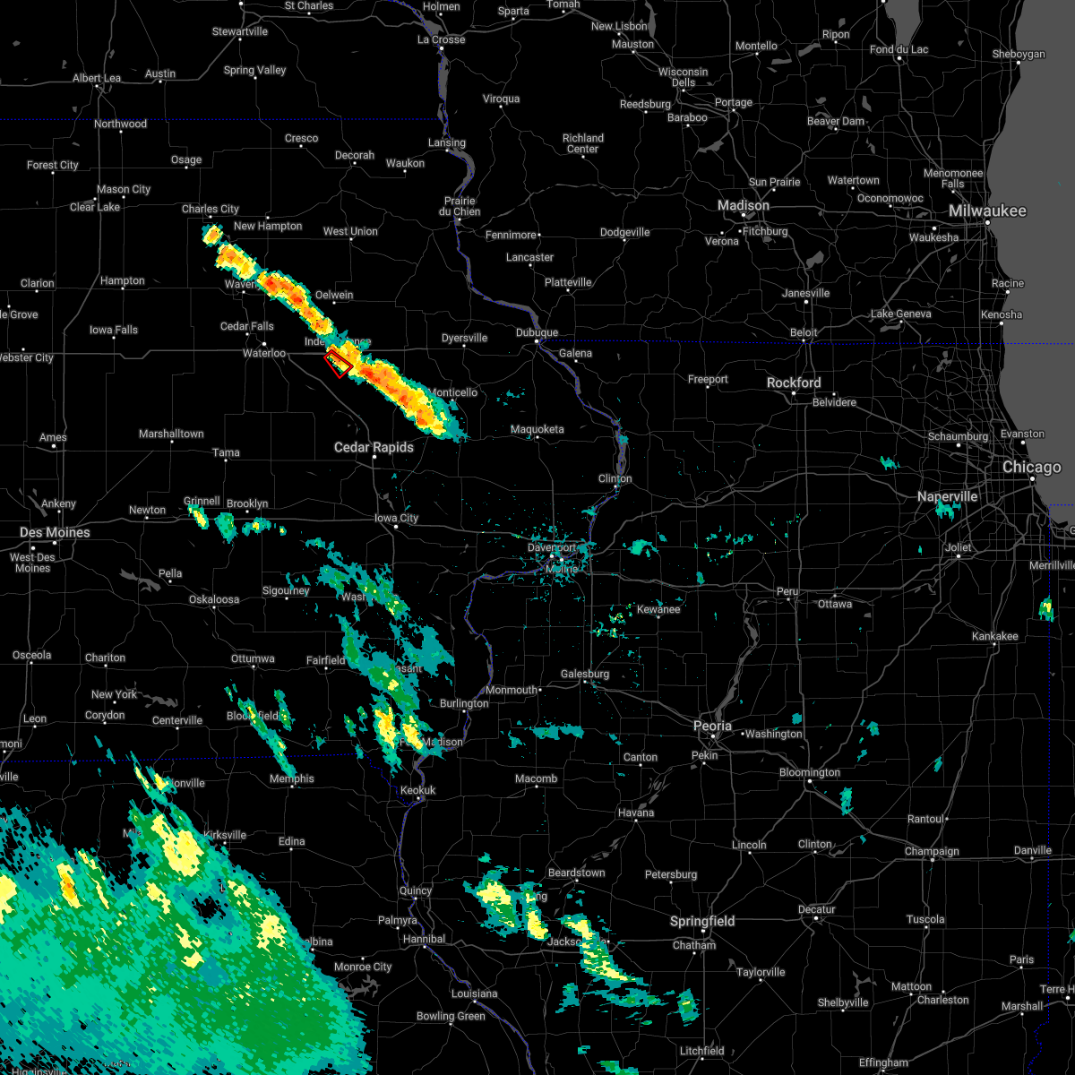 At 945 pm cdt, a severe thunderstorm capable of producing a tornado was located over independence airport, or near independence, moving southeast at 15 mph (radar indicated rotation). Hazards include tornado. Flying debris will be dangerous to those caught without shelter. mobile homes will be damaged or destroyed. damage to roofs, windows, and vehicles will occur. tree damage is likely. Locations impacted include, rowley. At 945 pm cdt, a severe thunderstorm capable of producing a tornado was located over independence airport, or near independence, moving southeast at 15 mph (radar indicated rotation). Hazards include tornado. Flying debris will be dangerous to those caught without shelter. mobile homes will be damaged or destroyed. damage to roofs, windows, and vehicles will occur. tree damage is likely. Locations impacted include, rowley.
|
| 6/11/2022 9:37 PM CDT |
 At 937 pm cdt, a severe thunderstorm capable of producing a tornado was located over independence airport, or near independence, moving southeast at 15 mph (radar indicated rotation). Hazards include tornado. Flying debris will be dangerous to those caught without shelter. mobile homes will be damaged or destroyed. damage to roofs, windows, and vehicles will occur. Tree damage is likely. At 937 pm cdt, a severe thunderstorm capable of producing a tornado was located over independence airport, or near independence, moving southeast at 15 mph (radar indicated rotation). Hazards include tornado. Flying debris will be dangerous to those caught without shelter. mobile homes will be damaged or destroyed. damage to roofs, windows, and vehicles will occur. Tree damage is likely.
|
| 12/15/2021 8:17 PM CST |
 At 817 pm cst, a severe thunderstorm capable of producing a tornado was located near quasqueton, or near independence, moving northeast at 55 mph (radar indicated rotation). Hazards include tornado. Flying debris will be dangerous to those caught without shelter. mobile homes will be damaged or destroyed. damage to roofs, windows, and vehicles will occur. tree damage is likely. This dangerous storm will be near, winthrop around 825 pm cst. At 817 pm cst, a severe thunderstorm capable of producing a tornado was located near quasqueton, or near independence, moving northeast at 55 mph (radar indicated rotation). Hazards include tornado. Flying debris will be dangerous to those caught without shelter. mobile homes will be damaged or destroyed. damage to roofs, windows, and vehicles will occur. tree damage is likely. This dangerous storm will be near, winthrop around 825 pm cst.
|
| 12/15/2021 8:06 PM CST |
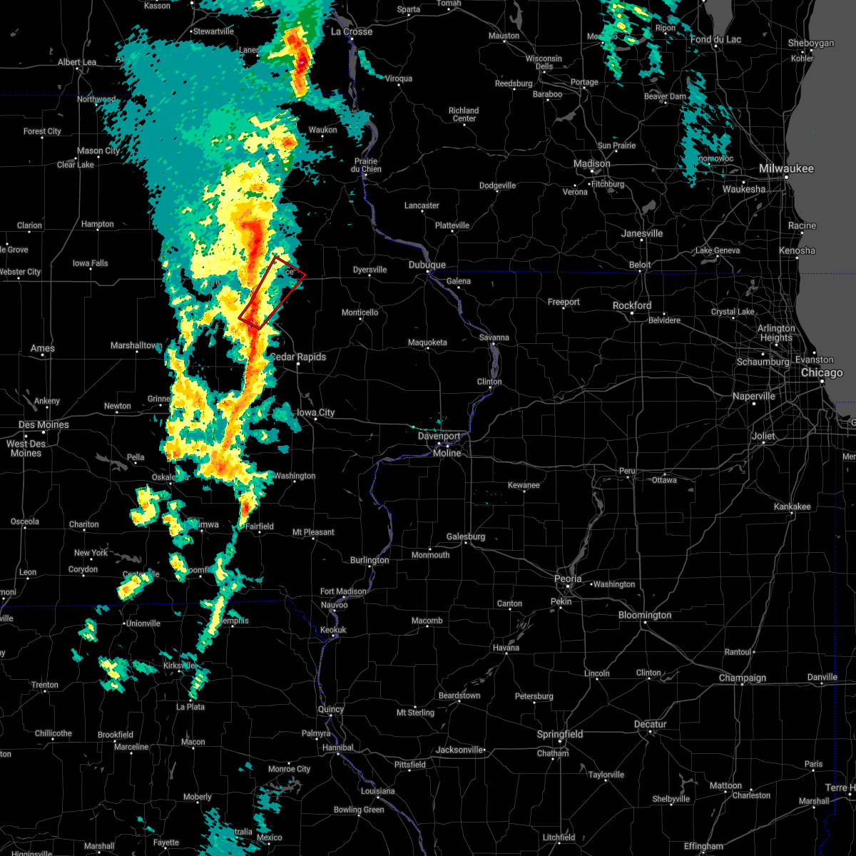 At 805 pm cst, a severe thunderstorm capable of producing a tornado was located near brandon, or 7 miles north of vinton, moving northeast at 60 mph (radar indicated rotation). Hazards include tornado. Flying debris will be dangerous to those caught without shelter. mobile homes will be damaged or destroyed. damage to roofs, windows, and vehicles will occur. tree damage is likely. this dangerous storm will be near, rowley around 815 pm cst. independence and quasqueton around 820 pm cst. Winthrop around 825 pm cst. At 805 pm cst, a severe thunderstorm capable of producing a tornado was located near brandon, or 7 miles north of vinton, moving northeast at 60 mph (radar indicated rotation). Hazards include tornado. Flying debris will be dangerous to those caught without shelter. mobile homes will be damaged or destroyed. damage to roofs, windows, and vehicles will occur. tree damage is likely. this dangerous storm will be near, rowley around 815 pm cst. independence and quasqueton around 820 pm cst. Winthrop around 825 pm cst.
|
| 12/15/2021 7:51 PM CST |
 At 751 pm cst, severe thunderstorms were located along a line extending from 6 miles northeast of waterloo to near la porte city, moving northeast at 70 mph. these are destructive storms for buchanan county (radar indicated). Hazards include 80 mph wind gusts. Flying debris will be dangerous to those caught without shelter. mobile homes will be heavily damaged. expect considerable damage to roofs, windows, and vehicles. extensive tree damage and power outages are likely. Locations impacted include, fairbank, jesup, independence, hazleton, aurora, stanley and lamont. At 751 pm cst, severe thunderstorms were located along a line extending from 6 miles northeast of waterloo to near la porte city, moving northeast at 70 mph. these are destructive storms for buchanan county (radar indicated). Hazards include 80 mph wind gusts. Flying debris will be dangerous to those caught without shelter. mobile homes will be heavily damaged. expect considerable damage to roofs, windows, and vehicles. extensive tree damage and power outages are likely. Locations impacted include, fairbank, jesup, independence, hazleton, aurora, stanley and lamont.
|
| 8/24/2021 2:55 PM CDT | Large 8-10 inch diameter branch dow in buchanan county IA, 0.9 miles WSW of Independence, IA |
| 8/24/2021 2:54 PM CDT |
 At 254 pm cdt, severe thunderstorms were located along a line extending from near stanley to near independence to near dysart, moving east at 45 mph (trained weather spotters). Hazards include 70 mph wind gusts. Expect considerable tree damage. damage is likely to mobile homes, roofs, and outbuildings. these severe storms will be near, independence, winthrop, aurora and stanley around 300 pm cdt. quasqueton around 305 pm cdt. other locations in the path of these severe thunderstorms include vinton, lamont, masonville, dundee, manchester, urbana, edgewood, ryan, center point, delaware, delhi, greeley, oneida, earlville, hopkinton and colesburg. thunderstorm damage threat, considerable hail threat, radar indicated max hail size, <. 75 in wind threat, observed max wind gust, 70 mph. At 254 pm cdt, severe thunderstorms were located along a line extending from near stanley to near independence to near dysart, moving east at 45 mph (trained weather spotters). Hazards include 70 mph wind gusts. Expect considerable tree damage. damage is likely to mobile homes, roofs, and outbuildings. these severe storms will be near, independence, winthrop, aurora and stanley around 300 pm cdt. quasqueton around 305 pm cdt. other locations in the path of these severe thunderstorms include vinton, lamont, masonville, dundee, manchester, urbana, edgewood, ryan, center point, delaware, delhi, greeley, oneida, earlville, hopkinton and colesburg. thunderstorm damage threat, considerable hail threat, radar indicated max hail size, <. 75 in wind threat, observed max wind gust, 70 mph.
|
| 8/24/2021 2:50 PM CDT | Storm damage reported in buchanan county IA, 6.4 miles SSW of Independence, IA |
| 8/24/2021 2:49 PM CDT |
 At 249 pm cdt, severe thunderstorms were located along a line extending from near oelwein to near independence to la porte city, moving east at 45 mph (trained weather spotters). Hazards include 70 mph wind gusts. Expect considerable tree damage. damage is likely to mobile homes, roofs, and outbuildings. severe thunderstorms will be near, stanley around 255 pm cdt. vinton, winthrop, quasqueton and aurora around 300 pm cdt. lamont around 305 pm cdt. other locations in the path of these severe thunderstorms include urbana, masonville, manchester, center point, walker, dundee, edgewood, ryan, troy mills, alburnett, delhi, greeley, delaware, oneida, paris, central city, earlville, coggon and colesburg. thunderstorm damage threat, considerable hail threat, radar indicated max hail size, <. 75 in wind threat, observed max wind gust, 70 mph. At 249 pm cdt, severe thunderstorms were located along a line extending from near oelwein to near independence to la porte city, moving east at 45 mph (trained weather spotters). Hazards include 70 mph wind gusts. Expect considerable tree damage. damage is likely to mobile homes, roofs, and outbuildings. severe thunderstorms will be near, stanley around 255 pm cdt. vinton, winthrop, quasqueton and aurora around 300 pm cdt. lamont around 305 pm cdt. other locations in the path of these severe thunderstorms include urbana, masonville, manchester, center point, walker, dundee, edgewood, ryan, troy mills, alburnett, delhi, greeley, delaware, oneida, paris, central city, earlville, coggon and colesburg. thunderstorm damage threat, considerable hail threat, radar indicated max hail size, <. 75 in wind threat, observed max wind gust, 70 mph.
|
| 8/24/2021 2:44 PM CDT |
 At 243 pm cdt, severe thunderstorms were located along a line extending from near hazleton to near la porte city, moving east at 50 mph (radar indicated). Hazards include 60 mph wind gusts and quarter size hail. Hail damage to vehicles is expected. expect wind damage to roofs, siding, and trees. these severe storms will be near, independence, hazleton and stanley around 250 pm cdt. other locations in the path of these severe thunderstorms include brandon, winthrop, quasqueton, rowley, aurora and lamont. hail threat, radar indicated max hail size, 1. 00 in wind threat, radar indicated max wind gust, 60 mph. At 243 pm cdt, severe thunderstorms were located along a line extending from near hazleton to near la porte city, moving east at 50 mph (radar indicated). Hazards include 60 mph wind gusts and quarter size hail. Hail damage to vehicles is expected. expect wind damage to roofs, siding, and trees. these severe storms will be near, independence, hazleton and stanley around 250 pm cdt. other locations in the path of these severe thunderstorms include brandon, winthrop, quasqueton, rowley, aurora and lamont. hail threat, radar indicated max hail size, 1. 00 in wind threat, radar indicated max wind gust, 60 mph.
|
| 8/24/2021 2:31 PM CDT |
 At 230 pm cdt, severe thunderstorms were located along a line extending from 6 miles west of fairbank to near crossroads mall, moving east at 50 mph (waterloo airport observations). Hazards include 60 mph wind gusts and quarter size hail. Hail damage to vehicles is expected. expect wind damage to roofs, siding, and trees. these severe storms will be near, fairbank around 235 pm cdt. other locations in the path of these severe thunderstorms include jesup, hazleton, independence, brandon, stanley, aurora, winthrop, quasqueton, lamont and rowley. hail threat, radar indicated max hail size, 1. 00 in wind threat, observed max wind gust, 60 mph. At 230 pm cdt, severe thunderstorms were located along a line extending from 6 miles west of fairbank to near crossroads mall, moving east at 50 mph (waterloo airport observations). Hazards include 60 mph wind gusts and quarter size hail. Hail damage to vehicles is expected. expect wind damage to roofs, siding, and trees. these severe storms will be near, fairbank around 235 pm cdt. other locations in the path of these severe thunderstorms include jesup, hazleton, independence, brandon, stanley, aurora, winthrop, quasqueton, lamont and rowley. hail threat, radar indicated max hail size, 1. 00 in wind threat, observed max wind gust, 60 mph.
|
| 8/24/2021 2:21 PM CDT |
 At 220 pm cdt, severe thunderstorms were located along a line extending from near denver to hudson, moving east at 50 mph (radar indicated). Hazards include 60 mph wind gusts and quarter size hail. Hail damage to vehicles is expected. expect wind damage to roofs, siding, and trees. severe thunderstorms will be near, fairbank around 235 pm cdt. jesup around 240 pm cdt. other locations in the path of these severe thunderstorms include hazleton, independence, brandon, stanley, aurora, winthrop, quasqueton, lamont and rowley. hail threat, radar indicated max hail size, 1. 00 in wind threat, radar indicated max wind gust, 60 mph. At 220 pm cdt, severe thunderstorms were located along a line extending from near denver to hudson, moving east at 50 mph (radar indicated). Hazards include 60 mph wind gusts and quarter size hail. Hail damage to vehicles is expected. expect wind damage to roofs, siding, and trees. severe thunderstorms will be near, fairbank around 235 pm cdt. jesup around 240 pm cdt. other locations in the path of these severe thunderstorms include hazleton, independence, brandon, stanley, aurora, winthrop, quasqueton, lamont and rowley. hail threat, radar indicated max hail size, 1. 00 in wind threat, radar indicated max wind gust, 60 mph.
|
| 8/10/2021 4:28 PM CDT |
 At 428 pm cdt, severe thunderstorms were located along a line extending from near brandon to near paris, moving northeast at 25 mph (radar indicated). Hazards include 60 mph wind gusts and nickel size hail. Expect damage to roofs, siding, and trees. severe thunderstorms will be near, troy mills around 435 pm cdt. other locations in the path of these severe thunderstorms include independence and winthrop. hail threat, radar indicated max hail size, 0. 88 in wind threat, radar indicated max wind gust, 60 mph. At 428 pm cdt, severe thunderstorms were located along a line extending from near brandon to near paris, moving northeast at 25 mph (radar indicated). Hazards include 60 mph wind gusts and nickel size hail. Expect damage to roofs, siding, and trees. severe thunderstorms will be near, troy mills around 435 pm cdt. other locations in the path of these severe thunderstorms include independence and winthrop. hail threat, radar indicated max hail size, 0. 88 in wind threat, radar indicated max wind gust, 60 mph.
|
| 8/10/2021 3:22 PM CDT |
 At 320 pm cdt, severe thunderstorms were located along a line extending from near volga to near urbana, moving southeast at 30 mph. trained spotter estimated 60 mph gust at independence high school (trained weather spotters estimated 60 mph gust at independence high school). Hazards include 60 mph wind gusts and quarter size hail. Hail damage to vehicles is expected. expect wind damage to roofs, siding, and trees. locations impacted include, independence, jesup, fairbank, winthrop, hazleton, quasqueton, lamont, brandon, rowley, aurora, stanley, lime creek county park, winthrop golf course, wapsipinicon golf course, fontana county park, littleton, monti, buchanan county fairgrounds, otterville and independence airport. hail threat, radar indicated max hail size, 1. 00 in wind threat, radar indicated max wind gust, 60 mph. At 320 pm cdt, severe thunderstorms were located along a line extending from near volga to near urbana, moving southeast at 30 mph. trained spotter estimated 60 mph gust at independence high school (trained weather spotters estimated 60 mph gust at independence high school). Hazards include 60 mph wind gusts and quarter size hail. Hail damage to vehicles is expected. expect wind damage to roofs, siding, and trees. locations impacted include, independence, jesup, fairbank, winthrop, hazleton, quasqueton, lamont, brandon, rowley, aurora, stanley, lime creek county park, winthrop golf course, wapsipinicon golf course, fontana county park, littleton, monti, buchanan county fairgrounds, otterville and independence airport. hail threat, radar indicated max hail size, 1. 00 in wind threat, radar indicated max wind gust, 60 mph.
|
| 8/10/2021 3:12 PM CDT | Storm damage reported in buchanan county IA, 0.9 miles ESE of Independence, IA |
| 8/10/2021 3:09 PM CDT |
 At 308 pm cdt, severe thunderstorms were located along a line extending from near volga to near vinton, moving east-southeast at 30 mph (radar indicated). Hazards include 60 mph wind gusts and quarter size hail. Hail damage to vehicles is expected. expect wind damage to roofs, siding, and trees. locations impacted include, independence, jesup, fairbank, winthrop, hazleton, quasqueton, lamont, brandon, rowley, aurora, stanley, lime creek county park, winthrop golf course, wapsipinicon golf course, fontana county park, littleton, monti, buchanan county fairgrounds, otterville and independence airport. hail threat, radar indicated max hail size, 1. 00 in wind threat, radar indicated max wind gust, 60 mph. At 308 pm cdt, severe thunderstorms were located along a line extending from near volga to near vinton, moving east-southeast at 30 mph (radar indicated). Hazards include 60 mph wind gusts and quarter size hail. Hail damage to vehicles is expected. expect wind damage to roofs, siding, and trees. locations impacted include, independence, jesup, fairbank, winthrop, hazleton, quasqueton, lamont, brandon, rowley, aurora, stanley, lime creek county park, winthrop golf course, wapsipinicon golf course, fontana county park, littleton, monti, buchanan county fairgrounds, otterville and independence airport. hail threat, radar indicated max hail size, 1. 00 in wind threat, radar indicated max wind gust, 60 mph.
|
| 8/10/2021 2:55 PM CDT |
 At 255 pm cdt, severe thunderstorms were located along a line extending from near fayette to mount auburn, moving southeast at 30 mph (radar indicated). Hazards include 60 mph wind gusts and quarter size hail. Hail damage to vehicles is expected. expect wind damage to roofs, siding, and trees. these severe thunderstorms will remain over mainly rural areas of buchanan county, including the following locations, lime creek county park, monti, buchanan county fairgrounds, winthrop golf course, otterville, wapsipinicon golf course, independence airport, jakway park, fontana county park and fontana park. hail threat, radar indicated max hail size, 1. 00 in wind threat, radar indicated max wind gust, 60 mph. At 255 pm cdt, severe thunderstorms were located along a line extending from near fayette to mount auburn, moving southeast at 30 mph (radar indicated). Hazards include 60 mph wind gusts and quarter size hail. Hail damage to vehicles is expected. expect wind damage to roofs, siding, and trees. these severe thunderstorms will remain over mainly rural areas of buchanan county, including the following locations, lime creek county park, monti, buchanan county fairgrounds, winthrop golf course, otterville, wapsipinicon golf course, independence airport, jakway park, fontana county park and fontana park. hail threat, radar indicated max hail size, 1. 00 in wind threat, radar indicated max wind gust, 60 mph.
|
| 7/14/2021 7:16 PM CDT |
 At 716 pm cdt, severe thunderstorms were located along a line extending from near lamont to troy mills, moving east at 35 mph (radar indicated). Hazards include 60 mph wind gusts and quarter size hail. Hail damage to vehicles is expected. expect wind damage to roofs, siding, and trees. these severe storms will be near, dundee around 720 pm cdt. Other locations in the path of these severe thunderstorms include manchester, edgewood and greeley. At 716 pm cdt, severe thunderstorms were located along a line extending from near lamont to troy mills, moving east at 35 mph (radar indicated). Hazards include 60 mph wind gusts and quarter size hail. Hail damage to vehicles is expected. expect wind damage to roofs, siding, and trees. these severe storms will be near, dundee around 720 pm cdt. Other locations in the path of these severe thunderstorms include manchester, edgewood and greeley.
|
| 7/14/2021 7:06 PM CDT |
 At 705 pm cdt, severe thunderstorms were located along a line extending from aurora to walker, moving east at 35 mph (radar indicated). Hazards include 60 mph wind gusts and quarter size hail. Hail damage to vehicles is expected. expect wind damage to roofs, siding, and trees. these severe storms will be near, lamont around 715 pm cdt. Other locations in the path of these severe thunderstorms include dundee, manchester, edgewood and greeley. At 705 pm cdt, severe thunderstorms were located along a line extending from aurora to walker, moving east at 35 mph (radar indicated). Hazards include 60 mph wind gusts and quarter size hail. Hail damage to vehicles is expected. expect wind damage to roofs, siding, and trees. these severe storms will be near, lamont around 715 pm cdt. Other locations in the path of these severe thunderstorms include dundee, manchester, edgewood and greeley.
|
| 7/14/2021 7:03 PM CDT |
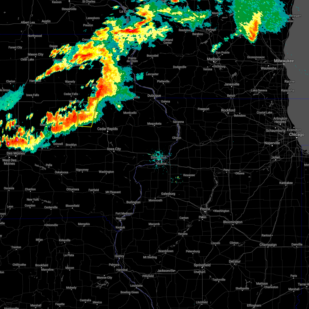 At 703 pm cdt, severe thunderstorms were located along a line extending from independence to garrison, moving east at 35 mph (radar indicated). Hazards include 60 mph wind gusts and quarter size hail. Hail damage to vehicles is expected. expect wind damage to roofs, siding, and trees. Locations impacted include, independence. At 703 pm cdt, severe thunderstorms were located along a line extending from independence to garrison, moving east at 35 mph (radar indicated). Hazards include 60 mph wind gusts and quarter size hail. Hail damage to vehicles is expected. expect wind damage to roofs, siding, and trees. Locations impacted include, independence.
|
| 7/14/2021 6:56 PM CDT |
 At 656 pm cdt, severe thunderstorms were located along a line extending from stanley to near rowley, moving east at 35 mph (radar indicated). Hazards include 60 mph wind gusts. Expect damage to roofs, siding, and trees. severe thunderstorms will be near, aurora around 705 pm cdt. quasqueton and lamont around 710 pm cdt. Other locations in the path of these severe thunderstorms include dundee, manchester, edgewood and greeley. At 656 pm cdt, severe thunderstorms were located along a line extending from stanley to near rowley, moving east at 35 mph (radar indicated). Hazards include 60 mph wind gusts. Expect damage to roofs, siding, and trees. severe thunderstorms will be near, aurora around 705 pm cdt. quasqueton and lamont around 710 pm cdt. Other locations in the path of these severe thunderstorms include dundee, manchester, edgewood and greeley.
|
| 7/14/2021 6:47 PM CDT |
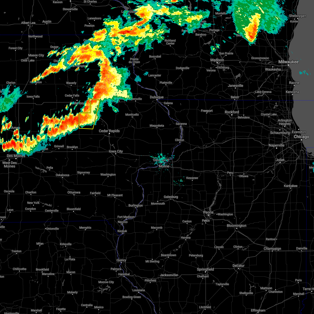 At 647 pm cdt, severe thunderstorms were located along a line extending from near jesup to near dysart, moving east at 40 mph (radar indicated). Hazards include 60 mph wind gusts. Expect damage to roofs, siding, and trees. these severe storms will be near, jesup around 650 pm cdt. Other locations in the path of these severe thunderstorms include independence, vinton and mount auburn. At 647 pm cdt, severe thunderstorms were located along a line extending from near jesup to near dysart, moving east at 40 mph (radar indicated). Hazards include 60 mph wind gusts. Expect damage to roofs, siding, and trees. these severe storms will be near, jesup around 650 pm cdt. Other locations in the path of these severe thunderstorms include independence, vinton and mount auburn.
|
| 7/14/2021 6:32 PM CDT |
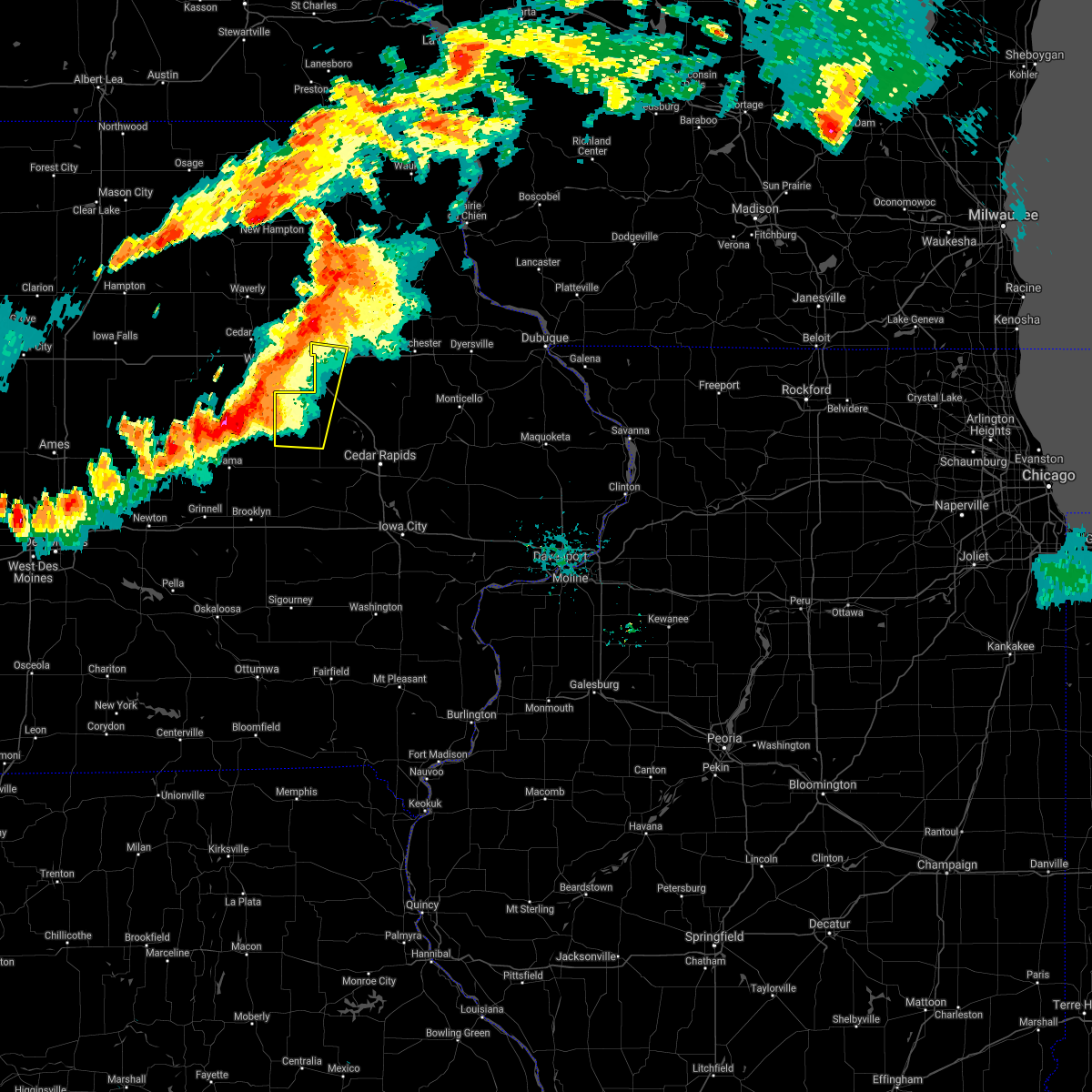 At 632 pm cdt, severe thunderstorms were located along a line extending from near jesup to near traer, moving east at 35 mph (radar indicated). Hazards include 60 mph wind gusts. Expect damage to roofs, siding, and trees. severe thunderstorms will be near, jesup around 635 pm cdt. independence around 650 pm cdt. Other locations in the path of these severe thunderstorms include garrison and vinton. At 632 pm cdt, severe thunderstorms were located along a line extending from near jesup to near traer, moving east at 35 mph (radar indicated). Hazards include 60 mph wind gusts. Expect damage to roofs, siding, and trees. severe thunderstorms will be near, jesup around 635 pm cdt. independence around 650 pm cdt. Other locations in the path of these severe thunderstorms include garrison and vinton.
|
| 7/14/2021 6:13 PM CDT |
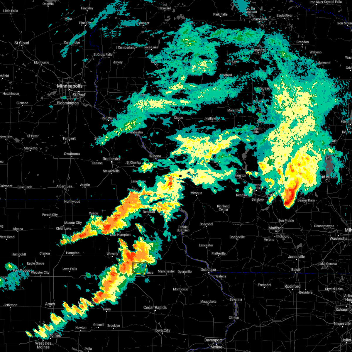 At 613 pm cdt, severe thunderstorms were located along a line extending from 6 miles west of maynard to 6 miles northwest of jesup, moving east at 30 mph (radar indicated). Hazards include 60 mph wind gusts. Expect damage to roofs, siding, and trees. Locations impacted include, stanley, hazleton and independence. At 613 pm cdt, severe thunderstorms were located along a line extending from 6 miles west of maynard to 6 miles northwest of jesup, moving east at 30 mph (radar indicated). Hazards include 60 mph wind gusts. Expect damage to roofs, siding, and trees. Locations impacted include, stanley, hazleton and independence.
|
| 7/14/2021 6:04 PM CDT |
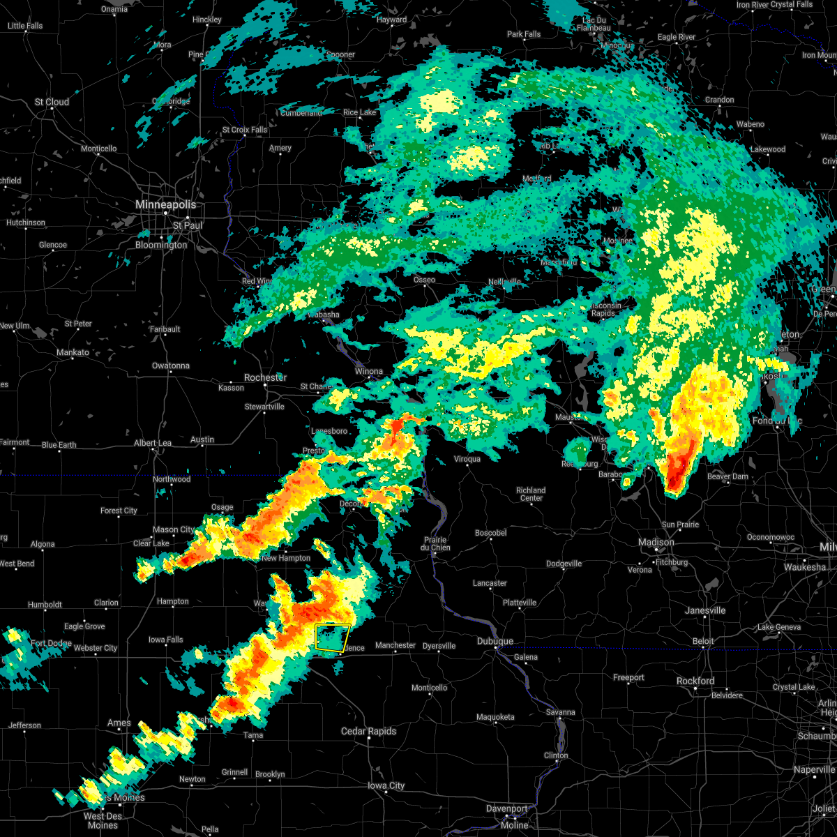 At 603 pm cdt, severe thunderstorms were located along a line extending from 6 miles south of sumner to near elk run heights, moving east at 30 mph (radar indicated). Hazards include 60 mph wind gusts and quarter size hail. Hail damage to vehicles is expected. expect wind damage to roofs, siding, and trees. severe thunderstorms will be near, fairbank around 610 pm cdt. Other locations in the path of these severe thunderstorms include stanley, hazleton and independence. At 603 pm cdt, severe thunderstorms were located along a line extending from 6 miles south of sumner to near elk run heights, moving east at 30 mph (radar indicated). Hazards include 60 mph wind gusts and quarter size hail. Hail damage to vehicles is expected. expect wind damage to roofs, siding, and trees. severe thunderstorms will be near, fairbank around 610 pm cdt. Other locations in the path of these severe thunderstorms include stanley, hazleton and independence.
|
| 6/22/2021 5:55 PM CDT | Large tree down along with a utility pol in buchanan county IA, 1.4 miles SSW of Independence, IA |
| 6/20/2021 7:52 PM CDT |
 At 752 pm cdt, severe thunderstorms were located along a line extending from winthrop to near dysart, moving east at 35 mph (radar indicated). Hazards include 60 mph wind gusts. Expect damage to roofs, siding, and trees. these severe storms will be near, winthrop and quasqueton around 755 pm cdt. mount auburn around 800 pm cdt. vinton around 810 pm cdt. Other locations impacted by these severe thunderstorms include lime creek county park, wapsipinicon golf course, vinton memorial airport, rodgers park, benton city park, hoefle-dulin park, monti, buchanan county fairgrounds, spencers grove and benton county fairgrounds. At 752 pm cdt, severe thunderstorms were located along a line extending from winthrop to near dysart, moving east at 35 mph (radar indicated). Hazards include 60 mph wind gusts. Expect damage to roofs, siding, and trees. these severe storms will be near, winthrop and quasqueton around 755 pm cdt. mount auburn around 800 pm cdt. vinton around 810 pm cdt. Other locations impacted by these severe thunderstorms include lime creek county park, wapsipinicon golf course, vinton memorial airport, rodgers park, benton city park, hoefle-dulin park, monti, buchanan county fairgrounds, spencers grove and benton county fairgrounds.
|
| 6/20/2021 7:37 PM CDT |
 At 736 pm cdt, severe thunderstorms were located along a line extending from near independence to near dysart, moving southeast at 35 mph (radar indicated). Hazards include 60 mph wind gusts and penny size hail. Expect damage to roofs, siding, and trees. severe thunderstorms will be near, independence around 740 pm cdt. winthrop and quasqueton around 750 pm cdt. garrison and mount auburn around 800 pm cdt. vinton around 805 pm cdt. Other locations impacted by these severe thunderstorms include lime creek county park, wapsipinicon golf course, vinton memorial airport, rodgers park, benton city park, littleton, hoefle-dulin park, monti, buchanan county fairgrounds and otterville. At 736 pm cdt, severe thunderstorms were located along a line extending from near independence to near dysart, moving southeast at 35 mph (radar indicated). Hazards include 60 mph wind gusts and penny size hail. Expect damage to roofs, siding, and trees. severe thunderstorms will be near, independence around 740 pm cdt. winthrop and quasqueton around 750 pm cdt. garrison and mount auburn around 800 pm cdt. vinton around 805 pm cdt. Other locations impacted by these severe thunderstorms include lime creek county park, wapsipinicon golf course, vinton memorial airport, rodgers park, benton city park, littleton, hoefle-dulin park, monti, buchanan county fairgrounds and otterville.
|
| 9/6/2020 2:43 AM CDT | Storm damage reported in buchanan county IA, 0.9 miles WSW of Independence, IA |
| 9/6/2020 1:49 AM CDT |
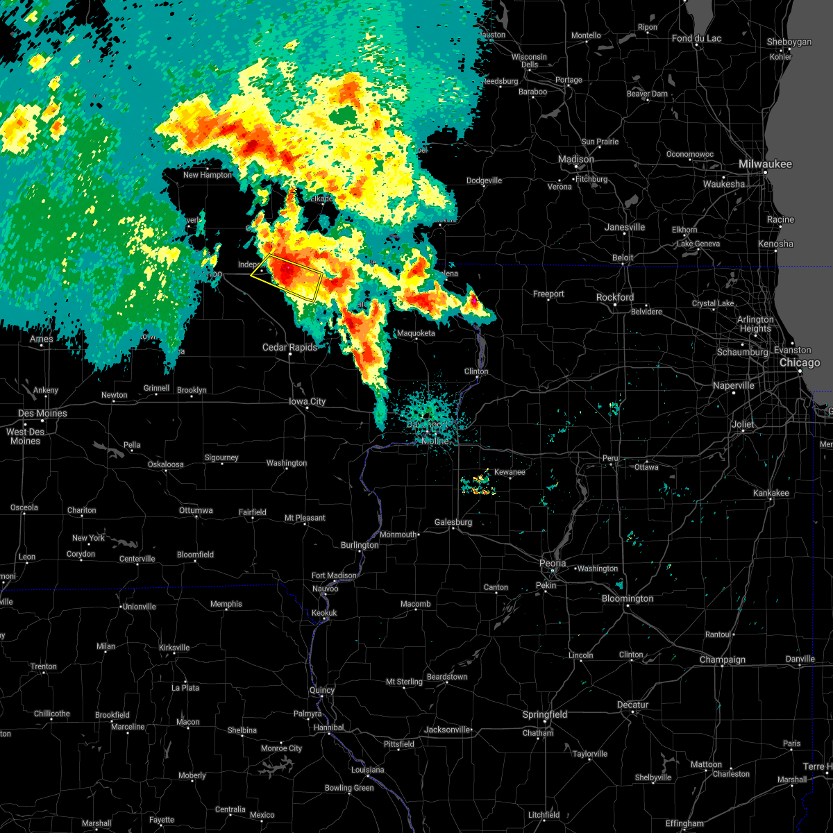 At 147 am cdt, a severe thunderstorm was located over winthrop, or 10 miles east of independence, moving southeast at 30 mph (trained weather spotters). Hazards include 60 mph wind gusts and half dollar size hail. Hail damage to vehicles is expected. expect wind damage to roofs, siding, and trees. Locations impacted include, independence, winthrop, quasqueton, ryan, masonville, monti, buchanan county fairgrounds, winthrop golf course, robinson and independence airport. At 147 am cdt, a severe thunderstorm was located over winthrop, or 10 miles east of independence, moving southeast at 30 mph (trained weather spotters). Hazards include 60 mph wind gusts and half dollar size hail. Hail damage to vehicles is expected. expect wind damage to roofs, siding, and trees. Locations impacted include, independence, winthrop, quasqueton, ryan, masonville, monti, buchanan county fairgrounds, winthrop golf course, robinson and independence airport.
|
| 9/6/2020 1:37 AM CDT | Storm damage reported in buchanan county IA, 0.5 miles SSE of Independence, IA |
| 9/6/2020 1:35 AM CDT |
 At 135 am cdt, a severe thunderstorm was located near independence, moving southeast at 25 mph (radar indicated). Hazards include 60 mph wind gusts and half dollar size hail. Hail damage to vehicles is expected. Expect wind damage to roofs, siding, and trees. At 135 am cdt, a severe thunderstorm was located near independence, moving southeast at 25 mph (radar indicated). Hazards include 60 mph wind gusts and half dollar size hail. Hail damage to vehicles is expected. Expect wind damage to roofs, siding, and trees.
|
| 9/6/2020 1:20 AM CDT |
 At 120 am cdt, a severe thunderstorm was located near hazleton, or near independence, moving southeast at 25 mph (radar indicated). Hazards include quarter size hail. Damage to vehicles is expected. Locations impacted include, winthrop, hazleton, lamont, aurora, stanley, winthrop golf course, otterville, jakway park, fontana county park, fontana park and littleton. At 120 am cdt, a severe thunderstorm was located near hazleton, or near independence, moving southeast at 25 mph (radar indicated). Hazards include quarter size hail. Damage to vehicles is expected. Locations impacted include, winthrop, hazleton, lamont, aurora, stanley, winthrop golf course, otterville, jakway park, fontana county park, fontana park and littleton.
|
| 9/6/2020 1:13 AM CDT |
 At 112 am cdt, a severe thunderstorm was located over fairbank, or 7 miles southwest of oelwein, moving southeast at 25 mph (radar indicated). Hazards include half dollar size hail. Damage to vehicles is expected. Locations impacted include, fairbank, winthrop, hazleton, lamont, aurora, stanley, winthrop golf course, otterville, jakway park, fontana county park, fontana park and littleton. At 112 am cdt, a severe thunderstorm was located over fairbank, or 7 miles southwest of oelwein, moving southeast at 25 mph (radar indicated). Hazards include half dollar size hail. Damage to vehicles is expected. Locations impacted include, fairbank, winthrop, hazleton, lamont, aurora, stanley, winthrop golf course, otterville, jakway park, fontana county park, fontana park and littleton.
|
| 9/6/2020 1:05 AM CDT |
 At 105 am cdt, a severe thunderstorm was located over fairbank, or 7 miles southwest of oelwein, moving east at 25 mph (radar indicated). Hazards include ping pong ball size hail. People and animals outdoors will be injured. expect damage to roofs, siding, windows, and vehicles. Locations impacted include, fairbank, winthrop, hazleton, lamont, aurora, stanley, winthrop golf course, otterville, jakway park, fontana county park, fontana park and littleton. At 105 am cdt, a severe thunderstorm was located over fairbank, or 7 miles southwest of oelwein, moving east at 25 mph (radar indicated). Hazards include ping pong ball size hail. People and animals outdoors will be injured. expect damage to roofs, siding, windows, and vehicles. Locations impacted include, fairbank, winthrop, hazleton, lamont, aurora, stanley, winthrop golf course, otterville, jakway park, fontana county park, fontana park and littleton.
|
| 9/6/2020 12:58 AM CDT |
 At 1257 am cdt, a severe thunderstorm was located over fairbank, or 8 miles west of oelwein, moving east at 25 mph (radar indicated). Hazards include ping pong ball size hail. People and animals outdoors will be injured. Expect damage to roofs, siding, windows, and vehicles. At 1257 am cdt, a severe thunderstorm was located over fairbank, or 8 miles west of oelwein, moving east at 25 mph (radar indicated). Hazards include ping pong ball size hail. People and animals outdoors will be injured. Expect damage to roofs, siding, windows, and vehicles.
|
| 8/10/2020 1:12 PM CDT |
 At 1248 pm cdt, a severe thunderstorm was located near rowley, or 7 miles south of independence, moving east at 55 mph (radar indicated). Hazards include 70 mph wind gusts. Expect considerable tree damage. damage is likely to mobile homes, roofs, and outbuildings. locations impacted include, independence, manchester, jesup, urbana, central city, fairbank, edgewood, winthrop, hazleton, walker, coggon, quasqueton, lamont, ryan, brandon, rowley, aurora, prairieburg, dundee and mount auburn. This includes interstate 380 between mile markers 41 and 55. At 1248 pm cdt, a severe thunderstorm was located near rowley, or 7 miles south of independence, moving east at 55 mph (radar indicated). Hazards include 70 mph wind gusts. Expect considerable tree damage. damage is likely to mobile homes, roofs, and outbuildings. locations impacted include, independence, manchester, jesup, urbana, central city, fairbank, edgewood, winthrop, hazleton, walker, coggon, quasqueton, lamont, ryan, brandon, rowley, aurora, prairieburg, dundee and mount auburn. This includes interstate 380 between mile markers 41 and 55.
|
| 8/10/2020 12:48 PM CDT |
 At 1248 pm cdt, a severe thunderstorm was located near rowley, or 7 miles south of independence, moving east at 55 mph (radar indicated). Hazards include 70 mph wind gusts. Expect considerable tree damage. damage is likely to mobile homes, roofs, and outbuildings. locations impacted include, independence, manchester, jesup, urbana, central city, fairbank, edgewood, winthrop, hazleton, walker, coggon, quasqueton, lamont, ryan, brandon, rowley, aurora, prairieburg, dundee and mount auburn. This includes interstate 380 between mile markers 41 and 55. At 1248 pm cdt, a severe thunderstorm was located near rowley, or 7 miles south of independence, moving east at 55 mph (radar indicated). Hazards include 70 mph wind gusts. Expect considerable tree damage. damage is likely to mobile homes, roofs, and outbuildings. locations impacted include, independence, manchester, jesup, urbana, central city, fairbank, edgewood, winthrop, hazleton, walker, coggon, quasqueton, lamont, ryan, brandon, rowley, aurora, prairieburg, dundee and mount auburn. This includes interstate 380 between mile markers 41 and 55.
|
| 8/10/2020 12:17 PM CDT |
 The national weather service in the quad cities has issued a * severe thunderstorm warning for. buchanan county in northeastern iowa. northern benton county in east central iowa. western delaware county in northeastern iowa. Northern linn county in east central iowa. The national weather service in the quad cities has issued a * severe thunderstorm warning for. buchanan county in northeastern iowa. northern benton county in east central iowa. western delaware county in northeastern iowa. Northern linn county in east central iowa.
|
| 7/11/2020 9:50 AM CDT | Ping Pong Ball sized hail reported 0.3 miles NW of Independence, IA |
| 7/11/2020 9:50 AM CDT | Quarter sized hail reported 0.9 miles WSW of Independence, IA, numerous reports of hail golf ball size or larger. |
| 7/11/2020 9:49 AM CDT | Ping Pong Ball sized hail reported 1.8 miles WSW of Independence, IA, initially reported 1 inch hail but it grew to 1.50 inches during the conversation. said it was windy but had no estimate on the wind speed. time estimated using radar. |
| 7/11/2020 9:48 AM CDT |
 At 947 am cdt, severe thunderstorms were located along a line extending from near masonville to near quasqueton to near rowley, moving southeast at 45 mph (radar indicated). Hazards include 70 mph wind gusts and ping pong ball size hail. People and animals outdoors will be injured. expect hail damage to roofs, siding, windows, and vehicles. expect considerable tree damage. wind damage is also likely to mobile homes, roofs, and outbuildings. locations impacted include, independence, manchester, winthrop, quasqueton, lamont, ryan, brandon, rowley, dundee, masonville, lime creek county park, winthrop golf course, robinson, wapsipinicon golf course, manchester airport, littleton, monti, buchanan county fairgrounds, coffins grove park and buck creek. This includes interstate 380 between mile markers 49 and 54. At 947 am cdt, severe thunderstorms were located along a line extending from near masonville to near quasqueton to near rowley, moving southeast at 45 mph (radar indicated). Hazards include 70 mph wind gusts and ping pong ball size hail. People and animals outdoors will be injured. expect hail damage to roofs, siding, windows, and vehicles. expect considerable tree damage. wind damage is also likely to mobile homes, roofs, and outbuildings. locations impacted include, independence, manchester, winthrop, quasqueton, lamont, ryan, brandon, rowley, dundee, masonville, lime creek county park, winthrop golf course, robinson, wapsipinicon golf course, manchester airport, littleton, monti, buchanan county fairgrounds, coffins grove park and buck creek. This includes interstate 380 between mile markers 49 and 54.
|
| 7/11/2020 9:47 AM CDT | Half Dollar sized hail reported 0.5 miles SSE of Independence, IA |
| 7/11/2020 9:47 AM CDT | Storm damage reported in buchanan county IA, 0.5 miles SSE of Independence, IA |
| 7/11/2020 9:47 AM CDT | Quarter sized hail reported 1.4 miles WSW of Independence, IA |
| 7/11/2020 9:47 AM CDT | Quarter sized hail reported 1.4 miles SSW of Independence, IA, hail for the last 2 minutes with hail coating the ground. |
| 7/11/2020 9:45 AM CDT | Quarter sized hail reported 2.6 miles SSE of Independence, IA |
| 7/11/2020 9:17 AM CDT |
 The national weather service in the quad cities has issued a * severe thunderstorm warning for. buchanan county in northeastern iowa. western delaware county in northeastern iowa. until 1015 am cdt. At 916 am cdt, severe thunderstorms were located along a line. The national weather service in the quad cities has issued a * severe thunderstorm warning for. buchanan county in northeastern iowa. western delaware county in northeastern iowa. until 1015 am cdt. At 916 am cdt, severe thunderstorms were located along a line.
|
| 7/9/2020 2:43 PM CDT |
 At 243 pm cdt, a severe thunderstorm was located over winthrop, or 9 miles east of independence, moving east at 40 mph (radar indicated). Hazards include 60 mph wind gusts. Expect damage to roofs, siding, and trees. Locations impacted include, independence, winthrop, quasqueton, rowley, monti, buchanan county fairgrounds, winthrop golf course, otterville and wapsipinicon golf course. At 243 pm cdt, a severe thunderstorm was located over winthrop, or 9 miles east of independence, moving east at 40 mph (radar indicated). Hazards include 60 mph wind gusts. Expect damage to roofs, siding, and trees. Locations impacted include, independence, winthrop, quasqueton, rowley, monti, buchanan county fairgrounds, winthrop golf course, otterville and wapsipinicon golf course.
|
| 7/9/2020 2:30 PM CDT |
 At 229 pm cdt, a severe thunderstorm was located over independence, moving east at 40 mph (radar indicated). Hazards include 60 mph wind gusts. expect damage to roofs, siding, and trees At 229 pm cdt, a severe thunderstorm was located over independence, moving east at 40 mph (radar indicated). Hazards include 60 mph wind gusts. expect damage to roofs, siding, and trees
|
| 7/9/2020 1:40 PM CDT |
 The severe thunderstorm warning for northeastern buchanan county will expire at 145 pm cdt, the storm which prompted the warning has moved out of the area. therefore, the warning will be allowed to expire. a severe thunderstorm watch remains in effect until 700 pm cdt for northeastern iowa. The severe thunderstorm warning for northeastern buchanan county will expire at 145 pm cdt, the storm which prompted the warning has moved out of the area. therefore, the warning will be allowed to expire. a severe thunderstorm watch remains in effect until 700 pm cdt for northeastern iowa.
|
| 7/9/2020 1:32 PM CDT |
 At 131 pm cdt, a severe thunderstorm was located near aurora, or 10 miles northeast of independence, moving north at 20 mph (radar indicated). Hazards include 60 mph wind gusts and quarter size hail. Hail damage to vehicles is expected. expect wind damage to roofs, siding, and trees. Locations impacted include, independence, winthrop, hazleton, quasqueton, lamont, aurora, stanley, buchanan county fairgrounds, winthrop golf course, jakway park, fontana county park and fontana park. At 131 pm cdt, a severe thunderstorm was located near aurora, or 10 miles northeast of independence, moving north at 20 mph (radar indicated). Hazards include 60 mph wind gusts and quarter size hail. Hail damage to vehicles is expected. expect wind damage to roofs, siding, and trees. Locations impacted include, independence, winthrop, hazleton, quasqueton, lamont, aurora, stanley, buchanan county fairgrounds, winthrop golf course, jakway park, fontana county park and fontana park.
|
| 7/9/2020 1:20 PM CDT |
 At 120 pm cdt, a severe thunderstorm was located over winthrop, or 7 miles northeast of independence, moving northwest at 20 mph (radar indicated). Hazards include 70 mph wind gusts and quarter size hail. Hail damage to vehicles is expected. expect considerable tree damage. wind damage is also likely to mobile homes, roofs, and outbuildings. Locations impacted include, independence, winthrop, hazleton, quasqueton, lamont, aurora, stanley, buchanan county fairgrounds, winthrop golf course, jakway park, fontana county park and fontana park. At 120 pm cdt, a severe thunderstorm was located over winthrop, or 7 miles northeast of independence, moving northwest at 20 mph (radar indicated). Hazards include 70 mph wind gusts and quarter size hail. Hail damage to vehicles is expected. expect considerable tree damage. wind damage is also likely to mobile homes, roofs, and outbuildings. Locations impacted include, independence, winthrop, hazleton, quasqueton, lamont, aurora, stanley, buchanan county fairgrounds, winthrop golf course, jakway park, fontana county park and fontana park.
|
| 7/9/2020 1:11 PM CDT |
 At 111 pm cdt, a severe thunderstorm was located over winthrop, or 8 miles east of independence, moving northwest at 20 mph (radar indicated). Hazards include 60 mph wind gusts and quarter size hail. Hail damage to vehicles is expected. Expect wind damage to roofs, siding, and trees. At 111 pm cdt, a severe thunderstorm was located over winthrop, or 8 miles east of independence, moving northwest at 20 mph (radar indicated). Hazards include 60 mph wind gusts and quarter size hail. Hail damage to vehicles is expected. Expect wind damage to roofs, siding, and trees.
|
| 3/28/2020 6:50 PM CDT |
 At 650 pm cdt, severe thunderstorms capable of producing a tornado were located along a line extending from 6 miles southeast of hazleton to near walker, moving northeast at 45 mph (weather spotters reported a funnel cloud). Hazards include tornado. Flying debris will be dangerous to those caught without shelter. mobile homes will be damaged or destroyed. damage to roofs, windows, and vehicles will occur. tree damage is likely. these dangerous storms will be near, hazleton around 655 pm cdt. lamont, aurora and stanley around 700 pm cdt. winthrop around 705 pm cdt. other locations impacted by these tornadic storms include lime creek county park, monti, buchanan county fairgrounds, winthrop golf course, otterville, spencers grove, wapsipinicon golf course, independence airport, jakway park and fontana county park. This includes interstate 380 between mile markers 44 and 52. At 650 pm cdt, severe thunderstorms capable of producing a tornado were located along a line extending from 6 miles southeast of hazleton to near walker, moving northeast at 45 mph (weather spotters reported a funnel cloud). Hazards include tornado. Flying debris will be dangerous to those caught without shelter. mobile homes will be damaged or destroyed. damage to roofs, windows, and vehicles will occur. tree damage is likely. these dangerous storms will be near, hazleton around 655 pm cdt. lamont, aurora and stanley around 700 pm cdt. winthrop around 705 pm cdt. other locations impacted by these tornadic storms include lime creek county park, monti, buchanan county fairgrounds, winthrop golf course, otterville, spencers grove, wapsipinicon golf course, independence airport, jakway park and fontana county park. This includes interstate 380 between mile markers 44 and 52.
|
| 3/28/2020 6:42 PM CDT |
 At 640 pm cdt, severe thunderstorms capable of producing tornadoes were located along a line extending from stanley to near walker, moving northeast at 45 mph (radar indicated rotation. the large confirmed tornado has moved into fayette county. additional rotation and tornadoes remain likely in the central and east portions of buchanan county). Hazards include tornado and quarter size hail. Flying debris will be dangerous to those caught without shelter. mobile homes will be damaged or destroyed. damage to roofs, windows, and vehicles will occur. tree damage is likely. these dangerous storms will be near, hazleton, aurora and stanley around 645 pm cdt. winthrop around 655 pm cdt. lamont around 705 pm cdt. other locations impacted by these tornadic storms include lime creek county park, winthrop golf course, wapsipinicon golf course, fontana county park, littleton, monti, buchanan county fairgrounds, otterville, spencers grove and minne estema park. This includes interstate 380 between mile markers 44 and 55. At 640 pm cdt, severe thunderstorms capable of producing tornadoes were located along a line extending from stanley to near walker, moving northeast at 45 mph (radar indicated rotation. the large confirmed tornado has moved into fayette county. additional rotation and tornadoes remain likely in the central and east portions of buchanan county). Hazards include tornado and quarter size hail. Flying debris will be dangerous to those caught without shelter. mobile homes will be damaged or destroyed. damage to roofs, windows, and vehicles will occur. tree damage is likely. these dangerous storms will be near, hazleton, aurora and stanley around 645 pm cdt. winthrop around 655 pm cdt. lamont around 705 pm cdt. other locations impacted by these tornadic storms include lime creek county park, winthrop golf course, wapsipinicon golf course, fontana county park, littleton, monti, buchanan county fairgrounds, otterville, spencers grove and minne estema park. This includes interstate 380 between mile markers 44 and 55.
|
| 3/28/2020 6:38 PM CDT |
 The severe thunderstorm warning for buchanan and central benton counties will expire at 645 pm cdt, the storms which prompted the warning have moved out of the area. therefore, the warning will be allowed to expire. a tornado watch remains in effect until 900 pm cdt for northeastern and east central iowa. to report severe weather, contact your nearest law enforcement agency. they will relay your report to the national weather service the quad cities. remember, a tornado warning still remains in effect for buchanan and northern benton counties. The severe thunderstorm warning for buchanan and central benton counties will expire at 645 pm cdt, the storms which prompted the warning have moved out of the area. therefore, the warning will be allowed to expire. a tornado watch remains in effect until 900 pm cdt for northeastern and east central iowa. to report severe weather, contact your nearest law enforcement agency. they will relay your report to the national weather service the quad cities. remember, a tornado warning still remains in effect for buchanan and northern benton counties.
|
| 3/28/2020 6:33 PM CDT |
 At 632 pm cdt, tornado producing storms were located along a line extending from near oelwein to near rowley, moving northeast at 45 mph (weather spotters confirmed large tornado in extreme northern buchanan county, near fairbank. another developing tornado is near independence, moving northeast at 45 mph). Hazards include large damaging tornado and golf ball size hail. Flying debris will be dangerous to those caught without shelter. mobile homes will be damaged or destroyed. damage to roofs, windows, and vehicles will occur. tree damage is likely. these tornadic storms will be near, aurora around 655 pm cdt. lamont around 700 pm cdt. other locations impacted by these tornadic storms include lime creek county park, winthrop golf course, wapsipinicon golf course, rodgers park, fontana county park, littleton, monti, buchanan county fairgrounds, otterville and spencers grove. This includes interstate 380 between mile markers 44 and 55. At 632 pm cdt, tornado producing storms were located along a line extending from near oelwein to near rowley, moving northeast at 45 mph (weather spotters confirmed large tornado in extreme northern buchanan county, near fairbank. another developing tornado is near independence, moving northeast at 45 mph). Hazards include large damaging tornado and golf ball size hail. Flying debris will be dangerous to those caught without shelter. mobile homes will be damaged or destroyed. damage to roofs, windows, and vehicles will occur. tree damage is likely. these tornadic storms will be near, aurora around 655 pm cdt. lamont around 700 pm cdt. other locations impacted by these tornadic storms include lime creek county park, winthrop golf course, wapsipinicon golf course, rodgers park, fontana county park, littleton, monti, buchanan county fairgrounds, otterville and spencers grove. This includes interstate 380 between mile markers 44 and 55.
|
| 3/28/2020 6:28 PM CDT | Golf Ball sized hail reported 2.6 miles SSE of Independence, IA, now seeing pea size hail. |
| 3/28/2020 6:25 PM CDT |
 At 623 pm cdt, severe thunderstorms were located along a line extending from near oelwein to near keystone, moving northeast at 55 mph (trained weather spotters reported a tornado near fairbank, and additional rotating wall clouds over central benton county). Hazards include 60 mph wind gusts. Expect damage to roofs, siding, and trees. locations impacted include, independence, vinton, jesup, urbana, fairbank, hazleton, blairstown, van horne, keystone, garrison, brandon, rowley, aurora, mount auburn, stanley, luzerne, wapsipinicon golf course, vinton memorial airport, fontana county park and otterville. This includes interstate 380 between mile markers 44 and 55. At 623 pm cdt, severe thunderstorms were located along a line extending from near oelwein to near keystone, moving northeast at 55 mph (trained weather spotters reported a tornado near fairbank, and additional rotating wall clouds over central benton county). Hazards include 60 mph wind gusts. Expect damage to roofs, siding, and trees. locations impacted include, independence, vinton, jesup, urbana, fairbank, hazleton, blairstown, van horne, keystone, garrison, brandon, rowley, aurora, mount auburn, stanley, luzerne, wapsipinicon golf course, vinton memorial airport, fontana county park and otterville. This includes interstate 380 between mile markers 44 and 55.
|
| 3/28/2020 6:21 PM CDT |
 At 620 pm cdt, tornado producing storms were located along a line extending from near fairbank to brandon, moving east at 45 mph (weather spotters confirmed tornado). Hazards include damaging tornado. Flying debris will be dangerous to those caught without shelter. mobile homes will be damaged or destroyed. damage to roofs, windows, and vehicles will occur. tree damage is likely. these tornadic storms will be near, hazleton around 625 pm cdt. rowley and stanley around 630 pm cdt. aurora around 635 pm cdt. quasqueton and lamont around 640 pm cdt. winthrop around 645 pm cdt. other locations impacted by these tornadic storms include lime creek county park, winthrop golf course, wapsipinicon golf course, rodgers park, fontana county park, littleton, monti, buchanan county fairgrounds, otterville and spencers grove. This includes interstate 380 between mile markers 44 and 55. At 620 pm cdt, tornado producing storms were located along a line extending from near fairbank to brandon, moving east at 45 mph (weather spotters confirmed tornado). Hazards include damaging tornado. Flying debris will be dangerous to those caught without shelter. mobile homes will be damaged or destroyed. damage to roofs, windows, and vehicles will occur. tree damage is likely. these tornadic storms will be near, hazleton around 625 pm cdt. rowley and stanley around 630 pm cdt. aurora around 635 pm cdt. quasqueton and lamont around 640 pm cdt. winthrop around 645 pm cdt. other locations impacted by these tornadic storms include lime creek county park, winthrop golf course, wapsipinicon golf course, rodgers park, fontana county park, littleton, monti, buchanan county fairgrounds, otterville and spencers grove. This includes interstate 380 between mile markers 44 and 55.
|
| 3/28/2020 6:13 PM CDT |
 At 612 pm cdt, tornado producing storms were located along a line extending from near fairbank to near mount auburn, moving northeast at 60 mph (weather spotters confirmed tornado). Hazards include damaging tornado. Flying debris will be dangerous to those caught without shelter. mobile homes will be damaged or destroyed. damage to roofs, windows, and vehicles will occur. tree damage is likely. these tornadic storms will be near, independence and winthrop around 630 pm cdt. hazleton around 635 pm cdt. lamont, aurora and stanley around 640 pm cdt. other locations impacted by these tornadic storms include lime creek county park, winthrop golf course, wapsipinicon golf course, rodgers park, fontana county park, littleton, monti, buchanan county fairgrounds, otterville and spencers grove. This includes interstate 380 between mile markers 44 and 55. At 612 pm cdt, tornado producing storms were located along a line extending from near fairbank to near mount auburn, moving northeast at 60 mph (weather spotters confirmed tornado). Hazards include damaging tornado. Flying debris will be dangerous to those caught without shelter. mobile homes will be damaged or destroyed. damage to roofs, windows, and vehicles will occur. tree damage is likely. these tornadic storms will be near, independence and winthrop around 630 pm cdt. hazleton around 635 pm cdt. lamont, aurora and stanley around 640 pm cdt. other locations impacted by these tornadic storms include lime creek county park, winthrop golf course, wapsipinicon golf course, rodgers park, fontana county park, littleton, monti, buchanan county fairgrounds, otterville and spencers grove. This includes interstate 380 between mile markers 44 and 55.
|
| 3/28/2020 6:09 PM CDT |
 At 609 pm cdt, severe thunderstorms were located along a line extending from near fairbank to belle plaine, moving northeast at 50 mph (radar indicated). Hazards include 60 mph wind gusts. Expect damage to roofs, siding, and trees. locations impacted include, independence, vinton, belle plaine, jesup, urbana, fairbank, hazleton, blairstown, van horne, keystone, garrison, brandon, rowley, aurora, mount auburn, stanley, luzerne, wapsipinicon golf course, vinton memorial airport and fontana county park. This includes interstate 380 between mile markers 44 and 55. At 609 pm cdt, severe thunderstorms were located along a line extending from near fairbank to belle plaine, moving northeast at 50 mph (radar indicated). Hazards include 60 mph wind gusts. Expect damage to roofs, siding, and trees. locations impacted include, independence, vinton, belle plaine, jesup, urbana, fairbank, hazleton, blairstown, van horne, keystone, garrison, brandon, rowley, aurora, mount auburn, stanley, luzerne, wapsipinicon golf course, vinton memorial airport and fontana county park. This includes interstate 380 between mile markers 44 and 55.
|
| 3/28/2020 6:03 PM CDT |
 At 602 pm cdt, severe thunderstorms were located along a line extending from 6 miles southwest of fairbank to luzerne, moving northeast at 55 mph (radar indicated). Hazards include 60 mph wind gusts. expect damage to roofs, siding, and trees At 602 pm cdt, severe thunderstorms were located along a line extending from 6 miles southwest of fairbank to luzerne, moving northeast at 55 mph (radar indicated). Hazards include 60 mph wind gusts. expect damage to roofs, siding, and trees
|
| 9/9/2019 9:44 PM CDT |
 At 943 pm cdt, a severe thunderstorm capable of producing a tornado was located over rowley, or 9 miles south of independence, moving northeast at 45 mph (radar indicated rotation). Hazards include tornado and quarter size hail. Flying debris will be dangerous to those caught without shelter. mobile homes will be damaged or destroyed. damage to roofs, windows, and vehicles will occur. tree damage is likely. this dangerous storm will be near, quasqueton around 955 pm cdt. winthrop around 1000 pm cdt. other locations impacted by this tornadic thunderstorm include lime creek county park and spencers grove. This includes interstate 380 between mile markers 46 and 51. At 943 pm cdt, a severe thunderstorm capable of producing a tornado was located over rowley, or 9 miles south of independence, moving northeast at 45 mph (radar indicated rotation). Hazards include tornado and quarter size hail. Flying debris will be dangerous to those caught without shelter. mobile homes will be damaged or destroyed. damage to roofs, windows, and vehicles will occur. tree damage is likely. this dangerous storm will be near, quasqueton around 955 pm cdt. winthrop around 1000 pm cdt. other locations impacted by this tornadic thunderstorm include lime creek county park and spencers grove. This includes interstate 380 between mile markers 46 and 51.
|
| 9/9/2019 9:38 PM CDT |
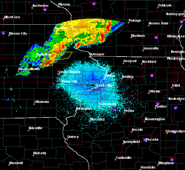 At 938 pm cdt, a severe thunderstorm capable of producing a tornado was located near brandon, or 9 miles northeast of vinton, moving northeast at 45 mph (radar indicated rotation). Hazards include tornado and quarter size hail. Flying debris will be dangerous to those caught without shelter. mobile homes will be damaged or destroyed. damage to roofs, windows, and vehicles will occur. tree damage is likely. this dangerous storm will be near, rowley around 950 pm cdt. quasqueton around 955 pm cdt. winthrop around 1000 pm cdt. other locations impacted by this tornadic thunderstorm include lime creek county park and spencers grove. This includes interstate 380 between mile markers 46 and 51. At 938 pm cdt, a severe thunderstorm capable of producing a tornado was located near brandon, or 9 miles northeast of vinton, moving northeast at 45 mph (radar indicated rotation). Hazards include tornado and quarter size hail. Flying debris will be dangerous to those caught without shelter. mobile homes will be damaged or destroyed. damage to roofs, windows, and vehicles will occur. tree damage is likely. this dangerous storm will be near, rowley around 950 pm cdt. quasqueton around 955 pm cdt. winthrop around 1000 pm cdt. other locations impacted by this tornadic thunderstorm include lime creek county park and spencers grove. This includes interstate 380 between mile markers 46 and 51.
|
| 9/9/2019 9:33 PM CDT |
 At 910 pm cdt, severe thunderstorms were located along a line extending from near fairbank to near garrison, moving northeast at 35 mph (radar indicated). Hazards include 60 mph wind gusts. Expect damage to roofs, siding, and trees. locations impacted include, independence, jesup, urbana, winthrop, hazleton, quasqueton, brandon, rowley, aurora, mount auburn, stanley, wapsipinicon golf course, fontana county park, otterville, minne estema park, jakway park, cheney, lime creek county park, rodgers park and littleton. this includes interstate 380 between mile markers 42 and 55. These storms have had a history of producing wind gusts of 60 mph over southern black hawk county. At 910 pm cdt, severe thunderstorms were located along a line extending from near fairbank to near garrison, moving northeast at 35 mph (radar indicated). Hazards include 60 mph wind gusts. Expect damage to roofs, siding, and trees. locations impacted include, independence, jesup, urbana, winthrop, hazleton, quasqueton, brandon, rowley, aurora, mount auburn, stanley, wapsipinicon golf course, fontana county park, otterville, minne estema park, jakway park, cheney, lime creek county park, rodgers park and littleton. this includes interstate 380 between mile markers 42 and 55. These storms have had a history of producing wind gusts of 60 mph over southern black hawk county.
|
| 9/9/2019 9:15 PM CDT | Storm damage reported in buchanan county IA, 0.9 miles ESE of Independence, IA |
| 9/9/2019 9:15 PM CDT | Several small to medium size branches dow in buchanan county IA, 0.9 miles ESE of Independence, IA |
| 9/9/2019 9:12 PM CDT |
 At 910 pm cdt, severe thunderstorms were located along a line extending from near fairbank to near garrison, moving northeast at 35 mph (radar indicated). Hazards include 60 mph wind gusts. Expect damage to roofs, siding, and trees. locations impacted include, independence, jesup, urbana, winthrop, hazleton, quasqueton, brandon, rowley, aurora, mount auburn, stanley, wapsipinicon golf course, fontana county park, otterville, minne estema park, jakway park, cheney, lime creek county park, rodgers park and littleton. this includes interstate 380 between mile markers 42 and 55. These storms have had a history of producing wind gusts of 60 mph over southern black hawk county. At 910 pm cdt, severe thunderstorms were located along a line extending from near fairbank to near garrison, moving northeast at 35 mph (radar indicated). Hazards include 60 mph wind gusts. Expect damage to roofs, siding, and trees. locations impacted include, independence, jesup, urbana, winthrop, hazleton, quasqueton, brandon, rowley, aurora, mount auburn, stanley, wapsipinicon golf course, fontana county park, otterville, minne estema park, jakway park, cheney, lime creek county park, rodgers park and littleton. this includes interstate 380 between mile markers 42 and 55. These storms have had a history of producing wind gusts of 60 mph over southern black hawk county.
|
| 9/9/2019 8:57 PM CDT |
 At 856 pm cdt, severe thunderstorms were located along a line extending from near jesup to near dysart, moving northeast at 35 mph (radar indicated). Hazards include 60 mph wind gusts. expect damage to roofs, siding, and trees At 856 pm cdt, severe thunderstorms were located along a line extending from near jesup to near dysart, moving northeast at 35 mph (radar indicated). Hazards include 60 mph wind gusts. expect damage to roofs, siding, and trees
|
| 9/9/2019 8:04 PM CDT |
 At 804 pm cdt, severe thunderstorms were located along a line extending from near arlington to aurora to near independence, moving northeast at 35 mph (radar indicated). Hazards include 60 mph wind gusts. Expect damage to roofs, siding, and trees. Locations impacted include, independence, hazleton, lamont, aurora, stanley, buchanan county fairgrounds, otterville, jakway park, fontana county park and fontana park. At 804 pm cdt, severe thunderstorms were located along a line extending from near arlington to aurora to near independence, moving northeast at 35 mph (radar indicated). Hazards include 60 mph wind gusts. Expect damage to roofs, siding, and trees. Locations impacted include, independence, hazleton, lamont, aurora, stanley, buchanan county fairgrounds, otterville, jakway park, fontana county park and fontana park.
|
| 9/9/2019 7:56 PM CDT |
 At 755 pm cdt, severe thunderstorms were located along a line extending from near arlington to near stanley to near independence, moving northeast at 35 mph (radar indicated). Hazards include 60 mph wind gusts. Expect damage to roofs, siding, and trees. Locations impacted include, independence, jesup, hazleton, lamont, aurora, stanley, wapsipinicon golf course, fontana county park, littleton, buchanan county fairgrounds, otterville, independence airport, jakway park and fontana park. At 755 pm cdt, severe thunderstorms were located along a line extending from near arlington to near stanley to near independence, moving northeast at 35 mph (radar indicated). Hazards include 60 mph wind gusts. Expect damage to roofs, siding, and trees. Locations impacted include, independence, jesup, hazleton, lamont, aurora, stanley, wapsipinicon golf course, fontana county park, littleton, buchanan county fairgrounds, otterville, independence airport, jakway park and fontana park.
|
| 9/9/2019 7:40 PM CDT |
 At 740 pm cdt, severe thunderstorms were located along a line extending from near oelwein to near hazleton to near brandon, moving east at 35 mph (radar indicated). Hazards include 60 mph wind gusts. Expect damage to roofs, siding, and trees. Locations impacted include, independence, jesup, fairbank, winthrop, hazleton, lamont, aurora, stanley, winthrop golf course, wapsipinicon golf course, fontana county park, littleton, buchanan county fairgrounds, otterville, independence airport, jakway park and fontana park. At 740 pm cdt, severe thunderstorms were located along a line extending from near oelwein to near hazleton to near brandon, moving east at 35 mph (radar indicated). Hazards include 60 mph wind gusts. Expect damage to roofs, siding, and trees. Locations impacted include, independence, jesup, fairbank, winthrop, hazleton, lamont, aurora, stanley, winthrop golf course, wapsipinicon golf course, fontana county park, littleton, buchanan county fairgrounds, otterville, independence airport, jakway park and fontana park.
|
| 9/9/2019 7:32 PM CDT |
 At 732 pm cdt, severe thunderstorms were located along a line extending from oelwein to 6 miles northwest of independence to near la porte city, moving east at 35 mph (radar indicated). Hazards include 60 mph wind gusts. Expect damage to roofs, siding, and trees. locations impacted include, independence, jesup, fairbank, winthrop, hazleton, quasqueton, lamont, brandon, rowley, aurora, stanley, lime creek county park, winthrop golf course, wapsipinicon golf course, fontana county park, littleton, buchanan county fairgrounds, otterville, independence airport and jakway park. This includes interstate 380 between mile markers 49 and 55. At 732 pm cdt, severe thunderstorms were located along a line extending from oelwein to 6 miles northwest of independence to near la porte city, moving east at 35 mph (radar indicated). Hazards include 60 mph wind gusts. Expect damage to roofs, siding, and trees. locations impacted include, independence, jesup, fairbank, winthrop, hazleton, quasqueton, lamont, brandon, rowley, aurora, stanley, lime creek county park, winthrop golf course, wapsipinicon golf course, fontana county park, littleton, buchanan county fairgrounds, otterville, independence airport and jakway park. This includes interstate 380 between mile markers 49 and 55.
|
| 9/9/2019 7:21 PM CDT |
 At 721 pm cdt, severe thunderstorms were located along a line extending from fairbank to jesup to near la porte city, moving east at 35 mph (radar indicated). Hazards include 60 mph wind gusts. expect damage to roofs, siding, and trees At 721 pm cdt, severe thunderstorms were located along a line extending from fairbank to jesup to near la porte city, moving east at 35 mph (radar indicated). Hazards include 60 mph wind gusts. expect damage to roofs, siding, and trees
|
| 8/18/2019 4:09 AM CDT |
 The severe thunderstorm warning for buchanan county will expire at 415 am cdt. the storm which prompted the warning has weakened below severe limits. therefore, the warning will be allowed to expire. However gusty winds are still possible with this thunderstorm. The severe thunderstorm warning for buchanan county will expire at 415 am cdt. the storm which prompted the warning has weakened below severe limits. therefore, the warning will be allowed to expire. However gusty winds are still possible with this thunderstorm.
|
| 8/18/2019 4:00 AM CDT |
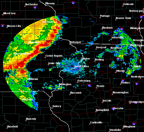 At 400 am cdt, a severe thunderstorm was located over winthrop, or 8 miles east of independence, moving east at 45 mph (radar indicated). Hazards include 60 mph wind gusts and quarter size hail. Hail damage to vehicles is expected. expect wind damage to roofs, siding, and trees. locations impacted include, independence, winthrop, quasqueton, lamont, brandon, rowley, lime creek county park, winthrop golf course, wapsipinicon golf course, monti, buchanan county fairgrounds, independence airport and jakway park. This includes interstate 380 between mile markers 49 and 54. At 400 am cdt, a severe thunderstorm was located over winthrop, or 8 miles east of independence, moving east at 45 mph (radar indicated). Hazards include 60 mph wind gusts and quarter size hail. Hail damage to vehicles is expected. expect wind damage to roofs, siding, and trees. locations impacted include, independence, winthrop, quasqueton, lamont, brandon, rowley, lime creek county park, winthrop golf course, wapsipinicon golf course, monti, buchanan county fairgrounds, independence airport and jakway park. This includes interstate 380 between mile markers 49 and 54.
|
| 8/18/2019 3:43 AM CDT |
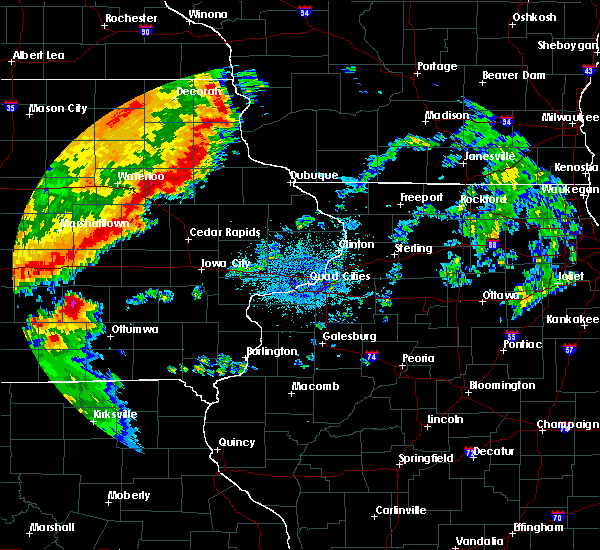 At 343 am cdt, a severe thunderstorm was located near jesup, or near independence, moving east at 45 mph (radar indicated). Hazards include 60 mph wind gusts and quarter size hail. Hail damage to vehicles is expected. Expect wind damage to roofs, siding, and trees. At 343 am cdt, a severe thunderstorm was located near jesup, or near independence, moving east at 45 mph (radar indicated). Hazards include 60 mph wind gusts and quarter size hail. Hail damage to vehicles is expected. Expect wind damage to roofs, siding, and trees.
|
| 6/30/2019 5:43 PM CDT | Numerous reports of branches down some as large as 5 inches in diameter. a couple reports of trees about 12 to 24 inches in diameter snapped off 3 feet off the groun in buchanan county IA, 0.9 miles WSW of Independence, IA |
| 6/30/2019 5:32 PM CDT |
 At 532 pm cdt, severe thunderstorms were located along a line extending from hazel green to near hopkinton to near brandon, moving south at 45 mph (trained weather spotters). Hazards include 70 mph wind gusts and quarter size hail. Hail damage to vehicles is expected. expect considerable tree damage. wind damage is also likely to mobile homes, roofs, and outbuildings. locations impacted include, dubuque, independence, manchester, galena, asbury, dyersville, jesup, epworth, east dubuque, farley, peosta, winthrop, earlville, hopkinton, quasqueton, delhi, new vienna, worthington, ryan and brandon. This includes interstate 380 between mile markers 50 and 55. At 532 pm cdt, severe thunderstorms were located along a line extending from hazel green to near hopkinton to near brandon, moving south at 45 mph (trained weather spotters). Hazards include 70 mph wind gusts and quarter size hail. Hail damage to vehicles is expected. expect considerable tree damage. wind damage is also likely to mobile homes, roofs, and outbuildings. locations impacted include, dubuque, independence, manchester, galena, asbury, dyersville, jesup, epworth, east dubuque, farley, peosta, winthrop, earlville, hopkinton, quasqueton, delhi, new vienna, worthington, ryan and brandon. This includes interstate 380 between mile markers 50 and 55.
|
| 6/30/2019 5:18 PM CDT |
 At 518 pm cdt, severe thunderstorms were located along a line extending from near platteville to delaware to near brandon, moving south at 45 mph (trained weather spotters). Hazards include 70 mph wind gusts and quarter size hail. Hail damage to vehicles is expected. expect considerable tree damage. wind damage is also likely to mobile homes, roofs, and outbuildings. locations impacted include, dubuque, independence, manchester, galena, asbury, dyersville, jesup, epworth, east dubuque, farley, peosta, fairbank, edgewood, winthrop, hazleton, earlville, hopkinton, quasqueton, lamont and delhi. This includes interstate 380 between mile markers 50 and 55. At 518 pm cdt, severe thunderstorms were located along a line extending from near platteville to delaware to near brandon, moving south at 45 mph (trained weather spotters). Hazards include 70 mph wind gusts and quarter size hail. Hail damage to vehicles is expected. expect considerable tree damage. wind damage is also likely to mobile homes, roofs, and outbuildings. locations impacted include, dubuque, independence, manchester, galena, asbury, dyersville, jesup, epworth, east dubuque, farley, peosta, fairbank, edgewood, winthrop, hazleton, earlville, hopkinton, quasqueton, lamont and delhi. This includes interstate 380 between mile markers 50 and 55.
|
| 6/30/2019 5:10 PM CDT | Corrects previous tstm wnd dmg report from independence. numerous reports of branches down some as large as 5 inches in diameter. a couple reports of trees about 12 to in buchanan county IA, 0.9 miles WSW of Independence, IA |
| 6/30/2019 5:10 PM CDT | Delayed report via social media. time estimated from radar. trees dow in buchanan county IA, 0.5 miles SSE of Independence, IA |
| 6/30/2019 5:10 PM CDT | Tree limbs and utility lines dow in buchanan county IA, 1.9 miles S of Independence, IA |
| 6/30/2019 5:07 PM CDT |
 At 506 pm cdt, severe thunderstorms were located along a line extending from near platteville to edgewood to near jesup, moving southeast at 40 mph (trained weather spotters). Hazards include 70 mph wind gusts and quarter size hail. Hail damage to vehicles is expected. expect considerable tree damage. wind damage is also likely to mobile homes, roofs, and outbuildings. locations impacted include, dubuque, independence, manchester, galena, asbury, dyersville, jesup, epworth, east dubuque, farley, peosta, fairbank, edgewood, winthrop, hazleton, earlville, hopkinton, quasqueton, lamont and delhi. This includes interstate 380 between mile markers 50 and 55. At 506 pm cdt, severe thunderstorms were located along a line extending from near platteville to edgewood to near jesup, moving southeast at 40 mph (trained weather spotters). Hazards include 70 mph wind gusts and quarter size hail. Hail damage to vehicles is expected. expect considerable tree damage. wind damage is also likely to mobile homes, roofs, and outbuildings. locations impacted include, dubuque, independence, manchester, galena, asbury, dyersville, jesup, epworth, east dubuque, farley, peosta, fairbank, edgewood, winthrop, hazleton, earlville, hopkinton, quasqueton, lamont and delhi. This includes interstate 380 between mile markers 50 and 55.
|
| 6/30/2019 5:02 PM CDT |
 At 502 pm cdt, severe thunderstorms were located along a line extending from 7 miles east of lancaster to near edgewood to near jesup, moving southeast at 40 mph (trained weather spotters). Hazards include 60 mph wind gusts and quarter size hail. Hail damage to vehicles is expected. expect wind damage to roofs, siding, and trees. locations impacted include, dubuque, independence, manchester, galena, asbury, dyersville, jesup, epworth, east dubuque, farley, peosta, fairbank, edgewood, winthrop, hazleton, earlville, hopkinton, quasqueton, lamont and delhi. This includes interstate 380 between mile markers 50 and 55. At 502 pm cdt, severe thunderstorms were located along a line extending from 7 miles east of lancaster to near edgewood to near jesup, moving southeast at 40 mph (trained weather spotters). Hazards include 60 mph wind gusts and quarter size hail. Hail damage to vehicles is expected. expect wind damage to roofs, siding, and trees. locations impacted include, dubuque, independence, manchester, galena, asbury, dyersville, jesup, epworth, east dubuque, farley, peosta, fairbank, edgewood, winthrop, hazleton, earlville, hopkinton, quasqueton, lamont and delhi. This includes interstate 380 between mile markers 50 and 55.
|
| 6/30/2019 4:58 PM CDT |
 At 457 pm cdt, severe thunderstorms were located along a line extending from near lancaster to 7 miles northeast of strawberry point to near hazleton, moving east at 45 mph (trained weather spotter measured a wind gust to 59 mph 4 miles west of stanley). Hazards include 60 mph wind gusts and quarter size hail. Hail damage to vehicles is expected. expect wind damage to roofs, siding, and trees. locations impacted include, dubuque, independence, manchester, galena, asbury, dyersville, jesup, epworth, east dubuque, farley, peosta, fairbank, edgewood, winthrop, hazleton, earlville, hopkinton, quasqueton, lamont and delhi. This includes interstate 380 between mile markers 50 and 55. At 457 pm cdt, severe thunderstorms were located along a line extending from near lancaster to 7 miles northeast of strawberry point to near hazleton, moving east at 45 mph (trained weather spotter measured a wind gust to 59 mph 4 miles west of stanley). Hazards include 60 mph wind gusts and quarter size hail. Hail damage to vehicles is expected. expect wind damage to roofs, siding, and trees. locations impacted include, dubuque, independence, manchester, galena, asbury, dyersville, jesup, epworth, east dubuque, farley, peosta, fairbank, edgewood, winthrop, hazleton, earlville, hopkinton, quasqueton, lamont and delhi. This includes interstate 380 between mile markers 50 and 55.
|
| 6/30/2019 4:54 PM CDT |
 At 453 pm cdt, severe thunderstorms were located along a line extending from near lancaster to 6 miles south of elkader to near hazleton, moving south at 45 mph (radar indicated). Hazards include 60 mph wind gusts and quarter size hail. Hail damage to vehicles is expected. Expect wind damage to roofs, siding, and trees. At 453 pm cdt, severe thunderstorms were located along a line extending from near lancaster to 6 miles south of elkader to near hazleton, moving south at 45 mph (radar indicated). Hazards include 60 mph wind gusts and quarter size hail. Hail damage to vehicles is expected. Expect wind damage to roofs, siding, and trees.
|
| 8/5/2018 5:10 PM CDT | Tree reported down in independence. delayed repor in buchanan county IA, 0.9 miles WSW of Independence, IA |
| 8/5/2018 5:07 PM CDT |
 The national weather service in the quad cities has issued a * severe thunderstorm warning for. buchanan county in northeastern iowa. northeastern benton county in east central iowa. northwestern jones county in east central iowa. Delaware county in northeastern iowa. The national weather service in the quad cities has issued a * severe thunderstorm warning for. buchanan county in northeastern iowa. northeastern benton county in east central iowa. northwestern jones county in east central iowa. Delaware county in northeastern iowa.
|
| 7/13/2018 5:03 PM CDT |
 At 503 pm cdt, a severe thunderstorm was located near aurora, or 11 miles northeast of independence, moving east at 40 mph (radar indicated). Hazards include 60 mph wind gusts. Expect damage to roofs, siding, and trees. Locations impacted include, independence, manchester, edgewood, winthrop, hazleton, quasqueton, lamont, ryan, rowley, aurora, dundee, masonville, stanley, wapsipinicon golf course, manchester airport, fontana county park, monti, baileys ford park, jakway park and winthrop golf course. At 503 pm cdt, a severe thunderstorm was located near aurora, or 11 miles northeast of independence, moving east at 40 mph (radar indicated). Hazards include 60 mph wind gusts. Expect damage to roofs, siding, and trees. Locations impacted include, independence, manchester, edgewood, winthrop, hazleton, quasqueton, lamont, ryan, rowley, aurora, dundee, masonville, stanley, wapsipinicon golf course, manchester airport, fontana county park, monti, baileys ford park, jakway park and winthrop golf course.
|
| 7/13/2018 4:51 PM CDT | Storm damage reported in buchanan county IA, 1.2 miles SSE of Independence, IA |
| 7/13/2018 4:51 PM CDT |
 The national weather service in the quad cities has issued a * severe thunderstorm warning for. buchanan county in northeastern iowa. western delaware county in northeastern iowa. until 530 pm cdt. At 450 pm cdt, a severe thunderstorm was located near hazleton, or. The national weather service in the quad cities has issued a * severe thunderstorm warning for. buchanan county in northeastern iowa. western delaware county in northeastern iowa. until 530 pm cdt. At 450 pm cdt, a severe thunderstorm was located near hazleton, or.
|
| 6/9/2018 10:05 PM CDT |
 At 1004 pm cdt, severe thunderstorms were located along a line extending from lamont to near coggon to near mount auburn, moving east at 40 mph. at 1000 pm cdt, a trained spotter estimated winds at 65 mph in masonville (trained weather spotters). Hazards include 70 mph wind gusts and half dollar size hail. Hail damage to vehicles is expected. expect considerable tree damage. wind damage is also likely to mobile homes, roofs, and outbuildings. locations impacted include, independence, manchester, dyersville, monticello, center point, urbana, central city, winthrop, earlville, walker, alburnett, coggon, hopkinton, quasqueton, delhi, ryan, brandon, rowley, prairieburg and dundee. This includes interstate 380 between mile markers 36 and 55. At 1004 pm cdt, severe thunderstorms were located along a line extending from lamont to near coggon to near mount auburn, moving east at 40 mph. at 1000 pm cdt, a trained spotter estimated winds at 65 mph in masonville (trained weather spotters). Hazards include 70 mph wind gusts and half dollar size hail. Hail damage to vehicles is expected. expect considerable tree damage. wind damage is also likely to mobile homes, roofs, and outbuildings. locations impacted include, independence, manchester, dyersville, monticello, center point, urbana, central city, winthrop, earlville, walker, alburnett, coggon, hopkinton, quasqueton, delhi, ryan, brandon, rowley, prairieburg and dundee. This includes interstate 380 between mile markers 36 and 55.
|
| 6/9/2018 9:59 PM CDT |
 At 958 pm cdt, severe thunderstorms were located along a line extending from aurora to near coggon to near vinton, moving east at 40 mph. at 950 pm cdt, a trained spotter reported a measured wind gust of 60 mph in winthrop (trained weather spotters). Hazards include 70 mph wind gusts and half dollar size hail. Hail damage to vehicles is expected. expect considerable tree damage. wind damage is also likely to mobile homes, roofs, and outbuildings. locations impacted include, independence, manchester, dyersville, monticello, center point, urbana, central city, winthrop, earlville, walker, alburnett, coggon, hopkinton, quasqueton, delhi, ryan, brandon, rowley, prairieburg and dundee. This includes interstate 380 between mile markers 36 and 55. At 958 pm cdt, severe thunderstorms were located along a line extending from aurora to near coggon to near vinton, moving east at 40 mph. at 950 pm cdt, a trained spotter reported a measured wind gust of 60 mph in winthrop (trained weather spotters). Hazards include 70 mph wind gusts and half dollar size hail. Hail damage to vehicles is expected. expect considerable tree damage. wind damage is also likely to mobile homes, roofs, and outbuildings. locations impacted include, independence, manchester, dyersville, monticello, center point, urbana, central city, winthrop, earlville, walker, alburnett, coggon, hopkinton, quasqueton, delhi, ryan, brandon, rowley, prairieburg and dundee. This includes interstate 380 between mile markers 36 and 55.
|
| 6/9/2018 9:45 PM CDT |
 At 944 pm cdt, severe thunderstorms were located along a line extending from near hazleton to near quasqueton to near dysart, moving east at 40 mph (radar indicated). Hazards include 70 mph wind gusts and half dollar size hail. Hail damage to vehicles is expected. expect considerable tree damage. Wind damage is also likely to mobile homes, roofs, and outbuildings. At 944 pm cdt, severe thunderstorms were located along a line extending from near hazleton to near quasqueton to near dysart, moving east at 40 mph (radar indicated). Hazards include 70 mph wind gusts and half dollar size hail. Hail damage to vehicles is expected. expect considerable tree damage. Wind damage is also likely to mobile homes, roofs, and outbuildings.
|
| 6/9/2018 9:30 PM CDT |
 At 930 pm cdt, severe thunderstorms were located along a line extending from near fairbank to near independence to near la porte city, moving east at 45 mph (radar indicated). Hazards include 70 mph wind gusts and quarter size hail. Hail damage to vehicles is expected. expect considerable tree damage. wind damage is also likely to mobile homes, roofs, and outbuildings. locations impacted include, independence, jesup, fairbank, hazleton, brandon, rowley, aurora, stanley, lime creek county park, wapsipinicon golf course, fontana county park, littleton, buchanan county fairgrounds, otterville, spencers grove, independence airport, jakway park, fontana park, cheney and minne estema park. This includes interstate 380 between mile markers 44 and 55. At 930 pm cdt, severe thunderstorms were located along a line extending from near fairbank to near independence to near la porte city, moving east at 45 mph (radar indicated). Hazards include 70 mph wind gusts and quarter size hail. Hail damage to vehicles is expected. expect considerable tree damage. wind damage is also likely to mobile homes, roofs, and outbuildings. locations impacted include, independence, jesup, fairbank, hazleton, brandon, rowley, aurora, stanley, lime creek county park, wapsipinicon golf course, fontana county park, littleton, buchanan county fairgrounds, otterville, spencers grove, independence airport, jakway park, fontana park, cheney and minne estema park. This includes interstate 380 between mile markers 44 and 55.
|
| 6/9/2018 9:18 PM CDT | Quarter sized hail reported 2.1 miles WSW of Independence, IA |
| 6/9/2018 9:17 PM CDT |
 At 916 pm cdt, severe thunderstorms were located along a line extending from fairbank to near jesup to near la porte city, moving southeast at 25 mph (radar indicated). Hazards include 60 mph wind gusts and quarter size hail. Hail damage to vehicles is expected. expect wind damage to roofs, siding, and trees. locations impacted include, independence, jesup, fairbank, hazleton, brandon, rowley, aurora, stanley, lime creek county park, wapsipinicon golf course, fontana county park, littleton, buchanan county fairgrounds, otterville, spencers grove, independence airport, jakway park, fontana park, cheney and minne estema park. This includes interstate 380 between mile markers 44 and 55. At 916 pm cdt, severe thunderstorms were located along a line extending from fairbank to near jesup to near la porte city, moving southeast at 25 mph (radar indicated). Hazards include 60 mph wind gusts and quarter size hail. Hail damage to vehicles is expected. expect wind damage to roofs, siding, and trees. locations impacted include, independence, jesup, fairbank, hazleton, brandon, rowley, aurora, stanley, lime creek county park, wapsipinicon golf course, fontana county park, littleton, buchanan county fairgrounds, otterville, spencers grove, independence airport, jakway park, fontana park, cheney and minne estema park. This includes interstate 380 between mile markers 44 and 55.
|
| 6/9/2018 9:10 PM CDT |
 The national weather service in the quad cities has issued a * severe thunderstorm warning for. buchanan county in northeastern iowa. northern benton county in east central iowa. until 1000 pm cdt. At 909 pm cdt, severe thunderstorms were located along a line. The national weather service in the quad cities has issued a * severe thunderstorm warning for. buchanan county in northeastern iowa. northern benton county in east central iowa. until 1000 pm cdt. At 909 pm cdt, severe thunderstorms were located along a line.
|
| 6/9/2018 9:02 PM CDT | Quarter sized hail reported 1.8 miles WSW of Independence, IA |
| 6/9/2018 8:57 PM CDT |
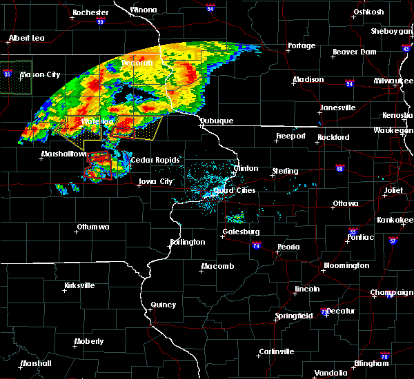 At 849 pm cdt, a severe thunderstorm capable of producing a tornado was located over rowley, or near independence, moving east at 20 mph (radar indicated rotation). Hazards include tornado and golf ball size hail. Flying debris will be dangerous to those caught without shelter. mobile homes will be damaged or destroyed. damage to roofs, windows, and vehicles will occur. tree damage is likely. this dangerous storm will be near, winthrop and quasqueton around 900 pm cdt. Other locations impacted by this tornadic thunderstorm include monti and buchanan county fairgrounds. At 849 pm cdt, a severe thunderstorm capable of producing a tornado was located over rowley, or near independence, moving east at 20 mph (radar indicated rotation). Hazards include tornado and golf ball size hail. Flying debris will be dangerous to those caught without shelter. mobile homes will be damaged or destroyed. damage to roofs, windows, and vehicles will occur. tree damage is likely. this dangerous storm will be near, winthrop and quasqueton around 900 pm cdt. Other locations impacted by this tornadic thunderstorm include monti and buchanan county fairgrounds.
|
| 6/9/2018 8:56 PM CDT |
 At 856 pm cdt, severe thunderstorms were located along a line extending from near dundee to near winthrop to quasqueton, moving east at 20 mph (radar indicated). Hazards include 60 mph wind gusts and half dollar size hail. Hail damage to vehicles is expected. expect wind damage to roofs, siding, and trees. Locations impacted include, independence, manchester, edgewood, winthrop, earlville, quasqueton, lamont, delhi, colesburg, ryan, rowley, greeley, aurora, dundee, delaware, masonville, stanley, oneida, manchester airport and monti. At 856 pm cdt, severe thunderstorms were located along a line extending from near dundee to near winthrop to quasqueton, moving east at 20 mph (radar indicated). Hazards include 60 mph wind gusts and half dollar size hail. Hail damage to vehicles is expected. expect wind damage to roofs, siding, and trees. Locations impacted include, independence, manchester, edgewood, winthrop, earlville, quasqueton, lamont, delhi, colesburg, ryan, rowley, greeley, aurora, dundee, delaware, masonville, stanley, oneida, manchester airport and monti.
|
| 6/9/2018 8:50 PM CDT |
 At 849 pm cdt, a severe thunderstorm capable of producing a tornado was located over rowley, or near independence, moving east at 20 mph (radar indicated rotation). Hazards include tornado and golf ball size hail. Flying debris will be dangerous to those caught without shelter. mobile homes will be damaged or destroyed. damage to roofs, windows, and vehicles will occur. tree damage is likely. this dangerous storm will be near, winthrop and quasqueton around 900 pm cdt. Other locations impacted by this tornadic thunderstorm include monti and buchanan county fairgrounds. At 849 pm cdt, a severe thunderstorm capable of producing a tornado was located over rowley, or near independence, moving east at 20 mph (radar indicated rotation). Hazards include tornado and golf ball size hail. Flying debris will be dangerous to those caught without shelter. mobile homes will be damaged or destroyed. damage to roofs, windows, and vehicles will occur. tree damage is likely. this dangerous storm will be near, winthrop and quasqueton around 900 pm cdt. Other locations impacted by this tornadic thunderstorm include monti and buchanan county fairgrounds.
|
| 6/9/2018 8:44 PM CDT |
 At 844 pm cdt, severe thunderstorms were located along a line extending from lamont to near winthrop to near quasqueton, moving east at 20 mph (radar indicated). Hazards include ping pong ball size hail and 60 mph wind gusts. People and animals outdoors will be injured. expect hail damage to roofs, siding, windows, and vehicles. Expect wind damage to roofs, siding, and trees. At 844 pm cdt, severe thunderstorms were located along a line extending from lamont to near winthrop to near quasqueton, moving east at 20 mph (radar indicated). Hazards include ping pong ball size hail and 60 mph wind gusts. People and animals outdoors will be injured. expect hail damage to roofs, siding, windows, and vehicles. Expect wind damage to roofs, siding, and trees.
|
| 6/9/2018 8:40 PM CDT |
 At 839 pm cdt, severe thunderstorms were located along a line extending from aurora to near winthrop to independence, moving east at 15 mph (a trained weather spotter reported a wind gust estimated at 60 mph 1 mile northwest of independence at 835 pm). Hazards include ping pong ball size hail and 60 mph wind gusts. People and animals outdoors will be injured. expect hail damage to roofs, siding, windows, and vehicles. expect wind damage to roofs, siding, and trees. Locations impacted include, independence, jesup, fairbank, winthrop, hazleton, lamont, aurora, stanley, winthrop golf course, wapsipinicon golf course, fontana county park, littleton, buchanan county fairgrounds, otterville, jakway park and fontana park. At 839 pm cdt, severe thunderstorms were located along a line extending from aurora to near winthrop to independence, moving east at 15 mph (a trained weather spotter reported a wind gust estimated at 60 mph 1 mile northwest of independence at 835 pm). Hazards include ping pong ball size hail and 60 mph wind gusts. People and animals outdoors will be injured. expect hail damage to roofs, siding, windows, and vehicles. expect wind damage to roofs, siding, and trees. Locations impacted include, independence, jesup, fairbank, winthrop, hazleton, lamont, aurora, stanley, winthrop golf course, wapsipinicon golf course, fontana county park, littleton, buchanan county fairgrounds, otterville, jakway park and fontana park.
|
| 6/9/2018 8:35 PM CDT | Trees at about a 45 degree angle... no tree damage visibil in buchanan county IA, 2 miles SSW of Independence, IA |
| 6/9/2018 8:31 PM CDT |
 At 830 pm cdt, severe thunderstorms were located along a line extending from near stanley to 6 miles northwest of winthrop to independence, moving east at 15 mph (radar indicated). Hazards include ping pong ball size hail and 60 mph wind gusts. People and animals outdoors will be injured. expect hail damage to roofs, siding, windows, and vehicles. expect wind damage to roofs, siding, and trees. Locations impacted include, independence, jesup, fairbank, winthrop, hazleton, lamont, aurora, stanley, winthrop golf course, wapsipinicon golf course, fontana county park, littleton, buchanan county fairgrounds, otterville, jakway park and fontana park. At 830 pm cdt, severe thunderstorms were located along a line extending from near stanley to 6 miles northwest of winthrop to independence, moving east at 15 mph (radar indicated). Hazards include ping pong ball size hail and 60 mph wind gusts. People and animals outdoors will be injured. expect hail damage to roofs, siding, windows, and vehicles. expect wind damage to roofs, siding, and trees. Locations impacted include, independence, jesup, fairbank, winthrop, hazleton, lamont, aurora, stanley, winthrop golf course, wapsipinicon golf course, fontana county park, littleton, buchanan county fairgrounds, otterville, jakway park and fontana park.
|
| 6/9/2018 8:26 PM CDT |
 At 826 pm cdt, severe thunderstorms were located along a line extending from stanley to 6 miles southeast of hazleton to near independence, moving east at 20 mph (radar indicated). Hazards include 60 mph wind gusts and half dollar size hail. Hail damage to vehicles is expected. expect wind damage to roofs, siding, and trees. Locations impacted include, independence, jesup, fairbank, winthrop, hazleton, lamont, aurora, stanley, winthrop golf course, wapsipinicon golf course, fontana county park, littleton, buchanan county fairgrounds, otterville, jakway park and fontana park. At 826 pm cdt, severe thunderstorms were located along a line extending from stanley to 6 miles southeast of hazleton to near independence, moving east at 20 mph (radar indicated). Hazards include 60 mph wind gusts and half dollar size hail. Hail damage to vehicles is expected. expect wind damage to roofs, siding, and trees. Locations impacted include, independence, jesup, fairbank, winthrop, hazleton, lamont, aurora, stanley, winthrop golf course, wapsipinicon golf course, fontana county park, littleton, buchanan county fairgrounds, otterville, jakway park and fontana park.
|
| 6/9/2018 8:16 PM CDT |
 At 816 pm cdt, severe thunderstorms were located along a line extending from near stanley to near independence to near jesup, moving east at 25 mph (radar indicated). Hazards include 60 mph wind gusts and quarter size hail. Hail damage to vehicles is expected. expect wind damage to roofs, siding, and trees. Locations impacted include, independence, jesup, fairbank, winthrop, hazleton, lamont, aurora, stanley, winthrop golf course, wapsipinicon golf course, fontana county park, littleton, buchanan county fairgrounds, otterville, jakway park and fontana park. At 816 pm cdt, severe thunderstorms were located along a line extending from near stanley to near independence to near jesup, moving east at 25 mph (radar indicated). Hazards include 60 mph wind gusts and quarter size hail. Hail damage to vehicles is expected. expect wind damage to roofs, siding, and trees. Locations impacted include, independence, jesup, fairbank, winthrop, hazleton, lamont, aurora, stanley, winthrop golf course, wapsipinicon golf course, fontana county park, littleton, buchanan county fairgrounds, otterville, jakway park and fontana park.
|
| 6/9/2018 8:03 PM CDT |
 At 803 pm cdt, a severe thunderstorm was located near hazleton, or 7 miles northwest of independence, moving east at 20 mph (radar indicated). Hazards include 60 mph wind gusts and quarter size hail. Hail damage to vehicles is expected. expect wind damage to roofs, siding, and trees. Locations impacted include, independence, jesup, fairbank, winthrop, hazleton, lamont, aurora, stanley, winthrop golf course, wapsipinicon golf course, fontana county park, littleton, buchanan county fairgrounds, otterville, jakway park and fontana park. At 803 pm cdt, a severe thunderstorm was located near hazleton, or 7 miles northwest of independence, moving east at 20 mph (radar indicated). Hazards include 60 mph wind gusts and quarter size hail. Hail damage to vehicles is expected. expect wind damage to roofs, siding, and trees. Locations impacted include, independence, jesup, fairbank, winthrop, hazleton, lamont, aurora, stanley, winthrop golf course, wapsipinicon golf course, fontana county park, littleton, buchanan county fairgrounds, otterville, jakway park and fontana park.
|
| 6/9/2018 7:51 PM CDT |
 At 750 pm cdt, a severe thunderstorm was located near jesup, or 11 miles northwest of independence, moving east at 20 mph (radar indicated). Hazards include 60 mph wind gusts and quarter size hail. Hail damage to vehicles is expected. Expect wind damage to roofs, siding, and trees. At 750 pm cdt, a severe thunderstorm was located near jesup, or 11 miles northwest of independence, moving east at 20 mph (radar indicated). Hazards include 60 mph wind gusts and quarter size hail. Hail damage to vehicles is expected. Expect wind damage to roofs, siding, and trees.
|
| 5/25/2018 8:52 PM CDT |
 The severe thunderstorm warning for northwestern jo daviess, northwestern jackson, eastern buchanan, dubuque and delaware counties will expire at 900 pm cdt, the storms which prompted the warning have weakened below severe limits, and no longer pose an immediate threat to life or property. therefore, the warning will be allowed to expire. however hail up to penny size and gusty winds are still possible with these thunderstorms. to report severe weather, contact your nearest law enforcement agency. they will relay your report to the national weather service the quad cities. The severe thunderstorm warning for northwestern jo daviess, northwestern jackson, eastern buchanan, dubuque and delaware counties will expire at 900 pm cdt, the storms which prompted the warning have weakened below severe limits, and no longer pose an immediate threat to life or property. therefore, the warning will be allowed to expire. however hail up to penny size and gusty winds are still possible with these thunderstorms. to report severe weather, contact your nearest law enforcement agency. they will relay your report to the national weather service the quad cities.
|
| 5/25/2018 8:40 PM CDT |
 At 839 pm cdt, severe thunderstorms were located along a line extending from menominee to near rowley, moving southeast at 40 mph (radar indicated). Hazards include 60 mph wind gusts and penny size hail. Expect damage to roofs, siding, and trees. Locations impacted include, dubuque, independence, manchester, galena, asbury, dyersville, cascade, epworth, east dubuque, farley, peosta, winthrop, earlville, hopkinton, quasqueton, lamont, delhi, new vienna, colesburg and worthington. At 839 pm cdt, severe thunderstorms were located along a line extending from menominee to near rowley, moving southeast at 40 mph (radar indicated). Hazards include 60 mph wind gusts and penny size hail. Expect damage to roofs, siding, and trees. Locations impacted include, dubuque, independence, manchester, galena, asbury, dyersville, cascade, epworth, east dubuque, farley, peosta, winthrop, earlville, hopkinton, quasqueton, lamont, delhi, new vienna, colesburg and worthington.
|
| 5/25/2018 8:27 PM CDT |
 At 825 pm cdt, severe thunderstorms were located along a line extending from near sageville to independence, moving southeast at 25 mph (emergency management). Hazards include 60 mph wind gusts and penny size hail. Expect damage to roofs, siding, and trees. Locations impacted include, dubuque, independence, manchester, galena, asbury, dyersville, jesup, cascade, epworth, east dubuque, farley, peosta, fairbank, edgewood, winthrop, hazleton, earlville, hopkinton, quasqueton and lamont. At 825 pm cdt, severe thunderstorms were located along a line extending from near sageville to independence, moving southeast at 25 mph (emergency management). Hazards include 60 mph wind gusts and penny size hail. Expect damage to roofs, siding, and trees. Locations impacted include, dubuque, independence, manchester, galena, asbury, dyersville, jesup, cascade, epworth, east dubuque, farley, peosta, fairbank, edgewood, winthrop, hazleton, earlville, hopkinton, quasqueton and lamont.
|
| 5/25/2018 8:10 PM CDT |
 At 808 pm cdt, severe thunderstorms were located along a line extending from 6 miles west of platteville to 6 miles southwest of independence, moving southeast at 40 mph (radar indicated). Hazards include 60 mph wind gusts and penny size hail. expect damage to roofs, siding, and trees At 808 pm cdt, severe thunderstorms were located along a line extending from 6 miles west of platteville to 6 miles southwest of independence, moving southeast at 40 mph (radar indicated). Hazards include 60 mph wind gusts and penny size hail. expect damage to roofs, siding, and trees
|
| 5/25/2018 7:43 PM CDT |
 At 743 pm cdt, severe thunderstorms were located along a line extending from near guttenberg to fairbank, moving southeast at 30 mph (radar indicated). Hazards include 60 mph wind gusts and penny size hail. Expect damage to roofs, siding, and trees. Locations impacted include, independence, manchester, dyersville, jesup, farley, fairbank, edgewood, winthrop, hazleton, earlville, quasqueton, lamont, delhi, new vienna, colesburg, worthington, holy cross, rowley, greeley and luxemburg. At 743 pm cdt, severe thunderstorms were located along a line extending from near guttenberg to fairbank, moving southeast at 30 mph (radar indicated). Hazards include 60 mph wind gusts and penny size hail. Expect damage to roofs, siding, and trees. Locations impacted include, independence, manchester, dyersville, jesup, farley, fairbank, edgewood, winthrop, hazleton, earlville, quasqueton, lamont, delhi, new vienna, colesburg, worthington, holy cross, rowley, greeley and luxemburg.
|
| 5/25/2018 7:23 PM CDT |
 At 722 pm cdt, severe thunderstorms were located along a line extending from near elkader to near fairbank, moving southeast at 40 mph (radar indicated). Hazards include 60 mph wind gusts and penny size hail. expect damage to roofs, siding, and trees At 722 pm cdt, severe thunderstorms were located along a line extending from near elkader to near fairbank, moving southeast at 40 mph (radar indicated). Hazards include 60 mph wind gusts and penny size hail. expect damage to roofs, siding, and trees
|
| 6/29/2017 10:23 PM CDT | Estimated wind gusts around 60 mp in buchanan county IA, 0.5 miles SSE of Independence, IA |
| 6/29/2017 10:21 PM CDT | Wind gusts estimated at 70 mph with sustained winds around 60 mph for about 3 minutes starting around 1021 pm north of independence on highway 150 north. visibility a q in buchanan county IA, 2 miles SSW of Independence, IA |
| 6/29/2017 5:36 PM CDT |
 At 1034 pm cdt, severe thunderstorms were located along a line extending from lamont to near troy mills to near norway, moving east at 45 mph (trained spotters). Hazards include 60 mph wind gusts. Expect damage to roofs, siding, and trees. Locations impacted include, cedar rapids, independence, manchester, marion, hiawatha, robins, center point, urbana, central city, springville, palo, shellsburg, edgewood, winthrop, earlville, walker, alburnett, coggon, quasqueton and lamont. At 1034 pm cdt, severe thunderstorms were located along a line extending from lamont to near troy mills to near norway, moving east at 45 mph (trained spotters). Hazards include 60 mph wind gusts. Expect damage to roofs, siding, and trees. Locations impacted include, cedar rapids, independence, manchester, marion, hiawatha, robins, center point, urbana, central city, springville, palo, shellsburg, edgewood, winthrop, earlville, walker, alburnett, coggon, quasqueton and lamont.
|
| 6/29/2017 5:30 PM CDT |
 At 1029 pm cdt, severe thunderstorms were located along a line extending from near aurora to near walker to near newhall, moving east at 35 mph (radar indicated). Hazards include 60 mph wind gusts. expect damage to roofs, siding, and trees At 1029 pm cdt, severe thunderstorms were located along a line extending from near aurora to near walker to near newhall, moving east at 35 mph (radar indicated). Hazards include 60 mph wind gusts. expect damage to roofs, siding, and trees
|
| 6/29/2017 5:15 PM CDT |
 At 1013 pm cdt, severe thunderstorms were located along a line extending from near hazleton to near independence to near vinton to near belle plaine, moving east at 50 mph (trained spotters have reported up to 60 mph winds with this line of storms). Hazards include 60 mph wind gusts and penny size hail. Expect damage to roofs, siding, and trees. locations impacted include, independence, vinton, belle plaine, jesup, center point, atkins, urbana, fairbank, palo, shellsburg, newhall, winthrop, hazleton, walker, blairstown, van horne, keystone, quasqueton, norway and lamont. This includes interstate 380 between mile markers 48 and 55. At 1013 pm cdt, severe thunderstorms were located along a line extending from near hazleton to near independence to near vinton to near belle plaine, moving east at 50 mph (trained spotters have reported up to 60 mph winds with this line of storms). Hazards include 60 mph wind gusts and penny size hail. Expect damage to roofs, siding, and trees. locations impacted include, independence, vinton, belle plaine, jesup, center point, atkins, urbana, fairbank, palo, shellsburg, newhall, winthrop, hazleton, walker, blairstown, van horne, keystone, quasqueton, norway and lamont. This includes interstate 380 between mile markers 48 and 55.
|
| 6/29/2017 5:03 PM CDT |
 At 1002 pm cdt, severe thunderstorms were located along a line extending from fairbank to near jesup to dysart to toledo, moving east at 45 mph (radar indicated). Hazards include 60 mph wind gusts and penny size hail. Expect damage to roofs, siding, and trees. locations impacted include, independence, vinton, belle plaine, jesup, center point, atkins, urbana, fairbank, palo, shellsburg, newhall, winthrop, hazleton, walker, blairstown, van horne, keystone, quasqueton, norway and lamont. This includes interstate 380 between mile markers 48 and 55. At 1002 pm cdt, severe thunderstorms were located along a line extending from fairbank to near jesup to dysart to toledo, moving east at 45 mph (radar indicated). Hazards include 60 mph wind gusts and penny size hail. Expect damage to roofs, siding, and trees. locations impacted include, independence, vinton, belle plaine, jesup, center point, atkins, urbana, fairbank, palo, shellsburg, newhall, winthrop, hazleton, walker, blairstown, van horne, keystone, quasqueton, norway and lamont. This includes interstate 380 between mile markers 48 and 55.
|
| 6/29/2017 4:53 PM CDT |
 At 952 pm cdt, severe thunderstorms were located along a line extending from near denver to 6 miles northeast of traer to 10 miles southwest of meskwaki casino, moving east at 45 mph (radar indicated). Hazards include 60 mph wind gusts and penny size hail. expect damage to roofs, siding, and trees At 952 pm cdt, severe thunderstorms were located along a line extending from near denver to 6 miles northeast of traer to 10 miles southwest of meskwaki casino, moving east at 45 mph (radar indicated). Hazards include 60 mph wind gusts and penny size hail. expect damage to roofs, siding, and trees
|
| 6/15/2017 9:23 PM CDT |
 At 923 pm cdt, a severe thunderstorm was located near fairbank, or 8 miles northwest of independence, moving east at 30 mph (radar indicated). Hazards include quarter size hail. Damage to vehicles is expected. Locations impacted include, independence, winthrop, hazleton, buchanan county fairgrounds, winthrop golf course, otterville, wapsipinicon golf course, fontana county park, fontana park and jakway park. At 923 pm cdt, a severe thunderstorm was located near fairbank, or 8 miles northwest of independence, moving east at 30 mph (radar indicated). Hazards include quarter size hail. Damage to vehicles is expected. Locations impacted include, independence, winthrop, hazleton, buchanan county fairgrounds, winthrop golf course, otterville, wapsipinicon golf course, fontana county park, fontana park and jakway park.
|
| 6/15/2017 9:13 PM CDT |
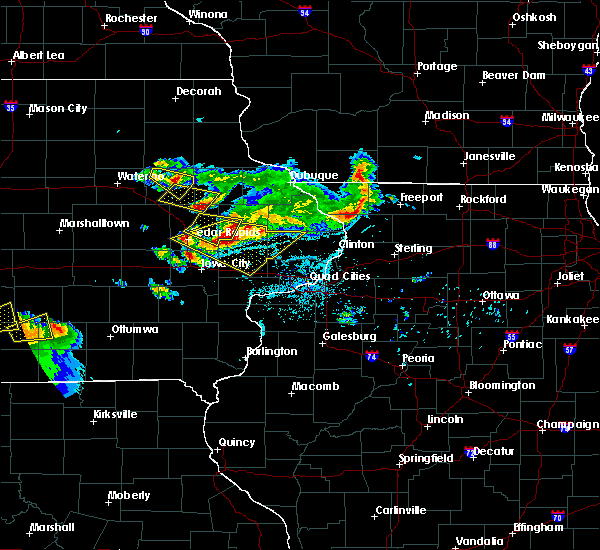 At 913 pm cdt, a severe thunderstorm was located near winthrop, or near independence, moving southeast at 50 mph (radar indicated). Hazards include 60 mph wind gusts and quarter size hail. Hail damage to vehicles is expected. expect wind damage to roofs, siding, and trees. Locations impacted include, independence, winthrop, hazleton, quasqueton, buchanan county fairgrounds, winthrop golf course, otterville, wapsipinicon golf course, fontana county park, fontana park and jakway park. At 913 pm cdt, a severe thunderstorm was located near winthrop, or near independence, moving southeast at 50 mph (radar indicated). Hazards include 60 mph wind gusts and quarter size hail. Hail damage to vehicles is expected. expect wind damage to roofs, siding, and trees. Locations impacted include, independence, winthrop, hazleton, quasqueton, buchanan county fairgrounds, winthrop golf course, otterville, wapsipinicon golf course, fontana county park, fontana park and jakway park.
|
| 6/15/2017 8:58 PM CDT |
 At 858 pm cdt, a severe thunderstorm was located near hazleton, or 7 miles northwest of independence, moving southeast at 45 mph (radar indicated). Hazards include 60 mph wind gusts and quarter size hail. Hail damage to vehicles is expected. Expect wind damage to roofs, siding, and trees. At 858 pm cdt, a severe thunderstorm was located near hazleton, or 7 miles northwest of independence, moving southeast at 45 mph (radar indicated). Hazards include 60 mph wind gusts and quarter size hail. Hail damage to vehicles is expected. Expect wind damage to roofs, siding, and trees.
|
| 6/15/2017 8:40 PM CDT | Quarter sized hail reported 0.9 miles WSW of Independence, IA |
| 6/15/2017 8:36 PM CDT | Quarter sized hail reported 0.9 miles WSW of Independence, IA, pea to quarter |
| 6/15/2017 8:34 PM CDT | Quarter sized hail reported 0.5 miles SSE of Independence, IA |
| 6/15/2017 8:30 PM CDT |
 At 830 pm cdt, a severe thunderstorm was located near independence, moving southeast at 40 mph (radar indicated). Hazards include 60 mph wind gusts and quarter size hail. Hail damage to vehicles is expected. expect wind damage to roofs, siding, and trees. Locations impacted include, independence, jesup, fairbank, hazleton, lamont, rowley, aurora, stanley, wapsipinicon golf course, fontana county park, littleton, buchanan county fairgrounds, otterville, independence airport, jakway park and fontana park. At 830 pm cdt, a severe thunderstorm was located near independence, moving southeast at 40 mph (radar indicated). Hazards include 60 mph wind gusts and quarter size hail. Hail damage to vehicles is expected. expect wind damage to roofs, siding, and trees. Locations impacted include, independence, jesup, fairbank, hazleton, lamont, rowley, aurora, stanley, wapsipinicon golf course, fontana county park, littleton, buchanan county fairgrounds, otterville, independence airport, jakway park and fontana park.
|
| 6/15/2017 8:25 PM CDT |
 At 824 pm cdt, a severe thunderstorm was located over jesup, or 8 miles west of independence, moving southeast at 40 mph (radar indicated). Hazards include 60 mph wind gusts and quarter size hail. Hail damage to vehicles is expected. expect wind damage to roofs, siding, and trees. Locations impacted include, independence, jesup, fairbank, hazleton, lamont, rowley, aurora, stanley, wapsipinicon golf course, fontana county park, littleton, buchanan county fairgrounds, otterville, independence airport, jakway park and fontana park. At 824 pm cdt, a severe thunderstorm was located over jesup, or 8 miles west of independence, moving southeast at 40 mph (radar indicated). Hazards include 60 mph wind gusts and quarter size hail. Hail damage to vehicles is expected. expect wind damage to roofs, siding, and trees. Locations impacted include, independence, jesup, fairbank, hazleton, lamont, rowley, aurora, stanley, wapsipinicon golf course, fontana county park, littleton, buchanan county fairgrounds, otterville, independence airport, jakway park and fontana park.
|
| 6/15/2017 8:16 PM CDT |
 At 816 pm cdt, a severe thunderstorm was located near jesup, or 9 miles east of waterloo, moving southeast at 40 mph (radar indicated). Hazards include 60 mph wind gusts and half dollar size hail. Hail damage to vehicles is expected. Expect wind damage to roofs, siding, and trees. At 816 pm cdt, a severe thunderstorm was located near jesup, or 9 miles east of waterloo, moving southeast at 40 mph (radar indicated). Hazards include 60 mph wind gusts and half dollar size hail. Hail damage to vehicles is expected. Expect wind damage to roofs, siding, and trees.
|
| 6/15/2017 7:53 PM CDT |
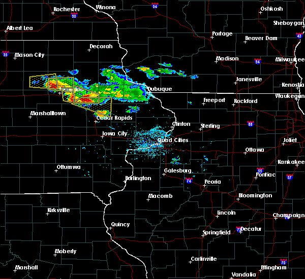 At 753 pm cdt, a severe thunderstorm was located near independence, moving east at 30 mph (radar indicated). Hazards include 60 mph wind gusts and half dollar size hail. Hail damage to vehicles is expected. expect wind damage to roofs, siding, and trees. locations impacted include, independence, jesup, winthrop, quasqueton, brandon, rowley, lime creek county park, wapsipinicon golf course, littleton, monti, buchanan county fairgrounds, otterville and independence airport. This includes interstate 380 between mile markers 49 and 55. At 753 pm cdt, a severe thunderstorm was located near independence, moving east at 30 mph (radar indicated). Hazards include 60 mph wind gusts and half dollar size hail. Hail damage to vehicles is expected. expect wind damage to roofs, siding, and trees. locations impacted include, independence, jesup, winthrop, quasqueton, brandon, rowley, lime creek county park, wapsipinicon golf course, littleton, monti, buchanan county fairgrounds, otterville and independence airport. This includes interstate 380 between mile markers 49 and 55.
|
| 6/15/2017 7:44 PM CDT |
 At 743 pm cdt, a severe thunderstorm was located near independence, moving east at 30 mph (trained weather spotters). Hazards include 60 mph wind gusts and half dollar size hail. Hail damage to vehicles is expected. expect wind damage to roofs, siding, and trees. locations impacted include, independence, jesup, fairbank, winthrop, hazleton, quasqueton, lamont, brandon, rowley, aurora, stanley, lime creek county park, winthrop golf course, wapsipinicon golf course, fontana county park, littleton, monti, buchanan county fairgrounds, otterville and independence airport. This includes interstate 380 between mile markers 49 and 55. At 743 pm cdt, a severe thunderstorm was located near independence, moving east at 30 mph (trained weather spotters). Hazards include 60 mph wind gusts and half dollar size hail. Hail damage to vehicles is expected. expect wind damage to roofs, siding, and trees. locations impacted include, independence, jesup, fairbank, winthrop, hazleton, quasqueton, lamont, brandon, rowley, aurora, stanley, lime creek county park, winthrop golf course, wapsipinicon golf course, fontana county park, littleton, monti, buchanan county fairgrounds, otterville and independence airport. This includes interstate 380 between mile markers 49 and 55.
|
| 6/15/2017 7:35 PM CDT |
 At 735 pm cdt, a severe thunderstorm was located near independence, moving east at 35 mph (trained weather spotters reported quarter size hail in jesup at 732 pm). Hazards include 60 mph wind gusts and half dollar size hail. Hail damage to vehicles is expected. expect wind damage to roofs, siding, and trees. locations impacted include, independence, jesup, fairbank, winthrop, hazleton, quasqueton, lamont, brandon, rowley, aurora, stanley, lime creek county park, winthrop golf course, wapsipinicon golf course, fontana county park, littleton, monti, buchanan county fairgrounds, otterville and independence airport. This includes interstate 380 between mile markers 49 and 55. At 735 pm cdt, a severe thunderstorm was located near independence, moving east at 35 mph (trained weather spotters reported quarter size hail in jesup at 732 pm). Hazards include 60 mph wind gusts and half dollar size hail. Hail damage to vehicles is expected. expect wind damage to roofs, siding, and trees. locations impacted include, independence, jesup, fairbank, winthrop, hazleton, quasqueton, lamont, brandon, rowley, aurora, stanley, lime creek county park, winthrop golf course, wapsipinicon golf course, fontana county park, littleton, monti, buchanan county fairgrounds, otterville and independence airport. This includes interstate 380 between mile markers 49 and 55.
|
| 6/15/2017 7:30 PM CDT |
 At 730 pm cdt, a severe thunderstorm was located near jesup, or 7 miles west of independence, moving east at 35 mph (radar indicated). Hazards include 60 mph wind gusts and half dollar size hail. Hail damage to vehicles is expected. expect wind damage to roofs, siding, and trees. locations impacted include, independence, jesup, fairbank, winthrop, hazleton, quasqueton, lamont, brandon, rowley, aurora, stanley, lime creek county park, winthrop golf course, wapsipinicon golf course, fontana county park, littleton, monti, buchanan county fairgrounds, otterville and independence airport. This includes interstate 380 between mile markers 49 and 55. At 730 pm cdt, a severe thunderstorm was located near jesup, or 7 miles west of independence, moving east at 35 mph (radar indicated). Hazards include 60 mph wind gusts and half dollar size hail. Hail damage to vehicles is expected. expect wind damage to roofs, siding, and trees. locations impacted include, independence, jesup, fairbank, winthrop, hazleton, quasqueton, lamont, brandon, rowley, aurora, stanley, lime creek county park, winthrop golf course, wapsipinicon golf course, fontana county park, littleton, monti, buchanan county fairgrounds, otterville and independence airport. This includes interstate 380 between mile markers 49 and 55.
|
| 6/15/2017 7:22 PM CDT |
 At 722 pm cdt, a severe thunderstorm was located over jesup, or 11 miles west of independence, moving east at 35 mph (radar indicated). Hazards include 60 mph wind gusts and half dollar size hail. Hail damage to vehicles is expected. expect wind damage to roofs, siding, and trees. locations impacted include, independence, jesup, fairbank, winthrop, hazleton, quasqueton, lamont, brandon, rowley, aurora, stanley, lime creek county park, winthrop golf course, wapsipinicon golf course, fontana county park, littleton, monti, buchanan county fairgrounds, otterville and independence airport. This includes interstate 380 between mile markers 49 and 55. At 722 pm cdt, a severe thunderstorm was located over jesup, or 11 miles west of independence, moving east at 35 mph (radar indicated). Hazards include 60 mph wind gusts and half dollar size hail. Hail damage to vehicles is expected. expect wind damage to roofs, siding, and trees. locations impacted include, independence, jesup, fairbank, winthrop, hazleton, quasqueton, lamont, brandon, rowley, aurora, stanley, lime creek county park, winthrop golf course, wapsipinicon golf course, fontana county park, littleton, monti, buchanan county fairgrounds, otterville and independence airport. This includes interstate 380 between mile markers 49 and 55.
|
| 6/15/2017 7:17 PM CDT |
 At 716 pm cdt, a severe thunderstorm was located near jesup, or 9 miles east of waterloo, moving east at 35 mph (trained weather spotters in waterloo). Hazards include 60 mph wind gusts and half dollar size hail. Hail damage to vehicles is expected. Expect wind damage to roofs, siding, and trees. At 716 pm cdt, a severe thunderstorm was located near jesup, or 9 miles east of waterloo, moving east at 35 mph (trained weather spotters in waterloo). Hazards include 60 mph wind gusts and half dollar size hail. Hail damage to vehicles is expected. Expect wind damage to roofs, siding, and trees.
|
| 5/17/2017 6:41 PM CDT |
 At 640 pm cdt, severe thunderstorms were located along a line extending from hazleton to masonville to near prairieburg to near riverside, moving northeast at 45 mph (trained weather spotters). Hazards include 70 mph wind gusts. Expect considerable tree damage. damage is likely to mobile homes, roofs, and outbuildings. locations impacted include, cedar rapids, iowa city, dubuque, muscatine, independence, anamosa, manchester, tipton, west branch, mechanicsville, stanwood, marion, coralville, north liberty, mount vernon, asbury, dyersville, monticello, west liberty and wilton. this includes the following highways, interstate 80 in iowa between mile markers 239 and 274. interstate 380 between mile markers 1 and 6. A tornado watch remains in effect until 1100 pm cdt for northwestern illinois, and southeastern, northeastern and east central iowa. At 640 pm cdt, severe thunderstorms were located along a line extending from hazleton to masonville to near prairieburg to near riverside, moving northeast at 45 mph (trained weather spotters). Hazards include 70 mph wind gusts. Expect considerable tree damage. damage is likely to mobile homes, roofs, and outbuildings. locations impacted include, cedar rapids, iowa city, dubuque, muscatine, independence, anamosa, manchester, tipton, west branch, mechanicsville, stanwood, marion, coralville, north liberty, mount vernon, asbury, dyersville, monticello, west liberty and wilton. this includes the following highways, interstate 80 in iowa between mile markers 239 and 274. interstate 380 between mile markers 1 and 6. A tornado watch remains in effect until 1100 pm cdt for northwestern illinois, and southeastern, northeastern and east central iowa.
|
| 5/17/2017 6:31 PM CDT |
 At 630 pm cdt, severe thunderstorms were located along a line extending from near fairbank to near quasqueton to near springville to near hills, moving northeast at 40 mph (trained weather spotters). Hazards include 70 mph wind gusts. Expect considerable tree damage. Damage is likely to mobile homes, roofs, and outbuildings. At 630 pm cdt, severe thunderstorms were located along a line extending from near fairbank to near quasqueton to near springville to near hills, moving northeast at 40 mph (trained weather spotters). Hazards include 70 mph wind gusts. Expect considerable tree damage. Damage is likely to mobile homes, roofs, and outbuildings.
|
| 5/17/2017 6:22 PM CDT |
 At 622 pm cdt, severe thunderstorms were located along a line extending from 6 miles southeast of jesup to near quasqueton to near alburnett to richmond, moving northeast at 45 mph (trained weather spotters). Hazards include 70 mph wind gusts. Expect considerable tree damage. damage is likely to mobile homes, roofs, and outbuildings. locations impacted include, cedar rapids, iowa city, independence, manchester, west branch, marion, coralville, north liberty, hiawatha, mount vernon, robins, jesup, center point, kalona, lisbon, fairfax, solon, tiffin, ely and atkins. this includes the following highways, interstate 80 in iowa between mile markers 224 and 253. interstate 380 between mile markers 1 and 55. A tornado watch remains in effect until 1100 pm cdt for southeastern, northeastern and east central iowa. At 622 pm cdt, severe thunderstorms were located along a line extending from 6 miles southeast of jesup to near quasqueton to near alburnett to richmond, moving northeast at 45 mph (trained weather spotters). Hazards include 70 mph wind gusts. Expect considerable tree damage. damage is likely to mobile homes, roofs, and outbuildings. locations impacted include, cedar rapids, iowa city, independence, manchester, west branch, marion, coralville, north liberty, hiawatha, mount vernon, robins, jesup, center point, kalona, lisbon, fairfax, solon, tiffin, ely and atkins. this includes the following highways, interstate 80 in iowa between mile markers 224 and 253. interstate 380 between mile markers 1 and 55. A tornado watch remains in effect until 1100 pm cdt for southeastern, northeastern and east central iowa.
|
| 5/17/2017 6:15 PM CDT |
 At 615 pm cdt, severe thunderstorms were located along a line extending from near brandon to near urbana to robins to near wellman, moving northeast at 55 mph (trained weather spotters). Hazards include 70 mph wind gusts and quarter size hail. Hail damage to vehicles is expected. expect considerable tree damage. wind damage is also likely to mobile homes, roofs, and outbuildings. locations impacted include, cedar rapids, iowa city, independence, vinton, manchester, west branch, marion, coralville, north liberty, hiawatha, mount vernon, robins, jesup, center point, kalona, lisbon, fairfax, solon, tiffin and ely. this includes the following highways, interstate 80 in iowa between mile markers 224 and 253. interstate 380 between mile markers 1 and 55. A tornado watch remains in effect until 1100 pm cdt for southeastern, northeastern and east central iowa. At 615 pm cdt, severe thunderstorms were located along a line extending from near brandon to near urbana to robins to near wellman, moving northeast at 55 mph (trained weather spotters). Hazards include 70 mph wind gusts and quarter size hail. Hail damage to vehicles is expected. expect considerable tree damage. wind damage is also likely to mobile homes, roofs, and outbuildings. locations impacted include, cedar rapids, iowa city, independence, vinton, manchester, west branch, marion, coralville, north liberty, hiawatha, mount vernon, robins, jesup, center point, kalona, lisbon, fairfax, solon, tiffin and ely. this includes the following highways, interstate 80 in iowa between mile markers 224 and 253. interstate 380 between mile markers 1 and 55. A tornado watch remains in effect until 1100 pm cdt for southeastern, northeastern and east central iowa.
|
| 5/17/2017 6:10 PM CDT |
 At 610 pm cdt, severe thunderstorms were located along a line extending from near mount auburn to near shellsburg to near hiawatha to near kinross, moving northeast at 55 mph (trained weather spotters). Hazards include 70 mph wind gusts and quarter size hail. Hail damage to vehicles is expected. expect considerable tree damage. wind damage is also likely to mobile homes, roofs, and outbuildings. locations impacted include, cedar rapids, iowa city, independence, vinton, manchester, west branch, marion, coralville, north liberty, hiawatha, mount vernon, robins, jesup, center point, kalona, lisbon, fairfax, solon, tiffin and ely. this includes the following highways, interstate 80 in iowa between mile markers 224 and 253. interstate 380 between mile markers 1 and 55. A tornado watch remains in effect until 1100 pm cdt for southeastern, northeastern and east central iowa. At 610 pm cdt, severe thunderstorms were located along a line extending from near mount auburn to near shellsburg to near hiawatha to near kinross, moving northeast at 55 mph (trained weather spotters). Hazards include 70 mph wind gusts and quarter size hail. Hail damage to vehicles is expected. expect considerable tree damage. wind damage is also likely to mobile homes, roofs, and outbuildings. locations impacted include, cedar rapids, iowa city, independence, vinton, manchester, west branch, marion, coralville, north liberty, hiawatha, mount vernon, robins, jesup, center point, kalona, lisbon, fairfax, solon, tiffin and ely. this includes the following highways, interstate 80 in iowa between mile markers 224 and 253. interstate 380 between mile markers 1 and 55. A tornado watch remains in effect until 1100 pm cdt for southeastern, northeastern and east central iowa.
|
| 5/17/2017 6:04 PM CDT |
 At 604 pm cdt, severe thunderstorms were located along a line extending from near la porte city to near palo to near kinross, moving northeast at 45 mph (trained weather spotters). Hazards include 70 mph wind gusts and quarter size hail. Hail damage to vehicles is expected. expect considerable tree damage. wind damage is also likely to mobile homes, roofs, and outbuildings. locations impacted include, cedar rapids, iowa city, independence, vinton, manchester, west branch, marion, coralville, north liberty, hiawatha, mount vernon, robins, jesup, center point, kalona, lisbon, fairfax, solon, tiffin and ely. this includes the following highways, interstate 80 in iowa between mile markers 224 and 253. interstate 380 between mile markers 1 and 55. A tornado watch remains in effect until 1100 pm cdt for southeastern, northeastern and east central iowa. At 604 pm cdt, severe thunderstorms were located along a line extending from near la porte city to near palo to near kinross, moving northeast at 45 mph (trained weather spotters). Hazards include 70 mph wind gusts and quarter size hail. Hail damage to vehicles is expected. expect considerable tree damage. wind damage is also likely to mobile homes, roofs, and outbuildings. locations impacted include, cedar rapids, iowa city, independence, vinton, manchester, west branch, marion, coralville, north liberty, hiawatha, mount vernon, robins, jesup, center point, kalona, lisbon, fairfax, solon, tiffin and ely. this includes the following highways, interstate 80 in iowa between mile markers 224 and 253. interstate 380 between mile markers 1 and 55. A tornado watch remains in effect until 1100 pm cdt for southeastern, northeastern and east central iowa.
|
| 5/17/2017 5:56 PM CDT |
 At 555 pm cdt, severe thunderstorms were located along a line extending from near dysart to newhall to kinross, moving northeast at 45 mph (trained weather spotters). Hazards include 70 mph wind gusts and quarter size hail. Hail damage to vehicles is expected. expect considerable tree damage. wind damage is also likely to mobile homes, roofs, and outbuildings. locations impacted include, cedar rapids, iowa city, independence, vinton, manchester, west branch, marion, coralville, north liberty, hiawatha, mount vernon, robins, jesup, center point, kalona, lisbon, fairfax, solon, tiffin and ely. this includes the following highways, interstate 80 in iowa between mile markers 224 and 253. interstate 380 between mile markers 1 and 55. A tornado watch remains in effect until 1100 pm cdt for southeastern, northeastern and east central iowa. At 555 pm cdt, severe thunderstorms were located along a line extending from near dysart to newhall to kinross, moving northeast at 45 mph (trained weather spotters). Hazards include 70 mph wind gusts and quarter size hail. Hail damage to vehicles is expected. expect considerable tree damage. wind damage is also likely to mobile homes, roofs, and outbuildings. locations impacted include, cedar rapids, iowa city, independence, vinton, manchester, west branch, marion, coralville, north liberty, hiawatha, mount vernon, robins, jesup, center point, kalona, lisbon, fairfax, solon, tiffin and ely. this includes the following highways, interstate 80 in iowa between mile markers 224 and 253. interstate 380 between mile markers 1 and 55. A tornado watch remains in effect until 1100 pm cdt for southeastern, northeastern and east central iowa.
|
| 5/17/2017 5:50 PM CDT |
 At 550 pm cdt, severe thunderstorms were located along a line extending from near dysart to near norway to near kinross, moving northeast at 40 mph (radar indicated). Hazards include 70 mph wind gusts and quarter size hail. Hail damage to vehicles is expected. expect considerable tree damage. Wind damage is also likely to mobile homes, roofs, and outbuildings. At 550 pm cdt, severe thunderstorms were located along a line extending from near dysart to near norway to near kinross, moving northeast at 40 mph (radar indicated). Hazards include 70 mph wind gusts and quarter size hail. Hail damage to vehicles is expected. expect considerable tree damage. Wind damage is also likely to mobile homes, roofs, and outbuildings.
|
| 5/17/2017 3:37 PM CDT |
 At 337 pm cdt, a severe thunderstorm was located over quasqueton, or near independence, moving north at 35 mph (radar indicated). Hazards include 60 mph wind gusts and quarter size hail. Hail damage to vehicles is expected. expect wind damage to roofs, siding, and trees. Locations impacted include, independence, winthrop, hazleton, quasqueton, lamont, rowley, aurora, stanley, winthrop golf course, fontana county park, buchanan county fairgrounds, jakway park and fontana park. At 337 pm cdt, a severe thunderstorm was located over quasqueton, or near independence, moving north at 35 mph (radar indicated). Hazards include 60 mph wind gusts and quarter size hail. Hail damage to vehicles is expected. expect wind damage to roofs, siding, and trees. Locations impacted include, independence, winthrop, hazleton, quasqueton, lamont, rowley, aurora, stanley, winthrop golf course, fontana county park, buchanan county fairgrounds, jakway park and fontana park.
|
| 5/17/2017 3:31 PM CDT |
 At 331 pm cdt, a severe thunderstorm was located over rowley, or 7 miles southeast of independence, moving north at 40 mph (radar indicated). Hazards include 60 mph wind gusts and quarter size hail. Hail damage to vehicles is expected. expect wind damage to roofs, siding, and trees. Locations impacted include, independence, fairbank, winthrop, hazleton, quasqueton, lamont, rowley, aurora, stanley, winthrop golf course, wapsipinicon golf course, fontana county park, buchanan county fairgrounds, otterville, independence airport, jakway park and fontana park. At 331 pm cdt, a severe thunderstorm was located over rowley, or 7 miles southeast of independence, moving north at 40 mph (radar indicated). Hazards include 60 mph wind gusts and quarter size hail. Hail damage to vehicles is expected. expect wind damage to roofs, siding, and trees. Locations impacted include, independence, fairbank, winthrop, hazleton, quasqueton, lamont, rowley, aurora, stanley, winthrop golf course, wapsipinicon golf course, fontana county park, buchanan county fairgrounds, otterville, independence airport, jakway park and fontana park.
|
| 5/17/2017 3:26 PM CDT |
 At 326 pm cdt, a severe thunderstorm was located over rowley, or 9 miles south of independence, moving north at 35 mph (radar indicated). Hazards include 60 mph wind gusts and quarter size hail. Hail damage to vehicles is expected. expect wind damage to roofs, siding, and trees. locations impacted include, independence, center point, urbana, fairbank, winthrop, hazleton, walker, quasqueton, lamont, rowley, aurora, stanley, winthrop golf course, wapsipinicon golf course, fontana county park, littleton, buchanan county fairgrounds, otterville, spencers grove and independence airport. This includes interstate 380 between mile markers 36 and 45. At 326 pm cdt, a severe thunderstorm was located over rowley, or 9 miles south of independence, moving north at 35 mph (radar indicated). Hazards include 60 mph wind gusts and quarter size hail. Hail damage to vehicles is expected. expect wind damage to roofs, siding, and trees. locations impacted include, independence, center point, urbana, fairbank, winthrop, hazleton, walker, quasqueton, lamont, rowley, aurora, stanley, winthrop golf course, wapsipinicon golf course, fontana county park, littleton, buchanan county fairgrounds, otterville, spencers grove and independence airport. This includes interstate 380 between mile markers 36 and 45.
|
| 5/17/2017 3:21 PM CDT |
 At 321 pm cdt, a severe thunderstorm was located near urbana, or 11 miles northeast of vinton, moving north at 40 mph (radar indicated). Hazards include 60 mph wind gusts and quarter size hail. Hail damage to vehicles is expected. expect wind damage to roofs, siding, and trees. locations impacted include, independence, center point, urbana, fairbank, winthrop, hazleton, walker, quasqueton, lamont, rowley, aurora, stanley, wapsipinicon golf course, fontana county park, otterville, jakway park, wildcat bluff park, cheney, winthrop golf course and benton city park. This includes interstate 380 between mile markers 36 and 49. At 321 pm cdt, a severe thunderstorm was located near urbana, or 11 miles northeast of vinton, moving north at 40 mph (radar indicated). Hazards include 60 mph wind gusts and quarter size hail. Hail damage to vehicles is expected. expect wind damage to roofs, siding, and trees. locations impacted include, independence, center point, urbana, fairbank, winthrop, hazleton, walker, quasqueton, lamont, rowley, aurora, stanley, wapsipinicon golf course, fontana county park, otterville, jakway park, wildcat bluff park, cheney, winthrop golf course and benton city park. This includes interstate 380 between mile markers 36 and 49.
|
| 5/17/2017 3:16 PM CDT |
 At 316 pm cdt, a severe thunderstorm was located over urbana, or 8 miles northeast of vinton, moving north at 40 mph (radar indicated). Hazards include 60 mph wind gusts and quarter size hail. Hail damage to vehicles is expected. Expect wind damage to roofs, siding, and trees. At 316 pm cdt, a severe thunderstorm was located over urbana, or 8 miles northeast of vinton, moving north at 40 mph (radar indicated). Hazards include 60 mph wind gusts and quarter size hail. Hail damage to vehicles is expected. Expect wind damage to roofs, siding, and trees.
|
| 4/15/2017 7:47 PM CDT |
 At 747 pm cdt, severe thunderstorms were located along a line extending from independence to near urbana to vinton, moving east at 35 mph (trained weather spotters). Hazards include 60 mph wind gusts and quarter size hail. Hail damage to vehicles is expected. expect wind damage to roofs, siding, and trees. locations impacted include, independence, vinton, jesup, urbana, brandon, rowley, mount auburn, lime creek county park, wapsipinicon golf course, vinton memorial airport, rodgers park, benton city park, hoefle-dulin park, buchanan county fairgrounds, otterville, spencers grove, minne estema park, benton county fairgrounds, independence airport and wildcat bluff park. This includes interstate 380 between mile markers 40 and 55. At 747 pm cdt, severe thunderstorms were located along a line extending from independence to near urbana to vinton, moving east at 35 mph (trained weather spotters). Hazards include 60 mph wind gusts and quarter size hail. Hail damage to vehicles is expected. expect wind damage to roofs, siding, and trees. locations impacted include, independence, vinton, jesup, urbana, brandon, rowley, mount auburn, lime creek county park, wapsipinicon golf course, vinton memorial airport, rodgers park, benton city park, hoefle-dulin park, buchanan county fairgrounds, otterville, spencers grove, minne estema park, benton county fairgrounds, independence airport and wildcat bluff park. This includes interstate 380 between mile markers 40 and 55.
|
| 4/15/2017 7:32 PM CDT |
 At 732 pm cdt, severe thunderstorms were located along a line extending from jesup to mount auburn to near garrison, moving east at 45 mph (trained weather spotters). Hazards include golf ball size hail and 60 mph wind gusts. People and animals outdoors will be injured. expect hail damage to roofs, siding, windows, and vehicles. expect wind damage to roofs, siding, and trees. locations impacted include, independence, vinton, jesup, urbana, brandon, rowley, mount auburn, lime creek county park, wapsipinicon golf course, vinton memorial airport, rodgers park, benton city park, hoefle-dulin park, buchanan county fairgrounds, otterville, spencers grove, minne estema park, benton county fairgrounds, independence airport and wildcat bluff park. This includes interstate 380 between mile markers 40 and 55. At 732 pm cdt, severe thunderstorms were located along a line extending from jesup to mount auburn to near garrison, moving east at 45 mph (trained weather spotters). Hazards include golf ball size hail and 60 mph wind gusts. People and animals outdoors will be injured. expect hail damage to roofs, siding, windows, and vehicles. expect wind damage to roofs, siding, and trees. locations impacted include, independence, vinton, jesup, urbana, brandon, rowley, mount auburn, lime creek county park, wapsipinicon golf course, vinton memorial airport, rodgers park, benton city park, hoefle-dulin park, buchanan county fairgrounds, otterville, spencers grove, minne estema park, benton county fairgrounds, independence airport and wildcat bluff park. This includes interstate 380 between mile markers 40 and 55.
|
| 4/15/2017 7:24 PM CDT |
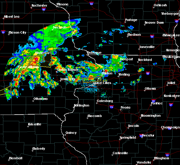 At 724 pm cdt, severe thunderstorms were located along a line extending from elk run heights to near la porte city to dysart, moving east at 45 mph (radar indicated). Hazards include ping pong ball size hail and 60 mph wind gusts. People and animals outdoors will be injured. expect hail damage to roofs, siding, windows, and vehicles. expect wind damage to roofs, siding, and trees. locations impacted include, independence, vinton, jesup, urbana, brandon, rowley, mount auburn, lime creek county park, wapsipinicon golf course, vinton memorial airport, rodgers park, benton city park, hoefle-dulin park, buchanan county fairgrounds, otterville, spencers grove, minne estema park, benton county fairgrounds, independence airport and wildcat bluff park. This includes interstate 380 between mile markers 40 and 55. At 724 pm cdt, severe thunderstorms were located along a line extending from elk run heights to near la porte city to dysart, moving east at 45 mph (radar indicated). Hazards include ping pong ball size hail and 60 mph wind gusts. People and animals outdoors will be injured. expect hail damage to roofs, siding, windows, and vehicles. expect wind damage to roofs, siding, and trees. locations impacted include, independence, vinton, jesup, urbana, brandon, rowley, mount auburn, lime creek county park, wapsipinicon golf course, vinton memorial airport, rodgers park, benton city park, hoefle-dulin park, buchanan county fairgrounds, otterville, spencers grove, minne estema park, benton county fairgrounds, independence airport and wildcat bluff park. This includes interstate 380 between mile markers 40 and 55.
|
| 4/15/2017 7:14 PM CDT |
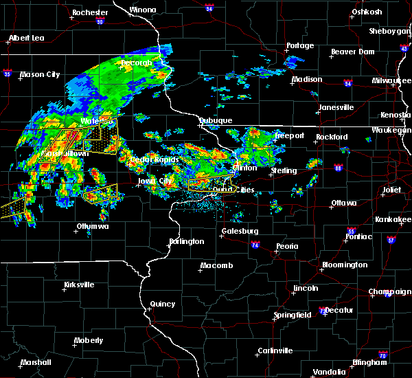 At 714 pm cdt, severe thunderstorms were located along a line extending from near waterloo to 9 miles northwest of dysart to traer, moving east at 35 mph (radar indicated). Hazards include 60 mph wind gusts and quarter size hail. Hail damage to vehicles is expected. Expect wind damage to roofs, siding, and trees. At 714 pm cdt, severe thunderstorms were located along a line extending from near waterloo to 9 miles northwest of dysart to traer, moving east at 35 mph (radar indicated). Hazards include 60 mph wind gusts and quarter size hail. Hail damage to vehicles is expected. Expect wind damage to roofs, siding, and trees.
|
| 3/6/2017 8:51 PM CST |
 At 850 pm cst, severe thunderstorms were located along a line extending from near strawberry point to near lamont to quasqueton to near shellsburg to near hiawatha to near williamsburg to near north english, moving northeast at 80 mph (trained weather spotters). Hazards include 70 mph wind gusts. Expect considerable tree damage. damage is likely to mobile homes, roofs, and outbuildings. locations impacted include, independence, vinton, marengo, williamsburg, jesup, atkins, walford, urbana, north english, shellsburg, newhall, winthrop, hazleton, blairstown, van horne, quasqueton, norway, lamont, garrison and brandon. this includes the following highways, interstate 80 in iowa between mile markers 217 and 229. interstate 380 between mile markers 40 and 54. A tornado watch remains in effect until 1000 pm cst for southeastern, northeastern and east central iowa. At 850 pm cst, severe thunderstorms were located along a line extending from near strawberry point to near lamont to quasqueton to near shellsburg to near hiawatha to near williamsburg to near north english, moving northeast at 80 mph (trained weather spotters). Hazards include 70 mph wind gusts. Expect considerable tree damage. damage is likely to mobile homes, roofs, and outbuildings. locations impacted include, independence, vinton, marengo, williamsburg, jesup, atkins, walford, urbana, north english, shellsburg, newhall, winthrop, hazleton, blairstown, van horne, quasqueton, norway, lamont, garrison and brandon. this includes the following highways, interstate 80 in iowa between mile markers 217 and 229. interstate 380 between mile markers 40 and 54. A tornado watch remains in effect until 1000 pm cst for southeastern, northeastern and east central iowa.
|
| 3/6/2017 8:46 PM CST | Storm damage reported in buchanan county IA, 3.1 miles NNW of Independence, IA |
| 3/6/2017 8:31 PM CST |
 At 831 pm cst, severe thunderstorms were located along a line extending from near maynard to near independence to near mount auburn to near belle plaine to near ladora to near keswick to 6 miles east of oskaloosa, moving east at 50 mph. these are very dangerous storms! (trained weather spotters). Hazards include 90 mph wind gusts. You are in a life-threatening situation. flying debris may be deadly to those caught without shelter. mobile homes will be heavily damaged or destroyed. homes and businesses will have substantial roof and window damage. expect extensive tree damage and power outages. locations impacted include, independence, vinton, marengo, williamsburg, belle plaine, jesup, atkins, walford, urbana, dysart, fairbank, north english, shellsburg, victor, newhall, winthrop, hazleton, blairstown, van horne and keystone. this includes the following highways, interstate 80 in iowa between mile markers 205 and 229. interstate 380 between mile markers 40 and 55. A tornado watch remains in effect until 1000 pm cst for southeastern, northeastern and east central iowa. At 831 pm cst, severe thunderstorms were located along a line extending from near maynard to near independence to near mount auburn to near belle plaine to near ladora to near keswick to 6 miles east of oskaloosa, moving east at 50 mph. these are very dangerous storms! (trained weather spotters). Hazards include 90 mph wind gusts. You are in a life-threatening situation. flying debris may be deadly to those caught without shelter. mobile homes will be heavily damaged or destroyed. homes and businesses will have substantial roof and window damage. expect extensive tree damage and power outages. locations impacted include, independence, vinton, marengo, williamsburg, belle plaine, jesup, atkins, walford, urbana, dysart, fairbank, north english, shellsburg, victor, newhall, winthrop, hazleton, blairstown, van horne and keystone. this includes the following highways, interstate 80 in iowa between mile markers 205 and 229. interstate 380 between mile markers 40 and 55. A tornado watch remains in effect until 1000 pm cst for southeastern, northeastern and east central iowa.
|
| 3/6/2017 8:15 PM CST |
 At 814 pm cst, severe thunderstorms were located along a line extending from near fairbank to near jesup to dysart to 8 miles southeast of tama to near brooklyn to near new sharon to 8 miles northwest of eddyville, moving east at 60 mph (radar indicated). Hazards include 70 mph wind gusts. Expect considerable tree damage. damage is likely to mobile homes, roofs, and outbuildings. locations impacted include, independence, vinton, marengo, williamsburg, belle plaine, jesup, atkins, walford, urbana, dysart, fairbank, north english, shellsburg, victor, newhall, winthrop, hazleton, blairstown, van horne and keystone. this includes the following highways, interstate 80 in iowa between mile markers 205 and 229. interstate 380 between mile markers 40 and 55. A tornado watch remains in effect until 1000 pm cst for southeastern, northeastern and east central iowa. At 814 pm cst, severe thunderstorms were located along a line extending from near fairbank to near jesup to dysart to 8 miles southeast of tama to near brooklyn to near new sharon to 8 miles northwest of eddyville, moving east at 60 mph (radar indicated). Hazards include 70 mph wind gusts. Expect considerable tree damage. damage is likely to mobile homes, roofs, and outbuildings. locations impacted include, independence, vinton, marengo, williamsburg, belle plaine, jesup, atkins, walford, urbana, dysart, fairbank, north english, shellsburg, victor, newhall, winthrop, hazleton, blairstown, van horne and keystone. this includes the following highways, interstate 80 in iowa between mile markers 205 and 229. interstate 380 between mile markers 40 and 55. A tornado watch remains in effect until 1000 pm cst for southeastern, northeastern and east central iowa.
|
| 3/6/2017 8:02 PM CST |
 At 802 pm cst, severe thunderstorms were located along a line extending from 6 miles east of denver to near traer to near tama to near grinnell to 6 miles southwest of new sharon to 12 miles southeast of knoxville, moving east at 50 mph (radar indicated). Hazards include 70 mph wind gusts. Expect considerable tree damage. Damage is likely to mobile homes, roofs, and outbuildings. At 802 pm cst, severe thunderstorms were located along a line extending from 6 miles east of denver to near traer to near tama to near grinnell to 6 miles southwest of new sharon to 12 miles southeast of knoxville, moving east at 50 mph (radar indicated). Hazards include 70 mph wind gusts. Expect considerable tree damage. Damage is likely to mobile homes, roofs, and outbuildings.
|
| 8/4/2016 6:53 PM CDT |
 At 653 pm cdt, severe thunderstorms were located along a line extending from volga to near winthrop, moving southeast at 40 mph (radar indicated). Hazards include 60 mph wind gusts. Expect damage to roofs. siding. And trees. At 653 pm cdt, severe thunderstorms were located along a line extending from volga to near winthrop, moving southeast at 40 mph (radar indicated). Hazards include 60 mph wind gusts. Expect damage to roofs. siding. And trees.
|
| 7/23/2016 4:03 PM CDT | Numerous branches and tree limbs down across tow in buchanan county IA, 1.4 miles WSW of Independence, IA |
| 7/23/2016 3:47 PM CDT |
 At 345 pm cdt, severe thunderstorms were located along a line extending from lamont to near quasqueton to near urbana, moving east at 35 mph (this storm has a history of wind damage with reports of downed branches and trees in portions of buchanan county). Hazards include 70 mph wind gusts. Expect considerable tree damage. damage is likely to mobile homes, roofs, and outbuildings. locations impacted include, independence, winthrop, quasqueton, rowley, dundee, masonville, independence airport, robinson, monti, buchanan county fairgrounds, coffins grove park, jakway park, winthrop golf course, wapsipinicon golf course and otterville. This includes interstate 380 near mile marker 49. At 345 pm cdt, severe thunderstorms were located along a line extending from lamont to near quasqueton to near urbana, moving east at 35 mph (this storm has a history of wind damage with reports of downed branches and trees in portions of buchanan county). Hazards include 70 mph wind gusts. Expect considerable tree damage. damage is likely to mobile homes, roofs, and outbuildings. locations impacted include, independence, winthrop, quasqueton, rowley, dundee, masonville, independence airport, robinson, monti, buchanan county fairgrounds, coffins grove park, jakway park, winthrop golf course, wapsipinicon golf course and otterville. This includes interstate 380 near mile marker 49.
|
| 7/23/2016 3:39 PM CDT |
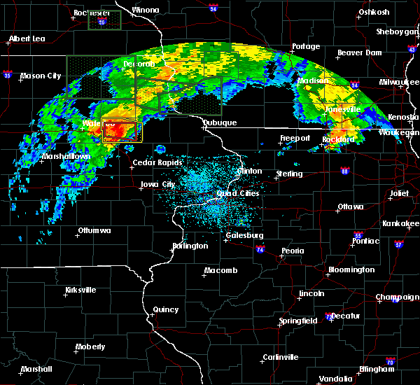 At 339 pm cdt, a severe thunderstorm capable of producing a tornado was located over winthrop, or near independence, moving east at 35 mph (radar indicated rotation). Hazards include tornado. Flying debris will be dangerous to those caught without shelter. mobile homes will be damaged or destroyed. damage to roofs, windows, and vehicles will occur. tree damage is likely. This tornadic thunderstorm will remain over mainly rural areas of central buchanan county, including the following locations: independence airport, wapsipinicon golf course, monti, winthrop golf course, buchanan county fairgrounds and otterville. At 339 pm cdt, a severe thunderstorm capable of producing a tornado was located over winthrop, or near independence, moving east at 35 mph (radar indicated rotation). Hazards include tornado. Flying debris will be dangerous to those caught without shelter. mobile homes will be damaged or destroyed. damage to roofs, windows, and vehicles will occur. tree damage is likely. This tornadic thunderstorm will remain over mainly rural areas of central buchanan county, including the following locations: independence airport, wapsipinicon golf course, monti, winthrop golf course, buchanan county fairgrounds and otterville.
|
| 7/23/2016 3:35 PM CDT | Wind estimated 60 to 65 mph in buchanan county IA, 2 miles SSW of Independence, IA |
| 7/23/2016 3:35 PM CDT | Wind estimated 60 to 65 mph in buchanan county IA, 2 miles SSW of Independence, IA |
| 7/23/2016 3:30 PM CDT | Very heavy rain and winds to 65 mp in buchanan county IA, 0.5 miles SSE of Independence, IA |
| 7/23/2016 3:27 PM CDT |
 At 327 pm cdt, a severe thunderstorm capable of producing a tornado was located over independence, moving east at 35 mph (radar indicated rotation). Hazards include tornado. Flying debris will be dangerous to those caught without shelter. mobile homes will be damaged or destroyed. damage to roofs, windows, and vehicles will occur. tree damage is likely. this dangerous storm will be near, quasqueton around 335 pm cdt. winthrop around 340 pm cdt. Other locations impacted by this tornadic thunderstorm include winthrop golf course, littleton, independence airport, wapsipinicon golf course, monti, buchanan county fairgrounds and otterville. At 327 pm cdt, a severe thunderstorm capable of producing a tornado was located over independence, moving east at 35 mph (radar indicated rotation). Hazards include tornado. Flying debris will be dangerous to those caught without shelter. mobile homes will be damaged or destroyed. damage to roofs, windows, and vehicles will occur. tree damage is likely. this dangerous storm will be near, quasqueton around 335 pm cdt. winthrop around 340 pm cdt. Other locations impacted by this tornadic thunderstorm include winthrop golf course, littleton, independence airport, wapsipinicon golf course, monti, buchanan county fairgrounds and otterville.
|
| 7/23/2016 3:18 PM CDT |
 At 318 pm cdt, a severe thunderstorm capable of producing a tornado was located near independence, moving east at 35 mph (radar indicated rotation). Hazards include tornado. Flying debris will be dangerous to those caught without shelter. mobile homes will be damaged or destroyed. damage to roofs, windows, and vehicles will occur. tree damage is likely. this dangerous storm will be near, rowley around 330 pm cdt. winthrop and quasqueton around 335 pm cdt. Other locations impacted by this tornadic thunderstorm include winthrop golf course, littleton, independence airport, wapsipinicon golf course, monti, buchanan county fairgrounds and otterville. At 318 pm cdt, a severe thunderstorm capable of producing a tornado was located near independence, moving east at 35 mph (radar indicated rotation). Hazards include tornado. Flying debris will be dangerous to those caught without shelter. mobile homes will be damaged or destroyed. damage to roofs, windows, and vehicles will occur. tree damage is likely. this dangerous storm will be near, rowley around 330 pm cdt. winthrop and quasqueton around 335 pm cdt. Other locations impacted by this tornadic thunderstorm include winthrop golf course, littleton, independence airport, wapsipinicon golf course, monti, buchanan county fairgrounds and otterville.
|
| 7/23/2016 3:13 PM CDT |
 At 313 pm cdt, severe thunderstorms were located along a line extending from hazleton to near jesup to la porte city, moving east at 35 mph (radar indicated). Hazards include 60 mph wind gusts. Expect damage to roofs. siding. And trees. At 313 pm cdt, severe thunderstorms were located along a line extending from hazleton to near jesup to la porte city, moving east at 35 mph (radar indicated). Hazards include 60 mph wind gusts. Expect damage to roofs. siding. And trees.
|
| 7/23/2016 2:54 PM CDT |
 At 253 pm cdt, severe thunderstorms were located along a line extending from oelwein to near jesup to near la porte city, moving east at 40 mph (radar indicated). Hazards include 60 mph wind gusts and penny size hail. Expect damage to roofs. siding. and trees. locations impacted include, independence, jesup, fairbank, winthrop, hazleton, quasqueton, lamont, brandon, rowley, aurora, stanley, fontana park, littleton, independence airport, buchanan county fairgrounds, fontana county park, jakway park, winthrop golf course, wapsipinicon golf course and lime creek county park. This includes interstate 380 between mile markers 49 and 55. At 253 pm cdt, severe thunderstorms were located along a line extending from oelwein to near jesup to near la porte city, moving east at 40 mph (radar indicated). Hazards include 60 mph wind gusts and penny size hail. Expect damage to roofs. siding. and trees. locations impacted include, independence, jesup, fairbank, winthrop, hazleton, quasqueton, lamont, brandon, rowley, aurora, stanley, fontana park, littleton, independence airport, buchanan county fairgrounds, fontana county park, jakway park, winthrop golf course, wapsipinicon golf course and lime creek county park. This includes interstate 380 between mile markers 49 and 55.
|
| 7/23/2016 2:30 PM CDT |
 At 230 pm cdt, severe thunderstorms were located along a line extending from near fairbank to 6 miles south of crossroads mall, moving east at 35 mph (radar indicated). Hazards include 60 mph wind gusts and penny size hail. Expect damage to roofs. siding. And trees. At 230 pm cdt, severe thunderstorms were located along a line extending from near fairbank to 6 miles south of crossroads mall, moving east at 35 mph (radar indicated). Hazards include 60 mph wind gusts and penny size hail. Expect damage to roofs. siding. And trees.
|
| 7/17/2016 5:03 AM CDT |
 At 502 am cdt, severe thunderstorms were located along a line extending from near quasqueton to near van horne to near iowa speedway, moving southeast at 50 mph (radar indicated). Hazards include 60 mph wind gusts. Expect damage to roofs. siding. and trees. Locations impacted include, cedar rapids, iowa city, independence, vinton, marengo, marion, coralville, north liberty, hiawatha, mount vernon, robins, williamsburg, belle plaine, jesup, center point, lisbon, fairfax, solon, tiffin and ely. At 502 am cdt, severe thunderstorms were located along a line extending from near quasqueton to near van horne to near iowa speedway, moving southeast at 50 mph (radar indicated). Hazards include 60 mph wind gusts. Expect damage to roofs. siding. and trees. Locations impacted include, cedar rapids, iowa city, independence, vinton, marengo, marion, coralville, north liberty, hiawatha, mount vernon, robins, williamsburg, belle plaine, jesup, center point, lisbon, fairfax, solon, tiffin and ely.
|
| 7/17/2016 4:37 AM CDT |
 At 436 am cdt, severe thunderstorms were located along a line extending from near waterloo to near toledo to near bondurant, moving southeast at 60 mph (radar indicated). Hazards include 60 mph wind gusts. Expect damage to roofs. siding. And trees. At 436 am cdt, severe thunderstorms were located along a line extending from near waterloo to near toledo to near bondurant, moving southeast at 60 mph (radar indicated). Hazards include 60 mph wind gusts. Expect damage to roofs. siding. And trees.
|
| 5/30/2016 7:30 PM CDT | Awos measured 57 knots. isolated downburst...no damage reported in buchanan county IA, 2.5 miles ENE of Independence, IA |
| 5/26/2016 5:06 AM CDT |
 The severe thunderstorm warning for buchanan and northwestern linn counties will expire at 515 am cdt, the storms which prompted the warning have weakened below severe limits, and no longer pose an immediate threat to life or property. therefore the warning will be allowed to expire. The severe thunderstorm warning for buchanan and northwestern linn counties will expire at 515 am cdt, the storms which prompted the warning have weakened below severe limits, and no longer pose an immediate threat to life or property. therefore the warning will be allowed to expire.
|
| 5/26/2016 4:55 AM CDT | Storm damage reported in buchanan county IA, 0.9 miles WSW of Independence, IA |
| 5/26/2016 4:53 AM CDT |
 At 452 am cdt, severe thunderstorms were located along a line extending from stanley to near center point, moving east at 60 mph (radar indicated). Hazards include 80 mph wind gusts. Expect considerable tree damage. damage is likely to mobile homes, roofs, and outbuildings. these severe storms will be near, lamont around 500 am cdt. other locations impacted by these severe thunderstorms include fontana park, jakway park, winthrop golf course, littleton, independence airport, wapsipinicon golf course, monti, buchanan county fairgrounds, fontana county park and otterville. This includes interstate 380 between mile markers 36 and 39. At 452 am cdt, severe thunderstorms were located along a line extending from stanley to near center point, moving east at 60 mph (radar indicated). Hazards include 80 mph wind gusts. Expect considerable tree damage. damage is likely to mobile homes, roofs, and outbuildings. these severe storms will be near, lamont around 500 am cdt. other locations impacted by these severe thunderstorms include fontana park, jakway park, winthrop golf course, littleton, independence airport, wapsipinicon golf course, monti, buchanan county fairgrounds, fontana county park and otterville. This includes interstate 380 between mile markers 36 and 39.
|
| 5/26/2016 4:50 AM CDT | Power ou in buchanan county IA, 2 miles SSW of Independence, IA |
| 5/26/2016 4:45 AM CDT | Storm damage reported in buchanan county IA, 0.5 miles SSE of Independence, IA |
| 5/26/2016 4:43 AM CDT | Storm damage reported in buchanan county IA, 0.9 miles WSW of Independence, IA |
| 5/26/2016 4:40 AM CDT | Wind estimated over 60 mph. tree branches and flag pole dow in buchanan county IA, 1.4 miles WSW of Independence, IA |
| 5/26/2016 4:34 AM CDT |
 At 433 am cdt, severe thunderstorms were located along a line extending from 7 miles northeast of elk run heights to near garrison, moving northeast at 60 mph (radar indicated). Hazards include 70 mph wind gusts. Expect considerable tree damage. damage is likely to mobile homes, roofs, and outbuildings. these severe storms will be near, fairbank around 440 am cdt. urbana and hazleton around 445 am cdt. center point, walker and stanley around 450 am cdt. lamont, aurora and troy mills around 455 am cdt. other locations impacted by these severe thunderstorms include vinton memorial airport, benton county fairgrounds, cheney, fontana park, lafayette, hoefle-dulin park, littleton, independence airport, monti and minne estema park. This includes interstate 380 between mile markers 29 and 55. At 433 am cdt, severe thunderstorms were located along a line extending from 7 miles northeast of elk run heights to near garrison, moving northeast at 60 mph (radar indicated). Hazards include 70 mph wind gusts. Expect considerable tree damage. damage is likely to mobile homes, roofs, and outbuildings. these severe storms will be near, fairbank around 440 am cdt. urbana and hazleton around 445 am cdt. center point, walker and stanley around 450 am cdt. lamont, aurora and troy mills around 455 am cdt. other locations impacted by these severe thunderstorms include vinton memorial airport, benton county fairgrounds, cheney, fontana park, lafayette, hoefle-dulin park, littleton, independence airport, monti and minne estema park. This includes interstate 380 between mile markers 29 and 55.
|
| 5/26/2016 4:24 AM CDT |
 At 423 am cdt, severe thunderstorms were located along a line extending from crossroads mall to 6 miles south of dysart, moving east at 70 mph (radar indicated). Hazards include 70 mph wind gusts. Expect considerable tree damage. damage is likely to mobile homes, roofs, and outbuildings. severe thunderstorms will be near, garrison around 430 am cdt. vinton and jesup around 435 am cdt. shellsburg around 440 am cdt. independence, center point, urbana, palo and hazleton around 445 am cdt. robins, winthrop, stanley and toddville around 450 am cdt. alburnett, lamont and aurora around 455 am cdt. other locations impacted by these severe thunderstorms include vinton memorial airport, benton county fairgrounds, cheney, fontana park, lafayette, hoefle-dulin park, littleton, independence airport, monti and minne estema park. This includes interstate 380 between mile markers 29 and 55. At 423 am cdt, severe thunderstorms were located along a line extending from crossroads mall to 6 miles south of dysart, moving east at 70 mph (radar indicated). Hazards include 70 mph wind gusts. Expect considerable tree damage. damage is likely to mobile homes, roofs, and outbuildings. severe thunderstorms will be near, garrison around 430 am cdt. vinton and jesup around 435 am cdt. shellsburg around 440 am cdt. independence, center point, urbana, palo and hazleton around 445 am cdt. robins, winthrop, stanley and toddville around 450 am cdt. alburnett, lamont and aurora around 455 am cdt. other locations impacted by these severe thunderstorms include vinton memorial airport, benton county fairgrounds, cheney, fontana park, lafayette, hoefle-dulin park, littleton, independence airport, monti and minne estema park. This includes interstate 380 between mile markers 29 and 55.
|
| 6/22/2015 9:22 AM CDT | Tree branches down and wind damag in buchanan county IA, 1.4 miles WSW of Independence, IA |
| 6/22/2015 9:15 AM CDT | Power outage in and around fairban in buchanan county IA, 1.4 miles WSW of Independence, IA |
| 6/22/2015 8:39 AM CDT |
 At 839 am cdt, severe thunderstorms were located along a line extending from near manchester to mount auburn, moving southeast at 65 mph. these are very dangerous storms (radar indicated). Hazards include 80 mph wind gusts and penny size hail. Flying debris will be dangerous to those caught without shelter. mobile homes will be heavily damaged. expect considerable damage to roofs, windows and vehicles. extensive tree damage and power outages are likely. locations impacted include, independence, jesup, fairbank, winthrop, hazleton, quasqueton, lamont, brandon, rowley, aurora, troy mills park, lime creek county, littleton, three elms county, independence airport, monti, fontana county park, winthrop golf course, cedar rock state park and wapsipinicon golf course. This includes interstate 380 between mile markers 49 and 54. At 839 am cdt, severe thunderstorms were located along a line extending from near manchester to mount auburn, moving southeast at 65 mph. these are very dangerous storms (radar indicated). Hazards include 80 mph wind gusts and penny size hail. Flying debris will be dangerous to those caught without shelter. mobile homes will be heavily damaged. expect considerable damage to roofs, windows and vehicles. extensive tree damage and power outages are likely. locations impacted include, independence, jesup, fairbank, winthrop, hazleton, quasqueton, lamont, brandon, rowley, aurora, troy mills park, lime creek county, littleton, three elms county, independence airport, monti, fontana county park, winthrop golf course, cedar rock state park and wapsipinicon golf course. This includes interstate 380 between mile markers 49 and 54.
|
| 6/22/2015 8:31 AM CDT | Corrected event type. high school on west side of independence measured sustained wind speeds of 93.9 mp in buchanan county IA, 0.9 miles WSW of Independence, IA |
| 6/22/2015 8:30 AM CDT | One foot diameter tree snapped about 2 feet above ground leve in buchanan county IA, 1.4 miles WSW of Independence, IA |
| 6/22/2015 8:28 AM CDT | Sustained winds of 60 mph with gusts to 70 mp in buchanan county IA, 0.9 miles WSW of Independence, IA |
| 6/22/2015 8:15 AM CDT | Stronger than 80 mph. extremely strong winds. branches down and pieces of neighbors houses and roofing lying in our front yard. torrential rain fallin in buchanan county IA, 0.5 miles SSE of Independence, IA |
| 6/22/2015 8:09 AM CDT |
 At 808 am cdt, a severe thunderstorm was located over fairbank, moving east at 60 mph (radar indicated). Hazards include 60 mph wind gusts. Expect damage to roofs. Siding and trees. At 808 am cdt, a severe thunderstorm was located over fairbank, moving east at 60 mph (radar indicated). Hazards include 60 mph wind gusts. Expect damage to roofs. Siding and trees.
|
| 8/31/2014 10:58 PM CDT | Storm damage reported in buchanan county IA, 0.5 miles SSE of Independence, IA |
| 6/30/2014 4:12 PM CDT | Significant crop damage between independence and hazleton in buchanan county IA, 0.9 miles WSW of Independence, IA |
| 6/30/2014 3:54 PM CDT | Delayed report from storms which occured earlier -large tree down on house near 17th ave in buchanan county IA, 0.5 miles SSE of Independence, IA |
| 6/30/2014 3:43 PM CDT | Numerous trees down... no power in independence in buchanan county IA, 0.9 miles WSW of Independence, IA |
| 6/30/2014 2:37 PM CDT | Storm damage reported in buchanan county IA, 0.9 miles WSW of Independence, IA |
| 6/30/2014 2:37 PM CDT | Also had 1.5 inches of rain in 45 minute in buchanan county IA, 1.4 miles WSW of Independence, IA |
| 6/30/2014 2:36 PM CDT | Time estimated -numerous trees down... no power in independence in buchanan county IA, 0.9 miles WSW of Independence, IA |
| 6/30/2014 2:36 PM CDT | Time estimated -numerous trees down... no power in independence in buchanan county IA, 0.9 miles WSW of Independence, IA |
| 6/30/2014 2:35 PM CDT | Trees and power lines down. corn flat from independence to hazelton. semi jackknifed on 151 about halfway between independence and oelwein. time estimate in buchanan county IA, 0.9 miles WSW of Independence, IA |
| 6/30/2014 2:34 PM CDT | Large tree down on house near 17th ave in buchanan county IA, 0.5 miles SSE of Independence, IA |
| 4/12/2014 10:48 PM CDT | Quarter sized hail reported 0.9 miles WSW of Independence, IA, quarter sized hail and minor street flooding. |
| 8/5/2013 8:00 AM CDT | Small twigs and branches off of trees. estimated 45 mph winds with occasional higher gusts. heavy downpours reducing visibility to a few blocks in distanc in buchanan county IA, 0.5 miles SSW of Independence, IA |
| 7/22/2013 7:00 PM CDT | Estimated wind speeds of 60 to 70 mp in buchanan county IA, 0.5 miles SSW of Independence, IA |
| 7/22/2013 6:58 PM CDT | West side of independence in buchanan county IA, 0.9 miles WSW of Independence, IA |
| 6/21/2013 8:43 AM CDT | Quarter sized hail reported 2.6 miles SSE of Independence, IA, pea size to quarter size. |
| 6/21/2013 8:42 AM CDT | Golf Ball sized hail reported 3.3 miles SSW of Independence, IA |
| 5/19/2013 9:35 PM CDT | Storm damage reported in buchanan county IA, 2.5 miles ENE of Independence, IA |
| 5/19/2013 9:35 PM CDT | A downburst with winds estimated over 70 mph struck independence. the northwest sections of town sustained the most damage...with trees down...power poles snapped...and in buchanan county IA, 0.9 miles WSW of Independence, IA |
| 5/19/2013 9:35 PM CDT | A 4 by 4 street sign post was snapped at the intersection of main street and iowa avenu in buchanan county IA, 0.9 miles WSW of Independence, IA |
| 5/19/2013 9:26 PM CDT | Storm damage reported in buchanan county IA, 0.5 miles SSW of Independence, IA |
| 5/19/2013 9:20 PM CDT | Near the hwy 20 exit on west side of independence...very heavy rainfall observed as wel in buchanan county IA, 1.2 miles NE of Independence, IA |
| 7/25/2012 9:30 PM CDT | Multiple reports of tree limbs and trees down in quesq in buchanan county IA, 0.9 miles WSW of Independence, IA |
| 7/25/2012 9:30 PM CDT | Delayed report. time estimated. six to seven 40 to 70 foot tall trees down in town. one fell onto a house. about 20 limbs 30 to 40 feet long down. numerous branches 10 in buchanan county IA, 0.9 miles WSW of Independence, IA |
| 7/25/2012 9:24 PM CDT | Report of large tree branches down and power lines in the cit in buchanan county IA, 0.9 miles WSW of Independence, IA |
| 7/25/2012 9:24 PM CDT | Report of 3 inch diameter tree limb dow in buchanan county IA, 2.5 miles ENE of Independence, IA |
| 5/26/2012 12:30 AM CDT | Semi blown over at intersection of highways 20 and 150 in independenc in buchanan county IA, 0.9 miles WSW of Independence, IA |
| 5/24/2012 5:40 PM CDT | Several trees and power lines down in the city of independenc in buchanan county IA, 0.9 miles WSW of Independence, IA |
Hail Maps for Independence, IA
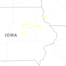
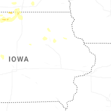


Connect with Interactive Hail Maps