

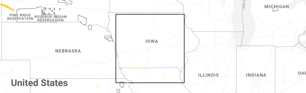
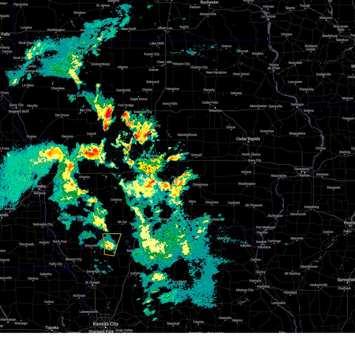
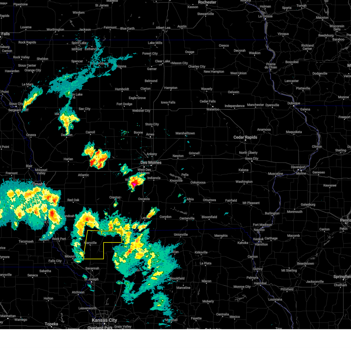
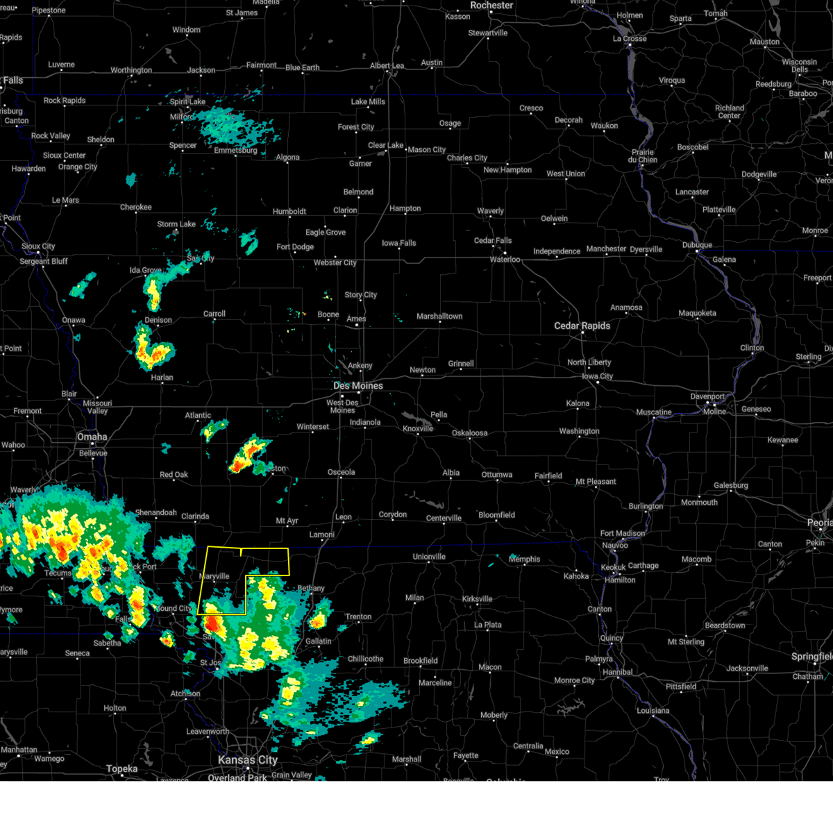
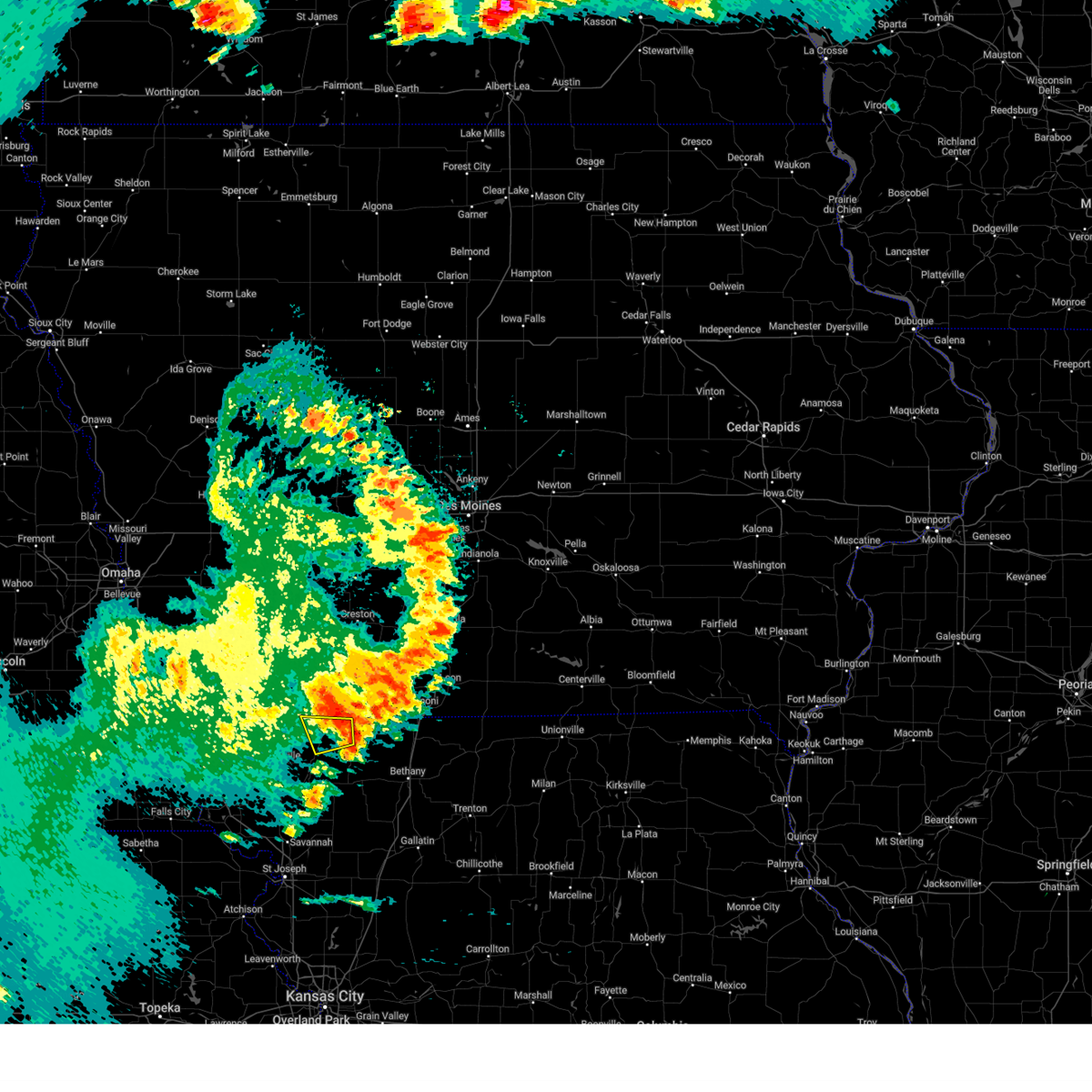
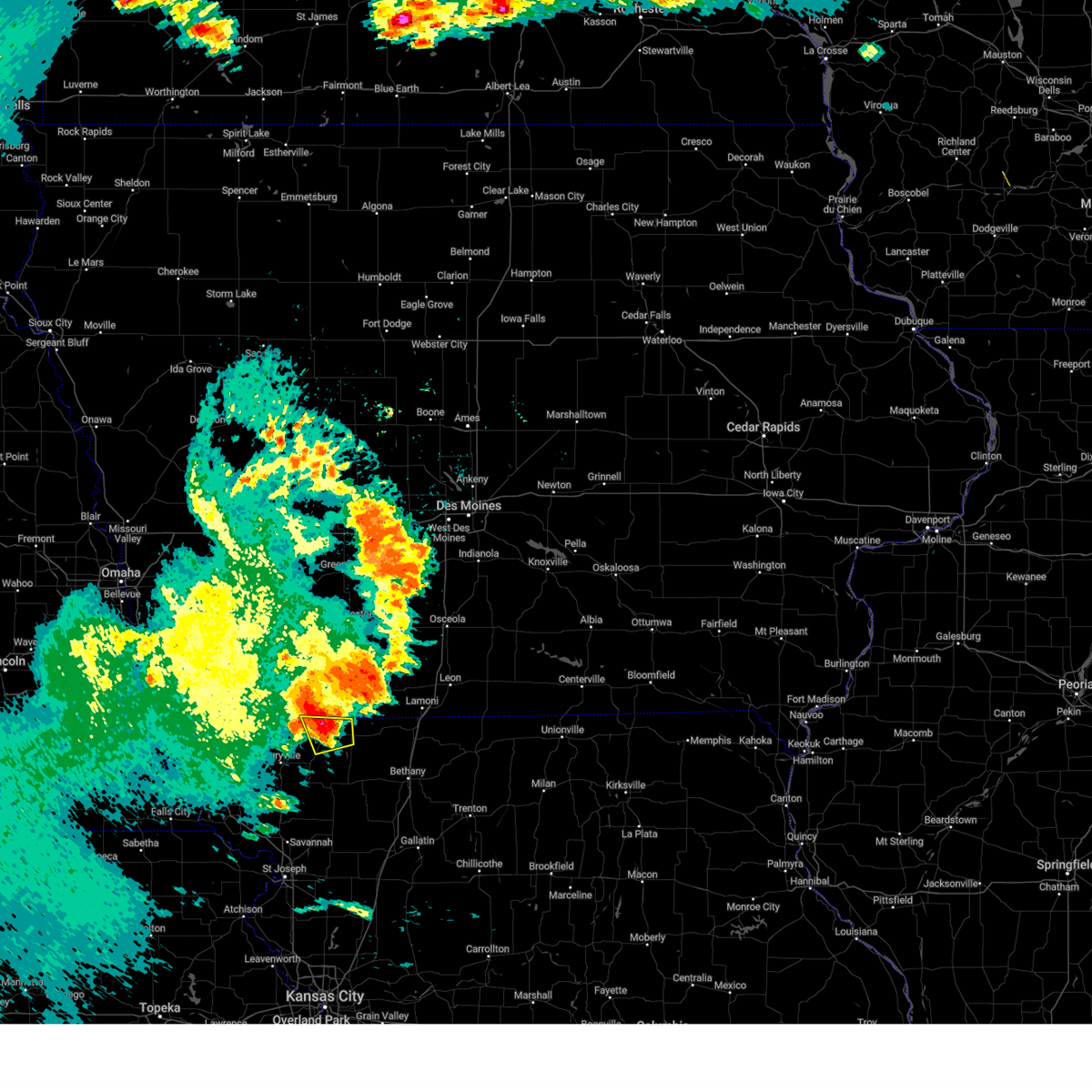
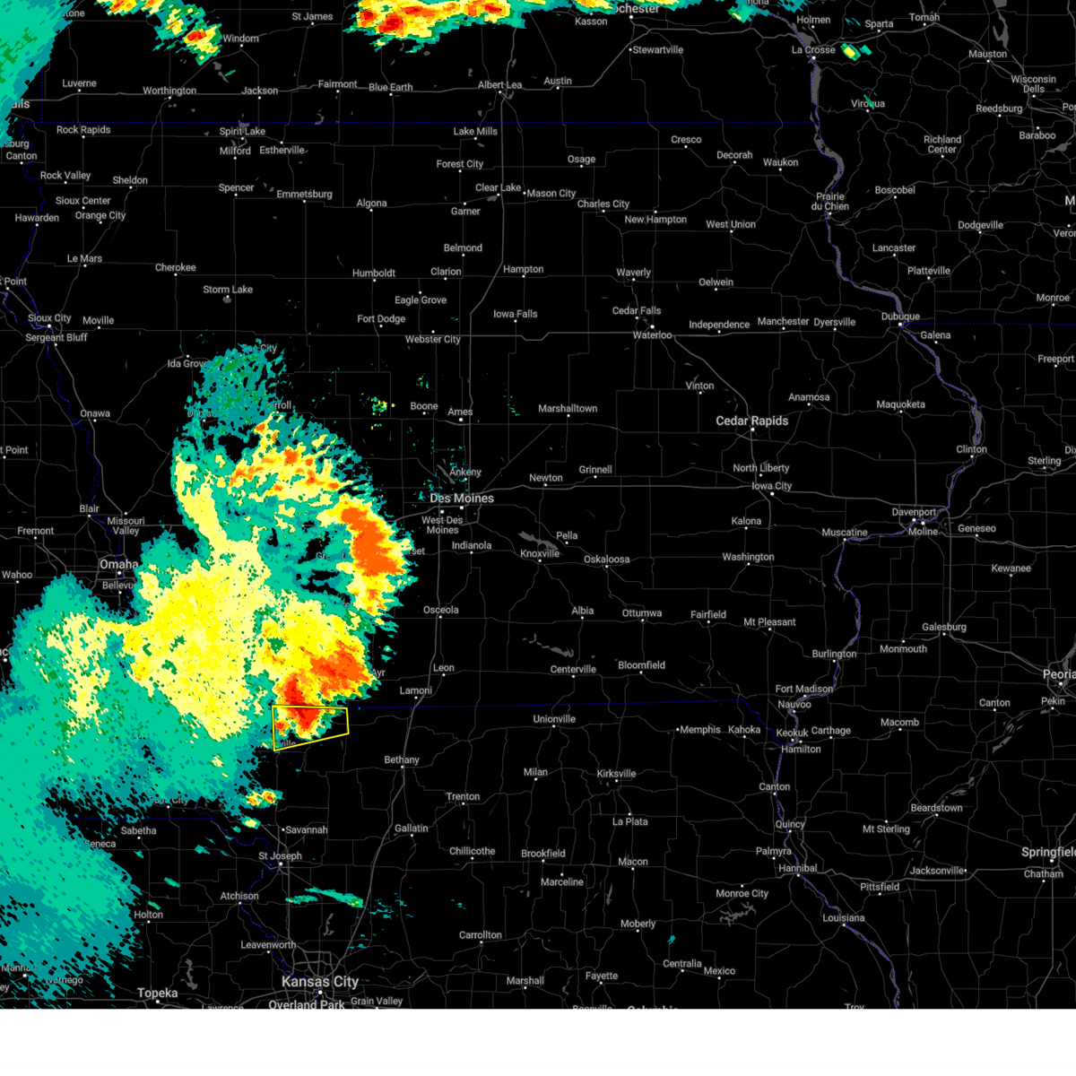
Hail Map for Irena, MO
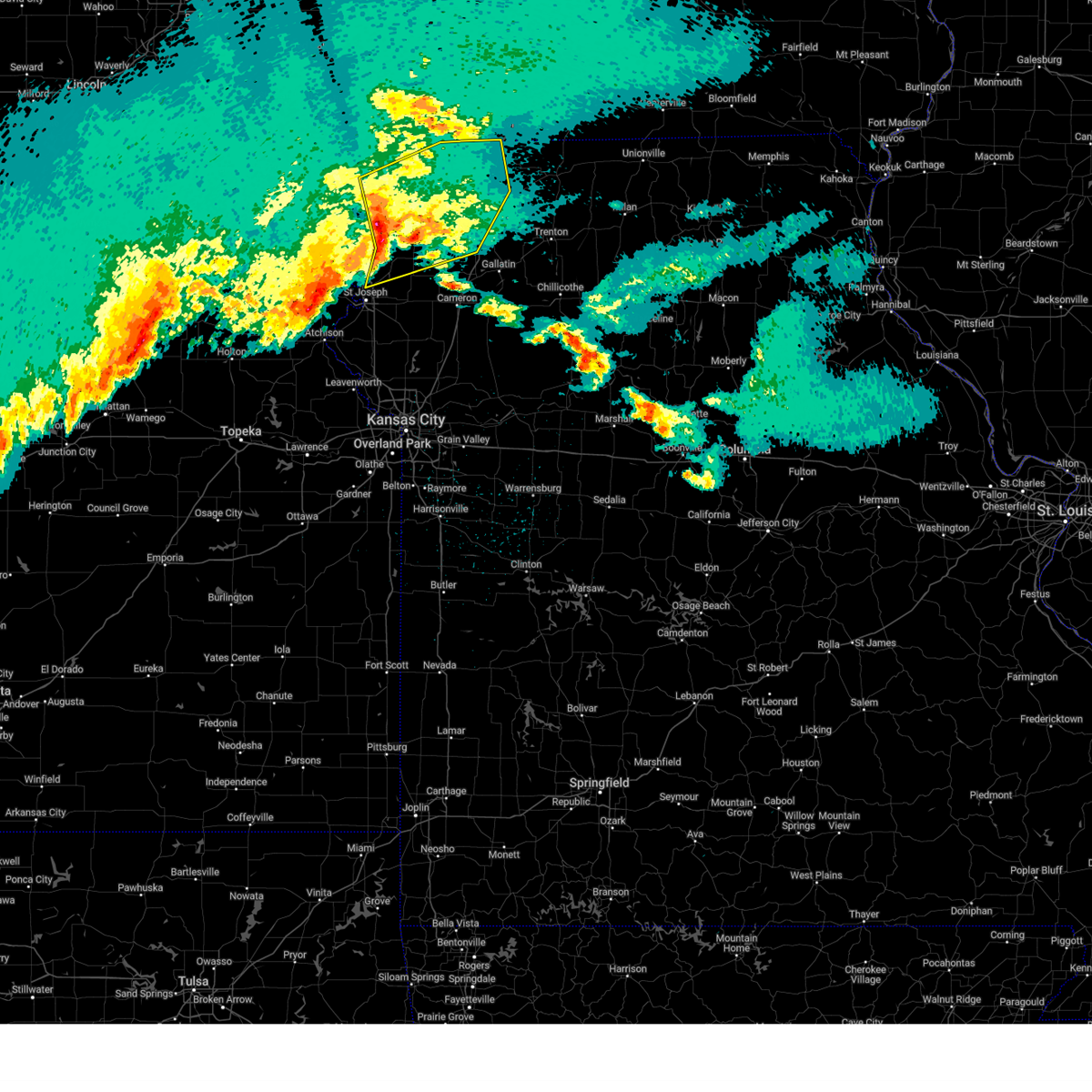
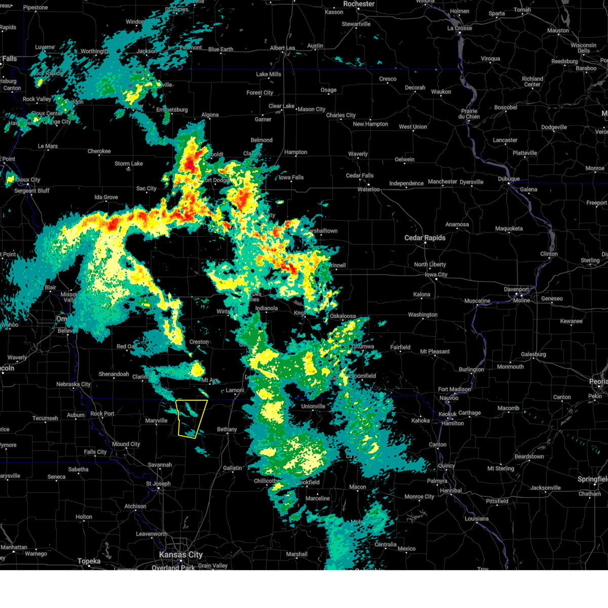
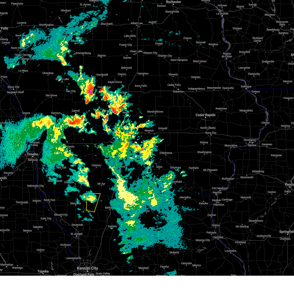
The Irena, MO area has had 0 reports of on-the-ground hail by trained spotters, and has been under severe weather warnings 10 times during the past 12 months. Doppler radar has detected hail at or near Irena, MO on 73 occasions, including 2 occasions during the past year.
| Name: | Irena, MO |
| Where Located: | 83 miles SSW of Des Moines, IA |
| Map: | Google Map for Irena, MO |
| Population: | 18 |
| Housing Units: | 8 |
| More Info: | Search Google for Irena, MO |
3
The Top Recent Hail Date for Irena, MO is Sunday, June 29, 2025 (9th out of 73)
Hail and Wind Damage Spotted near Irena, MO
| Date / Time | Report Details |
|---|---|
| 4/2/2025 12:50 AM CDT |
 Svreax the national weather service in pleasant hill has issued a * severe thunderstorm warning for, worth county in northwestern missouri, northwestern daviess county in north central missouri, gentry county in northwestern missouri, harrison county in north central missouri, southeastern nodaway county in northwestern missouri, eastern andrew county in northwestern missouri, northern dekalb county in northwestern missouri, * until 130 am cdt. * at 1250 am cdt, severe thunderstorms were located along a line extending from near ravenwood to 7 miles northwest of union star to near country club villa, moving northeast at 50 mph (automated weather station). Hazards include 70 mph wind gusts and nickel size hail. Expect considerable tree damage. Damage is likely to mobile homes, roofs, and outbuildings. Svreax the national weather service in pleasant hill has issued a * severe thunderstorm warning for, worth county in northwestern missouri, northwestern daviess county in north central missouri, gentry county in northwestern missouri, harrison county in north central missouri, southeastern nodaway county in northwestern missouri, eastern andrew county in northwestern missouri, northern dekalb county in northwestern missouri, * until 130 am cdt. * at 1250 am cdt, severe thunderstorms were located along a line extending from near ravenwood to 7 miles northwest of union star to near country club villa, moving northeast at 50 mph (automated weather station). Hazards include 70 mph wind gusts and nickel size hail. Expect considerable tree damage. Damage is likely to mobile homes, roofs, and outbuildings.
|
| 3/14/2025 6:06 PM CDT |
 The storm which prompted the warning has weakened below severe limits, and has exited the warned area. therefore, the warning will be allowed to expire. however, gusty winds are still expected. a severe thunderstorm watch remains in effect until 700 pm cdt for northwestern missouri. The storm which prompted the warning has weakened below severe limits, and has exited the warned area. therefore, the warning will be allowed to expire. however, gusty winds are still expected. a severe thunderstorm watch remains in effect until 700 pm cdt for northwestern missouri.
|
| 3/14/2025 5:50 PM CDT |
 At 549 pm cdt, a severe thunderstorm was located near grant city, or 15 miles northwest of albany, moving north at 50 mph (radar indicated). Hazards include 60 mph wind gusts. Expect damage to roofs, siding, and trees. Locations impacted include, sheridan, worth, gentry, grant city, irena, and allendale. At 549 pm cdt, a severe thunderstorm was located near grant city, or 15 miles northwest of albany, moving north at 50 mph (radar indicated). Hazards include 60 mph wind gusts. Expect damage to roofs, siding, and trees. Locations impacted include, sheridan, worth, gentry, grant city, irena, and allendale.
|
| 3/14/2025 5:40 PM CDT |
 Svreax the national weather service in pleasant hill has issued a * severe thunderstorm warning for, worth county in northwestern missouri, northwestern gentry county in northwestern missouri, * until 615 pm cdt. * at 540 pm cdt, a severe thunderstorm was located 8 miles north of stanberry, moving north at 50 mph (radar indicated). Hazards include 70 mph wind gusts and penny size hail. Expect considerable tree damage. Damage is likely to mobile homes, roofs, and outbuildings. Svreax the national weather service in pleasant hill has issued a * severe thunderstorm warning for, worth county in northwestern missouri, northwestern gentry county in northwestern missouri, * until 615 pm cdt. * at 540 pm cdt, a severe thunderstorm was located 8 miles north of stanberry, moving north at 50 mph (radar indicated). Hazards include 70 mph wind gusts and penny size hail. Expect considerable tree damage. Damage is likely to mobile homes, roofs, and outbuildings.
|
| 3/14/2025 4:36 PM CDT |
 The storm which prompted the warning has moved out of the area. therefore, the warning will be allowed to expire. however, gusty winds are still expected this evening. a severe thunderstorm watch remains in effect until 700 pm cdt for north central and northwestern missouri. The storm which prompted the warning has moved out of the area. therefore, the warning will be allowed to expire. however, gusty winds are still expected this evening. a severe thunderstorm watch remains in effect until 700 pm cdt for north central and northwestern missouri.
|
| 3/14/2025 4:01 PM CDT |
 Svreax the national weather service in pleasant hill has issued a * severe thunderstorm warning for, worth county in northwestern missouri, nodaway county in northwestern missouri, * until 445 pm cdt. * at 400 pm cdt, a cluster of severe thunderstorms were located 8 miles northeast of fillmore, or 14 miles north of savannah, moving north at 60 mph (radar indicated). Hazards include 70 mph wind gusts and penny size hail. Expect considerable tree damage. Damage is likely to mobile homes, roofs, and outbuildings. Svreax the national weather service in pleasant hill has issued a * severe thunderstorm warning for, worth county in northwestern missouri, nodaway county in northwestern missouri, * until 445 pm cdt. * at 400 pm cdt, a cluster of severe thunderstorms were located 8 miles northeast of fillmore, or 14 miles north of savannah, moving north at 60 mph (radar indicated). Hazards include 70 mph wind gusts and penny size hail. Expect considerable tree damage. Damage is likely to mobile homes, roofs, and outbuildings.
|
| 7/31/2024 8:09 PM CDT |
 The storm which prompted the warning has weakened below severe limits, and no longer poses an immediate threat to life or property. therefore, the warning will be allowed to expire. a severe thunderstorm watch remains in effect until 100 am cdt for northwestern missouri. The storm which prompted the warning has weakened below severe limits, and no longer poses an immediate threat to life or property. therefore, the warning will be allowed to expire. a severe thunderstorm watch remains in effect until 100 am cdt for northwestern missouri.
|
| 7/31/2024 8:05 PM CDT |
 At 804 pm cdt, a severe thunderstorm was located near athelstan, or 9 miles east of bedford, moving east at 30 mph (radar indicated). Hazards include 60 mph wind gusts and quarter size hail. Hail damage to vehicles is expected. expect wind damage to roofs, siding, and trees. Locations impacted include, grant city, irena, sheridan, parnell, and athelstan. At 804 pm cdt, a severe thunderstorm was located near athelstan, or 9 miles east of bedford, moving east at 30 mph (radar indicated). Hazards include 60 mph wind gusts and quarter size hail. Hail damage to vehicles is expected. expect wind damage to roofs, siding, and trees. Locations impacted include, grant city, irena, sheridan, parnell, and athelstan.
|
| 7/31/2024 7:50 PM CDT |
 At 750 pm cdt, a severe thunderstorm was located near bedford, moving east at 30 mph (radar indicated). Hazards include 60 mph wind gusts and quarter size hail. Hail damage to vehicles is expected. expect wind damage to roofs, siding, and trees. Locations impacted include, maryville, grant city, hopkins, irena, sheridan, parnell, pickering, and athelstan. At 750 pm cdt, a severe thunderstorm was located near bedford, moving east at 30 mph (radar indicated). Hazards include 60 mph wind gusts and quarter size hail. Hail damage to vehicles is expected. expect wind damage to roofs, siding, and trees. Locations impacted include, maryville, grant city, hopkins, irena, sheridan, parnell, pickering, and athelstan.
|
| 7/31/2024 7:30 PM CDT | Svreax the national weather service in pleasant hill has issued a * severe thunderstorm warning for, western worth county in northwestern missouri, northern nodaway county in northwestern missouri, * until 815 pm cdt. * at 729 pm cdt, a severe thunderstorm was located over hopkins, or 10 miles southwest of bedford, moving east at 30 mph (radar indicated). Hazards include 60 mph wind gusts and quarter size hail. Hail damage to vehicles is expected. Expect wind damage to roofs, siding, and trees. |
| 6/25/2024 11:15 PM CDT |
 At 1115 pm cdt, severe thunderstorms were located along a line extending from 8 miles northwest of mount ayr to 6 miles east of bedford to near hopkins, moving southeast at 35 mph (radar indicated). Hazards include 70 mph wind gusts and nickel size hail. Expect considerable tree damage. damage is likely to mobile homes, roofs, and outbuildings. locations impacted include, grant city, hopkins, eagleville, irena, sheridan, blythedale, parnell, clearmont, pickering, worth, allendale, denver, athelstan, and hatfield. This includes interstate 35 in missouri between mile markers 106 and 114. At 1115 pm cdt, severe thunderstorms were located along a line extending from 8 miles northwest of mount ayr to 6 miles east of bedford to near hopkins, moving southeast at 35 mph (radar indicated). Hazards include 70 mph wind gusts and nickel size hail. Expect considerable tree damage. damage is likely to mobile homes, roofs, and outbuildings. locations impacted include, grant city, hopkins, eagleville, irena, sheridan, blythedale, parnell, clearmont, pickering, worth, allendale, denver, athelstan, and hatfield. This includes interstate 35 in missouri between mile markers 106 and 114.
|
| 6/25/2024 11:04 PM CDT |
 Svreax the national weather service in pleasant hill has issued a * severe thunderstorm warning for, worth county in northwestern missouri, northern harrison county in north central missouri, northeastern nodaway county in northwestern missouri, * until midnight cdt. * at 1103 pm cdt, severe thunderstorms were located along a line extending from 7 miles east of lenox to near bedford to near shambaugh, moving southeast at 35 mph (radar indicated). Hazards include 60 mph wind gusts and nickel size hail. expect damage to roofs, siding, and trees Svreax the national weather service in pleasant hill has issued a * severe thunderstorm warning for, worth county in northwestern missouri, northern harrison county in north central missouri, northeastern nodaway county in northwestern missouri, * until midnight cdt. * at 1103 pm cdt, severe thunderstorms were located along a line extending from 7 miles east of lenox to near bedford to near shambaugh, moving southeast at 35 mph (radar indicated). Hazards include 60 mph wind gusts and nickel size hail. expect damage to roofs, siding, and trees
|
| 5/24/2024 5:14 AM CDT |
 The storms which prompted the warning have weakened below severe limits, and no longer pose an immediate threat to life or property. therefore, the warning will be allowed to expire. however, gusty winds are still possible with these thunderstorms. a severe thunderstorm watch remains in effect until 1000 am cdt for north central and northwestern missouri. The storms which prompted the warning have weakened below severe limits, and no longer pose an immediate threat to life or property. therefore, the warning will be allowed to expire. however, gusty winds are still possible with these thunderstorms. a severe thunderstorm watch remains in effect until 1000 am cdt for north central and northwestern missouri.
|
| 5/24/2024 4:54 AM CDT |
 At 453 am cdt, severe thunderstorms were located along a line extending from near mount ayr to 6 miles east of ravenwood to near king city, moving east at 40 mph (radar indicated). Hazards include 60 mph wind gusts. Expect damage to roofs, siding, and trees. Locations impacted include, albany, stanberry, king city, grant city, ravenwood, irena, barnard, conception junction, sheridan, parnell, bolckow, darlington, mcfall, guilford, clyde, gentry, arkoe, worth, allendale, and rea. At 453 am cdt, severe thunderstorms were located along a line extending from near mount ayr to 6 miles east of ravenwood to near king city, moving east at 40 mph (radar indicated). Hazards include 60 mph wind gusts. Expect damage to roofs, siding, and trees. Locations impacted include, albany, stanberry, king city, grant city, ravenwood, irena, barnard, conception junction, sheridan, parnell, bolckow, darlington, mcfall, guilford, clyde, gentry, arkoe, worth, allendale, and rea.
|
| 5/24/2024 4:24 AM CDT |
 Svreax the national weather service in pleasant hill has issued a * severe thunderstorm warning for, worth county in northwestern missouri, gentry county in northwestern missouri, nodaway county in northwestern missouri, northern andrew county in northwestern missouri, * until 515 am cdt. * at 423 am cdt, severe thunderstorms were located along a line extending from 7 miles north of athelstan to near maryville to 8 miles east of maitland, moving east at 45 mph (radar indicated). Hazards include 60 mph wind gusts. expect damage to roofs, siding, and trees Svreax the national weather service in pleasant hill has issued a * severe thunderstorm warning for, worth county in northwestern missouri, gentry county in northwestern missouri, nodaway county in northwestern missouri, northern andrew county in northwestern missouri, * until 515 am cdt. * at 423 am cdt, severe thunderstorms were located along a line extending from 7 miles north of athelstan to near maryville to 8 miles east of maitland, moving east at 45 mph (radar indicated). Hazards include 60 mph wind gusts. expect damage to roofs, siding, and trees
|
| 4/30/2024 7:37 PM CDT |
 At 737 pm cdt, a severe thunderstorm was located over grant city, or 15 miles north of albany, moving east at 50 mph (trained weather spotters have reported ping pong ball size hail). Hazards include golf ball size hail and 60 mph wind gusts. People and animals outdoors will be injured. expect hail damage to roofs, siding, windows, and vehicles. expect wind damage to roofs, siding, and trees. Locations impacted include, grant city, irena, worth, and allendale. At 737 pm cdt, a severe thunderstorm was located over grant city, or 15 miles north of albany, moving east at 50 mph (trained weather spotters have reported ping pong ball size hail). Hazards include golf ball size hail and 60 mph wind gusts. People and animals outdoors will be injured. expect hail damage to roofs, siding, windows, and vehicles. expect wind damage to roofs, siding, and trees. Locations impacted include, grant city, irena, worth, and allendale.
|
| 4/30/2024 7:24 PM CDT |
 At 724 pm cdt, a severe thunderstorm was located near grant city, or 16 miles southeast of bedford, moving east at 40 mph (trained weather spotters reported ping pong ball size hail). Hazards include tennis ball size hail and 60 mph wind gusts. People and animals outdoors will be injured. expect hail damage to roofs, siding, windows, and vehicles. expect wind damage to roofs, siding, and trees. Locations impacted include, grant city, irena, sheridan, worth, and allendale. At 724 pm cdt, a severe thunderstorm was located near grant city, or 16 miles southeast of bedford, moving east at 40 mph (trained weather spotters reported ping pong ball size hail). Hazards include tennis ball size hail and 60 mph wind gusts. People and animals outdoors will be injured. expect hail damage to roofs, siding, windows, and vehicles. expect wind damage to roofs, siding, and trees. Locations impacted include, grant city, irena, sheridan, worth, and allendale.
|
| 4/30/2024 7:19 PM CDT |
 At 718 pm cdt, a severe thunderstorm was located 7 miles south of athelstan, or 15 miles southeast of bedford, moving east at 45 mph (radar indicated). Hazards include tennis ball size hail and 60 mph wind gusts. People and animals outdoors will be injured. expect hail damage to roofs, siding, windows, and vehicles. expect wind damage to roofs, siding, and trees. Locations impacted include, grant city, irena, sheridan, worth, and allendale. At 718 pm cdt, a severe thunderstorm was located 7 miles south of athelstan, or 15 miles southeast of bedford, moving east at 45 mph (radar indicated). Hazards include tennis ball size hail and 60 mph wind gusts. People and animals outdoors will be injured. expect hail damage to roofs, siding, windows, and vehicles. expect wind damage to roofs, siding, and trees. Locations impacted include, grant city, irena, sheridan, worth, and allendale.
|
| 4/30/2024 7:11 PM CDT |
 Svreax the national weather service in pleasant hill has issued a * severe thunderstorm warning for, worth county in northwestern missouri, * until 800 pm cdt. * at 710 pm cdt, a severe thunderstorm was located 7 miles north of ravenwood, or 13 miles northeast of maryville, moving east at 40 mph (radar indicated). Hazards include golf ball size hail and 60 mph wind gusts. People and animals outdoors will be injured. expect hail damage to roofs, siding, windows, and vehicles. Expect wind damage to roofs, siding, and trees. Svreax the national weather service in pleasant hill has issued a * severe thunderstorm warning for, worth county in northwestern missouri, * until 800 pm cdt. * at 710 pm cdt, a severe thunderstorm was located 7 miles north of ravenwood, or 13 miles northeast of maryville, moving east at 40 mph (radar indicated). Hazards include golf ball size hail and 60 mph wind gusts. People and animals outdoors will be injured. expect hail damage to roofs, siding, windows, and vehicles. Expect wind damage to roofs, siding, and trees.
|
| 4/26/2024 7:55 PM CDT |
 At 755 pm cdt, a severe thunderstorm was located 7 miles north of ravenwood, or 14 miles northeast of maryville, moving northeast at 45 mph (radar indicated). Hazards include 60 mph wind gusts and quarter size hail. Hail damage to vehicles is expected. expect wind damage to roofs, siding, and trees. Locations impacted include, grant city, irena, sheridan, parnell, and athelstan. At 755 pm cdt, a severe thunderstorm was located 7 miles north of ravenwood, or 14 miles northeast of maryville, moving northeast at 45 mph (radar indicated). Hazards include 60 mph wind gusts and quarter size hail. Hail damage to vehicles is expected. expect wind damage to roofs, siding, and trees. Locations impacted include, grant city, irena, sheridan, parnell, and athelstan.
|
| 4/26/2024 7:36 PM CDT |
 Svreax the national weather service in pleasant hill has issued a * severe thunderstorm warning for, western worth county in northwestern missouri, eastern nodaway county in northwestern missouri, * until 815 pm cdt. * at 735 pm cdt, a severe thunderstorm was located over maryville, moving northeast at 45 mph (radar indicated). Hazards include 60 mph wind gusts and half dollar size hail. Hail damage to vehicles is expected. Expect wind damage to roofs, siding, and trees. Svreax the national weather service in pleasant hill has issued a * severe thunderstorm warning for, western worth county in northwestern missouri, eastern nodaway county in northwestern missouri, * until 815 pm cdt. * at 735 pm cdt, a severe thunderstorm was located over maryville, moving northeast at 45 mph (radar indicated). Hazards include 60 mph wind gusts and half dollar size hail. Hail damage to vehicles is expected. Expect wind damage to roofs, siding, and trees.
|
| 4/16/2024 8:52 AM CDT |
 Svreax the national weather service in pleasant hill has issued a * severe thunderstorm warning for, worth county in northwestern missouri, northwestern gentry county in northwestern missouri, northwestern harrison county in north central missouri, eastern nodaway county in northwestern missouri, * until 930 am cdt. * at 851 am cdt, a severe thunderstorm was located near maryville, moving northeast at 55 mph (radar indicated). Hazards include 60 mph wind gusts. expect damage to roofs, siding, and trees Svreax the national weather service in pleasant hill has issued a * severe thunderstorm warning for, worth county in northwestern missouri, northwestern gentry county in northwestern missouri, northwestern harrison county in north central missouri, eastern nodaway county in northwestern missouri, * until 930 am cdt. * at 851 am cdt, a severe thunderstorm was located near maryville, moving northeast at 55 mph (radar indicated). Hazards include 60 mph wind gusts. expect damage to roofs, siding, and trees
|
| 4/1/2024 4:30 PM CDT |
 The severe thunderstorm which prompted the warning has weakened. therefore, the warning has been allowed to expire. a tornado watch remains in effect until 1100 pm cdt for north central and northwestern missouri. The severe thunderstorm which prompted the warning has weakened. therefore, the warning has been allowed to expire. a tornado watch remains in effect until 1100 pm cdt for north central and northwestern missouri.
|
| 4/1/2024 3:51 PM CDT |
 Svreax the national weather service in pleasant hill has issued a * severe thunderstorm warning for, eastern worth county in northwestern missouri, northwestern daviess county in north central missouri, gentry county in northwestern missouri, northwestern mercer county in north central missouri, harrison county in north central missouri, northern dekalb county in northwestern missouri, * until 430 pm cdt. * at 351 pm cdt, a severe thunderstorm was located 8 miles south of albany, moving northeast at 60 mph (radar indicated). Hazards include 60 mph wind gusts and quarter size hail. Hail damage to vehicles is expected. Expect wind damage to roofs, siding, and trees. Svreax the national weather service in pleasant hill has issued a * severe thunderstorm warning for, eastern worth county in northwestern missouri, northwestern daviess county in north central missouri, gentry county in northwestern missouri, northwestern mercer county in north central missouri, harrison county in north central missouri, northern dekalb county in northwestern missouri, * until 430 pm cdt. * at 351 pm cdt, a severe thunderstorm was located 8 miles south of albany, moving northeast at 60 mph (radar indicated). Hazards include 60 mph wind gusts and quarter size hail. Hail damage to vehicles is expected. Expect wind damage to roofs, siding, and trees.
|
| 8/12/2023 12:37 AM CDT |
 At 1237 am cdt, a severe thunderstorm was located near grant city, or 12 miles north of albany, moving southeast at 30 mph (radar indicated). Hazards include 60 mph wind gusts and quarter size hail. Hail damage to vehicles is expected. Expect wind damage to roofs, siding, and trees. At 1237 am cdt, a severe thunderstorm was located near grant city, or 12 miles north of albany, moving southeast at 30 mph (radar indicated). Hazards include 60 mph wind gusts and quarter size hail. Hail damage to vehicles is expected. Expect wind damage to roofs, siding, and trees.
|
| 7/12/2023 8:07 AM CDT |
 At 807 am cdt, severe thunderstorms were located along a line extending from 6 miles northeast of leon to near lamoni to near grant city, moving southeast at 65 mph (radar indicated). Hazards include 60 mph wind gusts and penny size hail. expect damage to roofs, siding, and trees At 807 am cdt, severe thunderstorms were located along a line extending from 6 miles northeast of leon to near lamoni to near grant city, moving southeast at 65 mph (radar indicated). Hazards include 60 mph wind gusts and penny size hail. expect damage to roofs, siding, and trees
|
| 6/29/2023 8:05 AM CDT |
 At 804 am cdt, severe thunderstorms were located along a line extending from near grant city to albany to near king city, moving east at 50 mph (trained weather spotters). Hazards include 70 mph wind gusts and penny size hail. Expect considerable tree damage. damage is likely to mobile homes, roofs, and outbuildings. locations impacted include, bethany, gallatin, albany, stanberry, king city, grant city, ridgeway, gilman city, pattonsburg, eagleville, new hampton, cainsville, irena, altamont, blythedale, coffey, jameson, darlington, weatherby and mcfall. this includes interstate 35 in missouri between mile markers 65 and 113. thunderstorm damage threat, considerable hail threat, radar indicated max hail size, 0. 75 in wind threat, observed max wind gust, 70 mph. At 804 am cdt, severe thunderstorms were located along a line extending from near grant city to albany to near king city, moving east at 50 mph (trained weather spotters). Hazards include 70 mph wind gusts and penny size hail. Expect considerable tree damage. damage is likely to mobile homes, roofs, and outbuildings. locations impacted include, bethany, gallatin, albany, stanberry, king city, grant city, ridgeway, gilman city, pattonsburg, eagleville, new hampton, cainsville, irena, altamont, blythedale, coffey, jameson, darlington, weatherby and mcfall. this includes interstate 35 in missouri between mile markers 65 and 113. thunderstorm damage threat, considerable hail threat, radar indicated max hail size, 0. 75 in wind threat, observed max wind gust, 70 mph.
|
| 6/29/2023 7:54 AM CDT |
 At 753 am cdt, severe thunderstorms were located along a line extending from 7 miles northeast of ravenwood to stanberry to near king city, moving east at 40 mph (trained weather spotters). Hazards include 70 mph wind gusts and penny size hail. Expect considerable tree damage. damage is likely to mobile homes, roofs, and outbuildings. locations impacted include, maryville, bethany, gallatin, albany, stanberry, king city, grant city, ridgeway, ravenwood, union star, gilman city, pattonsburg, eagleville, new hampton, cainsville, irena, altamont, conception junction, sheridan and blythedale. this includes interstate 35 in missouri between mile markers 65 and 113. thunderstorm damage threat, considerable hail threat, radar indicated max hail size, 0. 75 in wind threat, observed max wind gust, 70 mph. At 753 am cdt, severe thunderstorms were located along a line extending from 7 miles northeast of ravenwood to stanberry to near king city, moving east at 40 mph (trained weather spotters). Hazards include 70 mph wind gusts and penny size hail. Expect considerable tree damage. damage is likely to mobile homes, roofs, and outbuildings. locations impacted include, maryville, bethany, gallatin, albany, stanberry, king city, grant city, ridgeway, ravenwood, union star, gilman city, pattonsburg, eagleville, new hampton, cainsville, irena, altamont, conception junction, sheridan and blythedale. this includes interstate 35 in missouri between mile markers 65 and 113. thunderstorm damage threat, considerable hail threat, radar indicated max hail size, 0. 75 in wind threat, observed max wind gust, 70 mph.
|
| 6/29/2023 7:42 AM CDT |
 At 741 am cdt, severe thunderstorms were located along a line extending from near ravenwood to 6 miles west of stanberry to 8 miles northwest of union star, moving east at 45 mph. these are destructive storms for areas east of maryville to conception junction to stanberry (trained weather spotters). Hazards include 80 mph wind gusts and penny size hail. Flying debris will be dangerous to those caught without shelter. mobile homes will be heavily damaged. expect considerable damage to roofs, windows, and vehicles. Extensive tree damage and power outages are likely. At 741 am cdt, severe thunderstorms were located along a line extending from near ravenwood to 6 miles west of stanberry to 8 miles northwest of union star, moving east at 45 mph. these are destructive storms for areas east of maryville to conception junction to stanberry (trained weather spotters). Hazards include 80 mph wind gusts and penny size hail. Flying debris will be dangerous to those caught without shelter. mobile homes will be heavily damaged. expect considerable damage to roofs, windows, and vehicles. Extensive tree damage and power outages are likely.
|
| 2/27/2023 2:22 AM CST |
 The severe thunderstorm warning for eastern buchanan, worth, northwestern clinton, gentry, eastern nodaway, eastern andrew and dekalb counties will expire at 230 am cst, the storms which prompted the warning have weakened below severe limits, and have exited the warned area. therefore, the warning will be allowed to expire. however gusty winds are still possible with these thunderstorms. The severe thunderstorm warning for eastern buchanan, worth, northwestern clinton, gentry, eastern nodaway, eastern andrew and dekalb counties will expire at 230 am cst, the storms which prompted the warning have weakened below severe limits, and have exited the warned area. therefore, the warning will be allowed to expire. however gusty winds are still possible with these thunderstorms.
|
| 2/27/2023 1:44 AM CST |
 At 144 am cst, severe thunderstorms were located along a line extending from ravenwood to 6 miles northwest of king city to agency, moving northeast at 65 mph (radar indicated). Hazards include 60 mph wind gusts. expect damage to roofs, siding, and trees At 144 am cst, severe thunderstorms were located along a line extending from ravenwood to 6 miles northwest of king city to agency, moving northeast at 65 mph (radar indicated). Hazards include 60 mph wind gusts. expect damage to roofs, siding, and trees
|
| 7/7/2022 2:34 AM CDT |
 At 234 am cdt, severe thunderstorms were located along a line extending from near villisca to near ravenwood to near dearborn, moving northeast at 50 mph (radar indicated). Hazards include 60 mph wind gusts and quarter size hail. Hail damage to vehicles is expected. expect wind damage to roofs, siding, and trees. locations impacted include, st. joseph, maryville, savannah, albany, wathena, elwood, stanberry, maysville, highland, troy, country club villa, country club, king city, grant city, oregon, stewartsville, burlington junction, hopkins, ravenwood and union star. this includes the following highways, interstate 29 between mile markers 44 and 79. interstate 229 between mile markers 2 and 14. hail threat, radar indicated max hail size, 1. 00 in wind threat, radar indicated max wind gust, 60 mph. At 234 am cdt, severe thunderstorms were located along a line extending from near villisca to near ravenwood to near dearborn, moving northeast at 50 mph (radar indicated). Hazards include 60 mph wind gusts and quarter size hail. Hail damage to vehicles is expected. expect wind damage to roofs, siding, and trees. locations impacted include, st. joseph, maryville, savannah, albany, wathena, elwood, stanberry, maysville, highland, troy, country club villa, country club, king city, grant city, oregon, stewartsville, burlington junction, hopkins, ravenwood and union star. this includes the following highways, interstate 29 between mile markers 44 and 79. interstate 229 between mile markers 2 and 14. hail threat, radar indicated max hail size, 1. 00 in wind threat, radar indicated max wind gust, 60 mph.
|
| 7/7/2022 2:07 AM CDT |
 At 206 am cdt, severe thunderstorms were located along a line extending from near shenandoah to near skidmore to near nortonville, moving northeast at 50 mph (radar indicated). Hazards include 60 mph wind gusts and nickel size hail. expect damage to roofs, siding, and trees At 206 am cdt, severe thunderstorms were located along a line extending from near shenandoah to near skidmore to near nortonville, moving northeast at 50 mph (radar indicated). Hazards include 60 mph wind gusts and nickel size hail. expect damage to roofs, siding, and trees
|
| 6/21/2022 6:44 PM CDT |
 At 644 pm cdt, a severe thunderstorm was located 11 miles east of irena, or 12 miles south of mount ayr, moving east at 20 mph (radar indicated). Hazards include 60 mph wind gusts and penny size hail. expect damage to roofs, siding, and trees At 644 pm cdt, a severe thunderstorm was located 11 miles east of irena, or 12 miles south of mount ayr, moving east at 20 mph (radar indicated). Hazards include 60 mph wind gusts and penny size hail. expect damage to roofs, siding, and trees
|
| 6/11/2022 7:53 PM CDT |
 At 753 pm cdt, a severe thunderstorm was located near grant city, or 13 miles north of albany, moving southeast at 40 mph (radar indicated). Hazards include 60 mph wind gusts and half dollar size hail. Hail damage to vehicles is expected. expect wind damage to roofs, siding, and trees. locations impacted include, bethany, grant city, ridgeway, eagleville, new hampton, irena, worth, allendale, denver and martinsville. this includes interstate 35 in missouri between mile markers 88 and 105. hail threat, radar indicated max hail size, 1. 25 in wind threat, radar indicated max wind gust, 60 mph. At 753 pm cdt, a severe thunderstorm was located near grant city, or 13 miles north of albany, moving southeast at 40 mph (radar indicated). Hazards include 60 mph wind gusts and half dollar size hail. Hail damage to vehicles is expected. expect wind damage to roofs, siding, and trees. locations impacted include, bethany, grant city, ridgeway, eagleville, new hampton, irena, worth, allendale, denver and martinsville. this includes interstate 35 in missouri between mile markers 88 and 105. hail threat, radar indicated max hail size, 1. 25 in wind threat, radar indicated max wind gust, 60 mph.
|
| 6/11/2022 7:42 PM CDT |
 At 742 pm cdt, a severe thunderstorm was located near grant city, or 17 miles southeast of bedford, moving southeast at 40 mph (radar indicated). Hazards include 60 mph wind gusts and half dollar size hail. Hail damage to vehicles is expected. Expect wind damage to roofs, siding, and trees. At 742 pm cdt, a severe thunderstorm was located near grant city, or 17 miles southeast of bedford, moving southeast at 40 mph (radar indicated). Hazards include 60 mph wind gusts and half dollar size hail. Hail damage to vehicles is expected. Expect wind damage to roofs, siding, and trees.
|
| 5/17/2022 5:26 PM CDT |
 The severe thunderstorm warning for northeastern worth and northwestern harrison counties will expire at 530 pm cdt, the storm which prompted the warning has weakened below severe limits, and no longer poses an immediate threat to life or property. therefore, the warning will be allowed to expire. a severe thunderstorm watch remains in effect until 1000 pm cdt for north central and northwestern missouri. The severe thunderstorm warning for northeastern worth and northwestern harrison counties will expire at 530 pm cdt, the storm which prompted the warning has weakened below severe limits, and no longer poses an immediate threat to life or property. therefore, the warning will be allowed to expire. a severe thunderstorm watch remains in effect until 1000 pm cdt for north central and northwestern missouri.
|
| 5/17/2022 5:08 PM CDT |
 At 508 pm cdt, a severe thunderstorm was located 8 miles east of irena, or 14 miles south of mount ayr, moving east at 45 mph (radar indicated). Hazards include 60 mph wind gusts and quarter size hail. Hail damage to vehicles is expected. expect wind damage to roofs, siding, and trees. locations impacted include, grant city, eagleville, irena, allendale and hatfield. this includes interstate 35 in missouri between mile markers 104 and 113. hail threat, radar indicated max hail size, 1. 00 in wind threat, radar indicated max wind gust, 60 mph. At 508 pm cdt, a severe thunderstorm was located 8 miles east of irena, or 14 miles south of mount ayr, moving east at 45 mph (radar indicated). Hazards include 60 mph wind gusts and quarter size hail. Hail damage to vehicles is expected. expect wind damage to roofs, siding, and trees. locations impacted include, grant city, eagleville, irena, allendale and hatfield. this includes interstate 35 in missouri between mile markers 104 and 113. hail threat, radar indicated max hail size, 1. 00 in wind threat, radar indicated max wind gust, 60 mph.
|
| 5/17/2022 4:45 PM CDT |
 At 444 pm cdt, a severe thunderstorm was located near athelstan, or 13 miles southeast of bedford, moving east at 45 mph (radar indicated). Hazards include ping pong ball size hail and 60 mph wind gusts. People and animals outdoors will be injured. expect hail damage to roofs, siding, windows, and vehicles. Expect wind damage to roofs, siding, and trees. At 444 pm cdt, a severe thunderstorm was located near athelstan, or 13 miles southeast of bedford, moving east at 45 mph (radar indicated). Hazards include ping pong ball size hail and 60 mph wind gusts. People and animals outdoors will be injured. expect hail damage to roofs, siding, windows, and vehicles. Expect wind damage to roofs, siding, and trees.
|
| 4/29/2022 10:55 PM CDT |
 The severe thunderstorm warning for southeastern buchanan, worth, western daviess, clinton, gentry, western harrison, western caldwell, northeastern platte and dekalb counties will expire at 1100 pm cdt, the storms which prompted the warning have weakened below severe limits, and no longer pose an immediate threat to life or property. therefore, the warning will be allowed to expire. however gusty winds are still possible with these thunderstorms. a severe thunderstorm watch remains in effect until 400 am cdt for north central, northwestern and west central missouri. The severe thunderstorm warning for southeastern buchanan, worth, western daviess, clinton, gentry, western harrison, western caldwell, northeastern platte and dekalb counties will expire at 1100 pm cdt, the storms which prompted the warning have weakened below severe limits, and no longer pose an immediate threat to life or property. therefore, the warning will be allowed to expire. however gusty winds are still possible with these thunderstorms. a severe thunderstorm watch remains in effect until 400 am cdt for north central, northwestern and west central missouri.
|
| 4/29/2022 10:27 PM CDT |
 At 1027 pm cdt, severe thunderstorms were located along a line extending from near stanberry to near clarksdale to camden point, moving east at 35 mph (radar indicated). Hazards include 60 mph wind gusts and nickel size hail. Expect damage to roofs, siding, and trees. locations impacted include, cameron, bethany, plattsburg, lathrop, hamilton, gallatin, albany, gower, stanberry, maysville, king city, grant city, stewartsville, trimble, edgerton, dearborn, camden point, holt, union star and osborn. this includes the following highways, interstate 35 in missouri between mile markers 33 and 86. interstate 29 between mile markers 25 and 27. hail threat, radar indicated max hail size, 0. 88 in wind threat, radar indicated max wind gust, 60 mph. At 1027 pm cdt, severe thunderstorms were located along a line extending from near stanberry to near clarksdale to camden point, moving east at 35 mph (radar indicated). Hazards include 60 mph wind gusts and nickel size hail. Expect damage to roofs, siding, and trees. locations impacted include, cameron, bethany, plattsburg, lathrop, hamilton, gallatin, albany, gower, stanberry, maysville, king city, grant city, stewartsville, trimble, edgerton, dearborn, camden point, holt, union star and osborn. this includes the following highways, interstate 35 in missouri between mile markers 33 and 86. interstate 29 between mile markers 25 and 27. hail threat, radar indicated max hail size, 0. 88 in wind threat, radar indicated max wind gust, 60 mph.
|
| 4/29/2022 10:08 PM CDT |
 At 1007 pm cdt, severe thunderstorms were located along a line extending from 6 miles south of ravenwood to 7 miles east of st. joseph to weston, moving east at 35 mph (radar indicated). Hazards include 60 mph wind gusts and nickel size hail. expect damage to roofs, siding, and trees At 1007 pm cdt, severe thunderstorms were located along a line extending from 6 miles south of ravenwood to 7 miles east of st. joseph to weston, moving east at 35 mph (radar indicated). Hazards include 60 mph wind gusts and nickel size hail. expect damage to roofs, siding, and trees
|
| 3/5/2022 3:40 PM CST |
 At 340 pm cst, a severe thunderstorm was located 7 miles north of ravenwood, or 12 miles northeast of maryville, moving northeast at 50 mph (radar indicated). Hazards include 60 mph wind gusts and quarter size hail. Hail damage to vehicles is expected. expect wind damage to roofs, siding, and trees. locations impacted include, irena, sheridan and parnell. hail threat, radar indicated max hail size, 1. 00 in wind threat, radar indicated max wind gust, 60 mph. At 340 pm cst, a severe thunderstorm was located 7 miles north of ravenwood, or 12 miles northeast of maryville, moving northeast at 50 mph (radar indicated). Hazards include 60 mph wind gusts and quarter size hail. Hail damage to vehicles is expected. expect wind damage to roofs, siding, and trees. locations impacted include, irena, sheridan and parnell. hail threat, radar indicated max hail size, 1. 00 in wind threat, radar indicated max wind gust, 60 mph.
|
| 3/5/2022 3:34 PM CST |
 At 334 pm cst, a severe thunderstorm was located near ravenwood, or 7 miles northeast of maryville, moving northeast at 45 mph (radar indicated). Hazards include 60 mph wind gusts and quarter size hail. Hail damage to vehicles is expected. expect wind damage to roofs, siding, and trees. locations impacted include, grant city, ravenwood, irena, sheridan and parnell. hail threat, radar indicated max hail size, 1. 00 in wind threat, radar indicated max wind gust, 60 mph. At 334 pm cst, a severe thunderstorm was located near ravenwood, or 7 miles northeast of maryville, moving northeast at 45 mph (radar indicated). Hazards include 60 mph wind gusts and quarter size hail. Hail damage to vehicles is expected. expect wind damage to roofs, siding, and trees. locations impacted include, grant city, ravenwood, irena, sheridan and parnell. hail threat, radar indicated max hail size, 1. 00 in wind threat, radar indicated max wind gust, 60 mph.
|
| 3/5/2022 3:28 PM CST |
 At 327 pm cst, a severe thunderstorm was located near maryville, moving northeast at 50 mph (radar indicated). Hazards include 60 mph wind gusts and quarter size hail. Hail damage to vehicles is expected. Expect wind damage to roofs, siding, and trees. At 327 pm cst, a severe thunderstorm was located near maryville, moving northeast at 50 mph (radar indicated). Hazards include 60 mph wind gusts and quarter size hail. Hail damage to vehicles is expected. Expect wind damage to roofs, siding, and trees.
|
| 7/30/2021 10:47 PM CDT |
 At 1047 pm cdt, severe thunderstorms were located along a line extending from near grant city to near ravenwood to near burlington junction, moving southeast at 30 mph (radar indicated). Hazards include 60 mph wind gusts and quarter size hail. Hail damage to vehicles is expected. expect wind damage to roofs, siding, and trees. Locations impacted include, maryville, grant city, burlington junction, hopkins, ravenwood, skidmore, irena, conception junction, sheridan, parnell, clearmont, elmo, pickering, braddyville, clyde, gentry, arkoe, worth, allendale and quitman. At 1047 pm cdt, severe thunderstorms were located along a line extending from near grant city to near ravenwood to near burlington junction, moving southeast at 30 mph (radar indicated). Hazards include 60 mph wind gusts and quarter size hail. Hail damage to vehicles is expected. expect wind damage to roofs, siding, and trees. Locations impacted include, maryville, grant city, burlington junction, hopkins, ravenwood, skidmore, irena, conception junction, sheridan, parnell, clearmont, elmo, pickering, braddyville, clyde, gentry, arkoe, worth, allendale and quitman.
|
| 7/30/2021 10:38 PM CDT |
 At 1037 pm cdt, severe thunderstorms were located along a line extending from athelstan to 6 miles northeast of maryville to 7 miles south of blanchard, moving southeast at 30 mph (radar indicated). Hazards include 60 mph wind gusts and quarter size hail. Hail damage to vehicles is expected. expect wind damage to roofs, siding, and trees. Locations impacted include, maryville, grant city, burlington junction, hopkins, ravenwood, skidmore, irena, conception junction, sheridan, parnell, clearmont, elmo, pickering, braddyville, westboro, clyde, gentry, arkoe, worth and allendale. At 1037 pm cdt, severe thunderstorms were located along a line extending from athelstan to 6 miles northeast of maryville to 7 miles south of blanchard, moving southeast at 30 mph (radar indicated). Hazards include 60 mph wind gusts and quarter size hail. Hail damage to vehicles is expected. expect wind damage to roofs, siding, and trees. Locations impacted include, maryville, grant city, burlington junction, hopkins, ravenwood, skidmore, irena, conception junction, sheridan, parnell, clearmont, elmo, pickering, braddyville, westboro, clyde, gentry, arkoe, worth and allendale.
|
| 7/30/2021 10:05 PM CDT |
 At 1004 pm cdt, severe thunderstorms were located along a line extending from near bedford to braddyville to 6 miles southeast of farragut, moving southeast at 30 mph (radar indicated). Hazards include 60 mph wind gusts and quarter size hail. Hail damage to vehicles is expected. Expect wind damage to roofs, siding, and trees. At 1004 pm cdt, severe thunderstorms were located along a line extending from near bedford to braddyville to 6 miles southeast of farragut, moving southeast at 30 mph (radar indicated). Hazards include 60 mph wind gusts and quarter size hail. Hail damage to vehicles is expected. Expect wind damage to roofs, siding, and trees.
|
| 7/10/2021 2:32 AM CDT |
 At 232 am cdt, severe thunderstorms were located along a line extending from 9 miles south of mount ayr to stewartsville, moving east at 40 mph (radar indicated). Hazards include 60 mph wind gusts. expect damage to roofs, siding, and trees At 232 am cdt, severe thunderstorms were located along a line extending from 9 miles south of mount ayr to stewartsville, moving east at 40 mph (radar indicated). Hazards include 60 mph wind gusts. expect damage to roofs, siding, and trees
|
| 7/10/2021 2:05 AM CDT |
 At 205 am cdt, severe thunderstorms were located along a line extending from irena to near troy, moving southeast at 45 mph (radar indicated). Hazards include 70 mph wind gusts and penny size hail. Expect considerable tree damage. damage is likely to mobile homes, roofs, and outbuildings. Locations impacted include, maryville, savannah, albany, stanberry, mound city, maysville, country club villa, country club, king city, grant city, oregon, burlington junction, hopkins, ravenwood, union star, maitland, amazonia, skidmore, forest city and fillmore. At 205 am cdt, severe thunderstorms were located along a line extending from irena to near troy, moving southeast at 45 mph (radar indicated). Hazards include 70 mph wind gusts and penny size hail. Expect considerable tree damage. damage is likely to mobile homes, roofs, and outbuildings. Locations impacted include, maryville, savannah, albany, stanberry, mound city, maysville, country club villa, country club, king city, grant city, oregon, burlington junction, hopkins, ravenwood, union star, maitland, amazonia, skidmore, forest city and fillmore.
|
| 7/10/2021 1:40 AM CDT |
 At 139 am cdt, severe thunderstorms were located along a line extending from near athelstan to hiawatha, moving southeast at 45 mph (radar indicated). Hazards include 70 mph wind gusts and penny size hail. Expect considerable tree damage. Damage is likely to mobile homes, roofs, and outbuildings. At 139 am cdt, severe thunderstorms were located along a line extending from near athelstan to hiawatha, moving southeast at 45 mph (radar indicated). Hazards include 70 mph wind gusts and penny size hail. Expect considerable tree damage. Damage is likely to mobile homes, roofs, and outbuildings.
|
| 7/10/2021 1:11 AM CDT |
 At 110 am cdt, severe thunderstorms were located along a line extending from 9 miles north of bedford to 7 miles northeast of braddyville to near hamburg, moving southeast at 40 mph. trained weather spotters and automated gauges have reported 70 mph winds and damage from this storm (trained weather spotters). Hazards include 70 mph wind gusts and penny size hail. Expect considerable tree damage. damage is likely to mobile homes, roofs, and outbuildings. Locations impacted include, maryville, tarkio, rock port, fairfax, burlington junction, hopkins, ravenwood, maitland, skidmore, craig, irena, athelstan, sheridan, parnell, graham, clearmont, elmo, pickering, westboro and watson. At 110 am cdt, severe thunderstorms were located along a line extending from 9 miles north of bedford to 7 miles northeast of braddyville to near hamburg, moving southeast at 40 mph. trained weather spotters and automated gauges have reported 70 mph winds and damage from this storm (trained weather spotters). Hazards include 70 mph wind gusts and penny size hail. Expect considerable tree damage. damage is likely to mobile homes, roofs, and outbuildings. Locations impacted include, maryville, tarkio, rock port, fairfax, burlington junction, hopkins, ravenwood, maitland, skidmore, craig, irena, athelstan, sheridan, parnell, graham, clearmont, elmo, pickering, westboro and watson.
|
| 7/10/2021 12:53 AM CDT |
 At 1253 am cdt, severe thunderstorms were located along a line extending from 6 miles southwest of corning to near clarinda to near murray, moving south at 40 mph (radar indicated). Hazards include 70 mph wind gusts and penny size hail. Expect considerable tree damage. Damage is likely to mobile homes, roofs, and outbuildings. At 1253 am cdt, severe thunderstorms were located along a line extending from 6 miles southwest of corning to near clarinda to near murray, moving south at 40 mph (radar indicated). Hazards include 70 mph wind gusts and penny size hail. Expect considerable tree damage. Damage is likely to mobile homes, roofs, and outbuildings.
|
| 10/12/2020 12:27 AM CDT |
 The severe thunderstorm warning for worth, northwestern gentry and eastern nodaway counties will expire at 1230 am cdt, the storms which prompted the warning have weakened below severe limits, and no longer pose an immediate threat to life or property. therefore, the warning will be allowed to expire. however gusty winds to 50 mph are still possible with these thunderstorms. The severe thunderstorm warning for worth, northwestern gentry and eastern nodaway counties will expire at 1230 am cdt, the storms which prompted the warning have weakened below severe limits, and no longer pose an immediate threat to life or property. therefore, the warning will be allowed to expire. however gusty winds to 50 mph are still possible with these thunderstorms.
|
| 10/12/2020 12:19 AM CDT |
 At 1218 am cdt, severe thunderstorms were located along a line extending from 9 miles southeast of creston to 10 miles northeast of fillmore, moving east at 50 mph (radar indicated). Hazards include 60 mph wind gusts. Expect damage to roofs, siding, and trees. Locations impacted include, maryville, stanberry, grant city, ravenwood, irena, barnard, conception junction, sheridan, parnell, pickering, guilford, clyde, arkoe, worth, athelstan and conception. At 1218 am cdt, severe thunderstorms were located along a line extending from 9 miles southeast of creston to 10 miles northeast of fillmore, moving east at 50 mph (radar indicated). Hazards include 60 mph wind gusts. Expect damage to roofs, siding, and trees. Locations impacted include, maryville, stanberry, grant city, ravenwood, irena, barnard, conception junction, sheridan, parnell, pickering, guilford, clyde, arkoe, worth, athelstan and conception.
|
| 10/12/2020 12:08 AM CDT |
 At 1207 am cdt, severe thunderstorms were located along a line extending from 8 miles east of lenox to near fillmore, moving east at 50 mph (radar indicated). Hazards include 60 mph wind gusts. Expect damage to roofs, siding, and trees. locations impacted include, st. Joseph, maryville, savannah, wathena, elwood, stanberry, mound city, highland, troy, country club villa, country club, grant city, oregon, burlington junction, hopkins, ravenwood, maitland, amazonia, skidmore and forest city. At 1207 am cdt, severe thunderstorms were located along a line extending from 8 miles east of lenox to near fillmore, moving east at 50 mph (radar indicated). Hazards include 60 mph wind gusts. Expect damage to roofs, siding, and trees. locations impacted include, st. Joseph, maryville, savannah, wathena, elwood, stanberry, mound city, highland, troy, country club villa, country club, grant city, oregon, burlington junction, hopkins, ravenwood, maitland, amazonia, skidmore and forest city.
|
| 10/11/2020 11:36 PM CDT |
 At 1135 pm cdt, severe thunderstorms were located along a line extending from 7 miles southeast of villisca to 6 miles northeast of reserve, moving east at 50 mph (radar indicated). Hazards include 70 mph wind gusts. Expect considerable tree damage. Damage is likely to mobile homes, roofs, and outbuildings. At 1135 pm cdt, severe thunderstorms were located along a line extending from 7 miles southeast of villisca to 6 miles northeast of reserve, moving east at 50 mph (radar indicated). Hazards include 70 mph wind gusts. Expect considerable tree damage. Damage is likely to mobile homes, roofs, and outbuildings.
|
| 5/14/2020 9:27 PM CDT |
 At 927 pm cdt, a severe thunderstorm was located near ravenwood, or 15 miles north of stanberry, moving east at 30 mph (emergency management). Hazards include 60 mph wind gusts and half dollar size hail. Hail damage to vehicles is expected. Expect wind damage to roofs, siding, and trees. At 927 pm cdt, a severe thunderstorm was located near ravenwood, or 15 miles north of stanberry, moving east at 30 mph (emergency management). Hazards include 60 mph wind gusts and half dollar size hail. Hail damage to vehicles is expected. Expect wind damage to roofs, siding, and trees.
|
| 5/14/2020 9:05 PM CDT |
 At 904 pm cdt, a severe thunderstorm was located over ravenwood, or 10 miles east of maryville, moving east at 30 mph (radar indicated). Hazards include 60 mph wind gusts and quarter size hail. Hail damage to vehicles is expected. Expect wind damage to roofs, siding, and trees. At 904 pm cdt, a severe thunderstorm was located over ravenwood, or 10 miles east of maryville, moving east at 30 mph (radar indicated). Hazards include 60 mph wind gusts and quarter size hail. Hail damage to vehicles is expected. Expect wind damage to roofs, siding, and trees.
|
| 5/14/2020 6:12 PM CDT |
 At 611 pm cdt, a severe thunderstorm was located near ravenwood, or 14 miles northeast of maryville, moving east at 30 mph (radar indicated). Hazards include 60 mph wind gusts and half dollar size hail. Hail damage to vehicles is expected. Expect wind damage to roofs, siding, and trees. At 611 pm cdt, a severe thunderstorm was located near ravenwood, or 14 miles northeast of maryville, moving east at 30 mph (radar indicated). Hazards include 60 mph wind gusts and half dollar size hail. Hail damage to vehicles is expected. Expect wind damage to roofs, siding, and trees.
|
| 5/14/2020 5:31 PM CDT |
 At 530 pm cdt, a severe thunderstorm was located 7 miles southeast of hopkins, or 10 miles northeast of maryville, moving east at 25 mph (radar indicated). Hazards include ping pong ball size hail and 60 mph wind gusts. People and animals outdoors will be injured. expect hail damage to roofs, siding, windows, and vehicles. Expect wind damage to roofs, siding, and trees. At 530 pm cdt, a severe thunderstorm was located 7 miles southeast of hopkins, or 10 miles northeast of maryville, moving east at 25 mph (radar indicated). Hazards include ping pong ball size hail and 60 mph wind gusts. People and animals outdoors will be injured. expect hail damage to roofs, siding, windows, and vehicles. Expect wind damage to roofs, siding, and trees.
|
| 4/11/2020 9:52 PM CDT |
 At 952 pm cdt, a severe thunderstorm was located near irena, or 14 miles south of mount ayr, moving east at 35 mph (radar indicated). Hazards include quarter size hail. damage to vehicles is expected At 952 pm cdt, a severe thunderstorm was located near irena, or 14 miles south of mount ayr, moving east at 35 mph (radar indicated). Hazards include quarter size hail. damage to vehicles is expected
|
| 5/28/2019 3:42 PM CDT |
 At 342 pm cdt, severe thunderstorms were located along a line extending from near maryville to 10 miles west of stanberry to near king city, moving northeast at 60 mph (radar indicated). Hazards include ping pong ball size hail and 60 mph wind gusts. People and animals outdoors will be injured. expect hail damage to roofs, siding, windows, and vehicles. expect wind damage to roofs, siding, and trees. Locations impacted include, maryville, albany, stanberry, king city, grant city, ravenwood, union star, irena, barnard, conception junction, sheridan, parnell, bolckow, rosendale, darlington, guilford, clyde, gentry, arkoe and worth. At 342 pm cdt, severe thunderstorms were located along a line extending from near maryville to 10 miles west of stanberry to near king city, moving northeast at 60 mph (radar indicated). Hazards include ping pong ball size hail and 60 mph wind gusts. People and animals outdoors will be injured. expect hail damage to roofs, siding, windows, and vehicles. expect wind damage to roofs, siding, and trees. Locations impacted include, maryville, albany, stanberry, king city, grant city, ravenwood, union star, irena, barnard, conception junction, sheridan, parnell, bolckow, rosendale, darlington, guilford, clyde, gentry, arkoe and worth.
|
| 5/28/2019 3:28 PM CDT |
 At 328 pm cdt, severe thunderstorms were located along a line extending from maitland to near fillmore to 6 miles southwest of union star, moving northeast at 60 mph (radar indicated). Hazards include 60 mph wind gusts and quarter size hail. Hail damage to vehicles is expected. Expect wind damage to roofs, siding, and trees. At 328 pm cdt, severe thunderstorms were located along a line extending from maitland to near fillmore to 6 miles southwest of union star, moving northeast at 60 mph (radar indicated). Hazards include 60 mph wind gusts and quarter size hail. Hail damage to vehicles is expected. Expect wind damage to roofs, siding, and trees.
|
| 5/24/2019 6:13 AM CDT |
 The severe thunderstorm warning for worth, northern gentry and eastern nodaway counties will expire at 615 am cdt, the storm which prompted the warning has weakened below severe limits, and no longer poses an immediate threat to life or property. therefore, the warning will be allowed to expire. however gusty winds are still possible with this thunderstorm. a severe thunderstorm watch remains in effect until 1000 am cdt for north central and northwestern missouri. The severe thunderstorm warning for worth, northern gentry and eastern nodaway counties will expire at 615 am cdt, the storm which prompted the warning has weakened below severe limits, and no longer poses an immediate threat to life or property. therefore, the warning will be allowed to expire. however gusty winds are still possible with this thunderstorm. a severe thunderstorm watch remains in effect until 1000 am cdt for north central and northwestern missouri.
|
| 5/24/2019 5:43 AM CDT |
 At 542 am cdt, a severe thunderstorm was located near ravenwood, or 11 miles northeast of maryville, moving northeast at 55 mph (radar indicated). Hazards include 60 mph wind gusts. expect damage to roofs, siding, and trees At 542 am cdt, a severe thunderstorm was located near ravenwood, or 11 miles northeast of maryville, moving northeast at 55 mph (radar indicated). Hazards include 60 mph wind gusts. expect damage to roofs, siding, and trees
|
| 9/20/2018 10:31 PM CDT |
 At 1029 pm cdt, severe thunderstorms were located along a line extending from irena to near stanberry, moving east at 50 mph (radar indicated). Hazards include 60 mph wind gusts. Expect damage to roofs, siding, and trees. Locations impacted include, albany, stanberry, king city, grant city, irena, sheridan, darlington, gentry, worth, denver and ford city. At 1029 pm cdt, severe thunderstorms were located along a line extending from irena to near stanberry, moving east at 50 mph (radar indicated). Hazards include 60 mph wind gusts. Expect damage to roofs, siding, and trees. Locations impacted include, albany, stanberry, king city, grant city, irena, sheridan, darlington, gentry, worth, denver and ford city.
|
| 9/20/2018 10:05 PM CDT |
 The national weather service in pleasant hill has issued a * severe thunderstorm warning for. worth county in northwestern missouri. western gentry county in northwestern missouri. eastern nodaway county in northwestern missouri. Northeastern andrew county in northwestern missouri. The national weather service in pleasant hill has issued a * severe thunderstorm warning for. worth county in northwestern missouri. western gentry county in northwestern missouri. eastern nodaway county in northwestern missouri. Northeastern andrew county in northwestern missouri.
|
| 8/6/2018 8:35 PM CDT |
 The severe thunderstorm warning for worth, northern gentry and western harrison counties will expire at 845 pm cdt, the storm which prompted the warning has weakened below severe limits, and no longer poses an immediate threat to life or property. therefore, the warning will be allowed to expire. The severe thunderstorm warning for worth, northern gentry and western harrison counties will expire at 845 pm cdt, the storm which prompted the warning has weakened below severe limits, and no longer poses an immediate threat to life or property. therefore, the warning will be allowed to expire.
|
| 8/6/2018 8:10 PM CDT |
 At 809 pm cdt, a severe thunderstorm was located 7 miles northwest of albany, moving east at 30 mph (radar indicated). Hazards include 60 mph wind gusts and quarter size hail. Hail damage to vehicles is expected. Expect wind damage to roofs, siding, and trees. At 809 pm cdt, a severe thunderstorm was located 7 miles northwest of albany, moving east at 30 mph (radar indicated). Hazards include 60 mph wind gusts and quarter size hail. Hail damage to vehicles is expected. Expect wind damage to roofs, siding, and trees.
|
| 6/11/2018 8:58 PM CDT |
 At 857 pm cdt, severe thunderstorms were located along a line extending from irena to near maryville to near craig, moving southeast at 35 mph (radar indicated). Hazards include 70 mph wind gusts and quarter size hail. Hail damage to vehicles is expected. expect considerable tree damage. Wind damage is also likely to mobile homes, roofs, and outbuildings. At 857 pm cdt, severe thunderstorms were located along a line extending from irena to near maryville to near craig, moving southeast at 35 mph (radar indicated). Hazards include 70 mph wind gusts and quarter size hail. Hail damage to vehicles is expected. expect considerable tree damage. Wind damage is also likely to mobile homes, roofs, and outbuildings.
|
| 5/2/2018 8:41 PM CDT |
 The severe thunderstorm warning for buchanan, worth, clinton, gentry, eastern nodaway, northern platte, eastern andrew and dekalb counties will expire at 845 pm cdt, the storms which prompted the warning have weakened below severe limits, and no longer pose an immediate threat to life or property. therefore, the warning will be allowed to expire. however gusty winds are still possible with these thunderstorms. a tornado watch remains in effect until 100 am cdt for northeastern kansas, and north central, northwestern and west central missouri. The severe thunderstorm warning for buchanan, worth, clinton, gentry, eastern nodaway, northern platte, eastern andrew and dekalb counties will expire at 845 pm cdt, the storms which prompted the warning have weakened below severe limits, and no longer pose an immediate threat to life or property. therefore, the warning will be allowed to expire. however gusty winds are still possible with these thunderstorms. a tornado watch remains in effect until 100 am cdt for northeastern kansas, and north central, northwestern and west central missouri.
|
| 5/2/2018 8:28 PM CDT |
 At 828 pm cdt, severe thunderstorms were located along a line extending from near athelstan to 7 miles northeast of stanberry to near edgerton, moving east at 45 mph (radar indicated). Hazards include 60 mph wind gusts and quarter size hail. Hail damage to vehicles is expected. expect wind damage to roofs, siding, and trees. locations impacted include, st. joseph, plattsburg, albany, weston, gower, elwood, stanberry, maysville, country club villa, country club, king city, grant city, stewartsville, agency, trimble, edgerton, dearborn, camden point, ravenwood and union star. this includes the following highways, interstate 29 between mile markers 24 and 54. interstate 229 between mile markers 0 and 6. A tornado watch remains in effect until 100 am cdt for northeastern kansas, and north central, northwestern and west central missouri. At 828 pm cdt, severe thunderstorms were located along a line extending from near athelstan to 7 miles northeast of stanberry to near edgerton, moving east at 45 mph (radar indicated). Hazards include 60 mph wind gusts and quarter size hail. Hail damage to vehicles is expected. expect wind damage to roofs, siding, and trees. locations impacted include, st. joseph, plattsburg, albany, weston, gower, elwood, stanberry, maysville, country club villa, country club, king city, grant city, stewartsville, agency, trimble, edgerton, dearborn, camden point, ravenwood and union star. this includes the following highways, interstate 29 between mile markers 24 and 54. interstate 229 between mile markers 0 and 6. A tornado watch remains in effect until 100 am cdt for northeastern kansas, and north central, northwestern and west central missouri.
|
| 5/2/2018 8:04 PM CDT |
 The national weather service in pleasant hill has issued a * severe thunderstorm warning for. east central doniphan county in northeastern kansas. buchanan county in northwestern missouri. worth county in northwestern missouri. Clinton county in northwestern missouri. The national weather service in pleasant hill has issued a * severe thunderstorm warning for. east central doniphan county in northeastern kansas. buchanan county in northwestern missouri. worth county in northwestern missouri. Clinton county in northwestern missouri.
|
| 5/2/2018 8:04 PM CDT |
 At 803 pm cdt, severe thunderstorms were located along a line extending from near maryville to 10 miles southwest of ravenwood to near weston, moving east at 45 mph. this line of storms has a history of producing winds of 60 to 70 mph (radar indicated). Hazards include 70 mph wind gusts and quarter size hail. Hail damage to vehicles is expected. expect considerable tree damage. Wind damage is also likely to mobile homes, roofs, and outbuildings. At 803 pm cdt, severe thunderstorms were located along a line extending from near maryville to 10 miles southwest of ravenwood to near weston, moving east at 45 mph. this line of storms has a history of producing winds of 60 to 70 mph (radar indicated). Hazards include 70 mph wind gusts and quarter size hail. Hail damage to vehicles is expected. expect considerable tree damage. Wind damage is also likely to mobile homes, roofs, and outbuildings.
|
| 6/28/2017 2:10 PM CDT |
 At 710 pm cdt, severe thunderstorms were located along a line extending from near grant city to near maryville to near rock port, moving east at 55 mph (radar indicated). Hazards include ping pong ball size hail. People and animals outdoors will be injured. Expect damage to roofs, siding, windows, and vehicles. At 710 pm cdt, severe thunderstorms were located along a line extending from near grant city to near maryville to near rock port, moving east at 55 mph (radar indicated). Hazards include ping pong ball size hail. People and animals outdoors will be injured. Expect damage to roofs, siding, windows, and vehicles.
|
| 6/28/2017 1:12 PM CDT |
 At 611 pm cdt, severe thunderstorms were located along a line extending from 7 miles west of lamoni to near grant city to near ravenwood, moving east at 40 mph (radar indicated). Hazards include 60 mph wind gusts and quarter size hail. Hail damage to vehicles is expected. Expect wind damage to roofs, siding, and trees. At 611 pm cdt, severe thunderstorms were located along a line extending from 7 miles west of lamoni to near grant city to near ravenwood, moving east at 40 mph (radar indicated). Hazards include 60 mph wind gusts and quarter size hail. Hail damage to vehicles is expected. Expect wind damage to roofs, siding, and trees.
|
| 6/16/2017 10:02 PM CDT |
 At 1002 pm cdt, severe thunderstorms were located along a line extending from grant city to stanberry, moving east at 45 mph. 70 mph winds were reported in grant city at 1000 pm. these are very dangerous storms (trained weather spotters). Hazards include 80 mph wind gusts. Flying debris will be dangerous to those caught without shelter. mobile homes will be heavily damaged. expect considerable damage to roofs, windows, and vehicles. extensive tree damage and power outages are likely. Locations impacted include, maryville, albany, stanberry, king city, grant city, ravenwood, irena, barnard, conception junction, sheridan, parnell, bolckow, darlington, guilford, clyde, gentry, arkoe, worth, allendale and rea. At 1002 pm cdt, severe thunderstorms were located along a line extending from grant city to stanberry, moving east at 45 mph. 70 mph winds were reported in grant city at 1000 pm. these are very dangerous storms (trained weather spotters). Hazards include 80 mph wind gusts. Flying debris will be dangerous to those caught without shelter. mobile homes will be heavily damaged. expect considerable damage to roofs, windows, and vehicles. extensive tree damage and power outages are likely. Locations impacted include, maryville, albany, stanberry, king city, grant city, ravenwood, irena, barnard, conception junction, sheridan, parnell, bolckow, darlington, guilford, clyde, gentry, arkoe, worth, allendale and rea.
|
| 6/16/2017 9:41 PM CDT |
 At 941 pm cdt, a severe thunderstorm was located near ravenwood, or 7 miles northeast of maryville, moving southeast at 45 mph. this is a very dangerous storm (radar indicated). Hazards include 80 mph wind gusts. Flying debris will be dangerous to those caught without shelter. mobile homes will be heavily damaged. expect considerable damage to roofs, windows, and vehicles. Extensive tree damage and power outages are likely. At 941 pm cdt, a severe thunderstorm was located near ravenwood, or 7 miles northeast of maryville, moving southeast at 45 mph. this is a very dangerous storm (radar indicated). Hazards include 80 mph wind gusts. Flying debris will be dangerous to those caught without shelter. mobile homes will be heavily damaged. expect considerable damage to roofs, windows, and vehicles. Extensive tree damage and power outages are likely.
|
| 3/6/2017 6:52 PM CST |
 At 652 pm cst, a severe thunderstorm was located near ravenwood, or 10 miles north of stanberry, moving east at 65 mph (radar indicated). Hazards include ping pong ball size hail and 60 mph wind gusts. People and animals outdoors will be injured. expect hail damage to roofs, siding, windows, and vehicles. Expect wind damage to roofs, siding, and trees. At 652 pm cst, a severe thunderstorm was located near ravenwood, or 10 miles north of stanberry, moving east at 65 mph (radar indicated). Hazards include ping pong ball size hail and 60 mph wind gusts. People and animals outdoors will be injured. expect hail damage to roofs, siding, windows, and vehicles. Expect wind damage to roofs, siding, and trees.
|
| 7/7/2016 4:29 AM CDT |
 At 429 am cdt, severe thunderstorms were located along a line extending from near athelstan to 7 miles east of ravenwood to near stanberry to 6 miles southeast of union star, moving east at 30 mph (radar indicated). Hazards include 60 mph wind gusts. Expect damage to roofs. siding. and trees. Locations impacted include, albany, stanberry, maysville, king city, grant city, irena, sheridan, darlington, weatherby, mcfall, gentry, worth, allendale, denver, fairport and ford city. At 429 am cdt, severe thunderstorms were located along a line extending from near athelstan to 7 miles east of ravenwood to near stanberry to 6 miles southeast of union star, moving east at 30 mph (radar indicated). Hazards include 60 mph wind gusts. Expect damage to roofs. siding. and trees. Locations impacted include, albany, stanberry, maysville, king city, grant city, irena, sheridan, darlington, weatherby, mcfall, gentry, worth, allendale, denver, fairport and ford city.
|
| 7/7/2016 4:17 AM CDT |
 At 416 am cdt, severe thunderstorms were located along a line extending from near athelstan to near ravenwood to near stanberry to near union star, moving east at 45 mph (radar indicated). Hazards include 60 mph wind gusts. Expect damage to roofs. siding. and trees. Locations impacted include, maryville, savannah, albany, stanberry, maysville, king city, grant city, hopkins, ravenwood, union star, irena, barnard, conception junction, sheridan, parnell, bolckow, rosendale, darlington, weatherby and mcfall. At 416 am cdt, severe thunderstorms were located along a line extending from near athelstan to near ravenwood to near stanberry to near union star, moving east at 45 mph (radar indicated). Hazards include 60 mph wind gusts. Expect damage to roofs. siding. and trees. Locations impacted include, maryville, savannah, albany, stanberry, maysville, king city, grant city, hopkins, ravenwood, union star, irena, barnard, conception junction, sheridan, parnell, bolckow, rosendale, darlington, weatherby and mcfall.
|
| 7/7/2016 3:58 AM CDT |
 At 358 am cdt, severe thunderstorms were located along a line extending from hopkins to near maryville to 12 miles east of maitland to near savannah, moving east at 50 mph (radar indicated). Hazards include 70 mph wind gusts. Expect considerable tree damage. Damage is likely to mobile homes, roofs, and outbuildings. At 358 am cdt, severe thunderstorms were located along a line extending from hopkins to near maryville to 12 miles east of maitland to near savannah, moving east at 50 mph (radar indicated). Hazards include 70 mph wind gusts. Expect considerable tree damage. Damage is likely to mobile homes, roofs, and outbuildings.
|
| 6/30/2016 3:59 PM CDT |
 At 359 pm cdt, a severe thunderstorm was located over irena, or 13 miles southwest of mount ayr, moving southeast at 30 mph (radar indicated). Hazards include 60 mph wind gusts and quarter size hail. Hail damage to vehicles is expected. expect wind damage to roofs, siding, and trees. Locations impacted include, irena, allendale and denver. At 359 pm cdt, a severe thunderstorm was located over irena, or 13 miles southwest of mount ayr, moving southeast at 30 mph (radar indicated). Hazards include 60 mph wind gusts and quarter size hail. Hail damage to vehicles is expected. expect wind damage to roofs, siding, and trees. Locations impacted include, irena, allendale and denver.
|
| 6/30/2016 3:50 PM CDT |
 At 349 pm cdt, a severe thunderstorm was located near irena, or 10 miles southwest of mount ayr, moving southeast at 35 mph (radar indicated). Hazards include 60 mph wind gusts and quarter size hail. Hail damage to vehicles is expected. Expect wind damage to roofs, siding, and trees. At 349 pm cdt, a severe thunderstorm was located near irena, or 10 miles southwest of mount ayr, moving southeast at 35 mph (radar indicated). Hazards include 60 mph wind gusts and quarter size hail. Hail damage to vehicles is expected. Expect wind damage to roofs, siding, and trees.
|
| 5/26/2016 1:09 PM CDT |
 At 109 pm cdt, a severe thunderstorm was located near ravenwood, or 11 miles north of stanberry, moving northeast at 20 mph (trained weather spotters). Hazards include golf ball size hail and 60 mph wind gusts. People and animals outdoors will be injured. expect hail damage to roofs, siding, windows, and vehicles. Expect wind damage to roofs, siding, and trees. At 109 pm cdt, a severe thunderstorm was located near ravenwood, or 11 miles north of stanberry, moving northeast at 20 mph (trained weather spotters). Hazards include golf ball size hail and 60 mph wind gusts. People and animals outdoors will be injured. expect hail damage to roofs, siding, windows, and vehicles. Expect wind damage to roofs, siding, and trees.
|
| 4/27/2016 5:08 PM CDT |
 At 508 pm cdt, severe thunderstorms were located along a line extending from near irena to near albany to 6 miles west of pattonsburg, moving northeast at 30 mph (radar indicated). Hazards include 60 mph wind gusts and quarter size hail. Hail damage to vehicles is expected. Expect wind damage to roofs, siding, and trees. At 508 pm cdt, severe thunderstorms were located along a line extending from near irena to near albany to 6 miles west of pattonsburg, moving northeast at 30 mph (radar indicated). Hazards include 60 mph wind gusts and quarter size hail. Hail damage to vehicles is expected. Expect wind damage to roofs, siding, and trees.
|
| 7/13/2015 3:23 PM CDT |
 At 322 pm cdt, a severe thunderstorm was located over grant city, or 15 miles north of albany, moving east at 35 mph (radar indicated. wind damage was reported earlier in nodaway county). Hazards include 60 mph wind gusts and quarter size hail. Hail damage to vehicles is expected. expect wind damage to roofs, siding and trees. Locations impacted include, grant city, irena, gentry, worth, allendale, denver, hatfield and martinsville. At 322 pm cdt, a severe thunderstorm was located over grant city, or 15 miles north of albany, moving east at 35 mph (radar indicated. wind damage was reported earlier in nodaway county). Hazards include 60 mph wind gusts and quarter size hail. Hail damage to vehicles is expected. expect wind damage to roofs, siding and trees. Locations impacted include, grant city, irena, gentry, worth, allendale, denver, hatfield and martinsville.
|
| 7/13/2015 3:08 PM CDT |
 At 308 pm cdt, a severe thunderstorm was located 7 miles northeast of ravenwood, or 16 miles north of stanberry, moving east at 35 mph (radar indicated). Hazards include 60 mph wind gusts and quarter size hail. Hail damage to vehicles is expected. Expect wind damage to roofs, siding and trees. At 308 pm cdt, a severe thunderstorm was located 7 miles northeast of ravenwood, or 16 miles north of stanberry, moving east at 35 mph (radar indicated). Hazards include 60 mph wind gusts and quarter size hail. Hail damage to vehicles is expected. Expect wind damage to roofs, siding and trees.
|
| 6/11/2015 6:24 PM CDT |
 The severe thunderstorm warning for eastern worth and northwestern harrison counties will expire at 630 pm cdt, the storm which prompted the warning has moved out of the warned area. additional strong thunderstorms are still possible, and a tornado watch remains in effect until 9pm cdt. The severe thunderstorm warning for eastern worth and northwestern harrison counties will expire at 630 pm cdt, the storm which prompted the warning has moved out of the warned area. additional strong thunderstorms are still possible, and a tornado watch remains in effect until 9pm cdt.
|
| 6/11/2015 5:44 PM CDT |
 At 542 pm cdt, a severe thunderstorm was located near grant city, and moving northeast at 30 mph. at 520 pm, local emergency management reported straight line wind damage east of maryville (radar indicated). Hazards include 60 mph wind gusts. Expect damage to roofs. Siding and trees. At 542 pm cdt, a severe thunderstorm was located near grant city, and moving northeast at 30 mph. at 520 pm, local emergency management reported straight line wind damage east of maryville (radar indicated). Hazards include 60 mph wind gusts. Expect damage to roofs. Siding and trees.
|
| 6/10/2015 4:39 PM CDT |
 At 414 pm cdt, a severe thunderstorm was located 9 miles west of grant city, and moving east at 15 mph (radar indicated). Hazards include 60 mph wind gusts and half dollar size hail. Hail damage to vehicles is expected. expect wind damage to roofs, siding and trees. Locations impacted include, mainly rural areas of central worth county. At 414 pm cdt, a severe thunderstorm was located 9 miles west of grant city, and moving east at 15 mph (radar indicated). Hazards include 60 mph wind gusts and half dollar size hail. Hail damage to vehicles is expected. expect wind damage to roofs, siding and trees. Locations impacted include, mainly rural areas of central worth county.
|
| 6/10/2015 4:17 PM CDT |
 At 414 pm cdt, a severe thunderstorm was located 9 miles west of grant city, and moving east at 15 mph (radar indicated). Hazards include 60 mph wind gusts and half dollar size hail. Hail damage to vehicles is expected. expect wind damage to roofs, siding and trees. Locations impacted include, mainly rural areas of central worth county. At 414 pm cdt, a severe thunderstorm was located 9 miles west of grant city, and moving east at 15 mph (radar indicated). Hazards include 60 mph wind gusts and half dollar size hail. Hail damage to vehicles is expected. expect wind damage to roofs, siding and trees. Locations impacted include, mainly rural areas of central worth county.
|
| 6/10/2015 3:58 PM CDT |
 At 357 pm cdt, a severe thunderstorm was located 9 miles northwest of grant city, and moving east at 10 mph (radar indicated). Hazards include 60 mph wind gusts and half dollar size hail. Hail damage to vehicles is expected. Expect wind damage to roofs, siding and trees. At 357 pm cdt, a severe thunderstorm was located 9 miles northwest of grant city, and moving east at 10 mph (radar indicated). Hazards include 60 mph wind gusts and half dollar size hail. Hail damage to vehicles is expected. Expect wind damage to roofs, siding and trees.
|
| 6/7/2015 4:26 PM CDT | The severe thunderstorm warning for northeastern worth and northwestern harrison counties will expire at 430 pm cdt, the storm which prompted the warning has weakened below severe limits, and no longer poses an immediate threat to life or property. however, heavy rain is still possible with this thunderstorm. |
| 6/7/2015 4:12 PM CDT | At 410 pm cdt, a severe thunderstorm was located near grant city, and moving east at 30 mph (radar indicated. at 401 pm...trained weather spotters reported quarter size hail 2 miles north of grant city). Hazards include 60 mph wind gusts and quarter size hail. Hail damage to vehicles is expected. expect wind damage to roofs, siding and trees. Locations impacted include, allendale and hatfield. |
| 6/7/2015 3:58 PM CDT | At 357 pm cdt, a severe thunderstorm was located near grant city, and moving east at 30 mph (radar indicated). Hazards include 60 mph wind gusts and quarter size hail. Hail damage to vehicles is expected. Expect wind damage to roofs, siding and trees. |
| 6/7/2015 3:47 PM CDT | At 343 pm cdt, a severe thunderstorm was located 8 miles northwest of grant city, and moving east at 35 mph (radar indicated). Hazards include quarter size hail. Damage to vehicles is expected. Locations impacted include, grant city and allendale. |
| 6/7/2015 3:35 PM CDT | At 333 pm cdt, a severe thunderstorm was located 9 miles southeast of bedford, and moving east at 35 mph (radar indicated). Hazards include quarter size hail. damage to vehicles is expected |
| 5/25/2015 8:24 PM CDT | The severe thunderstorm warning for worth and northern gentry counties will expire at 830 pm cdt, the line of storms which prompted the warning has weakened below severe limits, and no longer poses an immediate threat to life or property. additional strong thunderstorms are still possible, and a severe thunderstorm watch remains in effect. |
| 5/25/2015 8:05 PM CDT | At 803 pm cdt, severe thunderstorms were located along a line extending from 9 miles north of grant city to 6 miles northwest of albany, and moving east at 20 mph (radar indicated). Hazards include 60 mph wind gusts and quarter size hail. Hail damage to vehicles is expected. expect wind damage to roofs, siding and trees. Locations impacted include, gentry, denver and allendale. |
| 5/25/2015 7:47 PM CDT | At 743 pm cdt, severe thunderstorms were located along a line extending from 10 miles northwest of grant city to stanberry, and moving east at 20 mph (radar indicated). Hazards include 60 mph wind gusts and quarter size hail. Hail damage to vehicles is expected. Expect wind damage to roofs, siding and trees. |
Hail Maps for Irena, MO
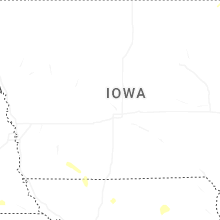


Connect with Interactive Hail Maps