

Hail Map for Jamaica Beach, TX
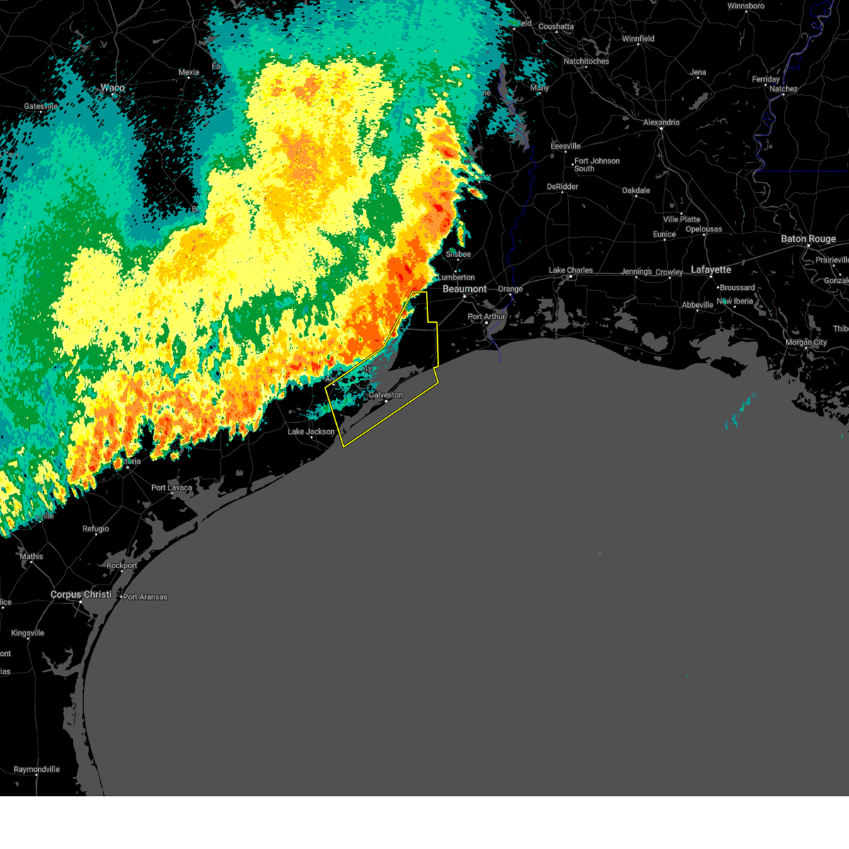
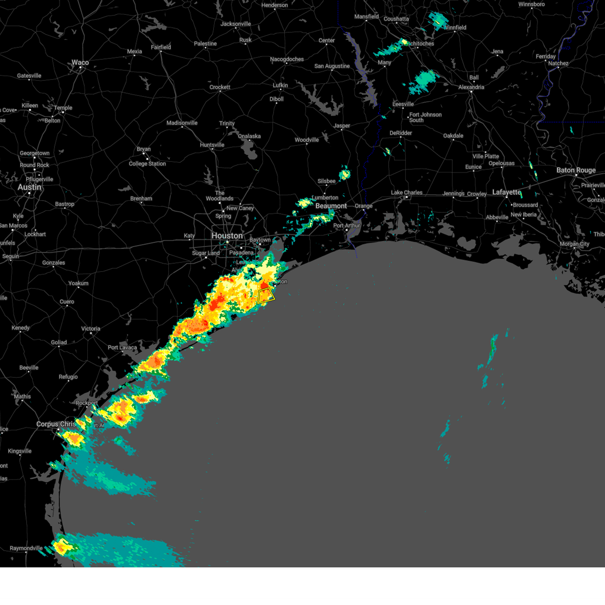
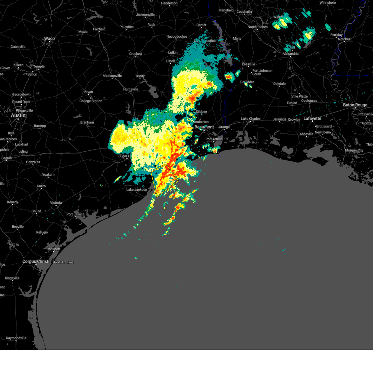
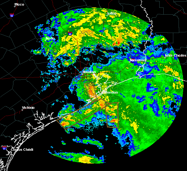
The Jamaica Beach, TX area has had 0 reports of on-the-ground hail by trained spotters, and has been under severe weather warnings 3 times during the past 12 months. Doppler radar has detected hail at or near Jamaica Beach, TX on 20 occasions.
| Name: | Jamaica Beach, TX |
| Where Located: | 45.8 miles SSE of Houston, TX |
| Map: | Google Map for Jamaica Beach, TX |
| Population: | 983 |
| Housing Units: | 1174 |
| More Info: | Search Google for Jamaica Beach, TX |
0
The Top Recent Hail Date for Jamaica Beach, TX is Tuesday, May 28, 2024 (9th out of 20)

Hail and Wind Damage Spotted near Jamaica Beach, TX
| Date / Time | Report Details |
|---|---|
| 5/27/2025 1:20 AM CDT |
 Svrhgx the national weather service in league city has issued a * severe thunderstorm warning for, galveston county in southeastern texas, chambers county in southeastern texas, northeastern brazoria county in southeastern texas, southeastern liberty county in southeastern texas, southeastern harris county in southeastern texas, * until 215 am cdt. * at 119 am cdt, severe thunderstorms were located along a line extending from near devers to near alvin, moving east southeast at around 40 mph (radar indicated). Hazards include 60 mph wind gusts. expect damage to roofs, siding, and trees Svrhgx the national weather service in league city has issued a * severe thunderstorm warning for, galveston county in southeastern texas, chambers county in southeastern texas, northeastern brazoria county in southeastern texas, southeastern liberty county in southeastern texas, southeastern harris county in southeastern texas, * until 215 am cdt. * at 119 am cdt, severe thunderstorms were located along a line extending from near devers to near alvin, moving east southeast at around 40 mph (radar indicated). Hazards include 60 mph wind gusts. expect damage to roofs, siding, and trees
|
| 4/21/2025 10:46 AM CDT |
 Svrhgx the national weather service in league city has issued a * severe thunderstorm warning for, south central galveston county in southeastern texas, * until 1100 am cdt. * at 1046 am cdt, a severe thunderstorm was located over galveston state park, or over galveston island west end, moving south at 30 mph (radar indicated). Hazards include 60 mph wind gusts. expect damage to roofs, siding, and trees Svrhgx the national weather service in league city has issued a * severe thunderstorm warning for, south central galveston county in southeastern texas, * until 1100 am cdt. * at 1046 am cdt, a severe thunderstorm was located over galveston state park, or over galveston island west end, moving south at 30 mph (radar indicated). Hazards include 60 mph wind gusts. expect damage to roofs, siding, and trees
|
| 3/24/2025 3:29 AM CDT |
 Svrhgx the national weather service in league city has issued a * severe thunderstorm warning for, southwestern galveston county in southeastern texas, east central brazoria county in southeastern texas, * until 400 am cdt. * at 329 am cdt, severe thunderstorms were located along a line extending from near texas city to la marque to near santa fe, moving south at 60 mph (radar indicated). Hazards include 60 mph wind gusts. expect damage to roofs, siding, and trees Svrhgx the national weather service in league city has issued a * severe thunderstorm warning for, southwestern galveston county in southeastern texas, east central brazoria county in southeastern texas, * until 400 am cdt. * at 329 am cdt, severe thunderstorms were located along a line extending from near texas city to la marque to near santa fe, moving south at 60 mph (radar indicated). Hazards include 60 mph wind gusts. expect damage to roofs, siding, and trees
|
| 6/19/2024 11:07 AM CDT |
 Svrhgx the national weather service in league city has issued a * severe thunderstorm warning for, southwestern galveston county in southeastern texas, east central brazoria county in southeastern texas, * until 1115 am cdt. * at 1106 am cdt, a severe thunderstorm capable of producing a waterspout was located near jamaica beach, or near galveston island west end, moving west at 35 mph (radar indicated). Hazards include 60 mph wind gusts. expect damage to roofs, siding, and trees Svrhgx the national weather service in league city has issued a * severe thunderstorm warning for, southwestern galveston county in southeastern texas, east central brazoria county in southeastern texas, * until 1115 am cdt. * at 1106 am cdt, a severe thunderstorm capable of producing a waterspout was located near jamaica beach, or near galveston island west end, moving west at 35 mph (radar indicated). Hazards include 60 mph wind gusts. expect damage to roofs, siding, and trees
|
| 6/5/2024 11:25 AM CDT |
 The storms which prompted the warning have weakened below severe limits, and no longer pose an immediate threat to life or property. therefore, the warning will be allowed to expire. however, gusty winds are still possible with these thunderstorms. The storms which prompted the warning have weakened below severe limits, and no longer pose an immediate threat to life or property. therefore, the warning will be allowed to expire. however, gusty winds are still possible with these thunderstorms.
|
| 6/5/2024 10:54 AM CDT |
 Svrhgx the national weather service in league city has issued a * severe thunderstorm warning for, northwestern galveston county in southeastern texas, southeastern brazoria county in southeastern texas, * until 1130 am cdt. * at 1053 am cdt, severe thunderstorms were located along a line extending from 13 miles southeast of galveston pleasure pier to near galveston state park to near jamaica beach, moving south at 35 mph. a mesonet site on galveston island measured a 63 mph wind gust from the outflow of these storms (radar indicated and sensor reported). Hazards include 60 mph wind gusts. expect damage to roofs, siding, and trees Svrhgx the national weather service in league city has issued a * severe thunderstorm warning for, northwestern galveston county in southeastern texas, southeastern brazoria county in southeastern texas, * until 1130 am cdt. * at 1053 am cdt, severe thunderstorms were located along a line extending from 13 miles southeast of galveston pleasure pier to near galveston state park to near jamaica beach, moving south at 35 mph. a mesonet site on galveston island measured a 63 mph wind gust from the outflow of these storms (radar indicated and sensor reported). Hazards include 60 mph wind gusts. expect damage to roofs, siding, and trees
|
| 6/1/2024 12:01 PM CDT |
 the severe thunderstorm warning has been cancelled and is no longer in effect the severe thunderstorm warning has been cancelled and is no longer in effect
|
| 6/1/2024 11:33 AM CDT |
 Svrhgx the national weather service in league city has issued a * severe thunderstorm warning for, southwestern galveston county in southeastern texas, southeastern brazoria county in southeastern texas, * until 1230 pm cdt. * at 1132 am cdt, a severe thunderstorm was located 7 miles northeast of oyster creek, or 9 miles north of surfside beach, moving northeast at 5 mph. a landspout has been observed with this storm by the local emergency manager, as well as members of the public (radar indicated). Hazards include 60 mph wind gusts and quarter size hail. Hail damage to vehicles is expected. Expect wind damage to roofs, siding, and trees. Svrhgx the national weather service in league city has issued a * severe thunderstorm warning for, southwestern galveston county in southeastern texas, southeastern brazoria county in southeastern texas, * until 1230 pm cdt. * at 1132 am cdt, a severe thunderstorm was located 7 miles northeast of oyster creek, or 9 miles north of surfside beach, moving northeast at 5 mph. a landspout has been observed with this storm by the local emergency manager, as well as members of the public (radar indicated). Hazards include 60 mph wind gusts and quarter size hail. Hail damage to vehicles is expected. Expect wind damage to roofs, siding, and trees.
|
| 5/31/2024 8:12 AM CDT |
 Svrhgx the national weather service in league city has issued a * severe thunderstorm warning for, central galveston county in southeastern texas, east central brazoria county in southeastern texas, * until 845 am cdt. * at 811 am cdt, severe thunderstorms were located along a line extending from crystal beach to near san luis pass, moving east at 30 mph (radar indicated). Hazards include 60 mph wind gusts and nickel size hail. expect damage to roofs, siding, and trees Svrhgx the national weather service in league city has issued a * severe thunderstorm warning for, central galveston county in southeastern texas, east central brazoria county in southeastern texas, * until 845 am cdt. * at 811 am cdt, severe thunderstorms were located along a line extending from crystal beach to near san luis pass, moving east at 30 mph (radar indicated). Hazards include 60 mph wind gusts and nickel size hail. expect damage to roofs, siding, and trees
|
| 5/31/2024 7:57 AM CDT |
 At 757 am cdt, severe thunderstorms were located along a line extending from smith point to 6 miles southeast of danbury, moving east at 25 mph (radar indicated). Hazards include 70 mph wind gusts and nickel size hail. Expect considerable tree damage. damage is likely to mobile homes, roofs, and outbuildings. Locations impacted include, galveston causeway, galveston island west end, texas city, northern lake jackson, angleton, dickinson, la marque, santa fe, hitchcock, galveston pier 21, danbury, bayou vista, jamaica beach, tiki island, san leon, scholes field, port bolivar, offatts bayou, galveston pleasure pier, and pelican island. At 757 am cdt, severe thunderstorms were located along a line extending from smith point to 6 miles southeast of danbury, moving east at 25 mph (radar indicated). Hazards include 70 mph wind gusts and nickel size hail. Expect considerable tree damage. damage is likely to mobile homes, roofs, and outbuildings. Locations impacted include, galveston causeway, galveston island west end, texas city, northern lake jackson, angleton, dickinson, la marque, santa fe, hitchcock, galveston pier 21, danbury, bayou vista, jamaica beach, tiki island, san leon, scholes field, port bolivar, offatts bayou, galveston pleasure pier, and pelican island.
|
| 5/31/2024 7:47 AM CDT |
 Svrhgx the national weather service in league city has issued a * severe thunderstorm warning for, galveston county in southeastern texas, east central brazoria county in southeastern texas, south central chambers county in southeastern texas, * until 815 am cdt. * at 746 am cdt, severe thunderstorms were located along a line extending from near smith point to near angleton, moving east at 25 mph (radar indicated). Hazards include 60 mph wind gusts and nickel size hail. expect damage to roofs, siding, and trees Svrhgx the national weather service in league city has issued a * severe thunderstorm warning for, galveston county in southeastern texas, east central brazoria county in southeastern texas, south central chambers county in southeastern texas, * until 815 am cdt. * at 746 am cdt, severe thunderstorms were located along a line extending from near smith point to near angleton, moving east at 25 mph (radar indicated). Hazards include 60 mph wind gusts and nickel size hail. expect damage to roofs, siding, and trees
|
| 5/28/2024 2:43 PM CDT |
 Svrhgx the national weather service in league city has issued a * severe thunderstorm warning for, southwestern galveston county in southeastern texas, southeastern brazoria county in southeastern texas, * until 330 pm cdt. * at 242 pm cdt, severe thunderstorms were located along a line extending from bayou vista to 7 miles west of jamaica beach to near angleton, moving south at 30 mph (radar indicated). Hazards include 60 mph wind gusts and nickel size hail. expect damage to roofs, siding, and trees Svrhgx the national weather service in league city has issued a * severe thunderstorm warning for, southwestern galveston county in southeastern texas, southeastern brazoria county in southeastern texas, * until 330 pm cdt. * at 242 pm cdt, severe thunderstorms were located along a line extending from bayou vista to 7 miles west of jamaica beach to near angleton, moving south at 30 mph (radar indicated). Hazards include 60 mph wind gusts and nickel size hail. expect damage to roofs, siding, and trees
|
| 5/28/2024 1:55 PM CDT |
 Svrhgx the national weather service in league city has issued a * severe thunderstorm warning for, galveston county in southeastern texas, east central fort bend county in southeastern texas, northeastern brazoria county in southeastern texas, western chambers county in southeastern texas, south central liberty county in southeastern texas, southeastern harris county in southeastern texas, * until 245 pm cdt. * at 155 pm cdt, severe thunderstorms were located along a line extending from beach city to near shoreacres to pearland, moving southeast at 35 mph (radar indicated). Hazards include 70 mph wind gusts and quarter size hail. Hail damage to vehicles is expected. expect considerable tree damage. Wind damage is also likely to mobile homes, roofs, and outbuildings. Svrhgx the national weather service in league city has issued a * severe thunderstorm warning for, galveston county in southeastern texas, east central fort bend county in southeastern texas, northeastern brazoria county in southeastern texas, western chambers county in southeastern texas, south central liberty county in southeastern texas, southeastern harris county in southeastern texas, * until 245 pm cdt. * at 155 pm cdt, severe thunderstorms were located along a line extending from beach city to near shoreacres to pearland, moving southeast at 35 mph (radar indicated). Hazards include 70 mph wind gusts and quarter size hail. Hail damage to vehicles is expected. expect considerable tree damage. Wind damage is also likely to mobile homes, roofs, and outbuildings.
|
| 5/13/2024 5:10 PM CDT |
 At 510 pm cdt, severe thunderstorms were located along a line extending from near galveston pleasure pier to 6 miles south of galveston island east end to 10 miles south of galveston state park, moving east at 55 mph (radar indicated). Hazards include 60 mph wind gusts. Expect damage to roofs, siding, and trees. Locations impacted include, galveston island west end, galveston causeway, texas city, la marque, hitchcock, galveston pier 21, bayou vista, jamaica beach, tiki island, pelican island, galveston state park, crystal beach, schlitterbahn, scholes field, the strand, port bolivar, offatts bayou, rollover pass, galveston pleasure pier, and galveston island east end. At 510 pm cdt, severe thunderstorms were located along a line extending from near galveston pleasure pier to 6 miles south of galveston island east end to 10 miles south of galveston state park, moving east at 55 mph (radar indicated). Hazards include 60 mph wind gusts. Expect damage to roofs, siding, and trees. Locations impacted include, galveston island west end, galveston causeway, texas city, la marque, hitchcock, galveston pier 21, bayou vista, jamaica beach, tiki island, pelican island, galveston state park, crystal beach, schlitterbahn, scholes field, the strand, port bolivar, offatts bayou, rollover pass, galveston pleasure pier, and galveston island east end.
|
| 5/13/2024 5:10 PM CDT |
 the severe thunderstorm warning has been cancelled and is no longer in effect the severe thunderstorm warning has been cancelled and is no longer in effect
|
| 5/13/2024 5:00 PM CDT |
 Svrhgx the national weather service in league city has issued a * severe thunderstorm warning for, central galveston county in southeastern texas, eastern brazoria county in southeastern texas, * until 530 pm cdt. * at 500 pm cdt, severe thunderstorms were located along a line extending from galveston causeway to near galveston state park to 6 miles east of san luis pass, moving east at 50 mph (radar indicated). Hazards include 60 mph wind gusts. expect damage to roofs, siding, and trees Svrhgx the national weather service in league city has issued a * severe thunderstorm warning for, central galveston county in southeastern texas, eastern brazoria county in southeastern texas, * until 530 pm cdt. * at 500 pm cdt, severe thunderstorms were located along a line extending from galveston causeway to near galveston state park to 6 miles east of san luis pass, moving east at 50 mph (radar indicated). Hazards include 60 mph wind gusts. expect damage to roofs, siding, and trees
|
| 5/13/2024 4:36 PM CDT |
 The storm which prompted the warning has moved out of the area. therefore, the warning will be allowed to expire. however, small hail, gusty winds and heavy rain are still possible with this thunderstorm. a severe thunderstorm watch remains in effect until 800 pm cdt for southeastern texas. The storm which prompted the warning has moved out of the area. therefore, the warning will be allowed to expire. however, small hail, gusty winds and heavy rain are still possible with this thunderstorm. a severe thunderstorm watch remains in effect until 800 pm cdt for southeastern texas.
|
| 5/13/2024 4:21 PM CDT |
 At 421 pm cdt, a severe thunderstorm was located 8 miles north of san luis pass, or 9 miles southwest of hitchcock, moving northeast at 35 mph (radar indicated). Hazards include quarter size hail. Damage to vehicles is expected. Locations impacted include, galveston island west end, santa fe, hitchcock, and jamaica beach. At 421 pm cdt, a severe thunderstorm was located 8 miles north of san luis pass, or 9 miles southwest of hitchcock, moving northeast at 35 mph (radar indicated). Hazards include quarter size hail. Damage to vehicles is expected. Locations impacted include, galveston island west end, santa fe, hitchcock, and jamaica beach.
|
| 5/13/2024 4:12 PM CDT |
 Svrhgx the national weather service in league city has issued a * severe thunderstorm warning for, southwestern galveston county in southeastern texas, east central brazoria county in southeastern texas, * until 445 pm cdt. * at 411 pm cdt, a severe thunderstorm was located 8 miles northwest of san luis pass, or 11 miles east of angleton, moving northeast at 35 mph (radar indicated). Hazards include quarter size hail. damage to vehicles is expected Svrhgx the national weather service in league city has issued a * severe thunderstorm warning for, southwestern galveston county in southeastern texas, east central brazoria county in southeastern texas, * until 445 pm cdt. * at 411 pm cdt, a severe thunderstorm was located 8 miles northwest of san luis pass, or 11 miles east of angleton, moving northeast at 35 mph (radar indicated). Hazards include quarter size hail. damage to vehicles is expected
|
| 3/15/2024 6:44 PM CDT |
 Svrhgx the national weather service in league city has issued a * severe thunderstorm warning for, southwestern galveston county in southeastern texas, southeastern brazoria county in southeastern texas, * until 715 pm cdt. * at 644 pm cdt, a severe thunderstorm was located 8 miles northwest of san luis pass, or 12 miles east of angleton, moving southeast at 30 mph (radar indicated). Hazards include golf ball size hail and 70 mph wind gusts. People and animals outdoors will be injured. expect hail damage to roofs, siding, windows, and vehicles. expect considerable tree damage. Wind damage is also likely to mobile homes, roofs, and outbuildings. Svrhgx the national weather service in league city has issued a * severe thunderstorm warning for, southwestern galveston county in southeastern texas, southeastern brazoria county in southeastern texas, * until 715 pm cdt. * at 644 pm cdt, a severe thunderstorm was located 8 miles northwest of san luis pass, or 12 miles east of angleton, moving southeast at 30 mph (radar indicated). Hazards include golf ball size hail and 70 mph wind gusts. People and animals outdoors will be injured. expect hail damage to roofs, siding, windows, and vehicles. expect considerable tree damage. Wind damage is also likely to mobile homes, roofs, and outbuildings.
|
| 10/5/2023 9:51 AM CDT |
 At 950 am cdt, severe thunderstorms were located along a line extending from 10 miles south of galveston state park to 17 miles south of freeport to 6 miles southeast of schicke point, moving southeast at 35 mph (radar indicated). Hazards include 70 mph wind gusts. Expect considerable tree damage. damage is likely to mobile homes, roofs, and outbuildings. locations impacted include, galveston island west end, matagorda, lake jackson, freeport, clute, hitchcock, palacios, surfside beach, south texas nuclear plant, richwood, brazoria, jones creek, oyster creek, jamaica beach, galveston state park, sargent, san luis pass, and wadsworth. thunderstorm damage threat, considerable hail threat, radar indicated max hail size, <. 75 in wind threat, observed max wind gust, 70 mph. At 950 am cdt, severe thunderstorms were located along a line extending from 10 miles south of galveston state park to 17 miles south of freeport to 6 miles southeast of schicke point, moving southeast at 35 mph (radar indicated). Hazards include 70 mph wind gusts. Expect considerable tree damage. damage is likely to mobile homes, roofs, and outbuildings. locations impacted include, galveston island west end, matagorda, lake jackson, freeport, clute, hitchcock, palacios, surfside beach, south texas nuclear plant, richwood, brazoria, jones creek, oyster creek, jamaica beach, galveston state park, sargent, san luis pass, and wadsworth. thunderstorm damage threat, considerable hail threat, radar indicated max hail size, <. 75 in wind threat, observed max wind gust, 70 mph.
|
| 10/5/2023 9:37 AM CDT |
 At 936 am cdt, severe thunderstorms were located along a line extending from near jamaica beach to 11 miles southeast of sargent to schicke point, moving southeast at 35 mph. palacios reported a wind gust of 75 mph at 929 am cdt (radar indicated). Hazards include 70 mph wind gusts. Expect considerable tree damage. Damage is likely to mobile homes, roofs, and outbuildings. At 936 am cdt, severe thunderstorms were located along a line extending from near jamaica beach to 11 miles southeast of sargent to schicke point, moving southeast at 35 mph. palacios reported a wind gust of 75 mph at 929 am cdt (radar indicated). Hazards include 70 mph wind gusts. Expect considerable tree damage. Damage is likely to mobile homes, roofs, and outbuildings.
|
| 6/21/2023 9:52 PM CDT |
 At 951 pm cdt, severe thunderstorms were located along a line extending from near smith point to santa fe to 6 miles west of holiday lakes, moving south at 40 mph (radar indicated). Hazards include 60 mph wind gusts. expect damage to roofs, siding, and trees At 951 pm cdt, severe thunderstorms were located along a line extending from near smith point to santa fe to 6 miles west of holiday lakes, moving south at 40 mph (radar indicated). Hazards include 60 mph wind gusts. expect damage to roofs, siding, and trees
|
| 6/10/2023 10:09 PM CDT |
 At 1009 pm cdt, severe thunderstorms were located along a line extending from pasadena to near kemah boardwalk to near smith point to 8 miles northeast of high island, moving southeast at 40 mph (radar indicated). Hazards include 60 mph wind gusts. expect damage to roofs, siding, and trees At 1009 pm cdt, severe thunderstorms were located along a line extending from pasadena to near kemah boardwalk to near smith point to 8 miles northeast of high island, moving southeast at 40 mph (radar indicated). Hazards include 60 mph wind gusts. expect damage to roofs, siding, and trees
|
| 6/8/2023 7:39 PM CDT |
 The severe thunderstorm warning for southwestern galveston, east central brazoria and southwestern chambers counties will expire at 745 pm cdt, the strong winds associated with the storm which prompted the warning have moved out of the area. therefore, the warning will be allowed to expire. The severe thunderstorm warning for southwestern galveston, east central brazoria and southwestern chambers counties will expire at 745 pm cdt, the strong winds associated with the storm which prompted the warning have moved out of the area. therefore, the warning will be allowed to expire.
|
| 6/8/2023 7:17 PM CDT |
 At 717 pm cdt, a severe thunderstorm was located over galveston causeway, moving southeast at 25 mph (radar indicated). Hazards include 60 mph wind gusts and quarter size hail. Hail damage to vehicles is expected. Expect wind damage to roofs, siding, and trees. At 717 pm cdt, a severe thunderstorm was located over galveston causeway, moving southeast at 25 mph (radar indicated). Hazards include 60 mph wind gusts and quarter size hail. Hail damage to vehicles is expected. Expect wind damage to roofs, siding, and trees.
|
| 6/8/2023 6:41 PM CDT |
 At 640 pm cdt, a severe thunderstorm was located over bacliff, or near dickinson, moving southeast at 35 mph (radar indicated). Hazards include ping pong ball size hail and 60 mph wind gusts. People and animals outdoors will be injured. expect hail damage to roofs, siding, windows, and vehicles. Expect wind damage to roofs, siding, and trees. At 640 pm cdt, a severe thunderstorm was located over bacliff, or near dickinson, moving southeast at 35 mph (radar indicated). Hazards include ping pong ball size hail and 60 mph wind gusts. People and animals outdoors will be injured. expect hail damage to roofs, siding, windows, and vehicles. Expect wind damage to roofs, siding, and trees.
|
| 6/4/2023 2:26 AM CDT |
 At 225 am cdt, severe thunderstorms were located along a line extending from 7 miles northwest of smith point to near san leon to near bayou vista to 6 miles north of san luis pass to oyster creek, moving southeast at 25 mph (radar indicated). Hazards include 60 mph wind gusts. expect damage to roofs, siding, and trees At 225 am cdt, severe thunderstorms were located along a line extending from 7 miles northwest of smith point to near san leon to near bayou vista to 6 miles north of san luis pass to oyster creek, moving southeast at 25 mph (radar indicated). Hazards include 60 mph wind gusts. expect damage to roofs, siding, and trees
|
| 1/24/2023 3:15 PM CST |
 At 314 pm cst, severe thunderstorms were located along a line extending from 9 miles northeast of smith point to near port bolivar to near galveston island west end, moving east at 25 mph (radar indicated). Hazards include 60 mph wind gusts. expect damage to roofs, siding, and trees At 314 pm cst, severe thunderstorms were located along a line extending from 9 miles northeast of smith point to near port bolivar to near galveston island west end, moving east at 25 mph (radar indicated). Hazards include 60 mph wind gusts. expect damage to roofs, siding, and trees
|
| 5/24/2022 10:10 AM CDT |
 At 1010 am cdt, severe thunderstorms was located near league city, moving north at 45 mph (radar indicated). Hazards include 60 mph wind gusts. expect damage to roofs, siding, and trees At 1010 am cdt, severe thunderstorms was located near league city, moving north at 45 mph (radar indicated). Hazards include 60 mph wind gusts. expect damage to roofs, siding, and trees
|
| 5/24/2022 9:49 AM CDT |
 At 948 am cdt, a severe thunderstorm was located near jamaica beach, or near galveston island west end, moving north at 40 mph (radar indicated). Hazards include 60 mph wind gusts. expect damage to roofs, siding, and trees At 948 am cdt, a severe thunderstorm was located near jamaica beach, or near galveston island west end, moving north at 40 mph (radar indicated). Hazards include 60 mph wind gusts. expect damage to roofs, siding, and trees
|
| 9/29/2021 5:11 AM CDT |
 At 510 am cdt, a severe thunderstorm was located over bayou vista, or near hitchcock, moving east at 30 mph (radar indicated). Hazards include 60 mph wind gusts. expect damage to roofs, siding, and trees At 510 am cdt, a severe thunderstorm was located over bayou vista, or near hitchcock, moving east at 30 mph (radar indicated). Hazards include 60 mph wind gusts. expect damage to roofs, siding, and trees
|
| 6/15/2021 7:38 PM CDT |
 At 738 pm cdt, severe thunderstorms were located along a line extending from league city to galveston causeway to 19 miles southeast of galveston pleasure pier, moving southwest at 30 mph (radar indicated). Hazards include 60 mph wind gusts. Expect damage to roofs, siding, and trees. Locations impacted include, league city, galveston island west end, galveston causeway, texas city, southern friendswood, dickinson, la marque, santa fe, webster, hitchcock, kemah, nassau bay, bayou vista, clear lake shores, jamaica beach, tiki island, galveston state park, schlitterbahn, scholes field and offatts bayou. At 738 pm cdt, severe thunderstorms were located along a line extending from league city to galveston causeway to 19 miles southeast of galveston pleasure pier, moving southwest at 30 mph (radar indicated). Hazards include 60 mph wind gusts. Expect damage to roofs, siding, and trees. Locations impacted include, league city, galveston island west end, galveston causeway, texas city, southern friendswood, dickinson, la marque, santa fe, webster, hitchcock, kemah, nassau bay, bayou vista, clear lake shores, jamaica beach, tiki island, galveston state park, schlitterbahn, scholes field and offatts bayou.
|
| 6/15/2021 7:02 PM CDT |
 At 700 pm cdt, severe thunderstorms were located along a line extending from near baytown to crystal beach. movement was southwest at 30 mph. strong outflow winds can be expected in advance of the main line of storms as well (radar indicated). Hazards include 60 mph wind gusts. expect damage to roofs, siding, and trees At 700 pm cdt, severe thunderstorms were located along a line extending from near baytown to crystal beach. movement was southwest at 30 mph. strong outflow winds can be expected in advance of the main line of storms as well (radar indicated). Hazards include 60 mph wind gusts. expect damage to roofs, siding, and trees
|
| 1/6/2021 6:45 PM CST |
 At 644 pm cst, a severe thunderstorm was located 16 miles east of high island, or 17 miles southwest of sabine pass, moving east at 50 mph (radar indicated). Hazards include 60 mph wind gusts and quarter size hail. Hail damage to vehicles is expected. expect wind damage to roofs, siding, and trees. Locations impacted include, galveston causeway, galveston island west end, texas city, southeastern lake jackson, la marque, freeport, clute, hitchcock, surfside beach, galveston pier 21, richwood, jones creek, bayou vista, oyster creek, jamaica beach, tiki island, high island, scholes field, port bolivar and offatts bayou. At 644 pm cst, a severe thunderstorm was located 16 miles east of high island, or 17 miles southwest of sabine pass, moving east at 50 mph (radar indicated). Hazards include 60 mph wind gusts and quarter size hail. Hail damage to vehicles is expected. expect wind damage to roofs, siding, and trees. Locations impacted include, galveston causeway, galveston island west end, texas city, southeastern lake jackson, la marque, freeport, clute, hitchcock, surfside beach, galveston pier 21, richwood, jones creek, bayou vista, oyster creek, jamaica beach, tiki island, high island, scholes field, port bolivar and offatts bayou.
|
| 1/6/2021 6:16 PM CST |
 At 616 pm cst, a severe thunderstorm was located over san leon, or 7 miles northeast of texas city, moving east at 50 mph (radar indicated). Hazards include 60 mph wind gusts and quarter size hail. Hail damage to vehicles is expected. Expect wind damage to roofs, siding, and trees. At 616 pm cst, a severe thunderstorm was located over san leon, or 7 miles northeast of texas city, moving east at 50 mph (radar indicated). Hazards include 60 mph wind gusts and quarter size hail. Hail damage to vehicles is expected. Expect wind damage to roofs, siding, and trees.
|
| 5/27/2020 5:06 PM CDT |
 At 505 pm cdt, severe thunderstorms were located along a line extending from near nome to beach city to clear lake to pearland to near thompsons, moving east southeast at 50 mph (radar indicated). Hazards include 70 mph wind gusts. Expect considerable tree damage. Damage is likely to mobile homes, roofs, and outbuildings. At 505 pm cdt, severe thunderstorms were located along a line extending from near nome to beach city to clear lake to pearland to near thompsons, moving east southeast at 50 mph (radar indicated). Hazards include 70 mph wind gusts. Expect considerable tree damage. Damage is likely to mobile homes, roofs, and outbuildings.
|
| 4/29/2020 6:11 AM CDT |
 The severe thunderstorm warning for central galveston, southeastern brazoria and southeastern chambers counties will expire at 615 am cdt, the strongest winds from these storms which prompted the warning have moved out of the area. therefore, the warning will be allowed to expire. however small hail, gusty winds and heavy rain are still possible with remaining thunderstorms. a severe thunderstorm watch remains in effect until 900 am cdt for southeastern texas. The severe thunderstorm warning for central galveston, southeastern brazoria and southeastern chambers counties will expire at 615 am cdt, the strongest winds from these storms which prompted the warning have moved out of the area. therefore, the warning will be allowed to expire. however small hail, gusty winds and heavy rain are still possible with remaining thunderstorms. a severe thunderstorm watch remains in effect until 900 am cdt for southeastern texas.
|
| 4/29/2020 5:56 AM CDT |
 At 555 am cdt, severe thunderstorms were located along a line extending from near bolivar peninsula to near galveston pleasure pier to near san luis pass to 6 miles northeast of oyster creek, moving southeast at 50 mph (trained weather spotters have reported gusts and damage to trees with these storms.). Hazards include 60 mph wind gusts and penny size hail. expect damage to trees At 555 am cdt, severe thunderstorms were located along a line extending from near bolivar peninsula to near galveston pleasure pier to near san luis pass to 6 miles northeast of oyster creek, moving southeast at 50 mph (trained weather spotters have reported gusts and damage to trees with these storms.). Hazards include 60 mph wind gusts and penny size hail. expect damage to trees
|
| 4/29/2020 5:51 AM CDT |
 At 550 am cdt, severe thunderstorms were located along a line extending from near bolivar peninsula to near hitchcock to angleton to 9 miles west of west columbia, moving south at 45 mph (trained weather spotters have reported wind gusts to 60 mph with these storms. there have also been reports of wind damage to trees). Hazards include 60 mph wind gusts and penny size hail. Expect damage to trees. Locations impacted include, league city, galveston causeway, galveston island west end, texas city, southern friendswood, lake jackson, alvin, angleton, dickinson, la marque, santa fe, freeport, clute, webster, hitchcock, southeastern manvel, west columbia, kemah, surfside beach and galveston pier 21. At 550 am cdt, severe thunderstorms were located along a line extending from near bolivar peninsula to near hitchcock to angleton to 9 miles west of west columbia, moving south at 45 mph (trained weather spotters have reported wind gusts to 60 mph with these storms. there have also been reports of wind damage to trees). Hazards include 60 mph wind gusts and penny size hail. Expect damage to trees. Locations impacted include, league city, galveston causeway, galveston island west end, texas city, southern friendswood, lake jackson, alvin, angleton, dickinson, la marque, santa fe, freeport, clute, webster, hitchcock, southeastern manvel, west columbia, kemah, surfside beach and galveston pier 21.
|
| 4/29/2020 5:41 AM CDT |
 At 540 am cdt, severe thunderstorms continnued with a gust front located along a line extending from near bolivar peninsula to near santa fe to near bonney to 8 miles south of needville, moving south at 45 mph (trained weather spotters have reported gusts to 60 mph in this line of storms. small hail was observed at the nws houston/galveston office). Hazards include 60 mph wind gusts and penny size hail. Expect damage to trees. Locations impacted include, southeastern pasadena, pearland, league city, southeastern baytown, galveston causeway, galveston island west end, texas city, friendswood, la porte, lake jackson, alvin, angleton, dickinson, la marque, santa fe, freeport, seabrook, clute, webster and hitchcock. At 540 am cdt, severe thunderstorms continnued with a gust front located along a line extending from near bolivar peninsula to near santa fe to near bonney to 8 miles south of needville, moving south at 45 mph (trained weather spotters have reported gusts to 60 mph in this line of storms. small hail was observed at the nws houston/galveston office). Hazards include 60 mph wind gusts and penny size hail. Expect damage to trees. Locations impacted include, southeastern pasadena, pearland, league city, southeastern baytown, galveston causeway, galveston island west end, texas city, friendswood, la porte, lake jackson, alvin, angleton, dickinson, la marque, santa fe, freeport, seabrook, clute, webster and hitchcock.
|
| 4/29/2020 5:29 AM CDT |
 At 528 am cdt, severe thunderstorms continued with a gust front located along a line extending from near stowell to near san leon to near alvin to near brazos bend state park to near east bernard, moving south at 45 mph (radar indicated. this line of storms has a history of producing measured gusts over 50 mph and small hail). Hazards include 60 mph wind gusts and penny size hail. Expect damage to roofs, siding, and trees. Locations impacted include, pasadena, pearland, league city, sugar land, baytown, missouri city, galveston causeway, galveston island west end, texas city, friendswood, la porte, deer park, rosenberg, lake jackson, alvin, angleton, dickinson, stafford, south houston and bellaire. At 528 am cdt, severe thunderstorms continued with a gust front located along a line extending from near stowell to near san leon to near alvin to near brazos bend state park to near east bernard, moving south at 45 mph (radar indicated. this line of storms has a history of producing measured gusts over 50 mph and small hail). Hazards include 60 mph wind gusts and penny size hail. Expect damage to roofs, siding, and trees. Locations impacted include, pasadena, pearland, league city, sugar land, baytown, missouri city, galveston causeway, galveston island west end, texas city, friendswood, la porte, deer park, rosenberg, lake jackson, alvin, angleton, dickinson, stafford, south houston and bellaire.
|
| 4/29/2020 5:18 AM CDT |
 At 516 am cdt, severe thunderstorms were located along a line extending from near winnie to near shoreacres to near pearland to thompsons to near wallis, moving south at 45 mph (radar indicated. this storm has produced a gust to 56 mph at hobby airport, along with reports of small hail). Hazards include 60 mph wind gusts and penny size hail. Expect damage to roofs, siding, and trees. Locations impacted include, pasadena, pearland, league city, sugar land, baytown, missouri city, galveston island west end, galveston causeway, texas city, friendswood, la porte, deer park, rosenberg, lake jackson, alvin, angleton, dickinson, stafford, south houston and bellaire. At 516 am cdt, severe thunderstorms were located along a line extending from near winnie to near shoreacres to near pearland to thompsons to near wallis, moving south at 45 mph (radar indicated. this storm has produced a gust to 56 mph at hobby airport, along with reports of small hail). Hazards include 60 mph wind gusts and penny size hail. Expect damage to roofs, siding, and trees. Locations impacted include, pasadena, pearland, league city, sugar land, baytown, missouri city, galveston island west end, galveston causeway, texas city, friendswood, la porte, deer park, rosenberg, lake jackson, alvin, angleton, dickinson, stafford, south houston and bellaire.
|
| 4/29/2020 4:59 AM CDT |
 The national weather service in league city has issued a * severe thunderstorm warning for. eastern austin county in southeastern texas. galveston county in southeastern texas. fort bend county in southeastern texas. Brazoria county in southeastern texas. The national weather service in league city has issued a * severe thunderstorm warning for. eastern austin county in southeastern texas. galveston county in southeastern texas. fort bend county in southeastern texas. Brazoria county in southeastern texas.
|
| 4/19/2020 2:54 PM CDT |
 At 252 pm cdt, a cluster of severe thunderstorms was centered near liverpool, or 12 miles northeast of angleton, moving east at 40 mph (radar indicated). Hazards include 60 mph wind gusts and quarter size hail. Hail damage to vehicles is possible. Wind damage to roofs, siding, and trees is possible. At 252 pm cdt, a cluster of severe thunderstorms was centered near liverpool, or 12 miles northeast of angleton, moving east at 40 mph (radar indicated). Hazards include 60 mph wind gusts and quarter size hail. Hail damage to vehicles is possible. Wind damage to roofs, siding, and trees is possible.
|
| 1/11/2020 1:56 AM CST |
 The severe thunderstorm warning for central galveston and eastern chambers counties will expire at 200 am cst, the storms which prompted the warning are moving out of the area. therefore, the warning will be allowed to expire. to report severe weather, contact your nearest law enforcement agency. they will relay your report to the national weather service league city. The severe thunderstorm warning for central galveston and eastern chambers counties will expire at 200 am cst, the storms which prompted the warning are moving out of the area. therefore, the warning will be allowed to expire. to report severe weather, contact your nearest law enforcement agency. they will relay your report to the national weather service league city.
|
| 1/11/2020 1:44 AM CST |
 At 143 am cst, severe thunderstorms were located along a line extending from near china to 6 miles north of gilchrist to 7 miles south of scholes field to 12 miles southeast of san luis pass, moving east at 35 mph (radar indicated). Hazards include 60 mph wind gusts. Expect damage to roofs, siding, and trees. Locations impacted include, galveston island west end, galveston causeway, galveston pier 21, jamaica beach, pelican island, galveston state park, crystal beach, high island, schlitterbahn, scholes field, the strand, port bolivar, offatts bayou, gilchrist, rollover pass, galveston pleasure pier, bolivar peninsula, stowell, moody gardens and winnie. At 143 am cst, severe thunderstorms were located along a line extending from near china to 6 miles north of gilchrist to 7 miles south of scholes field to 12 miles southeast of san luis pass, moving east at 35 mph (radar indicated). Hazards include 60 mph wind gusts. Expect damage to roofs, siding, and trees. Locations impacted include, galveston island west end, galveston causeway, galveston pier 21, jamaica beach, pelican island, galveston state park, crystal beach, high island, schlitterbahn, scholes field, the strand, port bolivar, offatts bayou, gilchrist, rollover pass, galveston pleasure pier, bolivar peninsula, stowell, moody gardens and winnie.
|
| 1/11/2020 1:29 AM CST |
 At 128 am cst, severe thunderstorms were located along a line extending from near nome to 8 miles north of bolivar peninsula to near jamaica beach to 8 miles east of surfside beach, moving east at 75 mph (radar indicated). Hazards include 60 mph wind gusts. Expect damage to roofs, siding, and trees. Locations impacted include, galveston causeway, galveston island west end, texas city, la marque, hitchcock, surfside beach, galveston pier 21, anahuac, bayou vista, jamaica beach, tiki island, devers, high island, scholes field, port bolivar, offatts bayou, galveston pleasure pier, pelican island, galveston state park and crystal beach. At 128 am cst, severe thunderstorms were located along a line extending from near nome to 8 miles north of bolivar peninsula to near jamaica beach to 8 miles east of surfside beach, moving east at 75 mph (radar indicated). Hazards include 60 mph wind gusts. Expect damage to roofs, siding, and trees. Locations impacted include, galveston causeway, galveston island west end, texas city, la marque, hitchcock, surfside beach, galveston pier 21, anahuac, bayou vista, jamaica beach, tiki island, devers, high island, scholes field, port bolivar, offatts bayou, galveston pleasure pier, pelican island, galveston state park and crystal beach.
|
| 1/11/2020 1:11 AM CST |
 At 110 am cst, severe thunderstorms were located along a line extending from near saratoga to near anahuac to near san luis pass to 17 miles south of freeport, moving east at 35 mph (radar indicated). Hazards include 60 mph wind gusts. expect damage to roofs, siding, and trees At 110 am cst, severe thunderstorms were located along a line extending from near saratoga to near anahuac to near san luis pass to 17 miles south of freeport, moving east at 35 mph (radar indicated). Hazards include 60 mph wind gusts. expect damage to roofs, siding, and trees
|
| 6/5/2019 1:39 PM CDT |
 At 138 pm cdt, a severe thunderstorm capable of producing a tornado was located over galveston state park, or 7 miles south of hitchcock, moving northwest at 25 mph (radar indicated rotation). Hazards include tornado. Flying debris will be dangerous to those caught without shelter. mobile homes will be damaged or destroyed. damage to roofs, windows, and vehicles will occur. tree damage is likely. this dangerous storm will be near, hitchcock around 205 pm cdt. la marque around 210 pm cdt. Santa fe around 215 pm cdt. At 138 pm cdt, a severe thunderstorm capable of producing a tornado was located over galveston state park, or 7 miles south of hitchcock, moving northwest at 25 mph (radar indicated rotation). Hazards include tornado. Flying debris will be dangerous to those caught without shelter. mobile homes will be damaged or destroyed. damage to roofs, windows, and vehicles will occur. tree damage is likely. this dangerous storm will be near, hitchcock around 205 pm cdt. la marque around 210 pm cdt. Santa fe around 215 pm cdt.
|
| 5/10/2019 12:21 AM CDT |
 At 1221 am cdt, severe thunderstorms were located along a line extending from 8 miles southeast of galveston state park to 6 miles south of la belle, moving east at 30 mph. another severe thunderstorm was located near san luis pass that could produce large hail (radar indicated). Hazards include 60 mph wind gusts and quarter size hail. Hail damage to vehicles is expected. expect wind damage to roofs, siding, and trees. Locations impacted include, galveston causeway, galveston island west end, texas city, la marque, hitchcock, galveston pier 21, bayou vista, jamaica beach, tiki island, high island, scholes field, port bolivar, offatts bayou, galveston pleasure pier, pelican island, galveston state park, crystal beach, schlitterbahn, the strand and smith point. At 1221 am cdt, severe thunderstorms were located along a line extending from 8 miles southeast of galveston state park to 6 miles south of la belle, moving east at 30 mph. another severe thunderstorm was located near san luis pass that could produce large hail (radar indicated). Hazards include 60 mph wind gusts and quarter size hail. Hail damage to vehicles is expected. expect wind damage to roofs, siding, and trees. Locations impacted include, galveston causeway, galveston island west end, texas city, la marque, hitchcock, galveston pier 21, bayou vista, jamaica beach, tiki island, high island, scholes field, port bolivar, offatts bayou, galveston pleasure pier, pelican island, galveston state park, crystal beach, schlitterbahn, the strand and smith point.
|
| 5/9/2019 11:56 PM CDT |
 At 1155 pm cdt, severe thunderstorms were located along a line extending from near jamaica beach to winnie, moving east at 30 mph (radar indicated). Hazards include 60 mph wind gusts and quarter size hail. Hail damage to vehicles is expected. Expect wind damage to roofs, siding, and trees. At 1155 pm cdt, severe thunderstorms were located along a line extending from near jamaica beach to winnie, moving east at 30 mph (radar indicated). Hazards include 60 mph wind gusts and quarter size hail. Hail damage to vehicles is expected. Expect wind damage to roofs, siding, and trees.
|
| 5/9/2019 11:10 PM CDT |
 At 1110 pm cdt, a line of severe thunderstorms was centered near smith point, or 10 miles south of beach city, moving east at 45 mph (radar indicated). Hazards include ping pong ball size hail and 60 mph wind gusts. People and animals outdoors will be injured. expect hail damage to roofs, siding, windows, and vehicles. Expect wind damage to roofs, siding, and trees. At 1110 pm cdt, a line of severe thunderstorms was centered near smith point, or 10 miles south of beach city, moving east at 45 mph (radar indicated). Hazards include ping pong ball size hail and 60 mph wind gusts. People and animals outdoors will be injured. expect hail damage to roofs, siding, windows, and vehicles. Expect wind damage to roofs, siding, and trees.
|
| 4/7/2019 12:58 PM CDT |
 At 1258 pm cdt, severe thunderstorms were located along a line extending from 6 miles northwest of montgomery to 6 miles east of texas city, moving north at 45 mph. pea size hail has been reported with these storms. some of the storms show weak rotation and funnel clouds could be possible. weak tornadoes could form with little to no warning (radar indicated). Hazards include 60 mph wind gusts and penny size hail. expect damage to roofs, siding, and trees At 1258 pm cdt, severe thunderstorms were located along a line extending from 6 miles northwest of montgomery to 6 miles east of texas city, moving north at 45 mph. pea size hail has been reported with these storms. some of the storms show weak rotation and funnel clouds could be possible. weak tornadoes could form with little to no warning (radar indicated). Hazards include 60 mph wind gusts and penny size hail. expect damage to roofs, siding, and trees
|
| 4/7/2019 12:51 PM CDT |
 At 1250 pm cdt, severe thunderstorms were located along a line extending from near lake conroe dam to near deer park, moving northeast at 50 mph. pea size hail has been reported with these storms. some of the storms show weak rotation and funnel clouds could be possible. weak tornadoes could form with little to no warning (radar indicated). Hazards include 60 mph wind gusts and penny size hail. Expect damage to roofs, siding, and trees. Locations impacted include, pasadena, pearland, league city, western baytown, missouri city, conroe, galveston island west end, galveston causeway, texas city, friendswood, la porte, deer park, alvin, dickinson, stafford, south houston, bellaire, humble, west university place and la marque. At 1250 pm cdt, severe thunderstorms were located along a line extending from near lake conroe dam to near deer park, moving northeast at 50 mph. pea size hail has been reported with these storms. some of the storms show weak rotation and funnel clouds could be possible. weak tornadoes could form with little to no warning (radar indicated). Hazards include 60 mph wind gusts and penny size hail. Expect damage to roofs, siding, and trees. Locations impacted include, pasadena, pearland, league city, western baytown, missouri city, conroe, galveston island west end, galveston causeway, texas city, friendswood, la porte, deer park, alvin, dickinson, stafford, south houston, bellaire, humble, west university place and la marque.
|
| 4/7/2019 12:35 PM CDT |
 At 1235 pm cdt, severe thunderstorms were located along a line extending from pinehurst to friendswood, moving northeast at 50 mph. pea size hail has been reported with these storms. some of the storms show weak rotation and funnel clouds could be possible. weak tornadoes could form with little to no warning (radar indicated). Hazards include 60 mph wind gusts and penny size hail. expect damage to roofs, siding, and trees At 1235 pm cdt, severe thunderstorms were located along a line extending from pinehurst to friendswood, moving northeast at 50 mph. pea size hail has been reported with these storms. some of the storms show weak rotation and funnel clouds could be possible. weak tornadoes could form with little to no warning (radar indicated). Hazards include 60 mph wind gusts and penny size hail. expect damage to roofs, siding, and trees
|
| 4/7/2019 12:04 PM CDT |
 At 1204 pm cdt, severe thunderstorms were located along a line extending from 6 miles northwest of katy to near danbury, moving northeast at 55 mph (radar indicated). Hazards include 60 mph wind gusts. expect damage to roofs, siding, and trees At 1204 pm cdt, severe thunderstorms were located along a line extending from 6 miles northwest of katy to near danbury, moving northeast at 55 mph (radar indicated). Hazards include 60 mph wind gusts. expect damage to roofs, siding, and trees
|
| 10/31/2018 11:06 PM CDT |
 The severe thunderstorm warning for central galveston county will expire at 1115 pm cdt, the storm which prompted the warning has weakened below severe limits, and no longer poses an immediate threat to life or property. therefore, the warning will be allowed to expire. however gusty winds and heavy rain are still possible with this thunderstorm. a tornado watch remains in effect until midnight cdt for southeastern texas. The severe thunderstorm warning for central galveston county will expire at 1115 pm cdt, the storm which prompted the warning has weakened below severe limits, and no longer poses an immediate threat to life or property. therefore, the warning will be allowed to expire. however gusty winds and heavy rain are still possible with this thunderstorm. a tornado watch remains in effect until midnight cdt for southeastern texas.
|
| 10/31/2018 10:44 PM CDT |
 At 1044 pm cdt, a severe thunderstorm was located over schlitterbahn, or near galveston causeway, moving southeast at 30 mph (radar indicated). Hazards include 60 mph wind gusts. expect damage to roofs, siding, and trees At 1044 pm cdt, a severe thunderstorm was located over schlitterbahn, or near galveston causeway, moving southeast at 30 mph (radar indicated). Hazards include 60 mph wind gusts. expect damage to roofs, siding, and trees
|
| 10/31/2018 10:16 PM CDT |
 At 1016 pm cdt, a severe thunderstorm was located over la marque, moving southeast at 30 mph (radar indicated). Hazards include 60 mph wind gusts. expect damage to roofs, siding, and trees At 1016 pm cdt, a severe thunderstorm was located over la marque, moving southeast at 30 mph (radar indicated). Hazards include 60 mph wind gusts. expect damage to roofs, siding, and trees
|
| 7/3/2018 9:01 PM CDT |
 At 901 pm cdt, a severe thunderstorm was located near tiki island, or near hitchcock, moving south at 25 mph (radar indicated). Hazards include 60 mph wind gusts. expect damage to roofs, siding, and trees At 901 pm cdt, a severe thunderstorm was located near tiki island, or near hitchcock, moving south at 25 mph (radar indicated). Hazards include 60 mph wind gusts. expect damage to roofs, siding, and trees
|
| 3/29/2018 2:53 AM CDT |
 At 253 am cdt, severe thunderstorms were located along a line extending from shoreacres to 6 miles east of sargent, moving east at 30 mph (radar indicated). Hazards include 60 mph wind gusts and possible brief tornadoes. expect damage to roofs, siding, and trees At 253 am cdt, severe thunderstorms were located along a line extending from shoreacres to 6 miles east of sargent, moving east at 30 mph (radar indicated). Hazards include 60 mph wind gusts and possible brief tornadoes. expect damage to roofs, siding, and trees
|
| 3/29/2018 2:28 AM CDT |
 At 227 am cdt, severe thunderstorms were located along a line extending from greater hobby area to near matagorda, moving east at 45 mph. brief tornadoes may be possible along the leading edge of this line (radar indicated). Hazards include 60 mph wind gusts and nickel size hail. expect damage to roofs, siding, and trees At 227 am cdt, severe thunderstorms were located along a line extending from greater hobby area to near matagorda, moving east at 45 mph. brief tornadoes may be possible along the leading edge of this line (radar indicated). Hazards include 60 mph wind gusts and nickel size hail. expect damage to roofs, siding, and trees
|
| 8/25/2017 9:40 PM CDT |
 At 940 pm cdt, a severe thunderstorm capable of producing a tornado was located near jamaica beach, or 14 miles south of hitchcock, moving northwest at 35 mph (radar indicated rotation). Hazards include tornado. Flying debris will be dangerous to those caught without shelter. mobile homes will be damaged or destroyed. damage to roofs, windows, and vehicles will occur. Tree damage is likely. At 940 pm cdt, a severe thunderstorm capable of producing a tornado was located near jamaica beach, or 14 miles south of hitchcock, moving northwest at 35 mph (radar indicated rotation). Hazards include tornado. Flying debris will be dangerous to those caught without shelter. mobile homes will be damaged or destroyed. damage to roofs, windows, and vehicles will occur. Tree damage is likely.
|
| 8/25/2017 6:39 PM CDT |
 At 638 pm cdt, a severe thunderstorm capable of producing a tornado was located over galveston state park, or 9 miles south of hitchcock, moving west at 40 mph (radar indicated rotation). Hazards include tornado. Flying debris will be dangerous to those caught without shelter. mobile homes will be damaged or destroyed. damage to roofs, windows, and vehicles will occur. Tree damage is likely. At 638 pm cdt, a severe thunderstorm capable of producing a tornado was located over galveston state park, or 9 miles south of hitchcock, moving west at 40 mph (radar indicated rotation). Hazards include tornado. Flying debris will be dangerous to those caught without shelter. mobile homes will be damaged or destroyed. damage to roofs, windows, and vehicles will occur. Tree damage is likely.
|
| 5/23/2017 8:43 PM CDT |
 At 842 pm cdt, a severe thunderstorm was located near smith point, or 8 miles northeast of texas city, moving east at 45 mph (radar indicated). Hazards include 60 mph wind gusts. Expect damage to roofs, siding, and trees. Locations impacted include, southeastern pasadena, league city, southern baytown, galveston causeway, galveston island west end, texas city, friendswood, la porte, deer park, alvin, dickinson, la marque, santa fe, eastern freeport, seabrook, webster, hitchcock, beach city, kemah and surfside beach. At 842 pm cdt, a severe thunderstorm was located near smith point, or 8 miles northeast of texas city, moving east at 45 mph (radar indicated). Hazards include 60 mph wind gusts. Expect damage to roofs, siding, and trees. Locations impacted include, southeastern pasadena, league city, southern baytown, galveston causeway, galveston island west end, texas city, friendswood, la porte, deer park, alvin, dickinson, la marque, santa fe, eastern freeport, seabrook, webster, hitchcock, beach city, kemah and surfside beach.
|
| 5/23/2017 8:24 PM CDT |
 At 823 pm cdt, a severe thunderstorm was located over dickinson, moving east at 45 mph (radar indicated). Hazards include 60 mph wind gusts and penny size hail. expect damage to roofs, siding, and trees At 823 pm cdt, a severe thunderstorm was located over dickinson, moving east at 45 mph (radar indicated). Hazards include 60 mph wind gusts and penny size hail. expect damage to roofs, siding, and trees
|
| 5/22/2017 11:20 AM CDT |
 At 1120 am cdt, a severe thunderstorm capable of producing a tornado was located over galveston state park, or 8 miles south of hitchcock, moving northeast at 15 mph (radar indicated rotation). Hazards include tornado. Flying debris will be dangerous to those caught without shelter. mobile homes will be damaged or destroyed. damage to roofs, windows, and vehicles will occur. Tree damage is likely. At 1120 am cdt, a severe thunderstorm capable of producing a tornado was located over galveston state park, or 8 miles south of hitchcock, moving northeast at 15 mph (radar indicated rotation). Hazards include tornado. Flying debris will be dangerous to those caught without shelter. mobile homes will be damaged or destroyed. damage to roofs, windows, and vehicles will occur. Tree damage is likely.
|
| 5/22/2017 10:58 AM CDT |
 At 1058 am cdt, severe thunderstorms were located along a line extending from santa fe to near jamaica beach, moving east at 15 mph (radar indicated). Hazards include 60 mph wind gusts. expect damage to roofs, siding, and trees At 1058 am cdt, severe thunderstorms were located along a line extending from santa fe to near jamaica beach, moving east at 15 mph (radar indicated). Hazards include 60 mph wind gusts. expect damage to roofs, siding, and trees
|
| 2/14/2017 10:22 AM CST |
 The tornado warning for southwestern galveston and east central brazoria counties will expire at 1030 am cst, the tornado threat has diminished and the tornado warning has been cancelled. however, damaging winds remain likely and a severe thunderstorm warning remains in effect for the area. a tornado watch remains in effect until 100 pm cst for southeastern texas. The tornado warning for southwestern galveston and east central brazoria counties will expire at 1030 am cst, the tornado threat has diminished and the tornado warning has been cancelled. however, damaging winds remain likely and a severe thunderstorm warning remains in effect for the area. a tornado watch remains in effect until 100 pm cst for southeastern texas.
|
| 2/14/2017 10:22 AM CST |
 At 1021 am cst, severe thunderstorms were located along a line extending from tiki island to near galveston state park to 12 miles southeast of san luis pass, moving northeast at 50 mph (radar indicated). Hazards include 60 mph wind gusts. expect damage to roofs, siding, and trees At 1021 am cst, severe thunderstorms were located along a line extending from tiki island to near galveston state park to 12 miles southeast of san luis pass, moving northeast at 50 mph (radar indicated). Hazards include 60 mph wind gusts. expect damage to roofs, siding, and trees
|
| 2/14/2017 10:07 AM CST |
 At 1007 am cst, a severe thunderstorm capable of producing a tornado was located near jamaica beach, or 11 miles south of hitchcock, moving northeast at 35 mph (radar indicated rotation). Hazards include tornado. Flying debris will be dangerous to those caught without shelter. mobile homes will be damaged or destroyed. damage to roofs, windows, and vehicles will occur. tree damage is likely. Locations impacted include, galveston island west end, galveston causeway, texas city, la marque, hitchcock, bayou vista, jamaica beach, tiki island, galveston pleasure pier, schlitterbahn, galveston state park, scholes field, moody gardens, offatts bayou and pelican island. At 1007 am cst, a severe thunderstorm capable of producing a tornado was located near jamaica beach, or 11 miles south of hitchcock, moving northeast at 35 mph (radar indicated rotation). Hazards include tornado. Flying debris will be dangerous to those caught without shelter. mobile homes will be damaged or destroyed. damage to roofs, windows, and vehicles will occur. tree damage is likely. Locations impacted include, galveston island west end, galveston causeway, texas city, la marque, hitchcock, bayou vista, jamaica beach, tiki island, galveston pleasure pier, schlitterbahn, galveston state park, scholes field, moody gardens, offatts bayou and pelican island.
|
| 2/14/2017 9:56 AM CST |
 At 956 am cst, a severe thunderstorm capable of producing a tornado was located over san luis pass, or 12 miles northeast of surfside beach, moving northeast at 35 mph (radar indicated rotation). Hazards include tornado. Flying debris will be dangerous to those caught without shelter. mobile homes will be damaged or destroyed. damage to roofs, windows, and vehicles will occur. Tree damage is likely. At 956 am cst, a severe thunderstorm capable of producing a tornado was located over san luis pass, or 12 miles northeast of surfside beach, moving northeast at 35 mph (radar indicated rotation). Hazards include tornado. Flying debris will be dangerous to those caught without shelter. mobile homes will be damaged or destroyed. damage to roofs, windows, and vehicles will occur. Tree damage is likely.
|
| 2/14/2017 9:21 AM CST |
 At 920 am cst, severe thunderstorms were located along a line extending from near danbury to near freeport to 9 miles southeast of sargent, moving east at 50 mph (radar indicated). Hazards include 60 mph wind gusts. expect damage to roofs, siding, and trees At 920 am cst, severe thunderstorms were located along a line extending from near danbury to near freeport to 9 miles southeast of sargent, moving east at 50 mph (radar indicated). Hazards include 60 mph wind gusts. expect damage to roofs, siding, and trees
|
| 4/27/2016 6:08 AM CDT |
 At 608 am cdt, severe thunderstorms were located along a line extending from near port bolivar to 6 miles west of san luis pass, moving southeast at 40 mph (radar indicated). Hazards include 60 mph wind gusts. Expect damage to roofs. siding. And trees. At 608 am cdt, severe thunderstorms were located along a line extending from near port bolivar to 6 miles west of san luis pass, moving southeast at 40 mph (radar indicated). Hazards include 60 mph wind gusts. Expect damage to roofs. siding. And trees.
|
| 4/27/2016 5:18 AM CDT |
 At 518 am cdt, severe thunderstorms were located along a line extending from lake houston dam to south park to near first colony, moving southeast at 40 mph (radar indicated). Hazards include 60 mph wind gusts. Expect damage to roofs. siding. And trees. At 518 am cdt, severe thunderstorms were located along a line extending from lake houston dam to south park to near first colony, moving southeast at 40 mph (radar indicated). Hazards include 60 mph wind gusts. Expect damage to roofs. siding. And trees.
|
| 4/13/2016 2:27 AM CDT |
 At 224 am cdt, severe thunderstorms were located along a line extending from old river-winfree to league city to near danbury to near bay city, moving southeast at 40 mph (radar indicated). Hazards include 60 mph wind gusts and quarter size hail. Hail damage to vehicles is expected. Expect wind damage to roofs, siding, and trees. At 224 am cdt, severe thunderstorms were located along a line extending from old river-winfree to league city to near danbury to near bay city, moving southeast at 40 mph (radar indicated). Hazards include 60 mph wind gusts and quarter size hail. Hail damage to vehicles is expected. Expect wind damage to roofs, siding, and trees.
|
| 10/24/2015 1:50 PM CDT |
 At 148 pm cdt, a severe thunderstorm capable of producing a tornado was located just offshore of jamaica beach, moving northwest at 15 mph (radar indicated rotation). Hazards include tornado. Flying debris will be dangerous to those caught without shelter. mobile homes will be damaged or destroyed. damage to roofs, windows and vehicles will occur. tree damage is likely. this dangerous storm will be near, jamaica beach around 155 pm cdt. Radar indicated a waterspout approaching the west end of galveston island. At 148 pm cdt, a severe thunderstorm capable of producing a tornado was located just offshore of jamaica beach, moving northwest at 15 mph (radar indicated rotation). Hazards include tornado. Flying debris will be dangerous to those caught without shelter. mobile homes will be damaged or destroyed. damage to roofs, windows and vehicles will occur. tree damage is likely. this dangerous storm will be near, jamaica beach around 155 pm cdt. Radar indicated a waterspout approaching the west end of galveston island.
|
| 4/25/2015 8:23 AM CDT | At 823 am cdt, doppler radar indicated a line of severe thunderstorms capable of producing quarter size hail and damaging winds in excess of 60 mph. these storms were located along a line extending from webster to 7 miles northwest of san luis pass to near jones creek, and moving east at 50 mph. |
| 4/25/2015 8:13 AM CDT | At 813 am cdt, doppler radar indicated a severe thunderstorm capable of producing quarter size hail and damaging winds in excess of 60 mph. this storm was located over richwood, or over lake jackson, and moving east at 40 mph. |
| 4/17/2015 8:10 PM CDT | Estimated 80 mph tstm wind gusts in jamaica beach...roof blown off of a hom in galveston county TX, 0.1 miles SSE of Jamaica Beach, TX |
| 4/17/2015 8:01 PM CDT | At 800 pm cdt, doppler radar indicated a line of severe thunderstorms capable of producing large damaging hail up to two inches in diameter and destructive winds in excess of 75 mph. these storms were located along a line extending from gulfton to san luis pass to near jones creek, and moving east at 55 mph. |
Hail Maps for Jamaica Beach, TX


Connect with Interactive Hail Maps