

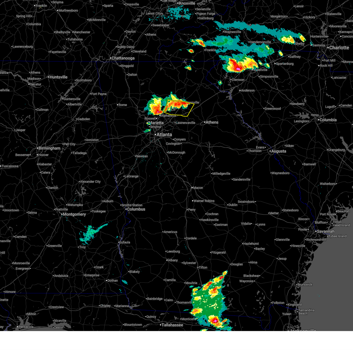
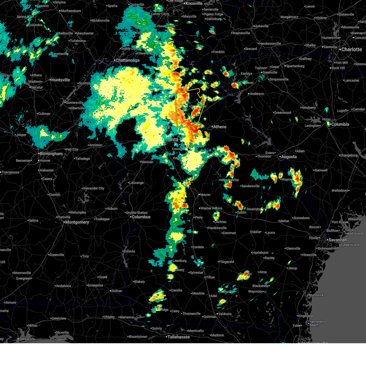
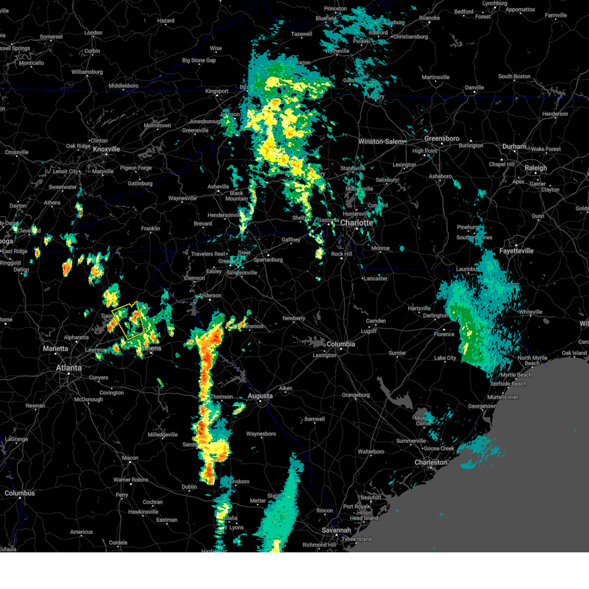
Hail Map for Jefferson, GA
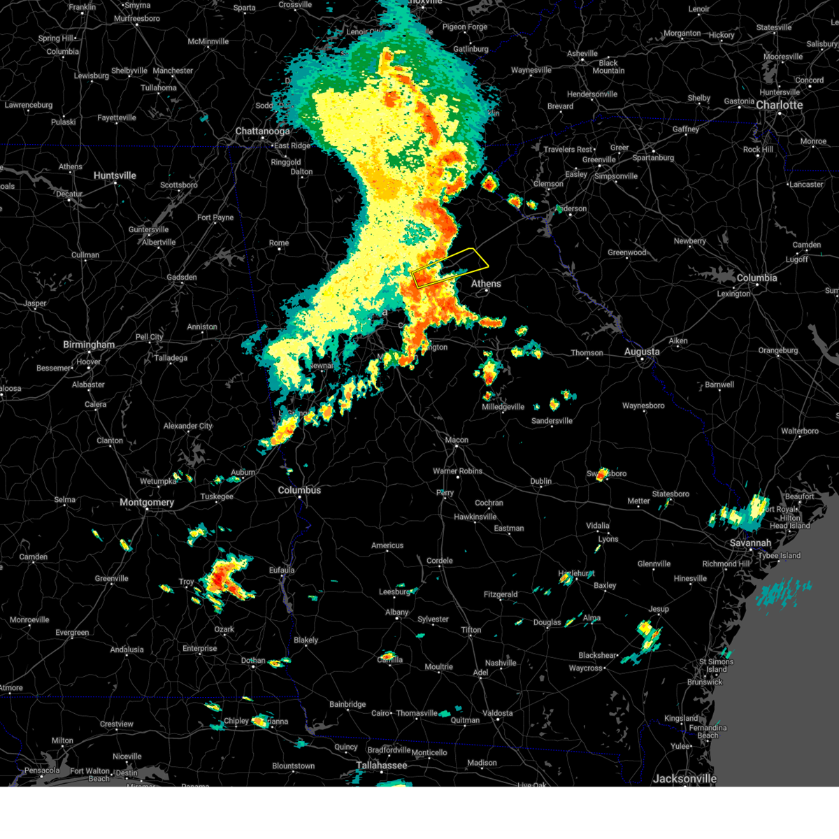
The Jefferson, GA area has had 8 reports of on-the-ground hail by trained spotters, and has been under severe weather warnings 46 times during the past 12 months. Doppler radar has detected hail at or near Jefferson, GA on 40 occasions, including 4 occasions during the past year.
| Name: | Jefferson, GA |
| Where Located: | 52.8 miles ENE of Atlanta, GA |
| Map: | Google Map for Jefferson, GA |
| Population: | 9432 |
| Housing Units: | 3666 |
| More Info: | Search Google for Jefferson, GA |
1
The Top Recent Hail Date for Jefferson, GA is Thursday, April 10, 2025 (7th out of 40)

Hail and Wind Damage Spotted near Jefferson, GA
| Date / Time | Report Details |
|---|---|
| 6/26/2025 4:40 PM EDT |
 the severe thunderstorm warning has been cancelled and is no longer in effect the severe thunderstorm warning has been cancelled and is no longer in effect
|
| 6/26/2025 4:25 PM EDT |
 Svrffc the national weather service in peachtree city has issued a * severe thunderstorm warning for, northwestern barrow county in north central georgia, central forsyth county in north central georgia, northeastern gwinnett county in north central georgia, southern hall county in north central georgia, northwestern jackson county in northeastern georgia, * until 500 pm edt. * at 425 pm edt, severe thunderstorms were located along a line extending from near talmo to oakwood to coal mountain, moving southwest at 10 mph (radar indicated). Hazards include 60 mph wind gusts and quarter size hail. Hail damage to vehicles is expected. Expect wind damage to roofs, siding, and trees. Svrffc the national weather service in peachtree city has issued a * severe thunderstorm warning for, northwestern barrow county in north central georgia, central forsyth county in north central georgia, northeastern gwinnett county in north central georgia, southern hall county in north central georgia, northwestern jackson county in northeastern georgia, * until 500 pm edt. * at 425 pm edt, severe thunderstorms were located along a line extending from near talmo to oakwood to coal mountain, moving southwest at 10 mph (radar indicated). Hazards include 60 mph wind gusts and quarter size hail. Hail damage to vehicles is expected. Expect wind damage to roofs, siding, and trees.
|
| 6/17/2025 7:45 PM EDT |
 the severe thunderstorm warning has been cancelled and is no longer in effect the severe thunderstorm warning has been cancelled and is no longer in effect
|
| 6/17/2025 7:44 PM EDT |
 The storms which prompted the warning have moved out of the area. therefore, the warning will be allowed to expire. The storms which prompted the warning have moved out of the area. therefore, the warning will be allowed to expire.
|
| 6/17/2025 7:41 PM EDT |
 At 741 pm edt, severe thunderstorms were located along a line extending from near tate city to near pinefield crossroads, moving east at 35 mph (radar indicated). Hazards include 60 mph wind gusts. Expect damage to roofs, siding, and trees. Locations impacted include, jefferson, homer, lula, maysville, gillsville, pinefield crossroads, and hollingsworth. At 741 pm edt, severe thunderstorms were located along a line extending from near tate city to near pinefield crossroads, moving east at 35 mph (radar indicated). Hazards include 60 mph wind gusts. Expect damage to roofs, siding, and trees. Locations impacted include, jefferson, homer, lula, maysville, gillsville, pinefield crossroads, and hollingsworth.
|
| 6/17/2025 7:41 PM EDT |
 the severe thunderstorm warning has been cancelled and is no longer in effect the severe thunderstorm warning has been cancelled and is no longer in effect
|
| 6/17/2025 7:37 PM EDT |
 the severe thunderstorm warning has been cancelled and is no longer in effect the severe thunderstorm warning has been cancelled and is no longer in effect
|
| 6/17/2025 7:37 PM EDT |
 At 736 pm edt, severe thunderstorms were located along a line extending from near tate city to near homer, moving east at 35 mph (radar indicated). Hazards include 60 mph wind gusts. Expect damage to roofs, siding, and trees. Locations impacted include, jefferson, homer, lula, maysville, helen, gillsville, unicoi state park, robertstown, pinefield crossroads, mossy creek, anna ruby falls, leaf, smithgall woods conservation are, hollingsworth, and sautee. At 736 pm edt, severe thunderstorms were located along a line extending from near tate city to near homer, moving east at 35 mph (radar indicated). Hazards include 60 mph wind gusts. Expect damage to roofs, siding, and trees. Locations impacted include, jefferson, homer, lula, maysville, helen, gillsville, unicoi state park, robertstown, pinefield crossroads, mossy creek, anna ruby falls, leaf, smithgall woods conservation are, hollingsworth, and sautee.
|
| 6/17/2025 7:35 PM EDT |
 the severe thunderstorm warning has been cancelled and is no longer in effect the severe thunderstorm warning has been cancelled and is no longer in effect
|
| 6/17/2025 7:35 PM EDT |
 At 735 pm edt, severe thunderstorms were located along a line extending from near nicholson to near whitehall to near farmington, moving northeast at 40 mph (radar indicated). Hazards include 60 mph wind gusts. Expect damage to roofs, siding, and trees. Locations impacted include, jefferson, commerce, homer, danielsville, maysville, arcade, nicholson, winterville, colbert, arnoldsville, ila, hull, athens-clarke county, pocataligo, peach state speedway, diamond hill, smithonia, sandy creek recreation area, dunlap, and apple valley. At 735 pm edt, severe thunderstorms were located along a line extending from near nicholson to near whitehall to near farmington, moving northeast at 40 mph (radar indicated). Hazards include 60 mph wind gusts. Expect damage to roofs, siding, and trees. Locations impacted include, jefferson, commerce, homer, danielsville, maysville, arcade, nicholson, winterville, colbert, arnoldsville, ila, hull, athens-clarke county, pocataligo, peach state speedway, diamond hill, smithonia, sandy creek recreation area, dunlap, and apple valley.
|
| 6/17/2025 7:17 PM EDT |
 the severe thunderstorm warning has been cancelled and is no longer in effect the severe thunderstorm warning has been cancelled and is no longer in effect
|
| 6/17/2025 7:17 PM EDT |
 At 717 pm edt, severe thunderstorms were located along a line extending from arcade to north high shoals to near hard labor creek state park, moving northeast at 40 mph (radar indicated). Hazards include 60 mph wind gusts. Expect damage to roofs, siding, and trees. Locations impacted include, jefferson, commerce, watkinsville, homer, danielsville, athens, statham, maysville, arcade, nicholson, winterville, bogart, crawford, colbert, arnoldsville, ila, hull, whitehall, athens-clarke county, and westgate park. At 717 pm edt, severe thunderstorms were located along a line extending from arcade to north high shoals to near hard labor creek state park, moving northeast at 40 mph (radar indicated). Hazards include 60 mph wind gusts. Expect damage to roofs, siding, and trees. Locations impacted include, jefferson, commerce, watkinsville, homer, danielsville, athens, statham, maysville, arcade, nicholson, winterville, bogart, crawford, colbert, arnoldsville, ila, hull, whitehall, athens-clarke county, and westgate park.
|
| 6/17/2025 7:15 PM EDT |
 The storms which prompted the warning have moved out of the area. therefore, the warning will be allowed to expire. remember, a severe thunderstorm warning still remains in effect for hall, white, banks, and jackson counties. The storms which prompted the warning have moved out of the area. therefore, the warning will be allowed to expire. remember, a severe thunderstorm warning still remains in effect for hall, white, banks, and jackson counties.
|
| 6/17/2025 7:14 PM EDT |
 Svrffc the national weather service in peachtree city has issued a * severe thunderstorm warning for, central barrow county in north central georgia, banks county in northeastern georgia, white county in northeastern georgia, northeastern hall county in north central georgia, northwestern jackson county in northeastern georgia, * until 800 pm edt. * at 714 pm edt, severe thunderstorms were located along a line extending from hiawassee to gillsville, moving east at 35 mph (radar indicated). Hazards include 60 mph wind gusts. expect damage to roofs, siding, and trees Svrffc the national weather service in peachtree city has issued a * severe thunderstorm warning for, central barrow county in north central georgia, banks county in northeastern georgia, white county in northeastern georgia, northeastern hall county in north central georgia, northwestern jackson county in northeastern georgia, * until 800 pm edt. * at 714 pm edt, severe thunderstorms were located along a line extending from hiawassee to gillsville, moving east at 35 mph (radar indicated). Hazards include 60 mph wind gusts. expect damage to roofs, siding, and trees
|
| 6/17/2025 6:57 PM EDT |
 At 656 pm edt, severe thunderstorms were located along a line extending from garland to gainesville to near thompsons mill to hog mountain, moving east at 45 mph (radar indicated). Hazards include 60 mph wind gusts. Expect damage to roofs, siding, and trees. Locations impacted include, gainesville, lawrenceville, winder, jefferson, dahlonega, dawsonville, sugar hill, suwanee, buford, braselton, auburn, flowery branch, dacula, oakwood, lula, maysville, hoschton, clermont, pendergrass, and carl. At 656 pm edt, severe thunderstorms were located along a line extending from garland to gainesville to near thompsons mill to hog mountain, moving east at 45 mph (radar indicated). Hazards include 60 mph wind gusts. Expect damage to roofs, siding, and trees. Locations impacted include, gainesville, lawrenceville, winder, jefferson, dahlonega, dawsonville, sugar hill, suwanee, buford, braselton, auburn, flowery branch, dacula, oakwood, lula, maysville, hoschton, clermont, pendergrass, and carl.
|
| 6/17/2025 6:57 PM EDT |
 the severe thunderstorm warning has been cancelled and is no longer in effect the severe thunderstorm warning has been cancelled and is no longer in effect
|
| 6/17/2025 6:55 PM EDT |
 Svrffc the national weather service in peachtree city has issued a * severe thunderstorm warning for, oconee county in northeastern georgia, southern barrow county in north central georgia, northwestern morgan county in north central georgia, southeastern banks county in northeastern georgia, clarke county in northeastern georgia, walton county in north central georgia, jackson county in northeastern georgia, northwestern oglethorpe county in northeastern georgia, western madison county in northeastern georgia, * until 745 pm edt. * at 655 pm edt, severe thunderstorms were located along a line extending from near carl to pannell to near brick store, moving northeast at 40 mph (radar indicated). Hazards include 60 mph wind gusts. expect damage to roofs, siding, and trees Svrffc the national weather service in peachtree city has issued a * severe thunderstorm warning for, oconee county in northeastern georgia, southern barrow county in north central georgia, northwestern morgan county in north central georgia, southeastern banks county in northeastern georgia, clarke county in northeastern georgia, walton county in north central georgia, jackson county in northeastern georgia, northwestern oglethorpe county in northeastern georgia, western madison county in northeastern georgia, * until 745 pm edt. * at 655 pm edt, severe thunderstorms were located along a line extending from near carl to pannell to near brick store, moving northeast at 40 mph (radar indicated). Hazards include 60 mph wind gusts. expect damage to roofs, siding, and trees
|
| 6/17/2025 6:32 PM EDT |
 Svrffc the national weather service in peachtree city has issued a * severe thunderstorm warning for, northwestern dekalb county in north central georgia, northern gwinnett county in north central georgia, hall county in north central georgia, northwestern jackson county in northeastern georgia, northwestern barrow county in north central georgia, northeastern cherokee county in north central georgia, forsyth county in north central georgia, southern lumpkin county in north central georgia, western banks county in northeastern georgia, southern white county in northeastern georgia, dawson county in north central georgia, northeastern fulton county in north central georgia, southeastern pickens county in north central georgia, * until 715 pm edt. * at 631 pm edt, severe thunderstorms were located along a line extending from near juno to cumming to johns creek to near mechanicsville, moving east at 45 mph (radar indicated. at 615 pm a 54 mph wind gust was reported in canton). Hazards include 60 mph wind gusts. expect damage to roofs, siding, and trees Svrffc the national weather service in peachtree city has issued a * severe thunderstorm warning for, northwestern dekalb county in north central georgia, northern gwinnett county in north central georgia, hall county in north central georgia, northwestern jackson county in northeastern georgia, northwestern barrow county in north central georgia, northeastern cherokee county in north central georgia, forsyth county in north central georgia, southern lumpkin county in north central georgia, western banks county in northeastern georgia, southern white county in northeastern georgia, dawson county in north central georgia, northeastern fulton county in north central georgia, southeastern pickens county in north central georgia, * until 715 pm edt. * at 631 pm edt, severe thunderstorms were located along a line extending from near juno to cumming to johns creek to near mechanicsville, moving east at 45 mph (radar indicated. at 615 pm a 54 mph wind gust was reported in canton). Hazards include 60 mph wind gusts. expect damage to roofs, siding, and trees
|
| 6/12/2025 9:05 PM EDT |
 Svrffc the national weather service in peachtree city has issued a * severe thunderstorm warning for, northeastern barrow county in north central georgia, southeastern hall county in north central georgia, jackson county in northeastern georgia, * until 930 pm edt. * at 905 pm edt, a severe thunderstorm was located over hoschton, or near winder, moving northeast at 25 mph (radar indicated). Hazards include 60 mph wind gusts. expect damage to roofs, siding, and trees Svrffc the national weather service in peachtree city has issued a * severe thunderstorm warning for, northeastern barrow county in north central georgia, southeastern hall county in north central georgia, jackson county in northeastern georgia, * until 930 pm edt. * at 905 pm edt, a severe thunderstorm was located over hoschton, or near winder, moving northeast at 25 mph (radar indicated). Hazards include 60 mph wind gusts. expect damage to roofs, siding, and trees
|
| 6/10/2025 5:04 PM EDT |
 At 503 pm edt, a severe thunderstorm was located near commerce, moving east at 25 mph (radar indicated). Hazards include 60 mph wind gusts and quarter size hail. Hail damage to vehicles is expected. expect wind damage to roofs, siding, and trees. Locations impacted include, commerce, maysville, nicholson, ila, pocataligo, peach state speedway, apple valley, and banks crossing. At 503 pm edt, a severe thunderstorm was located near commerce, moving east at 25 mph (radar indicated). Hazards include 60 mph wind gusts and quarter size hail. Hail damage to vehicles is expected. expect wind damage to roofs, siding, and trees. Locations impacted include, commerce, maysville, nicholson, ila, pocataligo, peach state speedway, apple valley, and banks crossing.
|
| 6/10/2025 4:49 PM EDT |
 Svrffc the national weather service in peachtree city has issued a * severe thunderstorm warning for, southern banks county in northeastern georgia, northeastern jackson county in northeastern georgia, northwestern madison county in northeastern georgia, * until 530 pm edt. * at 449 pm edt, a severe thunderstorm was located over commerce, moving east at 25 mph (radar indicated). Hazards include 60 mph wind gusts and quarter size hail. Hail damage to vehicles is expected. Expect wind damage to roofs, siding, and trees. Svrffc the national weather service in peachtree city has issued a * severe thunderstorm warning for, southern banks county in northeastern georgia, northeastern jackson county in northeastern georgia, northwestern madison county in northeastern georgia, * until 530 pm edt. * at 449 pm edt, a severe thunderstorm was located over commerce, moving east at 25 mph (radar indicated). Hazards include 60 mph wind gusts and quarter size hail. Hail damage to vehicles is expected. Expect wind damage to roofs, siding, and trees.
|
| 6/10/2025 4:32 PM EDT |
 Svrffc the national weather service in peachtree city has issued a * severe thunderstorm warning for, northwestern oconee county in northeastern georgia, barrow county in north central georgia, northwestern clarke county in northeastern georgia, southern jackson county in northeastern georgia, * until 500 pm edt. * at 431 pm edt, a severe thunderstorm was located over winder, moving east at 35 mph (radar indicated). Hazards include 60 mph wind gusts and quarter size hail. Hail damage to vehicles is expected. Expect wind damage to roofs, siding, and trees. Svrffc the national weather service in peachtree city has issued a * severe thunderstorm warning for, northwestern oconee county in northeastern georgia, barrow county in north central georgia, northwestern clarke county in northeastern georgia, southern jackson county in northeastern georgia, * until 500 pm edt. * at 431 pm edt, a severe thunderstorm was located over winder, moving east at 35 mph (radar indicated). Hazards include 60 mph wind gusts and quarter size hail. Hail damage to vehicles is expected. Expect wind damage to roofs, siding, and trees.
|
| 6/7/2025 7:02 PM EDT |
 the severe thunderstorm warning has been cancelled and is no longer in effect the severe thunderstorm warning has been cancelled and is no longer in effect
|
| 6/7/2025 6:57 PM EDT |
 The storms which prompted the warning have moved out of the area. therefore, the warning will be allowed to expire. a severe thunderstorm watch remains in effect until 900 pm edt for north central, northeastern and east central georgia. remember, a severe thunderstorm warning still remains in effect for clarke, ogelthorpe, madison, oconee, and jackson counties. The storms which prompted the warning have moved out of the area. therefore, the warning will be allowed to expire. a severe thunderstorm watch remains in effect until 900 pm edt for north central, northeastern and east central georgia. remember, a severe thunderstorm warning still remains in effect for clarke, ogelthorpe, madison, oconee, and jackson counties.
|
| 6/7/2025 6:48 PM EDT |
 At 648 pm edt, severe thunderstorms were located along a line extending from beechwood hills to philomath, moving east at 60 mph (radar indicated). Hazards include 60 mph wind gusts. Expect damage to roofs, siding, and trees. Locations impacted include, jefferson, watkinsville, lexington, athens, statham, arcade, nicholson, winterville, bogart, crawford, north high shoals, bostwick, arnoldsville, good hope, bishop, maxeys, hull, whitehall, athens-clarke county, and stephens. At 648 pm edt, severe thunderstorms were located along a line extending from beechwood hills to philomath, moving east at 60 mph (radar indicated). Hazards include 60 mph wind gusts. Expect damage to roofs, siding, and trees. Locations impacted include, jefferson, watkinsville, lexington, athens, statham, arcade, nicholson, winterville, bogart, crawford, north high shoals, bostwick, arnoldsville, good hope, bishop, maxeys, hull, whitehall, athens-clarke county, and stephens.
|
| 6/7/2025 6:48 PM EDT |
 the severe thunderstorm warning has been cancelled and is no longer in effect the severe thunderstorm warning has been cancelled and is no longer in effect
|
| 6/7/2025 6:47 PM EDT |
 the severe thunderstorm warning has been cancelled and is no longer in effect the severe thunderstorm warning has been cancelled and is no longer in effect
|
| 6/7/2025 6:47 PM EDT |
 At 647 pm edt, a severe thunderstorm was located over arcade, or near jefferson, moving east at 50 mph (radar indicated). Hazards include 60 mph wind gusts. Expect damage to roofs, siding, and trees. Locations impacted include, jefferson, commerce, maysville, arcade, nicholson, peach state speedway, and apple valley. At 647 pm edt, a severe thunderstorm was located over arcade, or near jefferson, moving east at 50 mph (radar indicated). Hazards include 60 mph wind gusts. Expect damage to roofs, siding, and trees. Locations impacted include, jefferson, commerce, maysville, arcade, nicholson, peach state speedway, and apple valley.
|
| 6/7/2025 6:25 PM EDT |
 Svrffc the national weather service in peachtree city has issued a * severe thunderstorm warning for, northwestern barrow county in north central georgia, northeastern gwinnett county in north central georgia, south central hall county in north central georgia, jackson county in northeastern georgia, * until 715 pm edt. * at 625 pm edt, a severe thunderstorm was located over hog mountain, or 8 miles northeast of lawrenceville, moving east at 50 mph (radar indicated). Hazards include 60 mph wind gusts. expect damage to roofs, siding, and trees Svrffc the national weather service in peachtree city has issued a * severe thunderstorm warning for, northwestern barrow county in north central georgia, northeastern gwinnett county in north central georgia, south central hall county in north central georgia, jackson county in northeastern georgia, * until 715 pm edt. * at 625 pm edt, a severe thunderstorm was located over hog mountain, or 8 miles northeast of lawrenceville, moving east at 50 mph (radar indicated). Hazards include 60 mph wind gusts. expect damage to roofs, siding, and trees
|
| 6/7/2025 6:12 PM EDT |
 Svrffc the national weather service in peachtree city has issued a * severe thunderstorm warning for, oconee county in northeastern georgia, barrow county in north central georgia, northwestern morgan county in north central georgia, east central gwinnett county in north central georgia, clarke county in northeastern georgia, walton county in north central georgia, southern jackson county in northeastern georgia, western oglethorpe county in northeastern georgia, southwestern madison county in northeastern georgia, * until 700 pm edt. * at 612 pm edt, severe thunderstorms were located along a line extending from lawrenceville to near ebenezer, moving east at 60 mph (radar indicated). Hazards include 60 mph wind gusts. expect damage to roofs, siding, and trees Svrffc the national weather service in peachtree city has issued a * severe thunderstorm warning for, oconee county in northeastern georgia, barrow county in north central georgia, northwestern morgan county in north central georgia, east central gwinnett county in north central georgia, clarke county in northeastern georgia, walton county in north central georgia, southern jackson county in northeastern georgia, western oglethorpe county in northeastern georgia, southwestern madison county in northeastern georgia, * until 700 pm edt. * at 612 pm edt, severe thunderstorms were located along a line extending from lawrenceville to near ebenezer, moving east at 60 mph (radar indicated). Hazards include 60 mph wind gusts. expect damage to roofs, siding, and trees
|
| 5/21/2025 1:09 AM EDT |
 the severe thunderstorm warning has been cancelled and is no longer in effect the severe thunderstorm warning has been cancelled and is no longer in effect
|
| 5/21/2025 12:50 AM EDT |
 Svrffc the national weather service in peachtree city has issued a * severe thunderstorm warning for, northwestern barrow county in north central georgia, northwestern dekalb county in north central georgia, central forsyth county in north central georgia, central cobb county in north central georgia, gwinnett county in north central georgia, southwestern banks county in northeastern georgia, southern hall county in north central georgia, northwestern jackson county in northeastern georgia, northeastern fulton county in north central georgia, * until 130 am edt. * at 1250 am edt, severe thunderstorms were located along a line extending from near oscarville to near roswell to near hiram, moving east at 45 mph (radar indicated). Hazards include 60 mph wind gusts and penny size hail. expect damage to roofs, siding, and trees Svrffc the national weather service in peachtree city has issued a * severe thunderstorm warning for, northwestern barrow county in north central georgia, northwestern dekalb county in north central georgia, central forsyth county in north central georgia, central cobb county in north central georgia, gwinnett county in north central georgia, southwestern banks county in northeastern georgia, southern hall county in north central georgia, northwestern jackson county in northeastern georgia, northeastern fulton county in north central georgia, * until 130 am edt. * at 1250 am edt, severe thunderstorms were located along a line extending from near oscarville to near roswell to near hiram, moving east at 45 mph (radar indicated). Hazards include 60 mph wind gusts and penny size hail. expect damage to roofs, siding, and trees
|
| 5/12/2025 7:32 PM EDT |
 the severe thunderstorm warning has been cancelled and is no longer in effect the severe thunderstorm warning has been cancelled and is no longer in effect
|
| 5/12/2025 7:22 PM EDT |
 The storm which prompted the warning has weakened below severe limits, and has exited the warned area. therefore, the warning will be allowed to expire. remember, a severe thunderstorm warning still remains in effect for northern jackson county until 7:45 pm. The storm which prompted the warning has weakened below severe limits, and has exited the warned area. therefore, the warning will be allowed to expire. remember, a severe thunderstorm warning still remains in effect for northern jackson county until 7:45 pm.
|
| 5/12/2025 7:10 PM EDT |
 Svrffc the national weather service in peachtree city has issued a * severe thunderstorm warning for, western banks county in northeastern georgia, northeastern hall county in north central georgia, northern jackson county in northeastern georgia, * until 745 pm edt. * at 710 pm edt, a severe thunderstorm was located near peach state speedway, or near jefferson, moving north at 20 mph (radar indicated). Hazards include 60 mph wind gusts and quarter size hail. Hail damage to vehicles is expected. Expect wind damage to roofs, siding, and trees. Svrffc the national weather service in peachtree city has issued a * severe thunderstorm warning for, western banks county in northeastern georgia, northeastern hall county in north central georgia, northern jackson county in northeastern georgia, * until 745 pm edt. * at 710 pm edt, a severe thunderstorm was located near peach state speedway, or near jefferson, moving north at 20 mph (radar indicated). Hazards include 60 mph wind gusts and quarter size hail. Hail damage to vehicles is expected. Expect wind damage to roofs, siding, and trees.
|
| 5/12/2025 7:06 PM EDT |
 At 705 pm edt, a severe thunderstorm was located over commerce, moving north at 30 mph (radar indicated). Hazards include 60 mph wind gusts and quarter size hail. Hail damage to vehicles is expected. expect wind damage to roofs, siding, and trees. Locations impacted include, jefferson, commerce, maysville, nicholson, peach state speedway, and apple valley. At 705 pm edt, a severe thunderstorm was located over commerce, moving north at 30 mph (radar indicated). Hazards include 60 mph wind gusts and quarter size hail. Hail damage to vehicles is expected. expect wind damage to roofs, siding, and trees. Locations impacted include, jefferson, commerce, maysville, nicholson, peach state speedway, and apple valley.
|
| 5/12/2025 7:06 PM EDT |
 the severe thunderstorm warning has been cancelled and is no longer in effect the severe thunderstorm warning has been cancelled and is no longer in effect
|
| 5/12/2025 6:48 PM EDT | Tree down across the road near the intersection of jefferson river rd and orrs school r in jackson county GA, 5.6 miles WNW of Jefferson, GA |
| 5/12/2025 6:45 PM EDT | Quarter sized hail reported 6 miles W of Jefferson, GA, quarter size hail in the city of jefferson near brockton rd and red tail rd. |
| 5/12/2025 6:40 PM EDT |
 Svrffc the national weather service in peachtree city has issued a * severe thunderstorm warning for, banks county in northeastern georgia, northwestern clarke county in northeastern georgia, eastern jackson county in northeastern georgia, northwestern madison county in northeastern georgia, * until 730 pm edt. * at 639 pm edt, a severe thunderstorm was located near westgate park, or 8 miles northwest of athens, moving north at 30 mph (radar indicated). Hazards include 60 mph wind gusts and quarter size hail. Hail damage to vehicles is expected. Expect wind damage to roofs, siding, and trees. Svrffc the national weather service in peachtree city has issued a * severe thunderstorm warning for, banks county in northeastern georgia, northwestern clarke county in northeastern georgia, eastern jackson county in northeastern georgia, northwestern madison county in northeastern georgia, * until 730 pm edt. * at 639 pm edt, a severe thunderstorm was located near westgate park, or 8 miles northwest of athens, moving north at 30 mph (radar indicated). Hazards include 60 mph wind gusts and quarter size hail. Hail damage to vehicles is expected. Expect wind damage to roofs, siding, and trees.
|
| 4/10/2025 8:45 PM EDT |
 The storm which prompted the warning has weakened below severe limits, and no longer poses an immediate threat to life or property. therefore, the warning has been allowed to expire. a severe thunderstorm watch remains in effect until midnight edt for north central and northeastern georgia. The storm which prompted the warning has weakened below severe limits, and no longer poses an immediate threat to life or property. therefore, the warning has been allowed to expire. a severe thunderstorm watch remains in effect until midnight edt for north central and northeastern georgia.
|
| 4/10/2025 8:16 PM EDT | Multiple trees down near brockton loop and brockton roa in jackson county GA, 5.4 miles W of Jefferson, GA |
| 4/10/2025 8:08 PM EDT | Quarter sized hail reported 6.7 miles ENE of Jefferson, GA, quarter sized hail reported near mulberry greens lane and swamp willow court. |
| 4/10/2025 8:06 PM EDT |
 Svrffc the national weather service in peachtree city has issued a * severe thunderstorm warning for, northwestern oconee county in northeastern georgia, barrow county in north central georgia, clarke county in northeastern georgia, jackson county in northeastern georgia, southwestern madison county in northeastern georgia, * until 845 pm edt. * at 806 pm edt, a severe thunderstorm was located over jefferson, moving southeast at 35 mph (radar indicated). Hazards include 60 mph wind gusts and quarter size hail. Hail damage to vehicles is expected. Expect wind damage to roofs, siding, and trees. Svrffc the national weather service in peachtree city has issued a * severe thunderstorm warning for, northwestern oconee county in northeastern georgia, barrow county in north central georgia, clarke county in northeastern georgia, jackson county in northeastern georgia, southwestern madison county in northeastern georgia, * until 845 pm edt. * at 806 pm edt, a severe thunderstorm was located over jefferson, moving southeast at 35 mph (radar indicated). Hazards include 60 mph wind gusts and quarter size hail. Hail damage to vehicles is expected. Expect wind damage to roofs, siding, and trees.
|
| 4/10/2025 7:44 PM EDT |
 Svrffc the national weather service in peachtree city has issued a * severe thunderstorm warning for, southwestern banks county in northeastern georgia, central hall county in north central georgia, northwestern jackson county in northeastern georgia, * until 830 pm edt. * at 743 pm edt, a severe thunderstorm was located over oakwood, or near gainesville, moving southeast at 35 mph (radar indicated). Hazards include 60 mph wind gusts and half dollar size hail. Hail damage to vehicles is expected. Expect wind damage to roofs, siding, and trees. Svrffc the national weather service in peachtree city has issued a * severe thunderstorm warning for, southwestern banks county in northeastern georgia, central hall county in north central georgia, northwestern jackson county in northeastern georgia, * until 830 pm edt. * at 743 pm edt, a severe thunderstorm was located over oakwood, or near gainesville, moving southeast at 35 mph (radar indicated). Hazards include 60 mph wind gusts and half dollar size hail. Hail damage to vehicles is expected. Expect wind damage to roofs, siding, and trees.
|
| 4/10/2025 7:39 PM EDT | Svrffc the national weather service in peachtree city has issued a * severe thunderstorm warning for, southeastern banks county in northeastern georgia, northeastern jackson county in northeastern georgia, northwestern madison county in northeastern georgia, * until 830 pm edt. * at 739 pm edt, a severe thunderstorm was located over banks crossing, or near homer, moving east at 20 mph (radar indicated). Hazards include 60 mph wind gusts and quarter size hail. Hail damage to vehicles is expected. Expect wind damage to roofs, siding, and trees. |
| 2/16/2025 5:29 AM EST |
 The storms which prompted the warning have moved out of the area. therefore, the warning will be allowed to expire. a tornado watch remains in effect until 900 am est for central and north central georgia. remember, a severe thunderstorm warning still remains in effect for clarke, oconee, morgan, and jasper counties. The storms which prompted the warning have moved out of the area. therefore, the warning will be allowed to expire. a tornado watch remains in effect until 900 am est for central and north central georgia. remember, a severe thunderstorm warning still remains in effect for clarke, oconee, morgan, and jasper counties.
|
| 2/16/2025 5:18 AM EST | the severe thunderstorm warning has been cancelled and is no longer in effect |
| 2/16/2025 5:18 AM EST | At 518 am est, severe thunderstorms were located along a line extending from near neese to turtle cove, moving east at 65 mph (radar indicated). Hazards include 60 mph wind gusts. Expect damage to roofs, siding, and trees. Locations impacted include, winder, monroe, covington, jefferson, watkinsville, athens, social circle, statham, oxford, arcade, nicholson, porterdale, walnut grove, bogart, rutledge, newborn, north high shoals, bethlehem, mansfield, and bostwick. |
| 2/16/2025 4:48 AM EST |
 Svrffc the national weather service in peachtree city has issued a * severe thunderstorm warning for, southeastern dekalb county in north central georgia, gwinnett county in north central georgia, clarke county in northeastern georgia, northeastern butts county in central georgia, southwestern hall county in north central georgia, southern jackson county in northeastern georgia, newton county in north central georgia, rockdale county in north central georgia, oconee county in northeastern georgia, barrow county in north central georgia, western morgan county in north central georgia, henry county in north central georgia, walton county in north central georgia, eastern clayton county in north central georgia, northern jasper county in central georgia, * until 530 am est. * at 447 am est, severe thunderstorms were located along a line extending from near hog mountain to atlanta motor speedway, moving east at 65 mph (radar indicated). Hazards include 60 mph wind gusts. expect damage to roofs, siding, and trees Svrffc the national weather service in peachtree city has issued a * severe thunderstorm warning for, southeastern dekalb county in north central georgia, gwinnett county in north central georgia, clarke county in northeastern georgia, northeastern butts county in central georgia, southwestern hall county in north central georgia, southern jackson county in northeastern georgia, newton county in north central georgia, rockdale county in north central georgia, oconee county in northeastern georgia, barrow county in north central georgia, western morgan county in north central georgia, henry county in north central georgia, walton county in north central georgia, eastern clayton county in north central georgia, northern jasper county in central georgia, * until 530 am est. * at 447 am est, severe thunderstorms were located along a line extending from near hog mountain to atlanta motor speedway, moving east at 65 mph (radar indicated). Hazards include 60 mph wind gusts. expect damage to roofs, siding, and trees
|
| 7/7/2024 7:12 PM EDT |
 Svrffc the national weather service in peachtree city has issued a * severe thunderstorm warning for, central hall county in north central georgia, northwestern jackson county in northeastern georgia, * until 745 pm edt. * at 710 pm edt, a severe thunderstorm was located near gainesville, moving southeast at 10 mph (radar indicated). Hazards include 60 mph wind gusts and penny size hail. expect damage to roofs, siding, and trees Svrffc the national weather service in peachtree city has issued a * severe thunderstorm warning for, central hall county in north central georgia, northwestern jackson county in northeastern georgia, * until 745 pm edt. * at 710 pm edt, a severe thunderstorm was located near gainesville, moving southeast at 10 mph (radar indicated). Hazards include 60 mph wind gusts and penny size hail. expect damage to roofs, siding, and trees
|
| 5/9/2024 7:58 AM EDT |
 Svrffc the national weather service in peachtree city has issued a * severe thunderstorm warning for, northern barrow county in north central georgia, banks county in northeastern georgia, northwestern clarke county in northeastern georgia, southeastern hall county in north central georgia, jackson county in northeastern georgia, northwestern madison county in northeastern georgia, * until 845 am edt. * at 758 am edt, a severe thunderstorm was located over gillsville, or 7 miles west of homer, moving east at 65 mph (radar indicated). Hazards include 60 mph wind gusts and quarter size hail. Hail damage to vehicles is expected. Expect wind damage to roofs, siding, and trees. Svrffc the national weather service in peachtree city has issued a * severe thunderstorm warning for, northern barrow county in north central georgia, banks county in northeastern georgia, northwestern clarke county in northeastern georgia, southeastern hall county in north central georgia, jackson county in northeastern georgia, northwestern madison county in northeastern georgia, * until 845 am edt. * at 758 am edt, a severe thunderstorm was located over gillsville, or 7 miles west of homer, moving east at 65 mph (radar indicated). Hazards include 60 mph wind gusts and quarter size hail. Hail damage to vehicles is expected. Expect wind damage to roofs, siding, and trees.
|
| 5/9/2024 3:18 AM EDT |
 Svrffc the national weather service in peachtree city has issued a * severe thunderstorm warning for, northeastern oconee county in northeastern georgia, east central barrow county in north central georgia, clarke county in northeastern georgia, jackson county in northeastern georgia, northwestern oglethorpe county in northeastern georgia, southwestern madison county in northeastern georgia, * until 400 am edt. * at 318 am edt, a severe thunderstorm was located over jefferson, moving southeast at 45 mph (radar indicated). Hazards include 60 mph wind gusts and quarter size hail. Hail damage to vehicles is expected. Expect wind damage to roofs, siding, and trees. Svrffc the national weather service in peachtree city has issued a * severe thunderstorm warning for, northeastern oconee county in northeastern georgia, east central barrow county in north central georgia, clarke county in northeastern georgia, jackson county in northeastern georgia, northwestern oglethorpe county in northeastern georgia, southwestern madison county in northeastern georgia, * until 400 am edt. * at 318 am edt, a severe thunderstorm was located over jefferson, moving southeast at 45 mph (radar indicated). Hazards include 60 mph wind gusts and quarter size hail. Hail damage to vehicles is expected. Expect wind damage to roofs, siding, and trees.
|
| 5/9/2024 3:10 AM EDT |
 the severe thunderstorm warning has been cancelled and is no longer in effect the severe thunderstorm warning has been cancelled and is no longer in effect
|
| 5/9/2024 3:10 AM EDT |
 At 310 am edt, a severe thunderstorm was located over talmo, or 7 miles west of jefferson, moving southeast at 35 mph (radar indicated). Hazards include 60 mph wind gusts and quarter size hail. Hail damage to vehicles is expected. expect wind damage to roofs, siding, and trees. Locations impacted include, gainesville, jefferson, commerce, braselton, flowery branch, oakwood, maysville, arcade, hoschton, pendergrass, gillsville, talmo, candler, peach state speedway, thompsons mill, chateau elan, chestnut mountain, and road atlanta-lanier speedway. At 310 am edt, a severe thunderstorm was located over talmo, or 7 miles west of jefferson, moving southeast at 35 mph (radar indicated). Hazards include 60 mph wind gusts and quarter size hail. Hail damage to vehicles is expected. expect wind damage to roofs, siding, and trees. Locations impacted include, gainesville, jefferson, commerce, braselton, flowery branch, oakwood, maysville, arcade, hoschton, pendergrass, gillsville, talmo, candler, peach state speedway, thompsons mill, chateau elan, chestnut mountain, and road atlanta-lanier speedway.
|
| 5/9/2024 2:53 AM EDT |
 Svrffc the national weather service in peachtree city has issued a * severe thunderstorm warning for, northwestern barrow county in north central georgia, northeastern forsyth county in north central georgia, hall county in north central georgia, central jackson county in northeastern georgia, * until 345 am edt. * at 252 am edt, a severe thunderstorm was located over oakwood, or near gainesville, moving southeast at 30 mph (radar indicated). Hazards include 60 mph wind gusts and quarter size hail. Hail damage to vehicles is expected. Expect wind damage to roofs, siding, and trees. Svrffc the national weather service in peachtree city has issued a * severe thunderstorm warning for, northwestern barrow county in north central georgia, northeastern forsyth county in north central georgia, hall county in north central georgia, central jackson county in northeastern georgia, * until 345 am edt. * at 252 am edt, a severe thunderstorm was located over oakwood, or near gainesville, moving southeast at 30 mph (radar indicated). Hazards include 60 mph wind gusts and quarter size hail. Hail damage to vehicles is expected. Expect wind damage to roofs, siding, and trees.
|
| 5/3/2024 9:45 PM EDT | Chicken coup lifted off ground and several trees dow in jackson county GA, 2.1 miles S of Jefferson, GA |
| 5/3/2024 6:50 PM EDT | Corrects previous tstm wnd dmg report from 2 wsw peach state speedway. tree on powerlines near jett roberts rd and village d in jackson county GA, 1.6 miles SSW of Jefferson, GA |
| 5/3/2024 6:50 PM EDT | Corrects previous tstm wnd dmg report from 3 w peach state speedway. chicken coup lifted off ground and several trees dow in jackson county GA, 2.1 miles S of Jefferson, GA |
| 2/28/2024 4:27 PM EST |
 The storms which prompted the warning have weakened below severe limits and have exited the warned area. therefore, the warning will be allowed to expire. The storms which prompted the warning have weakened below severe limits and have exited the warned area. therefore, the warning will be allowed to expire.
|
| 2/28/2024 3:47 PM EST |
 Svrffc the national weather service in peachtree city has issued a * severe thunderstorm warning for, northeastern clarke county in northeastern georgia, southeastern jackson county in northeastern georgia, northwestern oglethorpe county in northeastern georgia, madison county in northeastern georgia, * until 430 pm est. * at 346 pm est, severe thunderstorms were located along a line extending from near franklin springs to near nicholson to near russell, moving east at 45 mph (radar indicated). Hazards include 60 mph wind gusts. expect damage to roofs, siding, and trees Svrffc the national weather service in peachtree city has issued a * severe thunderstorm warning for, northeastern clarke county in northeastern georgia, southeastern jackson county in northeastern georgia, northwestern oglethorpe county in northeastern georgia, madison county in northeastern georgia, * until 430 pm est. * at 346 pm est, severe thunderstorms were located along a line extending from near franklin springs to near nicholson to near russell, moving east at 45 mph (radar indicated). Hazards include 60 mph wind gusts. expect damage to roofs, siding, and trees
|
| 2/28/2024 3:13 PM EST |
 Svrffc the national weather service in peachtree city has issued a * severe thunderstorm warning for, barrow county in north central georgia, south central forsyth county in north central georgia, gwinnett county in north central georgia, banks county in northeastern georgia, southern hall county in north central georgia, jackson county in northeastern georgia, northeastern fulton county in north central georgia, western madison county in northeastern georgia, * until 345 pm est. * at 313 pm est, severe thunderstorms were located along a line extending from near pinefield crossroads to talmo to peachtree corners, moving east at 50 mph (radar indicated). Hazards include 60 mph wind gusts and penny size hail. expect damage to roofs, siding, and trees Svrffc the national weather service in peachtree city has issued a * severe thunderstorm warning for, barrow county in north central georgia, south central forsyth county in north central georgia, gwinnett county in north central georgia, banks county in northeastern georgia, southern hall county in north central georgia, jackson county in northeastern georgia, northeastern fulton county in north central georgia, western madison county in northeastern georgia, * until 345 pm est. * at 313 pm est, severe thunderstorms were located along a line extending from near pinefield crossroads to talmo to peachtree corners, moving east at 50 mph (radar indicated). Hazards include 60 mph wind gusts and penny size hail. expect damage to roofs, siding, and trees
|
| 2/28/2024 3:07 PM EST |
 At 307 pm est, severe thunderstorms were located along a line extending from near lula to near gainesville to lake lanier islands, moving east at 50 mph (radar indicated). Hazards include 60 mph wind gusts and quarter size hail. Hail damage to vehicles is expected. expect wind damage to roofs, siding, and trees. Locations impacted include, gainesville, cumming, sugar hill, buford, braselton, flowery branch, oakwood, lula, hoschton, pendergrass, gillsville, talmo, rest haven, candler, buford dam-lake lanier parks, aqualand park, chestnut mountain, oscarville, road atlanta-lanier speedway, and lake lanier islands. At 307 pm est, severe thunderstorms were located along a line extending from near lula to near gainesville to lake lanier islands, moving east at 50 mph (radar indicated). Hazards include 60 mph wind gusts and quarter size hail. Hail damage to vehicles is expected. expect wind damage to roofs, siding, and trees. Locations impacted include, gainesville, cumming, sugar hill, buford, braselton, flowery branch, oakwood, lula, hoschton, pendergrass, gillsville, talmo, rest haven, candler, buford dam-lake lanier parks, aqualand park, chestnut mountain, oscarville, road atlanta-lanier speedway, and lake lanier islands.
|
| 2/28/2024 2:51 PM EST |
 Svrffc the national weather service in peachtree city has issued a * severe thunderstorm warning for, central forsyth county in north central georgia, northeastern gwinnett county in north central georgia, western banks county in northeastern georgia, southeastern dawson county in north central georgia, hall county in north central georgia, northwestern jackson county in northeastern georgia, * until 315 pm est. * at 251 pm est, severe thunderstorms were located along a line extending from near war hill park to near coal mountain to near milton, moving east at 50 mph (radar indicated). Hazards include 60 mph wind gusts and quarter size hail. Hail damage to vehicles is expected. Expect wind damage to roofs, siding, and trees. Svrffc the national weather service in peachtree city has issued a * severe thunderstorm warning for, central forsyth county in north central georgia, northeastern gwinnett county in north central georgia, western banks county in northeastern georgia, southeastern dawson county in north central georgia, hall county in north central georgia, northwestern jackson county in northeastern georgia, * until 315 pm est. * at 251 pm est, severe thunderstorms were located along a line extending from near war hill park to near coal mountain to near milton, moving east at 50 mph (radar indicated). Hazards include 60 mph wind gusts and quarter size hail. Hail damage to vehicles is expected. Expect wind damage to roofs, siding, and trees.
|
| 8/7/2023 5:04 PM EDT |
 At 504 pm edt, severe thunderstorms were located along a line extending from near county line to windsor, moving east at 35 mph (radar indicated). Hazards include 60 mph wind gusts and quarter size hail. Hail damage to vehicles is expected. Expect wind damage to roofs, siding, and trees. At 504 pm edt, severe thunderstorms were located along a line extending from near county line to windsor, moving east at 35 mph (radar indicated). Hazards include 60 mph wind gusts and quarter size hail. Hail damage to vehicles is expected. Expect wind damage to roofs, siding, and trees.
|
| 8/7/2023 4:50 PM EDT |
 At 450 pm edt, a severe thunderstorm was located over talmo, or 8 miles northwest of jefferson, moving east at 40 mph (radar indicated). Hazards include 60 mph wind gusts and quarter size hail. Hail damage to vehicles is expected. Expect wind damage to roofs, siding, and trees. At 450 pm edt, a severe thunderstorm was located over talmo, or 8 miles northwest of jefferson, moving east at 40 mph (radar indicated). Hazards include 60 mph wind gusts and quarter size hail. Hail damage to vehicles is expected. Expect wind damage to roofs, siding, and trees.
|
| 8/7/2023 4:08 PM EDT |
 At 408 pm edt, severe thunderstorms were located along a line extending from near pocataligo to near commerce to pendergrass, moving east at 35 mph (radar indicated). Hazards include 60 mph wind gusts and penny size hail. expect damage to roofs, siding, and trees At 408 pm edt, severe thunderstorms were located along a line extending from near pocataligo to near commerce to pendergrass, moving east at 35 mph (radar indicated). Hazards include 60 mph wind gusts and penny size hail. expect damage to roofs, siding, and trees
|
| 7/20/2023 6:45 PM EDT | At least 23 reports of trees down across jackson count in jackson county GA, 1.5 miles WNW of Jefferson, GA |
| 7/20/2023 6:13 PM EDT |
 At 612 pm edt, severe thunderstorms were located along a line extending from near clermont to suwanee, moving southeast at 50 mph (radar indicated). Hazards include 70 mph wind gusts and penny size hail. Expect considerable tree damage. Damage is likely to mobile homes, roofs, and outbuildings. At 612 pm edt, severe thunderstorms were located along a line extending from near clermont to suwanee, moving southeast at 50 mph (radar indicated). Hazards include 70 mph wind gusts and penny size hail. Expect considerable tree damage. Damage is likely to mobile homes, roofs, and outbuildings.
|
| 7/20/2023 6:03 PM EDT |
 At 603 pm edt, severe thunderstorms were located along a line extending from 6 miles northeast of banks crossing to near duluth, moving southeast at 50 mph (trained weather spotters). Hazards include 70 mph wind gusts and penny size hail. Expect considerable tree damage. damage is likely to mobile homes, roofs, and outbuildings. locations impacted include, gainesville, canton, jefferson, commerce, cumming, homer, sugar hill, suwanee, buford, braselton, auburn, flowery branch, dacula, oakwood, lula, maysville, hoschton, clermont, pendergrass and gillsville. thunderstorm damage threat, considerable hail threat, radar indicated max hail size, 0. 75 in wind threat, observed max wind gust, 70 mph. At 603 pm edt, severe thunderstorms were located along a line extending from 6 miles northeast of banks crossing to near duluth, moving southeast at 50 mph (trained weather spotters). Hazards include 70 mph wind gusts and penny size hail. Expect considerable tree damage. damage is likely to mobile homes, roofs, and outbuildings. locations impacted include, gainesville, canton, jefferson, commerce, cumming, homer, sugar hill, suwanee, buford, braselton, auburn, flowery branch, dacula, oakwood, lula, maysville, hoschton, clermont, pendergrass and gillsville. thunderstorm damage threat, considerable hail threat, radar indicated max hail size, 0. 75 in wind threat, observed max wind gust, 70 mph.
|
| 7/20/2023 5:30 PM EDT |
 At 529 pm edt, severe thunderstorms were located along a line extending from mossy creek to buffington, moving southeast at 50 mph (radar indicated). Hazards include 60 mph wind gusts and quarter size hail. Hail damage to vehicles is expected. Expect wind damage to roofs, siding, and trees. At 529 pm edt, severe thunderstorms were located along a line extending from mossy creek to buffington, moving southeast at 50 mph (radar indicated). Hazards include 60 mph wind gusts and quarter size hail. Hail damage to vehicles is expected. Expect wind damage to roofs, siding, and trees.
|
| 7/7/2023 5:51 PM EDT | Received report from em of numerous trees down in a multiple block radius of mahaffey st in the town of jefferson. roughly 10 trees down on houses or car in jackson county GA, 1.1 miles NW of Jefferson, GA |
| 7/2/2023 6:54 PM EDT |
 At 654 pm edt, a severe thunderstorm was located over jefferson, moving northeast at 15 mph (radar indicated). Hazards include 60 mph wind gusts. expect damage to roofs, siding, and trees At 654 pm edt, a severe thunderstorm was located over jefferson, moving northeast at 15 mph (radar indicated). Hazards include 60 mph wind gusts. expect damage to roofs, siding, and trees
|
| 7/2/2023 6:16 PM EDT |
 At 616 pm edt, a severe thunderstorm was located over aqualand park, or 8 miles east of cumming, moving northeast at 25 mph (radar indicated). Hazards include 60 mph wind gusts. expect damage to roofs, siding, and trees At 616 pm edt, a severe thunderstorm was located over aqualand park, or 8 miles east of cumming, moving northeast at 25 mph (radar indicated). Hazards include 60 mph wind gusts. expect damage to roofs, siding, and trees
|
| 6/25/2023 5:56 PM EDT |
 The severe thunderstorm warning for northwestern barrow, forsyth, northeastern gwinnett, banks, southeastern dawson, hall and jackson counties will expire at 600 pm edt, the storms which prompted the warning have moved out of the area. therefore, the warning will be allowed to expire. however gusty winds are still possible with these thunderstorms. a severe thunderstorm watch remains in effect until 800 pm edt for north central georgia. remember, a severe thunderstorm warning still remains in effect for barrow, northern gwinnett, southern forsyth, southern banks, southern hall, and jackson counties. The severe thunderstorm warning for northwestern barrow, forsyth, northeastern gwinnett, banks, southeastern dawson, hall and jackson counties will expire at 600 pm edt, the storms which prompted the warning have moved out of the area. therefore, the warning will be allowed to expire. however gusty winds are still possible with these thunderstorms. a severe thunderstorm watch remains in effect until 800 pm edt for north central georgia. remember, a severe thunderstorm warning still remains in effect for barrow, northern gwinnett, southern forsyth, southern banks, southern hall, and jackson counties.
|
| 6/25/2023 5:43 PM EDT |
 At 543 pm edt, severe thunderstorms were located along a line extending from banks crossing to milton, moving southeast at 45 mph (radar indicated). Hazards include 60 mph wind gusts and penny size hail. expect damage to roofs, siding, and trees At 543 pm edt, severe thunderstorms were located along a line extending from banks crossing to milton, moving southeast at 45 mph (radar indicated). Hazards include 60 mph wind gusts and penny size hail. expect damage to roofs, siding, and trees
|
| 6/25/2023 5:15 PM EDT |
 At 515 pm edt, severe thunderstorms were located along a line extending from free home to near hollingsworth, moving southeast at 25 mph (radar indicated). Hazards include 60 mph wind gusts. expect damage to roofs, siding, and trees At 515 pm edt, severe thunderstorms were located along a line extending from free home to near hollingsworth, moving southeast at 25 mph (radar indicated). Hazards include 60 mph wind gusts. expect damage to roofs, siding, and trees
|
| 3/26/2023 10:19 PM EDT |
 At 1019 pm edt, a severe thunderstorm was located over hog mountain, or 7 miles north of lawrenceville, moving northeast at 30 mph (radar indicated). Hazards include 60 mph wind gusts and quarter size hail. Hail damage to vehicles is expected. Expect wind damage to roofs, siding, and trees. At 1019 pm edt, a severe thunderstorm was located over hog mountain, or 7 miles north of lawrenceville, moving northeast at 30 mph (radar indicated). Hazards include 60 mph wind gusts and quarter size hail. Hail damage to vehicles is expected. Expect wind damage to roofs, siding, and trees.
|
| 1/12/2023 3:56 PM EST |
 At 356 pm est, severe thunderstorms were located along a line extending from near gainesville to near duluth, moving east at 60 mph (radar indicated). Hazards include 60 mph wind gusts. expect damage to roofs, siding, and trees At 356 pm est, severe thunderstorms were located along a line extending from near gainesville to near duluth, moving east at 60 mph (radar indicated). Hazards include 60 mph wind gusts. expect damage to roofs, siding, and trees
|
| 7/29/2022 4:24 PM EDT |
 At 423 pm edt, a severe thunderstorm was located over apple valley, or over jefferson, moving east at 20 mph (radar indicated). Hazards include 60 mph wind gusts and quarter size hail. Hail damage to vehicles is expected. Expect wind damage to roofs, siding, and trees. At 423 pm edt, a severe thunderstorm was located over apple valley, or over jefferson, moving east at 20 mph (radar indicated). Hazards include 60 mph wind gusts and quarter size hail. Hail damage to vehicles is expected. Expect wind damage to roofs, siding, and trees.
|
| 10/10/2020 6:42 PM EDT |
 At 641 pm edt, a severe thunderstorm capable of producing a tornado was located over pendergrass, or near jefferson, moving north at 10 mph (radar indicated rotation). Hazards include tornado. Flying debris will be dangerous to those caught without shelter. mobile homes will be damaged or destroyed. damage to roofs, windows, and vehicles will occur. Tree damage is likely. At 641 pm edt, a severe thunderstorm capable of producing a tornado was located over pendergrass, or near jefferson, moving north at 10 mph (radar indicated rotation). Hazards include tornado. Flying debris will be dangerous to those caught without shelter. mobile homes will be damaged or destroyed. damage to roofs, windows, and vehicles will occur. Tree damage is likely.
|
| 8/7/2020 7:47 PM EDT |
 At 746 pm edt, a severe thunderstorm was located over bear creek reservoir, or 8 miles south of jefferson, moving east at 15 mph (radar indicated). Hazards include 60 mph wind gusts and quarter size hail. Hail damage to vehicles is expected. Expect wind damage to roofs, siding, and trees. At 746 pm edt, a severe thunderstorm was located over bear creek reservoir, or 8 miles south of jefferson, moving east at 15 mph (radar indicated). Hazards include 60 mph wind gusts and quarter size hail. Hail damage to vehicles is expected. Expect wind damage to roofs, siding, and trees.
|
| 8/2/2020 6:54 PM EDT |
 The severe thunderstorm warning for northeastern jackson county will expire at 700 pm edt, the storm which prompted the warning has weakened below severe limits, and no longer poses an immediate threat to life or property. therefore, the warning will be allowed to expire. however gusty winds and heavy rain are still possible with this thunderstorm. The severe thunderstorm warning for northeastern jackson county will expire at 700 pm edt, the storm which prompted the warning has weakened below severe limits, and no longer poses an immediate threat to life or property. therefore, the warning will be allowed to expire. however gusty winds and heavy rain are still possible with this thunderstorm.
|
| 8/2/2020 6:41 PM EDT |
 At 641 pm edt, a severe thunderstorm was located over commerce, moving northeast at 10 mph (radar indicated). Hazards include 60 mph wind gusts and quarter size hail. Hail damage to vehicles is expected. expect wind damage to roofs, siding, and trees. Locations impacted include, jefferson, commerce, peach state speedway and apple valley. At 641 pm edt, a severe thunderstorm was located over commerce, moving northeast at 10 mph (radar indicated). Hazards include 60 mph wind gusts and quarter size hail. Hail damage to vehicles is expected. expect wind damage to roofs, siding, and trees. Locations impacted include, jefferson, commerce, peach state speedway and apple valley.
|
| 8/2/2020 6:19 PM EDT |
 At 619 pm edt, a severe thunderstorm was located over peach state speedway, or over jefferson, moving northeast at 10 mph (radar indicated). Hazards include 60 mph wind gusts and quarter size hail. Hail damage to vehicles is expected. Expect wind damage to roofs, siding, and trees. At 619 pm edt, a severe thunderstorm was located over peach state speedway, or over jefferson, moving northeast at 10 mph (radar indicated). Hazards include 60 mph wind gusts and quarter size hail. Hail damage to vehicles is expected. Expect wind damage to roofs, siding, and trees.
|
| 7/27/2020 6:54 PM EDT |
 At 654 pm edt, a severe thunderstorm was located over gillsville, or 9 miles east of gainesville, moving east at 20 mph (radar indicated). Hazards include 60 mph wind gusts and quarter size hail. Hail damage to vehicles is expected. Expect wind damage to roofs, siding, and trees. At 654 pm edt, a severe thunderstorm was located over gillsville, or 9 miles east of gainesville, moving east at 20 mph (radar indicated). Hazards include 60 mph wind gusts and quarter size hail. Hail damage to vehicles is expected. Expect wind damage to roofs, siding, and trees.
|
| 7/21/2020 4:29 PM EDT |
 At 429 pm edt, a severe thunderstorm was located near banks crossing, or near commerce, and is nearly stationary (radar indicated). Hazards include 60 mph wind gusts and quarter size hail. Hail damage to vehicles is expected. expect wind damage to roofs, siding, and trees. Locations impacted include, jefferson, commerce, maysville, nicholson, ila, pocataligo, peach state speedway, apple valley and banks crossing. At 429 pm edt, a severe thunderstorm was located near banks crossing, or near commerce, and is nearly stationary (radar indicated). Hazards include 60 mph wind gusts and quarter size hail. Hail damage to vehicles is expected. expect wind damage to roofs, siding, and trees. Locations impacted include, jefferson, commerce, maysville, nicholson, ila, pocataligo, peach state speedway, apple valley and banks crossing.
|
| 7/21/2020 4:18 PM EDT |
 At 418 pm edt, a severe thunderstorm was located over commerce, and is nearly stationary (radar indicated). Hazards include 60 mph wind gusts and quarter size hail. Hail damage to vehicles is expected. Expect wind damage to roofs, siding, and trees. At 418 pm edt, a severe thunderstorm was located over commerce, and is nearly stationary (radar indicated). Hazards include 60 mph wind gusts and quarter size hail. Hail damage to vehicles is expected. Expect wind damage to roofs, siding, and trees.
|
| 6/27/2020 5:00 PM EDT |
 At 459 pm edt, severe thunderstorms were located along a line extending from near lula to near hoschton to near rosebud, moving east at 40 mph (radar indicated). Hazards include 60 mph wind gusts and penny size hail. expect damage to roofs, siding, and trees At 459 pm edt, severe thunderstorms were located along a line extending from near lula to near hoschton to near rosebud, moving east at 40 mph (radar indicated). Hazards include 60 mph wind gusts and penny size hail. expect damage to roofs, siding, and trees
|
| 5/22/2020 1:53 PM EDT | Several trees down along plainview road. several more along deadwyler roa in jackson county GA, 2.1 miles WSW of Jefferson, GA |
| 5/22/2020 1:39 PM EDT |
 At 139 pm edt, a severe thunderstorm was located near candler, or near gainesville, moving east at 30 mph (radar indicated). Hazards include 60 mph wind gusts and quarter size hail. Hail damage to vehicles is expected. expect wind damage to roofs, siding, and trees. Locations impacted include, gainesville, jefferson, oakwood, lula, maysville, pendergrass, gillsville, talmo, candler, chestnut mountain, peach state speedway and apple valley. At 139 pm edt, a severe thunderstorm was located near candler, or near gainesville, moving east at 30 mph (radar indicated). Hazards include 60 mph wind gusts and quarter size hail. Hail damage to vehicles is expected. expect wind damage to roofs, siding, and trees. Locations impacted include, gainesville, jefferson, oakwood, lula, maysville, pendergrass, gillsville, talmo, candler, chestnut mountain, peach state speedway and apple valley.
|
| 5/22/2020 1:17 PM EDT |
 At 117 pm edt, a severe thunderstorm was located over aqualand park, or 9 miles southwest of gainesville, moving east at 30 mph (radar indicated). Hazards include 60 mph wind gusts and quarter size hail. Hail damage to vehicles is expected. Expect wind damage to roofs, siding, and trees. At 117 pm edt, a severe thunderstorm was located over aqualand park, or 9 miles southwest of gainesville, moving east at 30 mph (radar indicated). Hazards include 60 mph wind gusts and quarter size hail. Hail damage to vehicles is expected. Expect wind damage to roofs, siding, and trees.
|
| 4/13/2020 3:00 AM EDT |
 At 300 am edt, a severe thunderstorm was located over peach state speedway, or near jefferson, moving east at 70 mph (radar indicated). Hazards include 60 mph wind gusts. expect damage to roofs, siding, and trees At 300 am edt, a severe thunderstorm was located over peach state speedway, or near jefferson, moving east at 70 mph (radar indicated). Hazards include 60 mph wind gusts. expect damage to roofs, siding, and trees
|
| 4/13/2020 2:46 AM EDT |
 At 246 am edt, a severe thunderstorm was located over road atlanta-lanier speedway, or 10 miles south of gainesville, moving east at 85 mph (radar indicated). Hazards include 60 mph wind gusts. Expect damage to roofs, siding, and trees. Locations impacted include, gainesville, lawrenceville, winder, jefferson, commerce, duluth, sugar hill, suwanee, buford, braselton, auburn, flowery branch, dacula, oakwood, maysville, arcade, nicholson, hoschton, pendergrass and carl. At 246 am edt, a severe thunderstorm was located over road atlanta-lanier speedway, or 10 miles south of gainesville, moving east at 85 mph (radar indicated). Hazards include 60 mph wind gusts. Expect damage to roofs, siding, and trees. Locations impacted include, gainesville, lawrenceville, winder, jefferson, commerce, duluth, sugar hill, suwanee, buford, braselton, auburn, flowery branch, dacula, oakwood, maysville, arcade, nicholson, hoschton, pendergrass and carl.
|
| 4/13/2020 2:22 AM EDT |
 At 222 am edt, a severe thunderstorm was located over roswell, or 11 miles northeast of marietta, moving east at 85 mph (radar indicated). Hazards include 60 mph wind gusts. expect damage to roofs, siding, and trees At 222 am edt, a severe thunderstorm was located over roswell, or 11 miles northeast of marietta, moving east at 85 mph (radar indicated). Hazards include 60 mph wind gusts. expect damage to roofs, siding, and trees
|
| 2/6/2020 10:25 AM EST |
 The tornado warning for southeastern barrow and southeastern jackson counties will expire at 1030 am est, the storm which prompted the warning has weakened below severe limits, and no longer appears capable of producing a tornado. therefore, the warning will be allowed to expire. however heavy rain is still possible. a tornado watch remains in effect until 500 pm est for north central and northeastern georgia. The tornado warning for southeastern barrow and southeastern jackson counties will expire at 1030 am est, the storm which prompted the warning has weakened below severe limits, and no longer appears capable of producing a tornado. therefore, the warning will be allowed to expire. however heavy rain is still possible. a tornado watch remains in effect until 500 pm est for north central and northeastern georgia.
|
| 2/6/2020 10:18 AM EST |
 At 1017 am est, a severe thunderstorm capable of producing a tornado was located over statham, or 7 miles east of winder, moving northeast at 70 mph (radar indicated rotation). Hazards include tornado. Flying debris will be dangerous to those caught without shelter. mobile homes will be damaged or destroyed. damage to roofs, windows, and vehicles will occur. tree damage is likely. Locations impacted include, statham, arcade, nicholson, athens-clarke county, bear creek reservoir and westgate park. At 1017 am est, a severe thunderstorm capable of producing a tornado was located over statham, or 7 miles east of winder, moving northeast at 70 mph (radar indicated rotation). Hazards include tornado. Flying debris will be dangerous to those caught without shelter. mobile homes will be damaged or destroyed. damage to roofs, windows, and vehicles will occur. tree damage is likely. Locations impacted include, statham, arcade, nicholson, athens-clarke county, bear creek reservoir and westgate park.
|
| 2/6/2020 10:08 AM EST |
 At 1008 am est, a severe thunderstorm capable of producing a tornado was located just west of nicholasville, or 5 miles northwest ofmonroe, moving northeast at 50 mph (radar indicated rotation). Hazards include tornado. Flying debris will be dangerous to those caught without shelter. mobile homes will be damaged or destroyed. damage to roofs, windows, and vehicles will occur. tree damage is likely. Locations impacted include, winder, jefferson, statham, arcade, nicholson, bethlehem, athens-clarke county, bear creek reservoir, nicholasville, campton, russell, gratis, fort yargo state park and westgate park. At 1008 am est, a severe thunderstorm capable of producing a tornado was located just west of nicholasville, or 5 miles northwest ofmonroe, moving northeast at 50 mph (radar indicated rotation). Hazards include tornado. Flying debris will be dangerous to those caught without shelter. mobile homes will be damaged or destroyed. damage to roofs, windows, and vehicles will occur. tree damage is likely. Locations impacted include, winder, jefferson, statham, arcade, nicholson, bethlehem, athens-clarke county, bear creek reservoir, nicholasville, campton, russell, gratis, fort yargo state park and westgate park.
|
| 2/6/2020 9:58 AM EST |
 At 958 am est, a severe thunderstorm capable of producing a tornado was located over youth, or 9 miles west of monroe, moving northeast at 65 mph (radar indicated rotation). Hazards include tornado. Flying debris will be dangerous to those caught without shelter. mobile homes will be damaged or destroyed. damage to roofs, windows, and vehicles will occur. Tree damage is likely. At 958 am est, a severe thunderstorm capable of producing a tornado was located over youth, or 9 miles west of monroe, moving northeast at 65 mph (radar indicated rotation). Hazards include tornado. Flying debris will be dangerous to those caught without shelter. mobile homes will be damaged or destroyed. damage to roofs, windows, and vehicles will occur. Tree damage is likely.
|
| 2/6/2020 8:37 AM EST |
 At 836 am est, a severe thunderstorm capable of producing a tornado was located over auburn, or 7 miles northwest of winder, moving northeast at 55 mph (radar indicated rotation). Hazards include tornado. Flying debris will be dangerous to those caught without shelter. mobile homes will be damaged or destroyed. damage to roofs, windows, and vehicles will occur. tree damage is likely. Locations impacted include, winder, jefferson, braselton, auburn, arcade, hoschton, pendergrass, carl, talmo, fort yargo state park, county line, thompsons mill, chateau elan and russell. At 836 am est, a severe thunderstorm capable of producing a tornado was located over auburn, or 7 miles northwest of winder, moving northeast at 55 mph (radar indicated rotation). Hazards include tornado. Flying debris will be dangerous to those caught without shelter. mobile homes will be damaged or destroyed. damage to roofs, windows, and vehicles will occur. tree damage is likely. Locations impacted include, winder, jefferson, braselton, auburn, arcade, hoschton, pendergrass, carl, talmo, fort yargo state park, county line, thompsons mill, chateau elan and russell.
|
| 2/6/2020 8:28 AM EST |
 At 827 am est, a severe thunderstorm capable of producing a tornado was located over lawrenceville, moving northeast at 55 mph (radar indicated rotation). Hazards include tornado. Flying debris will be dangerous to those caught without shelter. mobile homes will be damaged or destroyed. damage to roofs, windows, and vehicles will occur. tree damage is likely. Locations impacted include, lawrenceville, winder, jefferson, buford, braselton, auburn, dacula, grayson, arcade, hoschton, pendergrass, carl, talmo, fort yargo state park, county line, thompsons mill, harbin, chateau elan, russell and road atlanta-lanier speedway. At 827 am est, a severe thunderstorm capable of producing a tornado was located over lawrenceville, moving northeast at 55 mph (radar indicated rotation). Hazards include tornado. Flying debris will be dangerous to those caught without shelter. mobile homes will be damaged or destroyed. damage to roofs, windows, and vehicles will occur. tree damage is likely. Locations impacted include, lawrenceville, winder, jefferson, buford, braselton, auburn, dacula, grayson, arcade, hoschton, pendergrass, carl, talmo, fort yargo state park, county line, thompsons mill, harbin, chateau elan, russell and road atlanta-lanier speedway.
|
| 2/6/2020 8:16 AM EST |
 At 816 am est, a severe thunderstorm capable of producing a tornado was located over mountain park, or 9 miles southwest of lawrenceville, moving northeast at 55 mph (radar indicated rotation). Hazards include tornado. Flying debris will be dangerous to those caught without shelter. mobile homes will be damaged or destroyed. damage to roofs, windows, and vehicles will occur. Tree damage is likely. At 816 am est, a severe thunderstorm capable of producing a tornado was located over mountain park, or 9 miles southwest of lawrenceville, moving northeast at 55 mph (radar indicated rotation). Hazards include tornado. Flying debris will be dangerous to those caught without shelter. mobile homes will be damaged or destroyed. damage to roofs, windows, and vehicles will occur. Tree damage is likely.
|
| 1/11/2020 6:10 PM EST |
 At 610 pm est, severe thunderstorms were located along a line extending from near raoul to snellville to near mountain park, moving east at 45 mph (radar indicated). Hazards include 60 mph wind gusts. expect damage to roofs, siding, and trees At 610 pm est, severe thunderstorms were located along a line extending from near raoul to snellville to near mountain park, moving east at 45 mph (radar indicated). Hazards include 60 mph wind gusts. expect damage to roofs, siding, and trees
|
| 8/23/2019 6:36 PM EDT |
 At 636 pm edt, severe thunderstorms were located along a line extending from near arcade to athens-clarke county to watkinsville, moving east at 20 mph (radar indicated). Hazards include 60 mph wind gusts and quarter size hail. Hail damage to vehicles is expected. Expect wind damage to roofs, siding, and trees. At 636 pm edt, severe thunderstorms were located along a line extending from near arcade to athens-clarke county to watkinsville, moving east at 20 mph (radar indicated). Hazards include 60 mph wind gusts and quarter size hail. Hail damage to vehicles is expected. Expect wind damage to roofs, siding, and trees.
|
| 6/22/2019 1:49 AM EDT |
 At 149 am edt, severe thunderstorms were located along a line extending from 6 miles east of banks crossing to braselton, moving east at 45 mph (radar indicated). Hazards include 60 mph wind gusts. Expect damage to roofs, siding, and trees. Locations impacted include, gainesville, jefferson, commerce, homer, braselton, lula, maysville, hoschton, clermont, pendergrass, gillsville, talmo, peach state speedway, pinefield crossroads, murrayville, apple valley, hollingsworth and banks crossing. At 149 am edt, severe thunderstorms were located along a line extending from 6 miles east of banks crossing to braselton, moving east at 45 mph (radar indicated). Hazards include 60 mph wind gusts. Expect damage to roofs, siding, and trees. Locations impacted include, gainesville, jefferson, commerce, homer, braselton, lula, maysville, hoschton, clermont, pendergrass, gillsville, talmo, peach state speedway, pinefield crossroads, murrayville, apple valley, hollingsworth and banks crossing.
|
| 6/22/2019 1:21 AM EDT |
 At 121 am edt, severe thunderstorms were located along a line extending from near baldwin to war hill park, moving southeast at 45 mph (radar indicated). Hazards include 60 mph wind gusts. expect damage to roofs, siding, and trees At 121 am edt, severe thunderstorms were located along a line extending from near baldwin to war hill park, moving southeast at 45 mph (radar indicated). Hazards include 60 mph wind gusts. expect damage to roofs, siding, and trees
|
| 6/20/2019 1:55 PM EDT | Several large trees down and aluminum bleachers blown over at lamar murphy park in jackson county GA, 2.4 miles SW of Jefferson, GA |
| 4/19/2019 9:35 AM EDT |
 The severe thunderstorm warning for east central barrow, northwestern clarke and southeastern jackson counties will expire at 945 am edt, the storm which prompted the warning has weakened below severe limits, and has exited the warned area. therefore, the warning will be allowed to expire. however heavy rain is still possible with this thunderstorm. The severe thunderstorm warning for east central barrow, northwestern clarke and southeastern jackson counties will expire at 945 am edt, the storm which prompted the warning has weakened below severe limits, and has exited the warned area. therefore, the warning will be allowed to expire. however heavy rain is still possible with this thunderstorm.
|
| 4/19/2019 9:25 AM EDT |
 At 925 am edt, a severe thunderstorm was located over bear creek reservoir, or 7 miles southeast of jefferson, moving northeast at 35 mph (radar indicated). Hazards include 60 mph wind gusts and quarter size hail. Hail damage to vehicles is expected. expect wind damage to roofs, siding, and trees. Locations impacted include, jefferson, arcade, athens-clarke county, westgate park, james holland youth sports cmpx, bear creek reservoir, sandy creek recreation area, oconee heights and barretts mill. At 925 am edt, a severe thunderstorm was located over bear creek reservoir, or 7 miles southeast of jefferson, moving northeast at 35 mph (radar indicated). Hazards include 60 mph wind gusts and quarter size hail. Hail damage to vehicles is expected. expect wind damage to roofs, siding, and trees. Locations impacted include, jefferson, arcade, athens-clarke county, westgate park, james holland youth sports cmpx, bear creek reservoir, sandy creek recreation area, oconee heights and barretts mill.
|
| 4/19/2019 9:08 AM EDT |
 At 908 am edt, a severe thunderstorm was located near gratis, or near monroe, moving northeast at 35 mph (radar indicated). Hazards include 60 mph wind gusts and quarter size hail. Hail damage to vehicles is expected. Expect wind damage to roofs, siding, and trees. At 908 am edt, a severe thunderstorm was located near gratis, or near monroe, moving northeast at 35 mph (radar indicated). Hazards include 60 mph wind gusts and quarter size hail. Hail damage to vehicles is expected. Expect wind damage to roofs, siding, and trees.
|
| 4/19/2019 7:44 AM EDT |
 At 743 am edt, a severe thunderstorm was located near arcade, or near jefferson, moving northeast at 40 mph (radar indicated). Hazards include 60 mph wind gusts. expect damage to roofs, siding, and trees At 743 am edt, a severe thunderstorm was located near arcade, or near jefferson, moving northeast at 40 mph (radar indicated). Hazards include 60 mph wind gusts. expect damage to roofs, siding, and trees
|
| 4/14/2019 1:43 PM EDT |
 At 143 pm edt, a severe thunderstorm was located over pendergrass, or 7 miles northwest of jefferson, moving northeast at 45 mph (radar indicated). Hazards include 60 mph wind gusts. expect damage to roofs, siding, and trees At 143 pm edt, a severe thunderstorm was located over pendergrass, or 7 miles northwest of jefferson, moving northeast at 45 mph (radar indicated). Hazards include 60 mph wind gusts. expect damage to roofs, siding, and trees
|
| 4/14/2019 1:19 PM EDT |
 At 119 pm edt, a severe thunderstorm was located over dacula, or near lawrenceville, moving northeast at 40 mph (radar indicated). Hazards include 60 mph wind gusts. expect damage to roofs, siding, and trees At 119 pm edt, a severe thunderstorm was located over dacula, or near lawrenceville, moving northeast at 40 mph (radar indicated). Hazards include 60 mph wind gusts. expect damage to roofs, siding, and trees
|
| 4/14/2019 12:54 PM EDT |
 The severe thunderstorm warning for northwestern oconee, barrow, eastern walton and southwestern jackson counties will expire at 100 pm edt, the storms which prompted the warning have weakened below severe limits, and have exited the warned area. therefore, the warning will be allowed to expire. a tornado watch remains in effect until 200 pm edt for north central and northeastern georgia. The severe thunderstorm warning for northwestern oconee, barrow, eastern walton and southwestern jackson counties will expire at 100 pm edt, the storms which prompted the warning have weakened below severe limits, and have exited the warned area. therefore, the warning will be allowed to expire. a tornado watch remains in effect until 200 pm edt for north central and northeastern georgia.
|
| 4/14/2019 12:36 PM EDT |
 At 1236 pm edt, severe thunderstorms were located along a line extending from auburn to bold springs to near jersey, moving northeast at 55 mph (radar indicated). Hazards include 60 mph wind gusts. Expect damage to roofs, siding, and trees. locations impacted include, winder, monroe, jefferson, braselton, auburn, social circle, statham, hoschton, bethlehem, good hope, carl, ebenezer, fort yargo state park, county line, thompsons mill, nicholasville, chateau elan, pannell, campton and russell. Time, mot, loc 1636z 213deg 123kt 3404 8384 3390 8377 3373 8376. At 1236 pm edt, severe thunderstorms were located along a line extending from auburn to bold springs to near jersey, moving northeast at 55 mph (radar indicated). Hazards include 60 mph wind gusts. Expect damage to roofs, siding, and trees. locations impacted include, winder, monroe, jefferson, braselton, auburn, social circle, statham, hoschton, bethlehem, good hope, carl, ebenezer, fort yargo state park, county line, thompsons mill, nicholasville, chateau elan, pannell, campton and russell. Time, mot, loc 1636z 213deg 123kt 3404 8384 3390 8377 3373 8376.
|
| 4/14/2019 12:30 PM EDT |
 At 1230 pm edt, severe thunderstorms were located along a line extending from near grayson to youth to near oxford, moving northeast at 55 mph (radar indicated). Hazards include 60 mph wind gusts. Expect damage to roofs, siding, and trees. Locations impacted include, lawrenceville, winder, monroe, jefferson, snellville, loganville, braselton, auburn, dacula, social circle, grayson, statham, hoschton, walnut grove, bethlehem, between, good hope, carl, jersey and fort yargo state park. At 1230 pm edt, severe thunderstorms were located along a line extending from near grayson to youth to near oxford, moving northeast at 55 mph (radar indicated). Hazards include 60 mph wind gusts. Expect damage to roofs, siding, and trees. Locations impacted include, lawrenceville, winder, monroe, jefferson, snellville, loganville, braselton, auburn, dacula, social circle, grayson, statham, hoschton, walnut grove, bethlehem, between, good hope, carl, jersey and fort yargo state park.
|
| 4/14/2019 12:18 PM EDT |
 At 1218 pm edt, severe thunderstorms were located along a line extending from near rosebud to near georgia international horse park to rocky plains, moving northeast at 55 mph (radar indicated). Hazards include 60 mph wind gusts. expect damage to roofs, siding, and trees At 1218 pm edt, severe thunderstorms were located along a line extending from near rosebud to near georgia international horse park to rocky plains, moving northeast at 55 mph (radar indicated). Hazards include 60 mph wind gusts. expect damage to roofs, siding, and trees
|
| 9/27/2018 5:37 PM EDT |
 At 536 pm edt, severe thunderstorms were located along a line extending from near arcade to whitehall to penfield, moving northeast at 55 mph (trained weather spotters have reported numerous trees down in multiple locations). Hazards include 70 mph wind gusts. Expect considerable tree damage. damage is likely to mobile homes, roofs, and outbuildings. Locations impacted include, winder, jefferson, greensboro, watkinsville, lexington, athens, statham, arcade, nicholson, union point, winterville, bogart, crawford, north high shoals, bethlehem, colbert, arnoldsville, woodville, maxeys and bishop. At 536 pm edt, severe thunderstorms were located along a line extending from near arcade to whitehall to penfield, moving northeast at 55 mph (trained weather spotters have reported numerous trees down in multiple locations). Hazards include 70 mph wind gusts. Expect considerable tree damage. damage is likely to mobile homes, roofs, and outbuildings. Locations impacted include, winder, jefferson, greensboro, watkinsville, lexington, athens, statham, arcade, nicholson, union point, winterville, bogart, crawford, north high shoals, bethlehem, colbert, arnoldsville, woodville, maxeys and bishop.
|
| 9/27/2018 5:26 PM EDT |
 A severe thunderstorm warning remains in effect until 545 pm edt for oconee. southeastern barrow. morgan. clarke. northeastern walton. northern greene. southeastern jackson. oglethorpe and southwestern madison counties. At 524 pm edt, severe thunderstorms were located along a line extending from gratis to apalachee to near godfrey, moving northeast. A severe thunderstorm warning remains in effect until 545 pm edt for oconee. southeastern barrow. morgan. clarke. northeastern walton. northern greene. southeastern jackson. oglethorpe and southwestern madison counties. At 524 pm edt, severe thunderstorms were located along a line extending from gratis to apalachee to near godfrey, moving northeast.
|
| 9/27/2018 5:08 PM EDT |
 At 506 pm edt, severe thunderstorms were located along a line extending from near between to hard labor creek state park to shady dale, moving northeast at 35 mph (radar indicated. multiple trees have been reported down with this storm). Hazards include 60 mph wind gusts and quarter size hail. Hail damage to vehicles is expected. Expect wind damage to roofs, siding, and trees. At 506 pm edt, severe thunderstorms were located along a line extending from near between to hard labor creek state park to shady dale, moving northeast at 35 mph (radar indicated. multiple trees have been reported down with this storm). Hazards include 60 mph wind gusts and quarter size hail. Hail damage to vehicles is expected. Expect wind damage to roofs, siding, and trees.
|
| 9/26/2018 5:31 PM EDT |
 At 530 pm edt, a severe thunderstorm was located over thompsons mill, or 9 miles northwest of winder, moving east at 15 mph (radar indicated). Hazards include 60 mph wind gusts. Expect damage to roofs, siding, and trees. Locations impacted include, winder, jefferson, braselton, auburn, hoschton, pendergrass, carl, talmo, candler, county line, thompsons mill, chateau elan, chestnut mountain and road atlanta-lanier speedway. At 530 pm edt, a severe thunderstorm was located over thompsons mill, or 9 miles northwest of winder, moving east at 15 mph (radar indicated). Hazards include 60 mph wind gusts. Expect damage to roofs, siding, and trees. Locations impacted include, winder, jefferson, braselton, auburn, hoschton, pendergrass, carl, talmo, candler, county line, thompsons mill, chateau elan, chestnut mountain and road atlanta-lanier speedway.
|
| 9/26/2018 5:08 PM EDT |
 At 508 pm edt, a severe thunderstorm was located over hog mountain, or 10 miles northeast of lawrenceville, moving east at 15 mph (radar indicated). Hazards include 60 mph wind gusts and quarter size hail. Hail damage to vehicles is expected. Expect wind damage to roofs, siding, and trees. At 508 pm edt, a severe thunderstorm was located over hog mountain, or 10 miles northeast of lawrenceville, moving east at 15 mph (radar indicated). Hazards include 60 mph wind gusts and quarter size hail. Hail damage to vehicles is expected. Expect wind damage to roofs, siding, and trees.
|
| 8/9/2018 6:15 PM EDT | Tree down across winder hwy ay adella dr in jackson county GA, 2.1 miles N of Jefferson, GA |
| 8/8/2018 7:06 PM EDT |
 At 706 pm edt, severe thunderstorms were located along a line extending from near pocataligo to near jefferson, moving east at 10 mph (radar indicated). Hazards include 60 mph wind gusts and penny size hail. expect damage to roofs, siding, and trees At 706 pm edt, severe thunderstorms were located along a line extending from near pocataligo to near jefferson, moving east at 10 mph (radar indicated). Hazards include 60 mph wind gusts and penny size hail. expect damage to roofs, siding, and trees
|
| 7/22/2018 6:50 PM EDT |
 At 650 pm edt, a severe thunderstorm was located over auburn, or 7 miles northwest of winder, moving east at 10 mph (radar indicated). Hazards include 60 mph wind gusts and quarter size hail. Hail damage to vehicles is expected. Expect wind damage to roofs, siding, and trees. At 650 pm edt, a severe thunderstorm was located over auburn, or 7 miles northwest of winder, moving east at 10 mph (radar indicated). Hazards include 60 mph wind gusts and quarter size hail. Hail damage to vehicles is expected. Expect wind damage to roofs, siding, and trees.
|
| 7/21/2018 5:05 AM EDT |
 At 446 am edt, severe thunderstorms were located along a line extending from near maysville to near talmo, moving southeast at 40 mph (radar indicated). Hazards include 60 mph wind gusts and quarter size hail. Hail damage to vehicles is expected. expect wind damage to roofs, siding, and trees. Locations impacted include, winder, jefferson, commerce, braselton, statham, maysville, arcade, nicholson, hoschton, pendergrass, talmo, peach state speedway, apple valley and westgate park. At 446 am edt, severe thunderstorms were located along a line extending from near maysville to near talmo, moving southeast at 40 mph (radar indicated). Hazards include 60 mph wind gusts and quarter size hail. Hail damage to vehicles is expected. expect wind damage to roofs, siding, and trees. Locations impacted include, winder, jefferson, commerce, braselton, statham, maysville, arcade, nicholson, hoschton, pendergrass, talmo, peach state speedway, apple valley and westgate park.
|
| 7/21/2018 4:46 AM EDT |
 At 446 am edt, severe thunderstorms were located along a line extending from near maysville to near talmo, moving southeast at 40 mph (radar indicated). Hazards include 60 mph wind gusts and quarter size hail. Hail damage to vehicles is expected. expect wind damage to roofs, siding, and trees. Locations impacted include, winder, jefferson, commerce, braselton, statham, maysville, arcade, nicholson, hoschton, pendergrass, talmo, peach state speedway, apple valley and westgate park. At 446 am edt, severe thunderstorms were located along a line extending from near maysville to near talmo, moving southeast at 40 mph (radar indicated). Hazards include 60 mph wind gusts and quarter size hail. Hail damage to vehicles is expected. expect wind damage to roofs, siding, and trees. Locations impacted include, winder, jefferson, commerce, braselton, statham, maysville, arcade, nicholson, hoschton, pendergrass, talmo, peach state speedway, apple valley and westgate park.
|
| 7/21/2018 4:31 AM EDT |
 At 430 am edt, severe thunderstorms were located along a line extending from near gainesville to oakwood, moving southeast at 40 mph (radar indicated). Hazards include 60 mph wind gusts and quarter size hail. Hail damage to vehicles is expected. Expect wind damage to roofs, siding, and trees. At 430 am edt, severe thunderstorms were located along a line extending from near gainesville to oakwood, moving southeast at 40 mph (radar indicated). Hazards include 60 mph wind gusts and quarter size hail. Hail damage to vehicles is expected. Expect wind damage to roofs, siding, and trees.
|
| 6/25/2018 5:43 PM EDT | Tree down at the intersection of hwy 129 and etheridge r in jackson county GA, 3.6 miles NNW of Jefferson, GA |
| 6/25/2018 5:40 PM EDT |
 At 539 pm edt, severe thunderstorms were located along a line extending from 6 miles southwest of carnesville to near jefferson, moving east at 20 mph (radar indicated). Hazards include 60 mph wind gusts. expect damage to roofs, siding, and trees At 539 pm edt, severe thunderstorms were located along a line extending from 6 miles southwest of carnesville to near jefferson, moving east at 20 mph (radar indicated). Hazards include 60 mph wind gusts. expect damage to roofs, siding, and trees
|
| 6/25/2018 5:12 PM EDT |
 At 512 pm edt, a severe thunderstorm was centered03 7 miles east of gainesville, moving southeast at 10 mph (radar indicated). Hazards include 60 mph wind gusts and half dollar size hail. Hail damage to vehicles is expected. Expect wind damage to roofs, siding, and trees. At 512 pm edt, a severe thunderstorm was centered03 7 miles east of gainesville, moving southeast at 10 mph (radar indicated). Hazards include 60 mph wind gusts and half dollar size hail. Hail damage to vehicles is expected. Expect wind damage to roofs, siding, and trees.
|
| 5/31/2018 6:02 PM EDT |
 At 602 pm edt, a severe thunderstorm was located over gillsville, or 9 miles east of gainesville, moving southeast at 20 mph (radar indicated). Hazards include 60 mph wind gusts and quarter size hail. Hail damage to vehicles is expected. Expect wind damage to roofs, siding, and trees. At 602 pm edt, a severe thunderstorm was located over gillsville, or 9 miles east of gainesville, moving southeast at 20 mph (radar indicated). Hazards include 60 mph wind gusts and quarter size hail. Hail damage to vehicles is expected. Expect wind damage to roofs, siding, and trees.
|
| 5/28/2018 9:52 PM EDT |
 At 952 pm edt, severe thunderstorms were located along a line extending from near gillsville to near raoul to 6 miles southeast of pinefield crossroads, moving northwest at 35 mph (radar indicated). Hazards include 60 mph wind gusts. Expect damage to roofs, siding, and trees. Locations impacted include, gainesville, jefferson, commerce, homer, lula, maysville, pendergrass, gillsville, pinefield crossroads and hollingsworth. At 952 pm edt, severe thunderstorms were located along a line extending from near gillsville to near raoul to 6 miles southeast of pinefield crossroads, moving northwest at 35 mph (radar indicated). Hazards include 60 mph wind gusts. Expect damage to roofs, siding, and trees. Locations impacted include, gainesville, jefferson, commerce, homer, lula, maysville, pendergrass, gillsville, pinefield crossroads and hollingsworth.
|
| 5/28/2018 9:34 PM EDT |
 At 934 pm edt, severe thunderstorms were located along a line extending from near pendergrass to banks crossing to pocataligo, moving north at 25 mph (radar indicated). Hazards include 60 mph wind gusts. expect damage to roofs, siding, and trees At 934 pm edt, severe thunderstorms were located along a line extending from near pendergrass to banks crossing to pocataligo, moving north at 25 mph (radar indicated). Hazards include 60 mph wind gusts. expect damage to roofs, siding, and trees
|
| 7/23/2017 7:12 PM EDT |
 At 711 pm edt, a severe thunderstorm was located over auburn, moving east at 10 mph (radar indicated). Hazards include 60 mph wind gusts and quarter size hail. Hail damage to vehicles is expected. Expect wind damage to roofs, siding, and trees. At 711 pm edt, a severe thunderstorm was located over auburn, moving east at 10 mph (radar indicated). Hazards include 60 mph wind gusts and quarter size hail. Hail damage to vehicles is expected. Expect wind damage to roofs, siding, and trees.
|
| 7/7/2017 4:27 PM EDT |
 At 427 pm edt, a severe thunderstorm was located near winder, moving east at 20 mph (radar indicated). Hazards include 60 mph wind gusts and quarter size hail. Hail damage to vehicles is expected. expect wind damage to roofs, siding, and trees. Locations impacted include, winder, jefferson, statham, arcade, nicholson, bogart, athens-clarke county, westgate park, russell, bear creek reservoir and oconee heights. At 427 pm edt, a severe thunderstorm was located near winder, moving east at 20 mph (radar indicated). Hazards include 60 mph wind gusts and quarter size hail. Hail damage to vehicles is expected. expect wind damage to roofs, siding, and trees. Locations impacted include, winder, jefferson, statham, arcade, nicholson, bogart, athens-clarke county, westgate park, russell, bear creek reservoir and oconee heights.
|
| 7/7/2017 4:15 PM EDT |
 The national weather service in peachtree city has issued a * severe thunderstorm warning for. north central oconee county in northeastern georgia. barrow county in north central georgia. northwestern clarke county in northeastern georgia. Southern jackson county in northeastern georgia. The national weather service in peachtree city has issued a * severe thunderstorm warning for. north central oconee county in northeastern georgia. barrow county in north central georgia. northwestern clarke county in northeastern georgia. Southern jackson county in northeastern georgia.
|
| 7/6/2017 3:26 PM EDT |
 The severe thunderstorm warning for banks, eastern jackson and western madison counties will expire at 330 pm edt, the storm which prompted the warning has weakened below severe limits, and has exited the warned area. therefore, the warning will be allowed to expire. however gusty winds are still possible with this thunderstorm. to report severe weather, contact your nearest law enforcement agency. they will relay your report to the national weather service peachtree city. The severe thunderstorm warning for banks, eastern jackson and western madison counties will expire at 330 pm edt, the storm which prompted the warning has weakened below severe limits, and has exited the warned area. therefore, the warning will be allowed to expire. however gusty winds are still possible with this thunderstorm. to report severe weather, contact your nearest law enforcement agency. they will relay your report to the national weather service peachtree city.
|
| 7/6/2017 2:56 PM EDT |
 At 256 pm edt, a severe thunderstorm was located over commerce, moving east at 35 mph (radar indicated). Hazards include 60 mph wind gusts. Expect damage to roofs, siding, and trees. Locations impacted include, jefferson, commerce, homer, danielsville, maysville, arcade, nicholson, ila, gillsville, pocataligo, peach state speedway, diamond hill, pinefield crossroads, apple valley, neese, hollingsworth and banks crossing. At 256 pm edt, a severe thunderstorm was located over commerce, moving east at 35 mph (radar indicated). Hazards include 60 mph wind gusts. Expect damage to roofs, siding, and trees. Locations impacted include, jefferson, commerce, homer, danielsville, maysville, arcade, nicholson, ila, gillsville, pocataligo, peach state speedway, diamond hill, pinefield crossroads, apple valley, neese, hollingsworth and banks crossing.
|
| 7/6/2017 2:41 PM EDT |
 At 241 pm edt, a severe thunderstorm was located near peach state speedway, or near jefferson, moving east at 35 mph (radar indicated). Hazards include 60 mph wind gusts. expect damage to roofs, siding, and trees At 241 pm edt, a severe thunderstorm was located near peach state speedway, or near jefferson, moving east at 35 mph (radar indicated). Hazards include 60 mph wind gusts. expect damage to roofs, siding, and trees
|
| 6/23/2017 9:27 PM EDT |
 The severe thunderstorm warning for southwestern banks and jackson counties will expire at 930 pm edt. the storm which prompted the warning has weakened below severe limits, and no longer poses an immediate threat to life or property. therefore the warning will be allowed to expire. However heavy rain is still possible with this thunderstorm. The severe thunderstorm warning for southwestern banks and jackson counties will expire at 930 pm edt. the storm which prompted the warning has weakened below severe limits, and no longer poses an immediate threat to life or property. therefore the warning will be allowed to expire. However heavy rain is still possible with this thunderstorm.
|
| 6/23/2017 9:04 PM EDT |
 At 904 pm edt, a severe thunderstorm was located over pendergrass, or 7 miles northwest of jefferson, moving east at 55 mph (radar indicated). Hazards include 60 mph wind gusts. Expect damage to roofs, siding, and trees. Locations impacted include, jefferson, commerce, braselton, maysville, arcade, nicholson, hoschton, pendergrass, talmo, peach state speedway, apple valley and banks crossing. At 904 pm edt, a severe thunderstorm was located over pendergrass, or 7 miles northwest of jefferson, moving east at 55 mph (radar indicated). Hazards include 60 mph wind gusts. Expect damage to roofs, siding, and trees. Locations impacted include, jefferson, commerce, braselton, maysville, arcade, nicholson, hoschton, pendergrass, talmo, peach state speedway, apple valley and banks crossing.
|
| 6/23/2017 8:50 PM EDT |
 At 849 pm edt, a severe thunderstorm was located near hog mountain, or 11 miles northeast of lawrenceville, moving east at 50 mph (radar indicated). Hazards include 60 mph wind gusts. expect damage to roofs, siding, and trees At 849 pm edt, a severe thunderstorm was located near hog mountain, or 11 miles northeast of lawrenceville, moving east at 50 mph (radar indicated). Hazards include 60 mph wind gusts. expect damage to roofs, siding, and trees
|
| 4/5/2017 11:31 PM EDT |
 At 1131 pm edt, a severe thunderstorm was located over commerce, moving east at 40 mph (radar indicated). Hazards include tennis ball size hail and 60 mph wind gusts. People and animals outdoors will be injured. expect hail damage to roofs, siding, windows, and vehicles. expect wind damage to roofs, siding, and trees. Locations impacted include, jefferson, commerce, homer, danielsville, lula, maysville, arcade, nicholson, comer, colbert, ila, carlton, gillsville, hull, athens-clarke county, westgate park, diamond hill, smithonia, barretts mill and point peter. At 1131 pm edt, a severe thunderstorm was located over commerce, moving east at 40 mph (radar indicated). Hazards include tennis ball size hail and 60 mph wind gusts. People and animals outdoors will be injured. expect hail damage to roofs, siding, windows, and vehicles. expect wind damage to roofs, siding, and trees. Locations impacted include, jefferson, commerce, homer, danielsville, lula, maysville, arcade, nicholson, comer, colbert, ila, carlton, gillsville, hull, athens-clarke county, westgate park, diamond hill, smithonia, barretts mill and point peter.
|
| 4/5/2017 11:27 PM EDT |
 At 1126 pm edt, a severe thunderstorm was located over apple valley, or over commerce, moving east at 40 mph (radar indicated). Hazards include 60 mph wind gusts and quarter size hail. Hail damage to vehicles is expected. expect wind damage to roofs, siding, and trees. Locations impacted include, jefferson, commerce, homer, danielsville, lula, maysville, arcade, nicholson, comer, colbert, ila, carlton, gillsville, hull, athens-clarke county, westgate park, diamond hill, smithonia, barretts mill and point peter. At 1126 pm edt, a severe thunderstorm was located over apple valley, or over commerce, moving east at 40 mph (radar indicated). Hazards include 60 mph wind gusts and quarter size hail. Hail damage to vehicles is expected. expect wind damage to roofs, siding, and trees. Locations impacted include, jefferson, commerce, homer, danielsville, lula, maysville, arcade, nicholson, comer, colbert, ila, carlton, gillsville, hull, athens-clarke county, westgate park, diamond hill, smithonia, barretts mill and point peter.
|
| 4/5/2017 11:06 PM EDT |
 At 1106 pm edt, a severe thunderstorm was located over talmo, or 8 miles southeast of gainesville, moving east at 70 mph (radar indicated). Hazards include 60 mph wind gusts and quarter size hail. Hail damage to vehicles is expected. Expect wind damage to roofs, siding, and trees. At 1106 pm edt, a severe thunderstorm was located over talmo, or 8 miles southeast of gainesville, moving east at 70 mph (radar indicated). Hazards include 60 mph wind gusts and quarter size hail. Hail damage to vehicles is expected. Expect wind damage to roofs, siding, and trees.
|
| 4/5/2017 12:07 PM EDT |
 At 1207 pm edt, severe thunderstorms were located along a line extending from near dacula to gum creek, moving northeast at 65 mph (radar indicated). Hazards include 60 mph wind gusts and half dollar size hail. Hail damage to vehicles is expected. Expect wind damage to roofs, siding, and trees. At 1207 pm edt, severe thunderstorms were located along a line extending from near dacula to gum creek, moving northeast at 65 mph (radar indicated). Hazards include 60 mph wind gusts and half dollar size hail. Hail damage to vehicles is expected. Expect wind damage to roofs, siding, and trees.
|
| 3/21/2017 9:05 PM EDT | Trees were reported down on two cars in different locations in arcade... ga in jackson county GA, 5.2 miles NW of Jefferson, GA |
| 3/21/2017 8:55 PM EDT | *** 1 fatal *** large tree downed on home killing 1 person inside the home along hwy 332 between braselton and pendergrass. additional details unknown at this tim in jackson county GA, 5.6 miles E of Jefferson, GA |
| 3/21/2017 8:44 PM EDT |
 At 843 pm edt, severe thunderstorms were located extending from demorest to near gainesville to buford, moving east-southeast at 50 mph (radar indicated, plus multiple reports of downed trees and powerlines due to the very strong winds). Hazards include 60 mph wind gusts and penny size hail. expect damage to roofs, siding, and trees At 843 pm edt, severe thunderstorms were located extending from demorest to near gainesville to buford, moving east-southeast at 50 mph (radar indicated, plus multiple reports of downed trees and powerlines due to the very strong winds). Hazards include 60 mph wind gusts and penny size hail. expect damage to roofs, siding, and trees
|
| 3/21/2017 7:24 PM EDT |
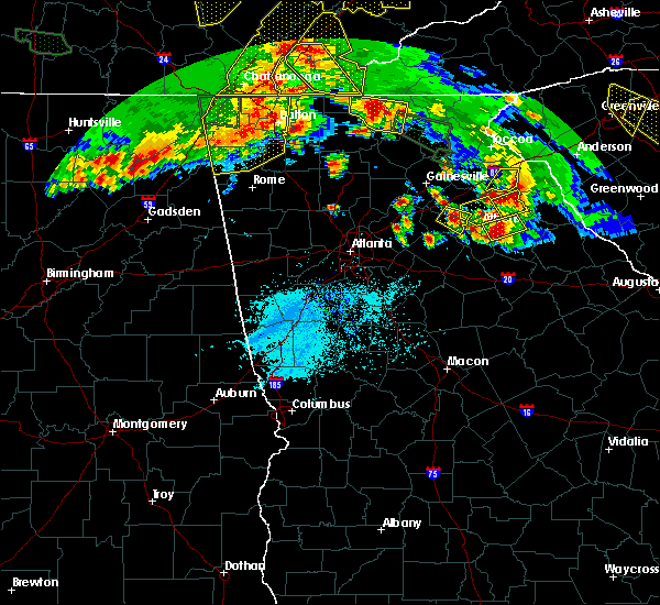 At 723 pm edt, a severe thunderstorm was located near statham, or near jefferson, moving east at 30 mph (radar indicated). Hazards include 60 mph wind gusts and half dollar size hail. Hail damage to vehicles is expected. Expect wind damage to roofs, siding, and trees. At 723 pm edt, a severe thunderstorm was located near statham, or near jefferson, moving east at 30 mph (radar indicated). Hazards include 60 mph wind gusts and half dollar size hail. Hail damage to vehicles is expected. Expect wind damage to roofs, siding, and trees.
|
| 3/21/2017 6:53 PM EDT |
 At 653 pm edt, a severe thunderstorm was located near nicholson, or near jefferson, moving east at 20 mph (radar indicated). Hazards include half dollar size hail and 60 mph wind gusts. damage to vehicles is expected At 653 pm edt, a severe thunderstorm was located near nicholson, or near jefferson, moving east at 20 mph (radar indicated). Hazards include half dollar size hail and 60 mph wind gusts. damage to vehicles is expected
|
| 3/21/2017 6:25 PM EDT | Quarter sized hail reported 2.9 miles WNW of Jefferson, GA, public reported quarter-sized hail in outside home in jefferson... ga. |
| 3/21/2017 6:18 PM EDT | Quarter sized hail reported 2.1 miles N of Jefferson, GA, public reported quarter-sized hail at jackson county high school |
| 12/29/2016 4:15 AM EST | Several trees and power lines down in the area of magnolia avenue and david street in jefferson ga. homes were also damaged and tin was blown off a roo in jackson county GA, 2.1 miles WSW of Jefferson, GA |
| 12/29/2016 4:15 AM EST | Several trees and power lines down in the area of magnolia avenue and david street in jefferson ga. homes were also damaged and tin was blown off a roo in jackson county GA, 1.6 miles NNW of Jefferson, GA |
| 12/29/2016 4:15 AM EST | All lanes blocked on sr 82 at fairlane dr due to trees down across the road in the south part of jefferson. ga power also reporting approximately 1000 without power in in jackson county GA, 2 miles NW of Jefferson, GA |
| 12/29/2016 4:08 AM EST |
 At 407 am est, a severe thunderstorm was located over nicholson, or near jefferson, moving east at 45 mph (radar indicated). Hazards include 60 mph wind gusts. Expect damage to roofs, siding, and trees. Locations impacted include, jefferson, arcade, nicholson and apple valley. At 407 am est, a severe thunderstorm was located over nicholson, or near jefferson, moving east at 45 mph (radar indicated). Hazards include 60 mph wind gusts. Expect damage to roofs, siding, and trees. Locations impacted include, jefferson, arcade, nicholson and apple valley.
|
| 12/29/2016 4:00 AM EST | All lanes blocked on sr 82 at fairlane dr due to trees down across the road in the south part of jefferson. ga power also reporting approximately 1000 without power in in jackson county GA, 2 miles NW of Jefferson, GA |
| 12/29/2016 4:00 AM EST | Several trees and power lines down in the area of magnolia avenue and david street in jefferson ga. homes were also damaged and tin was blown off a roo in jackson county GA, 1.6 miles NNW of Jefferson, GA |
| 12/29/2016 3:54 AM EST |
 At 353 am est, a severe thunderstorm was located over pendergrass, or near jefferson, moving east at 45 mph (radar indicated). Hazards include 60 mph wind gusts. Expect damage to roofs, siding, and trees. Locations impacted include, jefferson, commerce, braselton, arcade, nicholson, hoschton, pendergrass, talmo, apple valley, peach state speedway and thompsons mill. At 353 am est, a severe thunderstorm was located over pendergrass, or near jefferson, moving east at 45 mph (radar indicated). Hazards include 60 mph wind gusts. Expect damage to roofs, siding, and trees. Locations impacted include, jefferson, commerce, braselton, arcade, nicholson, hoschton, pendergrass, talmo, apple valley, peach state speedway and thompsons mill.
|
| 12/29/2016 3:38 AM EST |
 At 337 am est, a severe thunderstorm was located near flowery branch, or 11 miles south of gainesville, moving east at 45 mph (radar indicated). Hazards include 60 mph wind gusts. expect damage to roofs, siding, and trees At 337 am est, a severe thunderstorm was located near flowery branch, or 11 miles south of gainesville, moving east at 45 mph (radar indicated). Hazards include 60 mph wind gusts. expect damage to roofs, siding, and trees
|
| 11/30/2016 3:12 PM EST |
 The tornado warning for central jackson, northwestern clarke and east central barrow counties will expire at 315 pm est, the tornado threat has diminished and the tornado warning has been cancelled. however, damaging winds remain likely and a severe thunderstorm warning remains in effect for the area. a tornado watch also remains in effect until 600 pm est for north central and northeastern georgia. The tornado warning for central jackson, northwestern clarke and east central barrow counties will expire at 315 pm est, the tornado threat has diminished and the tornado warning has been cancelled. however, damaging winds remain likely and a severe thunderstorm warning remains in effect for the area. a tornado watch also remains in effect until 600 pm est for north central and northeastern georgia.
|
| 11/30/2016 2:56 PM EST |
 At 255 pm est, severe thunderstorms capable of producing tornadoes was located near russell in barrow county. another strong area of rotation was located 5 miles west of peach state speedway in jackson county. both storms were moving northeast at 40 mph (radar indicated rotation). Hazards include tornado. Flying debris will be dangerous to those caught without shelter. mobile homes will be damaged or destroyed. damage to roofs, windows, and vehicles will occur. tree damage is likely. Locations impacted include, winder, jefferson, statham, maysville, arcade, nicholson, bogart, athens-clarke county, apple valley, bear creek reservoir, westgate park, peach state speedway, russell and oconee heights. At 255 pm est, severe thunderstorms capable of producing tornadoes was located near russell in barrow county. another strong area of rotation was located 5 miles west of peach state speedway in jackson county. both storms were moving northeast at 40 mph (radar indicated rotation). Hazards include tornado. Flying debris will be dangerous to those caught without shelter. mobile homes will be damaged or destroyed. damage to roofs, windows, and vehicles will occur. tree damage is likely. Locations impacted include, winder, jefferson, statham, maysville, arcade, nicholson, bogart, athens-clarke county, apple valley, bear creek reservoir, westgate park, peach state speedway, russell and oconee heights.
|
| 11/30/2016 2:43 PM EST |
 At 242 pm est, a severe thunderstorm capable of producing a tornado was located over harbin, or near winder, moving east at 35 mph (radar indicated rotation). Hazards include tornado. Flying debris will be dangerous to those caught without shelter. mobile homes will be damaged or destroyed. damage to roofs, windows, and vehicles will occur. Tree damage is likely. At 242 pm est, a severe thunderstorm capable of producing a tornado was located over harbin, or near winder, moving east at 35 mph (radar indicated rotation). Hazards include tornado. Flying debris will be dangerous to those caught without shelter. mobile homes will be damaged or destroyed. damage to roofs, windows, and vehicles will occur. Tree damage is likely.
|
| 11/30/2016 2:28 PM EST |
 At 228 pm est, severe thunderstorms were located along a line extending from oscarville to near thompsons mill to grayson, moving northeast at 60 mph (radar indicated). Hazards include 60 mph wind gusts. Expect damage to roofs. siding. And trees. At 228 pm est, severe thunderstorms were located along a line extending from oscarville to near thompsons mill to grayson, moving northeast at 60 mph (radar indicated). Hazards include 60 mph wind gusts. Expect damage to roofs. siding. And trees.
|
| 7/21/2016 6:32 PM EDT |
 At 632 pm edt, a severe thunderstorm was located over bethlehem, or near winder, moving south at 10 mph (radar indicated). Hazards include 60 mph wind gusts and quarter size hail. Hail damage to vehicles is expected. expect wind damage to roofs, siding, and trees. Other locations in the warning include but are not limited to winder, jefferson, statham, arcade, bogart, north high shoals, bethlehem, nicholasville, gratis, campton, russell, bold springs, fort yargo state park and eastville. At 632 pm edt, a severe thunderstorm was located over bethlehem, or near winder, moving south at 10 mph (radar indicated). Hazards include 60 mph wind gusts and quarter size hail. Hail damage to vehicles is expected. expect wind damage to roofs, siding, and trees. Other locations in the warning include but are not limited to winder, jefferson, statham, arcade, bogart, north high shoals, bethlehem, nicholasville, gratis, campton, russell, bold springs, fort yargo state park and eastville.
|
| 7/21/2016 5:58 PM EDT |
 At 557 pm edt, a severe thunderstorm was located over winder, moving south at 10 mph (radar indicated). Hazards include 60 mph wind gusts and quarter size hail. Hail damage to vehicles is expected. expect wind damage to roofs, siding, and trees. Other locations in the warning include but are not limited to winder, jefferson, auburn, statham, arcade, hoschton, bogart, north high shoals, bethlehem, carl, nicholasville, gratis, campton, county line, russell, bold springs, fort yargo state park and eastville. At 557 pm edt, a severe thunderstorm was located over winder, moving south at 10 mph (radar indicated). Hazards include 60 mph wind gusts and quarter size hail. Hail damage to vehicles is expected. expect wind damage to roofs, siding, and trees. Other locations in the warning include but are not limited to winder, jefferson, auburn, statham, arcade, hoschton, bogart, north high shoals, bethlehem, carl, nicholasville, gratis, campton, county line, russell, bold springs, fort yargo state park and eastville.
|
| 7/6/2016 1:40 PM EDT |
 At 139 pm edt, a severe thunderstorm was located near jefferson, moving east at 40 mph (radar indicated). Hazards include 60 mph wind gusts. Expect damage to roofs. siding. and trees. Other locations in the warning include but are not limited to jefferson, commerce, danielsville, arcade, nicholson, comer, colbert, ila, neese, diamond hill, apple valley, watson mill bridge state park, peach state speedway, paoli and pocataligo. At 139 pm edt, a severe thunderstorm was located near jefferson, moving east at 40 mph (radar indicated). Hazards include 60 mph wind gusts. Expect damage to roofs. siding. and trees. Other locations in the warning include but are not limited to jefferson, commerce, danielsville, arcade, nicholson, comer, colbert, ila, neese, diamond hill, apple valley, watson mill bridge state park, peach state speedway, paoli and pocataligo.
|
| 4/7/2016 12:27 AM EDT |
 At 1226 am edt, severe thunderstorms were located along a line extending from buford to near lithonia to near sunny side, moving east at 50 mph (radar indicated. damaging winds have already been reported with this line). Hazards include 60 mph wind gusts and nickel size hail. Expect damage to roofs. siding. and trees. Other locations in the warning include but are not limited to lawrenceville, mcdonough, conyers, winder, monroe, covington, jefferson, watkinsville, snellville, buford, loganville, braselton, auburn, locust grove, dacula, social circle, grayson, statham, oxford and arcade. At 1226 am edt, severe thunderstorms were located along a line extending from buford to near lithonia to near sunny side, moving east at 50 mph (radar indicated. damaging winds have already been reported with this line). Hazards include 60 mph wind gusts and nickel size hail. Expect damage to roofs. siding. and trees. Other locations in the warning include but are not limited to lawrenceville, mcdonough, conyers, winder, monroe, covington, jefferson, watkinsville, snellville, buford, loganville, braselton, auburn, locust grove, dacula, social circle, grayson, statham, oxford and arcade.
|
| 8/17/2015 8:48 PM EDT |
 At 847 pm edt, severe thunderstorms were located extending from near homer to near ila, moving northeast at 35 mph (radar indicated). Hazards include 60 mph wind gusts. Expect damage to roofs. siding and trees. Other locations in the warning include but are not limited to jefferson, commerce, homer, maysville, arcade, nicholson, ila, gillsville, pinefield crossroads, hollingsworth, apple valley, bear creek reservoir, peach state speedway, banks crossing, pocataligo and vanna. At 847 pm edt, severe thunderstorms were located extending from near homer to near ila, moving northeast at 35 mph (radar indicated). Hazards include 60 mph wind gusts. Expect damage to roofs. siding and trees. Other locations in the warning include but are not limited to jefferson, commerce, homer, maysville, arcade, nicholson, ila, gillsville, pinefield crossroads, hollingsworth, apple valley, bear creek reservoir, peach state speedway, banks crossing, pocataligo and vanna.
|
| 8/17/2015 8:15 PM EDT |
 At 814 pm edt, severe thunderstorms were located extending from pendergrass to arcade, moving northeast at 35 mph. these storms have a history of producing wind damage (radar indicated). Hazards include 60 mph wind gusts. Expect damage to roofs. siding and trees. Other locations in the warning include but are not limited to jefferson, commerce, homer, braselton, statham, maysville, arcade, nicholson, hoschton, bogart, pendergrass, ila, gillsville, talmo, pinefield crossroads, hollingsworth, apple valley, bear creek reservoir, peach state speedway and banks crossing. At 814 pm edt, severe thunderstorms were located extending from pendergrass to arcade, moving northeast at 35 mph. these storms have a history of producing wind damage (radar indicated). Hazards include 60 mph wind gusts. Expect damage to roofs. siding and trees. Other locations in the warning include but are not limited to jefferson, commerce, homer, braselton, statham, maysville, arcade, nicholson, hoschton, bogart, pendergrass, ila, gillsville, talmo, pinefield crossroads, hollingsworth, apple valley, bear creek reservoir, peach state speedway and banks crossing.
|
| 8/17/2015 8:06 PM EDT |
 At 805 pm edt, severe thunderstorms were located extending from near hoschton to near bethlehem, moving northeast at 30 mph (radar indicated). Hazards include 60 mph wind gusts. Expect damage to roofs. siding and trees. Other locations in the warning include but are not limited to winder, jefferson, braselton, auburn, statham, arcade, nicholson, hoschton, bethlehem, pendergrass, carl, talmo, gratis, apple valley, bear creek reservoir, chateau elan, campton, peach state speedway, county line and russell. At 805 pm edt, severe thunderstorms were located extending from near hoschton to near bethlehem, moving northeast at 30 mph (radar indicated). Hazards include 60 mph wind gusts. Expect damage to roofs. siding and trees. Other locations in the warning include but are not limited to winder, jefferson, braselton, auburn, statham, arcade, nicholson, hoschton, bethlehem, pendergrass, carl, talmo, gratis, apple valley, bear creek reservoir, chateau elan, campton, peach state speedway, county line and russell.
|
| 8/17/2015 7:47 PM EDT |
 At 747 pm edt, severe thunderstorms were located extending from near dacula to near between, moving northeast at 30 mph (radar indicated). Hazards include 60 mph wind gusts. Expect damage to roofs. siding and trees. Other locations in the warning include but are not limited to lawrenceville, winder, monroe, jefferson, braselton, auburn, dacula, statham, arcade, nicholson, hoschton, bethlehem, pendergrass, between, carl, talmo, gratis, bear creek reservoir, chateau elan and campton. At 747 pm edt, severe thunderstorms were located extending from near dacula to near between, moving northeast at 30 mph (radar indicated). Hazards include 60 mph wind gusts. Expect damage to roofs. siding and trees. Other locations in the warning include but are not limited to lawrenceville, winder, monroe, jefferson, braselton, auburn, dacula, statham, arcade, nicholson, hoschton, bethlehem, pendergrass, between, carl, talmo, gratis, bear creek reservoir, chateau elan and campton.
|
| 8/17/2015 7:35 PM EDT |
 At 734 pm edt, severe thunderstorms were located extending from grayson to near between, moving northeast at 30 mph (radar indicated). Hazards include 60 mph wind gusts. Expect damage to roofs. siding and trees. Other locations in the warning include but are not limited to lawrenceville, winder, monroe, jefferson, snellville, loganville, braselton, auburn, dacula, grayson, statham, arcade, nicholson, hoschton, walnut grove, bethlehem, pendergrass, between, carl and talmo. At 734 pm edt, severe thunderstorms were located extending from grayson to near between, moving northeast at 30 mph (radar indicated). Hazards include 60 mph wind gusts. Expect damage to roofs. siding and trees. Other locations in the warning include but are not limited to lawrenceville, winder, monroe, jefferson, snellville, loganville, braselton, auburn, dacula, grayson, statham, arcade, nicholson, hoschton, walnut grove, bethlehem, pendergrass, between, carl and talmo.
|
| 8/10/2015 6:02 PM EDT |
 At 602 pm edt, a severe thunderstorm was located over winder, moving southeast at 20 mph (radar indicated). Hazards include 60 mph wind gusts and nickel size hail. Expect damage to roofs. siding and trees. Other locations in the warning include but are not limited to winder, jefferson, braselton, auburn, statham, arcade, hoschton, bethlehem, carl, russell, fort yargo state park, bear creek reservoir and county line. At 602 pm edt, a severe thunderstorm was located over winder, moving southeast at 20 mph (radar indicated). Hazards include 60 mph wind gusts and nickel size hail. Expect damage to roofs. siding and trees. Other locations in the warning include but are not limited to winder, jefferson, braselton, auburn, statham, arcade, hoschton, bethlehem, carl, russell, fort yargo state park, bear creek reservoir and county line.
|
| 8/10/2015 5:44 PM EDT |
 At 544 pm edt, a severe thunderstorm was located near pendergrass, or 8 miles northwest of jefferson, moving east at 20 mph (radar indicated). Hazards include 60 mph wind gusts and nickel size hail. Expect damage to roofs. siding and trees. Other locations in the warning include but are not limited to jefferson, commerce, maysville, arcade, nicholson, pendergrass, talmo, apple valley and peach state speedway. At 544 pm edt, a severe thunderstorm was located near pendergrass, or 8 miles northwest of jefferson, moving east at 20 mph (radar indicated). Hazards include 60 mph wind gusts and nickel size hail. Expect damage to roofs. siding and trees. Other locations in the warning include but are not limited to jefferson, commerce, maysville, arcade, nicholson, pendergrass, talmo, apple valley and peach state speedway.
|
| 7/14/2015 8:12 PM EDT |
 At 811 pm edt, severe thunderstorms were located extending from 9 miles northwest of gainesville to near flowery branch to near free home, moving southeast at 35 mph (radar indicated). Hazards include 60 mph wind gusts. Expect damage to roofs. siding and trees. Other locations in the warning include but are not limited to gainesville, lawrenceville, winder, jefferson, cumming, duluth, sugar hill, suwanee, buford, braselton, auburn, flowery branch, dacula, oakwood, statham, arcade, hoschton, bethlehem, pendergrass and carl. At 811 pm edt, severe thunderstorms were located extending from 9 miles northwest of gainesville to near flowery branch to near free home, moving southeast at 35 mph (radar indicated). Hazards include 60 mph wind gusts. Expect damage to roofs. siding and trees. Other locations in the warning include but are not limited to gainesville, lawrenceville, winder, jefferson, cumming, duluth, sugar hill, suwanee, buford, braselton, auburn, flowery branch, dacula, oakwood, statham, arcade, hoschton, bethlehem, pendergrass and carl.
|
| 6/24/2015 4:07 PM EDT |
 At 407 pm edt, a severe thunderstorm was located near talmo, or 8 miles southeast of gainesville, moving southeast at 15 mph (radar indicated). Hazards include 60 mph wind gusts and penny size hail. Expect damage to roofs. siding and trees. Other locations in the warning include but are not limited to gainesville, jefferson, commerce, braselton, maysville, arcade, hoschton, pendergrass, gillsville, talmo, candler, apple valley, peach state speedway and road atlanta-lanier speedway. At 407 pm edt, a severe thunderstorm was located near talmo, or 8 miles southeast of gainesville, moving southeast at 15 mph (radar indicated). Hazards include 60 mph wind gusts and penny size hail. Expect damage to roofs. siding and trees. Other locations in the warning include but are not limited to gainesville, jefferson, commerce, braselton, maysville, arcade, hoschton, pendergrass, gillsville, talmo, candler, apple valley, peach state speedway and road atlanta-lanier speedway.
|
| 5/26/2015 6:38 PM EDT | The severe thunderstorm warning for madison, southeastern banks, clarke, oglethorpe and eastern jackson counties will expire at 645 pm edt, the storms which prompted the warning will soon move out of the area. therefore the warning will be allowed to expire. however heavy rain is still possible with these thunderstorms and isolated flooding is still a threat. |
| 5/26/2015 6:27 PM EDT | At 625 pm edt, severe thunderstorms were located along a line extending from near ila to near comer to near lexington, moving northeast at 50 mph (radar indicated). Hazards include 60 mph wind gusts and quarter size hail. Hail damage to vehicles is expected. expect wind damage to roofs, siding and trees. Other locations in the warning include but are not limited to jefferson, commerce, danielsville, lexington, athens, arcade, nicholson, comer, winterville, crawford, colbert, arnoldsville, ila, carlton, hull, athens-clarke county (balance), whitehall, stephens, smithonia and beechwood hills. |
| 5/26/2015 6:00 PM EDT | At 600 pm edt, severe thunderstorms were located along a line extending from near arcade to athens-clarke county (balance) to 8 miles north of buckhead, moving northeast at 50 mph (law enforcement). Hazards include 60 mph wind gusts. Expect damage to roofs. siding and trees. Other locations in the warning include but are not limited to jefferson, commerce, madison, watkinsville, danielsville, lexington, athens, statham, arcade, nicholson, comer, winterville, bogart, crawford, north high shoals, colbert, arnoldsville, ila, woodville and carlton. |
| 4/20/2015 4:13 PM EDT | At 412 pm edt, a severe thunderstorm was located over carl, or near winder, moving east at 35 mph (radar indicated). Hazards include 60 mph wind gusts and quarter size hail. Hail damage to vehicles is expected. expect wind damage to roofs, siding and trees. other locations in the warning include but are not limited to winder, jefferson, commerce, athens, braselton, auburn, statham, arcade, nicholson, hoschton, bogart, bethlehem, carl, hull, athens-clarke county (balance), beechwood hills, bear creek reservoir, sandy creek recreation area, fort yargo state park and barretts mill. a tornado watch remains in effect until 800 pm edt for northeastern georgia. 1. 00in. |
| 4/20/2015 3:39 PM EDT | At 338 pm edt, a severe thunderstorm capable of producing a tornado was located over jefferson, moving east at 35 mph (radar indicated rotation). Hazards include tornado and golf ball size hail. Flying debris will be dangerous to those caught without shelter. mobile homes will be damaged or destroyed. damage to roofs, windows and vehicles will occur. tree damage is likely. other locations in the warning include but are not limited to jefferson, commerce, danielsville, arcade, nicholson, ila, neese, diamond hill, apple valley, peach state speedway and pocataligo. Radar indicated. |
| 4/20/2015 3:38 PM EDT | Golf Ball sized hail reported 1.4 miles SSE of Jefferson, GA |
| 4/20/2015 3:18 PM EDT | At 318 pm edt, a severe thunderstorm capable of producing a tornado was located over hoschton, or near winder, moving east at 35 mph (radar indicated rotation). Hazards include tornado and golf ball size hail. Flying debris will be dangerous to those caught without shelter. mobile homes will be damaged or destroyed. damage to roofs, windows and vehicles will occur. tree damage is likely. other locations in the warning include but are not limited to jefferson, commerce, danielsville, arcade, nicholson, pendergrass, ila, neese, diamond hill, apple valley, peach state speedway and pocataligo. Radar indicated. |
| 4/20/2015 3:14 PM EDT | At 304 pm edt, a severe thunderstorm capable of producing a tornado was located near auburn, or 8 miles northwest of winder, moving east at 40 mph (radar indicated rotation). Hazards include tornado and golf ball size hail. Flying debris will be dangerous to those caught without shelter. mobile homes will be damaged or destroyed. damage to roofs, windows and vehicles will occur. tree damage is likely. other locations in the warning include but are not limited to winder, jefferson, braselton, auburn, flowery branch, dacula, hoschton, pendergrass, carl, talmo, candler, chateau elan, county line, road atlanta-lanier speedway, thompsons mill, chestnut mountain and hog mountain. Radar indicated. |
| 4/20/2015 3:04 PM EDT | At 304 pm edt, a severe thunderstorm capable of producing a tornado was located near auburn, or 8 miles northwest of winder, moving east at 40 mph (radar indicated rotation). Hazards include tornado and golf ball size hail. Flying debris will be dangerous to those caught without shelter. mobile homes will be damaged or destroyed. damage to roofs, windows and vehicles will occur. tree damage is likely. other locations in the warning include but are not limited to winder, jefferson, braselton, auburn, flowery branch, dacula, hoschton, pendergrass, carl, talmo, candler, chateau elan, county line, road atlanta-lanier speedway, thompsons mill, chestnut mountain and hog mountain. Radar indicated. |
| 4/20/2015 2:54 PM EDT | At 253 pm edt, a severe thunderstorm capable of producing a tornado was located near sugar hill, or near lawrenceville, moving east at 35 mph (radar indicated rotation). Hazards include tornado and golf ball size hail. Flying debris will be dangerous to those caught without shelter. mobile homes will be damaged or destroyed. damage to roofs, windows and vehicles will occur. tree damage is likely. other locations in the warning include but are not limited to winder, jefferson, sugar hill, suwanee, buford, braselton, auburn, flowery branch, dacula, hoschton, pendergrass, carl, talmo, rest haven, candler, chateau elan, county line, road atlanta-lanier speedway, thompsons mill and chestnut mountain. Radar indicated. |
| 4/20/2015 2:44 PM EDT | At 244 pm edt, a severe thunderstorm capable of producing a tornado was located over suwanee, or 7 miles northwest of lawrenceville, moving east at 35 mph (radar indicated rotation). Hazards include tornado and golf ball size hail. Flying debris will be dangerous to those caught without shelter. mobile homes will be damaged or destroyed. damage to roofs, windows and vehicles will occur. tree damage is likely. other locations in the warning include but are not limited to lawrenceville, winder, jefferson, duluth, sugar hill, suwanee, buford, braselton, auburn, flowery branch, dacula, hoschton, pendergrass, carl, talmo, rest haven, candler, chateau elan, county line and fort yargo state park. Radar indicated. |
| 8/23/2013 10:45 PM EDT | Estimated 75-80 trees down...mainly in the jefferson and arcade area. 10 houses damaged...most with trees on them but a couple with windows blown out from the strong wi in jackson county GA, 1.5 miles WNW of Jefferson, GA |
| 6/2/2013 5:05 PM EDT | Jackson county emergency manager reported seven to eight trees dow in jackson county GA, 0.8 miles SSE of Jefferson, GA |
| 6/5/2012 12:30 PM EDT | Golf Ball sized hail reported 5 miles NNW of Jefferson, GA, golf ball size hail occurred near hwy 358 and prospect church rd area not far from i-16. |
| 4/3/2012 4:32 PM EDT | Quarter sized hail reported 4.3 miles ENE of Jefferson, GA |
| 1/1/0001 12:00 AM | Quarter sized hail reported 1.5 miles WNW of Jefferson, GA |
Hail Maps for Jefferson, GA
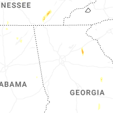
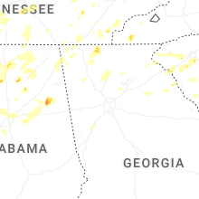


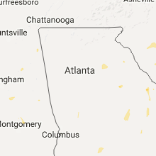


Connect with Interactive Hail Maps