

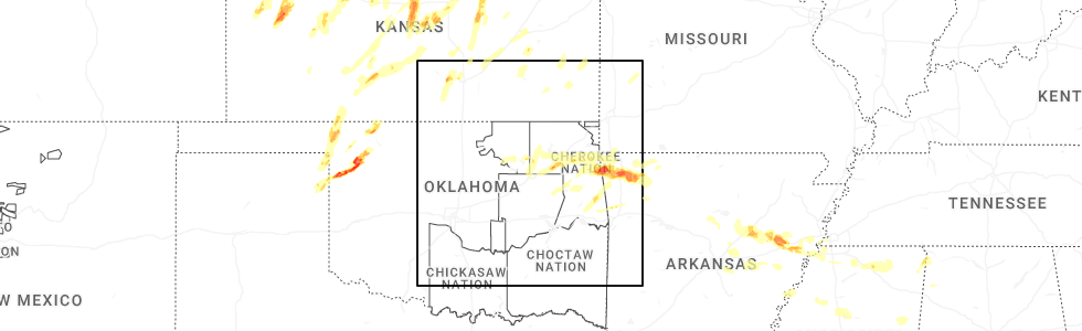
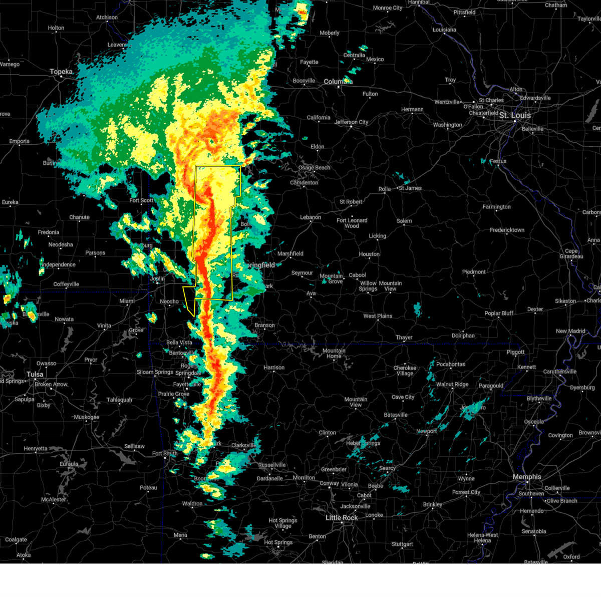
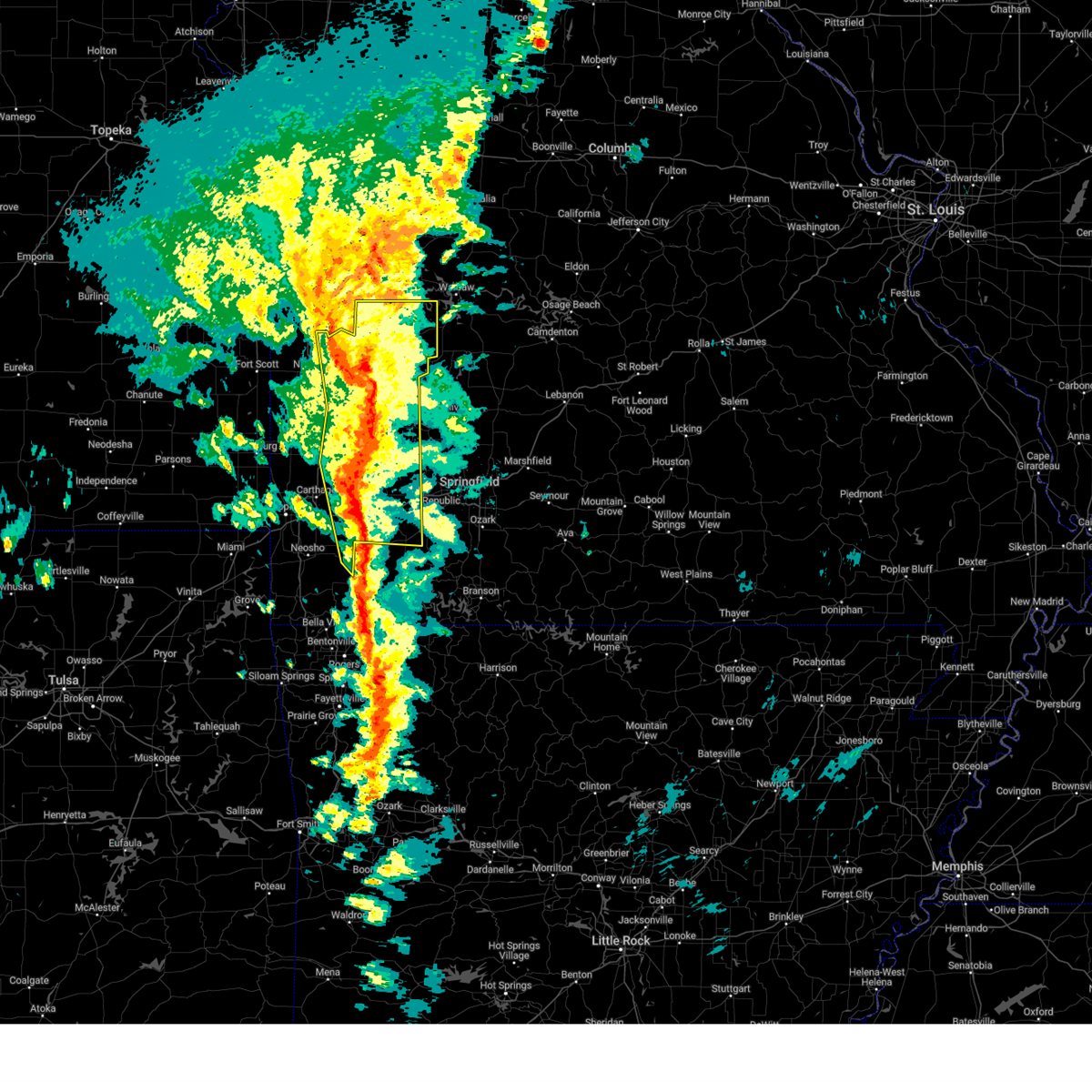
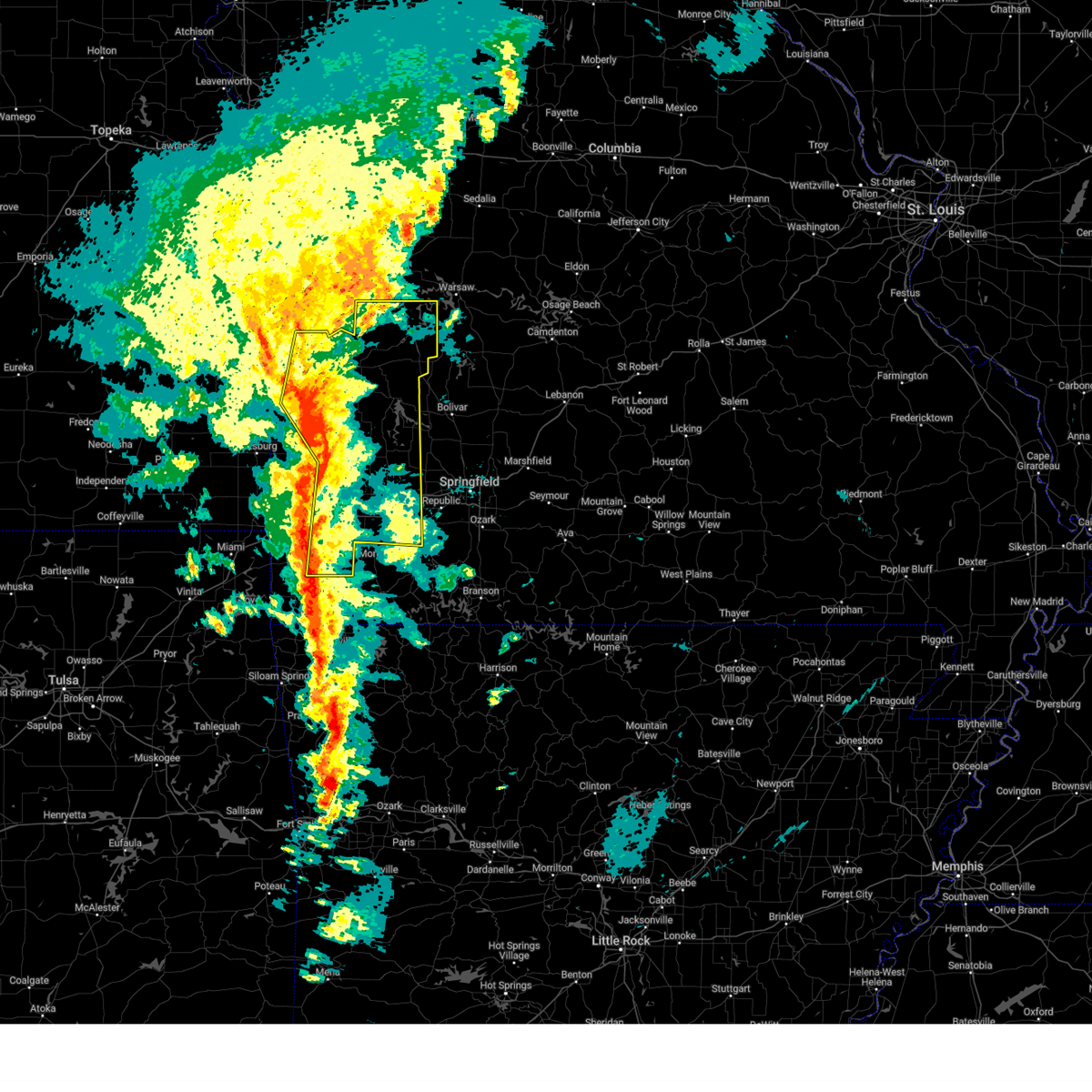
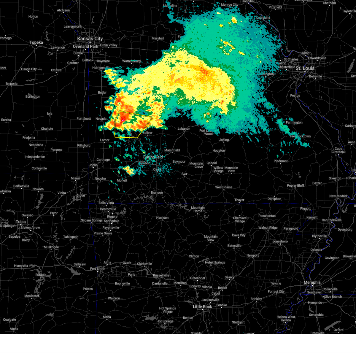
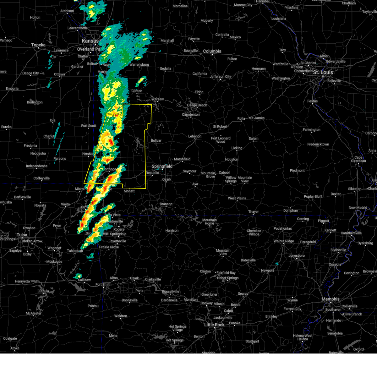
Hail Map for Jerico Springs, MO
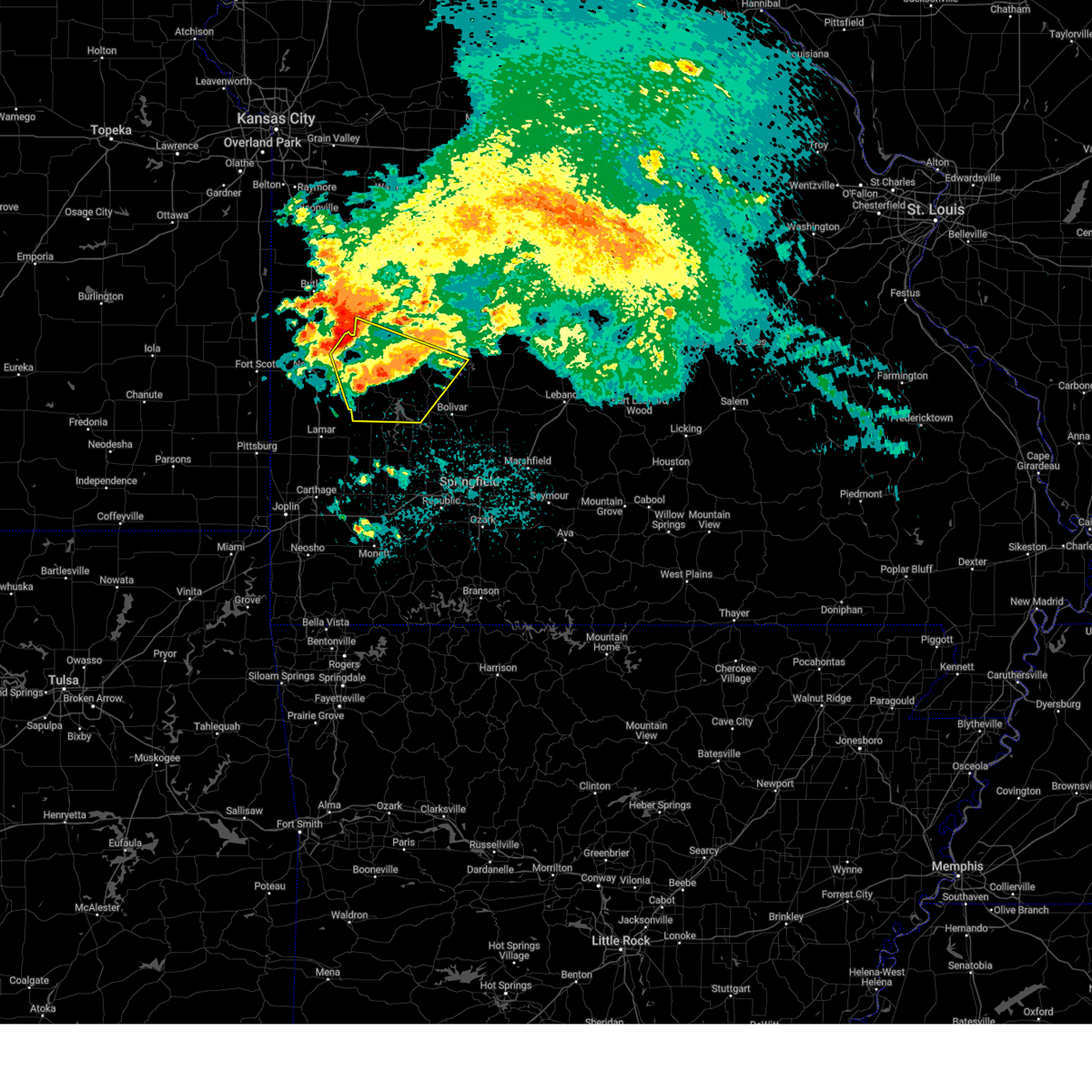
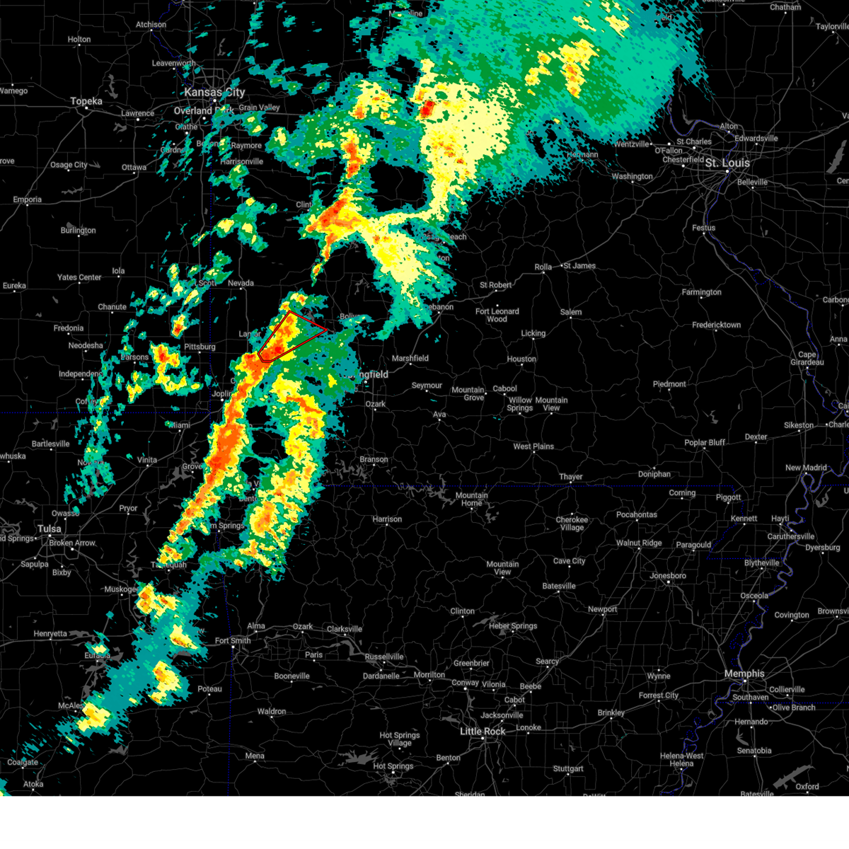
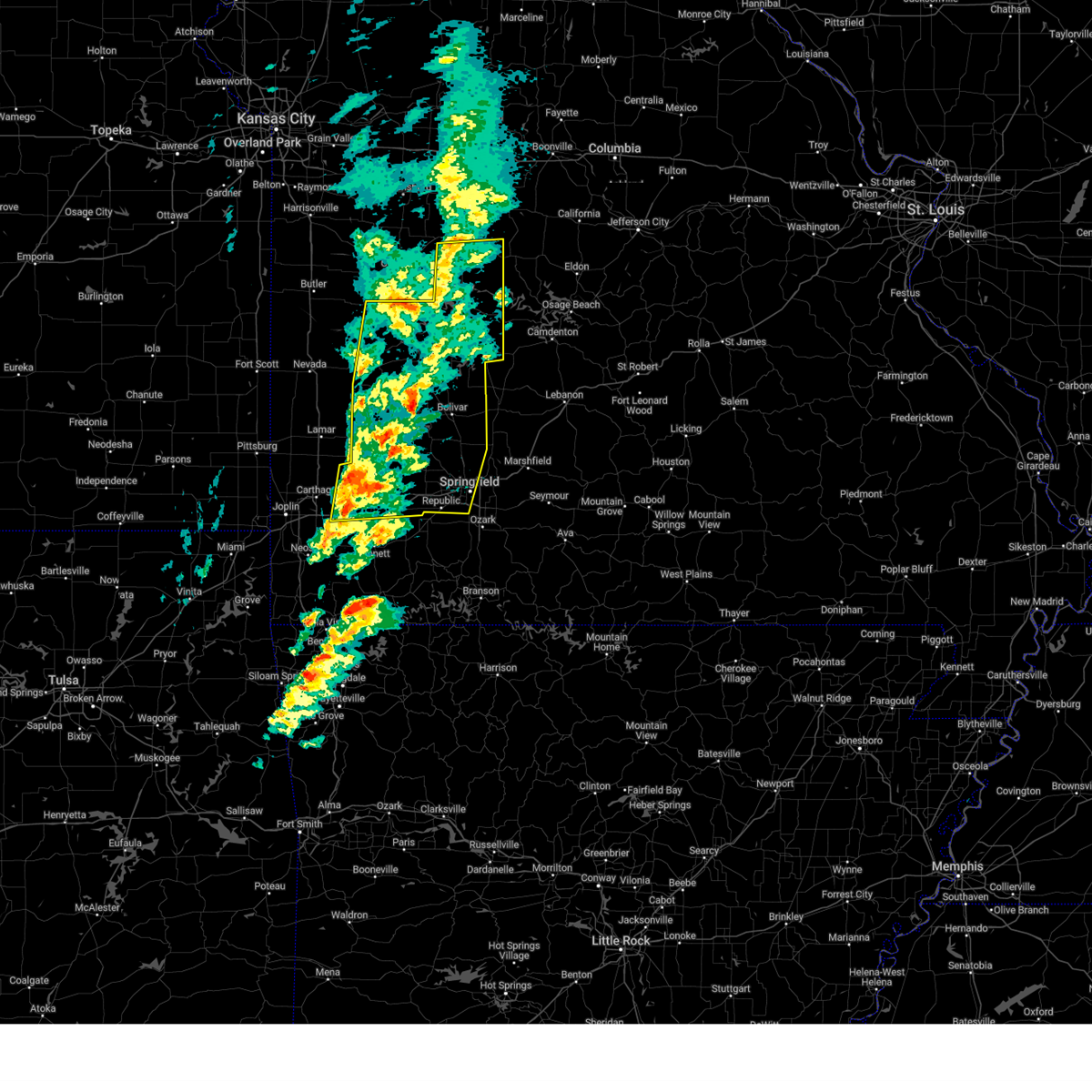
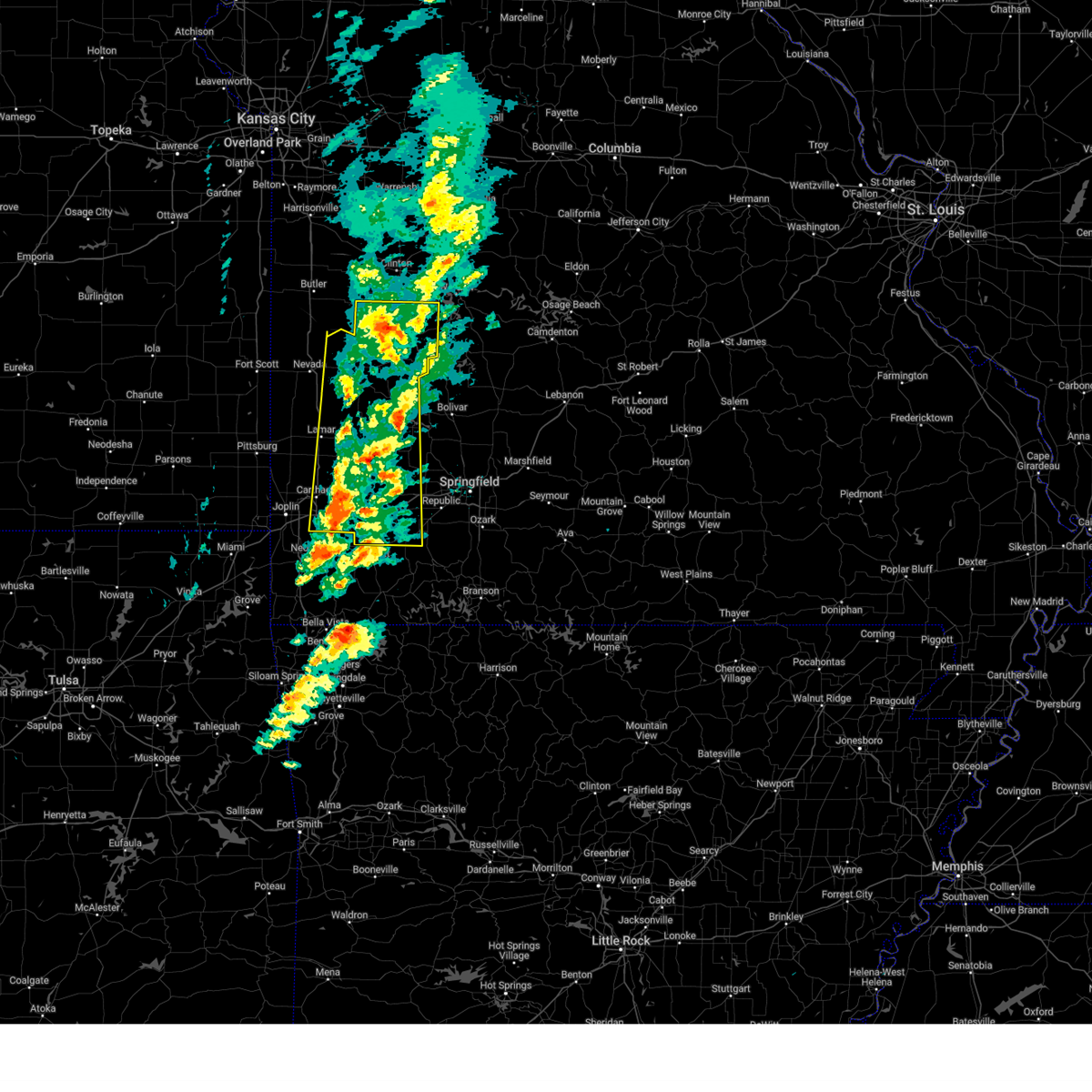
The Jerico Springs, MO area has had 3 reports of on-the-ground hail by trained spotters, and has been under severe weather warnings 29 times during the past 12 months. Doppler radar has detected hail at or near Jerico Springs, MO on 71 occasions, including 4 occasions during the past year.
| Name: | Jerico Springs, MO |
| Where Located: | 48.6 miles NW of Springfield, MO |
| Map: | Google Map for Jerico Springs, MO |
| Population: | 228 |
| Housing Units: | 124 |
| More Info: | Search Google for Jerico Springs, MO |
2
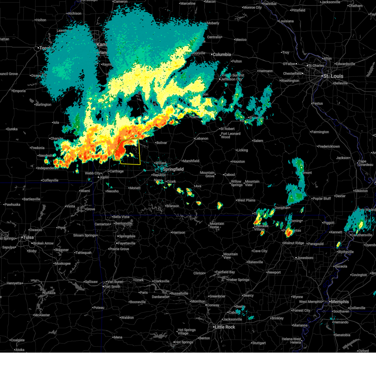
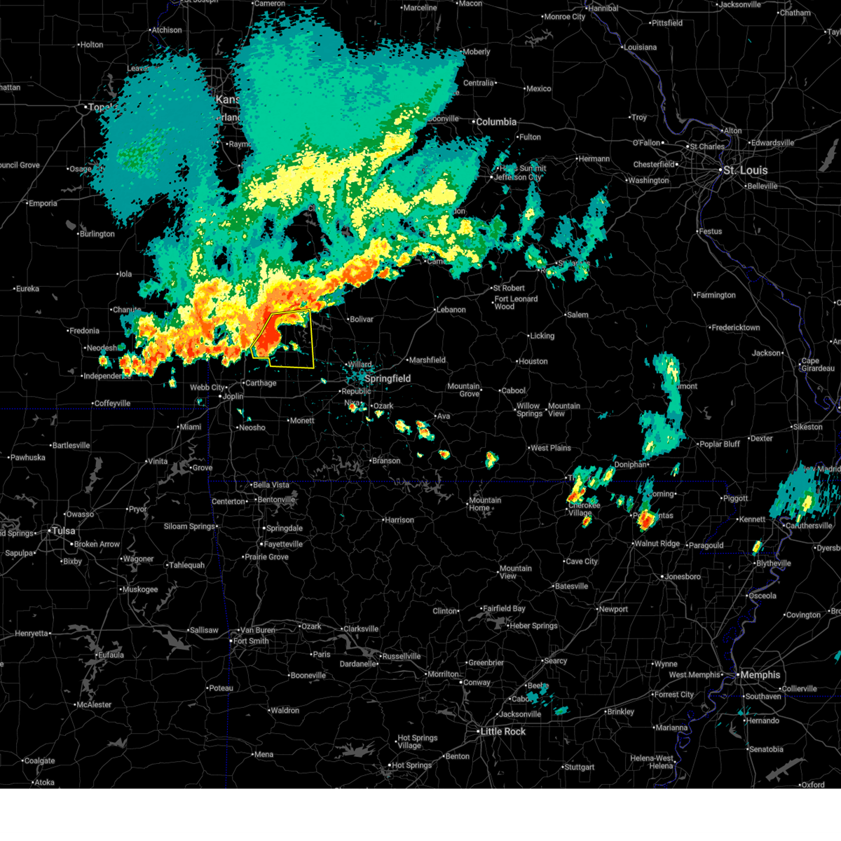
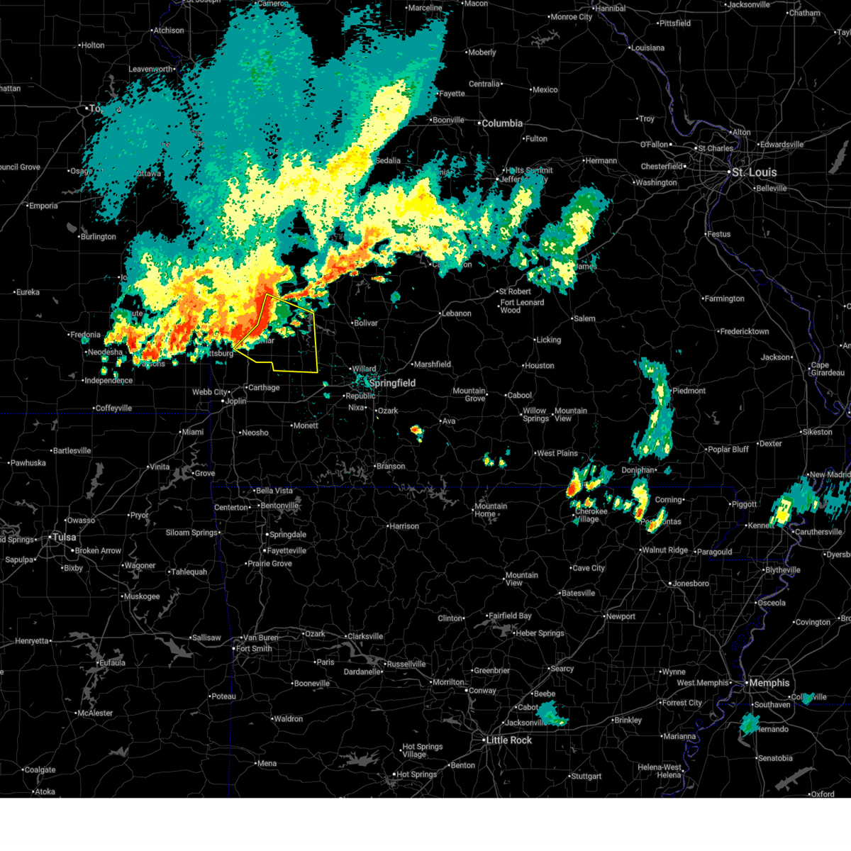
The Top Recent Hail Date for Jerico Springs, MO is Sunday, May 18, 2025 (10th out of 71)
Hail and Wind Damage Spotted near Jerico Springs, MO
| Date / Time | Report Details |
|---|---|
| 6/29/2025 3:44 PM CDT |
 the severe thunderstorm warning has been cancelled and is no longer in effect the severe thunderstorm warning has been cancelled and is no longer in effect
|
| 6/29/2025 3:44 PM CDT |
 At 343 pm cdt, severe thunderstorms were located along a line extending from 11 miles west of stockton to near golden city to near jasper, moving southeast at 30 mph. an area of rotation has developed near jericho springs. while a tornado is not immenent, the potential is being closely monitored (radar indicated). Hazards include 60 mph wind gusts and penny size hail. Expect damage to roofs, siding, and trees. Locations impacted include, stockton lake, stockton state park, greenfield, lockwood, golden city, jerico springs, south greenfield, arcola, umber view heights, kenoma, pennsboro, neola, cedarville, meinert, and sylvania. At 343 pm cdt, severe thunderstorms were located along a line extending from 11 miles west of stockton to near golden city to near jasper, moving southeast at 30 mph. an area of rotation has developed near jericho springs. while a tornado is not immenent, the potential is being closely monitored (radar indicated). Hazards include 60 mph wind gusts and penny size hail. Expect damage to roofs, siding, and trees. Locations impacted include, stockton lake, stockton state park, greenfield, lockwood, golden city, jerico springs, south greenfield, arcola, umber view heights, kenoma, pennsboro, neola, cedarville, meinert, and sylvania.
|
| 6/29/2025 3:25 PM CDT |
 Svrsgf the national weather service in springfield has issued a * severe thunderstorm warning for, eastern barton county in southwestern missouri, southwestern cedar county in southwestern missouri, southeastern vernon county in west central missouri, dade county in southwestern missouri, * until 400 pm cdt. * at 325 pm cdt, severe thunderstorms were located along a line extending from 8 miles southwest of el dorado springs to 10 miles southeast of sheldon to 6 miles southwest of lamar, moving southeast at 35 mph (radar indicated). Hazards include 60 mph wind gusts and penny size hail. expect damage to roofs, siding, and trees Svrsgf the national weather service in springfield has issued a * severe thunderstorm warning for, eastern barton county in southwestern missouri, southwestern cedar county in southwestern missouri, southeastern vernon county in west central missouri, dade county in southwestern missouri, * until 400 pm cdt. * at 325 pm cdt, severe thunderstorms were located along a line extending from 8 miles southwest of el dorado springs to 10 miles southeast of sheldon to 6 miles southwest of lamar, moving southeast at 35 mph (radar indicated). Hazards include 60 mph wind gusts and penny size hail. expect damage to roofs, siding, and trees
|
| 5/19/2025 7:07 PM CDT | The storms which prompted the warning have moved out of the area. therefore, the warning will be allowed to expire. a tornado watch remains in effect until 900 pm cdt for southwestern and west central missouri. |
| 5/19/2025 6:46 PM CDT | the severe thunderstorm warning has been cancelled and is no longer in effect |
| 5/19/2025 6:46 PM CDT | At 646 pm cdt, severe thunderstorms were located along a line extending from near el dorado springs to 7 miles northwest of walnut grove to near willard, moving northeast at 65 mph (radar indicated). Hazards include 60 mph wind gusts. Expect damage to roofs, siding, and trees. locations impacted include, stockton lake, stockton state park, aurora, mount vernon, el dorado springs, marionville, stockton, greenfield, pierce city, lockwood, miller, verona, sheldon, everton, montevallo, dadeville, jerico springs, stotts city, halltown, and freistatt. this includes the following highways, interstate 44 between mile markers 33 and 58. Interstate 49 between mile markers 77 and 79. |
| 5/19/2025 6:11 PM CDT | Svrsgf the national weather service in springfield has issued a * severe thunderstorm warning for, barton county in southwestern missouri, northeastern newton county in southwestern missouri, cedar county in southwestern missouri, lawrence county in southwestern missouri, southeastern vernon county in west central missouri, jasper county in southwestern missouri, dade county in southwestern missouri, * until 715 pm cdt. * at 611 pm cdt, severe thunderstorms were located along a line extending from near arcadia to near jasper to near sarcoxie, moving east at 65 mph (radar indicated). Hazards include 70 mph wind gusts and quarter size hail. Hail damage to vehicles is expected. expect considerable tree damage. Wind damage is also likely to mobile homes, roofs, and outbuildings. |
| 4/20/2025 3:18 PM CDT |
 the severe thunderstorm warning has been cancelled and is no longer in effect the severe thunderstorm warning has been cancelled and is no longer in effect
|
| 4/20/2025 3:18 PM CDT |
 At 318 pm cdt, severe thunderstorms were located along a line extending from near appleton city to 6 miles south of osceola to near miller, moving northeast at 60 mph (radar indicated). Hazards include 70 mph wind gusts and penny size hail. Expect considerable tree damage. damage is likely to mobile homes, roofs, and outbuildings. locations impacted include, vista, appleton city, cane hill, aurora, umber view heights, osceola, mount vernon, pennsboro, neola, lowry city, freistatt, el dorado springs, monegaw springs, olympia, red oak, marionville, caplinger mills, wagoner, stockton state park, and jerico springs. This includes interstate 44 between mile markers 33 and 58. At 318 pm cdt, severe thunderstorms were located along a line extending from near appleton city to 6 miles south of osceola to near miller, moving northeast at 60 mph (radar indicated). Hazards include 70 mph wind gusts and penny size hail. Expect considerable tree damage. damage is likely to mobile homes, roofs, and outbuildings. locations impacted include, vista, appleton city, cane hill, aurora, umber view heights, osceola, mount vernon, pennsboro, neola, lowry city, freistatt, el dorado springs, monegaw springs, olympia, red oak, marionville, caplinger mills, wagoner, stockton state park, and jerico springs. This includes interstate 44 between mile markers 33 and 58.
|
| 4/20/2025 3:17 PM CDT |
 the severe thunderstorm warning has been cancelled and is no longer in effect the severe thunderstorm warning has been cancelled and is no longer in effect
|
| 4/20/2025 3:17 PM CDT |
 At 317 pm cdt, severe thunderstorms were located along a line extending from near appleton city to near osceola to near miller, moving northeast at 60 mph (radar indicated). Hazards include 70 mph wind gusts and penny size hail. Expect considerable tree damage. damage is likely to mobile homes, roofs, and outbuildings. locations impacted include, vista, appleton city, cane hill, fairview, aurora, umber view heights, osceola, mount vernon, pennsboro, neola, lowry city, freistatt, el dorado springs, monegaw springs, olympia, red oak, marionville, caplinger mills, wagoner, and stockton state park. This includes interstate 44 between mile markers 33 and 58. At 317 pm cdt, severe thunderstorms were located along a line extending from near appleton city to near osceola to near miller, moving northeast at 60 mph (radar indicated). Hazards include 70 mph wind gusts and penny size hail. Expect considerable tree damage. damage is likely to mobile homes, roofs, and outbuildings. locations impacted include, vista, appleton city, cane hill, fairview, aurora, umber view heights, osceola, mount vernon, pennsboro, neola, lowry city, freistatt, el dorado springs, monegaw springs, olympia, red oak, marionville, caplinger mills, wagoner, and stockton state park. This includes interstate 44 between mile markers 33 and 58.
|
| 4/20/2025 3:06 PM CDT |
 At 305 pm cdt, severe thunderstorms were located along a line extending from near schell city to 10 miles north of stockton to 6 miles east of sarcoxie, moving northeast at 60 mph (radar indicated). Hazards include 70 mph wind gusts and penny size hail. Expect considerable tree damage. damage is likely to mobile homes, roofs, and outbuildings. locations impacted include, vista, appleton city, sarcoxie, cane hill, fairview, aurora, umber view heights, osceola, mount vernon, pennsboro, neola, lowry city, freistatt, el dorado springs, monegaw springs, olympia, red oak, marionville, golden city, and walker. This includes interstate 44 between mile markers 24 and 58. At 305 pm cdt, severe thunderstorms were located along a line extending from near schell city to 10 miles north of stockton to 6 miles east of sarcoxie, moving northeast at 60 mph (radar indicated). Hazards include 70 mph wind gusts and penny size hail. Expect considerable tree damage. damage is likely to mobile homes, roofs, and outbuildings. locations impacted include, vista, appleton city, sarcoxie, cane hill, fairview, aurora, umber view heights, osceola, mount vernon, pennsboro, neola, lowry city, freistatt, el dorado springs, monegaw springs, olympia, red oak, marionville, golden city, and walker. This includes interstate 44 between mile markers 24 and 58.
|
| 4/20/2025 2:42 PM CDT |
 Torsgf the national weather service in springfield has issued a * tornado warning for, eastern barton county in southwestern missouri, northwestern cedar county in southwestern missouri, southeastern vernon county in west central missouri, * until 330 pm cdt. * at 242 pm cdt, a severe thunderstorm capable of producing a tornado was located near lamar, moving northeast at 60 mph (radar indicated rotation). Hazards include tornado. Flying debris will be dangerous to those caught without shelter. mobile homes will be damaged or destroyed. damage to roofs, windows, and vehicles will occur. tree damage is likely. this dangerous storm will be near, el dorado springs around 305 pm cdt. other locations impacted by this tornadic thunderstorm include olympia, milford, irwin, caplinger mills, montevallo, filley, milo, cedar springs, boston, and lamar heights. This includes interstate 49 between mile markers 62 and 90. Torsgf the national weather service in springfield has issued a * tornado warning for, eastern barton county in southwestern missouri, northwestern cedar county in southwestern missouri, southeastern vernon county in west central missouri, * until 330 pm cdt. * at 242 pm cdt, a severe thunderstorm capable of producing a tornado was located near lamar, moving northeast at 60 mph (radar indicated rotation). Hazards include tornado. Flying debris will be dangerous to those caught without shelter. mobile homes will be damaged or destroyed. damage to roofs, windows, and vehicles will occur. tree damage is likely. this dangerous storm will be near, el dorado springs around 305 pm cdt. other locations impacted by this tornadic thunderstorm include olympia, milford, irwin, caplinger mills, montevallo, filley, milo, cedar springs, boston, and lamar heights. This includes interstate 49 between mile markers 62 and 90.
|
| 4/20/2025 2:37 PM CDT |
 Svrsgf the national weather service in springfield has issued a * severe thunderstorm warning for, barton county in southwestern missouri, eastern newton county in southwestern missouri, cedar county in southwestern missouri, lawrence county in southwestern missouri, st. clair county in west central missouri, vernon county in west central missouri, eastern jasper county in southwestern missouri, dade county in southwestern missouri, * until 330 pm cdt. * at 236 pm cdt, severe thunderstorms were located along a line extending from 7 miles northwest of sheldon to 8 miles east of lamar to near goodman, moving northeast at 60 mph (radar indicated). Hazards include 60 mph wind gusts and penny size hail. expect damage to roofs, siding, and trees Svrsgf the national weather service in springfield has issued a * severe thunderstorm warning for, barton county in southwestern missouri, eastern newton county in southwestern missouri, cedar county in southwestern missouri, lawrence county in southwestern missouri, st. clair county in west central missouri, vernon county in west central missouri, eastern jasper county in southwestern missouri, dade county in southwestern missouri, * until 330 pm cdt. * at 236 pm cdt, severe thunderstorms were located along a line extending from 7 miles northwest of sheldon to 8 miles east of lamar to near goodman, moving northeast at 60 mph (radar indicated). Hazards include 60 mph wind gusts and penny size hail. expect damage to roofs, siding, and trees
|
| 4/17/2025 7:45 AM CDT |
 At 744 am cdt, a severe thunderstorm was located 7 miles north of stockton, moving southeast at 55 mph (radar indicated). Hazards include 60 mph wind gusts and quarter size hail. Hail damage to vehicles is expected. expect wind damage to roofs, siding, and trees. Locations impacted include, bearcreek, flemington, cane hill, stockton lake, arnica, umber view heights, fair play, el dorado springs, masters, olympia, caplinger mills, wagoner, elkton, stockton state park, jerico springs, collins, tiffin, filley, dunnegan, and cedar springs. At 744 am cdt, a severe thunderstorm was located 7 miles north of stockton, moving southeast at 55 mph (radar indicated). Hazards include 60 mph wind gusts and quarter size hail. Hail damage to vehicles is expected. expect wind damage to roofs, siding, and trees. Locations impacted include, bearcreek, flemington, cane hill, stockton lake, arnica, umber view heights, fair play, el dorado springs, masters, olympia, caplinger mills, wagoner, elkton, stockton state park, jerico springs, collins, tiffin, filley, dunnegan, and cedar springs.
|
| 4/17/2025 7:45 AM CDT |
 the severe thunderstorm warning has been cancelled and is no longer in effect the severe thunderstorm warning has been cancelled and is no longer in effect
|
| 4/17/2025 7:28 AM CDT |
 Svrsgf the national weather service in springfield has issued a * severe thunderstorm warning for, southwestern hickory county in central missouri, cedar county in southwestern missouri, northwestern polk county in southwestern missouri, southern st. clair county in west central missouri, eastern vernon county in west central missouri, * until 815 am cdt. * at 727 am cdt, a severe thunderstorm was located near el dorado springs, moving southeast at 55 mph (radar indicated). Hazards include 60 mph wind gusts and quarter size hail. Hail damage to vehicles is expected. Expect wind damage to roofs, siding, and trees. Svrsgf the national weather service in springfield has issued a * severe thunderstorm warning for, southwestern hickory county in central missouri, cedar county in southwestern missouri, northwestern polk county in southwestern missouri, southern st. clair county in west central missouri, eastern vernon county in west central missouri, * until 815 am cdt. * at 727 am cdt, a severe thunderstorm was located near el dorado springs, moving southeast at 55 mph (radar indicated). Hazards include 60 mph wind gusts and quarter size hail. Hail damage to vehicles is expected. Expect wind damage to roofs, siding, and trees.
|
| 4/2/2025 8:47 AM CDT |
 Torsgf the national weather service in springfield has issued a * tornado warning for, southeastern barton county in southwestern missouri, southwestern cedar county in southwestern missouri, northern dade county in southwestern missouri, * until 915 am cdt. * at 847 am cdt, a severe thunderstorm capable of producing a tornado was located over golden city, or 10 miles southeast of lamar, moving northeast at 60 mph (radar indicated rotation). Hazards include tornado and quarter size hail. Flying debris will be dangerous to those caught without shelter. mobile homes will be damaged or destroyed. damage to roofs, windows, and vehicles will occur. Tree damage is likely. Torsgf the national weather service in springfield has issued a * tornado warning for, southeastern barton county in southwestern missouri, southwestern cedar county in southwestern missouri, northern dade county in southwestern missouri, * until 915 am cdt. * at 847 am cdt, a severe thunderstorm capable of producing a tornado was located over golden city, or 10 miles southeast of lamar, moving northeast at 60 mph (radar indicated rotation). Hazards include tornado and quarter size hail. Flying debris will be dangerous to those caught without shelter. mobile homes will be damaged or destroyed. damage to roofs, windows, and vehicles will occur. Tree damage is likely.
|
| 4/2/2025 8:45 AM CDT |
 Svrsgf the national weather service in springfield has issued a * severe thunderstorm warning for, southeastern barton county in southwestern missouri, newton county in southwestern missouri, cedar county in southwestern missouri, western christian county in southwestern missouri, polk county in southwestern missouri, stone county in southwestern missouri, mcdonald county in southwestern missouri, barry county in southwestern missouri, lawrence county in southwestern missouri, greene county in southwestern missouri, eastern jasper county in southwestern missouri, dade county in southwestern missouri, * until 945 am cdt. * at 844 am cdt, severe thunderstorms were located along a line extending from 8 miles southwest of stockton to near lanagan, moving northeast at 80 mph (radar indicated). Hazards include 60 mph wind gusts and quarter size hail. Hail damage to vehicles is expected. Expect wind damage to roofs, siding, and trees. Svrsgf the national weather service in springfield has issued a * severe thunderstorm warning for, southeastern barton county in southwestern missouri, newton county in southwestern missouri, cedar county in southwestern missouri, western christian county in southwestern missouri, polk county in southwestern missouri, stone county in southwestern missouri, mcdonald county in southwestern missouri, barry county in southwestern missouri, lawrence county in southwestern missouri, greene county in southwestern missouri, eastern jasper county in southwestern missouri, dade county in southwestern missouri, * until 945 am cdt. * at 844 am cdt, severe thunderstorms were located along a line extending from 8 miles southwest of stockton to near lanagan, moving northeast at 80 mph (radar indicated). Hazards include 60 mph wind gusts and quarter size hail. Hail damage to vehicles is expected. Expect wind damage to roofs, siding, and trees.
|
| 3/30/2025 3:01 AM CDT |
 Svrsgf the national weather service in springfield has issued a * severe thunderstorm warning for, cedar county in southwestern missouri, southwestern st. clair county in west central missouri, southeastern vernon county in west central missouri, dade county in southwestern missouri, * until 400 am cdt. * at 301 am cdt, severe thunderstorms were located along a line extending from 7 miles north of liberal to near lamar to near golden city, moving northeast at 50 mph (radar indicated). Hazards include 60 mph wind gusts. expect damage to roofs, siding, and trees Svrsgf the national weather service in springfield has issued a * severe thunderstorm warning for, cedar county in southwestern missouri, southwestern st. clair county in west central missouri, southeastern vernon county in west central missouri, dade county in southwestern missouri, * until 400 am cdt. * at 301 am cdt, severe thunderstorms were located along a line extending from 7 miles north of liberal to near lamar to near golden city, moving northeast at 50 mph (radar indicated). Hazards include 60 mph wind gusts. expect damage to roofs, siding, and trees
|
| 3/14/2025 4:43 PM CDT |
 Svrsgf the national weather service in springfield has issued a * severe thunderstorm warning for, hickory county in central missouri, cedar county in southwestern missouri, benton county in central missouri, polk county in southwestern missouri, lawrence county in southwestern missouri, greene county in southwestern missouri, st. clair county in west central missouri, eastern jasper county in southwestern missouri, dade county in southwestern missouri, * until 545 pm cdt. * at 442 pm cdt, a severe thunderstorm was located 9 miles north of greenfield, moving northeast at 70 mph (radar indicated). Hazards include 70 mph wind gusts and quarter size hail. Hail damage to vehicles is expected. expect considerable tree damage. Wind damage is also likely to mobile homes, roofs, and outbuildings. Svrsgf the national weather service in springfield has issued a * severe thunderstorm warning for, hickory county in central missouri, cedar county in southwestern missouri, benton county in central missouri, polk county in southwestern missouri, lawrence county in southwestern missouri, greene county in southwestern missouri, st. clair county in west central missouri, eastern jasper county in southwestern missouri, dade county in southwestern missouri, * until 545 pm cdt. * at 442 pm cdt, a severe thunderstorm was located 9 miles north of greenfield, moving northeast at 70 mph (radar indicated). Hazards include 70 mph wind gusts and quarter size hail. Hail damage to vehicles is expected. expect considerable tree damage. Wind damage is also likely to mobile homes, roofs, and outbuildings.
|
| 3/14/2025 4:31 PM CDT |
 At 429 pm cdt, severe thunderstorms located across southeast kansas and west missouri, moving northeast at 65 mph (emergency management). Hazards include 70 mph wind gusts and quarter size hail. Hail damage to vehicles is expected. expect considerable tree damage. wind damage is also likely to mobile homes, roofs, and outbuildings. locations impacted include, vista, fidelity, appleton city, sarcoxie, cane hill, lamar heights, carthage, aurora, umber view heights, osceola, mount vernon, pennsboro, neola, lowry city, freistatt, el dorado springs, monegaw springs, boston, olympia, and red oak. this includes the following highways, interstate 44 between mile markers 16 and 58. Interstate 49 between mile markers 36 and 71. At 429 pm cdt, severe thunderstorms located across southeast kansas and west missouri, moving northeast at 65 mph (emergency management). Hazards include 70 mph wind gusts and quarter size hail. Hail damage to vehicles is expected. expect considerable tree damage. wind damage is also likely to mobile homes, roofs, and outbuildings. locations impacted include, vista, fidelity, appleton city, sarcoxie, cane hill, lamar heights, carthage, aurora, umber view heights, osceola, mount vernon, pennsboro, neola, lowry city, freistatt, el dorado springs, monegaw springs, boston, olympia, and red oak. this includes the following highways, interstate 44 between mile markers 16 and 58. Interstate 49 between mile markers 36 and 71.
|
| 3/14/2025 4:07 PM CDT | the severe thunderstorm warning has been cancelled and is no longer in effect |
| 3/14/2025 4:07 PM CDT | At 403 pm cdt, severe thunderstorms located across southeast kansas and west missouri, moving northeast at 60 mph (emergency management. over the past hour, wind gusts up to 60 to 70 mph have been reported, with tree limbs down, across southeast kansas and west missouri). Hazards include 70 mph wind gusts and quarter size hail. Hail damage to vehicles is expected. expect considerable tree damage. wind damage is also likely to mobile homes, roofs, and outbuildings. locations impacted include, fidelity, appleton city, sarcoxie, aurora, osceola, lowry city, milo, boston, olympia, red oak, marionville, caplinger mills, brooklyn heights, kenoma, stotts city, reeds, avilla, sheldon, roscoe, and bearcreek. this includes the following highways, interstate 44 between mile markers 5 and 58. Interstate 49 between mile markers 32 and 103, and between mile markers 106 and 107. |
| 3/14/2025 3:42 PM CDT |
 Svrsgf the national weather service in springfield has issued a * severe thunderstorm warning for, eastern cherokee county in southeastern kansas, barton county in southwestern missouri, northern newton county in southwestern missouri, cedar county in southwestern missouri, lawrence county in southwestern missouri, st. clair county in west central missouri, vernon county in west central missouri, jasper county in southwestern missouri, dade county in southwestern missouri, * until 445 pm cdt. * at 341 pm cdt, a severe thunderstorm was located near lamar, moving northeast at 70 mph (radar indicated). Hazards include 70 mph wind gusts and penny size hail. these storms have been reported to down tree limbs with measured gusts up to 60 to 70 mph. Expect considerable tree damage. Damage is likely to mobile homes, roofs, and outbuildings. Svrsgf the national weather service in springfield has issued a * severe thunderstorm warning for, eastern cherokee county in southeastern kansas, barton county in southwestern missouri, northern newton county in southwestern missouri, cedar county in southwestern missouri, lawrence county in southwestern missouri, st. clair county in west central missouri, vernon county in west central missouri, jasper county in southwestern missouri, dade county in southwestern missouri, * until 445 pm cdt. * at 341 pm cdt, a severe thunderstorm was located near lamar, moving northeast at 70 mph (radar indicated). Hazards include 70 mph wind gusts and penny size hail. these storms have been reported to down tree limbs with measured gusts up to 60 to 70 mph. Expect considerable tree damage. Damage is likely to mobile homes, roofs, and outbuildings.
|
| 11/4/2024 4:14 PM CST |
 At 414 pm cst, a severe thunderstorm was located 12 miles north of lockwood, or 13 miles northwest of greenfield, moving northeast at 60 mph (radar indicated). Hazards include 60 mph wind gusts and half dollar size hail. Hail damage to vehicles is expected. expect wind damage to roofs, siding, and trees. Locations impacted include, stockton lake, stockton, jerico springs, arcola, umber view heights, filley, wagoner, cedarville, and sylvania. At 414 pm cst, a severe thunderstorm was located 12 miles north of lockwood, or 13 miles northwest of greenfield, moving northeast at 60 mph (radar indicated). Hazards include 60 mph wind gusts and half dollar size hail. Hail damage to vehicles is expected. expect wind damage to roofs, siding, and trees. Locations impacted include, stockton lake, stockton, jerico springs, arcola, umber view heights, filley, wagoner, cedarville, and sylvania.
|
| 11/4/2024 4:14 PM CST |
 the severe thunderstorm warning has been cancelled and is no longer in effect the severe thunderstorm warning has been cancelled and is no longer in effect
|
| 11/4/2024 4:05 PM CST |
 Svrsgf the national weather service in springfield has issued a * severe thunderstorm warning for, southeastern barton county in southwestern missouri, southern cedar county in southwestern missouri, northwestern dade county in southwestern missouri, * until 445 pm cst. * at 405 pm cst, a severe thunderstorm was located near golden city, or 10 miles east of lamar, moving northeast at 50 mph (radar indicated). Hazards include 60 mph wind gusts and half dollar size hail. Hail damage to vehicles is expected. Expect wind damage to roofs, siding, and trees. Svrsgf the national weather service in springfield has issued a * severe thunderstorm warning for, southeastern barton county in southwestern missouri, southern cedar county in southwestern missouri, northwestern dade county in southwestern missouri, * until 445 pm cst. * at 405 pm cst, a severe thunderstorm was located near golden city, or 10 miles east of lamar, moving northeast at 50 mph (radar indicated). Hazards include 60 mph wind gusts and half dollar size hail. Hail damage to vehicles is expected. Expect wind damage to roofs, siding, and trees.
|
| 10/30/2024 9:45 PM CDT |
 Svrsgf the national weather service in springfield has issued a * severe thunderstorm warning for, southeastern crawford county in southeastern kansas, barton county in southwestern missouri, cedar county in southwestern missouri, st. clair county in west central missouri, eastern vernon county in west central missouri, northwestern jasper county in southwestern missouri, northwestern dade county in southwestern missouri, * until 1015 pm cdt. * at 944 pm cdt, severe thunderstorms were located along a line extending from near montrose to 8 miles south of walker to 8 miles southeast of pittsburg, moving east at 50 mph (radar indicated). Hazards include 60 mph wind gusts and penny size hail. expect damage to roofs, siding, and trees Svrsgf the national weather service in springfield has issued a * severe thunderstorm warning for, southeastern crawford county in southeastern kansas, barton county in southwestern missouri, cedar county in southwestern missouri, st. clair county in west central missouri, eastern vernon county in west central missouri, northwestern jasper county in southwestern missouri, northwestern dade county in southwestern missouri, * until 1015 pm cdt. * at 944 pm cdt, severe thunderstorms were located along a line extending from near montrose to 8 miles south of walker to 8 miles southeast of pittsburg, moving east at 50 mph (radar indicated). Hazards include 60 mph wind gusts and penny size hail. expect damage to roofs, siding, and trees
|
| 6/26/2024 4:31 AM CDT |
 Svrsgf the national weather service in springfield has issued a * severe thunderstorm warning for, bourbon county in southeastern kansas, crawford county in southeastern kansas, southwestern hickory county in central missouri, barton county in southwestern missouri, southwestern dallas county in southwestern missouri, cedar county in southwestern missouri, polk county in southwestern missouri, southern st. clair county in west central missouri, vernon county in west central missouri, northern dade county in southwestern missouri, * until 515 am cdt. * at 431 am cdt, severe thunderstorms were located along a line extending from near weaubleau to near el dorado springs to near bronson, moving southeast at 40 mph (radar indicated). Hazards include 60 mph wind gusts and penny size hail. expect damage to roofs, siding, and trees Svrsgf the national weather service in springfield has issued a * severe thunderstorm warning for, bourbon county in southeastern kansas, crawford county in southeastern kansas, southwestern hickory county in central missouri, barton county in southwestern missouri, southwestern dallas county in southwestern missouri, cedar county in southwestern missouri, polk county in southwestern missouri, southern st. clair county in west central missouri, vernon county in west central missouri, northern dade county in southwestern missouri, * until 515 am cdt. * at 431 am cdt, severe thunderstorms were located along a line extending from near weaubleau to near el dorado springs to near bronson, moving southeast at 40 mph (radar indicated). Hazards include 60 mph wind gusts and penny size hail. expect damage to roofs, siding, and trees
|
| 6/9/2024 3:00 AM CDT |
 The storm which prompted the warning has moved out of the area. therefore, the warning will be allowed to expire. however, small hail is still possible with this thunderstorm. remember, a severe thunderstorm warning still remains in effect for portions of cedar county until 3:45 am!. The storm which prompted the warning has moved out of the area. therefore, the warning will be allowed to expire. however, small hail is still possible with this thunderstorm. remember, a severe thunderstorm warning still remains in effect for portions of cedar county until 3:45 am!.
|
| 6/9/2024 2:15 AM CDT |
 Svrsgf the national weather service in springfield has issued a * severe thunderstorm warning for, southern cedar county in southwestern missouri, northern dade county in southwestern missouri, * until 300 am cdt. * at 214 am cdt, a severe thunderstorm was located 11 miles north of lockwood, or 12 miles northwest of greenfield, moving east at 25 mph (radar indicated). Hazards include quarter size hail. damage to vehicles is expected Svrsgf the national weather service in springfield has issued a * severe thunderstorm warning for, southern cedar county in southwestern missouri, northern dade county in southwestern missouri, * until 300 am cdt. * at 214 am cdt, a severe thunderstorm was located 11 miles north of lockwood, or 12 miles northwest of greenfield, moving east at 25 mph (radar indicated). Hazards include quarter size hail. damage to vehicles is expected
|
| 6/9/2024 1:04 AM CDT |
 At 104 am cdt, a severe thunderstorm was located 9 miles northeast of sheldon, or 11 miles southwest of el dorado springs, moving east at 20 mph (radar indicated). Hazards include golf ball size hail and 60 mph wind gusts. People and animals outdoors will be injured. expect hail damage to roofs, siding, windows, and vehicles. expect wind damage to roofs, siding, and trees. locations impacted include, nevada, el dorado springs, montevallo, jerico springs, milo, milford, olympia, filley, and wagoner. This includes interstate 49 between mile markers 86 and 88. At 104 am cdt, a severe thunderstorm was located 9 miles northeast of sheldon, or 11 miles southwest of el dorado springs, moving east at 20 mph (radar indicated). Hazards include golf ball size hail and 60 mph wind gusts. People and animals outdoors will be injured. expect hail damage to roofs, siding, windows, and vehicles. expect wind damage to roofs, siding, and trees. locations impacted include, nevada, el dorado springs, montevallo, jerico springs, milo, milford, olympia, filley, and wagoner. This includes interstate 49 between mile markers 86 and 88.
|
| 6/9/2024 12:58 AM CDT |
 Svrsgf the national weather service in springfield has issued a * severe thunderstorm warning for, northeastern barton county in southwestern missouri, western cedar county in southwestern missouri, southeastern vernon county in west central missouri, * until 145 am cdt. * at 1258 am cdt, a severe thunderstorm was located 7 miles northeast of sheldon, or 10 miles southeast of nevada, moving east at 20 mph (radar indicated). Hazards include 60 mph wind gusts and quarter size hail. Hail damage to vehicles is expected. Expect wind damage to roofs, siding, and trees. Svrsgf the national weather service in springfield has issued a * severe thunderstorm warning for, northeastern barton county in southwestern missouri, western cedar county in southwestern missouri, southeastern vernon county in west central missouri, * until 145 am cdt. * at 1258 am cdt, a severe thunderstorm was located 7 miles northeast of sheldon, or 10 miles southeast of nevada, moving east at 20 mph (radar indicated). Hazards include 60 mph wind gusts and quarter size hail. Hail damage to vehicles is expected. Expect wind damage to roofs, siding, and trees.
|
| 6/8/2024 3:05 AM CDT |
 The storms which prompted the warning have moved out of the area. therefore, the warning will be allowed to expire. however, gusty winds and heavy rain are still possible with these thunderstorms. The storms which prompted the warning have moved out of the area. therefore, the warning will be allowed to expire. however, gusty winds and heavy rain are still possible with these thunderstorms.
|
| 6/8/2024 2:51 AM CDT |
 At 250 am cdt, severe thunderstorms were located along a line extending from stockton to lamar to near weir, moving southeast at 50 mph (radar indicated). Hazards include 60 mph wind gusts and penny size hail. Expect damage to roofs, siding, and trees. locations impacted include, pittsburg, prairie state park, lamar, el dorado springs, frontenac, stockton, arma, liberal, cherokee, weir, mulberry, chicopee, mindenmines, franklin, jerico springs, lamar heights, irwin, burgess, milford, and beulah. This includes interstate 49 between mile markers 64 and 76. At 250 am cdt, severe thunderstorms were located along a line extending from stockton to lamar to near weir, moving southeast at 50 mph (radar indicated). Hazards include 60 mph wind gusts and penny size hail. Expect damage to roofs, siding, and trees. locations impacted include, pittsburg, prairie state park, lamar, el dorado springs, frontenac, stockton, arma, liberal, cherokee, weir, mulberry, chicopee, mindenmines, franklin, jerico springs, lamar heights, irwin, burgess, milford, and beulah. This includes interstate 49 between mile markers 64 and 76.
|
| 6/8/2024 2:51 AM CDT |
 the severe thunderstorm warning has been cancelled and is no longer in effect the severe thunderstorm warning has been cancelled and is no longer in effect
|
| 6/8/2024 2:30 AM CDT |
 Svrsgf the national weather service in springfield has issued a * severe thunderstorm warning for, northeastern cherokee county in southeastern kansas, crawford county in southeastern kansas, barton county in southwestern missouri, cedar county in southwestern missouri, southern vernon county in west central missouri, * until 315 am cdt. * at 230 am cdt, severe thunderstorms were located along a line extending from near el dorado springs to near arcadia to 8 miles east of st. paul, moving east at 35 mph (radar indicated). Hazards include 60 mph wind gusts and penny size hail. expect damage to roofs, siding, and trees Svrsgf the national weather service in springfield has issued a * severe thunderstorm warning for, northeastern cherokee county in southeastern kansas, crawford county in southeastern kansas, barton county in southwestern missouri, cedar county in southwestern missouri, southern vernon county in west central missouri, * until 315 am cdt. * at 230 am cdt, severe thunderstorms were located along a line extending from near el dorado springs to near arcadia to 8 miles east of st. paul, moving east at 35 mph (radar indicated). Hazards include 60 mph wind gusts and penny size hail. expect damage to roofs, siding, and trees
|
| 5/26/2024 3:45 AM CDT |
 At 344 am cdt, severe thunderstorms were located along a line extending from near stockton to 8 miles northwest of miller, moving east at 45 mph (radar indicated). Hazards include 60 mph wind gusts and quarter size hail. Hail damage to vehicles is expected. expect wind damage to roofs, siding, and trees. locations impacted include, stockton lake, stockton state park, stockton, greenfield, lockwood, miller, everton, dadeville, jerico springs, halltown, south greenfield, arcola, umber view heights, bearcreek, masters, red oak, wagoner, cane hill, pennsboro, and neola. This includes interstate 44 between mile markers 55 and 58. At 344 am cdt, severe thunderstorms were located along a line extending from near stockton to 8 miles northwest of miller, moving east at 45 mph (radar indicated). Hazards include 60 mph wind gusts and quarter size hail. Hail damage to vehicles is expected. expect wind damage to roofs, siding, and trees. locations impacted include, stockton lake, stockton state park, stockton, greenfield, lockwood, miller, everton, dadeville, jerico springs, halltown, south greenfield, arcola, umber view heights, bearcreek, masters, red oak, wagoner, cane hill, pennsboro, and neola. This includes interstate 44 between mile markers 55 and 58.
|
| 5/26/2024 3:45 AM CDT |
 the severe thunderstorm warning has been cancelled and is no longer in effect the severe thunderstorm warning has been cancelled and is no longer in effect
|
| 5/26/2024 3:10 AM CDT |
 Svrsgf the national weather service in springfield has issued a * severe thunderstorm warning for, barton county in southwestern missouri, southern cedar county in southwestern missouri, northern lawrence county in southwestern missouri, southeastern vernon county in west central missouri, northeastern jasper county in southwestern missouri, dade county in southwestern missouri, * until 415 am cdt. * at 309 am cdt, severe thunderstorms were located along a line extending from sheldon to alba, moving east at 45 mph (radar indicated). Hazards include 60 mph wind gusts and quarter size hail. Hail damage to vehicles is expected. Expect wind damage to roofs, siding, and trees. Svrsgf the national weather service in springfield has issued a * severe thunderstorm warning for, barton county in southwestern missouri, southern cedar county in southwestern missouri, northern lawrence county in southwestern missouri, southeastern vernon county in west central missouri, northeastern jasper county in southwestern missouri, dade county in southwestern missouri, * until 415 am cdt. * at 309 am cdt, severe thunderstorms were located along a line extending from sheldon to alba, moving east at 45 mph (radar indicated). Hazards include 60 mph wind gusts and quarter size hail. Hail damage to vehicles is expected. Expect wind damage to roofs, siding, and trees.
|
| 5/25/2024 11:33 PM CDT |
 the severe thunderstorm warning has been cancelled and is no longer in effect the severe thunderstorm warning has been cancelled and is no longer in effect
|
| 5/25/2024 11:33 PM CDT |
 At 1132 pm cdt, severe thunderstorms were located along a line extending from 12 miles west of stockton to 15 miles north of lockwood to 7 miles north of golden city, moving east at 45 mph (radar indicated). Hazards include 60 mph wind gusts and penny size hail. Expect damage to roofs, siding, and trees. Locations impacted include, stockton lake, stockton state park, stockton, dadeville, jerico springs, arcola, umber view heights, bearcreek, masters, wagoner, cane hill, arnica, neola, cedarville, sylvania, and bona. At 1132 pm cdt, severe thunderstorms were located along a line extending from 12 miles west of stockton to 15 miles north of lockwood to 7 miles north of golden city, moving east at 45 mph (radar indicated). Hazards include 60 mph wind gusts and penny size hail. Expect damage to roofs, siding, and trees. Locations impacted include, stockton lake, stockton state park, stockton, dadeville, jerico springs, arcola, umber view heights, bearcreek, masters, wagoner, cane hill, arnica, neola, cedarville, sylvania, and bona.
|
| 5/25/2024 11:18 PM CDT |
 Svrsgf the national weather service in springfield has issued a * severe thunderstorm warning for, northeastern barton county in southwestern missouri, cedar county in southwestern missouri, southeastern vernon county in west central missouri, northern dade county in southwestern missouri, * until midnight cdt. * at 1117 pm cdt, severe thunderstorms were located along a line extending from near sheldon to near lamar, moving east at 45 mph (radar indicated). Hazards include 60 mph wind gusts and penny size hail. expect damage to roofs, siding, and trees Svrsgf the national weather service in springfield has issued a * severe thunderstorm warning for, northeastern barton county in southwestern missouri, cedar county in southwestern missouri, southeastern vernon county in west central missouri, northern dade county in southwestern missouri, * until midnight cdt. * at 1117 pm cdt, severe thunderstorms were located along a line extending from near sheldon to near lamar, moving east at 45 mph (radar indicated). Hazards include 60 mph wind gusts and penny size hail. expect damage to roofs, siding, and trees
|
| 5/21/2024 6:50 PM CDT |
 The storm which prompted the warning has weakened below severe limits, and has exited the warned area. therefore, the warning will be allowed to expire. however, small hail and gusty winds are still possible with this thunderstorm. a tornado watch remains in effect until 1000 pm cdt for southwestern and west central missouri. The storm which prompted the warning has weakened below severe limits, and has exited the warned area. therefore, the warning will be allowed to expire. however, small hail and gusty winds are still possible with this thunderstorm. a tornado watch remains in effect until 1000 pm cdt for southwestern and west central missouri.
|
| 5/21/2024 6:24 PM CDT |
 At 624 pm cdt, a severe thunderstorm was located near stockton, moving east at 50 mph (radar indicated). Hazards include 60 mph wind gusts and quarter size hail. Hail damage to vehicles is expected. expect wind damage to roofs, siding, and trees. Locations impacted include, stockton lake, stockton state park, stockton, jerico springs, umber view heights, olympia, caplinger mills, filley, wagoner, and arnica. At 624 pm cdt, a severe thunderstorm was located near stockton, moving east at 50 mph (radar indicated). Hazards include 60 mph wind gusts and quarter size hail. Hail damage to vehicles is expected. expect wind damage to roofs, siding, and trees. Locations impacted include, stockton lake, stockton state park, stockton, jerico springs, umber view heights, olympia, caplinger mills, filley, wagoner, and arnica.
|
| 5/21/2024 6:16 PM CDT |
 At 615 pm cdt, a severe thunderstorm was located 12 miles west of stockton, moving east at 50 mph (radar indicated). Hazards include 60 mph wind gusts and quarter size hail. Hail damage to vehicles is expected. expect wind damage to roofs, siding, and trees. Locations impacted include, stockton lake, stockton state park, stockton, jerico springs, umber view heights, olympia, caplinger mills, filley, wagoner, and arnica. At 615 pm cdt, a severe thunderstorm was located 12 miles west of stockton, moving east at 50 mph (radar indicated). Hazards include 60 mph wind gusts and quarter size hail. Hail damage to vehicles is expected. expect wind damage to roofs, siding, and trees. Locations impacted include, stockton lake, stockton state park, stockton, jerico springs, umber view heights, olympia, caplinger mills, filley, wagoner, and arnica.
|
| 5/21/2024 6:16 PM CDT |
 the severe thunderstorm warning has been cancelled and is no longer in effect the severe thunderstorm warning has been cancelled and is no longer in effect
|
| 5/21/2024 6:05 PM CDT |
 Svrsgf the national weather service in springfield has issued a * severe thunderstorm warning for, northeastern barton county in southwestern missouri, cedar county in southwestern missouri, southeastern vernon county in west central missouri, * until 700 pm cdt. * at 604 pm cdt, a severe thunderstorm was located near sheldon, or 10 miles north of lamar, moving east at 35 mph (radar indicated). Hazards include 60 mph wind gusts and quarter size hail. Hail damage to vehicles is expected. Expect wind damage to roofs, siding, and trees. Svrsgf the national weather service in springfield has issued a * severe thunderstorm warning for, northeastern barton county in southwestern missouri, cedar county in southwestern missouri, southeastern vernon county in west central missouri, * until 700 pm cdt. * at 604 pm cdt, a severe thunderstorm was located near sheldon, or 10 miles north of lamar, moving east at 35 mph (radar indicated). Hazards include 60 mph wind gusts and quarter size hail. Hail damage to vehicles is expected. Expect wind damage to roofs, siding, and trees.
|
| 5/8/2024 4:52 PM CDT |
 Svrsgf the national weather service in springfield has issued a * severe thunderstorm warning for, northeastern barton county in southwestern missouri, cedar county in southwestern missouri, southwestern st. clair county in west central missouri, southeastern vernon county in west central missouri, * until 530 pm cdt. * at 452 pm cdt, a severe thunderstorm was located near sheldon, or 10 miles northeast of lamar, moving northeast at 25 mph (radar indicated). Hazards include 60 mph wind gusts and half dollar size hail. Hail damage to vehicles is expected. Expect wind damage to roofs, siding, and trees. Svrsgf the national weather service in springfield has issued a * severe thunderstorm warning for, northeastern barton county in southwestern missouri, cedar county in southwestern missouri, southwestern st. clair county in west central missouri, southeastern vernon county in west central missouri, * until 530 pm cdt. * at 452 pm cdt, a severe thunderstorm was located near sheldon, or 10 miles northeast of lamar, moving northeast at 25 mph (radar indicated). Hazards include 60 mph wind gusts and half dollar size hail. Hail damage to vehicles is expected. Expect wind damage to roofs, siding, and trees.
|
| 5/8/2024 3:07 PM CDT |
 the severe thunderstorm warning has been cancelled and is no longer in effect the severe thunderstorm warning has been cancelled and is no longer in effect
|
| 5/8/2024 3:07 PM CDT |
 At 307 pm cdt, a severe thunderstorm was located 12 miles north of lockwood, or 12 miles northwest of greenfield, moving northeast at 35 mph (radar indicated). Hazards include 60 mph wind gusts and quarter size hail. Hail damage to vehicles is expected. expect wind damage to roofs, siding, and trees. Locations impacted include, stockton lake, stockton state park, greenfield, lockwood, dadeville, jerico springs, south greenfield, arcola, neola, cedarville, sylvania, and bona. At 307 pm cdt, a severe thunderstorm was located 12 miles north of lockwood, or 12 miles northwest of greenfield, moving northeast at 35 mph (radar indicated). Hazards include 60 mph wind gusts and quarter size hail. Hail damage to vehicles is expected. expect wind damage to roofs, siding, and trees. Locations impacted include, stockton lake, stockton state park, greenfield, lockwood, dadeville, jerico springs, south greenfield, arcola, neola, cedarville, sylvania, and bona.
|
| 5/8/2024 2:43 PM CDT |
 Svrsgf the national weather service in springfield has issued a * severe thunderstorm warning for, southeastern barton county in southwestern missouri, southwestern cedar county in southwestern missouri, northeastern jasper county in southwestern missouri, dade county in southwestern missouri, * until 315 pm cdt. * at 243 pm cdt, a severe thunderstorm was located near golden city, or near lamar, moving northeast at 35 mph (radar indicated). Hazards include 60 mph wind gusts and quarter size hail. Hail damage to vehicles is expected. Expect wind damage to roofs, siding, and trees. Svrsgf the national weather service in springfield has issued a * severe thunderstorm warning for, southeastern barton county in southwestern missouri, southwestern cedar county in southwestern missouri, northeastern jasper county in southwestern missouri, dade county in southwestern missouri, * until 315 pm cdt. * at 243 pm cdt, a severe thunderstorm was located near golden city, or near lamar, moving northeast at 35 mph (radar indicated). Hazards include 60 mph wind gusts and quarter size hail. Hail damage to vehicles is expected. Expect wind damage to roofs, siding, and trees.
|
| 5/8/2024 2:28 PM CDT |
 Svrsgf the national weather service in springfield has issued a * severe thunderstorm warning for, east central barton county in southwestern missouri, southern cedar county in southwestern missouri, northern dade county in southwestern missouri, * until 315 pm cdt. * at 228 pm cdt, a severe thunderstorm was located 11 miles north of golden city, or 13 miles east of lamar, moving northeast at 35 mph (radar indicated). Hazards include golf ball size hail and 60 mph wind gusts. People and animals outdoors will be injured. expect hail damage to roofs, siding, windows, and vehicles. Expect wind damage to roofs, siding, and trees. Svrsgf the national weather service in springfield has issued a * severe thunderstorm warning for, east central barton county in southwestern missouri, southern cedar county in southwestern missouri, northern dade county in southwestern missouri, * until 315 pm cdt. * at 228 pm cdt, a severe thunderstorm was located 11 miles north of golden city, or 13 miles east of lamar, moving northeast at 35 mph (radar indicated). Hazards include golf ball size hail and 60 mph wind gusts. People and animals outdoors will be injured. expect hail damage to roofs, siding, windows, and vehicles. Expect wind damage to roofs, siding, and trees.
|
| 5/8/2024 2:21 PM CDT |
 At 221 pm cdt, a severe thunderstorm was located 9 miles east of lamar, moving northeast at 35 mph (radar indicated). Hazards include golf ball size hail and 60 mph wind gusts. People and animals outdoors will be injured. expect hail damage to roofs, siding, windows, and vehicles. expect wind damage to roofs, siding, and trees. Locations impacted include, jerico springs, milford, olympia, cedarville, and sylvania. At 221 pm cdt, a severe thunderstorm was located 9 miles east of lamar, moving northeast at 35 mph (radar indicated). Hazards include golf ball size hail and 60 mph wind gusts. People and animals outdoors will be injured. expect hail damage to roofs, siding, windows, and vehicles. expect wind damage to roofs, siding, and trees. Locations impacted include, jerico springs, milford, olympia, cedarville, and sylvania.
|
| 5/8/2024 2:21 PM CDT |
 the severe thunderstorm warning has been cancelled and is no longer in effect the severe thunderstorm warning has been cancelled and is no longer in effect
|
| 5/8/2024 1:58 PM CDT |
 At 158 pm cdt, a severe thunderstorm was located over lamar, moving northeast at 30 mph (radar indicated). Hazards include 60 mph wind gusts and half dollar size hail. Hail damage to vehicles is expected. expect wind damage to roofs, siding, and trees. locations impacted include, lamar, montevallo, jerico springs, lamar heights, milford, kenoma, oakton, olympia, cedarville, boston, and sylvania. This includes interstate 49 between mile markers 59 and 69. At 158 pm cdt, a severe thunderstorm was located over lamar, moving northeast at 30 mph (radar indicated). Hazards include 60 mph wind gusts and half dollar size hail. Hail damage to vehicles is expected. expect wind damage to roofs, siding, and trees. locations impacted include, lamar, montevallo, jerico springs, lamar heights, milford, kenoma, oakton, olympia, cedarville, boston, and sylvania. This includes interstate 49 between mile markers 59 and 69.
|
| 5/8/2024 1:39 PM CDT |
 Svrsgf the national weather service in springfield has issued a * severe thunderstorm warning for, central barton county in southwestern missouri, southwestern cedar county in southwestern missouri, southeastern vernon county in west central missouri, northwestern dade county in southwestern missouri, * until 230 pm cdt. * at 138 pm cdt, a severe thunderstorm was located 8 miles northwest of jasper, or 9 miles southwest of lamar, moving northeast at 40 mph (radar indicated). Hazards include 60 mph wind gusts and half dollar size hail. Hail damage to vehicles is expected. Expect wind damage to roofs, siding, and trees. Svrsgf the national weather service in springfield has issued a * severe thunderstorm warning for, central barton county in southwestern missouri, southwestern cedar county in southwestern missouri, southeastern vernon county in west central missouri, northwestern dade county in southwestern missouri, * until 230 pm cdt. * at 138 pm cdt, a severe thunderstorm was located 8 miles northwest of jasper, or 9 miles southwest of lamar, moving northeast at 40 mph (radar indicated). Hazards include 60 mph wind gusts and half dollar size hail. Hail damage to vehicles is expected. Expect wind damage to roofs, siding, and trees.
|
| 5/7/2024 12:08 AM CDT |
 At 1208 am cdt, a severe thunderstorm capable of producing a tornado was located 9 miles east of sheldon, or 12 miles northeast of lamar, moving northeast at 55 mph (radar indicated rotation). Hazards include tornado. Flying debris will be dangerous to those caught without shelter. mobile homes will be damaged or destroyed. damage to roofs, windows, and vehicles will occur. tree damage is likely. Locations impacted include, stockton lake, montevallo, jerico springs, milford, wagoner, and olympia. At 1208 am cdt, a severe thunderstorm capable of producing a tornado was located 9 miles east of sheldon, or 12 miles northeast of lamar, moving northeast at 55 mph (radar indicated rotation). Hazards include tornado. Flying debris will be dangerous to those caught without shelter. mobile homes will be damaged or destroyed. damage to roofs, windows, and vehicles will occur. tree damage is likely. Locations impacted include, stockton lake, montevallo, jerico springs, milford, wagoner, and olympia.
|
| 5/6/2024 11:52 PM CDT |
 Torsgf the national weather service in springfield has issued a * tornado warning for, eastern barton county in southwestern missouri, southwestern cedar county in southwestern missouri, southeastern vernon county in west central missouri, * until 1230 am cdt. * at 1152 pm cdt, a severe thunderstorm capable of producing a tornado was located over lamar, moving northeast at 55 mph (radar indicated rotation). Hazards include tornado. Flying debris will be dangerous to those caught without shelter. mobile homes will be damaged or destroyed. damage to roofs, windows, and vehicles will occur. Tree damage is likely. Torsgf the national weather service in springfield has issued a * tornado warning for, eastern barton county in southwestern missouri, southwestern cedar county in southwestern missouri, southeastern vernon county in west central missouri, * until 1230 am cdt. * at 1152 pm cdt, a severe thunderstorm capable of producing a tornado was located over lamar, moving northeast at 55 mph (radar indicated rotation). Hazards include tornado. Flying debris will be dangerous to those caught without shelter. mobile homes will be damaged or destroyed. damage to roofs, windows, and vehicles will occur. Tree damage is likely.
|
| 5/6/2024 11:48 PM CDT |
 the severe thunderstorm warning has been cancelled and is no longer in effect the severe thunderstorm warning has been cancelled and is no longer in effect
|
| 5/6/2024 11:48 PM CDT |
 At 1148 pm cdt, severe thunderstorms were located along a line extending from near nevada to near jasper to near sarcoxie to near neosho, moving northeast at 60 mph (radar indicated). Hazards include 70 mph wind gusts and penny size hail. Expect considerable tree damage. damage is likely to mobile homes, roofs, and outbuildings. locations impacted include, stockton lake, stockton state park, monett, nevada, aurora, mount vernon, el dorado springs, marionville, stockton, greenfield, pierce city, purdy, lockwood, miller, wheaton, verona, sheldon, butterfield, everton, and montevallo. this includes the following highways, interstate 44 between mile markers 32 and 58. Interstate 49 between mile markers 77 and 99. At 1148 pm cdt, severe thunderstorms were located along a line extending from near nevada to near jasper to near sarcoxie to near neosho, moving northeast at 60 mph (radar indicated). Hazards include 70 mph wind gusts and penny size hail. Expect considerable tree damage. damage is likely to mobile homes, roofs, and outbuildings. locations impacted include, stockton lake, stockton state park, monett, nevada, aurora, mount vernon, el dorado springs, marionville, stockton, greenfield, pierce city, purdy, lockwood, miller, wheaton, verona, sheldon, butterfield, everton, and montevallo. this includes the following highways, interstate 44 between mile markers 32 and 58. Interstate 49 between mile markers 77 and 99.
|
| 5/6/2024 11:36 PM CDT |
 Svrsgf the national weather service in springfield has issued a * severe thunderstorm warning for, southeastern bourbon county in southeastern kansas, cedar county in southwestern missouri, northern barry county in southwestern missouri, lawrence county in southwestern missouri, western st. clair county in west central missouri, vernon county in west central missouri, dade county in southwestern missouri, * until 1230 am cdt. * at 1136 pm cdt, severe thunderstorms were located along a line extending from 7 miles east of fort scott to near alba to near duenweg to seneca, moving northeast at 55 mph (radar indicated). Hazards include 60 mph wind gusts and penny size hail. expect damage to roofs, siding, and trees Svrsgf the national weather service in springfield has issued a * severe thunderstorm warning for, southeastern bourbon county in southeastern kansas, cedar county in southwestern missouri, northern barry county in southwestern missouri, lawrence county in southwestern missouri, western st. clair county in west central missouri, vernon county in west central missouri, dade county in southwestern missouri, * until 1230 am cdt. * at 1136 pm cdt, severe thunderstorms were located along a line extending from 7 miles east of fort scott to near alba to near duenweg to seneca, moving northeast at 55 mph (radar indicated). Hazards include 60 mph wind gusts and penny size hail. expect damage to roofs, siding, and trees
|
| 4/28/2024 3:04 AM CDT |
 Svrsgf the national weather service in springfield has issued a * severe thunderstorm warning for, cedar county in southwestern missouri, dade county in southwestern missouri, * until 345 am cdt. * at 303 am cdt, severe thunderstorms were located along a line extending from 12 miles west of stockton to 8 miles northwest of greenfield to near lockwood, moving northeast at 35 mph (radar indicated). Hazards include 60 mph wind gusts and penny size hail. expect damage to roofs, siding, and trees Svrsgf the national weather service in springfield has issued a * severe thunderstorm warning for, cedar county in southwestern missouri, dade county in southwestern missouri, * until 345 am cdt. * at 303 am cdt, severe thunderstorms were located along a line extending from 12 miles west of stockton to 8 miles northwest of greenfield to near lockwood, moving northeast at 35 mph (radar indicated). Hazards include 60 mph wind gusts and penny size hail. expect damage to roofs, siding, and trees
|
| 4/1/2024 10:39 PM CDT |
 The storms which prompted the warning have moved out of the area. therefore, the warning will be allowed to expire. a tornado watch remains in effect until 1100 pm cdt for southwestern and west central missouri. a tornado watch also remains in effect until 300 am cdt for southwestern missouri. to report severe weather, contact your nearest law enforcement agency. they will relay your report to the national weather service springfield. The storms which prompted the warning have moved out of the area. therefore, the warning will be allowed to expire. a tornado watch remains in effect until 1100 pm cdt for southwestern and west central missouri. a tornado watch also remains in effect until 300 am cdt for southwestern missouri. to report severe weather, contact your nearest law enforcement agency. they will relay your report to the national weather service springfield.
|
| 4/1/2024 10:11 PM CDT |
 At 1011 pm cdt, severe thunderstorms were located along a line extending from 7 miles southeast of stockton to near miller to near sarcoxie, moving east at 35 mph (radar indicated). Hazards include two inch hail and 70 mph wind gusts. People and animals outdoors will be injured. expect hail damage to roofs, siding, windows, and vehicles. expect considerable tree damage. wind damage is also likely to mobile homes, roofs, and outbuildings. locations impacted include, stockton lake, stockton state park, mount vernon, greenfield, sarcoxie, lockwood, miller, everton, dadeville, jerico springs, stotts city, freistatt, avilla, la russell, reeds, south greenfield, hoberg, arcola, chesapeake, and umber view heights. This includes interstate 44 between mile markers 22 and 55. At 1011 pm cdt, severe thunderstorms were located along a line extending from 7 miles southeast of stockton to near miller to near sarcoxie, moving east at 35 mph (radar indicated). Hazards include two inch hail and 70 mph wind gusts. People and animals outdoors will be injured. expect hail damage to roofs, siding, windows, and vehicles. expect considerable tree damage. wind damage is also likely to mobile homes, roofs, and outbuildings. locations impacted include, stockton lake, stockton state park, mount vernon, greenfield, sarcoxie, lockwood, miller, everton, dadeville, jerico springs, stotts city, freistatt, avilla, la russell, reeds, south greenfield, hoberg, arcola, chesapeake, and umber view heights. This includes interstate 44 between mile markers 22 and 55.
|
| 4/1/2024 9:58 PM CDT |
 At 958 pm cdt, severe thunderstorms were located along a line extending from 13 miles southwest of stockton to near lockwood to near diamond, moving east at 35 mph (radar indicated). Hazards include two inch hail and 70 mph wind gusts. People and animals outdoors will be injured. expect hail damage to roofs, siding, windows, and vehicles. expect considerable tree damage. wind damage is also likely to mobile homes, roofs, and outbuildings. locations impacted include, stockton lake, stockton state park, mount vernon, greenfield, sarcoxie, lockwood, miller, everton, dadeville, jerico springs, stotts city, freistatt, avilla, la russell, reeds, south greenfield, hoberg, arcola, chesapeake, and umber view heights. This includes interstate 44 between mile markers 22 and 55. At 958 pm cdt, severe thunderstorms were located along a line extending from 13 miles southwest of stockton to near lockwood to near diamond, moving east at 35 mph (radar indicated). Hazards include two inch hail and 70 mph wind gusts. People and animals outdoors will be injured. expect hail damage to roofs, siding, windows, and vehicles. expect considerable tree damage. wind damage is also likely to mobile homes, roofs, and outbuildings. locations impacted include, stockton lake, stockton state park, mount vernon, greenfield, sarcoxie, lockwood, miller, everton, dadeville, jerico springs, stotts city, freistatt, avilla, la russell, reeds, south greenfield, hoberg, arcola, chesapeake, and umber view heights. This includes interstate 44 between mile markers 22 and 55.
|
| 4/1/2024 9:53 PM CDT |
 Svrsgf the national weather service in springfield has issued a * severe thunderstorm warning for, southern cedar county in southwestern missouri, lawrence county in southwestern missouri, eastern jasper county in southwestern missouri, dade county in southwestern missouri, * until 1045 pm cdt. * at 952 pm cdt, severe thunderstorms were located along a line extending from 14 miles northeast of lamar to near golden city to diamond, moving east at 35 mph (radar indicated). Hazards include 60 mph wind gusts and quarter size hail. Hail damage to vehicles is expected. Expect wind damage to roofs, siding, and trees. Svrsgf the national weather service in springfield has issued a * severe thunderstorm warning for, southern cedar county in southwestern missouri, lawrence county in southwestern missouri, eastern jasper county in southwestern missouri, dade county in southwestern missouri, * until 1045 pm cdt. * at 952 pm cdt, severe thunderstorms were located along a line extending from 14 miles northeast of lamar to near golden city to diamond, moving east at 35 mph (radar indicated). Hazards include 60 mph wind gusts and quarter size hail. Hail damage to vehicles is expected. Expect wind damage to roofs, siding, and trees.
|
| 4/1/2024 7:19 PM CDT |
 the severe thunderstorm warning has been cancelled and is no longer in effect the severe thunderstorm warning has been cancelled and is no longer in effect
|
| 4/1/2024 7:05 PM CDT |
 At 704 pm cdt, severe thunderstorms were located along a line extending from near osceola to 6 miles east of stockton to near greenfield, moving east at 50 mph (public. qaurter size hail and tree was reported down near jerico springs). Hazards include 70 mph wind gusts and quarter size hail. Hail damage to vehicles is expected. expect considerable tree damage. wind damage is also likely to mobile homes, roofs, and outbuildings. Locations impacted include, stockton lake, truman lake, stockton state park, el dorado springs, stockton, osceola, jerico springs, collins, roscoe, arcola, vista, umber view heights, gerster, bearcreek, cane hill, arnica, neola, sylvania, monegaw springs, and masters. At 704 pm cdt, severe thunderstorms were located along a line extending from near osceola to 6 miles east of stockton to near greenfield, moving east at 50 mph (public. qaurter size hail and tree was reported down near jerico springs). Hazards include 70 mph wind gusts and quarter size hail. Hail damage to vehicles is expected. expect considerable tree damage. wind damage is also likely to mobile homes, roofs, and outbuildings. Locations impacted include, stockton lake, truman lake, stockton state park, el dorado springs, stockton, osceola, jerico springs, collins, roscoe, arcola, vista, umber view heights, gerster, bearcreek, cane hill, arnica, neola, sylvania, monegaw springs, and masters.
|
| 4/1/2024 6:48 PM CDT | Quarter sized hail reported 3 miles NNW of Jerico Springs, MO, strong winds came through for 3-5 minutes and took over a 12 to 14 inch tree. |
| 4/1/2024 6:47 PM CDT |
 At 646 pm cdt, severe thunderstorms were located along a line extending from 11 miles southwest of osceola to 8 miles southeast of el dorado springs to near golden city, moving northeast at 60 mph (radar indicated). Hazards include 60 mph wind gusts and quarter size hail. Hail damage to vehicles is expected. expect wind damage to roofs, siding, and trees. Locations impacted include, stockton lake, truman lake, stockton state park, el dorado springs, stockton, osceola, jerico springs, collins, roscoe, arcola, vista, umber view heights, gerster, bearcreek, cane hill, arnica, neola, sylvania, monegaw springs, and masters. At 646 pm cdt, severe thunderstorms were located along a line extending from 11 miles southwest of osceola to 8 miles southeast of el dorado springs to near golden city, moving northeast at 60 mph (radar indicated). Hazards include 60 mph wind gusts and quarter size hail. Hail damage to vehicles is expected. expect wind damage to roofs, siding, and trees. Locations impacted include, stockton lake, truman lake, stockton state park, el dorado springs, stockton, osceola, jerico springs, collins, roscoe, arcola, vista, umber view heights, gerster, bearcreek, cane hill, arnica, neola, sylvania, monegaw springs, and masters.
|
| 4/1/2024 6:47 PM CDT |
 the severe thunderstorm warning has been cancelled and is no longer in effect the severe thunderstorm warning has been cancelled and is no longer in effect
|
| 4/1/2024 6:38 PM CDT |
 Svrsgf the national weather service in springfield has issued a * severe thunderstorm warning for, eastern barton county in southwestern missouri, cedar county in southwestern missouri, st. clair county in west central missouri, southeastern vernon county in west central missouri, northern dade county in southwestern missouri, * until 730 pm cdt. * at 637 pm cdt, severe thunderstorms were located along a line extending from 9 miles southwest of el dorado springs to 7 miles east of sheldon to lamar, moving northeast at 60 mph (radar indicated). Hazards include 60 mph wind gusts and quarter size hail. Hail damage to vehicles is expected. Expect wind damage to roofs, siding, and trees. Svrsgf the national weather service in springfield has issued a * severe thunderstorm warning for, eastern barton county in southwestern missouri, cedar county in southwestern missouri, st. clair county in west central missouri, southeastern vernon county in west central missouri, northern dade county in southwestern missouri, * until 730 pm cdt. * at 637 pm cdt, severe thunderstorms were located along a line extending from 9 miles southwest of el dorado springs to 7 miles east of sheldon to lamar, moving northeast at 60 mph (radar indicated). Hazards include 60 mph wind gusts and quarter size hail. Hail damage to vehicles is expected. Expect wind damage to roofs, siding, and trees.
|
| 4/1/2024 6:27 PM CDT |
 At 627 pm cdt, severe thunderstorms were located along a line extending from near sheldon to near lamar to 6 miles northwest of jasper, moving northeast at 45 mph (radar indicated). Hazards include 60 mph wind gusts and quarter size hail. Hail damage to vehicles is expected. expect wind damage to roofs, siding, and trees. locations impacted include, stockton lake, lamar, montevallo, jerico springs, lamar heights, irwin, arcola, milford, oakton, olympia, wagoner, iantha, kenoma, neola, cedarville, sylvania, and boston. This includes interstate 49 between mile markers 59 and 76. At 627 pm cdt, severe thunderstorms were located along a line extending from near sheldon to near lamar to 6 miles northwest of jasper, moving northeast at 45 mph (radar indicated). Hazards include 60 mph wind gusts and quarter size hail. Hail damage to vehicles is expected. expect wind damage to roofs, siding, and trees. locations impacted include, stockton lake, lamar, montevallo, jerico springs, lamar heights, irwin, arcola, milford, oakton, olympia, wagoner, iantha, kenoma, neola, cedarville, sylvania, and boston. This includes interstate 49 between mile markers 59 and 76.
|
| 4/1/2024 6:02 PM CDT |
 Svrsgf the national weather service in springfield has issued a * severe thunderstorm warning for, eastern barton county in southwestern missouri, southwestern cedar county in southwestern missouri, southeastern vernon county in west central missouri, northwestern dade county in southwestern missouri, * until 645 pm cdt. * at 602 pm cdt, a severe thunderstorm was located near lamar, moving northeast at 60 mph (radar indicated). Hazards include 60 mph wind gusts and half dollar size hail. Hail damage to vehicles is expected. Expect wind damage to roofs, siding, and trees. Svrsgf the national weather service in springfield has issued a * severe thunderstorm warning for, eastern barton county in southwestern missouri, southwestern cedar county in southwestern missouri, southeastern vernon county in west central missouri, northwestern dade county in southwestern missouri, * until 645 pm cdt. * at 602 pm cdt, a severe thunderstorm was located near lamar, moving northeast at 60 mph (radar indicated). Hazards include 60 mph wind gusts and half dollar size hail. Hail damage to vehicles is expected. Expect wind damage to roofs, siding, and trees.
|
| 3/7/2024 7:24 PM CST |
 the severe thunderstorm warning has been cancelled and is no longer in effect the severe thunderstorm warning has been cancelled and is no longer in effect
|
| 3/7/2024 7:09 PM CST |
 Svrsgf the national weather service in springfield has issued a * severe thunderstorm warning for, northeastern barton county in southwestern missouri, southwestern cedar county in southwestern missouri, southeastern vernon county in west central missouri, * until 815 pm cst. * at 709 pm cst, a severe thunderstorm was located near liberal, or 13 miles northwest of lamar, moving east at 25 mph (radar indicated). Hazards include 60 mph wind gusts and penny size hail. expect damage to roofs, siding, and trees Svrsgf the national weather service in springfield has issued a * severe thunderstorm warning for, northeastern barton county in southwestern missouri, southwestern cedar county in southwestern missouri, southeastern vernon county in west central missouri, * until 815 pm cst. * at 709 pm cst, a severe thunderstorm was located near liberal, or 13 miles northwest of lamar, moving east at 25 mph (radar indicated). Hazards include 60 mph wind gusts and penny size hail. expect damage to roofs, siding, and trees
|
| 9/23/2023 8:07 PM CDT |
 At 806 pm cdt, severe thunderstorms were located along a line extending from near el dorado springs to near sheldon to near mindenmines, moving east at 35 mph (radar indicated). Hazards include 60 mph wind gusts and quarter size hail. Hail damage to vehicles is expected. Expect wind damage to roofs, siding, and trees. At 806 pm cdt, severe thunderstorms were located along a line extending from near el dorado springs to near sheldon to near mindenmines, moving east at 35 mph (radar indicated). Hazards include 60 mph wind gusts and quarter size hail. Hail damage to vehicles is expected. Expect wind damage to roofs, siding, and trees.
|
| 9/23/2023 7:46 PM CDT |
 At 745 pm cdt, severe thunderstorms were located along a line extending from 10 miles southwest of warsaw to near humansville to 8 miles southwest of stockton, moving southeast at 30 mph (radar indicated). Hazards include 60 mph wind gusts and quarter size hail. Hail damage to vehicles is expected. Expect wind damage to roofs, siding, and trees. At 745 pm cdt, severe thunderstorms were located along a line extending from 10 miles southwest of warsaw to near humansville to 8 miles southwest of stockton, moving southeast at 30 mph (radar indicated). Hazards include 60 mph wind gusts and quarter size hail. Hail damage to vehicles is expected. Expect wind damage to roofs, siding, and trees.
|
| 8/12/2023 3:11 AM CDT |
 At 311 am cdt, a severe thunderstorm was located near lamar, moving east at 50 mph (radar indicated). Hazards include 60 mph wind gusts and quarter size hail. Hail damage to vehicles is expected. Expect wind damage to roofs, siding, and trees. At 311 am cdt, a severe thunderstorm was located near lamar, moving east at 50 mph (radar indicated). Hazards include 60 mph wind gusts and quarter size hail. Hail damage to vehicles is expected. Expect wind damage to roofs, siding, and trees.
|
| 7/30/2023 10:46 PM CDT |
 At 1046 pm cdt, severe thunderstorms were located along a line extending from near mount vernon to 6 miles west of pierce city to near seneca, moving southeast at 55 mph (public). Hazards include 70 mph wind gusts. Expect considerable tree damage. damage is likely to mobile homes, roofs, and outbuildings. locations impacted include, joplin, carthage, neosho, webb city, stockton lake, stockton state park, monett, aurora, carl junction, mount vernon, galena, oronogo, seneca, marionville, granby, carterville, stockton, duquesne, greenfield and sarcoxie. this includes the following highways, interstate 44 between mile markers 0 and 58. interstate 49 between mile markers 15 and 60. thunderstorm damage threat, considerable hail threat, radar indicated max hail size, <. 75 in wind threat, radar indicated max wind gust, 70 mph. At 1046 pm cdt, severe thunderstorms were located along a line extending from near mount vernon to 6 miles west of pierce city to near seneca, moving southeast at 55 mph (public). Hazards include 70 mph wind gusts. Expect considerable tree damage. damage is likely to mobile homes, roofs, and outbuildings. locations impacted include, joplin, carthage, neosho, webb city, stockton lake, stockton state park, monett, aurora, carl junction, mount vernon, galena, oronogo, seneca, marionville, granby, carterville, stockton, duquesne, greenfield and sarcoxie. this includes the following highways, interstate 44 between mile markers 0 and 58. interstate 49 between mile markers 15 and 60. thunderstorm damage threat, considerable hail threat, radar indicated max hail size, <. 75 in wind threat, radar indicated max wind gust, 70 mph.
|
| 7/30/2023 10:08 PM CDT |
 At 1007 pm cdt, severe thunderstorms were located along a line extending from 8 miles northeast of lamar to 8 miles northwest of jasper to near west mineral, moving southeast at 55 mph. these are destructive storms for northern barton county and western cedar (radar indicated). Hazards include 80 mph wind gusts. Flying debris will be dangerous to those caught without shelter. mobile homes will be heavily damaged. expect considerable damage to roofs, windows, and vehicles. Extensive tree damage and power outages are likely. At 1007 pm cdt, severe thunderstorms were located along a line extending from 8 miles northeast of lamar to 8 miles northwest of jasper to near west mineral, moving southeast at 55 mph. these are destructive storms for northern barton county and western cedar (radar indicated). Hazards include 80 mph wind gusts. Flying debris will be dangerous to those caught without shelter. mobile homes will be heavily damaged. expect considerable damage to roofs, windows, and vehicles. Extensive tree damage and power outages are likely.
|
| 7/30/2023 9:21 PM CDT |
 At 920 pm cdt, a severe thunderstorm was located over rich hill, moving southeast at 55 mph (trained weather spotters). Hazards include 70 mph wind gusts. Expect considerable tree damage. Damage is likely to mobile homes, roofs, and outbuildings. At 920 pm cdt, a severe thunderstorm was located over rich hill, moving southeast at 55 mph (trained weather spotters). Hazards include 70 mph wind gusts. Expect considerable tree damage. Damage is likely to mobile homes, roofs, and outbuildings.
|
| 7/14/2023 7:01 PM CDT |
 At 700 pm cdt, severe thunderstorms were located along a line extending from 7 miles northwest of nevada to near sheldon to near jasper to diamond to near seneca, moving southeast at 50 mph (trained weather spotters). Hazards include 70 mph wind gusts. Expect considerable tree damage. Damage is likely to mobile homes, roofs, and outbuildings. At 700 pm cdt, severe thunderstorms were located along a line extending from 7 miles northwest of nevada to near sheldon to near jasper to diamond to near seneca, moving southeast at 50 mph (trained weather spotters). Hazards include 70 mph wind gusts. Expect considerable tree damage. Damage is likely to mobile homes, roofs, and outbuildings.
|
| 6/18/2023 3:41 AM CDT |
 At 340 am cdt, severe thunderstorms were located along a line extending from 9 miles east of sheldon to near walnut grove to near battlefield, moving northeast at 45 mph (radar indicated). Hazards include 60 mph wind gusts. Expect damage to roofs, siding, and trees. severe thunderstorms will be near, walnut grove around 345 am cdt. springfield and morrisville around 355 am cdt. el dorado springs and fair play around 400 am cdt. bolivar and strafford around 405 am cdt. fair grove around 410 am cdt. conway around 430 am cdt. other locations impacted by these severe thunderstorms include stockton lake, pomme de terre lake, stockton state park, bennett spring state park, polk, brookline, dadeville, jerico springs, halfway and flemington. this includes interstate 44 between mile markers 63 and 90. hail threat, radar indicated max hail size, <. 75 in wind threat, radar indicated max wind gust, 60 mph. At 340 am cdt, severe thunderstorms were located along a line extending from 9 miles east of sheldon to near walnut grove to near battlefield, moving northeast at 45 mph (radar indicated). Hazards include 60 mph wind gusts. Expect damage to roofs, siding, and trees. severe thunderstorms will be near, walnut grove around 345 am cdt. springfield and morrisville around 355 am cdt. el dorado springs and fair play around 400 am cdt. bolivar and strafford around 405 am cdt. fair grove around 410 am cdt. conway around 430 am cdt. other locations impacted by these severe thunderstorms include stockton lake, pomme de terre lake, stockton state park, bennett spring state park, polk, brookline, dadeville, jerico springs, halfway and flemington. this includes interstate 44 between mile markers 63 and 90. hail threat, radar indicated max hail size, <. 75 in wind threat, radar indicated max wind gust, 60 mph.
|
| 5/9/2023 7:29 PM CDT |
 At 729 pm cdt, severe thunderstorms were located along a line extending from near lowry city to 6 miles south of stockton to near sarcoxie to near seneca, moving southeast at 35 mph (radar indicated). Hazards include 60 mph wind gusts and quarter size hail. Hail damage to vehicles is expected. Expect wind damage to roofs, siding, and trees. At 729 pm cdt, severe thunderstorms were located along a line extending from near lowry city to 6 miles south of stockton to near sarcoxie to near seneca, moving southeast at 35 mph (radar indicated). Hazards include 60 mph wind gusts and quarter size hail. Hail damage to vehicles is expected. Expect wind damage to roofs, siding, and trees.
|
| 5/9/2023 6:46 PM CDT |
 At 645 pm cdt, severe thunderstorms were located along a line extending from 7 miles west of montrose to near walker to 6 miles northwest of lamar to cherokee, moving southeast at 45 mph (radar indicated). Hazards include 60 mph wind gusts and quarter size hail. Hail damage to vehicles is expected. Expect wind damage to roofs, siding, and trees. At 645 pm cdt, severe thunderstorms were located along a line extending from 7 miles west of montrose to near walker to 6 miles northwest of lamar to cherokee, moving southeast at 45 mph (radar indicated). Hazards include 60 mph wind gusts and quarter size hail. Hail damage to vehicles is expected. Expect wind damage to roofs, siding, and trees.
|
| 5/8/2023 9:00 PM CDT |
 At 900 pm cdt, severe thunderstorms were located along a line extending from 6 miles northeast of hepler to near sheldon, moving southeast at 20 mph (radar indicated). Hazards include 60 mph wind gusts and half dollar size hail. Hail damage to vehicles is expected. Expect wind damage to roofs, siding, and trees. At 900 pm cdt, severe thunderstorms were located along a line extending from 6 miles northeast of hepler to near sheldon, moving southeast at 20 mph (radar indicated). Hazards include 60 mph wind gusts and half dollar size hail. Hail damage to vehicles is expected. Expect wind damage to roofs, siding, and trees.
|
| 4/15/2023 2:20 PM CDT | Hen Egg sized hail reported 0.1 miles ENE of Jerico Springs, MO, facebook with pictures. |
| 4/15/2023 2:04 PM CDT |
 At 203 pm cdt, a severe thunderstorm was located 11 miles north of lockwood, or 12 miles northwest of greenfield, moving northeast at 40 mph (emergency management). Hazards include tennis ball size hail and 60 mph wind gusts. People and animals outdoors will be injured. expect hail damage to roofs, siding, windows, and vehicles. expect wind damage to roofs, siding, and trees. locations impacted include, stockton lake, stockton state park, stockton, greenfield, jerico springs, arcola, umber view heights, neola, caplinger mills, wagoner, cedarville and sylvania. thunderstorm damage threat, considerable hail threat, radar indicated max hail size, 2. 50 in wind threat, radar indicated max wind gust, 60 mph. At 203 pm cdt, a severe thunderstorm was located 11 miles north of lockwood, or 12 miles northwest of greenfield, moving northeast at 40 mph (emergency management). Hazards include tennis ball size hail and 60 mph wind gusts. People and animals outdoors will be injured. expect hail damage to roofs, siding, windows, and vehicles. expect wind damage to roofs, siding, and trees. locations impacted include, stockton lake, stockton state park, stockton, greenfield, jerico springs, arcola, umber view heights, neola, caplinger mills, wagoner, cedarville and sylvania. thunderstorm damage threat, considerable hail threat, radar indicated max hail size, 2. 50 in wind threat, radar indicated max wind gust, 60 mph.
|
| 4/15/2023 1:59 PM CDT |
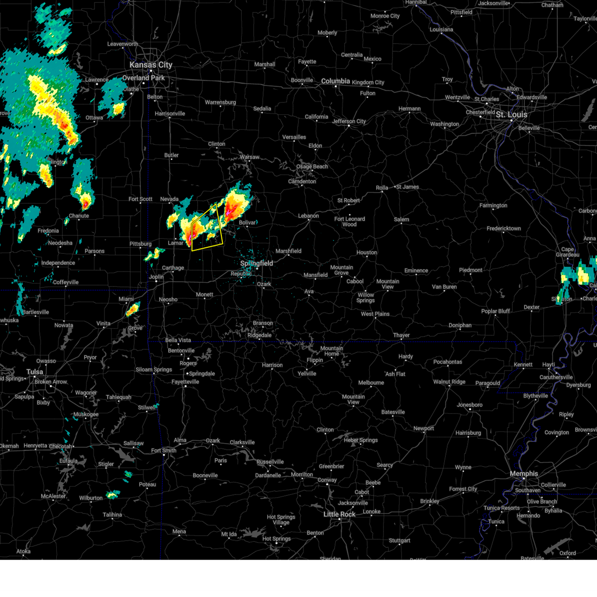 At 158 pm cdt, a severe thunderstorm was located 9 miles north of golden city, or 13 miles northwest of greenfield, moving east at 40 mph (emergency management. half dollar size hail was reported in lamar missouri with this storm). Hazards include golf ball size hail and 60 mph wind gusts. People and animals outdoors will be injured. expect hail damage to roofs, siding, windows, and vehicles. expect wind damage to roofs, siding, and trees. locations impacted include, stockton lake, stockton state park, stockton, greenfield, jerico springs, arcola, umber view heights, neola, caplinger mills, wagoner, cedarville and sylvania. thunderstorm damage threat, considerable hail threat, radar indicated max hail size, 1. 75 in wind threat, radar indicated max wind gust, 60 mph. At 158 pm cdt, a severe thunderstorm was located 9 miles north of golden city, or 13 miles northwest of greenfield, moving east at 40 mph (emergency management. half dollar size hail was reported in lamar missouri with this storm). Hazards include golf ball size hail and 60 mph wind gusts. People and animals outdoors will be injured. expect hail damage to roofs, siding, windows, and vehicles. expect wind damage to roofs, siding, and trees. locations impacted include, stockton lake, stockton state park, stockton, greenfield, jerico springs, arcola, umber view heights, neola, caplinger mills, wagoner, cedarville and sylvania. thunderstorm damage threat, considerable hail threat, radar indicated max hail size, 1. 75 in wind threat, radar indicated max wind gust, 60 mph.
|
| 4/15/2023 1:46 PM CDT |
 At 145 pm cdt, a severe thunderstorm was located near lamar, moving east at 40 mph (emergency management. half dollar size hail reported in lamar missouri). Hazards include ping pong ball size hail and 60 mph wind gusts. People and animals outdoors will be injured. expect hail damage to roofs, siding, windows, and vehicles. expect wind damage to roofs, siding, and trees. locations impacted include, stockton lake, stockton state park, stockton, greenfield, golden city, jerico springs, arcola, umber view heights, milford, caplinger mills, wagoner, kenoma, neola, cedarville and sylvania. hail threat, radar indicated max hail size, 1. 50 in wind threat, radar indicated max wind gust, 60 mph. At 145 pm cdt, a severe thunderstorm was located near lamar, moving east at 40 mph (emergency management. half dollar size hail reported in lamar missouri). Hazards include ping pong ball size hail and 60 mph wind gusts. People and animals outdoors will be injured. expect hail damage to roofs, siding, windows, and vehicles. expect wind damage to roofs, siding, and trees. locations impacted include, stockton lake, stockton state park, stockton, greenfield, golden city, jerico springs, arcola, umber view heights, milford, caplinger mills, wagoner, kenoma, neola, cedarville and sylvania. hail threat, radar indicated max hail size, 1. 50 in wind threat, radar indicated max wind gust, 60 mph.
|
| 4/15/2023 1:31 PM CDT |
 At 130 pm cdt, a severe thunderstorm was located near lamar, moving northeast at 40 mph (radar indicated. this storm has a history of producing up hail up to the size of golf balls). Hazards include ping pong ball size hail and 60 mph wind gusts. People and animals outdoors will be injured. expect hail damage to roofs, siding, windows, and vehicles. Expect wind damage to roofs, siding, and trees. At 130 pm cdt, a severe thunderstorm was located near lamar, moving northeast at 40 mph (radar indicated. this storm has a history of producing up hail up to the size of golf balls). Hazards include ping pong ball size hail and 60 mph wind gusts. People and animals outdoors will be injured. expect hail damage to roofs, siding, windows, and vehicles. Expect wind damage to roofs, siding, and trees.
|
| 4/5/2023 4:20 AM CDT |
 The severe thunderstorm warning for cedar and southern st. clair counties will expire at 430 am cdt, the storm which prompted the warning has weakened below severe limits, and has exited the warned area. therefore, the warning will be allowed to expire. a severe thunderstorm watch remains in effect until 1000 am cdt for southwestern and west central missouri. The severe thunderstorm warning for cedar and southern st. clair counties will expire at 430 am cdt, the storm which prompted the warning has weakened below severe limits, and has exited the warned area. therefore, the warning will be allowed to expire. a severe thunderstorm watch remains in effect until 1000 am cdt for southwestern and west central missouri.
|
| 4/5/2023 3:55 AM CDT |
 At 355 am cdt, a severe thunderstorm was located near el dorado springs, moving northeast at 65 mph (radar indicated). Hazards include 60 mph wind gusts and quarter size hail. Hail damage to vehicles is expected. expect wind damage to roofs, siding, and trees. locations impacted include, stockton lake, stockton state park, el dorado springs, stockton, jerico springs, collins, umber view heights, bearcreek, masters, olympia, caplinger mills, wagoner, arnica, filley, cedar springs and cane hill. hail threat, radar indicated max hail size, 1. 00 in wind threat, radar indicated max wind gust, 60 mph. At 355 am cdt, a severe thunderstorm was located near el dorado springs, moving northeast at 65 mph (radar indicated). Hazards include 60 mph wind gusts and quarter size hail. Hail damage to vehicles is expected. expect wind damage to roofs, siding, and trees. locations impacted include, stockton lake, stockton state park, el dorado springs, stockton, jerico springs, collins, umber view heights, bearcreek, masters, olympia, caplinger mills, wagoner, arnica, filley, cedar springs and cane hill. hail threat, radar indicated max hail size, 1. 00 in wind threat, radar indicated max wind gust, 60 mph.
|
| 4/5/2023 3:35 AM CDT |
 At 335 am cdt, a severe thunderstorm was located near lamar, moving northeast at 60 mph (radar indicated). Hazards include 70 mph wind gusts and quarter size hail. Hail damage to vehicles is expected. expect considerable tree damage. Wind damage is also likely to mobile homes, roofs, and outbuildings. At 335 am cdt, a severe thunderstorm was located near lamar, moving northeast at 60 mph (radar indicated). Hazards include 70 mph wind gusts and quarter size hail. Hail damage to vehicles is expected. expect considerable tree damage. Wind damage is also likely to mobile homes, roofs, and outbuildings.
|
| 10/12/2022 6:41 AM CDT |
 The severe thunderstorm warning for barton, cedar, st. clair, southeastern vernon and northwestern dade counties will expire at 645 am cdt, the storms which prompted the warning have weakened below severe limits, and no longer pose an immediate threat to life or property. therefore, the warning will be allowed to expire. The severe thunderstorm warning for barton, cedar, st. clair, southeastern vernon and northwestern dade counties will expire at 645 am cdt, the storms which prompted the warning have weakened below severe limits, and no longer pose an immediate threat to life or property. therefore, the warning will be allowed to expire.
|
| 10/12/2022 6:08 AM CDT |
 At 607 am cdt, severe thunderstorms were located along a line extending from near schell city to near sheldon to near mulberry, moving east at 45 mph (radar indicated). Hazards include quarter size hail. damage to vehicles is expected At 607 am cdt, severe thunderstorms were located along a line extending from near schell city to near sheldon to near mulberry, moving east at 45 mph (radar indicated). Hazards include quarter size hail. damage to vehicles is expected
|
| 8/29/2022 12:47 PM CDT | At 1246 pm cdt, a severe thunderstorm was located near stockton, moving east at 30 mph. another storm was located 6 miles southwest of el dorado springs moving east at 30 mph (radar indicated). Hazards include 60 mph wind gusts and penny size hail. expect damage to roofs, siding, and trees |
| 8/8/2022 9:43 PM CDT |
 At 943 pm cdt, a severe thunderstorm was located near stockton, moving south at 10 mph (radar indicated). Hazards include 60 mph wind gusts and nickel size hail. expect damage to roofs, siding, and trees At 943 pm cdt, a severe thunderstorm was located near stockton, moving south at 10 mph (radar indicated). Hazards include 60 mph wind gusts and nickel size hail. expect damage to roofs, siding, and trees
|
| 8/8/2022 8:29 PM CDT |
 At 829 pm cdt, a severe thunderstorm was located 11 miles south of el dorado springs, moving southeast at 10 mph (radar indicated). Hazards include 60 mph wind gusts and quarter size hail. Hail damage to vehicles is expected. Expect wind damage to roofs, siding, and trees. At 829 pm cdt, a severe thunderstorm was located 11 miles south of el dorado springs, moving southeast at 10 mph (radar indicated). Hazards include 60 mph wind gusts and quarter size hail. Hail damage to vehicles is expected. Expect wind damage to roofs, siding, and trees.
|
| 4/21/2022 4:14 PM CDT |
 At 413 pm cdt, a severe thunderstorm was located 10 miles northeast of sheldon, or 10 miles southwest of el dorado springs, moving east at 30 mph (radar indicated). Hazards include ping pong ball size hail and 60 mph wind gusts. People and animals outdoors will be injured. expect hail damage to roofs, siding, windows, and vehicles. Expect wind damage to roofs, siding, and trees. At 413 pm cdt, a severe thunderstorm was located 10 miles northeast of sheldon, or 10 miles southwest of el dorado springs, moving east at 30 mph (radar indicated). Hazards include ping pong ball size hail and 60 mph wind gusts. People and animals outdoors will be injured. expect hail damage to roofs, siding, windows, and vehicles. Expect wind damage to roofs, siding, and trees.
|
| 4/21/2022 3:42 PM CDT |
 At 341 pm cdt, a severe thunderstorm was located 9 miles west of stockton, moving east at 20 mph (public. large hail the size of half dollards has been reported). Hazards include tennis ball size hail and 60 mph wind gusts. People and animals outdoors will be injured. expect hail damage to roofs, siding, windows, and vehicles. expect wind damage to roofs, siding, and trees. locations impacted include, stockton lake, stockton state park, stockton, montevallo, jerico springs, umber view heights, bearcreek, masters, olympia, filley, wagoner, arnica, thunderstorm damage threat, considerable hail threat, observed max hail size, 2. 50 in wind threat, radar indicated max wind gust, 60 mph. At 341 pm cdt, a severe thunderstorm was located 9 miles west of stockton, moving east at 20 mph (public. large hail the size of half dollards has been reported). Hazards include tennis ball size hail and 60 mph wind gusts. People and animals outdoors will be injured. expect hail damage to roofs, siding, windows, and vehicles. expect wind damage to roofs, siding, and trees. locations impacted include, stockton lake, stockton state park, stockton, montevallo, jerico springs, umber view heights, bearcreek, masters, olympia, filley, wagoner, arnica, thunderstorm damage threat, considerable hail threat, observed max hail size, 2. 50 in wind threat, radar indicated max wind gust, 60 mph.
|
| 4/21/2022 3:30 PM CDT |
 At 329 pm cdt, a severe thunderstorm was located 12 miles west of stockton, moving east at 25 mph (radar indicated). Hazards include two inch hail and 60 mph wind gusts. People and animals outdoors will be injured. expect hail damage to roofs, siding, windows, and vehicles. Expect wind damage to roofs, siding, and trees. At 329 pm cdt, a severe thunderstorm was located 12 miles west of stockton, moving east at 25 mph (radar indicated). Hazards include two inch hail and 60 mph wind gusts. People and animals outdoors will be injured. expect hail damage to roofs, siding, windows, and vehicles. Expect wind damage to roofs, siding, and trees.
|
| 4/21/2022 3:19 PM CDT |
 At 318 pm cdt, a severe thunderstorm was located 10 miles east of sheldon, or 12 miles southwest of el dorado springs, moving east at 20 mph (radar indicated). Hazards include two inch hail and 60 mph wind gusts. People and animals outdoors will be injured. expect hail damage to roofs, siding, windows, and vehicles. expect wind damage to roofs, siding, and trees. locations impacted include, stockton lake, stockton state park, stockton, montevallo, jerico springs, umber view heights, bearcreek, olympia, caplinger mills, filley, wagoner, arnica, thunderstorm damage threat, considerable hail threat, radar indicated max hail size, 2. 00 in wind threat, radar indicated max wind gust, 60 mph. At 318 pm cdt, a severe thunderstorm was located 10 miles east of sheldon, or 12 miles southwest of el dorado springs, moving east at 20 mph (radar indicated). Hazards include two inch hail and 60 mph wind gusts. People and animals outdoors will be injured. expect hail damage to roofs, siding, windows, and vehicles. expect wind damage to roofs, siding, and trees. locations impacted include, stockton lake, stockton state park, stockton, montevallo, jerico springs, umber view heights, bearcreek, olympia, caplinger mills, filley, wagoner, arnica, thunderstorm damage threat, considerable hail threat, radar indicated max hail size, 2. 00 in wind threat, radar indicated max wind gust, 60 mph.
|
| 4/21/2022 3:07 PM CDT |
 At 307 pm cdt, a severe thunderstorm was located 11 miles east of sheldon, or 12 miles south of el dorado springs, moving east at 20 mph (radar indicated). Hazards include 60 mph wind gusts and half dollar size hail. Hail damage to vehicles is expected. expect wind damage to roofs, siding, and trees. locations impacted include, stockton lake, stockton state park, stockton, montevallo, jerico springs, umber view heights, bearcreek, olympia, caplinger mills, filley, wagoner, arnica, hail threat, radar indicated max hail size, 1. 25 in wind threat, radar indicated max wind gust, 60 mph. At 307 pm cdt, a severe thunderstorm was located 11 miles east of sheldon, or 12 miles south of el dorado springs, moving east at 20 mph (radar indicated). Hazards include 60 mph wind gusts and half dollar size hail. Hail damage to vehicles is expected. expect wind damage to roofs, siding, and trees. locations impacted include, stockton lake, stockton state park, stockton, montevallo, jerico springs, umber view heights, bearcreek, olympia, caplinger mills, filley, wagoner, arnica, hail threat, radar indicated max hail size, 1. 25 in wind threat, radar indicated max wind gust, 60 mph.
|
| 4/21/2022 2:48 PM CDT |
 At 248 pm cdt, a severe thunderstorm was located near sheldon, or 11 miles southeast of nevada, moving east at 20 mph (radar indicated). Hazards include ping pong ball size hail and 60 mph wind gusts. People and animals outdoors will be injured. expect hail damage to roofs, siding, windows, and vehicles. Expect wind damage to roofs, siding, and trees. At 248 pm cdt, a severe thunderstorm was located near sheldon, or 11 miles southeast of nevada, moving east at 20 mph (radar indicated). Hazards include ping pong ball size hail and 60 mph wind gusts. People and animals outdoors will be injured. expect hail damage to roofs, siding, windows, and vehicles. Expect wind damage to roofs, siding, and trees.
|
| 10/11/2021 4:54 AM CDT |
 At 454 am cdt, a tornado producing storm was located near golden city, or 9 miles southeast of lamar, moving north at 50 mph (radar confirmed tornado). Hazards include damaging tornado. Flying debris will be dangerous to those caught without shelter. mobile homes will be damaged or destroyed. damage to roofs, windows, and vehicles will occur. Tree damage is likely. At 454 am cdt, a tornado producing storm was located near golden city, or 9 miles southeast of lamar, moving north at 50 mph (radar confirmed tornado). Hazards include damaging tornado. Flying debris will be dangerous to those caught without shelter. mobile homes will be damaged or destroyed. damage to roofs, windows, and vehicles will occur. Tree damage is likely.
|
| 3/17/2021 5:16 AM CDT |
 At 515 am cdt, a severe thunderstorm was located 7 miles east of lamar, moving north at 45 mph. another severe thunderstorm was located near verdella moving north at 45 mph (radar indicated). Hazards include quarter size hail. damage to vehicles is expected At 515 am cdt, a severe thunderstorm was located 7 miles east of lamar, moving north at 45 mph. another severe thunderstorm was located near verdella moving north at 45 mph (radar indicated). Hazards include quarter size hail. damage to vehicles is expected
|
| 8/29/2020 10:17 AM CDT |
 At 1016 am cdt, severe thunderstorms were located along a line extending from 11 miles south of el dorado springs to 8 miles south of stockton to near ash grove to 7 miles southwest of willard to 6 miles northwest of republic, moving east at 35 mph (law enforcement. this line of storms has a history of down power lines and tree limbs). Hazards include 60 mph wind gusts and penny size hail. Expect damage to roofs, siding, and trees. Locations impacted include, stockton lake, stockton state park, stockton, greenfield, everton, dadeville, jerico springs, halltown, south greenfield, arcola, umber view heights, bearcreek, masters, wagoner, cane hill, neola, cedarville, bona, this includes interstate 44 between mile markers 55 and 58. At 1016 am cdt, severe thunderstorms were located along a line extending from 11 miles south of el dorado springs to 8 miles south of stockton to near ash grove to 7 miles southwest of willard to 6 miles northwest of republic, moving east at 35 mph (law enforcement. this line of storms has a history of down power lines and tree limbs). Hazards include 60 mph wind gusts and penny size hail. Expect damage to roofs, siding, and trees. Locations impacted include, stockton lake, stockton state park, stockton, greenfield, everton, dadeville, jerico springs, halltown, south greenfield, arcola, umber view heights, bearcreek, masters, wagoner, cane hill, neola, cedarville, bona, this includes interstate 44 between mile markers 55 and 58.
|
| 8/29/2020 9:53 AM CDT |
 At 951 am cdt, severe thunderstorms were located along a line extending from 6 miles east of sheldon to 9 miles north of lockwood to 7 miles southwest of everton to near miller to near mount vernon, moving east at 50 mph (law enforcement. this line of storms has a history of producing wind gusts of 60 to 70 mph and downing power lines and trees). Hazards include 60 mph wind gusts and penny size hail. Expect damage to roofs, siding, and trees. Locations impacted include, stockton lake, stockton state park, stockton, greenfield, lockwood, miller, everton, dadeville, jerico springs, halltown, south greenfield, arcola, umber view heights, bearcreek, masters, red oak, wagoner, cane hill, pennsboro, neola, this includes interstate 44 between mile markers 55 and 58. At 951 am cdt, severe thunderstorms were located along a line extending from 6 miles east of sheldon to 9 miles north of lockwood to 7 miles southwest of everton to near miller to near mount vernon, moving east at 50 mph (law enforcement. this line of storms has a history of producing wind gusts of 60 to 70 mph and downing power lines and trees). Hazards include 60 mph wind gusts and penny size hail. Expect damage to roofs, siding, and trees. Locations impacted include, stockton lake, stockton state park, stockton, greenfield, lockwood, miller, everton, dadeville, jerico springs, halltown, south greenfield, arcola, umber view heights, bearcreek, masters, red oak, wagoner, cane hill, pennsboro, neola, this includes interstate 44 between mile markers 55 and 58.
|
| 8/29/2020 9:32 AM CDT |
 At 931 am cdt, severe thunderstorms were located along a line extending from 9 miles northeast of arcadia to near lamar to near golden city to 7 miles north of sarcoxie, moving east at 50 mph (law enforcement. this line of storms has a history of producing wind gusts of 60 to 70 mph and downing power lines and trees). Hazards include 70 mph wind gusts and penny size hail. Expect considerable tree damage. Damage is likely to mobile homes, roofs, and outbuildings. At 931 am cdt, severe thunderstorms were located along a line extending from 9 miles northeast of arcadia to near lamar to near golden city to 7 miles north of sarcoxie, moving east at 50 mph (law enforcement. this line of storms has a history of producing wind gusts of 60 to 70 mph and downing power lines and trees). Hazards include 70 mph wind gusts and penny size hail. Expect considerable tree damage. Damage is likely to mobile homes, roofs, and outbuildings.
|
| 6/4/2020 4:13 AM CDT |
 At 413 am cdt, severe thunderstorms were located along a line extending from 6 miles north of wheatland to 13 miles east of sheldon, moving east at 45 mph (radar indicated). Hazards include 60 mph wind gusts and nickel size hail. expect damage to roofs, siding, and trees At 413 am cdt, severe thunderstorms were located along a line extending from 6 miles north of wheatland to 13 miles east of sheldon, moving east at 45 mph (radar indicated). Hazards include 60 mph wind gusts and nickel size hail. expect damage to roofs, siding, and trees
|
| 6/4/2020 4:01 AM CDT |
 At 401 am cdt, severe thunderstorms were located along a line extending from 7 miles northeast of osceola to near sheldon to 6 miles north of girard, moving east at 45 mph (radar indicated). Hazards include 60 mph wind gusts and quarter size hail. Hail damage to vehicles is expected. expect wind damage to roofs, siding, and trees. Locations impacted include, truman lake, nevada, el dorado springs, osceola, lowry city, sheldon, montevallo, walker, bronaugh, jerico springs, collins, moundville, roscoe, milo, vista, harwood, gerster, monegaw springs, olympia, caplinger mills, this includes interstate 49 between mile markers 78 and 97. At 401 am cdt, severe thunderstorms were located along a line extending from 7 miles northeast of osceola to near sheldon to 6 miles north of girard, moving east at 45 mph (radar indicated). Hazards include 60 mph wind gusts and quarter size hail. Hail damage to vehicles is expected. expect wind damage to roofs, siding, and trees. Locations impacted include, truman lake, nevada, el dorado springs, osceola, lowry city, sheldon, montevallo, walker, bronaugh, jerico springs, collins, moundville, roscoe, milo, vista, harwood, gerster, monegaw springs, olympia, caplinger mills, this includes interstate 49 between mile markers 78 and 97.
|
| 6/4/2020 3:21 AM CDT |
 At 321 am cdt, severe thunderstorms were located along a line extending from near clinton to near hume to near la harpe, moving southeast at 45 mph (radar indicated). Hazards include 60 mph wind gusts and quarter size hail. Hail damage to vehicles is expected. Expect wind damage to roofs, siding, and trees. At 321 am cdt, severe thunderstorms were located along a line extending from near clinton to near hume to near la harpe, moving southeast at 45 mph (radar indicated). Hazards include 60 mph wind gusts and quarter size hail. Hail damage to vehicles is expected. Expect wind damage to roofs, siding, and trees.
|
| 5/15/2020 2:20 AM CDT |
 At 219 am cdt, severe thunderstorms were located along a line extending from near urbana to 9 miles northwest of buffalo to near bolivar to 6 miles northwest of morrisville, moving southeast at 45 mph (radar indicated). Hazards include 60 mph wind gusts and nickel size hail. Expect damage to roofs, siding, and trees. Locations impacted include, bolivar, stockton lake, pomme de terre lake, pomme de terre state park, stockton state park, stockton, pittsburg, humansville, polk, fair play, hermitage, urbana, wheatland, jerico springs, preston, cross timbers, halfway, flemington, louisburg, umber view heights,. At 219 am cdt, severe thunderstorms were located along a line extending from near urbana to 9 miles northwest of buffalo to near bolivar to 6 miles northwest of morrisville, moving southeast at 45 mph (radar indicated). Hazards include 60 mph wind gusts and nickel size hail. Expect damage to roofs, siding, and trees. Locations impacted include, bolivar, stockton lake, pomme de terre lake, pomme de terre state park, stockton state park, stockton, pittsburg, humansville, polk, fair play, hermitage, urbana, wheatland, jerico springs, preston, cross timbers, halfway, flemington, louisburg, umber view heights,.
|
| 5/15/2020 1:42 AM CDT |
 At 142 am cdt, severe thunderstorms were located along a line extending from 9 miles east of osceola to near weaubleau to stockton to 13 miles south of el dorado springs, moving southeast at 45 mph (radar indicated). Hazards include 60 mph wind gusts. expect damage to roofs, siding, and trees At 142 am cdt, severe thunderstorms were located along a line extending from 9 miles east of osceola to near weaubleau to stockton to 13 miles south of el dorado springs, moving southeast at 45 mph (radar indicated). Hazards include 60 mph wind gusts. expect damage to roofs, siding, and trees
|
| 5/4/2020 11:37 AM CDT |
 At 1137 am cdt, a severe thunderstorm capable of producing a tornado was located 8 miles east of sheldon, or 13 miles northeast of lamar, moving east at 30 mph (radar indicated rotation). Hazards include tornado and hail up to two inches in diameter. Flying debris will be dangerous to those caught without shelter. mobile homes will be damaged or destroyed. damage to roofs, windows, and vehicles will occur. Tree damage is likely. At 1137 am cdt, a severe thunderstorm capable of producing a tornado was located 8 miles east of sheldon, or 13 miles northeast of lamar, moving east at 30 mph (radar indicated rotation). Hazards include tornado and hail up to two inches in diameter. Flying debris will be dangerous to those caught without shelter. mobile homes will be damaged or destroyed. damage to roofs, windows, and vehicles will occur. Tree damage is likely.
|
| 5/4/2020 11:32 AM CDT |
 At 1131 am cdt, a severe thunderstorm was located 11 miles east of sheldon, or 14 miles south of el dorado springs. otherstorms were located just west of caplinger mills. these storms were moving east at 45 mph (radar indicated). Hazards include two inch hail and 60 mph wind gusts. People and animals outdoors will be injured. expect hail damage to roofs, siding, windows, and vehicles. Expect wind damage to roofs, siding, and trees. At 1131 am cdt, a severe thunderstorm was located 11 miles east of sheldon, or 14 miles south of el dorado springs. otherstorms were located just west of caplinger mills. these storms were moving east at 45 mph (radar indicated). Hazards include two inch hail and 60 mph wind gusts. People and animals outdoors will be injured. expect hail damage to roofs, siding, windows, and vehicles. Expect wind damage to roofs, siding, and trees.
|
| 5/4/2020 10:17 AM CDT |
 At 1016 am cdt, severe thunderstorms were located along a line extending from near nevada to 6 miles northeast of golden city, moving northeast at 45 mph (radar indicated). Hazards include 60 mph wind gusts and half dollar size hail. Hail damage to vehicles is expected. Expect wind damage to roofs, siding, and trees. At 1016 am cdt, severe thunderstorms were located along a line extending from near nevada to 6 miles northeast of golden city, moving northeast at 45 mph (radar indicated). Hazards include 60 mph wind gusts and half dollar size hail. Hail damage to vehicles is expected. Expect wind damage to roofs, siding, and trees.
|
| 5/3/2020 9:55 AM CDT |
 At 954 am cdt, severe thunderstorms were located along a line extending from near lowry city to near miller, moving east at 45 mph (radar indicated). Hazards include golf ball size hail and 60 to 70 mph wind gusts. People and animals outdoors will be injured. expect hail damage to roofs, siding, windows, and vehicles. expect wind damage to roofs, siding, and trees. Locations impacted include, stockton lake, truman lake, stockton state park, el dorado springs, stockton, greenfield, appleton city, osceola, lockwood, lowry city, everton, dadeville, jerico springs, collins, roscoe, south greenfield, arcola, vista, umber view heights, gerster,. At 954 am cdt, severe thunderstorms were located along a line extending from near lowry city to near miller, moving east at 45 mph (radar indicated). Hazards include golf ball size hail and 60 to 70 mph wind gusts. People and animals outdoors will be injured. expect hail damage to roofs, siding, windows, and vehicles. expect wind damage to roofs, siding, and trees. Locations impacted include, stockton lake, truman lake, stockton state park, el dorado springs, stockton, greenfield, appleton city, osceola, lockwood, lowry city, everton, dadeville, jerico springs, collins, roscoe, south greenfield, arcola, vista, umber view heights, gerster,.
|
| 5/3/2020 9:37 AM CDT |
 At 936 am cdt, severe thunderstorms were located along a line extending from near appleton city to 8 miles south of golden city, moving east at 45 mph (radar indicated). Hazards include golf ball size hail and 60 to 70 mph wind gusts. People and animals outdoors will be injured. expect hail damage to roofs, siding, windows, and vehicles. Expect wind damage to roofs, siding, and trees. At 936 am cdt, severe thunderstorms were located along a line extending from near appleton city to 8 miles south of golden city, moving east at 45 mph (radar indicated). Hazards include golf ball size hail and 60 to 70 mph wind gusts. People and animals outdoors will be injured. expect hail damage to roofs, siding, windows, and vehicles. Expect wind damage to roofs, siding, and trees.
|
| 4/24/2020 7:53 PM CDT |
 At 752 pm cdt, severe thunderstorms were located along a line extending from 9 miles south of el dorado springs to 11 miles southwest of stockton to near lockwood, moving east at 35 mph (radar indicated). Hazards include 60 mph wind gusts. Expect damage to roofs, siding, and trees. these severe storms will be near, greenfield around 810 pm cdt. stockton around 820 pm cdt. Other locations impacted by these severe thunderstorms include stockton lake, stockton state park, dadeville, jerico springs, arcola, umber view heights, bearcreek, masters, olympia and caplinger mills. At 752 pm cdt, severe thunderstorms were located along a line extending from 9 miles south of el dorado springs to 11 miles southwest of stockton to near lockwood, moving east at 35 mph (radar indicated). Hazards include 60 mph wind gusts. Expect damage to roofs, siding, and trees. these severe storms will be near, greenfield around 810 pm cdt. stockton around 820 pm cdt. Other locations impacted by these severe thunderstorms include stockton lake, stockton state park, dadeville, jerico springs, arcola, umber view heights, bearcreek, masters, olympia and caplinger mills.
|
| 4/24/2020 7:35 PM CDT |
 At 735 pm cdt, severe thunderstorms were located along a line extending from near sheldon to 9 miles northeast of lamar to near golden city, moving northeast at 30 mph (radar indicated). Hazards include 60 mph wind gusts. Expect damage to roofs, siding, and trees. these severe storms will be near, lockwood around 755 pm cdt. greenfield around 800 pm cdt. other locations impacted by these severe thunderstorms include stockton lake, stockton state park, montevallo, dadeville, jerico springs, irwin, arcola, umber view heights, milford and bearcreek. This includes interstate 49 between mile markers 70 and 78. At 735 pm cdt, severe thunderstorms were located along a line extending from near sheldon to 9 miles northeast of lamar to near golden city, moving northeast at 30 mph (radar indicated). Hazards include 60 mph wind gusts. Expect damage to roofs, siding, and trees. these severe storms will be near, lockwood around 755 pm cdt. greenfield around 800 pm cdt. other locations impacted by these severe thunderstorms include stockton lake, stockton state park, montevallo, dadeville, jerico springs, irwin, arcola, umber view heights, milford and bearcreek. This includes interstate 49 between mile markers 70 and 78.
|
| 4/24/2020 7:13 PM CDT |
 At 713 pm cdt, severe thunderstorms were located along a line extending from 6 miles southwest of sheldon to lamar to near jasper, moving east at 35 mph (radar indicated). Hazards include 60 mph wind gusts. expect damage to roofs, siding, and trees At 713 pm cdt, severe thunderstorms were located along a line extending from 6 miles southwest of sheldon to lamar to near jasper, moving east at 35 mph (radar indicated). Hazards include 60 mph wind gusts. expect damage to roofs, siding, and trees
|
| 9/28/2019 10:22 PM CDT |
 The severe thunderstorm warning for southwestern cedar and northwestern dade counties will expire at 1030 pm cdt, the storm which prompted the warning has weakened below severe limits, and no longer poses an immediate threat to life or property. therefore, the warning will be allowed to expire. however heavy rain is still possible with this thunderstorm. The severe thunderstorm warning for southwestern cedar and northwestern dade counties will expire at 1030 pm cdt, the storm which prompted the warning has weakened below severe limits, and no longer poses an immediate threat to life or property. therefore, the warning will be allowed to expire. however heavy rain is still possible with this thunderstorm.
|
| 9/28/2019 10:00 PM CDT |
 At 959 pm cdt, a severe thunderstorm was located 10 miles northeast of golden city, or 12 miles northwest of greenfield, moving east at 25 mph (radar indicated). Hazards include 60 mph wind gusts and quarter size hail. Hail damage to vehicles is expected. expect wind damage to roofs, siding, and trees. Locations impacted include, jerico springs, arcola, cedarville, sylvania, neola,. At 959 pm cdt, a severe thunderstorm was located 10 miles northeast of golden city, or 12 miles northwest of greenfield, moving east at 25 mph (radar indicated). Hazards include 60 mph wind gusts and quarter size hail. Hail damage to vehicles is expected. expect wind damage to roofs, siding, and trees. Locations impacted include, jerico springs, arcola, cedarville, sylvania, neola,.
|
| 9/28/2019 9:41 PM CDT |
 At 941 pm cdt, a severe thunderstorm was located 7 miles northeast of lamar, moving east at 25 mph (radar indicated). Hazards include 60 mph wind gusts and quarter size hail. Hail damage to vehicles is expected. expect wind damage to roofs, siding, and trees. Locations impacted include, jerico springs, arcola, milford, cedarville, sylvania, neola,. At 941 pm cdt, a severe thunderstorm was located 7 miles northeast of lamar, moving east at 25 mph (radar indicated). Hazards include 60 mph wind gusts and quarter size hail. Hail damage to vehicles is expected. expect wind damage to roofs, siding, and trees. Locations impacted include, jerico springs, arcola, milford, cedarville, sylvania, neola,.
|
| 9/28/2019 9:25 PM CDT |
 At 924 pm cdt, a severe thunderstorm was located near lamar, moving east at 25 mph (radar indicated). Hazards include 60 mph wind gusts and half dollar size hail. Hail damage to vehicles is expected. Expect wind damage to roofs, siding, and trees. At 924 pm cdt, a severe thunderstorm was located near lamar, moving east at 25 mph (radar indicated). Hazards include 60 mph wind gusts and half dollar size hail. Hail damage to vehicles is expected. Expect wind damage to roofs, siding, and trees.
|
| 8/26/2019 2:03 PM CDT |
 At 201 pm cdt, a severe thunderstorm was located 8 miles northeast of greenfield, moving southeast at 35 mph. a funnel cloud was reported with this storm near umber view heights (radar indicated). Hazards include 60 mph wind gusts and quarter size hail. Hail damage to vehicles is expected. expect wind damage to roofs, siding, and trees. Locations impacted include, bolivar, stockton lake, stockton state park, stockton, greenfield, humansville, fair play, dadeville, jerico springs, aldrich, arcola, umber view heights, bearcreek, masters, wagoner, cane hill, arnica, neola, dunnegan, cedarville,. At 201 pm cdt, a severe thunderstorm was located 8 miles northeast of greenfield, moving southeast at 35 mph. a funnel cloud was reported with this storm near umber view heights (radar indicated). Hazards include 60 mph wind gusts and quarter size hail. Hail damage to vehicles is expected. expect wind damage to roofs, siding, and trees. Locations impacted include, bolivar, stockton lake, stockton state park, stockton, greenfield, humansville, fair play, dadeville, jerico springs, aldrich, arcola, umber view heights, bearcreek, masters, wagoner, cane hill, arnica, neola, dunnegan, cedarville,.
|
| 8/26/2019 1:48 PM CDT | 4 to 5 inch branches down e of jerico spring in cedar county MO, 0.1 miles ENE of Jerico Springs, MO |
| 8/26/2019 1:27 PM CDT |
 At 127 pm cdt, a severe thunderstorm was located near el dorado springs, moving southeast at 35 mph (radar indicated). Hazards include 60 mph wind gusts and quarter size hail. Hail damage to vehicles is expected. Expect wind damage to roofs, siding, and trees. At 127 pm cdt, a severe thunderstorm was located near el dorado springs, moving southeast at 35 mph (radar indicated). Hazards include 60 mph wind gusts and quarter size hail. Hail damage to vehicles is expected. Expect wind damage to roofs, siding, and trees.
|
| 8/26/2019 12:55 PM CDT |
 At 1255 pm cdt, severe thunderstorms were located along a line extending from near montrose to near schell city to nevada, moving southeast at 25 mph (radar indicated). Hazards include 60 mph wind gusts. expect damage to roofs, siding, and trees At 1255 pm cdt, severe thunderstorms were located along a line extending from near montrose to near schell city to nevada, moving southeast at 25 mph (radar indicated). Hazards include 60 mph wind gusts. expect damage to roofs, siding, and trees
|
| 8/16/2019 2:08 AM CDT |
 At 208 am cdt, severe thunderstorms were located along a line extending from 8 miles northwest of wheatland to near weaubleau to near humansville to 9 miles southwest of stockton, moving east at 50 mph (radar indicated). Hazards include 60 mph wind gusts and quarter size hail. Hail damage to vehicles is expected. Expect wind damage to roofs, siding, and trees. At 208 am cdt, severe thunderstorms were located along a line extending from 8 miles northwest of wheatland to near weaubleau to near humansville to 9 miles southwest of stockton, moving east at 50 mph (radar indicated). Hazards include 60 mph wind gusts and quarter size hail. Hail damage to vehicles is expected. Expect wind damage to roofs, siding, and trees.
|
| 8/16/2019 2:01 AM CDT |
 A severe thunderstorm warning remains in effect until 215 am cdt for hickory. barton. southeastern cedar. polk. southeastern st. clair and northern dade counties. At 200 am cdt, severe thunderstorms were located along a line extending from 6 miles southeast of osceola to 6 miles southwest of humansville to 8 miles southwest of stockton to near sheldon, moving. A severe thunderstorm warning remains in effect until 215 am cdt for hickory. barton. southeastern cedar. polk. southeastern st. clair and northern dade counties. At 200 am cdt, severe thunderstorms were located along a line extending from 6 miles southeast of osceola to 6 miles southwest of humansville to 8 miles southwest of stockton to near sheldon, moving.
|
| 8/16/2019 1:32 AM CDT |
 At 132 am cdt, severe thunderstorms were located along a line extending from 7 miles southwest of lowry city to near el dorado springs to 7 miles northeast of sheldon to near arcadia, moving southeast at 55 mph (radar indicated). Hazards include 70 mph wind gusts and quarter size hail. Hail damage to vehicles is expected. expect considerable tree damage. Wind damage is also likely to mobile homes, roofs, and outbuildings. At 132 am cdt, severe thunderstorms were located along a line extending from 7 miles southwest of lowry city to near el dorado springs to 7 miles northeast of sheldon to near arcadia, moving southeast at 55 mph (radar indicated). Hazards include 70 mph wind gusts and quarter size hail. Hail damage to vehicles is expected. expect considerable tree damage. Wind damage is also likely to mobile homes, roofs, and outbuildings.
|
| 8/13/2019 1:13 AM CDT |
 At 112 am cdt, severe thunderstorms were located along a line extending from near el dorado springs to 10 miles west of stockton to 7 miles southeast of sheldon, moving east at 25 mph (radar indicated). Hazards include 60 mph wind gusts. Expect damage to roofs, siding, and trees. Locations impacted include, stockton lake, stockton state park, el dorado springs, stockton, dadeville, jerico springs, collins, arcola, umber view heights, bearcreek, masters, olympia, caplinger mills, wagoner, cane hill, arnica, filley, cedar springs, cedarville, bona,. At 112 am cdt, severe thunderstorms were located along a line extending from near el dorado springs to 10 miles west of stockton to 7 miles southeast of sheldon, moving east at 25 mph (radar indicated). Hazards include 60 mph wind gusts. Expect damage to roofs, siding, and trees. Locations impacted include, stockton lake, stockton state park, el dorado springs, stockton, dadeville, jerico springs, collins, arcola, umber view heights, bearcreek, masters, olympia, caplinger mills, wagoner, cane hill, arnica, filley, cedar springs, cedarville, bona,.
|
| 8/13/2019 12:58 AM CDT |
 At 1258 am cdt, severe thunderstorms were located along a line extending from near el dorado springs to near sheldon, moving east at 25 mph (radar indicated). Hazards include 60 mph wind gusts. expect damage to roofs, siding, and trees At 1258 am cdt, severe thunderstorms were located along a line extending from near el dorado springs to near sheldon, moving east at 25 mph (radar indicated). Hazards include 60 mph wind gusts. expect damage to roofs, siding, and trees
|
| 6/21/2019 1:30 PM CDT |
 At 129 pm cdt, severe thunderstorms were located along a line extending from near urbana to 7 miles southwest of stockton, moving southeast at 20 mph (radar indicated). Hazards include 60 mph wind gusts and quarter size hail. Hail damage to vehicles is expected. expect wind damage to roofs, siding, and trees. Locations impacted include, pomme de terre lake, stockton lake, pomme de terre state park, stockton state park, stockton, pittsburg, humansville, polk, fair play, hermitage, weaubleau, wheatland, jerico springs, preston, collins, flemington, umber view heights, bearcreek, arnica, nemo,. At 129 pm cdt, severe thunderstorms were located along a line extending from near urbana to 7 miles southwest of stockton, moving southeast at 20 mph (radar indicated). Hazards include 60 mph wind gusts and quarter size hail. Hail damage to vehicles is expected. expect wind damage to roofs, siding, and trees. Locations impacted include, pomme de terre lake, stockton lake, pomme de terre state park, stockton state park, stockton, pittsburg, humansville, polk, fair play, hermitage, weaubleau, wheatland, jerico springs, preston, collins, flemington, umber view heights, bearcreek, arnica, nemo,.
|
| 6/21/2019 1:19 PM CDT |
 At 118 pm cdt, severe thunderstorms were located along a line extending from near urbana to near humansville to 10 miles west of stockton, moving southeast at 30 mph (radar indicated). Hazards include 60 mph wind gusts and nickel size hail. Expect damage to roofs, siding, and trees. Locations impacted include, pomme de terre lake, stockton lake, pomme de terre state park, stockton state park, el dorado springs, stockton, pittsburg, humansville, polk, fair play, hermitage, weaubleau, wheatland, jerico springs, preston, cross timbers, collins, flemington, vista, umber view heights,. At 118 pm cdt, severe thunderstorms were located along a line extending from near urbana to near humansville to 10 miles west of stockton, moving southeast at 30 mph (radar indicated). Hazards include 60 mph wind gusts and nickel size hail. Expect damage to roofs, siding, and trees. Locations impacted include, pomme de terre lake, stockton lake, pomme de terre state park, stockton state park, el dorado springs, stockton, pittsburg, humansville, polk, fair play, hermitage, weaubleau, wheatland, jerico springs, preston, cross timbers, collins, flemington, vista, umber view heights,.
|
| 6/21/2019 12:59 PM CDT |
 At 1258 pm cdt, severe thunderstorms were located along a line extending from near hermitage to 10 miles north of stockton to 6 miles north of sheldon, moving southeast at 20 mph (public). Hazards include 60 mph wind gusts and quarter size hail. instrument observations and the public reported 60 mph gusts with these storms. Hail damage to vehicles is expected. Expect wind damage to roofs, siding, and trees. At 1258 pm cdt, severe thunderstorms were located along a line extending from near hermitage to 10 miles north of stockton to 6 miles north of sheldon, moving southeast at 20 mph (public). Hazards include 60 mph wind gusts and quarter size hail. instrument observations and the public reported 60 mph gusts with these storms. Hail damage to vehicles is expected. Expect wind damage to roofs, siding, and trees.
|
| 6/21/2019 12:33 PM CDT |
 At 1219 pm cdt, severe thunderstorms were located along a line extending from near warsaw to 9 miles southwest of osceola to near arcadia, moving east at 35 mph (radar indicated). Hazards include 60 mph wind gusts and penny size hail. Expect damage to roofs, siding, and trees. Locations impacted include, pomme de terre lake, truman lake, stockton lake, prairie state park, pomme de terre state park, stockton state park, nevada, fort scott, lamar, el dorado springs, frontenac, girard, stockton, arma, pittsburg, appleton city, humansville, osceola, marmaton, liberal, this includes interstate 49 between mile markers 67 and 107. At 1219 pm cdt, severe thunderstorms were located along a line extending from near warsaw to 9 miles southwest of osceola to near arcadia, moving east at 35 mph (radar indicated). Hazards include 60 mph wind gusts and penny size hail. Expect damage to roofs, siding, and trees. Locations impacted include, pomme de terre lake, truman lake, stockton lake, prairie state park, pomme de terre state park, stockton state park, nevada, fort scott, lamar, el dorado springs, frontenac, girard, stockton, arma, pittsburg, appleton city, humansville, osceola, marmaton, liberal, this includes interstate 49 between mile markers 67 and 107.
|
| 6/21/2019 12:20 PM CDT |
 At 1219 pm cdt, severe thunderstorms were located along a line extending from near warsaw to 9 miles southwest of osceola to near arcadia, moving east at 35 mph (radar indicated). Hazards include 60 mph wind gusts and penny size hail. Expect damage to roofs, siding, and trees. Locations impacted include, pomme de terre lake, truman lake, stockton lake, prairie state park, pomme de terre state park, stockton state park, nevada, fort scott, lamar, el dorado springs, frontenac, girard, stockton, arma, pittsburg, appleton city, humansville, osceola, marmaton, liberal, this includes interstate 49 between mile markers 67 and 107. At 1219 pm cdt, severe thunderstorms were located along a line extending from near warsaw to 9 miles southwest of osceola to near arcadia, moving east at 35 mph (radar indicated). Hazards include 60 mph wind gusts and penny size hail. Expect damage to roofs, siding, and trees. Locations impacted include, pomme de terre lake, truman lake, stockton lake, prairie state park, pomme de terre state park, stockton state park, nevada, fort scott, lamar, el dorado springs, frontenac, girard, stockton, arma, pittsburg, appleton city, humansville, osceola, marmaton, liberal, this includes interstate 49 between mile markers 67 and 107.
|
| 6/21/2019 11:56 AM CDT |
 At 1154 am cdt, severe thunderstorms were located along a line extending from near deepwater to near schell city to near redfield, moving east at 35 mph (radar indicated). Hazards include 60 mph wind gusts and penny size hail. expect damage to roofs, siding, and trees At 1154 am cdt, severe thunderstorms were located along a line extending from near deepwater to near schell city to near redfield, moving east at 35 mph (radar indicated). Hazards include 60 mph wind gusts and penny size hail. expect damage to roofs, siding, and trees
|
| 6/1/2019 6:47 PM CDT |
 At 646 pm cdt, severe thunderstorms were located along a line extending from el dorado springs to 11 miles west of stockton to 6 miles east of lamar to near liberal, moving southeast at 40 mph (emergency management. received reports of trees down in nevada and have received several 60 mph wind reports with this line). Hazards include 60 mph wind gusts and quarter size hail. Hail damage to vehicles is expected. expect wind damage to roofs, siding, and trees. Locations impacted include, stockton lake, stockton state park, lamar, stockton, greenfield, lockwood, golden city, dadeville, jerico springs, lamar heights, irwin, arcola, umber view heights, milford, oakton, wagoner, cane hill, iantha, kenoma, neola, this includes interstate 49 between mile markers 57 and 72. At 646 pm cdt, severe thunderstorms were located along a line extending from el dorado springs to 11 miles west of stockton to 6 miles east of lamar to near liberal, moving southeast at 40 mph (emergency management. received reports of trees down in nevada and have received several 60 mph wind reports with this line). Hazards include 60 mph wind gusts and quarter size hail. Hail damage to vehicles is expected. expect wind damage to roofs, siding, and trees. Locations impacted include, stockton lake, stockton state park, lamar, stockton, greenfield, lockwood, golden city, dadeville, jerico springs, lamar heights, irwin, arcola, umber view heights, milford, oakton, wagoner, cane hill, iantha, kenoma, neola, this includes interstate 49 between mile markers 57 and 72.
|
| 6/1/2019 6:45 PM CDT |
 At 644 pm cdt, severe thunderstorms were located along a line extending from near el dorado springs to 7 miles southeast of sheldon to near redfield, moving southeast at 30 mph (emergency management. received reports of trees down in nevada and have received several 60 mph wind reports with this line). Hazards include 60 mph wind gusts and quarter size hail. Hail damage to vehicles is expected. expect wind damage to roofs, siding, and trees. Locations impacted include, fort scott, el dorado springs, marmaton, liberal, sheldon, montevallo, arcadia, uniontown, bronaugh, jerico springs, redfield, moundville, deerfield, irwin, milford, petersburg, porterville, hannon, olympia, wagoner, this includes interstate 49 between mile markers 70 and 84. At 644 pm cdt, severe thunderstorms were located along a line extending from near el dorado springs to 7 miles southeast of sheldon to near redfield, moving southeast at 30 mph (emergency management. received reports of trees down in nevada and have received several 60 mph wind reports with this line). Hazards include 60 mph wind gusts and quarter size hail. Hail damage to vehicles is expected. expect wind damage to roofs, siding, and trees. Locations impacted include, fort scott, el dorado springs, marmaton, liberal, sheldon, montevallo, arcadia, uniontown, bronaugh, jerico springs, redfield, moundville, deerfield, irwin, milford, petersburg, porterville, hannon, olympia, wagoner, this includes interstate 49 between mile markers 70 and 84.
|
| 6/1/2019 6:26 PM CDT |
 At 625 pm cdt, severe thunderstorms were located along a line extending from near el dorado springs to near sheldon to 9 miles northeast of arcadia, moving southeast at 40 mph (emergency management. have received multiple reports of 60 mph winds with this line). Hazards include 70 mph wind gusts and quarter size hail. Hail damage to vehicles is expected. expect considerable tree damage. Wind damage is also likely to mobile homes, roofs, and outbuildings. At 625 pm cdt, severe thunderstorms were located along a line extending from near el dorado springs to near sheldon to 9 miles northeast of arcadia, moving southeast at 40 mph (emergency management. have received multiple reports of 60 mph winds with this line). Hazards include 70 mph wind gusts and quarter size hail. Hail damage to vehicles is expected. expect considerable tree damage. Wind damage is also likely to mobile homes, roofs, and outbuildings.
|
| 6/1/2019 6:23 PM CDT |
 At 622 pm cdt, severe thunderstorms were located along a line extending from near walker to near sheldon to 7 miles north of uniontown, moving southeast at 45 mph (emergency management. have received multiple reports of 60 mph winds across vernon county). Hazards include 70 mph wind gusts and quarter size hail. Hail damage to vehicles is expected. expect considerable tree damage. wind damage is also likely to mobile homes, roofs, and outbuildings. Locations impacted include, nevada, fort scott, el dorado springs, marmaton, liberal, sheldon, bronson, montevallo, arcadia, uniontown, walker, bronaugh, jerico springs, redfield, moundville, richards, milo, deerfield, irwin, harwood, this includes interstate 49 between mile markers 70 and 99. At 622 pm cdt, severe thunderstorms were located along a line extending from near walker to near sheldon to 7 miles north of uniontown, moving southeast at 45 mph (emergency management. have received multiple reports of 60 mph winds across vernon county). Hazards include 70 mph wind gusts and quarter size hail. Hail damage to vehicles is expected. expect considerable tree damage. wind damage is also likely to mobile homes, roofs, and outbuildings. Locations impacted include, nevada, fort scott, el dorado springs, marmaton, liberal, sheldon, bronson, montevallo, arcadia, uniontown, walker, bronaugh, jerico springs, redfield, moundville, richards, milo, deerfield, irwin, harwood, this includes interstate 49 between mile markers 70 and 99.
|
| 6/1/2019 6:07 PM CDT |
 At 605 pm cdt, severe thunderstorms were located along a line extending from near schell city to 9 miles east of fort scott to 6 miles southwest of blue mound, moving southeast at 25 mph (radar indicated). Hazards include 70 mph wind gusts and half dollar size hail. Hail damage to vehicles is expected. expect considerable tree damage. Wind damage is also likely to mobile homes, roofs, and outbuildings. At 605 pm cdt, severe thunderstorms were located along a line extending from near schell city to 9 miles east of fort scott to 6 miles southwest of blue mound, moving southeast at 25 mph (radar indicated). Hazards include 70 mph wind gusts and half dollar size hail. Hail damage to vehicles is expected. expect considerable tree damage. Wind damage is also likely to mobile homes, roofs, and outbuildings.
|
| 5/27/2019 9:02 AM CDT |
 At 900 am cdt, a line of strong to severe thunderstorms were located along a line extending from 7 miles east of el dorado springs to 9 miles north of golden city, moving east at 40 mph. as this line moves east, a second line of severe storms extending from milo to lamar will move back into the warned area (radar indicated). Hazards include 60 mph wind gusts. Expect damage to roofs, siding, and trees. Locations impacted include, stockton lake, stockton state park, el dorado springs, stockton, montevallo, jerico springs, collins, roscoe, vista, umber view heights, milford, gerster, bearcreek, masters, olympia, caplinger mills, wagoner, cane hill, harper, arnica,. At 900 am cdt, a line of strong to severe thunderstorms were located along a line extending from 7 miles east of el dorado springs to 9 miles north of golden city, moving east at 40 mph. as this line moves east, a second line of severe storms extending from milo to lamar will move back into the warned area (radar indicated). Hazards include 60 mph wind gusts. Expect damage to roofs, siding, and trees. Locations impacted include, stockton lake, stockton state park, el dorado springs, stockton, montevallo, jerico springs, collins, roscoe, vista, umber view heights, milford, gerster, bearcreek, masters, olympia, caplinger mills, wagoner, cane hill, harper, arnica,.
|
| 5/27/2019 8:39 AM CDT |
 At 839 am cdt, severe thunderstorms were located along a line extending from el dorado springs to near lamar, moving east at 50 mph (radar indicated). Hazards include 60 mph wind gusts. expect damage to roofs, siding, and trees At 839 am cdt, severe thunderstorms were located along a line extending from el dorado springs to near lamar, moving east at 50 mph (radar indicated). Hazards include 60 mph wind gusts. expect damage to roofs, siding, and trees
|
| 5/22/2019 10:03 PM CDT |
 At 1002 pm cdt, a severe thunderstorm was located 7 miles southwest of stockton, moving northeast at 30 mph (radar indicated). Hazards include 60 mph wind gusts and quarter size hail. Hail damage to vehicles is expected. expect wind damage to roofs, siding, and trees. Locations impacted include, stockton, jerico springs, wagoner,. At 1002 pm cdt, a severe thunderstorm was located 7 miles southwest of stockton, moving northeast at 30 mph (radar indicated). Hazards include 60 mph wind gusts and quarter size hail. Hail damage to vehicles is expected. expect wind damage to roofs, siding, and trees. Locations impacted include, stockton, jerico springs, wagoner,.
|
| 5/22/2019 9:27 PM CDT |
 At 927 pm cdt, a severe thunderstorm was located 7 miles southeast of sheldon, or 7 miles northeast of lamar, moving northeast at 35 mph (radar indicated). Hazards include 70 mph wind gusts and ping pong ball size hail. People and animals outdoors will be injured. expect hail damage to roofs, siding, windows, and vehicles. expect considerable tree damage. Wind damage is also likely to mobile homes, roofs, and outbuildings. At 927 pm cdt, a severe thunderstorm was located 7 miles southeast of sheldon, or 7 miles northeast of lamar, moving northeast at 35 mph (radar indicated). Hazards include 70 mph wind gusts and ping pong ball size hail. People and animals outdoors will be injured. expect hail damage to roofs, siding, windows, and vehicles. expect considerable tree damage. Wind damage is also likely to mobile homes, roofs, and outbuildings.
|
| 5/20/2019 4:55 PM CDT |
 At 455 pm cdt, severe thunderstorms were located along a line extending from near lamar to near jasper to near alba, moving northeast at 50 mph (radar indicated). Hazards include 60 mph wind gusts. expect damage to roofs, siding, and trees At 455 pm cdt, severe thunderstorms were located along a line extending from near lamar to near jasper to near alba, moving northeast at 50 mph (radar indicated). Hazards include 60 mph wind gusts. expect damage to roofs, siding, and trees
|
| 5/18/2019 3:18 PM CDT |
 At 318 pm cdt, severe thunderstorms were located along a line extending from near stockton to 8 miles southwest of fair play to near walnut grove to near ash grove to billings, moving northeast at 45 mph (radar indicated). Hazards include 60 mph wind gusts and quarter size hail. Hail damage to vehicles is expected. Expect wind damage to roofs, siding, and trees. At 318 pm cdt, severe thunderstorms were located along a line extending from near stockton to 8 miles southwest of fair play to near walnut grove to near ash grove to billings, moving northeast at 45 mph (radar indicated). Hazards include 60 mph wind gusts and quarter size hail. Hail damage to vehicles is expected. Expect wind damage to roofs, siding, and trees.
|
| 5/18/2019 2:56 PM CDT |
 The severe thunderstorm warning for eastern barton, southwestern cedar, northwestern lawrence, eastern vernon, eastern jasper and western dade counties will expire at 300 pm cdt, the storms which prompted the warning have moved out of the area. other severe thunderstorm warnings have been issued east of this area. a tornado watch remains in effect until 500 pm cdt for southwestern and west central missouri. The severe thunderstorm warning for eastern barton, southwestern cedar, northwestern lawrence, eastern vernon, eastern jasper and western dade counties will expire at 300 pm cdt, the storms which prompted the warning have moved out of the area. other severe thunderstorm warnings have been issued east of this area. a tornado watch remains in effect until 500 pm cdt for southwestern and west central missouri.
|
| 5/18/2019 2:49 PM CDT |
 At 249 pm cdt, severe thunderstorms were located along a line extending from near golden city to 6 miles west of mount vernon, moving northeast at 40 mph (radar indicated). Hazards include 60 mph wind gusts and half dollar size hail. Hail damage to vehicles is expected. Expect wind damage to roofs, siding, and trees. At 249 pm cdt, severe thunderstorms were located along a line extending from near golden city to 6 miles west of mount vernon, moving northeast at 40 mph (radar indicated). Hazards include 60 mph wind gusts and half dollar size hail. Hail damage to vehicles is expected. Expect wind damage to roofs, siding, and trees.
|
| 5/18/2019 2:43 PM CDT |
 At 242 pm cdt, severe thunderstorms were located along a line extending from near walker to golden city to near sarcoxie, moving northeast at 45 mph (radar indicated). Hazards include 60 mph wind gusts and quarter size hail. Hail damage to vehicles is expected. expect wind damage to roofs, siding, and trees. locations impacted include, nevada, lamar, sarcoxie, lockwood, golden city, sheldon, montevallo, walker, jerico springs, stotts city, avilla, la russell, reeds, milo, metz, harwood, milford, maple grove, sylvania, olympia, this includes the following highways, interstate 44 between mile markers 25 and 41. Interstate 49 between mile markers 79 and 105. At 242 pm cdt, severe thunderstorms were located along a line extending from near walker to golden city to near sarcoxie, moving northeast at 45 mph (radar indicated). Hazards include 60 mph wind gusts and quarter size hail. Hail damage to vehicles is expected. expect wind damage to roofs, siding, and trees. locations impacted include, nevada, lamar, sarcoxie, lockwood, golden city, sheldon, montevallo, walker, jerico springs, stotts city, avilla, la russell, reeds, milo, metz, harwood, milford, maple grove, sylvania, olympia, this includes the following highways, interstate 44 between mile markers 25 and 41. Interstate 49 between mile markers 79 and 105.
|
| 5/18/2019 2:38 PM CDT |
 At 224 pm cdt, severe thunderstorms were located along a line extending from 10 miles southeast of hume to near nevada to near sheldon to near carthage to near goodman, moving northeast at 40 mph (radar indicated). Hazards include 60 mph wind gusts and quarter size hail. Hail damage to vehicles is expected. expect wind damage to roofs, siding, and trees. locations impacted include, eastern joplin, carthage, neosho, webb city, big sugar creek state park, prairie state park, roaring river state park, monett, nevada, lamar, el dorado springs, cassville, oronogo, granby, anderson, carterville, duquesne, sarcoxie, pierce city, goodman, this includes the following highways, interstate 44 between mile markers 11 and 42. Interstate 49 between mile markers 1 and 30, and between mile markers 32 and 105. At 224 pm cdt, severe thunderstorms were located along a line extending from 10 miles southeast of hume to near nevada to near sheldon to near carthage to near goodman, moving northeast at 40 mph (radar indicated). Hazards include 60 mph wind gusts and quarter size hail. Hail damage to vehicles is expected. expect wind damage to roofs, siding, and trees. locations impacted include, eastern joplin, carthage, neosho, webb city, big sugar creek state park, prairie state park, roaring river state park, monett, nevada, lamar, el dorado springs, cassville, oronogo, granby, anderson, carterville, duquesne, sarcoxie, pierce city, goodman, this includes the following highways, interstate 44 between mile markers 11 and 42. Interstate 49 between mile markers 1 and 30, and between mile markers 32 and 105.
|
| 5/18/2019 2:25 PM CDT |
 At 224 pm cdt, severe thunderstorms were located along a line extending from 10 miles southeast of hume to near nevada to near sheldon to near carthage to near goodman, moving northeast at 40 mph (radar indicated). Hazards include 60 mph wind gusts and quarter size hail. Hail damage to vehicles is expected. expect wind damage to roofs, siding, and trees. locations impacted include, eastern joplin, carthage, neosho, webb city, big sugar creek state park, prairie state park, roaring river state park, monett, nevada, lamar, el dorado springs, cassville, oronogo, granby, anderson, carterville, duquesne, sarcoxie, pierce city, goodman, this includes the following highways, interstate 44 between mile markers 11 and 42. Interstate 49 between mile markers 1 and 30, and between mile markers 32 and 105. At 224 pm cdt, severe thunderstorms were located along a line extending from 10 miles southeast of hume to near nevada to near sheldon to near carthage to near goodman, moving northeast at 40 mph (radar indicated). Hazards include 60 mph wind gusts and quarter size hail. Hail damage to vehicles is expected. expect wind damage to roofs, siding, and trees. locations impacted include, eastern joplin, carthage, neosho, webb city, big sugar creek state park, prairie state park, roaring river state park, monett, nevada, lamar, el dorado springs, cassville, oronogo, granby, anderson, carterville, duquesne, sarcoxie, pierce city, goodman, this includes the following highways, interstate 44 between mile markers 11 and 42. Interstate 49 between mile markers 1 and 30, and between mile markers 32 and 105.
|
| 5/18/2019 2:11 PM CDT |
 At 210 pm cdt, severe thunderstorms were located along a line extending from near fulton to 8 miles northeast of arcadia to near sheldon to near carthage to near pineville, moving northeast at 45 mph (radar indicated). Hazards include 60 mph wind gusts and quarter size hail. Hail damage to vehicles is expected. expect wind damage to roofs, siding, and trees. locations impacted include, joplin, carthage, neosho, webb city, big sugar creek state park, prairie state park, roaring river state park, monett, nevada, carl junction, lamar, el dorado springs, cassville, oronogo, granby, anderson, carterville, noel, duquesne, sarcoxie, this includes the following highways, interstate 44 between mile markers 5 and 42. Interstate 49 between mile markers 1 and 105. At 210 pm cdt, severe thunderstorms were located along a line extending from near fulton to 8 miles northeast of arcadia to near sheldon to near carthage to near pineville, moving northeast at 45 mph (radar indicated). Hazards include 60 mph wind gusts and quarter size hail. Hail damage to vehicles is expected. expect wind damage to roofs, siding, and trees. locations impacted include, joplin, carthage, neosho, webb city, big sugar creek state park, prairie state park, roaring river state park, monett, nevada, carl junction, lamar, el dorado springs, cassville, oronogo, granby, anderson, carterville, noel, duquesne, sarcoxie, this includes the following highways, interstate 44 between mile markers 5 and 42. Interstate 49 between mile markers 1 and 105.
|
| 5/18/2019 2:11 PM CDT |
 A severe thunderstorm warning remains in effect until 300 pm cdt for northeastern bourbon. barton. newton. western cedar. mcdonald. western barry. western lawrence. vernon. jasper and western dade counties. At 210 pm cdt, severe thunderstorms were located along a line extending from near fulton to 8 miles northeast of arcadia to near. A severe thunderstorm warning remains in effect until 300 pm cdt for northeastern bourbon. barton. newton. western cedar. mcdonald. western barry. western lawrence. vernon. jasper and western dade counties. At 210 pm cdt, severe thunderstorms were located along a line extending from near fulton to 8 miles northeast of arcadia to near.
|
| 5/18/2019 1:55 PM CDT |
 The national weather service in springfield has issued a * severe thunderstorm warning for. bourbon county in southeastern kansas. northeastern crawford county in southeastern kansas. barton county in southwestern missouri. Newton county in southwestern missouri. The national weather service in springfield has issued a * severe thunderstorm warning for. bourbon county in southeastern kansas. northeastern crawford county in southeastern kansas. barton county in southwestern missouri. Newton county in southwestern missouri.
|
| 5/18/2019 1:55 PM CDT |
 At 154 pm cdt, severe thunderstorms were located along a line extending from near redfield to near arcadia to near mindenmines to joplin to near noel, moving northeast at 40 mph (radar indicated). Hazards include 60 mph wind gusts and quarter size hail. Hail damage to vehicles is expected. Expect wind damage to roofs, siding, and trees. At 154 pm cdt, severe thunderstorms were located along a line extending from near redfield to near arcadia to near mindenmines to joplin to near noel, moving northeast at 40 mph (radar indicated). Hazards include 60 mph wind gusts and quarter size hail. Hail damage to vehicles is expected. Expect wind damage to roofs, siding, and trees.
|
| 5/6/2019 10:42 PM CDT |
 The national weather service in springfield has issued a * severe thunderstorm warning for. western hickory county in central missouri. cedar county in southwestern missouri. eastern st. clair county in west central missouri. Until 1130 pm cdt. The national weather service in springfield has issued a * severe thunderstorm warning for. western hickory county in central missouri. cedar county in southwestern missouri. eastern st. clair county in west central missouri. Until 1130 pm cdt.
|
| 4/18/2019 12:43 AM CDT |
 At 1243 am cdt, severe thunderstorms were located along a line extending from near sheldon to near golden city to near sarcoxie, moving east at 60 mph (radar indicated). Hazards include 70 mph wind gusts. Expect considerable tree damage. Damage is likely to mobile homes, roofs, and outbuildings. At 1243 am cdt, severe thunderstorms were located along a line extending from near sheldon to near golden city to near sarcoxie, moving east at 60 mph (radar indicated). Hazards include 70 mph wind gusts. Expect considerable tree damage. Damage is likely to mobile homes, roofs, and outbuildings.
|
| 12/1/2018 12:43 AM CST |
 At 1243 am cst, severe thunderstorms were located along a line extending from near schell city to 9 miles west of stockton to near miller, moving east at 40 mph (radar indicated). Hazards include 60 mph wind gusts. Expect damage to roofs, siding, and trees. Locations impacted include, stockton lake, truman lake, stockton state park, el dorado springs, stockton, greenfield, appleton city, osceola, lockwood, lowry city, everton, dadeville, jerico springs, collins, roscoe, south greenfield, arcola, vista, umber view heights, gerster, a tornado watch remains in effect until 500 am cst for southwestern and west central missouri. At 1243 am cst, severe thunderstorms were located along a line extending from near schell city to 9 miles west of stockton to near miller, moving east at 40 mph (radar indicated). Hazards include 60 mph wind gusts. Expect damage to roofs, siding, and trees. Locations impacted include, stockton lake, truman lake, stockton state park, el dorado springs, stockton, greenfield, appleton city, osceola, lockwood, lowry city, everton, dadeville, jerico springs, collins, roscoe, south greenfield, arcola, vista, umber view heights, gerster, a tornado watch remains in effect until 500 am cst for southwestern and west central missouri.
|
| 12/1/2018 12:25 AM CST |
 At 1225 am cst, severe thunderstorms were located along a line extending from 6 miles west of schell city to 8 miles east of sheldon to 9 miles northeast of carthage, moving east at 40 mph (radar indicated). Hazards include 60 mph wind gusts. expect damage to roofs, siding, and trees At 1225 am cst, severe thunderstorms were located along a line extending from 6 miles west of schell city to 8 miles east of sheldon to 9 miles northeast of carthage, moving east at 40 mph (radar indicated). Hazards include 60 mph wind gusts. expect damage to roofs, siding, and trees
|
| 8/19/2018 6:52 PM CDT |
 At 652 pm cdt, severe thunderstorms were located along a line extending from near stockton to near everton to near wheaton, moving east at 15 mph (radar indicated). Hazards include 60 mph wind gusts and penny size hail. Expect damage to roofs, siding, and trees. locations impacted include, stockton lake, stockton state park, roaring river state park, monett, aurora, mount vernon, el dorado springs, cassville, marionville, stockton, greenfield, purdy, lockwood, exeter, miller, verona, butterfield, everton, dadeville, jerico springs, this includes interstate 44 between mile markers 37 and 58. A tornado watch remains in effect until 900 pm cdt for southwestern and west central missouri. At 652 pm cdt, severe thunderstorms were located along a line extending from near stockton to near everton to near wheaton, moving east at 15 mph (radar indicated). Hazards include 60 mph wind gusts and penny size hail. Expect damage to roofs, siding, and trees. locations impacted include, stockton lake, stockton state park, roaring river state park, monett, aurora, mount vernon, el dorado springs, cassville, marionville, stockton, greenfield, purdy, lockwood, exeter, miller, verona, butterfield, everton, dadeville, jerico springs, this includes interstate 44 between mile markers 37 and 58. A tornado watch remains in effect until 900 pm cdt for southwestern and west central missouri.
|
| 8/19/2018 6:37 PM CDT |
 At 636 pm cdt, a severe thunderstorm capable of producing a tornado was located near el dorado springs, moving northeast at 35 mph (radar indicated rotation). Hazards include tornado. Flying debris will be dangerous to those caught without shelter. mobile homes will be damaged or destroyed. damage to roofs, windows, and vehicles will occur. tree damage is likely. Locations impacted include, el dorado springs, jerico springs, filley, olympia,. At 636 pm cdt, a severe thunderstorm capable of producing a tornado was located near el dorado springs, moving northeast at 35 mph (radar indicated rotation). Hazards include tornado. Flying debris will be dangerous to those caught without shelter. mobile homes will be damaged or destroyed. damage to roofs, windows, and vehicles will occur. tree damage is likely. Locations impacted include, el dorado springs, jerico springs, filley, olympia,.
|
| 8/19/2018 6:25 PM CDT |
 At 623 pm cdt, severe thunderstorms were located along a line extending from 9 miles west of stockton to near miller to 8 miles southwest of wheaton, moving east at 15 mph (radar indicated). Hazards include 60 mph wind gusts and penny size hail. Expect damage to roofs, siding, and trees. locations impacted include, stockton lake, roaring river state park, stockton state park, big sugar creek state park, monett, aurora, mount vernon, el dorado springs, cassville, marionville, stockton, greenfield, sarcoxie, pierce city, purdy, lockwood, seligman, exeter, golden city, miller, this includes interstate 44 between mile markers 26 and 58. A tornado watch remains in effect until 900 pm cdt for southwestern missouri. At 623 pm cdt, severe thunderstorms were located along a line extending from 9 miles west of stockton to near miller to 8 miles southwest of wheaton, moving east at 15 mph (radar indicated). Hazards include 60 mph wind gusts and penny size hail. Expect damage to roofs, siding, and trees. locations impacted include, stockton lake, roaring river state park, stockton state park, big sugar creek state park, monett, aurora, mount vernon, el dorado springs, cassville, marionville, stockton, greenfield, sarcoxie, pierce city, purdy, lockwood, seligman, exeter, golden city, miller, this includes interstate 44 between mile markers 26 and 58. A tornado watch remains in effect until 900 pm cdt for southwestern missouri.
|
| 8/19/2018 6:14 PM CDT |
 At 614 pm cdt, a confirmed tornado was located 8 miles northeast of sheldon, or 13 miles southwest of el dorado springs, moving northeast at 30 mph (radar confirmed tornado). Hazards include damaging tornado. Flying debris will be dangerous to those caught without shelter. mobile homes will be damaged or destroyed. damage to roofs, windows, and vehicles will occur. tree damage is likely. Locations impacted include, el dorado springs, montevallo, jerico springs, filley, olympia, this includes interstate 49 between mile markers 79 and 83. At 614 pm cdt, a confirmed tornado was located 8 miles northeast of sheldon, or 13 miles southwest of el dorado springs, moving northeast at 30 mph (radar confirmed tornado). Hazards include damaging tornado. Flying debris will be dangerous to those caught without shelter. mobile homes will be damaged or destroyed. damage to roofs, windows, and vehicles will occur. tree damage is likely. Locations impacted include, el dorado springs, montevallo, jerico springs, filley, olympia, this includes interstate 49 between mile markers 79 and 83.
|
| 8/19/2018 6:05 PM CDT |
 At 604 pm cdt, severe thunderstorms were located along a line extending from 12 miles south of el dorado springs to 8 miles west of miller to 8 miles northeast of pineville, moving east at 15 mph (radar indicated). Hazards include 60 mph wind gusts and penny size hail. expect damage to roofs, siding, and trees At 604 pm cdt, severe thunderstorms were located along a line extending from 12 miles south of el dorado springs to 8 miles west of miller to 8 miles northeast of pineville, moving east at 15 mph (radar indicated). Hazards include 60 mph wind gusts and penny size hail. expect damage to roofs, siding, and trees
|
| 8/19/2018 5:58 PM CDT |
 At 558 pm cdt, a tornado producing storm was located over sheldon, or 10 miles north of lamar, moving northeast at 40 mph (radar confirmed tornado). Hazards include damaging tornado. Flying debris will be dangerous to those caught without shelter. mobile homes will be damaged or destroyed. damage to roofs, windows, and vehicles will occur. Tree damage is likely. At 558 pm cdt, a tornado producing storm was located over sheldon, or 10 miles north of lamar, moving northeast at 40 mph (radar confirmed tornado). Hazards include damaging tornado. Flying debris will be dangerous to those caught without shelter. mobile homes will be damaged or destroyed. damage to roofs, windows, and vehicles will occur. Tree damage is likely.
|
| 8/16/2018 8:03 PM CDT |
 At 803 pm cdt, severe thunderstorms were located along a line extending from near el dorado springs to 6 miles north of everton, moving east at 30 mph (radar indicated). Hazards include 60 mph wind gusts and quarter size hail. Hail damage to vehicles is expected. Expect wind damage to roofs, siding, and trees. At 803 pm cdt, severe thunderstorms were located along a line extending from near el dorado springs to 6 miles north of everton, moving east at 30 mph (radar indicated). Hazards include 60 mph wind gusts and quarter size hail. Hail damage to vehicles is expected. Expect wind damage to roofs, siding, and trees.
|
| 8/9/2018 6:15 PM CDT |
 At 615 pm cdt, a severe thunderstorm was located 9 miles northwest of greenfield, moving south at 20 mph (radar indicated). Hazards include 60 mph wind gusts and penny size hail. Expect damage to roofs, siding, and trees. Locations impacted include, stockton lake, jerico springs, arcola, cedarville, sylvania, neola,. At 615 pm cdt, a severe thunderstorm was located 9 miles northwest of greenfield, moving south at 20 mph (radar indicated). Hazards include 60 mph wind gusts and penny size hail. Expect damage to roofs, siding, and trees. Locations impacted include, stockton lake, jerico springs, arcola, cedarville, sylvania, neola,.
|
| 8/9/2018 5:54 PM CDT |
 At 554 pm cdt, a severe thunderstorm was located 9 miles southwest of stockton, moving south at 20 mph (radar indicated). Hazards include 60 mph wind gusts and quarter size hail. Hail damage to vehicles is expected. Expect wind damage to roofs, siding, and trees. At 554 pm cdt, a severe thunderstorm was located 9 miles southwest of stockton, moving south at 20 mph (radar indicated). Hazards include 60 mph wind gusts and quarter size hail. Hail damage to vehicles is expected. Expect wind damage to roofs, siding, and trees.
|
| 7/19/2018 5:53 PM CDT |
 The severe thunderstorm warning for barton, western cedar, southeastern vernon and northwestern dade counties will expire at 600 pm cdt, the storms which prompted the warning have moved out of the area. therefore, the warning will be allowed to expire. however heavy rain is still possible with these thunderstorms. a severe thunderstorm watch remains in effect until 900 pm cdt for southwestern and west central missouri. The severe thunderstorm warning for barton, western cedar, southeastern vernon and northwestern dade counties will expire at 600 pm cdt, the storms which prompted the warning have moved out of the area. therefore, the warning will be allowed to expire. however heavy rain is still possible with these thunderstorms. a severe thunderstorm watch remains in effect until 900 pm cdt for southwestern and west central missouri.
|
| 7/19/2018 5:40 PM CDT | Tree and roof damage... with some shingles blown off at intersection of hwy b and county road 97. timing estimated from rada in cedar county MO, 0.1 miles ENE of Jerico Springs, MO |
| 7/19/2018 5:28 PM CDT |
 At 528 pm cdt, severe thunderstorms were located along a line extending from 8 miles east of el dorado springs to near mindenmines, moving southeast at 40 mph (radar indicated). Hazards include 60 mph wind gusts. Expect damage to roofs, siding, and trees. Locations impacted include, prairie state park, lamar, el dorado springs, golden city, liberal, sheldon, montevallo, jerico springs, lamar heights, milo, irwin, arcola, milford, sylvania, hannon, boston, oakton, olympia, wagoner, iantha, this includes interstate 49 between mile markers 57 and 85. At 528 pm cdt, severe thunderstorms were located along a line extending from 8 miles east of el dorado springs to near mindenmines, moving southeast at 40 mph (radar indicated). Hazards include 60 mph wind gusts. Expect damage to roofs, siding, and trees. Locations impacted include, prairie state park, lamar, el dorado springs, golden city, liberal, sheldon, montevallo, jerico springs, lamar heights, milo, irwin, arcola, milford, sylvania, hannon, boston, oakton, olympia, wagoner, iantha, this includes interstate 49 between mile markers 57 and 85.
|
| 7/19/2018 5:06 PM CDT |
 At 506 pm cdt, severe thunderstorms were located along a line extending from near nevada to 6 miles east of arcadia, moving southeast at 50 mph (radar indicated). Hazards include 60 mph wind gusts. expect damage to roofs, siding, and trees At 506 pm cdt, severe thunderstorms were located along a line extending from near nevada to 6 miles east of arcadia, moving southeast at 50 mph (radar indicated). Hazards include 60 mph wind gusts. expect damage to roofs, siding, and trees
|
| 7/19/2018 3:37 PM CDT |
 At 337 pm cdt, a severe thunderstorm was located over montrose, or 16 miles east of butler, moving south at 35 mph (radar indicated). Hazards include ping pong ball size hail and 60 mph wind gusts. People and animals outdoors will be injured. expect hail damage to roofs, siding, windows, and vehicles. Expect wind damage to roofs, siding, and trees. At 337 pm cdt, a severe thunderstorm was located over montrose, or 16 miles east of butler, moving south at 35 mph (radar indicated). Hazards include ping pong ball size hail and 60 mph wind gusts. People and animals outdoors will be injured. expect hail damage to roofs, siding, windows, and vehicles. Expect wind damage to roofs, siding, and trees.
|
| 6/26/2018 3:54 PM CDT |
 The severe thunderstorm warning for cedar and central st. clair counties will expire at 400 pm cdt, the storms which prompted the warning have weakened below severe limits, and no longer pose an immediate threat to life or property. therefore the warning will be allowed to expire. however gusty winds and heavy rain are still possible with these thunderstorms. a severe thunderstorm watch remains in effect until 900 pm cdt for central, southwestern and west central missouri. The severe thunderstorm warning for cedar and central st. clair counties will expire at 400 pm cdt, the storms which prompted the warning have weakened below severe limits, and no longer pose an immediate threat to life or property. therefore the warning will be allowed to expire. however gusty winds and heavy rain are still possible with these thunderstorms. a severe thunderstorm watch remains in effect until 900 pm cdt for central, southwestern and west central missouri.
|
| 6/26/2018 3:39 PM CDT |
 At 339 pm cdt, severe thunderstorms were located along a line extending from near lowry city to 9 miles southwest of el dorado springs, moving east at 55 mph (radar indicated). Hazards include 60 mph wind gusts and quarter size hail. Hail damage to vehicles is expected. expect wind damage to roofs, siding, and trees. Locations impacted include, stockton lake, truman lake, el dorado springs, stockton, osceola, jerico springs, roscoe, vista, olympia, caplinger mills, wagoner, iconium, tiffin, filley, cedar springs, monegaw springs,. At 339 pm cdt, severe thunderstorms were located along a line extending from near lowry city to 9 miles southwest of el dorado springs, moving east at 55 mph (radar indicated). Hazards include 60 mph wind gusts and quarter size hail. Hail damage to vehicles is expected. expect wind damage to roofs, siding, and trees. Locations impacted include, stockton lake, truman lake, el dorado springs, stockton, osceola, jerico springs, roscoe, vista, olympia, caplinger mills, wagoner, iconium, tiffin, filley, cedar springs, monegaw springs,.
|
| 6/26/2018 3:10 PM CDT |
 At 310 pm cdt, severe thunderstorms were located along a line extending from near schell city to near arcadia, moving east at 35 mph (radar indicated). Hazards include 60 mph wind gusts and quarter size hail. Hail damage to vehicles is expected. Expect wind damage to roofs, siding, and trees. At 310 pm cdt, severe thunderstorms were located along a line extending from near schell city to near arcadia, moving east at 35 mph (radar indicated). Hazards include 60 mph wind gusts and quarter size hail. Hail damage to vehicles is expected. Expect wind damage to roofs, siding, and trees.
|
| 6/2/2018 8:27 AM CDT |
 At 826 am cdt, severe thunderstorms were located along a line extending from 6 miles east of el dorado springs to 8 miles west of stockton, moving east at 35 mph (radar indicated). Hazards include 60 mph wind gusts and half dollar size hail. Hail damage to vehicles is expected. Expect wind damage to roofs, siding, and trees. At 826 am cdt, severe thunderstorms were located along a line extending from 6 miles east of el dorado springs to 8 miles west of stockton, moving east at 35 mph (radar indicated). Hazards include 60 mph wind gusts and half dollar size hail. Hail damage to vehicles is expected. Expect wind damage to roofs, siding, and trees.
|
| 5/23/2018 5:29 PM CDT |
 At 529 pm cdt, a severe thunderstorm was located 13 miles east of sheldon, or 14 miles west of stockton, moving northwest at 15 mph (radar indicated). Hazards include 60 mph wind gusts and quarter size hail. Hail damage to vehicles is expected. expect wind damage to roofs, siding, and trees. Locations impacted include, montevallo, jerico springs, olympia,. At 529 pm cdt, a severe thunderstorm was located 13 miles east of sheldon, or 14 miles west of stockton, moving northwest at 15 mph (radar indicated). Hazards include 60 mph wind gusts and quarter size hail. Hail damage to vehicles is expected. expect wind damage to roofs, siding, and trees. Locations impacted include, montevallo, jerico springs, olympia,.
|
| 5/23/2018 5:11 PM CDT |
 At 511 pm cdt, a severe thunderstorm was located 13 miles southwest of stockton, moving northwest at 20 mph (radar indicated). Hazards include 60 mph wind gusts and quarter size hail. Hail damage to vehicles is expected. Expect wind damage to roofs, siding, and trees. At 511 pm cdt, a severe thunderstorm was located 13 miles southwest of stockton, moving northwest at 20 mph (radar indicated). Hazards include 60 mph wind gusts and quarter size hail. Hail damage to vehicles is expected. Expect wind damage to roofs, siding, and trees.
|
| 5/20/2018 4:54 PM CDT |
 At 453 pm cdt, a severe thunderstorm was located 12 miles west of stockton, moving northeast at 35 mph (radar indicated). Hazards include 60 mph wind gusts and quarter size hail. Hail damage to vehicles is expected. Expect wind damage to roofs, siding, and trees. At 453 pm cdt, a severe thunderstorm was located 12 miles west of stockton, moving northeast at 35 mph (radar indicated). Hazards include 60 mph wind gusts and quarter size hail. Hail damage to vehicles is expected. Expect wind damage to roofs, siding, and trees.
|
| 5/19/2018 5:50 PM CDT |
 At 550 pm cdt, severe thunderstorms were located along a line extending from near el dorado springs to 7 miles south of stockton to near golden city, moving east at 45 mph (radar indicated). Hazards include 60 mph wind gusts and quarter size hail. Hail damage to vehicles is expected. expect wind damage to roofs, siding, and trees. Locations impacted include, stockton lake, stockton state park, el dorado springs, stockton, greenfield, lockwood, golden city, everton, montevallo, dadeville, jerico springs, south greenfield, arcola, umber view heights, bearcreek, cane hill, arnica, pennsboro, neola, sylvania,. At 550 pm cdt, severe thunderstorms were located along a line extending from near el dorado springs to 7 miles south of stockton to near golden city, moving east at 45 mph (radar indicated). Hazards include 60 mph wind gusts and quarter size hail. Hail damage to vehicles is expected. expect wind damage to roofs, siding, and trees. Locations impacted include, stockton lake, stockton state park, el dorado springs, stockton, greenfield, lockwood, golden city, everton, montevallo, dadeville, jerico springs, south greenfield, arcola, umber view heights, bearcreek, cane hill, arnica, pennsboro, neola, sylvania,.
|
| 5/19/2018 5:40 PM CDT |
 At 539 pm cdt, severe thunderstorms were located along a line extending from 9 miles southeast of walker to 12 miles southwest of stockton to near jasper, moving east at 50 mph (radar indicated). Hazards include 60 mph wind gusts and quarter size hail. Hail damage to vehicles is expected. expect wind damage to roofs, siding, and trees. Locations impacted include, stockton lake, stockton state park, lamar, el dorado springs, stockton, greenfield, lockwood, jasper, golden city, everton, montevallo, carytown, dadeville, jerico springs, south greenfield, arcola, umber view heights, milford, bearcreek, cane hill, this includes interstate 49 between mile markers 51 and 58. At 539 pm cdt, severe thunderstorms were located along a line extending from 9 miles southeast of walker to 12 miles southwest of stockton to near jasper, moving east at 50 mph (radar indicated). Hazards include 60 mph wind gusts and quarter size hail. Hail damage to vehicles is expected. expect wind damage to roofs, siding, and trees. Locations impacted include, stockton lake, stockton state park, lamar, el dorado springs, stockton, greenfield, lockwood, jasper, golden city, everton, montevallo, carytown, dadeville, jerico springs, south greenfield, arcola, umber view heights, milford, bearcreek, cane hill, this includes interstate 49 between mile markers 51 and 58.
|
| 5/19/2018 5:20 PM CDT |
 At 520 pm cdt, severe thunderstorms were located along a line extending from 7 miles south of nevada to near lamar to near purcell, moving east at 50 mph (radar indicated). Hazards include 60 mph wind gusts and quarter size hail. Hail damage to vehicles is expected. Expect wind damage to roofs, siding, and trees. At 520 pm cdt, severe thunderstorms were located along a line extending from 7 miles south of nevada to near lamar to near purcell, moving east at 50 mph (radar indicated). Hazards include 60 mph wind gusts and quarter size hail. Hail damage to vehicles is expected. Expect wind damage to roofs, siding, and trees.
|
| 5/19/2018 11:20 AM CDT |
 At 1119 am cdt, severe thunderstorms were located along a line extending from near stockton to 6 miles north of greenfield to 6 miles southwest of lockwood, moving east at 40 mph (radar indicated). Hazards include 60 mph wind gusts and quarter size hail. Hail damage to vehicles is expected. expect wind damage to roofs, siding, and trees. Locations impacted include, stockton lake, stockton state park, stockton, greenfield, lockwood, everton, dadeville, jerico springs, south greenfield, arcola, umber view heights, bearcreek, masters, wagoner, cane hill, arnica, pennsboro, neola, cedarville, meinert,. At 1119 am cdt, severe thunderstorms were located along a line extending from near stockton to 6 miles north of greenfield to 6 miles southwest of lockwood, moving east at 40 mph (radar indicated). Hazards include 60 mph wind gusts and quarter size hail. Hail damage to vehicles is expected. expect wind damage to roofs, siding, and trees. Locations impacted include, stockton lake, stockton state park, stockton, greenfield, lockwood, everton, dadeville, jerico springs, south greenfield, arcola, umber view heights, bearcreek, masters, wagoner, cane hill, arnica, pennsboro, neola, cedarville, meinert,.
|
| 5/19/2018 10:45 AM CDT |
 At 1045 am cdt, severe thunderstorms were located along a line extending from 6 miles southeast of sheldon to near lamar to near jasper, moving northeast at 35 mph (radar indicated). Hazards include 60 mph wind gusts and quarter size hail. Hail damage to vehicles is expected. Expect wind damage to roofs, siding, and trees. At 1045 am cdt, severe thunderstorms were located along a line extending from 6 miles southeast of sheldon to near lamar to near jasper, moving northeast at 35 mph (radar indicated). Hazards include 60 mph wind gusts and quarter size hail. Hail damage to vehicles is expected. Expect wind damage to roofs, siding, and trees.
|
| 5/14/2018 6:45 PM CDT |
 At 645 pm cdt, severe thunderstorms were located along a line extending from 9 miles south of el dorado springs to 10 miles west of stockton to 10 miles north of lockwood, moving east at 35 mph (radar indicated). Hazards include 60 mph wind gusts and quarter size hail. Hail damage to vehicles is expected. expect wind damage to roofs, siding, and trees. Locations impacted include, stockton lake, stockton state park, stockton, jerico springs, arcola, umber view heights, olympia, caplinger mills, wagoner, cane hill, neola, filley, cedarville, sylvania,. At 645 pm cdt, severe thunderstorms were located along a line extending from 9 miles south of el dorado springs to 10 miles west of stockton to 10 miles north of lockwood, moving east at 35 mph (radar indicated). Hazards include 60 mph wind gusts and quarter size hail. Hail damage to vehicles is expected. expect wind damage to roofs, siding, and trees. Locations impacted include, stockton lake, stockton state park, stockton, jerico springs, arcola, umber view heights, olympia, caplinger mills, wagoner, cane hill, neola, filley, cedarville, sylvania,.
|
| 5/14/2018 6:18 PM CDT |
 At 617 pm cdt, severe thunderstorms were located along a line extending from near nevada to near sheldon, moving east at 25 mph (public. nickel to quarter size hail and a large oak tree blown down were reported just west of milo). Hazards include 60 mph wind gusts and quarter size hail. Hail damage to vehicles is expected. Expect wind damage to roofs, siding, and trees. At 617 pm cdt, severe thunderstorms were located along a line extending from near nevada to near sheldon, moving east at 25 mph (public. nickel to quarter size hail and a large oak tree blown down were reported just west of milo). Hazards include 60 mph wind gusts and quarter size hail. Hail damage to vehicles is expected. Expect wind damage to roofs, siding, and trees.
|
| 5/3/2018 12:40 AM CDT |
 At 1239 am cdt, severe thunderstorms were located along a line extending from near sheldon to near golden city to near sarcoxie, moving northeast at 55 mph (law enforcement). Hazards include 60 mph wind gusts. these storms have a history of downing trees and power poles. expect damage to roofs, siding, and trees At 1239 am cdt, severe thunderstorms were located along a line extending from near sheldon to near golden city to near sarcoxie, moving northeast at 55 mph (law enforcement). Hazards include 60 mph wind gusts. these storms have a history of downing trees and power poles. expect damage to roofs, siding, and trees
|
| 3/26/2018 11:42 AM CDT |
 At 1142 am cdt, a severe thunderstorm was located 11 miles north of lockwood, or 12 miles northwest of greenfield, moving northeast at 40 mph (radar indicated). Hazards include quarter size hail. Damage to vehicles is expected. Locations impacted include, stockton lake, stockton state park, stockton, jerico springs, arcola, umber view heights, bearcreek, masters, olympia, caplinger mills, wagoner, cane hill, arnica, filley, cedarville, sylvania,. At 1142 am cdt, a severe thunderstorm was located 11 miles north of lockwood, or 12 miles northwest of greenfield, moving northeast at 40 mph (radar indicated). Hazards include quarter size hail. Damage to vehicles is expected. Locations impacted include, stockton lake, stockton state park, stockton, jerico springs, arcola, umber view heights, bearcreek, masters, olympia, caplinger mills, wagoner, cane hill, arnica, filley, cedarville, sylvania,.
|
| 3/26/2018 11:21 AM CDT |
 At 1121 am cdt, a severe thunderstorm was located over lamar, moving northeast at 45 mph (radar indicated). Hazards include quarter size hail. damage to vehicles is expected At 1121 am cdt, a severe thunderstorm was located over lamar, moving northeast at 45 mph (radar indicated). Hazards include quarter size hail. damage to vehicles is expected
|
| 10/21/2017 11:54 PM CDT |
 At 1154 pm cdt, severe thunderstorms were located along a line extending from near greenfield to mount vernon, moving east at 50 mph (radar indicated). Hazards include 60 mph wind gusts. Expect damage to roofs, siding, and trees. Locations impacted include, stockton lake, stockton state park, monett, aurora, mount vernon, marionville, stockton, greenfield, pierce city, lockwood, golden city, miller, verona, everton, dadeville, jerico springs, stotts city, halltown, freistatt, south greenfield, this includes interstate 44 between mile markers 33 and 58. At 1154 pm cdt, severe thunderstorms were located along a line extending from near greenfield to mount vernon, moving east at 50 mph (radar indicated). Hazards include 60 mph wind gusts. Expect damage to roofs, siding, and trees. Locations impacted include, stockton lake, stockton state park, monett, aurora, mount vernon, marionville, stockton, greenfield, pierce city, lockwood, golden city, miller, verona, everton, dadeville, jerico springs, stotts city, halltown, freistatt, south greenfield, this includes interstate 44 between mile markers 33 and 58.
|
| 10/21/2017 11:28 PM CDT |
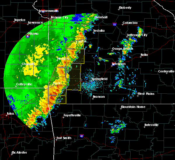 At 1128 pm cdt, severe thunderstorms were located along a line extending from 13 miles east of sheldon to 9 miles south of golden city, moving east at 45 mph (radar indicated). Hazards include 60 mph wind gusts. expect damage to roofs, siding, and trees At 1128 pm cdt, severe thunderstorms were located along a line extending from 13 miles east of sheldon to 9 miles south of golden city, moving east at 45 mph (radar indicated). Hazards include 60 mph wind gusts. expect damage to roofs, siding, and trees
|
| 9/16/2017 6:28 PM CDT |
 At 628 pm cdt, severe thunderstorms were located along a line extending from 6 miles southeast of fort scott to near sheldon to jasper, moving northeast at 30 mph (radar indicated). Hazards include 60 mph wind gusts. expect damage to roofs, siding, and trees At 628 pm cdt, severe thunderstorms were located along a line extending from 6 miles southeast of fort scott to near sheldon to jasper, moving northeast at 30 mph (radar indicated). Hazards include 60 mph wind gusts. expect damage to roofs, siding, and trees
|
| 6/17/2017 4:13 AM CDT |
 The severe thunderstorm warning for southeastern bourbon. barton. western cedar. vernon and northern dade counties will expire at 415 am cdt. the storm which prompted the warning has weakened below severe limits, and no longer poses an immediate threat to life or property. Therefore the warning will be allowed to expire. The severe thunderstorm warning for southeastern bourbon. barton. western cedar. vernon and northern dade counties will expire at 415 am cdt. the storm which prompted the warning has weakened below severe limits, and no longer poses an immediate threat to life or property. Therefore the warning will be allowed to expire.
|
| 6/17/2017 3:46 AM CDT |
 At 346 am cdt, a severe thunderstorm was located near sheldon, or near lamar, moving southeast at 65 mph (radar indicated). Hazards include 60 mph wind gusts. Expect damage to roofs, siding, and trees. Locations impacted include, stockton lake, prairie state park, stockton state park, nevada, lamar, el dorado springs, greenfield, golden city, liberal, sheldon, nashville, mindenmines, montevallo, arcadia, walker, bronaugh, dadeville, jerico springs, lamar heights, moundville,. At 346 am cdt, a severe thunderstorm was located near sheldon, or near lamar, moving southeast at 65 mph (radar indicated). Hazards include 60 mph wind gusts. Expect damage to roofs, siding, and trees. Locations impacted include, stockton lake, prairie state park, stockton state park, nevada, lamar, el dorado springs, greenfield, golden city, liberal, sheldon, nashville, mindenmines, montevallo, arcadia, walker, bronaugh, dadeville, jerico springs, lamar heights, moundville,.
|
| 6/17/2017 3:26 AM CDT |
 At 326 am cdt, a severe thunderstorm was located near nevada, moving southeast at 65 mph (radar indicated). Hazards include 60 mph wind gusts. expect damage to roofs, siding, and trees At 326 am cdt, a severe thunderstorm was located near nevada, moving southeast at 65 mph (radar indicated). Hazards include 60 mph wind gusts. expect damage to roofs, siding, and trees
|
| 5/30/2017 11:25 PM CDT |
 At 1125 pm cdt, a severe thunderstorm was located 10 miles north of golden city, or 12 miles east of lamar, moving southeast at 25 mph (radar indicated). Hazards include quarter size hail. damage to vehicles is expected At 1125 pm cdt, a severe thunderstorm was located 10 miles north of golden city, or 12 miles east of lamar, moving southeast at 25 mph (radar indicated). Hazards include quarter size hail. damage to vehicles is expected
|
| 5/27/2017 2:00 PM CDT |
 At 200 pm cdt, severe thunderstorms were located along a line extending from 8 miles north of golden city to bolivar, moving east at 20 mph (radar indicated). Hazards include ping pong ball size hail and 60 mph wind gusts. People and animals outdoors will be injured. expect hail damage to roofs, siding, windows, and vehicles. expect wind damage to roofs, siding, and trees. Locations impacted include, bolivar, stockton lake, pomme de terre lake, stockton state park, stockton, fair play, dadeville, jerico springs, aldrich, arcola, umber view heights, milford, bearcreek, masters, wagoner, cane hill, arnica, eudora, neola, dunnegan, a tornado watch remains in effect until 700 pm cdt for southwestern missouri. At 200 pm cdt, severe thunderstorms were located along a line extending from 8 miles north of golden city to bolivar, moving east at 20 mph (radar indicated). Hazards include ping pong ball size hail and 60 mph wind gusts. People and animals outdoors will be injured. expect hail damage to roofs, siding, windows, and vehicles. expect wind damage to roofs, siding, and trees. Locations impacted include, bolivar, stockton lake, pomme de terre lake, stockton state park, stockton, fair play, dadeville, jerico springs, aldrich, arcola, umber view heights, milford, bearcreek, masters, wagoner, cane hill, arnica, eudora, neola, dunnegan, a tornado watch remains in effect until 700 pm cdt for southwestern missouri.
|
| 5/27/2017 1:44 PM CDT |
 At 144 pm cdt, severe thunderstorms were located along a line extending from 9 miles north of golden city to near fair play, moving east at 35 mph (radar indicated). Hazards include ping pong ball size hail and 60 mph wind gusts. the largest hail is expected to occur near sylvania. People and animals outdoors will be injured. expect hail damage to roofs, siding, windows, and vehicles. expect wind damage to roofs, siding, and trees. Locations impacted include, bolivar, stockton lake, pomme de terre lake, stockton state park, stockton, sheldon, fair play, montevallo, dadeville, jerico springs, aldrich, irwin, arcola, umber view heights, milford, bearcreek, cane hill, arnica, eudora, neola, a tornado watch remains in effect until 700 pm cdt for southeastern kansas, and southwestern and west central missouri. At 144 pm cdt, severe thunderstorms were located along a line extending from 9 miles north of golden city to near fair play, moving east at 35 mph (radar indicated). Hazards include ping pong ball size hail and 60 mph wind gusts. the largest hail is expected to occur near sylvania. People and animals outdoors will be injured. expect hail damage to roofs, siding, windows, and vehicles. expect wind damage to roofs, siding, and trees. Locations impacted include, bolivar, stockton lake, pomme de terre lake, stockton state park, stockton, sheldon, fair play, montevallo, dadeville, jerico springs, aldrich, irwin, arcola, umber view heights, milford, bearcreek, cane hill, arnica, eudora, neola, a tornado watch remains in effect until 700 pm cdt for southeastern kansas, and southwestern and west central missouri.
|
| 5/27/2017 1:27 PM CDT |
 At 126 pm cdt, severe thunderstorms were located along a line extending from near liberal to near walnut grove, moving east at 30 mph (radar indicated). Hazards include 60 mph wind gusts and quarter size hail. Hail damage to vehicles is expected. Expect wind damage to roofs, siding, and trees. At 126 pm cdt, severe thunderstorms were located along a line extending from near liberal to near walnut grove, moving east at 30 mph (radar indicated). Hazards include 60 mph wind gusts and quarter size hail. Hail damage to vehicles is expected. Expect wind damage to roofs, siding, and trees.
|
| 5/27/2017 1:13 PM CDT |
 At 113 pm cdt, severe thunderstorms were located along a line extending from liberal to 10 miles east of sheldon to near greenfield, moving northeast at 25 mph (emergency management. quarter sized hail was reported east of lamar in barton county). Hazards include 60 mph wind gusts and quarter size hail. Hail damage to vehicles is expected. expect wind damage to roofs, siding, and trees. Locations impacted include, stockton lake, prairie state park, stockton state park, lamar, stockton, greenfield, liberal, sheldon, mulberry, mindenmines, montevallo, arcadia, bronaugh, jerico springs, lamar heights, moundville, milo, irwin, burgess, arcola, a tornado watch remains in effect until 700 pm cdt for southeastern kansas, and southwestern and west central missouri. At 113 pm cdt, severe thunderstorms were located along a line extending from liberal to 10 miles east of sheldon to near greenfield, moving northeast at 25 mph (emergency management. quarter sized hail was reported east of lamar in barton county). Hazards include 60 mph wind gusts and quarter size hail. Hail damage to vehicles is expected. expect wind damage to roofs, siding, and trees. Locations impacted include, stockton lake, prairie state park, stockton state park, lamar, stockton, greenfield, liberal, sheldon, mulberry, mindenmines, montevallo, arcadia, bronaugh, jerico springs, lamar heights, moundville, milo, irwin, burgess, arcola, a tornado watch remains in effect until 700 pm cdt for southeastern kansas, and southwestern and west central missouri.
|
| 5/27/2017 12:47 PM CDT |
 The national weather service in springfield has issued a * severe thunderstorm warning for. barton county in southwestern missouri. southern cedar county in southwestern missouri. southern vernon county in west central missouri. Western dade county in southwestern missouri. The national weather service in springfield has issued a * severe thunderstorm warning for. barton county in southwestern missouri. southern cedar county in southwestern missouri. southern vernon county in west central missouri. Western dade county in southwestern missouri.
|
| 3/6/2017 10:24 PM CST |
 At 1024 pm cst, severe thunderstorms were located along a line extending from 7 miles southeast of urbana to near everton, moving east at 130 mph (public). Hazards include 70 mph wind gusts and quarter size hail. Hail damage to vehicles is expected. expect considerable tree damage. wind damage is also likely to mobile homes, roofs, and outbuildings. locations impacted include, joplin, carthage, webb city, bolivar, stockton lake, pomme de terre lake, stockton state park, carl junction, mount vernon, lamar, baxter springs, galena, oronogo, carterville, stockton, duquesne, ash grove, greenfield, sarcoxie, duenweg, this includes interstate 44 between mile markers 4 and 57. a tornado watch remains in effect until 300 am cst for southeastern kansas, and central, southwestern and west central missouri. Time, mot, loc 0424z 260deg 112kt 3778 9305 3728 9369. At 1024 pm cst, severe thunderstorms were located along a line extending from 7 miles southeast of urbana to near everton, moving east at 130 mph (public). Hazards include 70 mph wind gusts and quarter size hail. Hail damage to vehicles is expected. expect considerable tree damage. wind damage is also likely to mobile homes, roofs, and outbuildings. locations impacted include, joplin, carthage, webb city, bolivar, stockton lake, pomme de terre lake, stockton state park, carl junction, mount vernon, lamar, baxter springs, galena, oronogo, carterville, stockton, duquesne, ash grove, greenfield, sarcoxie, duenweg, this includes interstate 44 between mile markers 4 and 57. a tornado watch remains in effect until 300 am cst for southeastern kansas, and central, southwestern and west central missouri. Time, mot, loc 0424z 260deg 112kt 3778 9305 3728 9369.
|
| 3/6/2017 10:24 PM CST |
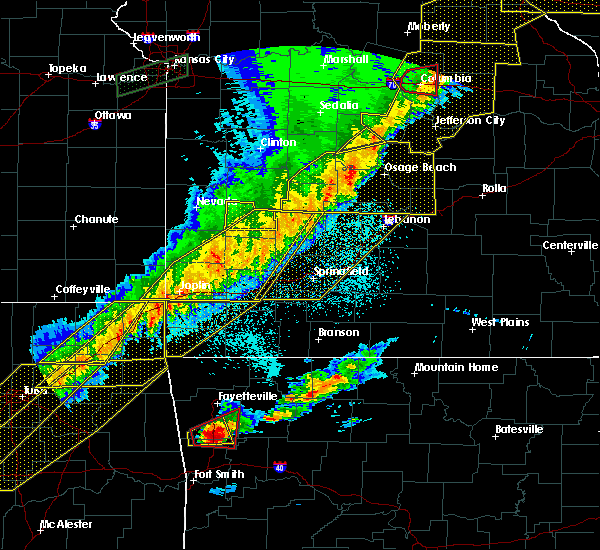 At 1024 pm cst, severe thunderstorms were located along a line extending from 7 miles southeast of urbana to near everton, moving east at 130 mph (public). Hazards include 70 mph wind gusts and quarter size hail. Hail damage to vehicles is expected. expect considerable tree damage. wind damage is also likely to mobile homes, roofs, and outbuildings. locations impacted include, joplin, carthage, webb city, bolivar, stockton lake, pomme de terre lake, stockton state park, carl junction, mount vernon, lamar, baxter springs, galena, oronogo, carterville, stockton, duquesne, ash grove, greenfield, sarcoxie, duenweg, this includes interstate 44 between mile markers 4 and 57. a tornado watch remains in effect until 300 am cst for southeastern kansas, and central, southwestern and west central missouri. Time, mot, loc 0424z 260deg 112kt 3778 9305 3728 9369. At 1024 pm cst, severe thunderstorms were located along a line extending from 7 miles southeast of urbana to near everton, moving east at 130 mph (public). Hazards include 70 mph wind gusts and quarter size hail. Hail damage to vehicles is expected. expect considerable tree damage. wind damage is also likely to mobile homes, roofs, and outbuildings. locations impacted include, joplin, carthage, webb city, bolivar, stockton lake, pomme de terre lake, stockton state park, carl junction, mount vernon, lamar, baxter springs, galena, oronogo, carterville, stockton, duquesne, ash grove, greenfield, sarcoxie, duenweg, this includes interstate 44 between mile markers 4 and 57. a tornado watch remains in effect until 300 am cst for southeastern kansas, and central, southwestern and west central missouri. Time, mot, loc 0424z 260deg 112kt 3778 9305 3728 9369.
|
| 3/6/2017 10:00 PM CST |
 At 958 pm cst, severe thunderstorms were located along a line extending from 12 miles west of stockton to near carl junction, moving east at 60 mph (public. the joplin airport just reported a 61 mph wind gust in the past few minutes. numerous reports of wind damage have been reported with these storms). Hazards include 70 mph wind gusts and quarter size hail. Hail damage to vehicles is expected. expect considerable tree damage. Wind damage is also likely to mobile homes, roofs, and outbuildings. At 958 pm cst, severe thunderstorms were located along a line extending from 12 miles west of stockton to near carl junction, moving east at 60 mph (public. the joplin airport just reported a 61 mph wind gust in the past few minutes. numerous reports of wind damage have been reported with these storms). Hazards include 70 mph wind gusts and quarter size hail. Hail damage to vehicles is expected. expect considerable tree damage. Wind damage is also likely to mobile homes, roofs, and outbuildings.
|
| 8/25/2016 9:10 PM CDT |
 At 909 pm cdt, a severe thunderstorm was located over stockton, moving east at 20 mph (radar indicated). Hazards include 60 mph wind gusts and half dollar size hail. Hail damage to vehicles is expected. expect wind damage to roofs, siding, and trees. Locations impacted include, stockton lake, stockton, jerico springs, umber view heights, filley, caplinger mills, olympia, wagoner,. At 909 pm cdt, a severe thunderstorm was located over stockton, moving east at 20 mph (radar indicated). Hazards include 60 mph wind gusts and half dollar size hail. Hail damage to vehicles is expected. expect wind damage to roofs, siding, and trees. Locations impacted include, stockton lake, stockton, jerico springs, umber view heights, filley, caplinger mills, olympia, wagoner,.
|
| 8/25/2016 8:54 PM CDT |
 At 854 pm cdt, a severe thunderstorm was located 8 miles southwest of stockton, moving east at 15 mph (radar indicated). Hazards include 60 mph wind gusts and quarter size hail. Hail damage to vehicles is expected. expect wind damage to roofs, siding, and trees. Locations impacted include, stockton lake, stockton, jerico springs, umber view heights, filley, caplinger mills, olympia, wagoner,. At 854 pm cdt, a severe thunderstorm was located 8 miles southwest of stockton, moving east at 15 mph (radar indicated). Hazards include 60 mph wind gusts and quarter size hail. Hail damage to vehicles is expected. expect wind damage to roofs, siding, and trees. Locations impacted include, stockton lake, stockton, jerico springs, umber view heights, filley, caplinger mills, olympia, wagoner,.
|
| 8/25/2016 8:43 PM CDT |
 At 843 pm cdt, a severe thunderstorm was located 11 miles southwest of stockton, moving east at 15 mph (radar indicated). Hazards include 60 mph wind gusts and quarter size hail. Hail damage to vehicles is expected. Expect wind damage to roofs, siding, and trees. At 843 pm cdt, a severe thunderstorm was located 11 miles southwest of stockton, moving east at 15 mph (radar indicated). Hazards include 60 mph wind gusts and quarter size hail. Hail damage to vehicles is expected. Expect wind damage to roofs, siding, and trees.
|
| 7/13/2016 12:31 PM CDT |
 At 1231 pm cdt, severe thunderstorms were located along a line extending from near lowry city to near stockton, moving east at 55 mph (radar indicated). Hazards include 60 mph wind gusts and quarter size hail. Hail damage to vehicles is expected. expect wind damage to roofs, siding, and trees. Locations impacted include, stockton lake, truman lake, stockton state park, el dorado springs, stockton, appleton city, humansville, osceola, lowry city, fair play, weaubleau, jerico springs, collins, flemington, roscoe, aldrich, arcola, vista, umber view heights, gerster,. At 1231 pm cdt, severe thunderstorms were located along a line extending from near lowry city to near stockton, moving east at 55 mph (radar indicated). Hazards include 60 mph wind gusts and quarter size hail. Hail damage to vehicles is expected. expect wind damage to roofs, siding, and trees. Locations impacted include, stockton lake, truman lake, stockton state park, el dorado springs, stockton, appleton city, humansville, osceola, lowry city, fair play, weaubleau, jerico springs, collins, flemington, roscoe, aldrich, arcola, vista, umber view heights, gerster,.
|
| 7/13/2016 12:15 PM CDT |
 At 1215 pm cdt, severe thunderstorms were located along a line extending from near appleton city to 12 miles east of sheldon, moving east at 55 mph (radar indicated). Hazards include 60 mph wind gusts and quarter size hail. Hail damage to vehicles is expected. Expect wind damage to roofs, siding, and trees. At 1215 pm cdt, severe thunderstorms were located along a line extending from near appleton city to 12 miles east of sheldon, moving east at 55 mph (radar indicated). Hazards include 60 mph wind gusts and quarter size hail. Hail damage to vehicles is expected. Expect wind damage to roofs, siding, and trees.
|
| 7/8/2016 12:08 AM CDT |
 At 1207 am cdt, severe thunderstorms were located along a line extending from near walker to 6 miles east of sheldon to near lamar, moving east at 55 mph (law enforcement. these storms have a history of producing widespread wind damage across extreme southeastern kansas). Hazards include 60 mph wind gusts and nickel size hail. Expect damage to roofs. siding. And trees. At 1207 am cdt, severe thunderstorms were located along a line extending from near walker to 6 miles east of sheldon to near lamar, moving east at 55 mph (law enforcement. these storms have a history of producing widespread wind damage across extreme southeastern kansas). Hazards include 60 mph wind gusts and nickel size hail. Expect damage to roofs. siding. And trees.
|
| 7/7/2016 7:50 AM CDT |
 The severe thunderstorm warning for cedar, vernon, northern polk and western hickory counties will expire at 800 am cdt, the storms which prompted the warning have weakened below severe limits, and no longer pose an immediate threat to life or property. therefore the warning will be allowed to expire. however heavy rain is still possible with these thunderstorms. a severe thunderstorm watch remains in effect until 100 pm cdt for southwestern missouri. The severe thunderstorm warning for cedar, vernon, northern polk and western hickory counties will expire at 800 am cdt, the storms which prompted the warning have weakened below severe limits, and no longer pose an immediate threat to life or property. therefore the warning will be allowed to expire. however heavy rain is still possible with these thunderstorms. a severe thunderstorm watch remains in effect until 100 pm cdt for southwestern missouri.
|
| 7/7/2016 7:00 AM CDT |
 At 659 am cdt, severe thunderstorms were located along a line extending from 6 miles north of wheatland to 7 miles southwest of osceola to near hume, moving southeast at 25 mph (radar indicated). Hazards include 60 mph wind gusts. Expect damage to roofs. siding. And trees. At 659 am cdt, severe thunderstorms were located along a line extending from 6 miles north of wheatland to 7 miles southwest of osceola to near hume, moving southeast at 25 mph (radar indicated). Hazards include 60 mph wind gusts. Expect damage to roofs. siding. And trees.
|
| 6/12/2016 2:25 PM CDT |
 The severe thunderstorm warning for northwestern dade, southwestern cedar, southeastern vernon and northeastern barton counties will expire at 230 pm cdt, the storm which prompted the warning has weakened below severe limits and exited the warned area. therefore the warning will be allowed to expire. however gusty winds are still possible with this thunderstorm. The severe thunderstorm warning for northwestern dade, southwestern cedar, southeastern vernon and northeastern barton counties will expire at 230 pm cdt, the storm which prompted the warning has weakened below severe limits and exited the warned area. therefore the warning will be allowed to expire. however gusty winds are still possible with this thunderstorm.
|
| 6/12/2016 2:12 PM CDT |
 At 211 pm cdt, a severe thunderstorm was located 12 miles east of sheldon, or 13 miles northeast of lamar, moving north at 30 mph (radar indicated). Hazards include 60 mph wind gusts and nickel size hail. Expect damage to roofs. siding. and trees. Locations impacted include, montevallo, jerico springs, milford, sylvania, olympia, cedarville, wagoner,. At 211 pm cdt, a severe thunderstorm was located 12 miles east of sheldon, or 13 miles northeast of lamar, moving north at 30 mph (radar indicated). Hazards include 60 mph wind gusts and nickel size hail. Expect damage to roofs. siding. and trees. Locations impacted include, montevallo, jerico springs, milford, sylvania, olympia, cedarville, wagoner,.
|
| 6/12/2016 1:50 PM CDT |
 At 150 pm cdt, a severe thunderstorm was located 9 miles north of golden city, or 10 miles east of lamar, moving north at 15 mph (radar indicated). Hazards include 60 mph wind gusts and penny size hail. Expect damage to roofs. siding. And trees. At 150 pm cdt, a severe thunderstorm was located 9 miles north of golden city, or 10 miles east of lamar, moving north at 15 mph (radar indicated). Hazards include 60 mph wind gusts and penny size hail. Expect damage to roofs. siding. And trees.
|
| 5/26/2016 6:42 PM CDT |
 At 641 pm cdt, a severe thunderstorm was located 9 miles northeast of sheldon, or 12 miles southwest of el dorado springs, moving north at 25 mph (radar indicated). Hazards include 60 mph wind gusts and quarter size hail. Hail damage to vehicles is expected. expect wind damage to roofs, siding, and trees. Locations impacted include, nevada, el dorado springs, montevallo, walker, schell city, jerico springs, harwood, cedar springs, filley, wagoner, tiffin, olympia, horton,. At 641 pm cdt, a severe thunderstorm was located 9 miles northeast of sheldon, or 12 miles southwest of el dorado springs, moving north at 25 mph (radar indicated). Hazards include 60 mph wind gusts and quarter size hail. Hail damage to vehicles is expected. expect wind damage to roofs, siding, and trees. Locations impacted include, nevada, el dorado springs, montevallo, walker, schell city, jerico springs, harwood, cedar springs, filley, wagoner, tiffin, olympia, horton,.
|
| 5/26/2016 6:33 PM CDT |
 At 633 pm cdt, a severe thunderstorm was located near sheldon, or 13 miles southeast of nevada, moving north at 25 mph (radar indicated). Hazards include 60 mph wind gusts and half dollar size hail. Hail damage to vehicles is expected. Expect wind damage to roofs, siding, and trees. At 633 pm cdt, a severe thunderstorm was located near sheldon, or 13 miles southeast of nevada, moving north at 25 mph (radar indicated). Hazards include 60 mph wind gusts and half dollar size hail. Hail damage to vehicles is expected. Expect wind damage to roofs, siding, and trees.
|
| 5/11/2016 2:44 AM CDT |
 At 244 am cdt, severe thunderstorms were located along a line extending from 9 miles north of uniontown to near fort scott to near lamar, moving northeast at 25 mph (radar indicated). Hazards include 60 mph wind gusts and quarter size hail. Hail damage to vehicles is expected. Expect wind damage to roofs, siding, and trees. At 244 am cdt, severe thunderstorms were located along a line extending from 9 miles north of uniontown to near fort scott to near lamar, moving northeast at 25 mph (radar indicated). Hazards include 60 mph wind gusts and quarter size hail. Hail damage to vehicles is expected. Expect wind damage to roofs, siding, and trees.
|
| 4/27/2016 12:44 AM CDT |
 At 1243 am cdt, severe thunderstorms were located along a line extending from 9 miles southeast of butler to near schell city to near el dorado springs to 10 miles northeast of sheldon to 9 miles east of lamar, moving northeast at 40 mph (radar indicated). Hazards include 70 mph wind gusts and quarter size hail. Hail damage to vehicles is expected. expect considerable tree damage. Wind damage is also likely to mobile homes, roofs, and outbuildings. At 1243 am cdt, severe thunderstorms were located along a line extending from 9 miles southeast of butler to near schell city to near el dorado springs to 10 miles northeast of sheldon to 9 miles east of lamar, moving northeast at 40 mph (radar indicated). Hazards include 70 mph wind gusts and quarter size hail. Hail damage to vehicles is expected. expect considerable tree damage. Wind damage is also likely to mobile homes, roofs, and outbuildings.
|
| 11/17/2015 5:52 AM CST |
 At 552 am cst, severe thunderstorms were located along a line extending from 9 miles east of sheldon to near sarcoxie, moving northeast at 50 mph (radar indicated). Hazards include 60 mph wind gusts. Expect damage to roofs. siding and trees. Locations impacted include, stockton lake, stockton state park, stockton, greenfield, lockwood, golden city, miller, everton, dadeville, jerico springs, halltown, avilla, la russell, south greenfield, arcola, umber view heights, milford, red oak, masters, maple grove, this includes interstate 44 between mile markers 56 and 58. At 552 am cst, severe thunderstorms were located along a line extending from 9 miles east of sheldon to near sarcoxie, moving northeast at 50 mph (radar indicated). Hazards include 60 mph wind gusts. Expect damage to roofs. siding and trees. Locations impacted include, stockton lake, stockton state park, stockton, greenfield, lockwood, golden city, miller, everton, dadeville, jerico springs, halltown, avilla, la russell, south greenfield, arcola, umber view heights, milford, red oak, masters, maple grove, this includes interstate 44 between mile markers 56 and 58.
|
| 11/17/2015 5:34 AM CST |
 At 533 am cst, severe thunderstorms were located along a line extending from near lamar to diamond, moving northeast at 50 mph (radar indicated). Hazards include 60 mph wind gusts. Expect damage to roofs. Siding and trees. At 533 am cst, severe thunderstorms were located along a line extending from near lamar to diamond, moving northeast at 50 mph (radar indicated). Hazards include 60 mph wind gusts. Expect damage to roofs. Siding and trees.
|
| 11/5/2015 3:29 PM CST |
 At 329 pm cst, severe thunderstorms were located along a line extending from 10 miles east of el dorado springs to near stockton to 13 miles north of lockwood, moving northeast at 50 mph (radar indicated). Hazards include 60 mph wind gusts and quarter size hail. Hail damage to vehicles is expected. expect wind damage to roofs, siding and trees. Locations impacted include, stockton lake, stockton state park, stockton, humansville, jerico springs, collins, umber view heights, filley, masters, wagoner, bearcreek, arnica, cane hill, caplinger mills, olympia,. At 329 pm cst, severe thunderstorms were located along a line extending from 10 miles east of el dorado springs to near stockton to 13 miles north of lockwood, moving northeast at 50 mph (radar indicated). Hazards include 60 mph wind gusts and quarter size hail. Hail damage to vehicles is expected. expect wind damage to roofs, siding and trees. Locations impacted include, stockton lake, stockton state park, stockton, humansville, jerico springs, collins, umber view heights, filley, masters, wagoner, bearcreek, arnica, cane hill, caplinger mills, olympia,.
|
| 11/5/2015 3:21 PM CST |
 At 320 pm cst, a severe thunderstorm capable of producing a tornado was located 8 miles west of stockton, moving northeast at 40 mph (radar indicated rotation). Hazards include tornado and quarter size hail. Flying debris will be dangerous to those caught without shelter. mobile homes will be damaged or destroyed. damage to roofs, windows and vehicles will occur. tree damage is likely. Locations impacted include, stockton lake, stockton state park, stockton, jerico springs, umber view heights, filley, arnica, caplinger mills, wagoner,. At 320 pm cst, a severe thunderstorm capable of producing a tornado was located 8 miles west of stockton, moving northeast at 40 mph (radar indicated rotation). Hazards include tornado and quarter size hail. Flying debris will be dangerous to those caught without shelter. mobile homes will be damaged or destroyed. damage to roofs, windows and vehicles will occur. tree damage is likely. Locations impacted include, stockton lake, stockton state park, stockton, jerico springs, umber view heights, filley, arnica, caplinger mills, wagoner,.
|
| 11/5/2015 3:13 PM CST |
 At 312 pm cst, a severe thunderstorm capable of producing a tornado was located 13 miles east of sheldon, or 14 miles west of stockton, moving northeast at 40 mph (radar indicated rotation). Hazards include tornado and quarter size hail. Flying debris will be dangerous to those caught without shelter. mobile homes will be damaged or destroyed. damage to roofs, windows and vehicles will occur. Tree damage is likely. At 312 pm cst, a severe thunderstorm capable of producing a tornado was located 13 miles east of sheldon, or 14 miles west of stockton, moving northeast at 40 mph (radar indicated rotation). Hazards include tornado and quarter size hail. Flying debris will be dangerous to those caught without shelter. mobile homes will be damaged or destroyed. damage to roofs, windows and vehicles will occur. Tree damage is likely.
|
| 11/5/2015 3:06 PM CST |
 At 306 pm cst, severe thunderstorms were located along a line extending from 15 miles south of el dorado springs to 9 miles southeast of sheldon to near lamar, moving northeast at 50 mph (radar indicated). Hazards include 60 mph wind gusts and quarter size hail. Hail damage to vehicles is expected. Expect wind damage to roofs, siding and trees. At 306 pm cst, severe thunderstorms were located along a line extending from 15 miles south of el dorado springs to 9 miles southeast of sheldon to near lamar, moving northeast at 50 mph (radar indicated). Hazards include 60 mph wind gusts and quarter size hail. Hail damage to vehicles is expected. Expect wind damage to roofs, siding and trees.
|
| 9/18/2015 9:59 PM CDT |
 At 958 pm cdt, severe thunderstorms were located along a line extending from el dorado springs to near stockton to 10 miles north of greenfield, moving east at 40 mph (radar indicated). Hazards include 60 mph wind gusts. Expect damage to roofs. siding and trees. Locations impacted include, stockton lake, stockton state park, el dorado springs, stockton, jerico springs, roscoe, arcola, umber view heights, filley, cedar springs, masters, wagoner, bearcreek, arnica, bona, cane hill, caplinger mills, tiffin, olympia, cedarville,. At 958 pm cdt, severe thunderstorms were located along a line extending from el dorado springs to near stockton to 10 miles north of greenfield, moving east at 40 mph (radar indicated). Hazards include 60 mph wind gusts. Expect damage to roofs. siding and trees. Locations impacted include, stockton lake, stockton state park, el dorado springs, stockton, jerico springs, roscoe, arcola, umber view heights, filley, cedar springs, masters, wagoner, bearcreek, arnica, bona, cane hill, caplinger mills, tiffin, olympia, cedarville,.
|
| 9/18/2015 9:46 PM CDT |
 At 946 pm cdt, severe thunderstorms were located along a line extending from near walker to 12 miles east of sheldon to 12 miles north of golden city, moving east at 45 mph (radar indicated). Hazards include 60 mph wind gusts. Expect damage to roofs. siding and trees. Locations impacted include, stockton lake, stockton state park, el dorado springs, stockton, montevallo, walker, jerico springs, roscoe, arcola, umber view heights, harwood, milford, filley, cedar springs, masters, monegaw springs, bearcreek, cane hill, taberville, cedarville,. At 946 pm cdt, severe thunderstorms were located along a line extending from near walker to 12 miles east of sheldon to 12 miles north of golden city, moving east at 45 mph (radar indicated). Hazards include 60 mph wind gusts. Expect damage to roofs. siding and trees. Locations impacted include, stockton lake, stockton state park, el dorado springs, stockton, montevallo, walker, jerico springs, roscoe, arcola, umber view heights, harwood, milford, filley, cedar springs, masters, monegaw springs, bearcreek, cane hill, taberville, cedarville,.
|
| 9/18/2015 9:26 PM CDT |
 At 925 pm cdt, severe thunderstorms were located along a line extending from near nevada to sheldon to lamar, moving east at 35 mph (radar indicated). Hazards include 60 mph wind gusts. Expect damage to roofs. Siding and trees. At 925 pm cdt, severe thunderstorms were located along a line extending from near nevada to sheldon to lamar, moving east at 35 mph (radar indicated). Hazards include 60 mph wind gusts. Expect damage to roofs. Siding and trees.
|
| 8/23/2015 3:36 AM CDT |
 At 336 am cdt, a severe thunderstorm was located near sheldon, or 9 miles southeast of nevada, moving east at 60 mph (radar indicated). Hazards include 60 mph wind gusts. Expect damage to roofs. Siding and trees. At 336 am cdt, a severe thunderstorm was located near sheldon, or 9 miles southeast of nevada, moving east at 60 mph (radar indicated). Hazards include 60 mph wind gusts. Expect damage to roofs. Siding and trees.
|
| 8/8/2015 8:57 AM CDT |
 At 821 am cdt, severe thunderstorms were located along a line extending from near schell city to near nevada, moving southeast at 50 mph (radar indicated). Hazards include 60 mph wind gusts. Expect damage to roofs. Siding and trees. At 821 am cdt, severe thunderstorms were located along a line extending from near schell city to near nevada, moving southeast at 50 mph (radar indicated). Hazards include 60 mph wind gusts. Expect damage to roofs. Siding and trees.
|
| 8/8/2015 8:21 AM CDT |
 At 821 am cdt, severe thunderstorms were located along a line extending from near schell city to near nevada, moving southeast at 50 mph (radar indicated). Hazards include 60 mph wind gusts. Expect damage to roofs. Siding and trees. At 821 am cdt, severe thunderstorms were located along a line extending from near schell city to near nevada, moving southeast at 50 mph (radar indicated). Hazards include 60 mph wind gusts. Expect damage to roofs. Siding and trees.
|
| 7/14/2015 10:42 AM CDT |
 At 1039 am cdt, a severe thunderstorm was located near stockton, and moving east at 45 mph (radar indicated). Hazards include 60 mph wind gusts and quarter size hail. Hail damage to vehicles is expected. expect wind damage to roofs, siding and trees. locations impacted include, arcola, arnica, bearcreek, bona, cane hill, caplinger mills, cedar springs, cedarville, el dorado springs, filley, jerico springs, masters, olympia, stockton, umber view heights and wagoner. This warning also includes stockton lake and stockton state park. At 1039 am cdt, a severe thunderstorm was located near stockton, and moving east at 45 mph (radar indicated). Hazards include 60 mph wind gusts and quarter size hail. Hail damage to vehicles is expected. expect wind damage to roofs, siding and trees. locations impacted include, arcola, arnica, bearcreek, bona, cane hill, caplinger mills, cedar springs, cedarville, el dorado springs, filley, jerico springs, masters, olympia, stockton, umber view heights and wagoner. This warning also includes stockton lake and stockton state park.
|
| 7/14/2015 10:11 AM CDT |
 At 1008 am cdt, a severe thunderstorm was located 9 miles south of walker, and moving east at 45 mph (radar indicated). Hazards include 60 mph wind gusts and quarter size hail. Hail damage to vehicles is expected. Expect wind damage to roofs, siding and trees. At 1008 am cdt, a severe thunderstorm was located 9 miles south of walker, and moving east at 45 mph (radar indicated). Hazards include 60 mph wind gusts and quarter size hail. Hail damage to vehicles is expected. Expect wind damage to roofs, siding and trees.
|
| 7/2/2015 12:50 AM CDT |
 At 1248 am cdt, severe thunderstorms were located along a line extending from stockton to 13 miles east of sheldon, and moving southeast at 35 mph (radar indicated). Hazards include 60 mph wind gusts and nickel size hail. Expect damage to roofs. siding and trees. locations impacted include, el dorado springs, nevada, sheldon, stockton and walker. this warning also includes stockton lake and stockton state park. A severe thunderstorm watch remains in effect until 400 am cdt thursday morning for southeast kansas and southwestern missouri. At 1248 am cdt, severe thunderstorms were located along a line extending from stockton to 13 miles east of sheldon, and moving southeast at 35 mph (radar indicated). Hazards include 60 mph wind gusts and nickel size hail. Expect damage to roofs. siding and trees. locations impacted include, el dorado springs, nevada, sheldon, stockton and walker. this warning also includes stockton lake and stockton state park. A severe thunderstorm watch remains in effect until 400 am cdt thursday morning for southeast kansas and southwestern missouri.
|
| 7/2/2015 12:29 AM CDT |
 At 1227 am cdt, severe thunderstorms were located along a line extending from el dorado springs to sheldon, and moving south southeast at 30 mph (radar indicated). Hazards include 60 mph wind gusts and quarter size hail. Hail damage to vehicles is expected. Expect wind damage to roofs, siding and trees. At 1227 am cdt, severe thunderstorms were located along a line extending from el dorado springs to sheldon, and moving south southeast at 30 mph (radar indicated). Hazards include 60 mph wind gusts and quarter size hail. Hail damage to vehicles is expected. Expect wind damage to roofs, siding and trees.
|
| 6/26/2015 4:03 AM CDT |
 At 400 am cdt, severe thunderstorms were located along a line extending from laurie to 6 miles southwest of macks creek to 8 miles northeast of fair play to 9 miles west of stockton, and moving southeast at 40 mph (radar indicated). Hazards include 60 mph wind gusts and penny size hail. Expect damage to roofs. siding and trees. locations impacted include, el dorado springs, fair play, hermitage, humansville, laurie, macks creek, stockton, stover, urbana, versailles, village of four seasons, weaubleau and wheatland. This warning also includes ha ha tonka state park, lake of the ozarks, pomme de terre lake, pomme de terre state park, stockton lake, stockton state park and truman lake. At 400 am cdt, severe thunderstorms were located along a line extending from laurie to 6 miles southwest of macks creek to 8 miles northeast of fair play to 9 miles west of stockton, and moving southeast at 40 mph (radar indicated). Hazards include 60 mph wind gusts and penny size hail. Expect damage to roofs. siding and trees. locations impacted include, el dorado springs, fair play, hermitage, humansville, laurie, macks creek, stockton, stover, urbana, versailles, village of four seasons, weaubleau and wheatland. This warning also includes ha ha tonka state park, lake of the ozarks, pomme de terre lake, pomme de terre state park, stockton lake, stockton state park and truman lake.
|
| 6/26/2015 3:42 AM CDT |
 At 339 am cdt, severe thunderstorms were located along a line extending from 5 miles southwest of stover to 8 miles northeast of hermitage to 6 miles northwest of humansville to 9 miles southwest of el dorado springs, and moving southeast at 40 mph (trained weather spotters). Hazards include 70 mph wind gusts and penny size hail. these storms have a history of producing wind damage across central missouri. Expect considerable tree damage. damage is likely to mobile homes, roofs and outbuildings. locations impacted include, el dorado springs, fair play, hermitage, humansville, laurie, macks creek, sheldon, stockton, stover, urbana, versailles, village of four seasons, weaubleau and wheatland. This warning also includes ha ha tonka state park, lake of the ozarks, pomme de terre lake, pomme de terre state park, stockton lake, stockton state park and truman lake. At 339 am cdt, severe thunderstorms were located along a line extending from 5 miles southwest of stover to 8 miles northeast of hermitage to 6 miles northwest of humansville to 9 miles southwest of el dorado springs, and moving southeast at 40 mph (trained weather spotters). Hazards include 70 mph wind gusts and penny size hail. these storms have a history of producing wind damage across central missouri. Expect considerable tree damage. damage is likely to mobile homes, roofs and outbuildings. locations impacted include, el dorado springs, fair play, hermitage, humansville, laurie, macks creek, sheldon, stockton, stover, urbana, versailles, village of four seasons, weaubleau and wheatland. This warning also includes ha ha tonka state park, lake of the ozarks, pomme de terre lake, pomme de terre state park, stockton lake, stockton state park and truman lake.
|
| 6/26/2015 3:26 AM CDT |
 At 323 am cdt, severe thunderstorms were located along a line extending from 11 miles west of stover to 13 miles north of wheatland to 13 miles northeast of el dorado springs to 17 miles west of el dorado springs, and moving southeast at 40 mph (law enforcement). Hazards include 70 mph wind gusts and penny size hail. these storms have a history of producing wind damage across central missouri. Expect considerable tree damage. Damage is likely to mobile homes, roofs and outbuildings. At 323 am cdt, severe thunderstorms were located along a line extending from 11 miles west of stover to 13 miles north of wheatland to 13 miles northeast of el dorado springs to 17 miles west of el dorado springs, and moving southeast at 40 mph (law enforcement). Hazards include 70 mph wind gusts and penny size hail. these storms have a history of producing wind damage across central missouri. Expect considerable tree damage. Damage is likely to mobile homes, roofs and outbuildings.
|
| 5/17/2015 1:41 AM CDT | At 139 am cdt, severe thunderstorms were located along a line extending from 8 miles southwest of stockton to 10 miles south of lockwood, and moving east at 40 mph (radar indicated). Hazards include 60 mph wind gusts and penny size hail. Expect damage to roofs. siding and trees. locations impacted include, everton, greenfield, lockwood and stockton. this warning also includes stockton lake and stockton state park. a tornado watch remains in effect until 500 am cdt sunday morning for southeast kansas and southwestern missouri. 0. 75in. |
| 5/17/2015 1:13 AM CDT | At 111 am cdt, severe thunderstorms were located along a line extending from 10 miles north of lamar to 7 miles south of jasper, and moving east at 40 mph (radar indicated). Hazards include 60 mph wind gusts and penny size hail. Expect damage to roofs. Siding and trees. |
| 5/17/2015 12:40 AM CDT | At 1237 am cdt, severe thunderstorms were located along a line extending from 5 miles southwest of appleton city to 11 miles south of verdella, and moving east at 40 mph (radar indicated). Hazards include 60 mph wind gusts. Expect damage to roofs. siding and trees. locations impacted include, appleton city, el dorado springs, nevada, schell city, sheldon, verdella and walker. this storm produced a 55 mph wind gust near nevada. a tornado watch remains in effect until 500 am cdt sunday morning for southeast kansas and southwestern missouri. 75in. |
| 5/17/2015 12:29 AM CDT | At 1226 am cdt, severe thunderstorms were located along a line extending from 9 miles northwest of schell city to 5 miles southeast of mindenmines, and moving east at 40 mph (radar indicated. along with radar indications of strong winds, the airport in nevada recorded a wind gust of 55 mph). Hazards include 60 mph wind gusts. Expect damage to roofs. siding and trees. locations impacted include, appleton city, el dorado springs, golden city, lamar, liberal, mindenmines, nevada, schell city, sheldon, verdella and walker. this warning also includes prairie state park. a tornado watch remains in effect until 500 am cdt sunday morning for southeast kansas and southwestern missouri. 75in. |
| 5/17/2015 12:12 AM CDT | At 1210 am cdt, severe thunderstorms were located along a line extending from 15 miles northwest of walker to 10 miles southwest of mindenmines, and moving east at 40 mph (radar indicated). Hazards include 60 mph wind gusts. Expect damage to roofs. Siding and trees. |
| 4/7/2015 5:31 AM CDT | The national weather service in springfield has issued a * severe thunderstorm warning for. northeastern barton county in southwest missouri. southern cedar county in southwest missouri. northern dade county in southwest missouri. Until 630 am cdt. |
| 3/24/2015 5:14 PM CDT | A severe thunderstorm warning remains in effect for northern dade and southern cedar counties until 545 pm cdt. at 511 pm cdt. a severe thunderstorm was located 19 miles southwest of stockton. and moving east at 50 mph. hazard. half dollar size hail. source. trained weather spotters. Reported quarter size hail near. |
| 3/24/2015 4:51 PM CDT | The national weather service in springfield has issued a * severe thunderstorm warning for. cedar county in southwest missouri. northern dade county in southwest missouri. until 545 pm cdt * at 450 pm cdt. A severe thunderstorm was located 29 miles. |
| 4/7/2013 6:35 PM CDT | Golf Ball sized hail reported 0.1 miles ENE of Jerico Springs, MO |
| 1/1/0001 12:00 AM | 60 to 70 mph wind gust and pea hail relayed by spotter in vernon county MO, 9.4 miles SE of Jerico Springs, MO |
Hail Maps for Jerico Springs, MO
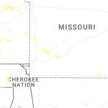


Connect with Interactive Hail Maps