

Hail Map for Jerome, AR
The Jerome, AR area has had 0 reports of on-the-ground hail by trained spotters, and has been under severe weather warnings 40 times during the past 12 months. Doppler radar has detected hail at or near Jerome, AR on 64 occasions, including 8 occasions during the past year.
| Name: | Jerome, AR |
| Where Located: | 49.9 miles NNE of Bastrop, LA |
| Map: | Google Map for Jerome, AR |
| Population: | 39 |
| Housing Units: | 19 |
| More Info: | Search Google for Jerome, AR |
3
The Top Recent Hail Date for Jerome, AR is Saturday, December 28, 2024 (3rd out of 64)
Hail and Wind Damage Spotted near Jerome, AR
| Date / Time | Report Details |
|---|---|
| 6/19/2025 5:11 PM CDT |
 The storm which prompted the warning has weakened below severe limits, and no longer poses an immediate threat to life or property. therefore, the warning will be allowed to expire. The storm which prompted the warning has weakened below severe limits, and no longer poses an immediate threat to life or property. therefore, the warning will be allowed to expire.
|
| 6/19/2025 5:09 PM CDT |
 the tornado warning has been cancelled and is no longer in effect the tornado warning has been cancelled and is no longer in effect
|
| 6/19/2025 5:06 PM CDT |
 At 506 pm cdt, a severe thunderstorm was located 8 miles east of ladelle, or 12 miles west of dermott, moving southeast at 30 mph (radar indicated). Hazards include 60 mph wind gusts and quarter size hail. Hail damage to vehicles is expected. expect wind damage to roofs, siding, and trees. Locations impacted include, dermott, ladelle, jerome, baxter, enon, and collins. At 506 pm cdt, a severe thunderstorm was located 8 miles east of ladelle, or 12 miles west of dermott, moving southeast at 30 mph (radar indicated). Hazards include 60 mph wind gusts and quarter size hail. Hail damage to vehicles is expected. expect wind damage to roofs, siding, and trees. Locations impacted include, dermott, ladelle, jerome, baxter, enon, and collins.
|
| 6/19/2025 5:03 PM CDT | At 459 pm cdt, a severe thunderstorm capable of producing a tornado was located near ladelle, or 9 miles southeast of monticello, moving southeast at 25 mph (radar indicated rotation). Hazards include tornado and quarter size hail. Flying debris will be dangerous to those caught without shelter. mobile homes will be damaged or destroyed. damage to roofs, windows, and vehicles will occur. tree damage is likely. Locations impacted include, monticello, jerome, enon, and collins. |
| 6/19/2025 4:41 PM CDT |
 Torlzk the national weather service in little rock has issued a * tornado warning for, southern drew county in southeastern arkansas, * until 530 pm cdt. * at 441 pm cdt, a severe thunderstorm capable of producing a tornado was located near monticello, moving southeast at 30 mph (radar indicated rotation). Hazards include tornado and quarter size hail. Flying debris will be dangerous to those caught without shelter. mobile homes will be damaged or destroyed. damage to roofs, windows, and vehicles will occur. Tree damage is likely. Torlzk the national weather service in little rock has issued a * tornado warning for, southern drew county in southeastern arkansas, * until 530 pm cdt. * at 441 pm cdt, a severe thunderstorm capable of producing a tornado was located near monticello, moving southeast at 30 mph (radar indicated rotation). Hazards include tornado and quarter size hail. Flying debris will be dangerous to those caught without shelter. mobile homes will be damaged or destroyed. damage to roofs, windows, and vehicles will occur. Tree damage is likely.
|
| 6/19/2025 4:37 PM CDT |
 Svrlzk the national weather service in little rock has issued a * severe thunderstorm warning for, drew county in southeastern arkansas, * until 515 pm cdt. * at 437 pm cdt, a severe thunderstorm was located over monticello, moving southeast at 30 mph (radar indicated). Hazards include 60 mph wind gusts and quarter size hail. Hail damage to vehicles is expected. Expect wind damage to roofs, siding, and trees. Svrlzk the national weather service in little rock has issued a * severe thunderstorm warning for, drew county in southeastern arkansas, * until 515 pm cdt. * at 437 pm cdt, a severe thunderstorm was located over monticello, moving southeast at 30 mph (radar indicated). Hazards include 60 mph wind gusts and quarter size hail. Hail damage to vehicles is expected. Expect wind damage to roofs, siding, and trees.
|
| 6/19/2025 4:21 PM CDT | At 420 pm cdt, severe thunderstorms were located along a line extending from near monticello to near warren, moving southeast at 25 mph (radar indicated). Hazards include 60 mph wind gusts and quarter size hail. Hail damage to vehicles is expected. expect wind damage to roofs, siding, and trees. Locations impacted include, monticello, warren, wilmar, green hill, ladelle, prairie grove, jerome, new hope in drew county, carmel, enon, johnsonville, collins, montongo, valley, mt olive in bradley county, coleman, sumpter, lacey,. |
| 6/19/2025 4:21 PM CDT | the severe thunderstorm warning has been cancelled and is no longer in effect |
| 6/19/2025 3:48 PM CDT | Svrlzk the national weather service in little rock has issued a * severe thunderstorm warning for, bradley county in southeastern arkansas, southeastern cleveland county in southeastern arkansas, drew county in southeastern arkansas, southwestern lincoln county in southeastern arkansas, * until 445 pm cdt. * at 348 pm cdt, severe thunderstorms were located along a line extending from plantersville to near weeks, moving south at 20 mph (radar indicated). Hazards include 60 mph wind gusts and quarter size hail. Hail damage to vehicles is expected. Expect wind damage to roofs, siding, and trees. |
| 5/24/2025 1:51 PM CDT |
 At 151 pm cdt, a severe thunderstorm was located over north crossett, or near crossett, moving southeast at 25 mph (radar indicated). Hazards include 60 mph wind gusts and half dollar size hail. Hail damage to vehicles is expected. expect wind damage to roofs, siding, and trees. this severe storm will be near, crossett and hamburg around 155 pm cdt. berlin around 200 pm cdt. wilmot around 225 pm cdt. parkdale around 230 pm cdt. Other locations impacted by this severe thunderstorm include jerome. At 151 pm cdt, a severe thunderstorm was located over north crossett, or near crossett, moving southeast at 25 mph (radar indicated). Hazards include 60 mph wind gusts and half dollar size hail. Hail damage to vehicles is expected. expect wind damage to roofs, siding, and trees. this severe storm will be near, crossett and hamburg around 155 pm cdt. berlin around 200 pm cdt. wilmot around 225 pm cdt. parkdale around 230 pm cdt. Other locations impacted by this severe thunderstorm include jerome.
|
| 5/24/2025 1:32 PM CDT |
 Svrjan the national weather service in jackson has issued a * severe thunderstorm warning for, southwestern chicot county in southeastern arkansas, ashley county in southeastern arkansas, northern morehouse parish in northeastern louisiana, * until 230 pm cdt. * at 132 pm cdt, a severe thunderstorm was located 8 miles north of west crossett, or 9 miles northwest of crossett, moving southeast at 25 mph (radar indicated). Hazards include 60 mph wind gusts and quarter size hail. Hail damage to vehicles is expected. expect wind damage to roofs, siding, and trees. this severe thunderstorm will be near, crossett, north crossett, west crossett, and old milo around 140 pm cdt. hamburg around 145 pm cdt. berlin around 200 pm cdt. Other locations impacted by this severe thunderstorm include blanchton and jerome. Svrjan the national weather service in jackson has issued a * severe thunderstorm warning for, southwestern chicot county in southeastern arkansas, ashley county in southeastern arkansas, northern morehouse parish in northeastern louisiana, * until 230 pm cdt. * at 132 pm cdt, a severe thunderstorm was located 8 miles north of west crossett, or 9 miles northwest of crossett, moving southeast at 25 mph (radar indicated). Hazards include 60 mph wind gusts and quarter size hail. Hail damage to vehicles is expected. expect wind damage to roofs, siding, and trees. this severe thunderstorm will be near, crossett, north crossett, west crossett, and old milo around 140 pm cdt. hamburg around 145 pm cdt. berlin around 200 pm cdt. Other locations impacted by this severe thunderstorm include blanchton and jerome.
|
| 5/20/2025 4:12 PM CDT | the severe thunderstorm warning has been cancelled and is no longer in effect |
| 5/20/2025 4:00 PM CDT |
 the severe thunderstorm warning has been cancelled and is no longer in effect the severe thunderstorm warning has been cancelled and is no longer in effect
|
| 5/20/2025 4:00 PM CDT |
 At 400 pm cdt, a severe thunderstorm was located over fountain hill, or 12 miles northwest of hamburg, moving east at 35 mph (radar indicated). Hazards include 60 mph wind gusts and quarter size hail. Hail damage to vehicles is expected. expect wind damage to roofs, siding, and trees. Locations impacted include, prairie grove, jerome, dermott,. At 400 pm cdt, a severe thunderstorm was located over fountain hill, or 12 miles northwest of hamburg, moving east at 35 mph (radar indicated). Hazards include 60 mph wind gusts and quarter size hail. Hail damage to vehicles is expected. expect wind damage to roofs, siding, and trees. Locations impacted include, prairie grove, jerome, dermott,.
|
| 5/20/2025 3:40 PM CDT |
 Svrlzk the national weather service in little rock has issued a * severe thunderstorm warning for, east central bradley county in southeastern arkansas, southern drew county in southeastern arkansas, * until 430 pm cdt. * at 340 pm cdt, a severe thunderstorm was located near ingalls, or 15 miles south of warren, moving east at 35 mph (radar indicated). Hazards include 60 mph wind gusts and half dollar size hail. Hail damage to vehicles is expected. Expect wind damage to roofs, siding, and trees. Svrlzk the national weather service in little rock has issued a * severe thunderstorm warning for, east central bradley county in southeastern arkansas, southern drew county in southeastern arkansas, * until 430 pm cdt. * at 340 pm cdt, a severe thunderstorm was located near ingalls, or 15 miles south of warren, moving east at 35 mph (radar indicated). Hazards include 60 mph wind gusts and half dollar size hail. Hail damage to vehicles is expected. Expect wind damage to roofs, siding, and trees.
|
| 4/5/2025 2:05 PM CDT |
 At 205 pm cdt, severe thunderstorms were located along a line extending from near watkins corner to 6 miles northwest of pea ridge to 8 miles southwest of dermott, moving northeast at 50 mph (radar indicated). Hazards include 60 mph wind gusts and quarter size hail. Hail damage to vehicles is expected. expect wind damage to roofs, siding, and trees. Locations impacted include, de luce, florence, tyro, watson, tichnor, reedville, selma, lucca landing, morgan point recreation area, pea ridge, mcgehee, reed, tillar, little bayou meto park, weber, baxter, halley, fresno, collins, douglas,. At 205 pm cdt, severe thunderstorms were located along a line extending from near watkins corner to 6 miles northwest of pea ridge to 8 miles southwest of dermott, moving northeast at 50 mph (radar indicated). Hazards include 60 mph wind gusts and quarter size hail. Hail damage to vehicles is expected. expect wind damage to roofs, siding, and trees. Locations impacted include, de luce, florence, tyro, watson, tichnor, reedville, selma, lucca landing, morgan point recreation area, pea ridge, mcgehee, reed, tillar, little bayou meto park, weber, baxter, halley, fresno, collins, douglas,.
|
| 4/5/2025 1:47 PM CDT | the severe thunderstorm warning has been cancelled and is no longer in effect |
| 4/5/2025 1:47 PM CDT | At 147 pm cdt, severe thunderstorms were located along a line extending from near st. charles to near mills to near ladelle, moving east at 45 mph (radar indicated). Hazards include 60 mph wind gusts and quarter size hail. Hail damage to vehicles is expected. expect wind damage to roofs, siding, and trees. Locations impacted include, de luce, florence, tyro, watson, wilmar, tichnor, reedville, selma, plantersville, lucca landing, morgan point recreation area, pea ridge, mcgehee, reed, tillar, little bayou meto park, weber, star city, relfs bluff, baxter,. |
| 4/5/2025 1:28 PM CDT |
 Svrlzk the national weather service in little rock has issued a * severe thunderstorm warning for, bradley county in southeastern arkansas, southeastern cleveland county in southeastern arkansas, desha county in southeastern arkansas, southeastern monroe county in eastern arkansas, drew county in southeastern arkansas, southeastern jefferson county in southeastern arkansas, lincoln county in southeastern arkansas, arkansas county in southeastern arkansas, * until 215 pm cdt. * at 128 pm cdt, severe thunderstorms were located along a line extending from near st. charles to near mills to 6 miles west of old milo, moving northeast at 50 mph (radar indicated). Hazards include 60 mph wind gusts and nickel size hail. expect damage to roofs, siding, and trees Svrlzk the national weather service in little rock has issued a * severe thunderstorm warning for, bradley county in southeastern arkansas, southeastern cleveland county in southeastern arkansas, desha county in southeastern arkansas, southeastern monroe county in eastern arkansas, drew county in southeastern arkansas, southeastern jefferson county in southeastern arkansas, lincoln county in southeastern arkansas, arkansas county in southeastern arkansas, * until 215 pm cdt. * at 128 pm cdt, severe thunderstorms were located along a line extending from near st. charles to near mills to 6 miles west of old milo, moving northeast at 50 mph (radar indicated). Hazards include 60 mph wind gusts and nickel size hail. expect damage to roofs, siding, and trees
|
| 3/31/2025 2:04 AM CDT |
 At 203 am cdt, a severe thunderstorm was located near monticello, moving northeast at 40 mph (radar indicated). Hazards include 60 mph wind gusts and quarter size hail. Hail damage to vehicles is expected. expect wind damage to roofs, siding, and trees. Locations impacted include, enon, omega, selma, lucca landing, masonville, yukon, pea ridge, mcgehee, reed, tillar, kelso, ladelle, new hope in drew county, green hill, rohwer, baxter, monticello, halley, prairie grove, collins,. At 203 am cdt, a severe thunderstorm was located near monticello, moving northeast at 40 mph (radar indicated). Hazards include 60 mph wind gusts and quarter size hail. Hail damage to vehicles is expected. expect wind damage to roofs, siding, and trees. Locations impacted include, enon, omega, selma, lucca landing, masonville, yukon, pea ridge, mcgehee, reed, tillar, kelso, ladelle, new hope in drew county, green hill, rohwer, baxter, monticello, halley, prairie grove, collins,.
|
| 3/31/2025 1:52 AM CDT |
 Svrlzk the national weather service in little rock has issued a * severe thunderstorm warning for, southwestern desha county in southeastern arkansas, drew county in southeastern arkansas, * until 230 am cdt. * at 151 am cdt, a severe thunderstorm was located near monticello, moving northeast at 40 mph (radar indicated). Hazards include 60 mph wind gusts and quarter size hail. Hail damage to vehicles is expected. Expect wind damage to roofs, siding, and trees. Svrlzk the national weather service in little rock has issued a * severe thunderstorm warning for, southwestern desha county in southeastern arkansas, drew county in southeastern arkansas, * until 230 am cdt. * at 151 am cdt, a severe thunderstorm was located near monticello, moving northeast at 40 mph (radar indicated). Hazards include 60 mph wind gusts and quarter size hail. Hail damage to vehicles is expected. Expect wind damage to roofs, siding, and trees.
|
| 3/23/2025 6:27 PM CDT |
 Svrlzk the national weather service in little rock has issued a * severe thunderstorm warning for, south central desha county in southeastern arkansas, southeastern drew county in southeastern arkansas, * until 715 pm cdt. * at 626 pm cdt, a severe thunderstorm was located near dermott, moving east at 40 mph (radar indicated). Hazards include 60 mph wind gusts and quarter size hail. Hail damage to vehicles is expected. Expect wind damage to roofs, siding, and trees. Svrlzk the national weather service in little rock has issued a * severe thunderstorm warning for, south central desha county in southeastern arkansas, southeastern drew county in southeastern arkansas, * until 715 pm cdt. * at 626 pm cdt, a severe thunderstorm was located near dermott, moving east at 40 mph (radar indicated). Hazards include 60 mph wind gusts and quarter size hail. Hail damage to vehicles is expected. Expect wind damage to roofs, siding, and trees.
|
| 3/15/2025 7:34 AM CDT |
 At 734 am cdt, a severe thunderstorm was located over ladelle, or 8 miles south of monticello, moving northeast at 45 mph (radar indicated). Hazards include 60 mph wind gusts and quarter size hail. Hail damage to vehicles is expected. expect wind damage to roofs, siding, and trees. Locations impacted include, wilmar, plantersville, lucca landing, masonville, mcgehee, reed, montongo, tillar, kelso, relfs bluff, ladelle, new hope in drew county, green hill, rohwer, baxter, brandon, monticello, prairie grove, collins, mcarthur,. At 734 am cdt, a severe thunderstorm was located over ladelle, or 8 miles south of monticello, moving northeast at 45 mph (radar indicated). Hazards include 60 mph wind gusts and quarter size hail. Hail damage to vehicles is expected. expect wind damage to roofs, siding, and trees. Locations impacted include, wilmar, plantersville, lucca landing, masonville, mcgehee, reed, montongo, tillar, kelso, relfs bluff, ladelle, new hope in drew county, green hill, rohwer, baxter, brandon, monticello, prairie grove, collins, mcarthur,.
|
| 3/15/2025 7:19 AM CDT |
 At 719 am cdt, severe thunderstorms were located along a line extending from near old milo to near ladelle to 7 miles west of dermott to near lucca landing, moving northeast at 40 mph (public). Hazards include 70 mph wind gusts and quarter size hail. Hail damage to vehicles is expected. expect considerable tree damage. wind damage is also likely to mobile homes, roofs, and outbuildings. Locations impacted include, wilmar, plantersville, lucca landing, masonville, mcgehee, reed, montongo, tillar, kelso, relfs bluff, ladelle, new hope in drew county, green hill, rohwer, baxter, brandon, monticello, prairie grove, collins, mcarthur,. At 719 am cdt, severe thunderstorms were located along a line extending from near old milo to near ladelle to 7 miles west of dermott to near lucca landing, moving northeast at 40 mph (public). Hazards include 70 mph wind gusts and quarter size hail. Hail damage to vehicles is expected. expect considerable tree damage. wind damage is also likely to mobile homes, roofs, and outbuildings. Locations impacted include, wilmar, plantersville, lucca landing, masonville, mcgehee, reed, montongo, tillar, kelso, relfs bluff, ladelle, new hope in drew county, green hill, rohwer, baxter, brandon, monticello, prairie grove, collins, mcarthur,.
|
| 3/15/2025 7:16 AM CDT |
 Svrlzk the national weather service in little rock has issued a * severe thunderstorm warning for, northeastern bradley county in southeastern arkansas, southwestern desha county in southeastern arkansas, drew county in southeastern arkansas, southern lincoln county in southeastern arkansas, * until 745 am cdt. * at 716 am cdt, severe thunderstorms were located along a line extending from near old milo to near ladelle to 8 miles west of dermott to near arkansas city, moving northeast at 70 mph (public). Hazards include 60 mph wind gusts and quarter size hail. Hail damage to vehicles is expected. Expect wind damage to roofs, siding, and trees. Svrlzk the national weather service in little rock has issued a * severe thunderstorm warning for, northeastern bradley county in southeastern arkansas, southwestern desha county in southeastern arkansas, drew county in southeastern arkansas, southern lincoln county in southeastern arkansas, * until 745 am cdt. * at 716 am cdt, severe thunderstorms were located along a line extending from near old milo to near ladelle to 8 miles west of dermott to near arkansas city, moving northeast at 70 mph (public). Hazards include 60 mph wind gusts and quarter size hail. Hail damage to vehicles is expected. Expect wind damage to roofs, siding, and trees.
|
| 3/15/2025 6:18 AM CDT |
 Svrlzk the national weather service in little rock has issued a * severe thunderstorm warning for, eastern bradley county in southeastern arkansas, southern desha county in southeastern arkansas, drew county in southeastern arkansas, * until 715 am cdt. * at 617 am cdt, severe thunderstorms were located along a line extending from near mcmillan corner to near berlin, moving north at 35 mph (radar indicated). Hazards include 60 mph wind gusts and quarter size hail. Hail damage to vehicles is expected. Expect wind damage to roofs, siding, and trees. Svrlzk the national weather service in little rock has issued a * severe thunderstorm warning for, eastern bradley county in southeastern arkansas, southern desha county in southeastern arkansas, drew county in southeastern arkansas, * until 715 am cdt. * at 617 am cdt, severe thunderstorms were located along a line extending from near mcmillan corner to near berlin, moving north at 35 mph (radar indicated). Hazards include 60 mph wind gusts and quarter size hail. Hail damage to vehicles is expected. Expect wind damage to roofs, siding, and trees.
|
| 3/4/2025 11:51 AM CST |
 At 1150 am cst, severe thunderstorms were located along a line extending from 7 miles southwest of cane creek state park to 6 miles east of monticello to near hamburg, moving east at 40 mph (radar indicated). Hazards include 60 mph wind gusts and penny size hail. Expect damage to roofs, siding, and trees. Locations impacted include, collins, gourd, florence, baxter, enon, tyro, jerome, prairie grove, selma, winchester,. At 1150 am cst, severe thunderstorms were located along a line extending from 7 miles southwest of cane creek state park to 6 miles east of monticello to near hamburg, moving east at 40 mph (radar indicated). Hazards include 60 mph wind gusts and penny size hail. Expect damage to roofs, siding, and trees. Locations impacted include, collins, gourd, florence, baxter, enon, tyro, jerome, prairie grove, selma, winchester,.
|
| 3/4/2025 11:48 AM CST |
 At 1147 am cst, severe thunderstorms were located along a line extending from 7 miles southeast of cane creek state park to near monticello to hamburg, moving east at 45 mph (radar indicated). Hazards include 60 mph wind gusts and penny size hail. Expect damage to roofs, siding, and trees. Locations impacted include, new hope in drew county, green hill, gourd, florence, baxter, brandon, enon, tyro, monticello, wilmar, prairie grove, selma, plantersville, collins, valley, montongo, rock springs, coleman, jerome, lacey,. At 1147 am cst, severe thunderstorms were located along a line extending from 7 miles southeast of cane creek state park to near monticello to hamburg, moving east at 45 mph (radar indicated). Hazards include 60 mph wind gusts and penny size hail. Expect damage to roofs, siding, and trees. Locations impacted include, new hope in drew county, green hill, gourd, florence, baxter, brandon, enon, tyro, monticello, wilmar, prairie grove, selma, plantersville, collins, valley, montongo, rock springs, coleman, jerome, lacey,.
|
| 3/4/2025 11:20 AM CST |
 Svrlzk the national weather service in little rock has issued a * severe thunderstorm warning for, drew county in southeastern arkansas, southwestern lincoln county in southeastern arkansas, * until 1215 pm cst. * at 1119 am cst, severe thunderstorms were located along a line extending from grapevine to warren to near west crossett, moving east at 45 mph (radar indicated). Hazards include 60 mph wind gusts and penny size hail. expect damage to roofs, siding, and trees Svrlzk the national weather service in little rock has issued a * severe thunderstorm warning for, drew county in southeastern arkansas, southwestern lincoln county in southeastern arkansas, * until 1215 pm cst. * at 1119 am cst, severe thunderstorms were located along a line extending from grapevine to warren to near west crossett, moving east at 45 mph (radar indicated). Hazards include 60 mph wind gusts and penny size hail. expect damage to roofs, siding, and trees
|
| 1/5/2025 2:50 PM CST |
 At 249 pm cst, severe thunderstorms were located along a line extending from near elaine to 7 miles west of mcmillan corner, moving east at 55 mph (radar indicated). Hazards include 60 mph wind gusts and quarter size hail. Hail damage to vehicles is expected. expect wind damage to roofs, siding, and trees. Locations impacted include, dermott, rosedale, rohwer, arkansas city, tillar, watson, winchester, yancopin, lucca landing, mcgehee, trusten holder wma, kelso, reed, jerome, baxter, ethel, halley, masonville, yukon, collins,. At 249 pm cst, severe thunderstorms were located along a line extending from near elaine to 7 miles west of mcmillan corner, moving east at 55 mph (radar indicated). Hazards include 60 mph wind gusts and quarter size hail. Hail damage to vehicles is expected. expect wind damage to roofs, siding, and trees. Locations impacted include, dermott, rosedale, rohwer, arkansas city, tillar, watson, winchester, yancopin, lucca landing, mcgehee, trusten holder wma, kelso, reed, jerome, baxter, ethel, halley, masonville, yukon, collins,.
|
| 1/5/2025 2:50 PM CST |
 the severe thunderstorm warning has been cancelled and is no longer in effect the severe thunderstorm warning has been cancelled and is no longer in effect
|
| 1/5/2025 2:27 PM CST |
 Svrlzk the national weather service in little rock has issued a * severe thunderstorm warning for, desha county in southeastern arkansas, drew county in southeastern arkansas, southeastern jefferson county in southeastern arkansas, southeastern lincoln county in southeastern arkansas, southeastern arkansas county in southeastern arkansas, * until 330 pm cst. * at 226 pm cst, severe thunderstorms were located along a line extending from near douglas to near monticello, moving east at 55 mph (radar indicated). Hazards include 60 mph wind gusts and quarter size hail. Hail damage to vehicles is expected. Expect wind damage to roofs, siding, and trees. Svrlzk the national weather service in little rock has issued a * severe thunderstorm warning for, desha county in southeastern arkansas, drew county in southeastern arkansas, southeastern jefferson county in southeastern arkansas, southeastern lincoln county in southeastern arkansas, southeastern arkansas county in southeastern arkansas, * until 330 pm cst. * at 226 pm cst, severe thunderstorms were located along a line extending from near douglas to near monticello, moving east at 55 mph (radar indicated). Hazards include 60 mph wind gusts and quarter size hail. Hail damage to vehicles is expected. Expect wind damage to roofs, siding, and trees.
|
| 12/28/2024 10:38 AM CST |
 At 1037 am cst, a severe thunderstorm was located over dermott, moving northeast at 40 mph (radar indicated). Hazards include two inch hail and 60 mph wind gusts. People and animals outdoors will be injured. expect hail damage to roofs, siding, windows, and vehicles. expect wind damage to roofs, siding, and trees. Locations impacted include, dermott, arkansas city, mcgehee, jerome, masonville, halley,. At 1037 am cst, a severe thunderstorm was located over dermott, moving northeast at 40 mph (radar indicated). Hazards include two inch hail and 60 mph wind gusts. People and animals outdoors will be injured. expect hail damage to roofs, siding, windows, and vehicles. expect wind damage to roofs, siding, and trees. Locations impacted include, dermott, arkansas city, mcgehee, jerome, masonville, halley,.
|
| 12/28/2024 10:27 AM CST |
 At 1026 am cst, a severe thunderstorm was located 7 miles southwest of dermott, moving northeast at 40 mph. this is a destructive storm! (radar indicated). Hazards include baseball size hail and 60 mph wind gusts. People and animals outdoors will be severely injured. expect shattered windows, extensive damage to roofs, siding, and vehicles. Locations impacted include, dermott, arkansas city, mcgehee, jerome, baxter, masonville, halley,. At 1026 am cst, a severe thunderstorm was located 7 miles southwest of dermott, moving northeast at 40 mph. this is a destructive storm! (radar indicated). Hazards include baseball size hail and 60 mph wind gusts. People and animals outdoors will be severely injured. expect shattered windows, extensive damage to roofs, siding, and vehicles. Locations impacted include, dermott, arkansas city, mcgehee, jerome, baxter, masonville, halley,.
|
| 12/28/2024 10:15 AM CST |
 At 1015 am cst, a severe thunderstorm was located near snyder, or 14 miles southwest of dermott, moving northeast at 35 mph (radar indicated). Hazards include golf ball size hail and 60 mph wind gusts. People and animals outdoors will be injured. expect hail damage to roofs, siding, windows, and vehicles. expect wind damage to roofs, siding, and trees. Locations impacted include, dermott, arkansas city, mcgehee, jerome, baxter, masonville, collins, halley,. At 1015 am cst, a severe thunderstorm was located near snyder, or 14 miles southwest of dermott, moving northeast at 35 mph (radar indicated). Hazards include golf ball size hail and 60 mph wind gusts. People and animals outdoors will be injured. expect hail damage to roofs, siding, windows, and vehicles. expect wind damage to roofs, siding, and trees. Locations impacted include, dermott, arkansas city, mcgehee, jerome, baxter, masonville, collins, halley,.
|
| 12/28/2024 10:09 AM CST |
 Svrlzk the national weather service in little rock has issued a * severe thunderstorm warning for, southwestern desha county in southeastern arkansas, southeastern drew county in southeastern arkansas, * until 1045 am cst. * at 1009 am cst, a severe thunderstorm was located near snyder, or 12 miles northeast of hamburg, moving northeast at 45 mph (radar indicated). Hazards include 60 mph wind gusts and quarter size hail. Hail damage to vehicles is expected. Expect wind damage to roofs, siding, and trees. Svrlzk the national weather service in little rock has issued a * severe thunderstorm warning for, southwestern desha county in southeastern arkansas, southeastern drew county in southeastern arkansas, * until 1045 am cst. * at 1009 am cst, a severe thunderstorm was located near snyder, or 12 miles northeast of hamburg, moving northeast at 45 mph (radar indicated). Hazards include 60 mph wind gusts and quarter size hail. Hail damage to vehicles is expected. Expect wind damage to roofs, siding, and trees.
|
| 8/18/2024 7:27 PM CDT |
 Svrlzk the national weather service in little rock has issued a * severe thunderstorm warning for, southern desha county in southeastern arkansas, southern drew county in southeastern arkansas, * until 745 pm cdt. * at 726 pm cdt, severe thunderstorms were located along a line extending from jersey point to 6 miles southwest of arkansas city to 7 miles southwest of dermott to near fountain hill, moving southeast at 35 mph (radar indicated). Hazards include 60 mph wind gusts and quarter size hail. Hail damage to vehicles is expected. Expect wind damage to roofs, siding, and trees. Svrlzk the national weather service in little rock has issued a * severe thunderstorm warning for, southern desha county in southeastern arkansas, southern drew county in southeastern arkansas, * until 745 pm cdt. * at 726 pm cdt, severe thunderstorms were located along a line extending from jersey point to 6 miles southwest of arkansas city to 7 miles southwest of dermott to near fountain hill, moving southeast at 35 mph (radar indicated). Hazards include 60 mph wind gusts and quarter size hail. Hail damage to vehicles is expected. Expect wind damage to roofs, siding, and trees.
|
| 8/18/2024 6:53 PM CDT |
 the severe thunderstorm warning has been cancelled and is no longer in effect the severe thunderstorm warning has been cancelled and is no longer in effect
|
| 8/18/2024 6:53 PM CDT |
 At 653 pm cdt, severe thunderstorms were located along a line extending from near pea ridge to near monticello, moving south at 25 mph (radar indicated). Hazards include 60 mph wind gusts and quarter size hail. Hail damage to vehicles is expected. expect wind damage to roofs, siding, and trees. Locations impacted include, monticello, pea ridge, dumas, dermott, rohwer, gould, wilmar, arkansas city, mitchellville, tillar, watson, winchester, plantersville, lucca landing, mcgehee, yancopin, omega, mills, kelso, ladelle,. At 653 pm cdt, severe thunderstorms were located along a line extending from near pea ridge to near monticello, moving south at 25 mph (radar indicated). Hazards include 60 mph wind gusts and quarter size hail. Hail damage to vehicles is expected. expect wind damage to roofs, siding, and trees. Locations impacted include, monticello, pea ridge, dumas, dermott, rohwer, gould, wilmar, arkansas city, mitchellville, tillar, watson, winchester, plantersville, lucca landing, mcgehee, yancopin, omega, mills, kelso, ladelle,.
|
| 8/18/2024 6:31 PM CDT |
 Svrlzk the national weather service in little rock has issued a * severe thunderstorm warning for, southeastern cleveland county in southeastern arkansas, desha county in southeastern arkansas, drew county in southeastern arkansas, southern lincoln county in southeastern arkansas, * until 730 pm cdt. * at 631 pm cdt, severe thunderstorms were located along a line extending from near mitchellville to 6 miles southeast of cane creek state park, moving southeast at 20 mph (radar indicated). Hazards include 60 mph wind gusts and quarter size hail. Hail damage to vehicles is expected. Expect wind damage to roofs, siding, and trees. Svrlzk the national weather service in little rock has issued a * severe thunderstorm warning for, southeastern cleveland county in southeastern arkansas, desha county in southeastern arkansas, drew county in southeastern arkansas, southern lincoln county in southeastern arkansas, * until 730 pm cdt. * at 631 pm cdt, severe thunderstorms were located along a line extending from near mitchellville to 6 miles southeast of cane creek state park, moving southeast at 20 mph (radar indicated). Hazards include 60 mph wind gusts and quarter size hail. Hail damage to vehicles is expected. Expect wind damage to roofs, siding, and trees.
|
| 6/3/2024 7:28 PM CDT |
 the severe thunderstorm warning has been cancelled and is no longer in effect the severe thunderstorm warning has been cancelled and is no longer in effect
|
| 6/3/2024 7:20 PM CDT |
 At 719 pm cdt, severe thunderstorms were located along a line extending from near stuttgart to near douglas to near monticello to 8 miles southeast of ingalls, moving east at 35 mph (radar indicated). Hazards include 60 mph wind gusts. Expect damage to roofs, siding, and trees. Locations impacted include, monticello, pea ridge, dumas, dermott, rosedale, rohwer, gould, gillett, wilmar, grady, arkansas city, mitchellville, tillar, watson, winchester, ingalls, plantersville, lucca landing, mcgehee, little bayou meto park,. At 719 pm cdt, severe thunderstorms were located along a line extending from near stuttgart to near douglas to near monticello to 8 miles southeast of ingalls, moving east at 35 mph (radar indicated). Hazards include 60 mph wind gusts. Expect damage to roofs, siding, and trees. Locations impacted include, monticello, pea ridge, dumas, dermott, rosedale, rohwer, gould, gillett, wilmar, grady, arkansas city, mitchellville, tillar, watson, winchester, ingalls, plantersville, lucca landing, mcgehee, little bayou meto park,.
|
| 6/3/2024 7:20 PM CDT |
 the severe thunderstorm warning has been cancelled and is no longer in effect the severe thunderstorm warning has been cancelled and is no longer in effect
|
| 6/3/2024 7:11 PM CDT |
 Svrlzk the national weather service in little rock has issued a * severe thunderstorm warning for, southeastern bradley county in southeastern arkansas, desha county in southeastern arkansas, southeastern monroe county in eastern arkansas, drew county in southeastern arkansas, southeastern jefferson county in southeastern arkansas, central lincoln county in southeastern arkansas, arkansas county in southeastern arkansas, * until 800 pm cdt. * at 711 pm cdt, severe thunderstorms were located along a line extending from near stuttgart to douglas to near monticello to 6 miles south of ingalls, moving east at 35 mph (radar indicated). Hazards include 60 mph wind gusts. expect damage to roofs, siding, and trees Svrlzk the national weather service in little rock has issued a * severe thunderstorm warning for, southeastern bradley county in southeastern arkansas, desha county in southeastern arkansas, southeastern monroe county in eastern arkansas, drew county in southeastern arkansas, southeastern jefferson county in southeastern arkansas, central lincoln county in southeastern arkansas, arkansas county in southeastern arkansas, * until 800 pm cdt. * at 711 pm cdt, severe thunderstorms were located along a line extending from near stuttgart to douglas to near monticello to 6 miles south of ingalls, moving east at 35 mph (radar indicated). Hazards include 60 mph wind gusts. expect damage to roofs, siding, and trees
|
| 5/27/2024 2:18 AM CDT |
 the tornado warning has been cancelled and is no longer in effect the tornado warning has been cancelled and is no longer in effect
|
| 5/27/2024 2:16 AM CDT |
 At 216 am cdt, a severe thunderstorm capable of producing a tornado was located near montrose, or 11 miles west of lake village, moving southeast at 30 mph (radar indicated rotation). Hazards include tornado. Flying debris will be dangerous to those caught without shelter. mobile homes will be damaged or destroyed. damage to roofs, windows, and vehicles will occur. tree damage is likely. Locations impacted include, jerome,. At 216 am cdt, a severe thunderstorm capable of producing a tornado was located near montrose, or 11 miles west of lake village, moving southeast at 30 mph (radar indicated rotation). Hazards include tornado. Flying debris will be dangerous to those caught without shelter. mobile homes will be damaged or destroyed. damage to roofs, windows, and vehicles will occur. tree damage is likely. Locations impacted include, jerome,.
|
| 5/27/2024 1:58 AM CDT |
 Torlzk the national weather service in little rock has issued a * tornado warning for, southeastern drew county in southeastern arkansas, * until 230 am cdt. * at 158 am cdt, a severe thunderstorm capable of producing a tornado was located near dermott, moving southeast at 30 mph (radar indicated rotation). Hazards include tornado. Flying debris will be dangerous to those caught without shelter. mobile homes will be damaged or destroyed. damage to roofs, windows, and vehicles will occur. Tree damage is likely. Torlzk the national weather service in little rock has issued a * tornado warning for, southeastern drew county in southeastern arkansas, * until 230 am cdt. * at 158 am cdt, a severe thunderstorm capable of producing a tornado was located near dermott, moving southeast at 30 mph (radar indicated rotation). Hazards include tornado. Flying debris will be dangerous to those caught without shelter. mobile homes will be damaged or destroyed. damage to roofs, windows, and vehicles will occur. Tree damage is likely.
|
| 5/27/2024 1:52 AM CDT |
 At 152 am cdt, severe thunderstorms were located along a line extending from near rosedale to 6 miles northwest of snyder, moving east at 40 mph (radar indicated). Hazards include 60 mph wind gusts and quarter size hail. Hail damage to vehicles is expected. expect wind damage to roofs, siding, and trees. Locations impacted include, pea ridge, dermott, rohwer, arkansas city, tillar, watson, winchester, lucca landing, mcgehee, kelso, ladelle, prairie grove, reed, jerome, baxter, enon, masonville, collins, mcarthur, valley,. At 152 am cdt, severe thunderstorms were located along a line extending from near rosedale to 6 miles northwest of snyder, moving east at 40 mph (radar indicated). Hazards include 60 mph wind gusts and quarter size hail. Hail damage to vehicles is expected. expect wind damage to roofs, siding, and trees. Locations impacted include, pea ridge, dermott, rohwer, arkansas city, tillar, watson, winchester, lucca landing, mcgehee, kelso, ladelle, prairie grove, reed, jerome, baxter, enon, masonville, collins, mcarthur, valley,.
|
| 5/27/2024 1:52 AM CDT |
 the severe thunderstorm warning has been cancelled and is no longer in effect the severe thunderstorm warning has been cancelled and is no longer in effect
|
| 5/27/2024 1:48 AM CDT |
 At 148 am cdt, a severe thunderstorm capable of producing a tornado was located 10 miles west of dermott, moving southeast at 35 mph (radar indicated rotation). Hazards include tornado. Flying debris will be dangerous to those caught without shelter. mobile homes will be damaged or destroyed. damage to roofs, windows, and vehicles will occur. tree damage is likely. Locations impacted include, dermott, jerome, baxter, collins,. At 148 am cdt, a severe thunderstorm capable of producing a tornado was located 10 miles west of dermott, moving southeast at 35 mph (radar indicated rotation). Hazards include tornado. Flying debris will be dangerous to those caught without shelter. mobile homes will be damaged or destroyed. damage to roofs, windows, and vehicles will occur. tree damage is likely. Locations impacted include, dermott, jerome, baxter, collins,.
|
| 5/27/2024 1:48 AM CDT |
 the tornado warning has been cancelled and is no longer in effect the tornado warning has been cancelled and is no longer in effect
|
| 5/27/2024 1:38 AM CDT |
 At 137 am cdt, a severe thunderstorm capable of producing a tornado was located 8 miles northeast of ladelle, or 8 miles southeast of monticello, moving southeast at 50 mph (radar indicated rotation). Hazards include tornado. Flying debris will be dangerous to those caught without shelter. mobile homes will be damaged or destroyed. damage to roofs, windows, and vehicles will occur. tree damage is likely. Locations impacted include, dermott, jerome, baxter, masonville, collins, enon, halley,. At 137 am cdt, a severe thunderstorm capable of producing a tornado was located 8 miles northeast of ladelle, or 8 miles southeast of monticello, moving southeast at 50 mph (radar indicated rotation). Hazards include tornado. Flying debris will be dangerous to those caught without shelter. mobile homes will be damaged or destroyed. damage to roofs, windows, and vehicles will occur. tree damage is likely. Locations impacted include, dermott, jerome, baxter, masonville, collins, enon, halley,.
|
| 5/27/2024 1:23 AM CDT |
 Svrlzk the national weather service in little rock has issued a * severe thunderstorm warning for, east central bradley county in southeastern arkansas, desha county in southeastern arkansas, drew county in southeastern arkansas, southeastern lincoln county in southeastern arkansas, * until 215 am cdt. * at 123 am cdt, severe thunderstorms were located along a line extending from near pea ridge to 9 miles southwest of green hill, moving southeast at 60 mph (radar indicated). Hazards include 60 mph wind gusts and quarter size hail. Hail damage to vehicles is expected. Expect wind damage to roofs, siding, and trees. Svrlzk the national weather service in little rock has issued a * severe thunderstorm warning for, east central bradley county in southeastern arkansas, desha county in southeastern arkansas, drew county in southeastern arkansas, southeastern lincoln county in southeastern arkansas, * until 215 am cdt. * at 123 am cdt, severe thunderstorms were located along a line extending from near pea ridge to 9 miles southwest of green hill, moving southeast at 60 mph (radar indicated). Hazards include 60 mph wind gusts and quarter size hail. Hail damage to vehicles is expected. Expect wind damage to roofs, siding, and trees.
|
| 5/27/2024 1:20 AM CDT |
 Torlzk the national weather service in little rock has issued a * tornado warning for, southwestern desha county in southeastern arkansas, central drew county in southeastern arkansas, * until 200 am cdt. * at 120 am cdt, a severe thunderstorm capable of producing a tornado was located near monticello, moving east at 45 mph (radar indicated rotation). Hazards include tornado. Flying debris will be dangerous to those caught without shelter. mobile homes will be damaged or destroyed. damage to roofs, windows, and vehicles will occur. Tree damage is likely. Torlzk the national weather service in little rock has issued a * tornado warning for, southwestern desha county in southeastern arkansas, central drew county in southeastern arkansas, * until 200 am cdt. * at 120 am cdt, a severe thunderstorm capable of producing a tornado was located near monticello, moving east at 45 mph (radar indicated rotation). Hazards include tornado. Flying debris will be dangerous to those caught without shelter. mobile homes will be damaged or destroyed. damage to roofs, windows, and vehicles will occur. Tree damage is likely.
|
| 5/13/2024 8:38 PM CDT |
 Svrlzk the national weather service in little rock has issued a * severe thunderstorm warning for, southwestern desha county in southeastern arkansas, drew county in southeastern arkansas, * until 930 pm cdt. * at 838 pm cdt, a severe thunderstorm was located 10 miles west of dermott, moving northeast at 30 mph (radar indicated). Hazards include 60 mph wind gusts and quarter size hail. Hail damage to vehicles is expected. Expect wind damage to roofs, siding, and trees. Svrlzk the national weather service in little rock has issued a * severe thunderstorm warning for, southwestern desha county in southeastern arkansas, drew county in southeastern arkansas, * until 930 pm cdt. * at 838 pm cdt, a severe thunderstorm was located 10 miles west of dermott, moving northeast at 30 mph (radar indicated). Hazards include 60 mph wind gusts and quarter size hail. Hail damage to vehicles is expected. Expect wind damage to roofs, siding, and trees.
|
| 5/4/2024 6:04 PM CDT |
 Svrlzk the national weather service in little rock has issued a * severe thunderstorm warning for, southwestern desha county in southeastern arkansas, southeastern drew county in southeastern arkansas, * until 630 pm cdt. * at 604 pm cdt, a severe thunderstorm was located near dermott, moving east at 15 mph (radar indicated). Hazards include 60 mph wind gusts and quarter size hail. Hail damage to vehicles is expected. Expect wind damage to roofs, siding, and trees. Svrlzk the national weather service in little rock has issued a * severe thunderstorm warning for, southwestern desha county in southeastern arkansas, southeastern drew county in southeastern arkansas, * until 630 pm cdt. * at 604 pm cdt, a severe thunderstorm was located near dermott, moving east at 15 mph (radar indicated). Hazards include 60 mph wind gusts and quarter size hail. Hail damage to vehicles is expected. Expect wind damage to roofs, siding, and trees.
|
| 4/27/2024 1:28 AM CDT |
 The storm which prompted the warning has weakened below severe limits, and no longer poses an immediate threat to life or property. therefore, the warning will be allowed to expire. however small hail is still possible with this thunderstorm. The storm which prompted the warning has weakened below severe limits, and no longer poses an immediate threat to life or property. therefore, the warning will be allowed to expire. however small hail is still possible with this thunderstorm.
|
| 4/27/2024 1:01 AM CDT |
 Svrlzk the national weather service in little rock has issued a * severe thunderstorm warning for, drew county in southeastern arkansas, * until 130 am cdt. * at 100 am cdt, a severe thunderstorm was located over fountain hill, or 11 miles north of hamburg, moving northeast at 30 mph (radar indicated). Hazards include 60 mph wind gusts and quarter size hail. Hail damage to vehicles is expected. Expect wind damage to roofs, siding, and trees. Svrlzk the national weather service in little rock has issued a * severe thunderstorm warning for, drew county in southeastern arkansas, * until 130 am cdt. * at 100 am cdt, a severe thunderstorm was located over fountain hill, or 11 miles north of hamburg, moving northeast at 30 mph (radar indicated). Hazards include 60 mph wind gusts and quarter size hail. Hail damage to vehicles is expected. Expect wind damage to roofs, siding, and trees.
|
| 3/4/2024 3:24 PM CST |
 Svrlzk the national weather service in little rock has issued a * severe thunderstorm warning for, southwestern desha county in southeastern arkansas, southeastern drew county in southeastern arkansas, * until 400 pm cst. * at 324 pm cst, a severe thunderstorm was located 9 miles north of snyder, or 11 miles southwest of dermott, moving north at 30 mph (radar indicated). Hazards include 60 mph wind gusts and quarter size hail. Hail damage to vehicles is expected. Expect wind damage to roofs, siding, and trees. Svrlzk the national weather service in little rock has issued a * severe thunderstorm warning for, southwestern desha county in southeastern arkansas, southeastern drew county in southeastern arkansas, * until 400 pm cst. * at 324 pm cst, a severe thunderstorm was located 9 miles north of snyder, or 11 miles southwest of dermott, moving north at 30 mph (radar indicated). Hazards include 60 mph wind gusts and quarter size hail. Hail damage to vehicles is expected. Expect wind damage to roofs, siding, and trees.
|
| 12/9/2023 3:55 PM CST |
 At 352 pm cst, a severe thunderstorm was located near montrose, or 11 miles southwest of dermott. there is a second severe thunderstorm near masonville. both storms are moving east at 60 mph. the latter storm is moving towards arkansas city (radar indicated). Hazards include 60 mph wind gusts and quarter size hail. Hail damage to vehicles is expected. expect wind damage to roofs, siding, and trees. locations impacted include, dermott, arkansas city, lucca landing, mcgehee, jerome, baxter, masonville, collins, hail threat, radar indicated max hail size, 1. 00 in wind threat, radar indicated max wind gust, 60 mph. At 352 pm cst, a severe thunderstorm was located near montrose, or 11 miles southwest of dermott. there is a second severe thunderstorm near masonville. both storms are moving east at 60 mph. the latter storm is moving towards arkansas city (radar indicated). Hazards include 60 mph wind gusts and quarter size hail. Hail damage to vehicles is expected. expect wind damage to roofs, siding, and trees. locations impacted include, dermott, arkansas city, lucca landing, mcgehee, jerome, baxter, masonville, collins, hail threat, radar indicated max hail size, 1. 00 in wind threat, radar indicated max wind gust, 60 mph.
|
| 12/9/2023 3:50 PM CST |
 At 350 pm cst, a severe thunderstorm was located near snyder, or 13 miles southwest of dermott, moving east at 60 mph (radar indicated). Hazards include 60 mph wind gusts and quarter size hail. Hail damage to vehicles is expected. Expect wind damage to roofs, siding, and trees. At 350 pm cst, a severe thunderstorm was located near snyder, or 13 miles southwest of dermott, moving east at 60 mph (radar indicated). Hazards include 60 mph wind gusts and quarter size hail. Hail damage to vehicles is expected. Expect wind damage to roofs, siding, and trees.
|
| 9/6/2023 6:44 PM CDT |
 At 643 pm cdt, a severe thunderstorm was located 7 miles northeast of ladelle, or 10 miles southeast of monticello, moving southeast at 25 mph (radar indicated). Hazards include 60 mph wind gusts and quarter size hail. Hail damage to vehicles is expected. expect wind damage to roofs, siding, and trees. locations impacted include, dermott, ladelle, prairie grove, jerome, baxter, new hope in drew county, collins, lacey, hail threat, radar indicated max hail size, 1. 00 in wind threat, radar indicated max wind gust, 60 mph. At 643 pm cdt, a severe thunderstorm was located 7 miles northeast of ladelle, or 10 miles southeast of monticello, moving southeast at 25 mph (radar indicated). Hazards include 60 mph wind gusts and quarter size hail. Hail damage to vehicles is expected. expect wind damage to roofs, siding, and trees. locations impacted include, dermott, ladelle, prairie grove, jerome, baxter, new hope in drew county, collins, lacey, hail threat, radar indicated max hail size, 1. 00 in wind threat, radar indicated max wind gust, 60 mph.
|
| 9/6/2023 6:28 PM CDT |
 At 628 pm cdt, a severe thunderstorm was located near monticello, moving southeast at 25 mph (radar indicated). Hazards include 60 mph wind gusts and quarter size hail. Hail damage to vehicles is expected. Expect wind damage to roofs, siding, and trees. At 628 pm cdt, a severe thunderstorm was located near monticello, moving southeast at 25 mph (radar indicated). Hazards include 60 mph wind gusts and quarter size hail. Hail damage to vehicles is expected. Expect wind damage to roofs, siding, and trees.
|
| 9/6/2023 6:16 PM CDT |
 At 615 pm cdt, a severe thunderstorm was located near tillar, or near rohwer, moving southeast at 30 mph (radar indicated). Hazards include 60 mph wind gusts and quarter size hail. Hail damage to vehicles is expected. expect wind damage to roofs, siding, and trees. locations impacted include, monticello, dermott, rohwer, arkansas city, tillar, watson, winchester, jersey point, omega, lucca landing, mcgehee, kelso, ladelle, prairie grove, reed, jerome, baxter, enon, halley, selma, hail threat, radar indicated max hail size, 1. 00 in wind threat, radar indicated max wind gust, 60 mph. At 615 pm cdt, a severe thunderstorm was located near tillar, or near rohwer, moving southeast at 30 mph (radar indicated). Hazards include 60 mph wind gusts and quarter size hail. Hail damage to vehicles is expected. expect wind damage to roofs, siding, and trees. locations impacted include, monticello, dermott, rohwer, arkansas city, tillar, watson, winchester, jersey point, omega, lucca landing, mcgehee, kelso, ladelle, prairie grove, reed, jerome, baxter, enon, halley, selma, hail threat, radar indicated max hail size, 1. 00 in wind threat, radar indicated max wind gust, 60 mph.
|
| 9/6/2023 5:57 PM CDT |
 At 556 pm cdt, a severe thunderstorm was located near winchester, or 9 miles southwest of dumas, moving southeast at 25 mph (radar indicated). Hazards include 60 mph wind gusts and quarter size hail. Hail damage to vehicles is expected. expect wind damage to roofs, siding, and trees. locations impacted include, monticello, dumas, dermott, rohwer, arkansas city, tillar, watson, winchester, jersey point, omega, lucca landing, mcgehee, kelso, ladelle, plantersville, prairie grove, reed, jerome, baxter, gourd, hail threat, radar indicated max hail size, 1. 00 in wind threat, radar indicated max wind gust, 60 mph. At 556 pm cdt, a severe thunderstorm was located near winchester, or 9 miles southwest of dumas, moving southeast at 25 mph (radar indicated). Hazards include 60 mph wind gusts and quarter size hail. Hail damage to vehicles is expected. expect wind damage to roofs, siding, and trees. locations impacted include, monticello, dumas, dermott, rohwer, arkansas city, tillar, watson, winchester, jersey point, omega, lucca landing, mcgehee, kelso, ladelle, plantersville, prairie grove, reed, jerome, baxter, gourd, hail threat, radar indicated max hail size, 1. 00 in wind threat, radar indicated max wind gust, 60 mph.
|
| 9/6/2023 5:38 PM CDT |
 At 538 pm cdt, a severe thunderstorm was located 7 miles southeast of cane creek state park, or 10 miles southeast of star city, moving southeast at 40 mph (radar indicated). Hazards include 60 mph wind gusts and quarter size hail. Hail damage to vehicles is expected. Expect wind damage to roofs, siding, and trees. At 538 pm cdt, a severe thunderstorm was located 7 miles southeast of cane creek state park, or 10 miles southeast of star city, moving southeast at 40 mph (radar indicated). Hazards include 60 mph wind gusts and quarter size hail. Hail damage to vehicles is expected. Expect wind damage to roofs, siding, and trees.
|
| 6/27/2023 4:36 PM CDT |
 The severe thunderstorm warning for east central bradley, southwestern desha and southern drew counties will expire at 445 pm cdt, the strong winds which prompted the warning have moved out of the area. therefore, the warning will be allowed to expire. however heavy rain is still possible with these thunderstorms. a severe thunderstorm watch remains in effect until 500 pm cdt for southeastern arkansas. The severe thunderstorm warning for east central bradley, southwestern desha and southern drew counties will expire at 445 pm cdt, the strong winds which prompted the warning have moved out of the area. therefore, the warning will be allowed to expire. however heavy rain is still possible with these thunderstorms. a severe thunderstorm watch remains in effect until 500 pm cdt for southeastern arkansas.
|
| 6/27/2023 4:14 PM CDT |
 At 414 pm cdt, severe thunderstorms were located along a line extending from 8 miles southwest of tillar to near ladelle to 8 miles northwest of fountain hill, moving southeast at 30 mph (radar indicated). Hazards include 60 mph wind gusts and quarter size hail. Hail damage to vehicles is expected. Expect wind damage to roofs, siding, and trees. At 414 pm cdt, severe thunderstorms were located along a line extending from 8 miles southwest of tillar to near ladelle to 8 miles northwest of fountain hill, moving southeast at 30 mph (radar indicated). Hazards include 60 mph wind gusts and quarter size hail. Hail damage to vehicles is expected. Expect wind damage to roofs, siding, and trees.
|
| 6/25/2023 11:24 PM CDT |
 At 1122 pm cdt, a severe thunderstorm was located over monticello, moving east at 35 mph (radar indicated). Hazards include 60 mph wind gusts and quarter size hail. Hail damage to vehicles is expected. expect wind damage to roofs, siding, and trees. locations impacted include, monticello, dermott, wilmar, green hill, brandon, mcgehee, jerome, baxter, enon, masonville, collins, montongo, rock springs, hail threat, radar indicated max hail size, 1. 00 in wind threat, radar indicated max wind gust, 60 mph. At 1122 pm cdt, a severe thunderstorm was located over monticello, moving east at 35 mph (radar indicated). Hazards include 60 mph wind gusts and quarter size hail. Hail damage to vehicles is expected. expect wind damage to roofs, siding, and trees. locations impacted include, monticello, dermott, wilmar, green hill, brandon, mcgehee, jerome, baxter, enon, masonville, collins, montongo, rock springs, hail threat, radar indicated max hail size, 1. 00 in wind threat, radar indicated max wind gust, 60 mph.
|
| 6/25/2023 11:10 PM CDT |
 At 1110 pm cdt, a severe thunderstorm was located near wilmar, or 7 miles northwest of monticello, moving east at 35 mph (radar indicated). Hazards include 60 mph wind gusts and quarter size hail. Hail damage to vehicles is expected. Expect wind damage to roofs, siding, and trees. At 1110 pm cdt, a severe thunderstorm was located near wilmar, or 7 miles northwest of monticello, moving east at 35 mph (radar indicated). Hazards include 60 mph wind gusts and quarter size hail. Hail damage to vehicles is expected. Expect wind damage to roofs, siding, and trees.
|
| 6/25/2023 8:36 PM CDT |
 At 834 pm cdt, severe thunderstorms were located along a line extending from watson to 7 miles southwest of tillar to wilmar, moving southeast at 50 mph (radar indicated). Hazards include 60 mph wind gusts and nickel size hail. Expect damage to roofs, siding, and trees. locations impacted include, monticello, warren, dumas, dermott, rohwer, wilmar, arkansas city, tillar, watson, winchester, yancopin, jersey point, omega, lucca landing, mcgehee, kelso, ladelle, green hill, merrisach lake, prairie grove, hail threat, radar indicated max hail size, 0. 88 in wind threat, radar indicated max wind gust, 60 mph. At 834 pm cdt, severe thunderstorms were located along a line extending from watson to 7 miles southwest of tillar to wilmar, moving southeast at 50 mph (radar indicated). Hazards include 60 mph wind gusts and nickel size hail. Expect damage to roofs, siding, and trees. locations impacted include, monticello, warren, dumas, dermott, rohwer, wilmar, arkansas city, tillar, watson, winchester, yancopin, jersey point, omega, lucca landing, mcgehee, kelso, ladelle, green hill, merrisach lake, prairie grove, hail threat, radar indicated max hail size, 0. 88 in wind threat, radar indicated max wind gust, 60 mph.
|
| 6/25/2023 8:17 PM CDT |
 At 817 pm cdt, severe thunderstorms were located along a line extending from 6 miles southeast of douglas to 8 miles south of cane creek state park to near herbine, moving southeast at 50 mph (radar indicated). Hazards include 60 mph wind gusts and nickel size hail. Expect damage to roofs, siding, and trees. locations impacted include, monticello, warren, dumas, dermott, rohwer, gould, gillett, wilmar, arkansas city, mitchellville, tillar, watson, winchester, jersey point, plantersville, lucca landing, mcgehee, douglas, herbine, yancopin, hail threat, radar indicated max hail size, 0. 88 in wind threat, radar indicated max wind gust, 60 mph. At 817 pm cdt, severe thunderstorms were located along a line extending from 6 miles southeast of douglas to 8 miles south of cane creek state park to near herbine, moving southeast at 50 mph (radar indicated). Hazards include 60 mph wind gusts and nickel size hail. Expect damage to roofs, siding, and trees. locations impacted include, monticello, warren, dumas, dermott, rohwer, gould, gillett, wilmar, arkansas city, mitchellville, tillar, watson, winchester, jersey point, plantersville, lucca landing, mcgehee, douglas, herbine, yancopin, hail threat, radar indicated max hail size, 0. 88 in wind threat, radar indicated max wind gust, 60 mph.
|
| 6/25/2023 7:59 PM CDT |
 At 759 pm cdt, severe thunderstorms were located along a line extending from langford to near feenyville to near rison, moving southeast at 50 mph (radar indicated). Hazards include 60 mph wind gusts and quarter size hail. Hail damage to vehicles is expected. Expect wind damage to roofs, siding, and trees. At 759 pm cdt, severe thunderstorms were located along a line extending from langford to near feenyville to near rison, moving southeast at 50 mph (radar indicated). Hazards include 60 mph wind gusts and quarter size hail. Hail damage to vehicles is expected. Expect wind damage to roofs, siding, and trees.
|
| 6/18/2023 3:56 AM CDT |
 The severe thunderstorm warning for east central bradley, western desha, drew, southeastern jefferson, lincoln and central arkansas counties will expire at 400 am cdt, the storms which prompted the warning have mostly weakened. therefore, the warning will be allowed to expire. a severe thunderstorm watch remains in effect until 600 am cdt for southeastern arkansas. &&. The severe thunderstorm warning for east central bradley, western desha, drew, southeastern jefferson, lincoln and central arkansas counties will expire at 400 am cdt, the storms which prompted the warning have mostly weakened. therefore, the warning will be allowed to expire. a severe thunderstorm watch remains in effect until 600 am cdt for southeastern arkansas. &&.
|
| 6/18/2023 3:34 AM CDT |
 At 333 am cdt, severe thunderstorms were located along a line extending from 6 miles north of richardson to 6 miles southwest of mills to near fountain hill, moving east at 50 mph (radar indicated). Hazards include 70 mph wind gusts and penny size hail. Expect considerable tree damage. damage is likely to mobile homes, roofs, and outbuildings. locations impacted include, monticello, dumas, dermott, star city, rohwer, gould, gillett, wilmar, grady, mitchellville, almyra, tillar, watson, winchester, whitefield, mcgehee, little bayou meto park, woodville, douglas, nebo, thunderstorm damage threat, considerable hail threat, radar indicated max hail size, 0. 75 in wind threat, radar indicated max wind gust, 70 mph. At 333 am cdt, severe thunderstorms were located along a line extending from 6 miles north of richardson to 6 miles southwest of mills to near fountain hill, moving east at 50 mph (radar indicated). Hazards include 70 mph wind gusts and penny size hail. Expect considerable tree damage. damage is likely to mobile homes, roofs, and outbuildings. locations impacted include, monticello, dumas, dermott, star city, rohwer, gould, gillett, wilmar, grady, mitchellville, almyra, tillar, watson, winchester, whitefield, mcgehee, little bayou meto park, woodville, douglas, nebo, thunderstorm damage threat, considerable hail threat, radar indicated max hail size, 0. 75 in wind threat, radar indicated max wind gust, 70 mph.
|
| 6/18/2023 3:02 AM CDT |
 At 302 am cdt, severe thunderstorms were located along a line extending from 6 miles west of white hall to herbine to near ingalls, moving east at 55 mph (radar indicated). Hazards include 70 mph wind gusts and penny size hail. Expect considerable tree damage. Damage is likely to mobile homes, roofs, and outbuildings. At 302 am cdt, severe thunderstorms were located along a line extending from 6 miles west of white hall to herbine to near ingalls, moving east at 55 mph (radar indicated). Hazards include 70 mph wind gusts and penny size hail. Expect considerable tree damage. Damage is likely to mobile homes, roofs, and outbuildings.
|
| 6/15/2023 12:26 AM CDT |
 The severe thunderstorm warning for southeastern drew county will expire at 1230 am cdt, the storm which prompted the warning has moved out of the area. therefore, the warning will be allowed to expire. The severe thunderstorm warning for southeastern drew county will expire at 1230 am cdt, the storm which prompted the warning has moved out of the area. therefore, the warning will be allowed to expire.
|
| 6/15/2023 12:15 AM CDT |
 At 1215 am cdt, a severe thunderstorm was located near dermott, moving southeast at 40 mph (radar indicated). Hazards include golf ball size hail and 60 mph wind gusts. People and animals outdoors will be injured. expect hail damage to roofs, siding, windows, and vehicles. expect wind damage to roofs, siding, and trees. locations impacted include, dermott, jerome, thunderstorm damage threat, considerable hail threat, radar indicated max hail size, 1. 75 in wind threat, radar indicated max wind gust, 60 mph. At 1215 am cdt, a severe thunderstorm was located near dermott, moving southeast at 40 mph (radar indicated). Hazards include golf ball size hail and 60 mph wind gusts. People and animals outdoors will be injured. expect hail damage to roofs, siding, windows, and vehicles. expect wind damage to roofs, siding, and trees. locations impacted include, dermott, jerome, thunderstorm damage threat, considerable hail threat, radar indicated max hail size, 1. 75 in wind threat, radar indicated max wind gust, 60 mph.
|
| 6/15/2023 12:06 AM CDT |
 At 1206 am cdt, a severe thunderstorm was located near dermott, moving east at 40 mph (radar indicated). Hazards include golf ball size hail and 60 mph wind gusts. People and animals outdoors will be injured. expect hail damage to roofs, siding, windows, and vehicles. expect wind damage to roofs, siding, and trees. locations impacted include, dermott, jerome, baxter, collins, halley, masonville, thunderstorm damage threat, considerable hail threat, radar indicated max hail size, 1. 75 in wind threat, radar indicated max wind gust, 60 mph. At 1206 am cdt, a severe thunderstorm was located near dermott, moving east at 40 mph (radar indicated). Hazards include golf ball size hail and 60 mph wind gusts. People and animals outdoors will be injured. expect hail damage to roofs, siding, windows, and vehicles. expect wind damage to roofs, siding, and trees. locations impacted include, dermott, jerome, baxter, collins, halley, masonville, thunderstorm damage threat, considerable hail threat, radar indicated max hail size, 1. 75 in wind threat, radar indicated max wind gust, 60 mph.
|
| 6/14/2023 11:54 PM CDT |
 At 1153 pm cdt, a severe thunderstorm was located 9 miles northeast of ladelle, or 10 miles southeast of monticello, moving east at 35 mph (radar indicated). Hazards include tennis ball size hail and 60 mph wind gusts. People and animals outdoors will be injured. expect hail damage to roofs, siding, windows, and vehicles. Expect wind damage to roofs, siding, and trees. At 1153 pm cdt, a severe thunderstorm was located 9 miles northeast of ladelle, or 10 miles southeast of monticello, moving east at 35 mph (radar indicated). Hazards include tennis ball size hail and 60 mph wind gusts. People and animals outdoors will be injured. expect hail damage to roofs, siding, windows, and vehicles. Expect wind damage to roofs, siding, and trees.
|
| 6/14/2023 7:33 PM CDT |
 At 733 pm cdt, a severe thunderstorm was located 9 miles southwest of dermott, moving east at 55 mph (radar indicated). Hazards include quarter size hail. Damage to vehicles is expected. locations impacted include, jerome, baxter, collins, hail threat, radar indicated max hail size, 1. 00 in wind threat, radar indicated max wind gust, <50 mph. At 733 pm cdt, a severe thunderstorm was located 9 miles southwest of dermott, moving east at 55 mph (radar indicated). Hazards include quarter size hail. Damage to vehicles is expected. locations impacted include, jerome, baxter, collins, hail threat, radar indicated max hail size, 1. 00 in wind threat, radar indicated max wind gust, <50 mph.
|
| 6/14/2023 7:14 PM CDT |
 At 714 pm cdt, a severe thunderstorm was located 7 miles south of green hill, or 13 miles southeast of warren, moving east at 45 mph (radar indicated). Hazards include 60 mph wind gusts and quarter size hail. Hail damage to vehicles is expected. expect wind damage to roofs, siding, and trees. locations impacted include, monticello, green hill, ladelle, prairie grove, jerome, baxter, new hope in drew county, collins, valley, enon, lacey, hail threat, radar indicated max hail size, 1. 00 in wind threat, radar indicated max wind gust, 60 mph. At 714 pm cdt, a severe thunderstorm was located 7 miles south of green hill, or 13 miles southeast of warren, moving east at 45 mph (radar indicated). Hazards include 60 mph wind gusts and quarter size hail. Hail damage to vehicles is expected. expect wind damage to roofs, siding, and trees. locations impacted include, monticello, green hill, ladelle, prairie grove, jerome, baxter, new hope in drew county, collins, valley, enon, lacey, hail threat, radar indicated max hail size, 1. 00 in wind threat, radar indicated max wind gust, 60 mph.
|
| 6/14/2023 7:03 PM CDT |
 At 703 pm cdt, a severe thunderstorm was located near hermitage, or 10 miles south of warren, moving east at 45 mph (radar indicated). Hazards include 60 mph wind gusts and quarter size hail. Hail damage to vehicles is expected. Expect wind damage to roofs, siding, and trees. At 703 pm cdt, a severe thunderstorm was located near hermitage, or 10 miles south of warren, moving east at 45 mph (radar indicated). Hazards include 60 mph wind gusts and quarter size hail. Hail damage to vehicles is expected. Expect wind damage to roofs, siding, and trees.
|
| 6/14/2023 1:56 PM CDT |
 The severe thunderstorm warning for southeastern drew county will expire at 200 pm cdt, the storm which prompted the warning has moved out of the area. therefore, the warning will be allowed to expire. The severe thunderstorm warning for southeastern drew county will expire at 200 pm cdt, the storm which prompted the warning has moved out of the area. therefore, the warning will be allowed to expire.
|
| 6/14/2023 1:29 PM CDT |
 At 129 pm cdt, a severe thunderstorm was located over ladelle, or 12 miles south of monticello, moving east at 55 mph (radar indicated). Hazards include 60 mph wind gusts and quarter size hail. Hail damage to vehicles is expected. expect wind damage to roofs, siding, and trees. locations impacted include, dermott, ladelle, prairie grove, jerome, baxter, collins, hail threat, radar indicated max hail size, 1. 00 in wind threat, radar indicated max wind gust, 60 mph. At 129 pm cdt, a severe thunderstorm was located over ladelle, or 12 miles south of monticello, moving east at 55 mph (radar indicated). Hazards include 60 mph wind gusts and quarter size hail. Hail damage to vehicles is expected. expect wind damage to roofs, siding, and trees. locations impacted include, dermott, ladelle, prairie grove, jerome, baxter, collins, hail threat, radar indicated max hail size, 1. 00 in wind threat, radar indicated max wind gust, 60 mph.
|
| 6/14/2023 1:17 PM CDT |
 At 117 pm cdt, a severe thunderstorm was located over ladelle, or 13 miles south of monticello, moving east at 55 mph (radar indicated). Hazards include 60 mph wind gusts and quarter size hail. Hail damage to vehicles is expected. Expect wind damage to roofs, siding, and trees. At 117 pm cdt, a severe thunderstorm was located over ladelle, or 13 miles south of monticello, moving east at 55 mph (radar indicated). Hazards include 60 mph wind gusts and quarter size hail. Hail damage to vehicles is expected. Expect wind damage to roofs, siding, and trees.
|
| 3/24/2023 6:47 PM CDT |
 At 646 pm cdt, a severe thunderstorm was located over arkansas city, or 10 miles southeast of rohwer, moving northeast at 65 mph (radar indicated). Hazards include 60 mph wind gusts and quarter size hail. Hail damage to vehicles is expected. Expect wind damage to roofs, siding, and trees. At 646 pm cdt, a severe thunderstorm was located over arkansas city, or 10 miles southeast of rohwer, moving northeast at 65 mph (radar indicated). Hazards include 60 mph wind gusts and quarter size hail. Hail damage to vehicles is expected. Expect wind damage to roofs, siding, and trees.
|
| 3/12/2023 1:20 AM CDT |
 At 1219 am cst, severe thunderstorms were located along a line extending from 6 miles east of trusten holder wma to jersey point to 7 miles north of mcmillan corner to 10 miles north of snyder, moving east at 55 mph (radar indicated). Hazards include 60 mph wind gusts and quarter size hail. Hail damage to vehicles is expected. expect wind damage to roofs, siding, and trees. locations impacted include, monticello, dumas, dermott, rosedale, rohwer, arkansas city, tillar, watson, winchester, yancopin, omega, lucca landing, mcgehee, merrisach lake, kelso, ladelle, trusten holder wma, prairie grove, reed, jerome, hail threat, radar indicated max hail size, 1. 00 in wind threat, radar indicated max wind gust, 60 mph. At 1219 am cst, severe thunderstorms were located along a line extending from 6 miles east of trusten holder wma to jersey point to 7 miles north of mcmillan corner to 10 miles north of snyder, moving east at 55 mph (radar indicated). Hazards include 60 mph wind gusts and quarter size hail. Hail damage to vehicles is expected. expect wind damage to roofs, siding, and trees. locations impacted include, monticello, dumas, dermott, rosedale, rohwer, arkansas city, tillar, watson, winchester, yancopin, omega, lucca landing, mcgehee, merrisach lake, kelso, ladelle, trusten holder wma, prairie grove, reed, jerome, hail threat, radar indicated max hail size, 1. 00 in wind threat, radar indicated max wind gust, 60 mph.
|
| 3/12/2023 1:04 AM CDT |
 At 1204 am cst, severe thunderstorms were located along a line extending from merrisach lake to near rohwer to near dermott to ladelle, moving east at 55 mph (radar indicated). Hazards include 60 mph wind gusts and quarter size hail. Hail damage to vehicles is expected. expect wind damage to roofs, siding, and trees. locations impacted include, monticello, warren, dumas, dermott, rosedale, hampton, rohwer, gould, hermitage, gillett, wilmar, arkansas city, mitchellville, harrell, tillar, watson, winchester, ingalls, lucca landing, hampton municipal airport, hail threat, radar indicated max hail size, 1. 00 in wind threat, radar indicated max wind gust, 60 mph. At 1204 am cst, severe thunderstorms were located along a line extending from merrisach lake to near rohwer to near dermott to ladelle, moving east at 55 mph (radar indicated). Hazards include 60 mph wind gusts and quarter size hail. Hail damage to vehicles is expected. expect wind damage to roofs, siding, and trees. locations impacted include, monticello, warren, dumas, dermott, rosedale, hampton, rohwer, gould, hermitage, gillett, wilmar, arkansas city, mitchellville, harrell, tillar, watson, winchester, ingalls, lucca landing, hampton municipal airport, hail threat, radar indicated max hail size, 1. 00 in wind threat, radar indicated max wind gust, 60 mph.
|
| 3/12/2023 12:49 AM CDT |
 At 1148 pm cst, severe thunderstorms were located along a line extending from douglas to near winchester to near monticello to 7 miles east of hermitage, moving east at 55 mph (radar indicated). Hazards include 60 mph wind gusts and quarter size hail. Hail damage to vehicles is expected. expect wind damage to roofs, siding, and trees. locations impacted include, camden, monticello, warren, dumas, dermott, rosedale, hampton, rohwer, gould, hermitage, gillett, wilmar, grady, arkansas city, mitchellville, harrell, tillar, watson, winchester, ingalls, hail threat, radar indicated max hail size, 1. 00 in wind threat, radar indicated max wind gust, 60 mph. At 1148 pm cst, severe thunderstorms were located along a line extending from douglas to near winchester to near monticello to 7 miles east of hermitage, moving east at 55 mph (radar indicated). Hazards include 60 mph wind gusts and quarter size hail. Hail damage to vehicles is expected. expect wind damage to roofs, siding, and trees. locations impacted include, camden, monticello, warren, dumas, dermott, rosedale, hampton, rohwer, gould, hermitage, gillett, wilmar, grady, arkansas city, mitchellville, harrell, tillar, watson, winchester, ingalls, hail threat, radar indicated max hail size, 1. 00 in wind threat, radar indicated max wind gust, 60 mph.
|
| 3/12/2023 12:25 AM CDT |
 At 1125 pm cst, severe thunderstorms were located along a line extending from cottondale to near star city to near warren to 6 miles north of harrell, moving east at 55 mph (radar indicated). Hazards include 60 mph wind gusts and quarter size hail. Hail damage to vehicles is expected. Expect wind damage to roofs, siding, and trees. At 1125 pm cst, severe thunderstorms were located along a line extending from cottondale to near star city to near warren to 6 miles north of harrell, moving east at 55 mph (radar indicated). Hazards include 60 mph wind gusts and quarter size hail. Hail damage to vehicles is expected. Expect wind damage to roofs, siding, and trees.
|
| 1/18/2023 3:23 PM CST |
 At 323 pm cst, a severe thunderstorm was located near mcgehee, or near dermott, moving northeast at 45 mph (radar indicated). Hazards include 60 mph wind gusts and penny size hail. Expect damage to roofs, siding, and trees. locations impacted include, dermott, rohwer, arkansas city, lucca landing, mcgehee, jerome, baxter, masonville, collins, mcarthur, halley, hail threat, radar indicated max hail size, 0. 75 in wind threat, radar indicated max wind gust, 60 mph. At 323 pm cst, a severe thunderstorm was located near mcgehee, or near dermott, moving northeast at 45 mph (radar indicated). Hazards include 60 mph wind gusts and penny size hail. Expect damage to roofs, siding, and trees. locations impacted include, dermott, rohwer, arkansas city, lucca landing, mcgehee, jerome, baxter, masonville, collins, mcarthur, halley, hail threat, radar indicated max hail size, 0. 75 in wind threat, radar indicated max wind gust, 60 mph.
|
| 1/18/2023 3:11 PM CST |
 At 310 pm cst, a severe thunderstorm was located 10 miles northeast of ladelle, or 10 miles southeast of monticello, moving northeast at 45 mph (radar indicated). Hazards include 60 mph wind gusts and quarter size hail. Hail damage to vehicles is expected. expect wind damage to roofs, siding, and trees. locations impacted include, dermott, rohwer, arkansas city, lucca landing, mcgehee, jerome, baxter, masonville, collins, mcarthur, enon, halley, hail threat, radar indicated max hail size, 1. 00 in wind threat, radar indicated max wind gust, 60 mph. At 310 pm cst, a severe thunderstorm was located 10 miles northeast of ladelle, or 10 miles southeast of monticello, moving northeast at 45 mph (radar indicated). Hazards include 60 mph wind gusts and quarter size hail. Hail damage to vehicles is expected. expect wind damage to roofs, siding, and trees. locations impacted include, dermott, rohwer, arkansas city, lucca landing, mcgehee, jerome, baxter, masonville, collins, mcarthur, enon, halley, hail threat, radar indicated max hail size, 1. 00 in wind threat, radar indicated max wind gust, 60 mph.
|
| 1/18/2023 3:00 PM CST |
 At 300 pm cst, a severe thunderstorm was located over ladelle, or 11 miles south of monticello, moving northeast at 45 mph (radar indicated). Hazards include 60 mph wind gusts and quarter size hail. Hail damage to vehicles is expected. Expect wind damage to roofs, siding, and trees. At 300 pm cst, a severe thunderstorm was located over ladelle, or 11 miles south of monticello, moving northeast at 45 mph (radar indicated). Hazards include 60 mph wind gusts and quarter size hail. Hail damage to vehicles is expected. Expect wind damage to roofs, siding, and trees.
|
| 1/2/2023 10:07 PM CST |
 At 1007 pm cst, severe thunderstorms were located along a line extending from near douglas to 6 miles west of watson to near mcgehee, moving northeast at 60 mph (radar indicated). Hazards include 60 mph wind gusts and penny size hail. Expect damage to roofs, siding, and trees. locations impacted include, monticello, dumas, dermott, star city, rohwer, gould, arkansas city, mitchellville, tillar, watson, winchester, lucca landing, mcgehee, trusten holder wma, yancopin, omega, cane creek state park, mills, merrisach lake, kelso, hail threat, radar indicated max hail size, 0. 75 in wind threat, radar indicated max wind gust, 60 mph. At 1007 pm cst, severe thunderstorms were located along a line extending from near douglas to 6 miles west of watson to near mcgehee, moving northeast at 60 mph (radar indicated). Hazards include 60 mph wind gusts and penny size hail. Expect damage to roofs, siding, and trees. locations impacted include, monticello, dumas, dermott, star city, rohwer, gould, arkansas city, mitchellville, tillar, watson, winchester, lucca landing, mcgehee, trusten holder wma, yancopin, omega, cane creek state park, mills, merrisach lake, kelso, hail threat, radar indicated max hail size, 0. 75 in wind threat, radar indicated max wind gust, 60 mph.
|
| 1/2/2023 9:42 PM CST |
 At 941 pm cst, severe thunderstorms were located along a line extending from near cane creek state park to 6 miles southeast of monticello to fountain hill, moving east at 55 mph (radar indicated). Hazards include 60 mph wind gusts and penny size hail. expect damage to roofs, siding, and trees At 941 pm cst, severe thunderstorms were located along a line extending from near cane creek state park to 6 miles southeast of monticello to fountain hill, moving east at 55 mph (radar indicated). Hazards include 60 mph wind gusts and penny size hail. expect damage to roofs, siding, and trees
|
| 1/2/2023 7:32 PM CST |
 At 732 pm cst, severe thunderstorms were located along a line extending from 11 miles east of ladelle to near dermott to near mcmillan corner to near chicot junction, moving northeast at 45 mph (radar indicated). Hazards include 60 mph wind gusts and quarter size hail. Hail damage to vehicles is expected. expect wind damage to roofs, siding, and trees. locations impacted include, dermott, arkansas city, tillar, winchester, mcgehee, reed, jerome, baxter, halley, masonville, yukon, collins, mcarthur, hail threat, radar indicated max hail size, 1. 00 in wind threat, radar indicated max wind gust, 60 mph. At 732 pm cst, severe thunderstorms were located along a line extending from 11 miles east of ladelle to near dermott to near mcmillan corner to near chicot junction, moving northeast at 45 mph (radar indicated). Hazards include 60 mph wind gusts and quarter size hail. Hail damage to vehicles is expected. expect wind damage to roofs, siding, and trees. locations impacted include, dermott, arkansas city, tillar, winchester, mcgehee, reed, jerome, baxter, halley, masonville, yukon, collins, mcarthur, hail threat, radar indicated max hail size, 1. 00 in wind threat, radar indicated max wind gust, 60 mph.
|
| 1/2/2023 7:21 PM CST |
 At 721 pm cst, severe thunderstorms were located along a line extending from 6 miles east of ladelle to near dermott to mcmillan corner to near eudora, moving northeast at 50 mph (radar indicated). Hazards include 60 mph wind gusts. Expect damage to roofs, siding, and trees. locations impacted include, dermott, arkansas city, tillar, winchester, mcgehee, ladelle, prairie grove, reed, jerome, baxter, enon, halley, selma, masonville, yukon, collins, mcarthur, lacey, hail threat, radar indicated max hail size, <. 75 in wind threat, radar indicated max wind gust, 60 mph. At 721 pm cst, severe thunderstorms were located along a line extending from 6 miles east of ladelle to near dermott to mcmillan corner to near eudora, moving northeast at 50 mph (radar indicated). Hazards include 60 mph wind gusts. Expect damage to roofs, siding, and trees. locations impacted include, dermott, arkansas city, tillar, winchester, mcgehee, ladelle, prairie grove, reed, jerome, baxter, enon, halley, selma, masonville, yukon, collins, mcarthur, lacey, hail threat, radar indicated max hail size, <. 75 in wind threat, radar indicated max wind gust, 60 mph.
|
| 1/2/2023 7:03 PM CST |
 At 702 pm cst, severe thunderstorms were located along a line extending from near fountain hill to near portland to 8 miles northwest of oak grove, moving northeast at 45 mph (radar indicated). Hazards include 60 mph wind gusts. expect damage to roofs, siding, and trees At 702 pm cst, severe thunderstorms were located along a line extending from near fountain hill to near portland to 8 miles northwest of oak grove, moving northeast at 45 mph (radar indicated). Hazards include 60 mph wind gusts. expect damage to roofs, siding, and trees
|
| 11/29/2022 6:27 PM CST |
 At 626 pm cst, a severe thunderstorm capable of producing a tornado was located 8 miles north of snyder, or 11 miles southwest of dermott, moving northeast at 60 mph (radar indicated rotation). Hazards include tornado. Flying debris will be dangerous to those caught without shelter. mobile homes will be damaged or destroyed. damage to roofs, windows, and vehicles will occur. Tree damage is likely. At 626 pm cst, a severe thunderstorm capable of producing a tornado was located 8 miles north of snyder, or 11 miles southwest of dermott, moving northeast at 60 mph (radar indicated rotation). Hazards include tornado. Flying debris will be dangerous to those caught without shelter. mobile homes will be damaged or destroyed. damage to roofs, windows, and vehicles will occur. Tree damage is likely.
|
| 11/29/2022 5:02 PM CST |
 At 502 pm cst, a severe thunderstorm was located near ladelle, or 13 miles northeast of hamburg, moving northeast at 45 mph (radar indicated). Hazards include 60 mph wind gusts and quarter size hail. Hail damage to vehicles is expected. Expect wind damage to roofs, siding, and trees. At 502 pm cst, a severe thunderstorm was located near ladelle, or 13 miles northeast of hamburg, moving northeast at 45 mph (radar indicated). Hazards include 60 mph wind gusts and quarter size hail. Hail damage to vehicles is expected. Expect wind damage to roofs, siding, and trees.
|
| 11/5/2022 12:26 AM CDT |
 At 1225 am cdt, severe thunderstorms were located along a line extending from near richardson to 9 miles southeast of moro bay state park, moving east at 55 mph (radar indicated). Hazards include 60 mph wind gusts and penny size hail. expect damage to roofs, siding, and trees At 1225 am cdt, severe thunderstorms were located along a line extending from near richardson to 9 miles southeast of moro bay state park, moving east at 55 mph (radar indicated). Hazards include 60 mph wind gusts and penny size hail. expect damage to roofs, siding, and trees
|
| 7/21/2022 5:50 PM CDT |
 At 550 pm cdt, a severe thunderstorm was located near dermott, moving southeast at 10 mph (radar indicated). Hazards include 60 mph wind gusts and quarter size hail. Hail damage to vehicles is expected. expect wind damage to roofs, siding, and trees. locations impacted include, dermott, jerome, baxter, collins, hail threat, radar indicated max hail size, 1. 00 in wind threat, radar indicated max wind gust, 60 mph. At 550 pm cdt, a severe thunderstorm was located near dermott, moving southeast at 10 mph (radar indicated). Hazards include 60 mph wind gusts and quarter size hail. Hail damage to vehicles is expected. expect wind damage to roofs, siding, and trees. locations impacted include, dermott, jerome, baxter, collins, hail threat, radar indicated max hail size, 1. 00 in wind threat, radar indicated max wind gust, 60 mph.
|
| 7/21/2022 5:28 PM CDT |
 At 528 pm cdt, a severe thunderstorm was located 7 miles west of dermott, moving southeast at 10 mph (radar indicated). Hazards include 60 mph wind gusts and quarter size hail. Hail damage to vehicles is expected. Expect wind damage to roofs, siding, and trees. At 528 pm cdt, a severe thunderstorm was located 7 miles west of dermott, moving southeast at 10 mph (radar indicated). Hazards include 60 mph wind gusts and quarter size hail. Hail damage to vehicles is expected. Expect wind damage to roofs, siding, and trees.
|
| 6/10/2022 9:38 AM CDT |
 The severe thunderstorm warning for southeastern bradley and southern drew counties will expire at 945 am cdt, the storm which prompted the warning has moved out of the area. therefore, the warning will be allowed to expire. however heavy rain is still possible with this thunderstorm. a severe thunderstorm watch remains in effect until 1100 am cdt for southeastern arkansas. to report severe weather, contact your nearest law enforcement agency. they will relay your report to the national weather service little rock. The severe thunderstorm warning for southeastern bradley and southern drew counties will expire at 945 am cdt, the storm which prompted the warning has moved out of the area. therefore, the warning will be allowed to expire. however heavy rain is still possible with this thunderstorm. a severe thunderstorm watch remains in effect until 1100 am cdt for southeastern arkansas. to report severe weather, contact your nearest law enforcement agency. they will relay your report to the national weather service little rock.
|
| 6/10/2022 8:57 AM CDT |
 At 856 am cdt, a severe thunderstorm was located 7 miles south of ingalls, or 10 miles northwest of west crossett, moving southeast at 55 mph (radar indicated). Hazards include 60 mph wind gusts. Expect damage to roofs, siding, and trees. locations impacted include, warren, hermitage, green hill, ingalls, ladelle, prairie grove, jerome, new hope in drew county, carmel, johnsonville, blanchton, vick, valley, mt olive in bradley county, marsden, sumpter, lacey, hail threat, radar indicated max hail size, <. 75 in wind threat, radar indicated max wind gust, 60 mph. At 856 am cdt, a severe thunderstorm was located 7 miles south of ingalls, or 10 miles northwest of west crossett, moving southeast at 55 mph (radar indicated). Hazards include 60 mph wind gusts. Expect damage to roofs, siding, and trees. locations impacted include, warren, hermitage, green hill, ingalls, ladelle, prairie grove, jerome, new hope in drew county, carmel, johnsonville, blanchton, vick, valley, mt olive in bradley county, marsden, sumpter, lacey, hail threat, radar indicated max hail size, <. 75 in wind threat, radar indicated max wind gust, 60 mph.
|
| 6/10/2022 8:37 AM CDT |
 At 837 am cdt, a severe thunderstorm was located near harrell, or 10 miles southeast of hampton, moving southeast at 55 mph (radar indicated). Hazards include 60 mph wind gusts. expect damage to roofs, siding, and trees At 837 am cdt, a severe thunderstorm was located near harrell, or 10 miles southeast of hampton, moving southeast at 55 mph (radar indicated). Hazards include 60 mph wind gusts. expect damage to roofs, siding, and trees
|
| 5/15/2022 6:09 PM CDT |
 At 609 pm cdt, severe thunderstorms were located along a line extending from yancopin to winchester to near warren, moving southeast at 45 mph (radar indicated). Hazards include 60 mph wind gusts and penny size hail. expect damage to roofs, siding, and trees At 609 pm cdt, severe thunderstorms were located along a line extending from yancopin to winchester to near warren, moving southeast at 45 mph (radar indicated). Hazards include 60 mph wind gusts and penny size hail. expect damage to roofs, siding, and trees
|
| 5/5/2022 5:03 PM CDT |
 At 503 pm cdt, a severe thunderstorm was located 8 miles east of ladelle, or 13 miles west of dermott, moving east at 25 mph (radar indicated). Hazards include 60 mph wind gusts and quarter size hail. Hail damage to vehicles is expected. expect wind damage to roofs, siding, and trees. locations impacted include, dermott, mcgehee, jerome, baxter, enon, collins, hail threat, radar indicated max hail size, 1. 00 in wind threat, radar indicated max wind gust, 60 mph. At 503 pm cdt, a severe thunderstorm was located 8 miles east of ladelle, or 13 miles west of dermott, moving east at 25 mph (radar indicated). Hazards include 60 mph wind gusts and quarter size hail. Hail damage to vehicles is expected. expect wind damage to roofs, siding, and trees. locations impacted include, dermott, mcgehee, jerome, baxter, enon, collins, hail threat, radar indicated max hail size, 1. 00 in wind threat, radar indicated max wind gust, 60 mph.
|
| 5/5/2022 4:36 PM CDT |
 At 435 pm cdt, a severe thunderstorm was located near ladelle, or 12 miles south of monticello, moving east at 25 mph (radar indicated). Hazards include 60 mph wind gusts and quarter size hail. Hail damage to vehicles is expected. Expect wind damage to roofs, siding, and trees. At 435 pm cdt, a severe thunderstorm was located near ladelle, or 12 miles south of monticello, moving east at 25 mph (radar indicated). Hazards include 60 mph wind gusts and quarter size hail. Hail damage to vehicles is expected. Expect wind damage to roofs, siding, and trees.
|
| 4/13/2022 5:14 PM CDT |
 At 511 pm cdt, severe thunderstorms were located along a line extending from yancopin to near tillar to 6 miles northwest of snyder, moving east at 55 mph (radar indicated). Hazards include 60 mph wind gusts and penny size hail. Expect damage to roofs, siding, and trees. Locations impacted include, dumas, dermott, rohwer, arkansas city, tillar, watson, winchester, yancopin, omega, lucca landing, mcgehee, merrisach lake, kelso, trusten holder wma, prairie grove, reed, jerome, baxter, arkansas post, enon,. At 511 pm cdt, severe thunderstorms were located along a line extending from yancopin to near tillar to 6 miles northwest of snyder, moving east at 55 mph (radar indicated). Hazards include 60 mph wind gusts and penny size hail. Expect damage to roofs, siding, and trees. Locations impacted include, dumas, dermott, rohwer, arkansas city, tillar, watson, winchester, yancopin, omega, lucca landing, mcgehee, merrisach lake, kelso, trusten holder wma, prairie grove, reed, jerome, baxter, arkansas post, enon,.
|
| 4/13/2022 4:55 PM CDT |
 At 454 pm cdt, scattered strong to severe thunderstorms were located along a line extending from 8 miles southwest of mills to 10 miles east of monticello to near fountain hill, moving east at 60 mph (radar indicated). Hazards include 60 mph wind gusts and penny size hail. expect damage to roofs, siding, and trees At 454 pm cdt, scattered strong to severe thunderstorms were located along a line extending from 8 miles southwest of mills to 10 miles east of monticello to near fountain hill, moving east at 60 mph (radar indicated). Hazards include 60 mph wind gusts and penny size hail. expect damage to roofs, siding, and trees
|
| 9/21/2021 2:03 PM CDT |
 At 203 pm cdt, severe thunderstorms were located along a line extending from near omega to near monticello, moving southeast at 20 mph (radar indicated). Hazards include 60 mph wind gusts and quarter size hail. Hail damage to vehicles is expected. expect wind damage to roofs, siding, and trees. locations impacted include, monticello, dumas, dermott, rohwer, arkansas city, mitchellville, tillar, watson, winchester, jersey point, omega, lucca landing, mcgehee, kelso, reed, jerome, baxter, gourd, florence, enon, hail threat, radar indicated max hail size, 1. 00 in wind threat, radar indicated max wind gust, 60 mph. At 203 pm cdt, severe thunderstorms were located along a line extending from near omega to near monticello, moving southeast at 20 mph (radar indicated). Hazards include 60 mph wind gusts and quarter size hail. Hail damage to vehicles is expected. expect wind damage to roofs, siding, and trees. locations impacted include, monticello, dumas, dermott, rohwer, arkansas city, mitchellville, tillar, watson, winchester, jersey point, omega, lucca landing, mcgehee, kelso, reed, jerome, baxter, gourd, florence, enon, hail threat, radar indicated max hail size, 1. 00 in wind threat, radar indicated max wind gust, 60 mph.
|
| 9/21/2021 1:33 PM CDT |
 At 133 pm cdt, a severe thunderstorm was located over mills, or 7 miles northwest of dumas, moving southeast at 30 mph (radar indicated). Hazards include 60 mph wind gusts and quarter size hail. Hail damage to vehicles is expected. Expect wind damage to roofs, siding, and trees. At 133 pm cdt, a severe thunderstorm was located over mills, or 7 miles northwest of dumas, moving southeast at 30 mph (radar indicated). Hazards include 60 mph wind gusts and quarter size hail. Hail damage to vehicles is expected. Expect wind damage to roofs, siding, and trees.
|
| 6/7/2021 5:44 PM CDT |
 At 544 pm cdt, severe thunderstorms were located along a line extending from near monticello to 10 miles southwest of tillar to near mcgehee to near arkansas city, moving northeast at 60 mph (radar indicated). Hazards include 60 mph wind gusts and nickel size hail. Expect damage to roofs, siding, and trees. Locations impacted include, monticello, dumas, dermott, rohwer, arkansas city, mitchellville, tillar, winchester, jersey point, omega, lucca landing, mcgehee, mills, kelso, ladelle, green hill, cane creek state park, prairie grove, reed, jerome,. At 544 pm cdt, severe thunderstorms were located along a line extending from near monticello to 10 miles southwest of tillar to near mcgehee to near arkansas city, moving northeast at 60 mph (radar indicated). Hazards include 60 mph wind gusts and nickel size hail. Expect damage to roofs, siding, and trees. Locations impacted include, monticello, dumas, dermott, rohwer, arkansas city, mitchellville, tillar, winchester, jersey point, omega, lucca landing, mcgehee, mills, kelso, ladelle, green hill, cane creek state park, prairie grove, reed, jerome,.
|
| 6/7/2021 5:25 PM CDT |
 At 524 pm cdt, severe thunderstorms were located along a line extending from 6 miles northwest of fountain hill to near ladelle to near snyder, moving northeast at 40 mph (radar indicated). Hazards include 60 mph wind gusts and quarter size hail. Hail damage to vehicles is expected. Expect wind damage to roofs, siding, and trees. At 524 pm cdt, severe thunderstorms were located along a line extending from 6 miles northwest of fountain hill to near ladelle to near snyder, moving northeast at 40 mph (radar indicated). Hazards include 60 mph wind gusts and quarter size hail. Hail damage to vehicles is expected. Expect wind damage to roofs, siding, and trees.
|
| 5/4/2021 12:40 PM CDT |
 At 1224 pm cdt, a cluster of thunderstorms were centered near mcgehee, or 9 miles northeast of dermott, moving northeast at 30 mph (radar indicated). Hazards include 60 mph wind gusts and quarter size hail. Hail damage to vehicles is expected. expect wind damage to roofs, siding, and trees. Locations impacted include, dermott, rohwer, arkansas city, lucca landing, mcgehee, ladelle, prairie grove, jerome, baxter, halley, masonville, collins, mcarthur, lacey,. At 1224 pm cdt, a cluster of thunderstorms were centered near mcgehee, or 9 miles northeast of dermott, moving northeast at 30 mph (radar indicated). Hazards include 60 mph wind gusts and quarter size hail. Hail damage to vehicles is expected. expect wind damage to roofs, siding, and trees. Locations impacted include, dermott, rohwer, arkansas city, lucca landing, mcgehee, ladelle, prairie grove, jerome, baxter, halley, masonville, collins, mcarthur, lacey,.
|
| 5/4/2021 12:25 PM CDT |
 At 1224 pm cdt, a cluster of thunderstorms were centered near mcgehee, or 9 miles northeast of dermott, moving northeast at 30 mph (radar indicated). Hazards include 60 mph wind gusts and quarter size hail. Hail damage to vehicles is expected. expect wind damage to roofs, siding, and trees. Locations impacted include, dermott, rohwer, arkansas city, lucca landing, mcgehee, ladelle, prairie grove, jerome, baxter, halley, masonville, collins, mcarthur, lacey,. At 1224 pm cdt, a cluster of thunderstorms were centered near mcgehee, or 9 miles northeast of dermott, moving northeast at 30 mph (radar indicated). Hazards include 60 mph wind gusts and quarter size hail. Hail damage to vehicles is expected. expect wind damage to roofs, siding, and trees. Locations impacted include, dermott, rohwer, arkansas city, lucca landing, mcgehee, ladelle, prairie grove, jerome, baxter, halley, masonville, collins, mcarthur, lacey,.
|
| 5/4/2021 11:58 AM CDT |
 At 1156 am cdt, strong to severe thunderstorms were located 2 miles northwest of jerome, 8 miles west of jerome, and 4 miles southwest of mcgehee. the storms were moving northeast at 40 mph (radar indicated). Hazards include 60 mph wind gusts and quarter size hail. Hail damage to vehicles is expected. expect wind damage to roofs, siding, and trees. Locations impacted include, dermott, rohwer, arkansas city, lucca landing, mcgehee, ladelle, prairie grove, jerome, baxter, halley, masonville, collins, mcarthur, lacey,. At 1156 am cdt, strong to severe thunderstorms were located 2 miles northwest of jerome, 8 miles west of jerome, and 4 miles southwest of mcgehee. the storms were moving northeast at 40 mph (radar indicated). Hazards include 60 mph wind gusts and quarter size hail. Hail damage to vehicles is expected. expect wind damage to roofs, siding, and trees. Locations impacted include, dermott, rohwer, arkansas city, lucca landing, mcgehee, ladelle, prairie grove, jerome, baxter, halley, masonville, collins, mcarthur, lacey,.
|
| 5/4/2021 11:43 AM CDT |
 At 1142 am cdt, a severe thunderstorm was located near snyder, or 9 miles northeast of hamburg, moving northeast at 40 mph (radar indicated). Hazards include 60 mph wind gusts and quarter size hail. Hail damage to vehicles is expected. Expect wind damage to roofs, siding, and trees. At 1142 am cdt, a severe thunderstorm was located near snyder, or 9 miles northeast of hamburg, moving northeast at 40 mph (radar indicated). Hazards include 60 mph wind gusts and quarter size hail. Hail damage to vehicles is expected. Expect wind damage to roofs, siding, and trees.
|
| 4/9/2021 4:53 PM CDT |
 At 453 pm cdt, severe thunderstorms were located along a line extending from near mills to near winchester to near dermott, moving east at 40 mph (radar indicated). Hazards include 60 mph wind gusts and quarter size hail. Hail damage to vehicles is expected. Expect wind damage to roofs, siding, and trees. At 453 pm cdt, severe thunderstorms were located along a line extending from near mills to near winchester to near dermott, moving east at 40 mph (radar indicated). Hazards include 60 mph wind gusts and quarter size hail. Hail damage to vehicles is expected. Expect wind damage to roofs, siding, and trees.
|
| 4/9/2021 4:40 PM CDT |
 At 440 pm cdt, severe thunderstorms were located along a line extending from whitefield to near omega to 10 miles northeast of ladelle, moving east at 60 mph (radar indicated). Hazards include 60 mph wind gusts and quarter size hail. Hail damage to vehicles is expected. expect wind damage to roofs, siding, and trees. Locations impacted include, monticello, dumas, dermott, star city, rohwer, gould, wilmar, grady, arkansas city, mitchellville, tillar, winchester, ingalls, whitefield, plantersville, mcgehee, little bayou meto park, douglas, nebo, feenyville,. At 440 pm cdt, severe thunderstorms were located along a line extending from whitefield to near omega to 10 miles northeast of ladelle, moving east at 60 mph (radar indicated). Hazards include 60 mph wind gusts and quarter size hail. Hail damage to vehicles is expected. expect wind damage to roofs, siding, and trees. Locations impacted include, monticello, dumas, dermott, star city, rohwer, gould, wilmar, grady, arkansas city, mitchellville, tillar, winchester, ingalls, whitefield, plantersville, mcgehee, little bayou meto park, douglas, nebo, feenyville,.
|
| 4/9/2021 4:25 PM CDT |
 At 423 pm cdt, severe thunderstorms were located along a line extending from near feenyville to near plantersville to near ladelle, moving east at 50 mph (trained weather spotters). Hazards include 70 mph wind gusts and quarter size hail. Hail damage to vehicles is expected. expect considerable tree damage. wind damage is also likely to mobile homes, roofs, and outbuildings. Locations impacted include, monticello, warren, dumas, dermott, star city, rison, rohwer, gould, hermitage, wilmar, grady, arkansas city, mitchellville, tillar, winchester, ingalls, whitefield, plantersville, mcgehee, little bayou meto park,. At 423 pm cdt, severe thunderstorms were located along a line extending from near feenyville to near plantersville to near ladelle, moving east at 50 mph (trained weather spotters). Hazards include 70 mph wind gusts and quarter size hail. Hail damage to vehicles is expected. expect considerable tree damage. wind damage is also likely to mobile homes, roofs, and outbuildings. Locations impacted include, monticello, warren, dumas, dermott, star city, rison, rohwer, gould, hermitage, wilmar, grady, arkansas city, mitchellville, tillar, winchester, ingalls, whitefield, plantersville, mcgehee, little bayou meto park,.
|
| 4/9/2021 3:55 PM CDT |
 At 354 pm cdt, severe thunderstorms were located along a line extending from near kingsland to weeks to near moro bay state park, moving east at 60 mph (trained weather spotters). Hazards include 70 mph wind gusts and half dollar size hail. Hail damage to vehicles is expected. expect considerable tree damage. Wind damage is also likely to mobile homes, roofs, and outbuildings. At 354 pm cdt, severe thunderstorms were located along a line extending from near kingsland to weeks to near moro bay state park, moving east at 60 mph (trained weather spotters). Hazards include 70 mph wind gusts and half dollar size hail. Hail damage to vehicles is expected. expect considerable tree damage. Wind damage is also likely to mobile homes, roofs, and outbuildings.
|
| 3/28/2021 12:09 AM CDT |
 At 1209 am cdt, a severe thunderstorm was located near jerome, moving northeast at 50 mph (radar indicated). Hazards include 60 mph wind gusts and quarter size hail. Hail damage to vehicles is expected. Expect wind damage to roofs, siding, and trees. At 1209 am cdt, a severe thunderstorm was located near jerome, moving northeast at 50 mph (radar indicated). Hazards include 60 mph wind gusts and quarter size hail. Hail damage to vehicles is expected. Expect wind damage to roofs, siding, and trees.
|
| 4/29/2020 1:22 AM CDT |
 At 121 am cdt, severe thunderstorms were located along a line extending from jersey point to near dermott to near fountain hill, moving southeast at 55 mph (radar indicated). Hazards include 60 mph wind gusts and quarter size hail. Hail damage to vehicles is expected. expect wind damage to roofs, siding, and trees. Locations impacted include, monticello, dermott, rohwer, arkansas city, tillar, green hill, lucca landing, mcgehee, ladelle, prairie grove, jerome, baxter, new hope in drew county, enon, johnsonville, halley, blanchton, masonville, collins, vick,. At 121 am cdt, severe thunderstorms were located along a line extending from jersey point to near dermott to near fountain hill, moving southeast at 55 mph (radar indicated). Hazards include 60 mph wind gusts and quarter size hail. Hail damage to vehicles is expected. expect wind damage to roofs, siding, and trees. Locations impacted include, monticello, dermott, rohwer, arkansas city, tillar, green hill, lucca landing, mcgehee, ladelle, prairie grove, jerome, baxter, new hope in drew county, enon, johnsonville, halley, blanchton, masonville, collins, vick,.
|
| 4/29/2020 12:57 AM CDT |
 At 1256 am cdt, severe thunderstorms were located along a line extending from near deeson to near yancopin to 7 miles southeast of cane creek state park to brandon to near weeks to near moro bay, moving east at 60 mph (radar indicated). Hazards include 60 mph wind gusts and quarter size hail. Hail damage to vehicles is expected. Expect wind damage to roofs, siding, and trees. At 1256 am cdt, severe thunderstorms were located along a line extending from near deeson to near yancopin to 7 miles southeast of cane creek state park to brandon to near weeks to near moro bay, moving east at 60 mph (radar indicated). Hazards include 60 mph wind gusts and quarter size hail. Hail damage to vehicles is expected. Expect wind damage to roofs, siding, and trees.
|
| 4/25/2020 2:11 AM CDT |
 At 211 am cdt, a severe thunderstorm was located near dermott, moving east at 40 mph (radar indicated). Hazards include 60 mph wind gusts and quarter size hail. Hail damage to vehicles is expected. expect wind damage to roofs, siding, and trees. Locations impacted include, dermott, rohwer, arkansas city, tillar, winchester, jersey point, lucca landing, mcgehee, reed, jerome, baxter, halley, selma, masonville, collins, mcarthur,. At 211 am cdt, a severe thunderstorm was located near dermott, moving east at 40 mph (radar indicated). Hazards include 60 mph wind gusts and quarter size hail. Hail damage to vehicles is expected. expect wind damage to roofs, siding, and trees. Locations impacted include, dermott, rohwer, arkansas city, tillar, winchester, jersey point, lucca landing, mcgehee, reed, jerome, baxter, halley, selma, masonville, collins, mcarthur,.
|
| 4/25/2020 1:42 AM CDT |
 At 142 am cdt, a severe thunderstorm was located near monticello, moving southeast at 30 mph (radar indicated). Hazards include 60 mph wind gusts and quarter size hail. Hail damage to vehicles is expected. Expect wind damage to roofs, siding, and trees. At 142 am cdt, a severe thunderstorm was located near monticello, moving southeast at 30 mph (radar indicated). Hazards include 60 mph wind gusts and quarter size hail. Hail damage to vehicles is expected. Expect wind damage to roofs, siding, and trees.
|
| 4/12/2020 9:06 PM CDT |
 At 905 pm cdt, a severe thunderstorm was located near mcgehee, or 7 miles east of dermott, moving east at 50 mph (radar indicated). Hazards include 60 mph wind gusts and quarter size hail. Hail damage to vehicles is expected. expect wind damage to roofs, siding, and trees. Locations impacted include, dermott, arkansas city, tillar, lucca landing, mcgehee, jersey point, jerome, baxter, masonville, mcarthur, halley,. At 905 pm cdt, a severe thunderstorm was located near mcgehee, or 7 miles east of dermott, moving east at 50 mph (radar indicated). Hazards include 60 mph wind gusts and quarter size hail. Hail damage to vehicles is expected. expect wind damage to roofs, siding, and trees. Locations impacted include, dermott, arkansas city, tillar, lucca landing, mcgehee, jersey point, jerome, baxter, masonville, mcarthur, halley,.
|
| 4/12/2020 8:43 PM CDT |
 At 843 pm cdt, a severe thunderstorm was located 9 miles northeast of ladelle, or 10 miles southeast of monticello, moving east at 45 mph (radar indicated). Hazards include 60 mph wind gusts and quarter size hail. Hail damage to vehicles is expected. Expect wind damage to roofs, siding, and trees. At 843 pm cdt, a severe thunderstorm was located 9 miles northeast of ladelle, or 10 miles southeast of monticello, moving east at 45 mph (radar indicated). Hazards include 60 mph wind gusts and quarter size hail. Hail damage to vehicles is expected. Expect wind damage to roofs, siding, and trees.
|
| 4/12/2020 8:26 PM CDT |
 At 825 pm cdt, a severe thunderstorm was located over green hill, or near monticello, moving east at 60 mph (radar indicated). Hazards include 70 mph wind gusts and quarter size hail. Hail damage to vehicles is expected. expect considerable tree damage. wind damage is also likely to mobile homes, roofs, and outbuildings. Locations impacted include, monticello, wilmar, tillar, green hill, ladelle, prairie grove, jerome, baxter, new hope in drew county, enon, selma, collins, valley, lacey,. At 825 pm cdt, a severe thunderstorm was located over green hill, or near monticello, moving east at 60 mph (radar indicated). Hazards include 70 mph wind gusts and quarter size hail. Hail damage to vehicles is expected. expect considerable tree damage. wind damage is also likely to mobile homes, roofs, and outbuildings. Locations impacted include, monticello, wilmar, tillar, green hill, ladelle, prairie grove, jerome, baxter, new hope in drew county, enon, selma, collins, valley, lacey,.
|
| 4/12/2020 7:56 PM CDT |
 At 756 pm cdt, a severe thunderstorm was located over harrell, or near hampton, moving east at 60 mph (radar indicated). Hazards include 70 mph wind gusts and ping pong ball size hail. People and animals outdoors will be injured. expect hail damage to roofs, siding, windows, and vehicles. expect considerable tree damage. Wind damage is also likely to mobile homes, roofs, and outbuildings. At 756 pm cdt, a severe thunderstorm was located over harrell, or near hampton, moving east at 60 mph (radar indicated). Hazards include 70 mph wind gusts and ping pong ball size hail. People and animals outdoors will be injured. expect hail damage to roofs, siding, windows, and vehicles. expect considerable tree damage. Wind damage is also likely to mobile homes, roofs, and outbuildings.
|
| 4/8/2020 10:48 AM CDT |
 At 1047 am cdt, a severe thunderstorm was located northwest of fountain hill, or 14 miles northwest of hamburg, moving east at 45 mph (radar indicated). Hazards include 60 mph wind gusts and quarter size hail. Hail damage to vehicles is expected. Expect wind damage to roofs, siding, and trees. At 1047 am cdt, a severe thunderstorm was located northwest of fountain hill, or 14 miles northwest of hamburg, moving east at 45 mph (radar indicated). Hazards include 60 mph wind gusts and quarter size hail. Hail damage to vehicles is expected. Expect wind damage to roofs, siding, and trees.
|
| 3/23/2020 2:57 AM CDT |
 At 257 am cdt, a severe thunderstorm was located over fountain hill, or 9 miles northwest of hamburg, moving northeast at 65 mph (radar indicated). Hazards include 60 mph wind gusts and quarter size hail. Hail damage to vehicles is expected. Expect wind damage to roofs, siding, and trees. At 257 am cdt, a severe thunderstorm was located over fountain hill, or 9 miles northwest of hamburg, moving northeast at 65 mph (radar indicated). Hazards include 60 mph wind gusts and quarter size hail. Hail damage to vehicles is expected. Expect wind damage to roofs, siding, and trees.
|
| 1/11/2020 3:23 AM CST | Tree across hwy 165 in boydel in ashley county AR, 2.8 miles NNE of Jerome, AR |
| 1/11/2020 3:23 AM CST |
 At 323 am cst, severe thunderstorms were located along a line extending from 6 miles east of trusten holder wma to 6 miles northeast of lucca landing to near dermott to near snyder, moving east at 45 mph (radar indicated). Hazards include 60 mph wind gusts. Expect damage to roofs, siding, and trees. Locations impacted include, dumas, dermott, rohwer, arkansas city, mitchellville, tillar, watson, winchester, omega, lucca landing, mcgehee, kelso, prairie grove, reed, jerome, baxter, enon, selma, masonville, yukon,. At 323 am cst, severe thunderstorms were located along a line extending from 6 miles east of trusten holder wma to 6 miles northeast of lucca landing to near dermott to near snyder, moving east at 45 mph (radar indicated). Hazards include 60 mph wind gusts. Expect damage to roofs, siding, and trees. Locations impacted include, dumas, dermott, rohwer, arkansas city, mitchellville, tillar, watson, winchester, omega, lucca landing, mcgehee, kelso, prairie grove, reed, jerome, baxter, enon, selma, masonville, yukon,.
|
| 1/11/2020 2:31 AM CST |
 At 231 am cst, severe thunderstorms were located along a line extending from cane creek state park to plantersville to 7 miles south of warren to moro bay, moving east at 50 mph (radar indicated). Hazards include 60 mph wind gusts. expect damage to roofs, siding, and trees At 231 am cst, severe thunderstorms were located along a line extending from cane creek state park to plantersville to 7 miles south of warren to moro bay, moving east at 50 mph (radar indicated). Hazards include 60 mph wind gusts. expect damage to roofs, siding, and trees
|
| 10/21/2019 6:51 AM CDT |
 At 651 am cdt, severe thunderstorms were located along a line extending from near gunnison to near hamburg, moving east at 45 mph (radar indicated). Hazards include 60 mph wind gusts. Expect damage to roofs, siding, and trees. Locations impacted include, dermott, rohwer, arkansas city, tillar, watson, yancopin, lucca landing, mcgehee, kelso, prairie grove, reed, jerome, baxter, masonville, collins, mcarthur,. At 651 am cdt, severe thunderstorms were located along a line extending from near gunnison to near hamburg, moving east at 45 mph (radar indicated). Hazards include 60 mph wind gusts. Expect damage to roofs, siding, and trees. Locations impacted include, dermott, rohwer, arkansas city, tillar, watson, yancopin, lucca landing, mcgehee, kelso, prairie grove, reed, jerome, baxter, masonville, collins, mcarthur,.
|
| 10/21/2019 6:32 AM CDT |
 At 632 am cdt, severe thunderstorms were located along a line extending from rosedale to west crossett, moving east at 45 mph (radar indicated). Hazards include 60 mph wind gusts. Expect damage to roofs, siding, and trees. Locations impacted include, monticello, dumas, dermott, rohwer, arkansas city, mitchellville, tillar, watson, winchester, yancopin, omega, lucca landing, mcgehee, kelso, ladelle, green hill, prairie grove, reed, jerome, baxter,. At 632 am cdt, severe thunderstorms were located along a line extending from rosedale to west crossett, moving east at 45 mph (radar indicated). Hazards include 60 mph wind gusts. Expect damage to roofs, siding, and trees. Locations impacted include, monticello, dumas, dermott, rohwer, arkansas city, mitchellville, tillar, watson, winchester, yancopin, omega, lucca landing, mcgehee, kelso, ladelle, green hill, prairie grove, reed, jerome, baxter,.
|
| 10/21/2019 6:22 AM CDT |
 At 621 am cdt, severe thunderstorms were located along a line extending from near gunnison to near old milo, moving east at 45 mph (radar indicated). Hazards include 60 mph wind gusts. Expect damage to roofs, siding, and trees. Locations impacted include, monticello, dumas, dermott, rohwer, wilmar, arkansas city, mitchellville, tillar, watson, winchester, yancopin, omega, lucca landing, mcgehee, kelso, ladelle, green hill, prairie grove, reed, jerome,. At 621 am cdt, severe thunderstorms were located along a line extending from near gunnison to near old milo, moving east at 45 mph (radar indicated). Hazards include 60 mph wind gusts. Expect damage to roofs, siding, and trees. Locations impacted include, monticello, dumas, dermott, rohwer, wilmar, arkansas city, mitchellville, tillar, watson, winchester, yancopin, omega, lucca landing, mcgehee, kelso, ladelle, green hill, prairie grove, reed, jerome,.
|
| 10/21/2019 5:55 AM CDT |
 At 554 am cdt, severe thunderstorms were located along a line extending from near douglas to near hilo, moving east at 50 mph (radar indicated). Hazards include 60 mph wind gusts. expect damage to roofs, siding, and trees At 554 am cdt, severe thunderstorms were located along a line extending from near douglas to near hilo, moving east at 50 mph (radar indicated). Hazards include 60 mph wind gusts. expect damage to roofs, siding, and trees
|
| 6/19/2019 9:58 PM CDT |
 At 958 pm cdt, severe thunderstorms were located along a line extending from near dumas to 8 miles southwest of dermott to near hamburg, moving east at 65 mph. these are very dangerous storms (radar indicated). Hazards include 80 mph wind gusts and nickel size hail. Flying debris will be dangerous to those caught without shelter. mobile homes will be heavily damaged. expect considerable damage to roofs, windows, and vehicles. extensive tree damage and power outages are likely. Locations impacted include, monticello, dumas, dermott, rohwer, arkansas city, tillar, winchester, omega, mcgehee, kelso, ladelle, prairie grove, reed, jerome, baxter, garrett bridge, gourd, florence, enon, tyro,. At 958 pm cdt, severe thunderstorms were located along a line extending from near dumas to 8 miles southwest of dermott to near hamburg, moving east at 65 mph. these are very dangerous storms (radar indicated). Hazards include 80 mph wind gusts and nickel size hail. Flying debris will be dangerous to those caught without shelter. mobile homes will be heavily damaged. expect considerable damage to roofs, windows, and vehicles. extensive tree damage and power outages are likely. Locations impacted include, monticello, dumas, dermott, rohwer, arkansas city, tillar, winchester, omega, mcgehee, kelso, ladelle, prairie grove, reed, jerome, baxter, garrett bridge, gourd, florence, enon, tyro,.
|
| 6/19/2019 9:21 PM CDT |
 At 920 pm cdt, severe thunderstorms were located along a line extending from hebron to near hermitage to near urbana, moving east at 65 mph. these are very dangerous storms (radar indicated). Hazards include 80 mph wind gusts and nickel size hail. Flying debris will be dangerous to those caught without shelter. mobile homes will be heavily damaged. expect considerable damage to roofs, windows, and vehicles. Extensive tree damage and power outages are likely. At 920 pm cdt, severe thunderstorms were located along a line extending from hebron to near hermitage to near urbana, moving east at 65 mph. these are very dangerous storms (radar indicated). Hazards include 80 mph wind gusts and nickel size hail. Flying debris will be dangerous to those caught without shelter. mobile homes will be heavily damaged. expect considerable damage to roofs, windows, and vehicles. Extensive tree damage and power outages are likely.
|
| 5/8/2019 7:37 PM CDT |
 At 737 pm cdt, severe thunderstorms were located along a line extending from 6 miles west of greenville to eudora to 6 miles southeast of oak grove, moving east at 45 mph (radar indicated). Hazards include 60 mph wind gusts. Expect damage to roofs, siding, and trees. these severe storms will be near, greenville around 750 pm cdt. other locations impacted by these severe thunderstorms include kilbourne, forest, jerome and pioneer. a tornado watch remains in effect until 1100 pm cdt for southeastern arkansas, and northeastern louisiana. A tornado watch also remains in effect until midnight cdt for northwestern and west central mississippi. At 737 pm cdt, severe thunderstorms were located along a line extending from 6 miles west of greenville to eudora to 6 miles southeast of oak grove, moving east at 45 mph (radar indicated). Hazards include 60 mph wind gusts. Expect damage to roofs, siding, and trees. these severe storms will be near, greenville around 750 pm cdt. other locations impacted by these severe thunderstorms include kilbourne, forest, jerome and pioneer. a tornado watch remains in effect until 1100 pm cdt for southeastern arkansas, and northeastern louisiana. A tornado watch also remains in effect until midnight cdt for northwestern and west central mississippi.
|
| 5/8/2019 7:37 PM CDT |
 At 714 pm cdt, severe thunderstorms were located along a line extending from near montrose to wilmot to 7 miles southwest of goodwill, moving east at 30 mph (radar indicated). Hazards include 60 mph wind gusts. Expect damage to roofs, siding, and trees. severe thunderstorms will be near, montrose around 720 pm cdt. parkdale around 725 pm cdt. lake village and mcmillan corner around 730 pm cdt. eudora and oak grove around 750 pm cdt. chicot junction around 755 pm cdt. greenville and shelburn around 805 pm cdt. lake providence and millikin around 810 pm cdt. other locations impacted by these severe thunderstorms include kilbourne, forest, jerome and pioneer. a tornado watch remains in effect until 1100 pm cdt for southeastern arkansas, and northeastern louisiana. A tornado watch also remains in effect until midnight cdt for northwestern and west central mississippi. At 714 pm cdt, severe thunderstorms were located along a line extending from near montrose to wilmot to 7 miles southwest of goodwill, moving east at 30 mph (radar indicated). Hazards include 60 mph wind gusts. Expect damage to roofs, siding, and trees. severe thunderstorms will be near, montrose around 720 pm cdt. parkdale around 725 pm cdt. lake village and mcmillan corner around 730 pm cdt. eudora and oak grove around 750 pm cdt. chicot junction around 755 pm cdt. greenville and shelburn around 805 pm cdt. lake providence and millikin around 810 pm cdt. other locations impacted by these severe thunderstorms include kilbourne, forest, jerome and pioneer. a tornado watch remains in effect until 1100 pm cdt for southeastern arkansas, and northeastern louisiana. A tornado watch also remains in effect until midnight cdt for northwestern and west central mississippi.
|
| 5/8/2019 7:14 PM CDT |
 At 714 pm cdt, severe thunderstorms were located along a line extending from near montrose to wilmot to 7 miles southwest of goodwill, moving east at 30 mph (radar indicated). Hazards include 60 mph wind gusts. Expect damage to roofs, siding, and trees. severe thunderstorms will be near, montrose around 720 pm cdt. parkdale around 725 pm cdt. lake village and mcmillan corner around 730 pm cdt. eudora and oak grove around 750 pm cdt. chicot junction around 755 pm cdt. greenville and shelburn around 805 pm cdt. lake providence and millikin around 810 pm cdt. other locations impacted by these severe thunderstorms include kilbourne, forest, jerome and pioneer. a tornado watch remains in effect until 1100 pm cdt for southeastern arkansas, and northeastern louisiana. A tornado watch also remains in effect until midnight cdt for northwestern and west central mississippi. At 714 pm cdt, severe thunderstorms were located along a line extending from near montrose to wilmot to 7 miles southwest of goodwill, moving east at 30 mph (radar indicated). Hazards include 60 mph wind gusts. Expect damage to roofs, siding, and trees. severe thunderstorms will be near, montrose around 720 pm cdt. parkdale around 725 pm cdt. lake village and mcmillan corner around 730 pm cdt. eudora and oak grove around 750 pm cdt. chicot junction around 755 pm cdt. greenville and shelburn around 805 pm cdt. lake providence and millikin around 810 pm cdt. other locations impacted by these severe thunderstorms include kilbourne, forest, jerome and pioneer. a tornado watch remains in effect until 1100 pm cdt for southeastern arkansas, and northeastern louisiana. A tornado watch also remains in effect until midnight cdt for northwestern and west central mississippi.
|
| 5/8/2019 6:01 PM CDT |
 At 601 pm cdt, a severe thunderstorm was located near wilmar, or near monticello, moving east at 45 mph (radar indicated). Hazards include 60 mph wind gusts. Expect damage to roofs, siding, and trees. Locations impacted include, monticello, dumas, dermott, wilmar, mitchellville, tillar, winchester, omega, plantersville, mcgehee, ladelle, green hill, brandon, prairie grove, reed, jerome, baxter, garrett bridge, gourd, florence,. At 601 pm cdt, a severe thunderstorm was located near wilmar, or near monticello, moving east at 45 mph (radar indicated). Hazards include 60 mph wind gusts. Expect damage to roofs, siding, and trees. Locations impacted include, monticello, dumas, dermott, wilmar, mitchellville, tillar, winchester, omega, plantersville, mcgehee, ladelle, green hill, brandon, prairie grove, reed, jerome, baxter, garrett bridge, gourd, florence,.
|
| 5/8/2019 5:45 PM CDT |
 At 545 pm cdt, a severe thunderstorm was located near warren, moving northeast at 55 mph (radar indicated). Hazards include 60 mph wind gusts. expect damage to roofs, siding, and trees At 545 pm cdt, a severe thunderstorm was located near warren, moving northeast at 55 mph (radar indicated). Hazards include 60 mph wind gusts. expect damage to roofs, siding, and trees
|
| 4/7/2019 9:07 AM CDT |
 At 906 am cdt, a severe thunderstorm was located over dumas, moving northeast at 50 mph (radar indicated). Hazards include 60 mph wind gusts and quarter size hail. Hail damage to vehicles is expected. expect wind damage to roofs, siding, and trees. Locations impacted include, monticello, dumas, dermott, rohwer, gould, gillett, arkansas city, mitchellville, tillar, watson, winchester, plantersville, lucca landing, mcgehee, douglas, trusten holder wma, yancopin, omega, cane creek state park, mills,. At 906 am cdt, a severe thunderstorm was located over dumas, moving northeast at 50 mph (radar indicated). Hazards include 60 mph wind gusts and quarter size hail. Hail damage to vehicles is expected. expect wind damage to roofs, siding, and trees. Locations impacted include, monticello, dumas, dermott, rohwer, gould, gillett, arkansas city, mitchellville, tillar, watson, winchester, plantersville, lucca landing, mcgehee, douglas, trusten holder wma, yancopin, omega, cane creek state park, mills,.
|
| 4/7/2019 8:37 AM CDT |
 At 837 am cdt, a severe thunderstorm was located 8 miles east of monticello, moving northeast at 55 mph (radar indicated). Hazards include 60 mph wind gusts and quarter size hail. Hail damage to vehicles is expected. Expect wind damage to roofs, siding, and trees. At 837 am cdt, a severe thunderstorm was located 8 miles east of monticello, moving northeast at 55 mph (radar indicated). Hazards include 60 mph wind gusts and quarter size hail. Hail damage to vehicles is expected. Expect wind damage to roofs, siding, and trees.
|
| 8/20/2018 5:56 PM CDT |
 At 556 pm cdt, severe thunderstorms were located along a line extending from 8 miles southwest of dermott to portland to near wilmot, moving east at 30 mph (radar indicated). Hazards include 60 mph wind gusts and quarter size hail. Hail damage to vehicles is expected. expect wind damage to roofs, siding, and trees. severe thunderstorms will be near, montrose around 600 pm cdt. mcmillan corner around 620 pm cdt. lake village and chicot junction around 625 pm cdt. eudora around 630 pm cdt. Other locations impacted by these severe thunderstorms include jerome. At 556 pm cdt, severe thunderstorms were located along a line extending from 8 miles southwest of dermott to portland to near wilmot, moving east at 30 mph (radar indicated). Hazards include 60 mph wind gusts and quarter size hail. Hail damage to vehicles is expected. expect wind damage to roofs, siding, and trees. severe thunderstorms will be near, montrose around 600 pm cdt. mcmillan corner around 620 pm cdt. lake village and chicot junction around 625 pm cdt. eudora around 630 pm cdt. Other locations impacted by these severe thunderstorms include jerome.
|
| 6/22/2018 2:06 PM CDT |
 At 206 pm cdt, a severe thunderstorm was located near dermott, moving east at 30 mph (radar indicated). Hazards include 60 mph wind gusts and quarter size hail. Hail damage to vehicles is expected. Expect wind damage to roofs, siding, and trees. At 206 pm cdt, a severe thunderstorm was located near dermott, moving east at 30 mph (radar indicated). Hazards include 60 mph wind gusts and quarter size hail. Hail damage to vehicles is expected. Expect wind damage to roofs, siding, and trees.
|
| 6/13/2018 5:34 PM CDT |
 At 533 pm cdt, a severe thunderstorm was located over brandon, or 10 miles northwest of monticello, moving southeast at 15 mph (radar indicated). Hazards include 60 mph wind gusts and quarter size hail. Hail damage to vehicles is expected. Expect wind damage to roofs, siding, and trees. At 533 pm cdt, a severe thunderstorm was located over brandon, or 10 miles northwest of monticello, moving southeast at 15 mph (radar indicated). Hazards include 60 mph wind gusts and quarter size hail. Hail damage to vehicles is expected. Expect wind damage to roofs, siding, and trees.
|
| 6/13/2018 5:09 PM CDT |
 At 509 pm cdt, a severe thunderstorm was located near ladelle, or 8 miles southeast of monticello, moving southeast at 15 mph (radar indicated). Hazards include 60 mph wind gusts and quarter size hail. Hail damage to vehicles is expected. Expect wind damage to roofs, siding, and trees. At 509 pm cdt, a severe thunderstorm was located near ladelle, or 8 miles southeast of monticello, moving southeast at 15 mph (radar indicated). Hazards include 60 mph wind gusts and quarter size hail. Hail damage to vehicles is expected. Expect wind damage to roofs, siding, and trees.
|
| 6/3/2018 3:31 AM CDT |
 At 330 am cdt, a severe thunderstorm was located 7 miles southwest of dermott, moving southeast at 50 mph (radar indicated). Hazards include 60 mph wind gusts and quarter size hail. Hail damage to vehicles is expected. Expect wind damage to roofs, siding, and trees. At 330 am cdt, a severe thunderstorm was located 7 miles southwest of dermott, moving southeast at 50 mph (radar indicated). Hazards include 60 mph wind gusts and quarter size hail. Hail damage to vehicles is expected. Expect wind damage to roofs, siding, and trees.
|
| 3/11/2018 12:24 AM CDT |
 The severe thunderstorm warning for southwestern desha and drew counties will expire at 1130 pm cst, the storms which prompted the warning have weakened below severe limits, and no longer pose an immediate threat to life or property. therefore, the warning will be allowed to expire. however heavy rain is still possible with these thunderstorms. The severe thunderstorm warning for southwestern desha and drew counties will expire at 1130 pm cst, the storms which prompted the warning have weakened below severe limits, and no longer pose an immediate threat to life or property. therefore, the warning will be allowed to expire. however heavy rain is still possible with these thunderstorms.
|
| 3/10/2018 11:56 PM CDT |
 At 1056 pm cst, severe thunderstorms were located along a line extending from near monticello to near dermott, moving southeast at 30 mph (radar indicated). Hazards include half dollar size hail. Damage to vehicles is expected. Locations impacted include, monticello, dermott, wilmar, green hill, mcgehee, jerome, baxter, new hope in drew county, masonville, collins, enon, halley,. At 1056 pm cst, severe thunderstorms were located along a line extending from near monticello to near dermott, moving southeast at 30 mph (radar indicated). Hazards include half dollar size hail. Damage to vehicles is expected. Locations impacted include, monticello, dermott, wilmar, green hill, mcgehee, jerome, baxter, new hope in drew county, masonville, collins, enon, halley,.
|
| 3/10/2018 11:38 PM CDT |
 At 1038 pm cst, severe thunderstorms were located along a line extending from near monticello to 7 miles west of dermott, moving southeast at 30 mph (radar indicated). Hazards include half dollar size hail. damage to vehicles is expected At 1038 pm cst, severe thunderstorms were located along a line extending from near monticello to 7 miles west of dermott, moving southeast at 30 mph (radar indicated). Hazards include half dollar size hail. damage to vehicles is expected
|
| 3/10/2018 11:26 PM CDT |
 At 1025 pm cst, severe thunderstorms were located along a line extending from near jersey point to 10 miles east of monticello to near brandon, moving southeast at 20 mph (radar indicated). Hazards include half dollar size hail. Damage to vehicles is expected. Locations impacted include, monticello, dermott, rohwer, wilmar, arkansas city, tillar, winchester, jersey point, plantersville, lucca landing, mcgehee, kelso, ladelle, green hill, brandon, prairie grove, reed, jerome, baxter, florence,. At 1025 pm cst, severe thunderstorms were located along a line extending from near jersey point to 10 miles east of monticello to near brandon, moving southeast at 20 mph (radar indicated). Hazards include half dollar size hail. Damage to vehicles is expected. Locations impacted include, monticello, dermott, rohwer, wilmar, arkansas city, tillar, winchester, jersey point, plantersville, lucca landing, mcgehee, kelso, ladelle, green hill, brandon, prairie grove, reed, jerome, baxter, florence,.
|
| 3/10/2018 11:07 PM CDT |
 At 1007 pm cst, severe thunderstorms were located along a line extending from near kelso to near monticello to 7 miles north of snyder, moving southeast at 40 mph (radar indicated). Hazards include 60 mph wind gusts and quarter size hail. Hail damage to vehicles is expected. Expect wind damage to roofs, siding, and trees. At 1007 pm cst, severe thunderstorms were located along a line extending from near kelso to near monticello to 7 miles north of snyder, moving southeast at 40 mph (radar indicated). Hazards include 60 mph wind gusts and quarter size hail. Hail damage to vehicles is expected. Expect wind damage to roofs, siding, and trees.
|
| 8/11/2017 3:38 PM CDT |
 At 338 pm cdt, a severe thunderstorm was located 7 miles south of dermott, moving east at 25 mph (radar indicated). Hazards include 60 mph wind gusts and quarter size hail. Hail damage to vehicles is expected. expect wind damage to roofs, siding, and trees. Locations impacted include, dermott, jerome, baxter, collins,. At 338 pm cdt, a severe thunderstorm was located 7 miles south of dermott, moving east at 25 mph (radar indicated). Hazards include 60 mph wind gusts and quarter size hail. Hail damage to vehicles is expected. expect wind damage to roofs, siding, and trees. Locations impacted include, dermott, jerome, baxter, collins,.
|
| 8/11/2017 3:29 PM CDT |
 At 329 pm cdt, a severe thunderstorm was located near dermott, moving east at 30 mph (radar indicated). Hazards include 60 mph wind gusts and quarter size hail. Hail damage to vehicles is expected. Expect wind damage to roofs, siding, and trees. At 329 pm cdt, a severe thunderstorm was located near dermott, moving east at 30 mph (radar indicated). Hazards include 60 mph wind gusts and quarter size hail. Hail damage to vehicles is expected. Expect wind damage to roofs, siding, and trees.
|
| 6/15/2017 7:59 PM CDT |
 At 759 pm cdt, a severe thunderstorm was located 10 miles northeast of ladelle, or 11 miles west of dermott, moving southeast at 15 mph (radar indicated). Hazards include 60 mph wind gusts and quarter size hail. Hail damage to vehicles is expected. Expect wind damage to roofs, siding, and trees. At 759 pm cdt, a severe thunderstorm was located 10 miles northeast of ladelle, or 11 miles west of dermott, moving southeast at 15 mph (radar indicated). Hazards include 60 mph wind gusts and quarter size hail. Hail damage to vehicles is expected. Expect wind damage to roofs, siding, and trees.
|
| 6/15/2017 7:33 PM CDT |
 At 732 pm cdt, a severe thunderstorm was located 7 miles west of dermott, moving southeast at 15 mph (radar indicated). Hazards include 60 mph wind gusts and half dollar size hail. Hail damage to vehicles is expected. expect wind damage to roofs, siding, and trees. Locations impacted include, dermott, jerome, baxter, enon, collins,. At 732 pm cdt, a severe thunderstorm was located 7 miles west of dermott, moving southeast at 15 mph (radar indicated). Hazards include 60 mph wind gusts and half dollar size hail. Hail damage to vehicles is expected. expect wind damage to roofs, siding, and trees. Locations impacted include, dermott, jerome, baxter, enon, collins,.
|
| 6/15/2017 7:11 PM CDT |
 At 711 pm cdt, a severe thunderstorm was located near dermott, moving south at 15 mph (radar indicated). Hazards include 60 mph wind gusts and quarter size hail. Hail damage to vehicles is expected. Expect wind damage to roofs, siding, and trees. At 711 pm cdt, a severe thunderstorm was located near dermott, moving south at 15 mph (radar indicated). Hazards include 60 mph wind gusts and quarter size hail. Hail damage to vehicles is expected. Expect wind damage to roofs, siding, and trees.
|
| 6/15/2017 7:02 PM CDT |
 At 702 pm cdt, a severe thunderstorm was located 7 miles west of dermott, moving south at 10 mph (radar indicated). Hazards include golf ball size hail and 60 mph wind gusts. People and animals outdoors will be injured. expect hail damage to roofs, siding, windows, and vehicles. expect wind damage to roofs, siding, and trees. Locations impacted include, dermott, tillar, mcgehee, jerome, baxter, masonville, collins, enon, halley, selma,. At 702 pm cdt, a severe thunderstorm was located 7 miles west of dermott, moving south at 10 mph (radar indicated). Hazards include golf ball size hail and 60 mph wind gusts. People and animals outdoors will be injured. expect hail damage to roofs, siding, windows, and vehicles. expect wind damage to roofs, siding, and trees. Locations impacted include, dermott, tillar, mcgehee, jerome, baxter, masonville, collins, enon, halley, selma,.
|
| 6/15/2017 6:41 PM CDT |
 At 640 pm cdt, a severe thunderstorm was located near mcgehee, or 7 miles northwest of dermott, moving southeast at 10 mph (radar indicated). Hazards include 60 mph wind gusts and quarter size hail. Hail damage to vehicles is expected. Expect wind damage to roofs, siding, and trees. At 640 pm cdt, a severe thunderstorm was located near mcgehee, or 7 miles northwest of dermott, moving southeast at 10 mph (radar indicated). Hazards include 60 mph wind gusts and quarter size hail. Hail damage to vehicles is expected. Expect wind damage to roofs, siding, and trees.
|
| 4/29/2017 4:30 PM CDT |
 At 430 pm cdt, severe thunderstorms were located along a line extending from near norphlet to near crossett, moving northeast at 25 mph (radar indicated). Hazards include 60 mph wind gusts. expect damage to roofs, siding, and trees At 430 pm cdt, severe thunderstorms were located along a line extending from near norphlet to near crossett, moving northeast at 25 mph (radar indicated). Hazards include 60 mph wind gusts. expect damage to roofs, siding, and trees
|
| 4/2/2017 4:51 PM CDT |
 At 450 pm cdt, severe thunderstorms were located along a line extending from 9 miles northeast of monticello to near dermott to 8 miles west of eudora, moving east at 65 mph (radar indicated). Hazards include 60 mph wind gusts and quarter size hail. Hail damage to vehicles is expected. expect wind damage to roofs, siding, and trees. Locations impacted include, monticello, dumas, dermott, rohwer, arkansas city, mitchellville, tillar, watson, winchester, yancopin, omega, plantersville, lucca landing, mcgehee, kelso, trusten holder wma, reed, jerome, baxter, garrett bridge,. At 450 pm cdt, severe thunderstorms were located along a line extending from 9 miles northeast of monticello to near dermott to 8 miles west of eudora, moving east at 65 mph (radar indicated). Hazards include 60 mph wind gusts and quarter size hail. Hail damage to vehicles is expected. expect wind damage to roofs, siding, and trees. Locations impacted include, monticello, dumas, dermott, rohwer, arkansas city, mitchellville, tillar, watson, winchester, yancopin, omega, plantersville, lucca landing, mcgehee, kelso, trusten holder wma, reed, jerome, baxter, garrett bridge,.
|
| 4/2/2017 4:28 PM CDT |
 At 428 pm cdt, severe thunderstorms were located along a line extending from warren to near fountain hill to near berlin, moving east at 65 mph (radar indicated). Hazards include 60 mph wind gusts and quarter size hail. Hail damage to vehicles is expected. Expect wind damage to roofs, siding, and trees. At 428 pm cdt, severe thunderstorms were located along a line extending from warren to near fountain hill to near berlin, moving east at 65 mph (radar indicated). Hazards include 60 mph wind gusts and quarter size hail. Hail damage to vehicles is expected. Expect wind damage to roofs, siding, and trees.
|
| 1/21/2017 8:58 PM CST |
 At 858 pm cst, severe thunderstorms were located along a line extending from 6 miles north of monticello to 11 miles west of dermott to 8 miles east of ladelle, moving east at 45 mph (radar indicated). Hazards include 60 mph wind gusts and penny size hail. Expect damage to roofs, siding, and trees. Locations impacted include, monticello, dermott, arkansas city, tillar, winchester, mcgehee, omega, lucca landing, ladelle, prairie grove, reed, jerome, baxter, gourd, enon, masonville, rose hill, florence, garrett bridge, mcarthur, a tornado watch remains in effect until 300 am cst for southeastern arkansas. At 858 pm cst, severe thunderstorms were located along a line extending from 6 miles north of monticello to 11 miles west of dermott to 8 miles east of ladelle, moving east at 45 mph (radar indicated). Hazards include 60 mph wind gusts and penny size hail. Expect damage to roofs, siding, and trees. Locations impacted include, monticello, dermott, arkansas city, tillar, winchester, mcgehee, omega, lucca landing, ladelle, prairie grove, reed, jerome, baxter, gourd, enon, masonville, rose hill, florence, garrett bridge, mcarthur, a tornado watch remains in effect until 300 am cst for southeastern arkansas.
|
| 1/21/2017 8:34 PM CST |
 At 833 pm cst, severe thunderstorms were located along a line extending from near green hill to near fountain hill to near hamburg, moving northeast at 35 mph (radar indicated). Hazards include 60 mph wind gusts and penny size hail. expect damage to roofs, siding, and trees At 833 pm cst, severe thunderstorms were located along a line extending from near green hill to near fountain hill to near hamburg, moving northeast at 35 mph (radar indicated). Hazards include 60 mph wind gusts and penny size hail. expect damage to roofs, siding, and trees
|
| 7/14/2016 7:13 PM CDT |
 At 713 pm cdt, severe thunderstorms were located along a line extending from 7 miles southeast of humphrey to near green hill, moving east at 50 mph (radar indicated). Hazards include 60 mph wind gusts. Expect damage to roofs. siding. And trees. At 713 pm cdt, severe thunderstorms were located along a line extending from 7 miles southeast of humphrey to near green hill, moving east at 50 mph (radar indicated). Hazards include 60 mph wind gusts. Expect damage to roofs. siding. And trees.
|
| 5/25/2016 5:32 PM CDT |
 At 532 pm cdt, a severe thunderstorm was located 8 miles north of montrose, or 9 miles southwest of dermott, moving east at 20 mph (radar indicated). Hazards include 60 mph wind gusts and quarter size hail. Hail damage to vehicles is expected. expect wind damage to roofs, siding, and trees. Locations impacted include, jerome,. At 532 pm cdt, a severe thunderstorm was located 8 miles north of montrose, or 9 miles southwest of dermott, moving east at 20 mph (radar indicated). Hazards include 60 mph wind gusts and quarter size hail. Hail damage to vehicles is expected. expect wind damage to roofs, siding, and trees. Locations impacted include, jerome,.
|
| 5/25/2016 5:21 PM CDT |
 At 521 pm cdt, a severe thunderstorm was located 8 miles north of snyder, or 12 miles southwest of dermott, moving east at 20 mph (radar indicated). Hazards include 60 mph wind gusts and quarter size hail. Hail damage to vehicles is expected. Expect wind damage to roofs, siding, and trees. At 521 pm cdt, a severe thunderstorm was located 8 miles north of snyder, or 12 miles southwest of dermott, moving east at 20 mph (radar indicated). Hazards include 60 mph wind gusts and quarter size hail. Hail damage to vehicles is expected. Expect wind damage to roofs, siding, and trees.
|
| 4/11/2016 2:44 PM CDT |
 At 244 pm cdt, severe thunderstorms were located along a line extending from 6 miles northeast of ladelle to 8 miles northwest of snyder, moving east at 55 mph (radar indicated). Hazards include 60 mph wind gusts. Expect damage to roofs. siding. and trees. Locations impacted include, jerome, baxter, collins, enon,. At 244 pm cdt, severe thunderstorms were located along a line extending from 6 miles northeast of ladelle to 8 miles northwest of snyder, moving east at 55 mph (radar indicated). Hazards include 60 mph wind gusts. Expect damage to roofs. siding. and trees. Locations impacted include, jerome, baxter, collins, enon,.
|
| 4/11/2016 1:56 PM CDT |
 At 155 pm cdt, severe thunderstorms were located along a line extending from near ellisville to near harrell to near el dorado, moving east at 50 mph (radar indicated). Hazards include 70 mph wind gusts. Expect some tree damage. Damage is possible to mobile homes, roofs, and outbuildings. At 155 pm cdt, severe thunderstorms were located along a line extending from near ellisville to near harrell to near el dorado, moving east at 50 mph (radar indicated). Hazards include 70 mph wind gusts. Expect some tree damage. Damage is possible to mobile homes, roofs, and outbuildings.
|
| 3/30/2016 11:09 PM CDT |
 At 1109 pm cdt, a severe thunderstorm capable of producing a tornado was located near dermott, moving northeast at 40 mph (radar indicated rotation). Hazards include tornado. Flying debris will be dangerous to those caught without shelter. mobile homes will be damaged or destroyed. damage to roofs, windows, and vehicles will occur. Tree damage is likely. At 1109 pm cdt, a severe thunderstorm capable of producing a tornado was located near dermott, moving northeast at 40 mph (radar indicated rotation). Hazards include tornado. Flying debris will be dangerous to those caught without shelter. mobile homes will be damaged or destroyed. damage to roofs, windows, and vehicles will occur. Tree damage is likely.
|
| 3/30/2016 11:06 PM CDT |
 At 1106 pm cdt, a severe thunderstorm was located 9 miles north of montrose, or 9 miles southwest of dermott, moving northeast at 35 mph (radar indicated). Hazards include 60 mph wind gusts and penny size hail. Expect damage to roofs. siding. And trees. At 1106 pm cdt, a severe thunderstorm was located 9 miles north of montrose, or 9 miles southwest of dermott, moving northeast at 35 mph (radar indicated). Hazards include 60 mph wind gusts and penny size hail. Expect damage to roofs. siding. And trees.
|
| 3/13/2016 8:40 PM CDT |
 At 838 pm cdt, a severe thunderstorm was located near green hill, or 11 miles southwest of monticello, moving east at 25 mph (radar indicated). Hazards include 60 mph wind gusts and quarter size hail. Hail damage to vehicles is expected. expect wind damage to roofs, siding, and trees. locations impacted include, monticello, wilmar, tillar, winchester, green hill, ladelle, prairie grove, jerome, baxter, enon, valley, selma, lacey, collins and new hope in drew county. A tornado watch remains in effect until 200 am cdt for southeastern arkansas. At 838 pm cdt, a severe thunderstorm was located near green hill, or 11 miles southwest of monticello, moving east at 25 mph (radar indicated). Hazards include 60 mph wind gusts and quarter size hail. Hail damage to vehicles is expected. expect wind damage to roofs, siding, and trees. locations impacted include, monticello, wilmar, tillar, winchester, green hill, ladelle, prairie grove, jerome, baxter, enon, valley, selma, lacey, collins and new hope in drew county. A tornado watch remains in effect until 200 am cdt for southeastern arkansas.
|
| 3/13/2016 8:17 PM CDT |
 At 817 pm cdt, a severe thunderstorm was located near warren, moving east at 35 mph (radar indicated). Hazards include 60 mph wind gusts and quarter size hail. Hail damage to vehicles is expected. Expect wind damage to roofs, siding, and trees. At 817 pm cdt, a severe thunderstorm was located near warren, moving east at 35 mph (radar indicated). Hazards include 60 mph wind gusts and quarter size hail. Hail damage to vehicles is expected. Expect wind damage to roofs, siding, and trees.
|
| 12/28/2015 3:02 AM CST |
 At 302 am cst, severe thunderstorms were located along a line extending from near mills to near winchester to near dermott, moving northeast at 30 mph (radar indicated). Hazards include 60 mph wind gusts. Expect damage to roofs. siding. and trees. Locations impacted include, dumas, dermott, rohwer, gould, arkansas city, mitchellville, tillar, winchester, mills, mcgehee, omega, reed, jerome, baxter, gourd, masonville, rose hill, reedville, avery and florence. At 302 am cst, severe thunderstorms were located along a line extending from near mills to near winchester to near dermott, moving northeast at 30 mph (radar indicated). Hazards include 60 mph wind gusts. Expect damage to roofs. siding. and trees. Locations impacted include, dumas, dermott, rohwer, gould, arkansas city, mitchellville, tillar, winchester, mills, mcgehee, omega, reed, jerome, baxter, gourd, masonville, rose hill, reedville, avery and florence.
|
| 12/28/2015 2:25 AM CST |
 At 225 am cst, severe thunderstorms were located along a line extending from near monticello to 8 miles southeast of ladelle to near snyder, moving northeast at 35 mph (radar indicated). Hazards include 60 mph wind gusts. Expect damage to roofs. siding. And trees. At 225 am cst, severe thunderstorms were located along a line extending from near monticello to 8 miles southeast of ladelle to near snyder, moving northeast at 35 mph (radar indicated). Hazards include 60 mph wind gusts. Expect damage to roofs. siding. And trees.
|
| 12/23/2015 3:23 PM CST | At 323 pm cst, a severe thunderstorm capable of producing a tornado was located 8 miles north of snyder, or 11 miles southwest of dermott, moving northeast at 50 mph (radar indicated rotation). Hazards include tornado and quarter size hail. Flying debris will be dangerous to those caught without shelter. mobile homes will be damaged or destroyed. damage to roofs, windows, and vehicles will occur. tree damage is likely. this dangerous storm will be near, dermott around 335 pm cst. arkansas city around 350 pm cst. jersey point around 400 pm cst. Other locations impacted by this tornadic thunderstorm include jerome and halley. |
| 12/23/2015 3:18 PM CST | At 318 pm cst, a severe thunderstorm was located 7 miles north of snyder, or 12 miles southwest of dermott, moving northeast at 50 mph (radar indicated). Hazards include 60 mph wind gusts and nickel size hail. Expect damage to roofs. siding. And trees. |
| 8/22/2015 6:40 PM CDT |
 At 640 pm cdt, a severe thunderstorm was located near montrose, or 12 miles southwest of dermott, moving northeast at 20 mph (radar indicated). Hazards include 60 mph wind gusts and quarter size hail. Hail damage to vehicles is expected. Expect wind damage to roofs, siding and trees. At 640 pm cdt, a severe thunderstorm was located near montrose, or 12 miles southwest of dermott, moving northeast at 20 mph (radar indicated). Hazards include 60 mph wind gusts and quarter size hail. Hail damage to vehicles is expected. Expect wind damage to roofs, siding and trees.
|
| 12/21/2013 4:43 PM CST | Large tree was blown down on a house along hwy 165 in the boydell communit in ashley county AR, 2.2 miles NNE of Jerome, AR |
| 6/11/2012 7:15 PM CDT | A tree was blown down across spilway road at lake wallac in drew county AR, 3.1 miles SSE of Jerome, AR |
Hail Maps for Jerome, AR

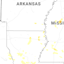


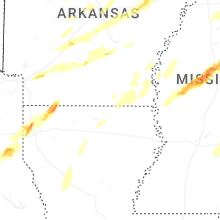
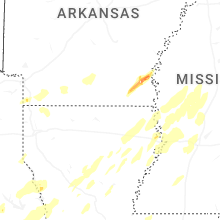


Connect with Interactive Hail Maps