

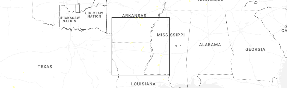
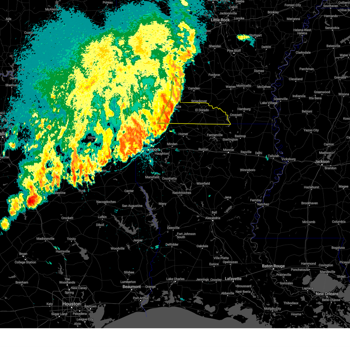
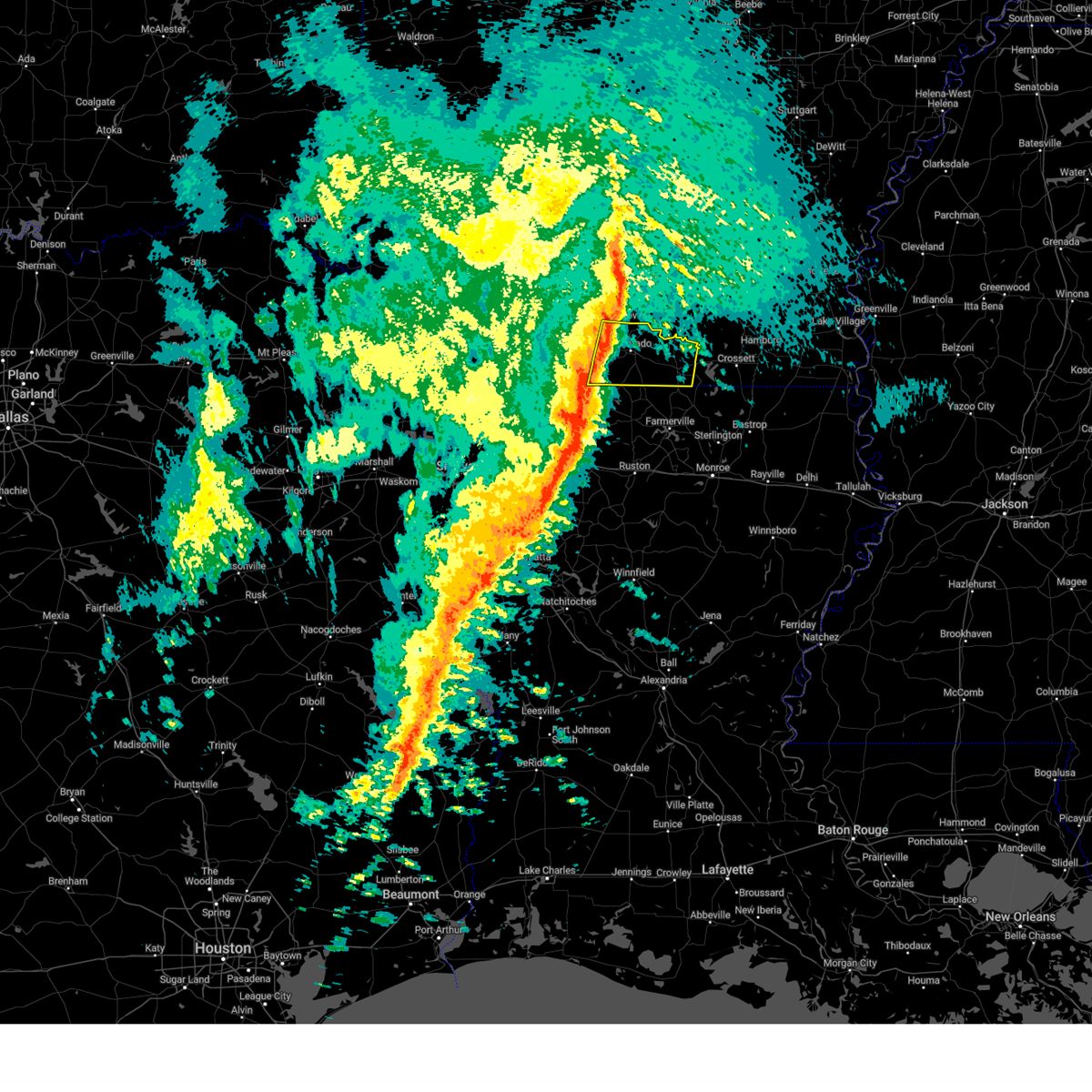
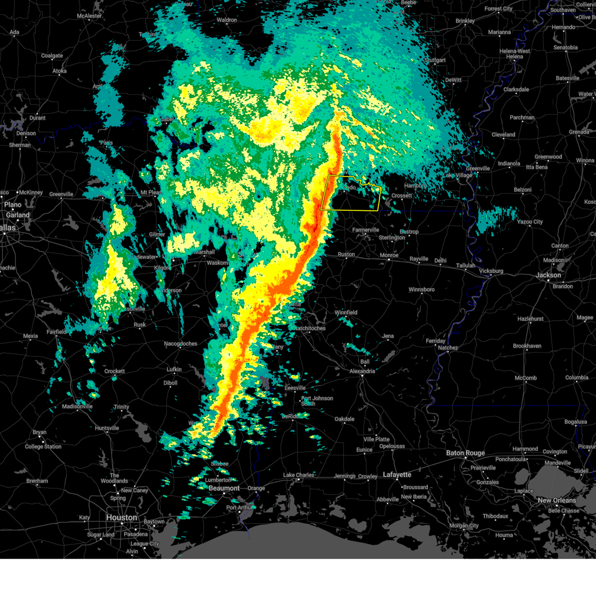
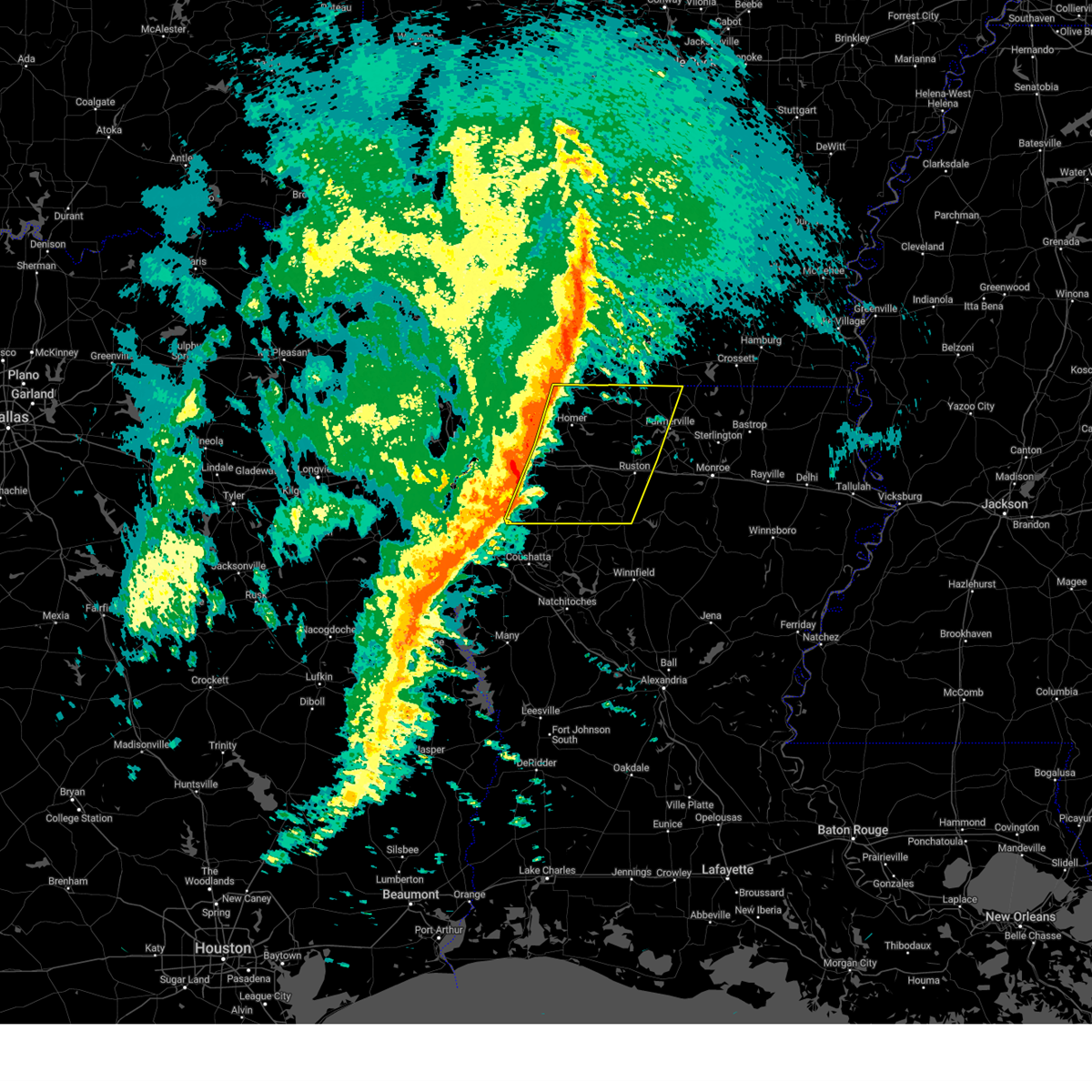
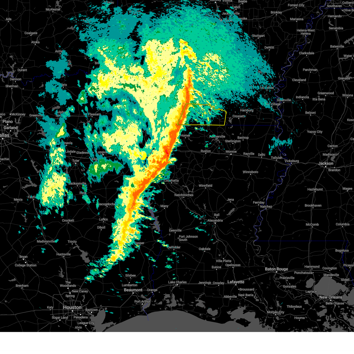
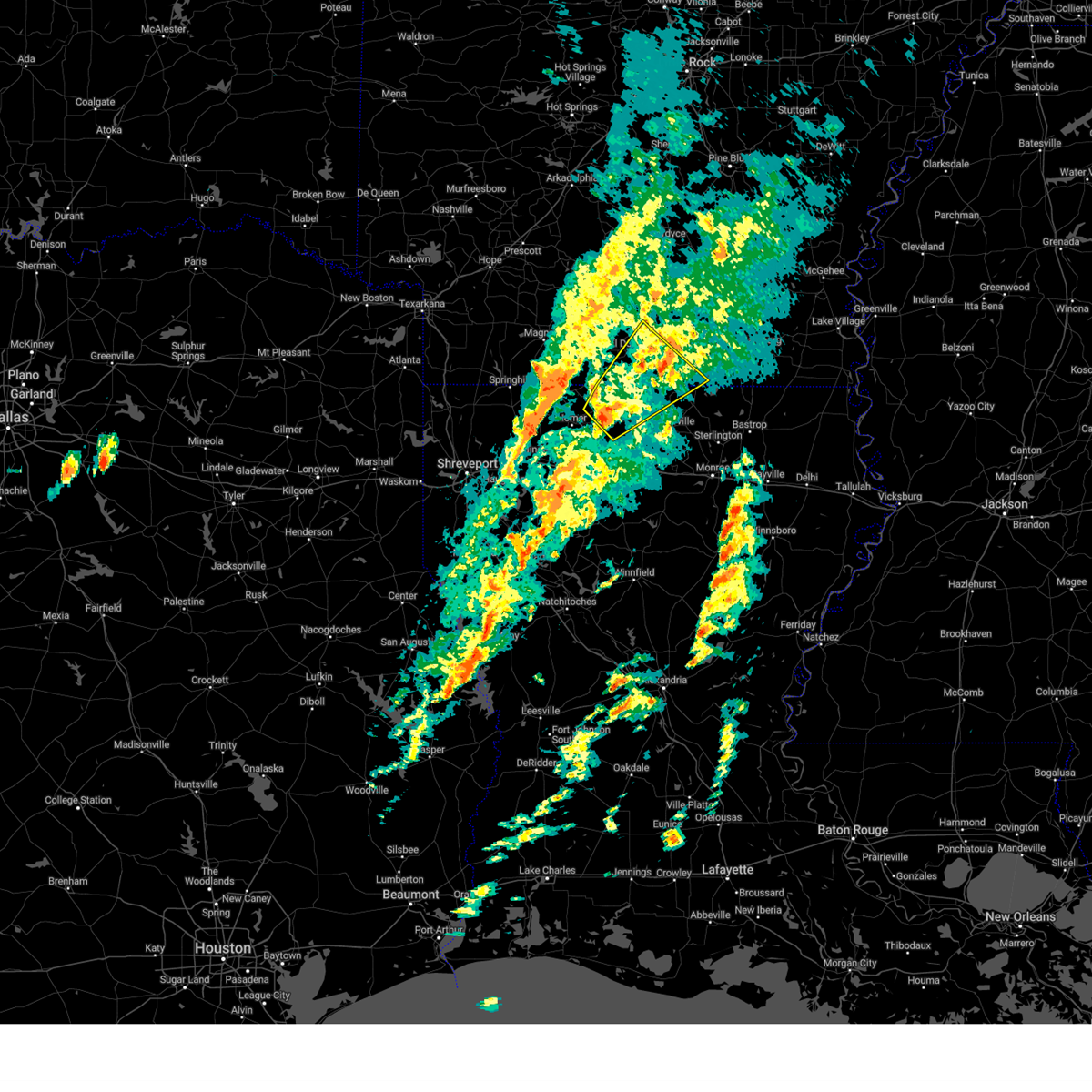
Hail Map for Junction City, AR
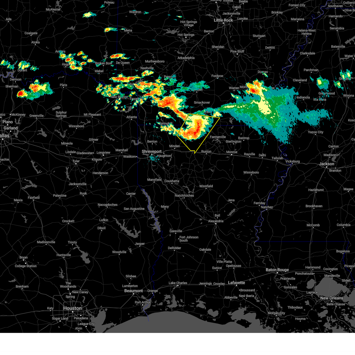
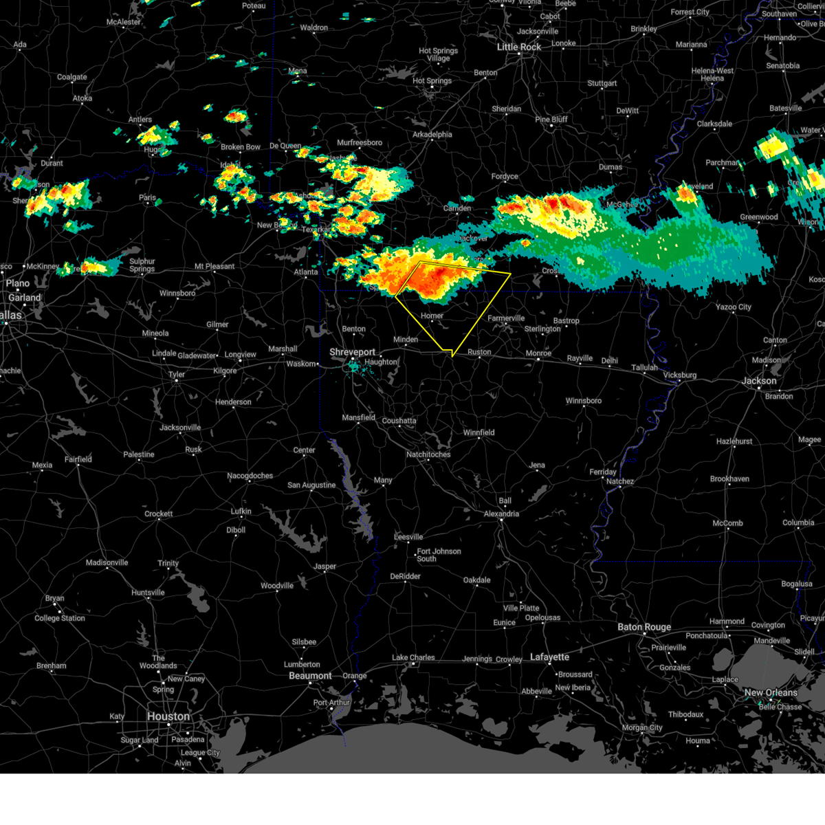
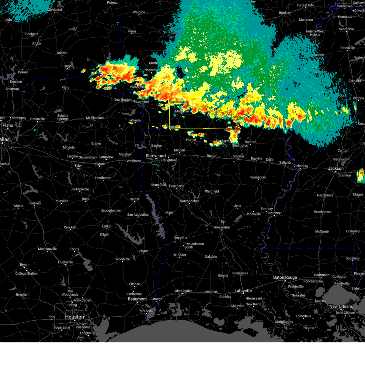
The Junction City, AR area has had 1 report of on-the-ground hail by trained spotters, and has been under severe weather warnings 18 times during the past 12 months. Doppler radar has detected hail at or near Junction City, AR on 59 occasions, including 1 occasion during the past year.
| Name: | Junction City, AR |
| Where Located: | 49.5 miles WNW of Bastrop, LA |
| Map: | Google Map for Junction City, AR |
| Population: | 581 |
| Housing Units: | 264 |
| More Info: | Search Google for Junction City, AR |
0
The Top Recent Hail Date for Junction City, AR is Monday, July 7, 2025 (59th out of 59)
Hail and Wind Damage Spotted near Junction City, AR
| Date / Time | Report Details |
|---|---|
| 6/8/2025 2:16 AM CDT |
 At 216 am cdt, a severe thunderstorm was located 8 miles west of bernice, or 15 miles east of homer, moving southeast at 45 mph (radar indicated). Hazards include 60 mph wind gusts and quarter size hail. Hail damage to vehicles is expected. expect wind damage to roofs, siding, and trees. Locations impacted include, homer, junction city, haynesville, bernice, atlanta, wesson, cooley, athens, lisbon, spearsville, lillie, newell, lake clairborne, corinth, catesville, hew hope, antioch, taylorville, summerfield, and aycock. At 216 am cdt, a severe thunderstorm was located 8 miles west of bernice, or 15 miles east of homer, moving southeast at 45 mph (radar indicated). Hazards include 60 mph wind gusts and quarter size hail. Hail damage to vehicles is expected. expect wind damage to roofs, siding, and trees. Locations impacted include, homer, junction city, haynesville, bernice, atlanta, wesson, cooley, athens, lisbon, spearsville, lillie, newell, lake clairborne, corinth, catesville, hew hope, antioch, taylorville, summerfield, and aycock.
|
| 6/8/2025 2:16 AM CDT |
 the severe thunderstorm warning has been cancelled and is no longer in effect the severe thunderstorm warning has been cancelled and is no longer in effect
|
| 6/8/2025 1:40 AM CDT |
 Svrshv the national weather service in shreveport has issued a * severe thunderstorm warning for, southwestern union county in south central arkansas, southeastern columbia county in southwestern arkansas, north central webster parish in northwestern louisiana, northwestern union parish in north central louisiana, claiborne parish in northwestern louisiana, northwestern lincoln parish in north central louisiana, * until 230 am cdt. * at 140 am cdt, a severe thunderstorm was located near emerson, or 16 miles east of springhill, moving southeast at 45 mph (radar indicated). Hazards include ping pong ball size hail and 60 mph wind gusts. People and animals outdoors will be injured. expect hail damage to roofs, siding, windows, and vehicles. Expect wind damage to roofs, siding, and trees. Svrshv the national weather service in shreveport has issued a * severe thunderstorm warning for, southwestern union county in south central arkansas, southeastern columbia county in southwestern arkansas, north central webster parish in northwestern louisiana, northwestern union parish in north central louisiana, claiborne parish in northwestern louisiana, northwestern lincoln parish in north central louisiana, * until 230 am cdt. * at 140 am cdt, a severe thunderstorm was located near emerson, or 16 miles east of springhill, moving southeast at 45 mph (radar indicated). Hazards include ping pong ball size hail and 60 mph wind gusts. People and animals outdoors will be injured. expect hail damage to roofs, siding, windows, and vehicles. Expect wind damage to roofs, siding, and trees.
|
| 5/25/2025 8:57 PM CDT | Svrshv the national weather service in shreveport has issued a * severe thunderstorm warning for, southern union county in south central arkansas, southeastern columbia county in southwestern arkansas, north central webster parish in northwestern louisiana, union parish in north central louisiana, northern ouachita parish in north central louisiana, claiborne parish in northwestern louisiana, lincoln parish in north central louisiana, * until 1000 pm cdt. * at 856 pm cdt, severe thunderstorms were located along a line extending from 10 miles northwest of bastrop to bernice to 7 miles east of taylor, moving south at 30 mph (radar indicated). Hazards include 60 mph wind gusts and quarter size hail. Hail damage to vehicles is expected. Expect wind damage to roofs, siding, and trees. |
| 5/25/2025 8:00 PM CDT |
 Svrshv the national weather service in shreveport has issued a * severe thunderstorm warning for, eastern lafayette county in southwestern arkansas, union county in south central arkansas, southern nevada county in southwestern arkansas, columbia county in southwestern arkansas, * until 900 pm cdt. * at 759 pm cdt, severe thunderstorms were located along a line extending from near lawson to near smithland, moving south at 20 mph (radar indicated). Hazards include 60 mph wind gusts and quarter size hail. Hail damage to vehicles is expected. Expect wind damage to roofs, siding, and trees. Svrshv the national weather service in shreveport has issued a * severe thunderstorm warning for, eastern lafayette county in southwestern arkansas, union county in south central arkansas, southern nevada county in southwestern arkansas, columbia county in southwestern arkansas, * until 900 pm cdt. * at 759 pm cdt, severe thunderstorms were located along a line extending from near lawson to near smithland, moving south at 20 mph (radar indicated). Hazards include 60 mph wind gusts and quarter size hail. Hail damage to vehicles is expected. Expect wind damage to roofs, siding, and trees.
|
| 4/30/2025 4:44 PM CDT |
 Svrshv the national weather service in shreveport has issued a * severe thunderstorm warning for, union county in south central arkansas, columbia county in southwestern arkansas, south central lafayette county in southwestern arkansas, southeastern nevada county in southwestern arkansas, northwestern union parish in north central louisiana, * until 545 pm cdt. * at 444 pm cdt, severe thunderstorms were located along a line from 9 miles northeast of bluff city to 6 miles north of shongaloo, or along a line from 21 miles east of prescott to 8 miles east of springhill, moving east at 40 mph (radar indicated). Hazards include 60 mph wind gusts and small hail. expect damage to roofs, siding, and trees Svrshv the national weather service in shreveport has issued a * severe thunderstorm warning for, union county in south central arkansas, columbia county in southwestern arkansas, south central lafayette county in southwestern arkansas, southeastern nevada county in southwestern arkansas, northwestern union parish in north central louisiana, * until 545 pm cdt. * at 444 pm cdt, severe thunderstorms were located along a line from 9 miles northeast of bluff city to 6 miles north of shongaloo, or along a line from 21 miles east of prescott to 8 miles east of springhill, moving east at 40 mph (radar indicated). Hazards include 60 mph wind gusts and small hail. expect damage to roofs, siding, and trees
|
| 4/5/2025 11:50 AM CDT |
 Svrshv the national weather service in shreveport has issued a * severe thunderstorm warning for, union county in south central arkansas, northwestern union parish in north central louisiana, northeastern claiborne parish in northwestern louisiana, * until 100 pm cdt. * at 1150 am cdt, severe thunderstorms were located along a line extending from near smackover to near homer, moving northeast at 45 mph (radar indicated). Hazards include 60 mph wind gusts and quarter size hail. Hail damage to vehicles is expected. Expect wind damage to roofs, siding, and trees. Svrshv the national weather service in shreveport has issued a * severe thunderstorm warning for, union county in south central arkansas, northwestern union parish in north central louisiana, northeastern claiborne parish in northwestern louisiana, * until 100 pm cdt. * at 1150 am cdt, severe thunderstorms were located along a line extending from near smackover to near homer, moving northeast at 45 mph (radar indicated). Hazards include 60 mph wind gusts and quarter size hail. Hail damage to vehicles is expected. Expect wind damage to roofs, siding, and trees.
|
| 3/31/2025 1:54 AM CDT |
 The storm which prompted the warning has weakened below severe limits, and no longer poses an immediate threat to life or property. therefore, the warning has been allowed to expire. The storm which prompted the warning has weakened below severe limits, and no longer poses an immediate threat to life or property. therefore, the warning has been allowed to expire.
|
| 3/31/2025 1:03 AM CDT |
 Svrshv the national weather service in shreveport has issued a * severe thunderstorm warning for, union county in south central arkansas, southeastern columbia county in southwestern arkansas, northwestern union parish in north central louisiana, northeastern claiborne parish in northwestern louisiana, * until 145 am cdt. * at 103 am cdt, a severe thunderstorm was located 5 miles northeast of atlanta, or 16 miles west of junction city, moving northeast at 45 mph (radar indicated). Hazards include 60 mph wind gusts and quarter size hail. Hail damage to vehicles is expected. Expect wind damage to roofs, siding, and trees. Svrshv the national weather service in shreveport has issued a * severe thunderstorm warning for, union county in south central arkansas, southeastern columbia county in southwestern arkansas, northwestern union parish in north central louisiana, northeastern claiborne parish in northwestern louisiana, * until 145 am cdt. * at 103 am cdt, a severe thunderstorm was located 5 miles northeast of atlanta, or 16 miles west of junction city, moving northeast at 45 mph (radar indicated). Hazards include 60 mph wind gusts and quarter size hail. Hail damage to vehicles is expected. Expect wind damage to roofs, siding, and trees.
|
| 3/4/2025 10:20 AM CST |
 the severe thunderstorm warning has been cancelled and is no longer in effect the severe thunderstorm warning has been cancelled and is no longer in effect
|
| 3/4/2025 10:20 AM CST |
 At 1020 am cst, severe thunderstorms were located along a line from over smackover to 7 miles southwest of wesson, or along a line from over smackover to 7 miles west of junction city, moving east at 40 mph (radar indicated). Hazards include 60 mph wind gusts and small hail. Expect damage to roofs, siding, and trees. Locations impacted include, el dorado, smackover, norphlet, junction city, strong, calion, lawson, urbana, wesson, lisbon, lapile, hillsboro, catesville, lockhart, newell, aurelle, kenova, pigeon hill, new london and cairo. At 1020 am cst, severe thunderstorms were located along a line from over smackover to 7 miles southwest of wesson, or along a line from over smackover to 7 miles west of junction city, moving east at 40 mph (radar indicated). Hazards include 60 mph wind gusts and small hail. Expect damage to roofs, siding, and trees. Locations impacted include, el dorado, smackover, norphlet, junction city, strong, calion, lawson, urbana, wesson, lisbon, lapile, hillsboro, catesville, lockhart, newell, aurelle, kenova, pigeon hill, new london and cairo.
|
| 3/4/2025 10:07 AM CST |
 Svrshv the national weather service in shreveport has issued a * severe thunderstorm warning for, northwestern jackson parish in north central louisiana, lincoln parish in north central louisiana, western union parish in north central louisiana, bienville parish in northwestern louisiana, southeastern bossier parish in northwestern louisiana, claiborne parish in northwestern louisiana, southeastern webster parish in northwestern louisiana, * until 1100 am cst. * at 1007 am cst, severe thunderstorms were located along a line from 7 miles southeast of atlanta to 9 miles southwest of ringgold, or along a line from 14 miles west of junction city to 23 miles northeast of mansfield, moving east at 35 mph (radar indicated). Hazards include 70 mph wind gusts and quarter size hail. Hail damage to vehicles is expected. expect considerable tree damage. Wind damage is also likely to mobile homes, roofs, and outbuildings. Svrshv the national weather service in shreveport has issued a * severe thunderstorm warning for, northwestern jackson parish in north central louisiana, lincoln parish in north central louisiana, western union parish in north central louisiana, bienville parish in northwestern louisiana, southeastern bossier parish in northwestern louisiana, claiborne parish in northwestern louisiana, southeastern webster parish in northwestern louisiana, * until 1100 am cst. * at 1007 am cst, severe thunderstorms were located along a line from 7 miles southeast of atlanta to 9 miles southwest of ringgold, or along a line from 14 miles west of junction city to 23 miles northeast of mansfield, moving east at 35 mph (radar indicated). Hazards include 70 mph wind gusts and quarter size hail. Hail damage to vehicles is expected. expect considerable tree damage. Wind damage is also likely to mobile homes, roofs, and outbuildings.
|
| 3/4/2025 10:00 AM CST |
 Svrshv the national weather service in shreveport has issued a * severe thunderstorm warning for, union county in south central arkansas, southeastern columbia county in southwestern arkansas, * until 1115 am cst. * at 1000 am cst, severe thunderstorms were located along a line from 5 miles north of mount holly to over atlanta, or along a line from 12 miles west of smackover to 17 miles north of homer, moving east at 35 mph (radar indicated). Hazards include 60 mph wind gusts. expect damage to roofs, siding, and trees Svrshv the national weather service in shreveport has issued a * severe thunderstorm warning for, union county in south central arkansas, southeastern columbia county in southwestern arkansas, * until 1115 am cst. * at 1000 am cst, severe thunderstorms were located along a line from 5 miles north of mount holly to over atlanta, or along a line from 12 miles west of smackover to 17 miles north of homer, moving east at 35 mph (radar indicated). Hazards include 60 mph wind gusts. expect damage to roofs, siding, and trees
|
| 2/15/2025 5:57 PM CST |
 At 557 pm cst, a severe thunderstorm was located 9 miles northwest of bernice, or 10 miles south of junction city, moving northeast at 60 mph (radar indicated). Hazards include 60 mph wind gusts and small hail. Expect damage to roofs, siding, and trees. Locations impacted include, el dorado, huttig, junction city, bernice, strong, calion, cooley, wesson, urbana, lawson, lapile, lisbon, spearsville, lillie, lockhart, taylorville, catesville, hillsboro and aurelle. At 557 pm cst, a severe thunderstorm was located 9 miles northwest of bernice, or 10 miles south of junction city, moving northeast at 60 mph (radar indicated). Hazards include 60 mph wind gusts and small hail. Expect damage to roofs, siding, and trees. Locations impacted include, el dorado, huttig, junction city, bernice, strong, calion, cooley, wesson, urbana, lawson, lapile, lisbon, spearsville, lillie, lockhart, taylorville, catesville, hillsboro and aurelle.
|
| 2/15/2025 5:37 PM CST |
 Svrshv the national weather service in shreveport has issued a * severe thunderstorm warning for, union county in south central arkansas, northwestern lincoln parish in north central louisiana, northwestern union parish in north central louisiana, central claiborne parish in northwestern louisiana, * until 630 pm cst. * at 537 pm cst, a severe thunderstorm was located 8 miles south of homer, moving northeast at 60 mph (radar indicated). Hazards include 60 mph wind gusts and small hail. expect damage to roofs, siding, and trees Svrshv the national weather service in shreveport has issued a * severe thunderstorm warning for, union county in south central arkansas, northwestern lincoln parish in north central louisiana, northwestern union parish in north central louisiana, central claiborne parish in northwestern louisiana, * until 630 pm cst. * at 537 pm cst, a severe thunderstorm was located 8 miles south of homer, moving northeast at 60 mph (radar indicated). Hazards include 60 mph wind gusts and small hail. expect damage to roofs, siding, and trees
|
| 1/5/2025 12:52 PM CST |
 the severe thunderstorm warning has been cancelled and is no longer in effect the severe thunderstorm warning has been cancelled and is no longer in effect
|
| 1/5/2025 12:52 PM CST |
 At 1252 pm cst, severe thunderstorms were located along a line from over norphlet to 6 miles southeast of cotton valley, or along a line from over norphlet to 10 miles northwest of minden, moving east at 35 mph (radar indicated). Hazards include 60 mph wind gusts and small hail. Expect damage to roofs, siding, and trees. Locations impacted include, el dorado, homer, smackover, norphlet, junction city, haynesville, cotton valley, calion, shongaloo, atlanta, wesson, mount holly, lisbon, evergreen, hew hope, three creeks, spotville, noxobe, marysville and cairo. At 1252 pm cst, severe thunderstorms were located along a line from over norphlet to 6 miles southeast of cotton valley, or along a line from over norphlet to 10 miles northwest of minden, moving east at 35 mph (radar indicated). Hazards include 60 mph wind gusts and small hail. Expect damage to roofs, siding, and trees. Locations impacted include, el dorado, homer, smackover, norphlet, junction city, haynesville, cotton valley, calion, shongaloo, atlanta, wesson, mount holly, lisbon, evergreen, hew hope, three creeks, spotville, noxobe, marysville and cairo.
|
| 1/5/2025 12:17 PM CST |
 Svrshv the national weather service in shreveport has issued a * severe thunderstorm warning for, union county in south central arkansas, columbia county in southwestern arkansas, northern bossier parish in northwestern louisiana, central caddo parish in northwestern louisiana, northern claiborne parish in northwestern louisiana, northwestern webster parish in northwestern louisiana, * until 115 pm cst. * at 1217 pm cst, severe thunderstorms were located along a line from near mount holly to near benton, or along a line from 12 miles east of mcneil to 15 miles north of bossier city, moving east at 40 mph (radar indicated). Hazards include 60 mph wind gusts and small hail. expect damage to roofs, siding, and trees Svrshv the national weather service in shreveport has issued a * severe thunderstorm warning for, union county in south central arkansas, columbia county in southwestern arkansas, northern bossier parish in northwestern louisiana, central caddo parish in northwestern louisiana, northern claiborne parish in northwestern louisiana, northwestern webster parish in northwestern louisiana, * until 115 pm cst. * at 1217 pm cst, severe thunderstorms were located along a line from near mount holly to near benton, or along a line from 12 miles east of mcneil to 15 miles north of bossier city, moving east at 40 mph (radar indicated). Hazards include 60 mph wind gusts and small hail. expect damage to roofs, siding, and trees
|
| 7/8/2024 7:07 PM CDT |
 At 706 pm cdt, a confirmed tornado was located 7 miles south of junction city, moving north at 40 mph (radar confirmed tornado). Hazards include damaging tornado. Flying debris will be dangerous to those caught without shelter. mobile homes will be damaged or destroyed. damage to roofs, windows, and vehicles will occur. tree damage is likely. Locations impacted include, junction city, lillie, summerfield, catesville, and corney lake. At 706 pm cdt, a confirmed tornado was located 7 miles south of junction city, moving north at 40 mph (radar confirmed tornado). Hazards include damaging tornado. Flying debris will be dangerous to those caught without shelter. mobile homes will be damaged or destroyed. damage to roofs, windows, and vehicles will occur. tree damage is likely. Locations impacted include, junction city, lillie, summerfield, catesville, and corney lake.
|
| 7/8/2024 6:54 PM CDT |
 Torshv the national weather service in shreveport has issued a * tornado warning for, southwestern union county in south central arkansas, northwestern union parish in north central louisiana, northeastern claiborne parish in northwestern louisiana, * until 730 pm cdt. * at 654 pm cdt, a severe thunderstorm capable of producing a tornado was located near bernice, or 16 miles south of junction city, moving north at 40 mph (radar indicated rotation). Hazards include tornado. Flying debris will be dangerous to those caught without shelter. mobile homes will be damaged or destroyed. damage to roofs, windows, and vehicles will occur. Tree damage is likely. Torshv the national weather service in shreveport has issued a * tornado warning for, southwestern union county in south central arkansas, northwestern union parish in north central louisiana, northeastern claiborne parish in northwestern louisiana, * until 730 pm cdt. * at 654 pm cdt, a severe thunderstorm capable of producing a tornado was located near bernice, or 16 miles south of junction city, moving north at 40 mph (radar indicated rotation). Hazards include tornado. Flying debris will be dangerous to those caught without shelter. mobile homes will be damaged or destroyed. damage to roofs, windows, and vehicles will occur. Tree damage is likely.
|
| 6/26/2024 2:00 PM CDT |
 the severe thunderstorm warning has been cancelled and is no longer in effect the severe thunderstorm warning has been cancelled and is no longer in effect
|
| 6/26/2024 2:00 PM CDT |
 At 159 pm cdt, severe thunderstorms were located along a line extending from near wesson to 9 miles north of arcadia to near ringgold, moving southeast at 40 mph (radar indicated). Hazards include 60 mph wind gusts. Expect damage to roofs, siding, and trees. Locations impacted include, ruston, grambling, homer, junction city, arcadia, bernice, gibsland, dubberly, heflin, wesson, cooley, dubach, simsboro, vienna, lucky, athens, bienville, lisbon, jamestown, and spearsville. At 159 pm cdt, severe thunderstorms were located along a line extending from near wesson to 9 miles north of arcadia to near ringgold, moving southeast at 40 mph (radar indicated). Hazards include 60 mph wind gusts. Expect damage to roofs, siding, and trees. Locations impacted include, ruston, grambling, homer, junction city, arcadia, bernice, gibsland, dubberly, heflin, wesson, cooley, dubach, simsboro, vienna, lucky, athens, bienville, lisbon, jamestown, and spearsville.
|
| 6/26/2024 1:24 PM CDT |
 Svrshv the national weather service in shreveport has issued a * severe thunderstorm warning for, southwestern union county in south central arkansas, southeastern columbia county in southwestern arkansas, southeastern webster parish in northwestern louisiana, northwestern union parish in north central louisiana, claiborne parish in northwestern louisiana, central bienville parish in northwestern louisiana, lincoln parish in north central louisiana, * until 230 pm cdt. * at 124 pm cdt, severe thunderstorms were located along a line extending from 6 miles southeast of village to 8 miles west of homer to near haughton, moving east at 40 mph (radar indicated). Hazards include 60 mph wind gusts. expect damage to roofs, siding, and trees Svrshv the national weather service in shreveport has issued a * severe thunderstorm warning for, southwestern union county in south central arkansas, southeastern columbia county in southwestern arkansas, southeastern webster parish in northwestern louisiana, northwestern union parish in north central louisiana, claiborne parish in northwestern louisiana, central bienville parish in northwestern louisiana, lincoln parish in north central louisiana, * until 230 pm cdt. * at 124 pm cdt, severe thunderstorms were located along a line extending from 6 miles southeast of village to 8 miles west of homer to near haughton, moving east at 40 mph (radar indicated). Hazards include 60 mph wind gusts. expect damage to roofs, siding, and trees
|
| 6/3/2024 6:30 PM CDT |
 Svrshv the national weather service in shreveport has issued a * severe thunderstorm warning for, union county in south central arkansas, southeastern columbia county in southwestern arkansas, northeastern webster parish in northwestern louisiana, union parish in north central louisiana, claiborne parish in northwestern louisiana, northwestern lincoln parish in north central louisiana, * until 730 pm cdt. * at 630 pm cdt, severe thunderstorms were located along a line extending from near calion to near junction city to near shongaloo, moving east at 30 mph (radar indicated. numerous trees and power lines have been downed from these storms over southwest arkansas). Hazards include 60 mph wind gusts and quarter size hail. Hail damage to vehicles is expected. Expect wind damage to roofs, siding, and trees. Svrshv the national weather service in shreveport has issued a * severe thunderstorm warning for, union county in south central arkansas, southeastern columbia county in southwestern arkansas, northeastern webster parish in northwestern louisiana, union parish in north central louisiana, claiborne parish in northwestern louisiana, northwestern lincoln parish in north central louisiana, * until 730 pm cdt. * at 630 pm cdt, severe thunderstorms were located along a line extending from near calion to near junction city to near shongaloo, moving east at 30 mph (radar indicated. numerous trees and power lines have been downed from these storms over southwest arkansas). Hazards include 60 mph wind gusts and quarter size hail. Hail damage to vehicles is expected. Expect wind damage to roofs, siding, and trees.
|
| 6/3/2024 6:11 PM CDT |
 the severe thunderstorm warning has been cancelled and is no longer in effect the severe thunderstorm warning has been cancelled and is no longer in effect
|
| 6/3/2024 6:11 PM CDT |
 At 611 pm cdt, severe thunderstorms were located along a line extending from near lisbon to near haynesville to hosston to harleton, moving southeast at 35 mph (radar indicated. numerous trees and power lines have been downed with these storms. large hail has also been reported in shongaloo as well). Hazards include 60 mph wind gusts and half dollar size hail. Hail damage to vehicles is expected. expect wind damage to roofs, siding, and trees. Locations impacted include, el dorado, magnolia, springhill, homer, smackover, norphlet, mcneil, vivian, haynesville, jefferson, linden, benton, cullen, plain dealing, cotton valley, oil city, sarepta, mooringsport, bradley, and taylor. At 611 pm cdt, severe thunderstorms were located along a line extending from near lisbon to near haynesville to hosston to harleton, moving southeast at 35 mph (radar indicated. numerous trees and power lines have been downed with these storms. large hail has also been reported in shongaloo as well). Hazards include 60 mph wind gusts and half dollar size hail. Hail damage to vehicles is expected. expect wind damage to roofs, siding, and trees. Locations impacted include, el dorado, magnolia, springhill, homer, smackover, norphlet, mcneil, vivian, haynesville, jefferson, linden, benton, cullen, plain dealing, cotton valley, oil city, sarepta, mooringsport, bradley, and taylor.
|
| 6/3/2024 5:39 PM CDT |
 Svrshv the national weather service in shreveport has issued a * severe thunderstorm warning for, southeastern hempstead county in southwestern arkansas, lafayette county in southwestern arkansas, western union county in south central arkansas, southern nevada county in southwestern arkansas, southern miller county in southwestern arkansas, columbia county in southwestern arkansas, northwestern webster parish in northwestern louisiana, northwestern caddo parish in northwestern louisiana, northwestern claiborne parish in northwestern louisiana, northern bossier parish in northwestern louisiana, marion county in northeastern texas, southeastern bowie county in northeastern texas, northeastern upshur county in northeastern texas, cass county in northeastern texas, northern harrison county in northeastern texas, eastern morris county in northeastern texas, southeastern camp county in northeastern texas, north central gregg county in northeastern texas, * until 645 pm cdt. * at 538 pm cdt, severe thunderstorms were located along a line extending from near stephens to near bussey to ida, moving southeast at 35 mph (radar indicated). Hazards include 60 mph wind gusts and nickel size hail. expect damage to roofs, siding, and trees Svrshv the national weather service in shreveport has issued a * severe thunderstorm warning for, southeastern hempstead county in southwestern arkansas, lafayette county in southwestern arkansas, western union county in south central arkansas, southern nevada county in southwestern arkansas, southern miller county in southwestern arkansas, columbia county in southwestern arkansas, northwestern webster parish in northwestern louisiana, northwestern caddo parish in northwestern louisiana, northwestern claiborne parish in northwestern louisiana, northern bossier parish in northwestern louisiana, marion county in northeastern texas, southeastern bowie county in northeastern texas, northeastern upshur county in northeastern texas, cass county in northeastern texas, northern harrison county in northeastern texas, eastern morris county in northeastern texas, southeastern camp county in northeastern texas, north central gregg county in northeastern texas, * until 645 pm cdt. * at 538 pm cdt, severe thunderstorms were located along a line extending from near stephens to near bussey to ida, moving southeast at 35 mph (radar indicated). Hazards include 60 mph wind gusts and nickel size hail. expect damage to roofs, siding, and trees
|
| 5/25/2024 12:51 AM CDT |
 At 1251 am cdt, a severe thunderstorm was located near urbana, or 9 miles southeast of el dorado, moving southeast at 40 mph (radar indicated). Hazards include ping pong ball size hail and 60 mph wind gusts. People and animals outdoors will be injured. expect hail damage to roofs, siding, windows, and vehicles. expect wind damage to roofs, siding, and trees. Locations impacted include, el dorado, norphlet, huttig, junction city, strong, calion, lisbon, urbana, lawson, wesson, lapile, felsenthal, newell, new london, aurelle, oakland, taylorville, pigeon hill, hillsboro, and lockhart. At 1251 am cdt, a severe thunderstorm was located near urbana, or 9 miles southeast of el dorado, moving southeast at 40 mph (radar indicated). Hazards include ping pong ball size hail and 60 mph wind gusts. People and animals outdoors will be injured. expect hail damage to roofs, siding, windows, and vehicles. expect wind damage to roofs, siding, and trees. Locations impacted include, el dorado, norphlet, huttig, junction city, strong, calion, lisbon, urbana, lawson, wesson, lapile, felsenthal, newell, new london, aurelle, oakland, taylorville, pigeon hill, hillsboro, and lockhart.
|
| 5/25/2024 12:37 AM CDT |
 Svrshv the national weather service in shreveport has issued a * severe thunderstorm warning for, union county in south central arkansas, northwestern union parish in north central louisiana, * until 115 am cdt. * at 1236 am cdt, a severe thunderstorm was located over el dorado, moving southeast at 40 mph (radar indicated). Hazards include ping pong ball size hail and 60 mph wind gusts. People and animals outdoors will be injured. expect hail damage to roofs, siding, windows, and vehicles. Expect wind damage to roofs, siding, and trees. Svrshv the national weather service in shreveport has issued a * severe thunderstorm warning for, union county in south central arkansas, northwestern union parish in north central louisiana, * until 115 am cdt. * at 1236 am cdt, a severe thunderstorm was located over el dorado, moving southeast at 40 mph (radar indicated). Hazards include ping pong ball size hail and 60 mph wind gusts. People and animals outdoors will be injured. expect hail damage to roofs, siding, windows, and vehicles. Expect wind damage to roofs, siding, and trees.
|
| 4/28/2024 7:57 PM CDT |
 Svrshv the national weather service in shreveport has issued a * severe thunderstorm warning for, southeastern lafayette county in southwestern arkansas, union county in south central arkansas, southeastern nevada county in southwestern arkansas, columbia county in southwestern arkansas, webster parish in northwestern louisiana, union parish in north central louisiana, northeastern red river parish in northwestern louisiana, ouachita parish in north central louisiana, northwestern caldwell parish in north central louisiana, jackson parish in north central louisiana, claiborne parish in northwestern louisiana, bienville parish in northwestern louisiana, eastern bossier parish in northwestern louisiana, lincoln parish in north central louisiana, * until 900 pm cdt. * at 756 pm cdt, severe thunderstorms were located along a line extending from stamps to 16 miles northwest of winnfield, moving east at 50 mph (radar indicated). Hazards include 70 mph wind gusts and nickel size hail. Expect considerable tree damage. Damage is likely to mobile homes, roofs, and outbuildings. Svrshv the national weather service in shreveport has issued a * severe thunderstorm warning for, southeastern lafayette county in southwestern arkansas, union county in south central arkansas, southeastern nevada county in southwestern arkansas, columbia county in southwestern arkansas, webster parish in northwestern louisiana, union parish in north central louisiana, northeastern red river parish in northwestern louisiana, ouachita parish in north central louisiana, northwestern caldwell parish in north central louisiana, jackson parish in north central louisiana, claiborne parish in northwestern louisiana, bienville parish in northwestern louisiana, eastern bossier parish in northwestern louisiana, lincoln parish in north central louisiana, * until 900 pm cdt. * at 756 pm cdt, severe thunderstorms were located along a line extending from stamps to 16 miles northwest of winnfield, moving east at 50 mph (radar indicated). Hazards include 70 mph wind gusts and nickel size hail. Expect considerable tree damage. Damage is likely to mobile homes, roofs, and outbuildings.
|
| 3/4/2024 4:39 PM CST |
 The storm which prompted the warning has weakened below severe limits, and has exited the warned area. therefore, the warning will be allowed to expire. The storm which prompted the warning has weakened below severe limits, and has exited the warned area. therefore, the warning will be allowed to expire.
|
| 3/4/2024 4:13 PM CST |
 At 413 pm cst, a severe thunderstorm was located near junction city, moving northeast at 15 mph (radar indicated). Hazards include 60 mph wind gusts and quarter size hail. Hail damage to vehicles is expected. expect wind damage to roofs, siding, and trees. Locations impacted include, junction city, spearsville, lillie, hillsboro, corney lake, lockhart, taylorville, and catesville. At 413 pm cst, a severe thunderstorm was located near junction city, moving northeast at 15 mph (radar indicated). Hazards include 60 mph wind gusts and quarter size hail. Hail damage to vehicles is expected. expect wind damage to roofs, siding, and trees. Locations impacted include, junction city, spearsville, lillie, hillsboro, corney lake, lockhart, taylorville, and catesville.
|
| 7/16/2023 3:34 PM CDT |
 At 333 pm cdt, severe thunderstorms were located along a line extending from near emmet to near mcneil to near atlanta, moving east at 30 mph (radar indicated). Hazards include 60 mph wind gusts and penny size hail. Expect damage to roofs, siding, and trees. locations impacted include, magnolia, waldo, junction city, mcneil, village, lisbon, mount holly, atlanta, wesson, calhoun, hew hope, ebenezer, laughlin, marysville, college hill, cairo, noxobe, three creeks, lamartine and spotville. hail threat, radar indicated max hail size, 0. 75 in wind threat, radar indicated max wind gust, 60 mph. At 333 pm cdt, severe thunderstorms were located along a line extending from near emmet to near mcneil to near atlanta, moving east at 30 mph (radar indicated). Hazards include 60 mph wind gusts and penny size hail. Expect damage to roofs, siding, and trees. locations impacted include, magnolia, waldo, junction city, mcneil, village, lisbon, mount holly, atlanta, wesson, calhoun, hew hope, ebenezer, laughlin, marysville, college hill, cairo, noxobe, three creeks, lamartine and spotville. hail threat, radar indicated max hail size, 0. 75 in wind threat, radar indicated max wind gust, 60 mph.
|
| 7/16/2023 3:31 PM CDT |
 At 331 pm cdt, severe thunderstorms were located along a line extending from near bluff city to near mount holly to 7 miles west of junction city, moving east at 40 mph (radar indicated). Hazards include 60 mph wind gusts and penny size hail. expect damage to roofs, siding, and trees At 331 pm cdt, severe thunderstorms were located along a line extending from near bluff city to near mount holly to 7 miles west of junction city, moving east at 40 mph (radar indicated). Hazards include 60 mph wind gusts and penny size hail. expect damage to roofs, siding, and trees
|
| 7/16/2023 3:14 PM CDT |
 At 314 pm cdt, severe thunderstorms were located along a line extending from 9 miles southeast of atlanta to 9 miles southeast of homer to 12 miles east of ringgold, moving east at 60 mph (radar indicated. numerous trees and power lines have been downed across northwest louisiana from these storms). Hazards include 60 mph wind gusts. expect damage to roofs, siding, and trees At 314 pm cdt, severe thunderstorms were located along a line extending from 9 miles southeast of atlanta to 9 miles southeast of homer to 12 miles east of ringgold, moving east at 60 mph (radar indicated. numerous trees and power lines have been downed across northwest louisiana from these storms). Hazards include 60 mph wind gusts. expect damage to roofs, siding, and trees
|
| 7/16/2023 3:07 PM CDT |
 At 306 pm cdt, severe thunderstorms were located along a line extending from near hope to near waldo to near emerson, moving east at 30 mph (radar indicated). Hazards include 60 mph wind gusts and penny size hail. Expect damage to roofs, siding, and trees. locations impacted include, magnolia, hope, waldo, junction city, mcneil, emerson, buckner, perrytown, rosston, willisville, bodcaw, bluff city, mount holly, smithland, atlanta, wesson, village, lisbon, macedonia and white oak lake state park. hail threat, radar indicated max hail size, 0. 75 in wind threat, radar indicated max wind gust, 60 mph. At 306 pm cdt, severe thunderstorms were located along a line extending from near hope to near waldo to near emerson, moving east at 30 mph (radar indicated). Hazards include 60 mph wind gusts and penny size hail. Expect damage to roofs, siding, and trees. locations impacted include, magnolia, hope, waldo, junction city, mcneil, emerson, buckner, perrytown, rosston, willisville, bodcaw, bluff city, mount holly, smithland, atlanta, wesson, village, lisbon, macedonia and white oak lake state park. hail threat, radar indicated max hail size, 0. 75 in wind threat, radar indicated max wind gust, 60 mph.
|
| 7/16/2023 2:44 PM CDT |
 At 242 pm cdt, severe thunderstorms were located along a line extending from 7 miles north of fulton to near lewisville to near welcome, moving east at 30 mph (radar indicated). Hazards include 60 mph wind gusts and penny size hail. expect damage to roofs, siding, and trees At 242 pm cdt, severe thunderstorms were located along a line extending from 7 miles north of fulton to near lewisville to near welcome, moving east at 30 mph (radar indicated). Hazards include 60 mph wind gusts and penny size hail. expect damage to roofs, siding, and trees
|
| 6/26/2023 3:29 AM CDT |
 At 328 am cdt, severe thunderstorms were located along a line extending from 6 miles southwest of lisbon to near el dorado to near calion to near moro bay to hermitage, moving southeast at 30 mph (radar indicated). Hazards include 60 mph wind gusts and quarter size hail. Hail damage to vehicles is expected. expect wind damage to roofs, siding, and trees. locations impacted include, el dorado, smackover, norphlet, junction city, strong, calion, lisbon, mount holly, urbana, lawson, wesson, newell, new london, pigeon hill, marysville, cairo, hillsboro, three creeks, kenova and catesville. hail threat, radar indicated max hail size, 1. 00 in wind threat, radar indicated max wind gust, 60 mph. At 328 am cdt, severe thunderstorms were located along a line extending from 6 miles southwest of lisbon to near el dorado to near calion to near moro bay to hermitage, moving southeast at 30 mph (radar indicated). Hazards include 60 mph wind gusts and quarter size hail. Hail damage to vehicles is expected. expect wind damage to roofs, siding, and trees. locations impacted include, el dorado, smackover, norphlet, junction city, strong, calion, lisbon, mount holly, urbana, lawson, wesson, newell, new london, pigeon hill, marysville, cairo, hillsboro, three creeks, kenova and catesville. hail threat, radar indicated max hail size, 1. 00 in wind threat, radar indicated max wind gust, 60 mph.
|
| 6/26/2023 2:52 AM CDT |
 At 252 am cdt, severe thunderstorms were located along a line extending from near stephens to 8 miles west of louann to 8 miles east of cullendale to near hampton to near ellisville, moving southeast at 30 mph (radar indicated). Hazards include 60 mph wind gusts and quarter size hail. Hail damage to vehicles is expected. Expect wind damage to roofs, siding, and trees. At 252 am cdt, severe thunderstorms were located along a line extending from near stephens to 8 miles west of louann to 8 miles east of cullendale to near hampton to near ellisville, moving southeast at 30 mph (radar indicated). Hazards include 60 mph wind gusts and quarter size hail. Hail damage to vehicles is expected. Expect wind damage to roofs, siding, and trees.
|
| 6/18/2023 9:17 PM CDT |
 At 917 pm cdt, severe thunderstorms were located along a line extending from 10 miles north of farmerville to 12 miles west of bernice, moving southeast at 40 mph (radar indicated). Hazards include 60 mph wind gusts and half dollar size hail. Hail damage to vehicles is expected. expect wind damage to roofs, siding, and trees. Locations impacted include, farmerville, bernice, cooley, marion, junction city, lisbon, spearsville, lillie, antioch, oakland, haile, linville, taylorville, summerfield, corney lake, lake clairborne and cecil. At 917 pm cdt, severe thunderstorms were located along a line extending from 10 miles north of farmerville to 12 miles west of bernice, moving southeast at 40 mph (radar indicated). Hazards include 60 mph wind gusts and half dollar size hail. Hail damage to vehicles is expected. expect wind damage to roofs, siding, and trees. Locations impacted include, farmerville, bernice, cooley, marion, junction city, lisbon, spearsville, lillie, antioch, oakland, haile, linville, taylorville, summerfield, corney lake, lake clairborne and cecil.
|
| 6/18/2023 8:55 PM CDT |
 At 855 pm cdt, severe thunderstorms were located along a line extending from near junction city to near haynesville, moving southeast at 40 mph (radar indicated). Hazards include 60 mph wind gusts and half dollar size hail. Hail damage to vehicles is expected. Expect wind damage to roofs, siding, and trees. At 855 pm cdt, severe thunderstorms were located along a line extending from near junction city to near haynesville, moving southeast at 40 mph (radar indicated). Hazards include 60 mph wind gusts and half dollar size hail. Hail damage to vehicles is expected. Expect wind damage to roofs, siding, and trees.
|
| 6/18/2023 8:26 PM CDT |
 At 826 pm cdt, a severe thunderstorm capable of producing a tornado was located near wesson, or 9 miles northwest of junction city, moving southeast at 30 mph (radar indicated rotation). Hazards include tornado. Flying debris will be dangerous to those caught without shelter. mobile homes will be damaged or destroyed. damage to roofs, windows, and vehicles will occur. tree damage is likely. this dangerous storm will be near, wesson around 830 pm cdt. junction city around 845 pm cdt. Other locations impacted by this tornadic thunderstorm include junction city, three creeks, catesville and lockhart. At 826 pm cdt, a severe thunderstorm capable of producing a tornado was located near wesson, or 9 miles northwest of junction city, moving southeast at 30 mph (radar indicated rotation). Hazards include tornado. Flying debris will be dangerous to those caught without shelter. mobile homes will be damaged or destroyed. damage to roofs, windows, and vehicles will occur. tree damage is likely. this dangerous storm will be near, wesson around 830 pm cdt. junction city around 845 pm cdt. Other locations impacted by this tornadic thunderstorm include junction city, three creeks, catesville and lockhart.
|
| 6/18/2023 8:46 AM CDT |
 At 845 am cdt, severe thunderstorms were located along a line extending from near haynesville to near cotton valley to 10 miles south of sarepta to near benton, moving southeast at 45 mph (radar indicated). Hazards include 60 mph wind gusts and nickel size hail. Expect damage to roofs, siding, and trees. locations impacted include, shreveport, bossier city, minden, homer, junction city, haughton, greenwood, blanchard, haynesville, benton, cotton valley, oil city, sarepta, mooringsport, dixie inn, belcher, shongaloo, eastwood, atlanta and fosters. hail threat, radar indicated max hail size, 0. 88 in wind threat, radar indicated max wind gust, 60 mph. At 845 am cdt, severe thunderstorms were located along a line extending from near haynesville to near cotton valley to 10 miles south of sarepta to near benton, moving southeast at 45 mph (radar indicated). Hazards include 60 mph wind gusts and nickel size hail. Expect damage to roofs, siding, and trees. locations impacted include, shreveport, bossier city, minden, homer, junction city, haughton, greenwood, blanchard, haynesville, benton, cotton valley, oil city, sarepta, mooringsport, dixie inn, belcher, shongaloo, eastwood, atlanta and fosters. hail threat, radar indicated max hail size, 0. 88 in wind threat, radar indicated max wind gust, 60 mph.
|
| 6/18/2023 8:24 AM CDT |
 At 824 am cdt, severe thunderstorms were located along a line extending from near stephens to 6 miles east of taylor to 6 miles northeast of plain dealing to near hosston, moving southeast at 50 mph (radar indicated). Hazards include 60 mph wind gusts and nickel size hail. expect damage to roofs, siding, and trees At 824 am cdt, severe thunderstorms were located along a line extending from near stephens to 6 miles east of taylor to 6 miles northeast of plain dealing to near hosston, moving southeast at 50 mph (radar indicated). Hazards include 60 mph wind gusts and nickel size hail. expect damage to roofs, siding, and trees
|
| 6/18/2023 6:24 AM CDT |
 At 624 am cdt, severe thunderstorms were located along a line extending from 8 miles southeast of atlanta to 13 miles west of bernice to 7 miles east of homer, moving east at 50 mph (radar indicated). Hazards include 60 mph wind gusts and quarter size hail. Hail damage to vehicles is expected. Expect wind damage to roofs, siding, and trees. At 624 am cdt, severe thunderstorms were located along a line extending from 8 miles southeast of atlanta to 13 miles west of bernice to 7 miles east of homer, moving east at 50 mph (radar indicated). Hazards include 60 mph wind gusts and quarter size hail. Hail damage to vehicles is expected. Expect wind damage to roofs, siding, and trees.
|
| 6/17/2023 8:36 PM CDT |
 At 835 pm cdt, a severe thunderstorm was located near junction city, moving east at 40 mph (radar indicated). Hazards include golf ball size hail and 70 mph wind gusts. People and animals outdoors will be injured. expect hail damage to roofs, siding, windows, and vehicles. expect considerable tree damage. Wind damage is also likely to mobile homes, roofs, and outbuildings. At 835 pm cdt, a severe thunderstorm was located near junction city, moving east at 40 mph (radar indicated). Hazards include golf ball size hail and 70 mph wind gusts. People and animals outdoors will be injured. expect hail damage to roofs, siding, windows, and vehicles. expect considerable tree damage. Wind damage is also likely to mobile homes, roofs, and outbuildings.
|
| 6/17/2023 8:16 PM CDT |
 At 815 pm cdt, a severe thunderstorm was located near haynesville, or 12 miles north of homer, moving northeast at 35 mph (radar indicated). Hazards include tennis ball size hail and 60 mph wind gusts. People and animals outdoors will be injured. expect hail damage to roofs, siding, windows, and vehicles. expect wind damage to roofs, siding, and trees. locations impacted include, junction city, haynesville, atlanta, wesson, marysville, hew hope, cairo, three creeks and spotville. thunderstorm damage threat, considerable hail threat, radar indicated max hail size, 2. 50 in wind threat, radar indicated max wind gust, 60 mph. At 815 pm cdt, a severe thunderstorm was located near haynesville, or 12 miles north of homer, moving northeast at 35 mph (radar indicated). Hazards include tennis ball size hail and 60 mph wind gusts. People and animals outdoors will be injured. expect hail damage to roofs, siding, windows, and vehicles. expect wind damage to roofs, siding, and trees. locations impacted include, junction city, haynesville, atlanta, wesson, marysville, hew hope, cairo, three creeks and spotville. thunderstorm damage threat, considerable hail threat, radar indicated max hail size, 2. 50 in wind threat, radar indicated max wind gust, 60 mph.
|
| 6/17/2023 7:56 PM CDT |
 At 756 pm cdt, a severe thunderstorm was located over shongaloo, or 12 miles east of springhill, moving northeast at 35 mph (radar indicated). Hazards include ping pong ball size hail and 60 mph wind gusts. People and animals outdoors will be injured. expect hail damage to roofs, siding, windows, and vehicles. Expect wind damage to roofs, siding, and trees. At 756 pm cdt, a severe thunderstorm was located over shongaloo, or 12 miles east of springhill, moving northeast at 35 mph (radar indicated). Hazards include ping pong ball size hail and 60 mph wind gusts. People and animals outdoors will be injured. expect hail damage to roofs, siding, windows, and vehicles. Expect wind damage to roofs, siding, and trees.
|
| 6/14/2023 2:40 AM CDT |
 At 240 am cdt, severe thunderstorms were located along a line extending from near cooley to 7 miles southwest of bernice to near homer, moving southeast at 40 mph (radar indicated). Hazards include 60 mph wind gusts and penny size hail. expect damage to roofs, siding, and trees At 240 am cdt, severe thunderstorms were located along a line extending from near cooley to 7 miles southwest of bernice to near homer, moving southeast at 40 mph (radar indicated). Hazards include 60 mph wind gusts and penny size hail. expect damage to roofs, siding, and trees
|
| 6/14/2023 2:28 AM CDT |
 At 228 am cdt, severe thunderstorms were located along a line extending from near junction city to 9 miles northwest of cooley to 10 miles east of homer, moving southeast at 40 mph (radar indicated). Hazards include 60 mph wind gusts and quarter size hail. Hail damage to vehicles is expected. expect wind damage to roofs, siding, and trees. locations impacted include, junction city, farmerville, bernice, cooley, marion, spearsville, lillie, antioch, linville, taylorville, summerfield, corney lake, lockhart and shiloh. hail threat, radar indicated max hail size, 1. 00 in wind threat, radar indicated max wind gust, 60 mph. At 228 am cdt, severe thunderstorms were located along a line extending from near junction city to 9 miles northwest of cooley to 10 miles east of homer, moving southeast at 40 mph (radar indicated). Hazards include 60 mph wind gusts and quarter size hail. Hail damage to vehicles is expected. expect wind damage to roofs, siding, and trees. locations impacted include, junction city, farmerville, bernice, cooley, marion, spearsville, lillie, antioch, linville, taylorville, summerfield, corney lake, lockhart and shiloh. hail threat, radar indicated max hail size, 1. 00 in wind threat, radar indicated max wind gust, 60 mph.
|
| 6/14/2023 1:38 AM CDT |
 At 138 am cdt, a severe thunderstorm was located 8 miles southwest of junction city, moving east southeast at 35 mph (radar indicated). Hazards include two inch hail and 60 mph wind gusts. People and animals outdoors will be injured. expect hail damage to roofs, siding, windows, and vehicles. Expect wind damage to roofs, siding, and trees. At 138 am cdt, a severe thunderstorm was located 8 miles southwest of junction city, moving east southeast at 35 mph (radar indicated). Hazards include two inch hail and 60 mph wind gusts. People and animals outdoors will be injured. expect hail damage to roofs, siding, windows, and vehicles. Expect wind damage to roofs, siding, and trees.
|
| 5/8/2023 8:10 PM CDT |
 The severe thunderstorm warning for central union county, northwestern union and northeastern claiborne parishes will expire at 815 pm cdt, the storms which prompted the warning have weakened below severe limits, and no longer pose an immediate threat to life or property. therefore, the warning will be allowed to expire. however gusty winds and heavy rain are still possible with these thunderstorms. The severe thunderstorm warning for central union county, northwestern union and northeastern claiborne parishes will expire at 815 pm cdt, the storms which prompted the warning have weakened below severe limits, and no longer pose an immediate threat to life or property. therefore, the warning will be allowed to expire. however gusty winds and heavy rain are still possible with these thunderstorms.
|
| 5/8/2023 7:27 PM CDT |
 At 727 pm cdt, severe thunderstorms were located along a line extending from near junction city to 7 miles north of cooley to near moro bay state park, moving east at 25 mph (radar indicated). Hazards include 60 mph wind gusts and penny size hail. Expect damage to roofs, siding, and trees. locations impacted include, el dorado, norphlet, junction city, strong, calion, urbana, lawson, wesson, spearsville, lillie, newell, new london, aurelle, taylorville, pigeon hill, hillsboro, lockhart and catesville. hail threat, radar indicated max hail size, 0. 75 in wind threat, radar indicated max wind gust, 60 mph. At 727 pm cdt, severe thunderstorms were located along a line extending from near junction city to 7 miles north of cooley to near moro bay state park, moving east at 25 mph (radar indicated). Hazards include 60 mph wind gusts and penny size hail. Expect damage to roofs, siding, and trees. locations impacted include, el dorado, norphlet, junction city, strong, calion, urbana, lawson, wesson, spearsville, lillie, newell, new london, aurelle, taylorville, pigeon hill, hillsboro, lockhart and catesville. hail threat, radar indicated max hail size, 0. 75 in wind threat, radar indicated max wind gust, 60 mph.
|
| 5/8/2023 7:10 PM CDT | A tree was downed on wesson road in the wesson communit in union county AR, 5.3 miles SSE of Junction City, AR |
| 5/8/2023 7:09 PM CDT |
 At 709 pm cdt, severe thunderstorms were located along a line extending from atlanta to just north of junction city to near lawson, moving southeast at 15 mph (radar indicated. quarter size hail and strong winds have been reported in el dorado with these storms). Hazards include 60 mph wind gusts and quarter size hail. Hail damage to vehicles is expected. Expect wind damage to roofs, siding, and trees. At 709 pm cdt, severe thunderstorms were located along a line extending from atlanta to just north of junction city to near lawson, moving southeast at 15 mph (radar indicated. quarter size hail and strong winds have been reported in el dorado with these storms). Hazards include 60 mph wind gusts and quarter size hail. Hail damage to vehicles is expected. Expect wind damage to roofs, siding, and trees.
|
| 4/15/2023 9:08 PM CDT |
 At 908 pm cdt, a severe thunderstorm was located near urbana, or 14 miles northwest of huttig, moving east at 40 mph (radar indicated). Hazards include 60 mph wind gusts and half dollar size hail. Hail damage to vehicles is expected. expect wind damage to roofs, siding, and trees. locations impacted include, el dorado, huttig, junction city, strong, urbana, lawson, wesson, lapile, felsenthal, spearsville, lillie, newell, new london, aurelle, taylorville, hillsboro, lockhart and catesville. hail threat, radar indicated max hail size, 1. 25 in wind threat, radar indicated max wind gust, 60 mph. At 908 pm cdt, a severe thunderstorm was located near urbana, or 14 miles northwest of huttig, moving east at 40 mph (radar indicated). Hazards include 60 mph wind gusts and half dollar size hail. Hail damage to vehicles is expected. expect wind damage to roofs, siding, and trees. locations impacted include, el dorado, huttig, junction city, strong, urbana, lawson, wesson, lapile, felsenthal, spearsville, lillie, newell, new london, aurelle, taylorville, hillsboro, lockhart and catesville. hail threat, radar indicated max hail size, 1. 25 in wind threat, radar indicated max wind gust, 60 mph.
|
| 4/15/2023 8:29 PM CDT |
 At 828 pm cdt, a severe thunderstorm was located near junction city, moving northeast at 40 mph (radar indicated). Hazards include 60 mph wind gusts and half dollar size hail. Hail damage to vehicles is expected. Expect wind damage to roofs, siding, and trees. At 828 pm cdt, a severe thunderstorm was located near junction city, moving northeast at 40 mph (radar indicated). Hazards include 60 mph wind gusts and half dollar size hail. Hail damage to vehicles is expected. Expect wind damage to roofs, siding, and trees.
|
| 4/15/2023 8:12 PM CDT |
 At 811 pm cdt, a severe thunderstorm was located near lawson, or 8 miles southeast of el dorado, moving east at 30 mph (radar indicated). Hazards include 60 mph wind gusts and half dollar size hail. Hail damage to vehicles is expected. Expect wind damage to roofs, siding, and trees. At 811 pm cdt, a severe thunderstorm was located near lawson, or 8 miles southeast of el dorado, moving east at 30 mph (radar indicated). Hazards include 60 mph wind gusts and half dollar size hail. Hail damage to vehicles is expected. Expect wind damage to roofs, siding, and trees.
|
| 4/15/2023 7:53 PM CDT |
 At 753 pm cdt, a severe thunderstorm was located near strong, or 14 miles west of huttig, moving east at 40 mph (radar indicated). Hazards include ping pong ball size hail and 60 mph wind gusts. People and animals outdoors will be injured. expect hail damage to roofs, siding, windows, and vehicles. expect wind damage to roofs, siding, and trees. locations impacted include, el dorado, norphlet, huttig, junction city, strong, calion, lisbon, mount holly, urbana, lawson, wesson, lapile, moro bay state park, felsenthal, hew hope, newell, new london, aurelle, pigeon hill and marysville. hail threat, radar indicated max hail size, 1. 50 in wind threat, radar indicated max wind gust, 60 mph. At 753 pm cdt, a severe thunderstorm was located near strong, or 14 miles west of huttig, moving east at 40 mph (radar indicated). Hazards include ping pong ball size hail and 60 mph wind gusts. People and animals outdoors will be injured. expect hail damage to roofs, siding, windows, and vehicles. expect wind damage to roofs, siding, and trees. locations impacted include, el dorado, norphlet, huttig, junction city, strong, calion, lisbon, mount holly, urbana, lawson, wesson, lapile, moro bay state park, felsenthal, hew hope, newell, new london, aurelle, pigeon hill and marysville. hail threat, radar indicated max hail size, 1. 50 in wind threat, radar indicated max wind gust, 60 mph.
|
| 4/15/2023 7:09 PM CDT |
 At 708 pm cdt, a severe thunderstorm was located 7 miles northeast of atlanta, or 16 miles northwest of junction city, moving east at 40 mph (radar indicated). Hazards include ping pong ball size hail and 60 mph wind gusts. People and animals outdoors will be injured. expect hail damage to roofs, siding, windows, and vehicles. Expect wind damage to roofs, siding, and trees. At 708 pm cdt, a severe thunderstorm was located 7 miles northeast of atlanta, or 16 miles northwest of junction city, moving east at 40 mph (radar indicated). Hazards include ping pong ball size hail and 60 mph wind gusts. People and animals outdoors will be injured. expect hail damage to roofs, siding, windows, and vehicles. Expect wind damage to roofs, siding, and trees.
|
| 3/3/2023 1:04 AM CST |
 At 104 am cst, severe thunderstorms were located along a line extending from norphlet to 8 miles northwest of bernice to near arcadia, moving east at 45 mph (radar indicated). Hazards include 60 mph wind gusts and penny size hail. expect damage to roofs, siding, and trees At 104 am cst, severe thunderstorms were located along a line extending from norphlet to 8 miles northwest of bernice to near arcadia, moving east at 45 mph (radar indicated). Hazards include 60 mph wind gusts and penny size hail. expect damage to roofs, siding, and trees
|
| 1/18/2023 12:32 PM CST |
 At 1231 pm cst, a severe thunderstorm capable of producing a tornado was located 7 miles southwest of wesson, or 9 miles west of junction city, moving northeast at 40 mph (radar indicated rotation). Hazards include tornado. Flying debris will be dangerous to those caught without shelter. mobile homes will be damaged or destroyed. damage to roofs, windows, and vehicles will occur. tree damage is likely. this dangerous storm will be near, wesson around 1240 pm cst. el dorado around 1255 pm cst. norphlet around 105 pm cst. Other locations impacted by this tornadic thunderstorm include hew hope, newell, hillsboro, three creeks and catesville. At 1231 pm cst, a severe thunderstorm capable of producing a tornado was located 7 miles southwest of wesson, or 9 miles west of junction city, moving northeast at 40 mph (radar indicated rotation). Hazards include tornado. Flying debris will be dangerous to those caught without shelter. mobile homes will be damaged or destroyed. damage to roofs, windows, and vehicles will occur. tree damage is likely. this dangerous storm will be near, wesson around 1240 pm cst. el dorado around 1255 pm cst. norphlet around 105 pm cst. Other locations impacted by this tornadic thunderstorm include hew hope, newell, hillsboro, three creeks and catesville.
|
| 1/18/2023 12:23 PM CST |
 At 1223 pm cst, a severe thunderstorm capable of producing a tornado was located 7 miles southeast of atlanta, or 13 miles west of junction city, moving northeast at 40 mph (radar indicated rotation). Hazards include tornado. Flying debris will be dangerous to those caught without shelter. mobile homes will be damaged or destroyed. damage to roofs, windows, and vehicles will occur. tree damage is likely. this dangerous storm will be near, wesson around 1245 pm cst. el dorado around 100 pm cst. norphlet around 105 pm cst. Other locations impacted by this tornadic thunderstorm include hew hope, newell, hillsboro, three creeks, catesville and junction city. At 1223 pm cst, a severe thunderstorm capable of producing a tornado was located 7 miles southeast of atlanta, or 13 miles west of junction city, moving northeast at 40 mph (radar indicated rotation). Hazards include tornado. Flying debris will be dangerous to those caught without shelter. mobile homes will be damaged or destroyed. damage to roofs, windows, and vehicles will occur. tree damage is likely. this dangerous storm will be near, wesson around 1245 pm cst. el dorado around 100 pm cst. norphlet around 105 pm cst. Other locations impacted by this tornadic thunderstorm include hew hope, newell, hillsboro, three creeks, catesville and junction city.
|
| 1/2/2023 8:47 PM CST |
 At 847 pm cst, a severe thunderstorm capable of producing a tornado was located near junction city, moving northeast at 50 mph (radar indicated rotation). Hazards include tornado. Flying debris will be dangerous to those caught without shelter. mobile homes will be damaged or destroyed. damage to roofs, windows, and vehicles will occur. tree damage is likely. this dangerous storm will be near, urbana around 905 pm cst. strong and lapile around 910 pm cst. huttig around 915 pm cst. Other locations impacted by this tornadic thunderstorm include felsenthal, junction city, lillie, spearsville, hillsboro, lockhart, new london, aurelle, oakland and taylorville. At 847 pm cst, a severe thunderstorm capable of producing a tornado was located near junction city, moving northeast at 50 mph (radar indicated rotation). Hazards include tornado. Flying debris will be dangerous to those caught without shelter. mobile homes will be damaged or destroyed. damage to roofs, windows, and vehicles will occur. tree damage is likely. this dangerous storm will be near, urbana around 905 pm cst. strong and lapile around 910 pm cst. huttig around 915 pm cst. Other locations impacted by this tornadic thunderstorm include felsenthal, junction city, lillie, spearsville, hillsboro, lockhart, new london, aurelle, oakland and taylorville.
|
| 1/2/2023 8:43 PM CST |
 At 843 pm cst, severe thunderstorms were located along a line extending from near junction city to 9 miles north of bernice to near cooley to 13 miles north of grambling to near arcadia to gibsland, moving east at 30 mph (radar indicated). Hazards include 60 mph wind gusts and penny size hail. Expect damage to roofs, siding, and trees. locations impacted include, junction city, bernice, urbana, lawson, cooley, lisbon, spearsville, lillie, aurelle, taylorville, summerfield, hillsboro, corney lake, lockhart and catesville. hail threat, radar indicated max hail size, 0. 75 in wind threat, radar indicated max wind gust, 60 mph. At 843 pm cst, severe thunderstorms were located along a line extending from near junction city to 9 miles north of bernice to near cooley to 13 miles north of grambling to near arcadia to gibsland, moving east at 30 mph (radar indicated). Hazards include 60 mph wind gusts and penny size hail. Expect damage to roofs, siding, and trees. locations impacted include, junction city, bernice, urbana, lawson, cooley, lisbon, spearsville, lillie, aurelle, taylorville, summerfield, hillsboro, corney lake, lockhart and catesville. hail threat, radar indicated max hail size, 0. 75 in wind threat, radar indicated max wind gust, 60 mph.
|
| 1/2/2023 8:30 PM CST | Power line down near e 4th stree in union county LA, 0.6 miles N of Junction City, AR |
| 1/2/2023 8:27 PM CST |
 At 827 pm cst, severe thunderstorms were located along a line extending from near junction city to 10 miles northwest of cooley to 9 miles west of bernice to 10 miles southeast of homer to near gibsland to near dubberly, moving east at 50 mph (radar indicated). Hazards include 60 mph wind gusts and penny size hail. expect damage to roofs, siding, and trees At 827 pm cst, severe thunderstorms were located along a line extending from near junction city to 10 miles northwest of cooley to 9 miles west of bernice to 10 miles southeast of homer to near gibsland to near dubberly, moving east at 50 mph (radar indicated). Hazards include 60 mph wind gusts and penny size hail. expect damage to roofs, siding, and trees
|
| 11/4/2022 11:39 PM CDT |
 At 1139 pm cdt, severe thunderstorms were located along a line extending from near weeks to near moro bay to 7 miles northeast of cooley, moving east at 45 mph (radar indicated). Hazards include 60 mph wind gusts. Expect damage to roofs, siding, and trees. locations impacted include, el dorado, huttig, junction city, strong, calion, urbana, lawson, lapile, moro bay state park, felsenthal, new london, aurelle, pigeon hill, hillsboro, catesville and lockhart. hail threat, radar indicated max hail size, <. 75 in wind threat, radar indicated max wind gust, 60 mph. At 1139 pm cdt, severe thunderstorms were located along a line extending from near weeks to near moro bay to 7 miles northeast of cooley, moving east at 45 mph (radar indicated). Hazards include 60 mph wind gusts. Expect damage to roofs, siding, and trees. locations impacted include, el dorado, huttig, junction city, strong, calion, urbana, lawson, lapile, moro bay state park, felsenthal, new london, aurelle, pigeon hill, hillsboro, catesville and lockhart. hail threat, radar indicated max hail size, <. 75 in wind threat, radar indicated max wind gust, 60 mph.
|
| 11/4/2022 11:05 PM CDT |
 At 1105 pm cdt, severe thunderstorms were located along a line extending from highland industrial park to near lisbon to 9 miles northeast of homer, moving east at 45 mph (radar indicated). Hazards include 60 mph wind gusts. expect damage to roofs, siding, and trees At 1105 pm cdt, severe thunderstorms were located along a line extending from highland industrial park to near lisbon to 9 miles northeast of homer, moving east at 45 mph (radar indicated). Hazards include 60 mph wind gusts. expect damage to roofs, siding, and trees
|
| 9/25/2022 4:35 PM CDT |
 At 434 pm cdt, a severe thunderstorm was located near cooley, or 8 miles southeast of junction city, moving southeast at 35 mph (radar indicated). Hazards include 60 mph wind gusts and penny size hail. expect damage to roofs, siding, and trees At 434 pm cdt, a severe thunderstorm was located near cooley, or 8 miles southeast of junction city, moving southeast at 35 mph (radar indicated). Hazards include 60 mph wind gusts and penny size hail. expect damage to roofs, siding, and trees
|
| 7/13/2022 8:16 PM CDT |
 At 815 pm cdt, severe thunderstorms were located along a line extending from near lawson to near junction city to 7 miles west of bernice, moving east at 20 mph (radar indicated). Hazards include 60 mph wind gusts and quarter size hail. Hail damage to vehicles is expected. Expect wind damage to roofs, siding, and trees. At 815 pm cdt, severe thunderstorms were located along a line extending from near lawson to near junction city to 7 miles west of bernice, moving east at 20 mph (radar indicated). Hazards include 60 mph wind gusts and quarter size hail. Hail damage to vehicles is expected. Expect wind damage to roofs, siding, and trees.
|
| 6/10/2022 9:26 AM CDT |
 At 924 am cdt, severe thunderstorms were located along a line extending from near beekman to 11 miles northwest of bastrop to near farmerville to near cooley to 7 miles southwest of wesson, moving south at 40 mph. downed trees were reported earlier with this line of storms (radar indicated). Hazards include 60 mph wind gusts. expect damage to roofs, siding, and trees At 924 am cdt, severe thunderstorms were located along a line extending from near beekman to 11 miles northwest of bastrop to near farmerville to near cooley to 7 miles southwest of wesson, moving south at 40 mph. downed trees were reported earlier with this line of storms (radar indicated). Hazards include 60 mph wind gusts. expect damage to roofs, siding, and trees
|
| 6/10/2022 8:52 AM CDT |
 At 851 am cdt, severe thunderstorms were located along a line extending from near lisbon to near wesson to 6 miles southwest of lawson to near moro bay state park to near ingalls, moving southeast at 50 mph. downed trees were reported earlier with this line of storms (radar indicated). Hazards include 60 mph wind gusts and penny size hail. expect damage to roofs, siding, and trees At 851 am cdt, severe thunderstorms were located along a line extending from near lisbon to near wesson to 6 miles southwest of lawson to near moro bay state park to near ingalls, moving southeast at 50 mph. downed trees were reported earlier with this line of storms (radar indicated). Hazards include 60 mph wind gusts and penny size hail. expect damage to roofs, siding, and trees
|
| 5/22/2022 12:41 AM CDT |
 At 1240 am cdt, severe thunderstorms were located along a line extending from near norphlet to 7 miles east of atlanta to 6 miles east of plain dealing to near benton, moving east southeast at 35 mph (radar indicated). Hazards include 60 mph wind gusts. Expect damage to roofs, siding, and trees. locations impacted include, el dorado, magnolia, springhill, homer, smackover, stamps, waldo, norphlet, junction city, mcneil, haynesville, benton, cullen, plain dealing, cotton valley, sarepta, bradley, taylor, strong and calion. hail threat, radar indicated max hail size, <. 75 in wind threat, radar indicated max wind gust, 60 mph. At 1240 am cdt, severe thunderstorms were located along a line extending from near norphlet to 7 miles east of atlanta to 6 miles east of plain dealing to near benton, moving east southeast at 35 mph (radar indicated). Hazards include 60 mph wind gusts. Expect damage to roofs, siding, and trees. locations impacted include, el dorado, magnolia, springhill, homer, smackover, stamps, waldo, norphlet, junction city, mcneil, haynesville, benton, cullen, plain dealing, cotton valley, sarepta, bradley, taylor, strong and calion. hail threat, radar indicated max hail size, <. 75 in wind threat, radar indicated max wind gust, 60 mph.
|
| 5/21/2022 11:59 PM CDT |
 At 1159 pm cdt, severe thunderstorms were located along a line extending from near stephens to near macedonia to near vivian to near karnack, moving southeast at 25 mph (radar indicated). Hazards include 60 mph wind gusts and penny size hail. expect damage to roofs, siding, and trees At 1159 pm cdt, severe thunderstorms were located along a line extending from near stephens to near macedonia to near vivian to near karnack, moving southeast at 25 mph (radar indicated). Hazards include 60 mph wind gusts and penny size hail. expect damage to roofs, siding, and trees
|
| 5/5/2022 3:11 PM CDT |
 At 310 pm cdt, severe thunderstorms were located along a line extending from near cullendale to near grambling, moving east at 55 mph (radar indicated). Hazards include 70 mph wind gusts and quarter size hail. Hail damage to vehicles is expected. expect considerable tree damage. wind damage is also likely to mobile homes, roofs, and outbuildings. Locations impacted include, el dorado, homer, smackover, norphlet, junction city, haynesville, bernice, emerson, mount holly, atlanta, wesson, village, lisbon, cooley, calhoun, spearsville, lillie, newell, laughlin and kenova. At 310 pm cdt, severe thunderstorms were located along a line extending from near cullendale to near grambling, moving east at 55 mph (radar indicated). Hazards include 70 mph wind gusts and quarter size hail. Hail damage to vehicles is expected. expect considerable tree damage. wind damage is also likely to mobile homes, roofs, and outbuildings. Locations impacted include, el dorado, homer, smackover, norphlet, junction city, haynesville, bernice, emerson, mount holly, atlanta, wesson, village, lisbon, cooley, calhoun, spearsville, lillie, newell, laughlin and kenova.
|
| 5/5/2022 2:25 PM CDT |
 At 224 pm cdt, severe thunderstorms were located along a line extending from 6 miles southwest of willisville to near dixie inn, moving east at 55 mph (radar indicated). Hazards include 70 mph wind gusts and quarter size hail. Hail damage to vehicles is expected. expect considerable tree damage. Wind damage is also likely to mobile homes, roofs, and outbuildings. At 224 pm cdt, severe thunderstorms were located along a line extending from 6 miles southwest of willisville to near dixie inn, moving east at 55 mph (radar indicated). Hazards include 70 mph wind gusts and quarter size hail. Hail damage to vehicles is expected. expect considerable tree damage. Wind damage is also likely to mobile homes, roofs, and outbuildings.
|
| 4/30/2022 9:04 PM CDT |
 At 904 pm cdt, a severe thunderstorm was located near wesson, or 9 miles northwest of junction city, moving east at 25 mph (radar indicated). Hazards include 60 mph wind gusts and half dollar size hail. Hail damage to vehicles is expected. Expect wind damage to roofs, siding, and trees. At 904 pm cdt, a severe thunderstorm was located near wesson, or 9 miles northwest of junction city, moving east at 25 mph (radar indicated). Hazards include 60 mph wind gusts and half dollar size hail. Hail damage to vehicles is expected. Expect wind damage to roofs, siding, and trees.
|
| 4/12/2022 10:43 PM CDT |
 At 1043 pm cdt, severe thunderstorms were located along a line extending from near emerson to 15 miles south of gibsland, moving east at 75 mph (radar indicated). Hazards include 60 mph wind gusts and penny size hail. expect damage to roofs, siding, and trees At 1043 pm cdt, severe thunderstorms were located along a line extending from near emerson to 15 miles south of gibsland, moving east at 75 mph (radar indicated). Hazards include 60 mph wind gusts and penny size hail. expect damage to roofs, siding, and trees
|
| 4/5/2022 3:20 AM CDT | Tree down on wesson road... time est by rada in union county AR, 5.9 miles SSE of Junction City, AR |
| 4/5/2022 3:17 AM CDT |
 At 316 am cdt, severe thunderstorms were located along a line extending from near sparkman to near highland industrial park to near lisbon to 9 miles east of atlanta, moving east at 45 mph (radar indicated). Hazards include 60 mph wind gusts and quarter size hail. Hail damage to vehicles is expected. expect wind damage to roofs, siding, and trees. locations impacted include, el dorado, smackover, norphlet, junction city, calion, lisbon, wesson, hew hope, newell, three creeks, kenova and catesville. hail threat, radar indicated max hail size, 1. 00 in wind threat, radar indicated max wind gust, 60 mph. At 316 am cdt, severe thunderstorms were located along a line extending from near sparkman to near highland industrial park to near lisbon to 9 miles east of atlanta, moving east at 45 mph (radar indicated). Hazards include 60 mph wind gusts and quarter size hail. Hail damage to vehicles is expected. expect wind damage to roofs, siding, and trees. locations impacted include, el dorado, smackover, norphlet, junction city, calion, lisbon, wesson, hew hope, newell, three creeks, kenova and catesville. hail threat, radar indicated max hail size, 1. 00 in wind threat, radar indicated max wind gust, 60 mph.
|
| 4/5/2022 2:59 AM CDT |
 At 259 am cdt, severe thunderstorms were located along a line extending from near gurdon to near poison springs state park to near mount holly to near haynesville, moving east at 45 mph (radar indicated). Hazards include 60 mph wind gusts and quarter size hail. Hail damage to vehicles is expected. expect wind damage to roofs, siding, and trees. locations impacted include, el dorado, smackover, norphlet, junction city, calion, village, lisbon, mount holly, atlanta, wesson, hew hope, ebenezer, newell, marysville, cairo, noxobe, three creeks, kenova, spotville and medlock. hail threat, radar indicated max hail size, 1. 00 in wind threat, radar indicated max wind gust, 60 mph. At 259 am cdt, severe thunderstorms were located along a line extending from near gurdon to near poison springs state park to near mount holly to near haynesville, moving east at 45 mph (radar indicated). Hazards include 60 mph wind gusts and quarter size hail. Hail damage to vehicles is expected. expect wind damage to roofs, siding, and trees. locations impacted include, el dorado, smackover, norphlet, junction city, calion, village, lisbon, mount holly, atlanta, wesson, hew hope, ebenezer, newell, marysville, cairo, noxobe, three creeks, kenova, spotville and medlock. hail threat, radar indicated max hail size, 1. 00 in wind threat, radar indicated max wind gust, 60 mph.
|
| 4/5/2022 2:38 AM CDT |
 At 237 am cdt, severe thunderstorms were located along a line extending from near okolona to near rosston to near macedonia to near cullen, moving east at 45 mph (radar indicated). Hazards include 60 mph wind gusts and quarter size hail. Hail damage to vehicles is expected. Expect wind damage to roofs, siding, and trees. At 237 am cdt, severe thunderstorms were located along a line extending from near okolona to near rosston to near macedonia to near cullen, moving east at 45 mph (radar indicated). Hazards include 60 mph wind gusts and quarter size hail. Hail damage to vehicles is expected. Expect wind damage to roofs, siding, and trees.
|
| 4/5/2022 12:34 AM CDT | Quarter sized hail reported 7.4 miles SSE of Junction City, AR, reported in the wesson community. |
| 4/5/2022 12:33 AM CDT |
 At 1233 am cdt, a severe thunderstorm was located over wesson, or near junction city, moving northeast at 60 mph (radar indicated). Hazards include ping pong ball size hail and 60 mph wind gusts. People and animals outdoors will be injured. expect hail damage to roofs, siding, windows, and vehicles. Expect wind damage to roofs, siding, and trees. At 1233 am cdt, a severe thunderstorm was located over wesson, or near junction city, moving northeast at 60 mph (radar indicated). Hazards include ping pong ball size hail and 60 mph wind gusts. People and animals outdoors will be injured. expect hail damage to roofs, siding, windows, and vehicles. Expect wind damage to roofs, siding, and trees.
|
| 6/7/2021 4:21 PM CDT |
 At 420 pm cdt, severe thunderstorms were located along a line extending from 6 miles west of louann to near wesson to 12 miles northeast of homer, moving northeast at 40 mph (radar indicated). Hazards include 60 mph wind gusts. expect damage to roofs, siding, and trees At 420 pm cdt, severe thunderstorms were located along a line extending from 6 miles west of louann to near wesson to 12 miles northeast of homer, moving northeast at 40 mph (radar indicated). Hazards include 60 mph wind gusts. expect damage to roofs, siding, and trees
|
| 5/9/2021 7:17 PM CDT |
 The national weather service in shreveport has issued a * severe thunderstorm warning for. south central lafayette county in southwestern arkansas. union county in south central arkansas. columbia county in southwestern arkansas. North central webster parish in northwestern louisiana. The national weather service in shreveport has issued a * severe thunderstorm warning for. south central lafayette county in southwestern arkansas. union county in south central arkansas. columbia county in southwestern arkansas. North central webster parish in northwestern louisiana.
|
| 5/9/2021 7:17 PM CDT |
 At 717 pm cdt, severe thunderstorms were located along a line extending from near lisbon to near canfield, moving east at 30 mph (radar indicated). Hazards include 60 mph wind gusts and quarter size hail. Hail damage to vehicles is expected. Expect wind damage to roofs, siding, and trees. At 717 pm cdt, severe thunderstorms were located along a line extending from near lisbon to near canfield, moving east at 30 mph (radar indicated). Hazards include 60 mph wind gusts and quarter size hail. Hail damage to vehicles is expected. Expect wind damage to roofs, siding, and trees.
|
| 4/9/2021 3:05 PM CDT |
 At 304 pm cdt, severe thunderstorms were located along a line extending from near stephens to near village to near atlanta, moving east at 30 mph (radar indicated). Hazards include 60 mph wind gusts and quarter size hail. Hail damage to vehicles is expected. Expect wind damage to roofs, siding, and trees. At 304 pm cdt, severe thunderstorms were located along a line extending from near stephens to near village to near atlanta, moving east at 30 mph (radar indicated). Hazards include 60 mph wind gusts and quarter size hail. Hail damage to vehicles is expected. Expect wind damage to roofs, siding, and trees.
|
| 3/27/2021 10:23 PM CDT |
 At 1023 pm cdt, severe thunderstorms were located along a line extending from 8 miles southwest of wesson to 10 miles southwest of junction city to near homer, moving east northeast at 45 mph (radar indicated). Hazards include 60 mph wind gusts and quarter size hail. Hail damage to vehicles is expected. Expect wind damage to roofs, siding, and trees. At 1023 pm cdt, severe thunderstorms were located along a line extending from 8 miles southwest of wesson to 10 miles southwest of junction city to near homer, moving east northeast at 45 mph (radar indicated). Hazards include 60 mph wind gusts and quarter size hail. Hail damage to vehicles is expected. Expect wind damage to roofs, siding, and trees.
|
| 5/27/2020 12:23 AM CDT |
 At 1223 am cdt, a severe thunderstorm was located 9 miles southwest of wesson, or 10 miles west of junction city, moving northeast at 20 mph (radar indicated). Hazards include 60 mph wind gusts and quarter size hail. Hail damage to vehicles is expected. expect wind damage to roofs, siding, and trees. Locations impacted include, junction city, wesson, hew hope and three creeks. At 1223 am cdt, a severe thunderstorm was located 9 miles southwest of wesson, or 10 miles west of junction city, moving northeast at 20 mph (radar indicated). Hazards include 60 mph wind gusts and quarter size hail. Hail damage to vehicles is expected. expect wind damage to roofs, siding, and trees. Locations impacted include, junction city, wesson, hew hope and three creeks.
|
| 5/26/2020 11:55 PM CDT |
 At 1155 pm cdt, a severe thunderstorm was located near haynesville, or 11 miles north of homer, moving northeast at 20 mph (radar indicated). Hazards include 60 mph wind gusts and quarter size hail. Hail damage to vehicles is expected. Expect wind damage to roofs, siding, and trees. At 1155 pm cdt, a severe thunderstorm was located near haynesville, or 11 miles north of homer, moving northeast at 20 mph (radar indicated). Hazards include 60 mph wind gusts and quarter size hail. Hail damage to vehicles is expected. Expect wind damage to roofs, siding, and trees.
|
| 5/8/2020 6:01 AM CDT |
 At 601 am cdt, severe thunderstorms were located along a line extending from atlanta to near haynesville to near homer to near minden to near haughton to near blanchard, moving southeast at 55 mph (radar indicated). Hazards include 60 mph wind gusts and penny size hail. Expect damage to roofs, siding, and trees. Locations impacted include, shreveport, bossier city, minden, homer, junction city, haughton, greenwood, arcadia, blanchard, haynesville, benton, stonewall, bernice, ringgold, sibley, gibsland, doyline, mooringsport, dixie inn and dubberly. At 601 am cdt, severe thunderstorms were located along a line extending from atlanta to near haynesville to near homer to near minden to near haughton to near blanchard, moving southeast at 55 mph (radar indicated). Hazards include 60 mph wind gusts and penny size hail. Expect damage to roofs, siding, and trees. Locations impacted include, shreveport, bossier city, minden, homer, junction city, haughton, greenwood, arcadia, blanchard, haynesville, benton, stonewall, bernice, ringgold, sibley, gibsland, doyline, mooringsport, dixie inn and dubberly.
|
| 5/8/2020 5:46 AM CDT |
 At 545 am cdt, severe thunderstorms were located along a line extending from near macedonia to 6 miles southwest of emerson to near shongaloo to near benton to near blanchard to 6 miles southwest of mooringsport, moving southeast at 55 mph (radar indicated). Hazards include 60 mph wind gusts and penny size hail. expect damage to roofs, siding, and trees At 545 am cdt, severe thunderstorms were located along a line extending from near macedonia to 6 miles southwest of emerson to near shongaloo to near benton to near blanchard to 6 miles southwest of mooringsport, moving southeast at 55 mph (radar indicated). Hazards include 60 mph wind gusts and penny size hail. expect damage to roofs, siding, and trees
|
| 4/29/2020 1:04 AM CDT |
 At 104 am cdt, severe thunderstorms were located along a line extending from near junction city to 8 miles west of homer to near benton, moving southeast at 45 mph (radar indicated). Hazards include 60 mph wind gusts and quarter size hail. Hail damage to vehicles is expected. expect wind damage to roofs, siding, and trees. Locations impacted include, homer, junction city, blanchard, haynesville, benton, cotton valley, oil city, sarepta, mooringsport, belcher, shongaloo, evergreen, dixie, alden bridge, rocky mount, caddo lake, leton, linton, summerfield and cavett. At 104 am cdt, severe thunderstorms were located along a line extending from near junction city to 8 miles west of homer to near benton, moving southeast at 45 mph (radar indicated). Hazards include 60 mph wind gusts and quarter size hail. Hail damage to vehicles is expected. expect wind damage to roofs, siding, and trees. Locations impacted include, homer, junction city, blanchard, haynesville, benton, cotton valley, oil city, sarepta, mooringsport, belcher, shongaloo, evergreen, dixie, alden bridge, rocky mount, caddo lake, leton, linton, summerfield and cavett.
|
| 4/29/2020 12:52 AM CDT |
 At 1252 am cdt, severe thunderstorms were located along a line extending from near junction city to 6 miles southeast of shongaloo to near belcher, moving southeast at 45 mph (radar indicated). Hazards include 60 mph wind gusts and quarter size hail. Hail damage to vehicles is expected. expect wind damage to roofs, siding, and trees. Locations impacted include, springhill, homer, junction city, vivian, blanchard, haynesville, benton, cullen, plain dealing, cotton valley, oil city, sarepta, mooringsport, emerson, hosston, belcher, shongaloo, gilliam, atlanta and wesson. At 1252 am cdt, severe thunderstorms were located along a line extending from near junction city to 6 miles southeast of shongaloo to near belcher, moving southeast at 45 mph (radar indicated). Hazards include 60 mph wind gusts and quarter size hail. Hail damage to vehicles is expected. expect wind damage to roofs, siding, and trees. Locations impacted include, springhill, homer, junction city, vivian, blanchard, haynesville, benton, cullen, plain dealing, cotton valley, oil city, sarepta, mooringsport, emerson, hosston, belcher, shongaloo, gilliam, atlanta and wesson.
|
| 4/29/2020 12:51 AM CDT |
 At 1250 am cdt, severe thunderstorms were located along a line extending from near harrell to 8 miles southeast of el dorado to 7 miles southeast of haynesville, moving southeast at 45 mph (radar indicated). Hazards include 60 mph wind gusts and quarter size hail. Hail damage to vehicles is expected. Expect wind damage to roofs, siding, and trees. At 1250 am cdt, severe thunderstorms were located along a line extending from near harrell to 8 miles southeast of el dorado to 7 miles southeast of haynesville, moving southeast at 45 mph (radar indicated). Hazards include 60 mph wind gusts and quarter size hail. Hail damage to vehicles is expected. Expect wind damage to roofs, siding, and trees.
|
| 4/29/2020 12:11 AM CDT |
 At 1210 am cdt, severe thunderstorms were located along a line extending from near stephens to near smithland to brightstar, moving southeast at 45 mph (radar indicated). Hazards include 60 mph wind gusts and quarter size hail. Hail damage to vehicles is expected. Expect wind damage to roofs, siding, and trees. At 1210 am cdt, severe thunderstorms were located along a line extending from near stephens to near smithland to brightstar, moving southeast at 45 mph (radar indicated). Hazards include 60 mph wind gusts and quarter size hail. Hail damage to vehicles is expected. Expect wind damage to roofs, siding, and trees.
|
| 4/12/2020 8:19 PM CDT |
 At 818 pm cdt, a severe thunderstorm was located near atlanta, or 14 miles west of junction city, moving east at 35 mph (radar indicated). Hazards include 60 mph wind gusts and quarter size hail. Hail damage to vehicles is expected. expect wind damage to roofs, siding, and trees. Locations impacted include, junction city, haynesville, emerson, atlanta, wesson, cooley, spearsville, lillie, hew hope, summerfield, three creeks, corney lake and catesville. At 818 pm cdt, a severe thunderstorm was located near atlanta, or 14 miles west of junction city, moving east at 35 mph (radar indicated). Hazards include 60 mph wind gusts and quarter size hail. Hail damage to vehicles is expected. expect wind damage to roofs, siding, and trees. Locations impacted include, junction city, haynesville, emerson, atlanta, wesson, cooley, spearsville, lillie, hew hope, summerfield, three creeks, corney lake and catesville.
|
| 4/12/2020 7:49 PM CDT |
 At 748 pm cdt, a severe thunderstorm was located near emerson, or 11 miles east of springhill, moving east at 35 mph (radar indicated). Hazards include 60 mph wind gusts and quarter size hail. Hail damage to vehicles is expected. Expect wind damage to roofs, siding, and trees. At 748 pm cdt, a severe thunderstorm was located near emerson, or 11 miles east of springhill, moving east at 35 mph (radar indicated). Hazards include 60 mph wind gusts and quarter size hail. Hail damage to vehicles is expected. Expect wind damage to roofs, siding, and trees.
|
| 4/12/2020 10:47 AM CDT |
 At 1047 am cdt, severe thunderstorms were located along a line extending from 7 miles west of junction city to 13 miles southwest of jonesboro, moving northeast at 60 mph (radar indicated). Hazards include 60 mph wind gusts and penny size hail. expect damage to roofs, siding, and trees At 1047 am cdt, severe thunderstorms were located along a line extending from 7 miles west of junction city to 13 miles southwest of jonesboro, moving northeast at 60 mph (radar indicated). Hazards include 60 mph wind gusts and penny size hail. expect damage to roofs, siding, and trees
|
| 2/5/2020 12:04 PM CST |
 At 1203 pm cst, a severe thunderstorm was located near homer, moving northeast at 60 mph (radar indicated). Hazards include quarter size hail. damage to vehicles is expected At 1203 pm cst, a severe thunderstorm was located near homer, moving northeast at 60 mph (radar indicated). Hazards include quarter size hail. damage to vehicles is expected
|
| 1/11/2020 2:05 AM CST |
 At 205 am cst, severe thunderstorms were located along a line extending from near atlanta to 6 miles east of homer to 7 miles southwest of gibsland to near coushatta, moving east at 30 mph (radar indicated). Hazards include 60 mph wind gusts. Expect damage to roofs, siding, and trees. Locations impacted include, minden, homer, junction city, arcadia, haynesville, ringgold, sibley, gibsland, dubberly, heflin, wesson, lisbon, atlanta, simsboro, martin, hall summit, saline, lucky, ashland and castor. At 205 am cst, severe thunderstorms were located along a line extending from near atlanta to 6 miles east of homer to 7 miles southwest of gibsland to near coushatta, moving east at 30 mph (radar indicated). Hazards include 60 mph wind gusts. Expect damage to roofs, siding, and trees. Locations impacted include, minden, homer, junction city, arcadia, haynesville, ringgold, sibley, gibsland, dubberly, heflin, wesson, lisbon, atlanta, simsboro, martin, hall summit, saline, lucky, ashland and castor.
|
| 1/11/2020 1:30 AM CST |
 At 130 am cst, severe thunderstorms were located along a line extending from springhill to near cotton valley to 10 miles south of doyline to near mansfield, moving east at 45 mph (radar indicated). Hazards include 60 mph wind gusts. expect damage to roofs, siding, and trees At 130 am cst, severe thunderstorms were located along a line extending from springhill to near cotton valley to 10 miles south of doyline to near mansfield, moving east at 45 mph (radar indicated). Hazards include 60 mph wind gusts. expect damage to roofs, siding, and trees
|
| 12/16/2019 11:20 AM CST |
 At 1120 am cst, a severe thunderstorm was located 9 miles east of atlanta, or 10 miles west of junction city, moving northeast at 45 mph (radar indicated). Hazards include 60 mph wind gusts and quarter size hail. Hail damage to vehicles is expected. Expect wind damage to roofs, siding, and trees. At 1120 am cst, a severe thunderstorm was located 9 miles east of atlanta, or 10 miles west of junction city, moving northeast at 45 mph (radar indicated). Hazards include 60 mph wind gusts and quarter size hail. Hail damage to vehicles is expected. Expect wind damage to roofs, siding, and trees.
|
| 10/21/2019 4:56 AM CDT |
 At 456 am cdt, severe thunderstorms were located along a line extending from 6 miles west of louann to near village to atlanta to haynesville to near cotton valley, moving east at 45 mph (radar indicated). Hazards include 60 mph wind gusts. Expect damage to roofs, siding, and trees. Locations impacted include, el dorado, homer, smackover, norphlet, junction city, haynesville, cotton valley, calion, emerson, shongaloo, mount holly, atlanta, wesson, village, lisbon, calhoun, evergreen, leton, newell and laughlin. At 456 am cdt, severe thunderstorms were located along a line extending from 6 miles west of louann to near village to atlanta to haynesville to near cotton valley, moving east at 45 mph (radar indicated). Hazards include 60 mph wind gusts. Expect damage to roofs, siding, and trees. Locations impacted include, el dorado, homer, smackover, norphlet, junction city, haynesville, cotton valley, calion, emerson, shongaloo, mount holly, atlanta, wesson, village, lisbon, calhoun, evergreen, leton, newell and laughlin.
|
| 10/21/2019 4:24 AM CDT |
 At 423 am cdt, severe thunderstorms were located along a line extending from near mcneil to near smithland to near taylor to springhill to 6 miles southeast of plain dealing, moving east at 45 mph (radar indicated). Hazards include 60 mph wind gusts and nickel size hail. expect damage to roofs, siding, and trees At 423 am cdt, severe thunderstorms were located along a line extending from near mcneil to near smithland to near taylor to springhill to 6 miles southeast of plain dealing, moving east at 45 mph (radar indicated). Hazards include 60 mph wind gusts and nickel size hail. expect damage to roofs, siding, and trees
|
| 6/28/2019 10:47 PM CDT |
 At 1047 pm cdt, a severe thunderstorm was located over el dorado, moving southeast at 15 mph (radar indicated). Hazards include 60 mph wind gusts and quarter size hail. Hail damage to vehicles is expected. Expect wind damage to roofs, siding, and trees. At 1047 pm cdt, a severe thunderstorm was located over el dorado, moving southeast at 15 mph (radar indicated). Hazards include 60 mph wind gusts and quarter size hail. Hail damage to vehicles is expected. Expect wind damage to roofs, siding, and trees.
|
| 6/23/2019 7:23 PM CDT |
 At 723 pm cdt, severe thunderstorms were located along a line extending from near highland industrial park to near junction city, moving east at 40 mph (radar indicated). Hazards include 60 mph wind gusts and quarter size hail. Hail damage to vehicles is expected. Expect wind damage to roofs, siding, and trees. At 723 pm cdt, severe thunderstorms were located along a line extending from near highland industrial park to near junction city, moving east at 40 mph (radar indicated). Hazards include 60 mph wind gusts and quarter size hail. Hail damage to vehicles is expected. Expect wind damage to roofs, siding, and trees.
|
| 6/23/2019 7:19 PM CDT |
 At 719 pm cdt, severe thunderstorms were located along a line extending from near lisbon to 11 miles west of bernice, moving northeast at 40 mph (radar indicated). Hazards include 60 mph wind gusts. Expect damage to roofs, siding, and trees. Locations impacted include, junction city, lisbon, atlanta, wesson, dubach, hew hope, newell, antioch, mount zion, summerfield, aycock, marysville, cairo, three creeks, corney lake and corinth. At 719 pm cdt, severe thunderstorms were located along a line extending from near lisbon to 11 miles west of bernice, moving northeast at 40 mph (radar indicated). Hazards include 60 mph wind gusts. Expect damage to roofs, siding, and trees. Locations impacted include, junction city, lisbon, atlanta, wesson, dubach, hew hope, newell, antioch, mount zion, summerfield, aycock, marysville, cairo, three creeks, corney lake and corinth.
|
| 6/23/2019 7:07 PM CDT |
 At 706 pm cdt, severe thunderstorms were located along a line extending from near mount holly to 8 miles southeast of homer, moving northeast at 50 mph (radar indicated). Hazards include 60 mph wind gusts. Expect damage to roofs, siding, and trees. Locations impacted include, homer, junction city, arcadia, haynesville, gibsland, atlanta, wesson, lisbon, dubach, athens, mount lebanon, newell, mount zion, spotville, lake clairborne, corinth, hew hope, antioch, summerfield and aycock. At 706 pm cdt, severe thunderstorms were located along a line extending from near mount holly to 8 miles southeast of homer, moving northeast at 50 mph (radar indicated). Hazards include 60 mph wind gusts. Expect damage to roofs, siding, and trees. Locations impacted include, homer, junction city, arcadia, haynesville, gibsland, atlanta, wesson, lisbon, dubach, athens, mount lebanon, newell, mount zion, spotville, lake clairborne, corinth, hew hope, antioch, summerfield and aycock.
|
| 6/23/2019 7:07 PM CDT |
 A severe thunderstorm warning remains in effect until 745 pm cdt for western union and southeastern columbia counties. claiborne. northern bienville and northwestern lincoln parishes. At 706 pm cdt, severe thunderstorms were located along a line extending from near mount holly to 8 miles southeast of homer, moving northeast at 50 mph. A severe thunderstorm warning remains in effect until 745 pm cdt for western union and southeastern columbia counties. claiborne. northern bienville and northwestern lincoln parishes. At 706 pm cdt, severe thunderstorms were located along a line extending from near mount holly to 8 miles southeast of homer, moving northeast at 50 mph.
|
| 6/23/2019 6:41 PM CDT |
 At 641 pm cdt, severe thunderstorms were located along a line extending from near shongaloo to near dubberly, moving northeast at 35 mph (radar indicated). Hazards include 60 mph wind gusts. expect damage to roofs, siding, and trees At 641 pm cdt, severe thunderstorms were located along a line extending from near shongaloo to near dubberly, moving northeast at 35 mph (radar indicated). Hazards include 60 mph wind gusts. expect damage to roofs, siding, and trees
|
| 6/23/2019 6:41 PM CDT |
 The national weather service in shreveport has issued a * severe thunderstorm warning for. western union county in south central arkansas. southeastern columbia county in southwestern arkansas. eastern webster parish in northwestern louisiana. Claiborne parish in northwestern louisiana. The national weather service in shreveport has issued a * severe thunderstorm warning for. western union county in south central arkansas. southeastern columbia county in southwestern arkansas. eastern webster parish in northwestern louisiana. Claiborne parish in northwestern louisiana.
|
| 6/20/2019 12:15 AM CDT |
 At 1215 am cdt, severe thunderstorms were located along a line extending from el dorado to 10 miles northeast of cooley to 9 miles south of bernice, moving east at 45 mph (radar indicated). Hazards include 60 mph wind gusts and quarter size hail. Hail damage to vehicles is expected. expect wind damage to roofs, siding, and trees. Locations impacted include, el dorado, huttig, junction city, farmerville, bernice, strong, wesson, lisbon, urbana, lawson, cooley, lapile, dubach, marion, felsenthal, spearsville, lillie, newell, new london and oakland. At 1215 am cdt, severe thunderstorms were located along a line extending from el dorado to 10 miles northeast of cooley to 9 miles south of bernice, moving east at 45 mph (radar indicated). Hazards include 60 mph wind gusts and quarter size hail. Hail damage to vehicles is expected. expect wind damage to roofs, siding, and trees. Locations impacted include, el dorado, huttig, junction city, farmerville, bernice, strong, wesson, lisbon, urbana, lawson, cooley, lapile, dubach, marion, felsenthal, spearsville, lillie, newell, new london and oakland.
|
| 6/19/2019 11:51 PM CDT |
 At 1151 pm cdt, severe thunderstorms were located along a line extending from near lisbon to 10 miles northeast of arcadia, moving east at 45 mph (radar indicated). Hazards include 60 mph wind gusts and quarter size hail. Hail damage to vehicles is expected. Expect wind damage to roofs, siding, and trees. At 1151 pm cdt, severe thunderstorms were located along a line extending from near lisbon to 10 miles northeast of arcadia, moving east at 45 mph (radar indicated). Hazards include 60 mph wind gusts and quarter size hail. Hail damage to vehicles is expected. Expect wind damage to roofs, siding, and trees.
|
| 6/15/2019 7:12 PM CDT |
 At 711 pm cdt, a severe thunderstorm was located near junction city, moving north at 20 mph (radar indicated). Hazards include 60 mph wind gusts and quarter size hail. Hail damage to vehicles is expected. Expect wind damage to roofs, siding, and trees. At 711 pm cdt, a severe thunderstorm was located near junction city, moving north at 20 mph (radar indicated). Hazards include 60 mph wind gusts and quarter size hail. Hail damage to vehicles is expected. Expect wind damage to roofs, siding, and trees.
|
| 5/19/2019 12:34 AM CDT |
 The national weather service in shreveport has issued a * severe thunderstorm warning for. western jackson parish in north central louisiana. western union parish in north central louisiana. southeastern red river parish in northwestern louisiana. Northern natchitoches parish in northwestern louisiana. The national weather service in shreveport has issued a * severe thunderstorm warning for. western jackson parish in north central louisiana. western union parish in north central louisiana. southeastern red river parish in northwestern louisiana. Northern natchitoches parish in northwestern louisiana.
|
| 5/18/2019 9:02 PM CDT |
 At 902 pm cdt, severe thunderstorms were located along a line extending from near stephens to 6 miles east of atlanta to 8 miles northeast of eastwood, moving east at 40 mph (radar indicated). Hazards include 60 mph wind gusts. Expect damage to roofs, siding, and trees. Locations impacted include, el dorado, springhill, homer, smackover, norphlet, junction city, haynesville, cullen, cotton valley, sarepta, emerson, shongaloo, mount holly, atlanta, wesson, village, lisbon, calhoun, evergreen and leton. At 902 pm cdt, severe thunderstorms were located along a line extending from near stephens to 6 miles east of atlanta to 8 miles northeast of eastwood, moving east at 40 mph (radar indicated). Hazards include 60 mph wind gusts. Expect damage to roofs, siding, and trees. Locations impacted include, el dorado, springhill, homer, smackover, norphlet, junction city, haynesville, cullen, cotton valley, sarepta, emerson, shongaloo, mount holly, atlanta, wesson, village, lisbon, calhoun, evergreen and leton.
|
| 5/18/2019 8:29 PM CDT |
 At 828 pm cdt, severe thunderstorms were located along a line extending from near bussey to 6 miles east of springhill to 9 miles east of benton, moving northeast at 65 mph (radar indicated). Hazards include 60 mph wind gusts. expect damage to roofs, siding, and trees At 828 pm cdt, severe thunderstorms were located along a line extending from near bussey to 6 miles east of springhill to 9 miles east of benton, moving northeast at 65 mph (radar indicated). Hazards include 60 mph wind gusts. expect damage to roofs, siding, and trees
|
| 5/8/2019 5:07 PM CDT |
 At 506 pm cdt, severe thunderstorms were located along a line extending from near ingalls to 8 miles west of west crossett to 7 miles southwest of huttig to near farmerville to 14 miles northeast of ruston, moving east at 55 mph (radar indicated). Hazards include 60 mph wind gusts and penny size hail. Expect damage to roofs, siding, and trees. Locations impacted include, ruston, grambling, jonesboro, homer, arcadia, bernice, ringgold, gibsland, dubberly, heflin, cooley, dubach, choudrant, simsboro, junction city, hodge, north hodge, vienna, hall summit and east hodge. At 506 pm cdt, severe thunderstorms were located along a line extending from near ingalls to 8 miles west of west crossett to 7 miles southwest of huttig to near farmerville to 14 miles northeast of ruston, moving east at 55 mph (radar indicated). Hazards include 60 mph wind gusts and penny size hail. Expect damage to roofs, siding, and trees. Locations impacted include, ruston, grambling, jonesboro, homer, arcadia, bernice, ringgold, gibsland, dubberly, heflin, cooley, dubach, choudrant, simsboro, junction city, hodge, north hodge, vienna, hall summit and east hodge.
|
| 5/8/2019 4:46 PM CDT |
 At 446 pm cdt, severe thunderstorms were located along a line extending from near louann to 9 miles west of junction city, moving east at 45 mph (radar indicated). Hazards include 60 mph wind gusts. Expect damage to roofs, siding, and trees. Locations impacted include, el dorado, smackover, norphlet, junction city, lisbon, wesson, hew hope, cairo, newell, three creeks, kenova and catesville. At 446 pm cdt, severe thunderstorms were located along a line extending from near louann to 9 miles west of junction city, moving east at 45 mph (radar indicated). Hazards include 60 mph wind gusts. Expect damage to roofs, siding, and trees. Locations impacted include, el dorado, smackover, norphlet, junction city, lisbon, wesson, hew hope, cairo, newell, three creeks, kenova and catesville.
|
| 5/8/2019 4:17 PM CDT |
 At 417 pm cdt, severe thunderstorms were located along a line extending from near mcneil to near haynesville, moving east at 45 mph (radar indicated). Hazards include 60 mph wind gusts. expect damage to roofs, siding, and trees At 417 pm cdt, severe thunderstorms were located along a line extending from near mcneil to near haynesville, moving east at 45 mph (radar indicated). Hazards include 60 mph wind gusts. expect damage to roofs, siding, and trees
|
| 4/13/2019 7:16 AM CDT |
 At 716 am cdt, a severe thunderstorm was located near cooley, or 8 miles southeast of junction city, moving northeast at 35 mph (radar indicated). Hazards include 60 mph wind gusts and quarter size hail. Hail damage to vehicles is expected. expect wind damage to roofs, siding, and trees. Locations impacted include, junction city, bernice, cooley, spearsville, lillie, hillsboro, lockhart, aurelle, oakland and taylorville. At 716 am cdt, a severe thunderstorm was located near cooley, or 8 miles southeast of junction city, moving northeast at 35 mph (radar indicated). Hazards include 60 mph wind gusts and quarter size hail. Hail damage to vehicles is expected. expect wind damage to roofs, siding, and trees. Locations impacted include, junction city, bernice, cooley, spearsville, lillie, hillsboro, lockhart, aurelle, oakland and taylorville.
|
| 4/13/2019 7:08 AM CDT | Trees reported down over southwestern and south central parts of the count in union county AR, 0.8 miles S of Junction City, AR |
| 4/7/2019 4:31 AM CDT |
 At 430 am cdt, severe thunderstorms were located along a line extending from just southeast of junction city to near cooley to near bernice, moving northeast at 45 mph (radar indicated). Hazards include 60 mph wind gusts and half dollar size hail. Hail damage to vehicles is expected. expect wind damage to roofs, siding, and trees. Locations impacted include, bernice, cooley, junction city, lisbon, spearsville, lillie, corney lake, corinth, taylorville and summerfield. At 430 am cdt, severe thunderstorms were located along a line extending from just southeast of junction city to near cooley to near bernice, moving northeast at 45 mph (radar indicated). Hazards include 60 mph wind gusts and half dollar size hail. Hail damage to vehicles is expected. expect wind damage to roofs, siding, and trees. Locations impacted include, bernice, cooley, junction city, lisbon, spearsville, lillie, corney lake, corinth, taylorville and summerfield.
|
| 4/7/2019 4:01 AM CDT |
 At 401 am cdt, a severe thunderstorm was located near homer, moving northeast at 40 mph. another severe thunderstorm was indicated near athens, also moving northeast at 40 mph (radar indicated). Hazards include half dollar size hail. damage to vehicles is expected At 401 am cdt, a severe thunderstorm was located near homer, moving northeast at 40 mph. another severe thunderstorm was indicated near athens, also moving northeast at 40 mph (radar indicated). Hazards include half dollar size hail. damage to vehicles is expected
|
| 3/14/2019 5:49 AM CDT |
 At 549 am cdt, severe thunderstorms were located along a line extending from near calion to 11 miles southwest of strong to cooley to 7 miles southwest of bernice, moving east at 55 mph (radar indicated). Hazards include 60 mph wind gusts and penny size hail. Expect damage to roofs, siding, and trees. Locations impacted include, el dorado, huttig, junction city, farmerville, bernice, strong, calion, wesson, urbana, lawson, cooley, lapile, moro bay state park, dubach, athens, lisbon, felsenthal, spearsville, lillie and newell. At 549 am cdt, severe thunderstorms were located along a line extending from near calion to 11 miles southwest of strong to cooley to 7 miles southwest of bernice, moving east at 55 mph (radar indicated). Hazards include 60 mph wind gusts and penny size hail. Expect damage to roofs, siding, and trees. Locations impacted include, el dorado, huttig, junction city, farmerville, bernice, strong, calion, wesson, urbana, lawson, cooley, lapile, moro bay state park, dubach, athens, lisbon, felsenthal, spearsville, lillie and newell.
|
| 3/14/2019 5:36 AM CDT |
 At 535 am cdt, severe thunderstorms were located along a line extending from near el dorado to near cooley to 7 miles west of bernice to 9 miles north of arcadia, moving east at 55 mph (radar indicated). Hazards include 60 mph wind gusts and penny size hail. Expect damage to roofs, siding, and trees. Locations impacted include, el dorado, norphlet, huttig, junction city, farmerville, bernice, strong, calion, wesson, urbana, lawson, cooley, lapile, moro bay state park, dubach, athens, lisbon, felsenthal, spearsville and lillie. At 535 am cdt, severe thunderstorms were located along a line extending from near el dorado to near cooley to 7 miles west of bernice to 9 miles north of arcadia, moving east at 55 mph (radar indicated). Hazards include 60 mph wind gusts and penny size hail. Expect damage to roofs, siding, and trees. Locations impacted include, el dorado, norphlet, huttig, junction city, farmerville, bernice, strong, calion, wesson, urbana, lawson, cooley, lapile, moro bay state park, dubach, athens, lisbon, felsenthal, spearsville and lillie.
|
| 3/14/2019 5:14 AM CDT |
 At 514 am cdt, severe thunderstorms were located along a line extending from near atlanta to 12 miles southeast of haynesville to near homer to near dubberly, moving east at 55 mph (radar indicated). Hazards include 60 mph wind gusts and penny size hail. expect damage to roofs, siding, and trees At 514 am cdt, severe thunderstorms were located along a line extending from near atlanta to 12 miles southeast of haynesville to near homer to near dubberly, moving east at 55 mph (radar indicated). Hazards include 60 mph wind gusts and penny size hail. expect damage to roofs, siding, and trees
|
| 3/9/2019 12:16 PM CST |
 At 1216 pm cst, severe thunderstorms were located along a line extending from near calion to 11 miles southwest of junction city, moving east at 50 mph (radar indicated). Hazards include 60 mph wind gusts. Expect damage to roofs, siding, and trees. Locations impacted include, el dorado, norphlet, junction city, calion, wesson, newell, three creeks, kenova and catesville. At 1216 pm cst, severe thunderstorms were located along a line extending from near calion to 11 miles southwest of junction city, moving east at 50 mph (radar indicated). Hazards include 60 mph wind gusts. Expect damage to roofs, siding, and trees. Locations impacted include, el dorado, norphlet, junction city, calion, wesson, newell, three creeks, kenova and catesville.
|
| 3/9/2019 11:59 AM CST |
 At 1159 am cst, severe thunderstorms were located along a line extending from smackover to near haynesville, moving east at 50 mph (radar indicated). Hazards include 60 mph wind gusts. expect damage to roofs, siding, and trees At 1159 am cst, severe thunderstorms were located along a line extending from smackover to near haynesville, moving east at 50 mph (radar indicated). Hazards include 60 mph wind gusts. expect damage to roofs, siding, and trees
|
| 3/9/2019 11:44 AM CST |
 At 1144 am cst, severe thunderstorms were located along a line extending from near bearden to lisbon to 6 miles east of haynesville, moving east at 65 mph (radar indicated). Hazards include 60 mph wind gusts and quarter size hail. Hail damage to vehicles is expected. expect wind damage to roofs, siding, and trees. Locations impacted include, el dorado, magnolia, smackover, norphlet, junction city, haynesville, cullen, sarepta, emerson, shongaloo, mount holly, atlanta, wesson, village, lisbon, calhoun, newell, laughlin, kenova and spotville. At 1144 am cst, severe thunderstorms were located along a line extending from near bearden to lisbon to 6 miles east of haynesville, moving east at 65 mph (radar indicated). Hazards include 60 mph wind gusts and quarter size hail. Hail damage to vehicles is expected. expect wind damage to roofs, siding, and trees. Locations impacted include, el dorado, magnolia, smackover, norphlet, junction city, haynesville, cullen, sarepta, emerson, shongaloo, mount holly, atlanta, wesson, village, lisbon, calhoun, newell, laughlin, kenova and spotville.
|
| 3/9/2019 11:20 AM CST |
 At 1120 am cst, severe thunderstorms were located along a line extending from chidester to magnolia to cullen, moving east at 65 mph (radar indicated). Hazards include 60 mph wind gusts and quarter size hail. Hail damage to vehicles is expected. Expect wind damage to roofs, siding, and trees. At 1120 am cst, severe thunderstorms were located along a line extending from chidester to magnolia to cullen, moving east at 65 mph (radar indicated). Hazards include 60 mph wind gusts and quarter size hail. Hail damage to vehicles is expected. Expect wind damage to roofs, siding, and trees.
|
| 4/14/2018 1:48 AM CDT |
 At 148 am cdt, a severe thunderstorm capable of producing a tornado was located over junction city, moving northeast at 40 mph (radar indicated rotation). Hazards include tornado and quarter size hail. Flying debris will be dangerous to those caught without shelter. mobile homes will be damaged or destroyed. damage to roofs, windows, and vehicles will occur. tree damage is likely. Locations impacted include, el dorado, wesson, junction city, spearsville, lillie, lockhart, taylorville and catesville. At 148 am cdt, a severe thunderstorm capable of producing a tornado was located over junction city, moving northeast at 40 mph (radar indicated rotation). Hazards include tornado and quarter size hail. Flying debris will be dangerous to those caught without shelter. mobile homes will be damaged or destroyed. damage to roofs, windows, and vehicles will occur. tree damage is likely. Locations impacted include, el dorado, wesson, junction city, spearsville, lillie, lockhart, taylorville and catesville.
|
| 4/14/2018 1:45 AM CDT |
 At 144 am cdt, severe thunderstorms were located along a line extending from near wesson to junction city to near cooley to 8 miles southwest of bernice to near arcadia to 12 miles southeast of gibsland to 16 miles west of jonesboro to 16 miles southeast of ringgold, moving east at 50 mph (radar indicated). Hazards include 60 mph wind gusts and penny size hail. expect damage to roofs, siding, and trees At 144 am cdt, severe thunderstorms were located along a line extending from near wesson to junction city to near cooley to 8 miles southwest of bernice to near arcadia to 12 miles southeast of gibsland to 16 miles west of jonesboro to 16 miles southeast of ringgold, moving east at 50 mph (radar indicated). Hazards include 60 mph wind gusts and penny size hail. expect damage to roofs, siding, and trees
|
| 4/14/2018 1:41 AM CDT |
 At 140 am cdt, a severe thunderstorm capable of producing a tornado was located near junction city, moving northeast at 45 mph (radar indicated rotation). Hazards include tornado and quarter size hail. Flying debris will be dangerous to those caught without shelter. mobile homes will be damaged or destroyed. damage to roofs, windows, and vehicles will occur. tree damage is likely. Locations impacted include, el dorado, wesson, junction city, spearsville, lillie, corney lake, lockhart, taylorville, summerfield and catesville. At 140 am cdt, a severe thunderstorm capable of producing a tornado was located near junction city, moving northeast at 45 mph (radar indicated rotation). Hazards include tornado and quarter size hail. Flying debris will be dangerous to those caught without shelter. mobile homes will be damaged or destroyed. damage to roofs, windows, and vehicles will occur. tree damage is likely. Locations impacted include, el dorado, wesson, junction city, spearsville, lillie, corney lake, lockhart, taylorville, summerfield and catesville.
|
| 4/14/2018 1:30 AM CDT |
 At 129 am cdt, a severe thunderstorm capable of producing a tornado was located 11 miles east of haynesville, or 11 miles northeast of homer, moving northeast at 40 mph (radar indicated rotation). Hazards include tornado and quarter size hail. Flying debris will be dangerous to those caught without shelter. mobile homes will be damaged or destroyed. damage to roofs, windows, and vehicles will occur. Tree damage is likely. At 129 am cdt, a severe thunderstorm capable of producing a tornado was located 11 miles east of haynesville, or 11 miles northeast of homer, moving northeast at 40 mph (radar indicated rotation). Hazards include tornado and quarter size hail. Flying debris will be dangerous to those caught without shelter. mobile homes will be damaged or destroyed. damage to roofs, windows, and vehicles will occur. Tree damage is likely.
|
| 4/14/2018 1:23 AM CDT |
 At 122 am cdt, severe thunderstorms were located along a line extending from 9 miles west of junction city to 9 miles west of bernice to near arcadia to 13 miles northwest of jonesboro to 9 miles north of campti to 13 miles south of coushatta, moving east at 70 mph (radar indicated). Hazards include 60 mph wind gusts and penny size hail. Expect damage to roofs, siding, and trees. locations impacted include, ruston, el dorado, minden, magnolia, grambling, jonesboro, homer, smackover, norphlet, farmerville, arcadia, haynesville, coushatta, bernice, ringgold, sibley, campti, gibsland, emerson and dubberly. A tornado watch remains in effect until 600 am cdt for south central and southwestern arkansas, and north central and northwestern louisiana. At 122 am cdt, severe thunderstorms were located along a line extending from 9 miles west of junction city to 9 miles west of bernice to near arcadia to 13 miles northwest of jonesboro to 9 miles north of campti to 13 miles south of coushatta, moving east at 70 mph (radar indicated). Hazards include 60 mph wind gusts and penny size hail. Expect damage to roofs, siding, and trees. locations impacted include, ruston, el dorado, minden, magnolia, grambling, jonesboro, homer, smackover, norphlet, farmerville, arcadia, haynesville, coushatta, bernice, ringgold, sibley, campti, gibsland, emerson and dubberly. A tornado watch remains in effect until 600 am cdt for south central and southwestern arkansas, and north central and northwestern louisiana.
|
| 4/14/2018 12:59 AM CDT |
 At 1259 am cdt, severe thunderstorms were located along a line extending from 6 miles east of taylor to near shongaloo to minden to 7 miles northwest of ringgold to 9 miles east of mansfield to 9 miles northwest of converse, moving east at 75 mph (radar indicated). Hazards include 60 mph wind gusts and penny size hail. expect damage to roofs, siding, and trees At 1259 am cdt, severe thunderstorms were located along a line extending from 6 miles east of taylor to near shongaloo to minden to 7 miles northwest of ringgold to 9 miles east of mansfield to 9 miles northwest of converse, moving east at 75 mph (radar indicated). Hazards include 60 mph wind gusts and penny size hail. expect damage to roofs, siding, and trees
|
| 4/3/2018 5:16 PM CDT |
 At 515 pm cdt, severe thunderstorms were located along a line extending from just southwest of el dorado to cooley to 9 miles north of grambling to 11 miles west of jonesboro, moving east at 60 mph (radar indicated. trees were reported down in webster parish from these storms). Hazards include 60 mph wind gusts. expect damage to roofs, siding, and trees At 515 pm cdt, severe thunderstorms were located along a line extending from just southwest of el dorado to cooley to 9 miles north of grambling to 11 miles west of jonesboro, moving east at 60 mph (radar indicated. trees were reported down in webster parish from these storms). Hazards include 60 mph wind gusts. expect damage to roofs, siding, and trees
|
| 4/3/2018 5:03 PM CDT |
 At 502 pm cdt, severe thunderstorms were located along a line extending from near lisbon to 12 miles northeast of homer to 9 miles southwest of bernice to 7 miles southeast of ringgold, moving east at 50 mph (radar indicated). Hazards include 70 mph wind gusts. Expect considerable tree damage. damage is likely to mobile homes, roofs, and outbuildings. Locations impacted include, el dorado, homer, arcadia, haynesville, bernice, ringgold, gibsland, dubberly, heflin, atlanta, wesson, cooley, junction city, lucky, castor, athens, bienville, lisbon, jamestown and spearsville. At 502 pm cdt, severe thunderstorms were located along a line extending from near lisbon to 12 miles northeast of homer to 9 miles southwest of bernice to 7 miles southeast of ringgold, moving east at 50 mph (radar indicated). Hazards include 70 mph wind gusts. Expect considerable tree damage. damage is likely to mobile homes, roofs, and outbuildings. Locations impacted include, el dorado, homer, arcadia, haynesville, bernice, ringgold, gibsland, dubberly, heflin, atlanta, wesson, cooley, junction city, lucky, castor, athens, bienville, lisbon, jamestown and spearsville.
|
| 4/3/2018 4:31 PM CDT |
 At 430 pm cdt, severe thunderstorms were located along a line extending from near cullen to near minden to 14 miles east of stonewall, moving east northeast at 40 mph (radar indicated. at 400 pm, quarter size hail was reported in south shreveport. trees have also been blown down near the louisiana line with these storms). Hazards include 70 mph wind gusts and quarter size hail. Hail damage to vehicles is expected. expect considerable tree damage. Wind damage is also likely to mobile homes, roofs, and outbuildings. At 430 pm cdt, severe thunderstorms were located along a line extending from near cullen to near minden to 14 miles east of stonewall, moving east northeast at 40 mph (radar indicated. at 400 pm, quarter size hail was reported in south shreveport. trees have also been blown down near the louisiana line with these storms). Hazards include 70 mph wind gusts and quarter size hail. Hail damage to vehicles is expected. expect considerable tree damage. Wind damage is also likely to mobile homes, roofs, and outbuildings.
|
| 2/24/2018 6:22 PM CST |
 At 621 pm cst, severe thunderstorms were located along a line extending from near wesson to 9 miles south of el dorado to junction city to 13 miles northwest of bernice, moving northeast at 60 mph (radar indicated). Hazards include 60 mph wind gusts and quarter size hail. Hail damage to vehicles is expected. expect wind damage to roofs, siding, and trees. locations impacted include, el dorado, junction city, urbana, lawson, wesson, spearsville, lillie, newell, aurelle, taylorville, summerfield, hillsboro, three creeks, corney lake, lockhart and catesville. A tornado watch remains in effect until 700 pm cst for south central arkansas, and northwestern louisiana. At 621 pm cst, severe thunderstorms were located along a line extending from near wesson to 9 miles south of el dorado to junction city to 13 miles northwest of bernice, moving northeast at 60 mph (radar indicated). Hazards include 60 mph wind gusts and quarter size hail. Hail damage to vehicles is expected. expect wind damage to roofs, siding, and trees. locations impacted include, el dorado, junction city, urbana, lawson, wesson, spearsville, lillie, newell, aurelle, taylorville, summerfield, hillsboro, three creeks, corney lake, lockhart and catesville. A tornado watch remains in effect until 700 pm cst for south central arkansas, and northwestern louisiana.
|
| 2/24/2018 6:01 PM CST |
 At 601 pm cst, severe thunderstorms were located along a line extending from near atlanta to 13 miles southeast of emerson to 7 miles southeast of haynesville to near homer, moving northeast at 60 mph (radar indicated). Hazards include 60 mph wind gusts and quarter size hail. Hail damage to vehicles is expected. Expect wind damage to roofs, siding, and trees. At 601 pm cst, severe thunderstorms were located along a line extending from near atlanta to 13 miles southeast of emerson to 7 miles southeast of haynesville to near homer, moving northeast at 60 mph (radar indicated). Hazards include 60 mph wind gusts and quarter size hail. Hail damage to vehicles is expected. Expect wind damage to roofs, siding, and trees.
|
| 9/5/2017 5:41 PM CDT |
 At 541 pm cdt, a severe thunderstorm was located 10 miles southwest of junction city, moving east at 10 mph (radar indicated). Hazards include 60 mph wind gusts and quarter size hail. Hail damage to vehicles is expected. expect wind damage to roofs, siding, and trees. Locations impacted include, junction city, farmerville, bernice, cooley, lisbon, downsville, spearsville, lillie, d arbonne, antioch, oakland, taylorville, summerfield, bayou d arbonne lake, corney lake, lockhart and shiloh. At 541 pm cdt, a severe thunderstorm was located 10 miles southwest of junction city, moving east at 10 mph (radar indicated). Hazards include 60 mph wind gusts and quarter size hail. Hail damage to vehicles is expected. expect wind damage to roofs, siding, and trees. Locations impacted include, junction city, farmerville, bernice, cooley, lisbon, downsville, spearsville, lillie, d arbonne, antioch, oakland, taylorville, summerfield, bayou d arbonne lake, corney lake, lockhart and shiloh.
|
| 9/5/2017 5:22 PM CDT |
 At 521 pm cdt, a severe thunderstorm was located 7 miles southwest of junction city, moving east at 20 mph (radar indicated). Hazards include 60 mph wind gusts and quarter size hail. Hail damage to vehicles is expected. Expect wind damage to roofs, siding, and trees. At 521 pm cdt, a severe thunderstorm was located 7 miles southwest of junction city, moving east at 20 mph (radar indicated). Hazards include 60 mph wind gusts and quarter size hail. Hail damage to vehicles is expected. Expect wind damage to roofs, siding, and trees.
|
| 7/1/2017 4:48 PM CDT |
 At 448 pm cdt, a severe thunderstorm was located near junction city, moving northeast at 40 mph (radar indicated). Hazards include 60 mph wind gusts and quarter size hail. Hail damage to vehicles is expected. expect wind damage to roofs, siding, and trees. Locations impacted include, el dorado, smackover, norphlet, huttig, junction city, farmerville, bernice, strong, calion, mount holly, wesson, lisbon, urbana, lawson, cooley, lapile, marion, felsenthal, spearsville and lillie. At 448 pm cdt, a severe thunderstorm was located near junction city, moving northeast at 40 mph (radar indicated). Hazards include 60 mph wind gusts and quarter size hail. Hail damage to vehicles is expected. expect wind damage to roofs, siding, and trees. Locations impacted include, el dorado, smackover, norphlet, huttig, junction city, farmerville, bernice, strong, calion, mount holly, wesson, lisbon, urbana, lawson, cooley, lapile, marion, felsenthal, spearsville and lillie.
|
| 7/1/2017 4:11 PM CDT |
 At 410 pm cdt, a cluster of severe thunderstorm was located near atlanta, or 14 miles southeast of magnolia, moving northeast at 40 mph (radar indicated). Hazards include 60 mph wind gusts and quarter size hail. Hail damage to vehicles is expected. Expect wind damage to roofs, siding, and trees. At 410 pm cdt, a cluster of severe thunderstorm was located near atlanta, or 14 miles southeast of magnolia, moving northeast at 40 mph (radar indicated). Hazards include 60 mph wind gusts and quarter size hail. Hail damage to vehicles is expected. Expect wind damage to roofs, siding, and trees.
|
| 4/26/2017 5:18 PM CDT |
 At 518 pm cdt, a severe thunderstorm was located 9 miles northwest of bernice, or 10 miles southwest of junction city, moving northeast at 45 mph (radar indicated). Hazards include 60 mph wind gusts and quarter size hail. Hail damage to vehicles is expected. Expect wind damage to roofs, siding, and trees. At 518 pm cdt, a severe thunderstorm was located 9 miles northwest of bernice, or 10 miles southwest of junction city, moving northeast at 45 mph (radar indicated). Hazards include 60 mph wind gusts and quarter size hail. Hail damage to vehicles is expected. Expect wind damage to roofs, siding, and trees.
|
| 4/2/2017 3:44 PM CDT |
 At 344 pm cdt, severe thunderstorms were located along a line extending from near lisbon to 6 miles northeast of junction city to 6 miles east of cooley to near ruston to near jonesboro, moving east at 60 mph (radar indicated). Hazards include 70 mph wind gusts and quarter size hail. Hail damage to vehicles is expected. expect considerable tree damage. wind damage is also likely to mobile homes, roofs, and outbuildings. locations impacted include, monroe, ruston, el dorado, claiborne, west monroe, grambling, jonesboro, norphlet, huttig, junction city, swartz, brownsville-bawcom, brownsville-bawcomville, farmerville, richwood, bernice, sterlington, strong, calion and wesson. A tornado watch remains in effect until 900 pm cdt for north central and northwestern louisiana. At 344 pm cdt, severe thunderstorms were located along a line extending from near lisbon to 6 miles northeast of junction city to 6 miles east of cooley to near ruston to near jonesboro, moving east at 60 mph (radar indicated). Hazards include 70 mph wind gusts and quarter size hail. Hail damage to vehicles is expected. expect considerable tree damage. wind damage is also likely to mobile homes, roofs, and outbuildings. locations impacted include, monroe, ruston, el dorado, claiborne, west monroe, grambling, jonesboro, norphlet, huttig, junction city, swartz, brownsville-bawcom, brownsville-bawcomville, farmerville, richwood, bernice, sterlington, strong, calion and wesson. A tornado watch remains in effect until 900 pm cdt for north central and northwestern louisiana.
|
| 4/2/2017 3:20 PM CDT |
 At 319 pm cdt, severe thunderstorms were located along a line extending from near macedonia to near atlanta to 7 miles east of homer to near arcadia to 16 miles southeast of ringgold, moving east at 60 mph (radar indicated). Hazards include 70 mph wind gusts and quarter size hail. Hail damage to vehicles is expected. expect considerable tree damage. Wind damage is also likely to mobile homes, roofs, and outbuildings. At 319 pm cdt, severe thunderstorms were located along a line extending from near macedonia to near atlanta to 7 miles east of homer to near arcadia to 16 miles southeast of ringgold, moving east at 60 mph (radar indicated). Hazards include 70 mph wind gusts and quarter size hail. Hail damage to vehicles is expected. expect considerable tree damage. Wind damage is also likely to mobile homes, roofs, and outbuildings.
|
| 1/21/2017 7:21 PM CST |
 At 721 pm cst, a severe thunderstorm capable of producing a tornado was located 8 miles east of haynesville, or 12 miles north of homer, moving northeast at 30 mph (radar indicated rotation). Hazards include tornado and quarter size hail. Flying debris will be dangerous to those caught without shelter. mobile homes will be damaged or destroyed. damage to roofs, windows, and vehicles will occur. Tree damage is likely. At 721 pm cst, a severe thunderstorm capable of producing a tornado was located 8 miles east of haynesville, or 12 miles north of homer, moving northeast at 30 mph (radar indicated rotation). Hazards include tornado and quarter size hail. Flying debris will be dangerous to those caught without shelter. mobile homes will be damaged or destroyed. damage to roofs, windows, and vehicles will occur. Tree damage is likely.
|
| 1/21/2017 7:13 PM CST |
 At 713 pm cst, a severe thunderstorm capable of producing a tornado was located over wesson, or near junction city, moving northeast at 30 mph (weather spotters reported funnel cloud). Hazards include tornado and half dollar size hail. Flying debris will be dangerous to those caught without shelter. mobile homes will be damaged or destroyed. damage to roofs, windows, and vehicles will occur. Tree damage is likely. At 713 pm cst, a severe thunderstorm capable of producing a tornado was located over wesson, or near junction city, moving northeast at 30 mph (weather spotters reported funnel cloud). Hazards include tornado and half dollar size hail. Flying debris will be dangerous to those caught without shelter. mobile homes will be damaged or destroyed. damage to roofs, windows, and vehicles will occur. Tree damage is likely.
|
| 1/21/2017 7:09 PM CST |
 At 709 pm cst, a severe thunderstorm capable of producing a tornado was located near wesson, or near el dorado, moving northeast at 35 mph (radar indicated rotation). Hazards include tornado and quarter size hail. Flying debris will be dangerous to those caught without shelter. mobile homes will be damaged or destroyed. damage to roofs, windows, and vehicles will occur. tree damage is likely. Locations impacted include, junction city, wesson, newell, three creeks and catesville. At 709 pm cst, a severe thunderstorm capable of producing a tornado was located near wesson, or near el dorado, moving northeast at 35 mph (radar indicated rotation). Hazards include tornado and quarter size hail. Flying debris will be dangerous to those caught without shelter. mobile homes will be damaged or destroyed. damage to roofs, windows, and vehicles will occur. tree damage is likely. Locations impacted include, junction city, wesson, newell, three creeks and catesville.
|
| 1/21/2017 6:32 PM CST |
 At 632 pm cst, a severe thunderstorm capable of producing a tornado was located 10 miles northeast of homer, moving northeast at 35 mph (radar indicated rotation). Hazards include tornado and quarter size hail. Flying debris will be dangerous to those caught without shelter. mobile homes will be damaged or destroyed. damage to roofs, windows, and vehicles will occur. Tree damage is likely. At 632 pm cst, a severe thunderstorm capable of producing a tornado was located 10 miles northeast of homer, moving northeast at 35 mph (radar indicated rotation). Hazards include tornado and quarter size hail. Flying debris will be dangerous to those caught without shelter. mobile homes will be damaged or destroyed. damage to roofs, windows, and vehicles will occur. Tree damage is likely.
|
| 7/14/2016 7:40 PM CDT |
 At 740 pm cdt, a strong gust front was located along a line extending from 6 miles north of dixie inn to 7 miles southeast of huttig, moving south southeast at 35 mph. strong to severe thunderstorms were also noted behind this boundary extending from just north of cotton valley to haynesville, to spearsville and just southeast of strong, also moving south southeast at 35 mph (radar indicated). Hazards include 60 mph wind gusts. Expect damage to roofs. siding. And trees. At 740 pm cdt, a strong gust front was located along a line extending from 6 miles north of dixie inn to 7 miles southeast of huttig, moving south southeast at 35 mph. strong to severe thunderstorms were also noted behind this boundary extending from just north of cotton valley to haynesville, to spearsville and just southeast of strong, also moving south southeast at 35 mph (radar indicated). Hazards include 60 mph wind gusts. Expect damage to roofs. siding. And trees.
|
| 7/14/2016 7:32 PM CDT |
 At 732 pm cdt, a strong gust front was located along a line extending from near huttig to near benton, moving south southeast at 40 mph. strong to severe thunderstorms followed this boundary extending from just north of cotton valley, to haynesville, to junction city and strong, also moving south southeast at 40 mph (radar indicated). Hazards include 60 mph wind gusts. Expect damage to roofs. siding. and trees. Locations impacted include, bossier city, minden, springhill, homer, huttig, junction city, haughton, haynesville, bernice, cullen, plain dealing, cotton valley, sarepta, strong, emerson, dixie inn, shongaloo, wesson, urbana and fosters. At 732 pm cdt, a strong gust front was located along a line extending from near huttig to near benton, moving south southeast at 40 mph. strong to severe thunderstorms followed this boundary extending from just north of cotton valley, to haynesville, to junction city and strong, also moving south southeast at 40 mph (radar indicated). Hazards include 60 mph wind gusts. Expect damage to roofs. siding. and trees. Locations impacted include, bossier city, minden, springhill, homer, huttig, junction city, haughton, haynesville, bernice, cullen, plain dealing, cotton valley, sarepta, strong, emerson, dixie inn, shongaloo, wesson, urbana and fosters.
|
| 7/14/2016 6:41 PM CDT |
 At 641 pm cdt, a strong gust front along and just ahead of severe thunderstorms was located along a line extending from near hampton municipal airport to near bradley, moving south at 35 mph (radar indicated). Hazards include 60 mph wind gusts. Expect damage to roofs. siding. And trees. At 641 pm cdt, a strong gust front along and just ahead of severe thunderstorms was located along a line extending from near hampton municipal airport to near bradley, moving south at 35 mph (radar indicated). Hazards include 60 mph wind gusts. Expect damage to roofs. siding. And trees.
|
| 4/11/2016 2:11 PM CDT |
 At 210 pm cdt, a severe thunderstorm was located near lawson, or near el dorado, moving east at 45 mph (radar indicated). Hazards include 60 mph wind gusts and quarter size hail. Hail damage to vehicles is expected. Expect wind damage to roofs, siding, and trees. At 210 pm cdt, a severe thunderstorm was located near lawson, or near el dorado, moving east at 45 mph (radar indicated). Hazards include 60 mph wind gusts and quarter size hail. Hail damage to vehicles is expected. Expect wind damage to roofs, siding, and trees.
|
| 4/11/2016 1:50 PM CDT |
 At 148 pm cdt, a severe thunderstorm capable of producing a tornado was located near wesson, or 9 miles northwest of junction city, moving east at 45 mph (radar indicated rotation). Hazards include tornado and quarter size hail. Flying debris will be dangerous to those caught without shelter. mobile homes will be damaged or destroyed. damage to roofs, windows, and vehicles will occur. tree damage is likely. this dangerous storm will be near, junction city around 200 pm cdt. Other locations impacted by this tornadic thunderstorm include new london, cairo, hew hope, kenova, marysville, catesville, three creeks, hillsboro, aurelle and pigeon hill. At 148 pm cdt, a severe thunderstorm capable of producing a tornado was located near wesson, or 9 miles northwest of junction city, moving east at 45 mph (radar indicated rotation). Hazards include tornado and quarter size hail. Flying debris will be dangerous to those caught without shelter. mobile homes will be damaged or destroyed. damage to roofs, windows, and vehicles will occur. tree damage is likely. this dangerous storm will be near, junction city around 200 pm cdt. Other locations impacted by this tornadic thunderstorm include new london, cairo, hew hope, kenova, marysville, catesville, three creeks, hillsboro, aurelle and pigeon hill.
|
| 4/11/2016 1:26 PM CDT |
 At 124 pm cdt, a severe thunderstorm capable of producing a tornado was located over village, or 10 miles east of magnolia, moving east at 60 mph (radar indicated rotation). Hazards include tornado and quarter size hail. Flying debris will be dangerous to those caught without shelter. mobile homes will be damaged or destroyed. damage to roofs, windows, and vehicles will occur. tree damage is likely. this dangerous storm will be near, lisbon around 140 pm cdt. el dorado and norphlet around 150 pm cdt. calion around 155 pm cdt. lawson and urbana around 200 pm cdt. Other locations impacted by this tornadic thunderstorm include marysville, three creeks, medlock, noxobe, laughlin, aurelle, ebenezer, felsenthal, new london and cairo. At 124 pm cdt, a severe thunderstorm capable of producing a tornado was located over village, or 10 miles east of magnolia, moving east at 60 mph (radar indicated rotation). Hazards include tornado and quarter size hail. Flying debris will be dangerous to those caught without shelter. mobile homes will be damaged or destroyed. damage to roofs, windows, and vehicles will occur. tree damage is likely. this dangerous storm will be near, lisbon around 140 pm cdt. el dorado and norphlet around 150 pm cdt. calion around 155 pm cdt. lawson and urbana around 200 pm cdt. Other locations impacted by this tornadic thunderstorm include marysville, three creeks, medlock, noxobe, laughlin, aurelle, ebenezer, felsenthal, new london and cairo.
|
| 3/24/2016 4:19 AM CDT |
 At 416 am cdt, severe thunderstorms were located along a line extending from smackover to near wesson to 11 miles southwest of junction city to near homer to 7 miles northwest of gibsland, moving east at 40 mph (radar indicated). Hazards include 60 mph wind gusts. Expect damage to roofs. siding. and trees. Locations impacted include, el dorado, homer, smackover, norphlet, junction city, bernice, calion, wesson, lawson, urbana, cooley, lisbon, dubach, athens, spearsville, lillie, lockhart, corney lake, lake clairborne and kenova. At 416 am cdt, severe thunderstorms were located along a line extending from smackover to near wesson to 11 miles southwest of junction city to near homer to 7 miles northwest of gibsland, moving east at 40 mph (radar indicated). Hazards include 60 mph wind gusts. Expect damage to roofs. siding. and trees. Locations impacted include, el dorado, homer, smackover, norphlet, junction city, bernice, calion, wesson, lawson, urbana, cooley, lisbon, dubach, athens, spearsville, lillie, lockhart, corney lake, lake clairborne and kenova.
|
| 3/24/2016 4:10 AM CDT | Tree down across highway 15 near jollys grocery in the three creeks communit in union county AR, 8.9 miles E of Junction City, AR |
| 3/24/2016 3:45 AM CDT |
 At 345 am cdt, severe thunderstorms were located along a line extending from stephens to emerson to near shongaloo to 6 miles northwest of dixie inn, moving east at 40 mph (radar indicated). Hazards include 60 mph wind gusts. Expect damage to roofs. siding. And trees. At 345 am cdt, severe thunderstorms were located along a line extending from stephens to emerson to near shongaloo to 6 miles northwest of dixie inn, moving east at 40 mph (radar indicated). Hazards include 60 mph wind gusts. Expect damage to roofs. siding. And trees.
|
| 3/18/2016 3:26 PM CDT |
 At 325 pm cdt, a severe thunderstorm was located near junction city, moving east at 35 mph (radar indicated). Hazards include ping pong ball size hail and 60 mph wind gusts. People and animals outdoors will be injured. expect hail damage to roofs, siding, windows, and vehicles. Locations impacted include, junction city, spearsville, lillie, lockhart, hew hope, taylorville, catesville, hillsboro and aurelle. At 325 pm cdt, a severe thunderstorm was located near junction city, moving east at 35 mph (radar indicated). Hazards include ping pong ball size hail and 60 mph wind gusts. People and animals outdoors will be injured. expect hail damage to roofs, siding, windows, and vehicles. Locations impacted include, junction city, spearsville, lillie, lockhart, hew hope, taylorville, catesville, hillsboro and aurelle.
|
| 3/18/2016 3:07 PM CDT |
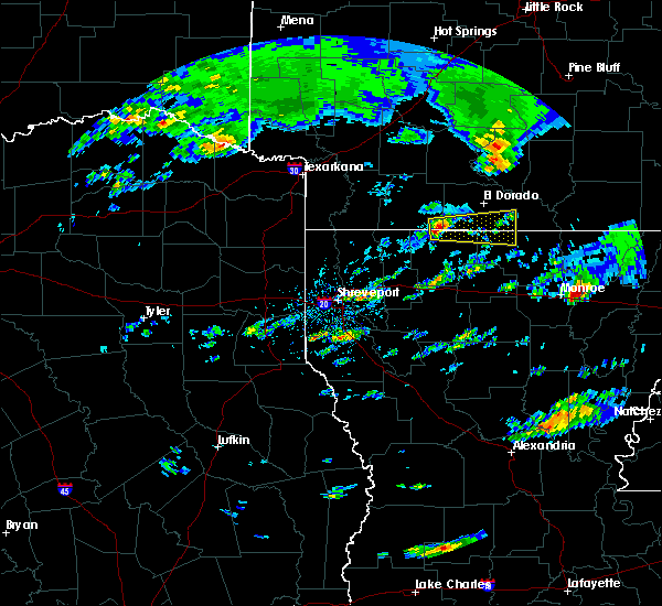 At 307 pm cdt, a severe thunderstorm was located near atlanta, or 16 miles west of junction city, moving east at 35 mph (radar indicated). Hazards include ping pong ball size hail and 60 mph wind gusts. People and animals outdoors will be injured. expect hail damage to roofs, siding, windows, and vehicles. Expect wind damage to roofs, siding, and trees. At 307 pm cdt, a severe thunderstorm was located near atlanta, or 16 miles west of junction city, moving east at 35 mph (radar indicated). Hazards include ping pong ball size hail and 60 mph wind gusts. People and animals outdoors will be injured. expect hail damage to roofs, siding, windows, and vehicles. Expect wind damage to roofs, siding, and trees.
|
| 3/13/2016 7:38 PM CDT |
 At 738 pm cdt, a severe thunderstorm was located near cooley, or 10 miles southeast of junction city, moving northeast at 40 mph (radar indicated). Hazards include 60 mph wind gusts and quarter size hail. Hail damage to vehicles is expected. Expect wind damage to roofs, siding, and trees. At 738 pm cdt, a severe thunderstorm was located near cooley, or 10 miles southeast of junction city, moving northeast at 40 mph (radar indicated). Hazards include 60 mph wind gusts and quarter size hail. Hail damage to vehicles is expected. Expect wind damage to roofs, siding, and trees.
|
| 3/13/2016 7:08 PM CDT |
 The national weather service in shreveport has issued a * tornado warning for. southwestern union county in south central arkansas. northeastern claiborne parish in northwestern louisiana. until 800 pm cdt * at 708 pm cdt. A severe thunderstorm capable of producing a tornado. The national weather service in shreveport has issued a * tornado warning for. southwestern union county in south central arkansas. northeastern claiborne parish in northwestern louisiana. until 800 pm cdt * at 708 pm cdt. A severe thunderstorm capable of producing a tornado.
|
| 3/13/2016 6:40 PM CDT |
 At 639 pm cdt, a severe thunderstorm was located over junction city, moving northeast at 25 mph (radar indicated). Hazards include 60 mph wind gusts and quarter size hail. Hail damage to vehicles is expected. Expect wind damage to roofs, siding, and trees. At 639 pm cdt, a severe thunderstorm was located over junction city, moving northeast at 25 mph (radar indicated). Hazards include 60 mph wind gusts and quarter size hail. Hail damage to vehicles is expected. Expect wind damage to roofs, siding, and trees.
|
| 3/12/2016 3:06 PM CST |
 At 305 pm cst, a severe thunderstorm was located 10 miles west of bernice, or 13 miles east of homer, moving northeast at 55 mph (radar indicated). Hazards include 60 mph wind gusts. Expect damage to roofs. siding. and trees. Locations impacted include, minden, homer, junction city, haynesville, gibsland, emerson, dubberly, shongaloo, wesson, urbana, atlanta, evergreen, athens, spearsville, lillie, mount lebanon, lockhart, horsehead, corney lake and walkerville. At 305 pm cst, a severe thunderstorm was located 10 miles west of bernice, or 13 miles east of homer, moving northeast at 55 mph (radar indicated). Hazards include 60 mph wind gusts. Expect damage to roofs. siding. and trees. Locations impacted include, minden, homer, junction city, haynesville, gibsland, emerson, dubberly, shongaloo, wesson, urbana, atlanta, evergreen, athens, spearsville, lillie, mount lebanon, lockhart, horsehead, corney lake and walkerville.
|
| 3/12/2016 2:56 PM CST |
 At 255 pm cst, a severe thunderstorm was located near homer, moving northeast at 50 mph (radar indicated). Hazards include 60 mph wind gusts. Expect damage to roofs. siding. and trees. Locations impacted include, minden, homer, junction city, haynesville, bernice, gibsland, emerson, dubberly, shongaloo, wesson, urbana, atlanta, cooley, evergreen, athens, spearsville, lillie, mount lebanon, lockhart and horsehead. At 255 pm cst, a severe thunderstorm was located near homer, moving northeast at 50 mph (radar indicated). Hazards include 60 mph wind gusts. Expect damage to roofs. siding. and trees. Locations impacted include, minden, homer, junction city, haynesville, bernice, gibsland, emerson, dubberly, shongaloo, wesson, urbana, atlanta, cooley, evergreen, athens, spearsville, lillie, mount lebanon, lockhart and horsehead.
|
| 3/12/2016 2:43 PM CST |
 At 243 pm cst, a severe thunderstorm was located 7 miles south of homer, moving northeast at 55 mph (radar indicated). Hazards include 60 mph wind gusts. Expect damage to roofs. siding. And trees. At 243 pm cst, a severe thunderstorm was located 7 miles south of homer, moving northeast at 55 mph (radar indicated). Hazards include 60 mph wind gusts. Expect damage to roofs. siding. And trees.
|
| 12/28/2015 1:00 AM CST |
 At 1229 am cst, severe thunderstorms were located along a line extending from near grambling to 7 miles northeast of colfax, moving northeast at 50 mph (radar indicated). Hazards include 60 mph wind gusts. Expect damage to roofs. siding. And trees. At 1229 am cst, severe thunderstorms were located along a line extending from near grambling to 7 miles northeast of colfax, moving northeast at 50 mph (radar indicated). Hazards include 60 mph wind gusts. Expect damage to roofs. siding. And trees.
|
| 12/28/2015 1:00 AM CST |
 A severe thunderstorm warning remains in effect until 130 am cst for southern unionunion union. jackson. western caldwell. union. northern la salle. eastern lincoln. northeastern claiborne. southwestern ouachita. eastern winn and northeastern grant parishes. at 1257 am cst. Severe thunderstorms were located along a line. A severe thunderstorm warning remains in effect until 130 am cst for southern unionunion union. jackson. western caldwell. union. northern la salle. eastern lincoln. northeastern claiborne. southwestern ouachita. eastern winn and northeastern grant parishes. at 1257 am cst. Severe thunderstorms were located along a line.
|
| 12/28/2015 12:43 AM CST |
 At 1243 am cst, a severe thunderstorm was located over wesson, or 7 miles southwest of el dorado, moving northeast at 50 mph (radar indicated). Hazards include 60 mph wind gusts. Expect damage to roofs. siding. And trees. At 1243 am cst, a severe thunderstorm was located over wesson, or 7 miles southwest of el dorado, moving northeast at 50 mph (radar indicated). Hazards include 60 mph wind gusts. Expect damage to roofs. siding. And trees.
|
| 12/28/2015 12:29 AM CST |
 At 1229 am cst, severe thunderstorms were located along a line extending from near grambling to 7 miles northeast of colfax, moving northeast at 50 mph (radar indicated). Hazards include 60 mph wind gusts. Expect damage to roofs. siding. And trees. At 1229 am cst, severe thunderstorms were located along a line extending from near grambling to 7 miles northeast of colfax, moving northeast at 50 mph (radar indicated). Hazards include 60 mph wind gusts. Expect damage to roofs. siding. And trees.
|
| 12/27/2015 3:02 PM CST |
 At 302 pm cst, a severe thunderstorm was located over junction city, moving north at 40 mph (radar indicated). Hazards include 60 mph wind gusts and quarter size hail. Hail damage to vehicles is expected. Expect wind damage to roofs, siding, and trees. At 302 pm cst, a severe thunderstorm was located over junction city, moving north at 40 mph (radar indicated). Hazards include 60 mph wind gusts and quarter size hail. Hail damage to vehicles is expected. Expect wind damage to roofs, siding, and trees.
|
| 12/13/2015 11:37 AM CST |
 At 1137 am cst, showers containing strong winds were located along a line extending from norphlet to 6 miles north of cooley to near ruston to near jonesboro to near winnfield, moving east at 30 mph (radar indicated). Hazards include 60 mph wind gusts. Expect damage to roofs. siding. and trees. Locations impacted include, ruston, el dorado, grambling, winnfield, jonesboro, smackover, norphlet, junction city, farmerville, bernice, calion, lawson, urbana, cooley, dubach, choudrant, simsboro, chatham, hodge and north hodge. At 1137 am cst, showers containing strong winds were located along a line extending from norphlet to 6 miles north of cooley to near ruston to near jonesboro to near winnfield, moving east at 30 mph (radar indicated). Hazards include 60 mph wind gusts. Expect damage to roofs. siding. and trees. Locations impacted include, ruston, el dorado, grambling, winnfield, jonesboro, smackover, norphlet, junction city, farmerville, bernice, calion, lawson, urbana, cooley, dubach, choudrant, simsboro, chatham, hodge and north hodge.
|
| 12/13/2015 11:25 AM CST | Trees down in and near the junction city and north west part of parish in union county LA, 0.6 miles N of Junction City, AR |
| 12/13/2015 11:00 AM CST |
 At 1059 am cst, showers containing strong winds were located along a line extending from mount holly to near arcadia to 9 miles east of campti, moving east at 30 mph. these storms have produced widespread wind damage across northwest louisiana, with a 65 mph wind gust measured in gibsland louisiana in bienville parish (radar indicated). Hazards include 60 mph wind gusts. Expect damage to roofs. siding. And trees. At 1059 am cst, showers containing strong winds were located along a line extending from mount holly to near arcadia to 9 miles east of campti, moving east at 30 mph. these storms have produced widespread wind damage across northwest louisiana, with a 65 mph wind gust measured in gibsland louisiana in bienville parish (radar indicated). Hazards include 60 mph wind gusts. Expect damage to roofs. siding. And trees.
|
| 11/17/2015 1:15 PM CST |
 At 115 pm cst, severe thunderstorms were located along a line extending from norphlet to junction city to 8 miles north of arcadia to 11 miles south of gibsland, moving east at 30 mph (radar indicated). Hazards include 60 mph wind gusts. Expect damage to roofs, siding, and trees. A tornado watch remains in effect until 400 pm cst for south central arkansas and northwestern louisiana. At 115 pm cst, severe thunderstorms were located along a line extending from norphlet to junction city to 8 miles north of arcadia to 11 miles south of gibsland, moving east at 30 mph (radar indicated). Hazards include 60 mph wind gusts. Expect damage to roofs, siding, and trees. A tornado watch remains in effect until 400 pm cst for south central arkansas and northwestern louisiana.
|
| 11/17/2015 12:42 PM CST |
 At 1241 pm cst, severe thunderstorms were located along a line extending from near lisbon to 8 miles west of junction city to 7 miles north of gibsland to 8 miles east of ringgold, moving east at 30 mph (radar indicated). Hazards include 60 mph wind gusts. Expect damage to roofs, siding, and trees. A tornado watch remains in effect until 400 pm cst for south central arkansas and northwestern louisiana. At 1241 pm cst, severe thunderstorms were located along a line extending from near lisbon to 8 miles west of junction city to 7 miles north of gibsland to 8 miles east of ringgold, moving east at 30 mph (radar indicated). Hazards include 60 mph wind gusts. Expect damage to roofs, siding, and trees. A tornado watch remains in effect until 400 pm cst for south central arkansas and northwestern louisiana.
|
| 11/17/2015 12:11 PM CST |
 At 1211 pm cst, severe thunderstorms were located along a line extending from near mcneil to near atlanta to 6 miles south of haynesville to near minden to near doyline, moving east at 30 mph (radar indicated). Hazards include 60 mph wind gusts. Expect damage to roofs, siding, and trees. A tornado watch remains in effect until 400 pm cst for southwestern arkansas and northwestern louisiana. At 1211 pm cst, severe thunderstorms were located along a line extending from near mcneil to near atlanta to 6 miles south of haynesville to near minden to near doyline, moving east at 30 mph (radar indicated). Hazards include 60 mph wind gusts. Expect damage to roofs, siding, and trees. A tornado watch remains in effect until 400 pm cst for southwestern arkansas and northwestern louisiana.
|
| 11/17/2015 11:43 AM CST |
 At 1142 am cst, severe thunderstorms were located along a line extending from waldo to near emerson to near shongaloo to near dixie inn to near doyline, moving east at 35 mph (radar indicated). Hazards include 60 mph wind gusts. expect damage to roofs, siding, and trees At 1142 am cst, severe thunderstorms were located along a line extending from waldo to near emerson to near shongaloo to near dixie inn to near doyline, moving east at 35 mph (radar indicated). Hazards include 60 mph wind gusts. expect damage to roofs, siding, and trees
|
| 6/17/2015 3:38 PM CDT |
 At 338 pm cdt, a severe thunderstorm was located 8 miles west of bernice, or 14 miles east of homer, moving north at 35 mph (radar indicated). Hazards include 60 mph wind gusts. Expect damage to roofs. Siding and trees. At 338 pm cdt, a severe thunderstorm was located 8 miles west of bernice, or 14 miles east of homer, moving north at 35 mph (radar indicated). Hazards include 60 mph wind gusts. Expect damage to roofs. Siding and trees.
|
| 5/24/2015 2:07 PM CDT | At 206 pm cdt, severe thunderstorms were located along a line extending from 6 miles northeast of atlanta to 6 miles southwest of lisbon to junction city, moving north at 55 mph (radar indicated). Hazards include 60 mph wind gusts. Expect damage to roofs. siding and trees. Locations impacted include, el dorado, smackover, norphlet, junction city, wesson, village, lisbon, mount holly, marysville, three creeks, medlock, ebenezer, cairo, hew hope, kenova, spotville and newell. |
| 5/24/2015 2:00 PM CDT | At 159 pm cdt, severe thunderstorms were located along a line extending from near atlanta to 8 miles west of wesson to 6 miles west of junction city, moving north at 55 mph (radar indicated). Hazards include 60 mph wind gusts. Expect damage to roofs. Siding and trees. |
| 5/24/2015 1:47 PM CDT | At 146 pm cdt, severe thunderstorms were located along a line extending from 6 miles southeast of haynesville to 11 miles west of bernice to near grambling, moving northeast at 40 mph (radar indicated). Hazards include 60 mph wind gusts. Expect damage to roofs. siding and trees. Locations impacted include, bernice, cooley, dubach, simsboro, junction city, lisbon, spearsville, lillie, mount zion, shiloh, corney lake, unionville, corinth, taylorville, antioch, summerfield and aycock. |
| 5/24/2015 1:36 PM CDT | At 135 pm cdt, severe thunderstorms were located along a line extending from near homer to 8 miles north of arcadia to 7 miles southwest of grambling, moving northeast at 35 mph (radar indicated). Hazards include 60 mph wind gusts. Expect damage to roofs. Siding and trees. |
| 4/24/2015 11:03 PM CDT | At 1102 pm cdt, a severe thunderstorm capable of producing a tornado was located 9 miles east of junction city, moving east at 50 mph (radar indicated rotation). Hazards include tornado and quarter size hail. Flying debris will be dangerous to those caught without shelter. mobile homes will be damaged or destroyed. damage to roofs, windows and vehicles will occur. tree damage is likely. this tornadic thunderstorm will remain over mainly rural areas of south central union county in south central arkansas and northwestern union parishes, including the following locations, catesville, taylorville, lockhart, lillie, spearsville and junction city. Radar indicated. |
| 4/24/2015 11:03 PM CDT | At 1102 pm cdt, a severe thunderstorm capable of producing a tornado was located 9 miles east of junction city, moving east at 50 mph (radar indicated rotation). Hazards include tornado and quarter size hail. Flying debris will be dangerous to those caught without shelter. mobile homes will be damaged or destroyed. damage to roofs, windows and vehicles will occur. tree damage is likely. this tornadic thunderstorm will remain over mainly rural areas of south central union county in south central arkansas and northwestern union parishes, including the following locations, catesville, taylorville, lockhart, lillie, spearsville and junction city. Radar indicated. |
| 4/24/2015 11:00 PM CDT | Power lines down in union county AR, 2.2 miles S of Junction City, AR |
| 4/24/2015 10:52 PM CDT | At 1052 pm cdt, a severe thunderstorm was located near junction city, moving east at 50 mph (radar indicated). Hazards include 70 mph wind gusts and quarter size hail. Hail damage to vehicles is expected. expect considerable tree damage. Wind damage is also likely to mobile homes, roofs and outbuildings. |
| 4/24/2015 10:52 PM CDT | At 1052 pm cdt, a severe thunderstorm was located near junction city, moving east at 50 mph (radar indicated). Hazards include 70 mph wind gusts and quarter size hail. Hail damage to vehicles is expected. expect considerable tree damage. Wind damage is also likely to mobile homes, roofs and outbuildings. |
| 4/24/2015 10:45 PM CDT | At 1044 pm cdt, a severe thunderstorm capable of producing a tornado was located 10 miles southeast of atlanta, or 12 miles west of junction city, moving east at 50 mph (radar indicated rotation). Hazards include tornado and quarter size hail. Flying debris will be dangerous to those caught without shelter. mobile homes will be damaged or destroyed. damage to roofs, windows and vehicles will occur. tree damage is likely. this dangerous storm will be near, junction city around 1055 pm cdt. other locations impacted by this tornadic thunderstorm include lockhart, lillie, catesville, taylorville, corney lake, spearsville, antioch, summerfield and junction city. Radar indicated. |
| 4/24/2015 10:45 PM CDT | At 1044 pm cdt, a severe thunderstorm capable of producing a tornado was located 10 miles southeast of atlanta, or 12 miles west of junction city, moving east at 50 mph (radar indicated rotation). Hazards include tornado and quarter size hail. Flying debris will be dangerous to those caught without shelter. mobile homes will be damaged or destroyed. damage to roofs, windows and vehicles will occur. tree damage is likely. this dangerous storm will be near, junction city around 1055 pm cdt. other locations impacted by this tornadic thunderstorm include lockhart, lillie, catesville, taylorville, corney lake, spearsville, antioch, summerfield and junction city. Radar indicated. |
| 4/22/2015 3:27 PM CDT | At 326 pm cdt, a severe thunderstorm was located over wesson, or 7 miles northwest of junction city, moving east at 35 mph (radar indicated). Hazards include 60 mph wind gusts and quarter size hail. Hail damage to vehicles is expected. expect wind damage to roofs, siding and trees. locations impacted include, el dorado, huttig, junction city, strong, wesson, lawson, lapile, urbana, marion, felsenthal, lockhart, aurelle, new london, litroe, cecil, oakland, catesville, hillsboro and newell. 1. 00in. |
| 4/22/2015 3:27 PM CDT | At 326 pm cdt, a severe thunderstorm was located over wesson, or 7 miles northwest of junction city, moving east at 35 mph (radar indicated). Hazards include 60 mph wind gusts and quarter size hail. Hail damage to vehicles is expected. expect wind damage to roofs, siding and trees. locations impacted include, el dorado, huttig, junction city, strong, wesson, lawson, lapile, urbana, marion, felsenthal, lockhart, aurelle, new london, litroe, cecil, oakland, catesville, hillsboro and newell. 1. 00in. |
| 4/22/2015 3:07 PM CDT | At 307 pm cdt, a severe thunderstorm was located 8 miles west of wesson, or 14 miles northwest of junction city, moving east at 55 mph (radar indicated). Hazards include 60 mph wind gusts and quarter size hail. Hail damage to vehicles is expected. Expect wind damage to roofs, siding and trees. |
| 4/22/2015 3:07 PM CDT | At 307 pm cdt, a severe thunderstorm was located 8 miles west of wesson, or 14 miles northwest of junction city, moving east at 55 mph (radar indicated). Hazards include 60 mph wind gusts and quarter size hail. Hail damage to vehicles is expected. Expect wind damage to roofs, siding and trees. |
| 7/23/2014 8:00 PM CDT | Trees down over northern part of parish in union county AR, 0.1 miles SE of Junction City, AR |
| 8/10/2012 12:35 AM CDT | Large tree down across hwy. 15 southwest of el dorado in the three creeks are in union county AR, 8.1 miles SSE of Junction City, AR |
| 1/1/0001 12:00 AM | Trees down on hwy 167 near junction cit in union county AR, 0.1 miles SE of Junction City, AR |
| 1/1/0001 12:00 AM | Trees down along highway 167 sout in union county AR, 5.4 miles SW of Junction City, AR |
Hail Maps for Junction City, AR
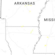


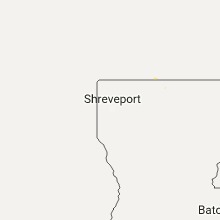


Connect with Interactive Hail Maps