

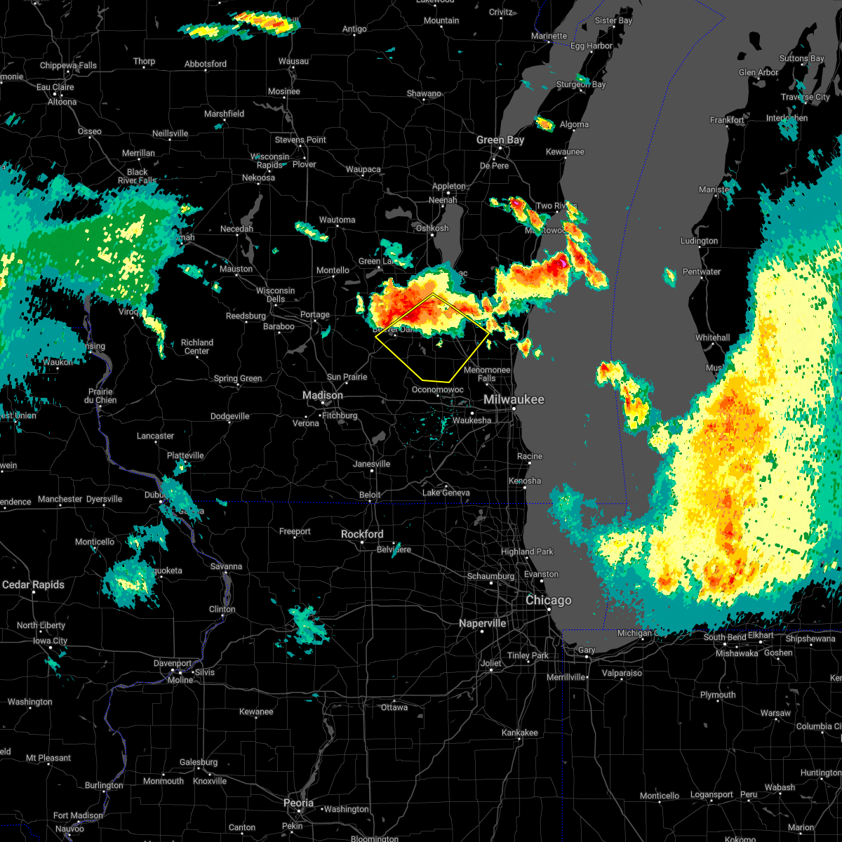
Hail Map for Kewaskum, WI
The Kewaskum, WI area has had 2 reports of on-the-ground hail by trained spotters, and has been under severe weather warnings 34 times during the past 12 months. Doppler radar has detected hail at or near Kewaskum, WI on 42 occasions, including 2 occasions during the past year.
| Name: | Kewaskum, WI |
| Where Located: | 66 miles ENE of Madison, WI |
| Map: | Google Map for Kewaskum, WI |
| Population: | 4004 |
| Housing Units: | 1698 |
| More Info: | Search Google for Kewaskum, WI |
3
The Top Recent Hail Date for Kewaskum, WI is Thursday, May 15, 2025 (6th out of 42)

Hail and Wind Damage Spotted near Kewaskum, WI
| Date / Time | Report Details |
|---|---|
| 6/23/2025 7:25 PM CDT |
 The storms which prompted the warning have moved out of the area. therefore, the warning will be allowed to expire. a severe thunderstorm watch remains in effect until 900 pm cdt for southeastern and east central wisconsin. The storms which prompted the warning have moved out of the area. therefore, the warning will be allowed to expire. a severe thunderstorm watch remains in effect until 900 pm cdt for southeastern and east central wisconsin.
|
| 6/23/2025 7:15 PM CDT |
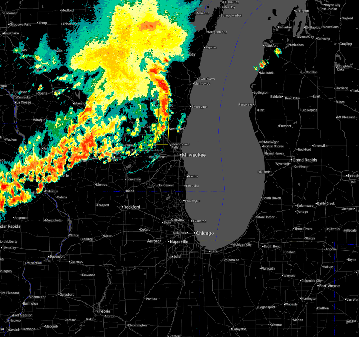
 At 714 pm cdt, severe thunderstorms were located along a line extending from near camp rokilio scout camp to near menomonee falls, moving east at 40 mph (public). Hazards include 60 mph wind gusts. Expect damage to roofs, siding, and trees. locations impacted include, west bend, hartford, jackson, slinger, kewaskum, germantown, campbellsport, southern lake winnebago, richfield, addison, mount calvary, wayne, st. Cloud, waucousta, calvary, marytown, new fane, monches, johnsburg, and saint lawrence. At 714 pm cdt, severe thunderstorms were located along a line extending from near camp rokilio scout camp to near menomonee falls, moving east at 40 mph (public). Hazards include 60 mph wind gusts. Expect damage to roofs, siding, and trees. locations impacted include, west bend, hartford, jackson, slinger, kewaskum, germantown, campbellsport, southern lake winnebago, richfield, addison, mount calvary, wayne, st. Cloud, waucousta, calvary, marytown, new fane, monches, johnsburg, and saint lawrence.
|
| 6/23/2025 7:15 PM CDT |
 the severe thunderstorm warning has been cancelled and is no longer in effect the severe thunderstorm warning has been cancelled and is no longer in effect
|
| 6/23/2025 6:59 PM CDT |
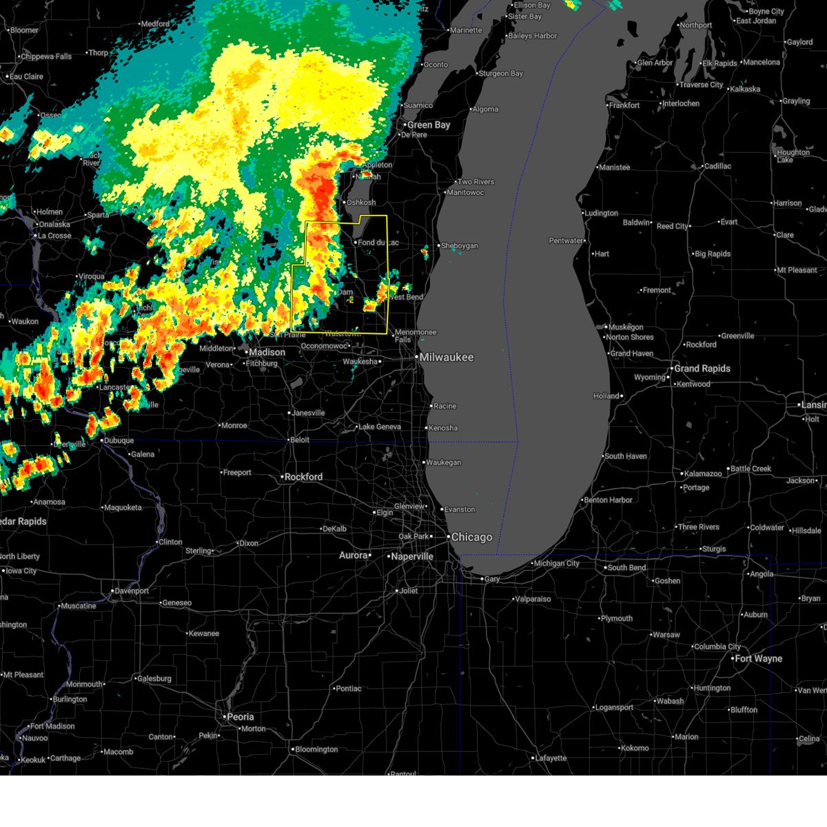
 At 658 pm cdt, severe thunderstorms were located along a line extending from near st anna to near lisbon, moving east at 45 mph (public. uprooted trees were reported in waupun at 638 pm cdt). Hazards include 60 mph wind gusts. Expect damage to roofs, siding, and trees. Locations impacted include, fond du lac, west bend, watertown, hartford, jackson, mayville, slinger, north fond du lac, kewaskum, horicon, juneau, germantown, lomira, campbellsport, theresa, hustisford, oakfield, iron ridge, southern lake winnebago, and richfield. At 658 pm cdt, severe thunderstorms were located along a line extending from near st anna to near lisbon, moving east at 45 mph (public. uprooted trees were reported in waupun at 638 pm cdt). Hazards include 60 mph wind gusts. Expect damage to roofs, siding, and trees. Locations impacted include, fond du lac, west bend, watertown, hartford, jackson, mayville, slinger, north fond du lac, kewaskum, horicon, juneau, germantown, lomira, campbellsport, theresa, hustisford, oakfield, iron ridge, southern lake winnebago, and richfield.
|
| 6/23/2025 6:36 PM CDT |
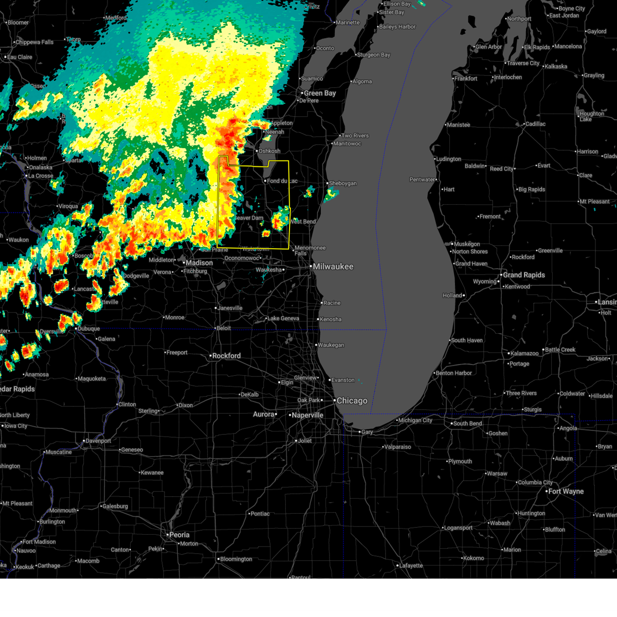
 At 634 pm cdt, severe thunderstorms were located along a line extending from 6 miles southwest of oshkosh to near watertown, moving east at 40 mph (law enforcement. scattered trees were reported down earlier when these storms moved through columbia and green lake counties). Hazards include 60 mph wind gusts. Expect damage to roofs, siding, and trees. Locations impacted include, fond du lac, west bend, watertown, beaver dam, hartford, waupun, ripon, jackson, mayville, slinger, north fond du lac, kewaskum, horicon, juneau, germantown, lomira, campbellsport, theresa, hustisford, and oakfield. At 634 pm cdt, severe thunderstorms were located along a line extending from 6 miles southwest of oshkosh to near watertown, moving east at 40 mph (law enforcement. scattered trees were reported down earlier when these storms moved through columbia and green lake counties). Hazards include 60 mph wind gusts. Expect damage to roofs, siding, and trees. Locations impacted include, fond du lac, west bend, watertown, beaver dam, hartford, waupun, ripon, jackson, mayville, slinger, north fond du lac, kewaskum, horicon, juneau, germantown, lomira, campbellsport, theresa, hustisford, and oakfield.
|
| 6/23/2025 6:36 PM CDT |
 the severe thunderstorm warning has been cancelled and is no longer in effect the severe thunderstorm warning has been cancelled and is no longer in effect
|
| 6/23/2025 6:31 PM CDT |
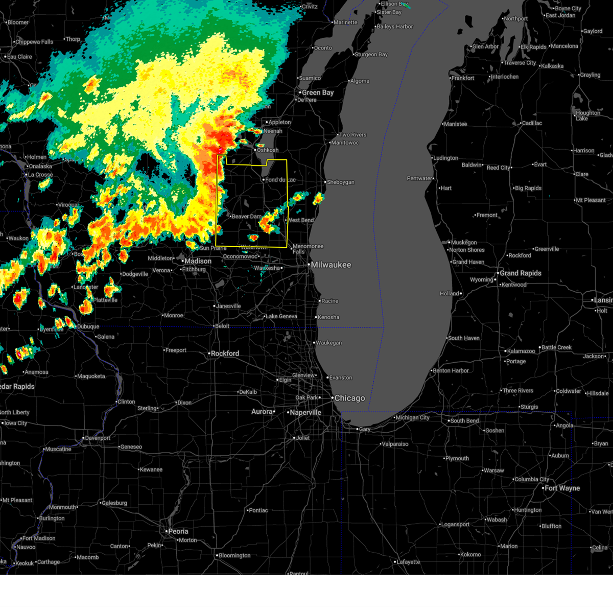
 At 629 pm cdt, severe thunderstorms were located along a line extending from 7 miles northeast of rush lake to near watertown, moving east at 40 mph (radar indicated and reports from law enforcement. scattered tree damage occurred earlier with these storms in green lake and columbia counties). Hazards include 60 mph wind gusts. Expect damage to roofs, siding, and trees. Locations impacted include, fond du lac, west bend, watertown, beaver dam, hartford, waupun, ripon, jackson, berlin, mayville, slinger, north fond du lac, kewaskum, horicon, juneau, germantown, lomira, campbellsport, markesan, and theresa. At 629 pm cdt, severe thunderstorms were located along a line extending from 7 miles northeast of rush lake to near watertown, moving east at 40 mph (radar indicated and reports from law enforcement. scattered tree damage occurred earlier with these storms in green lake and columbia counties). Hazards include 60 mph wind gusts. Expect damage to roofs, siding, and trees. Locations impacted include, fond du lac, west bend, watertown, beaver dam, hartford, waupun, ripon, jackson, berlin, mayville, slinger, north fond du lac, kewaskum, horicon, juneau, germantown, lomira, campbellsport, markesan, and theresa.
|
| 6/23/2025 6:19 PM CDT |
 Svrmkx the national weather service in milwaukee/sullivan has issued a * severe thunderstorm warning for, fond du lac county in east central wisconsin, eastern green lake county in south central wisconsin, washington county in southeastern wisconsin, dodge county in southeastern wisconsin, * until 730 pm cdt. * at 618 pm cdt, severe thunderstorms were located along a line extending from near rush lake to 7 miles northeast of waterloo, moving east at 40 mph (radar indicated). Hazards include 60 mph wind gusts. expect damage to roofs, siding, and trees Svrmkx the national weather service in milwaukee/sullivan has issued a * severe thunderstorm warning for, fond du lac county in east central wisconsin, eastern green lake county in south central wisconsin, washington county in southeastern wisconsin, dodge county in southeastern wisconsin, * until 730 pm cdt. * at 618 pm cdt, severe thunderstorms were located along a line extending from near rush lake to 7 miles northeast of waterloo, moving east at 40 mph (radar indicated). Hazards include 60 mph wind gusts. expect damage to roofs, siding, and trees
|
| 5/16/2025 6:43 PM CDT | the severe thunderstorm warning has been cancelled and is no longer in effect |
| 5/16/2025 6:36 PM CDT | At 635 pm cdt, a severe thunderstorm was located over jackson, moving northeast at 45 mph (radar indicated). Hazards include 60 mph wind gusts. Expect damage to roofs, siding, and trees. Locations impacted include, west bend, mequon, cedarburg, port washington, jackson, slinger, saukville, kewaskum, germantown, fredonia, newburg, richfield, waubeka, fillmore, kirchhayn, keowns, and hubertus. |
| 5/16/2025 6:36 PM CDT | the severe thunderstorm warning has been cancelled and is no longer in effect |
| 5/16/2025 6:25 PM CDT | Svrmkx the national weather service in milwaukee/sullivan has issued a * severe thunderstorm warning for, northern ozaukee county in southeastern wisconsin, north central waukesha county in southeastern wisconsin, washington county in southeastern wisconsin, * until 700 pm cdt. * at 625 pm cdt, a severe thunderstorm was located near lisbon, or near sussex, moving northeast at 45 mph (radar indicated). Hazards include 60 mph wind gusts. expect damage to roofs, siding, and trees |
| 5/16/2025 4:14 PM CDT |
 At 414 pm cdt, a severe thunderstorm was located over newburg, or near west bend, moving northeast at 50 mph (radar indicated). Hazards include 60 mph wind gusts. Expect damage to roofs, siding, and trees. Locations impacted include, west bend, saukville, belgium, fredonia, random lake, newburg, silver creek, beechwood, waubeka, fillmore, boltonville, batavia, keowns, and nabob. At 414 pm cdt, a severe thunderstorm was located over newburg, or near west bend, moving northeast at 50 mph (radar indicated). Hazards include 60 mph wind gusts. Expect damage to roofs, siding, and trees. Locations impacted include, west bend, saukville, belgium, fredonia, random lake, newburg, silver creek, beechwood, waubeka, fillmore, boltonville, batavia, keowns, and nabob.
|
| 5/16/2025 4:03 PM CDT |
 the severe thunderstorm warning has been cancelled and is no longer in effect the severe thunderstorm warning has been cancelled and is no longer in effect
|
| 5/16/2025 4:03 PM CDT |
 At 401 pm cdt, a severe thunderstorm was located near slinger, moving northeast at 60 mph (public reported. downed tree branches were reported in occonomowoc). Hazards include 60 mph wind gusts. Expect damage to roofs, siding, and trees. Locations impacted include, west bend, mequon, hartford, grafton, cedarburg, port washington, jackson, slinger, saukville, kewaskum, germantown, belgium, fredonia, random lake, newburg, richfield, beechwood, waubeka, fillmore, and boltonville. At 401 pm cdt, a severe thunderstorm was located near slinger, moving northeast at 60 mph (public reported. downed tree branches were reported in occonomowoc). Hazards include 60 mph wind gusts. Expect damage to roofs, siding, and trees. Locations impacted include, west bend, mequon, hartford, grafton, cedarburg, port washington, jackson, slinger, saukville, kewaskum, germantown, belgium, fredonia, random lake, newburg, richfield, beechwood, waubeka, fillmore, and boltonville.
|
| 5/16/2025 3:52 PM CDT |
 Svrmkx the national weather service in milwaukee/sullivan has issued a * severe thunderstorm warning for, ozaukee county in southeastern wisconsin, washington county in southeastern wisconsin, southeastern dodge county in southeastern wisconsin, southwestern sheboygan county in east central wisconsin, * until 430 pm cdt. * at 352 pm cdt, a severe thunderstorm was located near merton, or 8 miles northwest of sussex, moving northeast at 50 mph (radar indicated). Hazards include 60 mph wind gusts. expect damage to roofs, siding, and trees Svrmkx the national weather service in milwaukee/sullivan has issued a * severe thunderstorm warning for, ozaukee county in southeastern wisconsin, washington county in southeastern wisconsin, southeastern dodge county in southeastern wisconsin, southwestern sheboygan county in east central wisconsin, * until 430 pm cdt. * at 352 pm cdt, a severe thunderstorm was located near merton, or 8 miles northwest of sussex, moving northeast at 50 mph (radar indicated). Hazards include 60 mph wind gusts. expect damage to roofs, siding, and trees
|
| 5/15/2025 7:04 PM CDT |
 the severe thunderstorm warning has been cancelled and is no longer in effect the severe thunderstorm warning has been cancelled and is no longer in effect
|
| 5/15/2025 6:50 PM CDT |
 At 650 pm cdt, severe thunderstorms were located along a line extending from near st anna to cedarburg, moving northeast at 35 mph (radar indicated). Hazards include 60 mph wind gusts and quarter size hail. Hail damage to vehicles is expected. expect wind damage to roofs, siding, and trees. Locations impacted include, sheboygan, west bend, mequon, hartford, brown deer, grafton, cedarburg, port washington, plymouth, sheboygan falls, jackson, slinger, saukville, bayside, kewaskum, thiensville, howards grove, germantown, oostburg, and belgium. At 650 pm cdt, severe thunderstorms were located along a line extending from near st anna to cedarburg, moving northeast at 35 mph (radar indicated). Hazards include 60 mph wind gusts and quarter size hail. Hail damage to vehicles is expected. expect wind damage to roofs, siding, and trees. Locations impacted include, sheboygan, west bend, mequon, hartford, brown deer, grafton, cedarburg, port washington, plymouth, sheboygan falls, jackson, slinger, saukville, bayside, kewaskum, thiensville, howards grove, germantown, oostburg, and belgium.
|
| 5/15/2025 6:48 PM CDT | At 648 pm cdt, a severe thunderstorm was located 9 miles south of st anna, or 11 miles west of plymouth, moving northeast at 25 mph (radar indicated). Hazards include 60 mph wind gusts and quarter size hail. Hail damage to vehicles is expected. expect wind damage to roofs, siding, and trees. locations impacted include, fond du lac, campbellsport, southern lake winnebago, taycheedah, ashford, byron, eden, mount calvary, st. Cloud, peebles, dundee, pipe, waucousta, calvary, marytown, town of forest, new fane, and johnsburg. |
| 5/15/2025 6:32 PM CDT |
 At 631 pm cdt, severe thunderstorms were located along a line extending from 6 miles southeast of central lake winnebago to campbellsport to near slinger, moving northeast at 40 mph (public reports of two inch hail east of ashippun). Hazards include two inch hail and 60 mph wind gusts. People and animals outdoors will be injured. expect hail damage to roofs, siding, windows, and vehicles. expect wind damage to roofs, siding, and trees. Locations impacted include, sheboygan, west bend, mequon, hartford, brown deer, grafton, cedarburg, port washington, plymouth, sheboygan falls, jackson, slinger, saukville, bayside, kewaskum, thiensville, howards grove, germantown, oostburg, and belgium. At 631 pm cdt, severe thunderstorms were located along a line extending from 6 miles southeast of central lake winnebago to campbellsport to near slinger, moving northeast at 40 mph (public reports of two inch hail east of ashippun). Hazards include two inch hail and 60 mph wind gusts. People and animals outdoors will be injured. expect hail damage to roofs, siding, windows, and vehicles. expect wind damage to roofs, siding, and trees. Locations impacted include, sheboygan, west bend, mequon, hartford, brown deer, grafton, cedarburg, port washington, plymouth, sheboygan falls, jackson, slinger, saukville, bayside, kewaskum, thiensville, howards grove, germantown, oostburg, and belgium.
|
| 5/15/2025 6:31 PM CDT |
 At 630 pm cdt, a severe thunderstorm was located near fond du lac, moving north at 35 mph (multiple public reports of 1.25 to 1.5 inch hail across eastern fond du lac). Hazards include ping pong ball size hail and 60 mph wind gusts. People and animals outdoors will be injured. expect hail damage to roofs, siding, windows, and vehicles. expect wind damage to roofs, siding, and trees. locations impacted include, fond du lac, campbellsport, southern lake winnebago, taycheedah, ashford, byron, eden, mount calvary, st. Cloud, peebles, dundee, pipe, waucousta, calvary, marytown, town of forest, new fane, and johnsburg. At 630 pm cdt, a severe thunderstorm was located near fond du lac, moving north at 35 mph (multiple public reports of 1.25 to 1.5 inch hail across eastern fond du lac). Hazards include ping pong ball size hail and 60 mph wind gusts. People and animals outdoors will be injured. expect hail damage to roofs, siding, windows, and vehicles. expect wind damage to roofs, siding, and trees. locations impacted include, fond du lac, campbellsport, southern lake winnebago, taycheedah, ashford, byron, eden, mount calvary, st. Cloud, peebles, dundee, pipe, waucousta, calvary, marytown, town of forest, new fane, and johnsburg.
|
| 5/15/2025 6:26 PM CDT |
 Svrmkx the national weather service in milwaukee/sullivan has issued a * severe thunderstorm warning for, ozaukee county in southeastern wisconsin, washington county in southeastern wisconsin, sheboygan county in east central wisconsin, * until 745 pm cdt. * at 625 pm cdt, severe thunderstorms were located along a line extending from near southern lake winnebago to near campbellsport to near slinger, moving northeast at 40 mph (radar indicated). Hazards include two inch hail and 60 mph wind gusts. People and animals outdoors will be injured. expect hail damage to roofs, siding, windows, and vehicles. Expect wind damage to roofs, siding, and trees. Svrmkx the national weather service in milwaukee/sullivan has issued a * severe thunderstorm warning for, ozaukee county in southeastern wisconsin, washington county in southeastern wisconsin, sheboygan county in east central wisconsin, * until 745 pm cdt. * at 625 pm cdt, severe thunderstorms were located along a line extending from near southern lake winnebago to near campbellsport to near slinger, moving northeast at 40 mph (radar indicated). Hazards include two inch hail and 60 mph wind gusts. People and animals outdoors will be injured. expect hail damage to roofs, siding, windows, and vehicles. Expect wind damage to roofs, siding, and trees.
|
| 5/15/2025 6:14 PM CDT |
 Svrmkx the national weather service in milwaukee/sullivan has issued a * severe thunderstorm warning for, eastern fond du lac county in east central wisconsin, * until 715 pm cdt. * at 613 pm cdt, a severe thunderstorm was located near lomira, or 9 miles south of fond du lac, moving north at 35 mph (radar indicated). Hazards include ping pong ball size hail and 60 mph wind gusts. People and animals outdoors will be injured. expect hail damage to roofs, siding, windows, and vehicles. Expect wind damage to roofs, siding, and trees. Svrmkx the national weather service in milwaukee/sullivan has issued a * severe thunderstorm warning for, eastern fond du lac county in east central wisconsin, * until 715 pm cdt. * at 613 pm cdt, a severe thunderstorm was located near lomira, or 9 miles south of fond du lac, moving north at 35 mph (radar indicated). Hazards include ping pong ball size hail and 60 mph wind gusts. People and animals outdoors will be injured. expect hail damage to roofs, siding, windows, and vehicles. Expect wind damage to roofs, siding, and trees.
|
| 5/15/2025 6:02 PM CDT | Tormkx the national weather service in milwaukee/sullivan has issued a * tornado warning for, southeastern fond du lac county in east central wisconsin, northwestern washington county in southeastern wisconsin, northeastern dodge county in southeastern wisconsin, * until 630 pm cdt. * at 601 pm cdt, a confirmed tornado was located over mayville, moving northeast at 45 mph (weather spotters confirmed tornado. a tornado was reported near mayville). Hazards include damaging tornado and hail up to two inches in diameter. Flying debris will be dangerous to those caught without shelter. mobile homes will be damaged or destroyed. damage to roofs, windows, and vehicles will occur. Tree damage is likely. |
| 5/15/2025 5:40 PM CDT | Svrmkx the national weather service in milwaukee/sullivan has issued a * severe thunderstorm warning for, northeastern waukesha county in southeastern wisconsin, washington county in southeastern wisconsin, * until 630 pm cdt. * at 539 pm cdt, a severe thunderstorm was located near lisbon, or 7 miles northwest of sussex, moving northeast at 40 mph (radar indicated). Hazards include 60 mph wind gusts and half dollar size hail. Hail damage to vehicles is expected. Expect wind damage to roofs, siding, and trees. |
| 4/18/2025 8:01 AM CDT |
 the severe thunderstorm warning has been cancelled and is no longer in effect the severe thunderstorm warning has been cancelled and is no longer in effect
|
| 4/18/2025 8:01 AM CDT |
 At 800 am cdt, severe thunderstorms were located along a line extending from near cedar grove to 17 miles southeast of port washington to cudahy, moving east at 75 mph (radar indicated. 1.25 inch hail was reported in watertown). Hazards include golf ball size hail and 60 mph wind gusts. People and animals outdoors will be injured. expect hail damage to roofs, siding, windows, and vehicles. expect wind damage to roofs, siding, and trees. Locations impacted include, milwaukee, franklin, nenno, pewaukee, wales, uw- milwaukee, dousman, fillmore, grafton, west allis, summit, mukwonago, north lake, glendale, lac la belle, okauchee lake, cudahy, iron ridge, ottawa, and eagle. At 800 am cdt, severe thunderstorms were located along a line extending from near cedar grove to 17 miles southeast of port washington to cudahy, moving east at 75 mph (radar indicated. 1.25 inch hail was reported in watertown). Hazards include golf ball size hail and 60 mph wind gusts. People and animals outdoors will be injured. expect hail damage to roofs, siding, windows, and vehicles. expect wind damage to roofs, siding, and trees. Locations impacted include, milwaukee, franklin, nenno, pewaukee, wales, uw- milwaukee, dousman, fillmore, grafton, west allis, summit, mukwonago, north lake, glendale, lac la belle, okauchee lake, cudahy, iron ridge, ottawa, and eagle.
|
| 4/18/2025 7:36 AM CDT |
 the severe thunderstorm warning has been cancelled and is no longer in effect the severe thunderstorm warning has been cancelled and is no longer in effect
|
| 4/18/2025 7:36 AM CDT |
 At 736 am cdt, severe thunderstorms were located along a line extending from near west bend to near germantown to near potter lake, moving east at 75 mph (radar indicated). Hazards include two inch hail and 60 mph wind gusts. People and animals outdoors will be injured. expect hail damage to roofs, siding, windows, and vehicles. expect wind damage to roofs, siding, and trees. Locations impacted include, milwaukee, franklin, nenno, pewaukee, wales, uw- milwaukee, dousman, fillmore, grafton, west allis, summit, mukwonago, cambridge, north lake, glendale, lac la belle, okauchee lake, cudahy, iron ridge, and ottawa. At 736 am cdt, severe thunderstorms were located along a line extending from near west bend to near germantown to near potter lake, moving east at 75 mph (radar indicated). Hazards include two inch hail and 60 mph wind gusts. People and animals outdoors will be injured. expect hail damage to roofs, siding, windows, and vehicles. expect wind damage to roofs, siding, and trees. Locations impacted include, milwaukee, franklin, nenno, pewaukee, wales, uw- milwaukee, dousman, fillmore, grafton, west allis, summit, mukwonago, cambridge, north lake, glendale, lac la belle, okauchee lake, cudahy, iron ridge, and ottawa.
|
| 4/18/2025 7:18 AM CDT |
 Svrmkx the national weather service in milwaukee/sullivan has issued a * severe thunderstorm warning for, ozaukee county in southeastern wisconsin, milwaukee county in southeastern wisconsin, northern walworth county in southeastern wisconsin, northeastern rock county in south central wisconsin, waukesha county in southeastern wisconsin, southeastern dane county in south central wisconsin, washington county in southeastern wisconsin, jefferson county in southeastern wisconsin, southern dodge county in southeastern wisconsin, * until 815 am cdt. * at 717 am cdt, severe thunderstorms were located along a line extending from near juneau to near lac la belle to near milton, moving east at 75 mph (radar indicated). Hazards include two inch hail and 60 mph wind gusts. People and animals outdoors will be injured. expect hail damage to roofs, siding, windows, and vehicles. Expect wind damage to roofs, siding, and trees. Svrmkx the national weather service in milwaukee/sullivan has issued a * severe thunderstorm warning for, ozaukee county in southeastern wisconsin, milwaukee county in southeastern wisconsin, northern walworth county in southeastern wisconsin, northeastern rock county in south central wisconsin, waukesha county in southeastern wisconsin, southeastern dane county in south central wisconsin, washington county in southeastern wisconsin, jefferson county in southeastern wisconsin, southern dodge county in southeastern wisconsin, * until 815 am cdt. * at 717 am cdt, severe thunderstorms were located along a line extending from near juneau to near lac la belle to near milton, moving east at 75 mph (radar indicated). Hazards include two inch hail and 60 mph wind gusts. People and animals outdoors will be injured. expect hail damage to roofs, siding, windows, and vehicles. Expect wind damage to roofs, siding, and trees.
|
| 3/15/2025 1:11 AM CDT | Svrmkx the national weather service in milwaukee/sullivan has issued a * severe thunderstorm warning for, ozaukee county in southeastern wisconsin, fond du lac county in east central wisconsin, milwaukee county in southeastern wisconsin, northeastern waukesha county in southeastern wisconsin, washington county in southeastern wisconsin, northern dodge county in southeastern wisconsin, sheboygan county in east central wisconsin, * until 200 am cdt. * at 110 am cdt, severe thunderstorms were located along a line extending from near central lake winnebago to near random lake to 9 miles east of whitefish bay, moving northeast at 40 mph (radar indicated). Hazards include 60 mph wind gusts. expect damage to roofs, siding, and trees |
| 3/15/2025 12:30 AM CDT |
 Svrmkx the national weather service in milwaukee/sullivan has issued a * severe thunderstorm warning for, ozaukee county in southeastern wisconsin, southern fond du lac county in east central wisconsin, milwaukee county in southeastern wisconsin, southeastern columbia county in south central wisconsin, waukesha county in southeastern wisconsin, washington county in southeastern wisconsin, northeastern jefferson county in southeastern wisconsin, dodge county in southeastern wisconsin, * until 115 am cdt. * at 1229 am cdt, severe thunderstorms were located along a line extending from near beaver dam to near hartford to near waukesha, moving northeast at 60 mph (radar indicated). Hazards include 60 mph wind gusts. expect damage to roofs, siding, and trees Svrmkx the national weather service in milwaukee/sullivan has issued a * severe thunderstorm warning for, ozaukee county in southeastern wisconsin, southern fond du lac county in east central wisconsin, milwaukee county in southeastern wisconsin, southeastern columbia county in south central wisconsin, waukesha county in southeastern wisconsin, washington county in southeastern wisconsin, northeastern jefferson county in southeastern wisconsin, dodge county in southeastern wisconsin, * until 115 am cdt. * at 1229 am cdt, severe thunderstorms were located along a line extending from near beaver dam to near hartford to near waukesha, moving northeast at 60 mph (radar indicated). Hazards include 60 mph wind gusts. expect damage to roofs, siding, and trees
|
| 8/27/2024 11:59 AM CDT |
 Svrmkx the national weather service in milwaukee/sullivan has issued a * severe thunderstorm warning for, ozaukee county in southeastern wisconsin, milwaukee county in southeastern wisconsin, waukesha county in southeastern wisconsin, washington county in southeastern wisconsin, northeastern jefferson county in southeastern wisconsin, southeastern dodge county in southeastern wisconsin, * until 1245 pm cdt. * at 1158 am cdt, severe thunderstorms were located along a line extending from near random lake to near slinger to 8 miles east of jefferson, moving southeast at 35 mph (radar indicated). Hazards include 60 mph wind gusts and penny size hail. expect damage to roofs, siding, and trees Svrmkx the national weather service in milwaukee/sullivan has issued a * severe thunderstorm warning for, ozaukee county in southeastern wisconsin, milwaukee county in southeastern wisconsin, waukesha county in southeastern wisconsin, washington county in southeastern wisconsin, northeastern jefferson county in southeastern wisconsin, southeastern dodge county in southeastern wisconsin, * until 1245 pm cdt. * at 1158 am cdt, severe thunderstorms were located along a line extending from near random lake to near slinger to 8 miles east of jefferson, moving southeast at 35 mph (radar indicated). Hazards include 60 mph wind gusts and penny size hail. expect damage to roofs, siding, and trees
|
| 8/27/2024 11:41 AM CDT |
 Svrmkx the national weather service in milwaukee/sullivan has issued a * severe thunderstorm warning for, southeastern fond du lac county in east central wisconsin, washington county in southeastern wisconsin, southeastern dodge county in southeastern wisconsin, southwestern sheboygan county in east central wisconsin, * until noon cdt. * at 1141 am cdt, severe thunderstorms were located along a line extending from near campbellsport to 7 miles north of hartford to near hustisford, moving east at 25 mph (radar indicated). Hazards include 60 mph wind gusts and penny size hail. expect damage to roofs, siding, and trees Svrmkx the national weather service in milwaukee/sullivan has issued a * severe thunderstorm warning for, southeastern fond du lac county in east central wisconsin, washington county in southeastern wisconsin, southeastern dodge county in southeastern wisconsin, southwestern sheboygan county in east central wisconsin, * until noon cdt. * at 1141 am cdt, severe thunderstorms were located along a line extending from near campbellsport to 7 miles north of hartford to near hustisford, moving east at 25 mph (radar indicated). Hazards include 60 mph wind gusts and penny size hail. expect damage to roofs, siding, and trees
|
| 7/13/2024 8:51 PM CDT |
 At 851 pm cdt, a severe thunderstorm was located near plymouth, moving east at 30 mph (radar indicated). Hazards include 60 mph wind gusts. Expect damage to roofs, siding, and trees. locations impacted include, sheboygan, plymouth, sheboygan falls, kewaskum, howards grove, oostburg, belgium, fredonia, kohler, cedar grove, campbellsport, random lake, elkhart lake, greenbush, cascade, adell, waldo, wayne, st. Cloud, and glenbeulah. At 851 pm cdt, a severe thunderstorm was located near plymouth, moving east at 30 mph (radar indicated). Hazards include 60 mph wind gusts. Expect damage to roofs, siding, and trees. locations impacted include, sheboygan, plymouth, sheboygan falls, kewaskum, howards grove, oostburg, belgium, fredonia, kohler, cedar grove, campbellsport, random lake, elkhart lake, greenbush, cascade, adell, waldo, wayne, st. Cloud, and glenbeulah.
|
| 7/13/2024 8:51 PM CDT |
 the severe thunderstorm warning has been cancelled and is no longer in effect the severe thunderstorm warning has been cancelled and is no longer in effect
|
| 7/13/2024 8:29 PM CDT |
 At 829 pm cdt, a severe thunderstorm was located 8 miles east of fond du lac, moving east at 30 mph (radar indicated). Hazards include 60 mph wind gusts. Expect damage to roofs, siding, and trees. Locations impacted include, sheboygan, fond du lac, plymouth, sheboygan falls, mayville, north fond du lac, kewaskum, howards grove, oostburg, lomira, belgium, fredonia, kohler, cedar grove, campbellsport, random lake, theresa, oakfield, elkhart lake, and southern lake winnebago. At 829 pm cdt, a severe thunderstorm was located 8 miles east of fond du lac, moving east at 30 mph (radar indicated). Hazards include 60 mph wind gusts. Expect damage to roofs, siding, and trees. Locations impacted include, sheboygan, fond du lac, plymouth, sheboygan falls, mayville, north fond du lac, kewaskum, howards grove, oostburg, lomira, belgium, fredonia, kohler, cedar grove, campbellsport, random lake, theresa, oakfield, elkhart lake, and southern lake winnebago.
|
| 7/13/2024 8:28 PM CDT | A portion of a soffit ripped off a home and a heavy grill move in washington county WI, 0.8 miles ESE of Kewaskum, WI |
| 7/13/2024 8:12 PM CDT |
 Svrmkx the national weather service in milwaukee/sullivan has issued a * severe thunderstorm warning for, northern ozaukee county in southeastern wisconsin, fond du lac county in east central wisconsin, northern washington county in southeastern wisconsin, northeastern dodge county in southeastern wisconsin, sheboygan county in east central wisconsin, * until 915 pm cdt. * at 812 pm cdt, a severe thunderstorm was located over fond du lac, moving east at 30 mph (radar indicated). Hazards include 70 mph wind gusts. Expect considerable tree damage. Damage is likely to mobile homes, roofs, and outbuildings. Svrmkx the national weather service in milwaukee/sullivan has issued a * severe thunderstorm warning for, northern ozaukee county in southeastern wisconsin, fond du lac county in east central wisconsin, northern washington county in southeastern wisconsin, northeastern dodge county in southeastern wisconsin, sheboygan county in east central wisconsin, * until 915 pm cdt. * at 812 pm cdt, a severe thunderstorm was located over fond du lac, moving east at 30 mph (radar indicated). Hazards include 70 mph wind gusts. Expect considerable tree damage. Damage is likely to mobile homes, roofs, and outbuildings.
|
| 5/21/2024 9:42 PM CDT |
 The storms which prompted the warning have weakened below severe limits, and no longer pose an immediate threat to life or property. therefore, the warning will be allowed to expire. a tornado watch remains in effect until midnight cdt for southeastern and east central wisconsin. remember, a severe thunderstorm warning still remains in effect for western dodge county. The storms which prompted the warning have weakened below severe limits, and no longer pose an immediate threat to life or property. therefore, the warning will be allowed to expire. a tornado watch remains in effect until midnight cdt for southeastern and east central wisconsin. remember, a severe thunderstorm warning still remains in effect for western dodge county.
|
| 5/21/2024 9:19 PM CDT |
 the severe thunderstorm warning has been cancelled and is no longer in effect the severe thunderstorm warning has been cancelled and is no longer in effect
|
| 5/21/2024 9:19 PM CDT |
 At 918 pm cdt, severe thunderstorms were located along a line extending from near lomira to near watertown, moving northeast at 45 mph (trained weather spotters. winds between 60 and 70 miles per hour were reported near fox lake and beaver dam). Hazards include 70 mph wind gusts and nickel size hail. Expect considerable tree damage. damage is likely to mobile homes, roofs, and outbuildings. Locations impacted include, west bend, watertown, beaver dam, hartford, waupun, jackson, mayville, slinger, kewaskum, horicon, juneau, germantown, lomira, campbellsport, theresa, newburg, hustisford, oakfield, iron ridge, and burnett. At 918 pm cdt, severe thunderstorms were located along a line extending from near lomira to near watertown, moving northeast at 45 mph (trained weather spotters. winds between 60 and 70 miles per hour were reported near fox lake and beaver dam). Hazards include 70 mph wind gusts and nickel size hail. Expect considerable tree damage. damage is likely to mobile homes, roofs, and outbuildings. Locations impacted include, west bend, watertown, beaver dam, hartford, waupun, jackson, mayville, slinger, kewaskum, horicon, juneau, germantown, lomira, campbellsport, theresa, newburg, hustisford, oakfield, iron ridge, and burnett.
|
| 5/21/2024 8:59 PM CDT |
 Svrmkx the national weather service in milwaukee/sullivan has issued a * severe thunderstorm warning for, southern fond du lac county in east central wisconsin, east central columbia county in south central wisconsin, washington county in southeastern wisconsin, dodge county in southeastern wisconsin, southwestern sheboygan county in east central wisconsin, * until 945 pm cdt. * at 858 pm cdt, severe thunderstorms were located along a line extending from near markesan to 6 miles east of waterloo, moving northeast at 55 mph (law enforcement. these storms have a widespread history of producing tree and powerline damage). Hazards include 60 mph wind gusts and nickel size hail. expect damage to roofs, siding, and trees Svrmkx the national weather service in milwaukee/sullivan has issued a * severe thunderstorm warning for, southern fond du lac county in east central wisconsin, east central columbia county in south central wisconsin, washington county in southeastern wisconsin, dodge county in southeastern wisconsin, southwestern sheboygan county in east central wisconsin, * until 945 pm cdt. * at 858 pm cdt, severe thunderstorms were located along a line extending from near markesan to 6 miles east of waterloo, moving northeast at 55 mph (law enforcement. these storms have a widespread history of producing tree and powerline damage). Hazards include 60 mph wind gusts and nickel size hail. expect damage to roofs, siding, and trees
|
| 5/21/2024 8:04 PM CDT |
 Svrmkx the national weather service in milwaukee/sullivan has issued a * severe thunderstorm warning for, fond du lac county in east central wisconsin, green lake county in south central wisconsin, eastern columbia county in south central wisconsin, northwestern washington county in southeastern wisconsin, northeastern marquette county in south central wisconsin, northeastern dane county in south central wisconsin, dodge county in southeastern wisconsin, * until 900 pm cdt. * at 803 pm cdt, severe thunderstorms were located along a line extending from near wautoma to near markesan to near columbus, moving northeast at 55 mph (trained weather spotters. these storms have a history of producing widespread tree damage). Hazards include 70 mph wind gusts and quarter size hail. Hail damage to vehicles is expected. expect considerable tree damage. Wind damage is also likely to mobile homes, roofs, and outbuildings. Svrmkx the national weather service in milwaukee/sullivan has issued a * severe thunderstorm warning for, fond du lac county in east central wisconsin, green lake county in south central wisconsin, eastern columbia county in south central wisconsin, northwestern washington county in southeastern wisconsin, northeastern marquette county in south central wisconsin, northeastern dane county in south central wisconsin, dodge county in southeastern wisconsin, * until 900 pm cdt. * at 803 pm cdt, severe thunderstorms were located along a line extending from near wautoma to near markesan to near columbus, moving northeast at 55 mph (trained weather spotters. these storms have a history of producing widespread tree damage). Hazards include 70 mph wind gusts and quarter size hail. Hail damage to vehicles is expected. expect considerable tree damage. Wind damage is also likely to mobile homes, roofs, and outbuildings.
|
| 4/27/2024 8:38 PM CDT |
 the severe thunderstorm warning has been cancelled and is no longer in effect the severe thunderstorm warning has been cancelled and is no longer in effect
|
| 4/27/2024 8:35 PM CDT |
 At 835 pm cdt, severe thunderstorms were located along a line extending from near lomira to near kewaskum, moving northeast at 40 mph (radar indicated). Hazards include quarter size hail. Damage to vehicles is expected. Locations impacted include, kewaskum, campbellsport, ashford, byron, eden, wayne, town of forest, new fane, dundee, and waucousta. At 835 pm cdt, severe thunderstorms were located along a line extending from near lomira to near kewaskum, moving northeast at 40 mph (radar indicated). Hazards include quarter size hail. Damage to vehicles is expected. Locations impacted include, kewaskum, campbellsport, ashford, byron, eden, wayne, town of forest, new fane, dundee, and waucousta.
|
| 4/27/2024 8:35 PM CDT |
 the severe thunderstorm warning has been cancelled and is no longer in effect the severe thunderstorm warning has been cancelled and is no longer in effect
|
| 4/27/2024 8:10 PM CDT |
 Svrmkx the national weather service in milwaukee/sullivan has issued a * severe thunderstorm warning for, southern fond du lac county in east central wisconsin, northwestern washington county in southeastern wisconsin, northeastern dodge county in southeastern wisconsin, * until 915 pm cdt. * at 810 pm cdt, severe thunderstorms were located along a line extending from near waupun to near iron ridge, moving northeast at 40 mph (trained weather spotters). Hazards include quarter size hail. damage to vehicles is expected Svrmkx the national weather service in milwaukee/sullivan has issued a * severe thunderstorm warning for, southern fond du lac county in east central wisconsin, northwestern washington county in southeastern wisconsin, northeastern dodge county in southeastern wisconsin, * until 915 pm cdt. * at 810 pm cdt, severe thunderstorms were located along a line extending from near waupun to near iron ridge, moving northeast at 40 mph (trained weather spotters). Hazards include quarter size hail. damage to vehicles is expected
|
| 7/28/2023 10:55 PM CDT |
 The severe thunderstorm warning for eastern fond du lac and western washington counties will expire at 1100 pm cdt, the storms which prompted the warning have moved out of the warned area. therefore, the warning will be allowed to expire. a severe thunderstorm watch remains in effect until midnight cdt for southeastern and east central wisconsin. The severe thunderstorm warning for eastern fond du lac and western washington counties will expire at 1100 pm cdt, the storms which prompted the warning have moved out of the warned area. therefore, the warning will be allowed to expire. a severe thunderstorm watch remains in effect until midnight cdt for southeastern and east central wisconsin.
|
| 7/28/2023 10:44 PM CDT |
 At 1044 pm cdt, severe thunderstorms were located along a line extending from near random lake to vernon to mukwonago to near elkhorn, moving southeast at 55 mph (radar indicated). Hazards include 70 mph wind gusts and penny size hail. Expect considerable tree damage. damage is likely to mobile homes, roofs, and outbuildings. locations impacted include, fond du lac, west bend, hartford, slinger, kewaskum, campbellsport, southern lake winnebago, taycheedah, addison, ashford, eden, mount calvary, wayne, st. Cloud, nenno, waucousta, calvary, marytown, new fane, and monches. At 1044 pm cdt, severe thunderstorms were located along a line extending from near random lake to vernon to mukwonago to near elkhorn, moving southeast at 55 mph (radar indicated). Hazards include 70 mph wind gusts and penny size hail. Expect considerable tree damage. damage is likely to mobile homes, roofs, and outbuildings. locations impacted include, fond du lac, west bend, hartford, slinger, kewaskum, campbellsport, southern lake winnebago, taycheedah, addison, ashford, eden, mount calvary, wayne, st. Cloud, nenno, waucousta, calvary, marytown, new fane, and monches.
|
| 7/28/2023 10:04 PM CDT |
 At 1003 pm cdt, severe thunderstorms were located along a line extending from near rosendale to near watertown to near waterloo to near deerfield, moving southeast at 55 mph (radar indicated). Hazards include 70 mph wind gusts and penny size hail. Expect considerable tree damage. Damage is likely to mobile homes, roofs, and outbuildings. At 1003 pm cdt, severe thunderstorms were located along a line extending from near rosendale to near watertown to near waterloo to near deerfield, moving southeast at 55 mph (radar indicated). Hazards include 70 mph wind gusts and penny size hail. Expect considerable tree damage. Damage is likely to mobile homes, roofs, and outbuildings.
|
| 4/19/2023 3:06 PM CDT |
 At 306 pm cdt, severe thunderstorms were located along a line extending from slinger to near iron ridge, moving northeast at 45 mph (radar indicated). Hazards include quarter size hail. damage to vehicles is expected At 306 pm cdt, severe thunderstorms were located along a line extending from slinger to near iron ridge, moving northeast at 45 mph (radar indicated). Hazards include quarter size hail. damage to vehicles is expected
|
| 4/4/2023 11:42 PM CDT |
 The severe thunderstorm warning for ozaukee, northern milwaukee, northeastern waukesha and washington counties will expire at 1145 pm cdt, the storms which prompted the warning have weakened below severe limits, and no longer pose an immediate threat to life or property. therefore, the warning will be allowed to expire. however small hail is still possible with these thunderstorms. The severe thunderstorm warning for ozaukee, northern milwaukee, northeastern waukesha and washington counties will expire at 1145 pm cdt, the storms which prompted the warning have weakened below severe limits, and no longer pose an immediate threat to life or property. therefore, the warning will be allowed to expire. however small hail is still possible with these thunderstorms.
|
| 4/4/2023 11:25 PM CDT |
 At 1124 pm cdt, severe thunderstorms were located along a line extending from near lac la belle to 17 miles east of cudahy, moving northeast at 70 mph (radar indicated). Hazards include quarter size hail. Damage to vehicles is expected. locations impacted include, northern milwaukee, menomonee falls, west bend, mequon, hartford, whitefish bay, brown deer, grafton, cedarburg, port washington, sussex, jackson, fox point, slinger, saukville, bayside, kewaskum, thiensville, germantown, and glendale. hail threat, radar indicated max hail size, 1. 00 in wind threat, radar indicated max wind gust, <50 mph. At 1124 pm cdt, severe thunderstorms were located along a line extending from near lac la belle to 17 miles east of cudahy, moving northeast at 70 mph (radar indicated). Hazards include quarter size hail. Damage to vehicles is expected. locations impacted include, northern milwaukee, menomonee falls, west bend, mequon, hartford, whitefish bay, brown deer, grafton, cedarburg, port washington, sussex, jackson, fox point, slinger, saukville, bayside, kewaskum, thiensville, germantown, and glendale. hail threat, radar indicated max hail size, 1. 00 in wind threat, radar indicated max wind gust, <50 mph.
|
| 4/4/2023 10:59 PM CDT |
 At 1059 pm cdt, severe thunderstorms were located along a line extending from near lake ripley to near raymond, moving northeast at 70 mph (trained weather spotters). Hazards include half dollar size hail. damage to vehicles is expected At 1059 pm cdt, severe thunderstorms were located along a line extending from near lake ripley to near raymond, moving northeast at 70 mph (trained weather spotters). Hazards include half dollar size hail. damage to vehicles is expected
|
| 11/5/2022 12:37 PM CDT |
 At 1236 pm cdt, severe thunderstorms were located along a line extending from kewaskum to near germantown, moving northeast at 45 mph (radar indicated). Hazards include 60 mph wind gusts. expect damage to roofs, siding, and trees At 1236 pm cdt, severe thunderstorms were located along a line extending from kewaskum to near germantown, moving northeast at 45 mph (radar indicated). Hazards include 60 mph wind gusts. expect damage to roofs, siding, and trees
|
| 10/12/2022 11:41 AM CDT |
 At 1140 am cdt, severe thunderstorms were located along a line extending from near cleveland to near okauchee lake, moving east at 35 mph (radar indicated). Hazards include 60 mph wind gusts. expect damage to roofs, siding, and trees At 1140 am cdt, severe thunderstorms were located along a line extending from near cleveland to near okauchee lake, moving east at 35 mph (radar indicated). Hazards include 60 mph wind gusts. expect damage to roofs, siding, and trees
|
| 9/25/2022 5:29 PM CDT |
 At 529 pm cdt, severe thunderstorms were located along a line extending from near camp rokilio scout camp to 8 miles northwest of random lake to near theresa, moving southeast at 45 mph (radar indicated). Hazards include 60 mph wind gusts and nickel size hail. expect damage to roofs, siding, and trees At 529 pm cdt, severe thunderstorms were located along a line extending from near camp rokilio scout camp to 8 miles northwest of random lake to near theresa, moving southeast at 45 mph (radar indicated). Hazards include 60 mph wind gusts and nickel size hail. expect damage to roofs, siding, and trees
|
| 8/3/2022 10:12 AM CDT |
 At 1012 am cdt, a severe thunderstorm was located over newburg, or near west bend, moving east at 35 mph (radar indicated). Hazards include 60 mph wind gusts and quarter size hail. Hail damage to vehicles is expected. Expect wind damage to roofs, siding, and trees. At 1012 am cdt, a severe thunderstorm was located over newburg, or near west bend, moving east at 35 mph (radar indicated). Hazards include 60 mph wind gusts and quarter size hail. Hail damage to vehicles is expected. Expect wind damage to roofs, siding, and trees.
|
| 7/24/2022 2:35 AM CDT |
 At 234 am cdt, severe thunderstorms were located along a line extending from near campbellsport to belgium, moving northeast at 30 mph (radar indicated). Hazards include 60 mph wind gusts. expect damage to roofs, siding, and trees At 234 am cdt, severe thunderstorms were located along a line extending from near campbellsport to belgium, moving northeast at 30 mph (radar indicated). Hazards include 60 mph wind gusts. expect damage to roofs, siding, and trees
|
| 7/24/2022 2:32 AM CDT |
 At 232 am cdt, a severe thunderstorm was located near campbellsport, or near kewaskum, moving northeast at 50 mph (radar indicated). Hazards include 60 mph wind gusts. Expect damage to roofs, siding, and trees. locations impacted include, campbellsport, oakfield, ashford, lamartine, byron, eden, new fane, oak center, dundee, waucousta and lagoda. hail threat, radar indicated max hail size, <. 75 in wind threat, radar indicated max wind gust, 60 mph. At 232 am cdt, a severe thunderstorm was located near campbellsport, or near kewaskum, moving northeast at 50 mph (radar indicated). Hazards include 60 mph wind gusts. Expect damage to roofs, siding, and trees. locations impacted include, campbellsport, oakfield, ashford, lamartine, byron, eden, new fane, oak center, dundee, waucousta and lagoda. hail threat, radar indicated max hail size, <. 75 in wind threat, radar indicated max wind gust, 60 mph.
|
| 7/24/2022 2:18 AM CDT |
 At 218 am cdt, a severe thunderstorm was located over theresa, or near mayville, moving northeast at 50 mph (radar indicated). Hazards include 60 mph wind gusts. Expect damage to roofs, siding, and trees. locations impacted include, west bend, mayville, kewaskum, horicon, lomira, campbellsport, theresa, oakfield, addison, ashford, lamartine, byron, eden, brownsville, wayne, kekoskee, nenno, fillmore, waucousta and lagoda. hail threat, radar indicated max hail size, <. 75 in wind threat, radar indicated max wind gust, 60 mph. At 218 am cdt, a severe thunderstorm was located over theresa, or near mayville, moving northeast at 50 mph (radar indicated). Hazards include 60 mph wind gusts. Expect damage to roofs, siding, and trees. locations impacted include, west bend, mayville, kewaskum, horicon, lomira, campbellsport, theresa, oakfield, addison, ashford, lamartine, byron, eden, brownsville, wayne, kekoskee, nenno, fillmore, waucousta and lagoda. hail threat, radar indicated max hail size, <. 75 in wind threat, radar indicated max wind gust, 60 mph.
|
| 7/24/2022 2:03 AM CDT |
 At 202 am cdt, a severe thunderstorm was located over juneau, moving northeast at 50 mph (radar indicated). Hazards include 60 mph wind gusts. expect damage to roofs, siding, and trees At 202 am cdt, a severe thunderstorm was located over juneau, moving northeast at 50 mph (radar indicated). Hazards include 60 mph wind gusts. expect damage to roofs, siding, and trees
|
| 7/23/2022 10:48 PM CDT |
 At 1048 pm cdt, severe thunderstorms were located along a line extending from near west bend to near hartford, moving east at 35 mph (radar indicated). Hazards include 60 mph wind gusts and nickel size hail. expect damage to roofs, siding, and trees At 1048 pm cdt, severe thunderstorms were located along a line extending from near west bend to near hartford, moving east at 35 mph (radar indicated). Hazards include 60 mph wind gusts and nickel size hail. expect damage to roofs, siding, and trees
|
| 7/23/2022 10:08 PM CDT |
 At 1008 pm cdt, a severe thunderstorm was located near horicon, moving southeast at 35 mph (radar indicated). Hazards include 60 mph wind gusts and quarter size hail. Hail damage to vehicles is expected. Expect wind damage to roofs, siding, and trees. At 1008 pm cdt, a severe thunderstorm was located near horicon, moving southeast at 35 mph (radar indicated). Hazards include 60 mph wind gusts and quarter size hail. Hail damage to vehicles is expected. Expect wind damage to roofs, siding, and trees.
|
| 7/23/2022 6:21 PM CDT |
 At 620 pm cdt, severe thunderstorms were located along a line extending from near campbellsport to near hustisford to 6 miles east of waterloo, moving southeast at 45 mph (radar indicated). Hazards include 60 mph wind gusts. expect damage to roofs, siding, and trees At 620 pm cdt, severe thunderstorms were located along a line extending from near campbellsport to near hustisford to 6 miles east of waterloo, moving southeast at 45 mph (radar indicated). Hazards include 60 mph wind gusts. expect damage to roofs, siding, and trees
|
| 7/23/2022 6:17 PM CDT |
 At 616 pm cdt, severe thunderstorms were located along a line extending from near st anna to near lomira, moving east at 45 mph (radar indicated). Hazards include 60 mph wind gusts. expect damage to roofs, siding, and trees At 616 pm cdt, severe thunderstorms were located along a line extending from near st anna to near lomira, moving east at 45 mph (radar indicated). Hazards include 60 mph wind gusts. expect damage to roofs, siding, and trees
|
| 3/5/2022 10:46 PM CST |
 At 1046 pm cst, severe thunderstorms were located along a line extending from near southern lake winnebago to near west bend to channel lake, moving east at 45 mph (radar indicated). Hazards include 60 mph wind gusts. Expect damage to roofs, siding, and trees. locations impacted include, milwaukee, kenosha, racine, waukesha, west allis, sheboygan, wauwatosa, new berlin, brookfield, greenfield, menomonee falls, oak creek, west bend, mount pleasant, muskego, mequon, south milwaukee, pleasant prairie, cudahy and whitefish bay. hail threat, radar indicated max hail size, <. 75 in wind threat, radar indicated max wind gust, 60 mph. At 1046 pm cst, severe thunderstorms were located along a line extending from near southern lake winnebago to near west bend to channel lake, moving east at 45 mph (radar indicated). Hazards include 60 mph wind gusts. Expect damage to roofs, siding, and trees. locations impacted include, milwaukee, kenosha, racine, waukesha, west allis, sheboygan, wauwatosa, new berlin, brookfield, greenfield, menomonee falls, oak creek, west bend, mount pleasant, muskego, mequon, south milwaukee, pleasant prairie, cudahy and whitefish bay. hail threat, radar indicated max hail size, <. 75 in wind threat, radar indicated max wind gust, 60 mph.
|
| 3/5/2022 10:35 PM CST |
 At 1035 pm cst, severe thunderstorms were located along a line extending from near southern lake winnebago to near slinger to richmond, moving east at 45 mph (radar indicated). Hazards include 60 mph wind gusts. expect damage to roofs, siding, and trees At 1035 pm cst, severe thunderstorms were located along a line extending from near southern lake winnebago to near slinger to richmond, moving east at 45 mph (radar indicated). Hazards include 60 mph wind gusts. expect damage to roofs, siding, and trees
|
| 9/7/2021 11:39 AM CDT |
 At 1136 am cdt, severe thunderstorms were located along a line extending from 17 miles east of sheboygan to near saukville, moving east at 70 mph. at 1130 am cdt, law enforcement reported quarter size hail near allenton (law enforcement). Hazards include ping pong ball size hail and 60 mph wind gusts. People and animals outdoors will be injured. expect hail damage to roofs, siding, windows, and vehicles. expect wind damage to roofs, siding, and trees. locations impacted include, west bend, hartford, grafton, cedarburg, port washington, jackson, slinger, saukville, kewaskum, belgium, fredonia, cedar grove, random lake, newburg, hustisford, iron ridge, addison, rubicon, woodland and wayne. hail threat, observed max hail size, 1. 50 in wind threat, radar indicated max wind gust, 60 mph. At 1136 am cdt, severe thunderstorms were located along a line extending from 17 miles east of sheboygan to near saukville, moving east at 70 mph. at 1130 am cdt, law enforcement reported quarter size hail near allenton (law enforcement). Hazards include ping pong ball size hail and 60 mph wind gusts. People and animals outdoors will be injured. expect hail damage to roofs, siding, windows, and vehicles. expect wind damage to roofs, siding, and trees. locations impacted include, west bend, hartford, grafton, cedarburg, port washington, jackson, slinger, saukville, kewaskum, belgium, fredonia, cedar grove, random lake, newburg, hustisford, iron ridge, addison, rubicon, woodland and wayne. hail threat, observed max hail size, 1. 50 in wind threat, radar indicated max wind gust, 60 mph.
|
| 9/7/2021 11:26 AM CDT |
 At 1126 am cdt, severe thunderstorms were located along a line extending from 6 miles east of sheboygan to near west bend, moving east at 75 mph (radar indicated). Hazards include ping pong ball size hail and 60 mph wind gusts. People and animals outdoors will be injured. expect hail damage to roofs, siding, windows, and vehicles. expect wind damage to roofs, siding, and trees. locations impacted include, west bend, hartford, grafton, cedarburg, port washington, jackson, mayville, slinger, saukville, kewaskum, horicon, juneau, lomira, belgium, fredonia, cedar grove, campbellsport, random lake, theresa and newburg. hail threat, radar indicated max hail size, 1. 50 in wind threat, radar indicated max wind gust, 60 mph. At 1126 am cdt, severe thunderstorms were located along a line extending from 6 miles east of sheboygan to near west bend, moving east at 75 mph (radar indicated). Hazards include ping pong ball size hail and 60 mph wind gusts. People and animals outdoors will be injured. expect hail damage to roofs, siding, windows, and vehicles. expect wind damage to roofs, siding, and trees. locations impacted include, west bend, hartford, grafton, cedarburg, port washington, jackson, mayville, slinger, saukville, kewaskum, horicon, juneau, lomira, belgium, fredonia, cedar grove, campbellsport, random lake, theresa and newburg. hail threat, radar indicated max hail size, 1. 50 in wind threat, radar indicated max wind gust, 60 mph.
|
| 9/7/2021 11:04 AM CDT |
 At 1102 am cdt, a severe thunderstorm was located over horicon, moving east at 70 mph (radar indicated). Hazards include ping pong ball size hail and 60 mph wind gusts. People and animals outdoors will be injured. expect hail damage to roofs, siding, windows, and vehicles. Expect wind damage to roofs, siding, and trees. At 1102 am cdt, a severe thunderstorm was located over horicon, moving east at 70 mph (radar indicated). Hazards include ping pong ball size hail and 60 mph wind gusts. People and animals outdoors will be injured. expect hail damage to roofs, siding, windows, and vehicles. Expect wind damage to roofs, siding, and trees.
|
| 9/7/2021 10:45 AM CDT | Quarter sized hail reported 1 miles S of Kewaskum, WI |
| 8/27/2021 5:25 PM CDT |
 The severe thunderstorm warning for northern washington county will expire at 530 pm cdt, the storm which prompted the warning has weakened below severe limits, and no longer poses an immediate threat to life or property. therefore, the warning will be allowed to expire. heavy rain and some locally gusty winds below severe criteria may still be possible as the storm continues. The severe thunderstorm warning for northern washington county will expire at 530 pm cdt, the storm which prompted the warning has weakened below severe limits, and no longer poses an immediate threat to life or property. therefore, the warning will be allowed to expire. heavy rain and some locally gusty winds below severe criteria may still be possible as the storm continues.
|
| 8/27/2021 5:11 PM CDT |
 At 510 pm cdt, a severe thunderstorm was located over west bend, moving east at 25 mph (radar indicated). Hazards include 60 mph wind gusts and quarter size hail. Hail damage to vehicles is expected. expect wind damage to roofs, siding, and trees. locations impacted include, west bend, jackson, slinger, kewaskum, newburg, addison, wayne, nenno, fillmore, boltonville, allenton, keowns, nabob, saint lawrence and kohlsville. hail threat, radar indicated max hail size, 1. 00 in wind threat, radar indicated max wind gust, 60 mph. At 510 pm cdt, a severe thunderstorm was located over west bend, moving east at 25 mph (radar indicated). Hazards include 60 mph wind gusts and quarter size hail. Hail damage to vehicles is expected. expect wind damage to roofs, siding, and trees. locations impacted include, west bend, jackson, slinger, kewaskum, newburg, addison, wayne, nenno, fillmore, boltonville, allenton, keowns, nabob, saint lawrence and kohlsville. hail threat, radar indicated max hail size, 1. 00 in wind threat, radar indicated max wind gust, 60 mph.
|
| 8/27/2021 4:44 PM CDT |
 At 444 pm cdt, a severe thunderstorm was located near theresa, or 7 miles southeast of mayville, moving east at 25 mph (radar indicated). Hazards include 60 mph wind gusts and quarter size hail. Hail damage to vehicles is expected. Expect wind damage to roofs, siding, and trees. At 444 pm cdt, a severe thunderstorm was located near theresa, or 7 miles southeast of mayville, moving east at 25 mph (radar indicated). Hazards include 60 mph wind gusts and quarter size hail. Hail damage to vehicles is expected. Expect wind damage to roofs, siding, and trees.
|
| 8/10/2021 7:29 PM CDT |
 At 727 pm cdt, severe thunderstorms were located along a line extending from near random lake to near pleasant prairie, moving east at 40 mph (trained weather spotters reported trees down in waukesha county). Hazards include 70 mph wind gusts. Expect considerable tree damage. damage is likely to mobile homes, roofs, and outbuildings. locations impacted include, waukesha, west allis, wauwatosa, new berlin, brookfield, menomonee falls, west bend, muskego, hartford, pewaukee, sussex, elkhorn, hartland, hales corners, lake geneva, mukwonago, delafield, jackson, elm grove and slinger. thunderstorm damage threat, considerable hail threat, radar indicated max hail size, <. 75 in wind threat, radar indicated max wind gust, 70 mph. At 727 pm cdt, severe thunderstorms were located along a line extending from near random lake to near pleasant prairie, moving east at 40 mph (trained weather spotters reported trees down in waukesha county). Hazards include 70 mph wind gusts. Expect considerable tree damage. damage is likely to mobile homes, roofs, and outbuildings. locations impacted include, waukesha, west allis, wauwatosa, new berlin, brookfield, menomonee falls, west bend, muskego, hartford, pewaukee, sussex, elkhorn, hartland, hales corners, lake geneva, mukwonago, delafield, jackson, elm grove and slinger. thunderstorm damage threat, considerable hail threat, radar indicated max hail size, <. 75 in wind threat, radar indicated max wind gust, 70 mph.
|
| 8/10/2021 7:14 PM CDT |
 At 713 pm cdt, severe thunderstorms were located along a line extending from near kewaskum to camp lake, moving east at 40 mph (trained weather spotters. several reports of wind gusts between 60 and 75mph. trees and limbs downed). Hazards include 70 mph wind gusts. Expect considerable tree damage. damage is likely to mobile homes, roofs, and outbuildings. locations impacted include, waukesha, west allis, wauwatosa, new berlin, brookfield, menomonee falls, west bend, muskego, whitewater, hartford, pewaukee, sussex, elkhorn, hartland, delavan, hales corners, lake geneva, mukwonago, delafield and jackson. thunderstorm damage threat, considerable hail threat, radar indicated max hail size, <. 75 in wind threat, radar indicated max wind gust, 70 mph. At 713 pm cdt, severe thunderstorms were located along a line extending from near kewaskum to camp lake, moving east at 40 mph (trained weather spotters. several reports of wind gusts between 60 and 75mph. trees and limbs downed). Hazards include 70 mph wind gusts. Expect considerable tree damage. damage is likely to mobile homes, roofs, and outbuildings. locations impacted include, waukesha, west allis, wauwatosa, new berlin, brookfield, menomonee falls, west bend, muskego, whitewater, hartford, pewaukee, sussex, elkhorn, hartland, delavan, hales corners, lake geneva, mukwonago, delafield and jackson. thunderstorm damage threat, considerable hail threat, radar indicated max hail size, <. 75 in wind threat, radar indicated max wind gust, 70 mph.
|
| 8/10/2021 7:03 PM CDT |
 At 702 pm cdt, severe thunderstorms were located along a line extending from near campbellsport to twin lakes, moving east at 50 mph (trained weather spotters reported a localized wind gust to 77 mph near eagle). Hazards include 60 mph wind gusts. Expect damage to roofs, siding, and trees. locations impacted include, waukesha, west allis, wauwatosa, new berlin, brookfield, menomonee falls, west bend, muskego, whitewater, hartford, pewaukee, sussex, elkhorn, hartland, delavan, hales corners, lake geneva, mukwonago, delafield and jackson. hail threat, radar indicated max hail size, <. 75 in wind threat, radar indicated max wind gust, 60 mph. At 702 pm cdt, severe thunderstorms were located along a line extending from near campbellsport to twin lakes, moving east at 50 mph (trained weather spotters reported a localized wind gust to 77 mph near eagle). Hazards include 60 mph wind gusts. Expect damage to roofs, siding, and trees. locations impacted include, waukesha, west allis, wauwatosa, new berlin, brookfield, menomonee falls, west bend, muskego, whitewater, hartford, pewaukee, sussex, elkhorn, hartland, delavan, hales corners, lake geneva, mukwonago, delafield and jackson. hail threat, radar indicated max hail size, <. 75 in wind threat, radar indicated max wind gust, 60 mph.
|
| 8/10/2021 6:08 PM CDT |
 At 608 pm cdt, severe thunderstorms were located along a line extending from randolph to near beloit, moving east at 40 mph (radar indicated). Hazards include 60 mph wind gusts. expect damage to roofs, siding, and trees At 608 pm cdt, severe thunderstorms were located along a line extending from randolph to near beloit, moving east at 40 mph (radar indicated). Hazards include 60 mph wind gusts. expect damage to roofs, siding, and trees
|
| 8/8/2021 5:16 PM CDT | Tree down and split in kewasku in washington county WI, 0.4 miles SSE of Kewaskum, WI |
| 8/8/2021 5:15 PM CDT | Power poles snapped and lines down at the intersection of county road h and highland driv in washington county WI, 1.7 miles ENE of Kewaskum, WI |
| 8/8/2021 5:11 PM CDT | One foot diameter tree down across ridge rd. one quarter mile west of highland dr. multiple six inch diameter branches down nearby as wel in washington county WI, 2.8 miles NE of Kewaskum, WI |
| 8/8/2021 4:50 PM CDT |
 At 450 pm cdt, a severe thunderstorm was located near slinger, moving northeast at 30 mph (radar indicated). Hazards include 60 mph wind gusts and quarter size hail. Hail damage to vehicles is expected. Expect wind damage to roofs, siding, and trees. At 450 pm cdt, a severe thunderstorm was located near slinger, moving northeast at 30 mph (radar indicated). Hazards include 60 mph wind gusts and quarter size hail. Hail damage to vehicles is expected. Expect wind damage to roofs, siding, and trees.
|
| 7/29/2021 12:57 AM CDT |
 At 1256 am cdt, severe thunderstorms were located along a line extending from near lomira to near waterloo, moving east at 35 mph (radar indicated). Hazards include 60 mph wind gusts. expect damage to roofs, siding, and trees At 1256 am cdt, severe thunderstorms were located along a line extending from near lomira to near waterloo, moving east at 35 mph (radar indicated). Hazards include 60 mph wind gusts. expect damage to roofs, siding, and trees
|
| 7/29/2021 12:29 AM CDT |
 At 1229 am cdt, severe thunderstorms were located along a line extending from near kewaskum to near horicon to near randolph to near rio, moving southeast at 40 mph (radar indicated). Hazards include 60 mph wind gusts. Expect damage to roofs, siding, and trees. Locations impacted include, west bend, watertown, beaver dam, hartford, waupun, jackson, mayville, slinger, kewaskum, horicon, juneau, germantown, lomira, theresa, hustisford, iron ridge, burnett, richfield, addison and ashippun. At 1229 am cdt, severe thunderstorms were located along a line extending from near kewaskum to near horicon to near randolph to near rio, moving southeast at 40 mph (radar indicated). Hazards include 60 mph wind gusts. Expect damage to roofs, siding, and trees. Locations impacted include, west bend, watertown, beaver dam, hartford, waupun, jackson, mayville, slinger, kewaskum, horicon, juneau, germantown, lomira, theresa, hustisford, iron ridge, burnett, richfield, addison and ashippun.
|
| 7/28/2021 11:55 PM CDT |
 The national weather service in milwaukee/sullivan has issued a * severe thunderstorm warning for. washington county in southeastern wisconsin. dodge county in southeastern wisconsin. until 100 am cdt. At 1155 pm cdt, severe thunderstorms were located along a line. The national weather service in milwaukee/sullivan has issued a * severe thunderstorm warning for. washington county in southeastern wisconsin. dodge county in southeastern wisconsin. until 100 am cdt. At 1155 pm cdt, severe thunderstorms were located along a line.
|
| 7/28/2021 11:44 PM CDT |
 At 1143 pm cdt, severe thunderstorms were located along a line extending from near southern lake winnebago to near ripon to 6 miles north of westfield, moving southeast at 55 mph (radar indicated). Hazards include 70 mph wind gusts and penny size hail. Expect considerable tree damage. damage is likely to mobile homes, roofs, and outbuildings. locations impacted include, fond du lac, waupun, ripon, berlin, north fond du lac, campbellsport, montello, markesan, westfield, princeton, oakfield, rosendale, green lake, brandon, southern lake winnebago, lawrence, taycheedah, ashford, lamartine and byron. People attending fond du lac airport should seek safe shelter immediately!. At 1143 pm cdt, severe thunderstorms were located along a line extending from near southern lake winnebago to near ripon to 6 miles north of westfield, moving southeast at 55 mph (radar indicated). Hazards include 70 mph wind gusts and penny size hail. Expect considerable tree damage. damage is likely to mobile homes, roofs, and outbuildings. locations impacted include, fond du lac, waupun, ripon, berlin, north fond du lac, campbellsport, montello, markesan, westfield, princeton, oakfield, rosendale, green lake, brandon, southern lake winnebago, lawrence, taycheedah, ashford, lamartine and byron. People attending fond du lac airport should seek safe shelter immediately!.
|
| 7/28/2021 11:18 PM CDT |
 At 1118 pm cdt, severe thunderstorms were located along a line extending from 8 miles west of menasha to near redgranite to 8 miles south of lake wazeecha, moving southeast at 45 mph (radar indicated). Hazards include 60 mph wind gusts and penny size hail. expect damage to roofs, siding, and trees At 1118 pm cdt, severe thunderstorms were located along a line extending from 8 miles west of menasha to near redgranite to 8 miles south of lake wazeecha, moving southeast at 45 mph (radar indicated). Hazards include 60 mph wind gusts and penny size hail. expect damage to roofs, siding, and trees
|
| 7/19/2020 4:44 AM CDT |
 At 443 am cdt, severe thunderstorms were located along a line extending from near fond du lac to near mayville to near cambria, moving east at 45 mph (radar indicated. this line does have a history of producing estimated 60-70 mph winds). Hazards include 60 mph wind gusts and quarter size hail. Hail damage to vehicles is expected. Expect wind damage to roofs, siding, and trees. At 443 am cdt, severe thunderstorms were located along a line extending from near fond du lac to near mayville to near cambria, moving east at 45 mph (radar indicated. this line does have a history of producing estimated 60-70 mph winds). Hazards include 60 mph wind gusts and quarter size hail. Hail damage to vehicles is expected. Expect wind damage to roofs, siding, and trees.
|
| 7/9/2020 8:19 PM CDT |
 At 818 pm cdt, severe thunderstorms were located along a line extending from near campbellsport to near port washington, moving northeast at 25 mph (radar indicated). Hazards include 60 mph wind gusts and penny size hail. Expect damage to roofs, siding, and trees. Locations impacted include, west bend, mequon, grafton, cedarburg, port washington, jackson, slinger, saukville, kewaskum, belgium, fredonia, newburg, addison, wayne, waubeka, fillmore, kirchhayn, harrington beach st park, boltonville and allenton. At 818 pm cdt, severe thunderstorms were located along a line extending from near campbellsport to near port washington, moving northeast at 25 mph (radar indicated). Hazards include 60 mph wind gusts and penny size hail. Expect damage to roofs, siding, and trees. Locations impacted include, west bend, mequon, grafton, cedarburg, port washington, jackson, slinger, saukville, kewaskum, belgium, fredonia, newburg, addison, wayne, waubeka, fillmore, kirchhayn, harrington beach st park, boltonville and allenton.
|
| 7/9/2020 8:19 PM CDT |
 At 819 pm cdt, severe thunderstorms were located along a line extending from near fond du lac to 13 miles southeast of port washington, moving northeast at 35 mph (radar indicated). Hazards include 60 mph wind gusts and penny size hail. Expect damage to roofs, siding, and trees. locations impacted include, sheboygan, fond du lac, port washington, plymouth, sheboygan falls, saukville, kewaskum, howards grove, oostburg, belgium, fredonia, kohler, cedar grove, campbellsport, random lake, newburg, elkhart lake, southern lake winnebago, taycheedah and ashford. People attending indy car at road america should seek safe shelter immediately!. At 819 pm cdt, severe thunderstorms were located along a line extending from near fond du lac to 13 miles southeast of port washington, moving northeast at 35 mph (radar indicated). Hazards include 60 mph wind gusts and penny size hail. Expect damage to roofs, siding, and trees. locations impacted include, sheboygan, fond du lac, port washington, plymouth, sheboygan falls, saukville, kewaskum, howards grove, oostburg, belgium, fredonia, kohler, cedar grove, campbellsport, random lake, newburg, elkhart lake, southern lake winnebago, taycheedah and ashford. People attending indy car at road america should seek safe shelter immediately!.
|
| 7/9/2020 7:53 PM CDT |
 At 752 pm cdt, severe thunderstorms were located along a line extending from lomira to near fox point, moving northeast at 35 mph (public. numerous trees and powerlines have been reported down with these storms this evening). Hazards include 60 mph wind gusts and penny size hail. expect damage to roofs, siding, and trees At 752 pm cdt, severe thunderstorms were located along a line extending from lomira to near fox point, moving northeast at 35 mph (public. numerous trees and powerlines have been reported down with these storms this evening). Hazards include 60 mph wind gusts and penny size hail. expect damage to roofs, siding, and trees
|
| 7/9/2020 7:38 PM CDT |
 At 737 pm cdt, severe thunderstorms were located along a line extending from near iron ridge to milwaukee, moving northeast at 45 mph (law enforcement. trees and powerlines have been reported down in the lac la belle, dousman, and eagle areas). Hazards include 60 mph wind gusts and penny size hail. Expect damage to roofs, siding, and trees. Locations impacted include, northern milwaukee, wauwatosa, brookfield, menomonee falls, west bend, mequon, hartford, whitefish bay, pewaukee, brown deer, grafton, cedarburg, port washington, sussex, hartland, jackson, fox point, slinger, saukville and bayside. At 737 pm cdt, severe thunderstorms were located along a line extending from near iron ridge to milwaukee, moving northeast at 45 mph (law enforcement. trees and powerlines have been reported down in the lac la belle, dousman, and eagle areas). Hazards include 60 mph wind gusts and penny size hail. Expect damage to roofs, siding, and trees. Locations impacted include, northern milwaukee, wauwatosa, brookfield, menomonee falls, west bend, mequon, hartford, whitefish bay, pewaukee, brown deer, grafton, cedarburg, port washington, sussex, hartland, jackson, fox point, slinger, saukville and bayside.
|
| 7/9/2020 7:24 PM CDT |
 At 723 pm cdt, severe thunderstorms were located along a line extending from hustisford to pewaukee, moving northeast at 45 mph (radar indicated). Hazards include 60 mph wind gusts and penny size hail. expect damage to roofs, siding, and trees At 723 pm cdt, severe thunderstorms were located along a line extending from hustisford to pewaukee, moving northeast at 45 mph (radar indicated). Hazards include 60 mph wind gusts and penny size hail. expect damage to roofs, siding, and trees
|
| 6/20/2020 5:36 PM CDT |
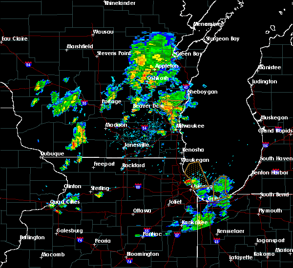 At 536 pm cdt, a severe thunderstorm was located near newburg, or 7 miles east of kewaskum, moving northeast at 35 mph (radar indicated). Hazards include 60 mph wind gusts and penny size hail. Expect damage to roofs, siding, and trees. Locations impacted include, west bend, kewaskum, campbellsport, random lake, adell, silver creek, beechwood, fillmore, dundee, boltonville, batavia, hingham and new fane. At 536 pm cdt, a severe thunderstorm was located near newburg, or 7 miles east of kewaskum, moving northeast at 35 mph (radar indicated). Hazards include 60 mph wind gusts and penny size hail. Expect damage to roofs, siding, and trees. Locations impacted include, west bend, kewaskum, campbellsport, random lake, adell, silver creek, beechwood, fillmore, dundee, boltonville, batavia, hingham and new fane.
|
| 6/20/2020 5:17 PM CDT |
 At 517 pm cdt, a severe thunderstorm was located over west bend, moving northeast at 35 mph (radar indicated). Hazards include 60 mph wind gusts and penny size hail. expect damage to roofs, siding, and trees At 517 pm cdt, a severe thunderstorm was located over west bend, moving northeast at 35 mph (radar indicated). Hazards include 60 mph wind gusts and penny size hail. expect damage to roofs, siding, and trees
|
| 6/2/2020 9:09 PM CDT |
 At 908 pm cdt, severe thunderstorms were located along a line extending from near sheboygan falls to near slinger, moving southeast at 40 mph (radar indicated). Hazards include 60 mph wind gusts. Expect damage to roofs, siding, and trees. locations impacted include, west bend, mequon, hartford, grafton, cedarburg, port washington, jackson, slinger, saukville, bayside, kewaskum, thiensville, belgium, fredonia, newburg, richfield, addison, wayne, nenno and waubeka. People attending washington county outdoor testing, outdoor testing at ascension in mequon, outdoor testing at aurora in grafton, and outdoor testing at aurora in hartford should seek safe shelter immediately!. At 908 pm cdt, severe thunderstorms were located along a line extending from near sheboygan falls to near slinger, moving southeast at 40 mph (radar indicated). Hazards include 60 mph wind gusts. Expect damage to roofs, siding, and trees. locations impacted include, west bend, mequon, hartford, grafton, cedarburg, port washington, jackson, slinger, saukville, bayside, kewaskum, thiensville, belgium, fredonia, newburg, richfield, addison, wayne, nenno and waubeka. People attending washington county outdoor testing, outdoor testing at ascension in mequon, outdoor testing at aurora in grafton, and outdoor testing at aurora in hartford should seek safe shelter immediately!.
|
| 6/2/2020 8:44 PM CDT |
 At 843 pm cdt, severe thunderstorms were located along a line extending from 7 miles west of plymouth to near watertown, moving east at 45 mph (radar indicated). Hazards include 60 mph wind gusts and penny size hail. expect damage to roofs, siding, and trees At 843 pm cdt, severe thunderstorms were located along a line extending from 7 miles west of plymouth to near watertown, moving east at 45 mph (radar indicated). Hazards include 60 mph wind gusts and penny size hail. expect damage to roofs, siding, and trees
|
| 6/2/2020 8:27 PM CDT |
 At 826 pm cdt, severe thunderstorms were located along a line extending from near camp rokilio scout camp to 6 miles southwest of oakfield, moving east at 45 mph (radar indicated). Hazards include 60 mph wind gusts and quarter size hail. Hail damage to vehicles is expected. Expect wind damage to roofs, siding, and trees. At 826 pm cdt, severe thunderstorms were located along a line extending from near camp rokilio scout camp to 6 miles southwest of oakfield, moving east at 45 mph (radar indicated). Hazards include 60 mph wind gusts and quarter size hail. Hail damage to vehicles is expected. Expect wind damage to roofs, siding, and trees.
|
| 9/11/2019 2:57 PM CDT |
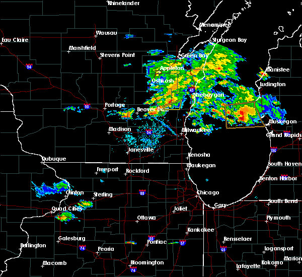 At 257 pm cdt, a severe thunderstorm was located over campbellsport, or near kewaskum, moving northeast at 35 mph (radar indicated). Hazards include 60 mph wind gusts. expect damage to roofs, siding, and trees At 257 pm cdt, a severe thunderstorm was located over campbellsport, or near kewaskum, moving northeast at 35 mph (radar indicated). Hazards include 60 mph wind gusts. expect damage to roofs, siding, and trees
|
| 8/7/2019 9:51 PM CDT |
 The severe thunderstorm warning for ozaukee, southeastern fond du lac, east central columbia, washington, southwestern sheboygan and central dodge counties will expire at 1000 pm cdt, the storms which prompted the warning have weakened below severe limits, and no longer pose an immediate threat to life or property. therefore, the warning will be allowed to expire. however small hail and gusty winds to 50 mph are still possible with these thunderstorms. The severe thunderstorm warning for ozaukee, southeastern fond du lac, east central columbia, washington, southwestern sheboygan and central dodge counties will expire at 1000 pm cdt, the storms which prompted the warning have weakened below severe limits, and no longer pose an immediate threat to life or property. therefore, the warning will be allowed to expire. however small hail and gusty winds to 50 mph are still possible with these thunderstorms.
|
| 8/7/2019 9:37 PM CDT |
 At 937 pm cdt, severe thunderstorms were located along a line extending from 24 miles east of belgium to near beaver dam, moving southeast at 35 mph (radar indicated). Hazards include 60 mph wind gusts and quarter size hail. Hail damage to vehicles is expected. expect wind damage to roofs, siding, and trees. Locations impacted include, west bend, beaver dam, hartford, port washington, jackson, mayville, slinger, saukville, kewaskum, horicon, juneau, belgium, fredonia, random lake, theresa, newburg, hustisford, iron ridge, burnett and addison. At 937 pm cdt, severe thunderstorms were located along a line extending from 24 miles east of belgium to near beaver dam, moving southeast at 35 mph (radar indicated). Hazards include 60 mph wind gusts and quarter size hail. Hail damage to vehicles is expected. expect wind damage to roofs, siding, and trees. Locations impacted include, west bend, beaver dam, hartford, port washington, jackson, mayville, slinger, saukville, kewaskum, horicon, juneau, belgium, fredonia, random lake, theresa, newburg, hustisford, iron ridge, burnett and addison.
|
| 8/7/2019 9:18 PM CDT |
 At 918 pm cdt, severe thunderstorms were located along a line extending from 10 miles southeast of oostburg to near cambria, moving east at 60 mph (radar indicated). Hazards include 60 mph wind gusts and quarter size hail. Hail damage to vehicles is expected. Expect wind damage to roofs, siding, and trees. At 918 pm cdt, severe thunderstorms were located along a line extending from 10 miles southeast of oostburg to near cambria, moving east at 60 mph (radar indicated). Hazards include 60 mph wind gusts and quarter size hail. Hail damage to vehicles is expected. Expect wind damage to roofs, siding, and trees.
|
| 8/7/2019 8:50 PM CDT |
 At 849 pm cdt, severe thunderstorms were located along a line extending from sheboygan to near brandon, moving southeast at 50 mph (radar indicated). Hazards include 60 mph wind gusts and quarter size hail. Hail damage to vehicles is expected. Expect wind damage to roofs, siding, and trees. At 849 pm cdt, severe thunderstorms were located along a line extending from sheboygan to near brandon, moving southeast at 50 mph (radar indicated). Hazards include 60 mph wind gusts and quarter size hail. Hail damage to vehicles is expected. Expect wind damage to roofs, siding, and trees.
|
| 7/20/2019 1:07 PM CDT |
 The severe thunderstorm warning for ozaukee, north central milwaukee, washington and dodge counties will expire at 115 pm cdt, the storms which prompted the warning have weakened below severe limits, and no longer pose an immediate threat to life or property. therefore, the warning will be allowed to expire. however gusty winds to 40 mph are still likely with these thunderstorms. a severe thunderstorm watch remains in effect until 900 pm cdt for south central and southeastern wisconsin. The severe thunderstorm warning for ozaukee, north central milwaukee, washington and dodge counties will expire at 115 pm cdt, the storms which prompted the warning have weakened below severe limits, and no longer pose an immediate threat to life or property. therefore, the warning will be allowed to expire. however gusty winds to 40 mph are still likely with these thunderstorms. a severe thunderstorm watch remains in effect until 900 pm cdt for south central and southeastern wisconsin.
|
| 7/20/2019 12:54 PM CDT |
 At 1254 pm cdt, severe thunderstorms were located along a line extending from 11 miles east of sheboygan to near waterloo, moving southeast at 35 mph (radar indicated). Hazards include 60 mph wind gusts. Expect damage to roofs, siding, and trees. Locations impacted include, west bend, watertown, mequon, beaver dam, hartford, grafton, cedarburg, port washington, jackson, mayville, slinger, saukville, bayside, kewaskum, horicon, thiensville, juneau, belgium, fredonia and newburg. At 1254 pm cdt, severe thunderstorms were located along a line extending from 11 miles east of sheboygan to near waterloo, moving southeast at 35 mph (radar indicated). Hazards include 60 mph wind gusts. Expect damage to roofs, siding, and trees. Locations impacted include, west bend, watertown, mequon, beaver dam, hartford, grafton, cedarburg, port washington, jackson, mayville, slinger, saukville, bayside, kewaskum, horicon, thiensville, juneau, belgium, fredonia and newburg.
|
| 7/20/2019 12:32 PM CDT |
 At 1231 pm cdt, severe thunderstorms were located along a line extending from 13 miles east of sheboygan to near waterloo, moving southeast at 45 mph (radar indicated). Hazards include 60 mph wind gusts. Expect damage to roofs, siding, and trees. Locations impacted include, sheboygan, west bend, watertown, mequon, beaver dam, hartford, grafton, cedarburg, waupun, port washington, plymouth, sheboygan falls, jackson, mayville, slinger, saukville, bayside, kewaskum, horicon and thiensville. At 1231 pm cdt, severe thunderstorms were located along a line extending from 13 miles east of sheboygan to near waterloo, moving southeast at 45 mph (radar indicated). Hazards include 60 mph wind gusts. Expect damage to roofs, siding, and trees. Locations impacted include, sheboygan, west bend, watertown, mequon, beaver dam, hartford, grafton, cedarburg, waupun, port washington, plymouth, sheboygan falls, jackson, mayville, slinger, saukville, bayside, kewaskum, horicon and thiensville.
|
| 7/20/2019 12:18 PM CDT |
 At 1217 pm cdt, severe thunderstorms were located along a line extending from near sheboygan to near columbus, moving southeast at 45 mph (radar indicated). Hazards include 60 mph wind gusts. expect damage to roofs, siding, and trees At 1217 pm cdt, severe thunderstorms were located along a line extending from near sheboygan to near columbus, moving southeast at 45 mph (radar indicated). Hazards include 60 mph wind gusts. expect damage to roofs, siding, and trees
|
| 7/2/2019 2:24 PM CDT |
 At 223 pm cdt, a severe thunderstorm was located over west bend, moving east at 25 mph (radar indicated). Hazards include 60 mph wind gusts and quarter size hail. Hail damage to vehicles is expected. Expect wind damage to roofs, siding, and trees. At 223 pm cdt, a severe thunderstorm was located over west bend, moving east at 25 mph (radar indicated). Hazards include 60 mph wind gusts and quarter size hail. Hail damage to vehicles is expected. Expect wind damage to roofs, siding, and trees.
|
| 6/27/2019 5:42 PM CDT |
 The severe thunderstorm warning for ozaukee, washington and sheboygan counties will expire at 545 pm cdt, the strongest winds with the line of storms has moved out over lake michigan. therefore, the warning will be allowed to expire. however gusty winds of 30 mph to 40 mph are still expected through 6 pm over sheboygan and ozaukee counties. a severe thunderstorm watch remains in effect until 900 pm cdt for southeastern and east central wisconsin. The severe thunderstorm warning for ozaukee, washington and sheboygan counties will expire at 545 pm cdt, the strongest winds with the line of storms has moved out over lake michigan. therefore, the warning will be allowed to expire. however gusty winds of 30 mph to 40 mph are still expected through 6 pm over sheboygan and ozaukee counties. a severe thunderstorm watch remains in effect until 900 pm cdt for southeastern and east central wisconsin.
|
| 6/27/2019 5:14 PM CDT |
 At 513 pm cdt, severe thunderstorms were located along a line extending from near st. nazianz to menomonee falls, moving east at 50 mph (radar indicated). Hazards include 60 mph wind gusts and penny size hail. Expect damage to roofs, siding, and trees. Locations impacted include, sheboygan, menomonee falls, west bend, mequon, hartford, brown deer, grafton, cedarburg, port washington, plymouth, sheboygan falls, jackson, slinger, saukville, bayside, kewaskum, thiensville, howards grove, oostburg and belgium. At 513 pm cdt, severe thunderstorms were located along a line extending from near st. nazianz to menomonee falls, moving east at 50 mph (radar indicated). Hazards include 60 mph wind gusts and penny size hail. Expect damage to roofs, siding, and trees. Locations impacted include, sheboygan, menomonee falls, west bend, mequon, hartford, brown deer, grafton, cedarburg, port washington, plymouth, sheboygan falls, jackson, slinger, saukville, bayside, kewaskum, thiensville, howards grove, oostburg and belgium.
|
| 6/27/2019 5:11 PM CDT |
 The severe thunderstorm warning for fond du lac county will expire at 515 pm cdt, the strongest winds with the line of storms will have moved into sheboygan county by 515 pm cdt. therefore, the warning will be allowed to expire. however gusty winds to 30 to 40 mph are still possible with these thunderstorms over eastern fond du lac county until 530 pm. a severe thunderstorm watch remains in effect until 900 pm cdt for southeastern and east central wisconsin. The severe thunderstorm warning for fond du lac county will expire at 515 pm cdt, the strongest winds with the line of storms will have moved into sheboygan county by 515 pm cdt. therefore, the warning will be allowed to expire. however gusty winds to 30 to 40 mph are still possible with these thunderstorms over eastern fond du lac county until 530 pm. a severe thunderstorm watch remains in effect until 900 pm cdt for southeastern and east central wisconsin.
|
| 6/27/2019 4:58 PM CDT |
 At 457 pm cdt, severe thunderstorms were located along a line extending from 6 miles southwest of chilton to merton, moving east at 45 mph (radar indicated). Hazards include 60 mph wind gusts and penny size hail. Expect damage to roofs, siding, and trees. Locations impacted include, sheboygan, menomonee falls, west bend, mequon, hartford, brown deer, grafton, cedarburg, port washington, plymouth, sheboygan falls, jackson, slinger, saukville, bayside, kewaskum, thiensville, howards grove, oostburg and belgium. At 457 pm cdt, severe thunderstorms were located along a line extending from 6 miles southwest of chilton to merton, moving east at 45 mph (radar indicated). Hazards include 60 mph wind gusts and penny size hail. Expect damage to roofs, siding, and trees. Locations impacted include, sheboygan, menomonee falls, west bend, mequon, hartford, brown deer, grafton, cedarburg, port washington, plymouth, sheboygan falls, jackson, slinger, saukville, bayside, kewaskum, thiensville, howards grove, oostburg and belgium.
|
| 6/27/2019 4:56 PM CDT |
 At 454 pm cdt, severe thunderstorms were located along a line extending from near central lake winnebago to near campbellsport, moving east at 45 mph (airport observation). Hazards include 60 mph wind gusts. a 62 mph wind has occurred at fond du lac airport. Expect damage to roofs, siding, and trees. locations impacted include, fond du lac, waupun, ripon, north fond du lac, campbellsport, oakfield, rosendale, brandon, southern lake winnebago, taycheedah, ashford, lamartine, byron, alto, eden, mount calvary, st. Cloud, fairwater, lagoda and waucousta. At 454 pm cdt, severe thunderstorms were located along a line extending from near central lake winnebago to near campbellsport, moving east at 45 mph (airport observation). Hazards include 60 mph wind gusts. a 62 mph wind has occurred at fond du lac airport. Expect damage to roofs, siding, and trees. locations impacted include, fond du lac, waupun, ripon, north fond du lac, campbellsport, oakfield, rosendale, brandon, southern lake winnebago, taycheedah, ashford, lamartine, byron, alto, eden, mount calvary, st. Cloud, fairwater, lagoda and waucousta.
|
| 6/27/2019 4:37 PM CDT |
 At 437 pm cdt, severe thunderstorms were located along a line extending from 6 miles southwest of oshkosh to 6 miles south of oakfield, moving east at 45 mph (radar indicated. these storms have a history of producing wind gusts between 50 and 65 mph with sporadic trees down). Hazards include 60 mph wind gusts and penny size hail. Expect damage to roofs, siding, and trees. locations impacted include, fond du lac, waupun, ripon, north fond du lac, campbellsport, oakfield, rosendale, brandon, southern lake winnebago, taycheedah, ashford, lamartine, byron, alto, eden, mount calvary, st. Cloud, fairwater, lagoda and waucousta. At 437 pm cdt, severe thunderstorms were located along a line extending from 6 miles southwest of oshkosh to 6 miles south of oakfield, moving east at 45 mph (radar indicated. these storms have a history of producing wind gusts between 50 and 65 mph with sporadic trees down). Hazards include 60 mph wind gusts and penny size hail. Expect damage to roofs, siding, and trees. locations impacted include, fond du lac, waupun, ripon, north fond du lac, campbellsport, oakfield, rosendale, brandon, southern lake winnebago, taycheedah, ashford, lamartine, byron, alto, eden, mount calvary, st. Cloud, fairwater, lagoda and waucousta.
|
| 6/27/2019 4:29 PM CDT |
 At 429 pm cdt, severe thunderstorms were located along a line extending from 6 miles southwest of oshkosh to watertown, moving east at 55 mph (radar indicated). Hazards include 60 mph wind gusts and penny size hail. expect damage to roofs, siding, and trees At 429 pm cdt, severe thunderstorms were located along a line extending from 6 miles southwest of oshkosh to watertown, moving east at 55 mph (radar indicated). Hazards include 60 mph wind gusts and penny size hail. expect damage to roofs, siding, and trees
|
| 6/27/2019 4:13 PM CDT |
 At 412 pm cdt, severe thunderstorms were located along a line extending from berlin to near randolph, moving east at 50 mph (radar indicated. these storms have a history of producing wind gusts between 50 and 60 mph with sporadic trees down). Hazards include 60 mph wind gusts and penny size hail. expect damage to roofs, siding, and trees At 412 pm cdt, severe thunderstorms were located along a line extending from berlin to near randolph, moving east at 50 mph (radar indicated. these storms have a history of producing wind gusts between 50 and 60 mph with sporadic trees down). Hazards include 60 mph wind gusts and penny size hail. expect damage to roofs, siding, and trees
|
| 8/28/2018 4:47 PM CDT |
 At 446 pm cdt, severe thunderstorms were located along a line extending from near manitowoc to near oostburg to near jackson, moving east at 50 mph (radar indicated). Hazards include 60 mph wind gusts. Expect damage to roofs, siding, and trees. Locations impacted include, sheboygan, west bend, port washington, plymouth, sheboygan falls, saukville, kewaskum, howards grove, oostburg, belgium, fredonia, kohler, cedar grove, random lake, newburg, elkhart lake, greenbush, cascade, adell and waldo. At 446 pm cdt, severe thunderstorms were located along a line extending from near manitowoc to near oostburg to near jackson, moving east at 50 mph (radar indicated). Hazards include 60 mph wind gusts. Expect damage to roofs, siding, and trees. Locations impacted include, sheboygan, west bend, port washington, plymouth, sheboygan falls, saukville, kewaskum, howards grove, oostburg, belgium, fredonia, kohler, cedar grove, random lake, newburg, elkhart lake, greenbush, cascade, adell and waldo.
|
| 8/28/2018 4:35 PM CDT |
 The tornado warning for southeastern fond du lac and northeastern dodge counties will expire at 445 pm cdt, the storm which prompted the warning has moved out of the area. therefore, the warning will be allowed to expire. a severe thunderstorm watch remains in effect until 900 pm cdt for southeastern and east central wisconsin. remember, a tornado warning still remains in effect for sheboygan county. The tornado warning for southeastern fond du lac and northeastern dodge counties will expire at 445 pm cdt, the storm which prompted the warning has moved out of the area. therefore, the warning will be allowed to expire. a severe thunderstorm watch remains in effect until 900 pm cdt for southeastern and east central wisconsin. remember, a tornado warning still remains in effect for sheboygan county.
|
| 8/28/2018 4:26 PM CDT |
 At 426 pm cdt, a confirmed tornado was located near campbellsport, or 10 miles north of kewaskum, moving east at 60 mph (weather spotters confirmed tornado. multiple reports of tornadoes have been received with this storm across fond du lac county). Hazards include damaging tornado and quarter size hail. Flying debris will be dangerous to those caught without shelter. mobile homes will be damaged or destroyed. damage to roofs, windows, and vehicles will occur. Tree damage is likely. At 426 pm cdt, a confirmed tornado was located near campbellsport, or 10 miles north of kewaskum, moving east at 60 mph (weather spotters confirmed tornado. multiple reports of tornadoes have been received with this storm across fond du lac county). Hazards include damaging tornado and quarter size hail. Flying debris will be dangerous to those caught without shelter. mobile homes will be damaged or destroyed. damage to roofs, windows, and vehicles will occur. Tree damage is likely.
|
| 8/28/2018 4:19 PM CDT |
 At 419 pm cdt, a confirmed tornado was located near lomira, or 7 miles south of fond du lac, moving east at 50 mph (weather spotters confirmed tornado. a tornado with debris was reported near oakfield). Hazards include damaging tornado and quarter size hail. Flying debris will be dangerous to those caught without shelter. mobile homes will be damaged or destroyed. damage to roofs, windows, and vehicles will occur. tree damage is likely. locations impacted include, fond du lac, north fond du lac, lomira, campbellsport, oakfield, southern lake winnebago, taycheedah, ashford, lamartine, byron, eden, mount calvary, brownsville, st. Cloud, kekoskee, peebles, oak center, dundee, lagoda and waucousta. At 419 pm cdt, a confirmed tornado was located near lomira, or 7 miles south of fond du lac, moving east at 50 mph (weather spotters confirmed tornado. a tornado with debris was reported near oakfield). Hazards include damaging tornado and quarter size hail. Flying debris will be dangerous to those caught without shelter. mobile homes will be damaged or destroyed. damage to roofs, windows, and vehicles will occur. tree damage is likely. locations impacted include, fond du lac, north fond du lac, lomira, campbellsport, oakfield, southern lake winnebago, taycheedah, ashford, lamartine, byron, eden, mount calvary, brownsville, st. Cloud, kekoskee, peebles, oak center, dundee, lagoda and waucousta.
|
| 8/28/2018 4:15 PM CDT |
 At 414 pm cdt, severe thunderstorms were located along a line extending from 6 miles east of central lake winnebago to lomira to near hustisford, moving east at 50 mph (trained weather spotters. spotters and law enforcement have reported numerous trees down. winds have been estimated to be in excess of 75 mph at times). Hazards include 70 mph wind gusts. Expect considerable tree damage. Damage is likely to mobile homes, roofs, and outbuildings. At 414 pm cdt, severe thunderstorms were located along a line extending from 6 miles east of central lake winnebago to lomira to near hustisford, moving east at 50 mph (trained weather spotters. spotters and law enforcement have reported numerous trees down. winds have been estimated to be in excess of 75 mph at times). Hazards include 70 mph wind gusts. Expect considerable tree damage. Damage is likely to mobile homes, roofs, and outbuildings.
|
| 8/28/2018 4:10 PM CDT |
 At 410 pm cdt, a confirmed tornado was located near oakfield, or near waupun, moving east at 35 mph (weather spotters confirmed tornado. numerous reports of a tornado have been received southwest of fond du lac). Hazards include damaging tornado and quarter size hail. Flying debris will be dangerous to those caught without shelter. mobile homes will be damaged or destroyed. damage to roofs, windows, and vehicles will occur. Tree damage is likely. At 410 pm cdt, a confirmed tornado was located near oakfield, or near waupun, moving east at 35 mph (weather spotters confirmed tornado. numerous reports of a tornado have been received southwest of fond du lac). Hazards include damaging tornado and quarter size hail. Flying debris will be dangerous to those caught without shelter. mobile homes will be damaged or destroyed. damage to roofs, windows, and vehicles will occur. Tree damage is likely.
|
| 8/28/2018 4:08 PM CDT |
 At 407 pm cdt, severe thunderstorms were located along a line extending from 6 miles northwest of north fond du lac to near waupun, moving east at 45 mph (emergency management. 70 mph winds were estimated in the brandon and waupun areas). Hazards include 70 mph wind gusts and quarter size hail. Hail damage to vehicles is expected. expect considerable tree damage. wind damage is also likely to mobile homes, roofs, and outbuildings. locations impacted include, fond du lac, waupun, ripon, north fond du lac, lomira, campbellsport, oakfield, rosendale, brandon, southern lake winnebago, taycheedah, ashford, lamartine, byron, alto, eden, mount calvary, brownsville, st. Cloud and fairwater. At 407 pm cdt, severe thunderstorms were located along a line extending from 6 miles northwest of north fond du lac to near waupun, moving east at 45 mph (emergency management. 70 mph winds were estimated in the brandon and waupun areas). Hazards include 70 mph wind gusts and quarter size hail. Hail damage to vehicles is expected. expect considerable tree damage. wind damage is also likely to mobile homes, roofs, and outbuildings. locations impacted include, fond du lac, waupun, ripon, north fond du lac, lomira, campbellsport, oakfield, rosendale, brandon, southern lake winnebago, taycheedah, ashford, lamartine, byron, alto, eden, mount calvary, brownsville, st. Cloud and fairwater.
|
| 8/28/2018 4:02 PM CDT |
 At 401 pm cdt, severe thunderstorms were located along a line extending from near rosendale to near waupun, moving east at 40 mph (emergency management. numerous trees have been reported down with these storms. winds are estimated to be between 70 and 80 mph at times). Hazards include 70 mph wind gusts and quarter size hail. Hail damage to vehicles is expected. expect considerable tree damage. wind damage is also likely to mobile homes, roofs, and outbuildings. locations impacted include, fond du lac, waupun, ripon, north fond du lac, lomira, campbellsport, oakfield, rosendale, brandon, southern lake winnebago, taycheedah, ashford, lamartine, byron, alto, eden, mount calvary, brownsville, st. Cloud and fairwater. At 401 pm cdt, severe thunderstorms were located along a line extending from near rosendale to near waupun, moving east at 40 mph (emergency management. numerous trees have been reported down with these storms. winds are estimated to be between 70 and 80 mph at times). Hazards include 70 mph wind gusts and quarter size hail. Hail damage to vehicles is expected. expect considerable tree damage. wind damage is also likely to mobile homes, roofs, and outbuildings. locations impacted include, fond du lac, waupun, ripon, north fond du lac, lomira, campbellsport, oakfield, rosendale, brandon, southern lake winnebago, taycheedah, ashford, lamartine, byron, alto, eden, mount calvary, brownsville, st. Cloud and fairwater.
|
| 8/28/2018 3:35 PM CDT |
 At 334 pm cdt, severe thunderstorms were located along a line extending from 7 miles north of rush lake to near cambria, moving east at 40 mph (emergency management. widespread tree damage and numerous reports of 70 to 80 mph winds have been reported with these storms). Hazards include 70 mph wind gusts and quarter size hail. Hail damage to vehicles is expected. expect considerable tree damage. Wind damage is also likely to mobile homes, roofs, and outbuildings. At 334 pm cdt, severe thunderstorms were located along a line extending from 7 miles north of rush lake to near cambria, moving east at 40 mph (emergency management. widespread tree damage and numerous reports of 70 to 80 mph winds have been reported with these storms). Hazards include 70 mph wind gusts and quarter size hail. Hail damage to vehicles is expected. expect considerable tree damage. Wind damage is also likely to mobile homes, roofs, and outbuildings.
|
| 7/1/2018 3:50 PM CDT |
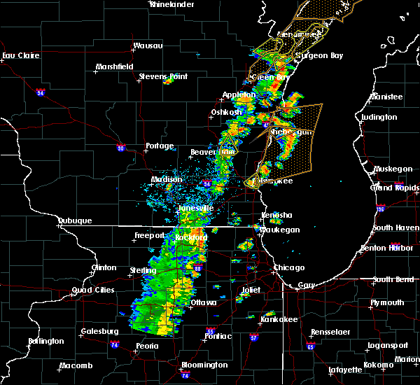 At 350 pm cdt, a severe thunderstorm was located over campbellsport, or near kewaskum, moving northeast at 55 mph (radar indicated). Hazards include 60 mph wind gusts. Expect damage to roofs, siding, and trees. locations impacted include, kewaskum, campbellsport, ashford, wayne, waucousta and new fane. A tornado watch remains in effect until 700 pm cdt for southeastern and east central wisconsin. At 350 pm cdt, a severe thunderstorm was located over campbellsport, or near kewaskum, moving northeast at 55 mph (radar indicated). Hazards include 60 mph wind gusts. Expect damage to roofs, siding, and trees. locations impacted include, kewaskum, campbellsport, ashford, wayne, waucousta and new fane. A tornado watch remains in effect until 700 pm cdt for southeastern and east central wisconsin.
|
| 7/1/2018 3:41 PM CDT |
 At 341 pm cdt, a severe thunderstorm was located near theresa, or 7 miles east of mayville, moving northeast at 45 mph (radar indicated). Hazards include 60 mph wind gusts. Expect damage to roofs, siding, and trees. locations impacted include, hartford, kewaskum, campbellsport, theresa, iron ridge, addison, ashford, wayne, nenno, waucousta, allenton, new fane and kohlsville. A tornado watch remains in effect until 700 pm cdt for southeastern and east central wisconsin. At 341 pm cdt, a severe thunderstorm was located near theresa, or 7 miles east of mayville, moving northeast at 45 mph (radar indicated). Hazards include 60 mph wind gusts. Expect damage to roofs, siding, and trees. locations impacted include, hartford, kewaskum, campbellsport, theresa, iron ridge, addison, ashford, wayne, nenno, waucousta, allenton, new fane and kohlsville. A tornado watch remains in effect until 700 pm cdt for southeastern and east central wisconsin.
|
| 7/1/2018 3:33 PM CDT |
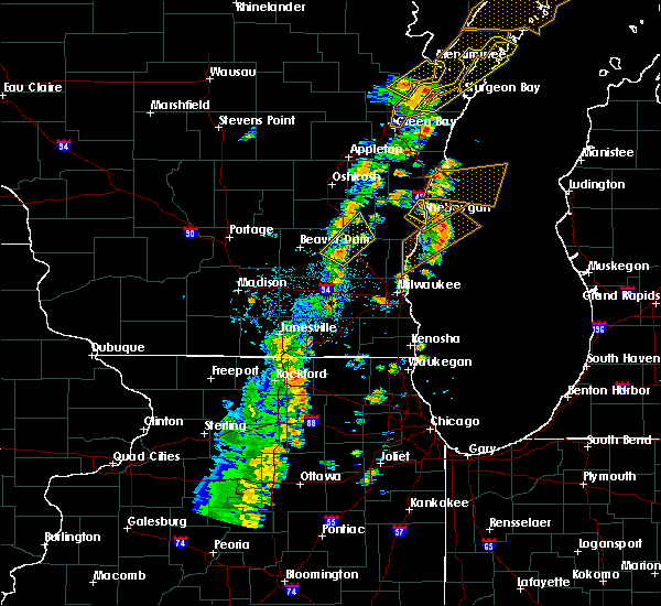 At 333 pm cdt, a severe thunderstorm was located near iron ridge, or near mayville, moving northeast at 60 mph (radar indicated). Hazards include 60 mph wind gusts. Expect damage to roofs, siding, and trees. locations impacted include, hartford, mayville, kewaskum, lomira, campbellsport, theresa, iron ridge, addison, rubicon, ashford, eden, woodland, wayne, nenno, waucousta, allenton, new fane and kohlsville. A tornado watch remains in effect until 700 pm cdt for southeastern and east central wisconsin. At 333 pm cdt, a severe thunderstorm was located near iron ridge, or near mayville, moving northeast at 60 mph (radar indicated). Hazards include 60 mph wind gusts. Expect damage to roofs, siding, and trees. locations impacted include, hartford, mayville, kewaskum, lomira, campbellsport, theresa, iron ridge, addison, rubicon, ashford, eden, woodland, wayne, nenno, waucousta, allenton, new fane and kohlsville. A tornado watch remains in effect until 700 pm cdt for southeastern and east central wisconsin.
|
| 7/1/2018 3:26 PM CDT |
 At 326 pm cdt, a severe thunderstorm was located over hustisford, or 8 miles southeast of horicon, moving northeast at 45 mph (radar indicated). Hazards include 60 mph wind gusts. expect damage to roofs, siding, and trees At 326 pm cdt, a severe thunderstorm was located over hustisford, or 8 miles southeast of horicon, moving northeast at 45 mph (radar indicated). Hazards include 60 mph wind gusts. expect damage to roofs, siding, and trees
|
| 4/13/2018 10:09 AM CDT |
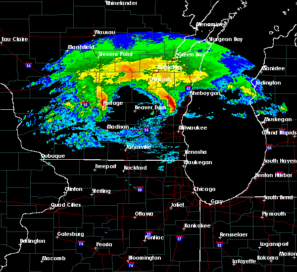 The severe thunderstorm warning for southeastern fond du lac and north central washington counties will expire at 1015 am cdt, the storm which prompted the warning has moved out of fond du lac county and is moving out of washington county. therefore, the warning will be allowed to expire. The severe thunderstorm warning for southeastern fond du lac and north central washington counties will expire at 1015 am cdt, the storm which prompted the warning has moved out of fond du lac county and is moving out of washington county. therefore, the warning will be allowed to expire.
|
| 4/13/2018 10:02 AM CDT |
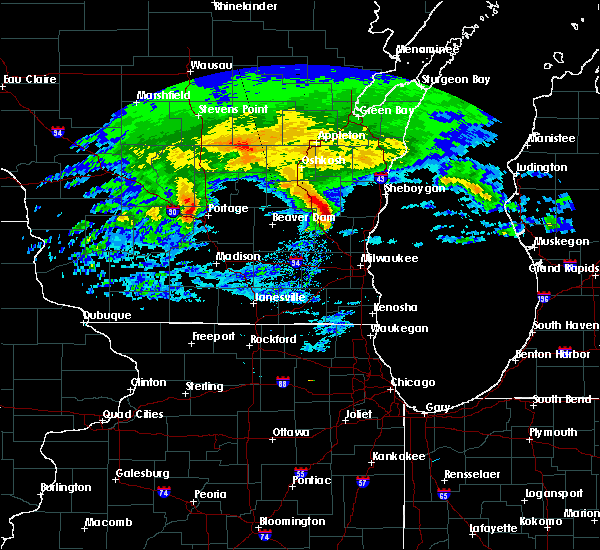 At 1002 am cdt, a severe thunderstorm was located over campbellsport, or near kewaskum, moving east at 60 mph (radar indicated). Hazards include quarter size hail. Damage to vehicles is expected. Locations impacted include, kewaskum, campbellsport, dundee, waucousta and new fane. At 1002 am cdt, a severe thunderstorm was located over campbellsport, or near kewaskum, moving east at 60 mph (radar indicated). Hazards include quarter size hail. Damage to vehicles is expected. Locations impacted include, kewaskum, campbellsport, dundee, waucousta and new fane.
|
| 4/13/2018 9:56 AM CDT |
 At 956 am cdt, a severe thunderstorm was located near campbellsport, or 7 miles northwest of kewaskum, moving east at 60 mph (radar indicated). Hazards include quarter size hail. Damage to vehicles is expected. Locations impacted include, kewaskum, campbellsport, ashford, byron, eden, wayne, new fane, dundee, waucousta and kohlsville. At 956 am cdt, a severe thunderstorm was located near campbellsport, or 7 miles northwest of kewaskum, moving east at 60 mph (radar indicated). Hazards include quarter size hail. Damage to vehicles is expected. Locations impacted include, kewaskum, campbellsport, ashford, byron, eden, wayne, new fane, dundee, waucousta and kohlsville.
|
| 4/13/2018 9:50 AM CDT |
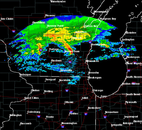 At 950 am cdt, a severe thunderstorm was located over lomira, or near mayville, moving east at 60 mph (radar indicated). Hazards include quarter size hail. Damage to vehicles is expected. Locations impacted include, mayville, kewaskum, lomira, campbellsport, theresa, ashford, byron, eden, brownsville, wayne, kekoskee, oak center, dundee, waucousta, knowles, new fane and kohlsville. At 950 am cdt, a severe thunderstorm was located over lomira, or near mayville, moving east at 60 mph (radar indicated). Hazards include quarter size hail. Damage to vehicles is expected. Locations impacted include, mayville, kewaskum, lomira, campbellsport, theresa, ashford, byron, eden, brownsville, wayne, kekoskee, oak center, dundee, waucousta, knowles, new fane and kohlsville.
|
| 4/13/2018 9:43 AM CDT |
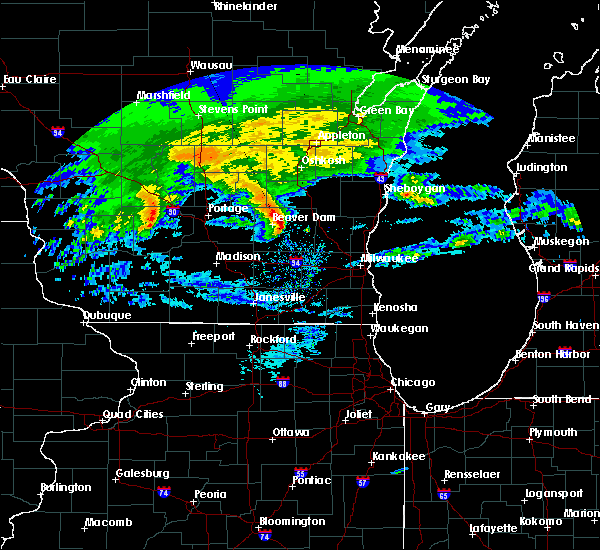 At 943 am cdt, a severe thunderstorm was located near mayville, moving east at 60 mph (radar indicated). Hazards include quarter size hail. damage to vehicles is expected At 943 am cdt, a severe thunderstorm was located near mayville, moving east at 60 mph (radar indicated). Hazards include quarter size hail. damage to vehicles is expected
|
| 8/10/2017 4:25 PM CDT |
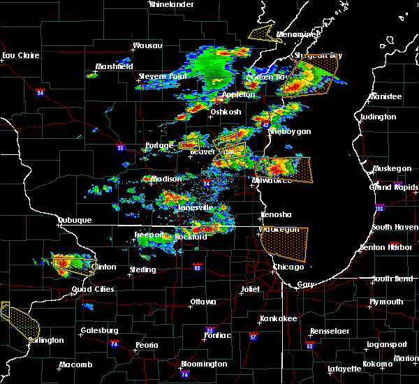 At 425 pm cdt, a severe thunderstorm was located near kewaskum, moving east at 50 mph (radar indicated). Hazards include 60 mph wind gusts and quarter size hail. Hail damage to vehicles is expected. expect wind damage to roofs, siding, and trees. Locations impacted include, west bend, kewaskum, campbellsport, wayne, boltonville, nenno, batavia, beechwood, new fane, fillmore and kohlsville. At 425 pm cdt, a severe thunderstorm was located near kewaskum, moving east at 50 mph (radar indicated). Hazards include 60 mph wind gusts and quarter size hail. Hail damage to vehicles is expected. expect wind damage to roofs, siding, and trees. Locations impacted include, west bend, kewaskum, campbellsport, wayne, boltonville, nenno, batavia, beechwood, new fane, fillmore and kohlsville.
|
| 8/10/2017 4:10 PM CDT |
 At 409 pm cdt, a severe thunderstorm was located near theresa, or 7 miles east of mayville, moving east at 50 mph (radar indicated). Hazards include 60 mph wind gusts and quarter size hail. Hail damage to vehicles is expected. Expect wind damage to roofs, siding, and trees. At 409 pm cdt, a severe thunderstorm was located near theresa, or 7 miles east of mayville, moving east at 50 mph (radar indicated). Hazards include 60 mph wind gusts and quarter size hail. Hail damage to vehicles is expected. Expect wind damage to roofs, siding, and trees.
|
| 7/15/2017 10:51 PM CDT |
 At 1051 pm cdt, severe thunderstorms were located along a line extending from near saukville to jackson to hartford, moving south at 25 mph (radar indicated). Hazards include 60 mph wind gusts and penny size hail. Expect damage to roofs, siding, and trees. Locations impacted include, west bend, mequon, hartford, brown deer, grafton, cedarburg, port washington, jackson, slinger, saukville, bayside, thiensville, newburg, richfield, addison, wayne, nenno, colgate, holy hill and allenton. At 1051 pm cdt, severe thunderstorms were located along a line extending from near saukville to jackson to hartford, moving south at 25 mph (radar indicated). Hazards include 60 mph wind gusts and penny size hail. Expect damage to roofs, siding, and trees. Locations impacted include, west bend, mequon, hartford, brown deer, grafton, cedarburg, port washington, jackson, slinger, saukville, bayside, thiensville, newburg, richfield, addison, wayne, nenno, colgate, holy hill and allenton.
|
| 7/15/2017 10:33 PM CDT |
 At 1033 pm cdt, severe thunderstorms were located along a line extending from belgium to near fredonia to near newburg to near west bend, moving southeast at 35 mph (radar indicated). Hazards include 60 mph wind gusts and penny size hail. Expect damage to roofs, siding, and trees. Locations impacted include, west bend, mequon, hartford, brown deer, grafton, cedarburg, port washington, jackson, slinger, saukville, bayside, kewaskum, thiensville, belgium, fredonia, newburg, richfield, addison, wayne and nenno. At 1033 pm cdt, severe thunderstorms were located along a line extending from belgium to near fredonia to near newburg to near west bend, moving southeast at 35 mph (radar indicated). Hazards include 60 mph wind gusts and penny size hail. Expect damage to roofs, siding, and trees. Locations impacted include, west bend, mequon, hartford, brown deer, grafton, cedarburg, port washington, jackson, slinger, saukville, bayside, kewaskum, thiensville, belgium, fredonia, newburg, richfield, addison, wayne and nenno.
|
| 7/15/2017 10:16 PM CDT |
 At 1015 pm cdt, severe thunderstorms were located along a line extending from 7 miles northwest of cedar grove to near random lake to 6 miles east of kewaskum to near campbellsport, moving southeast at 35 mph (radar indicated). Hazards include 60 mph wind gusts and penny size hail. Expect damage to roofs, siding, and trees. Locations impacted include, west bend, mequon, hartford, brown deer, grafton, cedarburg, port washington, jackson, slinger, saukville, bayside, kewaskum, thiensville, belgium, fredonia, cedar grove, campbellsport, random lake, newburg and richfield. At 1015 pm cdt, severe thunderstorms were located along a line extending from 7 miles northwest of cedar grove to near random lake to 6 miles east of kewaskum to near campbellsport, moving southeast at 35 mph (radar indicated). Hazards include 60 mph wind gusts and penny size hail. Expect damage to roofs, siding, and trees. Locations impacted include, west bend, mequon, hartford, brown deer, grafton, cedarburg, port washington, jackson, slinger, saukville, bayside, kewaskum, thiensville, belgium, fredonia, cedar grove, campbellsport, random lake, newburg and richfield.
|
| 7/15/2017 10:03 PM CDT |
 At 1003 pm cdt, severe thunderstorms were located along a line extending from near plymouth to 8 miles northwest of random lake to 6 miles east of campbellsport to near lomira, moving southeast at 35 mph (radar indicated). Hazards include 60 mph wind gusts and penny size hail. expect damage to roofs, siding, and trees At 1003 pm cdt, severe thunderstorms were located along a line extending from near plymouth to 8 miles northwest of random lake to 6 miles east of campbellsport to near lomira, moving southeast at 35 mph (radar indicated). Hazards include 60 mph wind gusts and penny size hail. expect damage to roofs, siding, and trees
|
| 7/15/2017 9:56 PM CDT |
 At 955 pm cdt, a severe thunderstorm was located 7 miles northeast of campbellsport, or 10 miles north of kewaskum, moving south at 30 mph (radar indicated). Hazards include 60 mph wind gusts and penny size hail. Expect damage to roofs, siding, and trees. Locations impacted include, fond du lac, waupun, plymouth, sheboygan falls, north fond du lac, cedar grove, campbellsport, random lake, oakfield, rosendale, elkhart lake, southern lake winnebago, taycheedah, ashford, lamartine, byron, greenbush, eden, mount calvary and cascade. At 955 pm cdt, a severe thunderstorm was located 7 miles northeast of campbellsport, or 10 miles north of kewaskum, moving south at 30 mph (radar indicated). Hazards include 60 mph wind gusts and penny size hail. Expect damage to roofs, siding, and trees. Locations impacted include, fond du lac, waupun, plymouth, sheboygan falls, north fond du lac, cedar grove, campbellsport, random lake, oakfield, rosendale, elkhart lake, southern lake winnebago, taycheedah, ashford, lamartine, byron, greenbush, eden, mount calvary and cascade.
|
| 7/15/2017 9:28 PM CDT |
 At 928 pm cdt, a severe thunderstorm was located near st anna, or 11 miles northeast of fond du lac, moving south at 30 mph (radar indicated). Hazards include 60 mph wind gusts and penny size hail. Expect damage to roofs, siding, and trees. Locations impacted include, sheboygan, fond du lac, waupun, plymouth, sheboygan falls, north fond du lac, howards grove, oostburg, kohler, cedar grove, campbellsport, random lake, oakfield, rosendale, elkhart lake, southern lake winnebago, taycheedah, ashford, lamartine and byron. At 928 pm cdt, a severe thunderstorm was located near st anna, or 11 miles northeast of fond du lac, moving south at 30 mph (radar indicated). Hazards include 60 mph wind gusts and penny size hail. Expect damage to roofs, siding, and trees. Locations impacted include, sheboygan, fond du lac, waupun, plymouth, sheboygan falls, north fond du lac, howards grove, oostburg, kohler, cedar grove, campbellsport, random lake, oakfield, rosendale, elkhart lake, southern lake winnebago, taycheedah, ashford, lamartine and byron.
|
| 7/15/2017 9:09 PM CDT |
 At 908 pm cdt, a severe thunderstorm was located near chilton, or 18 miles northwest of plymouth, moving south at 40 mph (radar indicated). Hazards include 60 mph wind gusts and penny size hail. expect damage to roofs, siding, and trees At 908 pm cdt, a severe thunderstorm was located near chilton, or 18 miles northwest of plymouth, moving south at 40 mph (radar indicated). Hazards include 60 mph wind gusts and penny size hail. expect damage to roofs, siding, and trees
|
| 6/12/2017 7:31 PM CDT |
 At 730 pm cdt, severe thunderstorms were located along a line extending from elkhart lake to random lake to near merton, moving east at 65 mph (trained weather spotters). Hazards include 70 mph wind gusts. Expect considerable tree damage. damage is likely to mobile homes, roofs, and outbuildings. locations impacted include, sheboygan, fond du lac, west bend, mequon, hartford, grafton, cedarburg, port washington, plymouth, sheboygan falls, jackson, slinger, saukville, kewaskum, thiensville, howards grove, oostburg, lomira, belgium and fredonia. People attending erin hills golf course, and lenz field house should seek safe shelter immediately!. At 730 pm cdt, severe thunderstorms were located along a line extending from elkhart lake to random lake to near merton, moving east at 65 mph (trained weather spotters). Hazards include 70 mph wind gusts. Expect considerable tree damage. damage is likely to mobile homes, roofs, and outbuildings. locations impacted include, sheboygan, fond du lac, west bend, mequon, hartford, grafton, cedarburg, port washington, plymouth, sheboygan falls, jackson, slinger, saukville, kewaskum, thiensville, howards grove, oostburg, lomira, belgium and fredonia. People attending erin hills golf course, and lenz field house should seek safe shelter immediately!.
|
| 6/12/2017 7:20 PM CDT | Numerous fallen trees in kewaskum. some roads blocke in washington county WI, 0.4 miles SW of Kewaskum, WI |
| 6/12/2017 7:20 PM CDT | Numerous trees and power lines down across washington county. time estimated from rada in washington county WI, 0.4 miles SSE of Kewaskum, WI |
| 6/12/2017 7:20 PM CDT |
 At 720 pm cdt, severe thunderstorms were located along a line extending from near elkhart lake to 7 miles west of random lake to near hartford, moving east at 55 mph (trained weather spotters). Hazards include 70 mph wind gusts. Expect considerable tree damage. damage is likely to mobile homes, roofs, and outbuildings. locations impacted include, sheboygan, fond du lac, west bend, watertown, mequon, hartford, grafton, cedarburg, port washington, plymouth, sheboygan falls, jackson, mayville, slinger, north fond du lac, saukville, kewaskum, horicon, thiensville and howards grove. People attending erin hills golf course, and lenz field house should seek safe shelter immediately!. At 720 pm cdt, severe thunderstorms were located along a line extending from near elkhart lake to 7 miles west of random lake to near hartford, moving east at 55 mph (trained weather spotters). Hazards include 70 mph wind gusts. Expect considerable tree damage. damage is likely to mobile homes, roofs, and outbuildings. locations impacted include, sheboygan, fond du lac, west bend, watertown, mequon, hartford, grafton, cedarburg, port washington, plymouth, sheboygan falls, jackson, mayville, slinger, north fond du lac, saukville, kewaskum, horicon, thiensville and howards grove. People attending erin hills golf course, and lenz field house should seek safe shelter immediately!.
|
| 6/12/2017 7:06 PM CDT |
 At 706 pm cdt, severe thunderstorms were located along a line extending from near southern lake winnebago to near campbellsport to near watertown, moving east at 55 mph (trained weather spotters). Hazards include 70 mph wind gusts. Expect considerable tree damage. damage is likely to mobile homes, roofs, and outbuildings. locations impacted include, sheboygan, fond du lac, west bend, watertown, mequon, beaver dam, hartford, grafton, cedarburg, port washington, plymouth, sheboygan falls, jackson, mayville, slinger, north fond du lac, saukville, kewaskum, horicon and thiensville. People attending erin hills golf course, and lenz field house should seek safe shelter immediately!. At 706 pm cdt, severe thunderstorms were located along a line extending from near southern lake winnebago to near campbellsport to near watertown, moving east at 55 mph (trained weather spotters). Hazards include 70 mph wind gusts. Expect considerable tree damage. damage is likely to mobile homes, roofs, and outbuildings. locations impacted include, sheboygan, fond du lac, west bend, watertown, mequon, beaver dam, hartford, grafton, cedarburg, port washington, plymouth, sheboygan falls, jackson, mayville, slinger, north fond du lac, saukville, kewaskum, horicon and thiensville. People attending erin hills golf course, and lenz field house should seek safe shelter immediately!.
|
| 6/12/2017 6:58 PM CDT |
 At 658 pm cdt, severe thunderstorms were located along a line extending from southern lake winnebago to lomira to 6 miles northwest of watertown, moving east at 55 mph (radar indicated). Hazards include 70 mph wind gusts. Expect considerable tree damage. damage is likely to mobile homes, roofs, and outbuildings. locations impacted include, sheboygan, fond du lac, west bend, watertown, mequon, beaver dam, hartford, grafton, cedarburg, port washington, plymouth, sheboygan falls, jackson, mayville, slinger, north fond du lac, saukville, kewaskum, horicon and thiensville. People attending erin hills golf course, and lenz field house should seek safe shelter immediately!. At 658 pm cdt, severe thunderstorms were located along a line extending from southern lake winnebago to lomira to 6 miles northwest of watertown, moving east at 55 mph (radar indicated). Hazards include 70 mph wind gusts. Expect considerable tree damage. damage is likely to mobile homes, roofs, and outbuildings. locations impacted include, sheboygan, fond du lac, west bend, watertown, mequon, beaver dam, hartford, grafton, cedarburg, port washington, plymouth, sheboygan falls, jackson, mayville, slinger, north fond du lac, saukville, kewaskum, horicon and thiensville. People attending erin hills golf course, and lenz field house should seek safe shelter immediately!.
|
| 6/12/2017 6:52 PM CDT |
 At 651 pm cdt, severe thunderstorms were located along a line extending from near north fond du lac to 6 miles south of oakfield to 7 miles northeast of waterloo, moving east at 55 mph (radar indicated). Hazards include 70 mph wind gusts. Expect considerable tree damage. Damage is likely to mobile homes, roofs, and outbuildings. At 651 pm cdt, severe thunderstorms were located along a line extending from near north fond du lac to 6 miles south of oakfield to 7 miles northeast of waterloo, moving east at 55 mph (radar indicated). Hazards include 70 mph wind gusts. Expect considerable tree damage. Damage is likely to mobile homes, roofs, and outbuildings.
|
| 5/17/2017 9:50 PM CDT |
 The severe thunderstorm warning for fond du lac, washington and dodge counties will expire at 1000 pm cdt, the storms which prompted the warning have weakened below severe limits, and no longer pose an immediate threat to life or property. therefore the warning will be allowed to expire. however gusty winds are still possible with these thunderstorms. a tornado watch remains in effect until 100 am cdt for southeastern and east central wisconsin. The severe thunderstorm warning for fond du lac, washington and dodge counties will expire at 1000 pm cdt, the storms which prompted the warning have weakened below severe limits, and no longer pose an immediate threat to life or property. therefore the warning will be allowed to expire. however gusty winds are still possible with these thunderstorms. a tornado watch remains in effect until 100 am cdt for southeastern and east central wisconsin.
|
| 5/17/2017 9:34 PM CDT |
 At 934 pm cdt, severe thunderstorms were located along a line extending from near berlin to near waupun to 7 miles northwest of watertown, moving east at 50 mph (radar indicated). Hazards include 60 mph wind gusts. Expect damage to roofs, siding, and trees. locations impacted include, fond du lac, west bend, watertown, beaver dam, hartford, waupun, ripon, jackson, mayville, slinger, north fond du lac, kewaskum, horicon, juneau, lomira, campbellsport, theresa, hustisford, oakfield and rosendale. A tornado watch remains in effect until 100 am cdt for southeastern and east central wisconsin. At 934 pm cdt, severe thunderstorms were located along a line extending from near berlin to near waupun to 7 miles northwest of watertown, moving east at 50 mph (radar indicated). Hazards include 60 mph wind gusts. Expect damage to roofs, siding, and trees. locations impacted include, fond du lac, west bend, watertown, beaver dam, hartford, waupun, ripon, jackson, mayville, slinger, north fond du lac, kewaskum, horicon, juneau, lomira, campbellsport, theresa, hustisford, oakfield and rosendale. A tornado watch remains in effect until 100 am cdt for southeastern and east central wisconsin.
|
| 5/17/2017 9:22 PM CDT |
 At 922 pm cdt, severe thunderstorms were located along a line extending from 6 miles southwest of redgranite to near markesan to near columbus, moving east at 50 mph (radar indicated). Hazards include 60 mph wind gusts and penny size hail. expect damage to roofs, siding, and trees At 922 pm cdt, severe thunderstorms were located along a line extending from 6 miles southwest of redgranite to near markesan to near columbus, moving east at 50 mph (radar indicated). Hazards include 60 mph wind gusts and penny size hail. expect damage to roofs, siding, and trees
|
| 3/7/2017 12:40 AM CST |
 At 1239 am cst, severe thunderstorms were located along a line extending from near st anna to near lannon, moving east at 60 mph (radar indicated). Hazards include 60 mph wind gusts and penny size hail. Expect damage to roofs, siding, and trees. Locations impacted include, sheboygan, west bend, mequon, brown deer, grafton, cedarburg, port washington, plymouth, sheboygan falls, jackson, slinger, saukville, bayside, kewaskum, thiensville, howards grove, oostburg, belgium, fredonia and kohler. At 1239 am cst, severe thunderstorms were located along a line extending from near st anna to near lannon, moving east at 60 mph (radar indicated). Hazards include 60 mph wind gusts and penny size hail. Expect damage to roofs, siding, and trees. Locations impacted include, sheboygan, west bend, mequon, brown deer, grafton, cedarburg, port washington, plymouth, sheboygan falls, jackson, slinger, saukville, bayside, kewaskum, thiensville, howards grove, oostburg, belgium, fredonia and kohler.
|
| 3/7/2017 12:30 AM CST |
 At 1230 am cst, severe thunderstorms were located along a line extending from near st anna to near merton, moving east at 60 mph (radar indicated). Hazards include 60 mph wind gusts and penny size hail. expect damage to roofs, siding, and trees At 1230 am cst, severe thunderstorms were located along a line extending from near st anna to near merton, moving east at 60 mph (radar indicated). Hazards include 60 mph wind gusts and penny size hail. expect damage to roofs, siding, and trees
|
| 2/28/2017 11:07 AM CST |
 At 1106 am cst, a severe thunderstorm was located over oostburg, or 10 miles south of sheboygan falls. an additional severe storm was located near campbellsport. these storms are moving east at 45 mph (radar indicated). Hazards include quarter size hail. Damage to vehicles is expected. Locations impacted include, sheboygan, sheboygan falls, kewaskum, oostburg, belgium, kohler, cedar grove, campbellsport, random lake, ashford, cascade, adell, waldo, silver creek, beechwood, dundee, harrington beach st park, boltonville, gibbsville and batavia. At 1106 am cst, a severe thunderstorm was located over oostburg, or 10 miles south of sheboygan falls. an additional severe storm was located near campbellsport. these storms are moving east at 45 mph (radar indicated). Hazards include quarter size hail. Damage to vehicles is expected. Locations impacted include, sheboygan, sheboygan falls, kewaskum, oostburg, belgium, kohler, cedar grove, campbellsport, random lake, ashford, cascade, adell, waldo, silver creek, beechwood, dundee, harrington beach st park, boltonville, gibbsville and batavia.
|
| 2/28/2017 10:58 AM CST |
 At 1057 am cst, a severe thunderstorm was located over random lake, or 11 miles north of port washington. an additional severe thunderstorm was located near theresa. these storms are moving northeast at 45 mph (radar indicated). Hazards include quarter size hail. Damage to vehicles is expected. Locations impacted include, sheboygan, west bend, sheboygan falls, mayville, kewaskum, oostburg, lomira, belgium, fredonia, kohler, cedar grove, campbellsport, random lake, theresa, newburg, addison, ashford, cascade, adell and waldo. At 1057 am cst, a severe thunderstorm was located over random lake, or 11 miles north of port washington. an additional severe thunderstorm was located near theresa. these storms are moving northeast at 45 mph (radar indicated). Hazards include quarter size hail. Damage to vehicles is expected. Locations impacted include, sheboygan, west bend, sheboygan falls, mayville, kewaskum, oostburg, lomira, belgium, fredonia, kohler, cedar grove, campbellsport, random lake, theresa, newburg, addison, ashford, cascade, adell and waldo.
|
| 2/28/2017 10:49 AM CST |
 At 1047 am cst, a severe thunderstorm was located near newburg, or 9 miles northeast of west bend. an additional severe thunderstorm located near mayville will also be moving into the warned area soon. these storms are moving northeast at 45 mph (radar indicated). Hazards include quarter size hail. Damage to vehicles is expected. Locations impacted include, sheboygan, west bend, sheboygan falls, mayville, kewaskum, oostburg, lomira, belgium, fredonia, kohler, cedar grove, campbellsport, random lake, theresa, newburg, addison, ashford, cascade, adell and waldo. At 1047 am cst, a severe thunderstorm was located near newburg, or 9 miles northeast of west bend. an additional severe thunderstorm located near mayville will also be moving into the warned area soon. these storms are moving northeast at 45 mph (radar indicated). Hazards include quarter size hail. Damage to vehicles is expected. Locations impacted include, sheboygan, west bend, sheboygan falls, mayville, kewaskum, oostburg, lomira, belgium, fredonia, kohler, cedar grove, campbellsport, random lake, theresa, newburg, addison, ashford, cascade, adell and waldo.
|
| 2/28/2017 10:27 AM CST |
 At 1026 am cst, a severe thunderstorm was located near iron ridge, or 7 miles north of hartford, moving east at 45 mph (radar indicated). Hazards include quarter size hail. damage to vehicles is expected At 1026 am cst, a severe thunderstorm was located near iron ridge, or 7 miles north of hartford, moving east at 45 mph (radar indicated). Hazards include quarter size hail. damage to vehicles is expected
|
| 7/7/2016 2:56 PM CDT |
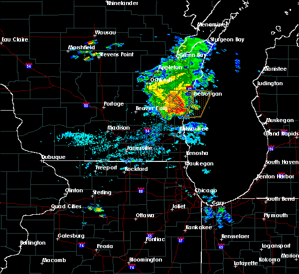 At 255 pm cdt, a severe thunderstorm was located near kewaskum, moving northeast at 25 mph (radar indicated). Hazards include 60 mph wind gusts. Expect damage to roofs. siding. and trees. Locations impacted include, west bend, kewaskum, campbellsport, cascade, boltonville, beechwood, dundee, new fane and batavia. At 255 pm cdt, a severe thunderstorm was located near kewaskum, moving northeast at 25 mph (radar indicated). Hazards include 60 mph wind gusts. Expect damage to roofs. siding. and trees. Locations impacted include, west bend, kewaskum, campbellsport, cascade, boltonville, beechwood, dundee, new fane and batavia.
|
| 7/7/2016 2:42 PM CDT |
 At 241 pm cdt, a severe thunderstorm was located near kewaskum, moving northeast at 25 mph (radar indicated). Hazards include 60 mph wind gusts. Expect damage to roofs. siding. and trees. Locations impacted include, west bend, kewaskum, campbellsport, cascade, wayne, boltonville, waucousta, beechwood, dundee, new fane, batavia and kohlsville. At 241 pm cdt, a severe thunderstorm was located near kewaskum, moving northeast at 25 mph (radar indicated). Hazards include 60 mph wind gusts. Expect damage to roofs. siding. and trees. Locations impacted include, west bend, kewaskum, campbellsport, cascade, wayne, boltonville, waucousta, beechwood, dundee, new fane, batavia and kohlsville.
|
| 7/7/2016 2:29 PM CDT |
 At 229 pm cdt, a severe thunderstorm was located near theresa, or 8 miles north of hartford, moving northeast at 25 mph (radar indicated). Hazards include 60 mph wind gusts. Expect damage to roofs. siding. And trees. At 229 pm cdt, a severe thunderstorm was located near theresa, or 8 miles north of hartford, moving northeast at 25 mph (radar indicated). Hazards include 60 mph wind gusts. Expect damage to roofs. siding. And trees.
|
| 6/15/2016 7:45 PM CDT |
 At 744 pm cdt, a severe thunderstorm was located over west bend, moving east at 35 mph (radar indicated). Hazards include 60 mph wind gusts and quarter size hail. Hail damage to vehicles is expected. Expect wind damage to roofs, siding, and trees. At 744 pm cdt, a severe thunderstorm was located over west bend, moving east at 35 mph (radar indicated). Hazards include 60 mph wind gusts and quarter size hail. Hail damage to vehicles is expected. Expect wind damage to roofs, siding, and trees.
|
| 8/2/2015 6:46 PM CDT |
 At 645 pm cdt, a severe thunderstorm was located over port washington, moving east at 50 mph. a 640 pm cdt, there were numerous reports of half dollar to golf ball sized hail near west bend (radar indicated). Hazards include golf ball size hail and 60 mph wind gusts. People and animals outdoors will be injured. expect hail damage to roofs, siding, windows and vehicles. expect wind damage to roofs, siding and trees. locations impacted include, west bend, grafton, cedarburg, port washington, jackson, saukville, kewaskum, belgium, fredonia, newburg, addison, wayne, fillmore, saint lawrence, waubeka, allenton, nenno, harrington beach st park, kohlsville and boltonville. People attending the ozaukee county fair should seek safe shelter immediately!. At 645 pm cdt, a severe thunderstorm was located over port washington, moving east at 50 mph. a 640 pm cdt, there were numerous reports of half dollar to golf ball sized hail near west bend (radar indicated). Hazards include golf ball size hail and 60 mph wind gusts. People and animals outdoors will be injured. expect hail damage to roofs, siding, windows and vehicles. expect wind damage to roofs, siding and trees. locations impacted include, west bend, grafton, cedarburg, port washington, jackson, saukville, kewaskum, belgium, fredonia, newburg, addison, wayne, fillmore, saint lawrence, waubeka, allenton, nenno, harrington beach st park, kohlsville and boltonville. People attending the ozaukee county fair should seek safe shelter immediately!.
|
| 8/2/2015 6:44 PM CDT |
 At 643 pm cdt, a severe thunderstorm was located near campbellsport, or near kewaskum, moving east at 60 mph. this storm has a history of producing half dollar size hail (radar indicated). Hazards include 60 mph wind gusts and half dollar size hail. Hail damage to vehicles is expected. expect wind damage to roofs, siding and trees. Locations impacted include, lomira, campbellsport, oakfield, ashford, byron, eden, brownsville, new fane, dundee, oak center and waucousta. At 643 pm cdt, a severe thunderstorm was located near campbellsport, or near kewaskum, moving east at 60 mph. this storm has a history of producing half dollar size hail (radar indicated). Hazards include 60 mph wind gusts and half dollar size hail. Hail damage to vehicles is expected. expect wind damage to roofs, siding and trees. Locations impacted include, lomira, campbellsport, oakfield, ashford, byron, eden, brownsville, new fane, dundee, oak center and waucousta.
|
| 8/2/2015 6:40 PM CDT |
 At 639 pm cdt, a severe thunderstorm was located near newburg, or near saukville, moving east at 50 mph. at 634 pm cdt, golf ball size hail was reported on the north side of west bend (radar indicated). Hazards include 60 mph wind gusts and half dollar size hail. Hail damage to vehicles is expected. expect wind damage to roofs, siding and trees. locations impacted include, west bend, grafton, cedarburg, port washington, jackson, saukville, kewaskum, belgium, fredonia, newburg, addison, wayne, fillmore, saint lawrence, waubeka, allenton, nenno, harrington beach st park, kohlsville and boltonville. People attending the ozaukee county fair should seek safe shelter immediately!. At 639 pm cdt, a severe thunderstorm was located near newburg, or near saukville, moving east at 50 mph. at 634 pm cdt, golf ball size hail was reported on the north side of west bend (radar indicated). Hazards include 60 mph wind gusts and half dollar size hail. Hail damage to vehicles is expected. expect wind damage to roofs, siding and trees. locations impacted include, west bend, grafton, cedarburg, port washington, jackson, saukville, kewaskum, belgium, fredonia, newburg, addison, wayne, fillmore, saint lawrence, waubeka, allenton, nenno, harrington beach st park, kohlsville and boltonville. People attending the ozaukee county fair should seek safe shelter immediately!.
|
| 8/2/2015 6:31 PM CDT |
 At 630 pm cdt, a severe thunderstorm was located over west bend, moving east at 50 mph (radar indicated). Hazards include 60 mph wind gusts and half dollar size hail. Hail damage to vehicles is expected. Expect wind damage to roofs, siding and trees. At 630 pm cdt, a severe thunderstorm was located over west bend, moving east at 50 mph (radar indicated). Hazards include 60 mph wind gusts and half dollar size hail. Hail damage to vehicles is expected. Expect wind damage to roofs, siding and trees.
|
| 8/2/2015 6:29 PM CDT |
 At 628 pm cdt, a severe thunderstorm was located near oakfield, or 8 miles south of fond du lac, moving east at 50 mph (radar indicated). Hazards include 60 mph wind gusts and half dollar size hail. Hail damage to vehicles is expected. Expect wind damage to roofs, siding and trees. At 628 pm cdt, a severe thunderstorm was located near oakfield, or 8 miles south of fond du lac, moving east at 50 mph (radar indicated). Hazards include 60 mph wind gusts and half dollar size hail. Hail damage to vehicles is expected. Expect wind damage to roofs, siding and trees.
|
| 8/2/2015 6:21 PM CDT |
 At 620 pm cdt, severe thunderstorms were located along a line extending from near iron ridge to 10 miles east of belgium, moving southeast at 30 mph. these storms have a history of producing quarter to half dollar sized hail (radar indicated). Hazards include 60 mph wind gusts and half dollar size hail. Hail damage to vehicles is expected. expect wind damage to roofs, siding and trees. Locations impacted include, sheboygan, west bend, waupun, port washington, sheboygan falls, mayville, kewaskum, oostburg, lomira, belgium, fredonia, kohler, cedar grove, campbellsport, random lake, theresa, newburg, oakfield, addison and ashford. At 620 pm cdt, severe thunderstorms were located along a line extending from near iron ridge to 10 miles east of belgium, moving southeast at 30 mph. these storms have a history of producing quarter to half dollar sized hail (radar indicated). Hazards include 60 mph wind gusts and half dollar size hail. Hail damage to vehicles is expected. expect wind damage to roofs, siding and trees. Locations impacted include, sheboygan, west bend, waupun, port washington, sheboygan falls, mayville, kewaskum, oostburg, lomira, belgium, fredonia, kohler, cedar grove, campbellsport, random lake, theresa, newburg, oakfield, addison and ashford.
|
| 8/2/2015 6:09 PM CDT |
 At 607 pm cdt, severe thunderstorms were located along a line extending from near mayville to 11 miles east of oostburg, moving southeast at 30 mph. at 605 pm cdt, a trained spotter reported a six inch diameter branch was downed north of lomira (radar indicated). Hazards include 60 mph wind gusts and half dollar size hail. Hail damage to vehicles is expected. expect wind damage to roofs, siding and trees. Locations impacted include, sheboygan, west bend, waupun, port washington, sheboygan falls, mayville, kewaskum, oostburg, lomira, belgium, fredonia, kohler, cedar grove, campbellsport, random lake, theresa, newburg, oakfield, addison and ashford. At 607 pm cdt, severe thunderstorms were located along a line extending from near mayville to 11 miles east of oostburg, moving southeast at 30 mph. at 605 pm cdt, a trained spotter reported a six inch diameter branch was downed north of lomira (radar indicated). Hazards include 60 mph wind gusts and half dollar size hail. Hail damage to vehicles is expected. expect wind damage to roofs, siding and trees. Locations impacted include, sheboygan, west bend, waupun, port washington, sheboygan falls, mayville, kewaskum, oostburg, lomira, belgium, fredonia, kohler, cedar grove, campbellsport, random lake, theresa, newburg, oakfield, addison and ashford.
|
| 8/2/2015 5:52 PM CDT |
 At 551 pm cdt, severe thunderstorms were located along a line extending from near waupun to near oostburg, moving southeast at 30 mph (radar indicated). Hazards include 60 mph wind gusts and half dollar size hail. Hail damage to vehicles is expected. expect wind damage to roofs, siding and trees. severe thunderstorms will be near, oostburg around 555 pm cdt. mayville and lomira around 610 pm cdt. theresa around 615 pm cdt. kewaskum around 630 pm cdt. Other locations impacted by these severe thunderstorms include adell, fillmore, ashford, dundee, alto, waldo, gibbsville, silver creek, oak center and beechwood. At 551 pm cdt, severe thunderstorms were located along a line extending from near waupun to near oostburg, moving southeast at 30 mph (radar indicated). Hazards include 60 mph wind gusts and half dollar size hail. Hail damage to vehicles is expected. expect wind damage to roofs, siding and trees. severe thunderstorms will be near, oostburg around 555 pm cdt. mayville and lomira around 610 pm cdt. theresa around 615 pm cdt. kewaskum around 630 pm cdt. Other locations impacted by these severe thunderstorms include adell, fillmore, ashford, dundee, alto, waldo, gibbsville, silver creek, oak center and beechwood.
|
| 7/13/2015 5:09 AM CDT |
 At 508 am cdt, severe thunderstorms were located along a line extending from near kewaskum to near east troy, moving southeast at 40 mph (radar indicated). Hazards include 60 mph wind gusts. Expect damage to roofs. Siding and trees. At 508 am cdt, severe thunderstorms were located along a line extending from near kewaskum to near east troy, moving southeast at 40 mph (radar indicated). Hazards include 60 mph wind gusts. Expect damage to roofs. Siding and trees.
|
| 7/13/2015 4:57 AM CDT | The severe thunderstorm warning for washington, southwestern sheboygan, southeastern dodge, southeastern fond du lac and waukesha counties will expire at 500 am cdt, the storms which prompted the warning has moved out of the area. therefore the warning will be allowed to expire. however gusty winds are still possible with these storms. a severe thunderstorm watch remains in effect until 1000 am cdt for southeastern wisconsin. |
| 7/13/2015 4:40 AM CDT |
 At 438 am cdt, a severe thunderstorm was located near lac la belle, or near okauchee lake, moving east at 50 mph. there have been multiple reports of trees down with these storms. this is a dangerous situation, take cover now! (trained weather spotters). Hazards include 70 mph wind gusts. Expect considerable tree damage. damage is likely to mobile homes, roofs and outbuildings. Locations impacted include, waukesha, new berlin, brookfield, menomonee falls, west bend, muskego, hartford, pewaukee, sussex, hartland, mukwonago, delafield, jackson, elm grove, slinger, kewaskum, wales, okauchee lake, oconomowoc and merton. At 438 am cdt, a severe thunderstorm was located near lac la belle, or near okauchee lake, moving east at 50 mph. there have been multiple reports of trees down with these storms. this is a dangerous situation, take cover now! (trained weather spotters). Hazards include 70 mph wind gusts. Expect considerable tree damage. damage is likely to mobile homes, roofs and outbuildings. Locations impacted include, waukesha, new berlin, brookfield, menomonee falls, west bend, muskego, hartford, pewaukee, sussex, hartland, mukwonago, delafield, jackson, elm grove, slinger, kewaskum, wales, okauchee lake, oconomowoc and merton.
|
| 7/13/2015 4:22 AM CDT |
 At 421 am cdt, a line of severe thunderstorms was located from dodge into northern jefferson counties, moving east at 50 mph (emergency management). Hazards include 70 mph wind gusts. Expect considerable tree damage. Damage is likely to mobile homes, roofs and outbuildings. At 421 am cdt, a line of severe thunderstorms was located from dodge into northern jefferson counties, moving east at 50 mph (emergency management). Hazards include 70 mph wind gusts. Expect considerable tree damage. Damage is likely to mobile homes, roofs and outbuildings.
|
| 7/13/2015 2:57 AM CDT |
 At 256 am cdt, a severe thunderstorm was located near lomira, or 9 miles northwest of kewaskum, moving northeast at 40 mph (radar indicated). Hazards include 60 mph wind gusts and quarter size hail. Hail damage to vehicles is expected. expect wind damage to roofs, siding and trees. Locations impacted include, mayville, kewaskum, lomira, campbellsport, theresa, ashford, byron, eden, brownsville, wayne, kekoskee, new fane, dundee, knowles, waucousta and beechwood. At 256 am cdt, a severe thunderstorm was located near lomira, or 9 miles northwest of kewaskum, moving northeast at 40 mph (radar indicated). Hazards include 60 mph wind gusts and quarter size hail. Hail damage to vehicles is expected. expect wind damage to roofs, siding and trees. Locations impacted include, mayville, kewaskum, lomira, campbellsport, theresa, ashford, byron, eden, brownsville, wayne, kekoskee, new fane, dundee, knowles, waucousta and beechwood.
|
| 7/13/2015 2:41 AM CDT |
 At 240 am cdt, a severe thunderstorm was located over mayville, moving northeast at 40 mph (radar indicated). Hazards include 60 mph wind gusts and quarter size hail. Hail damage to vehicles is expected. Expect wind damage to roofs, siding and trees. At 240 am cdt, a severe thunderstorm was located over mayville, moving northeast at 40 mph (radar indicated). Hazards include 60 mph wind gusts and quarter size hail. Hail damage to vehicles is expected. Expect wind damage to roofs, siding and trees.
|
| 11/17/2013 10:28 AM CST | Estimated wind speed of 100 mph. damage to a farm. silo knocked down...collapsing on barn holding cattle . 12 cattle were killed. 40-50 large healthy trees down over a in washington county WI, 4.4 miles WSW of Kewaskum, WI |
| 8/7/2012 4:03 PM CDT | Ping Pong Ball sized hail reported 0.9 miles WSW of Kewaskum, WI, measured hail 1 and 1/4 to 1 and 1/2 inch in diameter. minor damage to trees...outdoor equipment...and vehicles. time estimated. |
Hail Maps for Kewaskum, WI


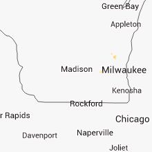


Connect with Interactive Hail Maps