

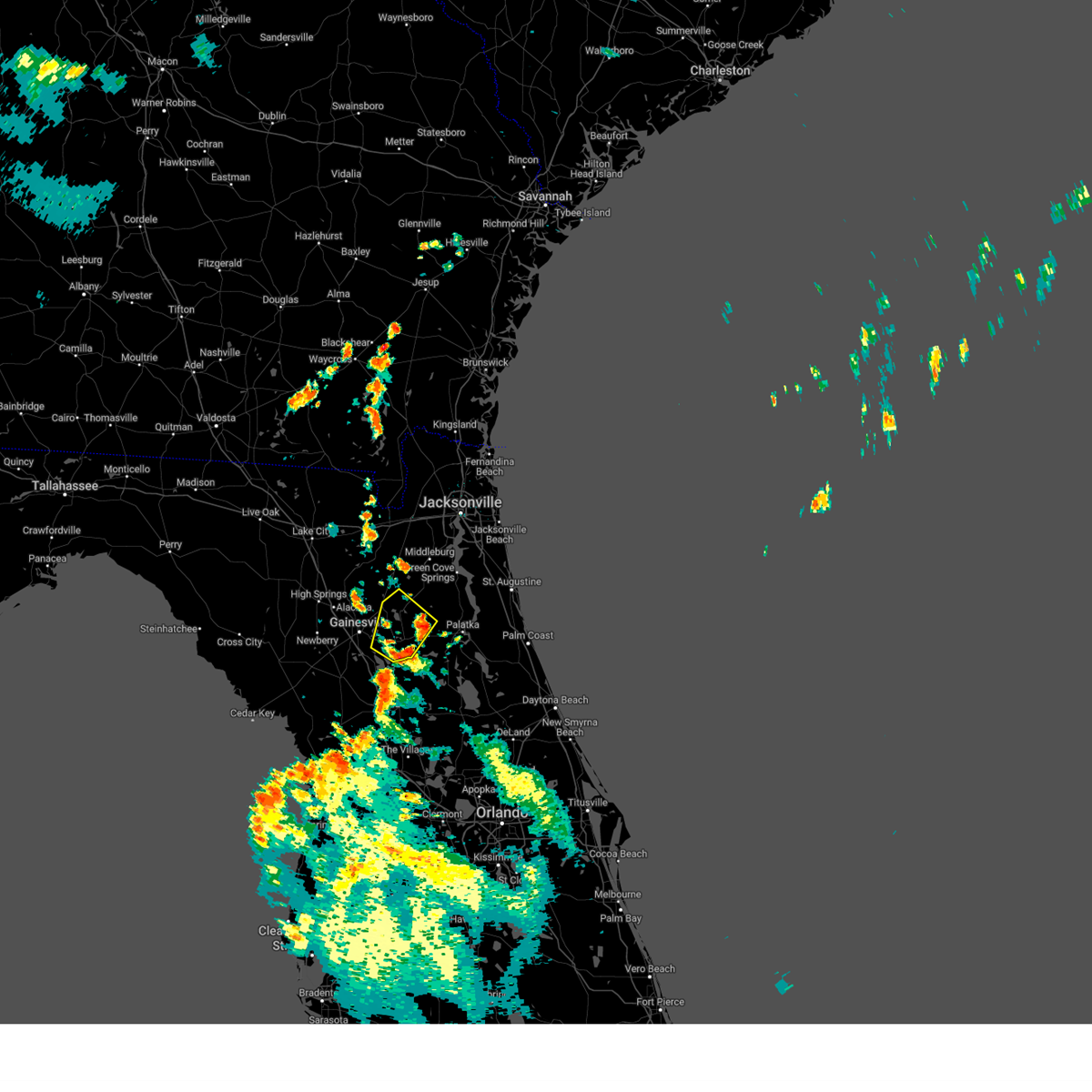
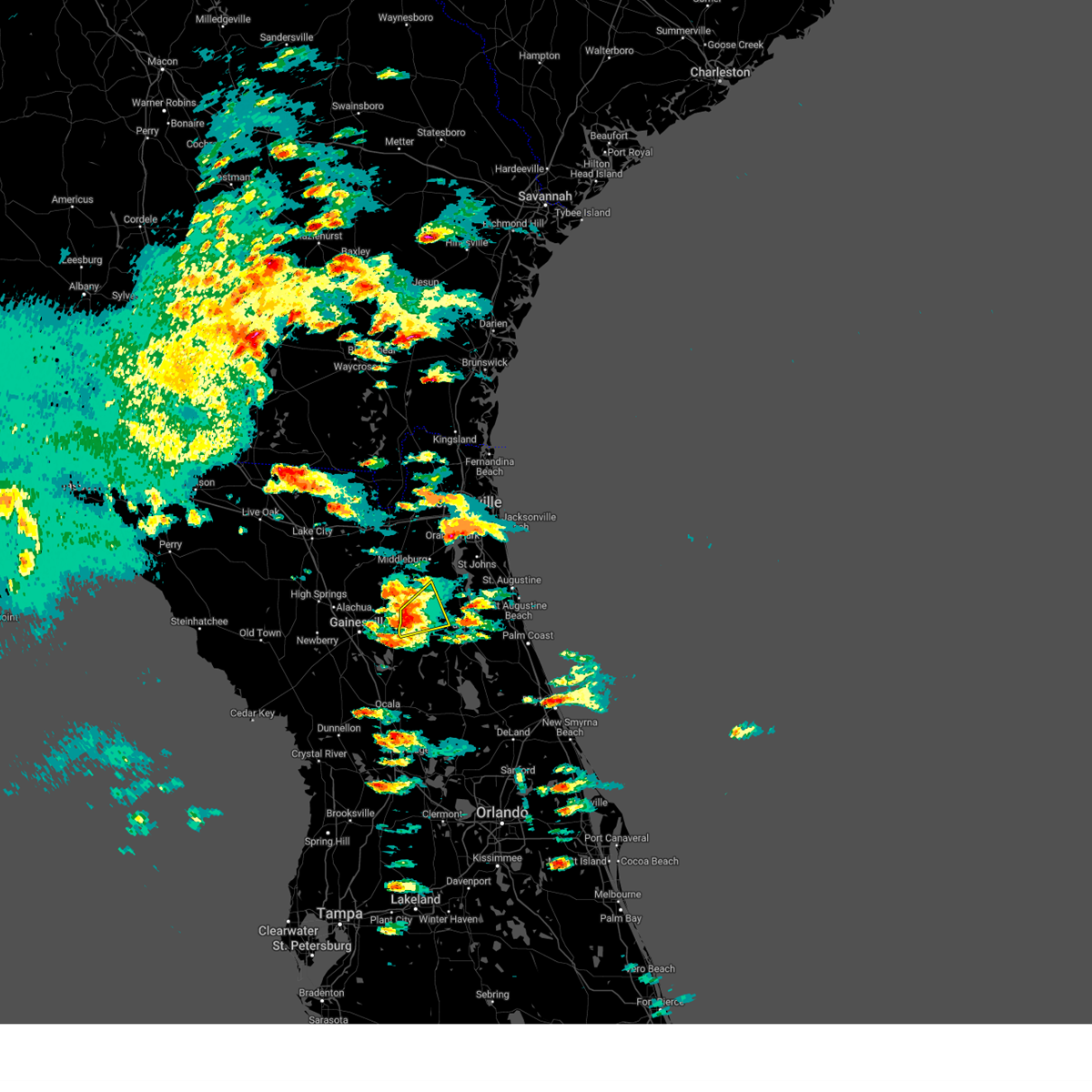
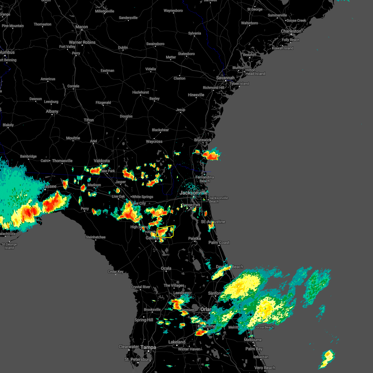
Hail Map for Keystone Heights, FL
The Keystone Heights, FL area has had 3 reports of on-the-ground hail by trained spotters, and has been under severe weather warnings 5 times during the past 12 months. Doppler radar has detected hail at or near Keystone Heights, FL on 36 occasions, including 2 occasions during the past year.
| Name: | Keystone Heights, FL |
| Where Located: | 44.1 miles SSW of Jacksonville, FL |
| Map: | Google Map for Keystone Heights, FL |
| Population: | 1350 |
| Housing Units: | 603 |
| More Info: | Search Google for Keystone Heights, FL |
0
The Top Recent Hail Date for Keystone Heights, FL is Friday, April 11, 2025 (11th out of 36)

Hail and Wind Damage Spotted near Keystone Heights, FL
| Date / Time | Report Details |
|---|---|
| 5/10/2025 6:19 PM EDT |
 Svrjax the national weather service in jacksonville has issued a * severe thunderstorm warning for, bradford county in northern florida, northeastern alachua county in northern florida, southern baker county in northeastern florida, northwestern putnam county in northeastern florida, union county in northern florida, western clay county in northeastern florida, east central columbia county in northern florida, * until 645 pm edt. * at 619 pm edt, severe thunderstorms were located along a line extending from lake geneva to groves, moving north at 20 mph (radar indicated). Hazards include 60 mph wind gusts and penny size hail. expect damage to roofs, siding, and trees Svrjax the national weather service in jacksonville has issued a * severe thunderstorm warning for, bradford county in northern florida, northeastern alachua county in northern florida, southern baker county in northeastern florida, northwestern putnam county in northeastern florida, union county in northern florida, western clay county in northeastern florida, east central columbia county in northern florida, * until 645 pm edt. * at 619 pm edt, severe thunderstorms were located along a line extending from lake geneva to groves, moving north at 20 mph (radar indicated). Hazards include 60 mph wind gusts and penny size hail. expect damage to roofs, siding, and trees
|
| 8/23/2024 4:15 PM EDT | Putnam county emergency management relayed photos of several snapped and downed trees near the clay/putnam county border to the north of florahome. time of damage based in putnam county FL, 10 miles W of Keystone Heights, FL |
| 7/23/2024 8:40 PM EDT |
 The storm which prompted the warning has weakened below severe limits, and no longer poses an immediate threat to life or property. therefore, the warning will be allowed to expire. however, gusty winds are still possible with this thunderstorm. to report severe weather, contact your nearest law enforcement agency. they will relay your report to the national weather service jacksonville. The storm which prompted the warning has weakened below severe limits, and no longer poses an immediate threat to life or property. therefore, the warning will be allowed to expire. however, gusty winds are still possible with this thunderstorm. to report severe weather, contact your nearest law enforcement agency. they will relay your report to the national weather service jacksonville.
|
| 7/23/2024 8:32 PM EDT |
 At 832 pm edt, a severe thunderstorm was located over lake geneva, or near melrose, moving northwest at 20 mph. other storms were located near orange heights moving northwest at 15 mph (radar indicated). Hazards include 60 mph wind gusts. Expect damage to roofs, siding, and trees. Locations impacted include, keystone heights, melrose, melrose landing, orange heights, lake geneva, florahome, putnam hall, and grove park. At 832 pm edt, a severe thunderstorm was located over lake geneva, or near melrose, moving northwest at 20 mph. other storms were located near orange heights moving northwest at 15 mph (radar indicated). Hazards include 60 mph wind gusts. Expect damage to roofs, siding, and trees. Locations impacted include, keystone heights, melrose, melrose landing, orange heights, lake geneva, florahome, putnam hall, and grove park.
|
| 7/23/2024 8:20 PM EDT |
 At 820 pm edt, a severe thunderstorm was located just east of melrose, or near putnam hall, moving northwest at 20 mph (radar indicated). Hazards include 60 mph wind gusts. Expect damage to roofs, siding, and trees. Locations impacted include, keystone heights, melrose, hawthorne, melrose landing, orange heights, lake geneva, florahome, johnson, putnam hall, and lochloosa. At 820 pm edt, a severe thunderstorm was located just east of melrose, or near putnam hall, moving northwest at 20 mph (radar indicated). Hazards include 60 mph wind gusts. Expect damage to roofs, siding, and trees. Locations impacted include, keystone heights, melrose, hawthorne, melrose landing, orange heights, lake geneva, florahome, johnson, putnam hall, and lochloosa.
|
| 7/23/2024 8:06 PM EDT |
 Svrjax the national weather service in jacksonville has issued a * severe thunderstorm warning for, southeastern bradford county in northern florida, southeastern alachua county in northern florida, northwestern putnam county in northeastern florida, southwestern clay county in northeastern florida, * until 845 pm edt. * at 806 pm edt, a severe thunderstorm was located over melrose landing, or near interlachen, moving northwest at 20 mph. another storm was over southwest putnam county moving west at 20 mph (radar indicated). Hazards include 60 mph wind gusts and penny size hail. expect damage to roofs, siding, and trees Svrjax the national weather service in jacksonville has issued a * severe thunderstorm warning for, southeastern bradford county in northern florida, southeastern alachua county in northern florida, northwestern putnam county in northeastern florida, southwestern clay county in northeastern florida, * until 845 pm edt. * at 806 pm edt, a severe thunderstorm was located over melrose landing, or near interlachen, moving northwest at 20 mph. another storm was over southwest putnam county moving west at 20 mph (radar indicated). Hazards include 60 mph wind gusts and penny size hail. expect damage to roofs, siding, and trees
|
| 5/10/2024 9:20 AM EDT |
 At 920 am edt, severe thunderstorms were located along a line extending from 10 miles east of woodbine to baymeadows to near bardin to 8 miles southwest of cross creek, moving east at 90 mph (radar indicated). Hazards include 60 mph wind gusts and penny size hail. Expect damage to roofs, siding, and trees. locations impacted include, jacksonville, st. Marys, kingsland, fernandina beach, palatka, orange park, green cove springs, rainbow lakes estates, woodbine, and interlachen. At 920 am edt, severe thunderstorms were located along a line extending from 10 miles east of woodbine to baymeadows to near bardin to 8 miles southwest of cross creek, moving east at 90 mph (radar indicated). Hazards include 60 mph wind gusts and penny size hail. Expect damage to roofs, siding, and trees. locations impacted include, jacksonville, st. Marys, kingsland, fernandina beach, palatka, orange park, green cove springs, rainbow lakes estates, woodbine, and interlachen.
|
| 5/10/2024 9:00 AM EDT |
 Svrjax the national weather service in jacksonville has issued a * severe thunderstorm warning for, nassau county in northeastern florida, southeastern bradford county in northern florida, southeastern alachua county in northern florida, northwestern st. johns county in northeastern florida, northwestern marion county in northern florida, northwestern putnam county in northeastern florida, clay county in northeastern florida, duval county in northeastern florida, camden county in southeastern georgia, * until 930 am edt. * at 900 am edt, severe thunderstorms were located along a line extending from near hickox to near bryceville to near keystone heights to near archer, moving east at 70 mph (radar indicated). Hazards include 70 mph wind gusts and quarter size hail. Hail damage to vehicles is expected. expect considerable tree damage. Wind damage is also likely to mobile homes, roofs, and outbuildings. Svrjax the national weather service in jacksonville has issued a * severe thunderstorm warning for, nassau county in northeastern florida, southeastern bradford county in northern florida, southeastern alachua county in northern florida, northwestern st. johns county in northeastern florida, northwestern marion county in northern florida, northwestern putnam county in northeastern florida, clay county in northeastern florida, duval county in northeastern florida, camden county in southeastern georgia, * until 930 am edt. * at 900 am edt, severe thunderstorms were located along a line extending from near hickox to near bryceville to near keystone heights to near archer, moving east at 70 mph (radar indicated). Hazards include 70 mph wind gusts and quarter size hail. Hail damage to vehicles is expected. expect considerable tree damage. Wind damage is also likely to mobile homes, roofs, and outbuildings.
|
| 5/10/2024 8:44 AM EDT |
 Svrjax the national weather service in jacksonville has issued a * severe thunderstorm warning for, nassau county in northeastern florida, bradford county in northern florida, alachua county in northern florida, north central marion county in northern florida, baker county in northeastern florida, northwestern putnam county in northeastern florida, union county in northern florida, western clay county in northeastern florida, western duval county in northeastern florida, southwestern camden county in southeastern georgia, southeastern ware county in southeastern georgia, charlton county in southeastern georgia, * until 915 am edt. * at 843 am edt, severe thunderstorms were located along a line extending from 9 miles south of argyle to near lulu to 7 miles southeast of cross city, moving east at 70 mph. these are destructive storms for lake butler, starke, gainesville, macclenny, baldwin, and hilliard. (radar indicated). Hazards include 80 mph wind gusts and quarter size hail. Flying debris will be dangerous to those caught without shelter. mobile homes will be heavily damaged. expect considerable damage to roofs, windows, and vehicles. Extensive tree damage and power outages are likely. Svrjax the national weather service in jacksonville has issued a * severe thunderstorm warning for, nassau county in northeastern florida, bradford county in northern florida, alachua county in northern florida, north central marion county in northern florida, baker county in northeastern florida, northwestern putnam county in northeastern florida, union county in northern florida, western clay county in northeastern florida, western duval county in northeastern florida, southwestern camden county in southeastern georgia, southeastern ware county in southeastern georgia, charlton county in southeastern georgia, * until 915 am edt. * at 843 am edt, severe thunderstorms were located along a line extending from 9 miles south of argyle to near lulu to 7 miles southeast of cross city, moving east at 70 mph. these are destructive storms for lake butler, starke, gainesville, macclenny, baldwin, and hilliard. (radar indicated). Hazards include 80 mph wind gusts and quarter size hail. Flying debris will be dangerous to those caught without shelter. mobile homes will be heavily damaged. expect considerable damage to roofs, windows, and vehicles. Extensive tree damage and power outages are likely.
|
| 4/3/2024 11:44 AM EDT |
 The storms which prompted the warning have weakened below severe limits, and no longer pose an immediate threat to life or property. therefore, the warning will be allowed to expire. however, gusty winds and heavy rain are still possible with these thunderstorms. a tornado watch remains in effect until 500 pm edt for northern and northeastern florida. The storms which prompted the warning have weakened below severe limits, and no longer pose an immediate threat to life or property. therefore, the warning will be allowed to expire. however, gusty winds and heavy rain are still possible with these thunderstorms. a tornado watch remains in effect until 500 pm edt for northern and northeastern florida.
|
| 4/3/2024 11:21 AM EDT |
 the severe thunderstorm warning has been cancelled and is no longer in effect the severe thunderstorm warning has been cancelled and is no longer in effect
|
| 4/3/2024 11:21 AM EDT |
 At 1120 am edt, severe thunderstorms were located along a line extending from near normandy to near starke, moving east at 40 mph (radar indicated). Hazards include 60 mph wind gusts. Expect damage to roofs, siding, and trees. Locations impacted include, orange park, green cove springs, starke, keystone heights, unf, mandarin, fruit cove, middleburg, ponte vedra beach, and jacksonville beach. At 1120 am edt, severe thunderstorms were located along a line extending from near normandy to near starke, moving east at 40 mph (radar indicated). Hazards include 60 mph wind gusts. Expect damage to roofs, siding, and trees. Locations impacted include, orange park, green cove springs, starke, keystone heights, unf, mandarin, fruit cove, middleburg, ponte vedra beach, and jacksonville beach.
|
| 4/3/2024 11:04 AM EDT |
 Svrjax the national weather service in jacksonville has issued a * severe thunderstorm warning for, bradford county in northern florida, northeastern alachua county in northern florida, northwestern st. johns county in northeastern florida, southeastern baker county in northeastern florida, north central putnam county in northeastern florida, northeastern union county in northern florida, clay county in northeastern florida, southern duval county in northeastern florida, * until 1145 am edt. * at 1103 am edt, severe thunderstorms were located along a line extending from near maxville to sampson, moving east at 40 mph (radar indicated). Hazards include 60 mph wind gusts. expect damage to roofs, siding, and trees Svrjax the national weather service in jacksonville has issued a * severe thunderstorm warning for, bradford county in northern florida, northeastern alachua county in northern florida, northwestern st. johns county in northeastern florida, southeastern baker county in northeastern florida, north central putnam county in northeastern florida, northeastern union county in northern florida, clay county in northeastern florida, southern duval county in northeastern florida, * until 1145 am edt. * at 1103 am edt, severe thunderstorms were located along a line extending from near maxville to sampson, moving east at 40 mph (radar indicated). Hazards include 60 mph wind gusts. expect damage to roofs, siding, and trees
|
| 2/4/2024 3:09 PM EST |
 At 309 pm est, a severe thunderstorm was located near gainesville airport, or near gainesville, moving northeast at 25 mph (radar indicated). Hazards include 60 mph wind gusts and quarter size hail. Hail damage to vehicles is expected. Expect wind damage to roofs, siding, and trees. At 309 pm est, a severe thunderstorm was located near gainesville airport, or near gainesville, moving northeast at 25 mph (radar indicated). Hazards include 60 mph wind gusts and quarter size hail. Hail damage to vehicles is expected. Expect wind damage to roofs, siding, and trees.
|
| 1/9/2024 3:37 PM EST |
 At 337 pm est, severe thunderstorms were located along a line extending from 7 miles west of yulee to 6 miles northeast of keystone heights, moving east at 35 mph (radar indicated). Hazards include 60 mph wind gusts. Expect damage to roofs, siding, and trees. locations impacted include, jacksonville, st. Marys, fernandina beach, orange park, green cove springs, jacksonville international arpt, mandarin, fruit cove, arlington, and middleburg. At 337 pm est, severe thunderstorms were located along a line extending from 7 miles west of yulee to 6 miles northeast of keystone heights, moving east at 35 mph (radar indicated). Hazards include 60 mph wind gusts. Expect damage to roofs, siding, and trees. locations impacted include, jacksonville, st. Marys, fernandina beach, orange park, green cove springs, jacksonville international arpt, mandarin, fruit cove, arlington, and middleburg.
|
| 1/9/2024 3:30 PM EST | Trees reported down along sr 26... starting from the intersection of sr21/sr26 towards putnam hall. time estimated based off rada in putnam county FL, 5 miles N of Keystone Heights, FL |
| 1/9/2024 3:12 PM EST |
 At 311 pm est, severe thunderstorms were located along a line extending from near hilliard to near sampson, moving east at 35 mph (radar indicated). Hazards include 60 mph wind gusts. Expect damage to roofs, siding, and trees. locations impacted include, jacksonville, st. Marys, fernandina beach, orange park, green cove springs, starke, hilliard, keystone heights, callahan, and jacksonville international arpt. At 311 pm est, severe thunderstorms were located along a line extending from near hilliard to near sampson, moving east at 35 mph (radar indicated). Hazards include 60 mph wind gusts. Expect damage to roofs, siding, and trees. locations impacted include, jacksonville, st. Marys, fernandina beach, orange park, green cove springs, starke, hilliard, keystone heights, callahan, and jacksonville international arpt.
|
| 1/9/2024 3:12 PM EST |
 A severe thunderstorm warning remains in effect until 345 pm est for nassau. eastern bradford. northeastern alachua. west central st. johns. north central putnam. clay. duval and southeastern camden counties. At 311 pm est, severe thunderstorms were located along a line extending from near hilliard to near sampson, moving east at 35 mph. A severe thunderstorm warning remains in effect until 345 pm est for nassau. eastern bradford. northeastern alachua. west central st. johns. north central putnam. clay. duval and southeastern camden counties. At 311 pm est, severe thunderstorms were located along a line extending from near hilliard to near sampson, moving east at 35 mph.
|
| 1/9/2024 2:44 PM EST |
 At 244 pm est, severe thunderstorms were located along a line extending from 11 miles northwest of st. george to near alachua, moving east at 35 mph (radar indicated). Hazards include 60 mph wind gusts. expect damage to roofs, siding, and trees At 244 pm est, severe thunderstorms were located along a line extending from 11 miles northwest of st. george to near alachua, moving east at 35 mph (radar indicated). Hazards include 60 mph wind gusts. expect damage to roofs, siding, and trees
|
| 1/9/2024 2:15 PM EST |
 The national weather service in jacksonville has issued a * severe thunderstorm warning for. southeastern bradford county in northern florida. eastern alachua county in northern florida. northwestern putnam county in northeastern florida. Clay county in northeastern florida. The national weather service in jacksonville has issued a * severe thunderstorm warning for. southeastern bradford county in northern florida. eastern alachua county in northern florida. northwestern putnam county in northeastern florida. Clay county in northeastern florida.
|
| 7/30/2023 9:21 PM EDT |
 The severe thunderstorm warning for bradford, alachua, northeastern marion, western putnam, union and southwestern clay counties will expire at 930 pm edt, the storms which prompted the warning have weakened below severe limits, and no longer pose an immediate threat to life or property. therefore, the warning will be allowed to expire. however gusty winds and heavy rain are still possible with these thunderstorms. The severe thunderstorm warning for bradford, alachua, northeastern marion, western putnam, union and southwestern clay counties will expire at 930 pm edt, the storms which prompted the warning have weakened below severe limits, and no longer pose an immediate threat to life or property. therefore, the warning will be allowed to expire. however gusty winds and heavy rain are still possible with these thunderstorms.
|
| 7/30/2023 8:55 PM EDT |
 At 855 pm edt, severe thunderstorms were located along a line extending from near worthington spring to near lake delancy, moving southwest at 20 mph (radar indicated). Hazards include 60 mph wind gusts. expect damage to roofs, siding, and trees At 855 pm edt, severe thunderstorms were located along a line extending from near worthington spring to near lake delancy, moving southwest at 20 mph (radar indicated). Hazards include 60 mph wind gusts. expect damage to roofs, siding, and trees
|
| 7/30/2023 8:28 PM EDT |
 At 828 pm edt, severe thunderstorms were located along a line extending from near raiford to near florahome, moving southwest at 10 mph (radar indicated). Hazards include 60 mph wind gusts. expect damage to roofs, siding, and trees At 828 pm edt, severe thunderstorms were located along a line extending from near raiford to near florahome, moving southwest at 10 mph (radar indicated). Hazards include 60 mph wind gusts. expect damage to roofs, siding, and trees
|
| 7/30/2023 8:02 PM EDT |
 At 801 pm edt, a severe thunderstorm was located over starke, moving southwest at 15 mph (radar indicated). Hazards include 60 mph wind gusts and penny size hail. expect damage to roofs, siding, and trees At 801 pm edt, a severe thunderstorm was located over starke, moving southwest at 15 mph (radar indicated). Hazards include 60 mph wind gusts and penny size hail. expect damage to roofs, siding, and trees
|
| 7/30/2023 7:14 PM EDT |
 At 714 pm edt, severe thunderstorms were located along a line extending from saint augustine to near lake geneva, moving southeast at 25 mph (radar indicated). Hazards include 60 mph wind gusts and penny size hail. expect damage to roofs, siding, and trees At 714 pm edt, severe thunderstorms were located along a line extending from saint augustine to near lake geneva, moving southeast at 25 mph (radar indicated). Hazards include 60 mph wind gusts and penny size hail. expect damage to roofs, siding, and trees
|
| 7/30/2023 6:51 PM EDT |
 At 650 pm edt, severe thunderstorms were located along a line extending from 7 miles south of maxville to bostwick, moving southeast at 5 mph (radar indicated). Hazards include 60 mph wind gusts and nickel size hail. expect damage to roofs, siding, and trees At 650 pm edt, severe thunderstorms were located along a line extending from 7 miles south of maxville to bostwick, moving southeast at 5 mph (radar indicated). Hazards include 60 mph wind gusts and nickel size hail. expect damage to roofs, siding, and trees
|
| 4/27/2023 9:29 PM EDT |
 At 928 pm edt, severe thunderstorms were located along a line extending from near lake geneva to near anthony, moving east to northeast at 40 mph (radar indicated). Hazards include 60 mph wind gusts. Expect damage to roofs, siding, and trees. locations impacted include, interlachen, keystone heights, melrose, fort mccoy, citra, hawthorne, sparr, florahome, melrose landing and orange heights. hail threat, radar indicated max hail size, <. 75 in wind threat, radar indicated max wind gust, 60 mph. At 928 pm edt, severe thunderstorms were located along a line extending from near lake geneva to near anthony, moving east to northeast at 40 mph (radar indicated). Hazards include 60 mph wind gusts. Expect damage to roofs, siding, and trees. locations impacted include, interlachen, keystone heights, melrose, fort mccoy, citra, hawthorne, sparr, florahome, melrose landing and orange heights. hail threat, radar indicated max hail size, <. 75 in wind threat, radar indicated max wind gust, 60 mph.
|
| 4/27/2023 9:13 PM EDT |
 At 913 pm edt, severe thunderstorms were located along a line extending from near orange heights to near ocala, moving east at 45 mph (radar indicated). Hazards include 60 mph wind gusts. Expect damage to roofs, siding, and trees. locations impacted include, gainesville, interlachen, keystone heights, melrose, fort mccoy, citra, hawthorne, sparr, florahome and melrose landing. hail threat, radar indicated max hail size, <. 75 in wind threat, radar indicated max wind gust, 60 mph. At 913 pm edt, severe thunderstorms were located along a line extending from near orange heights to near ocala, moving east at 45 mph (radar indicated). Hazards include 60 mph wind gusts. Expect damage to roofs, siding, and trees. locations impacted include, gainesville, interlachen, keystone heights, melrose, fort mccoy, citra, hawthorne, sparr, florahome and melrose landing. hail threat, radar indicated max hail size, <. 75 in wind threat, radar indicated max wind gust, 60 mph.
|
| 4/27/2023 8:57 PM EDT |
 At 857 pm edt, severe thunderstorms were located along a line extending from gainesville to 8 miles southeast of williston, moving northeast at 40 mph (radar indicated). Hazards include 60 mph wind gusts. expect damage to roofs, siding, and trees At 857 pm edt, severe thunderstorms were located along a line extending from gainesville to 8 miles southeast of williston, moving northeast at 40 mph (radar indicated). Hazards include 60 mph wind gusts. expect damage to roofs, siding, and trees
|
| 4/27/2023 3:57 PM EDT |
 At 357 pm edt, a severe thunderstorm was located over melrose, moving northeast at 15 mph (radar indicated). Hazards include 60 mph wind gusts and nickel size hail. expect damage to roofs, siding, and trees At 357 pm edt, a severe thunderstorm was located over melrose, moving northeast at 15 mph (radar indicated). Hazards include 60 mph wind gusts and nickel size hail. expect damage to roofs, siding, and trees
|
| 3/13/2023 2:31 AM EDT |
 At 231 am edt, a severe thunderstorm was located near gainesville, moving east at 40 mph (radar indicated). Hazards include 60 mph wind gusts. Expect damage to roofs, siding, and trees. locations impacted include, gainesville, melrose, hawthorne, university of florida, orange heights, gainesville airport, newnans lake, rochelle, waldo and grove park. hail threat, radar indicated max hail size, <. 75 in wind threat, radar indicated max wind gust, 60 mph. At 231 am edt, a severe thunderstorm was located near gainesville, moving east at 40 mph (radar indicated). Hazards include 60 mph wind gusts. Expect damage to roofs, siding, and trees. locations impacted include, gainesville, melrose, hawthorne, university of florida, orange heights, gainesville airport, newnans lake, rochelle, waldo and grove park. hail threat, radar indicated max hail size, <. 75 in wind threat, radar indicated max wind gust, 60 mph.
|
| 3/13/2023 2:23 AM EDT |
 At 222 am edt, a severe thunderstorm was located over alachua, or 8 miles northwest of gainesville, moving east at 45 mph (radar indicated). Hazards include 60 mph wind gusts. expect damage to roofs, siding, and trees At 222 am edt, a severe thunderstorm was located over alachua, or 8 miles northwest of gainesville, moving east at 45 mph (radar indicated). Hazards include 60 mph wind gusts. expect damage to roofs, siding, and trees
|
| 1/4/2023 3:57 PM EST |
 At 357 pm est, severe thunderstorms were located along a line extending from near starke to near hawthorne to 9 miles southwest of cross creek, moving east at 55 mph (radar indicated). Hazards include 70 mph wind gusts. Expect considerable tree damage. Damage is likely to mobile homes, roofs, and outbuildings. At 357 pm est, severe thunderstorms were located along a line extending from near starke to near hawthorne to 9 miles southwest of cross creek, moving east at 55 mph (radar indicated). Hazards include 70 mph wind gusts. Expect considerable tree damage. Damage is likely to mobile homes, roofs, and outbuildings.
|
| 9/9/2022 8:45 PM EDT |
 At 845 pm edt, a severe thunderstorm was located near sampson, or 8 miles southwest of starke, moving northeast at 25 mph (radar indicated). Hazards include 60 mph wind gusts. expect damage to roofs, siding, and trees At 845 pm edt, a severe thunderstorm was located near sampson, or 8 miles southwest of starke, moving northeast at 25 mph (radar indicated). Hazards include 60 mph wind gusts. expect damage to roofs, siding, and trees
|
| 8/18/2022 2:33 PM EDT |
 At 233 pm edt, severe thunderstorms were located along a line extending from near orange heights to interlachen, moving northeast at 30 mph (radar indicated). Hazards include 60 mph wind gusts. Expect damage to roofs, siding, and trees. locations impacted include, interlachen, keystone heights, melrose, george`s lake, lake geneva, florahome, melrose landing, orange heights, bardin and hollister. hail threat, radar indicated max hail size, <. 75 in wind threat, radar indicated max wind gust, 60 mph. At 233 pm edt, severe thunderstorms were located along a line extending from near orange heights to interlachen, moving northeast at 30 mph (radar indicated). Hazards include 60 mph wind gusts. Expect damage to roofs, siding, and trees. locations impacted include, interlachen, keystone heights, melrose, george`s lake, lake geneva, florahome, melrose landing, orange heights, bardin and hollister. hail threat, radar indicated max hail size, <. 75 in wind threat, radar indicated max wind gust, 60 mph.
|
| 8/18/2022 2:13 PM EDT |
 At 213 pm edt, severe thunderstorms were located along a line extending from newnans lake to near orange springs, moving northeast at 30 mph (radar indicated). Hazards include 60 mph wind gusts. expect damage to roofs, siding, and trees At 213 pm edt, severe thunderstorms were located along a line extending from newnans lake to near orange springs, moving northeast at 30 mph (radar indicated). Hazards include 60 mph wind gusts. expect damage to roofs, siding, and trees
|
| 5/15/2022 5:14 PM EDT |
 At 514 pm edt, a severe thunderstorm was located near hawthorne, or near melrose, moving northeast at 10 mph (radar indicated). Hazards include 60 mph wind gusts and quarter size hail. Hail damage to vehicles is expected. Expect wind damage to roofs, siding, and trees. At 514 pm edt, a severe thunderstorm was located near hawthorne, or near melrose, moving northeast at 10 mph (radar indicated). Hazards include 60 mph wind gusts and quarter size hail. Hail damage to vehicles is expected. Expect wind damage to roofs, siding, and trees.
|
| 5/6/2022 10:23 PM EDT |
 At 1022 pm edt, severe thunderstorms were located along a line extending from fleming island to 7 miles southwest of green cove springs to near george`s lake, moving east at 25 mph (radar indicated). Hazards include 60 mph wind gusts and penny size hail. Expect damage to roofs, siding, and trees. Locations impacted include, palatka, green cove springs, east palatka, fruit cove, world golf village, fleming island, george`s lake, nocatee, durbin and picolata. At 1022 pm edt, severe thunderstorms were located along a line extending from fleming island to 7 miles southwest of green cove springs to near george`s lake, moving east at 25 mph (radar indicated). Hazards include 60 mph wind gusts and penny size hail. Expect damage to roofs, siding, and trees. Locations impacted include, palatka, green cove springs, east palatka, fruit cove, world golf village, fleming island, george`s lake, nocatee, durbin and picolata.
|
| 5/6/2022 10:08 PM EDT |
 At 1008 pm edt, severe thunderstorms were located along a line extending from near doctors inlet to 7 miles north of george`s lake to near keystone heights, moving east at 25 mph (radar indicated). Hazards include 60 mph wind gusts and penny size hail. expect damage to roofs, siding, and trees At 1008 pm edt, severe thunderstorms were located along a line extending from near doctors inlet to 7 miles north of george`s lake to near keystone heights, moving east at 25 mph (radar indicated). Hazards include 60 mph wind gusts and penny size hail. expect damage to roofs, siding, and trees
|
| 4/2/2022 12:50 PM EDT |
 At 1249 pm edt, severe thunderstorms were located along a line extending from 6 miles northwest of orange heights to near melrose to near hawthorne, moving east at 50 mph (radar indicated). Hazards include 60 mph wind gusts and quarter size hail. Hail damage to vehicles is expected. expect wind damage to roofs, siding, and trees. locations impacted include, interlachen, melrose, hawthorne, melrose landing, orange heights, lake geneva, newnans lake, rochelle, johnson and putnam hall. hail threat, radar indicated max hail size, 1. 00 in wind threat, radar indicated max wind gust, 60 mph. At 1249 pm edt, severe thunderstorms were located along a line extending from 6 miles northwest of orange heights to near melrose to near hawthorne, moving east at 50 mph (radar indicated). Hazards include 60 mph wind gusts and quarter size hail. Hail damage to vehicles is expected. expect wind damage to roofs, siding, and trees. locations impacted include, interlachen, melrose, hawthorne, melrose landing, orange heights, lake geneva, newnans lake, rochelle, johnson and putnam hall. hail threat, radar indicated max hail size, 1. 00 in wind threat, radar indicated max wind gust, 60 mph.
|
| 4/2/2022 12:42 PM EDT |
 At 1242 pm edt, severe thunderstorms were located along a line extending from near gainesville airport to orange heights to near hawthorne, moving east at 50 mph (radar indicated). Hazards include 60 mph wind gusts and quarter size hail. Hail damage to vehicles is expected. expect wind damage to roofs, siding, and trees. locations impacted include, gainesville, interlachen, melrose, hawthorne, university of florida, lake geneva, rochelle, melrose landing, orange heights and gainesville airport. hail threat, radar indicated max hail size, 1. 00 in wind threat, radar indicated max wind gust, 60 mph. At 1242 pm edt, severe thunderstorms were located along a line extending from near gainesville airport to orange heights to near hawthorne, moving east at 50 mph (radar indicated). Hazards include 60 mph wind gusts and quarter size hail. Hail damage to vehicles is expected. expect wind damage to roofs, siding, and trees. locations impacted include, gainesville, interlachen, melrose, hawthorne, university of florida, lake geneva, rochelle, melrose landing, orange heights and gainesville airport. hail threat, radar indicated max hail size, 1. 00 in wind threat, radar indicated max wind gust, 60 mph.
|
| 4/2/2022 12:26 PM EDT |
 At 1225 pm edt, severe thunderstorms were located along a line extending from near alachua to gainesville to near university of florida, moving east at 50 mph (radar indicated). Hazards include 60 mph wind gusts and quarter size hail. Hail damage to vehicles is expected. Expect wind damage to roofs, siding, and trees. At 1225 pm edt, severe thunderstorms were located along a line extending from near alachua to gainesville to near university of florida, moving east at 50 mph (radar indicated). Hazards include 60 mph wind gusts and quarter size hail. Hail damage to vehicles is expected. Expect wind damage to roofs, siding, and trees.
|
| 12/8/2021 5:29 PM EST |
 At 528 pm est, a severe thunderstorm was located near starke, moving east at 35 mph (radar indicated). Hazards include 60 mph wind gusts. Expect damage to roofs, siding, and trees. Locations impacted include, starke, keystone heights, kingsley, lake geneva, camp blanding, waldo and hampton. At 528 pm est, a severe thunderstorm was located near starke, moving east at 35 mph (radar indicated). Hazards include 60 mph wind gusts. Expect damage to roofs, siding, and trees. Locations impacted include, starke, keystone heights, kingsley, lake geneva, camp blanding, waldo and hampton.
|
| 12/8/2021 5:18 PM EST |
 At 518 pm est, a severe thunderstorm was located over sampson, or near starke, moving east at 35 mph (radar indicated). Hazards include 60 mph wind gusts. expect damage to roofs, siding, and trees At 518 pm est, a severe thunderstorm was located over sampson, or near starke, moving east at 35 mph (radar indicated). Hazards include 60 mph wind gusts. expect damage to roofs, siding, and trees
|
| 6/15/2021 5:35 PM EDT |
 At 535 pm edt, a severe thunderstorm was located near melrose, moving southeast at 20 mph (radar indicated). Hazards include 70 mph wind gusts and quarter size hail. Hail damage to vehicles is expected. expect considerable tree damage. Wind damage is also likely to mobile homes, roofs, and outbuildings. At 535 pm edt, a severe thunderstorm was located near melrose, moving southeast at 20 mph (radar indicated). Hazards include 70 mph wind gusts and quarter size hail. Hail damage to vehicles is expected. expect considerable tree damage. Wind damage is also likely to mobile homes, roofs, and outbuildings.
|
| 6/15/2021 4:45 PM EDT |
 At 445 pm edt, a severe thunderstorm was located over orange heights, or near melrose, moving east at 15 mph (radar indicated). Hazards include 60 mph wind gusts and quarter size hail. Hail damage to vehicles is expected. Expect wind damage to roofs, siding, and trees. At 445 pm edt, a severe thunderstorm was located over orange heights, or near melrose, moving east at 15 mph (radar indicated). Hazards include 60 mph wind gusts and quarter size hail. Hail damage to vehicles is expected. Expect wind damage to roofs, siding, and trees.
|
| 6/15/2021 4:15 PM EDT |
 At 414 pm edt, severe thunderstorms were located along a line extending from 6 miles southwest of maxville to near keystone heights, moving east at 15 mph (radar indicated). Hazards include 60 mph wind gusts and quarter size hail. Hail damage to vehicles is expected. Expect wind damage to roofs, siding, and trees. At 414 pm edt, severe thunderstorms were located along a line extending from 6 miles southwest of maxville to near keystone heights, moving east at 15 mph (radar indicated). Hazards include 60 mph wind gusts and quarter size hail. Hail damage to vehicles is expected. Expect wind damage to roofs, siding, and trees.
|
| 6/15/2021 3:59 PM EDT |
 At 358 pm edt, a severe thunderstorm was located 8 miles south of sampson, or 10 miles northeast of gainesville, moving east at 10 mph (radar indicated). Hazards include 60 mph wind gusts and quarter size hail. Hail damage to vehicles is expected. Expect wind damage to roofs, siding, and trees. At 358 pm edt, a severe thunderstorm was located 8 miles south of sampson, or 10 miles northeast of gainesville, moving east at 10 mph (radar indicated). Hazards include 60 mph wind gusts and quarter size hail. Hail damage to vehicles is expected. Expect wind damage to roofs, siding, and trees.
|
| 12/24/2020 6:30 PM EST | Multiple trees and power lines down in the melrose... fl area including a large tree blocking price rd near the solar plan in putnam county FL, 5 miles N of Keystone Heights, FL |
| 12/24/2020 6:28 PM EST |
 At 627 pm est, severe thunderstorms were located along a line extending from 10 miles west of woodbine to near orange heights, moving northeast at 55 mph (radar indicated). Hazards include 60 mph wind gusts. expect damage to roofs, siding, and trees At 627 pm est, severe thunderstorms were located along a line extending from 10 miles west of woodbine to near orange heights, moving northeast at 55 mph (radar indicated). Hazards include 60 mph wind gusts. expect damage to roofs, siding, and trees
|
| 11/30/2020 5:29 AM EST |
 At 529 am est, a severe thunderstorm was located over orange heights, or 7 miles northwest of melrose, moving northeast at 35 mph (radar indicated). Hazards include 60 mph wind gusts. expect damage to roofs, siding, and trees At 529 am est, a severe thunderstorm was located over orange heights, or 7 miles northwest of melrose, moving northeast at 35 mph (radar indicated). Hazards include 60 mph wind gusts. expect damage to roofs, siding, and trees
|
| 8/27/2020 3:41 PM EDT | Wind downburst associated with a thunderstorm resulted in the downing of small tree limbs... measuring less than 4 inches in diamete in clay county FL, 10.2 miles WSW of Keystone Heights, FL |
| 5/23/2020 5:24 PM EDT |
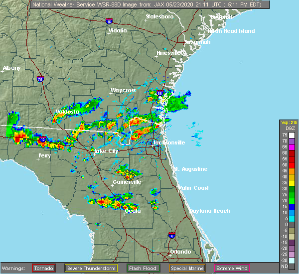 The severe thunderstorm warning for southeastern bradford and southwestern clay counties will expire at 530 pm edt, the storm which prompted the warning has weakened below severe limits, and no longer poses an immediate threat to life or property. therefore, the warning will be allowed to expire. however heavy rain is still possible with this thunderstorm. The severe thunderstorm warning for southeastern bradford and southwestern clay counties will expire at 530 pm edt, the storm which prompted the warning has weakened below severe limits, and no longer poses an immediate threat to life or property. therefore, the warning will be allowed to expire. however heavy rain is still possible with this thunderstorm.
|
| 5/23/2020 5:15 PM EDT |
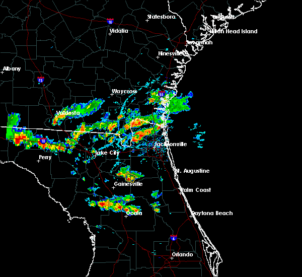 At 515 pm edt, a severe thunderstorm was located over keystone heights, moving west at 5 mph (radar indicated). Hazards include 60 mph wind gusts and nickel size hail. Expect damage to roofs, siding, and trees. Locations impacted include, keystone heights. At 515 pm edt, a severe thunderstorm was located over keystone heights, moving west at 5 mph (radar indicated). Hazards include 60 mph wind gusts and nickel size hail. Expect damage to roofs, siding, and trees. Locations impacted include, keystone heights.
|
| 5/23/2020 5:04 PM EDT |
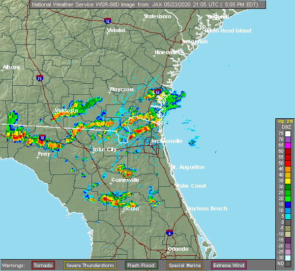 At 503 pm edt, a severe thunderstorm was located over keystone heights, moving west at 5 mph (radar indicated). Hazards include 60 mph wind gusts and nickel size hail. expect damage to roofs, siding, and trees At 503 pm edt, a severe thunderstorm was located over keystone heights, moving west at 5 mph (radar indicated). Hazards include 60 mph wind gusts and nickel size hail. expect damage to roofs, siding, and trees
|
| 4/15/2020 1:02 PM EDT |
 At 101 pm edt, a severe thunderstorm was located over melrose landing, or near melrose, moving east at 35 mph (radar indicated). Hazards include 60 mph wind gusts. Expect damage to roofs, siding, and trees. Locations impacted include, palm coast, saint augustine, palatka, interlachen, keystone heights, hastings, melrose, east palatka, world golf village and saint augustine beach. At 101 pm edt, a severe thunderstorm was located over melrose landing, or near melrose, moving east at 35 mph (radar indicated). Hazards include 60 mph wind gusts. Expect damage to roofs, siding, and trees. Locations impacted include, palm coast, saint augustine, palatka, interlachen, keystone heights, hastings, melrose, east palatka, world golf village and saint augustine beach.
|
| 4/15/2020 12:45 PM EDT |
 At 1244 pm edt, a severe thunderstorm was located near orange heights, or 7 miles southwest of melrose, moving east at 35 mph (radar indicated). Hazards include 60 mph wind gusts. expect damage to roofs, siding, and trees At 1244 pm edt, a severe thunderstorm was located near orange heights, or 7 miles southwest of melrose, moving east at 35 mph (radar indicated). Hazards include 60 mph wind gusts. expect damage to roofs, siding, and trees
|
| 4/13/2020 4:29 PM EDT |
 At 429 pm edt, a severe thunderstorm was located near kingsley, or near keystone heights, moving east at 35 mph (radar indicated). Hazards include 60 mph wind gusts and nickel size hail. Expect damage to roofs, siding, and trees. Locations impacted include, green cove springs, keystone heights and penney farms. At 429 pm edt, a severe thunderstorm was located near kingsley, or near keystone heights, moving east at 35 mph (radar indicated). Hazards include 60 mph wind gusts and nickel size hail. Expect damage to roofs, siding, and trees. Locations impacted include, green cove springs, keystone heights and penney farms.
|
| 4/13/2020 4:17 PM EDT |
 At 417 pm edt, a severe thunderstorm was located near starke, moving east at 35 mph (radar indicated). Hazards include 60 mph wind gusts and quarter size hail. Hail damage to vehicles is expected. Expect wind damage to roofs, siding, and trees. At 417 pm edt, a severe thunderstorm was located near starke, moving east at 35 mph (radar indicated). Hazards include 60 mph wind gusts and quarter size hail. Hail damage to vehicles is expected. Expect wind damage to roofs, siding, and trees.
|
| 2/6/2020 10:22 PM EST |
 At 1021 pm est, severe thunderstorms were located along a line extending from near yulee to near hawthorne, moving east at 45 mph (radar indicated. at 1012 pm, jacksonville international airport reported a gust to 58 mph). Hazards include 70 mph wind gusts. Expect considerable tree damage. damage is likely to mobile homes, roofs, and outbuildings. Locations impacted include, jacksonville, saint augustine, fernandina beach, palatka, orange park, green cove springs, starke, interlachen, keystone heights and callahan. At 1021 pm est, severe thunderstorms were located along a line extending from near yulee to near hawthorne, moving east at 45 mph (radar indicated. at 1012 pm, jacksonville international airport reported a gust to 58 mph). Hazards include 70 mph wind gusts. Expect considerable tree damage. damage is likely to mobile homes, roofs, and outbuildings. Locations impacted include, jacksonville, saint augustine, fernandina beach, palatka, orange park, green cove springs, starke, interlachen, keystone heights and callahan.
|
| 2/6/2020 10:16 PM EST | *** 2 inj *** clay county 911/dispatch reports approximately 5 homes damaged and one home sustaining major damage. two people have minor injurie in clay county FL, 3.6 miles SSW of Keystone Heights, FL |
| 2/6/2020 9:56 PM EST |
 At 955 pm est, severe thunderstorms were located along a line extending from near callahan to rochelle, moving east at 50 mph (radar indicated). Hazards include 70 mph wind gusts. Expect considerable tree damage. Damage is likely to mobile homes, roofs, and outbuildings. At 955 pm est, severe thunderstorms were located along a line extending from near callahan to rochelle, moving east at 50 mph (radar indicated). Hazards include 70 mph wind gusts. Expect considerable tree damage. Damage is likely to mobile homes, roofs, and outbuildings.
|
| 2/6/2020 9:44 PM EST |
 At 944 pm est, severe thunderstorms were located along a line extending from near st. george to 6 miles northeast of archer, moving east at 35 mph. some storms could potentially produce brief tornadoes (radar indicated). Hazards include 70 mph wind gusts. Expect considerable tree damage. damage is likely to mobile homes, roofs, and outbuildings. Locations impacted include, gainesville, starke, lake butler, keystone heights, callahan, raiford, melrose, worthington spring, taylor and alachua. At 944 pm est, severe thunderstorms were located along a line extending from near st. george to 6 miles northeast of archer, moving east at 35 mph. some storms could potentially produce brief tornadoes (radar indicated). Hazards include 70 mph wind gusts. Expect considerable tree damage. damage is likely to mobile homes, roofs, and outbuildings. Locations impacted include, gainesville, starke, lake butler, keystone heights, callahan, raiford, melrose, worthington spring, taylor and alachua.
|
| 2/6/2020 9:22 PM EST |
 At 920 pm est, severe thunderstorms were located along a line extending from 10 miles northwest of taylor to near high springs, moving east at 45 mph. some storms could potentially produce brief tornadoes (radar indicated). Hazards include 70 mph wind gusts. Expect considerable tree damage. Damage is likely to mobile homes, roofs, and outbuildings. At 920 pm est, severe thunderstorms were located along a line extending from 10 miles northwest of taylor to near high springs, moving east at 45 mph. some storms could potentially produce brief tornadoes (radar indicated). Hazards include 70 mph wind gusts. Expect considerable tree damage. Damage is likely to mobile homes, roofs, and outbuildings.
|
| 4/19/2019 12:45 PM EDT |
 At 1244 pm edt, severe thunderstorms were located along a line extending from near green cove springs to 10 miles northeast of inverness highlands north, moving east at 50 mph (radar indicated). Hazards include 60 mph wind gusts. expect damage to roofs, siding, and trees At 1244 pm edt, severe thunderstorms were located along a line extending from near green cove springs to 10 miles northeast of inverness highlands north, moving east at 50 mph (radar indicated). Hazards include 60 mph wind gusts. expect damage to roofs, siding, and trees
|
| 4/19/2019 12:30 PM EDT | Putnam county 911/dispatch reports numerous trees and powerlines downed throughout the northwestern part of the county in putnam county FL, 6.8 miles WNW of Keystone Heights, FL |
| 4/19/2019 11:54 AM EDT |
 At 1154 am edt, severe thunderstorms were located along a line extending from near keystone heights to near beverly hills, moving northeast at 50 mph (radar indicated). Hazards include 60 mph wind gusts. expect damage to roofs, siding, and trees At 1154 am edt, severe thunderstorms were located along a line extending from near keystone heights to near beverly hills, moving northeast at 50 mph (radar indicated). Hazards include 60 mph wind gusts. expect damage to roofs, siding, and trees
|
| 3/2/2019 3:05 PM EST |
 At 304 pm est, a severe thunderstorm was located over orange heights, or near melrose, moving east at 20 mph (radar indicated). Hazards include 60 mph wind gusts and quarter size hail. Hail damage to vehicles is expected. Expect wind damage to roofs, siding, and trees. At 304 pm est, a severe thunderstorm was located over orange heights, or near melrose, moving east at 20 mph (radar indicated). Hazards include 60 mph wind gusts and quarter size hail. Hail damage to vehicles is expected. Expect wind damage to roofs, siding, and trees.
|
| 10/10/2018 4:52 PM EDT |
 The tornado warning for southeastern bradford and southwestern clay counties will expire at 500 pm edt, the storm which prompted the warning has moved out of the area. therefore, the warning will be allowed to expire. however gusty winds are still possible with this thunderstorm. a tornado watch remains in effect until 200 am edt for northern and northeastern florida. The tornado warning for southeastern bradford and southwestern clay counties will expire at 500 pm edt, the storm which prompted the warning has moved out of the area. therefore, the warning will be allowed to expire. however gusty winds are still possible with this thunderstorm. a tornado watch remains in effect until 200 am edt for northern and northeastern florida.
|
| 10/10/2018 4:45 PM EDT |
 At 445 pm edt, a severe thunderstorm capable of producing a tornado was located near keystone heights, moving north at 35 mph (radar indicated rotation). Hazards include tornado. Flying debris will be dangerous to those caught without shelter. mobile homes will be damaged or destroyed. damage to roofs, windows, and vehicles will occur. tree damage is likely. this dangerous storm will be near, starke around 455 pm edt. Other locations impacted by this tornadic thunderstorm include hampton. At 445 pm edt, a severe thunderstorm capable of producing a tornado was located near keystone heights, moving north at 35 mph (radar indicated rotation). Hazards include tornado. Flying debris will be dangerous to those caught without shelter. mobile homes will be damaged or destroyed. damage to roofs, windows, and vehicles will occur. tree damage is likely. this dangerous storm will be near, starke around 455 pm edt. Other locations impacted by this tornadic thunderstorm include hampton.
|
| 10/10/2018 4:25 PM EDT |
 At 424 pm edt, a severe thunderstorm capable of producing a tornado was located over orange heights, or near melrose, moving north at 35 mph (radar indicated rotation). Hazards include tornado. Flying debris will be dangerous to those caught without shelter. mobile homes will be damaged or destroyed. damage to roofs, windows, and vehicles will occur. tree damage is likely. this dangerous storm will be near, lake geneva around 435 pm edt. keystone heights around 440 pm edt. starke around 455 pm edt. Other locations impacted by this tornadic thunderstorm include hampton. At 424 pm edt, a severe thunderstorm capable of producing a tornado was located over orange heights, or near melrose, moving north at 35 mph (radar indicated rotation). Hazards include tornado. Flying debris will be dangerous to those caught without shelter. mobile homes will be damaged or destroyed. damage to roofs, windows, and vehicles will occur. tree damage is likely. this dangerous storm will be near, lake geneva around 435 pm edt. keystone heights around 440 pm edt. starke around 455 pm edt. Other locations impacted by this tornadic thunderstorm include hampton.
|
| 10/10/2018 4:10 PM EDT |
 At 409 pm edt, a severe thunderstorm capable of producing a tornado was located near cross creek, or 10 miles north of citra, moving north at 35 mph (radar indicated rotation). Hazards include tornado. Flying debris will be dangerous to those caught without shelter. mobile homes will be damaged or destroyed. damage to roofs, windows, and vehicles will occur. tree damage is likely. this dangerous storm will be near, hawthorne around 420 pm edt. melrose and orange heights around 430 pm edt. keystone heights and lake geneva around 440 pm edt. starke around 455 pm edt. Other locations impacted by this tornadic thunderstorm include hampton, grove park and waldo. At 409 pm edt, a severe thunderstorm capable of producing a tornado was located near cross creek, or 10 miles north of citra, moving north at 35 mph (radar indicated rotation). Hazards include tornado. Flying debris will be dangerous to those caught without shelter. mobile homes will be damaged or destroyed. damage to roofs, windows, and vehicles will occur. tree damage is likely. this dangerous storm will be near, hawthorne around 420 pm edt. melrose and orange heights around 430 pm edt. keystone heights and lake geneva around 440 pm edt. starke around 455 pm edt. Other locations impacted by this tornadic thunderstorm include hampton, grove park and waldo.
|
| 7/22/2018 1:42 PM EDT |
 At 142 pm edt, severe thunderstorms were located along a line extending from bellair-meadowbrook terrace to 7 miles northwest of bostwick, moving east at 35 mph (radar indicated). Hazards include 70 mph wind gusts and quarter size hail. Hail damage to vehicles is expected. expect considerable tree damage. wind damage is also likely to mobile homes, roofs, and outbuildings. Locations impacted include, orange park, green cove springs, middleburg, fleming island, doctors inlet, lakeside, oakleaf plantation, lake geneva, bellair-meadowbrook terrace and penney farms. At 142 pm edt, severe thunderstorms were located along a line extending from bellair-meadowbrook terrace to 7 miles northwest of bostwick, moving east at 35 mph (radar indicated). Hazards include 70 mph wind gusts and quarter size hail. Hail damage to vehicles is expected. expect considerable tree damage. wind damage is also likely to mobile homes, roofs, and outbuildings. Locations impacted include, orange park, green cove springs, middleburg, fleming island, doctors inlet, lakeside, oakleaf plantation, lake geneva, bellair-meadowbrook terrace and penney farms.
|
| 7/22/2018 1:35 PM EDT |
 At 135 pm edt, severe thunderstorms were located along a line extending from near oakleaf plantation to near george`s lake, moving east at 35 mph (radar indicated). Hazards include 70 mph wind gusts and quarter size hail. Hail damage to vehicles is expected. expect considerable tree damage. wind damage is also likely to mobile homes, roofs, and outbuildings. Locations impacted include, orange park, green cove springs, keystone heights, middleburg, fleming island, oakleaf plantation, lake geneva, bellair-meadowbrook terrace, camp blanding and doctors inlet. At 135 pm edt, severe thunderstorms were located along a line extending from near oakleaf plantation to near george`s lake, moving east at 35 mph (radar indicated). Hazards include 70 mph wind gusts and quarter size hail. Hail damage to vehicles is expected. expect considerable tree damage. wind damage is also likely to mobile homes, roofs, and outbuildings. Locations impacted include, orange park, green cove springs, keystone heights, middleburg, fleming island, oakleaf plantation, lake geneva, bellair-meadowbrook terrace, camp blanding and doctors inlet.
|
| 7/22/2018 1:06 PM EDT |
 At 106 pm edt, severe thunderstorms were located along a line extending from near macclenny to near keystone heights, moving east at 30 mph (radar indicated). Hazards include 70 mph wind gusts and quarter size hail. Hail damage to vehicles is expected. expect considerable tree damage. Wind damage is also likely to mobile homes, roofs, and outbuildings. At 106 pm edt, severe thunderstorms were located along a line extending from near macclenny to near keystone heights, moving east at 30 mph (radar indicated). Hazards include 70 mph wind gusts and quarter size hail. Hail damage to vehicles is expected. expect considerable tree damage. Wind damage is also likely to mobile homes, roofs, and outbuildings.
|
| 7/22/2018 11:57 AM EDT |
 At 1157 am edt, a severe thunderstorm was located near george`s lake, or 12 miles southwest of green cove springs, moving east at 20 mph (radar indicated). Hazards include 70 mph wind gusts and quarter size hail. Hail damage to vehicles is expected. expect considerable tree damage. wind damage is also likely to mobile homes, roofs, and outbuildings. Locations impacted include, palatka, green cove springs, keystone heights, east palatka, middleburg, fleming island, george`s lake, lake geneva, florahome and camp blanding. At 1157 am edt, a severe thunderstorm was located near george`s lake, or 12 miles southwest of green cove springs, moving east at 20 mph (radar indicated). Hazards include 70 mph wind gusts and quarter size hail. Hail damage to vehicles is expected. expect considerable tree damage. wind damage is also likely to mobile homes, roofs, and outbuildings. Locations impacted include, palatka, green cove springs, keystone heights, east palatka, middleburg, fleming island, george`s lake, lake geneva, florahome and camp blanding.
|
| 7/22/2018 11:41 AM EDT |
 At 1140 am edt, a severe thunderstorm was located near kingsley, or 10 miles south of middleburg, moving east at 20 mph (radar indicated). Hazards include 70 mph wind gusts and quarter size hail. Hail damage to vehicles is expected. expect considerable tree damage. Wind damage is also likely to mobile homes, roofs, and outbuildings. At 1140 am edt, a severe thunderstorm was located near kingsley, or 10 miles south of middleburg, moving east at 20 mph (radar indicated). Hazards include 70 mph wind gusts and quarter size hail. Hail damage to vehicles is expected. expect considerable tree damage. Wind damage is also likely to mobile homes, roofs, and outbuildings.
|
| 7/21/2018 3:06 PM EDT |
 The severe thunderstorm warning for st. johns, northern putnam and southern clay counties will expire at 315 pm edt, the storms which prompted the warning have weakened below severe limits, and no longer pose an immediate threat to life or property. therefore, the warning will be allowed to expire. however gusty winds are still possible with these thunderstorms. to report severe weather, contact your nearest law enforcement agency. they will relay your report to the national weather service jacksonville. The severe thunderstorm warning for st. johns, northern putnam and southern clay counties will expire at 315 pm edt, the storms which prompted the warning have weakened below severe limits, and no longer pose an immediate threat to life or property. therefore, the warning will be allowed to expire. however gusty winds are still possible with these thunderstorms. to report severe weather, contact your nearest law enforcement agency. they will relay your report to the national weather service jacksonville.
|
| 7/21/2018 3:01 PM EDT |
 At 301 pm edt, severe thunderstorms were located along a line extending from south ponte vedra to near lake geneva, moving south at 40 mph (radar indicated). Hazards include 60 mph wind gusts. Expect damage to roofs, siding, and trees. Locations impacted include, saint augustine, palatka, interlachen, keystone heights, hastings, melrose, east palatka, world golf village, saint augustine beach and vilano beach. At 301 pm edt, severe thunderstorms were located along a line extending from south ponte vedra to near lake geneva, moving south at 40 mph (radar indicated). Hazards include 60 mph wind gusts. Expect damage to roofs, siding, and trees. Locations impacted include, saint augustine, palatka, interlachen, keystone heights, hastings, melrose, east palatka, world golf village, saint augustine beach and vilano beach.
|
| 7/21/2018 2:47 PM EDT |
 At 247 pm edt, severe thunderstorms were located along a line extending from near sawgrass to near camp blanding, moving south at 30 mph (radar indicated). Hazards include 60 mph wind gusts. Expect damage to roofs, siding, and trees. Locations impacted include, saint augustine, palatka, green cove springs, interlachen, keystone heights, hastings, melrose, east palatka, fruit cove and world golf village. At 247 pm edt, severe thunderstorms were located along a line extending from near sawgrass to near camp blanding, moving south at 30 mph (radar indicated). Hazards include 60 mph wind gusts. Expect damage to roofs, siding, and trees. Locations impacted include, saint augustine, palatka, green cove springs, interlachen, keystone heights, hastings, melrose, east palatka, fruit cove and world golf village.
|
| 7/21/2018 2:27 PM EDT |
 At 226 pm edt, severe thunderstorms were located along a line extending from neptune beach to near maxville, moving south at 30 mph (radar indicated). Hazards include 60 mph wind gusts. expect damage to roofs, siding, and trees At 226 pm edt, severe thunderstorms were located along a line extending from neptune beach to near maxville, moving south at 30 mph (radar indicated). Hazards include 60 mph wind gusts. expect damage to roofs, siding, and trees
|
| 6/4/2018 4:18 PM EDT |
 At 418 pm edt, a severe thunderstorm was located over keystone heights, moving east at 30 mph (radar indicated). Hazards include 60 mph wind gusts and quarter size hail. Hail damage to vehicles is expected. expect wind damage to roofs, siding, and trees. Locations impacted include, keystone heights, melrose, george`s lake, orange heights, lake geneva, florahome and putnam hall. At 418 pm edt, a severe thunderstorm was located over keystone heights, moving east at 30 mph (radar indicated). Hazards include 60 mph wind gusts and quarter size hail. Hail damage to vehicles is expected. expect wind damage to roofs, siding, and trees. Locations impacted include, keystone heights, melrose, george`s lake, orange heights, lake geneva, florahome and putnam hall.
|
| 6/4/2018 3:54 PM EDT |
 At 354 pm edt, a severe thunderstorm was located near orange heights, or 8 miles west of melrose, moving east at 15 mph (radar indicated). Hazards include 60 mph wind gusts and quarter size hail. Hail damage to vehicles is expected. Expect wind damage to roofs, siding, and trees. At 354 pm edt, a severe thunderstorm was located near orange heights, or 8 miles west of melrose, moving east at 15 mph (radar indicated). Hazards include 60 mph wind gusts and quarter size hail. Hail damage to vehicles is expected. Expect wind damage to roofs, siding, and trees.
|
| 5/28/2018 5:28 PM EDT | Former nws employee estimated winds near 70 mph at lake brooklyn just north of keystone heights as a severe thunderstorm passed throug in clay county FL, 1.2 miles SSW of Keystone Heights, FL |
| 5/28/2018 5:10 PM EDT |
 At 510 pm edt, a severe thunderstorm was located near keystone heights, moving north at 35 mph (radar indicated). Hazards include 60 mph wind gusts. Expect damage to roofs, siding, and trees. Locations impacted include, keystone heights, middleburg, kingsley, lake geneva, camp blanding and asbury lake. At 510 pm edt, a severe thunderstorm was located near keystone heights, moving north at 35 mph (radar indicated). Hazards include 60 mph wind gusts. Expect damage to roofs, siding, and trees. Locations impacted include, keystone heights, middleburg, kingsley, lake geneva, camp blanding and asbury lake.
|
| 5/28/2018 5:03 PM EDT |
 At 503 pm edt, a severe thunderstorm was located over keystone heights, moving north at 35 mph (radar indicated). Hazards include 60 mph wind gusts. expect damage to roofs, siding, and trees At 503 pm edt, a severe thunderstorm was located over keystone heights, moving north at 35 mph (radar indicated). Hazards include 60 mph wind gusts. expect damage to roofs, siding, and trees
|
| 5/16/2018 3:21 PM EDT |
 At 321 pm edt, a severe thunderstorm was located near starke, moving northeast at 30 mph (radar indicated). Hazards include 60 mph wind gusts. expect damage to roofs, siding, and trees At 321 pm edt, a severe thunderstorm was located near starke, moving northeast at 30 mph (radar indicated). Hazards include 60 mph wind gusts. expect damage to roofs, siding, and trees
|
| 5/15/2018 2:56 PM EDT |
 The severe thunderstorm warning for eastern alachua, southern bradford, northwestern putnam and southwestern clay counties will expire at 300 pm edt, the storm which prompted the warning has weakened below severe limits, and has exited the warned area. therefore, the warning will be allowed to expire. however gusty winds and heavy rain are still possible with this thunderstorm. to report severe weather, contact your nearest law enforcement agency. they will relay your report to the national weather service jacksonville. The severe thunderstorm warning for eastern alachua, southern bradford, northwestern putnam and southwestern clay counties will expire at 300 pm edt, the storm which prompted the warning has weakened below severe limits, and has exited the warned area. therefore, the warning will be allowed to expire. however gusty winds and heavy rain are still possible with this thunderstorm. to report severe weather, contact your nearest law enforcement agency. they will relay your report to the national weather service jacksonville.
|
| 5/15/2018 2:31 PM EDT |
 At 230 pm edt, a severe thunderstorm was located over rochelle, or 11 miles southeast of gainesville, moving north at 35 mph (radar indicated). Hazards include 60 mph wind gusts. Expect damage to roofs, siding, and trees. Locations impacted include, gainesville, interlachen, keystone heights, melrose, hawthorne, university of florida, george`s lake, lake geneva, rochelle and florahome. At 230 pm edt, a severe thunderstorm was located over rochelle, or 11 miles southeast of gainesville, moving north at 35 mph (radar indicated). Hazards include 60 mph wind gusts. Expect damage to roofs, siding, and trees. Locations impacted include, gainesville, interlachen, keystone heights, melrose, hawthorne, university of florida, george`s lake, lake geneva, rochelle and florahome.
|
| 5/15/2018 2:22 PM EDT |
 At 222 pm edt, a severe thunderstorm was located over cross creek, or 8 miles northwest of citra, moving north at 35 mph (radar indicated). Hazards include 60 mph wind gusts. Expect damage to roofs, siding, and trees. Locations impacted include, gainesville, interlachen, keystone heights, melrose, citra, hawthorne, university of florida, florahome, melrose landing and cross creek. At 222 pm edt, a severe thunderstorm was located over cross creek, or 8 miles northwest of citra, moving north at 35 mph (radar indicated). Hazards include 60 mph wind gusts. Expect damage to roofs, siding, and trees. Locations impacted include, gainesville, interlachen, keystone heights, melrose, citra, hawthorne, university of florida, florahome, melrose landing and cross creek.
|
| 5/15/2018 2:17 PM EDT |
 At 216 pm edt, a severe thunderstorm was located near cross creek, or near citra, moving north at 35 mph (radar indicated). Hazards include 60 mph wind gusts. expect damage to roofs, siding, and trees At 216 pm edt, a severe thunderstorm was located near cross creek, or near citra, moving north at 35 mph (radar indicated). Hazards include 60 mph wind gusts. expect damage to roofs, siding, and trees
|
| 4/15/2018 2:40 PM EDT |
 At 240 pm edt, severe thunderstorms were located along a line extending from near kingsley to interlachen to near weirsdale, moving northeast at 50 mph (radar indicated). Hazards include 60 mph wind gusts. expect damage to roofs, siding, and trees At 240 pm edt, severe thunderstorms were located along a line extending from near kingsley to interlachen to near weirsdale, moving northeast at 50 mph (radar indicated). Hazards include 60 mph wind gusts. expect damage to roofs, siding, and trees
|
| 4/15/2018 2:37 PM EDT | Report of trees down on power lines. also a report of a 12 foot flagpole snapped 4 miles east of keystone heights airport in clay county FL, 0.6 miles SSW of Keystone Heights, FL |
| 4/15/2018 2:35 PM EDT |
 At 235 pm edt, severe thunderstorms were located along a line extending from near bryceville to 6 miles northwest of cecil field to near lake geneva, moving northeast at 50 mph (radar indicated). Hazards include 60 mph wind gusts. Expect damage to roofs, siding, and trees. locations impacted include, keystone heights, middleburg, cecil field, maxville, kingsley, oakleaf plantation, lake geneva, bryceville, camp blanding and baldwin. A tornado watch remains in effect until 600 pm edt for northern and northeastern florida, and southeastern georgia. At 235 pm edt, severe thunderstorms were located along a line extending from near bryceville to 6 miles northwest of cecil field to near lake geneva, moving northeast at 50 mph (radar indicated). Hazards include 60 mph wind gusts. Expect damage to roofs, siding, and trees. locations impacted include, keystone heights, middleburg, cecil field, maxville, kingsley, oakleaf plantation, lake geneva, bryceville, camp blanding and baldwin. A tornado watch remains in effect until 600 pm edt for northern and northeastern florida, and southeastern georgia.
|
| 4/15/2018 2:27 PM EDT |
 At 227 pm edt, severe thunderstorms were located along a line extending from near keystone heights to near orange springs to near silver springs shores, moving northeast at 45 mph (radar indicated). Hazards include 60 mph wind gusts. Expect damage to roofs, siding, and trees. locations impacted include, ocala, keystone heights, fort mccoy, melrose, citra, lynne, hawthorne, sparr, anthony and lake geneva. A tornado watch remains in effect until 600 pm edt for northern and northeastern florida. At 227 pm edt, severe thunderstorms were located along a line extending from near keystone heights to near orange springs to near silver springs shores, moving northeast at 45 mph (radar indicated). Hazards include 60 mph wind gusts. Expect damage to roofs, siding, and trees. locations impacted include, ocala, keystone heights, fort mccoy, melrose, citra, lynne, hawthorne, sparr, anthony and lake geneva. A tornado watch remains in effect until 600 pm edt for northern and northeastern florida.
|
| 4/15/2018 2:16 PM EDT |
 At 216 pm edt, a severe thunderstorm was located over sampson, or 7 miles southwest of starke, moving northeast at 45 mph (radar indicated). Hazards include 60 mph wind gusts. expect damage to roofs, siding, and trees At 216 pm edt, a severe thunderstorm was located over sampson, or 7 miles southwest of starke, moving northeast at 45 mph (radar indicated). Hazards include 60 mph wind gusts. expect damage to roofs, siding, and trees
|
| 4/15/2018 2:07 PM EDT |
 At 207 pm edt, a severe thunderstorm was located near citra, moving northeast at 45 mph (radar indicated). Hazards include 60 mph wind gusts. expect damage to roofs, siding, and trees At 207 pm edt, a severe thunderstorm was located near citra, moving northeast at 45 mph (radar indicated). Hazards include 60 mph wind gusts. expect damage to roofs, siding, and trees
|
| 5/24/2017 4:27 AM EDT |
 The severe thunderstorm warning for southeastern alachua, northwestern putnam and southwestern clay counties will expire at 430 am edt, the storm which prompted the warning has weakened below severe limits, and no longer poses an immediate threat to life or property. therefore the warning will be allowed to expire. however gusty winds are still possible with this thunderstorm. The severe thunderstorm warning for southeastern alachua, northwestern putnam and southwestern clay counties will expire at 430 am edt, the storm which prompted the warning has weakened below severe limits, and no longer poses an immediate threat to life or property. therefore the warning will be allowed to expire. however gusty winds are still possible with this thunderstorm.
|
| 5/24/2017 3:43 AM EDT |
 At 342 am edt, a severe thunderstorm was located over hawthorne, or near melrose, moving northeast at 35 mph (radar indicated). Hazards include 60 mph wind gusts. expect damage to roofs, siding, and trees At 342 am edt, a severe thunderstorm was located over hawthorne, or near melrose, moving northeast at 35 mph (radar indicated). Hazards include 60 mph wind gusts. expect damage to roofs, siding, and trees
|
| 4/4/2017 7:46 AM EDT |
 At 746 am edt, a severe thunderstorm was located near gainesville, moving northeast at 35 mph (radar indicated). Hazards include 60 mph wind gusts. expect damage to roofs, siding, and trees At 746 am edt, a severe thunderstorm was located near gainesville, moving northeast at 35 mph (radar indicated). Hazards include 60 mph wind gusts. expect damage to roofs, siding, and trees
|
| 4/4/2017 7:37 AM EDT |
 The severe thunderstorm warning for northeastern alachua, bradford, northern putnam and southern clay counties will expire at 745 am edt, the storm which prompted the warning has weakened below severe limits, and no longer poses an immediate threat to life or property. therefore the warning will be allowed to expire. however heavy rain is still possible with this thunderstorm. The severe thunderstorm warning for northeastern alachua, bradford, northern putnam and southern clay counties will expire at 745 am edt, the storm which prompted the warning has weakened below severe limits, and no longer poses an immediate threat to life or property. therefore the warning will be allowed to expire. however heavy rain is still possible with this thunderstorm.
|
| 4/4/2017 6:59 AM EDT |
 At 658 am edt, a severe thunderstorm was located near keystone heights, moving east at 45 mph (radar indicated). Hazards include 60 mph wind gusts. expect damage to roofs, siding, and trees At 658 am edt, a severe thunderstorm was located near keystone heights, moving east at 45 mph (radar indicated). Hazards include 60 mph wind gusts. expect damage to roofs, siding, and trees
|
| 1/22/2017 6:55 PM EST |
 At 654 pm est, severe thunderstorms were located along a line extending from st. marys to near bardin, moving northeast at 70 mph (radar indicated). Hazards include 60 mph wind gusts and quarter size hail. Hail damage to vehicles is expected. expect wind damage to roofs, siding, and trees. locations impacted include, jacksonville, saint augustine, fernandina beach, palatka, orange park, green cove springs, interlachen, keystone heights, callahan and hastings. A tornado watch remains in effect until 800 pm est for northeastern and northern florida, and southeastern georgia. At 654 pm est, severe thunderstorms were located along a line extending from st. marys to near bardin, moving northeast at 70 mph (radar indicated). Hazards include 60 mph wind gusts and quarter size hail. Hail damage to vehicles is expected. expect wind damage to roofs, siding, and trees. locations impacted include, jacksonville, saint augustine, fernandina beach, palatka, orange park, green cove springs, interlachen, keystone heights, callahan and hastings. A tornado watch remains in effect until 800 pm est for northeastern and northern florida, and southeastern georgia.
|
| 1/22/2017 6:46 PM EST |
 At 646 pm est, severe thunderstorms were located along a line extending from near yulee to interlachen, moving northeast at 70 mph (radar indicated). Hazards include 60 mph wind gusts and quarter size hail. Hail damage to vehicles is expected. expect wind damage to roofs, siding, and trees. locations impacted include, jacksonville, saint augustine, fernandina beach, palatka, orange park, green cove springs, starke, interlachen, keystone heights and callahan. A tornado watch remains in effect until 800 pm est for northeastern and northern florida, and southeastern georgia. At 646 pm est, severe thunderstorms were located along a line extending from near yulee to interlachen, moving northeast at 70 mph (radar indicated). Hazards include 60 mph wind gusts and quarter size hail. Hail damage to vehicles is expected. expect wind damage to roofs, siding, and trees. locations impacted include, jacksonville, saint augustine, fernandina beach, palatka, orange park, green cove springs, starke, interlachen, keystone heights and callahan. A tornado watch remains in effect until 800 pm est for northeastern and northern florida, and southeastern georgia.
|
| 1/22/2017 6:32 PM EST |
 At 631 pm est, severe thunderstorms were located along a line extending from 6 miles west of ratliff to cross creek, moving northeast at 70 mph (radar indicated). Hazards include 60 mph wind gusts and quarter size hail. Hail damage to vehicles is expected. expect wind damage to roofs, siding, and trees. locations impacted include, jacksonville, gainesville, saint augustine, fernandina beach, palatka, orange park, green cove springs, starke, lake butler and interlachen. A tornado watch remains in effect until 800 pm est for northeastern and northern florida, and southeastern georgia. At 631 pm est, severe thunderstorms were located along a line extending from 6 miles west of ratliff to cross creek, moving northeast at 70 mph (radar indicated). Hazards include 60 mph wind gusts and quarter size hail. Hail damage to vehicles is expected. expect wind damage to roofs, siding, and trees. locations impacted include, jacksonville, gainesville, saint augustine, fernandina beach, palatka, orange park, green cove springs, starke, lake butler and interlachen. A tornado watch remains in effect until 800 pm est for northeastern and northern florida, and southeastern georgia.
|
| 1/22/2017 6:17 PM EST |
 At 617 pm est, severe thunderstorms were located along a line extending from 8 miles north of macclenny to near williston, moving northeast at 70 mph (radar indicated). Hazards include 60 mph wind gusts and quarter size hail. Hail damage to vehicles is expected. expect wind damage to roofs, siding, and trees. locations impacted include, jacksonville, gainesville, saint augustine, fernandina beach, palatka, orange park, green cove springs, starke, lake butler and interlachen. A tornado watch remains in effect until 800 pm est for northeastern and northern florida, and southeastern georgia. At 617 pm est, severe thunderstorms were located along a line extending from 8 miles north of macclenny to near williston, moving northeast at 70 mph (radar indicated). Hazards include 60 mph wind gusts and quarter size hail. Hail damage to vehicles is expected. expect wind damage to roofs, siding, and trees. locations impacted include, jacksonville, gainesville, saint augustine, fernandina beach, palatka, orange park, green cove springs, starke, lake butler and interlachen. A tornado watch remains in effect until 800 pm est for northeastern and northern florida, and southeastern georgia.
|
| 1/22/2017 6:06 PM EST |
 At 605 pm est, severe thunderstorms were located along a line extending from near sanderson to near williston highlands, moving northeast at 70 mph (radar indicated). Hazards include 60 mph wind gusts and quarter size hail. Hail damage to vehicles is expected. Expect wind damage to roofs, siding, and trees. At 605 pm est, severe thunderstorms were located along a line extending from near sanderson to near williston highlands, moving northeast at 70 mph (radar indicated). Hazards include 60 mph wind gusts and quarter size hail. Hail damage to vehicles is expected. Expect wind damage to roofs, siding, and trees.
|
| 1/22/2017 3:35 PM EST | Trees down near keystone heights in clay county FL, 1.2 miles SSW of Keystone Heights, FL |
| 7/15/2016 4:40 PM EDT |
 At 439 pm edt, a severe thunderstorm was located over hawthorne, or near melrose, moving north at 10 mph (radar indicated). Hazards include 60 mph wind gusts and penny size hail. Expect damage to roofs. siding. And trees. At 439 pm edt, a severe thunderstorm was located over hawthorne, or near melrose, moving north at 10 mph (radar indicated). Hazards include 60 mph wind gusts and penny size hail. Expect damage to roofs. siding. And trees.
|
| 5/17/2016 4:56 PM EDT |
 At 455 pm edt, a severe thunderstorm was located near lake geneva, or near keystone heights, moving northeast at 30 mph (radar indicated). Hazards include 60 mph wind gusts and quarter size hail. Hail damage to vehicles is expected. expect wind damage to roofs, siding, and trees. Locations impacted include, interlachen, keystone heights, melrose, hawthorne, kingsley, george`s lake, melrose landing, lake geneva, florahome, camp blanding, bardin, carraway and putnam hall. At 455 pm edt, a severe thunderstorm was located near lake geneva, or near keystone heights, moving northeast at 30 mph (radar indicated). Hazards include 60 mph wind gusts and quarter size hail. Hail damage to vehicles is expected. expect wind damage to roofs, siding, and trees. Locations impacted include, interlachen, keystone heights, melrose, hawthorne, kingsley, george`s lake, melrose landing, lake geneva, florahome, camp blanding, bardin, carraway and putnam hall.
|
| 5/17/2016 4:30 PM EDT |
 At 430 pm edt, a severe thunderstorm was located near hawthorne, or near melrose, moving northeast at 30 mph (radar indicated). Hazards include 60 mph wind gusts and quarter size hail. Hail damage to vehicles is expected. Expect wind damage to roofs, siding, and trees. At 430 pm edt, a severe thunderstorm was located near hawthorne, or near melrose, moving northeast at 30 mph (radar indicated). Hazards include 60 mph wind gusts and quarter size hail. Hail damage to vehicles is expected. Expect wind damage to roofs, siding, and trees.
|
| 5/13/2016 6:14 PM EDT |
 At 614 pm edt, a severe thunderstorm was located near florahome, or near keystone heights, moving east at 20 mph (radar indicated). Hazards include 60 mph wind gusts and penny size hail. Expect damage to roofs. siding. And trees. At 614 pm edt, a severe thunderstorm was located near florahome, or near keystone heights, moving east at 20 mph (radar indicated). Hazards include 60 mph wind gusts and penny size hail. Expect damage to roofs. siding. And trees.
|
| 8/18/2015 7:22 PM EDT |
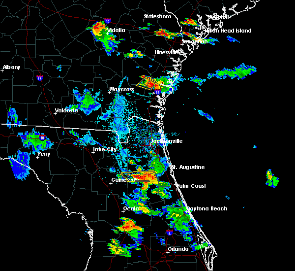 At 721 pm edt, doppler radar indicated a severe thunderstorm capable of producing quarter size hail and damaging winds in excess of 60 mph. this storm was located near lake geneva, or near keystone heights. this storm was nearly stationary. At 721 pm edt, doppler radar indicated a severe thunderstorm capable of producing quarter size hail and damaging winds in excess of 60 mph. this storm was located near lake geneva, or near keystone heights. this storm was nearly stationary.
|
| 8/7/2015 6:01 PM EDT |
 At 600 pm edt, doppler radar indicated a line of severe thunderstorms capable of producing damaging winds in excess of 60 mph. these storms were located along a line extending from near maxville to near alachua, moving southeast at 30 mph. locations impacted include, gainesville, starke, lake butler, keystone heights, raiford, middleburg, worthington spring, melrose, alachua, high springs, hawthorne, worthington springs, george`s lake, groves, lake geneva, upland pines, kingsley, university of florida, camp blanding and orange heights. At 600 pm edt, doppler radar indicated a line of severe thunderstorms capable of producing damaging winds in excess of 60 mph. these storms were located along a line extending from near maxville to near alachua, moving southeast at 30 mph. locations impacted include, gainesville, starke, lake butler, keystone heights, raiford, middleburg, worthington spring, melrose, alachua, high springs, hawthorne, worthington springs, george`s lake, groves, lake geneva, upland pines, kingsley, university of florida, camp blanding and orange heights.
|
| 8/7/2015 5:39 PM EDT |
 At 539 pm edt, doppler radar indicated a line of severe thunderstorms capable of producing damaging winds in excess of 60 mph. these storms were located along a line extending from near glen st. mary to near upland pines, and moving southeast at 30 mph. At 539 pm edt, doppler radar indicated a line of severe thunderstorms capable of producing damaging winds in excess of 60 mph. these storms were located along a line extending from near glen st. mary to near upland pines, and moving southeast at 30 mph.
|
| 7/22/2015 5:50 PM EDT |
 At 550 pm edt, doppler radar indicated a severe thunderstorm capable of producing damaging winds in excess of 60 mph. this storm was located near kingsley, or near starke, moving east at 20 mph. locations impacted include, keystone heights, lake geneva and hampton. At 550 pm edt, doppler radar indicated a severe thunderstorm capable of producing damaging winds in excess of 60 mph. this storm was located near kingsley, or near starke, moving east at 20 mph. locations impacted include, keystone heights, lake geneva and hampton.
|
| 7/22/2015 5:16 PM EDT |
 At 515 pm edt, doppler radar indicated a severe thunderstorm capable of producing damaging winds in excess of 60 mph. this storm was located near sampson, or near starke, and moving east at 20 mph. penny size hail may also accompany the damaging winds. At 515 pm edt, doppler radar indicated a severe thunderstorm capable of producing damaging winds in excess of 60 mph. this storm was located near sampson, or near starke, and moving east at 20 mph. penny size hail may also accompany the damaging winds.
|
| 7/11/2015 3:15 PM EDT | Large tree down in clay county FL, 0.6 miles SSW of Keystone Heights, FL |
| 7/1/2015 4:30 PM EDT | A tree was blown down along county road 315c. the time of the event was based on radar imager in clay county FL, 8 miles WSW of Keystone Heights, FL |
| 7/1/2015 4:10 PM EDT |
 At 410 pm edt, doppler radar indicated a severe thunderstorm capable of producing quarter size hail and damaging winds in excess of 60 mph. this storm was located near lake geneva, or near keystone heights, and moving northeast at 35 mph. At 410 pm edt, doppler radar indicated a severe thunderstorm capable of producing quarter size hail and damaging winds in excess of 60 mph. this storm was located near lake geneva, or near keystone heights, and moving northeast at 35 mph.
|
| 6/24/2015 4:31 PM EDT |
 At 431 pm edt, doppler radar indicated a severe thunderstorm capable of producing quarter size hail and damaging winds in excess of 60 mph. this storm was located near starke, and moving northeast at 30 mph. At 431 pm edt, doppler radar indicated a severe thunderstorm capable of producing quarter size hail and damaging winds in excess of 60 mph. this storm was located near starke, and moving northeast at 30 mph.
|
| 6/22/2015 11:25 PM EDT |
 At 1125 pm edt, doppler radar indicated a severe thunderstorm capable of producing damaging winds in excess of 60 mph. this storm was located 7 miles north of george`s lake, or 10 miles south of middleburg, moving north at 15 mph. locations impacted include, green cove springs, keystone heights, lake geneva and penney farms. At 1125 pm edt, doppler radar indicated a severe thunderstorm capable of producing damaging winds in excess of 60 mph. this storm was located 7 miles north of george`s lake, or 10 miles south of middleburg, moving north at 15 mph. locations impacted include, green cove springs, keystone heights, lake geneva and penney farms.
|
| 6/22/2015 11:07 PM EDT |
 At 1107 pm edt, doppler radar indicated a severe thunderstorm capable of producing quarter size hail and destructive winds in excess of 70 mph. this storm was located over george`s lake, or 8 miles east of keystone heights, moving north at 15 mph. locations impacted include, green cove springs, interlachen, keystone heights, melrose, hawthorne, george`s lake, melrose landing, bostwick, lake geneva, florahome, bardin, hollister, penney farms, mannville, johnson, carraway and putnam hall. At 1107 pm edt, doppler radar indicated a severe thunderstorm capable of producing quarter size hail and destructive winds in excess of 70 mph. this storm was located over george`s lake, or 8 miles east of keystone heights, moving north at 15 mph. locations impacted include, green cove springs, interlachen, keystone heights, melrose, hawthorne, george`s lake, melrose landing, bostwick, lake geneva, florahome, bardin, hollister, penney farms, mannville, johnson, carraway and putnam hall.
|
| 6/22/2015 10:49 PM EDT |
 At 1049 pm edt, doppler radar indicated a severe thunderstorm capable of producing damaging winds in excess of 60 mph. this storm was located over bardin, or 9 miles northwest of palatka, and moving north at 15 mph. penny size hail may also accompany the damaging winds. At 1049 pm edt, doppler radar indicated a severe thunderstorm capable of producing damaging winds in excess of 60 mph. this storm was located over bardin, or 9 miles northwest of palatka, and moving north at 15 mph. penny size hail may also accompany the damaging winds.
|
| 6/12/2015 6:10 PM EDT | Central dispatch reported a tree and two power lines dow in clay county FL, 9.3 miles WSW of Keystone Heights, FL |
| 6/12/2015 5:52 PM EDT |
 At 552 pm edt, doppler radar indicated a severe thunderstorm capable of producing damaging winds in excess of 60 mph. this storm was located near lake geneva, or near keystone heights, and moving northwest at 25 mph. penny size hail may also accompany the damaging winds. At 552 pm edt, doppler radar indicated a severe thunderstorm capable of producing damaging winds in excess of 60 mph. this storm was located near lake geneva, or near keystone heights, and moving northwest at 25 mph. penny size hail may also accompany the damaging winds.
|
| 4/19/2015 3:33 PM EDT | At 332 pm edt, doppler radar indicated a severe thunderstorm capable of producing quarter size hail and damaging winds in excess of 60 mph. this storm was located over lake geneva, or over keystone heights, moving northeast at 30 mph. locations impacted include, interlachen, keystone heights, george`s lake, melrose landing, lake geneva, florahome and putnam hall. |
| 4/19/2015 3:25 PM EDT | A power line was blown down by thunderstorm wind in putnam county FL, 6.4 miles N of Keystone Heights, FL |
| 4/19/2015 3:22 PM EDT | Large tree limb blown down at price road and state road 2 in putnam county FL, 6.4 miles N of Keystone Heights, FL |
| 4/19/2015 3:18 PM EDT | At 318 pm edt, doppler radar indicated a severe thunderstorm capable of producing quarter size hail and damaging winds in excess of 60 mph. this storm was located near melrose, and moving northeast at 35 mph. |
| 4/19/2015 3:18 PM EDT | At 318 pm edt, doppler radar indicated a severe thunderstorm capable of producing quarter size hail and damaging winds in excess of 60 mph. this storm was located near melrose, and moving northeast at 35 mph. |
| 4/19/2015 3:18 PM EDT | At 318 pm edt, doppler radar indicated a severe thunderstorm capable of producing quarter size hail and damaging winds in excess of 60 mph. this storm was located near melrose, and moving northeast at 35 mph. |
| 6/8/2014 4:15 PM EDT | Trees fell on powerlines and a car near theressa. a outdoor shed also blown over. time of event based on radar imager in bradford county FL, 4.5 miles SSE of Keystone Heights, FL |
| 5/25/2014 6:15 PM EDT | Emergency manager reported one large tree down near the intersection of county road 21b and southwest 15th avenu in bradford county FL, 2.1 miles ESE of Keystone Heights, FL |
| 6/8/2013 6:58 PM EDT | Spotter reported a large tree broke off near the top and hitting powerlines causing power outages in the area. time of event based on radar imager in clay county FL, 0.9 miles WNW of Keystone Heights, FL |
| 5/20/2013 6:55 PM EDT | Bradley county emergency management relayed report via social media that a tree and powerlines were blocking state route 100 at se 81st street in theressa. time is esti in bradford county FL, 4.2 miles SSE of Keystone Heights, FL |
| 7/10/2012 3:45 PM EDT | Powers lines down in keystone heights in clay county FL, 0.4 miles WNW of Keystone Heights, FL |
| 7/2/2012 6:55 PM EDT | Storm spotter estimates 60 mph winds in keystone height in clay county FL, 0.4 miles WNW of Keystone Heights, FL |
| 1/1/0001 12:00 AM | Trees reported down on ottoman road in keystone heights. time is estimated based on rada in bradford county FL, 2.7 miles SSE of Keystone Heights, FL |
| 1/1/0001 12:00 AM | 911 call center reported trees down on se county road 21b. time estimated from rada in alachua county FL, 2.8 miles ENE of Keystone Heights, FL |
| 1/1/0001 12:00 AM | Quarter sized hail reported 9.7 miles WSW of Keystone Heights, FL, quarter size hail reported by trained spotter at a boy scout camp 2 miles east of state road 16 nar camp blanding. |
| 1/1/0001 12:00 AM | Quarter sized hail reported 0.6 miles SSW of Keystone Heights, FL, quarter size hail reported by spotter at intersection of florida route 100 and route 21 near keystone heights. also reported small limbs down. |
| 1/1/0001 12:00 AM | Quarter sized hail reported 5.1 miles N of Keystone Heights, FL, a convenient store clerk along state road 26 reported hail around 1 inch in diameter. |
Hail Maps for Keystone Heights, FL
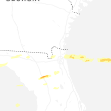


Connect with Interactive Hail Maps