

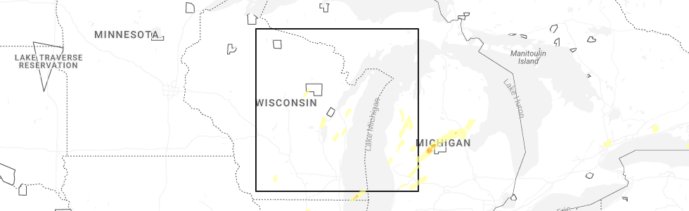
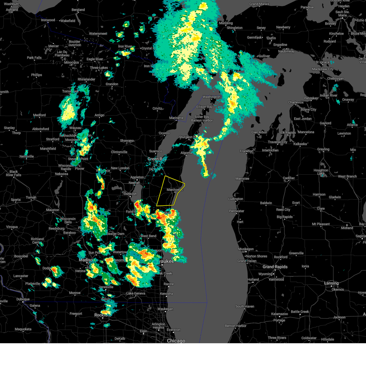
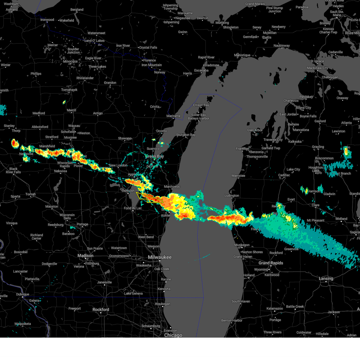
Hail Map for Kiel, WI
The Kiel, WI area has had 2 reports of on-the-ground hail by trained spotters, and has been under severe weather warnings 4 times during the past 12 months. Doppler radar has detected hail at or near Kiel, WI on 38 occasions, including 1 occasion during the past year.
| Name: | Kiel, WI |
| Where Located: | 41.1 miles S of Green Bay, WI |
| Map: | Google Map for Kiel, WI |
| Population: | 3738 |
| Housing Units: | 1697 |
| More Info: | Search Google for Kiel, WI |
2
The Top Recent Hail Date for Kiel, WI is Friday, May 16, 2025 (7th out of 38)
Hail and Wind Damage Spotted near Kiel, WI
| Date / Time | Report Details |
|---|---|
| 6/19/2025 8:19 PM CDT | Located on hillcrest drive in kiel. medium sized tree snapped / uproote in manitowoc county WI, 0.7 miles NE of Kiel, WI |
| 6/19/2025 8:18 PM CDT | Photo via social media. medium to large size tree snapped. located on the 700 block of 3rd street in kiel. time estimated by rada in manitowoc county WI, 0.7 miles NE of Kiel, WI |
| 5/16/2025 4:55 PM CDT | At 455 pm cdt, a severe thunderstorm was located near cleveland, or 9 miles southwest of manitowoc, moving northeast at 50 mph (radar indicated). Hazards include 60 mph wind gusts. Expect damage to roofs, siding, and trees. this severe storm will be near, manitowoc around 500 pm cdt. Other locations impacted by this severe thunderstorm include louis corners, st nazianz, mishicot, kellners corners, kellnersville, maribel, larrabee, two rivers, madsen, and grimms. |
| 5/16/2025 4:54 PM CDT | Svrgrb the national weather service in green bay has issued a * severe thunderstorm warning for, eastern calumet county in east central wisconsin, southwestern manitowoc county in east central wisconsin, * until 530 pm cdt. * at 453 pm cdt, a severe thunderstorm was located near camp rokilio scout camp, or 12 miles northwest of howards grove, moving northeast at 45 mph (radar indicated). Hazards include 60 mph wind gusts and quarter size hail. Hail damage to vehicles is expected. expect wind damage to roofs, siding, and trees. this severe thunderstorm will be near, st. nazianz around 500 pm cdt. valders around 505 pm cdt. Other locations impacted by this severe thunderstorm include louis corners, st nazianz, killsnake wildlife area, clarks mills, cato, kiel, reedsville, grimms, millhome, and taus. |
| 5/16/2025 4:40 PM CDT |
 Svrgrb the national weather service in green bay has issued a * severe thunderstorm warning for, manitowoc county in east central wisconsin, * until 530 pm cdt. * at 439 pm cdt, a severe thunderstorm was located near howards grove, moving northeast at 55 mph (radar indicated). Hazards include 60 mph wind gusts. Expect damage to roofs, siding, and trees. this severe thunderstorm will be near, cleveland around 445 pm cdt. manitowoc around 500 pm cdt. Other locations impacted by this severe thunderstorm include louis corners, st nazianz, mishicot, kellners corners, kellnersville, maribel, larrabee, two rivers, madsen, and grimms. Svrgrb the national weather service in green bay has issued a * severe thunderstorm warning for, manitowoc county in east central wisconsin, * until 530 pm cdt. * at 439 pm cdt, a severe thunderstorm was located near howards grove, moving northeast at 55 mph (radar indicated). Hazards include 60 mph wind gusts. Expect damage to roofs, siding, and trees. this severe thunderstorm will be near, cleveland around 445 pm cdt. manitowoc around 500 pm cdt. Other locations impacted by this severe thunderstorm include louis corners, st nazianz, mishicot, kellners corners, kellnersville, maribel, larrabee, two rivers, madsen, and grimms.
|
| 5/16/2025 3:19 PM CDT |
 Svrgrb the national weather service in green bay has issued a * severe thunderstorm warning for, manitowoc county in east central wisconsin, * until 400 pm cdt. * at 319 pm cdt, a severe thunderstorm was located near st. nazianz, or 10 miles north of howards grove, moving northeast at 45 mph (radar indicated). Hazards include 60 mph wind gusts and quarter size hail. Hail damage to vehicles is expected. expect wind damage to roofs, siding, and trees. this severe thunderstorm will be near, manitowoc and valders around 325 pm cdt. Other locations impacted by this severe thunderstorm include louis corners, st nazianz, mishicot, kellners corners, kellnersville, maribel, larrabee, two rivers, kiel, and madsen. Svrgrb the national weather service in green bay has issued a * severe thunderstorm warning for, manitowoc county in east central wisconsin, * until 400 pm cdt. * at 319 pm cdt, a severe thunderstorm was located near st. nazianz, or 10 miles north of howards grove, moving northeast at 45 mph (radar indicated). Hazards include 60 mph wind gusts and quarter size hail. Hail damage to vehicles is expected. expect wind damage to roofs, siding, and trees. this severe thunderstorm will be near, manitowoc and valders around 325 pm cdt. Other locations impacted by this severe thunderstorm include louis corners, st nazianz, mishicot, kellners corners, kellnersville, maribel, larrabee, two rivers, kiel, and madsen.
|
| 5/21/2024 9:36 PM CDT |
 The storms which prompted the warning have moved out of the area. therefore, the warning will be allowed to expire. however, gusty winds up to 30 to 40 mph are still possible with these thunderstorms. a tornado watch remains in effect until midnight cdt for northeastern and east central wisconsin. The storms which prompted the warning have moved out of the area. therefore, the warning will be allowed to expire. however, gusty winds up to 30 to 40 mph are still possible with these thunderstorms. a tornado watch remains in effect until midnight cdt for northeastern and east central wisconsin.
|
| 5/21/2024 9:29 PM CDT |
 At 928 pm cdt, severe thunderstorms were located along a line extending from 8 miles north of green bay to near bellevue town to 7 miles north of valders, moving northeast at 60 mph (radar indicated). Hazards include 60 mph wind gusts. Expect damage to roofs, siding, and trees. Locations impacted include, green bay, appleton, kaukauna, little chute, kimberly, chilton, pulaski, brillion, cleveland, and valders. At 928 pm cdt, severe thunderstorms were located along a line extending from 8 miles north of green bay to near bellevue town to 7 miles north of valders, moving northeast at 60 mph (radar indicated). Hazards include 60 mph wind gusts. Expect damage to roofs, siding, and trees. Locations impacted include, green bay, appleton, kaukauna, little chute, kimberly, chilton, pulaski, brillion, cleveland, and valders.
|
| 5/21/2024 9:29 PM CDT |
 the severe thunderstorm warning has been cancelled and is no longer in effect the severe thunderstorm warning has been cancelled and is no longer in effect
|
| 5/21/2024 9:21 PM CDT |
 Svrgrb the national weather service in green bay has issued a * severe thunderstorm warning for, brown county in northeastern wisconsin, kewaunee county in northeastern wisconsin, door county in northeastern wisconsin, southeastern calumet county in east central wisconsin, manitowoc county in east central wisconsin, * until 1000 pm cdt. * at 920 pm cdt, severe thunderstorms were located along a line extending from 7 miles northwest of green bay to 6 miles west of denmark to near elkhart lake, moving northeast at 65 mph. gusts to 56 mph were reported at green bay, and trees have been snapped (radar indicated). Hazards include 60 mph wind gusts. expect damage to roofs, siding, and trees Svrgrb the national weather service in green bay has issued a * severe thunderstorm warning for, brown county in northeastern wisconsin, kewaunee county in northeastern wisconsin, door county in northeastern wisconsin, southeastern calumet county in east central wisconsin, manitowoc county in east central wisconsin, * until 1000 pm cdt. * at 920 pm cdt, severe thunderstorms were located along a line extending from 7 miles northwest of green bay to 6 miles west of denmark to near elkhart lake, moving northeast at 65 mph. gusts to 56 mph were reported at green bay, and trees have been snapped (radar indicated). Hazards include 60 mph wind gusts. expect damage to roofs, siding, and trees
|
| 5/21/2024 9:15 PM CDT |
 At 914 pm cdt, severe thunderstorms were located along a line extending from 9 miles east of black creek to 9 miles east of kaukauna to near chilton, moving northeast at 60 mph (radar indicated). Hazards include 70 mph wind gusts. Expect considerable tree damage. damage is likely to mobile homes, roofs, and outbuildings. Locations impacted include, green bay, appleton, menasha, kaukauna, little chute, kimberly, chilton, pulaski, brillion, and cleveland. At 914 pm cdt, severe thunderstorms were located along a line extending from 9 miles east of black creek to 9 miles east of kaukauna to near chilton, moving northeast at 60 mph (radar indicated). Hazards include 70 mph wind gusts. Expect considerable tree damage. damage is likely to mobile homes, roofs, and outbuildings. Locations impacted include, green bay, appleton, menasha, kaukauna, little chute, kimberly, chilton, pulaski, brillion, and cleveland.
|
| 5/21/2024 9:15 PM CDT |
 the severe thunderstorm warning has been cancelled and is no longer in effect the severe thunderstorm warning has been cancelled and is no longer in effect
|
| 5/21/2024 9:06 PM CDT |
 At 905 pm cdt, severe thunderstorms were located along a line extending from near black creek to near kaukauna to near chilton, moving northeast at 60 mph (radar indicated). Hazards include 70 mph wind gusts. Expect considerable tree damage. damage is likely to mobile homes, roofs, and outbuildings. Locations impacted include, green bay, appleton, oshkosh, menasha, kaukauna, little chute, new london, kimberly, clintonville, and chilton. At 905 pm cdt, severe thunderstorms were located along a line extending from near black creek to near kaukauna to near chilton, moving northeast at 60 mph (radar indicated). Hazards include 70 mph wind gusts. Expect considerable tree damage. damage is likely to mobile homes, roofs, and outbuildings. Locations impacted include, green bay, appleton, oshkosh, menasha, kaukauna, little chute, new london, kimberly, clintonville, and chilton.
|
| 5/21/2024 8:52 PM CDT |
 At 851 pm cdt, severe thunderstorms were located along a line extending from near new london to near northern lake winnebago to near fond du lac, moving northeast at 60 mph (radar indicated). Hazards include 70 mph wind gusts. Expect considerable tree damage. damage is likely to mobile homes, roofs, and outbuildings. Locations impacted include, green bay, appleton, oshkosh, menasha, kaukauna, little chute, new london, kimberly, clintonville, and chilton. At 851 pm cdt, severe thunderstorms were located along a line extending from near new london to near northern lake winnebago to near fond du lac, moving northeast at 60 mph (radar indicated). Hazards include 70 mph wind gusts. Expect considerable tree damage. damage is likely to mobile homes, roofs, and outbuildings. Locations impacted include, green bay, appleton, oshkosh, menasha, kaukauna, little chute, new london, kimberly, clintonville, and chilton.
|
| 5/21/2024 8:47 PM CDT |
 Svrgrb the national weather service in green bay has issued a * severe thunderstorm warning for, brown county in northeastern wisconsin, calumet county in east central wisconsin, winnebago county in east central wisconsin, eastern waupaca county in northeastern wisconsin, outagamie county in northeastern wisconsin, western manitowoc county in east central wisconsin, * until 945 pm cdt. * at 847 pm cdt, severe thunderstorms were located along a line extending from near new london to near oshkosh to near oakfield, moving northeast at 60 mph (radar indicated). Hazards include 70 mph wind gusts. Expect considerable tree damage. Damage is likely to mobile homes, roofs, and outbuildings. Svrgrb the national weather service in green bay has issued a * severe thunderstorm warning for, brown county in northeastern wisconsin, calumet county in east central wisconsin, winnebago county in east central wisconsin, eastern waupaca county in northeastern wisconsin, outagamie county in northeastern wisconsin, western manitowoc county in east central wisconsin, * until 945 pm cdt. * at 847 pm cdt, severe thunderstorms were located along a line extending from near new london to near oshkosh to near oakfield, moving northeast at 60 mph (radar indicated). Hazards include 70 mph wind gusts. Expect considerable tree damage. Damage is likely to mobile homes, roofs, and outbuildings.
|
| 5/12/2024 7:23 PM CDT |
 The storm which prompted the warning has weakened below severe limits, and has exited the warned area. therefore, the warning will be allowed to expire. however, small hail up to half inch in diameter and gusty winds to 40 mph are still possible with the ongoing thunderstorms moving across manitowoc county through 8 pm. The storm which prompted the warning has weakened below severe limits, and has exited the warned area. therefore, the warning will be allowed to expire. however, small hail up to half inch in diameter and gusty winds to 40 mph are still possible with the ongoing thunderstorms moving across manitowoc county through 8 pm.
|
| 5/12/2024 6:44 PM CDT |
 Svrgrb the national weather service in green bay has issued a * severe thunderstorm warning for, southern manitowoc county in east central wisconsin, * until 730 pm cdt. * at 642 pm cdt, a severe thunderstorm was located over st. nazianz, or 12 miles northwest of howards grove, moving east at 35 mph (radar indicated). Hazards include 60 mph wind gusts and quarter size hail. Hail damage to vehicles is expected. Expect wind damage to roofs, siding, and trees. Svrgrb the national weather service in green bay has issued a * severe thunderstorm warning for, southern manitowoc county in east central wisconsin, * until 730 pm cdt. * at 642 pm cdt, a severe thunderstorm was located over st. nazianz, or 12 miles northwest of howards grove, moving east at 35 mph (radar indicated). Hazards include 60 mph wind gusts and quarter size hail. Hail damage to vehicles is expected. Expect wind damage to roofs, siding, and trees.
|
| 8/3/2023 6:52 PM CDT |
 The severe thunderstorm warning for southeastern calumet and southwestern manitowoc counties will expire at 700 pm cdt, the storms which prompted the warning have moved out of the area. therefore, the warning will be allowed to expire. however, heavy rain is still possible with these thunderstorms. The severe thunderstorm warning for southeastern calumet and southwestern manitowoc counties will expire at 700 pm cdt, the storms which prompted the warning have moved out of the area. therefore, the warning will be allowed to expire. however, heavy rain is still possible with these thunderstorms.
|
| 8/3/2023 6:42 PM CDT |
 At 641 pm cdt, severe thunderstorms were located along a line extending from near chilton to near camp rokilio scout camp, moving southeast at 15 mph. a public report of one inch hail in kiel (public). Hazards include 60 mph wind gusts and quarter size hail. Hail damage to vehicles is expected. expect wind damage to roofs, siding, and trees. these severe thunderstorms will remain over mainly rural areas of southeastern calumet and southwestern manitowoc counties, including the following locations, millhome, new holstein, jericho, kiel and charlesburg. hail threat, observed max hail size, 1. 00 in wind threat, radar indicated max wind gust, 60 mph. At 641 pm cdt, severe thunderstorms were located along a line extending from near chilton to near camp rokilio scout camp, moving southeast at 15 mph. a public report of one inch hail in kiel (public). Hazards include 60 mph wind gusts and quarter size hail. Hail damage to vehicles is expected. expect wind damage to roofs, siding, and trees. these severe thunderstorms will remain over mainly rural areas of southeastern calumet and southwestern manitowoc counties, including the following locations, millhome, new holstein, jericho, kiel and charlesburg. hail threat, observed max hail size, 1. 00 in wind threat, radar indicated max wind gust, 60 mph.
|
| 8/3/2023 6:36 PM CDT | Quarter sized hail reported 0.4 miles ESE of Kiel, WI, report from mping: quarter (1.00 in.). |
| 8/3/2023 6:28 PM CDT |
 At 628 pm cdt, severe thunderstorms were located along a line extending from near chilton to near camp rokilio scout camp, moving southeast at 5 mph (radar indicated). Hazards include 70 mph wind gusts and quarter size hail. Hail damage to vehicles is expected. expect considerable tree damage. wind damage is also likely to mobile homes, roofs, and outbuildings. severe thunderstorms will be near, camp rokilio scout camp around 635 pm cdt. thunderstorm damage threat, considerable hail threat, radar indicated max hail size, 1. 00 in wind threat, radar indicated max wind gust, 70 mph. At 628 pm cdt, severe thunderstorms were located along a line extending from near chilton to near camp rokilio scout camp, moving southeast at 5 mph (radar indicated). Hazards include 70 mph wind gusts and quarter size hail. Hail damage to vehicles is expected. expect considerable tree damage. wind damage is also likely to mobile homes, roofs, and outbuildings. severe thunderstorms will be near, camp rokilio scout camp around 635 pm cdt. thunderstorm damage threat, considerable hail threat, radar indicated max hail size, 1. 00 in wind threat, radar indicated max wind gust, 70 mph.
|
| 8/3/2023 6:13 PM CDT |
 At 613 pm cdt, a severe thunderstorm was located near cleveland, or 7 miles north of howards grove, moving south at 25 mph (radar indicated). Hazards include 60 mph wind gusts and penny size hail. Expect damage to roofs, siding, and trees. this severe thunderstorm will be near, cleveland around 620 pm cdt. hail threat, radar indicated max hail size, 0. 75 in wind threat, radar indicated max wind gust, 60 mph. At 613 pm cdt, a severe thunderstorm was located near cleveland, or 7 miles north of howards grove, moving south at 25 mph (radar indicated). Hazards include 60 mph wind gusts and penny size hail. Expect damage to roofs, siding, and trees. this severe thunderstorm will be near, cleveland around 620 pm cdt. hail threat, radar indicated max hail size, 0. 75 in wind threat, radar indicated max wind gust, 60 mph.
|
| 7/23/2022 6:39 PM CDT |
 The severe thunderstorm warning for eastern calumet and eastern outagamie counties will expire at 645 pm cdt, the storms which prompted the warning have moved out of the area. therefore, the warning will be allowed to expire. however heavy rain is still possible with additional thunderstorms. a severe thunderstorm watch remains in effect until 1100 pm cdt for northeastern and east central wisconsin. The severe thunderstorm warning for eastern calumet and eastern outagamie counties will expire at 645 pm cdt, the storms which prompted the warning have moved out of the area. therefore, the warning will be allowed to expire. however heavy rain is still possible with additional thunderstorms. a severe thunderstorm watch remains in effect until 1100 pm cdt for northeastern and east central wisconsin.
|
| 7/23/2022 6:32 PM CDT |
 At 632 pm cdt, severe thunderstorms were located along a line extending from 6 miles northwest of green bay to bellevue town to near denmark to 12 miles west of two creeks to 6 miles northeast of valders, moving northeast at 60 mph (trained weather spotters). Hazards include 70 mph wind gusts. Expect considerable tree damage. damage is likely to mobile homes, roofs, and outbuildings. locations impacted include, kaukauna, little chute, chilton, brillion, st anna, oneida, new holstein, wrightstown, hilbert and freedom. thunderstorm damage threat, considerable hail threat, radar indicated max hail size, <. 75 in wind threat, observed max wind gust, 70 mph. At 632 pm cdt, severe thunderstorms were located along a line extending from 6 miles northwest of green bay to bellevue town to near denmark to 12 miles west of two creeks to 6 miles northeast of valders, moving northeast at 60 mph (trained weather spotters). Hazards include 70 mph wind gusts. Expect considerable tree damage. damage is likely to mobile homes, roofs, and outbuildings. locations impacted include, kaukauna, little chute, chilton, brillion, st anna, oneida, new holstein, wrightstown, hilbert and freedom. thunderstorm damage threat, considerable hail threat, radar indicated max hail size, <. 75 in wind threat, observed max wind gust, 70 mph.
|
| 7/23/2022 6:16 PM CDT |
 At 616 pm cdt, severe thunderstorms were located along a line extending from 6 miles east of black creek to 7 miles northeast of kaukauna to near brillion to near chilton, moving northeast at 50 mph (trained weather spotters). Hazards include 70 mph wind gusts. Expect considerable tree damage. damage is likely to mobile homes, roofs, and outbuildings. these severe thunderstorms will remain over mainly rural areas of calumet and eastern outagamie counties, including the following locations, killsnake wildlife area, mackville, jericho, freedom, charlesburg, brothertown, twelve corners, five corners, st john and potter. thunderstorm damage threat, considerable hail threat, radar indicated max hail size, <. 75 in wind threat, observed max wind gust, 70 mph. At 616 pm cdt, severe thunderstorms were located along a line extending from 6 miles east of black creek to 7 miles northeast of kaukauna to near brillion to near chilton, moving northeast at 50 mph (trained weather spotters). Hazards include 70 mph wind gusts. Expect considerable tree damage. damage is likely to mobile homes, roofs, and outbuildings. these severe thunderstorms will remain over mainly rural areas of calumet and eastern outagamie counties, including the following locations, killsnake wildlife area, mackville, jericho, freedom, charlesburg, brothertown, twelve corners, five corners, st john and potter. thunderstorm damage threat, considerable hail threat, radar indicated max hail size, <. 75 in wind threat, observed max wind gust, 70 mph.
|
| 7/23/2022 6:02 PM CDT |
 At 601 pm cdt, severe thunderstorms were located along a line extending from 7 miles northwest of appleton to darboy to high cliff state park to near central lake winnebago to near camp rokilio scout camp, moving east at 60 mph (trained weather spotters). Hazards include 70 mph wind gusts. Expect considerable tree damage. damage is likely to mobile homes, roofs, and outbuildings. these severe storms will be near, kaukauna around 605 pm cdt. chilton around 610 pm cdt. brillion around 615 pm cdt. other locations impacted by these severe thunderstorms include killsnake wildlife area, mackville, jericho, freedom, charlesburg, brothertown, medina, twelve corners, five corners and st john. thunderstorm damage threat, considerable hail threat, radar indicated max hail size, <. 75 in wind threat, observed max wind gust, 70 mph. At 601 pm cdt, severe thunderstorms were located along a line extending from 7 miles northwest of appleton to darboy to high cliff state park to near central lake winnebago to near camp rokilio scout camp, moving east at 60 mph (trained weather spotters). Hazards include 70 mph wind gusts. Expect considerable tree damage. damage is likely to mobile homes, roofs, and outbuildings. these severe storms will be near, kaukauna around 605 pm cdt. chilton around 610 pm cdt. brillion around 615 pm cdt. other locations impacted by these severe thunderstorms include killsnake wildlife area, mackville, jericho, freedom, charlesburg, brothertown, medina, twelve corners, five corners and st john. thunderstorm damage threat, considerable hail threat, radar indicated max hail size, <. 75 in wind threat, observed max wind gust, 70 mph.
|
| 7/23/2022 5:50 PM CDT |
 At 549 pm cdt, severe thunderstorms were located along a line extending from 11 miles southeast of new london to near menasha to near northern lake winnebago to near oshkosh to near central lake winnebago, moving northeast at 60 mph (trained weather spotters). Hazards include 70 mph wind gusts. Expect considerable tree damage. damage is likely to mobile homes, roofs, and outbuildings. severe thunderstorms will be near, menasha around 555 pm cdt. appleton, kimberly, darboy and northern lake winnebago around 600 pm cdt. kaukauna, little chute, chilton and high cliff state park around 605 pm cdt. brillion around 615 pm cdt. other locations impacted by these severe thunderstorms include killsnake wildlife area, mackville, jericho, freedom, charlesburg, brothertown, medina, twelve corners, five corners and st john. thunderstorm damage threat, considerable hail threat, radar indicated max hail size, <. 75 in wind threat, observed max wind gust, 70 mph. At 549 pm cdt, severe thunderstorms were located along a line extending from 11 miles southeast of new london to near menasha to near northern lake winnebago to near oshkosh to near central lake winnebago, moving northeast at 60 mph (trained weather spotters). Hazards include 70 mph wind gusts. Expect considerable tree damage. damage is likely to mobile homes, roofs, and outbuildings. severe thunderstorms will be near, menasha around 555 pm cdt. appleton, kimberly, darboy and northern lake winnebago around 600 pm cdt. kaukauna, little chute, chilton and high cliff state park around 605 pm cdt. brillion around 615 pm cdt. other locations impacted by these severe thunderstorms include killsnake wildlife area, mackville, jericho, freedom, charlesburg, brothertown, medina, twelve corners, five corners and st john. thunderstorm damage threat, considerable hail threat, radar indicated max hail size, <. 75 in wind threat, observed max wind gust, 70 mph.
|
| 6/15/2022 6:43 PM CDT |
 At 643 pm cdt, severe thunderstorms were located along a line extending from 8 miles northeast of lake poygan to 6 miles west of northern lake winnebago to near rosendale, moving northeast at 70 mph (radar indicated). Hazards include 60 mph wind gusts. Expect damage to roofs, siding, and trees. severe thunderstorms will be near, menasha and northern lake winnebago around 650 pm cdt. appleton, little chute, kimberly, darboy and high cliff state park around 655 pm cdt. kaukauna and central lake winnebago around 700 pm cdt. other locations in the path of these severe thunderstorms include st anna, chilton and brillion. hail threat, radar indicated max hail size, <. 75 in wind threat, radar indicated max wind gust, 60 mph. At 643 pm cdt, severe thunderstorms were located along a line extending from 8 miles northeast of lake poygan to 6 miles west of northern lake winnebago to near rosendale, moving northeast at 70 mph (radar indicated). Hazards include 60 mph wind gusts. Expect damage to roofs, siding, and trees. severe thunderstorms will be near, menasha and northern lake winnebago around 650 pm cdt. appleton, little chute, kimberly, darboy and high cliff state park around 655 pm cdt. kaukauna and central lake winnebago around 700 pm cdt. other locations in the path of these severe thunderstorms include st anna, chilton and brillion. hail threat, radar indicated max hail size, <. 75 in wind threat, radar indicated max wind gust, 60 mph.
|
| 9/7/2021 10:51 AM CDT |
 The severe thunderstorm warning for southwestern manitowoc county will expire at 1100 am cdt, the storm which prompted the warning has moved out of the area. therefore, the warning will be allowed to expire. to report severe weather, contact your nearest law enforcement agency. they will relay your report to the national weather service green bay. The severe thunderstorm warning for southwestern manitowoc county will expire at 1100 am cdt, the storm which prompted the warning has moved out of the area. therefore, the warning will be allowed to expire. to report severe weather, contact your nearest law enforcement agency. they will relay your report to the national weather service green bay.
|
| 9/7/2021 10:42 AM CDT |
 At 1041 am cdt, a severe thunderstorm was located near cleveland, or 9 miles south of manitowoc, moving east at 55 mph (radar indicated). Hazards include quarter size hail. Damage to vehicles is expected. locations impacted include, manitowoc, cleveland, valders, st. nazianz, camp rokilio scout camp, kiel, newton, spring valley, clover and louis corners. hail threat, radar indicated max hail size, 1. 00 in wind threat, radar indicated max wind gust, <50 mph. At 1041 am cdt, a severe thunderstorm was located near cleveland, or 9 miles south of manitowoc, moving east at 55 mph (radar indicated). Hazards include quarter size hail. Damage to vehicles is expected. locations impacted include, manitowoc, cleveland, valders, st. nazianz, camp rokilio scout camp, kiel, newton, spring valley, clover and louis corners. hail threat, radar indicated max hail size, 1. 00 in wind threat, radar indicated max wind gust, <50 mph.
|
| 9/7/2021 10:32 AM CDT |
 At 1031 am cdt, a severe thunderstorm was located near cleveland, or 8 miles north of howards grove, moving east at 50 mph (radar indicated). Hazards include half dollar size hail. Damage to vehicles is expected. locations impacted include, manitowoc, cleveland, valders, st. nazianz, st anna, camp rokilio scout camp, kiel, new holstein, newton and spring valley. hail threat, radar indicated max hail size, 1. 25 in wind threat, radar indicated max wind gust, <50 mph. At 1031 am cdt, a severe thunderstorm was located near cleveland, or 8 miles north of howards grove, moving east at 50 mph (radar indicated). Hazards include half dollar size hail. Damage to vehicles is expected. locations impacted include, manitowoc, cleveland, valders, st. nazianz, st anna, camp rokilio scout camp, kiel, new holstein, newton and spring valley. hail threat, radar indicated max hail size, 1. 25 in wind threat, radar indicated max wind gust, <50 mph.
|
| 9/7/2021 10:23 AM CDT |
 The severe thunderstorm warning for calumet, southeastern winnebago and southwestern manitowoc counties will expire at 1030 am cdt, the severe thunderstorm which prompted the warning will be allowed to expire. however, a new severe thunderstorm warning is now in effect for these storms. large hail up to golf ball size remains possible. The severe thunderstorm warning for calumet, southeastern winnebago and southwestern manitowoc counties will expire at 1030 am cdt, the severe thunderstorm which prompted the warning will be allowed to expire. however, a new severe thunderstorm warning is now in effect for these storms. large hail up to golf ball size remains possible.
|
| 9/7/2021 10:18 AM CDT |
 At 1016 am cdt, a severe thunderstorm was located near chilton, or 18 miles northwest of plymouth, moving east at 55 mph. at 1004 am half dollar size hail was reported near chilton. another severe storm was located near st nazianz (public). Hazards include half dollar size hail. Damage to vehicles is expected. this severe thunderstorm will be near, st. nazianz and camp rokilio scout camp around 1025 am cdt. valders around 1030 am cdt. cleveland around 1035 am cdt. other locations in the path of this severe thunderstorm include manitowoc. hail threat, observed max hail size, 1. 25 in wind threat, radar indicated max wind gust, <50 mph. At 1016 am cdt, a severe thunderstorm was located near chilton, or 18 miles northwest of plymouth, moving east at 55 mph. at 1004 am half dollar size hail was reported near chilton. another severe storm was located near st nazianz (public). Hazards include half dollar size hail. Damage to vehicles is expected. this severe thunderstorm will be near, st. nazianz and camp rokilio scout camp around 1025 am cdt. valders around 1030 am cdt. cleveland around 1035 am cdt. other locations in the path of this severe thunderstorm include manitowoc. hail threat, observed max hail size, 1. 25 in wind threat, radar indicated max wind gust, <50 mph.
|
| 9/7/2021 10:08 AM CDT |
 At 1007 am cdt, a severe thunderstorm was located near st. nazianz, or 16 miles northwest of howards grove, moving east at 45 mph (trained weather spotters. half dollar sized hail was reported at chilton high school at 1004 am cdt). Hazards include 60 mph wind gusts and half dollar size hail. Hail damage to vehicles is expected. expect wind damage to roofs, siding, and trees. locations impacted include, chilton, cleveland, valders, st. nazianz, st anna, central lake winnebago, camp rokilio scout camp, harrison, kiel and new holstein. hail threat, observed max hail size, 1. 25 in wind threat, radar indicated max wind gust, 60 mph. At 1007 am cdt, a severe thunderstorm was located near st. nazianz, or 16 miles northwest of howards grove, moving east at 45 mph (trained weather spotters. half dollar sized hail was reported at chilton high school at 1004 am cdt). Hazards include 60 mph wind gusts and half dollar size hail. Hail damage to vehicles is expected. expect wind damage to roofs, siding, and trees. locations impacted include, chilton, cleveland, valders, st. nazianz, st anna, central lake winnebago, camp rokilio scout camp, harrison, kiel and new holstein. hail threat, observed max hail size, 1. 25 in wind threat, radar indicated max wind gust, 60 mph.
|
| 9/7/2021 9:57 AM CDT |
 At 955 am cdt, a severe thunderstorm was located near chilton, or 16 miles east of oshkosh, moving east at 55 mph. another thunderstorm was located in southeast winnebago county, which is southeast of wittman field (trained weather spotters). Hazards include 60 mph wind gusts and quarter size hail. Hail damage to vehicles is expected. expect wind damage to roofs, siding, and trees. locations impacted include, oshkosh, chilton, cleveland, valders, st. nazianz, st anna, central lake winnebago, camp rokilio scout camp, northern lake winnebago and harrison. hail threat, radar indicated max hail size, 1. 00 in wind threat, radar indicated max wind gust, 60 mph. At 955 am cdt, a severe thunderstorm was located near chilton, or 16 miles east of oshkosh, moving east at 55 mph. another thunderstorm was located in southeast winnebago county, which is southeast of wittman field (trained weather spotters). Hazards include 60 mph wind gusts and quarter size hail. Hail damage to vehicles is expected. expect wind damage to roofs, siding, and trees. locations impacted include, oshkosh, chilton, cleveland, valders, st. nazianz, st anna, central lake winnebago, camp rokilio scout camp, northern lake winnebago and harrison. hail threat, radar indicated max hail size, 1. 00 in wind threat, radar indicated max wind gust, 60 mph.
|
| 9/7/2021 9:44 AM CDT |
 At 943 am cdt, a severe thunderstorm was located over central lake winnebago, or 8 miles east of oshkosh, moving east at 60 mph (trained weather spotters). Hazards include 60 mph wind gusts and quarter size hail. Hail damage to vehicles is expected. expect wind damage to roofs, siding, and trees. this severe storm will be near, chilton and st anna around 955 am cdt. camp rokilio scout camp around 1005 am cdt. valders and st. nazianz around 1010 am cdt. cleveland around 1020 am cdt. other locations impacted by this severe thunderstorm include louis corners, st nazianz, pickett, killsnake wildlife area, jericho, kiel, madsen, millhome, charlesburg and brothertown. hail threat, observed max hail size, 1. 00 in wind threat, radar indicated max wind gust, 60 mph. At 943 am cdt, a severe thunderstorm was located over central lake winnebago, or 8 miles east of oshkosh, moving east at 60 mph (trained weather spotters). Hazards include 60 mph wind gusts and quarter size hail. Hail damage to vehicles is expected. expect wind damage to roofs, siding, and trees. this severe storm will be near, chilton and st anna around 955 am cdt. camp rokilio scout camp around 1005 am cdt. valders and st. nazianz around 1010 am cdt. cleveland around 1020 am cdt. other locations impacted by this severe thunderstorm include louis corners, st nazianz, pickett, killsnake wildlife area, jericho, kiel, madsen, millhome, charlesburg and brothertown. hail threat, observed max hail size, 1. 00 in wind threat, radar indicated max wind gust, 60 mph.
|
| 9/7/2021 9:30 AM CDT |
 At 929 am cdt, a severe thunderstorm was located near rush lake, or 9 miles west of oshkosh, moving east at 60 mph. spotters reported one inch hail just north of berlin (trained weather spotters). Hazards include 60 mph wind gusts and quarter size hail. Hail damage to vehicles is expected. expect wind damage to roofs, siding, and trees. this severe thunderstorm will be near, oshkosh around 940 am cdt. other locations in the path of this severe thunderstorm include central lake winnebago, northern lake winnebago, chilton, st. nazianz, camp rokilio scout camp and valders. hail threat, observed max hail size, 1. 00 in wind threat, radar indicated max wind gust, 60 mph. At 929 am cdt, a severe thunderstorm was located near rush lake, or 9 miles west of oshkosh, moving east at 60 mph. spotters reported one inch hail just north of berlin (trained weather spotters). Hazards include 60 mph wind gusts and quarter size hail. Hail damage to vehicles is expected. expect wind damage to roofs, siding, and trees. this severe thunderstorm will be near, oshkosh around 940 am cdt. other locations in the path of this severe thunderstorm include central lake winnebago, northern lake winnebago, chilton, st. nazianz, camp rokilio scout camp and valders. hail threat, observed max hail size, 1. 00 in wind threat, radar indicated max wind gust, 60 mph.
|
| 8/24/2021 12:39 PM CDT |
 At 1239 pm cdt, severe thunderstorms were located along a line extending from near two creeks to 15 miles southeast of denmark to near manitowoc to 6 miles northeast of cleveland to near howards grove, moving east at 25 mph (radar indicated). Hazards include 60 mph wind gusts and quarter size hail. Hail damage to vehicles is expected. expect wind damage to roofs, siding, and trees. locations impacted include, manitowoc, cleveland, valders, st. nazianz, two creeks, camp rokilio scout camp, two rivers, kiel, newton and mishicot. hail threat, radar indicated max hail size, 1. 00 in wind threat, radar indicated max wind gust, 60 mph. At 1239 pm cdt, severe thunderstorms were located along a line extending from near two creeks to 15 miles southeast of denmark to near manitowoc to 6 miles northeast of cleveland to near howards grove, moving east at 25 mph (radar indicated). Hazards include 60 mph wind gusts and quarter size hail. Hail damage to vehicles is expected. expect wind damage to roofs, siding, and trees. locations impacted include, manitowoc, cleveland, valders, st. nazianz, two creeks, camp rokilio scout camp, two rivers, kiel, newton and mishicot. hail threat, radar indicated max hail size, 1. 00 in wind threat, radar indicated max wind gust, 60 mph.
|
| 8/24/2021 12:31 PM CDT |
 At 1230 pm cdt, severe thunderstorms were located along a line extending from 6 miles west of two creeks to 11 miles southeast of denmark to near manitowoc to near cleveland to near elkhart lake, moving east at 25 mph. very large hail was likely occurring between cooperstown and larrabee, and between branch and shoto (radar indicated). Hazards include golf ball size hail. People and animals outdoors will be injured. expect damage to roofs, siding, windows, and vehicles. locations impacted include, manitowoc, cleveland, valders, st. nazianz, two creeks, camp rokilio scout camp, two rivers, kiel, newton and cato. thunderstorm damage threat, considerable hail threat, radar indicated max hail size, 1. 75 in wind threat, radar indicated max wind gust, <50 mph. At 1230 pm cdt, severe thunderstorms were located along a line extending from 6 miles west of two creeks to 11 miles southeast of denmark to near manitowoc to near cleveland to near elkhart lake, moving east at 25 mph. very large hail was likely occurring between cooperstown and larrabee, and between branch and shoto (radar indicated). Hazards include golf ball size hail. People and animals outdoors will be injured. expect damage to roofs, siding, windows, and vehicles. locations impacted include, manitowoc, cleveland, valders, st. nazianz, two creeks, camp rokilio scout camp, two rivers, kiel, newton and cato. thunderstorm damage threat, considerable hail threat, radar indicated max hail size, 1. 75 in wind threat, radar indicated max wind gust, <50 mph.
|
| 8/24/2021 12:23 PM CDT |
 At 1222 pm cdt, severe thunderstorms were located along a line extending from near denmark to 8 miles southwest of two creeks to 6 miles northwest of manitowoc to 6 miles north of cleveland to near elkhart lake, moving east at 25 mph (radar indicated). Hazards include golf ball size hail. People and animals outdoors will be injured. Expect damage to roofs, siding, windows, and vehicles. At 1222 pm cdt, severe thunderstorms were located along a line extending from near denmark to 8 miles southwest of two creeks to 6 miles northwest of manitowoc to 6 miles north of cleveland to near elkhart lake, moving east at 25 mph (radar indicated). Hazards include golf ball size hail. People and animals outdoors will be injured. Expect damage to roofs, siding, windows, and vehicles.
|
| 8/10/2021 8:04 PM CDT |
 At 803 pm cdt, a severe thunderstorm was located 3 miles west of two rivers, moving east at 45 mph. large hail was likely occurring over northern manitowoc county (radar indicated). Hazards include 60 mph wind gusts and half dollar size hail. Hail damage to vehicles is expected. expect wind damage to roofs, siding, and trees. locations impacted include, manitowoc, kewaunee, luxemburg, cleveland, valders, st. Nazianz, two creeks, camp rokilio scout camp, two rivers and kiel. At 803 pm cdt, a severe thunderstorm was located 3 miles west of two rivers, moving east at 45 mph. large hail was likely occurring over northern manitowoc county (radar indicated). Hazards include 60 mph wind gusts and half dollar size hail. Hail damage to vehicles is expected. expect wind damage to roofs, siding, and trees. locations impacted include, manitowoc, kewaunee, luxemburg, cleveland, valders, st. Nazianz, two creeks, camp rokilio scout camp, two rivers and kiel.
|
| 8/10/2021 7:52 PM CDT |
 At 752 pm cdt, severe thunderstorms were located along a line extending from near kewaunee to 7 miles southeast of denmark to valders to near camp rokilio scout camp, moving east at 30 mph (radar indicated). Hazards include 60 mph wind gusts and quarter size hail. Hail damage to vehicles is expected. Expect wind damage to roofs, siding, and trees. At 752 pm cdt, severe thunderstorms were located along a line extending from near kewaunee to 7 miles southeast of denmark to valders to near camp rokilio scout camp, moving east at 30 mph (radar indicated). Hazards include 60 mph wind gusts and quarter size hail. Hail damage to vehicles is expected. Expect wind damage to roofs, siding, and trees.
|
| 8/10/2021 7:46 PM CDT | Trees down and trees on power lines throughout the cit in manitowoc county WI, 0.7 miles NE of Kiel, WI |
| 6/19/2021 5:49 AM CDT |
 At 549 am cdt, a severe thunderstorm was located 9 miles northwest of oshkosh, moving east at 50 mph (radar indicated). Hazards include quarter size hail. Damage to vehicles is expected. this severe storm will be near, oshkosh around 555 am cdt. menasha around 600 am cdt. Other locations in the path of this severe thunderstorm include northern lake winnebago, high cliff state park, chilton and brillion. At 549 am cdt, a severe thunderstorm was located 9 miles northwest of oshkosh, moving east at 50 mph (radar indicated). Hazards include quarter size hail. Damage to vehicles is expected. this severe storm will be near, oshkosh around 555 am cdt. menasha around 600 am cdt. Other locations in the path of this severe thunderstorm include northern lake winnebago, high cliff state park, chilton and brillion.
|
| 6/19/2021 5:41 AM CDT |
 At 540 am cdt, a severe thunderstorm was located near lake poygan, or 15 miles northwest of oshkosh, moving east at 50 mph (radar indicated). Hazards include quarter size hail. Damage to vehicles is expected. this severe thunderstorm will be near, oshkosh around 555 am cdt. menasha around 600 am cdt. Other locations in the path of this severe thunderstorm include northern lake winnebago, high cliff state park, chilton and brillion. At 540 am cdt, a severe thunderstorm was located near lake poygan, or 15 miles northwest of oshkosh, moving east at 50 mph (radar indicated). Hazards include quarter size hail. Damage to vehicles is expected. this severe thunderstorm will be near, oshkosh around 555 am cdt. menasha around 600 am cdt. Other locations in the path of this severe thunderstorm include northern lake winnebago, high cliff state park, chilton and brillion.
|
| 6/13/2021 10:40 PM CDT |
 The severe thunderstorm warning for south central kewaunee, calumet, eastern winnebago and manitowoc counties will expire at 1045 pm cdt, the storms which prompted the warning have weakened below severe limits, and no longer pose an immediate threat to life or property. therefore, the warning will be allowed to expire. however gusty winds are still possible with these thunderstorms. The severe thunderstorm warning for south central kewaunee, calumet, eastern winnebago and manitowoc counties will expire at 1045 pm cdt, the storms which prompted the warning have weakened below severe limits, and no longer pose an immediate threat to life or property. therefore, the warning will be allowed to expire. however gusty winds are still possible with these thunderstorms.
|
| 6/13/2021 10:23 PM CDT |
 At 1022 pm cdt, severe thunderstorms and a strong gust front were located along a line extending from 10 miles east of two creeks to near manitowoc to near chilton to near oshkosh, moving south at 40 mph (trained weather spotters). Hazards include 60 mph wind gusts. Expect damage to roofs, siding, and trees. locations impacted include, oshkosh, manitowoc, kewaunee, chilton, brillion, cleveland, valders, st. Nazianz, two creeks and st anna. At 1022 pm cdt, severe thunderstorms and a strong gust front were located along a line extending from 10 miles east of two creeks to near manitowoc to near chilton to near oshkosh, moving south at 40 mph (trained weather spotters). Hazards include 60 mph wind gusts. Expect damage to roofs, siding, and trees. locations impacted include, oshkosh, manitowoc, kewaunee, chilton, brillion, cleveland, valders, st. Nazianz, two creeks and st anna.
|
| 6/13/2021 10:12 PM CDT |
 At 1011 pm cdt, severe thunderstorms were located along a line extending from 6 miles east of kewaunee to near valders to 7 miles southwest of menasha, moving south at 45 mph. a weather spotter on the south side of appleton reported a gust to 57 mph at 10 pm (trained weather spotters). Hazards include 60 mph wind gusts. Expect damage to roofs, siding, and trees. Locations impacted include, appleton, oshkosh, manitowoc, kewaunee, menasha, kaukauna, little chute, kimberly, chilton and brillion. At 1011 pm cdt, severe thunderstorms were located along a line extending from 6 miles east of kewaunee to near valders to 7 miles southwest of menasha, moving south at 45 mph. a weather spotter on the south side of appleton reported a gust to 57 mph at 10 pm (trained weather spotters). Hazards include 60 mph wind gusts. Expect damage to roofs, siding, and trees. Locations impacted include, appleton, oshkosh, manitowoc, kewaunee, menasha, kaukauna, little chute, kimberly, chilton and brillion.
|
| 6/13/2021 10:05 PM CDT |
 At 1004 pm cdt, severe thunderstorms were located along a line extending from near kewaunee to near brillion to 8 miles west of menasha, moving south at 45 mph. numerous reports of wind damage have occurred in outagamie and brown counties (radar indicated). Hazards include 60 mph wind gusts. expect damage to roofs, siding, and trees At 1004 pm cdt, severe thunderstorms were located along a line extending from near kewaunee to near brillion to 8 miles west of menasha, moving south at 45 mph. numerous reports of wind damage have occurred in outagamie and brown counties (radar indicated). Hazards include 60 mph wind gusts. expect damage to roofs, siding, and trees
|
| 7/28/2020 6:35 PM CDT |
 At 634 pm cdt, severe thunderstorms were located along a line extending from near st. nazianz to near camp rokilio scout camp to near howards grove, moving east at 45 mph (radar indicated). Hazards include 60 mph wind gusts. Expect damage to roofs, siding, and trees. locations impacted include, manitowoc, cleveland, valders, st. Nazianz, camp rokilio scout camp, two rivers, kiel, newton, cato and spring valley. At 634 pm cdt, severe thunderstorms were located along a line extending from near st. nazianz to near camp rokilio scout camp to near howards grove, moving east at 45 mph (radar indicated). Hazards include 60 mph wind gusts. Expect damage to roofs, siding, and trees. locations impacted include, manitowoc, cleveland, valders, st. Nazianz, camp rokilio scout camp, two rivers, kiel, newton, cato and spring valley.
|
| 7/28/2020 6:21 PM CDT |
 At 620 pm cdt, severe thunderstorms were located along a line extending from 6 miles northwest of camp rokilio scout camp to near st anna to near elkhart lake, moving east at 45 mph (radar indicated). Hazards include 60 mph wind gusts. Expect damage to roofs, siding, and trees. Locations impacted include, chilton, st anna, kiel, new holstein, wells, brant, killsnake wildlife area, jericho, charlesburg and hayton. At 620 pm cdt, severe thunderstorms were located along a line extending from 6 miles northwest of camp rokilio scout camp to near st anna to near elkhart lake, moving east at 45 mph (radar indicated). Hazards include 60 mph wind gusts. Expect damage to roofs, siding, and trees. Locations impacted include, chilton, st anna, kiel, new holstein, wells, brant, killsnake wildlife area, jericho, charlesburg and hayton.
|
| 7/28/2020 6:12 PM CDT |
 At 612 pm cdt, severe thunderstorms were located along a line extending from near chilton to near st anna to 8 miles east of southern lake winnebago, moving east at 50 mph (radar indicated). Hazards include 60 mph wind gusts. expect damage to roofs, siding, and trees At 612 pm cdt, severe thunderstorms were located along a line extending from near chilton to near st anna to 8 miles east of southern lake winnebago, moving east at 50 mph (radar indicated). Hazards include 60 mph wind gusts. expect damage to roofs, siding, and trees
|
| 7/28/2020 6:09 PM CDT |
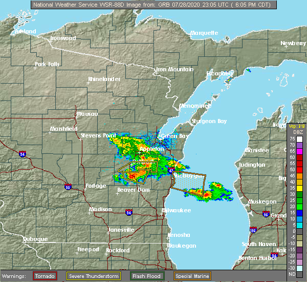 At 609 pm cdt, severe thunderstorms were located along a line extending from near chilton to near st anna to 6 miles east of southern lake winnebago, moving east at 50 mph (radar indicated). Hazards include 60 mph wind gusts. Expect damage to roofs, siding, and trees. Locations impacted include, chilton, st anna, central lake winnebago, kiel, new holstein, brothertown, stockbridge, wells, brant and killsnake wildlife area. At 609 pm cdt, severe thunderstorms were located along a line extending from near chilton to near st anna to 6 miles east of southern lake winnebago, moving east at 50 mph (radar indicated). Hazards include 60 mph wind gusts. Expect damage to roofs, siding, and trees. Locations impacted include, chilton, st anna, central lake winnebago, kiel, new holstein, brothertown, stockbridge, wells, brant and killsnake wildlife area.
|
| 7/28/2020 5:57 PM CDT |
 The national weather service in green bay has issued a * severe thunderstorm warning for. southern calumet county in east central wisconsin. southeastern winnebago county in east central wisconsin. until 645 pm cdt. At 556 pm cdt, a severe thunderstorm was located over southern lake. The national weather service in green bay has issued a * severe thunderstorm warning for. southern calumet county in east central wisconsin. southeastern winnebago county in east central wisconsin. until 645 pm cdt. At 556 pm cdt, a severe thunderstorm was located over southern lake.
|
| 6/2/2020 9:13 PM CDT |
 At 911 pm cdt, severe thunderstorms were located along a line extending from 6 miles southeast of denmark to 6 miles northwest of manitowoc to near valders to camp rokilio scout camp, moving east at 35 mph (radar indicated). Hazards include 60 mph wind gusts and nickel size hail. Expect damage to roofs, siding, and trees. locations impacted include, manitowoc, kewaunee, cleveland, valders, st. Nazianz, two creeks, camp rokilio scout camp, two rivers, kiel and newton. At 911 pm cdt, severe thunderstorms were located along a line extending from 6 miles southeast of denmark to 6 miles northwest of manitowoc to near valders to camp rokilio scout camp, moving east at 35 mph (radar indicated). Hazards include 60 mph wind gusts and nickel size hail. Expect damage to roofs, siding, and trees. locations impacted include, manitowoc, kewaunee, cleveland, valders, st. Nazianz, two creeks, camp rokilio scout camp, two rivers, kiel and newton.
|
| 6/2/2020 8:57 PM CDT |
 At 856 pm cdt, severe thunderstorms were located along a line extending from near brillion to 6 miles northwest of st. nazianz to 6 miles southeast of chilton to near st anna, moving east at 35 mph (radar indicated). Hazards include 60 mph wind gusts and nickel size hail. Expect damage to roofs, siding, and trees. locations impacted include, manitowoc, kewaunee, chilton, brillion, denmark, cleveland, valders, st. Nazianz, two creeks and st anna. At 856 pm cdt, severe thunderstorms were located along a line extending from near brillion to 6 miles northwest of st. nazianz to 6 miles southeast of chilton to near st anna, moving east at 35 mph (radar indicated). Hazards include 60 mph wind gusts and nickel size hail. Expect damage to roofs, siding, and trees. locations impacted include, manitowoc, kewaunee, chilton, brillion, denmark, cleveland, valders, st. Nazianz, two creeks and st anna.
|
| 6/2/2020 8:53 PM CDT |
 The severe thunderstorm warning for calumet and southeastern winnebago counties will expire at 900 pm cdt, the storms which prompted the warning have weakened below severe limits, and have exited the warned area. therefore, the warning will be allowed to expire. however small hail, gusty winds and heavy rain are still possible with these thunderstorms. a severe thunderstorm watch remains in effect until midnight cdt for east central wisconsin. a severe thunderstorm warning still remains in effect for eastern calumet county until 9:45 pm. The severe thunderstorm warning for calumet and southeastern winnebago counties will expire at 900 pm cdt, the storms which prompted the warning have weakened below severe limits, and have exited the warned area. therefore, the warning will be allowed to expire. however small hail, gusty winds and heavy rain are still possible with these thunderstorms. a severe thunderstorm watch remains in effect until midnight cdt for east central wisconsin. a severe thunderstorm warning still remains in effect for eastern calumet county until 9:45 pm.
|
| 6/2/2020 8:37 PM CDT |
 At 836 pm cdt, severe thunderstorms were located along a line extending from near high cliff state park to 7 miles southeast of northern lake winnebago to near central lake winnebago to near southern lake winnebago, moving east at 25 mph (radar indicated). Hazards include 60 mph wind gusts and nickel size hail. expect damage to roofs, siding, and trees At 836 pm cdt, severe thunderstorms were located along a line extending from near high cliff state park to 7 miles southeast of northern lake winnebago to near central lake winnebago to near southern lake winnebago, moving east at 25 mph (radar indicated). Hazards include 60 mph wind gusts and nickel size hail. expect damage to roofs, siding, and trees
|
| 6/2/2020 8:12 PM CDT |
 At 811 pm cdt, severe thunderstorms were located along a line extending from northern lake winnebago to central lake winnebago to near oshkosh to 8 miles northwest of north fond du lac, moving east at 35 mph (trained weather spotters). Hazards include 60 mph wind gusts and half dollar size hail. Hail damage to vehicles is expected. Expect wind damage to roofs, siding, and trees. At 811 pm cdt, severe thunderstorms were located along a line extending from northern lake winnebago to central lake winnebago to near oshkosh to 8 miles northwest of north fond du lac, moving east at 35 mph (trained weather spotters). Hazards include 60 mph wind gusts and half dollar size hail. Hail damage to vehicles is expected. Expect wind damage to roofs, siding, and trees.
|
| 4/20/2020 8:23 PM CDT |
 At 823 pm cdt, severe thunderstorms were located along a line extending from near two creeks to near manitowoc to near plymouth, moving east at 55 mph (radar indicated). Hazards include 60 mph wind gusts and penny size hail. Expect damage to roofs, siding, and trees. locations impacted include, green bay, manitowoc, kewaunee, bay shore park, algoma, luxemburg, denmark, cleveland, valders and st. Nazianz. At 823 pm cdt, severe thunderstorms were located along a line extending from near two creeks to near manitowoc to near plymouth, moving east at 55 mph (radar indicated). Hazards include 60 mph wind gusts and penny size hail. Expect damage to roofs, siding, and trees. locations impacted include, green bay, manitowoc, kewaunee, bay shore park, algoma, luxemburg, denmark, cleveland, valders and st. Nazianz.
|
| 4/20/2020 8:05 PM CDT |
 At 805 pm cdt, severe thunderstorms were located along a line extending from 6 miles northeast of bellevue town to 7 miles southwest of denmark to near southern lake winnebago, moving east at 60 mph (radar indicated). Hazards include 60 mph wind gusts and penny size hail. Expect damage to roofs, siding, and trees. these severe storms will be near, denmark around 810 pm cdt. chilton and luxemburg around 815 pm cdt. two creeks around 820 pm cdt. kewaunee, algoma, st. nazianz and camp rokilio scout camp around 825 pm cdt. cleveland around 830 pm cdt. Other locations impacted by these severe thunderstorms include curran, wayside, gregorville, rankin, newtonberg, howard, st john, shirley, potter and lincoln. At 805 pm cdt, severe thunderstorms were located along a line extending from 6 miles northeast of bellevue town to 7 miles southwest of denmark to near southern lake winnebago, moving east at 60 mph (radar indicated). Hazards include 60 mph wind gusts and penny size hail. Expect damage to roofs, siding, and trees. these severe storms will be near, denmark around 810 pm cdt. chilton and luxemburg around 815 pm cdt. two creeks around 820 pm cdt. kewaunee, algoma, st. nazianz and camp rokilio scout camp around 825 pm cdt. cleveland around 830 pm cdt. Other locations impacted by these severe thunderstorms include curran, wayside, gregorville, rankin, newtonberg, howard, st john, shirley, potter and lincoln.
|
| 4/20/2020 7:37 PM CDT |
 At 736 pm cdt, severe thunderstorms were located along a line extending from 6 miles northeast of black creek to appleton to near rush lake, moving east at 60 mph (radar indicated). Hazards include 60 mph wind gusts and penny size hail. Expect damage to roofs, siding, and trees. severe thunderstorms will be near, appleton, menasha, little chute, kimberly and darboy around 740 pm cdt. kaukauna and high cliff state park around 745 pm cdt. green bay, brillion and bellevue town around 755 pm cdt. central lake winnebago around 805 pm cdt. luxemburg around 810 pm cdt. st anna around 815 pm cdt. kewaunee and two creeks around 820 pm cdt. st. nazianz and camp rokilio scout camp around 825 pm cdt. Other locations impacted by these severe thunderstorms include pickett, butte des morts, curran, wayside, gregorville, rankin, rose lawn, freedom, newtonberg and harbor springs. At 736 pm cdt, severe thunderstorms were located along a line extending from 6 miles northeast of black creek to appleton to near rush lake, moving east at 60 mph (radar indicated). Hazards include 60 mph wind gusts and penny size hail. Expect damage to roofs, siding, and trees. severe thunderstorms will be near, appleton, menasha, little chute, kimberly and darboy around 740 pm cdt. kaukauna and high cliff state park around 745 pm cdt. green bay, brillion and bellevue town around 755 pm cdt. central lake winnebago around 805 pm cdt. luxemburg around 810 pm cdt. st anna around 815 pm cdt. kewaunee and two creeks around 820 pm cdt. st. nazianz and camp rokilio scout camp around 825 pm cdt. Other locations impacted by these severe thunderstorms include pickett, butte des morts, curran, wayside, gregorville, rankin, rose lawn, freedom, newtonberg and harbor springs.
|
| 8/7/2019 8:34 PM CDT |
 At 832 pm cdt, severe thunderstorms were located near new holstein and st. nazianz, moving east at 45 mph (radar indicated). Hazards include 60 mph wind gusts and quarter size hail. Hail damage to vehicles is expected. expect wind damage to roofs, siding, and trees. locations impacted include, manitowoc, cleveland, valders, st. Nazianz, st anna, camp rokilio scout camp, two rivers, kiel, new holstein and newton. At 832 pm cdt, severe thunderstorms were located near new holstein and st. nazianz, moving east at 45 mph (radar indicated). Hazards include 60 mph wind gusts and quarter size hail. Hail damage to vehicles is expected. expect wind damage to roofs, siding, and trees. locations impacted include, manitowoc, cleveland, valders, st. Nazianz, st anna, camp rokilio scout camp, two rivers, kiel, new holstein and newton.
|
| 8/7/2019 8:22 PM CDT |
 At 819 pm cdt, severe thunderstorms were located from waukau, oshkosh and brillion, east to manitowoc. the storms were moving east at 40 mph (radar indicated). Hazards include 60 mph wind gusts and quarter size hail. Hail damage to vehicles is expected. expect wind damage to roofs, siding, and trees. locations impacted include, oshkosh, manitowoc, chilton, brillion, cleveland, valders, st. Nazianz, st anna, camp rokilio scout camp and high cliff state park. At 819 pm cdt, severe thunderstorms were located from waukau, oshkosh and brillion, east to manitowoc. the storms were moving east at 40 mph (radar indicated). Hazards include 60 mph wind gusts and quarter size hail. Hail damage to vehicles is expected. expect wind damage to roofs, siding, and trees. locations impacted include, oshkosh, manitowoc, chilton, brillion, cleveland, valders, st. Nazianz, st anna, camp rokilio scout camp and high cliff state park.
|
| 8/7/2019 8:12 PM CDT |
 At 809 pm cdt, severe thunderstorms were located near oshkosh, neenah and chilton eastward to near manitowoc, moving east at 45 mph. oshkosh asos mearsured 71 mph wind gust at 759 pm cdt (radar indicated). Hazards include 65 mph wind gusts and quarter size hail. Hail damage to vehicles is expected. expect wind damage to roofs, siding, and trees. locations impacted include, appleton, oshkosh, manitowoc, menasha, chilton, brillion, cleveland, valders, st. Nazianz and st anna. At 809 pm cdt, severe thunderstorms were located near oshkosh, neenah and chilton eastward to near manitowoc, moving east at 45 mph. oshkosh asos mearsured 71 mph wind gust at 759 pm cdt (radar indicated). Hazards include 65 mph wind gusts and quarter size hail. Hail damage to vehicles is expected. expect wind damage to roofs, siding, and trees. locations impacted include, appleton, oshkosh, manitowoc, menasha, chilton, brillion, cleveland, valders, st. Nazianz and st anna.
|
| 8/7/2019 8:01 PM CDT |
 At 758 pm cdt, severe thunderstorms were located near lake poygan, menasha,oshkosh and chilton eastward into manitowoc county near manitowoc. storms were moving east at 40 mph (radar indicated). Hazards include 60 mph wind gusts and quarter size hail. Hail damage to vehicles is expected. Expect wind damage to roofs, siding, and trees. At 758 pm cdt, severe thunderstorms were located near lake poygan, menasha,oshkosh and chilton eastward into manitowoc county near manitowoc. storms were moving east at 40 mph (radar indicated). Hazards include 60 mph wind gusts and quarter size hail. Hail damage to vehicles is expected. Expect wind damage to roofs, siding, and trees.
|
| 7/20/2019 12:06 PM CDT |
 At 1205 pm cdt, severe thunderstorms were located along a line extending from 9 miles east of gillett to 9 miles northwest of bay shore park to 6 miles west of luxemburg to 6 miles northwest of two creeks to 8 miles northwest of manitowoc to near st anna, moving east at 55 mph. these are very dangerous storms (radar indicated). Hazards include 80 mph wind gusts. Flying debris will be dangerous to those caught without shelter. mobile homes will be heavily damaged. expect considerable damage to roofs, windows, and vehicles. extensive tree damage and power outages are likely. these severe storms will be near, bay shore park, luxemburg and two creeks around 1210 pm cdt. kewaunee and valders around 1215 pm cdt. other locations impacted by these severe thunderstorms include curran, wayside, gregorville, rankin, rose lawn, freedom, newtonberg, howard, st john and shirley. People at pulaski community park should seek safe shelter immediately!. At 1205 pm cdt, severe thunderstorms were located along a line extending from 9 miles east of gillett to 9 miles northwest of bay shore park to 6 miles west of luxemburg to 6 miles northwest of two creeks to 8 miles northwest of manitowoc to near st anna, moving east at 55 mph. these are very dangerous storms (radar indicated). Hazards include 80 mph wind gusts. Flying debris will be dangerous to those caught without shelter. mobile homes will be heavily damaged. expect considerable damage to roofs, windows, and vehicles. extensive tree damage and power outages are likely. these severe storms will be near, bay shore park, luxemburg and two creeks around 1210 pm cdt. kewaunee and valders around 1215 pm cdt. other locations impacted by these severe thunderstorms include curran, wayside, gregorville, rankin, rose lawn, freedom, newtonberg, howard, st john and shirley. People at pulaski community park should seek safe shelter immediately!.
|
| 7/20/2019 11:45 AM CDT |
 At 1144 am cdt, severe thunderstorms were located along a line extending from near legend lake to near pulaski to 8 miles west of green bay to 9 miles west of denmark to near brillion to near southern lake winnebago, moving east at 55 mph (radar indicated). Hazards include 70 mph wind gusts and quarter size hail. Hail damage to vehicles is expected. expect considerable tree damage. wind damage is also likely to mobile homes, roofs, and outbuildings. these severe storms will be near, green bay and brillion around 1150 am cdt. denmark, valders and bellevue town around 1155 am cdt. bay shore park, chilton and st anna around 1205 pm cdt. luxemburg and two creeks around 1210 pm cdt. kewaunee, st. nazianz and camp rokilio scout camp around 1215 pm cdt. other locations impacted by these severe thunderstorms include wayside, gregorville, freedom, whitcomb, allenville, frazer corners, metz, buckbee, uw fox valley and dyckesville. People at pulaski community park, downtown green bay, ford festival park, and experimental aircraft association grounds should seek safe shelter immediately! a tornado warning remains in effect until noon for western brown and outagamie counties. At 1144 am cdt, severe thunderstorms were located along a line extending from near legend lake to near pulaski to 8 miles west of green bay to 9 miles west of denmark to near brillion to near southern lake winnebago, moving east at 55 mph (radar indicated). Hazards include 70 mph wind gusts and quarter size hail. Hail damage to vehicles is expected. expect considerable tree damage. wind damage is also likely to mobile homes, roofs, and outbuildings. these severe storms will be near, green bay and brillion around 1150 am cdt. denmark, valders and bellevue town around 1155 am cdt. bay shore park, chilton and st anna around 1205 pm cdt. luxemburg and two creeks around 1210 pm cdt. kewaunee, st. nazianz and camp rokilio scout camp around 1215 pm cdt. other locations impacted by these severe thunderstorms include wayside, gregorville, freedom, whitcomb, allenville, frazer corners, metz, buckbee, uw fox valley and dyckesville. People at pulaski community park, downtown green bay, ford festival park, and experimental aircraft association grounds should seek safe shelter immediately! a tornado warning remains in effect until noon for western brown and outagamie counties.
|
| 7/20/2019 11:21 AM CDT |
 The national weather service in green bay has issued a * severe thunderstorm warning for. brown county in northeastern wisconsin. kewaunee county in northeastern wisconsin. calumet county in east central wisconsin. Winnebago county in east central wisconsin. The national weather service in green bay has issued a * severe thunderstorm warning for. brown county in northeastern wisconsin. kewaunee county in northeastern wisconsin. calumet county in east central wisconsin. Winnebago county in east central wisconsin.
|
| 7/19/2019 10:32 PM CDT |
 At 1032 pm cdt, severe thunderstorms were located along a line extending from 6 miles southeast of manitowoc to near ripon, moving southwest at 30 mph (radar indicated). Hazards include 60 mph wind gusts. expect damage to roofs, siding, and trees At 1032 pm cdt, severe thunderstorms were located along a line extending from 6 miles southeast of manitowoc to near ripon, moving southwest at 30 mph (radar indicated). Hazards include 60 mph wind gusts. expect damage to roofs, siding, and trees
|
| 7/19/2019 10:19 PM CDT |
 At 1019 pm cdt, severe thunderstorms were located along a line extending from 21 miles northwest of the big sable point lighthouse to 7 miles southeast of manitowoc to near green lake, moving east at 45 mph (radar indicated). Hazards include 60 mph wind gusts. Expect damage to roofs, siding, and trees. locations impacted include, oshkosh, manitowoc, chilton, brillion, cleveland, valders, st. nazianz, st anna, camp rokilio scout camp and central lake winnebago. People at ford festival park should seek safe shelter immediately!. At 1019 pm cdt, severe thunderstorms were located along a line extending from 21 miles northwest of the big sable point lighthouse to 7 miles southeast of manitowoc to near green lake, moving east at 45 mph (radar indicated). Hazards include 60 mph wind gusts. Expect damage to roofs, siding, and trees. locations impacted include, oshkosh, manitowoc, chilton, brillion, cleveland, valders, st. nazianz, st anna, camp rokilio scout camp and central lake winnebago. People at ford festival park should seek safe shelter immediately!.
|
| 7/19/2019 10:08 PM CDT |
 At 1008 pm cdt, severe thunderstorms were located along a line extending from 22 miles northwest of the big sable point lighthouse to 6 miles northeast of cleveland to near green lake, moving southeast at 50 mph (radar indicated). Hazards include 60 mph wind gusts. Expect damage to roofs, siding, and trees. locations impacted include, appleton, oshkosh, manitowoc, kewaunee, wautoma, menasha, kaukauna, kimberly, berlin and chilton. People at ford festival park should seek safe shelter immediately!. At 1008 pm cdt, severe thunderstorms were located along a line extending from 22 miles northwest of the big sable point lighthouse to 6 miles northeast of cleveland to near green lake, moving southeast at 50 mph (radar indicated). Hazards include 60 mph wind gusts. Expect damage to roofs, siding, and trees. locations impacted include, appleton, oshkosh, manitowoc, kewaunee, wautoma, menasha, kaukauna, kimberly, berlin and chilton. People at ford festival park should seek safe shelter immediately!.
|
| 7/19/2019 9:40 PM CDT |
 At 940 pm cdt, severe thunderstorms were located along a line extending from near algoma to near kaukauna to 11 miles southwest of plainfield, moving southeast at 70 mph (radar indicated). Hazards include 60 mph wind gusts. expect damage to roofs, siding, and trees At 940 pm cdt, severe thunderstorms were located along a line extending from near algoma to near kaukauna to 11 miles southwest of plainfield, moving southeast at 70 mph (radar indicated). Hazards include 60 mph wind gusts. expect damage to roofs, siding, and trees
|
| 6/27/2019 5:45 PM CDT |
 At 544 pm cdt, severe thunderstorms were located along a line extending from near denmark to near cleveland, moving northeast at 35 mph (radar indicated). Hazards include 60 mph wind gusts. Expect damage to roofs, siding, and trees. these severe storms will be near, manitowoc around 555 pm cdt. Other locations impacted by these severe thunderstorms include louis corners, st nazianz, mishicot, kellners corners, kellnersville, maribel, larrabee, two rivers, kiel and madsen. At 544 pm cdt, severe thunderstorms were located along a line extending from near denmark to near cleveland, moving northeast at 35 mph (radar indicated). Hazards include 60 mph wind gusts. Expect damage to roofs, siding, and trees. these severe storms will be near, manitowoc around 555 pm cdt. Other locations impacted by these severe thunderstorms include louis corners, st nazianz, mishicot, kellners corners, kellnersville, maribel, larrabee, two rivers, kiel and madsen.
|
| 6/27/2019 5:36 PM CDT |
 The severe thunderstorm warning for eastern calumet county will expire at 545 pm cdt, the storms which prompted the warning have moved out of the area. therefore, the warning will be allowed to expire. however heavy rain is still possible with these thunderstorms. a severe thunderstorm watch remains in effect until 700 pm cdt for northeastern and east central wisconsin. The severe thunderstorm warning for eastern calumet county will expire at 545 pm cdt, the storms which prompted the warning have moved out of the area. therefore, the warning will be allowed to expire. however heavy rain is still possible with these thunderstorms. a severe thunderstorm watch remains in effect until 700 pm cdt for northeastern and east central wisconsin.
|
| 6/27/2019 5:29 PM CDT |
 At 529 pm cdt, severe thunderstorms were located along a line extending from near kaukauna to brillion to near st. nazianz, moving east at 35 mph (radar indicated). Hazards include 60 mph wind gusts. Expect damage to roofs, siding, and trees. Locations impacted include, chilton, brillion, st anna, new holstein, sherwood, hilbert, potter, brant, killsnake wildlife area and charlesburg. At 529 pm cdt, severe thunderstorms were located along a line extending from near kaukauna to brillion to near st. nazianz, moving east at 35 mph (radar indicated). Hazards include 60 mph wind gusts. Expect damage to roofs, siding, and trees. Locations impacted include, chilton, brillion, st anna, new holstein, sherwood, hilbert, potter, brant, killsnake wildlife area and charlesburg.
|
| 6/27/2019 5:19 PM CDT |
 At 519 pm cdt, severe thunderstorms were located along a line extending from 6 miles northwest of brillion to near elkhart lake, moving northeast at 30 mph (radar indicated). Hazards include 60 mph wind gusts. Expect damage to roofs, siding, and trees. severe thunderstorms will be near, camp rokilio scout camp around 535 pm cdt. st. nazianz around 540 pm cdt. cleveland around 555 pm cdt. manitowoc around 600 pm cdt. Other locations impacted by these severe thunderstorms include louis corners, st nazianz, mishicot, kellners corners, kellnersville, maribel, larrabee, two rivers, kiel and madsen. At 519 pm cdt, severe thunderstorms were located along a line extending from 6 miles northwest of brillion to near elkhart lake, moving northeast at 30 mph (radar indicated). Hazards include 60 mph wind gusts. Expect damage to roofs, siding, and trees. severe thunderstorms will be near, camp rokilio scout camp around 535 pm cdt. st. nazianz around 540 pm cdt. cleveland around 555 pm cdt. manitowoc around 600 pm cdt. Other locations impacted by these severe thunderstorms include louis corners, st nazianz, mishicot, kellners corners, kellnersville, maribel, larrabee, two rivers, kiel and madsen.
|
| 6/27/2019 5:04 PM CDT |
 At 504 pm cdt, severe thunderstorms were located along a line extending from near appleton to near high cliff state park to 7 miles southeast of central lake winnebago, moving east at 35 mph (radar indicated). Hazards include 60 mph wind gusts. Expect damage to roofs, siding, and trees. these severe storms will be near, high cliff state park around 510 pm cdt. darboy and st anna around 515 pm cdt. chilton around 520 pm cdt. brillion around 525 pm cdt. Other locations impacted by these severe thunderstorms include brant, killsnake wildlife area, quinney, stockbridge, jericho, kloten, new holstein, charlesburg, sherwood and forest junction. At 504 pm cdt, severe thunderstorms were located along a line extending from near appleton to near high cliff state park to 7 miles southeast of central lake winnebago, moving east at 35 mph (radar indicated). Hazards include 60 mph wind gusts. Expect damage to roofs, siding, and trees. these severe storms will be near, high cliff state park around 510 pm cdt. darboy and st anna around 515 pm cdt. chilton around 520 pm cdt. brillion around 525 pm cdt. Other locations impacted by these severe thunderstorms include brant, killsnake wildlife area, quinney, stockbridge, jericho, kloten, new holstein, charlesburg, sherwood and forest junction.
|
| 6/27/2019 4:49 PM CDT |
 At 449 pm cdt, severe thunderstorms were located along a line extending from 8 miles west of menasha to near oshkosh to near southern lake winnebago, moving east at 35 mph (radar indicated). Hazards include 60 mph wind gusts. Expect damage to roofs, siding, and trees. severe thunderstorms will be near, central lake winnebago around 500 pm cdt. menasha and northern lake winnebago around 505 pm cdt. appleton and high cliff state park around 510 pm cdt. darboy and st anna around 515 pm cdt. chilton around 520 pm cdt. brillion around 525 pm cdt. Other locations impacted by these severe thunderstorms include brant, killsnake wildlife area, quinney, stockbridge, jericho, kloten, new holstein, charlesburg, sherwood and forest junction. At 449 pm cdt, severe thunderstorms were located along a line extending from 8 miles west of menasha to near oshkosh to near southern lake winnebago, moving east at 35 mph (radar indicated). Hazards include 60 mph wind gusts. Expect damage to roofs, siding, and trees. severe thunderstorms will be near, central lake winnebago around 500 pm cdt. menasha and northern lake winnebago around 505 pm cdt. appleton and high cliff state park around 510 pm cdt. darboy and st anna around 515 pm cdt. chilton around 520 pm cdt. brillion around 525 pm cdt. Other locations impacted by these severe thunderstorms include brant, killsnake wildlife area, quinney, stockbridge, jericho, kloten, new holstein, charlesburg, sherwood and forest junction.
|
| 8/28/2018 4:44 PM CDT | Storm damage reported in manitowoc county WI, 3.6 miles W of Kiel, WI |
| 8/28/2018 4:38 PM CDT |
 At 438 pm cdt, severe thunderstorms capable of producing both tornadoes and extensive straight line wind damage were located near st. nazianz, or 11 miles northwest of howards grove, moving east at 40 mph (radar indicated rotation). Hazards include tornado. Flying debris will be dangerous to those caught without shelter. mobile homes will be damaged or destroyed. damage to roofs, windows, and vehicles will occur. tree damage is likely. these dangerous storms will be near, manitowoc and cleveland around 455 pm cdt. Other locations impacted by this tornadic thunderstorm include louis corners, st nazianz, newton, steinthal, clover, osman, millhome, school hill, newtonberg and spring valley. At 438 pm cdt, severe thunderstorms capable of producing both tornadoes and extensive straight line wind damage were located near st. nazianz, or 11 miles northwest of howards grove, moving east at 40 mph (radar indicated rotation). Hazards include tornado. Flying debris will be dangerous to those caught without shelter. mobile homes will be damaged or destroyed. damage to roofs, windows, and vehicles will occur. tree damage is likely. these dangerous storms will be near, manitowoc and cleveland around 455 pm cdt. Other locations impacted by this tornadic thunderstorm include louis corners, st nazianz, newton, steinthal, clover, osman, millhome, school hill, newtonberg and spring valley.
|
| 8/28/2018 4:35 PM CDT | Numerous trees and power lines down around the kiel area. delayed report time estimated by rada in manitowoc county WI, 0.7 miles NE of Kiel, WI |
| 8/28/2018 4:35 PM CDT |
 At 434 pm cdt, severe thunderstorms were located along a line extending from 7 miles south of denmark to st anna, moving east at 35 mph (radar indicated). Hazards include 60 mph wind gusts. Expect damage to roofs, siding, and trees. locations impacted include, st. Nazianz, st anna, kiel, new holstein, reedsville, maple grove, wells, louis corners, killsnake wildlife area and grimms. At 434 pm cdt, severe thunderstorms were located along a line extending from 7 miles south of denmark to st anna, moving east at 35 mph (radar indicated). Hazards include 60 mph wind gusts. Expect damage to roofs, siding, and trees. locations impacted include, st. Nazianz, st anna, kiel, new holstein, reedsville, maple grove, wells, louis corners, killsnake wildlife area and grimms.
|
| 8/28/2018 4:33 PM CDT |
 At 433 pm cdt, a severe thunderstorm capable of producing a tornado was located near st. nazianz, or 14 miles northwest of howards grove, moving east at 40 mph (radar indicated rotation). Hazards include tornado. Flying debris will be dangerous to those caught without shelter. mobile homes will be damaged or destroyed. damage to roofs, windows, and vehicles will occur. tree damage is likely. this dangerous storm will be near, st. nazianz around 440 pm cdt. Other locations impacted by this tornadic thunderstorm include louis corners, killsnake wildlife area, collins, steinthal, kiel, meggers, millhome and new holstein. At 433 pm cdt, a severe thunderstorm capable of producing a tornado was located near st. nazianz, or 14 miles northwest of howards grove, moving east at 40 mph (radar indicated rotation). Hazards include tornado. Flying debris will be dangerous to those caught without shelter. mobile homes will be damaged or destroyed. damage to roofs, windows, and vehicles will occur. tree damage is likely. this dangerous storm will be near, st. nazianz around 440 pm cdt. Other locations impacted by this tornadic thunderstorm include louis corners, killsnake wildlife area, collins, steinthal, kiel, meggers, millhome and new holstein.
|
| 8/28/2018 4:30 PM CDT | Barn down on hwy x and 67. delayed report time estimated by rada in manitowoc county WI, 2.2 miles S of Kiel, WI |
| 8/28/2018 4:27 PM CDT |
 At 422 pm cdt, a severe thunderstorm capable of producing a tornado was located near chilton, or 17 miles east of oshkosh, moving east at 35 mph (radar indicated rotation). Hazards include tornado. Flying debris will be dangerous to those caught without shelter. mobile homes will be damaged or destroyed. damage to roofs, windows, and vehicles will occur. tree damage is likely. this dangerous storm will be near, chilton and st anna around 425 pm cdt. st. nazianz around 445 pm cdt. Other locations impacted by this tornadic thunderstorm include louis corners, brant, killsnake wildlife area, kiel, jericho, millhome, kloten, new holstein, charlesburg and collins. At 422 pm cdt, a severe thunderstorm capable of producing a tornado was located near chilton, or 17 miles east of oshkosh, moving east at 35 mph (radar indicated rotation). Hazards include tornado. Flying debris will be dangerous to those caught without shelter. mobile homes will be damaged or destroyed. damage to roofs, windows, and vehicles will occur. tree damage is likely. this dangerous storm will be near, chilton and st anna around 425 pm cdt. st. nazianz around 445 pm cdt. Other locations impacted by this tornadic thunderstorm include louis corners, brant, killsnake wildlife area, kiel, jericho, millhome, kloten, new holstein, charlesburg and collins.
|
| 8/28/2018 4:20 PM CDT |
 At 419 pm cdt, severe thunderstorms were located along a line extending from near brillion to near southern lake winnebago, moving east at 40 mph (radar indicated). Hazards include 60 mph wind gusts. Expect damage to roofs, siding, and trees. locations impacted include, chilton, brillion, st. Nazianz, st anna, central lake winnebago, kiel, new holstein, morrison, brothertown and reedsville. At 419 pm cdt, severe thunderstorms were located along a line extending from near brillion to near southern lake winnebago, moving east at 40 mph (radar indicated). Hazards include 60 mph wind gusts. Expect damage to roofs, siding, and trees. locations impacted include, chilton, brillion, st. Nazianz, st anna, central lake winnebago, kiel, new holstein, morrison, brothertown and reedsville.
|
| 8/28/2018 4:03 PM CDT |
 At 403 pm cdt, severe thunderstorms were located along a line extending from darboy to 6 miles west of southern lake winnebago, moving east at 35 mph (radar indicated). Hazards include 60 mph wind gusts. expect damage to roofs, siding, and trees At 403 pm cdt, severe thunderstorms were located along a line extending from darboy to 6 miles west of southern lake winnebago, moving east at 35 mph (radar indicated). Hazards include 60 mph wind gusts. expect damage to roofs, siding, and trees
|
| 8/27/2018 11:10 PM CDT | Report of a tree down on power line in manitowoc county WI, 0.7 miles NE of Kiel, WI |
| 8/27/2018 10:53 PM CDT | Tree down. time estimated by radar. delayed repor in manitowoc county WI, 0.7 miles NE of Kiel, WI |
| 7/15/2017 9:11 PM CDT |
 At 910 pm cdt, severe thunderstorms were located along a line extending from near valders to near st. nazianz to near chilton to near central lake winnebago to near northern lake winnebago, moving south at 35 mph (radar indicated). Hazards include 60 mph wind gusts. Expect damage to roofs, siding, and trees. these severe storms will be near, st anna around 925 pm cdt. southern lake winnebago around 930 pm cdt. Other locations impacted by these severe thunderstorms include brant, killsnake wildlife area, quinney, stockbridge, jericho, kloten, new holstein, charlesburg, brothertown and collins. At 910 pm cdt, severe thunderstorms were located along a line extending from near valders to near st. nazianz to near chilton to near central lake winnebago to near northern lake winnebago, moving south at 35 mph (radar indicated). Hazards include 60 mph wind gusts. Expect damage to roofs, siding, and trees. these severe storms will be near, st anna around 925 pm cdt. southern lake winnebago around 930 pm cdt. Other locations impacted by these severe thunderstorms include brant, killsnake wildlife area, quinney, stockbridge, jericho, kloten, new holstein, charlesburg, brothertown and collins.
|
| 7/15/2017 8:59 PM CDT |
 At 858 pm cdt, severe thunderstorms were located along a line extending from 12 miles southwest of denmark to brillion to near high cliff state park to near northern lake winnebago to near menasha, moving south at 30 mph (radar indicated). Hazards include 70 mph wind gusts and penny size hail. Expect considerable tree damage. damage is likely to mobile homes, roofs, and outbuildings. these severe storms will be near, chilton around 920 pm cdt. central lake winnebago, st anna and southern lake winnebago around 930 pm cdt. Other locations impacted by these severe thunderstorms include killsnake wildlife area, jericho, reedsville, charlesburg, brothertown, st john, potter, brant, quinney and stockbridge. At 858 pm cdt, severe thunderstorms were located along a line extending from 12 miles southwest of denmark to brillion to near high cliff state park to near northern lake winnebago to near menasha, moving south at 30 mph (radar indicated). Hazards include 70 mph wind gusts and penny size hail. Expect considerable tree damage. damage is likely to mobile homes, roofs, and outbuildings. these severe storms will be near, chilton around 920 pm cdt. central lake winnebago, st anna and southern lake winnebago around 930 pm cdt. Other locations impacted by these severe thunderstorms include killsnake wildlife area, jericho, reedsville, charlesburg, brothertown, st john, potter, brant, quinney and stockbridge.
|
| 7/15/2017 8:47 PM CDT |
 At 846 pm cdt, severe thunderstorms were located along a line extending from 9 miles southwest of denmark to near brillion to near high cliff state park to darboy, moving south at 35 mph (radar indicated). Hazards include 70 mph wind gusts and penny size hail. Expect considerable tree damage. damage is likely to mobile homes, roofs, and outbuildings. these severe storms will be near, brillion and high cliff state park around 855 pm cdt. northern lake winnebago around 900 pm cdt. chilton around 905 pm cdt. oshkosh around 915 pm cdt. central lake winnebago around 920 pm cdt. st anna around 925 pm cdt. southern lake winnebago around 930 pm cdt. other locations impacted by these severe thunderstorms include killsnake wildlife area, mackville, morrison, jericho, reedsville, charlesburg, brothertown, askeaton, st john and potter. People at sunset park in kimberly should seek safe shelter immediately!. At 846 pm cdt, severe thunderstorms were located along a line extending from 9 miles southwest of denmark to near brillion to near high cliff state park to darboy, moving south at 35 mph (radar indicated). Hazards include 70 mph wind gusts and penny size hail. Expect considerable tree damage. damage is likely to mobile homes, roofs, and outbuildings. these severe storms will be near, brillion and high cliff state park around 855 pm cdt. northern lake winnebago around 900 pm cdt. chilton around 905 pm cdt. oshkosh around 915 pm cdt. central lake winnebago around 920 pm cdt. st anna around 925 pm cdt. southern lake winnebago around 930 pm cdt. other locations impacted by these severe thunderstorms include killsnake wildlife area, mackville, morrison, jericho, reedsville, charlesburg, brothertown, askeaton, st john and potter. People at sunset park in kimberly should seek safe shelter immediately!.
|
| 7/15/2017 8:34 PM CDT |
 At 833 pm cdt, severe thunderstorms were located along a line extending from 6 miles southwest of bellevue town to 10 miles north of brillion to near kaukauna to near little chute to near black creek, moving south at 30 mph (radar indicated). Hazards include 70 mph wind gusts and nickel size hail. Expect considerable tree damage. damage is likely to mobile homes, roofs, and outbuildings. severe thunderstorms will be near, appleton, kaukauna, little chute and kimberly around 840 pm cdt. darboy around 845 pm cdt. menasha and high cliff state park around 855 pm cdt. northern lake winnebago around 905 pm cdt. brillion around 910 pm cdt. chilton around 920 pm cdt. oshkosh around 925 pm cdt. central lake winnebago, southern lake winnebago and st anna around 930 pm cdt. other locations impacted by these severe thunderstorms include killsnake wildlife area, mackville, morrison, jericho, reedsville, charlesburg, brothertown, askeaton, st john and potter. People at sunset park in kimberly should seek safe shelter immediately!. At 833 pm cdt, severe thunderstorms were located along a line extending from 6 miles southwest of bellevue town to 10 miles north of brillion to near kaukauna to near little chute to near black creek, moving south at 30 mph (radar indicated). Hazards include 70 mph wind gusts and nickel size hail. Expect considerable tree damage. damage is likely to mobile homes, roofs, and outbuildings. severe thunderstorms will be near, appleton, kaukauna, little chute and kimberly around 840 pm cdt. darboy around 845 pm cdt. menasha and high cliff state park around 855 pm cdt. northern lake winnebago around 905 pm cdt. brillion around 910 pm cdt. chilton around 920 pm cdt. oshkosh around 925 pm cdt. central lake winnebago, southern lake winnebago and st anna around 930 pm cdt. other locations impacted by these severe thunderstorms include killsnake wildlife area, mackville, morrison, jericho, reedsville, charlesburg, brothertown, askeaton, st john and potter. People at sunset park in kimberly should seek safe shelter immediately!.
|
| 7/7/2017 5:36 PM CDT | Half Dollar sized hail reported 6.5 miles WSW of Kiel, WI, fox 11. |
| 6/14/2017 3:25 PM CDT |
 At 325 pm cdt, severe thunderstorms were located along a line extending from near clintonville to 6 miles north of new london to 9 miles southwest of black creek to near central lake winnebago, moving northeast at 55 mph (radar indicated). Hazards include 60 mph wind gusts and quarter size hail. Hail damage to vehicles is expected. Expect wind damage to roofs, siding, and trees. At 325 pm cdt, severe thunderstorms were located along a line extending from near clintonville to 6 miles north of new london to 9 miles southwest of black creek to near central lake winnebago, moving northeast at 55 mph (radar indicated). Hazards include 60 mph wind gusts and quarter size hail. Hail damage to vehicles is expected. Expect wind damage to roofs, siding, and trees.
|
| 6/12/2017 8:04 PM CDT |
 At 803 pm cdt, a severe thunderstorm was located over valders, or 9 miles west of manitowoc, moving east at 25 mph (trained weather spotters at new holstein reported trees down). Hazards include 60 mph wind gusts. Expect damage to roofs, siding, and trees. locations impacted include, manitowoc, brillion, cleveland, valders, st. Nazianz, two creeks, two rivers, kiel, new holstein and newton. At 803 pm cdt, a severe thunderstorm was located over valders, or 9 miles west of manitowoc, moving east at 25 mph (trained weather spotters at new holstein reported trees down). Hazards include 60 mph wind gusts. Expect damage to roofs, siding, and trees. locations impacted include, manitowoc, brillion, cleveland, valders, st. Nazianz, two creeks, two rivers, kiel, new holstein and newton.
|
| 6/12/2017 7:44 PM CDT |
 At 743 pm cdt, a severe thunderstorm was located near chilton, or 18 miles northwest of howards grove, moving east at 30 mph (radar indicated). Hazards include 60 mph wind gusts. expect damage to roofs, siding, and trees At 743 pm cdt, a severe thunderstorm was located near chilton, or 18 miles northwest of howards grove, moving east at 30 mph (radar indicated). Hazards include 60 mph wind gusts. expect damage to roofs, siding, and trees
|
| 6/12/2017 7:41 PM CDT | A few trees down in the kiel area. time estimated via rada in manitowoc county WI, 0.7 miles NE of Kiel, WI |
| 6/12/2017 7:36 PM CDT |
 At 735 pm cdt, a severe thunderstorm was located 10 miles east of chilton, or 20 miles southeast of appleton, moving east at 30 mph (radar indicated). Hazards include 60 mph wind gusts and penny size hail. Expect damage to roofs, siding, and trees. Locations impacted include, chilton, brillion, high cliff state park, st anna, central lake winnebago, northern lake winnebago, harrison, new holstein, sherwood and brothertown. At 735 pm cdt, a severe thunderstorm was located 10 miles east of chilton, or 20 miles southeast of appleton, moving east at 30 mph (radar indicated). Hazards include 60 mph wind gusts and penny size hail. Expect damage to roofs, siding, and trees. Locations impacted include, chilton, brillion, high cliff state park, st anna, central lake winnebago, northern lake winnebago, harrison, new holstein, sherwood and brothertown.
|
| 6/12/2017 7:26 PM CDT |
 At 726 pm cdt, a severe thunderstorm was located over chilton, or 18 miles southeast of appleton, moving northeast at 35 mph (radar indicated). Hazards include 60 mph wind gusts. Expect damage to roofs, siding, and trees. Locations impacted include, appleton, menasha, chilton, brillion, st anna, central lake winnebago, northern lake winnebago, darboy, high cliff state park and harrison. At 726 pm cdt, a severe thunderstorm was located over chilton, or 18 miles southeast of appleton, moving northeast at 35 mph (radar indicated). Hazards include 60 mph wind gusts. Expect damage to roofs, siding, and trees. Locations impacted include, appleton, menasha, chilton, brillion, st anna, central lake winnebago, northern lake winnebago, darboy, high cliff state park and harrison.
|
| 6/12/2017 7:10 PM CDT |
 At 709 pm cdt, a severe thunderstorm was located near high cliff state park, or 11 miles northeast of oshkosh, moving northeast at 45 mph (radar indicated). Hazards include 60 mph wind gusts. Expect damage to roofs, siding, and trees. Locations impacted include, appleton, oshkosh, menasha, chilton, brillion, st anna, central lake winnebago, northern lake winnebago, darboy and high cliff state park. At 709 pm cdt, a severe thunderstorm was located near high cliff state park, or 11 miles northeast of oshkosh, moving northeast at 45 mph (radar indicated). Hazards include 60 mph wind gusts. Expect damage to roofs, siding, and trees. Locations impacted include, appleton, oshkosh, menasha, chilton, brillion, st anna, central lake winnebago, northern lake winnebago, darboy and high cliff state park.
|
| 6/12/2017 6:53 PM CDT |
 At 653 pm cdt, a severe thunderstorm was located 7 miles northeast of rush lake, or 8 miles west of oshkosh, moving northeast at 50 mph (radar indicated). Hazards include 60 mph wind gusts and penny size hail. expect damage to roofs, siding, and trees At 653 pm cdt, a severe thunderstorm was located 7 miles northeast of rush lake, or 8 miles west of oshkosh, moving northeast at 50 mph (radar indicated). Hazards include 60 mph wind gusts and penny size hail. expect damage to roofs, siding, and trees
|
| 5/17/2017 10:35 PM CDT |
 A severe thunderstorm warning remains in effect until 1115 pm cdt for brown. kewaunee. southern oconto. northeastern outagamie. manitowoc and eastern shawano counties. At 1034 pm cdt, severe thunderstorms were located along a line extending from near gillett to near green bay to near bellevue town to near cleveland, moving northeast at 55 mph. A severe thunderstorm warning remains in effect until 1115 pm cdt for brown. kewaunee. southern oconto. northeastern outagamie. manitowoc and eastern shawano counties. At 1034 pm cdt, severe thunderstorms were located along a line extending from near gillett to near green bay to near bellevue town to near cleveland, moving northeast at 55 mph.
|
| 5/17/2017 10:35 PM CDT |
 At 1034 pm cdt, severe thunderstorms were located along a line extending from near gillett to near green bay to near bellevue town to near cleveland, moving northeast at 55 mph (radar indicated). Hazards include 60 mph wind gusts. a wind gust to 55 mph was reported at austin straubel airport in green bay. Expect damage to roofs, siding, and trees. these severe storms will be near, manitowoc around 1040 pm cdt. bay shore park around 1050 pm cdt. luxemburg around 1055 pm cdt. other locations impacted by these severe thunderstorms include curran, wayside, gregorville, rankin, newtonberg, howard, shirley, lincoln, cooperstown and stiles. A tornado watch remains in effect until 100 am cdt for northeastern and east central wisconsin. At 1034 pm cdt, severe thunderstorms were located along a line extending from near gillett to near green bay to near bellevue town to near cleveland, moving northeast at 55 mph (radar indicated). Hazards include 60 mph wind gusts. a wind gust to 55 mph was reported at austin straubel airport in green bay. Expect damage to roofs, siding, and trees. these severe storms will be near, manitowoc around 1040 pm cdt. bay shore park around 1050 pm cdt. luxemburg around 1055 pm cdt. other locations impacted by these severe thunderstorms include curran, wayside, gregorville, rankin, newtonberg, howard, shirley, lincoln, cooperstown and stiles. A tornado watch remains in effect until 100 am cdt for northeastern and east central wisconsin.
|
| 5/17/2017 10:25 PM CDT |
 At 1025 pm cdt, severe thunderstorms were located along a line extending from near legend lake to 10 miles west of green bay to 9 miles northeast of kaukauna to near st anna, moving northeast at 55 mph (radar indicated). Hazards include 60 mph wind gusts. Expect damage to roofs, siding, and trees. these severe storms will be near, green bay, st. nazianz and bellevue town around 1035 pm cdt. denmark, gillett and valders around 1040 pm cdt. manitowoc around 1045 pm cdt. bay shore park and luxemburg around 1050 pm cdt. kewaunee around 1100 pm cdt. other locations impacted by these severe thunderstorms include curran, wayside, gregorville, rankin, rose lawn, hayes, freedom, newtonberg, howard and st john. A tornado watch remains in effect until 100 am cdt for northeastern and east central wisconsin. At 1025 pm cdt, severe thunderstorms were located along a line extending from near legend lake to 10 miles west of green bay to 9 miles northeast of kaukauna to near st anna, moving northeast at 55 mph (radar indicated). Hazards include 60 mph wind gusts. Expect damage to roofs, siding, and trees. these severe storms will be near, green bay, st. nazianz and bellevue town around 1035 pm cdt. denmark, gillett and valders around 1040 pm cdt. manitowoc around 1045 pm cdt. bay shore park and luxemburg around 1050 pm cdt. kewaunee around 1100 pm cdt. other locations impacted by these severe thunderstorms include curran, wayside, gregorville, rankin, rose lawn, hayes, freedom, newtonberg, howard and st john. A tornado watch remains in effect until 100 am cdt for northeastern and east central wisconsin.
|
| 5/17/2017 10:14 PM CDT |
 At 1013 pm cdt, severe thunderstorms were located along a line extending from near shawano to 6 miles southeast of black creek to near st anna, moving northeast at 55 mph (radar indicated). Hazards include 60 mph wind gusts. a gust to 61 mph was reported at appleton international airport at 1005 pm. expect damage to roofs, siding, and trees At 1013 pm cdt, severe thunderstorms were located along a line extending from near shawano to 6 miles southeast of black creek to near st anna, moving northeast at 55 mph (radar indicated). Hazards include 60 mph wind gusts. a gust to 61 mph was reported at appleton international airport at 1005 pm. expect damage to roofs, siding, and trees
|
| 7/21/2016 9:56 AM CDT |
 The severe thunderstorm warning for southern manitowoc county will expire at 1000 am cdt, the storms which prompted the warning have moved out of the area. therefore the warning will be allowed to expire. however heavy rain is still possible with these thunderstorms. a severe thunderstorm watch remains in effect until 1100 am cdt for east central wisconsin. to report severe weather, contact your nearest law enforcement agency. they will relay your report to the national weather service green bay. The severe thunderstorm warning for southern manitowoc county will expire at 1000 am cdt, the storms which prompted the warning have moved out of the area. therefore the warning will be allowed to expire. however heavy rain is still possible with these thunderstorms. a severe thunderstorm watch remains in effect until 1100 am cdt for east central wisconsin. to report severe weather, contact your nearest law enforcement agency. they will relay your report to the national weather service green bay.
|
| 7/21/2016 9:46 AM CDT |
 At 946 am cdt, severe thunderstorms were located along a line extending from 17 miles east of manitowoc to 9 miles east of cleveland, moving southeast at 45 mph (radar indicated). Hazards include 60 mph wind gusts. Expect damage to roofs. siding. and trees. locations impacted include, manitowoc, cleveland, st. Nazianz, two rivers, kiel, newton, spring valley, clover, millhome and osman. At 946 am cdt, severe thunderstorms were located along a line extending from 17 miles east of manitowoc to 9 miles east of cleveland, moving southeast at 45 mph (radar indicated). Hazards include 60 mph wind gusts. Expect damage to roofs. siding. and trees. locations impacted include, manitowoc, cleveland, st. Nazianz, two rivers, kiel, newton, spring valley, clover, millhome and osman.
|
| 7/21/2016 9:32 AM CDT |
 At 932 am cdt, severe thunderstorms were located along a line extending from 11 miles northeast of manitowoc to near cleveland, moving east at 45 mph (radar indicated). Hazards include 60 mph wind gusts and penny size hail. Expect damage to roofs. siding. and trees. locations impacted include, manitowoc, cleveland, valders, st. Nazianz, two creeks, two rivers, kiel, newton, cato and mishicot. At 932 am cdt, severe thunderstorms were located along a line extending from 11 miles northeast of manitowoc to near cleveland, moving east at 45 mph (radar indicated). Hazards include 60 mph wind gusts and penny size hail. Expect damage to roofs. siding. and trees. locations impacted include, manitowoc, cleveland, valders, st. Nazianz, two creeks, two rivers, kiel, newton, cato and mishicot.
|
| 7/21/2016 9:24 AM CDT |
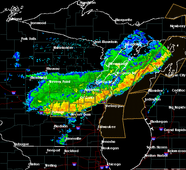 At 924 am cdt, severe thunderstorms were located along a line extending from st. nazianz to fond du lac, moving southeast at 45 mph (radar indicated). Hazards include 60 mph wind gusts and nickel size hail. Expect damage to roofs. siding. and trees. These severe thunderstorms will remain over mainly rural areas of southern calumet county, including the following locations: potter, brant, hilbert, jericho, quinney, charlesburg, new holstein, brothertown, stockbridge and hayton. At 924 am cdt, severe thunderstorms were located along a line extending from st. nazianz to fond du lac, moving southeast at 45 mph (radar indicated). Hazards include 60 mph wind gusts and nickel size hail. Expect damage to roofs. siding. and trees. These severe thunderstorms will remain over mainly rural areas of southern calumet county, including the following locations: potter, brant, hilbert, jericho, quinney, charlesburg, new holstein, brothertown, stockbridge and hayton.
|
| 7/21/2016 9:03 AM CDT |
 At 903 am cdt, severe thunderstorms were located along a line extending from 6 miles southeast of kewaunee to near brillion, moving southeast at 50 mph (radar indicated). Hazards include 60 mph wind gusts and nickel size hail. Expect damage to roofs. siding. and trees. these severe storms will be near, manitowoc around 925 am cdt. cleveland around 930 am cdt. Other locations impacted by these severe thunderstorms include grimms, branch, cooperstown, melnik, st nazianz, clarks mills, newton, reifs mills, clover and spring valley. At 903 am cdt, severe thunderstorms were located along a line extending from 6 miles southeast of kewaunee to near brillion, moving southeast at 50 mph (radar indicated). Hazards include 60 mph wind gusts and nickel size hail. Expect damage to roofs. siding. and trees. these severe storms will be near, manitowoc around 925 am cdt. cleveland around 930 am cdt. Other locations impacted by these severe thunderstorms include grimms, branch, cooperstown, melnik, st nazianz, clarks mills, newton, reifs mills, clover and spring valley.
|
| 7/21/2016 9:01 AM CDT |
 At 901 am cdt, severe thunderstorms were located along a line extending from 6 miles southwest of brillion to near rush lake, moving south at 35 mph (radar indicated). Hazards include 60 mph wind gusts and nickel size hail. Expect damage to roofs. siding. and trees. these severe storms will be near, chilton around 915 am cdt. st anna around 930 am cdt. Other locations impacted by these severe thunderstorms include wittman field, jericho, allenville, ring, harrison, forest junction, pickett, sherwood, harbor springs and eureka. At 901 am cdt, severe thunderstorms were located along a line extending from 6 miles southwest of brillion to near rush lake, moving south at 35 mph (radar indicated). Hazards include 60 mph wind gusts and nickel size hail. Expect damage to roofs. siding. and trees. these severe storms will be near, chilton around 915 am cdt. st anna around 930 am cdt. Other locations impacted by these severe thunderstorms include wittman field, jericho, allenville, ring, harrison, forest junction, pickett, sherwood, harbor springs and eureka.
|
| 7/21/2016 8:41 AM CDT |
 At 841 am cdt, severe thunderstorms were located along a line extending from luxemburg to kimberly, moving southeast at 45 mph (radar indicated). Hazards include 60 mph wind gusts and nickel size hail. Expect damage to roofs. siding. and trees. these severe storms will be near, kewaunee around 855 am cdt. valders and st. nazianz around 915 am cdt. manitowoc around 925 am cdt. cleveland around 930 am cdt. Other locations impacted by these severe thunderstorms include grimms, branch, cooperstown, melnik, st nazianz, clarks mills, newton, reifs mills, clover and spring valley. At 841 am cdt, severe thunderstorms were located along a line extending from luxemburg to kimberly, moving southeast at 45 mph (radar indicated). Hazards include 60 mph wind gusts and nickel size hail. Expect damage to roofs. siding. and trees. these severe storms will be near, kewaunee around 855 am cdt. valders and st. nazianz around 915 am cdt. manitowoc around 925 am cdt. cleveland around 930 am cdt. Other locations impacted by these severe thunderstorms include grimms, branch, cooperstown, melnik, st nazianz, clarks mills, newton, reifs mills, clover and spring valley.
|
| 7/21/2016 8:39 AM CDT |
 At 839 am cdt, severe thunderstorms were located along a line extending from luxemburg to kimberly, moving southeast at 45 mph (radar indicated). Hazards include 60 mph wind gusts and nickel size hail. Expect damage to roofs. siding. and trees. severe thunderstorms will be near, kewaunee around 855 am cdt. valders and st. nazianz around 915 am cdt. cleveland around 930 am cdt. Other locations impacted by these severe thunderstorms include grimms, branch, cooperstown, melnik, st nazianz, clarks mills, newton, reifs mills, clover and spring valley. At 839 am cdt, severe thunderstorms were located along a line extending from luxemburg to kimberly, moving southeast at 45 mph (radar indicated). Hazards include 60 mph wind gusts and nickel size hail. Expect damage to roofs. siding. and trees. severe thunderstorms will be near, kewaunee around 855 am cdt. valders and st. nazianz around 915 am cdt. cleveland around 930 am cdt. Other locations impacted by these severe thunderstorms include grimms, branch, cooperstown, melnik, st nazianz, clarks mills, newton, reifs mills, clover and spring valley.
|
| 7/21/2016 8:37 AM CDT |
 At 837 am cdt, severe thunderstorms were located along a line extending from near kaukauna to near lake poygan, moving east at 55 mph (radar indicated). Hazards include 60 mph wind gusts and nickel size hail. Expect damage to roofs. siding. and trees. these severe storms will be near, oshkosh around 855 am cdt. southern lake winnebago around 900 am cdt. central lake winnebago around 905 am cdt. chilton around 915 am cdt. st anna around 920 am cdt. Other locations impacted by these severe thunderstorms include wittman field, jericho, allenville, ring, harrison, forest junction, pickett, sherwood, mikesville and harbor springs. At 837 am cdt, severe thunderstorms were located along a line extending from near kaukauna to near lake poygan, moving east at 55 mph (radar indicated). Hazards include 60 mph wind gusts and nickel size hail. Expect damage to roofs. siding. and trees. these severe storms will be near, oshkosh around 855 am cdt. southern lake winnebago around 900 am cdt. central lake winnebago around 905 am cdt. chilton around 915 am cdt. st anna around 920 am cdt. Other locations impacted by these severe thunderstorms include wittman field, jericho, allenville, ring, harrison, forest junction, pickett, sherwood, mikesville and harbor springs.
|
| 7/21/2016 8:16 AM CDT |
 At 816 am cdt, severe thunderstorms were located along a line extending from new london to 8 miles south of chain o` lakes- king, moving southeast at 45 mph (law enforcement). Hazards include 60 mph wind gusts and quarter size hail. Hail damage to vehicles is expected. expect wind damage to roofs, siding, and trees. severe thunderstorms will be near, lake poygan around 830 am cdt. appleton around 835 am cdt. menasha around 840 am cdt. rush lake around 845 am cdt. northern lake winnebago and high cliff state park around 850 am cdt. chilton and southern lake winnebago around 905 am cdt. st anna around 910 am cdt. Other locations impacted by these severe thunderstorms include wittman field, jericho, allenville, ring, harrison, forest junction, pickett, sherwood, mikesville and harbor springs. At 816 am cdt, severe thunderstorms were located along a line extending from new london to 8 miles south of chain o` lakes- king, moving southeast at 45 mph (law enforcement). Hazards include 60 mph wind gusts and quarter size hail. Hail damage to vehicles is expected. expect wind damage to roofs, siding, and trees. severe thunderstorms will be near, lake poygan around 830 am cdt. appleton around 835 am cdt. menasha around 840 am cdt. rush lake around 845 am cdt. northern lake winnebago and high cliff state park around 850 am cdt. chilton and southern lake winnebago around 905 am cdt. st anna around 910 am cdt. Other locations impacted by these severe thunderstorms include wittman field, jericho, allenville, ring, harrison, forest junction, pickett, sherwood, mikesville and harbor springs.
|
| 6/15/2016 7:26 PM CDT |
 At 725 pm cdt, doppler radar indicated a line of severe thunderstorms located along a line extending from manitowoc to howards grove, moving southeast at 35 mph (radar indicated). Hazards include 60 mph wind gusts. Expect damage to roofs. siding. and trees. these severe thunderstorms will remain over mainly rural areas of southwestern manitowoc county, including the following locations: millhome, osman, st nazianz, steinthal, clarks mills, newton, clover, madsen, spring valley and newtonberg. A tornado watch remains in effect until 800 pm cdt for east central wisconsin. At 725 pm cdt, doppler radar indicated a line of severe thunderstorms located along a line extending from manitowoc to howards grove, moving southeast at 35 mph (radar indicated). Hazards include 60 mph wind gusts. Expect damage to roofs. siding. and trees. these severe thunderstorms will remain over mainly rural areas of southwestern manitowoc county, including the following locations: millhome, osman, st nazianz, steinthal, clarks mills, newton, clover, madsen, spring valley and newtonberg. A tornado watch remains in effect until 800 pm cdt for east central wisconsin.
|
| 6/15/2016 7:14 PM CDT |
 At 714 pm cdt, severe thunderstorms were located along a line extending from 7 miles northeast of valders to near elkhart lake, moving southeast at 30 mph (radar indicated). Hazards include 60 mph wind gusts and penny size hail. Expect damage to roofs. siding. and trees. these severe storms will be near, manitowoc around 730 pm cdt. other locations impacted by these severe thunderstorms include grimms, branch, st nazianz, clarks mills, newton, clover, spring valley, newtonberg, kiel and maple grove. A tornado watch remains in effect until 800 pm cdt for east central wisconsin. At 714 pm cdt, severe thunderstorms were located along a line extending from 7 miles northeast of valders to near elkhart lake, moving southeast at 30 mph (radar indicated). Hazards include 60 mph wind gusts and penny size hail. Expect damage to roofs. siding. and trees. these severe storms will be near, manitowoc around 730 pm cdt. other locations impacted by these severe thunderstorms include grimms, branch, st nazianz, clarks mills, newton, clover, spring valley, newtonberg, kiel and maple grove. A tornado watch remains in effect until 800 pm cdt for east central wisconsin.
|
| 6/15/2016 6:58 PM CDT |
 At 656 pm cdt, a severe thunderstorm was located near brillion, or 15 miles southeast of appleton, moving southeast at 35 mph (radar indicated). Hazards include 60 mph wind gusts and quarter size hail. Hail damage to vehicles is expected. expect wind damage to roofs, siding, and trees. this severe thunderstorm will be near, valders and st. nazianz around 720 pm cdt. manitowoc around 730 pm cdt. cleveland around 745 pm cdt. other locations impacted by this severe thunderstorm include chilton brillion, grimms, jericho, branch, harrison, st nazianz, forest junction, clarks mills, newton, clover and spring valley. A tornado watch remains in effect until 800 pm cdt for east central wisconsin. At 656 pm cdt, a severe thunderstorm was located near brillion, or 15 miles southeast of appleton, moving southeast at 35 mph (radar indicated). Hazards include 60 mph wind gusts and quarter size hail. Hail damage to vehicles is expected. expect wind damage to roofs, siding, and trees. this severe thunderstorm will be near, valders and st. nazianz around 720 pm cdt. manitowoc around 730 pm cdt. cleveland around 745 pm cdt. other locations impacted by this severe thunderstorm include chilton brillion, grimms, jericho, branch, harrison, st nazianz, forest junction, clarks mills, newton, clover and spring valley. A tornado watch remains in effect until 800 pm cdt for east central wisconsin.
|
| 6/10/2016 8:42 PM CDT |
 At 841 pm cdt, a severe thunderstorm was located 7 miles northwest of manitowoc, moving east at 45 mph (radar indicated). Hazards include 70 mph wind gusts. Expect considerable tree damage. damage is likely to mobile homes, roofs, and outbuildings. this severe thunderstorm will be near, manitowoc around 845 pm cdt cleveland around 855 pm cdt. Other locations impacted by this severe thunderstorm include grimms, branch, cooperstown, melnik, st nazianz, clarks mills, newton, reifs mills, clover and spring valley. At 841 pm cdt, a severe thunderstorm was located 7 miles northwest of manitowoc, moving east at 45 mph (radar indicated). Hazards include 70 mph wind gusts. Expect considerable tree damage. damage is likely to mobile homes, roofs, and outbuildings. this severe thunderstorm will be near, manitowoc around 845 pm cdt cleveland around 855 pm cdt. Other locations impacted by this severe thunderstorm include grimms, branch, cooperstown, melnik, st nazianz, clarks mills, newton, reifs mills, clover and spring valley.
|
| 6/10/2016 8:38 PM CDT |
 At 837 pm cdt, severe thunderstorms were located along a line extending from 7 miles southeast of two creeks to near st anna, moving east at 40 mph (radar indicated). Hazards include 70 mph wind gusts and penny size hail. Expect considerable tree damage. damage is likely to mobile homes, roofs, and outbuildings. locations impacted include, manitowoc, brillion, denmark, cleveland, valders, st. Nazianz, two creeks, two rivers, kiel and new holstein. At 837 pm cdt, severe thunderstorms were located along a line extending from 7 miles southeast of two creeks to near st anna, moving east at 40 mph (radar indicated). Hazards include 70 mph wind gusts and penny size hail. Expect considerable tree damage. damage is likely to mobile homes, roofs, and outbuildings. locations impacted include, manitowoc, brillion, denmark, cleveland, valders, st. Nazianz, two creeks, two rivers, kiel and new holstein.
|
| 6/10/2016 8:29 PM CDT |
 At 828 pm cdt, severe thunderstorms were located along a line extending from green bay to near chilton, moving east at 45 mph (radar indicated). Hazards include 60 mph wind gusts and quarter size hail. Hail damage to vehicles is expected. expect wind damage to roofs, siding, and trees. locations impacted include, green bay, manitowoc, kewaunee, chilton, brillion, luxemburg, denmark, cleveland, valders and st. Nazianz. At 828 pm cdt, severe thunderstorms were located along a line extending from green bay to near chilton, moving east at 45 mph (radar indicated). Hazards include 60 mph wind gusts and quarter size hail. Hail damage to vehicles is expected. expect wind damage to roofs, siding, and trees. locations impacted include, green bay, manitowoc, kewaunee, chilton, brillion, luxemburg, denmark, cleveland, valders and st. Nazianz.
|
| 6/10/2016 8:19 PM CDT |
 At 818 pm cdt, severe thunderstorms were located along a line extending from 7 miles west of green bay to near chilton, moving east at 75 mph. some weak rotation has also been indicated by radar around hilbert (radar indicated). Hazards include 60 mph wind gusts and quarter size hail. Hail damage to vehicles is expected. expect wind damage to roofs, siding, and trees. Locations impacted include, green bay, appleton, manitowoc, kewaunee, menasha, kaukauna, little chute, kimberly, chilton and brillion. At 818 pm cdt, severe thunderstorms were located along a line extending from 7 miles west of green bay to near chilton, moving east at 75 mph. some weak rotation has also been indicated by radar around hilbert (radar indicated). Hazards include 60 mph wind gusts and quarter size hail. Hail damage to vehicles is expected. expect wind damage to roofs, siding, and trees. Locations impacted include, green bay, appleton, manitowoc, kewaunee, menasha, kaukauna, little chute, kimberly, chilton and brillion.
|
| 6/10/2016 8:14 PM CDT |
 At 812 pm cdt, severe thunderstorms were located along a line extending from near green bay to near central lake winnebago, moving east at 45 mph (radar indicated). Hazards include 60 mph wind gusts and quarter size hail. Hail damage to vehicles is expected. Expect wind damage to roofs, siding, and trees. At 812 pm cdt, severe thunderstorms were located along a line extending from near green bay to near central lake winnebago, moving east at 45 mph (radar indicated). Hazards include 60 mph wind gusts and quarter size hail. Hail damage to vehicles is expected. Expect wind damage to roofs, siding, and trees.
|
| 6/6/2016 11:21 AM CDT |
 At 1120 am cdt, a severe thunderstorm was located 5 miles north of chilton, or 15 miles southeast of appleton, moving east at 40 mph (radar indicated). Hazards include 60 mph wind gusts and penny size hail. Expect damage to roofs. siding. and trees. Locations impacted include, chilton, brillion, st anna, high cliff state park, northern lake winnebago, central lake winnebago, harrison, kiel, new holstein and sherwood. At 1120 am cdt, a severe thunderstorm was located 5 miles north of chilton, or 15 miles southeast of appleton, moving east at 40 mph (radar indicated). Hazards include 60 mph wind gusts and penny size hail. Expect damage to roofs. siding. and trees. Locations impacted include, chilton, brillion, st anna, high cliff state park, northern lake winnebago, central lake winnebago, harrison, kiel, new holstein and sherwood.
|
| 6/6/2016 11:10 AM CDT |
 At 1109 am cdt, a severe thunderstorm was located near central lake winnebago, or 9 miles northeast of oshkosh, moving east at 35 mph (radar indicated). Hazards include 60 mph wind gusts and quarter size hail. Hail damage to vehicles is expected. expect wind damage to roofs, siding, and trees. Locations impacted include, appleton, oshkosh, menasha, chilton, brillion, st anna, central lake winnebago, high cliff state park, northern lake winnebago and neenah. At 1109 am cdt, a severe thunderstorm was located near central lake winnebago, or 9 miles northeast of oshkosh, moving east at 35 mph (radar indicated). Hazards include 60 mph wind gusts and quarter size hail. Hail damage to vehicles is expected. expect wind damage to roofs, siding, and trees. Locations impacted include, appleton, oshkosh, menasha, chilton, brillion, st anna, central lake winnebago, high cliff state park, northern lake winnebago and neenah.
|
| 6/6/2016 10:59 AM CDT |
 At 1057 am cdt, a severe thunderstorm was located 5 miles north of oshkosh, moving east at 45 mph (radar indicated). Hazards include 60 mph wind gusts and half dollar size hail. Hail damage to vehicles is expected. expect wind damage to roofs, siding, and trees. this severe thunderstorm will be near, northern lake winnebago and high cliff state park around 1110 am cdt. central lake winnebago around 1115 am cdt. chilton around 1125 am cdt. st anna around 1130 am cdt. Other locations impacted by this severe thunderstorm include wittman field, jericho, allenville, harrison, forest junction, sherwood, mikesville, kloten, brant and meggers. At 1057 am cdt, a severe thunderstorm was located 5 miles north of oshkosh, moving east at 45 mph (radar indicated). Hazards include 60 mph wind gusts and half dollar size hail. Hail damage to vehicles is expected. expect wind damage to roofs, siding, and trees. this severe thunderstorm will be near, northern lake winnebago and high cliff state park around 1110 am cdt. central lake winnebago around 1115 am cdt. chilton around 1125 am cdt. st anna around 1130 am cdt. Other locations impacted by this severe thunderstorm include wittman field, jericho, allenville, harrison, forest junction, sherwood, mikesville, kloten, brant and meggers.
|
| 6/5/2016 6:22 PM CDT |
 At 621 pm cdt, severe thunderstorms were located along a line extending from near kewaunee to 7 miles north of manitowoc to near st. nazianz, moving southeast at 50 mph (radar indicated). Hazards include 60 mph wind gusts and penny size hail. Expect damage to roofs. siding. and trees. these severe storms will be near, kewaunee around 625 pm cdt. manitowoc around 630 pm cdt. cleveland around 635 pm cdt. Other locations impacted by these severe thunderstorms include branch, krok, cooperstown, melnik, st nazianz, clarks mills, newton, stangelville, birchwood and clover. At 621 pm cdt, severe thunderstorms were located along a line extending from near kewaunee to 7 miles north of manitowoc to near st. nazianz, moving southeast at 50 mph (radar indicated). Hazards include 60 mph wind gusts and penny size hail. Expect damage to roofs. siding. and trees. these severe storms will be near, kewaunee around 625 pm cdt. manitowoc around 630 pm cdt. cleveland around 635 pm cdt. Other locations impacted by these severe thunderstorms include branch, krok, cooperstown, melnik, st nazianz, clarks mills, newton, stangelville, birchwood and clover.
|
| 6/5/2016 6:14 PM CDT |
 At 613 pm cdt, severe thunderstorms were located along a line extending from luxemburg to 9 miles south of denmark to near chilton, moving southeast at 50 mph (radar indicated). Hazards include 60 mph wind gusts and penny size hail. Expect damage to roofs. siding. and trees. these severe storms will be near, kewaunee around 625 pm cdt. manitowoc around 630 pm cdt. cleveland around 635 pm cdt. Other locations impacted by these severe thunderstorms include krok, cooperstown, melnik, newton, stangelville, spring valley, newtonberg, kellnersville, kiel and two rivers. At 613 pm cdt, severe thunderstorms were located along a line extending from luxemburg to 9 miles south of denmark to near chilton, moving southeast at 50 mph (radar indicated). Hazards include 60 mph wind gusts and penny size hail. Expect damage to roofs. siding. and trees. these severe storms will be near, kewaunee around 625 pm cdt. manitowoc around 630 pm cdt. cleveland around 635 pm cdt. Other locations impacted by these severe thunderstorms include krok, cooperstown, melnik, newton, stangelville, spring valley, newtonberg, kellnersville, kiel and two rivers.
|
| 6/5/2016 6:05 PM CDT |
 At 604 pm cdt, severe thunderstorms were located along a line extending from near bay shore park to 6 miles southwest of denmark to near chilton, moving southeast at 50 mph (radar indicated). Hazards include 60 mph wind gusts and penny size hail. Expect damage to roofs. siding. and trees. severe thunderstorms will be near, luxemburg around 610 pm cdt. algoma around 615 pm cdt. kewaunee and st. nazianz around 620 pm cdt. cleveland around 630 pm cdt. other locations impacted by these severe thunderstorms include askeaton, greenleaf, jericho, krok, cooperstown, melnik, newton, lark, thiry daems and stangelville. This warning replaces a severe warning in effect for portions of brown, kewaunee and manitowoc counties. At 604 pm cdt, severe thunderstorms were located along a line extending from near bay shore park to 6 miles southwest of denmark to near chilton, moving southeast at 50 mph (radar indicated). Hazards include 60 mph wind gusts and penny size hail. Expect damage to roofs. siding. and trees. severe thunderstorms will be near, luxemburg around 610 pm cdt. algoma around 615 pm cdt. kewaunee and st. nazianz around 620 pm cdt. cleveland around 630 pm cdt. other locations impacted by these severe thunderstorms include askeaton, greenleaf, jericho, krok, cooperstown, melnik, newton, lark, thiry daems and stangelville. This warning replaces a severe warning in effect for portions of brown, kewaunee and manitowoc counties.
|
| 8/14/2015 5:52 PM CDT |
 The severe thunderstorm warning for western manitowoc and calumet counties will expire at 600 pm cdt, the storms which prompted the warning have weakened below severe limits, and exited the warned area. therefore the warning will be allowed to expire. however small hail, .gusty winds and heavy rain are still possible with as scattered showers and thunderstorms will end this evening. a severe thunderstorm warning remains in effect for southeast manitowoc county until 615 pm. The severe thunderstorm warning for western manitowoc and calumet counties will expire at 600 pm cdt, the storms which prompted the warning have weakened below severe limits, and exited the warned area. therefore the warning will be allowed to expire. however small hail, .gusty winds and heavy rain are still possible with as scattered showers and thunderstorms will end this evening. a severe thunderstorm warning remains in effect for southeast manitowoc county until 615 pm.
|
| 8/14/2015 5:40 PM CDT |
 At 539 pm cdt, severe thunderstorms were located along a line extending from near valders to near st. nazianz to near st anna to oshkosh to near lake poygan, moving south at 30 mph (public). Hazards include 60 mph wind gusts and penny size hail. Expect damage to roofs. siding and trees. these severe storms will be near, st anna around 545 pm cdt. Other locations impacted by these severe thunderstorms include hilbert, millhome, brothertown, wells, new holstein, grimms, harrison, st nazianz, dundas and potter. At 539 pm cdt, severe thunderstorms were located along a line extending from near valders to near st. nazianz to near st anna to oshkosh to near lake poygan, moving south at 30 mph (public). Hazards include 60 mph wind gusts and penny size hail. Expect damage to roofs. siding and trees. these severe storms will be near, st anna around 545 pm cdt. Other locations impacted by these severe thunderstorms include hilbert, millhome, brothertown, wells, new holstein, grimms, harrison, st nazianz, dundas and potter.
|
| 8/14/2015 5:28 PM CDT |
 At 527 pm cdt, severe thunderstorms were located along a line extending from near valders to near st. nazianz to near chilton to 6 miles north of oshkosh to near lake poygan, moving south at 30 mph (public). Hazards include 60 mph wind gusts and penny size hail. Expect damage to roofs. siding and trees. these severe storms will be near, oshkosh around 535 pm cdt. st anna around 550 pm cdt. Other locations impacted by these severe thunderstorms include millhome, boom bay, rivermoor, omro, new holstein, grimms, st nazianz, eaa, dundas and ring. At 527 pm cdt, severe thunderstorms were located along a line extending from near valders to near st. nazianz to near chilton to 6 miles north of oshkosh to near lake poygan, moving south at 30 mph (public). Hazards include 60 mph wind gusts and penny size hail. Expect damage to roofs. siding and trees. these severe storms will be near, oshkosh around 535 pm cdt. st anna around 550 pm cdt. Other locations impacted by these severe thunderstorms include millhome, boom bay, rivermoor, omro, new holstein, grimms, st nazianz, eaa, dundas and ring.
|
| 8/14/2015 5:12 PM CDT |
 At 512 pm cdt, severe thunderstorms were located along a line extending from 7 miles southeast of denmark to near brillion to 6 miles east of high cliff state park to near menasha to near fremont, moving south at 30 mph (public). Hazards include 60 mph wind gusts and penny size hail. Expect damage to roofs. siding and trees. severe thunderstorms will be near, menasha and high cliff state park around 515 pm cdt. fremont around 520 pm cdt. chilton around 525 pm cdt. oshkosh and lake poygan around 530 pm cdt. st. nazianz around 535 pm cdt. st anna around 550 pm cdt. Other locations impacted by these severe thunderstorms include greenville, millhome, boom bay, rivermoor, omro, new holstein, grimms, hortonville, st nazianz and eaa. At 512 pm cdt, severe thunderstorms were located along a line extending from 7 miles southeast of denmark to near brillion to 6 miles east of high cliff state park to near menasha to near fremont, moving south at 30 mph (public). Hazards include 60 mph wind gusts and penny size hail. Expect damage to roofs. siding and trees. severe thunderstorms will be near, menasha and high cliff state park around 515 pm cdt. fremont around 520 pm cdt. chilton around 525 pm cdt. oshkosh and lake poygan around 530 pm cdt. st. nazianz around 535 pm cdt. st anna around 550 pm cdt. Other locations impacted by these severe thunderstorms include greenville, millhome, boom bay, rivermoor, omro, new holstein, grimms, hortonville, st nazianz and eaa.
|
| 8/2/2015 5:19 PM CDT |
 At 519 pm cdt, severe thunderstorms were located along a line extending from near valders to near elkhart lake, moving east at 55 mph (radar indicated). Hazards include 60 mph wind gusts and quarter size hail. Hail damage to vehicles is expected. Expect wind damage to roofs, siding and trees. At 519 pm cdt, severe thunderstorms were located along a line extending from near valders to near elkhart lake, moving east at 55 mph (radar indicated). Hazards include 60 mph wind gusts and quarter size hail. Hail damage to vehicles is expected. Expect wind damage to roofs, siding and trees.
|
| 8/2/2015 4:50 PM CDT |
 At 450 pm cdt, severe thunderstorms were located along a line extending from 6 miles south of high cliff state park to 6 miles south of oshkosh to near green lake, moving southeast at 40 mph (radar indicated). Hazards include golf ball size hail and 60 mph wind gusts. People and animals outdoors will be injured. expect hail damage to roofs, siding, windows and vehicles. Expect wind damage to roofs, siding and trees. At 450 pm cdt, severe thunderstorms were located along a line extending from 6 miles south of high cliff state park to 6 miles south of oshkosh to near green lake, moving southeast at 40 mph (radar indicated). Hazards include golf ball size hail and 60 mph wind gusts. People and animals outdoors will be injured. expect hail damage to roofs, siding, windows and vehicles. Expect wind damage to roofs, siding and trees.
|
| 7/18/2015 6:12 AM CDT |
 At 611 am cdt, severe thunderstorms were located along a line extending from 7 miles north of green bay to 8 miles west of denmark to near st. nazianz, moving east at 45 mph (trained weather spotters). Hazards include 65 mph wind gusts. Expect damage to roofs. siding and trees. these severe storms will be near, st. nazianz around 615 am cdt. denmark and valders around 620 am cdt. manitowoc, luxemburg and cleveland around 630 am cdt. two creeks around 640 am cdt. algoma around 645 am cdt. Other locations impacted by these severe thunderstorms include millhome, stangelville, euren, de pere, zander, ledgeview, shoto, humboldt, suamico and hayton. At 611 am cdt, severe thunderstorms were located along a line extending from 7 miles north of green bay to 8 miles west of denmark to near st. nazianz, moving east at 45 mph (trained weather spotters). Hazards include 65 mph wind gusts. Expect damage to roofs. siding and trees. these severe storms will be near, st. nazianz around 615 am cdt. denmark and valders around 620 am cdt. manitowoc, luxemburg and cleveland around 630 am cdt. two creeks around 640 am cdt. algoma around 645 am cdt. Other locations impacted by these severe thunderstorms include millhome, stangelville, euren, de pere, zander, ledgeview, shoto, humboldt, suamico and hayton.
|
| 7/18/2015 5:59 AM CDT |
 At 557 am cdt, severe thunderstorms were located along a line extending from pulaski to near kaukauna to near chilton, moving east at 45 mph. several reports of 60 mph gusts and funnel clouds have been reported along the line of thunderstorms (trained weather spotters). Hazards include 60 mph wind gusts and possible weak tornadoes. Expect damage to roofs. siding and trees. these severe storms will be near, brillion around 605 am cdt. st. nazianz around 615 am cdt. denmark and valders around 620 am cdt. manitowoc around 630 am cdt. two creeks around 635 am cdt. kewaunee and algoma around 645 am cdt. Other locations impacted by these severe thunderstorms include kunesh, millhome, stangelville, euren, de pere, zander, oneida, dundas, ledgeview and shoto. At 557 am cdt, severe thunderstorms were located along a line extending from pulaski to near kaukauna to near chilton, moving east at 45 mph. several reports of 60 mph gusts and funnel clouds have been reported along the line of thunderstorms (trained weather spotters). Hazards include 60 mph wind gusts and possible weak tornadoes. Expect damage to roofs. siding and trees. these severe storms will be near, brillion around 605 am cdt. st. nazianz around 615 am cdt. denmark and valders around 620 am cdt. manitowoc around 630 am cdt. two creeks around 635 am cdt. kewaunee and algoma around 645 am cdt. Other locations impacted by these severe thunderstorms include kunesh, millhome, stangelville, euren, de pere, zander, oneida, dundas, ledgeview and shoto.
|
| 7/18/2015 5:47 AM CDT |
 At 547 am cdt, severe thunderstorms were located along a line extending from 7 miles north of black creek to appleton to 8 miles southeast of oshkosh, moving east at 45 mph (trained weather spotters). Hazards include 60 mph wind gusts. Expect damage to roofs. siding and trees. severe thunderstorms will be near, little chute, kimberly, darboy and high cliff state park around 550 am cdt. kaukauna around 555 am cdt. pulaski around 600 am cdt. chilton and st anna around 605 am cdt. green bay and bellevue town around 610 am cdt. valders and st. nazianz around 620 am cdt. denmark around 625 am cdt. manitowoc, luxemburg and cleveland around 630 am cdt. Other locations impacted by these severe thunderstorms include kunesh, millhome, stangelville, euren, de pere, zander, oneida, dundas, ledgeview and marytown. At 547 am cdt, severe thunderstorms were located along a line extending from 7 miles north of black creek to appleton to 8 miles southeast of oshkosh, moving east at 45 mph (trained weather spotters). Hazards include 60 mph wind gusts. Expect damage to roofs. siding and trees. severe thunderstorms will be near, little chute, kimberly, darboy and high cliff state park around 550 am cdt. kaukauna around 555 am cdt. pulaski around 600 am cdt. chilton and st anna around 605 am cdt. green bay and bellevue town around 610 am cdt. valders and st. nazianz around 620 am cdt. denmark around 625 am cdt. manitowoc, luxemburg and cleveland around 630 am cdt. Other locations impacted by these severe thunderstorms include kunesh, millhome, stangelville, euren, de pere, zander, oneida, dundas, ledgeview and marytown.
|
| 4/12/2014 4:50 PM CDT | Numerous reports of trees and powerlines down between keil and cleveland. also a report of a elementary school roof blown off in cleveland...and a garage blown of its f in manitowoc county WI, 0.7 miles NE of Kiel, WI |
| 8/28/2013 7:52 AM CDT | Few trees or large tree branches knocked some power lines down near county line north of elkhart lak in sheboygan county WI, 2.6 miles N of Kiel, WI |
| 8/27/2013 7:52 PM CDT | Few trees or large tree branches knocked some power lines down near county line north of elkhart lake. corrected for date and tim in sheboygan county WI, 2.6 miles N of Kiel, WI |
| 8/27/2013 7:45 PM CDT | Trees down in manitowoc county WI, 0.7 miles NE of Kiel, WI |
Hail Maps for Kiel, WI


Connect with Interactive Hail Maps