

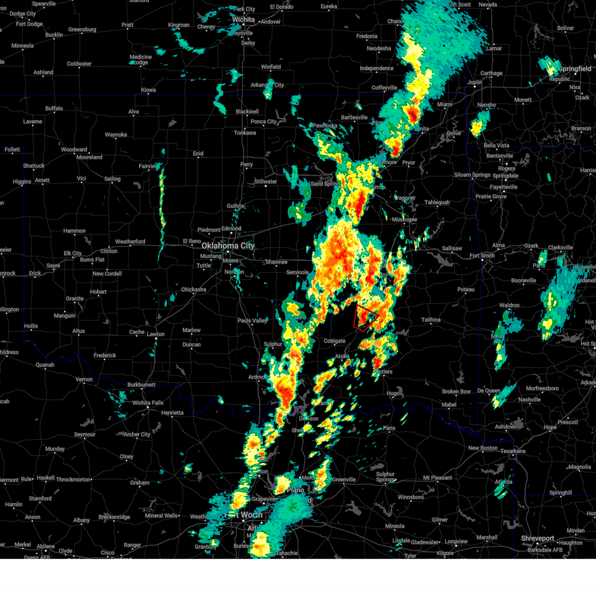
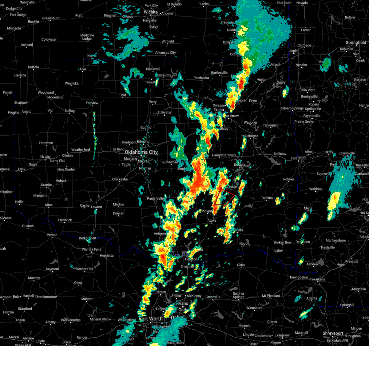
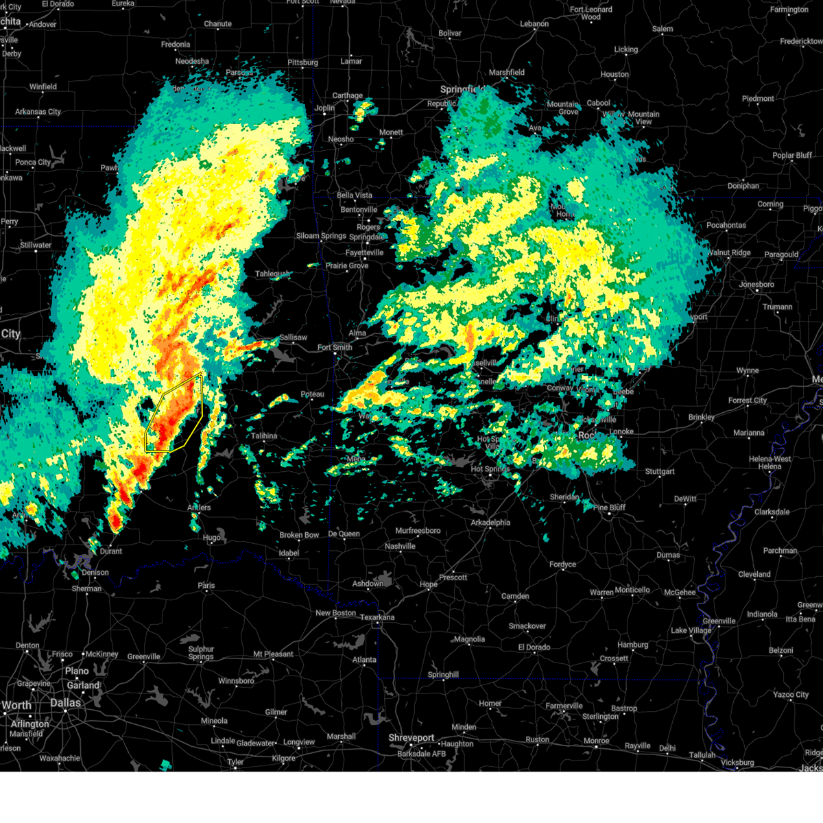
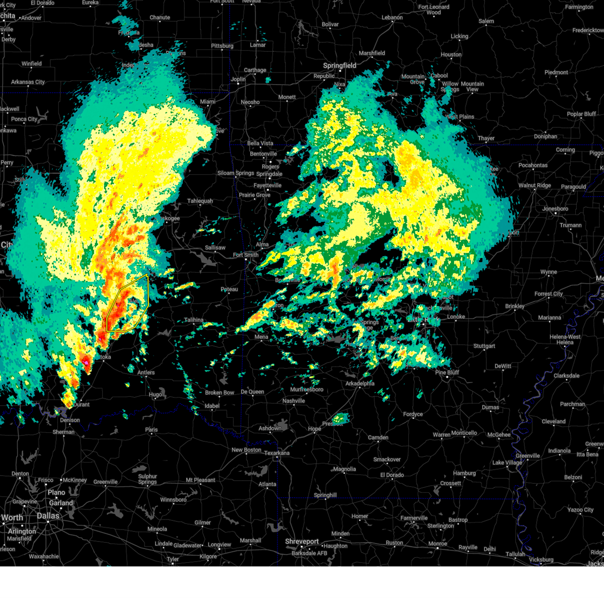
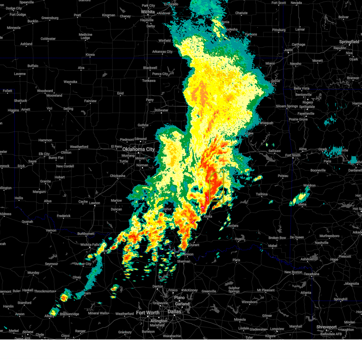
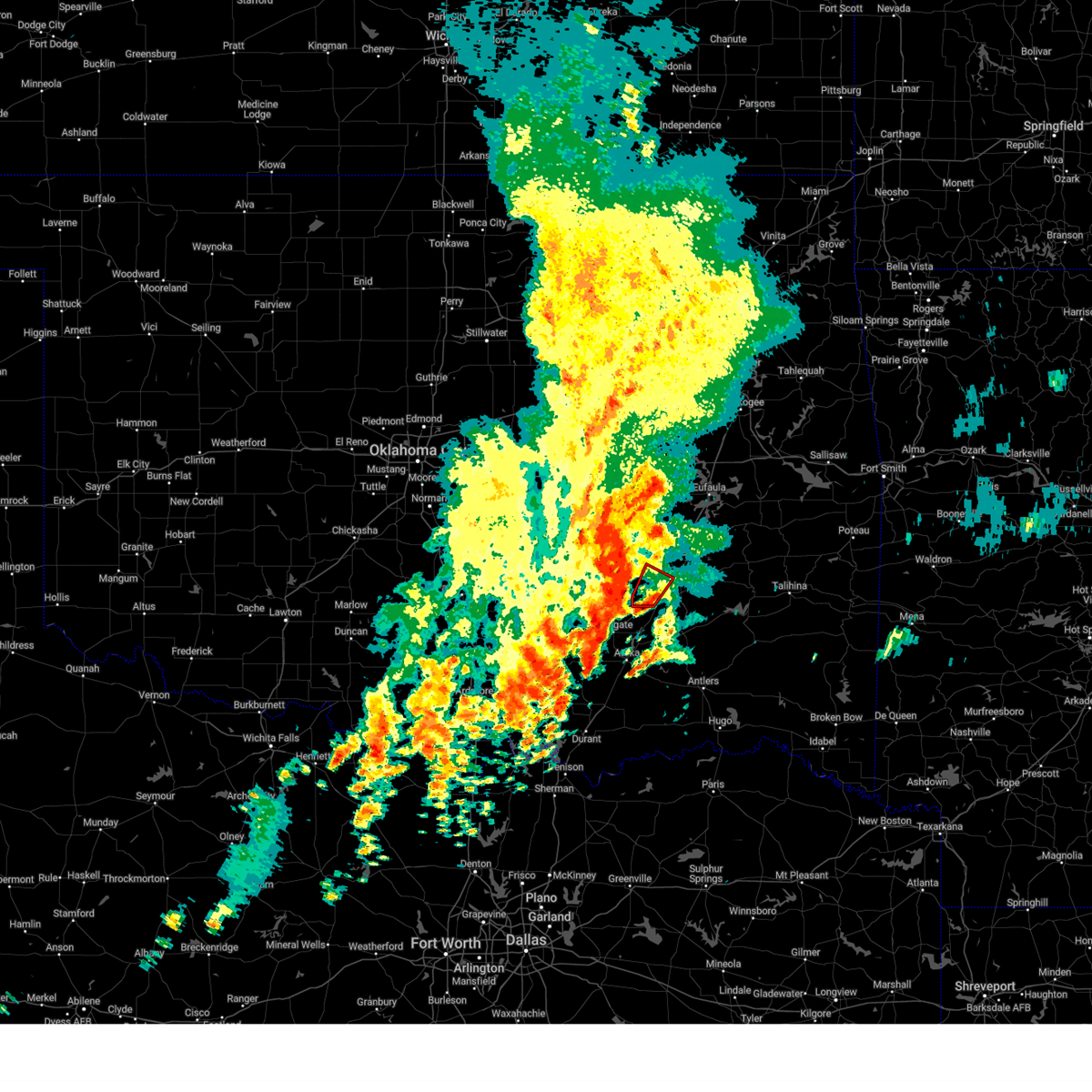
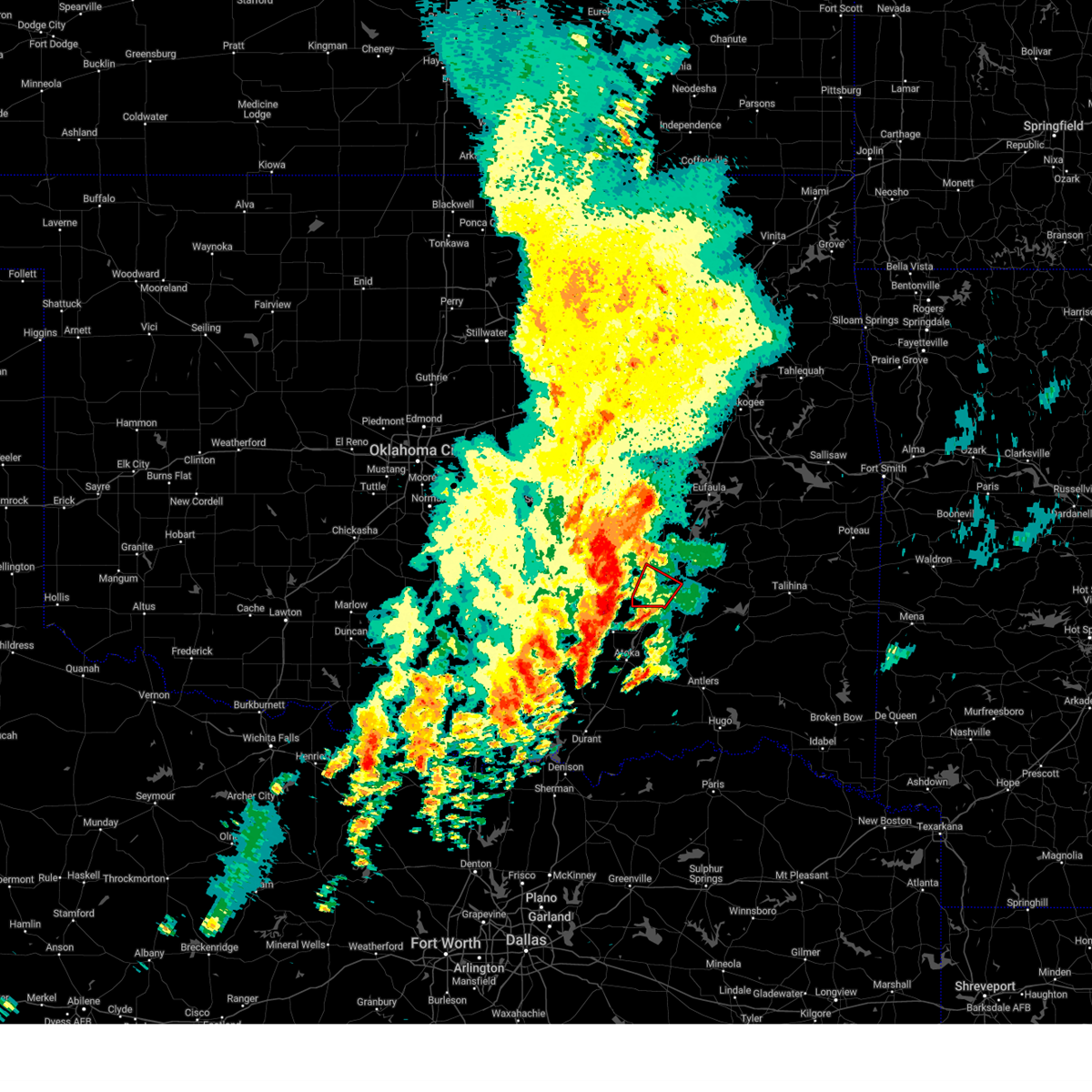
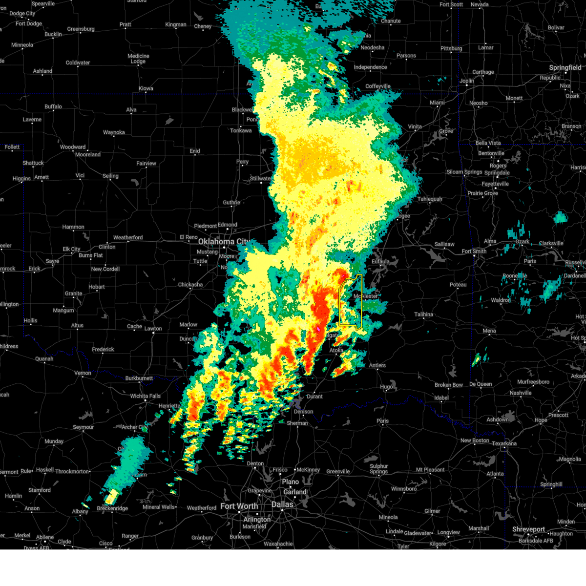
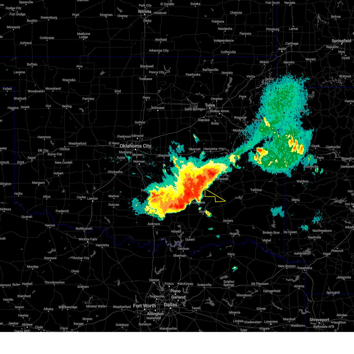
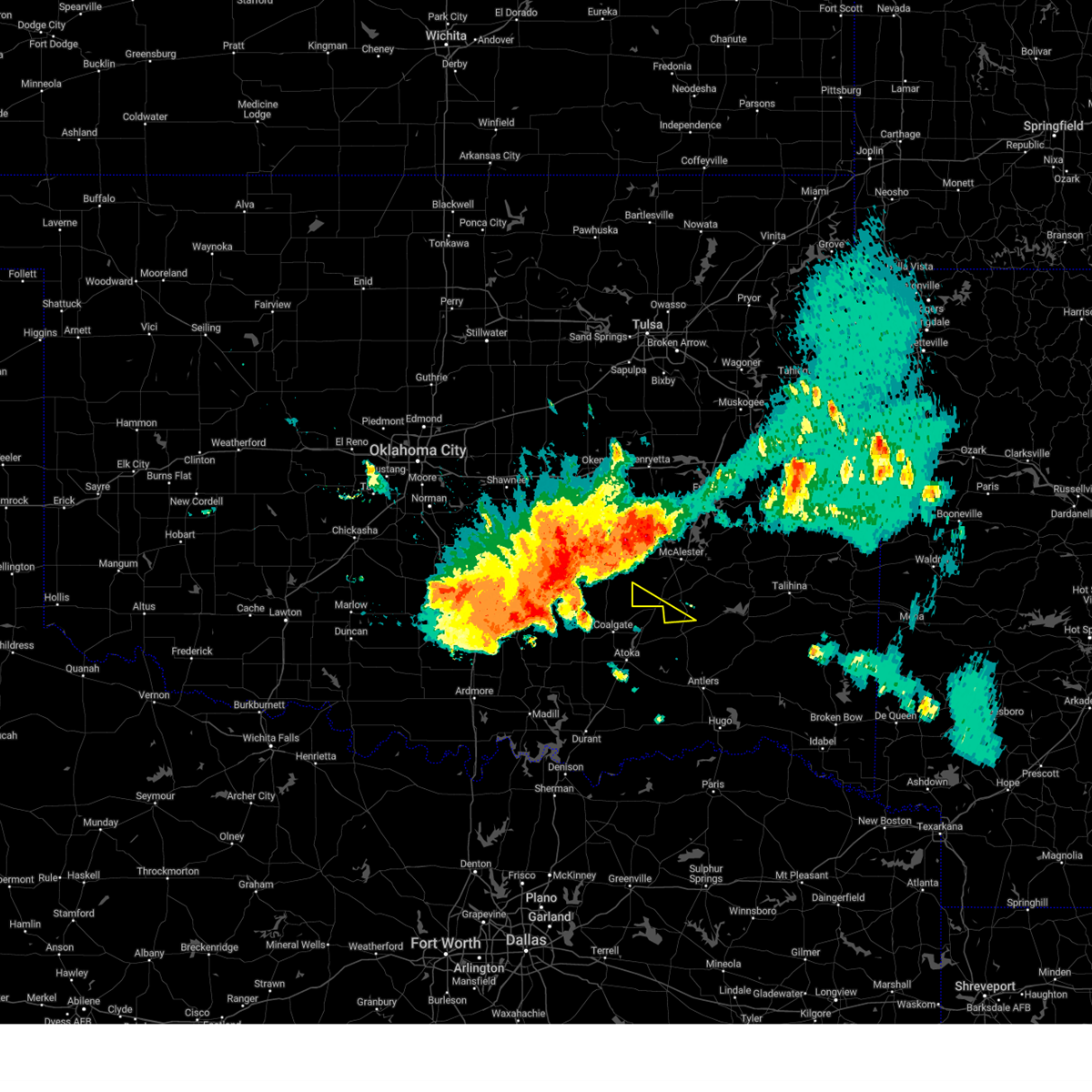
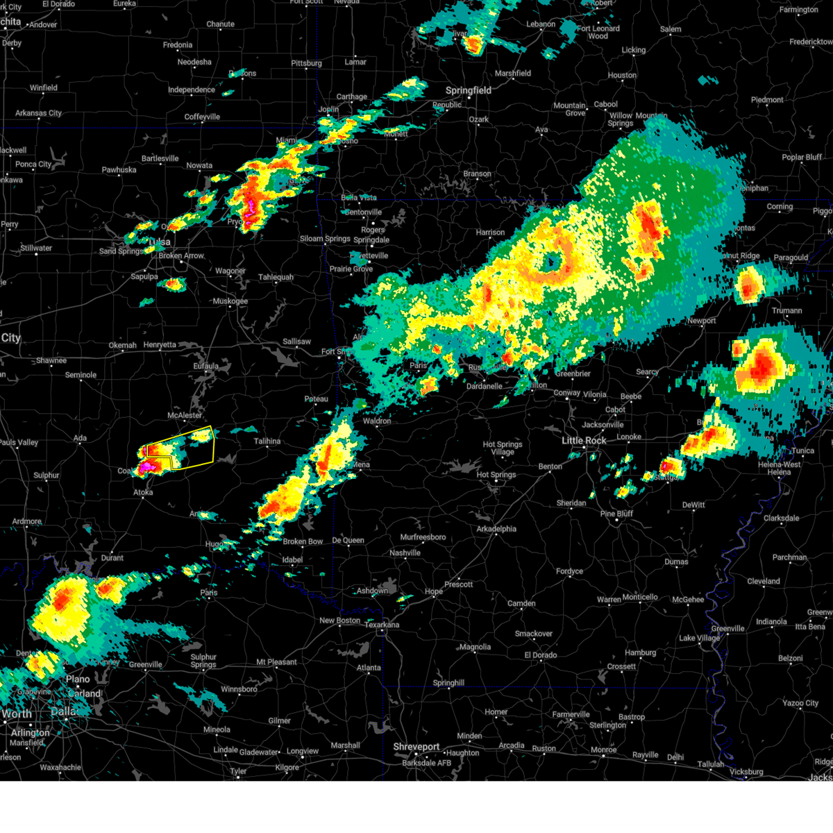
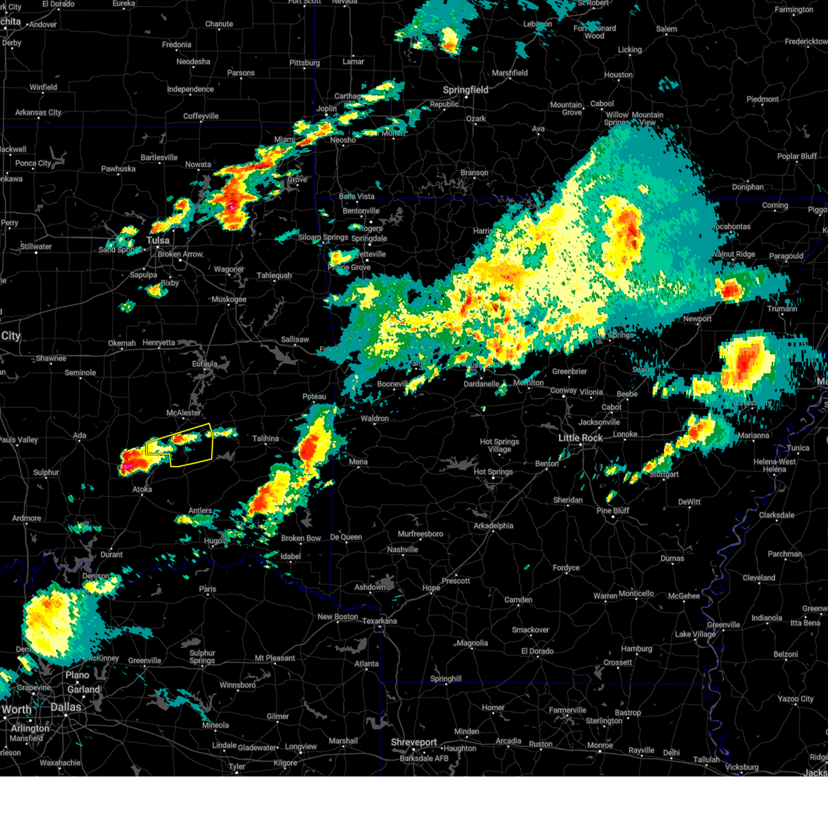
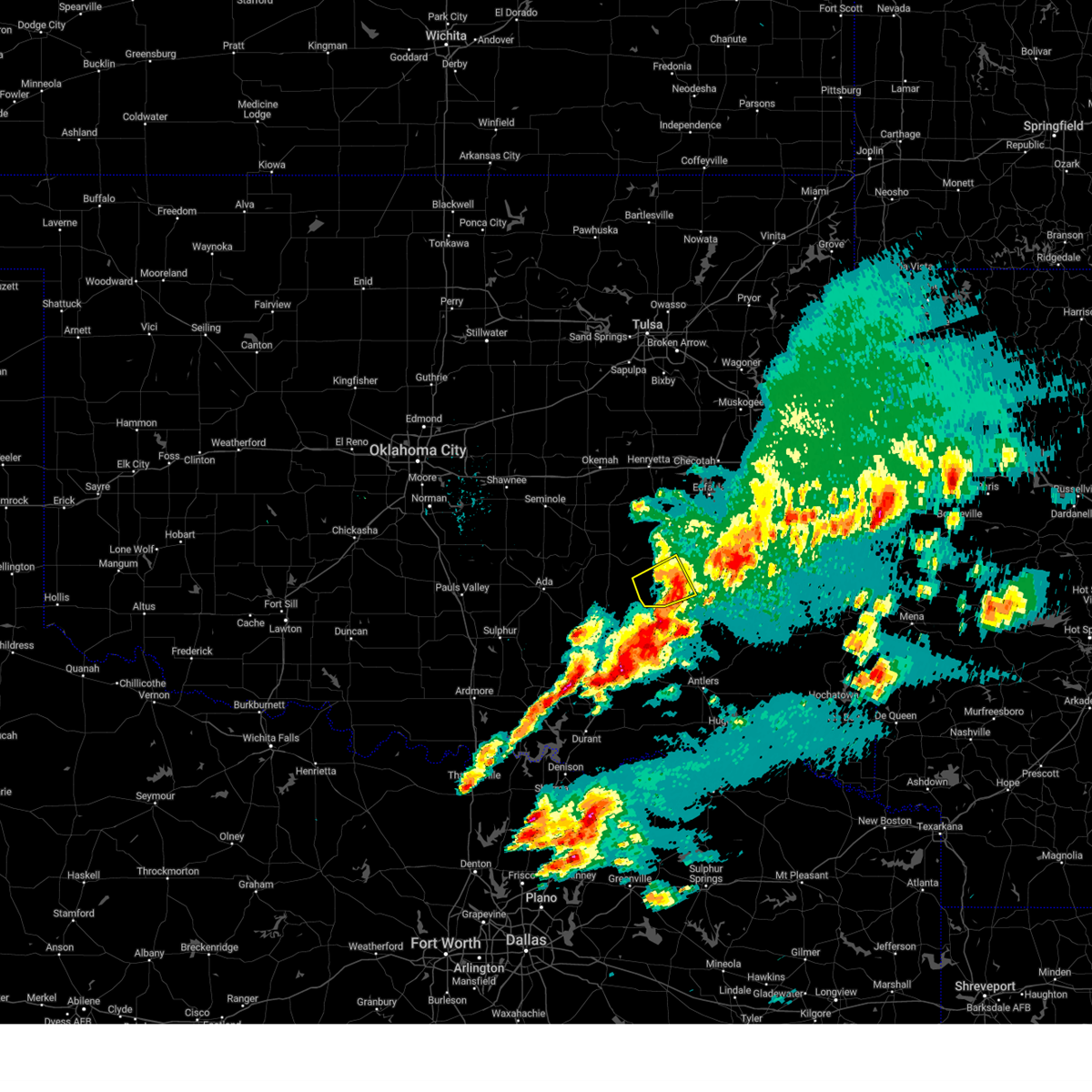
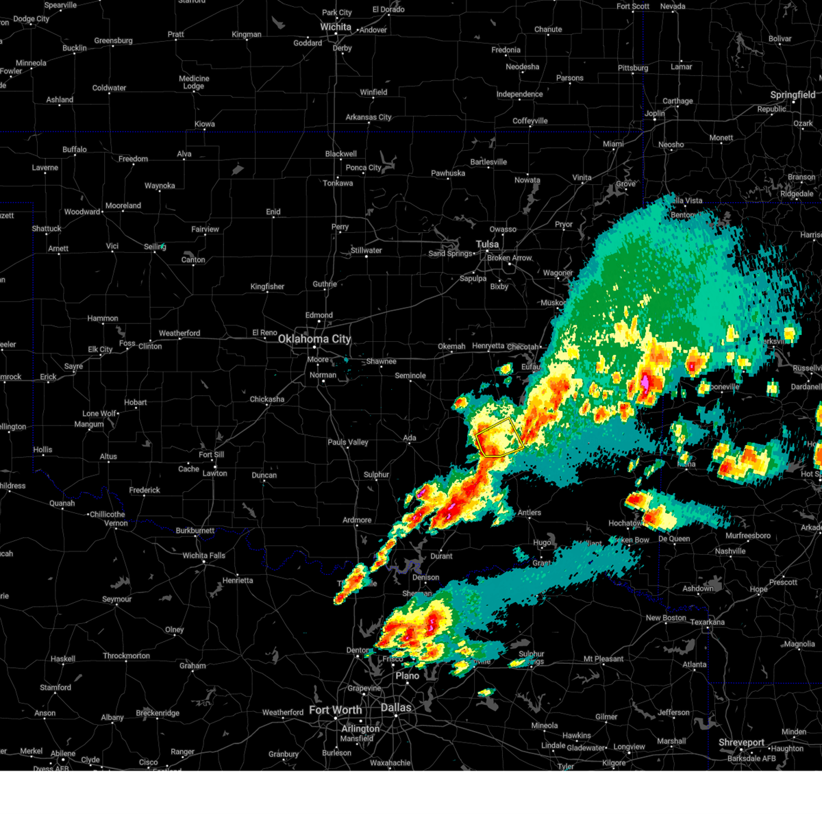
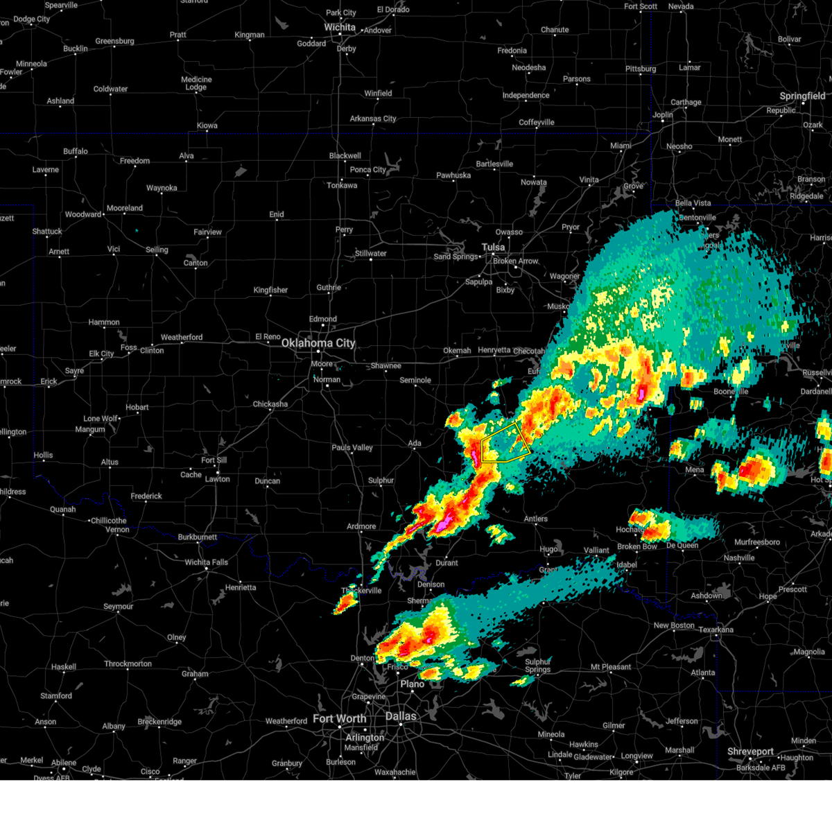
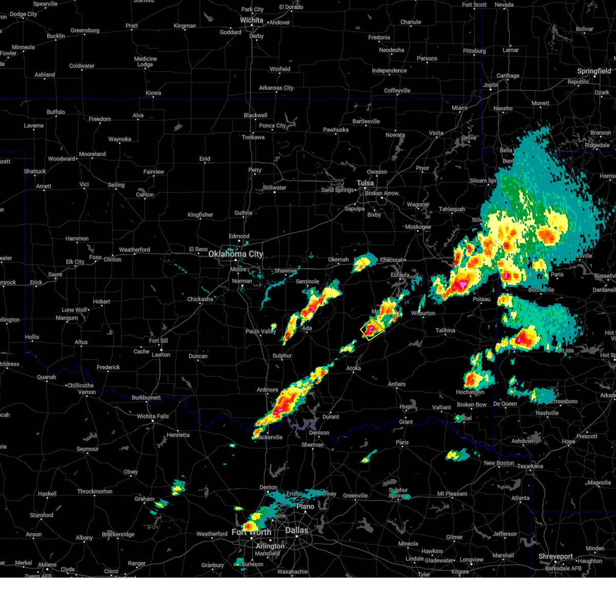
Hail Map for Kiowa, OK
The Kiowa, OK area has had 6 reports of on-the-ground hail by trained spotters, and has been under severe weather warnings 47 times during the past 12 months. Doppler radar has detected hail at or near Kiowa, OK on 64 occasions, including 6 occasions during the past year.
| Name: | Kiowa, OK |
| Where Located: | 26.5 miles NNE of Atoka, OK |
| Map: | Google Map for Kiowa, OK |
| Population: | 731 |
| Housing Units: | 359 |
| More Info: | Search Google for Kiowa, OK |
2
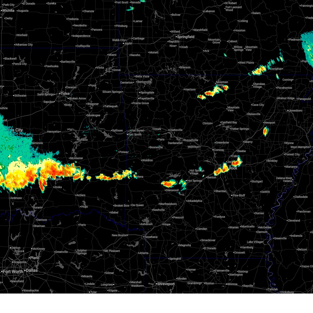
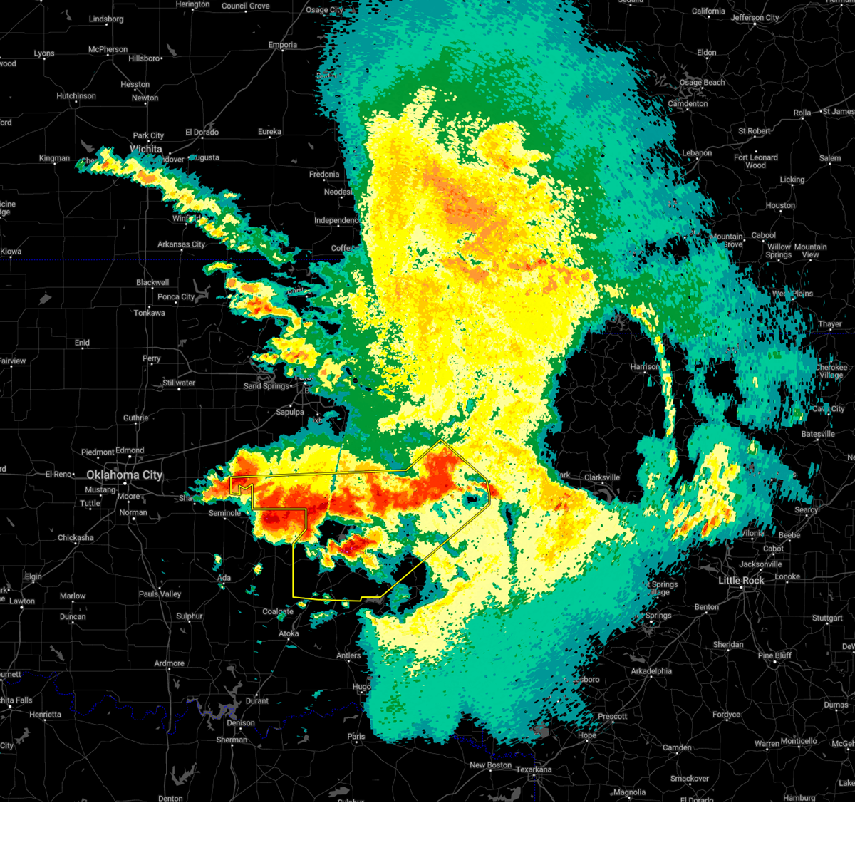
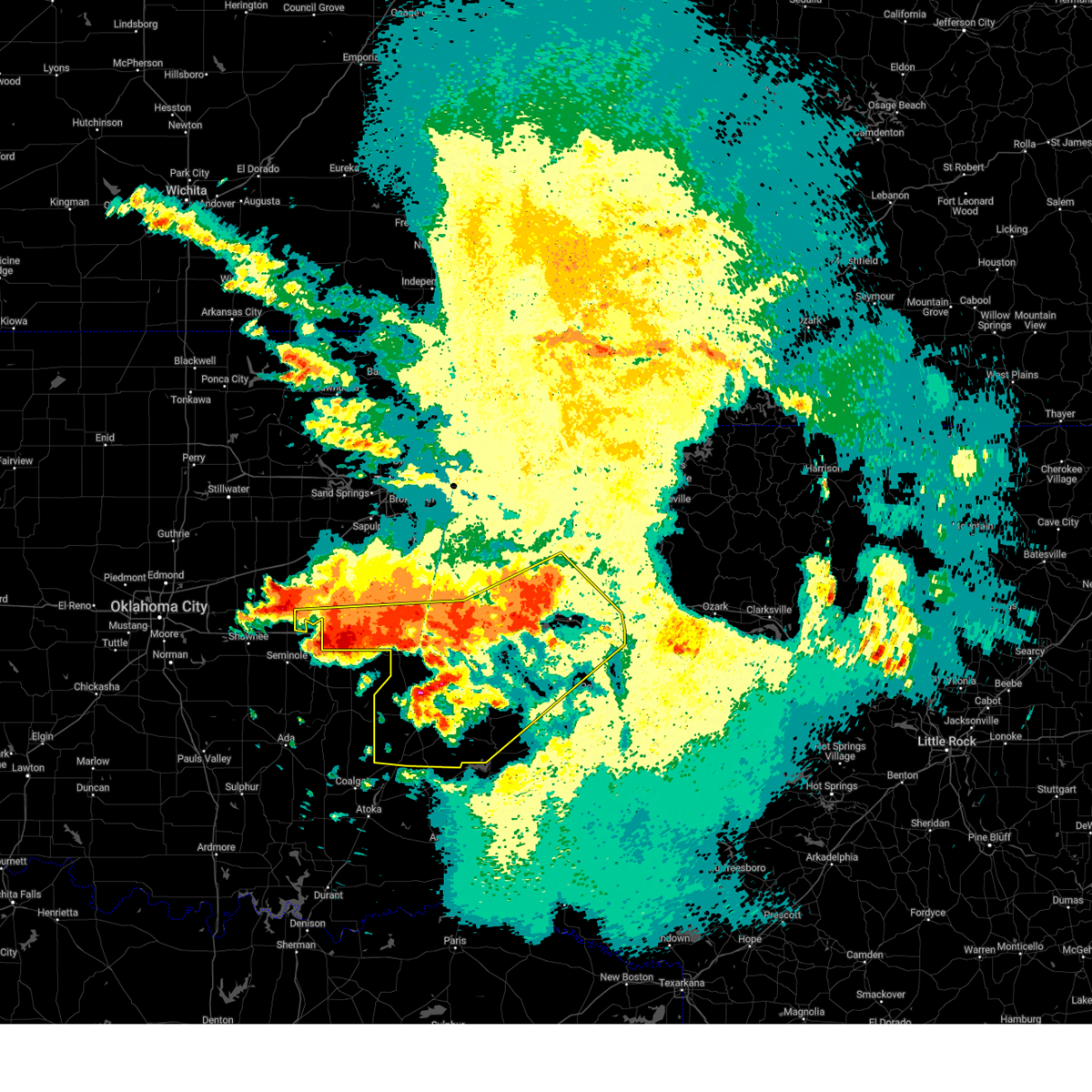
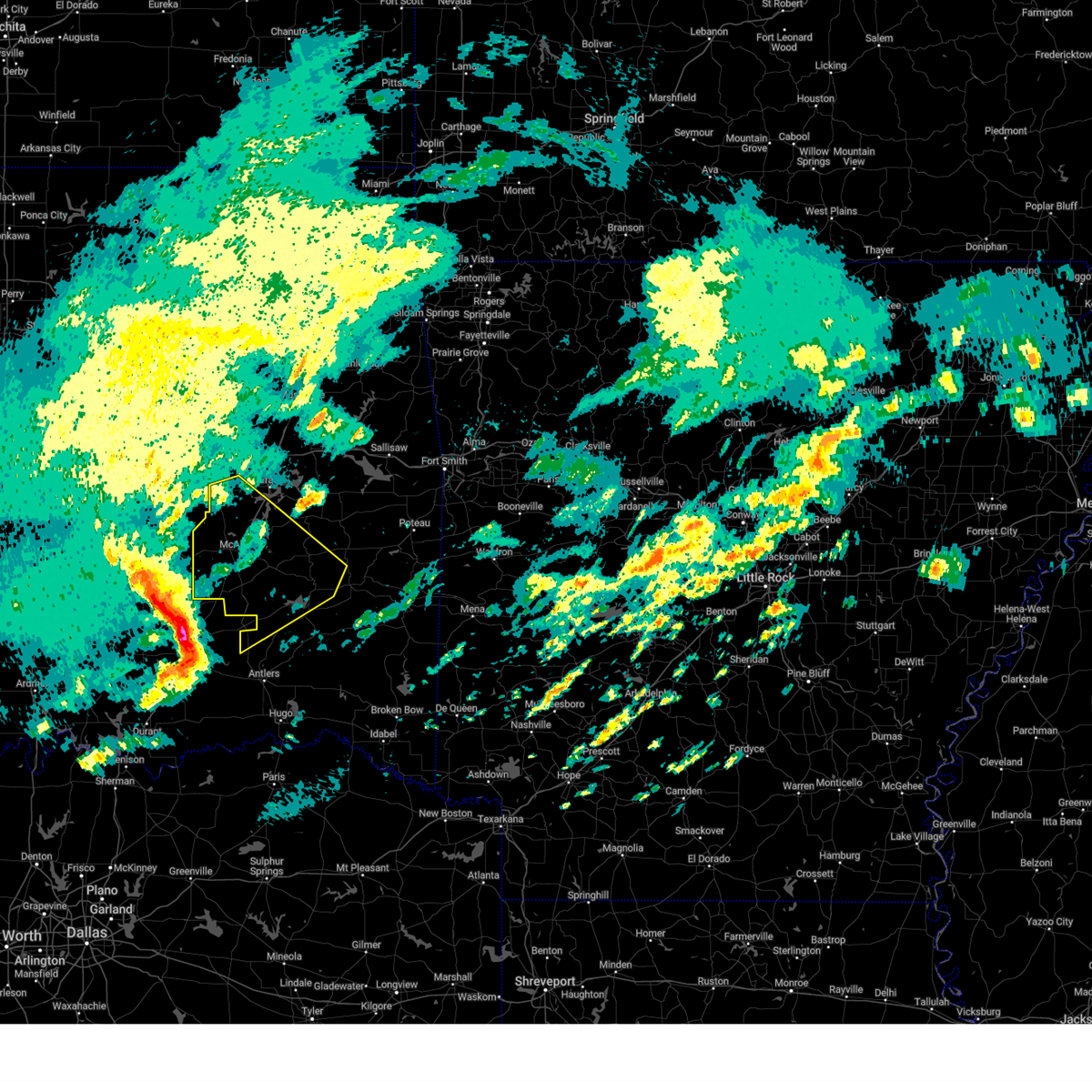
The Top Recent Hail Date for Kiowa, OK is Monday, June 30, 2025 (15th out of 64)
Hail and Wind Damage Spotted near Kiowa, OK
| Date / Time | Report Details |
|---|---|
| 6/30/2025 6:44 PM CDT |
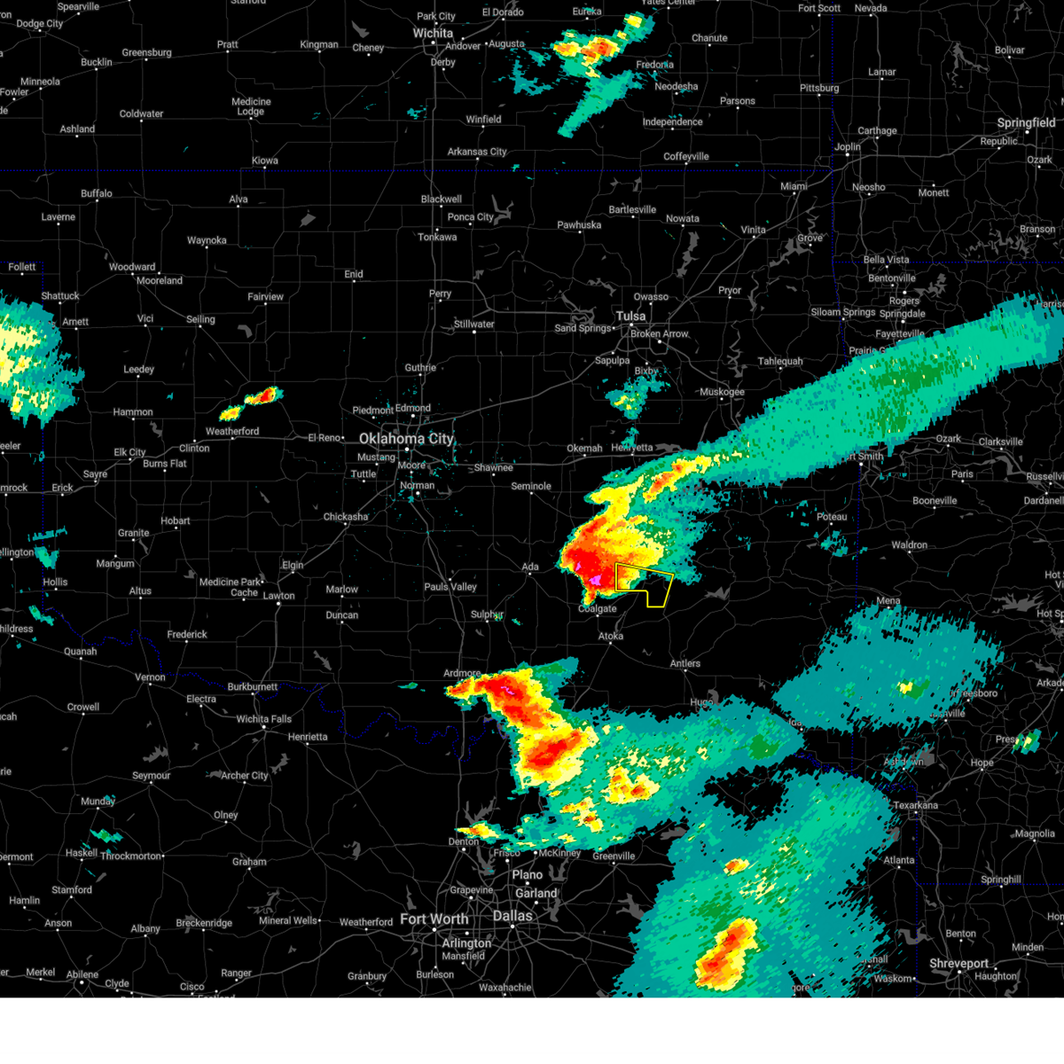
 The storm which prompted the warning has weakened below severe limits, and no longer poses an immediate threat to life or property. therefore, the warning will be allowed to expire. however, gusty winds to 50 mph are still possible with this thunderstorm. The storm which prompted the warning has weakened below severe limits, and no longer poses an immediate threat to life or property. therefore, the warning will be allowed to expire. however, gusty winds to 50 mph are still possible with this thunderstorm.
|
| 6/30/2025 6:05 PM CDT |
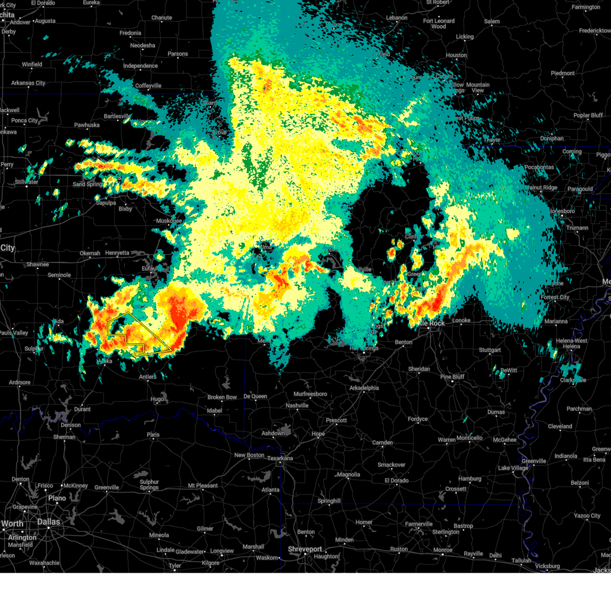
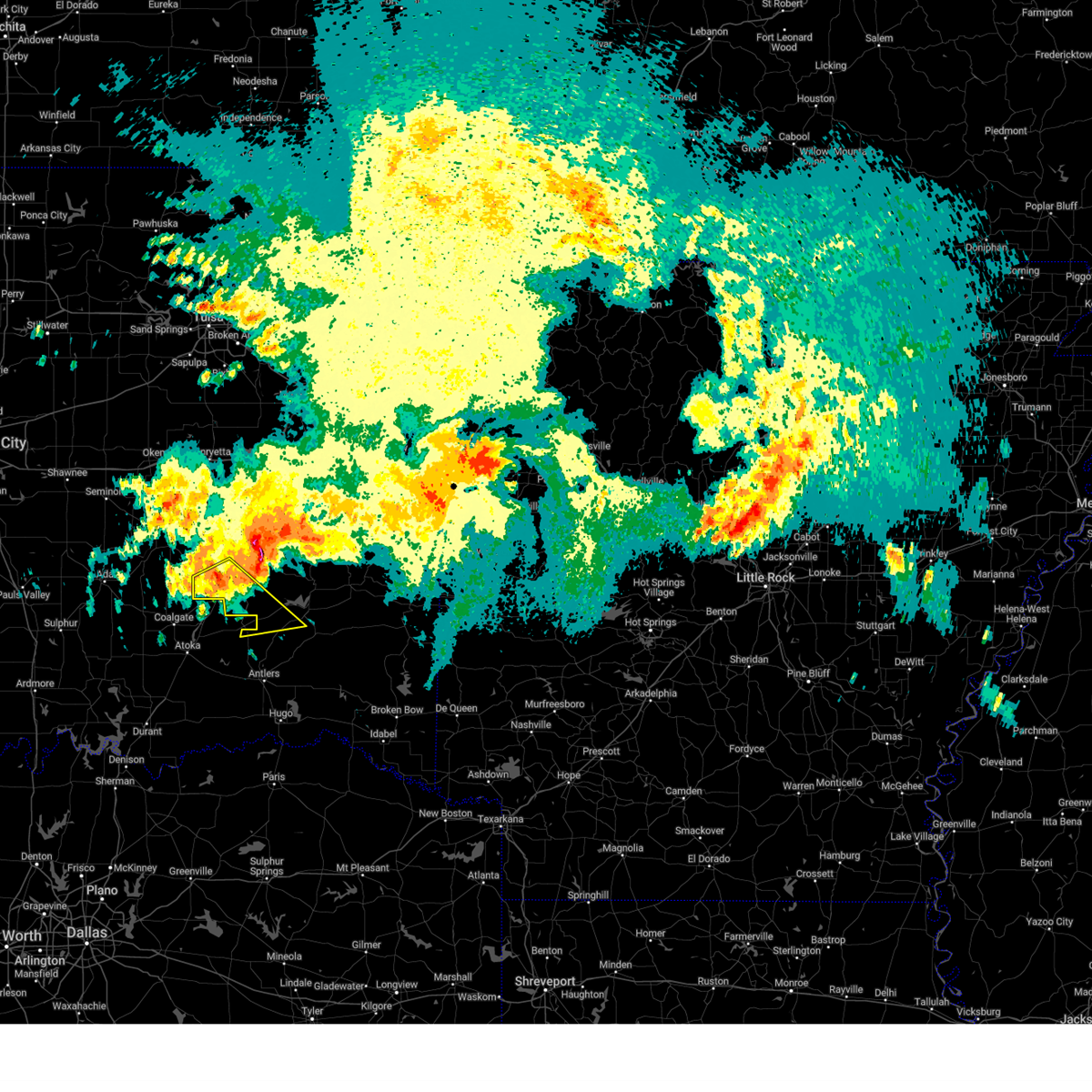
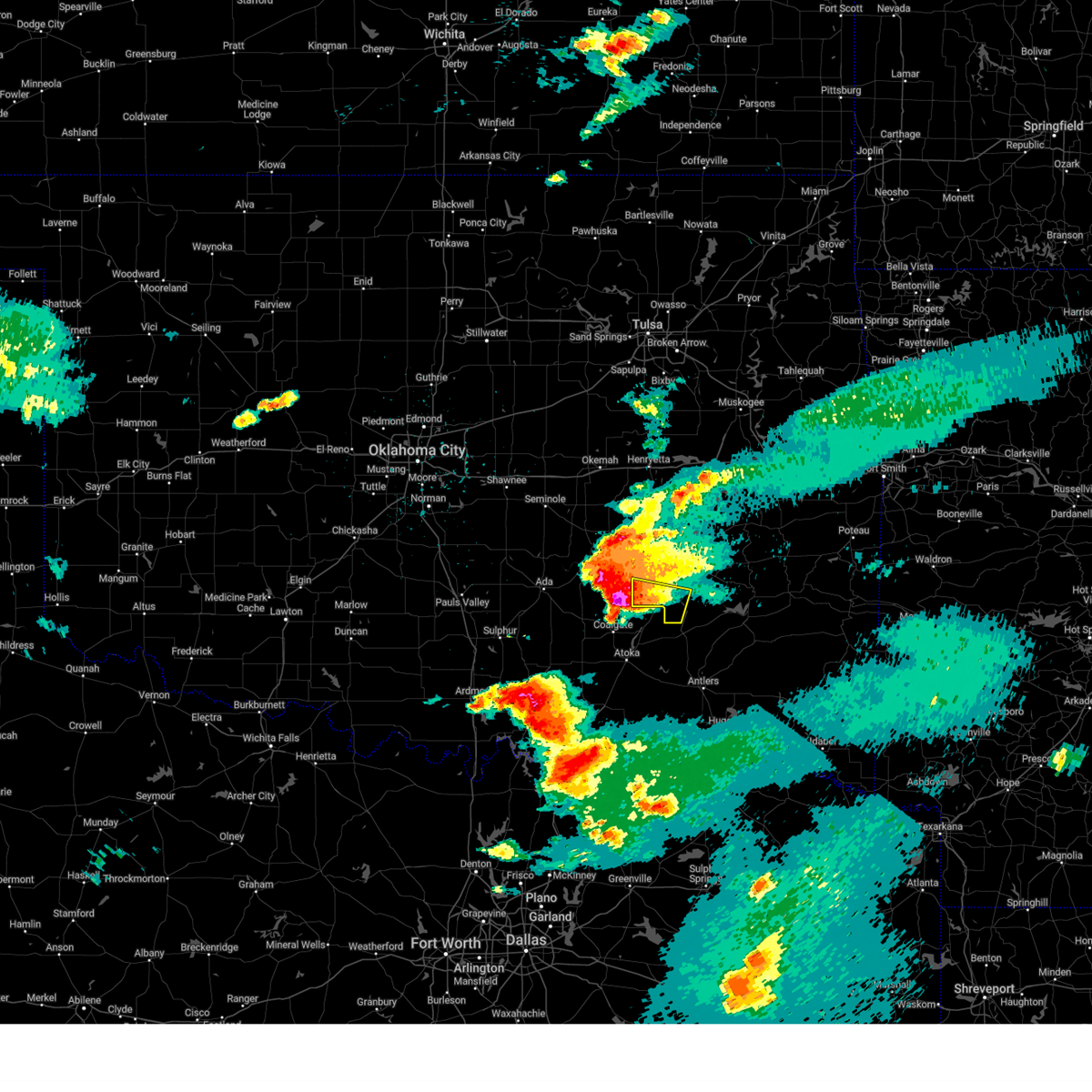
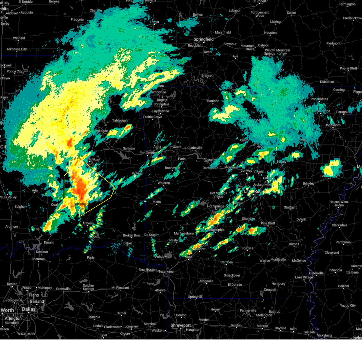
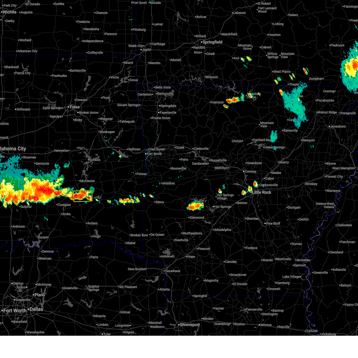 At 605 pm cdt, a severe thunderstorm was located 5 miles south of blanco, moving east at 10 mph (radar indicated). Hazards include 60 mph wind gusts and penny size hail. Expect damage to roofs, siding, and trees. Locations in or near the path include, blanco, pittsburg, kiowa,. At 605 pm cdt, a severe thunderstorm was located 5 miles south of blanco, moving east at 10 mph (radar indicated). Hazards include 60 mph wind gusts and penny size hail. Expect damage to roofs, siding, and trees. Locations in or near the path include, blanco, pittsburg, kiowa,.
|
| 6/30/2025 5:53 PM CDT |
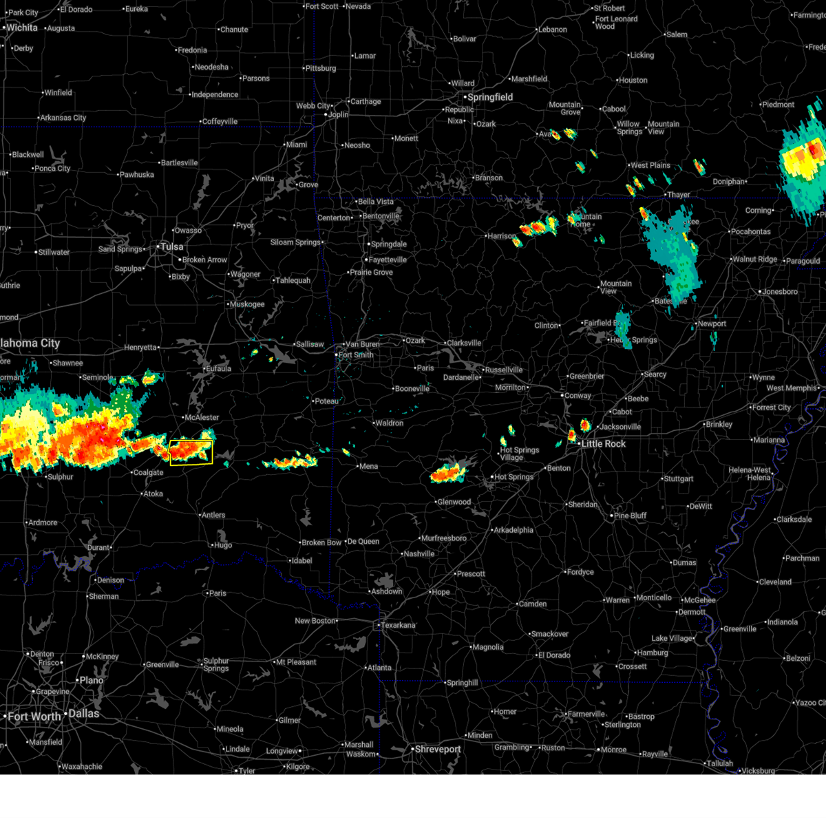 Svrtsa the national weather service in tulsa has issued a * severe thunderstorm warning for, southeastern pittsburg county in southeastern oklahoma, * until 645 pm cdt. * at 552 pm cdt, a severe thunderstorm was located 6 miles south of blanco, moving east at 10 mph (radar indicated). Hazards include 60 mph wind gusts and quarter size hail. Hail damage to vehicles is expected. expect wind damage to roofs, siding, and trees. Locations in or near the path include, blanco, pittsburg, kiowa,. Svrtsa the national weather service in tulsa has issued a * severe thunderstorm warning for, southeastern pittsburg county in southeastern oklahoma, * until 645 pm cdt. * at 552 pm cdt, a severe thunderstorm was located 6 miles south of blanco, moving east at 10 mph (radar indicated). Hazards include 60 mph wind gusts and quarter size hail. Hail damage to vehicles is expected. expect wind damage to roofs, siding, and trees. Locations in or near the path include, blanco, pittsburg, kiowa,.
|
| 5/24/2025 8:48 AM CDT |
 the severe thunderstorm warning has been cancelled and is no longer in effect the severe thunderstorm warning has been cancelled and is no longer in effect
|
| 5/24/2025 8:14 AM CDT |
 Svrtsa the national weather service in tulsa has issued a * severe thunderstorm warning for, northwestern pushmataha county in southeastern oklahoma, southwestern pittsburg county in southeastern oklahoma, * until 900 am cdt. * at 814 am cdt, severe thunderstorms were located along a line extending from 3 miles northeast of blanco to 2 miles south of ashland, moving southeast at 30 mph (radar indicated. a 58 mph gust was measured near arpelar). Hazards include 60 mph wind gusts. Expect damage to roofs, siding, and trees. Locations in or near the path include, kiowa, stanley, blanco, pittsburg, ashland, savanna,. Svrtsa the national weather service in tulsa has issued a * severe thunderstorm warning for, northwestern pushmataha county in southeastern oklahoma, southwestern pittsburg county in southeastern oklahoma, * until 900 am cdt. * at 814 am cdt, severe thunderstorms were located along a line extending from 3 miles northeast of blanco to 2 miles south of ashland, moving southeast at 30 mph (radar indicated. a 58 mph gust was measured near arpelar). Hazards include 60 mph wind gusts. Expect damage to roofs, siding, and trees. Locations in or near the path include, kiowa, stanley, blanco, pittsburg, ashland, savanna,.
|
| 5/24/2025 7:55 AM CDT |
 At 755 am cdt, severe thunderstorms were located along a line extending from near spiro to 2 miles west of hartshorne to 2 miles southeast of atwood, moving south at 40 mph (radar indicated). Hazards include 60 mph wind gusts and penny size hail. Expect damage to roofs, siding, and trees. Locations in or near the path include, kanima, arpelar, brushy, mcalester, pittsburg, raiford, whitefield, panola, haywood, spiro, mc curtain, porum, moffett, haileyville, panama, muldrow, lequire, gans, bokoshe, red oak, this includes interstate 40 in oklahoma between mile markers 294 and 328. At 755 am cdt, severe thunderstorms were located along a line extending from near spiro to 2 miles west of hartshorne to 2 miles southeast of atwood, moving south at 40 mph (radar indicated). Hazards include 60 mph wind gusts and penny size hail. Expect damage to roofs, siding, and trees. Locations in or near the path include, kanima, arpelar, brushy, mcalester, pittsburg, raiford, whitefield, panola, haywood, spiro, mc curtain, porum, moffett, haileyville, panama, muldrow, lequire, gans, bokoshe, red oak, this includes interstate 40 in oklahoma between mile markers 294 and 328.
|
| 5/24/2025 7:55 AM CDT |
 the severe thunderstorm warning has been cancelled and is no longer in effect the severe thunderstorm warning has been cancelled and is no longer in effect
|
| 5/24/2025 7:44 AM CDT |
 the severe thunderstorm warning has been cancelled and is no longer in effect the severe thunderstorm warning has been cancelled and is no longer in effect
|
| 5/24/2025 7:44 AM CDT |
 At 743 am cdt, severe thunderstorms were located along a line extending from near muldrow to 5 miles northeast of alderson to 4 miles north of atwood, moving south at 40 mph (radar indicated). Hazards include 70 mph wind gusts and penny size hail. Expect considerable tree damage. damage is likely to mobile homes, roofs, and outbuildings. Locations in or near the path include, kanima, arpelar, brushy, mcalester, pittsburg, raiford, whitefield, panola, haywood, spiro, mc curtain, porum, pierce, clearview, moffett, haileyville, panama, lake eufaula state park, pharoah, muldrow, this includes interstate 40 in oklahoma between mile markers 212 and 235, and between mile markers 294 and 328. At 743 am cdt, severe thunderstorms were located along a line extending from near muldrow to 5 miles northeast of alderson to 4 miles north of atwood, moving south at 40 mph (radar indicated). Hazards include 70 mph wind gusts and penny size hail. Expect considerable tree damage. damage is likely to mobile homes, roofs, and outbuildings. Locations in or near the path include, kanima, arpelar, brushy, mcalester, pittsburg, raiford, whitefield, panola, haywood, spiro, mc curtain, porum, pierce, clearview, moffett, haileyville, panama, lake eufaula state park, pharoah, muldrow, this includes interstate 40 in oklahoma between mile markers 212 and 235, and between mile markers 294 and 328.
|
| 5/24/2025 7:30 AM CDT |
 At 730 am cdt, severe thunderstorms were located along a line extending from 7 miles southeast of brushy to near quinton to yeager, moving southeast at 40 mph (radar indicated). Hazards include 70 mph wind gusts and penny size hail. Expect considerable tree damage. damage is likely to mobile homes, roofs, and outbuildings. Locations in or near the path include, mcalester, whitefield, haywood, spiro, mc curtain, pierce, moffett, schulter, panama, lake eufaula state park, gore, pharoah, lake tenkiller state park, gans, bryant, red oak, hoffman, hitchita, briartown, okemah, this includes interstate 40 in oklahoma between mile markers 212 and 328. At 730 am cdt, severe thunderstorms were located along a line extending from 7 miles southeast of brushy to near quinton to yeager, moving southeast at 40 mph (radar indicated). Hazards include 70 mph wind gusts and penny size hail. Expect considerable tree damage. damage is likely to mobile homes, roofs, and outbuildings. Locations in or near the path include, mcalester, whitefield, haywood, spiro, mc curtain, pierce, moffett, schulter, panama, lake eufaula state park, gore, pharoah, lake tenkiller state park, gans, bryant, red oak, hoffman, hitchita, briartown, okemah, this includes interstate 40 in oklahoma between mile markers 212 and 328.
|
| 5/24/2025 7:14 AM CDT |
 Svrtsa the national weather service in tulsa has issued a * severe thunderstorm warning for, haskell county in southeastern oklahoma, mcintosh county in southeastern oklahoma, sequoyah county in east central oklahoma, latimer county in southeastern oklahoma, southwestern adair county in northeastern oklahoma, northern le flore county in southeastern oklahoma, southeastern cherokee county in east central oklahoma, pittsburg county in southeastern oklahoma, southwestern okmulgee county in northeastern oklahoma, southern muskogee county in east central oklahoma, okfuskee county in east central oklahoma, * until 815 am cdt. * at 713 am cdt, severe thunderstorms were located along a line extending from cookson to 5 miles northwest of enterprise to 4 miles southeast of cromwell, moving south at 40 mph (trained spotter. a 69 mph gust was measured in muskogee and numerous reports of trees down and roof damage have been received). Hazards include 70 mph wind gusts and penny size hail. Expect considerable tree damage. damage is likely to mobile homes, roofs, and outbuildings. Locations in or near the path include, mcalester, whitefield, haywood, spiro, mc curtain, braggs, pierce, moffett, schulter, panama, lake eufaula state park, gore, pharoah, lake tenkiller state park, keefeton, gans, bryant, red oak, hoffman, hitchita, this includes interstate 40 in oklahoma between mile markers 212 and 328. Svrtsa the national weather service in tulsa has issued a * severe thunderstorm warning for, haskell county in southeastern oklahoma, mcintosh county in southeastern oklahoma, sequoyah county in east central oklahoma, latimer county in southeastern oklahoma, southwestern adair county in northeastern oklahoma, northern le flore county in southeastern oklahoma, southeastern cherokee county in east central oklahoma, pittsburg county in southeastern oklahoma, southwestern okmulgee county in northeastern oklahoma, southern muskogee county in east central oklahoma, okfuskee county in east central oklahoma, * until 815 am cdt. * at 713 am cdt, severe thunderstorms were located along a line extending from cookson to 5 miles northwest of enterprise to 4 miles southeast of cromwell, moving south at 40 mph (trained spotter. a 69 mph gust was measured in muskogee and numerous reports of trees down and roof damage have been received). Hazards include 70 mph wind gusts and penny size hail. Expect considerable tree damage. damage is likely to mobile homes, roofs, and outbuildings. Locations in or near the path include, mcalester, whitefield, haywood, spiro, mc curtain, braggs, pierce, moffett, schulter, panama, lake eufaula state park, gore, pharoah, lake tenkiller state park, keefeton, gans, bryant, red oak, hoffman, hitchita, this includes interstate 40 in oklahoma between mile markers 212 and 328.
|
| 5/20/2025 12:24 AM CDT | Svrtsa the national weather service in tulsa has issued a * severe thunderstorm warning for, western pushmataha county in southeastern oklahoma, western latimer county in southeastern oklahoma, northwestern choctaw county in southeastern oklahoma, southern pittsburg county in southeastern oklahoma, * until 115 am cdt. * at 1223 am cdt, severe thunderstorms were located along a line extending from 3 miles south of haywood to 6 miles west of daisy to 3 miles south of bokchito, moving east at 55 mph (radar indicated). Hazards include 60 mph wind gusts and quarter size hail. Hail damage to vehicles is expected. expect wind damage to roofs, siding, and trees. Locations in or near the path include, gowen, mcalester, higgins, pittsburg, tuskahoma, darwin, stanley, hartshorne, haileyville, krebs, alderson, kellond, ashland, eubanks, kent, sardis, damon, boswell, kiowa, dow,. |
| 5/19/2025 6:12 PM CDT |
 Svrtsa the national weather service in tulsa has issued a * severe thunderstorm warning for, southwestern haskell county in southeastern oklahoma, southeastern mcintosh county in southeastern oklahoma, latimer county in southeastern oklahoma, pittsburg county in southeastern oklahoma, south central muskogee county in east central oklahoma, * until 700 pm cdt. * at 612 pm cdt, a severe thunderstorm was located 5 miles southeast of alderson, moving northeast at 30 mph (radar indicated). Hazards include two inch hail and 70 mph wind gusts. People and animals outdoors will be injured. expect hail damage to roofs, siding, windows, and vehicles. expect considerable tree damage. wind damage is also likely to mobile homes, roofs, and outbuildings. Locations in or near the path include, gowen, mcalester, higgins, canadian, pittsburg, panola, whitefield, haywood, kinta, porum, hartshorne, haileyville, featherston, krebs, alderson, lequire, red oak, damon, bengal, crowder,. Svrtsa the national weather service in tulsa has issued a * severe thunderstorm warning for, southwestern haskell county in southeastern oklahoma, southeastern mcintosh county in southeastern oklahoma, latimer county in southeastern oklahoma, pittsburg county in southeastern oklahoma, south central muskogee county in east central oklahoma, * until 700 pm cdt. * at 612 pm cdt, a severe thunderstorm was located 5 miles southeast of alderson, moving northeast at 30 mph (radar indicated). Hazards include two inch hail and 70 mph wind gusts. People and animals outdoors will be injured. expect hail damage to roofs, siding, windows, and vehicles. expect considerable tree damage. wind damage is also likely to mobile homes, roofs, and outbuildings. Locations in or near the path include, gowen, mcalester, higgins, canadian, pittsburg, panola, whitefield, haywood, kinta, porum, hartshorne, haileyville, featherston, krebs, alderson, lequire, red oak, damon, bengal, crowder,.
|
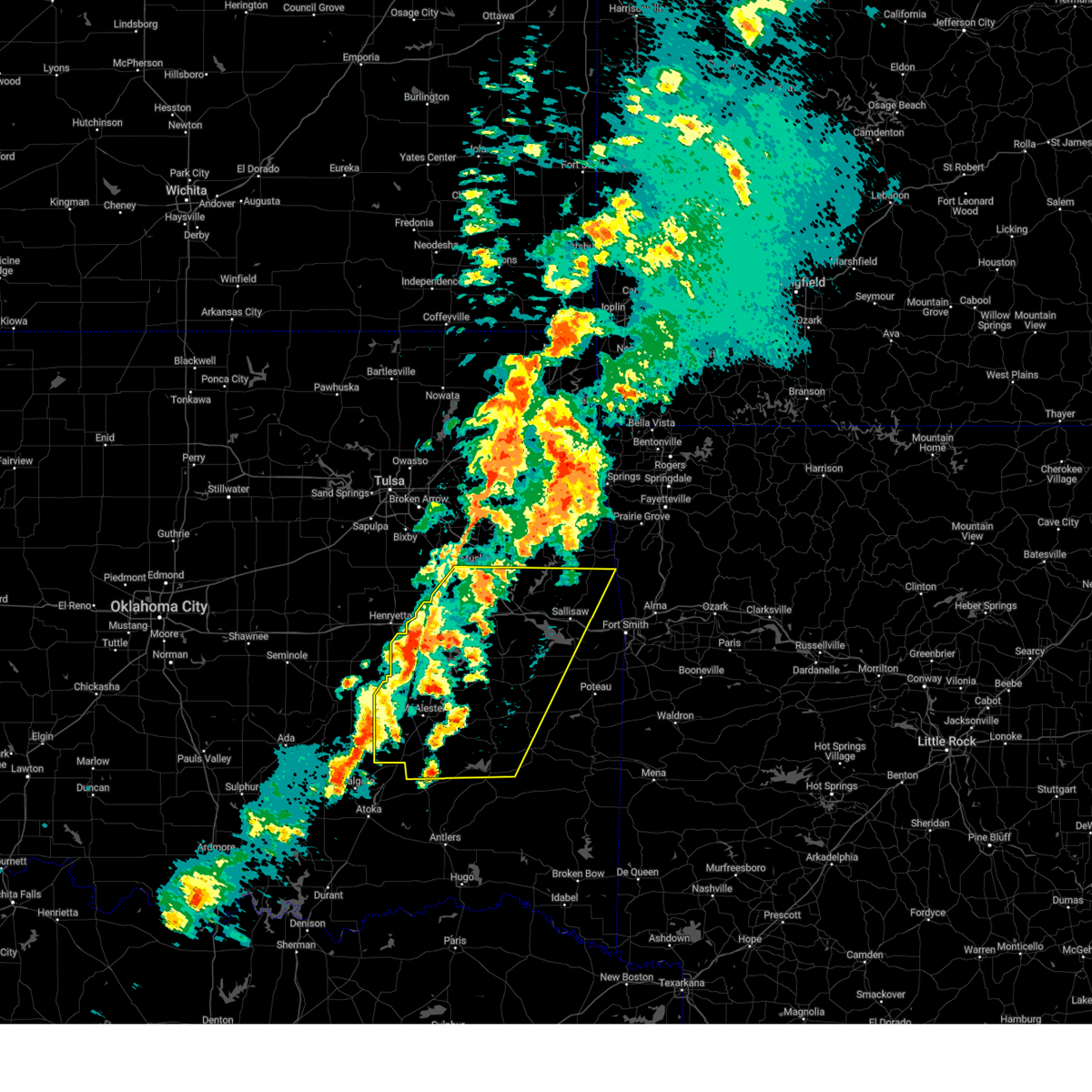
| 5/19/2025 5:54 PM CDT | At 553 pm cdt, a confirmed large and extremely dangerous tornado was located over blanco, moving northeast at 55 mph. this is a particularly dangerous situation. take cover now! (radar confirmed tornado). Hazards include damaging tornado. You are in a life-threatening situation. flying debris may be deadly to those caught without shelter. mobile homes will be destroyed. considerable damage to homes, businesses, and vehicles is likely and complete destruction is possible. Locations in or near the path include, hartshorne, haileyville, mcalester, mcalester regional airport, pittsburg, kiowa, krebs, alderson, blanco, dow, bache, savanna,. |
| 5/19/2025 5:47 PM CDT | Tortsa the national weather service in tulsa has issued a * tornado warning for, southwestern pittsburg county in southeastern oklahoma, * until 615 pm cdt. * at 547 pm cdt, a severe thunderstorm capable of producing a tornado was located 4 miles north of kiowa, moving northeast at 55 mph (radar indicated rotation). Hazards include tornado and ping pong ball size hail. Flying debris will be dangerous to those caught without shelter. mobile homes will be damaged or destroyed. damage to roofs, windows, and vehicles will occur. tree damage is likely. Locations in or near the path include, mcalester, mcalester regional airport, kiowa, krebs, alderson, haywood, bache, savanna,. |
| 5/19/2025 5:40 PM CDT | Tortsa the national weather service in tulsa has issued a * tornado warning for, southern pittsburg county in southeastern oklahoma, * until 615 pm cdt. * at 540 pm cdt, a confirmed tornado was located 4 miles east of wardville, moving northeast at 55 mph (law enforcement confirmed tornado). Hazards include damaging tornado and ping pong ball size hail. Flying debris will be dangerous to those caught without shelter. mobile homes will be damaged or destroyed. damage to roofs, windows, and vehicles will occur. tree damage is likely. Locations in or near the path include, hartshorne, haileyville, mcalester, mcalester regional airport, pittsburg, kiowa, krebs, alderson, blanco, dow, bache, savanna,. |
| 5/19/2025 5:31 PM CDT | At 530 pm cdt, a confirmed tornado was located 3 miles west of wardville, moving northeast at 30 mph (emergency management confirmed tornado). Hazards include damaging tornado and quarter size hail. Flying debris will be dangerous to those caught without shelter. mobile homes will be damaged or destroyed. damage to roofs, windows, and vehicles will occur. tree damage is likely. Locations in or near the path include, kiowa, haywood, ashland, savanna, pittsburg,. |
| 5/19/2025 5:20 PM CDT | Tortsa the national weather service in tulsa has issued a * tornado warning for, southwestern pittsburg county in southeastern oklahoma, * until 545 pm cdt. * at 519 pm cdt, a severe thunderstorm capable of producing a tornado was located 7 miles west of wardville, moving northeast at 40 mph (radar indicated rotation). Hazards include tornado and golf ball size hail. Flying debris will be dangerous to those caught without shelter. mobile homes will be damaged or destroyed. damage to roofs, windows, and vehicles will occur. tree damage is likely. Locations in or near the path include, kiowa, haywood, ashland, savanna, pittsburg,. |
| 5/19/2025 5:14 PM CDT | Svrtsa the national weather service in tulsa has issued a * severe thunderstorm warning for, western pittsburg county in southeastern oklahoma, * until 600 pm cdt. * at 513 pm cdt, a severe thunderstorm was located 5 miles east of centrahoma, moving northeast at 40 mph (radar indicated). Hazards include 70 mph wind gusts and quarter size hail. Hail damage to vehicles is expected. expect considerable tree damage. wind damage is also likely to mobile homes, roofs, and outbuildings. Locations in or near the path include, arpelar, mcalester, pittsburg, kiowa, haywood, dow, bache, mcalester regional airport, krebs, alderson, scipio, blanco, ashland, savanna,. |
| 5/17/2025 7:44 PM CDT |
 At 744 pm cdt, a severe thunderstorm was located 3 miles west of kiowa, moving east at 35 mph (radar indicated). Hazards include tennis ball size hail and 70 mph wind gusts. People and animals outdoors will be injured. expect hail damage to roofs, siding, windows, and vehicles. expect considerable tree damage. wind damage is also likely to mobile homes, roofs, and outbuildings. Locations in or near the path include, kiowa, blanco, pittsburg, ashland,. At 744 pm cdt, a severe thunderstorm was located 3 miles west of kiowa, moving east at 35 mph (radar indicated). Hazards include tennis ball size hail and 70 mph wind gusts. People and animals outdoors will be injured. expect hail damage to roofs, siding, windows, and vehicles. expect considerable tree damage. wind damage is also likely to mobile homes, roofs, and outbuildings. Locations in or near the path include, kiowa, blanco, pittsburg, ashland,.
|
| 5/17/2025 7:32 PM CDT |
 At 731 pm cdt, a severe thunderstorm was located over ashland, moving east at 30 mph (radar indicated). Hazards include two inch hail and 70 mph wind gusts. People and animals outdoors will be injured. expect hail damage to roofs, siding, windows, and vehicles. expect considerable tree damage. wind damage is also likely to mobile homes, roofs, and outbuildings. Locations in or near the path include, kiowa, blanco, pittsburg, ashland,. At 731 pm cdt, a severe thunderstorm was located over ashland, moving east at 30 mph (radar indicated). Hazards include two inch hail and 70 mph wind gusts. People and animals outdoors will be injured. expect hail damage to roofs, siding, windows, and vehicles. expect considerable tree damage. wind damage is also likely to mobile homes, roofs, and outbuildings. Locations in or near the path include, kiowa, blanco, pittsburg, ashland,.
|
| 5/17/2025 7:22 PM CDT |
 Svrtsa the national weather service in tulsa has issued a * severe thunderstorm warning for, southwestern pittsburg county in southeastern oklahoma, * until 800 pm cdt. * at 721 pm cdt, a severe thunderstorm was located near ashland, moving east at 35 mph (radar indicated). Hazards include 60 mph wind gusts and half dollar size hail. Hail damage to vehicles is expected. expect wind damage to roofs, siding, and trees. Locations in or near the path include, kiowa, blanco, pittsburg, ashland,. Svrtsa the national weather service in tulsa has issued a * severe thunderstorm warning for, southwestern pittsburg county in southeastern oklahoma, * until 800 pm cdt. * at 721 pm cdt, a severe thunderstorm was located near ashland, moving east at 35 mph (radar indicated). Hazards include 60 mph wind gusts and half dollar size hail. Hail damage to vehicles is expected. expect wind damage to roofs, siding, and trees. Locations in or near the path include, kiowa, blanco, pittsburg, ashland,.
|
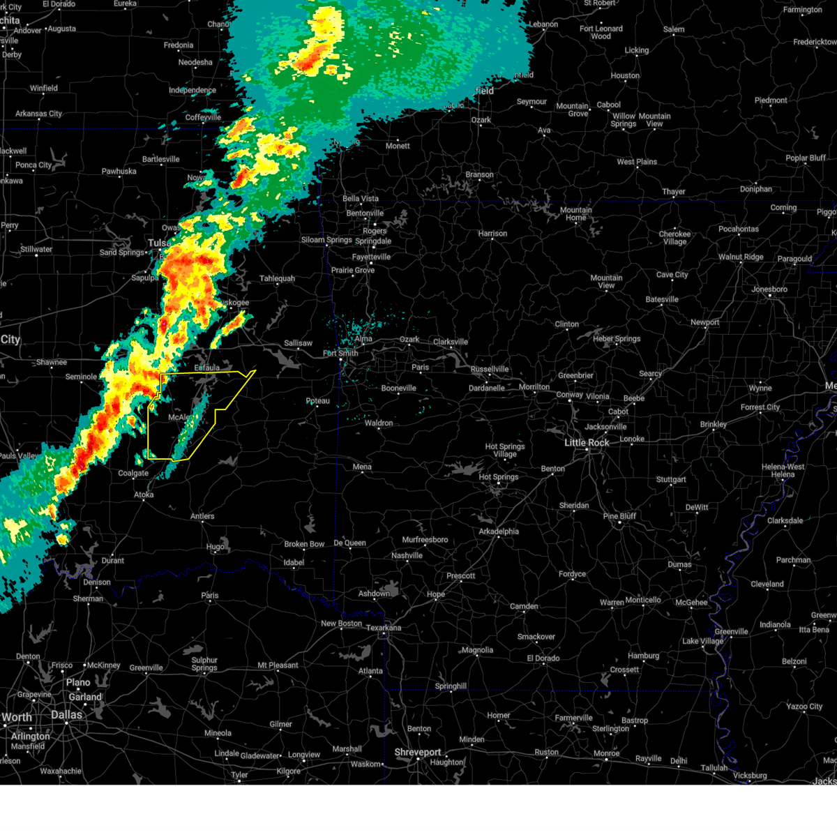
| 4/20/2025 12:33 AM CDT | At 1232 am cdt, a severe thunderstorm capable of producing a tornado was located over savanna, moving northeast at 45 mph (radar indicated rotation). Hazards include tornado. Flying debris will be dangerous to those caught without shelter. mobile homes will be damaged or destroyed. damage to roofs, windows, and vehicles will occur. tree damage is likely. Locations in or near the path include, hartshorne, haileyville, mcalester, mcalester regional airport, pittsburg, kiowa, krebs, alderson, blanco, dow, bache, savanna,. |
| 4/20/2025 12:29 AM CDT | Quarter sized hail reported 0.6 miles SE of Kiowa, OK, report from mping: quarter (1.00 in.). |
| 4/20/2025 12:14 AM CDT |
 Tortsa the national weather service in tulsa has issued a * tornado warning for, southern pittsburg county in southeastern oklahoma, * until 100 am cdt. * at 1214 am cdt, a severe thunderstorm capable of producing a tornado was located over wardville, moving northeast at 40 mph (radar indicated rotation). Hazards include tornado and quarter size hail. Flying debris will be dangerous to those caught without shelter. mobile homes will be damaged or destroyed. damage to roofs, windows, and vehicles will occur. tree damage is likely. Locations in or near the path include, hartshorne, haileyville, mcalester, mcalester regional airport, pittsburg, kiowa, krebs, alderson, blanco, dow, bache, savanna,. Tortsa the national weather service in tulsa has issued a * tornado warning for, southern pittsburg county in southeastern oklahoma, * until 100 am cdt. * at 1214 am cdt, a severe thunderstorm capable of producing a tornado was located over wardville, moving northeast at 40 mph (radar indicated rotation). Hazards include tornado and quarter size hail. Flying debris will be dangerous to those caught without shelter. mobile homes will be damaged or destroyed. damage to roofs, windows, and vehicles will occur. tree damage is likely. Locations in or near the path include, hartshorne, haileyville, mcalester, mcalester regional airport, pittsburg, kiowa, krebs, alderson, blanco, dow, bache, savanna,.
|
| 4/19/2025 11:28 PM CDT |
 Svrtsa the national weather service in tulsa has issued a * severe thunderstorm warning for, western pittsburg county in southeastern oklahoma, * until 1230 am cdt. * at 1127 pm cdt, a severe thunderstorm was located 6 miles east of centrahoma, moving northeast at 30 mph (radar indicated). Hazards include 70 mph wind gusts and quarter size hail. Hail damage to vehicles is expected. expect considerable tree damage. wind damage is also likely to mobile homes, roofs, and outbuildings. Locations in or near the path include, arpelar, mcalester, pittsburg, kiowa, haywood, bache, mcalester regional airport, krebs, alderson, scipio, blanco, ashland, savanna,. Svrtsa the national weather service in tulsa has issued a * severe thunderstorm warning for, western pittsburg county in southeastern oklahoma, * until 1230 am cdt. * at 1127 pm cdt, a severe thunderstorm was located 6 miles east of centrahoma, moving northeast at 30 mph (radar indicated). Hazards include 70 mph wind gusts and quarter size hail. Hail damage to vehicles is expected. expect considerable tree damage. wind damage is also likely to mobile homes, roofs, and outbuildings. Locations in or near the path include, arpelar, mcalester, pittsburg, kiowa, haywood, bache, mcalester regional airport, krebs, alderson, scipio, blanco, ashland, savanna,.
|
| 4/3/2025 9:48 AM CDT |
 the severe thunderstorm warning has been cancelled and is no longer in effect the severe thunderstorm warning has been cancelled and is no longer in effect
|
| 4/3/2025 9:10 AM CDT |
 Svrtsa the national weather service in tulsa has issued a * severe thunderstorm warning for, northwestern pushmataha county in southeastern oklahoma, southwestern mcintosh county in southeastern oklahoma, latimer county in southeastern oklahoma, pittsburg county in southeastern oklahoma, * until 1000 am cdt. * at 909 am cdt, a severe thunderstorm was located over coalgate, moving northeast at 65 mph (radar indicated). Hazards include 60 mph wind gusts and quarter size hail. Hail damage to vehicles is expected. expect wind damage to roofs, siding, and trees. Locations in or near the path include, arpelar, gowen, higgins, mcalester, canadian, pittsburg, raiford, panola, haywood, vivian, hanna, stanley, hartshorne, haileyville, featherston, krebs, alderson, ashland, sardis, damon,. Svrtsa the national weather service in tulsa has issued a * severe thunderstorm warning for, northwestern pushmataha county in southeastern oklahoma, southwestern mcintosh county in southeastern oklahoma, latimer county in southeastern oklahoma, pittsburg county in southeastern oklahoma, * until 1000 am cdt. * at 909 am cdt, a severe thunderstorm was located over coalgate, moving northeast at 65 mph (radar indicated). Hazards include 60 mph wind gusts and quarter size hail. Hail damage to vehicles is expected. expect wind damage to roofs, siding, and trees. Locations in or near the path include, arpelar, gowen, higgins, mcalester, canadian, pittsburg, raiford, panola, haywood, vivian, hanna, stanley, hartshorne, haileyville, featherston, krebs, alderson, ashland, sardis, damon,.
|
| 4/2/2025 9:10 AM CDT | the severe thunderstorm warning has been cancelled and is no longer in effect |
| 4/2/2025 8:43 AM CDT | Svrtsa the national weather service in tulsa has issued a * severe thunderstorm warning for, north central pushmataha county in southeastern oklahoma, haskell county in southeastern oklahoma, eastern mcintosh county in southeastern oklahoma, sequoyah county in east central oklahoma, latimer county in southeastern oklahoma, southern adair county in northeastern oklahoma, northwestern le flore county in southeastern oklahoma, southeastern cherokee county in east central oklahoma, central pittsburg county in southeastern oklahoma, eastern muskogee county in east central oklahoma, * until 930 am cdt. * at 843 am cdt, severe thunderstorms were located along a line extending from 3 miles northeast of greenleaf state park to 5 miles south of blanco, moving northeast at 50 mph (radar indicated). Hazards include 60 mph wind gusts and quarter size hail. Hail damage to vehicles is expected. expect wind damage to roofs, siding, and trees. Locations in or near the path include, kanima, brushy, mcalester, pittsburg, whitefield, panola, pumpkin center, webbers falls, mc curtain, porum, braggs, haileyville, gore, lake tenkiller state park, keefeton, lequire, gans, bokoshe, red oak, damon, this includes interstate 40 in oklahoma between mile markers 269 and 316. |
| 4/2/2025 8:28 AM CDT | At 828 am cdt, severe thunderstorms were located along a line extending from 2 miles east of cookson to 4 miles south of damon, moving east at 55 mph (radar indicated). Hazards include 60 mph wind gusts and quarter size hail. Hail damage to vehicles is expected. expect wind damage to roofs, siding, and trees. Locations in or near the path include, kanima, brushy, mcalester, pittsburg, raiford, whitefield, panola, haywood, summit, pumpkin center, webbers falls, mc curtain, porum, braggs, pierce, haileyville, lake eufaula state park, gore, lake tenkiller state park, keefeton, this includes interstate 40 in oklahoma between mile markers 251 and 313. |
| 4/2/2025 7:59 AM CDT |
 Svrtsa the national weather service in tulsa has issued a * severe thunderstorm warning for, northwestern pushmataha county in southeastern oklahoma, haskell county in southeastern oklahoma, mcintosh county in southeastern oklahoma, sequoyah county in east central oklahoma, latimer county in southeastern oklahoma, southern adair county in northeastern oklahoma, northwestern le flore county in southeastern oklahoma, southeastern cherokee county in east central oklahoma, pittsburg county in southeastern oklahoma, muskogee county in east central oklahoma, * until 845 am cdt. * at 759 am cdt, severe thunderstorms were located along a line extending from 3 miles north of braggs to 10 miles southeast of blanco, moving northeast at 55 mph (radar indicated). Hazards include 60 mph wind gusts and quarter size hail. Hail damage to vehicles is expected. expect wind damage to roofs, siding, and trees. Locations in or near the path include, kanima, arpelar, brushy, mcalester, pittsburg, raiford, whitefield, panola, haywood, summit, pumpkin center, webbers falls, mc curtain, porum, braggs, pierce, haileyville, lake eufaula state park, gore, lake tenkiller state park, this includes interstate 40 in oklahoma between mile markers 244 and 313. Svrtsa the national weather service in tulsa has issued a * severe thunderstorm warning for, northwestern pushmataha county in southeastern oklahoma, haskell county in southeastern oklahoma, mcintosh county in southeastern oklahoma, sequoyah county in east central oklahoma, latimer county in southeastern oklahoma, southern adair county in northeastern oklahoma, northwestern le flore county in southeastern oklahoma, southeastern cherokee county in east central oklahoma, pittsburg county in southeastern oklahoma, muskogee county in east central oklahoma, * until 845 am cdt. * at 759 am cdt, severe thunderstorms were located along a line extending from 3 miles north of braggs to 10 miles southeast of blanco, moving northeast at 55 mph (radar indicated). Hazards include 60 mph wind gusts and quarter size hail. Hail damage to vehicles is expected. expect wind damage to roofs, siding, and trees. Locations in or near the path include, kanima, arpelar, brushy, mcalester, pittsburg, raiford, whitefield, panola, haywood, summit, pumpkin center, webbers falls, mc curtain, porum, braggs, pierce, haileyville, lake eufaula state park, gore, lake tenkiller state park, this includes interstate 40 in oklahoma between mile markers 244 and 313.
|
| 4/2/2025 7:37 AM CDT | At 737 am cdt, severe thunderstorms were located along a line extending from hanna to 8 miles southeast of gerty, moving east at 60 mph (radar indicated). Hazards include 60 mph wind gusts and quarter size hail. Hail damage to vehicles is expected. expect wind damage to roofs, siding, and trees. Locations in or near the path include, arpelar, mcalester, canadian, pittsburg, raiford, whitefield, haywood, hanna, featherston, krebs, alderson, ashland, indianola, crowder, kiowa, blocker, dow, bache, vernon, arrowhead state park,. |
| 4/2/2025 7:17 AM CDT |
 Svrtsa the national weather service in tulsa has issued a * severe thunderstorm warning for, southwestern haskell county in southeastern oklahoma, southern mcintosh county in southeastern oklahoma, pittsburg county in southeastern oklahoma, * until 800 am cdt. * at 717 am cdt, severe thunderstorms were located along a line extending from 4 miles east of dustin to near stonewall, moving east at 55 mph (radar indicated). Hazards include 60 mph wind gusts and quarter size hail. Hail damage to vehicles is expected. expect wind damage to roofs, siding, and trees. Locations in or near the path include, arpelar, mcalester, canadian, pittsburg, raiford, whitefield, haywood, hanna, featherston, krebs, alderson, ashland, indianola, crowder, kiowa, blocker, dow, bache, vernon, arrowhead state park,. Svrtsa the national weather service in tulsa has issued a * severe thunderstorm warning for, southwestern haskell county in southeastern oklahoma, southern mcintosh county in southeastern oklahoma, pittsburg county in southeastern oklahoma, * until 800 am cdt. * at 717 am cdt, severe thunderstorms were located along a line extending from 4 miles east of dustin to near stonewall, moving east at 55 mph (radar indicated). Hazards include 60 mph wind gusts and quarter size hail. Hail damage to vehicles is expected. expect wind damage to roofs, siding, and trees. Locations in or near the path include, arpelar, mcalester, canadian, pittsburg, raiford, whitefield, haywood, hanna, featherston, krebs, alderson, ashland, indianola, crowder, kiowa, blocker, dow, bache, vernon, arrowhead state park,.
|
| 3/4/2025 6:26 AM CST | At 626 am cst, severe thunderstorms were located along a line extending from near mcalester to 9 miles north of boswell, moving northeast at 60 mph (radar indicated). Hazards include 70 mph wind gusts and nickel size hail. Expect considerable tree damage. damage is likely to mobile homes, roofs, and outbuildings. Locations in or near the path include, eubanks, mcalester, pittsburg, kiowa, dow, bache, darwin, hartshorne, haileyville, mcalester regional airport, moyers, kosoma, krebs, kellond, alderson, blanco, ashland, savanna, dunbar, antlers,. |
| 11/4/2024 1:53 PM CST |
 Tortsa the national weather service in tulsa has issued a * tornado warning for, southwestern pittsburg county in southeastern oklahoma, * until 230 pm cst. * at 152 pm cst, a severe thunderstorm capable of producing a tornado was located 3 miles north of kiowa, moving northeast at 50 mph (radar indicated rotation). Hazards include tornado and quarter size hail. Flying debris will be dangerous to those caught without shelter. mobile homes will be damaged or destroyed. damage to roofs, windows, and vehicles will occur. tree damage is likely. Locations in or near the path include, kiowa, savanna, haywood, blanco, pittsburg,. Tortsa the national weather service in tulsa has issued a * tornado warning for, southwestern pittsburg county in southeastern oklahoma, * until 230 pm cst. * at 152 pm cst, a severe thunderstorm capable of producing a tornado was located 3 miles north of kiowa, moving northeast at 50 mph (radar indicated rotation). Hazards include tornado and quarter size hail. Flying debris will be dangerous to those caught without shelter. mobile homes will be damaged or destroyed. damage to roofs, windows, and vehicles will occur. tree damage is likely. Locations in or near the path include, kiowa, savanna, haywood, blanco, pittsburg,.
|
| 11/4/2024 1:37 PM CST |
 Tortsa the national weather service in tulsa has issued a * tornado warning for, southwestern pittsburg county in southeastern oklahoma, * until 200 pm cst. * at 137 pm cst, a severe thunderstorm capable of producing a tornado was located near wardville, moving northeast at 45 mph (radar indicated rotation). Hazards include tornado and quarter size hail. Flying debris will be dangerous to those caught without shelter. mobile homes will be damaged or destroyed. damage to roofs, windows, and vehicles will occur. tree damage is likely. Locations in or near the path include, kiowa, savanna, haywood, blanco, pittsburg,. Tortsa the national weather service in tulsa has issued a * tornado warning for, southwestern pittsburg county in southeastern oklahoma, * until 200 pm cst. * at 137 pm cst, a severe thunderstorm capable of producing a tornado was located near wardville, moving northeast at 45 mph (radar indicated rotation). Hazards include tornado and quarter size hail. Flying debris will be dangerous to those caught without shelter. mobile homes will be damaged or destroyed. damage to roofs, windows, and vehicles will occur. tree damage is likely. Locations in or near the path include, kiowa, savanna, haywood, blanco, pittsburg,.
|
| 11/3/2024 7:20 PM CST |
 At 719 pm cst, severe thunderstorms were located along a line extending from 2 miles north of blanco to 8 miles east of kiowa to 7 miles northwest of daisy, moving northeast at 45 mph (radar indicated). Hazards include 60 mph wind gusts and quarter size hail. Hail damage to vehicles is expected. expect wind damage to roofs, siding, and trees. Locations in or near the path include, hartshorne, kiowa, blanco, haileyville, pittsburg, dow, bache,. At 719 pm cst, severe thunderstorms were located along a line extending from 2 miles north of blanco to 8 miles east of kiowa to 7 miles northwest of daisy, moving northeast at 45 mph (radar indicated). Hazards include 60 mph wind gusts and quarter size hail. Hail damage to vehicles is expected. expect wind damage to roofs, siding, and trees. Locations in or near the path include, hartshorne, kiowa, blanco, haileyville, pittsburg, dow, bache,.
|
| 11/3/2024 7:03 PM CST |
 Svrtsa the national weather service in tulsa has issued a * severe thunderstorm warning for, southwestern pittsburg county in southeastern oklahoma, * until 745 pm cst. * at 703 pm cst, severe thunderstorms were located along a line extending from 2 miles southwest of kiowa to 7 miles east of wardville to 6 miles northeast of stringtown, moving northeast at 35 mph (radar indicated). Hazards include 60 mph wind gusts and quarter size hail. Hail damage to vehicles is expected. expect wind damage to roofs, siding, and trees. Locations in or near the path include, hartshorne, kiowa, blanco, haileyville, pittsburg, dow, bache,. Svrtsa the national weather service in tulsa has issued a * severe thunderstorm warning for, southwestern pittsburg county in southeastern oklahoma, * until 745 pm cst. * at 703 pm cst, severe thunderstorms were located along a line extending from 2 miles southwest of kiowa to 7 miles east of wardville to 6 miles northeast of stringtown, moving northeast at 35 mph (radar indicated). Hazards include 60 mph wind gusts and quarter size hail. Hail damage to vehicles is expected. expect wind damage to roofs, siding, and trees. Locations in or near the path include, hartshorne, kiowa, blanco, haileyville, pittsburg, dow, bache,.
|
| 11/3/2024 6:58 PM CST |
 At 658 pm cst, severe thunderstorms were located along a line extending from near crowder to 3 miles northeast of krebs to 3 miles southwest of kiowa, moving northeast at 50 mph (radar indicated). Hazards include 60 mph wind gusts and nickel size hail. Expect damage to roofs, siding, and trees. Locations in or near the path include, mcalester, krebs, kiowa, savanna, crowder, alderson, canadian, indianola, arrowhead state park, mcalester regional airport, blanco, pittsburg, bache,. At 658 pm cst, severe thunderstorms were located along a line extending from near crowder to 3 miles northeast of krebs to 3 miles southwest of kiowa, moving northeast at 50 mph (radar indicated). Hazards include 60 mph wind gusts and nickel size hail. Expect damage to roofs, siding, and trees. Locations in or near the path include, mcalester, krebs, kiowa, savanna, crowder, alderson, canadian, indianola, arrowhead state park, mcalester regional airport, blanco, pittsburg, bache,.
|
| 11/3/2024 6:46 PM CST |
 At 646 pm cst, severe thunderstorms were located along a line extending from near canadian to 4 miles west of blocker to 2 miles southwest of kiowa, moving northeast at 55 mph (radar indicated). Hazards include 60 mph wind gusts and nickel size hail. Expect damage to roofs, siding, and trees. Locations in or near the path include, mcalester, krebs, kiowa, savanna, crowder, alderson, canadian, indianola, ashland, haywood, arrowhead state park, mcalester regional airport, blanco, pittsburg, arpelar, bache,. At 646 pm cst, severe thunderstorms were located along a line extending from near canadian to 4 miles west of blocker to 2 miles southwest of kiowa, moving northeast at 55 mph (radar indicated). Hazards include 60 mph wind gusts and nickel size hail. Expect damage to roofs, siding, and trees. Locations in or near the path include, mcalester, krebs, kiowa, savanna, crowder, alderson, canadian, indianola, ashland, haywood, arrowhead state park, mcalester regional airport, blanco, pittsburg, arpelar, bache,.
|
| 11/3/2024 6:24 PM CST |
 Svrtsa the national weather service in tulsa has issued a * severe thunderstorm warning for, western pittsburg county in southeastern oklahoma, * until 715 pm cst. * at 624 pm cst, severe thunderstorms were located along a line extending from 6 miles southeast of scipio to 4 miles north of savanna to 4 miles southwest of wardville, moving northeast at 50 mph (radar indicated). Hazards include 60 mph wind gusts and quarter size hail. Hail damage to vehicles is expected. expect wind damage to roofs, siding, and trees. Locations in or near the path include, mcalester, krebs, kiowa, savanna, crowder, alderson, canadian, indianola, ashland, haywood, arrowhead state park, mcalester regional airport, blanco, pittsburg, arpelar, bache,. Svrtsa the national weather service in tulsa has issued a * severe thunderstorm warning for, western pittsburg county in southeastern oklahoma, * until 715 pm cst. * at 624 pm cst, severe thunderstorms were located along a line extending from 6 miles southeast of scipio to 4 miles north of savanna to 4 miles southwest of wardville, moving northeast at 50 mph (radar indicated). Hazards include 60 mph wind gusts and quarter size hail. Hail damage to vehicles is expected. expect wind damage to roofs, siding, and trees. Locations in or near the path include, mcalester, krebs, kiowa, savanna, crowder, alderson, canadian, indianola, ashland, haywood, arrowhead state park, mcalester regional airport, blanco, pittsburg, arpelar, bache,.
|
| 11/3/2024 6:18 PM CST |
 At 618 pm cst, severe thunderstorms were located along a line extending from near dustin to near scipio to 4 miles north of ashland, moving north at 55 mph (radar indicated). Hazards include 60 mph wind gusts and nickel size hail. Expect damage to roofs, siding, and trees. Locations in or near the path include, mcalester, kiowa, savanna, ashland, haywood, scipio, pittsburg, arpelar,. At 618 pm cst, severe thunderstorms were located along a line extending from near dustin to near scipio to 4 miles north of ashland, moving north at 55 mph (radar indicated). Hazards include 60 mph wind gusts and nickel size hail. Expect damage to roofs, siding, and trees. Locations in or near the path include, mcalester, kiowa, savanna, ashland, haywood, scipio, pittsburg, arpelar,.
|
| 11/3/2024 6:14 PM CST |
 The tornado threat has diminished and the tornado warning has been cancelled. however, large hail and damaging winds remain likely and a severe thunderstorm warning remains in effect for the area. a tornado watch remains in effect until 800 pm cst for southeastern oklahoma. to report severe weather, contact your nearest law enforcement agency. they will relay your report to the national weather service tulsa. The tornado threat has diminished and the tornado warning has been cancelled. however, large hail and damaging winds remain likely and a severe thunderstorm warning remains in effect for the area. a tornado watch remains in effect until 800 pm cst for southeastern oklahoma. to report severe weather, contact your nearest law enforcement agency. they will relay your report to the national weather service tulsa.
|
| 11/3/2024 5:59 PM CST |
 At 559 pm cst, a severe thunderstorm capable of producing a tornado was located 4 miles southeast of ashland, moving north at 50 mph (radar indicated rotation). Hazards include tornado and half dollar size hail. Flying debris will be dangerous to those caught without shelter. mobile homes will be damaged or destroyed. damage to roofs, windows, and vehicles will occur. tree damage is likely. Locations in or near the path include, kiowa, savanna, ashland, haywood,. At 559 pm cst, a severe thunderstorm capable of producing a tornado was located 4 miles southeast of ashland, moving north at 50 mph (radar indicated rotation). Hazards include tornado and half dollar size hail. Flying debris will be dangerous to those caught without shelter. mobile homes will be damaged or destroyed. damage to roofs, windows, and vehicles will occur. tree damage is likely. Locations in or near the path include, kiowa, savanna, ashland, haywood,.
|
| 11/3/2024 5:52 PM CST |
 At 552 pm cst, severe thunderstorms were located along a line extending from 3 miles southwest of lamar to 2 miles southwest of stuart to 6 miles east of centrahoma, moving northeast at 45 mph (radar indicated). Hazards include 60 mph wind gusts and nickel size hail. Expect damage to roofs, siding, and trees. Locations in or near the path include, mcalester, kiowa, savanna, ashland, haywood, scipio, pittsburg, arpelar,. At 552 pm cst, severe thunderstorms were located along a line extending from 3 miles southwest of lamar to 2 miles southwest of stuart to 6 miles east of centrahoma, moving northeast at 45 mph (radar indicated). Hazards include 60 mph wind gusts and nickel size hail. Expect damage to roofs, siding, and trees. Locations in or near the path include, mcalester, kiowa, savanna, ashland, haywood, scipio, pittsburg, arpelar,.
|
| 11/3/2024 5:51 PM CST |
 Tortsa the national weather service in tulsa has issued a * tornado warning for, southwestern pittsburg county in southeastern oklahoma, * until 615 pm cst. * at 551 pm cst, a severe thunderstorm capable of producing a tornado was located over wardville, moving northeast at 55 mph (radar indicated rotation). Hazards include tornado and quarter size hail. Flying debris will be dangerous to those caught without shelter. mobile homes will be damaged or destroyed. damage to roofs, windows, and vehicles will occur. tree damage is likely. Locations in or near the path include, kiowa, savanna, ashland, haywood, pittsburg,. Tortsa the national weather service in tulsa has issued a * tornado warning for, southwestern pittsburg county in southeastern oklahoma, * until 615 pm cst. * at 551 pm cst, a severe thunderstorm capable of producing a tornado was located over wardville, moving northeast at 55 mph (radar indicated rotation). Hazards include tornado and quarter size hail. Flying debris will be dangerous to those caught without shelter. mobile homes will be damaged or destroyed. damage to roofs, windows, and vehicles will occur. tree damage is likely. Locations in or near the path include, kiowa, savanna, ashland, haywood, pittsburg,.
|
| 11/3/2024 5:39 PM CST |
 Svrtsa the national weather service in tulsa has issued a * severe thunderstorm warning for, western pittsburg county in southeastern oklahoma, * until 630 pm cst. * at 538 pm cst, severe thunderstorms were located along a line extending from near calvin to 6 miles southeast of gerty to 4 miles north of olney, moving northeast at 45 mph (radar indicated). Hazards include 60 mph wind gusts and nickel size hail. Expect damage to roofs, siding, and trees. Locations in or near the path include, mcalester, kiowa, savanna, ashland, haywood, scipio, pittsburg, arpelar,. Svrtsa the national weather service in tulsa has issued a * severe thunderstorm warning for, western pittsburg county in southeastern oklahoma, * until 630 pm cst. * at 538 pm cst, severe thunderstorms were located along a line extending from near calvin to 6 miles southeast of gerty to 4 miles north of olney, moving northeast at 45 mph (radar indicated). Hazards include 60 mph wind gusts and nickel size hail. Expect damage to roofs, siding, and trees. Locations in or near the path include, mcalester, kiowa, savanna, ashland, haywood, scipio, pittsburg, arpelar,.
|
| 6/26/2024 9:46 AM CDT |
 At 946 am cdt, severe thunderstorms were located along a line extending from 5 miles south of wardville to 6 miles northwest of stanley to 3 miles southeast of talihina, moving south at 45 mph (radar indicated). Hazards include 60 mph wind gusts. Expect damage to roofs, siding, and trees. Locations in or near the path include, clayton, talihina, kiowa, albion, ashland, clayton lake state park, talimena state park, snow, bengal, tuskahoma, yanush, stanley, nashoba, kiamichi, kosoma, dunbar, blanco, pittsburg, eubanks, sardis,. At 946 am cdt, severe thunderstorms were located along a line extending from 5 miles south of wardville to 6 miles northwest of stanley to 3 miles southeast of talihina, moving south at 45 mph (radar indicated). Hazards include 60 mph wind gusts. Expect damage to roofs, siding, and trees. Locations in or near the path include, clayton, talihina, kiowa, albion, ashland, clayton lake state park, talimena state park, snow, bengal, tuskahoma, yanush, stanley, nashoba, kiamichi, kosoma, dunbar, blanco, pittsburg, eubanks, sardis,.
|
| 6/26/2024 9:09 AM CDT |
 Svrtsa the national weather service in tulsa has issued a * severe thunderstorm warning for, pushmataha county in southeastern oklahoma, latimer county in southeastern oklahoma, southwestern le flore county in southeastern oklahoma, southern pittsburg county in southeastern oklahoma, * until 1015 am cdt. * at 909 am cdt, severe thunderstorms were located along a line extending from 3 miles northwest of stuart to 3 miles northeast of krebs to 4 miles south of kinta, moving south at 45 mph (radar indicated). Hazards include 70 mph wind gusts. Expect considerable tree damage. damage is likely to mobile homes, roofs, and outbuildings. Locations in or near the path include, wilburton, clayton, hartshorne, talihina, kiowa, savanna, red oak, albion, ashland, talimena state park, higgins, snow, tuskahoma, stanley, kiamichi, clayton lake state park, damon, bengal, yanush, nashoba,. Svrtsa the national weather service in tulsa has issued a * severe thunderstorm warning for, pushmataha county in southeastern oklahoma, latimer county in southeastern oklahoma, southwestern le flore county in southeastern oklahoma, southern pittsburg county in southeastern oklahoma, * until 1015 am cdt. * at 909 am cdt, severe thunderstorms were located along a line extending from 3 miles northwest of stuart to 3 miles northeast of krebs to 4 miles south of kinta, moving south at 45 mph (radar indicated). Hazards include 70 mph wind gusts. Expect considerable tree damage. damage is likely to mobile homes, roofs, and outbuildings. Locations in or near the path include, wilburton, clayton, hartshorne, talihina, kiowa, savanna, red oak, albion, ashland, talimena state park, higgins, snow, tuskahoma, stanley, kiamichi, clayton lake state park, damon, bengal, yanush, nashoba,.
|
| 6/9/2024 4:59 PM CDT |
 The storms which prompted the warning have moved out of the area. therefore, the warning will be allowed to expire. however, small hail, gusty winds and heavy rain are still possible with these thunderstorms. to report severe weather, contact your nearest law enforcement agency. they will relay your report to the national weather service tulsa. The storms which prompted the warning have moved out of the area. therefore, the warning will be allowed to expire. however, small hail, gusty winds and heavy rain are still possible with these thunderstorms. to report severe weather, contact your nearest law enforcement agency. they will relay your report to the national weather service tulsa.
|
| 6/9/2024 4:34 PM CDT |
 At 434 pm cdt, severe thunderstorms were located along a line extending from 4 miles west of hartshorne to 2 miles northwest of wardville, moving southeast at 10 mph (radar indicated). Hazards include 60 mph wind gusts and quarter size hail. Hail damage to vehicles is expected. expect wind damage to roofs, siding, and trees. Locations in or near the path include, mcalester, hartshorne, krebs, kiowa, savanna, alderson, ashland, mcalester regional airport, blanco, haileyville, pittsburg, dow, bache,. At 434 pm cdt, severe thunderstorms were located along a line extending from 4 miles west of hartshorne to 2 miles northwest of wardville, moving southeast at 10 mph (radar indicated). Hazards include 60 mph wind gusts and quarter size hail. Hail damage to vehicles is expected. expect wind damage to roofs, siding, and trees. Locations in or near the path include, mcalester, hartshorne, krebs, kiowa, savanna, alderson, ashland, mcalester regional airport, blanco, haileyville, pittsburg, dow, bache,.
|
| 6/9/2024 4:17 PM CDT |
 Svrtsa the national weather service in tulsa has issued a * severe thunderstorm warning for, southern pittsburg county in southeastern oklahoma, * until 500 pm cdt. * at 417 pm cdt, severe thunderstorms were located along a line extending from 2 miles southeast of alderson to 3 miles south of ashland, moving southeast at 10 mph (radar indicated). Hazards include 60 mph wind gusts and quarter size hail. Hail damage to vehicles is expected. expect wind damage to roofs, siding, and trees. Locations in or near the path include, mcalester, hartshorne, krebs, kiowa, savanna, alderson, ashland, mcalester regional airport, blanco, haileyville, pittsburg, dow, bache,. Svrtsa the national weather service in tulsa has issued a * severe thunderstorm warning for, southern pittsburg county in southeastern oklahoma, * until 500 pm cdt. * at 417 pm cdt, severe thunderstorms were located along a line extending from 2 miles southeast of alderson to 3 miles south of ashland, moving southeast at 10 mph (radar indicated). Hazards include 60 mph wind gusts and quarter size hail. Hail damage to vehicles is expected. expect wind damage to roofs, siding, and trees. Locations in or near the path include, mcalester, hartshorne, krebs, kiowa, savanna, alderson, ashland, mcalester regional airport, blanco, haileyville, pittsburg, dow, bache,.
|
| 6/4/2024 4:04 AM CDT |
 At 404 am cdt, severe thunderstorms were located along a line extending from 6 miles east of blanco to 5 miles southwest of daisy to 3 miles southeast of tushka, moving east at 45 mph (radar indicated). Hazards include 70 mph wind gusts and quarter size hail. Hail damage to vehicles is expected. expect considerable tree damage. wind damage is also likely to mobile homes, roofs, and outbuildings. Locations in or near the path include, mcalester, antlers, clayton, kiowa, boswell, savanna, rattan, soper, albion, snow, haywood, tuskahoma, stanley, kiamichi, kellond, clayton lake state park, kent, yanush, mcalester regional airport, moyers,. At 404 am cdt, severe thunderstorms were located along a line extending from 6 miles east of blanco to 5 miles southwest of daisy to 3 miles southeast of tushka, moving east at 45 mph (radar indicated). Hazards include 70 mph wind gusts and quarter size hail. Hail damage to vehicles is expected. expect considerable tree damage. wind damage is also likely to mobile homes, roofs, and outbuildings. Locations in or near the path include, mcalester, antlers, clayton, kiowa, boswell, savanna, rattan, soper, albion, snow, haywood, tuskahoma, stanley, kiamichi, kellond, clayton lake state park, kent, yanush, mcalester regional airport, moyers,.
|
| 6/4/2024 3:36 AM CDT |
 Svrtsa the national weather service in tulsa has issued a * severe thunderstorm warning for, pushmataha county in southeastern oklahoma, southwestern latimer county in southeastern oklahoma, western choctaw county in southeastern oklahoma, southern pittsburg county in southeastern oklahoma, * until 430 am cdt. * at 336 am cdt, severe thunderstorms were located along a line extending from 4 miles southwest of haywood to 5 miles northeast of coalgate to 2 miles south of bromide, moving east to southeast at 45 mph (radar indicated). Hazards include 70 mph wind gusts and quarter size hail. Hail damage to vehicles is expected. expect considerable tree damage. wind damage is also likely to mobile homes, roofs, and outbuildings. Locations in or near the path include, mcalester, antlers, clayton, kiowa, boswell, savanna, rattan, soper, albion, ashland, snow, haywood, tuskahoma, stanley, kiamichi, kellond, clayton lake state park, kent, yanush, mcalester regional airport,. Svrtsa the national weather service in tulsa has issued a * severe thunderstorm warning for, pushmataha county in southeastern oklahoma, southwestern latimer county in southeastern oklahoma, western choctaw county in southeastern oklahoma, southern pittsburg county in southeastern oklahoma, * until 430 am cdt. * at 336 am cdt, severe thunderstorms were located along a line extending from 4 miles southwest of haywood to 5 miles northeast of coalgate to 2 miles south of bromide, moving east to southeast at 45 mph (radar indicated). Hazards include 70 mph wind gusts and quarter size hail. Hail damage to vehicles is expected. expect considerable tree damage. wind damage is also likely to mobile homes, roofs, and outbuildings. Locations in or near the path include, mcalester, antlers, clayton, kiowa, boswell, savanna, rattan, soper, albion, ashland, snow, haywood, tuskahoma, stanley, kiamichi, kellond, clayton lake state park, kent, yanush, mcalester regional airport,.
|
| 6/4/2024 3:24 AM CDT |
 At 324 am cdt, severe thunderstorms were located along a line extending from 5 miles northwest of ashland to 2 miles west of reagan, moving southeast at 40 to 50 mph (radar indicated). Hazards include 60 mph wind gusts and quarter size hail. Hail damage to vehicles is expected. expect wind damage to roofs, siding, and trees. Locations in or near the path include, kiowa, ashland,. At 324 am cdt, severe thunderstorms were located along a line extending from 5 miles northwest of ashland to 2 miles west of reagan, moving southeast at 40 to 50 mph (radar indicated). Hazards include 60 mph wind gusts and quarter size hail. Hail damage to vehicles is expected. expect wind damage to roofs, siding, and trees. Locations in or near the path include, kiowa, ashland,.
|
| 6/4/2024 3:09 AM CDT |
 Svrtsa the national weather service in tulsa has issued a * severe thunderstorm warning for, southwestern pittsburg county in southeastern oklahoma, * until 415 am cdt. * at 308 am cdt, severe thunderstorms were located along a line extending from 5 miles southwest of allen to near lake of the arbuckles, moving southeast at 40 mph (radar indicated). Hazards include 60 mph wind gusts and quarter size hail. Hail damage to vehicles is expected. expect wind damage to roofs, siding, and trees. Locations in or near the path include, kiowa, ashland,. Svrtsa the national weather service in tulsa has issued a * severe thunderstorm warning for, southwestern pittsburg county in southeastern oklahoma, * until 415 am cdt. * at 308 am cdt, severe thunderstorms were located along a line extending from 5 miles southwest of allen to near lake of the arbuckles, moving southeast at 40 mph (radar indicated). Hazards include 60 mph wind gusts and quarter size hail. Hail damage to vehicles is expected. expect wind damage to roofs, siding, and trees. Locations in or near the path include, kiowa, ashland,.
|
| 6/3/2024 12:10 PM CDT |
 The storms which prompted the warning have weakened below severe limits, and no longer pose an immediate threat to life or property. therefore, the warning will be allowed to expire. however, gusty winds are still possible with these thunderstorms. The storms which prompted the warning have weakened below severe limits, and no longer pose an immediate threat to life or property. therefore, the warning will be allowed to expire. however, gusty winds are still possible with these thunderstorms.
|
| 6/3/2024 11:54 AM CDT |
 At 1153 am cdt, severe thunderstorms were located along a line extending from 3 miles northeast of krebs to near savanna to 2 miles south of ashland, moving southeast at 40 mph (radar indicated). Hazards include 60 mph wind gusts. Expect damage to roofs, siding, and trees. Locations in or near the path include, mcalester, hartshorne, krebs, kiowa, savanna, alderson, ashland, haywood, mcalester regional airport, blanco, haileyville, pittsburg, arpelar, dow, bache,. At 1153 am cdt, severe thunderstorms were located along a line extending from 3 miles northeast of krebs to near savanna to 2 miles south of ashland, moving southeast at 40 mph (radar indicated). Hazards include 60 mph wind gusts. Expect damage to roofs, siding, and trees. Locations in or near the path include, mcalester, hartshorne, krebs, kiowa, savanna, alderson, ashland, haywood, mcalester regional airport, blanco, haileyville, pittsburg, arpelar, dow, bache,.
|
| 6/3/2024 11:45 AM CDT |
 Svrtsa the national weather service in tulsa has issued a * severe thunderstorm warning for, southern pittsburg county in southeastern oklahoma, * until 1215 pm cdt. * at 1144 am cdt, a severe thunderstorm was located 4 miles northeast of ashland, moving southeast at 45 mph (radar indicated). Hazards include 60 mph wind gusts. Expect damage to roofs, siding, and trees. Locations in or near the path include, mcalester, hartshorne, krebs, kiowa, savanna, alderson, ashland, haywood, mcalester regional airport, blanco, haileyville, pittsburg, arpelar, dow, bache,. Svrtsa the national weather service in tulsa has issued a * severe thunderstorm warning for, southern pittsburg county in southeastern oklahoma, * until 1215 pm cdt. * at 1144 am cdt, a severe thunderstorm was located 4 miles northeast of ashland, moving southeast at 45 mph (radar indicated). Hazards include 60 mph wind gusts. Expect damage to roofs, siding, and trees. Locations in or near the path include, mcalester, hartshorne, krebs, kiowa, savanna, alderson, ashland, haywood, mcalester regional airport, blanco, haileyville, pittsburg, arpelar, dow, bache,.
|
| 5/22/2024 12:42 PM CDT |
 Svrtsa the national weather service in tulsa has issued a * severe thunderstorm warning for, northwestern latimer county in southeastern oklahoma, central pittsburg county in southeastern oklahoma, * until 115 pm cdt. * at 1242 pm cdt, a severe thunderstorm was located 5 miles northwest of kiowa, moving northeast at 60 mph (radar indicated). Hazards include 60 mph wind gusts and quarter size hail. Hail damage to vehicles is expected. expect wind damage to roofs, siding, and trees. Locations in or near the path include, mcalester, wilburton, hartshorne, krebs, kiowa, savanna, alderson, blocker, mcalester regional airport, blanco, haileyville, pittsburg, gowen, dow, bache, featherston,. Svrtsa the national weather service in tulsa has issued a * severe thunderstorm warning for, northwestern latimer county in southeastern oklahoma, central pittsburg county in southeastern oklahoma, * until 115 pm cdt. * at 1242 pm cdt, a severe thunderstorm was located 5 miles northwest of kiowa, moving northeast at 60 mph (radar indicated). Hazards include 60 mph wind gusts and quarter size hail. Hail damage to vehicles is expected. expect wind damage to roofs, siding, and trees. Locations in or near the path include, mcalester, wilburton, hartshorne, krebs, kiowa, savanna, alderson, blocker, mcalester regional airport, blanco, haileyville, pittsburg, gowen, dow, bache, featherston,.
|
| 5/22/2024 12:32 PM CDT |
 At 1231 pm cdt, a severe thunderstorm was located near wardville, moving east at 50 mph (radar indicated). Hazards include two inch hail and 60 mph wind gusts. People and animals outdoors will be injured. expect hail damage to roofs, siding, windows, and vehicles. expect wind damage to roofs, siding, and trees. Locations in or near the path include, hartshorne, kiowa, ashland, blanco, haileyville, pittsburg, dow,. At 1231 pm cdt, a severe thunderstorm was located near wardville, moving east at 50 mph (radar indicated). Hazards include two inch hail and 60 mph wind gusts. People and animals outdoors will be injured. expect hail damage to roofs, siding, windows, and vehicles. expect wind damage to roofs, siding, and trees. Locations in or near the path include, hartshorne, kiowa, ashland, blanco, haileyville, pittsburg, dow,.
|
| 5/22/2024 12:21 PM CDT |
 Svrtsa the national weather service in tulsa has issued a * severe thunderstorm warning for, southern pittsburg county in southeastern oklahoma, * until 100 pm cdt. * at 1220 pm cdt, a severe thunderstorm was located 5 miles north of coalgate, moving east at 50 mph (radar indicated). Hazards include ping pong ball size hail and 60 mph wind gusts. People and animals outdoors will be injured. expect hail damage to roofs, siding, windows, and vehicles. expect wind damage to roofs, siding, and trees. Locations in or near the path include, hartshorne, kiowa, ashland, blanco, haileyville, pittsburg, dow,. Svrtsa the national weather service in tulsa has issued a * severe thunderstorm warning for, southern pittsburg county in southeastern oklahoma, * until 100 pm cdt. * at 1220 pm cdt, a severe thunderstorm was located 5 miles north of coalgate, moving east at 50 mph (radar indicated). Hazards include ping pong ball size hail and 60 mph wind gusts. People and animals outdoors will be injured. expect hail damage to roofs, siding, windows, and vehicles. expect wind damage to roofs, siding, and trees. Locations in or near the path include, hartshorne, kiowa, ashland, blanco, haileyville, pittsburg, dow,.
|
| 4/28/2024 2:39 AM CDT |
 The storms which prompted the warning have weakened below severe limits, and no longer pose an immediate threat to life or property. therefore, the warning will be allowed to expire. however, gusty winds to 40 mph are periods of very heavy rain are still possible with these thunderstorms. a tornado watch remains in effect until 300 am cdt for southeastern oklahoma. a tornado watch also remains in effect until 700 am cdt for southeastern oklahoma. The storms which prompted the warning have weakened below severe limits, and no longer pose an immediate threat to life or property. therefore, the warning will be allowed to expire. however, gusty winds to 40 mph are periods of very heavy rain are still possible with these thunderstorms. a tornado watch remains in effect until 300 am cdt for southeastern oklahoma. a tornado watch also remains in effect until 700 am cdt for southeastern oklahoma.
|
| 4/28/2024 2:18 AM CDT |
 At 217 am cdt, severe thunderstorms were located along a line extending from 3 miles southeast of enterprise to 3 miles south of kiowa, moving east at 20 mph (radar indicated). Hazards include 60 mph wind gusts and penny size hail. Expect damage to roofs, siding, and trees. Locations in or near the path include, mcalester, hartshorne, krebs, quinton, kiowa, savanna, alderson, kinta, blocker, robbers cave state park, mcalester regional airport, blanco, haileyville, pittsburg, gowen, dow, bache, featherston, lewisville,. At 217 am cdt, severe thunderstorms were located along a line extending from 3 miles southeast of enterprise to 3 miles south of kiowa, moving east at 20 mph (radar indicated). Hazards include 60 mph wind gusts and penny size hail. Expect damage to roofs, siding, and trees. Locations in or near the path include, mcalester, hartshorne, krebs, quinton, kiowa, savanna, alderson, kinta, blocker, robbers cave state park, mcalester regional airport, blanco, haileyville, pittsburg, gowen, dow, bache, featherston, lewisville,.
|
| 4/28/2024 2:18 AM CDT |
 the severe thunderstorm warning has been cancelled and is no longer in effect the severe thunderstorm warning has been cancelled and is no longer in effect
|
| 4/28/2024 1:45 AM CDT |
 Svrtsa the national weather service in tulsa has issued a * severe thunderstorm warning for, southwestern haskell county in southeastern oklahoma, southeastern mcintosh county in southeastern oklahoma, northwestern latimer county in southeastern oklahoma, pittsburg county in southeastern oklahoma, * until 245 am cdt. * at 145 am cdt, severe thunderstorms were located along a line extending from 3 miles west of enterprise to 2 miles north of wardville, moving east at 20 mph (radar indicated). Hazards include 60 mph wind gusts and penny size hail. Expect damage to roofs, siding, and trees. Locations in or near the path include, mcalester, eufaula, hartshorne, krebs, quinton, kiowa, savanna, crowder, alderson, kinta, canadian, indianola, ashland, haywood, vivian, blocker, robbers cave state park, arrowhead state park, mcalester regional airport, scipio,. Svrtsa the national weather service in tulsa has issued a * severe thunderstorm warning for, southwestern haskell county in southeastern oklahoma, southeastern mcintosh county in southeastern oklahoma, northwestern latimer county in southeastern oklahoma, pittsburg county in southeastern oklahoma, * until 245 am cdt. * at 145 am cdt, severe thunderstorms were located along a line extending from 3 miles west of enterprise to 2 miles north of wardville, moving east at 20 mph (radar indicated). Hazards include 60 mph wind gusts and penny size hail. Expect damage to roofs, siding, and trees. Locations in or near the path include, mcalester, eufaula, hartshorne, krebs, quinton, kiowa, savanna, crowder, alderson, kinta, canadian, indianola, ashland, haywood, vivian, blocker, robbers cave state park, arrowhead state park, mcalester regional airport, scipio,.
|
| 4/28/2024 12:39 AM CDT |
 Svrtsa the national weather service in tulsa has issued a * severe thunderstorm warning for, pittsburg county in southeastern oklahoma, * until 145 am cdt. * at 1239 am cdt, severe thunderstorms were located along a line extending from 2 miles southeast of hanna to centrahoma, moving east at 40 mph (radar indicated). Hazards include 60 mph wind gusts and penny size hail. Expect damage to roofs, siding, and trees. Locations in or near the path include, mcalester, krebs, kiowa, savanna, crowder, alderson, canadian, indianola, ashland, haywood, blocker, arrowhead state park, mcalester regional airport, scipio, blanco, haileyville, pittsburg, arpelar, dow, bache,. Svrtsa the national weather service in tulsa has issued a * severe thunderstorm warning for, pittsburg county in southeastern oklahoma, * until 145 am cdt. * at 1239 am cdt, severe thunderstorms were located along a line extending from 2 miles southeast of hanna to centrahoma, moving east at 40 mph (radar indicated). Hazards include 60 mph wind gusts and penny size hail. Expect damage to roofs, siding, and trees. Locations in or near the path include, mcalester, krebs, kiowa, savanna, crowder, alderson, canadian, indianola, ashland, haywood, blocker, arrowhead state park, mcalester regional airport, scipio, blanco, haileyville, pittsburg, arpelar, dow, bache,.
|
| 4/26/2024 6:55 AM CDT |
 At 655 am cdt, severe thunderstorms were located along a line extending from 3 miles northwest of indianola to scipio to 9 miles west of daisy, moving east at 35 mph (radar indicated). Hazards include 60 mph wind gusts and penny size hail. Expect damage to roofs, siding, and trees. Locations in or near the path include, mcalester, krebs, kiowa, savanna, indianola, hanna, ashland, haywood, mcalester regional airport, scipio, blanco, pittsburg, arpelar, vernon,. At 655 am cdt, severe thunderstorms were located along a line extending from 3 miles northwest of indianola to scipio to 9 miles west of daisy, moving east at 35 mph (radar indicated). Hazards include 60 mph wind gusts and penny size hail. Expect damage to roofs, siding, and trees. Locations in or near the path include, mcalester, krebs, kiowa, savanna, indianola, hanna, ashland, haywood, mcalester regional airport, scipio, blanco, pittsburg, arpelar, vernon,.
|
| 4/26/2024 6:25 AM CDT |
 Svrtsa the national weather service in tulsa has issued a * severe thunderstorm warning for, southwestern mcintosh county in southeastern oklahoma, western pittsburg county in southeastern oklahoma, * until 715 am cdt. * at 625 am cdt, severe thunderstorms were located along a line extending from dustin to 3 miles northwest of lamar to 5 miles southwest of wardville, moving northeast at 40 mph (radar indicated). Hazards include 60 mph wind gusts and penny size hail. Expect damage to roofs, siding, and trees. Locations in or near the path include, mcalester, krebs, kiowa, savanna, indianola, hanna, ashland, haywood, mcalester regional airport, scipio, blanco, pittsburg, arpelar, vernon,. Svrtsa the national weather service in tulsa has issued a * severe thunderstorm warning for, southwestern mcintosh county in southeastern oklahoma, western pittsburg county in southeastern oklahoma, * until 715 am cdt. * at 625 am cdt, severe thunderstorms were located along a line extending from dustin to 3 miles northwest of lamar to 5 miles southwest of wardville, moving northeast at 40 mph (radar indicated). Hazards include 60 mph wind gusts and penny size hail. Expect damage to roofs, siding, and trees. Locations in or near the path include, mcalester, krebs, kiowa, savanna, indianola, hanna, ashland, haywood, mcalester regional airport, scipio, blanco, pittsburg, arpelar, vernon,.
|
| 4/2/2024 12:02 AM CDT |
 Svrtsa the national weather service in tulsa has issued a * severe thunderstorm warning for, southwestern pittsburg county in southeastern oklahoma, * until 1245 am cdt. * at 1202 am cdt, a severe thunderstorm was located 3 miles south of wardville, moving northeast at 60 mph (radar indicated). Hazards include 60 mph wind gusts and half dollar size hail. Hail damage to vehicles is expected. expect wind damage to roofs, siding, and trees. Locations in or near the path include, mcalester, hartshorne, krebs, kiowa, savanna, alderson, haywood, mcalester regional airport, blanco, haileyville, pittsburg, dow, bache,. Svrtsa the national weather service in tulsa has issued a * severe thunderstorm warning for, southwestern pittsburg county in southeastern oklahoma, * until 1245 am cdt. * at 1202 am cdt, a severe thunderstorm was located 3 miles south of wardville, moving northeast at 60 mph (radar indicated). Hazards include 60 mph wind gusts and half dollar size hail. Hail damage to vehicles is expected. expect wind damage to roofs, siding, and trees. Locations in or near the path include, mcalester, hartshorne, krebs, kiowa, savanna, alderson, haywood, mcalester regional airport, blanco, haileyville, pittsburg, dow, bache,.
|
| 3/14/2024 8:12 PM CDT |
 the severe thunderstorm warning has been cancelled and is no longer in effect the severe thunderstorm warning has been cancelled and is no longer in effect
|
| 3/14/2024 8:02 PM CDT |
 At 802 pm cdt, a severe thunderstorm was located 3 miles northwest of kiowa, moving east at 35 mph (radar indicated). Hazards include 60 mph wind gusts and quarter size hail. Hail damage to vehicles is expected. expect wind damage to roofs, siding, and trees. Locations in or near the path include, mcalester, kiowa, savanna, mcalester regional airport, haywood, blanco, pittsburg,. At 802 pm cdt, a severe thunderstorm was located 3 miles northwest of kiowa, moving east at 35 mph (radar indicated). Hazards include 60 mph wind gusts and quarter size hail. Hail damage to vehicles is expected. expect wind damage to roofs, siding, and trees. Locations in or near the path include, mcalester, kiowa, savanna, mcalester regional airport, haywood, blanco, pittsburg,.
|
| 3/14/2024 7:43 PM CDT |
 Svrtsa the national weather service in tulsa has issued a * severe thunderstorm warning for, southwestern pittsburg county in southeastern oklahoma, * until 830 pm cdt. * at 743 pm cdt, a severe thunderstorm was located 5 miles southwest of ashland, moving northeast at 30 mph (radar indicated). Hazards include 60 mph wind gusts and quarter size hail. Hail damage to vehicles is expected. expect wind damage to roofs, siding, and trees. Locations in or near the path include, mcalester, kiowa, savanna, ashland, mcalester regional airport, haywood, blanco, pittsburg,. Svrtsa the national weather service in tulsa has issued a * severe thunderstorm warning for, southwestern pittsburg county in southeastern oklahoma, * until 830 pm cdt. * at 743 pm cdt, a severe thunderstorm was located 5 miles southwest of ashland, moving northeast at 30 mph (radar indicated). Hazards include 60 mph wind gusts and quarter size hail. Hail damage to vehicles is expected. expect wind damage to roofs, siding, and trees. Locations in or near the path include, mcalester, kiowa, savanna, ashland, mcalester regional airport, haywood, blanco, pittsburg,.
|
| 3/14/2024 5:29 PM CDT |
 Svrtsa the national weather service in tulsa has issued a * severe thunderstorm warning for, central pittsburg county in southeastern oklahoma, * until 615 pm cdt. * at 529 pm cdt, a severe thunderstorm was located near savanna, moving northeast at 35 mph (radar indicated). Hazards include golf ball size hail and 60 mph wind gusts. People and animals outdoors will be injured. expect hail damage to roofs, siding, windows, and vehicles. expect wind damage to roofs, siding, and trees. Locations in or near the path include, mcalester, hartshorne, krebs, kiowa, savanna, crowder, alderson, haywood, blocker, mcalester regional airport, blanco, haileyville, pittsburg, dow, bache,. Svrtsa the national weather service in tulsa has issued a * severe thunderstorm warning for, central pittsburg county in southeastern oklahoma, * until 615 pm cdt. * at 529 pm cdt, a severe thunderstorm was located near savanna, moving northeast at 35 mph (radar indicated). Hazards include golf ball size hail and 60 mph wind gusts. People and animals outdoors will be injured. expect hail damage to roofs, siding, windows, and vehicles. expect wind damage to roofs, siding, and trees. Locations in or near the path include, mcalester, hartshorne, krebs, kiowa, savanna, crowder, alderson, haywood, blocker, mcalester regional airport, blanco, haileyville, pittsburg, dow, bache,.
|
| 3/14/2024 5:24 PM CDT |
 At 524 pm cdt, a severe thunderstorm was located 4 miles west of savanna, moving northeast at 35 mph (radar indicated). Hazards include ping pong ball size hail and 60 mph wind gusts. People and animals outdoors will be injured. expect hail damage to roofs, siding, windows, and vehicles. expect wind damage to roofs, siding, and trees. Locations in or near the path include, kiowa, savanna,. At 524 pm cdt, a severe thunderstorm was located 4 miles west of savanna, moving northeast at 35 mph (radar indicated). Hazards include ping pong ball size hail and 60 mph wind gusts. People and animals outdoors will be injured. expect hail damage to roofs, siding, windows, and vehicles. expect wind damage to roofs, siding, and trees. Locations in or near the path include, kiowa, savanna,.
|
| 3/14/2024 5:10 PM CDT |
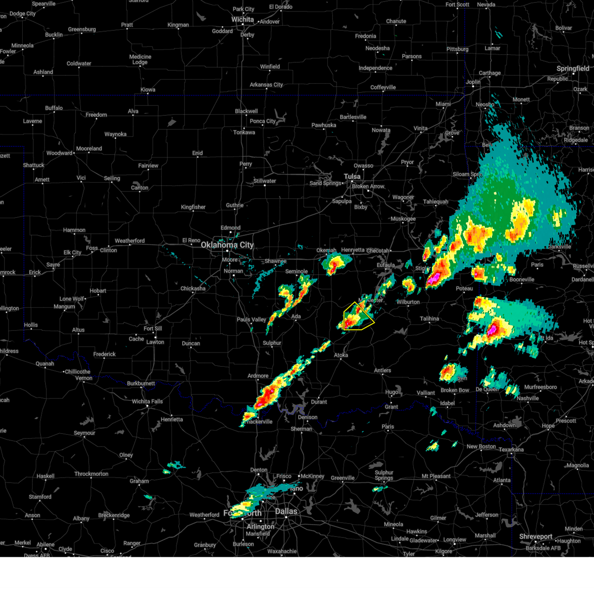 At 510 pm cdt, a severe thunderstorm was located 3 miles south of ashland, moving northeast at 30 mph (radar indicated). Hazards include 60 mph wind gusts and quarter size hail. Hail damage to vehicles is expected. expect wind damage to roofs, siding, and trees. Locations in or near the path include, kiowa, savanna, ashland, haywood, blanco, pittsburg, arpelar,. At 510 pm cdt, a severe thunderstorm was located 3 miles south of ashland, moving northeast at 30 mph (radar indicated). Hazards include 60 mph wind gusts and quarter size hail. Hail damage to vehicles is expected. expect wind damage to roofs, siding, and trees. Locations in or near the path include, kiowa, savanna, ashland, haywood, blanco, pittsburg, arpelar,.
|
| 3/14/2024 4:54 PM CDT |
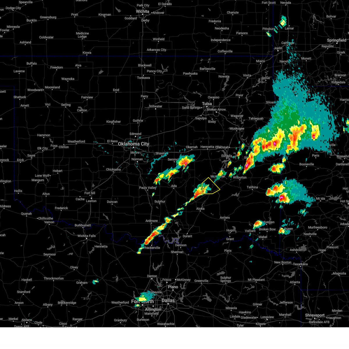 Svrtsa the national weather service in tulsa has issued a * severe thunderstorm warning for, southwestern pittsburg county in southeastern oklahoma, * until 545 pm cdt. * at 454 pm cdt, a severe thunderstorm was located 8 miles north of coalgate, moving northeast at 35 mph (radar indicated). Hazards include 60 mph wind gusts and quarter size hail. Hail damage to vehicles is expected. expect wind damage to roofs, siding, and trees. Locations in or near the path include, kiowa, savanna, ashland, haywood, blanco, pittsburg, arpelar,. Svrtsa the national weather service in tulsa has issued a * severe thunderstorm warning for, southwestern pittsburg county in southeastern oklahoma, * until 545 pm cdt. * at 454 pm cdt, a severe thunderstorm was located 8 miles north of coalgate, moving northeast at 35 mph (radar indicated). Hazards include 60 mph wind gusts and quarter size hail. Hail damage to vehicles is expected. expect wind damage to roofs, siding, and trees. Locations in or near the path include, kiowa, savanna, ashland, haywood, blanco, pittsburg, arpelar,.
|
| 9/24/2023 1:13 AM CDT |
 At 113 am cdt, severe thunderstorms were located along a line extending from 6 miles west of robbers cave state park to 3 miles south of hartshorne to 3 miles southeast of kiowa, moving east at 25 mph (radar indicated). Hazards include 60 mph wind gusts and nickel size hail. Expect damage to roofs, siding, and trees. locations in or near the path include, mcalester, hartshorne, krebs, kiowa, savanna, alderson, ashland, mcalester regional airport, blanco, haileyville, pittsburg, dow, bache, hail threat, radar indicated max hail size, 0. 88 in wind threat, radar indicated max wind gust, 60 mph. At 113 am cdt, severe thunderstorms were located along a line extending from 6 miles west of robbers cave state park to 3 miles south of hartshorne to 3 miles southeast of kiowa, moving east at 25 mph (radar indicated). Hazards include 60 mph wind gusts and nickel size hail. Expect damage to roofs, siding, and trees. locations in or near the path include, mcalester, hartshorne, krebs, kiowa, savanna, alderson, ashland, mcalester regional airport, blanco, haileyville, pittsburg, dow, bache, hail threat, radar indicated max hail size, 0. 88 in wind threat, radar indicated max wind gust, 60 mph.
|
| 9/24/2023 12:55 AM CDT |
 At 1254 am cdt, severe thunderstorms were located along a line extending from 2 miles south of blocker to 5 miles south of alderson to 4 miles northeast of wardville, moving southeast at 35 mph (radar indicated). Hazards include 60 mph wind gusts and quarter size hail. Hail damage to vehicles is expected. expect wind damage to roofs, siding, and trees. locations in or near the path include, mcalester, hartshorne, krebs, kiowa, savanna, alderson, ashland, haywood, mcalester regional airport, blanco, haileyville, pittsburg, arpelar, dow, bache, hail threat, radar indicated max hail size, 1. 00 in wind threat, radar indicated max wind gust, 60 mph. At 1254 am cdt, severe thunderstorms were located along a line extending from 2 miles south of blocker to 5 miles south of alderson to 4 miles northeast of wardville, moving southeast at 35 mph (radar indicated). Hazards include 60 mph wind gusts and quarter size hail. Hail damage to vehicles is expected. expect wind damage to roofs, siding, and trees. locations in or near the path include, mcalester, hartshorne, krebs, kiowa, savanna, alderson, ashland, haywood, mcalester regional airport, blanco, haileyville, pittsburg, arpelar, dow, bache, hail threat, radar indicated max hail size, 1. 00 in wind threat, radar indicated max wind gust, 60 mph.
|
| 9/24/2023 12:36 AM CDT |
 At 1235 am cdt, a severe thunderstorm was located 5 miles northwest of haywood, moving east at 25 mph (radar indicated). Hazards include 60 mph wind gusts and quarter size hail. Hail damage to vehicles is expected. expect wind damage to roofs, siding, and trees. locations in or near the path include, mcalester, hartshorne, krebs, kiowa, savanna, alderson, ashland, haywood, mcalester regional airport, scipio, blanco, haileyville, pittsburg, arpelar, dow, bache, hail threat, radar indicated max hail size, 1. 00 in wind threat, radar indicated max wind gust, 60 mph. At 1235 am cdt, a severe thunderstorm was located 5 miles northwest of haywood, moving east at 25 mph (radar indicated). Hazards include 60 mph wind gusts and quarter size hail. Hail damage to vehicles is expected. expect wind damage to roofs, siding, and trees. locations in or near the path include, mcalester, hartshorne, krebs, kiowa, savanna, alderson, ashland, haywood, mcalester regional airport, scipio, blanco, haileyville, pittsburg, arpelar, dow, bache, hail threat, radar indicated max hail size, 1. 00 in wind threat, radar indicated max wind gust, 60 mph.
|
| 9/23/2023 9:43 PM CDT |
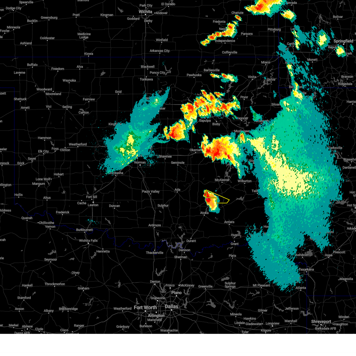 At 943 pm cdt, a severe thunderstorm was located 5 miles northwest of wardville, moving southeast at 20 mph (radar indicated). Hazards include golf ball size hail and 60 mph wind gusts. People and animals outdoors will be injured. expect hail damage to roofs, siding, windows, and vehicles. expect wind damage to roofs, siding, and trees. Locations in or near the path include, kiowa, ashland, pittsburg,. At 943 pm cdt, a severe thunderstorm was located 5 miles northwest of wardville, moving southeast at 20 mph (radar indicated). Hazards include golf ball size hail and 60 mph wind gusts. People and animals outdoors will be injured. expect hail damage to roofs, siding, windows, and vehicles. expect wind damage to roofs, siding, and trees. Locations in or near the path include, kiowa, ashland, pittsburg,.
|
| 9/23/2023 9:29 PM CDT |
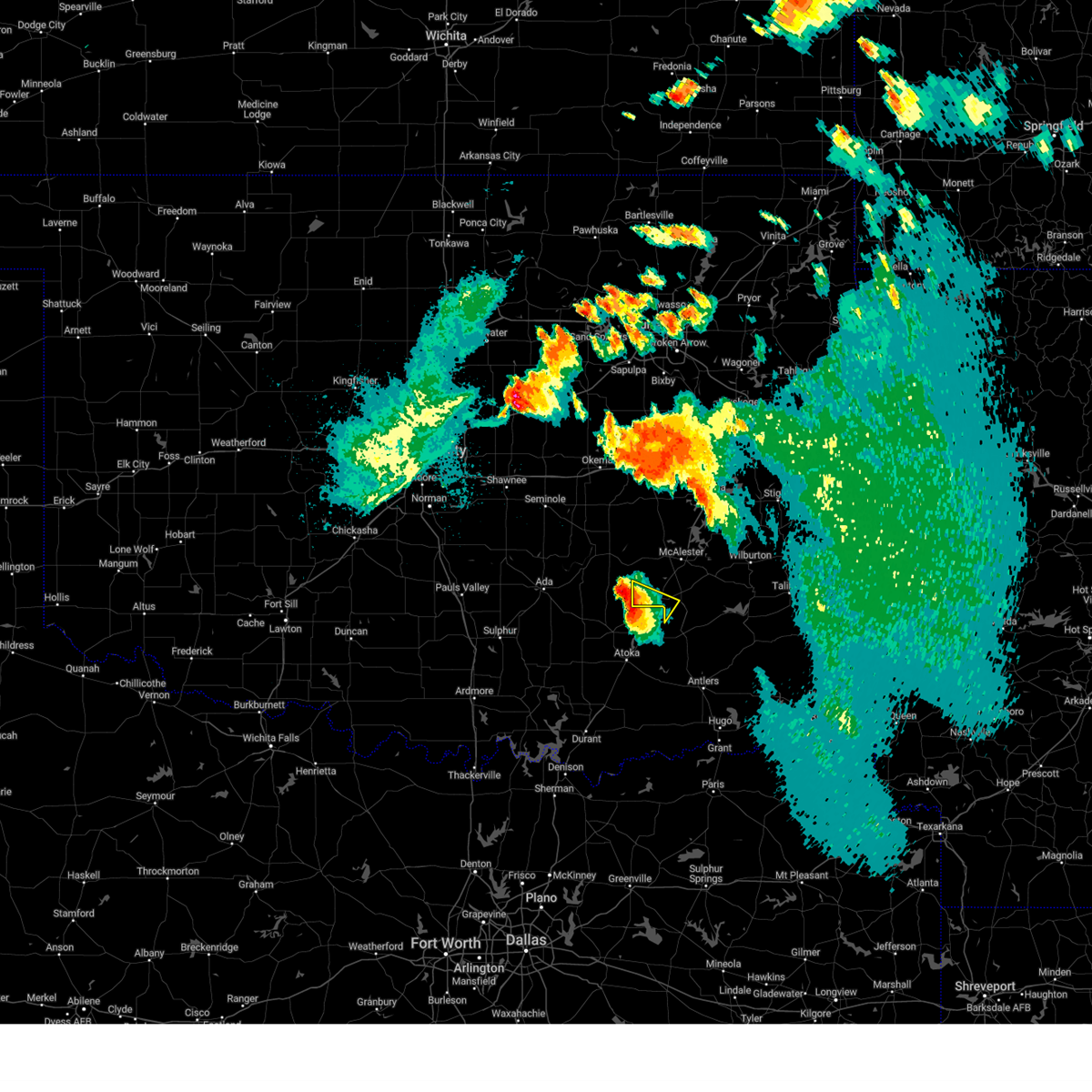 At 928 pm cdt, a severe thunderstorm was located 7 miles southwest of ashland, moving southeast at 20 mph (radar indicated). Hazards include golf ball size hail and 60 mph wind gusts. People and animals outdoors will be injured. expect hail damage to roofs, siding, windows, and vehicles. expect wind damage to roofs, siding, and trees. Locations in or near the path include, kiowa, ashland, pittsburg,. At 928 pm cdt, a severe thunderstorm was located 7 miles southwest of ashland, moving southeast at 20 mph (radar indicated). Hazards include golf ball size hail and 60 mph wind gusts. People and animals outdoors will be injured. expect hail damage to roofs, siding, windows, and vehicles. expect wind damage to roofs, siding, and trees. Locations in or near the path include, kiowa, ashland, pittsburg,.
|
| 9/23/2023 8:52 PM CDT |
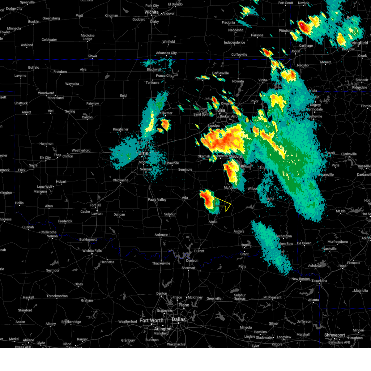 At 852 pm cdt, a severe thunderstorm was located 3 miles south of gerty, moving southeast at 20 mph (radar indicated). Hazards include golf ball size hail and 60 mph wind gusts. People and animals outdoors will be injured. expect hail damage to roofs, siding, windows, and vehicles. expect wind damage to roofs, siding, and trees. Locations in or near the path include, kiowa, ashland, pittsburg,. At 852 pm cdt, a severe thunderstorm was located 3 miles south of gerty, moving southeast at 20 mph (radar indicated). Hazards include golf ball size hail and 60 mph wind gusts. People and animals outdoors will be injured. expect hail damage to roofs, siding, windows, and vehicles. expect wind damage to roofs, siding, and trees. Locations in or near the path include, kiowa, ashland, pittsburg,.
|
| 6/17/2023 11:22 PM CDT |
 At 1122 pm cdt, a severe thunderstorm was located 4 miles east of blanco, moving northeast at 30 mph (radar indicated). Hazards include 60 mph wind gusts and quarter size hail. Hail damage to vehicles is expected. expect wind damage to roofs, siding, and trees. locations in or near the path include, mcalester, hartshorne, krebs, kiowa, alderson, higgins, blanco, haileyville, pittsburg, gowen, dow, bache, hail threat, radar indicated max hail size, 1. 00 in wind threat, radar indicated max wind gust, 60 mph. At 1122 pm cdt, a severe thunderstorm was located 4 miles east of blanco, moving northeast at 30 mph (radar indicated). Hazards include 60 mph wind gusts and quarter size hail. Hail damage to vehicles is expected. expect wind damage to roofs, siding, and trees. locations in or near the path include, mcalester, hartshorne, krebs, kiowa, alderson, higgins, blanco, haileyville, pittsburg, gowen, dow, bache, hail threat, radar indicated max hail size, 1. 00 in wind threat, radar indicated max wind gust, 60 mph.
|
| 6/17/2023 11:00 PM CDT |
 At 1100 pm cdt, a severe thunderstorm was located 4 miles southeast of kiowa, moving northeast at 30 mph (radar indicated). Hazards include 60 mph wind gusts and quarter size hail. Hail damage to vehicles is expected. expect wind damage to roofs, siding, and trees. locations in or near the path include, mcalester, hartshorne, krebs, kiowa, alderson, higgins, blanco, haileyville, pittsburg, gowen, dow, bache, hail threat, radar indicated max hail size, 1. 00 in wind threat, radar indicated max wind gust, 60 mph. At 1100 pm cdt, a severe thunderstorm was located 4 miles southeast of kiowa, moving northeast at 30 mph (radar indicated). Hazards include 60 mph wind gusts and quarter size hail. Hail damage to vehicles is expected. expect wind damage to roofs, siding, and trees. locations in or near the path include, mcalester, hartshorne, krebs, kiowa, alderson, higgins, blanco, haileyville, pittsburg, gowen, dow, bache, hail threat, radar indicated max hail size, 1. 00 in wind threat, radar indicated max wind gust, 60 mph.
|
| 6/15/2023 11:41 PM CDT |
 The severe thunderstorm warning for northwestern pushmataha, western latimer and southern pittsburg counties will expire at 1145 pm cdt, the storms which prompted the warning have weakened below severe limits, and no longer pose an immediate threat to life or property. therefore, the warning will be allowed to expire. however gusty winds to 40mph are still possible with these thunderstorms. a severe thunderstorm watch remains in effect until 300 am cdt for southeastern oklahoma. The severe thunderstorm warning for northwestern pushmataha, western latimer and southern pittsburg counties will expire at 1145 pm cdt, the storms which prompted the warning have weakened below severe limits, and no longer pose an immediate threat to life or property. therefore, the warning will be allowed to expire. however gusty winds to 40mph are still possible with these thunderstorms. a severe thunderstorm watch remains in effect until 300 am cdt for southeastern oklahoma.
|
| 6/15/2023 11:23 PM CDT |
 At 1122 pm cdt, severe thunderstorms were located along a line extending from near krebs to 7 miles southeast of wardville, moving southeast at 40 mph (radar indicated). Hazards include 60 mph wind gusts and penny size hail. Expect damage to roofs, siding, and trees. locations in or near the path include, mcalester, hartshorne, krebs, kiowa, savanna, alderson, ashland, higgins, haywood, mcalester regional airport, dunbar, blanco, haileyville, pittsburg, gowen, dow, bache, hail threat, radar indicated max hail size, 0. 75 in wind threat, radar indicated max wind gust, 60 mph. At 1122 pm cdt, severe thunderstorms were located along a line extending from near krebs to 7 miles southeast of wardville, moving southeast at 40 mph (radar indicated). Hazards include 60 mph wind gusts and penny size hail. Expect damage to roofs, siding, and trees. locations in or near the path include, mcalester, hartshorne, krebs, kiowa, savanna, alderson, ashland, higgins, haywood, mcalester regional airport, dunbar, blanco, haileyville, pittsburg, gowen, dow, bache, hail threat, radar indicated max hail size, 0. 75 in wind threat, radar indicated max wind gust, 60 mph.
|
| 6/15/2023 10:53 PM CDT |
 At 1053 pm cdt, severe thunderstorms were located along a line extending from 5 miles southeast of lamar to 7 miles southeast of gerty, moving east at 45 mph (radar indicated). Hazards include 60 mph wind gusts and penny size hail. Expect damage to roofs, siding, and trees. locations in or near the path include, mcalester, hartshorne, krebs, kiowa, savanna, alderson, ashland, higgins, haywood, mcalester regional airport, scipio, dunbar, blanco, haileyville, pittsburg, arpelar, gowen, dow, bache, hail threat, radar indicated max hail size, 0. 75 in wind threat, radar indicated max wind gust, 60 mph. At 1053 pm cdt, severe thunderstorms were located along a line extending from 5 miles southeast of lamar to 7 miles southeast of gerty, moving east at 45 mph (radar indicated). Hazards include 60 mph wind gusts and penny size hail. Expect damage to roofs, siding, and trees. locations in or near the path include, mcalester, hartshorne, krebs, kiowa, savanna, alderson, ashland, higgins, haywood, mcalester regional airport, scipio, dunbar, blanco, haileyville, pittsburg, arpelar, gowen, dow, bache, hail threat, radar indicated max hail size, 0. 75 in wind threat, radar indicated max wind gust, 60 mph.
|
| 6/3/2023 4:19 PM CDT |
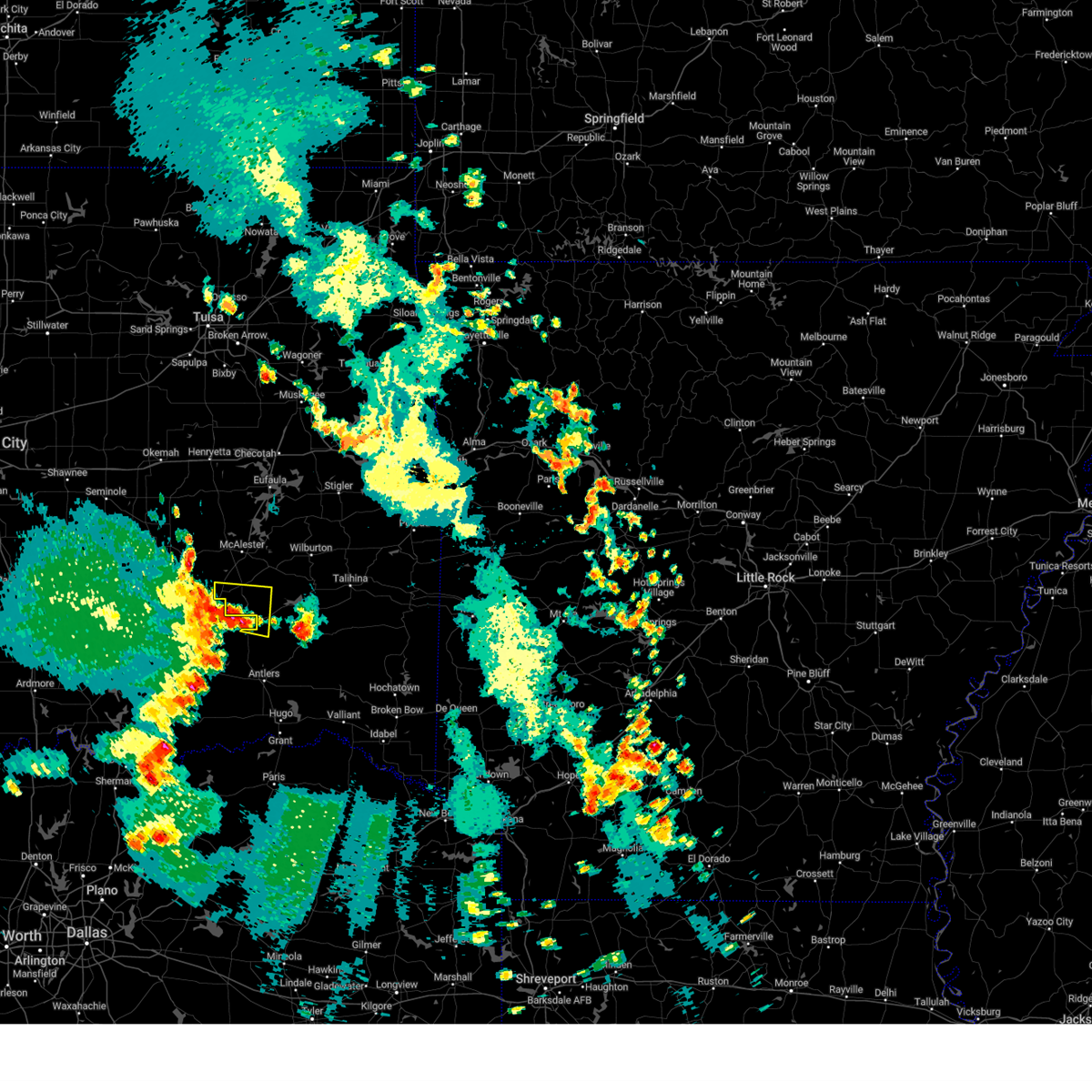 At 419 pm cdt, a severe thunderstorm was located 5 miles northwest of daisy, and is nearly stationary (radar indicated). Hazards include 60 mph wind gusts and quarter size hail. Hail damage to vehicles is expected. expect wind damage to roofs, siding, and trees. locations in or near the path include, kiowa, blanco, pittsburg, hail threat, radar indicated max hail size, 1. 00 in wind threat, radar indicated max wind gust, 60 mph. At 419 pm cdt, a severe thunderstorm was located 5 miles northwest of daisy, and is nearly stationary (radar indicated). Hazards include 60 mph wind gusts and quarter size hail. Hail damage to vehicles is expected. expect wind damage to roofs, siding, and trees. locations in or near the path include, kiowa, blanco, pittsburg, hail threat, radar indicated max hail size, 1. 00 in wind threat, radar indicated max wind gust, 60 mph.
|
| 5/19/2023 5:02 PM CDT |
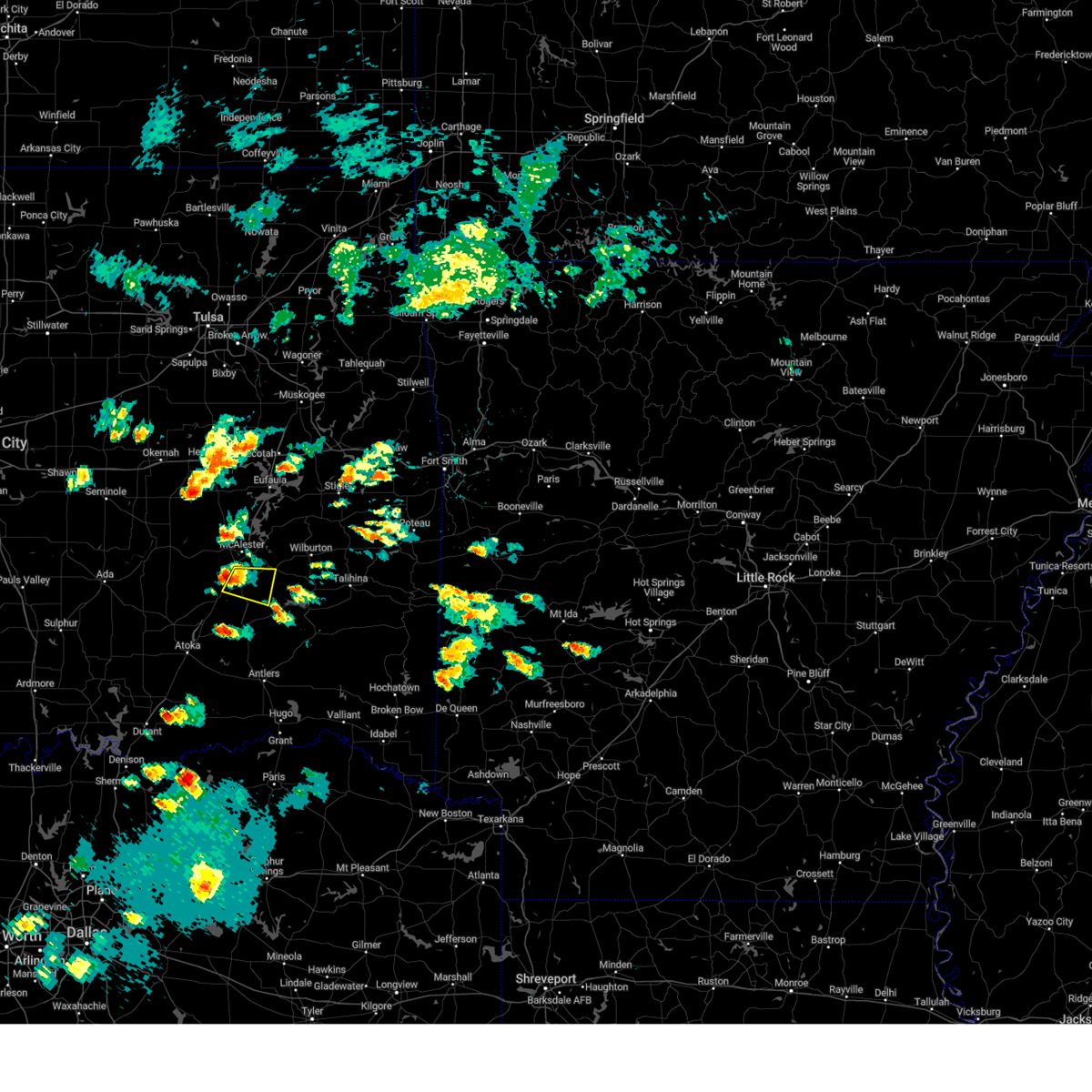 At 502 pm cdt, a severe thunderstorm was located over blanco, moving east at 30 mph (radar indicated). Hazards include 60 mph wind gusts and quarter size hail. Hail damage to vehicles is expected. expect wind damage to roofs, siding, and trees. locations in or near the path include, hartshorne, kiowa, blanco, pittsburg, hail threat, radar indicated max hail size, 1. 00 in wind threat, radar indicated max wind gust, 60 mph. At 502 pm cdt, a severe thunderstorm was located over blanco, moving east at 30 mph (radar indicated). Hazards include 60 mph wind gusts and quarter size hail. Hail damage to vehicles is expected. expect wind damage to roofs, siding, and trees. locations in or near the path include, hartshorne, kiowa, blanco, pittsburg, hail threat, radar indicated max hail size, 1. 00 in wind threat, radar indicated max wind gust, 60 mph.
|
| 5/19/2023 4:51 PM CDT |
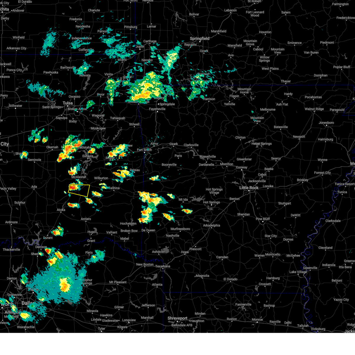 At 451 pm cdt, a severe thunderstorm was located 3 miles north of kiowa, moving east at 20 mph (radar indicated). Hazards include 60 mph wind gusts and quarter size hail. Hail damage to vehicles is expected. expect wind damage to roofs, siding, and trees. Locations in or near the path include, hartshorne, kiowa, savanna, blanco, pittsburg,. At 451 pm cdt, a severe thunderstorm was located 3 miles north of kiowa, moving east at 20 mph (radar indicated). Hazards include 60 mph wind gusts and quarter size hail. Hail damage to vehicles is expected. expect wind damage to roofs, siding, and trees. Locations in or near the path include, hartshorne, kiowa, savanna, blanco, pittsburg,.
|
| 5/12/2023 12:04 AM CDT |
 At 1204 am cdt, severe thunderstorms were located along a line extending from 4 miles southeast of scipio to near savanna to 3 miles east of wardville, moving northeast at 20 mph (radar indicated). Hazards include 70 mph wind gusts and quarter size hail. Hail damage to vehicles is expected. expect considerable tree damage. wind damage is also likely to mobile homes, roofs, and outbuildings. locations in or near the path include, mcalester, krebs, kiowa, savanna, crowder, alderson, canadian, indianola, ashland, haywood, arrowhead state park, mcalester regional airport, scipio, blanco, pittsburg, arpelar, dow, bache, thunderstorm damage threat, considerable hail threat, radar indicated max hail size, 1. 00 in wind threat, radar indicated max wind gust, 70 mph. At 1204 am cdt, severe thunderstorms were located along a line extending from 4 miles southeast of scipio to near savanna to 3 miles east of wardville, moving northeast at 20 mph (radar indicated). Hazards include 70 mph wind gusts and quarter size hail. Hail damage to vehicles is expected. expect considerable tree damage. wind damage is also likely to mobile homes, roofs, and outbuildings. locations in or near the path include, mcalester, krebs, kiowa, savanna, crowder, alderson, canadian, indianola, ashland, haywood, arrowhead state park, mcalester regional airport, scipio, blanco, pittsburg, arpelar, dow, bache, thunderstorm damage threat, considerable hail threat, radar indicated max hail size, 1. 00 in wind threat, radar indicated max wind gust, 70 mph.
|
| 5/6/2023 11:34 PM CDT |
 At 1133 pm cdt, a severe thunderstorm was located 6 miles southwest of hartshorne, moving northeast at 40 mph (radar indicated). Hazards include 60 mph wind gusts. Expect damage to roofs, siding, and trees. locations in or near the path include, mcalester, wilburton, hartshorne, krebs, kiowa, savanna, crowder, alderson, canadian, higgins, damon, haywood, blocker, robbers cave state park, arrowhead state park, mcalester regional airport, blanco, haileyville, pittsburg, gowen, hail threat, radar indicated max hail size, <. 75 in wind threat, radar indicated max wind gust, 60 mph. At 1133 pm cdt, a severe thunderstorm was located 6 miles southwest of hartshorne, moving northeast at 40 mph (radar indicated). Hazards include 60 mph wind gusts. Expect damage to roofs, siding, and trees. locations in or near the path include, mcalester, wilburton, hartshorne, krebs, kiowa, savanna, crowder, alderson, canadian, higgins, damon, haywood, blocker, robbers cave state park, arrowhead state park, mcalester regional airport, blanco, haileyville, pittsburg, gowen, hail threat, radar indicated max hail size, <. 75 in wind threat, radar indicated max wind gust, 60 mph.
|
| 3/16/2023 5:12 PM CDT |
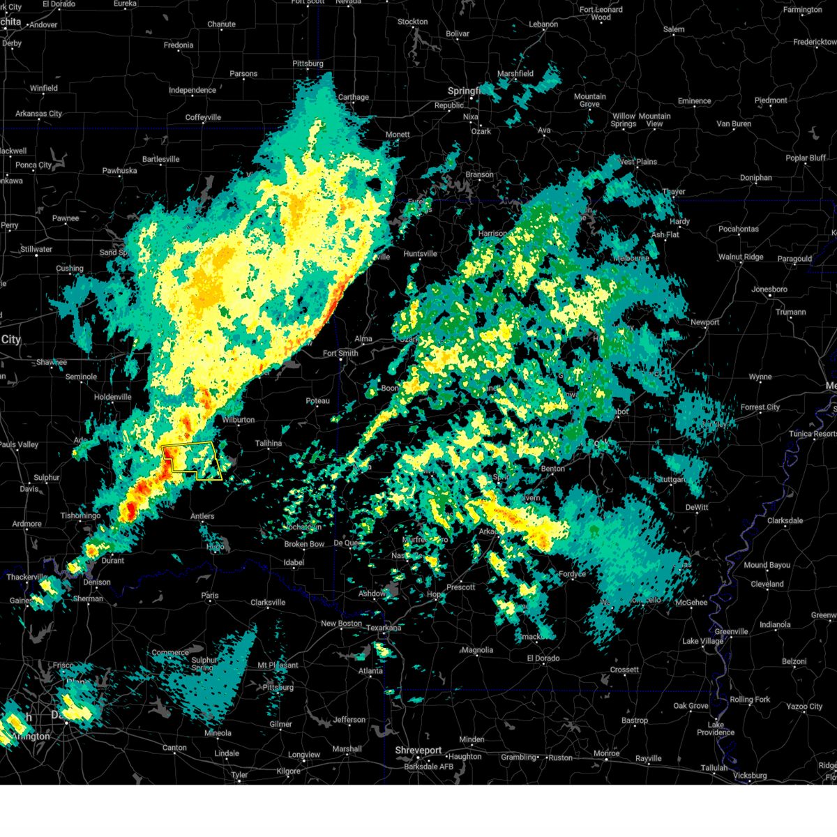 At 511 pm cdt, a severe thunderstorm was located near kiowa, moving east at 40 mph (radar indicated). Hazards include 60 mph wind gusts and penny size hail. Expect damage to roofs, siding, and trees. locations in or near the path include, kiowa, stanley, blanco, pittsburg, hail threat, radar indicated max hail size, 0. 75 in wind threat, radar indicated max wind gust, 60 mph. At 511 pm cdt, a severe thunderstorm was located near kiowa, moving east at 40 mph (radar indicated). Hazards include 60 mph wind gusts and penny size hail. Expect damage to roofs, siding, and trees. locations in or near the path include, kiowa, stanley, blanco, pittsburg, hail threat, radar indicated max hail size, 0. 75 in wind threat, radar indicated max wind gust, 60 mph.
|
| 3/16/2023 4:59 PM CDT |
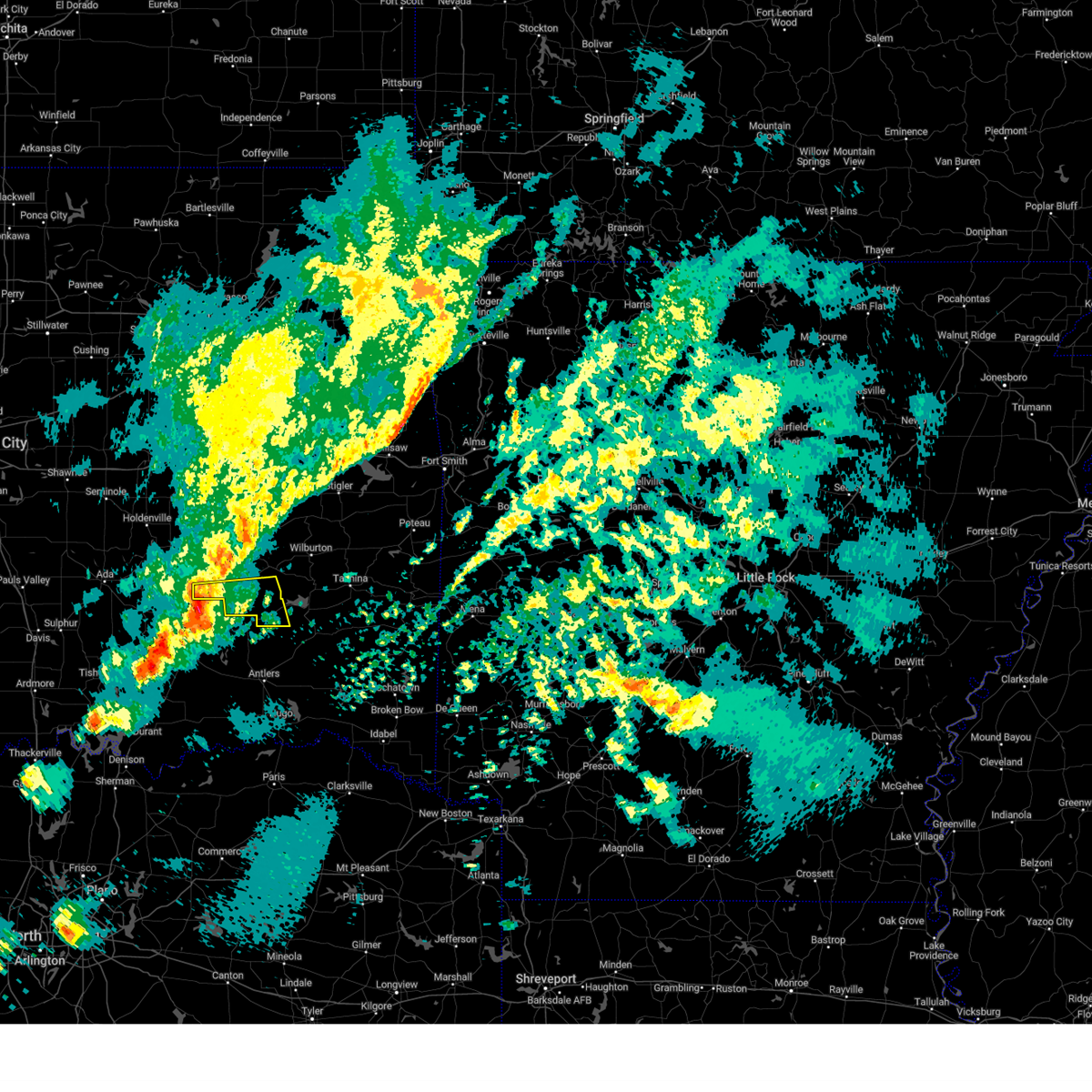 At 459 pm cdt, a severe thunderstorm was located near wardville, moving east at 50 mph (radar indicated). Hazards include 60 mph wind gusts and quarter size hail. Hail damage to vehicles is expected. expect wind damage to roofs, siding, and trees. locations in or near the path include, kiowa, stanley, blanco, pittsburg, hail threat, radar indicated max hail size, 1. 00 in wind threat, radar indicated max wind gust, 60 mph. At 459 pm cdt, a severe thunderstorm was located near wardville, moving east at 50 mph (radar indicated). Hazards include 60 mph wind gusts and quarter size hail. Hail damage to vehicles is expected. expect wind damage to roofs, siding, and trees. locations in or near the path include, kiowa, stanley, blanco, pittsburg, hail threat, radar indicated max hail size, 1. 00 in wind threat, radar indicated max wind gust, 60 mph.
|
| 3/2/2023 5:18 PM CST |
 At 518 pm cst, a severe thunderstorm was located 7 miles southeast of blanco, moving northeast at 50 mph (radar indicated). Hazards include 60 mph wind gusts and quarter size hail. Hail damage to vehicles is expected. expect wind damage to roofs, siding, and trees. locations in or near the path include, mcalester, hartshorne, krebs, kiowa, savanna, alderson, higgins, mcalester regional airport, blanco, haileyville, pittsburg, gowen, dow, bache, hail threat, radar indicated max hail size, 1. 00 in wind threat, radar indicated max wind gust, 60 mph. At 518 pm cst, a severe thunderstorm was located 7 miles southeast of blanco, moving northeast at 50 mph (radar indicated). Hazards include 60 mph wind gusts and quarter size hail. Hail damage to vehicles is expected. expect wind damage to roofs, siding, and trees. locations in or near the path include, mcalester, hartshorne, krebs, kiowa, savanna, alderson, higgins, mcalester regional airport, blanco, haileyville, pittsburg, gowen, dow, bache, hail threat, radar indicated max hail size, 1. 00 in wind threat, radar indicated max wind gust, 60 mph.
|
| 2/26/2023 11:25 PM CST |
 The severe thunderstorm warning for northwestern pushmataha, southwestern latimer and southern pittsburg counties will expire at 1130 pm cst, the storm which prompted the warning has weakened below severe limits, and no longer poses an immediate threat to life or property. therefore, the warning will be allowed to expire. however gusty winds are still possible with this thunderstorm. a tornado watch remains in effect until 100 am cst for southeastern oklahoma. The severe thunderstorm warning for northwestern pushmataha, southwestern latimer and southern pittsburg counties will expire at 1130 pm cst, the storm which prompted the warning has weakened below severe limits, and no longer poses an immediate threat to life or property. therefore, the warning will be allowed to expire. however gusty winds are still possible with this thunderstorm. a tornado watch remains in effect until 100 am cst for southeastern oklahoma.
|
| 2/26/2023 10:53 PM CST |
 At 1053 pm cst, a severe thunderstorm was located 3 miles northwest of wardville, moving east at 70 mph (radar indicated). Hazards include 70 mph wind gusts and quarter size hail. Hail damage to vehicles is expected. expect considerable tree damage. wind damage is also likely to mobile homes, roofs, and outbuildings. locations in or near the path include, mcalester, hartshorne, krebs, kiowa, savanna, alderson, ashland, higgins, haywood, mcalester regional airport, blanco, haileyville, pittsburg, arpelar, gowen, sardis, dow, bache, thunderstorm damage threat, considerable hail threat, observed max hail size, 1. 00 in wind threat, radar indicated max wind gust, 70 mph. At 1053 pm cst, a severe thunderstorm was located 3 miles northwest of wardville, moving east at 70 mph (radar indicated). Hazards include 70 mph wind gusts and quarter size hail. Hail damage to vehicles is expected. expect considerable tree damage. wind damage is also likely to mobile homes, roofs, and outbuildings. locations in or near the path include, mcalester, hartshorne, krebs, kiowa, savanna, alderson, ashland, higgins, haywood, mcalester regional airport, blanco, haileyville, pittsburg, arpelar, gowen, sardis, dow, bache, thunderstorm damage threat, considerable hail threat, observed max hail size, 1. 00 in wind threat, radar indicated max wind gust, 70 mph.
|
| 2/26/2023 10:38 PM CST |
 At 1038 pm cst, a severe thunderstorm was located near centrahoma, moving east at 70 mph (emergency management). Hazards include golf ball size hail and 70 mph wind gusts. People and animals outdoors will be injured. expect hail damage to roofs, siding, windows, and vehicles. expect considerable tree damage. wind damage is also likely to mobile homes, roofs, and outbuildings. locations in or near the path include, mcalester, clayton, hartshorne, krebs, kiowa, savanna, alderson, ashland, higgins, snow, haywood, stanley, mcalester regional airport, kosoma, dunbar, blanco, haileyville, pittsburg, eubanks, arpelar, thunderstorm damage threat, considerable hail threat, observed max hail size, 1. 75 in wind threat, radar indicated max wind gust, 70 mph. At 1038 pm cst, a severe thunderstorm was located near centrahoma, moving east at 70 mph (emergency management). Hazards include golf ball size hail and 70 mph wind gusts. People and animals outdoors will be injured. expect hail damage to roofs, siding, windows, and vehicles. expect considerable tree damage. wind damage is also likely to mobile homes, roofs, and outbuildings. locations in or near the path include, mcalester, clayton, hartshorne, krebs, kiowa, savanna, alderson, ashland, higgins, snow, haywood, stanley, mcalester regional airport, kosoma, dunbar, blanco, haileyville, pittsburg, eubanks, arpelar, thunderstorm damage threat, considerable hail threat, observed max hail size, 1. 75 in wind threat, radar indicated max wind gust, 70 mph.
|
| 2/15/2023 10:53 PM CST |
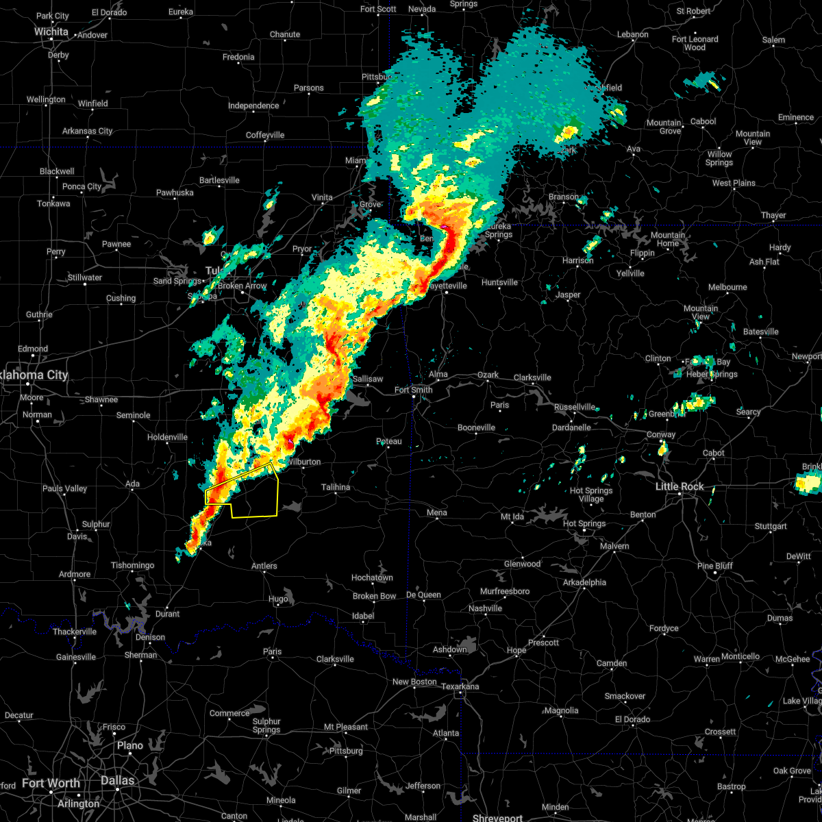 At 1053 pm cst, a severe thunderstorm was located over wardville, moving east at 45 mph (radar indicated). Hazards include 60 mph wind gusts and nickel size hail. Expect damage to roofs, siding, and trees. locations in or near the path include, hartshorne, kiowa, savanna, alderson, ashland, blanco, haileyville, pittsburg, dow, bache, hail threat, radar indicated max hail size, 0. 88 in wind threat, radar indicated max wind gust, 60 mph. At 1053 pm cst, a severe thunderstorm was located over wardville, moving east at 45 mph (radar indicated). Hazards include 60 mph wind gusts and nickel size hail. Expect damage to roofs, siding, and trees. locations in or near the path include, hartshorne, kiowa, savanna, alderson, ashland, blanco, haileyville, pittsburg, dow, bache, hail threat, radar indicated max hail size, 0. 88 in wind threat, radar indicated max wind gust, 60 mph.
|
| 2/15/2023 10:12 PM CST |
 At 1012 pm cst, a severe thunderstorm was located 3 miles northwest of savanna, moving east at 35 mph (radar indicated). Hazards include 60 mph wind gusts and half dollar size hail. Hail damage to vehicles is expected. expect wind damage to roofs, siding, and trees. locations in or near the path include, mcalester, hartshorne, krebs, savanna, alderson, higgins, haywood, mcalester regional airport, blanco, haileyville, gowen, dow, bache, hail threat, radar indicated max hail size, 1. 25 in wind threat, radar indicated max wind gust, 60 mph. At 1012 pm cst, a severe thunderstorm was located 3 miles northwest of savanna, moving east at 35 mph (radar indicated). Hazards include 60 mph wind gusts and half dollar size hail. Hail damage to vehicles is expected. expect wind damage to roofs, siding, and trees. locations in or near the path include, mcalester, hartshorne, krebs, savanna, alderson, higgins, haywood, mcalester regional airport, blanco, haileyville, gowen, dow, bache, hail threat, radar indicated max hail size, 1. 25 in wind threat, radar indicated max wind gust, 60 mph.
|
| 2/15/2023 9:43 PM CST |
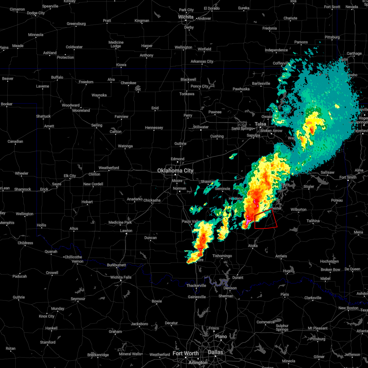 At 942 pm cst, a severe thunderstorm capable of producing a tornado was located 8 miles southeast of gerty, moving east at 40 mph (radar indicated rotation). Hazards include tornado and ping pong ball size hail. Flying debris will be dangerous to those caught without shelter. mobile homes will be damaged or destroyed. damage to roofs, windows, and vehicles will occur. tree damage is likely. Locations in or near the path include, kiowa, savanna, ashland, haywood, blanco, pittsburg,. At 942 pm cst, a severe thunderstorm capable of producing a tornado was located 8 miles southeast of gerty, moving east at 40 mph (radar indicated rotation). Hazards include tornado and ping pong ball size hail. Flying debris will be dangerous to those caught without shelter. mobile homes will be damaged or destroyed. damage to roofs, windows, and vehicles will occur. tree damage is likely. Locations in or near the path include, kiowa, savanna, ashland, haywood, blanco, pittsburg,.
|
| 5/5/2022 1:06 PM CDT |
 At 105 pm cdt, a severe thunderstorm was located 6 miles south of blanco, moving northeast at 35 mph (radar indicated). Hazards include 60 mph wind gusts and half dollar size hail. Hail damage to vehicles is expected. expect wind damage to roofs, siding, and trees. locations in or near the path include, mcalester, hartshorne, krebs, alderson, higgins, damon, mcalester regional airport, blanco, haileyville, pittsburg, gowen, dow, bache, hail threat, radar indicated max hail size, 1. 25 in wind threat, radar indicated max wind gust, 60 mph. At 105 pm cdt, a severe thunderstorm was located 6 miles south of blanco, moving northeast at 35 mph (radar indicated). Hazards include 60 mph wind gusts and half dollar size hail. Hail damage to vehicles is expected. expect wind damage to roofs, siding, and trees. locations in or near the path include, mcalester, hartshorne, krebs, alderson, higgins, damon, mcalester regional airport, blanco, haileyville, pittsburg, gowen, dow, bache, hail threat, radar indicated max hail size, 1. 25 in wind threat, radar indicated max wind gust, 60 mph.
|
| 5/5/2022 2:08 AM CDT |
 At 207 am cdt, severe thunderstorms were located along a line extending from 6 miles southwest of warner to 5 miles west of quinton to 5 miles south of blanco, moving southeast at 35 mph (radar indicated). Hazards include 60 mph wind gusts and quarter size hail. Hail damage to vehicles is expected. expect wind damage to roofs, siding, and trees. Locations in or near the path include, mcalester, wilburton, eufaula, stigler, checotah, hartshorne, krebs, warner, quinton, kiowa, porum, savanna, webbers falls, crowder, whitefield, alderson, kinta, canadian, indianola, hanna, this includes interstate 40 in oklahoma between mile markers 246 and 288. At 207 am cdt, severe thunderstorms were located along a line extending from 6 miles southwest of warner to 5 miles west of quinton to 5 miles south of blanco, moving southeast at 35 mph (radar indicated). Hazards include 60 mph wind gusts and quarter size hail. Hail damage to vehicles is expected. expect wind damage to roofs, siding, and trees. Locations in or near the path include, mcalester, wilburton, eufaula, stigler, checotah, hartshorne, krebs, warner, quinton, kiowa, porum, savanna, webbers falls, crowder, whitefield, alderson, kinta, canadian, indianola, hanna, this includes interstate 40 in oklahoma between mile markers 246 and 288.
|
| 5/5/2022 1:49 AM CDT |
 At 149 am cdt, severe thunderstorms were located along a line extending from 3 miles east of lake eufaula state park to 6 miles south of blanco, moving east at 35 mph (radar indicated). Hazards include 60 mph wind gusts and quarter size hail. Hail damage to vehicles is expected. expect wind damage to roofs, siding, and trees. locations in or near the path include, mcalester, wilburton, eufaula, stigler, checotah, hartshorne, krebs, warner, quinton, kiowa, porum, savanna, webbers falls, crowder, whitefield, alderson, kinta, canadian, indianola, hanna, this includes interstate 40 in oklahoma between mile markers 246 and 288. hail threat, radar indicated max hail size, 1. 00 in wind threat, radar indicated max wind gust, 60 mph. At 149 am cdt, severe thunderstorms were located along a line extending from 3 miles east of lake eufaula state park to 6 miles south of blanco, moving east at 35 mph (radar indicated). Hazards include 60 mph wind gusts and quarter size hail. Hail damage to vehicles is expected. expect wind damage to roofs, siding, and trees. locations in or near the path include, mcalester, wilburton, eufaula, stigler, checotah, hartshorne, krebs, warner, quinton, kiowa, porum, savanna, webbers falls, crowder, whitefield, alderson, kinta, canadian, indianola, hanna, this includes interstate 40 in oklahoma between mile markers 246 and 288. hail threat, radar indicated max hail size, 1. 00 in wind threat, radar indicated max wind gust, 60 mph.
|
| 5/2/2022 10:33 PM CDT |
 At 1032 pm cdt, severe thunderstorms were located along a line extending from 4 miles southeast of tamaha to 4 miles east of fanshawe to 4 miles east of albion, moving east at 50 mph. a second severe thundestorm was located near blanco (radar indicated). Hazards include 60 mph wind gusts and penny size hail. Expect damage to roofs, siding, and trees. Locations in or near the path include, mcalester, poteau, wilburton, stigler, antlers, clayton, pocola, muldrow, heavener, roland, spiro, hartshorne, krebs, arkoma, panama, talihina, wister, quinton, howe, kiowa, this includes interstate 40 in oklahoma between mile markers 312 and 328. At 1032 pm cdt, severe thunderstorms were located along a line extending from 4 miles southeast of tamaha to 4 miles east of fanshawe to 4 miles east of albion, moving east at 50 mph. a second severe thundestorm was located near blanco (radar indicated). Hazards include 60 mph wind gusts and penny size hail. Expect damage to roofs, siding, and trees. Locations in or near the path include, mcalester, poteau, wilburton, stigler, antlers, clayton, pocola, muldrow, heavener, roland, spiro, hartshorne, krebs, arkoma, panama, talihina, wister, quinton, howe, kiowa, this includes interstate 40 in oklahoma between mile markers 312 and 328.
|
| 5/2/2022 10:10 PM CDT |
 At 1010 pm cdt, severe thunderstorms were located along a line extending from near whitefield to 5 miles southwest of red oak to 4 miles east of daisy, moving east at 55 mph (radar indicated). Hazards include 60 mph wind gusts and penny size hail. Expect damage to roofs, siding, and trees. locations in or near the path include, mcalester, poteau, wilburton, stigler, antlers, clayton, pocola, muldrow, heavener, roland, spiro, hartshorne, krebs, arkoma, panama, talihina, wister, quinton, howe, kiowa, this includes interstate 40 in oklahoma between mile markers 312 and 328. hail threat, radar indicated max hail size, 0. 75 in wind threat, radar indicated max wind gust, 60 mph. At 1010 pm cdt, severe thunderstorms were located along a line extending from near whitefield to 5 miles southwest of red oak to 4 miles east of daisy, moving east at 55 mph (radar indicated). Hazards include 60 mph wind gusts and penny size hail. Expect damage to roofs, siding, and trees. locations in or near the path include, mcalester, poteau, wilburton, stigler, antlers, clayton, pocola, muldrow, heavener, roland, spiro, hartshorne, krebs, arkoma, panama, talihina, wister, quinton, howe, kiowa, this includes interstate 40 in oklahoma between mile markers 312 and 328. hail threat, radar indicated max hail size, 0. 75 in wind threat, radar indicated max wind gust, 60 mph.
|
| 5/2/2022 10:03 PM CDT |
 At 1003 pm cdt, severe thunderstorms were located along a line extending from 2 miles northeast of quinton to 2 miles southeast of wilburton to 11 miles southeast of blanco, moving east at 55 mph (radar indicated). Hazards include 60 mph wind gusts and nickel size hail. Expect damage to roofs, siding, and trees. locations in or near the path include, mcalester, wilburton, clayton, hartshorne, krebs, quinton, kiowa, savanna, red oak, mccurtain, crowder, alderson, kinta, albion, ashland, higgins, haywood, tuskahoma, mc curtain, kiamichi, hail threat, radar indicated max hail size, 0. 88 in wind threat, radar indicated max wind gust, 60 mph. At 1003 pm cdt, severe thunderstorms were located along a line extending from 2 miles northeast of quinton to 2 miles southeast of wilburton to 11 miles southeast of blanco, moving east at 55 mph (radar indicated). Hazards include 60 mph wind gusts and nickel size hail. Expect damage to roofs, siding, and trees. locations in or near the path include, mcalester, wilburton, clayton, hartshorne, krebs, quinton, kiowa, savanna, red oak, mccurtain, crowder, alderson, kinta, albion, ashland, higgins, haywood, tuskahoma, mc curtain, kiamichi, hail threat, radar indicated max hail size, 0. 88 in wind threat, radar indicated max wind gust, 60 mph.
|
| 5/2/2022 9:28 PM CDT |
 At 928 pm cdt, severe thunderstorms were located along a line extending from crowder to 3 miles northeast of krebs to 3 miles east of ashland, moving east at 60 mph (radar indicated). Hazards include 60 mph wind gusts and nickel size hail. Expect damage to roofs, siding, and trees. locations in or near the path include, mcalester, wilburton, clayton, hartshorne, krebs, quinton, kiowa, savanna, red oak, mccurtain, crowder, alderson, kinta, canadian, indianola, albion, ashland, higgins, haywood, tuskahoma, hail threat, radar indicated max hail size, 0. 88 in wind threat, radar indicated max wind gust, 60 mph. At 928 pm cdt, severe thunderstorms were located along a line extending from crowder to 3 miles northeast of krebs to 3 miles east of ashland, moving east at 60 mph (radar indicated). Hazards include 60 mph wind gusts and nickel size hail. Expect damage to roofs, siding, and trees. locations in or near the path include, mcalester, wilburton, clayton, hartshorne, krebs, quinton, kiowa, savanna, red oak, mccurtain, crowder, alderson, kinta, canadian, indianola, albion, ashland, higgins, haywood, tuskahoma, hail threat, radar indicated max hail size, 0. 88 in wind threat, radar indicated max wind gust, 60 mph.
|
| 5/2/2022 9:14 PM CDT |
 At 914 pm cdt, a severe thunderstorm was located 6 miles northwest of mcalester, moving east at 45 mph (radar indicated). Hazards include 60 mph wind gusts and quarter size hail. Hail damage to vehicles is expected. expect wind damage to roofs, siding, and trees. locations in or near the path include, mcalester, krebs, kiowa, savanna, crowder, alderson, ashland, haywood, blocker, mcalester regional airport, scipio, blanco, haileyville, pittsburg, arpelar, dow, bache, hail threat, radar indicated max hail size, 1. 00 in wind threat, radar indicated max wind gust, 60 mph. At 914 pm cdt, a severe thunderstorm was located 6 miles northwest of mcalester, moving east at 45 mph (radar indicated). Hazards include 60 mph wind gusts and quarter size hail. Hail damage to vehicles is expected. expect wind damage to roofs, siding, and trees. locations in or near the path include, mcalester, krebs, kiowa, savanna, crowder, alderson, ashland, haywood, blocker, mcalester regional airport, scipio, blanco, haileyville, pittsburg, arpelar, dow, bache, hail threat, radar indicated max hail size, 1. 00 in wind threat, radar indicated max wind gust, 60 mph.
|
| 5/2/2022 8:49 PM CDT |
 At 849 pm cdt, a severe thunderstorm was located 4 miles southeast of horntown, moving east at 60 mph (radar indicated). Hazards include 60 mph wind gusts and quarter size hail. Hail damage to vehicles is expected. expect wind damage to roofs, siding, and trees. locations in or near the path include, mcalester, krebs, kiowa, savanna, crowder, alderson, ashland, haywood, blocker, mcalester regional airport, scipio, blanco, haileyville, pittsburg, arpelar, dow, bache, hail threat, radar indicated max hail size, 1. 00 in wind threat, radar indicated max wind gust, 60 mph. At 849 pm cdt, a severe thunderstorm was located 4 miles southeast of horntown, moving east at 60 mph (radar indicated). Hazards include 60 mph wind gusts and quarter size hail. Hail damage to vehicles is expected. expect wind damage to roofs, siding, and trees. locations in or near the path include, mcalester, krebs, kiowa, savanna, crowder, alderson, ashland, haywood, blocker, mcalester regional airport, scipio, blanco, haileyville, pittsburg, arpelar, dow, bache, hail threat, radar indicated max hail size, 1. 00 in wind threat, radar indicated max wind gust, 60 mph.
|
| 10/10/2021 10:01 PM CDT |
 At 1000 pm cdt, a severe thunderstorm was located over calvin, moving northeast at 55 mph (radar indicated). Hazards include 70 mph wind gusts and half dollar size hail. Hail damage to vehicles is expected. expect considerable tree damage. wind damage is also likely to mobile homes, roofs, and outbuildings. locations in or near the path include, mcalester, eufaula, hartshorne, krebs, kiowa, savanna, crowder, alderson, canadian, indianola, hanna, ashland, stidham, raiford, haywood, vivian, lake eufaula state park, blocker, arrowhead state park, mcalester regional airport, thunderstorm damage threat, considerable hail threat, radar indicated max hail size, 1. 25 in wind threat, radar indicated max wind gust, 70 mph. At 1000 pm cdt, a severe thunderstorm was located over calvin, moving northeast at 55 mph (radar indicated). Hazards include 70 mph wind gusts and half dollar size hail. Hail damage to vehicles is expected. expect considerable tree damage. wind damage is also likely to mobile homes, roofs, and outbuildings. locations in or near the path include, mcalester, eufaula, hartshorne, krebs, kiowa, savanna, crowder, alderson, canadian, indianola, hanna, ashland, stidham, raiford, haywood, vivian, lake eufaula state park, blocker, arrowhead state park, mcalester regional airport, thunderstorm damage threat, considerable hail threat, radar indicated max hail size, 1. 25 in wind threat, radar indicated max wind gust, 70 mph.
|
| 5/3/2021 8:20 PM CDT |
 At 820 pm cdt, severe thunderstorms were located along a line extending from ashland to 2 miles south of wardville, moving northeast at 40 mph (radar indicated). Hazards include 60 mph wind gusts and quarter size hail. Hail damage to vehicles is expected. expect wind damage to roofs, siding, and trees. Locations in or near the path include, mcalester, kiowa, savanna, ashland, mcalester regional airport, haywood, blanco, pittsburg, a tornado watch remains in effect until 1100 pm cdt for southeastern oklahoma. At 820 pm cdt, severe thunderstorms were located along a line extending from ashland to 2 miles south of wardville, moving northeast at 40 mph (radar indicated). Hazards include 60 mph wind gusts and quarter size hail. Hail damage to vehicles is expected. expect wind damage to roofs, siding, and trees. Locations in or near the path include, mcalester, kiowa, savanna, ashland, mcalester regional airport, haywood, blanco, pittsburg, a tornado watch remains in effect until 1100 pm cdt for southeastern oklahoma.
|
| 5/3/2021 8:07 PM CDT |
 At 807 pm cdt, severe thunderstorms were located along a line extending from 8 miles southwest of ashland to 6 miles west of wardville to 3 miles east of coalgate, moving northeast at 40 mph (radar indicated). Hazards include 60 mph wind gusts and quarter size hail. Hail damage to vehicles is expected. expect wind damage to roofs, siding, and trees. Locations in or near the path include, mcalester, kiowa, savanna, ashland, mcalester regional airport, haywood, blanco, pittsburg, a tornado watch remains in effect until 1100 pm cdt for southeastern oklahoma. At 807 pm cdt, severe thunderstorms were located along a line extending from 8 miles southwest of ashland to 6 miles west of wardville to 3 miles east of coalgate, moving northeast at 40 mph (radar indicated). Hazards include 60 mph wind gusts and quarter size hail. Hail damage to vehicles is expected. expect wind damage to roofs, siding, and trees. Locations in or near the path include, mcalester, kiowa, savanna, ashland, mcalester regional airport, haywood, blanco, pittsburg, a tornado watch remains in effect until 1100 pm cdt for southeastern oklahoma.
|
| 5/3/2021 7:45 PM CDT |
 At 745 pm cdt, a severe thunderstorm capable of producing a tornado was located 4 miles north of blanco, moving northeast at 40 mph (radar indicated rotation). Hazards include tornado. Flying debris will be dangerous to those caught without shelter. mobile homes will be damaged or destroyed. damage to roofs, windows, and vehicles will occur. tree damage is likely. Locations in or near the path include, mcalester, hartshorne, krebs, kiowa, savanna, alderson, blocker, mcalester regional airport, blanco, haileyville, pittsburg, dow, bache, featherston,. At 745 pm cdt, a severe thunderstorm capable of producing a tornado was located 4 miles north of blanco, moving northeast at 40 mph (radar indicated rotation). Hazards include tornado. Flying debris will be dangerous to those caught without shelter. mobile homes will be damaged or destroyed. damage to roofs, windows, and vehicles will occur. tree damage is likely. Locations in or near the path include, mcalester, hartshorne, krebs, kiowa, savanna, alderson, blocker, mcalester regional airport, blanco, haileyville, pittsburg, dow, bache, featherston,.
|
| 5/3/2021 7:37 PM CDT |
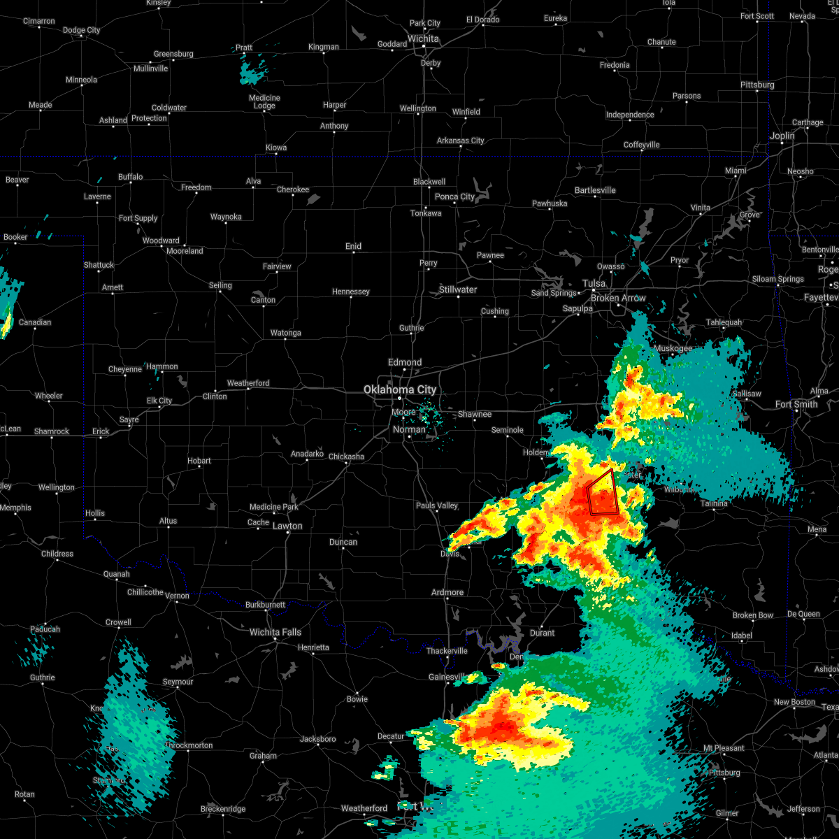 At 737 pm cdt, a severe thunderstorm capable of producing a tornado was located 5 miles south of haywood, moving east at 30 mph (radar indicated rotation). Hazards include tornado. Flying debris will be dangerous to those caught without shelter. mobile homes will be damaged or destroyed. damage to roofs, windows, and vehicles will occur. tree damage is likely. Locations in or near the path include, kiowa, savanna, haywood,. At 737 pm cdt, a severe thunderstorm capable of producing a tornado was located 5 miles south of haywood, moving east at 30 mph (radar indicated rotation). Hazards include tornado. Flying debris will be dangerous to those caught without shelter. mobile homes will be damaged or destroyed. damage to roofs, windows, and vehicles will occur. tree damage is likely. Locations in or near the path include, kiowa, savanna, haywood,.
|
| 5/3/2021 7:30 PM CDT |
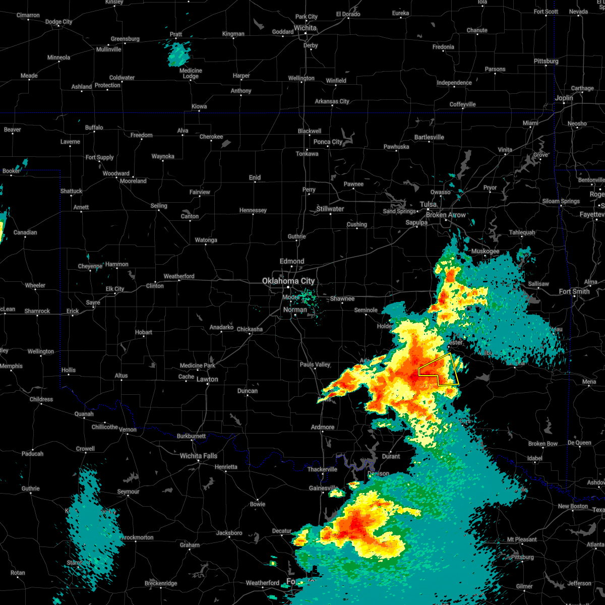 At 730 pm cdt, a severe thunderstorm was located over wardville, moving east at 35 mph (radar indicated). Hazards include 70 mph wind gusts and ping pong ball size hail. People and animals outdoors will be injured. expect hail damage to roofs, siding, windows, and vehicles. expect considerable tree damage. wind damage is also likely to mobile homes, roofs, and outbuildings. Locations in or near the path include, kiowa, savanna, blanco, pittsburg, a tornado watch remains in effect until 1100 pm cdt for southeastern oklahoma. At 730 pm cdt, a severe thunderstorm was located over wardville, moving east at 35 mph (radar indicated). Hazards include 70 mph wind gusts and ping pong ball size hail. People and animals outdoors will be injured. expect hail damage to roofs, siding, windows, and vehicles. expect considerable tree damage. wind damage is also likely to mobile homes, roofs, and outbuildings. Locations in or near the path include, kiowa, savanna, blanco, pittsburg, a tornado watch remains in effect until 1100 pm cdt for southeastern oklahoma.
|
| 5/3/2021 7:27 PM CDT |
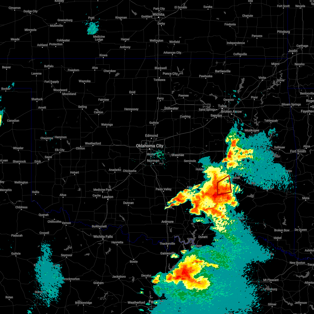 At 726 pm cdt, a severe thunderstorm capable of producing a tornado was located over ashland, moving east at 25 mph (radar indicated rotation). Hazards include tornado. Flying debris will be dangerous to those caught without shelter. mobile homes will be damaged or destroyed. damage to roofs, windows, and vehicles will occur. tree damage is likely. Locations in or near the path include, kiowa, savanna, ashland, haywood, arpelar,. At 726 pm cdt, a severe thunderstorm capable of producing a tornado was located over ashland, moving east at 25 mph (radar indicated rotation). Hazards include tornado. Flying debris will be dangerous to those caught without shelter. mobile homes will be damaged or destroyed. damage to roofs, windows, and vehicles will occur. tree damage is likely. Locations in or near the path include, kiowa, savanna, ashland, haywood, arpelar,.
|
| 5/3/2021 7:15 PM CDT |
 At 715 pm cdt, a severe thunderstorm was located 6 miles northeast of coalgate, moving east at 35 mph (radar indicated). Hazards include 70 mph wind gusts and ping pong ball size hail. People and animals outdoors will be injured. expect hail damage to roofs, siding, windows, and vehicles. expect considerable tree damage. wind damage is also likely to mobile homes, roofs, and outbuildings. Locations in or near the path include, kiowa, savanna, blanco, pittsburg, a tornado watch remains in effect until 1100 pm cdt for southeastern oklahoma. At 715 pm cdt, a severe thunderstorm was located 6 miles northeast of coalgate, moving east at 35 mph (radar indicated). Hazards include 70 mph wind gusts and ping pong ball size hail. People and animals outdoors will be injured. expect hail damage to roofs, siding, windows, and vehicles. expect considerable tree damage. wind damage is also likely to mobile homes, roofs, and outbuildings. Locations in or near the path include, kiowa, savanna, blanco, pittsburg, a tornado watch remains in effect until 1100 pm cdt for southeastern oklahoma.
|
| 5/3/2021 7:04 PM CDT |
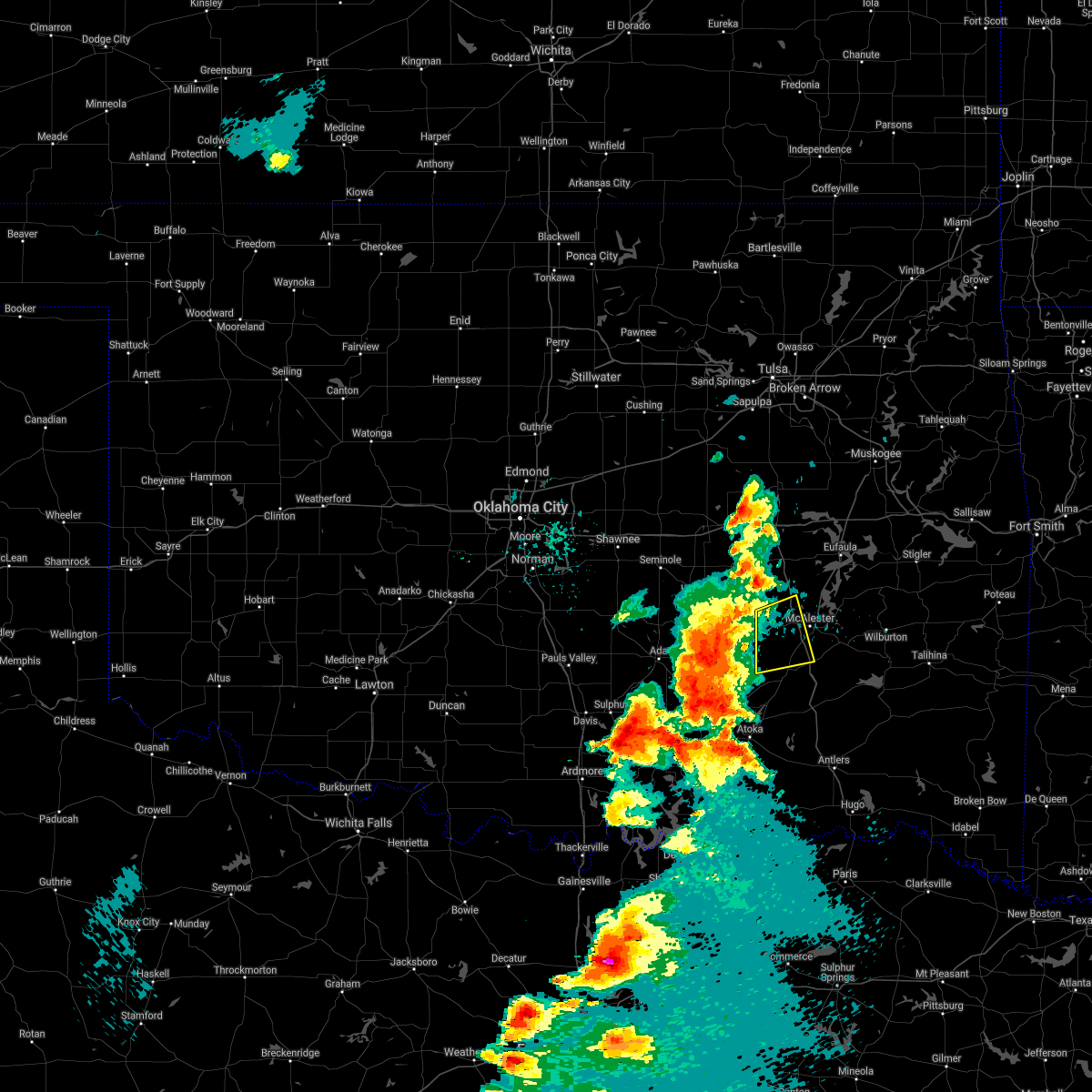 At 704 pm cdt, a severe thunderstorm was located 5 miles southeast of gerty, moving east at 35 mph (radar indicated). Hazards include 60 mph wind gusts and quarter size hail. Hail damage to vehicles is expected. expect wind damage to roofs, siding, and trees. Locations in or near the path include, mcalester, savanna, ashland, haywood, scipio, arpelar, a tornado watch remains in effect until 1100 pm cdt for southeastern oklahoma. At 704 pm cdt, a severe thunderstorm was located 5 miles southeast of gerty, moving east at 35 mph (radar indicated). Hazards include 60 mph wind gusts and quarter size hail. Hail damage to vehicles is expected. expect wind damage to roofs, siding, and trees. Locations in or near the path include, mcalester, savanna, ashland, haywood, scipio, arpelar, a tornado watch remains in effect until 1100 pm cdt for southeastern oklahoma.
|
| 4/9/2021 9:06 PM CDT |
 The severe thunderstorm warning for southwestern pittsburg county will expire at 915 pm cdt, the storms which prompted the warning are moving out of that area. therefore the warning will be allowed to expire. however gusty winds are still possible with these thunderstorms. a severe thunderstorm watch remains in effect until 1100 pm cdt for southeastern oklahoma. The severe thunderstorm warning for southwestern pittsburg county will expire at 915 pm cdt, the storms which prompted the warning are moving out of that area. therefore the warning will be allowed to expire. however gusty winds are still possible with these thunderstorms. a severe thunderstorm watch remains in effect until 1100 pm cdt for southeastern oklahoma.
|
| 4/9/2021 8:59 PM CDT |
 At 859 pm cdt, severe thunderstorms were located along a line extending from kiowa to mcalester regional airport, moving east at 35 mph (radar indicated). Hazards include 60 mph wind gusts and penny size hail. Expect damage to roofs, siding, and trees. Locations in or near the path include, mcalester, wilburton, clayton, hartshorne, krebs, kiowa, savanna, alderson, higgins, damon, yanush, stanley, mcalester regional airport, dunbar, blanco, haileyville, pittsburg, eubanks, sardis, gowen,. At 859 pm cdt, severe thunderstorms were located along a line extending from kiowa to mcalester regional airport, moving east at 35 mph (radar indicated). Hazards include 60 mph wind gusts and penny size hail. Expect damage to roofs, siding, and trees. Locations in or near the path include, mcalester, wilburton, clayton, hartshorne, krebs, kiowa, savanna, alderson, higgins, damon, yanush, stanley, mcalester regional airport, dunbar, blanco, haileyville, pittsburg, eubanks, sardis, gowen,.
|
| 4/9/2021 8:29 PM CDT |
 At 828 pm cdt, a severe thunderstorm was located 4 miles southwest of stuart, moving east at 40 mph (radar indicated). Hazards include 60 mph wind gusts and quarter size hail. Hail damage to vehicles is expected. expect wind damage to roofs, siding, and trees. Locations in or near the path include, mcalester, krebs, kiowa, savanna, ashland, mcalester regional airport, haywood, blanco, pittsburg, arpelar,. At 828 pm cdt, a severe thunderstorm was located 4 miles southwest of stuart, moving east at 40 mph (radar indicated). Hazards include 60 mph wind gusts and quarter size hail. Hail damage to vehicles is expected. expect wind damage to roofs, siding, and trees. Locations in or near the path include, mcalester, krebs, kiowa, savanna, ashland, mcalester regional airport, haywood, blanco, pittsburg, arpelar,.
|
| 7/30/2020 8:23 PM CDT |
 At 822 pm cdt, severe thunderstorms were located along a line extending from 5 miles east of wardville to 8 miles northwest of boswell to 3 miles south of utica to 5 miles west of knollwood, moving southeast at 25 mph (radar indicated). Hazards include 60 mph wind gusts and penny size hail. Expect damage to roofs, siding, and trees. Locations in or near the path include, antlers, kiowa, boswell, soper, ashland, kent, moyers, kosoma, kellond, blanco, pittsburg, darwin, unger,. At 822 pm cdt, severe thunderstorms were located along a line extending from 5 miles east of wardville to 8 miles northwest of boswell to 3 miles south of utica to 5 miles west of knollwood, moving southeast at 25 mph (radar indicated). Hazards include 60 mph wind gusts and penny size hail. Expect damage to roofs, siding, and trees. Locations in or near the path include, antlers, kiowa, boswell, soper, ashland, kent, moyers, kosoma, kellond, blanco, pittsburg, darwin, unger,.
|
| 7/30/2020 7:52 PM CDT |
 At 752 pm cdt, severe thunderstorms were located along a line extending from 2 miles northeast of ashland to 5 miles southwest of lane to 3 miles southeast of armstrong to 4 miles south of willis, moving southeast at 25 mph (radar indicated). Hazards include 60 mph wind gusts and penny size hail. Expect damage to roofs, siding, and trees. Locations in or near the path include, antlers, kiowa, boswell, soper, ashland, kent, moyers, kosoma, kellond, blanco, pittsburg, darwin, unger,. At 752 pm cdt, severe thunderstorms were located along a line extending from 2 miles northeast of ashland to 5 miles southwest of lane to 3 miles southeast of armstrong to 4 miles south of willis, moving southeast at 25 mph (radar indicated). Hazards include 60 mph wind gusts and penny size hail. Expect damage to roofs, siding, and trees. Locations in or near the path include, antlers, kiowa, boswell, soper, ashland, kent, moyers, kosoma, kellond, blanco, pittsburg, darwin, unger,.
|
| 7/30/2020 6:50 PM CDT |
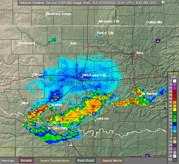 At 650 pm cdt, a severe thunderstorm was located over kiowa, moving east at 15 mph (radar indicated). Hazards include 60 mph wind gusts and quarter size hail. Hail damage to vehicles is expected. expect wind damage to roofs, siding, and trees. Locations in or near the path include, kiowa, ashland, pittsburg,. At 650 pm cdt, a severe thunderstorm was located over kiowa, moving east at 15 mph (radar indicated). Hazards include 60 mph wind gusts and quarter size hail. Hail damage to vehicles is expected. expect wind damage to roofs, siding, and trees. Locations in or near the path include, kiowa, ashland, pittsburg,.
|
| 7/30/2020 6:41 PM CDT |
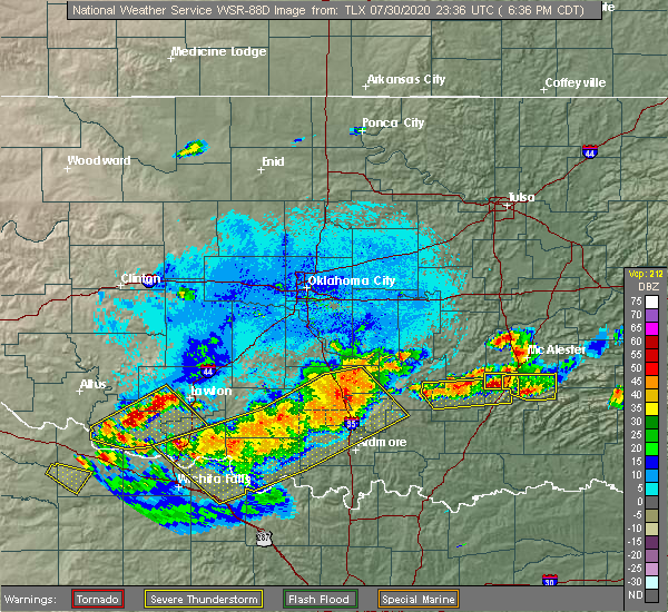 At 640 pm cdt, a severe thunderstorm was located 4 miles west of kiowa, moving east at 15 mph (radar indicated). Hazards include ping pong ball size hail and 60 mph wind gusts. People and animals outdoors will be injured. expect hail damage to roofs, siding, windows, and vehicles. expect wind damage to roofs, siding, and trees. Locations in or near the path include, kiowa, ashland, pittsburg,. At 640 pm cdt, a severe thunderstorm was located 4 miles west of kiowa, moving east at 15 mph (radar indicated). Hazards include ping pong ball size hail and 60 mph wind gusts. People and animals outdoors will be injured. expect hail damage to roofs, siding, windows, and vehicles. expect wind damage to roofs, siding, and trees. Locations in or near the path include, kiowa, ashland, pittsburg,.
|
| 7/30/2020 6:40 PM CDT |
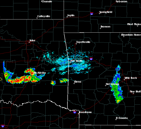 At 639 pm cdt, a severe thunderstorm was located 6 miles north of daisy, moving east at 25 mph (radar indicated). Hazards include 60 mph wind gusts and quarter size hail. Hail damage to vehicles is expected. expect wind damage to roofs, siding, and trees. Locations in or near the path include, kiowa, pittsburg,. At 639 pm cdt, a severe thunderstorm was located 6 miles north of daisy, moving east at 25 mph (radar indicated). Hazards include 60 mph wind gusts and quarter size hail. Hail damage to vehicles is expected. expect wind damage to roofs, siding, and trees. Locations in or near the path include, kiowa, pittsburg,.
|
| 7/30/2020 6:22 PM CDT |
 At 622 pm cdt, a severe thunderstorm was located 3 miles south of ashland, moving east at 15 mph (radar indicated). Hazards include ping pong ball size hail and 60 mph wind gusts. People and animals outdoors will be injured. expect hail damage to roofs, siding, windows, and vehicles. expect wind damage to roofs, siding, and trees. Locations in or near the path include, kiowa, ashland, pittsburg,. At 622 pm cdt, a severe thunderstorm was located 3 miles south of ashland, moving east at 15 mph (radar indicated). Hazards include ping pong ball size hail and 60 mph wind gusts. People and animals outdoors will be injured. expect hail damage to roofs, siding, windows, and vehicles. expect wind damage to roofs, siding, and trees. Locations in or near the path include, kiowa, ashland, pittsburg,.
|
| 7/30/2020 6:19 PM CDT |
 At 618 pm cdt, a severe thunderstorm was located 3 miles southeast of kiowa, moving east at 25 mph (trained weather spotters reported quarter size hail near kiowa). Hazards include 60 mph wind gusts and quarter size hail. Hail damage to vehicles is expected. expect wind damage to roofs, siding, and trees. Locations in or near the path include, kiowa, blanco, pittsburg,. At 618 pm cdt, a severe thunderstorm was located 3 miles southeast of kiowa, moving east at 25 mph (trained weather spotters reported quarter size hail near kiowa). Hazards include 60 mph wind gusts and quarter size hail. Hail damage to vehicles is expected. expect wind damage to roofs, siding, and trees. Locations in or near the path include, kiowa, blanco, pittsburg,.
|
| 7/30/2020 6:18 PM CDT | Quarter sized hail reported 0.9 miles NNW of Kiowa, OK, report relayed by media. |
| 7/30/2020 6:18 PM CDT |
 At 617 pm cdt, a severe thunderstorm was located 3 miles southeast of kiowa, moving east at 25 mph (radar indicated). Hazards include 60 mph wind gusts and quarter size hail. Hail damage to vehicles is expected. expect wind damage to roofs, siding, and trees. Locations in or near the path include, kiowa, blanco, pittsburg,. At 617 pm cdt, a severe thunderstorm was located 3 miles southeast of kiowa, moving east at 25 mph (radar indicated). Hazards include 60 mph wind gusts and quarter size hail. Hail damage to vehicles is expected. expect wind damage to roofs, siding, and trees. Locations in or near the path include, kiowa, blanco, pittsburg,.
|
| 7/30/2020 5:51 PM CDT |
 At 550 pm cdt, a severe thunderstorm was located 4 miles east of ashland, moving east at 25 mph (radar indicated). Hazards include 60 mph wind gusts and quarter size hail. Hail damage to vehicles is expected. expect wind damage to roofs, siding, and trees. Locations in or near the path include, kiowa, savanna, ashland, haywood, pittsburg,. At 550 pm cdt, a severe thunderstorm was located 4 miles east of ashland, moving east at 25 mph (radar indicated). Hazards include 60 mph wind gusts and quarter size hail. Hail damage to vehicles is expected. expect wind damage to roofs, siding, and trees. Locations in or near the path include, kiowa, savanna, ashland, haywood, pittsburg,.
|
| 7/30/2020 5:43 PM CDT |
 At 542 pm cdt, a severe thunderstorm was located over ashland, moving east at 25 mph (radar indicated). Hazards include 60 mph wind gusts and half dollar size hail. Hail damage to vehicles is expected. expect wind damage to roofs, siding, and trees. Locations in or near the path include, kiowa, savanna, ashland, haywood, pittsburg,. At 542 pm cdt, a severe thunderstorm was located over ashland, moving east at 25 mph (radar indicated). Hazards include 60 mph wind gusts and half dollar size hail. Hail damage to vehicles is expected. expect wind damage to roofs, siding, and trees. Locations in or near the path include, kiowa, savanna, ashland, haywood, pittsburg,.
|
| 7/30/2020 5:29 PM CDT |
 At 529 pm cdt, a severe thunderstorm was located 3 miles west of ashland, moving east at 25 mph (radar indicated). Hazards include 60 mph wind gusts and quarter size hail. Hail damage to vehicles is expected. expect wind damage to roofs, siding, and trees. Locations in or near the path include, kiowa, savanna, ashland, haywood, pittsburg,. At 529 pm cdt, a severe thunderstorm was located 3 miles west of ashland, moving east at 25 mph (radar indicated). Hazards include 60 mph wind gusts and quarter size hail. Hail damage to vehicles is expected. expect wind damage to roofs, siding, and trees. Locations in or near the path include, kiowa, savanna, ashland, haywood, pittsburg,.
|
| 7/12/2020 12:19 AM CDT |
 At 1219 am cdt, severe thunderstorms were located along a line extending from stringtown to 5 miles west of rattan to 9 miles northeast of fort towson to 8 miles northwest of de queen, moving south at 35 mph (radar indicated). Hazards include 70 mph wind gusts. Expect considerable tree damage. damage is likely to mobile homes, roofs, and outbuildings. Locations in or near the path include, antlers, clayton, kiowa, rattan, clayton lake state park, snow, tuskahoma, stanley, moyers, nashoba, kiamichi, kosoma, kellond, dunbar, oleta, cloudy, pittsburg, eubanks, corinne, sobol,. At 1219 am cdt, severe thunderstorms were located along a line extending from stringtown to 5 miles west of rattan to 9 miles northeast of fort towson to 8 miles northwest of de queen, moving south at 35 mph (radar indicated). Hazards include 70 mph wind gusts. Expect considerable tree damage. damage is likely to mobile homes, roofs, and outbuildings. Locations in or near the path include, antlers, clayton, kiowa, rattan, clayton lake state park, snow, tuskahoma, stanley, moyers, nashoba, kiamichi, kosoma, kellond, dunbar, oleta, cloudy, pittsburg, eubanks, corinne, sobol,.
|
| 7/12/2020 12:06 AM CDT |
 At 1206 am cdt, severe thunderstorms were located along a line extending from 6 miles north of stringtown to 6 miles east of kosoma to 11 miles southeast of cloudy to 7 miles west of grannis, moving south at 35 mph (radar indicated). Hazards include 70 mph wind gusts. Expect considerable tree damage. damage is likely to mobile homes, roofs, and outbuildings. Locations in or near the path include, mcalester, antlers, clayton, hartshorne, krebs, kiowa, savanna, rattan, alderson, albion, ashland, octavia, snow, higgins, haywood, tuskahoma, stanley, kiamichi, kellond, clayton lake state park,. At 1206 am cdt, severe thunderstorms were located along a line extending from 6 miles north of stringtown to 6 miles east of kosoma to 11 miles southeast of cloudy to 7 miles west of grannis, moving south at 35 mph (radar indicated). Hazards include 70 mph wind gusts. Expect considerable tree damage. damage is likely to mobile homes, roofs, and outbuildings. Locations in or near the path include, mcalester, antlers, clayton, hartshorne, krebs, kiowa, savanna, rattan, alderson, albion, ashland, octavia, snow, higgins, haywood, tuskahoma, stanley, kiamichi, kellond, clayton lake state park,.
|
| 7/11/2020 11:54 PM CDT |
 At 1153 pm cdt, severe thunderstorms were located along a line extending from near wardville to 3 miles southeast of dunbar to 8 miles east of cloudy to 6 miles west of wickes, moving south at 35 mph (radar indicated. trees were reported down across latimer county). Hazards include 70 mph wind gusts and quarter size hail. Hail damage to vehicles is expected. expect considerable tree damage. wind damage is also likely to mobile homes, roofs, and outbuildings. Locations in or near the path include, mcalester, antlers, clayton, hartshorne, krebs, talihina, kiowa, savanna, rattan, alderson, albion, ashland, octavia, snow, haywood, big cedar, whitesboro, clayton lake state park, damon, moyers,. At 1153 pm cdt, severe thunderstorms were located along a line extending from near wardville to 3 miles southeast of dunbar to 8 miles east of cloudy to 6 miles west of wickes, moving south at 35 mph (radar indicated. trees were reported down across latimer county). Hazards include 70 mph wind gusts and quarter size hail. Hail damage to vehicles is expected. expect considerable tree damage. wind damage is also likely to mobile homes, roofs, and outbuildings. Locations in or near the path include, mcalester, antlers, clayton, hartshorne, krebs, talihina, kiowa, savanna, rattan, alderson, albion, ashland, octavia, snow, haywood, big cedar, whitesboro, clayton lake state park, damon, moyers,.
|
| 7/11/2020 11:44 PM CDT |
 At 1142 pm cdt, severe thunderstorms were located along a line extending from near ashland to 2 miles southwest of stanley to 7 miles southeast of nashoba to 5 miles west of vandervoort, moving south at 35 mph (radar indicated. winds gusted to 60 mph in mcalester). Hazards include 65 mph wind gusts and quarter size hail. Hail damage to vehicles is expected. expect wind damage to roofs, siding, and trees. Locations in or near the path include, mcalester, wilburton, antlers, clayton, hartshorne, krebs, talihina, kiowa, savanna, rattan, alderson, albion, ashland, octavia, snow, haywood, big cedar, whitesboro, clayton lake state park, damon,. At 1142 pm cdt, severe thunderstorms were located along a line extending from near ashland to 2 miles southwest of stanley to 7 miles southeast of nashoba to 5 miles west of vandervoort, moving south at 35 mph (radar indicated. winds gusted to 60 mph in mcalester). Hazards include 65 mph wind gusts and quarter size hail. Hail damage to vehicles is expected. expect wind damage to roofs, siding, and trees. Locations in or near the path include, mcalester, wilburton, antlers, clayton, hartshorne, krebs, talihina, kiowa, savanna, rattan, alderson, albion, ashland, octavia, snow, haywood, big cedar, whitesboro, clayton lake state park, damon,.
|
| 7/11/2020 11:33 PM CDT |
 At 1129 pm cdt, the initial strong winds from severe thunderstorms were located along a line extending from 4 miles south of kiamichi to 7 miles south of hartshorne to 2 miles southeast of haywood, moving south at 45 mph. the leading edge of the heavy rain and additional strong winds was from near albion to wilburton to savanna (radar indicated. power outages were reported in wilburton. wind gusts to 60 mph were reported in mcalester). Hazards include 70 mph wind gusts and quarter size hail. Hail damage to vehicles is expected. expect considerable tree damage. wind damage is also likely to mobile homes, roofs, and outbuildings. Locations in or near the path include, mcalester, wilburton, eufaula, clayton, hartshorne, krebs, quinton, dewar, kiowa, porum, savanna, crowder, whitefield, alderson, kinta, canadian, indianola, grayson, hanna, hoffman, this includes interstate 40 in oklahoma between mile markers 240 and 273. At 1129 pm cdt, the initial strong winds from severe thunderstorms were located along a line extending from 4 miles south of kiamichi to 7 miles south of hartshorne to 2 miles southeast of haywood, moving south at 45 mph. the leading edge of the heavy rain and additional strong winds was from near albion to wilburton to savanna (radar indicated. power outages were reported in wilburton. wind gusts to 60 mph were reported in mcalester). Hazards include 70 mph wind gusts and quarter size hail. Hail damage to vehicles is expected. expect considerable tree damage. wind damage is also likely to mobile homes, roofs, and outbuildings. Locations in or near the path include, mcalester, wilburton, eufaula, clayton, hartshorne, krebs, quinton, dewar, kiowa, porum, savanna, crowder, whitefield, alderson, kinta, canadian, indianola, grayson, hanna, hoffman, this includes interstate 40 in oklahoma between mile markers 240 and 273.
|
| 7/11/2020 11:00 PM CDT |
 At 1059 pm cdt, severe thunderstorms were located along a line extending from 6 miles east of damon to 3 miles west of blocker to 4 miles southwest of hanna, moving south at 45 mph (radar indicated). Hazards include 70 mph wind gusts and quarter size hail. Hail damage to vehicles is expected. expect considerable tree damage. wind damage is also likely to mobile homes, roofs, and outbuildings. Locations in or near the path include, mcalester, okmulgee, wilburton, eufaula, clayton, henryetta, hartshorne, krebs, morris, quinton, dewar, kiowa, porum, savanna, schulter, crowder, whitefield, alderson, kinta, canadian, this includes interstate 40 in oklahoma between mile markers 236 and 273. At 1059 pm cdt, severe thunderstorms were located along a line extending from 6 miles east of damon to 3 miles west of blocker to 4 miles southwest of hanna, moving south at 45 mph (radar indicated). Hazards include 70 mph wind gusts and quarter size hail. Hail damage to vehicles is expected. expect considerable tree damage. wind damage is also likely to mobile homes, roofs, and outbuildings. Locations in or near the path include, mcalester, okmulgee, wilburton, eufaula, clayton, henryetta, hartshorne, krebs, morris, quinton, dewar, kiowa, porum, savanna, schulter, crowder, whitefield, alderson, kinta, canadian, this includes interstate 40 in oklahoma between mile markers 236 and 273.
|
| 5/8/2020 2:40 AM CDT |
 At 239 am cdt, severe thunderstorms were located along a line extending from 3 miles southwest of indianola to 3 miles northwest of mcalester regional airport to wardville, moving southeast at 55 mph (oklahoma mesonet measured winds at stuart oklahoma). Hazards include 60 mph wind gusts and nickel size hail. Expect damage to roofs, siding, and trees. Locations in or near the path include, mcalester, hartshorne, krebs, kiowa, savanna, crowder, alderson, canadian, indianola, hanna, ashland, haywood, blocker, arrowhead state park, mcalester regional airport, blanco, haileyville, pittsburg, arpelar, dow,. At 239 am cdt, severe thunderstorms were located along a line extending from 3 miles southwest of indianola to 3 miles northwest of mcalester regional airport to wardville, moving southeast at 55 mph (oklahoma mesonet measured winds at stuart oklahoma). Hazards include 60 mph wind gusts and nickel size hail. Expect damage to roofs, siding, and trees. Locations in or near the path include, mcalester, hartshorne, krebs, kiowa, savanna, crowder, alderson, canadian, indianola, hanna, ashland, haywood, blocker, arrowhead state park, mcalester regional airport, blanco, haileyville, pittsburg, arpelar, dow,.
|
| 5/8/2020 2:14 AM CDT |
 At 213 am cdt, severe thunderstorms were located along a line extending from 5 miles southwest of dustin to 7 miles northeast of stonewall, moving east at 50 mph (radar indicated). Hazards include 60 mph wind gusts and nickel size hail. Expect damage to roofs, siding, and trees. Locations in or near the path include, mcalester, eufaula, hartshorne, krebs, kiowa, savanna, crowder, alderson, canadian, indianola, hanna, ashland, raiford, haywood, blocker, arrowhead state park, mcalester regional airport, scipio, blanco, haileyville,. At 213 am cdt, severe thunderstorms were located along a line extending from 5 miles southwest of dustin to 7 miles northeast of stonewall, moving east at 50 mph (radar indicated). Hazards include 60 mph wind gusts and nickel size hail. Expect damage to roofs, siding, and trees. Locations in or near the path include, mcalester, eufaula, hartshorne, krebs, kiowa, savanna, crowder, alderson, canadian, indianola, hanna, ashland, raiford, haywood, blocker, arrowhead state park, mcalester regional airport, scipio, blanco, haileyville,.
|
| 4/28/2020 9:07 PM CDT |
 At 907 pm cdt, severe thunderstorms were located along a line extending from 5 miles south of bokoshe to 4 miles east of ashland, moving southeast at 40 mph (radar indicated). Hazards include 60 mph wind gusts and quarter size hail. Hail damage to vehicles is expected. expect wind damage to roofs, siding, and trees. Locations in or near the path include, mcalester, poteau, wilburton, clayton, heavener, hartshorne, krebs, talihina, wister, quinton, howe, kiowa, savanna, red oak, mccurtain, fanshawe, alderson, kinta, albion, ashland, a tornado watch remains in effect until 1100 pm cdt for west central arkansas, and southeastern oklahoma. At 907 pm cdt, severe thunderstorms were located along a line extending from 5 miles south of bokoshe to 4 miles east of ashland, moving southeast at 40 mph (radar indicated). Hazards include 60 mph wind gusts and quarter size hail. Hail damage to vehicles is expected. expect wind damage to roofs, siding, and trees. Locations in or near the path include, mcalester, poteau, wilburton, clayton, heavener, hartshorne, krebs, talihina, wister, quinton, howe, kiowa, savanna, red oak, mccurtain, fanshawe, alderson, kinta, albion, ashland, a tornado watch remains in effect until 1100 pm cdt for west central arkansas, and southeastern oklahoma.
|
| 1/10/2020 2:34 PM CST |
 At 234 pm cst, severe thunderstorms were located along a line extending from near wardville to 8 miles northeast of stringtown, moving northeast at 60 mph (radar indicated). Hazards include 60 mph wind gusts and quarter size hail. Hail damage to vehicles is expected. expect wind damage to roofs, siding, and trees. Locations in or near the path include, mcalester, hartshorne, krebs, kiowa, savanna, alderson, blocker, mcalester regional airport, blanco, haileyville, pittsburg, dow, bache, a tornado watch remains in effect until 600 pm cst for southeastern oklahoma. At 234 pm cst, severe thunderstorms were located along a line extending from near wardville to 8 miles northeast of stringtown, moving northeast at 60 mph (radar indicated). Hazards include 60 mph wind gusts and quarter size hail. Hail damage to vehicles is expected. expect wind damage to roofs, siding, and trees. Locations in or near the path include, mcalester, hartshorne, krebs, kiowa, savanna, alderson, blocker, mcalester regional airport, blanco, haileyville, pittsburg, dow, bache, a tornado watch remains in effect until 600 pm cst for southeastern oklahoma.
|
| 10/10/2019 4:35 PM CDT |
 At 434 pm cdt, a severe thunderstorm was located 5 miles northwest of kiowa, moving northeast at 25 mph (radar indicated). Hazards include ping pong ball size hail and 60 mph wind gusts. People and animals outdoors will be injured. expect hail damage to roofs, siding, windows, and vehicles. expect wind damage to roofs, siding, and trees. Locations in or near the path include, mcalester, hartshorne, krebs, kiowa, savanna, alderson, ashland, haywood, mcalester regional airport, blanco, haileyville, pittsburg, arpelar, dow, bache,. At 434 pm cdt, a severe thunderstorm was located 5 miles northwest of kiowa, moving northeast at 25 mph (radar indicated). Hazards include ping pong ball size hail and 60 mph wind gusts. People and animals outdoors will be injured. expect hail damage to roofs, siding, windows, and vehicles. expect wind damage to roofs, siding, and trees. Locations in or near the path include, mcalester, hartshorne, krebs, kiowa, savanna, alderson, ashland, haywood, mcalester regional airport, blanco, haileyville, pittsburg, arpelar, dow, bache,.
|
| 10/10/2019 4:20 PM CDT |
 At 419 pm cdt, a severe thunderstorm was located over ashland, moving northeast at 30 mph (radar indicated). Hazards include 60 mph wind gusts and half dollar size hail. Hail damage to vehicles is expected. expect wind damage to roofs, siding, and trees. Locations in or near the path include, mcalester, hartshorne, krebs, kiowa, savanna, alderson, ashland, haywood, mcalester regional airport, blanco, haileyville, pittsburg, arpelar, dow, bache,. At 419 pm cdt, a severe thunderstorm was located over ashland, moving northeast at 30 mph (radar indicated). Hazards include 60 mph wind gusts and half dollar size hail. Hail damage to vehicles is expected. expect wind damage to roofs, siding, and trees. Locations in or near the path include, mcalester, hartshorne, krebs, kiowa, savanna, alderson, ashland, haywood, mcalester regional airport, blanco, haileyville, pittsburg, arpelar, dow, bache,.
|
| 6/19/2019 3:17 AM CDT |
 At 316 am cdt, severe thunderstorms were located along a line extending from 4 miles northwest of raiford to 6 miles southeast of scipio to 5 miles northwest of daisy to 9 miles southeast of boswell, moving northeast at 50 mph (radar indicated). Hazards include 70 mph wind gusts and penny size hail. Expect considerable tree damage. damage is likely to mobile homes, roofs, and outbuildings. Locations in or near the path include, mcalester, hugo, wilburton, eufaula, stigler, antlers, clayton, hartshorne, krebs, quinton, kiowa, porum, boswell, savanna, keota, red oak, fort towson, mccurtain, crowder, whitefield,. At 316 am cdt, severe thunderstorms were located along a line extending from 4 miles northwest of raiford to 6 miles southeast of scipio to 5 miles northwest of daisy to 9 miles southeast of boswell, moving northeast at 50 mph (radar indicated). Hazards include 70 mph wind gusts and penny size hail. Expect considerable tree damage. damage is likely to mobile homes, roofs, and outbuildings. Locations in or near the path include, mcalester, hugo, wilburton, eufaula, stigler, antlers, clayton, hartshorne, krebs, quinton, kiowa, porum, boswell, savanna, keota, red oak, fort towson, mccurtain, crowder, whitefield,.
|
| 6/19/2019 2:48 AM CDT |
 At 248 am cdt, severe thunderstorms were located along a line extending from 4 miles west of dustin to 4 miles northwest of calvin to 3 miles northwest of gerty to 6 miles north of coalgate to 2 miles southeast of olney to 2 miles northwest of caney to 8 miles east of albany, moving east at 50 mph (radar indicated). Hazards include 70 mph wind gusts and penny size hail. Expect considerable tree damage. damage is likely to mobile homes, roofs, and outbuildings. Locations in or near the path include, mcalester, hugo, wilburton, eufaula, stigler, antlers, clayton, hartshorne, krebs, quinton, kiowa, porum, boswell, savanna, keota, red oak, fort towson, mccurtain, crowder, whitefield,. At 248 am cdt, severe thunderstorms were located along a line extending from 4 miles west of dustin to 4 miles northwest of calvin to 3 miles northwest of gerty to 6 miles north of coalgate to 2 miles southeast of olney to 2 miles northwest of caney to 8 miles east of albany, moving east at 50 mph (radar indicated). Hazards include 70 mph wind gusts and penny size hail. Expect considerable tree damage. damage is likely to mobile homes, roofs, and outbuildings. Locations in or near the path include, mcalester, hugo, wilburton, eufaula, stigler, antlers, clayton, hartshorne, krebs, quinton, kiowa, porum, boswell, savanna, keota, red oak, fort towson, mccurtain, crowder, whitefield,.
|
| 5/21/2019 8:06 AM CDT |
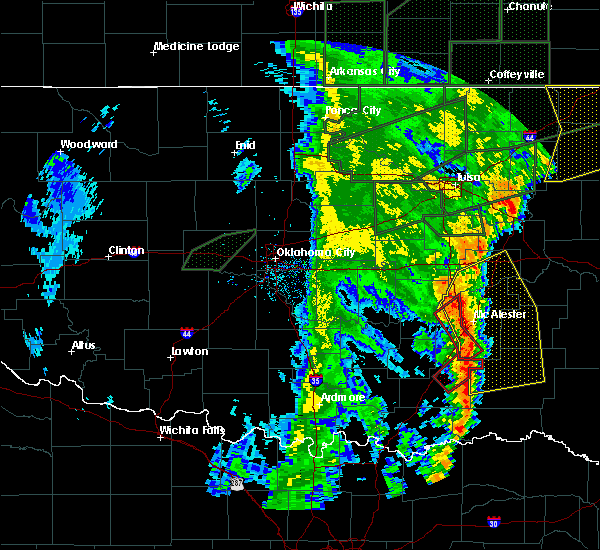 The tornado warning for western pittsburg county will expire at 815 am cdt, the storms which prompted the warning have weakened below severe limits, and have exited the warned area. therefore the warning will be allowed to expire. however gusty winds are still possible with these thunderstorms. a tornado watch remains in effect until noon cdt for southeastern oklahoma. remember, a severe thunderstorm warning still remains in effect for pittsburgh county until 9 am. The tornado warning for western pittsburg county will expire at 815 am cdt, the storms which prompted the warning have weakened below severe limits, and have exited the warned area. therefore the warning will be allowed to expire. however gusty winds are still possible with these thunderstorms. a tornado watch remains in effect until noon cdt for southeastern oklahoma. remember, a severe thunderstorm warning still remains in effect for pittsburgh county until 9 am.
|
| 5/21/2019 7:56 AM CDT |
 At 755 am cdt, severe thunderstorms capable of producing tornadoes were located along a line extending from 5 miles north of haywood to 2 miles south of savanna to 6 miles southeast of kiowa, moving northeast at 60 mph (radar indicated rotation). Hazards include tornado and quarter size hail. Flying debris will be dangerous to those caught without shelter. mobile homes will be damaged or destroyed. damage to roofs, windows, and vehicles will occur. tree damage is likely. Locations in or near the path include, kiowa, savanna, haywood, scipio, blanco, pittsburg, arpelar,. At 755 am cdt, severe thunderstorms capable of producing tornadoes were located along a line extending from 5 miles north of haywood to 2 miles south of savanna to 6 miles southeast of kiowa, moving northeast at 60 mph (radar indicated rotation). Hazards include tornado and quarter size hail. Flying debris will be dangerous to those caught without shelter. mobile homes will be damaged or destroyed. damage to roofs, windows, and vehicles will occur. tree damage is likely. Locations in or near the path include, kiowa, savanna, haywood, scipio, blanco, pittsburg, arpelar,.
|
| 5/21/2019 7:27 AM CDT |
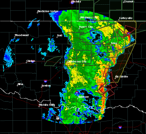 At 727 am cdt, severe thunderstorms capable of producing a tornado were located along a line extending from 6 miles west of ashland to near coalgate to 3 miles southwest of stringtown, moving northeast at 35 mph (radar indicated rotation). Hazards include tornado and quarter size hail. Flying debris will be dangerous to those caught without shelter. mobile homes will be damaged or destroyed. damage to roofs, windows, and vehicles will occur. tree damage is likely. Locations in or near the path include, kiowa, savanna, ashland, haywood, scipio, blanco, pittsburg, arpelar,. At 727 am cdt, severe thunderstorms capable of producing a tornado were located along a line extending from 6 miles west of ashland to near coalgate to 3 miles southwest of stringtown, moving northeast at 35 mph (radar indicated rotation). Hazards include tornado and quarter size hail. Flying debris will be dangerous to those caught without shelter. mobile homes will be damaged or destroyed. damage to roofs, windows, and vehicles will occur. tree damage is likely. Locations in or near the path include, kiowa, savanna, ashland, haywood, scipio, blanco, pittsburg, arpelar,.
|
| 5/18/2019 12:10 PM CDT |
 The national weather service in tulsa has issued a * severe thunderstorm warning for. haskell county in southeastern oklahoma. pushmataha county in southeastern oklahoma. southern mcintosh county in southeastern oklahoma. Latimer county in southeastern oklahoma. The national weather service in tulsa has issued a * severe thunderstorm warning for. haskell county in southeastern oklahoma. pushmataha county in southeastern oklahoma. southern mcintosh county in southeastern oklahoma. Latimer county in southeastern oklahoma.
|
| 5/18/2019 11:45 AM CDT |
 At 1145 am cdt, severe thunderstorms were located along a line extending from 4 miles northwest of hanna to 10 miles southwest of daisy, moving east at 40 mph (radar indicated). Hazards include 60 mph wind gusts. Expect damage to roofs, siding, and trees. Locations in or near the path include, mcalester, eufaula, hartshorne, krebs, kiowa, savanna, crowder, alderson, canadian, indianola, hanna, ashland, higgins, haywood, blocker, arrowhead state park, mcalester regional airport, scipio, blanco, haileyville, a tornado watch remains in effect until 500 pm cdt for southeastern oklahoma. At 1145 am cdt, severe thunderstorms were located along a line extending from 4 miles northwest of hanna to 10 miles southwest of daisy, moving east at 40 mph (radar indicated). Hazards include 60 mph wind gusts. Expect damage to roofs, siding, and trees. Locations in or near the path include, mcalester, eufaula, hartshorne, krebs, kiowa, savanna, crowder, alderson, canadian, indianola, hanna, ashland, higgins, haywood, blocker, arrowhead state park, mcalester regional airport, scipio, blanco, haileyville, a tornado watch remains in effect until 500 pm cdt for southeastern oklahoma.
|
| 5/18/2019 11:27 AM CDT |
 At 1127 am cdt, severe thunderstorms were located along a line extending from 6 miles southwest of dustin to 5 miles east of atoka, moving east at 40 mph (radar indicated). Hazards include 60 mph wind gusts. Expect damage to roofs, siding, and trees. Locations in or near the path include, mcalester, eufaula, clayton, hartshorne, krebs, quinton, kiowa, savanna, crowder, alderson, canadian, indianola, hanna, ashland, higgins, raiford, haywood, vivian, stanley, blocker, a tornado watch remains in effect until 500 pm cdt for southeastern oklahoma. At 1127 am cdt, severe thunderstorms were located along a line extending from 6 miles southwest of dustin to 5 miles east of atoka, moving east at 40 mph (radar indicated). Hazards include 60 mph wind gusts. Expect damage to roofs, siding, and trees. Locations in or near the path include, mcalester, eufaula, clayton, hartshorne, krebs, quinton, kiowa, savanna, crowder, alderson, canadian, indianola, hanna, ashland, higgins, raiford, haywood, vivian, stanley, blocker, a tornado watch remains in effect until 500 pm cdt for southeastern oklahoma.
|
| 11/30/2018 9:49 PM CST |
 At 948 pm cst, severe thunderstorms were located along a line extending from 4 miles east of ashland to 5 miles west of daisy to 4 miles west of boswell, moving northeast at 70 mph (radar indicated). Hazards include 70 mph wind gusts and nickel size hail. Expect considerable tree damage. damage is likely to mobile homes, roofs, and outbuildings. Locations in or near the path include, mcalester, hugo, wilburton, antlers, clayton, hartshorne, krebs, quinton, kiowa, boswell, savanna, fort towson, sawyer, rattan, alderson, soper, ashland, snow, clayton lake state park, damon, a tornado watch remains in effect until midnight cst for southeastern oklahoma. At 948 pm cst, severe thunderstorms were located along a line extending from 4 miles east of ashland to 5 miles west of daisy to 4 miles west of boswell, moving northeast at 70 mph (radar indicated). Hazards include 70 mph wind gusts and nickel size hail. Expect considerable tree damage. damage is likely to mobile homes, roofs, and outbuildings. Locations in or near the path include, mcalester, hugo, wilburton, antlers, clayton, hartshorne, krebs, quinton, kiowa, boswell, savanna, fort towson, sawyer, rattan, alderson, soper, ashland, snow, clayton lake state park, damon, a tornado watch remains in effect until midnight cst for southeastern oklahoma.
|
| 6/24/2018 4:10 PM CDT |
 At 409 pm cdt, severe thunderstorms were located along a line extending from 5 miles southwest of quinton to 9 miles south of hartshorne to near atoka, moving southeast at 45 mph (radar indicated). Hazards include 60 mph wind gusts and nickel size hail. Expect damage to roofs, siding, and trees. Locations in or near the path include, mcalester, wilburton, clayton, hartshorne, krebs, kiowa, savanna, red oak, alderson, higgins, snow, haywood, tuskahoma, stanley, clayton lake state park, damon, yanush, robbers cave state park, mcalester regional airport, moyers,. At 409 pm cdt, severe thunderstorms were located along a line extending from 5 miles southwest of quinton to 9 miles south of hartshorne to near atoka, moving southeast at 45 mph (radar indicated). Hazards include 60 mph wind gusts and nickel size hail. Expect damage to roofs, siding, and trees. Locations in or near the path include, mcalester, wilburton, clayton, hartshorne, krebs, kiowa, savanna, red oak, alderson, higgins, snow, haywood, tuskahoma, stanley, clayton lake state park, damon, yanush, robbers cave state park, mcalester regional airport, moyers,.
|
| 6/24/2018 3:49 PM CDT |
 At 349 pm cdt, severe thunderstorms were located along a line extending from 5 miles south of hanna to 2 miles northwest of atoka, moving east at 40 mph (radar indicated). Hazards include 60 mph wind gusts and nickel size hail. Expect damage to roofs, siding, and trees. Locations in or near the path include, mcalester, wilburton, clayton, hartshorne, krebs, kiowa, savanna, red oak, crowder, alderson, ashland, higgins, snow, haywood, tuskahoma, stanley, clayton lake state park, damon, blocker, yanush,. At 349 pm cdt, severe thunderstorms were located along a line extending from 5 miles south of hanna to 2 miles northwest of atoka, moving east at 40 mph (radar indicated). Hazards include 60 mph wind gusts and nickel size hail. Expect damage to roofs, siding, and trees. Locations in or near the path include, mcalester, wilburton, clayton, hartshorne, krebs, kiowa, savanna, red oak, crowder, alderson, ashland, higgins, snow, haywood, tuskahoma, stanley, clayton lake state park, damon, blocker, yanush,.
|
| 6/24/2018 5:47 AM CDT |
 At 547 am cdt, severe thunderstorms were located along a line extending from near arrowhead state park to 4 miles north of krebs to 4 miles west of haywood, moving southeast at 55 mph (radar indicated). Hazards include 60 mph wind gusts. Expect damage to roofs, siding, and trees. Locations in or near the path include, mcalester, wilburton, clayton, hartshorne, krebs, quinton, kiowa, savanna, red oak, crowder, alderson, canadian, albion, ashland, higgins, haywood, tuskahoma, stanley, kiamichi, damon,. At 547 am cdt, severe thunderstorms were located along a line extending from near arrowhead state park to 4 miles north of krebs to 4 miles west of haywood, moving southeast at 55 mph (radar indicated). Hazards include 60 mph wind gusts. Expect damage to roofs, siding, and trees. Locations in or near the path include, mcalester, wilburton, clayton, hartshorne, krebs, quinton, kiowa, savanna, red oak, crowder, alderson, canadian, albion, ashland, higgins, haywood, tuskahoma, stanley, kiamichi, damon,.
|
| 6/24/2018 5:19 AM CDT |
 At 519 am cdt, a severe thunderstorm was located over savanna, moving east at 35 mph (radar indicated). Hazards include golf ball size hail and 60 mph wind gusts. People and animals outdoors will be injured. expect hail damage to roofs, siding, windows, and vehicles. expect wind damage to roofs, siding, and trees. Locations in or near the path include, savanna, blanco, pittsburg,. At 519 am cdt, a severe thunderstorm was located over savanna, moving east at 35 mph (radar indicated). Hazards include golf ball size hail and 60 mph wind gusts. People and animals outdoors will be injured. expect hail damage to roofs, siding, windows, and vehicles. expect wind damage to roofs, siding, and trees. Locations in or near the path include, savanna, blanco, pittsburg,.
|
| 6/24/2018 5:08 AM CDT |
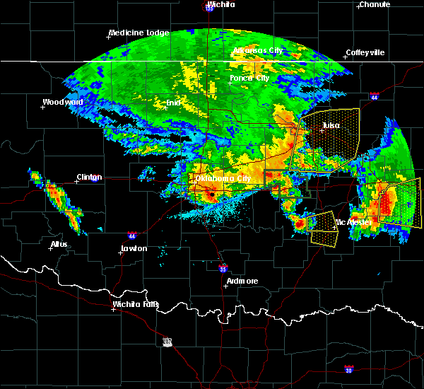 At 507 am cdt, a severe thunderstorm was located 4 miles south of haywood, moving east at 35 mph (radar indicated). Hazards include 60 mph wind gusts and quarter size hail. Hail damage to vehicles is expected. expect wind damage to roofs, siding, and trees. Locations in or near the path include, kiowa, savanna, blanco, pittsburg,. At 507 am cdt, a severe thunderstorm was located 4 miles south of haywood, moving east at 35 mph (radar indicated). Hazards include 60 mph wind gusts and quarter size hail. Hail damage to vehicles is expected. expect wind damage to roofs, siding, and trees. Locations in or near the path include, kiowa, savanna, blanco, pittsburg,.
|
| 6/23/2018 1:25 AM CDT |
 At 123 am cdt, severe thunderstorms were located along a line extending from 2 miles southeast of crowder to 4 miles west of wardville, moving east at 45 mph (the oklahoma mesonet station at stuart recorded a wind gust to 52 mph at 115 am). Hazards include 60 mph wind gusts and nickel size hail. Expect damage to roofs, siding, and trees. Locations in or near the path include, mcalester, hartshorne, krebs, kiowa, savanna, crowder, alderson, ashland, haywood, blocker, mcalester regional airport, scipio, blanco, haileyville, pittsburg, arpelar, dow, bache, featherston,. At 123 am cdt, severe thunderstorms were located along a line extending from 2 miles southeast of crowder to 4 miles west of wardville, moving east at 45 mph (the oklahoma mesonet station at stuart recorded a wind gust to 52 mph at 115 am). Hazards include 60 mph wind gusts and nickel size hail. Expect damage to roofs, siding, and trees. Locations in or near the path include, mcalester, hartshorne, krebs, kiowa, savanna, crowder, alderson, ashland, haywood, blocker, mcalester regional airport, scipio, blanco, haileyville, pittsburg, arpelar, dow, bache, featherston,.
|
| 6/23/2018 1:10 AM CDT |
 At 110 am cdt, severe thunderstorms were located along a line extending from 2 miles south of scipio to 4 miles south of centrahoma, moving east at 45 mph (radar indicated). Hazards include 60 mph wind gusts and nickel size hail. Expect damage to roofs, siding, and trees. Locations in or near the path include, mcalester, hartshorne, krebs, kiowa, savanna, crowder, alderson, ashland, haywood, blocker, mcalester regional airport, scipio, blanco, haileyville, pittsburg, arpelar, dow, bache, featherston,. At 110 am cdt, severe thunderstorms were located along a line extending from 2 miles south of scipio to 4 miles south of centrahoma, moving east at 45 mph (radar indicated). Hazards include 60 mph wind gusts and nickel size hail. Expect damage to roofs, siding, and trees. Locations in or near the path include, mcalester, hartshorne, krebs, kiowa, savanna, crowder, alderson, ashland, haywood, blocker, mcalester regional airport, scipio, blanco, haileyville, pittsburg, arpelar, dow, bache, featherston,.
|
| 5/15/2018 3:27 PM CDT |
 The severe thunderstorm warning for southwestern pittsburg county will expire at 330 pm cdt, the storms which prompted the warning have weakened below severe limits, and no longer pose an immediate threat to life or property. therefore the warning will be allowed to expire. however small hail, gusty winds and heavy rain are still possible with these thunderstorms. The severe thunderstorm warning for southwestern pittsburg county will expire at 330 pm cdt, the storms which prompted the warning have weakened below severe limits, and no longer pose an immediate threat to life or property. therefore the warning will be allowed to expire. however small hail, gusty winds and heavy rain are still possible with these thunderstorms.
|
| 5/15/2018 3:10 PM CDT |
 At 309 pm cdt, a severe thunderstorm was located over ashland, moving southeast at 5 mph. other strong to severe storms were located over central and southwestern pittsburg county (radar indicated). Hazards include 60 mph wind gusts and quarter size hail. Hail damage to vehicles is expected. expect wind damage to roofs, siding, and trees. Locations in or near the path include, mcalester, hartshorne, krebs, kiowa, savanna, alderson, ashland, mcalester regional airport, blanco, haileyville, pittsburg, dow, bache,. At 309 pm cdt, a severe thunderstorm was located over ashland, moving southeast at 5 mph. other strong to severe storms were located over central and southwestern pittsburg county (radar indicated). Hazards include 60 mph wind gusts and quarter size hail. Hail damage to vehicles is expected. expect wind damage to roofs, siding, and trees. Locations in or near the path include, mcalester, hartshorne, krebs, kiowa, savanna, alderson, ashland, mcalester regional airport, blanco, haileyville, pittsburg, dow, bache,.
|
| 5/15/2018 2:52 PM CDT |
 At 251 pm cdt, severe thunderstorms were located along a line extending from 3 miles west of mcalester to 2 miles northwest of savanna to 5 miles east of ashland, moving southeast at 10 mph (radar indicated). Hazards include 60 mph wind gusts and quarter size hail. Hail damage to vehicles is expected. expect wind damage to roofs, siding, and trees. Locations in or near the path include, mcalester, hartshorne, krebs, kiowa, savanna, alderson, ashland, haywood, mcalester regional airport, blanco, haileyville, pittsburg, dow, bache,. At 251 pm cdt, severe thunderstorms were located along a line extending from 3 miles west of mcalester to 2 miles northwest of savanna to 5 miles east of ashland, moving southeast at 10 mph (radar indicated). Hazards include 60 mph wind gusts and quarter size hail. Hail damage to vehicles is expected. expect wind damage to roofs, siding, and trees. Locations in or near the path include, mcalester, hartshorne, krebs, kiowa, savanna, alderson, ashland, haywood, mcalester regional airport, blanco, haileyville, pittsburg, dow, bache,.
|
| 5/15/2018 2:39 PM CDT |
 At 238 pm cdt, a severe thunderstorm was located 4 miles east of ashland, moving southeast at 10 mph. other strong to severe storms were scattered across western pittsburg county as well (radar indicated). Hazards include 60 mph wind gusts and quarter size hail. Hail damage to vehicles is expected. expect wind damage to roofs, siding, and trees. Locations in or near the path include, mcalester, krebs, kiowa, savanna, alderson, ashland, mcalester regional airport, haywood, arpelar, bache,. At 238 pm cdt, a severe thunderstorm was located 4 miles east of ashland, moving southeast at 10 mph. other strong to severe storms were scattered across western pittsburg county as well (radar indicated). Hazards include 60 mph wind gusts and quarter size hail. Hail damage to vehicles is expected. expect wind damage to roofs, siding, and trees. Locations in or near the path include, mcalester, krebs, kiowa, savanna, alderson, ashland, mcalester regional airport, haywood, arpelar, bache,.
|
| 5/15/2018 2:22 PM CDT |
 At 222 pm cdt, severe thunderstorms were located 5 miles southeast of scipio and 4 miles east of stuart, moving southeast at 20 mph (radar indicated). Hazards include 60 mph wind gusts and quarter size hail. Hail damage to vehicles is expected. expect wind damage to roofs, siding, and trees. Locations in or near the path include, mcalester, krebs, kiowa, savanna, alderson, ashland, mcalester regional airport, haywood, arpelar, bache,. At 222 pm cdt, severe thunderstorms were located 5 miles southeast of scipio and 4 miles east of stuart, moving southeast at 20 mph (radar indicated). Hazards include 60 mph wind gusts and quarter size hail. Hail damage to vehicles is expected. expect wind damage to roofs, siding, and trees. Locations in or near the path include, mcalester, krebs, kiowa, savanna, alderson, ashland, mcalester regional airport, haywood, arpelar, bache,.
|
| 5/2/2018 11:56 PM CDT |
 At 1156 pm cdt, severe thunderstorms were located along a line extending from 4 miles southeast of arrowhead state park to 3 miles northeast of haywood to 2 miles southeast of wardville, moving northeast at 20 mph (radar indicated). Hazards include 60 mph wind gusts. Expect damage to roofs, siding, and trees. Locations in or near the path include, mcalester, hartshorne, krebs, kiowa, savanna, crowder, alderson, ashland, haywood, blocker, mcalester regional airport, scipio, blanco, haileyville, pittsburg, arpelar, dow, bache, featherston, a tornado watch remains in effect until 300 am cdt for southeastern oklahoma. At 1156 pm cdt, severe thunderstorms were located along a line extending from 4 miles southeast of arrowhead state park to 3 miles northeast of haywood to 2 miles southeast of wardville, moving northeast at 20 mph (radar indicated). Hazards include 60 mph wind gusts. Expect damage to roofs, siding, and trees. Locations in or near the path include, mcalester, hartshorne, krebs, kiowa, savanna, crowder, alderson, ashland, haywood, blocker, mcalester regional airport, scipio, blanco, haileyville, pittsburg, arpelar, dow, bache, featherston, a tornado watch remains in effect until 300 am cdt for southeastern oklahoma.
|
| 5/2/2018 11:34 PM CDT |
 At 1133 pm cdt, severe thunderstorms were located along a line extending from 4 miles northeast of scipio to 4 miles east of lehigh, moving northeast at 55 mph (radar indicated). Hazards include 60 mph wind gusts. Expect damage to roofs, siding, and trees. Locations in or near the path include, mcalester, hartshorne, krebs, kiowa, savanna, crowder, alderson, ashland, haywood, blocker, mcalester regional airport, scipio, blanco, haileyville, pittsburg, arpelar, dow, bache, featherston, a tornado watch remains in effect until 300 am cdt for southeastern oklahoma. At 1133 pm cdt, severe thunderstorms were located along a line extending from 4 miles northeast of scipio to 4 miles east of lehigh, moving northeast at 55 mph (radar indicated). Hazards include 60 mph wind gusts. Expect damage to roofs, siding, and trees. Locations in or near the path include, mcalester, hartshorne, krebs, kiowa, savanna, crowder, alderson, ashland, haywood, blocker, mcalester regional airport, scipio, blanco, haileyville, pittsburg, arpelar, dow, bache, featherston, a tornado watch remains in effect until 300 am cdt for southeastern oklahoma.
|
| 4/13/2018 3:58 PM CDT |
 At 358 pm cdt, a severe thunderstorm was located 3 miles north of kiowa, moving northeast at 40 mph (radar indicated). Hazards include golf ball size hail and 70 mph wind gusts. People and animals outdoors will be injured. expect hail damage to roofs, siding, windows, and vehicles. expect considerable tree damage. wind damage is also likely to mobile homes, roofs, and outbuildings. Locations in or near the path include, mcalester, hartshorne, krebs, kiowa, savanna, alderson, mcalester regional airport, blanco, haileyville, pittsburg, dow, bache, a tornado watch remains in effect until 1000 pm cdt for southeastern oklahoma. At 358 pm cdt, a severe thunderstorm was located 3 miles north of kiowa, moving northeast at 40 mph (radar indicated). Hazards include golf ball size hail and 70 mph wind gusts. People and animals outdoors will be injured. expect hail damage to roofs, siding, windows, and vehicles. expect considerable tree damage. wind damage is also likely to mobile homes, roofs, and outbuildings. Locations in or near the path include, mcalester, hartshorne, krebs, kiowa, savanna, alderson, mcalester regional airport, blanco, haileyville, pittsburg, dow, bache, a tornado watch remains in effect until 1000 pm cdt for southeastern oklahoma.
|
| 4/13/2018 3:34 PM CDT |
 At 334 pm cdt, a severe thunderstorm was located 6 miles west of wardville, moving northeast at 55 mph (radar indicated). Hazards include golf ball size hail and 70 mph wind gusts. People and animals outdoors will be injured. expect hail damage to roofs, siding, windows, and vehicles. expect considerable tree damage. wind damage is also likely to mobile homes, roofs, and outbuildings. Locations in or near the path include, mcalester, hartshorne, krebs, kiowa, savanna, alderson, ashland, haywood, mcalester regional airport, blanco, haileyville, pittsburg, arpelar, dow, bache, a tornado watch remains in effect until 1000 pm cdt for southeastern oklahoma. At 334 pm cdt, a severe thunderstorm was located 6 miles west of wardville, moving northeast at 55 mph (radar indicated). Hazards include golf ball size hail and 70 mph wind gusts. People and animals outdoors will be injured. expect hail damage to roofs, siding, windows, and vehicles. expect considerable tree damage. wind damage is also likely to mobile homes, roofs, and outbuildings. Locations in or near the path include, mcalester, hartshorne, krebs, kiowa, savanna, alderson, ashland, haywood, mcalester regional airport, blanco, haileyville, pittsburg, arpelar, dow, bache, a tornado watch remains in effect until 1000 pm cdt for southeastern oklahoma.
|
| 8/17/2017 1:18 AM CDT |
 At 117 am cdt, severe thunderstorms were located along a line extending from 4 miles south of whitefield to 4 miles northwest of higgins to 3 miles southwest of kiowa, moving southeast at 35 mph (radar indicated. at 107 pm, wind damgage to trees and power poles was reported 2 miles north northeast of mcalester airport). Hazards include 60 mph wind gusts. Expect damage to roofs, siding, and trees. Locations in or near the path include, wilburton, clayton, hartshorne, quinton, kiowa, red oak, mccurtain, whitefield, kinta, albion, higgins, tuskahoma, mc curtain, stanley, kiamichi, lequire, damon, bengal, yanush, robbers cave state park,. At 117 am cdt, severe thunderstorms were located along a line extending from 4 miles south of whitefield to 4 miles northwest of higgins to 3 miles southwest of kiowa, moving southeast at 35 mph (radar indicated. at 107 pm, wind damgage to trees and power poles was reported 2 miles north northeast of mcalester airport). Hazards include 60 mph wind gusts. Expect damage to roofs, siding, and trees. Locations in or near the path include, wilburton, clayton, hartshorne, quinton, kiowa, red oak, mccurtain, whitefield, kinta, albion, higgins, tuskahoma, mc curtain, stanley, kiamichi, lequire, damon, bengal, yanush, robbers cave state park,.
|
| 6/30/2017 8:54 PM CDT |
 The severe thunderstorm warning for southwestern mcintosh and western pittsburg counties will expire at 900 pm cdt, the storms which prompted the warning have moved out of the area. therefore the warning will be allowed to expire. a severe thunderstorm watch remains in effect until 1100 pm cdt for southeastern oklahoma. to report severe weather, contact your nearest law enforcement agency. they will relay your report to the national weather service tulsa. remember, a severe thunderstorm warning still remains in effect for southern pittsburg county until 930 pm. The severe thunderstorm warning for southwestern mcintosh and western pittsburg counties will expire at 900 pm cdt, the storms which prompted the warning have moved out of the area. therefore the warning will be allowed to expire. a severe thunderstorm watch remains in effect until 1100 pm cdt for southeastern oklahoma. to report severe weather, contact your nearest law enforcement agency. they will relay your report to the national weather service tulsa. remember, a severe thunderstorm warning still remains in effect for southern pittsburg county until 930 pm.
|
| 6/30/2017 8:53 PM CDT |
 At 853 pm cdt, severe thunderstorms were located along a line extending from 4 miles west of mccurtain to 3 miles north of lequire to near hartshorne to near kiowa, moving southeast at 40 mph (radar indicated). Hazards include 70 mph wind gusts and quarter size hail. Hail damage to vehicles is expected. expect considerable tree damage. wind damage is also likely to mobile homes, roofs, and outbuildings. Locations in or near the path include, mcalester, wilburton, clayton, hartshorne, krebs, talihina, quinton, kiowa, savanna, red oak, fanshawe, alderson, kinta, albion, ashland, higgins, tuskahoma, stanley, lequire, damon,. At 853 pm cdt, severe thunderstorms were located along a line extending from 4 miles west of mccurtain to 3 miles north of lequire to near hartshorne to near kiowa, moving southeast at 40 mph (radar indicated). Hazards include 70 mph wind gusts and quarter size hail. Hail damage to vehicles is expected. expect considerable tree damage. wind damage is also likely to mobile homes, roofs, and outbuildings. Locations in or near the path include, mcalester, wilburton, clayton, hartshorne, krebs, talihina, quinton, kiowa, savanna, red oak, fanshawe, alderson, kinta, albion, ashland, higgins, tuskahoma, stanley, lequire, damon,.
|
| 6/30/2017 8:37 PM CDT |
 At 837 pm cdt, severe thunderstorms were located along a line extending from 5 miles north of kinta to 3 miles south of whitefield to alderson to near ashland, moving southeast at 40 mph (radar indicated). Hazards include 70 mph wind gusts and half dollar size hail. Hail damage to vehicles is expected. expect considerable tree damage. wind damage is also likely to mobile homes, roofs, and outbuildings. Locations in or near the path include, mcalester, wilburton, clayton, hartshorne, krebs, talihina, quinton, kiowa, savanna, red oak, fanshawe, alderson, kinta, albion, ashland, higgins, tuskahoma, stanley, lequire, damon,. At 837 pm cdt, severe thunderstorms were located along a line extending from 5 miles north of kinta to 3 miles south of whitefield to alderson to near ashland, moving southeast at 40 mph (radar indicated). Hazards include 70 mph wind gusts and half dollar size hail. Hail damage to vehicles is expected. expect considerable tree damage. wind damage is also likely to mobile homes, roofs, and outbuildings. Locations in or near the path include, mcalester, wilburton, clayton, hartshorne, krebs, talihina, quinton, kiowa, savanna, red oak, fanshawe, alderson, kinta, albion, ashland, higgins, tuskahoma, stanley, lequire, damon,.
|
| 6/30/2017 8:09 PM CDT |
 At 809 pm cdt, severe thunderstorms were located along a line extending from 6 miles south of dustin to 3 miles southeast of calvin, moving east at 25 mph (radar indicated). Hazards include 70 mph wind gusts and quarter size hail. Hail damage to vehicles is expected. expect considerable tree damage. wind damage is also likely to mobile homes, roofs, and outbuildings. Locations in or near the path include, mcalester, krebs, kiowa, savanna, crowder, canadian, indianola, hanna, ashland, haywood, arrowhead state park, scipio, arpelar,. At 809 pm cdt, severe thunderstorms were located along a line extending from 6 miles south of dustin to 3 miles southeast of calvin, moving east at 25 mph (radar indicated). Hazards include 70 mph wind gusts and quarter size hail. Hail damage to vehicles is expected. expect considerable tree damage. wind damage is also likely to mobile homes, roofs, and outbuildings. Locations in or near the path include, mcalester, krebs, kiowa, savanna, crowder, canadian, indianola, hanna, ashland, haywood, arrowhead state park, scipio, arpelar,.
|
| 5/27/2017 11:31 PM CDT |
 At 1131 pm cdt, severe thunderstorms were located along a line extending from 2 miles southeast of kiowa to 7 miles northeast of lane to 5 miles northwest of caney, moving east at 45 mph (radar indicated). Hazards include 70 mph wind gusts and quarter size hail. Hail damage to vehicles is expected. expect considerable tree damage. wind damage is also likely to mobile homes, roofs, and outbuildings. Locations in or near the path include, antlers, clayton, kiowa, ashland, clayton lake state park, snow, tuskahoma, stanley, moyers, kosoma, kellond, dunbar, blanco, cloudy, pittsburg, eubanks, sardis, finley, a tornado watch remains in effect until midnight cdt for southeastern oklahoma. At 1131 pm cdt, severe thunderstorms were located along a line extending from 2 miles southeast of kiowa to 7 miles northeast of lane to 5 miles northwest of caney, moving east at 45 mph (radar indicated). Hazards include 70 mph wind gusts and quarter size hail. Hail damage to vehicles is expected. expect considerable tree damage. wind damage is also likely to mobile homes, roofs, and outbuildings. Locations in or near the path include, antlers, clayton, kiowa, ashland, clayton lake state park, snow, tuskahoma, stanley, moyers, kosoma, kellond, dunbar, blanco, cloudy, pittsburg, eubanks, sardis, finley, a tornado watch remains in effect until midnight cdt for southeastern oklahoma.
|
| 5/27/2017 11:10 PM CDT |
 At 1110 pm cdt, severe thunderstorms were located along a line extending from 5 miles southwest of ashland to 2 miles west of atoka to 3 miles northwest of fillmore, moving east at 45 mph (radar indicated). Hazards include 70 mph wind gusts and quarter size hail. Hail damage to vehicles is expected. expect considerable tree damage. wind damage is also likely to mobile homes, roofs, and outbuildings. Locations in or near the path include, antlers, clayton, kiowa, ashland, clayton lake state park, snow, tuskahoma, stanley, moyers, kosoma, kellond, dunbar, blanco, cloudy, pittsburg, eubanks, sardis, finley, a tornado watch remains in effect until midnight cdt for southeastern oklahoma. At 1110 pm cdt, severe thunderstorms were located along a line extending from 5 miles southwest of ashland to 2 miles west of atoka to 3 miles northwest of fillmore, moving east at 45 mph (radar indicated). Hazards include 70 mph wind gusts and quarter size hail. Hail damage to vehicles is expected. expect considerable tree damage. wind damage is also likely to mobile homes, roofs, and outbuildings. Locations in or near the path include, antlers, clayton, kiowa, ashland, clayton lake state park, snow, tuskahoma, stanley, moyers, kosoma, kellond, dunbar, blanco, cloudy, pittsburg, eubanks, sardis, finley, a tornado watch remains in effect until midnight cdt for southeastern oklahoma.
|
| 5/20/2017 12:47 AM CDT |
 At 1247 am cdt, severe thunderstorms were located along a line extending from 3 miles south of haywood to 8 miles west of daisy, moving northeast at 35 mph (radar indicated). Hazards include 60 mph wind gusts and nickel size hail. Expect damage to roofs, siding, and trees. Locations in or near the path include, mcalester, krebs, kiowa, savanna, alderson, blanco, haywood, pittsburg, a tornado watch remains in effect until 500 am cdt for southeastern oklahoma. At 1247 am cdt, severe thunderstorms were located along a line extending from 3 miles south of haywood to 8 miles west of daisy, moving northeast at 35 mph (radar indicated). Hazards include 60 mph wind gusts and nickel size hail. Expect damage to roofs, siding, and trees. Locations in or near the path include, mcalester, krebs, kiowa, savanna, alderson, blanco, haywood, pittsburg, a tornado watch remains in effect until 500 am cdt for southeastern oklahoma.
|
| 5/19/2017 12:16 AM CDT |
 At 1215 am cdt, a severe thunderstorm was located over savanna, moving northeast at 80 mph (radar indicated). Hazards include 60 mph wind gusts and penny size hail. Expect damage to roofs, siding, and trees. Locations in or near the path include, mcalester, krebs, kiowa, savanna, alderson, haywood, blanco, pittsburg, arpelar, dow, bache, a tornado watch remains in effect until 100 am cdt for southeastern oklahoma. At 1215 am cdt, a severe thunderstorm was located over savanna, moving northeast at 80 mph (radar indicated). Hazards include 60 mph wind gusts and penny size hail. Expect damage to roofs, siding, and trees. Locations in or near the path include, mcalester, krebs, kiowa, savanna, alderson, haywood, blanco, pittsburg, arpelar, dow, bache, a tornado watch remains in effect until 100 am cdt for southeastern oklahoma.
|
| 5/18/2017 11:42 PM CDT |
 At 1142 pm cdt, a severe thunderstorm was located over ashland, moving northeast at 55 mph (radar indicated). Hazards include 60 mph wind gusts and quarter size hail. Hail damage to vehicles is expected. expect wind damage to roofs, siding, and trees. Locations in or near the path include, mcalester, eufaula, krebs, kiowa, savanna, crowder, alderson, canadian, indianola, hanna, ashland, haywood, blocker, arrowhead state park, scipio, blanco, pittsburg, arpelar, dow, bache, a tornado watch remains in effect until midnight cdt for southeastern oklahoma. At 1142 pm cdt, a severe thunderstorm was located over ashland, moving northeast at 55 mph (radar indicated). Hazards include 60 mph wind gusts and quarter size hail. Hail damage to vehicles is expected. expect wind damage to roofs, siding, and trees. Locations in or near the path include, mcalester, eufaula, krebs, kiowa, savanna, crowder, alderson, canadian, indianola, hanna, ashland, haywood, blocker, arrowhead state park, scipio, blanco, pittsburg, arpelar, dow, bache, a tornado watch remains in effect until midnight cdt for southeastern oklahoma.
|
| 5/18/2017 10:34 PM CDT |
 At 1034 pm cdt, severe thunderstorms were located along a line extending from 7 miles north of enterprise to 5 miles north of hartshorne to 6 miles northwest of daisy, moving east at 30 mph (radar indicated). Hazards include 60 mph wind gusts and nickel size hail. Expect damage to roofs, siding, and trees. Locations in or near the path include, mcalester, eufaula, hartshorne, krebs, kiowa, savanna, crowder, alderson, canadian, indianola, ashland, raiford, haywood, blocker, vivian, arrowhead state park, blanco, haileyville, pittsburg, arpelar, a tornado watch remains in effect until midnight cdt for southeastern oklahoma. At 1034 pm cdt, severe thunderstorms were located along a line extending from 7 miles north of enterprise to 5 miles north of hartshorne to 6 miles northwest of daisy, moving east at 30 mph (radar indicated). Hazards include 60 mph wind gusts and nickel size hail. Expect damage to roofs, siding, and trees. Locations in or near the path include, mcalester, eufaula, hartshorne, krebs, kiowa, savanna, crowder, alderson, canadian, indianola, ashland, raiford, haywood, blocker, vivian, arrowhead state park, blanco, haileyville, pittsburg, arpelar, a tornado watch remains in effect until midnight cdt for southeastern oklahoma.
|
| 5/18/2017 9:40 PM CDT |
 At 939 pm cdt, severe thunderstorms were located along a line extending from 5 miles south of wetumka to 5 miles west of ashland to near coalgate, moving east at 45 mph (radar indicated). Hazards include 70 mph wind gusts and quarter size hail. Hail damage to vehicles is expected. expect considerable tree damage. wind damage is also likely to mobile homes, roofs, and outbuildings. Locations in or near the path include, mcalester, eufaula, hartshorne, krebs, kiowa, savanna, crowder, alderson, canadian, indianola, hanna, ashland, raiford, haywood, vivian, blocker, arrowhead state park, scipio, blanco, haileyville, a tornado watch remains in effect until midnight cdt for southeastern oklahoma. At 939 pm cdt, severe thunderstorms were located along a line extending from 5 miles south of wetumka to 5 miles west of ashland to near coalgate, moving east at 45 mph (radar indicated). Hazards include 70 mph wind gusts and quarter size hail. Hail damage to vehicles is expected. expect considerable tree damage. wind damage is also likely to mobile homes, roofs, and outbuildings. Locations in or near the path include, mcalester, eufaula, hartshorne, krebs, kiowa, savanna, crowder, alderson, canadian, indianola, hanna, ashland, raiford, haywood, vivian, blocker, arrowhead state park, scipio, blanco, haileyville, a tornado watch remains in effect until midnight cdt for southeastern oklahoma.
|
| 4/29/2017 6:43 PM CDT |
 At 643 pm cdt, a severe thunderstorm was located 3 miles east of hartshorne, moving northeast at 40 mph (radar indicated). Hazards include 60 mph wind gusts and quarter size hail. Hail damage to vehicles is expected. expect wind damage to roofs, siding, and trees. Locations in or near the path include, mcalester, hartshorne, krebs, kiowa, savanna, alderson, damon, higgins, stanley, blanco, haileyville, pittsburg, sardis, gowen, dow, bache,. At 643 pm cdt, a severe thunderstorm was located 3 miles east of hartshorne, moving northeast at 40 mph (radar indicated). Hazards include 60 mph wind gusts and quarter size hail. Hail damage to vehicles is expected. expect wind damage to roofs, siding, and trees. Locations in or near the path include, mcalester, hartshorne, krebs, kiowa, savanna, alderson, damon, higgins, stanley, blanco, haileyville, pittsburg, sardis, gowen, dow, bache,.
|
| 4/21/2017 6:26 PM CDT |
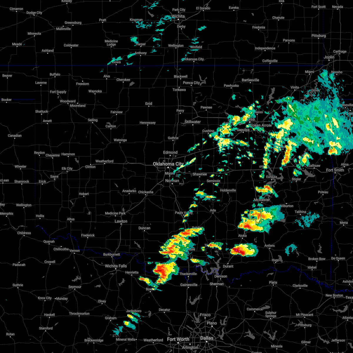 The severe thunderstorm warning for southwestern pittsburg county will expire at 630 pm cdt, the storm which prompted the warning has weakened below severe limits, and no longer poses an immediate threat to life or property. therefore the warning will be allowed to expire. however small hail to nickel size is still possible with this thunderstorm. a tornado watch remains in effect until 100 am cdt for southeastern oklahoma. The severe thunderstorm warning for southwestern pittsburg county will expire at 630 pm cdt, the storm which prompted the warning has weakened below severe limits, and no longer poses an immediate threat to life or property. therefore the warning will be allowed to expire. however small hail to nickel size is still possible with this thunderstorm. a tornado watch remains in effect until 100 am cdt for southeastern oklahoma.
|
| 4/21/2017 6:13 PM CDT |
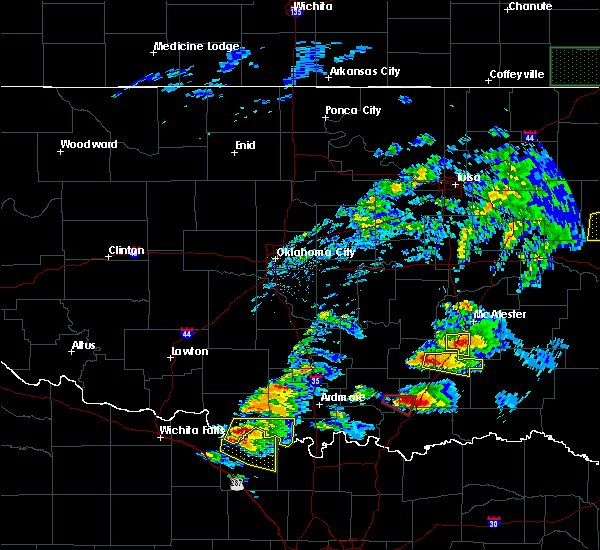 At 613 pm cdt, a severe thunderstorm was located near kiowa, moving east at 35 mph (radar indicated). Hazards include 60 mph wind gusts and quarter size hail. Hail damage to vehicles is expected. expect wind damage to roofs, siding, and trees. Locations in or near the path include, kiowa, pittsburg, a tornado watch remains in effect until 100 am cdt for southeastern oklahoma. At 613 pm cdt, a severe thunderstorm was located near kiowa, moving east at 35 mph (radar indicated). Hazards include 60 mph wind gusts and quarter size hail. Hail damage to vehicles is expected. expect wind damage to roofs, siding, and trees. Locations in or near the path include, kiowa, pittsburg, a tornado watch remains in effect until 100 am cdt for southeastern oklahoma.
|
| 4/21/2017 5:53 PM CDT |
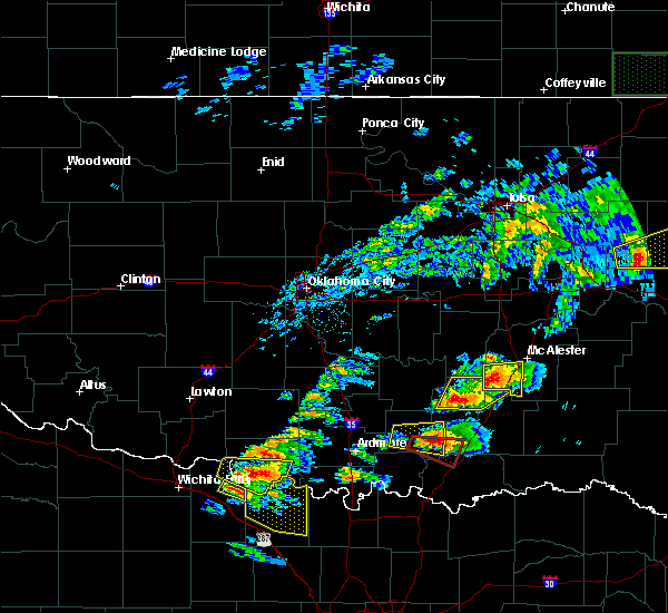 At 553 pm cdt, a severe thunderstorm was located over ashland, moving east at 30 mph (radar indicated). Hazards include 60 mph wind gusts and half dollar size hail. Hail damage to vehicles is expected. expect wind damage to roofs, siding, and trees. Locations in or near the path include, mcalester, kiowa, savanna, ashland, pittsburg, a tornado watch remains in effect until 100 am cdt for southeastern oklahoma. At 553 pm cdt, a severe thunderstorm was located over ashland, moving east at 30 mph (radar indicated). Hazards include 60 mph wind gusts and half dollar size hail. Hail damage to vehicles is expected. expect wind damage to roofs, siding, and trees. Locations in or near the path include, mcalester, kiowa, savanna, ashland, pittsburg, a tornado watch remains in effect until 100 am cdt for southeastern oklahoma.
|
| 4/21/2017 5:35 PM CDT |
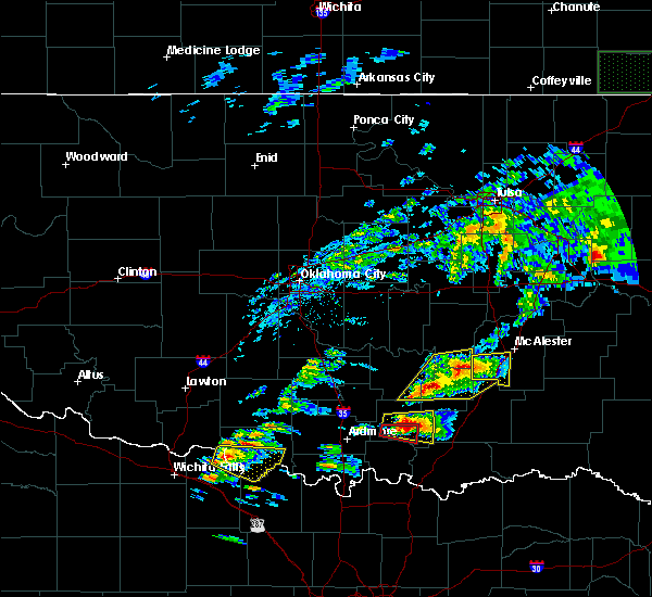 At 535 pm cdt, a severe thunderstorm was located 7 miles southeast of gerty, moving east at 30 mph (radar indicated). Hazards include 60 mph wind gusts and half dollar size hail. Hail damage to vehicles is expected. expect wind damage to roofs, siding, and trees. Locations in or near the path include, mcalester, kiowa, savanna, ashland, pittsburg, a tornado watch remains in effect until 100 am cdt for southeastern oklahoma. At 535 pm cdt, a severe thunderstorm was located 7 miles southeast of gerty, moving east at 30 mph (radar indicated). Hazards include 60 mph wind gusts and half dollar size hail. Hail damage to vehicles is expected. expect wind damage to roofs, siding, and trees. Locations in or near the path include, mcalester, kiowa, savanna, ashland, pittsburg, a tornado watch remains in effect until 100 am cdt for southeastern oklahoma.
|
| 4/21/2017 11:39 AM CDT |
 At 1139 am cdt, severe thunderstorms were located along a line extending from 2 miles southeast of taft to 6 miles northeast of eufaula to 4 miles south of crowder to near ashland, moving east at 50 mph (radar indicated). Hazards include 60 mph wind gusts. Expect damage to roofs, siding, and trees. Locations in or near the path include, muskogee, mcalester, wilburton, eufaula, stigler, checotah, hartshorne, krebs, warner, vian, quinton, gore, kiowa, porum, savanna, webbers falls, crowder, whitefield, oktaha, alderson, this includes interstate 40 in oklahoma between mile markers 261 and 301. At 1139 am cdt, severe thunderstorms were located along a line extending from 2 miles southeast of taft to 6 miles northeast of eufaula to 4 miles south of crowder to near ashland, moving east at 50 mph (radar indicated). Hazards include 60 mph wind gusts. Expect damage to roofs, siding, and trees. Locations in or near the path include, muskogee, mcalester, wilburton, eufaula, stigler, checotah, hartshorne, krebs, warner, vian, quinton, gore, kiowa, porum, savanna, webbers falls, crowder, whitefield, oktaha, alderson, this includes interstate 40 in oklahoma between mile markers 261 and 301.
|
| 3/7/2017 12:51 AM CST |
 At 1249 am cst, severe thunderstorms were located along a line extending from robbers cave state park to 3 miles northwest of tishomingo, moving east at 45 mph (radar indicated. at 12:40 am, a wind gust to 64 mph was observed at the mesonet site 2 miles southwest of wilburton). Hazards include 70 mph wind gusts. Expect considerable tree damage. damage is likely to mobile homes, roofs, and outbuildings. Locations in or near the path include, poteau, wilburton, antlers, clayton, heavener, hartshorne, talihina, wister, howe, kiowa, hartford, red oak, fanshawe, albion, talimena state park, snow, higgins, heavener runestone state park, tuskahoma, stanley, a tornado watch remains in effect until 300 am cst for west central arkansas, and southeastern oklahoma. At 1249 am cst, severe thunderstorms were located along a line extending from robbers cave state park to 3 miles northwest of tishomingo, moving east at 45 mph (radar indicated. at 12:40 am, a wind gust to 64 mph was observed at the mesonet site 2 miles southwest of wilburton). Hazards include 70 mph wind gusts. Expect considerable tree damage. damage is likely to mobile homes, roofs, and outbuildings. Locations in or near the path include, poteau, wilburton, antlers, clayton, heavener, hartshorne, talihina, wister, howe, kiowa, hartford, red oak, fanshawe, albion, talimena state park, snow, higgins, heavener runestone state park, tuskahoma, stanley, a tornado watch remains in effect until 300 am cst for west central arkansas, and southeastern oklahoma.
|
| 3/1/2017 12:33 AM CST |
 At 1231 am cst, a severe thunderstorm was located 4 miles northwest of hartshorne, moving east at 55 mph (radar indicated. golfball hail was reported in mcalester with this storm). Hazards include golf ball size hail and 70 mph wind gusts. People and animals outdoors will be injured. expect hail damage to roofs, siding, windows, and vehicles. expect considerable tree damage. wind damage is also likely to mobile homes, roofs, and outbuildings. Locations in or near the path include, mcalester, wilburton, hartshorne, krebs, kiowa, savanna, alderson, damon, higgins, blocker, yanush, robbers cave state park, blanco, haileyville, pittsburg, gowen, panola, dow, bache, a tornado watch remains in effect until 600 am cst for southeastern oklahoma. At 1231 am cst, a severe thunderstorm was located 4 miles northwest of hartshorne, moving east at 55 mph (radar indicated. golfball hail was reported in mcalester with this storm). Hazards include golf ball size hail and 70 mph wind gusts. People and animals outdoors will be injured. expect hail damage to roofs, siding, windows, and vehicles. expect considerable tree damage. wind damage is also likely to mobile homes, roofs, and outbuildings. Locations in or near the path include, mcalester, wilburton, hartshorne, krebs, kiowa, savanna, alderson, damon, higgins, blocker, yanush, robbers cave state park, blanco, haileyville, pittsburg, gowen, panola, dow, bache, a tornado watch remains in effect until 600 am cst for southeastern oklahoma.
|
| 3/1/2017 12:19 AM CST |
 At 1218 am cst, severe thunderstorms were located along a line extending from near krebs to near savanna, moving east at 55 mph (radar indicated). Hazards include golf ball size hail and 70 mph wind gusts. People and animals outdoors will be injured. expect hail damage to roofs, siding, windows, and vehicles. expect considerable tree damage. wind damage is also likely to mobile homes, roofs, and outbuildings. Locations in or near the path include, mcalester, wilburton, hartshorne, krebs, kiowa, savanna, alderson, ashland, damon, higgins, haywood, blocker, yanush, robbers cave state park, blanco, haileyville, pittsburg, gowen, panola, dow, a tornado watch remains in effect until 600 am cst for southeastern oklahoma. At 1218 am cst, severe thunderstorms were located along a line extending from near krebs to near savanna, moving east at 55 mph (radar indicated). Hazards include golf ball size hail and 70 mph wind gusts. People and animals outdoors will be injured. expect hail damage to roofs, siding, windows, and vehicles. expect considerable tree damage. wind damage is also likely to mobile homes, roofs, and outbuildings. Locations in or near the path include, mcalester, wilburton, hartshorne, krebs, kiowa, savanna, alderson, ashland, damon, higgins, haywood, blocker, yanush, robbers cave state park, blanco, haileyville, pittsburg, gowen, panola, dow, a tornado watch remains in effect until 600 am cst for southeastern oklahoma.
|
| 7/14/2016 2:49 PM CDT |
 At 249 pm cdt, severe thunderstorms were located along a line extending from 4 miles north of yanush to 6 miles north of stringtown, moving southeast at 30 mph (radar indicated). Hazards include 60 mph wind gusts and quarter size hail. Hail damage to vehicles is expected. expect wind damage to roofs, siding, and trees. Locations in or near the path include, clayton, hartshorne, kiowa, savanna, ashland, kosoma, yanush, blanco, snow, kiamichi, moyers, higgins, dunbar, tuskahoma, stanley, nashoba, clayton lake state park, haileyville, pittsburg, bache,. At 249 pm cdt, severe thunderstorms were located along a line extending from 4 miles north of yanush to 6 miles north of stringtown, moving southeast at 30 mph (radar indicated). Hazards include 60 mph wind gusts and quarter size hail. Hail damage to vehicles is expected. expect wind damage to roofs, siding, and trees. Locations in or near the path include, clayton, hartshorne, kiowa, savanna, ashland, kosoma, yanush, blanco, snow, kiamichi, moyers, higgins, dunbar, tuskahoma, stanley, nashoba, clayton lake state park, haileyville, pittsburg, bache,.
|
| 7/14/2016 2:21 PM CDT |
 At 221 pm cdt, severe thunderstorms were located along a line extending from 5 miles north of hartshorne to 4 miles northwest of wardville, moving southeast at 25 mph (radar indicated). Hazards include 60 mph wind gusts and nickel size hail. Expect damage to roofs. siding. and trees. Locations in or near the path include, clayton, hartshorne, kiowa, savanna, ashland, kosoma, yanush, blanco, snow, kiamichi, moyers, higgins, dunbar, tuskahoma, stanley, nashoba, clayton lake state park, haileyville, pittsburg, bache,. At 221 pm cdt, severe thunderstorms were located along a line extending from 5 miles north of hartshorne to 4 miles northwest of wardville, moving southeast at 25 mph (radar indicated). Hazards include 60 mph wind gusts and nickel size hail. Expect damage to roofs. siding. and trees. Locations in or near the path include, clayton, hartshorne, kiowa, savanna, ashland, kosoma, yanush, blanco, snow, kiamichi, moyers, higgins, dunbar, tuskahoma, stanley, nashoba, clayton lake state park, haileyville, pittsburg, bache,.
|
| 6/18/2016 7:55 PM CDT |
 The severe thunderstorm warning for southwestern pittsburg county will expire at 800 pm cdt, the storms which prompted the warning have weakened below severe limits, and have exited the warned area. therefore the warning will be allowed to expire. The severe thunderstorm warning for southwestern pittsburg county will expire at 800 pm cdt, the storms which prompted the warning have weakened below severe limits, and have exited the warned area. therefore the warning will be allowed to expire.
|
| 6/18/2016 7:26 PM CDT |
 At 726 pm cdt, severe thunderstorms were located along a line extending from 3 miles south of savanna to 8 miles southwest of daisy, moving west at 15 mph (radar indicated). Hazards include 60 mph wind gusts and quarter size hail. Hail damage to vehicles is expected. expect wind damage to roofs, siding, and trees. Locations in or near the path include, kiowa, ashland, blanco, pittsburg,. At 726 pm cdt, severe thunderstorms were located along a line extending from 3 miles south of savanna to 8 miles southwest of daisy, moving west at 15 mph (radar indicated). Hazards include 60 mph wind gusts and quarter size hail. Hail damage to vehicles is expected. expect wind damage to roofs, siding, and trees. Locations in or near the path include, kiowa, ashland, blanco, pittsburg,.
|
| 6/18/2016 7:08 PM CDT |
 At 707 pm cdt, severe thunderstorms were located along a line extending from 4 miles south of blanco to 3 miles west of moyers, moving west at 25 mph (radar indicated). Hazards include 60 mph wind gusts and half dollar size hail. Hail damage to vehicles is expected. expect wind damage to roofs, siding, and trees. Locations in or near the path include, kiowa, ashland, kosoma, blanco, dunbar, moyers, pittsburg, eubanks,. At 707 pm cdt, severe thunderstorms were located along a line extending from 4 miles south of blanco to 3 miles west of moyers, moving west at 25 mph (radar indicated). Hazards include 60 mph wind gusts and half dollar size hail. Hail damage to vehicles is expected. expect wind damage to roofs, siding, and trees. Locations in or near the path include, kiowa, ashland, kosoma, blanco, dunbar, moyers, pittsburg, eubanks,.
|
| 6/18/2016 6:52 PM CDT |
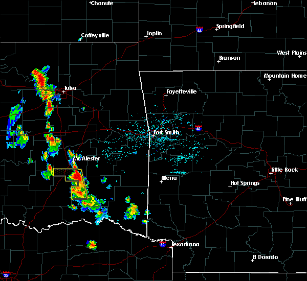 At 652 pm cdt, severe thunderstorms were located along a line extending from 4 miles southeast of blanco to kosoma, moving west at 25 mph (radar indicated). Hazards include 60 mph wind gusts and quarter size hail. Hail damage to vehicles is expected. expect wind damage to roofs, siding, and trees. Locations in or near the path include, kiowa, ashland, kosoma, blanco, dunbar, moyers, pittsburg, eubanks,. At 652 pm cdt, severe thunderstorms were located along a line extending from 4 miles southeast of blanco to kosoma, moving west at 25 mph (radar indicated). Hazards include 60 mph wind gusts and quarter size hail. Hail damage to vehicles is expected. expect wind damage to roofs, siding, and trees. Locations in or near the path include, kiowa, ashland, kosoma, blanco, dunbar, moyers, pittsburg, eubanks,.
|
| 5/12/2016 2:58 AM CDT |
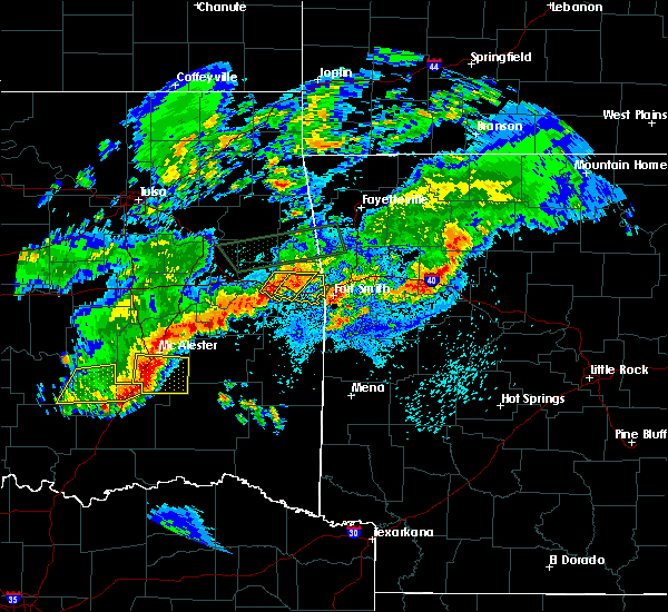 At 257 am cdt, a severe thunderstorm was located 3 miles south of savanna, moving east at 35 mph (radar indicated). Hazards include 60 mph wind gusts and quarter size hail. Hail damage to vehicles is expected. expect wind damage to roofs, siding, and trees. Locations in or near the path include, mcalester, hartshorne, kiowa, savanna, blanco, haileyville, pittsburg, dow,. At 257 am cdt, a severe thunderstorm was located 3 miles south of savanna, moving east at 35 mph (radar indicated). Hazards include 60 mph wind gusts and quarter size hail. Hail damage to vehicles is expected. expect wind damage to roofs, siding, and trees. Locations in or near the path include, mcalester, hartshorne, kiowa, savanna, blanco, haileyville, pittsburg, dow,.
|
| 4/26/2016 10:41 PM CDT |
 At 1041 pm cdt, severe thunderstorms were located along a line extending from 3 miles southeast of okmulgee state park to 3 miles east of ashland, moving northeast at 50 mph (radar indicated). Hazards include 70 mph wind gusts. Expect considerable tree damage. damage is likely to mobile homes, roofs, and outbuildings. locations in or near the path include, mcalester, okmulgee, okemah, eufaula, henryetta, krebs, morris, weleetka, dewar, kiowa, savanna, schulter, crowder, alderson, boynton, canadian, indianola, grayson, council hill, hanna, this includes interstate 40 in oklahoma between mile markers 214 and 262. A tornado watch remains in effect until midnight cdt for northeastern oklahoma. At 1041 pm cdt, severe thunderstorms were located along a line extending from 3 miles southeast of okmulgee state park to 3 miles east of ashland, moving northeast at 50 mph (radar indicated). Hazards include 70 mph wind gusts. Expect considerable tree damage. damage is likely to mobile homes, roofs, and outbuildings. locations in or near the path include, mcalester, okmulgee, okemah, eufaula, henryetta, krebs, morris, weleetka, dewar, kiowa, savanna, schulter, crowder, alderson, boynton, canadian, indianola, grayson, council hill, hanna, this includes interstate 40 in oklahoma between mile markers 214 and 262. A tornado watch remains in effect until midnight cdt for northeastern oklahoma.
|
| 4/26/2016 10:21 PM CDT |
 At 1020 pm cdt, severe thunderstorms were located along a line extending from 3 miles northwest of clearview to 5 miles north of coalgate, moving northeast at 65 mph (radar indicated). Hazards include 70 mph wind gusts. Expect considerable tree damage. damage is likely to mobile homes, roofs, and outbuildings. locations in or near the path include, mcalester, okmulgee, okemah, eufaula, henryetta, krebs, morris, weleetka, dewar, kiowa, savanna, schulter, crowder, alderson, boynton, canadian, indianola, grayson, council hill, hanna, this includes interstate 40 in oklahoma between mile markers 214 and 262. A tornado watch remains in effect until midnight cdt for eastern oklahoma. At 1020 pm cdt, severe thunderstorms were located along a line extending from 3 miles northwest of clearview to 5 miles north of coalgate, moving northeast at 65 mph (radar indicated). Hazards include 70 mph wind gusts. Expect considerable tree damage. damage is likely to mobile homes, roofs, and outbuildings. locations in or near the path include, mcalester, okmulgee, okemah, eufaula, henryetta, krebs, morris, weleetka, dewar, kiowa, savanna, schulter, crowder, alderson, boynton, canadian, indianola, grayson, council hill, hanna, this includes interstate 40 in oklahoma between mile markers 214 and 262. A tornado watch remains in effect until midnight cdt for eastern oklahoma.
|
| 3/2/2016 10:42 PM CST |
 At 1042 pm cst, a severe thunderstorm was located 4 miles northeast of ashland, moving east at 45 mph (radar indicated). Hazards include quarter size hail. Damage to vehicles is expected. Locations in or near the path include, mcalester, hartshorne, kiowa, savanna, ashland, higgins, blanco, haywood, haileyville, pittsburg, sardis,. At 1042 pm cst, a severe thunderstorm was located 4 miles northeast of ashland, moving east at 45 mph (radar indicated). Hazards include quarter size hail. Damage to vehicles is expected. Locations in or near the path include, mcalester, hartshorne, kiowa, savanna, ashland, higgins, blanco, haywood, haileyville, pittsburg, sardis,.
|
| 12/26/2015 5:06 PM CST |
 At 505 pm cst, a severe thunderstorm capable of producing a tornado was located 4 miles northeast of ashland, moving northeast at 55 mph (radar indicated rotation). Hazards include tornado and quarter size hail. Flying debris will be dangerous to those caught without shelter. mobile homes will be damaged or destroyed. damage to roofs, windows, and vehicles will occur. tree damage is likely. Locations in or near the path include, mcalester, krebs, kiowa, savanna, ashland, haywood, blocker, scipio, arpelar,. At 505 pm cst, a severe thunderstorm capable of producing a tornado was located 4 miles northeast of ashland, moving northeast at 55 mph (radar indicated rotation). Hazards include tornado and quarter size hail. Flying debris will be dangerous to those caught without shelter. mobile homes will be damaged or destroyed. damage to roofs, windows, and vehicles will occur. tree damage is likely. Locations in or near the path include, mcalester, krebs, kiowa, savanna, ashland, haywood, blocker, scipio, arpelar,.
|
| 12/26/2015 4:53 PM CST |
 At 452 pm cst, a severe thunderstorm capable of producing a tornado was located 5 miles southwest of ashland, moving northeast at 45 mph (radar indicated rotation). Hazards include tornado and quarter size hail. Flying debris will be dangerous to those caught without shelter. mobile homes will be damaged or destroyed. damage to roofs, windows, and vehicles will occur. tree damage is likely. Locations in or near the path include, mcalester, krebs, kiowa, savanna, ashland, haywood, blocker, scipio, arpelar,. At 452 pm cst, a severe thunderstorm capable of producing a tornado was located 5 miles southwest of ashland, moving northeast at 45 mph (radar indicated rotation). Hazards include tornado and quarter size hail. Flying debris will be dangerous to those caught without shelter. mobile homes will be damaged or destroyed. damage to roofs, windows, and vehicles will occur. tree damage is likely. Locations in or near the path include, mcalester, krebs, kiowa, savanna, ashland, haywood, blocker, scipio, arpelar,.
|
| 8/22/2015 11:25 AM CDT |
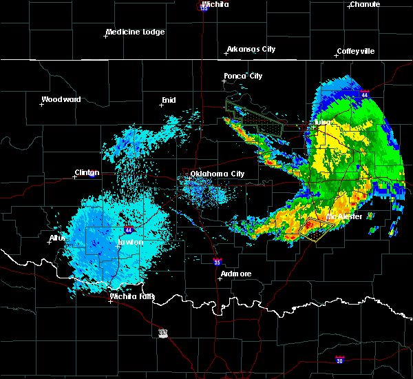 At 1124 am cdt, a severe thunderstorm was located near haywood, moving southeast at 20 mph (radar indicated). Hazards include 60 mph wind gusts and half dollar size hail. Hail damage to vehicles is expected. Expect wind damage to roofs, siding and trees. At 1124 am cdt, a severe thunderstorm was located near haywood, moving southeast at 20 mph (radar indicated). Hazards include 60 mph wind gusts and half dollar size hail. Hail damage to vehicles is expected. Expect wind damage to roofs, siding and trees.
|
| 7/3/2015 7:46 PM CDT |
 At 745 pm cdt, a severe thunderstorm was located 5 miles southeast of kiowa, moving southeast at 25 mph (radar indicated). Hazards include 60 mph wind gusts. Expect damage to roofs. Siding and trees. At 745 pm cdt, a severe thunderstorm was located 5 miles southeast of kiowa, moving southeast at 25 mph (radar indicated). Hazards include 60 mph wind gusts. Expect damage to roofs. Siding and trees.
|
| 6/29/2015 9:12 PM CDT |
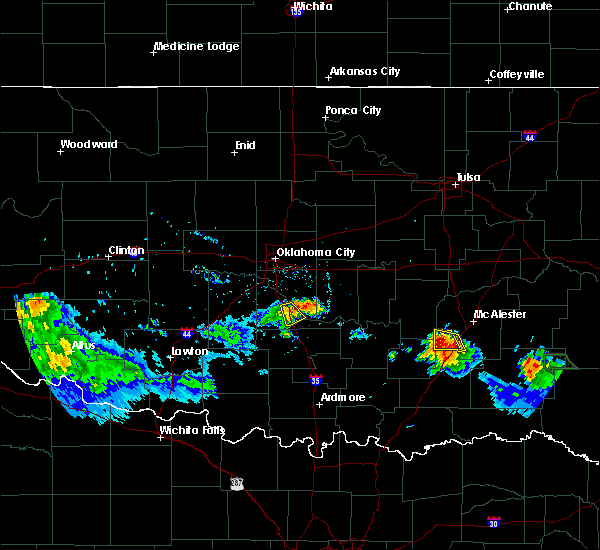 At 912 pm cdt, a severe thunderstorm was located 3 miles southwest of ashland, moving west at 5 to 10 mph (radar indicated). Hazards include ping pong ball size hail and 60 mph wind gusts. People and animals outdoors will be injured. expect hail damage to roofs, siding, windows and vehicles. Expect wind damage to roofs, siding and trees. At 912 pm cdt, a severe thunderstorm was located 3 miles southwest of ashland, moving west at 5 to 10 mph (radar indicated). Hazards include ping pong ball size hail and 60 mph wind gusts. People and animals outdoors will be injured. expect hail damage to roofs, siding, windows and vehicles. Expect wind damage to roofs, siding and trees.
|
| 6/29/2015 8:45 PM CDT | Ping Pong Ball sized hail reported 0.3 miles NW of Kiowa, OK, quarter to ping pong size hail falling at kiowa fire dept. |
| 6/29/2015 8:45 PM CDT |
 At 845 pm cdt, a severe thunderstorm was located 4 miles west of kiowa, moving west at 10 mph (radar indicated). Hazards include 60 mph wind gusts and half dollar size hail. Hail damage to vehicles is expected. Expect wind damage to roofs, siding and trees. At 845 pm cdt, a severe thunderstorm was located 4 miles west of kiowa, moving west at 10 mph (radar indicated). Hazards include 60 mph wind gusts and half dollar size hail. Hail damage to vehicles is expected. Expect wind damage to roofs, siding and trees.
|
| 6/29/2015 8:31 PM CDT |
 At 830 pm cdt, a severe thunderstorm was located near kiowa, moving west at 10 mph (public). Hazards include golf ball size hail and 60 mph wind gusts. People and animals outdoors will be injured. expect hail damage to roofs, siding, windows and vehicles. expect wind damage to roofs, siding and trees. locations impacted include, kiowa, ashland and pittsburg. Golfball hail was reported in kiowa at 830 pm. At 830 pm cdt, a severe thunderstorm was located near kiowa, moving west at 10 mph (public). Hazards include golf ball size hail and 60 mph wind gusts. People and animals outdoors will be injured. expect hail damage to roofs, siding, windows and vehicles. expect wind damage to roofs, siding and trees. locations impacted include, kiowa, ashland and pittsburg. Golfball hail was reported in kiowa at 830 pm.
|
| 6/29/2015 8:30 PM CDT | Tennis Ball sized hail reported 0.3 miles NW of Kiowa, OK, 2.5 inch hail fell at the kiowa fire dept. |
| 6/29/2015 8:29 PM CDT | Golf Ball sized hail reported 0.3 miles NW of Kiowa, OK |
| 6/29/2015 8:07 PM CDT |
 At 806 pm cdt, a severe thunderstorm was located over kiowa, moving west at 15 mph (radar indicated). Hazards include ping pong ball size hail and 60 mph wind gusts. People and animals outdoors will be injured. expect hail damage to roofs, siding, windows and vehicles. Expect wind damage to roofs, siding and trees. At 806 pm cdt, a severe thunderstorm was located over kiowa, moving west at 15 mph (radar indicated). Hazards include ping pong ball size hail and 60 mph wind gusts. People and animals outdoors will be injured. expect hail damage to roofs, siding, windows and vehicles. Expect wind damage to roofs, siding and trees.
|
| 6/29/2015 7:56 PM CDT |
 At 756 pm cdt, a severe thunderstorm was located 3 miles east of kiowa, moving west at 10 mph (radar indicated). Hazards include 60 mph wind gusts and nickel size hail. Expect damage to roofs. siding and trees. Locations impacted include, kiowa, blanco and pittsburg. At 756 pm cdt, a severe thunderstorm was located 3 miles east of kiowa, moving west at 10 mph (radar indicated). Hazards include 60 mph wind gusts and nickel size hail. Expect damage to roofs. siding and trees. Locations impacted include, kiowa, blanco and pittsburg.
|
| 6/29/2015 7:43 PM CDT |
 At 743 pm cdt, a severe thunderstorm was located 3 miles southwest of blanco, moving west at 15 mph (radar indicated). Hazards include 60 mph wind gusts and nickel size hail. Expect damage to roofs. Siding and trees. At 743 pm cdt, a severe thunderstorm was located 3 miles southwest of blanco, moving west at 15 mph (radar indicated). Hazards include 60 mph wind gusts and nickel size hail. Expect damage to roofs. Siding and trees.
|
| 5/25/2015 4:55 PM CDT | The tornado warning for south central pittsburg county will expire at 500 pm cdt, the tornado threat has diminished, therefore the tornado warning will be allowed to expire. however, a severe thunderstorm warning remains in effect for the area. heavy rain is still possible with this thunderstorm. tornado watch remains in effect until 10 pm cdt. to report severe weather, contact your nearest law enforcement agency. they will relay your report to the national weather service in tulsa. |
| 5/25/2015 4:36 PM CDT | At 433 pm cdt, a severe thunderstorm capable of producing a tornado was located near kiowa, and moving northeast at 25 mph (radar indicated rotation). Hazards include tornado. Flying debris will be dangerous to those caught without shelter. mobile homes will be damaged or destroyed. damage to roofs, windows and vehicles will occur. tree damage is likely. Locations in or near the path include, kiowa, pittsburg, blanco and savanna. |
| 5/25/2015 4:18 PM CDT | At 414 pm cdt, a severe thunderstorm with strong low level rotation that could produce a tornado at any time was located 9 miles southeast of wardville, and moving northeast at 25 mph (radar indicated rotation). Hazards include tornado. Flying debris will be dangerous to those caught without shelter. mobile homes will be damaged or destroyed. damage to roofs, windows and vehicles will occur. tree damage is likely. Locations in or near the path include, kiowa, pittsburg, blanco and savanna. |
| 5/17/2015 1:11 AM CDT | The severe thunderstorm warning for pittsburg county expires at 115 am cdt, the thunderstorm has moved out of the warned area and weakened below severe limits, therefore the severe thunderstorm warning will be allowed to expire. gusty winds and heavy rain will still be possible with this storm. a tornado watch remains in effect until 3 am. |
| 5/17/2015 12:56 AM CDT | At 1254 am cdt, severe thunderstorms were located along a line extending from eufaula to kiowa, and moving east at 35 mph (radar indicated). Hazards include 60 mph wind gusts and penny size hail. Expect damage to roofs. siding and trees. Locations in or near the path include, kiowa, mcalester, savanna, pittsburg, mcalester regional airport, krebs, blanco, alderson and bache , possible. |
| 5/17/2015 12:09 AM CDT | At 1206 am cdt, severe thunderstorms were located along a line extending from 6 miles north of scipio to centrahoma, and moving east at 35 mph (radar indicated). Hazards include 60 mph wind gusts and quarter size hail. Hail damage to vehicles is expected. expect wind damage to roofs, siding and trees. locations in or near the path include, scipio, arpelar, ashland, indianola, haywood, canadian, crowder, kiowa, arrowhead state park, savanna, mcalester, pittsburg, mcalester regional airport, krebs, blanco, alderson and bache. Possible. |
| 5/10/2015 9:03 AM CDT | At 901 am cdt, severe thunderstorms were located along a line extending from raiford to 8 miles northeast of daisy, and moving northeast at 55 mph (radar indicated). Hazards include 60 mph wind gusts and penny size hail. Expect damage to roofs. siding and trees. locations in or near the path include, alderson, vivian, bache, crowder, dow, haileyville, canadian, hartshorne, stidham, arrowhead state park, pierce, blocker, lake eufaula state park, eufaula, gowen, higgins, featherston, yanush, onapa, checotah and damon this includes interstate 40 between mile markers 256 and 264. 0. 75in. |
| 5/10/2015 8:37 AM CDT | At 834 am cdt, severe thunderstorms were located along a line extending from lamar to 9 miles east of stringtown, and moving northeast at 55 mph (radar indicated). Hazards include 60 mph wind gusts and nickel size hail. Expect damage to roofs. siding and trees. locations in or near the path include, kiowa, haywood, arpelar, pittsburg, scipio, savanna, blanco, vernon, mcalester regional airport, mcalester, hanna, krebs, alderson, bache, indianola, raiford, haileyville, dow, hartshorne, crowder, canadian, vivian, pierce, arrowhead state park, stidham, gowen, blocker, yanush, higgins, featherston, eufaula, lake eufaula state park, onapa and checotah. this includes interstate 40 between mile markers 255 and 264. 0. 88in. |
| 5/8/2015 9:34 PM CDT | At 933 pm cdt, severe thunderstorms were located along a line extending from hanna to haywood to wardville, and moving east at 45 mph (radar indicated). Hazards include 70 mph wind gusts. Expect considerable tree damage. damage is likely to mobile homes, roofs and outbuildings. Locations in or near the path include, hanna, savanna, raiford, kiowa, indianola, mcalester, pittsburg, mcalester regional airport, krebs, blanco, alderson, crowder, canadian, bache, arrowhead state park, dow, eufaula, haileyville, hartshorne and blocker , possible. |
| 5/8/2015 9:10 PM CDT | At 907 pm cdt, severe thunderstorms were located along a line extending from wetumka to calvin to centrahoma, and moving east at 45 mph (radar indicated). Hazards include 70 mph wind gusts and nickel size hail. Expect considerable tree damage. damage is likely to mobile homes, roofs and outbuildings. locations in or near the path include, ashland, arpelar, scipio, haywood, vernon, hanna, kiowa, savanna, indianola, raiford, mcalester, mcalester regional airport, pittsburg, krebs, blanco, alderson, crowder, canadian, bache, arrowhead state park, eufaula, haileyville, hartshorne, blocker and dow. Possible. |
| 4/19/2015 4:57 PM CDT | At 455 pm cdt, a severe thunderstorm was located near kiowa, and moving east at 40 mph (radar indicated). Hazards include 60 mph wind gusts and half dollar size hail. Hail damage to vehicles is expected. expect wind damage to roofs, siding and trees. locations in or near the path include, blanco , 1. 25in. |
| 4/19/2015 4:41 PM CDT | At 440 pm cdt, a severe thunderstorm was located near ashland, and moving east at 40 mph (radar indicated). Hazards include 60 mph wind gusts and quarter size hail. Hail damage to vehicles is expected. expect wind damage to roofs, siding and trees. locations in or near the path include, kiowa, pittsburg and blanco. 1. 00in. |
| 10/13/2012 8:31 PM CDT | 4-5 inch diameter limb down in kiowa...time estimated by radar in pittsburg county OK, 0.3 miles NW of Kiowa, OK |
| 8/8/2012 6:36 PM CDT | Small tree limbs blown down and shingles removed from roof in atoka county OK, 8.3 miles NE of Kiowa, OK |
| 1/1/0001 12:00 AM | Quarter sized hail reported 10 miles ESE of Kiowa, OK |
Hail Maps for Kiowa, OK
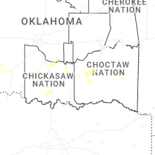


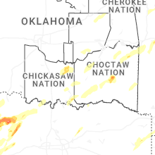
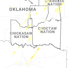
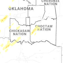


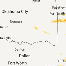


Connect with Interactive Hail Maps