

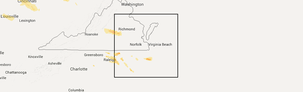
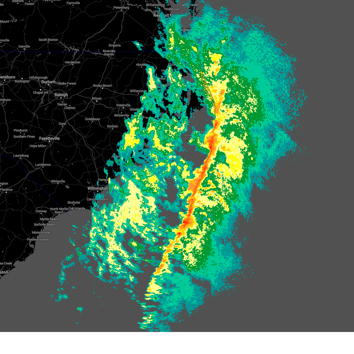
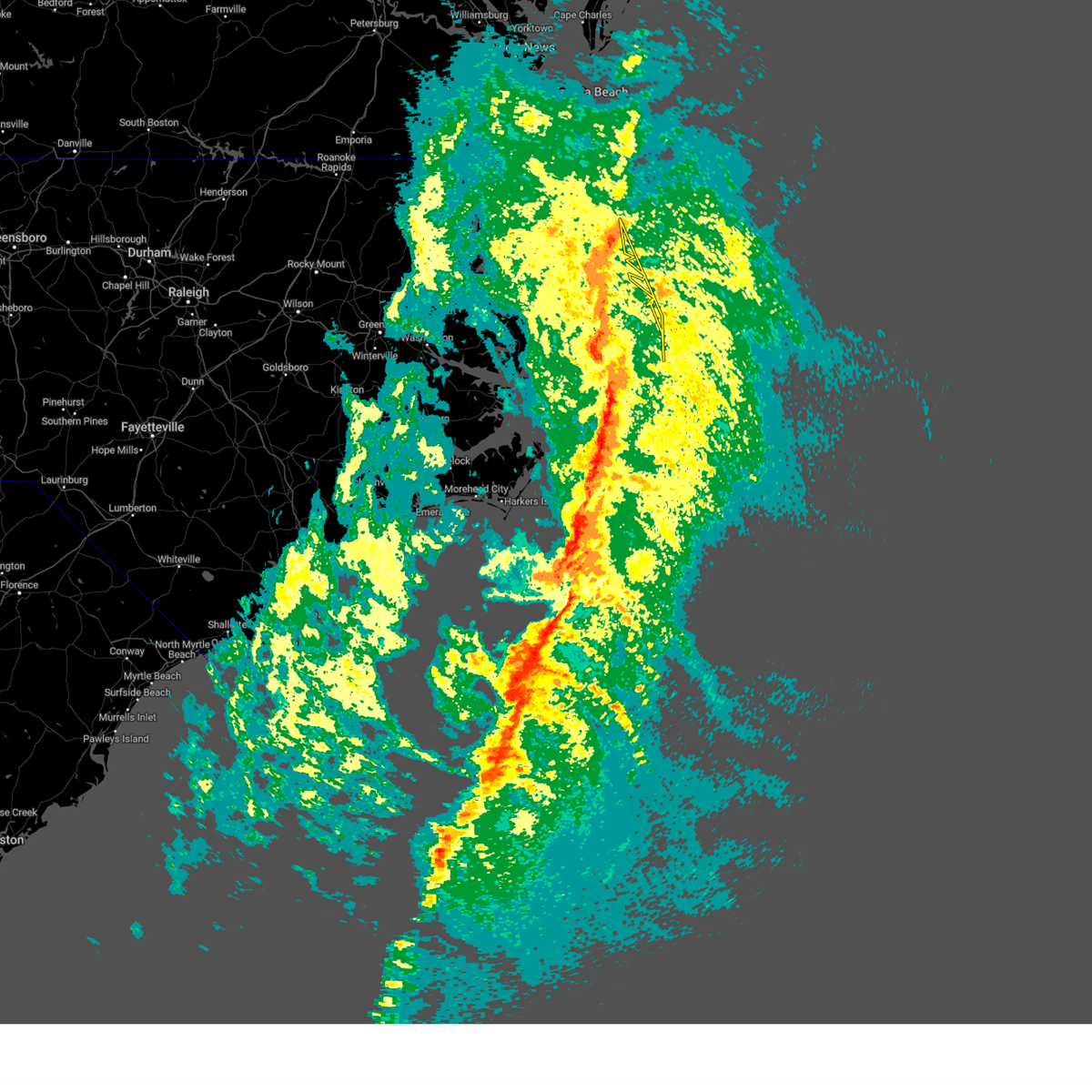
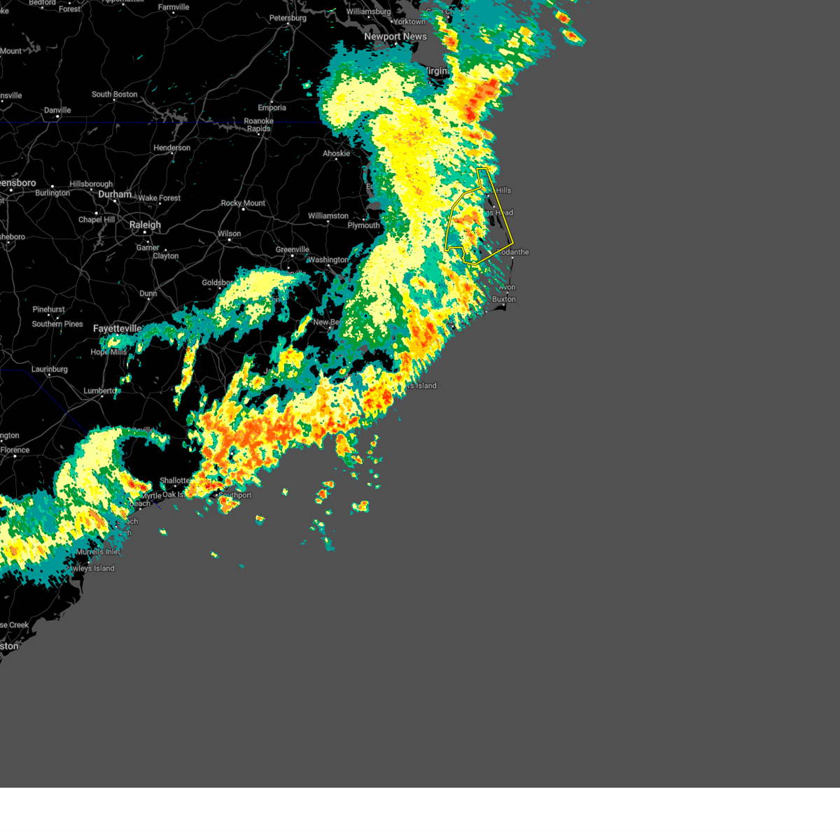
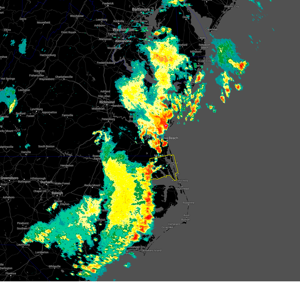
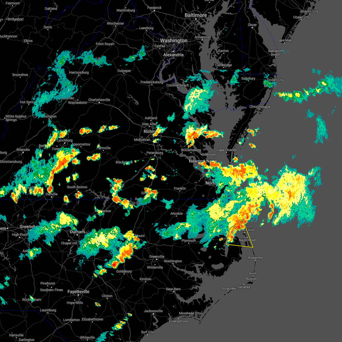
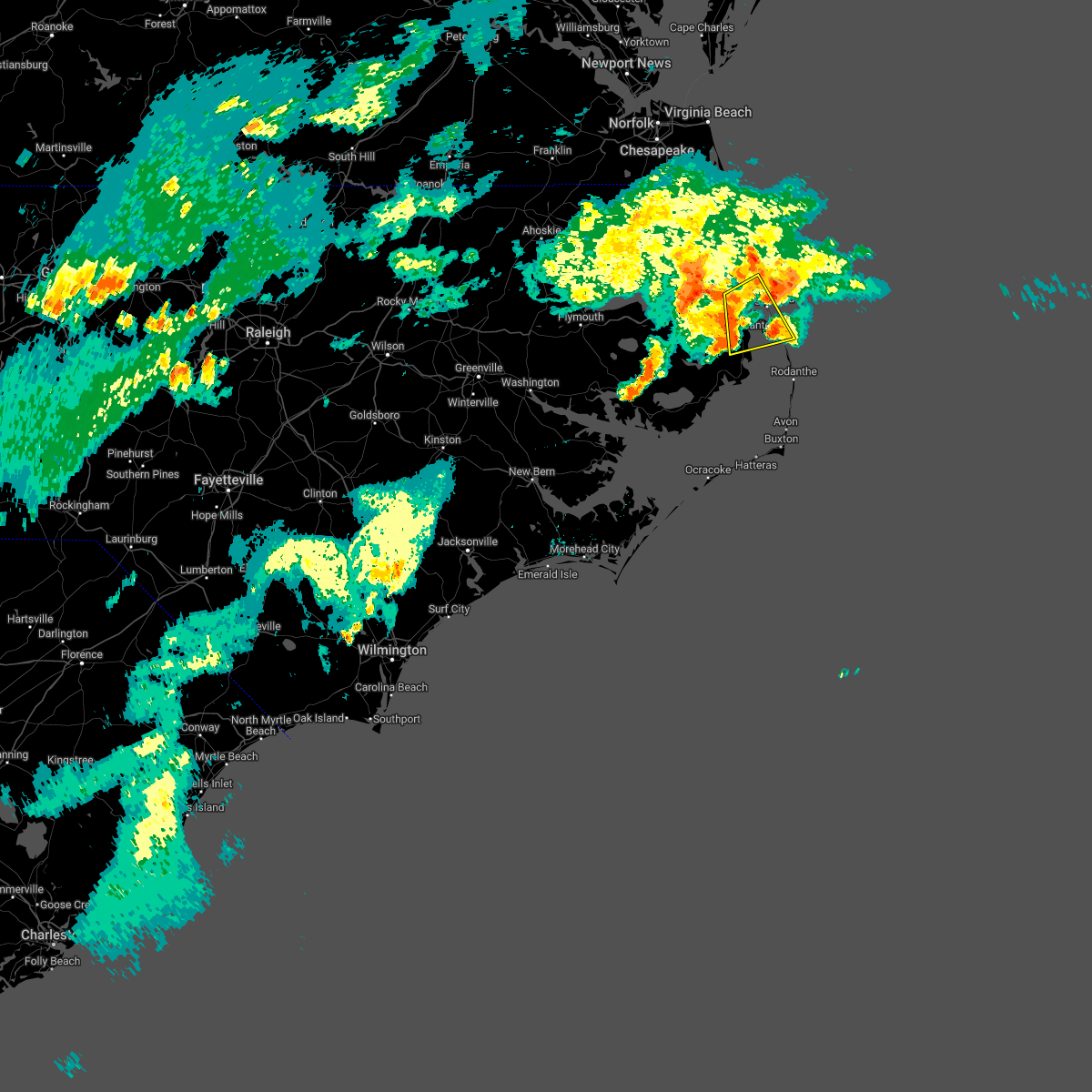
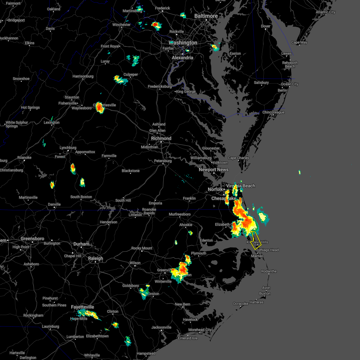
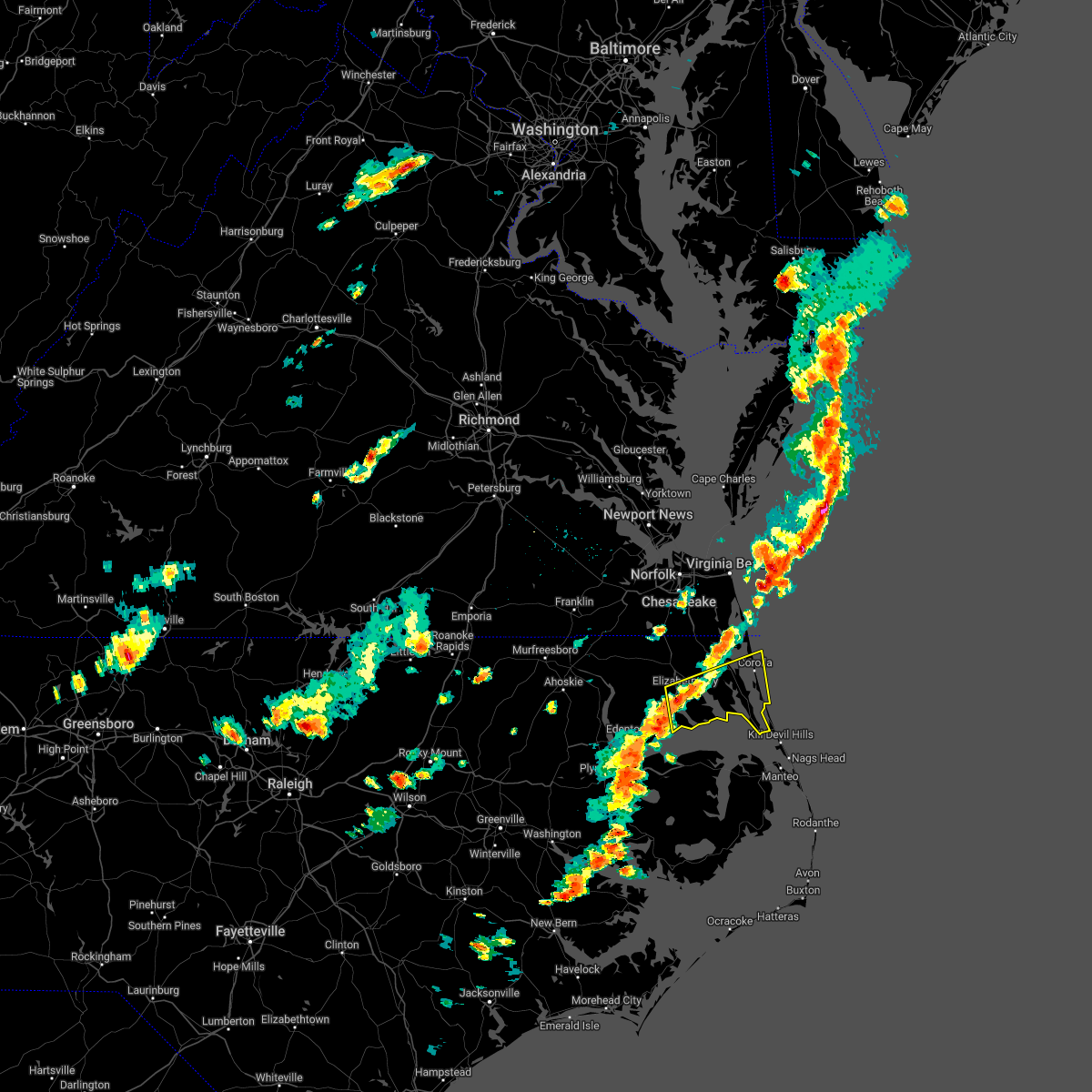
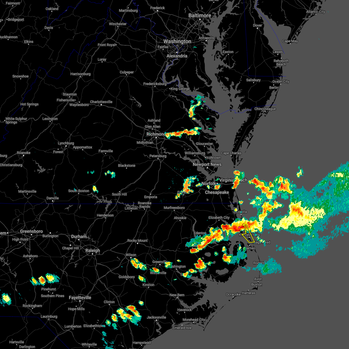
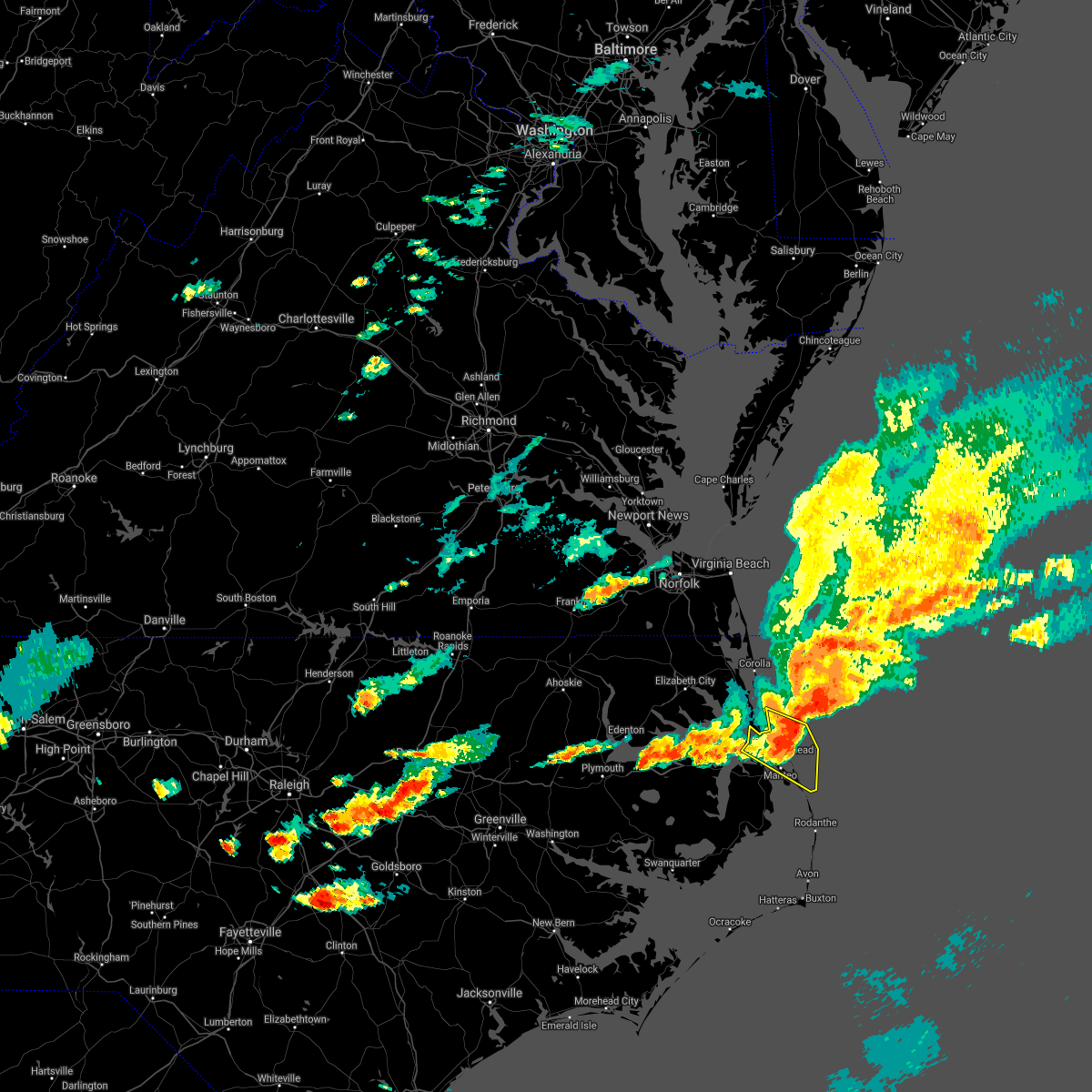
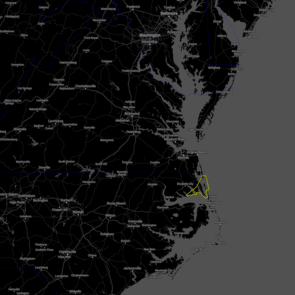
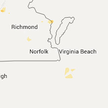
Hail Map for Kitty Hawk, NC
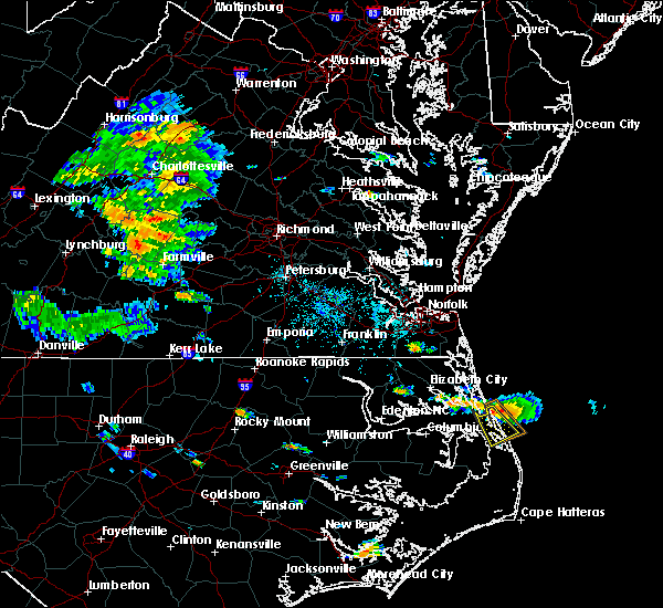
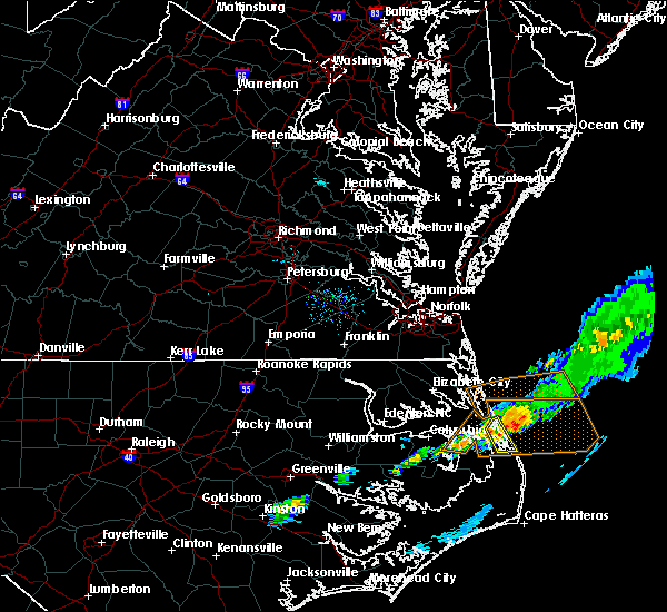
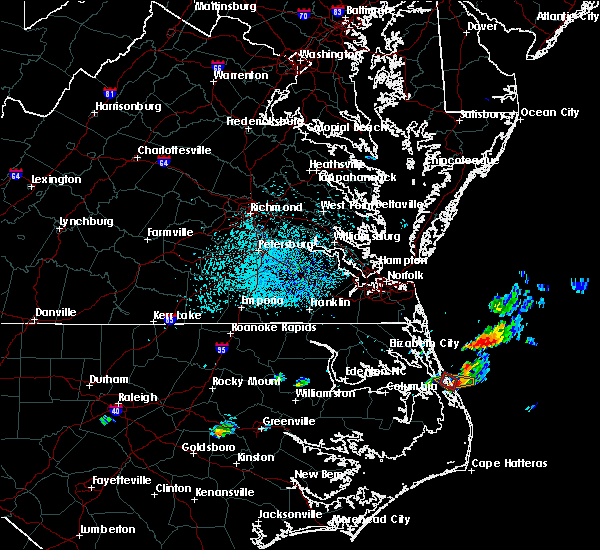
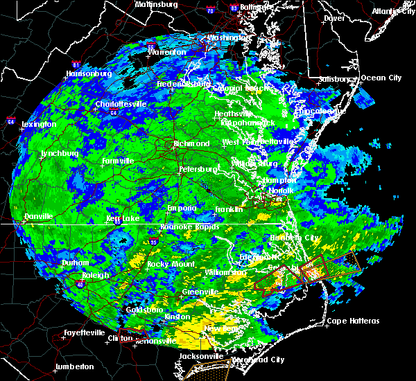
The Kitty Hawk, NC area has had 0 reports of on-the-ground hail by trained spotters, and has been under severe weather warnings 3 times during the past 12 months. Doppler radar has detected hail at or near Kitty Hawk, NC on 22 occasions.
| Name: | Kitty Hawk, NC |
| Where Located: | 51.4 miles SSE of Virginia Beach, VA |
| Map: | Google Map for Kitty Hawk, NC |
| Population: | 3272 |
| Housing Units: | 3196 |
| More Info: | Search Google for Kitty Hawk, NC |
5
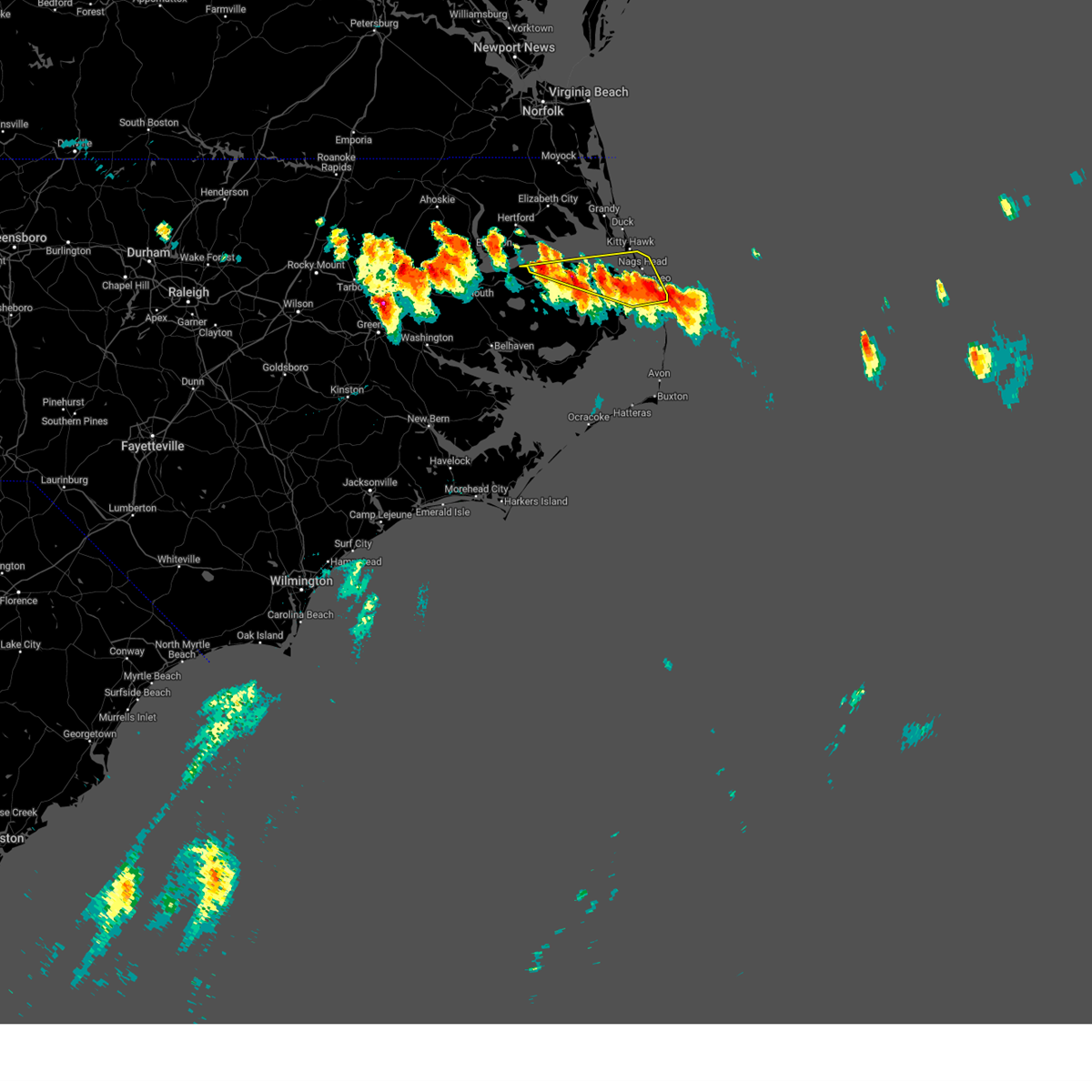
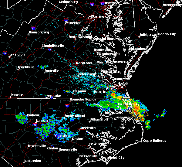
The Top Recent Hail Date for Kitty Hawk, NC is Wednesday, June 22, 2016 (2nd out of 22)
Hail and Wind Damage Spotted near Kitty Hawk, NC
| Date / Time | Report Details |
|---|---|
| 5/16/2025 7:29 PM EDT | Svrakq the national weather service in wakefield has issued a * severe thunderstorm warning for, camden county in northeastern north carolina, pasquotank county in northeastern north carolina, perquimans county in northeastern north carolina, northeastern bertie county in northeastern north carolina, southeastern hertford county in northeastern north carolina, eastern gates county in northeastern north carolina, northwestern chowan county in northeastern north carolina, currituck county in northeastern north carolina, * until 830 pm edt. * at 728 pm edt, severe thunderstorms were located along a line extending from 6 miles east of corapeake to near hobbsville to near colerain, moving east at 65 mph (radar indicated). Hazards include 60 mph wind gusts and penny size hail. Expect damage to trees and powerlines. severe thunderstorms will be near, south mills, ryland, morgans corner, tyner, and belvidere around 735 pm edt. elizabeth city, hertford, winfall, moyock, and chapanoke around 740 pm edt. currituck, camden, and elizabeth city state university around 745 pm edt. weeksville, whitehall shores, indiantown, nixonton, and shiloh around 750 pm edt. knotts island and old trap around 755 pm edt. corolla around 800 pm edt. grandy around 805 pm edt. Other locations impacted by these severe thunderstorms include goose pond, poplar branch, pierceville, spot, newsome store, arrowhead beach, parkville, yeopim station, jacocks, and beach springs. |
| 5/15/2025 6:21 PM EDT |
 At 621 pm edt, severe thunderstorms were located along a line extending from near columbia to near bodie island lighthouse, moving east at 20 mph (radar indicated). Hazards include 60 mph wind gusts and half dollar size hail. Hail damage to vehicles is expected. expect wind damage to roofs, siding, and trees. Locations impacted include, kill devil hills, manns harbor, nags head, alligator, mashoes, manteo, columbia, east lake, colington, whalebone, newfoundland, buffalo city, jockeys ridge state park, roanoke island festival park, wright brothers national monument, nags head fishing pier, avalon pier, wanchese, bodie island lighthouse, and outer banks fishing pier. At 621 pm edt, severe thunderstorms were located along a line extending from near columbia to near bodie island lighthouse, moving east at 20 mph (radar indicated). Hazards include 60 mph wind gusts and half dollar size hail. Hail damage to vehicles is expected. expect wind damage to roofs, siding, and trees. Locations impacted include, kill devil hills, manns harbor, nags head, alligator, mashoes, manteo, columbia, east lake, colington, whalebone, newfoundland, buffalo city, jockeys ridge state park, roanoke island festival park, wright brothers national monument, nags head fishing pier, avalon pier, wanchese, bodie island lighthouse, and outer banks fishing pier.
|
| 5/15/2025 6:09 PM EDT | Svrmhx the national weather service in newport has issued a * severe thunderstorm warning for, northern dare county in eastern north carolina, northern tyrrell county in eastern north carolina, * until 700 pm edt. * at 609 pm edt, severe thunderstorms were located along a line extending from near columbia to bodie island lighthouse, moving east at 25 mph (radar indicated). Hazards include 60 mph wind gusts and quarter size hail. Hail damage to vehicles is expected. Expect wind damage to roofs, siding, and trees. |
| 5/27/2024 7:28 PM EDT |
 The storms which prompted the warning have moved out of the area. therefore, the warning will be allowed to expire. a tornado watch remains in effect until 1100 pm edt for eastern north carolina. The storms which prompted the warning have moved out of the area. therefore, the warning will be allowed to expire. a tornado watch remains in effect until 1100 pm edt for eastern north carolina.
|
| 5/27/2024 7:11 PM EDT |
 At 711 pm edt, severe thunderstorms were located along a line extending from duck coe pier to near manns harbor, moving east at 50 mph (radar indicated). Hazards include 70 mph wind gusts and quarter size hail. Hail damage to vehicles is expected. expect considerable tree damage. wind damage is also likely to mobile homes, roofs, and outbuildings. Locations impacted include, kill devil hills, southern shores, nags head, manteo, colington, whalebone, duck coe pier, roanoke island festival park, jockeys ridge state park, wright brothers national monument, nags head fishing pier, avalon pier, wanchese, bodie island lighthouse, and outer banks fishing pier. At 711 pm edt, severe thunderstorms were located along a line extending from duck coe pier to near manns harbor, moving east at 50 mph (radar indicated). Hazards include 70 mph wind gusts and quarter size hail. Hail damage to vehicles is expected. expect considerable tree damage. wind damage is also likely to mobile homes, roofs, and outbuildings. Locations impacted include, kill devil hills, southern shores, nags head, manteo, colington, whalebone, duck coe pier, roanoke island festival park, jockeys ridge state park, wright brothers national monument, nags head fishing pier, avalon pier, wanchese, bodie island lighthouse, and outer banks fishing pier.
|
| 5/27/2024 7:11 PM EDT |
 the severe thunderstorm warning has been cancelled and is no longer in effect the severe thunderstorm warning has been cancelled and is no longer in effect
|
| 5/27/2024 6:38 PM EDT |
 Svrmhx the national weather service in newport has issued a * severe thunderstorm warning for, dare county in eastern north carolina, central tyrrell county in eastern north carolina, * until 730 pm edt. * at 637 pm edt, severe thunderstorms were located along a line extending from 7 miles south of weeksville to 7 miles west of frying pan landing, moving east at 40 mph (radar indicated). Hazards include 70 mph wind gusts and quarter size hail. Hail damage to vehicles is expected. expect considerable tree damage. Wind damage is also likely to mobile homes, roofs, and outbuildings. Svrmhx the national weather service in newport has issued a * severe thunderstorm warning for, dare county in eastern north carolina, central tyrrell county in eastern north carolina, * until 730 pm edt. * at 637 pm edt, severe thunderstorms were located along a line extending from 7 miles south of weeksville to 7 miles west of frying pan landing, moving east at 40 mph (radar indicated). Hazards include 70 mph wind gusts and quarter size hail. Hail damage to vehicles is expected. expect considerable tree damage. Wind damage is also likely to mobile homes, roofs, and outbuildings.
|
| 1/9/2024 10:36 PM EST |
 The severe thunderstorm warning for northeastern dare county will expire at 1045 pm est, the storms which prompted the warning have moved out of the area. therefore, the warning will be allowed to expire. however, gusty winds are still possible with these thunderstorms. a tornado watch remains in effect until 1100 pm est for eastern north carolina. to report severe weather, contact your nearest law enforcement agency. they will relay your report to the national weather service newport. The severe thunderstorm warning for northeastern dare county will expire at 1045 pm est, the storms which prompted the warning have moved out of the area. therefore, the warning will be allowed to expire. however, gusty winds are still possible with these thunderstorms. a tornado watch remains in effect until 1100 pm est for eastern north carolina. to report severe weather, contact your nearest law enforcement agency. they will relay your report to the national weather service newport.
|
| 1/9/2024 10:04 PM EST |
 At 957 pm est, severe thunderstorms were located along a line extending from 7 miles south of old trap to 12 miles northwest of avon, moving east at 55 mph (radar indicated). Hazards include 70 mph wind gusts. Expect considerable tree damage. Damage is likely to mobile homes, roofs, and outbuildings. At 957 pm est, severe thunderstorms were located along a line extending from 7 miles south of old trap to 12 miles northwest of avon, moving east at 55 mph (radar indicated). Hazards include 70 mph wind gusts. Expect considerable tree damage. Damage is likely to mobile homes, roofs, and outbuildings.
|
| 6/27/2023 6:22 PM EDT |
 At 621 pm edt, severe thunderstorms were located along a line extending from near manteo to near ponzer, moving southeast at 15 mph (radar indicated). Hazards include 60 mph wind gusts and half dollar size hail. Hail damage to vehicles is expected. Expect wind damage to roofs, siding, and trees. At 621 pm edt, severe thunderstorms were located along a line extending from near manteo to near ponzer, moving southeast at 15 mph (radar indicated). Hazards include 60 mph wind gusts and half dollar size hail. Hail damage to vehicles is expected. Expect wind damage to roofs, siding, and trees.
|
| 6/27/2023 6:09 PM EDT |
 At 608 pm edt, severe thunderstorms were located along a line extending from mashoes to near frying pan landing, moving southeast at 15 mph (radar indicated). Hazards include ping pong ball size hail and 60 mph wind gusts. People and animals outdoors will be injured. expect hail damage to roofs, siding, windows, and vehicles. expect wind damage to roofs, siding, and trees. locations impacted include, kill devil hills, manns harbor, nags head, alligator, mashoes, manteo, east lake, colington, whalebone, newfoundland, buffalo city, roanoke island festival park, jockeys ridge state park, wright brothers national monument, nags head fishing pier, avalon pier, wanchese and outer banks fishing pier. hail threat, radar indicated max hail size, 1. 50 in wind threat, radar indicated max wind gust, 60 mph. At 608 pm edt, severe thunderstorms were located along a line extending from mashoes to near frying pan landing, moving southeast at 15 mph (radar indicated). Hazards include ping pong ball size hail and 60 mph wind gusts. People and animals outdoors will be injured. expect hail damage to roofs, siding, windows, and vehicles. expect wind damage to roofs, siding, and trees. locations impacted include, kill devil hills, manns harbor, nags head, alligator, mashoes, manteo, east lake, colington, whalebone, newfoundland, buffalo city, roanoke island festival park, jockeys ridge state park, wright brothers national monument, nags head fishing pier, avalon pier, wanchese and outer banks fishing pier. hail threat, radar indicated max hail size, 1. 50 in wind threat, radar indicated max wind gust, 60 mph.
|
| 6/27/2023 5:48 PM EDT |
 At 547 pm edt, a cluster of severe thunderstorms were located near newfoundland, or 15 miles south of weeksville, moving east at 25 mph (radar indicated). Hazards include 60 mph wind gusts and quarter size hail. Hail damage to vehicles is expected. Expect wind damage to roofs, siding, and trees. At 547 pm edt, a cluster of severe thunderstorms were located near newfoundland, or 15 miles south of weeksville, moving east at 25 mph (radar indicated). Hazards include 60 mph wind gusts and quarter size hail. Hail damage to vehicles is expected. Expect wind damage to roofs, siding, and trees.
|
| 6/27/2023 2:52 AM EDT |
 At 252 am edt, severe thunderstorms were located along a line extending from near corolla to stumpy point, moving northeast at 55 mph (radar indicated). Hazards include 70 mph wind gusts and penny size hail. Expect considerable tree damage. damage is likely to mobile homes, roofs, and outbuildings. locations impacted include, kill devil hills, stumpy point, southern shores, manns harbor, nags head, mashoes, manteo, east lake, sanderling, colington, whalebone, buffalo city, duck coe pier, roanoke island festival park, jockeys ridge state park, wright brothers national monument, nags head fishing pier, avalon pier, wanchese and bodie island lighthouse. thunderstorm damage threat, considerable hail threat, observed max hail size, 0. 75 in wind threat, observed max wind gust, 70 mph. At 252 am edt, severe thunderstorms were located along a line extending from near corolla to stumpy point, moving northeast at 55 mph (radar indicated). Hazards include 70 mph wind gusts and penny size hail. Expect considerable tree damage. damage is likely to mobile homes, roofs, and outbuildings. locations impacted include, kill devil hills, stumpy point, southern shores, manns harbor, nags head, mashoes, manteo, east lake, sanderling, colington, whalebone, buffalo city, duck coe pier, roanoke island festival park, jockeys ridge state park, wright brothers national monument, nags head fishing pier, avalon pier, wanchese and bodie island lighthouse. thunderstorm damage threat, considerable hail threat, observed max hail size, 0. 75 in wind threat, observed max wind gust, 70 mph.
|
| 6/27/2023 2:16 AM EDT |
 At 215 am edt, severe thunderstorms were located along a line extending from 8 miles south of nixonton to new holland, moving northeast at 55 mph (radar indicated). Hazards include 70 mph wind gusts and quarter size hail. Hail damage to vehicles is expected. expect considerable tree damage. wind damage is also likely to mobile homes, roofs, and outbuildings. locations impacted include, kill devil hills, stumpy point, southern shores, killkenny, manns harbor, swindell fork, gull rock, nags head, alligator, gum neck, kilkenny, fairfield, mashoes, manteo, new holland, columbia, east lake, woodley, sanderling and colington. thunderstorm damage threat, considerable hail threat, observed max hail size, 1. 00 in wind threat, observed max wind gust, 70 mph. At 215 am edt, severe thunderstorms were located along a line extending from 8 miles south of nixonton to new holland, moving northeast at 55 mph (radar indicated). Hazards include 70 mph wind gusts and quarter size hail. Hail damage to vehicles is expected. expect considerable tree damage. wind damage is also likely to mobile homes, roofs, and outbuildings. locations impacted include, kill devil hills, stumpy point, southern shores, killkenny, manns harbor, swindell fork, gull rock, nags head, alligator, gum neck, kilkenny, fairfield, mashoes, manteo, new holland, columbia, east lake, woodley, sanderling and colington. thunderstorm damage threat, considerable hail threat, observed max hail size, 1. 00 in wind threat, observed max wind gust, 70 mph.
|
| 6/27/2023 1:58 AM EDT |
 At 157 am edt, severe thunderstorms were located along a line extending from near morgans corner to 6 miles east of snug harbor, moving east at 30 mph (radar indicated). Hazards include 60 mph wind gusts and quarter size hail. Minor damage to vehicles is possible. expect wind damage to trees and powerlines. severe thunderstorms will be near, elizabeth city and elizabeth city state university around 205 am edt. camden around 210 am edt. whitehall shores around 215 am edt. weeksville, indiantown and moyock around 220 am edt. currituck and old trap around 235 am edt. knotts island around 245 am edt. grandy, corolla and point harbor around 250 am edt. other locations impacted by these severe thunderstorms include bob white fork, holiday island, horseshoe, poplar branch, pierceville, spot, tar corner, glen cove, gregory and sharon. hail threat, radar indicated max hail size, 1. 00 in wind threat, radar indicated max wind gust, 60 mph. At 157 am edt, severe thunderstorms were located along a line extending from near morgans corner to 6 miles east of snug harbor, moving east at 30 mph (radar indicated). Hazards include 60 mph wind gusts and quarter size hail. Minor damage to vehicles is possible. expect wind damage to trees and powerlines. severe thunderstorms will be near, elizabeth city and elizabeth city state university around 205 am edt. camden around 210 am edt. whitehall shores around 215 am edt. weeksville, indiantown and moyock around 220 am edt. currituck and old trap around 235 am edt. knotts island around 245 am edt. grandy, corolla and point harbor around 250 am edt. other locations impacted by these severe thunderstorms include bob white fork, holiday island, horseshoe, poplar branch, pierceville, spot, tar corner, glen cove, gregory and sharon. hail threat, radar indicated max hail size, 1. 00 in wind threat, radar indicated max wind gust, 60 mph.
|
| 6/27/2023 1:57 AM EDT |
 At 157 am edt, severe thunderstorms were located along a line extending from near scuppernong to 6 miles southwest of swan quarter ferry terminal, moving northeast at 55 mph (radar indicated). Hazards include 70 mph wind gusts and quarter size hail. Hail damage to vehicles is expected. expect considerable tree damage. Wind damage is also likely to mobile homes, roofs, and outbuildings. At 157 am edt, severe thunderstorms were located along a line extending from near scuppernong to 6 miles southwest of swan quarter ferry terminal, moving northeast at 55 mph (radar indicated). Hazards include 70 mph wind gusts and quarter size hail. Hail damage to vehicles is expected. expect considerable tree damage. Wind damage is also likely to mobile homes, roofs, and outbuildings.
|
| 7/26/2022 4:45 PM EDT |
 At 443 pm edt, severe thunderstorms were located along a line extending from 16 miles northeast of duck coe pier to near mashoes, moving east at 30 mph (radar indicated. at 4:18 pm, a 64 mph gust was measured at duck pier). Hazards include 60 mph wind gusts. Expect damage to roofs, siding, and trees. locations impacted include, kill devil hills, southern shores, manns harbor, nags head, mashoes, manteo, east lake, colington, whalebone, duck coe pier, roanoke island festival park, jockeys ridge state park, wright brothers national monument, nags head fishing pier, avalon pier, wanchese, bodie island lighthouse and outer banks fishing pier. hail threat, radar indicated max hail size, <. 75 in wind threat, observed max wind gust, 60 mph. At 443 pm edt, severe thunderstorms were located along a line extending from 16 miles northeast of duck coe pier to near mashoes, moving east at 30 mph (radar indicated. at 4:18 pm, a 64 mph gust was measured at duck pier). Hazards include 60 mph wind gusts. Expect damage to roofs, siding, and trees. locations impacted include, kill devil hills, southern shores, manns harbor, nags head, mashoes, manteo, east lake, colington, whalebone, duck coe pier, roanoke island festival park, jockeys ridge state park, wright brothers national monument, nags head fishing pier, avalon pier, wanchese, bodie island lighthouse and outer banks fishing pier. hail threat, radar indicated max hail size, <. 75 in wind threat, observed max wind gust, 60 mph.
|
| 7/26/2022 4:23 PM EDT |
 At 423 pm edt, severe thunderstorms were located along a line extending from 7 miles northeast of duck coe pier to east lake, moving east at 30 mph (radar indicated). Hazards include 60 mph wind gusts. expect damage to roofs, siding, and trees At 423 pm edt, severe thunderstorms were located along a line extending from 7 miles northeast of duck coe pier to east lake, moving east at 30 mph (radar indicated). Hazards include 60 mph wind gusts. expect damage to roofs, siding, and trees
|
| 7/26/2022 4:18 PM EDT | Peak wind gust measured at the duck pie in dare county NC, 7.7 miles S of Kitty Hawk, NC |
| 7/13/2022 6:29 PM EDT |
 At 629 pm edt, severe thunderstorms were located along a line extending from near mashoes to 6 miles northwest of stumpy point, moving northeast at 55 mph (radar indicated). Hazards include 60 mph wind gusts and quarter size hail. Hail damage to vehicles is expected. Expect wind damage to roofs, siding, and trees. At 629 pm edt, severe thunderstorms were located along a line extending from near mashoes to 6 miles northwest of stumpy point, moving northeast at 55 mph (radar indicated). Hazards include 60 mph wind gusts and quarter size hail. Hail damage to vehicles is expected. Expect wind damage to roofs, siding, and trees.
|
| 6/13/2022 6:28 PM EDT |
 At 627 pm edt, a severe thunderstorm was located near grandy, moving southeast at 15 mph (radar indicated). Hazards include 60 mph wind gusts and penny size hail. expect damage to roofs, siding, and trees At 627 pm edt, a severe thunderstorm was located near grandy, moving southeast at 15 mph (radar indicated). Hazards include 60 mph wind gusts and penny size hail. expect damage to roofs, siding, and trees
|
| 5/16/2022 3:22 PM EDT |
 At 322 pm edt, a severe thunderstorm was located over nixonton, or near elizabeth city state university, moving east at 30 mph (radar indicated). Hazards include 60 mph wind gusts and quarter size hail. Minor damage to vehicles is possible. expect wind damage to trees and powerlines. this severe thunderstorm will be near, elizabeth city around 325 pm edt. elizabeth city state university and weeksville around 330 pm edt. camden and whitehall shores around 335 pm edt. shiloh around 340 pm edt. indiantown and old trap around 345 pm edt. grandy and corolla around 400 pm edt. other locations impacted by this severe thunderstorm include bob white fork, poplar branch, spot, glen cove, barco, pasquotank, jacocks, spences corner, goose creek and harvey point. hail threat, radar indicated max hail size, 1. 00 in wind threat, radar indicated max wind gust, 60 mph. At 322 pm edt, a severe thunderstorm was located over nixonton, or near elizabeth city state university, moving east at 30 mph (radar indicated). Hazards include 60 mph wind gusts and quarter size hail. Minor damage to vehicles is possible. expect wind damage to trees and powerlines. this severe thunderstorm will be near, elizabeth city around 325 pm edt. elizabeth city state university and weeksville around 330 pm edt. camden and whitehall shores around 335 pm edt. shiloh around 340 pm edt. indiantown and old trap around 345 pm edt. grandy and corolla around 400 pm edt. other locations impacted by this severe thunderstorm include bob white fork, poplar branch, spot, glen cove, barco, pasquotank, jacocks, spences corner, goose creek and harvey point. hail threat, radar indicated max hail size, 1. 00 in wind threat, radar indicated max wind gust, 60 mph.
|
| 5/4/2022 6:51 PM EDT |
 At 650 pm edt, severe thunderstorms were located along a line extending from duck coe pier to 7 miles southeast of old trap, moving east at 25 mph (radar indicated). Hazards include 60 mph wind gusts and half dollar size hail. Hail damage to vehicles is expected. Expect wind damage to roofs, siding, and trees. At 650 pm edt, severe thunderstorms were located along a line extending from duck coe pier to 7 miles southeast of old trap, moving east at 25 mph (radar indicated). Hazards include 60 mph wind gusts and half dollar size hail. Hail damage to vehicles is expected. Expect wind damage to roofs, siding, and trees.
|
| 3/12/2022 10:24 AM EST |
 At 1023 am est, severe thunderstorms were located along a line extending from near sladesville to near fairfield harbour to near verona, moving east at 20 mph (radar indicated). Hazards include 70 mph wind gusts. Expect considerable tree damage. damage is likely to mobile homes, roofs, and outbuildings. locations impacted include, jacksonville, new bern, havelock, morehead city, north topsail beach, newport, kill devil hills, stumpy point, cedar island, frisco, harkers island, camp lejeune center, piney green, stella, southern shores, swansboro, hubert, south river, cape carteret and north river. thunderstorm damage threat, considerable hail threat, radar indicated max hail size, <. 75 in wind threat, radar indicated max wind gust, 70 mph. At 1023 am est, severe thunderstorms were located along a line extending from near sladesville to near fairfield harbour to near verona, moving east at 20 mph (radar indicated). Hazards include 70 mph wind gusts. Expect considerable tree damage. damage is likely to mobile homes, roofs, and outbuildings. locations impacted include, jacksonville, new bern, havelock, morehead city, north topsail beach, newport, kill devil hills, stumpy point, cedar island, frisco, harkers island, camp lejeune center, piney green, stella, southern shores, swansboro, hubert, south river, cape carteret and north river. thunderstorm damage threat, considerable hail threat, radar indicated max hail size, <. 75 in wind threat, radar indicated max wind gust, 70 mph.
|
| 3/12/2022 9:40 AM EST |
 At 939 am est, severe thunderstorms were located along a line extending from sidney crossroads to near rhems to near cypress creek, moving east at 20 mph (radar indicated). Hazards include 70 mph wind gusts. Expect considerable tree damage. Damage is likely to mobile homes, roofs, and outbuildings. At 939 am est, severe thunderstorms were located along a line extending from sidney crossroads to near rhems to near cypress creek, moving east at 20 mph (radar indicated). Hazards include 70 mph wind gusts. Expect considerable tree damage. Damage is likely to mobile homes, roofs, and outbuildings.
|
| 8/1/2021 1:18 PM EDT |
 At 118 pm edt, severe thunderstorms were located along a line extending from near avalon pier to near nags head fishing pier to near manteo, moving east at 40 mph (radar indicated). Hazards include 60 mph wind gusts. Expect damage to roofs, siding, and trees. Locations impacted include, kill devil hills, southern shores, nags head, manteo, colington, whalebone, duck coe pier, jockeys ridge state park, roanoke island festival park, wright brothers national monument, nags head fishing pier, avalon pier and outer banks fishing pier. At 118 pm edt, severe thunderstorms were located along a line extending from near avalon pier to near nags head fishing pier to near manteo, moving east at 40 mph (radar indicated). Hazards include 60 mph wind gusts. Expect damage to roofs, siding, and trees. Locations impacted include, kill devil hills, southern shores, nags head, manteo, colington, whalebone, duck coe pier, jockeys ridge state park, roanoke island festival park, wright brothers national monument, nags head fishing pier, avalon pier and outer banks fishing pier.
|
| 8/1/2021 1:03 PM EDT |
 At 103 pm edt, severe thunderstorms were located along a line extending from point harbor to near mashoes to near east lake, moving east at 40 mph (radar indicated). Hazards include 60 mph wind gusts. expect damage to roofs, siding, and trees At 103 pm edt, severe thunderstorms were located along a line extending from point harbor to near mashoes to near east lake, moving east at 40 mph (radar indicated). Hazards include 60 mph wind gusts. expect damage to roofs, siding, and trees
|
| 8/1/2021 12:16 PM EDT |
 At 1215 pm edt, severe thunderstorms were located along a line extending from near corolla to 6 miles southwest of grandy, moving east at 25 mph (radar indicated). Hazards include 60 mph wind gusts and penny size hail. expect damage to roofs, siding, and trees At 1215 pm edt, severe thunderstorms were located along a line extending from near corolla to 6 miles southwest of grandy, moving east at 25 mph (radar indicated). Hazards include 60 mph wind gusts and penny size hail. expect damage to roofs, siding, and trees
|
| 8/1/2021 12:09 PM EDT |
 At 1209 pm edt, severe thunderstorms were located along a line extending from near corolla to near grandy to 9 miles south of old trap, moving east at 35 mph (radar indicated). Hazards include 60 mph wind gusts and quarter size hail. Minor damage to vehicles is possible. expect wind damage to trees and powerlines. severe thunderstorms will be near, point harbor around 1235 pm edt. Other locations impacted by these severe thunderstorms include poplar branch, spot, aydlett, listers corner, glen cove, harbinger, jarvisburg, frog island, powells point and texas. At 1209 pm edt, severe thunderstorms were located along a line extending from near corolla to near grandy to 9 miles south of old trap, moving east at 35 mph (radar indicated). Hazards include 60 mph wind gusts and quarter size hail. Minor damage to vehicles is possible. expect wind damage to trees and powerlines. severe thunderstorms will be near, point harbor around 1235 pm edt. Other locations impacted by these severe thunderstorms include poplar branch, spot, aydlett, listers corner, glen cove, harbinger, jarvisburg, frog island, powells point and texas.
|
| 4/13/2020 11:52 AM EDT |
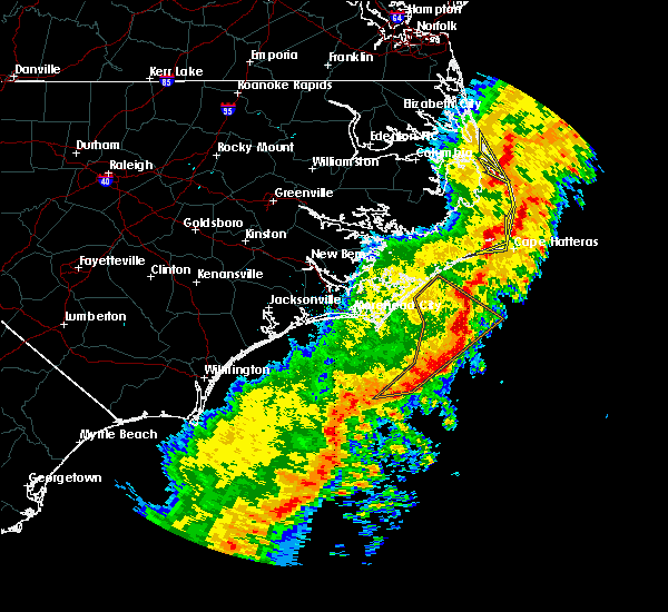 At 1152 am edt, severe thunderstorms were located along a line extending from whalebone to salvo to hatteras ferry terminal, moving northeast at 60 mph (radar indicated). Hazards include 60 mph wind gusts. Expect damage to roofs, siding, and trees. locations impacted include, kill devil hills, frisco, buxton, salvo, avon, waves, nags head, rodanthe, manteo, colington, whalebone, jockeys ridge state park, wright brothers national monument, hatteras ferry terminal, cape hatteras lighthouse, wanchese, bodie island lighthouse, outer banks fishing pier and avalon pier. A tornado watch remains in effect until noon edt for eastern north carolina. At 1152 am edt, severe thunderstorms were located along a line extending from whalebone to salvo to hatteras ferry terminal, moving northeast at 60 mph (radar indicated). Hazards include 60 mph wind gusts. Expect damage to roofs, siding, and trees. locations impacted include, kill devil hills, frisco, buxton, salvo, avon, waves, nags head, rodanthe, manteo, colington, whalebone, jockeys ridge state park, wright brothers national monument, hatteras ferry terminal, cape hatteras lighthouse, wanchese, bodie island lighthouse, outer banks fishing pier and avalon pier. A tornado watch remains in effect until noon edt for eastern north carolina.
|
| 4/13/2020 11:37 AM EDT |
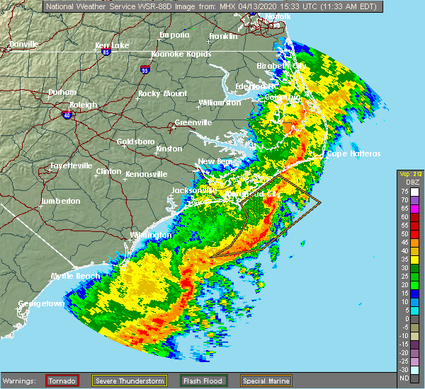 At 1136 am edt, severe thunderstorms were located along a line extending from near colington to 10 miles northwest of avon to near hatteras ferry terminal, moving northeast at 70 mph (radar indicated). Hazards include 60 mph wind gusts. expect damage to roofs, siding, and trees At 1136 am edt, severe thunderstorms were located along a line extending from near colington to 10 miles northwest of avon to near hatteras ferry terminal, moving northeast at 70 mph (radar indicated). Hazards include 60 mph wind gusts. expect damage to roofs, siding, and trees
|
| 8/23/2019 8:03 PM EDT |
 At 802 pm edt, a severe thunderstorm was located over avalon pier, or over kill devil hills, moving east at 35 mph (radar indicated). Hazards include 60 mph wind gusts and nickel size hail. Expect damage to roofs, siding, and trees. Locations impacted include, kill devil hills, southern shores, sanderling, colington, duck coe pier, jockeys ridge state park, wright brothers national monument, nags head fishing pier and avalon pier. At 802 pm edt, a severe thunderstorm was located over avalon pier, or over kill devil hills, moving east at 35 mph (radar indicated). Hazards include 60 mph wind gusts and nickel size hail. Expect damage to roofs, siding, and trees. Locations impacted include, kill devil hills, southern shores, sanderling, colington, duck coe pier, jockeys ridge state park, wright brothers national monument, nags head fishing pier and avalon pier.
|
| 8/23/2019 7:41 PM EDT |
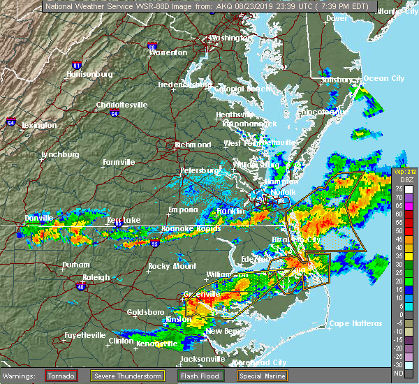 At 741 pm edt, a severe thunderstorm was located near avalon pier, or near kill devil hills, moving east at 30 mph (radar indicated). Hazards include 60 mph wind gusts and nickel size hail. expect damage to roofs, siding, and trees At 741 pm edt, a severe thunderstorm was located near avalon pier, or near kill devil hills, moving east at 30 mph (radar indicated). Hazards include 60 mph wind gusts and nickel size hail. expect damage to roofs, siding, and trees
|
| 8/9/2019 7:21 PM EDT |
 At 720 pm edt, severe thunderstorms were located along a line extending from 12 miles northeast of whalebone to jockeys ridge state park, moving southeast at 40 mph (radar indicated). Hazards include 60 mph wind gusts and quarter size hail. Hail damage to vehicles is expected. expect wind damage to roofs, siding, and trees. Locations impacted include, kill devil hills, nags head, manteo, colington, whalebone, jockeys ridge state park, roanoke island festival park, wright brothers national monument, nags head fishing pier, avalon pier and outer banks fishing pier. At 720 pm edt, severe thunderstorms were located along a line extending from 12 miles northeast of whalebone to jockeys ridge state park, moving southeast at 40 mph (radar indicated). Hazards include 60 mph wind gusts and quarter size hail. Hail damage to vehicles is expected. expect wind damage to roofs, siding, and trees. Locations impacted include, kill devil hills, nags head, manteo, colington, whalebone, jockeys ridge state park, roanoke island festival park, wright brothers national monument, nags head fishing pier, avalon pier and outer banks fishing pier.
|
| 8/9/2019 6:36 PM EDT |
 At 635 pm edt, severe thunderstorms were located along a line extending from near grandy to near old trap, moving southeast at 40 mph (radar indicated). Hazards include 70 mph wind gusts and ping pong ball size hail. People and animals outdoors will be injured. expect hail damage to roofs, siding, windows, and vehicles. expect considerable tree damage. Wind damage is also likely to mobile homes, roofs, and outbuildings. At 635 pm edt, severe thunderstorms were located along a line extending from near grandy to near old trap, moving southeast at 40 mph (radar indicated). Hazards include 70 mph wind gusts and ping pong ball size hail. People and animals outdoors will be injured. expect hail damage to roofs, siding, windows, and vehicles. expect considerable tree damage. Wind damage is also likely to mobile homes, roofs, and outbuildings.
|
| 6/20/2019 6:22 PM EDT |
 At 621 pm edt, severe thunderstorms were located along a line extending from 24 miles east of duck coe pier to near buffalo city, moving east at 75 mph. these are very dangerous storms (radar indicated). Hazards include 80 mph wind gusts. Flying debris will be dangerous to those caught without shelter. mobile homes will be heavily damaged. expect considerable damage to roofs, windows, and vehicles. extensive tree damage and power outages are likely. Locations impacted include, kill devil hills, stumpy point, southern shores, killkenny, manns harbor, waves, nags head, alligator, gum neck, kilkenny, rodanthe, mashoes, manteo, east lake, colington, whalebone, sanderling, fort landing, frying pan landing and buffalo city. At 621 pm edt, severe thunderstorms were located along a line extending from 24 miles east of duck coe pier to near buffalo city, moving east at 75 mph. these are very dangerous storms (radar indicated). Hazards include 80 mph wind gusts. Flying debris will be dangerous to those caught without shelter. mobile homes will be heavily damaged. expect considerable damage to roofs, windows, and vehicles. extensive tree damage and power outages are likely. Locations impacted include, kill devil hills, stumpy point, southern shores, killkenny, manns harbor, waves, nags head, alligator, gum neck, kilkenny, rodanthe, mashoes, manteo, east lake, colington, whalebone, sanderling, fort landing, frying pan landing and buffalo city.
|
| 6/20/2019 6:06 PM EDT | Multiple trees down. time estimated by rada in dare county NC, 4.1 miles S of Kitty Hawk, NC |
| 6/20/2019 6:05 PM EDT | Duck pie in dare county NC, 8.4 miles S of Kitty Hawk, NC |
| 6/20/2019 6:04 PM EDT | Several power lines down. time estimated by rada in dare county NC, 7.7 miles S of Kitty Hawk, NC |
| 6/20/2019 5:52 PM EDT |
 At 552 pm edt, severe thunderstorms were located along a line extending from near grandy to near pungo lake, moving east at 65 mph (radar indicated). Hazards include 60 mph wind gusts. expect damage to roofs, siding, and trees At 552 pm edt, severe thunderstorms were located along a line extending from near grandy to near pungo lake, moving east at 65 mph (radar indicated). Hazards include 60 mph wind gusts. expect damage to roofs, siding, and trees
|
| 4/15/2019 5:41 AM EDT |
 At 540 am edt, severe thunderstorms were located along a line extending from 6 miles east of avalon pier to 6 miles southwest of hatteras ferry terminal, moving northeast at 60 mph (radar indicated). Hazards include 60 mph wind gusts. Expect damage to roofs, siding, and trees. Locations impacted include, kill devil hills, stumpy point, frisco, buxton, salvo, manns harbor, waves, avon, nags head, rodanthe, manteo, colington, whalebone, roanoke island festival park, nags head fishing pier, bodie island lighthouse, jockeys ridge state park, wright brothers national monument, hatteras ferry terminal and avalon pier. At 540 am edt, severe thunderstorms were located along a line extending from 6 miles east of avalon pier to 6 miles southwest of hatteras ferry terminal, moving northeast at 60 mph (radar indicated). Hazards include 60 mph wind gusts. Expect damage to roofs, siding, and trees. Locations impacted include, kill devil hills, stumpy point, frisco, buxton, salvo, manns harbor, waves, avon, nags head, rodanthe, manteo, colington, whalebone, roanoke island festival park, nags head fishing pier, bodie island lighthouse, jockeys ridge state park, wright brothers national monument, hatteras ferry terminal and avalon pier.
|
| 4/15/2019 5:16 AM EDT |
 At 516 am edt, severe thunderstorms were located along a line extending from 6 miles northeast of sanderling to 11 miles southeast of atlantic, moving northeast at 50 mph (radar indicated). Hazards include 60 mph wind gusts. Expect damage to roofs, siding, and trees. Locations impacted include, kill devil hills, stumpy point, frisco, southern shores, buxton, salvo, manns harbor, waves, avon, gull rock, nags head, atlantic, rodanthe, mashoes, manteo, east lake, sanderling, colington, whalebone and nebraska. At 516 am edt, severe thunderstorms were located along a line extending from 6 miles northeast of sanderling to 11 miles southeast of atlantic, moving northeast at 50 mph (radar indicated). Hazards include 60 mph wind gusts. Expect damage to roofs, siding, and trees. Locations impacted include, kill devil hills, stumpy point, frisco, southern shores, buxton, salvo, manns harbor, waves, avon, gull rock, nags head, atlantic, rodanthe, mashoes, manteo, east lake, sanderling, colington, whalebone and nebraska.
|
| 4/15/2019 4:54 AM EDT |
 At 453 am edt, severe thunderstorms were located along a line extending from near indiantown to near davis, moving northeast at 55 mph (radar indicated). Hazards include 60 mph wind gusts. expect damage to roofs, siding, and trees At 453 am edt, severe thunderstorms were located along a line extending from near indiantown to near davis, moving northeast at 55 mph (radar indicated). Hazards include 60 mph wind gusts. expect damage to roofs, siding, and trees
|
| 8/21/2018 3:36 PM EDT |
 At 336 pm edt, severe thunderstorms were located along a line extending from near duck coe pier to outer banks fishing pier, moving northeast at 45 mph (radar indicated). Hazards include 60 mph wind gusts. Expect damage to roofs, siding, and trees. Locations impacted include, kill devil hills, southern shores, nags head, manteo, colington, whalebone, duck coe pier, jockeys ridge state park, roanoke island festival park, wright brothers national monument, nags head fishing pier, avalon pier, wanchese, bodie island lighthouse and outer banks fishing pier. At 336 pm edt, severe thunderstorms were located along a line extending from near duck coe pier to outer banks fishing pier, moving northeast at 45 mph (radar indicated). Hazards include 60 mph wind gusts. Expect damage to roofs, siding, and trees. Locations impacted include, kill devil hills, southern shores, nags head, manteo, colington, whalebone, duck coe pier, jockeys ridge state park, roanoke island festival park, wright brothers national monument, nags head fishing pier, avalon pier, wanchese, bodie island lighthouse and outer banks fishing pier.
|
| 8/21/2018 3:26 PM EDT |
 The national weather service in newport has issued a * severe thunderstorm warning for. northeastern dare county in eastern north carolina. until 400 pm edt. At 325 pm edt, severe thunderstorms were located along a line extending from near southern shores to near wanchese, moving. The national weather service in newport has issued a * severe thunderstorm warning for. northeastern dare county in eastern north carolina. until 400 pm edt. At 325 pm edt, severe thunderstorms were located along a line extending from near southern shores to near wanchese, moving.
|
| 6/21/2018 5:37 PM EDT |
 At 516 pm edt, a severe thunderstorm was located over southern shores, or 9 miles northwest of kill devil hills, moving southeast at 20 mph (radar indicated). Hazards include 60 mph wind gusts and quarter size hail. Hail damage to vehicles is expected. Expect wind damage to roofs, siding, and trees. At 516 pm edt, a severe thunderstorm was located over southern shores, or 9 miles northwest of kill devil hills, moving southeast at 20 mph (radar indicated). Hazards include 60 mph wind gusts and quarter size hail. Hail damage to vehicles is expected. Expect wind damage to roofs, siding, and trees.
|
| 6/21/2018 5:17 PM EDT |
 At 516 pm edt, a severe thunderstorm was located over southern shores, or 9 miles northwest of kill devil hills, moving southeast at 20 mph (radar indicated). Hazards include 60 mph wind gusts and quarter size hail. Hail damage to vehicles is expected. Expect wind damage to roofs, siding, and trees. At 516 pm edt, a severe thunderstorm was located over southern shores, or 9 miles northwest of kill devil hills, moving southeast at 20 mph (radar indicated). Hazards include 60 mph wind gusts and quarter size hail. Hail damage to vehicles is expected. Expect wind damage to roofs, siding, and trees.
|
| 4/4/2018 5:59 PM EDT |
 At 559 pm edt, severe thunderstorms were located along a line extending from 16 miles northeast of avalon pier to colington, moving east at 50 mph (radar indicated). Hazards include 60 mph wind gusts and quarter size hail. Hail damage to vehicles is expected. expect wind damage to roofs, siding, and trees. Locations impacted include, kill devil hills, nags head, manteo, colington, whalebone, jockeys ridge state park, roanoke island festival park, wright brothers national monument, nags head fishing pier, avalon pier, wanchese, bodie island lighthouse and outer banks fishing pier. At 559 pm edt, severe thunderstorms were located along a line extending from 16 miles northeast of avalon pier to colington, moving east at 50 mph (radar indicated). Hazards include 60 mph wind gusts and quarter size hail. Hail damage to vehicles is expected. expect wind damage to roofs, siding, and trees. Locations impacted include, kill devil hills, nags head, manteo, colington, whalebone, jockeys ridge state park, roanoke island festival park, wright brothers national monument, nags head fishing pier, avalon pier, wanchese, bodie island lighthouse and outer banks fishing pier.
|
| 4/4/2018 5:36 PM EDT | Public report of tree limbs down and part of driveway flooded in southern shores... relayed through twitte in dare county NC, 3.4 miles S of Kitty Hawk, NC |
| 4/4/2018 5:30 PM EDT |
 At 530 pm edt, severe thunderstorms were located along a line extending from point harbor to newfoundland, moving east at 50 mph (radar indicated). Hazards include 60 mph wind gusts and quarter size hail. Hail damage to vehicles is expected. Expect wind damage to roofs, siding, and trees. At 530 pm edt, severe thunderstorms were located along a line extending from point harbor to newfoundland, moving east at 50 mph (radar indicated). Hazards include 60 mph wind gusts and quarter size hail. Hail damage to vehicles is expected. Expect wind damage to roofs, siding, and trees.
|
| 7/10/2017 11:17 AM EDT |
 At 1116 am edt, confirmed waterspouts near land have dissipated, but there remains a potential for new waterspouts forming and moving over land (weather spotters confirmed waterspout moving onshore). Hazards include tornado. Flying debris will be dangerous to those caught without shelter. mobile homes will be damaged or destroyed. damage to roofs, windows, and vehicles will occur. tree damage is likely. This tornado will remain over mainly rural areas of northwestern outer banks dare county. At 1116 am edt, confirmed waterspouts near land have dissipated, but there remains a potential for new waterspouts forming and moving over land (weather spotters confirmed waterspout moving onshore). Hazards include tornado. Flying debris will be dangerous to those caught without shelter. mobile homes will be damaged or destroyed. damage to roofs, windows, and vehicles will occur. tree damage is likely. This tornado will remain over mainly rural areas of northwestern outer banks dare county.
|
| 7/10/2017 11:06 AM EDT |
 At 1101 am edt, confirmed multiple waterspouts are currently just offshore the kill devil hills area and may move onshore. the waterspouts are currently moving slowly to the northeast (weather spotters confirmed waterspout moving onshore). Hazards include tornado. Flying debris will be dangerous to those caught without shelter. mobile homes will be damaged or destroyed. damage to roofs, windows, and vehicles will occur. tree damage is likely. This tornado will be near, avalon pier around 1115 am edt. At 1101 am edt, confirmed multiple waterspouts are currently just offshore the kill devil hills area and may move onshore. the waterspouts are currently moving slowly to the northeast (weather spotters confirmed waterspout moving onshore). Hazards include tornado. Flying debris will be dangerous to those caught without shelter. mobile homes will be damaged or destroyed. damage to roofs, windows, and vehicles will occur. tree damage is likely. This tornado will be near, avalon pier around 1115 am edt.
|
| 7/10/2017 10:50 AM EDT |
 At 1049 am edt, multiple confirmed waterspouts moving along the coastline, and , may move over land near kill devil hills, moving northeast at 5 mph (weather spotters confirmed waterspout moving onshore). Hazards include tornado. Flying debris will be dangerous to those caught without shelter. mobile homes will be damaged or destroyed. damage to roofs, windows, and vehicles will occur. tree damage is likely. This tornado will be near, avalon pier around 1105 am edt. At 1049 am edt, multiple confirmed waterspouts moving along the coastline, and , may move over land near kill devil hills, moving northeast at 5 mph (weather spotters confirmed waterspout moving onshore). Hazards include tornado. Flying debris will be dangerous to those caught without shelter. mobile homes will be damaged or destroyed. damage to roofs, windows, and vehicles will occur. tree damage is likely. This tornado will be near, avalon pier around 1105 am edt.
|
| 5/31/2017 5:13 PM EDT |
 At 513 pm edt, a severe thunderstorm was located over point harbor, or near kill devil hills, moving northeast at 20 mph (radar indicated). Hazards include 60 mph wind gusts and quarter size hail. Hail damage to vehicles is expected. Expect wind damage to roofs, siding, and trees. At 513 pm edt, a severe thunderstorm was located over point harbor, or near kill devil hills, moving northeast at 20 mph (radar indicated). Hazards include 60 mph wind gusts and quarter size hail. Hail damage to vehicles is expected. Expect wind damage to roofs, siding, and trees.
|
| 5/28/2017 4:30 PM EDT |
 At 430 pm edt, a severe thunderstorm was located 15 miles east of outer banks fishing pier, or 19 miles east of kill devil hills, moving east at 45 mph (radar indicated). Hazards include 60 mph wind gusts and quarter size hail. Hail damage to vehicles is expected. expect wind damage to roofs, siding, and trees. Locations impacted include, kill devil hills, southern shores, nags head, manteo, jockeys ridge state park, wright brothers national monument, nags head fishing pier, avalon pier and outer banks fishing pier. At 430 pm edt, a severe thunderstorm was located 15 miles east of outer banks fishing pier, or 19 miles east of kill devil hills, moving east at 45 mph (radar indicated). Hazards include 60 mph wind gusts and quarter size hail. Hail damage to vehicles is expected. expect wind damage to roofs, siding, and trees. Locations impacted include, kill devil hills, southern shores, nags head, manteo, jockeys ridge state park, wright brothers national monument, nags head fishing pier, avalon pier and outer banks fishing pier.
|
| 5/28/2017 4:10 PM EDT | Several trees down on kitty hawk road. time estimated by rada in dare county NC, 0.7 miles SSW of Kitty Hawk, NC |
| 5/28/2017 3:54 PM EDT |
 At 354 pm edt, a severe thunderstorm was located over point harbor, or 7 miles west of kill devil hills, moving east at 45 mph (radar indicated). Hazards include 60 mph wind gusts and quarter size hail. Hail damage to vehicles is expected. Expect wind damage to roofs, siding, and trees. At 354 pm edt, a severe thunderstorm was located over point harbor, or 7 miles west of kill devil hills, moving east at 45 mph (radar indicated). Hazards include 60 mph wind gusts and quarter size hail. Hail damage to vehicles is expected. Expect wind damage to roofs, siding, and trees.
|
| 5/27/2017 10:48 PM EDT | Dukn7 nos c-man station on duck pier reported a 69 mph wind gusts at 1048 pm in dare county NC, 7 miles SSE of Kitty Hawk, NC |
| 5/23/2017 6:08 PM EDT |
 At 608 pm edt, a severe thunderstorm capable of producing a tornado was located over manns harbor, or 9 miles south of kill devil hills, moving northeast at 25 mph (radar indicated rotation). Hazards include tornado. Flying debris will be dangerous to those caught without shelter. mobile homes will be damaged or destroyed. damage to roofs, windows, and vehicles will occur. tree damage is likely. this dangerous storm will be near, manteo and roanoke island festival park around 615 pm edt. kill devil hills, nags head, jockeys ridge state park, nags head fishing pier, wright brothers national monument and outer banks fishing pier around 625 pm edt. Avalon pier around 630 pm edt. At 608 pm edt, a severe thunderstorm capable of producing a tornado was located over manns harbor, or 9 miles south of kill devil hills, moving northeast at 25 mph (radar indicated rotation). Hazards include tornado. Flying debris will be dangerous to those caught without shelter. mobile homes will be damaged or destroyed. damage to roofs, windows, and vehicles will occur. tree damage is likely. this dangerous storm will be near, manteo and roanoke island festival park around 615 pm edt. kill devil hills, nags head, jockeys ridge state park, nags head fishing pier, wright brothers national monument and outer banks fishing pier around 625 pm edt. Avalon pier around 630 pm edt.
|
| 5/23/2017 5:52 PM EDT |
 At 552 pm edt, a severe thunderstorm capable of producing a tornado was located near manns harbor, or 12 miles east of williamston, moving northeast at 25 mph (radar indicated rotation). Hazards include tornado. Flying debris will be dangerous to those caught without shelter. mobile homes will be damaged or destroyed. damage to roofs, windows, and vehicles will occur. tree damage is likely. this dangerous storm will be near, manns harbor around 600 pm edt. mashoes around 605 pm edt. manteo around 610 pm edt. roanoke island festival park and wanchese around 615 pm edt. kill devil hills, nags head, jockeys ridge state park, nags head fishing pier, outer banks fishing pier and wright brothers national monument around 625 pm edt. Avalon pier around 630 pm edt. At 552 pm edt, a severe thunderstorm capable of producing a tornado was located near manns harbor, or 12 miles east of williamston, moving northeast at 25 mph (radar indicated rotation). Hazards include tornado. Flying debris will be dangerous to those caught without shelter. mobile homes will be damaged or destroyed. damage to roofs, windows, and vehicles will occur. tree damage is likely. this dangerous storm will be near, manns harbor around 600 pm edt. mashoes around 605 pm edt. manteo around 610 pm edt. roanoke island festival park and wanchese around 615 pm edt. kill devil hills, nags head, jockeys ridge state park, nags head fishing pier, outer banks fishing pier and wright brothers national monument around 625 pm edt. Avalon pier around 630 pm edt.
|
| 6/30/2016 2:23 AM EDT |
 At 222 am edt, severe thunderstorms were located along a line extending from 6 miles north of duck coe pier to kitty hawk, moving east at 25 mph (radar indicated). Hazards include 60 mph wind gusts. Expect damage to roofs. siding. and trees. Locations impacted include, southern shores, avalon pier and duck coe pier. At 222 am edt, severe thunderstorms were located along a line extending from 6 miles north of duck coe pier to kitty hawk, moving east at 25 mph (radar indicated). Hazards include 60 mph wind gusts. Expect damage to roofs. siding. and trees. Locations impacted include, southern shores, avalon pier and duck coe pier.
|
| 6/30/2016 2:11 AM EDT |
 At 211 am edt, severe thunderstorms were located along a line extending from near grandy to avalon pier to nags head fishing pier, moving east at 25 mph (radar indicated). Hazards include 60 mph wind gusts and penny size hail. Expect damage to roofs. siding. and trees. Locations impacted include, southern shores, jockeys ridge state park, nags head fishing pier, wright brothers national monument, duck coe pier and avalon pier. At 211 am edt, severe thunderstorms were located along a line extending from near grandy to avalon pier to nags head fishing pier, moving east at 25 mph (radar indicated). Hazards include 60 mph wind gusts and penny size hail. Expect damage to roofs. siding. and trees. Locations impacted include, southern shores, jockeys ridge state park, nags head fishing pier, wright brothers national monument, duck coe pier and avalon pier.
|
| 6/30/2016 2:01 AM EDT |
 At 201 am edt, severe thunderstorms were located along a line extending from near grandy to near avalon pier to near jockeys ridge state park, moving east at 25 mph (radar indicated). Hazards include 60 mph wind gusts and quarter size hail. Hail damage to vehicles is expected. Expect wind damage to roofs, siding, and trees. At 201 am edt, severe thunderstorms were located along a line extending from near grandy to near avalon pier to near jockeys ridge state park, moving east at 25 mph (radar indicated). Hazards include 60 mph wind gusts and quarter size hail. Hail damage to vehicles is expected. Expect wind damage to roofs, siding, and trees.
|
| 6/17/2016 3:04 AM EDT |
 At 304 am edt, a severe thunderstorm was located over bodie island lighthouse, moving east at 30 mph (radar indicated). Hazards include 60 mph wind gusts. Expect damage to roofs. siding. and trees. Locations impacted include, manteo, nags head fishing pier, roanoke island festival park, wanchese, avalon pier, outer banks fishing pier, jockeys ridge state park, wright brothers national monument and bodie island lighthouse. At 304 am edt, a severe thunderstorm was located over bodie island lighthouse, moving east at 30 mph (radar indicated). Hazards include 60 mph wind gusts. Expect damage to roofs. siding. and trees. Locations impacted include, manteo, nags head fishing pier, roanoke island festival park, wanchese, avalon pier, outer banks fishing pier, jockeys ridge state park, wright brothers national monument and bodie island lighthouse.
|
| 6/17/2016 2:30 AM EDT |
 At 229 am edt, a severe thunderstorm was located 9 miles west of manteo, or 23 miles south of grandy, moving east at 30 mph (radar indicated). Hazards include 60 mph wind gusts. Expect damage to roofs. siding. And trees. At 229 am edt, a severe thunderstorm was located 9 miles west of manteo, or 23 miles south of grandy, moving east at 30 mph (radar indicated). Hazards include 60 mph wind gusts. Expect damage to roofs. siding. And trees.
|
| 7/24/2012 6:43 PM EDT | Tree down on power line. time estimated by rada in dare county NC, 0.7 miles SSW of Kitty Hawk, NC |
| 1/1/0001 12:00 AM | Numerous trees and powerlines down in currituck county NC, 5.5 miles ESE of Kitty Hawk, NC |
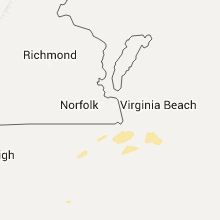
Hail Maps for Kitty Hawk, NC


Connect with Interactive Hail Maps