

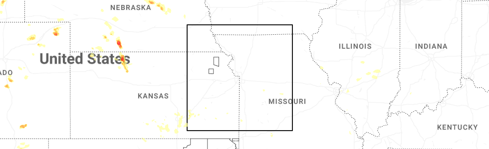
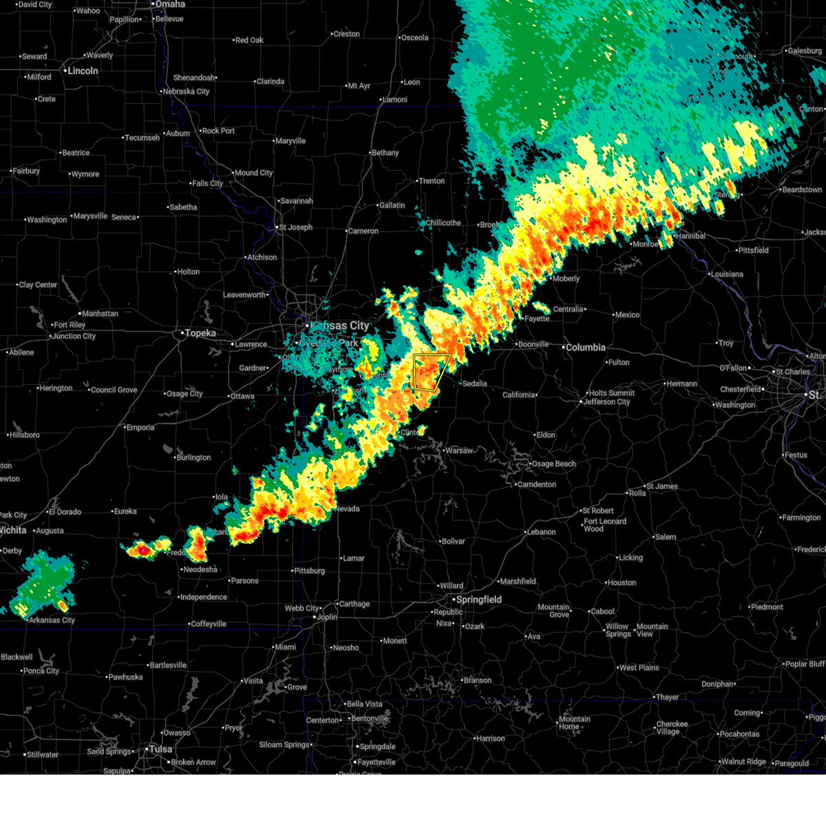
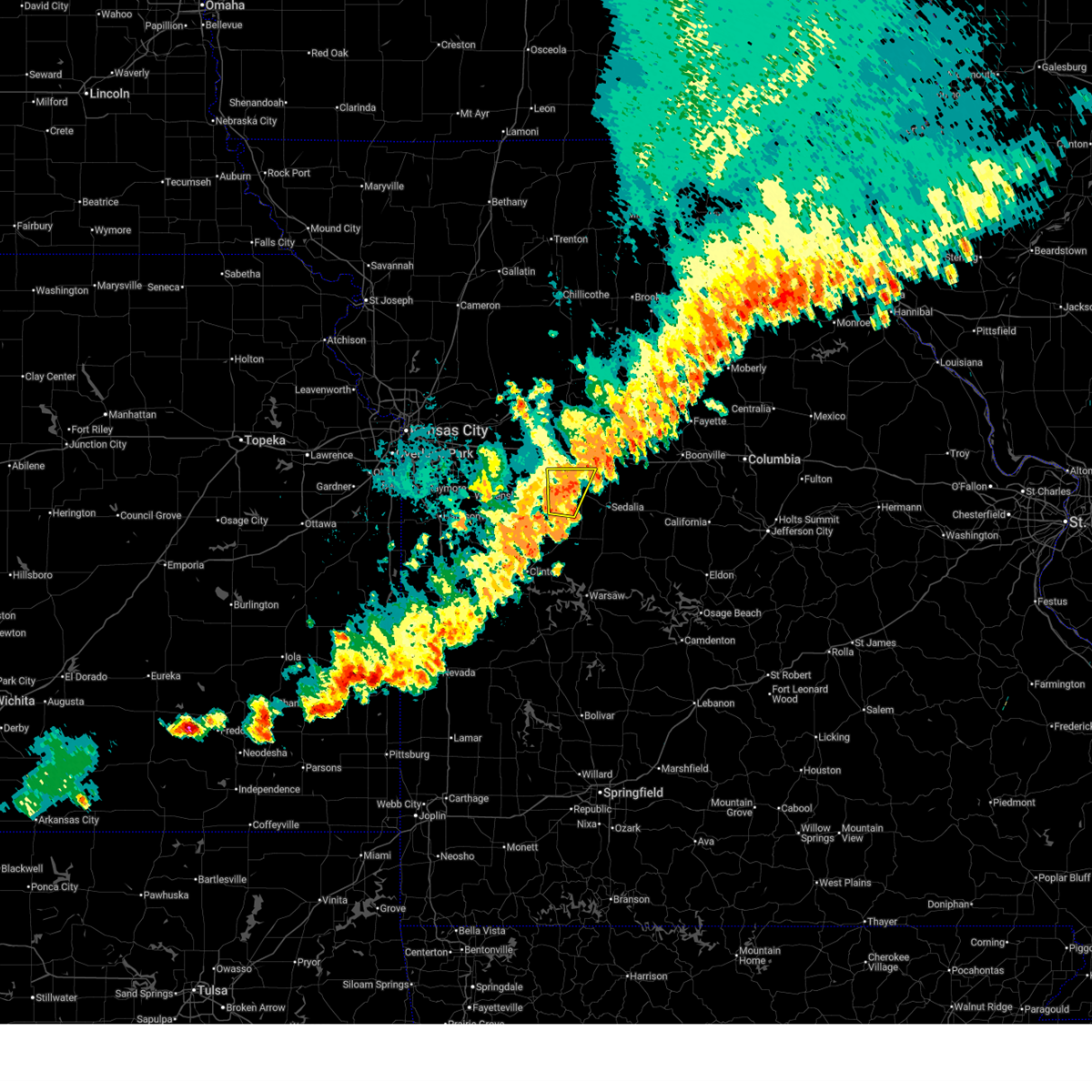
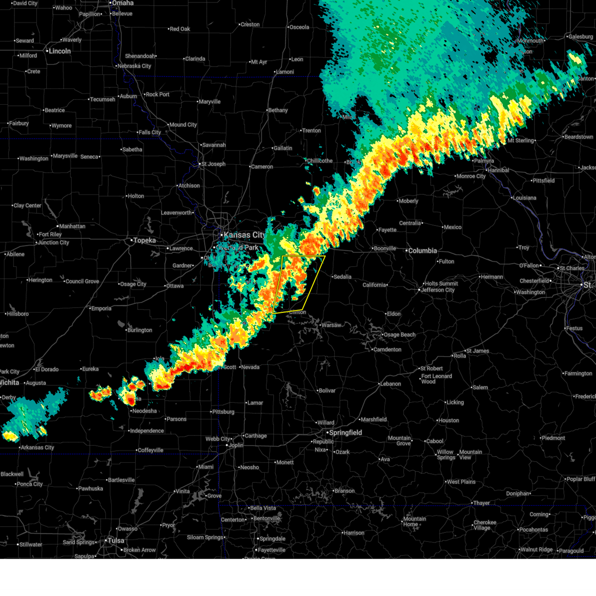
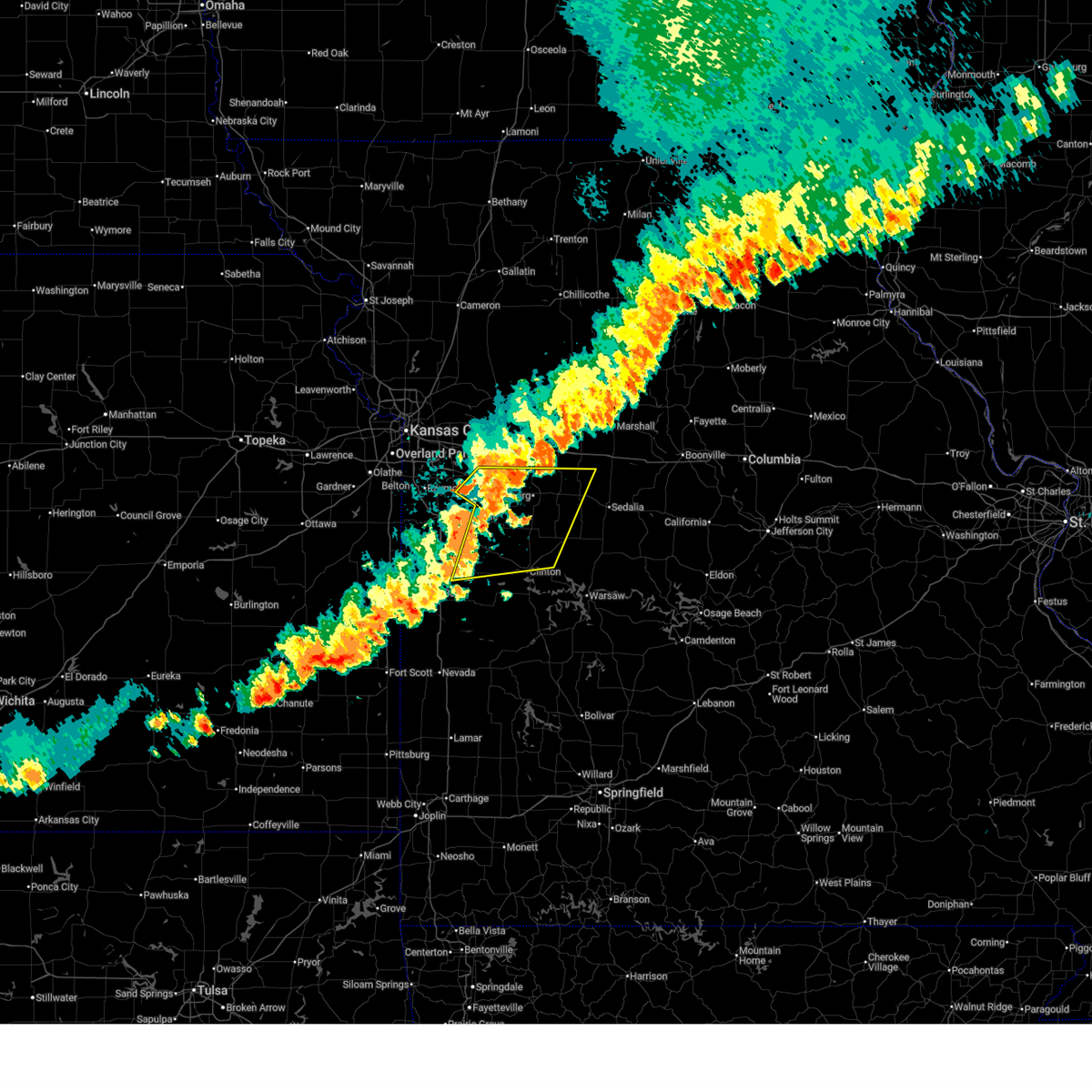
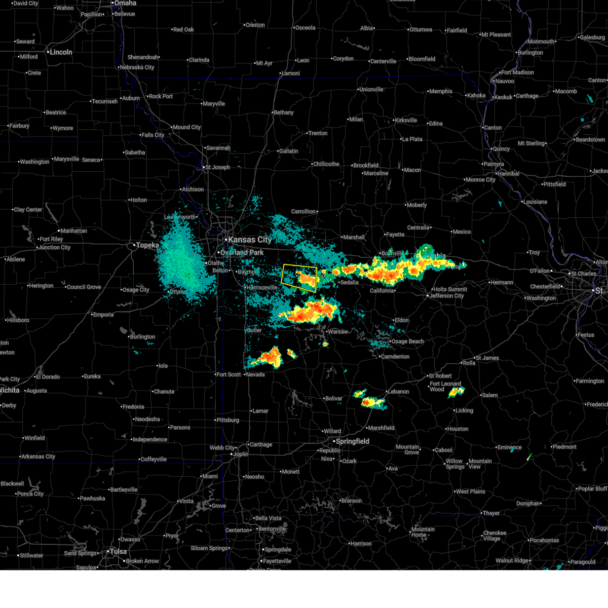
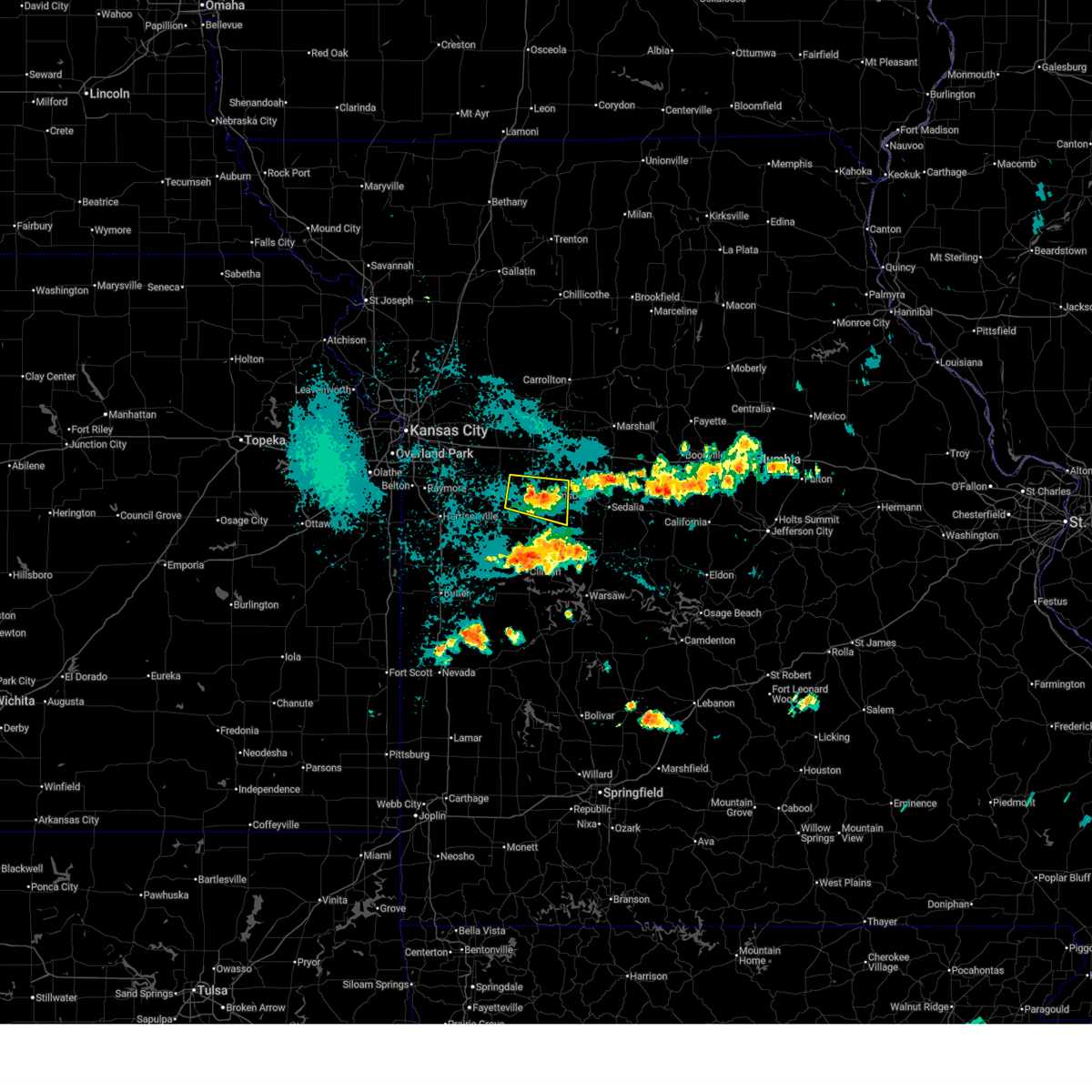
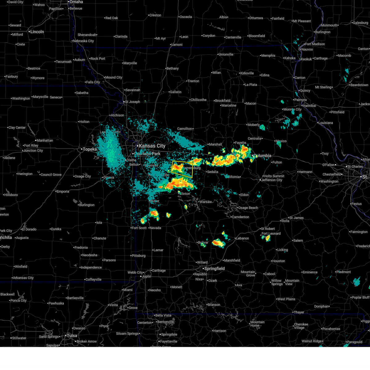
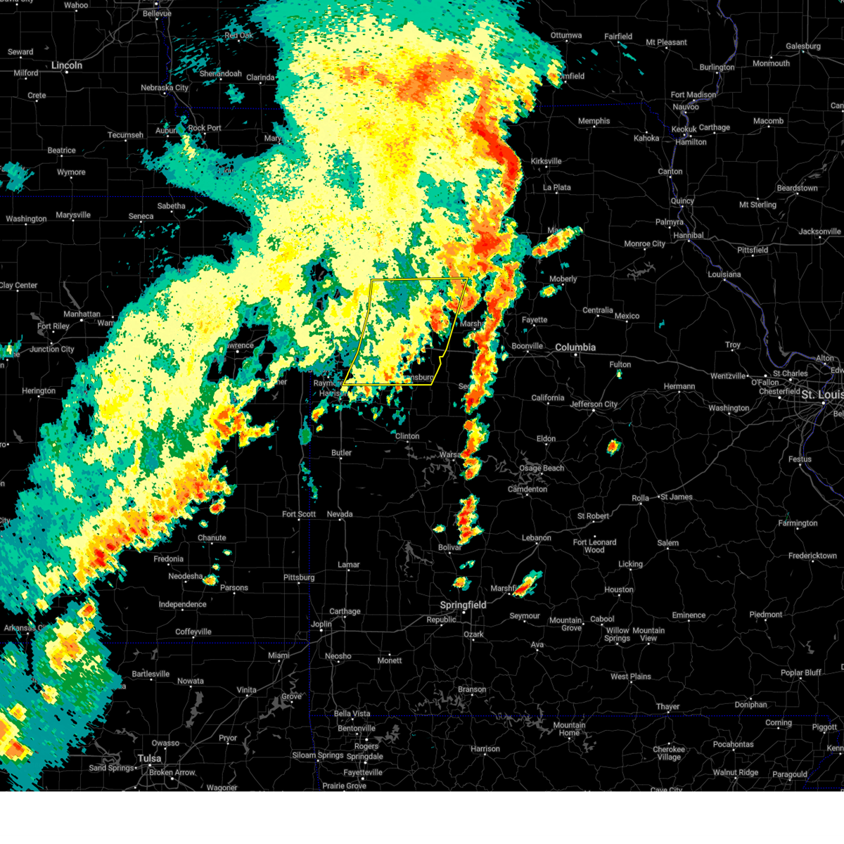
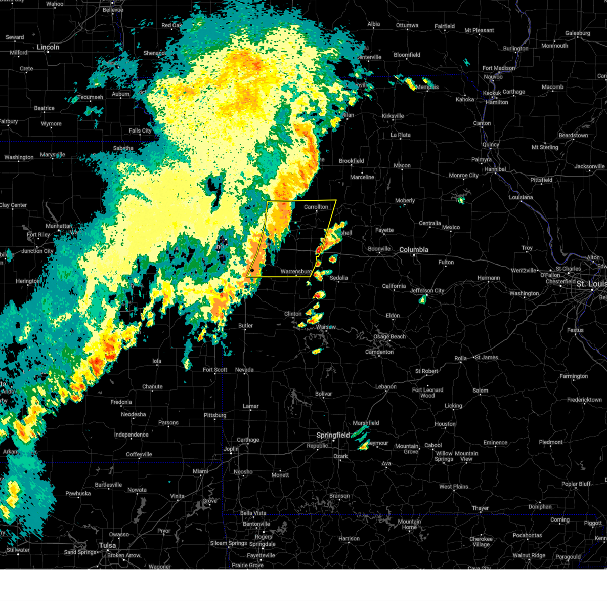
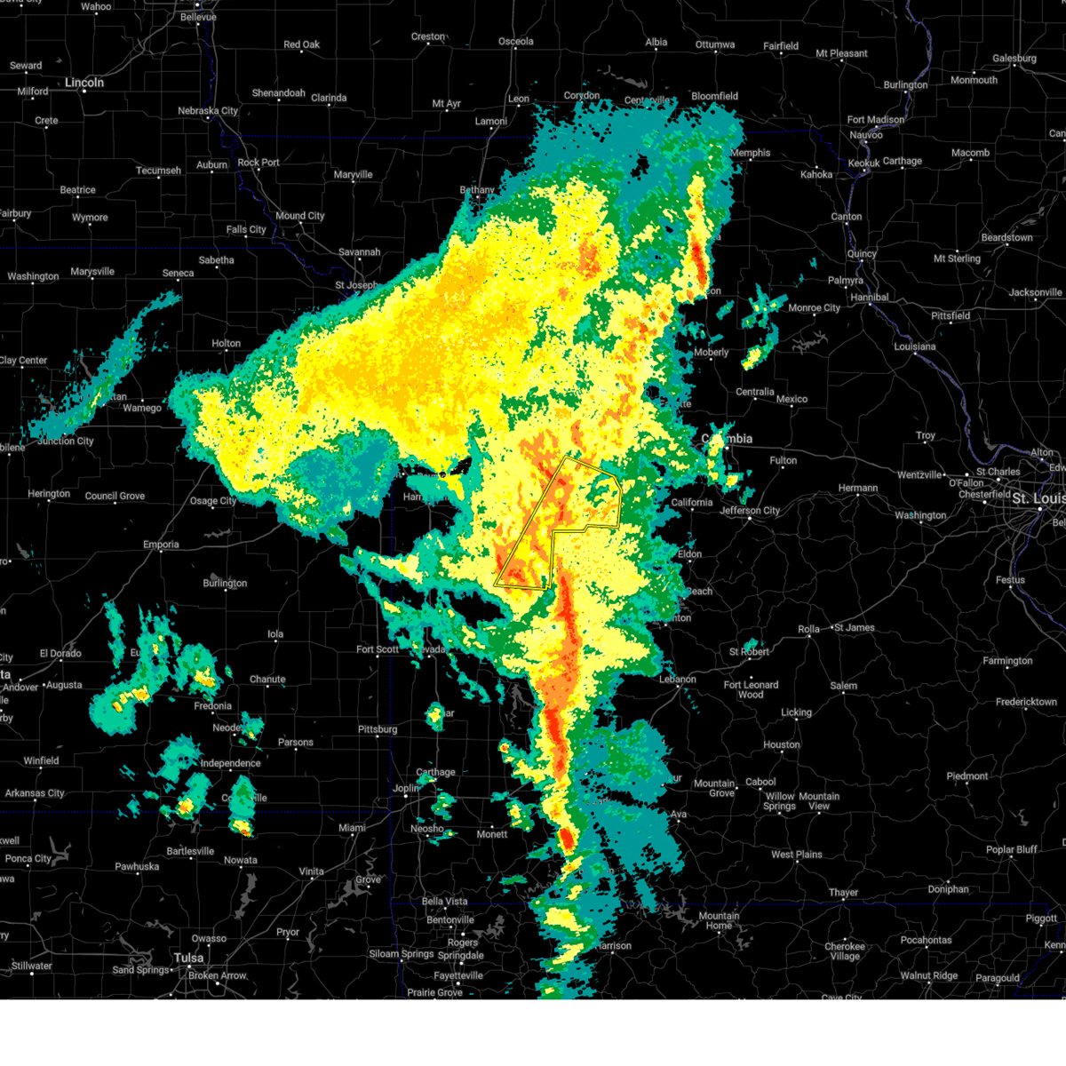
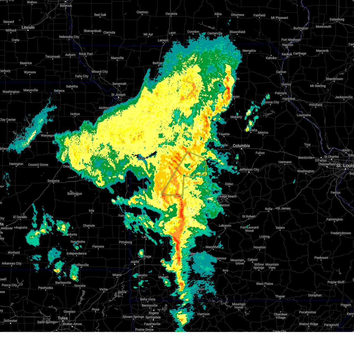
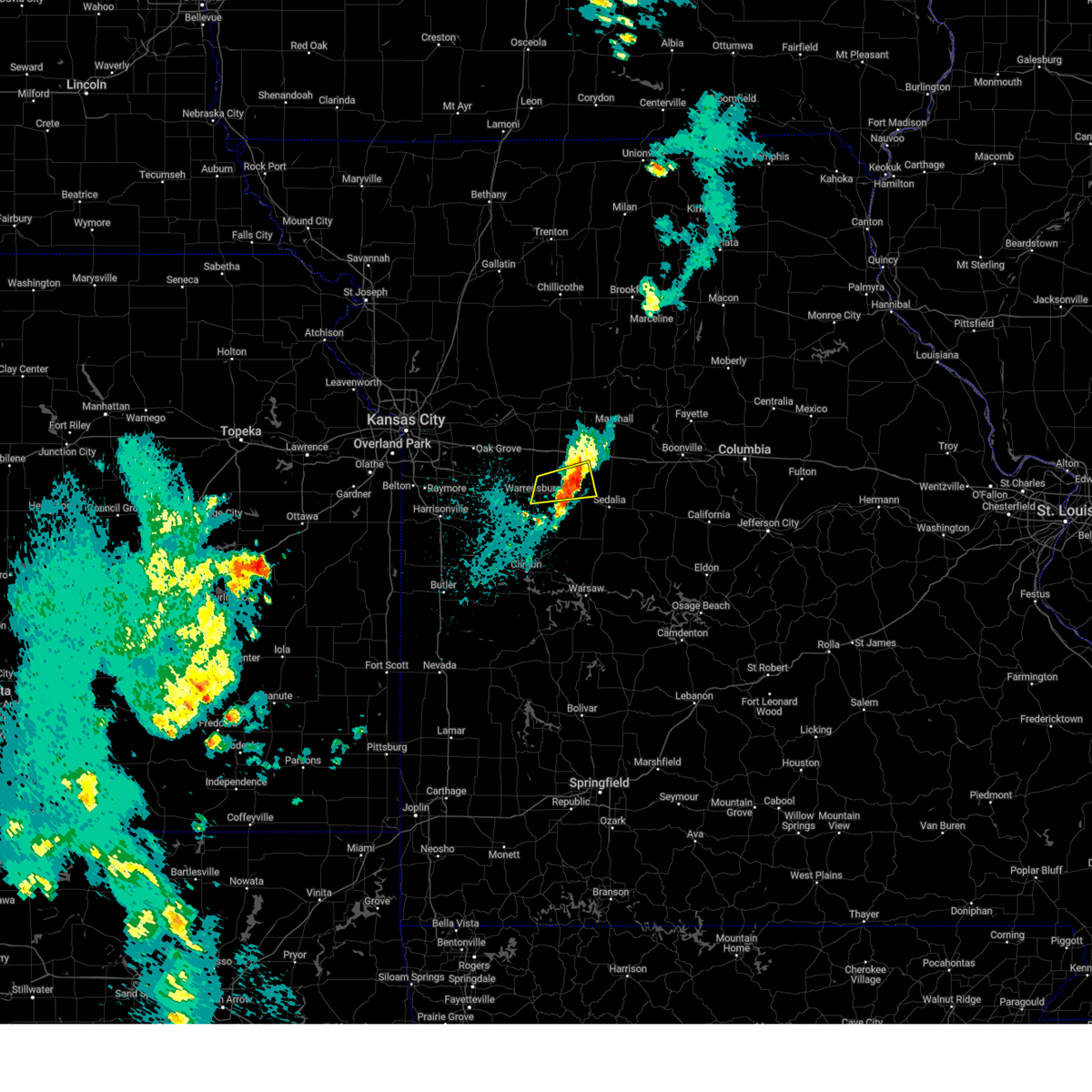
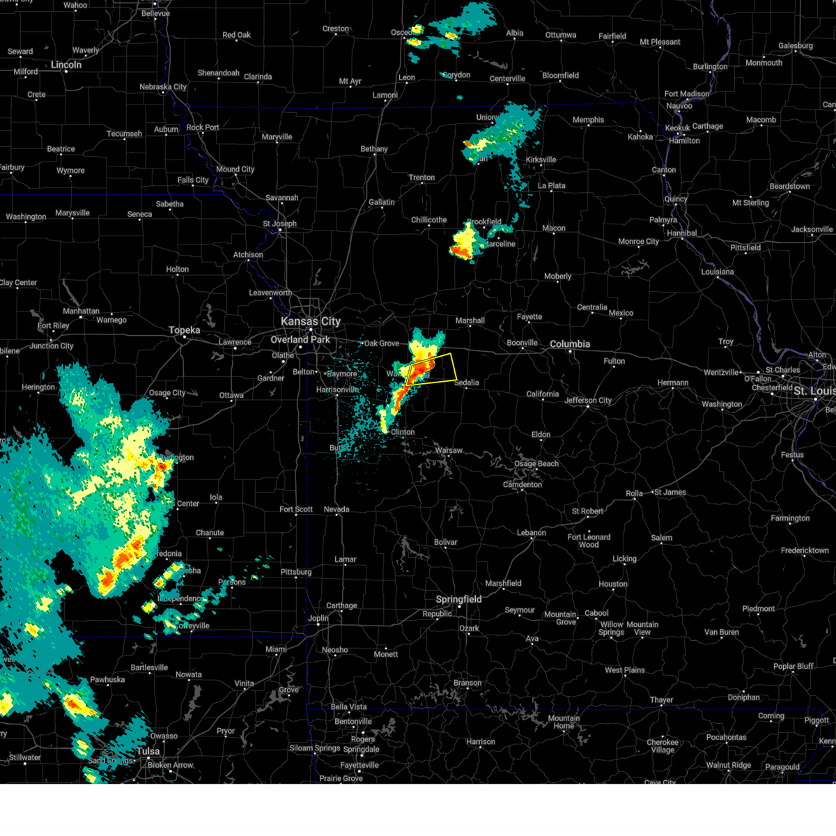
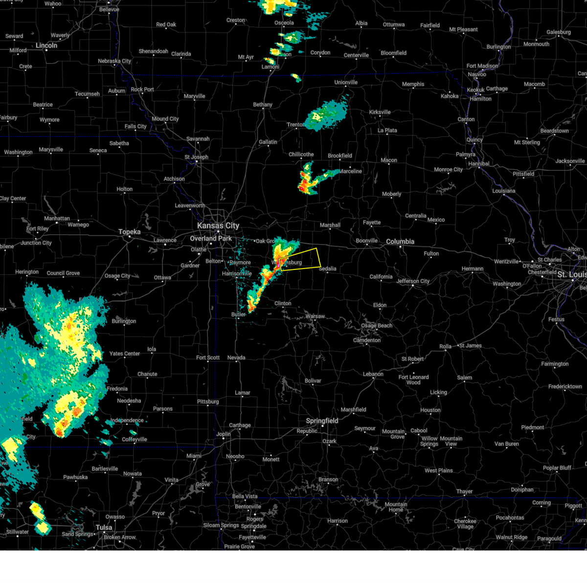
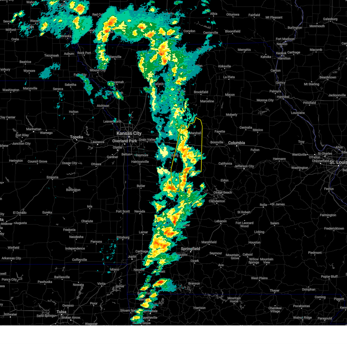
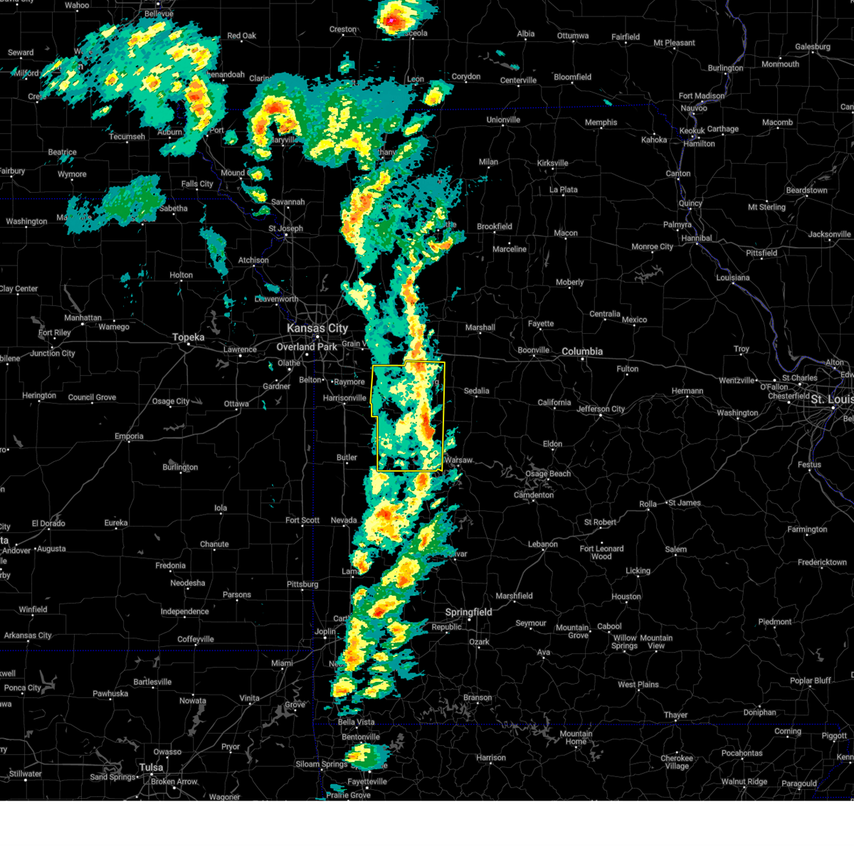
Hail Map for Knob Noster, MO
The Knob Noster, MO area has had 11 reports of on-the-ground hail by trained spotters, and has been under severe weather warnings 25 times during the past 12 months. Doppler radar has detected hail at or near Knob Noster, MO on 70 occasions, including 4 occasions during the past year.
| Name: | Knob Noster, MO |
| Where Located: | 59.9 miles ESE of Kansas City, MO |
| Map: | Google Map for Knob Noster, MO |
| Population: | 2709 |
| Housing Units: | 1347 |
| More Info: | Search Google for Knob Noster, MO |
0
The Top Recent Hail Date for Knob Noster, MO is Sunday, July 6, 2025 (51st out of 70)
Hail and Wind Damage Spotted near Knob Noster, MO
| Date / Time | Report Details |
|---|---|
| 7/11/2025 9:32 PM CDT |
 the severe thunderstorm warning has been cancelled and is no longer in effect the severe thunderstorm warning has been cancelled and is no longer in effect
|
| 7/11/2025 9:32 PM CDT |
 At 932 pm cdt, severe thunderstorms were located along a line extending from houstonia to near calhoun, moving east at 50 mph (radar indicated). Hazards include 60 mph wind gusts. Expect damage to roofs, siding, and trees. Locations impacted include, knob noster, whiteman air force base, la monte, houstonia, and whiteman afb. At 932 pm cdt, severe thunderstorms were located along a line extending from houstonia to near calhoun, moving east at 50 mph (radar indicated). Hazards include 60 mph wind gusts. Expect damage to roofs, siding, and trees. Locations impacted include, knob noster, whiteman air force base, la monte, houstonia, and whiteman afb.
|
| 7/11/2025 9:16 PM CDT |
 the severe thunderstorm warning has been cancelled and is no longer in effect the severe thunderstorm warning has been cancelled and is no longer in effect
|
| 7/11/2025 9:16 PM CDT |
 At 916 pm cdt, severe thunderstorms were located along a line extending from 6 miles south of concordia to near clinton, moving east at 30 mph (radar indicated). Hazards include 60 mph wind gusts. Expect damage to roofs, siding, and trees. Locations impacted include, warrensburg, clinton, windsor, knob noster, whiteman air force base, la monte, leeton, calhoun, chilhowee, houstonia, whiteman afb, centerview, fayetteville, post oak, and hartwell. At 916 pm cdt, severe thunderstorms were located along a line extending from 6 miles south of concordia to near clinton, moving east at 30 mph (radar indicated). Hazards include 60 mph wind gusts. Expect damage to roofs, siding, and trees. Locations impacted include, warrensburg, clinton, windsor, knob noster, whiteman air force base, la monte, leeton, calhoun, chilhowee, houstonia, whiteman afb, centerview, fayetteville, post oak, and hartwell.
|
| 7/11/2025 8:58 PM CDT |
 Svreax the national weather service in pleasant hill has issued a * severe thunderstorm warning for, eastern cass county in west central missouri, northern henry county in west central missouri, northeastern bates county in west central missouri, northwestern pettis county in central missouri, southeastern jackson county in west central missouri, johnson county in west central missouri, * until 945 pm cdt. * at 857 pm cdt, severe thunderstorms were located along a line extending from near oak grove to near urich, moving east at 30 mph (radar indicated). Hazards include 60 mph wind gusts. expect damage to roofs, siding, and trees Svreax the national weather service in pleasant hill has issued a * severe thunderstorm warning for, eastern cass county in west central missouri, northern henry county in west central missouri, northeastern bates county in west central missouri, northwestern pettis county in central missouri, southeastern jackson county in west central missouri, johnson county in west central missouri, * until 945 pm cdt. * at 857 pm cdt, severe thunderstorms were located along a line extending from near oak grove to near urich, moving east at 30 mph (radar indicated). Hazards include 60 mph wind gusts. expect damage to roofs, siding, and trees
|
| 6/18/2025 10:52 PM CDT |
 the severe thunderstorm warning has been cancelled and is no longer in effect the severe thunderstorm warning has been cancelled and is no longer in effect
|
| 6/18/2025 10:41 PM CDT |
 At 1041 pm cdt, a severe thunderstorm was located near knob noster, moving east at 30 mph (radar indicated). Hazards include 60 mph wind gusts and quarter size hail. Hail damage to vehicles is expected. expect wind damage to roofs, siding, and trees. Locations impacted include, warrensburg, knob noster, whiteman air force base, whiteman afb, and centerview. At 1041 pm cdt, a severe thunderstorm was located near knob noster, moving east at 30 mph (radar indicated). Hazards include 60 mph wind gusts and quarter size hail. Hail damage to vehicles is expected. expect wind damage to roofs, siding, and trees. Locations impacted include, warrensburg, knob noster, whiteman air force base, whiteman afb, and centerview.
|
| 6/18/2025 10:25 PM CDT |
 Svreax the national weather service in pleasant hill has issued a * severe thunderstorm warning for, eastern johnson county in west central missouri, * until 1115 pm cdt. * at 1025 pm cdt, a severe thunderstorm was located over warrensburg, moving east at 30 mph (radar indicated). Hazards include 60 mph wind gusts and quarter size hail. Hail damage to vehicles is expected. Expect wind damage to roofs, siding, and trees. Svreax the national weather service in pleasant hill has issued a * severe thunderstorm warning for, eastern johnson county in west central missouri, * until 1115 pm cdt. * at 1025 pm cdt, a severe thunderstorm was located over warrensburg, moving east at 30 mph (radar indicated). Hazards include 60 mph wind gusts and quarter size hail. Hail damage to vehicles is expected. Expect wind damage to roofs, siding, and trees.
|
| 6/3/2025 4:14 PM CDT |
 The storms which prompted the warning have weakened below severe limits, and no longer pose an immediate threat to life or property. therefore, the warning will be allowed to expire. a tornado watch remains in effect until 800 pm cdt for central, north central and west central missouri. to report severe weather, contact your nearest law enforcement agency. they will relay your report to the national weather service pleasant hill. The storms which prompted the warning have weakened below severe limits, and no longer pose an immediate threat to life or property. therefore, the warning will be allowed to expire. a tornado watch remains in effect until 800 pm cdt for central, north central and west central missouri. to report severe weather, contact your nearest law enforcement agency. they will relay your report to the national weather service pleasant hill.
|
| 6/3/2025 3:28 PM CDT |
 Svreax the national weather service in pleasant hill has issued a * severe thunderstorm warning for, northeastern cass county in west central missouri, western chariton county in north central missouri, northwestern pettis county in central missouri, central ray county in west central missouri, southern carroll county in north central missouri, western saline county in central missouri, lafayette county in west central missouri, southeastern jackson county in west central missouri, northern johnson county in west central missouri, * until 415 pm cdt. * at 327 pm cdt, severe thunderstorms were located along a line extending from 6 miles north of hardin to near mayview to near lone jack, moving east at 40 mph (radar indicated). Hazards include 60 mph wind gusts and penny size hail. expect damage to roofs, siding, and trees Svreax the national weather service in pleasant hill has issued a * severe thunderstorm warning for, northeastern cass county in west central missouri, western chariton county in north central missouri, northwestern pettis county in central missouri, central ray county in west central missouri, southern carroll county in north central missouri, western saline county in central missouri, lafayette county in west central missouri, southeastern jackson county in west central missouri, northern johnson county in west central missouri, * until 415 pm cdt. * at 327 pm cdt, severe thunderstorms were located along a line extending from 6 miles north of hardin to near mayview to near lone jack, moving east at 40 mph (radar indicated). Hazards include 60 mph wind gusts and penny size hail. expect damage to roofs, siding, and trees
|
| 4/20/2025 3:55 PM CDT |
 At 355 pm cdt, severe thunderstorms were located along a line extending from near calhoun to 6 miles west of lincoln to near warsaw, moving northeast at 65 mph (radar indicated). Hazards include 70 mph wind gusts. Expect considerable tree damage. damage is likely to mobile homes, roofs, and outbuildings. Locations impacted include, calhoun, whiteman afb, windsor, clinton, la monte, whiteman air force base, truman lake, coal, sedalia, deepwater, tightwad, sedalia memorial arpt, smithton, green ridge, brownington, and hughesville. At 355 pm cdt, severe thunderstorms were located along a line extending from near calhoun to 6 miles west of lincoln to near warsaw, moving northeast at 65 mph (radar indicated). Hazards include 70 mph wind gusts. Expect considerable tree damage. damage is likely to mobile homes, roofs, and outbuildings. Locations impacted include, calhoun, whiteman afb, windsor, clinton, la monte, whiteman air force base, truman lake, coal, sedalia, deepwater, tightwad, sedalia memorial arpt, smithton, green ridge, brownington, and hughesville.
|
| 4/20/2025 3:43 PM CDT |
 Svreax the national weather service in pleasant hill has issued a * severe thunderstorm warning for, eastern henry county in west central missouri, pettis county in central missouri, southeastern johnson county in west central missouri, * until 430 pm cdt. * at 342 pm cdt, severe thunderstorms were located along a line extending from near clinton to 12 miles east of deepwater to 8 miles southwest of warsaw, moving northeast at 65 mph (radar indicated). Hazards include 60 mph wind gusts. expect damage to roofs, siding, and trees Svreax the national weather service in pleasant hill has issued a * severe thunderstorm warning for, eastern henry county in west central missouri, pettis county in central missouri, southeastern johnson county in west central missouri, * until 430 pm cdt. * at 342 pm cdt, severe thunderstorms were located along a line extending from near clinton to 12 miles east of deepwater to 8 miles southwest of warsaw, moving northeast at 65 mph (radar indicated). Hazards include 60 mph wind gusts. expect damage to roofs, siding, and trees
|
| 3/30/2025 12:25 AM CDT |
 The storm which prompted the warning has weakened below severe limits, and no longer poses an immediate threat to life or property. therefore, the warning will be allowed to expire. The storm which prompted the warning has weakened below severe limits, and no longer poses an immediate threat to life or property. therefore, the warning will be allowed to expire.
|
| 3/29/2025 11:55 PM CDT |
 At 1154 pm cdt, a severe thunderstorm was located near knob noster, moving east at 30 mph (trained weather spotters have reported a recent history of 60 to 65 mph winds and quarter size hail with this storm). Hazards include 60 mph wind gusts and quarter size hail. Hail damage to vehicles is expected. expect wind damage to roofs, siding, and trees. Locations impacted include, la monte, knob noster, houstonia, warrensburg, and whiteman afb. At 1154 pm cdt, a severe thunderstorm was located near knob noster, moving east at 30 mph (trained weather spotters have reported a recent history of 60 to 65 mph winds and quarter size hail with this storm). Hazards include 60 mph wind gusts and quarter size hail. Hail damage to vehicles is expected. expect wind damage to roofs, siding, and trees. Locations impacted include, la monte, knob noster, houstonia, warrensburg, and whiteman afb.
|
| 3/29/2025 11:39 PM CDT |
 Svreax the national weather service in pleasant hill has issued a * severe thunderstorm warning for, northwestern pettis county in central missouri, northeastern johnson county in west central missouri, * until 1230 am cdt. * at 1138 pm cdt, a severe thunderstorm was located over warrensburg, moving east at 30 mph (trained weather spotters have reported a history of 60 mph winds and up to half dollar sized hail with this storm). Hazards include 60 mph wind gusts and quarter size hail. Hail damage to vehicles is expected. Expect wind damage to roofs, siding, and trees. Svreax the national weather service in pleasant hill has issued a * severe thunderstorm warning for, northwestern pettis county in central missouri, northeastern johnson county in west central missouri, * until 1230 am cdt. * at 1138 pm cdt, a severe thunderstorm was located over warrensburg, moving east at 30 mph (trained weather spotters have reported a history of 60 mph winds and up to half dollar sized hail with this storm). Hazards include 60 mph wind gusts and quarter size hail. Hail damage to vehicles is expected. Expect wind damage to roofs, siding, and trees.
|
| 3/14/2025 4:46 PM CDT |
 At 446 pm cdt, severe thunderstorms were located along a line extending from near malta bend to houstonia to near green ridge, moving northeast at 55 mph (radar indicated). Hazards include 70 mph wind gusts and penny size hail. Expect considerable tree damage. damage is likely to mobile homes, roofs, and outbuildings. locations impacted include, grand pass, windsor, malta bend, blackburn, coal, knob noster, sedalia, tightwad, slater, sedalia memorial arpt, smithton, mount leonard, concordia, calhoun, whiteman afb, houstonia, marshall, miami, la monte, and sweet springs. This includes interstate 70 in missouri between mile markers 59 and 85. At 446 pm cdt, severe thunderstorms were located along a line extending from near malta bend to houstonia to near green ridge, moving northeast at 55 mph (radar indicated). Hazards include 70 mph wind gusts and penny size hail. Expect considerable tree damage. damage is likely to mobile homes, roofs, and outbuildings. locations impacted include, grand pass, windsor, malta bend, blackburn, coal, knob noster, sedalia, tightwad, slater, sedalia memorial arpt, smithton, mount leonard, concordia, calhoun, whiteman afb, houstonia, marshall, miami, la monte, and sweet springs. This includes interstate 70 in missouri between mile markers 59 and 85.
|
| 3/14/2025 4:26 PM CDT |
 A new warning has been issued for eastern johnson and henry counties. a severe thunderstorm watch remains in effect until 700 pm cdt for west central missouri. A new warning has been issued for eastern johnson and henry counties. a severe thunderstorm watch remains in effect until 700 pm cdt for west central missouri.
|
| 3/14/2025 4:24 PM CDT |
 Svreax the national weather service in pleasant hill has issued a * severe thunderstorm warning for, eastern henry county in west central missouri, pettis county in central missouri, saline county in central missouri, eastern lafayette county in west central missouri, eastern johnson county in west central missouri, * until 515 pm cdt. * at 423 pm cdt, severe thunderstorms were located along a line extending from near hardin to 7 miles northeast of warrensburg to near calhoun, moving northeast at 65 mph (radar indicated). Hazards include 70 mph wind gusts and penny size hail. Expect considerable tree damage. Damage is likely to mobile homes, roofs, and outbuildings. Svreax the national weather service in pleasant hill has issued a * severe thunderstorm warning for, eastern henry county in west central missouri, pettis county in central missouri, saline county in central missouri, eastern lafayette county in west central missouri, eastern johnson county in west central missouri, * until 515 pm cdt. * at 423 pm cdt, severe thunderstorms were located along a line extending from near hardin to 7 miles northeast of warrensburg to near calhoun, moving northeast at 65 mph (radar indicated). Hazards include 70 mph wind gusts and penny size hail. Expect considerable tree damage. Damage is likely to mobile homes, roofs, and outbuildings.
|
| 3/14/2025 4:07 PM CDT |
 At 404 pm cdt, severe thunderstorms were located along a line extending from 7 miles southwest of oak grove to near chilhowee to near deepwater, moving northeast at 50 mph (radar indicated). Hazards include 70 mph wind gusts and penny size hail. Expect considerable tree damage. damage is likely to mobile homes, roofs, and outbuildings. Locations impacted include, chilhowee, blairstown, windsor, leeton, montrose, kingsville, warrensburg, urich, pittsville, coal, knob noster, tightwad, hartwell, brownington, la due, quick city, fayetteville, holden, calhoun, and whiteman afb. At 404 pm cdt, severe thunderstorms were located along a line extending from 7 miles southwest of oak grove to near chilhowee to near deepwater, moving northeast at 50 mph (radar indicated). Hazards include 70 mph wind gusts and penny size hail. Expect considerable tree damage. damage is likely to mobile homes, roofs, and outbuildings. Locations impacted include, chilhowee, blairstown, windsor, leeton, montrose, kingsville, warrensburg, urich, pittsville, coal, knob noster, tightwad, hartwell, brownington, la due, quick city, fayetteville, holden, calhoun, and whiteman afb.
|
| 3/14/2025 4:07 PM CDT |
 the severe thunderstorm warning has been cancelled and is no longer in effect the severe thunderstorm warning has been cancelled and is no longer in effect
|
| 3/14/2025 3:43 PM CDT |
 Svreax the national weather service in pleasant hill has issued a * severe thunderstorm warning for, henry county in west central missouri, bates county in west central missouri, johnson county in west central missouri, * until 430 pm cdt. * at 343 pm cdt, a severe thunderstorm was located near garden city, moving northeast at 65 mph (radar indicated). Hazards include 70 mph wind gusts and penny size hail. Expect considerable tree damage. Damage is likely to mobile homes, roofs, and outbuildings. Svreax the national weather service in pleasant hill has issued a * severe thunderstorm warning for, henry county in west central missouri, bates county in west central missouri, johnson county in west central missouri, * until 430 pm cdt. * at 343 pm cdt, a severe thunderstorm was located near garden city, moving northeast at 65 mph (radar indicated). Hazards include 70 mph wind gusts and penny size hail. Expect considerable tree damage. Damage is likely to mobile homes, roofs, and outbuildings.
|
| 10/30/2024 9:53 PM CDT |
 The storms which prompted the warning have weakened below severe limits, and no longer pose an immediate threat to life or property. therefore, the warning will be allowed to expire. however, gusty winds and heavy rain are still possible with these thunderstorms. a tornado watch remains in effect until 1000 pm cdt for central and west central missouri. The storms which prompted the warning have weakened below severe limits, and no longer pose an immediate threat to life or property. therefore, the warning will be allowed to expire. however, gusty winds and heavy rain are still possible with these thunderstorms. a tornado watch remains in effect until 1000 pm cdt for central and west central missouri.
|
| 10/30/2024 9:35 PM CDT |
 At 935 pm cdt, severe thunderstorms were located along a line extending from near blackburn to near knob noster to near leeton, moving east at 40 mph (radar indicated). Hazards include 60 mph wind gusts. Expect damage to roofs, siding, and trees. locations impacted include, warrensburg, higginsville, windsor, knob noster, concordia, sweet springs, whiteman air force base, la monte, leeton, urich, alma, chilhowee, blackburn, houstonia, whiteman afb, centerview, emma, aullville, blairstown, and mount leonard. This includes interstate 70 in missouri between mile markers 45 and 73. At 935 pm cdt, severe thunderstorms were located along a line extending from near blackburn to near knob noster to near leeton, moving east at 40 mph (radar indicated). Hazards include 60 mph wind gusts. Expect damage to roofs, siding, and trees. locations impacted include, warrensburg, higginsville, windsor, knob noster, concordia, sweet springs, whiteman air force base, la monte, leeton, urich, alma, chilhowee, blackburn, houstonia, whiteman afb, centerview, emma, aullville, blairstown, and mount leonard. This includes interstate 70 in missouri between mile markers 45 and 73.
|
| 10/30/2024 9:35 PM CDT |
 the severe thunderstorm warning has been cancelled and is no longer in effect the severe thunderstorm warning has been cancelled and is no longer in effect
|
| 10/30/2024 9:11 PM CDT |
 Svreax the national weather service in pleasant hill has issued a * severe thunderstorm warning for, southeastern cass county in west central missouri, northern henry county in west central missouri, northwestern pettis county in central missouri, southwestern saline county in central missouri, southern lafayette county in west central missouri, johnson county in west central missouri, * until 1000 pm cdt. * at 910 pm cdt, severe thunderstorms were located along a line extending from near odessa to near holden to creighton, moving east at 40 mph (radar indicated). Hazards include 60 mph wind gusts. expect damage to roofs, siding, and trees Svreax the national weather service in pleasant hill has issued a * severe thunderstorm warning for, southeastern cass county in west central missouri, northern henry county in west central missouri, northwestern pettis county in central missouri, southwestern saline county in central missouri, southern lafayette county in west central missouri, johnson county in west central missouri, * until 1000 pm cdt. * at 910 pm cdt, severe thunderstorms were located along a line extending from near odessa to near holden to creighton, moving east at 40 mph (radar indicated). Hazards include 60 mph wind gusts. expect damage to roofs, siding, and trees
|
| 7/2/2024 10:13 PM CDT |
 Svreax the national weather service in pleasant hill has issued a * severe thunderstorm warning for, southern chariton county in north central missouri, west central randolph county in north central missouri, northern henry county in west central missouri, pettis county in central missouri, southeastern carroll county in north central missouri, western howard county in central missouri, saline county in central missouri, southeastern lafayette county in west central missouri, northwestern cooper county in central missouri, johnson county in west central missouri, * until 1045 pm cdt. * at 1013 pm cdt, severe thunderstorms were located along a line extending from 7 miles south of marceline to near marshall to near leeton, moving east at 40 mph (radar indicated). Hazards include 60 mph wind gusts. expect damage to roofs, siding, and trees Svreax the national weather service in pleasant hill has issued a * severe thunderstorm warning for, southern chariton county in north central missouri, west central randolph county in north central missouri, northern henry county in west central missouri, pettis county in central missouri, southeastern carroll county in north central missouri, western howard county in central missouri, saline county in central missouri, southeastern lafayette county in west central missouri, northwestern cooper county in central missouri, johnson county in west central missouri, * until 1045 pm cdt. * at 1013 pm cdt, severe thunderstorms were located along a line extending from 7 miles south of marceline to near marshall to near leeton, moving east at 40 mph (radar indicated). Hazards include 60 mph wind gusts. expect damage to roofs, siding, and trees
|
| 7/2/2024 9:44 PM CDT |
 Svreax the national weather service in pleasant hill has issued a * severe thunderstorm warning for, eastern cass county in west central missouri, northwestern henry county in west central missouri, northern bates county in west central missouri, southern carroll county in north central missouri, western saline county in central missouri, lafayette county in west central missouri, johnson county in west central missouri, * until 1015 pm cdt. * at 944 pm cdt, severe thunderstorms were located along a line extending from near carrollton to oak grove to near adrian, moving east at 45 mph (radar indicated). Hazards include 60 mph wind gusts. expect damage to roofs, siding, and trees Svreax the national weather service in pleasant hill has issued a * severe thunderstorm warning for, eastern cass county in west central missouri, northwestern henry county in west central missouri, northern bates county in west central missouri, southern carroll county in north central missouri, western saline county in central missouri, lafayette county in west central missouri, johnson county in west central missouri, * until 1015 pm cdt. * at 944 pm cdt, severe thunderstorms were located along a line extending from near carrollton to oak grove to near adrian, moving east at 45 mph (radar indicated). Hazards include 60 mph wind gusts. expect damage to roofs, siding, and trees
|
| 6/28/2024 10:59 PM CDT |
 Svreax the national weather service in pleasant hill has issued a * severe thunderstorm warning for, eastern cass county in west central missouri, henry county in west central missouri, northeastern bates county in west central missouri, johnson county in west central missouri, * until midnight cdt. * at 1059 pm cdt, a severe thunderstorm was located near garden city, moving east at 30 mph (radar indicated). Hazards include 60 mph wind gusts. expect damage to roofs, siding, and trees Svreax the national weather service in pleasant hill has issued a * severe thunderstorm warning for, eastern cass county in west central missouri, henry county in west central missouri, northeastern bates county in west central missouri, johnson county in west central missouri, * until midnight cdt. * at 1059 pm cdt, a severe thunderstorm was located near garden city, moving east at 30 mph (radar indicated). Hazards include 60 mph wind gusts. expect damage to roofs, siding, and trees
|
| 6/13/2024 11:43 PM CDT |
 the severe thunderstorm warning has been cancelled and is no longer in effect the severe thunderstorm warning has been cancelled and is no longer in effect
|
| 6/13/2024 11:28 PM CDT |
 At 1128 pm cdt, severe thunderstorms were located along a line extending from near leeton to 6 miles west of laurie, moving southeast at 40 mph (radar indicated). Hazards include 60 mph wind gusts and penny size hail. Expect damage to roofs, siding, and trees. Locations impacted include, sedalia, clinton, windsor, whiteman air force base, smithton, leeton, green ridge, calhoun, otterville, chilhowee, whiteman afb, clifton city, sedalia memorial arpt, post oak, and truman lake. At 1128 pm cdt, severe thunderstorms were located along a line extending from near leeton to 6 miles west of laurie, moving southeast at 40 mph (radar indicated). Hazards include 60 mph wind gusts and penny size hail. Expect damage to roofs, siding, and trees. Locations impacted include, sedalia, clinton, windsor, whiteman air force base, smithton, leeton, green ridge, calhoun, otterville, chilhowee, whiteman afb, clifton city, sedalia memorial arpt, post oak, and truman lake.
|
| 6/13/2024 11:28 PM CDT |
 the severe thunderstorm warning has been cancelled and is no longer in effect the severe thunderstorm warning has been cancelled and is no longer in effect
|
| 6/13/2024 11:27 PM CDT |
 The storms which prompted the warning have weakened below severe limits, and have exited the warned area. therefore, the warning will be allowed to expire. a severe thunderstorm watch remains in effect until 100 am cdt for central and west central missouri. a severe thunderstorm watch also remains in effect until 100 am cdt for central and west central missouri. to report severe weather, contact your nearest law enforcement agency. they will relay your report to the national weather service pleasant hill. The storms which prompted the warning have weakened below severe limits, and have exited the warned area. therefore, the warning will be allowed to expire. a severe thunderstorm watch remains in effect until 100 am cdt for central and west central missouri. a severe thunderstorm watch also remains in effect until 100 am cdt for central and west central missouri. to report severe weather, contact your nearest law enforcement agency. they will relay your report to the national weather service pleasant hill.
|
| 6/13/2024 10:55 PM CDT |
 Svreax the national weather service in pleasant hill has issued a * severe thunderstorm warning for, northeastern henry county in west central missouri, pettis county in central missouri, southeastern lafayette county in west central missouri, southwestern cooper county in central missouri, johnson county in west central missouri, * until midnight cdt. * at 1055 pm cdt, severe thunderstorms were located along a line extending from oak grove to 7 miles northwest of stover, moving southeast at 40 mph (public). Hazards include 70 mph wind gusts and nickel size hail. Expect considerable tree damage. Damage is likely to mobile homes, roofs, and outbuildings. Svreax the national weather service in pleasant hill has issued a * severe thunderstorm warning for, northeastern henry county in west central missouri, pettis county in central missouri, southeastern lafayette county in west central missouri, southwestern cooper county in central missouri, johnson county in west central missouri, * until midnight cdt. * at 1055 pm cdt, severe thunderstorms were located along a line extending from oak grove to 7 miles northwest of stover, moving southeast at 40 mph (public). Hazards include 70 mph wind gusts and nickel size hail. Expect considerable tree damage. Damage is likely to mobile homes, roofs, and outbuildings.
|
| 6/13/2024 10:38 PM CDT |
 Svreax the national weather service in pleasant hill has issued a * severe thunderstorm warning for, western pettis county in central missouri, lafayette county in west central missouri, johnson county in west central missouri, * until 1130 pm cdt. * at 1038 pm cdt, severe thunderstorms were located along a line extending from near concordia to near wellington, moving south at 35 mph (radar indicated). Hazards include 70 mph wind gusts and quarter size hail. Hail damage to vehicles is expected. expect considerable tree damage. Wind damage is also likely to mobile homes, roofs, and outbuildings. Svreax the national weather service in pleasant hill has issued a * severe thunderstorm warning for, western pettis county in central missouri, lafayette county in west central missouri, johnson county in west central missouri, * until 1130 pm cdt. * at 1038 pm cdt, severe thunderstorms were located along a line extending from near concordia to near wellington, moving south at 35 mph (radar indicated). Hazards include 70 mph wind gusts and quarter size hail. Hail damage to vehicles is expected. expect considerable tree damage. Wind damage is also likely to mobile homes, roofs, and outbuildings.
|
| 5/21/2024 5:01 PM CDT |
 At 501 pm cdt, severe thunderstorms were located along a line extending from near la monte to 6 miles southeast of appleton city, moving east at 70 mph (radar indicated). Hazards include 60 mph wind gusts and penny size hail. Expect damage to roofs, siding, and trees. Locations impacted include, warrensburg, clinton, butler, windsor, knob noster, holden, adrian, rich hill, whiteman air force base, leeton, urich, calhoun, deepwater, montrose, creighton, chilhowee, whiteman afb, coal, centerview, and rockville. At 501 pm cdt, severe thunderstorms were located along a line extending from near la monte to 6 miles southeast of appleton city, moving east at 70 mph (radar indicated). Hazards include 60 mph wind gusts and penny size hail. Expect damage to roofs, siding, and trees. Locations impacted include, warrensburg, clinton, butler, windsor, knob noster, holden, adrian, rich hill, whiteman air force base, leeton, urich, calhoun, deepwater, montrose, creighton, chilhowee, whiteman afb, coal, centerview, and rockville.
|
| 5/21/2024 5:01 PM CDT |
 the severe thunderstorm warning has been cancelled and is no longer in effect the severe thunderstorm warning has been cancelled and is no longer in effect
|
| 5/21/2024 4:39 PM CDT |
 Svreax the national weather service in pleasant hill has issued a * severe thunderstorm warning for, southeastern cass county in west central missouri, henry county in west central missouri, bates county in west central missouri, johnson county in west central missouri, * until 515 pm cdt. * at 439 pm cdt, severe thunderstorms were located along a line extending from near chilhowee to rich hill, moving east at 70 mph (radar indicated). Hazards include 60 mph wind gusts and nickel size hail. expect damage to roofs, siding, and trees Svreax the national weather service in pleasant hill has issued a * severe thunderstorm warning for, southeastern cass county in west central missouri, henry county in west central missouri, bates county in west central missouri, johnson county in west central missouri, * until 515 pm cdt. * at 439 pm cdt, severe thunderstorms were located along a line extending from near chilhowee to rich hill, moving east at 70 mph (radar indicated). Hazards include 60 mph wind gusts and nickel size hail. expect damage to roofs, siding, and trees
|
| 5/19/2024 11:15 PM CDT |
 Svreax the national weather service in pleasant hill has issued a * severe thunderstorm warning for, ray county in west central missouri, southwestern carroll county in north central missouri, southwestern caldwell county in north central missouri, lafayette county in west central missouri, johnson county in west central missouri, * until midnight cdt. * at 1114 pm cdt, severe thunderstorms were located along a line extending from kearney to near kingsville, moving northeast at 55 mph (radar indicated). Hazards include 60 mph wind gusts. expect damage to roofs, siding, and trees Svreax the national weather service in pleasant hill has issued a * severe thunderstorm warning for, ray county in west central missouri, southwestern carroll county in north central missouri, southwestern caldwell county in north central missouri, lafayette county in west central missouri, johnson county in west central missouri, * until midnight cdt. * at 1114 pm cdt, severe thunderstorms were located along a line extending from kearney to near kingsville, moving northeast at 55 mph (radar indicated). Hazards include 60 mph wind gusts. expect damage to roofs, siding, and trees
|
| 5/8/2024 8:02 AM CDT |
 Svreax the national weather service in pleasant hill has issued a * severe thunderstorm warning for, eastern henry county in west central missouri, pettis county in central missouri, southeastern johnson county in west central missouri, * until 845 am cdt. * at 801 am cdt, severe thunderstorms were located along a line extending from 6 miles northeast of leeton to near clinton, moving east at 40 mph (radar indicated). Hazards include 60 mph wind gusts and half dollar size hail. Hail damage to vehicles is expected. Expect wind damage to roofs, siding, and trees. Svreax the national weather service in pleasant hill has issued a * severe thunderstorm warning for, eastern henry county in west central missouri, pettis county in central missouri, southeastern johnson county in west central missouri, * until 845 am cdt. * at 801 am cdt, severe thunderstorms were located along a line extending from 6 miles northeast of leeton to near clinton, moving east at 40 mph (radar indicated). Hazards include 60 mph wind gusts and half dollar size hail. Hail damage to vehicles is expected. Expect wind damage to roofs, siding, and trees.
|
| 5/7/2024 12:36 AM CDT |
 The storm which prompted the warning has moved out of the area. therefore, the warning will be allowed to expire. however, gusty winds and heavy rain are still possible with this thunderstorm. a tornado watch remains in effect until 400 am cdt for central and west central missouri. The storm which prompted the warning has moved out of the area. therefore, the warning will be allowed to expire. however, gusty winds and heavy rain are still possible with this thunderstorm. a tornado watch remains in effect until 400 am cdt for central and west central missouri.
|
| 5/7/2024 12:25 AM CDT |
 Svreax the national weather service in pleasant hill has issued a * severe thunderstorm warning for, central chariton county in north central missouri, northeastern henry county in west central missouri, pettis county in central missouri, carroll county in north central missouri, southwestern howard county in central missouri, saline county in central missouri, eastern lafayette county in west central missouri, western cooper county in central missouri, eastern johnson county in west central missouri, southern livingston county in north central missouri, * until 130 am cdt. * at 1223 am cdt, severe thunderstorms were located along a line extending from near braymer to near windsor, moving east at 45 mph (radar indicated). Hazards include 60 mph wind gusts. expect damage to roofs, siding, and trees Svreax the national weather service in pleasant hill has issued a * severe thunderstorm warning for, central chariton county in north central missouri, northeastern henry county in west central missouri, pettis county in central missouri, carroll county in north central missouri, southwestern howard county in central missouri, saline county in central missouri, eastern lafayette county in west central missouri, western cooper county in central missouri, eastern johnson county in west central missouri, southern livingston county in north central missouri, * until 130 am cdt. * at 1223 am cdt, severe thunderstorms were located along a line extending from near braymer to near windsor, moving east at 45 mph (radar indicated). Hazards include 60 mph wind gusts. expect damage to roofs, siding, and trees
|
| 5/7/2024 12:20 AM CDT |
 At 1220 am cdt, a severe squall line capable of producing both tornadoes and extensive straight line wind damage was located near whiteman afb, or near warrensburg, moving northeast at 40 mph (radar indicated rotation). Hazards include tornado. Flying debris will be dangerous to those caught without shelter. mobile homes will be damaged or destroyed. damage to roofs, windows, and vehicles will occur. tree damage is likely. Locations impacted include, knob noster, whiteman air force base, and whiteman afb. At 1220 am cdt, a severe squall line capable of producing both tornadoes and extensive straight line wind damage was located near whiteman afb, or near warrensburg, moving northeast at 40 mph (radar indicated rotation). Hazards include tornado. Flying debris will be dangerous to those caught without shelter. mobile homes will be damaged or destroyed. damage to roofs, windows, and vehicles will occur. tree damage is likely. Locations impacted include, knob noster, whiteman air force base, and whiteman afb.
|
| 5/7/2024 12:09 AM CDT |
 Toreax the national weather service in pleasant hill has issued a * tornado warning for, southeastern johnson county in west central missouri, * until 1245 am cdt. * at 1209 am cdt, severe thunderstorms capable of producing both tornadoes and extensive straight line wind damage were located near leeton, or 9 miles south of warrensburg, moving northeast at 40 mph (radar indicated rotation). Hazards include tornado. Flying debris will be dangerous to those caught without shelter. mobile homes will be damaged or destroyed. damage to roofs, windows, and vehicles will occur. Tree damage is likely. Toreax the national weather service in pleasant hill has issued a * tornado warning for, southeastern johnson county in west central missouri, * until 1245 am cdt. * at 1209 am cdt, severe thunderstorms capable of producing both tornadoes and extensive straight line wind damage were located near leeton, or 9 miles south of warrensburg, moving northeast at 40 mph (radar indicated rotation). Hazards include tornado. Flying debris will be dangerous to those caught without shelter. mobile homes will be damaged or destroyed. damage to roofs, windows, and vehicles will occur. Tree damage is likely.
|
| 5/6/2024 11:36 PM CDT |
 Svreax the national weather service in pleasant hill has issued a * severe thunderstorm warning for, henry county in west central missouri, johnson county in west central missouri, * until 1245 am cdt. * at 1136 pm cdt, severe thunderstorms were located along a line extending from lone jack to 6 miles southeast of rich hill, moving northeast at 40 mph (radar indicated). Hazards include 60 mph wind gusts and penny size hail. expect damage to roofs, siding, and trees Svreax the national weather service in pleasant hill has issued a * severe thunderstorm warning for, henry county in west central missouri, johnson county in west central missouri, * until 1245 am cdt. * at 1136 pm cdt, severe thunderstorms were located along a line extending from lone jack to 6 miles southeast of rich hill, moving northeast at 40 mph (radar indicated). Hazards include 60 mph wind gusts and penny size hail. expect damage to roofs, siding, and trees
|
| 4/27/2024 9:49 PM CDT |
 Toreax the national weather service in pleasant hill has issued a * tornado warning for, central pettis county in central missouri, east central johnson county in west central missouri, * until 1015 pm cdt. * at 948 pm cdt, a line of severe thunderstorms capable of producing a tornado was located near green ridge, or 8 miles southeast of whiteman air force base, moving northeast at 35 mph (radar indicated rotation). Hazards include tornado. Flying debris will be dangerous to those caught without shelter. mobile homes will be damaged or destroyed. damage to roofs, windows, and vehicles will occur. Tree damage is likely. Toreax the national weather service in pleasant hill has issued a * tornado warning for, central pettis county in central missouri, east central johnson county in west central missouri, * until 1015 pm cdt. * at 948 pm cdt, a line of severe thunderstorms capable of producing a tornado was located near green ridge, or 8 miles southeast of whiteman air force base, moving northeast at 35 mph (radar indicated rotation). Hazards include tornado. Flying debris will be dangerous to those caught without shelter. mobile homes will be damaged or destroyed. damage to roofs, windows, and vehicles will occur. Tree damage is likely.
|
| 4/27/2024 9:41 PM CDT |
 Svreax the national weather service in pleasant hill has issued a * severe thunderstorm warning for, eastern henry county in west central missouri, pettis county in central missouri, southeastern johnson county in west central missouri, * until 1045 pm cdt. * at 941 pm cdt, severe thunderstorms were located along a line extending from 6 miles north of knob noster to near green ridge to near windsor to 7 miles northeast of lowry city, moving east at 25 mph (radar indicated). Hazards include 60 mph wind gusts and quarter size hail. Hail damage to vehicles is expected. Expect wind damage to roofs, siding, and trees. Svreax the national weather service in pleasant hill has issued a * severe thunderstorm warning for, eastern henry county in west central missouri, pettis county in central missouri, southeastern johnson county in west central missouri, * until 1045 pm cdt. * at 941 pm cdt, severe thunderstorms were located along a line extending from 6 miles north of knob noster to near green ridge to near windsor to 7 miles northeast of lowry city, moving east at 25 mph (radar indicated). Hazards include 60 mph wind gusts and quarter size hail. Hail damage to vehicles is expected. Expect wind damage to roofs, siding, and trees.
|
| 4/27/2024 9:30 PM CDT |
 At 930 pm cdt, severe thunderstorms were located along a line extending from near warrensburg to near calhoun to 9 miles southwest of windsor to 6 miles east of clinton to near deepwater, moving east at 40 mph (radar indicated). Hazards include 60 mph wind gusts and quarter size hail. Hail damage to vehicles is expected. expect wind damage to roofs, siding, and trees. Locations impacted include, warrensburg, clinton, windsor, knob noster, whiteman air force base, la monte, leeton, green ridge, calhoun, deepwater, chilhowee, houstonia, whiteman afb, coal, centerview, brownington, tightwad, post oak, hartwell, and la due. At 930 pm cdt, severe thunderstorms were located along a line extending from near warrensburg to near calhoun to 9 miles southwest of windsor to 6 miles east of clinton to near deepwater, moving east at 40 mph (radar indicated). Hazards include 60 mph wind gusts and quarter size hail. Hail damage to vehicles is expected. expect wind damage to roofs, siding, and trees. Locations impacted include, warrensburg, clinton, windsor, knob noster, whiteman air force base, la monte, leeton, green ridge, calhoun, deepwater, chilhowee, houstonia, whiteman afb, coal, centerview, brownington, tightwad, post oak, hartwell, and la due.
|
| 4/27/2024 9:07 PM CDT |
 Svreax the national weather service in pleasant hill has issued a * severe thunderstorm warning for, henry county in west central missouri, western pettis county in central missouri, johnson county in west central missouri, * until 945 pm cdt. * at 907 pm cdt, severe thunderstorms were located along a line extending from near holden to 7 miles south of chilhowee to clinton to near deepwater to 6 miles east of appleton city, moving east at 40 mph (radar indicated). Hazards include 60 mph wind gusts and quarter size hail. Hail damage to vehicles is expected. Expect wind damage to roofs, siding, and trees. Svreax the national weather service in pleasant hill has issued a * severe thunderstorm warning for, henry county in west central missouri, western pettis county in central missouri, johnson county in west central missouri, * until 945 pm cdt. * at 907 pm cdt, severe thunderstorms were located along a line extending from near holden to 7 miles south of chilhowee to clinton to near deepwater to 6 miles east of appleton city, moving east at 40 mph (radar indicated). Hazards include 60 mph wind gusts and quarter size hail. Hail damage to vehicles is expected. Expect wind damage to roofs, siding, and trees.
|
| 3/14/2024 4:26 AM CDT |
 At 426 am cdt, a severe thunderstorm was located over la monte, or near whiteman air force base, moving northeast at 50 mph (radar indicated). Hazards include 60 mph wind gusts and quarter size hail. Hail damage to vehicles is expected. expect wind damage to roofs, siding, and trees. locations impacted include, sedalia, warrensburg, marshall, windsor, knob noster, concordia, sweet springs, whiteman air force base, la monte, smithton, leeton, green ridge, calhoun, otterville, blackburn, houstonia, whiteman afb, emma, hughesville, and mount leonard. This includes interstate 70 in missouri between mile markers 53 and 81. At 426 am cdt, a severe thunderstorm was located over la monte, or near whiteman air force base, moving northeast at 50 mph (radar indicated). Hazards include 60 mph wind gusts and quarter size hail. Hail damage to vehicles is expected. expect wind damage to roofs, siding, and trees. locations impacted include, sedalia, warrensburg, marshall, windsor, knob noster, concordia, sweet springs, whiteman air force base, la monte, smithton, leeton, green ridge, calhoun, otterville, blackburn, houstonia, whiteman afb, emma, hughesville, and mount leonard. This includes interstate 70 in missouri between mile markers 53 and 81.
|
| 3/14/2024 4:01 AM CDT |
 Svreax the national weather service in pleasant hill has issued a * severe thunderstorm warning for, northeastern henry county in west central missouri, pettis county in central missouri, southwestern saline county in central missouri, southeastern lafayette county in west central missouri, southwestern cooper county in central missouri, eastern johnson county in west central missouri, * until 445 am cdt. * at 401 am cdt, a severe thunderstorm was located near chilhowee, or 8 miles southwest of warrensburg, moving northeast at 60 mph (radar indicated). Hazards include 60 mph wind gusts and quarter size hail. Hail damage to vehicles is expected. Expect wind damage to roofs, siding, and trees. Svreax the national weather service in pleasant hill has issued a * severe thunderstorm warning for, northeastern henry county in west central missouri, pettis county in central missouri, southwestern saline county in central missouri, southeastern lafayette county in west central missouri, southwestern cooper county in central missouri, eastern johnson county in west central missouri, * until 445 am cdt. * at 401 am cdt, a severe thunderstorm was located near chilhowee, or 8 miles southwest of warrensburg, moving northeast at 60 mph (radar indicated). Hazards include 60 mph wind gusts and quarter size hail. Hail damage to vehicles is expected. Expect wind damage to roofs, siding, and trees.
|
| 3/12/2024 10:42 PM CDT |
 Svreax the national weather service in pleasant hill has issued a * severe thunderstorm warning for, western pettis county in central missouri, southeastern johnson county in west central missouri, * until 1130 pm cdt. * at 1041 pm cdt, a severe thunderstorm was located over whiteman afb, or over whiteman air force base, moving east at 25 mph (radar indicated). Hazards include 60 mph wind gusts and quarter size hail. Hail damage to vehicles is expected. Expect wind damage to roofs, siding, and trees. Svreax the national weather service in pleasant hill has issued a * severe thunderstorm warning for, western pettis county in central missouri, southeastern johnson county in west central missouri, * until 1130 pm cdt. * at 1041 pm cdt, a severe thunderstorm was located over whiteman afb, or over whiteman air force base, moving east at 25 mph (radar indicated). Hazards include 60 mph wind gusts and quarter size hail. Hail damage to vehicles is expected. Expect wind damage to roofs, siding, and trees.
|
| 3/12/2024 10:11 PM CDT |
 At 1010 pm cdt, a severe thunderstorm was located over warrensburg, moving northeast at 35 mph (trained weather spotters reported quarter size hail in warrensburg). Hazards include 60 mph wind gusts and quarter size hail. Hail damage to vehicles is expected. expect wind damage to roofs, siding, and trees. Locations impacted include, warrensburg, knob noster, whiteman air force base, la monte, whiteman afb, centerview, and fayetteville. At 1010 pm cdt, a severe thunderstorm was located over warrensburg, moving northeast at 35 mph (trained weather spotters reported quarter size hail in warrensburg). Hazards include 60 mph wind gusts and quarter size hail. Hail damage to vehicles is expected. expect wind damage to roofs, siding, and trees. Locations impacted include, warrensburg, knob noster, whiteman air force base, la monte, whiteman afb, centerview, and fayetteville.
|
| 3/12/2024 10:11 PM CDT |
 the severe thunderstorm warning has been cancelled and is no longer in effect the severe thunderstorm warning has been cancelled and is no longer in effect
|
| 3/12/2024 9:48 PM CDT |
 Svreax the national weather service in pleasant hill has issued a * severe thunderstorm warning for, north central henry county in west central missouri, west central pettis county in central missouri, central johnson county in west central missouri, * until 1045 pm cdt. * at 947 pm cdt, a severe thunderstorm was located near chilhowee, or 7 miles east of holden, moving northeast at 30 mph (radar indicated). Hazards include 60 mph wind gusts and quarter size hail. Hail damage to vehicles is expected. Expect wind damage to roofs, siding, and trees. Svreax the national weather service in pleasant hill has issued a * severe thunderstorm warning for, north central henry county in west central missouri, west central pettis county in central missouri, central johnson county in west central missouri, * until 1045 pm cdt. * at 947 pm cdt, a severe thunderstorm was located near chilhowee, or 7 miles east of holden, moving northeast at 30 mph (radar indicated). Hazards include 60 mph wind gusts and quarter size hail. Hail damage to vehicles is expected. Expect wind damage to roofs, siding, and trees.
|
| 9/23/2023 2:37 PM CDT |
 At 236 pm cdt, a severe thunderstorm was located over knob noster, moving northeast at 30 mph (radar indicated). Hazards include 60 mph wind gusts and half dollar size hail. Hail damage to vehicles is expected. Expect wind damage to roofs, siding, and trees. At 236 pm cdt, a severe thunderstorm was located over knob noster, moving northeast at 30 mph (radar indicated). Hazards include 60 mph wind gusts and half dollar size hail. Hail damage to vehicles is expected. Expect wind damage to roofs, siding, and trees.
|
| 9/5/2023 7:25 PM CDT | Home weather station just east of whiteman af in johnson county MO, 2.7 miles NW of Knob Noster, MO |
| 8/1/2023 2:56 AM CDT |
 At 256 am cdt, a severe thunderstorm was located near la monte, or near knob noster, moving southeast at 20 mph (radar indicated). Hazards include 60 mph wind gusts and quarter size hail. Hail damage to vehicles is expected. Expect wind damage to roofs, siding, and trees. At 256 am cdt, a severe thunderstorm was located near la monte, or near knob noster, moving southeast at 20 mph (radar indicated). Hazards include 60 mph wind gusts and quarter size hail. Hail damage to vehicles is expected. Expect wind damage to roofs, siding, and trees.
|
| 7/30/2023 8:50 PM CDT |
 At 849 pm cdt, severe thunderstorms were located along a line extending from near oak grove to near archie to near parker, moving southeast at 40 mph (radar indicated). Hazards include 70 mph wind gusts. Expect considerable tree damage. Damage is likely to mobile homes, roofs, and outbuildings. At 849 pm cdt, severe thunderstorms were located along a line extending from near oak grove to near archie to near parker, moving southeast at 40 mph (radar indicated). Hazards include 70 mph wind gusts. Expect considerable tree damage. Damage is likely to mobile homes, roofs, and outbuildings.
|
| 7/14/2023 5:39 PM CDT |
 At 539 pm cdt, severe thunderstorms were located along a line extending from near malta bend to 7 miles north of sedalia to 8 miles west of warsaw, moving east at 40 mph (radar indicated). Hazards include 60 mph wind gusts and penny size hail. expect damage to roofs, siding, and trees At 539 pm cdt, severe thunderstorms were located along a line extending from near malta bend to 7 miles north of sedalia to 8 miles west of warsaw, moving east at 40 mph (radar indicated). Hazards include 60 mph wind gusts and penny size hail. expect damage to roofs, siding, and trees
|
| 7/14/2023 5:18 PM CDT |
 At 517 pm cdt, severe thunderstorms were located along a line extending from corder to near knob noster to 6 miles north of montrose, moving east at 40 mph (radar indicated). Hazards include 60 mph wind gusts and nickel size hail. Expect damage to roofs, siding, and trees. locations impacted include, sedalia, warrensburg, odessa, higginsville, windsor, knob noster, concordia, holden, sweet springs, whiteman air force base, la monte, leeton, urich, green ridge, calhoun, corder, alma, chilhowee, blackburn and houstonia. this includes interstate 70 in missouri between mile markers 36 and 74. hail threat, radar indicated max hail size, 0. 88 in wind threat, radar indicated max wind gust, 60 mph. At 517 pm cdt, severe thunderstorms were located along a line extending from corder to near knob noster to 6 miles north of montrose, moving east at 40 mph (radar indicated). Hazards include 60 mph wind gusts and nickel size hail. Expect damage to roofs, siding, and trees. locations impacted include, sedalia, warrensburg, odessa, higginsville, windsor, knob noster, concordia, holden, sweet springs, whiteman air force base, la monte, leeton, urich, green ridge, calhoun, corder, alma, chilhowee, blackburn and houstonia. this includes interstate 70 in missouri between mile markers 36 and 74. hail threat, radar indicated max hail size, 0. 88 in wind threat, radar indicated max wind gust, 60 mph.
|
| 7/14/2023 4:58 PM CDT |
 At 458 pm cdt, severe thunderstorms were located along a line extending from near lexington to near oak grove to 6 miles east of adrian, moving east at 35 mph (radar indicated). Hazards include 60 mph wind gusts and nickel size hail. expect damage to roofs, siding, and trees At 458 pm cdt, severe thunderstorms were located along a line extending from near lexington to near oak grove to 6 miles east of adrian, moving east at 35 mph (radar indicated). Hazards include 60 mph wind gusts and nickel size hail. expect damage to roofs, siding, and trees
|
| 7/12/2023 9:49 PM CDT | Awos station kszl whiteman af in johnson county MO, 2.8 miles NW of Knob Noster, MO |
| 7/12/2023 9:49 PM CDT | Reports of extensive tree damage south of knob noste in johnson county MO, 4.4 miles N of Knob Noster, MO |
| 4/5/2023 2:42 AM CDT |
 At 241 am cdt, a severe thunderstorm was located near windsor, moving northeast at 60 mph (radar indicated). Hazards include 60 mph wind gusts and quarter size hail. Hail damage to vehicles is expected. Expect wind damage to roofs, siding, and trees. At 241 am cdt, a severe thunderstorm was located near windsor, moving northeast at 60 mph (radar indicated). Hazards include 60 mph wind gusts and quarter size hail. Hail damage to vehicles is expected. Expect wind damage to roofs, siding, and trees.
|
| 4/5/2023 2:35 AM CDT |
 At 235 am cdt, a severe thunderstorm was located near leeton, or 7 miles northwest of windsor, moving northeast at 65 mph (radar indicated). Hazards include 60 mph wind gusts and quarter size hail. Hail damage to vehicles is expected. expect wind damage to roofs, siding, and trees. locations impacted include, warrensburg, clinton, windsor, knob noster, whiteman air force base, leeton, urich, green ridge, calhoun, chilhowee, whiteman afb, centerview, blairstown, post oak, hartwell, la due and truman lake. hail threat, radar indicated max hail size, 1. 00 in wind threat, radar indicated max wind gust, 60 mph. At 235 am cdt, a severe thunderstorm was located near leeton, or 7 miles northwest of windsor, moving northeast at 65 mph (radar indicated). Hazards include 60 mph wind gusts and quarter size hail. Hail damage to vehicles is expected. expect wind damage to roofs, siding, and trees. locations impacted include, warrensburg, clinton, windsor, knob noster, whiteman air force base, leeton, urich, green ridge, calhoun, chilhowee, whiteman afb, centerview, blairstown, post oak, hartwell, la due and truman lake. hail threat, radar indicated max hail size, 1. 00 in wind threat, radar indicated max wind gust, 60 mph.
|
| 4/5/2023 2:20 AM CDT |
 At 220 am cdt, a severe thunderstorm was located near urich, or 9 miles northwest of clinton, moving northeast at 65 mph (radar indicated). Hazards include 60 mph wind gusts and quarter size hail. Hail damage to vehicles is expected. Expect wind damage to roofs, siding, and trees. At 220 am cdt, a severe thunderstorm was located near urich, or 9 miles northwest of clinton, moving northeast at 65 mph (radar indicated). Hazards include 60 mph wind gusts and quarter size hail. Hail damage to vehicles is expected. Expect wind damage to roofs, siding, and trees.
|
| 4/5/2023 1:58 AM CDT | Ping Pong Ball sized hail reported 1.1 miles WSW of Knob Noster, MO, mping report. |
| 4/5/2023 1:57 AM CDT |
 At 157 am cdt, a severe thunderstorm was located near knob noster, moving northeast at 65 mph (radar indicated). Hazards include ping pong ball size hail and 60 mph wind gusts. People and animals outdoors will be injured. expect hail damage to roofs, siding, windows, and vehicles. Expect wind damage to roofs, siding, and trees. At 157 am cdt, a severe thunderstorm was located near knob noster, moving northeast at 65 mph (radar indicated). Hazards include ping pong ball size hail and 60 mph wind gusts. People and animals outdoors will be injured. expect hail damage to roofs, siding, windows, and vehicles. Expect wind damage to roofs, siding, and trees.
|
| 4/5/2023 1:49 AM CDT |
 At 149 am cdt, a severe thunderstorm was located near warrensburg, moving northeast at 60 mph (trained weather spotters). Hazards include 60 mph wind gusts and quarter size hail. Hail damage to vehicles is expected. expect wind damage to roofs, siding, and trees. locations impacted include, warrensburg, knob noster, concordia, whiteman air force base, la monte, leeton, green ridge, chilhowee, whiteman afb, centerview and post oak. hail threat, observed max hail size, 1. 00 in wind threat, radar indicated max wind gust, 60 mph. At 149 am cdt, a severe thunderstorm was located near warrensburg, moving northeast at 60 mph (trained weather spotters). Hazards include 60 mph wind gusts and quarter size hail. Hail damage to vehicles is expected. expect wind damage to roofs, siding, and trees. locations impacted include, warrensburg, knob noster, concordia, whiteman air force base, la monte, leeton, green ridge, chilhowee, whiteman afb, centerview and post oak. hail threat, observed max hail size, 1. 00 in wind threat, radar indicated max wind gust, 60 mph.
|
| 4/5/2023 1:34 AM CDT |
 At 134 am cdt, a severe thunderstorm was located near chilhowee, or 9 miles south of holden, moving northeast at 60 mph (radar indicated). Hazards include 60 mph wind gusts and quarter size hail. Hail damage to vehicles is expected. Expect wind damage to roofs, siding, and trees. At 134 am cdt, a severe thunderstorm was located near chilhowee, or 9 miles south of holden, moving northeast at 60 mph (radar indicated). Hazards include 60 mph wind gusts and quarter size hail. Hail damage to vehicles is expected. Expect wind damage to roofs, siding, and trees.
|
| 4/4/2023 2:17 PM CDT |
 At 217 pm cdt, a severe thunderstorm was located near la monte, or 7 miles east of whiteman air force base, moving northeast at 60 mph (radar indicated). Hazards include 60 mph wind gusts and half dollar size hail. Hail damage to vehicles is expected. Expect wind damage to roofs, siding, and trees. At 217 pm cdt, a severe thunderstorm was located near la monte, or 7 miles east of whiteman air force base, moving northeast at 60 mph (radar indicated). Hazards include 60 mph wind gusts and half dollar size hail. Hail damage to vehicles is expected. Expect wind damage to roofs, siding, and trees.
|
| 3/31/2023 1:42 PM CDT | Golf Ball sized hail reported 0.6 miles WNW of Knob Noster, MO |
| 6/8/2022 2:56 AM CDT |
 The severe thunderstorm warning for henry, east central bates, pettis, southwestern saline and southeastern johnson counties will expire at 300 am cdt, the storms which prompted the warning have moved out of the area. therefore, the warning will be allowed to expire. a severe thunderstorm warning remains in effect for southeast pettis county. a severe thunderstorm watch remains in effect until 500 am cdt for central and west central missouri. The severe thunderstorm warning for henry, east central bates, pettis, southwestern saline and southeastern johnson counties will expire at 300 am cdt, the storms which prompted the warning have moved out of the area. therefore, the warning will be allowed to expire. a severe thunderstorm warning remains in effect for southeast pettis county. a severe thunderstorm watch remains in effect until 500 am cdt for central and west central missouri.
|
| 6/8/2022 2:43 AM CDT |
 At 242 am cdt, severe thunderstorms were located along a line extending from 7 miles northeast of houstonia to 6 miles north of sedalia to near green ridge to near lowry city, moving east at 55 mph (radar indicated). Hazards include 60 mph wind gusts. Expect damage to roofs, siding, and trees. locations impacted include, sedalia, clinton, windsor, knob noster, sweet springs, whiteman air force base, la monte, leeton, green ridge, calhoun, deepwater, montrose, houstonia, whiteman afb, coal, emma, hughesville, brownington, ionia and tightwad. this includes interstate 70 in missouri between mile markers 63 and 70. hail threat, radar indicated max hail size, <. 75 in wind threat, radar indicated max wind gust, 60 mph. At 242 am cdt, severe thunderstorms were located along a line extending from 7 miles northeast of houstonia to 6 miles north of sedalia to near green ridge to near lowry city, moving east at 55 mph (radar indicated). Hazards include 60 mph wind gusts. Expect damage to roofs, siding, and trees. locations impacted include, sedalia, clinton, windsor, knob noster, sweet springs, whiteman air force base, la monte, leeton, green ridge, calhoun, deepwater, montrose, houstonia, whiteman afb, coal, emma, hughesville, brownington, ionia and tightwad. this includes interstate 70 in missouri between mile markers 63 and 70. hail threat, radar indicated max hail size, <. 75 in wind threat, radar indicated max wind gust, 60 mph.
|
| 6/8/2022 2:30 AM CDT |
 At 230 am cdt, severe thunderstorms were located along a line extending from near concordia to near leeton to appleton city, moving east at 55 mph (radar indicated). Hazards include 60 mph wind gusts. Expect damage to roofs, siding, and trees. locations impacted include, sedalia, warrensburg, clinton, windsor, knob noster, concordia, sweet springs, whiteman air force base, la monte, leeton, urich, green ridge, calhoun, deepwater, montrose, chilhowee, houstonia, whiteman afb, coal and centerview. this includes interstate 70 in missouri between mile markers 51 and 71. hail threat, radar indicated max hail size, <. 75 in wind threat, radar indicated max wind gust, 60 mph. At 230 am cdt, severe thunderstorms were located along a line extending from near concordia to near leeton to appleton city, moving east at 55 mph (radar indicated). Hazards include 60 mph wind gusts. Expect damage to roofs, siding, and trees. locations impacted include, sedalia, warrensburg, clinton, windsor, knob noster, concordia, sweet springs, whiteman air force base, la monte, leeton, urich, green ridge, calhoun, deepwater, montrose, chilhowee, houstonia, whiteman afb, coal and centerview. this includes interstate 70 in missouri between mile markers 51 and 71. hail threat, radar indicated max hail size, <. 75 in wind threat, radar indicated max wind gust, 60 mph.
|
| 6/8/2022 2:26 AM CDT | Several large tree limbs down. report via social media. time estimated via rada in johnson county MO, 2.8 miles NW of Knob Noster, MO |
| 6/8/2022 2:16 AM CDT |
 At 215 am cdt, severe thunderstorms were located along a line extending from higginsville to 7 miles southwest of warrensburg to 7 miles east of butler, moving southeast at 45 mph (radar indicated). Hazards include 60 mph wind gusts. expect damage to roofs, siding, and trees At 215 am cdt, severe thunderstorms were located along a line extending from higginsville to 7 miles southwest of warrensburg to 7 miles east of butler, moving southeast at 45 mph (radar indicated). Hazards include 60 mph wind gusts. expect damage to roofs, siding, and trees
|
| 4/29/2022 12:06 PM CDT |
 At 1206 pm cdt, a severe thunderstorm was located over la monte, or 7 miles northeast of knob noster, moving east at 35 mph (radar indicated). Hazards include 60 mph wind gusts and quarter size hail. Hail damage to vehicles is expected. expect wind damage to roofs, siding, and trees. locations impacted include, sedalia, knob noster, sweet springs, la monte, green ridge, houstonia, whiteman afb and hughesville. this includes interstate 70 in missouri between mile markers 70 and 75. hail threat, radar indicated max hail size, 1. 00 in wind threat, radar indicated max wind gust, 60 mph. At 1206 pm cdt, a severe thunderstorm was located over la monte, or 7 miles northeast of knob noster, moving east at 35 mph (radar indicated). Hazards include 60 mph wind gusts and quarter size hail. Hail damage to vehicles is expected. expect wind damage to roofs, siding, and trees. locations impacted include, sedalia, knob noster, sweet springs, la monte, green ridge, houstonia, whiteman afb and hughesville. this includes interstate 70 in missouri between mile markers 70 and 75. hail threat, radar indicated max hail size, 1. 00 in wind threat, radar indicated max wind gust, 60 mph.
|
| 4/29/2022 11:43 AM CDT |
 At 1143 am cdt, a severe thunderstorm was located over warrensburg, moving east at 35 mph (radar indicated). Hazards include 60 mph wind gusts and half dollar size hail. Hail damage to vehicles is expected. Expect wind damage to roofs, siding, and trees. At 1143 am cdt, a severe thunderstorm was located over warrensburg, moving east at 35 mph (radar indicated). Hazards include 60 mph wind gusts and half dollar size hail. Hail damage to vehicles is expected. Expect wind damage to roofs, siding, and trees.
|
| 4/29/2022 11:26 AM CDT |
 At 1125 am cdt, a severe thunderstorm was located near oak grove, moving northeast at 30 mph. golf ball sized hail was reported between pittsville and warrensburg along highway 50 (public). Hazards include golf ball size hail and 60 mph wind gusts. People and animals outdoors will be injured. expect hail damage to roofs, siding, windows, and vehicles. expect wind damage to roofs, siding, and trees. locations impacted include, warrensburg, higginsville, knob noster, concordia, holden, sweet springs, la monte, corder, alma, centerview, emma, aullville and fayetteville. this includes interstate 70 in missouri between mile markers 46 and 67. thunderstorm damage threat, considerable hail threat, radar indicated max hail size, 1. 75 in wind threat, radar indicated max wind gust, 60 mph. At 1125 am cdt, a severe thunderstorm was located near oak grove, moving northeast at 30 mph. golf ball sized hail was reported between pittsville and warrensburg along highway 50 (public). Hazards include golf ball size hail and 60 mph wind gusts. People and animals outdoors will be injured. expect hail damage to roofs, siding, windows, and vehicles. expect wind damage to roofs, siding, and trees. locations impacted include, warrensburg, higginsville, knob noster, concordia, holden, sweet springs, la monte, corder, alma, centerview, emma, aullville and fayetteville. this includes interstate 70 in missouri between mile markers 46 and 67. thunderstorm damage threat, considerable hail threat, radar indicated max hail size, 1. 75 in wind threat, radar indicated max wind gust, 60 mph.
|
| 4/29/2022 11:08 AM CDT |
 At 1108 am cdt, a severe thunderstorm was located near oak grove, moving east at 35 mph (radar indicated). Hazards include 60 mph wind gusts and half dollar size hail. Hail damage to vehicles is expected. Expect wind damage to roofs, siding, and trees. At 1108 am cdt, a severe thunderstorm was located near oak grove, moving east at 35 mph (radar indicated). Hazards include 60 mph wind gusts and half dollar size hail. Hail damage to vehicles is expected. Expect wind damage to roofs, siding, and trees.
|
| 3/5/2022 7:15 PM CST |
 At 715 pm cst, severe thunderstorms were located along a line extending from 7 miles northeast of knob noster to 7 miles north of clinton to 6 miles north of schell city, moving east at 40 mph (radar indicated). Hazards include 60 mph wind gusts and quarter size hail. Hail damage to vehicles is expected. Expect wind damage to roofs, siding, and trees. At 715 pm cst, severe thunderstorms were located along a line extending from 7 miles northeast of knob noster to 7 miles north of clinton to 6 miles north of schell city, moving east at 40 mph (radar indicated). Hazards include 60 mph wind gusts and quarter size hail. Hail damage to vehicles is expected. Expect wind damage to roofs, siding, and trees.
|
| 3/5/2022 6:58 PM CST |
 At 658 pm cst, severe thunderstorms were located along a line extending from near waverly to near chilhowee to near butler, moving east at 40 mph (radar indicated). Hazards include 60 mph wind gusts and quarter size hail. Hail damage to vehicles is expected. expect wind damage to roofs, siding, and trees. locations impacted include, warrensburg, higginsville, butler, knob noster, concordia, whiteman air force base, waverly, leeton, urich, corder, alma, montrose, creighton, chilhowee, whiteman afb, centerview, emma, aullville, blairstown and fayetteville. this includes interstate 70 in missouri between mile markers 49 and 62. hail threat, radar indicated max hail size, 1. 00 in wind threat, radar indicated max wind gust, 60 mph. At 658 pm cst, severe thunderstorms were located along a line extending from near waverly to near chilhowee to near butler, moving east at 40 mph (radar indicated). Hazards include 60 mph wind gusts and quarter size hail. Hail damage to vehicles is expected. expect wind damage to roofs, siding, and trees. locations impacted include, warrensburg, higginsville, butler, knob noster, concordia, whiteman air force base, waverly, leeton, urich, corder, alma, montrose, creighton, chilhowee, whiteman afb, centerview, emma, aullville, blairstown and fayetteville. this includes interstate 70 in missouri between mile markers 49 and 62. hail threat, radar indicated max hail size, 1. 00 in wind threat, radar indicated max wind gust, 60 mph.
|
| 3/5/2022 6:36 PM CST |
 At 635 pm cst, severe thunderstorms were located along a line extending from near lexington to near garden city to near hume, moving east at 40 mph (radar indicated). Hazards include 60 mph wind gusts and quarter size hail. Hail damage to vehicles is expected. Expect wind damage to roofs, siding, and trees. At 635 pm cst, severe thunderstorms were located along a line extending from near lexington to near garden city to near hume, moving east at 40 mph (radar indicated). Hazards include 60 mph wind gusts and quarter size hail. Hail damage to vehicles is expected. Expect wind damage to roofs, siding, and trees.
|
| 7/10/2021 8:11 PM CDT |
 At 811 pm cdt, a severe thunderstorm was located near concordia, moving southeast at 35 mph (radar indicated). Hazards include 60 mph wind gusts and half dollar size hail. Hail damage to vehicles is expected. Expect wind damage to roofs, siding, and trees. At 811 pm cdt, a severe thunderstorm was located near concordia, moving southeast at 35 mph (radar indicated). Hazards include 60 mph wind gusts and half dollar size hail. Hail damage to vehicles is expected. Expect wind damage to roofs, siding, and trees.
|
| 7/10/2021 7:48 PM CDT |
 At 748 pm cdt, a severe thunderstorm was located over warrensburg, moving southeast at 25 mph (radar indicated). Hazards include 60 mph wind gusts and quarter size hail. Hail damage to vehicles is expected. Expect wind damage to roofs, siding, and trees. At 748 pm cdt, a severe thunderstorm was located over warrensburg, moving southeast at 25 mph (radar indicated). Hazards include 60 mph wind gusts and quarter size hail. Hail damage to vehicles is expected. Expect wind damage to roofs, siding, and trees.
|
| 6/11/2021 5:30 PM CDT | Delayed report. tree blown down onto garage near mcpherson and grant. time estimate in johnson county MO, 0.6 miles WNW of Knob Noster, MO |
| 6/11/2021 5:08 PM CDT |
 At 508 pm cdt, a severe thunderstorm was located near green ridge, or near sedalia, moving southeast at 30 mph (radar indicated). Hazards include 60 mph wind gusts and quarter size hail. Hail damage to vehicles is expected. expect wind damage to roofs, siding, and trees. this severe thunderstorm will be near, sedalia around 515 pm cdt. This includes interstate 70 in missouri between mile markers 59 and 71. At 508 pm cdt, a severe thunderstorm was located near green ridge, or near sedalia, moving southeast at 30 mph (radar indicated). Hazards include 60 mph wind gusts and quarter size hail. Hail damage to vehicles is expected. expect wind damage to roofs, siding, and trees. this severe thunderstorm will be near, sedalia around 515 pm cdt. This includes interstate 70 in missouri between mile markers 59 and 71.
|
| 6/11/2021 5:04 PM CDT |
 At 503 pm cdt, severe thunderstorms and strong thunderstorm outflow were located along a line extending from near sweet springs to 6 miles south of warrensburg to near garden city, moving southeast at 35 mph (radar indicated). Hazards include 60 mph wind gusts. Expect damage to roofs, siding, and trees. Locations impacted include, leeton, windsor and green ridge. At 503 pm cdt, severe thunderstorms and strong thunderstorm outflow were located along a line extending from near sweet springs to 6 miles south of warrensburg to near garden city, moving southeast at 35 mph (radar indicated). Hazards include 60 mph wind gusts. Expect damage to roofs, siding, and trees. Locations impacted include, leeton, windsor and green ridge.
|
| 6/11/2021 4:42 PM CDT |
 At 440 pm cdt, severe thunderstorms were located along a line extending from near concordia to near holden to near harrisonville, moving southeast at 35 mph (radar indicated). Hazards include 70 mph wind gusts and nickel size hail. Expect considerable tree damage. damage is likely to mobile homes, roofs, and outbuildings. severe thunderstorms will be near, warrensburg and chilhowee around 455 pm cdt. Other locations in the path of these severe thunderstorms include leeton, creighton, windsor and urich. At 440 pm cdt, severe thunderstorms were located along a line extending from near concordia to near holden to near harrisonville, moving southeast at 35 mph (radar indicated). Hazards include 70 mph wind gusts and nickel size hail. Expect considerable tree damage. damage is likely to mobile homes, roofs, and outbuildings. severe thunderstorms will be near, warrensburg and chilhowee around 455 pm cdt. Other locations in the path of these severe thunderstorms include leeton, creighton, windsor and urich.
|
| 3/15/2021 6:15 PM CDT | Quarter sized hail reported 0.7 miles SE of Knob Noster, MO |
| 3/15/2021 6:12 PM CDT |
 At 612 pm cdt, a severe thunderstorm was located over knob noster, moving east at 25 mph (radar indicated). Hazards include 60 mph wind gusts and quarter size hail. Hail damage to vehicles is expected. Expect wind damage to roofs, siding, and trees. At 612 pm cdt, a severe thunderstorm was located over knob noster, moving east at 25 mph (radar indicated). Hazards include 60 mph wind gusts and quarter size hail. Hail damage to vehicles is expected. Expect wind damage to roofs, siding, and trees.
|
| 3/15/2021 5:56 PM CDT |
 At 556 pm cdt, a severe thunderstorm capable of producing a tornado was located over warrensburg, moving east at 25 mph (radar indicated rotation). Hazards include tornado and quarter size hail. Flying debris will be dangerous to those caught without shelter. mobile homes will be damaged or destroyed. damage to roofs, windows, and vehicles will occur. tree damage is likely. Locations impacted include, warrensburg and knob noster. At 556 pm cdt, a severe thunderstorm capable of producing a tornado was located over warrensburg, moving east at 25 mph (radar indicated rotation). Hazards include tornado and quarter size hail. Flying debris will be dangerous to those caught without shelter. mobile homes will be damaged or destroyed. damage to roofs, windows, and vehicles will occur. tree damage is likely. Locations impacted include, warrensburg and knob noster.
|
| 3/15/2021 5:47 PM CDT |
 At 547 pm cdt, a severe thunderstorm capable of producing a tornado was located near warrensburg, moving east at 25 mph (radar indicated rotation). Hazards include tornado and quarter size hail. Flying debris will be dangerous to those caught without shelter. mobile homes will be damaged or destroyed. damage to roofs, windows, and vehicles will occur. tree damage is likely. Locations impacted include, warrensburg, knob noster and centerview. At 547 pm cdt, a severe thunderstorm capable of producing a tornado was located near warrensburg, moving east at 25 mph (radar indicated rotation). Hazards include tornado and quarter size hail. Flying debris will be dangerous to those caught without shelter. mobile homes will be damaged or destroyed. damage to roofs, windows, and vehicles will occur. tree damage is likely. Locations impacted include, warrensburg, knob noster and centerview.
|
| 3/15/2021 5:38 PM CDT |
 At 537 pm cdt, a severe thunderstorm capable of producing a tornado was located near holden, moving east at 25 mph (radar indicated rotation). Hazards include tornado and quarter size hail. Flying debris will be dangerous to those caught without shelter. mobile homes will be damaged or destroyed. damage to roofs, windows, and vehicles will occur. Tree damage is likely. At 537 pm cdt, a severe thunderstorm capable of producing a tornado was located near holden, moving east at 25 mph (radar indicated rotation). Hazards include tornado and quarter size hail. Flying debris will be dangerous to those caught without shelter. mobile homes will be damaged or destroyed. damage to roofs, windows, and vehicles will occur. Tree damage is likely.
|
| 11/14/2020 6:50 PM CST |
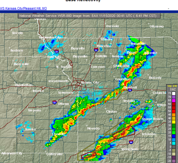 The severe thunderstorm warning for northwestern pettis and eastern johnson counties will expire at 700 pm cst, the storms which prompted the warning have weakened below severe limits, and no longer pose an immediate threat to life or property. therefore, the warning will be allowed to expire. however small hail, gusty winds and heavy rain are still possible with these thunderstorms. a tornado watch remains in effect until midnight cst for central and west central missouri. The severe thunderstorm warning for northwestern pettis and eastern johnson counties will expire at 700 pm cst, the storms which prompted the warning have weakened below severe limits, and no longer pose an immediate threat to life or property. therefore, the warning will be allowed to expire. however small hail, gusty winds and heavy rain are still possible with these thunderstorms. a tornado watch remains in effect until midnight cst for central and west central missouri.
|
| 11/14/2020 6:31 PM CST |
 At 631 pm cst, severe thunderstorms were located along a line extending from 7 miles south of concordia to near knob noster to near chilhowee, moving east at 50 mph (radar indicated). Hazards include 60 mph wind gusts. Expect damage to roofs, siding, and trees. Locations impacted include, warrensburg, knob noster, whiteman air force base, la monte, houstonia, whiteman afb and hughesville. At 631 pm cst, severe thunderstorms were located along a line extending from 7 miles south of concordia to near knob noster to near chilhowee, moving east at 50 mph (radar indicated). Hazards include 60 mph wind gusts. Expect damage to roofs, siding, and trees. Locations impacted include, warrensburg, knob noster, whiteman air force base, la monte, houstonia, whiteman afb and hughesville.
|
| 11/14/2020 6:12 PM CST |
 At 612 pm cst, severe thunderstorms were located along a line extending from 6 miles west of warrensburg to near holden to near garden city, moving east at 50 mph (radar indicated). Hazards include 60 mph wind gusts. expect damage to roofs, siding, and trees At 612 pm cst, severe thunderstorms were located along a line extending from 6 miles west of warrensburg to near holden to near garden city, moving east at 50 mph (radar indicated). Hazards include 60 mph wind gusts. expect damage to roofs, siding, and trees
|
| 9/27/2020 1:25 PM CDT |
 At 125 pm cdt, a severe thunderstorm was located over whiteman air force base, moving east at 35 mph (radar indicated). Hazards include 60 mph wind gusts. Expect damage to roofs, siding, and trees. Locations impacted include, knob noster, whiteman air force base, leeton, whiteman afb and post oak. At 125 pm cdt, a severe thunderstorm was located over whiteman air force base, moving east at 35 mph (radar indicated). Hazards include 60 mph wind gusts. Expect damage to roofs, siding, and trees. Locations impacted include, knob noster, whiteman air force base, leeton, whiteman afb and post oak.
|
| 9/27/2020 1:16 PM CDT |
 At 115 pm cdt, a severe thunderstorm was located southwest of whiteman air force base, moving southeast at 40 mph (radar indicated). Hazards include 70 mph wind gusts. Expect considerable tree damage. damage is likely to mobile homes, roofs, and outbuildings. Locations impacted include, warrensburg, knob noster, whiteman air force base, leeton, whiteman afb and post oak. At 115 pm cdt, a severe thunderstorm was located southwest of whiteman air force base, moving southeast at 40 mph (radar indicated). Hazards include 70 mph wind gusts. Expect considerable tree damage. damage is likely to mobile homes, roofs, and outbuildings. Locations impacted include, warrensburg, knob noster, whiteman air force base, leeton, whiteman afb and post oak.
|
| 9/27/2020 1:08 PM CDT |
 At 108 pm cdt, a severe thunderstorm was located over warrensburg, moving east at 35 mph (radar indicated). Hazards include 60 mph wind gusts. expect damage to roofs, siding, and trees At 108 pm cdt, a severe thunderstorm was located over warrensburg, moving east at 35 mph (radar indicated). Hazards include 60 mph wind gusts. expect damage to roofs, siding, and trees
|
| 8/31/2020 9:27 AM CDT |
 The severe thunderstorm warning for northwestern pettis and northeastern johnson counties will expire at 930 am cdt, the storm which prompted the warning has weakened below severe limits, and has exited the warned area. therefore, the warning will be allowed to expire. a severe thunderstorm watch remains in effect until 200 pm cdt for central and west central missouri. The severe thunderstorm warning for northwestern pettis and northeastern johnson counties will expire at 930 am cdt, the storm which prompted the warning has weakened below severe limits, and has exited the warned area. therefore, the warning will be allowed to expire. a severe thunderstorm watch remains in effect until 200 pm cdt for central and west central missouri.
|
| 8/31/2020 9:15 AM CDT |
 At 914 am cdt, a severe thunderstorm was located over whiteman air force base, moving east at 30 mph (radar indicated). Hazards include 60 mph wind gusts. Expect damage to roofs, siding, and trees. Locations impacted include, warrensburg, knob noster, whiteman air force base and whiteman afb. At 914 am cdt, a severe thunderstorm was located over whiteman air force base, moving east at 30 mph (radar indicated). Hazards include 60 mph wind gusts. Expect damage to roofs, siding, and trees. Locations impacted include, warrensburg, knob noster, whiteman air force base and whiteman afb.
|
| 8/31/2020 8:44 AM CDT |
 At 844 am cdt, a severe thunderstorm was located near warrensburg, moving east at 25 mph (radar indicated). Hazards include 60 mph wind gusts and nickel size hail. expect damage to roofs, siding, and trees At 844 am cdt, a severe thunderstorm was located near warrensburg, moving east at 25 mph (radar indicated). Hazards include 60 mph wind gusts and nickel size hail. expect damage to roofs, siding, and trees
|
| 8/10/2020 3:14 PM CDT |
 At 313 pm cdt, severe thunderstorms were located along a line extending from alma to near blackburn to near sweet springs to near houstonia to 9 miles northeast of la monte to near sedalia, moving east at 50 mph (trained weather spotters). Hazards include 70 mph wind gusts and nickel size hail. Expect considerable tree damage. damage is likely to mobile homes, roofs, and outbuildings. Locations impacted include, sedalia, marshall, higginsville, knob noster, concordia, sweet springs, la monte, waverly, corder, alma, malta bend, blackburn, houstonia, whiteman afb, wakenda, emma, hughesville, miami, aullville and mount leonard. At 313 pm cdt, severe thunderstorms were located along a line extending from alma to near blackburn to near sweet springs to near houstonia to 9 miles northeast of la monte to near sedalia, moving east at 50 mph (trained weather spotters). Hazards include 70 mph wind gusts and nickel size hail. Expect considerable tree damage. damage is likely to mobile homes, roofs, and outbuildings. Locations impacted include, sedalia, marshall, higginsville, knob noster, concordia, sweet springs, la monte, waverly, corder, alma, malta bend, blackburn, houstonia, whiteman afb, wakenda, emma, hughesville, miami, aullville and mount leonard.
|
| 8/10/2020 2:56 PM CDT |
 At 255 pm cdt, severe thunderstorms were located along a line extending from mayview to near higginsville to near concordia to 11 miles west of sweet springs to 10 miles north of whiteman air force base to near knob noster to near whiteman afb, moving northeast at 60 mph (trained weather spotters). Hazards include 70 mph wind gusts and nickel size hail. Expect considerable tree damage. damage is likely to mobile homes, roofs, and outbuildings. Locations impacted include, sedalia, warrensburg, marshall, odessa, higginsville, carrollton, knob noster, concordia, sweet springs, whiteman air force base, la monte, waverly, corder, alma, malta bend, blackburn, houstonia, mayview, whiteman afb and wakenda. At 255 pm cdt, severe thunderstorms were located along a line extending from mayview to near higginsville to near concordia to 11 miles west of sweet springs to 10 miles north of whiteman air force base to near knob noster to near whiteman afb, moving northeast at 60 mph (trained weather spotters). Hazards include 70 mph wind gusts and nickel size hail. Expect considerable tree damage. damage is likely to mobile homes, roofs, and outbuildings. Locations impacted include, sedalia, warrensburg, marshall, odessa, higginsville, carrollton, knob noster, concordia, sweet springs, whiteman air force base, la monte, waverly, corder, alma, malta bend, blackburn, houstonia, mayview, whiteman afb and wakenda.
|
| 8/10/2020 2:44 PM CDT |
 At 244 pm cdt, severe thunderstorms were located along a line extending from near odessa to 9 miles south of mayview to near warrensburg to 7 miles northwest of leeton, moving northeast at 55 mph (trained weather spotters). Hazards include 70 mph wind gusts. Expect considerable tree damage. damage is likely to mobile homes, roofs, and outbuildings. Locations impacted include, sedalia, warrensburg, marshall, odessa, higginsville, carrollton, knob noster, concordia, sweet springs, whiteman air force base, la monte, waverly, corder, alma, chilhowee, malta bend, blackburn, houstonia, mayview and whiteman afb. At 244 pm cdt, severe thunderstorms were located along a line extending from near odessa to 9 miles south of mayview to near warrensburg to 7 miles northwest of leeton, moving northeast at 55 mph (trained weather spotters). Hazards include 70 mph wind gusts. Expect considerable tree damage. damage is likely to mobile homes, roofs, and outbuildings. Locations impacted include, sedalia, warrensburg, marshall, odessa, higginsville, carrollton, knob noster, concordia, sweet springs, whiteman air force base, la monte, waverly, corder, alma, chilhowee, malta bend, blackburn, houstonia, mayview and whiteman afb.
|
| 8/10/2020 2:43 PM CDT |
 At 243 pm cdt, severe thunderstorms were located along a line extending from 8 miles east of lone jack to 6 miles west of warrensburg to near chilhowee, moving northeast at 35 mph (trained weather spotters). Hazards include 70 mph wind gusts. Expect considerable tree damage. damage is likely to mobile homes, roofs, and outbuildings. Locations impacted include, warrensburg, knob noster, whiteman air force base, chilhowee, whiteman afb, lake lafayette, centerview, fayetteville and pittsville. At 243 pm cdt, severe thunderstorms were located along a line extending from 8 miles east of lone jack to 6 miles west of warrensburg to near chilhowee, moving northeast at 35 mph (trained weather spotters). Hazards include 70 mph wind gusts. Expect considerable tree damage. damage is likely to mobile homes, roofs, and outbuildings. Locations impacted include, warrensburg, knob noster, whiteman air force base, chilhowee, whiteman afb, lake lafayette, centerview, fayetteville and pittsville.
|
| 8/10/2020 2:39 PM CDT |
 At 239 pm cdt, severe thunderstorms were located along a line extending from near odessa to 11 miles southwest of mayview to 9 miles northeast of holden to 6 miles west of warrensburg to 7 miles north of chilhowee, moving northeast at 50 mph (radar indicated). Hazards include 70 mph wind gusts and penny size hail. Expect considerable tree damage. Damage is likely to mobile homes, roofs, and outbuildings. At 239 pm cdt, severe thunderstorms were located along a line extending from near odessa to 11 miles southwest of mayview to 9 miles northeast of holden to 6 miles west of warrensburg to 7 miles north of chilhowee, moving northeast at 50 mph (radar indicated). Hazards include 70 mph wind gusts and penny size hail. Expect considerable tree damage. Damage is likely to mobile homes, roofs, and outbuildings.
|
| 8/10/2020 2:27 PM CDT |
 At 226 pm cdt, severe thunderstorms were located along a line extending from near lone jack to near holden to 6 miles west of chilhowee, moving east at 45 mph (radar indicated). Hazards include 70 mph wind gusts and nickel size hail. Expect considerable tree damage. damage is likely to mobile homes, roofs, and outbuildings. Locations impacted include, warrensburg, pleasant hill, oak grove, knob noster, holden, whiteman air force base, lone jack, chilhowee, kingsville, baldwin park, whiteman afb, lake lafayette, centerview, strasburg, gunn city, blairstown, fayetteville, la tour, pittsville and quick city. At 226 pm cdt, severe thunderstorms were located along a line extending from near lone jack to near holden to 6 miles west of chilhowee, moving east at 45 mph (radar indicated). Hazards include 70 mph wind gusts and nickel size hail. Expect considerable tree damage. damage is likely to mobile homes, roofs, and outbuildings. Locations impacted include, warrensburg, pleasant hill, oak grove, knob noster, holden, whiteman air force base, lone jack, chilhowee, kingsville, baldwin park, whiteman afb, lake lafayette, centerview, strasburg, gunn city, blairstown, fayetteville, la tour, pittsville and quick city.
|
| 8/10/2020 2:25 PM CDT |
 At 225 pm cdt, severe thunderstorms were located along a line extending from near lone jack to kingsville to 6 miles south of holden, moving east at 40 mph (radar indicated). Hazards include 60 mph wind gusts and nickel size hail. Expect damage to roofs, siding, and trees. Locations impacted include, warrensburg, pleasant hill, oak grove, knob noster, holden, whiteman air force base, lone jack, chilhowee, east lynne, kingsville, baldwin park, whiteman afb, lake lafayette, centerview, strasburg, gunn city, blairstown, fayetteville, la tour and pittsville. At 225 pm cdt, severe thunderstorms were located along a line extending from near lone jack to kingsville to 6 miles south of holden, moving east at 40 mph (radar indicated). Hazards include 60 mph wind gusts and nickel size hail. Expect damage to roofs, siding, and trees. Locations impacted include, warrensburg, pleasant hill, oak grove, knob noster, holden, whiteman air force base, lone jack, chilhowee, east lynne, kingsville, baldwin park, whiteman afb, lake lafayette, centerview, strasburg, gunn city, blairstown, fayetteville, la tour and pittsville.
|
| 8/10/2020 2:10 PM CDT |
 At 210 pm cdt, severe thunderstorms were located along a line extending from near harrisonville to east lynne to near garden city, moving northeast at 35 mph (radar indicated). Hazards include 60 mph wind gusts and quarter size hail. Hail damage to vehicles is expected. Expect wind damage to roofs, siding, and trees. At 210 pm cdt, severe thunderstorms were located along a line extending from near harrisonville to east lynne to near garden city, moving northeast at 35 mph (radar indicated). Hazards include 60 mph wind gusts and quarter size hail. Hail damage to vehicles is expected. Expect wind damage to roofs, siding, and trees.
|
| 7/1/2020 7:08 AM CDT |
 The severe thunderstorm warning for northern henry, west central pettis and johnson counties will expire at 715 am cdt, the storms which prompted the warning have weakened below severe limits, and no longer pose an immediate threat to life or property. therefore, the warning will be allowed to expire. however gusty winds are still possible with these thunderstorms. The severe thunderstorm warning for northern henry, west central pettis and johnson counties will expire at 715 am cdt, the storms which prompted the warning have weakened below severe limits, and no longer pose an immediate threat to life or property. therefore, the warning will be allowed to expire. however gusty winds are still possible with these thunderstorms.
|
| 7/1/2020 6:58 AM CDT |
 At 658 am cdt, severe thunderstorms were located along a line extending from 6 miles northwest of knob noster to warrensburg to 9 miles northwest of leeton to 6 miles north of chilhowee to near holden, moving southeast at 25 mph (radar indicated). Hazards include 60 mph wind gusts and quarter size hail. Hail damage to vehicles is expected. expect wind damage to roofs, siding, and trees. Locations impacted include, warrensburg, windsor, knob noster, holden, whiteman air force base, la monte, leeton, creighton, chilhowee, whiteman afb, centerview, blairstown, post oak and quick city. At 658 am cdt, severe thunderstorms were located along a line extending from 6 miles northwest of knob noster to warrensburg to 9 miles northwest of leeton to 6 miles north of chilhowee to near holden, moving southeast at 25 mph (radar indicated). Hazards include 60 mph wind gusts and quarter size hail. Hail damage to vehicles is expected. expect wind damage to roofs, siding, and trees. Locations impacted include, warrensburg, windsor, knob noster, holden, whiteman air force base, la monte, leeton, creighton, chilhowee, whiteman afb, centerview, blairstown, post oak and quick city.
|
| 7/1/2020 6:44 AM CDT |
 At 643 am cdt, severe thunderstorms were located along a line extending from 10 miles southwest of concordia to near warrensburg to 10 miles north of chilhowee to near holden to kingsville, moving southeast at 25 mph (radar indicated). Hazards include 60 mph wind gusts and quarter size hail. Hail damage to vehicles is expected. expect wind damage to roofs, siding, and trees. Locations impacted include, warrensburg, windsor, knob noster, holden, whiteman air force base, la monte, leeton, creighton, chilhowee, kingsville, whiteman afb, centerview, blairstown, fayetteville, la tour, pittsville, post oak and quick city. At 643 am cdt, severe thunderstorms were located along a line extending from 10 miles southwest of concordia to near warrensburg to 10 miles north of chilhowee to near holden to kingsville, moving southeast at 25 mph (radar indicated). Hazards include 60 mph wind gusts and quarter size hail. Hail damage to vehicles is expected. expect wind damage to roofs, siding, and trees. Locations impacted include, warrensburg, windsor, knob noster, holden, whiteman air force base, la monte, leeton, creighton, chilhowee, kingsville, whiteman afb, centerview, blairstown, fayetteville, la tour, pittsville, post oak and quick city.
|
| 7/1/2020 6:26 AM CDT |
 At 626 am cdt, severe thunderstorms were located along a line extending from 7 miles south of mayview to 9 miles south of odessa to 7 miles north of holden to near kingsville to near baldwin park, moving southeast at 25 mph (radar indicated). Hazards include 60 mph wind gusts and quarter size hail. Hail damage to vehicles is expected. expect wind damage to roofs, siding, and trees. Locations impacted include, warrensburg, oak grove, odessa, higginsville, windsor, knob noster, holden, garden city, whiteman air force base, la monte, lone jack, leeton, creighton, chilhowee, kingsville, whiteman afb, lake lafayette, centerview, bates city and strasburg. At 626 am cdt, severe thunderstorms were located along a line extending from 7 miles south of mayview to 9 miles south of odessa to 7 miles north of holden to near kingsville to near baldwin park, moving southeast at 25 mph (radar indicated). Hazards include 60 mph wind gusts and quarter size hail. Hail damage to vehicles is expected. expect wind damage to roofs, siding, and trees. Locations impacted include, warrensburg, oak grove, odessa, higginsville, windsor, knob noster, holden, garden city, whiteman air force base, la monte, lone jack, leeton, creighton, chilhowee, kingsville, whiteman afb, lake lafayette, centerview, bates city and strasburg.
|
| 7/1/2020 6:14 AM CDT |
 At 613 am cdt, severe thunderstorms were located along a line extending from near mayview to near odessa to 8 miles north of kingsville to near lone jack to baldwin park, moving southeast at 25 mph (radar indicated). Hazards include 60 mph wind gusts and quarter size hail. Hail damage to vehicles is expected. Expect wind damage to roofs, siding, and trees. At 613 am cdt, severe thunderstorms were located along a line extending from near mayview to near odessa to 8 miles north of kingsville to near lone jack to baldwin park, moving southeast at 25 mph (radar indicated). Hazards include 60 mph wind gusts and quarter size hail. Hail damage to vehicles is expected. Expect wind damage to roofs, siding, and trees.
|
| 6/5/2020 4:54 AM CDT |
 At 454 am cdt, severe thunderstorms were located along a line extending from near sweet springs to near calhoun to 6 miles east of appleton city, moving southeast at 55 mph (radar indicated). Hazards include 60 mph wind gusts and nickel size hail. expect damage to roofs, siding, and trees At 454 am cdt, severe thunderstorms were located along a line extending from near sweet springs to near calhoun to 6 miles east of appleton city, moving southeast at 55 mph (radar indicated). Hazards include 60 mph wind gusts and nickel size hail. expect damage to roofs, siding, and trees
|
| 6/5/2020 4:47 AM CDT |
 At 447 am cdt, severe thunderstorms were located along a line extending from near concordia to near leeton to near urich, moving southeast at 60 mph (radar indicated). Hazards include 70 mph wind gusts and nickel size hail. Expect considerable tree damage. damage is likely to mobile homes, roofs, and outbuildings. Locations impacted include, warrensburg, clinton, knob noster, concordia, holden, whiteman air force base, leeton, chilhowee, whiteman afb, centerview, emma, aullville, blairstown, fayetteville, la tour, post oak and quick city. At 447 am cdt, severe thunderstorms were located along a line extending from near concordia to near leeton to near urich, moving southeast at 60 mph (radar indicated). Hazards include 70 mph wind gusts and nickel size hail. Expect considerable tree damage. damage is likely to mobile homes, roofs, and outbuildings. Locations impacted include, warrensburg, clinton, knob noster, concordia, holden, whiteman air force base, leeton, chilhowee, whiteman afb, centerview, emma, aullville, blairstown, fayetteville, la tour, post oak and quick city.
|
| 6/5/2020 4:32 AM CDT |
 At 431 am cdt, severe thunderstorms were located along a line extending from mayview to near holden to garden city, moving southeast at 65 mph (radar indicated). Hazards include 70 mph wind gusts and nickel size hail. Expect considerable tree damage. damage is likely to mobile homes, roofs, and outbuildings. Locations impacted include, warrensburg, harrisonville, clinton, pleasant hill, oak grove, odessa, higginsville, lexington, knob noster, concordia, holden, whiteman air force base, lone jack, wellington, leeton, chilhowee, east lynne, kingsville, mayview and baldwin park. At 431 am cdt, severe thunderstorms were located along a line extending from mayview to near holden to garden city, moving southeast at 65 mph (radar indicated). Hazards include 70 mph wind gusts and nickel size hail. Expect considerable tree damage. damage is likely to mobile homes, roofs, and outbuildings. Locations impacted include, warrensburg, harrisonville, clinton, pleasant hill, oak grove, odessa, higginsville, lexington, knob noster, concordia, holden, whiteman air force base, lone jack, wellington, leeton, chilhowee, east lynne, kingsville, mayview and baldwin park.
|
| 6/5/2020 4:11 AM CDT |
 At 410 am cdt, severe thunderstorms were located along a line extending from near sibley to lee`s summit to near lake annette, moving southeast at 60 mph (radar indicated). Hazards include 70 mph wind gusts and nickel size hail. Expect considerable tree damage. Damage is likely to mobile homes, roofs, and outbuildings. At 410 am cdt, severe thunderstorms were located along a line extending from near sibley to lee`s summit to near lake annette, moving southeast at 60 mph (radar indicated). Hazards include 70 mph wind gusts and nickel size hail. Expect considerable tree damage. Damage is likely to mobile homes, roofs, and outbuildings.
|
| 6/4/2020 3:06 AM CDT |
 At 304 am cdt, severe thunderstorms were located along a line extending from near waverly to warrensburg to near creighton, moving southeast at 60 mph (radar indicated). Hazards include 60 mph wind gusts and nickel size hail. expect damage to roofs, siding, and trees At 304 am cdt, severe thunderstorms were located along a line extending from near waverly to warrensburg to near creighton, moving southeast at 60 mph (radar indicated). Hazards include 60 mph wind gusts and nickel size hail. expect damage to roofs, siding, and trees
|
| 6/4/2020 3:04 AM CDT |
 At 303 am cdt, severe thunderstorms were located along a line extending from near waverly to near warrensburg to near creighton, moving southeast at 60 mph (radar indicated). Hazards include 60 mph wind gusts and nickel size hail. expect damage to roofs, siding, and trees At 303 am cdt, severe thunderstorms were located along a line extending from near waverly to near warrensburg to near creighton, moving southeast at 60 mph (radar indicated). Hazards include 60 mph wind gusts and nickel size hail. expect damage to roofs, siding, and trees
|
| 6/3/2020 7:11 PM CDT |
 The severe thunderstorm warning for west central pettis and east central johnson counties will expire at 715 pm cdt, the storm which prompted the warning has weakened below severe limits, and no longer poses an immediate threat to life or property. therefore, the warning will be allowed to expire. however small hail and gusty winds to 50 mph are still possible with this thunderstorm. a severe thunderstorm watch remains in effect until 1000 pm cdt for central and west central missouri. The severe thunderstorm warning for west central pettis and east central johnson counties will expire at 715 pm cdt, the storm which prompted the warning has weakened below severe limits, and no longer poses an immediate threat to life or property. therefore, the warning will be allowed to expire. however small hail and gusty winds to 50 mph are still possible with this thunderstorm. a severe thunderstorm watch remains in effect until 1000 pm cdt for central and west central missouri.
|
| 6/3/2020 6:57 PM CDT | Quarter sized hail reported 1.1 miles WSW of Knob Noster, MO |
| 6/3/2020 6:54 PM CDT |
 At 654 pm cdt, a severe thunderstorm was located over knob noster, moving east at 15 mph (radar indicated). Hazards include 60 mph wind gusts and quarter size hail. Hail damage to vehicles is expected. expect wind damage to roofs, siding, and trees. Locations impacted include, knob noster, whiteman air force base, la monte and whiteman afb. At 654 pm cdt, a severe thunderstorm was located over knob noster, moving east at 15 mph (radar indicated). Hazards include 60 mph wind gusts and quarter size hail. Hail damage to vehicles is expected. expect wind damage to roofs, siding, and trees. Locations impacted include, knob noster, whiteman air force base, la monte and whiteman afb.
|
| 6/3/2020 6:40 PM CDT |
 The national weather service in pleasant hill has issued a * severe thunderstorm warning for. west central pettis county in central missouri. east central johnson county in west central missouri. until 715 pm cdt. At 639 pm cdt, a severe thunderstorm was located over knob noster,. The national weather service in pleasant hill has issued a * severe thunderstorm warning for. west central pettis county in central missouri. east central johnson county in west central missouri. until 715 pm cdt. At 639 pm cdt, a severe thunderstorm was located over knob noster,.
|
| 5/15/2020 1:00 AM CDT |
 At 1259 am cdt, severe thunderstorms were located along a line extending from near knob noster to 6 miles east of appleton city, moving east at 50 mph (radar indicated). Hazards include 70 mph wind gusts. Expect considerable tree damage. Damage is likely to mobile homes, roofs, and outbuildings. At 1259 am cdt, severe thunderstorms were located along a line extending from near knob noster to 6 miles east of appleton city, moving east at 50 mph (radar indicated). Hazards include 70 mph wind gusts. Expect considerable tree damage. Damage is likely to mobile homes, roofs, and outbuildings.
|
| 5/15/2020 12:45 AM CDT |
 At 1245 am cdt, a severe thunderstorm was located near knob noster, moving east at 55 mph (radar indicated). Hazards include 70 mph wind gusts. Expect considerable tree damage. Damage is likely to mobile homes, roofs, and outbuildings. At 1245 am cdt, a severe thunderstorm was located near knob noster, moving east at 55 mph (radar indicated). Hazards include 70 mph wind gusts. Expect considerable tree damage. Damage is likely to mobile homes, roofs, and outbuildings.
|
| 5/4/2020 1:02 PM CDT |
 At 101 pm cdt, severe thunderstorms were located along a line extending from near sweet springs to near cole camp to near warsaw, moving east at 60 mph. 60 mph winds have been reported at clinton airport (radar indicated). Hazards include 70 mph wind gusts. Expect considerable tree damage. damage is likely to mobile homes, roofs, and outbuildings. Locations impacted include, sedalia, warrensburg, clinton, windsor, knob noster, whiteman air force base, la monte, smithton, leeton, green ridge, calhoun, otterville, houstonia, whiteman afb, hughesville, clifton city, sedalia memorial arpt, post oak and truman lake. At 101 pm cdt, severe thunderstorms were located along a line extending from near sweet springs to near cole camp to near warsaw, moving east at 60 mph. 60 mph winds have been reported at clinton airport (radar indicated). Hazards include 70 mph wind gusts. Expect considerable tree damage. damage is likely to mobile homes, roofs, and outbuildings. Locations impacted include, sedalia, warrensburg, clinton, windsor, knob noster, whiteman air force base, la monte, smithton, leeton, green ridge, calhoun, otterville, houstonia, whiteman afb, hughesville, clifton city, sedalia memorial arpt, post oak and truman lake.
|
| 5/4/2020 12:41 PM CDT |
 At 1241 pm cdt, severe thunderstorms were located along a line extending from 7 miles southeast of mayview to calhoun to near clinton, moving east at 60 mph (radar indicated). Hazards include 70 mph wind gusts. Expect considerable tree damage. Damage is likely to mobile homes, roofs, and outbuildings. At 1241 pm cdt, severe thunderstorms were located along a line extending from 7 miles southeast of mayview to calhoun to near clinton, moving east at 60 mph (radar indicated). Hazards include 70 mph wind gusts. Expect considerable tree damage. Damage is likely to mobile homes, roofs, and outbuildings.
|
| 5/4/2020 12:08 PM CDT |
 At 1207 pm cdt, severe thunderstorms were located along a line extending from near raytown to near east lynne to near adrian, moving east at 65 mph (trained weather spotters). Hazards include 70 mph wind gusts and quarter size hail. Hail damage to vehicles is expected. expect considerable tree damage. Wind damage is also likely to mobile homes, roofs, and outbuildings. At 1207 pm cdt, severe thunderstorms were located along a line extending from near raytown to near east lynne to near adrian, moving east at 65 mph (trained weather spotters). Hazards include 70 mph wind gusts and quarter size hail. Hail damage to vehicles is expected. expect considerable tree damage. Wind damage is also likely to mobile homes, roofs, and outbuildings.
|
| 4/28/2020 4:12 PM CDT |
 The severe thunderstorm warning for southeastern cass, northwestern henry, northwestern pettis and southern johnson counties will expire at 415 pm cdt, the storms which prompted the warning have moved out of the area. therefore, the warning will be allowed to expire. however small hail, gusty winds and heavy rain are still possible with these thunderstorms. a severe thunderstorm watch remains in effect until 1100 pm cdt for central and west central missouri. The severe thunderstorm warning for southeastern cass, northwestern henry, northwestern pettis and southern johnson counties will expire at 415 pm cdt, the storms which prompted the warning have moved out of the area. therefore, the warning will be allowed to expire. however small hail, gusty winds and heavy rain are still possible with these thunderstorms. a severe thunderstorm watch remains in effect until 1100 pm cdt for central and west central missouri.
|
| 4/28/2020 3:40 PM CDT |
 At 339 pm cdt, severe thunderstorms were located along a line extending from near warrensburg to archie, moving east at 15 mph (radar indicated). Hazards include 60 mph wind gusts and quarter size hail. Hail damage to vehicles is expected. Expect wind damage to roofs, siding, and trees. At 339 pm cdt, severe thunderstorms were located along a line extending from near warrensburg to archie, moving east at 15 mph (radar indicated). Hazards include 60 mph wind gusts and quarter size hail. Hail damage to vehicles is expected. Expect wind damage to roofs, siding, and trees.
|
| 3/27/2020 2:38 AM CDT |
 At 238 am cdt, a severe thunderstorm was located near whiteman afb, or near whiteman air force base, moving east at 60 mph (trained weather spotters). Hazards include ping pong ball size hail. People and animals outdoors will be injured. expect damage to roofs, siding, windows, and vehicles. Locations impacted include, sedalia, knob noster, whiteman air force base, la monte, green ridge and whiteman afb. At 238 am cdt, a severe thunderstorm was located near whiteman afb, or near whiteman air force base, moving east at 60 mph (trained weather spotters). Hazards include ping pong ball size hail. People and animals outdoors will be injured. expect damage to roofs, siding, windows, and vehicles. Locations impacted include, sedalia, knob noster, whiteman air force base, la monte, green ridge and whiteman afb.
|
| 3/27/2020 2:36 AM CDT | Quarter sized hail reported 0.4 miles S of Knob Noster, MO |
| 3/27/2020 2:31 AM CDT |
 At 231 am cdt, a severe thunderstorm was located near whiteman afb, or near whiteman air force base, moving east at 60 mph (radar indicated). Hazards include ping pong ball size hail. People and animals outdoors will be injured. expect damage to roofs, siding, windows, and vehicles. Locations impacted include, sedalia, warrensburg, knob noster, whiteman air force base, la monte, green ridge and whiteman afb. At 231 am cdt, a severe thunderstorm was located near whiteman afb, or near whiteman air force base, moving east at 60 mph (radar indicated). Hazards include ping pong ball size hail. People and animals outdoors will be injured. expect damage to roofs, siding, windows, and vehicles. Locations impacted include, sedalia, warrensburg, knob noster, whiteman air force base, la monte, green ridge and whiteman afb.
|
| 3/27/2020 2:22 AM CDT |
 At 222 am cdt, a severe thunderstorm was located near warrensburg, moving east at 60 mph (radar indicated). Hazards include ping pong ball size hail. People and animals outdoors will be injured. Expect damage to roofs, siding, windows, and vehicles. At 222 am cdt, a severe thunderstorm was located near warrensburg, moving east at 60 mph (radar indicated). Hazards include ping pong ball size hail. People and animals outdoors will be injured. Expect damage to roofs, siding, windows, and vehicles.
|
| 3/27/2020 12:09 AM CDT |
 At 1209 am cdt, a severe thunderstorm was located near la monte, or 9 miles south of sweet springs, moving east at 55 mph (radar indicated). Hazards include quarter size hail. Damage to vehicles is expected. Locations impacted include, sedalia, knob noster, whiteman air force base, la monte, houstonia, whiteman afb, hughesville and sedalia memorial arpt. At 1209 am cdt, a severe thunderstorm was located near la monte, or 9 miles south of sweet springs, moving east at 55 mph (radar indicated). Hazards include quarter size hail. Damage to vehicles is expected. Locations impacted include, sedalia, knob noster, whiteman air force base, la monte, houstonia, whiteman afb, hughesville and sedalia memorial arpt.
|
| 3/27/2020 12:03 AM CDT |
 At 1203 am cdt, a severe thunderstorm was located near knob noster, moving east at 55 mph (radar indicated). Hazards include quarter size hail. Damage to vehicles is expected. Locations impacted include, sedalia, knob noster, whiteman air force base, la monte, houstonia, whiteman afb, hughesville and sedalia memorial arpt. At 1203 am cdt, a severe thunderstorm was located near knob noster, moving east at 55 mph (radar indicated). Hazards include quarter size hail. Damage to vehicles is expected. Locations impacted include, sedalia, knob noster, whiteman air force base, la monte, houstonia, whiteman afb, hughesville and sedalia memorial arpt.
|
| 3/26/2020 11:57 PM CDT |
 At 1157 pm cdt, a severe thunderstorm was located near knob noster, moving east at 55 mph (radar indicated). Hazards include quarter size hail. damage to vehicles is expected At 1157 pm cdt, a severe thunderstorm was located near knob noster, moving east at 55 mph (radar indicated). Hazards include quarter size hail. damage to vehicles is expected
|
| 3/26/2020 11:51 PM CDT |
 At 1151 pm cdt, a severe thunderstorm was located near knob noster, moving east at 60 mph (radar indicated). Hazards include half dollar size hail. Damage to vehicles is expected. Locations impacted include, sedalia, warrensburg, knob noster, sweet springs, whiteman air force base, la monte, houstonia, whiteman afb, centerview, hughesville and fayetteville. At 1151 pm cdt, a severe thunderstorm was located near knob noster, moving east at 60 mph (radar indicated). Hazards include half dollar size hail. Damage to vehicles is expected. Locations impacted include, sedalia, warrensburg, knob noster, sweet springs, whiteman air force base, la monte, houstonia, whiteman afb, centerview, hughesville and fayetteville.
|
| 3/26/2020 11:36 PM CDT |
 At 1135 pm cdt, a severe thunderstorm was located 7 miles west of warrensburg, moving east at 75 mph (radar indicated). Hazards include half dollar size hail. damage to vehicles is expected At 1135 pm cdt, a severe thunderstorm was located 7 miles west of warrensburg, moving east at 75 mph (radar indicated). Hazards include half dollar size hail. damage to vehicles is expected
|
| 8/26/2019 12:27 PM CDT |
 At 1212 pm cdt, a severe thunderstorm was located over leeton, or 12 miles west of windsor, moving east at 50 mph (radar indicated). Hazards include 60 mph wind gusts. expect damage to roofs, siding, and trees At 1212 pm cdt, a severe thunderstorm was located over leeton, or 12 miles west of windsor, moving east at 50 mph (radar indicated). Hazards include 60 mph wind gusts. expect damage to roofs, siding, and trees
|
| 8/26/2019 12:13 PM CDT |
 At 1212 pm cdt, a severe thunderstorm was located over leeton, or 12 miles west of windsor, moving east at 50 mph (radar indicated). Hazards include 60 mph wind gusts. expect damage to roofs, siding, and trees At 1212 pm cdt, a severe thunderstorm was located over leeton, or 12 miles west of windsor, moving east at 50 mph (radar indicated). Hazards include 60 mph wind gusts. expect damage to roofs, siding, and trees
|
| 8/26/2019 12:04 PM CDT |
 At 1204 pm cdt, a severe thunderstorm was located over chilhowee, or 8 miles southeast of holden, moving east at 50 mph (radar indicated). Hazards include 60 mph wind gusts. Expect damage to roofs, siding, and trees. Locations impacted include, warrensburg, knob noster, holden, leeton, chilhowee, whiteman afb, centerview, blairstown, fayetteville, la tour, pittsville, post oak and quick city. At 1204 pm cdt, a severe thunderstorm was located over chilhowee, or 8 miles southeast of holden, moving east at 50 mph (radar indicated). Hazards include 60 mph wind gusts. Expect damage to roofs, siding, and trees. Locations impacted include, warrensburg, knob noster, holden, leeton, chilhowee, whiteman afb, centerview, blairstown, fayetteville, la tour, pittsville, post oak and quick city.
|
| 8/26/2019 11:51 AM CDT |
 At 1151 am cdt, a severe thunderstorm was located near kingsville, or near holden, moving southeast at 45 mph (radar indicated). Hazards include 60 mph wind gusts. expect damage to roofs, siding, and trees At 1151 am cdt, a severe thunderstorm was located near kingsville, or near holden, moving southeast at 45 mph (radar indicated). Hazards include 60 mph wind gusts. expect damage to roofs, siding, and trees
|
| 8/17/2019 5:17 AM CDT |
 At 516 am cdt, a severe thunderstorm was located near green ridge, or 9 miles southeast of whiteman air force base, moving east at 50 mph (measured wind speed at whiteman afb). Hazards include 75 mph wind gusts and penny size hail. Expect considerable tree damage. damage is likely to mobile homes, roofs, and outbuildings. Locations impacted include, sedalia, windsor, knob noster, whiteman air force base, la monte, smithton, green ridge, whiteman afb, hughesville, ionia and sedalia memorial arpt. At 516 am cdt, a severe thunderstorm was located near green ridge, or 9 miles southeast of whiteman air force base, moving east at 50 mph (measured wind speed at whiteman afb). Hazards include 75 mph wind gusts and penny size hail. Expect considerable tree damage. damage is likely to mobile homes, roofs, and outbuildings. Locations impacted include, sedalia, windsor, knob noster, whiteman air force base, la monte, smithton, green ridge, whiteman afb, hughesville, ionia and sedalia memorial arpt.
|
| 8/17/2019 5:00 AM CDT |
 At 500 am cdt, a severe thunderstorm was located near leeton, or 8 miles southwest of whiteman air force base, moving east at 45 mph (radar indicated). Hazards include 70 mph wind gusts and penny size hail. Expect considerable tree damage. Damage is likely to mobile homes, roofs, and outbuildings. At 500 am cdt, a severe thunderstorm was located near leeton, or 8 miles southwest of whiteman air force base, moving east at 45 mph (radar indicated). Hazards include 70 mph wind gusts and penny size hail. Expect considerable tree damage. Damage is likely to mobile homes, roofs, and outbuildings.
|
| 8/15/2019 11:34 PM CDT | Half Dollar sized hail reported 0.4 miles S of Knob Noster, MO, delayed report. |
| 8/15/2019 11:33 PM CDT | Tree on top of a mobile hom in johnson county MO, 0.4 miles S of Knob Noster, MO |
| 8/15/2019 11:32 PM CDT | Med sized tree limbs down via mpin in johnson county MO, 0.4 miles S of Knob Noster, MO |
| 8/15/2019 11:24 PM CDT |
 A severe thunderstorm warning remains in effect until 1145 pm cdt for northwestern pettis. southeastern lafayette and northeastern johnson counties. at 1124 pm cdt, a severe thunderstorm was located near knob noster, moving southeast at 35 mph. hazard. Ping pong ball size hail and 60 mph wind gusts. A severe thunderstorm warning remains in effect until 1145 pm cdt for northwestern pettis. southeastern lafayette and northeastern johnson counties. at 1124 pm cdt, a severe thunderstorm was located near knob noster, moving southeast at 35 mph. hazard. Ping pong ball size hail and 60 mph wind gusts.
|
| 8/15/2019 11:14 PM CDT |
 A severe thunderstorm warning remains in effect until 1145 pm cdt for northwestern pettis. southeastern lafayette and eastern johnson counties. at 1114 pm cdt, a severe thunderstorm was located 7 miles north of warrensburg, moving southeast at 35 mph. hazard. Ping pong ball size hail and 60 mph wind gusts. A severe thunderstorm warning remains in effect until 1145 pm cdt for northwestern pettis. southeastern lafayette and eastern johnson counties. at 1114 pm cdt, a severe thunderstorm was located 7 miles north of warrensburg, moving southeast at 35 mph. hazard. Ping pong ball size hail and 60 mph wind gusts.
|
| 8/15/2019 10:56 PM CDT |
 The national weather service in pleasant hill has issued a * severe thunderstorm warning for. northwestern pettis county in central missouri. southeastern lafayette county in west central missouri. eastern johnson county in west central missouri. Until 1145 pm cdt. The national weather service in pleasant hill has issued a * severe thunderstorm warning for. northwestern pettis county in central missouri. southeastern lafayette county in west central missouri. eastern johnson county in west central missouri. Until 1145 pm cdt.
|
| 7/10/2019 10:11 AM CDT |
 At 1011 am cdt, severe thunderstorms were located along a line extending from henrietta to 6 miles north of warrensburg to near urich, moving east at 45 mph (radar indicated). Hazards include 60 mph wind gusts and penny size hail. Expect damage to roofs, siding, and trees. Locations impacted include, independence, lee`s summit, blue springs, raymore, warrensburg, grain valley, harrisonville, clinton, pleasant hill, oak grove, odessa, greenwood, higginsville, lexington, peculiar, buckner, knob noster, concordia, holden and lake lotawana. At 1011 am cdt, severe thunderstorms were located along a line extending from henrietta to 6 miles north of warrensburg to near urich, moving east at 45 mph (radar indicated). Hazards include 60 mph wind gusts and penny size hail. Expect damage to roofs, siding, and trees. Locations impacted include, independence, lee`s summit, blue springs, raymore, warrensburg, grain valley, harrisonville, clinton, pleasant hill, oak grove, odessa, greenwood, higginsville, lexington, peculiar, buckner, knob noster, concordia, holden and lake lotawana.
|
| 7/10/2019 9:43 AM CDT |
 At 942 am cdt, severe thunderstorms were located along a line extending from excelsior springs to near odessa to near east lynne, moving east at 45 mph (radar indicated). Hazards include 60 mph wind gusts. expect damage to roofs, siding, and trees At 942 am cdt, severe thunderstorms were located along a line extending from excelsior springs to near odessa to near east lynne, moving east at 45 mph (radar indicated). Hazards include 60 mph wind gusts. expect damage to roofs, siding, and trees
|
| 6/22/2019 11:24 PM CDT |
 At 1124 pm cdt, severe thunderstorms were located along a line extending from 6 miles south of concordia to near deepwater, moving east at 45 mph (radar indicated). Hazards include 70 mph wind gusts. Expect considerable tree damage. Damage is likely to mobile homes, roofs, and outbuildings. At 1124 pm cdt, severe thunderstorms were located along a line extending from 6 miles south of concordia to near deepwater, moving east at 45 mph (radar indicated). Hazards include 70 mph wind gusts. Expect considerable tree damage. Damage is likely to mobile homes, roofs, and outbuildings.
|
| 6/22/2019 10:59 PM CDT |
 At 1058 pm cdt, severe thunderstorms were located along a line extending from near odessa to near warrensburg to near chilhowee, moving east at 40 mph (radar indicated). Hazards include 70 mph wind gusts. Expect considerable tree damage. Damage is likely to mobile homes, roofs, and outbuildings. At 1058 pm cdt, severe thunderstorms were located along a line extending from near odessa to near warrensburg to near chilhowee, moving east at 40 mph (radar indicated). Hazards include 70 mph wind gusts. Expect considerable tree damage. Damage is likely to mobile homes, roofs, and outbuildings.
|
| 6/21/2019 10:58 AM CDT |
 At 1057 am cdt, a severe thunderstorm was located near garden city, moving southeast at 40 mph (radar indicated). Hazards include 60 mph wind gusts. expect damage to roofs, siding, and trees At 1057 am cdt, a severe thunderstorm was located near garden city, moving southeast at 40 mph (radar indicated). Hazards include 60 mph wind gusts. expect damage to roofs, siding, and trees
|
| 6/5/2019 9:22 PM CDT | Mping report of 1 inch tree limb down... along with minor roof damage. likely sub-severe wind in johnson county MO, 1.1 miles WSW of Knob Noster, MO |
| 5/22/2019 8:20 PM CDT |
 The severe thunderstorm warning for northeastern johnson county will expire at 830 pm cdt, the storm which prompted the warning has moved out of the area. therefore, the warning will be allowed to expire. a tornado watch remains in effect until 1100 pm cdt for central and west central missouri. The severe thunderstorm warning for northeastern johnson county will expire at 830 pm cdt, the storm which prompted the warning has moved out of the area. therefore, the warning will be allowed to expire. a tornado watch remains in effect until 1100 pm cdt for central and west central missouri.
|
| 5/22/2019 8:11 PM CDT |
 At 811 pm cdt, a severe thunderstorm was located near warrensburg, moving northeast at 35 mph (radar indicated). Hazards include 60 mph wind gusts and half dollar size hail. Hail damage to vehicles is expected. expect wind damage to roofs, siding, and trees. Locations impacted include, knob noster, whiteman air force base and whiteman afb. At 811 pm cdt, a severe thunderstorm was located near warrensburg, moving northeast at 35 mph (radar indicated). Hazards include 60 mph wind gusts and half dollar size hail. Hail damage to vehicles is expected. expect wind damage to roofs, siding, and trees. Locations impacted include, knob noster, whiteman air force base and whiteman afb.
|
| 5/22/2019 7:54 PM CDT |
 At 754 pm cdt, a severe thunderstorm was located near warrensburg, moving northeast at 35 mph (radar indicated. estimated 60 mph winds were reported 3 miles west of centerview). Hazards include 60 mph wind gusts and half dollar size hail. Hail damage to vehicles is expected. expect wind damage to roofs, siding, and trees. Locations impacted include, warrensburg, knob noster, whiteman air force base, whiteman afb, centerview and fayetteville. At 754 pm cdt, a severe thunderstorm was located near warrensburg, moving northeast at 35 mph (radar indicated. estimated 60 mph winds were reported 3 miles west of centerview). Hazards include 60 mph wind gusts and half dollar size hail. Hail damage to vehicles is expected. expect wind damage to roofs, siding, and trees. Locations impacted include, warrensburg, knob noster, whiteman air force base, whiteman afb, centerview and fayetteville.
|
| 5/22/2019 7:43 PM CDT |
 At 742 pm cdt, a severe thunderstorm was located near holden, moving northeast at 35 mph (radar indicated). Hazards include 60 mph wind gusts and quarter size hail. Hail damage to vehicles is expected. Expect wind damage to roofs, siding, and trees. At 742 pm cdt, a severe thunderstorm was located near holden, moving northeast at 35 mph (radar indicated). Hazards include 60 mph wind gusts and quarter size hail. Hail damage to vehicles is expected. Expect wind damage to roofs, siding, and trees.
|
| 8/31/2018 12:59 PM CDT |
 The national weather service in pleasant hill has issued a * severe thunderstorm warning for. west central pettis county in central missouri. east central johnson county in west central missouri. until 130 pm cdt. At 1258 pm cdt, a severe thunderstorm was located over whiteman air. The national weather service in pleasant hill has issued a * severe thunderstorm warning for. west central pettis county in central missouri. east central johnson county in west central missouri. until 130 pm cdt. At 1258 pm cdt, a severe thunderstorm was located over whiteman air.
|
| 8/16/2018 8:11 PM CDT |
 At 810 pm cdt, a severe thunderstorm was located near concordia, moving southeast at 30 mph (radar indicated). Hazards include 60 mph wind gusts and quarter size hail. Hail damage to vehicles is expected. Expect wind damage to roofs, siding, and trees. At 810 pm cdt, a severe thunderstorm was located near concordia, moving southeast at 30 mph (radar indicated). Hazards include 60 mph wind gusts and quarter size hail. Hail damage to vehicles is expected. Expect wind damage to roofs, siding, and trees.
|
| 8/16/2018 7:47 PM CDT |
 The national weather service in pleasant hill has issued a * severe thunderstorm warning for. southeastern lafayette county in west central missouri. northeastern johnson county in west central missouri. until 815 pm cdt. At 746 pm cdt, a severe thunderstorm was located near mayview, or 7. The national weather service in pleasant hill has issued a * severe thunderstorm warning for. southeastern lafayette county in west central missouri. northeastern johnson county in west central missouri. until 815 pm cdt. At 746 pm cdt, a severe thunderstorm was located near mayview, or 7.
|
| 8/16/2018 6:39 PM CDT |
 At 639 pm cdt, a severe thunderstorm was located near concordia, moving east at 40 mph (radar indicated). Hazards include two inch hail and 70 mph wind gusts. People and animals outdoors will be injured. expect hail damage to roofs, siding, windows, and vehicles. expect considerable tree damage. Wind damage is also likely to mobile homes, roofs, and outbuildings. At 639 pm cdt, a severe thunderstorm was located near concordia, moving east at 40 mph (radar indicated). Hazards include two inch hail and 70 mph wind gusts. People and animals outdoors will be injured. expect hail damage to roofs, siding, windows, and vehicles. expect considerable tree damage. Wind damage is also likely to mobile homes, roofs, and outbuildings.
|
| 7/19/2018 1:10 PM CDT |
 At 110 pm cdt, a severe thunderstorm was located near warrensburg, moving south at 30 mph (trained weather spotters). Hazards include golf ball size hail and 60 mph wind gusts. People and animals outdoors will be injured. expect hail damage to roofs, siding, windows, and vehicles. Expect wind damage to roofs, siding, and trees. At 110 pm cdt, a severe thunderstorm was located near warrensburg, moving south at 30 mph (trained weather spotters). Hazards include golf ball size hail and 60 mph wind gusts. People and animals outdoors will be injured. expect hail damage to roofs, siding, windows, and vehicles. Expect wind damage to roofs, siding, and trees.
|
| 7/19/2018 12:56 PM CDT |
 At 1256 pm cdt, a severe thunderstorm was located near knob noster, moving south at 30 mph (trained weather spotters). Hazards include golf ball size hail and 60 mph wind gusts. People and animals outdoors will be injured. expect hail damage to roofs, siding, windows, and vehicles. expect wind damage to roofs, siding, and trees. Locations impacted include, warrensburg, knob noster, whiteman air force base, la monte and whiteman afb. At 1256 pm cdt, a severe thunderstorm was located near knob noster, moving south at 30 mph (trained weather spotters). Hazards include golf ball size hail and 60 mph wind gusts. People and animals outdoors will be injured. expect hail damage to roofs, siding, windows, and vehicles. expect wind damage to roofs, siding, and trees. Locations impacted include, warrensburg, knob noster, whiteman air force base, la monte and whiteman afb.
|
| 7/19/2018 12:51 PM CDT |
 At 1251 pm cdt, a severe thunderstorm was located near knob noster, moving south at 30 mph (radar indicated). Hazards include 60 mph wind gusts and quarter size hail. Hail damage to vehicles is expected. expect wind damage to roofs, siding, and trees. Locations impacted include, warrensburg, knob noster, whiteman air force base, la monte, whiteman afb and fayetteville. At 1251 pm cdt, a severe thunderstorm was located near knob noster, moving south at 30 mph (radar indicated). Hazards include 60 mph wind gusts and quarter size hail. Hail damage to vehicles is expected. expect wind damage to roofs, siding, and trees. Locations impacted include, warrensburg, knob noster, whiteman air force base, la monte, whiteman afb and fayetteville.
|
| 7/19/2018 12:38 PM CDT |
 At 1238 pm cdt, a severe thunderstorm was located 7 miles southwest of concordia, moving south at 30 mph (radar indicated). Hazards include 60 mph wind gusts and quarter size hail. Hail damage to vehicles is expected. Expect wind damage to roofs, siding, and trees. At 1238 pm cdt, a severe thunderstorm was located 7 miles southwest of concordia, moving south at 30 mph (radar indicated). Hazards include 60 mph wind gusts and quarter size hail. Hail damage to vehicles is expected. Expect wind damage to roofs, siding, and trees.
|
| 7/19/2018 10:47 AM CDT |
 At 1047 am cdt, severe thunderstorms were located along a line extending from near bunceton to near green ridge, moving southeast at 35 mph (trained weather spotters). Hazards include 70 mph wind gusts and quarter size hail. Hail damage to vehicles is expected. expect considerable tree damage. wind damage is also likely to mobile homes, roofs, and outbuildings. Locations impacted include, windsor, knob noster, whiteman air force base, la monte, green ridge and whiteman afb. At 1047 am cdt, severe thunderstorms were located along a line extending from near bunceton to near green ridge, moving southeast at 35 mph (trained weather spotters). Hazards include 70 mph wind gusts and quarter size hail. Hail damage to vehicles is expected. expect considerable tree damage. wind damage is also likely to mobile homes, roofs, and outbuildings. Locations impacted include, windsor, knob noster, whiteman air force base, la monte, green ridge and whiteman afb.
|
| 7/19/2018 10:42 AM CDT |
 The severe thunderstorm warning for northern pettis and east central johnson counties will expire at 1045 am cdt, the storm which prompted the warning has moved out of the area. therefore, the warning will be allowed to expire. remember, a severe thunderstorm warning still remains in effect for southwestern pettis and southeastern johnson counties in missouri. The severe thunderstorm warning for northern pettis and east central johnson counties will expire at 1045 am cdt, the storm which prompted the warning has moved out of the area. therefore, the warning will be allowed to expire. remember, a severe thunderstorm warning still remains in effect for southwestern pettis and southeastern johnson counties in missouri.
|
| 7/19/2018 10:40 AM CDT | Quarter sized hail reported 2.3 miles NW of Knob Noster, MO, from trained spotter. |
| 7/19/2018 10:40 AM CDT | 8" tree knocked down and significant flag pole bent on hwy d 5 miles south of u.s. 5 in johnson county MO, 5.8 miles N of Knob Noster, MO |
| 7/19/2018 10:40 AM CDT |
 At 1039 am cdt, severe thunderstorms were located along a line extending from 6 miles southwest of bunceton to green ridge, moving southeast at 35 mph (radar indicated). Hazards include 60 mph wind gusts and quarter size hail. Hail damage to vehicles is expected. Expect wind damage to roofs, siding, and trees. At 1039 am cdt, severe thunderstorms were located along a line extending from 6 miles southwest of bunceton to green ridge, moving southeast at 35 mph (radar indicated). Hazards include 60 mph wind gusts and quarter size hail. Hail damage to vehicles is expected. Expect wind damage to roofs, siding, and trees.
|
| 7/19/2018 10:36 AM CDT | Delayed report... time matched to radar: tree blown down on hom in johnson county MO, 0.7 miles SW of Knob Noster, MO |
| 7/19/2018 10:35 AM CDT |
 At 1035 am cdt, a severe thunderstorm was located near la monte, or 7 miles northwest of sedalia, moving southeast at 25 mph (trained weather spotters). Hazards include 60 mph wind gusts and quarter size hail. Hail damage to vehicles is expected. expect wind damage to roofs, siding, and trees. Locations impacted include, sedalia, knob noster, whiteman air force base, la monte, houstonia, whiteman afb and hughesville. At 1035 am cdt, a severe thunderstorm was located near la monte, or 7 miles northwest of sedalia, moving southeast at 25 mph (trained weather spotters). Hazards include 60 mph wind gusts and quarter size hail. Hail damage to vehicles is expected. expect wind damage to roofs, siding, and trees. Locations impacted include, sedalia, knob noster, whiteman air force base, la monte, houstonia, whiteman afb and hughesville.
|
| 7/19/2018 10:15 AM CDT |
 At 1013 am cdt, a severe thunderstorm was located over houstonia, or near sweet springs, moving southeast at 25 mph (trained weather spotters). Hazards include 60 mph wind gusts possible and quarter size hail. Hail damage to vehicles is expected. Expect wind damage to roofs, siding, and trees. At 1013 am cdt, a severe thunderstorm was located over houstonia, or near sweet springs, moving southeast at 25 mph (trained weather spotters). Hazards include 60 mph wind gusts possible and quarter size hail. Hail damage to vehicles is expected. Expect wind damage to roofs, siding, and trees.
|
| 6/26/2018 2:19 PM CDT |
 At 219 pm cdt, a severe thunderstorm was located near sedalia, moving east at 50 mph (radar indicated). Hazards include 60 mph wind gusts and quarter size hail. Hail damage to vehicles is expected. expect wind damage to roofs, siding, and trees. Locations impacted include, warrensburg, knob noster, holden, whiteman air force base, leeton, kingsville, whiteman afb and centerview. At 219 pm cdt, a severe thunderstorm was located near sedalia, moving east at 50 mph (radar indicated). Hazards include 60 mph wind gusts and quarter size hail. Hail damage to vehicles is expected. expect wind damage to roofs, siding, and trees. Locations impacted include, warrensburg, knob noster, holden, whiteman air force base, leeton, kingsville, whiteman afb and centerview.
|
| 6/26/2018 1:54 PM CDT |
 At 154 pm cdt, a severe thunderstorm was located near knob noster, moving east at 50 mph (radar indicated). Hazards include 60 mph wind gusts and quarter size hail. Hail damage to vehicles is expected. expect wind damage to roofs, siding, and trees. locations impacted include, warrensburg, higginsville, knob noster, concordia, holden, whiteman air force base, leeton, kingsville, whiteman afb, centerview, emma, aullville, fayetteville and pittsville. This includes interstate 70 in missouri between mile markers 44 and 62. At 154 pm cdt, a severe thunderstorm was located near knob noster, moving east at 50 mph (radar indicated). Hazards include 60 mph wind gusts and quarter size hail. Hail damage to vehicles is expected. expect wind damage to roofs, siding, and trees. locations impacted include, warrensburg, higginsville, knob noster, concordia, holden, whiteman air force base, leeton, kingsville, whiteman afb, centerview, emma, aullville, fayetteville and pittsville. This includes interstate 70 in missouri between mile markers 44 and 62.
|
| 6/26/2018 1:22 PM CDT |
 At 122 pm cdt, a severe thunderstorm was located over lone jack, or near lake lotawana, moving east at 50 mph (radar indicated). Hazards include 60 mph wind gusts and quarter size hail. Hail damage to vehicles is expected. Expect wind damage to roofs, siding, and trees. At 122 pm cdt, a severe thunderstorm was located over lone jack, or near lake lotawana, moving east at 50 mph (radar indicated). Hazards include 60 mph wind gusts and quarter size hail. Hail damage to vehicles is expected. Expect wind damage to roofs, siding, and trees.
|
| 6/26/2018 7:45 AM CDT |
 At 745 am cdt, a severe thunderstorm was located near holden, moving east at 45 mph (radar indicated). Hazards include 60 mph wind gusts and quarter size hail. Hail damage to vehicles is expected. Expect wind damage to roofs, siding, and trees. At 745 am cdt, a severe thunderstorm was located near holden, moving east at 45 mph (radar indicated). Hazards include 60 mph wind gusts and quarter size hail. Hail damage to vehicles is expected. Expect wind damage to roofs, siding, and trees.
|
| 5/14/2018 5:26 PM CDT |
 At 526 pm cdt, a severe thunderstorm was located near holden, moving east at 35 mph (radar indicated). Hazards include 60 mph wind gusts and quarter size hail. Hail damage to vehicles is expected. Expect wind damage to roofs, siding, and trees. At 526 pm cdt, a severe thunderstorm was located near holden, moving east at 35 mph (radar indicated). Hazards include 60 mph wind gusts and quarter size hail. Hail damage to vehicles is expected. Expect wind damage to roofs, siding, and trees.
|
| 5/14/2018 3:07 PM CDT |
 At 307 pm cdt, a severe thunderstorm was located 7 miles north of warrensburg, moving east at 20 mph (radar indicated). Hazards include 60 mph wind gusts and quarter size hail. Hail damage to vehicles is expected. Expect wind damage to roofs, siding, and trees. At 307 pm cdt, a severe thunderstorm was located 7 miles north of warrensburg, moving east at 20 mph (radar indicated). Hazards include 60 mph wind gusts and quarter size hail. Hail damage to vehicles is expected. Expect wind damage to roofs, siding, and trees.
|
| 5/2/2018 10:43 PM CDT |
 A severe thunderstorm warning remains in effect until 1100 pm cdt for henry. southwestern carroll. eastern lafayette and johnson counties. At 1043 pm cdt, severe thunderstorms were located along a line extending from near waverly to near sweet springs to near knob noster to near leeton to near calhoun to 6 miles southwest of lowry city,. A severe thunderstorm warning remains in effect until 1100 pm cdt for henry. southwestern carroll. eastern lafayette and johnson counties. At 1043 pm cdt, severe thunderstorms were located along a line extending from near waverly to near sweet springs to near knob noster to near leeton to near calhoun to 6 miles southwest of lowry city,.
|
| 5/2/2018 10:39 PM CDT |
 At 1039 pm cdt, severe thunderstorms were located along a line extending from carrollton to near sweet springs to near whiteman afb to near leeton to near clinton to near deepwater, moving east at 35 mph (radar indicated). Hazards include 60 mph wind gusts. expect damage to roofs, siding, and trees At 1039 pm cdt, severe thunderstorms were located along a line extending from carrollton to near sweet springs to near whiteman afb to near leeton to near clinton to near deepwater, moving east at 35 mph (radar indicated). Hazards include 60 mph wind gusts. expect damage to roofs, siding, and trees
|
| 5/2/2018 10:21 PM CDT |
 A severe thunderstorm warning remains in effect until 1100 pm cdt for henry. eastern bates. southeastern ray. southwestern carroll. lafayette and johnson counties. At 1020 pm cdt, severe thunderstorms were located along a line extending from near norborne to higginsville to near warrensburg to near chilhowee to 6 miles east of urich to near appleton city, moving. A severe thunderstorm warning remains in effect until 1100 pm cdt for henry. eastern bates. southeastern ray. southwestern carroll. lafayette and johnson counties. At 1020 pm cdt, severe thunderstorms were located along a line extending from near norborne to higginsville to near warrensburg to near chilhowee to 6 miles east of urich to near appleton city, moving.
|
| 5/2/2018 9:57 PM CDT |
 At 956 pm cdt, severe thunderstorms were located along a line extending from near orrick to near odessa to near kingsville to near garden city to 8 miles southwest of creighton to near rich hill, moving east at 40 mph (radar indicated). Hazards include 70 mph wind gusts. Expect considerable tree damage. Damage is likely to mobile homes, roofs, and outbuildings. At 956 pm cdt, severe thunderstorms were located along a line extending from near orrick to near odessa to near kingsville to near garden city to 8 miles southwest of creighton to near rich hill, moving east at 40 mph (radar indicated). Hazards include 70 mph wind gusts. Expect considerable tree damage. Damage is likely to mobile homes, roofs, and outbuildings.
|
| 3/16/2018 4:44 PM CDT |
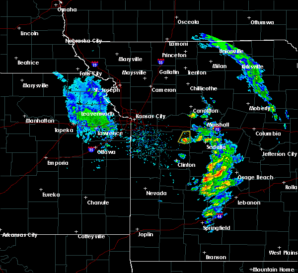 At 444 pm cdt, a severe thunderstorm was located near warrensburg, moving northeast at 35 mph (radar indicated). Hazards include quarter size hail. damage to vehicles is expected At 444 pm cdt, a severe thunderstorm was located near warrensburg, moving northeast at 35 mph (radar indicated). Hazards include quarter size hail. damage to vehicles is expected
|
| 8/18/2017 10:07 PM CDT |
 At 1006 pm cdt, a severe thunderstorm was located over green ridge, or 8 miles southeast of whiteman air force base, moving southeast at 35 mph (trained weather spotters). Hazards include 60 mph wind gusts and quarter size hail. Hail damage to vehicles is expected. expect wind damage to roofs, siding, and trees. locations impacted include, sedalia, knob noster, whiteman air force base, la monte, green ridge and whiteman afb. At 958 pm a trained spotter in knob knoster reported quarter sized hail. At 1006 pm cdt, a severe thunderstorm was located over green ridge, or 8 miles southeast of whiteman air force base, moving southeast at 35 mph (trained weather spotters). Hazards include 60 mph wind gusts and quarter size hail. Hail damage to vehicles is expected. expect wind damage to roofs, siding, and trees. locations impacted include, sedalia, knob noster, whiteman air force base, la monte, green ridge and whiteman afb. At 958 pm a trained spotter in knob knoster reported quarter sized hail.
|
| 8/18/2017 10:00 PM CDT | Quarter sized hail reported 0.4 miles S of Knob Noster, MO |
| 8/18/2017 9:58 PM CDT |
 At 958 pm cdt, a severe thunderstorm was located near whiteman air force base, moving southeast at 35 mph (radar indicated). Hazards include 60 mph wind gusts and half dollar size hail. Hail damage to vehicles is expected. expect wind damage to roofs, siding, and trees. Locations impacted include, sedalia, knob noster, whiteman air force base, la monte, green ridge and whiteman afb. At 958 pm cdt, a severe thunderstorm was located near whiteman air force base, moving southeast at 35 mph (radar indicated). Hazards include 60 mph wind gusts and half dollar size hail. Hail damage to vehicles is expected. expect wind damage to roofs, siding, and trees. Locations impacted include, sedalia, knob noster, whiteman air force base, la monte, green ridge and whiteman afb.
|
| 8/18/2017 9:42 PM CDT | Quarter sized hail reported 6.3 miles SSE of Knob Noster, MO, near the intersection of ne 801st and 700th. |
| 8/18/2017 9:34 PM CDT |
 At 934 pm cdt, a severe thunderstorm was located 7 miles northeast of warrensburg, moving southeast at 35 mph (radar indicated). Hazards include golf ball size hail and 60 mph wind gusts. People and animals outdoors will be injured. expect hail damage to roofs, siding, windows, and vehicles. Expect wind damage to roofs, siding, and trees. At 934 pm cdt, a severe thunderstorm was located 7 miles northeast of warrensburg, moving southeast at 35 mph (radar indicated). Hazards include golf ball size hail and 60 mph wind gusts. People and animals outdoors will be injured. expect hail damage to roofs, siding, windows, and vehicles. Expect wind damage to roofs, siding, and trees.
|
| 8/16/2017 6:41 PM CDT |
 At 641 pm cdt, a severe thunderstorm was located over leeton, or 10 miles south of warrensburg, moving east at 30 mph (radar indicated). Hazards include 60 mph wind gusts and quarter size hail. Hail damage to vehicles is expected. Expect wind damage to roofs, siding, and trees. At 641 pm cdt, a severe thunderstorm was located over leeton, or 10 miles south of warrensburg, moving east at 30 mph (radar indicated). Hazards include 60 mph wind gusts and quarter size hail. Hail damage to vehicles is expected. Expect wind damage to roofs, siding, and trees.
|
| 7/22/2017 11:37 PM CDT |
 At 1136 pm cdt, a severe thunderstorm was located near sweet springs, moving east at 30 mph (radar indicated). Hazards include 60 mph wind gusts. expect damage to roofs, siding, and trees At 1136 pm cdt, a severe thunderstorm was located near sweet springs, moving east at 30 mph (radar indicated). Hazards include 60 mph wind gusts. expect damage to roofs, siding, and trees
|
| 7/22/2017 11:15 PM CDT |
 At 1115 pm cdt, a severe thunderstorm was located over corder, or near higginsville, moving east at 40 mph (radar indicated). Hazards include 70 mph wind gusts and penny size hail. Expect considerable tree damage. damage is likely to mobile homes, roofs, and outbuildings. locations impacted include, warrensburg, richmond, odessa, higginsville, lexington, knob noster, concordia, holden, sweet springs, whiteman air force base, la monte, waverly, wellington, norborne, hardin, leeton, corder, alma, henrietta and chilhowee. This includes interstate 70 in missouri between mile markers 30 and 74. At 1115 pm cdt, a severe thunderstorm was located over corder, or near higginsville, moving east at 40 mph (radar indicated). Hazards include 70 mph wind gusts and penny size hail. Expect considerable tree damage. damage is likely to mobile homes, roofs, and outbuildings. locations impacted include, warrensburg, richmond, odessa, higginsville, lexington, knob noster, concordia, holden, sweet springs, whiteman air force base, la monte, waverly, wellington, norborne, hardin, leeton, corder, alma, henrietta and chilhowee. This includes interstate 70 in missouri between mile markers 30 and 74.
|
| 7/22/2017 10:54 PM CDT |
 At 1054 pm cdt, a severe thunderstorm was located over mayview, or near odessa, moving east at 40 mph (radar indicated). Hazards include 60 mph wind gusts and penny size hail. expect damage to roofs, siding, and trees At 1054 pm cdt, a severe thunderstorm was located over mayview, or near odessa, moving east at 40 mph (radar indicated). Hazards include 60 mph wind gusts and penny size hail. expect damage to roofs, siding, and trees
|
| 6/17/2017 2:00 AM CDT |
 At 200 am cdt, severe thunderstorms were located along a line extending from 6 miles north of leeton to near clinton to butler, moving southeast at 45 mph (radar indicated). Hazards include 60 mph wind gusts. expect damage to roofs, siding, and trees At 200 am cdt, severe thunderstorms were located along a line extending from 6 miles north of leeton to near clinton to butler, moving southeast at 45 mph (radar indicated). Hazards include 60 mph wind gusts. expect damage to roofs, siding, and trees
|
| 5/27/2017 1:36 PM CDT |
 At 136 pm cdt, severe thunderstorms were located along a line extending from concordia to near whiteman afb to near calhoun, moving east at 45 mph (radar indicated). Hazards include 60 mph wind gusts and half dollar size hail. Hail damage to vehicles is expected. Expect wind damage to roofs, siding, and trees. At 136 pm cdt, severe thunderstorms were located along a line extending from concordia to near whiteman afb to near calhoun, moving east at 45 mph (radar indicated). Hazards include 60 mph wind gusts and half dollar size hail. Hail damage to vehicles is expected. Expect wind damage to roofs, siding, and trees.
|
| 5/27/2017 1:24 PM CDT |
 At 124 pm cdt, severe thunderstorms were located along a line extending from near mayview to near warrensburg to near clinton, moving east at 40 mph (trained weather spotters). Hazards include two inch hail and 70 mph wind gusts. People and animals outdoors will be injured. expect hail damage to roofs, siding, windows, and vehicles. expect considerable tree damage. wind damage is also likely to mobile homes, roofs, and outbuildings. locations impacted include, warrensburg, clinton, higginsville, windsor, knob noster, concordia, whiteman air force base, leeton, urich, calhoun, deepwater, chilhowee, mayview, whiteman afb, coal, emma, brownington, aullville, blairstown and tightwad. this includes interstate 70 in missouri between mile markers 43 and 62. A tornado watch remains in effect until 700 pm cdt for central and west central missouri. At 124 pm cdt, severe thunderstorms were located along a line extending from near mayview to near warrensburg to near clinton, moving east at 40 mph (trained weather spotters). Hazards include two inch hail and 70 mph wind gusts. People and animals outdoors will be injured. expect hail damage to roofs, siding, windows, and vehicles. expect considerable tree damage. wind damage is also likely to mobile homes, roofs, and outbuildings. locations impacted include, warrensburg, clinton, higginsville, windsor, knob noster, concordia, whiteman air force base, leeton, urich, calhoun, deepwater, chilhowee, mayview, whiteman afb, coal, emma, brownington, aullville, blairstown and tightwad. this includes interstate 70 in missouri between mile markers 43 and 62. A tornado watch remains in effect until 700 pm cdt for central and west central missouri.
|
| 5/27/2017 1:04 PM CDT |
 At 103 pm cdt, severe thunderstorms were located along a line extending from near oak grove to holden to 8 miles northwest of montrose, moving east at 40 mph. these are very dangerous storms (trained weather spotters). Hazards include baseball size hail and 70 mph wind gusts. ***the most severe portion of the storm will move across henry county, where winds up to 70 mph and baseball size hail is likely***. People and animals outdoors will be severely injured. expect shattered windows, extensive damage to roofs, siding, and vehicles. locations impacted include, warrensburg, clinton, oak grove, odessa, higginsville, windsor, knob noster, concordia, holden, whiteman air force base, leeton, urich, calhoun, deepwater, creighton, chilhowee, kingsville, mayview, whiteman afb and lake lafayette. this includes interstate 70 in missouri between mile markers 30 and 62. A tornado watch remains in effect until 700 pm cdt for central and west central missouri. At 103 pm cdt, severe thunderstorms were located along a line extending from near oak grove to holden to 8 miles northwest of montrose, moving east at 40 mph. these are very dangerous storms (trained weather spotters). Hazards include baseball size hail and 70 mph wind gusts. ***the most severe portion of the storm will move across henry county, where winds up to 70 mph and baseball size hail is likely***. People and animals outdoors will be severely injured. expect shattered windows, extensive damage to roofs, siding, and vehicles. locations impacted include, warrensburg, clinton, oak grove, odessa, higginsville, windsor, knob noster, concordia, holden, whiteman air force base, leeton, urich, calhoun, deepwater, creighton, chilhowee, kingsville, mayview, whiteman afb and lake lafayette. this includes interstate 70 in missouri between mile markers 30 and 62. A tornado watch remains in effect until 700 pm cdt for central and west central missouri.
|
| 5/27/2017 12:49 PM CDT |
 At 1248 pm cdt, severe thunderstorms were located along a line extending from near blue springs to near kingsville to 7 miles east of adrian, moving east at 40 mph (trained weather spotters). Hazards include 60 mph wind gusts and quarter size hail. Hail damage to vehicles is expected. Expect wind damage to roofs, siding, and trees. At 1248 pm cdt, severe thunderstorms were located along a line extending from near blue springs to near kingsville to 7 miles east of adrian, moving east at 40 mph (trained weather spotters). Hazards include 60 mph wind gusts and quarter size hail. Hail damage to vehicles is expected. Expect wind damage to roofs, siding, and trees.
|
| 3/6/2017 9:01 PM CST |
 At 901 pm cst, severe thunderstorms were located along a line extending from near warrensburg to 8 miles east of butler, moving southeast at 55 mph (radar indicated). Hazards include 70 mph wind gusts and nickel size hail. Expect considerable tree damage. Damage is likely to mobile homes, roofs, and outbuildings. At 901 pm cst, severe thunderstorms were located along a line extending from near warrensburg to 8 miles east of butler, moving southeast at 55 mph (radar indicated). Hazards include 70 mph wind gusts and nickel size hail. Expect considerable tree damage. Damage is likely to mobile homes, roofs, and outbuildings.
|
| 3/6/2017 8:55 PM CST |
 At 854 pm cst, severe thunderstorms were located along a line extending from 6 miles north of hale to 9 miles southeast of odessa, moving east at 50. mph (radar indicated). Hazards include 70 mph wind gusts and nickel size hail. Expect considerable tree damage. Damage is likely to mobile homes, roofs, and outbuildings. At 854 pm cst, severe thunderstorms were located along a line extending from 6 miles north of hale to 9 miles southeast of odessa, moving east at 50. mph (radar indicated). Hazards include 70 mph wind gusts and nickel size hail. Expect considerable tree damage. Damage is likely to mobile homes, roofs, and outbuildings.
|
| 3/6/2017 8:15 PM CST |
 At 815 pm cst, a severe thunderstorm was located over grain valley, moving east at 50 mph (radar indicated). Hazards include 60 mph wind gusts and quarter size hail. Hail damage to vehicles is expected. Expect wind damage to roofs, siding, and trees. At 815 pm cst, a severe thunderstorm was located over grain valley, moving east at 50 mph (radar indicated). Hazards include 60 mph wind gusts and quarter size hail. Hail damage to vehicles is expected. Expect wind damage to roofs, siding, and trees.
|
| 2/28/2017 9:49 PM CST | Half Dollar sized hail reported 3.2 miles W of Knob Noster, MO |
| 2/28/2017 9:46 PM CST |
 At 946 pm cst, a severe thunderstorm was located over knob noster, moving east at 50 mph (radar indicated). Hazards include ping pong ball size hail and 60 mph wind gusts. People and animals outdoors will be injured. expect hail damage to roofs, siding, windows, and vehicles. Expect wind damage to roofs, siding, and trees. At 946 pm cst, a severe thunderstorm was located over knob noster, moving east at 50 mph (radar indicated). Hazards include ping pong ball size hail and 60 mph wind gusts. People and animals outdoors will be injured. expect hail damage to roofs, siding, windows, and vehicles. Expect wind damage to roofs, siding, and trees.
|
| 2/28/2017 9:33 PM CST |
 At 932 pm cst, a severe thunderstorm was located near warrensburg, moving east at 45 mph (radar indicated). Hazards include ping pong ball size hail and 60 mph wind gusts. People and animals outdoors will be injured. expect hail damage to roofs, siding, windows, and vehicles. expect wind damage to roofs, siding, and trees. locations impacted include, warrensburg, knob noster, whiteman air force base and whiteman afb. A tornado watch remains in effect until 100 am cst for west central missouri. At 932 pm cst, a severe thunderstorm was located near warrensburg, moving east at 45 mph (radar indicated). Hazards include ping pong ball size hail and 60 mph wind gusts. People and animals outdoors will be injured. expect hail damage to roofs, siding, windows, and vehicles. expect wind damage to roofs, siding, and trees. locations impacted include, warrensburg, knob noster, whiteman air force base and whiteman afb. A tornado watch remains in effect until 100 am cst for west central missouri.
|
| 2/28/2017 9:22 PM CST |
 At 922 pm cst, a severe thunderstorm was located near chilhowee, or near holden, moving east at 45 mph (radar indicated). Hazards include ping pong ball size hail and 60 mph wind gusts. People and animals outdoors will be injured. expect hail damage to roofs, siding, windows, and vehicles. Expect wind damage to roofs, siding, and trees. At 922 pm cst, a severe thunderstorm was located near chilhowee, or near holden, moving east at 45 mph (radar indicated). Hazards include ping pong ball size hail and 60 mph wind gusts. People and animals outdoors will be injured. expect hail damage to roofs, siding, windows, and vehicles. Expect wind damage to roofs, siding, and trees.
|
| 8/24/2016 9:40 PM CDT |
 At 940 pm cdt, a severe thunderstorm was located over sweet springs, moving east at 30 mph (radar indicated). Hazards include 60 mph wind gusts and quarter size hail. Hail damage to vehicles is expected. Expect wind damage to roofs, siding, and trees. At 940 pm cdt, a severe thunderstorm was located over sweet springs, moving east at 30 mph (radar indicated). Hazards include 60 mph wind gusts and quarter size hail. Hail damage to vehicles is expected. Expect wind damage to roofs, siding, and trees.
|
| 8/24/2016 9:06 PM CDT |
 At 906 pm cdt, a severe thunderstorm was located 9 miles southeast of mayview, or 10 miles south of higginsville, moving east at 35 mph (radar indicated). Hazards include 60 mph wind gusts and quarter size hail. Hail damage to vehicles is expected. Expect wind damage to roofs, siding, and trees. At 906 pm cdt, a severe thunderstorm was located 9 miles southeast of mayview, or 10 miles south of higginsville, moving east at 35 mph (radar indicated). Hazards include 60 mph wind gusts and quarter size hail. Hail damage to vehicles is expected. Expect wind damage to roofs, siding, and trees.
|
| 7/13/2016 12:11 PM CDT |
 The severe thunderstorm warning for southwestern carroll, northwestern pettis, lafayette, johnson and southwestern saline counties will expire at 1215 pm cdt, the storms which prompted the warning have moved out of the area. therefore the warning will be allowed to expire. a severe thunderstorm watch remains in effect until 600 pm cdt for north central, west central and central missouri. The severe thunderstorm warning for southwestern carroll, northwestern pettis, lafayette, johnson and southwestern saline counties will expire at 1215 pm cdt, the storms which prompted the warning have moved out of the area. therefore the warning will be allowed to expire. a severe thunderstorm watch remains in effect until 600 pm cdt for north central, west central and central missouri.
|
| 7/13/2016 12:01 PM CDT |
 At 1201 pm cdt, severe thunderstorms were located along a line extending from near norborne to near concordia to near chilhowee, moving east at 45 mph (radar indicated). Hazards include 60 mph wind gusts and penny size hail. Expect damage to roofs. siding. and trees. locations impacted include, warrensburg, higginsville, knob noster, concordia, holden, waverly, corder, alma, blackburn, mayview, centerview, emma, dover, aullville, pittsville and fayetteville. This includes interstate 70 in missouri between mile markers 40 and 65. At 1201 pm cdt, severe thunderstorms were located along a line extending from near norborne to near concordia to near chilhowee, moving east at 45 mph (radar indicated). Hazards include 60 mph wind gusts and penny size hail. Expect damage to roofs. siding. and trees. locations impacted include, warrensburg, higginsville, knob noster, concordia, holden, waverly, corder, alma, blackburn, mayview, centerview, emma, dover, aullville, pittsville and fayetteville. This includes interstate 70 in missouri between mile markers 40 and 65.
|
| 7/13/2016 11:58 AM CDT |
 At 1158 am cdt, severe thunderstorms were located along a line extending from carrollton to near houstonia to near calhoun, moving east at 45 mph (radar indicated). Hazards include 60 mph wind gusts and penny size hail. Expect damage to roofs. siding. And trees. At 1158 am cdt, severe thunderstorms were located along a line extending from carrollton to near houstonia to near calhoun, moving east at 45 mph (radar indicated). Hazards include 60 mph wind gusts and penny size hail. Expect damage to roofs. siding. And trees.
|
| 7/13/2016 11:45 AM CDT |
 At 1144 am cdt, severe thunderstorms were located along a line extending from near hardin to 7 miles south of mayview to near kingsville, moving east at 45 mph (radar indicated). Hazards include 60 mph wind gusts and penny size hail. Expect damage to roofs. siding. and trees. locations impacted include, warrensburg, oak grove, richmond, odessa, higginsville, lexington, knob noster, concordia, holden, lone jack, waverly, wellington, hardin, corder, alma, henrietta, kingsville, blackburn, mayview and lake lafayette. This includes interstate 70 in missouri between mile markers 29 and 65. At 1144 am cdt, severe thunderstorms were located along a line extending from near hardin to 7 miles south of mayview to near kingsville, moving east at 45 mph (radar indicated). Hazards include 60 mph wind gusts and penny size hail. Expect damage to roofs. siding. and trees. locations impacted include, warrensburg, oak grove, richmond, odessa, higginsville, lexington, knob noster, concordia, holden, lone jack, waverly, wellington, hardin, corder, alma, henrietta, kingsville, blackburn, mayview and lake lafayette. This includes interstate 70 in missouri between mile markers 29 and 65.
|
| 7/13/2016 11:27 AM CDT |
 At 1126 am cdt, severe thunderstorms were located along a line extending from near woods heights to near odessa to near harrisonville, moving east at 45 mph (radar indicated). Hazards include 60 mph wind gusts and penny size hail. Expect damage to roofs. siding. And trees. At 1126 am cdt, severe thunderstorms were located along a line extending from near woods heights to near odessa to near harrisonville, moving east at 45 mph (radar indicated). Hazards include 60 mph wind gusts and penny size hail. Expect damage to roofs. siding. And trees.
|
| 7/12/2016 4:37 AM CDT |
 At 435 am cdt, severe thunderstorms were located along a line extending from 8 miles south of marshall to near warrensburg to near lake winnebago, moving southeast at 35 mph (radar indicated). Hazards include 60 mph wind gusts. Expect damage to roofs. siding. And trees. At 435 am cdt, severe thunderstorms were located along a line extending from 8 miles south of marshall to near warrensburg to near lake winnebago, moving southeast at 35 mph (radar indicated). Hazards include 60 mph wind gusts. Expect damage to roofs. siding. And trees.
|
| 7/12/2016 3:59 AM CDT |
 At 358 am cdt, severe thunderstorms were located along a line extending from near waverly to levasy to kansas city kansas, moving southeast at 45 mph (radar indicated). Hazards include 60 mph wind gusts. Expect damage to roofs. siding. And trees. At 358 am cdt, severe thunderstorms were located along a line extending from near waverly to levasy to kansas city kansas, moving southeast at 45 mph (radar indicated). Hazards include 60 mph wind gusts. Expect damage to roofs. siding. And trees.
|
| 7/7/2016 5:52 AM CDT |
 At 551 am cdt, severe thunderstorms were located along a line extending from 8 miles south of laclede to near malta bend to near concordia, moving southeast at 55 mph (radar indicated). Hazards include 60 mph wind gusts. Expect damage to roofs. siding. And trees. At 551 am cdt, severe thunderstorms were located along a line extending from 8 miles south of laclede to near malta bend to near concordia, moving southeast at 55 mph (radar indicated). Hazards include 60 mph wind gusts. Expect damage to roofs. siding. And trees.
|
| 5/26/2016 5:27 PM CDT |
 At 527 pm cdt, a severe thunderstorm was located near green ridge, or near windsor, moving northeast at 25 mph (radar indicated). Hazards include 60 mph wind gusts and half dollar size hail. Hail damage to vehicles is expected. Expect wind damage to roofs, siding, and trees. At 527 pm cdt, a severe thunderstorm was located near green ridge, or near windsor, moving northeast at 25 mph (radar indicated). Hazards include 60 mph wind gusts and half dollar size hail. Hail damage to vehicles is expected. Expect wind damage to roofs, siding, and trees.
|
| 5/26/2016 5:12 PM CDT |
 At 512 pm cdt, a confirmed tornado was located over whiteman afb, or near whiteman air force base, moving northeast at 25 mph (weather spotters confirmed tornado). Hazards include damaging tornado and golf ball size hail. Flying debris will be dangerous to those caught without shelter. mobile homes will be damaged or destroyed. damage to roofs, windows, and vehicles will occur. tree damage is likely. Locations impacted include, warrensburg, knob noster, whiteman air force base, la monte, leeton, green ridge and whiteman afb. At 512 pm cdt, a confirmed tornado was located over whiteman afb, or near whiteman air force base, moving northeast at 25 mph (weather spotters confirmed tornado). Hazards include damaging tornado and golf ball size hail. Flying debris will be dangerous to those caught without shelter. mobile homes will be damaged or destroyed. damage to roofs, windows, and vehicles will occur. tree damage is likely. Locations impacted include, warrensburg, knob noster, whiteman air force base, la monte, leeton, green ridge and whiteman afb.
|
| 5/26/2016 5:00 PM CDT |
 At 500 pm cdt, a severe thunderstorm capable of producing a tornado was located near leeton, or 8 miles southwest of whiteman air force base, moving northeast at 25 mph (radar indicated rotation). Hazards include tornado and golf ball size hail. Flying debris will be dangerous to those caught without shelter. mobile homes will be damaged or destroyed. damage to roofs, windows, and vehicles will occur. Tree damage is likely. At 500 pm cdt, a severe thunderstorm capable of producing a tornado was located near leeton, or 8 miles southwest of whiteman air force base, moving northeast at 25 mph (radar indicated rotation). Hazards include tornado and golf ball size hail. Flying debris will be dangerous to those caught without shelter. mobile homes will be damaged or destroyed. damage to roofs, windows, and vehicles will occur. Tree damage is likely.
|
| 5/26/2016 4:44 PM CDT |
 At 443 pm cdt, a severe thunderstorm was located near chilhowee, or 7 miles southwest of warrensburg, moving northeast at 25 mph (radar indicated). Hazards include golf ball size hail and 60 mph wind gusts. People and animals outdoors will be injured. expect hail damage to roofs, siding, windows, and vehicles. Expect wind damage to roofs, siding, and trees. At 443 pm cdt, a severe thunderstorm was located near chilhowee, or 7 miles southwest of warrensburg, moving northeast at 25 mph (radar indicated). Hazards include golf ball size hail and 60 mph wind gusts. People and animals outdoors will be injured. expect hail damage to roofs, siding, windows, and vehicles. Expect wind damage to roofs, siding, and trees.
|
| 4/26/2016 10:08 AM CDT |
 At 1007 am cdt, severe thunderstorms were located along a line extending from 7 miles north of brunswick to near la monte, moving east at 35 mph (radar indicated). Hazards include 60 mph wind gusts and half dollar size hail. Hail damage to vehicles is expected. expect wind damage to roofs, siding, and trees. locations impacted include, knob noster, sweet springs, whiteman air force base, malta bend, blackburn, whiteman afb, wakenda, emma, miami, de witt, mount leonard and grand pass. This includes interstate 70 in missouri between mile markers 60 and 69. At 1007 am cdt, severe thunderstorms were located along a line extending from 7 miles north of brunswick to near la monte, moving east at 35 mph (radar indicated). Hazards include 60 mph wind gusts and half dollar size hail. Hail damage to vehicles is expected. expect wind damage to roofs, siding, and trees. locations impacted include, knob noster, sweet springs, whiteman air force base, malta bend, blackburn, whiteman afb, wakenda, emma, miami, de witt, mount leonard and grand pass. This includes interstate 70 in missouri between mile markers 60 and 69.
|
| 4/26/2016 10:06 AM CDT |
 At 1006 am cdt, severe thunderstorms were located along a line extending from 6 miles southeast of bosworth to near green ridge, moving east at 35 mph (radar indicated). Hazards include 60 mph wind gusts and half dollar size hail. Hail damage to vehicles is expected. Expect wind damage to roofs, siding, and trees. At 1006 am cdt, severe thunderstorms were located along a line extending from 6 miles southeast of bosworth to near green ridge, moving east at 35 mph (radar indicated). Hazards include 60 mph wind gusts and half dollar size hail. Hail damage to vehicles is expected. Expect wind damage to roofs, siding, and trees.
|
| 4/26/2016 9:50 AM CDT |
 At 950 am cdt, severe thunderstorms were located along a line extending from 6 miles west of bosworth to warrensburg, moving east at 60 mph (radar indicated). Hazards include 60 mph wind gusts and half dollar size hail. Hail damage to vehicles is expected. expect wind damage to roofs, siding, and trees. locations impacted include, warrensburg, higginsville, carrollton, knob noster, concordia, holden, sweet springs, whiteman air force base, waverly, norborne, corder, alma, malta bend, blackburn, mayview, whiteman afb, wakenda, centerview, emma and miami. This includes interstate 70 in missouri between mile markers 40 and 69. At 950 am cdt, severe thunderstorms were located along a line extending from 6 miles west of bosworth to warrensburg, moving east at 60 mph (radar indicated). Hazards include 60 mph wind gusts and half dollar size hail. Hail damage to vehicles is expected. expect wind damage to roofs, siding, and trees. locations impacted include, warrensburg, higginsville, carrollton, knob noster, concordia, holden, sweet springs, whiteman air force base, waverly, norborne, corder, alma, malta bend, blackburn, mayview, whiteman afb, wakenda, centerview, emma and miami. This includes interstate 70 in missouri between mile markers 40 and 69.
|
| 4/26/2016 9:42 AM CDT |
 At 941 am cdt, severe thunderstorms were located along a line extending from 10 miles northwest of carrollton to 6 miles northeast of holden, moving east at 55 mph (radar indicated). Hazards include 60 mph wind gusts and half dollar size hail. Hail damage to vehicles is expected. expect wind damage to roofs, siding, and trees. locations impacted include, warrensburg, odessa, higginsville, lexington, carrollton, knob noster, concordia, holden, sweet springs, whiteman air force base, waverly, norborne, hardin, corder, alma, kingsville, malta bend, blackburn, mayview and whiteman afb. This includes interstate 70 in missouri between mile markers 35 and 69. At 941 am cdt, severe thunderstorms were located along a line extending from 10 miles northwest of carrollton to 6 miles northeast of holden, moving east at 55 mph (radar indicated). Hazards include 60 mph wind gusts and half dollar size hail. Hail damage to vehicles is expected. expect wind damage to roofs, siding, and trees. locations impacted include, warrensburg, odessa, higginsville, lexington, carrollton, knob noster, concordia, holden, sweet springs, whiteman air force base, waverly, norborne, hardin, corder, alma, kingsville, malta bend, blackburn, mayview and whiteman afb. This includes interstate 70 in missouri between mile markers 35 and 69.
|
| 4/26/2016 9:24 AM CDT |
 At 924 am cdt, severe thunderstorms were located along a line extending from 7 miles south of cowgill to near lone jack, moving east at 60 mph (radar indicated). Hazards include 60 mph wind gusts and half dollar size hail. Hail damage to vehicles is expected. Expect wind damage to roofs, siding, and trees. At 924 am cdt, severe thunderstorms were located along a line extending from 7 miles south of cowgill to near lone jack, moving east at 60 mph (radar indicated). Hazards include 60 mph wind gusts and half dollar size hail. Hail damage to vehicles is expected. Expect wind damage to roofs, siding, and trees.
|
| 6/26/2015 2:57 AM CDT |
 At 254 am cdt, severe thunderstorms were located along a line extending from knob noster to 7 miles northwest of clinton to 9 miles east of butler, and moving southeast at 35 mph (radar indicated). Hazards include 60 mph wind gusts. Expect damage to roofs. siding and trees. Locations impacted include, knob noster, whiteman air force base, clinton, windsor, sedalia, leeton, montrose, la monte, calhoun, deepwater, green ridge, smithton, la due, rockville, coal, brownington, tightwad and sedalia memorial arpt. At 254 am cdt, severe thunderstorms were located along a line extending from knob noster to 7 miles northwest of clinton to 9 miles east of butler, and moving southeast at 35 mph (radar indicated). Hazards include 60 mph wind gusts. Expect damage to roofs. siding and trees. Locations impacted include, knob noster, whiteman air force base, clinton, windsor, sedalia, leeton, montrose, la monte, calhoun, deepwater, green ridge, smithton, la due, rockville, coal, brownington, tightwad and sedalia memorial arpt.
|
| 6/26/2015 2:38 AM CDT |
 At 236 am cdt, severe thunderstorms were located along a line extending from 9 miles south of mayview to 5 miles northeast of creighton to adrian, and moving southeast at 45 mph (radar indicated). Hazards include 60 mph wind gusts. Expect damage to roofs. Siding and trees. At 236 am cdt, severe thunderstorms were located along a line extending from 9 miles south of mayview to 5 miles northeast of creighton to adrian, and moving southeast at 45 mph (radar indicated). Hazards include 60 mph wind gusts. Expect damage to roofs. Siding and trees.
|
| 6/8/2015 12:46 AM CDT | At 1244 am cdt, a severe thunderstorm was located near whiteman air force base, and moving east at 45 mph (radar indicated). Hazards include 60 mph wind gusts. Expect damage to roofs. Siding and trees. |
| 5/17/2015 1:20 AM CDT | At 117 am cdt, severe thunderstorms were located along a line extending from 7 miles east of sweet springs to 8 miles south of warsaw, and moving east at 50 mph (radar indicated). Hazards include 60 mph wind gusts. Expect damage to roofs. siding and trees. locations impacted include, mainly rural areas of central pettis county. this will impact i-70 between mile markers 53 and 70. 75in. |
| 5/17/2015 12:58 AM CDT | At 1255 am cdt, severe thunderstorms were located along a line extending from concordia to lowry city, and moving east at 50 mph (radar indicated). Hazards include 60 mph wind gusts. Expect damage to roofs. siding and trees. locations impacted include, concordia, knob noster, whiteman air force base, windsor, sweet springs, la monte, green ridge, houstonia, coal, tightwad, emma and hughesville. winds up to 80 mph will be possible in aullville and higginsville. this will impact i-70 between mile markers 43 and 70. 75in. |
| 5/17/2015 12:43 AM CDT | At 1239 am cdt, severe thunderstorms were located along a line extending from mayview to appleton city, and moving east at 50 mph. at 1207 am, local law enforcement reported straight line wind damage in adrian. winds up to 80 mph will be possible in holden, centerview, warrensburg, knob knoster, and whiteman air force base (radar indicated). Hazards include 60 mph wind gusts. Expect damage to roofs. Siding and trees. |
| 4/8/2015 5:39 PM CDT | A severe thunderstorm warning remains in effect for pettis and southwestern cooper counties in central missouri. and southeastern johnson county in west central missouri until 615 pm cdt. at 538 pm cdt. a severe thunderstorm was located near green ridge. and moving northeast at 50 mph. hazard. 60 mph wind gusts and quarter size hail. |
| 4/8/2015 5:24 PM CDT | The national weather service in pleasant hill has issued a * severe thunderstorm warning for. southwestern cooper county in central missouri. northeastern henry county in west central missouri. southern johnson county in west central missouri. Pettis county in central missouri. |
| 4/8/2015 9:13 AM CDT | A severe thunderstorm warning remains in effect for northeastern johnson county in west central missouri until 930 am cdt. at 844 am. trained weather spotters reported quarter size hail in warrensburg. at 909 am. Local emergency management reported penny size hail 7 miles northeast of warrensburg. |
| 4/8/2015 9:01 AM CDT | A severe thunderstorm warning remains in effect for northeastern johnson county in west central missouri until 930 am cdt. at 858 am cdt. a severe thunderstorm was located near warrensburg. and moving east at 30 mph. hazard. quarter size hail. source. Radar indicated. |
| 4/8/2015 8:54 AM CDT | A severe thunderstorm warning remains in effect for eastern johnson county in west central missouri until 930 am cdt. at 849 am cdt. a severe thunderstorm was located near warrensburg. and moving east at 30 mph. hazard. ping pong ball size hail. source. trained spotters. at 829 am. A national weather service. |
| 4/8/2015 8:35 AM CDT | The national weather service in pleasant hill has issued a * severe thunderstorm warning for. johnson county in west central missouri. until 930 am cdt * at 828 am cdt. a severe thunderstorm was located near holden. And moving east at 25 mph. |
| 3/24/2015 5:56 PM CDT | A severe thunderstorm warning remains in effect for northwestern pettis county in central missouri. and eastern johnson county in west central missouri until 615 pm cdt. at 551 pm. local emergency management reported two inch diameter hail in leeton. at 554 pm cdt. A severe thunderstorm was located near knob noster. |
| 3/24/2015 5:43 PM CDT | The national weather service in pleasant hill has issued a * severe thunderstorm warning for. eastern johnson county in west central missouri. northwestern pettis county in central missouri. until 615 pm cdt * at 539 pm cdt. a severe thunderstorm was located near leeton. And. |
| 10/1/2014 2:15 PM CDT | Golf Ball sized hail reported 0.4 miles S of Knob Noster, MO |
Hail Maps for Knob Noster, MO
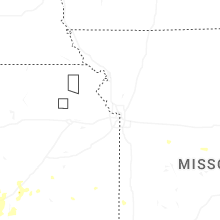
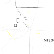
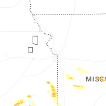
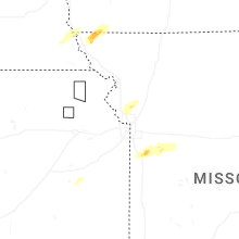


Connect with Interactive Hail Maps