

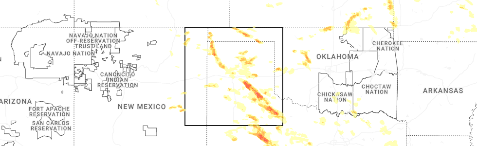
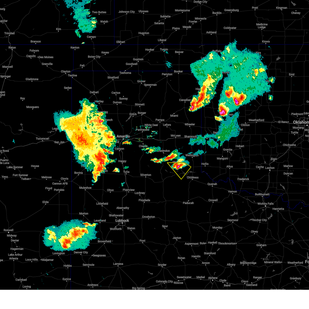
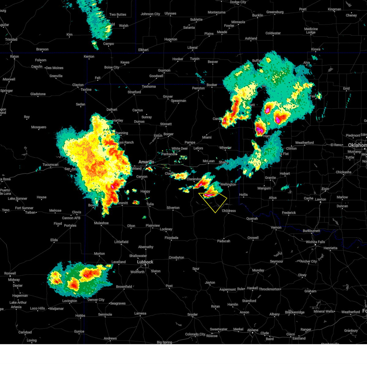
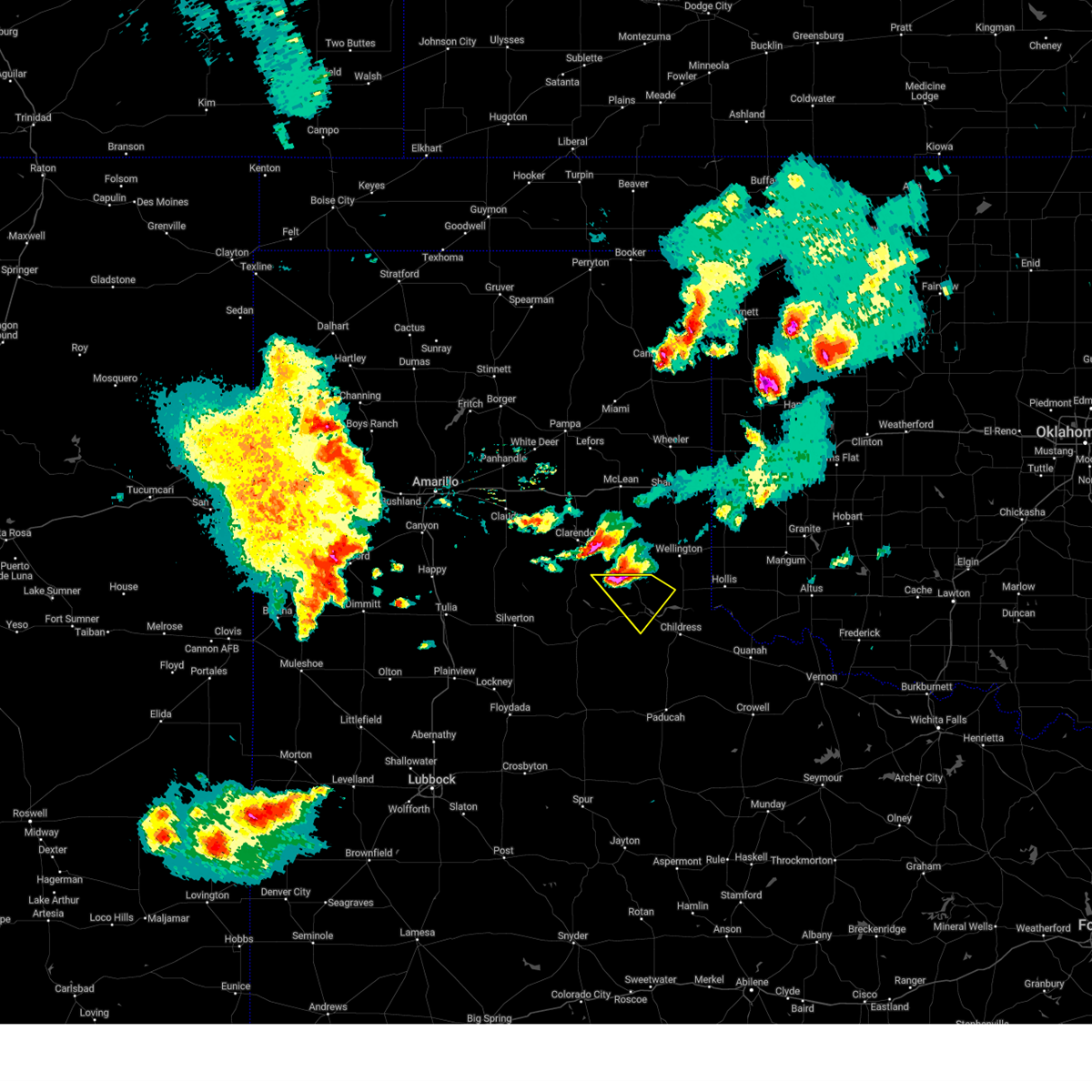
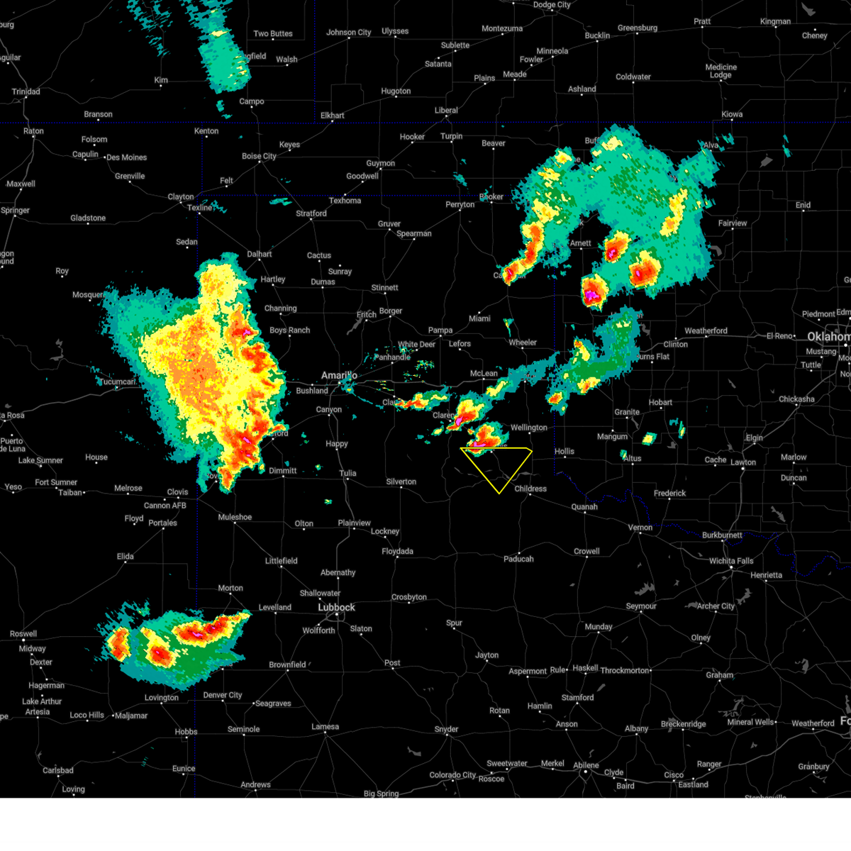
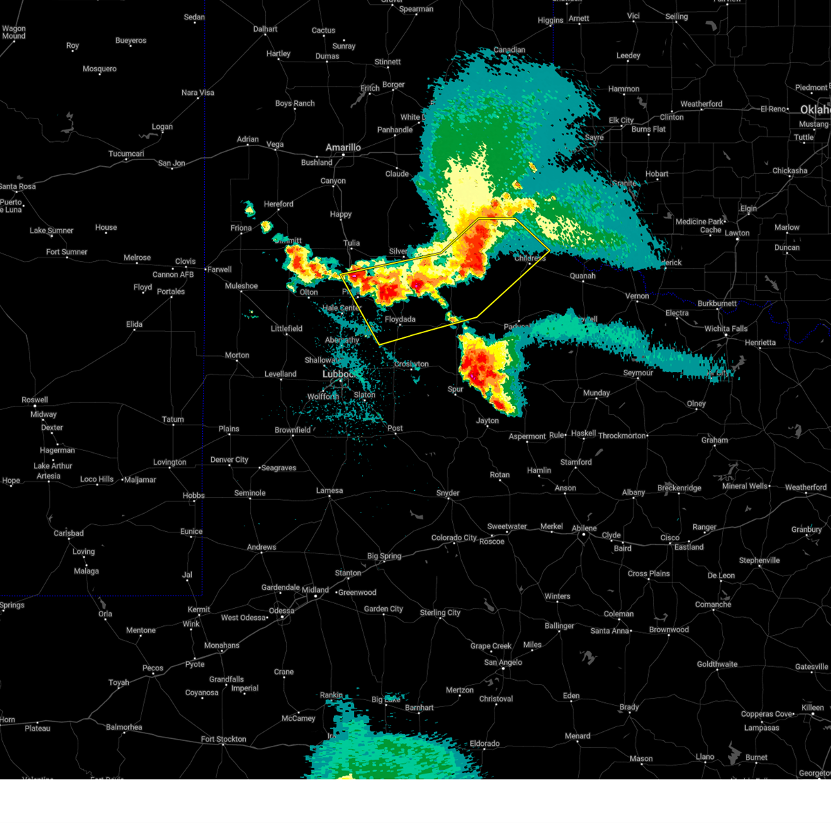
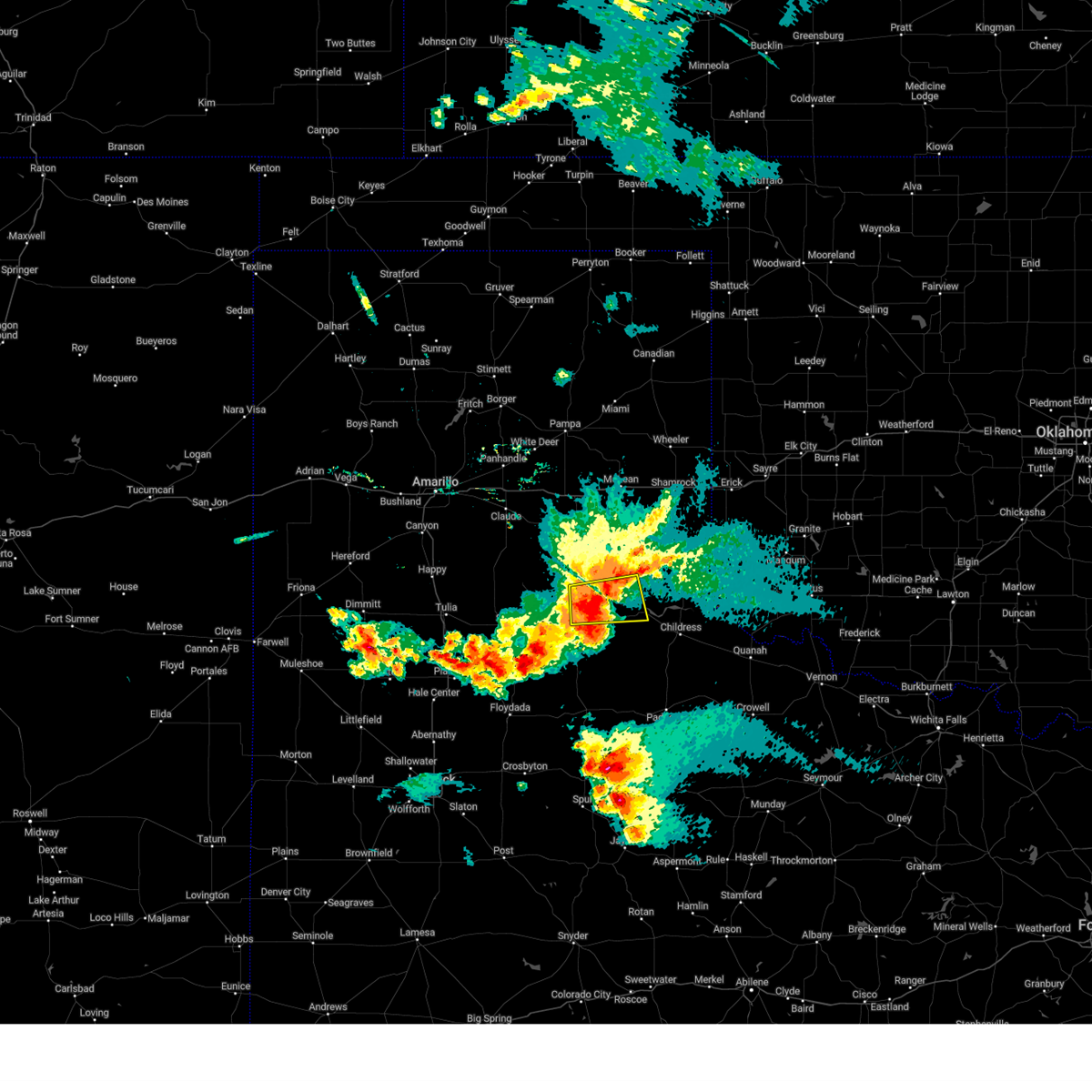
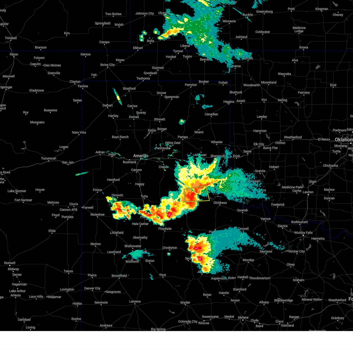
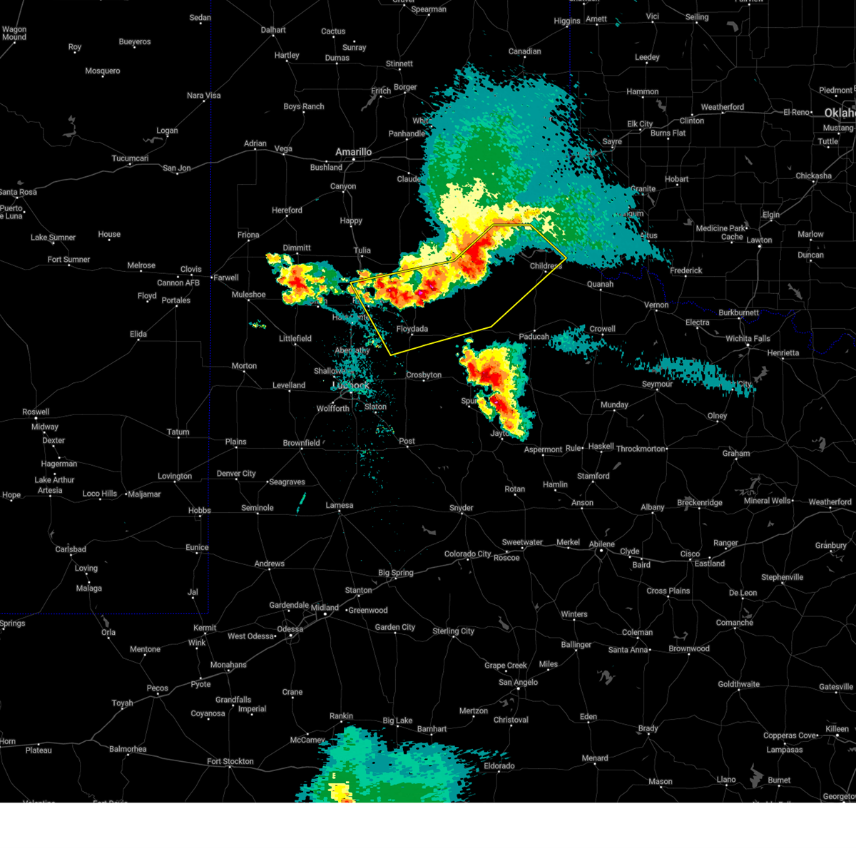
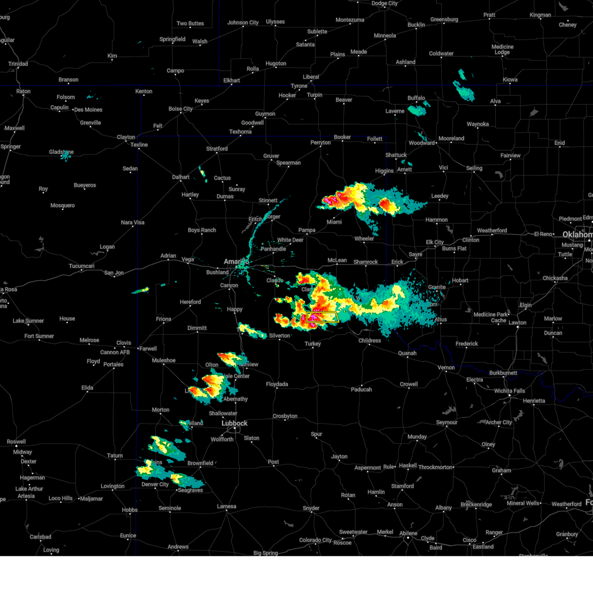
Hail Map for Lakeview, TX
The Lakeview, TX area has had 14 reports of on-the-ground hail by trained spotters, and has been under severe weather warnings 31 times during the past 12 months. Doppler radar has detected hail at or near Lakeview, TX on 106 occasions, including 5 occasions during the past year.
| Name: | Lakeview, TX |
| Where Located: | 32.4 miles WNW of Childress, TX |
| Map: | Google Map for Lakeview, TX |
| Population: | 107 |
| Housing Units: | 67 |
| More Info: | Search Google for Lakeview, TX |
1
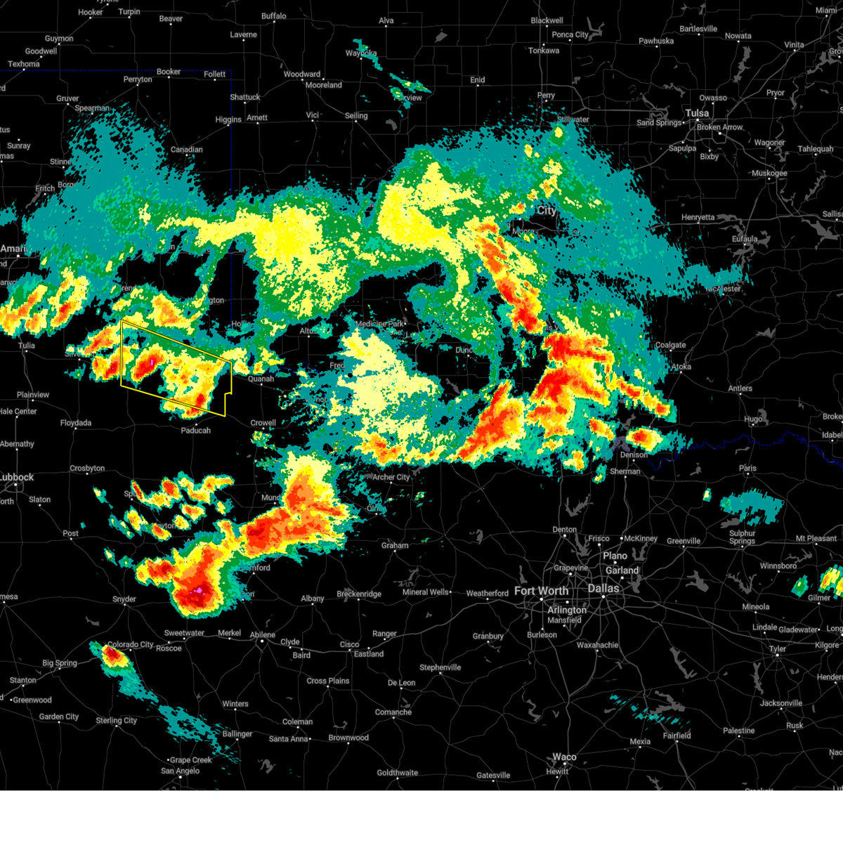
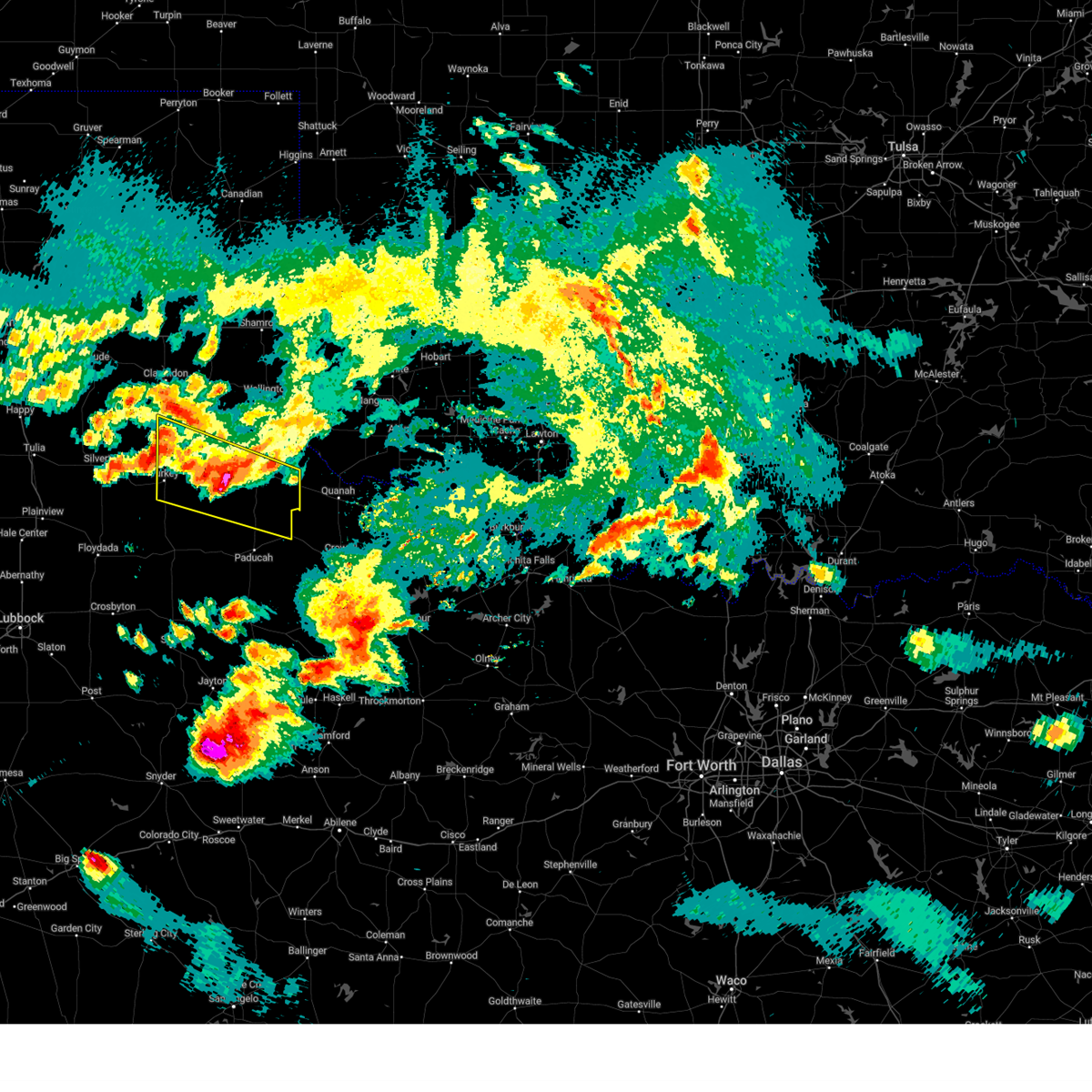
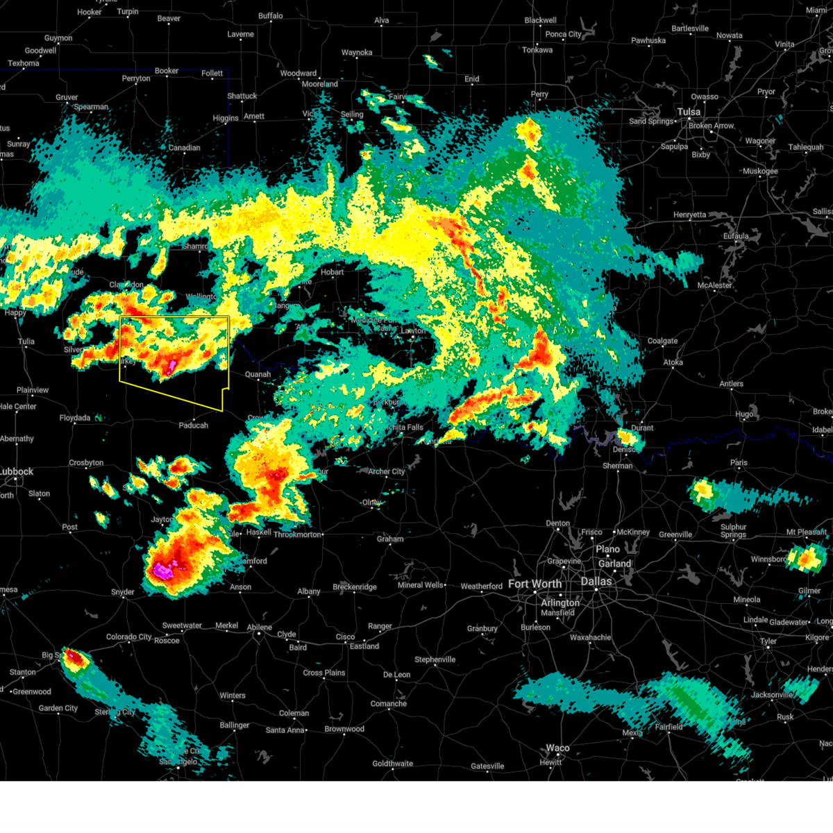
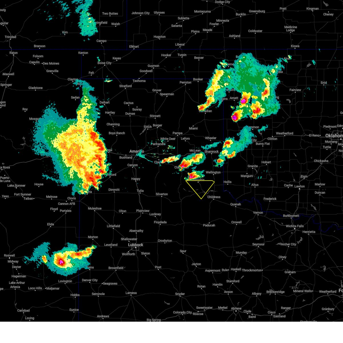
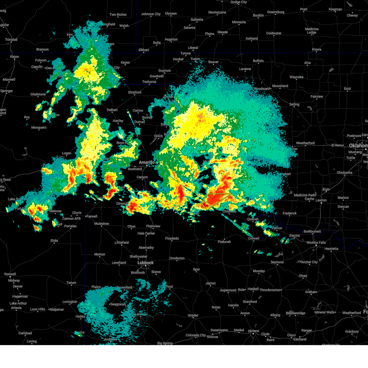
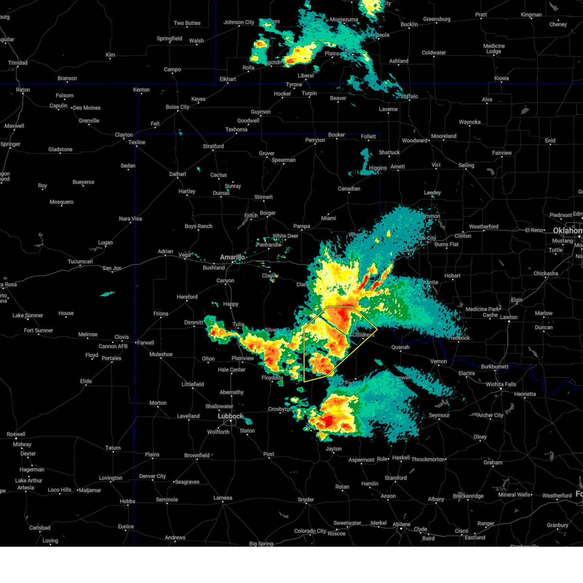
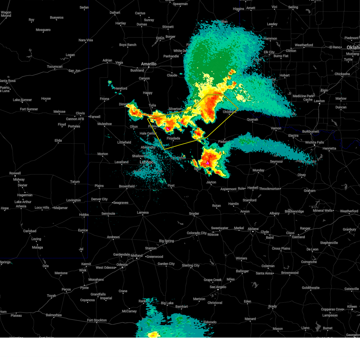
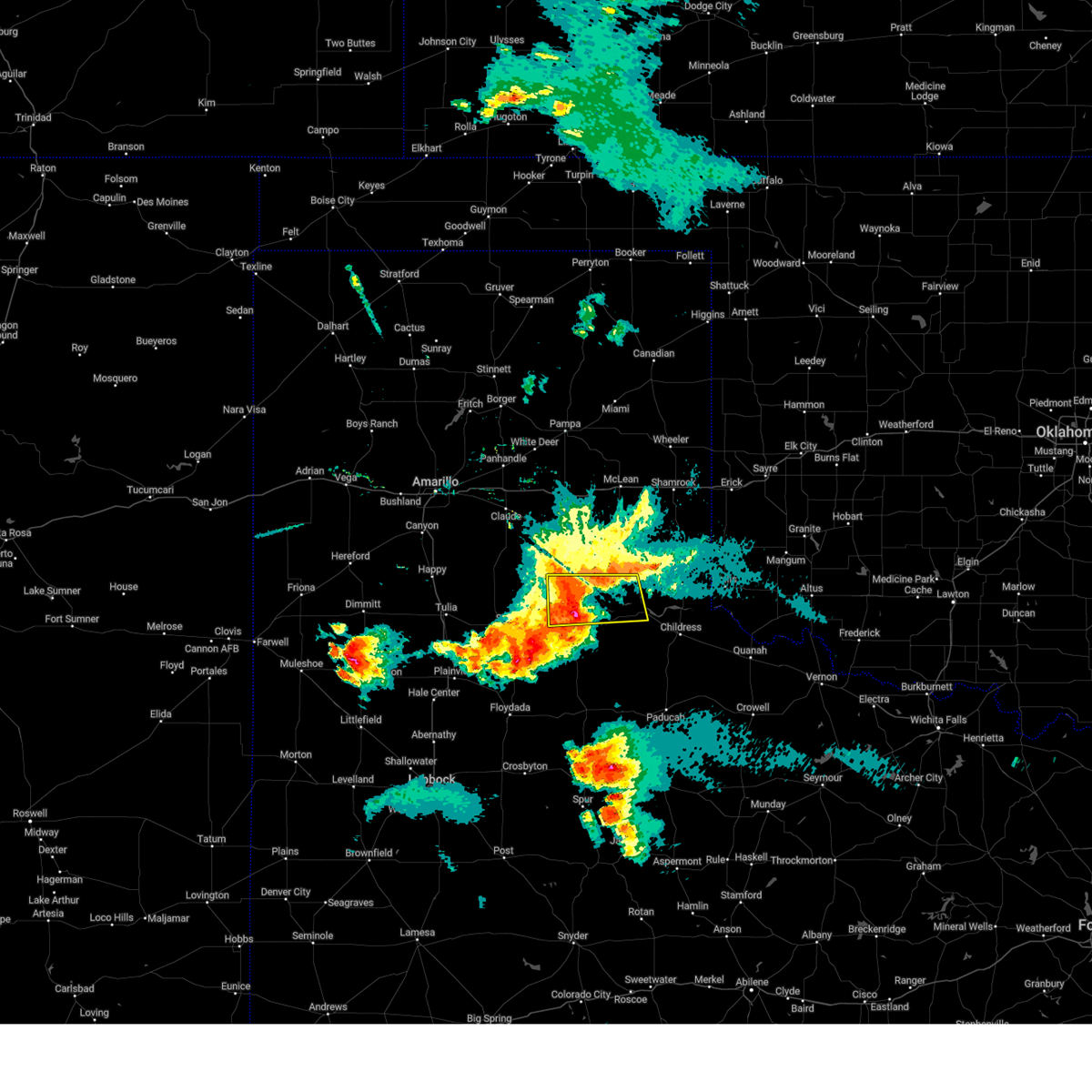
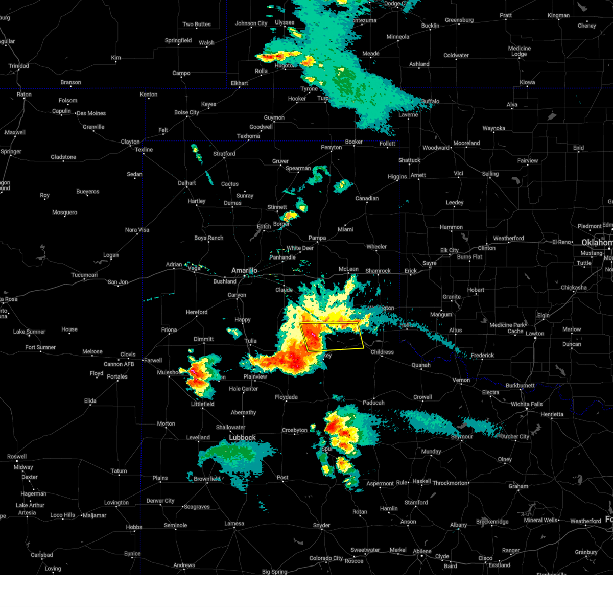
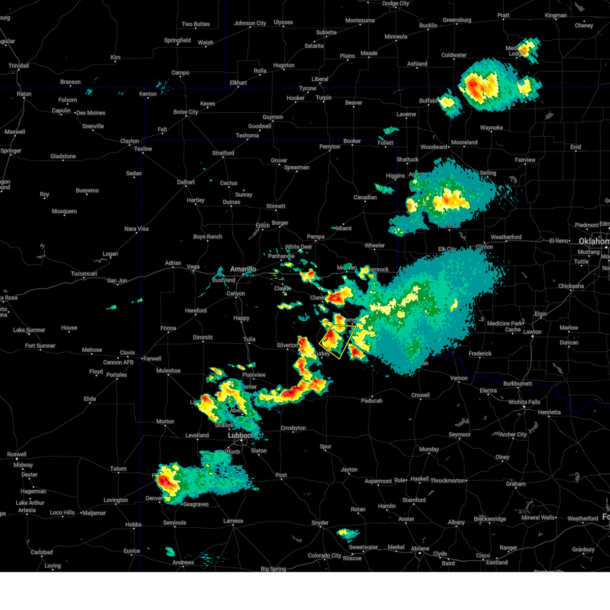
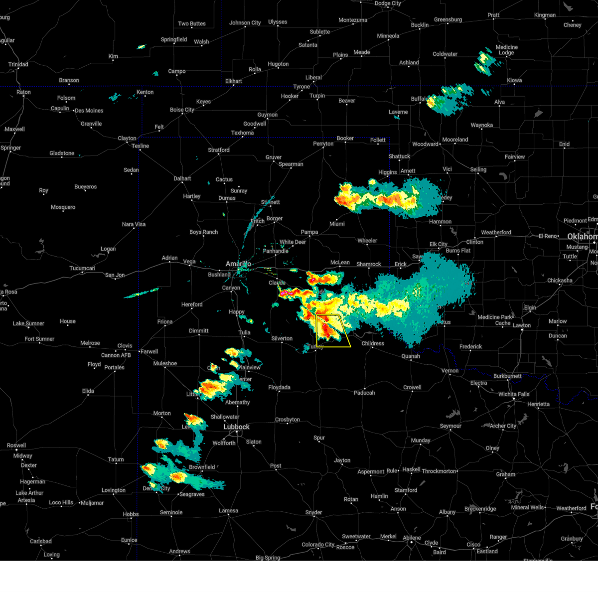
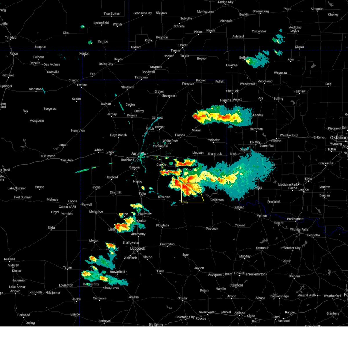
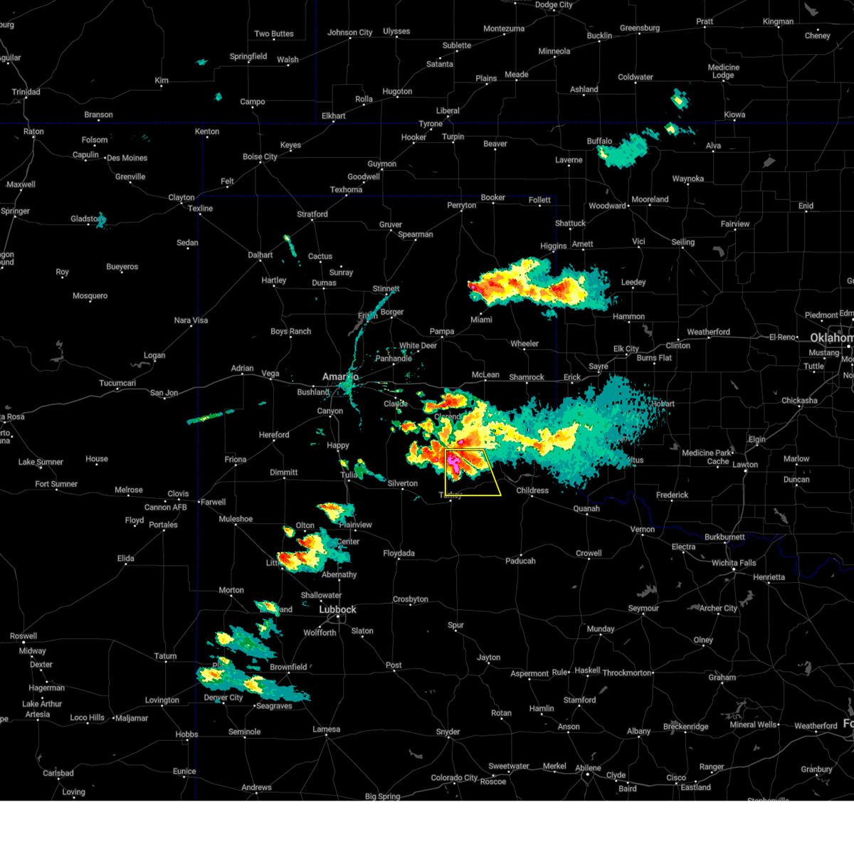
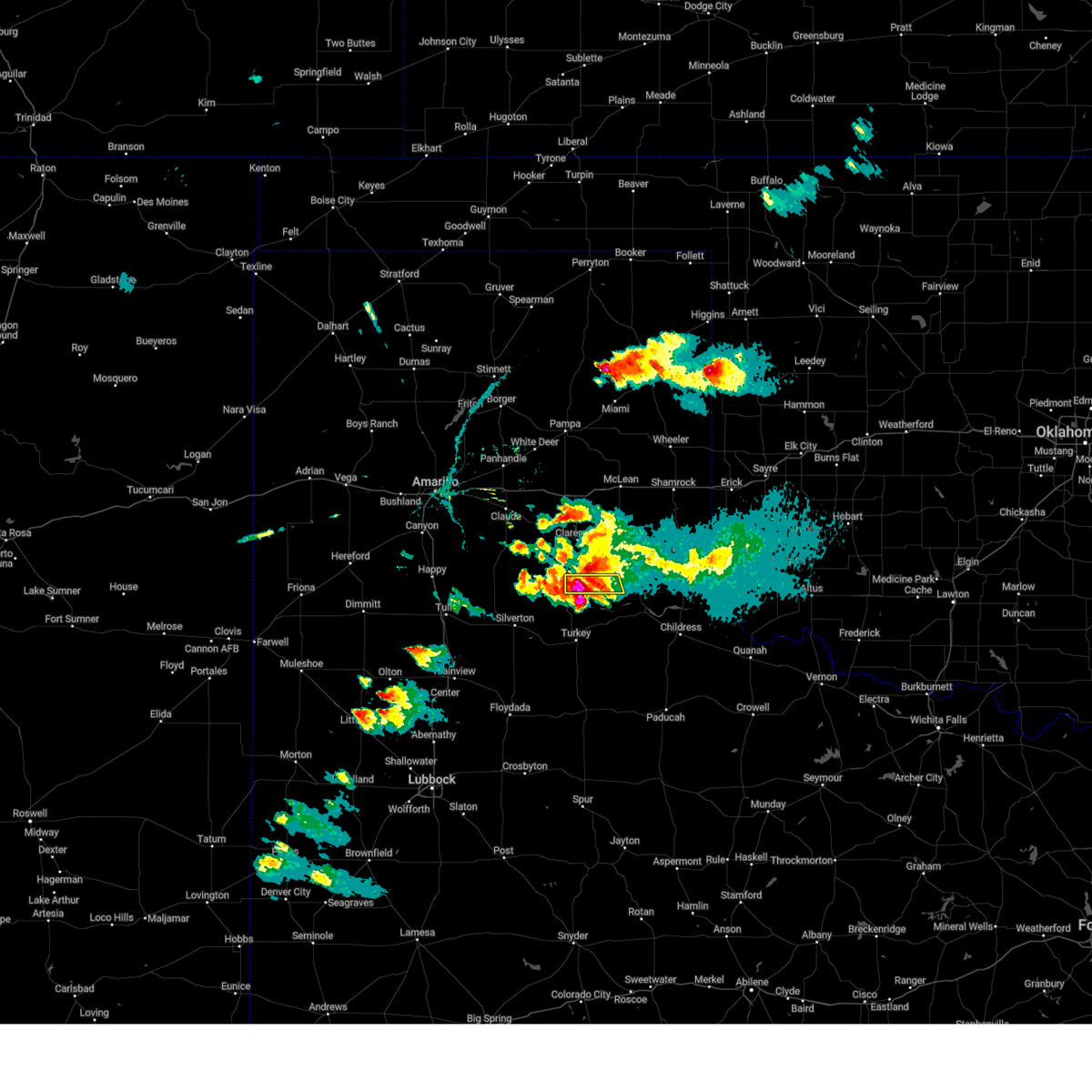
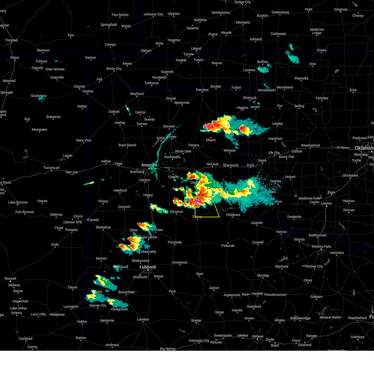
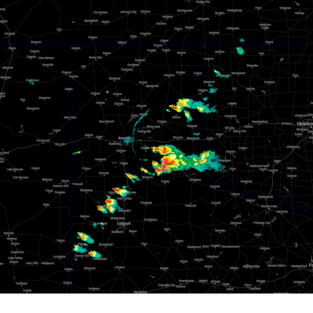
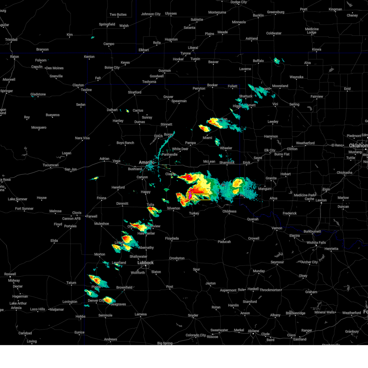
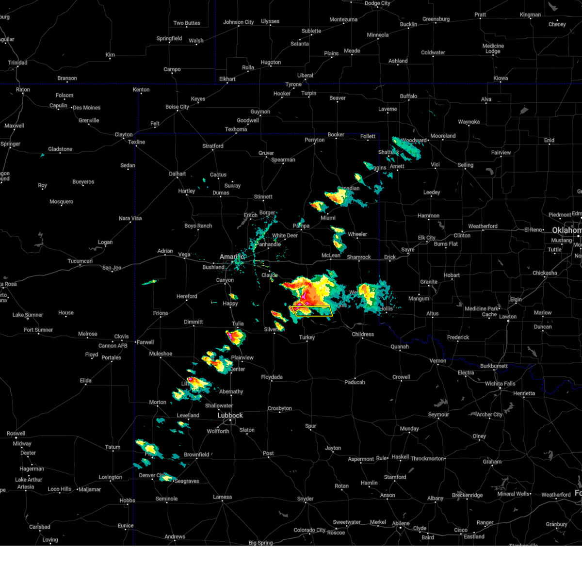
The Top Recent Hail Date for Lakeview, TX is Sunday, June 8, 2025 (35th out of 106)
Hail and Wind Damage Spotted near Lakeview, TX
| Date / Time | Report Details |
|---|---|
| 6/8/2025 8:29 PM CDT |
 The storm which prompted the warning has weakened below severe limits, and no longer poses an immediate threat to life or property. therefore, the warning will be allowed to expire. however, small hail, gusty winds and heavy rain are still possible with this thunderstorm. a severe thunderstorm watch remains in effect until 1100 pm cdt for the panhandle of and northwestern texas. The storm which prompted the warning has weakened below severe limits, and no longer poses an immediate threat to life or property. therefore, the warning will be allowed to expire. however, small hail, gusty winds and heavy rain are still possible with this thunderstorm. a severe thunderstorm watch remains in effect until 1100 pm cdt for the panhandle of and northwestern texas.
|
| 6/8/2025 8:14 PM CDT |
 At 814 pm cdt, a severe thunderstorm was located 6 miles east of turkey, moving east at 50 mph (radar indicated). Hazards include 60 mph wind gusts and quarter size hail. Hail damage to vehicles is expected. expect wind damage to roofs, siding, and trees. Locations impacted include, childress, turkey, cee vee, tell, kirkland, northfield, brice, swearingen, estelline, lakeview, and plaska community. At 814 pm cdt, a severe thunderstorm was located 6 miles east of turkey, moving east at 50 mph (radar indicated). Hazards include 60 mph wind gusts and quarter size hail. Hail damage to vehicles is expected. expect wind damage to roofs, siding, and trees. Locations impacted include, childress, turkey, cee vee, tell, kirkland, northfield, brice, swearingen, estelline, lakeview, and plaska community.
|
| 6/8/2025 8:07 PM CDT |
 At 807 pm cdt, a severe thunderstorm was located over tell, or 8 miles southwest of childress, moving east at 35 mph (radar indicated). Hazards include 70 mph wind gusts and quarter size hail. Hail damage to vehicles is expected. expect considerable tree damage. wind damage is also likely to mobile homes, roofs, and outbuildings. Locations impacted include, childress, memphis, turkey, cee vee, tell, kirkland, northfield, brice, swearingen, estelline, lakeview, and plaska community. At 807 pm cdt, a severe thunderstorm was located over tell, or 8 miles southwest of childress, moving east at 35 mph (radar indicated). Hazards include 70 mph wind gusts and quarter size hail. Hail damage to vehicles is expected. expect considerable tree damage. wind damage is also likely to mobile homes, roofs, and outbuildings. Locations impacted include, childress, memphis, turkey, cee vee, tell, kirkland, northfield, brice, swearingen, estelline, lakeview, and plaska community.
|
| 6/8/2025 8:00 PM CDT |
 At 800 pm cdt, a severe thunderstorm was located near tell, or 12 miles west of childress, moving southeast at 40 mph (radar indicated). Hazards include 70 mph wind gusts and quarter size hail. Hail damage to vehicles is expected. expect considerable tree damage. wind damage is also likely to mobile homes, roofs, and outbuildings. Locations impacted include, childress, memphis, turkey, cee vee, tell, kirkland, northfield, brice, swearingen, estelline, lakeview, and plaska community. At 800 pm cdt, a severe thunderstorm was located near tell, or 12 miles west of childress, moving southeast at 40 mph (radar indicated). Hazards include 70 mph wind gusts and quarter size hail. Hail damage to vehicles is expected. expect considerable tree damage. wind damage is also likely to mobile homes, roofs, and outbuildings. Locations impacted include, childress, memphis, turkey, cee vee, tell, kirkland, northfield, brice, swearingen, estelline, lakeview, and plaska community.
|
| 6/8/2025 7:45 PM CDT | At 745 pm cdt, a severe thunderstorm was located 9 miles north of northfield, or 15 miles east of turkey, moving east at 35 mph (radar indicated). Hazards include ping pong ball size hail and 60 mph wind gusts. People and animals outdoors will be injured. expect hail damage to roofs, siding, windows, and vehicles. expect wind damage to roofs, siding, and trees. Locations impacted include, childress, memphis, turkey, cee vee, tell, kirkland, northfield, brice, swearingen, estelline, lakeview, and plaska community. |
| 6/8/2025 7:35 PM CDT | Svrlub the national weather service in lubbock texas has issued a * severe thunderstorm warning for, childress county in the panhandle of texas, northeastern motley county in northwestern texas, northern cottle county in northwestern texas, hall county in the panhandle of texas, * until 830 pm cdt. * at 735 pm cdt, a severe thunderstorm was located 11 miles northeast of turkey, moving east at 35 mph (radar indicated). Hazards include 60 mph wind gusts and quarter size hail. Hail damage to vehicles is expected. Expect wind damage to roofs, siding, and trees. |
| 6/8/2025 5:21 PM CDT | West texas mesonet. also measured a gust to 59 mph at 5:22 p in hall county TX, 6.6 miles ENE of Lakeview, TX |
| 6/8/2025 5:09 PM CDT | Nssl team measured a 90 mph wind gust with their mobile mesonet. the winds overturned a center pivot near this locatio in hall county TX, 14.1 miles ENE of Lakeview, TX |
| 5/26/2025 9:09 PM CDT |
 At 909 pm cdt, a severe thunderstorm was located 5 miles south of memphis, moving southeast at 20 mph. earlier, this storm produced quarter size hail in memphis (radar indicated). Hazards include 60 mph wind gusts and quarter size hail. Hail damage to vehicles is expected. expect wind damage to roofs, siding, and trees. Locations impacted include, memphis, estelline, lakeview, and plaska community. At 909 pm cdt, a severe thunderstorm was located 5 miles south of memphis, moving southeast at 20 mph. earlier, this storm produced quarter size hail in memphis (radar indicated). Hazards include 60 mph wind gusts and quarter size hail. Hail damage to vehicles is expected. expect wind damage to roofs, siding, and trees. Locations impacted include, memphis, estelline, lakeview, and plaska community.
|
| 5/26/2025 9:00 PM CDT |
 At 900 pm cdt, a severe thunderstorm was located near memphis, moving southeast at 20 mph (radar indicated). Hazards include ping pong ball size hail and 60 mph wind gusts. People and animals outdoors will be injured. expect hail damage to roofs, siding, windows, and vehicles. expect wind damage to roofs, siding, and trees. Locations impacted include, memphis, estelline, lakeview, and plaska community. At 900 pm cdt, a severe thunderstorm was located near memphis, moving southeast at 20 mph (radar indicated). Hazards include ping pong ball size hail and 60 mph wind gusts. People and animals outdoors will be injured. expect hail damage to roofs, siding, windows, and vehicles. expect wind damage to roofs, siding, and trees. Locations impacted include, memphis, estelline, lakeview, and plaska community.
|
| 5/26/2025 8:53 PM CDT |
 At 853 pm cdt, a severe thunderstorm was located near memphis, moving southeast at 20 mph (radar indicated). Hazards include two inch hail and 60 mph wind gusts. People and animals outdoors will be injured. expect hail damage to roofs, siding, windows, and vehicles. expect wind damage to roofs, siding, and trees. Locations impacted include, memphis, estelline, lakeview, and plaska community. At 853 pm cdt, a severe thunderstorm was located near memphis, moving southeast at 20 mph (radar indicated). Hazards include two inch hail and 60 mph wind gusts. People and animals outdoors will be injured. expect hail damage to roofs, siding, windows, and vehicles. expect wind damage to roofs, siding, and trees. Locations impacted include, memphis, estelline, lakeview, and plaska community.
|
| 5/26/2025 8:42 PM CDT |
 At 842 pm cdt, a severe thunderstorm was located near memphis, moving southeast at 20 mph (radar indicated). Hazards include tennis ball size hail and 60 mph wind gusts. People and animals outdoors will be injured. expect hail damage to roofs, siding, windows, and vehicles. expect wind damage to roofs, siding, and trees. Locations impacted include, memphis, estelline, lakeview, and plaska community. At 842 pm cdt, a severe thunderstorm was located near memphis, moving southeast at 20 mph (radar indicated). Hazards include tennis ball size hail and 60 mph wind gusts. People and animals outdoors will be injured. expect hail damage to roofs, siding, windows, and vehicles. expect wind damage to roofs, siding, and trees. Locations impacted include, memphis, estelline, lakeview, and plaska community.
|
| 5/26/2025 8:27 PM CDT |
 Svrlub the national weather service in lubbock texas has issued a * severe thunderstorm warning for, northwestern childress county in the panhandle of texas, northeastern hall county in the panhandle of texas, * until 930 pm cdt. * at 827 pm cdt, a severe thunderstorm was located 6 miles south of hedley, or 8 miles west of memphis, moving southeast at 20 mph (radar indicated). Hazards include golf ball size hail and 60 mph wind gusts. People and animals outdoors will be injured. expect hail damage to roofs, siding, windows, and vehicles. Expect wind damage to roofs, siding, and trees. Svrlub the national weather service in lubbock texas has issued a * severe thunderstorm warning for, northwestern childress county in the panhandle of texas, northeastern hall county in the panhandle of texas, * until 930 pm cdt. * at 827 pm cdt, a severe thunderstorm was located 6 miles south of hedley, or 8 miles west of memphis, moving southeast at 20 mph (radar indicated). Hazards include golf ball size hail and 60 mph wind gusts. People and animals outdoors will be injured. expect hail damage to roofs, siding, windows, and vehicles. Expect wind damage to roofs, siding, and trees.
|
| 4/26/2025 3:27 AM CDT |
 Svrlub the national weather service in lubbock texas has issued a * severe thunderstorm warning for, northwestern childress county in the panhandle of texas, northeastern hall county in the panhandle of texas, * until 430 am cdt. * at 327 am cdt, a severe thunderstorm was located 11 miles southwest of memphis, moving northeast at 20 mph (radar indicated). Hazards include 60 mph wind gusts and quarter size hail. Hail damage to vehicles is expected. Expect wind damage to roofs, siding, and trees. Svrlub the national weather service in lubbock texas has issued a * severe thunderstorm warning for, northwestern childress county in the panhandle of texas, northeastern hall county in the panhandle of texas, * until 430 am cdt. * at 327 am cdt, a severe thunderstorm was located 11 miles southwest of memphis, moving northeast at 20 mph (radar indicated). Hazards include 60 mph wind gusts and quarter size hail. Hail damage to vehicles is expected. Expect wind damage to roofs, siding, and trees.
|
| 4/23/2025 11:40 PM CDT |
 the severe thunderstorm warning has been cancelled and is no longer in effect the severe thunderstorm warning has been cancelled and is no longer in effect
|
| 4/23/2025 11:40 PM CDT |
 At 1140 pm cdt, severe thunderstorms were located along a line extending from 9 miles east of memphis to 3 miles northwest of cee vee to 11 miles northeast of matador, moving southeast at 20 mph (radar indicated). Hazards include 60 mph wind gusts and quarter size hail. Hail damage to vehicles is expected. expect wind damage to roofs, siding, and trees. Locations impacted include, matador, turkey, cee vee, plaska community, tell, lakeview, estelline, northfield, memphis, and childress. At 1140 pm cdt, severe thunderstorms were located along a line extending from 9 miles east of memphis to 3 miles northwest of cee vee to 11 miles northeast of matador, moving southeast at 20 mph (radar indicated). Hazards include 60 mph wind gusts and quarter size hail. Hail damage to vehicles is expected. expect wind damage to roofs, siding, and trees. Locations impacted include, matador, turkey, cee vee, plaska community, tell, lakeview, estelline, northfield, memphis, and childress.
|
| 4/23/2025 11:27 PM CDT |
 At 1126 pm cdt, severe thunderstorms were located along a line extending from 13 miles south of wellington to 5 miles east of northfield to 3 miles southeast of lockney, moving southeast at 30 mph (radar indicated). Hazards include 60 mph wind gusts and quarter size hail. Hail damage to vehicles is expected. expect wind damage to roofs, siding, and trees. Locations impacted include, cee vee, lakeview, south plains, claytonville, estelline, kress, caprock canyon state park, aiken, seth ward, flomot, valley schools, matador, turkey, plaska community, tell, northfield, quitaque, memphis, childress, and lockney. At 1126 pm cdt, severe thunderstorms were located along a line extending from 13 miles south of wellington to 5 miles east of northfield to 3 miles southeast of lockney, moving southeast at 30 mph (radar indicated). Hazards include 60 mph wind gusts and quarter size hail. Hail damage to vehicles is expected. expect wind damage to roofs, siding, and trees. Locations impacted include, cee vee, lakeview, south plains, claytonville, estelline, kress, caprock canyon state park, aiken, seth ward, flomot, valley schools, matador, turkey, plaska community, tell, northfield, quitaque, memphis, childress, and lockney.
|
| 4/23/2025 11:09 PM CDT |
 At 1108 pm cdt, severe thunderstorms were located along a line extending from 9 miles east of memphis to 6 miles north of northfield to aiken, moving southeast at 30 mph (radar indicated). Hazards include 60 mph wind gusts and quarter size hail. Hail damage to vehicles is expected. expect wind damage to roofs, siding, and trees. Locations impacted include, cee vee, lakeview, south plains, claytonville, estelline, kress, caprock canyon state park, aiken, seth ward, flomot, valley schools, matador, turkey, plaska community, tell, northfield, quitaque, memphis, childress, and lockney. At 1108 pm cdt, severe thunderstorms were located along a line extending from 9 miles east of memphis to 6 miles north of northfield to aiken, moving southeast at 30 mph (radar indicated). Hazards include 60 mph wind gusts and quarter size hail. Hail damage to vehicles is expected. expect wind damage to roofs, siding, and trees. Locations impacted include, cee vee, lakeview, south plains, claytonville, estelline, kress, caprock canyon state park, aiken, seth ward, flomot, valley schools, matador, turkey, plaska community, tell, northfield, quitaque, memphis, childress, and lockney.
|
| 4/23/2025 11:04 PM CDT |
 the severe thunderstorm warning has been cancelled and is no longer in effect the severe thunderstorm warning has been cancelled and is no longer in effect
|
| 4/23/2025 11:04 PM CDT |
 At 1102 pm cdt, a severe thunderstorm was located 9 miles east of brice, or 10 miles west of memphis, moving east at 25 mph (radar indicated). Hazards include 60 mph wind gusts and quarter size hail. Hail damage to vehicles is expected. expect wind damage to roofs, siding, and trees. Locations impacted include, estelline, memphis, plaska community, and lakeview. At 1102 pm cdt, a severe thunderstorm was located 9 miles east of brice, or 10 miles west of memphis, moving east at 25 mph (radar indicated). Hazards include 60 mph wind gusts and quarter size hail. Hail damage to vehicles is expected. expect wind damage to roofs, siding, and trees. Locations impacted include, estelline, memphis, plaska community, and lakeview.
|
| 4/23/2025 10:53 PM CDT |
 Svrlub the national weather service in lubbock texas has issued a * severe thunderstorm warning for, floyd county in northwestern texas, childress county in the panhandle of texas, northwestern cottle county in northwestern texas, motley county in northwestern texas, northeastern hale county in northwestern texas, hall county in the panhandle of texas, southeastern swisher county in the panhandle of texas, southern briscoe county in the panhandle of texas, * until midnight cdt. * at 1053 pm cdt, severe thunderstorms were located along a line extending from 7 miles south of quail to near turkey to 6 miles northwest of aiken, moving southeast at 25 mph (radar indicated). Hazards include 60 mph wind gusts and quarter size hail. Hail damage to vehicles is expected. Expect wind damage to roofs, siding, and trees. Svrlub the national weather service in lubbock texas has issued a * severe thunderstorm warning for, floyd county in northwestern texas, childress county in the panhandle of texas, northwestern cottle county in northwestern texas, motley county in northwestern texas, northeastern hale county in northwestern texas, hall county in the panhandle of texas, southeastern swisher county in the panhandle of texas, southern briscoe county in the panhandle of texas, * until midnight cdt. * at 1053 pm cdt, severe thunderstorms were located along a line extending from 7 miles south of quail to near turkey to 6 miles northwest of aiken, moving southeast at 25 mph (radar indicated). Hazards include 60 mph wind gusts and quarter size hail. Hail damage to vehicles is expected. Expect wind damage to roofs, siding, and trees.
|
| 4/23/2025 10:39 PM CDT |
 At 1039 pm cdt, a severe thunderstorm was located 4 miles south of brice, or 16 miles northeast of caprock canyon state park, moving east at 25 mph (airport weather station). Hazards include 70 mph wind gusts and quarter size hail. Hail damage to vehicles is expected. expect considerable tree damage. wind damage is also likely to mobile homes, roofs, and outbuildings. Locations impacted include, estelline, memphis, brice, plaska community, lakeview, and caprock canyon state park. At 1039 pm cdt, a severe thunderstorm was located 4 miles south of brice, or 16 miles northeast of caprock canyon state park, moving east at 25 mph (airport weather station). Hazards include 70 mph wind gusts and quarter size hail. Hail damage to vehicles is expected. expect considerable tree damage. wind damage is also likely to mobile homes, roofs, and outbuildings. Locations impacted include, estelline, memphis, brice, plaska community, lakeview, and caprock canyon state park.
|
| 4/23/2025 10:27 PM CDT |
 Svrlub the national weather service in lubbock texas has issued a * severe thunderstorm warning for, northern hall county in the panhandle of texas, northeastern briscoe county in the panhandle of texas, * until 1130 pm cdt. * at 1027 pm cdt, a severe thunderstorm was located 7 miles southwest of brice, or 13 miles north of caprock canyon state park, moving east at 25 mph (radar indicated). Hazards include 70 mph wind gusts and ping pong ball size hail. People and animals outdoors will be injured. expect hail damage to roofs, siding, windows, and vehicles. expect considerable tree damage. Wind damage is also likely to mobile homes, roofs, and outbuildings. Svrlub the national weather service in lubbock texas has issued a * severe thunderstorm warning for, northern hall county in the panhandle of texas, northeastern briscoe county in the panhandle of texas, * until 1130 pm cdt. * at 1027 pm cdt, a severe thunderstorm was located 7 miles southwest of brice, or 13 miles north of caprock canyon state park, moving east at 25 mph (radar indicated). Hazards include 70 mph wind gusts and ping pong ball size hail. People and animals outdoors will be injured. expect hail damage to roofs, siding, windows, and vehicles. expect considerable tree damage. Wind damage is also likely to mobile homes, roofs, and outbuildings.
|
| 4/22/2025 7:53 PM CDT |
 Svrlub the national weather service in lubbock texas has issued a * severe thunderstorm warning for, central hall county in the panhandle of texas, * until 900 pm cdt. * at 753 pm cdt, a severe thunderstorm was located 9 miles southeast of brice, or 15 miles southwest of memphis, moving southeast at 10 mph (radar indicated). Hazards include ping pong ball size hail and 60 mph wind gusts. People and animals outdoors will be injured. expect hail damage to roofs, siding, windows, and vehicles. Expect wind damage to roofs, siding, and trees. Svrlub the national weather service in lubbock texas has issued a * severe thunderstorm warning for, central hall county in the panhandle of texas, * until 900 pm cdt. * at 753 pm cdt, a severe thunderstorm was located 9 miles southeast of brice, or 15 miles southwest of memphis, moving southeast at 10 mph (radar indicated). Hazards include ping pong ball size hail and 60 mph wind gusts. People and animals outdoors will be injured. expect hail damage to roofs, siding, windows, and vehicles. Expect wind damage to roofs, siding, and trees.
|
| 4/22/2025 6:32 PM CDT |
 At 632 pm cdt, a severe thunderstorm was located 12 miles southeast of brice, or 14 miles northeast of turkey, moving southeast at 15 mph (west texas mesonet). Hazards include 60 mph wind gusts and quarter size hail. Hail damage to vehicles is expected. expect wind damage to roofs, siding, and trees. Locations impacted include, plaska community, lakeview, and brice. At 632 pm cdt, a severe thunderstorm was located 12 miles southeast of brice, or 14 miles northeast of turkey, moving southeast at 15 mph (west texas mesonet). Hazards include 60 mph wind gusts and quarter size hail. Hail damage to vehicles is expected. expect wind damage to roofs, siding, and trees. Locations impacted include, plaska community, lakeview, and brice.
|
| 4/22/2025 6:19 PM CDT |
 At 618 pm cdt, a severe thunderstorm was located 7 miles southeast of brice, or 15 miles north of turkey, moving southeast at 15 mph (west texas mesonet). Hazards include ping pong ball size hail and 60 mph wind gusts. People and animals outdoors will be injured. expect hail damage to roofs, siding, windows, and vehicles. expect wind damage to roofs, siding, and trees. Locations impacted include, brice, plaska community, and lakeview. At 618 pm cdt, a severe thunderstorm was located 7 miles southeast of brice, or 15 miles north of turkey, moving southeast at 15 mph (west texas mesonet). Hazards include ping pong ball size hail and 60 mph wind gusts. People and animals outdoors will be injured. expect hail damage to roofs, siding, windows, and vehicles. expect wind damage to roofs, siding, and trees. Locations impacted include, brice, plaska community, and lakeview.
|
| 4/22/2025 6:09 PM CDT |
 At 609 pm cdt, a severe thunderstorm was located 5 miles south of brice, or 16 miles north of turkey, moving southeast at 15 mph (west texas mesonet). Hazards include tennis ball size hail and 60 mph wind gusts. People and animals outdoors will be injured. expect hail damage to roofs, siding, windows, and vehicles. expect wind damage to roofs, siding, and trees. Locations impacted include, brice, plaska community, and lakeview. At 609 pm cdt, a severe thunderstorm was located 5 miles south of brice, or 16 miles north of turkey, moving southeast at 15 mph (west texas mesonet). Hazards include tennis ball size hail and 60 mph wind gusts. People and animals outdoors will be injured. expect hail damage to roofs, siding, windows, and vehicles. expect wind damage to roofs, siding, and trees. Locations impacted include, brice, plaska community, and lakeview.
|
| 4/22/2025 6:07 PM CDT |
 At 607 pm cdt, a severe thunderstorm was located near brice, or 18 miles west of memphis, moving southeast at 15 mph (radar indicated). Hazards include tennis ball size hail and 60 mph wind gusts. People and animals outdoors will be injured. expect hail damage to roofs, siding, windows, and vehicles. expect wind damage to roofs, siding, and trees. Locations impacted include, brice and lakeview. At 607 pm cdt, a severe thunderstorm was located near brice, or 18 miles west of memphis, moving southeast at 15 mph (radar indicated). Hazards include tennis ball size hail and 60 mph wind gusts. People and animals outdoors will be injured. expect hail damage to roofs, siding, windows, and vehicles. expect wind damage to roofs, siding, and trees. Locations impacted include, brice and lakeview.
|
| 4/22/2025 6:04 PM CDT | West texas mesonet report (lesley in hall county TX, 9.8 miles E of Lakeview, TX |
| 4/22/2025 6:04 PM CDT |
 Svrlub the national weather service in lubbock texas has issued a * severe thunderstorm warning for, central hall county in the panhandle of texas, * until 700 pm cdt. * at 604 pm cdt, a severe thunderstorm was located 5 miles south of brice, or 16 miles north of turkey, moving southeast at 15 mph (radar indicated). Hazards include tennis ball size hail and 60 mph wind gusts. People and animals outdoors will be injured. expect hail damage to roofs, siding, windows, and vehicles. Expect wind damage to roofs, siding, and trees. Svrlub the national weather service in lubbock texas has issued a * severe thunderstorm warning for, central hall county in the panhandle of texas, * until 700 pm cdt. * at 604 pm cdt, a severe thunderstorm was located 5 miles south of brice, or 16 miles north of turkey, moving southeast at 15 mph (radar indicated). Hazards include tennis ball size hail and 60 mph wind gusts. People and animals outdoors will be injured. expect hail damage to roofs, siding, windows, and vehicles. Expect wind damage to roofs, siding, and trees.
|
| 4/22/2025 6:02 PM CDT | Hen Egg sized hail reported 11.9 miles ESE of Lakeview, TX, estimated from chaser video at brice. |
| 4/22/2025 5:58 PM CDT |
 At 558 pm cdt, a severe thunderstorm was located 7 miles southwest of lelia lake, or 9 miles south of clarendon, moving northeast at 15 mph (radar indicated). Hazards include tennis ball size hail and 60 mph wind gusts. People and animals outdoors will be injured. expect hail damage to roofs, siding, windows, and vehicles. expect wind damage to roofs, siding, and trees. Locations impacted include, brice and lakeview. At 558 pm cdt, a severe thunderstorm was located 7 miles southwest of lelia lake, or 9 miles south of clarendon, moving northeast at 15 mph (radar indicated). Hazards include tennis ball size hail and 60 mph wind gusts. People and animals outdoors will be injured. expect hail damage to roofs, siding, windows, and vehicles. expect wind damage to roofs, siding, and trees. Locations impacted include, brice and lakeview.
|
| 4/22/2025 5:46 PM CDT |
 At 544 pm cdt, a severe thunderstorm was located 5 miles north of brice, or 10 miles south of clarendon, moving northeast at 15 mph. this is a destructive storm for brice (radar indicated). Hazards include three inch hail and 60 mph wind gusts. People and animals outdoors will be severely injured. expect shattered windows, extensive damage to roofs, siding, and vehicles. Locations impacted include, brice and lakeview. At 544 pm cdt, a severe thunderstorm was located 5 miles north of brice, or 10 miles south of clarendon, moving northeast at 15 mph. this is a destructive storm for brice (radar indicated). Hazards include three inch hail and 60 mph wind gusts. People and animals outdoors will be severely injured. expect shattered windows, extensive damage to roofs, siding, and vehicles. Locations impacted include, brice and lakeview.
|
| 4/22/2025 5:33 PM CDT |
 At 533 pm cdt, a severe thunderstorm was located 4 miles northwest of brice, or 11 miles south of clarendon, moving northeast at 15 mph (radar indicated). Hazards include tennis ball size hail and 60 mph wind gusts. People and animals outdoors will be injured. expect hail damage to roofs, siding, windows, and vehicles. expect wind damage to roofs, siding, and trees. Locations impacted include, brice and lakeview. At 533 pm cdt, a severe thunderstorm was located 4 miles northwest of brice, or 11 miles south of clarendon, moving northeast at 15 mph (radar indicated). Hazards include tennis ball size hail and 60 mph wind gusts. People and animals outdoors will be injured. expect hail damage to roofs, siding, windows, and vehicles. expect wind damage to roofs, siding, and trees. Locations impacted include, brice and lakeview.
|
| 4/22/2025 5:19 PM CDT |
 Svrlub the national weather service in lubbock texas has issued a * severe thunderstorm warning for, northwestern hall county in the panhandle of texas, northeastern briscoe county in the panhandle of texas, * until 615 pm cdt. * at 518 pm cdt, a severe thunderstorm was located 5 miles northwest of brice, or 14 miles south of clarendon, moving northeast at 15 mph (radar indicated). Hazards include two inch hail and 60 mph wind gusts. People and animals outdoors will be injured. expect hail damage to roofs, siding, windows, and vehicles. Expect wind damage to roofs, siding, and trees. Svrlub the national weather service in lubbock texas has issued a * severe thunderstorm warning for, northwestern hall county in the panhandle of texas, northeastern briscoe county in the panhandle of texas, * until 615 pm cdt. * at 518 pm cdt, a severe thunderstorm was located 5 miles northwest of brice, or 14 miles south of clarendon, moving northeast at 15 mph (radar indicated). Hazards include two inch hail and 60 mph wind gusts. People and animals outdoors will be injured. expect hail damage to roofs, siding, windows, and vehicles. Expect wind damage to roofs, siding, and trees.
|
| 6/1/2024 12:27 AM CDT |
 the severe thunderstorm warning has been cancelled and is no longer in effect the severe thunderstorm warning has been cancelled and is no longer in effect
|
| 6/1/2024 12:21 AM CDT |
 At 1221 am cdt, a severe thunderstorm was located 13 miles southwest of memphis, moving east at 35 mph (radar indicated). Hazards include 60 mph wind gusts and penny size hail. Expect damage to roofs, siding, and trees. Locations impacted include, memphis, estelline, lakeview, and plaska community. At 1221 am cdt, a severe thunderstorm was located 13 miles southwest of memphis, moving east at 35 mph (radar indicated). Hazards include 60 mph wind gusts and penny size hail. Expect damage to roofs, siding, and trees. Locations impacted include, memphis, estelline, lakeview, and plaska community.
|
| 6/1/2024 12:18 AM CDT |
 At 1218 am cdt, a severe thunderstorm was located 14 miles southwest of memphis, moving east at 30 mph (radar indicated). Hazards include 60 mph wind gusts and nickel size hail. Expect damage to roofs, siding, and trees. Locations impacted include, memphis, estelline, lakeview, and plaska community. At 1218 am cdt, a severe thunderstorm was located 14 miles southwest of memphis, moving east at 30 mph (radar indicated). Hazards include 60 mph wind gusts and nickel size hail. Expect damage to roofs, siding, and trees. Locations impacted include, memphis, estelline, lakeview, and plaska community.
|
| 6/1/2024 12:01 AM CDT |
 the severe thunderstorm warning has been cancelled and is no longer in effect the severe thunderstorm warning has been cancelled and is no longer in effect
|
| 6/1/2024 12:01 AM CDT |
 At 1201 am cdt, a severe thunderstorm was located 11 miles south of brice, or 12 miles north of turkey, moving east at 35 mph (radar indicated). Hazards include 60 mph wind gusts and quarter size hail. Hail damage to vehicles is expected. expect wind damage to roofs, siding, and trees. Locations impacted include, memphis, turkey, brice, estelline, lakeview, and plaska community. At 1201 am cdt, a severe thunderstorm was located 11 miles south of brice, or 12 miles north of turkey, moving east at 35 mph (radar indicated). Hazards include 60 mph wind gusts and quarter size hail. Hail damage to vehicles is expected. expect wind damage to roofs, siding, and trees. Locations impacted include, memphis, turkey, brice, estelline, lakeview, and plaska community.
|
| 5/31/2024 11:43 PM CDT |
 Svrlub the national weather service in lubbock texas has issued a * severe thunderstorm warning for, hall county in the panhandle of texas, eastern briscoe county in the panhandle of texas, * until 1245 am cdt. * at 1143 pm cdt, a severe thunderstorm was located 8 miles north of caprock canyon state park, moving east at 35 mph (radar indicated). Hazards include 60 mph wind gusts and quarter size hail. Hail damage to vehicles is expected. Expect wind damage to roofs, siding, and trees. Svrlub the national weather service in lubbock texas has issued a * severe thunderstorm warning for, hall county in the panhandle of texas, eastern briscoe county in the panhandle of texas, * until 1245 am cdt. * at 1143 pm cdt, a severe thunderstorm was located 8 miles north of caprock canyon state park, moving east at 35 mph (radar indicated). Hazards include 60 mph wind gusts and quarter size hail. Hail damage to vehicles is expected. Expect wind damage to roofs, siding, and trees.
|
| 5/30/2024 3:06 AM CDT |
 At 306 am cdt, severe thunderstorms were located along a line extending from 3 miles southwest of childress to 10 miles south of northfield to 4 miles south of south plains, moving east at 60 mph (radar indicated). Hazards include 70 mph wind gusts and half dollar size hail. Hail damage to vehicles is expected. expect considerable tree damage. wind damage is also likely to mobile homes, roofs, and outbuildings. Locations impacted include, childress, paducah, matador, turkey, caprock canyon state park, lockney, quitaque, cee vee, south plains, kirkland, aiken, swearingen, valley schools, flomot, tell, northfield, hackberry, estelline, lakeview, and plaska community. At 306 am cdt, severe thunderstorms were located along a line extending from 3 miles southwest of childress to 10 miles south of northfield to 4 miles south of south plains, moving east at 60 mph (radar indicated). Hazards include 70 mph wind gusts and half dollar size hail. Hail damage to vehicles is expected. expect considerable tree damage. wind damage is also likely to mobile homes, roofs, and outbuildings. Locations impacted include, childress, paducah, matador, turkey, caprock canyon state park, lockney, quitaque, cee vee, south plains, kirkland, aiken, swearingen, valley schools, flomot, tell, northfield, hackberry, estelline, lakeview, and plaska community.
|
| 5/30/2024 2:47 AM CDT |
 Svrlub the national weather service in lubbock texas has issued a * severe thunderstorm warning for, northern floyd county in northwestern texas, southern childress county in the panhandle of texas, cottle county in northwestern texas, motley county in northwestern texas, northeastern hale county in northwestern texas, hall county in the panhandle of texas, southeastern briscoe county in the panhandle of texas, * until 345 am cdt. * at 247 am cdt, severe thunderstorms were located along a line extending from 6 miles north of northfield to 6 miles south of flomot to 5 miles west of aiken, moving east at 60 mph (radar indicated). Hazards include 60 mph wind gusts and half dollar size hail. Hail damage to vehicles is expected. Expect wind damage to roofs, siding, and trees. Svrlub the national weather service in lubbock texas has issued a * severe thunderstorm warning for, northern floyd county in northwestern texas, southern childress county in the panhandle of texas, cottle county in northwestern texas, motley county in northwestern texas, northeastern hale county in northwestern texas, hall county in the panhandle of texas, southeastern briscoe county in the panhandle of texas, * until 345 am cdt. * at 247 am cdt, severe thunderstorms were located along a line extending from 6 miles north of northfield to 6 miles south of flomot to 5 miles west of aiken, moving east at 60 mph (radar indicated). Hazards include 60 mph wind gusts and half dollar size hail. Hail damage to vehicles is expected. Expect wind damage to roofs, siding, and trees.
|
| 5/30/2024 2:39 AM CDT |
 At 238 am cdt, severe thunderstorms were located along a line extending from 3 miles east of memphis to 3 miles northeast of turkey to 7 miles north of south plains, moving east at 25 mph (radar indicated). Hazards include 60 mph wind gusts and quarter size hail. Hail damage to vehicles is expected. expect wind damage to roofs, siding, and trees. Locations impacted include, memphis, silverton, turkey, caprock canyon state park, quitaque, valley schools, flomot, estelline, lakeview, and plaska community. At 238 am cdt, severe thunderstorms were located along a line extending from 3 miles east of memphis to 3 miles northeast of turkey to 7 miles north of south plains, moving east at 25 mph (radar indicated). Hazards include 60 mph wind gusts and quarter size hail. Hail damage to vehicles is expected. expect wind damage to roofs, siding, and trees. Locations impacted include, memphis, silverton, turkey, caprock canyon state park, quitaque, valley schools, flomot, estelline, lakeview, and plaska community.
|
| 5/30/2024 2:16 AM CDT |
 At 216 am cdt, severe thunderstorms were located along a line extending from 4 miles west of memphis to 3 miles north of valley schools to 6 miles southeast of claytonville, moving east at 25 mph (radar indicated). Hazards include 60 mph wind gusts and quarter size hail. Hail damage to vehicles is expected. expect wind damage to roofs, siding, and trees. Locations impacted include, memphis, silverton, turkey, caprock canyon state park, quitaque, claytonville, mackenzie reservoir, brice, valley schools, flomot, estelline, lakeview, and plaska community. At 216 am cdt, severe thunderstorms were located along a line extending from 4 miles west of memphis to 3 miles north of valley schools to 6 miles southeast of claytonville, moving east at 25 mph (radar indicated). Hazards include 60 mph wind gusts and quarter size hail. Hail damage to vehicles is expected. expect wind damage to roofs, siding, and trees. Locations impacted include, memphis, silverton, turkey, caprock canyon state park, quitaque, claytonville, mackenzie reservoir, brice, valley schools, flomot, estelline, lakeview, and plaska community.
|
| 5/30/2024 1:46 AM CDT |
 Svrlub the national weather service in lubbock texas has issued a * severe thunderstorm warning for, northern floyd county in northwestern texas, northwestern motley county in northwestern texas, hall county in the panhandle of texas, southeastern swisher county in the panhandle of texas, briscoe county in the panhandle of texas, * until 245 am cdt. * at 146 am cdt, severe thunderstorms were located along a line extending from 4 miles east of brice to 6 miles west of caprock canyon state park to 4 miles southeast of kress, moving east at 25 mph (radar indicated). Hazards include 60 mph wind gusts and half dollar size hail. Hail damage to vehicles is expected. Expect wind damage to roofs, siding, and trees. Svrlub the national weather service in lubbock texas has issued a * severe thunderstorm warning for, northern floyd county in northwestern texas, northwestern motley county in northwestern texas, hall county in the panhandle of texas, southeastern swisher county in the panhandle of texas, briscoe county in the panhandle of texas, * until 245 am cdt. * at 146 am cdt, severe thunderstorms were located along a line extending from 4 miles east of brice to 6 miles west of caprock canyon state park to 4 miles southeast of kress, moving east at 25 mph (radar indicated). Hazards include 60 mph wind gusts and half dollar size hail. Hail damage to vehicles is expected. Expect wind damage to roofs, siding, and trees.
|
| 5/3/2024 7:56 PM CDT |
 the severe thunderstorm warning has been cancelled and is no longer in effect the severe thunderstorm warning has been cancelled and is no longer in effect
|
| 5/3/2024 7:44 PM CDT |
 At 744 pm cdt, a severe thunderstorm was located 7 miles north of turkey, moving northeast at 35 mph (radar indicated). Hazards include ping pong ball size hail and 60 mph wind gusts. People and animals outdoors will be injured. expect hail damage to roofs, siding, windows, and vehicles. expect wind damage to roofs, siding, and trees. Locations impacted include, memphis, brice, lakeview, and plaska community. At 744 pm cdt, a severe thunderstorm was located 7 miles north of turkey, moving northeast at 35 mph (radar indicated). Hazards include ping pong ball size hail and 60 mph wind gusts. People and animals outdoors will be injured. expect hail damage to roofs, siding, windows, and vehicles. expect wind damage to roofs, siding, and trees. Locations impacted include, memphis, brice, lakeview, and plaska community.
|
| 5/3/2024 7:44 PM CDT |
 the severe thunderstorm warning has been cancelled and is no longer in effect the severe thunderstorm warning has been cancelled and is no longer in effect
|
| 5/3/2024 7:33 PM CDT |
 Svrlub the national weather service in lubbock texas has issued a * severe thunderstorm warning for, western hall county in the panhandle of texas, eastern briscoe county in the panhandle of texas, * until 830 pm cdt. * at 733 pm cdt, a severe thunderstorm was located 4 miles northwest of turkey, moving northeast at 35 mph (radar indicated). Hazards include tennis ball size hail and 60 mph wind gusts. People and animals outdoors will be injured. expect hail damage to roofs, siding, windows, and vehicles. Expect wind damage to roofs, siding, and trees. Svrlub the national weather service in lubbock texas has issued a * severe thunderstorm warning for, western hall county in the panhandle of texas, eastern briscoe county in the panhandle of texas, * until 830 pm cdt. * at 733 pm cdt, a severe thunderstorm was located 4 miles northwest of turkey, moving northeast at 35 mph (radar indicated). Hazards include tennis ball size hail and 60 mph wind gusts. People and animals outdoors will be injured. expect hail damage to roofs, siding, windows, and vehicles. Expect wind damage to roofs, siding, and trees.
|
| 5/1/2024 9:30 PM CDT |
 the severe thunderstorm warning has been cancelled and is no longer in effect the severe thunderstorm warning has been cancelled and is no longer in effect
|
| 5/1/2024 9:30 PM CDT |
 At 929 pm cdt, a severe thunderstorm was located 9 miles south of memphis, moving east at 15 mph (radar indicated). Hazards include 60 mph wind gusts and quarter size hail. Hail damage to vehicles is expected. expect wind damage to roofs, siding, and trees. Locations impacted include, childress, tell, lakeview, and plaska community. At 929 pm cdt, a severe thunderstorm was located 9 miles south of memphis, moving east at 15 mph (radar indicated). Hazards include 60 mph wind gusts and quarter size hail. Hail damage to vehicles is expected. expect wind damage to roofs, siding, and trees. Locations impacted include, childress, tell, lakeview, and plaska community.
|
| 5/1/2024 9:09 PM CDT |
 At 909 pm cdt, a severe thunderstorm was located 14 miles southwest of memphis, moving northeast at 20 mph (radar indicated). Hazards include 60 mph wind gusts and quarter size hail. Hail damage to vehicles is expected. expect wind damage to roofs, siding, and trees. Locations impacted include, childress, northfield, tell, lakeview, and plaska community. At 909 pm cdt, a severe thunderstorm was located 14 miles southwest of memphis, moving northeast at 20 mph (radar indicated). Hazards include 60 mph wind gusts and quarter size hail. Hail damage to vehicles is expected. expect wind damage to roofs, siding, and trees. Locations impacted include, childress, northfield, tell, lakeview, and plaska community.
|
| 5/1/2024 8:45 PM CDT |
 Svrlub the national weather service in lubbock texas has issued a * severe thunderstorm warning for, southwestern childress county in the panhandle of texas, northwestern cottle county in northwestern texas, northeastern motley county in northwestern texas, hall county in the panhandle of texas, east central briscoe county in the panhandle of texas, * until 945 pm cdt. * at 845 pm cdt, a severe thunderstorm was located 13 miles southwest of memphis, moving northeast at 15 mph (radar indicated). Hazards include 60 mph wind gusts and quarter size hail. Hail damage to vehicles is expected. Expect wind damage to roofs, siding, and trees. Svrlub the national weather service in lubbock texas has issued a * severe thunderstorm warning for, southwestern childress county in the panhandle of texas, northwestern cottle county in northwestern texas, northeastern motley county in northwestern texas, hall county in the panhandle of texas, east central briscoe county in the panhandle of texas, * until 945 pm cdt. * at 845 pm cdt, a severe thunderstorm was located 13 miles southwest of memphis, moving northeast at 15 mph (radar indicated). Hazards include 60 mph wind gusts and quarter size hail. Hail damage to vehicles is expected. Expect wind damage to roofs, siding, and trees.
|
| 5/1/2024 8:34 PM CDT | Storm damage reported in hall county TX, 6.6 miles ENE of Lakeview, TX |
| 5/1/2024 7:53 PM CDT |
 At 753 pm cdt, a severe thunderstorm was located 14 miles southwest of memphis, moving east at 20 mph (radar indicated). Hazards include ping pong ball size hail and 60 mph wind gusts. People and animals outdoors will be injured. expect hail damage to roofs, siding, windows, and vehicles. expect wind damage to roofs, siding, and trees. Locations impacted include, turkey, caprock canyon state park, valley schools, brice, lakeview, and plaska community. At 753 pm cdt, a severe thunderstorm was located 14 miles southwest of memphis, moving east at 20 mph (radar indicated). Hazards include ping pong ball size hail and 60 mph wind gusts. People and animals outdoors will be injured. expect hail damage to roofs, siding, windows, and vehicles. expect wind damage to roofs, siding, and trees. Locations impacted include, turkey, caprock canyon state park, valley schools, brice, lakeview, and plaska community.
|
| 5/1/2024 7:37 PM CDT |
 At 737 pm cdt, a severe thunderstorm was located 12 miles northeast of turkey, moving east at 15 mph (radar indicated). Hazards include 60 mph wind gusts and quarter size hail. Hail damage to vehicles is expected. expect wind damage to roofs, siding, and trees. Locations impacted include, turkey, caprock canyon state park, valley schools, brice, lakeview, and plaska community. At 737 pm cdt, a severe thunderstorm was located 12 miles northeast of turkey, moving east at 15 mph (radar indicated). Hazards include 60 mph wind gusts and quarter size hail. Hail damage to vehicles is expected. expect wind damage to roofs, siding, and trees. Locations impacted include, turkey, caprock canyon state park, valley schools, brice, lakeview, and plaska community.
|
| 5/1/2024 7:26 PM CDT |
 Svrlub the national weather service in lubbock texas has issued a * severe thunderstorm warning for, southwestern childress county in the panhandle of texas, hall county in the panhandle of texas, eastern briscoe county in the panhandle of texas, * until 845 pm cdt. * at 725 pm cdt, a severe thunderstorm was located 10 miles north of turkey, moving east at 20 mph (radar indicated). Hazards include 60 mph wind gusts and quarter size hail. Hail damage to vehicles is expected. Expect wind damage to roofs, siding, and trees. Svrlub the national weather service in lubbock texas has issued a * severe thunderstorm warning for, southwestern childress county in the panhandle of texas, hall county in the panhandle of texas, eastern briscoe county in the panhandle of texas, * until 845 pm cdt. * at 725 pm cdt, a severe thunderstorm was located 10 miles north of turkey, moving east at 20 mph (radar indicated). Hazards include 60 mph wind gusts and quarter size hail. Hail damage to vehicles is expected. Expect wind damage to roofs, siding, and trees.
|
| 5/1/2024 6:21 PM CDT |
 At 621 pm cdt, a severe thunderstorm was located 10 miles south of brice, or 12 miles north of turkey, moving northeast at 10 mph (radar indicated). Hazards include golf ball size hail and 60 mph wind gusts. People and animals outdoors will be injured. expect hail damage to roofs, siding, windows, and vehicles. expect wind damage to roofs, siding, and trees. Locations impacted include, caprock canyon state park, lakeview, and plaska community. At 621 pm cdt, a severe thunderstorm was located 10 miles south of brice, or 12 miles north of turkey, moving northeast at 10 mph (radar indicated). Hazards include golf ball size hail and 60 mph wind gusts. People and animals outdoors will be injured. expect hail damage to roofs, siding, windows, and vehicles. expect wind damage to roofs, siding, and trees. Locations impacted include, caprock canyon state park, lakeview, and plaska community.
|
| 5/1/2024 6:09 PM CDT |
 At 608 pm cdt, a severe thunderstorm was located 8 miles south of brice, or 13 miles north of turkey, moving northeast at 5 mph (radar indicated). Hazards include ping pong ball size hail and 60 mph wind gusts. People and animals outdoors will be injured. expect hail damage to roofs, siding, windows, and vehicles. expect wind damage to roofs, siding, and trees. Locations impacted include, caprock canyon state park, lakeview, and plaska community. At 608 pm cdt, a severe thunderstorm was located 8 miles south of brice, or 13 miles north of turkey, moving northeast at 5 mph (radar indicated). Hazards include ping pong ball size hail and 60 mph wind gusts. People and animals outdoors will be injured. expect hail damage to roofs, siding, windows, and vehicles. expect wind damage to roofs, siding, and trees. Locations impacted include, caprock canyon state park, lakeview, and plaska community.
|
| 5/1/2024 5:26 PM CDT |
 Svrlub the national weather service in lubbock texas has issued a * severe thunderstorm warning for, northern hall county in the panhandle of texas, east central briscoe county in the panhandle of texas, * until 630 pm cdt. * at 526 pm cdt, a severe thunderstorm was located 10 miles northeast of caprock canyon state park, moving northeast at 5 mph (radar indicated). Hazards include ping pong ball size hail and 60 mph wind gusts. People and animals outdoors will be injured. expect hail damage to roofs, siding, windows, and vehicles. Expect wind damage to roofs, siding, and trees. Svrlub the national weather service in lubbock texas has issued a * severe thunderstorm warning for, northern hall county in the panhandle of texas, east central briscoe county in the panhandle of texas, * until 630 pm cdt. * at 526 pm cdt, a severe thunderstorm was located 10 miles northeast of caprock canyon state park, moving northeast at 5 mph (radar indicated). Hazards include ping pong ball size hail and 60 mph wind gusts. People and animals outdoors will be injured. expect hail damage to roofs, siding, windows, and vehicles. Expect wind damage to roofs, siding, and trees.
|
| 5/1/2024 5:09 PM CDT |
 At 509 pm cdt, a severe thunderstorm was located 6 miles south of brice, or 15 miles north of turkey, moving northeast at 25 mph (radar indicated). Hazards include ping pong ball size hail and 60 mph wind gusts. People and animals outdoors will be injured. expect hail damage to roofs, siding, windows, and vehicles. expect wind damage to roofs, siding, and trees. Locations impacted include, brice, lakeview, and plaska community. At 509 pm cdt, a severe thunderstorm was located 6 miles south of brice, or 15 miles north of turkey, moving northeast at 25 mph (radar indicated). Hazards include ping pong ball size hail and 60 mph wind gusts. People and animals outdoors will be injured. expect hail damage to roofs, siding, windows, and vehicles. expect wind damage to roofs, siding, and trees. Locations impacted include, brice, lakeview, and plaska community.
|
| 5/1/2024 4:52 PM CDT |
 At 451 pm cdt, a severe thunderstorm was located 8 miles south of brice, or 12 miles northeast of caprock canyon state park, moving east at 30 mph (radar indicated). Hazards include ping pong ball size hail and 60 mph wind gusts. People and animals outdoors will be injured. expect hail damage to roofs, siding, windows, and vehicles. expect wind damage to roofs, siding, and trees. Locations impacted include, memphis, brice, lakeview, and plaska community. At 451 pm cdt, a severe thunderstorm was located 8 miles south of brice, or 12 miles northeast of caprock canyon state park, moving east at 30 mph (radar indicated). Hazards include ping pong ball size hail and 60 mph wind gusts. People and animals outdoors will be injured. expect hail damage to roofs, siding, windows, and vehicles. expect wind damage to roofs, siding, and trees. Locations impacted include, memphis, brice, lakeview, and plaska community.
|
| 5/1/2024 4:35 PM CDT |
 At 434 pm cdt, a severe thunderstorm was located 6 miles south of brice, or 15 miles north of turkey, moving northeast at 40 mph (radar indicated). Hazards include ping pong ball size hail and 60 mph wind gusts. People and animals outdoors will be injured. expect hail damage to roofs, siding, windows, and vehicles. expect wind damage to roofs, siding, and trees. Locations impacted include, memphis, brice, lakeview, and plaska community. At 434 pm cdt, a severe thunderstorm was located 6 miles south of brice, or 15 miles north of turkey, moving northeast at 40 mph (radar indicated). Hazards include ping pong ball size hail and 60 mph wind gusts. People and animals outdoors will be injured. expect hail damage to roofs, siding, windows, and vehicles. expect wind damage to roofs, siding, and trees. Locations impacted include, memphis, brice, lakeview, and plaska community.
|
| 5/1/2024 4:26 PM CDT |
 Svrlub the national weather service in lubbock texas has issued a * severe thunderstorm warning for, northern hall county in the panhandle of texas, east central briscoe county in the panhandle of texas, * until 530 pm cdt. * at 425 pm cdt, a severe thunderstorm was located 9 miles northeast of caprock canyon state park, moving northeast at 30 mph (radar indicated). Hazards include 60 mph wind gusts and quarter size hail. Hail damage to vehicles is expected. Expect wind damage to roofs, siding, and trees. Svrlub the national weather service in lubbock texas has issued a * severe thunderstorm warning for, northern hall county in the panhandle of texas, east central briscoe county in the panhandle of texas, * until 530 pm cdt. * at 425 pm cdt, a severe thunderstorm was located 9 miles northeast of caprock canyon state park, moving northeast at 30 mph (radar indicated). Hazards include 60 mph wind gusts and quarter size hail. Hail damage to vehicles is expected. Expect wind damage to roofs, siding, and trees.
|
| 4/27/2024 9:34 AM CDT |
 the severe thunderstorm warning has been cancelled and is no longer in effect the severe thunderstorm warning has been cancelled and is no longer in effect
|
| 4/27/2024 9:25 AM CDT |
 At 924 am cdt, a severe thunderstorm was located 7 miles west of memphis, moving northeast at 55 mph (radar indicated). Hazards include 60 mph wind gusts and half dollar size hail. Hail damage to vehicles is expected. expect wind damage to roofs, siding, and trees. Locations impacted include, memphis and lakeview. At 924 am cdt, a severe thunderstorm was located 7 miles west of memphis, moving northeast at 55 mph (radar indicated). Hazards include 60 mph wind gusts and half dollar size hail. Hail damage to vehicles is expected. expect wind damage to roofs, siding, and trees. Locations impacted include, memphis and lakeview.
|
| 4/27/2024 9:17 AM CDT |
 At 916 am cdt, a severe thunderstorm was located 9 miles southeast of brice, or 12 miles southwest of memphis, moving northeast at 55 mph (radar indicated). Hazards include ping pong ball size hail and 60 mph wind gusts. People and animals outdoors will be injured. expect hail damage to roofs, siding, windows, and vehicles. expect wind damage to roofs, siding, and trees. Locations impacted include, memphis, lakeview, and plaska community. At 916 am cdt, a severe thunderstorm was located 9 miles southeast of brice, or 12 miles southwest of memphis, moving northeast at 55 mph (radar indicated). Hazards include ping pong ball size hail and 60 mph wind gusts. People and animals outdoors will be injured. expect hail damage to roofs, siding, windows, and vehicles. expect wind damage to roofs, siding, and trees. Locations impacted include, memphis, lakeview, and plaska community.
|
| 4/27/2024 9:08 AM CDT |
 Svrlub the national weather service in lubbock texas has issued a * severe thunderstorm warning for, northwestern hall county in the panhandle of texas, * until 1000 am cdt. * at 908 am cdt, a severe thunderstorm was located 11 miles north of turkey, moving northeast at 55 mph (radar indicated). Hazards include ping pong ball size hail and 60 mph wind gusts. People and animals outdoors will be injured. expect hail damage to roofs, siding, windows, and vehicles. Expect wind damage to roofs, siding, and trees. Svrlub the national weather service in lubbock texas has issued a * severe thunderstorm warning for, northwestern hall county in the panhandle of texas, * until 1000 am cdt. * at 908 am cdt, a severe thunderstorm was located 11 miles north of turkey, moving northeast at 55 mph (radar indicated). Hazards include ping pong ball size hail and 60 mph wind gusts. People and animals outdoors will be injured. expect hail damage to roofs, siding, windows, and vehicles. Expect wind damage to roofs, siding, and trees.
|
| 2/2/2024 5:51 PM CST |
 At 549 pm cst, a severe thunderstorm was located 12 miles northwest of tell, or 14 miles south of memphis, moving northeast at 30 mph (trained weather spotters reported quarter size hail 10 miles northeast of turkey). Hazards include 60 mph wind gusts and quarter size hail. Hail damage to vehicles is expected. Expect wind damage to roofs, siding, and trees. At 549 pm cst, a severe thunderstorm was located 12 miles northwest of tell, or 14 miles south of memphis, moving northeast at 30 mph (trained weather spotters reported quarter size hail 10 miles northeast of turkey). Hazards include 60 mph wind gusts and quarter size hail. Hail damage to vehicles is expected. Expect wind damage to roofs, siding, and trees.
|
| 9/11/2023 12:25 AM CDT |
 At 1225 am cdt, a severe thunderstorm was located 4 miles south of memphis, moving east at 30 mph (radar indicated). Hazards include 60 mph wind gusts and penny size hail. Expect damage to roofs, siding, and trees. locations impacted include, childress, memphis, turkey, tell, kirkland, estelline, lakeview, and plaska community. hail threat, radar indicated max hail size, 0. 75 in wind threat, radar indicated max wind gust, 60 mph. At 1225 am cdt, a severe thunderstorm was located 4 miles south of memphis, moving east at 30 mph (radar indicated). Hazards include 60 mph wind gusts and penny size hail. Expect damage to roofs, siding, and trees. locations impacted include, childress, memphis, turkey, tell, kirkland, estelline, lakeview, and plaska community. hail threat, radar indicated max hail size, 0. 75 in wind threat, radar indicated max wind gust, 60 mph.
|
| 9/11/2023 12:00 AM CDT |
 At 1200 am cdt, a severe thunderstorm was located 6 miles southeast of brice, or 14 miles west of memphis, moving east at 40 mph (radar indicated). Hazards include 60 mph wind gusts and penny size hail. expect damage to roofs, siding, and trees At 1200 am cdt, a severe thunderstorm was located 6 miles southeast of brice, or 14 miles west of memphis, moving east at 40 mph (radar indicated). Hazards include 60 mph wind gusts and penny size hail. expect damage to roofs, siding, and trees
|
| 8/8/2023 11:01 PM CDT |
 At 1100 pm cdt, a severe thunderstorm was located 8 miles east of memphis, moving east at 40 mph (west texas mesonet. a mesonet station near memphis recorded a wind gust to 68 mph at 1049 pm cdt). Hazards include 70 mph wind gusts and penny size hail. Expect considerable tree damage. damage is likely to mobile homes, roofs, and outbuildings. locations impacted include, childress, memphis, tell, kirkland, estelline, lakeview and plaska community. thunderstorm damage threat, considerable hail threat, radar indicated max hail size, 0. 75 in wind threat, observed max wind gust, 70 mph. At 1100 pm cdt, a severe thunderstorm was located 8 miles east of memphis, moving east at 40 mph (west texas mesonet. a mesonet station near memphis recorded a wind gust to 68 mph at 1049 pm cdt). Hazards include 70 mph wind gusts and penny size hail. Expect considerable tree damage. damage is likely to mobile homes, roofs, and outbuildings. locations impacted include, childress, memphis, tell, kirkland, estelline, lakeview and plaska community. thunderstorm damage threat, considerable hail threat, radar indicated max hail size, 0. 75 in wind threat, observed max wind gust, 70 mph.
|
| 8/8/2023 10:50 PM CDT |
 At 1047 pm cdt, a severe thunderstorm was located 4 miles southeast of memphis, moving east at 50 mph (west texas mesonet. a mesonet station near memphis recorded a wind gust to 61 mph at 1040 pm cdt). Hazards include 70 mph wind gusts and penny size hail. Expect considerable tree damage. damage is likely to mobile homes, roofs, and outbuildings. locations impacted include, childress, memphis, turkey, tell, kirkland, estelline, lakeview and plaska community. thunderstorm damage threat, considerable hail threat, radar indicated max hail size, 0. 75 in wind threat, observed max wind gust, 70 mph. At 1047 pm cdt, a severe thunderstorm was located 4 miles southeast of memphis, moving east at 50 mph (west texas mesonet. a mesonet station near memphis recorded a wind gust to 61 mph at 1040 pm cdt). Hazards include 70 mph wind gusts and penny size hail. Expect considerable tree damage. damage is likely to mobile homes, roofs, and outbuildings. locations impacted include, childress, memphis, turkey, tell, kirkland, estelline, lakeview and plaska community. thunderstorm damage threat, considerable hail threat, radar indicated max hail size, 0. 75 in wind threat, observed max wind gust, 70 mph.
|
| 8/8/2023 10:31 PM CDT |
 At 1030 pm cdt, a severe thunderstorm was located 4 miles east of brice, or 15 miles west of memphis, moving east at 45 mph (west texas mesonet. a mesonet site near lesley recorded a wind gust to 66 mph at 1021 pm cdt ). Hazards include 70 mph wind gusts and penny size hail. Expect considerable tree damage. Damage is likely to mobile homes, roofs, and outbuildings. At 1030 pm cdt, a severe thunderstorm was located 4 miles east of brice, or 15 miles west of memphis, moving east at 45 mph (west texas mesonet. a mesonet site near lesley recorded a wind gust to 66 mph at 1021 pm cdt ). Hazards include 70 mph wind gusts and penny size hail. Expect considerable tree damage. Damage is likely to mobile homes, roofs, and outbuildings.
|
| 8/8/2023 10:21 PM CDT | Peak gust measured by the west texas mesonet. the site measured several gusts in excess of 58 mph between 1019 pm and 1034 p in hall county TX, 6.6 miles ENE of Lakeview, TX |
| 8/8/2023 10:20 PM CDT | Measured by the west texas mesonet in hall county TX, 6.6 miles ENE of Lakeview, TX |
| 7/14/2023 12:15 AM CDT |
 At 1215 am cdt, a severe thunderstorm was located 11 miles southwest of memphis, moving east at 15 mph (radar indicated). Hazards include 70 mph wind gusts. Expect considerable tree damage. damage is likely to mobile homes, roofs, and outbuildings. locations impacted include, memphis, estelline, lakeview and plaska community. thunderstorm damage threat, considerable hail threat, radar indicated max hail size, <. 75 in wind threat, radar indicated max wind gust, 70 mph. At 1215 am cdt, a severe thunderstorm was located 11 miles southwest of memphis, moving east at 15 mph (radar indicated). Hazards include 70 mph wind gusts. Expect considerable tree damage. damage is likely to mobile homes, roofs, and outbuildings. locations impacted include, memphis, estelline, lakeview and plaska community. thunderstorm damage threat, considerable hail threat, radar indicated max hail size, <. 75 in wind threat, radar indicated max wind gust, 70 mph.
|
| 7/13/2023 11:49 PM CDT |
 At 1149 pm cdt, a severe thunderstorm was located 9 miles southeast of brice, or 14 miles north of turkey, moving east at 15 mph (radar indicated). Hazards include 70 mph wind gusts and quarter size hail. Hail damage to vehicles is expected. expect considerable tree damage. Wind damage is also likely to mobile homes, roofs, and outbuildings. At 1149 pm cdt, a severe thunderstorm was located 9 miles southeast of brice, or 14 miles north of turkey, moving east at 15 mph (radar indicated). Hazards include 70 mph wind gusts and quarter size hail. Hail damage to vehicles is expected. expect considerable tree damage. Wind damage is also likely to mobile homes, roofs, and outbuildings.
|
| 7/7/2023 7:00 PM CDT |
 At 700 pm cdt, severe thunderstorms were located along a line extending from 11 miles west of brice to 8 miles west of flomot to 3 miles north of cone to downtown lubbock, moving east at 60 mph (radar indicated). Hazards include 60 mph wind gusts. Expect damage to roofs, siding, and trees. locations impacted include, lubbock, plainview, levelland, slaton, tulia, floydada, abernathy, memphis, hale center, crosbyton, silverton, matador, turkey, caprock canyon state park, wolfforth, shallowater, idalou, ralls, lockney and sundown. hail threat, radar indicated max hail size, <. 75 in wind threat, radar indicated max wind gust, 60 mph. At 700 pm cdt, severe thunderstorms were located along a line extending from 11 miles west of brice to 8 miles west of flomot to 3 miles north of cone to downtown lubbock, moving east at 60 mph (radar indicated). Hazards include 60 mph wind gusts. Expect damage to roofs, siding, and trees. locations impacted include, lubbock, plainview, levelland, slaton, tulia, floydada, abernathy, memphis, hale center, crosbyton, silverton, matador, turkey, caprock canyon state park, wolfforth, shallowater, idalou, ralls, lockney and sundown. hail threat, radar indicated max hail size, <. 75 in wind threat, radar indicated max wind gust, 60 mph.
|
| 7/7/2023 6:31 PM CDT |
 At 631 pm cdt, severe thunderstorms were located along a line extending from 4 miles northwest of vigo park to 4 miles northwest of aiken to abernathy to 6 miles southeast of levelland, moving east at 60 mph (radar indicated). Hazards include 70 mph wind gusts. Expect considerable tree damage. Damage is likely to mobile homes, roofs, and outbuildings. At 631 pm cdt, severe thunderstorms were located along a line extending from 4 miles northwest of vigo park to 4 miles northwest of aiken to abernathy to 6 miles southeast of levelland, moving east at 60 mph (radar indicated). Hazards include 70 mph wind gusts. Expect considerable tree damage. Damage is likely to mobile homes, roofs, and outbuildings.
|
| 6/15/2023 5:01 PM CDT |
 At 500 pm cdt, a severe thunderstorm was located 9 miles southwest of memphis, moving east at 25 mph (radar indicated). Hazards include golf ball size hail and 60 mph wind gusts. People and animals outdoors will be injured. expect hail damage to roofs, siding, windows, and vehicles. Expect wind damage to roofs, siding, and trees. At 500 pm cdt, a severe thunderstorm was located 9 miles southwest of memphis, moving east at 25 mph (radar indicated). Hazards include golf ball size hail and 60 mph wind gusts. People and animals outdoors will be injured. expect hail damage to roofs, siding, windows, and vehicles. Expect wind damage to roofs, siding, and trees.
|
| 5/23/2023 9:37 PM CDT |
 At 936 pm cdt, severe thunderstorms were located along a line extending from 8 miles north of childress to 10 miles southeast of tell to 9 miles northwest of delwin, moving east at 55 mph (west texas mesonet. a 60 mph wind gust was measured by the west texas mesonet station in northfield). Hazards include 70 mph wind gusts and quarter size hail. Hail damage to vehicles is expected. expect considerable tree damage. wind damage is also likely to mobile homes, roofs, and outbuildings. locations impacted include, childress, memphis, paducah, cee vee, kirkland, swearingen, tell, northfield, delwin, chalk, hackberry, estelline, lakeview and plaska community. thunderstorm damage threat, considerable hail threat, radar indicated max hail size, 1. 00 in wind threat, observed max wind gust, 70 mph. At 936 pm cdt, severe thunderstorms were located along a line extending from 8 miles north of childress to 10 miles southeast of tell to 9 miles northwest of delwin, moving east at 55 mph (west texas mesonet. a 60 mph wind gust was measured by the west texas mesonet station in northfield). Hazards include 70 mph wind gusts and quarter size hail. Hail damage to vehicles is expected. expect considerable tree damage. wind damage is also likely to mobile homes, roofs, and outbuildings. locations impacted include, childress, memphis, paducah, cee vee, kirkland, swearingen, tell, northfield, delwin, chalk, hackberry, estelline, lakeview and plaska community. thunderstorm damage threat, considerable hail threat, radar indicated max hail size, 1. 00 in wind threat, observed max wind gust, 70 mph.
|
| 5/23/2023 9:29 PM CDT |
 At 929 pm cdt, severe thunderstorms were located along a line extending from 11 miles northwest of childress to 6 miles south of tell to 11 miles east of matador, moving east at 40 mph (radar indicated). Hazards include 70 mph wind gusts and quarter size hail. Hail damage to vehicles is expected. expect considerable tree damage. wind damage is also likely to mobile homes, roofs, and outbuildings. locations impacted include, childress, memphis, paducah, matador, cee vee, kirkland, swearingen, tell, northfield, delwin, chalk, hackberry, estelline, lakeview and plaska community. thunderstorm damage threat, considerable hail threat, radar indicated max hail size, 1. 00 in wind threat, radar indicated max wind gust, 70 mph. At 929 pm cdt, severe thunderstorms were located along a line extending from 11 miles northwest of childress to 6 miles south of tell to 11 miles east of matador, moving east at 40 mph (radar indicated). Hazards include 70 mph wind gusts and quarter size hail. Hail damage to vehicles is expected. expect considerable tree damage. wind damage is also likely to mobile homes, roofs, and outbuildings. locations impacted include, childress, memphis, paducah, matador, cee vee, kirkland, swearingen, tell, northfield, delwin, chalk, hackberry, estelline, lakeview and plaska community. thunderstorm damage threat, considerable hail threat, radar indicated max hail size, 1. 00 in wind threat, radar indicated max wind gust, 70 mph.
|
| 5/23/2023 9:13 PM CDT |
 At 913 pm cdt, severe thunderstorms were located along a line extending from 11 miles south of memphis to 4 miles west of tell to 10 miles southwest of northfield, moving east at 55 mph (radar indicated). Hazards include 70 mph wind gusts and half dollar size hail. Hail damage to vehicles is expected. expect considerable tree damage. Wind damage is also likely to mobile homes, roofs, and outbuildings. At 913 pm cdt, severe thunderstorms were located along a line extending from 11 miles south of memphis to 4 miles west of tell to 10 miles southwest of northfield, moving east at 55 mph (radar indicated). Hazards include 70 mph wind gusts and half dollar size hail. Hail damage to vehicles is expected. expect considerable tree damage. Wind damage is also likely to mobile homes, roofs, and outbuildings.
|
| 5/23/2023 8:59 PM CDT |
 At 859 pm cdt, severe thunderstorms were located along a line extending from 10 miles east of brice to 9 miles northwest of northfield to 4 miles northeast of flomot, moving southeast at 40 mph (radar indicated). Hazards include two inch hail and 70 mph wind gusts. People and animals outdoors will be injured. expect hail damage to roofs, siding, windows, and vehicles. expect considerable tree damage. wind damage is also likely to mobile homes, roofs, and outbuildings. locations impacted include, memphis, turkey, caprock canyon state park, quitaque, valley schools, northfield, brice, estelline, lakeview and plaska community. thunderstorm damage threat, considerable hail threat, radar indicated max hail size, 2. 00 in wind threat, radar indicated max wind gust, 70 mph. At 859 pm cdt, severe thunderstorms were located along a line extending from 10 miles east of brice to 9 miles northwest of northfield to 4 miles northeast of flomot, moving southeast at 40 mph (radar indicated). Hazards include two inch hail and 70 mph wind gusts. People and animals outdoors will be injured. expect hail damage to roofs, siding, windows, and vehicles. expect considerable tree damage. wind damage is also likely to mobile homes, roofs, and outbuildings. locations impacted include, memphis, turkey, caprock canyon state park, quitaque, valley schools, northfield, brice, estelline, lakeview and plaska community. thunderstorm damage threat, considerable hail threat, radar indicated max hail size, 2. 00 in wind threat, radar indicated max wind gust, 70 mph.
|
| 5/23/2023 8:53 PM CDT |
 At 853 pm cdt, severe thunderstorms were located along a line extending from 6 miles southeast of brice to 5 miles east of turkey to 4 miles north of flomot, moving southeast at 40 mph. an additional storm was located approximately 5 miles northwest of northfield, moving north (radar indicated). Hazards include 70 mph wind gusts and ping pong ball size hail. People and animals outdoors will be injured. expect hail damage to roofs, siding, windows, and vehicles. expect considerable tree damage. wind damage is also likely to mobile homes, roofs, and outbuildings. locations impacted include, memphis, turkey, caprock canyon state park, quitaque, valley schools, northfield, brice, estelline, lakeview and plaska community. thunderstorm damage threat, considerable hail threat, radar indicated max hail size, 1. 50 in wind threat, radar indicated max wind gust, 70 mph. At 853 pm cdt, severe thunderstorms were located along a line extending from 6 miles southeast of brice to 5 miles east of turkey to 4 miles north of flomot, moving southeast at 40 mph. an additional storm was located approximately 5 miles northwest of northfield, moving north (radar indicated). Hazards include 70 mph wind gusts and ping pong ball size hail. People and animals outdoors will be injured. expect hail damage to roofs, siding, windows, and vehicles. expect considerable tree damage. wind damage is also likely to mobile homes, roofs, and outbuildings. locations impacted include, memphis, turkey, caprock canyon state park, quitaque, valley schools, northfield, brice, estelline, lakeview and plaska community. thunderstorm damage threat, considerable hail threat, radar indicated max hail size, 1. 50 in wind threat, radar indicated max wind gust, 70 mph.
|
| 5/23/2023 8:46 PM CDT |
 At 845 pm cdt, a severe thunderstorm was located 7 miles north of turkey, moving southeast at 40 mph. an additional thunderstorm is located just east of turkey, moving northward (radar indicated). Hazards include 70 mph wind gusts and half dollar size hail. Hail damage to vehicles is expected. expect considerable tree damage. wind damage is also likely to mobile homes, roofs, and outbuildings. locations impacted include, memphis, turkey, caprock canyon state park, quitaque, valley schools, northfield, brice, estelline, lakeview and plaska community. thunderstorm damage threat, considerable hail threat, radar indicated max hail size, 1. 25 in wind threat, radar indicated max wind gust, 70 mph. At 845 pm cdt, a severe thunderstorm was located 7 miles north of turkey, moving southeast at 40 mph. an additional thunderstorm is located just east of turkey, moving northward (radar indicated). Hazards include 70 mph wind gusts and half dollar size hail. Hail damage to vehicles is expected. expect considerable tree damage. wind damage is also likely to mobile homes, roofs, and outbuildings. locations impacted include, memphis, turkey, caprock canyon state park, quitaque, valley schools, northfield, brice, estelline, lakeview and plaska community. thunderstorm damage threat, considerable hail threat, radar indicated max hail size, 1. 25 in wind threat, radar indicated max wind gust, 70 mph.
|
| 5/23/2023 8:38 PM CDT |
 At 838 pm cdt, a severe thunderstorm was located 8 miles northeast of caprock canyon state park, moving southeast at 40 mph (radar indicated). Hazards include 70 mph wind gusts and half dollar size hail. Hail damage to vehicles is expected. expect considerable tree damage. wind damage is also likely to mobile homes, roofs, and outbuildings. locations impacted include, memphis, silverton, turkey, caprock canyon state park, quitaque, valley schools, northfield, brice, estelline, lakeview and plaska community. thunderstorm damage threat, considerable hail threat, radar indicated max hail size, 1. 25 in wind threat, radar indicated max wind gust, 70 mph. At 838 pm cdt, a severe thunderstorm was located 8 miles northeast of caprock canyon state park, moving southeast at 40 mph (radar indicated). Hazards include 70 mph wind gusts and half dollar size hail. Hail damage to vehicles is expected. expect considerable tree damage. wind damage is also likely to mobile homes, roofs, and outbuildings. locations impacted include, memphis, silverton, turkey, caprock canyon state park, quitaque, valley schools, northfield, brice, estelline, lakeview and plaska community. thunderstorm damage threat, considerable hail threat, radar indicated max hail size, 1. 25 in wind threat, radar indicated max wind gust, 70 mph.
|
| 5/23/2023 8:29 PM CDT |
 At 829 pm cdt, a severe thunderstorm was located 8 miles north of caprock canyon state park, moving southeast at 40 mph (radar indicated). Hazards include 60 mph wind gusts and quarter size hail. Hail damage to vehicles is expected. Expect wind damage to roofs, siding, and trees. At 829 pm cdt, a severe thunderstorm was located 8 miles north of caprock canyon state park, moving southeast at 40 mph (radar indicated). Hazards include 60 mph wind gusts and quarter size hail. Hail damage to vehicles is expected. Expect wind damage to roofs, siding, and trees.
|
| 2/26/2023 6:36 PM CST |
 At 635 pm cst, severe thunderstorms were located along a line extending from 8 miles north of hedley to 4 miles southwest of memphis to 8 miles northwest of matador, moving east at 55 mph. these are destructive storms for hall and childress counties, and northern motley and cottle counties (radar indicated). Hazards include 80 mph wind gusts and quarter size hail. Flying debris will be dangerous to those caught without shelter. mobile homes will be heavily damaged. expect considerable damage to roofs, windows, and vehicles. extensive tree damage and power outages are likely. Locations impacted include, childress, memphis, turkey, cee vee, kirkland, brice, swearingen, flomot, tell, northfield, estelline, lakeview, and plaska community. At 635 pm cst, severe thunderstorms were located along a line extending from 8 miles north of hedley to 4 miles southwest of memphis to 8 miles northwest of matador, moving east at 55 mph. these are destructive storms for hall and childress counties, and northern motley and cottle counties (radar indicated). Hazards include 80 mph wind gusts and quarter size hail. Flying debris will be dangerous to those caught without shelter. mobile homes will be heavily damaged. expect considerable damage to roofs, windows, and vehicles. extensive tree damage and power outages are likely. Locations impacted include, childress, memphis, turkey, cee vee, kirkland, brice, swearingen, flomot, tell, northfield, estelline, lakeview, and plaska community.
|
| 2/26/2023 6:28 PM CST |
 At 627 pm cst, severe thunderstorms were located along a line extending from 5 miles north of lelia lake to 9 miles southwest of memphis to 9 miles north of dougherty, moving east at 55 mph. these are destructive storms for far eastern briscoe county, hall and childress county, far northeastern floyd county, and northern motley and cottle counties (radar indicated). Hazards include 80 mph wind gusts and quarter size hail. Flying debris will be dangerous to those caught without shelter. mobile homes will be heavily damaged. expect considerable damage to roofs, windows, and vehicles. extensive tree damage and power outages are likely. Locations impacted include, childress, memphis, turkey, caprock canyon state park, quitaque, cee vee, kirkland, brice, swearingen, valley schools, flomot, tell, northfield, estelline, lakeview, and plaska community. At 627 pm cst, severe thunderstorms were located along a line extending from 5 miles north of lelia lake to 9 miles southwest of memphis to 9 miles north of dougherty, moving east at 55 mph. these are destructive storms for far eastern briscoe county, hall and childress county, far northeastern floyd county, and northern motley and cottle counties (radar indicated). Hazards include 80 mph wind gusts and quarter size hail. Flying debris will be dangerous to those caught without shelter. mobile homes will be heavily damaged. expect considerable damage to roofs, windows, and vehicles. extensive tree damage and power outages are likely. Locations impacted include, childress, memphis, turkey, caprock canyon state park, quitaque, cee vee, kirkland, brice, swearingen, valley schools, flomot, tell, northfield, estelline, lakeview, and plaska community.
|
| 2/26/2023 6:23 PM CST | Measured by the west texas mesonet as a line of thunderstorms moved through. first severe gust at 6:22p in hall county TX, 6.6 miles ENE of Lakeview, TX |
| 2/26/2023 6:22 PM CST | Measured by the west texas mesonet as a line of thunderstorms moved throug in hall county TX, 6.6 miles ENE of Lakeview, TX |
| 2/26/2023 6:10 PM CST |
 At 609 pm cst, severe thunderstorms were located along a line extending from 8 miles west of greenbelt lake to 6 miles southwest of brice to 5 miles north of floydada, moving east at 55 mph. these are destructive storms for eastern briscoe county, hall and childress county, northeastern floyd county, and northern motley and cottle counties (radar indicated). Hazards include 80 mph wind gusts and quarter size hail. Flying debris will be dangerous to those caught without shelter. mobile homes will be heavily damaged. expect considerable damage to roofs, windows, and vehicles. Extensive tree damage and power outages are likely. At 609 pm cst, severe thunderstorms were located along a line extending from 8 miles west of greenbelt lake to 6 miles southwest of brice to 5 miles north of floydada, moving east at 55 mph. these are destructive storms for eastern briscoe county, hall and childress county, northeastern floyd county, and northern motley and cottle counties (radar indicated). Hazards include 80 mph wind gusts and quarter size hail. Flying debris will be dangerous to those caught without shelter. mobile homes will be heavily damaged. expect considerable damage to roofs, windows, and vehicles. Extensive tree damage and power outages are likely.
|
| 10/27/2022 9:37 PM CDT |
 At 936 pm cdt, severe thunderstorms were located along a line extending from 7 miles south of lelia lake to 8 miles south of matador, moving northeast at 20 mph (radar indicated). Hazards include 60 mph wind gusts and quarter size hail. Hail damage to vehicles is expected. Expect wind damage to roofs, siding, and trees. At 936 pm cdt, severe thunderstorms were located along a line extending from 7 miles south of lelia lake to 8 miles south of matador, moving northeast at 20 mph (radar indicated). Hazards include 60 mph wind gusts and quarter size hail. Hail damage to vehicles is expected. Expect wind damage to roofs, siding, and trees.
|
| 6/25/2022 8:36 PM CDT |
 The severe thunderstorm warning for northeastern hall county will expire at 845 pm cdt, the storm which prompted the warning has weakened below severe limits, and no longer poses an immediate threat to life or property. therefore, the warning will be allowed to expire. however gusty winds are still possible with this thunderstorm. The severe thunderstorm warning for northeastern hall county will expire at 845 pm cdt, the storm which prompted the warning has weakened below severe limits, and no longer poses an immediate threat to life or property. therefore, the warning will be allowed to expire. however gusty winds are still possible with this thunderstorm.
|
| 6/25/2022 8:28 PM CDT |
 At 827 pm cdt, a severe thunderstorm was located near memphis, and is nearly stationary (radar indicated). Hazards include 60 mph wind gusts and penny size hail. Expect damage to roofs, siding, and trees. locations impacted include, memphis, lakeview and plaska community. hail threat, radar indicated max hail size, 0. 75 in wind threat, radar indicated max wind gust, 60 mph. At 827 pm cdt, a severe thunderstorm was located near memphis, and is nearly stationary (radar indicated). Hazards include 60 mph wind gusts and penny size hail. Expect damage to roofs, siding, and trees. locations impacted include, memphis, lakeview and plaska community. hail threat, radar indicated max hail size, 0. 75 in wind threat, radar indicated max wind gust, 60 mph.
|
| 6/25/2022 8:16 PM CDT |
 At 816 pm cdt, a severe thunderstorm was located 5 miles southwest of memphis, and is nearly stationary (radar indicated). Hazards include 60 mph wind gusts and quarter size hail. Hail damage to vehicles is expected. expect wind damage to roofs, siding, and trees. locations impacted include, memphis, lakeview and plaska community. hail threat, radar indicated max hail size, 1. 00 in wind threat, radar indicated max wind gust, 60 mph. At 816 pm cdt, a severe thunderstorm was located 5 miles southwest of memphis, and is nearly stationary (radar indicated). Hazards include 60 mph wind gusts and quarter size hail. Hail damage to vehicles is expected. expect wind damage to roofs, siding, and trees. locations impacted include, memphis, lakeview and plaska community. hail threat, radar indicated max hail size, 1. 00 in wind threat, radar indicated max wind gust, 60 mph.
|
| 6/25/2022 8:03 PM CDT |
 At 803 pm cdt, a severe thunderstorm was located 6 miles southwest of memphis, moving south at 10 mph (radar indicated). Hazards include 60 mph wind gusts and quarter size hail. Hail damage to vehicles is expected. Expect wind damage to roofs, siding, and trees. At 803 pm cdt, a severe thunderstorm was located 6 miles southwest of memphis, moving south at 10 mph (radar indicated). Hazards include 60 mph wind gusts and quarter size hail. Hail damage to vehicles is expected. Expect wind damage to roofs, siding, and trees.
|
| 6/9/2022 11:21 PM CDT |
 At 1120 pm cdt, severe thunderstorms were located along a line extending from 7 miles east of memphis to 8 miles north of northfield to turkey, moving east at 50 mph. these are destructive storms for memphis and estelline (west texas mesonet. at 1103 pm cdt, the west texas mesonet near memphis measured a wind gust of 75 mph). Hazards include 80 mph wind gusts and nickel size hail. Flying debris will be dangerous to those caught without shelter. mobile homes will be heavily damaged. expect considerable damage to roofs, windows, and vehicles. extensive tree damage and power outages are likely. locations impacted include, childress, memphis, turkey, tell, kirkland, estelline, lakeview, and plaska community. thunderstorm damage threat, destructive hail threat, radar indicated max hail size, 0. 88 in wind threat, observed max wind gust, 80 mph. At 1120 pm cdt, severe thunderstorms were located along a line extending from 7 miles east of memphis to 8 miles north of northfield to turkey, moving east at 50 mph. these are destructive storms for memphis and estelline (west texas mesonet. at 1103 pm cdt, the west texas mesonet near memphis measured a wind gust of 75 mph). Hazards include 80 mph wind gusts and nickel size hail. Flying debris will be dangerous to those caught without shelter. mobile homes will be heavily damaged. expect considerable damage to roofs, windows, and vehicles. extensive tree damage and power outages are likely. locations impacted include, childress, memphis, turkey, tell, kirkland, estelline, lakeview, and plaska community. thunderstorm damage threat, destructive hail threat, radar indicated max hail size, 0. 88 in wind threat, observed max wind gust, 80 mph.
|
| 6/9/2022 11:12 PM CDT |
 At 1111 pm cdt, severe thunderstorms were located along a line extending from near memphis to 11 miles northwest of northfield to 3 miles north of valley schools, moving southeast at 35 mph. these are destructive storms for memphis, lakeview, and estelline (west texas mesonet. at 1103 pm cdt, the west texas mesonet near memphis measured a wind gust of 75 mph). Hazards include 80 mph wind gusts and nickel size hail. Flying debris will be dangerous to those caught without shelter. mobile homes will be heavily damaged. expect considerable damage to roofs, windows, and vehicles. extensive tree damage and power outages are likely. locations impacted include, childress, memphis, turkey, tell, kirkland, brice, estelline, lakeview, and plaska community. thunderstorm damage threat, destructive hail threat, radar indicated max hail size, 0. 88 in wind threat, radar indicated max wind gust, 80 mph. At 1111 pm cdt, severe thunderstorms were located along a line extending from near memphis to 11 miles northwest of northfield to 3 miles north of valley schools, moving southeast at 35 mph. these are destructive storms for memphis, lakeview, and estelline (west texas mesonet. at 1103 pm cdt, the west texas mesonet near memphis measured a wind gust of 75 mph). Hazards include 80 mph wind gusts and nickel size hail. Flying debris will be dangerous to those caught without shelter. mobile homes will be heavily damaged. expect considerable damage to roofs, windows, and vehicles. extensive tree damage and power outages are likely. locations impacted include, childress, memphis, turkey, tell, kirkland, brice, estelline, lakeview, and plaska community. thunderstorm damage threat, destructive hail threat, radar indicated max hail size, 0. 88 in wind threat, radar indicated max wind gust, 80 mph.
|
| 6/9/2022 11:05 PM CDT |
 At 1104 pm cdt, severe thunderstorms were located along a line extending from 5 miles southwest of dozier to 4 miles south of memphis to 8 miles northeast of caprock canyon state park, moving east at 50 mph (west texas mesonet. at 1056 pm cdt, the west texas mesonet near turkey measured a wind gust of 64 mph). Hazards include 65 mph wind gusts and nickel size hail. Expect damage to roofs, siding, and trees. locations impacted include, childress, memphis, turkey, caprock canyon state park, quitaque, valley schools, tell, kirkland, brice, estelline, lakeview, and plaska community. hail threat, radar indicated max hail size, 0. 88 in wind threat, radar indicated max wind gust, 60 mph. At 1104 pm cdt, severe thunderstorms were located along a line extending from 5 miles southwest of dozier to 4 miles south of memphis to 8 miles northeast of caprock canyon state park, moving east at 50 mph (west texas mesonet. at 1056 pm cdt, the west texas mesonet near turkey measured a wind gust of 64 mph). Hazards include 65 mph wind gusts and nickel size hail. Expect damage to roofs, siding, and trees. locations impacted include, childress, memphis, turkey, caprock canyon state park, quitaque, valley schools, tell, kirkland, brice, estelline, lakeview, and plaska community. hail threat, radar indicated max hail size, 0. 88 in wind threat, radar indicated max wind gust, 60 mph.
|
| 6/9/2022 11:01 PM CDT |
 At 1059 pm cdt, severe thunderstorms were located along a line extending from 7 miles west of dozier to 4 miles southwest of memphis to 8 miles north of caprock canyon state park, moving east at 50 mph (west texas mesonet. at 1055 pm cdt, the west texas mesonet near turkey measured a wind gust of 60 mph. a wind gust of 64 mph was measured near lesley at 1045 pm cdt). Hazards include 65 mph wind gusts and quarter size hail. Hail damage to vehicles is expected. expect wind damage to roofs, siding, and trees. locations impacted include, childress, memphis, turkey, caprock canyon state park, quitaque, valley schools, tell, kirkland, brice, estelline, lakeview, and plaska community. hail threat, radar indicated max hail size, 1. 00 in wind threat, radar indicated max wind gust, 60 mph. At 1059 pm cdt, severe thunderstorms were located along a line extending from 7 miles west of dozier to 4 miles southwest of memphis to 8 miles north of caprock canyon state park, moving east at 50 mph (west texas mesonet. at 1055 pm cdt, the west texas mesonet near turkey measured a wind gust of 60 mph. a wind gust of 64 mph was measured near lesley at 1045 pm cdt). Hazards include 65 mph wind gusts and quarter size hail. Hail damage to vehicles is expected. expect wind damage to roofs, siding, and trees. locations impacted include, childress, memphis, turkey, caprock canyon state park, quitaque, valley schools, tell, kirkland, brice, estelline, lakeview, and plaska community. hail threat, radar indicated max hail size, 1. 00 in wind threat, radar indicated max wind gust, 60 mph.
|
| 6/9/2022 10:51 PM CDT |
 At 1050 pm cdt, severe thunderstorms were located along a line extending from 11 miles south of mclean to 7 miles west of memphis to 9 miles north of caprock canyon state park, moving east at 50 mph (west texas mesonet. at 1045 pm cdt, the west texas mesonet near lesley measured a wind gust of 64 mph). Hazards include 65 mph wind gusts and quarter size hail. Hail damage to vehicles is expected. expect wind damage to roofs, siding, and trees. locations impacted include, childress, memphis, turkey, caprock canyon state park, quitaque, valley schools, tell, kirkland, brice, estelline, lakeview, and plaska community. hail threat, radar indicated max hail size, 1. 00 in wind threat, radar indicated max wind gust, 60 mph. At 1050 pm cdt, severe thunderstorms were located along a line extending from 11 miles south of mclean to 7 miles west of memphis to 9 miles north of caprock canyon state park, moving east at 50 mph (west texas mesonet. at 1045 pm cdt, the west texas mesonet near lesley measured a wind gust of 64 mph). Hazards include 65 mph wind gusts and quarter size hail. Hail damage to vehicles is expected. expect wind damage to roofs, siding, and trees. locations impacted include, childress, memphis, turkey, caprock canyon state park, quitaque, valley schools, tell, kirkland, brice, estelline, lakeview, and plaska community. hail threat, radar indicated max hail size, 1. 00 in wind threat, radar indicated max wind gust, 60 mph.
|
| 6/9/2022 10:45 PM CDT | West texas mesonet in hall county TX, 6.6 miles ENE of Lakeview, TX |
| 6/9/2022 10:38 PM CDT |
 At 1037 pm cdt, severe thunderstorms were located along a line extending from 7 miles south of alanreed to 3 miles east of brice to 10 miles north of silverton, moving east at 50 mph (radar indicated). Hazards include 60 mph wind gusts and quarter size hail. Hail damage to vehicles is expected. Expect wind damage to roofs, siding, and trees. At 1037 pm cdt, severe thunderstorms were located along a line extending from 7 miles south of alanreed to 3 miles east of brice to 10 miles north of silverton, moving east at 50 mph (radar indicated). Hazards include 60 mph wind gusts and quarter size hail. Hail damage to vehicles is expected. Expect wind damage to roofs, siding, and trees.
|
| 6/8/2022 9:24 AM CDT |
 The severe thunderstorm warning for northeastern floyd, childress, northern motley, northern cottle, hall and eastern briscoe counties will expire at 930 am cdt, the storms which prompted the warning have weakened below severe limits, and no longer pose an immediate threat to life or property. therefore, the warning will be allowed to expire. however gusty winds are still possible with these thunderstorms. a severe thunderstorm watch remains in effect until 100 pm cdt for the panhandle of and northwestern texas. The severe thunderstorm warning for northeastern floyd, childress, northern motley, northern cottle, hall and eastern briscoe counties will expire at 930 am cdt, the storms which prompted the warning have weakened below severe limits, and no longer pose an immediate threat to life or property. therefore, the warning will be allowed to expire. however gusty winds are still possible with these thunderstorms. a severe thunderstorm watch remains in effect until 100 pm cdt for the panhandle of and northwestern texas.
|
| 6/8/2022 8:57 AM CDT |
 At 856 am cdt, severe thunderstorms were located along a line extending from 10 miles west of eldorado to 8 miles southwest of flomot, moving southeast at 60 mph (radar indicated). Hazards include 60 mph wind gusts. Expect damage to roofs, siding, and trees. locations impacted include, childress, memphis, turkey, caprock canyon state park, quitaque, cee vee, south plains, kirkland, brice, swearingen, valley schools, flomot, tell, northfield, estelline, lakeview and plaska community. hail threat, radar indicated max hail size, <. 75 in wind threat, radar indicated max wind gust, 60 mph. At 856 am cdt, severe thunderstorms were located along a line extending from 10 miles west of eldorado to 8 miles southwest of flomot, moving southeast at 60 mph (radar indicated). Hazards include 60 mph wind gusts. Expect damage to roofs, siding, and trees. locations impacted include, childress, memphis, turkey, caprock canyon state park, quitaque, cee vee, south plains, kirkland, brice, swearingen, valley schools, flomot, tell, northfield, estelline, lakeview and plaska community. hail threat, radar indicated max hail size, <. 75 in wind threat, radar indicated max wind gust, 60 mph.
|
| 6/8/2022 8:44 AM CDT |
 At 844 am cdt, severe thunderstorms were located along a line extending from 6 miles southwest of hollis to 5 miles east of south plains, moving southeast at 65 mph (radar indicated). Hazards include 70 mph wind gusts. Expect considerable tree damage. Damage is likely to mobile homes, roofs, and outbuildings. At 844 am cdt, severe thunderstorms were located along a line extending from 6 miles southwest of hollis to 5 miles east of south plains, moving southeast at 65 mph (radar indicated). Hazards include 70 mph wind gusts. Expect considerable tree damage. Damage is likely to mobile homes, roofs, and outbuildings.
|
| 6/8/2022 8:21 AM CDT |
 At 820 am cdt, severe thunderstorms were located along a line extending from 8 miles west of flomot to 5 miles northeast of northfield, moving southeast at 100 mph. these are destructive storms for briscoe and hall counties (radar indicated. at 812 am cdt the west texas mesonet in turkey reported a wind gust of 82 mph). Hazards include 80 mph wind gusts. Flying debris will be dangerous to those caught without shelter. mobile homes will be heavily damaged. expect considerable damage to roofs, windows, and vehicles. extensive tree damage and power outages are likely. locations impacted include, silverton, turkey, caprock canyon state park, quitaque, valley schools, mackenzie reservoir, brice, lakeview and plaska community. thunderstorm damage threat, destructive hail threat, radar indicated max hail size, <. 75 in wind threat, radar indicated max wind gust, 80 mph. At 820 am cdt, severe thunderstorms were located along a line extending from 8 miles west of flomot to 5 miles northeast of northfield, moving southeast at 100 mph. these are destructive storms for briscoe and hall counties (radar indicated. at 812 am cdt the west texas mesonet in turkey reported a wind gust of 82 mph). Hazards include 80 mph wind gusts. Flying debris will be dangerous to those caught without shelter. mobile homes will be heavily damaged. expect considerable damage to roofs, windows, and vehicles. extensive tree damage and power outages are likely. locations impacted include, silverton, turkey, caprock canyon state park, quitaque, valley schools, mackenzie reservoir, brice, lakeview and plaska community. thunderstorm damage threat, destructive hail threat, radar indicated max hail size, <. 75 in wind threat, radar indicated max wind gust, 80 mph.
|
| 6/8/2022 8:15 AM CDT |
 At 814 am cdt, severe thunderstorms were located along a line extending from 8 miles northeast of south plains to 7 miles north of northfield, moving southeast at 70 mph (radar indicated). Hazards include 70 mph wind gusts. Expect considerable tree damage. Damage is likely to mobile homes, roofs, and outbuildings. At 814 am cdt, severe thunderstorms were located along a line extending from 8 miles northeast of south plains to 7 miles north of northfield, moving southeast at 70 mph (radar indicated). Hazards include 70 mph wind gusts. Expect considerable tree damage. Damage is likely to mobile homes, roofs, and outbuildings.
|
| 6/8/2022 8:07 AM CDT |
 At 806 am cdt, severe thunderstorms were located along a line extending from 4 miles north of plainview to 11 miles northeast of turkey, moving southeast at 55 mph (radar indicated. at 759 am cdt the west texas mesonet at silverton reported a wind gust of 65 mph). Hazards include 70 mph wind gusts. Expect considerable tree damage. damage is likely to mobile homes, roofs, and outbuildings. locations impacted include, tulia, hart, silverton, turkey, caprock canyon state park, kress, happy, quitaque, vigo park, claytonville, mackenzie reservoir, brice, valley schools, nazareth, lakeview and plaska community. thunderstorm damage threat, considerable hail threat, radar indicated max hail size, <. 75 in wind threat, radar indicated max wind gust, 70 mph. At 806 am cdt, severe thunderstorms were located along a line extending from 4 miles north of plainview to 11 miles northeast of turkey, moving southeast at 55 mph (radar indicated. at 759 am cdt the west texas mesonet at silverton reported a wind gust of 65 mph). Hazards include 70 mph wind gusts. Expect considerable tree damage. damage is likely to mobile homes, roofs, and outbuildings. locations impacted include, tulia, hart, silverton, turkey, caprock canyon state park, kress, happy, quitaque, vigo park, claytonville, mackenzie reservoir, brice, valley schools, nazareth, lakeview and plaska community. thunderstorm damage threat, considerable hail threat, radar indicated max hail size, <. 75 in wind threat, radar indicated max wind gust, 70 mph.
|
| 6/8/2022 7:58 AM CDT | Lesley west texas mesonet repor in hall county TX, 7.6 miles ENE of Lakeview, TX |
| 6/8/2022 7:49 AM CDT |
 At 748 am cdt, severe thunderstorms were located along a line extending from 7 miles east of hart to 8 miles south of brice, moving south at 55 mph (radar indicated. at 731 am cdt the west texas mesonet in happy reported a wind gust of 63 mph). Hazards include 70 mph wind gusts. Expect considerable tree damage. damage is likely to mobile homes, roofs, and outbuildings. locations impacted include, tulia, hart, silverton, turkey, caprock canyon state park, kress, happy, quitaque, vigo park, claytonville, mackenzie reservoir, brice, valley schools, nazareth, lakeview and plaska community. thunderstorm damage threat, considerable hail threat, radar indicated max hail size, <. 75 in wind threat, radar indicated max wind gust, 70 mph. At 748 am cdt, severe thunderstorms were located along a line extending from 7 miles east of hart to 8 miles south of brice, moving south at 55 mph (radar indicated. at 731 am cdt the west texas mesonet in happy reported a wind gust of 63 mph). Hazards include 70 mph wind gusts. Expect considerable tree damage. damage is likely to mobile homes, roofs, and outbuildings. locations impacted include, tulia, hart, silverton, turkey, caprock canyon state park, kress, happy, quitaque, vigo park, claytonville, mackenzie reservoir, brice, valley schools, nazareth, lakeview and plaska community. thunderstorm damage threat, considerable hail threat, radar indicated max hail size, <. 75 in wind threat, radar indicated max wind gust, 70 mph.
|
| 6/8/2022 7:36 AM CDT |
 At 735 am cdt, severe thunderstorms were located along a line extending from 6 miles northwest of tulia to 7 miles east of brice, moving southeast at 70 mph (radar indicated). Hazards include 70 mph wind gusts. Expect considerable tree damage. damage is likely to mobile homes, roofs, and outbuildings. locations impacted include, tulia, hart, silverton, turkey, caprock canyon state park, kress, happy, quitaque, vigo park, claytonville, mackenzie reservoir, brice, valley schools, nazareth, lakeview and plaska community. thunderstorm damage threat, considerable hail threat, radar indicated max hail size, <. 75 in wind threat, radar indicated max wind gust, 70 mph. At 735 am cdt, severe thunderstorms were located along a line extending from 6 miles northwest of tulia to 7 miles east of brice, moving southeast at 70 mph (radar indicated). Hazards include 70 mph wind gusts. Expect considerable tree damage. damage is likely to mobile homes, roofs, and outbuildings. locations impacted include, tulia, hart, silverton, turkey, caprock canyon state park, kress, happy, quitaque, vigo park, claytonville, mackenzie reservoir, brice, valley schools, nazareth, lakeview and plaska community. thunderstorm damage threat, considerable hail threat, radar indicated max hail size, <. 75 in wind threat, radar indicated max wind gust, 70 mph.
|
| 6/8/2022 7:21 AM CDT |
 At 720 am cdt, severe thunderstorms were located along a line extending from 8 miles southeast of buffalo lake to 8 miles east of memphis, moving southeast at 55 mph (radar indicated). Hazards include 70 mph wind gusts. Expect considerable tree damage. Damage is likely to mobile homes, roofs, and outbuildings. At 720 am cdt, severe thunderstorms were located along a line extending from 8 miles southeast of buffalo lake to 8 miles east of memphis, moving southeast at 55 mph (radar indicated). Hazards include 70 mph wind gusts. Expect considerable tree damage. Damage is likely to mobile homes, roofs, and outbuildings.
|
| 5/31/2022 8:56 PM CDT |
 At 856 pm cdt, a severe thunderstorm was located 13 miles north of northfield, or 17 miles south of memphis, moving east at 25 mph (radar indicated). Hazards include ping pong ball size hail and 60 mph wind gusts. People and animals outdoors will be injured. expect hail damage to roofs, siding, windows, and vehicles. Expect wind damage to roofs, siding, and trees. At 856 pm cdt, a severe thunderstorm was located 13 miles north of northfield, or 17 miles south of memphis, moving east at 25 mph (radar indicated). Hazards include ping pong ball size hail and 60 mph wind gusts. People and animals outdoors will be injured. expect hail damage to roofs, siding, windows, and vehicles. Expect wind damage to roofs, siding, and trees.
|
| 5/31/2022 7:58 PM CDT |
 At 758 pm cdt, a severe thunderstorm was located 11 miles north of tell, or 12 miles northwest of childress, moving east at 15 mph (radar indicated). Hazards include two inch hail and 60 mph wind gusts. People and animals outdoors will be injured. expect hail damage to roofs, siding, windows, and vehicles. Expect wind damage to roofs, siding, and trees. At 758 pm cdt, a severe thunderstorm was located 11 miles north of tell, or 12 miles northwest of childress, moving east at 15 mph (radar indicated). Hazards include two inch hail and 60 mph wind gusts. People and animals outdoors will be injured. expect hail damage to roofs, siding, windows, and vehicles. Expect wind damage to roofs, siding, and trees.
|
| 5/31/2022 6:58 PM CDT |
 At 658 pm cdt, a severe thunderstorm was located 13 miles south of wellington, moving northeast at 25 mph (radar indicated). Hazards include 70 mph wind gusts and ping pong ball size hail. People and animals outdoors will be injured. expect hail damage to roofs, siding, windows, and vehicles. expect considerable tree damage. Wind damage is also likely to mobile homes, roofs, and outbuildings. At 658 pm cdt, a severe thunderstorm was located 13 miles south of wellington, moving northeast at 25 mph (radar indicated). Hazards include 70 mph wind gusts and ping pong ball size hail. People and animals outdoors will be injured. expect hail damage to roofs, siding, windows, and vehicles. expect considerable tree damage. Wind damage is also likely to mobile homes, roofs, and outbuildings.
|
| 5/31/2022 5:59 PM CDT |
 At 559 pm cdt, a severe thunderstorm was located 8 miles southwest of wellington, moving northeast at 30 mph (law enforcement). Hazards include 70 mph wind gusts and ping pong ball size hail. People and animals outdoors will be injured. expect hail damage to roofs, siding, windows, and vehicles. expect considerable tree damage. Wind damage is also likely to mobile homes, roofs, and outbuildings. At 559 pm cdt, a severe thunderstorm was located 8 miles southwest of wellington, moving northeast at 30 mph (law enforcement). Hazards include 70 mph wind gusts and ping pong ball size hail. People and animals outdoors will be injured. expect hail damage to roofs, siding, windows, and vehicles. expect considerable tree damage. Wind damage is also likely to mobile homes, roofs, and outbuildings.
|
| 5/31/2022 5:33 PM CDT |
 At 532 pm cdt, a severe thunderstorm was located over memphis, moving northeast at 20 mph (radar indicated). Hazards include 70 mph wind gusts and ping pong ball size hail. People and animals outdoors will be injured. expect hail damage to roofs, siding, windows, and vehicles. expect considerable tree damage. wind damage is also likely to mobile homes, roofs, and outbuildings. locations impacted include, memphis and lakeview. thunderstorm damage threat, considerable hail threat, radar indicated max hail size, 1. 50 in wind threat, radar indicated max wind gust, 70 mph. At 532 pm cdt, a severe thunderstorm was located over memphis, moving northeast at 20 mph (radar indicated). Hazards include 70 mph wind gusts and ping pong ball size hail. People and animals outdoors will be injured. expect hail damage to roofs, siding, windows, and vehicles. expect considerable tree damage. wind damage is also likely to mobile homes, roofs, and outbuildings. locations impacted include, memphis and lakeview. thunderstorm damage threat, considerable hail threat, radar indicated max hail size, 1. 50 in wind threat, radar indicated max wind gust, 70 mph.
|
| 5/31/2022 5:15 PM CDT |
 At 515 pm cdt, a severe thunderstorm was located 5 miles south of memphis, moving northeast at 20 mph. this is a destructive storm for the city of memphis and surrounding areas (radar indicated). Hazards include three inch hail and 70 mph wind gusts. People and animals outdoors will be severely injured. Expect shattered windows, extensive damage to roofs, siding, and vehicles. At 515 pm cdt, a severe thunderstorm was located 5 miles south of memphis, moving northeast at 20 mph. this is a destructive storm for the city of memphis and surrounding areas (radar indicated). Hazards include three inch hail and 70 mph wind gusts. People and animals outdoors will be severely injured. Expect shattered windows, extensive damage to roofs, siding, and vehicles.
|
| 5/31/2022 4:51 PM CDT |
 At 451 pm cdt, a severe thunderstorm was located over memphis, moving northeast at 30 mph (radar indicated). Hazards include 70 mph wind gusts and ping pong ball size hail. People and animals outdoors will be injured. expect hail damage to roofs, siding, windows, and vehicles. expect considerable tree damage. wind damage is also likely to mobile homes, roofs, and outbuildings. locations impacted include, memphis and lakeview. thunderstorm damage threat, considerable hail threat, radar indicated max hail size, 1. 50 in wind threat, radar indicated max wind gust, 70 mph. At 451 pm cdt, a severe thunderstorm was located over memphis, moving northeast at 30 mph (radar indicated). Hazards include 70 mph wind gusts and ping pong ball size hail. People and animals outdoors will be injured. expect hail damage to roofs, siding, windows, and vehicles. expect considerable tree damage. wind damage is also likely to mobile homes, roofs, and outbuildings. locations impacted include, memphis and lakeview. thunderstorm damage threat, considerable hail threat, radar indicated max hail size, 1. 50 in wind threat, radar indicated max wind gust, 70 mph.
|
| 5/31/2022 4:16 PM CDT |
 At 416 pm cdt, a severe thunderstorm was located 14 miles northeast of turkey, moving northeast at 30 mph (radar indicated). Hazards include 70 mph wind gusts and ping pong ball size hail. People and animals outdoors will be injured. expect hail damage to roofs, siding, windows, and vehicles. expect considerable tree damage. Wind damage is also likely to mobile homes, roofs, and outbuildings. At 416 pm cdt, a severe thunderstorm was located 14 miles northeast of turkey, moving northeast at 30 mph (radar indicated). Hazards include 70 mph wind gusts and ping pong ball size hail. People and animals outdoors will be injured. expect hail damage to roofs, siding, windows, and vehicles. expect considerable tree damage. Wind damage is also likely to mobile homes, roofs, and outbuildings.
|
| 5/10/2022 11:13 PM CDT |
 At 1112 pm cdt, severe thunderstorms were located along a line extending from 4 miles south of lelia lake to 13 miles east of memphis, moving north at 60 mph (public reported quarter size hail 2 miles east-northeast of childress at 1111 pm cdt). Hazards include 70 mph wind gusts and quarter size hail. Hail damage to vehicles is expected. expect considerable tree damage. wind damage is also likely to mobile homes, roofs, and outbuildings. locations impacted include, childress, memphis, turkey, cee vee, tell, kirkland, northfield, estelline, lakeview, and plaska community. thunderstorm damage threat, considerable hail threat, radar indicated max hail size, 1. 00 in wind threat, radar indicated max wind gust, 70 mph. At 1112 pm cdt, severe thunderstorms were located along a line extending from 4 miles south of lelia lake to 13 miles east of memphis, moving north at 60 mph (public reported quarter size hail 2 miles east-northeast of childress at 1111 pm cdt). Hazards include 70 mph wind gusts and quarter size hail. Hail damage to vehicles is expected. expect considerable tree damage. wind damage is also likely to mobile homes, roofs, and outbuildings. locations impacted include, childress, memphis, turkey, cee vee, tell, kirkland, northfield, estelline, lakeview, and plaska community. thunderstorm damage threat, considerable hail threat, radar indicated max hail size, 1. 00 in wind threat, radar indicated max wind gust, 70 mph.
|
| 5/10/2022 11:05 PM CDT |
 At 1105 pm cdt, severe thunderstorms were located along a line extending from 5 miles east of brice to 10 miles northwest of childress, moving north at 60 mph (radar indicated). Hazards include 70 mph wind gusts and quarter size hail. Hail damage to vehicles is expected. expect considerable tree damage. wind damage is also likely to mobile homes, roofs, and outbuildings. locations impacted include, childress, memphis, turkey, cee vee, tell, kirkland, northfield, estelline, lakeview, and plaska community. thunderstorm damage threat, considerable hail threat, radar indicated max hail size, 1. 00 in wind threat, radar indicated max wind gust, 70 mph. At 1105 pm cdt, severe thunderstorms were located along a line extending from 5 miles east of brice to 10 miles northwest of childress, moving north at 60 mph (radar indicated). Hazards include 70 mph wind gusts and quarter size hail. Hail damage to vehicles is expected. expect considerable tree damage. wind damage is also likely to mobile homes, roofs, and outbuildings. locations impacted include, childress, memphis, turkey, cee vee, tell, kirkland, northfield, estelline, lakeview, and plaska community. thunderstorm damage threat, considerable hail threat, radar indicated max hail size, 1. 00 in wind threat, radar indicated max wind gust, 70 mph.
|
| 5/10/2022 10:49 PM CDT |
 At 1047 pm cdt, severe thunderstorms were located along a line extending from 7 miles northeast of turkey to 4 miles south of tell, moving north at 60 mph. these storms have a history of producing destructive wind gusts (radar indicated). Hazards include 70 mph wind gusts and quarter size hail. Hail damage to vehicles is expected. expect considerable tree damage. Wind damage is also likely to mobile homes, roofs, and outbuildings. At 1047 pm cdt, severe thunderstorms were located along a line extending from 7 miles northeast of turkey to 4 miles south of tell, moving north at 60 mph. these storms have a history of producing destructive wind gusts (radar indicated). Hazards include 70 mph wind gusts and quarter size hail. Hail damage to vehicles is expected. expect considerable tree damage. Wind damage is also likely to mobile homes, roofs, and outbuildings.
|
| 5/10/2022 10:07 PM CDT |
 At 1006 pm cdt, severe thunderstorms were located along a line extending from 3 miles northeast of memphis to 8 miles east of turkey, moving northeast at 25 mph (radar indicated). Hazards include 60 mph wind gusts and penny size hail. Expect damage to roofs, siding, and trees. locations impacted include, memphis, turkey, tell, estelline, lakeview and plaska community. hail threat, radar indicated max hail size, 0. 75 in wind threat, radar indicated max wind gust, 60 mph. At 1006 pm cdt, severe thunderstorms were located along a line extending from 3 miles northeast of memphis to 8 miles east of turkey, moving northeast at 25 mph (radar indicated). Hazards include 60 mph wind gusts and penny size hail. Expect damage to roofs, siding, and trees. locations impacted include, memphis, turkey, tell, estelline, lakeview and plaska community. hail threat, radar indicated max hail size, 0. 75 in wind threat, radar indicated max wind gust, 60 mph.
|
| 5/10/2022 9:56 PM CDT |
 At 955 pm cdt, severe thunderstorms were located along a line extending from memphis to 6 miles southeast of turkey, moving northeast at 25 mph. quarter size hail was reported near turkey at 948 pm (public). Hazards include 60 mph wind gusts and quarter size hail. Hail damage to vehicles is expected. expect wind damage to roofs, siding, and trees. locations impacted include, memphis, turkey, tell, estelline, lakeview and plaska community. hail threat, radar indicated max hail size, 1. 00 in wind threat, radar indicated max wind gust, 60 mph. At 955 pm cdt, severe thunderstorms were located along a line extending from memphis to 6 miles southeast of turkey, moving northeast at 25 mph. quarter size hail was reported near turkey at 948 pm (public). Hazards include 60 mph wind gusts and quarter size hail. Hail damage to vehicles is expected. expect wind damage to roofs, siding, and trees. locations impacted include, memphis, turkey, tell, estelline, lakeview and plaska community. hail threat, radar indicated max hail size, 1. 00 in wind threat, radar indicated max wind gust, 60 mph.
|
| 5/10/2022 9:37 PM CDT |
 At 937 pm cdt, severe thunderstorms were located along a line extending from 9 miles southeast of brice to 5 miles northwest of northfield, moving northeast at 25 mph (radar indicated). Hazards include 60 mph wind gusts and quarter size hail. Hail damage to vehicles is expected. Expect wind damage to roofs, siding, and trees. At 937 pm cdt, severe thunderstorms were located along a line extending from 9 miles southeast of brice to 5 miles northwest of northfield, moving northeast at 25 mph (radar indicated). Hazards include 60 mph wind gusts and quarter size hail. Hail damage to vehicles is expected. Expect wind damage to roofs, siding, and trees.
|
| 5/10/2022 7:59 PM CDT |
 At 759 pm cdt, severe thunderstorms were located along a line extending from 8 miles northwest of brice to 4 miles north of flomot to 6 miles northeast of cone, moving east at 55 mph (radar indicated). Hazards include 60 mph wind gusts and penny size hail. Expect damage to roofs, siding, and trees. locations impacted include, floydada, memphis, silverton, matador, turkey, caprock canyon state park, lockney, quitaque, south plains, dougherty, brice, flomot, valley schools, northfield, roaring springs, lakeview, and plaska community. hail threat, radar indicated max hail size, 0. 75 in wind threat, radar indicated max wind gust, 60 mph. At 759 pm cdt, severe thunderstorms were located along a line extending from 8 miles northwest of brice to 4 miles north of flomot to 6 miles northeast of cone, moving east at 55 mph (radar indicated). Hazards include 60 mph wind gusts and penny size hail. Expect damage to roofs, siding, and trees. locations impacted include, floydada, memphis, silverton, matador, turkey, caprock canyon state park, lockney, quitaque, south plains, dougherty, brice, flomot, valley schools, northfield, roaring springs, lakeview, and plaska community. hail threat, radar indicated max hail size, 0. 75 in wind threat, radar indicated max wind gust, 60 mph.
|
| 5/10/2022 7:49 PM CDT |
 At 749 pm cdt, severe thunderstorms were located along a line extending from 13 miles northwest of brice to 5 miles south of quitaque to 4 miles north of cone, moving east at 55 mph (radar indicated). Hazards include 60 mph wind gusts and penny size hail. Expect damage to roofs, siding, and trees. locations impacted include, floydada, memphis, silverton, matador, turkey, caprock canyon state park, lockney, quitaque, south plains, dougherty, mackenzie reservoir, brice, flomot, valley schools, northfield, roaring springs, lakeview, and plaska community. hail threat, radar indicated max hail size, 0. 75 in wind threat, radar indicated max wind gust, 60 mph. At 749 pm cdt, severe thunderstorms were located along a line extending from 13 miles northwest of brice to 5 miles south of quitaque to 4 miles north of cone, moving east at 55 mph (radar indicated). Hazards include 60 mph wind gusts and penny size hail. Expect damage to roofs, siding, and trees. locations impacted include, floydada, memphis, silverton, matador, turkey, caprock canyon state park, lockney, quitaque, south plains, dougherty, mackenzie reservoir, brice, flomot, valley schools, northfield, roaring springs, lakeview, and plaska community. hail threat, radar indicated max hail size, 0. 75 in wind threat, radar indicated max wind gust, 60 mph.
|
| 5/10/2022 7:40 PM CDT |
 At 739 pm cdt, severe thunderstorms were located along a line extending from 16 miles south of goodnight to 8 miles northeast of south plains to 4 miles east of petersburg, moving east at 55 mph (radar indicated). Hazards include 70 mph wind gusts and penny size hail. Expect considerable tree damage. Damage is likely to mobile homes, roofs, and outbuildings. At 739 pm cdt, severe thunderstorms were located along a line extending from 16 miles south of goodnight to 8 miles northeast of south plains to 4 miles east of petersburg, moving east at 55 mph (radar indicated). Hazards include 70 mph wind gusts and penny size hail. Expect considerable tree damage. Damage is likely to mobile homes, roofs, and outbuildings.
|
| 5/4/2022 6:28 PM CDT |
 The severe thunderstorm warning for northeastern hall county will expire at 630 pm cdt, the storm which prompted the warning has moved out of the area. therefore, the warning will be allowed to expire. however small hail and gusty winds are still possible with this thunderstorm. a tornado watch remains in effect until 1000 pm cdt for the panhandle of texas. The severe thunderstorm warning for northeastern hall county will expire at 630 pm cdt, the storm which prompted the warning has moved out of the area. therefore, the warning will be allowed to expire. however small hail and gusty winds are still possible with this thunderstorm. a tornado watch remains in effect until 1000 pm cdt for the panhandle of texas.
|
| 5/4/2022 6:23 PM CDT |
 At 623 pm cdt, a severe thunderstorm was located 5 miles west of memphis, moving north at 50 mph (radar indicated). Hazards include ping pong ball size hail and 60 mph wind gusts. People and animals outdoors will be injured. expect hail damage to roofs, siding, windows, and vehicles. expect wind damage to roofs, siding, and trees. locations impacted include, memphis, lakeview and plaska community. hail threat, radar indicated max hail size, 1. 50 in wind threat, radar indicated max wind gust, 60 mph. At 623 pm cdt, a severe thunderstorm was located 5 miles west of memphis, moving north at 50 mph (radar indicated). Hazards include ping pong ball size hail and 60 mph wind gusts. People and animals outdoors will be injured. expect hail damage to roofs, siding, windows, and vehicles. expect wind damage to roofs, siding, and trees. locations impacted include, memphis, lakeview and plaska community. hail threat, radar indicated max hail size, 1. 50 in wind threat, radar indicated max wind gust, 60 mph.
|
| 5/4/2022 6:17 PM CDT |
 At 616 pm cdt, a severe thunderstorm was located 8 miles southwest of memphis, moving north at 45 mph (radar indicated). Hazards include ping pong ball size hail and 60 mph wind gusts. People and animals outdoors will be injured. expect hail damage to roofs, siding, windows, and vehicles. expect wind damage to roofs, siding, and trees. locations impacted include, memphis, lakeview and plaska community. hail threat, radar indicated max hail size, 1. 50 in wind threat, radar indicated max wind gust, 60 mph. At 616 pm cdt, a severe thunderstorm was located 8 miles southwest of memphis, moving north at 45 mph (radar indicated). Hazards include ping pong ball size hail and 60 mph wind gusts. People and animals outdoors will be injured. expect hail damage to roofs, siding, windows, and vehicles. expect wind damage to roofs, siding, and trees. locations impacted include, memphis, lakeview and plaska community. hail threat, radar indicated max hail size, 1. 50 in wind threat, radar indicated max wind gust, 60 mph.
|
| 5/4/2022 6:02 PM CDT |
 At 600 pm cdt, a severe thunderstorm was located 12 miles northeast of turkey, moving north at 60 mph (radar indicated). Hazards include golf ball size hail and 60 mph wind gusts. People and animals outdoors will be injured. expect hail damage to roofs, siding, windows, and vehicles. expect wind damage to roofs, siding, and trees. locations impacted include, memphis, lakeview and plaska community. thunderstorm damage threat, considerable hail threat, radar indicated max hail size, 1. 75 in wind threat, radar indicated max wind gust, 60 mph. At 600 pm cdt, a severe thunderstorm was located 12 miles northeast of turkey, moving north at 60 mph (radar indicated). Hazards include golf ball size hail and 60 mph wind gusts. People and animals outdoors will be injured. expect hail damage to roofs, siding, windows, and vehicles. expect wind damage to roofs, siding, and trees. locations impacted include, memphis, lakeview and plaska community. thunderstorm damage threat, considerable hail threat, radar indicated max hail size, 1. 75 in wind threat, radar indicated max wind gust, 60 mph.
|
| 5/4/2022 5:52 PM CDT |
 At 551 pm cdt, a severe thunderstorm was located 7 miles east of turkey, moving north at 55 mph (radar indicated). Hazards include 60 mph wind gusts and half dollar size hail. Hail damage to vehicles is expected. expect wind damage to roofs, siding, and trees. locations impacted include, memphis, turkey, lakeview and plaska community. hail threat, radar indicated max hail size, 1. 25 in wind threat, radar indicated max wind gust, 60 mph. At 551 pm cdt, a severe thunderstorm was located 7 miles east of turkey, moving north at 55 mph (radar indicated). Hazards include 60 mph wind gusts and half dollar size hail. Hail damage to vehicles is expected. expect wind damage to roofs, siding, and trees. locations impacted include, memphis, turkey, lakeview and plaska community. hail threat, radar indicated max hail size, 1. 25 in wind threat, radar indicated max wind gust, 60 mph.
|
| 5/4/2022 5:38 PM CDT |
 At 538 pm cdt, a severe thunderstorm was located 9 miles east of flomot, or 11 miles southeast of turkey, moving north at 50 mph (radar indicated). Hazards include golf ball size hail and 60 mph wind gusts. People and animals outdoors will be injured. expect hail damage to roofs, siding, windows, and vehicles. Expect wind damage to roofs, siding, and trees. At 538 pm cdt, a severe thunderstorm was located 9 miles east of flomot, or 11 miles southeast of turkey, moving north at 50 mph (radar indicated). Hazards include golf ball size hail and 60 mph wind gusts. People and animals outdoors will be injured. expect hail damage to roofs, siding, windows, and vehicles. Expect wind damage to roofs, siding, and trees.
|
| 8/16/2021 5:09 PM CDT |
 At 509 pm cdt, a severe thunderstorm was located 8 miles northeast of turkey, moving east at 20 mph (radar indicated). Hazards include golf ball size hail and 60 mph wind gusts. People and animals outdoors will be injured. expect hail damage to roofs, siding, windows, and vehicles. Expect wind damage to roofs, siding, and trees. At 509 pm cdt, a severe thunderstorm was located 8 miles northeast of turkey, moving east at 20 mph (radar indicated). Hazards include golf ball size hail and 60 mph wind gusts. People and animals outdoors will be injured. expect hail damage to roofs, siding, windows, and vehicles. Expect wind damage to roofs, siding, and trees.
|
| 8/13/2021 4:44 PM CDT | Storm damage reported in hall county TX, 6.6 miles ENE of Lakeview, TX |
| 7/18/2021 8:54 PM CDT |
 At 854 pm cdt, severe thunderstorms were located along a line extending from 10 miles southwest of hollis to 9 miles northeast of caprock canyon state park, moving south at 25 mph (radar indicated). Hazards include 60 mph wind gusts and nickel size hail. Expect damage to roofs, siding, and trees. Locations impacted include, childress, memphis, turkey, tell, kirkland, brice, estelline, lakeview and plaska community. At 854 pm cdt, severe thunderstorms were located along a line extending from 10 miles southwest of hollis to 9 miles northeast of caprock canyon state park, moving south at 25 mph (radar indicated). Hazards include 60 mph wind gusts and nickel size hail. Expect damage to roofs, siding, and trees. Locations impacted include, childress, memphis, turkey, tell, kirkland, brice, estelline, lakeview and plaska community.
|
| 7/18/2021 8:35 PM CDT |
 At 833 pm cdt, severe thunderstorms were located along a line extending from 5 miles northeast of gould to 8 miles southwest of hedley, moving southeast at 30 mph (58 mph wind gust measured at the wellington, tx west texas mesonet). Hazards include 60 mph wind gusts and nickel size hail. expect damage to roofs, siding, and trees At 833 pm cdt, severe thunderstorms were located along a line extending from 5 miles northeast of gould to 8 miles southwest of hedley, moving southeast at 30 mph (58 mph wind gust measured at the wellington, tx west texas mesonet). Hazards include 60 mph wind gusts and nickel size hail. expect damage to roofs, siding, and trees
|
| 6/7/2021 12:56 AM CDT |
 At 1254 am cdt, severe thunderstorms were located along a line extending from 7 miles northeast of turkey to cone, moving east at 30 mph. the strongest storms are near floydada and turkey (radar indicated). Hazards include 60 mph wind gusts and quarter size hail. Hail damage to vehicles is expected. expect wind damage to roofs, siding, and trees. Locations impacted include, floydada, turkey, caprock canyon state park, quitaque, flomot, valley schools, south plains, dougherty, lakeview and plaska community. At 1254 am cdt, severe thunderstorms were located along a line extending from 7 miles northeast of turkey to cone, moving east at 30 mph. the strongest storms are near floydada and turkey (radar indicated). Hazards include 60 mph wind gusts and quarter size hail. Hail damage to vehicles is expected. expect wind damage to roofs, siding, and trees. Locations impacted include, floydada, turkey, caprock canyon state park, quitaque, flomot, valley schools, south plains, dougherty, lakeview and plaska community.
|
| 6/7/2021 12:43 AM CDT |
 At 1243 am cdt, severe thunderstorms were located along a line extending from 8 miles west of brice to near cone, moving northeast at 30 mph (radar indicated). Hazards include 60 mph wind gusts and quarter size hail. Hail damage to vehicles is expected. Expect wind damage to roofs, siding, and trees. At 1243 am cdt, severe thunderstorms were located along a line extending from 8 miles west of brice to near cone, moving northeast at 30 mph (radar indicated). Hazards include 60 mph wind gusts and quarter size hail. Hail damage to vehicles is expected. Expect wind damage to roofs, siding, and trees.
|
| 5/17/2021 9:51 PM CDT |
 At 950 pm cdt, severe thunderstorms were located along a line extending from 4 miles southwest of lelia lake to 8 miles south of brice to 3 miles northwest of quitaque, moving east at 30 mph (radar indicated). Hazards include 60 mph wind gusts and quarter size hail. Hail damage to vehicles is expected. expect wind damage to roofs, siding, and trees. Locations impacted include, turkey, caprock canyon state park, quitaque, valley schools, brice and lakeview. At 950 pm cdt, severe thunderstorms were located along a line extending from 4 miles southwest of lelia lake to 8 miles south of brice to 3 miles northwest of quitaque, moving east at 30 mph (radar indicated). Hazards include 60 mph wind gusts and quarter size hail. Hail damage to vehicles is expected. expect wind damage to roofs, siding, and trees. Locations impacted include, turkey, caprock canyon state park, quitaque, valley schools, brice and lakeview.
|
| 5/17/2021 9:45 PM CDT |
 At 945 pm cdt, severe thunderstorms were located along a line extending from 5 miles south of clarendon to 9 miles southwest of brice to 5 miles west of quitaque, moving east at 30 mph (radar indicated). Hazards include 60 mph wind gusts and quarter size hail. Hail damage to vehicles is expected. expect wind damage to roofs, siding, and trees. Locations impacted include, turkey, caprock canyon state park, quitaque, valley schools, brice and lakeview. At 945 pm cdt, severe thunderstorms were located along a line extending from 5 miles south of clarendon to 9 miles southwest of brice to 5 miles west of quitaque, moving east at 30 mph (radar indicated). Hazards include 60 mph wind gusts and quarter size hail. Hail damage to vehicles is expected. expect wind damage to roofs, siding, and trees. Locations impacted include, turkey, caprock canyon state park, quitaque, valley schools, brice and lakeview.
|
| 5/17/2021 9:44 PM CDT |
 At 944 pm cdt, severe thunderstorms were located along a line extending from 4 miles south of lelia lake to 9 miles north of turkey to 7 miles northeast of south plains, moving east at 40 mph (radar indicated). Hazards include 60 mph wind gusts and quarter size hail. Hail damage to vehicles is expected. Expect wind damage to roofs, siding, and trees. At 944 pm cdt, severe thunderstorms were located along a line extending from 4 miles south of lelia lake to 9 miles north of turkey to 7 miles northeast of south plains, moving east at 40 mph (radar indicated). Hazards include 60 mph wind gusts and quarter size hail. Hail damage to vehicles is expected. Expect wind damage to roofs, siding, and trees.
|
| 5/17/2021 9:20 PM CDT |
 At 920 pm cdt, a severe thunderstorm was located 8 miles southeast of brice, or 16 miles north of turkey, moving northeast at 15 mph (radar indicated). Hazards include 60 mph wind gusts and quarter size hail. Hail damage to vehicles is expected. expect wind damage to roofs, siding, and trees. Locations impacted include, memphis, lakeview and plaska community. At 920 pm cdt, a severe thunderstorm was located 8 miles southeast of brice, or 16 miles north of turkey, moving northeast at 15 mph (radar indicated). Hazards include 60 mph wind gusts and quarter size hail. Hail damage to vehicles is expected. expect wind damage to roofs, siding, and trees. Locations impacted include, memphis, lakeview and plaska community.
|
| 5/17/2021 9:18 PM CDT |
 At 918 pm cdt, severe thunderstorms were located along a line extending from 13 miles south of goodnight to 12 miles northwest of caprock canyon state park to 7 miles southwest of silverton, moving east at 30 mph (radar indicated). Hazards include 60 mph wind gusts and quarter size hail. Hail damage to vehicles is expected. Expect wind damage to roofs, siding, and trees. At 918 pm cdt, severe thunderstorms were located along a line extending from 13 miles south of goodnight to 12 miles northwest of caprock canyon state park to 7 miles southwest of silverton, moving east at 30 mph (radar indicated). Hazards include 60 mph wind gusts and quarter size hail. Hail damage to vehicles is expected. Expect wind damage to roofs, siding, and trees.
|
| 5/17/2021 9:14 PM CDT |
 At 914 pm cdt, a severe thunderstorm was located 9 miles southeast of brice, or 14 miles north of turkey, moving northeast at 15 mph (radar indicated). Hazards include 60 mph wind gusts and quarter size hail. Hail damage to vehicles is expected. expect wind damage to roofs, siding, and trees. Locations impacted include, memphis, brice, lakeview and plaska community. At 914 pm cdt, a severe thunderstorm was located 9 miles southeast of brice, or 14 miles north of turkey, moving northeast at 15 mph (radar indicated). Hazards include 60 mph wind gusts and quarter size hail. Hail damage to vehicles is expected. expect wind damage to roofs, siding, and trees. Locations impacted include, memphis, brice, lakeview and plaska community.
|
| 5/17/2021 9:06 PM CDT |
 At 906 pm cdt, a severe thunderstorm was located 10 miles south of brice, or 11 miles north of turkey, moving northeast at 15 mph (radar indicated). Hazards include 60 mph wind gusts and quarter size hail. Hail damage to vehicles is expected. Expect wind damage to roofs, siding, and trees. At 906 pm cdt, a severe thunderstorm was located 10 miles south of brice, or 11 miles north of turkey, moving northeast at 15 mph (radar indicated). Hazards include 60 mph wind gusts and quarter size hail. Hail damage to vehicles is expected. Expect wind damage to roofs, siding, and trees.
|
| 5/17/2021 8:46 PM CDT |
 At 846 pm cdt, a severe thunderstorm was located 10 miles southeast of brice, or 14 miles southwest of memphis, moving northeast at 10 mph (radar indicated). Hazards include 60 mph wind gusts and half dollar size hail. Hail damage to vehicles is expected. expect wind damage to roofs, siding, and trees. Locations impacted include, memphis, lakeview and plaska community. At 846 pm cdt, a severe thunderstorm was located 10 miles southeast of brice, or 14 miles southwest of memphis, moving northeast at 10 mph (radar indicated). Hazards include 60 mph wind gusts and half dollar size hail. Hail damage to vehicles is expected. expect wind damage to roofs, siding, and trees. Locations impacted include, memphis, lakeview and plaska community.
|
| 5/17/2021 8:40 PM CDT |
 At 840 pm cdt, a severe thunderstorm was located 7 miles south of brice, or 13 miles northeast of caprock canyon state park, moving northeast at 30 mph (radar indicated). Hazards include 60 mph wind gusts and quarter size hail. Hail damage to vehicles is expected. expect wind damage to roofs, siding, and trees. Locations impacted include, memphis, brice, lakeview and plaska community. At 840 pm cdt, a severe thunderstorm was located 7 miles south of brice, or 13 miles northeast of caprock canyon state park, moving northeast at 30 mph (radar indicated). Hazards include 60 mph wind gusts and quarter size hail. Hail damage to vehicles is expected. expect wind damage to roofs, siding, and trees. Locations impacted include, memphis, brice, lakeview and plaska community.
|
| 5/17/2021 8:25 PM CDT |
 At 824 pm cdt, a severe thunderstorm was located 12 miles southeast of brice, or 13 miles northeast of turkey, moving northeast at 10 mph. a second thunderstorm core was increasing near caprock canyons state park (radar indicated). Hazards include 60 mph wind gusts and half dollar size hail. Hail damage to vehicles is expected. Expect wind damage to roofs, siding, and trees. At 824 pm cdt, a severe thunderstorm was located 12 miles southeast of brice, or 13 miles northeast of turkey, moving northeast at 10 mph. a second thunderstorm core was increasing near caprock canyons state park (radar indicated). Hazards include 60 mph wind gusts and half dollar size hail. Hail damage to vehicles is expected. Expect wind damage to roofs, siding, and trees.
|
| 5/17/2021 8:07 PM CDT |
 At 807 pm cdt, a severe thunderstorm was located over quitaque, or over caprock canyon state park, moving northeast at 30 mph (radar indicated). Hazards include 60 mph wind gusts and quarter size hail. Hail damage to vehicles is expected. Expect wind damage to roofs, siding, and trees. At 807 pm cdt, a severe thunderstorm was located over quitaque, or over caprock canyon state park, moving northeast at 30 mph (radar indicated). Hazards include 60 mph wind gusts and quarter size hail. Hail damage to vehicles is expected. Expect wind damage to roofs, siding, and trees.
|
| 5/17/2021 7:58 PM CDT |
 At 758 pm cdt, a severe thunderstorm was located 5 miles northeast of brice, or 13 miles south of clarendon, moving northeast at 35 mph (radar indicated). Hazards include 60 mph wind gusts and quarter size hail. Hail damage to vehicles is expected. expect wind damage to roofs, siding, and trees. Locations impacted include, memphis, brice, lakeview and plaska community. At 758 pm cdt, a severe thunderstorm was located 5 miles northeast of brice, or 13 miles south of clarendon, moving northeast at 35 mph (radar indicated). Hazards include 60 mph wind gusts and quarter size hail. Hail damage to vehicles is expected. expect wind damage to roofs, siding, and trees. Locations impacted include, memphis, brice, lakeview and plaska community.
|
| 5/17/2021 7:31 PM CDT |
 At 731 pm cdt, a severe thunderstorm was located 10 miles northeast of caprock canyon state park, moving northeast at 35 mph (radar indicated). Hazards include 60 mph wind gusts and quarter size hail. Hail damage to vehicles is expected. expect wind damage to roofs, siding, and trees. Locations impacted include, memphis, turkey, caprock canyon state park, valley schools, brice, lakeview and plaska community. At 731 pm cdt, a severe thunderstorm was located 10 miles northeast of caprock canyon state park, moving northeast at 35 mph (radar indicated). Hazards include 60 mph wind gusts and quarter size hail. Hail damage to vehicles is expected. expect wind damage to roofs, siding, and trees. Locations impacted include, memphis, turkey, caprock canyon state park, valley schools, brice, lakeview and plaska community.
|
| 5/17/2021 7:08 PM CDT |
 At 707 pm cdt, a severe thunderstorm was located over valley schools, or 5 miles southeast of caprock canyon state park, moving northeast at 35 mph (radar indicated). Hazards include 60 mph wind gusts and quarter size hail. Hail damage to vehicles is expected. Expect wind damage to roofs, siding, and trees. At 707 pm cdt, a severe thunderstorm was located over valley schools, or 5 miles southeast of caprock canyon state park, moving northeast at 35 mph (radar indicated). Hazards include 60 mph wind gusts and quarter size hail. Hail damage to vehicles is expected. Expect wind damage to roofs, siding, and trees.
|
| 5/16/2021 9:56 PM CDT |
 At 956 pm cdt, severe thunderstorms were located along a line extending from 8 miles south of wellington to 4 miles west of tell to 8 miles west of matador, moving east at 45 mph. these are very dangerous storms (west texas mesonet. at 928 pm, the mesonet near lesley recorded sustained winds of 61 mph with gusts to 73 mph). Hazards include 80 mph wind gusts and quarter size hail. Flying debris will be dangerous to those caught without shelter. mobile homes will be heavily damaged. expect considerable damage to roofs, windows, and vehicles. extensive tree damage and power outages are likely. Locations impacted include, childress, memphis, paducah, matador, cee vee, kirkland, swearingen, flomot, tell, northfield, estelline, lakeview and plaska community. At 956 pm cdt, severe thunderstorms were located along a line extending from 8 miles south of wellington to 4 miles west of tell to 8 miles west of matador, moving east at 45 mph. these are very dangerous storms (west texas mesonet. at 928 pm, the mesonet near lesley recorded sustained winds of 61 mph with gusts to 73 mph). Hazards include 80 mph wind gusts and quarter size hail. Flying debris will be dangerous to those caught without shelter. mobile homes will be heavily damaged. expect considerable damage to roofs, windows, and vehicles. extensive tree damage and power outages are likely. Locations impacted include, childress, memphis, paducah, matador, cee vee, kirkland, swearingen, flomot, tell, northfield, estelline, lakeview and plaska community.
|
| 5/16/2021 9:40 PM CDT |
 At 939 pm cdt, severe thunderstorms were located along a line extending from 5 miles northeast of memphis to 9 miles northwest of northfield to 11 miles southeast of south plains, moving east at 45 mph. these are very dangerous storms (west texas mesonet. at 928 pm, the mesonet near lesley recorded sustained winds of 61 mph with gusts to 73 mph). Hazards include 80 mph wind gusts and quarter size hail. Flying debris will be dangerous to those caught without shelter. mobile homes will be heavily damaged. expect considerable damage to roofs, windows, and vehicles. Extensive tree damage and power outages are likely. At 939 pm cdt, severe thunderstorms were located along a line extending from 5 miles northeast of memphis to 9 miles northwest of northfield to 11 miles southeast of south plains, moving east at 45 mph. these are very dangerous storms (west texas mesonet. at 928 pm, the mesonet near lesley recorded sustained winds of 61 mph with gusts to 73 mph). Hazards include 80 mph wind gusts and quarter size hail. Flying debris will be dangerous to those caught without shelter. mobile homes will be heavily damaged. expect considerable damage to roofs, windows, and vehicles. Extensive tree damage and power outages are likely.
|
| 5/16/2021 9:31 PM CDT |
 At 930 pm cdt, severe thunderstorms were located along a line extending from 5 miles west of memphis to 6 miles east of turkey to 6 miles southwest of flomot, moving southeast at 35 mph (west texas mesonet. at 924 pm, the mesonet near lesley recorded a gust of 62 mph). Hazards include 70 mph wind gusts and ping pong ball size hail. People and animals outdoors will be injured. expect hail damage to roofs, siding, windows, and vehicles. expect considerable tree damage. wind damage is also likely to mobile homes, roofs, and outbuildings. Locations impacted include, memphis, turkey, caprock canyon state park, quitaque, flomot, valley schools, northfield, brice, lakeview and plaska community. At 930 pm cdt, severe thunderstorms were located along a line extending from 5 miles west of memphis to 6 miles east of turkey to 6 miles southwest of flomot, moving southeast at 35 mph (west texas mesonet. at 924 pm, the mesonet near lesley recorded a gust of 62 mph). Hazards include 70 mph wind gusts and ping pong ball size hail. People and animals outdoors will be injured. expect hail damage to roofs, siding, windows, and vehicles. expect considerable tree damage. wind damage is also likely to mobile homes, roofs, and outbuildings. Locations impacted include, memphis, turkey, caprock canyon state park, quitaque, flomot, valley schools, northfield, brice, lakeview and plaska community.
|
| 5/16/2021 9:28 PM CDT | West texas mesonet measured wind gust of 73 mp in hall county TX, 6.6 miles ENE of Lakeview, TX |
| 5/16/2021 9:21 PM CDT |
 At 920 pm cdt, severe thunderstorms were located along a line extending from 9 miles south of hedley to 4 miles northeast of turkey to 8 miles east of south plains, moving southeast at 35 mph (west texas mesonet. at 908 pm, the mesonet near lesley recorded a gust of 67 mph). Hazards include 70 mph wind gusts and ping pong ball size hail. People and animals outdoors will be injured. expect hail damage to roofs, siding, windows, and vehicles. expect considerable tree damage. wind damage is also likely to mobile homes, roofs, and outbuildings. Locations impacted include, memphis, turkey, caprock canyon state park, quitaque, flomot, valley schools, northfield, brice, lakeview and plaska community. At 920 pm cdt, severe thunderstorms were located along a line extending from 9 miles south of hedley to 4 miles northeast of turkey to 8 miles east of south plains, moving southeast at 35 mph (west texas mesonet. at 908 pm, the mesonet near lesley recorded a gust of 67 mph). Hazards include 70 mph wind gusts and ping pong ball size hail. People and animals outdoors will be injured. expect hail damage to roofs, siding, windows, and vehicles. expect considerable tree damage. wind damage is also likely to mobile homes, roofs, and outbuildings. Locations impacted include, memphis, turkey, caprock canyon state park, quitaque, flomot, valley schools, northfield, brice, lakeview and plaska community.
|
| 5/16/2021 9:17 PM CDT |
 At 916 pm cdt, severe thunderstorms were located along a line extending from 9 miles southwest of hedley to 5 miles north of turkey to 7 miles east of south plains, moving southeast at 35 mph (west texas mesonet. at 908 pm, the mesonet near lesley recorded a gust of 67 mph). Hazards include 70 mph wind gusts and ping pong ball size hail. People and animals outdoors will be injured. expect hail damage to roofs, siding, windows, and vehicles. expect considerable tree damage. wind damage is also likely to mobile homes, roofs, and outbuildings. Locations impacted include, memphis, turkey, caprock canyon state park, quitaque, flomot, valley schools, northfield, brice, lakeview and plaska community. At 916 pm cdt, severe thunderstorms were located along a line extending from 9 miles southwest of hedley to 5 miles north of turkey to 7 miles east of south plains, moving southeast at 35 mph (west texas mesonet. at 908 pm, the mesonet near lesley recorded a gust of 67 mph). Hazards include 70 mph wind gusts and ping pong ball size hail. People and animals outdoors will be injured. expect hail damage to roofs, siding, windows, and vehicles. expect considerable tree damage. wind damage is also likely to mobile homes, roofs, and outbuildings. Locations impacted include, memphis, turkey, caprock canyon state park, quitaque, flomot, valley schools, northfield, brice, lakeview and plaska community.
|
| 5/16/2021 9:11 PM CDT |
 At 911 pm cdt, severe thunderstorms were located along a line extending from 7 miles northeast of brice to 6 miles north of turkey to 5 miles northeast of south plains, moving southeast at 35 mph (radar indicated). Hazards include ping pong ball size hail and 60 mph wind gusts. People and animals outdoors will be injured. expect hail damage to roofs, siding, windows, and vehicles. expect wind damage to roofs, siding, and trees. Locations impacted include, memphis, turkey, caprock canyon state park, quitaque, flomot, valley schools, northfield, brice, lakeview and plaska community. At 911 pm cdt, severe thunderstorms were located along a line extending from 7 miles northeast of brice to 6 miles north of turkey to 5 miles northeast of south plains, moving southeast at 35 mph (radar indicated). Hazards include ping pong ball size hail and 60 mph wind gusts. People and animals outdoors will be injured. expect hail damage to roofs, siding, windows, and vehicles. expect wind damage to roofs, siding, and trees. Locations impacted include, memphis, turkey, caprock canyon state park, quitaque, flomot, valley schools, northfield, brice, lakeview and plaska community.
|
| 5/16/2021 9:08 PM CDT | West texas mesonet measured wind gust of 67 mp in hall county TX, 6.6 miles ENE of Lakeview, TX |
| 5/16/2021 8:48 PM CDT |
 At 848 pm cdt, severe thunderstorms were located along a line extending from 5 miles southwest of clarendon to 10 miles north of caprock canyon state park to 9 miles southwest of silverton, moving southeast at 35 mph (radar indicated). Hazards include ping pong ball size hail and 60 mph wind gusts. People and animals outdoors will be injured. expect hail damage to roofs, siding, windows, and vehicles. Expect wind damage to roofs, siding, and trees. At 848 pm cdt, severe thunderstorms were located along a line extending from 5 miles southwest of clarendon to 10 miles north of caprock canyon state park to 9 miles southwest of silverton, moving southeast at 35 mph (radar indicated). Hazards include ping pong ball size hail and 60 mph wind gusts. People and animals outdoors will be injured. expect hail damage to roofs, siding, windows, and vehicles. Expect wind damage to roofs, siding, and trees.
|
| 5/16/2021 4:55 PM CDT |
 At 454 pm cdt, a severe thunderstorm was located 10 miles southwest of memphis, moving east at 20 mph (radar indicated). Hazards include 60 mph wind gusts and quarter size hail. Hail damage to vehicles is expected. Expect wind damage to roofs, siding, and trees. At 454 pm cdt, a severe thunderstorm was located 10 miles southwest of memphis, moving east at 20 mph (radar indicated). Hazards include 60 mph wind gusts and quarter size hail. Hail damage to vehicles is expected. Expect wind damage to roofs, siding, and trees.
|
| 4/23/2021 6:11 PM CDT |
 At 611 pm cdt, a severe thunderstorm was located 10 miles northwest of tell, or 14 miles northwest of childress, moving east at 30 mph (radar indicated). Hazards include ping pong ball size hail and 60 mph wind gusts. People and animals outdoors will be injured. expect hail damage to roofs, siding, windows, and vehicles. expect wind damage to roofs, siding, and trees. Locations impacted include, memphis, tell, estelline, lakeview and plaska community. At 611 pm cdt, a severe thunderstorm was located 10 miles northwest of tell, or 14 miles northwest of childress, moving east at 30 mph (radar indicated). Hazards include ping pong ball size hail and 60 mph wind gusts. People and animals outdoors will be injured. expect hail damage to roofs, siding, windows, and vehicles. expect wind damage to roofs, siding, and trees. Locations impacted include, memphis, tell, estelline, lakeview and plaska community.
|
| 4/23/2021 6:01 PM CDT |
 At 601 pm cdt, a severe thunderstorm was located 12 miles northwest of tell, or 17 miles south of memphis, moving east at 35 mph (radar indicated). Hazards include ping pong ball size hail and 60 mph wind gusts. People and animals outdoors will be injured. expect hail damage to roofs, siding, windows, and vehicles. expect wind damage to roofs, siding, and trees. Locations impacted include, memphis, turkey, tell, estelline, lakeview and plaska community. At 601 pm cdt, a severe thunderstorm was located 12 miles northwest of tell, or 17 miles south of memphis, moving east at 35 mph (radar indicated). Hazards include ping pong ball size hail and 60 mph wind gusts. People and animals outdoors will be injured. expect hail damage to roofs, siding, windows, and vehicles. expect wind damage to roofs, siding, and trees. Locations impacted include, memphis, turkey, tell, estelline, lakeview and plaska community.
|
| 4/23/2021 5:47 PM CDT |
 At 547 pm cdt, a severe thunderstorm was located 15 miles northeast of turkey, moving east at 30 mph (radar indicated). Hazards include ping pong ball size hail and 60 mph wind gusts. People and animals outdoors will be injured. expect hail damage to roofs, siding, windows, and vehicles. expect wind damage to roofs, siding, and trees. Locations impacted include, memphis, turkey, tell, estelline, lakeview and plaska community. At 547 pm cdt, a severe thunderstorm was located 15 miles northeast of turkey, moving east at 30 mph (radar indicated). Hazards include ping pong ball size hail and 60 mph wind gusts. People and animals outdoors will be injured. expect hail damage to roofs, siding, windows, and vehicles. expect wind damage to roofs, siding, and trees. Locations impacted include, memphis, turkey, tell, estelline, lakeview and plaska community.
|
| 4/23/2021 5:28 PM CDT |
 At 528 pm cdt, a severe thunderstorm was located 10 miles southeast of brice, or 13 miles northeast of turkey, moving east at 35 mph (radar indicated). Hazards include ping pong ball size hail and 60 mph wind gusts. People and animals outdoors will be injured. expect hail damage to roofs, siding, windows, and vehicles. Expect wind damage to roofs, siding, and trees. At 528 pm cdt, a severe thunderstorm was located 10 miles southeast of brice, or 13 miles northeast of turkey, moving east at 35 mph (radar indicated). Hazards include ping pong ball size hail and 60 mph wind gusts. People and animals outdoors will be injured. expect hail damage to roofs, siding, windows, and vehicles. Expect wind damage to roofs, siding, and trees.
|
| 9/1/2020 7:29 PM CDT |
 At 729 pm cdt, a severe thunderstorm was located 13 miles northeast of turkey, moving southeast at 25 mph (radar indicated). Hazards include 70 mph wind gusts and half dollar size hail. Hail damage to vehicles is expected. expect considerable tree damage. wind damage is also likely to mobile homes, roofs, and outbuildings. Locations impacted include, memphis, lakeview and plaska community. At 729 pm cdt, a severe thunderstorm was located 13 miles northeast of turkey, moving southeast at 25 mph (radar indicated). Hazards include 70 mph wind gusts and half dollar size hail. Hail damage to vehicles is expected. expect considerable tree damage. wind damage is also likely to mobile homes, roofs, and outbuildings. Locations impacted include, memphis, lakeview and plaska community.
|
| 9/1/2020 7:08 PM CDT | Storm damage reported in hall county TX, 6.6 miles ENE of Lakeview, TX |
| 9/1/2020 7:08 PM CDT |
 At 708 pm cdt, a severe thunderstorm was located 7 miles south of brice, or 14 miles north of turkey, moving southeast at 25 mph (radar indicated). Hazards include 70 mph wind gusts and half dollar size hail. Hail damage to vehicles is expected. expect considerable tree damage. Wind damage is also likely to mobile homes, roofs, and outbuildings. At 708 pm cdt, a severe thunderstorm was located 7 miles south of brice, or 14 miles north of turkey, moving southeast at 25 mph (radar indicated). Hazards include 70 mph wind gusts and half dollar size hail. Hail damage to vehicles is expected. expect considerable tree damage. Wind damage is also likely to mobile homes, roofs, and outbuildings.
|
| 9/1/2020 6:14 PM CDT |
 At 614 pm cdt, a severe thunderstorm was located 13 miles west of brice, or 16 miles southwest of clarendon, moving east at 40 mph (radar indicated). Hazards include 70 mph wind gusts and half dollar size hail. Hail damage to vehicles is expected. expect considerable tree damage. Wind damage is also likely to mobile homes, roofs, and outbuildings. At 614 pm cdt, a severe thunderstorm was located 13 miles west of brice, or 16 miles southwest of clarendon, moving east at 40 mph (radar indicated). Hazards include 70 mph wind gusts and half dollar size hail. Hail damage to vehicles is expected. expect considerable tree damage. Wind damage is also likely to mobile homes, roofs, and outbuildings.
|
| 8/29/2020 11:09 PM CDT |
 At 1107 pm cdt, a severe thunderstorm was located 14 miles southeast of brice, or 14 miles northeast of turkey, moving east at 40 mph (mesonet site in turkey had a gust to 59 mph at 1055 pm). Hazards include 60 mph wind gusts and quarter size hail. Hail damage to vehicles is expected. expect wind damage to roofs, siding, and trees. Locations impacted include, childress, memphis, kirkland, estelline, lakeview and plaska community. At 1107 pm cdt, a severe thunderstorm was located 14 miles southeast of brice, or 14 miles northeast of turkey, moving east at 40 mph (mesonet site in turkey had a gust to 59 mph at 1055 pm). Hazards include 60 mph wind gusts and quarter size hail. Hail damage to vehicles is expected. expect wind damage to roofs, siding, and trees. Locations impacted include, childress, memphis, kirkland, estelline, lakeview and plaska community.
|
| 8/29/2020 10:25 PM CDT |
 At 1024 pm cdt, a severe thunderstorm was located 9 miles southeast of brice, or 13 miles southwest of memphis, moving east at 35 mph (mesonet site in lesley had a gust to 65 mph at 1015 pm). Hazards include 70 mph wind gusts and quarter size hail. Hail damage to vehicles is expected. expect considerable tree damage. Wind damage is also likely to mobile homes, roofs, and outbuildings. At 1024 pm cdt, a severe thunderstorm was located 9 miles southeast of brice, or 13 miles southwest of memphis, moving east at 35 mph (mesonet site in lesley had a gust to 65 mph at 1015 pm). Hazards include 70 mph wind gusts and quarter size hail. Hail damage to vehicles is expected. expect considerable tree damage. Wind damage is also likely to mobile homes, roofs, and outbuildings.
|
| 8/29/2020 10:22 PM CDT |
 At 1021 pm cdt, a severe thunderstorm was located near brice, or 17 miles northeast of caprock canyon state park, moving east at 30 mph (mesonet site in lesley had a gust to 65 mph at 1015 pm). Hazards include 70 mph wind gusts and ping pong ball size hail. People and animals outdoors will be injured. expect hail damage to roofs, siding, windows, and vehicles. expect considerable tree damage. wind damage is also likely to mobile homes, roofs, and outbuildings. Locations impacted include, brice, lakeview and plaska community. At 1021 pm cdt, a severe thunderstorm was located near brice, or 17 miles northeast of caprock canyon state park, moving east at 30 mph (mesonet site in lesley had a gust to 65 mph at 1015 pm). Hazards include 70 mph wind gusts and ping pong ball size hail. People and animals outdoors will be injured. expect hail damage to roofs, siding, windows, and vehicles. expect considerable tree damage. wind damage is also likely to mobile homes, roofs, and outbuildings. Locations impacted include, brice, lakeview and plaska community.
|
| 8/29/2020 10:15 PM CDT | Storm damage reported in hall county TX, 6.6 miles ENE of Lakeview, TX |
| 8/29/2020 10:07 PM CDT |
 At 1007 pm cdt, a severe thunderstorm was located 6 miles west of brice, or 16 miles north of caprock canyon state park, moving east at 30 mph (radar indicated). Hazards include 70 mph wind gusts and ping pong ball size hail. People and animals outdoors will be injured. expect hail damage to roofs, siding, windows, and vehicles. expect considerable tree damage. wind damage is also likely to mobile homes, roofs, and outbuildings. Locations impacted include, brice, lakeview and plaska community. At 1007 pm cdt, a severe thunderstorm was located 6 miles west of brice, or 16 miles north of caprock canyon state park, moving east at 30 mph (radar indicated). Hazards include 70 mph wind gusts and ping pong ball size hail. People and animals outdoors will be injured. expect hail damage to roofs, siding, windows, and vehicles. expect considerable tree damage. wind damage is also likely to mobile homes, roofs, and outbuildings. Locations impacted include, brice, lakeview and plaska community.
|
| 8/29/2020 9:42 PM CDT |
 At 942 pm cdt, a severe thunderstorm was located 17 miles west of brice, or 18 miles north of silverton, moving east at 30 mph (radar indicated). Hazards include ping pong ball size hail and 60 mph wind gusts. People and animals outdoors will be injured. expect hail damage to roofs, siding, windows, and vehicles. Expect wind damage to roofs, siding, and trees. At 942 pm cdt, a severe thunderstorm was located 17 miles west of brice, or 18 miles north of silverton, moving east at 30 mph (radar indicated). Hazards include ping pong ball size hail and 60 mph wind gusts. People and animals outdoors will be injured. expect hail damage to roofs, siding, windows, and vehicles. Expect wind damage to roofs, siding, and trees.
|
| 8/16/2020 5:06 PM CDT | Storm damage reported in hall county TX, 6.6 miles ENE of Lakeview, TX |
| 8/16/2020 4:45 PM CDT |
 At 444 pm cdt, a severe thunderstorm was located 6 miles southwest of memphis, moving south at 20 mph (radar indicated. at 4:33 pm a gust of 63 mph was reported 2 miles south of lesley). Hazards include 70 mph wind gusts and half dollar size hail. Hail damage to vehicles is expected. expect considerable tree damage. wind damage is also likely to mobile homes, roofs, and outbuildings. Locations impacted include, memphis, estelline, lakeview and plaska community. At 444 pm cdt, a severe thunderstorm was located 6 miles southwest of memphis, moving south at 20 mph (radar indicated. at 4:33 pm a gust of 63 mph was reported 2 miles south of lesley). Hazards include 70 mph wind gusts and half dollar size hail. Hail damage to vehicles is expected. expect considerable tree damage. wind damage is also likely to mobile homes, roofs, and outbuildings. Locations impacted include, memphis, estelline, lakeview and plaska community.
|
| 8/16/2020 4:32 PM CDT | Storm damage reported in hall county TX, 6.6 miles ENE of Lakeview, TX |
| 8/16/2020 4:31 PM CDT |
 At 430 pm cdt, a severe thunderstorm was located 5 miles west of memphis, moving south at 20 mph (radar indicated). Hazards include 70 mph wind gusts and half dollar size hail. Hail damage to vehicles is expected. expect considerable tree damage. wind damage is also likely to mobile homes, roofs, and outbuildings. Locations impacted include, memphis, estelline, lakeview and plaska community. At 430 pm cdt, a severe thunderstorm was located 5 miles west of memphis, moving south at 20 mph (radar indicated). Hazards include 70 mph wind gusts and half dollar size hail. Hail damage to vehicles is expected. expect considerable tree damage. wind damage is also likely to mobile homes, roofs, and outbuildings. Locations impacted include, memphis, estelline, lakeview and plaska community.
|
| 8/16/2020 4:22 PM CDT | Storm damage reported in hall county TX, 6.6 miles ENE of Lakeview, TX |
| 8/16/2020 4:21 PM CDT |
 The national weather service in lubbock texas has issued a * severe thunderstorm warning for. northern hall county in the panhandle of texas. until 500 pm cdt. At 420 pm cdt, a severe thunderstorm was located 5 miles south of hedley, or 6 miles northwest of memphis, moving south at 20 mph. The national weather service in lubbock texas has issued a * severe thunderstorm warning for. northern hall county in the panhandle of texas. until 500 pm cdt. At 420 pm cdt, a severe thunderstorm was located 5 miles south of hedley, or 6 miles northwest of memphis, moving south at 20 mph.
|
| 8/16/2020 4:16 PM CDT | Storm damage reported in hall county TX, 6.6 miles ENE of Lakeview, TX |
| 8/2/2020 5:11 PM CDT |
 At 511 pm cdt, a severe thunderstorm was located 9 miles southwest of memphis, moving south at 15 mph (radar indicated). Hazards include 60 mph wind gusts and quarter size hail. Hail damage to vehicles is expected. expect wind damage to roofs, siding, and trees. Locations impacted include, memphis, turkey, brice, estelline, lakeview and plaska community. At 511 pm cdt, a severe thunderstorm was located 9 miles southwest of memphis, moving south at 15 mph (radar indicated). Hazards include 60 mph wind gusts and quarter size hail. Hail damage to vehicles is expected. expect wind damage to roofs, siding, and trees. Locations impacted include, memphis, turkey, brice, estelline, lakeview and plaska community.
|
| 8/2/2020 4:46 PM CDT |
 At 445 pm cdt, a severe thunderstorm was located 7 miles southwest of hedley, or 10 miles west of memphis, moving south at 15 mph (radar indicated). Hazards include 70 mph wind gusts and quarter size hail. Hail damage to vehicles is expected. expect considerable tree damage. Wind damage is also likely to mobile homes, roofs, and outbuildings. At 445 pm cdt, a severe thunderstorm was located 7 miles southwest of hedley, or 10 miles west of memphis, moving south at 15 mph (radar indicated). Hazards include 70 mph wind gusts and quarter size hail. Hail damage to vehicles is expected. expect considerable tree damage. Wind damage is also likely to mobile homes, roofs, and outbuildings.
|
| 7/20/2020 3:26 PM CDT |
 The severe thunderstorm warning for northeastern floyd, northwestern motley, hall and eastern briscoe counties will expire at 330 pm cdt, the severe thunderstorm which prompted the warning has weakened, therefore the warning is cancelled. however gusty winds and heavy rain are still possible with this thunderstorm. The severe thunderstorm warning for northeastern floyd, northwestern motley, hall and eastern briscoe counties will expire at 330 pm cdt, the severe thunderstorm which prompted the warning has weakened, therefore the warning is cancelled. however gusty winds and heavy rain are still possible with this thunderstorm.
|
| 7/20/2020 2:58 PM CDT |
 At 257 pm cdt, a severe thunderstorm was located over flomot, or 13 miles southwest of turkey, moving north at 10 mph. other strong to severe thunderstorms were located near caprock canyon state park, 10 miles west of estelline, and 10 miles northeast of south plains (radar indicated). Hazards include 70 mph wind gusts. Expect considerable tree damage. damage is likely to mobile homes, roofs, and outbuildings. Locations impacted include, memphis, turkey, caprock canyon state park, quitaque, flomot, valley schools, brice, lakeview and plaska community. At 257 pm cdt, a severe thunderstorm was located over flomot, or 13 miles southwest of turkey, moving north at 10 mph. other strong to severe thunderstorms were located near caprock canyon state park, 10 miles west of estelline, and 10 miles northeast of south plains (radar indicated). Hazards include 70 mph wind gusts. Expect considerable tree damage. damage is likely to mobile homes, roofs, and outbuildings. Locations impacted include, memphis, turkey, caprock canyon state park, quitaque, flomot, valley schools, brice, lakeview and plaska community.
|
| 7/20/2020 2:33 PM CDT |
 At 233 pm cdt, a severe thunderstorm was located 4 miles west of caprock canyon state park, moving northeast at 10 mph (radar indicated). Hazards include 70 mph wind gusts. Expect considerable tree damage. Damage is likely to mobile homes, roofs, and outbuildings. At 233 pm cdt, a severe thunderstorm was located 4 miles west of caprock canyon state park, moving northeast at 10 mph (radar indicated). Hazards include 70 mph wind gusts. Expect considerable tree damage. Damage is likely to mobile homes, roofs, and outbuildings.
|
| 6/22/2020 10:22 PM CDT |
 At 1022 pm cdt, severe thunderstorms were located along a line extending from 4 miles west of memphis to 6 miles east of silverton, moving southeast at 40 mph (radar indicated). Hazards include 60 mph wind gusts and quarter size hail. Hail damage to vehicles is expected. expect wind damage to roofs, siding, and trees. Locations impacted include, childress, memphis, silverton, turkey, caprock canyon state park, quitaque, kirkland, brice, valley schools, tell, estelline, lakeview and plaska community. At 1022 pm cdt, severe thunderstorms were located along a line extending from 4 miles west of memphis to 6 miles east of silverton, moving southeast at 40 mph (radar indicated). Hazards include 60 mph wind gusts and quarter size hail. Hail damage to vehicles is expected. expect wind damage to roofs, siding, and trees. Locations impacted include, childress, memphis, silverton, turkey, caprock canyon state park, quitaque, kirkland, brice, valley schools, tell, estelline, lakeview and plaska community.
|
| 6/22/2020 9:57 PM CDT |
 At 956 pm cdt, severe thunderstorms were located along a line extending from near lelia lake to 9 miles east of vigo park, moving east at 50 mph (radar indicated). Hazards include 60 mph wind gusts and quarter size hail. Hail damage to vehicles is expected. Expect wind damage to roofs, siding, and trees. At 956 pm cdt, severe thunderstorms were located along a line extending from near lelia lake to 9 miles east of vigo park, moving east at 50 mph (radar indicated). Hazards include 60 mph wind gusts and quarter size hail. Hail damage to vehicles is expected. Expect wind damage to roofs, siding, and trees.
|
| 6/4/2020 4:50 PM CDT |
 At 449 pm cdt, a severe thunderstorm was located 14 miles northeast of silverton, moving east at 30 mph (radar indicated). Hazards include 60 mph wind gusts and quarter size hail. Hail damage to vehicles is expected. Expect wind damage to roofs, siding, and trees. At 449 pm cdt, a severe thunderstorm was located 14 miles northeast of silverton, moving east at 30 mph (radar indicated). Hazards include 60 mph wind gusts and quarter size hail. Hail damage to vehicles is expected. Expect wind damage to roofs, siding, and trees.
|
| 5/15/2020 3:52 PM CDT |
 At 349 pm cdt, a severe thunderstorm was located 4 miles east of turkey, moving northeast at 10 mph (radar indicated). Hazards include ping pong ball size hail and 60 mph wind gusts. People and animals outdoors will be injured. expect hail damage to roofs, siding, windows, and vehicles. expect wind damage to roofs, siding, and trees. Locations impacted include, turkey and valley schools. At 349 pm cdt, a severe thunderstorm was located 4 miles east of turkey, moving northeast at 10 mph (radar indicated). Hazards include ping pong ball size hail and 60 mph wind gusts. People and animals outdoors will be injured. expect hail damage to roofs, siding, windows, and vehicles. expect wind damage to roofs, siding, and trees. Locations impacted include, turkey and valley schools.
|
| 5/15/2020 3:20 PM CDT |
 At 320 pm cdt, a severe thunderstorm was located over turkey, moving northeast at 25 mph (radar indicated). Hazards include ping pong ball size hail and 60 mph wind gusts. People and animals outdoors will be injured. expect hail damage to roofs, siding, windows, and vehicles. Expect wind damage to roofs, siding, and trees. At 320 pm cdt, a severe thunderstorm was located over turkey, moving northeast at 25 mph (radar indicated). Hazards include ping pong ball size hail and 60 mph wind gusts. People and animals outdoors will be injured. expect hail damage to roofs, siding, windows, and vehicles. Expect wind damage to roofs, siding, and trees.
|
| 5/13/2020 5:40 PM CDT |
 At 540 pm cdt, a severe thunderstorm was located 8 miles south of brice, or 12 miles northeast of caprock canyon state park, moving northeast at 60 mph (radar indicated). Hazards include 70 mph wind gusts and quarter size hail. Hail damage to vehicles is expected. expect considerable tree damage. wind damage is also likely to mobile homes, roofs, and outbuildings. Locations impacted include, memphis, caprock canyon state park, quitaque, valley schools, brice, lakeview and plaska community. At 540 pm cdt, a severe thunderstorm was located 8 miles south of brice, or 12 miles northeast of caprock canyon state park, moving northeast at 60 mph (radar indicated). Hazards include 70 mph wind gusts and quarter size hail. Hail damage to vehicles is expected. expect considerable tree damage. wind damage is also likely to mobile homes, roofs, and outbuildings. Locations impacted include, memphis, caprock canyon state park, quitaque, valley schools, brice, lakeview and plaska community.
|
| 5/13/2020 5:24 PM CDT |
 At 524 pm cdt, a severe thunderstorm was located near caprock canyon state park, moving northeast at 60 mph (radar indicated). Hazards include 70 mph wind gusts and quarter size hail. Hail damage to vehicles is expected. expect considerable tree damage. Wind damage is also likely to mobile homes, roofs, and outbuildings. At 524 pm cdt, a severe thunderstorm was located near caprock canyon state park, moving northeast at 60 mph (radar indicated). Hazards include 70 mph wind gusts and quarter size hail. Hail damage to vehicles is expected. expect considerable tree damage. Wind damage is also likely to mobile homes, roofs, and outbuildings.
|
| 8/18/2019 6:33 PM CDT |
 At 632 pm cdt, severe thunderstorms were located along a line extending from near brice to 4 miles southeast of kirkland, moving east at 15 mph. these thunderstorms have a history of producing severe wind gusts in excess of 59 mph (radar indicated). Hazards include 70 mph wind gusts. Expect considerable tree damage. damage is likely to mobile homes, roofs, and outbuildings. Locations impacted include, childress, memphis, tell, estelline, and lakeview. At 632 pm cdt, severe thunderstorms were located along a line extending from near brice to 4 miles southeast of kirkland, moving east at 15 mph. these thunderstorms have a history of producing severe wind gusts in excess of 59 mph (radar indicated). Hazards include 70 mph wind gusts. Expect considerable tree damage. damage is likely to mobile homes, roofs, and outbuildings. Locations impacted include, childress, memphis, tell, estelline, and lakeview.
|
| 8/18/2019 6:16 PM CDT |
 A severe thunderstorm warning remains in effect until 645 pm cdt for childress and hall counties. at 614 pm cdt, severe thunderstorms were located along a line extending from brice to 4 miles south of kirkland, moving east at 15 mph. This line has a history of producing wind gusts to 59, 65 and 76mph. A severe thunderstorm warning remains in effect until 645 pm cdt for childress and hall counties. at 614 pm cdt, severe thunderstorms were located along a line extending from brice to 4 miles south of kirkland, moving east at 15 mph. This line has a history of producing wind gusts to 59, 65 and 76mph.
|
| 8/18/2019 6:05 PM CDT |
 The national weather service in lubbock texas has issued a * severe thunderstorm warning for. childress county in the panhandle of texas. hall county in the panhandle of texas. until 645 pm cdt. At 604 pm cdt, severe thunderstorms were located along a line. The national weather service in lubbock texas has issued a * severe thunderstorm warning for. childress county in the panhandle of texas. hall county in the panhandle of texas. until 645 pm cdt. At 604 pm cdt, severe thunderstorms were located along a line.
|
| 8/18/2019 6:02 PM CDT | The west texas mesonet also recorded a wind gusts to 65 mph at 603 pm in hall county TX, 6.6 miles ENE of Lakeview, TX |
| 8/15/2019 7:59 PM CDT |
 At 758 pm cdt, a severe thunderstorm was located 9 miles northwest of northfield, or 10 miles east of turkey, moving east at 10 mph. at 755pm, the west texas mesonet site at turkey gusted to 53 mph, outside of the main core of the storm (radar indicated). Hazards include 60 mph wind gusts and quarter size hail. Hail damage to vehicles is expected. expect wind damage to roofs, siding, and trees. Locations impacted include, turkey, northfield, lakeview and plaska community. At 758 pm cdt, a severe thunderstorm was located 9 miles northwest of northfield, or 10 miles east of turkey, moving east at 10 mph. at 755pm, the west texas mesonet site at turkey gusted to 53 mph, outside of the main core of the storm (radar indicated). Hazards include 60 mph wind gusts and quarter size hail. Hail damage to vehicles is expected. expect wind damage to roofs, siding, and trees. Locations impacted include, turkey, northfield, lakeview and plaska community.
|
| 8/15/2019 7:30 PM CDT |
 The national weather service in lubbock texas has issued a * severe thunderstorm warning for. northeastern motley county in northwestern texas. hall county in the panhandle of texas. until 815 pm cdt. At 730 pm cdt, a severe thunderstorm was located 5 miles east of. The national weather service in lubbock texas has issued a * severe thunderstorm warning for. northeastern motley county in northwestern texas. hall county in the panhandle of texas. until 815 pm cdt. At 730 pm cdt, a severe thunderstorm was located 5 miles east of.
|
| 7/11/2019 3:33 AM CDT |
 At 332 am cdt, a severe thunderstorm was located 8 miles southeast of brice, or 14 miles southwest of memphis, moving southwest at 15 mph (radar indicated). Hazards include 60 mph wind gusts and half dollar size hail. Hail damage to vehicles is expected. expect wind damage to roofs, siding, and trees. Locations impacted include, childress, memphis, estelline, lakeview and plaska community. At 332 am cdt, a severe thunderstorm was located 8 miles southeast of brice, or 14 miles southwest of memphis, moving southwest at 15 mph (radar indicated). Hazards include 60 mph wind gusts and half dollar size hail. Hail damage to vehicles is expected. expect wind damage to roofs, siding, and trees. Locations impacted include, childress, memphis, estelline, lakeview and plaska community.
|
| 7/11/2019 3:06 AM CDT |
 The national weather service in lubbock texas has issued a * severe thunderstorm warning for. western childress county in the panhandle of texas. central hall county in the panhandle of texas. until 400 am cdt. At 306 am cdt, a severe thunderstorm was located 4 miles west of. The national weather service in lubbock texas has issued a * severe thunderstorm warning for. western childress county in the panhandle of texas. central hall county in the panhandle of texas. until 400 am cdt. At 306 am cdt, a severe thunderstorm was located 4 miles west of.
|
| 6/25/2019 7:57 PM CDT |
 At 757 pm cdt, a severe thunderstorm was located 4 miles west of caprock canyon state park, moving southeast at 20 mph (radar indicated). Hazards include 70 mph wind gusts and quarter size hail. Hail damage to vehicles is expected. expect considerable tree damage. wind damage is also likely to mobile homes, roofs, and outbuildings. Locations impacted include, tulia, silverton, turkey, caprock canyon state park, happy, quitaque, valley schools, claytonville, mackenzie reservoir, brice, lakeview and plaska community. At 757 pm cdt, a severe thunderstorm was located 4 miles west of caprock canyon state park, moving southeast at 20 mph (radar indicated). Hazards include 70 mph wind gusts and quarter size hail. Hail damage to vehicles is expected. expect considerable tree damage. wind damage is also likely to mobile homes, roofs, and outbuildings. Locations impacted include, tulia, silverton, turkey, caprock canyon state park, happy, quitaque, valley schools, claytonville, mackenzie reservoir, brice, lakeview and plaska community.
|
| 6/25/2019 7:35 PM CDT |
 At 734 pm cdt, a severe thunderstorm was located 7 miles northeast of silverton, moving southeast at 20 mph (radar indicated). Hazards include 70 mph wind gusts and quarter size hail. Hail damage to vehicles is expected. expect considerable tree damage. wind damage is also likely to mobile homes, roofs, and outbuildings. Locations impacted include, tulia, silverton, turkey, caprock canyon state park, happy, quitaque, valley schools, claytonville, mackenzie reservoir, brice, lakeview and plaska community. At 734 pm cdt, a severe thunderstorm was located 7 miles northeast of silverton, moving southeast at 20 mph (radar indicated). Hazards include 70 mph wind gusts and quarter size hail. Hail damage to vehicles is expected. expect considerable tree damage. wind damage is also likely to mobile homes, roofs, and outbuildings. Locations impacted include, tulia, silverton, turkey, caprock canyon state park, happy, quitaque, valley schools, claytonville, mackenzie reservoir, brice, lakeview and plaska community.
|
| 6/25/2019 7:14 PM CDT | Sustained wind was 47 mph from the north-northwes in hall county TX, 6.6 miles ENE of Lakeview, TX |
| 6/25/2019 7:13 PM CDT |
 At 713 pm cdt, a severe thunderstorm was located 5 miles northwest of caprock canyon state park, moving southeast at 25 mph (radar indicated). Hazards include 70 mph wind gusts and quarter size hail. Hail damage to vehicles is expected. expect considerable tree damage. Wind damage is also likely to mobile homes, roofs, and outbuildings. At 713 pm cdt, a severe thunderstorm was located 5 miles northwest of caprock canyon state park, moving southeast at 25 mph (radar indicated). Hazards include 70 mph wind gusts and quarter size hail. Hail damage to vehicles is expected. expect considerable tree damage. Wind damage is also likely to mobile homes, roofs, and outbuildings.
|
| 6/15/2019 7:47 PM CDT |
 At 744 pm cdt, severe thunderstorms were located along a line extending from near memphis to northfield to 4 miles northeast of dumont, moving east at 40 mph. these are very dangerous storms (radar indicated. at 740 pm cdt, the west texas mesonet 1 mile south of northfield reported a sustained southwest wind of 52 mph with a gust to 82 mph). Hazards include 80 mph wind gusts and quarter size hail. Flying debris will be dangerous to those caught without shelter. mobile homes will be heavily damaged. expect considerable damage to roofs, windows, and vehicles. extensive tree damage and power outages are likely. Locations impacted include, childress, memphis, paducah, matador, cee vee, kirkland, swearingen, grow, dumont, tell, finney, northfield, delwin, chalk, roaring springs, estelline, lakeview and plaska community. At 744 pm cdt, severe thunderstorms were located along a line extending from near memphis to northfield to 4 miles northeast of dumont, moving east at 40 mph. these are very dangerous storms (radar indicated. at 740 pm cdt, the west texas mesonet 1 mile south of northfield reported a sustained southwest wind of 52 mph with a gust to 82 mph). Hazards include 80 mph wind gusts and quarter size hail. Flying debris will be dangerous to those caught without shelter. mobile homes will be heavily damaged. expect considerable damage to roofs, windows, and vehicles. extensive tree damage and power outages are likely. Locations impacted include, childress, memphis, paducah, matador, cee vee, kirkland, swearingen, grow, dumont, tell, finney, northfield, delwin, chalk, roaring springs, estelline, lakeview and plaska community.
|
| 6/15/2019 7:26 PM CDT |
 At 725 pm cdt, severe thunderstorms were located along a line extending from 7 miles west of memphis to 9 miles east of flomot to 7 miles west of dumont, moving east at 30 mph (radar indicated). Hazards include 60 mph wind gusts and quarter size hail. Hail damage to vehicles is expected. Expect wind damage to roofs, siding, and trees. At 725 pm cdt, severe thunderstorms were located along a line extending from 7 miles west of memphis to 9 miles east of flomot to 7 miles west of dumont, moving east at 30 mph (radar indicated). Hazards include 60 mph wind gusts and quarter size hail. Hail damage to vehicles is expected. Expect wind damage to roofs, siding, and trees.
|
| 6/5/2019 8:27 PM CDT |
 At 827 pm cdt, severe thunderstorms were located along a line extending from 9 miles southwest of memphis to northfield to 7 miles northwest of dumont, moving east at 45 mph (radar indicated). Hazards include 70 mph wind gusts. Expect considerable tree damage. Damage is likely to mobile homes, roofs, and outbuildings. At 827 pm cdt, severe thunderstorms were located along a line extending from 9 miles southwest of memphis to northfield to 7 miles northwest of dumont, moving east at 45 mph (radar indicated). Hazards include 70 mph wind gusts. Expect considerable tree damage. Damage is likely to mobile homes, roofs, and outbuildings.
|
| 6/5/2019 8:14 PM CDT |
 At 813 pm cdt, severe thunderstorms were located along a line extending from 3 miles southwest of brice to 8 miles southeast of turkey to 7 miles north of afton, moving east at 30 mph (radar indicated). Hazards include 70 mph wind gusts. Expect considerable tree damage. damage is likely to mobile homes, roofs, and outbuildings. Locations impacted include, memphis, matador, turkey, caprock canyon state park, quitaque, flomot, valley schools, northfield, brice, roaring springs, lakeview and plaska community. At 813 pm cdt, severe thunderstorms were located along a line extending from 3 miles southwest of brice to 8 miles southeast of turkey to 7 miles north of afton, moving east at 30 mph (radar indicated). Hazards include 70 mph wind gusts. Expect considerable tree damage. damage is likely to mobile homes, roofs, and outbuildings. Locations impacted include, memphis, matador, turkey, caprock canyon state park, quitaque, flomot, valley schools, northfield, brice, roaring springs, lakeview and plaska community.
|
| 6/5/2019 7:52 PM CDT |
 At 751 pm cdt, severe thunderstorms were located along a line extending from 12 miles west of brice to 4 miles north of flomot to 6 miles southeast of dougherty, moving east at 35 mph (radar indicated. at 744 pm cdt, the west texas mesonet site at caprock canyons state park reported a wind gust to 61 mph). Hazards include 70 mph wind gusts. Expect considerable tree damage. damage is likely to mobile homes, roofs, and outbuildings. Locations impacted include, memphis, silverton, matador, turkey, caprock canyon state park, quitaque, dougherty, brice, flomot, valley schools, northfield, roaring springs, lakeview and plaska community. At 751 pm cdt, severe thunderstorms were located along a line extending from 12 miles west of brice to 4 miles north of flomot to 6 miles southeast of dougherty, moving east at 35 mph (radar indicated. at 744 pm cdt, the west texas mesonet site at caprock canyons state park reported a wind gust to 61 mph). Hazards include 70 mph wind gusts. Expect considerable tree damage. damage is likely to mobile homes, roofs, and outbuildings. Locations impacted include, memphis, silverton, matador, turkey, caprock canyon state park, quitaque, dougherty, brice, flomot, valley schools, northfield, roaring springs, lakeview and plaska community.
|
| 6/5/2019 7:36 PM CDT |
 At 735 pm cdt, severe thunderstorms were located along a line extending from 16 miles west of brice to near dougherty, moving east at 30 mph (radar indicated). Hazards include 70 mph wind gusts. Expect considerable tree damage. Damage is likely to mobile homes, roofs, and outbuildings. At 735 pm cdt, severe thunderstorms were located along a line extending from 16 miles west of brice to near dougherty, moving east at 30 mph (radar indicated). Hazards include 70 mph wind gusts. Expect considerable tree damage. Damage is likely to mobile homes, roofs, and outbuildings.
|
| 6/1/2019 10:41 PM CDT |
 At 1041 pm cdt, a severe thunderstorm was located 7 miles southeast of brice, or 15 miles north of turkey, moving southeast at 25 mph (radar indicated). Hazards include 60 mph wind gusts and quarter size hail. Hail damage to vehicles is expected. expect wind damage to roofs, siding, and trees. Locations impacted include, brice and lakeview. At 1041 pm cdt, a severe thunderstorm was located 7 miles southeast of brice, or 15 miles north of turkey, moving southeast at 25 mph (radar indicated). Hazards include 60 mph wind gusts and quarter size hail. Hail damage to vehicles is expected. expect wind damage to roofs, siding, and trees. Locations impacted include, brice and lakeview.
|
| 6/1/2019 10:28 PM CDT |
 At 1028 pm cdt, a severe thunderstorm was located 5 miles southwest of brice, or 16 miles north of caprock canyon state park, moving southeast at 15 mph (radar indicated). Hazards include 60 mph wind gusts and quarter size hail. Hail damage to vehicles is expected. expect wind damage to roofs, siding, and trees. Locations impacted include, brice and lakeview. At 1028 pm cdt, a severe thunderstorm was located 5 miles southwest of brice, or 16 miles north of caprock canyon state park, moving southeast at 15 mph (radar indicated). Hazards include 60 mph wind gusts and quarter size hail. Hail damage to vehicles is expected. expect wind damage to roofs, siding, and trees. Locations impacted include, brice and lakeview.
|
| 6/1/2019 10:09 PM CDT |
 The national weather service in lubbock texas has issued a * severe thunderstorm warning for. northwestern hall county in the panhandle of texas. northeastern briscoe county in the panhandle of texas. until 1115 pm cdt. At 1009 pm cdt, a severe thunderstorm was located 9 miles west of. The national weather service in lubbock texas has issued a * severe thunderstorm warning for. northwestern hall county in the panhandle of texas. northeastern briscoe county in the panhandle of texas. until 1115 pm cdt. At 1009 pm cdt, a severe thunderstorm was located 9 miles west of.
|
| 5/25/2019 8:15 PM CDT |
 A severe thunderstorm warning remains in effect until 900 pm cdt for northern childress and northern hall counties. at 814 pm cdt, a severe thunderstorm was located 9 miles southwest of wellington, moving northeast at 45 mph. hazard. 60 mph wind gusts and quarter size hail. source. Radar indicated. A severe thunderstorm warning remains in effect until 900 pm cdt for northern childress and northern hall counties. at 814 pm cdt, a severe thunderstorm was located 9 miles southwest of wellington, moving northeast at 45 mph. hazard. 60 mph wind gusts and quarter size hail. source. Radar indicated.
|
| 5/25/2019 7:58 PM CDT |
 At 756 pm cdt, a severe thunderstorm was located 4 miles south of memphis, moving northeast at 35 mph. another severe thunderstorm was located near caprock canyons state park also moving northeast at 35 mph (radar indicated). Hazards include 60 mph wind gusts and ping pong ball size hail. People and animals outdoors will be injured. expect hail damage to roofs, siding, windows, and vehicles. expect considerable tree damage. Wind damage is also likely to mobile homes, roofs, and outbuildings. At 756 pm cdt, a severe thunderstorm was located 4 miles south of memphis, moving northeast at 35 mph. another severe thunderstorm was located near caprock canyons state park also moving northeast at 35 mph (radar indicated). Hazards include 60 mph wind gusts and ping pong ball size hail. People and animals outdoors will be injured. expect hail damage to roofs, siding, windows, and vehicles. expect considerable tree damage. Wind damage is also likely to mobile homes, roofs, and outbuildings.
|
| 5/25/2019 7:27 PM CDT |
 At 726 pm cdt, a severe thunderstorm was located 9 miles north of turkey, moving east at 30 mph (radar indicated). Hazards include 60 mph wind gusts and quarter size hail. Hail damage to vehicles is expected. expect wind damage to roofs, siding, and trees. Locations impacted include, memphis, turkey, caprock canyon state park, quitaque, valley schools, lakeview and plaska community. At 726 pm cdt, a severe thunderstorm was located 9 miles north of turkey, moving east at 30 mph (radar indicated). Hazards include 60 mph wind gusts and quarter size hail. Hail damage to vehicles is expected. expect wind damage to roofs, siding, and trees. Locations impacted include, memphis, turkey, caprock canyon state park, quitaque, valley schools, lakeview and plaska community.
|
| 5/25/2019 6:53 PM CDT |
 At 653 pm cdt, a severe thunderstorm was located 4 miles west of caprock canyon state park, moving east at 30 mph (radar indicated). Hazards include two inch hail and 70 mph wind gusts. People and animals outdoors will be injured. expect hail damage to roofs, siding, windows, and vehicles. expect considerable tree damage. Wind damage is also likely to mobile homes, roofs, and outbuildings. At 653 pm cdt, a severe thunderstorm was located 4 miles west of caprock canyon state park, moving east at 30 mph (radar indicated). Hazards include two inch hail and 70 mph wind gusts. People and animals outdoors will be injured. expect hail damage to roofs, siding, windows, and vehicles. expect considerable tree damage. Wind damage is also likely to mobile homes, roofs, and outbuildings.
|
| 5/25/2019 5:59 PM CDT |
 The national weather service in lubbock texas has issued a * severe thunderstorm warning for. northwestern hall county in the panhandle of texas. northern briscoe county in the panhandle of texas. until 700 pm cdt. At 559 pm cdt, a severe thunderstorm was located 6 miles northeast. The national weather service in lubbock texas has issued a * severe thunderstorm warning for. northwestern hall county in the panhandle of texas. northern briscoe county in the panhandle of texas. until 700 pm cdt. At 559 pm cdt, a severe thunderstorm was located 6 miles northeast.
|
| 5/23/2019 11:17 PM CDT |
 At 1117 pm cdt, a severe thunderstorm was located 9 miles northeast of turkey, moving northeast at 30 mph (radar indicated). Hazards include 60 mph wind gusts and quarter size hail. Hail damage to vehicles is expected. expect wind damage to roofs, siding, and trees. Locations impacted include, estelline, lakeview and plaska community. At 1117 pm cdt, a severe thunderstorm was located 9 miles northeast of turkey, moving northeast at 30 mph (radar indicated). Hazards include 60 mph wind gusts and quarter size hail. Hail damage to vehicles is expected. expect wind damage to roofs, siding, and trees. Locations impacted include, estelline, lakeview and plaska community.
|
| 5/23/2019 10:57 PM CDT |
 At 1056 pm cdt, a severe thunderstorm was located over turkey, moving northeast at 40 mph (radar indicated). Hazards include 60 mph wind gusts and quarter size hail. Hail damage to vehicles is expected. expect wind damage to roofs, siding, and trees. Locations impacted include, turkey, caprock canyon state park, quitaque, brice, estelline, and lakeview. At 1056 pm cdt, a severe thunderstorm was located over turkey, moving northeast at 40 mph (radar indicated). Hazards include 60 mph wind gusts and quarter size hail. Hail damage to vehicles is expected. expect wind damage to roofs, siding, and trees. Locations impacted include, turkey, caprock canyon state park, quitaque, brice, estelline, and lakeview.
|
| 5/23/2019 10:43 PM CDT |
 At 1042 pm cdt, a severe thunderstorm was located over flomot, or 10 miles southwest of turkey, moving northeast at 40 mph (radar indicated). Hazards include 60 mph wind gusts and quarter size hail. Hail damage to vehicles is expected. Expect wind damage to roofs, siding, and trees. At 1042 pm cdt, a severe thunderstorm was located over flomot, or 10 miles southwest of turkey, moving northeast at 40 mph (radar indicated). Hazards include 60 mph wind gusts and quarter size hail. Hail damage to vehicles is expected. Expect wind damage to roofs, siding, and trees.
|
| 5/20/2019 5:46 PM CDT |
 At 546 pm cdt, a severe thunderstorm was located 12 miles northwest of tell, or 15 miles south of memphis, moving northeast at 55 mph (radar indicated). Hazards include golf ball size hail and 70 mph wind gusts. People and animals outdoors will be injured. expect hail damage to roofs, siding, windows, and vehicles. expect considerable tree damage. Wind damage is also likely to mobile homes, roofs, and outbuildings. At 546 pm cdt, a severe thunderstorm was located 12 miles northwest of tell, or 15 miles south of memphis, moving northeast at 55 mph (radar indicated). Hazards include golf ball size hail and 70 mph wind gusts. People and animals outdoors will be injured. expect hail damage to roofs, siding, windows, and vehicles. expect considerable tree damage. Wind damage is also likely to mobile homes, roofs, and outbuildings.
|
| 5/20/2019 5:33 PM CDT |
 At 533 pm cdt, a severe thunderstorm was located over lutie, or 11 miles north of wellington, moving northeast at 55 mph (radar indicated). Hazards include 70 mph wind gusts and ping pong ball size hail. People and animals outdoors will be injured. expect hail damage to roofs, siding, windows, and vehicles. expect considerable tree damage. wind damage is also likely to mobile homes, roofs, and outbuildings. Locations impacted include, memphis, estelline, lakeview and plaska community. At 533 pm cdt, a severe thunderstorm was located over lutie, or 11 miles north of wellington, moving northeast at 55 mph (radar indicated). Hazards include 70 mph wind gusts and ping pong ball size hail. People and animals outdoors will be injured. expect hail damage to roofs, siding, windows, and vehicles. expect considerable tree damage. wind damage is also likely to mobile homes, roofs, and outbuildings. Locations impacted include, memphis, estelline, lakeview and plaska community.
|
| 5/20/2019 5:04 PM CDT |
 At 503 pm cdt, a severe thunderstorm was located near memphis, moving northeast at 55 mph. the storm south of lakeview and the storm northeast of estelline are both capable of producing tornadoes (radar indicated). Hazards include 70 mph wind gusts and ping pong ball size hail. People and animals outdoors will be injured. expect hail damage to roofs, siding, windows, and vehicles. expect considerable tree damage. wind damage is also likely to mobile homes, roofs, and outbuildings. Locations impacted include, memphis, estelline, lakeview and plaska community. At 503 pm cdt, a severe thunderstorm was located near memphis, moving northeast at 55 mph. the storm south of lakeview and the storm northeast of estelline are both capable of producing tornadoes (radar indicated). Hazards include 70 mph wind gusts and ping pong ball size hail. People and animals outdoors will be injured. expect hail damage to roofs, siding, windows, and vehicles. expect considerable tree damage. wind damage is also likely to mobile homes, roofs, and outbuildings. Locations impacted include, memphis, estelline, lakeview and plaska community.
|
| 5/20/2019 4:51 PM CDT |
 At 450 pm cdt, a severe thunderstorm was located 10 miles south of memphis, moving northeast at 55 mph (radar indicated). Hazards include 70 mph wind gusts and ping pong ball size hail. People and animals outdoors will be injured. expect hail damage to roofs, siding, windows, and vehicles. expect considerable tree damage. Wind damage is also likely to mobile homes, roofs, and outbuildings. At 450 pm cdt, a severe thunderstorm was located 10 miles south of memphis, moving northeast at 55 mph (radar indicated). Hazards include 70 mph wind gusts and ping pong ball size hail. People and animals outdoors will be injured. expect hail damage to roofs, siding, windows, and vehicles. expect considerable tree damage. Wind damage is also likely to mobile homes, roofs, and outbuildings.
|
| 5/20/2019 3:36 PM CDT |
 The severe thunderstorm warning for northwestern childress and northeastern hall counties will expire at 345 pm cdt, the storm which prompted the warning has moved out of the area. therefore, the warning will be allowed to expire. however small hail, gusty winds and heavy rain are still possible with this thunderstorm. a tornado watch remains in effect until 800 pm cdt for the panhandle of texas. to report severe weather, contact your nearest law enforcement agency. they will relay your report to the national weather service lubbock texas. The severe thunderstorm warning for northwestern childress and northeastern hall counties will expire at 345 pm cdt, the storm which prompted the warning has moved out of the area. therefore, the warning will be allowed to expire. however small hail, gusty winds and heavy rain are still possible with this thunderstorm. a tornado watch remains in effect until 800 pm cdt for the panhandle of texas. to report severe weather, contact your nearest law enforcement agency. they will relay your report to the national weather service lubbock texas.
|
| 5/20/2019 3:22 PM CDT |
 At 322 pm cdt, a severe thunderstorm was located 6 miles west of memphis, moving northeast at 50 mph (radar indicated). Hazards include golf ball size hail and 60 mph wind gusts. People and animals outdoors will be injured. expect hail damage to roofs, siding, windows, and vehicles. expect wind damage to roofs, siding, and trees. Locations impacted include, memphis and lakeview. At 322 pm cdt, a severe thunderstorm was located 6 miles west of memphis, moving northeast at 50 mph (radar indicated). Hazards include golf ball size hail and 60 mph wind gusts. People and animals outdoors will be injured. expect hail damage to roofs, siding, windows, and vehicles. expect wind damage to roofs, siding, and trees. Locations impacted include, memphis and lakeview.
|
| 5/20/2019 3:12 PM CDT |
 At 301 pm cdt, a severe thunderstorm was located 8 miles south of brice, or 13 miles north of turkey, moving northeast at 50 mph. a second severe storm was located just west of estelline (radar indicated). Hazards include golf ball size hail and 60 mph wind gusts. People and animals outdoors will be injured. expect hail damage to roofs, siding, windows, and vehicles. expect wind damage to roofs, siding, and trees. Locations impacted include, memphis, turkey, caprock canyon state park, quitaque, valley schools, brice, estelline, lakeview and plaska community. At 301 pm cdt, a severe thunderstorm was located 8 miles south of brice, or 13 miles north of turkey, moving northeast at 50 mph. a second severe storm was located just west of estelline (radar indicated). Hazards include golf ball size hail and 60 mph wind gusts. People and animals outdoors will be injured. expect hail damage to roofs, siding, windows, and vehicles. expect wind damage to roofs, siding, and trees. Locations impacted include, memphis, turkey, caprock canyon state park, quitaque, valley schools, brice, estelline, lakeview and plaska community.
|
| 5/20/2019 3:02 PM CDT |
 At 301 pm cdt, a severe thunderstorm was located 8 miles south of brice, or 13 miles north of turkey, moving northeast at 50 mph. a second severe storm was located just west of estelline (radar indicated). Hazards include golf ball size hail and 60 mph wind gusts. People and animals outdoors will be injured. expect hail damage to roofs, siding, windows, and vehicles. expect wind damage to roofs, siding, and trees. Locations impacted include, memphis, turkey, caprock canyon state park, quitaque, valley schools, brice, estelline, lakeview and plaska community. At 301 pm cdt, a severe thunderstorm was located 8 miles south of brice, or 13 miles north of turkey, moving northeast at 50 mph. a second severe storm was located just west of estelline (radar indicated). Hazards include golf ball size hail and 60 mph wind gusts. People and animals outdoors will be injured. expect hail damage to roofs, siding, windows, and vehicles. expect wind damage to roofs, siding, and trees. Locations impacted include, memphis, turkey, caprock canyon state park, quitaque, valley schools, brice, estelline, lakeview and plaska community.
|
| 5/20/2019 2:49 PM CDT |
 At 249 pm cdt, a severe thunderstorm was located 6 miles northeast of caprock canyon state park, moving northeast at 50 mph (radar indicated). Hazards include 60 mph wind gusts and quarter size hail. Hail damage to vehicles is expected. Expect wind damage to roofs, siding, and trees. At 249 pm cdt, a severe thunderstorm was located 6 miles northeast of caprock canyon state park, moving northeast at 50 mph (radar indicated). Hazards include 60 mph wind gusts and quarter size hail. Hail damage to vehicles is expected. Expect wind damage to roofs, siding, and trees.
|
| 5/9/2019 1:39 AM CDT |
 At 139 am cdt, a severe thunderstorm was located 7 miles southwest of memphis, moving northeast at 30 mph (radar indicated). Hazards include quarter size hail. damage to vehicles is expected At 139 am cdt, a severe thunderstorm was located 7 miles southwest of memphis, moving northeast at 30 mph (radar indicated). Hazards include quarter size hail. damage to vehicles is expected
|
| 4/3/2019 5:23 PM CDT | Golf Ball sized hail reported 4 miles WSW of Lakeview, TX |
| 4/3/2019 5:22 PM CDT |
 At 518 pm, a severe thunderstorm was located over lakeview, moving east-northeast at 25 mph. golf ball size hail was reported with this storm 3 miles east of lakeview (radar and trained weather spotters). Hazards include golf ball size hail and 60 mph wind gusts. People and animals outdoors will be injured. expect hail damage to roofs, siding, windows and vehicles. expect wind damage to roofs, siding and trees. Locations impacted include, memphis and lakeview. At 518 pm, a severe thunderstorm was located over lakeview, moving east-northeast at 25 mph. golf ball size hail was reported with this storm 3 miles east of lakeview (radar and trained weather spotters). Hazards include golf ball size hail and 60 mph wind gusts. People and animals outdoors will be injured. expect hail damage to roofs, siding, windows and vehicles. expect wind damage to roofs, siding and trees. Locations impacted include, memphis and lakeview.
|
| 4/3/2019 5:18 PM CDT | Golf Ball sized hail reported 3.3 miles W of Lakeview, TX |
| 4/3/2019 5:12 PM CDT | Quarter sized hail reported 3.3 miles W of Lakeview, TX |
| 4/3/2019 5:10 PM CDT | Quarter sized hail reported 0.2 miles NE of Lakeview, TX |
| 4/3/2019 4:58 PM CDT |
 At 457 pm cdt, a severe thunderstorm was located 5 miles southeast of brice, moving east-northeast at 25 mph (radar indicated). Hazards include golf ball size hail and 60 mph wind gusts. People and animals outdoors will be injured. expect hail damage to roofs, siding, windows and vehicles. Expect wind damage to roofs, siding and trees. At 457 pm cdt, a severe thunderstorm was located 5 miles southeast of brice, moving east-northeast at 25 mph (radar indicated). Hazards include golf ball size hail and 60 mph wind gusts. People and animals outdoors will be injured. expect hail damage to roofs, siding, windows and vehicles. Expect wind damage to roofs, siding and trees.
|
| 3/9/2019 3:24 AM CST |
 The severe thunderstorm warning for central floyd, northwestern motley, western hall and briscoe counties will expire at 330 am cst, the storms which prompted the warning have moved out of the area. therefore, the warning will be allowed to expire. The severe thunderstorm warning for central floyd, northwestern motley, western hall and briscoe counties will expire at 330 am cst, the storms which prompted the warning have moved out of the area. therefore, the warning will be allowed to expire.
|
| 3/9/2019 3:01 AM CST |
 At 300 am cst, severe thunderstorms with a history of damaging wind gusts were located along a line extending from 4 miles southeast of memphis to near dougherty, moving east at 65 mph (radar indicated). Hazards include 70 mph wind gusts. Expect considerable tree damage. Damage is likely to mobile homes, roofs and outbuildings. At 300 am cst, severe thunderstorms with a history of damaging wind gusts were located along a line extending from 4 miles southeast of memphis to near dougherty, moving east at 65 mph (radar indicated). Hazards include 70 mph wind gusts. Expect considerable tree damage. Damage is likely to mobile homes, roofs and outbuildings.
|
| 3/9/2019 2:53 AM CST |
 At 252 am cst, severe thunderstorms were located along a line extending from 6 miles west of memphis to 5 miles northeast of dougherty, moving east at 60 mph. a recent wind gust of 80 mph was measured by a west texas mesonet near turkey. these are very dangerous storms! (radar and mesonet indicated). Hazards include 80 mph wind gusts. Mobile homes will be heavily damaged. flying debris will be dangerous to people and animals. expect considerable damage to roofs, windows and vehicles. extensive tree damage and power outages are likely. Locations impacted include, floydada, silverton, turkey, caprock canyon state park, lockney and quitaque. At 252 am cst, severe thunderstorms were located along a line extending from 6 miles west of memphis to 5 miles northeast of dougherty, moving east at 60 mph. a recent wind gust of 80 mph was measured by a west texas mesonet near turkey. these are very dangerous storms! (radar and mesonet indicated). Hazards include 80 mph wind gusts. Mobile homes will be heavily damaged. flying debris will be dangerous to people and animals. expect considerable damage to roofs, windows and vehicles. extensive tree damage and power outages are likely. Locations impacted include, floydada, silverton, turkey, caprock canyon state park, lockney and quitaque.
|
| 3/9/2019 2:41 AM CST | Sustained 60 to 66 mph from 241 am to 245 am. measured by west texas mesone in hall county TX, 6.6 miles ENE of Lakeview, TX |
| 3/9/2019 2:29 AM CST |
 At 226 am cst, severe thunderstorms with a history of producing damaging wind gusts were located along a line extending from 7 miles northeast of petersburg northeast to caprock canyons state park, moving east at 35 mph (radar indicated). Hazards include 60 mph wind gusts. Expect damage to roofs. Siding and trees. At 226 am cst, severe thunderstorms with a history of producing damaging wind gusts were located along a line extending from 7 miles northeast of petersburg northeast to caprock canyons state park, moving east at 35 mph (radar indicated). Hazards include 60 mph wind gusts. Expect damage to roofs. Siding and trees.
|
| 7/30/2018 2:51 AM CDT | Measured by the ttu mesonet. intermittent severe gusts from 0233 - 024 in hall county TX, 6.6 miles ENE of Lakeview, TX |
| 6/25/2018 1:15 AM CDT | Measured by the ttu west texas mesonet. gusted from 0115-0117 and again 0124-012 in hall county TX, 6.6 miles ENE of Lakeview, TX |
| 6/7/2018 4:33 PM CDT |
 At 433 pm cdt, a severe thunderstorm was located 7 miles southwest of memphis, moving east at 25 mph. this is a very dangerous storm (radar indicated). Hazards include 80 mph wind gusts and quarter size hail. Flying debris will be dangerous to those caught without shelter. mobile homes will be heavily damaged. expect considerable damage to roofs, windows, and vehicles. extensive tree damage and power outages are likely. Locations impacted include, lakeview and plaska community. At 433 pm cdt, a severe thunderstorm was located 7 miles southwest of memphis, moving east at 25 mph. this is a very dangerous storm (radar indicated). Hazards include 80 mph wind gusts and quarter size hail. Flying debris will be dangerous to those caught without shelter. mobile homes will be heavily damaged. expect considerable damage to roofs, windows, and vehicles. extensive tree damage and power outages are likely. Locations impacted include, lakeview and plaska community.
|
| 6/7/2018 4:21 PM CDT |
 At 420 pm cdt, a severe thunderstorm was located 9 miles southeast of brice, or 11 miles southwest of memphis, moving east at 25 mph. this is a very dangerous storm (radar indicated). Hazards include 80 mph wind gusts and quarter size hail. Flying debris will be dangerous to those caught without shelter. mobile homes will be heavily damaged. expect considerable damage to roofs, windows, and vehicles. extensive tree damage and power outages are likely. Locations impacted include, brice, lakeview and plaska community. At 420 pm cdt, a severe thunderstorm was located 9 miles southeast of brice, or 11 miles southwest of memphis, moving east at 25 mph. this is a very dangerous storm (radar indicated). Hazards include 80 mph wind gusts and quarter size hail. Flying debris will be dangerous to those caught without shelter. mobile homes will be heavily damaged. expect considerable damage to roofs, windows, and vehicles. extensive tree damage and power outages are likely. Locations impacted include, brice, lakeview and plaska community.
|
| 6/7/2018 4:09 PM CDT |
 At 408 pm cdt, a severe thunderstorm was located 7 miles southeast of brice, or 15 miles southwest of memphis, moving east at 25 mph. this is a very dangerous storm (radar indicated). Hazards include 80 mph wind gusts and quarter size hail. at 355 pm cdt a wind gust of 84 mph was reported by the west texas mesonet in lesley. Flying debris will be dangerous to those caught without shelter. mobile homes will be heavily damaged. expect considerable damage to roofs, windows, and vehicles. extensive tree damage and power outages are likely. Locations impacted include, brice, lakeview and plaska community. At 408 pm cdt, a severe thunderstorm was located 7 miles southeast of brice, or 15 miles southwest of memphis, moving east at 25 mph. this is a very dangerous storm (radar indicated). Hazards include 80 mph wind gusts and quarter size hail. at 355 pm cdt a wind gust of 84 mph was reported by the west texas mesonet in lesley. Flying debris will be dangerous to those caught without shelter. mobile homes will be heavily damaged. expect considerable damage to roofs, windows, and vehicles. extensive tree damage and power outages are likely. Locations impacted include, brice, lakeview and plaska community.
|
| 6/7/2018 3:55 PM CDT |
 At 354 pm cdt, a severe thunderstorm was located near brice, or 15 miles north of turkey, moving east at 25 mph (radar indicated). Hazards include 60 mph wind gusts and quarter size hail. Hail damage to vehicles is expected. expect wind damage to roofs, siding, and trees. Locations impacted include, brice, lakeview and plaska community. At 354 pm cdt, a severe thunderstorm was located near brice, or 15 miles north of turkey, moving east at 25 mph (radar indicated). Hazards include 60 mph wind gusts and quarter size hail. Hail damage to vehicles is expected. expect wind damage to roofs, siding, and trees. Locations impacted include, brice, lakeview and plaska community.
|
| 6/7/2018 3:53 PM CDT | West texas mesonet report in hall county TX, 6.6 miles ENE of Lakeview, TX |
| 6/7/2018 3:43 PM CDT |
 At 342 pm cdt, a severe thunderstorm was located 7 miles southwest of brice, or 13 miles northeast of caprock canyon state park, moving east at 20 mph (radar indicated). Hazards include 60 mph wind gusts and quarter size hail. Hail damage to vehicles is expected. Expect wind damage to roofs, siding, and trees. At 342 pm cdt, a severe thunderstorm was located 7 miles southwest of brice, or 13 miles northeast of caprock canyon state park, moving east at 20 mph (radar indicated). Hazards include 60 mph wind gusts and quarter size hail. Hail damage to vehicles is expected. Expect wind damage to roofs, siding, and trees.
|
| 5/17/2018 6:26 PM CDT |
 At 626 pm cdt, severe thunderstorms were located along a line extending from near memphis to 7 miles northeast of afton, moving east at 20 mph (radar indicated). Hazards include 70 mph wind gusts and quarter size hail. Hail damage to vehicles is expected. expect considerable tree damage. Wind damage is also likely to mobile homes, roofs, and outbuildings. At 626 pm cdt, severe thunderstorms were located along a line extending from near memphis to 7 miles northeast of afton, moving east at 20 mph (radar indicated). Hazards include 70 mph wind gusts and quarter size hail. Hail damage to vehicles is expected. expect considerable tree damage. Wind damage is also likely to mobile homes, roofs, and outbuildings.
|
| 5/14/2018 6:14 PM CDT | Storm damage reported in hall county TX, 6.6 miles ENE of Lakeview, TX |
| 5/13/2018 7:58 PM CDT |
 At 757 pm cdt, a severe thunderstorm was located over memphis, moving northeast at 30 mph. at 750 pm, golf ball sized hail was reported at 3sse of estelline, which was on the eastern edge of the radar indicated hail core (trained weather spotters). Hazards include tennis ball size hail and 60 mph wind gusts. People and animals outdoors will be injured. expect hail damage to roofs, siding, windows, and vehicles. expect wind damage to roofs, siding, and trees. Locations impacted include, memphis, estelline, lakeview and plaska community. At 757 pm cdt, a severe thunderstorm was located over memphis, moving northeast at 30 mph. at 750 pm, golf ball sized hail was reported at 3sse of estelline, which was on the eastern edge of the radar indicated hail core (trained weather spotters). Hazards include tennis ball size hail and 60 mph wind gusts. People and animals outdoors will be injured. expect hail damage to roofs, siding, windows, and vehicles. expect wind damage to roofs, siding, and trees. Locations impacted include, memphis, estelline, lakeview and plaska community.
|
| 5/13/2018 7:25 PM CDT |
 At 725 pm cdt, a severe thunderstorm was located 12 miles southeast of brice, or 15 miles northeast of turkey, moving northeast at 30 mph (radar indicated). Hazards include tennis ball size hail and 60 mph wind gusts. People and animals outdoors will be injured. expect hail damage to roofs, siding, windows, and vehicles. Expect wind damage to roofs, siding, and trees. At 725 pm cdt, a severe thunderstorm was located 12 miles southeast of brice, or 15 miles northeast of turkey, moving northeast at 30 mph (radar indicated). Hazards include tennis ball size hail and 60 mph wind gusts. People and animals outdoors will be injured. expect hail damage to roofs, siding, windows, and vehicles. Expect wind damage to roofs, siding, and trees.
|
| 5/13/2018 7:10 PM CDT | Quarter sized hail reported 9.2 miles NNW of Lakeview, TX, time of hail estimated |
| 5/13/2018 7:07 PM CDT |
 At 707 pm cdt, a severe thunderstorm was located 12 miles southeast of brice, or 14 miles northeast of turkey, moving northeast at 20 mph. this is a very dangerous storm (radar indicated). Hazards include baseball size hail and 60 mph wind gusts. People and animals outdoors will be severely injured. expect shattered windows, extensive damage to roofs, siding, and vehicles. Locations impacted include, memphis, brice, lakeview and plaska community. At 707 pm cdt, a severe thunderstorm was located 12 miles southeast of brice, or 14 miles northeast of turkey, moving northeast at 20 mph. this is a very dangerous storm (radar indicated). Hazards include baseball size hail and 60 mph wind gusts. People and animals outdoors will be severely injured. expect shattered windows, extensive damage to roofs, siding, and vehicles. Locations impacted include, memphis, brice, lakeview and plaska community.
|
| 5/13/2018 6:28 PM CDT |
 At 627 pm cdt, a severe thunderstorm was located over turkey, moving northeast at 20 mph (radar indicated). Hazards include two inch hail and 60 mph wind gusts. People and animals outdoors will be injured. expect hail damage to roofs, siding, windows, and vehicles. Expect wind damage to roofs, siding, and trees. At 627 pm cdt, a severe thunderstorm was located over turkey, moving northeast at 20 mph (radar indicated). Hazards include two inch hail and 60 mph wind gusts. People and animals outdoors will be injured. expect hail damage to roofs, siding, windows, and vehicles. Expect wind damage to roofs, siding, and trees.
|
| 5/13/2018 6:18 PM CDT |
 At 618 pm cdt, a severe thunderstorm was located 13 miles southeast of brice, or 14 miles northeast of turkey, moving northeast at 30 mph (radar indicated). Hazards include tennis ball size hail and 70 mph wind gusts. People and animals outdoors will be injured. expect hail damage to roofs, siding, windows, and vehicles. expect considerable tree damage. wind damage is also likely to mobile homes, roofs, and outbuildings. Locations impacted include, memphis, estelline and lakeview. At 618 pm cdt, a severe thunderstorm was located 13 miles southeast of brice, or 14 miles northeast of turkey, moving northeast at 30 mph (radar indicated). Hazards include tennis ball size hail and 70 mph wind gusts. People and animals outdoors will be injured. expect hail damage to roofs, siding, windows, and vehicles. expect considerable tree damage. wind damage is also likely to mobile homes, roofs, and outbuildings. Locations impacted include, memphis, estelline and lakeview.
|
| 5/13/2018 5:55 PM CDT |
 At 554 pm cdt, a severe thunderstorm was located 9 miles southwest of memphis, moving northeast at 25 mph (radar indicated). Hazards include 70 mph wind gusts and ping pong ball size hail. People and animals outdoors will be injured. expect hail damage to roofs, siding, windows, and vehicles. expect considerable tree damage. wind damage is also likely to mobile homes, roofs, and outbuildings. Locations impacted include, memphis, estelline and lakeview. At 554 pm cdt, a severe thunderstorm was located 9 miles southwest of memphis, moving northeast at 25 mph (radar indicated). Hazards include 70 mph wind gusts and ping pong ball size hail. People and animals outdoors will be injured. expect hail damage to roofs, siding, windows, and vehicles. expect considerable tree damage. wind damage is also likely to mobile homes, roofs, and outbuildings. Locations impacted include, memphis, estelline and lakeview.
|
| 5/13/2018 5:46 PM CDT |
 At 545 pm cdt, a severe thunderstorm was located 13 miles southwest of memphis, moving northeast at 25 mph (radar indicated). Hazards include 70 mph wind gusts and nickel size hail. Expect considerable tree damage. damage is likely to mobile homes, roofs, and outbuildings. Locations impacted include, memphis, estelline, lakeview and plaska community. At 545 pm cdt, a severe thunderstorm was located 13 miles southwest of memphis, moving northeast at 25 mph (radar indicated). Hazards include 70 mph wind gusts and nickel size hail. Expect considerable tree damage. damage is likely to mobile homes, roofs, and outbuildings. Locations impacted include, memphis, estelline, lakeview and plaska community.
|
| 5/13/2018 5:33 PM CDT |
 At 533 pm cdt, a severe thunderstorm was located 11 miles northeast of turkey, moving northeast at 25 mph (radar indicated). Hazards include 70 mph wind gusts and quarter size hail. Hail damage to vehicles is expected. expect considerable tree damage. Wind damage is also likely to mobile homes, roofs, and outbuildings. At 533 pm cdt, a severe thunderstorm was located 11 miles northeast of turkey, moving northeast at 25 mph (radar indicated). Hazards include 70 mph wind gusts and quarter size hail. Hail damage to vehicles is expected. expect considerable tree damage. Wind damage is also likely to mobile homes, roofs, and outbuildings.
|
| 10/6/2017 10:59 PM CDT |
 At 1058 pm cdt, a severe thunderstorm was located over turkey, moving east at 50 mph (radar indicated). Hazards include 70 mph wind gusts and nickel size hail. Expect considerable tree damage. Damage is likely to mobile homes, roofs, and outbuildings. At 1058 pm cdt, a severe thunderstorm was located over turkey, moving east at 50 mph (radar indicated). Hazards include 70 mph wind gusts and nickel size hail. Expect considerable tree damage. Damage is likely to mobile homes, roofs, and outbuildings.
|
| 10/6/2017 10:43 PM CDT |
 At 1042 pm cdt, a severe thunderstorm was located near valley schools, or near caprock canyon state park, moving east at 50 mph (radar indicated). Hazards include 70 mph wind gusts and quarter size hail. Hail damage to vehicles is expected. expect considerable tree damage. wind damage is also likely to mobile homes, roofs, and outbuildings. Locations impacted include, plainview, floydada, memphis, silverton, matador, turkey, caprock canyon state park, quitaque, dougherty, aiken, brice, flomot, northfield, roaring springs and estelline. At 1042 pm cdt, a severe thunderstorm was located near valley schools, or near caprock canyon state park, moving east at 50 mph (radar indicated). Hazards include 70 mph wind gusts and quarter size hail. Hail damage to vehicles is expected. expect considerable tree damage. wind damage is also likely to mobile homes, roofs, and outbuildings. Locations impacted include, plainview, floydada, memphis, silverton, matador, turkey, caprock canyon state park, quitaque, dougherty, aiken, brice, flomot, northfield, roaring springs and estelline.
|
| 10/6/2017 10:26 PM CDT |
 The national weather service in lubbock texas has issued a * severe thunderstorm warning for. floyd county in northwestern texas. motley county in northwestern texas. hall county in the panhandle of texas. Northeastern hale county in northwestern texas. The national weather service in lubbock texas has issued a * severe thunderstorm warning for. floyd county in northwestern texas. motley county in northwestern texas. hall county in the panhandle of texas. Northeastern hale county in northwestern texas.
|
| 8/13/2017 9:55 PM CDT |
 At 954 pm cdt, severe thunderstorms were located along a line extending from near childress to quitaque, moving southeast at 20 mph. a 945 pm the west texas mesonet site near turkey recorded a wind gust to 68 mph (radar indicated). Hazards include two inch hail and 70 mph wind gusts. People and animals outdoors will be injured. expect hail damage to roofs, siding, windows, and vehicles. expect considerable tree damage. wind damage is also likely to mobile homes, roofs, and outbuildings. Locations impacted include, childress, memphis, turkey, caprock canyon state park, quitaque, cee vee, kirkland, brice, flomot, valley schools, tell, northfield, estelline, lakeview and plaska community. At 954 pm cdt, severe thunderstorms were located along a line extending from near childress to quitaque, moving southeast at 20 mph. a 945 pm the west texas mesonet site near turkey recorded a wind gust to 68 mph (radar indicated). Hazards include two inch hail and 70 mph wind gusts. People and animals outdoors will be injured. expect hail damage to roofs, siding, windows, and vehicles. expect considerable tree damage. wind damage is also likely to mobile homes, roofs, and outbuildings. Locations impacted include, childress, memphis, turkey, caprock canyon state park, quitaque, cee vee, kirkland, brice, flomot, valley schools, tell, northfield, estelline, lakeview and plaska community.
|
| 8/13/2017 9:26 PM CDT |
 At 925 pm cdt, severe thunderstorms were located along a line extending from 6 miles northwest of childress to near caprock canyon state park, moving southeast at 20 mph (radar indicated). Hazards include golf ball size hail and 60 mph wind gusts. People and animals outdoors will be injured. expect hail damage to roofs, siding, windows, and vehicles. Expect wind damage to roofs, siding, and trees. At 925 pm cdt, severe thunderstorms were located along a line extending from 6 miles northwest of childress to near caprock canyon state park, moving southeast at 20 mph (radar indicated). Hazards include golf ball size hail and 60 mph wind gusts. People and animals outdoors will be injured. expect hail damage to roofs, siding, windows, and vehicles. Expect wind damage to roofs, siding, and trees.
|
| 8/13/2017 9:17 PM CDT |
 At 917 pm cdt, a severe thunderstorm was located 8 miles north of turkey, moving southeast at 15 mph (radar indicated). Hazards include two inch hail and 60 mph wind gusts. People and animals outdoors will be injured. expect hail damage to roofs, siding, windows, and vehicles. expect wind damage to roofs, siding, and trees. Locations impacted include, turkey, caprock canyon state park, brice, lakeview and plaska community. At 917 pm cdt, a severe thunderstorm was located 8 miles north of turkey, moving southeast at 15 mph (radar indicated). Hazards include two inch hail and 60 mph wind gusts. People and animals outdoors will be injured. expect hail damage to roofs, siding, windows, and vehicles. expect wind damage to roofs, siding, and trees. Locations impacted include, turkey, caprock canyon state park, brice, lakeview and plaska community.
|
| 8/13/2017 8:44 PM CDT |
 At 844 pm cdt, a severe thunderstorm was located 9 miles southwest of brice, or 11 miles northeast of caprock canyon state park, moving southeast at 10 mph (radar indicated). Hazards include two inch hail and 60 mph wind gusts. People and animals outdoors will be injured. expect hail damage to roofs, siding, windows, and vehicles. Expect wind damage to roofs, siding, and trees. At 844 pm cdt, a severe thunderstorm was located 9 miles southwest of brice, or 11 miles northeast of caprock canyon state park, moving southeast at 10 mph (radar indicated). Hazards include two inch hail and 60 mph wind gusts. People and animals outdoors will be injured. expect hail damage to roofs, siding, windows, and vehicles. Expect wind damage to roofs, siding, and trees.
|
| 6/24/2017 3:01 AM CDT |
 At 301 am cdt, a severe thunderstorm was located 7 miles southwest of memphis, moving southeast at 10 mph (radar indicated). Hazards include 60 mph wind gusts and half dollar size hail. Hail damage to vehicles is expected. expect wind damage to roofs, siding, and trees. Locations impacted include, memphis, lakeview and plaska community. At 301 am cdt, a severe thunderstorm was located 7 miles southwest of memphis, moving southeast at 10 mph (radar indicated). Hazards include 60 mph wind gusts and half dollar size hail. Hail damage to vehicles is expected. expect wind damage to roofs, siding, and trees. Locations impacted include, memphis, lakeview and plaska community.
|
| 6/24/2017 2:47 AM CDT |
 At 247 am cdt, a severe thunderstorm was located 8 miles west of memphis, moving southeast at 10 mph (radar indicated). Hazards include 60 mph wind gusts and half dollar size hail. Hail damage to vehicles is expected. Expect wind damage to roofs, siding, and trees. At 247 am cdt, a severe thunderstorm was located 8 miles west of memphis, moving southeast at 10 mph (radar indicated). Hazards include 60 mph wind gusts and half dollar size hail. Hail damage to vehicles is expected. Expect wind damage to roofs, siding, and trees.
|
| 6/15/2017 5:27 PM CDT | Hen Egg sized hail reported 14.3 miles ENE of Lakeview, TX |
| 6/15/2017 4:40 PM CDT |
 At 422 pm cdt, a severe thunderstorm was located 8 miles northwest of brice, or 13 miles southwest of clarendon, moving southeast at 25 mph (radar indicated). Hazards include 60 mph wind gusts and half dollar size hail. Hail damage to vehicles is expected. Expect wind damage to roofs, siding, and trees. At 422 pm cdt, a severe thunderstorm was located 8 miles northwest of brice, or 13 miles southwest of clarendon, moving southeast at 25 mph (radar indicated). Hazards include 60 mph wind gusts and half dollar size hail. Hail damage to vehicles is expected. Expect wind damage to roofs, siding, and trees.
|
| 6/15/2017 4:22 PM CDT |
 At 422 pm cdt, a severe thunderstorm was located 8 miles northwest of brice, or 13 miles southwest of clarendon, moving southeast at 25 mph (radar indicated). Hazards include 60 mph wind gusts and half dollar size hail. Hail damage to vehicles is expected. Expect wind damage to roofs, siding, and trees. At 422 pm cdt, a severe thunderstorm was located 8 miles northwest of brice, or 13 miles southwest of clarendon, moving southeast at 25 mph (radar indicated). Hazards include 60 mph wind gusts and half dollar size hail. Hail damage to vehicles is expected. Expect wind damage to roofs, siding, and trees.
|
| 6/13/2017 6:03 PM CDT |
 At 602 pm cdt, a severe thunderstorm was located 8 miles east of brice, or 11 miles west of memphis, moving east at 35 mph. this is a very dangerous storm (radar indicated). Hazards include three inch hail and 60 mph wind gusts. People and animals outdoors will be severely injured. Expect shattered windows, extensive damage to roofs, siding, and vehicles. At 602 pm cdt, a severe thunderstorm was located 8 miles east of brice, or 11 miles west of memphis, moving east at 35 mph. this is a very dangerous storm (radar indicated). Hazards include three inch hail and 60 mph wind gusts. People and animals outdoors will be severely injured. Expect shattered windows, extensive damage to roofs, siding, and vehicles.
|
| 5/16/2017 4:31 PM CDT |
 At 431 pm cdt, a severe thunderstorm was located near memphis, moving northeast at 55 mph (radar indicated). Hazards include ping pong ball size hail and 60 mph wind gusts. People and animals outdoors will be injured. expect hail damage to roofs, siding, windows, and vehicles. expect wind damage to roofs, siding, and trees. locations impacted include, memphis, lakeview and plaska community. A tornado watch remains in effect until 1000 pm cdt for the panhandle of texas. At 431 pm cdt, a severe thunderstorm was located near memphis, moving northeast at 55 mph (radar indicated). Hazards include ping pong ball size hail and 60 mph wind gusts. People and animals outdoors will be injured. expect hail damage to roofs, siding, windows, and vehicles. expect wind damage to roofs, siding, and trees. locations impacted include, memphis, lakeview and plaska community. A tornado watch remains in effect until 1000 pm cdt for the panhandle of texas.
|
| 5/16/2017 4:17 PM CDT |
 At 417 pm cdt, a severe thunderstorm was located 11 miles southeast of brice, or 14 miles southwest of memphis, moving northeast at 40 mph (radar indicated). Hazards include ping pong ball size hail and 60 mph wind gusts. People and animals outdoors will be injured. expect hail damage to roofs, siding, windows, and vehicles. Expect wind damage to roofs, siding, and trees. At 417 pm cdt, a severe thunderstorm was located 11 miles southeast of brice, or 14 miles southwest of memphis, moving northeast at 40 mph (radar indicated). Hazards include ping pong ball size hail and 60 mph wind gusts. People and animals outdoors will be injured. expect hail damage to roofs, siding, windows, and vehicles. Expect wind damage to roofs, siding, and trees.
|
| 5/10/2017 5:23 PM CDT |
 At 523 pm cdt, a severe thunderstorm was located near memphis, moving east at 40 mph. this is a very dangerous storm (radar indicated). Hazards include baseball size hail and 70 mph wind gusts. People and animals outdoors will be severely injured. expect shattered windows, extensive damage to roofs, siding, and vehicles. locations impacted include, memphis, estelline, lakeview and plaska community. A tornado watch remains in effect until 1000 pm cdt for the panhandle of texas. At 523 pm cdt, a severe thunderstorm was located near memphis, moving east at 40 mph. this is a very dangerous storm (radar indicated). Hazards include baseball size hail and 70 mph wind gusts. People and animals outdoors will be severely injured. expect shattered windows, extensive damage to roofs, siding, and vehicles. locations impacted include, memphis, estelline, lakeview and plaska community. A tornado watch remains in effect until 1000 pm cdt for the panhandle of texas.
|
| 5/10/2017 5:15 PM CDT |
 At 514 pm cdt, a severe thunderstorm was located near memphis, moving east at 40 mph. this is a very dangerous storm (radar indicated). Hazards include baseball size hail and 70 mph wind gusts. People and animals outdoors will be severely injured. expect shattered windows, extensive damage to roofs, siding, and vehicles. locations impacted include, memphis, estelline, lakeview and plaska community. A tornado watch remains in effect until 1000 pm cdt for the panhandle of texas. At 514 pm cdt, a severe thunderstorm was located near memphis, moving east at 40 mph. this is a very dangerous storm (radar indicated). Hazards include baseball size hail and 70 mph wind gusts. People and animals outdoors will be severely injured. expect shattered windows, extensive damage to roofs, siding, and vehicles. locations impacted include, memphis, estelline, lakeview and plaska community. A tornado watch remains in effect until 1000 pm cdt for the panhandle of texas.
|
| 5/10/2017 5:07 PM CDT |
 At 507 pm cdt, a severe thunderstorm was located 9 miles southwest of memphis, moving east at 40 mph. this is a very dangerous storm (at 503 pm baseball size hail was reported near leslie). Hazards include baseball size hail and 70 mph wind gusts. People and animals outdoors will be severely injured. expect shattered windows, extensive damage to roofs, siding, and vehicles. locations impacted include, memphis, brice, estelline, lakeview and plaska community. A tornado watch remains in effect until 1000 pm cdt for the panhandle of texas. At 507 pm cdt, a severe thunderstorm was located 9 miles southwest of memphis, moving east at 40 mph. this is a very dangerous storm (at 503 pm baseball size hail was reported near leslie). Hazards include baseball size hail and 70 mph wind gusts. People and animals outdoors will be severely injured. expect shattered windows, extensive damage to roofs, siding, and vehicles. locations impacted include, memphis, brice, estelline, lakeview and plaska community. A tornado watch remains in effect until 1000 pm cdt for the panhandle of texas.
|
| 5/10/2017 4:59 PM CDT | Baseball sized hail reported 7.6 miles E of Lakeview, TX |
| 5/10/2017 4:59 PM CDT |
 At 457 pm cdt, a severe thunderstorm was located near brice, or 16 miles west of memphis, moving east at 40 mph. this is a very dangerous storm (radar indicated). Hazards include baseball size hail and 70 mph wind gusts. People and animals outdoors will be severely injured. Expect shattered windows, extensive damage to roofs, siding, and vehicles. At 457 pm cdt, a severe thunderstorm was located near brice, or 16 miles west of memphis, moving east at 40 mph. this is a very dangerous storm (radar indicated). Hazards include baseball size hail and 70 mph wind gusts. People and animals outdoors will be severely injured. Expect shattered windows, extensive damage to roofs, siding, and vehicles.
|
| 5/10/2017 4:49 PM CDT |
 At 449 pm cdt, a severe thunderstorm was located 8 miles southeast of brice, or 15 miles southwest of memphis, moving east at 40 mph. this is a very dangerous storm (radar indicated). Hazards include baseball size hail and 70 mph wind gusts. People and animals outdoors will be severely injured. expect shattered windows, extensive damage to roofs, siding, and vehicles. locations impacted include, memphis, brice, lakeview and plaska community. A tornado watch remains in effect until 1000 pm cdt for the panhandle of texas. At 449 pm cdt, a severe thunderstorm was located 8 miles southeast of brice, or 15 miles southwest of memphis, moving east at 40 mph. this is a very dangerous storm (radar indicated). Hazards include baseball size hail and 70 mph wind gusts. People and animals outdoors will be severely injured. expect shattered windows, extensive damage to roofs, siding, and vehicles. locations impacted include, memphis, brice, lakeview and plaska community. A tornado watch remains in effect until 1000 pm cdt for the panhandle of texas.
|
| 5/10/2017 4:45 PM CDT | Quarter sized hail reported 11 miles E of Lakeview, TX |
| 5/10/2017 4:42 PM CDT |
 At 432 pm cdt, a severe thunderstorm was located 8 miles southwest of brice, or 12 miles north of caprock canyon state park, moving east at 40 mph (radar indicated). Hazards include two inch hail and 70 mph wind gusts. People and animals outdoors will be injured. expect hail damage to roofs, siding, windows, and vehicles. expect considerable tree damage. Wind damage is also likely to mobile homes, roofs, and outbuildings. At 432 pm cdt, a severe thunderstorm was located 8 miles southwest of brice, or 12 miles north of caprock canyon state park, moving east at 40 mph (radar indicated). Hazards include two inch hail and 70 mph wind gusts. People and animals outdoors will be injured. expect hail damage to roofs, siding, windows, and vehicles. expect considerable tree damage. Wind damage is also likely to mobile homes, roofs, and outbuildings.
|
| 5/10/2017 4:32 PM CDT |
 At 432 pm cdt, a severe thunderstorm was located 8 miles southwest of brice, or 12 miles north of caprock canyon state park, moving east at 40 mph (radar indicated). Hazards include two inch hail and 70 mph wind gusts. People and animals outdoors will be injured. expect hail damage to roofs, siding, windows, and vehicles. expect considerable tree damage. Wind damage is also likely to mobile homes, roofs, and outbuildings. At 432 pm cdt, a severe thunderstorm was located 8 miles southwest of brice, or 12 miles north of caprock canyon state park, moving east at 40 mph (radar indicated). Hazards include two inch hail and 70 mph wind gusts. People and animals outdoors will be injured. expect hail damage to roofs, siding, windows, and vehicles. expect considerable tree damage. Wind damage is also likely to mobile homes, roofs, and outbuildings.
|
| 4/14/2017 9:46 PM CDT |
 At 946 pm cdt, a severe thunderstorm was located 12 miles south of memphis, moving east at 25 mph (radar indicated). Hazards include 60 mph wind gusts and quarter size hail. Hail damage to vehicles is expected. expect wind damage to roofs, siding, and trees. Locations impacted include, memphis, estelline, lakeview and plaska community. At 946 pm cdt, a severe thunderstorm was located 12 miles south of memphis, moving east at 25 mph (radar indicated). Hazards include 60 mph wind gusts and quarter size hail. Hail damage to vehicles is expected. expect wind damage to roofs, siding, and trees. Locations impacted include, memphis, estelline, lakeview and plaska community.
|
| 4/14/2017 9:28 PM CDT |
 At 925 pm cdt, a severe thunderstorm was located 13 miles northeast of turkey, moving east at 25 mph (radar indicated). Hazards include golf ball size hail and 60 mph wind gusts. People and animals outdoors will be injured. expect hail damage to roofs, siding, windows, and vehicles. expect wind damage to roofs, siding, and trees. Locations impacted include, estelline, lakeview and plaska community. At 925 pm cdt, a severe thunderstorm was located 13 miles northeast of turkey, moving east at 25 mph (radar indicated). Hazards include golf ball size hail and 60 mph wind gusts. People and animals outdoors will be injured. expect hail damage to roofs, siding, windows, and vehicles. expect wind damage to roofs, siding, and trees. Locations impacted include, estelline, lakeview and plaska community.
|
| 4/14/2017 9:05 PM CDT |
 At 904 pm cdt, a severe thunderstorm was located 10 miles north of turkey, moving east at 25 mph (radar indicated). Hazards include 60 mph wind gusts and half dollar size hail. Hail damage to vehicles is expected. Expect wind damage to roofs, siding, and trees. At 904 pm cdt, a severe thunderstorm was located 10 miles north of turkey, moving east at 25 mph (radar indicated). Hazards include 60 mph wind gusts and half dollar size hail. Hail damage to vehicles is expected. Expect wind damage to roofs, siding, and trees.
|
| 3/28/2017 4:59 PM CDT |
 At 459 pm cdt, a severe thunderstorm capable of producing a tornado was located 11 miles south of memphis, moving north at 30 mph. residents of memphis should closely monitor this situation (radar indicated rotation). Hazards include tornado. Flying debris will be dangerous to those caught without shelter. mobile homes will be damaged or destroyed. damage to roofs, windows, and vehicles will occur. tree damage is likely. this dangerous storm will be near, memphis around 515 pm cdt. Other locations impacted by this tornadic thunderstorm include plaska community and lakeview. At 459 pm cdt, a severe thunderstorm capable of producing a tornado was located 11 miles south of memphis, moving north at 30 mph. residents of memphis should closely monitor this situation (radar indicated rotation). Hazards include tornado. Flying debris will be dangerous to those caught without shelter. mobile homes will be damaged or destroyed. damage to roofs, windows, and vehicles will occur. tree damage is likely. this dangerous storm will be near, memphis around 515 pm cdt. Other locations impacted by this tornadic thunderstorm include plaska community and lakeview.
|
| 3/28/2017 4:54 PM CDT |
 At 454 pm cdt, a severe thunderstorm capable of producing a tornado was located 14 miles south of memphis, moving northeast at 35 mph (radar indicated rotation). Hazards include tornado. Flying debris will be dangerous to those caught without shelter. mobile homes will be damaged or destroyed. damage to roofs, windows, and vehicles will occur. tree damage is likely. this dangerous storm will be near, memphis around 515 pm cdt. Other locations impacted by this tornadic thunderstorm include plaska community and lakeview. At 454 pm cdt, a severe thunderstorm capable of producing a tornado was located 14 miles south of memphis, moving northeast at 35 mph (radar indicated rotation). Hazards include tornado. Flying debris will be dangerous to those caught without shelter. mobile homes will be damaged or destroyed. damage to roofs, windows, and vehicles will occur. tree damage is likely. this dangerous storm will be near, memphis around 515 pm cdt. Other locations impacted by this tornadic thunderstorm include plaska community and lakeview.
|
| 3/28/2017 4:39 PM CDT |
 At 439 pm cdt, a severe thunderstorm capable of producing a tornado was located 10 miles east of turkey, moving north at 30 mph (radar indicated rotation). Hazards include tornado. Flying debris will be dangerous to those caught without shelter. mobile homes will be damaged or destroyed. damage to roofs, windows, and vehicles will occur. tree damage is likely. this dangerous storm will be near, memphis around 515 pm cdt. Other locations impacted by this tornadic thunderstorm include plaska community and lakeview. At 439 pm cdt, a severe thunderstorm capable of producing a tornado was located 10 miles east of turkey, moving north at 30 mph (radar indicated rotation). Hazards include tornado. Flying debris will be dangerous to those caught without shelter. mobile homes will be damaged or destroyed. damage to roofs, windows, and vehicles will occur. tree damage is likely. this dangerous storm will be near, memphis around 515 pm cdt. Other locations impacted by this tornadic thunderstorm include plaska community and lakeview.
|
| 8/25/2016 3:32 PM CDT |
 At 331 pm cdt, a severe thunderstorm was located near memphis, moving east at 30 mph (radar indicated). Hazards include golf ball size hail and 70 mph wind gusts. People and animals outdoors will be injured. expect hail damage to roofs, siding, windows and vehicles. expect considerable tree damage. wind damage is also likely to mobile homes, roofs and outbuildings. Locations impacted include, memphis, estelline, lakeview and plaska community. At 331 pm cdt, a severe thunderstorm was located near memphis, moving east at 30 mph (radar indicated). Hazards include golf ball size hail and 70 mph wind gusts. People and animals outdoors will be injured. expect hail damage to roofs, siding, windows and vehicles. expect considerable tree damage. wind damage is also likely to mobile homes, roofs and outbuildings. Locations impacted include, memphis, estelline, lakeview and plaska community.
|
| 8/25/2016 3:20 PM CDT |
 At 319 pm cdt, a severe thunderstorm was located 9 miles southwest of memphis, moving east at 35 mph (radar indicated). Hazards include golf ball size hail and 70 mph wind gusts. People and animals outdoors will be injured. expect hail damage to roofs, siding, windows and vehicles. expect considerable tree damage. Wind damage is also likely to mobile homes, roofs and outbuildings. At 319 pm cdt, a severe thunderstorm was located 9 miles southwest of memphis, moving east at 35 mph (radar indicated). Hazards include golf ball size hail and 70 mph wind gusts. People and animals outdoors will be injured. expect hail damage to roofs, siding, windows and vehicles. expect considerable tree damage. Wind damage is also likely to mobile homes, roofs and outbuildings.
|
| 7/6/2016 7:06 PM CDT |
 At 706 pm cdt, a severe thunderstorm was located 8 miles southeast of brice, or 15 miles north of turkey, moving east at 50 mph. this is a very dangerous storm (radar indicated). Hazards include 80 mph wind gusts and ping pong ball size hail. Mobile homes will be heavily damaged. flying debris will be dangerous to people and animals. expect considerable damage to roofs, windows and vehicles. extensive tree damage and power outages are likely. Locations impacted include, caprock canyon state park, brice and lakeview. At 706 pm cdt, a severe thunderstorm was located 8 miles southeast of brice, or 15 miles north of turkey, moving east at 50 mph. this is a very dangerous storm (radar indicated). Hazards include 80 mph wind gusts and ping pong ball size hail. Mobile homes will be heavily damaged. flying debris will be dangerous to people and animals. expect considerable damage to roofs, windows and vehicles. extensive tree damage and power outages are likely. Locations impacted include, caprock canyon state park, brice and lakeview.
|
| 7/6/2016 6:53 PM CDT |
 At 652 pm cdt, a severe thunderstorm was located 10 miles southwest of brice, or 10 miles north of caprock canyon state park, moving east at 50 mph. this is a very dangerous storm (radar indicated). Hazards include 80 mph wind gusts and three inch hail. Mobile homes will be heavily damaged. flying debris will be dangerous to people and animals. expect considerable damage to roofs, windows and vehicles. extensive tree damage and power outages are likely. Locations impacted include, caprock canyon state park, brice and lakeview. At 652 pm cdt, a severe thunderstorm was located 10 miles southwest of brice, or 10 miles north of caprock canyon state park, moving east at 50 mph. this is a very dangerous storm (radar indicated). Hazards include 80 mph wind gusts and three inch hail. Mobile homes will be heavily damaged. flying debris will be dangerous to people and animals. expect considerable damage to roofs, windows and vehicles. extensive tree damage and power outages are likely. Locations impacted include, caprock canyon state park, brice and lakeview.
|
| 7/6/2016 6:45 PM CDT |
 At 644 pm cdt, a severe thunderstorm was located 10 miles north of caprock canyon state park, moving east at 50 mph (radar indicated). Hazards include 70 mph wind gusts and nickel size hail. Expect considerable tree damage. Damage is likely to mobile homes, roofs and outbuildings. At 644 pm cdt, a severe thunderstorm was located 10 miles north of caprock canyon state park, moving east at 50 mph (radar indicated). Hazards include 70 mph wind gusts and nickel size hail. Expect considerable tree damage. Damage is likely to mobile homes, roofs and outbuildings.
|
| 6/15/2016 9:44 PM CDT |
 At 943 pm cdt, a severe thunderstorm was located near northfield, or 17 miles west of childress, moving east at 25 mph (radar indicated). Hazards include 60 mph wind gusts and nickel size hail. Expect damage to roofs. siding and trees. Locations impacted include, memphis, tell, northfield, estelline, lakeview and plaska community. At 943 pm cdt, a severe thunderstorm was located near northfield, or 17 miles west of childress, moving east at 25 mph (radar indicated). Hazards include 60 mph wind gusts and nickel size hail. Expect damage to roofs. siding and trees. Locations impacted include, memphis, tell, northfield, estelline, lakeview and plaska community.
|
| 6/15/2016 9:31 PM CDT |
 At 930 pm cdt, a severe thunderstorm was located 7 miles northwest of northfield, or 12 miles east of turkey, moving east at 25 mph (radar indicated). Hazards include 60 mph wind gusts and quarter size hail. Hail damage to vehicles is expected. expect wind damage to roofs, siding and trees. Locations impacted include, memphis, turkey, tell, northfield, estelline, lakeview and plaska community. At 930 pm cdt, a severe thunderstorm was located 7 miles northwest of northfield, or 12 miles east of turkey, moving east at 25 mph (radar indicated). Hazards include 60 mph wind gusts and quarter size hail. Hail damage to vehicles is expected. expect wind damage to roofs, siding and trees. Locations impacted include, memphis, turkey, tell, northfield, estelline, lakeview and plaska community.
|
| 6/15/2016 9:13 PM CDT |
 At 913 pm cdt, a severe thunderstorm was located over turkey, moving northeast at 20 mph (radar indicated). Hazards include 60 mph wind gusts and quarter size hail. Hail damage to vehicles is expected. Expect wind damage to roofs, siding and trees. At 913 pm cdt, a severe thunderstorm was located over turkey, moving northeast at 20 mph (radar indicated). Hazards include 60 mph wind gusts and quarter size hail. Hail damage to vehicles is expected. Expect wind damage to roofs, siding and trees.
|
| 6/15/2016 9:02 PM CDT |
 At 902 pm cdt, a severe thunderstorm was located over turkey, moving east at 20 mph (radar indicated). Hazards include 60 mph wind gusts and penny size hail. Expect damage to roofs. siding and trees. Locations impacted include, turkey, caprock canyon state park, quitaque, valley schools, flomot, northfield, brice, lakeview and plaska community. At 902 pm cdt, a severe thunderstorm was located over turkey, moving east at 20 mph (radar indicated). Hazards include 60 mph wind gusts and penny size hail. Expect damage to roofs. siding and trees. Locations impacted include, turkey, caprock canyon state park, quitaque, valley schools, flomot, northfield, brice, lakeview and plaska community.
|
| 6/15/2016 8:45 PM CDT | Relayed by medi in hall county TX, 12.3 miles ENE of Lakeview, TX |
| 6/15/2016 8:43 PM CDT |
 At 842 pm cdt, a severe thunderstorm was located over valley schools, or near caprock canyon state park, moving northeast at 20 mph. this thunderstorm produced a measured wind gust to 62 mph as it moved through caprock canyons state park at 825 pm (radar indicated). Hazards include 70 mph wind gusts and quarter size hail. Hail damage to vehicles is expected. expect considerable tree damage. wind damage is also likely to mobile homes, roofs and outbuildings. Locations impacted include, turkey, caprock canyon state park, quitaque, valley schools, flomot, northfield, brice, lakeview and plaska community. At 842 pm cdt, a severe thunderstorm was located over valley schools, or near caprock canyon state park, moving northeast at 20 mph. this thunderstorm produced a measured wind gust to 62 mph as it moved through caprock canyons state park at 825 pm (radar indicated). Hazards include 70 mph wind gusts and quarter size hail. Hail damage to vehicles is expected. expect considerable tree damage. wind damage is also likely to mobile homes, roofs and outbuildings. Locations impacted include, turkey, caprock canyon state park, quitaque, valley schools, flomot, northfield, brice, lakeview and plaska community.
|
| 6/15/2016 8:27 PM CDT |
 At 826 pm cdt, a severe thunderstorm was located over quitaque, or near caprock canyon state park, moving northeast at 20 mph (radar indicated). Hazards include 70 mph wind gusts and ping pong ball size hail. People and animals outdoors will be injured. expect hail damage to roofs, siding, windows and vehicles. expect considerable tree damage. Wind damage is also likely to mobile homes, roofs and outbuildings. At 826 pm cdt, a severe thunderstorm was located over quitaque, or near caprock canyon state park, moving northeast at 20 mph (radar indicated). Hazards include 70 mph wind gusts and ping pong ball size hail. People and animals outdoors will be injured. expect hail damage to roofs, siding, windows and vehicles. expect considerable tree damage. Wind damage is also likely to mobile homes, roofs and outbuildings.
|
| 6/15/2016 6:46 PM CDT |
 At 643 pm cdt, a severe thunderstorm was located near silverton, moving northeast at 15 mph. an additional severe thunderstorm was located about 7 miles south of brice moving slowly northeast (radar indicated). Hazards include 70 mph wind gusts and half dollar size hail. Hail damage to vehicles is expected. expect considerable tree damage. wind damage is also likely to mobile homes, roofs and outbuildings. Locations impacted include, silverton, caprock canyon state park, brice and lakeview. At 643 pm cdt, a severe thunderstorm was located near silverton, moving northeast at 15 mph. an additional severe thunderstorm was located about 7 miles south of brice moving slowly northeast (radar indicated). Hazards include 70 mph wind gusts and half dollar size hail. Hail damage to vehicles is expected. expect considerable tree damage. wind damage is also likely to mobile homes, roofs and outbuildings. Locations impacted include, silverton, caprock canyon state park, brice and lakeview.
|
| 6/15/2016 6:24 PM CDT |
 At 622 pm cdt, a severe thunderstorm was located 8 miles south of brice, or 13 miles north of turkey, moving northeast at 10 mph. an additional severe thunderstorm capable of producing quarter size hail was located just north of silverton, moving northeast at 15 mph (radar indicated). Hazards include golf ball size hail and 70 mph wind gusts. People and animals outdoors will be injured. expect hail damage to roofs, siding, windows and vehicles. expect considerable tree damage. wind damage is also likely to mobile homes, roofs and outbuildings. Locations impacted include, caprock canyon state park, brice and lakeview. At 622 pm cdt, a severe thunderstorm was located 8 miles south of brice, or 13 miles north of turkey, moving northeast at 10 mph. an additional severe thunderstorm capable of producing quarter size hail was located just north of silverton, moving northeast at 15 mph (radar indicated). Hazards include golf ball size hail and 70 mph wind gusts. People and animals outdoors will be injured. expect hail damage to roofs, siding, windows and vehicles. expect considerable tree damage. wind damage is also likely to mobile homes, roofs and outbuildings. Locations impacted include, caprock canyon state park, brice and lakeview.
|
| 6/15/2016 6:16 PM CDT |
 At 614 pm cdt, a severe thunderstorm was located over silverton, moving northeast at 15 mph. another cluster of severe storms was located over northeast briscoe county into northwest hall county also moving slowly northeastward (radar indicated). Hazards include 70 mph wind gusts and ping pong ball size hail. People and animals outdoors will be injured. expect hail damage to roofs, siding, windows and vehicles. expect considerable tree damage. Wind damage is also likely to mobile homes, roofs and outbuildings. At 614 pm cdt, a severe thunderstorm was located over silverton, moving northeast at 15 mph. another cluster of severe storms was located over northeast briscoe county into northwest hall county also moving slowly northeastward (radar indicated). Hazards include 70 mph wind gusts and ping pong ball size hail. People and animals outdoors will be injured. expect hail damage to roofs, siding, windows and vehicles. expect considerable tree damage. Wind damage is also likely to mobile homes, roofs and outbuildings.
|
| 6/15/2016 6:11 PM CDT |
 At 610 pm cdt, a severe thunderstorm was located 8 miles south of brice, or 13 miles north of turkey, moving northeast at 10 mph (radar indicated). Hazards include two inch hail and 70 mph wind gusts. People and animals outdoors will be injured. expect hail damage to roofs, siding, windows and vehicles. expect considerable tree damage. wind damage is also likely to mobile homes, roofs and outbuildings. Locations impacted include, brice, lakeview and plaska community. At 610 pm cdt, a severe thunderstorm was located 8 miles south of brice, or 13 miles north of turkey, moving northeast at 10 mph (radar indicated). Hazards include two inch hail and 70 mph wind gusts. People and animals outdoors will be injured. expect hail damage to roofs, siding, windows and vehicles. expect considerable tree damage. wind damage is also likely to mobile homes, roofs and outbuildings. Locations impacted include, brice, lakeview and plaska community.
|
| 6/15/2016 5:54 PM CDT |
 At 553 pm cdt, a severe thunderstorm was located 8 miles south of brice, or 13 miles north of turkey, moving northeast at 15 mph (radar indicated). Hazards include tennis ball size hail and 70 mph wind gusts. People and animals outdoors will be injured. expect hail damage to roofs, siding, windows and vehicles. expect considerable tree damage. wind damage is also likely to mobile homes, roofs and outbuildings. Locations impacted include, caprock canyon state park, brice, lakeview and plaska community. At 553 pm cdt, a severe thunderstorm was located 8 miles south of brice, or 13 miles north of turkey, moving northeast at 15 mph (radar indicated). Hazards include tennis ball size hail and 70 mph wind gusts. People and animals outdoors will be injured. expect hail damage to roofs, siding, windows and vehicles. expect considerable tree damage. wind damage is also likely to mobile homes, roofs and outbuildings. Locations impacted include, caprock canyon state park, brice, lakeview and plaska community.
|
| 6/15/2016 5:29 PM CDT |
 At 528 pm cdt, a severe thunderstorm was located 7 miles north of turkey, moving northeast at 10 mph (radar indicated). Hazards include tennis ball size hail and 70 mph wind gusts. People and animals outdoors will be injured. expect hail damage to roofs, siding, windows and vehicles. expect considerable tree damage. Wind damage is also likely to mobile homes, roofs and outbuildings. At 528 pm cdt, a severe thunderstorm was located 7 miles north of turkey, moving northeast at 10 mph (radar indicated). Hazards include tennis ball size hail and 70 mph wind gusts. People and animals outdoors will be injured. expect hail damage to roofs, siding, windows and vehicles. expect considerable tree damage. Wind damage is also likely to mobile homes, roofs and outbuildings.
|
| 6/15/2016 5:20 PM CDT |
 At 519 pm cdt, a severe thunderstorm was located 8 miles north of turkey, moving northeast at 15 mph (radar indicated). Hazards include two inch hail and 60 mph wind gusts. People and animals outdoors will be injured. expect hail damage to roofs, siding, windows and vehicles. expect wind damage to roofs, siding and trees. Locations impacted include, turkey, brice and lakeview. At 519 pm cdt, a severe thunderstorm was located 8 miles north of turkey, moving northeast at 15 mph (radar indicated). Hazards include two inch hail and 60 mph wind gusts. People and animals outdoors will be injured. expect hail damage to roofs, siding, windows and vehicles. expect wind damage to roofs, siding and trees. Locations impacted include, turkey, brice and lakeview.
|
| 6/15/2016 4:55 PM CDT |
 At 454 pm cdt, a cluster of severe thunderstorm was centered 11 miles southeast of brice, or 12 miles northeast of turkey, moving east at 5 mph (radar indicated). Hazards include ping pong ball size hail and 60 mph wind gusts. People and animals outdoors will be injured. expect hail damage to roofs, siding, windows and vehicles. expect wind damage to roofs, siding and trees. Locations impacted include, turkey, valley schools, brice, lakeview and plaska community. At 454 pm cdt, a cluster of severe thunderstorm was centered 11 miles southeast of brice, or 12 miles northeast of turkey, moving east at 5 mph (radar indicated). Hazards include ping pong ball size hail and 60 mph wind gusts. People and animals outdoors will be injured. expect hail damage to roofs, siding, windows and vehicles. expect wind damage to roofs, siding and trees. Locations impacted include, turkey, valley schools, brice, lakeview and plaska community.
|
| 6/15/2016 4:33 PM CDT |
 At 433 pm cdt, a severe thunderstorm was located 11 miles south of brice, or 11 miles north of turkey, moving east at 5 mph (radar indicated). Hazards include golf ball size hail and 60 mph wind gusts. People and animals outdoors will be injured. expect hail damage to roofs, siding, windows and vehicles. Expect wind damage to roofs, siding and trees. At 433 pm cdt, a severe thunderstorm was located 11 miles south of brice, or 11 miles north of turkey, moving east at 5 mph (radar indicated). Hazards include golf ball size hail and 60 mph wind gusts. People and animals outdoors will be injured. expect hail damage to roofs, siding, windows and vehicles. Expect wind damage to roofs, siding and trees.
|
| 5/23/2016 10:40 PM CDT | A severe thunderstorm warning remains in effect until 1100 pm cdt for northeastern briscoe and hall counties. at 1038 pm cdt. a severe thunderstorm was located near brice. or 17 miles northeast of caprock canyon state park. moving north at 25 mph. Additional storms were located southwest of estelline and west of tell. |
| 5/23/2016 10:28 PM CDT |
 At 1028 pm cdt, a severe thunderstorm was located 8 miles south of brice, or 13 miles north of turkey, moving north at 25 mph (radar indicated). Hazards include 60 mph wind gusts and half dollar size hail. Hail damage to vehicles is expected. expect wind damage to roofs, siding and trees. Locations impacted include, memphis, brice, estelline, lakeview and plaska community. At 1028 pm cdt, a severe thunderstorm was located 8 miles south of brice, or 13 miles north of turkey, moving north at 25 mph (radar indicated). Hazards include 60 mph wind gusts and half dollar size hail. Hail damage to vehicles is expected. expect wind damage to roofs, siding and trees. Locations impacted include, memphis, brice, estelline, lakeview and plaska community.
|
| 5/22/2016 7:04 PM CDT | A tornado warning remains in effect until 730 pm cdt for northwestern childress and northeastern hall counties. at 703 pm cdt. a confirmed large and extremely dangerous tornado was located 7 miles southwest of memphis. moving east at 10 mph. a large. multi-vortex tornado was confirmed near lakeview at 7 pm. this is a particularly dangerous situation. Take cover now!. |
| 5/22/2016 5:46 PM CDT | Tennis Ball sized hail reported 6 miles WNW of Lakeview, TX |
| 5/22/2016 5:31 PM CDT | Hen Egg sized hail reported 0.2 miles NE of Lakeview, TX |
| 5/17/2016 1:17 AM CDT |
 At 116 am cdt, a severe thunderstorm was located near childress, moving southeast at 35 mph. the strongest storm was located near childress (radar indicated). Hazards include two inch hail and 60 mph wind gusts. People and animals outdoors will be injured. expect hail damage to roofs, siding, windows and vehicles. expect wind damage to roofs, siding and trees. Locations impacted include, childress, memphis, tell, estelline, lakeview and plaska community. At 116 am cdt, a severe thunderstorm was located near childress, moving southeast at 35 mph. the strongest storm was located near childress (radar indicated). Hazards include two inch hail and 60 mph wind gusts. People and animals outdoors will be injured. expect hail damage to roofs, siding, windows and vehicles. expect wind damage to roofs, siding and trees. Locations impacted include, childress, memphis, tell, estelline, lakeview and plaska community.
|
| 5/17/2016 1:06 AM CDT |
 At 105 am cdt, a severe thunderstorm was located 8 miles north of tell, or 9 miles northwest of childress, moving east at 30 mph (radar indicated). Hazards include golf ball size hail and 60 mph wind gusts. People and animals outdoors will be injured. expect hail damage to roofs, siding, windows and vehicles. expect wind damage to roofs, siding and trees. Locations impacted include, childress, memphis, turkey, tell, estelline, lakeview and plaska community. At 105 am cdt, a severe thunderstorm was located 8 miles north of tell, or 9 miles northwest of childress, moving east at 30 mph (radar indicated). Hazards include golf ball size hail and 60 mph wind gusts. People and animals outdoors will be injured. expect hail damage to roofs, siding, windows and vehicles. expect wind damage to roofs, siding and trees. Locations impacted include, childress, memphis, turkey, tell, estelline, lakeview and plaska community.
|
| 5/17/2016 12:46 AM CDT |
 At 1245 am cdt, a severe thunderstorm was located 9 miles south of memphis, moving southeast at 40 mph (radar indicated). Hazards include 60 mph wind gusts and half dollar size hail. Hail damage to vehicles is expected. Expect wind damage to roofs, siding and trees. At 1245 am cdt, a severe thunderstorm was located 9 miles south of memphis, moving southeast at 40 mph (radar indicated). Hazards include 60 mph wind gusts and half dollar size hail. Hail damage to vehicles is expected. Expect wind damage to roofs, siding and trees.
|
| 5/17/2016 12:38 AM CDT |
 At 1233 am cdt, severe thunderstorms were located along a line extending from near wellington to caprock canyon state park, moving southeast at 30 mph. the strongest storm embedded in the line was located near lakeview (radar indicated). Hazards include two inch hail and 60 mph wind gusts. People and animals outdoors will be injured. expect hail damage to roofs, siding, windows and vehicles. expect wind damage to roofs, siding and trees. Locations impacted include, memphis, turkey, caprock canyon state park, quitaque, valley schools, brice, estelline, lakeview and plaska community. At 1233 am cdt, severe thunderstorms were located along a line extending from near wellington to caprock canyon state park, moving southeast at 30 mph. the strongest storm embedded in the line was located near lakeview (radar indicated). Hazards include two inch hail and 60 mph wind gusts. People and animals outdoors will be injured. expect hail damage to roofs, siding, windows and vehicles. expect wind damage to roofs, siding and trees. Locations impacted include, memphis, turkey, caprock canyon state park, quitaque, valley schools, brice, estelline, lakeview and plaska community.
|
| 5/17/2016 12:17 AM CDT |
 At 1215 am cdt, severe thunderstorms were located along a line extending from near quail to near silverton, moving south at 30 mph. the most intense storm was located near brice (radar indicated). Hazards include two inch hail and 60 mph wind gusts. People and animals outdoors will be injured. expect hail damage to roofs, siding, windows and vehicles. expect wind damage to roofs, siding and trees. Locations impacted include, memphis, silverton, turkey, caprock canyon state park, quitaque, valley schools, brice, estelline, lakeview and plaska community. At 1215 am cdt, severe thunderstorms were located along a line extending from near quail to near silverton, moving south at 30 mph. the most intense storm was located near brice (radar indicated). Hazards include two inch hail and 60 mph wind gusts. People and animals outdoors will be injured. expect hail damage to roofs, siding, windows and vehicles. expect wind damage to roofs, siding and trees. Locations impacted include, memphis, silverton, turkey, caprock canyon state park, quitaque, valley schools, brice, estelline, lakeview and plaska community.
|
| 5/16/2016 11:49 PM CDT |
 At 1149 pm cdt, severe thunderstorms were located along a line extending from near dozier to 12 miles north of silverton, moving south at 30 mph (radar indicated). Hazards include ping pong ball size hail and 60 mph wind gusts. People and animals outdoors will be injured. expect hail damage to roofs, siding, windows and vehicles. Expect wind damage to roofs, siding and trees. At 1149 pm cdt, severe thunderstorms were located along a line extending from near dozier to 12 miles north of silverton, moving south at 30 mph (radar indicated). Hazards include ping pong ball size hail and 60 mph wind gusts. People and animals outdoors will be injured. expect hail damage to roofs, siding, windows and vehicles. Expect wind damage to roofs, siding and trees.
|
| 5/13/2016 6:04 PM CDT | At 603 pm cdt, a severe thunderstorm was located 3 miles south of lakeview and moving southeast at 25 mph (radar indicated). Hazards include 60 mph wind gusts and quarter size hail. Hail damage to vehicles is expected. expect minor wind damage to roofs, siding and trees. Locations impacted include, lakeview and plaska community. |
| 5/13/2016 5:48 PM CDT |
 At 547 pm cdt, a severe thunderstorm was located 4 miles west of lakeview, moving southeast at 15 mph (radar indicated). Hazards include 60 mph wind gusts and half dollar size hail. Hail damage to vehicles is expected. Expect minor wind damage to roofs, siding and trees. At 547 pm cdt, a severe thunderstorm was located 4 miles west of lakeview, moving southeast at 15 mph (radar indicated). Hazards include 60 mph wind gusts and half dollar size hail. Hail damage to vehicles is expected. Expect minor wind damage to roofs, siding and trees.
|
| 4/10/2016 8:57 PM CDT |
 At 856 pm cdt, a severe thunderstorm was located near northfield, or 20 miles west of childress. another severe thunderstorm was located near estelline. these storms were moving east at 40 mph (radar indicated). Hazards include 60 mph wind gusts and half dollar size hail. Hail damage to vehicles is expected. Expect wind damage to roofs, siding and trees. At 856 pm cdt, a severe thunderstorm was located near northfield, or 20 miles west of childress. another severe thunderstorm was located near estelline. these storms were moving east at 40 mph (radar indicated). Hazards include 60 mph wind gusts and half dollar size hail. Hail damage to vehicles is expected. Expect wind damage to roofs, siding and trees.
|
| 4/10/2016 8:53 PM CDT |
 At 851 pm cdt, a severe thunderstorm was located 9 miles northwest of northfield, or 22 miles east of quitaque, moving east at 35 mph. at 845 pm cdt, a spotter reported golf ball-sized hail in turkey (trained weather spotters). Hazards include golf ball size hail and 60 mph wind gusts. People and animals outdoors will be injured. expect hail damage to roofs, siding, windows and vehicles. expect wind damage to roofs, siding and trees. Locations impacted include, northfield, turkey, lakeview and plaska community. At 851 pm cdt, a severe thunderstorm was located 9 miles northwest of northfield, or 22 miles east of quitaque, moving east at 35 mph. at 845 pm cdt, a spotter reported golf ball-sized hail in turkey (trained weather spotters). Hazards include golf ball size hail and 60 mph wind gusts. People and animals outdoors will be injured. expect hail damage to roofs, siding, windows and vehicles. expect wind damage to roofs, siding and trees. Locations impacted include, northfield, turkey, lakeview and plaska community.
|
| 4/10/2016 8:40 PM CDT |
 At 840 pm cdt, a severe thunderstorm was located 11 miles east of valley schools, or 15 miles east of quitaque, moving east at 40 mph (radar indicated). Hazards include 60 mph wind gusts and half dollar size hail. Hail damage to vehicles is expected. expect wind damage to roofs, siding and trees. Locations impacted include, valley schools, northfield, caprock canyon state park, turkey, lakeview and plaska community. At 840 pm cdt, a severe thunderstorm was located 11 miles east of valley schools, or 15 miles east of quitaque, moving east at 40 mph (radar indicated). Hazards include 60 mph wind gusts and half dollar size hail. Hail damage to vehicles is expected. expect wind damage to roofs, siding and trees. Locations impacted include, valley schools, northfield, caprock canyon state park, turkey, lakeview and plaska community.
|
| 4/10/2016 8:25 PM CDT |
 At 825 pm cdt, a severe thunderstorm was located near caprock canyon state park, or near quitaque, moving east at 35 mph (radar indicated). Hazards include 60 mph wind gusts and half dollar size hail. Hail damage to vehicles is expected. Expect wind damage to roofs, siding and trees. At 825 pm cdt, a severe thunderstorm was located near caprock canyon state park, or near quitaque, moving east at 35 mph (radar indicated). Hazards include 60 mph wind gusts and half dollar size hail. Hail damage to vehicles is expected. Expect wind damage to roofs, siding and trees.
|
| 4/10/2016 8:13 PM CDT |
 At 811 pm cdt, a severe thunderstorm was located near memphis, moving east at 25 mph. at 806 pm cdt, public reported ping pong size hail in lakeview (trained weather spotters). Hazards include ping pong ball size hail and 60 mph wind gusts. People and animals outdoors will be injured. expect hail damage to roofs, siding, windows and vehicles. expect wind damage to roofs, siding and trees. Locations impacted include, memphis and lakeview. At 811 pm cdt, a severe thunderstorm was located near memphis, moving east at 25 mph. at 806 pm cdt, public reported ping pong size hail in lakeview (trained weather spotters). Hazards include ping pong ball size hail and 60 mph wind gusts. People and animals outdoors will be injured. expect hail damage to roofs, siding, windows and vehicles. expect wind damage to roofs, siding and trees. Locations impacted include, memphis and lakeview.
|
| 4/10/2016 8:07 PM CDT | Ping Pong Ball sized hail reported 0.2 miles NE of Lakeview, TX, from social media |
| 4/10/2016 8:01 PM CDT |
 At 801 pm cdt, a severe thunderstorm was located 9 miles west of memphis, moving east at 30 mph (radar indicated). Hazards include 60 mph wind gusts and half dollar size hail. Hail damage to vehicles is expected. Expect wind damage to roofs, siding and trees. At 801 pm cdt, a severe thunderstorm was located 9 miles west of memphis, moving east at 30 mph (radar indicated). Hazards include 60 mph wind gusts and half dollar size hail. Hail damage to vehicles is expected. Expect wind damage to roofs, siding and trees.
|
| 9/20/2015 7:56 PM CDT | The severe thunderstorm warning for northeastern hall county will expire at 800 pm cdt, the storm which prompted the warning has weakened below severe limits, and no longer poses an immediate threat to life or property. therefore the warning will be allowed to expire. however small hail and gusty winds are still possible with this thunderstorm. |
| 9/20/2015 7:46 PM CDT |
 At 744 pm cdt, a severe thunderstorm was located near memphis, moving south at 20 mph (radar indicated. at 730 pm cdt...nickel size hail was reported 1 mile west of memphis by a storm chaser). Hazards include quarter size hail and 60 mph wind gusts. Hail damage to vehicles is expected. expect wind damage to roofs, siding and trees. Locations impacted include, memphis, lakeview and plaska community. At 744 pm cdt, a severe thunderstorm was located near memphis, moving south at 20 mph (radar indicated. at 730 pm cdt...nickel size hail was reported 1 mile west of memphis by a storm chaser). Hazards include quarter size hail and 60 mph wind gusts. Hail damage to vehicles is expected. expect wind damage to roofs, siding and trees. Locations impacted include, memphis, lakeview and plaska community.
|
| 9/20/2015 7:37 PM CDT |
 At 735 pm cdt, a severe thunderstorm was located near memphis, moving southeast at 20 mph (radar indicated). Hazards include half dollar size hail. Damage to vehicles is expected. Locations impacted include, state highway 256 between memphis and lakeview, memphis, lakeview, and plaska community. At 735 pm cdt, a severe thunderstorm was located near memphis, moving southeast at 20 mph (radar indicated). Hazards include half dollar size hail. Damage to vehicles is expected. Locations impacted include, state highway 256 between memphis and lakeview, memphis, lakeview, and plaska community.
|
| 9/20/2015 7:22 PM CDT |
 At 721 pm cdt, a severe thunderstorm was located near hedley, or 8 miles northwest of memphis, moving southeast at 15 mph (radar indicated). Hazards include ping pong ball size hail and 60 mph wind gusts. People and animals outdoors will be injured. expect hail damage to roofs, siding, windows and vehicles. Expect wind damage to roofs, siding and trees. At 721 pm cdt, a severe thunderstorm was located near hedley, or 8 miles northwest of memphis, moving southeast at 15 mph (radar indicated). Hazards include ping pong ball size hail and 60 mph wind gusts. People and animals outdoors will be injured. expect hail damage to roofs, siding, windows and vehicles. Expect wind damage to roofs, siding and trees.
|
| 5/28/2015 1:40 AM CDT | At 139 am cdt, severe thunderstorms were located along a line extending from 11 miles southeast of memphis to near childress, moving northeast at 30 mph (radar indicated). Hazards include quarter size hail and 70 mph wind gusts. Hail damage to vehicles is expected. expect considerable tree damage. wind damage is also likely to mobile homes, roofs and outbuildings. Locations impacted include, childress, memphis, tell, estelline, lakeview and plaska community. |
| 5/28/2015 1:27 AM CDT | At 127 am cdt, severe thunderstorms were located along a line extending from 8 miles south of memphis to near tell, moving east at 40 mph (radar indicated). Hazards include quarter size hail and 70 mph wind gusts. Hail damage to vehicles is expected. expect considerable tree damage. wind damage is also likely to mobile homes, roofs and outbuildings. Locations impacted include, childress, memphis, tell, estelline, lakeview and plaska community. |
| 5/28/2015 1:08 AM CDT | At 107 am cdt, a severe thunderstorm was located 13 miles north of northfield, or 18 miles south of memphis, moving northeast at 30 mph. this is a very dangerous storm (radar indicated). Hazards include 80 mph wind gusts and half dollar size hail. Mobile homes will be heavily damaged. flying debris will be dangerous to people and animals. expect considerable damage to roofs, windows and vehicles. Extensive tree damage and power outages are likely. |
| 5/27/2015 10:34 PM CDT | At 1034 pm cdt, a severe thunderstorm was located over brice, or 13 miles south of clarendon, moving northeast at 15 mph (radar indicated). Hazards include ping pong size hail. People and animals outdoors will be injured. expect damage to roofs, siding, windows and vehicles. Locations impacted include, brice and lakeview. |
| 5/27/2015 10:19 PM CDT | At 1019 pm cdt, a severe thunderstorm was located over brice, or 17 miles south of clarendon, moving northeast at 10 mph (radar indicated). Hazards include ping pong ball size hail. People and animals outdoors will be injured. Expect damage to roofs, siding, windows and vehicles. |
| 5/19/2015 8:09 PM CDT | At 807 pm cdt, a cluster of severe thunderstorms was located in central hall county through northwestern childress county, drifting east at 5 mph (radar indicated). Hazards include quarter size hail and 60 mph wind gusts. Hail damage to vehicles is expected. expect wind damage to roofs, siding and trees. Locations impacted include, memphis, estelline, lakeview and plaska community. |
| 5/19/2015 7:24 PM CDT | At 723 pm cdt, a severe thunderstorm was located 7 miles east of brice, or 12 miles west of memphis, moving east at 30 mph (radar indicated). Hazards include ping pong ball size hail and 60 mph wind gusts. People and animals outdoors will be injured. expect hail damage to roofs, siding, windows and vehicles. Expect wind damage to roofs, siding and trees. |
| 5/9/2015 10:17 AM CDT | At 1017 am cdt, a severe thunderstorm was located 13 miles southwest of memphis, moving northeast at 35 mph (trained weather spotters). Hazards include quarter size hail. Damage to vehicles is expected. locations impacted include, memphis, lakeview and plaska community. 1. 00in. |
| 5/9/2015 9:54 AM CDT | At 954 am cdt, a severe thunderstorm was located 8 miles northeast of valley schools, or 12 miles east of quitaque, moving northeast at 45 mph (radar indicated). Hazards include quarter size hail. damage to vehicles is expected |
| 4/12/2015 5:50 PM CDT | A severe thunderstorm warning remains in effect until 615 pm cdt for northeastern hall county. at 549 pm cdt. a severe thunderstorm was located over memphis. moving northeast at 20 mph. hazard. two inch hail and 60 mph wind gusts. source. Trained weather spotters. |
| 4/12/2015 5:43 PM CDT | The national weather service in lubbock has issued a * severe thunderstorm warning for. northeastern hall county in the panhandle of texas. until 615 pm cdt * at 543 pm cdt. a severe thunderstorm was located near memphis. Moving northeast at 20 mph. |
| 5/11/2014 11:54 PM CDT | Quarter sized hail reported 0.2 miles NE of Lakeview, TX, hail estimated from 0.5 to 1 inch in diameter |
| 5/8/2013 5:25 PM CDT | Baseball sized hail reported 5.2 miles NW of Lakeview, TX |
Hail Maps for Lakeview, TX

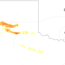
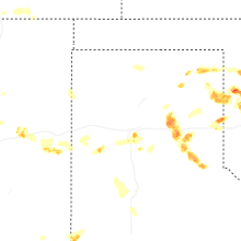
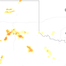
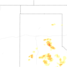


Connect with Interactive Hail Maps