

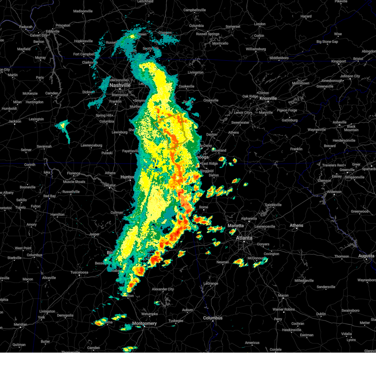
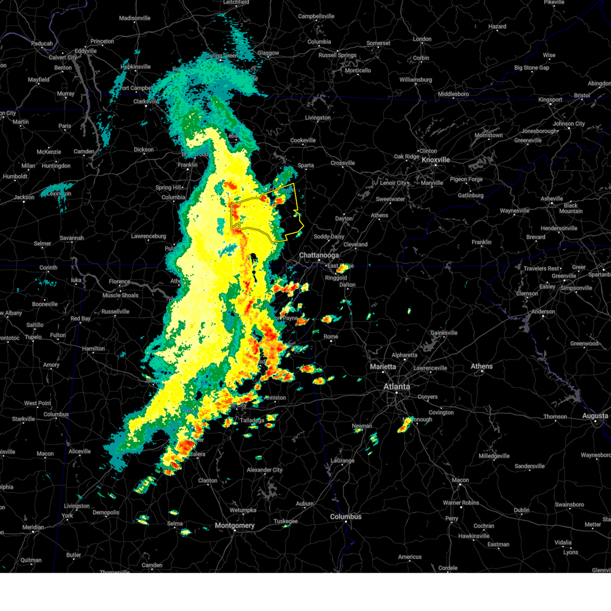
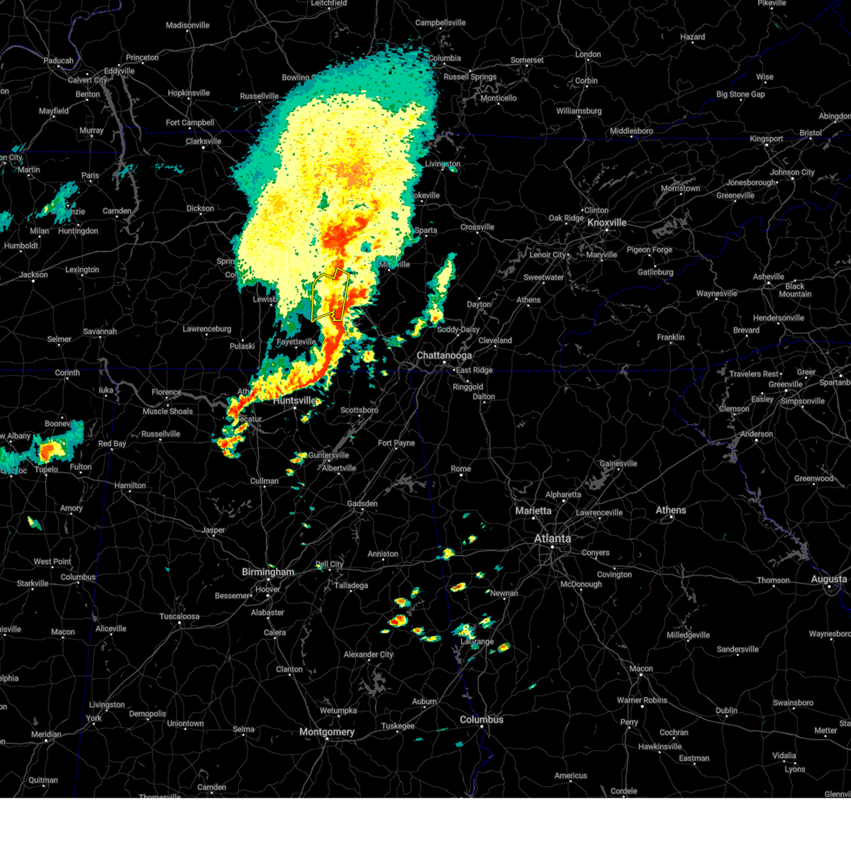
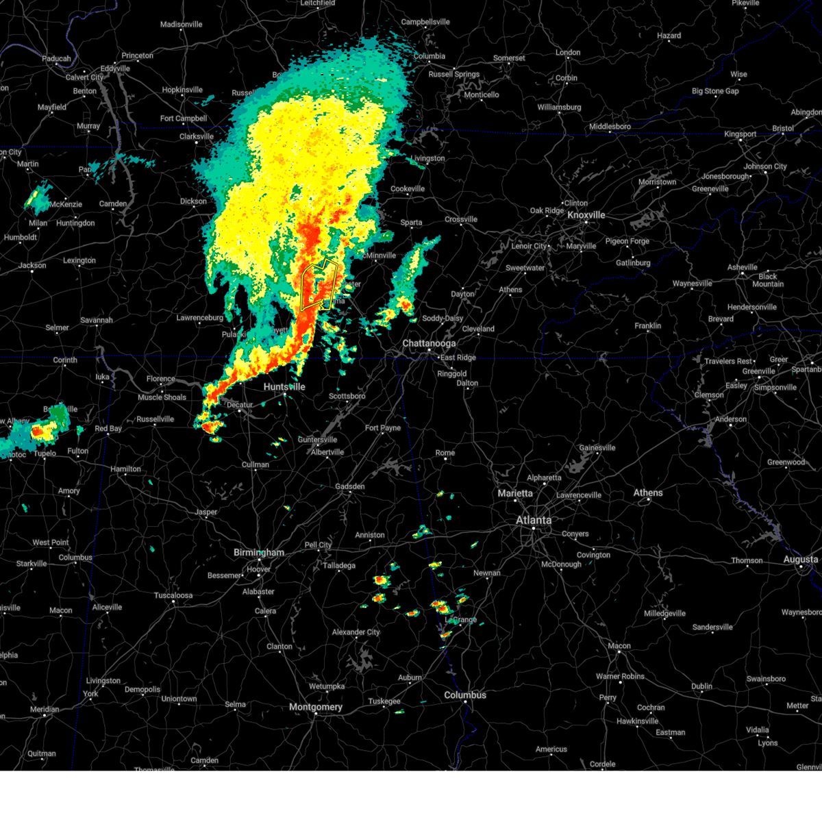
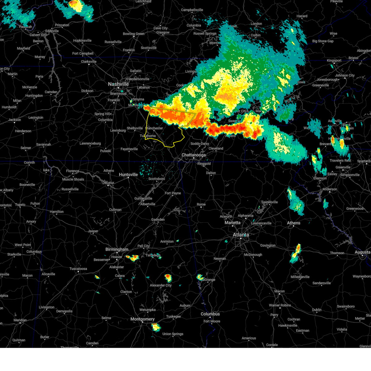
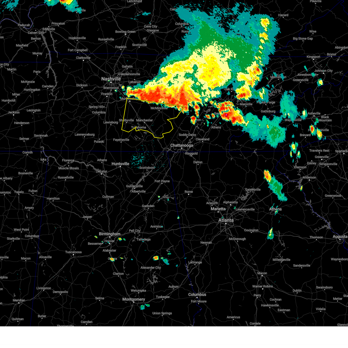
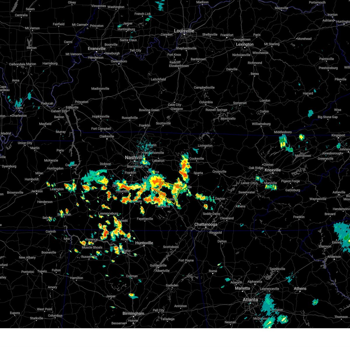
Hail Map for Lakewood Park, TN
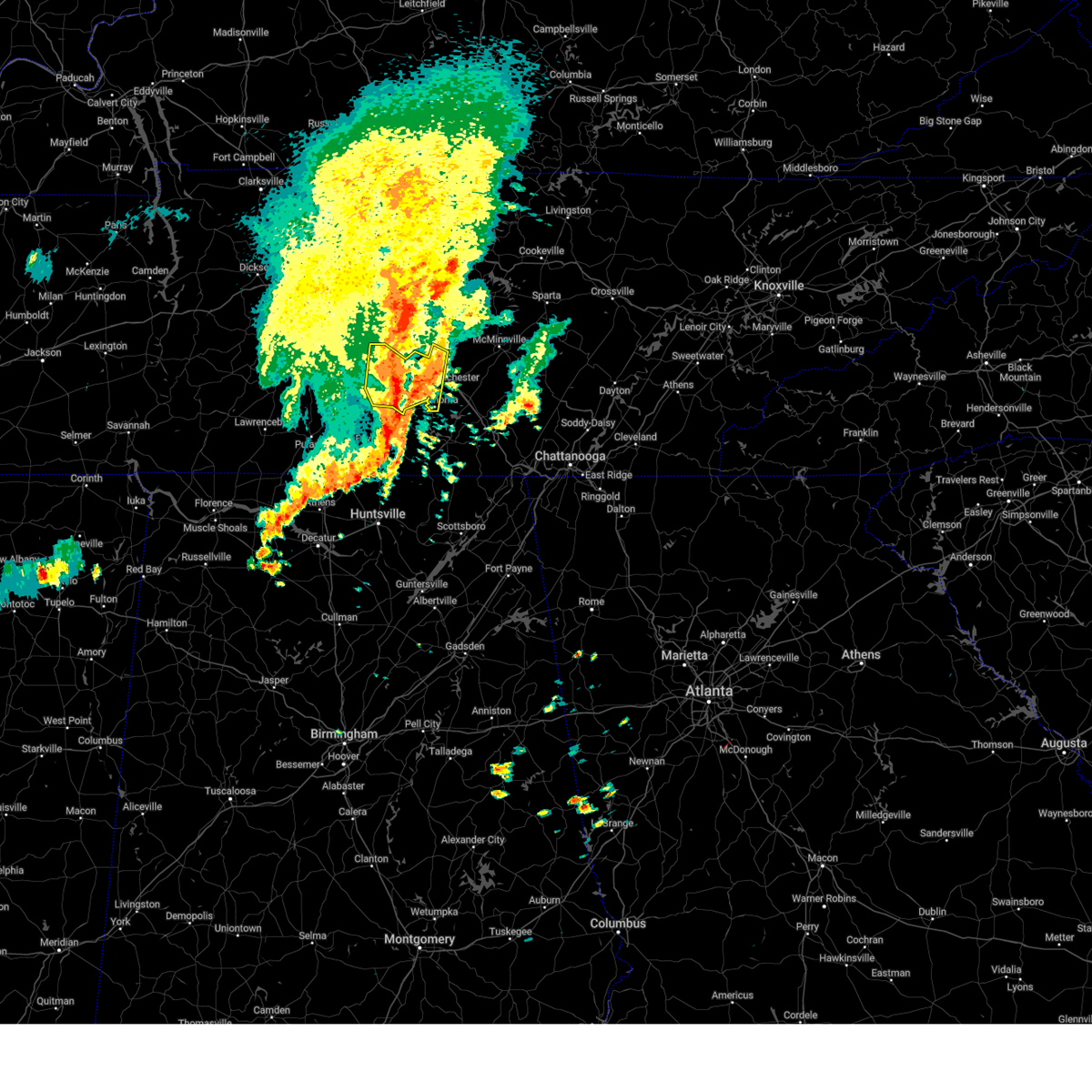
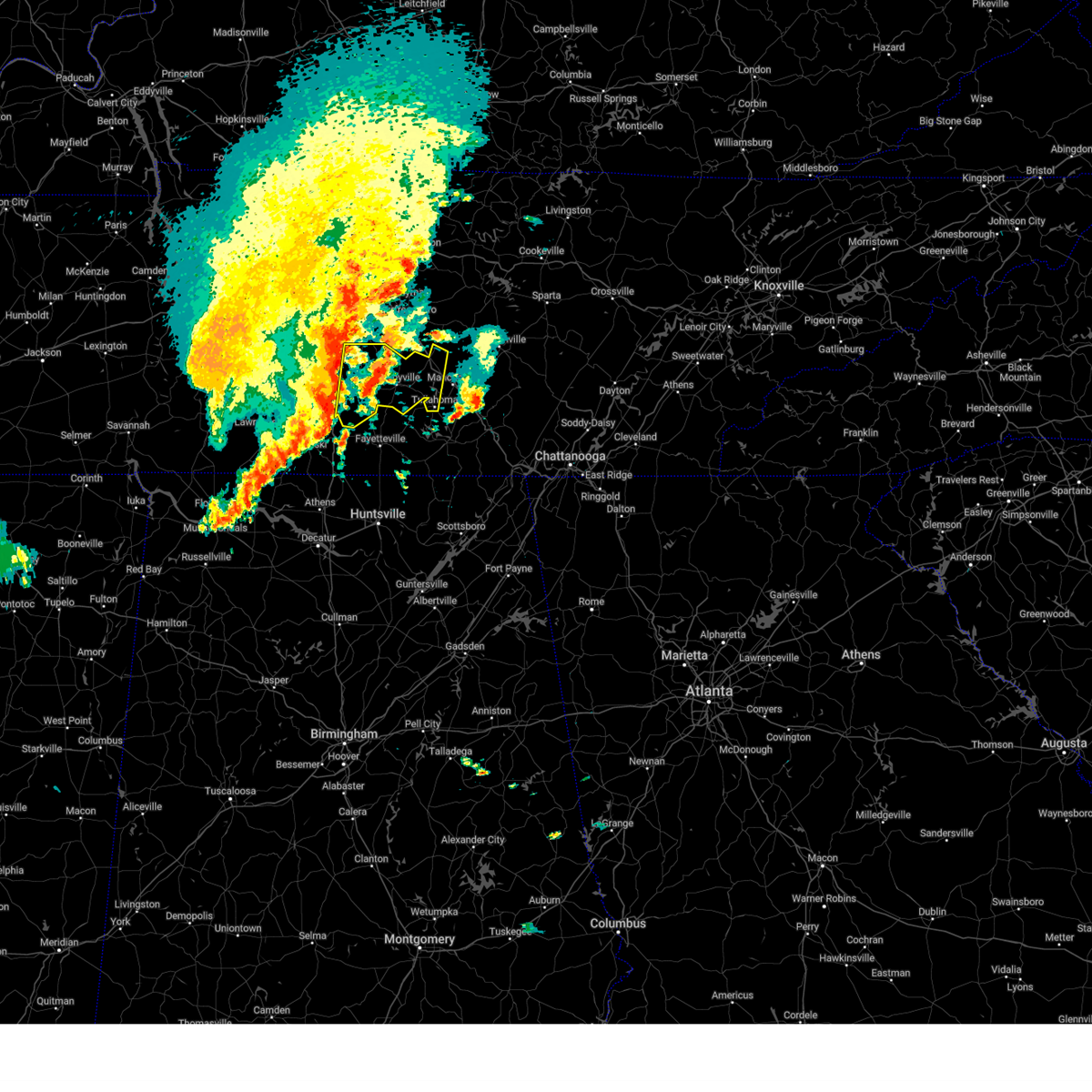
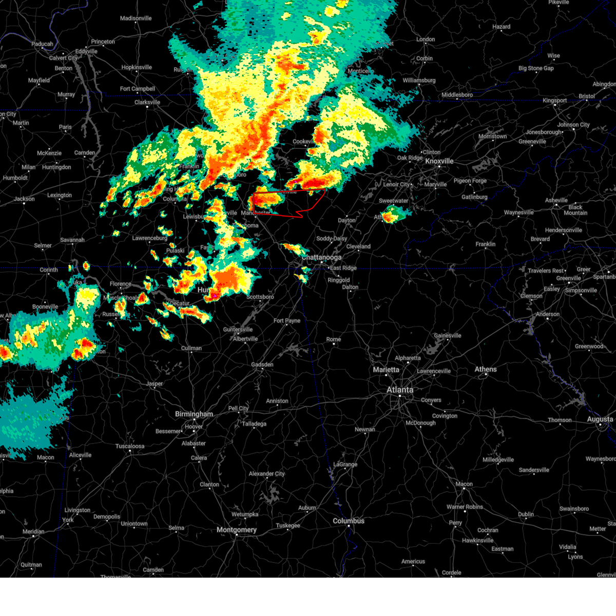
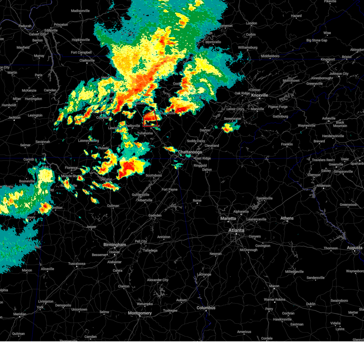
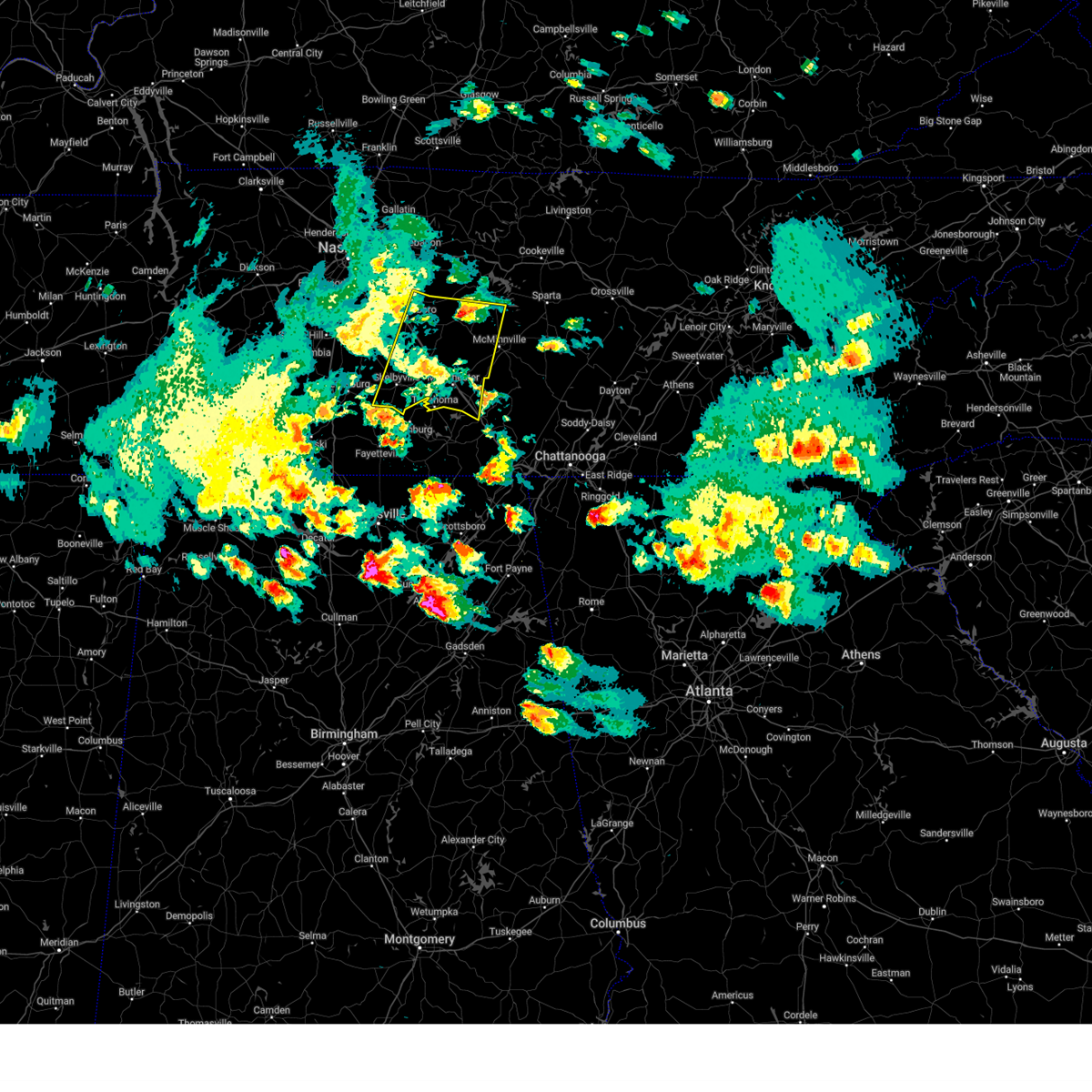
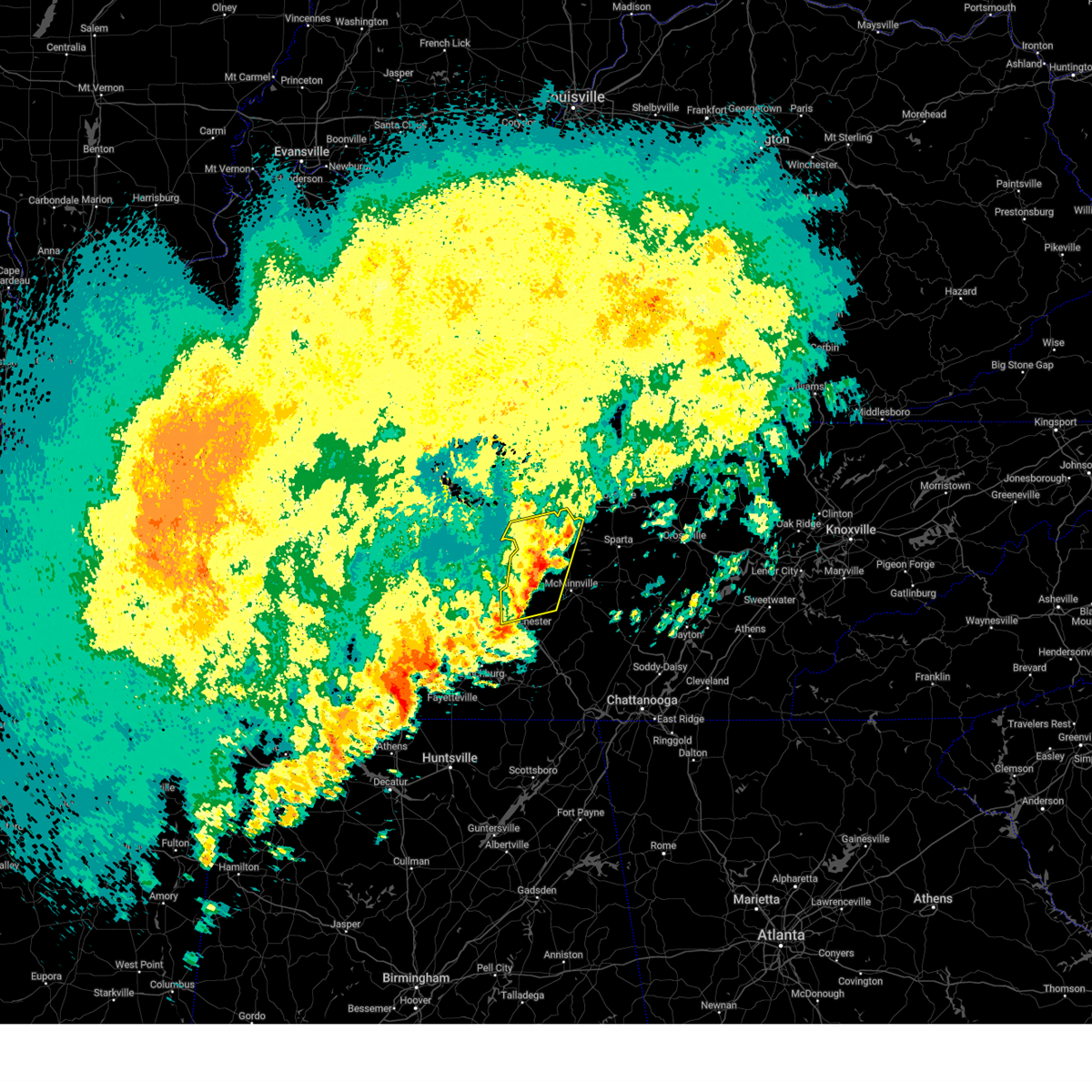
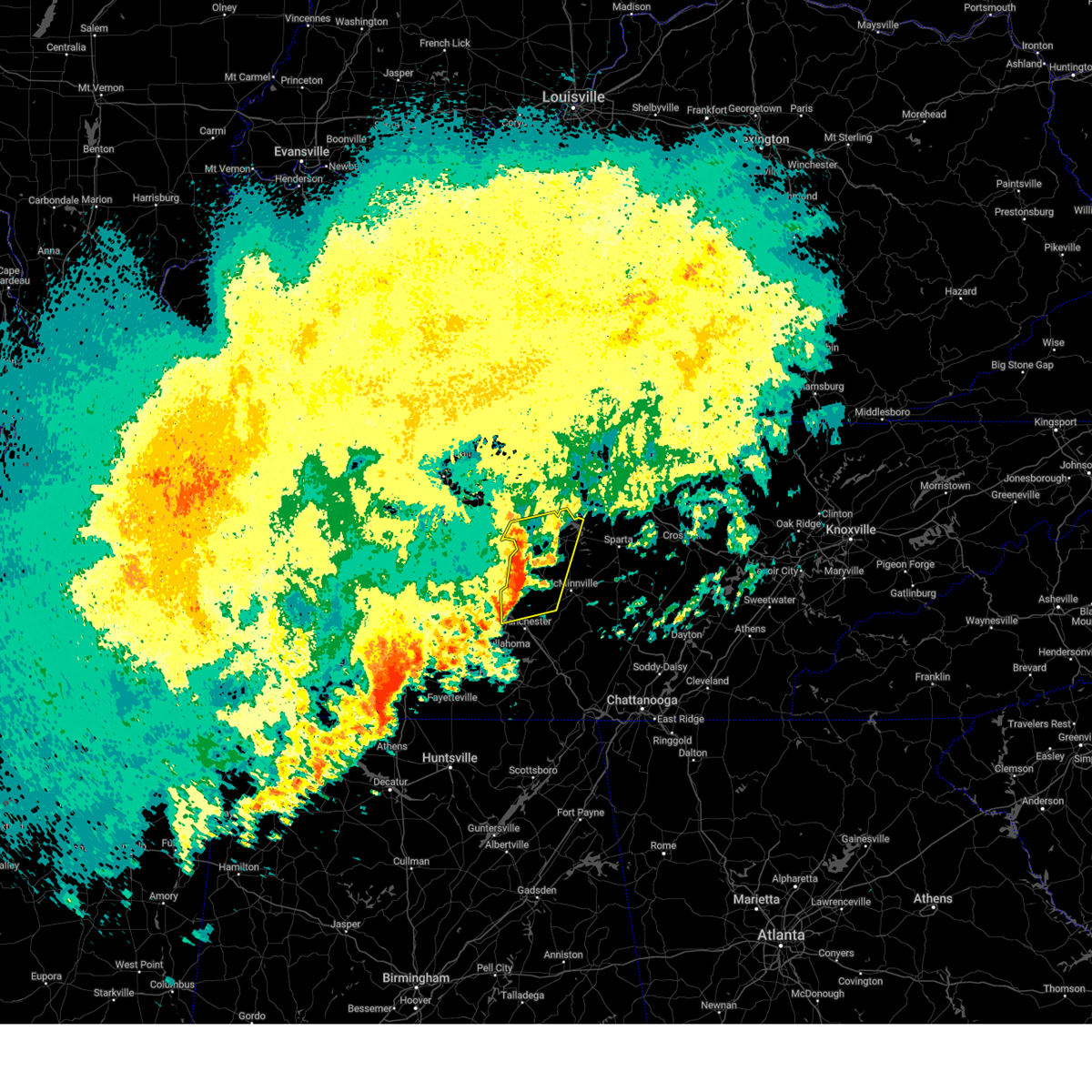
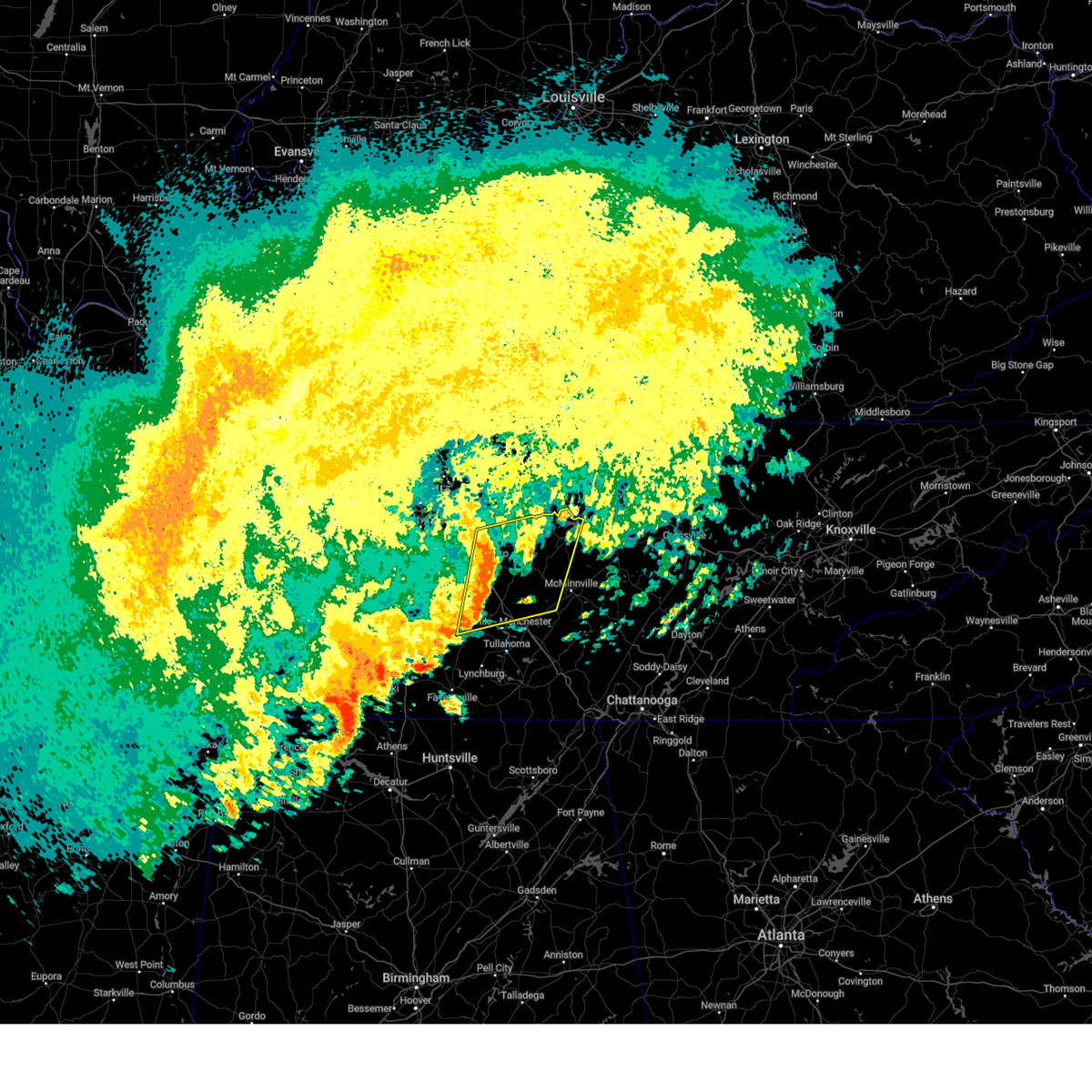
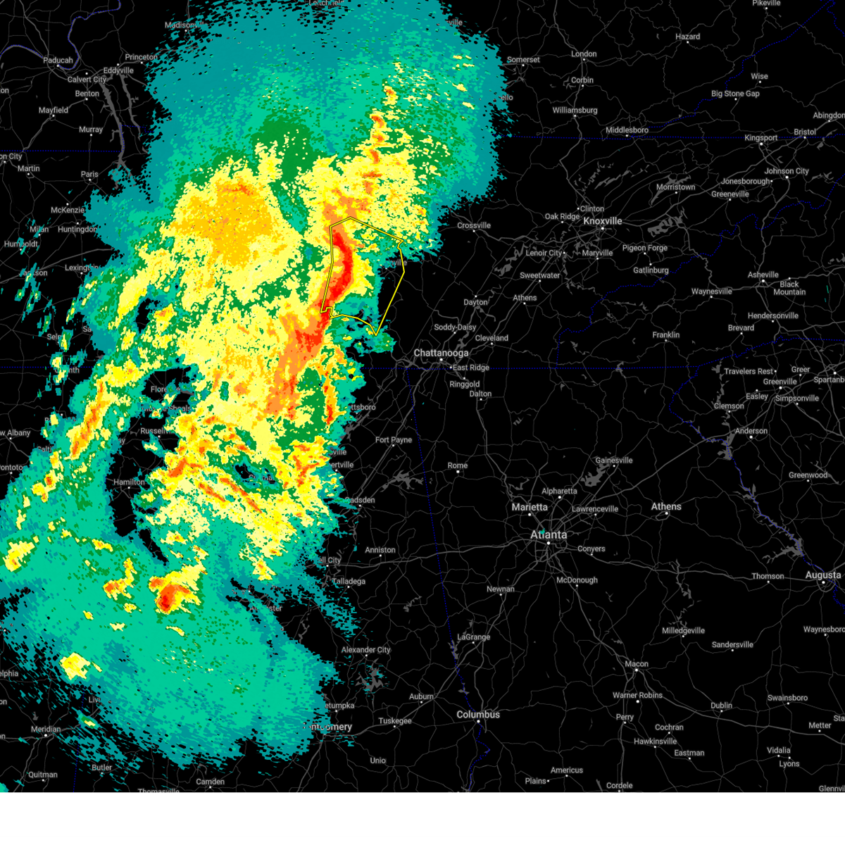
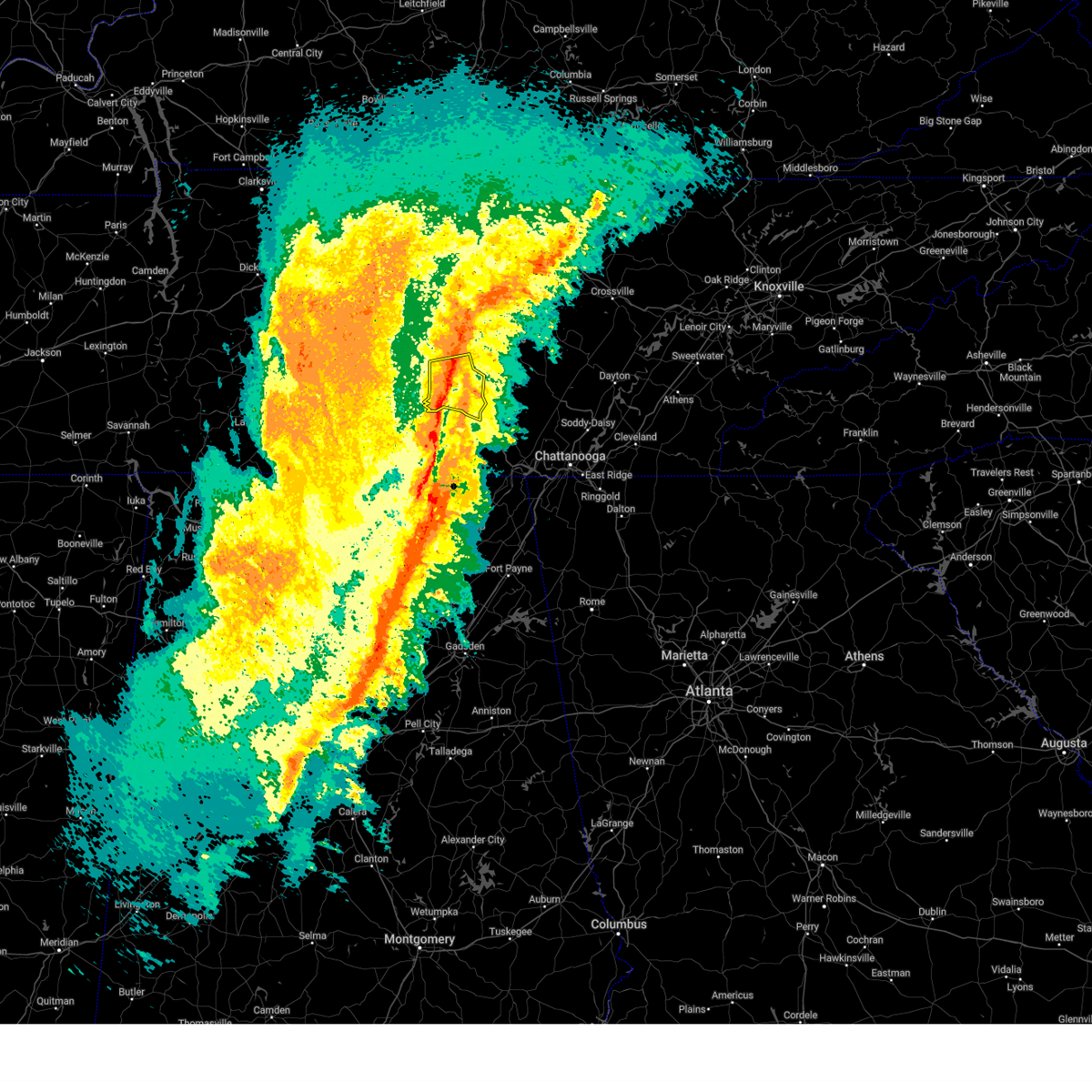
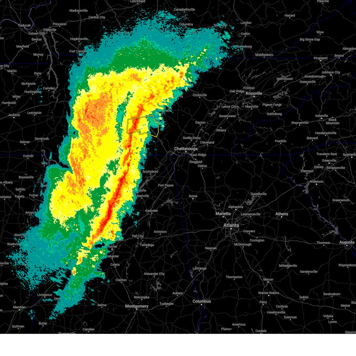
The Lakewood Park, TN area has had 6 reports of on-the-ground hail by trained spotters, and has been under severe weather warnings 43 times during the past 12 months. Doppler radar has detected hail at or near Lakewood Park, TN on 60 occasions, including 4 occasions during the past year.
| Name: | Lakewood Park, TN |
| Where Located: | 51 miles SE of Nashville, TN |
| Map: | Google Map for Lakewood Park, TN |
| Population: | 990 |
| Housing Units: | 776 |
| More Info: | Search Google for Lakewood Park, TN |
5
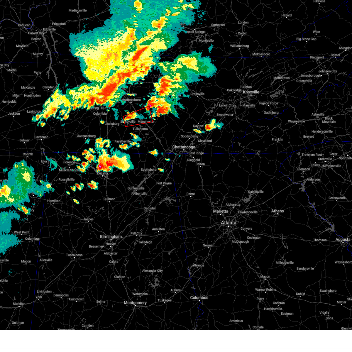
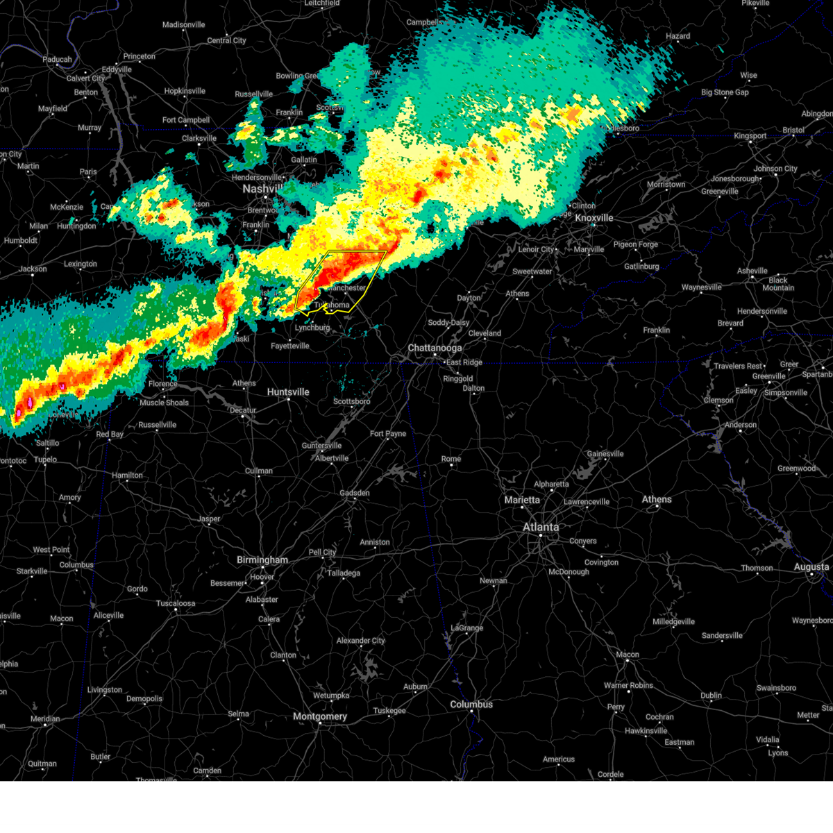
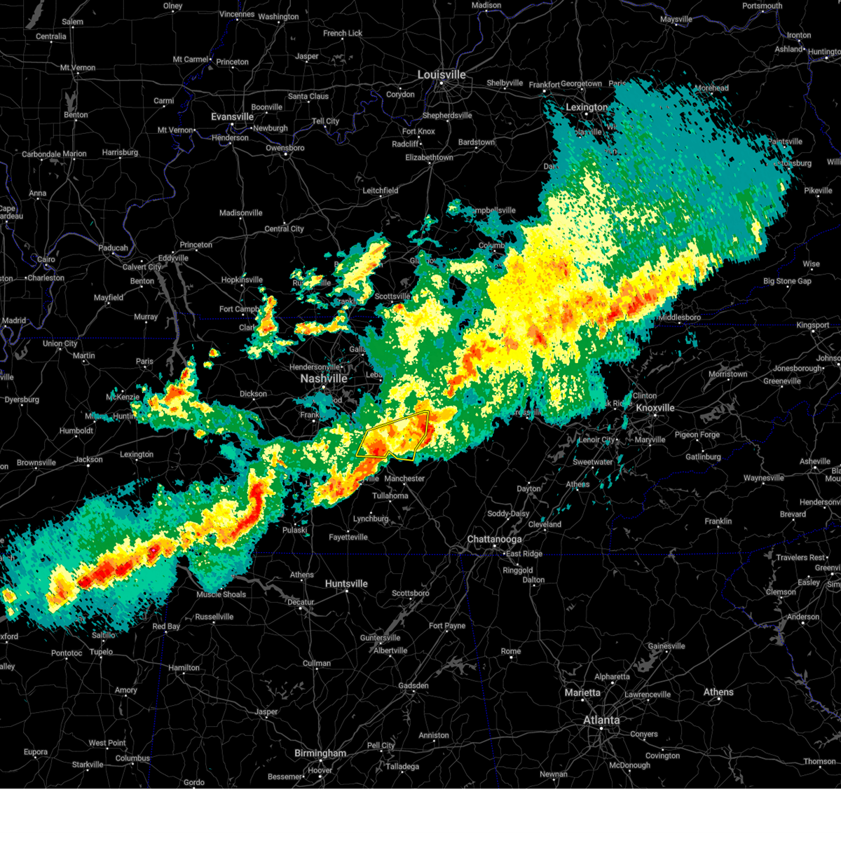
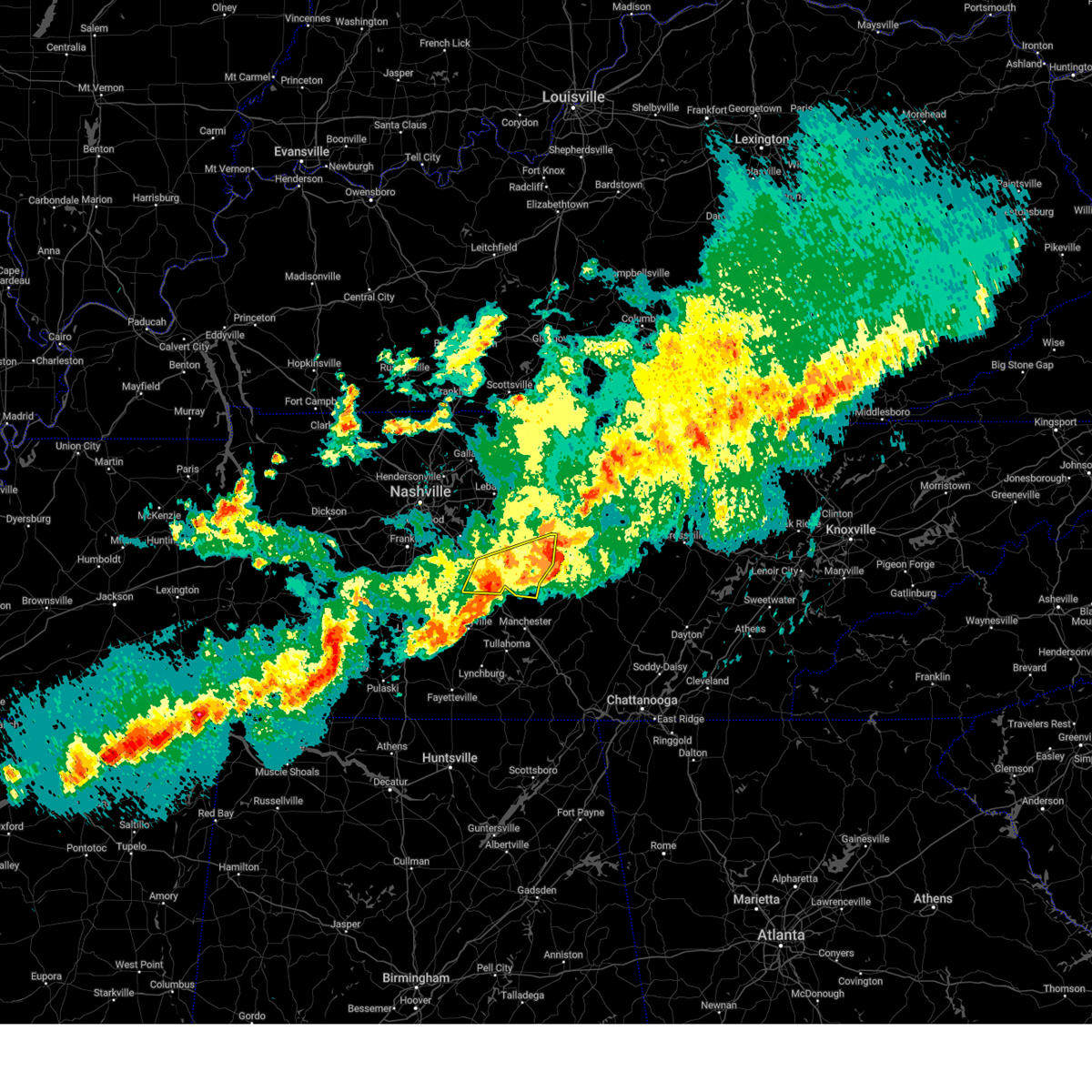
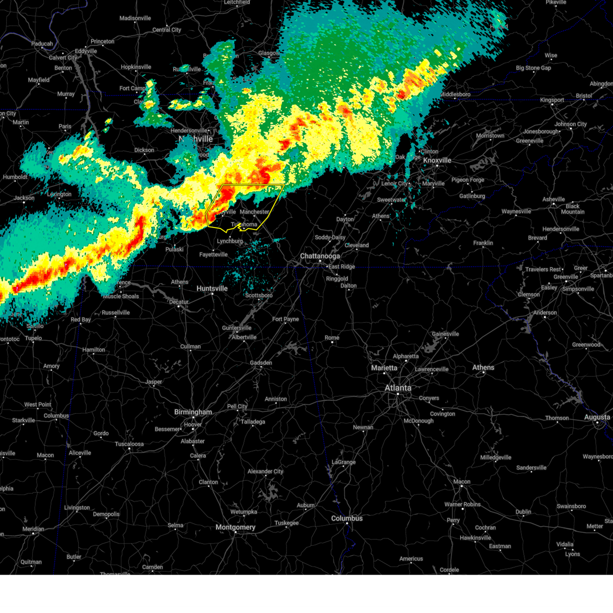
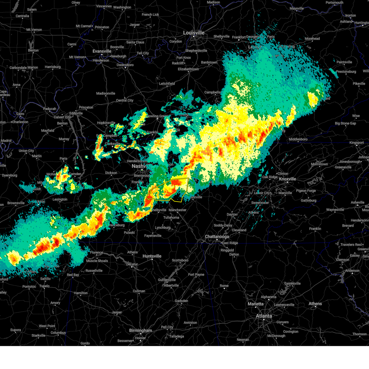
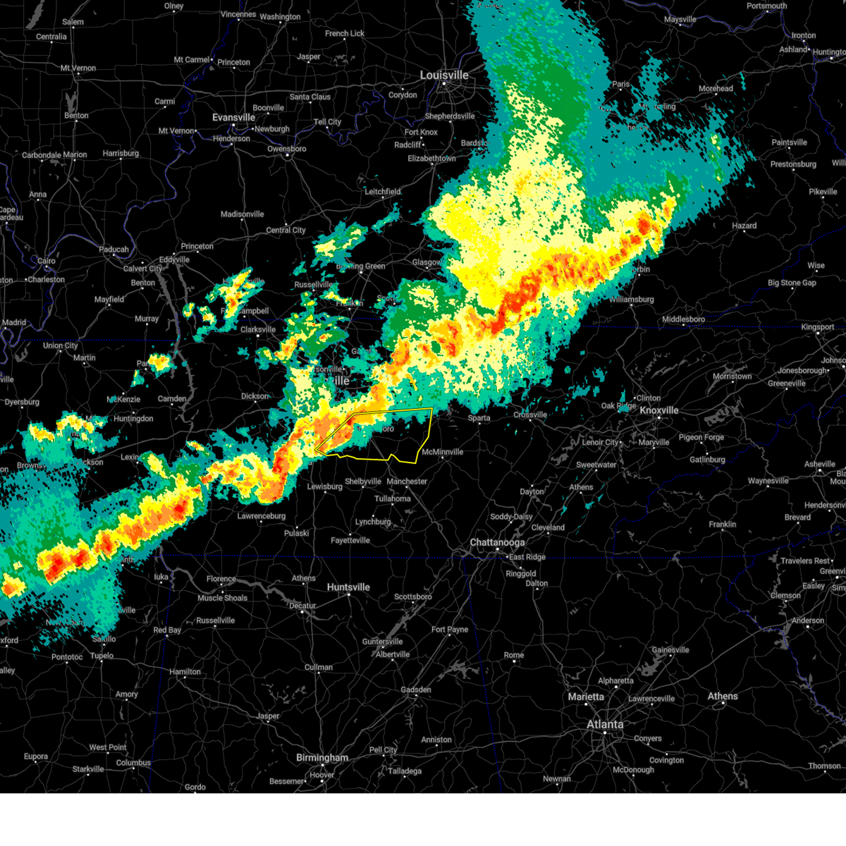
The Top Recent Hail Date for Lakewood Park, TN is Tuesday, May 20, 2025 (4th out of 60)

Hail and Wind Damage Spotted near Lakewood Park, TN
| Date / Time | Report Details |
|---|---|
| 6/7/2025 3:26 PM CDT |
 At 326 pm cdt, severe thunderstorms were located along a line extending from 11 miles northeast of manchester to 11 miles north of tracy city to near gruetli-laager, moving east at 55 mph (radar indicated). Hazards include 60 mph wind gusts and penny size hail. Expect damage to roofs, siding, and trees. locations impacted include, mcminnville, gruetli-laager, tracy city, monteagle, altamont, coalmont, morrison, palmer, beersheba springs, viola, summitville, and fiery gizzard state park. This includes interstate 24 between mile markers 134 and 136. At 326 pm cdt, severe thunderstorms were located along a line extending from 11 miles northeast of manchester to 11 miles north of tracy city to near gruetli-laager, moving east at 55 mph (radar indicated). Hazards include 60 mph wind gusts and penny size hail. Expect damage to roofs, siding, and trees. locations impacted include, mcminnville, gruetli-laager, tracy city, monteagle, altamont, coalmont, morrison, palmer, beersheba springs, viola, summitville, and fiery gizzard state park. This includes interstate 24 between mile markers 134 and 136.
|
| 6/7/2025 3:11 PM CDT |
 the severe thunderstorm warning has been cancelled and is no longer in effect the severe thunderstorm warning has been cancelled and is no longer in effect
|
| 6/7/2025 3:11 PM CDT |
 At 311 pm cdt, severe thunderstorms were located along a line extending from 14 miles south of woodbury to manchester to 8 miles northeast of estill springs, moving east at 45 mph (radar indicated). Hazards include 60 mph wind gusts and penny size hail. Expect damage to roofs, siding, and trees. locations impacted include, mcminnville, manchester, gruetli-laager, tracy city, monteagle, altamont, coalmont, morrison, palmer, beersheba springs, viola, summitville, hillsboro, pelham, arnold afb, and fiery gizzard state park. This includes interstate 24 between mile markers 100 and 136. At 311 pm cdt, severe thunderstorms were located along a line extending from 14 miles south of woodbury to manchester to 8 miles northeast of estill springs, moving east at 45 mph (radar indicated). Hazards include 60 mph wind gusts and penny size hail. Expect damage to roofs, siding, and trees. locations impacted include, mcminnville, manchester, gruetli-laager, tracy city, monteagle, altamont, coalmont, morrison, palmer, beersheba springs, viola, summitville, hillsboro, pelham, arnold afb, and fiery gizzard state park. This includes interstate 24 between mile markers 100 and 136.
|
| 6/7/2025 2:58 PM CDT |
 Svrohx the national weather service in nashville has issued a * severe thunderstorm warning for, warren county in middle tennessee, coffee county in middle tennessee, southeastern bedford county in middle tennessee, grundy county in middle tennessee, * until 400 pm cdt. * at 258 pm cdt, severe thunderstorms were located along a line extending from 11 miles northeast of shelbyville to tullahoma, moving east at 40 mph (radar indicated). Hazards include 60 mph wind gusts and penny size hail. expect damage to roofs, siding, and trees Svrohx the national weather service in nashville has issued a * severe thunderstorm warning for, warren county in middle tennessee, coffee county in middle tennessee, southeastern bedford county in middle tennessee, grundy county in middle tennessee, * until 400 pm cdt. * at 258 pm cdt, severe thunderstorms were located along a line extending from 11 miles northeast of shelbyville to tullahoma, moving east at 40 mph (radar indicated). Hazards include 60 mph wind gusts and penny size hail. expect damage to roofs, siding, and trees
|
| 5/25/2025 4:11 PM CDT |
 The storms which prompted the warning have moved out of the area. therefore, the warning will be allowed to expire. a severe thunderstorm watch remains in effect until 1100 pm cdt for middle tennessee. The storms which prompted the warning have moved out of the area. therefore, the warning will be allowed to expire. a severe thunderstorm watch remains in effect until 1100 pm cdt for middle tennessee.
|
| 5/25/2025 4:01 PM CDT |
 At 400 pm cdt, severe thunderstorms were located along a line extending from 13 miles south of murfreesboro to near lynchburg, moving east at 45 mph (radar indicated). Hazards include 60 mph wind gusts. Expect damage to roofs, siding, and trees. locations impacted include, shelbyville, tullahoma, wartrace, bell buckle, normandy, beechgrove, and raus. This includes interstate 24 between mile markers 97 and 106. At 400 pm cdt, severe thunderstorms were located along a line extending from 13 miles south of murfreesboro to near lynchburg, moving east at 45 mph (radar indicated). Hazards include 60 mph wind gusts. Expect damage to roofs, siding, and trees. locations impacted include, shelbyville, tullahoma, wartrace, bell buckle, normandy, beechgrove, and raus. This includes interstate 24 between mile markers 97 and 106.
|
| 5/25/2025 3:44 PM CDT |
 At 344 pm cdt, severe thunderstorms were located along a line extending from 12 miles north of shelbyville to 6 miles north of fayetteville, moving east at 45 mph (radar indicated). Hazards include 60 mph wind gusts. Expect damage to roofs, siding, and trees. locations impacted include, shelbyville, tullahoma, wartrace, bell buckle, normandy, rover, deason, beechgrove, raus, and unionville. This includes interstate 24 between mile markers 97 and 106. At 344 pm cdt, severe thunderstorms were located along a line extending from 12 miles north of shelbyville to 6 miles north of fayetteville, moving east at 45 mph (radar indicated). Hazards include 60 mph wind gusts. Expect damage to roofs, siding, and trees. locations impacted include, shelbyville, tullahoma, wartrace, bell buckle, normandy, rover, deason, beechgrove, raus, and unionville. This includes interstate 24 between mile markers 97 and 106.
|
| 5/25/2025 3:44 PM CDT |
 the severe thunderstorm warning has been cancelled and is no longer in effect the severe thunderstorm warning has been cancelled and is no longer in effect
|
| 5/25/2025 3:24 PM CDT |
 Svrohx the national weather service in nashville has issued a * severe thunderstorm warning for, marshall county in middle tennessee, western coffee county in middle tennessee, bedford county in middle tennessee, * until 415 pm cdt. * at 323 pm cdt, severe thunderstorms were located along a line extending from 9 miles east of spring hill to 11 miles southwest of petersburg, moving east at 45 mph (radar indicated). Hazards include 60 mph wind gusts. expect damage to roofs, siding, and trees Svrohx the national weather service in nashville has issued a * severe thunderstorm warning for, marshall county in middle tennessee, western coffee county in middle tennessee, bedford county in middle tennessee, * until 415 pm cdt. * at 323 pm cdt, severe thunderstorms were located along a line extending from 9 miles east of spring hill to 11 miles southwest of petersburg, moving east at 45 mph (radar indicated). Hazards include 60 mph wind gusts. expect damage to roofs, siding, and trees
|
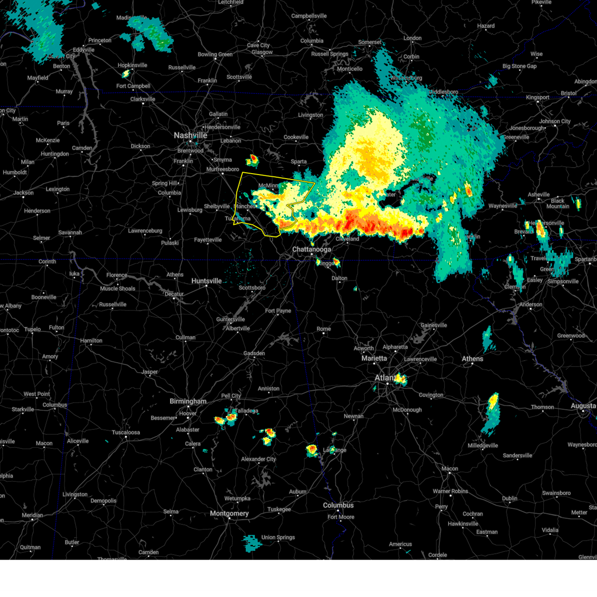
| 5/20/2025 7:06 PM CDT |
 Torohx the national weather service in nashville has issued a * tornado warning for, van buren county in middle tennessee, warren county in middle tennessee, northeastern coffee county in middle tennessee, northern grundy county in middle tennessee, south central cannon county in middle tennessee, * until 800 pm cdt. * at 706 pm cdt, a severe thunderstorm capable of producing a tornado was located near summitville, or 8 miles northeast of manchester, moving east at 40 mph (radar indicated rotation). Hazards include tornado and ping pong ball size hail. Flying debris will be dangerous to those caught without shelter. mobile homes will be damaged or destroyed. damage to roofs, windows, and vehicles will occur. Tree damage is likely. Torohx the national weather service in nashville has issued a * tornado warning for, van buren county in middle tennessee, warren county in middle tennessee, northeastern coffee county in middle tennessee, northern grundy county in middle tennessee, south central cannon county in middle tennessee, * until 800 pm cdt. * at 706 pm cdt, a severe thunderstorm capable of producing a tornado was located near summitville, or 8 miles northeast of manchester, moving east at 40 mph (radar indicated rotation). Hazards include tornado and ping pong ball size hail. Flying debris will be dangerous to those caught without shelter. mobile homes will be damaged or destroyed. damage to roofs, windows, and vehicles will occur. Tree damage is likely.
|
| 5/20/2025 6:49 PM CDT |
 the tornado warning has been cancelled and is no longer in effect the tornado warning has been cancelled and is no longer in effect
|
| 5/20/2025 6:49 PM CDT |
 At 649 pm cdt, a severe thunderstorm capable of producing a tornado was located 9 miles northwest of manchester, moving east at 40 mph (radar indicated rotation). Hazards include tornado and half dollar size hail. Flying debris will be dangerous to those caught without shelter. mobile homes will be damaged or destroyed. damage to roofs, windows, and vehicles will occur. tree damage is likely. Locations impacted include, summitville. At 649 pm cdt, a severe thunderstorm capable of producing a tornado was located 9 miles northwest of manchester, moving east at 40 mph (radar indicated rotation). Hazards include tornado and half dollar size hail. Flying debris will be dangerous to those caught without shelter. mobile homes will be damaged or destroyed. damage to roofs, windows, and vehicles will occur. tree damage is likely. Locations impacted include, summitville.
|
| 5/20/2025 6:24 PM CDT |
 Torohx the national weather service in nashville has issued a * tornado warning for, southeastern rutherford county in middle tennessee, northern coffee county in middle tennessee, central bedford county in middle tennessee, southwestern cannon county in middle tennessee, * until 715 pm cdt. * at 624 pm cdt, a severe thunderstorm capable of producing a tornado was located over shelbyville, moving east at 40 mph (radar indicated rotation). Hazards include tornado and quarter size hail. Flying debris will be dangerous to those caught without shelter. mobile homes will be damaged or destroyed. damage to roofs, windows, and vehicles will occur. Tree damage is likely. Torohx the national weather service in nashville has issued a * tornado warning for, southeastern rutherford county in middle tennessee, northern coffee county in middle tennessee, central bedford county in middle tennessee, southwestern cannon county in middle tennessee, * until 715 pm cdt. * at 624 pm cdt, a severe thunderstorm capable of producing a tornado was located over shelbyville, moving east at 40 mph (radar indicated rotation). Hazards include tornado and quarter size hail. Flying debris will be dangerous to those caught without shelter. mobile homes will be damaged or destroyed. damage to roofs, windows, and vehicles will occur. Tree damage is likely.
|
| 5/20/2025 5:55 PM CDT | Torohx the national weather service in nashville has issued a * tornado warning for, southeastern rutherford county in middle tennessee, northwestern coffee county in middle tennessee, cannon county in middle tennessee, * until 630 pm cdt. * at 555 pm cdt, a severe thunderstorm capable of producing a tornado was located 12 miles south of murfreesboro, moving east at 50 mph (radar indicated rotation). Hazards include tornado and golf ball size hail. Flying debris will be dangerous to those caught without shelter. mobile homes will be damaged or destroyed. damage to roofs, windows, and vehicles will occur. Tree damage is likely. |
| 5/20/2025 5:48 PM CDT |
 Torohx the national weather service in nashville has issued a * tornado warning for, southwestern warren county in middle tennessee, central coffee county in middle tennessee, east central bedford county in middle tennessee, northwestern grundy county in middle tennessee, south central cannon county in middle tennessee, * until 630 pm cdt. * at 548 pm cdt, a severe thunderstorm capable of producing a tornado was located 9 miles west of manchester, moving east at 35 mph (radar indicated rotation). Hazards include tornado and ping pong ball size hail. Flying debris will be dangerous to those caught without shelter. mobile homes will be damaged or destroyed. damage to roofs, windows, and vehicles will occur. tree damage is likely. this dangerous storm will be near, manchester around 555 pm cdt. Other locations impacted by this tornadic thunderstorm include morrison, beechgrove, normandy, viola, summitville, wartrace, bell buckle, centertown, and altamont. Torohx the national weather service in nashville has issued a * tornado warning for, southwestern warren county in middle tennessee, central coffee county in middle tennessee, east central bedford county in middle tennessee, northwestern grundy county in middle tennessee, south central cannon county in middle tennessee, * until 630 pm cdt. * at 548 pm cdt, a severe thunderstorm capable of producing a tornado was located 9 miles west of manchester, moving east at 35 mph (radar indicated rotation). Hazards include tornado and ping pong ball size hail. Flying debris will be dangerous to those caught without shelter. mobile homes will be damaged or destroyed. damage to roofs, windows, and vehicles will occur. tree damage is likely. this dangerous storm will be near, manchester around 555 pm cdt. Other locations impacted by this tornadic thunderstorm include morrison, beechgrove, normandy, viola, summitville, wartrace, bell buckle, centertown, and altamont.
|
| 4/10/2025 6:30 PM CDT |
 the severe thunderstorm warning has been cancelled and is no longer in effect the severe thunderstorm warning has been cancelled and is no longer in effect
|
| 4/10/2025 6:30 PM CDT |
 At 630 pm cdt, severe thunderstorms were located along a line extending from near smithville to 6 miles northeast of estill springs, moving east at 40 mph (radar indicated). Hazards include 60 mph wind gusts. Expect damage to roofs, siding, and trees. locations impacted include, woodbury, morrison, hillsboro, centertown, manchester, viola, summitville, auburntown, arnold afb, and mcminnville. This includes interstate 24 between mile markers 104 and 126. At 630 pm cdt, severe thunderstorms were located along a line extending from near smithville to 6 miles northeast of estill springs, moving east at 40 mph (radar indicated). Hazards include 60 mph wind gusts. Expect damage to roofs, siding, and trees. locations impacted include, woodbury, morrison, hillsboro, centertown, manchester, viola, summitville, auburntown, arnold afb, and mcminnville. This includes interstate 24 between mile markers 104 and 126.
|
| 4/10/2025 5:52 PM CDT |
 Svrohx the national weather service in nashville has issued a * severe thunderstorm warning for, southwestern de kalb county in middle tennessee, southeastern rutherford county in middle tennessee, western warren county in middle tennessee, coffee county in middle tennessee, bedford county in middle tennessee, cannon county in middle tennessee, * until 645 pm cdt. * at 551 pm cdt, severe thunderstorms were located along a line extending from near walterhill to near petersburg, moving east at 25 mph (radar indicated). Hazards include 60 mph wind gusts. expect damage to roofs, siding, and trees Svrohx the national weather service in nashville has issued a * severe thunderstorm warning for, southwestern de kalb county in middle tennessee, southeastern rutherford county in middle tennessee, western warren county in middle tennessee, coffee county in middle tennessee, bedford county in middle tennessee, cannon county in middle tennessee, * until 645 pm cdt. * at 551 pm cdt, severe thunderstorms were located along a line extending from near walterhill to near petersburg, moving east at 25 mph (radar indicated). Hazards include 60 mph wind gusts. expect damage to roofs, siding, and trees
|
| 4/5/2025 11:41 PM CDT |
 the severe thunderstorm warning has been cancelled and is no longer in effect the severe thunderstorm warning has been cancelled and is no longer in effect
|
| 4/5/2025 11:29 PM CDT |
 the severe thunderstorm warning has been cancelled and is no longer in effect the severe thunderstorm warning has been cancelled and is no longer in effect
|
| 4/5/2025 11:29 PM CDT |
 At 1128 pm cdt, severe thunderstorms were located along a line extending from 6 miles southeast of watertown to 11 miles northwest of manchester, moving northeast at 40 mph (radar indicated). Hazards include 60 mph wind gusts and penny size hail. Expect damage to roofs, siding, and trees. locations impacted include, morrison, centertown, smithville, dowelltown, beechgrove, liberty, summitville, auburntown, center hill lake, woodbury, bradyville, alexandria, edgar evins state park, and readyville. This includes interstate 24 between mile markers 97 and 106. At 1128 pm cdt, severe thunderstorms were located along a line extending from 6 miles southeast of watertown to 11 miles northwest of manchester, moving northeast at 40 mph (radar indicated). Hazards include 60 mph wind gusts and penny size hail. Expect damage to roofs, siding, and trees. locations impacted include, morrison, centertown, smithville, dowelltown, beechgrove, liberty, summitville, auburntown, center hill lake, woodbury, bradyville, alexandria, edgar evins state park, and readyville. This includes interstate 24 between mile markers 97 and 106.
|
| 4/5/2025 11:08 PM CDT |
 Svrohx the national weather service in nashville has issued a * severe thunderstorm warning for, de kalb county in middle tennessee, eastern rutherford county in middle tennessee, western warren county in middle tennessee, northern coffee county in middle tennessee, southeastern wilson county in middle tennessee, northeastern bedford county in middle tennessee, cannon county in middle tennessee, * until 1215 am cdt. * at 1108 pm cdt, severe thunderstorms were located along a line extending from near walterhill to near shelbyville, moving northeast at 40 mph (radar indicated). Hazards include 60 mph wind gusts and penny size hail. expect damage to roofs, siding, and trees Svrohx the national weather service in nashville has issued a * severe thunderstorm warning for, de kalb county in middle tennessee, eastern rutherford county in middle tennessee, western warren county in middle tennessee, northern coffee county in middle tennessee, southeastern wilson county in middle tennessee, northeastern bedford county in middle tennessee, cannon county in middle tennessee, * until 1215 am cdt. * at 1108 pm cdt, severe thunderstorms were located along a line extending from near walterhill to near shelbyville, moving northeast at 40 mph (radar indicated). Hazards include 60 mph wind gusts and penny size hail. expect damage to roofs, siding, and trees
|
| 3/31/2025 1:45 AM CDT | At 145 am cdt, severe thunderstorms were located along a line extending from 10 miles west of mcminnville to lynchburg, moving east at 30 mph (radar indicated). Hazards include 60 mph wind gusts and quarter size hail. Hail damage to vehicles is expected. expect wind damage to roofs, siding, and trees. locations impacted include, morrison, tullahoma, beechgrove, raus, summitville, manchester, normandy, wartrace, centertown, shelbyville, bell buckle, mcminnville, and arnold afb. This includes interstate 24 between mile markers 96 and 118. |
| 3/31/2025 1:45 AM CDT | the severe thunderstorm warning has been cancelled and is no longer in effect |
| 3/31/2025 1:20 AM CDT |
 At 120 am cdt, severe thunderstorms were located along a line extending from 10 miles southwest of woodbury to near petersburg, moving east at 30 mph (radar indicated). Hazards include 60 mph wind gusts and quarter size hail. Hail damage to vehicles is expected. expect wind damage to roofs, siding, and trees. locations impacted include, morrison, centertown, bell buckle, tullahoma, beechgrove, raus, summitville, manchester, bradyville, shelbyville, normandy, wartrace, mcminnville, and arnold afb. This includes interstate 24 between mile markers 91 and 118. At 120 am cdt, severe thunderstorms were located along a line extending from 10 miles southwest of woodbury to near petersburg, moving east at 30 mph (radar indicated). Hazards include 60 mph wind gusts and quarter size hail. Hail damage to vehicles is expected. expect wind damage to roofs, siding, and trees. locations impacted include, morrison, centertown, bell buckle, tullahoma, beechgrove, raus, summitville, manchester, bradyville, shelbyville, normandy, wartrace, mcminnville, and arnold afb. This includes interstate 24 between mile markers 91 and 118.
|
| 3/31/2025 1:05 AM CDT |
 the severe thunderstorm warning has been cancelled and is no longer in effect the severe thunderstorm warning has been cancelled and is no longer in effect
|
| 3/31/2025 1:05 AM CDT |
 At 105 am cdt, a severe thunderstorm was located 8 miles south of smithville, moving east at 40 mph (radar indicated). Hazards include 60 mph wind gusts and penny size hail. Expect damage to roofs, siding, and trees. locations impacted include, bradyville, christiana, murfreesboro, woodbury, readyville, and auburntown. This includes interstate 24 between mile markers 80 and 92. At 105 am cdt, a severe thunderstorm was located 8 miles south of smithville, moving east at 40 mph (radar indicated). Hazards include 60 mph wind gusts and penny size hail. Expect damage to roofs, siding, and trees. locations impacted include, bradyville, christiana, murfreesboro, woodbury, readyville, and auburntown. This includes interstate 24 between mile markers 80 and 92.
|
| 3/31/2025 1:05 AM CDT |
 Svrohx the national weather service in nashville has issued a * severe thunderstorm warning for, southeastern rutherford county in middle tennessee, western warren county in middle tennessee, coffee county in middle tennessee, bedford county in middle tennessee, southern cannon county in middle tennessee, * until 200 am cdt. * at 105 am cdt, severe thunderstorms were located along a line extending from 13 miles southeast of murfreesboro to near petersburg, moving east at 30 mph (radar indicated). Hazards include 60 mph wind gusts and penny size hail. expect damage to roofs, siding, and trees Svrohx the national weather service in nashville has issued a * severe thunderstorm warning for, southeastern rutherford county in middle tennessee, western warren county in middle tennessee, coffee county in middle tennessee, bedford county in middle tennessee, southern cannon county in middle tennessee, * until 200 am cdt. * at 105 am cdt, severe thunderstorms were located along a line extending from 13 miles southeast of murfreesboro to near petersburg, moving east at 30 mph (radar indicated). Hazards include 60 mph wind gusts and penny size hail. expect damage to roofs, siding, and trees
|
| 3/31/2025 12:44 AM CDT |
 the severe thunderstorm warning has been cancelled and is no longer in effect the severe thunderstorm warning has been cancelled and is no longer in effect
|
| 3/31/2025 12:44 AM CDT |
 At 1244 am cdt, a severe thunderstorm was located over woodbury, moving east at 40 mph (radar indicated). Hazards include ping pong ball size hail and 60 mph wind gusts. People and animals outdoors will be injured. expect hail damage to roofs, siding, windows, and vehicles. expect wind damage to roofs, siding, and trees. locations impacted include, auburntown, lascassas, christiana, eagleville, murfreesboro, woodbury, rockvale, dowelltown, bradyville, milton, liberty, and readyville. this includes the following highways, interstate 24 between mile markers 74 and 93. Interstate 840 between mile markers 47 and 55. At 1244 am cdt, a severe thunderstorm was located over woodbury, moving east at 40 mph (radar indicated). Hazards include ping pong ball size hail and 60 mph wind gusts. People and animals outdoors will be injured. expect hail damage to roofs, siding, windows, and vehicles. expect wind damage to roofs, siding, and trees. locations impacted include, auburntown, lascassas, christiana, eagleville, murfreesboro, woodbury, rockvale, dowelltown, bradyville, milton, liberty, and readyville. this includes the following highways, interstate 24 between mile markers 74 and 93. Interstate 840 between mile markers 47 and 55.
|
| 3/31/2025 12:11 AM CDT |
 Svrohx the national weather service in nashville has issued a * severe thunderstorm warning for, southwestern de kalb county in middle tennessee, rutherford county in middle tennessee, southeastern williamson county in middle tennessee, southeastern wilson county in middle tennessee, cannon county in middle tennessee, * until 115 am cdt. * at 1211 am cdt, a severe thunderstorm was located near murfreesboro, moving east at 40 mph (radar indicated). Hazards include ping pong ball size hail and 60 mph wind gusts. People and animals outdoors will be injured. expect hail damage to roofs, siding, windows, and vehicles. Expect wind damage to roofs, siding, and trees. Svrohx the national weather service in nashville has issued a * severe thunderstorm warning for, southwestern de kalb county in middle tennessee, rutherford county in middle tennessee, southeastern williamson county in middle tennessee, southeastern wilson county in middle tennessee, cannon county in middle tennessee, * until 115 am cdt. * at 1211 am cdt, a severe thunderstorm was located near murfreesboro, moving east at 40 mph (radar indicated). Hazards include ping pong ball size hail and 60 mph wind gusts. People and animals outdoors will be injured. expect hail damage to roofs, siding, windows, and vehicles. Expect wind damage to roofs, siding, and trees.
|
| 3/15/2025 4:10 PM CDT |
 At 409 pm cdt, severe thunderstorms were located along a line extending from 6 miles west of smithville to near mcminnville to 9 miles east of manchester, moving east at 55 mph (radar indicated). Hazards include 60 mph wind gusts and penny size hail. Expect damage to roofs, siding, and trees. locations impacted include, morrison, centertown, tullahoma, summitville, woodbury, mcminnville, hillsboro, pelham, manchester, viola, altamont, monteagle, and arnold afb. This includes interstate 24 between mile markers 104 and 133. At 409 pm cdt, severe thunderstorms were located along a line extending from 6 miles west of smithville to near mcminnville to 9 miles east of manchester, moving east at 55 mph (radar indicated). Hazards include 60 mph wind gusts and penny size hail. Expect damage to roofs, siding, and trees. locations impacted include, morrison, centertown, tullahoma, summitville, woodbury, mcminnville, hillsboro, pelham, manchester, viola, altamont, monteagle, and arnold afb. This includes interstate 24 between mile markers 104 and 133.
|
| 3/15/2025 4:10 PM CDT |
 the severe thunderstorm warning has been cancelled and is no longer in effect the severe thunderstorm warning has been cancelled and is no longer in effect
|
| 3/15/2025 4:03 PM CDT | Debris blocking i-24 east at mile marker 89.2 in rutherford county. tree across roadway with all eastbound lanes blocke in rutherford county TN, 8.3 miles ESE of Lakewood Park, TN |
| 3/15/2025 3:55 PM CDT |
 At 355 pm cdt, severe thunderstorms were located along a line extending from 10 miles south of watertown to 7 miles southeast of woodbury to near manchester, moving east at 55 mph (radar indicated). Hazards include 60 mph wind gusts and penny size hail. Expect damage to roofs, siding, and trees. locations impacted include, morrison, centertown, tullahoma, beechgrove, raus, summitville, auburntown, woodbury, mcminnville, hillsboro, pelham, manchester, bradyville, normandy, milton, viola, readyville, liberty, altamont, and monteagle. This includes interstate 24 between mile markers 95 and 133. At 355 pm cdt, severe thunderstorms were located along a line extending from 10 miles south of watertown to 7 miles southeast of woodbury to near manchester, moving east at 55 mph (radar indicated). Hazards include 60 mph wind gusts and penny size hail. Expect damage to roofs, siding, and trees. locations impacted include, morrison, centertown, tullahoma, beechgrove, raus, summitville, auburntown, woodbury, mcminnville, hillsboro, pelham, manchester, bradyville, normandy, milton, viola, readyville, liberty, altamont, and monteagle. This includes interstate 24 between mile markers 95 and 133.
|
| 3/15/2025 3:45 PM CDT | Trees were blown down and blocking the road along jacobs hollow rd near bradyville pike. time estimated by rada in rutherford county TN, 8.4 miles SE of Lakewood Park, TN |
| 3/15/2025 3:38 PM CDT | Svrohx the national weather service in nashville has issued a * severe thunderstorm warning for, southern de kalb county in middle tennessee, eastern rutherford county in middle tennessee, warren county in middle tennessee, coffee county in middle tennessee, southeastern wilson county in middle tennessee, eastern bedford county in middle tennessee, western grundy county in middle tennessee, cannon county in middle tennessee, * until 430 pm cdt. * at 338 pm cdt, severe thunderstorms were located along a line extending from murfreesboro to 15 miles northeast of shelbyville to near lynchburg, moving east at 55 mph (radar indicated). Hazards include 60 mph wind gusts and penny size hail. expect damage to roofs, siding, and trees |
| 2/16/2025 12:55 AM CST |
 At 1254 am cst, a severe thunderstorm was located over manchester, moving east at 50 mph (radar indicated). Hazards include 60 mph wind gusts. Expect damage to roofs, siding, and trees. locations impacted include, manchester, tullahoma, hillsboro, summitville, and arnold afb. This includes interstate 24 between mile markers 99 and 126. At 1254 am cst, a severe thunderstorm was located over manchester, moving east at 50 mph (radar indicated). Hazards include 60 mph wind gusts. Expect damage to roofs, siding, and trees. locations impacted include, manchester, tullahoma, hillsboro, summitville, and arnold afb. This includes interstate 24 between mile markers 99 and 126.
|
| 2/16/2025 12:55 AM CST |
 the severe thunderstorm warning has been cancelled and is no longer in effect the severe thunderstorm warning has been cancelled and is no longer in effect
|
| 2/16/2025 12:39 AM CST |
 Svrohx the national weather service in nashville has issued a * severe thunderstorm warning for, coffee county in middle tennessee, southeastern bedford county in middle tennessee, * until 115 am cst. * at 1239 am cst, a severe thunderstorm was located 7 miles east of shelbyville, moving east at 50 mph (radar indicated). Hazards include 60 mph wind gusts. expect damage to roofs, siding, and trees Svrohx the national weather service in nashville has issued a * severe thunderstorm warning for, coffee county in middle tennessee, southeastern bedford county in middle tennessee, * until 115 am cst. * at 1239 am cst, a severe thunderstorm was located 7 miles east of shelbyville, moving east at 50 mph (radar indicated). Hazards include 60 mph wind gusts. expect damage to roofs, siding, and trees
|
| 7/30/2024 5:06 PM CDT |
 The storms which prompted the warning have weakened below severe limits, and no longer pose an immediate threat to life or property. therefore, the warning will be allowed to expire. a severe thunderstorm watch remains in effect until 800 pm cdt for middle tennessee. to report severe weather, contact your nearest law enforcement agency. they will relay your report to the national weather service nashville. The storms which prompted the warning have weakened below severe limits, and no longer pose an immediate threat to life or property. therefore, the warning will be allowed to expire. a severe thunderstorm watch remains in effect until 800 pm cdt for middle tennessee. to report severe weather, contact your nearest law enforcement agency. they will relay your report to the national weather service nashville.
|
| 7/30/2024 4:37 PM CDT |
 the severe thunderstorm warning has been cancelled and is no longer in effect the severe thunderstorm warning has been cancelled and is no longer in effect
|
| 7/30/2024 4:37 PM CDT |
 At 437 pm cdt, severe thunderstorms were located along a line extending from bell buckle to fall creek falls, moving southeast at 40 mph (radar indicated). Hazards include 60 mph wind gusts and quarter size hail. Hail damage to vehicles is expected. expect wind damage to roofs, siding, and trees. locations impacted include, mcminnville, manchester, woodbury, spencer, tullahoma, gruetli-laager, tracy city, monteagle, altamont, coalmont, morrison, palmer, beersheba springs, centertown, viola, summitville, fall creek falls state park, hillsboro, pelham, and bradyville. This includes interstate 24 between mile markers 101 and 136. At 437 pm cdt, severe thunderstorms were located along a line extending from bell buckle to fall creek falls, moving southeast at 40 mph (radar indicated). Hazards include 60 mph wind gusts and quarter size hail. Hail damage to vehicles is expected. expect wind damage to roofs, siding, and trees. locations impacted include, mcminnville, manchester, woodbury, spencer, tullahoma, gruetli-laager, tracy city, monteagle, altamont, coalmont, morrison, palmer, beersheba springs, centertown, viola, summitville, fall creek falls state park, hillsboro, pelham, and bradyville. This includes interstate 24 between mile markers 101 and 136.
|
| 7/30/2024 4:10 PM CDT |
 Svrohx the national weather service in nashville has issued a * severe thunderstorm warning for, southeastern rutherford county in middle tennessee, van buren county in middle tennessee, warren county in middle tennessee, coffee county in middle tennessee, bedford county in middle tennessee, grundy county in middle tennessee, cannon county in middle tennessee, * until 515 pm cdt. * at 409 pm cdt, severe thunderstorms were located along a line extending from murfreesboro to spencer, moving south at 30 mph (radar indicated). Hazards include 60 mph wind gusts and quarter size hail. Hail damage to vehicles is expected. Expect wind damage to roofs, siding, and trees. Svrohx the national weather service in nashville has issued a * severe thunderstorm warning for, southeastern rutherford county in middle tennessee, van buren county in middle tennessee, warren county in middle tennessee, coffee county in middle tennessee, bedford county in middle tennessee, grundy county in middle tennessee, cannon county in middle tennessee, * until 515 pm cdt. * at 409 pm cdt, severe thunderstorms were located along a line extending from murfreesboro to spencer, moving south at 30 mph (radar indicated). Hazards include 60 mph wind gusts and quarter size hail. Hail damage to vehicles is expected. Expect wind damage to roofs, siding, and trees.
|
| 7/29/2024 2:48 PM CDT |
 Svrohx the national weather service in nashville has issued a * severe thunderstorm warning for, southeastern rutherford county in middle tennessee, southwestern warren county in middle tennessee, northern coffee county in middle tennessee, southwestern cannon county in middle tennessee, * until 330 pm cdt. * at 247 pm cdt, a severe thunderstorm was located 11 miles southwest of woodbury, moving east southeast at 30 mph (radar indicated). Hazards include 60 mph wind gusts and penny size hail. expect damage to roofs, siding, and trees Svrohx the national weather service in nashville has issued a * severe thunderstorm warning for, southeastern rutherford county in middle tennessee, southwestern warren county in middle tennessee, northern coffee county in middle tennessee, southwestern cannon county in middle tennessee, * until 330 pm cdt. * at 247 pm cdt, a severe thunderstorm was located 11 miles southwest of woodbury, moving east southeast at 30 mph (radar indicated). Hazards include 60 mph wind gusts and penny size hail. expect damage to roofs, siding, and trees
|
| 5/8/2024 8:55 PM CDT | Large tree down completely blocking roadway on the 800 block of geedsville. possible tornado damag in cannon county TN, 7 miles SW of Lakewood Park, TN |
| 5/8/2024 8:31 PM CDT |
 At 830 pm cdt, a severe thunderstorm was located near manchester, moving east at 45 mph (trained weather spotters). Hazards include 60 mph wind gusts and half dollar size hail. Hail damage to vehicles is expected. expect wind damage to roofs, siding, and trees. locations impacted include, mcminnville, manchester, tullahoma, altamont, coalmont, morrison, viola, hillsboro, beechgrove, and summitville. This includes interstate 24 between mile markers 97 and 123. At 830 pm cdt, a severe thunderstorm was located near manchester, moving east at 45 mph (trained weather spotters). Hazards include 60 mph wind gusts and half dollar size hail. Hail damage to vehicles is expected. expect wind damage to roofs, siding, and trees. locations impacted include, mcminnville, manchester, tullahoma, altamont, coalmont, morrison, viola, hillsboro, beechgrove, and summitville. This includes interstate 24 between mile markers 97 and 123.
|
| 5/8/2024 8:31 PM CDT |
 the severe thunderstorm warning has been cancelled and is no longer in effect the severe thunderstorm warning has been cancelled and is no longer in effect
|
| 5/8/2024 8:14 PM CDT |
 At 814 pm cdt, a severe thunderstorm was located near manchester, moving east at 45 mph (trained weather spotters). Hazards include golf ball size hail and 60 mph wind gusts. People and animals outdoors will be injured. expect hail damage to roofs, siding, windows, and vehicles. expect wind damage to roofs, siding, and trees. locations impacted include, shelbyville, mcminnville, manchester, tullahoma, altamont, coalmont, morrison, wartrace, bell buckle, normandy, viola, beechgrove, raus, summitville, deason, and hillsboro. This includes interstate 24 between mile markers 97 and 123. At 814 pm cdt, a severe thunderstorm was located near manchester, moving east at 45 mph (trained weather spotters). Hazards include golf ball size hail and 60 mph wind gusts. People and animals outdoors will be injured. expect hail damage to roofs, siding, windows, and vehicles. expect wind damage to roofs, siding, and trees. locations impacted include, shelbyville, mcminnville, manchester, tullahoma, altamont, coalmont, morrison, wartrace, bell buckle, normandy, viola, beechgrove, raus, summitville, deason, and hillsboro. This includes interstate 24 between mile markers 97 and 123.
|
| 5/8/2024 8:07 PM CDT |
 Svrohx the national weather service in nashville has issued a * severe thunderstorm warning for, southwestern warren county in middle tennessee, coffee county in middle tennessee, eastern bedford county in middle tennessee, northwestern grundy county in middle tennessee, * until 845 pm cdt. * at 807 pm cdt, a severe thunderstorm was located 9 miles north of tullahoma, or 10 miles east of shelbyville, moving east at 45 mph (radar indicated). Hazards include 60 mph wind gusts and half dollar size hail. Hail damage to vehicles is expected. Expect wind damage to roofs, siding, and trees. Svrohx the national weather service in nashville has issued a * severe thunderstorm warning for, southwestern warren county in middle tennessee, coffee county in middle tennessee, eastern bedford county in middle tennessee, northwestern grundy county in middle tennessee, * until 845 pm cdt. * at 807 pm cdt, a severe thunderstorm was located 9 miles north of tullahoma, or 10 miles east of shelbyville, moving east at 45 mph (radar indicated). Hazards include 60 mph wind gusts and half dollar size hail. Hail damage to vehicles is expected. Expect wind damage to roofs, siding, and trees.
|
| 5/8/2024 7:52 PM CDT |
 the tornado warning has been cancelled and is no longer in effect the tornado warning has been cancelled and is no longer in effect
|
| 5/8/2024 7:52 PM CDT |
 At 752 pm cdt, a severe thunderstorm capable of producing a tornado was located 7 miles east of shelbyville, moving east at 30 mph (radar indicated rotation). Hazards include tornado and quarter size hail. Flying debris will be dangerous to those caught without shelter. mobile homes will be damaged or destroyed. damage to roofs, windows, and vehicles will occur. tree damage is likely. this dangerous storm will be near, manchester around 805 pm cdt. other locations impacted by this tornadic thunderstorm include beechgrove, normandy, morrison, bell buckle, wartrace, and summitville. This includes interstate 24 between mile markers 96 and 115. At 752 pm cdt, a severe thunderstorm capable of producing a tornado was located 7 miles east of shelbyville, moving east at 30 mph (radar indicated rotation). Hazards include tornado and quarter size hail. Flying debris will be dangerous to those caught without shelter. mobile homes will be damaged or destroyed. damage to roofs, windows, and vehicles will occur. tree damage is likely. this dangerous storm will be near, manchester around 805 pm cdt. other locations impacted by this tornadic thunderstorm include beechgrove, normandy, morrison, bell buckle, wartrace, and summitville. This includes interstate 24 between mile markers 96 and 115.
|
| 5/8/2024 7:38 PM CDT |
 Torohx the national weather service in nashville has issued a * tornado warning for, southeastern rutherford county in middle tennessee, southwestern warren county in middle tennessee, coffee county in middle tennessee, northeastern bedford county in middle tennessee, southwestern cannon county in middle tennessee, * until 815 pm cdt. * at 737 pm cdt, a severe thunderstorm capable of producing a tornado was located over shelbyville, moving east at 50 mph (radar indicated rotation). Hazards include tornado and half dollar size hail. Flying debris will be dangerous to those caught without shelter. mobile homes will be damaged or destroyed. damage to roofs, windows, and vehicles will occur. tree damage is likely. this dangerous storm will be near, manchester around 755 pm cdt. other locations impacted by this tornadic thunderstorm include deason, morrison, bell buckle, beechgrove, fosterville, wartrace, summitville, and normandy. This includes interstate 24 between mile markers 91 and 115. Torohx the national weather service in nashville has issued a * tornado warning for, southeastern rutherford county in middle tennessee, southwestern warren county in middle tennessee, coffee county in middle tennessee, northeastern bedford county in middle tennessee, southwestern cannon county in middle tennessee, * until 815 pm cdt. * at 737 pm cdt, a severe thunderstorm capable of producing a tornado was located over shelbyville, moving east at 50 mph (radar indicated rotation). Hazards include tornado and half dollar size hail. Flying debris will be dangerous to those caught without shelter. mobile homes will be damaged or destroyed. damage to roofs, windows, and vehicles will occur. tree damage is likely. this dangerous storm will be near, manchester around 755 pm cdt. other locations impacted by this tornadic thunderstorm include deason, morrison, bell buckle, beechgrove, fosterville, wartrace, summitville, and normandy. This includes interstate 24 between mile markers 91 and 115.
|
| 5/8/2024 7:06 PM CDT |
 Svrohx the national weather service in nashville has issued a * severe thunderstorm warning for, south central de kalb county in middle tennessee, southeastern rutherford county in middle tennessee, northwestern warren county in middle tennessee, northern coffee county in middle tennessee, northeastern bedford county in middle tennessee, cannon county in middle tennessee, * until 745 pm cdt. * at 705 pm cdt, a severe thunderstorm was located 10 miles southwest of woodbury, moving east at 30 mph (radar indicated). Hazards include 60 mph wind gusts and half dollar size hail. Hail damage to vehicles is expected. Expect wind damage to roofs, siding, and trees. Svrohx the national weather service in nashville has issued a * severe thunderstorm warning for, south central de kalb county in middle tennessee, southeastern rutherford county in middle tennessee, northwestern warren county in middle tennessee, northern coffee county in middle tennessee, northeastern bedford county in middle tennessee, cannon county in middle tennessee, * until 745 pm cdt. * at 705 pm cdt, a severe thunderstorm was located 10 miles southwest of woodbury, moving east at 30 mph (radar indicated). Hazards include 60 mph wind gusts and half dollar size hail. Hail damage to vehicles is expected. Expect wind damage to roofs, siding, and trees.
|
| 5/8/2024 6:50 PM CDT |
 the tornado warning has been cancelled and is no longer in effect the tornado warning has been cancelled and is no longer in effect
|
| 5/8/2024 6:50 PM CDT |
 At 649 pm cdt, a severe thunderstorm capable of producing a tornado was located 10 miles southeast of murfreesboro, moving east at 35 mph (radar indicated rotation). Hazards include tornado and ping pong ball size hail. Flying debris will be dangerous to those caught without shelter. mobile homes will be damaged or destroyed. damage to roofs, windows, and vehicles will occur. tree damage is likely. this tornadic thunderstorm will remain over mainly rural areas of southeastern rutherford, northwestern coffee and western cannon counties, including the following locations, bradyville, christiana, fosterville, and readyville. This includes interstate 24 between mile markers 79 and 94. At 649 pm cdt, a severe thunderstorm capable of producing a tornado was located 10 miles southeast of murfreesboro, moving east at 35 mph (radar indicated rotation). Hazards include tornado and ping pong ball size hail. Flying debris will be dangerous to those caught without shelter. mobile homes will be damaged or destroyed. damage to roofs, windows, and vehicles will occur. tree damage is likely. this tornadic thunderstorm will remain over mainly rural areas of southeastern rutherford, northwestern coffee and western cannon counties, including the following locations, bradyville, christiana, fosterville, and readyville. This includes interstate 24 between mile markers 79 and 94.
|
| 5/8/2024 6:36 PM CDT |
 Torohx the national weather service in nashville has issued a * tornado warning for, southern rutherford county in middle tennessee, northwestern coffee county in middle tennessee, north central bedford county in middle tennessee, western cannon county in middle tennessee, * until 715 pm cdt. * at 636 pm cdt, a severe thunderstorm capable of producing a tornado was located 9 miles south of murfreesboro, moving east at 30 mph (radar indicated rotation). Hazards include tornado and quarter size hail. Flying debris will be dangerous to those caught without shelter. mobile homes will be damaged or destroyed. damage to roofs, windows, and vehicles will occur. tree damage is likely. this dangerous storm will be near, murfreesboro around 640 pm cdt. other locations impacted by this tornadic thunderstorm include bradyville, christiana, fosterville, readyville, and rockvale. This includes interstate 24 between mile markers 79 and 94. Torohx the national weather service in nashville has issued a * tornado warning for, southern rutherford county in middle tennessee, northwestern coffee county in middle tennessee, north central bedford county in middle tennessee, western cannon county in middle tennessee, * until 715 pm cdt. * at 636 pm cdt, a severe thunderstorm capable of producing a tornado was located 9 miles south of murfreesboro, moving east at 30 mph (radar indicated rotation). Hazards include tornado and quarter size hail. Flying debris will be dangerous to those caught without shelter. mobile homes will be damaged or destroyed. damage to roofs, windows, and vehicles will occur. tree damage is likely. this dangerous storm will be near, murfreesboro around 640 pm cdt. other locations impacted by this tornadic thunderstorm include bradyville, christiana, fosterville, readyville, and rockvale. This includes interstate 24 between mile markers 79 and 94.
|
| 5/6/2024 5:35 PM CDT |
 the severe thunderstorm warning has been cancelled and is no longer in effect the severe thunderstorm warning has been cancelled and is no longer in effect
|
| 5/6/2024 5:35 PM CDT |
 At 534 pm cdt, a severe thunderstorm was located 8 miles north of manchester, moving southeast at 25 mph (radar indicated). Hazards include 60 mph wind gusts and quarter size hail. Hail damage to vehicles is expected. expect wind damage to roofs, siding, and trees. locations impacted include, manchester, morrison, viola, and summitville. This includes interstate 24 between mile markers 107 and 119. At 534 pm cdt, a severe thunderstorm was located 8 miles north of manchester, moving southeast at 25 mph (radar indicated). Hazards include 60 mph wind gusts and quarter size hail. Hail damage to vehicles is expected. expect wind damage to roofs, siding, and trees. locations impacted include, manchester, morrison, viola, and summitville. This includes interstate 24 between mile markers 107 and 119.
|
| 5/6/2024 5:20 PM CDT |
 Svrohx the national weather service in nashville has issued a * severe thunderstorm warning for, southwestern warren county in middle tennessee, central coffee county in middle tennessee, southwestern cannon county in middle tennessee, * until 600 pm cdt. * at 520 pm cdt, a severe thunderstorm was located 12 miles north of manchester, moving southeast at 25 mph (radar indicated). Hazards include 60 mph wind gusts and quarter size hail. Hail damage to vehicles is expected. Expect wind damage to roofs, siding, and trees. Svrohx the national weather service in nashville has issued a * severe thunderstorm warning for, southwestern warren county in middle tennessee, central coffee county in middle tennessee, southwestern cannon county in middle tennessee, * until 600 pm cdt. * at 520 pm cdt, a severe thunderstorm was located 12 miles north of manchester, moving southeast at 25 mph (radar indicated). Hazards include 60 mph wind gusts and quarter size hail. Hail damage to vehicles is expected. Expect wind damage to roofs, siding, and trees.
|
| 5/6/2024 5:00 PM CDT |
 At 500 pm cdt, a severe thunderstorm was located 12 miles south of murfreesboro, moving southeast at 20 mph (radar indicated). Hazards include golf ball size hail and 60 mph wind gusts. People and animals outdoors will be injured. expect hail damage to roofs, siding, windows, and vehicles. expect wind damage to roofs, siding, and trees. locations impacted include, bradyville, fosterville, and beechgrove. This includes interstate 24 between mile markers 87 and 101. At 500 pm cdt, a severe thunderstorm was located 12 miles south of murfreesboro, moving southeast at 20 mph (radar indicated). Hazards include golf ball size hail and 60 mph wind gusts. People and animals outdoors will be injured. expect hail damage to roofs, siding, windows, and vehicles. expect wind damage to roofs, siding, and trees. locations impacted include, bradyville, fosterville, and beechgrove. This includes interstate 24 between mile markers 87 and 101.
|
| 5/6/2024 4:52 PM CDT |
 Svrohx the national weather service in nashville has issued a * severe thunderstorm warning for, southeastern rutherford county in middle tennessee, northwestern coffee county in middle tennessee, northeastern bedford county in middle tennessee, southwestern cannon county in middle tennessee, * until 530 pm cdt. * at 451 pm cdt, a severe thunderstorm was located 9 miles south of murfreesboro, moving southeast at 20 mph (radar indicated). Hazards include 60 mph wind gusts and half dollar size hail. Hail damage to vehicles is expected. Expect wind damage to roofs, siding, and trees. Svrohx the national weather service in nashville has issued a * severe thunderstorm warning for, southeastern rutherford county in middle tennessee, northwestern coffee county in middle tennessee, northeastern bedford county in middle tennessee, southwestern cannon county in middle tennessee, * until 530 pm cdt. * at 451 pm cdt, a severe thunderstorm was located 9 miles south of murfreesboro, moving southeast at 20 mph (radar indicated). Hazards include 60 mph wind gusts and half dollar size hail. Hail damage to vehicles is expected. Expect wind damage to roofs, siding, and trees.
|
| 8/12/2023 12:51 PM CDT |
 At 1250 pm cdt, severe thunderstorms were located along a line extending from centertown to petersburg, moving east at 50 mph (radar indicated). Hazards include 60 mph wind gusts. Expect damage to roofs, siding, and trees. locations impacted include, shelbyville, mcminnville, manchester, tullahoma, monteagle, altamont, morrison, wartrace, normandy, viola, beechgrove, raus, summitville, hillsboro, pelham and arnold afb. this includes interstate 24 between mile markers 97 and 131. hail threat, radar indicated max hail size, <. 75 in wind threat, radar indicated max wind gust, 60 mph. At 1250 pm cdt, severe thunderstorms were located along a line extending from centertown to petersburg, moving east at 50 mph (radar indicated). Hazards include 60 mph wind gusts. Expect damage to roofs, siding, and trees. locations impacted include, shelbyville, mcminnville, manchester, tullahoma, monteagle, altamont, morrison, wartrace, normandy, viola, beechgrove, raus, summitville, hillsboro, pelham and arnold afb. this includes interstate 24 between mile markers 97 and 131. hail threat, radar indicated max hail size, <. 75 in wind threat, radar indicated max wind gust, 60 mph.
|
| 8/12/2023 12:29 PM CDT |
 At 1228 pm cdt, severe thunderstorms were located along a line extending from murfreesboro to near lewisburg, moving east at 50 mph (radar indicated). Hazards include 60 mph wind gusts. expect damage to roofs, siding, and trees At 1228 pm cdt, severe thunderstorms were located along a line extending from murfreesboro to near lewisburg, moving east at 50 mph (radar indicated). Hazards include 60 mph wind gusts. expect damage to roofs, siding, and trees
|
| 8/7/2023 11:51 AM CDT |
 At 1150 am cdt, a severe thunderstorm was located 10 miles north of manchester, moving east at 55 mph (radar indicated). Hazards include 70 mph wind gusts and penny size hail. Expect considerable tree damage. damage is likely to mobile homes, roofs, and outbuildings. locations impacted include, mcminnville, manchester, altamont, morrison, beersheba springs, centertown, viola, bradyville, beechgrove and summitville. this includes interstate 24 between mile markers 97 and 112. thunderstorm damage threat, considerable hail threat, radar indicated max hail size, 0. 75 in wind threat, radar indicated max wind gust, 70 mph. At 1150 am cdt, a severe thunderstorm was located 10 miles north of manchester, moving east at 55 mph (radar indicated). Hazards include 70 mph wind gusts and penny size hail. Expect considerable tree damage. damage is likely to mobile homes, roofs, and outbuildings. locations impacted include, mcminnville, manchester, altamont, morrison, beersheba springs, centertown, viola, bradyville, beechgrove and summitville. this includes interstate 24 between mile markers 97 and 112. thunderstorm damage threat, considerable hail threat, radar indicated max hail size, 0. 75 in wind threat, radar indicated max wind gust, 70 mph.
|
| 8/7/2023 11:44 AM CDT |
 At 1144 am cdt, a severe thunderstorm was located 9 miles north of manchester, moving east at 55 mph (radar indicated). Hazards include 70 mph wind gusts and penny size hail. Expect considerable tree damage. damage is likely to mobile homes, roofs, and outbuildings. locations impacted include, mcminnville, manchester, altamont, morrison, wartrace, bell buckle, beersheba springs, centertown, viola, bradyville, beechgrove and summitville. this includes interstate 24 between mile markers 91 and 111. thunderstorm damage threat, considerable hail threat, radar indicated max hail size, 0. 75 in wind threat, radar indicated max wind gust, 70 mph. At 1144 am cdt, a severe thunderstorm was located 9 miles north of manchester, moving east at 55 mph (radar indicated). Hazards include 70 mph wind gusts and penny size hail. Expect considerable tree damage. damage is likely to mobile homes, roofs, and outbuildings. locations impacted include, mcminnville, manchester, altamont, morrison, wartrace, bell buckle, beersheba springs, centertown, viola, bradyville, beechgrove and summitville. this includes interstate 24 between mile markers 91 and 111. thunderstorm damage threat, considerable hail threat, radar indicated max hail size, 0. 75 in wind threat, radar indicated max wind gust, 70 mph.
|
| 8/7/2023 11:37 AM CDT |
 At 1137 am cdt, a severe thunderstorm was located 12 miles northeast of shelbyville, moving east at 55 mph (radar indicated). Hazards include 60 mph wind gusts and penny size hail. expect damage to roofs, siding, and trees At 1137 am cdt, a severe thunderstorm was located 12 miles northeast of shelbyville, moving east at 55 mph (radar indicated). Hazards include 60 mph wind gusts and penny size hail. expect damage to roofs, siding, and trees
|
| 7/20/2023 2:17 PM CDT |
 At 217 pm cdt, severe thunderstorms were located along a line extending from 6 miles northwest of spencer to 9 miles northeast of manchester, moving southeast at 45 mph (radar indicated). Hazards include 60 mph wind gusts and nickel size hail. Expect damage to roofs, siding, and trees. locations impacted include, mcminnville, manchester, sparta, spencer, gruetli-laager, tracy city, monteagle, altamont, coalmont, morrison, palmer, doyle, beersheba springs, centertown, viola, virgin falls state natural area, rock island state park, summitville, fall creek falls state park and hillsboro. hail threat, radar indicated max hail size, 0. 88 in wind threat, radar indicated max wind gust, 60 mph. At 217 pm cdt, severe thunderstorms were located along a line extending from 6 miles northwest of spencer to 9 miles northeast of manchester, moving southeast at 45 mph (radar indicated). Hazards include 60 mph wind gusts and nickel size hail. Expect damage to roofs, siding, and trees. locations impacted include, mcminnville, manchester, sparta, spencer, gruetli-laager, tracy city, monteagle, altamont, coalmont, morrison, palmer, doyle, beersheba springs, centertown, viola, virgin falls state natural area, rock island state park, summitville, fall creek falls state park and hillsboro. hail threat, radar indicated max hail size, 0. 88 in wind threat, radar indicated max wind gust, 60 mph.
|
| 7/20/2023 2:11 PM CDT |
 At 211 pm cdt, severe thunderstorms were located along a line extending from 9 miles northwest of spencer to 9 miles northeast of manchester, moving southeast at 45 mph (radar indicated). Hazards include 70 mph wind gusts and quarter size hail. Hail damage to vehicles is expected. expect considerable tree damage. Wind damage is also likely to mobile homes, roofs, and outbuildings. At 211 pm cdt, severe thunderstorms were located along a line extending from 9 miles northwest of spencer to 9 miles northeast of manchester, moving southeast at 45 mph (radar indicated). Hazards include 70 mph wind gusts and quarter size hail. Hail damage to vehicles is expected. expect considerable tree damage. Wind damage is also likely to mobile homes, roofs, and outbuildings.
|
| 7/20/2023 2:03 PM CDT |
 At 202 pm cdt, severe thunderstorms were located along a line extending from 8 miles southeast of smithville to 9 miles south of woodbury, moving southeast at 45 mph (radar indicated). Hazards include 70 mph wind gusts and nickel size hail. Expect considerable tree damage. damage is likely to mobile homes, roofs, and outbuildings. locations impacted include, mcminnville, sparta, smithville, woodbury, morrison, doyle, centertown, viola, bakers crossroads, bradyville, rock island state park and summitville. thunderstorm damage threat, considerable hail threat, radar indicated max hail size, 0. 88 in wind threat, radar indicated max wind gust, 70 mph. At 202 pm cdt, severe thunderstorms were located along a line extending from 8 miles southeast of smithville to 9 miles south of woodbury, moving southeast at 45 mph (radar indicated). Hazards include 70 mph wind gusts and nickel size hail. Expect considerable tree damage. damage is likely to mobile homes, roofs, and outbuildings. locations impacted include, mcminnville, sparta, smithville, woodbury, morrison, doyle, centertown, viola, bakers crossroads, bradyville, rock island state park and summitville. thunderstorm damage threat, considerable hail threat, radar indicated max hail size, 0. 88 in wind threat, radar indicated max wind gust, 70 mph.
|
| 7/20/2023 1:52 PM CDT | Carport destroyed and mini barn flipped over on hwy 53 at simpson roa in cannon county TN, 6.1 miles SW of Lakewood Park, TN |
| 7/20/2023 1:50 PM CDT |
 At 149 pm cdt, severe thunderstorms were located along a line extending from 8 miles southeast of gordonsville to near woodbury, moving southeast at 50 mph (radar indicated). Hazards include 70 mph wind gusts and nickel size hail. Expect considerable tree damage. damage is likely to mobile homes, roofs, and outbuildings. locations impacted include, mcminnville, sparta, smithville, woodbury, alexandria, morrison, doyle, dowelltown, liberty, auburntown, centertown, viola, bakers crossroads, burgess falls state park, rock island state park, summitville, center hill lake, bradyville and edgar evans state park. this includes interstate 40 between mile markers 267 and 276. thunderstorm damage threat, considerable hail threat, radar indicated max hail size, 0. 88 in wind threat, radar indicated max wind gust, 70 mph. At 149 pm cdt, severe thunderstorms were located along a line extending from 8 miles southeast of gordonsville to near woodbury, moving southeast at 50 mph (radar indicated). Hazards include 70 mph wind gusts and nickel size hail. Expect considerable tree damage. damage is likely to mobile homes, roofs, and outbuildings. locations impacted include, mcminnville, sparta, smithville, woodbury, alexandria, morrison, doyle, dowelltown, liberty, auburntown, centertown, viola, bakers crossroads, burgess falls state park, rock island state park, summitville, center hill lake, bradyville and edgar evans state park. this includes interstate 40 between mile markers 267 and 276. thunderstorm damage threat, considerable hail threat, radar indicated max hail size, 0. 88 in wind threat, radar indicated max wind gust, 70 mph.
|
| 7/20/2023 1:35 PM CDT |
 At 134 pm cdt, severe thunderstorms were located along a line extending from near gordonsville to near murfreesboro, moving southeast at 50 mph (radar indicated). Hazards include 70 mph wind gusts and nickel size hail. Expect considerable tree damage. Damage is likely to mobile homes, roofs, and outbuildings. At 134 pm cdt, severe thunderstorms were located along a line extending from near gordonsville to near murfreesboro, moving southeast at 50 mph (radar indicated). Hazards include 70 mph wind gusts and nickel size hail. Expect considerable tree damage. Damage is likely to mobile homes, roofs, and outbuildings.
|
| 7/18/2023 5:38 PM CDT |
 The severe thunderstorm warning for de kalb, central coffee, van buren, warren, northwestern grundy, white, putnam and cannon counties will expire at 545 pm cdt, the storms which prompted the warning have weakened below severe limits, and no longer pose an immediate threat to life or property. therefore, the warning will be allowed to expire. however gusty winds and heavy rain are still possible with these thunderstorms. a severe thunderstorm watch remains in effect until 800 pm cdt for middle tennessee. The severe thunderstorm warning for de kalb, central coffee, van buren, warren, northwestern grundy, white, putnam and cannon counties will expire at 545 pm cdt, the storms which prompted the warning have weakened below severe limits, and no longer pose an immediate threat to life or property. therefore, the warning will be allowed to expire. however gusty winds and heavy rain are still possible with these thunderstorms. a severe thunderstorm watch remains in effect until 800 pm cdt for middle tennessee.
|
| 7/18/2023 5:27 PM CDT |
 At 526 pm cdt, severe thunderstorms were located along a line extending from 6 miles southwest of baxter to near smithville to 12 miles north of manchester, moving east at 50 mph (radar indicated). Hazards include 60 mph wind gusts and penny size hail. Expect damage to roofs, siding, and trees. locations impacted include, cookeville, mcminnville, manchester, sparta, smithville, woodbury, spencer, algood, monterey, gruetli-laager, baxter, altamont, alexandria, coalmont, morrison, doyle, beersheba springs, dowelltown, liberty and auburntown. this includes the following highways, interstate 40 between mile markers 268 and 305. interstate 24 between mile markers 97 and 113. hail threat, radar indicated max hail size, 0. 75 in wind threat, radar indicated max wind gust, 60 mph. At 526 pm cdt, severe thunderstorms were located along a line extending from 6 miles southwest of baxter to near smithville to 12 miles north of manchester, moving east at 50 mph (radar indicated). Hazards include 60 mph wind gusts and penny size hail. Expect damage to roofs, siding, and trees. locations impacted include, cookeville, mcminnville, manchester, sparta, smithville, woodbury, spencer, algood, monterey, gruetli-laager, baxter, altamont, alexandria, coalmont, morrison, doyle, beersheba springs, dowelltown, liberty and auburntown. this includes the following highways, interstate 40 between mile markers 268 and 305. interstate 24 between mile markers 97 and 113. hail threat, radar indicated max hail size, 0. 75 in wind threat, radar indicated max wind gust, 60 mph.
|
| 7/18/2023 5:15 PM CDT |
 At 515 pm cdt, severe thunderstorms were located along a line extending from near gordonsville to 7 miles north of woodbury to 12 miles southeast of murfreesboro, moving southeast at 40 mph (radar indicated). Hazards include 60 mph wind gusts and penny size hail. Expect damage to roofs, siding, and trees. locations impacted include, murfreesboro, cookeville, mcminnville, manchester, sparta, smithville, woodbury, spencer, algood, monterey, gruetli-laager, watertown, baxter, gordonsville, hickman, south carthage, altamont, alexandria, coalmont and morrison. this includes the following highways, interstate 40 between mile markers 247 and 305. interstate 24 between mile markers 81 and 113. hail threat, radar indicated max hail size, 0. 75 in wind threat, radar indicated max wind gust, 60 mph. At 515 pm cdt, severe thunderstorms were located along a line extending from near gordonsville to 7 miles north of woodbury to 12 miles southeast of murfreesboro, moving southeast at 40 mph (radar indicated). Hazards include 60 mph wind gusts and penny size hail. Expect damage to roofs, siding, and trees. locations impacted include, murfreesboro, cookeville, mcminnville, manchester, sparta, smithville, woodbury, spencer, algood, monterey, gruetli-laager, watertown, baxter, gordonsville, hickman, south carthage, altamont, alexandria, coalmont and morrison. this includes the following highways, interstate 40 between mile markers 247 and 305. interstate 24 between mile markers 81 and 113. hail threat, radar indicated max hail size, 0. 75 in wind threat, radar indicated max wind gust, 60 mph.
|
| 7/18/2023 5:00 PM CDT |
 At 459 pm cdt, severe thunderstorms were located along a line extending from near gordonsville to 7 miles east of watertown to 10 miles south of murfreesboro, moving east at 50 mph (radar indicated). Hazards include 60 mph wind gusts and penny size hail. expect damage to roofs, siding, and trees At 459 pm cdt, severe thunderstorms were located along a line extending from near gordonsville to 7 miles east of watertown to 10 miles south of murfreesboro, moving east at 50 mph (radar indicated). Hazards include 60 mph wind gusts and penny size hail. expect damage to roofs, siding, and trees
|
| 7/2/2023 2:27 PM CDT |
 The severe thunderstorm warning for central coffee, warren, northwestern grundy and south central cannon counties will expire at 230 pm cdt, the storm which prompted the warning has weakened below severe limits, and no longer poses an immediate threat to life or property. therefore, the warning will be allowed to expire. however gusty winds are still possible with this thunderstorm. a severe thunderstorm watch remains in effect until 800 pm cdt for middle tennessee. a severe thunderstorm watch also remains in effect until 800 pm cdt for middle tennessee. The severe thunderstorm warning for central coffee, warren, northwestern grundy and south central cannon counties will expire at 230 pm cdt, the storm which prompted the warning has weakened below severe limits, and no longer poses an immediate threat to life or property. therefore, the warning will be allowed to expire. however gusty winds are still possible with this thunderstorm. a severe thunderstorm watch remains in effect until 800 pm cdt for middle tennessee. a severe thunderstorm watch also remains in effect until 800 pm cdt for middle tennessee.
|
| 7/2/2023 2:13 PM CDT |
 At 213 pm cdt, a severe thunderstorm was located 11 miles northeast of manchester, moving east at 55 mph (radar indicated). Hazards include 60 mph wind gusts. Expect damage to roofs, siding, and trees. locations impacted include, mcminnville, manchester, morrison, centertown, viola and summitville. this includes interstate 24 between mile markers 108 and 116. hail threat, radar indicated max hail size, <. 75 in wind threat, radar indicated max wind gust, 60 mph. At 213 pm cdt, a severe thunderstorm was located 11 miles northeast of manchester, moving east at 55 mph (radar indicated). Hazards include 60 mph wind gusts. Expect damage to roofs, siding, and trees. locations impacted include, mcminnville, manchester, morrison, centertown, viola and summitville. this includes interstate 24 between mile markers 108 and 116. hail threat, radar indicated max hail size, <. 75 in wind threat, radar indicated max wind gust, 60 mph.
|
| 7/2/2023 2:04 PM CDT |
 At 204 pm cdt, a severe thunderstorm was located near manchester, moving east at 55 mph (radar indicated). Hazards include 60 mph wind gusts. expect damage to roofs, siding, and trees At 204 pm cdt, a severe thunderstorm was located near manchester, moving east at 55 mph (radar indicated). Hazards include 60 mph wind gusts. expect damage to roofs, siding, and trees
|
| 6/29/2023 1:56 PM CDT |
 At 155 pm cdt, severe thunderstorms were located along a line extending from 13 miles east of spring hill to 8 miles southwest of murfreesboro to 10 miles southeast of walterhill, moving southeast at 40 mph (radar indicated). Hazards include 60 mph wind gusts. expect damage to roofs, siding, and trees At 155 pm cdt, severe thunderstorms were located along a line extending from 13 miles east of spring hill to 8 miles southwest of murfreesboro to 10 miles southeast of walterhill, moving southeast at 40 mph (radar indicated). Hazards include 60 mph wind gusts. expect damage to roofs, siding, and trees
|
| 3/3/2023 12:16 PM CST |
 At 1215 pm cst, severe thunderstorms were located along a line extending from 9 miles northwest of smithville to 7 miles east of woodbury to 12 miles west of mcminnville, moving northeast at 65 mph (radar indicated). Hazards include 70 mph wind gusts. Expect considerable tree damage. damage is likely to mobile homes, roofs, and outbuildings. locations impacted include, mcminnville, manchester, smithville, alexandria, morrison, dowelltown, liberty, centertown, center hill lake, rock island state park, edgar evans state park and summitville. This includes interstate 24 between mile markers 108 and 111. At 1215 pm cst, severe thunderstorms were located along a line extending from 9 miles northwest of smithville to 7 miles east of woodbury to 12 miles west of mcminnville, moving northeast at 65 mph (radar indicated). Hazards include 70 mph wind gusts. Expect considerable tree damage. damage is likely to mobile homes, roofs, and outbuildings. locations impacted include, mcminnville, manchester, smithville, alexandria, morrison, dowelltown, liberty, centertown, center hill lake, rock island state park, edgar evans state park and summitville. This includes interstate 24 between mile markers 108 and 111.
|
| 3/3/2023 12:10 PM CST |
 At 1209 pm cst, severe thunderstorms were located along a line extending from 9 miles south of watertown to near woodbury to 9 miles north of manchester, moving northeast at 65 mph (radar indicated). Hazards include 70 mph wind gusts. Expect considerable tree damage. damage is likely to mobile homes, roofs, and outbuildings. locations impacted include, mcminnville, manchester, smithville, woodbury, watertown, alexandria, morrison, dowelltown, liberty, auburntown, centertown, rock island state park, summitville, center hill lake and edgar evans state park. this includes interstate 24 between mile markers 103 and 111. thunderstorm damage threat, considerable hail threat, radar indicated max hail size, <. 75 in wind threat, radar indicated max wind gust, 70 mph. At 1209 pm cst, severe thunderstorms were located along a line extending from 9 miles south of watertown to near woodbury to 9 miles north of manchester, moving northeast at 65 mph (radar indicated). Hazards include 70 mph wind gusts. Expect considerable tree damage. damage is likely to mobile homes, roofs, and outbuildings. locations impacted include, mcminnville, manchester, smithville, woodbury, watertown, alexandria, morrison, dowelltown, liberty, auburntown, centertown, rock island state park, summitville, center hill lake and edgar evans state park. this includes interstate 24 between mile markers 103 and 111. thunderstorm damage threat, considerable hail threat, radar indicated max hail size, <. 75 in wind threat, radar indicated max wind gust, 70 mph.
|
| 3/3/2023 11:56 AM CST |
 At 1156 am cst, severe thunderstorms were located along a line extending from 8 miles east of murfreesboro to 14 miles southwest of woodbury to 9 miles east of shelbyville, moving northeast at 65 mph (radar indicated). Hazards include 70 mph wind gusts. Expect considerable tree damage. Damage is likely to mobile homes, roofs, and outbuildings. At 1156 am cst, severe thunderstorms were located along a line extending from 8 miles east of murfreesboro to 14 miles southwest of woodbury to 9 miles east of shelbyville, moving northeast at 65 mph (radar indicated). Hazards include 70 mph wind gusts. Expect considerable tree damage. Damage is likely to mobile homes, roofs, and outbuildings.
|
| 3/3/2023 11:41 AM CST |
 At 1141 am cst, severe thunderstorms were located along a line extending from 12 miles southwest of murfreesboro to near shelbyville, moving northeast at 75 mph (radar indicated). Hazards include 70 mph wind gusts. Expect considerable tree damage. damage is likely to mobile homes, roofs, and outbuildings. locations impacted include, murfreesboro, shelbyville, woodbury, wartrace, bell buckle, auburntown, christiana, beechgrove, fosterville, deason, bradyville, milton, unionville and readyville. this includes interstate 24 between mile markers 81 and 103. thunderstorm damage threat, considerable hail threat, radar indicated max hail size, <. 75 in wind threat, radar indicated max wind gust, 70 mph. At 1141 am cst, severe thunderstorms were located along a line extending from 12 miles southwest of murfreesboro to near shelbyville, moving northeast at 75 mph (radar indicated). Hazards include 70 mph wind gusts. Expect considerable tree damage. damage is likely to mobile homes, roofs, and outbuildings. locations impacted include, murfreesboro, shelbyville, woodbury, wartrace, bell buckle, auburntown, christiana, beechgrove, fosterville, deason, bradyville, milton, unionville and readyville. this includes interstate 24 between mile markers 81 and 103. thunderstorm damage threat, considerable hail threat, radar indicated max hail size, <. 75 in wind threat, radar indicated max wind gust, 70 mph.
|
| 3/3/2023 11:26 AM CST |
 At 1125 am cst, severe thunderstorms were located along a line extending from 6 miles northeast of lewisburg to 6 miles southwest of petersburg, moving northeast at 75 mph (radar indicated). Hazards include 70 mph wind gusts. Expect considerable tree damage. Damage is likely to mobile homes, roofs, and outbuildings. At 1125 am cst, severe thunderstorms were located along a line extending from 6 miles northeast of lewisburg to 6 miles southwest of petersburg, moving northeast at 75 mph (radar indicated). Hazards include 70 mph wind gusts. Expect considerable tree damage. Damage is likely to mobile homes, roofs, and outbuildings.
|
| 2/16/2023 5:37 PM CST |
 At 537 pm cst, a severe thunderstorm was located 10 miles north of manchester, moving northeast at 55 mph (radar indicated). Hazards include 60 mph wind gusts and penny size hail. Expect damage to roofs, siding, and trees. locations impacted include, bradyville, beechgrove and summitville. this includes interstate 24 between mile markers 97 and 107. hail threat, radar indicated max hail size, 0. 75 in wind threat, radar indicated max wind gust, 60 mph. At 537 pm cst, a severe thunderstorm was located 10 miles north of manchester, moving northeast at 55 mph (radar indicated). Hazards include 60 mph wind gusts and penny size hail. Expect damage to roofs, siding, and trees. locations impacted include, bradyville, beechgrove and summitville. this includes interstate 24 between mile markers 97 and 107. hail threat, radar indicated max hail size, 0. 75 in wind threat, radar indicated max wind gust, 60 mph.
|
| 2/16/2023 5:18 PM CST |
 At 517 pm cst, a severe thunderstorm was located over shelbyville, moving northeast at 55 mph (radar indicated). Hazards include 60 mph wind gusts and half dollar size hail. Hail damage to vehicles is expected. Expect wind damage to roofs, siding, and trees. At 517 pm cst, a severe thunderstorm was located over shelbyville, moving northeast at 55 mph (radar indicated). Hazards include 60 mph wind gusts and half dollar size hail. Hail damage to vehicles is expected. Expect wind damage to roofs, siding, and trees.
|
| 1/3/2023 11:32 AM CST |
 At 1132 am cst, a severe thunderstorm was located near smithville, moving northeast at 40 mph (radar indicated). Hazards include 60 mph wind gusts. expect damage to roofs, siding, and trees At 1132 am cst, a severe thunderstorm was located near smithville, moving northeast at 40 mph (radar indicated). Hazards include 60 mph wind gusts. expect damage to roofs, siding, and trees
|
| 10/12/2022 4:50 PM CDT |
 At 450 pm cdt, severe thunderstorms were located along a line extending from near belinda city to 12 miles southwest of murfreesboro, moving east at 40 mph (radar indicated). Hazards include 60 mph wind gusts and penny size hail. expect damage to roofs, siding, and trees At 450 pm cdt, severe thunderstorms were located along a line extending from near belinda city to 12 miles southwest of murfreesboro, moving east at 40 mph (radar indicated). Hazards include 60 mph wind gusts and penny size hail. expect damage to roofs, siding, and trees
|
| 8/6/2022 3:57 PM CDT |
 At 357 pm cdt, a severe thunderstorm was located 11 miles southwest of mcminnville, moving east at 30 mph (radar indicated). Hazards include 60 mph wind gusts. Expect damage to roofs, siding, and trees. locations impacted include, mcminnville, manchester, morrison, centertown and summitville. this includes interstate 24 between mile markers 106 and 112. hail threat, radar indicated max hail size, <. 75 in wind threat, radar indicated max wind gust, 60 mph. At 357 pm cdt, a severe thunderstorm was located 11 miles southwest of mcminnville, moving east at 30 mph (radar indicated). Hazards include 60 mph wind gusts. Expect damage to roofs, siding, and trees. locations impacted include, mcminnville, manchester, morrison, centertown and summitville. this includes interstate 24 between mile markers 106 and 112. hail threat, radar indicated max hail size, <. 75 in wind threat, radar indicated max wind gust, 60 mph.
|
| 8/6/2022 3:33 PM CDT |
 At 333 pm cdt, a severe thunderstorm was located 11 miles southwest of woodbury, moving southeast at 30 mph (radar indicated). Hazards include 60 mph wind gusts. expect damage to roofs, siding, and trees At 333 pm cdt, a severe thunderstorm was located 11 miles southwest of woodbury, moving southeast at 30 mph (radar indicated). Hazards include 60 mph wind gusts. expect damage to roofs, siding, and trees
|
| 7/12/2022 8:20 PM CDT |
 At 819 pm cdt, severe thunderstorms were located along a line extending from 10 miles northwest of manchester to chapel hill, moving southeast at 10 mph (public. at 815 pm cdt...quarter size hail was reported in chapel hill with these storms). Hazards include ping pong ball size hail and 60 mph wind gusts. People and animals outdoors will be injured. expect hail damage to roofs, siding, windows, and vehicles. expect wind damage to roofs, siding, and trees. locations impacted include, shelbyville, manchester, tullahoma, chapel hill, wartrace, eagleville, bell buckle, normandy, christiana, beechgrove, raus, fosterville, summitville, rover, belfast, deason, hillsboro, bradyville, farmington and unionville. this includes interstate 24 between mile markers 87 and 127. hail threat, observed max hail size, 1. 50 in wind threat, radar indicated max wind gust, 60 mph. At 819 pm cdt, severe thunderstorms were located along a line extending from 10 miles northwest of manchester to chapel hill, moving southeast at 10 mph (public. at 815 pm cdt...quarter size hail was reported in chapel hill with these storms). Hazards include ping pong ball size hail and 60 mph wind gusts. People and animals outdoors will be injured. expect hail damage to roofs, siding, windows, and vehicles. expect wind damage to roofs, siding, and trees. locations impacted include, shelbyville, manchester, tullahoma, chapel hill, wartrace, eagleville, bell buckle, normandy, christiana, beechgrove, raus, fosterville, summitville, rover, belfast, deason, hillsboro, bradyville, farmington and unionville. this includes interstate 24 between mile markers 87 and 127. hail threat, observed max hail size, 1. 50 in wind threat, radar indicated max wind gust, 60 mph.
|
| 7/12/2022 8:03 PM CDT |
 At 802 pm cdt, severe thunderstorms were located along a line extending from chapel hill to bell buckle, moving southeast at 20 mph (radar indicated). Hazards include golf ball size hail and 60 mph wind gusts. People and animals outdoors will be injured. expect hail damage to roofs, siding, windows, and vehicles. expect wind damage to roofs, siding, and trees. locations impacted include, shelbyville, manchester, tullahoma, chapel hill, wartrace, eagleville, bell buckle, normandy, christiana, beechgrove, raus, fosterville, summitville, rover, belfast, deason, hillsboro, bradyville, farmington and unionville. this includes interstate 24 between mile markers 87 and 127. thunderstorm damage threat, considerable hail threat, radar indicated max hail size, 1. 75 in wind threat, radar indicated max wind gust, 60 mph. At 802 pm cdt, severe thunderstorms were located along a line extending from chapel hill to bell buckle, moving southeast at 20 mph (radar indicated). Hazards include golf ball size hail and 60 mph wind gusts. People and animals outdoors will be injured. expect hail damage to roofs, siding, windows, and vehicles. expect wind damage to roofs, siding, and trees. locations impacted include, shelbyville, manchester, tullahoma, chapel hill, wartrace, eagleville, bell buckle, normandy, christiana, beechgrove, raus, fosterville, summitville, rover, belfast, deason, hillsboro, bradyville, farmington and unionville. this includes interstate 24 between mile markers 87 and 127. thunderstorm damage threat, considerable hail threat, radar indicated max hail size, 1. 75 in wind threat, radar indicated max wind gust, 60 mph.
|
| 7/12/2022 7:51 PM CDT |
 At 751 pm cdt, severe thunderstorms were located along a line extending from chapel hill to bell buckle, moving southeast at 25 mph (radar indicated). Hazards include 60 mph wind gusts and half dollar size hail. Hail damage to vehicles is expected. Expect wind damage to roofs, siding, and trees. At 751 pm cdt, severe thunderstorms were located along a line extending from chapel hill to bell buckle, moving southeast at 25 mph (radar indicated). Hazards include 60 mph wind gusts and half dollar size hail. Hail damage to vehicles is expected. Expect wind damage to roofs, siding, and trees.
|
| 7/12/2022 7:42 PM CDT |
 At 741 pm cdt, severe thunderstorms were located along a line extending from rover to near bradyville, moving southeast at 10 mph (trained weather spotters. these storms have a history of producing damaging winds to trees and hail up to quarter size in rutherford county). Hazards include 60 mph wind gusts and quarter size hail. Hail damage to vehicles is expected. expect wind damage to roofs, siding, and trees. locations impacted include, murfreesboro, shelbyville, mcminnville, woodbury, chapel hill, wartrace, eagleville, bell buckle, centertown, christiana, beechgrove, fosterville, rover, deason, rockvale, bradyville, unionville and readyville. this includes interstate 24 between mile markers 81 and 103. hail threat, radar indicated max hail size, 1. 00 in wind threat, radar indicated max wind gust, 60 mph. At 741 pm cdt, severe thunderstorms were located along a line extending from rover to near bradyville, moving southeast at 10 mph (trained weather spotters. these storms have a history of producing damaging winds to trees and hail up to quarter size in rutherford county). Hazards include 60 mph wind gusts and quarter size hail. Hail damage to vehicles is expected. expect wind damage to roofs, siding, and trees. locations impacted include, murfreesboro, shelbyville, mcminnville, woodbury, chapel hill, wartrace, eagleville, bell buckle, centertown, christiana, beechgrove, fosterville, rover, deason, rockvale, bradyville, unionville and readyville. this includes interstate 24 between mile markers 81 and 103. hail threat, radar indicated max hail size, 1. 00 in wind threat, radar indicated max wind gust, 60 mph.
|
| 7/12/2022 7:15 PM CDT |
 At 715 pm cdt, severe thunderstorms were located along a line extending from chapel hill to woodbury, moving southeast at 15 mph (radar indicated). Hazards include 60 mph wind gusts and quarter size hail. Hail damage to vehicles is expected. Expect wind damage to roofs, siding, and trees. At 715 pm cdt, severe thunderstorms were located along a line extending from chapel hill to woodbury, moving southeast at 15 mph (radar indicated). Hazards include 60 mph wind gusts and quarter size hail. Hail damage to vehicles is expected. Expect wind damage to roofs, siding, and trees.
|
| 7/12/2022 7:02 PM CDT | Quarter sized hail reported 6.8 miles SSE of Lakewood Park, TN, dime to quarter size hail reported in bradyville near bradyville rd at hwy 99. |
| 7/12/2022 6:45 PM CDT |
 At 645 pm cdt, a severe thunderstorm was located 9 miles southwest of woodbury, moving southeast at 15 mph (radar indicated). Hazards include 60 mph wind gusts and quarter size hail. Hail damage to vehicles is expected. Expect wind damage to roofs, siding, and trees. At 645 pm cdt, a severe thunderstorm was located 9 miles southwest of woodbury, moving southeast at 15 mph (radar indicated). Hazards include 60 mph wind gusts and quarter size hail. Hail damage to vehicles is expected. Expect wind damage to roofs, siding, and trees.
|
| 7/9/2022 4:05 AM CDT |
 The severe thunderstorm warning for southern de kalb, southeastern rutherford, warren, coffee, eastern bedford and cannon counties will expire at 415 am cdt, the storms which prompted the warning have weakened below severe limits, and no longer pose an immediate threat to life or property. therefore, the warning will be allowed to expire. however gusty winds are still possible with these thunderstorms. The severe thunderstorm warning for southern de kalb, southeastern rutherford, warren, coffee, eastern bedford and cannon counties will expire at 415 am cdt, the storms which prompted the warning have weakened below severe limits, and no longer pose an immediate threat to life or property. therefore, the warning will be allowed to expire. however gusty winds are still possible with these thunderstorms.
|
| 7/9/2022 3:53 AM CDT |
 At 352 am cdt, severe thunderstorms were located along a line extending from near mcminnville to near manchester to near shelbyville, moving south at 55 mph (radar indicated). Hazards include 60 mph wind gusts. Expect damage to roofs, siding, and trees. locations impacted include, murfreesboro, shelbyville, mcminnville, manchester, smithville, woodbury, morrison, wartrace, bell buckle, centertown, normandy, christiana, beechgrove, raus, fosterville, summitville, deason, rockvale, bradyville and readyville. this includes interstate 24 between mile markers 81 and 114. hail threat, radar indicated max hail size, <. 75 in wind threat, radar indicated max wind gust, 60 mph. At 352 am cdt, severe thunderstorms were located along a line extending from near mcminnville to near manchester to near shelbyville, moving south at 55 mph (radar indicated). Hazards include 60 mph wind gusts. Expect damage to roofs, siding, and trees. locations impacted include, murfreesboro, shelbyville, mcminnville, manchester, smithville, woodbury, morrison, wartrace, bell buckle, centertown, normandy, christiana, beechgrove, raus, fosterville, summitville, deason, rockvale, bradyville and readyville. this includes interstate 24 between mile markers 81 and 114. hail threat, radar indicated max hail size, <. 75 in wind threat, radar indicated max wind gust, 60 mph.
|
| 7/9/2022 3:25 AM CDT |
 At 325 am cdt, severe thunderstorms were located along a line extending from near smithville to 10 miles southwest of murfreesboro, moving south at 45 mph (radar indicated). Hazards include 60 mph wind gusts. expect damage to roofs, siding, and trees At 325 am cdt, severe thunderstorms were located along a line extending from near smithville to 10 miles southwest of murfreesboro, moving south at 45 mph (radar indicated). Hazards include 60 mph wind gusts. expect damage to roofs, siding, and trees
|
| 6/17/2022 10:56 AM CDT |
 At 1056 am cdt, severe thunderstorms were located along a line extending from 8 miles northeast of walterhill to near murfreesboro to 11 miles south of nolensville, moving southeast at 40 mph (radar indicated). Hazards include 60 mph wind gusts and quarter size hail. Hail damage to vehicles is expected. Expect wind damage to roofs, siding, and trees. At 1056 am cdt, severe thunderstorms were located along a line extending from 8 miles northeast of walterhill to near murfreesboro to 11 miles south of nolensville, moving southeast at 40 mph (radar indicated). Hazards include 60 mph wind gusts and quarter size hail. Hail damage to vehicles is expected. Expect wind damage to roofs, siding, and trees.
|
| 4/13/2022 8:47 PM CDT |
 At 847 pm cdt, severe thunderstorms were located along a line extending from near smithville to 8 miles southeast of woodbury to near estill springs, moving east at 55 mph (radar indicated). Hazards include 70 mph wind gusts. Expect considerable tree damage. damage is likely to mobile homes, roofs, and outbuildings. locations impacted include, mcminnville, manchester, sparta, smithville, woodbury, spencer, tullahoma, gruetli-laager, tracy city, monteagle, altamont, coalmont, morrison, doyle, beersheba springs, liberty, centertown, viola, rock island state park and summitville. this includes interstate 24 between mile markers 104 and 134. thunderstorm damage threat, considerable hail threat, radar indicated max hail size, <. 75 in wind threat, radar indicated max wind gust, 70 mph. At 847 pm cdt, severe thunderstorms were located along a line extending from near smithville to 8 miles southeast of woodbury to near estill springs, moving east at 55 mph (radar indicated). Hazards include 70 mph wind gusts. Expect considerable tree damage. damage is likely to mobile homes, roofs, and outbuildings. locations impacted include, mcminnville, manchester, sparta, smithville, woodbury, spencer, tullahoma, gruetli-laager, tracy city, monteagle, altamont, coalmont, morrison, doyle, beersheba springs, liberty, centertown, viola, rock island state park and summitville. this includes interstate 24 between mile markers 104 and 134. thunderstorm damage threat, considerable hail threat, radar indicated max hail size, <. 75 in wind threat, radar indicated max wind gust, 70 mph.
|
| 4/13/2022 8:36 PM CDT |
 At 836 pm cdt, a severe thunderstorm capable of producing a tornado was located 8 miles north of manchester, moving east at 55 mph (radar indicated rotation). Hazards include tornado. Flying debris will be dangerous to those caught without shelter. mobile homes will be damaged or destroyed. damage to roofs, windows, and vehicles will occur. tree damage is likely. this tornadic thunderstorm will remain over mainly rural areas of northwestern coffee and south central cannon counties, including the following locations, summitville. This includes interstate 24 between mile markers 102 and 106. At 836 pm cdt, a severe thunderstorm capable of producing a tornado was located 8 miles north of manchester, moving east at 55 mph (radar indicated rotation). Hazards include tornado. Flying debris will be dangerous to those caught without shelter. mobile homes will be damaged or destroyed. damage to roofs, windows, and vehicles will occur. tree damage is likely. this tornadic thunderstorm will remain over mainly rural areas of northwestern coffee and south central cannon counties, including the following locations, summitville. This includes interstate 24 between mile markers 102 and 106.
|
| 4/13/2022 8:28 PM CDT |
 At 828 pm cdt, a severe thunderstorm capable of producing a tornado was located 11 miles east of shelbyville, moving east at 55 mph (radar indicated rotation). Hazards include tornado. Flying debris will be dangerous to those caught without shelter. mobile homes will be damaged or destroyed. damage to roofs, windows, and vehicles will occur. tree damage is likely. this dangerous storm will be near, manchester around 840 pm cdt. other locations impacted by this tornadic thunderstorm include wartrace, beechgrove and summitville. This includes interstate 24 between mile markers 97 and 110. At 828 pm cdt, a severe thunderstorm capable of producing a tornado was located 11 miles east of shelbyville, moving east at 55 mph (radar indicated rotation). Hazards include tornado. Flying debris will be dangerous to those caught without shelter. mobile homes will be damaged or destroyed. damage to roofs, windows, and vehicles will occur. tree damage is likely. this dangerous storm will be near, manchester around 840 pm cdt. other locations impacted by this tornadic thunderstorm include wartrace, beechgrove and summitville. This includes interstate 24 between mile markers 97 and 110.
|
| 4/13/2022 8:27 PM CDT |
 At 826 pm cdt, severe thunderstorms were located along a line extending from 8 miles southwest of watertown to 11 miles southeast of murfreesboro to near lynchburg, moving east at 55 mph (radar indicated). Hazards include 70 mph wind gusts. Expect considerable tree damage. Damage is likely to mobile homes, roofs, and outbuildings. At 826 pm cdt, severe thunderstorms were located along a line extending from 8 miles southwest of watertown to 11 miles southeast of murfreesboro to near lynchburg, moving east at 55 mph (radar indicated). Hazards include 70 mph wind gusts. Expect considerable tree damage. Damage is likely to mobile homes, roofs, and outbuildings.
|
| 4/13/2022 8:22 PM CDT |
 At 822 pm cdt, severe thunderstorms were located along a line extending from 10 miles southeast of murfreesboro to 8 miles northwest of hazel green, moving east at 60 mph (radar indicated). Hazards include 70 mph wind gusts. Expect considerable tree damage. damage is likely to mobile homes, roofs, and outbuildings. locations impacted include, shelbyville, manchester, tullahoma, wartrace, bell buckle, normandy, christiana, deason, bradyville, beechgrove, raus and fosterville. this includes interstate 24 between mile markers 87 and 111. thunderstorm damage threat, considerable hail threat, radar indicated max hail size, <. 75 in wind threat, radar indicated max wind gust, 70 mph. At 822 pm cdt, severe thunderstorms were located along a line extending from 10 miles southeast of murfreesboro to 8 miles northwest of hazel green, moving east at 60 mph (radar indicated). Hazards include 70 mph wind gusts. Expect considerable tree damage. damage is likely to mobile homes, roofs, and outbuildings. locations impacted include, shelbyville, manchester, tullahoma, wartrace, bell buckle, normandy, christiana, deason, bradyville, beechgrove, raus and fosterville. this includes interstate 24 between mile markers 87 and 111. thunderstorm damage threat, considerable hail threat, radar indicated max hail size, <. 75 in wind threat, radar indicated max wind gust, 70 mph.
|
| 4/13/2022 8:16 PM CDT |
 At 815 pm cdt, severe thunderstorms were located along a line extending from 9 miles south of murfreesboro to near ardmore, moving east at 60 mph (radar indicated). Hazards include 70 mph wind gusts. Expect considerable tree damage. damage is likely to mobile homes, roofs, and outbuildings. locations impacted include, shelbyville, lewisburg, manchester, pulaski, tullahoma, chapel hill, ardmore, cornersville, wartrace, eagleville, elkton, bell buckle, normandy, beechgrove, raus, fosterville, rover, belfast, frankewing and bradyville. this includes the following highways, interstate 65 between mile markers 1 and 25. interstate 24 between mile markers 87 and 111. thunderstorm damage threat, considerable hail threat, radar indicated max hail size, <. 75 in wind threat, radar indicated max wind gust, 70 mph. At 815 pm cdt, severe thunderstorms were located along a line extending from 9 miles south of murfreesboro to near ardmore, moving east at 60 mph (radar indicated). Hazards include 70 mph wind gusts. Expect considerable tree damage. damage is likely to mobile homes, roofs, and outbuildings. locations impacted include, shelbyville, lewisburg, manchester, pulaski, tullahoma, chapel hill, ardmore, cornersville, wartrace, eagleville, elkton, bell buckle, normandy, beechgrove, raus, fosterville, rover, belfast, frankewing and bradyville. this includes the following highways, interstate 65 between mile markers 1 and 25. interstate 24 between mile markers 87 and 111. thunderstorm damage threat, considerable hail threat, radar indicated max hail size, <. 75 in wind threat, radar indicated max wind gust, 70 mph.
|
| 4/13/2022 7:54 PM CDT |
 At 753 pm cdt, severe thunderstorms were located along a line extending from 7 miles east of spring hill to 13 miles east of lexington, moving east at 60 mph (radar indicated). Hazards include 70 mph wind gusts. Expect considerable tree damage. Damage is likely to mobile homes, roofs, and outbuildings. At 753 pm cdt, severe thunderstorms were located along a line extending from 7 miles east of spring hill to 13 miles east of lexington, moving east at 60 mph (radar indicated). Hazards include 70 mph wind gusts. Expect considerable tree damage. Damage is likely to mobile homes, roofs, and outbuildings.
|
| 3/30/2022 11:33 PM CDT |
 At 1133 pm cdt, a severe thunderstorm was located 8 miles north of manchester, moving northeast at 65 mph (radar indicated). Hazards include 60 mph wind gusts. expect damage to roofs, siding, and trees At 1133 pm cdt, a severe thunderstorm was located 8 miles north of manchester, moving northeast at 65 mph (radar indicated). Hazards include 60 mph wind gusts. expect damage to roofs, siding, and trees
|
| 2/17/2022 5:30 PM CST |
 At 529 pm cst, a severe thunderstorm was located 9 miles southeast of woodbury, moving east at 55 mph (radar indicated). Hazards include 60 mph wind gusts. Expect damage to roofs, siding, and trees. locations impacted include, woodbury, centertown and summitville. this includes interstate 24 between mile markers 102 and 105. hail threat, radar indicated max hail size, <. 75 in wind threat, radar indicated max wind gust, 60 mph. At 529 pm cst, a severe thunderstorm was located 9 miles southeast of woodbury, moving east at 55 mph (radar indicated). Hazards include 60 mph wind gusts. Expect damage to roofs, siding, and trees. locations impacted include, woodbury, centertown and summitville. this includes interstate 24 between mile markers 102 and 105. hail threat, radar indicated max hail size, <. 75 in wind threat, radar indicated max wind gust, 60 mph.
|
| 2/17/2022 5:12 PM CST |
 At 511 pm cst, a severe thunderstorm was located 14 miles northeast of shelbyville, moving east at 60 mph (radar indicated). Hazards include 60 mph wind gusts. expect damage to roofs, siding, and trees At 511 pm cst, a severe thunderstorm was located 14 miles northeast of shelbyville, moving east at 60 mph (radar indicated). Hazards include 60 mph wind gusts. expect damage to roofs, siding, and trees
|
| 1/1/2022 2:53 PM CST |
 At 253 pm cst, a severe thunderstorm was located near shelbyville, moving northeast at 40 mph (radar indicated). Hazards include 60 mph wind gusts. expect damage to roofs, siding, and trees At 253 pm cst, a severe thunderstorm was located near shelbyville, moving northeast at 40 mph (radar indicated). Hazards include 60 mph wind gusts. expect damage to roofs, siding, and trees
|
| 8/1/2021 12:10 AM CDT |
 At 1210 am cdt, severe thunderstorms were located along a line extending from near mcminnville to near estill springs, moving east at 45 mph (radar indicated). Hazards include 60 mph wind gusts. Expect damage to roofs, siding, and trees. locations impacted include, mcminnville, manchester, tullahoma, gruetli-laager, tracy city, monteagle, altamont, coalmont, morrison, palmer, beersheba springs, centertown, viola, summitville, hillsboro, pelham, arnold afb and fiery gizzard state park. This includes interstate 24 between mile markers 104 and 134. At 1210 am cdt, severe thunderstorms were located along a line extending from near mcminnville to near estill springs, moving east at 45 mph (radar indicated). Hazards include 60 mph wind gusts. Expect damage to roofs, siding, and trees. locations impacted include, mcminnville, manchester, tullahoma, gruetli-laager, tracy city, monteagle, altamont, coalmont, morrison, palmer, beersheba springs, centertown, viola, summitville, hillsboro, pelham, arnold afb and fiery gizzard state park. This includes interstate 24 between mile markers 104 and 134.
|
| 7/31/2021 11:55 PM CDT |
 At 1154 pm cdt, severe thunderstorms were located along a line extending from centertown to near lynchburg, moving east at 45 mph (radar indicated). Hazards include 60 mph wind gusts. expect damage to roofs, siding, and trees At 1154 pm cdt, severe thunderstorms were located along a line extending from centertown to near lynchburg, moving east at 45 mph (radar indicated). Hazards include 60 mph wind gusts. expect damage to roofs, siding, and trees
|
| 7/31/2021 11:26 PM CDT |
 At 1125 pm cdt, severe thunderstorms were located along a line extending from near murfreesboro to near shelbyville to cornersville, moving southeast at 45 mph (radar indicated). Hazards include 60 mph wind gusts. expect damage to roofs, siding, and trees At 1125 pm cdt, severe thunderstorms were located along a line extending from near murfreesboro to near shelbyville to cornersville, moving southeast at 45 mph (radar indicated). Hazards include 60 mph wind gusts. expect damage to roofs, siding, and trees
|
| 7/26/2021 6:29 PM CDT |
 At 629 pm cdt, severe thunderstorms were located along a line extending from 14 miles southwest of woodbury to 9 miles north of manchester to 9 miles southwest of mcminnville, moving south at 15 mph (radar indicated). Hazards include 60 mph wind gusts. expect damage to roofs, siding, and trees At 629 pm cdt, severe thunderstorms were located along a line extending from 14 miles southwest of woodbury to 9 miles north of manchester to 9 miles southwest of mcminnville, moving south at 15 mph (radar indicated). Hazards include 60 mph wind gusts. expect damage to roofs, siding, and trees
|
| 5/6/2021 7:01 PM CDT |
 At 701 pm cdt, severe thunderstorms were located along a line extending from 6 miles north of mcminnville to decherd, moving east at 50 mph (radar indicated). Hazards include 60 mph wind gusts. Expect damage to roofs, siding, and trees. locations impacted include, mcminnville, manchester, monteagle, altamont, morrison, viola, hillsboro, pelham, summitville and arnold afb. This includes interstate 24 between mile markers 107 and 134. At 701 pm cdt, severe thunderstorms were located along a line extending from 6 miles north of mcminnville to decherd, moving east at 50 mph (radar indicated). Hazards include 60 mph wind gusts. Expect damage to roofs, siding, and trees. locations impacted include, mcminnville, manchester, monteagle, altamont, morrison, viola, hillsboro, pelham, summitville and arnold afb. This includes interstate 24 between mile markers 107 and 134.
|
| 5/6/2021 6:48 PM CDT |
 At 648 pm cdt, severe thunderstorms were located along a line extending from 6 miles southeast of woodbury to near tims ford lake, moving east at 50 mph (radar indicated). Hazards include 60 mph wind gusts. Expect damage to roofs, siding, and trees. locations impacted include, mcminnville, manchester, tullahoma, monteagle, altamont, morrison, normandy, viola, beechgrove, summitville, hillsboro, pelham and arnold afb. This includes interstate 24 between mile markers 96 and 134. At 648 pm cdt, severe thunderstorms were located along a line extending from 6 miles southeast of woodbury to near tims ford lake, moving east at 50 mph (radar indicated). Hazards include 60 mph wind gusts. Expect damage to roofs, siding, and trees. locations impacted include, mcminnville, manchester, tullahoma, monteagle, altamont, morrison, normandy, viola, beechgrove, summitville, hillsboro, pelham and arnold afb. This includes interstate 24 between mile markers 96 and 134.
|
| 5/6/2021 6:47 PM CDT |
 At 646 pm cdt, severe thunderstorms were located along a line extending from near gainesboro to 11 miles south of woodbury, moving east at 35 mph (radar indicated). Hazards include 60 mph wind gusts. Expect damage to roofs, siding, and trees. Locations impacted include, cookeville, mcminnville, smithville, woodbury, gainesboro, baxter, gordonsville, hickman, dowelltown, liberty, auburntown, centertown, center hill lake, bradyville, granville, edgar evans state park and cummins falls state park. At 646 pm cdt, severe thunderstorms were located along a line extending from near gainesboro to 11 miles south of woodbury, moving east at 35 mph (radar indicated). Hazards include 60 mph wind gusts. Expect damage to roofs, siding, and trees. Locations impacted include, cookeville, mcminnville, smithville, woodbury, gainesboro, baxter, gordonsville, hickman, dowelltown, liberty, auburntown, centertown, center hill lake, bradyville, granville, edgar evans state park and cummins falls state park.
|
| 5/6/2021 6:27 PM CDT |
 At 626 pm cdt, severe thunderstorms were located along a line extending from 10 miles southeast of murfreesboro to near fayetteville, moving east at 50 mph (radar indicated). Hazards include 60 mph wind gusts. expect damage to roofs, siding, and trees At 626 pm cdt, severe thunderstorms were located along a line extending from 10 miles southeast of murfreesboro to near fayetteville, moving east at 50 mph (radar indicated). Hazards include 60 mph wind gusts. expect damage to roofs, siding, and trees
|
| 5/6/2021 6:13 PM CDT |
 The national weather service in nashville has issued a * severe thunderstorm warning for. smith county in middle tennessee. de kalb county in middle tennessee. eastern rutherford county in middle tennessee. Jackson county in middle tennessee. The national weather service in nashville has issued a * severe thunderstorm warning for. smith county in middle tennessee. de kalb county in middle tennessee. eastern rutherford county in middle tennessee. Jackson county in middle tennessee.
|
| 5/4/2021 7:35 AM CDT |
 At 735 am cdt, severe thunderstorms were located along a line extending from 6 miles west of woodbury to 6 miles south of shelbyville, moving east at 60 mph (radar indicated). Hazards include 60 mph wind gusts. expect damage to roofs, siding, and trees At 735 am cdt, severe thunderstorms were located along a line extending from 6 miles west of woodbury to 6 miles south of shelbyville, moving east at 60 mph (radar indicated). Hazards include 60 mph wind gusts. expect damage to roofs, siding, and trees
|
| 3/28/2021 1:25 AM CDT |
 The national weather service in nashville has issued a * severe thunderstorm warning for. marshall county in middle tennessee. southern rutherford county in middle tennessee. east central lawrence county in middle tennessee. Southeastern maury county in middle tennessee. The national weather service in nashville has issued a * severe thunderstorm warning for. marshall county in middle tennessee. southern rutherford county in middle tennessee. east central lawrence county in middle tennessee. Southeastern maury county in middle tennessee.
|
| 3/27/2021 8:32 PM CDT | Ping Pong Ball sized hail reported 5.1 miles SSW of Lakewood Park, TN, ping pong size hail near hollow springs. |
| 3/27/2021 7:59 PM CDT |
 At 758 pm cdt, a severe thunderstorm was located near woodbury, moving east at 45 mph (radar indicated). Hazards include 60 mph wind gusts and quarter size hail. Hail damage to vehicles is expected. expect wind damage to roofs, siding, and trees. Locations impacted include, mcminnville, smithville, woodbury, morrison and centertown. At 758 pm cdt, a severe thunderstorm was located near woodbury, moving east at 45 mph (radar indicated). Hazards include 60 mph wind gusts and quarter size hail. Hail damage to vehicles is expected. expect wind damage to roofs, siding, and trees. Locations impacted include, mcminnville, smithville, woodbury, morrison and centertown.
|
| 3/27/2021 7:40 PM CDT | Ping Pong Ball sized hail reported 6 miles E of Lakewood Park, TN |
| 3/27/2021 7:32 PM CDT |
 At 732 pm cdt, a severe thunderstorm was located 12 miles south of murfreesboro, moving east at 45 mph (radar indicated). Hazards include 60 mph wind gusts and half dollar size hail. Hail damage to vehicles is expected. Expect wind damage to roofs, siding, and trees. At 732 pm cdt, a severe thunderstorm was located 12 miles south of murfreesboro, moving east at 45 mph (radar indicated). Hazards include 60 mph wind gusts and half dollar size hail. Hail damage to vehicles is expected. Expect wind damage to roofs, siding, and trees.
|
| 5/3/2020 5:06 PM CDT |
 At 506 pm cdt, severe thunderstorms were located along a line extending from 10 miles south of murfreesboro to near shelbyville to 9 miles west of fayetteville, moving southeast at 70 mph (radar indicated). Hazards include 70 mph wind gusts and penny size hail. Expect considerable tree damage. Damage is likely to mobile homes, roofs, and outbuildings. At 506 pm cdt, severe thunderstorms were located along a line extending from 10 miles south of murfreesboro to near shelbyville to 9 miles west of fayetteville, moving southeast at 70 mph (radar indicated). Hazards include 70 mph wind gusts and penny size hail. Expect considerable tree damage. Damage is likely to mobile homes, roofs, and outbuildings.
|
| 3/29/2020 2:11 AM CDT |
 The severe thunderstorm warning for western warren, coffee and cannon counties will expire at 215 am cdt, the storms which prompted the warning have moved out of the area. therefore, the warning will be allowed to expire. a tornado watch remains in effect until 400 am cdt for middle tennessee. The severe thunderstorm warning for western warren, coffee and cannon counties will expire at 215 am cdt, the storms which prompted the warning have moved out of the area. therefore, the warning will be allowed to expire. a tornado watch remains in effect until 400 am cdt for middle tennessee.
|
| 3/29/2020 1:59 AM CDT |
 A severe thunderstorm warning remains in effect until 215 am cdt for western warren. coffee and cannon counties. at 159 am cdt, severe thunderstorms were located along a line extending from near woodbury to manchester, moving east at 80 mph. hazard. 70 mph wind gusts. source. Radar indicated. A severe thunderstorm warning remains in effect until 215 am cdt for western warren. coffee and cannon counties. at 159 am cdt, severe thunderstorms were located along a line extending from near woodbury to manchester, moving east at 80 mph. hazard. 70 mph wind gusts. source. Radar indicated.
|
| 3/29/2020 1:46 AM CDT |
 At 145 am cdt, severe thunderstorms were located along a line extending from 10 miles southeast of murfreesboro to 7 miles northwest of lynchburg, moving northeast at 70 mph (radar indicated). Hazards include 60 mph wind gusts. Expect damage to roofs, siding, and trees. locations impacted include, shelbyville, manchester, woodbury, tullahoma, morrison, wartrace, bell buckle, centertown, normandy, christiana, beechgrove, raus, fosterville, summitville, deason, bradyville and readyville. This includes interstate 24 between mile markers 85 and 117. At 145 am cdt, severe thunderstorms were located along a line extending from 10 miles southeast of murfreesboro to 7 miles northwest of lynchburg, moving northeast at 70 mph (radar indicated). Hazards include 60 mph wind gusts. Expect damage to roofs, siding, and trees. locations impacted include, shelbyville, manchester, woodbury, tullahoma, morrison, wartrace, bell buckle, centertown, normandy, christiana, beechgrove, raus, fosterville, summitville, deason, bradyville and readyville. This includes interstate 24 between mile markers 85 and 117.
|
| 3/29/2020 1:32 AM CDT |
 At 132 am cdt, severe thunderstorms were located along a line extending from 11 miles north of shelbyville to near petersburg, moving northeast at 70 mph (radar indicated). Hazards include 60 mph wind gusts. expect damage to roofs, siding, and trees At 132 am cdt, severe thunderstorms were located along a line extending from 11 miles north of shelbyville to near petersburg, moving northeast at 70 mph (radar indicated). Hazards include 60 mph wind gusts. expect damage to roofs, siding, and trees
|
| 8/6/2019 9:56 PM CDT |
 At 956 pm cdt, severe thunderstorms were located along a line extending from 6 miles northeast of manchester to petersburg, moving southeast at 35 mph (radar indicated). Hazards include 60 mph wind gusts. Expect damage to roofs, siding, and trees. locations impacted include, shelbyville, lewisburg, manchester, tullahoma, chapel hill, wartrace, bell buckle, normandy, beechgrove, raus, rover, belfast, deason, hillsboro, farmington and unionville. This includes interstate 24 between mile markers 97 and 127. At 956 pm cdt, severe thunderstorms were located along a line extending from 6 miles northeast of manchester to petersburg, moving southeast at 35 mph (radar indicated). Hazards include 60 mph wind gusts. Expect damage to roofs, siding, and trees. locations impacted include, shelbyville, lewisburg, manchester, tullahoma, chapel hill, wartrace, bell buckle, normandy, beechgrove, raus, rover, belfast, deason, hillsboro, farmington and unionville. This includes interstate 24 between mile markers 97 and 127.
|
| 8/6/2019 9:43 PM CDT |
 The national weather service in nashville has issued a * severe thunderstorm warning for. marshall county in middle tennessee. southern rutherford county in middle tennessee. coffee county in middle tennessee. Bedford county in middle tennessee. The national weather service in nashville has issued a * severe thunderstorm warning for. marshall county in middle tennessee. southern rutherford county in middle tennessee. coffee county in middle tennessee. Bedford county in middle tennessee.
|
| 8/6/2019 9:07 PM CDT |
 At 907 pm cdt, severe thunderstorms were located along a line extending from 8 miles northwest of woodbury to 6 miles east of spring hill, moving southeast at 40 mph (radar indicated). Hazards include 60 mph wind gusts. expect damage to roofs, siding, and trees At 907 pm cdt, severe thunderstorms were located along a line extending from 8 miles northwest of woodbury to 6 miles east of spring hill, moving southeast at 40 mph (radar indicated). Hazards include 60 mph wind gusts. expect damage to roofs, siding, and trees
|
| 6/21/2019 9:02 PM CDT |
 At 902 pm cdt, severe thunderstorms were located along a line extending from 9 miles southeast of woodbury to near shelbyville, moving southeast at 45 mph (radar indicated). Hazards include 70 mph wind gusts and penny size hail. Expect considerable tree damage. damage is likely to mobile homes, roofs, and outbuildings. locations impacted include, shelbyville, manchester, tullahoma, morrison, wartrace, bell buckle, normandy, christiana, beechgrove, raus, fosterville, summitville, deason, bradyville and unionville. This includes interstate 24 between mile markers 82 and 112. At 902 pm cdt, severe thunderstorms were located along a line extending from 9 miles southeast of woodbury to near shelbyville, moving southeast at 45 mph (radar indicated). Hazards include 70 mph wind gusts and penny size hail. Expect considerable tree damage. damage is likely to mobile homes, roofs, and outbuildings. locations impacted include, shelbyville, manchester, tullahoma, morrison, wartrace, bell buckle, normandy, christiana, beechgrove, raus, fosterville, summitville, deason, bradyville and unionville. This includes interstate 24 between mile markers 82 and 112.
|
| 6/21/2019 8:41 PM CDT |
 At 841 pm cdt, severe thunderstorms were located along a line extending from woodbury to lewisburg, moving southeast at 45 mph (radar indicated). Hazards include 70 mph wind gusts and penny size hail. Expect considerable tree damage. Damage is likely to mobile homes, roofs, and outbuildings. At 841 pm cdt, severe thunderstorms were located along a line extending from woodbury to lewisburg, moving southeast at 45 mph (radar indicated). Hazards include 70 mph wind gusts and penny size hail. Expect considerable tree damage. Damage is likely to mobile homes, roofs, and outbuildings.
|
| 6/19/2019 9:19 PM CDT |
 At 919 pm cdt, severe thunderstorms were located along a line extending from 6 miles southeast of smithville to near mcminnville to near shelbyville, moving east at 35 mph (trained weather spotters). Hazards include 60 mph wind gusts and penny size hail. Expect damage to roofs, siding, and trees. locations impacted include, shelbyville, mcminnville, manchester, smithville, morrison, wartrace, bell buckle, centertown, viola, christiana, rock island state park, beechgrove, fosterville, summitville and deason. This includes interstate 24 between mile markers 90 and 111. At 919 pm cdt, severe thunderstorms were located along a line extending from 6 miles southeast of smithville to near mcminnville to near shelbyville, moving east at 35 mph (trained weather spotters). Hazards include 60 mph wind gusts and penny size hail. Expect damage to roofs, siding, and trees. locations impacted include, shelbyville, mcminnville, manchester, smithville, morrison, wartrace, bell buckle, centertown, viola, christiana, rock island state park, beechgrove, fosterville, summitville and deason. This includes interstate 24 between mile markers 90 and 111.
|
| 6/19/2019 8:56 PM CDT |
 At 855 pm cdt, severe thunderstorms were located along a line extending from liberty to near woodbury to unionville, moving east at 35 mph (trained weather spotters. at 850 pm cdt...numerous trees and power lines were reportedly blown down with these storms across rutherford county). Hazards include 60 mph wind gusts and quarter size hail. Hail damage to vehicles is expected. Expect wind damage to roofs, siding, and trees. At 855 pm cdt, severe thunderstorms were located along a line extending from liberty to near woodbury to unionville, moving east at 35 mph (trained weather spotters. at 850 pm cdt...numerous trees and power lines were reportedly blown down with these storms across rutherford county). Hazards include 60 mph wind gusts and quarter size hail. Hail damage to vehicles is expected. Expect wind damage to roofs, siding, and trees.
|
| 5/2/2019 4:27 PM CDT |
 The severe thunderstorm warning for northern coffee, western warren and southeastern cannon counties will expire at 430 pm cdt, the storms which prompted the warning have weakened below severe limits, and no longer pose an immediate threat to life or property. therefore, the warning will be allowed to expire. however gusty winds are still possible with these thunderstorms. The severe thunderstorm warning for northern coffee, western warren and southeastern cannon counties will expire at 430 pm cdt, the storms which prompted the warning have weakened below severe limits, and no longer pose an immediate threat to life or property. therefore, the warning will be allowed to expire. however gusty winds are still possible with these thunderstorms.
|
| 5/2/2019 4:13 PM CDT |
 At 413 pm cdt, severe thunderstorms were located along a line extending from 11 miles north of manchester to near mcminnville, moving northeast at 30 mph (radar indicated). Hazards include 60 mph wind gusts and penny size hail. Expect damage to roofs, siding, and trees. locations impacted include, mcminnville, morrison, centertown and summitville. This includes interstate 24 between mile markers 103 and 107. At 413 pm cdt, severe thunderstorms were located along a line extending from 11 miles north of manchester to near mcminnville, moving northeast at 30 mph (radar indicated). Hazards include 60 mph wind gusts and penny size hail. Expect damage to roofs, siding, and trees. locations impacted include, mcminnville, morrison, centertown and summitville. This includes interstate 24 between mile markers 103 and 107.
|
| 5/2/2019 3:59 PM CDT |
 The national weather service in nashville has issued a * severe thunderstorm warning for. northern coffee county in middle tennessee. western warren county in middle tennessee. southern cannon county in middle tennessee. Until 430 pm cdt. The national weather service in nashville has issued a * severe thunderstorm warning for. northern coffee county in middle tennessee. western warren county in middle tennessee. southern cannon county in middle tennessee. Until 430 pm cdt.
|
| 11/6/2018 12:59 AM CST |
 At 1259 am cst, a severe thunderstorm was located 7 miles northwest of manchester, moving east at 65 mph (radar indicated). Hazards include 60 mph wind gusts. Expect damage to roofs, siding, and trees. locations impacted include, manchester, tullahoma, wartrace, bell buckle, normandy, hillsboro, arnold afb, beechgrove, raus, summitville and woods reservoir. this includes interstate 24 between mile markers 97 and 127. a tornado watch remains in effect until 300 am cst for middle tennessee. A tornado watch also remains in effect until 600 am cst for middle tennessee. At 1259 am cst, a severe thunderstorm was located 7 miles northwest of manchester, moving east at 65 mph (radar indicated). Hazards include 60 mph wind gusts. Expect damage to roofs, siding, and trees. locations impacted include, manchester, tullahoma, wartrace, bell buckle, normandy, hillsboro, arnold afb, beechgrove, raus, summitville and woods reservoir. this includes interstate 24 between mile markers 97 and 127. a tornado watch remains in effect until 300 am cst for middle tennessee. A tornado watch also remains in effect until 600 am cst for middle tennessee.
|
| 11/6/2018 12:47 AM CST |
 At 1247 am cst, a severe thunderstorm was located over shelbyville, moving east at 65 mph (radar indicated). Hazards include 60 mph wind gusts. expect damage to roofs, siding, and trees At 1247 am cst, a severe thunderstorm was located over shelbyville, moving east at 65 mph (radar indicated). Hazards include 60 mph wind gusts. expect damage to roofs, siding, and trees
|
| 7/6/2018 12:55 PM CDT | Tspotter report of trees down on highway 53 one mile north of the coffee county line. time estimated based on rada in cannon county TN, 3.7 miles W of Lakewood Park, TN |
| 6/11/2018 6:00 PM CDT |
 At 559 pm cdt, a severe thunderstorm was located 9 miles southeast of murfreesboro, moving east at 20 mph (radar indicated). Hazards include 60 mph wind gusts and quarter size hail. Hail damage to vehicles is expected. expect wind damage to roofs, siding, and trees. locations impacted include, murfreesboro, woodbury, bradyville, lascassas, milton and readyville. This includes interstate 24 between mile markers 83 and 90. At 559 pm cdt, a severe thunderstorm was located 9 miles southeast of murfreesboro, moving east at 20 mph (radar indicated). Hazards include 60 mph wind gusts and quarter size hail. Hail damage to vehicles is expected. expect wind damage to roofs, siding, and trees. locations impacted include, murfreesboro, woodbury, bradyville, lascassas, milton and readyville. This includes interstate 24 between mile markers 83 and 90.
|
| 6/11/2018 5:50 PM CDT |
 At 550 pm cdt, a severe thunderstorm was located 7 miles east of murfreesboro, moving east at 25 mph (radar indicated). Hazards include 60 mph wind gusts and quarter size hail. Hail damage to vehicles is expected. Expect wind damage to roofs, siding, and trees. At 550 pm cdt, a severe thunderstorm was located 7 miles east of murfreesboro, moving east at 25 mph (radar indicated). Hazards include 60 mph wind gusts and quarter size hail. Hail damage to vehicles is expected. Expect wind damage to roofs, siding, and trees.
|
| 7/1/2017 12:38 PM CDT |
 At 1238 pm cdt, a severe thunderstorm was located near manchester, moving east at 25 mph (radar indicated). Hazards include 60 mph wind gusts and quarter size hail. Hail damage to vehicles is expected. expect wind damage to roofs, siding, and trees. Locations impacted include, manchester, morrison and summitville. At 1238 pm cdt, a severe thunderstorm was located near manchester, moving east at 25 mph (radar indicated). Hazards include 60 mph wind gusts and quarter size hail. Hail damage to vehicles is expected. expect wind damage to roofs, siding, and trees. Locations impacted include, manchester, morrison and summitville.
|
| 7/1/2017 12:26 PM CDT |
 At 1226 pm cdt, a severe thunderstorm was located 7 miles northwest of manchester, moving east at 25 mph (radar indicated). Hazards include 60 mph wind gusts and quarter size hail. Hail damage to vehicles is expected. Expect wind damage to roofs, siding, and trees. At 1226 pm cdt, a severe thunderstorm was located 7 miles northwest of manchester, moving east at 25 mph (radar indicated). Hazards include 60 mph wind gusts and quarter size hail. Hail damage to vehicles is expected. Expect wind damage to roofs, siding, and trees.
|
| 4/30/2017 3:46 PM CDT |
 At 346 pm cdt, severe thunderstorms were located along a line extending from near murfreesboro to 10 miles southwest of woodbury to estill springs, moving northeast at 55 mph (radar indicated). Hazards include 60 mph wind gusts. Expect damage to roofs, siding, and trees. locations impacted include, murfreesboro, manchester, woodbury, tullahoma, walterhill, lascassas, christiana, beechgrove, fosterville, summitville, rockvale, bradyville, milton, readyville and arnold afb. A tornado watch remains in effect until 700 pm cdt for middle tennessee. At 346 pm cdt, severe thunderstorms were located along a line extending from near murfreesboro to 10 miles southwest of woodbury to estill springs, moving northeast at 55 mph (radar indicated). Hazards include 60 mph wind gusts. Expect damage to roofs, siding, and trees. locations impacted include, murfreesboro, manchester, woodbury, tullahoma, walterhill, lascassas, christiana, beechgrove, fosterville, summitville, rockvale, bradyville, milton, readyville and arnold afb. A tornado watch remains in effect until 700 pm cdt for middle tennessee.
|
| 4/30/2017 3:26 PM CDT |
 At 326 pm cdt, severe thunderstorms were located along a line extending from eagleville to near shelbyville to near huntland, moving northeast at 55 mph (radar indicated). Hazards include 60 mph wind gusts. expect damage to roofs, siding, and trees At 326 pm cdt, severe thunderstorms were located along a line extending from eagleville to near shelbyville to near huntland, moving northeast at 55 mph (radar indicated). Hazards include 60 mph wind gusts. expect damage to roofs, siding, and trees
|
| 4/21/2017 4:41 PM CDT |
 At 441 pm cdt, a severe thunderstorm was located 9 miles north of manchester, moving east at 30 mph (radar indicated). Hazards include 60 mph wind gusts and quarter size hail. Hail damage to vehicles is expected. expect wind damage to roofs, siding, and trees. Locations impacted include, morrison, centertown, bradyville and beechgrove. At 441 pm cdt, a severe thunderstorm was located 9 miles north of manchester, moving east at 30 mph (radar indicated). Hazards include 60 mph wind gusts and quarter size hail. Hail damage to vehicles is expected. expect wind damage to roofs, siding, and trees. Locations impacted include, morrison, centertown, bradyville and beechgrove.
|
| 4/21/2017 4:29 PM CDT |
 At 429 pm cdt, a severe thunderstorm was located 12 miles north of manchester, moving east at 35 mph (radar indicated). Hazards include 60 mph wind gusts and quarter size hail. Hail damage to vehicles is expected. Expect wind damage to roofs, siding, and trees. At 429 pm cdt, a severe thunderstorm was located 12 miles north of manchester, moving east at 35 mph (radar indicated). Hazards include 60 mph wind gusts and quarter size hail. Hail damage to vehicles is expected. Expect wind damage to roofs, siding, and trees.
|
| 4/21/2017 4:22 PM CDT |
 At 421 pm cdt, a severe thunderstorm capable of producing a tornado was located 12 miles northwest of manchester, moving east at 25 mph (radar indicated rotation). Hazards include tornado and quarter size hail. Flying debris will be dangerous to those caught without shelter. mobile homes will be damaged or destroyed. damage to roofs, windows, and vehicles will occur. tree damage is likely. Locations impacted include, beechgrove. At 421 pm cdt, a severe thunderstorm capable of producing a tornado was located 12 miles northwest of manchester, moving east at 25 mph (radar indicated rotation). Hazards include tornado and quarter size hail. Flying debris will be dangerous to those caught without shelter. mobile homes will be damaged or destroyed. damage to roofs, windows, and vehicles will occur. tree damage is likely. Locations impacted include, beechgrove.
|
| 4/21/2017 4:02 PM CDT |
 At 402 pm cdt, a severe thunderstorm capable of producing a tornado was located near shelbyville, moving northeast at 25 mph (radar indicated rotation). Hazards include tornado and quarter size hail. Flying debris will be dangerous to those caught without shelter. mobile homes will be damaged or destroyed. damage to roofs, windows, and vehicles will occur. Tree damage is likely. At 402 pm cdt, a severe thunderstorm capable of producing a tornado was located near shelbyville, moving northeast at 25 mph (radar indicated rotation). Hazards include tornado and quarter size hail. Flying debris will be dangerous to those caught without shelter. mobile homes will be damaged or destroyed. damage to roofs, windows, and vehicles will occur. Tree damage is likely.
|
| 4/21/2017 3:56 PM CDT |
 At 356 pm cdt, a severe thunderstorm was located near shelbyville, moving northeast at 25 mph (radar indicated). Hazards include 60 mph wind gusts and quarter size hail. Hail damage to vehicles is expected. Expect wind damage to roofs, siding, and trees. At 356 pm cdt, a severe thunderstorm was located near shelbyville, moving northeast at 25 mph (radar indicated). Hazards include 60 mph wind gusts and quarter size hail. Hail damage to vehicles is expected. Expect wind damage to roofs, siding, and trees.
|
| 4/21/2017 2:26 PM CDT |
 The severe thunderstorm warning for east central rutherford, north central coffee, west central warren and cannon counties will expire at 230 pm cdt, the storm which prompted the warning has weakened below severe limits, and no longer poses an immediate threat to life or property. therefore the warning will be allowed to expire. however heavy rain is still possible with this thunderstorm. The severe thunderstorm warning for east central rutherford, north central coffee, west central warren and cannon counties will expire at 230 pm cdt, the storm which prompted the warning has weakened below severe limits, and no longer poses an immediate threat to life or property. therefore the warning will be allowed to expire. however heavy rain is still possible with this thunderstorm.
|
| 4/21/2017 2:15 PM CDT |
 At 214 pm cdt, a severe thunderstorm was located 7 miles southwest of woodbury, moving east at 30 mph (radar indicated). Hazards include 60 mph wind gusts and quarter size hail. Hail damage to vehicles is expected. expect wind damage to roofs, siding, and trees. Locations impacted include, woodbury, centertown, bradyville and readyville. At 214 pm cdt, a severe thunderstorm was located 7 miles southwest of woodbury, moving east at 30 mph (radar indicated). Hazards include 60 mph wind gusts and quarter size hail. Hail damage to vehicles is expected. expect wind damage to roofs, siding, and trees. Locations impacted include, woodbury, centertown, bradyville and readyville.
|
| 4/21/2017 2:08 PM CDT | Quarter sized hail reported 5.3 miles SE of Lakewood Park, TN, image of a hail stone in bradyville that was slightly larger than a quarter but smaller than a half dollar. |
| 4/21/2017 1:59 PM CDT |
 At 159 pm cdt, a severe thunderstorm was located 11 miles southeast of murfreesboro, moving east at 25 mph (radar indicated). Hazards include 60 mph wind gusts and quarter size hail. Hail damage to vehicles is expected. Expect wind damage to roofs, siding, and trees. At 159 pm cdt, a severe thunderstorm was located 11 miles southeast of murfreesboro, moving east at 25 mph (radar indicated). Hazards include 60 mph wind gusts and quarter size hail. Hail damage to vehicles is expected. Expect wind damage to roofs, siding, and trees.
|
| 4/21/2017 1:46 PM CDT |
 At 146 pm cdt, a severe thunderstorm was located 9 miles south of murfreesboro, moving northeast at 30 mph (radar indicated). Hazards include 70 mph wind gusts and ping pong ball size hail. People and animals outdoors will be injured. expect hail damage to roofs, siding, windows, and vehicles. expect considerable tree damage. wind damage is also likely to mobile homes, roofs, and outbuildings. Locations impacted include, murfreesboro, bradyville, christiana, fosterville and readyville. At 146 pm cdt, a severe thunderstorm was located 9 miles south of murfreesboro, moving northeast at 30 mph (radar indicated). Hazards include 70 mph wind gusts and ping pong ball size hail. People and animals outdoors will be injured. expect hail damage to roofs, siding, windows, and vehicles. expect considerable tree damage. wind damage is also likely to mobile homes, roofs, and outbuildings. Locations impacted include, murfreesboro, bradyville, christiana, fosterville and readyville.
|
| 4/21/2017 1:36 PM CDT |
 At 136 pm cdt, a severe thunderstorm was located 12 miles north of shelbyville, moving northeast at 30 mph (radar indicated). Hazards include 60 mph wind gusts and quarter size hail. Hail damage to vehicles is expected. Expect wind damage to roofs, siding, and trees. At 136 pm cdt, a severe thunderstorm was located 12 miles north of shelbyville, moving northeast at 30 mph (radar indicated). Hazards include 60 mph wind gusts and quarter size hail. Hail damage to vehicles is expected. Expect wind damage to roofs, siding, and trees.
|
| 4/5/2017 5:22 PM CDT |
 At 522 pm cdt, a severe thunderstorm was located 9 miles west of mcminnville, moving northeast at 50 mph (radar indicated). Hazards include 60 mph wind gusts and quarter size hail. Hail damage to vehicles is expected. Expect wind damage to roofs, siding, and trees. At 522 pm cdt, a severe thunderstorm was located 9 miles west of mcminnville, moving northeast at 50 mph (radar indicated). Hazards include 60 mph wind gusts and quarter size hail. Hail damage to vehicles is expected. Expect wind damage to roofs, siding, and trees.
|
| 4/5/2017 4:10 PM CDT |
 At 410 pm cdt, a severe thunderstorm was located 9 miles southeast of murfreesboro, moving northeast at 40 mph (radar indicated). Hazards include 60 mph wind gusts and quarter size hail. Hail damage to vehicles is expected. Expect wind damage to roofs, siding, and trees. At 410 pm cdt, a severe thunderstorm was located 9 miles southeast of murfreesboro, moving northeast at 40 mph (radar indicated). Hazards include 60 mph wind gusts and quarter size hail. Hail damage to vehicles is expected. Expect wind damage to roofs, siding, and trees.
|
| 3/21/2017 5:00 PM CDT |
 At 500 pm cdt, a severe thunderstorm was located 9 miles southwest of woodbury, moving east at 50 mph (radar indicated). Hazards include 70 mph wind gusts and quarter size hail. Hail damage to vehicles is expected. expect considerable tree damage. Wind damage is also likely to mobile homes, roofs, and outbuildings. At 500 pm cdt, a severe thunderstorm was located 9 miles southwest of woodbury, moving east at 50 mph (radar indicated). Hazards include 70 mph wind gusts and quarter size hail. Hail damage to vehicles is expected. expect considerable tree damage. Wind damage is also likely to mobile homes, roofs, and outbuildings.
|
| 3/10/2017 12:01 AM CST |
 At 1200 am cst, a severe thunderstorm capable of producing a tornado was located 7 miles north of manchester, moving east at 55 mph (radar indicated rotation). Hazards include tornado. Flying debris will be dangerous to those caught without shelter. mobile homes will be damaged or destroyed. damage to roofs, windows, and vehicles will occur. tree damage is likely. This tornadic thunderstorm will remain over mainly rural areas of northwestern coffee county. At 1200 am cst, a severe thunderstorm capable of producing a tornado was located 7 miles north of manchester, moving east at 55 mph (radar indicated rotation). Hazards include tornado. Flying debris will be dangerous to those caught without shelter. mobile homes will be damaged or destroyed. damage to roofs, windows, and vehicles will occur. tree damage is likely. This tornadic thunderstorm will remain over mainly rural areas of northwestern coffee county.
|
| 3/9/2017 11:56 PM CST |
 At 1156 pm cst, a severe thunderstorm capable of producing a tornado was located 8 miles northwest of manchester, moving east at 55 mph (radar indicated rotation). Hazards include tornado. Flying debris will be dangerous to those caught without shelter. mobile homes will be damaged or destroyed. damage to roofs, windows, and vehicles will occur. tree damage is likely. this dangerous storm will be near, manchester around 1200 am cst. Other locations impacted by this tornadic thunderstorm include summitville and morrison. At 1156 pm cst, a severe thunderstorm capable of producing a tornado was located 8 miles northwest of manchester, moving east at 55 mph (radar indicated rotation). Hazards include tornado. Flying debris will be dangerous to those caught without shelter. mobile homes will be damaged or destroyed. damage to roofs, windows, and vehicles will occur. tree damage is likely. this dangerous storm will be near, manchester around 1200 am cst. Other locations impacted by this tornadic thunderstorm include summitville and morrison.
|
| 3/9/2017 11:47 PM CST |
 At 1147 pm cst, a severe thunderstorm was located near woodbury, moving east at 50 mph (radar indicated). Hazards include 60 mph wind gusts. Expect damage to roofs, siding, and trees. Locations impacted include, shelbyville, manchester, smithville, woodbury, wartrace, bell buckle, dowelltown, liberty, auburntown, centertown, beechgrove, fosterville, summitville, deason, bradyville, readyville and milton. At 1147 pm cst, a severe thunderstorm was located near woodbury, moving east at 50 mph (radar indicated). Hazards include 60 mph wind gusts. Expect damage to roofs, siding, and trees. Locations impacted include, shelbyville, manchester, smithville, woodbury, wartrace, bell buckle, dowelltown, liberty, auburntown, centertown, beechgrove, fosterville, summitville, deason, bradyville, readyville and milton.
|
| 3/9/2017 11:42 PM CST |
 At 1142 pm cst, a severe thunderstorm capable of producing a tornado was located 9 miles northeast of shelbyville, moving east at 55 mph (radar indicated rotation). Hazards include tornado. Flying debris will be dangerous to those caught without shelter. mobile homes will be damaged or destroyed. damage to roofs, windows, and vehicles will occur. tree damage is likely. This tornadic thunderstorm will remain over mainly rural areas of southeastern rutherford, northwestern coffee and northeastern bedford counties, including the following locations: bell buckle, wartrace and beechgrove. At 1142 pm cst, a severe thunderstorm capable of producing a tornado was located 9 miles northeast of shelbyville, moving east at 55 mph (radar indicated rotation). Hazards include tornado. Flying debris will be dangerous to those caught without shelter. mobile homes will be damaged or destroyed. damage to roofs, windows, and vehicles will occur. tree damage is likely. This tornadic thunderstorm will remain over mainly rural areas of southeastern rutherford, northwestern coffee and northeastern bedford counties, including the following locations: bell buckle, wartrace and beechgrove.
|
| 3/9/2017 11:33 PM CST |
 At 1133 pm cst, a severe thunderstorm was located over murfreesboro, moving east at 50 mph (radar indicated). Hazards include 60 mph wind gusts. expect damage to roofs, siding, and trees At 1133 pm cst, a severe thunderstorm was located over murfreesboro, moving east at 50 mph (radar indicated). Hazards include 60 mph wind gusts. expect damage to roofs, siding, and trees
|
| 12/18/2016 1:30 AM CST |
 At 129 am cst, a severe thunderstorm capable of producing a tornado was located 8 miles north of manchester, moving northeast at 65 mph (radar indicated rotation). Hazards include tornado. Flying debris will be dangerous to those caught without shelter. mobile homes will be damaged or destroyed. damage to roofs, windows, and vehicles will occur. tree damage is likely. this dangerous storm will be near, mcminnville around 145 am cst. Other locations impacted by this tornadic thunderstorm include summitville, morrison, beechgrove, centertown and viola. At 129 am cst, a severe thunderstorm capable of producing a tornado was located 8 miles north of manchester, moving northeast at 65 mph (radar indicated rotation). Hazards include tornado. Flying debris will be dangerous to those caught without shelter. mobile homes will be damaged or destroyed. damage to roofs, windows, and vehicles will occur. tree damage is likely. this dangerous storm will be near, mcminnville around 145 am cst. Other locations impacted by this tornadic thunderstorm include summitville, morrison, beechgrove, centertown and viola.
|
| 12/18/2016 1:20 AM CST |
 At 120 am cst, a severe thunderstorm capable of producing a tornado was located 9 miles east of shelbyville, moving northeast at 65 mph (radar indicated rotation). Hazards include tornado. Flying debris will be dangerous to those caught without shelter. mobile homes will be damaged or destroyed. damage to roofs, windows, and vehicles will occur. tree damage is likely. this dangerous storm will be near, manchester around 130 am cst. mcminnville around 145 am cst. Other locations impacted by this tornadic thunderstorm include raus, summitville, morrison, wartrace, normandy, beechgrove, centertown, viola and bell buckle. At 120 am cst, a severe thunderstorm capable of producing a tornado was located 9 miles east of shelbyville, moving northeast at 65 mph (radar indicated rotation). Hazards include tornado. Flying debris will be dangerous to those caught without shelter. mobile homes will be damaged or destroyed. damage to roofs, windows, and vehicles will occur. tree damage is likely. this dangerous storm will be near, manchester around 130 am cst. mcminnville around 145 am cst. Other locations impacted by this tornadic thunderstorm include raus, summitville, morrison, wartrace, normandy, beechgrove, centertown, viola and bell buckle.
|
| 12/18/2016 1:15 AM CST |
 At 115 am cst, a severe thunderstorm was located near shelbyville, moving northeast at 60 mph (radar indicated). Hazards include 60 mph wind gusts. Expect damage to roofs, siding, and trees. locations impacted include, shelbyville, lewisburg, manchester, wartrace, bell buckle, normandy, summitville, christiana, belfast, bradyville, farmington, raus, fosterville, deason and beechgrove. A tornado watch remains in effect until 300 am cst for middle tennessee. At 115 am cst, a severe thunderstorm was located near shelbyville, moving northeast at 60 mph (radar indicated). Hazards include 60 mph wind gusts. Expect damage to roofs, siding, and trees. locations impacted include, shelbyville, lewisburg, manchester, wartrace, bell buckle, normandy, summitville, christiana, belfast, bradyville, farmington, raus, fosterville, deason and beechgrove. A tornado watch remains in effect until 300 am cst for middle tennessee.
|
| 12/18/2016 12:59 AM CST |
 At 1258 am cst, a severe thunderstorm was located near lewisburg, moving northeast at 70 mph. another cell was located southwest of chapel hill (radar indicated). Hazards include 60 mph wind gusts. expect damage to roofs, siding, and trees At 1258 am cst, a severe thunderstorm was located near lewisburg, moving northeast at 70 mph. another cell was located southwest of chapel hill (radar indicated). Hazards include 60 mph wind gusts. expect damage to roofs, siding, and trees
|
| 8/18/2016 6:04 AM CDT |
 At 604 am cdt, a severe thunderstorm was located 11 miles south of woodbury, moving northeast at 20 mph (radar indicated). Hazards include 60 mph wind gusts. Expect damage to roofs. siding. and trees. Locations impacted include, mcminnville and centertown. At 604 am cdt, a severe thunderstorm was located 11 miles south of woodbury, moving northeast at 20 mph (radar indicated). Hazards include 60 mph wind gusts. Expect damage to roofs. siding. and trees. Locations impacted include, mcminnville and centertown.
|
| 8/18/2016 5:46 AM CDT |
 At 546 am cdt, a severe thunderstorm was located 13 miles northwest of manchester, moving northeast at 30 mph (radar indicated). Hazards include 60 mph wind gusts. Expect damage to roofs. siding. And trees. At 546 am cdt, a severe thunderstorm was located 13 miles northwest of manchester, moving northeast at 30 mph (radar indicated). Hazards include 60 mph wind gusts. Expect damage to roofs. siding. And trees.
|
| 7/8/2016 10:35 PM CDT |
 At 1034 pm cdt, severe thunderstorms were located along a line extending from near spencer to near altamont, moving east at 40 mph (radar indicated). Hazards include 60 mph wind gusts and penny size hail. Expect damage to roofs. siding. and trees. locations impacted include, mcminnville, spencer, gruetli-laager, altamont, coalmont, morrison, palmer, doyle, beersheba springs, centertown, viola, fall creek falls state park, summitville, rock island state park, indian rock lake and fall creek falls s. P At 1034 pm cdt, severe thunderstorms were located along a line extending from near spencer to near altamont, moving east at 40 mph (radar indicated). Hazards include 60 mph wind gusts and penny size hail. Expect damage to roofs. siding. and trees. locations impacted include, mcminnville, spencer, gruetli-laager, altamont, coalmont, morrison, palmer, doyle, beersheba springs, centertown, viola, fall creek falls state park, summitville, rock island state park, indian rock lake and fall creek falls s. P
|
| 7/8/2016 10:00 PM CDT |
 At 959 pm cdt, severe thunderstorms were located along a line extending from 14 miles northwest of manchester to near petersburg, moving east at 40 mph (radar indicated). Hazards include 60 mph wind gusts and penny size hail. Expect damage to roofs. siding. And trees. At 959 pm cdt, severe thunderstorms were located along a line extending from 14 miles northwest of manchester to near petersburg, moving east at 40 mph (radar indicated). Hazards include 60 mph wind gusts and penny size hail. Expect damage to roofs. siding. And trees.
|
| 7/8/2016 9:58 PM CDT | Tree fell on a house at 55 mcmahan road causing damage. time estimated by rada in cannon county TN, 5.2 miles SW of Lakewood Park, TN |
| 7/8/2016 9:56 PM CDT |
 At 956 pm cdt, severe thunderstorms were located along a line extending from near smithville to 11 miles south of woodbury, moving east at 50 mph (radar indicated). Hazards include 60 mph wind gusts and penny size hail. Expect damage to roofs. siding. And trees. At 956 pm cdt, severe thunderstorms were located along a line extending from near smithville to 11 miles south of woodbury, moving east at 50 mph (radar indicated). Hazards include 60 mph wind gusts and penny size hail. Expect damage to roofs. siding. And trees.
|
| 7/8/2016 9:31 PM CDT |
 At 931 pm cdt, severe thunderstorms were located along a line extending from near murfreesboro to near petersburg, moving east at 45 mph (radar indicated). Hazards include 70 mph wind gusts and penny size hail. Expect considerable tree damage. Damage is likely to mobile homes, roofs, and outbuildings. At 931 pm cdt, severe thunderstorms were located along a line extending from near murfreesboro to near petersburg, moving east at 45 mph (radar indicated). Hazards include 70 mph wind gusts and penny size hail. Expect considerable tree damage. Damage is likely to mobile homes, roofs, and outbuildings.
|
| 7/7/2016 7:33 AM CDT |
 At 732 am cdt, a severe thunderstorm was located 7 miles northwest of manchester, moving southeast at 45 mph (radar indicated). Hazards include 60 mph wind gusts. Expect damage to roofs. siding. and trees. Locations impacted include, manchester, wartrace, normandy and beechgrove. At 732 am cdt, a severe thunderstorm was located 7 miles northwest of manchester, moving southeast at 45 mph (radar indicated). Hazards include 60 mph wind gusts. Expect damage to roofs. siding. and trees. Locations impacted include, manchester, wartrace, normandy and beechgrove.
|
| 7/7/2016 7:18 AM CDT |
 At 718 am cdt, a severe thunderstorm was located 11 miles northeast of shelbyville, moving southeast at 45 mph (radar indicated). Hazards include 60 mph wind gusts. Expect damage to roofs. siding. And trees. At 718 am cdt, a severe thunderstorm was located 11 miles northeast of shelbyville, moving southeast at 45 mph (radar indicated). Hazards include 60 mph wind gusts. Expect damage to roofs. siding. And trees.
|
| 7/6/2016 6:06 PM CDT |
 At 606 pm cdt, severe thunderstorms were located along a line extending from near mcminnville to near manchester, moving southeast at 30 mph (radar indicated). Hazards include 60 mph wind gusts and penny size hail. Expect damage to roofs. siding. and trees. Locations impacted include, mcminnville, manchester, morrison, centertown, viola, summitville and beechgrove. At 606 pm cdt, severe thunderstorms were located along a line extending from near mcminnville to near manchester, moving southeast at 30 mph (radar indicated). Hazards include 60 mph wind gusts and penny size hail. Expect damage to roofs. siding. and trees. Locations impacted include, mcminnville, manchester, morrison, centertown, viola, summitville and beechgrove.
|
| 7/6/2016 5:41 PM CDT |
 At 541 pm cdt, severe thunderstorms were located along a line extending from centertown to bell buckle, moving southeast at 30 mph (radar indicated). Hazards include 60 mph wind gusts and penny size hail. Expect damage to roofs. siding. And trees. At 541 pm cdt, severe thunderstorms were located along a line extending from centertown to bell buckle, moving southeast at 30 mph (radar indicated). Hazards include 60 mph wind gusts and penny size hail. Expect damage to roofs. siding. And trees.
|
| 6/15/2016 5:27 PM CDT |
 At 527 pm cdt, severe thunderstorms were located along a line extending from 9 miles southeast of woodbury to 10 miles northwest of manchester to shelbyville, moving southeast at 40 mph (radar indicated). Hazards include 60 mph wind gusts. Expect damage to roofs. siding. And trees. At 527 pm cdt, severe thunderstorms were located along a line extending from 9 miles southeast of woodbury to 10 miles northwest of manchester to shelbyville, moving southeast at 40 mph (radar indicated). Hazards include 60 mph wind gusts. Expect damage to roofs. siding. And trees.
|
| 6/15/2016 5:12 PM CDT |
 At 511 pm cdt, severe thunderstorms were located along a line extending from 8 miles northeast of woodbury to 14 miles southeast of murfreesboro to 9 miles northwest of shelbyville, moving southeast at 35 mph (radar indicated). Hazards include 60 mph wind gusts. Expect damage to roofs. siding. and trees. Locations impacted include, murfreesboro, shelbyville, mcminnville, manchester, woodbury, morrison, wartrace, eagleville, bell buckle, auburntown, centertown, normandy, summitville, unionville, fosterville, readyville, beechgrove, deason, christiana and bradyville. At 511 pm cdt, severe thunderstorms were located along a line extending from 8 miles northeast of woodbury to 14 miles southeast of murfreesboro to 9 miles northwest of shelbyville, moving southeast at 35 mph (radar indicated). Hazards include 60 mph wind gusts. Expect damage to roofs. siding. and trees. Locations impacted include, murfreesboro, shelbyville, mcminnville, manchester, woodbury, morrison, wartrace, eagleville, bell buckle, auburntown, centertown, normandy, summitville, unionville, fosterville, readyville, beechgrove, deason, christiana and bradyville.
|
| 6/15/2016 4:53 PM CDT |
 At 452 pm cdt, severe thunderstorms were located along a line extending from near watertown to 6 miles east of murfreesboro to 13 miles east of spring hill, moving southeast at 45 mph (radar indicated). Hazards include 60 mph wind gusts. Expect damage to roofs. siding. And trees. At 452 pm cdt, severe thunderstorms were located along a line extending from near watertown to 6 miles east of murfreesboro to 13 miles east of spring hill, moving southeast at 45 mph (radar indicated). Hazards include 60 mph wind gusts. Expect damage to roofs. siding. And trees.
|
| 4/27/2016 7:44 PM CDT |
 At 742 pm cdt, a severe thunderstorm was located 10 miles southwest of mcminnville, moving northeast at 40 mph (media reports indicate at 713 pm...a tree was blown down onto a car north of tullahoma). Hazards include 60 mph wind gusts. Expect damage to roofs. siding. and trees. Locations impacted include, mcminnville, manchester, altamont, morrison, centertown, viola and summitville. At 742 pm cdt, a severe thunderstorm was located 10 miles southwest of mcminnville, moving northeast at 40 mph (media reports indicate at 713 pm...a tree was blown down onto a car north of tullahoma). Hazards include 60 mph wind gusts. Expect damage to roofs. siding. and trees. Locations impacted include, mcminnville, manchester, altamont, morrison, centertown, viola and summitville.
|
| 4/27/2016 7:32 PM CDT |
 At 731 pm cdt, a severe thunderstorm was located over manchester, moving northeast at 45 mph (radar indicated). Hazards include 60 mph wind gusts. Expect damage to roofs. siding. And trees. At 731 pm cdt, a severe thunderstorm was located over manchester, moving northeast at 45 mph (radar indicated). Hazards include 60 mph wind gusts. Expect damage to roofs. siding. And trees.
|
| 5/25/2015 2:40 PM CDT | At 240 pm cdt, a severe thunderstorm was located near manchester, and moving northeast at 25 mph (radar indicated). Hazards include 60 mph wind gusts and penny size hail. Expect damage to roofs. siding and trees. The severe thunderstorm will affect mainly rural areas of northern coffee and south central cannon counties, including the following locations, summitville. |
| 4/3/2015 6:35 PM CDT | A severe thunderstorm warning remains in effect for northern coffee. cannon and western warren counties until 700 pm cdt. at 633 pm cdt. a severe thunderstorm was located 10 miles southeast of woodbury. and moving east at 50 mph. hazard. 60 mph wind gusts and quarter size hail. source. Radar indicated. |
| 4/3/2015 6:14 PM CDT | The national weather service in nashville has issued a * severe thunderstorm warning for. cannon county in middle tennessee. northern coffee county in middle tennessee. southeastern rutherford county in middle tennessee. Western warren county in middle tennessee. |
| 6/19/2014 1:30 PM CDT | Warren county 911 relayed report of a tree down on highway 53 at ivy bluff road blocking one lan in cannon county TN, 3.8 miles WSW of Lakewood Park, TN |
| 7/10/2013 7:30 PM CDT | Tree blown down on dickens hill road at highway 64 in bradyville in cannon county TN, 6.7 miles SSE of Lakewood Park, TN |
| 6/10/2013 3:45 PM CDT | Several trees down and snapped along opossum paw rd. in beechgrove... tn in coffee county TN, 6.4 miles ESE of Lakewood Park, TN |
| 6/1/2013 6:04 PM CDT | Several trees were snapped in beechgrov in coffee county TN, 3.9 miles NE of Lakewood Park, TN |
| 4/28/2013 2:05 AM CDT | Tree blown down near beechgrove on murfreesboro highway near the rutherford county line in coffee county TN, 6 miles E of Lakewood Park, TN |
| 9/17/2012 4:28 PM CDT | Tree down on cole ridge road north of manchester in coffee county TN, 3.8 miles N of Lakewood Park, TN |
| 7/5/2012 6:25 PM CDT | Trees down across southern portion of count in cannon county TN, 4.4 miles WSW of Lakewood Park, TN |
| 5/19/2012 4:40 PM CDT | Quarter sized hail reported 6 miles E of Lakewood Park, TN, reported near beechgrove via facebook. time estimated. |
| 5/19/2012 4:25 PM CDT | Public reported home weather station near beechgrove measured a wind gust of 64 mp in coffee county TN, 6 miles E of Lakewood Park, TN |
| 1/1/0001 12:00 AM | Ping Pong Ball sized hail reported 6.5 miles SE of Lakewood Park, TN, resident on eaton hollow road reported ping pong ball size hail. |
Hail Maps for Lakewood Park, TN


Connect with Interactive Hail Maps