

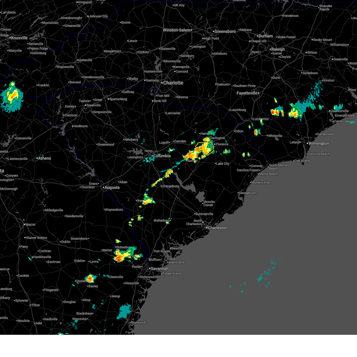
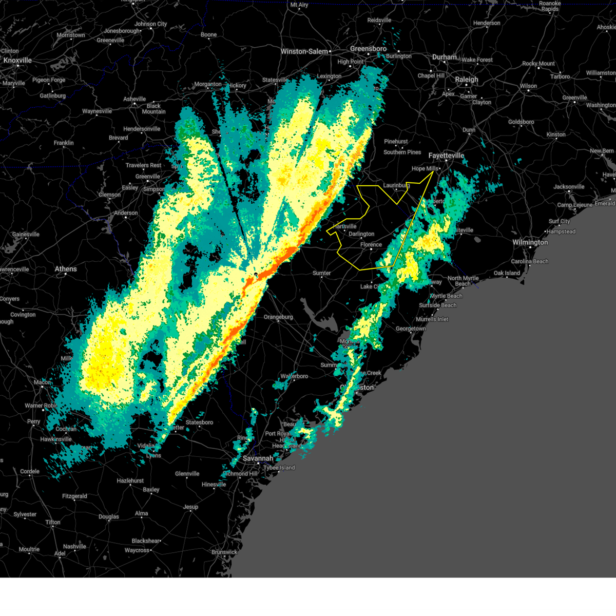
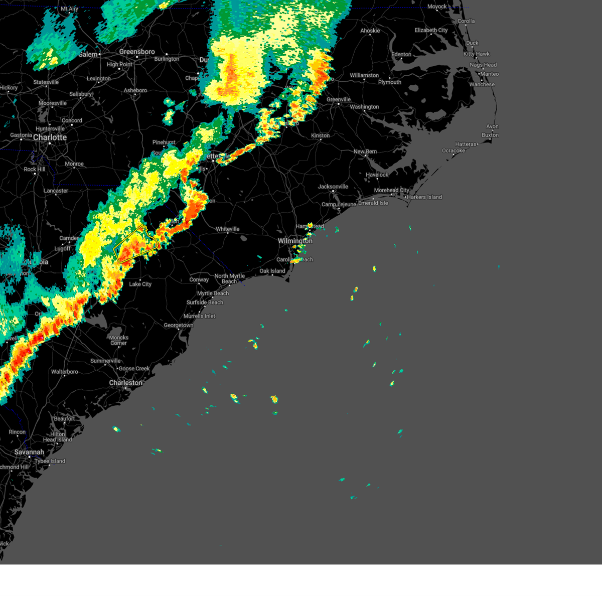
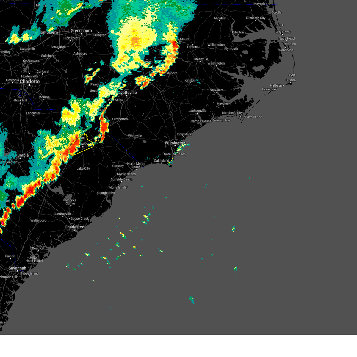
Hail Map for Lamar, SC
The Lamar, SC area has had 1 report of on-the-ground hail by trained spotters, and has been under severe weather warnings 11 times during the past 12 months. Doppler radar has detected hail at or near Lamar, SC on 50 occasions, including 1 occasion during the past year.
| Name: | Lamar, SC |
| Where Located: | 67 miles N of Charleston, SC |
| Map: | Google Map for Lamar, SC |
| Population: | 989 |
| Housing Units: | 452 |
| More Info: | Search Google for Lamar, SC |
0
The Top Recent Hail Date for Lamar, SC is Wednesday, June 25, 2025 (25th out of 50)

Hail and Wind Damage Spotted near Lamar, SC
| Date / Time | Report Details |
|---|---|
| 7/4/2025 6:10 PM EDT |
 The storm which prompted the warning has moved out of the area. therefore, the warning will be allowed to expire. please send your reports of hail or wind damage, including trees or large limbs downed, by calling the national weather service office in wilmington at 1 800 697 3901. The storm which prompted the warning has moved out of the area. therefore, the warning will be allowed to expire. please send your reports of hail or wind damage, including trees or large limbs downed, by calling the national weather service office in wilmington at 1 800 697 3901.
|
| 7/4/2025 5:42 PM EDT |
 At 542 pm edt, a severe thunderstorm was located over timmonsville, moving west at 20 mph (radar indicated). Hazards include 60 mph wind gusts. Expect wind damage to trees and power lines. Locations impacted include, florence, timmonsville, lamar, cartersville, and sardis. At 542 pm edt, a severe thunderstorm was located over timmonsville, moving west at 20 mph (radar indicated). Hazards include 60 mph wind gusts. Expect wind damage to trees and power lines. Locations impacted include, florence, timmonsville, lamar, cartersville, and sardis.
|
| 7/4/2025 5:28 PM EDT |
 At 527 pm edt, a severe thunderstorm was located over florence, moving west at 20 mph (radar indicated). Hazards include 60 mph wind gusts. Expect wind damage to trees and power lines. Locations impacted include, florence, timmonsville, lamar, quinby, sardis, cartersville, florence darlington technical college main campus, carolinas hospital system, mcleod regional medical center, carolinas hospital system - cedar tower, and health south rehabilitation hospital. At 527 pm edt, a severe thunderstorm was located over florence, moving west at 20 mph (radar indicated). Hazards include 60 mph wind gusts. Expect wind damage to trees and power lines. Locations impacted include, florence, timmonsville, lamar, quinby, sardis, cartersville, florence darlington technical college main campus, carolinas hospital system, mcleod regional medical center, carolinas hospital system - cedar tower, and health south rehabilitation hospital.
|
| 7/4/2025 5:15 PM EDT |
 Svrilm the national weather service in wilmington has issued a * severe thunderstorm warning for, northwestern florence county in northeastern south carolina, southeastern darlington county in northeastern south carolina, * until 615 pm edt. * at 515 pm edt, a severe thunderstorm was located near florence, moving west at 20 mph (radar indicated). Hazards include 60 mph wind gusts. expect wind damage to trees and power lines Svrilm the national weather service in wilmington has issued a * severe thunderstorm warning for, northwestern florence county in northeastern south carolina, southeastern darlington county in northeastern south carolina, * until 615 pm edt. * at 515 pm edt, a severe thunderstorm was located near florence, moving west at 20 mph (radar indicated). Hazards include 60 mph wind gusts. expect wind damage to trees and power lines
|
| 6/25/2025 7:37 PM EDT |
 The storms which prompted the warning have moved to the southwest and the warning will be allowed to expire. a severe thunderstorm watch remains in effect until midnight edt for northeastern south carolina. please send your reports of hail or wind damage, including trees or large limbs downed, by calling the national weather service office in wilmington at 1 800 697 3901. The storms which prompted the warning have moved to the southwest and the warning will be allowed to expire. a severe thunderstorm watch remains in effect until midnight edt for northeastern south carolina. please send your reports of hail or wind damage, including trees or large limbs downed, by calling the national weather service office in wilmington at 1 800 697 3901.
|
| 6/25/2025 7:21 PM EDT |
 At 721 pm edt, severe thunderstorms were located along a line extending from lydia to near woods bay state park, moving southwest at 25 mph (trained weather spotters). Hazards include 60 mph wind gusts and penny size hail. Expect wind damage to trees and power lines. Locations impacted include, hartsville, lake city, timmonsville, johnsonville, lamar, sardis, effingham, hannah, lydia, poston, cartersville, oats, friendfield, new hope, kellytown, kingsburg, scranton, coward, olanta, and central crossroads. At 721 pm edt, severe thunderstorms were located along a line extending from lydia to near woods bay state park, moving southwest at 25 mph (trained weather spotters). Hazards include 60 mph wind gusts and penny size hail. Expect wind damage to trees and power lines. Locations impacted include, hartsville, lake city, timmonsville, johnsonville, lamar, sardis, effingham, hannah, lydia, poston, cartersville, oats, friendfield, new hope, kellytown, kingsburg, scranton, coward, olanta, and central crossroads.
|
| 6/25/2025 6:43 PM EDT |
 Svrilm the national weather service in wilmington has issued a * severe thunderstorm warning for, florence county in northeastern south carolina, southern darlington county in northeastern south carolina, * until 745 pm edt. * at 642 pm edt, severe thunderstorms were located along a line extending from kellytown to near quinby, moving south at 30 mph (trained weather spotters). Hazards include 60 mph wind gusts and quarter size hail. Minor hail damage to vehicles is possible. Expect wind damage to trees and power lines. Svrilm the national weather service in wilmington has issued a * severe thunderstorm warning for, florence county in northeastern south carolina, southern darlington county in northeastern south carolina, * until 745 pm edt. * at 642 pm edt, severe thunderstorms were located along a line extending from kellytown to near quinby, moving south at 30 mph (trained weather spotters). Hazards include 60 mph wind gusts and quarter size hail. Minor hail damage to vehicles is possible. Expect wind damage to trees and power lines.
|
| 2/16/2025 8:45 AM EST |
 At 845 am est, severe thunderstorms were located along a line extending from 7 miles northwest of laurinburg to near elliott, moving east at 45 mph (radar indicated). Hazards include 60 mph wind gusts. Expect wind damage to trees and power lines. Locations impacted include, florence, bennettsville, hartsville, dillon, darlington, red springs, pembroke, maxton, timmonsville, mccoll, latta, rowland, lamar, quinby, clio, sellers, blue brick, hamer, brownsville, and darlington raceway. At 845 am est, severe thunderstorms were located along a line extending from 7 miles northwest of laurinburg to near elliott, moving east at 45 mph (radar indicated). Hazards include 60 mph wind gusts. Expect wind damage to trees and power lines. Locations impacted include, florence, bennettsville, hartsville, dillon, darlington, red springs, pembroke, maxton, timmonsville, mccoll, latta, rowland, lamar, quinby, clio, sellers, blue brick, hamer, brownsville, and darlington raceway.
|
| 2/16/2025 8:06 AM EST |
 Svrilm the national weather service in wilmington has issued a * severe thunderstorm warning for, northwestern robeson county in southeastern north carolina, northwestern florence county in northeastern south carolina, dillon county in northeastern south carolina, darlington county in northeastern south carolina, northwestern marion county in northeastern south carolina, marlboro county in northeastern south carolina, * until 900 am est. * at 805 am est, severe thunderstorms were located along a line extending from 6 miles north of chesterfield to 7 miles southeast of elgin, moving east at 65 mph (radar indicated). Hazards include 60 mph wind gusts. expect wind damage to trees and power lines Svrilm the national weather service in wilmington has issued a * severe thunderstorm warning for, northwestern robeson county in southeastern north carolina, northwestern florence county in northeastern south carolina, dillon county in northeastern south carolina, darlington county in northeastern south carolina, northwestern marion county in northeastern south carolina, marlboro county in northeastern south carolina, * until 900 am est. * at 805 am est, severe thunderstorms were located along a line extending from 6 miles north of chesterfield to 7 miles southeast of elgin, moving east at 65 mph (radar indicated). Hazards include 60 mph wind gusts. expect wind damage to trees and power lines
|
| 8/3/2024 7:36 PM EDT |
 The storm which prompted the warning has weakened below severe limits, and no longer poses an immediate threat to life or property. therefore, the warning will be allowed to expire. please send your reports of hail and/or wind damage, including trees or large limbs downed, by calling the national weather service office in wilmington at 1-800-697-3901. The storm which prompted the warning has weakened below severe limits, and no longer poses an immediate threat to life or property. therefore, the warning will be allowed to expire. please send your reports of hail and/or wind damage, including trees or large limbs downed, by calling the national weather service office in wilmington at 1-800-697-3901.
|
| 8/3/2024 6:59 PM EDT |
 Svrilm the national weather service in wilmington has issued a * severe thunderstorm warning for, northwestern florence county in northeastern south carolina, southeastern darlington county in northeastern south carolina, * until 745 pm edt. * at 659 pm edt, a severe thunderstorm was located near timmonsville, or near florence, moving northeast at 30 mph (radar indicated). Hazards include 60 mph wind gusts. expect wind damage to trees and power lines Svrilm the national weather service in wilmington has issued a * severe thunderstorm warning for, northwestern florence county in northeastern south carolina, southeastern darlington county in northeastern south carolina, * until 745 pm edt. * at 659 pm edt, a severe thunderstorm was located near timmonsville, or near florence, moving northeast at 30 mph (radar indicated). Hazards include 60 mph wind gusts. expect wind damage to trees and power lines
|
| 7/19/2024 8:19 PM EDT | Multiple trees blown down along cottonflower rd. time estimated by rada in darlington county SC, 2.3 miles S of Lamar, SC |
| 5/15/2024 5:55 PM EDT | Amateur radio relayed report from darlington fire dept of a tree down on mill branch rd. time estimated by time of report and rada in darlington county SC, 3.3 miles E of Lamar, SC |
| 5/15/2024 5:44 PM EDT | Amateur radio relayed report from darlington fire dept of multiple trees down on cottonflower rd. time estimated based on time of report and rada in darlington county SC, 1.6 miles SSE of Lamar, SC |
| 5/10/2024 6:07 PM EDT |
 At 607 pm edt, severe thunderstorms were located along a line extending from near bishopville to near darlington raceway, moving southeast at 35 mph (radar indicated). Hazards include 60 mph wind gusts and quarter size hail. Minor hail damage to vehicles is possible. expect wind damage to trees and power lines. these severe storms will be near, florence, lamar, and florence darlington technical college main campus around 610 pm edt. timmonsville around 615 pm edt. cartersville around 620 pm edt. Evergreen, effingham, sardis, and claussen around 630 pm edt. At 607 pm edt, severe thunderstorms were located along a line extending from near bishopville to near darlington raceway, moving southeast at 35 mph (radar indicated). Hazards include 60 mph wind gusts and quarter size hail. Minor hail damage to vehicles is possible. expect wind damage to trees and power lines. these severe storms will be near, florence, lamar, and florence darlington technical college main campus around 610 pm edt. timmonsville around 615 pm edt. cartersville around 620 pm edt. Evergreen, effingham, sardis, and claussen around 630 pm edt.
|
| 5/10/2024 5:54 PM EDT |
 Svrilm the national weather service in wilmington has issued a * severe thunderstorm warning for, northwestern florence county in northeastern south carolina, southern darlington county in northeastern south carolina, * until 645 pm edt. * at 554 pm edt, severe thunderstorms were located along a line extending from 8 miles west of bishopville to swift creek, moving southeast at 35 mph (radar indicated). Hazards include 60 mph wind gusts and quarter size hail. Minor hail damage to vehicles is possible. expect wind damage to trees and power lines. severe thunderstorms will be near, darlington, darlington raceway, and oats around 600 pm edt. lamar and florence darlington technical college main campus around 605 pm edt. florence and timmonsville around 610 pm edt. cartersville around 620 pm edt. evergreen, effingham, sardis, and claussen around 630 pm edt. Other locations impacted by these severe thunderstorms include carolinas hospital system, mcleod regional medical center, carolinas hospital system - cedar tower, and health south rehabilitation hospital. Svrilm the national weather service in wilmington has issued a * severe thunderstorm warning for, northwestern florence county in northeastern south carolina, southern darlington county in northeastern south carolina, * until 645 pm edt. * at 554 pm edt, severe thunderstorms were located along a line extending from 8 miles west of bishopville to swift creek, moving southeast at 35 mph (radar indicated). Hazards include 60 mph wind gusts and quarter size hail. Minor hail damage to vehicles is possible. expect wind damage to trees and power lines. severe thunderstorms will be near, darlington, darlington raceway, and oats around 600 pm edt. lamar and florence darlington technical college main campus around 605 pm edt. florence and timmonsville around 610 pm edt. cartersville around 620 pm edt. evergreen, effingham, sardis, and claussen around 630 pm edt. Other locations impacted by these severe thunderstorms include carolinas hospital system, mcleod regional medical center, carolinas hospital system - cedar tower, and health south rehabilitation hospital.
|
| 5/9/2024 4:22 AM EDT | Sc dot reports a tree in roadway along i20. time estimated by rada in lee county SC, 5.8 miles ESE of Lamar, SC |
| 5/8/2024 7:40 PM EDT |
 The storms which prompted the warning have weakened below severe limits, and no longer pose an immediate threat to life or property. therefore, the warning will be allowed to expire. a severe thunderstorm watch remains in effect until 1000 pm edt for southeastern north carolina, and northeastern south carolina. please send your reports of hail and/or wind damage, including trees or large limbs downed, by calling the national weather service office in wilmington at 1-800-697-3901. The storms which prompted the warning have weakened below severe limits, and no longer pose an immediate threat to life or property. therefore, the warning will be allowed to expire. a severe thunderstorm watch remains in effect until 1000 pm edt for southeastern north carolina, and northeastern south carolina. please send your reports of hail and/or wind damage, including trees or large limbs downed, by calling the national weather service office in wilmington at 1-800-697-3901.
|
| 5/8/2024 7:22 PM EDT |
 At 722 pm edt, severe thunderstorms were located along a line extending from near kemper to near marion to near new hope, moving east at 45 mph (radar indicated). Hazards include 60 mph wind gusts and quarter size hail. Minor hail damage to vehicles is possible. expect wind damage to trees and power lines. Locations impacted include, florence, marion, dillon, lake city, mullins, timmonsville, latta, pamplico, lamar, quinby, lake view, sellers, fork, blue brick, zion, hamer, mars bluff, south of the border, gapway, and cartersville. At 722 pm edt, severe thunderstorms were located along a line extending from near kemper to near marion to near new hope, moving east at 45 mph (radar indicated). Hazards include 60 mph wind gusts and quarter size hail. Minor hail damage to vehicles is possible. expect wind damage to trees and power lines. Locations impacted include, florence, marion, dillon, lake city, mullins, timmonsville, latta, pamplico, lamar, quinby, lake view, sellers, fork, blue brick, zion, hamer, mars bluff, south of the border, gapway, and cartersville.
|
| 5/8/2024 6:55 PM EDT |
 At 655 pm edt, severe thunderstorms were located along a line extending from near minturn to near mars bluff to near cartersville, moving east at 40 mph (radar indicated). Hazards include ping pong ball size hail and 60 mph wind gusts. People and animals outdoors will be injured. expect hail damage to roofs, siding, windows, and vehicles. expect wind damage to trees and power lines. Locations impacted include, florence, marion, dillon, lake city, darlington, mullins, timmonsville, latta, pamplico, lamar, quinby, lake view, sellers, blue brick, hamer, brownsville, darlington raceway, swift creek, rains, and floyd. At 655 pm edt, severe thunderstorms were located along a line extending from near minturn to near mars bluff to near cartersville, moving east at 40 mph (radar indicated). Hazards include ping pong ball size hail and 60 mph wind gusts. People and animals outdoors will be injured. expect hail damage to roofs, siding, windows, and vehicles. expect wind damage to trees and power lines. Locations impacted include, florence, marion, dillon, lake city, darlington, mullins, timmonsville, latta, pamplico, lamar, quinby, lake view, sellers, blue brick, hamer, brownsville, darlington raceway, swift creek, rains, and floyd.
|
| 5/8/2024 6:48 PM EDT |
 The storms which prompted the warning have received a new severe thunderstorm warning for darlington, marlboro, florence, dillon, and marion counties, in effect until 745 pm. a severe thunderstorm watch remains in effect until 1000 pm edt for northeastern south carolina. please send your reports of hail and/or wind damage, including trees or large limbs downed, by calling the national weather service office in wilmington at 1-800-697-3901. The storms which prompted the warning have received a new severe thunderstorm warning for darlington, marlboro, florence, dillon, and marion counties, in effect until 745 pm. a severe thunderstorm watch remains in effect until 1000 pm edt for northeastern south carolina. please send your reports of hail and/or wind damage, including trees or large limbs downed, by calling the national weather service office in wilmington at 1-800-697-3901.
|
| 5/8/2024 6:40 PM EDT |
 Svrilm the national weather service in wilmington has issued a * severe thunderstorm warning for, southwestern robeson county in southeastern north carolina, florence county in northeastern south carolina, dillon county in northeastern south carolina, darlington county in northeastern south carolina, marion county in northeastern south carolina, southern marlboro county in northeastern south carolina, * until 745 pm edt. * at 639 pm edt, severe thunderstorms were located along a line extending from near dunbar to near florence darlington technical college main campus to elliott, moving east at 40 mph (radar indicated). Hazards include 60 mph wind gusts and quarter size hail. Minor hail damage to vehicles is possible. Expect wind damage to trees and power lines. Svrilm the national weather service in wilmington has issued a * severe thunderstorm warning for, southwestern robeson county in southeastern north carolina, florence county in northeastern south carolina, dillon county in northeastern south carolina, darlington county in northeastern south carolina, marion county in northeastern south carolina, southern marlboro county in northeastern south carolina, * until 745 pm edt. * at 639 pm edt, severe thunderstorms were located along a line extending from near dunbar to near florence darlington technical college main campus to elliott, moving east at 40 mph (radar indicated). Hazards include 60 mph wind gusts and quarter size hail. Minor hail damage to vehicles is possible. Expect wind damage to trees and power lines.
|
| 5/8/2024 6:27 PM EDT |
 At 627 pm edt, severe thunderstorms were located along a line extending from laurinburg to near mont clare to near lee state park, moving east at 30 mph (radar indicated). Hazards include ping pong ball size hail and 60 mph wind gusts. People and animals outdoors will be injured. expect hail damage to roofs, siding, windows, and vehicles. expect wind damage to trees and power lines. Locations impacted include, hartsville, darlington, lamar, north hartsville, dovesville, mont clare, brownsville, lydia, darlington raceway, auburn, swift creek, clyde, mechanicsville, oats, floyd, dunbar, kellytown, florence darlington technical college main campus, society hill, and blenheim. At 627 pm edt, severe thunderstorms were located along a line extending from laurinburg to near mont clare to near lee state park, moving east at 30 mph (radar indicated). Hazards include ping pong ball size hail and 60 mph wind gusts. People and animals outdoors will be injured. expect hail damage to roofs, siding, windows, and vehicles. expect wind damage to trees and power lines. Locations impacted include, hartsville, darlington, lamar, north hartsville, dovesville, mont clare, brownsville, lydia, darlington raceway, auburn, swift creek, clyde, mechanicsville, oats, floyd, dunbar, kellytown, florence darlington technical college main campus, society hill, and blenheim.
|
| 5/8/2024 6:13 PM EDT |
 At 613 pm edt, severe thunderstorms were located along a line extending from 6 miles east of hamlet to 8 miles north of dovesville to near cassatt, moving southeast at 35 mph (radar indicated). Hazards include 60 mph wind gusts and quarter size hail. Minor hail damage to vehicles is possible. expect wind damage to trees and power lines. Locations impacted include, bennettsville, hartsville, darlington, mccoll, lamar, clio, mont clare, brownsville, lydia, darlington raceway, swift creek, oats, chavistown, floyd, north hartsville, dovesville, auburn, wallace, clyde, and mechanicsville. At 613 pm edt, severe thunderstorms were located along a line extending from 6 miles east of hamlet to 8 miles north of dovesville to near cassatt, moving southeast at 35 mph (radar indicated). Hazards include 60 mph wind gusts and quarter size hail. Minor hail damage to vehicles is possible. expect wind damage to trees and power lines. Locations impacted include, bennettsville, hartsville, darlington, mccoll, lamar, clio, mont clare, brownsville, lydia, darlington raceway, swift creek, oats, chavistown, floyd, north hartsville, dovesville, auburn, wallace, clyde, and mechanicsville.
|
| 5/8/2024 5:31 PM EDT |
 Svrilm the national weather service in wilmington has issued a * severe thunderstorm warning for, darlington county in northeastern south carolina, marlboro county in northeastern south carolina, * until 645 pm edt. * at 530 pm edt, severe thunderstorms were located along a line extending from 11 miles east of ansonville to near chesterfield to near liberty hill, moving southeast at 35 mph (radar indicated). Hazards include 60 mph wind gusts and quarter size hail. Minor hail damage to vehicles is possible. Expect wind damage to trees and power lines. Svrilm the national weather service in wilmington has issued a * severe thunderstorm warning for, darlington county in northeastern south carolina, marlboro county in northeastern south carolina, * until 645 pm edt. * at 530 pm edt, severe thunderstorms were located along a line extending from 11 miles east of ansonville to near chesterfield to near liberty hill, moving southeast at 35 mph (radar indicated). Hazards include 60 mph wind gusts and quarter size hail. Minor hail damage to vehicles is possible. Expect wind damage to trees and power lines.
|
| 4/20/2024 5:49 PM EDT |
 Svrilm the national weather service in wilmington has issued a * severe thunderstorm warning for, northwestern florence county in northeastern south carolina, northwestern dillon county in northeastern south carolina, darlington county in northeastern south carolina, central marlboro county in northeastern south carolina, * until 700 pm edt. * at 549 pm edt, a severe thunderstorm was located near clyde, or 12 miles west of hartsville, moving southeast at 30 mph (radar indicated). Hazards include 60 mph wind gusts and half dollar size hail. Minor hail damage to vehicles is possible. Expect wind damage to trees and power lines. Svrilm the national weather service in wilmington has issued a * severe thunderstorm warning for, northwestern florence county in northeastern south carolina, northwestern dillon county in northeastern south carolina, darlington county in northeastern south carolina, central marlboro county in northeastern south carolina, * until 700 pm edt. * at 549 pm edt, a severe thunderstorm was located near clyde, or 12 miles west of hartsville, moving southeast at 30 mph (radar indicated). Hazards include 60 mph wind gusts and half dollar size hail. Minor hail damage to vehicles is possible. Expect wind damage to trees and power lines.
|
| 1/9/2024 4:59 PM EST |
 At 457 pm est, severe thunderstorms were located along a line extending from 8 miles southeast of hamlet to near gourdin, moving east at 55 mph (emergency management reported many trees down around darlington). Hazards include 60 mph wind gusts. expect wind damage to trees and power lines At 457 pm est, severe thunderstorms were located along a line extending from 8 miles southeast of hamlet to near gourdin, moving east at 55 mph (emergency management reported many trees down around darlington). Hazards include 60 mph wind gusts. expect wind damage to trees and power lines
|
| 1/9/2024 4:40 PM EST |
 At 439 pm est, severe thunderstorms were located along a line extending from rockingham to 6 miles southwest of cross, moving northeast at 50 mph (emergency management. many trees down around darlington). Hazards include 60 mph wind gusts. Expect wind damage to trees and power lines. Locations impacted include, florence, bennettsville, hartsville, lake city, darlington, kingstree, timmonsville, mccoll, lamar, quinby, clio, brownsville, cades, darlington raceway, swift creek, chavistown, floyd, new hope, north hartsville, and effingham. At 439 pm est, severe thunderstorms were located along a line extending from rockingham to 6 miles southwest of cross, moving northeast at 50 mph (emergency management. many trees down around darlington). Hazards include 60 mph wind gusts. Expect wind damage to trees and power lines. Locations impacted include, florence, bennettsville, hartsville, lake city, darlington, kingstree, timmonsville, mccoll, lamar, quinby, clio, brownsville, cades, darlington raceway, swift creek, chavistown, floyd, new hope, north hartsville, and effingham.
|
| 1/9/2024 3:58 PM EST |
 At 356 pm est, severe thunderstorms were located along a line extending from near ansonville to 7 miles northwest of holly hill, moving northeast at 80 mph (radar indicated). Hazards include 60 mph wind gusts. expect wind damage to trees and power lines At 356 pm est, severe thunderstorms were located along a line extending from near ansonville to 7 miles northwest of holly hill, moving northeast at 80 mph (radar indicated). Hazards include 60 mph wind gusts. expect wind damage to trees and power lines
|
| 8/7/2023 8:06 PM EDT |
 The severe thunderstorm warning for northwestern florence, west central dillon, darlington and central marlboro counties will expire at 815 pm edt, the storm which prompted the warning has moved out of the area. therefore, the warning will be allowed to expire. however, gusty winds are still possible with this thunderstorm. a severe thunderstorm watch remains in effect until midnight edt for northeastern south carolina. remember, a severe thunderstorm warning still remains in effect for the florence, sc area until 8:30 pm edt. The severe thunderstorm warning for northwestern florence, west central dillon, darlington and central marlboro counties will expire at 815 pm edt, the storm which prompted the warning has moved out of the area. therefore, the warning will be allowed to expire. however, gusty winds are still possible with this thunderstorm. a severe thunderstorm watch remains in effect until midnight edt for northeastern south carolina. remember, a severe thunderstorm warning still remains in effect for the florence, sc area until 8:30 pm edt.
|
| 8/7/2023 7:43 PM EDT |
 At 743 pm edt, a severe thunderstorm was located over mont clare, or 8 miles north of darlington, moving southeast at 45 mph (radar indicated). Hazards include 60 mph wind gusts and penny size hail. expect wind damage to trees and power lines At 743 pm edt, a severe thunderstorm was located over mont clare, or 8 miles north of darlington, moving southeast at 45 mph (radar indicated). Hazards include 60 mph wind gusts and penny size hail. expect wind damage to trees and power lines
|
| 8/7/2023 7:37 PM EDT |
 The severe thunderstorm warning for northern robeson, northwestern florence, northwestern dillon, darlington and marlboro counties will expire at 745 pm edt, the storm which prompted the warning has begun to move out of the area. therefore, the warning will be allowed to expire. however, gusty winds are still possible with this thunderstorm and a new severe thunderstorm warning will be issued for portions of the area. a severe thunderstorm watch remains in effect until midnight edt for southeastern north carolina, and northeastern south carolina. to report severe weather, contact your nearest law enforcement agency. they will relay your report to the national weather service wilmington. The severe thunderstorm warning for northern robeson, northwestern florence, northwestern dillon, darlington and marlboro counties will expire at 745 pm edt, the storm which prompted the warning has begun to move out of the area. therefore, the warning will be allowed to expire. however, gusty winds are still possible with this thunderstorm and a new severe thunderstorm warning will be issued for portions of the area. a severe thunderstorm watch remains in effect until midnight edt for southeastern north carolina, and northeastern south carolina. to report severe weather, contact your nearest law enforcement agency. they will relay your report to the national weather service wilmington.
|
| 8/7/2023 7:27 PM EDT |
 At 726 pm edt, a severe thunderstorm was located near mccoll, or 9 miles south of laurinburg, moving southeast at 45 mph (trained weather spotters). Hazards include 60 mph wind gusts and penny size hail. Expect wind damage to trees and power lines. locations impacted include, bennettsville, hartsville, darlington, red springs, pembroke, maxton, mccoll, st. pauls, rowland, lamar, quinby, clio, rex, hamer, brownsville, darlington raceway, swift creek, shannon, chavistown, and floyd. hail threat, radar indicated max hail size, 0. 75 in wind threat, observed max wind gust, 60 mph. At 726 pm edt, a severe thunderstorm was located near mccoll, or 9 miles south of laurinburg, moving southeast at 45 mph (trained weather spotters). Hazards include 60 mph wind gusts and penny size hail. Expect wind damage to trees and power lines. locations impacted include, bennettsville, hartsville, darlington, red springs, pembroke, maxton, mccoll, st. pauls, rowland, lamar, quinby, clio, rex, hamer, brownsville, darlington raceway, swift creek, shannon, chavistown, and floyd. hail threat, radar indicated max hail size, 0. 75 in wind threat, observed max wind gust, 60 mph.
|
| 8/7/2023 7:10 PM EDT |
 At 710 pm edt, a severe thunderstorm was located near chavistown, or 7 miles north of bennettsville, moving southeast at 45 mph (radar indicated). Hazards include 60 mph wind gusts and penny size hail. Expect wind damage to trees and power lines. locations impacted include, bennettsville, hartsville, darlington, red springs, pembroke, maxton, mccoll, st. pauls, rowland, lamar, quinby, clio, rex, hamer, brownsville, darlington raceway, swift creek, shannon, chavistown, and floyd. hail threat, radar indicated max hail size, 0. 75 in wind threat, radar indicated max wind gust, 60 mph. At 710 pm edt, a severe thunderstorm was located near chavistown, or 7 miles north of bennettsville, moving southeast at 45 mph (radar indicated). Hazards include 60 mph wind gusts and penny size hail. Expect wind damage to trees and power lines. locations impacted include, bennettsville, hartsville, darlington, red springs, pembroke, maxton, mccoll, st. pauls, rowland, lamar, quinby, clio, rex, hamer, brownsville, darlington raceway, swift creek, shannon, chavistown, and floyd. hail threat, radar indicated max hail size, 0. 75 in wind threat, radar indicated max wind gust, 60 mph.
|
| 8/7/2023 6:43 PM EDT |
 At 643 pm edt, a severe thunderstorm was located near wadesboro, moving southeast at 45 mph (radar indicated). Hazards include 60 mph wind gusts and penny size hail. expect wind damage to trees and power lines At 643 pm edt, a severe thunderstorm was located near wadesboro, moving southeast at 45 mph (radar indicated). Hazards include 60 mph wind gusts and penny size hail. expect wind damage to trees and power lines
|
| 6/17/2022 8:08 PM EDT |
 At 808 pm edt, severe thunderstorms were located along a line extending from near florence darlington technical college main campus to near cartersville, moving southeast at 25 mph (radar indicated). Hazards include 60 mph wind gusts. Expect wind damage to trees and power lines. locations impacted include, florence, darlington, timmonsville, lamar, sardis, effingham, darlington raceway, swift creek, cartersville, florence darlington technical college main campus, floyd, new hope, evergreen, oats, coward, olanta, carolinas hospital system, mcleod regional medical center, carolinas hospital system - cedar tower and health south rehabilitation hospital. hail threat, radar indicated max hail size, <. 75 in wind threat, radar indicated max wind gust, 60 mph. At 808 pm edt, severe thunderstorms were located along a line extending from near florence darlington technical college main campus to near cartersville, moving southeast at 25 mph (radar indicated). Hazards include 60 mph wind gusts. Expect wind damage to trees and power lines. locations impacted include, florence, darlington, timmonsville, lamar, sardis, effingham, darlington raceway, swift creek, cartersville, florence darlington technical college main campus, floyd, new hope, evergreen, oats, coward, olanta, carolinas hospital system, mcleod regional medical center, carolinas hospital system - cedar tower and health south rehabilitation hospital. hail threat, radar indicated max hail size, <. 75 in wind threat, radar indicated max wind gust, 60 mph.
|
| 6/17/2022 7:33 PM EDT |
 At 733 pm edt, severe thunderstorms were located along a line extending from near clyde to 6 miles northeast of sumter county airport, moving east at 20 mph (radar indicated). Hazards include 60 mph wind gusts and quarter size hail. Minor hail damage to vehicles is possible. Expect wind damage to trees and power lines. At 733 pm edt, severe thunderstorms were located along a line extending from near clyde to 6 miles northeast of sumter county airport, moving east at 20 mph (radar indicated). Hazards include 60 mph wind gusts and quarter size hail. Minor hail damage to vehicles is possible. Expect wind damage to trees and power lines.
|
| 6/16/2022 7:02 PM EDT |
 At 702 pm edt, severe thunderstorms were located along a line extending from 6 miles north of bennettsville to near mont clare to near timmonsville, moving southeast at 10 mph (radar indicated). Hazards include 60 mph wind gusts and quarter size hail. Minor hail damage to vehicles is possible. expect wind damage to trees and power lines. locations impacted include, bennettsville, hartsville, darlington, mccoll, lamar, clio, mont clare, brownsville, lydia, darlington raceway, swift creek, oats, chavistown, floyd, minturn, dovesville, auburn, wallace, bingham and mechanicsville. hail threat, radar indicated max hail size, 1. 00 in wind threat, radar indicated max wind gust, 60 mph. At 702 pm edt, severe thunderstorms were located along a line extending from 6 miles north of bennettsville to near mont clare to near timmonsville, moving southeast at 10 mph (radar indicated). Hazards include 60 mph wind gusts and quarter size hail. Minor hail damage to vehicles is possible. expect wind damage to trees and power lines. locations impacted include, bennettsville, hartsville, darlington, mccoll, lamar, clio, mont clare, brownsville, lydia, darlington raceway, swift creek, oats, chavistown, floyd, minturn, dovesville, auburn, wallace, bingham and mechanicsville. hail threat, radar indicated max hail size, 1. 00 in wind threat, radar indicated max wind gust, 60 mph.
|
| 6/16/2022 6:45 PM EDT |
 At 645 pm edt, severe thunderstorms were located along a line extending from near chavistown to near mont clare to near lamar, moving southeast at 15 mph (radar indicated). Hazards include 60 mph wind gusts and quarter size hail. Minor hail damage to vehicles is possible. expect wind damage to trees and power lines. locations impacted include, bennettsville, hartsville, darlington, mccoll, lamar, clio, mont clare, brownsville, lydia, darlington raceway, swift creek, oats, chavistown, floyd, minturn, north hartsville, dovesville, auburn, wallace and bingham. hail threat, radar indicated max hail size, 1. 00 in wind threat, radar indicated max wind gust, 60 mph. At 645 pm edt, severe thunderstorms were located along a line extending from near chavistown to near mont clare to near lamar, moving southeast at 15 mph (radar indicated). Hazards include 60 mph wind gusts and quarter size hail. Minor hail damage to vehicles is possible. expect wind damage to trees and power lines. locations impacted include, bennettsville, hartsville, darlington, mccoll, lamar, clio, mont clare, brownsville, lydia, darlington raceway, swift creek, oats, chavistown, floyd, minturn, north hartsville, dovesville, auburn, wallace and bingham. hail threat, radar indicated max hail size, 1. 00 in wind threat, radar indicated max wind gust, 60 mph.
|
| 6/16/2022 6:08 PM EDT |
 At 608 pm edt, severe thunderstorms were located along a line extending from near cheraw municipal airport to near cassatt, moving southeast at 20 mph (radar indicated). Hazards include 60 mph wind gusts and quarter size hail. Minor hail damage to vehicles is possible. Expect wind damage to trees and power lines. At 608 pm edt, severe thunderstorms were located along a line extending from near cheraw municipal airport to near cassatt, moving southeast at 20 mph (radar indicated). Hazards include 60 mph wind gusts and quarter size hail. Minor hail damage to vehicles is possible. Expect wind damage to trees and power lines.
|
| 4/5/2022 7:45 PM EDT |
 At 745 pm edt, severe thunderstorms were located along a line extending from near sardis to 6 miles east of holly hill, moving east at 50 mph (radar indicated). Hazards include 60 mph wind gusts. Expect wind damage to trees and power lines. Locations impacted include, florence, lake city, darlington, kingstree, timmonsville, lamar, quinby, mars bluff, brownsville, lydia, cades, darlington raceway, swift creek, cartersville, florence darlington technical college main campus, oats, hebron, new hope, trio and salters. At 745 pm edt, severe thunderstorms were located along a line extending from near sardis to 6 miles east of holly hill, moving east at 50 mph (radar indicated). Hazards include 60 mph wind gusts. Expect wind damage to trees and power lines. Locations impacted include, florence, lake city, darlington, kingstree, timmonsville, lamar, quinby, mars bluff, brownsville, lydia, cades, darlington raceway, swift creek, cartersville, florence darlington technical college main campus, oats, hebron, new hope, trio and salters.
|
| 4/5/2022 7:29 PM EDT |
 At 729 pm edt, severe thunderstorms were located along a line extending from 8 miles south of elliott to near holly hill, moving east at 50 mph (radar indicated). Hazards include 60 mph wind gusts. expect wind damage to trees and power lines At 729 pm edt, severe thunderstorms were located along a line extending from 8 miles south of elliott to near holly hill, moving east at 50 mph (radar indicated). Hazards include 60 mph wind gusts. expect wind damage to trees and power lines
|
| 4/5/2022 6:15 PM EDT |
 At 615 pm edt, a severe thunderstorm was located over mechanicsville, or near darlington, moving northeast at 45 mph (radar indicated). Hazards include 60 mph wind gusts. Expect wind damage to trees and power lines. Locations impacted include, florence, bennettsville, marion, darlington, timmonsville, lamar, quinby, sellers, blue brick, mont clare, mars bluff, brownsville, darlington raceway, swift creek, cartersville, florence darlington technical college main campus, floyd, dovesville, oak grove and auburn. At 615 pm edt, a severe thunderstorm was located over mechanicsville, or near darlington, moving northeast at 45 mph (radar indicated). Hazards include 60 mph wind gusts. Expect wind damage to trees and power lines. Locations impacted include, florence, bennettsville, marion, darlington, timmonsville, lamar, quinby, sellers, blue brick, mont clare, mars bluff, brownsville, darlington raceway, swift creek, cartersville, florence darlington technical college main campus, floyd, dovesville, oak grove and auburn.
|
| 4/5/2022 6:01 PM EDT |
 At 601 pm edt, a severe thunderstorm was located near darlington raceway, or near darlington, moving northeast at 45 mph (radar indicated). Hazards include 60 mph wind gusts. expect wind damage to trees and power lines At 601 pm edt, a severe thunderstorm was located near darlington raceway, or near darlington, moving northeast at 45 mph (radar indicated). Hazards include 60 mph wind gusts. expect wind damage to trees and power lines
|
| 4/5/2022 5:49 PM EDT | Tree down in the vicinity of the intersection of indian branch road and wesley chapel roa in darlington county SC, 7.4 miles SSE of Lamar, SC |
| 1/3/2022 5:29 AM EST |
 At 528 am est, severe thunderstorms were located along a line extending from near auburn to near saint stephen, moving east at 40 mph (radar indicated). Hazards include 60 mph wind gusts. Expect wind damage to trees and power lines. locations impacted include, florence, bennettsville, hartsville, lake city, darlington, kingstree, andrews, timmonsville, pamplico, lamar, quinby, brownsville, cades, darlington raceway, swift creek, chavistown, floyd, new hope, north hartsville and warsaw. hail threat, radar indicated max hail size, <. 75 in wind threat, radar indicated max wind gust, 60 mph. At 528 am est, severe thunderstorms were located along a line extending from near auburn to near saint stephen, moving east at 40 mph (radar indicated). Hazards include 60 mph wind gusts. Expect wind damage to trees and power lines. locations impacted include, florence, bennettsville, hartsville, lake city, darlington, kingstree, andrews, timmonsville, pamplico, lamar, quinby, brownsville, cades, darlington raceway, swift creek, chavistown, floyd, new hope, north hartsville and warsaw. hail threat, radar indicated max hail size, <. 75 in wind threat, radar indicated max wind gust, 60 mph.
|
| 1/3/2022 5:10 AM EST |
 At 509 am est, severe thunderstorms were located along a line extending from near kellytown to cross, moving northeast at 40 mph (radar indicated). Hazards include 60 mph wind gusts. expect wind damage to trees and power lines At 509 am est, severe thunderstorms were located along a line extending from near kellytown to cross, moving northeast at 40 mph (radar indicated). Hazards include 60 mph wind gusts. expect wind damage to trees and power lines
|
| 7/28/2021 6:14 PM EDT |
 At 614 pm edt, a severe thunderstorm was located near north hartsville, or 7 miles northeast of hartsville, moving south at 35 mph (radar indicated). Hazards include 70 mph wind gusts. Expect considerable tree damage. Damage is likely to mobile homes, roofs, and outbuildings. At 614 pm edt, a severe thunderstorm was located near north hartsville, or 7 miles northeast of hartsville, moving south at 35 mph (radar indicated). Hazards include 70 mph wind gusts. Expect considerable tree damage. Damage is likely to mobile homes, roofs, and outbuildings.
|
| 5/3/2021 4:57 PM EDT |
 At 456 pm edt, a severe thunderstorm was located near cartersville, or 15 miles southwest of florence, moving east at 35 to 40 mph (radar indicated). Hazards include two inch hail and 60 mph wind gusts. People and animals outdoors may become injured unless shelter is taken. expect hail damage to roofs, siding, windows, and vehicles. expect wind damage to trees and power lines. Locations impacted include, florence, timmonsville, pamplico, lamar, quinby, sardis, hyman, mars bluff, effingham, cartersville, francis marion university, friendfield, claussen, new hope, evergreen, and coward. At 456 pm edt, a severe thunderstorm was located near cartersville, or 15 miles southwest of florence, moving east at 35 to 40 mph (radar indicated). Hazards include two inch hail and 60 mph wind gusts. People and animals outdoors may become injured unless shelter is taken. expect hail damage to roofs, siding, windows, and vehicles. expect wind damage to trees and power lines. Locations impacted include, florence, timmonsville, pamplico, lamar, quinby, sardis, hyman, mars bluff, effingham, cartersville, francis marion university, friendfield, claussen, new hope, evergreen, and coward.
|
| 5/3/2021 4:45 PM EDT |
 At 443 pm edt, a severe thunderstorm was located near elliott, or 12 miles west and southwest of timmonsville, moving east at 40 mph (radar indicated). Hazards include 60 mph wind gusts and half dollar size hail. Minor hail damage to vehicles is possible. Expect wind damage to trees and power lines. At 443 pm edt, a severe thunderstorm was located near elliott, or 12 miles west and southwest of timmonsville, moving east at 40 mph (radar indicated). Hazards include 60 mph wind gusts and half dollar size hail. Minor hail damage to vehicles is possible. Expect wind damage to trees and power lines.
|
| 5/29/2020 12:59 PM EDT |
 At 1258 pm edt, a severe thunderstorm was located over bishopville, moving northeast at 25 mph (radar indicated). Hazards include 60 mph wind gusts and quarter size hail. Minor hail damage to vehicles is possible. expect wind damage to trees and power lines. Heavy rain may cause minor flooding. At 1258 pm edt, a severe thunderstorm was located over bishopville, moving northeast at 25 mph (radar indicated). Hazards include 60 mph wind gusts and quarter size hail. Minor hail damage to vehicles is possible. expect wind damage to trees and power lines. Heavy rain may cause minor flooding.
|
| 5/5/2020 7:51 PM EDT |
 At 750 pm edt, a severe thunderstorm was located near clyde, or 9 miles northwest of hartsville, moving east at 40 mph (radar indicated). Hazards include 60 mph wind gusts and half dollar size hail. Minor hail damage to vehicles is possible. Expect wind damage to trees and power lines. At 750 pm edt, a severe thunderstorm was located near clyde, or 9 miles northwest of hartsville, moving east at 40 mph (radar indicated). Hazards include 60 mph wind gusts and half dollar size hail. Minor hail damage to vehicles is possible. Expect wind damage to trees and power lines.
|
| 4/13/2020 7:38 AM EDT |
 The severe thunderstorm warning for northwestern florence, northwestern dillon, darlington and marlboro counties will expire at 745 am edt, the storm which prompted the warning has moved out of the area. therefore, the warning will be allowed to expire. however gusty winds are still possible with this thunderstorm. a tornado watch remains in effect until noon edt for southeastern north carolina, and northeastern south carolina. The severe thunderstorm warning for northwestern florence, northwestern dillon, darlington and marlboro counties will expire at 745 am edt, the storm which prompted the warning has moved out of the area. therefore, the warning will be allowed to expire. however gusty winds are still possible with this thunderstorm. a tornado watch remains in effect until noon edt for southeastern north carolina, and northeastern south carolina.
|
| 4/13/2020 6:58 AM EDT |
 At 658 am edt, a severe thunderstorm was located over auburn, or 7 miles east of hartsville, moving northeast at 75 mph (radar indicated). Hazards include 60 mph wind gusts and penny size hail. expect wind damage to trees and power lines At 658 am edt, a severe thunderstorm was located over auburn, or 7 miles east of hartsville, moving northeast at 75 mph (radar indicated). Hazards include 60 mph wind gusts and penny size hail. expect wind damage to trees and power lines
|
| 4/13/2020 6:49 AM EDT |
 At 649 am edt, a severe thunderstorm was located 7 miles northwest of clyde, or 13 miles northwest of hartsville, moving northeast at 65 mph (radar indicated). Hazards include 60 mph wind gusts and penny size hail. Expect wind damage to trees and power lines. Locations impacted include, bennettsville, hartsville, darlington, timmonsville, mccoll, lamar, mont clare, lydia, darlington raceway, swift creek, cartersville, florence darlington technical college main campus, oats, chavistown, floyd, north hartsville, dovesville, auburn, wallace and clyde. At 649 am edt, a severe thunderstorm was located 7 miles northwest of clyde, or 13 miles northwest of hartsville, moving northeast at 65 mph (radar indicated). Hazards include 60 mph wind gusts and penny size hail. Expect wind damage to trees and power lines. Locations impacted include, bennettsville, hartsville, darlington, timmonsville, mccoll, lamar, mont clare, lydia, darlington raceway, swift creek, cartersville, florence darlington technical college main campus, oats, chavistown, floyd, north hartsville, dovesville, auburn, wallace and clyde.
|
| 4/13/2020 6:32 AM EDT |
 At 631 am edt, a severe thunderstorm was located 8 miles southeast of camden, moving northeast at 65 mph (radar indicated). Hazards include 60 mph wind gusts and penny size hail. expect wind damage to trees and power lines At 631 am edt, a severe thunderstorm was located 8 miles southeast of camden, moving northeast at 65 mph (radar indicated). Hazards include 60 mph wind gusts and penny size hail. expect wind damage to trees and power lines
|
| 2/13/2020 12:57 PM EST |
 At 1256 pm est, severe thunderstorms were located along a line extending from near lamar to 9 miles west of cartersville to near millwood, moving east at 60 mph (radar indicated). Hazards include 60 mph wind gusts. expect wind damage to trees and power lines At 1256 pm est, severe thunderstorms were located along a line extending from near lamar to 9 miles west of cartersville to near millwood, moving east at 60 mph (radar indicated). Hazards include 60 mph wind gusts. expect wind damage to trees and power lines
|
| 2/6/2020 4:41 PM EST |
 At 441 pm est, a severe thunderstorm was located near bishopville, moving northeast at 65 mph (radar indicated). Hazards include 60 mph wind gusts and quarter size hail. Minor hail damage to vehicles is possible. Expect wind damage to trees and power lines. At 441 pm est, a severe thunderstorm was located near bishopville, moving northeast at 65 mph (radar indicated). Hazards include 60 mph wind gusts and quarter size hail. Minor hail damage to vehicles is possible. Expect wind damage to trees and power lines.
|
| 1/11/2020 11:39 PM EST |
 At 1138 pm est, severe thunderstorms were located along a line extending from fort bragg to 7 miles northeast of mulberry, moving east at 45 mph (radar indicated). Hazards include 60 mph wind gusts. expect wind damage to trees and power lines At 1138 pm est, severe thunderstorms were located along a line extending from fort bragg to 7 miles northeast of mulberry, moving east at 45 mph (radar indicated). Hazards include 60 mph wind gusts. expect wind damage to trees and power lines
|
| 10/31/2019 7:45 PM EDT |
 At 745 pm edt, severe thunderstorms were located along a line extending from 14 miles south of biscoe to 9 miles south of bishopville, moving northeast at 55 mph (radar indicated). Hazards include 60 mph wind gusts. Expect wind damage to trees and power lines. Locations impacted include, hartsville, darlington, timmonsville, lamar, north hartsville, dovesville, lydia, darlington raceway, auburn, swift creek, cartersville, wallace, clyde, oats, chavistown, floyd, kellytown, society hill and carolina pines regional medical center. At 745 pm edt, severe thunderstorms were located along a line extending from 14 miles south of biscoe to 9 miles south of bishopville, moving northeast at 55 mph (radar indicated). Hazards include 60 mph wind gusts. Expect wind damage to trees and power lines. Locations impacted include, hartsville, darlington, timmonsville, lamar, north hartsville, dovesville, lydia, darlington raceway, auburn, swift creek, cartersville, wallace, clyde, oats, chavistown, floyd, kellytown, society hill and carolina pines regional medical center.
|
| 10/31/2019 7:22 PM EDT |
 At 722 pm edt, a line of strong and severe thunderstorms was approaching western marlboro and western darlington counties, moving northeast at 50 mph (radar indicated). Hazards include 60 mph wind gusts. expect wind damage to trees and power lines At 722 pm edt, a line of strong and severe thunderstorms was approaching western marlboro and western darlington counties, moving northeast at 50 mph (radar indicated). Hazards include 60 mph wind gusts. expect wind damage to trees and power lines
|
| 6/20/2019 5:18 PM EDT |
 At 517 pm edt, a severe thunderstorm was located over mechanicsville, or near darlington, moving east at 50 mph (radar indicated). Hazards include 60 mph wind gusts. Expect wind damage to trees and power lines. Locations impacted include, florence, marion, dillon, darlington, mullins, timmonsville, latta, pamplico, lamar, quinby, sellers, blue brick, hamer, brownsville, darlington raceway, swift creek, rains, floyd, new hope and minturn. At 517 pm edt, a severe thunderstorm was located over mechanicsville, or near darlington, moving east at 50 mph (radar indicated). Hazards include 60 mph wind gusts. Expect wind damage to trees and power lines. Locations impacted include, florence, marion, dillon, darlington, mullins, timmonsville, latta, pamplico, lamar, quinby, sellers, blue brick, hamer, brownsville, darlington raceway, swift creek, rains, floyd, new hope and minturn.
|
| 6/20/2019 5:04 PM EDT | Trees are down across oates highway in darlington county headed toward the bridge at i-20. road may be impassabl in darlington county SC, 3.2 miles SSW of Lamar, SC |
| 6/20/2019 4:50 PM EDT |
 At 449 pm edt, a severe thunderstorm was located near bishopville, moving east at 45 mph (radar indicated). Hazards include 60 mph wind gusts and pea size hail. expect wind damage to trees and power lines At 449 pm edt, a severe thunderstorm was located near bishopville, moving east at 45 mph (radar indicated). Hazards include 60 mph wind gusts and pea size hail. expect wind damage to trees and power lines
|
| 6/5/2019 3:06 PM EDT |
 At 306 pm edt, a severe thunderstorm was located near timmonsville, or 8 miles southwest of darlington, moving east at 20 mph (radar indicated). Hazards include 60 mph wind gusts and quarter size hail. Minor hail damage to vehicles is possible. Expect wind damage to trees and power lines. At 306 pm edt, a severe thunderstorm was located near timmonsville, or 8 miles southwest of darlington, moving east at 20 mph (radar indicated). Hazards include 60 mph wind gusts and quarter size hail. Minor hail damage to vehicles is possible. Expect wind damage to trees and power lines.
|
| 4/19/2019 2:54 PM EDT |
 At 254 pm edt, severe thunderstorms were located along a line extending from 7 miles northwest of bishopville to earle, moving northeast at 60 mph (radar indicated). Hazards include 70 mph wind gusts. Expect considerable tree damage. damage is likely to mobile homes, roofs, and outbuildings. severe thunderstorms will be near, andrews and warsaw around 300 pm edt. clyde, kellytown and morrisville around 305 pm edt. hartsville, rhems and north hartsville around 310 pm edt. outland and auburn around 315 pm edt. dongola around 325 pm edt. wallace around 330 pm edt. conway, bennettsville, chavistown and homewood around 335 pm edt. Other locations impacted by these severe thunderstorms include coward, stuckey, lane, greeleyville, blenheim, aynor, olanta, scranton, society hill and carolinas hospital system. At 254 pm edt, severe thunderstorms were located along a line extending from 7 miles northwest of bishopville to earle, moving northeast at 60 mph (radar indicated). Hazards include 70 mph wind gusts. Expect considerable tree damage. damage is likely to mobile homes, roofs, and outbuildings. severe thunderstorms will be near, andrews and warsaw around 300 pm edt. clyde, kellytown and morrisville around 305 pm edt. hartsville, rhems and north hartsville around 310 pm edt. outland and auburn around 315 pm edt. dongola around 325 pm edt. wallace around 330 pm edt. conway, bennettsville, chavistown and homewood around 335 pm edt. Other locations impacted by these severe thunderstorms include coward, stuckey, lane, greeleyville, blenheim, aynor, olanta, scranton, society hill and carolinas hospital system.
|
| 3/3/2019 6:55 PM EST |
 At 654 pm est, a severe thunderstorm was located over kellytown, or near hartsville, moving northeast at 55 mph (radar indicated). Hazards include 60 mph wind gusts. expect wind damage to trees and power lines At 654 pm est, a severe thunderstorm was located over kellytown, or near hartsville, moving northeast at 55 mph (radar indicated). Hazards include 60 mph wind gusts. expect wind damage to trees and power lines
|
| 9/27/2018 11:07 PM EDT |
 At 1107 pm edt, a line of showers and thunderstorms, embedded with isolated strong to severe wind gusts, was moving across weatern darlington county, approaching central darlington county, moving northeast at 40 mph (radar indicated). Hazards include 60 mph wind gusts. Expect possible damage from weakened trees, or trees blown over due to wet ground. locations impacted include, bennettsville, hartsville, dillon, darlington, timmonsville, mccoll, lamar, quinby, clio, hamer, mont clare, brownsville, lydia, south of the border, darlington raceway, florence darlington technical college main campus, chavistown, floyd, minturn and north hartsville. this includes the following highways, interstate 20 between mile markers 126 and 141. Interstate 95 in south carolina near mile marker 146, and between mile markers 159 and 198. At 1107 pm edt, a line of showers and thunderstorms, embedded with isolated strong to severe wind gusts, was moving across weatern darlington county, approaching central darlington county, moving northeast at 40 mph (radar indicated). Hazards include 60 mph wind gusts. Expect possible damage from weakened trees, or trees blown over due to wet ground. locations impacted include, bennettsville, hartsville, dillon, darlington, timmonsville, mccoll, lamar, quinby, clio, hamer, mont clare, brownsville, lydia, south of the border, darlington raceway, florence darlington technical college main campus, chavistown, floyd, minturn and north hartsville. this includes the following highways, interstate 20 between mile markers 126 and 141. Interstate 95 in south carolina near mile marker 146, and between mile markers 159 and 198.
|
| 9/27/2018 10:36 PM EDT |
 At 1036 pm edt, a severe thunderstorm was located 7 miles southwest of clyde, or 8 miles north of bishopville, moving northeast at 40 mph (radar indicated). Hazards include 60 mph wind gusts. expect wind damage to trees and power lines At 1036 pm edt, a severe thunderstorm was located 7 miles southwest of clyde, or 8 miles north of bishopville, moving northeast at 40 mph (radar indicated). Hazards include 60 mph wind gusts. expect wind damage to trees and power lines
|
| 9/27/2018 5:57 PM EDT |
 At 554 pm edt, a severe thunderstorm was located over cartersville, or 14 miles southwest of florence. a second severe thunderstorm was 8 miles southwest of darlington. both are moving northeast at 20 mph (radar indicated). Hazards include 60 mph wind gusts and quarter size hail. Minor hail damage to vehicles is possible. Expect wind damage to trees and power lines. At 554 pm edt, a severe thunderstorm was located over cartersville, or 14 miles southwest of florence. a second severe thunderstorm was 8 miles southwest of darlington. both are moving northeast at 20 mph (radar indicated). Hazards include 60 mph wind gusts and quarter size hail. Minor hail damage to vehicles is possible. Expect wind damage to trees and power lines.
|
| 6/15/2017 8:07 PM EDT | Report of tree down on christmas tree rd. time estimated by rada in darlington county SC, 3.2 miles SSW of Lamar, SC |
| 6/15/2017 7:56 PM EDT |
 At 755 pm edt, a severe thunderstorm was located over timmonsville, or 11 miles southwest of darlington, moving southeast at 20 mph (radar indicated). Hazards include 60 mph wind gusts and quarter size hail. Minor hail damage to vehicles is possible. Expect wind damage to trees and power lines. At 755 pm edt, a severe thunderstorm was located over timmonsville, or 11 miles southwest of darlington, moving southeast at 20 mph (radar indicated). Hazards include 60 mph wind gusts and quarter size hail. Minor hail damage to vehicles is possible. Expect wind damage to trees and power lines.
|
| 6/15/2017 7:39 PM EDT |
 At 739 pm edt, a severe thunderstorm was located over timmonsville, or 10 miles west of florence, moving southeast at 15 mph (radar indicated). Hazards include 70 mph wind gusts and quarter size hail. Minor hail damage to vehicles is possible. expect considerable tree damage. wind damage is also likely to mobile homes, roofs, and outbuildings. locations impacted include, florence, darlington, timmonsville, lamar, quinby, sardis, darlington raceway, florence darlington technical college main campus, mcleod regional medical center, carolinas hospital system - cedar tower and health south rehabilitation hospital. this includes the following highways, interstate 20 between mile markers 126 and 141. Interstate 95 in south carolina near mile marker 146, and between mile markers 149 and 171. At 739 pm edt, a severe thunderstorm was located over timmonsville, or 10 miles west of florence, moving southeast at 15 mph (radar indicated). Hazards include 70 mph wind gusts and quarter size hail. Minor hail damage to vehicles is possible. expect considerable tree damage. wind damage is also likely to mobile homes, roofs, and outbuildings. locations impacted include, florence, darlington, timmonsville, lamar, quinby, sardis, darlington raceway, florence darlington technical college main campus, mcleod regional medical center, carolinas hospital system - cedar tower and health south rehabilitation hospital. this includes the following highways, interstate 20 between mile markers 126 and 141. Interstate 95 in south carolina near mile marker 146, and between mile markers 149 and 171.
|
| 6/15/2017 7:14 PM EDT |
 At 714 pm edt, a severe thunderstorm was located near lamar, or 9 miles southwest of darlington, moving southeast at 10 mph (radar indicated). Hazards include 60 mph wind gusts and quarter size hail. Minor hail damage to vehicles is possible. Expect wind damage to trees and power lines. At 714 pm edt, a severe thunderstorm was located near lamar, or 9 miles southwest of darlington, moving southeast at 10 mph (radar indicated). Hazards include 60 mph wind gusts and quarter size hail. Minor hail damage to vehicles is possible. Expect wind damage to trees and power lines.
|
| 5/28/2017 7:47 PM EDT |
 At 747 pm edt, a severe thunderstorm was located near florence, moving east at 35 mph (radar indicated). Hazards include 60 mph wind gusts and quarter size hail. Minor hail damage to vehicles is possible. Expect wind damage to trees and power lines. At 747 pm edt, a severe thunderstorm was located near florence, moving east at 35 mph (radar indicated). Hazards include 60 mph wind gusts and quarter size hail. Minor hail damage to vehicles is possible. Expect wind damage to trees and power lines.
|
| 5/24/2017 3:31 PM EDT |
 At 330 pm edt, a severe thunderstorm capable of producing a tornado was located near oates, or 9 miles southwest of darlington, moving northeast at 35 mph (radar indicated rotation). Hazards include tornado. expect damage to mobile homes, roofs, and vehicles At 330 pm edt, a severe thunderstorm capable of producing a tornado was located near oates, or 9 miles southwest of darlington, moving northeast at 35 mph (radar indicated rotation). Hazards include tornado. expect damage to mobile homes, roofs, and vehicles
|
| 4/5/2017 4:24 PM EDT |
 At 423 pm edt, a severe thunderstorm was located over florence darlington technical college main campus, or near florence, moving northeast at 45 mph (radar indicated). Hazards include 60 mph wind gusts and quarter size hail. Hail damage to vehicles is expected. expect wind damage to roofs, siding, and trees. locations impacted include, florence, darlington, timmonsville, lamar, quinby, sardis, mont clare, mars bluff, darlington raceway, cartersville, florence darlington technical college main campus, mechanicsville, oats, carolinas hospital system, mcleod regional medical center, mcleod medical center, carolinas hospital system - cedar tower and health south rehabilitation hospital. this includes the following highways, interstate 20 between mile markers 126 and 141. interstate 95 in south carolina near mile marker 146, and between mile markers 148 and 174. A tornado watch remains in effect until 800 pm edt for northeastern south carolina. At 423 pm edt, a severe thunderstorm was located over florence darlington technical college main campus, or near florence, moving northeast at 45 mph (radar indicated). Hazards include 60 mph wind gusts and quarter size hail. Hail damage to vehicles is expected. expect wind damage to roofs, siding, and trees. locations impacted include, florence, darlington, timmonsville, lamar, quinby, sardis, mont clare, mars bluff, darlington raceway, cartersville, florence darlington technical college main campus, mechanicsville, oats, carolinas hospital system, mcleod regional medical center, mcleod medical center, carolinas hospital system - cedar tower and health south rehabilitation hospital. this includes the following highways, interstate 20 between mile markers 126 and 141. interstate 95 in south carolina near mile marker 146, and between mile markers 148 and 174. A tornado watch remains in effect until 800 pm edt for northeastern south carolina.
|
| 4/5/2017 3:50 PM EDT |
 At 349 pm edt, a severe thunderstorm was located 8 miles south of bishopville, moving northeast at 40 mph (radar indicated). Hazards include 60 mph wind gusts and quarter size hail. Hail damage to vehicles is expected. Expect wind damage to roofs, siding, and trees. At 349 pm edt, a severe thunderstorm was located 8 miles south of bishopville, moving northeast at 40 mph (radar indicated). Hazards include 60 mph wind gusts and quarter size hail. Hail damage to vehicles is expected. Expect wind damage to roofs, siding, and trees.
|
| 4/3/2017 5:55 PM EDT |
 At 554 pm edt, a severe thunderstorm was located over mechanicsville, or 7 miles northeast of darlington, moving northeast at 55 mph (radar indicated). Hazards include 60 mph wind gusts and quarter size hail. Hail damage to vehicles is expected. expect wind damage to roofs, siding, and trees. locations impacted include, florence, bennettsville, hartsville, lake city, darlington, timmonsville, mccoll, johnsonville, pamplico, lamar, quinby, clio, brownsville, darlington raceway, chavistown, floyd, new hope, north hartsville, hyman and effingham. this includes the following highways, interstate 20 between mile markers 125 and 141. Interstate 95 in south carolina near mile marker 146, and between mile markers 148 and 175. At 554 pm edt, a severe thunderstorm was located over mechanicsville, or 7 miles northeast of darlington, moving northeast at 55 mph (radar indicated). Hazards include 60 mph wind gusts and quarter size hail. Hail damage to vehicles is expected. expect wind damage to roofs, siding, and trees. locations impacted include, florence, bennettsville, hartsville, lake city, darlington, timmonsville, mccoll, johnsonville, pamplico, lamar, quinby, clio, brownsville, darlington raceway, chavistown, floyd, new hope, north hartsville, hyman and effingham. this includes the following highways, interstate 20 between mile markers 125 and 141. Interstate 95 in south carolina near mile marker 146, and between mile markers 148 and 175.
|
| 4/3/2017 5:36 PM EDT |
 At 535 pm edt, a severe thunderstorm was located near darlington, moving northeast at 50 mph (radar indicated). Hazards include 60 mph wind gusts and quarter size hail. Hail damage to vehicles is expected. expect wind damage to roofs, siding, and trees. locations impacted include, florence, bennettsville, hartsville, lake city, darlington, timmonsville, mccoll, johnsonville, pamplico, lamar, quinby, clio, brownsville, darlington raceway, chavistown, floyd, new hope, north hartsville, hyman and effingham. this includes the following highways, interstate 20 between mile markers 125 and 141. Interstate 95 in south carolina near mile marker 146, and between mile markers 148 and 175. At 535 pm edt, a severe thunderstorm was located near darlington, moving northeast at 50 mph (radar indicated). Hazards include 60 mph wind gusts and quarter size hail. Hail damage to vehicles is expected. expect wind damage to roofs, siding, and trees. locations impacted include, florence, bennettsville, hartsville, lake city, darlington, timmonsville, mccoll, johnsonville, pamplico, lamar, quinby, clio, brownsville, darlington raceway, chavistown, floyd, new hope, north hartsville, hyman and effingham. this includes the following highways, interstate 20 between mile markers 125 and 141. Interstate 95 in south carolina near mile marker 146, and between mile markers 148 and 175.
|
| 4/3/2017 5:15 PM EDT |
 At 514 pm edt, a severe thunderstorm was located near bishopville, moving northeast at 55 mph (radar indicated). Hazards include 60 mph wind gusts and quarter size hail. Hail damage to vehicles is expected. Expect wind damage to roofs, siding, and trees. At 514 pm edt, a severe thunderstorm was located near bishopville, moving northeast at 55 mph (radar indicated). Hazards include 60 mph wind gusts and quarter size hail. Hail damage to vehicles is expected. Expect wind damage to roofs, siding, and trees.
|
| 3/21/2017 11:11 PM EDT |
 At 1111 pm edt, severe thunderstorms were located along a line extending from 7 miles northwest of bishopville to near mulberry, moving east at 45 mph (radar indicated). Hazards include 60 mph wind gusts and penny size hail. expect damage to roofs, siding, and trees At 1111 pm edt, severe thunderstorms were located along a line extending from 7 miles northwest of bishopville to near mulberry, moving east at 45 mph (radar indicated). Hazards include 60 mph wind gusts and penny size hail. expect damage to roofs, siding, and trees
|
| 7/19/2016 3:40 PM EDT |
 At 339 pm edt, a severe thunderstorm was located over darlington raceway, or over darlington, moving southeast at 20 mph (radar indicated). Hazards include 60 mph wind gusts and quarter size hail. Hail damage to vehicles is expected. expect wind damage to roofs, siding, and trees. Locations impacted include, hartsville, darlington, lamar, dovesville, darlington raceway, floyd, lydia, auburn, kellytown, oats, mechanicsville, north hartsville, florence darlington technical college main campus, carolina pines regional medical center and mcleod medical center. At 339 pm edt, a severe thunderstorm was located over darlington raceway, or over darlington, moving southeast at 20 mph (radar indicated). Hazards include 60 mph wind gusts and quarter size hail. Hail damage to vehicles is expected. expect wind damage to roofs, siding, and trees. Locations impacted include, hartsville, darlington, lamar, dovesville, darlington raceway, floyd, lydia, auburn, kellytown, oats, mechanicsville, north hartsville, florence darlington technical college main campus, carolina pines regional medical center and mcleod medical center.
|
| 7/19/2016 3:16 PM EDT |
 At 315 pm edt, a severe thunderstorm was located over auburn, or near hartsville, moving southeast at 20 mph (radar indicated). Hazards include 60 mph wind gusts and quarter size hail. Hail damage to vehicles is expected. Expect wind damage to roofs, siding, and trees. At 315 pm edt, a severe thunderstorm was located over auburn, or near hartsville, moving southeast at 20 mph (radar indicated). Hazards include 60 mph wind gusts and quarter size hail. Hail damage to vehicles is expected. Expect wind damage to roofs, siding, and trees.
|
| 7/11/2016 7:12 PM EDT |
 At 711 pm edt, a severe thunderstorm was located near darlington, moving east at 35 mph (radar indicated). Hazards include 70 mph wind gusts and quarter size hail. Hail damage to vehicles is expected. expect considerable tree damage. wind damage is also likely to mobile homes, roofs, and outbuildings. Locations impacted include, florence, bennettsville, darlington, lamar, quinby, florence darlington technical college main campus, dovesville, mont clare, darlington raceway, floyd, mars bluff, oats, mechanicsville, society hill, blenheim, health south rehabilitation hospital, mcleod regional medical center, carolinas hospital system, carolinas hospital system - cedar tower and mcleod medical center. At 711 pm edt, a severe thunderstorm was located near darlington, moving east at 35 mph (radar indicated). Hazards include 70 mph wind gusts and quarter size hail. Hail damage to vehicles is expected. expect considerable tree damage. wind damage is also likely to mobile homes, roofs, and outbuildings. Locations impacted include, florence, bennettsville, darlington, lamar, quinby, florence darlington technical college main campus, dovesville, mont clare, darlington raceway, floyd, mars bluff, oats, mechanicsville, society hill, blenheim, health south rehabilitation hospital, mcleod regional medical center, carolinas hospital system, carolinas hospital system - cedar tower and mcleod medical center.
|
| 7/11/2016 7:06 PM EDT |
 At 705 pm edt, a severe thunderstorm was located near darlington, moving east at 40 mph (radar indicated). Hazards include 60 mph wind gusts and quarter size hail. Hail damage to vehicles is expected. expect wind damage to roofs, siding, and trees. Locations impacted include, florence, bennettsville, darlington, lamar, quinby, florence darlington technical college main campus, dovesville, mont clare, darlington raceway, floyd, mars bluff, auburn, oats, mechanicsville, society hill, blenheim, health south rehabilitation hospital, mcleod regional medical center, carolinas hospital system and carolinas hospital system - cedar tower. At 705 pm edt, a severe thunderstorm was located near darlington, moving east at 40 mph (radar indicated). Hazards include 60 mph wind gusts and quarter size hail. Hail damage to vehicles is expected. expect wind damage to roofs, siding, and trees. Locations impacted include, florence, bennettsville, darlington, lamar, quinby, florence darlington technical college main campus, dovesville, mont clare, darlington raceway, floyd, mars bluff, auburn, oats, mechanicsville, society hill, blenheim, health south rehabilitation hospital, mcleod regional medical center, carolinas hospital system and carolinas hospital system - cedar tower.
|
| 7/11/2016 6:56 PM EDT |
 At 656 pm edt, a severe thunderstorm was located over floyd, or near darlington, moving east at 40 mph (radar indicated). Hazards include 60 mph wind gusts and quarter size hail. Hail damage to vehicles is expected. Expect wind damage to roofs, siding, and trees. At 656 pm edt, a severe thunderstorm was located over floyd, or near darlington, moving east at 40 mph (radar indicated). Hazards include 60 mph wind gusts and quarter size hail. Hail damage to vehicles is expected. Expect wind damage to roofs, siding, and trees.
|
| 7/11/2016 4:43 PM EDT |
 At 443 pm edt, a severe thunderstorm was located near oats, or 9 miles southwest of darlington, moving east at 15 mph (radar indicated). Hazards include 60 mph wind gusts and quarter size hail. Hail damage to vehicles is expected. Expect wind damage to roofs, siding, and trees. At 443 pm edt, a severe thunderstorm was located near oats, or 9 miles southwest of darlington, moving east at 15 mph (radar indicated). Hazards include 60 mph wind gusts and quarter size hail. Hail damage to vehicles is expected. Expect wind damage to roofs, siding, and trees.
|
| 7/9/2016 12:23 AM EDT |
 At 1221 am edt, severe thunderstorms were located along a line extending from near florence to near south sumter, moving east at 55 mph (radar indicated). Hazards include 60 mph wind gusts and nickel size hail. Expect damage to roofs. siding. And trees. At 1221 am edt, severe thunderstorms were located along a line extending from near florence to near south sumter, moving east at 55 mph (radar indicated). Hazards include 60 mph wind gusts and nickel size hail. Expect damage to roofs. siding. And trees.
|
| 7/9/2016 12:11 AM EDT |
 At 1210 am edt, a severe thunderstorms were located 9 miles southwest of darlington, moving east at 35 mph (radar indicated). Hazards include 60 mph wind gusts and penny size hail. Expect damage to roofs. siding. and trees. Locations impacted include, florence, hartsville, lake city, darlington, timmonsville, lamar, quinby, sardis, bingham, new hope, effingham, kellytown, cartersville, oak grove, florence darlington technical college main campus, brownsville, dovesville, north hartsville, evergreen and mont clare. At 1210 am edt, a severe thunderstorms were located 9 miles southwest of darlington, moving east at 35 mph (radar indicated). Hazards include 60 mph wind gusts and penny size hail. Expect damage to roofs. siding. and trees. Locations impacted include, florence, hartsville, lake city, darlington, timmonsville, lamar, quinby, sardis, bingham, new hope, effingham, kellytown, cartersville, oak grove, florence darlington technical college main campus, brownsville, dovesville, north hartsville, evergreen and mont clare.
|
| 7/8/2016 11:40 PM EDT |
 At 1139 pm edt, a severe thunderstorm was located 7 miles west of clyde, or 9 miles northwest of bishopville, moving east at 35 mph (radar indicated). Hazards include 60 mph wind gusts and penny size hail. Expect damage to roofs. siding. And trees. At 1139 pm edt, a severe thunderstorm was located 7 miles west of clyde, or 9 miles northwest of bishopville, moving east at 35 mph (radar indicated). Hazards include 60 mph wind gusts and penny size hail. Expect damage to roofs. siding. And trees.
|
| 7/7/2016 9:01 PM EDT |
 At 859 pm edt, a gust front from a severe thunderstorm was located along a line extending from near quinby to near florence to near timmonsville, moving east at 45 mph (radar indicated). Hazards include 60 mph wind gusts. Expect damage to roofs. siding. and trees. Locations impacted include, florence, hartsville, lake city, darlington, timmonsville, pamplico, lamar, quinby, new hope, effingham, kellytown, florence darlington technical college main campus, north hartsville, evergreen, friendfield, darlington raceway, floyd, mars bluff, clyde and auburn. At 859 pm edt, a gust front from a severe thunderstorm was located along a line extending from near quinby to near florence to near timmonsville, moving east at 45 mph (radar indicated). Hazards include 60 mph wind gusts. Expect damage to roofs. siding. and trees. Locations impacted include, florence, hartsville, lake city, darlington, timmonsville, pamplico, lamar, quinby, new hope, effingham, kellytown, florence darlington technical college main campus, north hartsville, evergreen, friendfield, darlington raceway, floyd, mars bluff, clyde and auburn.
|
| 7/7/2016 8:51 PM EDT | Tree in roadway cottonflower and newman swamp rd in darlington county SC, 1.6 miles SSE of Lamar, SC |
| 7/7/2016 8:47 PM EDT |
 At 846 pm edt, a severe thunderstorm was located over oats, or 9 miles south of hartsville, moving southeast at 40 mph (radar indicated). Hazards include 60 mph wind gusts. Expect damage to roofs. siding. And trees. At 846 pm edt, a severe thunderstorm was located over oats, or 9 miles south of hartsville, moving southeast at 40 mph (radar indicated). Hazards include 60 mph wind gusts. Expect damage to roofs. siding. And trees.
|
| 7/7/2016 4:58 PM EDT |
 At 458 pm edt, a severe thunderstorm was located from near clyde to bishopville, moving east at 40 mph (radar indicated). Hazards include 60 mph wind gusts. Expect damage to roofs. siding. And trees. At 458 pm edt, a severe thunderstorm was located from near clyde to bishopville, moving east at 40 mph (radar indicated). Hazards include 60 mph wind gusts. Expect damage to roofs. siding. And trees.
|
| 7/5/2016 6:45 PM EDT |
 At 644 pm edt, severe thunderstorms were located along a line extending from near chavistown to 7 miles northeast of manning, moving east at 35 mph (radar indicated). Hazards include 60 mph wind gusts and penny size hail. Expect damage to roofs. siding. And trees. At 644 pm edt, severe thunderstorms were located along a line extending from near chavistown to 7 miles northeast of manning, moving east at 35 mph (radar indicated). Hazards include 60 mph wind gusts and penny size hail. Expect damage to roofs. siding. And trees.
|
| 7/5/2016 6:23 PM EDT |
 At 622 pm edt, severe thunderstorms were located along a line extending from 9 miles southwest of rockingham to 8 miles northwest of manning, moving east at 50 mph (radar indicated). Hazards include 60 mph wind gusts and penny size hail. Expect damage to roofs. siding. and trees. Locations impacted include, florence, bennettsville, hartsville, darlington, timmonsville, mccoll, lamar, quinby, sardis, chavistown, kellytown, cartersville, florence darlington technical college main campus, dovesville, wallace, north hartsville, mont clare, darlington raceway, floyd and lydia. At 622 pm edt, severe thunderstorms were located along a line extending from 9 miles southwest of rockingham to 8 miles northwest of manning, moving east at 50 mph (radar indicated). Hazards include 60 mph wind gusts and penny size hail. Expect damage to roofs. siding. and trees. Locations impacted include, florence, bennettsville, hartsville, darlington, timmonsville, mccoll, lamar, quinby, sardis, chavistown, kellytown, cartersville, florence darlington technical college main campus, dovesville, wallace, north hartsville, mont clare, darlington raceway, floyd and lydia.
|
| 7/5/2016 6:08 PM EDT |
 At 608 pm edt, severe thunderstorms were located along a line extending from 6 miles north of chesterfield to 11 miles north of elloree, moving east at 50 mph (radar indicated). Hazards include 60 mph wind gusts and penny size hail. Expect damage to roofs. siding. And trees. At 608 pm edt, severe thunderstorms were located along a line extending from 6 miles north of chesterfield to 11 miles north of elloree, moving east at 50 mph (radar indicated). Hazards include 60 mph wind gusts and penny size hail. Expect damage to roofs. siding. And trees.
|
| 7/3/2016 3:30 PM EDT | 1/2 mile by 6 mile swath of straightline wind damage to trees... ending approximately 1.5 miles west of lamar. the majority of trees were snapped 15 to 30 feet above gr in darlington county SC, 1.6 miles E of Lamar, SC |
| 7/3/2016 3:23 PM EDT | Report of tree down at the intersection of una rd and lee state park rd. time estimated by rada in darlington county SC, 2.2 miles SE of Lamar, SC |
| 7/3/2016 3:23 PM EDT | Report of tree down on mill branch road. time estimated by rada in darlington county SC, 3.9 miles E of Lamar, SC |
| 7/3/2016 3:23 PM EDT | Report of tree down at the intersection of newman swamp rd and windham town rd. time estimated by rada in darlington county SC, 1.6 miles S of Lamar, SC |
| 7/3/2016 3:17 PM EDT |
 At 317 pm edt, a severe thunderstorm was located over lamar, or 9 miles southeast of bishopville, moving east at 20 mph (radar indicated). Hazards include 60 mph wind gusts and nickel size hail. Expect damage to roofs. siding. And trees. At 317 pm edt, a severe thunderstorm was located over lamar, or 9 miles southeast of bishopville, moving east at 20 mph (radar indicated). Hazards include 60 mph wind gusts and nickel size hail. Expect damage to roofs. siding. And trees.
|
| 6/14/2016 10:29 PM EDT |
 At 1027 pm edt, a severe thunderstorm was located near lamar, or 9 miles southwest of darlington, moving east at 25 mph. additional severe thunderstorms will develop within the warned area as this activity progresses eastward (radar indicated). Hazards include quarter size hail and 60 mph wind gusts. Hail damage to vehicles is expected. Expect wind damage to roofs, siding, and trees. At 1027 pm edt, a severe thunderstorm was located near lamar, or 9 miles southwest of darlington, moving east at 25 mph. additional severe thunderstorms will develop within the warned area as this activity progresses eastward (radar indicated). Hazards include quarter size hail and 60 mph wind gusts. Hail damage to vehicles is expected. Expect wind damage to roofs, siding, and trees.
|
| 2/3/2016 4:21 PM EST |
 At 421 pm est, doppler radar indicated a line of severe thunderstorms capable of producing damaging winds in excess of 60 mph. these storms were located along a line extending from near mont clare to darlington raceway to near timmonsville, moving northeast at 35 mph. locations impacted include, florence, bennettsville, marion, darlington, timmonsville, latta, lamar, quinby, sellers, bingham, blue brick, cartersville, oak grove, florence darlington technical college main campus, brownsville, dovesville, mont clare, darlington raceway, floyd and mars bluff. this includes the following highways, interstate 20 between mile markers 126 and 141. interstate 95 in south carolina near mile marker 146, and between mile markers 149 and 186. At 421 pm est, doppler radar indicated a line of severe thunderstorms capable of producing damaging winds in excess of 60 mph. these storms were located along a line extending from near mont clare to darlington raceway to near timmonsville, moving northeast at 35 mph. locations impacted include, florence, bennettsville, marion, darlington, timmonsville, latta, lamar, quinby, sellers, bingham, blue brick, cartersville, oak grove, florence darlington technical college main campus, brownsville, dovesville, mont clare, darlington raceway, floyd and mars bluff. this includes the following highways, interstate 20 between mile markers 126 and 141. interstate 95 in south carolina near mile marker 146, and between mile markers 149 and 186.
|
| 2/3/2016 4:00 PM EST |
 At 400 pm est, doppler radar indicated a line of severe thunderstorms capable of producing damaging winds in excess of 60 mph. these storms were located along a line extending from near auburn to 9 miles west of cartersville, moving east at 35 mph. locations impacted include, florence, bennettsville, hartsville, marion, darlington, timmonsville, latta, lamar, quinby, sellers, sardis, bingham, blue brick, effingham, kellytown, cartersville, oak grove, florence darlington technical college main campus, brownsville and dovesville. this includes the following highways, interstate 20 between mile markers 126 and 141. interstate 95 in south carolina between mile markers 146 and 186. At 400 pm est, doppler radar indicated a line of severe thunderstorms capable of producing damaging winds in excess of 60 mph. these storms were located along a line extending from near auburn to 9 miles west of cartersville, moving east at 35 mph. locations impacted include, florence, bennettsville, hartsville, marion, darlington, timmonsville, latta, lamar, quinby, sellers, sardis, bingham, blue brick, effingham, kellytown, cartersville, oak grove, florence darlington technical college main campus, brownsville and dovesville. this includes the following highways, interstate 20 between mile markers 126 and 141. interstate 95 in south carolina between mile markers 146 and 186.
|
| 2/3/2016 3:41 PM EST |
 The national weather service in wilmington has issued a * severe thunderstorm warning for. northwestern marion county in northeastern south carolina. southwestern dillon county in northeastern south carolina. northwestern florence county in northeastern south carolina. Darlington county in northeastern south carolina. The national weather service in wilmington has issued a * severe thunderstorm warning for. northwestern marion county in northeastern south carolina. southwestern dillon county in northeastern south carolina. northwestern florence county in northeastern south carolina. Darlington county in northeastern south carolina.
|
| 7/21/2015 6:52 PM EDT |
 At 652 pm edt, doppler radar indicated a severe thunderstorm capable of producing quarter size hail and damaging winds in excess of 60 mph. this storm was located over clyde, or 7 miles west of hartsville, and moving southeast at 30 mph. At 652 pm edt, doppler radar indicated a severe thunderstorm capable of producing quarter size hail and damaging winds in excess of 60 mph. this storm was located over clyde, or 7 miles west of hartsville, and moving southeast at 30 mph.
|
| 6/30/2015 6:21 PM EDT | Tree in road at intersection of lawson grove and philadelphia r in darlington county SC, 5.5 miles SSW of Lamar, SC |
| 6/27/2015 7:45 PM EDT |
 At 743 pm edt, doppler radar indicated a severe thunderstorm capable of producing quarter size hail and damaging winds in excess of 60 mph. this storm was located over darlington, moving northeast at 45 mph. locations impacted include, florence, hartsville, lake city, darlington, timmonsville, pamplico, lamar, quinby, kingsburg, sardis, new hope, effingham, kellytown, cartersville, hannah, florence darlington technical college main campus, brownsville, dovesville, evergreen and friendfield. this includes the following highways, interstate 20 between mile markers 125 and 141. interstate 95 in south carolina near mile marker 146, and between mile markers 148 and 175. At 743 pm edt, doppler radar indicated a severe thunderstorm capable of producing quarter size hail and damaging winds in excess of 60 mph. this storm was located over darlington, moving northeast at 45 mph. locations impacted include, florence, hartsville, lake city, darlington, timmonsville, pamplico, lamar, quinby, kingsburg, sardis, new hope, effingham, kellytown, cartersville, hannah, florence darlington technical college main campus, brownsville, dovesville, evergreen and friendfield. this includes the following highways, interstate 20 between mile markers 125 and 141. interstate 95 in south carolina near mile marker 146, and between mile markers 148 and 175.
|
| 6/27/2015 7:27 PM EDT |
 At 727 pm edt, doppler radar indicated a severe thunderstorm capable of producing quarter size hail and damaging winds in excess of 60 mph. this storm was located over lamar, or 10 miles east of bishopville, and moving northeast at 45 mph. At 727 pm edt, doppler radar indicated a severe thunderstorm capable of producing quarter size hail and damaging winds in excess of 60 mph. this storm was located over lamar, or 10 miles east of bishopville, and moving northeast at 45 mph.
|
| 6/18/2015 4:21 PM EDT | At 420 pm edt, doppler radar indicated a severe thunderstorm capable of producing quarter size hail and damaging winds in excess of 60 mph. this storm was located over claussen, or near florence, moving southeast at 30 mph. locations impacted include, florence, darlington, timmonsville, lamar, quinby, florence darlington technical college main campus, sardis, new hope, darlington raceway, mars bluff, effingham, cartersville, mechanicsville, coward, health south rehabilitation hospital, mcleod regional medical center, carolinas hospital system, carolinas hospital system - cedar tower and mcleod medical center. this includes the following highways, interstate 20 between mile markers 127 and 141. interstate 95 in south carolina between mile markers 146 and 179. |
| 6/18/2015 3:49 PM EDT | At 349 pm edt, doppler radar indicated a severe thunderstorm capable of producing quarter size hail and damaging winds in excess of 60 mph. this storm was located over darlington raceway, or near darlington, and moving southeast at 30 mph. |
| 4/19/2015 6:38 PM EDT | Report of trees and powerlines down in lamar. time estimated by rada in darlington county SC, 0.5 miles ESE of Lamar, SC |
| 4/19/2015 6:09 PM EDT | The national weather service in wilmington nc has issued a * severe thunderstorm warning for. florence county in northeastern south carolina. darlington county in northeastern south carolina. williamsburg county in northeastern south carolina. Until 715 pm edt. |
| 4/19/2013 6:20 PM EDT | Spotter reported strong winds destroyed a brick building and knocked numerous trees down at hwy 401 and main st in darlington county SC, 0.5 miles ESE of Lamar, SC |
| 4/19/2013 6:13 PM EDT | Tree in roadway on lee state park road in darlington county SC, 2.2 miles SE of Lamar, SC |
| 4/19/2013 6:10 PM EDT | Spotter reported strong winds destroyed a brick building and knocked numerous trees down at hwy 401 and main st in darlington county SC, 0.5 miles ESE of Lamar, SC |
| 4/19/2013 6:10 PM EDT | Tree in roadway at country club road and hibiscus road in darlington county SC, 1.3 miles W of Lamar, SC |
| 1/1/0001 12:00 AM | Tree down on rogers street near warren street in darlington county SC, 0.2 miles SW of Lamar, SC |
| 1/1/0001 12:00 AM | Numerous trees dow reported in lama in darlington county SC, 0.5 miles ESE of Lamar, SC |
| 1/1/0001 12:00 AM | Power pole blown down by the hospita in darlington county SC, 0.5 miles ESE of Lamar, SC |
| 1/1/0001 12:00 AM | Hen Egg sized hail reported 0.5 miles ESE of Lamar, SC |
Hail Maps for Lamar, SC


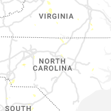


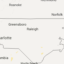


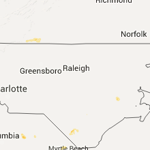


Connect with Interactive Hail Maps