

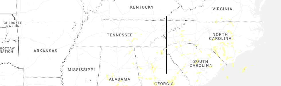
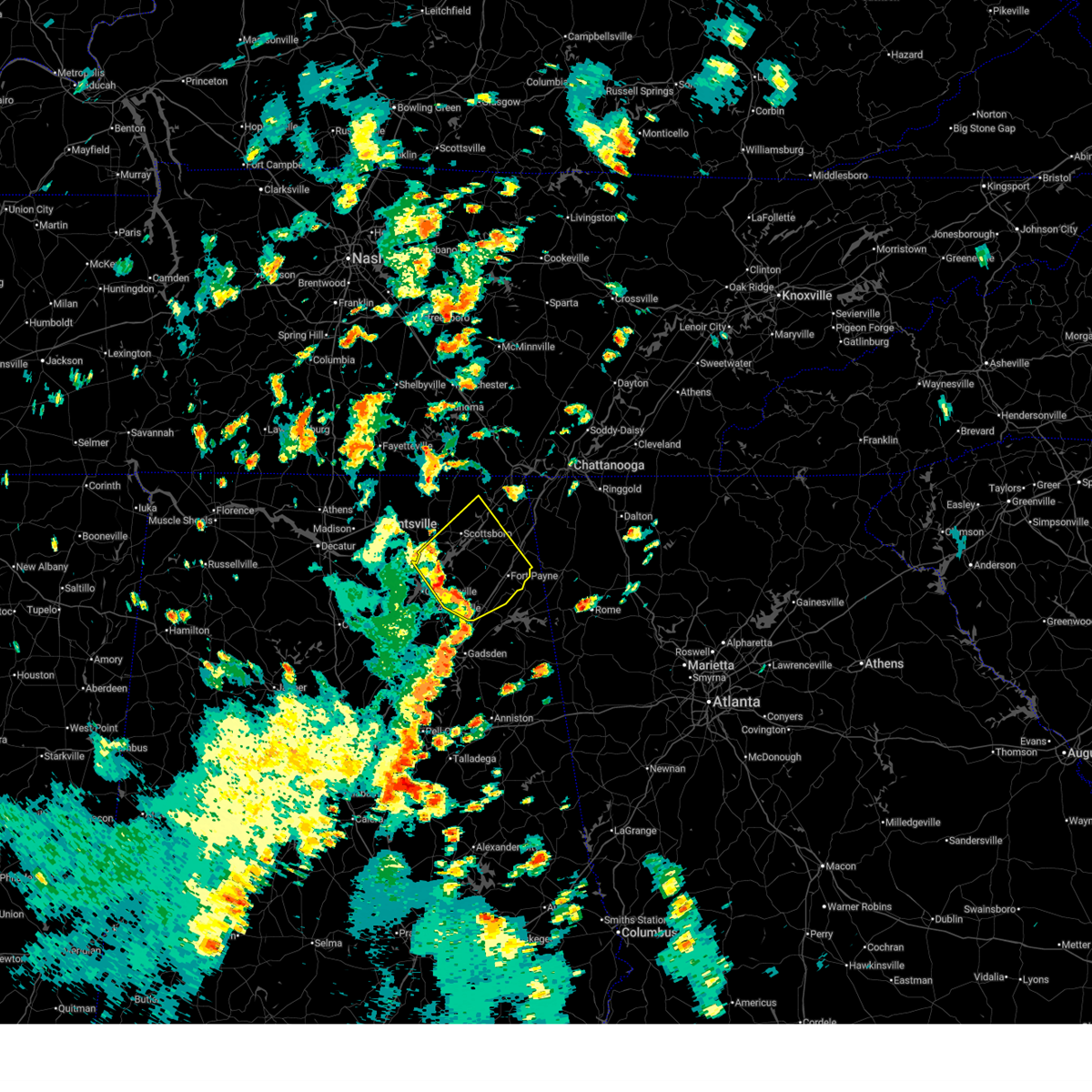
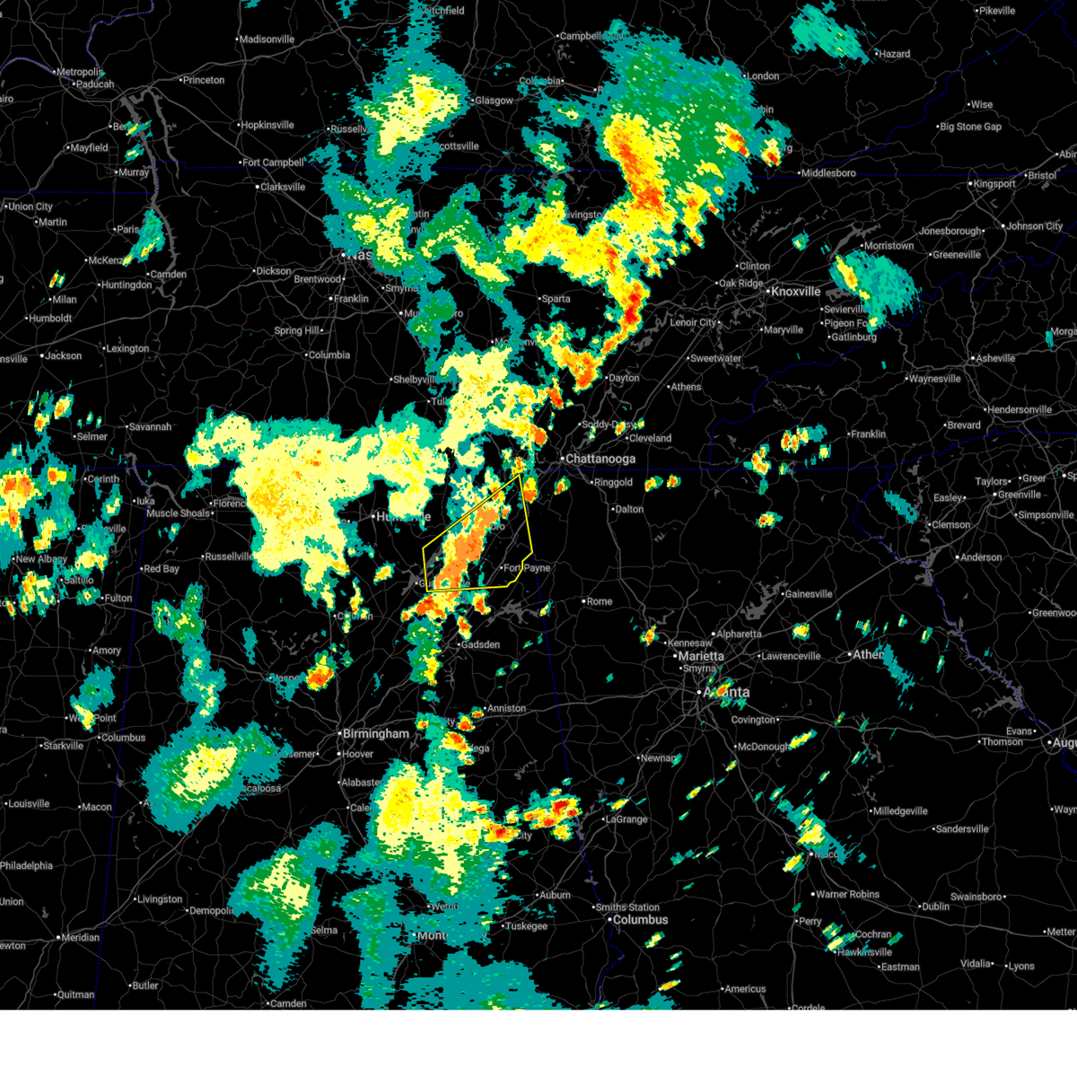
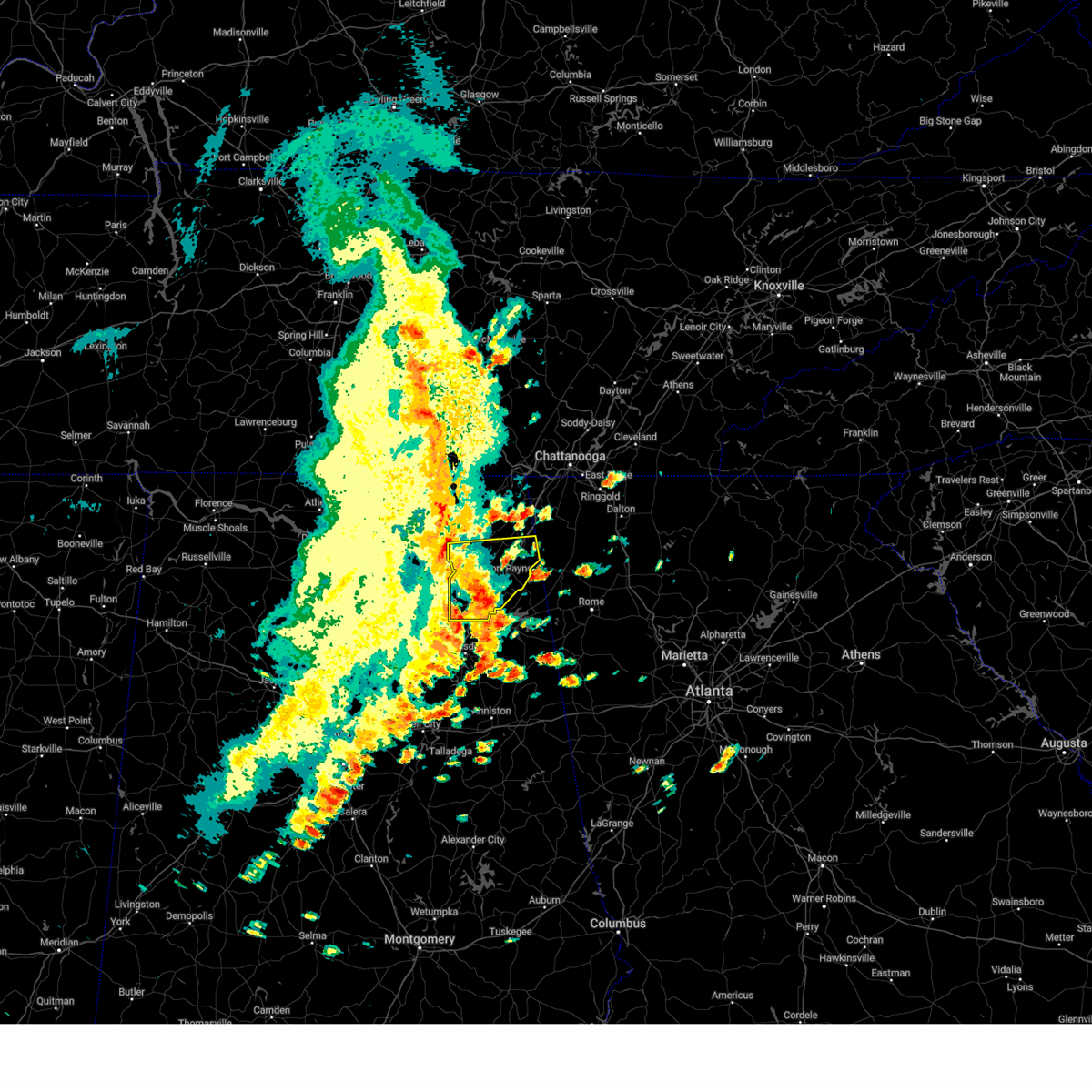
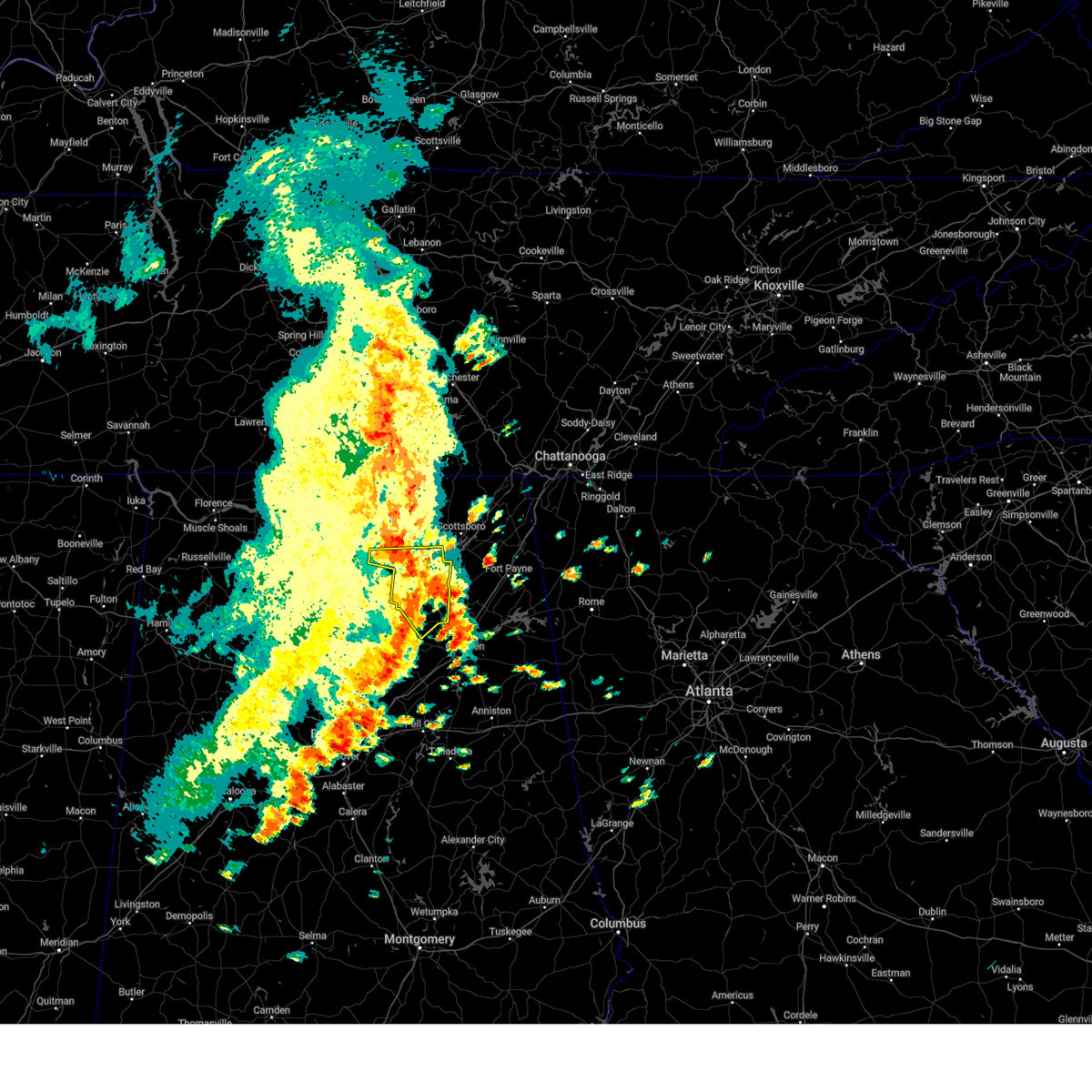
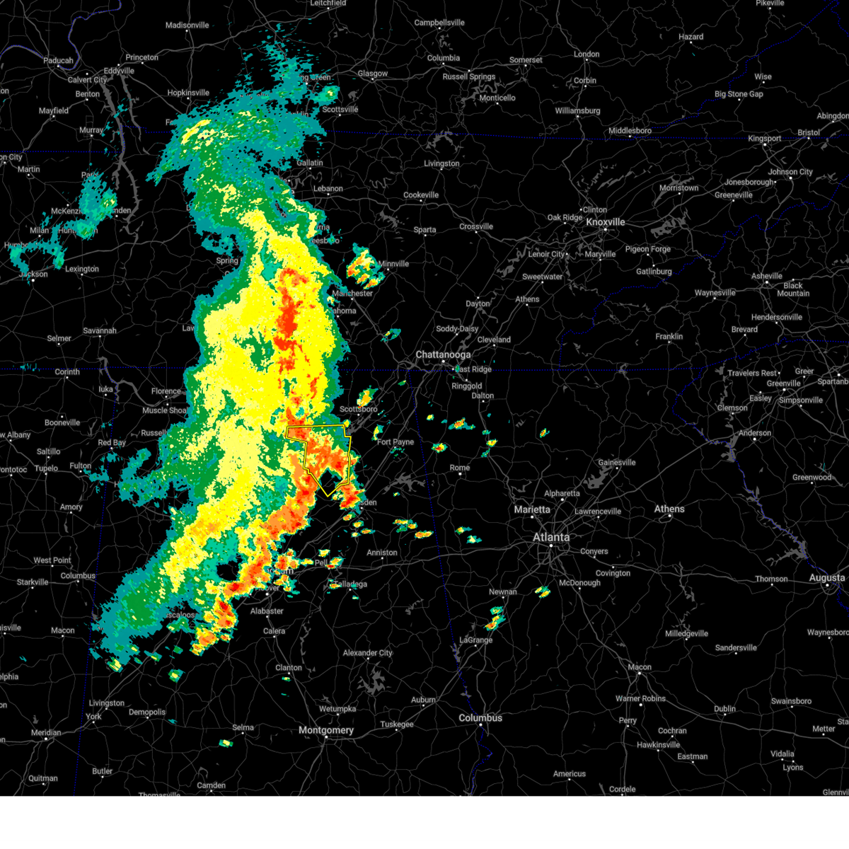
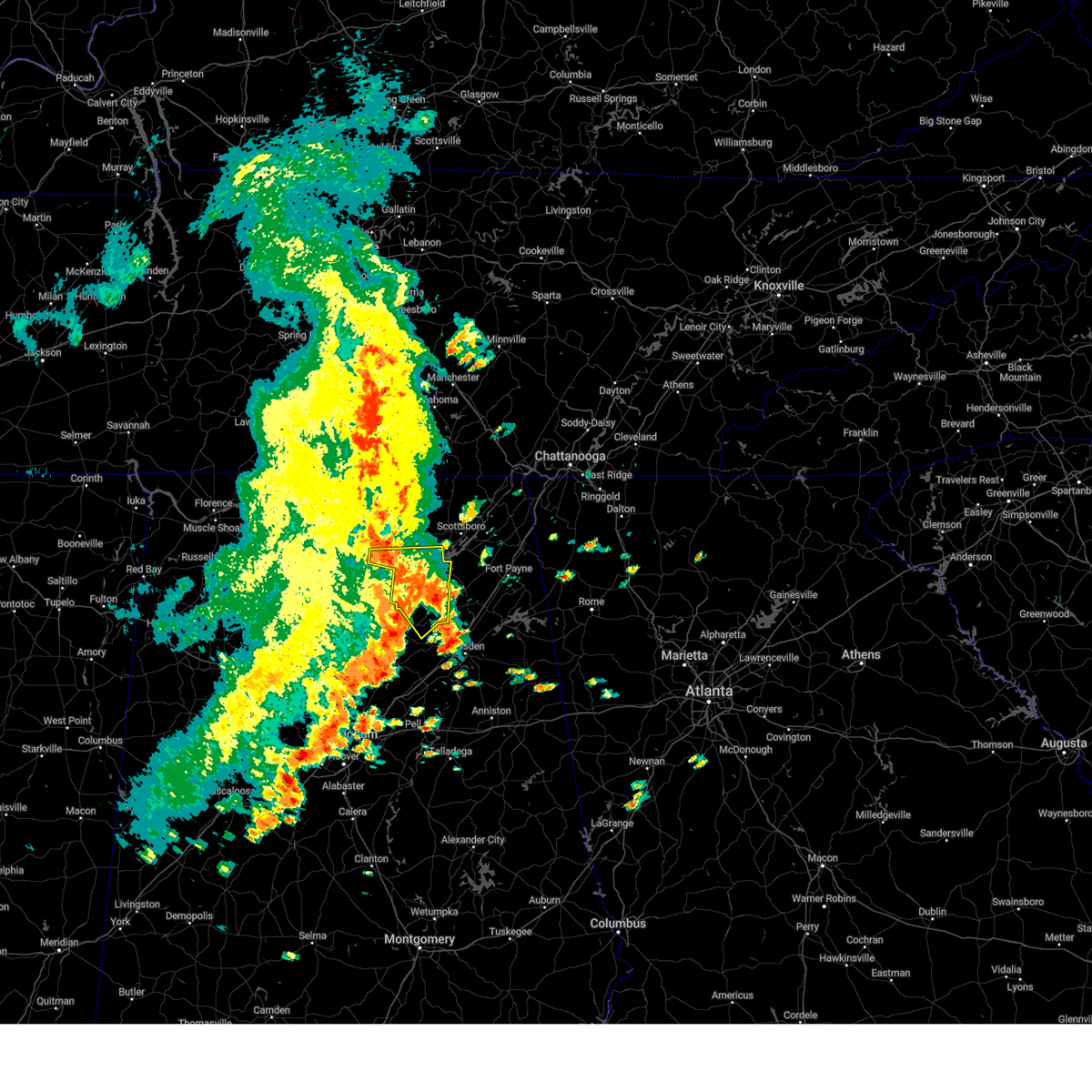
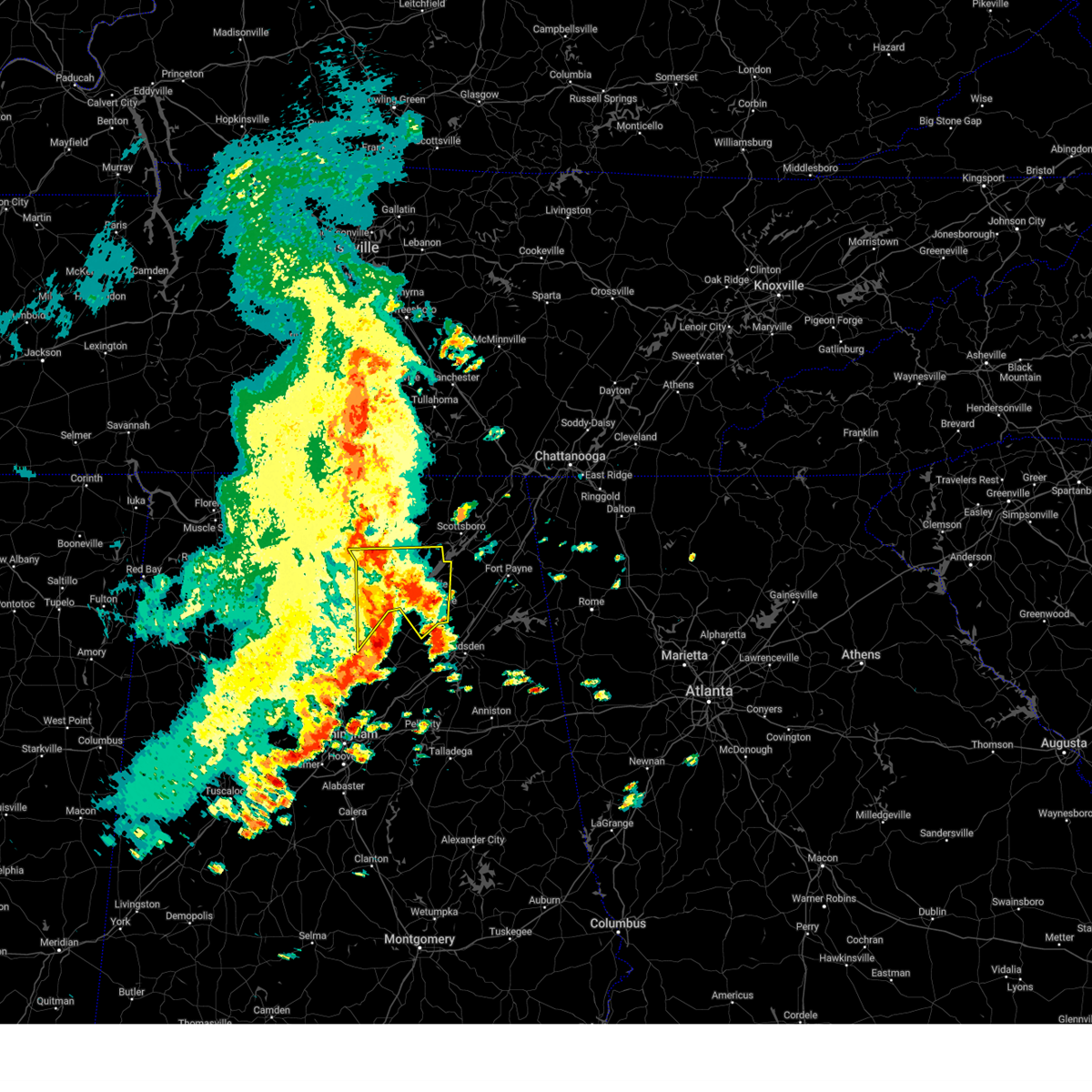
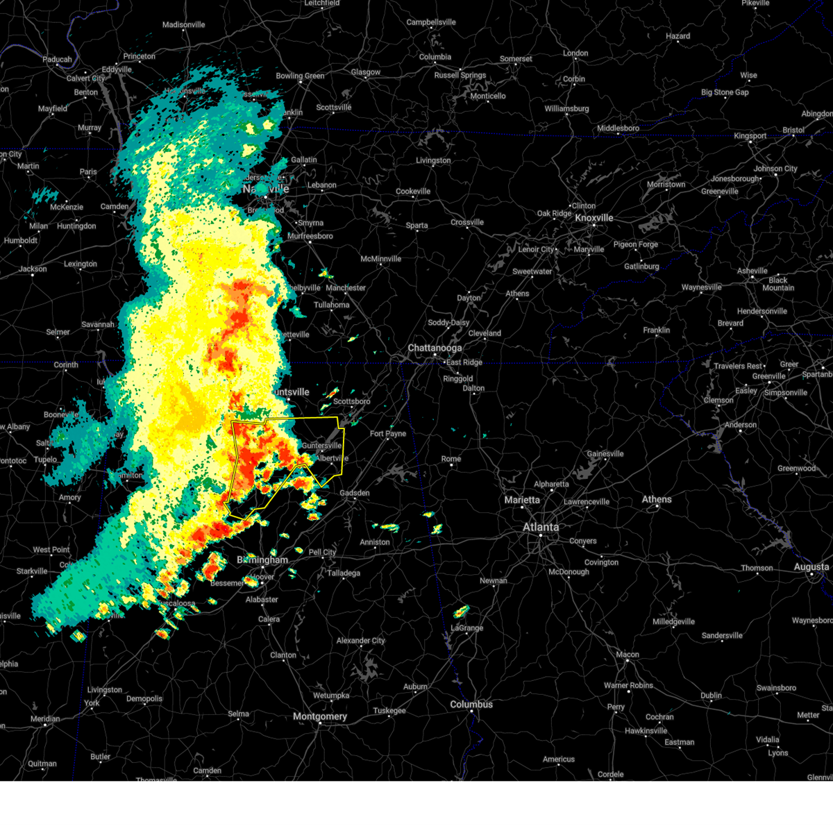
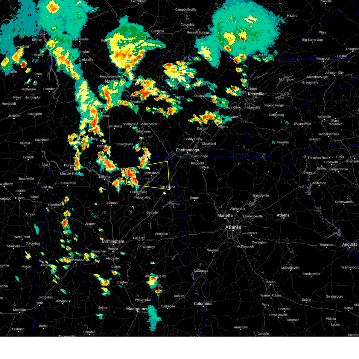
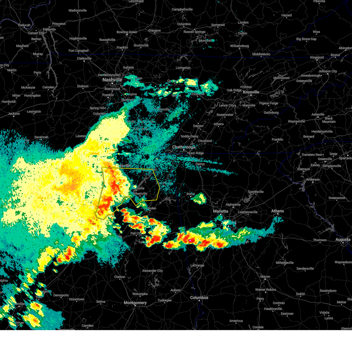
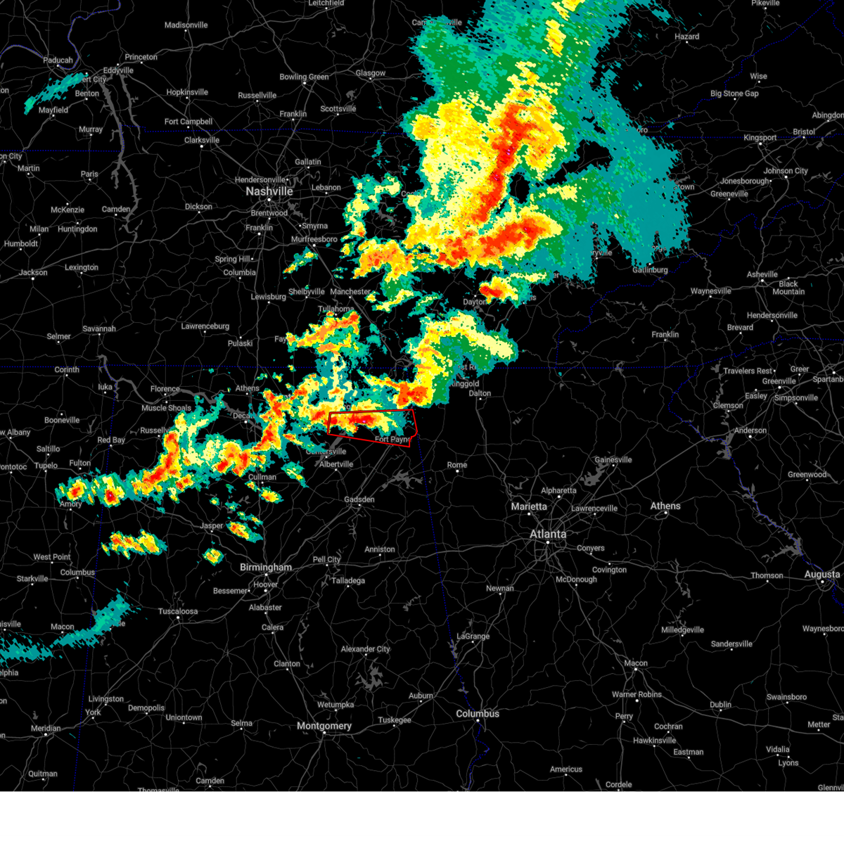
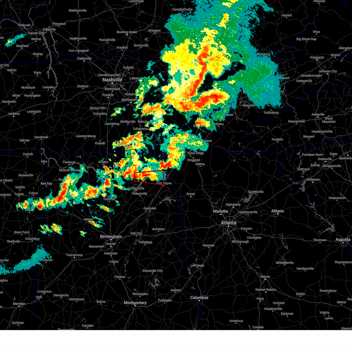
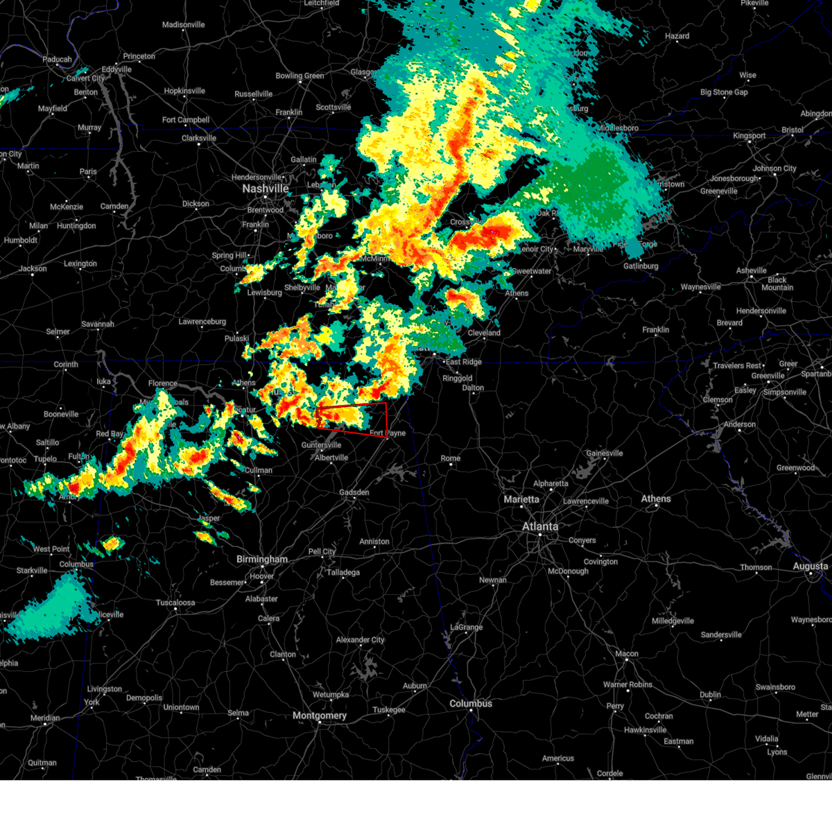
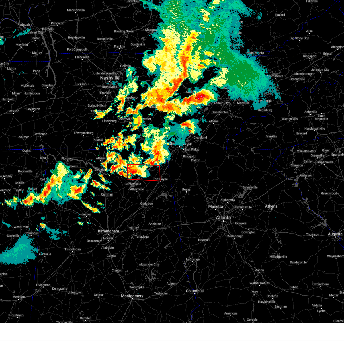
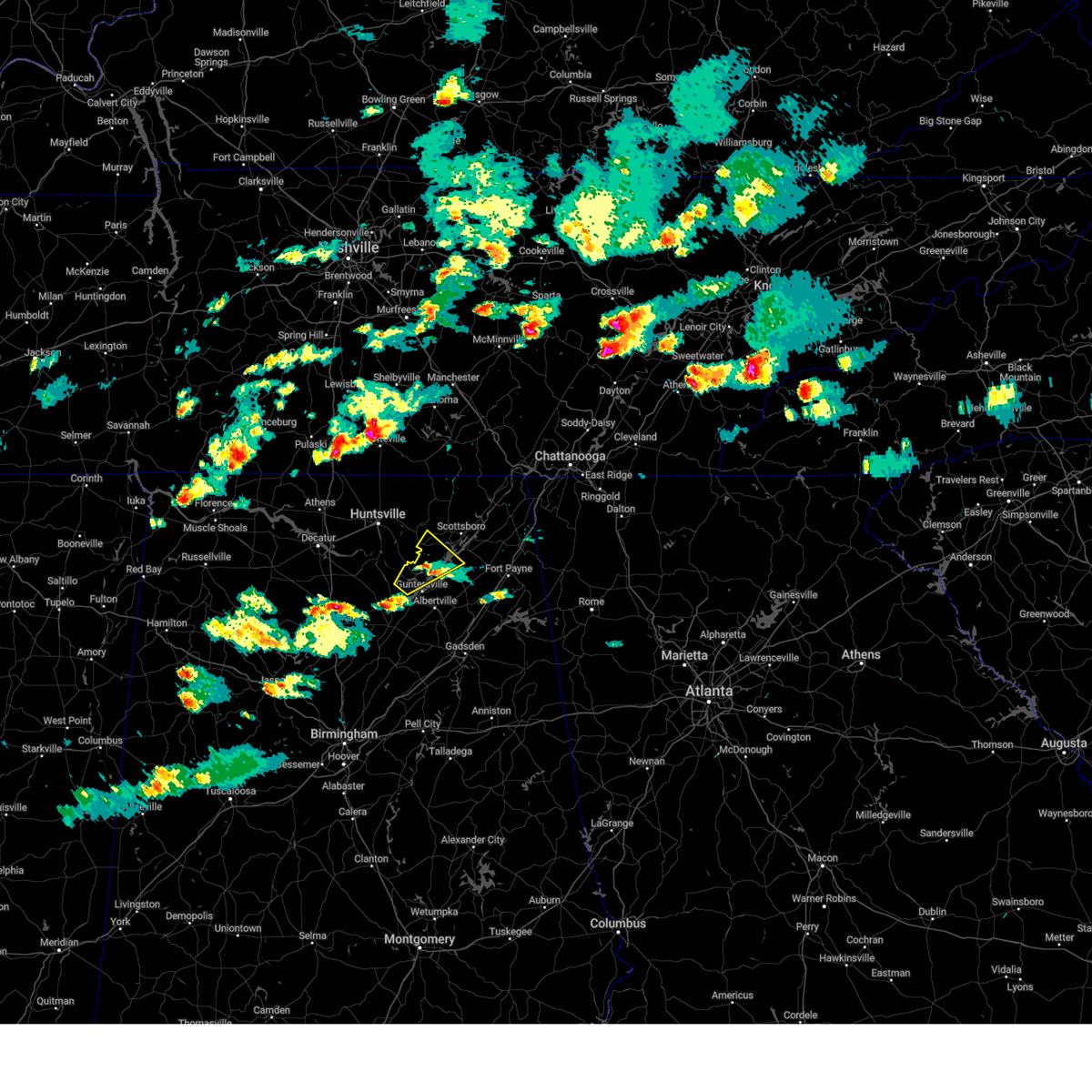
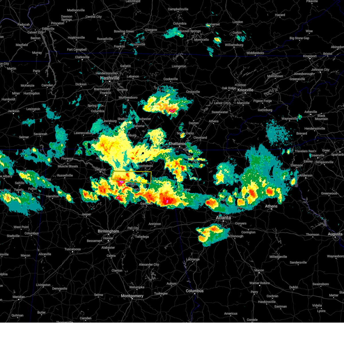
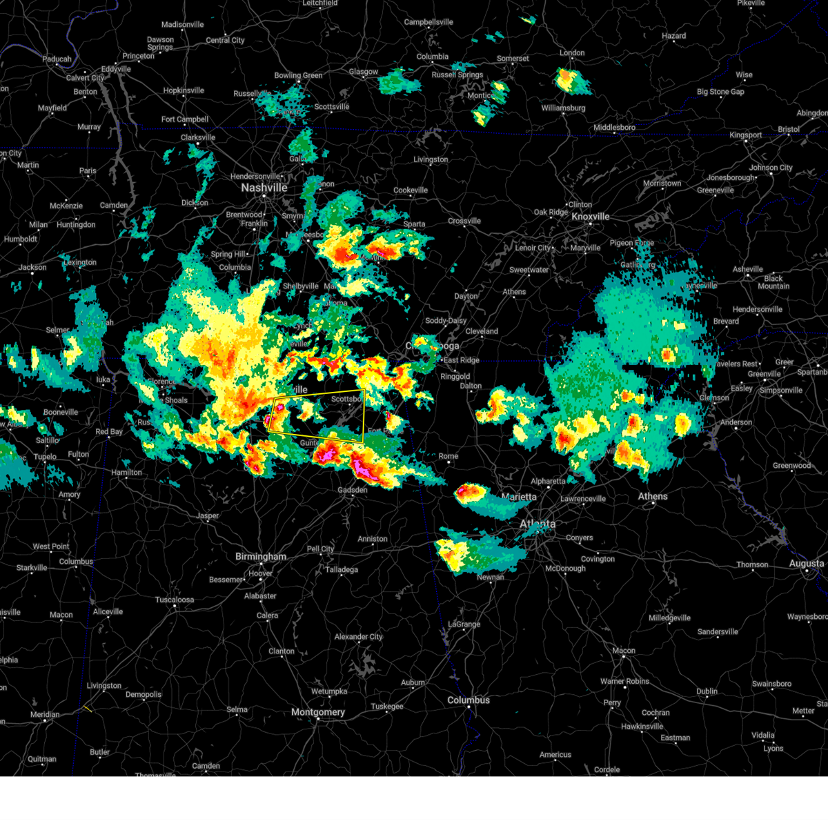
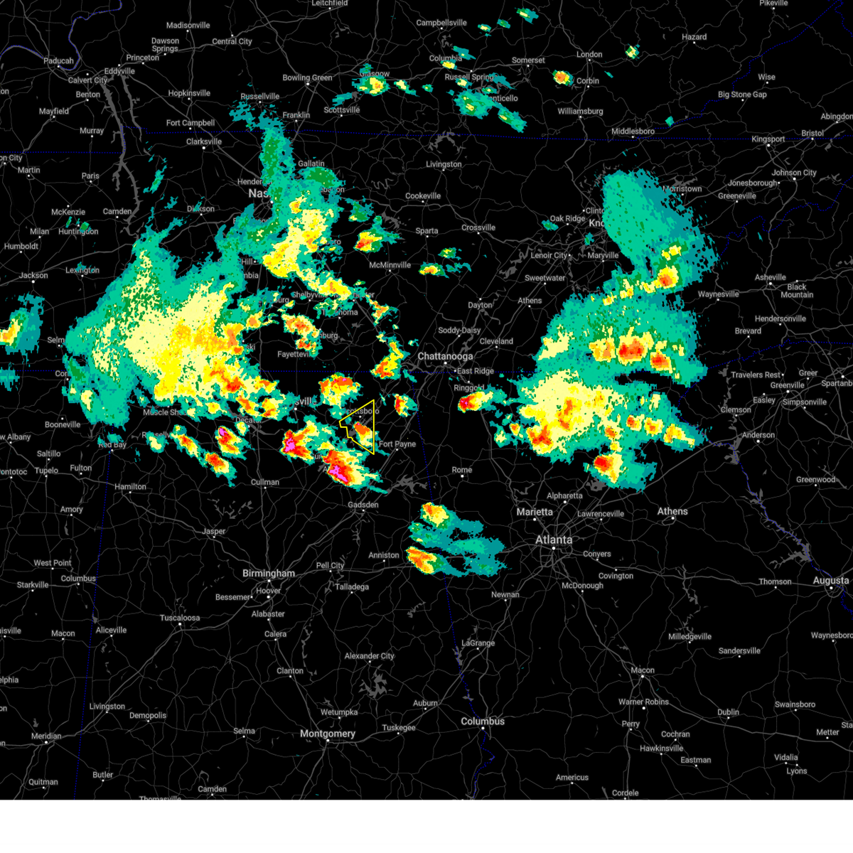
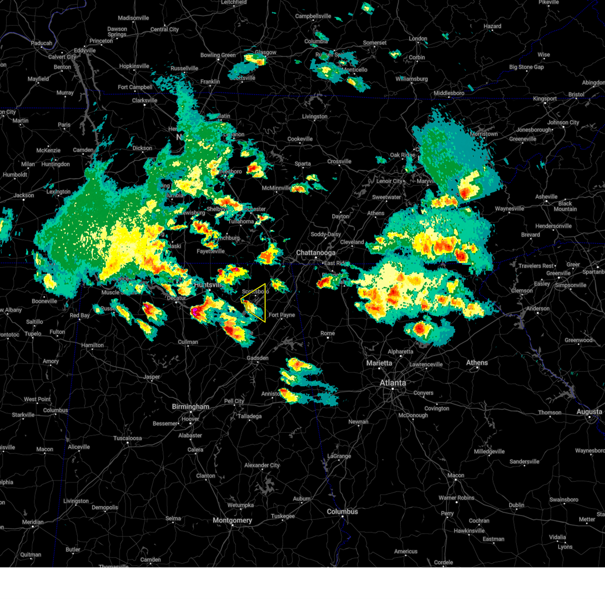
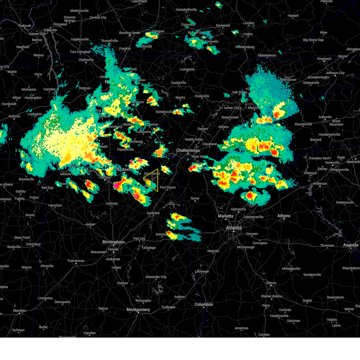
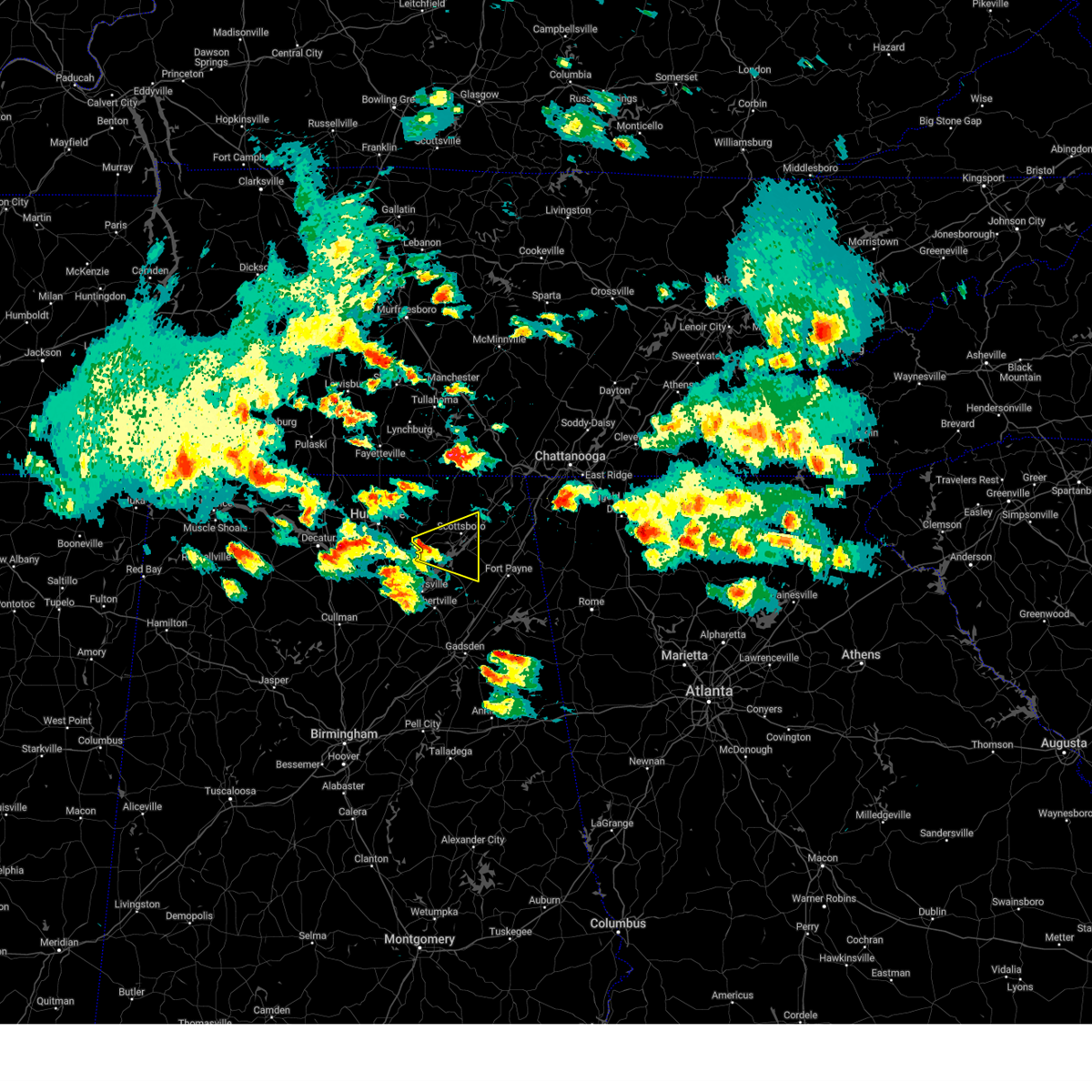
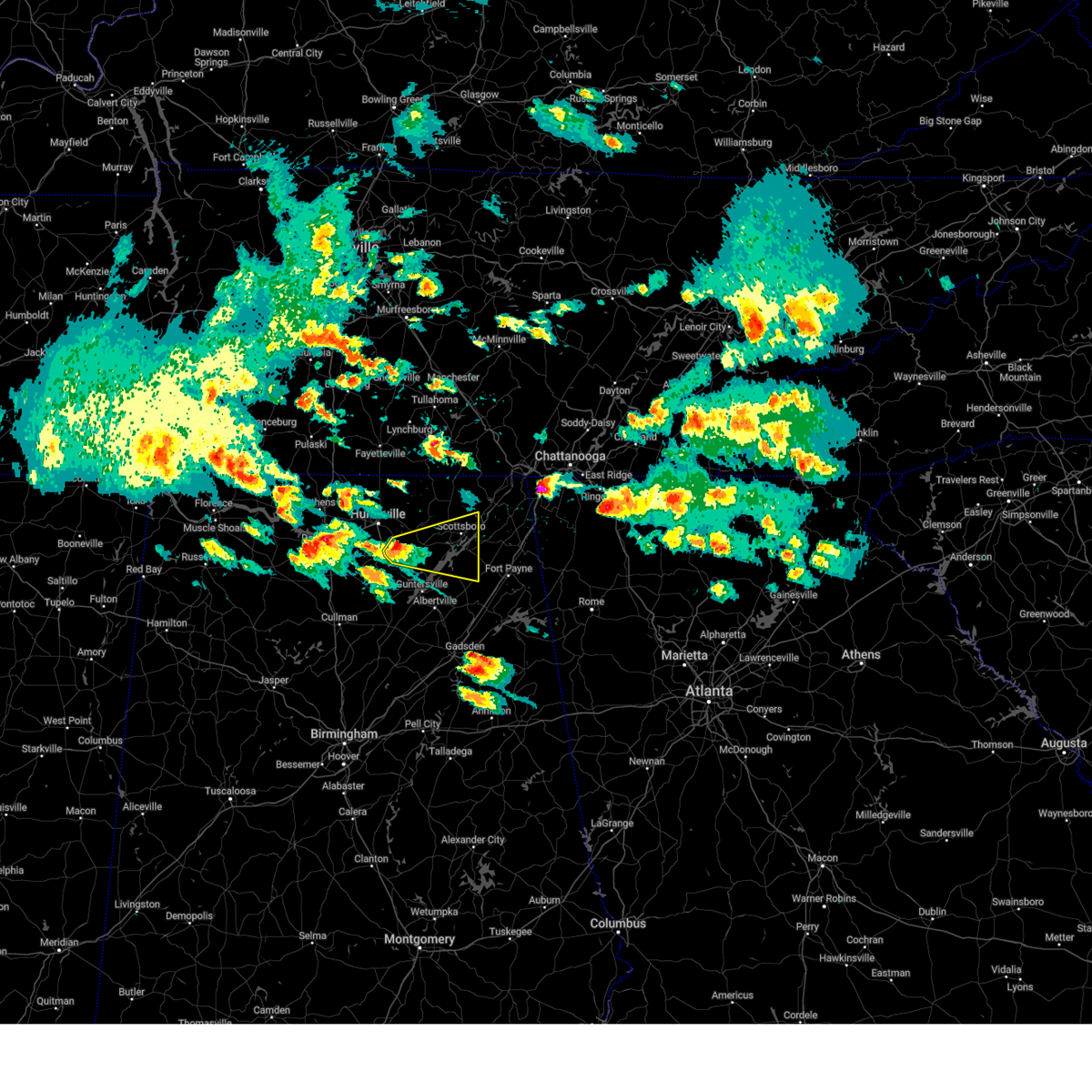
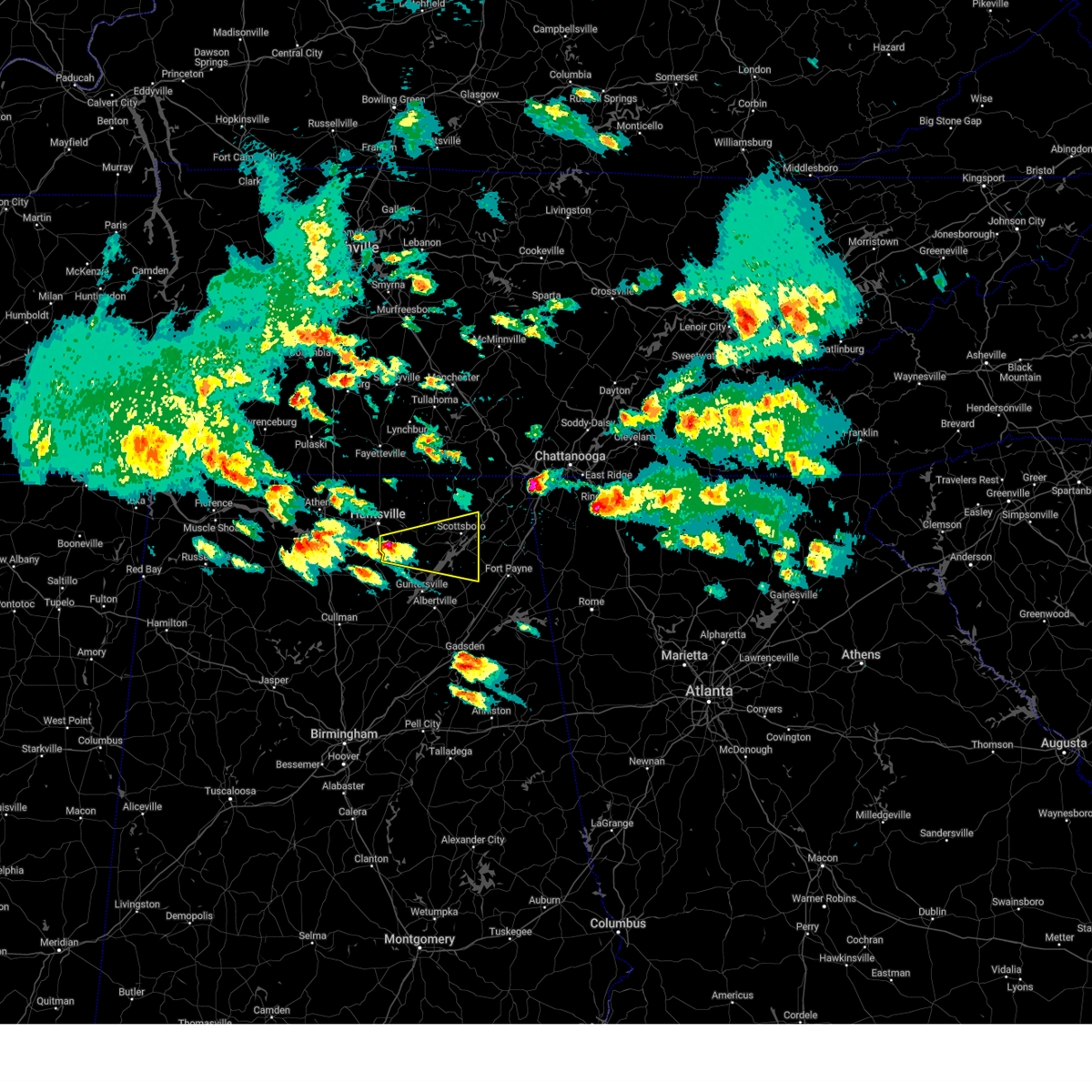
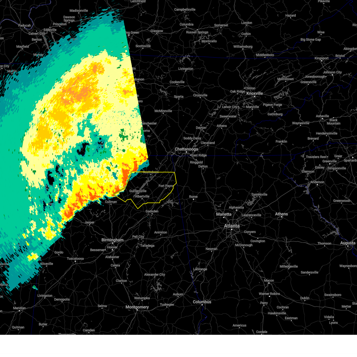
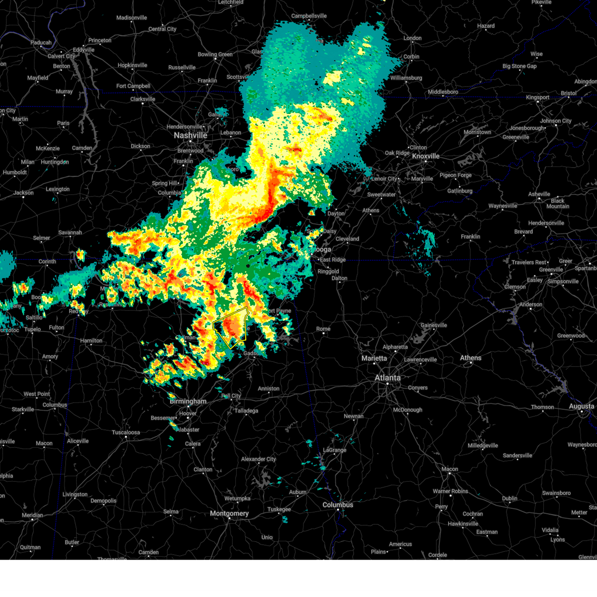
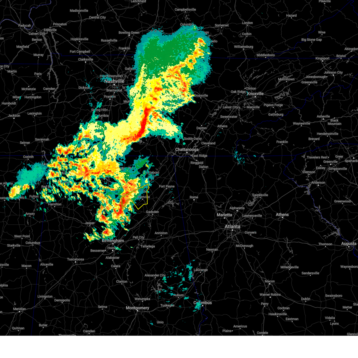
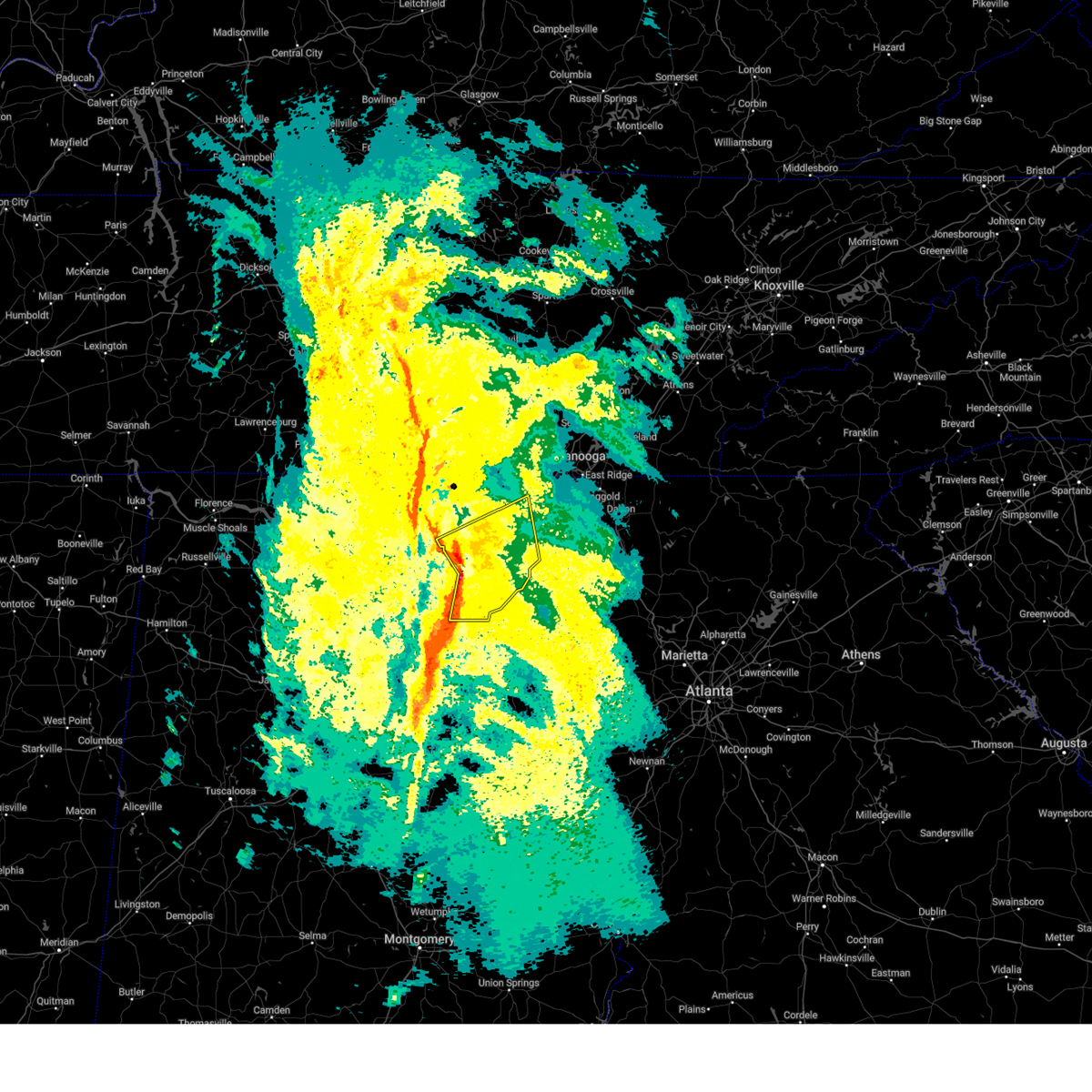
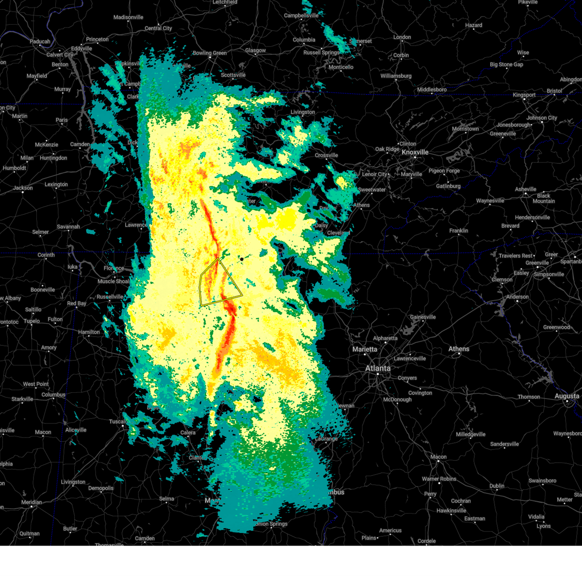
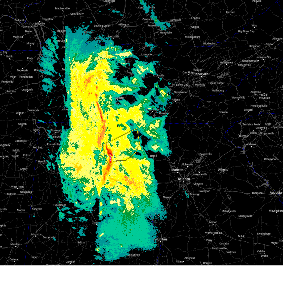
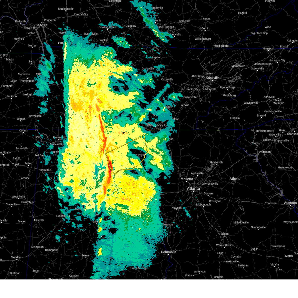
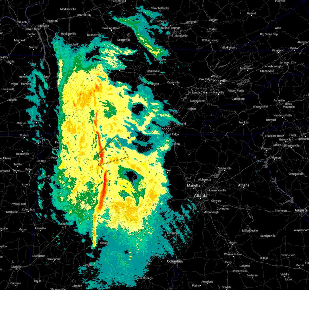
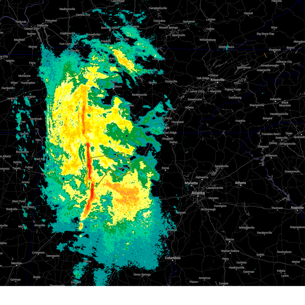
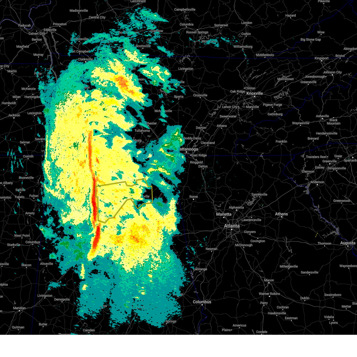
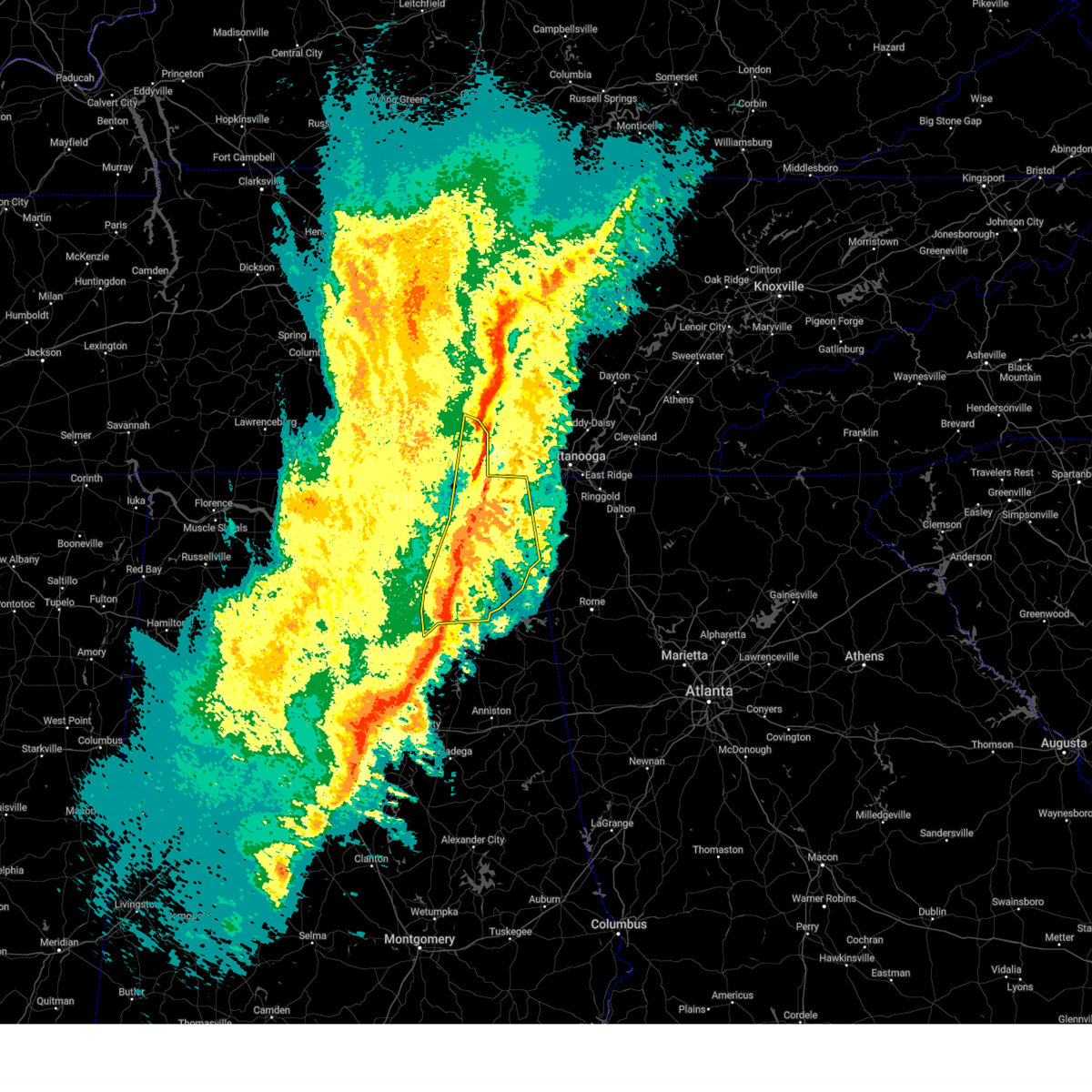
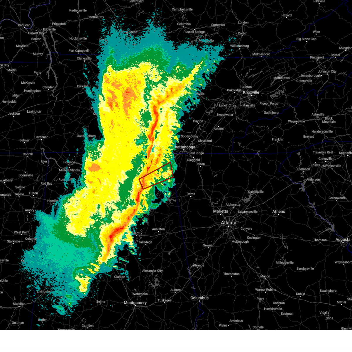
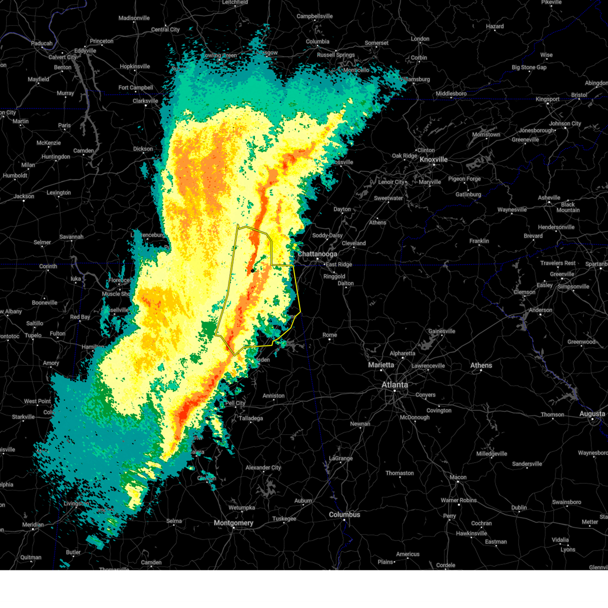
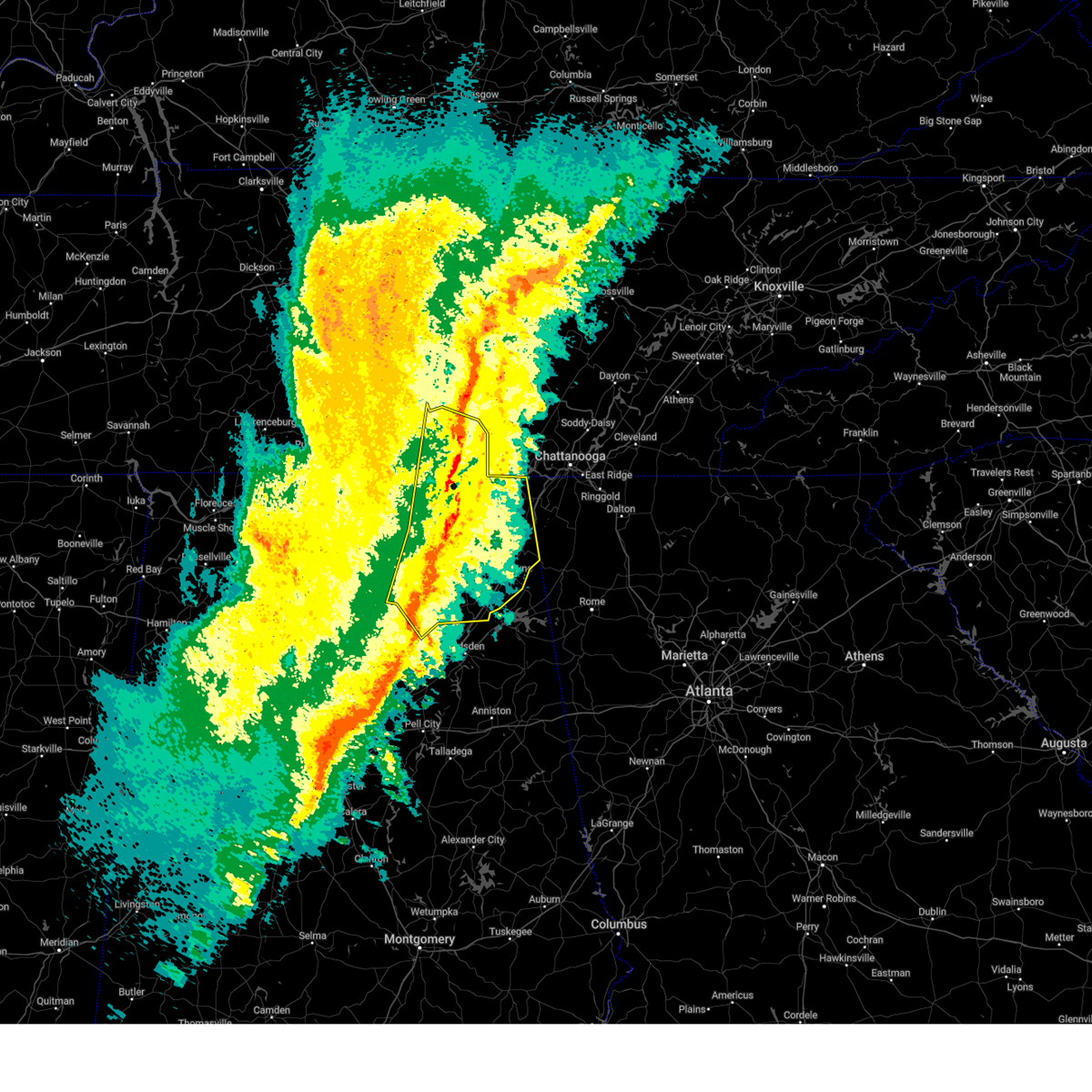
Hail Map for Langston, AL
The Langston, AL area has had 0 reports of on-the-ground hail by trained spotters, and has been under severe weather warnings 103 times during the past 12 months. Doppler radar has detected hail at or near Langston, AL on 60 occasions, including 4 occasions during the past year.
| Name: | Langston, AL |
| Where Located: | 57.7 miles SW of Chattanooga, TN |
| Map: | Google Map for Langston, AL |
| Population: | 270 |
| Housing Units: | 224 |
| More Info: | Search Google for Langston, AL |
0
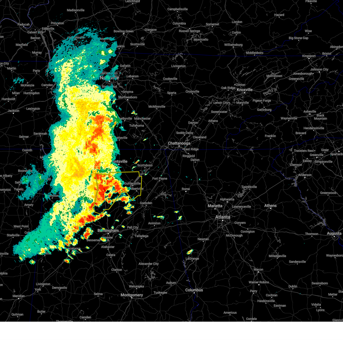
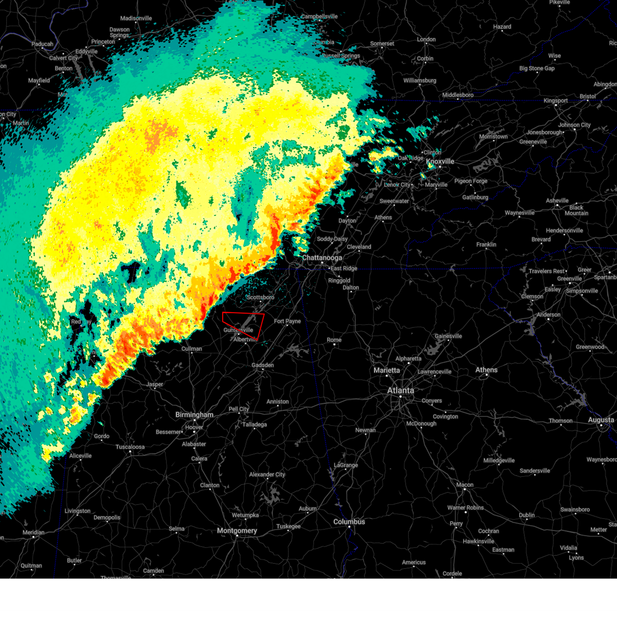
The Top Recent Hail Date for Langston, AL is Wednesday, June 25, 2025 (44th out of 60)
Hail and Wind Damage Spotted near Langston, AL
| Date / Time | Report Details |
|---|---|
| 6/25/2025 3:27 PM CDT |
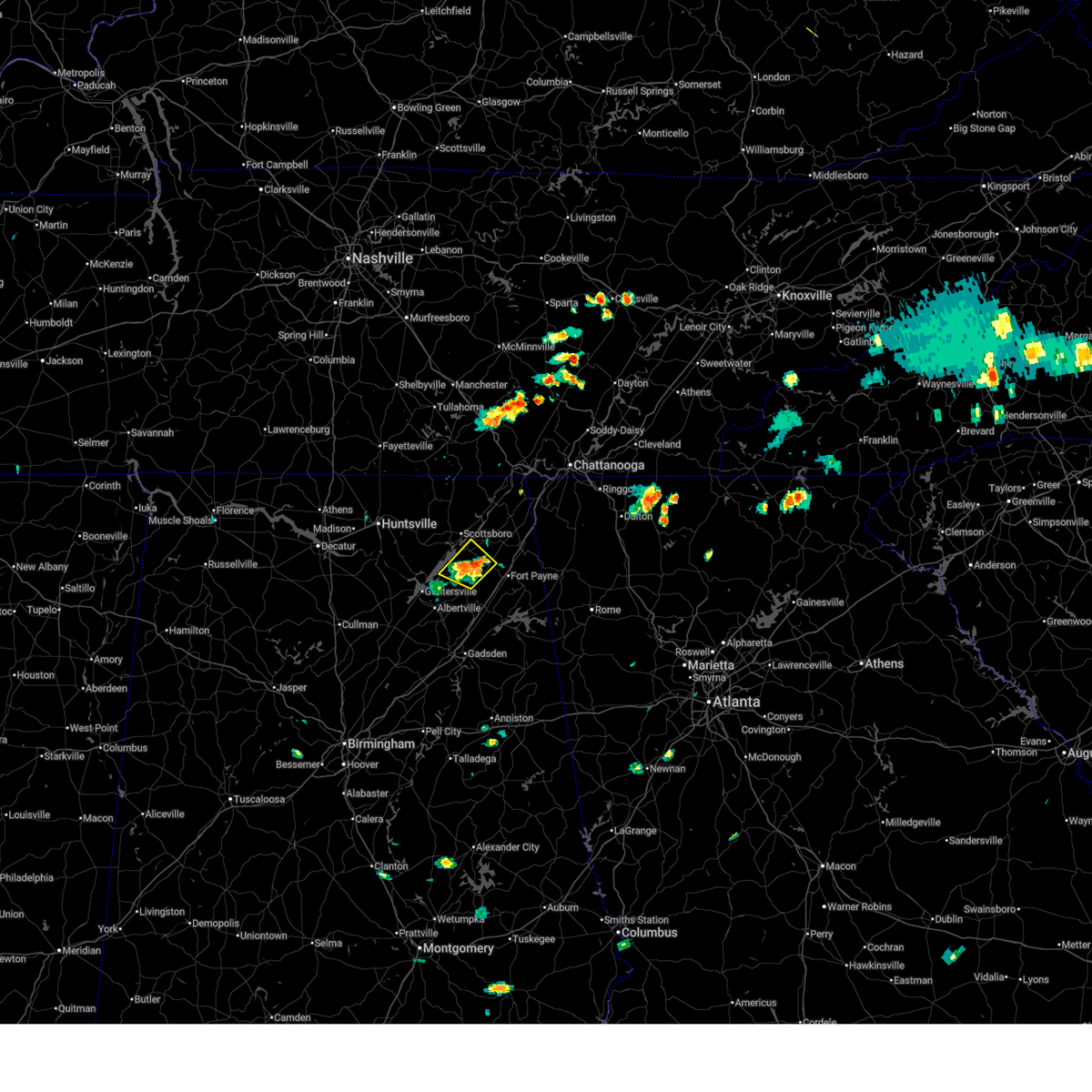 At 327 pm cdt, a severe thunderstorm was located near fyffe, or 7 miles west of rainsville, and is nearly stationary (radar indicated). Hazards include 60 mph wind gusts and quarter size hail. Hail damage to vehicles is expected. expect wind damage to roofs, siding, and trees. Locations impacted include, rainsville, fyffe, powell, section, langston, lakeview, and chigger hill. At 327 pm cdt, a severe thunderstorm was located near fyffe, or 7 miles west of rainsville, and is nearly stationary (radar indicated). Hazards include 60 mph wind gusts and quarter size hail. Hail damage to vehicles is expected. expect wind damage to roofs, siding, and trees. Locations impacted include, rainsville, fyffe, powell, section, langston, lakeview, and chigger hill.
|
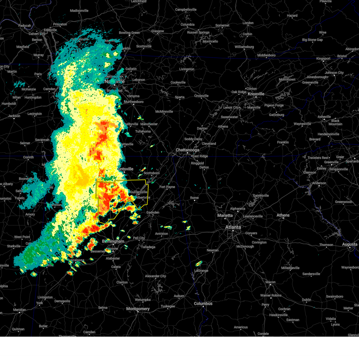
| 6/25/2025 3:22 PM CDT | Svrhun the national weather service in huntsville alabama has issued a * severe thunderstorm warning for, northeastern marshall county in northeastern alabama, south central jackson county in northeastern alabama, west central dekalb county in northeastern alabama, * until 400 pm cdt. * at 322 pm cdt, a severe thunderstorm was located near fyffe, or 7 miles west of rainsville, and is nearly stationary (radar indicated). Hazards include 60 mph wind gusts and penny size hail. expect damage to roofs, siding, and trees |
| 6/25/2025 3:04 PM CDT |
 the severe thunderstorm warning has been cancelled and is no longer in effect the severe thunderstorm warning has been cancelled and is no longer in effect
|
| 6/25/2025 2:28 PM CDT |
 Svrhun the national weather service in huntsville alabama has issued a * severe thunderstorm warning for, eastern marshall county in northeastern alabama, south central jackson county in northeastern alabama, southwestern dekalb county in northeastern alabama, * until 330 pm cdt. * at 227 pm cdt, a cluster of severe thunderstorms was extending from albertville to fyffe and is nearly stationary (radar indicated). Hazards include 60 mph wind gusts and penny size hail. expect damage to roofs, siding, and trees Svrhun the national weather service in huntsville alabama has issued a * severe thunderstorm warning for, eastern marshall county in northeastern alabama, south central jackson county in northeastern alabama, southwestern dekalb county in northeastern alabama, * until 330 pm cdt. * at 227 pm cdt, a cluster of severe thunderstorms was extending from albertville to fyffe and is nearly stationary (radar indicated). Hazards include 60 mph wind gusts and penny size hail. expect damage to roofs, siding, and trees
|
| 6/17/2025 2:51 PM CDT |
 At 250 pm cdt, a severe thunderstorm was located near geraldine, or 13 miles west of rainsville, moving northeast at 25 mph (radar indicated). Hazards include 60 mph wind gusts and penny size hail. Expect damage to roofs, siding, and trees. Locations impacted include, scottsboro, fort payne, rainsville, henagar, crossville, sylvania, fyffe, hollywood, powell, and geraldine. At 250 pm cdt, a severe thunderstorm was located near geraldine, or 13 miles west of rainsville, moving northeast at 25 mph (radar indicated). Hazards include 60 mph wind gusts and penny size hail. Expect damage to roofs, siding, and trees. Locations impacted include, scottsboro, fort payne, rainsville, henagar, crossville, sylvania, fyffe, hollywood, powell, and geraldine.
|
| 6/17/2025 2:36 PM CDT |
 Svrhun the national weather service in huntsville alabama has issued a * severe thunderstorm warning for, northeastern marshall county in northeastern alabama, southeastern jackson county in northeastern alabama, dekalb county in northeastern alabama, * until 330 pm cdt. * at 235 pm cdt, a severe thunderstorm was located 7 miles east of guntersville, moving northeast at 25 mph (radar indicated). Hazards include 60 mph wind gusts. expect damage to roofs, siding, and trees Svrhun the national weather service in huntsville alabama has issued a * severe thunderstorm warning for, northeastern marshall county in northeastern alabama, southeastern jackson county in northeastern alabama, dekalb county in northeastern alabama, * until 330 pm cdt. * at 235 pm cdt, a severe thunderstorm was located 7 miles east of guntersville, moving northeast at 25 mph (radar indicated). Hazards include 60 mph wind gusts. expect damage to roofs, siding, and trees
|
| 6/13/2025 5:19 PM CDT |
 Svrhun the national weather service in huntsville alabama has issued a * severe thunderstorm warning for, northeastern marshall county in northeastern alabama, central jackson county in northeastern alabama, dekalb county in northeastern alabama, * until 615 pm cdt. * at 519 pm cdt, a severe thunderstorm was located near powell, or 7 miles west of rainsville, moving northeast at 20 mph (radar indicated). Hazards include 60 mph wind gusts and penny size hail. expect damage to roofs, siding, and trees Svrhun the national weather service in huntsville alabama has issued a * severe thunderstorm warning for, northeastern marshall county in northeastern alabama, central jackson county in northeastern alabama, dekalb county in northeastern alabama, * until 615 pm cdt. * at 519 pm cdt, a severe thunderstorm was located near powell, or 7 miles west of rainsville, moving northeast at 20 mph (radar indicated). Hazards include 60 mph wind gusts and penny size hail. expect damage to roofs, siding, and trees
|
| 6/7/2025 3:03 PM CDT |
 At 303 pm cdt, a severe thunderstorm was located near geraldine, or 10 miles southwest of rainsville, moving east at 50 mph (radar indicated). Hazards include 60 mph wind gusts. Expect damage to roofs, siding, and trees. Locations impacted include, scottsboro, fort payne, rainsville, henagar, crossville, sylvania, fyffe, powell, geraldine, and section. At 303 pm cdt, a severe thunderstorm was located near geraldine, or 10 miles southwest of rainsville, moving east at 50 mph (radar indicated). Hazards include 60 mph wind gusts. Expect damage to roofs, siding, and trees. Locations impacted include, scottsboro, fort payne, rainsville, henagar, crossville, sylvania, fyffe, powell, geraldine, and section.
|
| 6/7/2025 3:03 PM CDT |
 the severe thunderstorm warning has been cancelled and is no longer in effect the severe thunderstorm warning has been cancelled and is no longer in effect
|
| 6/7/2025 2:42 PM CDT |
 The storms which prompted the warning have moved out of the warned area. therefore, the warning will be allowed to expire. a new severe thunderstorm warning has been issued for parts of marshall county. a severe thunderstorm watch remains in effect until 600 pm cdt for north central and northeastern alabama. The storms which prompted the warning have moved out of the warned area. therefore, the warning will be allowed to expire. a new severe thunderstorm warning has been issued for parts of marshall county. a severe thunderstorm watch remains in effect until 600 pm cdt for north central and northeastern alabama.
|
| 6/7/2025 2:40 PM CDT |
 Svrhun the national weather service in huntsville alabama has issued a * severe thunderstorm warning for, eastern marshall county in northeastern alabama, southwestern jackson county in northeastern alabama, dekalb county in northeastern alabama, * until 345 pm cdt. * at 239 pm cdt, a severe thunderstorm was located over guntersville, moving east at 50 mph (radar indicated). Hazards include 60 mph wind gusts. expect damage to roofs, siding, and trees Svrhun the national weather service in huntsville alabama has issued a * severe thunderstorm warning for, eastern marshall county in northeastern alabama, southwestern jackson county in northeastern alabama, dekalb county in northeastern alabama, * until 345 pm cdt. * at 239 pm cdt, a severe thunderstorm was located over guntersville, moving east at 50 mph (radar indicated). Hazards include 60 mph wind gusts. expect damage to roofs, siding, and trees
|
| 6/7/2025 2:32 PM CDT |
 At 231 pm cdt, severe thunderstorms were located along a line extending from near morgan city to near rosa to near morris, moving east at 55 mph (emergency management). Hazards include 70 mph wind gusts. Expect considerable tree damage. damage is likely to mobile homes, roofs, and outbuildings. Locations impacted include, southern huntsville, albertville, boaz, guntersville, arab, redstone arsenal, owens cross roads, grant, douglas, and union grove. At 231 pm cdt, severe thunderstorms were located along a line extending from near morgan city to near rosa to near morris, moving east at 55 mph (emergency management). Hazards include 70 mph wind gusts. Expect considerable tree damage. damage is likely to mobile homes, roofs, and outbuildings. Locations impacted include, southern huntsville, albertville, boaz, guntersville, arab, redstone arsenal, owens cross roads, grant, douglas, and union grove.
|
| 6/7/2025 2:32 PM CDT |
 the severe thunderstorm warning has been cancelled and is no longer in effect the severe thunderstorm warning has been cancelled and is no longer in effect
|
| 6/7/2025 2:26 PM CDT |
 At 225 pm cdt, severe thunderstorms were located along a line extending from morgan city to near cleveland to near morris, moving east at 55 mph (emergency management). Hazards include 70 mph wind gusts. Expect considerable tree damage. damage is likely to mobile homes, roofs, and outbuildings. Locations impacted include, southern huntsville, albertville, boaz, guntersville, arab, redstone arsenal, owens cross roads, grant, holly pond, and triana. At 225 pm cdt, severe thunderstorms were located along a line extending from morgan city to near cleveland to near morris, moving east at 55 mph (emergency management). Hazards include 70 mph wind gusts. Expect considerable tree damage. damage is likely to mobile homes, roofs, and outbuildings. Locations impacted include, southern huntsville, albertville, boaz, guntersville, arab, redstone arsenal, owens cross roads, grant, holly pond, and triana.
|
| 6/7/2025 2:05 PM CDT |
 At 204 pm cdt, severe thunderstorms were located along a line extending from near priceville to dodge city to near beloit, moving east at 55 mph (emergency management). Hazards include 70 mph wind gusts. Expect considerable tree damage. damage is likely to mobile homes, roofs, and outbuildings. Locations impacted include, southern huntsville, decatur, albertville, cullman, hartselle, boaz, guntersville, arab, redstone arsenal, and hanceville. At 204 pm cdt, severe thunderstorms were located along a line extending from near priceville to dodge city to near beloit, moving east at 55 mph (emergency management). Hazards include 70 mph wind gusts. Expect considerable tree damage. damage is likely to mobile homes, roofs, and outbuildings. Locations impacted include, southern huntsville, decatur, albertville, cullman, hartselle, boaz, guntersville, arab, redstone arsenal, and hanceville.
|
| 6/7/2025 2:05 PM CDT |
 the severe thunderstorm warning has been cancelled and is no longer in effect the severe thunderstorm warning has been cancelled and is no longer in effect
|
| 6/7/2025 1:55 PM CDT |
 At 154 pm cdt, severe thunderstorms were located along a line extending from near hartselle to 6 miles west of dodge city to parrish, moving east at 55 mph. multiple trees reported down in western cullman (emergency management). Hazards include 70 mph wind gusts. Expect considerable tree damage. damage is likely to mobile homes, roofs, and outbuildings. Locations impacted include, southern huntsville, decatur, albertville, cullman, hartselle, boaz, guntersville, arab, redstone arsenal, and hanceville. At 154 pm cdt, severe thunderstorms were located along a line extending from near hartselle to 6 miles west of dodge city to parrish, moving east at 55 mph. multiple trees reported down in western cullman (emergency management). Hazards include 70 mph wind gusts. Expect considerable tree damage. damage is likely to mobile homes, roofs, and outbuildings. Locations impacted include, southern huntsville, decatur, albertville, cullman, hartselle, boaz, guntersville, arab, redstone arsenal, and hanceville.
|
| 6/7/2025 1:47 PM CDT |
 Svrhun the national weather service in huntsville alabama has issued a * severe thunderstorm warning for, marshall county in northeastern alabama, southern madison county in north central alabama, cullman county in north central alabama, morgan county in north central alabama, southeastern lawrence county in northwestern alabama, * until 245 pm cdt. * at 147 pm cdt, severe thunderstorms were located along a line extending from 6 miles south of trinity to near smith dam to oakman, moving east at 55 mph (radar indicated). Hazards include 60 mph wind gusts. expect damage to roofs, siding, and trees Svrhun the national weather service in huntsville alabama has issued a * severe thunderstorm warning for, marshall county in northeastern alabama, southern madison county in north central alabama, cullman county in north central alabama, morgan county in north central alabama, southeastern lawrence county in northwestern alabama, * until 245 pm cdt. * at 147 pm cdt, severe thunderstorms were located along a line extending from 6 miles south of trinity to near smith dam to oakman, moving east at 55 mph (radar indicated). Hazards include 60 mph wind gusts. expect damage to roofs, siding, and trees
|
| 6/6/2025 3:23 PM CDT |
 At 322 pm cdt, a severe thunderstorm was located 7 miles west of scottsboro, moving east at 35 mph (radar indicated). Hazards include 60 mph wind gusts and quarter size hail. Hail damage to vehicles is expected. expect wind damage to roofs, siding, and trees. Locations impacted include, scottsboro, fort payne, rainsville, henagar, stevenson, sylvania, owens cross roads, fyffe, hollywood, and powell. At 322 pm cdt, a severe thunderstorm was located 7 miles west of scottsboro, moving east at 35 mph (radar indicated). Hazards include 60 mph wind gusts and quarter size hail. Hail damage to vehicles is expected. expect wind damage to roofs, siding, and trees. Locations impacted include, scottsboro, fort payne, rainsville, henagar, stevenson, sylvania, owens cross roads, fyffe, hollywood, and powell.
|
| 6/6/2025 3:10 PM CDT |
 Svrhun the national weather service in huntsville alabama has issued a * severe thunderstorm warning for, northeastern marshall county in northeastern alabama, jackson county in northeastern alabama, southeastern madison county in north central alabama, central dekalb county in northeastern alabama, * until 415 pm cdt. * at 310 pm cdt, a severe thunderstorm was located near woodville, or 14 miles west of scottsboro, moving east at 35 mph (radar indicated). Hazards include 60 mph wind gusts. expect damage to roofs, siding, and trees Svrhun the national weather service in huntsville alabama has issued a * severe thunderstorm warning for, northeastern marshall county in northeastern alabama, jackson county in northeastern alabama, southeastern madison county in north central alabama, central dekalb county in northeastern alabama, * until 415 pm cdt. * at 310 pm cdt, a severe thunderstorm was located near woodville, or 14 miles west of scottsboro, moving east at 35 mph (radar indicated). Hazards include 60 mph wind gusts. expect damage to roofs, siding, and trees
|
| 5/25/2025 10:29 PM CDT |
 The storms which prompted the warning have weakened below severe limits, and no longer pose an immediate threat to life or property. therefore, the warning will be allowed to expire. however, gusty winds and heavy rain are still possible with these thunderstorms. a severe thunderstorm watch remains in effect until 1100 pm cdt for north central and northeastern alabama. The storms which prompted the warning have weakened below severe limits, and no longer pose an immediate threat to life or property. therefore, the warning will be allowed to expire. however, gusty winds and heavy rain are still possible with these thunderstorms. a severe thunderstorm watch remains in effect until 1100 pm cdt for north central and northeastern alabama.
|
| 5/25/2025 10:04 PM CDT |
 At 1003 pm cdt, severe thunderstorms were located along a line extending from huntsville to 6 miles west of arab to near blount springs, moving east at 45 mph (radar indicated). Hazards include 60 mph wind gusts. Expect damage to roofs, siding, and trees. Locations impacted include, wilburn, high point, lim rock, valhermoso springs, cullman, painter, joppa, union grove, crossville, and rabbit town. At 1003 pm cdt, severe thunderstorms were located along a line extending from huntsville to 6 miles west of arab to near blount springs, moving east at 45 mph (radar indicated). Hazards include 60 mph wind gusts. Expect damage to roofs, siding, and trees. Locations impacted include, wilburn, high point, lim rock, valhermoso springs, cullman, painter, joppa, union grove, crossville, and rabbit town.
|
| 5/25/2025 9:54 PM CDT |
 At 953 pm cdt, severe thunderstorms were located along a line extending from near madison to 8 miles southwest of morgan city to near bangor, moving east at 50 mph (radar indicated). Hazards include 60 mph wind gusts. Expect damage to roofs, siding, and trees. Locations impacted include, wilburn, lim rock, valhermoso springs, crane hill, priceville, painter, union grove, rabbit town, whitesburg, and mcville. At 953 pm cdt, severe thunderstorms were located along a line extending from near madison to 8 miles southwest of morgan city to near bangor, moving east at 50 mph (radar indicated). Hazards include 60 mph wind gusts. Expect damage to roofs, siding, and trees. Locations impacted include, wilburn, lim rock, valhermoso springs, crane hill, priceville, painter, union grove, rabbit town, whitesburg, and mcville.
|
| 5/25/2025 9:54 PM CDT |
 the severe thunderstorm warning has been cancelled and is no longer in effect the severe thunderstorm warning has been cancelled and is no longer in effect
|
| 5/25/2025 9:37 PM CDT | Svrhun the national weather service in huntsville alabama has issued a * severe thunderstorm warning for, marshall county in northeastern alabama, southwestern jackson county in northeastern alabama, southern madison county in north central alabama, southern limestone county in north central alabama, southwestern dekalb county in northeastern alabama, cullman county in north central alabama, morgan county in north central alabama, eastern lawrence county in northwestern alabama, * until 1030 pm cdt. * at 937 pm cdt, severe thunderstorms were located along a line extending from near tanner to falkville to near dodge city, moving east at 50 mph (radar indicated). Hazards include 60 mph wind gusts. expect damage to roofs, siding, and trees |
| 5/25/2025 5:12 PM CDT | Svrhun the national weather service in huntsville alabama has issued a * severe thunderstorm warning for, central jackson county in northeastern alabama, dekalb county in northeastern alabama, * until 545 pm cdt. * at 511 pm cdt, a line of severe thunderstorms were located along a line extending from near trenton to near ider to powell, moving southeast at 35 mph (radar indicated). Hazards include 60 mph wind gusts and quarter size hail. Hail damage to vehicles is expected. Expect wind damage to roofs, siding, and trees. |
| 5/25/2025 5:06 PM CDT | At 504 pm cdt, a severe thunderstorm was located 7 miles northwest of lookout mountain, or 10 miles east of jasper, moving east at 45 mph (emergency management). Hazards include 70 mph wind gusts and ping pong ball size hail. trees reported down in the skyline and scottsboro area from emergency management officials. People and animals outdoors will be injured. expect hail damage to roofs, siding, windows, and vehicles. expect considerable tree damage. wind damage is also likely to mobile homes, roofs, and outbuildings. Locations impacted include, fyffe, fort payne, higdon, ider, little river canyon np, bridgeport, pine ridge, pisgah, rosalie, and rainsville. |
| 5/25/2025 5:06 PM CDT | the severe thunderstorm warning has been cancelled and is no longer in effect |
| 5/25/2025 4:58 PM CDT |
 At 458 pm cdt, a severe thunderstorm was located near jasper, moving east at 45 mph (radar indicated). Hazards include 70 mph wind gusts and ping pong ball size hail. People and animals outdoors will be injured. expect hail damage to roofs, siding, windows, and vehicles. expect considerable tree damage. wind damage is also likely to mobile homes, roofs, and outbuildings. Locations impacted include, fyffe, fort payne, lim rock, higdon, ider, little river canyon np, bridgeport, pine ridge, pisgah, and rosalie. At 458 pm cdt, a severe thunderstorm was located near jasper, moving east at 45 mph (radar indicated). Hazards include 70 mph wind gusts and ping pong ball size hail. People and animals outdoors will be injured. expect hail damage to roofs, siding, windows, and vehicles. expect considerable tree damage. wind damage is also likely to mobile homes, roofs, and outbuildings. Locations impacted include, fyffe, fort payne, lim rock, higdon, ider, little river canyon np, bridgeport, pine ridge, pisgah, and rosalie.
|
| 5/25/2025 4:55 PM CDT |
 At 455 pm cdt, a severe thunderstorm was located over jasper, moving east at 45 mph (radar indicated). Hazards include 70 mph wind gusts and ping pong ball size hail. People and animals outdoors will be injured. expect hail damage to roofs, siding, windows, and vehicles. expect considerable tree damage. wind damage is also likely to mobile homes, roofs, and outbuildings. Locations impacted include, fyffe, fort payne, lim rock, higdon, ider, little river canyon np, bridgeport, pine ridge, pisgah, and rosalie. At 455 pm cdt, a severe thunderstorm was located over jasper, moving east at 45 mph (radar indicated). Hazards include 70 mph wind gusts and ping pong ball size hail. People and animals outdoors will be injured. expect hail damage to roofs, siding, windows, and vehicles. expect considerable tree damage. wind damage is also likely to mobile homes, roofs, and outbuildings. Locations impacted include, fyffe, fort payne, lim rock, higdon, ider, little river canyon np, bridgeport, pine ridge, pisgah, and rosalie.
|
| 5/25/2025 4:54 PM CDT |
 At 454 pm cdt, a severe thunderstorm was located over jasper, moving east at 45 mph (radar indicated). Hazards include 70 mph wind gusts and ping pong ball size hail. People and animals outdoors will be injured. expect hail damage to roofs, siding, windows, and vehicles. expect considerable tree damage. wind damage is also likely to mobile homes, roofs, and outbuildings. Locations impacted include, lim rock, ider, bridgeport, pine ridge, pisgah, rosalie, desoto state park, henagar, dutton, and paint rock. At 454 pm cdt, a severe thunderstorm was located over jasper, moving east at 45 mph (radar indicated). Hazards include 70 mph wind gusts and ping pong ball size hail. People and animals outdoors will be injured. expect hail damage to roofs, siding, windows, and vehicles. expect considerable tree damage. wind damage is also likely to mobile homes, roofs, and outbuildings. Locations impacted include, lim rock, ider, bridgeport, pine ridge, pisgah, rosalie, desoto state park, henagar, dutton, and paint rock.
|
| 5/25/2025 4:52 PM CDT | the severe thunderstorm warning has been cancelled and is no longer in effect |
| 5/25/2025 4:52 PM CDT | At 452 pm cdt, a severe thunderstorm was located over jasper, moving east at 45 mph (radar indicated). Hazards include 70 mph wind gusts. Expect considerable tree damage. damage is likely to mobile homes, roofs, and outbuildings. Locations impacted include, lim rock, ider, bridgeport, pine ridge, pisgah, rosalie, desoto state park, henagar, dutton, and paint rock. |
| 5/25/2025 4:48 PM CDT | At 448 pm cdt, a severe thunderstorm was located over kimball, or over jasper, moving east at 45 mph (radar indicated). Hazards include 60 mph wind gusts. Expect damage to roofs, siding, and trees. Locations impacted include, lim rock, ider, bridgeport, pine ridge, pisgah, rosalie, desoto state park, henagar, dutton, and paint rock. |
| 5/25/2025 4:42 PM CDT | At 442 pm cdt, a severe thunderstorm was located near kimball, or near jasper, moving east at 45 mph (radar indicated). Hazards include 60 mph wind gusts. Expect damage to roofs, siding, and trees. Locations impacted include, lim rock, ider, bridgeport, pine ridge, pisgah, rosalie, desoto state park, henagar, dutton, and paint rock. |
| 5/25/2025 4:22 PM CDT |
 Svrhun the national weather service in huntsville alabama has issued a * severe thunderstorm warning for, northeastern marshall county in northeastern alabama, jackson county in northeastern alabama, central madison county in north central alabama, dekalb county in northeastern alabama, franklin county in middle tennessee, * until 530 pm cdt. * at 422 pm cdt, a severe thunderstorm was located near cowan, or 8 miles southeast of winchester, moving east at 45 mph (radar indicated). Hazards include 65 mph wind gusts. expect damage to roofs, siding, and trees Svrhun the national weather service in huntsville alabama has issued a * severe thunderstorm warning for, northeastern marshall county in northeastern alabama, jackson county in northeastern alabama, central madison county in north central alabama, dekalb county in northeastern alabama, franklin county in middle tennessee, * until 530 pm cdt. * at 422 pm cdt, a severe thunderstorm was located near cowan, or 8 miles southeast of winchester, moving east at 45 mph (radar indicated). Hazards include 65 mph wind gusts. expect damage to roofs, siding, and trees
|
| 5/20/2025 9:30 PM CDT |
 the tornado warning has been cancelled and is no longer in effect the tornado warning has been cancelled and is no longer in effect
|
| 5/20/2025 9:13 PM CDT |
 Torhun the national weather service in huntsville alabama has issued a * tornado warning for, northeastern marshall county in northeastern alabama, southwestern jackson county in northeastern alabama, southeastern madison county in north central alabama, * until 945 pm cdt. * at 912 pm cdt, a severe thunderstorm capable of producing a tornado was located over grant, or 11 miles north of guntersville, moving east at 35 mph (radar indicated rotation). Hazards include tornado. Flying debris will be dangerous to those caught without shelter. mobile homes will be damaged or destroyed. damage to roofs, windows, and vehicles will occur. tree damage is likely. This tornadic thunderstorm will remain over mainly rural areas of northeastern marshall, southwestern jackson and southeastern madison counties, including the following locations, langston and columbus city. Torhun the national weather service in huntsville alabama has issued a * tornado warning for, northeastern marshall county in northeastern alabama, southwestern jackson county in northeastern alabama, southeastern madison county in north central alabama, * until 945 pm cdt. * at 912 pm cdt, a severe thunderstorm capable of producing a tornado was located over grant, or 11 miles north of guntersville, moving east at 35 mph (radar indicated rotation). Hazards include tornado. Flying debris will be dangerous to those caught without shelter. mobile homes will be damaged or destroyed. damage to roofs, windows, and vehicles will occur. tree damage is likely. This tornadic thunderstorm will remain over mainly rural areas of northeastern marshall, southwestern jackson and southeastern madison counties, including the following locations, langston and columbus city.
|
| 5/20/2025 8:50 PM CDT |
 the tornado warning has been cancelled and is no longer in effect the tornado warning has been cancelled and is no longer in effect
|
| 5/20/2025 8:50 PM CDT |
 At 850 pm cdt, a confirmed tornado was located over section, or 7 miles northwest of rainsville, moving east at 35 mph (broadcast media confirmed tornado). Hazards include damaging tornado and half dollar size hail. Flying debris will be dangerous to those caught without shelter. mobile homes will be damaged or destroyed. damage to roofs, windows, and vehicles will occur. tree damage is likely. this tornado will be near, sylvania, powell, and rainsville around 855 pm cdt. henagar around 900 pm cdt. fort payne around 910 pm cdt. Other locations impacted by this tornadic thunderstorm include dutton, langston, mentone, desoto state park, valley head, hammondville, and pine ridge. At 850 pm cdt, a confirmed tornado was located over section, or 7 miles northwest of rainsville, moving east at 35 mph (broadcast media confirmed tornado). Hazards include damaging tornado and half dollar size hail. Flying debris will be dangerous to those caught without shelter. mobile homes will be damaged or destroyed. damage to roofs, windows, and vehicles will occur. tree damage is likely. this tornado will be near, sylvania, powell, and rainsville around 855 pm cdt. henagar around 900 pm cdt. fort payne around 910 pm cdt. Other locations impacted by this tornadic thunderstorm include dutton, langston, mentone, desoto state park, valley head, hammondville, and pine ridge.
|
| 5/20/2025 8:41 PM CDT |
 Torhun the national weather service in huntsville alabama has issued a * tornado warning for, northeastern marshall county in northeastern alabama, southern jackson county in northeastern alabama, central dekalb county in northeastern alabama, * until 930 pm cdt. * at 841 pm cdt, a confirmed tornado was located over section, or near scottsboro, moving east at 35 mph (broadcast media confirmed tornado). Hazards include damaging tornado and half dollar size hail. Flying debris will be dangerous to those caught without shelter. mobile homes will be damaged or destroyed. damage to roofs, windows, and vehicles will occur. tree damage is likely. the tornado will be near, scottsboro, powell, and section around 845 pm cdt. sylvania and rainsville around 850 pm cdt. henagar around 900 pm cdt. fort payne around 910 pm cdt. Other locations impacted by this tornadic thunderstorm include dutton, langston, mentone, desoto state park, valley head, hammondville, lim rock, and pine ridge. Torhun the national weather service in huntsville alabama has issued a * tornado warning for, northeastern marshall county in northeastern alabama, southern jackson county in northeastern alabama, central dekalb county in northeastern alabama, * until 930 pm cdt. * at 841 pm cdt, a confirmed tornado was located over section, or near scottsboro, moving east at 35 mph (broadcast media confirmed tornado). Hazards include damaging tornado and half dollar size hail. Flying debris will be dangerous to those caught without shelter. mobile homes will be damaged or destroyed. damage to roofs, windows, and vehicles will occur. tree damage is likely. the tornado will be near, scottsboro, powell, and section around 845 pm cdt. sylvania and rainsville around 850 pm cdt. henagar around 900 pm cdt. fort payne around 910 pm cdt. Other locations impacted by this tornadic thunderstorm include dutton, langston, mentone, desoto state park, valley head, hammondville, lim rock, and pine ridge.
|
| 5/20/2025 8:22 PM CDT |
 At 822 pm cdt, a confirmed tornado was located over section, or 7 miles southeast of scottsboro, moving east at 35 mph (emergency management confirmed tornado). Hazards include damaging tornado and golf ball size hail. Flying debris will be dangerous to those caught without shelter. mobile homes will be damaged or destroyed. damage to roofs, windows, and vehicles will occur. tree damage is likely. this tornado will be near, rainsville, henagar, sylvania, and powell around 830 pm cdt. Other locations impacted by this tornadic thunderstorm include dutton, langston, paint rock, and pine ridge. At 822 pm cdt, a confirmed tornado was located over section, or 7 miles southeast of scottsboro, moving east at 35 mph (emergency management confirmed tornado). Hazards include damaging tornado and golf ball size hail. Flying debris will be dangerous to those caught without shelter. mobile homes will be damaged or destroyed. damage to roofs, windows, and vehicles will occur. tree damage is likely. this tornado will be near, rainsville, henagar, sylvania, and powell around 830 pm cdt. Other locations impacted by this tornadic thunderstorm include dutton, langston, paint rock, and pine ridge.
|
| 5/20/2025 8:02 PM CDT |
 the tornado warning has been cancelled and is no longer in effect the tornado warning has been cancelled and is no longer in effect
|
| 5/20/2025 8:02 PM CDT |
 At 801 pm cdt, a confirmed tornado was located near grant, or 9 miles southwest of scottsboro, moving east at 40 mph (emergency management confirmed tornado). Hazards include damaging tornado and ping pong ball size hail. Flying debris will be dangerous to those caught without shelter. mobile homes will be damaged or destroyed. damage to roofs, windows, and vehicles will occur. tree damage is likely. this tornado will be near, scottsboro around 805 pm cdt. section around 810 pm cdt. powell around 820 pm cdt. sylvania around 825 pm cdt. henagar and rainsville around 830 pm cdt. Other locations impacted by this tornadic thunderstorm include dutton, langston, paint rock, and pine ridge. At 801 pm cdt, a confirmed tornado was located near grant, or 9 miles southwest of scottsboro, moving east at 40 mph (emergency management confirmed tornado). Hazards include damaging tornado and ping pong ball size hail. Flying debris will be dangerous to those caught without shelter. mobile homes will be damaged or destroyed. damage to roofs, windows, and vehicles will occur. tree damage is likely. this tornado will be near, scottsboro around 805 pm cdt. section around 810 pm cdt. powell around 820 pm cdt. sylvania around 825 pm cdt. henagar and rainsville around 830 pm cdt. Other locations impacted by this tornadic thunderstorm include dutton, langston, paint rock, and pine ridge.
|
| 5/20/2025 7:54 PM CDT |
 Torhun the national weather service in huntsville alabama has issued a * tornado warning for, northeastern marshall county in northeastern alabama, southern jackson county in northeastern alabama, southeastern madison county in north central alabama, central dekalb county in northeastern alabama, * until 845 pm cdt. * at 753 pm cdt, a severe thunderstorm capable of producing a tornado was located near woodville, or 15 miles north of guntersville, moving east at 35 mph (radar indicated rotation). Hazards include tornado and golf ball size hail. Flying debris will be dangerous to those caught without shelter. mobile homes will be damaged or destroyed. damage to roofs, windows, and vehicles will occur. tree damage is likely. this dangerous storm will be near, woodville and grant around 800 pm cdt. scottsboro around 810 pm cdt. section around 815 pm cdt. powell around 825 pm cdt. sylvania around 830 pm cdt. henagar and rainsville around 835 pm cdt. Other locations impacted by this tornadic thunderstorm include dutton, paint rock, langston, lim rock, rosalie, pleasant groves, garth, larkinsville, and pine ridge. Torhun the national weather service in huntsville alabama has issued a * tornado warning for, northeastern marshall county in northeastern alabama, southern jackson county in northeastern alabama, southeastern madison county in north central alabama, central dekalb county in northeastern alabama, * until 845 pm cdt. * at 753 pm cdt, a severe thunderstorm capable of producing a tornado was located near woodville, or 15 miles north of guntersville, moving east at 35 mph (radar indicated rotation). Hazards include tornado and golf ball size hail. Flying debris will be dangerous to those caught without shelter. mobile homes will be damaged or destroyed. damage to roofs, windows, and vehicles will occur. tree damage is likely. this dangerous storm will be near, woodville and grant around 800 pm cdt. scottsboro around 810 pm cdt. section around 815 pm cdt. powell around 825 pm cdt. sylvania around 830 pm cdt. henagar and rainsville around 835 pm cdt. Other locations impacted by this tornadic thunderstorm include dutton, paint rock, langston, lim rock, rosalie, pleasant groves, garth, larkinsville, and pine ridge.
|
| 5/8/2025 6:27 PM CDT |
 the severe thunderstorm warning has been cancelled and is no longer in effect the severe thunderstorm warning has been cancelled and is no longer in effect
|
| 5/8/2025 5:55 PM CDT |
 Svrhun the national weather service in huntsville alabama has issued a * severe thunderstorm warning for, northern marshall county in northeastern alabama, southwestern jackson county in northeastern alabama, * until 700 pm cdt. * at 555 pm cdt, a severe thunderstorm was located 7 miles northwest of guntersville, moving northeast at 15 mph (radar indicated). Hazards include 60 mph wind gusts and quarter size hail. Hail damage to vehicles is expected. Expect wind damage to roofs, siding, and trees. Svrhun the national weather service in huntsville alabama has issued a * severe thunderstorm warning for, northern marshall county in northeastern alabama, southwestern jackson county in northeastern alabama, * until 700 pm cdt. * at 555 pm cdt, a severe thunderstorm was located 7 miles northwest of guntersville, moving northeast at 15 mph (radar indicated). Hazards include 60 mph wind gusts and quarter size hail. Hail damage to vehicles is expected. Expect wind damage to roofs, siding, and trees.
|
| 5/3/2025 3:57 PM CDT |
 At 357 pm cdt, severe thunderstorms were located along a line extending from near bridgeport to near ider to near rainsville, moving east at 40 mph (radar indicated). Hazards include 60 mph wind gusts. Expect damage to roofs, siding, and trees. Locations impacted include, fort payne, higdon, ider, bridgeport, pisgah, rosalie, rainsville, desoto state park, henagar, and sylvania. At 357 pm cdt, severe thunderstorms were located along a line extending from near bridgeport to near ider to near rainsville, moving east at 40 mph (radar indicated). Hazards include 60 mph wind gusts. Expect damage to roofs, siding, and trees. Locations impacted include, fort payne, higdon, ider, bridgeport, pisgah, rosalie, rainsville, desoto state park, henagar, and sylvania.
|
| 5/3/2025 3:51 PM CDT | Svrhun the national weather service in huntsville alabama has issued a * severe thunderstorm warning for, central jackson county in northeastern alabama, northern dekalb county in northeastern alabama, * until 430 pm cdt. * at 350 pm cdt, severe thunderstorms were located along a line extending from near bridgeport to near pisgah to powell, moving east at 35 mph (radar indicated). Hazards include 60 mph wind gusts. expect damage to roofs, siding, and trees |
| 5/3/2025 3:48 PM CDT | Tree reported down by ema at till davis road at county road 67 langston... a in jackson county AL, 0.8 miles WSW of Langston, AL |
| 5/3/2025 3:48 PM CDT | Tree reported down by ema at 9277 cr 67 langston... a in jackson county AL, 1.7 miles SW of Langston, AL |
| 5/2/2025 4:46 PM CDT | Svrhun the national weather service in huntsville alabama has issued a * severe thunderstorm warning for, eastern marshall county in northeastern alabama, south central jackson county in northeastern alabama, dekalb county in northeastern alabama, * until 545 pm cdt. * at 446 pm cdt, a severe thunderstorm was located near grant, or 10 miles northeast of guntersville, moving east at 45 mph (radar indicated). Hazards include 60 mph wind gusts and quarter size hail. Hail damage to vehicles is expected. Expect wind damage to roofs, siding, and trees. |
| 4/10/2025 7:05 PM CDT |
 The storm which prompted the warning has weakened below severe limits, and no longer poses an immediate threat to life or property. therefore, the warning will be allowed to expire. however, small hail and gusty winds are still possible with this thunderstorm. a severe thunderstorm watch remains in effect until 1100 pm cdt for north central, northeastern and northwestern alabama. The storm which prompted the warning has weakened below severe limits, and no longer poses an immediate threat to life or property. therefore, the warning will be allowed to expire. however, small hail and gusty winds are still possible with this thunderstorm. a severe thunderstorm watch remains in effect until 1100 pm cdt for north central, northeastern and northwestern alabama.
|
| 4/10/2025 6:53 PM CDT |
 At 652 pm cdt, a severe thunderstorm was located over woodville, or 12 miles west of scottsboro, moving east at 45 mph (radar indicated). Hazards include 60 mph wind gusts and quarter size hail. Hail damage to vehicles is expected. expect wind damage to roofs, siding, and trees. Locations impacted include, dutton, grant, langston, valhermoso springs, section, columbus city, morgan city, laceys spring, farley, and owens cross roads. At 652 pm cdt, a severe thunderstorm was located over woodville, or 12 miles west of scottsboro, moving east at 45 mph (radar indicated). Hazards include 60 mph wind gusts and quarter size hail. Hail damage to vehicles is expected. expect wind damage to roofs, siding, and trees. Locations impacted include, dutton, grant, langston, valhermoso springs, section, columbus city, morgan city, laceys spring, farley, and owens cross roads.
|
| 4/10/2025 6:27 PM CDT |
 Svrhun the national weather service in huntsville alabama has issued a * severe thunderstorm warning for, northern marshall county in northeastern alabama, southwestern jackson county in northeastern alabama, southern madison county in north central alabama, west central dekalb county in northeastern alabama, east central morgan county in north central alabama, * until 715 pm cdt. * at 627 pm cdt, a severe thunderstorm was located over redstone arsenal, moving east at 45 mph (radar indicated). Hazards include 60 mph wind gusts and quarter size hail. Hail damage to vehicles is expected. Expect wind damage to roofs, siding, and trees. Svrhun the national weather service in huntsville alabama has issued a * severe thunderstorm warning for, northern marshall county in northeastern alabama, southwestern jackson county in northeastern alabama, southern madison county in north central alabama, west central dekalb county in northeastern alabama, east central morgan county in north central alabama, * until 715 pm cdt. * at 627 pm cdt, a severe thunderstorm was located over redstone arsenal, moving east at 45 mph (radar indicated). Hazards include 60 mph wind gusts and quarter size hail. Hail damage to vehicles is expected. Expect wind damage to roofs, siding, and trees.
|
| 4/10/2025 5:51 PM CDT |
 The storm which prompted the warning has weakened below severe limits, and no longer poses an immediate threat to life or property. therefore, the warning will be allowed to expire. a severe thunderstorm watch remains in effect until 1100 pm cdt for north central and northeastern alabama, and middle tennessee. The storm which prompted the warning has weakened below severe limits, and no longer poses an immediate threat to life or property. therefore, the warning will be allowed to expire. a severe thunderstorm watch remains in effect until 1100 pm cdt for north central and northeastern alabama, and middle tennessee.
|
| 4/10/2025 5:45 PM CDT |
 the severe thunderstorm warning has been cancelled and is no longer in effect the severe thunderstorm warning has been cancelled and is no longer in effect
|
| 4/10/2025 5:45 PM CDT |
 At 545 pm cdt, a severe thunderstorm was located near scottsboro, moving east at 40 mph (radar indicated). Hazards include 60 mph wind gusts and quarter size hail. Hail damage to vehicles is expected. expect wind damage to roofs, siding, and trees. Locations impacted include, hollywood, langston, martintown, section, scottsboro, dutton, fyffe, and powell. At 545 pm cdt, a severe thunderstorm was located near scottsboro, moving east at 40 mph (radar indicated). Hazards include 60 mph wind gusts and quarter size hail. Hail damage to vehicles is expected. expect wind damage to roofs, siding, and trees. Locations impacted include, hollywood, langston, martintown, section, scottsboro, dutton, fyffe, and powell.
|
| 4/10/2025 5:44 PM CDT | Trees down along cr 6 in jackson county AL, 3 miles SW of Langston, AL |
| 4/10/2025 5:28 PM CDT |
 the severe thunderstorm warning has been cancelled and is no longer in effect the severe thunderstorm warning has been cancelled and is no longer in effect
|
| 4/10/2025 5:28 PM CDT |
 At 527 pm cdt, a severe thunderstorm was located over woodville, or 12 miles west of scottsboro, moving east at 40 mph (public. at 5:10 pm, quarter sized hail was reported in southern madison county). Hazards include 60 mph wind gusts and quarter size hail. Hail damage to vehicles is expected. expect wind damage to roofs, siding, and trees. Locations impacted include, grant, langston, martintown, lim rock, woodville, section, scottsboro, hollywood, larkinsville, and paint rock. At 527 pm cdt, a severe thunderstorm was located over woodville, or 12 miles west of scottsboro, moving east at 40 mph (public. at 5:10 pm, quarter sized hail was reported in southern madison county). Hazards include 60 mph wind gusts and quarter size hail. Hail damage to vehicles is expected. expect wind damage to roofs, siding, and trees. Locations impacted include, grant, langston, martintown, lim rock, woodville, section, scottsboro, hollywood, larkinsville, and paint rock.
|
| 4/10/2025 5:19 PM CDT |
 At 518 pm cdt, a severe thunderstorm was located near owens cross roads, or 14 miles southeast of huntsville, moving east at 40 mph (public. at 5:10 pm, quarter-sized hail was reported in southern madison county). Hazards include 60 mph wind gusts and quarter size hail. Hail damage to vehicles is expected. expect wind damage to roofs, siding, and trees. Locations impacted include, paint rock, grant, langston, martintown, lim rock, woodville, section, scottsboro, hollywood, and larkinsville. At 518 pm cdt, a severe thunderstorm was located near owens cross roads, or 14 miles southeast of huntsville, moving east at 40 mph (public. at 5:10 pm, quarter-sized hail was reported in southern madison county). Hazards include 60 mph wind gusts and quarter size hail. Hail damage to vehicles is expected. expect wind damage to roofs, siding, and trees. Locations impacted include, paint rock, grant, langston, martintown, lim rock, woodville, section, scottsboro, hollywood, and larkinsville.
|
| 4/10/2025 5:12 PM CDT |
 Svrhun the national weather service in huntsville alabama has issued a * severe thunderstorm warning for, northern marshall county in northeastern alabama, southwestern jackson county in northeastern alabama, southeastern madison county in north central alabama, west central dekalb county in northeastern alabama, * until 600 pm cdt. * at 511 pm cdt, a severe thunderstorm was located over owens cross roads, or 10 miles east of redstone arsenal, moving east at 40 mph (public. at 5:10 pm, a public report was sent in of quarter sized hail in southern madison county). Hazards include 60 mph wind gusts and quarter size hail. Hail damage to vehicles is expected. Expect wind damage to roofs, siding, and trees. Svrhun the national weather service in huntsville alabama has issued a * severe thunderstorm warning for, northern marshall county in northeastern alabama, southwestern jackson county in northeastern alabama, southeastern madison county in north central alabama, west central dekalb county in northeastern alabama, * until 600 pm cdt. * at 511 pm cdt, a severe thunderstorm was located over owens cross roads, or 10 miles east of redstone arsenal, moving east at 40 mph (public. at 5:10 pm, a public report was sent in of quarter sized hail in southern madison county). Hazards include 60 mph wind gusts and quarter size hail. Hail damage to vehicles is expected. Expect wind damage to roofs, siding, and trees.
|
| 4/6/2025 2:07 AM CDT |
 Svrhun the national weather service in huntsville alabama has issued a * severe thunderstorm warning for, marshall county in northeastern alabama, southeastern jackson county in northeastern alabama, dekalb county in northeastern alabama, northeastern cullman county in north central alabama, * until 300 am cdt. * at 207 am cdt, severe thunderstorms were located along a line extending from near henagar to near geraldine to near strawberry, moving east at 20 mph (radar indicated). Hazards include 60 mph wind gusts. expect damage to roofs, siding, and trees Svrhun the national weather service in huntsville alabama has issued a * severe thunderstorm warning for, marshall county in northeastern alabama, southeastern jackson county in northeastern alabama, dekalb county in northeastern alabama, northeastern cullman county in north central alabama, * until 300 am cdt. * at 207 am cdt, severe thunderstorms were located along a line extending from near henagar to near geraldine to near strawberry, moving east at 20 mph (radar indicated). Hazards include 60 mph wind gusts. expect damage to roofs, siding, and trees
|
| 4/6/2025 1:46 AM CDT |
 the severe thunderstorm warning has been cancelled and is no longer in effect the severe thunderstorm warning has been cancelled and is no longer in effect
|
| 4/6/2025 1:46 AM CDT |
 At 145 am cdt, severe thunderstorms were located along a line extending from scottsboro to 7 miles southeast of grant to 6 miles southwest of guntersville, moving east at 40 mph (radar indicated). Hazards include 60 mph wind gusts. Expect damage to roofs, siding, and trees. Locations impacted include, high point, lim rock, ider, pine ridge, pisgah, rosalie, painter, joppa, desoto state park, and crossville. At 145 am cdt, severe thunderstorms were located along a line extending from scottsboro to 7 miles southeast of grant to 6 miles southwest of guntersville, moving east at 40 mph (radar indicated). Hazards include 60 mph wind gusts. Expect damage to roofs, siding, and trees. Locations impacted include, high point, lim rock, ider, pine ridge, pisgah, rosalie, painter, joppa, desoto state park, and crossville.
|
| 4/6/2025 1:34 AM CDT |
 the tornado warning has been cancelled and is no longer in effect the tornado warning has been cancelled and is no longer in effect
|
| 4/6/2025 1:30 AM CDT |
 the tornado warning has been cancelled and is no longer in effect the tornado warning has been cancelled and is no longer in effect
|
| 4/6/2025 1:30 AM CDT |
 At 129 am cdt, a severe thunderstorm capable of producing a tornado was located near grant, or 8 miles north of guntersville, moving east at 35 mph (radar indicated rotation). Hazards include tornado. Flying debris will be dangerous to those caught without shelter. mobile homes will be damaged or destroyed. damage to roofs, windows, and vehicles will occur. tree damage is likely. this dangerous storm will be near, grant around 135 am cdt. Other locations impacted by this tornadic thunderstorm include painter, langston, whiton, columbus city, hopewell, and lake guntersville st park. At 129 am cdt, a severe thunderstorm capable of producing a tornado was located near grant, or 8 miles north of guntersville, moving east at 35 mph (radar indicated rotation). Hazards include tornado. Flying debris will be dangerous to those caught without shelter. mobile homes will be damaged or destroyed. damage to roofs, windows, and vehicles will occur. tree damage is likely. this dangerous storm will be near, grant around 135 am cdt. Other locations impacted by this tornadic thunderstorm include painter, langston, whiton, columbus city, hopewell, and lake guntersville st park.
|
| 4/6/2025 1:23 AM CDT |
 Svrhun the national weather service in huntsville alabama has issued a * severe thunderstorm warning for, marshall county in northeastern alabama, southern jackson county in northeastern alabama, southeastern madison county in north central alabama, dekalb county in northeastern alabama, northeastern cullman county in north central alabama, southeastern morgan county in north central alabama, * until 215 am cdt. * at 122 am cdt, severe thunderstorms were located along a line extending from near gurley to 6 miles east of morgan city to 9 miles west of arab, moving east at 40 mph (radar indicated). Hazards include 60 mph wind gusts. expect damage to roofs, siding, and trees Svrhun the national weather service in huntsville alabama has issued a * severe thunderstorm warning for, marshall county in northeastern alabama, southern jackson county in northeastern alabama, southeastern madison county in north central alabama, dekalb county in northeastern alabama, northeastern cullman county in north central alabama, southeastern morgan county in north central alabama, * until 215 am cdt. * at 122 am cdt, severe thunderstorms were located along a line extending from near gurley to 6 miles east of morgan city to 9 miles west of arab, moving east at 40 mph (radar indicated). Hazards include 60 mph wind gusts. expect damage to roofs, siding, and trees
|
| 4/6/2025 1:16 AM CDT |
 Torhun the national weather service in huntsville alabama has issued a * tornado warning for, northern marshall county in northeastern alabama, southern jackson county in northeastern alabama, southeastern madison county in north central alabama, west central dekalb county in northeastern alabama, * until 200 am cdt. * at 116 am cdt, a severe thunderstorm capable of producing a tornado was located near owens cross roads, or 13 miles north of arab, moving east at 35 mph (radar indicated rotation). Hazards include tornado. Flying debris will be dangerous to those caught without shelter. mobile homes will be damaged or destroyed. damage to roofs, windows, and vehicles will occur. tree damage is likely. this dangerous storm will be near, grant around 130 am cdt. Other locations impacted by this tornadic thunderstorm include painter, langston, whiton, columbus city, hopewell, and lake guntersville st park. Torhun the national weather service in huntsville alabama has issued a * tornado warning for, northern marshall county in northeastern alabama, southern jackson county in northeastern alabama, southeastern madison county in north central alabama, west central dekalb county in northeastern alabama, * until 200 am cdt. * at 116 am cdt, a severe thunderstorm capable of producing a tornado was located near owens cross roads, or 13 miles north of arab, moving east at 35 mph (radar indicated rotation). Hazards include tornado. Flying debris will be dangerous to those caught without shelter. mobile homes will be damaged or destroyed. damage to roofs, windows, and vehicles will occur. tree damage is likely. this dangerous storm will be near, grant around 130 am cdt. Other locations impacted by this tornadic thunderstorm include painter, langston, whiton, columbus city, hopewell, and lake guntersville st park.
|
| 3/23/2025 9:07 PM CDT |
 the severe thunderstorm warning has been cancelled and is no longer in effect the severe thunderstorm warning has been cancelled and is no longer in effect
|
| 3/23/2025 9:00 PM CDT |
 At 900 pm cdt, a severe thunderstorm was located near gurley, or 11 miles east of huntsville, moving east at 45 mph (radar indicated). Hazards include 60 mph wind gusts and nickel size hail. Expect damage to roofs, siding, and trees. Locations impacted include, paint rock, langston, lim rock, woodville, hampton cove, section, scottsboro, hollywood, gurley, and farley. At 900 pm cdt, a severe thunderstorm was located near gurley, or 11 miles east of huntsville, moving east at 45 mph (radar indicated). Hazards include 60 mph wind gusts and nickel size hail. Expect damage to roofs, siding, and trees. Locations impacted include, paint rock, langston, lim rock, woodville, hampton cove, section, scottsboro, hollywood, gurley, and farley.
|
| 3/23/2025 8:51 PM CDT | Svrhun the national weather service in huntsville alabama has issued a * severe thunderstorm warning for, northeastern marshall county in northeastern alabama, southwestern jackson county in northeastern alabama, southern madison county in north central alabama, * until 930 pm cdt. * at 851 pm cdt, a severe thunderstorm was located near huntsville, moving east at 45 mph (radar indicated). Hazards include 60 mph wind gusts and nickel size hail. expect damage to roofs, siding, and trees |
| 3/15/2025 6:02 AM CDT |
 the severe thunderstorm warning has been cancelled and is no longer in effect the severe thunderstorm warning has been cancelled and is no longer in effect
|
| 3/15/2025 5:43 AM CDT | the severe thunderstorm warning has been cancelled and is no longer in effect |
| 3/15/2025 5:43 AM CDT | At 543 am cdt, a severe thunderstorm was located near strawberry, or near arab, moving northeast at 35 mph (radar indicated). Hazards include 60 mph wind gusts and quarter size hail. Hail damage to vehicles is expected. expect wind damage to roofs, siding, and trees. Locations impacted include, mcville, high point, horton, guntersville, arab, columbus city, lake guntersville st park, douglas, hustleville, and boaz. |
| 3/15/2025 5:27 AM CDT |
 Svrhun the national weather service in huntsville alabama has issued a * severe thunderstorm warning for, marshall county in northeastern alabama, northeastern cullman county in north central alabama, * until 630 am cdt. * at 526 am cdt, a severe thunderstorm was located near strawberry, or near arab, moving northeast at 40 mph (radar indicated). Hazards include 60 mph wind gusts and quarter size hail. Hail damage to vehicles is expected. Expect wind damage to roofs, siding, and trees. Svrhun the national weather service in huntsville alabama has issued a * severe thunderstorm warning for, marshall county in northeastern alabama, northeastern cullman county in north central alabama, * until 630 am cdt. * at 526 am cdt, a severe thunderstorm was located near strawberry, or near arab, moving northeast at 40 mph (radar indicated). Hazards include 60 mph wind gusts and quarter size hail. Hail damage to vehicles is expected. Expect wind damage to roofs, siding, and trees.
|
| 3/4/2025 9:57 PM CST |
 At 956 pm cst, severe thunderstorms were located along a line extending from near section to near geraldine to near reece city, moving east at 50 mph (radar indicated). Hazards include 60 mph wind gusts and penny size hail. Expect damage to roofs, siding, and trees. Locations impacted include, fyffe, fort payne, higdon, ider, little river canyon np, skirum, pine ridge, pisgah, rosalie, and painter. At 956 pm cst, severe thunderstorms were located along a line extending from near section to near geraldine to near reece city, moving east at 50 mph (radar indicated). Hazards include 60 mph wind gusts and penny size hail. Expect damage to roofs, siding, and trees. Locations impacted include, fyffe, fort payne, higdon, ider, little river canyon np, skirum, pine ridge, pisgah, rosalie, and painter.
|
| 3/4/2025 9:57 PM CST |
 the severe thunderstorm warning has been cancelled and is no longer in effect the severe thunderstorm warning has been cancelled and is no longer in effect
|
| 3/4/2025 9:41 PM CST |
 The storm which prompted the warning has weakened below severe limits, and has exited the warned area. therefore, the warning will be allowed to expire. however, gusty winds are still possible with this thunderstorm. a severe thunderstorm watch remains in effect until 300 am cst for northeastern alabama. remember, a severe thunderstorm warning still remains in effect for poritons of madison, jackson, and marshall county until 10:30 pm. The storm which prompted the warning has weakened below severe limits, and has exited the warned area. therefore, the warning will be allowed to expire. however, gusty winds are still possible with this thunderstorm. a severe thunderstorm watch remains in effect until 300 am cst for northeastern alabama. remember, a severe thunderstorm warning still remains in effect for poritons of madison, jackson, and marshall county until 10:30 pm.
|
| 3/4/2025 9:34 PM CST |
 At 932 pm cst, severe thunderstorms were located along a line extending from 7 miles west of grant to near albertville to altoona, moving east at 50 mph (radar indicated. at 9:30 pm ema reported pea sized hail with this storm in douglas al). Hazards include 60 mph wind gusts and penny size hail. Expect damage to roofs, siding, and trees. Locations impacted include, high point, ider, pine ridge, pisgah, rosalie, painter, desoto state park, crossville, henagar, and rabbit town. At 932 pm cst, severe thunderstorms were located along a line extending from 7 miles west of grant to near albertville to altoona, moving east at 50 mph (radar indicated. at 9:30 pm ema reported pea sized hail with this storm in douglas al). Hazards include 60 mph wind gusts and penny size hail. Expect damage to roofs, siding, and trees. Locations impacted include, high point, ider, pine ridge, pisgah, rosalie, painter, desoto state park, crossville, henagar, and rabbit town.
|
| 3/4/2025 9:27 PM CST |
 The storms which prompted the warning have moved out of the area. therefore, the warning will be allowed to expire. however, a downstream severe thunderstorm warning remains in effect for marshall, jackson, and dekalb counties. a severe thunderstorm watch remains in effect until 300 am cst for northeastern alabama. The storms which prompted the warning have moved out of the area. therefore, the warning will be allowed to expire. however, a downstream severe thunderstorm warning remains in effect for marshall, jackson, and dekalb counties. a severe thunderstorm watch remains in effect until 300 am cst for northeastern alabama.
|
| 3/4/2025 9:26 PM CST |
 Svrhun the national weather service in huntsville alabama has issued a * severe thunderstorm warning for, marshall county in northeastern alabama, southern jackson county in northeastern alabama, southeastern madison county in north central alabama, dekalb county in northeastern alabama, * until 1030 pm cst. * at 926 pm cst, severe thunderstorms were located along a line extending from 8 miles east of morgan city to 6 miles northeast of mclarty to near altoona, moving east at 50 mph (radar indicated). Hazards include 60 mph wind gusts. expect damage to roofs, siding, and trees Svrhun the national weather service in huntsville alabama has issued a * severe thunderstorm warning for, marshall county in northeastern alabama, southern jackson county in northeastern alabama, southeastern madison county in north central alabama, dekalb county in northeastern alabama, * until 1030 pm cst. * at 926 pm cst, severe thunderstorms were located along a line extending from 8 miles east of morgan city to 6 miles northeast of mclarty to near altoona, moving east at 50 mph (radar indicated). Hazards include 60 mph wind gusts. expect damage to roofs, siding, and trees
|
| 3/4/2025 9:25 PM CST |
 At 925 pm cst, a severe thunderstorm was located near huntsville, moving northeast at 45 mph (radar indicated). Hazards include 60 mph wind gusts. Expect damage to roofs, siding, and trees. Locations impacted include, paint rock, maysville, huntsville, lim rock, alabama a and m university, woodville, hampton cove, brownsboro, morgan city, and gurley. At 925 pm cst, a severe thunderstorm was located near huntsville, moving northeast at 45 mph (radar indicated). Hazards include 60 mph wind gusts. Expect damage to roofs, siding, and trees. Locations impacted include, paint rock, maysville, huntsville, lim rock, alabama a and m university, woodville, hampton cove, brownsboro, morgan city, and gurley.
|
| 3/4/2025 9:11 PM CST |
 At 911 pm cst, severe thunderstorms were located along a line extending from near morgan city to near rosa to near moody, moving east at 50 mph (radar indicated). Hazards include 60 mph wind gusts. Expect damage to roofs, siding, and trees. Locations impacted include, high point, hulaco, morgan city, lake guntersville st park, holly pond, painter, ryan crossroads, joppa, union grove, and whiton. At 911 pm cst, severe thunderstorms were located along a line extending from near morgan city to near rosa to near moody, moving east at 50 mph (radar indicated). Hazards include 60 mph wind gusts. Expect damage to roofs, siding, and trees. Locations impacted include, high point, hulaco, morgan city, lake guntersville st park, holly pond, painter, ryan crossroads, joppa, union grove, and whiton.
|
| 3/4/2025 9:09 PM CST |
 At 908 pm cst, a severe thunderstorm was located near redstone arsenal, moving northeast at 45 mph. huntsville international gusted to 61 mph with the passage of the line (radar indicated). Hazards include 60 mph wind gusts. Expect damage to roofs, siding, and trees. Locations impacted include, huntsville, lim rock, valhermoso springs, marshall space flight center, morgan city, ryland, whitesburg, paint rock, grant, and maysville. At 908 pm cst, a severe thunderstorm was located near redstone arsenal, moving northeast at 45 mph. huntsville international gusted to 61 mph with the passage of the line (radar indicated). Hazards include 60 mph wind gusts. Expect damage to roofs, siding, and trees. Locations impacted include, huntsville, lim rock, valhermoso springs, marshall space flight center, morgan city, ryland, whitesburg, paint rock, grant, and maysville.
|
| 3/4/2025 9:04 PM CST | Svrhun the national weather service in huntsville alabama has issued a * severe thunderstorm warning for, northwestern marshall county in northeastern alabama, southwestern jackson county in northeastern alabama, central madison county in north central alabama, east central morgan county in north central alabama, * until 945 pm cst. * at 903 pm cst, a severe thunderstorm was located near triana, or 7 miles south of redstone arsenal, moving northeast at 45 mph (radar indicated). Hazards include 60 mph wind gusts. expect damage to roofs, siding, and trees |
| 3/4/2025 8:43 PM CST |
 At 842 pm cst, severe thunderstorms were located along a line extending from near hartselle to near dodge city to adamsville, moving east at 50 mph (radar indicated). Hazards include 60 mph wind gusts. Expect damage to roofs, siding, and trees. Locations impacted include, high point, valhermoso springs, cullman, falkville, battleground, lacon, hartselle, painter, joppa, and union grove. At 842 pm cst, severe thunderstorms were located along a line extending from near hartselle to near dodge city to adamsville, moving east at 50 mph (radar indicated). Hazards include 60 mph wind gusts. Expect damage to roofs, siding, and trees. Locations impacted include, high point, valhermoso springs, cullman, falkville, battleground, lacon, hartselle, painter, joppa, and union grove.
|
| 3/4/2025 8:43 PM CST |
 the severe thunderstorm warning has been cancelled and is no longer in effect the severe thunderstorm warning has been cancelled and is no longer in effect
|
| 3/4/2025 8:27 PM CST |
 Svrhun the national weather service in huntsville alabama has issued a * severe thunderstorm warning for, marshall county in northeastern alabama, southwestern dekalb county in northeastern alabama, cullman county in north central alabama, morgan county in north central alabama, southeastern lawrence county in northwestern alabama, * until 930 pm cst. * at 826 pm cst, severe thunderstorms were located along a line extending from 8 miles west of hartselle to near smith dam to 6 miles west of sylvan springs, moving east at 50 mph (radar indicated). Hazards include 60 mph wind gusts. expect damage to roofs, siding, and trees Svrhun the national weather service in huntsville alabama has issued a * severe thunderstorm warning for, marshall county in northeastern alabama, southwestern dekalb county in northeastern alabama, cullman county in north central alabama, morgan county in north central alabama, southeastern lawrence county in northwestern alabama, * until 930 pm cst. * at 826 pm cst, severe thunderstorms were located along a line extending from 8 miles west of hartselle to near smith dam to 6 miles west of sylvan springs, moving east at 50 mph (radar indicated). Hazards include 60 mph wind gusts. expect damage to roofs, siding, and trees
|
| 2/16/2025 1:17 AM CST |
 At 117 am cst, severe thunderstorms were located along a line extending from 10 miles southeast of mcminnville to bridgeport to near fyffe to near ashville, moving east at 75 mph (radar indicated). Hazards include 70 mph wind gusts and quarter size hail. Hail damage to vehicles is expected. expect considerable tree damage. wind damage is also likely to mobile homes, roofs, and outbuildings. Locations impacted include, albertville, scottsboro, fort payne, boaz, guntersville, rainsville, bridgeport, henagar, stevenson, and crossville. At 117 am cst, severe thunderstorms were located along a line extending from 10 miles southeast of mcminnville to bridgeport to near fyffe to near ashville, moving east at 75 mph (radar indicated). Hazards include 70 mph wind gusts and quarter size hail. Hail damage to vehicles is expected. expect considerable tree damage. wind damage is also likely to mobile homes, roofs, and outbuildings. Locations impacted include, albertville, scottsboro, fort payne, boaz, guntersville, rainsville, bridgeport, henagar, stevenson, and crossville.
|
| 2/16/2025 1:17 AM CST |
 the severe thunderstorm warning has been cancelled and is no longer in effect the severe thunderstorm warning has been cancelled and is no longer in effect
|
| 2/16/2025 1:15 AM CST |
 Torhun the national weather service in huntsville alabama has issued a * tornado warning for, northeastern marshall county in northeastern alabama, southeastern jackson county in northeastern alabama, central dekalb county in northeastern alabama, * until 200 am cst. * at 114 am cst, a severe thunderstorm capable of producing a tornado was located 8 miles east of grant, or 10 miles south of scottsboro, moving east at 55 mph (radar indicated rotation). Hazards include tornado and quarter size hail. Flying debris will be dangerous to those caught without shelter. mobile homes will be damaged or destroyed. damage to roofs, windows, and vehicles will occur. tree damage is likely. this dangerous storm will be near, powell and section around 120 am cst. rainsville and sylvania around 125 am cst. henagar around 130 am cst. ider around 140 am cst. Other locations impacted by this tornadic thunderstorm include dutton, langston, rosalie, sulpher springs, hammondville, valley head, and mentone. Torhun the national weather service in huntsville alabama has issued a * tornado warning for, northeastern marshall county in northeastern alabama, southeastern jackson county in northeastern alabama, central dekalb county in northeastern alabama, * until 200 am cst. * at 114 am cst, a severe thunderstorm capable of producing a tornado was located 8 miles east of grant, or 10 miles south of scottsboro, moving east at 55 mph (radar indicated rotation). Hazards include tornado and quarter size hail. Flying debris will be dangerous to those caught without shelter. mobile homes will be damaged or destroyed. damage to roofs, windows, and vehicles will occur. tree damage is likely. this dangerous storm will be near, powell and section around 120 am cst. rainsville and sylvania around 125 am cst. henagar around 130 am cst. ider around 140 am cst. Other locations impacted by this tornadic thunderstorm include dutton, langston, rosalie, sulpher springs, hammondville, valley head, and mentone.
|
| 2/16/2025 1:04 AM CST |
 At 103 am cst, severe thunderstorms were located along a line extending from 9 miles southwest of mcminnville to 7 miles northeast of skyline to 6 miles south of grant to near dallas, moving east at 70 mph. multiple areas of rotation are present within this line. this line of storms has a history of producing confirmed winds of 65-75 mph (radar indicated). Hazards include 70 mph wind gusts and quarter size hail. Hail damage to vehicles is expected. expect considerable tree damage. wind damage is also likely to mobile homes, roofs, and outbuildings. Locations impacted include, albertville, scottsboro, fort payne, boaz, winchester, guntersville, arab, rainsville, bridgeport, and decherd. At 103 am cst, severe thunderstorms were located along a line extending from 9 miles southwest of mcminnville to 7 miles northeast of skyline to 6 miles south of grant to near dallas, moving east at 70 mph. multiple areas of rotation are present within this line. this line of storms has a history of producing confirmed winds of 65-75 mph (radar indicated). Hazards include 70 mph wind gusts and quarter size hail. Hail damage to vehicles is expected. expect considerable tree damage. wind damage is also likely to mobile homes, roofs, and outbuildings. Locations impacted include, albertville, scottsboro, fort payne, boaz, winchester, guntersville, arab, rainsville, bridgeport, and decherd.
|
| 2/16/2025 1:04 AM CST |
 the severe thunderstorm warning has been cancelled and is no longer in effect the severe thunderstorm warning has been cancelled and is no longer in effect
|
| 2/16/2025 12:45 AM CST |
 Svrhun the national weather service in huntsville alabama has issued a * severe thunderstorm warning for, marshall county in northeastern alabama, jackson county in northeastern alabama, madison county in north central alabama, dekalb county in northeastern alabama, cullman county in north central alabama, southeastern morgan county in north central alabama, moore county in middle tennessee, eastern lincoln county in middle tennessee, franklin county in middle tennessee, * until 145 am cst. * at 1243 am cst, severe thunderstorms were located along a line extending from 11 miles northwest of manchester to near new market to near morgan city to near arkadelphia, moving east at 75 mph. multiple areas of rotation are present within this line. this line of storms has a history of producing confirmed winds of 65-75 mph (radar indicated). Hazards include 70 mph wind gusts and quarter size hail. Hail damage to vehicles is expected. expect considerable tree damage. Wind damage is also likely to mobile homes, roofs, and outbuildings. Svrhun the national weather service in huntsville alabama has issued a * severe thunderstorm warning for, marshall county in northeastern alabama, jackson county in northeastern alabama, madison county in north central alabama, dekalb county in northeastern alabama, cullman county in north central alabama, southeastern morgan county in north central alabama, moore county in middle tennessee, eastern lincoln county in middle tennessee, franklin county in middle tennessee, * until 145 am cst. * at 1243 am cst, severe thunderstorms were located along a line extending from 11 miles northwest of manchester to near new market to near morgan city to near arkadelphia, moving east at 75 mph. multiple areas of rotation are present within this line. this line of storms has a history of producing confirmed winds of 65-75 mph (radar indicated). Hazards include 70 mph wind gusts and quarter size hail. Hail damage to vehicles is expected. expect considerable tree damage. Wind damage is also likely to mobile homes, roofs, and outbuildings.
|
| 8/17/2024 2:59 PM CDT |
 At 258 pm cdt, severe thunderstorms were located along a line extending from near woodville to near guntersville to 6 miles east of falkville, moving east at 25 mph (radar indicated). Hazards include 60 mph wind gusts and quarter size hail. Hail damage to vehicles is expected. expect wind damage to roofs, siding, and trees. Locations impacted include, scottsboro, guntersville, arab, owens cross roads, falkville, grant, woodville, morgan city, baileyton, and eva. At 258 pm cdt, severe thunderstorms were located along a line extending from near woodville to near guntersville to 6 miles east of falkville, moving east at 25 mph (radar indicated). Hazards include 60 mph wind gusts and quarter size hail. Hail damage to vehicles is expected. expect wind damage to roofs, siding, and trees. Locations impacted include, scottsboro, guntersville, arab, owens cross roads, falkville, grant, woodville, morgan city, baileyton, and eva.
|
| 8/17/2024 2:38 PM CDT |
 Svrhun the national weather service in huntsville alabama has issued a * severe thunderstorm warning for, marshall county in northeastern alabama, southwestern jackson county in northeastern alabama, southeastern madison county in north central alabama, northeastern cullman county in north central alabama, southern morgan county in north central alabama, * until 330 pm cdt. * at 238 pm cdt, severe thunderstorms were located along a line extending from near owens cross roads to morgan city to falkville, moving east at 20 mph (radar indicated). Hazards include 60 mph wind gusts and quarter size hail. Hail damage to vehicles is expected. Expect wind damage to roofs, siding, and trees. Svrhun the national weather service in huntsville alabama has issued a * severe thunderstorm warning for, marshall county in northeastern alabama, southwestern jackson county in northeastern alabama, southeastern madison county in north central alabama, northeastern cullman county in north central alabama, southern morgan county in north central alabama, * until 330 pm cdt. * at 238 pm cdt, severe thunderstorms were located along a line extending from near owens cross roads to morgan city to falkville, moving east at 20 mph (radar indicated). Hazards include 60 mph wind gusts and quarter size hail. Hail damage to vehicles is expected. Expect wind damage to roofs, siding, and trees.
|
| 7/29/2024 5:09 PM CDT |
 Svrhun the national weather service in huntsville alabama has issued a * severe thunderstorm warning for, eastern marshall county in northeastern alabama, central jackson county in northeastern alabama, dekalb county in northeastern alabama, * until 600 pm cdt. * at 508 pm cdt, severe thunderstorms were located along a line extending from 6 miles northeast of grant to near pisgah to near trenton, moving east at 25 mph (radar indicated). Hazards include 60 mph wind gusts. expect damage to roofs, siding, and trees Svrhun the national weather service in huntsville alabama has issued a * severe thunderstorm warning for, eastern marshall county in northeastern alabama, central jackson county in northeastern alabama, dekalb county in northeastern alabama, * until 600 pm cdt. * at 508 pm cdt, severe thunderstorms were located along a line extending from 6 miles northeast of grant to near pisgah to near trenton, moving east at 25 mph (radar indicated). Hazards include 60 mph wind gusts. expect damage to roofs, siding, and trees
|
| 7/29/2024 4:59 PM CDT |
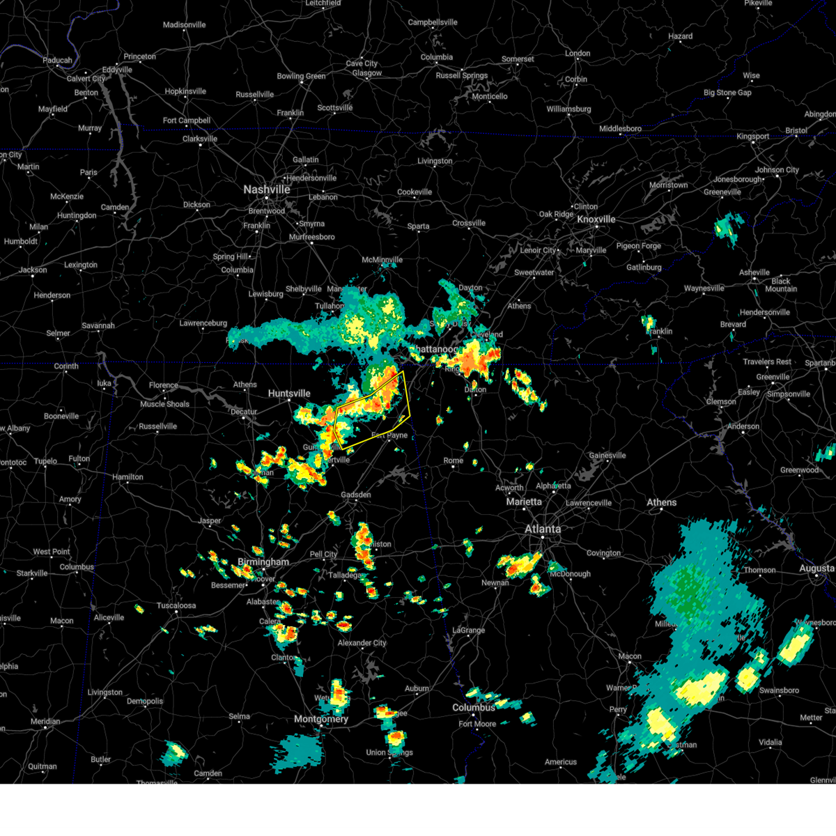 At 458 pm cdt, severe thunderstorms were located along a line extending from near bridgeport to 6 miles south of stevenson to near scottsboro, moving southeast at 15 mph (emergency management). Hazards include 60 mph wind gusts and penny size hail. Expect damage to roofs, siding, and trees. Locations impacted include, scottsboro, fort payne, rainsville, henagar, sylvania, fyffe, hollywood, powell, section, and ider. At 458 pm cdt, severe thunderstorms were located along a line extending from near bridgeport to 6 miles south of stevenson to near scottsboro, moving southeast at 15 mph (emergency management). Hazards include 60 mph wind gusts and penny size hail. Expect damage to roofs, siding, and trees. Locations impacted include, scottsboro, fort payne, rainsville, henagar, sylvania, fyffe, hollywood, powell, section, and ider.
|
| 7/29/2024 4:47 PM CDT |
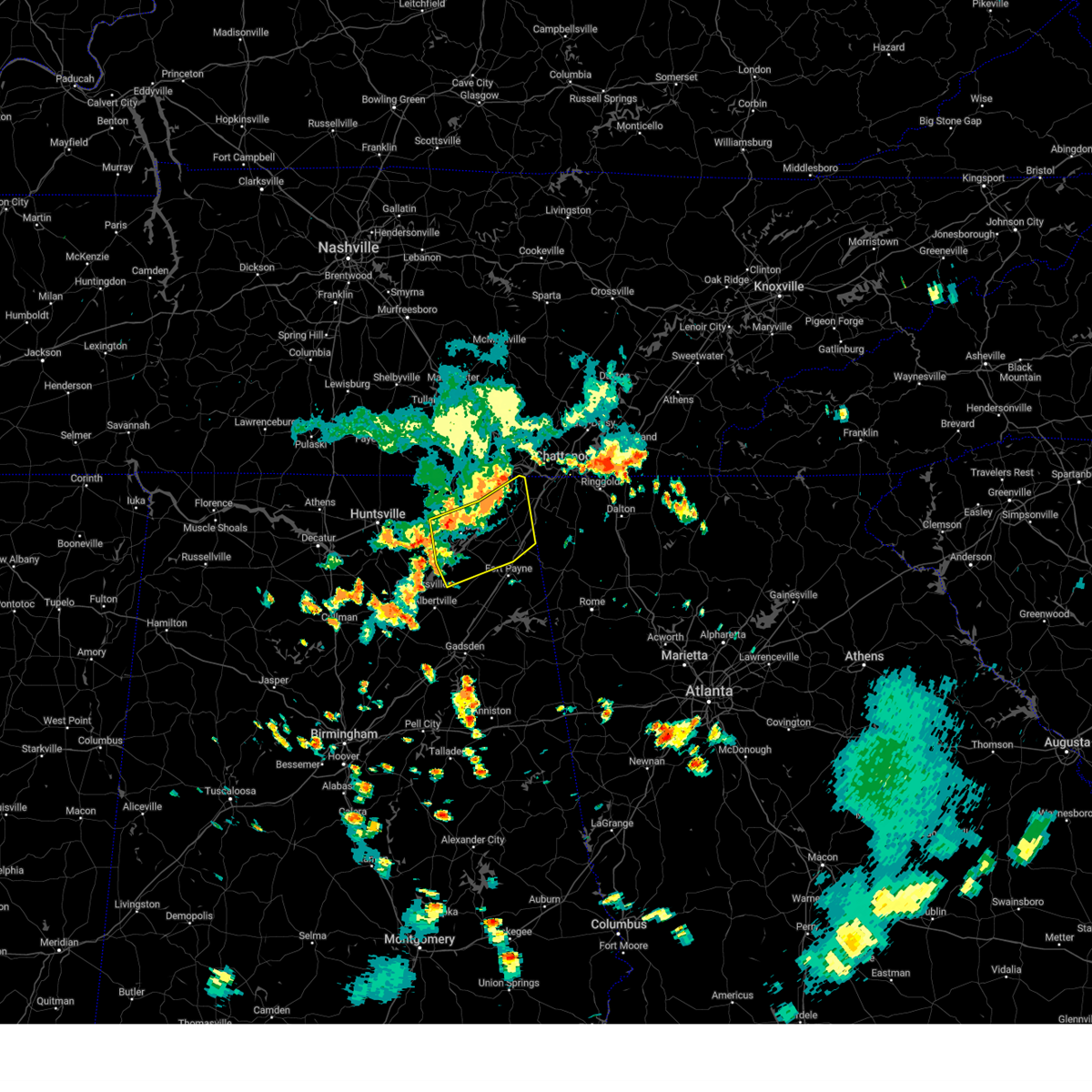 Svrhun the national weather service in huntsville alabama has issued a * severe thunderstorm warning for, northeastern marshall county in northeastern alabama, central jackson county in northeastern alabama, central dekalb county in northeastern alabama, * until 530 pm cdt. * at 447 pm cdt, severe thunderstorms were located along a line extending from bridgeport to near stevenson to near skyline, moving southeast at 15 mph (radar indicated). Hazards include 60 mph wind gusts and penny size hail. expect damage to roofs, siding, and trees Svrhun the national weather service in huntsville alabama has issued a * severe thunderstorm warning for, northeastern marshall county in northeastern alabama, central jackson county in northeastern alabama, central dekalb county in northeastern alabama, * until 530 pm cdt. * at 447 pm cdt, severe thunderstorms were located along a line extending from bridgeport to near stevenson to near skyline, moving southeast at 15 mph (radar indicated). Hazards include 60 mph wind gusts and penny size hail. expect damage to roofs, siding, and trees
|
| 7/21/2024 5:44 PM CDT |
 The storm which prompted the warning has moved out of the area. therefore, the warning will be allowed to expire. remember, a severe thunderstorm warning still remains in effect for portions of madison and jackson county. The storm which prompted the warning has moved out of the area. therefore, the warning will be allowed to expire. remember, a severe thunderstorm warning still remains in effect for portions of madison and jackson county.
|
| 7/21/2024 5:18 PM CDT |
 Svrhun the national weather service in huntsville alabama has issued a * severe thunderstorm warning for, north central marshall county in northeastern alabama, western jackson county in northeastern alabama, southeastern madison county in north central alabama, * until 545 pm cdt. * at 517 pm cdt, a severe thunderstorm was located near gurley, or 9 miles east of huntsville, moving east at 15 mph (radar indicated). Hazards include 60 mph wind gusts and penny size hail. expect damage to roofs, siding, and trees Svrhun the national weather service in huntsville alabama has issued a * severe thunderstorm warning for, north central marshall county in northeastern alabama, western jackson county in northeastern alabama, southeastern madison county in north central alabama, * until 545 pm cdt. * at 517 pm cdt, a severe thunderstorm was located near gurley, or 9 miles east of huntsville, moving east at 15 mph (radar indicated). Hazards include 60 mph wind gusts and penny size hail. expect damage to roofs, siding, and trees
|
| 7/17/2024 4:05 PM CDT | Svrhun the national weather service in huntsville alabama has issued a * severe thunderstorm warning for, southeastern jackson county in northeastern alabama, central dekalb county in northeastern alabama, * until 415 pm cdt. * at 404 pm cdt, a severe thunderstorm was located over section, or near scottsboro, moving east at 25 mph (radar indicated). Hazards include 60 mph wind gusts and quarter size hail. Hail damage to vehicles is expected. Expect wind damage to roofs, siding, and trees. |
| 7/17/2024 3:52 PM CDT |
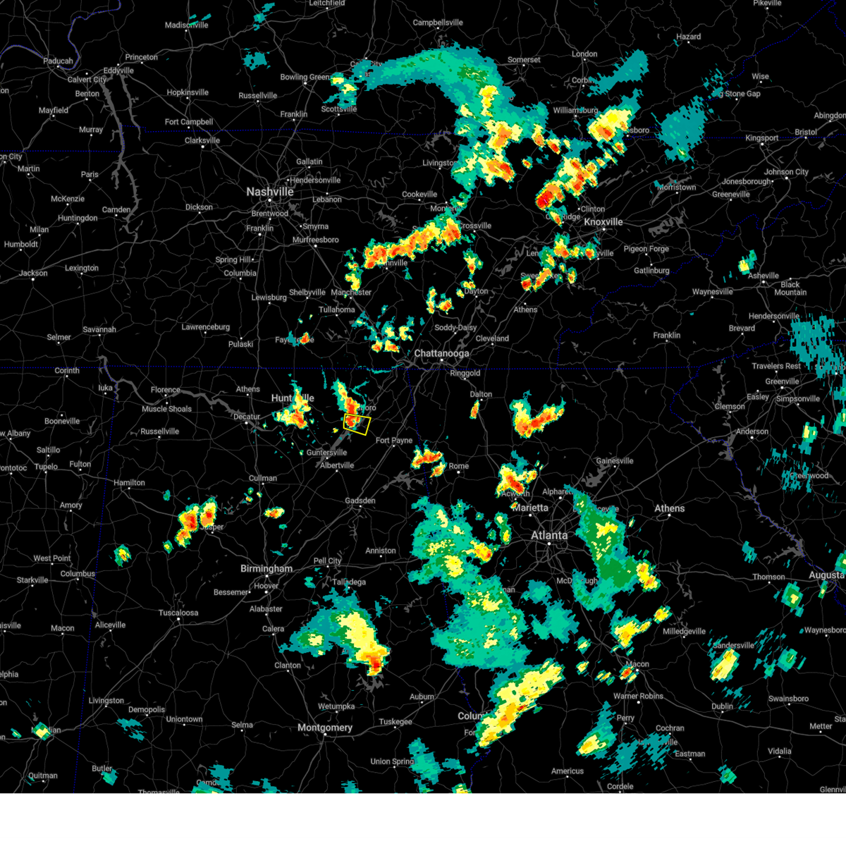 Svrhun the national weather service in huntsville alabama has issued a * severe thunderstorm warning for, south central jackson county in northeastern alabama, * until 415 pm cdt. * at 352 pm cdt, a severe thunderstorm was located over scottsboro, moving east at 25 mph (radar indicated). Hazards include 60 mph wind gusts and quarter size hail. Hail damage to vehicles is expected. Expect wind damage to roofs, siding, and trees. Svrhun the national weather service in huntsville alabama has issued a * severe thunderstorm warning for, south central jackson county in northeastern alabama, * until 415 pm cdt. * at 352 pm cdt, a severe thunderstorm was located over scottsboro, moving east at 25 mph (radar indicated). Hazards include 60 mph wind gusts and quarter size hail. Hail damage to vehicles is expected. Expect wind damage to roofs, siding, and trees.
|
| 6/30/2024 1:42 PM CDT |
 The storm which prompted the warning has weakened below severe limits, and no longer poses an immediate threat to life or property. therefore, the warning will be allowed to expire. however, gusty winds and heavy rain are still possible with this thunderstorm. The storm which prompted the warning has weakened below severe limits, and no longer poses an immediate threat to life or property. therefore, the warning will be allowed to expire. however, gusty winds and heavy rain are still possible with this thunderstorm.
|
| 6/30/2024 1:30 PM CDT |
 the severe thunderstorm warning has been cancelled and is no longer in effect the severe thunderstorm warning has been cancelled and is no longer in effect
|
| 6/30/2024 1:30 PM CDT |
 At 129 pm cdt, a severe thunderstorm was located near geraldine, or 10 miles northeast of albertville, moving southeast at 20 mph. heavy rainfall and frequent lightning are occurring within this storm (radar indicated). Hazards include 60 mph wind gusts. Expect damage to roofs, siding, and trees. Locations impacted include, albertville, boaz, guntersville, crossville, fyffe, geraldine, lakeview, mcville, hopewell, and skirum. At 129 pm cdt, a severe thunderstorm was located near geraldine, or 10 miles northeast of albertville, moving southeast at 20 mph. heavy rainfall and frequent lightning are occurring within this storm (radar indicated). Hazards include 60 mph wind gusts. Expect damage to roofs, siding, and trees. Locations impacted include, albertville, boaz, guntersville, crossville, fyffe, geraldine, lakeview, mcville, hopewell, and skirum.
|
| 6/30/2024 1:06 PM CDT |
 At 105 pm cdt, a severe thunderstorm was located near grant, or 11 miles northeast of guntersville, moving southeast at 20 mph. this storm is producing frequent lightning and heavy rainfall (radar indicated). Hazards include 60 mph wind gusts. Expect damage to roofs, siding, and trees. Locations impacted include, albertville, scottsboro, fort payne, boaz, guntersville, rainsville, crossville, fyffe, powell, and grant. At 105 pm cdt, a severe thunderstorm was located near grant, or 11 miles northeast of guntersville, moving southeast at 20 mph. this storm is producing frequent lightning and heavy rainfall (radar indicated). Hazards include 60 mph wind gusts. Expect damage to roofs, siding, and trees. Locations impacted include, albertville, scottsboro, fort payne, boaz, guntersville, rainsville, crossville, fyffe, powell, and grant.
|
| 6/30/2024 1:06 PM CDT |
 the severe thunderstorm warning has been cancelled and is no longer in effect the severe thunderstorm warning has been cancelled and is no longer in effect
|
| 6/30/2024 12:49 PM CDT |
 Svrhun the national weather service in huntsville alabama has issued a * severe thunderstorm warning for, eastern marshall county in northeastern alabama, southwestern jackson county in northeastern alabama, southeastern madison county in north central alabama, southwestern dekalb county in northeastern alabama, * until 145 pm cdt. * at 1248 pm cdt, a severe thunderstorm was located near grant, or 12 miles southwest of scottsboro, moving southeast at 20 mph. there is frequent lightning and heavy rainfall occurring with this storm (radar indicated). Hazards include 60 mph wind gusts. expect damage to roofs, siding, and trees Svrhun the national weather service in huntsville alabama has issued a * severe thunderstorm warning for, eastern marshall county in northeastern alabama, southwestern jackson county in northeastern alabama, southeastern madison county in north central alabama, southwestern dekalb county in northeastern alabama, * until 145 pm cdt. * at 1248 pm cdt, a severe thunderstorm was located near grant, or 12 miles southwest of scottsboro, moving southeast at 20 mph. there is frequent lightning and heavy rainfall occurring with this storm (radar indicated). Hazards include 60 mph wind gusts. expect damage to roofs, siding, and trees
|
| 5/27/2024 4:12 AM CDT |
 The storm which prompted the warning has moved out of the area. therefore, the warning will be allowed to expire. a tornado watch remains in effect until 800 am cdt for north central and northeastern alabama. remember, a severe thunderstorm warning still remains in effect for cullman, marshall, and dekalb counties until 445 am. The storm which prompted the warning has moved out of the area. therefore, the warning will be allowed to expire. a tornado watch remains in effect until 800 am cdt for north central and northeastern alabama. remember, a severe thunderstorm warning still remains in effect for cullman, marshall, and dekalb counties until 445 am.
|
| 5/27/2024 3:41 AM CDT |
 The tornado threat has diminished and the tornado warning has been cancelled. however, large hail and damaging winds remain likely and a severe thunderstorm warning remains in effect for the area and tornadoes will remain possible. a tornado watch remains in effect until 500 am cdt for middle tennessee. a tornado watch also remains in effect until 800 am cdt for north central and northeastern alabama. The tornado threat has diminished and the tornado warning has been cancelled. however, large hail and damaging winds remain likely and a severe thunderstorm warning remains in effect for the area and tornadoes will remain possible. a tornado watch remains in effect until 500 am cdt for middle tennessee. a tornado watch also remains in effect until 800 am cdt for north central and northeastern alabama.
|
| 5/27/2024 3:27 AM CDT |
 Svrhun the national weather service in huntsville alabama has issued a * severe thunderstorm warning for, marshall county in northeastern alabama, south central jackson county in northeastern alabama, southwestern dekalb county in northeastern alabama, northeastern cullman county in north central alabama, southeastern morgan county in north central alabama, * until 415 am cdt. * at 327 am cdt, a severe thunderstorm was located 9 miles east of falkville, or 12 miles southeast of hartselle, moving east at 55 mph (radar indicated). Hazards include 60 mph wind gusts and penny size hail. expect damage to roofs, siding, and trees Svrhun the national weather service in huntsville alabama has issued a * severe thunderstorm warning for, marshall county in northeastern alabama, south central jackson county in northeastern alabama, southwestern dekalb county in northeastern alabama, northeastern cullman county in north central alabama, southeastern morgan county in north central alabama, * until 415 am cdt. * at 327 am cdt, a severe thunderstorm was located 9 miles east of falkville, or 12 miles southeast of hartselle, moving east at 55 mph (radar indicated). Hazards include 60 mph wind gusts and penny size hail. expect damage to roofs, siding, and trees
|
| 5/27/2024 3:25 AM CDT |
 At 323 am cdt, a severe thunderstorm capable of producing a tornado was located near skyline, or 8 miles northwest of scottsboro, moving east at 50 mph. this warning covers multiple areas of rotation that may produce tornadoes as they track southeast (radar indicated rotation). Hazards include tornado and quarter size hail. Flying debris will be dangerous to those caught without shelter. mobile homes will be damaged or destroyed. damage to roofs, windows, and vehicles will occur. tree damage is likely. this dangerous storm will be near, scottsboro and hollywood around 330 am cdt. pisgah around 340 am cdt. Other locations impacted by this tornadic thunderstorm include paint rock, maysville, langston, martintown, lim rock, fackler, pleasant groves, trenton, garth, and larkinsville. At 323 am cdt, a severe thunderstorm capable of producing a tornado was located near skyline, or 8 miles northwest of scottsboro, moving east at 50 mph. this warning covers multiple areas of rotation that may produce tornadoes as they track southeast (radar indicated rotation). Hazards include tornado and quarter size hail. Flying debris will be dangerous to those caught without shelter. mobile homes will be damaged or destroyed. damage to roofs, windows, and vehicles will occur. tree damage is likely. this dangerous storm will be near, scottsboro and hollywood around 330 am cdt. pisgah around 340 am cdt. Other locations impacted by this tornadic thunderstorm include paint rock, maysville, langston, martintown, lim rock, fackler, pleasant groves, trenton, garth, and larkinsville.
|
| 5/27/2024 3:10 AM CDT |
 Torhun the national weather service in huntsville alabama has issued a * tornado warning for, northeastern marshall county in northeastern alabama, jackson county in northeastern alabama, east central madison county in north central alabama, * until 345 am cdt. * at 310 am cdt, a severe thunderstorm capable of producing a tornado was located 7 miles north of gurley, or 11 miles east of moores mill, moving east at 50 mph (radar indicated rotation). Hazards include tornado and quarter size hail. Flying debris will be dangerous to those caught without shelter. mobile homes will be damaged or destroyed. damage to roofs, windows, and vehicles will occur. tree damage is likely. this dangerous storm will be near, skyline around 320 am cdt. scottsboro around 325 am cdt. hollywood around 330 am cdt. pisgah around 340 am cdt. Other locations impacted by this tornadic thunderstorm include paint rock, maysville, langston, martintown, princeton, lim rock, estillfork, fackler, hytop, and larkin. Torhun the national weather service in huntsville alabama has issued a * tornado warning for, northeastern marshall county in northeastern alabama, jackson county in northeastern alabama, east central madison county in north central alabama, * until 345 am cdt. * at 310 am cdt, a severe thunderstorm capable of producing a tornado was located 7 miles north of gurley, or 11 miles east of moores mill, moving east at 50 mph (radar indicated rotation). Hazards include tornado and quarter size hail. Flying debris will be dangerous to those caught without shelter. mobile homes will be damaged or destroyed. damage to roofs, windows, and vehicles will occur. tree damage is likely. this dangerous storm will be near, skyline around 320 am cdt. scottsboro around 325 am cdt. hollywood around 330 am cdt. pisgah around 340 am cdt. Other locations impacted by this tornadic thunderstorm include paint rock, maysville, langston, martintown, princeton, lim rock, estillfork, fackler, hytop, and larkin.
|
| 5/25/2024 6:39 AM CDT |
 At 638 am cdt, severe thunderstorms were located along a line extending from estill springs to 6 miles west of grant, moving east at 45 mph (radar indicated). Hazards include 60 mph wind gusts and nickel size hail. Expect damage to roofs, siding, and trees. Locations impacted include, scottsboro, winchester, rainsville, decherd, estill springs, stevenson, sylvania, cowan, fyffe, and hollywood. At 638 am cdt, severe thunderstorms were located along a line extending from estill springs to 6 miles west of grant, moving east at 45 mph (radar indicated). Hazards include 60 mph wind gusts and nickel size hail. Expect damage to roofs, siding, and trees. Locations impacted include, scottsboro, winchester, rainsville, decherd, estill springs, stevenson, sylvania, cowan, fyffe, and hollywood.
|
| 5/25/2024 6:39 AM CDT |
 the severe thunderstorm warning has been cancelled and is no longer in effect the severe thunderstorm warning has been cancelled and is no longer in effect
|
| 5/25/2024 6:20 AM CDT |
 At 620 am cdt, severe thunderstorms were located along a line extending from lynchburg to near morgan city, moving southeast at 50 mph (radar indicated). Hazards include 60 mph wind gusts and nickel size hail. Expect damage to roofs, siding, and trees. Locations impacted include, huntsville, scottsboro, winchester, fayetteville, rainsville, moores mill, meridianville, lynchburg, redstone arsenal, and hazel green. At 620 am cdt, severe thunderstorms were located along a line extending from lynchburg to near morgan city, moving southeast at 50 mph (radar indicated). Hazards include 60 mph wind gusts and nickel size hail. Expect damage to roofs, siding, and trees. Locations impacted include, huntsville, scottsboro, winchester, fayetteville, rainsville, moores mill, meridianville, lynchburg, redstone arsenal, and hazel green.
|
| 5/25/2024 6:14 AM CDT |
 the severe thunderstorm warning has been cancelled and is no longer in effect the severe thunderstorm warning has been cancelled and is no longer in effect
|
| 5/25/2024 6:14 AM CDT |
 At 614 am cdt, severe thunderstorms were located along a line extending from near lynchburg to near morgan city, moving southeast at 45 mph (radar indicated). Hazards include 70 mph wind gusts and nickel size hail. Expect considerable tree damage. damage is likely to mobile homes, roofs, and outbuildings. Locations impacted include, huntsville, madison, scottsboro, winchester, fayetteville, rainsville, moores mill, meridianville, lynchburg, and redstone arsenal. At 614 am cdt, severe thunderstorms were located along a line extending from near lynchburg to near morgan city, moving southeast at 45 mph (radar indicated). Hazards include 70 mph wind gusts and nickel size hail. Expect considerable tree damage. damage is likely to mobile homes, roofs, and outbuildings. Locations impacted include, huntsville, madison, scottsboro, winchester, fayetteville, rainsville, moores mill, meridianville, lynchburg, and redstone arsenal.
|
| 5/25/2024 6:00 AM CDT |
 At 600 am cdt, severe thunderstorms were located along a line extending from near petersburg to triana, moving southeast at 50 mph (radar indicated). Hazards include 70 mph wind gusts and nickel size hail. Expect considerable tree damage. damage is likely to mobile homes, roofs, and outbuildings. Locations impacted include, huntsville, madison, athens, scottsboro, winchester, fayetteville, rainsville, moores mill, meridianville, and lynchburg. At 600 am cdt, severe thunderstorms were located along a line extending from near petersburg to triana, moving southeast at 50 mph (radar indicated). Hazards include 70 mph wind gusts and nickel size hail. Expect considerable tree damage. damage is likely to mobile homes, roofs, and outbuildings. Locations impacted include, huntsville, madison, athens, scottsboro, winchester, fayetteville, rainsville, moores mill, meridianville, and lynchburg.
|
| 5/25/2024 5:53 AM CDT |
 Svrhun the national weather service in huntsville alabama has issued a * severe thunderstorm warning for, northeastern marshall county in northeastern alabama, jackson county in northeastern alabama, madison county in north central alabama, limestone county in north central alabama, central dekalb county in northeastern alabama, moore county in middle tennessee, lincoln county in middle tennessee, franklin county in middle tennessee, * until 700 am cdt. * at 553 am cdt, severe thunderstorms were located along a line extending from petersburg to near huntsville international airport, moving southeast at 50 mph (radar indicated). Hazards include 60 mph wind gusts and nickel size hail. expect damage to roofs, siding, and trees Svrhun the national weather service in huntsville alabama has issued a * severe thunderstorm warning for, northeastern marshall county in northeastern alabama, jackson county in northeastern alabama, madison county in north central alabama, limestone county in north central alabama, central dekalb county in northeastern alabama, moore county in middle tennessee, lincoln county in middle tennessee, franklin county in middle tennessee, * until 700 am cdt. * at 553 am cdt, severe thunderstorms were located along a line extending from petersburg to near huntsville international airport, moving southeast at 50 mph (radar indicated). Hazards include 60 mph wind gusts and nickel size hail. expect damage to roofs, siding, and trees
|
| 5/9/2024 8:30 AM CDT |
 The storm which prompted the warning has moved out of the area. therefore, the warning will be allowed to expire. a tornado watch remains in effect until 1000 am cdt for north central and northeastern alabama. remember, a severe thunderstorm warning still remains in effect for portions of dekalb and marshall county. remember, a tornado warning still remains in effect for jackson and dekalb county. The storm which prompted the warning has moved out of the area. therefore, the warning will be allowed to expire. a tornado watch remains in effect until 1000 am cdt for north central and northeastern alabama. remember, a severe thunderstorm warning still remains in effect for portions of dekalb and marshall county. remember, a tornado warning still remains in effect for jackson and dekalb county.
|
| 5/9/2024 8:11 AM CDT |
 At 810 am cdt, a severe thunderstorm was located near guntersville, moving east at 60 mph (emergency management). Hazards include 60 mph wind gusts and quarter size hail. Hail damage to vehicles is expected. expect wind damage to roofs, siding, and trees. Locations impacted include, albertville, cullman, scottsboro, fort payne, boaz, guntersville, arab, rainsville, hanceville, and henagar. At 810 am cdt, a severe thunderstorm was located near guntersville, moving east at 60 mph (emergency management). Hazards include 60 mph wind gusts and quarter size hail. Hail damage to vehicles is expected. expect wind damage to roofs, siding, and trees. Locations impacted include, albertville, cullman, scottsboro, fort payne, boaz, guntersville, arab, rainsville, hanceville, and henagar.
|
| 5/9/2024 8:08 AM CDT |
 Torhun the national weather service in huntsville alabama has issued a * tornado warning for, southeastern jackson county in northeastern alabama, east central dekalb county in northeastern alabama, * until 845 am cdt. * at 807 am cdt, a severe thunderstorm capable of producing a tornado was located near powell, or near rainsville, moving east at 50 mph (radar indicated rotation). Hazards include tornado and quarter size hail. Flying debris will be dangerous to those caught without shelter. mobile homes will be damaged or destroyed. damage to roofs, windows, and vehicles will occur. tree damage is likely. this dangerous storm will be near, rainsville, henagar, and sylvania around 815 am cdt. fort payne around 820 am cdt. Other locations impacted by this tornadic thunderstorm include dutton, mentone, desoto state park, valley head, hammondville, langston, pine ridge, and little river canyon np. Torhun the national weather service in huntsville alabama has issued a * tornado warning for, southeastern jackson county in northeastern alabama, east central dekalb county in northeastern alabama, * until 845 am cdt. * at 807 am cdt, a severe thunderstorm capable of producing a tornado was located near powell, or near rainsville, moving east at 50 mph (radar indicated rotation). Hazards include tornado and quarter size hail. Flying debris will be dangerous to those caught without shelter. mobile homes will be damaged or destroyed. damage to roofs, windows, and vehicles will occur. tree damage is likely. this dangerous storm will be near, rainsville, henagar, and sylvania around 815 am cdt. fort payne around 820 am cdt. Other locations impacted by this tornadic thunderstorm include dutton, mentone, desoto state park, valley head, hammondville, langston, pine ridge, and little river canyon np.
|
| 5/9/2024 8:04 AM CDT |
 Svrhun the national weather service in huntsville alabama has issued a * severe thunderstorm warning for, marshall county in northeastern alabama, southern jackson county in northeastern alabama, dekalb county in northeastern alabama, central cullman county in north central alabama, southeastern morgan county in north central alabama, * until 830 am cdt. * at 804 am cdt, a severe thunderstorm was located over strawberry, or near arab, moving east at 60 mph (radar indicated). Hazards include 60 mph wind gusts and quarter size hail. Hail damage to vehicles is expected. Expect wind damage to roofs, siding, and trees. Svrhun the national weather service in huntsville alabama has issued a * severe thunderstorm warning for, marshall county in northeastern alabama, southern jackson county in northeastern alabama, dekalb county in northeastern alabama, central cullman county in north central alabama, southeastern morgan county in north central alabama, * until 830 am cdt. * at 804 am cdt, a severe thunderstorm was located over strawberry, or near arab, moving east at 60 mph (radar indicated). Hazards include 60 mph wind gusts and quarter size hail. Hail damage to vehicles is expected. Expect wind damage to roofs, siding, and trees.
|
| 5/8/2024 11:22 PM CDT |
 At 1120 pm cdt, a severe thunderstorm capable of producing a tornado was located near woodville, or 11 miles west of scottsboro, moving east at 30 mph. a seondary area of circulation was located about 5 miles north of gurley moving east at 30 mph (radar indicated rotation). Hazards include tornado and ping pong ball size hail. Flying debris will be dangerous to those caught without shelter. mobile homes will be damaged or destroyed. damage to roofs, windows, and vehicles will occur. tree damage is likely. this dangerous storm will be near, scottsboro around 1125 pm cdt. Other locations impacted by this tornadic thunderstorm include pleasant groves, trenton, garth, larkinsville, and lim rock. At 1120 pm cdt, a severe thunderstorm capable of producing a tornado was located near woodville, or 11 miles west of scottsboro, moving east at 30 mph. a seondary area of circulation was located about 5 miles north of gurley moving east at 30 mph (radar indicated rotation). Hazards include tornado and ping pong ball size hail. Flying debris will be dangerous to those caught without shelter. mobile homes will be damaged or destroyed. damage to roofs, windows, and vehicles will occur. tree damage is likely. this dangerous storm will be near, scottsboro around 1125 pm cdt. Other locations impacted by this tornadic thunderstorm include pleasant groves, trenton, garth, larkinsville, and lim rock.
|
| 5/8/2024 11:14 PM CDT |
 the tornado warning has been cancelled and is no longer in effect the tornado warning has been cancelled and is no longer in effect
|
| 5/8/2024 11:14 PM CDT |
 At 1114 pm cdt, a confirmed tornado was located near gurley, or 14 miles west of scottsboro, moving east at 30 mph (emergency management confirmed tornado). Hazards include damaging tornado and ping pong ball size hail. Flying debris will be dangerous to those caught without shelter. mobile homes will be damaged or destroyed. damage to roofs, windows, and vehicles will occur. tree damage is likely. this tornado will be near, scottsboro around 1130 pm cdt. Other locations impacted by this tornadic thunderstorm include pleasant groves, trenton, garth, larkinsville, and lim rock. At 1114 pm cdt, a confirmed tornado was located near gurley, or 14 miles west of scottsboro, moving east at 30 mph (emergency management confirmed tornado). Hazards include damaging tornado and ping pong ball size hail. Flying debris will be dangerous to those caught without shelter. mobile homes will be damaged or destroyed. damage to roofs, windows, and vehicles will occur. tree damage is likely. this tornado will be near, scottsboro around 1130 pm cdt. Other locations impacted by this tornadic thunderstorm include pleasant groves, trenton, garth, larkinsville, and lim rock.
|
| 5/8/2024 11:02 PM CDT |
 Torhun the national weather service in huntsville alabama has issued a * tornado warning for, southwestern jackson county in northeastern alabama, east central madison county in north central alabama, * until 1145 pm cdt. * at 1101 pm cdt, a confirmed tornado was located near gurley just north of us highway 72, or 10 miles southeast of moores mill, moving east at 30 mph (emergency management confirmed tornado). Hazards include damaging tornado and ping pong ball size hail. Flying debris will be dangerous to those caught without shelter. mobile homes will be damaged or destroyed. damage to roofs, windows, and vehicles will occur. tree damage is likely. the tornado will be near, gurley around 1105 pm cdt. scottsboro around 1130 pm cdt. Other locations impacted by this tornadic thunderstorm include paint rock, maysville, lim rock, pleasant groves, trenton, garth, larkinsville, hollytree, and brownsboro. Torhun the national weather service in huntsville alabama has issued a * tornado warning for, southwestern jackson county in northeastern alabama, east central madison county in north central alabama, * until 1145 pm cdt. * at 1101 pm cdt, a confirmed tornado was located near gurley just north of us highway 72, or 10 miles southeast of moores mill, moving east at 30 mph (emergency management confirmed tornado). Hazards include damaging tornado and ping pong ball size hail. Flying debris will be dangerous to those caught without shelter. mobile homes will be damaged or destroyed. damage to roofs, windows, and vehicles will occur. tree damage is likely. the tornado will be near, gurley around 1105 pm cdt. scottsboro around 1130 pm cdt. Other locations impacted by this tornadic thunderstorm include paint rock, maysville, lim rock, pleasant groves, trenton, garth, larkinsville, hollytree, and brownsboro.
|
| 5/8/2024 7:38 PM CDT |
 Svrhun the national weather service in huntsville alabama has issued a * severe thunderstorm warning for, eastern jackson county in northeastern alabama, northeastern dekalb county in northeastern alabama, * until 845 pm cdt. * at 737 pm cdt, two severe thunderstorms were located over section, or near scottsboro, and another near henagar moving northeast at 35 mph (radar indicated). Hazards include 60 mph wind gusts and quarter size hail. Hail damage to vehicles is expected. Expect wind damage to roofs, siding, and trees. Svrhun the national weather service in huntsville alabama has issued a * severe thunderstorm warning for, eastern jackson county in northeastern alabama, northeastern dekalb county in northeastern alabama, * until 845 pm cdt. * at 737 pm cdt, two severe thunderstorms were located over section, or near scottsboro, and another near henagar moving northeast at 35 mph (radar indicated). Hazards include 60 mph wind gusts and quarter size hail. Hail damage to vehicles is expected. Expect wind damage to roofs, siding, and trees.
|
| 5/8/2024 7:09 PM CDT |
 At 708 pm cdt, a severe thunderstorm was located near section, or 7 miles south of scottsboro, moving northeast at 30 mph (radar indicated). Hazards include 60 mph wind gusts and quarter size hail. Hail damage to vehicles is expected. expect wind damage to roofs, siding, and trees. Locations impacted include, scottsboro, rainsville, henagar, sylvania, hollywood, powell, section, ider, pisgah, and dutton. At 708 pm cdt, a severe thunderstorm was located near section, or 7 miles south of scottsboro, moving northeast at 30 mph (radar indicated). Hazards include 60 mph wind gusts and quarter size hail. Hail damage to vehicles is expected. expect wind damage to roofs, siding, and trees. Locations impacted include, scottsboro, rainsville, henagar, sylvania, hollywood, powell, section, ider, pisgah, and dutton.
|
| 5/8/2024 7:09 PM CDT |
 the severe thunderstorm warning has been cancelled and is no longer in effect the severe thunderstorm warning has been cancelled and is no longer in effect
|
| 5/8/2024 6:58 PM CDT |
 Svrhun the national weather service in huntsville alabama has issued a * severe thunderstorm warning for, northeastern marshall county in northeastern alabama, central jackson county in northeastern alabama, central dekalb county in northeastern alabama, * until 745 pm cdt. * at 658 pm cdt, a severe thunderstorm was located 7 miles southwest of section, or 9 miles south of scottsboro, moving northeast at 25 mph (radar indicated). Hazards include 60 mph wind gusts and quarter size hail. Hail damage to vehicles is expected. Expect wind damage to roofs, siding, and trees. Svrhun the national weather service in huntsville alabama has issued a * severe thunderstorm warning for, northeastern marshall county in northeastern alabama, central jackson county in northeastern alabama, central dekalb county in northeastern alabama, * until 745 pm cdt. * at 658 pm cdt, a severe thunderstorm was located 7 miles southwest of section, or 9 miles south of scottsboro, moving northeast at 25 mph (radar indicated). Hazards include 60 mph wind gusts and quarter size hail. Hail damage to vehicles is expected. Expect wind damage to roofs, siding, and trees.
|
| 3/15/2024 6:46 AM CDT |
 At 645 am cdt, severe thunderstorms were located along a line extending from near powell to near altoona, moving east at 55 mph. there are several broad areas of rotation along this line and rapid tornado formation may occur. tornado warnings may be needed (radar indicated). Hazards include 60 mph wind gusts. Expect damage to roofs, siding, and trees. Locations impacted include, albertville, scottsboro, fort payne, boaz, guntersville, rainsville, crossville, sylvania, fyffe, and powell. At 645 am cdt, severe thunderstorms were located along a line extending from near powell to near altoona, moving east at 55 mph. there are several broad areas of rotation along this line and rapid tornado formation may occur. tornado warnings may be needed (radar indicated). Hazards include 60 mph wind gusts. Expect damage to roofs, siding, and trees. Locations impacted include, albertville, scottsboro, fort payne, boaz, guntersville, rainsville, crossville, sylvania, fyffe, and powell.
|
| 3/15/2024 6:26 AM CDT |
 At 625 am cdt, severe thunderstorms were located along a line extending from grant to near nectar, moving east at 45 mph. several trees down have been reported in harselle and falkville (radar indicated). Hazards include 60 mph wind gusts. Expect damage to roofs, siding, and trees. Locations impacted include, albertville, scottsboro, fort payne, boaz, guntersville, rainsville, crossville, sylvania, fyffe, and powell. At 625 am cdt, severe thunderstorms were located along a line extending from grant to near nectar, moving east at 45 mph. several trees down have been reported in harselle and falkville (radar indicated). Hazards include 60 mph wind gusts. Expect damage to roofs, siding, and trees. Locations impacted include, albertville, scottsboro, fort payne, boaz, guntersville, rainsville, crossville, sylvania, fyffe, and powell.
|
| 3/15/2024 6:26 AM CDT |
 the severe thunderstorm warning has been cancelled and is no longer in effect the severe thunderstorm warning has been cancelled and is no longer in effect
|
| 3/15/2024 6:14 AM CDT |
 the tornado warning has been cancelled and is no longer in effect the tornado warning has been cancelled and is no longer in effect
|
| 3/15/2024 6:07 AM CDT |
 Svrhun the national weather service in huntsville alabama has issued a * severe thunderstorm warning for, marshall county in northeastern alabama, southwestern jackson county in northeastern alabama, southeastern madison county in north central alabama, southwestern dekalb county in northeastern alabama, central cullman county in north central alabama, southeastern morgan county in north central alabama, * until 700 am cdt. * at 607 am cdt, severe thunderstorms were located along a line extending from near owens cross roads to dodge city, moving east at 45 mph (radar indicated). Hazards include 60 mph wind gusts. expect damage to roofs, siding, and trees Svrhun the national weather service in huntsville alabama has issued a * severe thunderstorm warning for, marshall county in northeastern alabama, southwestern jackson county in northeastern alabama, southeastern madison county in north central alabama, southwestern dekalb county in northeastern alabama, central cullman county in north central alabama, southeastern morgan county in north central alabama, * until 700 am cdt. * at 607 am cdt, severe thunderstorms were located along a line extending from near owens cross roads to dodge city, moving east at 45 mph (radar indicated). Hazards include 60 mph wind gusts. expect damage to roofs, siding, and trees
|
| 3/15/2024 5:53 AM CDT |
 Torhun the national weather service in huntsville alabama has issued a * tornado warning for, central jackson county in northeastern alabama, * until 630 am cdt. * at 553 am cdt, a severe thunderstorm capable of producing a tornado was located near skyline, or 9 miles northwest of scottsboro, moving southeast at 30 mph (radar indicated rotation). Hazards include tornado. Flying debris will be dangerous to those caught without shelter. mobile homes will be damaged or destroyed. damage to roofs, windows, and vehicles will occur. tree damage is likely. this dangerous storm will be near, scottsboro around 600 am cdt. section around 615 am cdt. Other locations impacted by this tornadic thunderstorm include pleasant groves, langston, martintown, larkinsville, and lim rock. Torhun the national weather service in huntsville alabama has issued a * tornado warning for, central jackson county in northeastern alabama, * until 630 am cdt. * at 553 am cdt, a severe thunderstorm capable of producing a tornado was located near skyline, or 9 miles northwest of scottsboro, moving southeast at 30 mph (radar indicated rotation). Hazards include tornado. Flying debris will be dangerous to those caught without shelter. mobile homes will be damaged or destroyed. damage to roofs, windows, and vehicles will occur. tree damage is likely. this dangerous storm will be near, scottsboro around 600 am cdt. section around 615 am cdt. Other locations impacted by this tornadic thunderstorm include pleasant groves, langston, martintown, larkinsville, and lim rock.
|
| 2/28/2024 10:45 AM CST |
 At 1045 am cst, a severe thunderstorm was located near section, or near scottsboro, moving east at 70 mph (radar indicated). Hazards include 60 mph wind gusts and quarter size hail. Hail damage to vehicles is expected. expect wind damage to roofs, siding, and trees. Locations impacted include, scottsboro, henagar, sylvania, hollywood, powell, section, ider, pisgah, valley head, and hammondville. At 1045 am cst, a severe thunderstorm was located near section, or near scottsboro, moving east at 70 mph (radar indicated). Hazards include 60 mph wind gusts and quarter size hail. Hail damage to vehicles is expected. expect wind damage to roofs, siding, and trees. Locations impacted include, scottsboro, henagar, sylvania, hollywood, powell, section, ider, pisgah, valley head, and hammondville.
|
| 2/28/2024 10:38 AM CST |
 Svrhun the national weather service in huntsville alabama has issued a * severe thunderstorm warning for, northeastern marshall county in northeastern alabama, central jackson county in northeastern alabama, northeastern dekalb county in northeastern alabama, * until 1115 am cst. * at 1038 am cst, a severe thunderstorm was located near scottsboro, moving east at 70 mph (radar indicated). Hazards include 60 mph wind gusts and quarter size hail. Hail damage to vehicles is expected. Expect wind damage to roofs, siding, and trees. Svrhun the national weather service in huntsville alabama has issued a * severe thunderstorm warning for, northeastern marshall county in northeastern alabama, central jackson county in northeastern alabama, northeastern dekalb county in northeastern alabama, * until 1115 am cst. * at 1038 am cst, a severe thunderstorm was located near scottsboro, moving east at 70 mph (radar indicated). Hazards include 60 mph wind gusts and quarter size hail. Hail damage to vehicles is expected. Expect wind damage to roofs, siding, and trees.
|
| 2/28/2024 10:07 AM CST |
 At 1007 am cst, severe thunderstorms were located along a line extending from 9 miles southwest of cowan to near gurley to near morgan city, moving east at 45 mph (radar indicated). Hazards include 60 mph wind gusts. Expect damage to roofs, siding, and trees. Locations impacted include, southern huntsville, scottsboro, winchester, decherd, stevenson, cowan, owens cross roads, hollywood, grant, and skyline. At 1007 am cst, severe thunderstorms were located along a line extending from 9 miles southwest of cowan to near gurley to near morgan city, moving east at 45 mph (radar indicated). Hazards include 60 mph wind gusts. Expect damage to roofs, siding, and trees. Locations impacted include, southern huntsville, scottsboro, winchester, decherd, stevenson, cowan, owens cross roads, hollywood, grant, and skyline.
|
| 2/28/2024 9:58 AM CST |
 At 957 am cst, severe thunderstorms were located along a line extending from near huntland to 6 miles west of gurley to 6 miles south of triana, moving east at 45 mph (radar indicated). Hazards include 60 mph wind gusts and quarter size hail. Hail damage to vehicles is expected. expect wind damage to roofs, siding, and trees. Locations impacted include, southern huntsville, scottsboro, winchester, redstone arsenal, decherd, stevenson, cowan, owens cross roads, hollywood, and grant. At 957 am cst, severe thunderstorms were located along a line extending from near huntland to 6 miles west of gurley to 6 miles south of triana, moving east at 45 mph (radar indicated). Hazards include 60 mph wind gusts and quarter size hail. Hail damage to vehicles is expected. expect wind damage to roofs, siding, and trees. Locations impacted include, southern huntsville, scottsboro, winchester, redstone arsenal, decherd, stevenson, cowan, owens cross roads, hollywood, and grant.
|
| 2/28/2024 9:42 AM CST |
 Svrhun the national weather service in huntsville alabama has issued a * severe thunderstorm warning for, northern marshall county in northeastern alabama, jackson county in northeastern alabama, madison county in north central alabama, southeastern limestone county in north central alabama, central morgan county in north central alabama, southeastern moore county in middle tennessee, southeastern lincoln county in middle tennessee, franklin county in middle tennessee, * until 1030 am cst. * at 942 am cst, severe thunderstorms were located along a line extending from 8 miles northwest of huntland to huntsville to near priceville, moving east at 45 mph (radar indicated). Hazards include 60 mph wind gusts and quarter size hail. Hail damage to vehicles is expected. Expect wind damage to roofs, siding, and trees. Svrhun the national weather service in huntsville alabama has issued a * severe thunderstorm warning for, northern marshall county in northeastern alabama, jackson county in northeastern alabama, madison county in north central alabama, southeastern limestone county in north central alabama, central morgan county in north central alabama, southeastern moore county in middle tennessee, southeastern lincoln county in middle tennessee, franklin county in middle tennessee, * until 1030 am cst. * at 942 am cst, severe thunderstorms were located along a line extending from 8 miles northwest of huntland to huntsville to near priceville, moving east at 45 mph (radar indicated). Hazards include 60 mph wind gusts and quarter size hail. Hail damage to vehicles is expected. Expect wind damage to roofs, siding, and trees.
|
| 8/12/2023 2:39 PM CDT |
 At 238 pm cdt, severe thunderstorms were located along a line extending from near ider to near powell to near section, moving east at 35 mph (radar indicated). Hazards include 60 mph wind gusts. Expect damage to roofs, siding, and trees. locations impacted include, scottsboro, fort payne, rainsville, henagar, stevenson, sylvania, fyffe, hollywood, powell and section. hail threat, radar indicated max hail size, <. 75 in wind threat, radar indicated max wind gust, 60 mph. At 238 pm cdt, severe thunderstorms were located along a line extending from near ider to near powell to near section, moving east at 35 mph (radar indicated). Hazards include 60 mph wind gusts. Expect damage to roofs, siding, and trees. locations impacted include, scottsboro, fort payne, rainsville, henagar, stevenson, sylvania, fyffe, hollywood, powell and section. hail threat, radar indicated max hail size, <. 75 in wind threat, radar indicated max wind gust, 60 mph.
|
| 8/12/2023 2:28 PM CDT |
 At 227 pm cdt, severe thunderstorms were located along a line extending from near bridgeport to hollywood to scottsboro, moving southeast at 30 mph (radar indicated). Hazards include 60 mph wind gusts. expect damage to roofs, siding, and trees At 227 pm cdt, severe thunderstorms were located along a line extending from near bridgeport to hollywood to scottsboro, moving southeast at 30 mph (radar indicated). Hazards include 60 mph wind gusts. expect damage to roofs, siding, and trees
|
| 8/10/2023 4:24 AM CDT | Multiple trees down at cr 67 in langston near the post offic in jackson county AL, 2.2 miles WSW of Langston, AL |
| 8/10/2023 3:43 AM CDT |
 The severe thunderstorm warning for north central marshall, western jackson and southeastern madison counties will expire at 345 am cdt, the storm which prompted the warning has weakened below severe limits, and has exited the warned area. therefore, the warning will be allowed to expire. The severe thunderstorm warning for north central marshall, western jackson and southeastern madison counties will expire at 345 am cdt, the storm which prompted the warning has weakened below severe limits, and has exited the warned area. therefore, the warning will be allowed to expire.
|
| 8/10/2023 3:21 AM CDT |
 At 320 am cdt, a severe thunderstorm was located over gurley, or 14 miles east of huntsville, moving east at 50 mph (radar indicated). Hazards include 60 mph wind gusts. Expect damage to roofs, siding, and trees. locations impacted include, scottsboro, owens cross roads, skyline, gurley, woodville, pleasant groves, hytop, langston, paint rock and maysville. hail threat, radar indicated max hail size, <. 75 in wind threat, radar indicated max wind gust, 60 mph. At 320 am cdt, a severe thunderstorm was located over gurley, or 14 miles east of huntsville, moving east at 50 mph (radar indicated). Hazards include 60 mph wind gusts. Expect damage to roofs, siding, and trees. locations impacted include, scottsboro, owens cross roads, skyline, gurley, woodville, pleasant groves, hytop, langston, paint rock and maysville. hail threat, radar indicated max hail size, <. 75 in wind threat, radar indicated max wind gust, 60 mph.
|
| 8/10/2023 2:58 AM CDT |
 At 257 am cdt, a severe thunderstorm was located over marshall space flight center, or near madison, moving east at 50 mph (radar indicated). Hazards include 60 mph wind gusts. expect damage to roofs, siding, and trees At 257 am cdt, a severe thunderstorm was located over marshall space flight center, or near madison, moving east at 50 mph (radar indicated). Hazards include 60 mph wind gusts. expect damage to roofs, siding, and trees
|
| 8/6/2023 4:08 PM CDT |
 The severe thunderstorm warning for northeastern marshall, jackson and southwestern dekalb counties will expire at 415 pm cdt, the storms which prompted the warning have weakened below severe limits, and no longer pose an immediate threat to life or property. therefore, the warning will be allowed to expire. however gusty winds are still possible with these thunderstorms. a severe thunderstorm watch remains in effect until 800 pm cdt for northeastern alabama, and middle tennessee. The severe thunderstorm warning for northeastern marshall, jackson and southwestern dekalb counties will expire at 415 pm cdt, the storms which prompted the warning have weakened below severe limits, and no longer pose an immediate threat to life or property. therefore, the warning will be allowed to expire. however gusty winds are still possible with these thunderstorms. a severe thunderstorm watch remains in effect until 800 pm cdt for northeastern alabama, and middle tennessee.
|
| 8/6/2023 3:59 PM CDT |
 At 358 pm cdt, severe thunderstorms were located along a line extending from 7 miles east of new market to near scottsboro to near geraldine, moving east at 45 mph (radar indicated). Hazards include 60 mph wind gusts. Expect damage to roofs, siding, and trees. locations impacted include, albertville, scottsboro, boaz, rainsville, stevenson, crossville, sylvania, fyffe, hollywood and powell. hail threat, radar indicated max hail size, <. 75 in wind threat, radar indicated max wind gust, 60 mph. At 358 pm cdt, severe thunderstorms were located along a line extending from 7 miles east of new market to near scottsboro to near geraldine, moving east at 45 mph (radar indicated). Hazards include 60 mph wind gusts. Expect damage to roofs, siding, and trees. locations impacted include, albertville, scottsboro, boaz, rainsville, stevenson, crossville, sylvania, fyffe, hollywood and powell. hail threat, radar indicated max hail size, <. 75 in wind threat, radar indicated max wind gust, 60 mph.
|
| 8/6/2023 3:46 PM CDT |
 At 345 pm cdt, severe thunderstorms were located along a line extending from huntsville to near woodville to near guntersville, moving east at 45 mph (radar indicated). Hazards include 60 mph wind gusts. Expect damage to roofs, siding, and trees. locations impacted include, huntsville, albertville, scottsboro, boaz, guntersville, arab, rainsville, moores mill and meridianville. hail threat, radar indicated max hail size, <. 75 in wind threat, radar indicated max wind gust, 60 mph. At 345 pm cdt, severe thunderstorms were located along a line extending from huntsville to near woodville to near guntersville, moving east at 45 mph (radar indicated). Hazards include 60 mph wind gusts. Expect damage to roofs, siding, and trees. locations impacted include, huntsville, albertville, scottsboro, boaz, guntersville, arab, rainsville, moores mill and meridianville. hail threat, radar indicated max hail size, <. 75 in wind threat, radar indicated max wind gust, 60 mph.
|
| 8/6/2023 3:28 PM CDT |
 At 327 pm cdt, severe thunderstorms were located along a line extending from near madison to near gurley to arab, moving east at 40 mph (radar indicated. this storm has a history of producing widespread wind damage and is also producing frequent lightning. move indoors if outside!). Hazards include 60 mph wind gusts and penny size hail. expect damage to roofs, siding, and trees At 327 pm cdt, severe thunderstorms were located along a line extending from near madison to near gurley to arab, moving east at 40 mph (radar indicated. this storm has a history of producing widespread wind damage and is also producing frequent lightning. move indoors if outside!). Hazards include 60 mph wind gusts and penny size hail. expect damage to roofs, siding, and trees
|
| 7/21/2023 5:56 PM CDT |
 At 555 pm cdt, a severe thunderstorm was located near scottsboro, moving east at 40 mph (radar indicated). Hazards include 70 mph wind gusts and penny size hail. Expect considerable tree damage. damage is likely to mobile homes, roofs, and outbuildings. Locations impacted include, scottsboro, hollywood, section, pisgah, pleasant groves, dutton, langston, martintown, lim rock and larkinsville. At 555 pm cdt, a severe thunderstorm was located near scottsboro, moving east at 40 mph (radar indicated). Hazards include 70 mph wind gusts and penny size hail. Expect considerable tree damage. damage is likely to mobile homes, roofs, and outbuildings. Locations impacted include, scottsboro, hollywood, section, pisgah, pleasant groves, dutton, langston, martintown, lim rock and larkinsville.
|
| 7/21/2023 5:38 PM CDT |
 At 538 pm cdt, a severe thunderstorm was located near gurley, or 14 miles east of huntsville, moving east at 40 mph (radar indicated). Hazards include 70 mph wind gusts and penny size hail. Expect considerable tree damage. Damage is likely to mobile homes, roofs, and outbuildings. At 538 pm cdt, a severe thunderstorm was located near gurley, or 14 miles east of huntsville, moving east at 40 mph (radar indicated). Hazards include 70 mph wind gusts and penny size hail. Expect considerable tree damage. Damage is likely to mobile homes, roofs, and outbuildings.
|
| 7/21/2023 5:34 PM CDT |
 At 534 pm cdt, a severe thunderstorm was located near owens cross roads, or 14 miles southeast of huntsville, moving east at 45 mph (radar indicated). Hazards include 70 mph wind gusts and penny size hail. Expect considerable tree damage. damage is likely to mobile homes, roofs, and outbuildings. Locations impacted include, southern huntsville, redstone arsenal, owens cross roads, grant, gurley, woodville, pleasant groves, paint rock, lim rock and hampton cove. At 534 pm cdt, a severe thunderstorm was located near owens cross roads, or 14 miles southeast of huntsville, moving east at 45 mph (radar indicated). Hazards include 70 mph wind gusts and penny size hail. Expect considerable tree damage. damage is likely to mobile homes, roofs, and outbuildings. Locations impacted include, southern huntsville, redstone arsenal, owens cross roads, grant, gurley, woodville, pleasant groves, paint rock, lim rock and hampton cove.
|
| 7/21/2023 5:21 PM CDT |
 At 521 pm cdt, a severe thunderstorm was located over southeastern huntsville, moving east at 45 mph (radar indicated). Hazards include 60 mph wind gusts and penny size hail. expect damage to roofs, siding, and trees At 521 pm cdt, a severe thunderstorm was located over southeastern huntsville, moving east at 45 mph (radar indicated). Hazards include 60 mph wind gusts and penny size hail. expect damage to roofs, siding, and trees
|
| 7/20/2023 4:41 PM CDT |
 The severe thunderstorm warning for northeastern marshall, jackson, eastern madison and northern dekalb counties will expire at 445 pm cdt, the storms which prompted the warning have moved out of the area. therefore, the warning will be allowed to expire. a severe thunderstorm watch remains in effect until 900 pm cdt for north central and northeastern alabama. remember, a severe thunderstorm warning still remains in effect for jackson, marshall, and dekalb counties until 545 pm. The severe thunderstorm warning for northeastern marshall, jackson, eastern madison and northern dekalb counties will expire at 445 pm cdt, the storms which prompted the warning have moved out of the area. therefore, the warning will be allowed to expire. a severe thunderstorm watch remains in effect until 900 pm cdt for north central and northeastern alabama. remember, a severe thunderstorm warning still remains in effect for jackson, marshall, and dekalb counties until 545 pm.
|
| 7/20/2023 4:40 PM CDT |
 At 440 pm cdt, a severe thunderstorm was located over fyffe, or 7 miles southwest of rainsville, moving south at 25 mph (radar indicated). Hazards include 60 mph wind gusts and quarter size hail. Hail damage to vehicles is expected. Expect wind damage to roofs, siding, and trees. At 440 pm cdt, a severe thunderstorm was located over fyffe, or 7 miles southwest of rainsville, moving south at 25 mph (radar indicated). Hazards include 60 mph wind gusts and quarter size hail. Hail damage to vehicles is expected. Expect wind damage to roofs, siding, and trees.
|
| 7/20/2023 4:08 PM CDT |
 At 408 pm cdt, severe thunderstorms were located along a line extending from 6 miles northeast of gurley to 7 miles east of ider, moving southeast at 40 mph. the primary severe wind will be along an outflow boundary surging ahead of the main storms. please do not wait for rain or to hear thunder or see lightning to seek shelter (radar indicated). Hazards include ping pong ball size hail and 60 mph wind gusts. People and animals outdoors will be injured. expect hail damage to roofs, siding, windows, and vehicles. expect wind damage to roofs, siding, and trees. locations impacted include, scottsboro, fort payne, rainsville, bridgeport, moores mill, henagar, stevenson, sylvania, hollywood and powell. hail threat, radar indicated max hail size, 1. 50 in wind threat, radar indicated max wind gust, 60 mph. At 408 pm cdt, severe thunderstorms were located along a line extending from 6 miles northeast of gurley to 7 miles east of ider, moving southeast at 40 mph. the primary severe wind will be along an outflow boundary surging ahead of the main storms. please do not wait for rain or to hear thunder or see lightning to seek shelter (radar indicated). Hazards include ping pong ball size hail and 60 mph wind gusts. People and animals outdoors will be injured. expect hail damage to roofs, siding, windows, and vehicles. expect wind damage to roofs, siding, and trees. locations impacted include, scottsboro, fort payne, rainsville, bridgeport, moores mill, henagar, stevenson, sylvania, hollywood and powell. hail threat, radar indicated max hail size, 1. 50 in wind threat, radar indicated max wind gust, 60 mph.
|
| 7/20/2023 3:58 PM CDT |
 At 357 pm cdt, severe thunderstorms were located along a line extending from near new market to near ider, moving southeast at 40 mph. the primary severe wind will be along an outflow boundary surging ahead of the main storms. please do not wait for rain or to hear thunder or see lightning to seek shelter (radar indicated). Hazards include 60 mph wind gusts and quarter size hail. Hail damage to vehicles is expected. Expect wind damage to roofs, siding, and trees. At 357 pm cdt, severe thunderstorms were located along a line extending from near new market to near ider, moving southeast at 40 mph. the primary severe wind will be along an outflow boundary surging ahead of the main storms. please do not wait for rain or to hear thunder or see lightning to seek shelter (radar indicated). Hazards include 60 mph wind gusts and quarter size hail. Hail damage to vehicles is expected. Expect wind damage to roofs, siding, and trees.
|
| 7/18/2023 5:40 PM CDT |
 At 539 pm cdt, severe thunderstorms were located along a line extending from 7 miles southeast of huntland to near gurley to near redstone arsenal, moving southeast at 60 mph (radar indicated). Hazards include 60 mph wind gusts and penny size hail. expect damage to roofs, siding, and trees At 539 pm cdt, severe thunderstorms were located along a line extending from 7 miles southeast of huntland to near gurley to near redstone arsenal, moving southeast at 60 mph (radar indicated). Hazards include 60 mph wind gusts and penny size hail. expect damage to roofs, siding, and trees
|
| 7/2/2023 2:55 PM CDT |
 The severe thunderstorm warning for central jackson and west central dekalb counties will expire at 300 pm cdt, the storms which prompted the warning have weakened below severe limits, and no longer pose an immediate threat to life or property. therefore, the warning will be allowed to expire. however gusty winds and heavy rain are still possible with these thunderstorms. a severe thunderstorm watch remains in effect until 800 pm cdt for north central and northeastern alabama, and middle tennessee. The severe thunderstorm warning for central jackson and west central dekalb counties will expire at 300 pm cdt, the storms which prompted the warning have weakened below severe limits, and no longer pose an immediate threat to life or property. therefore, the warning will be allowed to expire. however gusty winds and heavy rain are still possible with these thunderstorms. a severe thunderstorm watch remains in effect until 800 pm cdt for north central and northeastern alabama, and middle tennessee.
|
| 7/2/2023 2:48 PM CDT |
 At 248 pm cdt, severe thunderstorms were located along a line extending from near hollywood to near scottsboro to 7 miles southeast of grant, moving east at 25 mph (radar indicated). Hazards include 60 mph wind gusts and quarter size hail. Hail damage to vehicles is expected. expect wind damage to roofs, siding, and trees. locations impacted include, scottsboro, rainsville, henagar, sylvania, fyffe, hollywood, powell, section, pisgah and dutton. hail threat, radar indicated max hail size, 1. 00 in wind threat, radar indicated max wind gust, 60 mph. At 248 pm cdt, severe thunderstorms were located along a line extending from near hollywood to near scottsboro to 7 miles southeast of grant, moving east at 25 mph (radar indicated). Hazards include 60 mph wind gusts and quarter size hail. Hail damage to vehicles is expected. expect wind damage to roofs, siding, and trees. locations impacted include, scottsboro, rainsville, henagar, sylvania, fyffe, hollywood, powell, section, pisgah and dutton. hail threat, radar indicated max hail size, 1. 00 in wind threat, radar indicated max wind gust, 60 mph.
|
| 7/2/2023 2:43 PM CDT |
 At 243 pm cdt, severe thunderstorms were located along a line extending from near skyline to near scottsboro to near grant, moving east at 25 mph (radar indicated). Hazards include 60 mph wind gusts and quarter size hail. Hail damage to vehicles is expected. expect wind damage to roofs, siding, and trees. locations impacted include, scottsboro, rainsville, henagar, sylvania, fyffe, hollywood, powell, section, pisgah and dutton. hail threat, radar indicated max hail size, 1. 00 in wind threat, radar indicated max wind gust, 60 mph. At 243 pm cdt, severe thunderstorms were located along a line extending from near skyline to near scottsboro to near grant, moving east at 25 mph (radar indicated). Hazards include 60 mph wind gusts and quarter size hail. Hail damage to vehicles is expected. expect wind damage to roofs, siding, and trees. locations impacted include, scottsboro, rainsville, henagar, sylvania, fyffe, hollywood, powell, section, pisgah and dutton. hail threat, radar indicated max hail size, 1. 00 in wind threat, radar indicated max wind gust, 60 mph.
|
| 7/2/2023 2:27 PM CDT |
 At 226 pm cdt, severe thunderstorms were located along a line extending from near skyline to 6 miles east of woodville to near grant, moving east at 25 mph (radar indicated). Hazards include 60 mph wind gusts and quarter size hail. Hail damage to vehicles is expected. Expect wind damage to roofs, siding, and trees. At 226 pm cdt, severe thunderstorms were located along a line extending from near skyline to 6 miles east of woodville to near grant, moving east at 25 mph (radar indicated). Hazards include 60 mph wind gusts and quarter size hail. Hail damage to vehicles is expected. Expect wind damage to roofs, siding, and trees.
|
| 6/18/2023 11:58 PM CDT |
 At 1157 pm cdt, a severe thunderstorm was located over owens cross roads, or 12 miles east of redstone arsenal, moving northeast at 45 mph. dime to nickel sized hail has been reported with this storm (radar indicated). Hazards include golf ball size hail and 60 mph wind gusts. People and animals outdoors will be injured. expect hail damage to roofs, siding, windows, and vehicles. expect wind damage to roofs, siding, and trees. locations impacted include, southern huntsville, owens cross roads, grant, gurley, woodville, pleasant groves, langston, paint rock, lim rock and hampton cove. thunderstorm damage threat, considerable hail threat, observed max hail size, 1. 75 in wind threat, radar indicated max wind gust, 60 mph. At 1157 pm cdt, a severe thunderstorm was located over owens cross roads, or 12 miles east of redstone arsenal, moving northeast at 45 mph. dime to nickel sized hail has been reported with this storm (radar indicated). Hazards include golf ball size hail and 60 mph wind gusts. People and animals outdoors will be injured. expect hail damage to roofs, siding, windows, and vehicles. expect wind damage to roofs, siding, and trees. locations impacted include, southern huntsville, owens cross roads, grant, gurley, woodville, pleasant groves, langston, paint rock, lim rock and hampton cove. thunderstorm damage threat, considerable hail threat, observed max hail size, 1. 75 in wind threat, radar indicated max wind gust, 60 mph.
|
| 6/18/2023 11:52 PM CDT |
 At 1151 pm cdt, a severe thunderstorm was located near morgan city, or 10 miles southeast of redstone arsenal, moving northeast at 45 mph. dime to nickel sized hail has been observed with this storm (radar indicated). Hazards include 60 mph wind gusts and quarter size hail. Hail damage to vehicles is expected. Expect wind damage to roofs, siding, and trees. At 1151 pm cdt, a severe thunderstorm was located near morgan city, or 10 miles southeast of redstone arsenal, moving northeast at 45 mph. dime to nickel sized hail has been observed with this storm (radar indicated). Hazards include 60 mph wind gusts and quarter size hail. Hail damage to vehicles is expected. Expect wind damage to roofs, siding, and trees.
|
| 6/14/2023 11:13 AM CDT |
 At 1112 am cdt, a severe thunderstorm was located near arab, moving northeast at 45 mph (radar indicated). Hazards include 60 mph wind gusts and quarter size hail. Hail damage to vehicles is expected. expect wind damage to roofs, siding, and trees. locations impacted include, scottsboro, guntersville, arab, fyffe, grant, geraldine, section, langston, lakeview and union grove. hail threat, radar indicated max hail size, 1. 00 in wind threat, radar indicated max wind gust, 60 mph. At 1112 am cdt, a severe thunderstorm was located near arab, moving northeast at 45 mph (radar indicated). Hazards include 60 mph wind gusts and quarter size hail. Hail damage to vehicles is expected. expect wind damage to roofs, siding, and trees. locations impacted include, scottsboro, guntersville, arab, fyffe, grant, geraldine, section, langston, lakeview and union grove. hail threat, radar indicated max hail size, 1. 00 in wind threat, radar indicated max wind gust, 60 mph.
|
| 6/14/2023 11:00 AM CDT |
 At 1100 am cdt, a severe thunderstorm was located near strawberry, or 7 miles southwest of arab, moving northeast at 45 mph (radar indicated). Hazards include 60 mph wind gusts and quarter size hail. Hail damage to vehicles is expected. Expect wind damage to roofs, siding, and trees. At 1100 am cdt, a severe thunderstorm was located near strawberry, or 7 miles southwest of arab, moving northeast at 45 mph (radar indicated). Hazards include 60 mph wind gusts and quarter size hail. Hail damage to vehicles is expected. Expect wind damage to roofs, siding, and trees.
|
| 3/25/2023 1:35 AM CDT |
 The tornado warning for south central jackson and central dekalb counties will expire at 145 am cdt, the storm which prompted the warning has weakened below severe limits, and no longer appears capable of producing a tornado. therefore, the warning will be allowed to expire. a tornado watch remains in effect until 300 am cdt for northeastern alabama. The tornado warning for south central jackson and central dekalb counties will expire at 145 am cdt, the storm which prompted the warning has weakened below severe limits, and no longer appears capable of producing a tornado. therefore, the warning will be allowed to expire. a tornado watch remains in effect until 300 am cdt for northeastern alabama.
|
| 3/25/2023 1:24 AM CDT |
 At 123 am cdt, a confirmed tornado was located over section, or 7 miles southeast of scottsboro, moving east at 55 mph (radar confirmed tornado). Hazards include damaging tornado. Flying debris will be dangerous to those caught without shelter. mobile homes will be damaged or destroyed. damage to roofs, windows, and vehicles will occur. tree damage is likely. this tornado will be near, rainsville and sylvania around 135 am cdt. fort payne around 145 am cdt. Other locations impacted by this tornadic thunderstorm include dutton and langston. At 123 am cdt, a confirmed tornado was located over section, or 7 miles southeast of scottsboro, moving east at 55 mph (radar confirmed tornado). Hazards include damaging tornado. Flying debris will be dangerous to those caught without shelter. mobile homes will be damaged or destroyed. damage to roofs, windows, and vehicles will occur. tree damage is likely. this tornado will be near, rainsville and sylvania around 135 am cdt. fort payne around 145 am cdt. Other locations impacted by this tornadic thunderstorm include dutton and langston.
|
| 3/25/2023 1:17 AM CDT |
 At 116 am cdt, a confirmed tornado was located 7 miles east of grant, or 9 miles southwest of scottsboro, moving east at 60 mph (radar confirmed tornado). Hazards include damaging tornado. Flying debris will be dangerous to those caught without shelter. mobile homes will be damaged or destroyed. damage to roofs, windows, and vehicles will occur. tree damage is likely. this tornado will be near, section around 125 am cdt. powell around 130 am cdt. rainsville and sylvania around 135 am cdt. fort payne and henagar around 140 am cdt. Other locations impacted by this tornadic thunderstorm include dutton, langston and rosalie. At 116 am cdt, a confirmed tornado was located 7 miles east of grant, or 9 miles southwest of scottsboro, moving east at 60 mph (radar confirmed tornado). Hazards include damaging tornado. Flying debris will be dangerous to those caught without shelter. mobile homes will be damaged or destroyed. damage to roofs, windows, and vehicles will occur. tree damage is likely. this tornado will be near, section around 125 am cdt. powell around 130 am cdt. rainsville and sylvania around 135 am cdt. fort payne and henagar around 140 am cdt. Other locations impacted by this tornadic thunderstorm include dutton, langston and rosalie.
|
| 3/25/2023 1:08 AM CDT |
 At 108 am cdt, a tornado producing storm was located over grant, or 11 miles north of guntersville, moving east at 60 mph (radar confirmed tornado). Hazards include damaging tornado. Flying debris will be dangerous to those caught without shelter. mobile homes will be damaged or destroyed. damage to roofs, windows, and vehicles will occur. tree damage is likely. this tornadic storm will be near, section around 125 am cdt. fyffe and powell around 130 am cdt. rainsville and sylvania around 135 am cdt. fort payne and henagar around 140 am cdt. Other locations impacted by this tornadic thunderstorm include dutton, pine ridge, langston, rosalie, columbus city and hammondville. At 108 am cdt, a tornado producing storm was located over grant, or 11 miles north of guntersville, moving east at 60 mph (radar confirmed tornado). Hazards include damaging tornado. Flying debris will be dangerous to those caught without shelter. mobile homes will be damaged or destroyed. damage to roofs, windows, and vehicles will occur. tree damage is likely. this tornadic storm will be near, section around 125 am cdt. fyffe and powell around 130 am cdt. rainsville and sylvania around 135 am cdt. fort payne and henagar around 140 am cdt. Other locations impacted by this tornadic thunderstorm include dutton, pine ridge, langston, rosalie, columbus city and hammondville.
|
| 3/25/2023 1:06 AM CDT |
 At 106 am cdt, severe thunderstorms were located along a line extending from near grant to 6 miles west of guntersville, moving east at 60 mph (radar indicated). Hazards include 60 mph wind gusts. expect damage to roofs, siding, and trees At 106 am cdt, severe thunderstorms were located along a line extending from near grant to 6 miles west of guntersville, moving east at 60 mph (radar indicated). Hazards include 60 mph wind gusts. expect damage to roofs, siding, and trees
|
| 3/3/2023 12:37 PM CST |
 At 1237 pm cst, severe thunderstorms were located along a line extending from near stevenson to near section, moving northeast at 60 mph (radar indicated). Hazards include 70 mph wind gusts. Expect considerable tree damage. damage is likely to mobile homes, roofs, and outbuildings. locations impacted include, albertville, scottsboro, fort payne, boaz, rainsville, henagar, stevenson, crossville, sylvania and fyffe. thunderstorm damage threat, considerable hail threat, radar indicated max hail size, <. 75 in wind threat, radar indicated max wind gust, 70 mph. At 1237 pm cst, severe thunderstorms were located along a line extending from near stevenson to near section, moving northeast at 60 mph (radar indicated). Hazards include 70 mph wind gusts. Expect considerable tree damage. damage is likely to mobile homes, roofs, and outbuildings. locations impacted include, albertville, scottsboro, fort payne, boaz, rainsville, henagar, stevenson, crossville, sylvania and fyffe. thunderstorm damage threat, considerable hail threat, radar indicated max hail size, <. 75 in wind threat, radar indicated max wind gust, 70 mph.
|
| 3/3/2023 12:37 PM CST |
 At 1237 pm cst, a severe thunderstorm capable of producing a tornado was located over section, or near scottsboro, moving northeast at 60 mph (radar indicated rotation). Hazards include tornado. Flying debris will be dangerous to those caught without shelter. mobile homes will be damaged or destroyed. damage to roofs, windows, and vehicles will occur. tree damage is likely. this dangerous storm will be near, hollywood and pisgah around 1245 pm cst. Other locations impacted by this tornadic thunderstorm include fabius, dutton, martintown and rosalie. At 1237 pm cst, a severe thunderstorm capable of producing a tornado was located over section, or near scottsboro, moving northeast at 60 mph (radar indicated rotation). Hazards include tornado. Flying debris will be dangerous to those caught without shelter. mobile homes will be damaged or destroyed. damage to roofs, windows, and vehicles will occur. tree damage is likely. this dangerous storm will be near, hollywood and pisgah around 1245 pm cst. Other locations impacted by this tornadic thunderstorm include fabius, dutton, martintown and rosalie.
|
| 3/3/2023 12:14 PM CST |
 At 1214 pm cst, severe thunderstorms were located along a line extending from near skyline to near guntersville, moving northeast at 60 mph (radar indicated). Hazards include 70 mph wind gusts. Expect considerable tree damage. Damage is likely to mobile homes, roofs, and outbuildings. At 1214 pm cst, severe thunderstorms were located along a line extending from near skyline to near guntersville, moving northeast at 60 mph (radar indicated). Hazards include 70 mph wind gusts. Expect considerable tree damage. Damage is likely to mobile homes, roofs, and outbuildings.
|
| 3/3/2023 12:07 PM CST |
 At 1206 pm cst, severe thunderstorms were located along a line extending from 8 miles north of skyline to near arab, moving east at 70 mph (radar indicated). Hazards include 70 mph wind gusts and quarter size hail. Hail damage to vehicles is expected. expect considerable tree damage. wind damage is also likely to mobile homes, roofs, and outbuildings. locations impacted include, albertville, scottsboro, boaz, guntersville, arab, rainsville, stevenson, crossville, sylvania and owens cross roads. thunderstorm damage threat, considerable hail threat, radar indicated max hail size, 1. 00 in wind threat, radar indicated max wind gust, 70 mph. At 1206 pm cst, severe thunderstorms were located along a line extending from 8 miles north of skyline to near arab, moving east at 70 mph (radar indicated). Hazards include 70 mph wind gusts and quarter size hail. Hail damage to vehicles is expected. expect considerable tree damage. wind damage is also likely to mobile homes, roofs, and outbuildings. locations impacted include, albertville, scottsboro, boaz, guntersville, arab, rainsville, stevenson, crossville, sylvania and owens cross roads. thunderstorm damage threat, considerable hail threat, radar indicated max hail size, 1. 00 in wind threat, radar indicated max wind gust, 70 mph.
|
| 3/3/2023 11:49 AM CST |
 At 1148 am cst, severe thunderstorms were located along a line extending from near new market to 7 miles northwest of holly pond, moving northeast at 60 mph (radar indicated). Hazards include 70 mph wind gusts and quarter size hail. Hail damage to vehicles is expected. expect considerable tree damage. wind damage is also likely to mobile homes, roofs, and outbuildings. locations impacted include, huntsville, madison, albertville, cullman, scottsboro, boaz, guntersville, arab, rainsville and redstone arsenal. thunderstorm damage threat, considerable hail threat, radar indicated max hail size, 1. 00 in wind threat, radar indicated max wind gust, 70 mph. At 1148 am cst, severe thunderstorms were located along a line extending from near new market to 7 miles northwest of holly pond, moving northeast at 60 mph (radar indicated). Hazards include 70 mph wind gusts and quarter size hail. Hail damage to vehicles is expected. expect considerable tree damage. wind damage is also likely to mobile homes, roofs, and outbuildings. locations impacted include, huntsville, madison, albertville, cullman, scottsboro, boaz, guntersville, arab, rainsville and redstone arsenal. thunderstorm damage threat, considerable hail threat, radar indicated max hail size, 1. 00 in wind threat, radar indicated max wind gust, 70 mph.
|
| 3/3/2023 11:22 AM CST |
 At 1121 am cst, severe thunderstorms were located along a line extending from near huntsville international airport to near arley, moving east at 80 mph. decatur has reported a wind gust of 77 mph with this line. these are tornado-like wind speeds! these are destructive storms for north-central and northeast alabama (radar indicated). Hazards include 80 mph wind gusts and quarter size hail. Flying debris will be dangerous to those caught without shelter. mobile homes will be heavily damaged. expect considerable damage to roofs, windows, and vehicles. Extensive tree damage and power outages are likely. At 1121 am cst, severe thunderstorms were located along a line extending from near huntsville international airport to near arley, moving east at 80 mph. decatur has reported a wind gust of 77 mph with this line. these are tornado-like wind speeds! these are destructive storms for north-central and northeast alabama (radar indicated). Hazards include 80 mph wind gusts and quarter size hail. Flying debris will be dangerous to those caught without shelter. mobile homes will be heavily damaged. expect considerable damage to roofs, windows, and vehicles. Extensive tree damage and power outages are likely.
|
| 8/9/2022 2:21 PM CDT |
 At 221 pm cdt, a severe thunderstorm was located over section, or 7 miles northwest of rainsville, moving northeast at 15 mph. this storm has a history of producing tree damage (radar indicated). Hazards include 60 mph wind gusts. Expect damage to roofs, siding, and trees. locations impacted include, rainsville, fyffe, powell, geraldine, section, langston, lakeview, hopewell and chigger hill. hail threat, radar indicated max hail size, <. 75 in wind threat, radar indicated max wind gust, 60 mph. At 221 pm cdt, a severe thunderstorm was located over section, or 7 miles northwest of rainsville, moving northeast at 15 mph. this storm has a history of producing tree damage (radar indicated). Hazards include 60 mph wind gusts. Expect damage to roofs, siding, and trees. locations impacted include, rainsville, fyffe, powell, geraldine, section, langston, lakeview, hopewell and chigger hill. hail threat, radar indicated max hail size, <. 75 in wind threat, radar indicated max wind gust, 60 mph.
|
| 8/9/2022 2:03 PM CDT |
 At 201 pm cdt, a severe thunderstorm was located near fyffe, or 9 miles west of rainsville, moving northeast at 15 mph. this storm has a history of causing multiple trees to go down near geraldine (radar indicated). Hazards include 60 mph wind gusts and nickel size hail. Expect damage to roofs, siding, and trees. locations impacted include, scottsboro, rainsville, sylvania, fyffe, powell, geraldine, section, dutton, langston and lakeview. hail threat, radar indicated max hail size, 0. 88 in wind threat, radar indicated max wind gust, 60 mph. At 201 pm cdt, a severe thunderstorm was located near fyffe, or 9 miles west of rainsville, moving northeast at 15 mph. this storm has a history of causing multiple trees to go down near geraldine (radar indicated). Hazards include 60 mph wind gusts and nickel size hail. Expect damage to roofs, siding, and trees. locations impacted include, scottsboro, rainsville, sylvania, fyffe, powell, geraldine, section, dutton, langston and lakeview. hail threat, radar indicated max hail size, 0. 88 in wind threat, radar indicated max wind gust, 60 mph.
|
| 8/9/2022 1:41 PM CDT |
 At 141 pm cdt, a severe thunderstorm was located near geraldine, or 12 miles southwest of rainsville, moving northeast at 15 mph (radar indicated). Hazards include 60 mph wind gusts and nickel size hail. expect damage to roofs, siding, and trees At 141 pm cdt, a severe thunderstorm was located near geraldine, or 12 miles southwest of rainsville, moving northeast at 15 mph (radar indicated). Hazards include 60 mph wind gusts and nickel size hail. expect damage to roofs, siding, and trees
|
| 7/6/2022 6:38 PM CDT |
 At 638 pm cdt, a severe thunderstorm was located over scottsboro, moving south at 15 mph (radar indicated). Hazards include 60 mph wind gusts and quarter size hail. Hail damage to vehicles is expected. Expect wind damage to roofs, siding, and trees. At 638 pm cdt, a severe thunderstorm was located over scottsboro, moving south at 15 mph (radar indicated). Hazards include 60 mph wind gusts and quarter size hail. Hail damage to vehicles is expected. Expect wind damage to roofs, siding, and trees.
|
| 6/15/2022 10:22 PM CDT |
 The severe thunderstorm warning for south central jackson and southwestern dekalb counties will expire at 1030 pm cdt, the storm which prompted the warning has weakened below severe limits, and no longer poses an immediate threat to life or property. therefore, the warning will be allowed to expire. however gusty winds are still possible with this thunderstorm. The severe thunderstorm warning for south central jackson and southwestern dekalb counties will expire at 1030 pm cdt, the storm which prompted the warning has weakened below severe limits, and no longer poses an immediate threat to life or property. therefore, the warning will be allowed to expire. however gusty winds are still possible with this thunderstorm.
|
| 6/15/2022 10:19 PM CDT |
 At 1019 pm cdt, a severe thunderstorm was located over albertville, moving northwest at 30 mph (radar indicated). Hazards include 60 mph wind gusts. Expect damage to roofs, siding, and trees. locations impacted include, scottsboro, rainsville, fyffe, hollywood, powell, geraldine, section, dutton, langston and lakeview. hail threat, radar indicated max hail size, <. 75 in wind threat, radar indicated max wind gust, 60 mph. At 1019 pm cdt, a severe thunderstorm was located over albertville, moving northwest at 30 mph (radar indicated). Hazards include 60 mph wind gusts. Expect damage to roofs, siding, and trees. locations impacted include, scottsboro, rainsville, fyffe, hollywood, powell, geraldine, section, dutton, langston and lakeview. hail threat, radar indicated max hail size, <. 75 in wind threat, radar indicated max wind gust, 60 mph.
|
| 6/15/2022 9:56 PM CDT |
 At 956 pm cdt, a severe thunderstorm was located near sardis city, or 8 miles east of boaz, moving northwest at 30 mph (radar indicated). Hazards include 60 mph wind gusts. expect damage to roofs, siding, and trees At 956 pm cdt, a severe thunderstorm was located near sardis city, or 8 miles east of boaz, moving northwest at 30 mph (radar indicated). Hazards include 60 mph wind gusts. expect damage to roofs, siding, and trees
|
| 6/7/2022 5:41 PM CDT |
 The severe thunderstorm warning for western jackson county will expire at 545 pm cdt, the storm which prompted the warning has weakened below severe limits, and no longer poses an immediate threat to life or property. therefore, the warning will be allowed to expire. however gusty winds and heavy rain are still possible with this thunderstorm. The severe thunderstorm warning for western jackson county will expire at 545 pm cdt, the storm which prompted the warning has weakened below severe limits, and no longer poses an immediate threat to life or property. therefore, the warning will be allowed to expire. however gusty winds and heavy rain are still possible with this thunderstorm.
|
| 6/7/2022 5:30 PM CDT |
 At 530 pm cdt, a severe thunderstorm was located near woodville, or 10 miles west of scottsboro, moving east at 30 mph (radar indicated). Hazards include 60 mph wind gusts and quarter size hail. Hail damage to vehicles is expected. expect wind damage to roofs, siding, and trees. locations impacted include, scottsboro, hollywood, skyline, section, woodville, pleasant groves, paint rock, lim rock, trenton and garth. hail threat, radar indicated max hail size, 1. 00 in wind threat, radar indicated max wind gust, 60 mph. At 530 pm cdt, a severe thunderstorm was located near woodville, or 10 miles west of scottsboro, moving east at 30 mph (radar indicated). Hazards include 60 mph wind gusts and quarter size hail. Hail damage to vehicles is expected. expect wind damage to roofs, siding, and trees. locations impacted include, scottsboro, hollywood, skyline, section, woodville, pleasant groves, paint rock, lim rock, trenton and garth. hail threat, radar indicated max hail size, 1. 00 in wind threat, radar indicated max wind gust, 60 mph.
|
| 6/7/2022 5:06 PM CDT |
 At 506 pm cdt, a severe thunderstorm was located over gurley, or 13 miles east of huntsville, moving east at 30 mph. ping pong ball sized hailed was observered between gurley and owens crossroads (trained weather spotters). Hazards include ping pong ball size hail and 60 mph wind gusts. People and animals outdoors will be injured. expect hail damage to roofs, siding, windows, and vehicles. Expect wind damage to roofs, siding, and trees. At 506 pm cdt, a severe thunderstorm was located over gurley, or 13 miles east of huntsville, moving east at 30 mph. ping pong ball sized hailed was observered between gurley and owens crossroads (trained weather spotters). Hazards include ping pong ball size hail and 60 mph wind gusts. People and animals outdoors will be injured. expect hail damage to roofs, siding, windows, and vehicles. Expect wind damage to roofs, siding, and trees.
|
| 6/7/2022 4:59 PM CDT |
 At 458 pm cdt, a severe thunderstorm was located over gurley, or 11 miles southeast of huntsville, moving east at 30 mph (radar indicated). Hazards include 60 mph wind gusts and quarter size hail. Hail damage to vehicles is expected. Expect wind damage to roofs, siding, and trees. At 458 pm cdt, a severe thunderstorm was located over gurley, or 11 miles southeast of huntsville, moving east at 30 mph (radar indicated). Hazards include 60 mph wind gusts and quarter size hail. Hail damage to vehicles is expected. Expect wind damage to roofs, siding, and trees.
|
| 7/30/2021 7:19 PM CDT |
 At 719 pm cdt, a severe thunderstorm was located over grant, or 10 miles north of guntersville, moving south at 15 mph (radar indicated). Hazards include 60 mph wind gusts. expect damage to roofs, siding, and trees At 719 pm cdt, a severe thunderstorm was located over grant, or 10 miles north of guntersville, moving south at 15 mph (radar indicated). Hazards include 60 mph wind gusts. expect damage to roofs, siding, and trees
|
| 7/30/2021 4:35 PM CDT |
 The severe thunderstorm warning for south central jackson, northeastern marshall and west central dekalb counties will expire at 445 pm cdt, the storm which prompted the warning has weakened below severe limits, and no longer poses an immediate threat to life or property. therefore, the warning will be allowed to expire. however gusty winds and heavy rain are still possible with this thunderstorm. The severe thunderstorm warning for south central jackson, northeastern marshall and west central dekalb counties will expire at 445 pm cdt, the storm which prompted the warning has weakened below severe limits, and no longer poses an immediate threat to life or property. therefore, the warning will be allowed to expire. however gusty winds and heavy rain are still possible with this thunderstorm.
|
| 7/30/2021 4:28 PM CDT |
 At 427 pm cdt, a severe thunderstorm was located near section, or 9 miles west of rainsville, moving southeast at 15 mph (radar indicated). Hazards include 60 mph wind gusts. Expect damage to roofs, siding, and trees. Locations impacted include, scottsboro, rainsville, fyffe, powell, geraldine, section, langston, lakeview, hopewell and painter. At 427 pm cdt, a severe thunderstorm was located near section, or 9 miles west of rainsville, moving southeast at 15 mph (radar indicated). Hazards include 60 mph wind gusts. Expect damage to roofs, siding, and trees. Locations impacted include, scottsboro, rainsville, fyffe, powell, geraldine, section, langston, lakeview, hopewell and painter.
|
| 7/30/2021 4:08 PM CDT |
 At 408 pm cdt, a severe thunderstorm was located near section, or 9 miles south of scottsboro, moving southeast at 15 mph (radar indicated). Hazards include 60 mph wind gusts. expect damage to roofs, siding, and trees At 408 pm cdt, a severe thunderstorm was located near section, or 9 miles south of scottsboro, moving southeast at 15 mph (radar indicated). Hazards include 60 mph wind gusts. expect damage to roofs, siding, and trees
|
| 5/6/2021 7:34 PM CDT |
 At 733 pm cdt, severe thunderstorms were located along a line extending from stevenson to 6 miles east of guntersville to near cleveland, moving east at 45 mph (emergency management and doppler radar). Hazards include 60 mph wind gusts. Expect damage to roofs, siding, and trees. Locations impacted include, albertville, scottsboro, fort payne, boaz, guntersville, rainsville, bridgeport, henagar, stevenson and crossville. At 733 pm cdt, severe thunderstorms were located along a line extending from stevenson to 6 miles east of guntersville to near cleveland, moving east at 45 mph (emergency management and doppler radar). Hazards include 60 mph wind gusts. Expect damage to roofs, siding, and trees. Locations impacted include, albertville, scottsboro, fort payne, boaz, guntersville, rainsville, bridgeport, henagar, stevenson and crossville.
|
| 5/6/2021 7:13 PM CDT |
 At 711 pm cdt, severe thunderstorms were located along a line extending from 8 miles north of skyline to 8 miles east of morgan city to near good hope, moving east at 55 mph (emergency management and doppler radar). Hazards include 60 mph wind gusts. expect damage to roofs, siding, and trees At 711 pm cdt, severe thunderstorms were located along a line extending from 8 miles north of skyline to 8 miles east of morgan city to near good hope, moving east at 55 mph (emergency management and doppler radar). Hazards include 60 mph wind gusts. expect damage to roofs, siding, and trees
|
| 5/6/2021 7:01 PM CDT |
 A severe thunderstorm warning remains in effect until 715 pm cdt for jackson. marshall. madison. cullman and southeastern morgan counties. At 659 pm cdt, severe thunderstorms were located along a line extending from 6 miles south of huntland to near morgan city to near nesmith, moving southeast at 50 mph. A severe thunderstorm warning remains in effect until 715 pm cdt for jackson. marshall. madison. cullman and southeastern morgan counties. At 659 pm cdt, severe thunderstorms were located along a line extending from 6 miles south of huntland to near morgan city to near nesmith, moving southeast at 50 mph.
|
| 5/6/2021 6:27 PM CDT |
 At 625 pm cdt, severe thunderstorms were located along a line extending from near hazel green to near priceville to ashridge, moving southeast at 55 mph (emergency management and doppler radar). Hazards include 60 mph wind gusts. expect damage to roofs, siding, and trees At 625 pm cdt, severe thunderstorms were located along a line extending from near hazel green to near priceville to ashridge, moving southeast at 55 mph (emergency management and doppler radar). Hazards include 60 mph wind gusts. expect damage to roofs, siding, and trees
|
| 4/24/2021 5:23 PM CDT |
 At 522 pm cdt, a severe thunderstorm was located near scottsboro, moving east at 45 mph (radar indicated). Hazards include 60 mph wind gusts and half dollar size hail. Hail damage to vehicles is expected. expect wind damage to roofs, siding, and trees. Locations impacted include, scottsboro, rainsville, henagar, sylvania, hollywood, powell, section, pisgah, dutton and langston. At 522 pm cdt, a severe thunderstorm was located near scottsboro, moving east at 45 mph (radar indicated). Hazards include 60 mph wind gusts and half dollar size hail. Hail damage to vehicles is expected. expect wind damage to roofs, siding, and trees. Locations impacted include, scottsboro, rainsville, henagar, sylvania, hollywood, powell, section, pisgah, dutton and langston.
|
| 4/24/2021 5:07 PM CDT |
 At 507 pm cdt, a severe thunderstorm was located near woodville, or 10 miles southwest of scottsboro, moving east at 50 mph (radar indicated). Hazards include 60 mph wind gusts and half dollar size hail. Hail damage to vehicles is expected. Expect wind damage to roofs, siding, and trees. At 507 pm cdt, a severe thunderstorm was located near woodville, or 10 miles southwest of scottsboro, moving east at 50 mph (radar indicated). Hazards include 60 mph wind gusts and half dollar size hail. Hail damage to vehicles is expected. Expect wind damage to roofs, siding, and trees.
|
| 4/24/2021 4:48 PM CDT |
 At 448 pm cdt, a severe thunderstorm was located over southeastern huntsville, moving east at 45 mph (radar indicated). Hazards include 60 mph wind gusts and quarter size hail. Hail damage to vehicles is expected. Expect wind damage to roofs, siding, and trees. At 448 pm cdt, a severe thunderstorm was located over southeastern huntsville, moving east at 45 mph (radar indicated). Hazards include 60 mph wind gusts and quarter size hail. Hail damage to vehicles is expected. Expect wind damage to roofs, siding, and trees.
|
| 4/24/2021 4:28 PM CDT |
 At 427 pm cdt, a severe thunderstorm was located 10 miles northwest of holly pond, or 11 miles northeast of cullman, moving east at 45 mph (radar indicated). Hazards include 60 mph wind gusts and quarter size hail. Hail damage to vehicles is expected. Expect wind damage to roofs, siding, and trees. At 427 pm cdt, a severe thunderstorm was located 10 miles northwest of holly pond, or 11 miles northeast of cullman, moving east at 45 mph (radar indicated). Hazards include 60 mph wind gusts and quarter size hail. Hail damage to vehicles is expected. Expect wind damage to roofs, siding, and trees.
|
| 3/25/2021 9:13 AM CDT |
 At 913 am cdt, severe thunderstorms were located along a line extending from 7 miles southwest of section to 8 miles southeast of grant to near guntersville to near albertville, moving east at 40 mph (radar indicated). Hazards include 60 mph wind gusts and quarter size hail. Hail damage to vehicles is expected. Expect wind damage to roofs, siding, and trees. At 913 am cdt, severe thunderstorms were located along a line extending from 7 miles southwest of section to 8 miles southeast of grant to near guntersville to near albertville, moving east at 40 mph (radar indicated). Hazards include 60 mph wind gusts and quarter size hail. Hail damage to vehicles is expected. Expect wind damage to roofs, siding, and trees.
|
| 3/25/2021 9:05 AM CDT |
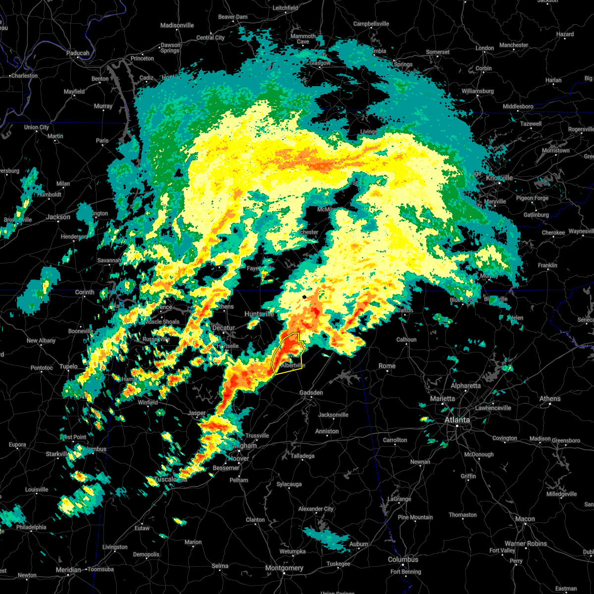 At 904 am cdt, a severe thunderstorm was located near grant, or 7 miles northeast of guntersville, moving northeast at 55 mph (radar indicated). Hazards include 60 mph wind gusts and quarter size hail. Hail damage to vehicles is expected. expect wind damage to roofs, siding, and trees. Locations impacted include, albertville, guntersville, grant, mcville, hustleville, rabbit town, columbus city, hyatt, lake guntersville st park and mountain view. At 904 am cdt, a severe thunderstorm was located near grant, or 7 miles northeast of guntersville, moving northeast at 55 mph (radar indicated). Hazards include 60 mph wind gusts and quarter size hail. Hail damage to vehicles is expected. expect wind damage to roofs, siding, and trees. Locations impacted include, albertville, guntersville, grant, mcville, hustleville, rabbit town, columbus city, hyatt, lake guntersville st park and mountain view.
|
| 3/25/2021 8:38 AM CDT |
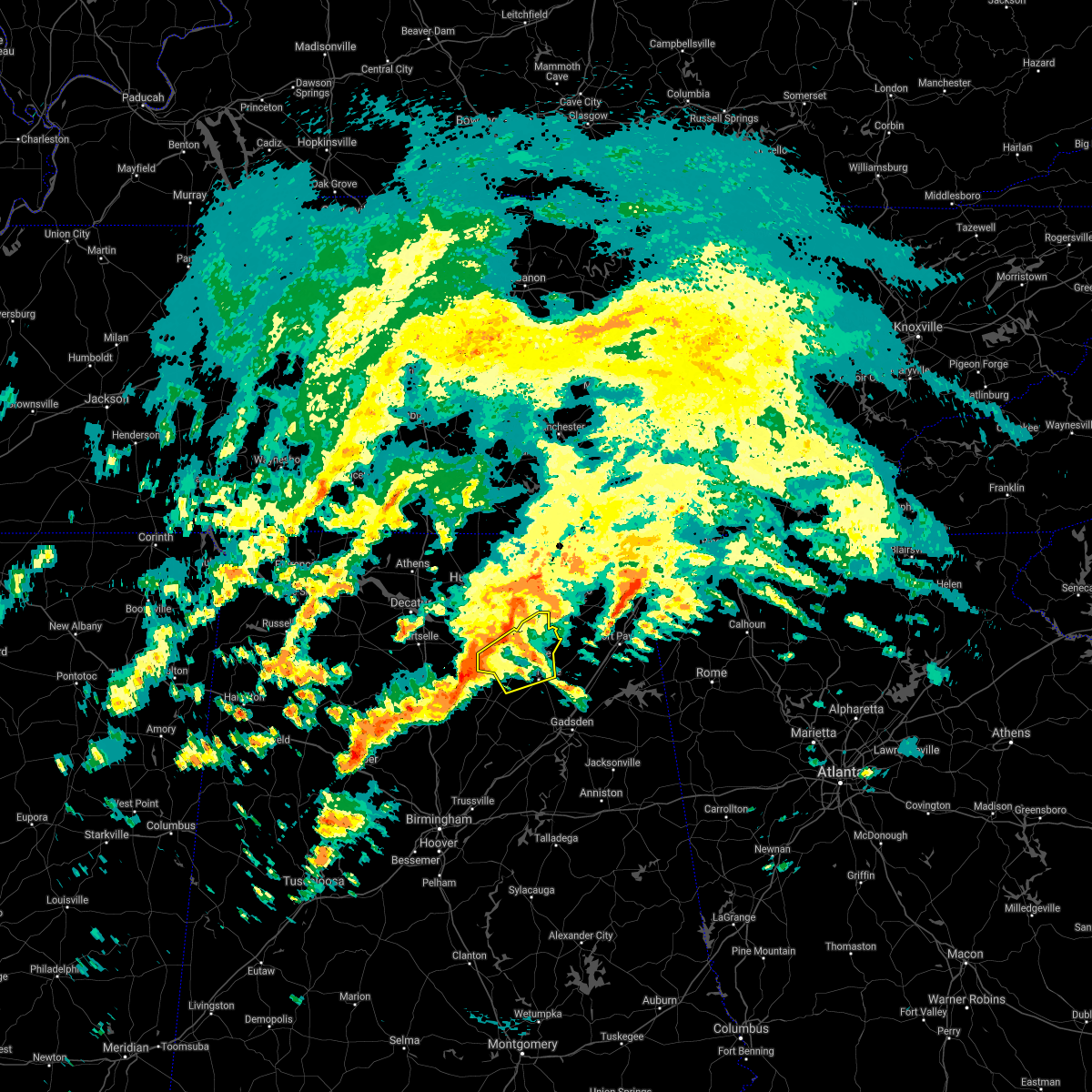 At 837 am cdt, a severe thunderstorm was located near holly pond, or 8 miles southwest of arab, moving northeast at 55 mph (radar indicated). Hazards include 60 mph wind gusts and quarter size hail. Hail damage to vehicles is expected. Expect wind damage to roofs, siding, and trees. At 837 am cdt, a severe thunderstorm was located near holly pond, or 8 miles southwest of arab, moving northeast at 55 mph (radar indicated). Hazards include 60 mph wind gusts and quarter size hail. Hail damage to vehicles is expected. Expect wind damage to roofs, siding, and trees.
|
| 8/28/2020 6:28 PM CDT |
 At 628 pm cdt, a severe thunderstorm was located near guntersville, moving east at 40 mph (radar indicated). Hazards include 60 mph wind gusts. expect damage to roofs, siding, and trees At 628 pm cdt, a severe thunderstorm was located near guntersville, moving east at 40 mph (radar indicated). Hazards include 60 mph wind gusts. expect damage to roofs, siding, and trees
|
| 6/22/2020 5:30 PM CDT |
 At 529 pm cdt, a severe thunderstorm was located over section, or 7 miles south of scottsboro, moving northeast at 20 mph (radar indicated). Hazards include 60 mph wind gusts. Expect damage to roofs, siding, and trees. Locations impacted include, scottsboro, rainsville, sylvania, fyffe, powell, grant, section, dutton, langston and larkinsville. At 529 pm cdt, a severe thunderstorm was located over section, or 7 miles south of scottsboro, moving northeast at 20 mph (radar indicated). Hazards include 60 mph wind gusts. Expect damage to roofs, siding, and trees. Locations impacted include, scottsboro, rainsville, sylvania, fyffe, powell, grant, section, dutton, langston and larkinsville.
|
| 6/22/2020 5:11 PM CDT |
 At 510 pm cdt, a severe thunderstorm was located 7 miles southeast of grant, or 8 miles northeast of guntersville, moving northeast at 40 mph (emergency management. at around 5 pm 60 mph winds were reported on the northwest side of guntersville lake). Hazards include 60 mph wind gusts. expect damage to roofs, siding, and trees At 510 pm cdt, a severe thunderstorm was located 7 miles southeast of grant, or 8 miles northeast of guntersville, moving northeast at 40 mph (emergency management. at around 5 pm 60 mph winds were reported on the northwest side of guntersville lake). Hazards include 60 mph wind gusts. expect damage to roofs, siding, and trees
|
| 6/21/2020 2:45 PM CDT |
 At 244 pm cdt, a severe thunderstorm was located 7 miles northeast of grant, or 8 miles southwest of scottsboro, moving northeast at 30 mph (radar indicated). Hazards include 60 mph wind gusts and quarter size hail. Hail damage to vehicles is expected. Expect wind damage to roofs, siding, and trees. At 244 pm cdt, a severe thunderstorm was located 7 miles northeast of grant, or 8 miles southwest of scottsboro, moving northeast at 30 mph (radar indicated). Hazards include 60 mph wind gusts and quarter size hail. Hail damage to vehicles is expected. Expect wind damage to roofs, siding, and trees.
|
| 5/3/2020 6:24 PM CDT |
 The severe thunderstorm warning for central jackson and northeastern dekalb counties will expire at 630 pm cdt, the storms which prompted the warning have moved out of the warned area. therefore, the warning will be allowed to expire. however gusty winds are still possible with these thunderstorms. a severe thunderstorm watch remains in effect until 800 pm cdt for north central and northeastern alabama, and middle tennessee. The severe thunderstorm warning for central jackson and northeastern dekalb counties will expire at 630 pm cdt, the storms which prompted the warning have moved out of the warned area. therefore, the warning will be allowed to expire. however gusty winds are still possible with these thunderstorms. a severe thunderstorm watch remains in effect until 800 pm cdt for north central and northeastern alabama, and middle tennessee.
|
| 5/3/2020 6:17 PM CDT |
 At 616 pm cdt, severe thunderstorms were located along a line extending from near signal mountain to near henagar to section, moving east at 65 mph (radar indicated. widespread tree damage has been reported with this line of storms). Hazards include 70 mph wind gusts. Expect considerable tree damage. damage is likely to mobile homes, roofs, and outbuildings. Locations impacted include, scottsboro, fort payne, rainsville, bridgeport, henagar, stevenson, sylvania, fyffe, hollywood and powell. At 616 pm cdt, severe thunderstorms were located along a line extending from near signal mountain to near henagar to section, moving east at 65 mph (radar indicated. widespread tree damage has been reported with this line of storms). Hazards include 70 mph wind gusts. Expect considerable tree damage. damage is likely to mobile homes, roofs, and outbuildings. Locations impacted include, scottsboro, fort payne, rainsville, bridgeport, henagar, stevenson, sylvania, fyffe, hollywood and powell.
|
| 5/3/2020 5:41 PM CDT |
 The national weather service in huntsville alabama has issued a * severe thunderstorm warning for. jackson county in northeastern alabama. northeastern madison county in north central alabama. northeastern dekalb county in northeastern alabama. Southeastern franklin county in middle tennessee. The national weather service in huntsville alabama has issued a * severe thunderstorm warning for. jackson county in northeastern alabama. northeastern madison county in north central alabama. northeastern dekalb county in northeastern alabama. Southeastern franklin county in middle tennessee.
|
| 5/3/2020 5:41 PM CDT |
 At 540 pm cdt, severe thunderstorms were located along a line extending from near monteagle to 7 miles southeast of new market to huntsville, moving east at 65 mph (radar indicated. this storm has a history of producing widespread tree damage and power outages). Hazards include 70 mph wind gusts and penny size hail. Expect considerable tree damage. Damage is likely to mobile homes, roofs, and outbuildings. At 540 pm cdt, severe thunderstorms were located along a line extending from near monteagle to 7 miles southeast of new market to huntsville, moving east at 65 mph (radar indicated. this storm has a history of producing widespread tree damage and power outages). Hazards include 70 mph wind gusts and penny size hail. Expect considerable tree damage. Damage is likely to mobile homes, roofs, and outbuildings.
|
| 3/24/2020 8:15 PM CDT |
 At 814 pm cdt, a severe thunderstorm capable of producing a tornado was located 8 miles east of grant, or 13 miles south of scottsboro, moving east at 40 mph (radar indicated rotation). Hazards include tornado and quarter size hail. Flying debris will be dangerous to those caught without shelter. mobile homes will be damaged or destroyed. damage to roofs, windows, and vehicles will occur. tree damage is likely. Locations impacted include, scottsboro, rainsville, sylvania, fyffe, powell, section, dutton, langston, lakeview and guest. At 814 pm cdt, a severe thunderstorm capable of producing a tornado was located 8 miles east of grant, or 13 miles south of scottsboro, moving east at 40 mph (radar indicated rotation). Hazards include tornado and quarter size hail. Flying debris will be dangerous to those caught without shelter. mobile homes will be damaged or destroyed. damage to roofs, windows, and vehicles will occur. tree damage is likely. Locations impacted include, scottsboro, rainsville, sylvania, fyffe, powell, section, dutton, langston, lakeview and guest.
|
| 3/24/2020 7:57 PM CDT |
 At 757 pm cdt, a severe thunderstorm capable of producing a tornado was located near grant, or 13 miles north of guntersville, moving east at 45 mph (radar indicated rotation). Hazards include tornado and quarter size hail. Flying debris will be dangerous to those caught without shelter. mobile homes will be damaged or destroyed. damage to roofs, windows, and vehicles will occur. Tree damage is likely. At 757 pm cdt, a severe thunderstorm capable of producing a tornado was located near grant, or 13 miles north of guntersville, moving east at 45 mph (radar indicated rotation). Hazards include tornado and quarter size hail. Flying debris will be dangerous to those caught without shelter. mobile homes will be damaged or destroyed. damage to roofs, windows, and vehicles will occur. Tree damage is likely.
|
| 1/11/2020 2:27 PM CST |
 The severe thunderstorm warning for jackson and dekalb counties will expire at 230 pm cst, the storms which prompted the warning have moved out of the area. therefore, the warning will be allowed to expire. The severe thunderstorm warning for jackson and dekalb counties will expire at 230 pm cst, the storms which prompted the warning have moved out of the area. therefore, the warning will be allowed to expire.
|
| 1/11/2020 2:01 PM CST |
 At 200 pm cst, severe thunderstorms were located along a line extending from 10 miles west of south pittsburg to cherokee rock village, moving northeast at 65 mph (radar indicated). Hazards include 60 mph wind gusts. Expect damage to roofs, siding, and trees. Locations impacted include, scottsboro, fort payne, rainsville, bridgeport, henagar, stevenson, crossville, sylvania, fyffe and hollywood. At 200 pm cst, severe thunderstorms were located along a line extending from 10 miles west of south pittsburg to cherokee rock village, moving northeast at 65 mph (radar indicated). Hazards include 60 mph wind gusts. Expect damage to roofs, siding, and trees. Locations impacted include, scottsboro, fort payne, rainsville, bridgeport, henagar, stevenson, crossville, sylvania, fyffe and hollywood.
|
| 1/11/2020 1:47 PM CST |
 At 147 pm cst, a severe thunderstorm capable of producing a tornado was located near scottsboro, moving northeast at 60 mph (radar indicated rotation). Hazards include tornado. Flying debris will be dangerous to those caught without shelter. mobile homes will be damaged or destroyed. damage to roofs, windows, and vehicles will occur. Tree damage is likely. At 147 pm cst, a severe thunderstorm capable of producing a tornado was located near scottsboro, moving northeast at 60 mph (radar indicated rotation). Hazards include tornado. Flying debris will be dangerous to those caught without shelter. mobile homes will be damaged or destroyed. damage to roofs, windows, and vehicles will occur. Tree damage is likely.
|
| 1/11/2020 1:45 PM CST |
 At 144 pm cst, a severe thunderstorm capable of producing a tornado was located near grant, or 11 miles southwest of scottsboro, moving northeast at 60 mph. this storm has a history of producing damage (radar indicated rotation). Hazards include tornado. Flying debris will be dangerous to those caught without shelter. mobile homes will be damaged or destroyed. damage to roofs, windows, and vehicles will occur. tree damage is likely. Locations impacted include, scottsboro, grant, woodville, langston, lim rock, columbus city and lake guntersville st park. At 144 pm cst, a severe thunderstorm capable of producing a tornado was located near grant, or 11 miles southwest of scottsboro, moving northeast at 60 mph. this storm has a history of producing damage (radar indicated rotation). Hazards include tornado. Flying debris will be dangerous to those caught without shelter. mobile homes will be damaged or destroyed. damage to roofs, windows, and vehicles will occur. tree damage is likely. Locations impacted include, scottsboro, grant, woodville, langston, lim rock, columbus city and lake guntersville st park.
|
| 1/11/2020 1:28 PM CST |
 At 127 pm cst, severe thunderstorms were located along a line extending from near new market to near aurora, moving east at 45 mph (radar indicated). Hazards include 70 mph wind gusts. Expect considerable tree damage. Damage is likely to mobile homes, roofs, and outbuildings. At 127 pm cst, severe thunderstorms were located along a line extending from near new market to near aurora, moving east at 45 mph (radar indicated). Hazards include 70 mph wind gusts. Expect considerable tree damage. Damage is likely to mobile homes, roofs, and outbuildings.
|
| 1/11/2020 1:24 PM CST |
 At 124 pm cst, a severe thunderstorm capable of producing a tornado was located near arab, moving northeast at 60 mph (radar indicated rotation). Hazards include tornado. Flying debris will be dangerous to those caught without shelter. mobile homes will be damaged or destroyed. damage to roofs, windows, and vehicles will occur. Tree damage is likely. At 124 pm cst, a severe thunderstorm capable of producing a tornado was located near arab, moving northeast at 60 mph (radar indicated rotation). Hazards include tornado. Flying debris will be dangerous to those caught without shelter. mobile homes will be damaged or destroyed. damage to roofs, windows, and vehicles will occur. Tree damage is likely.
|
| 6/21/2019 10:53 PM CDT |
 At 1052 pm cdt, severe thunderstorms were located along a line extending from 6 miles east of ider to 6 miles northwest of guntersville, moving southeast at 40 mph (radar indicated). Hazards include 60 mph wind gusts. expect damage to roofs, siding, and trees At 1052 pm cdt, severe thunderstorms were located along a line extending from 6 miles east of ider to 6 miles northwest of guntersville, moving southeast at 40 mph (radar indicated). Hazards include 60 mph wind gusts. expect damage to roofs, siding, and trees
|
| 6/21/2019 10:39 PM CDT |
 At 1018 pm cdt, severe thunderstorms were located along a line extending from near trenton to hollywood to near woodville, moving southeast at 55 mph (radar indicated). Hazards include 60 mph wind gusts. expect damage to roofs, siding, and trees At 1018 pm cdt, severe thunderstorms were located along a line extending from near trenton to hollywood to near woodville, moving southeast at 55 mph (radar indicated). Hazards include 60 mph wind gusts. expect damage to roofs, siding, and trees
|
| 6/21/2019 10:35 PM CDT |
 At 1011 pm cdt, severe thunderstorms were located along a line extending from huntsville to 6 miles east of moulton, moving southeast at 35 mph (radar indicated). Hazards include 60 mph wind gusts. Expect damage to roofs, siding, and trees. Locations impacted include, southern huntsville, decatur, hartselle, redstone arsenal, priceville, owens cross roads, falkville, grant, triana and morgan city. At 1011 pm cdt, severe thunderstorms were located along a line extending from huntsville to 6 miles east of moulton, moving southeast at 35 mph (radar indicated). Hazards include 60 mph wind gusts. Expect damage to roofs, siding, and trees. Locations impacted include, southern huntsville, decatur, hartselle, redstone arsenal, priceville, owens cross roads, falkville, grant, triana and morgan city.
|
| 6/21/2019 10:19 PM CDT |
 At 1018 pm cdt, severe thunderstorms were located along a line extending from near trenton to hollywood to near woodville, moving southeast at 55 mph (radar indicated). Hazards include 60 mph wind gusts. expect damage to roofs, siding, and trees At 1018 pm cdt, severe thunderstorms were located along a line extending from near trenton to hollywood to near woodville, moving southeast at 55 mph (radar indicated). Hazards include 60 mph wind gusts. expect damage to roofs, siding, and trees
|
| 6/21/2019 10:12 PM CDT |
 At 1011 pm cdt, severe thunderstorms were located along a line extending from huntsville to 6 miles east of moulton, moving southeast at 35 mph (radar indicated). Hazards include 60 mph wind gusts. Expect damage to roofs, siding, and trees. Locations impacted include, southern huntsville, decatur, hartselle, redstone arsenal, priceville, owens cross roads, falkville, grant, triana and morgan city. At 1011 pm cdt, severe thunderstorms were located along a line extending from huntsville to 6 miles east of moulton, moving southeast at 35 mph (radar indicated). Hazards include 60 mph wind gusts. Expect damage to roofs, siding, and trees. Locations impacted include, southern huntsville, decatur, hartselle, redstone arsenal, priceville, owens cross roads, falkville, grant, triana and morgan city.
|
| 6/21/2019 10:06 PM CDT |
 At 1006 pm cdt, severe thunderstorms were located along a line extending from jasper to near gurley, moving southeast at 40 mph (radar indicated). Hazards include 60 mph wind gusts. Expect damage to roofs, siding, and trees. Locations impacted include, huntsville, scottsboro, bridgeport, stevenson, hollywood, skyline, gurley, section, woodville and pisgah. At 1006 pm cdt, severe thunderstorms were located along a line extending from jasper to near gurley, moving southeast at 40 mph (radar indicated). Hazards include 60 mph wind gusts. Expect damage to roofs, siding, and trees. Locations impacted include, huntsville, scottsboro, bridgeport, stevenson, hollywood, skyline, gurley, section, woodville and pisgah.
|
| 6/21/2019 9:53 PM CDT |
 At 953 pm cdt, severe thunderstorms were located along a line extending from near harvest to near courtland, moving southeast at 35 mph. there have been several reports of downed trees and power lines with this line of storms (radar indicated). Hazards include 60 mph wind gusts. expect damage to roofs, siding, and trees At 953 pm cdt, severe thunderstorms were located along a line extending from near harvest to near courtland, moving southeast at 35 mph. there have been several reports of downed trees and power lines with this line of storms (radar indicated). Hazards include 60 mph wind gusts. expect damage to roofs, siding, and trees
|
| 6/21/2019 9:50 PM CDT |
 At 949 pm cdt, severe thunderstorms were located along a line extending from 7 miles northwest of kimball to huntsville, moving southeast at 40 mph. there have been several reports of trees and power lines knocked down with this line of storms (radar indicated). Hazards include 60 mph wind gusts. expect damage to roofs, siding, and trees At 949 pm cdt, severe thunderstorms were located along a line extending from 7 miles northwest of kimball to huntsville, moving southeast at 40 mph. there have been several reports of trees and power lines knocked down with this line of storms (radar indicated). Hazards include 60 mph wind gusts. expect damage to roofs, siding, and trees
|
| 6/20/2019 4:08 AM CDT |
 At 408 am cdt, severe thunderstorms were located along a line extending from tullahoma to near little river canyon national preserve, moving northeast at 60 mph (radar indicated). Hazards include 60 mph wind gusts. expect damage to roofs, siding, and trees At 408 am cdt, severe thunderstorms were located along a line extending from tullahoma to near little river canyon national preserve, moving northeast at 60 mph (radar indicated). Hazards include 60 mph wind gusts. expect damage to roofs, siding, and trees
|
| 6/20/2019 3:49 AM CDT |
 At 348 am cdt, severe thunderstorms were located along a line extending from 6 miles southeast of huntland to near aurora, moving northeast at 40 mph (radar indicated). Hazards include 60 mph wind gusts. Expect damage to roofs, siding, and trees. Locations impacted include, albertville, scottsboro, fort payne, boaz, guntersville, rainsville, moores mill, meridianville, hazel green and henagar. At 348 am cdt, severe thunderstorms were located along a line extending from 6 miles southeast of huntland to near aurora, moving northeast at 40 mph (radar indicated). Hazards include 60 mph wind gusts. Expect damage to roofs, siding, and trees. Locations impacted include, albertville, scottsboro, fort payne, boaz, guntersville, rainsville, moores mill, meridianville, hazel green and henagar.
|
| 6/20/2019 3:21 AM CDT |
 At 320 am cdt, severe thunderstorms were located along a line extending from near new market to near oneonta, moving east at 45 mph (radar indicated). Hazards include 60 mph wind gusts. expect damage to roofs, siding, and trees At 320 am cdt, severe thunderstorms were located along a line extending from near new market to near oneonta, moving east at 45 mph (radar indicated). Hazards include 60 mph wind gusts. expect damage to roofs, siding, and trees
|
| 6/12/2019 2:48 PM CDT |
 At 247 pm cdt, a severe thunderstorm was located over guntersville, moving east at 20 mph (radar indicated). Hazards include 60 mph wind gusts and quarter size hail. Hail damage to vehicles is expected. Expect wind damage to roofs, siding, and trees. At 247 pm cdt, a severe thunderstorm was located over guntersville, moving east at 20 mph (radar indicated). Hazards include 60 mph wind gusts and quarter size hail. Hail damage to vehicles is expected. Expect wind damage to roofs, siding, and trees.
|
| 5/9/2019 1:48 PM CDT |
 A severe thunderstorm warning remains in effect until 200 pm cdt for south central jackson and southwestern dekalb counties. at 147 pm cdt, severe thunderstorms were located along a line extending from 6 miles west of section to near geraldine to near crossville, moving east at 40 mph. hazard. 60 mph wind gusts. A severe thunderstorm warning remains in effect until 200 pm cdt for south central jackson and southwestern dekalb counties. at 147 pm cdt, severe thunderstorms were located along a line extending from 6 miles west of section to near geraldine to near crossville, moving east at 40 mph. hazard. 60 mph wind gusts.
|
| 5/9/2019 1:46 PM CDT |
 The national weather service in huntsville alabama has issued a * severe thunderstorm warning for. southeastern jackson county in northeastern alabama. dekalb county in northeastern alabama. until 245 pm cdt. At 145 pm cdt, severe thunderstorms were located along a line. The national weather service in huntsville alabama has issued a * severe thunderstorm warning for. southeastern jackson county in northeastern alabama. dekalb county in northeastern alabama. until 245 pm cdt. At 145 pm cdt, severe thunderstorms were located along a line.
|
| 5/9/2019 1:45 PM CDT |
 The national weather service in huntsville alabama has issued a * tornado warning for. southeastern jackson county in northeastern alabama. central dekalb county in northeastern alabama. until 230 pm cdt. At 145 pm cdt, a severe thunderstorm capable of producing a tornado. The national weather service in huntsville alabama has issued a * tornado warning for. southeastern jackson county in northeastern alabama. central dekalb county in northeastern alabama. until 230 pm cdt. At 145 pm cdt, a severe thunderstorm capable of producing a tornado.
|
| 5/9/2019 1:26 PM CDT |
 A severe thunderstorm warning remains in effect until 200 pm cdt for southwestern jackson. eastern marshall and southwestern dekalb counties. At 125 pm cdt, severe thunderstorms were located along a line extending from near grant to near guntersville to boaz, moving east at 40 mph. A severe thunderstorm warning remains in effect until 200 pm cdt for southwestern jackson. eastern marshall and southwestern dekalb counties. At 125 pm cdt, severe thunderstorms were located along a line extending from near grant to near guntersville to boaz, moving east at 40 mph.
|
| 5/9/2019 1:08 PM CDT |
 The national weather service in huntsville alabama has issued a * severe thunderstorm warning for. southwestern jackson county in northeastern alabama. marshall county in northeastern alabama. southeastern madison county in north central alabama. Southwestern dekalb county in northeastern alabama. The national weather service in huntsville alabama has issued a * severe thunderstorm warning for. southwestern jackson county in northeastern alabama. marshall county in northeastern alabama. southeastern madison county in north central alabama. Southwestern dekalb county in northeastern alabama.
|
| 4/8/2019 7:11 AM CDT |
 The severe thunderstorm warning for southeastern jackson and central dekalb counties will expire at 715 am cdt, the storm which prompted the warning has weakened below severe limits, and no longer poses an immediate threat to life or property. therefore, the warning will be allowed to expire. The severe thunderstorm warning for southeastern jackson and central dekalb counties will expire at 715 am cdt, the storm which prompted the warning has weakened below severe limits, and no longer poses an immediate threat to life or property. therefore, the warning will be allowed to expire.
|
| 4/8/2019 7:10 AM CDT |
 The tornado warning for central jackson county will expire at 715 am cdt, the storm which prompted the warning has weakened below severe limits, and no longer appears capable of producing a tornado. therefore, the warning will be allowed to expire. The tornado warning for central jackson county will expire at 715 am cdt, the storm which prompted the warning has weakened below severe limits, and no longer appears capable of producing a tornado. therefore, the warning will be allowed to expire.
|
| 4/8/2019 7:03 AM CDT |
 At 703 am cdt, a severe thunderstorm capable of producing a tornado was located near scottsboro, moving northeast at 40 mph (radar indicated rotation). Hazards include tornado. Flying debris will be dangerous to those caught without shelter. mobile homes will be damaged or destroyed. damage to roofs, windows, and vehicles will occur. tree damage is likely. Locations impacted include, scottsboro, stevenson, hollywood, powell, section, pisgah, dutton, langston, martintown and rosalie. At 703 am cdt, a severe thunderstorm capable of producing a tornado was located near scottsboro, moving northeast at 40 mph (radar indicated rotation). Hazards include tornado. Flying debris will be dangerous to those caught without shelter. mobile homes will be damaged or destroyed. damage to roofs, windows, and vehicles will occur. tree damage is likely. Locations impacted include, scottsboro, stevenson, hollywood, powell, section, pisgah, dutton, langston, martintown and rosalie.
|
| 4/8/2019 7:02 AM CDT |
 At 701 am cdt, a severe thunderstorm was located near section, or near scottsboro, moving northeast at 40 mph (radar indicated). Hazards include 60 mph wind gusts. Expect damage to roofs, siding, and trees. Locations impacted include, scottsboro, rainsville, henagar, sylvania, fyffe, hollywood, powell, section, pisgah and dutton. At 701 am cdt, a severe thunderstorm was located near section, or near scottsboro, moving northeast at 40 mph (radar indicated). Hazards include 60 mph wind gusts. Expect damage to roofs, siding, and trees. Locations impacted include, scottsboro, rainsville, henagar, sylvania, fyffe, hollywood, powell, section, pisgah and dutton.
|
| 4/8/2019 6:49 AM CDT |
 At 649 am cdt, a severe thunderstorm capable of producing a tornado was located near section, or 9 miles south of scottsboro, moving northeast at 40 mph (radar indicated rotation). Hazards include tornado. Flying debris will be dangerous to those caught without shelter. mobile homes will be damaged or destroyed. damage to roofs, windows, and vehicles will occur. Tree damage is likely. At 649 am cdt, a severe thunderstorm capable of producing a tornado was located near section, or 9 miles south of scottsboro, moving northeast at 40 mph (radar indicated rotation). Hazards include tornado. Flying debris will be dangerous to those caught without shelter. mobile homes will be damaged or destroyed. damage to roofs, windows, and vehicles will occur. Tree damage is likely.
|
| 4/8/2019 6:42 AM CDT |
 At 642 am cdt, a severe thunderstorm was located 9 miles southeast of grant, or 12 miles northeast of guntersville, moving northeast at 40 mph (radar indicated). Hazards include 60 mph wind gusts. expect damage to roofs, siding, and trees At 642 am cdt, a severe thunderstorm was located 9 miles southeast of grant, or 12 miles northeast of guntersville, moving northeast at 40 mph (radar indicated). Hazards include 60 mph wind gusts. expect damage to roofs, siding, and trees
|
| 4/8/2019 6:30 AM CDT |
 At 629 am cdt, a confirmed tornado was located near guntersville, moving northeast at 40 mph (radar confirmed tornado). Hazards include damaging tornado. Flying debris will be dangerous to those caught without shelter. mobile homes will be damaged or destroyed. damage to roofs, windows, and vehicles will occur. tree damage is likely. Locations impacted include, albertville, guntersville, hopewell, hustleville, whiton, chigger hill, columbus city and lake guntersville st park. At 629 am cdt, a confirmed tornado was located near guntersville, moving northeast at 40 mph (radar confirmed tornado). Hazards include damaging tornado. Flying debris will be dangerous to those caught without shelter. mobile homes will be damaged or destroyed. damage to roofs, windows, and vehicles will occur. tree damage is likely. Locations impacted include, albertville, guntersville, hopewell, hustleville, whiton, chigger hill, columbus city and lake guntersville st park.
|
| 4/8/2019 6:22 AM CDT |
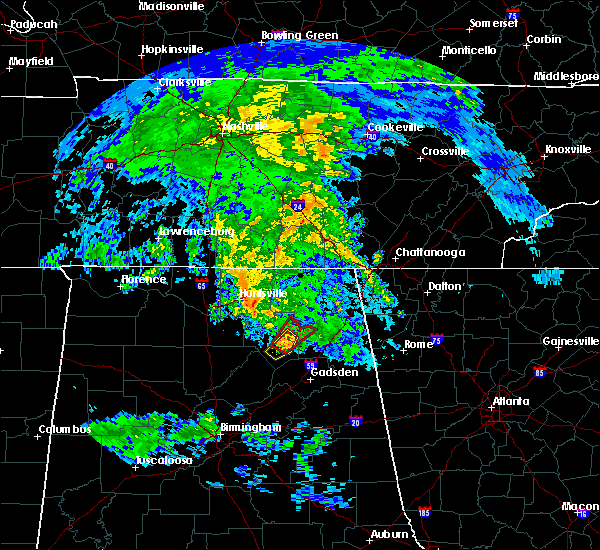 At 622 am cdt, a confirmed tornado was located near guntersville, moving northeast at 40 mph (emergency management confirmed tornado). Hazards include damaging tornado. Flying debris will be dangerous to those caught without shelter. mobile homes will be damaged or destroyed. damage to roofs, windows, and vehicles will occur. Tree damage is likely. At 622 am cdt, a confirmed tornado was located near guntersville, moving northeast at 40 mph (emergency management confirmed tornado). Hazards include damaging tornado. Flying debris will be dangerous to those caught without shelter. mobile homes will be damaged or destroyed. damage to roofs, windows, and vehicles will occur. Tree damage is likely.
|
| 11/6/2018 2:27 AM CST |
 At 226 am cst, severe thunderstorms were located along a line extending from 7 miles northwest of stevenson to near owens cross roads, moving east at 40 mph (radar indicated). Hazards include 60 mph wind gusts. expect damage to roofs, siding, and trees At 226 am cst, severe thunderstorms were located along a line extending from 7 miles northwest of stevenson to near owens cross roads, moving east at 40 mph (radar indicated). Hazards include 60 mph wind gusts. expect damage to roofs, siding, and trees
|
| 11/6/2018 2:12 AM CST |
 At 212 am cst, severe thunderstorms were located along a line extending from 11 miles north of skyline to near morgan city, moving east at 50 mph (radar indicated). Hazards include 60 mph wind gusts. Expect damage to roofs, siding, and trees. locations impacted include, southern huntsville, scottsboro, guntersville, arab, redstone arsenal, stevenson, owens cross roads, hollywood, grant and skyline. A tornado watch remains in effect until 600 am cst for north central and northeastern alabama, and middle tennessee. At 212 am cst, severe thunderstorms were located along a line extending from 11 miles north of skyline to near morgan city, moving east at 50 mph (radar indicated). Hazards include 60 mph wind gusts. Expect damage to roofs, siding, and trees. locations impacted include, southern huntsville, scottsboro, guntersville, arab, redstone arsenal, stevenson, owens cross roads, hollywood, grant and skyline. A tornado watch remains in effect until 600 am cst for north central and northeastern alabama, and middle tennessee.
|
| 11/6/2018 1:54 AM CST |
 At 154 am cst, severe thunderstorms were located along a line extending from 6 miles south of huntland to near falkville, moving east at 50 mph (radar indicated). Hazards include 60 mph wind gusts. expect damage to roofs, siding, and trees At 154 am cst, severe thunderstorms were located along a line extending from 6 miles south of huntland to near falkville, moving east at 50 mph (radar indicated). Hazards include 60 mph wind gusts. expect damage to roofs, siding, and trees
|
| 6/28/2018 1:18 PM CDT |
 At 118 pm cdt, severe thunderstorms were located along a line extending from 7 miles southeast of ider to 6 miles south of triana, moving south at 30 mph (radar indicated). Hazards include 70 mph wind gusts. Expect considerable tree damage. damage is likely to mobile homes, roofs, and outbuildings. Locations impacted include, huntsville, madison, athens, scottsboro, redstone arsenal, henagar, owens cross roads, ardmore, powell and section. At 118 pm cdt, severe thunderstorms were located along a line extending from 7 miles southeast of ider to 6 miles south of triana, moving south at 30 mph (radar indicated). Hazards include 70 mph wind gusts. Expect considerable tree damage. damage is likely to mobile homes, roofs, and outbuildings. Locations impacted include, huntsville, madison, athens, scottsboro, redstone arsenal, henagar, owens cross roads, ardmore, powell and section.
|
| 6/28/2018 1:05 PM CDT |
 At 104 pm cdt, severe thunderstorms were located along a line extending from near henagar to near grant to near priceville, moving south at 30 mph (radar indicated). Hazards include 70 mph wind gusts and penny size hail. Expect considerable tree damage. Damage is likely to mobile homes, roofs, and outbuildings. At 104 pm cdt, severe thunderstorms were located along a line extending from near henagar to near grant to near priceville, moving south at 30 mph (radar indicated). Hazards include 70 mph wind gusts and penny size hail. Expect considerable tree damage. Damage is likely to mobile homes, roofs, and outbuildings.
|
| 6/28/2018 1:05 PM CDT |
 At 104 pm cdt, severe thunderstorms were located along a line extending from near ider to near huntsville international airport, moving south at 30 mph (radar indicated). Hazards include 70 mph wind gusts and penny size hail. Expect considerable tree damage. Damage is likely to mobile homes, roofs, and outbuildings. At 104 pm cdt, severe thunderstorms were located along a line extending from near ider to near huntsville international airport, moving south at 30 mph (radar indicated). Hazards include 70 mph wind gusts and penny size hail. Expect considerable tree damage. Damage is likely to mobile homes, roofs, and outbuildings.
|
| 6/28/2018 1:00 PM CDT | Tree down at lake guntersville state park reported at old hwy 227 ... guntersville...a in marshall county AL, 6.1 miles NNE of Langston, AL |
| 6/28/2018 12:48 PM CDT |
 At 1248 pm cdt, a severe thunderstorm was located near ider, or 14 miles south of trenton, moving southeast at 35 mph (radar indicated). Hazards include 60 mph wind gusts. Expect damage to roofs, siding, and trees. Locations impacted include, scottsboro, fort payne, rainsville, bridgeport, henagar, stevenson, sylvania, fyffe, hollywood and powell. At 1248 pm cdt, a severe thunderstorm was located near ider, or 14 miles south of trenton, moving southeast at 35 mph (radar indicated). Hazards include 60 mph wind gusts. Expect damage to roofs, siding, and trees. Locations impacted include, scottsboro, fort payne, rainsville, bridgeport, henagar, stevenson, sylvania, fyffe, hollywood and powell.
|
| 6/28/2018 12:35 PM CDT |
 At 1234 pm cdt, severe thunderstorms were located along a line extending from near scottsboro to near owens cross roads to huntsville international airport, moving southeast at 45 mph (radar indicated). Hazards include 60 mph wind gusts and penny size hail. expect damage to roofs, siding, and trees At 1234 pm cdt, severe thunderstorms were located along a line extending from near scottsboro to near owens cross roads to huntsville international airport, moving southeast at 45 mph (radar indicated). Hazards include 60 mph wind gusts and penny size hail. expect damage to roofs, siding, and trees
|
| 6/28/2018 12:25 PM CDT |
 At 1225 pm cdt, a severe thunderstorm was located 7 miles south of bridgeport, moving southeast at 35 mph (radar indicated). Hazards include 60 mph wind gusts and penny size hail. expect damage to roofs, siding, and trees At 1225 pm cdt, a severe thunderstorm was located 7 miles south of bridgeport, moving southeast at 35 mph (radar indicated). Hazards include 60 mph wind gusts and penny size hail. expect damage to roofs, siding, and trees
|
| 6/28/2018 11:47 AM CDT |
 The national weather service in huntsville alabama has issued a * severe thunderstorm warning for. western jackson county in northeastern alabama. northwestern marshall county in northeastern alabama. madison county in north central alabama. Until 1245 pm cdt. The national weather service in huntsville alabama has issued a * severe thunderstorm warning for. western jackson county in northeastern alabama. northwestern marshall county in northeastern alabama. madison county in north central alabama. Until 1245 pm cdt.
|
| 6/28/2018 11:33 AM CDT |
 At 1132 am cdt, a severe thunderstorm was located near tims ford lake, or near winchester, moving southeast at 30 mph (radar indicated). Hazards include 60 mph wind gusts and penny size hail. expect damage to roofs, siding, and trees At 1132 am cdt, a severe thunderstorm was located near tims ford lake, or near winchester, moving southeast at 30 mph (radar indicated). Hazards include 60 mph wind gusts and penny size hail. expect damage to roofs, siding, and trees
|
| 4/3/2018 11:35 PM CDT |
 At 1132 pm cdt, severe thunderstorms were located along a line extending from near sewanee to near boaz, moving east at 60 mph (emergency managers. at 1132 pm cdt, emergency managers reported a tree down on a house in scottsboro. this line of storms has a history of producing widespread wind damage across much of north alabama). Hazards include 60 mph wind gusts. Expect damage to roofs, siding, and trees. Locations impacted include, albertville, scottsboro, boaz, winchester, guntersville, rainsville, decherd, estill springs, stevenson and crossville. At 1132 pm cdt, severe thunderstorms were located along a line extending from near sewanee to near boaz, moving east at 60 mph (emergency managers. at 1132 pm cdt, emergency managers reported a tree down on a house in scottsboro. this line of storms has a history of producing widespread wind damage across much of north alabama). Hazards include 60 mph wind gusts. Expect damage to roofs, siding, and trees. Locations impacted include, albertville, scottsboro, boaz, winchester, guntersville, rainsville, decherd, estill springs, stevenson and crossville.
|
| 4/3/2018 11:24 PM CDT |
 At 1123 pm cdt, severe thunderstorms were located along a line extending from near estill springs tennessee to douglas alabama, moving east at 50 mph (radar indicated. this line of storms has a history of producing widespread wind damage across the shoals and huntsville areas). Hazards include 60 mph wind gusts. Expect damage to roofs, siding, and trees. Locations impacted include, albertville, scottsboro, boaz, winchester, guntersville, rainsville, decherd, estill springs, stevenson and crossville. At 1123 pm cdt, severe thunderstorms were located along a line extending from near estill springs tennessee to douglas alabama, moving east at 50 mph (radar indicated. this line of storms has a history of producing widespread wind damage across the shoals and huntsville areas). Hazards include 60 mph wind gusts. Expect damage to roofs, siding, and trees. Locations impacted include, albertville, scottsboro, boaz, winchester, guntersville, rainsville, decherd, estill springs, stevenson and crossville.
|
| 4/3/2018 11:17 PM CDT |
 At 1115 pm cdt, severe thunderstorms were located along a line extending from near estill springs to near arab, moving east at 60 mph (radar indicated. this line of storms has a history of producing widespread wind damage across the shoals and huntsville areas). Hazards include 60 mph wind gusts. Expect damage to roofs, siding, and trees. Locations impacted include, albertville, scottsboro, boaz, winchester, guntersville, arab, rainsville, decherd, estill springs and stevenson. At 1115 pm cdt, severe thunderstorms were located along a line extending from near estill springs to near arab, moving east at 60 mph (radar indicated. this line of storms has a history of producing widespread wind damage across the shoals and huntsville areas). Hazards include 60 mph wind gusts. Expect damage to roofs, siding, and trees. Locations impacted include, albertville, scottsboro, boaz, winchester, guntersville, arab, rainsville, decherd, estill springs and stevenson.
|
| 4/3/2018 11:01 PM CDT |
 At 1059 pm cdt, severe thunderstorms were located along a line extending from near lynchburg to holly pond, moving east at 60 mph (emergency management. there have been numerous reports of downed trees and power lines across northwest and north central alabama, and the decatur and huntsville airports have reported wind gusts of at least 70 mph). Hazards include 70 mph wind gusts. Expect considerable tree damage. Damage is likely to mobile homes, roofs, and outbuildings. At 1059 pm cdt, severe thunderstorms were located along a line extending from near lynchburg to holly pond, moving east at 60 mph (emergency management. there have been numerous reports of downed trees and power lines across northwest and north central alabama, and the decatur and huntsville airports have reported wind gusts of at least 70 mph). Hazards include 70 mph wind gusts. Expect considerable tree damage. Damage is likely to mobile homes, roofs, and outbuildings.
|
| 3/1/2018 7:11 AM CST |
 The severe thunderstorm warning for southeastern jackson, east central marshall and dekalb counties will expire at 715 am cst, the storms which prompted the warning have weakened below severe limits, and no longer pose an immediate threat to life or property. therefore the warning will be allowed to expire. however gusty winds are still possible with these thunderstorms. The severe thunderstorm warning for southeastern jackson, east central marshall and dekalb counties will expire at 715 am cst, the storms which prompted the warning have weakened below severe limits, and no longer pose an immediate threat to life or property. therefore the warning will be allowed to expire. however gusty winds are still possible with these thunderstorms.
|
| 3/1/2018 6:45 AM CST |
 At 645 am cst, a severe thunderstorm was located near guntersville, moving east at 30 mph (radar indicated). Hazards include 60 mph wind gusts. Expect damage to roofs, siding, and trees. Locations impacted include, albertville, guntersville, mcville, high point, hustleville, rabbit town, columbus city, hyatt, lake guntersville st park and mountain view. At 645 am cst, a severe thunderstorm was located near guntersville, moving east at 30 mph (radar indicated). Hazards include 60 mph wind gusts. Expect damage to roofs, siding, and trees. Locations impacted include, albertville, guntersville, mcville, high point, hustleville, rabbit town, columbus city, hyatt, lake guntersville st park and mountain view.
|
| 3/1/2018 6:40 AM CST |
 At 639 am cst, severe thunderstorms were located along a line extending from trenton to 7 miles northeast of guntersville, moving east at 30 mph (radar indicated). Hazards include 60 mph wind gusts. expect damage to roofs, siding, and trees At 639 am cst, severe thunderstorms were located along a line extending from trenton to 7 miles northeast of guntersville, moving east at 30 mph (radar indicated). Hazards include 60 mph wind gusts. expect damage to roofs, siding, and trees
|
| 3/1/2018 6:37 AM CST |
 At 636 am cst, a severe thunderstorm was located over guntersville, moving east at 35 mph (radar indicated). Hazards include 60 mph wind gusts. Expect damage to roofs, siding, and trees. Locations impacted include, albertville, guntersville, mcville, high point, hustleville, rabbit town, columbus city, hyatt, lake guntersville st park and mountain view. At 636 am cst, a severe thunderstorm was located over guntersville, moving east at 35 mph (radar indicated). Hazards include 60 mph wind gusts. Expect damage to roofs, siding, and trees. Locations impacted include, albertville, guntersville, mcville, high point, hustleville, rabbit town, columbus city, hyatt, lake guntersville st park and mountain view.
|
| 3/1/2018 6:25 AM CST |
 At 625 am cst, a severe thunderstorm was located 4 miles southeast of arab, moving east at 25 mph (radar indicated). Hazards include 60 mph wind gusts. expect damage to roofs, siding, and trees At 625 am cst, a severe thunderstorm was located 4 miles southeast of arab, moving east at 25 mph (radar indicated). Hazards include 60 mph wind gusts. expect damage to roofs, siding, and trees
|
| 3/1/2018 6:18 AM CST |
 At 618 am cst, a severe thunderstorm was located over arab, moving east at 40 mph (radar indicated). Hazards include 60 mph wind gusts. Expect damage to roofs, siding, and trees. Locations impacted include, guntersville, arab, grant, union grove, eddy, hustleville, columbus city and lake guntersville st park. At 618 am cst, a severe thunderstorm was located over arab, moving east at 40 mph (radar indicated). Hazards include 60 mph wind gusts. Expect damage to roofs, siding, and trees. Locations impacted include, guntersville, arab, grant, union grove, eddy, hustleville, columbus city and lake guntersville st park.
|
| 3/1/2018 6:01 AM CST |
 At 601 am cst, a severe thunderstorm was located near arab, moving east at 50 mph (radar indicated). Hazards include 60 mph wind gusts. Expect damage to roofs, siding, and trees. Locations impacted include, guntersville, arab, grant, union grove, eddy, hustleville, ryan crossroads, columbus city, lake guntersville st park and mountain view. At 601 am cst, a severe thunderstorm was located near arab, moving east at 50 mph (radar indicated). Hazards include 60 mph wind gusts. Expect damage to roofs, siding, and trees. Locations impacted include, guntersville, arab, grant, union grove, eddy, hustleville, ryan crossroads, columbus city, lake guntersville st park and mountain view.
|
| 3/1/2018 5:53 AM CST |
 At 552 am cst, a severe thunderstorm was located 8 miles west of arab, moving east at 50 mph (radar indicated). Hazards include 60 mph wind gusts. expect damage to roofs, siding, and trees At 552 am cst, a severe thunderstorm was located 8 miles west of arab, moving east at 50 mph (radar indicated). Hazards include 60 mph wind gusts. expect damage to roofs, siding, and trees
|
| 11/18/2017 7:00 PM CST | Trees reported down along langston road and cemetery road in the langston area. road was reported impassable at the tim in jackson county AL, 1.7 miles SW of Langston, AL |
| 11/18/2017 7:00 PM CST | Trees reported down along langston road and cemetery road in the langston area. road was reported impassable at the tim in jackson county AL, 1.4 miles WSW of Langston, AL |
| 11/18/2017 6:40 PM CST |
 At 640 pm cst, severe thunderstorms were located along a line extending from near skyline to 6 miles southwest of grant, moving east at 40 mph (radar indicated). Hazards include 60 mph wind gusts. expect damage to roofs, siding, and trees At 640 pm cst, severe thunderstorms were located along a line extending from near skyline to 6 miles southwest of grant, moving east at 40 mph (radar indicated). Hazards include 60 mph wind gusts. expect damage to roofs, siding, and trees
|
| 9/5/2017 4:04 PM CDT |
 At 404 pm cdt, a severe thunderstorm was located over section, or near scottsboro, moving southeast at 15 mph (radar indicated). Hazards include 60 mph wind gusts and half dollar size hail. Hail damage to vehicles is expected. Expect wind damage to roofs, siding, and trees. At 404 pm cdt, a severe thunderstorm was located over section, or near scottsboro, moving southeast at 15 mph (radar indicated). Hazards include 60 mph wind gusts and half dollar size hail. Hail damage to vehicles is expected. Expect wind damage to roofs, siding, and trees.
|
| 6/15/2017 2:49 PM CDT |
 At 247 pm cdt, severe thunderstorms were located along a line extending from 7 miles south of bridgeport to near sylvania to 8 miles northwest of geraldine, moving southeast at 40 mph (radar indicated). Hazards include 60 mph wind gusts. expect damage to roofs, siding, and trees At 247 pm cdt, severe thunderstorms were located along a line extending from 7 miles south of bridgeport to near sylvania to 8 miles northwest of geraldine, moving southeast at 40 mph (radar indicated). Hazards include 60 mph wind gusts. expect damage to roofs, siding, and trees
|
| 6/15/2017 2:37 PM CDT |
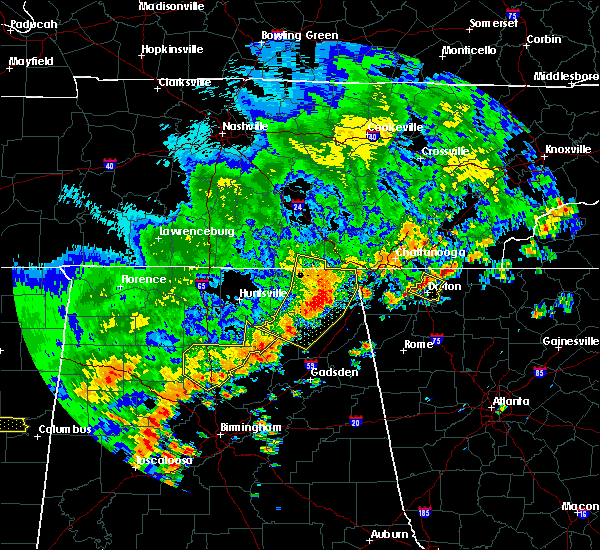 At 235 pm cdt, severe thunderstorms were located along a line extending from near bridgeport to near pisgah to near grant, moving southeast at 20 mph (radar indicated). Hazards include 60 mph wind gusts. Expect damage to roofs, siding, and trees. Locations impacted include, scottsboro, guntersville, rainsville, bridgeport, henagar, stevenson, crossville, sylvania, fyffe and hollywood. At 235 pm cdt, severe thunderstorms were located along a line extending from near bridgeport to near pisgah to near grant, moving southeast at 20 mph (radar indicated). Hazards include 60 mph wind gusts. Expect damage to roofs, siding, and trees. Locations impacted include, scottsboro, guntersville, rainsville, bridgeport, henagar, stevenson, crossville, sylvania, fyffe and hollywood.
|
| 6/15/2017 2:25 PM CDT |
 At 224 pm cdt, severe thunderstorms were located along a line extending from near stevenson to near section to near guntersville, moving southeast at 55 mph (radar indicated). Hazards include 60 mph wind gusts. Expect damage to roofs, siding, and trees. Locations impacted include, scottsboro, guntersville, rainsville, bridgeport, henagar, stevenson, crossville, sylvania, fyffe and hollywood. At 224 pm cdt, severe thunderstorms were located along a line extending from near stevenson to near section to near guntersville, moving southeast at 55 mph (radar indicated). Hazards include 60 mph wind gusts. Expect damage to roofs, siding, and trees. Locations impacted include, scottsboro, guntersville, rainsville, bridgeport, henagar, stevenson, crossville, sylvania, fyffe and hollywood.
|
| 6/15/2017 2:14 PM CDT |
 At 214 pm cdt, severe thunderstorms were located along a line extending from 11 miles northwest of stevenson to near skyline to near morgan city, moving southeast at 25 mph (radar indicated). Hazards include 60 mph wind gusts. expect damage to roofs, siding, and trees At 214 pm cdt, severe thunderstorms were located along a line extending from 11 miles northwest of stevenson to near skyline to near morgan city, moving southeast at 25 mph (radar indicated). Hazards include 60 mph wind gusts. expect damage to roofs, siding, and trees
|
| 6/15/2017 2:05 PM CDT |
 At 204 pm cdt, severe thunderstorms were located along a line extending from 9 miles southeast of huntland to 7 miles northeast of gurley to near owens cross roads, moving southeast at 65 mph (radar indicated). Hazards include 60 mph wind gusts. Expect damage to roofs, siding, and trees. Locations impacted include, southern huntsville, scottsboro, winchester, guntersville, bridgeport, moores mill, redstone arsenal, stevenson, cowan and owens cross roads. At 204 pm cdt, severe thunderstorms were located along a line extending from 9 miles southeast of huntland to 7 miles northeast of gurley to near owens cross roads, moving southeast at 65 mph (radar indicated). Hazards include 60 mph wind gusts. Expect damage to roofs, siding, and trees. Locations impacted include, southern huntsville, scottsboro, winchester, guntersville, bridgeport, moores mill, redstone arsenal, stevenson, cowan and owens cross roads.
|
| 6/15/2017 1:56 PM CDT |
 At 156 pm cdt, severe thunderstorms were located along a line extending from near huntland to 7 miles southeast of new market to huntsville, moving southeast at 60 mph (radar indicated). Hazards include 60 mph wind gusts. Expect damage to roofs, siding, and trees. Locations impacted include, huntsville, scottsboro, winchester, guntersville, bridgeport, moores mill, redstone arsenal, meridianville, stevenson and cowan. At 156 pm cdt, severe thunderstorms were located along a line extending from near huntland to 7 miles southeast of new market to huntsville, moving southeast at 60 mph (radar indicated). Hazards include 60 mph wind gusts. Expect damage to roofs, siding, and trees. Locations impacted include, huntsville, scottsboro, winchester, guntersville, bridgeport, moores mill, redstone arsenal, meridianville, stevenson and cowan.
|
| 6/15/2017 1:44 PM CDT |
 At 144 pm cdt, severe thunderstorms were located along a line extending from 7 miles southwest of tims ford lake to near new market to huntsville, moving southeast at 80 mph (radar indicated). Hazards include 60 mph wind gusts. expect damage to roofs, siding, and trees At 144 pm cdt, severe thunderstorms were located along a line extending from 7 miles southwest of tims ford lake to near new market to huntsville, moving southeast at 80 mph (radar indicated). Hazards include 60 mph wind gusts. expect damage to roofs, siding, and trees
|
| 5/23/2017 4:37 PM CDT |
 The severe thunderstorm warning for south central jackson and west central dekalb counties will expire at 445 pm cdt, the storm which prompted the warning has weakened below severe limits, and no longer poses an immediate threat to life or property. therefore the warning will be allowed to expire. The severe thunderstorm warning for south central jackson and west central dekalb counties will expire at 445 pm cdt, the storm which prompted the warning has weakened below severe limits, and no longer poses an immediate threat to life or property. therefore the warning will be allowed to expire.
|
| 5/23/2017 4:33 PM CDT |
 At 432 pm cdt, a severe thunderstorm was located 8 miles southwest of section, or 12 miles south of scottsboro, moving east at 25 mph (radar indicated). Hazards include 60 mph wind gusts and nickel size hail. Expect damage to roofs, siding, and trees. Locations impacted include, rainsville, fyffe, powell, section, shiloh and langston. At 432 pm cdt, a severe thunderstorm was located 8 miles southwest of section, or 12 miles south of scottsboro, moving east at 25 mph (radar indicated). Hazards include 60 mph wind gusts and nickel size hail. Expect damage to roofs, siding, and trees. Locations impacted include, rainsville, fyffe, powell, section, shiloh and langston.
|
| 5/23/2017 4:21 PM CDT |
 At 421 pm cdt, a severe thunderstorm was located near grant, or 11 miles northeast of guntersville, moving east at 25 mph (radar indicated). Hazards include 60 mph wind gusts and quarter size hail. Hail damage to vehicles is expected. Expect wind damage to roofs, siding, and trees. At 421 pm cdt, a severe thunderstorm was located near grant, or 11 miles northeast of guntersville, moving east at 25 mph (radar indicated). Hazards include 60 mph wind gusts and quarter size hail. Hail damage to vehicles is expected. Expect wind damage to roofs, siding, and trees.
|
| 5/20/2017 6:11 PM CDT |
 At 610 pm cdt, severe thunderstorms were located along a line extending from 7 miles northwest of hazel green to near scottsboro, moving northeast at 45 mph. wind damage has already been reported with this line of storms in madison county (radar indicated). Hazards include 60 mph wind gusts. Expect damage to roofs, siding, and trees. Locations impacted include, scottsboro, fayetteville, moores mill, meridianville, hazel green, hollywood, skyline, section, pisgah and new market. At 610 pm cdt, severe thunderstorms were located along a line extending from 7 miles northwest of hazel green to near scottsboro, moving northeast at 45 mph. wind damage has already been reported with this line of storms in madison county (radar indicated). Hazards include 60 mph wind gusts. Expect damage to roofs, siding, and trees. Locations impacted include, scottsboro, fayetteville, moores mill, meridianville, hazel green, hollywood, skyline, section, pisgah and new market.
|
| 5/20/2017 5:55 PM CDT |
 At 554 pm cdt, severe thunderstorms were located along a line extending from near harvest to 7 miles northeast of grant, moving northeast at 50 mph. this line of storms has a history of producing winds in excess of 50 mph and producing wind damage across madison county (radar indicated). Hazards include 60 mph wind gusts. expect damage to roofs, siding, and trees At 554 pm cdt, severe thunderstorms were located along a line extending from near harvest to 7 miles northeast of grant, moving northeast at 50 mph. this line of storms has a history of producing winds in excess of 50 mph and producing wind damage across madison county (radar indicated). Hazards include 60 mph wind gusts. expect damage to roofs, siding, and trees
|
| 4/30/2017 3:58 PM CDT |
 The severe thunderstorm warning for jackson, dekalb and franklin counties will expire at 400 pm cdt, the storms which prompted the warning have weakened below severe limits, and no longer pose an immediate threat to life or property. therefore the warning will be allowed to expire. however, gusty winds are still possible with these thunderstorms. a tornado watch remains in effect until 700 pm cdt for northeastern alabama, and middle tennessee. The severe thunderstorm warning for jackson, dekalb and franklin counties will expire at 400 pm cdt, the storms which prompted the warning have weakened below severe limits, and no longer pose an immediate threat to life or property. therefore the warning will be allowed to expire. however, gusty winds are still possible with these thunderstorms. a tornado watch remains in effect until 700 pm cdt for northeastern alabama, and middle tennessee.
|
| 4/30/2017 3:58 PM CDT |
 The severe thunderstorm warning for jackson. dekalb and franklin counties will expire at 400 pm cdt. the storms which prompted the warning have weakened below severe limits, and no longer pose an immediate threat to life or property. therefore the warning will be allowed to expire. However, gusty winds are still possible with these thunderstorms. The severe thunderstorm warning for jackson. dekalb and franklin counties will expire at 400 pm cdt. the storms which prompted the warning have weakened below severe limits, and no longer pose an immediate threat to life or property. therefore the warning will be allowed to expire. However, gusty winds are still possible with these thunderstorms.
|
| 4/30/2017 3:49 PM CDT |
 At 349 pm cdt, severe thunderstorms were located along a line extending from near estill springs to near collinsville, moving east at 40 mph (radar indicated). Hazards include 60 mph wind gusts. Expect damage to roofs, siding, and trees. locations impacted include, scottsboro, fort payne, winchester, rainsville, bridgeport, little river canyon national preserve, decherd, henagar, estill springs and stevenson. A tornado watch remains in effect until 700 pm cdt for north central and northeastern alabama, and middle tennessee. At 349 pm cdt, severe thunderstorms were located along a line extending from near estill springs to near collinsville, moving east at 40 mph (radar indicated). Hazards include 60 mph wind gusts. Expect damage to roofs, siding, and trees. locations impacted include, scottsboro, fort payne, winchester, rainsville, bridgeport, little river canyon national preserve, decherd, henagar, estill springs and stevenson. A tornado watch remains in effect until 700 pm cdt for north central and northeastern alabama, and middle tennessee.
|
| 4/30/2017 3:33 PM CDT |
 At 333 pm cdt, severe thunderstorms were located along a line extending from 7 miles north of tullahoma to near crossville, moving northeast at 55 mph (radar indicated). Hazards include 60 mph wind gusts. Expect damage to roofs, siding, and trees. locations impacted include, scottsboro, fort payne, boaz, winchester, rainsville, bridgeport, little river canyon national preserve, decherd, henagar and estill springs. A tornado watch remains in effect until 700 pm cdt for north central and northeastern alabama, and middle tennessee. At 333 pm cdt, severe thunderstorms were located along a line extending from 7 miles north of tullahoma to near crossville, moving northeast at 55 mph (radar indicated). Hazards include 60 mph wind gusts. Expect damage to roofs, siding, and trees. locations impacted include, scottsboro, fort payne, boaz, winchester, rainsville, bridgeport, little river canyon national preserve, decherd, henagar and estill springs. A tornado watch remains in effect until 700 pm cdt for north central and northeastern alabama, and middle tennessee.
|
| 4/30/2017 3:17 PM CDT |
 At 317 pm cdt, severe thunderstorms were located along a line extending from lynchburg to albertville, moving northeast at 40 mph (radar indicated). Hazards include 60 mph wind gusts. Expect damage to roofs, siding, and trees. locations impacted include, albertville, scottsboro, fort payne, boaz, winchester, guntersville, fayetteville, rainsville, bridgeport and lynchburg. A tornado watch remains in effect until 700 pm cdt for north central and northeastern alabama, and middle tennessee. At 317 pm cdt, severe thunderstorms were located along a line extending from lynchburg to albertville, moving northeast at 40 mph (radar indicated). Hazards include 60 mph wind gusts. Expect damage to roofs, siding, and trees. locations impacted include, albertville, scottsboro, fort payne, boaz, winchester, guntersville, fayetteville, rainsville, bridgeport and lynchburg. A tornado watch remains in effect until 700 pm cdt for north central and northeastern alabama, and middle tennessee.
|
| 4/30/2017 2:54 PM CDT |
 At 252 pm cdt, severe thunderstorms were located along a line extending from near petersburg to near altoona, moving northeast at 55 mph (radar indicated). Hazards include 60 mph wind gusts. expect damage to roofs, siding, and trees At 252 pm cdt, severe thunderstorms were located along a line extending from near petersburg to near altoona, moving northeast at 55 mph (radar indicated). Hazards include 60 mph wind gusts. expect damage to roofs, siding, and trees
|
| 3/27/2017 3:10 PM CDT |
 The severe thunderstorm warning for northeastern marshall county will expire at 315 pm cdt, the storm which prompted the warning has weakened below severe limits, and has exited the warned area. therefore, the warning will be allowed to expire. a severe thunderstorm watch remains in effect until 900 pm cdt for north central and northeastern alabama. The severe thunderstorm warning for northeastern marshall county will expire at 315 pm cdt, the storm which prompted the warning has weakened below severe limits, and has exited the warned area. therefore, the warning will be allowed to expire. a severe thunderstorm watch remains in effect until 900 pm cdt for north central and northeastern alabama.
|
| 3/27/2017 2:47 PM CDT |
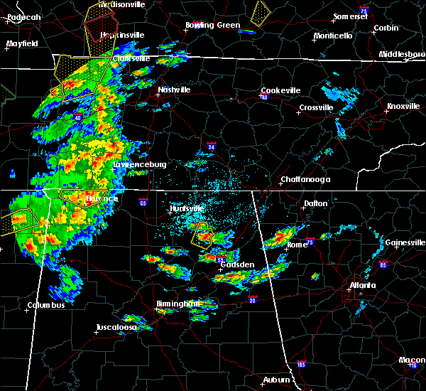 At 245 pm cdt, a severe thunderstorm was located near guntersville, moving northeast at 35 mph (public. golf ball sized hail was reported in guntersville). Hazards include golf ball size hail and 60 mph wind gusts. People and animals outdoors will be injured. expect hail damage to roofs, siding, windows, and vehicles. expect wind damage to roofs, siding, and trees. Locations impacted include, albertville, guntersville, grant, hustleville, columbus city and lake guntersville st park. At 245 pm cdt, a severe thunderstorm was located near guntersville, moving northeast at 35 mph (public. golf ball sized hail was reported in guntersville). Hazards include golf ball size hail and 60 mph wind gusts. People and animals outdoors will be injured. expect hail damage to roofs, siding, windows, and vehicles. expect wind damage to roofs, siding, and trees. Locations impacted include, albertville, guntersville, grant, hustleville, columbus city and lake guntersville st park.
|
| 3/27/2017 2:31 PM CDT |
 At 230 pm cdt, a severe thunderstorm was located near guntersville, moving northeast at 35 mph (radar indicated). Hazards include 60 mph wind gusts and quarter size hail. Hail damage to vehicles is expected. Expect wind damage to roofs, siding, and trees. At 230 pm cdt, a severe thunderstorm was located near guntersville, moving northeast at 35 mph (radar indicated). Hazards include 60 mph wind gusts and quarter size hail. Hail damage to vehicles is expected. Expect wind damage to roofs, siding, and trees.
|
| 3/10/2017 1:29 AM CST |
 At 128 am cst, severe thunderstorms were located along a line extending from near trion to near albertville, moving east at 45 mph (radar indicated). Hazards include 60 mph wind gusts and quarter size hail. Hail damage to vehicles is expected. expect wind damage to roofs, siding, and trees. Locations impacted include, albertville, scottsboro, fort payne, boaz, guntersville, arab, rainsville, little river canyon national preserve, henagar and collinsville. At 128 am cst, severe thunderstorms were located along a line extending from near trion to near albertville, moving east at 45 mph (radar indicated). Hazards include 60 mph wind gusts and quarter size hail. Hail damage to vehicles is expected. expect wind damage to roofs, siding, and trees. Locations impacted include, albertville, scottsboro, fort payne, boaz, guntersville, arab, rainsville, little river canyon national preserve, henagar and collinsville.
|
| 3/10/2017 1:14 AM CST |
 At 114 am cst, severe thunderstorms were located along a line extending from 10 miles northwest of trion to near arab, moving east at 65 mph (radar indicated). Hazards include 60 mph wind gusts and quarter size hail. Hail damage to vehicles is expected. Expect wind damage to roofs, siding, and trees. At 114 am cst, severe thunderstorms were located along a line extending from 10 miles northwest of trion to near arab, moving east at 65 mph (radar indicated). Hazards include 60 mph wind gusts and quarter size hail. Hail damage to vehicles is expected. Expect wind damage to roofs, siding, and trees.
|
| 3/10/2017 12:27 AM CST |
 At 1227 am cst, severe thunderstorms were located along a line extending from near sewanee to triana, moving southeast at 40 mph (radar indicated). Hazards include 60 mph wind gusts and quarter size hail. Hail damage to vehicles is expected. Expect wind damage to roofs, siding, and trees. At 1227 am cst, severe thunderstorms were located along a line extending from near sewanee to triana, moving southeast at 40 mph (radar indicated). Hazards include 60 mph wind gusts and quarter size hail. Hail damage to vehicles is expected. Expect wind damage to roofs, siding, and trees.
|
| 3/1/2017 3:20 PM CST |
 The severe thunderstorm warning for south central jackson and central dekalb counties will expire at 330 pm cst, the storm which prompted the warning has moved out of the area. therefore, the warning will be allowed to expire. however heavy rain is still possible with this thunderstorm. a tornado watch remains in effect until 600 pm cst for north central and northeastern alabama. The severe thunderstorm warning for south central jackson and central dekalb counties will expire at 330 pm cst, the storm which prompted the warning has moved out of the area. therefore, the warning will be allowed to expire. however heavy rain is still possible with this thunderstorm. a tornado watch remains in effect until 600 pm cst for north central and northeastern alabama.
|
| 3/1/2017 2:55 PM CST |
 At 250 pm cst, a severe thunderstorm was located over fyffe, or near rainsville, moving east at 60 mph (emergency management. this storm produced damaging winds and golf ball size hail earlier in northern marshall county, north of the guntersville area). Hazards include ping pong ball size hail and 60 mph wind gusts. People and animals outdoors will be injured. expect hail damage to roofs, siding, windows, and vehicles. expect wind damage to roofs, siding, and trees. locations impacted include, fort payne, rainsville, little river canyon national preserve, henagar, sylvania, fyffe, powell, geraldine, section and little river falls. A tornado watch remains in effect until 600 pm cst for north central and northeastern alabama. At 250 pm cst, a severe thunderstorm was located over fyffe, or near rainsville, moving east at 60 mph (emergency management. this storm produced damaging winds and golf ball size hail earlier in northern marshall county, north of the guntersville area). Hazards include ping pong ball size hail and 60 mph wind gusts. People and animals outdoors will be injured. expect hail damage to roofs, siding, windows, and vehicles. expect wind damage to roofs, siding, and trees. locations impacted include, fort payne, rainsville, little river canyon national preserve, henagar, sylvania, fyffe, powell, geraldine, section and little river falls. A tornado watch remains in effect until 600 pm cst for north central and northeastern alabama.
|
| 3/1/2017 2:40 PM CST |
 At 238 pm cst, a severe thunderstorm was located 8 miles southeast of grant, or 11 miles northeast of guntersville, moving east at 60 mph (emergency management. at 230 pm, golf ball size hail was repoted in northeastern marshall county). Hazards include ping pong ball size hail and 60 mph wind gusts. People and animals outdoors will be injured. expect hail damage to roofs, siding, windows, and vehicles. Expect wind damage to roofs, siding, and trees. At 238 pm cst, a severe thunderstorm was located 8 miles southeast of grant, or 11 miles northeast of guntersville, moving east at 60 mph (emergency management. at 230 pm, golf ball size hail was repoted in northeastern marshall county). Hazards include ping pong ball size hail and 60 mph wind gusts. People and animals outdoors will be injured. expect hail damage to roofs, siding, windows, and vehicles. Expect wind damage to roofs, siding, and trees.
|
| 11/30/2016 4:17 AM CST |
 At 417 am cst, a severe thunderstorm was located over scottsboro, moving northeast at 50 mph (radar indicated). Hazards include 60 mph wind gusts and penny size hail. Expect damage to roofs. siding. and trees. locations impacted include, scottsboro, hollywood, skyline, section, woodville, pisgah, pleasant groves, dutton, langston and paint rock. A tornado watch remains in effect until 1000 am cst for north central and northeastern alabama. At 417 am cst, a severe thunderstorm was located over scottsboro, moving northeast at 50 mph (radar indicated). Hazards include 60 mph wind gusts and penny size hail. Expect damage to roofs. siding. and trees. locations impacted include, scottsboro, hollywood, skyline, section, woodville, pisgah, pleasant groves, dutton, langston and paint rock. A tornado watch remains in effect until 1000 am cst for north central and northeastern alabama.
|
| 11/30/2016 3:54 AM CST |
 The tornado warning for southeastern madison and northern marshall counties will expire at 400 am cst, the tornado threat has diminished and the tornado warning has been cancelled. however, large hail and damaging winds remain likely and a severe thunderstorm warning remains in effect for the area. a tornado watch remains in effect until 1000 am cst for north central and northeastern alabama. The tornado warning for southeastern madison and northern marshall counties will expire at 400 am cst, the tornado threat has diminished and the tornado warning has been cancelled. however, large hail and damaging winds remain likely and a severe thunderstorm warning remains in effect for the area. a tornado watch remains in effect until 1000 am cst for north central and northeastern alabama.
|
| 11/30/2016 3:53 AM CST |
 At 352 am cst, a severe thunderstorm was located near grant, or 11 miles north of guntersville, moving northeast at 50 mph (radar indicated). Hazards include 60 mph wind gusts and penny size hail. Expect damage to roofs. siding. And trees. At 352 am cst, a severe thunderstorm was located near grant, or 11 miles north of guntersville, moving northeast at 50 mph (radar indicated). Hazards include 60 mph wind gusts and penny size hail. Expect damage to roofs. siding. And trees.
|
| 11/30/2016 3:45 AM CST |
 At 344 am cst, a severe thunderstorm capable of producing a tornado was located near owens cross roads, or 12 miles north of arab, moving northeast at 50 mph (radar indicated rotation). Hazards include tornado and quarter size hail. Flying debris will be dangerous to those caught without shelter. mobile homes will be damaged or destroyed. damage to roofs, windows, and vehicles will occur. tree damage is likely. this dangerous storm will be near, grant around 400 am cst. Other locations impacted by this tornadic thunderstorm include columbus city, hebron and union grove. At 344 am cst, a severe thunderstorm capable of producing a tornado was located near owens cross roads, or 12 miles north of arab, moving northeast at 50 mph (radar indicated rotation). Hazards include tornado and quarter size hail. Flying debris will be dangerous to those caught without shelter. mobile homes will be damaged or destroyed. damage to roofs, windows, and vehicles will occur. tree damage is likely. this dangerous storm will be near, grant around 400 am cst. Other locations impacted by this tornadic thunderstorm include columbus city, hebron and union grove.
|
| 11/30/2016 3:34 AM CST |
 At 333 am cst, a severe thunderstorm capable of producing a tornado was located near morgan city, or 7 miles northwest of arab, moving northeast at 50 mph (radar indicated rotation). Hazards include tornado and quarter size hail. Flying debris will be dangerous to those caught without shelter. mobile homes will be damaged or destroyed. damage to roofs, windows, and vehicles will occur. tree damage is likely. this dangerous storm will be near, owens cross roads around 350 am cst. grant around 400 am cst. Other locations impacted by this tornadic thunderstorm include columbus city, hebron, eddy, ryan crossroads and union grove. At 333 am cst, a severe thunderstorm capable of producing a tornado was located near morgan city, or 7 miles northwest of arab, moving northeast at 50 mph (radar indicated rotation). Hazards include tornado and quarter size hail. Flying debris will be dangerous to those caught without shelter. mobile homes will be damaged or destroyed. damage to roofs, windows, and vehicles will occur. tree damage is likely. this dangerous storm will be near, owens cross roads around 350 am cst. grant around 400 am cst. Other locations impacted by this tornadic thunderstorm include columbus city, hebron, eddy, ryan crossroads and union grove.
|
| 11/30/2016 2:25 AM CST |
 At 224 am cst, severe thunderstorms were located along a line extending from near skyline to 8 miles northeast of woodville to near grant, moving northeast at 40 mph (radar indicated). Hazards include 60 mph wind gusts. Expect damage to roofs. siding. and trees. locations impacted include, scottsboro, hollywood, section, woodville, langston, paint rock, lim rock and larkinsville. A tornado watch remains in effect until 300 am cst for north central and northeastern alabama, and middle tennessee. At 224 am cst, severe thunderstorms were located along a line extending from near skyline to 8 miles northeast of woodville to near grant, moving northeast at 40 mph (radar indicated). Hazards include 60 mph wind gusts. Expect damage to roofs. siding. and trees. locations impacted include, scottsboro, hollywood, section, woodville, langston, paint rock, lim rock and larkinsville. A tornado watch remains in effect until 300 am cst for north central and northeastern alabama, and middle tennessee.
|
| 11/30/2016 1:53 AM CST |
 At 153 am cst, severe thunderstorms were located along a line extending from 6 miles northwest of gurley to huntsville to 7 miles southwest of morgan city, moving northeast at 40 mph (radar indicated). Hazards include 60 mph wind gusts. Expect damage to roofs. siding. And trees. At 153 am cst, severe thunderstorms were located along a line extending from 6 miles northwest of gurley to huntsville to 7 miles southwest of morgan city, moving northeast at 40 mph (radar indicated). Hazards include 60 mph wind gusts. Expect damage to roofs. siding. And trees.
|
| 11/30/2016 12:23 AM CST |
 At 1223 am cst, a severe thunderstorm capable of producing a tornado was located near section, or near scottsboro, moving northeast at 50 mph (radar indicated rotation). Hazards include tornado. Flying debris will be dangerous to those caught without shelter. mobile homes will be damaged or destroyed. damage to roofs, windows, and vehicles will occur. tree damage is likely. this dangerous storm will be near, scottsboro around 1235 am cst. hollywood around 1240 am cst. pisgah around 1245 am cst. henagar around 1255 am cst. Other locations impacted by this tornadic thunderstorm include langston, dutton, fackler, rosalie and martintown. At 1223 am cst, a severe thunderstorm capable of producing a tornado was located near section, or near scottsboro, moving northeast at 50 mph (radar indicated rotation). Hazards include tornado. Flying debris will be dangerous to those caught without shelter. mobile homes will be damaged or destroyed. damage to roofs, windows, and vehicles will occur. tree damage is likely. this dangerous storm will be near, scottsboro around 1235 am cst. hollywood around 1240 am cst. pisgah around 1245 am cst. henagar around 1255 am cst. Other locations impacted by this tornadic thunderstorm include langston, dutton, fackler, rosalie and martintown.
|
| 11/29/2016 11:43 PM CST |
 At 1143 pm cst, a severe thunderstorm was located over scottsboro, moving northeast at 70 mph (radar indicated). Hazards include 60 mph wind gusts. Expect damage to roofs. siding. and trees. locations impacted include, scottsboro, henagar, hollywood, section, pisgah, dutton, langston, martintown, fackler and rosalie. A tornado watch remains in effect until 300 am cst for north central and northeastern alabama, and middle tennessee. At 1143 pm cst, a severe thunderstorm was located over scottsboro, moving northeast at 70 mph (radar indicated). Hazards include 60 mph wind gusts. Expect damage to roofs. siding. and trees. locations impacted include, scottsboro, henagar, hollywood, section, pisgah, dutton, langston, martintown, fackler and rosalie. A tornado watch remains in effect until 300 am cst for north central and northeastern alabama, and middle tennessee.
|
| 11/29/2016 11:32 PM CST |
 At 1131 pm cst, a severe thunderstorm was located over grant, or 12 miles northeast of guntersville, moving northeast at 55 mph (radar indicated). Hazards include 60 mph wind gusts. Expect damage to roofs. siding. And trees. At 1131 pm cst, a severe thunderstorm was located over grant, or 12 miles northeast of guntersville, moving northeast at 55 mph (radar indicated). Hazards include 60 mph wind gusts. Expect damage to roofs. siding. And trees.
|
| 7/9/2016 7:13 PM CDT |
 At 713 pm cdt, a severe thunderstorm was located 7 miles west of section, or 9 miles southwest of scottsboro, moving southeast at 5 mph (radar indicated). Hazards include 60 mph wind gusts and quarter size hail. Hail damage to vehicles is expected. expect wind damage to roofs, siding, and trees. Locations impacted include, scottsboro, section and langston. At 713 pm cdt, a severe thunderstorm was located 7 miles west of section, or 9 miles southwest of scottsboro, moving southeast at 5 mph (radar indicated). Hazards include 60 mph wind gusts and quarter size hail. Hail damage to vehicles is expected. expect wind damage to roofs, siding, and trees. Locations impacted include, scottsboro, section and langston.
|
| 7/9/2016 7:00 PM CDT |
 At 700 pm cdt, a severe thunderstorm was located 7 miles west of section, or 9 miles southwest of scottsboro, moving southeast at 5 mph (radar indicated). Hazards include 60 mph wind gusts and quarter size hail. Hail damage to vehicles is expected. Expect wind damage to roofs, siding, and trees. At 700 pm cdt, a severe thunderstorm was located 7 miles west of section, or 9 miles southwest of scottsboro, moving southeast at 5 mph (radar indicated). Hazards include 60 mph wind gusts and quarter size hail. Hail damage to vehicles is expected. Expect wind damage to roofs, siding, and trees.
|
| 6/15/2016 7:26 PM CDT |
 At 725 pm cdt, a severe thunderstorm was located over fort payne, moving southeast at 30 mph (radar indicated). Hazards include 60 mph wind gusts. Expect damage to roofs. siding. and trees. Locations impacted include, albertville, fort payne, boaz, guntersville, rainsville, little river canyon national preserve, henagar, collinsville, crossville and sylvania. At 725 pm cdt, a severe thunderstorm was located over fort payne, moving southeast at 30 mph (radar indicated). Hazards include 60 mph wind gusts. Expect damage to roofs. siding. and trees. Locations impacted include, albertville, fort payne, boaz, guntersville, rainsville, little river canyon national preserve, henagar, collinsville, crossville and sylvania.
|
| 6/15/2016 7:12 PM CDT |
 The severe thunderstorm warning for southeastern madison. jackson. central dekalb. northeastern marshall and southeastern franklin counties will expire at 715 pm cdt. the storms which prompted the warning have moved out of the area. therefore the warning will be allowed to expire. remember. A severe thunderstorm warning still remains in effect for. The severe thunderstorm warning for southeastern madison. jackson. central dekalb. northeastern marshall and southeastern franklin counties will expire at 715 pm cdt. the storms which prompted the warning have moved out of the area. therefore the warning will be allowed to expire. remember. A severe thunderstorm warning still remains in effect for.
|
| 6/15/2016 7:12 PM CDT |
 The severe thunderstorm warning for southeastern madison, jackson, central dekalb, northeastern marshall and southeastern franklin counties will expire at 715 pm cdt, the storms which prompted the warning have moved out of the area. therefore the warning will be allowed to expire. remember, a severe thunderstorm warning still remains in effect for the southern portions of jackson county alabama as well as all of dekalb county in alabama. The severe thunderstorm warning for southeastern madison, jackson, central dekalb, northeastern marshall and southeastern franklin counties will expire at 715 pm cdt, the storms which prompted the warning have moved out of the area. therefore the warning will be allowed to expire. remember, a severe thunderstorm warning still remains in effect for the southern portions of jackson county alabama as well as all of dekalb county in alabama.
|
| 6/15/2016 7:11 PM CDT |
 At 710 pm cdt, a severe thunderstorm was located over sylvania, or over rainsville, moving southeast at 30 mph (radar indicated). Hazards include 60 mph wind gusts. Expect damage to roofs. siding. And trees. At 710 pm cdt, a severe thunderstorm was located over sylvania, or over rainsville, moving southeast at 30 mph (radar indicated). Hazards include 60 mph wind gusts. Expect damage to roofs. siding. And trees.
|
| 6/15/2016 6:23 PM CDT |
 At 623 pm cdt, severe thunderstorms were located along a line extending from 6 miles northwest of south pittsburg to 7 miles east of new market, moving southeast at 65 mph (radar indicated). Hazards include 60 mph wind gusts and quarter size hail. Hail damage to vehicles is expected. Expect wind damage to roofs, siding, and trees. At 623 pm cdt, severe thunderstorms were located along a line extending from 6 miles northwest of south pittsburg to 7 miles east of new market, moving southeast at 65 mph (radar indicated). Hazards include 60 mph wind gusts and quarter size hail. Hail damage to vehicles is expected. Expect wind damage to roofs, siding, and trees.
|
| 7/14/2015 7:01 PM CDT |
 At 700 pm cdt, a severe thunderstorm was located over woodville, or 13 miles west of scottsboro, moving southeast at 30 mph (radar indicated). Hazards include 60 mph wind gusts. Expect damage to roofs. Siding and trees. At 700 pm cdt, a severe thunderstorm was located over woodville, or 13 miles west of scottsboro, moving southeast at 30 mph (radar indicated). Hazards include 60 mph wind gusts. Expect damage to roofs. Siding and trees.
|
| 6/1/2015 12:05 AM CDT | The severe thunderstorm warning for central jackson county will expire at 1215 am cdt, the storm which prompted the warning has weakened below severe limits, and no longer pose an immediate threat to life or property. therefore the warning will be allowed to expire. however gusty winds are still possible with this thunderstorm. to report severe weather, contact your nearest law enforcement agency. they will relay your report to the national weather service huntsville. |
| 5/31/2015 11:44 PM CDT | At 1142 pm cdt, a severe thunderstorm was located over section, or 7 miles south of scottsboro, moving northeast at 30 mph (trained weather spotters. at 1133 pm...wind gusts around 60 mph was reported between guntersville and albertville). Hazards include 60 mph wind gusts. Expect damage to roofs. Siding and trees. |
| 5/31/2015 11:34 PM CDT | At 1133 pm cdt, a severe thunderstorm was located near section, or 11 miles south of scottsboro, moving northeast at 30 mph (trained weather spotters). Hazards include 60 mph wind gusts. Expect damage to roofs. siding and trees. Locations impacted include, scottsboro, powell, section, dutton, langston and larkinsville. |
| 5/31/2015 11:15 PM CDT | At 1114 pm cdt, a severe thunderstorm was located 8 miles east of guntersville, moving northeast at 30 mph (trained weather spotters). Hazards include 60 mph wind gusts. Expect damage to roofs. Siding and trees. |
| 4/20/2015 3:16 AM CDT | At 315 am cdt, severe thunderstorms were located along a line extending from near bridgeport to near collinsville, moving east at 55 mph (radar indicated). Hazards include 60 mph wind gusts. Expect damage to roofs. siding and trees. these severe storms will be near, little river canyon national preserve around 430 am edt. other locations impacted by these severe thunderstorms include skirum, lakeview, hammondville, fabius, kilpatrick, lebanon, shiloh, valley head, bass and higdon. 75in. |
| 4/20/2015 2:54 AM CDT | At 253 am cdt, severe thunderstorms were located along a line extending from near stevenson to 9 miles northwest of geraldine, moving east at 50 mph (radar indicated). Hazards include 60 mph wind gusts. Expect damage to roofs. siding and trees. severe thunderstorms will be near, stevenson around 300 am cdt. bridgeport around 305 am cdt. powell around 310 am cdt. rainsville around 315 am cdt. fort payne and little river canyon national preserve around 325 am cdt. other locations impacted by these severe thunderstorms include skirum, lakeview, hammondville, fabius, kilpatrick, lebanon, shiloh, valley head, bass and higdon. 75in. |
| 4/20/2015 2:51 AM CDT | At 250 am cdt, a severe thunderstorm was located near guntersville, moving northeast at 55 mph (radar indicated). Hazards include 60 mph wind gusts. Expect damage to roofs. siding and trees. this severe thunderstorm will remain over mainly rural areas of marshall county, including the following locations, rabbit town, mountain view, columbus city, lake guntersville st park, douglas, high point, horton, hustleville, mcville and hyatt. 75in. |
| 4/20/2015 2:45 AM CDT | At 243 am cdt, severe thunderstorms were located along a line extending from 12 miles southeast of huntland to near skyline to grant, moving east at 40 mph. several reports of downed trees have been received as this line has moved across northern alabama (radar indicated). Hazards include 60 mph wind gusts. Expect damage to roofs. siding and trees. these severe storms will be near, scottsboro around 250 am cdt. hollywood around 255 am cdt. stevenson, section and pisgah around 300 am cdt. other locations impacted by these severe thunderstorms include jericho, pleasant groves, garth, paint rock, hytop, lim rock, martintown, bass, princeton and fackler. 75in. |
| 4/20/2015 2:23 AM CDT | At 223 am cdt, a severe thunderstorm was located over holly pond, or near blountsville, moving northeast at 60 mph (radar indicated). Hazards include 60 mph wind gusts. Expect damage to roofs. siding and trees. this severe thunderstorm will be near, arab around 235 am cdt. albertville around 245 am cdt. guntersville around 250 am cdt. other locations impacted by this severe thunderstorm include rabbit town, mountain view, columbus city, lake guntersville st park, hebron, eddy, high point, douglas, union grove and horton. 75in. |
| 4/20/2015 2:05 AM CDT | At 204 am cdt, severe thunderstorms were located along a line extending from near hazel green to huntsville, moving east at 55 mph (radar indicated). Hazards include 60 mph wind gusts. Expect damage to roofs. siding and trees. severe thunderstorms will be near, owens cross roads and new market around 215 am cdt. gurley around 220 am cdt. woodville around 225 am cdt. scottsboro around 240 am cdt. hollywood and section around 245 am cdt. pisgah around 250 am cdt. other locations impacted by these severe thunderstorms include jericho, pleasant groves, garth, hytop, bass, ryland, fackler, larkin, trenton and hampton cove. 75in. |
| 4/3/2015 9:15 PM CDT | A severe thunderstorm warning remains in effect until 930 pm cdt for southern dekalb. south central jackson and northeastern marshall counties. at 914 pm cdt. severe thunderstorms were located along a line extending from near henagar to near guntersville. Moving east at 55 mph. |
| 4/3/2015 8:54 PM CDT | The national weather service in huntsville has issued a * severe thunderstorm warning for. southeastern madison county in north central alabama. southern dekalb county in northeastern alabama. southwestern jackson county in northeastern alabama. Northeastern marshall county in northeastern alabama. |
| 3/31/2015 8:07 PM CDT | The national weather service in huntsville has issued a * severe thunderstorm warning for. southwestern dekalb county in northeastern alabama. south central jackson county in northeastern alabama. until 900 pm cdt * at 807 pm cdt. Doppler radar indicated a severe thunderstorm. |
| 3/31/2015 3:24 PM CDT | The severe thunderstorm warning for southwestern dekalb. south central jackson and northeastern marshall counties will expire at 330 pm cdt. the storm which prompted the warning has weakened below severe limits. and no longer poses an immediate threat to life or property. therefore the warning will be allowed to expire. However small hail. |
| 3/31/2015 2:57 PM CDT | The national weather service in huntsville has issued a * severe thunderstorm warning for. southwestern dekalb county in northeastern alabama. south central jackson county in northeastern alabama. northeastern marshall county in northeastern alabama. Until 330 pm cdt. |
| 7/1/2012 8:15 PM CDT | Numerous trees down in the area. awnings were blown off of campers at the little mountain resor in jackson county AL, 2.2 miles WSW of Langston, AL |
| 1/1/0001 12:00 AM | Large trees down on vehicles. time estimated from radar. possible tornad in jackson county AL, 2.2 miles WSW of Langston, AL |
Hail Maps for Langston, AL


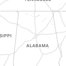
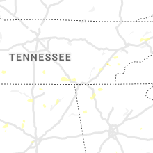


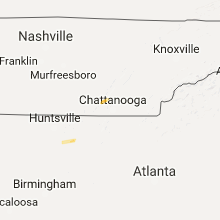


Connect with Interactive Hail Maps